draft environmental assessment north carolina …...2013/07/26 · draft environmental assessment...
TRANSCRIPT

Draft Environmental Assessment
North Carolina Highway Patrol VIPER Communications Tower – Rendezvous Mountain (HP-1228) Millers Creek, Wilkes County, North Carolina
North Carolina Department of Public Safety FEMA 2010-SS-T0-0075 March 2013

Document Prepared for DHS-FEMA
Prepared by: Tower Engineering Professionals, Inc.
3703 Junction Boulevard, Raleigh, North Carolina
Phone: (919) 661-6351 Fax: (919) 661-6350 Project No.: 100826.22-E

Site Name: Rendezvous Mountain (HP-1166) March 11, 2013
Page i
Table of Contents
ACRONYMS AND ABBREVIATIONS USED .......................................................................................................... iii
1.0 INTRODUCTION .................................................................................................................................................... 1
2.0 PURPOSE AND NEED ........................................................................................................................................... 1
3.0 ALTERNATIVES CONSIDERED ......................................................................................................................... 1
3.1 NO ACTION ............................................................................................................................................................. 1 3.2 PROPOSED ACTION .............................................................................................................................................. 2 3.3 OTHER ALTERNATIVES CONSIDERED AND DISMISSED .......................................................................... 2
4.0 AFFECTED ENVIRONMENT AND POTENTIAL IMPACTS ......................................................................... 3
4.1 EARTH RESOURCES ............................................................................................................................................. 6 4.1.1 Geology and Soils ................................................................................................................................................... 6 4.1.2 Air Quality ............................................................................................................................................................... 7 4.2 WATER RESOURCES ............................................................................................................................................ 7 4.2.1 Wild and Scenic Rivers ............................................................................................................................................ 7 4.2.2 Water Quality .......................................................................................................................................................... 8 4.2.3 Wetlands .................................................................................................................................................................. 8 4.2.4 Floodplains ............................................................................................................................................................. 9 4.3 BIOLOGICAL RESOURCES ................................................................................................................................. 9 4.3.1 Threatened and Endangered Species ...................................................................................................................... 9 4.3.2 Migratory Birds ....................................................................................................................................................... 9 4.3.3 Fish and Wildlife ................................................................................................................................................... 10 4.3.4 Vegetation ............................................................................................................................................................. 10 4.4 CULTURAL RESOURCES ................................................................................................................................... 11 4.4.1 Historic Properties ................................................................................................................................................ 11 4.4.2 American Indian/Cultural/Relegious Sites ............................................................................................................ 11 4.4.3 FCC Tower Construction Notification System ...................................................................................................... 12 4.4.4 State Historic Preservation Officer ....................................................................................................................... 12 4.4.5 Indian Tribal Consultation .................................................................................................................................... 13 4.4.6 Inadvertent Discovery ........................................................................................................................................... 14 4.5 SOCIOECONOMIC CONCERNS ....................................................................................................................... 14 4.5.1 Environmental Justice ........................................................................................................................................... 14 4.5.2 Noise ...................................................................................................................................................................... 15 4.5.3 Traffic .................................................................................................................................................................... 15 4.5.4 Public Service and Utilities ................................................................................................................................... 16 4.5.5 Public Health and Safety ....................................................................................................................................... 16 4.6 CUMULATIVE IMPACTS ................................................................................................................................... 16
5.0 AGENCY COORDINATION, PUBLIC INVOLVEMENT, AND PERMITS ................................................. 17
6.0 CONCLUSIONS .................................................................................................................................................... 17
7.0 LIST OF PREPARERS AND REVIEWERS ...................................................................................................... 18
8.0 REFERENCES ....................................................................................................................................................... 18

Site Name: Rendezvous Mountain (HP-1166) March 11, 2013
Page ii
FIGURES
Figure 1: Site Vicinity Map Figure 2: Topographic Map Figure 3: Site Plan Figure 4: Aerial Photograph Figure 5: FEMA Flood Insurance Rate Map Figure 6: National Wetlands Inventory Map Figure 7: Geologic Map Figure 8: Soils Map APPENDIX A – Site Photographs APPENDIX B – FCC NEPA Land Use Compliance Checklist APPENDIX C – NC DENR Air Pollution Response APPENDIX D – Unique and Prime Farmland Impact Rating Form APPENDIX E– DHS Public Notice APPENDIX F – Preparer’s Resume
Site Name: Rendezvous Mountain (HP-1166) March 11, 2013
Page iii
Acronym List
ACHP - Advisory Council on Historic Preservation
AGL - Above Ground Level
APE - Area of Potential Effects
A/C - Air Conditioning
BMP - Best Management Practices
CFR - Code of Federal Regulations
CJIN - Criminal Justice Information Network
dBA - Decibels (Acoustic)
DHS - Department of Homeland Security
EA - Environmental Assessment
EPA - Environmental Protection Agency
FAA - Federal Aviation Administration
FCC - Federal Communications Commission
FEMA - Federal Emergency Management Agency
FERC - Federal Energy Regulatory Commission
FIRM - Flood Insurance Rate Map
FONSI - Findings of No Significant Impact
FPPA - Farmland Protection Policy Act
HAP - Hazardous Air Pollutants
HP - Highway Patrol
HSGP - Homeland Security Grant Program
HVAC - Heating, Ventilation, and Air Conditioning
kW - Kilowatt
MPSCS - Michigan Public Safety Communications System

Site Name: Rendezvous Mountain (HP-1166) March 11, 2013
Page iiii
NAD 83 - North American Datum (1983)
NAVD 88 - North American Vertical Datum (1988)
NEPA - National Environmental Policy Act
NC - North Carolina
NCDENR - North Carolina Department of Environment and Natural Resources
NC SHPO - North Carolina State Historic Preservation Office
NHO - Native Hawaiian Organizations
NHPA - National Historic Preservation Act
NOx - Nitrogen Oxide
NPA - Nationwide Programmatic Agreement
NPDES - National Pollutant Discharge Elimination System
NPS RTCA - National Park Service Rivers, Trails and Conservation Assistance
NRHP - National Register of Historic Places
OSHA - Occupational Safety and Health Administration
PC - Public Comment
PIN - Parcel Identification Number
TCNS - Tower Construction Notification System
TEP - Tower Engineering Professionals, Inc.
THPO - Tribal Historic Preservation Office
USDA - United States Department of Agriculture
USFWS - United States Fish and Wildlife Service
USGS - United States Geological Survey
USPS - United State Postal Service
VIPER - Voice Interoperability Plan for Emergency Responders
VOC - Volatile Organic Compound

Site Name: Rendezvous Mountain (HP-1166) March 11, 2013
Page 1
1.0 INTRODUCTION
This Draft Environmental Assessment (EA) analyzes the likely environmental impacts of the proposed Voice Interoperability Plan for Emergency Responders (VIPER) communications tower (Rendezvous Mountain Communications Tower Project) in Millers Creek, Wilkes County, North Carolina. The Federal Emergency Management Agency (FEMA) may fund this project. FEMA and others prepared this Draft EA in accordance with the National Environmental Policy Act (NEPA) of 1969, the President’s Council on Environmental Quality regulations to implement NEPA, 40 Code of Federal Regulations (CFR) Parts 1500-1508, and FEMA’s NEPA implementing regulations 44 CFR Part 10. FEMA will use this EA’s findings and related Public Comments to determine whether to prepare an Environmental Impact Statement (EIS) or a Finding of No Significant Impact (FONSI) for the proposed project. The North Carolina Department of Public Safety – North Carolina Highway Patrol applied for Homeland Security Grant Program (HSGP) funds, administered by FEMA. HSGP is one of over 20 grant programs authorized by Congress and implemented to help strengthen the Nation against risks associated with potential terrorist attacks.
2.0 PURPOSE AND NEED
The Proposed Action’s purpose is to meet the North Carolina Highway Patrol’s radio frequency coverage needs in Wilkes County and parts of surrounding counties, to promote interoperability of Federal, State, and Local government public safety officials and first responders. According to the VIPER North Carolina State Legislative Report, dated December 2004, a VIPER communications network would provide Federal, State, and Local entities the following benefits, which are currently unattainable using existing communication systems: Seamless statewide voice communications for public safety officials and first responders Seamless interagency communications for public safety officials and first responders Unobstructed interagency communication of Federal, State, and, Local law enforcement
agencies Improved safety of public safety officials and first responders Improved public safety services for the citizens of North Carolina.
3.0 ALTERNATIVES CONSIDERED
3.1 NO ACTION
Under No Action, no action would be taken to improve communications between Federal, State, and Local public safety and first response offices and officials in Wilkes County, North Carolina

Site Name: Rendezvous Mountain (HP-1166) March 11, 2013
Page 2
and parts of surrounding counties. Current emergency communication systems would continue to operate less efficiently, which would continue to limit emergency responses. Current communications systems operated by many North Carolina State agencies, and local government agencies have multiple problems because of overcrowding of channels, outdated or unserviceable equipment, inadequate vendor support, unavailable replacement parts, and routine system failures. Routine communication system failures would require extensive funding to update existing equipment to meet federal mandates that require narrower bandwidths to conserve and more effectively use the existing frequency spectrum. Additionally, the existing communication systems used throughout Wilkes County are incompatible between State and Local agencies and first responders, which hinders collaborative efforts and interagency operability. This slows emergency and law enforcement response times, and may increase risks to the general population and public safety officials and first responders. The No Action alternative serves as the baseline to assess the likely impacts of the other project alternatives. The No Action Alternative would not address the needs of public safety officials, including the North Carolina Highway Patrol, first responders, or the citizens of Wilkes County.
3.2 PROPOSED ACTION
Under the Proposed Action, FEMA would fund construction of a VIPER Communications Tower in Millers Creek, Wilkes County, North Carolina. This Rendezvous Mountain Tower Project would be a 140-ft above ground level (AGL), self-supported communications tower, surrounded by an irregular shaped 37 ft x 20 ft x 51 ft x 30 ft x 36 ft x 21 ft security fenced tower compound. The fenced compound would include: one 11’ six” x 19’ equipment shelter and a stand-alone 80-kW diesel emergency generator mounted on a 5’ 6” x 9’ 6” concrete foundation pad (Figure 3). The proposed 140-ft tall self-supported communications tower would be built at a ground surface elevation of 2,549 ft AMSL (NAVD 88), for a total elevation that would enhance communications coverage. This strategically located site would significantly expand the communication coverage radius for Wilkes County, North Carolina and parts of surrounding counties, to enhance interoperable communications for public safety officials and first responders in that area.
3.3 OTHER ALTERNATIVES CONSIDERED AND DISMISSED
Three other project action alternatives were considered and dismissed. The Criminal Justice Information Network (CJIN) Governing Board evaluated these three alternatives, as well as the Proposed Action by to determine which alternative would most effectively meet State and Local governments’ radio communication coverage needs. The first alternative considered was a partnership communications system similar to that used by the State of South Carolina. South Carolina’s current system operates on the same system as the VIPER system (Motorola SmartZone 4.1). However, Motorola, Inc. owns and maintains South Carolina’s system and associated equipment. Due to the privatization of South Carolina’s system and the amount of funding needed to maintain and expand the existing system in South Carolina,

Site Name: Rendezvous Mountain (HP-1166) March 11, 2013
Page 3
Motorola, Inc. required user fees of $75 per radio. Due to the high user fees, many local government entities in South Carolina reportedly do not use the system. Therefore, the CJIN Governing Board dismissed this alternative from further consideration for the Rendezvous Mountain Communications Tower Project. The second alternative considered was a commercially based alternative communications system that was offered by Sprint/Nextel. This system would provide users with a commercial handset or radio/phone combination that used a public commercial radio system. The CJIN Governing Board dismissed this alternative from further consideration because it did not provide a viable and efficient statewide communications system with sufficiently complete coverage. The third alternative considered was a satellite based communications system. Satellite based systems are not susceptible to most dangers on or near the earth’s surface. However, they have many drawbacks, including: limited operation inside buildings or in densely vegetated areas, lengthy delays associated with long signal travel distances, and routine satellite orbit re-alignments and adjustments. Thus, the CJIN Governing Board dismissed this alternative from further consideration because the negatives outweighed the positives.
4.0 AFFECTED ENVIRONMENT AND POTENTIAL IMPACTS
The proposed Rendezvous Mountain Communication Tower Project would be located in the City of Millers Creek, in Wilkes County, North Carolina. The proposed tower site would be located at N 36º 13’ 52.0” latitude and W 81º 19’ 10.3” longitude (NAD 83), at an elevation of 2,549 ft AMSL (NAVD 88), as shown on the United States Geological Survey (USGS) Purlear, North Carolina 7.5 Minute Topographic Map (Figure 2). The project site is shown on a Google Earth aerial photograph (Figure 4). Wilkes County Tax Assessor records indicate the proposed site is on a 1,436-acre parcel with Parcel Identification Number 2000719. According to the Wilkes County Tax Assessor, the State of North Carolina owns this parcel. Wilkes County is located in western North Carolina, covers about 754 square miles, and the Town of Wilkesboro is the county seat. Wilkes County is east of Watauga County, whose County seat is the Town of Boone; and is west of Yadkin County, whose County seat is the Town of Yadkinville. In 2010, Wilkes County’s population was 69,430; Wilkesboro’s population was 3,128 (U.S. Census Bureau, 2010). The Proposed Action site is located on a 1,436-acre parcel that is mostly covered by mature hardwood forest. According to the North Carolina Department of Environment and Natural Resources (NCDENR) Natural Heritage Program online database, the proposed site is located next to part of the Rendezvous Mountain Educational State Forest. The proposed access drive would use an existing 12-ft wide earthen and graveled access road. The access road runs southeast from the end of Wyatt Road for about 3,988 ft before reaching the Proposed Action site (Figure 3).

Site Name: Rendezvous Mountain (HP-1166) March 11, 2013
Page 4
The table below summarizes the Proposed Action’s potential impacts and impact offsetting mitigation measures. After the table, any resources for which potential impacts were identified and those, which must be considered in EAs (wetlands, floodplains, threatened and endangered species and critical habitat, cultural resources, and Environmental Justice), are discussed in detail.
Table 1: Summary of Impacts Affected Environment/ Resource
No Impact
No Significant Impact
Significant Impact
Mitigation/Best Management Practices (BMPs)/Additional Information
Geology X N/A. Soil X Minor, temporary impacts
from soil erosion during construction. Required erosion control BMPs would be used, such as silt fences, wetting bare soil during construction, and vegetating bare soil after construction.
Prime and Unique Farmlands
X No prime, unique, or statewide or local important farmland on the project site.
Air Quality X Minor, temporary impacts from construction dust. Exposed soil would be wetted to control dust. Vehicle and equipment would be properly maintained and running times minimized to reduce emissions.
Wild and Scenic Rivers X No wild or scenic rivers in Wilkes County.
Water Quality X Minor, temporary impacts from downhill sedimentation during construction. Required soil erosion control BMPs would be used.
Wetlands X No wetlands are on or next to the project site.
Floodplains X No floodplains or Special Flood Hazard Areas are on the project site.

Site Name: Rendezvous Mountain (HP-1166) March 11, 2013
Page 5
Coastal Resources X N/A. Vegetation X Minor impacts on
vegetation from removal within the project site clearing limits; and post-construction grounds maintenance.
Fish and Wildlife X Minor, temporary impacts on wildlife during construction from noise and habitat disturbance, and post-construction grounds maintenance.
Threatened and Endangered Species
X N/A. One threatened or endangered species in Wilkes County, the Bog Turtle (Clemmys muhlenbergii). Project site does not have any suitable habitat.
Migratory Birds X Tower lighting would meet Federal Aviation Administration regulations. Tower would be under 500 feet (152 meters) high AGL and would not be located near known rookeries, nesting sites, and/or migratory bird flyways.
Historic Properties X In the unlikely event that human remains or cultural or archeological materials and/or artifacts are discovered, all work would stop immediately, and the appropriate authorities (NCSHPO and FEMA) contacted within one working day.
American Indian/Cultural/ Religious Sites
X No impact on archeological resources. However, in the unlikely event that human remains or cultural or archeological materials and/or artifacts are

Site Name: Rendezvous Mountain (HP-1166) March 11, 2013
Page 6
discovered, all work would immediately stop and agencies (NC SHPO and FEMA) will be contacted within one working day.
Socioeconomic Concerns
X N/A
Environmental Justice X No adverse impacts. The project would benefit all citizens in Wilkes County and parts of surrounding counties.
Public Health and Safety
X Improved interoperable communications in Wilkes County and parts of surrounding counties; thus, improved related public health and safety in these areas.
Noise X Minor, temporary noise impacts, from construction during working hours (7 a.m. to 5 p.m.); and from occasional, temporary operations and maintenance.
Infrastructure and Utilities
X N/A
Aesthetics and Visual Impacts
X N/A
4.1 EARTH RESOURCES
4.1.1 Geology and Soils
Geology would not be impacted by the Proposed Action and was not further evaluated (Geologic Map of North Carolina).
Vegetation clearing, grading, and excavating would temporarily expose soil, and thus temporarily increase soil erosion and downhill sedimentation. BMPs would be used during construction and would include: soil wetting to reduce erosion and dust production, installing silt and sediment control fencing, and seeding and wheat straw mulching of exposed soil. No prime, unique, Statewide or local important farmland is located on site (Appendix D – USDA Unique and Prime Farmland Impact Rating Form).

Site Name: Rendezvous Mountain (HP-1166) March 11, 2013
Page 7
4.1.2 Air Quality
Normal construction vehicles and equipment use would be during the normal working hours of 7 a.m. to 5 p.m. This would cause minor, short-term adverse impacts on air quality at and near the Proposed Action site. Criteria air pollutants would not exceed accepted levels, resulting in no significant impact to air quality. Construction vehicle and equipment would be properly maintained, and their use would be minimized. Proposed Action construction would expose about 0.06 acres or less of soil, which would probably not exceed the emissions limits for criteria pollutants or Hazardous Air Pollutants (HAP), and thus, would not significantly impact air quality. Proposed Action post-construction ambient air quality at and near the Proposed Action site would return to near pre-construction levels. The proposed 40 to 80kW emergency diesel powered generator, located within the tower compound, would be an intermittent, temporary emission source. Emission duration and frequency would be limited by generator use only during power outages and routine inspections. Also, Federal regulations limit backup generator use to 500 hours per year. Generators used at North Carolina Highway Patrol communication tower sites are Generac® Industrial Diesel Generators between 40kW and 80kW. According to Generac® product specification sheets, the generators are classified under Tier III of the EPA Emissions Compliance with an EPA Emissions Engine Reference of JDXL03.0113. Brendan Davey, North Carolina Department of Environment and Natural Resources (NCDENR), stated that emergency use generators are regulated under Title II of the Federal Clean Air Act. His response also indicated there are no Federal Regulations under the Clean Air Act for emergency use generators that have a rated capacity of less than 590-kW for diesel powered engines (Appendix F). The Proposed Action’s limited emergency generator use would not have any significant adverse air quality impacts from operations-related activities.
4.2 WATER RESOURCES
4.2.1 Wild and Scenic Rivers
The www.rivers.gov website indicates five Designated Wild and Scenic Rivers are located in North Carolina, but none are within Wilkes County. The nearest Designated Wild and Scenic River is part of the New River, located in southern Ashe County, NC, about eight miles northwest of the Proposed Action site. Also, the National Park Service Rivers, Trails, and Conservation Assistance (NPS RTCA) program identified no significant streams within Wilkes County. The Proposed Action would not notably affect any such wild or scenic rivers, or such significant streams.

Site Name: Rendezvous Mountain (HP-1166) March 11, 2013
Page 8
4.2.2 Water Quality
The nearest water body that the Proposed Action site drains into is located over 2,000 feet to the north and is named “Sandy Creek.” Proposed Action tower and compound construction would expose 3,984-ft2 (0.09-acres) for less than about three months, resulting in a minor increase of soil erosion and sediment laden runoff from the tower and compound site, staging sites, and the access road. Vehicle and equipment refueling may involve some spills of petroleum products. Since the facility would be less than one acre, an NPDES permit is not required (North Carolina General Statutes § 143‑215.1). Considering the small area of soil that would be exposed, short time soil would be exposed; low probability of spills, small size of most spills, and distance to the nearest water body, the Proposed Action’s construction would probably not significantly affect water quality. Any effects would be reduced or mitigated by using required erosion control BMPs, such as silt fences, straw bales, minimizing exposed soil for each activity, siting staging areas to minimize erosion, replanting as soon as practicable, mulching, temporary and/or permanent gravel covers, and limiting the number and speed of vehicles involved. Proposed Action’s post-construction operations impacts would be limited to minor soil erosion and downhill sedimentation until the site is fully revegetated, spills during generator refueling, and herbicide use for weed control in the tower compound and on the gravel access road. Potential water quality impacts from a fuel spill, or from herbicide spill or application, would be minor due to the limited occurrences annually and the small amounts that would be involved. The BMPs mentioned above would continue until the tower compound site is fully revegetated. If required, a Spill Plan will be developed and followed to guide the required response in case of spills. However, under authority of Section 311 (j)(l)(C) of the Federal Water Pollution Act (Clean Water Act) in Title 40, Code of Federal Regulations, Part 112 (40 CFR 112), a facility is not regulated under the SPCC Spill Prevention Plan if the aggregate aboveground storage tank capacity is under 1,320 gallons. The Proposed Action construction and operation’s effects on water chemical, physical, and biological characteristics are not expected to violate water quality standards and criteria. Thus, the operations are not expected to significantly affect water quality.
4.2.3 Wetlands
Presidential Executive Order (EO) 11990 (wetlands protection) requires federal agencies to take action to minimize wetlands loss. The NEPA compliance process also requires federal agencies to consider their funding actions’ potential impacts on wetlands. National Wetland Inventory (NWI) maps indicate the Proposed Action site does not have any wetlands (Figure 6). The Proposed Action would not have any notable impact on any wetlands.

Site Name: Rendezvous Mountain (HP-1166) March 11, 2013
Page 9
4.2.4 Floodplains
The Proposed Action site is not located in a jurisdictional floodplain, based upon review of FEMA Flood Insurance Rate Map (FIRM) Panel #3710390000J, dated 3/2/2009 (Figure 5). The Proposed Action construction and operation, by their location and nature, would not affect any jurisdictional floodplains.
4.3 BIOLOGICAL RESOURCES
4.3.1 Threatened and Endangered Species
In accordance with the Endangered Species Act of 1973 (ESA) Section 7, any federal agency that funds, authorizes, or carries out an action must ensure their action is not likely to jeopardize the continued existence of any threatened or endangered species, or result in the destruction or adverse modification of their designated critical habitats. One such federally listed species, the Bog Turtle (Clemmys muhlenbergii) is known to occur in Wilkes County (USFWS website, 10/22/2010). The Proposed Action site does not have suitable habitat for the Bog Turtle. Thus, the Proposed Action would not affect any federally listed species (USFWS, 1/20/2011; in Appendix B).
4.3.2 Migratory Birds
The Proposed Action construction and operations would have short- and long-term minor impacts on migratory birds. The tower would be self-supporting, only about 140 feet (42.7 m) high above ground level (AGL). No burrows, nests, rookeries, or other signs of migratory bird species or critical habitat were apparent during Tower Engineering Professional’s (TEP) site inspection on 10/21/2010. Impacts on migratory birds could occur from short-term use of portable cranes to build the tower and install the antennas, ventilation, and air conditioning (HVAC) equipment. Impacts on migratory birds have been found to occur due to birds’ collisions with communications towers, antennas, guy wires (not applicable for this project), and other tall structures, particularly during periods of low visibility and as a result of tower lighting that may attract or distract some species. Variables such as tower height above surrounding trees, design, lighting, seasons, adjacent land features, and migratory patterns would affect the potential and degree of adverse impacts on migratory birds. The probability of migratory bird collision is difficult to determine programmatically because of the widely ranging variables that affect the potential for collision and the lack of conclusive data on collision causes.

Site Name: Rendezvous Mountain (HP-1166) March 11, 2013
Page 10
However, a study conducted by Joelle Gehring, Central Michigan University-Biology Department, Avian Collision Study Plan for the Michigan Public Safety Communications System (MPSCS), concluded “Though there are fewer tall towers than towers in the 116 to 146 m AGL height range, towers >305 m (1000.7 feet) AGL are responsible for several times the number of fatalities than shorter towers.”
4.3.3 Wildlife and Fish
Common small mammals, amphibians, insects, and other fauna species typical in western North Carolina may be found on the Proposed Action site, which is currently a mature hardwood forest. Based on information from Wilderness.net and the U.S. Wilderness Areas Map, the Proposed Action site is not located in or next to a designated Wilderness Area. According to correspondence with the USFWS (01/20/2011), the site is not located in or next to an USFWS managed wildlife refuge area. Proposed Action construction would include clearing some of the site’s vegetation using heavy equipment, which could temporarily affect individual small mammals and amphibians nearby. Based on the small area of construction disturbance, these impacts would be temporary and limited to individual mammals, amphibians, insects, and other fauna. This construction would not significantly affect wildlife species’ overall populations. Proposed Action operations and maintenance would include mowing vegetation around the fenced compound and along the access drive edges. Mowing in these small areas would keep vegetation in early ecological successional stages of plant community development and prevent reestablishment of some plant species. Facility operations would cause minor habitat degradation and occasional mortality of some wildlife species (e.g., amphibians and small mammals) individuals on the site. After completion of site development, potentially adverse impacts on wildlife species sensitive to disturbance could result from temporary noise generated by heating and air condition equipment, or the emergency generator. This recurring, temporary, low level disturbance could exclude some wildlife species, or promote colonization by some disturbance tolerant wildlife species. The Proposed Action construction, operations, and maintenance would not have any significantly adverse impacts on wildlife or wildlife habitat.
4.3.4 Vegetation
The Proposed Action site is located in mixed white pine/hardwood woodlands within the Rendezvous Mountain State Educational Forest. The NCDENR Natural Heritage Program online database shows the Proposed Action site is next to an identified “Significant Natural Area” associated with the Rendezvous Mountain State Educational Forest.

Site Name: Rendezvous Mountain (HP-1166) March 11, 2013
Page 11
Tower facility construction would include mechanized clearing of about 0.06 acres of site vegetation. Tower facility operations and maintenance would include mowing vegetation around the fenced compound and along the access drive edges. The Proposed Action construction, operations, and maintenance would not have any significant adverse impacts on vegetation elsewhere on the parent property, or on significant natural areas associated with the Rendezvous Mountain State Educational Forest.
4.4 CULTURAL RESOURCES
4.4.1 Historic Properties
The proposed project would not have an adverse effect on historic and archeological resources and therefore is in compliance with the National Historic Preservation Act (NHPA) Section 106, and 36 CFR Part 800 (Protection of Historic Properties). Historic properties are properties included in the National Register of Historic Places or that meet National Register listing criteria. The Federal Communications Commission (FCC) is required under the National Historic Preservation Act (NHPA) to consider impacts that proposed communications tower facilities, operating with a FCC license, may have on historic properties. On October 23, 2009, the Advisory Council on Historic Preservation (ACHP) issued a Program Comment (PC) for “Streamlining the Section 106 Review for Wireless Communications Facilities Construction and Modification Subject to Review Under the FCC National Programmatic Agreement (NPA) and/or the NPA for Collocation of Wireless Antennas.” According to the ACHP PC, FEMA is not required to conduct and complete its own Section 106 review process (no duplication of efforts). Therefore, the Section 106 review conducted as part of the FCC NEPA review is described in this EA and no additional Section 106 review was conducted or required by FEMA. 4.4.2 FCC Nationwide Programmatic Agreement To assist with the NHPA Section 106 review process, the FCC developed and instituted the Tower Construction Notification System (TCNS) using Form(s) 620/621. Form 620 is used to submit site specific information and records of Local government consultations with the State Historic Preservation Officer (SHPO), and for American Indian Tribes through the Tribal Historic Preservation Officers (THPOs), for proposed communications tower facilities. Form 621 is also used for submitting site specific information and records of Local government consultations with the SHPO, for proposed collocations of antennas on existing communications towers or non-tower structures such as buildings, elevated water tanks, and electric transmission towers. TEP used the FCC TCNS system to notify SHPO and the THPOs of the Proposed Action on 1/7/2011 and was assigned TCNS# 72352 for the proposed Rendezvous Mountain Communication Tower Project site. 4.4.3 FCC Tower Construction Notification System TCNS is available through the Internet at https://wireless2.fcc.gov/ulsclogin/index.htm and requires an identification number or FRN. Using TNCS, entities can input site specific

Site Name: Rendezvous Mountain (HP-1166) March 11, 2013
Page 12
information on a proposed communications facility, regarding its location, structure type, and structure height with and without appurtenances. Information inserted into TCNS is then made available to the applicable SHPOs and THPOs that have expressed interest in a specified geographic area.
4.4.4 State Historic Preservation Officer
TEP consulted the SHPO and the NC Office of State Archeology to view the applicable USGS 7.5-minute topographic quadrangle maps (Purlear) to assess potential significant impacts on architectural, historic, or archeological sites near the Proposed Action. In addition, TEP contracted Environmental Services, Inc., a cultural resources consulting firm, to perform a Phase I Archaeological Evaluation, to make an assessment of the potential direct effects the proposed action may have on archaeological resources. The Archaeological Evaluation concluded that no archaeological resources eligible for inclusion in the National Register of Historic Places would be affected by the proposed Rendezvous Mountain Communication Tower Project. In addition, the evaluation concluded that no additional archaeological investigation was recommended for this project. Further, TEP received concurrence from Ms. Renee Gledhill-Earley of NC Dept. of Cultural Resources-Environmental Review Coordinator and Ms. Susan G. Myers of NC Dept. of Cultural Resources: Office of State Archaeology-Project Registrar, regarding the proposed project on 2/7/2011 for FCC requirements that included a 0.5 mile visual Area of Potential Effects (APE) (Appendix C).
4.4.5 American Indian/Cultural/Religious Sites
The TCNS system notified seven American Indian Tribes that expressed interest in Wilkes County, North Carolina: Eastern Band of Cherokee Indians, Tuscarora Nation, Cherokee Nation, United Keetoowah Band of Cherokee Indians, Eastern Shawnee Tribe of Oklahoma, Shawnee Tribe, and Catawba Indian Nation. TEP used the provided TCNS tribe list to contact these Tribes a second time, on 1/18/2011, to obtain additional information on the Proposed Action. All Tribes concurred with the Proposed Action (Appendix E). TEP sent follow-up notification letters on and 1/17/2011 and 1/18/2011 to each American Indian Tribe (if needed) identified by the TCNS system. Under the FCC NPA, all American Indian Tribes that have indicated interest in the area are required to respond within 30 days of receiving notification. If a response is not received within that timeframe, then a second “follow-up” notification is done to obtain response. When no response is received after the “follow-up” notification, then the FCC must be notified and interagency consultations are done with the non-responsive Tribe or NHO. Sections 4.4.5.1 through 4.4.5.7 summarize the consultations. 4.4.5.1 Eastern Band of Cherokee Indians TEP provided a follow-up notification letter to Ms. Yolanda Saunooke of the Eastern Band of Cherokee Indians on 1/17/2011 by email. TEP received concurrence from the Eastern Band of Cherokee Indians by email and through the FCC TCNS System on 1/19/2011 that stated, “The

Site Name: Rendezvous Mountain (HP-1166) March 11, 2013
Page 13
EBCI THPO concurs with the archeologist’s recommendations that no archeological sites eligible for inclusion on the National Register of Historic Places were encountered during the recent phase I archeological field survey. It is the opinion of the EBCI THPO that no cultural resources important to the Cherokee people will be adversely affected by the proposed undertaking. As such, the proposed undertaking may proceed as planned. In the event that construction plans change, or cultural resources or human remains are encountered during the construction phase, all work should cease, and this office notified to continue consultation as mandated under Section 106 of the NHPA.” (Appendix B). 4.4.5.2 Tuscarora Nation TEP provided no follow-up notification to the Tuscarora Nation as the TNCS states “If the Applicant/tower builder receives no response from the Tuscarora Nation within 30 days after notification through TCNS, the Tuscarora Nation has no interest in the participating in the pre-construction review for the site. The Applicant/tower builder, however, must IMMEDIATELY notify the Tuscarora Nation in the event archaeological properties or human remains are discovered during construction. On 1/7/2011, the TCNS system notified all Tribes that indicated interest in Wilkes County, NC. The 30-day comment period ended on 2/7/2011. TEP received no response from the Tuscarora Nation before issuance of this Draft EA and no additional consultation was required. 4.4.5.3 Cherokee Nation TEP provided a follow-up notification letter to Dr. Richard Allen of the Cherokee Nation on 1/17/2011 by email. TEP received concurrence from the Cherokee Nation by email on 2/15/2011 that stated, “The Cherokee Nation has no knowledge of any historic, cultural or scared sites within the affected area. Should any ground disturbance reveal an archeological site of human remains, we ask that the all activity cease immediately and the Cherokee Nation and other appropriate agencies be contacted immediately.” (Appendix B). 4.4.5.4 United Keetoowah Band of Cherokee Indians TEP provided a follow-up notification letter to Ms. Lisa C. LaRue-Stopp of the United Keetoowah Band of Cherokee Indians on 1/18/2011 by email. TEP received concurrence from the United Keetoowah Band of Cherokee Indians by email on 1/24/2011 that stated, “This location is in our historic interest area, but we have no objections. However if any human remains and/or associated funerary items are inadvertently discovered, please cease work immediately and contact us at 918-822-1952.” (Appendix B). 4.4.5.5 Eastern Shawnee Tribe of Oklahoma TEP provided no follow-up notification to the Eastern Shawnee Tribe of Oklahoma as the TNCS system states, “If you, the Applicant/tower constructor, do not receive a response from us, the Eastern Shawnee Tribe of Oklahoma, within 30 days from the date of the TCNS notification, then you may conclude that we do not have an interest in the site. However, if archeological resources or remains are found during construction, you must immediately stop construction and notify us of

Site Name: Rendezvous Mountain (HP-1166) March 11, 2013
Page 14
your findings in accordance with the FCC’s rules. (See 47 C.F.R. § 1.1312(d))” On 1/7/2011, the TCNS system notified all Tribes that indicated interest in Wilkes County. The 30-day comment period ended on 2/7/2011. TEP received no response from Eastern Shawnee Tribe of Oklahoma before the issuance of this Draft EA and no additional consultation was required. 4.4.5.6 Shawnee Tribe TEP provided follow-up notification to Ms. Kim Jumper of the Shawnee Tribe on 1/18/2011, by standard U.S. mail. TEP received concurrence from the Shawnee Tribe on 2/11/2011, that stated; “The Shawnee Tribe’s Tribal Historic Preservation Officer concurs that no known historic properties will be negatively impacted by construction of this tower site (see memo line above for TCNS number/s). The Shawnee Tribe’s archives do not reveal any issues of concern at this tower location. In the event that archaeological materials are encountered later during construction, use, or maintenance of this tower location, please re-notify us at that time as we would like to resume consultation under such a circumstance. …..” (Appendix B). 4.4.5.7 Catawba Indian Nation TEP provided a follow-up notification to Ms. Wenonah Haire of the Catawba Indian Nation Tribal Historic Preservation Office on 1/18/2011, by standard U.S. mail. TEP received concurrence from the Catawba Indian Nation on 1/24/2011 that stated, “The Catawba have no immediate concerns with regard to traditional cultural properties, scared sites, or Native American archaeological sites within the boundaries of the proposed project areas. However, the Catawba are to be notified if Native American artifacts and/or human remains are located during the ground disturbance phase of this project.” (Appendix B). 4.4.6 Inadvertent Discovery In the unlikely event that project activities result in the inadvertent discovery of human remains, cultural or archeological materials, all ground-disturbing activities will immediately stop and all appropriate agencies, such as FEMA, NC SHPO, and THPOS will be contacted within one working day.
4.5 SOCIOECONOMIC CONCERNS
4.5.1 Environmental Justice
Presidential Executive Order (EO) 12898, “Federal Actions to Address Environmental Justice in Minority Populations and Low-Income Populations.” directs federal agencies “to make achieving environmental justice part of its mission by identifying and addressing, as appropriate, disproportionately high and adverse human health or environmental effects of its programs, policies, and activities on minority populations and low income populations in the United States.”. The Proposed Action would not adversely affect any low-income or minority populations. It would positively affect all segments of the population of all populations in Wilkes County, NC by improving emergency services communications.

Site Name: Rendezvous Mountain (HP-1166) March 11, 2013
Page 15
4.5.2 Noise
The Proposed Action in a rural part of Wilkes County is primarily with low density residential land use. The ambient noise levels associated with rural residential areas would be anticipated to reach between 35 and 45 dBA (FERC 2002, EPA 1978). The Proposed Action would temporarily increase local noise during construction. The amount and type of noise disturbance would vary depending on the type of machinery used, distance from the construction site and noise source, construction schedule and duration, and site specific, and area specific conditions. Heavy machinery use may result in temporary, minor adverse impacts on nearby low-density residences. The nearest residence from the proposed tower site and noise source is about 2,600 feet to the west-northwest. This residence is separated from the Proposed Action site by about 2,400 feet of dense forest and is about 400 feet in elevation below the Proposed Action site. Construction-related noise would typically occur during normal working hours (7:00 a.m. to 5:00 p.m.) and for about five weeks. Noise levels at 50 feet or more from the proposed construction site should be under 85 dBA. Noise levels before and after construction would likely drop to the ambient noise levels of the project area. Construction noise levels would be temporary (no more than eight hours during weekdays for a total of about five weeks). Noise levels at 50 feet or more from the Proposed Action site should be under 85 dBA. These noise levels would be partly masked by trees and other vegetation around the site. Thus, construction noise levels would not be significant. The project area’s ambient noise levels would return to normal after the proposed construction is finished. Temporary operations-related noise increases would be caused by the proposed project’s two air conditioning (A/C) and heating units and emergency generator. The A/C units regulate the equipment shelter’s internal temperature and the diesel fueled emergency generator provides electric power to the facility, as needed, in emergency situations, when the normal supply of electrical power would be interrupted. The Proposed Action would include use of a 40- to 80-kW diesel fueled emergency generator that produces noise levels of about 80 dBA at 23 feet from the source. This generator would not increase site ambient noise levels due to use only during power outages and routine maintenance and tests. Federal regulations limit emergency generator use to 500 hours per year. Thus, the Proposed Action would not have significant long-term noise impacts.
4.5.3 Traffic
The Proposed Action would have minimal impact on traffic during construction. The existing site has traffic patterns typical in rural residential and agricultural areas. Existing roads would be used as much as possible during construction and during normal operations. Traffic flow and control during construction would meet all local and State traffic requirements. Proposed Action construction and operations traffic would not significantly impact local traffic or transportation networks.

Site Name: Rendezvous Mountain (HP-1166) March 11, 2013
Page 16
4.5.4 Public Service and Utilities
The Proposed Action area has existing electricity and communications utilities along Wyatt Road that would provide electrical and telephone services for the Proposed Action. Proposed Action construction and operations impacts are not expected to lead to supply shortages or require utility system changes. Impacts on utilities would not be significant.
4.5.5 Public Health and Safety
The Proposed Action would involve construction within a forested part of an approximately 1,436 acre parcel. Based on the proposed antenna’s elevation (over 10 meters AGL) and because the site would be located within a restricted area protected by fencing and appropriate signage, radio frequency emissions would not adversely affect human health or safety. Also, implementation of worker safety rules, per Occupational Safety and Health Administration safety and health standards, would establish a uniform set of safety practices and procedures to protect workers. Construction related impacts to human health and safety would not be significant.
Under the authority of Section 311 (j) (l) (C) of the Federal Water Pollution Act (Clean Water Act) in Title 40, Code of Federal Regulations (CFR), Part 112, a facility is not regulated under the SPCC Spill Prevention Plan if the total aboveground storage tank capacity is under 1,320 gallons. The Proposed Action operations would not have a significant impact on human health and safety, but would have a substantial positive impact on human health and safety. Operations would have substantial positive impact on public health and safety from improved public safety and emergency communications for Wilkes County and parts of surrounding counties.
4.6 CUMULATIVE IMPACTS
Cumulative impacts are an individual action’s environmental impacts when combined with the environmental impacts of other actions in the past, present, and foreseeable future (about 20 years). Cumulative impacts result from individually less than significant impacts, but collectively significant impacts that occur over time and apply to a given resource type or area of concern. The North Carolina Highway Patrol has built 63 of the proposed 119 new tower sites associated with complete VIPER Network. According to information from the FCC Antenna Structure Registration (ASR) System, there are currently 4,584 registered towers in North Carolina, including the 63 “active” VIPER network towers. After VIPER network system completion, with construction of the last 56 new towers, the number of registered communications towers, if no other providers construct new tower sites and no towers are damaged or destroyed, would be 4,606. The proposed 119 VIPER network towers, including the 56 towers remaining to be built would result increase the number of communications towers in North Carolina by about 0.48%. The Proposed Action’s purpose to meet the North Carolina Highway Patrol’s current radio

Site Name: Rendezvous Mountain (HP-1166) March 11, 2013
Page 17
frequency coverage requirements in Wilkes County and parts of surrounding counties; and the need is to protect the lives, property, environment, and quality of life for over 69,000 people. The Proposed Action would not have any significant cumulative impacts on any resource area within the parameters described in Section 4 of this Draft EA. Any construction or operation related impact on any resource would be minor and temporary.
5.0 AGENCY COORDINATION, PUBLIC INVOLVEMENT AND PERMITS
TEP contacted the Rendezvous Mountain Educational State Forest, Wilkes County Planning Department, and the Wilkesboro Historic Preservation Society regarding the Proposed Action by USPS mail on 1/17/2011, inviting them to be a consulting party regarding any potential impact to historical or archaeological resources in the area. TEP received no response to those notices as of the publication of this Draft EA. TEP also published a Public Notice in the “Wilkes Journal Patriot” newspaper on 1/10/2011 and 3/7/2012, regarding any impacts the Proposed Action may have on historic resources within the APE. TEP received no responses to the Public Notices or letters requesting comments as of the issuance of this Draft EA.
6.0 CONCLUSIONS
The Proposed Action would require construction of a new radio transmitting and receiving, self-supporting tower over 200 feet AGL, thus this site specific FEMA HSGP NEPA EA was required. The Proposed Action would not involve any unusual risks or impacts to resources discussed in Section 4 of this Draft EA. Under the No Action Alternative, there would not be complete interoperable communications capability in Wilkes County, North Carolina and parts of surrounding counties. Existing public safety interoperable communications gaps would continue and adversely impact public health and safety. In accordance with 47 CFR Section 1.1307 (a)(1) through (8), an evaluation was made to determine if any of the listed FCC special interest items would be significantly affected if a tower and/or antenna and associated equipment control cabinets were constructed at the Proposed Action site. No FCC special interest items were identified that would require an FCC NEPA EA (Appendix E). If there are no significant, validated negative Public Comments about this Proposed Action’s impacts, as described in this Draft EA, by the end of this Draft EA’s Public Comment Period, then this Draft EA will become the Final Environmental Assessment and FEMA Region IV will issue a “Finding of No Significant Impact” (FONSI) for this Proposed Action.

Site Name: Rendezvous Mountain (HP-1166) March 11, 2013
Page 18
7.0 LIST OF PREPARERS
Document Preparers: Principal Investigator George T. Swearingen, III, Environmental Division Manager, Tower Engineering Professionals, Inc. Others Ryan A. Malek, Environmental Scientist, Tower Engineering Professionals, Inc. Andrew B. Blake, Environmental Scientist, Tower Engineering Professionals, Inc. Document Reviewers: William R. Straw, PhD, Regional Environmental Officer Mary Rountree, Floodplain Management Specialist, FEMA Region IV Fred M. Holycross, FEMA GPD EHP Coordinator
8.0 REFERENCES
AIRNow - North Carolina Air Quality, 2012. Local Air Quality Conditions and Forecasts http://www.airnow.gov/index.cfm?action=airnow.local_state&stateid=34&tab=0, Accessed April 17, 2012. ASR Registration Search, Federal Communications Commission, 2012. Available at: http://wireless2.fcc.gov/UlsApp/AsrSearch/asrResults.jsp?searchType=TRL, 2012, Accessed April 4, 2012. CAMA Permits - Federal Consistency, North Carolina Division of Coastal Management, 2012. Available at: http://dcm2.enr.state.nc.us/permits/consist.htm, 2012 Accessed March 23, 2012. Climate in Millers Creek, North Carolina, Bestplaces.net, 2012. Available at: http://www.bestplaces.net/climate/city/north_carolina/millers_creek, 2012, Accessed April 17, 2012. Dangerous Decibels, 2001. Information Center: Frequently Asked Questions. Available at: http://www.dangerousdecibels.org/faq.cfm, Accessed March 22, 2012. Department of Agriculture (United States Department of Agriculture), 2000. Natural Resources Conservation Service. Acres of Prime Farmland, 1997, revised December 2000. Department of Agriculture, Web Soil Survey, http://websoilsurvey.nrcs.usda.gov, Accessed April 5, 2012.

Site Name: Rendezvous Mountain (HP-1166) March 11, 2013
Page 19
Department of Natural Resources and Community Development. Geologic Map of North Carolina. [map]. 1:500,000. Raleigh, NC.: The North Carolina Geological Survey, 1985. Dublin (City of Dublin, Ohio, Land Use and Long Range Planning), 2008. Land Use Definitions. Available at: http://www.dublin.oh.us/planning/pdf/LandUseDefinitions.pdf, Accessed February 9, 2010. Environmental Protection Agency, 2008. Map of EPA Region 6 Sole Source Aquifers. January 30, 2008 Federal Emergency Management Agency, Federal Insurance Administration, National Flood Insurance Program, Flood Insurance Map, Community 371039, Panel Number 0000J, dated March 2, 2009. Environmental Protection Agency (United States Environmental Protection Agency), 1974. Air and Radiation: Noise Pollution. Available at: http://www.epa.gov/air/noise.html, Accessed March 22, 2012. Environmental Protection Agency (United States Environmental Protection Agency), 1974. Protective Noise Levels, Condensed Version of EPA’s Information on Levels of Environmental Noise Requisite to Protect Public Health and Welfare with an Adequate Margin of Safety. EPA/ONAC 550/9-74-004, March, 1974. Available at: http://nonoise.org/library/levels/levels.htm, Accessed March 22, 2012. Federal Energy Regulatory Commission, California State Lands Commission February 2002. Draft Environmental Impact Statement/Environmental Impact Report Kern River 2003 Expansion Project. FWS (United States Fish and Wildlife Service), 2007. Consultations with Federal Agencies Section 7 of the Endangered Species Act. February 2007. Gehring J., 2003. “Avian Collision Study Plan for the Michigan Public Safety Communications System (MPSCS): Assessing the Role of Lighting, Height, and Guy Wires in Avian Mortality Associated with Wireless Communications and Broadcast Towers”,September 2003. Geological Survey (United States Geological Survey) – 7.5 Minute Topographic Quadrangle of Purlear, North Carolina, 2002. Griffith G.E., Omernik J.M., 2009. The Encyclopedia of Earth: Ecoregions of North Carolina and South Carolina. Available at: http://www.eoearth.org/article/Ecoregions_of_North_Carolina_and_South_Carolina_(EPA), Accessed March 22, 2012. Hearing Planet, 2010. Dangerous Decibel Levels. Available at: http://www.hearingplanet.com/article-dangerous-decibel-levels.php, Accessed March 22, 2012. Heritage Data, 2012. North Carolina Natural Heritage Program. Available at: http://www.ncnhp.org/Pages/heritagedata.html, Accessed April 27, 2012.

Site Name: Rendezvous Mountain (HP-1166) March 11, 2013
Page 20
IWGSDI (Interagency Working Group on Sustainable Development Indicators), 1996. Agricultural Land and Categories. June 1996. Available at: http://www.hq.nasa.gov/iwgsdi/Agricultural_Land.html, Accessed March 22, 2012. Millers Creek, North Carolina (NC 28651) profile, city-data.com, 2012. Available at: http://www.city-data.com/city/Millers-Creek-North-Carolina.html, Accessed April 17, 2012 National Wild & Scenic Rivers, 2012. Available at: http://rivers.gov/wildriverslist.html, 2012, Accessed April 17, 2012. National Wildlife Refuge System Administration Act, United States Fish and Wildlife Service, 2012. Available at: http://www.fws.gov/laws/lawsdigest/NWRSACT.HTML, 2012, Accessed March 21, 2012. NC DCM - CAMA Counties, North Carolina Division of Coastal Management, 2012. Available at: http://dcm2.enr.state.nc.us/cama_counties.htm, 2012, Accessed March 23, 2012. NOAA Office of Ocean and Coastal Resource Management: My State: North Carolina, 2012. Available at: http://coastalmanagement.noaa.gov/mystate/nc.html, 2012 Accessed March 23, 2012. North American Migration Flyways, 2012. Available at: http://www.birdnature.com/flyways.html, Accessed March 23, 2012. North Carolina Department of Crime Control and Public Safety: VIPER, 2008. Voice Interoperability Plan for Emergency Responders. July 2008. Available at: http://www.nccrimecontrol.org, Accessed March 22, 2012. North Carolina Segments from Rivers, Trails & Conservation Program, National Park Service, 2012. Available at: http://www.nps.gov/ncrc/programs/rtca/nri/states/nc.html, 2012, Accessed April 17, 2012. NPS, 2008. Technical Assistance Manual: Compliance with the National Environmental Policy Act and the National Historic Preservation Act. March 2008. National Park Service Intermountain Region, Denver, Colorado. Scorecard: The Pollution Information Site, 2005. Criteria Air Pollutant Report: Wilkes County, North Carolina. Available at: http://scorecard.goodguide.com/community/index.tcl?zip_code=28651&set_community_zipcode_cookie_p=t&x=9&y=4, Accessed April 17, 2012. Species Profile for bog turtle (Clemmys (Glyptemys) muhlenbergii), United States Fish and Wildlife Service, 2012. Available at: http://ecos.fws.gov/speciesProfile/profile/speciesProfile.action?spcode=C048, Accessed July 16, 2012.

Site Name: Rendezvous Mountain (HP-1166) March 11, 2013
Page 21
United States Department of Homeland Security, 2010, Homeland Security Grant Program Guidance and Application Kit, February 2010. Available at: http://www.citizencorps.gov/downloads/pdf/news/fy10_hsgp_guidance.pdf, Accessed April 17, 2012. USCG (United States Coast Guard), 2006. Programmatic Environmental Impact Statement (PEIS) for Implementation of the USCG NAIS Project. October 2006. Wilkesboro, North Carolina (NC 28697) profile, 2012. City-Data. Available At: http://www.city-data.com/city/Wilkesboro-North-Carolina.html, Accessed April 27, 2012. Wilkes County QuickFacts from the US Census Bureau, 2012. Available at: http://quickfacts.census.gov/qfd/states/37/37193.html, 2012 Accessed April 17, 2012.

FIGURES

Figure 1: Site Vicinity Map

DeLorme Street Atlas USA® 2011
Rendezvous Mountain (HP-1228)
Data use subject to license.
© DeLorme. DeLorme Street Atlas USA® 2011.
www.delorme.com
TN
MN (7.3°W)
0 600 1200 1800 2400 3000
0 200 400 600 800 1000
ftm
Scale 1 : 25,000
1" = 2,083.3 ft Data Zoom 13-0

Figure 2: Topographic Map

Topo North America™ 9
Data use subject to license.
© DeLorme. Topo North America™ 9.
www.delorme.com
TN
MN (7.3°W)
0 600 1200 1800 2400 3000
0 200 400 600 800 1000
ftm
Scale 1 : 24,000
1" = 2,000.0 ft Data Zoom 13-0

Figure 3: Site Plan

feet
meters
200
80

PROJECT TEAM
CODE COMPLIANCE
T-1 0INDEX OF SHEETS
SHEET DESCRIPTION
UTILITY STATEMENT
100826
SITE NAME: HIGHWAY PATROL
0 03-08-12 PRELIMINARY CONSTRUCTION
TRG JBG
REV
DO NOT U
SE FOR
CONSTRUCTION
PRELIMIN
ARY
SITE ADDRESS:
PROPOSED
2010-ASO-3434-OEAERONAUTICAL STUDY NO:
APPLICANT / LESSEE:
DRIVING DIRECTIONS PROJECT SUMMARY
1-A CERTIFICATION
UTILITIES:
PROPERTY OWNER:
N
APPLICANT/ TOWER OWNER:
VICINITY MAP
TELECOMMUNICATIONS FACILITY
585 WYATT ROADMILLERS CREEK, NC 28651
(WILKES COUNTY)
U.S. Cellular
SITE NAME: MILLERS CREEKSITE #: 766310
RENDEZVOUS MOUNTAIN
TOWER MANUFACTURER:
CIVIL ENGINEER:
STRUCTURAL ENGINEER:
ELECTRICAL ENGINEER:
GEOTECHNICAL ENGINEER:
SURVEYOR:
SITE #: HP-1228SCO ID #: 09-07591-01H

0
SITE # HP-1228SCO ID # 09-07591-01H
100826
0 03-08-12 PRELIMINARY CONSTRUCTION
DO NOT U
SE FOR
CONSTRUCTION
PRELIMIN
ARY
TRG JBG
C-1SITE PLAN
SITE PLAN
NOTES:
LEGEND
SITE PLAN OVERVIEW
WATER SUPPLY NOTE:

0
SITE # HP-1228SCO ID # 09-07591-01H
100826
0 03-08-12 PRELIMINARY CONSTRUCTION
DO NOT U
SE FOR
CONSTRUCTION
PRELIMIN
ARY
TRG JBG
C-2LEGAL DESCRIPTION
LEGAL DESCRIPTION
LEGEND LEGAL DESCRIPTION 2,520 SQ. FT.LEASE AREA PARCEL "A"
NOTE:

0
SITE # HP-1228SCO ID # 09-07591-01H
100826
0 03-08-12 PRELIMINARY CONSTRUCTION
DO NOT U
SE FOR
CONSTRUCTION
PRELIMIN
ARY
TRG JBG
C-3COMPOUND DETAIL
COMPOUNDDETAIL

AN
TEN
NA
MO
UN
T N
OTE
:
NO
TES:
AN
SI/T
IA-2
22-G
DES
IGN
NO
TE:
0
SITE # HP-1228SCO ID # 09-07591-01H
100826
0 03-08-12 PRELIMINARY CONSTRUCTION
DO NOT U
SE FOR
CONSTRUCTION
PRELIMIN
ARY
TRG JBG
C-4
TOWERELEVATION
TOW
ER E
LEVA
TIO
N

Figure 4: Aerial Photograph


Figure 5: FEMA Flood Insurance Rate Map


Figure 6: National Wetland Inventory Map

RendezvousMountain
Jul 10, 2012
This map is for general reference only. The US Fish and Wildlife Service is notresponsible for the accuracy or currentness of the base data shown on this map. Allwetlands related data should be used in accordance with the layer metadata found onthe Wetlands Mapper web site.
User Remarks:

Figure 7: Geologic Map

feet
km
3000
1

Figure 8: Soils Map


Appendices

Appendix A: Site Photographs

1. Terminus of Wyatt Road facing east along existing gravel drive.
2. Photo facing east along existing earthen path.

3. Photo facing west along existing earthen drive.
4. Photo facing north toward proposed tower compound.

5. Photo facing south along proposed access drive.
6. Photo facing northeast towards proposed tower compound area.

Appendix B: FCC NEPA Land Use Compliance Checklist
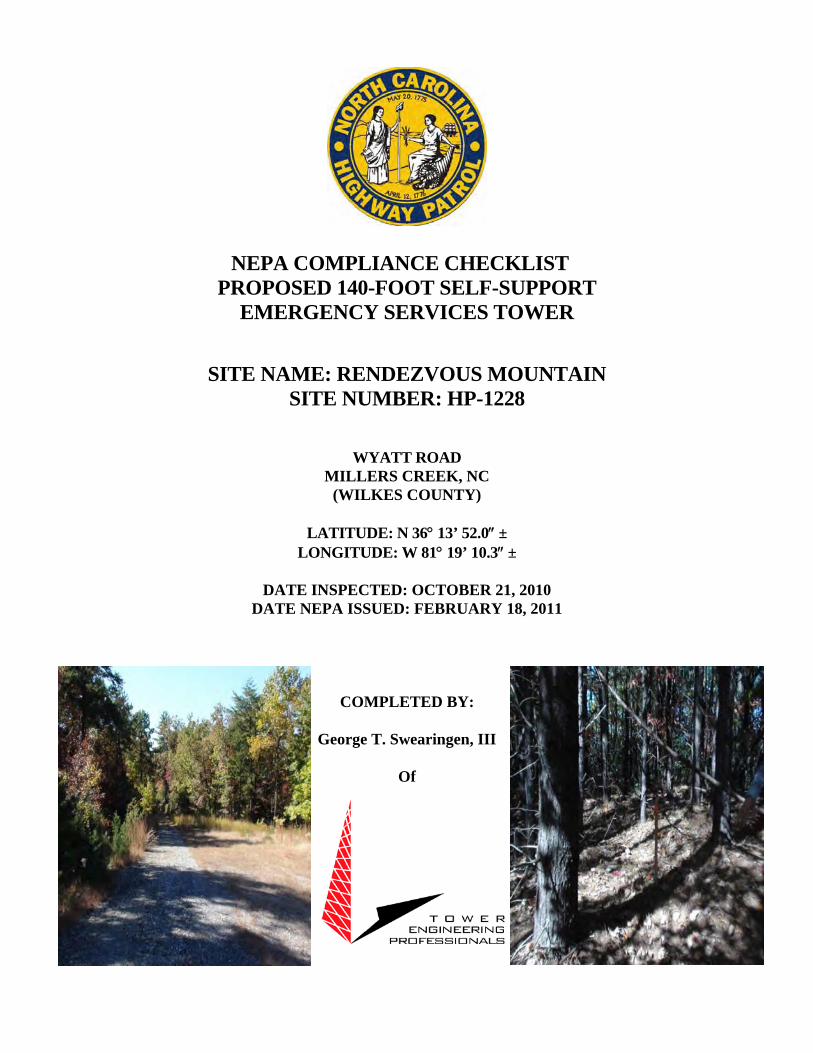
NEPA COMPLIANCE CHECKLIST PROPOSED 140-FOOT SELF-SUPPORT
EMERGENCY SERVICES TOWER
SITE NAME: RENDEZVOUS MOUNTAIN SITE NUMBER: HP-1228
WYATT ROAD MILLERS CREEK, NC
(WILKES COUNTY)
LATITUDE: N 36° 13’ 52.0″ ± LONGITUDE: W 81° 19’ 10.3″ ±
DATE INSPECTED: OCTOBER 21, 2010
DATE NEPA ISSUED: FEBRUARY 18, 2011
COMPLETED BY:
George T. Swearingen, III
Of

Project Site Specific NEPA Compliance Checklist
North Carolina Highway Patrol Site Rendezvous Mountain
HP-1228

February 18, 2011
3703 Junction Boulevard, Raleigh, NC 27603-5263 O) 919.661.6351 F) 919.661.6350 [email protected]
Ms. Tanya Luter VIPER Project Manager North Carolina State Highway Patrol 3318 Garner Road Raleigh, NC 27610 Re: NEPA Checklist NC Highway Patrol Site # HP-1228
Rendezvous Mountain Site Wyatt Road Millers Creek, Wilkes County, NC Dear Ms. Luter: Tower Engineering Professionals, Inc. (TEP) conducted a FCC Compliance NEPA Checklist (NEPA) for the proposed lease area associated with the proposed 140-ft AGL (152-ft with appurtenances) Self-Support Lattice Communications Tower for the site designated as Rendezvous Mountain (NC Highway Patrol Site # HP-1228), and is pleased to submit the findings to the North Carolina Highway Patrol. The proposed site is located on a parcel of real estate in Wilkes County, NC. The parent property and the adjacent properties were occupied by a mix of low density residential, agricultural, and undeveloped forested land uses at the time of the site inspection. The NEPA Checklist research conducted by TEP indicates that the site is not: located in an officially designated wilderness area; located in an officially designated wildlife preserve; located in a floodplain; located in a residential zoned area and required to be equipped with high intensity white lights; and will not: affect threatened or endangered species or their designated critical habitats; affect districts, sites, buildings, structures or objects listed or eligible for listing in the National Register of Historic Places; affect Indian religious sites; or involve significant changes to surface features. TEP, with the assistance of Environmental Services, Inc. conducted the Section 106 of the NHPA portion of the NEPA checklist and the Native American consultation. TEP filed the proposed Rendezvous Mountain (HP-1228) site with the FCC Tower Construction Notification System (TCNS) on 1/7/11 and was assigned TCNS # 72352. TEP has received correspondence from all of the applicable tribes with known ancestral and/or aboriginal rights to Wilkes County, NC as identified by the FCC TCNS. The results of the NEPA Checklist conducted by TEP conclude that no further investigation (i.e. NEPA Environmental Assessment) is warranted or recommended for the Rendezvous Mountain (NC Highway Patrol Site # HP-1228) Site. Sincerely Tower Engineering Professionals, Inc. George T. Swearingen, III Environmental Manager

Section I – NEPA Checklist

FCC NEPA COMPLIANCE AUDIT CHECKLIST
RENDEZVOUS MOUNTAIN SITE
140-FT SELF SUPPORT LATTICE EMERGENCY SERVICES TOWER
NC HIGHWAY PATROL – DEPT. OF CRIME CONTROL & PUBLIC SAFETY MILLERS CREEK, NC
WILKES COUNTY
1. Is the proposed facility located in an officially designated wilderness area? No 2.
Is the proposed facility located in an officially designated wildlife preserve?
No
3.
Will the proposed facility likely affect threatened or endangered species or designated critical habitats; or likely jeopardize the continued existence of any proposed endangered or threatened species; or likely result in the destruction or adverse modification of proposed critical habitats (as determined by the Endangered Species Act or 1973)?
No 4.
Will the proposed facility affect districts, sites, buildings, structures or objects significant in American history, architecture, archeology, engineering or culture, that are listed (or eligible for listing) in the National Register of Historic Places?
No 5.
Will the proposed facility affect Indian religious sites?
No
6.
Is the proposed facility located in a floodplain?
No
7.
Will construction of the proposed facility involve significant change in surface features (e.g., wetland fill, deforestation or water diversion)?
No 8.
Is the proposed facility located in a residential neighborhood and is required to be equipped with high intensity white lights (as defined by local zoning law)?
No If any of the above questions result in an answer of “yes”, then construction may not start on any of these sites prior to receipt of a finding of no significant impact by FCC.
RF Exposure Screening Under NEPA
9A.
Will the proposed NON-ROOFTOP facility equal or exceed total power (of all channels) of 2000 watts ERP (3280 Watts EIRP) and have antennas located less than 10 meters above ground level?
No 9B.
Will the proposed ROOFTOP facility equal or exceed total power (of all channels) of 2000 watts ERP (3280 Watts EIRP)?
N/A IF “yes” is the answer to either of the two RF exposure questions, an evaluation must be performed to determine if the North Carolina Highway Patrol exceeds the FCC’s exposure limits.
TOWER ENGINEERING PROFESSIONALS, INC. Date: February 18, 2011 Print Name: George T. Swearingen, III
Signature:

The following provides additional information concerning each item on the checklist. 1. Designated Wilderness Areas – Based on a review of the National Wilderness Institute Map of Wilderness
Areas, Wild & Scenic Rivers, National Natural Landmarks and UN Biosphere Reserves, dated 1995, and the Wilderness.net - U.S. National Wilderness Preservation System Map, the proposed tower site is not located within an officially designated wilderness area.
2. Designated Wildlife Preserves – Based on a review of the US Fish and Wildlife Service: National Wildlife
Refuge System Map, dated September 30, 2004, the proposed tower site is not located within an officially designated wildlife preserve although the proposed tower site is located within the Rendezvous State Educational Forest managed by the NC Dept. Of Environment and Natural Resources.
3A. Listed Threatened or Endangered Species or Designated Critical Habitats - Based on a review of the element
occurrences of federally listed threatened and endangered species and their critical habitats within a 2-mile radius of the proposed tower site, as obtained from the North Carolina Department of Environment and Natural Resources: Natural Heritage Program Online Virtual Workroom, an on-site investigation, and correspondence with the USFWS-Asheville Field Office, no listed threatened or endangered species occur at the proposed tower site. In addition, no critical habitats were identified on the proposed tower site. Therefore, it is not likely that the construction of the proposed tower will affect threatened or endangered species or their critical habitats.
3B. Proposed Threatened or Endangered Species or Proposed Critical Habitats - Based on a review of the element
occurrences of federally listed threatened and endangered species and their critical habitats within a 2-mile radius of the proposed tower site, as obtained from the North Carolina Department of Environment and Natural Resources: Natural Heritage Program Online Virtual Workroom, an on-site investigation, and correspondence with the USFWS-Asheville Field Office, none of the proposed threatened or endangered species occur on the proposed tower site. The proposed tower site is not located within an area qualifying as proposed critical habitats. Further, the construction of the proposed tower is not likely to adversely impact proposed threatened or endangered species or their critical habitats.
4. Historical Places – Based on the results of our coordination with the Wilkes County Planning Department,
Wilkesboro Historic Preservation Society, Rendezvous Mountain Educational State Forest, and the North Carolina Department of Cultural Resources – State Historic Preservation Office (NCDCR-SHPO), the construction of the proposed tower will “Not Affect” properties listed on or eligible for listing on the National Register of Historic Places within the 0.5-mile Area of Potential Effect (APE).
5. Indian Religious Sites – Based upon a review of available information obtained from the North Carolina
Department of Cultural Resources, the Native American Consultative Database, the Bureau of Indian Affairs-Indian Reservations in the Continental United States, dated 5/96, and the responses to the FCC-Tower Construction Notification ID #72352, no known Indian religious sites will be affected by the proposed tower site.
6. Floodplains – Based on a review of the floodplain map of the area (FIRM Community-Panel No. 3710390000J
dated March 2, 2009), the proposed tower site is not located within a special flood hazard area as determined by FEMA.
7. Surface Features – Based on our on-site investigation and a review of the National Wetland Inventory map of
the area, the proposed tower is not anticipated to result in a significant change or modification to surface features such as fill in jurisdictional wetlands, deforestation, or water diversion.
8. Zoning/High Intensity White Lights – The proposed tower is 140-feet AGL (152-ft AGL with appurtenances)
and the use of high intensity white lights should not be necessary. The proposed tower is anticipated to be an unlit structure.
9A. Radio Frequency Emissions – Based on the specified elevation of the proposed antennas (>10 meters) and
because the site will be located within a restricted area, no further study concerning radio frequency emissions is required.

Section II - FCC 620

Page 1 of 4
New Tower (“NT”) Submission Packet
FCC FORM 620
Introduction General Instructions: NT Submission Packet Fill out the answers to Questions 1-5 on Form 620 and provide the requested attachments. Attachments should be numbered and provided in the order described below. For ease of processing, provide the Applicant’s Name, Applicant’s Project Name, and Applicant’s Project Number in the lower right hand corner of each page of Form 620 and attachments.3 1. Applicant Information
Full Legal Name of Applicant: North Carolina Highway Patrol - Department of Crime Control and Public Safety Name and Title of Contact Person: Tanya Luter - VIPER Project Manager Address of Contact Person (including Zip Code): 3318 Garner Rd, Building Two Raleigh, NC 27610 Phone: 919.662.4440 Fax: n/a E-mail address: [email protected]
2. Applicant’s Consultant Information Full Legal Name of Applicant’s Section 106 Consulting Firm: Environmental Services, Inc. Name of Principal Investigator: Scott Seibel Title of Principal Investigator: President and Senior Principal Archaeologist Investigator’s Address: 524 South New Hope Road
3 Some attachments may contain photos or maps on which this information can not be provided.
Applicant’s Name: NC Highway Patrol Project Name: Rendezvous Mountain
Project Number: HP-1228
FCC Form 620 February 17, 2011

Page 2 of 4
NR SUBMISSION PACKET – FCC FORM 620 Approved by OMB
3060-1039 Estimated Time Per Response:
.5 to 10 hours
City: Raleigh State: NC Zip Code: 27610 Phone: 919. 212.1760 Fax: 919. 212.1707 E-mail address: [email protected] Does the Principal Investigator satisfy the Secretary of the Interior’s Professional Qualification Standards?4 Yes: No: Areas in which the Principal Investigator meets the Secretary for the Interior’s Professional Qualification Standards: Archaeology Other “Secretary of the Interior qualified” staff who worked on the Submission Packet (proved name(s) as well as well as the area(s) in which they are qualified): 3. Site Information
a. Street Address of Site: Wyatt Road (E911 TBD)
City or Township: Millers Creek, NC County/Parish: Wilkes b. Nearest Cross Roads: Wyatt Road/White Oak Road c. NAD 83 Latitude/Longitude coordinates (to tenth of a second): N36º13’52.0”; W81º19’10.3”
4 The Professional Qualification Standards are available on the cultural resources webpage of the National Park Service, Department of the Interior: http://www.cr.nps.gov/local-law/arch_stnds_9.htm. The Nationwide Agreement required use of Secretary-qualified professionals for identification and evaluation of historic properties within the APE for direct effects, and for assessment of effect. The Nationwide Agreement encourages, but does not require, use of Secretary-qualified professionals to identify historic properties within the APE for indirect effects. See Nationwide Agreement, §§VI.D.1.d, VI.D.1.e, VI.D.2.b, VI.E.5.
Applicant’s Name: NC Highway Patrol Project Name: Rendezvous Mountain
Project Number: HP-1228
FCC Form 620 February 17, 2011

Page 3 of 4
NT SUBMISSION PACKET – FCC FORM 620 Approved by OMB
3060-1039 Estimated Time Per Response:
.5 to 10 hours d. Proposed tower height above ground level:5140-feet; 42.6 meters (152-ft with appurtenances (46.3 meters)) e. Tower Type:
guyed lattice tower self-supporting lattice monopole
other (briefly describe tower)
4. Project Status:6 a. Construction not yet commenced; b. Construction commenced on [date] ; or, c. Construction commenced on [date] and was
completed on [date] .
5. Applicant’s Determination of Effect: a. Direct Effects (check one):
i. No Historic Properties in Area of Potential Effects (“APE”) for direct effects;
ii. “No effect” on Historic Properties in APE for direct effects; iii. “No adverse effect” on Historic Properties in APE for direct effects; iv. “Adverse effect” on one or more Historic Properties in APE for direct effects. b. Visual Effects (check one): i. No Historic Properties in Area of Potential Effects (“APE”) for visual effects; ii. “No effect” on Historic Properties in APE for visual effects; iii. “No adverse effect” on Historic Properties in APE for visual effects; iv. “Adverse effect” on one or more Historic Properties in APE for visual effects.
5 Include top-mounted attachments such as lightning rods. 6 Failure to provide the Submission Packet and complete the review process under Section 1006 of the NHPA prior to beginning construction may violate Section 110(k) of the NHPA and the Commission’s rules. See Section X of the Nationwide Agreement.
Applicant’s Name: NC Highway Patrol Project Name: Rendezvous Mountain
Project Number: HP-1228
FCC Form 620 February 17, 2011

Page 4 of 4
NT SUBMISSION PACKET – FCC FORM 620 Approved by OMB
3060-1039 Estimated Time Per Response:
.5 to 10 hours
Certification and Signature
I certify that all representations on this FCC Form 620 and the accompanying attachments are true, correct, and complete. _______________________ 2/17/2011 Signature Date George T. Swearingen, III Environmental Division Manager Printed Name Title WILLFUL FALSE STATEMENTS MADE ON THIS FORM OR ANY ATTACHMENTS ARE PUNISHABLE BY FINE AND/OR IMPRISONMENT (U.S. Code, Title 18, Section 1001) AND/OR REVOCATION OF ANY STATION LECENSE OF CONSTRUCTION PERMIT (U.S. Code, Title 47, Section 312(a)(1) AND/ OR FORFEITURE (U.S. Code, Title 47, Section 503).
Applicant’s Name: NC Highway Patrol Project Name: Rendezvous Mountain
Project Number: HP-1228
FCC Form 620 February 17, 2011

NT SUBMISSION PACKET – FCC FORM 620
Attachments Attachment 1. Résumés/Vitae See attached resume of Scott Seibel, Senior Principal Archeologist. Attachment 2. Additional Site Information The proposed 140-ft AGL (152-ft AGL with Appurtenances) Self-Support emergency services tower will be located southeast of the terminus of Wyatt Road, northwest of Millers Creek, within Wilkes County, North Carolina. The proposed area of construction is anticipated to be approximately 3,984-sq. ft. and located primarily within undeveloped forested land uses. The proposed 24-ft x 33-ft x 30-ft x 42-ft x 35-ft x 24-ft fenced tower compound will be located within undeveloped forested land uses and occupy approximately 2,354-sq.ft. Vegetation in the vicinity of the proposed communications tower compound was dominated by White Pine, Loblolly Pine, Sour wood, and Red maple trees located in the canopy. The proposed access easement will utilize an existing earthen and graveled path which proceeds southeast from the terminus of Wyatt Road for approximately 4,900-ft. A portion of the proposed access easement will extended north from the aforementioned earthen path for approximately 120-ft and occupy approximately 1,629-sq.ft, before reaching the proposed North Carolina Highway Patrol lease area. The parent property is located in a portion of Wilkes County where the surrounding land is primarily occupied by undeveloped forested, low density residential, and agricultural land uses. The parent property was primarily occupied by undeveloped forested land uses in the vicinity of the proposed tower site. The proposed tower is under 200-ft AGL in height and anticipated to be an unlit structure. Attachment 3. Tribal and NHO Involvement Tower Engineering Professionals filed the proposed facility with the FCC – Tower Construction Notification System (TCNS) on 1-7-11 and was assigned TCNS# 72352. In addition, TEP personnel sent, via email or standard mail, correspondence to all the applicable tribes on 1-17-11 and 1-18-11. Attachment 4. TEP contacted the Wilkes County Planning Department on January 17, 2011 and invited them to be a consulting party regarding the proposed Emergency Services Communication Tower.

Attachment 5. TEP placed a Public Notice in the “Wilkes Journal Patriot” newspaper that was advertised on 1-10-2011 and has requested any comments be delivered to TEP by February 10, 2011. Please see the attached Public Notice Affidavit. Attachment 6. TEP contacted the Wilkesboro Historic Preservation Society and the Rendezvous Mountain Educational State Forest on January 17, 2011 requesting any comments they may have regarding the proposed undertaking within 30 days of receipt of the correspondence. Attachment 7. a. The geographic area, scale and nature of the undertaking and subsequent effects of
the proposed project were analyzed to determine the APE for direct effects. The determined APE for direct effects is the proposed tower compound lease area, access easement, and the proposed utility easement. The proposed tower compound will be located entirely within undeveloped forested land uses. The proposed access and utilities easement will utilize an existing earthen/gravel drive which proceeds east-southeast from the terminus of Wyatt Road for approximately 4,900-ft before turning north and continuing an additional 120-ft through undeveloped forested land uses until reaching the proposed North Carolina Highway Patrol lease area. The proposed area of construction is anticipated to be approximately 3,984-sq. ft. and located primarily within undeveloped forested land uses. See attached Construction Drawings.
b. The geographic area, scale and nature of the undertaking and subsequent effects of
the proposed project were analyzed to determine the APE for visual effects. Further, required background research and suggested standards by the North Carolina-State Historic Preservation Office and the FCC Nationwide Programmatic Agreement were reviewed to determine the APE for visual effects for the proposed project. The APE for visual effects is determined to be a 0.5 mile radius from the proposed 140-ft (152-ft with appurtenances) self-support emergency services tower centerline. The determined APE for visual effects is currently primarily occupied by undeveloped forested land uses associated with the Rendezvous Mountain Educational State Forest, agricultural, and low density residential land uses
Attachment 8. Historic Properties Identified in the APE for Visual Effects a. No properties pursuant to Section VI.D.1.a. of the Nationwide PA were identified in
the determined APE for visual effects. During the research conducted by Tower Engineering Professionals, Inc., no National Register Historic Structures, Sites, Districts, Archaeological Sites or sites determined eligible for listing in the National Register were located within a 0.5-mile radius of the proposed tower location.

b. As of 2/21/2011 TEP has not been made aware of any properties identified by
comment in the determined APE for visual effects. c. No listed or eligible properties that are no longer eligible were identified in the
determined APE for visual effects by TEP during the research conducted at the North Carolina State Historic Preservation Office.
Attachment 9. Historic Properties Identified in the APE for Direct Effects a. No properties pursuant to Section VI.D.1.a. of the Nationwide PA were identified in
the determined APE for direct effects. During the research conducted by Tower Engineering Professionals, Inc., no National Register Historic Structures, Sites, Districts, Archaeological Sites or sites determined eligible for listing in the National Register were located within the direct effects APE of the proposed emergency services tower site. The Direct APE consists of the proposed access easement, utilities easement, and proposed emergency services tower compound lease area.
b. N/A c. See attached Archeology Field Survey conducted by Environmental Services, Inc. Attachment 10. Effects on Identified Properties a. No Effect – No Historic Properties listed on or eligible for listing on the National
Register of Historic Places were identified within the 0.5-mile visual APE or the Direct APE.
b. None c. This site was the primary candidate identified by the North Carolina Highway Patrol
– Department of Crime Control and Public Safety, and the proposed self support emergency services tower will have no effect on Historic Properties since none were located within the identified 0.5 mile APE.
Attachment 11. Photographs a. See attached site photographs and attached Archeology Field Survey conducted by
Environmental Services, Inc. b. N/A c. N/A d. See attached Aerial photograph.

Attachment 12. Maps a. See attached b. See attached
c. N/A

Rendezvous Mtn. SHPO Map
Copyright 2010 Esri. All rights reserved. Fri Feb 4 2011 12:52:24 PM.

Rendezvous Mountain Archaeological Survey
1
RENDEZVOUS MOUNTAIN, WILKES COUNTY, NORTH CAROLINA ARCHAEOLOGICAL SURVEY LETTER REPORT
By: Terri Russ, RPA
Environmental Services, Inc. 524 South New Hope Road
Raleigh, NC 27610 Tower Engineering Professionals, Inc., (TEP) is assisting in the development of a telecommunications facility in Wilkes County, North Carolina. The project area consists of the proposed tower compound, which measures approximately 1,900 square feet in size, and the proposed access road and utility easement, which includes approximately 100 feet of new location. Specifically, the proposed tower site is located along an unpaved jeep trail at the terminus of Wyatt Road in the community of Millers Creek, Wilkes County, North Carolina (Figure 1). TEP requested that Environmental Services, Inc., (ESI) conduct an archaeological survey of the proposed tower site to meet the requirements of Section 106 of the National Historic Preservation Act (NHPA) and the Federal Communications Commission (FCC) Cell Tower Programmatic Agreement of 5 October 2004. This letter report summarizes the results of ESI’s archaeological survey, conducted on 4 January 2011. Environmental Setting The proposed tower compound and new location access road and utility easement are located on a wooded ridgetop of Rendezvous Mountain. The tower site is accessed along an along an unimproved jeep trail accessed from Wyatt Road. An unnamed tributary of Sandy Creek is located approximately 1000 feet north of the project area. Map units (soil series) are named for the major soil or soils within the unit, but may have minor inclusions of other soils (NRCS 2010). A complete index of the soil units in the project area is listed in Table 1. The slope of the project area suggests that the project area has a low potential to contain significant archaeological sites.
Table 1: Project Area Soils
Soil Name Code Slope Drainage Location
Cowee-Saluda Complex, stony CsD 8-25% Well Mountain slopes, ridges
Background Research Research at the North Carolina Office of State Archaeology revealed that no previously recorded archaeological sites were located within or immediately adjacent to the project area.

Rendezvous Mountain Archaeological Survey
2
Results of the Present Investigation ESI archaeologist Terri Russ conducted the archaeological survey of the project area on 4 January 2011. This included pedestrian inspection and shovel testing of the project area. Representative photos of the project area are shown as Figures 2 and 3. Pedestrian inspection found that the tower compound and proposed new location access road and utility easement were located on a wooded ridgetop with poor surface visibility. Pedestrian inspection of the unpaved road adjacent to the proposed tower location encountered no cultural materials. Four shovel tests were placed at the location of the proposed compound and new location access road and utility easement (STs 1-4; Figure 4). All shovel tests encountered the same general soil profile; 5-10 centimeters of light reddish brown to brown gravelly sandy loam over reddish brown to strong brown gravelly clay subsoil. No cultural materials were recovered from any of the shovel tests. Summary and Conclusions ESI conducted an archaeological survey of the proposed tower compound and access road and utility easement off of Wyatt Road in Wilkes County, North Carolina, for TEP in January 2011. No archaeological sites were documented within the proposed cell tower compound or within the access and utility easement. It is recommended that this project be allowed to proceed without concern for impacts to significant archaeological sites. Should the boundary of the proposed tower site be expanded or moved, additional archaeological investigation may be necessary, as determined in consultation with the North Carolina State Historic Preservation Office (SHPO). References Cited Natural Resources Conservation Services (NRCS)
2011 http://websoilsurvey.nrcs.usda.gov/app/ Accessed 5 January 2011.

Figure 1: Project Location (Purlear 7.5-minute USGS quadrangle).

Figure 2: View of Proposed Tower Compound, facing north.
Figure 3: View of Jeep Trail Access Road to Proposed Tower Compound, facing west.

Figure 4: Shovel Test Locations.
ST 2
ST 4
ST 3
ST 1
LEGEND
Negative Shovel Test

TERRI RUSS, RPA – SENIOR SCIENTIST III
PROFESSIONAL EXPERIENCE SUMMARY Ms. Russ is an archaeologist with over fourteen years experience in cultural resource management and academic archaeology. Previous cultural resource management projects include Phase I archaeological surveys, Phase II archaeological test investigations, and Phase III site mitigation for private, municipal, state, and federal clients. RESPONSIBILITIES WITH ENVIRONMENTAL SERVICES, INC. Ms. Russ is responsible for all phases of cultural resource projects management including background research, field investigations, artifact analysis and curation, and the preparation of final reports. Specialties include Phase I archaeological survey and site assessment, Phase II testing of archaeological sites, and Phase III mitigation and data recovery of archaeological sites. PRIOR EXPERIENCE 2004-Present ENVIRONMENTAL SERVICES, INC. 1998-2004 TRC GARROW ASSOCIATES, INC. 2003 LOUIS BERGER GROUP. 2002 COASTAL CAROLINA RESEARCH. 2000-2002 PHELPS ARCHAEOLOGY LABORATORY, EAST
CAROLINA UNIVERSITY. 1997 U.S. FOREST SERVICE PROFESSIONAL AFFILIATIONS Registered Professional Archaeologist (RPA) Southeastern Archaeological Conference (SEAC) Society for Historical Archaeology (SHA) North Carolina Archaeological Council (NCAC) North Carolina Archaeological Society (NCAS)
NCAS President (2007-2009) NCAS Board of Directors (2001-2003, 2005-2007) NCAS Coastal Plains Chapter Secretary (2000-2002)
Education Level: M.A. Anthropology. East Carolina University. 2002 A.A.S. Archaeology/ Historic Preservation. Randolph Community College. 1999 B.A. Anthropology. University of North Carolina at Chapel Hill. 1995 Years Experience: 14 ESI Office: Raleigh

Terri Russ
2
REPRESENTATIVE PROJECT EXPERIENCE
Archaeological Survey, US 17 Jacksonville to New Bern, Jones and Onslow counties, North Carolina Archaeological Survey, Catawba River WTP and Reservoir, Lancaster County, South Carolina Archaeological Survey, Honey Hill Analysis Area, Francis Marion National Forest, Berkeley and Charleston
counties, South Carolina Archaeological Survey of the K&M Landfill, Pickens and Gilmer Counties, Georgia Archaeological Testing and Data Recovery of 38LA560, Edenmoor, Lancaster County, South Carolina Archaeological Data Recovery of the Windsor Site (31BR201/201**), US 17 Windsor Bypass, Bertie County,
North Carolina Archaeological Data Recovery of 9BI132, 9BI133, and 9BI134, Cherokee Brick and Tile Company, Bibb
County, Georgia Archaeological and Architectural Survey and Site Relocation: ENCNG Distribution Lines. Multiple counties,
North Carolina. Architectural Survey, Saluda Tower. Polk and Henderson counties, North Carolina.
REPRESENTATIVE PUBLICATIONS
Selected Technical Reports 2010 Archaeological Survey and Evaluation of the US 17 Improvements from Jacksonville to New Bern,
Jones and Onslow Counties, North Carolina. Environmental Services, Inc. Report of Investigations No.1358, Raleigh, North Carolina.
2008 Archaeological Data Recovery of the Windsor Site (31BR201/201**), US 17 Windsor Bypass, Bertie
County, North Carolina. Environmental Services, Inc., Raleigh, North Carolina. 2006 An Intensive Cultural Resource Investigation Arlington Shores, Pamlico County, North Carolina.
Environmental Services, Inc. Report of Investigations No. 899, Raleigh, North Carolina. Other Papers and Conference Presentations 2008 Sandy Point: A Changing Historical Landscape. Poster Presented at the 65th Annual Meeting of
the Southeastern Archaeological Conference, Charlotte, North Carolina. 2006 Review of Grave Intentions: A Comprehensive Guide to Preserving Historic Cemeteries in Georgia.
Christine Van Voorhies, Georgia Department of Natural Resources. Historical Archaeology, Vol. 40, No. 2.
2006 Review of Mortuary Monuments and Burial Grounds of the Historic Period. Harold Mytum,
Kluwer/Plenum Publishers. Historical Archaeology, Vol. 40, No. 2. 2002 Uwharrie Ceramic Distribution in the Piedmont. Unpublished M.A. Thesis. Department of
Anthropology. East Carolina University. Greenville, North Carolina.

PROJECT TEAM
CODE COMPLIANCE
T-1 1
TOWER MANUFACTURER:
CIVIL ENGINEER:
STRUCTURAL ENGINEER:
ELECTRICAL ENGINEER:
GEOTECHNICAL ENGINEER:
INDEX OF SHEETS
SHEET DESCRIPTION
SURVEYOR:
UTILITY STATEMENT
100826
SITE NUMBER:
SITE NAME:
0 02-10-11 PRELIMINARY ZONING
SITE ADDRESS:
HP-1228
RENDEZVOUS MOUNTAIN
PROPOSED
09-07591-01HSCO ID NUMBER:
2010-ASO-3434-OEAERONAUTICAL STUDY NO:
APPLICANT / LESSEE:
N
DRIVING DIRECTIONS PROJECT SUMMARY
ASR REGISTRATION
UTILITIES:
PROPERTY OWNER:
N
TOWER OWNER:
LOCATION MAP
VICINITY MAP
TELECOMMUNICATIONS FACILITY
WYATT ROADMILLERS CREEK, NC 28651
(WILKES COUNTY)1 02-14-11 FINAL ZONING
TRG JBG
REV
February 10, 2011

GENERAL NOTES:
SITE # HP-1228SCO ID # 09-07591-01H
1100826
0 02-10-11 PRELIMINARY ZONING
February 14, 2011
1 02-1411 FINAL ZONING
TRG JBG
N-1
PROJECTNOTES

SITE # HP-1228SCO ID # 09-07591-01H
1100826
0 02-10-11 PRELIMINARY ZONING
February 14, 2011
1 02-1411 FINAL ZONING
TRG JBG
Z-1SITE PLAN
SITE PLAN
NOTES:
LEGEND
SITE PLAN OVERVIEW

SITE # HP-1228SCO ID # 09-07591-01H
1100826
0 02-10-11 PRELIMINARY ZONING
February 14, 2011
1 02-1411 FINAL ZONING
TRG JBG
Z-2COMPOUND DETAIL
COMPOUNDDETAIL

1) Photo facing north along existing earthen gravel access road 2) Photo facing north along proposed access easement at proposed tower compound

3) Photo facing north of proposed tower centerline 4) Photo facing south from proposed tower centerline

5) Photo facing east from proposed tower centerline 6) Photo facing west from proposed tower centerline

FCC Home | Search | Updates | E-Filing | Initiatives | For Consumers | Find People
Tower Construction Notification
FCC > WTB > Tower Construction Notification FCC Site Map
Logged In: (Log Out) Section 106
Tower Construction Notification
New Notification
Notifications Home
Your Notification has been successfully submitted to the FCC. The date for this Notification is 01/07/2011. Your Notification ID number is 72352. Please make a note of this Notification ID — print out this page for your records. A confirmation of this submitted notification will also be emailed to the email address specified in your notification.
This system is intended to facilitate consultation under Section 106 of the National Historic Preservation Act by providing early notification of proposed construction to Tribes and State Historic Preservation officers. This system is not to be used in place of Section 106 consultation, and use of this notification system in itself does not satisfy parties' obligations with respect to historic preservation review under the Commission's rules.
Please note: the submission of this notification is NOT to be considered a submission for Antenna Structure Registration. Tower Structures that require antenna structure registration based on FCC Rules 47 C.F.R. Part 17 must complete FCC Form 854 after FAA clearance is obtained.
ASR Help ASR License Glossary - FAQ - Online Help - Documentation - Technical Support
ASR Online Systems
TOWAIR- CORES/ASR Registration - ASR Online Filing - Application Search - Registration Search
About ASR Privacy Statement - About ASR - ASR Home
Federal Communications Commission 445 12th Street SW Washington, DC 20554 More FCC Contact Information...
Phone: 1-877-480-3201TTY: 1-717-338-2824Fax: 1-866-418-0232Submit Help Request
- Web Policies & Privacy Statement- Required Browser Plug-ins - Customer Service Standards - Freedom of Information Act
Page 1 of 1Tower Construction Notification
1/7/2011https://wireless2.fcc.gov/TribalHistoricNotification/asrConfirmation.htm

1
Kyle Crawford
From: [email protected]: Friday, January 07, 2011 8:24 AMTo: Kyle CrawfordSubject: Proposed Tower Structure Info - Email ID #2699043
Dear Kyle W Crawford, Thank you for submitting a notification regarding your proposed construction via the Tower Construction Notification System. Note that the system has assigned a unique Notification ID number for this proposed construction. You will need to reference this Notification ID number when you update your project's Status with us. Below are the details you provided for the construction you have proposed: Notification Received: 01/07/2011 Notification ID: 72352 Tower Owner Individual or Entity Name: TEP for the North Carolina Highway Patrol Consultant Name: Kyle W Crawford Street Address: 3703 Junction Blvd. City: Raleigh State: NORTH CAROLINA Zip Code: 27603‐5263 Phone: 919‐661‐6351 Email: [email protected] Structure Type: UTOWER ‐ Unguyed ‐ Free Standing Tower Latitude: 36 deg 13 min 52 sec N Longitude: 81 deg 19 min 10.3 sec W Location Description: Wyatt Road City: Millers Creek State: NORTH CAROLINA County: WILKES Ground Elevation: 776.9 meters Support Structure: 42.7 meters above ground level Overall Structure: 46.3 meters above ground level Overall Height AMSL: 823.2 meters above mean sea level

1
Kyle Crawford
From: [email protected]: Friday, January 14, 2011 3:01 AMTo: Kyle CrawfordCc: [email protected]; [email protected]: NOTICE OF ORGANIZATION(S) WHICH WERE SENT PROPOSED TOWER
CONSTRUCTION NOTIFICATION INFORMATION - Email ID #2700052
Dear Sir or Madam: Thank you for using the Federal Communications Commission's (FCC) Tower Construction Notification System (TCNS). The purpose of this electronic mail message is to inform you that the following authorized persons were sent the information you provided through TCNS, which relates to your proposed antenna structure. The information was forwarded by the FCC to authorized TCNS users by electronic mail and/or regular mail (letter). Persons who have received the information that you provided include leaders or their designees of federally‐recognized American Indian Tribes, including Alaska Native Villages (collectively "Tribes"), Native Hawaiian Organizations (NHOs), and State Historic Preservation Officers (SHPOs). For your convenience in identifying the referenced Tribes and in making further contacts, the City and State of the Seat of Government for each Tribe and NHO, as well as the designated contact person, is included in the listing below. We note that Tribes may have Section 106 cultural interests in ancestral homelands or other locations that are far removed from their current Seat of Government. Pursuant to the Commission's rules as set forth in the Nationwide Programmatic Agreement for Review of Effects on Historic Properties for Certain Undertakings Approved by the Federal Communications Commission (NPA), all Tribes and NHOs listed below must be afforded a reasonable opportunity to respond to this notification, consistent with the procedures set forth below, unless the proposed construction falls within an exclusion designated by the Tribe or NHO. (NPA, Section IV.F.4). The information you provided was forwarded to the following Tribes and NHOs who have set their geographic preferences on TCNS. If the information you provided relates to a proposed antenna structure in the State of Alaska, the following list also includes Tribes located in the State of Alaska that have not specified their geographic preferences. For these Tribes and NHOs, if the Tribe or NHO does not respond within a reasonable time, you should make a reasonable effort at follow‐up contact, unless the Tribe or NHO has agreed to different procedures (NPA, Section IV.F.5). In the event such a Tribe or NHO does not respond to a follow‐up inquiry, or if a substantive or procedural disagreement arises between you and a Tribe or NHO, you must seek guidance from the Commission (NPA, Section IV.G). These procedures are further set forth in the FCC's Declaratory Ruling released on October 6, 2005 (FCC 05‐176). 1. Tribal Historic Preservation Specialist Yolanda M Saunooke ‐ Eastern Band of Cherokee Indians ‐ Bryson City, NC ‐ electronic mail and regular mail Details: In order to review the proposed tower location, the EBCI THPO requests a complete 620, color photos, and a completed phase I archeological survey preferably sent by email to Yolanda Saunooke, yolasaun@nc‐cherokee.com. This information can also be sent via the US Postal Service to Yolanda Saunooke, Eastern Band of Cherokee Indians, 2877 Governor's Island Road, Bryson City, North Carolina 28713. The EBCI THPO does not need to review collocations for proposed cell tower construction projects. In the event that such a project includes new ground disturbing activities, please continue to submit the proper paperwork.

2
2. Chief Leo R Henry ‐ Tuscarora Nation ‐ Via: Lewiston, NY ‐ regular mail Details: If the Applicant/tower builder receives no response from the Tuscarora Nation within 30 days after notification through TCNS, the Tuscarora Nation has no interest in participating in pre‐construction review for the site. The Applicant/tower builder, however, must IMMEDIATLY notify the Tuscarora Nation in the event archaeological properties or human remains are discovered during construction. 3. Policy Analyst Richard L Allen ‐ Cherokee Nation ‐ Tahlequah, OK ‐ electronic mail Details: The TCNS Details do not provide me enough information to conduct a proper assessment of the projects on behalf of the Cherokee Nation. Therefore, I request that I be sent a brief summary of the Phase I findings [please try to limit the summary to between1‐‐10 pages], a topo of the area, and relevant photos. Please send these by email to [email protected]. Please treat this request for additional material as a routine supplement to the TCNS Details Notification for each of your projects that fall within our Tribe's areas of geographic interest. Consequently, if you do not receive a response from me within 30 days from the date on which you e‐mailed the supplemental items to me, you may move forward with the 20‐Day Letter procedures pursuant to the FCC's guidelines. Thank you. ‐‐ Dr. Richard L. Allen 4. Acting THPO Lisa C LaRue ‐ United Keetoowah Band of Cherokee Indians ‐ Tahlequah, OK ‐ electronic mail and regular mail 5. Administrative Assistant Jo Ann Beckham ‐ Eastern Shawnee Tribe of Oklahoma ‐ Seneca, MO ‐electronic mail Details: If you, the Applicant and/or tower constructor, do not receive a response from us, the Eastern Shawnee Tribe of Oklahoma, within 30 days from the date of the TCNS notification, then you may conclude that we do not have an interest in the site. However, if archeological resources or remains are found during construction, you must immediately stop construction and notify us of your findings in accordance with the FCC's rules. (See 47 C.F.R. § 1.1312(d)) 6. THPO Kim Jumper ‐ Shawnee Tribe ‐ Miami, OK ‐ regular mail Details: THIS IS YOUR OFFICIAL NOTICE THAT THE SHAWNEE TRIBE IS INTERESTED IN CONSULTING ON ALL PROJECTS BUILT IN OUR AREAS OF GEOGRAPHIC INTEREST. ATTENTION, NEW INFORMATION: Our procedures were updated on 14 January 2008. Please call Kim Jumper, THPO, at 918‐542‐2441, so that she can send you a copy. If your tower is a co‐location, please fax us this information to let us know. We cannot always tell from the TCNS web site that a tower is a co‐location. We require a written response from you to let us know that it is a co‐location. If a co‐location project includes some new ground disturbance (such as from an expanded compound or access road, or construction of an ancillary structure), the Shawnee Tribe treats such a project the same as any other non co‐location project.

3
Our correct mailing/physical address is: 29 South Highway 69A. Our correct phone number is (918‐542‐2441) and our historic preservation fax line is (918‐542‐9915). THPO Kim Jumper manages all cell tower consultation. As of 26 June2006, all of the faxed responses of our final comments on a tower site will contain an original Shawnee Tribe signature. Each final comment fax is signed individually. Copies may be compared, for authentication, against the original in our files.If afinal comment fax does not contain a signature, it is not valid. ALL FINAL COMMENTS FROM THE SHAWNEE TRIBE ARE WRITTEN; FINAL COMMENTS ARE NEVER PROVIDED VERBALLY. IF THE SHAWNEE TRIBE IS CREDITED WITH HAVING GIVEN A VERBAL RESPONSE, THAT RESPONSE IS NOT VALID. If you receive notification through the TCNS listing the Shawnee Tribe, that is an indication that the Shawnee Tribe is interested in consulting on the tower for which that notification was received. Please consider that our official indication of interest to you. The Shawnee Tribe considers the Tower Construction Notification System's weekly e‐mail to be the first notification that we receive that a tower will be constructed in an area of our concern. We do not view the TCNS notificationas completion of 106 consultation obligations. The Shawnee Tribe has developed streamlined consultation procedures for cell tower developers and their subcontractors. If you do not have a copy of the procedures ‐ most recently updated on 14 January2008 ‐ please contact us, as you must follow these procedures to consult with us on cell tower projects. Call us at 918‐542‐2441 or fax us at 918‐542‐9915. It is the tower builder's responsibility to make sure that you have our most recent consultation procedures. PLEASE DO NOT SEND US INFORMATION, QUERIES, OR COMMENTS ELECTRONICALLY. SINCE 1 DECEMBER 2005, WE HAVE NOT HANDLED ANY CELL TOWER CONSULTATION, INQUIRIES, OR CORRESPONDENCE VIA E‐MAIL. 7. THPO and Executive Director Dr. Wenonah G Haire ‐ Catawba Indian Nation Cultural Preservation Project ‐ Rock Hill, SC ‐ electronic mail and regular mail Details: The Catawba Indian Nation Tribal Historic Preservation Office requests that you send us by regular mail the following information needed to complete our research for the your proposed project: Project Name____________________________________________________ Project Number__________________________________________________ _____1. The name, complete address, phone number, fax number and e‐mail address of the project manager. _____2. The project location plotted on a topo map. _____3. The project name, address and location; street or highway, city, county, state. _____4. A brief description of the proposed project. Please include the size of the proposed project site and the size of the area where ground‐disturbing activities will be taking place and the type of disturbance anticipated. _____5. A brief description of current and former land use. We are primarily interested in ground disturbance and do not need detailed information or photographs of historic structures in the projectarea. _____6. A list of all recorded archaeological sites within one half (1/2) mile of the project area.

4
_____7. A list of all eligible and potentially eligible National Register of Historic Places sites within one half (1/2) mile of the proposed project area. _____8. If there has been an archaeological survey done in the area, a copy of that report. _____9. It is not necessary to send original color photos if you can provide high‐resolution color copies. _____10. A letter of concurrencefrom the appropriate State Historic Preservation Office. If you use the FCC Form 620, please do not send Attachments 1 through 6. They are not necessary for our determination. We do not have an interest in projects that require no ground disturbance. Please note: Our research/processing fee is currently $150. This fee will be changing effective January 1, 2011 to $250. Please send these requested materials in hard copy format. Send to: CIN‐THPO 1536 Tom Steven Road Rock Hill, S.C. 29730 The information you provided was also forwarded to the additional Tribes and NHOs listed below. These Tribes and NHOs have NOT set their geographic preferences on TCNS, and therefore they are currently receiving tower notifications for the entire United States. For these Tribes and NHOs, you are required to use reasonable and good faith efforts to determine if the Tribe or NHO may attach religious and cultural significance to historic properties that may be affected by its proposed undertaking. Such efforts may include, but are not limited to, seeking information from the relevant SHPO or THPO, Indian Tribes, state agencies, the U.S. Bureau of Indian Affairs, or, where applicable, any federal agency with land holdings within the state (NPA, Section IV.B). If after such reasonable and good faith efforts, you determine that a Tribe or NHO may attach religious and cultural significance to historic properties in the area and the Tribe or NHO does not respond to TCNS notification within a reasonable time, you should make a reasonable effort to follow up, and must seek guidance from the Commission in the event of continued non‐response or in the event of a procedural or substantive disagreement. If you determine that the Tribe or NHO is unlikely to attach religious and cultural significance to historic properties within the area, you do not need to take further action unless the Tribe or NHO indicates an interest in the proposed construction or other evidence of potential interest comes to your attention. None The information you provided was also forwarded to the following SHPOs in the State in which you propose to construct and neighboring States. The information was provided to these SHPOs as a courtesy for their information and planning. You need make no effort at this time to follow up with any SHPO that does not respond to this notification. Prior to construction, you must provide the SHPO of the State in which you propose to construct (or the Tribal Historic Preservation Officer, if the project will be located on certain Tribal lands), with a Submission Packet pursuant to Section VII.A of the NPA. 8. Environmental Review Coordinator Renee GledhillEarley ‐ NC State Historic Preservation Office ‐ Raleigh, NC ‐ electronic mail

5
9. Deputy SHPO David Brook ‐ Historic Preservation Office ‐ Raleigh, NC ‐ electronic mail If you are proposing to construct a facility in the State of Alaska, you should contact Commission staff for guidance regarding your obligations in the event that Tribes do not respond to this notification within a reasonable time. Please be advised that the FCC cannot guarantee that the contact(s) listed above opened and reviewed an electronic or regular mail notification. The following information relating to the proposed tower was forwarded to the person(s) listed above: Notification Received: 01/07/2011 Notification ID: 72352 Tower Owner Individual or Entity Name: TEP for the North Carolina Highway Patrol Consultant Name: Kyle W Crawford Street Address: 3703 Junction Blvd. City: Raleigh State: NORTH CAROLINA Zip Code: 27603‐5263 Phone: 919‐661‐6351 Email: [email protected] Structure Type: UTOWER ‐ Unguyed ‐ Free Standing Tower Latitude: 36 deg 13 min 52.0 sec N Longitude: 81 deg 19 min 10.3 sec W Location Description: Wyatt Road City: Millers Creek State: NORTH CAROLINA County: WILKES Ground Elevation: 776.9 meters Support Structure: 42.7 meters above ground level Overall Structure: 46.3 meters above ground level Overall Height AMSL: 823.2 meters above mean sea level If you have any questions or comments regarding this notice, please contact the FCC using the electronic mail form located on the FCC's website at: http://wireless.fcc.gov/outreach/notification/contact‐fcc.html. You may also call the FCC Support Center at (877) 480‐3201 (TTY 717‐338‐2824). Hours are from 8 a.m. to 7:00 p.m. Eastern Time, Monday through Friday (except Federal holidays). To provide quality service and ensure security, all telephone calls are recorded. Thank you, Federal Communications Commission

0 0.75 Mi 0 4000 Ft
Map provided by MyTopo.com
Page 1 of 1MyTopo Map Print
1/17/2011http://map-pass.mytopo.com/maps/print_mytopo.asp?print=20&scale=8&layer=DRG&lay...


Section III – Informal Biological Assessment

COMMUNICATIONS TOWER SITE
EVALUATION FORM
1. Location (Provide maps if possible):
State: NC County: Wilkes Latitude/Longitude/GPS Grid: N 36º 13' 52.0" W 81º 19' 10.3" City and Highway Direction (2 miles W on Hwy 20, etc.): Wyatt Road, Millers Creek, NC 28651
2. Elevation above mean sea level: ~2,549-ft. 3. Will the equipment be co-located on an existing FCC licensed tower or other
existing structure (building, water tank, etc)? Y/N NO If yes, type of structure:
4. If yes, will the compound be expanded:
If yes, will the tower be extended:
5. If No, provide proposed specifications for the new tower: Height: 140-ft Construction Type (lattice, monopole, etc.): Self Support Lattice Guyed-Wire? NO No. Bands: Total No. Wires: Lightning (Security and Aviation): anticipated to be an unlit structure.
6. Area of tower footprint in acres or square feet: According to preliminary zoning
drawings the area of construction is anticipated to be ~2,300-sq. ft.
7. Length and width of access road in feet: Length: Utilize existing earthen and gravel drive for approximately 4,900-ft before turning north and continuing approximately 140-ft through undeveloped forested land uses. Width: ~12-ft
8. General description of terrain (mountains, rolling hills, flat, flat in undulating,
etc.). Photographs of the site and surrounding area are beneficial: Mountains
9. Meteorological conditions (incidence of fog, low ceilings, rain, etc.): sunny
10. Habitat types and land use on and adjacent to the site: Habitat Type: Acreage: Percentage of Total: Undevloped Forested 100

Adjacent land use: undeveloped forested.
11. Dominant vegetative species in each habitat type: White Pine, Loblolly Pine, Sour Wood, and Maple in the canopy
12. Average diameter breast height of dominant tree species in forested areas:
Tree species: Diameter (inches):
13. Will construction at this site cause fragmentation of a larger block of habitat into two or more smaller blocks? Y/N NO If yes, describe:
14. Is evidence of bird roosts or rookeries present? Y/N NO If yes, describe:
15. Distance to nearest wetland area (forested swamp, marsh, riparian, marine, etc.),
and coastline, if applicable: Unnamed tributary less than 0.25 mile to the northwest
16. Distance to nearest telecommunications tower: None observed at time of
inspection
17. Potential for co-location of antennas on existing towers or other structures: No
18. Have measures been incorporated for minimizing impacts to migratory birds? Y/N NO If yes, describe:
19. Has an evaluation been made to determine if the proposed facility may affect
listed or proposed endangered or threatened species or their habitats as required by FCC regulations at 47 CFR 1.1307(a)(3)? Y/N If yes, present findings: During the on-site investigation, TEP observed no occurrences of Federally Listed Threatened or Endangered Species for Wilkes County. It is the opinion of TEP that the proposed facility will not adversely affect threatened or endangered species
20. Additional information required:

Endangered Species, Threatened Species,Federal Species of Concern, and Candidate Species,
Wilkes County, North Carolina
Updated: 09-22-2010
Definitions of Federal Status Codes: E = endangered. A taxon "in danger of extinction throughout all or a significant portion of its range." T = threatened. A taxon "likely to become endangered within the foreseeable future throughout all or a significant portion of its range." C = candidate. A taxon under consideration for official listing for which there is sufficient information to support listing. (Formerly "C1" candidate species.) BGPA =Bald and Golden Eagle Protection Act. See below. FSC = federal species of concern. A species under consideration for listing, for which there is insufficient information to support listing at this time. These species may or may not be listed in the future, and many of these species were formerly recognized as "C2" candidate species. T(S/A) = threatened due to similarity of appearance. A taxon that is threatened due to similarity of
Common Name Scientific name Federal Status
Record Status
Vertebrate:Bog turtle Clemmys muhlenbergii T (S/A) CurrentCerulean warbler Dendroica cerulea FSC CurrentEastern small-footed bat Myotis leibii FSC CurrentInvertebrate:Diana fritillary (butterfly) Speyeria diana FSC CurrentRegal fritillary (butterfly) Speyeria idalia FSC HistoricVascular Plant:Butternut Juglans cinerea FSC HistoricRadford's St. John's-wort Hypericum sp. 1 FSC CurrentTorrey's Mountain-mint Pycnanthemum torrei FSC HistoricNonvascular Plant:Lichen:
Page 1 of 2Wilkes County Endangered Species, Threatened Species,Federal Species of Concern, and ...
10/21/2010http://www.fws.gov/nc-es/es/cntylist/wilkes.html

appearance with another listed species and is listed for its protection. Taxa listed as T(S/A) are not biologically endangered or threatened and are not subject to Section 7 consultation. See below. EXP = experimental population. A taxon listed as experimental (either essential or nonessential). Experimental, nonessential populations of endangered species (e.g., red wolf) are treated as threatened species on public land, for consultation purposes, and as species proposed for listing on private land. P = proposed. Taxa proposed for official listing as endangered or threatened will be noted as "PE" or "PT", respectively.
Bald and Golden Eagle Protection Act (BGPA): In the July 9, 2007 Federal Register( 72:37346-37372), the bald eagle was declared recovered, and removed (de-listed) from the Federal List of Threatened and Endangered wildlife. This delisting took effect August 8,2007. After delisting, the Bald and Golden Eagle Protection Act (Eagle Act) (16 U.S.C. 668-668d) becomes the primary law protecting bald eagles. The Eagle Act prohibits take of bald and golden eagles and provides a statutory definition of "take" that includes "disturb". The USFWS has developed National Bald Eagle Management Guidelines to provide guidance to land managers, landowners, and others as to how to avoid disturbing bald eagles. For mor information, visit http://www.fws.gov/migratorybirds/baldeagle.htm
Threatened due to similarity of appearance(T(S/A)): In the November 4, 1997 Federal Register (55822-55825), the northern population of the bog turtle (from New York south to Maryland) was listed as T (threatened), and the southern population (from Virginia south to Georgia) was listed as T(S/A) (threatened due to similarity of appearance). The T(S/A) designation bans the collection and interstate and international commercial trade of bog turtles from the southern population. The T(S/A) designation has no effect on land management activities by private landowners in North Carolina, part of the southern population of the species. In addition to its official status as T(S/A), the U.S. Fish and Wildlife Service considers the southern population of the bog turtle as a Federal species of concern due to habitat loss.
Definitions of Record Status: Current - the species has been observed in the county within the last 50 years. Historic - the species was last observed in the county more than 50 years ago. Obscure - the date and/or location of observation is uncertain. Incidental/migrant - the species was observed outside of its normal range or habitat. Probable/potential - the species is considered likely to occur in this county based on the proximity of known records (in adjacent counties), the presence of potentially suitable habitat, or both.
Page 2 of 2Wilkes County Endangered Species, Threatened Species,Federal Species of Concern, and ...
10/21/2010http://www.fws.gov/nc-es/es/cntylist/wilkes.html

Home Help
Legend
Element Occurrences (not displayed)
Significant Natural Heritage Areas
Managed Areas
Roads
Municipalities
Rivers and Lakes
Topo Maps
Aerial Images (2010)
Topo Boundaries
County Boundaries
Redraw Map
NC Natural Heritage Program Virtual Workroom
GIS Data Sources: NCNHP, CGIA, NCDOT, USGS. NCNHP data updated on: 2011-Feb-17
Map Size:
Locator Map
600 x 450
Functions
Zoom In
Zoom Out
Pan
Identify
Quick View
--Choose Region--
Problems or Questions?
Powered By: MapServer PHP PostgreSQL PostGIS
Page 1 of 1NCNHP Virtual Workroom
2/17/2011http://nhpweb.enr.state.nc.us/public/virtual_workroom.phtml?grp_eo_py=Y&grp_site=Y&...

12 record(s) found within 2 miles of selected point
Scientific Name
EO Nb
Common Name
Date Last Observed
EO Rank
EO Accuracy
State Protection Status
Federal Protection Status
State Rank
Global Rank
Habitat Comments
Acidic cove forest 45 1999-09-
07 C Medium S5 G5
Acidic cove forest 54 2003-09-
30 C Medium S5 G5
Chestnut oak forest 1 1999-09-
07 A Medium S5 G5
Chestnut oak forest 63 1999-09-
07 B Very High S5 G5
Chestnut oak forest 91 2003-09-
30 C High S5 G5
Dry-mesic oak--hickory forest
9 1990-08-13 B? Medium S5 G5
Low elevation rocky summit
38 1999-09-07 C High S2 G2
Montane oak--hickory forest
103 2003-09-30 C Low S5 G5
Pine--oak/heath 2 1999-09-
07 B Medium S4 G5
Pine--oak/heath 61 1999-09-
07 C Low S4 G5
Rich cove forest 5 1990-08-
13 BC Medium S4 G4
Rich cove forest 141 2003-09-
30 CD Low S4 G4
Page 1 of 1Element Occurrence(s)
2/17/2011http://nhpweb.enr.state.nc.us/public/forms/eo/eo_py_eo_select.phtml?showOnMap=1&sri...

Section IV - NEPA Supporting Documentation


Rendezvous Mtn. SHPO Map
Copyright 2010 Esri. All rights reserved. Fri Feb 4 2011 12:52:24 PM.


January 20, 2011 Mr. Kyle W. Crawford Tower Engineering Professionals 3703 Junction Boulevard Raleigh, NC 27603-5263 Dear Mr. Crawford: We have reviewed your letter dated January 17, 2010, concerning the proposed construction of communications tower southeast of Wyatt Road and northwest of Millers Creek in Wilkes County, North Carolina. The following comments are provided in accordance with the National Environmental Policy Act (42 U.S.C.§4321 et seq.); the Migratory Bird Treaty Act (16 U.S.C. 703, et seq.) (MBTA); and section 7 of the Endangered Species Act of 1973, as amended (16 U.S.C. 1531-1543) (Act). Proposed Project. As stated in your letter, the proposed tower will be about 152 feet high (with appurtenances) and will be of a self-supporting design. The tower is not expected to have any lighting. The tower will be placed in a compound covering about 0.05-acre. The area is wooded and a new 120-ft access road will be constructed. Endangered Species. Based on the information provided in your letter, we concur with your conclusion that the proposed communications tower will not affect any federally listed endangered or threatened species, any formally designated critical habitat, or any species currently proposed for federal listing under the Act. Therefore, we believe the requirements of section 7 of the Act have been satisfied. We remind you that obligations under section 7 must be reconsidered if: (1) new information reveals impacts of this identified action that may affect listed species or critical habitat in a manner not previously considered, (2) this action is subsequently modified in a manner that was not considered in this review, or (3) a new species is listed or critical habitat is determined that may be affected by the identified action. Migratory Birds. We are concerned about the potential hazard this tower could pose to migratory birds. We would prefer that you collocate an antenna on an existing tower instead of constructing a new tower. However, if you choose to construct this tower as proposed, we request written permission for our employees and/or designees to access the property at the base of the tower to inspect for avian mortality. Limited data exist for bird strikes to towers of this

2
nature in this area, and one important way your company can greatly assist in improving our knowledge base is by working with us through cooperative agreements that include permission to gain access to standing towers of this type. Our access would occur at regular or random intervals and/or following weather events that are known to induce avian strikes. If you have any questions regarding this matter, please contact Mr. Allen Ratzlaff of our staff at 828/258-3939, Ext. 229. Please reference our log number 4-2-11-107 in any correspondence pertaining to this matter.

Beverly Eaves Perdue Governor Reuben F. Young Secretary Michael W. Gilchrist Colonel
North Carolina
Department of Crime Control and Public Safety
State Highway Patrol
Location: 512 N. Salisbury Street
Raleigh, NC 27604 (919) 733-7952
Mailing Address:
4702 Mail Service Center Raleigh, NC 27699-4702
An Internationally Accredited Agency
Law Enforcement Oath of Honor
On my honor, I will never betray my badge, my integrity, my character, or the public trust. I will always have the courage to hold myself and others accountable for our actions. I will always uphold the constitution, my community, and the agency I serve.
January 20, 2011 Mr. Allen Ratzlaff Asheville Field Office 160 Zillicoa Street Asheville, NC 28801 Re: Log Number 4-2-11-107
North Carolina Department of Crime Control and Public Safety allowing the United States Department of Interior: Fish and Wildlife Service (USFWS) access to the 152-ft (with appurtenances) self-supporting Communications Tower southeast of Wyatt Road and northwest of Millers Creek in Wilkes County, NC (N36° 13’ 52” W81° 19’ 10.3”)
Dear Mr. Ratzlaff: The North Carolina Department of Crime Control & Public Safety will allow the U.S. Fish and Wildlife Service (USFWS) to access the restricted area surrounding the proposed Rendezvous Mt. tower site upon the completion of proposed tower construction for the sole purpose of avian mortality surveys. Due to the USFWS concerns expressed in a letter dated 1/20/2011 regarding the proposed 152-ft self-supporting tower’s potential effect on Migratory birds; the N.C. Dept. of Crime Control and Public Safety will grant the USFWS permission to conduct surveys for dead birds within the Communications tower property. The Communications tower property will be restricted to the fenced compound surrounding the aforementioned tower and the necessary ground equipment. Access to the property for the purpose of conducting the avian mortality surveys will be restricted to USFWS personnel. In addition, the N.C. Dept. of Crime Control and Public Safety will also require that Tanya Luter of the N.C. Dept. of Crime Control and Public Safety be informed of any proposed surveys at least 72 hours in advance of any surveys conducted. She can be reached via phone at 919-662-4440 or email [email protected]. N.C. Dept. of Crime Control and Public Safety personnel will accompany USFWS personnel to the site for the purpose of providing access to restricted areas. Sincerely,
Captain R.V. West N.C. State Highway Patrol

Page 1 of 1
3/20/2009http://www.wilderness.net/images/NWPS/mapNCwestGAnorth.jpg


NORTH CAROLINA NATIONAL NATURAL LANDMARKS MAP

NATIONAL REGISTRY Page 68OF NATURAL LANDMARKS
JUNE 2009
NEW YORK – NORTH CAROLINA
Wayne County
ZURICH BOG Zurich Bog is a good example of northern sphagnum bog and bog forest vegetation, both of which are uncommon in north-central New York. Designated: 1973. Ownership: Private.
Westchester County
MIANUS RIVER GORGE The Mianus River Gorge contains an excellent climax hemlock forest and presents an exceptional illustration of piedmont physiography and geomorphology. Designated: 1964. Ownership: Private.
NORTH CAROLINA (13)
Alleghany County
STONE MOUNTAIN (extends into Wilkes County) Stone Mountain, located within Stone Mountain State Park, is the best example of a monadnock in massive granite in North Carolina. Unique, endemic plants persist on the granite outcrops. Designated: 1974. Ownership: State.
Ashe County
LONG HOPE CREEK SPRUCE BOG
(extends into Watauga County) Long Hope Creek Spruce Bog is one of the rarest plant communities in North Carolina and the Southeast, including plant species such as American yew and buckbean. Designated: 1974. Ownership: Private.
MOUNT JEFFERSON STATE NATURAL AREA
Mount Jefferson State Natural Area contains virtually undisturbed northern red oak forests, and represents one of the best remaining examples of oak-chestnut forest in the Southeast. Designated: 1974. Ownership: State.
Beaufort County
GOOSE CREEK STATE PARK NATURAL AREA
Goose Creek State Park Natural Area is an excellent example of a gently sloping mainland undergoing rapid ocean transgression. The site contains several diverse ecological communities including: brackish creeks and marshes, marsh transition areas, river swamp forest, and pine forest. Designated: 1980. Ownership: State.

NATIONAL REGISTRY Page 69OF NATURAL LANDMARKS
JUNE 2009
NORTH CAROLINA
Brunswick County
GREEN SWAMP Green Swamp is the largest and most unique mosaic of wetland communities in the Carolinas and is a refuge for rare plant and animal species. Designated: 1974. Ownership: Private.
SMITH ISLAND (extends into New Hanover County) Smith Island, located within Fort Fisher State Recreation Area, is a barrier island complex representing one of the least disturbed areas remaining on the Atlantic Coast. The site contains one of the best unaltered examples of sand strand forest in existence, and a system of sand dunes. Salt marshes, tidal creeks, bays, and mudflats are used extensively by aquatic birds, and island beaches provide breeding habitat for loggerhead turtles. Designated: 1967. Ownership: State.
Dare County
NAGS HEAD WOODS AND JOCKEY’S RIDGE
Nags Head Woods and Jockey’s Ridge illustrates the entire series of dune development and plant succession, from shifting open dunes to forested stabilized dunes. Designated: 1974. Ownership: State, county, municipal, private.
Davie County
ORBICULAR DIORITE The Orbicular Diorite site contains an unusual plutonic igneous rock consisting of hornblende, pyroxene, and feldspars. Designated: 1980. Ownership: Private.
Hyde County
SALYER’S RIDGE NATURAL AREA
Salyer’s Ridge Natural Area, located within the Mattamuskeet National Wildlife Refuge, contains a rare example of mature loblolly pine forest in process of succession towards a deciduous forest. Designated: 1983. Ownership: Federal.
New Hanover County
SMITH ISLAND (see Brunswick County)
Onslow County
BEAR ISLAND Bear Island, located within Hammocks Beach State Park, contains one of the largest and best examples of coastal eolian landforms in the Atlantic Coastal Plain biophysiographic province. Dune movement has created a dynamic landscape of outstanding scenic beauty. Designated: 1980. Ownership: State.

NATIONAL REGISTRY Page 70OF NATURAL LANDMARKS
JUNE 2009
NORTH CAROLINA – NORTH DAKOTA
Surry County
PILOT MOUNTAIN Pilot Mountain, located within Pilot Mountain State Park, is a classic monadnock that harbors disjunct vegetation from the Blue Ridge region. Designated: 1974. Ownership: State.
Wake County
PIEDMONT BEECH NATURAL AREA
Piedmont Beech Natural Area, located within William B. Umstead State Park, is one of the best examples of mixed mesophytic forest in the eastern Piedmont of North Carolina. Portions of the site contain unusual examples of good, maturing stands of beech. Designated: 1974. Ownership: State.
Watauga County
LONG HOPE CREEK SPRUCE BOG
(see Ashe County)
Wilkes County
STONE MOUNTAIN (see Alleghany County)
Yancey County
MOUNT MITCHELL STATE PARK
Mount Mitchell, located within Mount Mitchell State Park, is the highest mountain in the eastern half of the United States at 6,684 feet. The site supports the most extensive stand of Fraser fir remaining in the country. Designated: 1974. Ownership: State.
NORTH DAKOTA (4)
Billings County
TWO-TOP MESA AND BIG TOP MESA
Located one mile apart, Two-Top Mesa and Big Top Mesa are in a badlands terrain of sandstones, siltstones and clay. The mesas are characterized by an unbroken cover of grass on flat relief. Designated: 1965. Ownership: Federal.
Cavalier County
RUSH LAKE A large shallow, essentially undisturbed prairie pothole lake, Rush Lake is an important staging area for waterfowl. Designated: 1975. Ownership: Private.

FCC Home | Search | Updates | E-Filing | Initiatives | For Consumers | Find People
Tower Construction Notification
FCC > WTB > Tower Construction Notification FCC Site Map
Logged In: (Log Out) Section 106
Tower Construction Notification
New Notification
Notifications Home
Your Notification has been successfully submitted to the FCC. The date for this Notification is 01/07/2011. Your Notification ID number is 72352. Please make a note of this Notification ID — print out this page for your records. A confirmation of this submitted notification will also be emailed to the email address specified in your notification.
This system is intended to facilitate consultation under Section 106 of the National Historic Preservation Act by providing early notification of proposed construction to Tribes and State Historic Preservation officers. This system is not to be used in place of Section 106 consultation, and use of this notification system in itself does not satisfy parties' obligations with respect to historic preservation review under the Commission's rules.
Please note: the submission of this notification is NOT to be considered a submission for Antenna Structure Registration. Tower Structures that require antenna structure registration based on FCC Rules 47 C.F.R. Part 17 must complete FCC Form 854 after FAA clearance is obtained.
ASR Help ASR License Glossary - FAQ - Online Help - Documentation - Technical Support
ASR Online Systems
TOWAIR- CORES/ASR Registration - ASR Online Filing - Application Search - Registration Search
About ASR Privacy Statement - About ASR - ASR Home
Federal Communications Commission 445 12th Street SW Washington, DC 20554 More FCC Contact Information...
Phone: 1-877-480-3201TTY: 1-717-338-2824Fax: 1-866-418-0232Submit Help Request
- Web Policies & Privacy Statement- Required Browser Plug-ins - Customer Service Standards - Freedom of Information Act
Page 1 of 1Tower Construction Notification
1/7/2011https://wireless2.fcc.gov/TribalHistoricNotification/asrConfirmation.htm

1
Kyle Crawford
From: [email protected]: Friday, January 07, 2011 8:24 AMTo: Kyle CrawfordSubject: Proposed Tower Structure Info - Email ID #2699043
Dear Kyle W Crawford, Thank you for submitting a notification regarding your proposed construction via the Tower Construction Notification System. Note that the system has assigned a unique Notification ID number for this proposed construction. You will need to reference this Notification ID number when you update your project's Status with us. Below are the details you provided for the construction you have proposed: Notification Received: 01/07/2011 Notification ID: 72352 Tower Owner Individual or Entity Name: TEP for the North Carolina Highway Patrol Consultant Name: Kyle W Crawford Street Address: 3703 Junction Blvd. City: Raleigh State: NORTH CAROLINA Zip Code: 27603‐5263 Phone: 919‐661‐6351 Email: [email protected] Structure Type: UTOWER ‐ Unguyed ‐ Free Standing Tower Latitude: 36 deg 13 min 52 sec N Longitude: 81 deg 19 min 10.3 sec W Location Description: Wyatt Road City: Millers Creek State: NORTH CAROLINA County: WILKES Ground Elevation: 776.9 meters Support Structure: 42.7 meters above ground level Overall Structure: 46.3 meters above ground level Overall Height AMSL: 823.2 meters above mean sea level

1
Kyle Crawford
From: [email protected]: Friday, January 14, 2011 3:01 AMTo: Kyle CrawfordCc: [email protected]; [email protected]: NOTICE OF ORGANIZATION(S) WHICH WERE SENT PROPOSED TOWER
CONSTRUCTION NOTIFICATION INFORMATION - Email ID #2700052
Dear Sir or Madam: Thank you for using the Federal Communications Commission's (FCC) Tower Construction Notification System (TCNS). The purpose of this electronic mail message is to inform you that the following authorized persons were sent the information you provided through TCNS, which relates to your proposed antenna structure. The information was forwarded by the FCC to authorized TCNS users by electronic mail and/or regular mail (letter). Persons who have received the information that you provided include leaders or their designees of federally‐recognized American Indian Tribes, including Alaska Native Villages (collectively "Tribes"), Native Hawaiian Organizations (NHOs), and State Historic Preservation Officers (SHPOs). For your convenience in identifying the referenced Tribes and in making further contacts, the City and State of the Seat of Government for each Tribe and NHO, as well as the designated contact person, is included in the listing below. We note that Tribes may have Section 106 cultural interests in ancestral homelands or other locations that are far removed from their current Seat of Government. Pursuant to the Commission's rules as set forth in the Nationwide Programmatic Agreement for Review of Effects on Historic Properties for Certain Undertakings Approved by the Federal Communications Commission (NPA), all Tribes and NHOs listed below must be afforded a reasonable opportunity to respond to this notification, consistent with the procedures set forth below, unless the proposed construction falls within an exclusion designated by the Tribe or NHO. (NPA, Section IV.F.4). The information you provided was forwarded to the following Tribes and NHOs who have set their geographic preferences on TCNS. If the information you provided relates to a proposed antenna structure in the State of Alaska, the following list also includes Tribes located in the State of Alaska that have not specified their geographic preferences. For these Tribes and NHOs, if the Tribe or NHO does not respond within a reasonable time, you should make a reasonable effort at follow‐up contact, unless the Tribe or NHO has agreed to different procedures (NPA, Section IV.F.5). In the event such a Tribe or NHO does not respond to a follow‐up inquiry, or if a substantive or procedural disagreement arises between you and a Tribe or NHO, you must seek guidance from the Commission (NPA, Section IV.G). These procedures are further set forth in the FCC's Declaratory Ruling released on October 6, 2005 (FCC 05‐176). 1. Tribal Historic Preservation Specialist Yolanda M Saunooke ‐ Eastern Band of Cherokee Indians ‐ Bryson City, NC ‐ electronic mail and regular mail Details: In order to review the proposed tower location, the EBCI THPO requests a complete 620, color photos, and a completed phase I archeological survey preferably sent by email to Yolanda Saunooke, yolasaun@nc‐cherokee.com. This information can also be sent via the US Postal Service to Yolanda Saunooke, Eastern Band of Cherokee Indians, 2877 Governor's Island Road, Bryson City, North Carolina 28713. The EBCI THPO does not need to review collocations for proposed cell tower construction projects. In the event that such a project includes new ground disturbing activities, please continue to submit the proper paperwork.

2
2. Chief Leo R Henry ‐ Tuscarora Nation ‐ Via: Lewiston, NY ‐ regular mail Details: If the Applicant/tower builder receives no response from the Tuscarora Nation within 30 days after notification through TCNS, the Tuscarora Nation has no interest in participating in pre‐construction review for the site. The Applicant/tower builder, however, must IMMEDIATLY notify the Tuscarora Nation in the event archaeological properties or human remains are discovered during construction. 3. Policy Analyst Richard L Allen ‐ Cherokee Nation ‐ Tahlequah, OK ‐ electronic mail Details: The TCNS Details do not provide me enough information to conduct a proper assessment of the projects on behalf of the Cherokee Nation. Therefore, I request that I be sent a brief summary of the Phase I findings [please try to limit the summary to between1‐‐10 pages], a topo of the area, and relevant photos. Please send these by email to [email protected]. Please treat this request for additional material as a routine supplement to the TCNS Details Notification for each of your projects that fall within our Tribe's areas of geographic interest. Consequently, if you do not receive a response from me within 30 days from the date on which you e‐mailed the supplemental items to me, you may move forward with the 20‐Day Letter procedures pursuant to the FCC's guidelines. Thank you. ‐‐ Dr. Richard L. Allen 4. Acting THPO Lisa C LaRue ‐ United Keetoowah Band of Cherokee Indians ‐ Tahlequah, OK ‐ electronic mail and regular mail 5. Administrative Assistant Jo Ann Beckham ‐ Eastern Shawnee Tribe of Oklahoma ‐ Seneca, MO ‐electronic mail Details: If you, the Applicant and/or tower constructor, do not receive a response from us, the Eastern Shawnee Tribe of Oklahoma, within 30 days from the date of the TCNS notification, then you may conclude that we do not have an interest in the site. However, if archeological resources or remains are found during construction, you must immediately stop construction and notify us of your findings in accordance with the FCC's rules. (See 47 C.F.R. § 1.1312(d)) 6. THPO Kim Jumper ‐ Shawnee Tribe ‐ Miami, OK ‐ regular mail Details: THIS IS YOUR OFFICIAL NOTICE THAT THE SHAWNEE TRIBE IS INTERESTED IN CONSULTING ON ALL PROJECTS BUILT IN OUR AREAS OF GEOGRAPHIC INTEREST. ATTENTION, NEW INFORMATION: Our procedures were updated on 14 January 2008. Please call Kim Jumper, THPO, at 918‐542‐2441, so that she can send you a copy. If your tower is a co‐location, please fax us this information to let us know. We cannot always tell from the TCNS web site that a tower is a co‐location. We require a written response from you to let us know that it is a co‐location. If a co‐location project includes some new ground disturbance (such as from an expanded compound or access road, or construction of an ancillary structure), the Shawnee Tribe treats such a project the same as any other non co‐location project.

3
Our correct mailing/physical address is: 29 South Highway 69A. Our correct phone number is (918‐542‐2441) and our historic preservation fax line is (918‐542‐9915). THPO Kim Jumper manages all cell tower consultation. As of 26 June2006, all of the faxed responses of our final comments on a tower site will contain an original Shawnee Tribe signature. Each final comment fax is signed individually. Copies may be compared, for authentication, against the original in our files.If afinal comment fax does not contain a signature, it is not valid. ALL FINAL COMMENTS FROM THE SHAWNEE TRIBE ARE WRITTEN; FINAL COMMENTS ARE NEVER PROVIDED VERBALLY. IF THE SHAWNEE TRIBE IS CREDITED WITH HAVING GIVEN A VERBAL RESPONSE, THAT RESPONSE IS NOT VALID. If you receive notification through the TCNS listing the Shawnee Tribe, that is an indication that the Shawnee Tribe is interested in consulting on the tower for which that notification was received. Please consider that our official indication of interest to you. The Shawnee Tribe considers the Tower Construction Notification System's weekly e‐mail to be the first notification that we receive that a tower will be constructed in an area of our concern. We do not view the TCNS notificationas completion of 106 consultation obligations. The Shawnee Tribe has developed streamlined consultation procedures for cell tower developers and their subcontractors. If you do not have a copy of the procedures ‐ most recently updated on 14 January2008 ‐ please contact us, as you must follow these procedures to consult with us on cell tower projects. Call us at 918‐542‐2441 or fax us at 918‐542‐9915. It is the tower builder's responsibility to make sure that you have our most recent consultation procedures. PLEASE DO NOT SEND US INFORMATION, QUERIES, OR COMMENTS ELECTRONICALLY. SINCE 1 DECEMBER 2005, WE HAVE NOT HANDLED ANY CELL TOWER CONSULTATION, INQUIRIES, OR CORRESPONDENCE VIA E‐MAIL. 7. THPO and Executive Director Dr. Wenonah G Haire ‐ Catawba Indian Nation Cultural Preservation Project ‐ Rock Hill, SC ‐ electronic mail and regular mail Details: The Catawba Indian Nation Tribal Historic Preservation Office requests that you send us by regular mail the following information needed to complete our research for the your proposed project: Project Name____________________________________________________ Project Number__________________________________________________ _____1. The name, complete address, phone number, fax number and e‐mail address of the project manager. _____2. The project location plotted on a topo map. _____3. The project name, address and location; street or highway, city, county, state. _____4. A brief description of the proposed project. Please include the size of the proposed project site and the size of the area where ground‐disturbing activities will be taking place and the type of disturbance anticipated. _____5. A brief description of current and former land use. We are primarily interested in ground disturbance and do not need detailed information or photographs of historic structures in the projectarea. _____6. A list of all recorded archaeological sites within one half (1/2) mile of the project area.

4
_____7. A list of all eligible and potentially eligible National Register of Historic Places sites within one half (1/2) mile of the proposed project area. _____8. If there has been an archaeological survey done in the area, a copy of that report. _____9. It is not necessary to send original color photos if you can provide high‐resolution color copies. _____10. A letter of concurrencefrom the appropriate State Historic Preservation Office. If you use the FCC Form 620, please do not send Attachments 1 through 6. They are not necessary for our determination. We do not have an interest in projects that require no ground disturbance. Please note: Our research/processing fee is currently $150. This fee will be changing effective January 1, 2011 to $250. Please send these requested materials in hard copy format. Send to: CIN‐THPO 1536 Tom Steven Road Rock Hill, S.C. 29730 The information you provided was also forwarded to the additional Tribes and NHOs listed below. These Tribes and NHOs have NOT set their geographic preferences on TCNS, and therefore they are currently receiving tower notifications for the entire United States. For these Tribes and NHOs, you are required to use reasonable and good faith efforts to determine if the Tribe or NHO may attach religious and cultural significance to historic properties that may be affected by its proposed undertaking. Such efforts may include, but are not limited to, seeking information from the relevant SHPO or THPO, Indian Tribes, state agencies, the U.S. Bureau of Indian Affairs, or, where applicable, any federal agency with land holdings within the state (NPA, Section IV.B). If after such reasonable and good faith efforts, you determine that a Tribe or NHO may attach religious and cultural significance to historic properties in the area and the Tribe or NHO does not respond to TCNS notification within a reasonable time, you should make a reasonable effort to follow up, and must seek guidance from the Commission in the event of continued non‐response or in the event of a procedural or substantive disagreement. If you determine that the Tribe or NHO is unlikely to attach religious and cultural significance to historic properties within the area, you do not need to take further action unless the Tribe or NHO indicates an interest in the proposed construction or other evidence of potential interest comes to your attention. None The information you provided was also forwarded to the following SHPOs in the State in which you propose to construct and neighboring States. The information was provided to these SHPOs as a courtesy for their information and planning. You need make no effort at this time to follow up with any SHPO that does not respond to this notification. Prior to construction, you must provide the SHPO of the State in which you propose to construct (or the Tribal Historic Preservation Officer, if the project will be located on certain Tribal lands), with a Submission Packet pursuant to Section VII.A of the NPA. 8. Environmental Review Coordinator Renee GledhillEarley ‐ NC State Historic Preservation Office ‐ Raleigh, NC ‐ electronic mail

5
9. Deputy SHPO David Brook ‐ Historic Preservation Office ‐ Raleigh, NC ‐ electronic mail If you are proposing to construct a facility in the State of Alaska, you should contact Commission staff for guidance regarding your obligations in the event that Tribes do not respond to this notification within a reasonable time. Please be advised that the FCC cannot guarantee that the contact(s) listed above opened and reviewed an electronic or regular mail notification. The following information relating to the proposed tower was forwarded to the person(s) listed above: Notification Received: 01/07/2011 Notification ID: 72352 Tower Owner Individual or Entity Name: TEP for the North Carolina Highway Patrol Consultant Name: Kyle W Crawford Street Address: 3703 Junction Blvd. City: Raleigh State: NORTH CAROLINA Zip Code: 27603‐5263 Phone: 919‐661‐6351 Email: [email protected] Structure Type: UTOWER ‐ Unguyed ‐ Free Standing Tower Latitude: 36 deg 13 min 52.0 sec N Longitude: 81 deg 19 min 10.3 sec W Location Description: Wyatt Road City: Millers Creek State: NORTH CAROLINA County: WILKES Ground Elevation: 776.9 meters Support Structure: 42.7 meters above ground level Overall Structure: 46.3 meters above ground level Overall Height AMSL: 823.2 meters above mean sea level If you have any questions or comments regarding this notice, please contact the FCC using the electronic mail form located on the FCC's website at: http://wireless.fcc.gov/outreach/notification/contact‐fcc.html. You may also call the FCC Support Center at (877) 480‐3201 (TTY 717‐338‐2824). Hours are from 8 a.m. to 7:00 p.m. Eastern Time, Monday through Friday (except Federal holidays). To provide quality service and ensure security, all telephone calls are recorded. Thank you, Federal Communications Commission

1
Kyle Crawford
From: Yolanda Saunooke [[email protected]]Sent: Wednesday, January 19, 2011 9:32 AMTo: Kyle CrawfordSubject: RE: TEP concurrence- Rendezvous Mountain TCNS# 72352
Mr. Crawford, The EBCI THPO has reviewed the provided materials including the Phase I archeological report for the proposed communications tower construction on the Rendezvous Mountain tower site located near Millers Creek, Wilkes County, NC. The EBCI THPO concurs with the archeologist’s recommendations that no archeological sites eligible for inclusion on the National Register of Historic Places were encountered during the recent phase I archeological field survey. It is the opinion of the EBCI THPO that no cultural resources important to the Cherokee people will be adversely affected by the proposed undertaking. As such, the proposed undertaking may proceed as planned. In the event that construction plans change, or cultural resources or human remains are encountered during the construction phase, all work should cease, and this office notified to continue consultation as mandated under Section 106 of the NHPA. Please do not hesitate to contact me should you have any questions or comments. Sincerely,
Yolanda Saunooke Tribal Historic Preservation Office Eastern Band of Cherokee Indians 828‐554‐6854 From: Kyle Crawford [mailto:[email protected]] Sent: Monday, January 17, 2011 1:20 PM To: Yolanda Saunooke Subject: TEP concurrence- Rendezvous Mountain TCNS# 72352 Ms. Saunooke, I have attached information regarding the proposed North Carolina Highway Patrol Site identified as Rendezvous Mountain (TCNS# 72352) for your review and concurrence. If you have any questions or need any further information regarding the proposed tower location please do not hesitate to call. Thank you, Kyle Kyle W. Crawford Environmental Scientist Tower Engineering Professionals, Inc. 3703 Junction Boulevard Raleigh, NC 27603 919‐661‐6351 office 919‐880‐3446 mobile 919‐661‐6350 fax

1
Kyle Crawford
From: [email protected]: Wednesday, January 19, 2011 9:32 AMTo: Kyle CrawfordCc: [email protected]; [email protected]: Reply to Proposed Tower Structure (Notification ID: 72352) - Email ID #2705716
Dear Kyle W Crawford, Thank you for using the Federal Communications Commission's (FCC) Tower Construction Notification System (TCNS). The purpose of this email is to inform you that an authorized user of the TCNS has replied to a proposed tower construction notification that you had submitted through the TCNS. The following message has been sent to you from Tribal Historic Preservation Specialist Yolanda M Saunooke of the Eastern Band of Cherokee Indians in reference to Notification ID #72352: The EBCI THPO has reviewed the provided materials including the Phase I archeological report for the proposed communications tower construction on the Rendezvous Mountain tower site located near Millers Creek, Wilkes County, NC. The EBCI THPO concurs with the archeologist’s recommendations that no archeological sites eligible for inclusion on the National Register of Historic Places were encountered during the recent phase I archeological field survey. It is the opinion of the EBCI THPO that no cultural resources important to the Cherokee people will be adversely affected by the proposed undertaking. As such, the proposed undertaking may proceed as planned. In the event that construction plans change, or cultural resources or human remains are encountered during the construction phase, all work should cease, and this office notified to continue consultation as mandated under Section 106 of the NHPA. Please do not hesitate to contact me should you have any questions or comments. Sincerely, Yolanda Saunooke Tribal Historic Preservation Office Eastern Band of Cherokee Indians 828‐554‐6854 For your convenience, the information you submitted for this notification is detailed below. Notification Received: 01/07/2011 Notification ID: 72352 Tower Owner Individual or Entity Name: TEP for the North Carolina Highway Patrol Consultant Name: Kyle W Crawford Street Address: 3703 Junction Blvd. City: Raleigh State: NORTH CAROLINA Zip Code: 27603‐5263 Phone: 919‐661‐6351 Email: [email protected] Structure Type: UTOWER ‐ Unguyed ‐ Free Standing Tower

2
Latitude: 36 deg 13 min 52.0 sec N Longitude: 81 deg 19 min 10.3 sec W Location Description: Wyatt Road City: Millers Creek State: NORTH CAROLINA County: WILKES Ground Elevation: 776.9 meters Support Structure: 42.7 meters above ground level Overall Structure: 46.3 meters above ground level Overall Height AMSL: 823.2 meters above mean sea level

1
Kyle Crawford
From: Richard Allen [[email protected]]Sent: Monday, February 14, 2011 4:58 PMTo: Kyle CrawfordSubject: RE: TEP Concurrence- Rendezvous Mountain TCNS# 72352
The Cherokee Nation has no knowledge of any historic, cultural or sacred sites within the affected area. Should any ground disturbance reveal an archaeological site or human remains, we ask that the all activity cease immediately and the Cherokee Nation and other appropriate agencies be contacted immediately. Thank you, Dr. Richard L. Allen Policy Analyst Cherokee Nation P.O. Box 948 Tahlequah, Oklahoma 74465 (918) 453-5466 (office) (918) 822-2707 (cell) (918) 458-5898 (fax)
From: Kyle Crawford [mailto:[email protected]] Sent: Monday, January 17, 2011 12:21 PM To: Richard Allen; Richard Allen Subject: TEP Concurrence- Rendezvous Mountain TCNS# 72352 Dr. Allen, I have attached information regarding the proposed North Carolina Highway Patrol Site identified as Rendezvous Mountain (TCNS# 72352) for your review and concurrence. If you have any questions or need any further information regarding the proposed tower location please do not hesitate to call. Thank you, Kyle Kyle W. Crawford Environmental Scientist Tower Engineering Professionals, Inc. 3703 Junction Boulevard Raleigh, NC 27603 919‐661‐6351 office 919‐880‐3446 mobile 919‐661‐6350 fax


NACD Query Results
Full Data Report
Query input: State = North Carolina County = Wilkes
________________________________________________________________________________
NO RECORDS FOUND MATCHING SEARCH CRITERIA
Return to top of page Return to Query Page
Page 1 of 1NACD Query Results
2/17/2011http://home.nps.gov/nacd/NACD_Search_Page_Query_Results.cfm

Indian Reservations in the Continental
United States MAP INDEX
Full Size Map (PDF)
0 No Data
1. ABSENTEE SHAWNEE *
2. ACOMA
3. AGUA CALIENTE
4. ALABAMA-COUSHATTA
5. ALABAMA-QUASSARTE
CREEKS *
6. ALLEGANY
7. APACHE *
8. BAD RIVER
9. BARONA RANCH
10. BATTLE MOUNTAIN
11. BAY MILLS
12. BENTON PAIUTE
13. BERRY CREEK
14. BIG BEND
15. BIG CYPRESS
16. BIG LAGOON
17. BIG PINE
18. BIG VALLEY
102. HUALAPAI
103. INAJA
104. IOWA *
105. ISABELLA
106. ISLETA
107. JACKSON
108. JEMEZ
109. JICARILLA
110. KAIBAB
111. KALISPEL
112. KAW *
113. KIALEGEE CREEK *
114. KICKAPOO *
115. KIOWA *
116. KLAMATH *
117. KOOTENAI
118. L'ANSE
119. LAC COURTE
OREILLES
120. LAC DU FLAMBEAU
204. RED CLIFF
205. RED LAKE
206. RENO-SPARKS
207. RINCON
208. ROARING CREEK
209. ROCKY BOYS
210. ROSEBUD
211. ROUND VALLEY
212. RUMSEY
213. SAC AND FOX #
214. SALT RIVER
215. SANDIA
216. SANDY LAKE
217. SANTA ANA
218. SANTA CLARA
219. SANTA DOMINGO
220. SANTA ROSA
221. SANTA ROSA (NORTH)
222. SANTA YNEZ
Home
Frequently Asked Questions
Law and Regulations
Online Databases
Grants
Training
Notices
Documents and Publications
Review Committee
Special Topics
Contact National NAGPRA

19. BISHOP
20. BLACKFEET
21. BRIDGEPORT
22. BRIGHTON
23. BURNS PAIUTE COLONY
24. CABEZON
25. CADDO *
26. CAHUILLA
27. CAMPO
28. CAMP VERDE
29. CANONCITO
30. CAPITAN GRANDE
31. CARSON
32. CATAWBA
33. CATTARAUGUS
34. CAYUGA *
35. CEDARVILLE
36. CHEHALIS
37. CHEMEHUEVI
38. CHEROKEE * #
39. CHEYENNE-ARAPAHOE*
40. CHEYENNE RIVER
41. CHICKASAW *
42. CHITIMACHA
43. CHOCTAW * #
44. CITIZEN BAND OF
POTAWATOMI *
45. COCHITI
46. COEUR D'ALENE
47. COLD SPRINGS
121. LAC VIEUX DESERT
122. LAGUNA
123. LAS VEGAS
124. LAYTONVILLE
125. LA JOLLA
126. LA POSTA
127. LIKELY
128. LONE PINE
129. LOOKOUT
130. LOS COYOTES
131. LOVELOCK COLONY
132. LOWER BRULE
133. LOWER ELWAH
134. LOWER SIOUX
135. LUMMI
136. MAKAH
137. MANCHESTER
138. MANZANITA
139. MARICOPA
140. MASHANTUCKET
PEQUOT
141. MATTAPONI +
142. MENOMINEE
143. MESCALERO
144. MIAMI *
145. MICCOSUKEE
146. MIDDLETOWN
147. MILLE LACS
148. MISSION
149. MOAPA
223. SANTA YSABEL
224. SANTEE
225. SAN CARLOS
226. SAN FELIPE
227. SAN ILDEFONSO
228. SAN JUAN
229. SAN MANUAL
230. SAN PASQUAL
231. SAN XAVIER
232. SAUK SUIATTLE
233. SEMINOLE *
234. SENECA-CAYUGA *
235. SEQUAN
236. SHAGTICOKE +
237. SHAKOPEE
238. SHEEP RANCH
239. SHERWOOD VALLEY
240. SHINGLE SPRING
241. SHINNECOCK +
242. SHOALWATER
243. SHOSHONE
244. SILETZ
245. SISSETON
246. SKOKOMISH
247. SKULL VALLEY
248. SOBOBA
249. SOUTHERN UTE
250. SPOKANE
251. SQUAXON ISLAND
252. ST. CROIX

48. COLORADO RIVER
49. COLVILLE
50. COMANCHE *
51. COOS, LOWER UMPQUA
& SIUSLAW
52. COQUILLE *
53. CORTINA
54. COUSHATTA
55. COW CREEK
56. CREEK *
57. CROW
58. CROW CREEK
59. CUYAPAIPE
60. DEER CREEK
61. DELAWARE *
62. DEVILS LAKE
63. DRESSLERVILLE
COLONY
64. DRY CREEK
65. DUCKWATER
66. DUCK VALLEY
67. EASTERN SHAWNEE *
68. EAST COCOPAH
69. ELY COLONY
70. ENTERPRISE
71. FALLON
72. FLANDREAU INDIAN
SCHOOL
73. FLATHEAD
74. FOND DU LAC
75. FORT APACHE
150. MODOC *
151. MOLE LAKE
152. MONTGOMERY CREEK
153. MORONGO
154. MUCKLESHOOT
155. NAMBE
156. NARRAGANSETT
157. NAVAJO
158. NETT LAKE
159. NEZ PERCE
160. NIPMOC-
HASSANAMISCO +
161. NISQUALLY
162. NOOKSACK
163. NORTHERN CHEYENNE
164. NORTHWESTERN
SHOSHONE
165. OIL SPRINGS
166. OMAHA
167. ONEIDA #
168. ONONDAGA
169. ONTONAGON
170. OSAGE
171. OTOE-MISSOURI *
172. OTTAWA *
173. OUT
174. OZETTE
175. PAIUTE
176. PALA
177. PAMUNKEY +
178. PASCUA YAQUI
253. ST. REGIS
254. STANDING ROCK
255. STEWARTS POINT
256. STOCKBRIDGE
MUNSEE
257. SUMMIT LAKE
258. SUSANVILLE
259. SWINOMISH
260. TAOS
261. TE-MOAK
262. TESUQUE
263. TEXAS KICKAPOO
264. TOHONO O'ODHAM
265. TONAWANDA
266. TONIKAWA *
267. TORRES MARTINEZ
268. TOULUMNE
269. TRINDAD
270. TULALIP
271. TULE RIVER
272. TUNICA-BILOXI
273. TURTLE MOUNTAINS
274. TUSCARORA
275. TWENTYNINE PALMS
276. UMATILLA
277. UNITAH AND OURAY
278. UNITED KEETOOWAH
BAND OF CHEROKEE *
279. UPPER SIOUX
280. UPPER SKAGIT
281. UTE MOUNTAIN

76. FORT BELKNAP
77. FORT BERTHOLD
78. FORT BIDWELL
79. FORT HALL
80. FORT INDEPENDENCE
81. FORT MCDERMITT
82. FORT MCDOWELL
83. FORT MOHAVE
84. FORT PECK
85. FORT YUMA
86. FT. SILL APACHE *
87. GILA BEND
88. GILA RIVER
89. GOSHUTE
90. GRANDE RONDE
91. GRAND PORTAGE
92. GRAND TRAVERSE
93. GREATER LEECH LAKE
94. GRINDSTONE
95. HANNAHVILLE
96. HAVASUPAI
97. HOH
98. HOLLYWOOD
99. HOOPA VALLEY
100. HOPI
101. HOULTON MALISEETS
179. PASSAMAQUODDY
180. PAUCATAUK PEQUOT +
181. PAUGUSETT +
182. PAWNEE *
183. PECHANGA
184. PENOBSCOT
185. PEORIA *
186. PICURIS
187. PINE RIDGE
188. POARCH CREEK
189. POJOAQUE
190. PONCA *
191. POOSEPATUCK +
192. PORT GAMBLE
193. PORT MADISON
194. POTAWATOMI #
195. PRAIRIE ISLE
196. PUERTOCITO
197. PUYALLUP
198. PYRAMID LAKE
199. QUAPAW *
200. QUILLAYUTE
201. QUINAULT
202. RAMAH
203. RAMONA
282. VERMILION LAKE
283. VIEJAS
284. WALKER RIVER
285. WARM SPRINGS
286. WASHOE
287. WEST COCOPAH
288. WHITE EARTH
289. WICHITA *
290. WIND RIVER
291. WINNEBAGO #
292. WINNEMUCCA
293. WOODFORD INDIAN
COMMUNITY
294. WYANDOTTE *
295. XL RANCH
296. YAKAMA
297. YANKTON
298. YAVAPAI
299. YERINGTON
300. YOMBA
301. YSLETA DEL SUR
302. YUROK
303. ZIA
304. ZUNI
PMM


RendezvousMountain
Jul 10, 2012
This map is for general reference only. The US Fish and Wildlife Service is notresponsible for the accuracy or currentness of the base data shown on this map. Allwetlands related data should be used in accordance with the layer metadata found onthe Wetlands Mapper web site.
User Remarks:

Appendix C: NC DENR Air Pollution Response

� � � � � � � � � �
� � � � � � � � � � � � � � � � � � � � � � � � � � � � � � � � � � � � � � � � � � � � � � � � � � � � � � ! " � � � � � � � � � � � � � � � � � � � � � � � � � � � � � � � # � � � � � � � � � � � $ � � � � % � � & ' & � � � � � � � � ( � � $ � � � � � � � � � � � � � � � � � � � � � � � �� � � � � � � � � � � � � � � � � � � � � � � ) � � � � � � � � � � � � � � � � � � � � � � � � � � # � � � � � � � � � � � � � � � � � � � � � � � �� � � � � � � � � � � � � � � � � * � � � � � �
+ , � � � � � - . � � + � - / � 0 / - 0 / 1 0 / $ 0 � � � � � � � � � � � � � � � � � � � � � � � � � � � � � � � � � � � � � � � � � � � � � � 2
3 4 5 6 7 6 8 9 6 : ; < = > 6 9 6 : 6 8 ? @ A 8 > ? : B A @ C 6 8 D : @ 6 8 : ? E ; A 7 F = > @ D A : 6 : 9 D : 6 > : A @ 8 6 9 = E ? @ 6 B F < 8 = E 6 > ? B A G @ 6 B= : B 6 8 H D @ E 6 I I A J @ C 6 K 6 B 6 8 ? E L E 6 ? : M D 8 M ; @ N 6 O ; 6 G @ > 6 E J G 8 A G 6 E E 6 B 4 6 C D ; E 6 > N @ C ? @ C ? 4 6 ? 8 ? @ 6 B ; ? G ? ; D @ < A J : A
7 A 8 6 @ C ? : P3 I 5 Q R S T D E A U ? @ @ > 3 6 E 6 ; @ 8 D ; 5 A 8 V S S S C A 8 > 6 G A U 6 8 J A 8 : ? @ = 8 ? E 9 ? > J D 8 6 B 6 : 9 D : 6 > W3 I I 5 V R S S T D E A U ? @ @ > 3 6 E 6 ; @ 8 D ; 5 A 8 X Y V S C A 8 > 6 G A U 6 8 J A 8 E D Z = 6 J D 6 B G 6 @ 8 A E 6 = 7 9 ? > J D 8 6 B 6 : 9 D : 6 > W[ \ \ \ ] ^ _ ` a b c d e f g g h [ i c i j g k b j ] d k _ ` ` l d k h i m d e i k n d k o b i h i c n b k i o d k a i k d h i p i n b k i oi p q b p i h r d k3 I s 5 X V T D E A U ? @ @ > 3 6 E 6 ; @ 8 D ; 5 A 8 t V C A 8 > 6 G A U 6 8 J A 8 9 ? > A E D : 6 J D 8 6 B 6 : 9 D : 6 > W
� � � � � � � � � � � � � � � � � � � � � � * � � � � � � � � � � � � � � � � � � � � � � � � � � � � � � � � � � � � � � � � � � � � � � � � � � � � � � � � � � � $ � � � � � � � � � � � � � � . � u ' � � � � � � � v � � � � � � � � � ! � � � � � � � � � � � � � � � � � � * � � � � � � � � � �
� � � � � � � � � � � � � � � � � � � � � � � � � � � � � � � � � � � � � � � � � � � $ � � � � � � � � � � � � � � � � � � � � � 1 � � � � � # � w � � � � � � � � � � ! � � � # � � � � � � � � � � � x � � � � � � � � � � � � � # � � � � � � � $ � � � � � � � � � � � � � � # � � � � � � � � � � � �� � � � � � � � 2 � � 2 y y � � � � � � � � � � � � y � # � � y � � � � � y
� � � � � � � $ � � � � � � � � � � � � � � � � � � � � � � � � � � � � � � � � � � � � # � � # � � � � � � � � � � � � � � � � � � � # � � � � � � � � � �� � � � � � �
1 � � � � � . � $ � �
1 � � � � � . � $ � � 1 � � � � � � . � $ � � z � � � � � � � � $� � � � � � � � � � � � . � � � � � & � $ � � � � � � � � � � � � � � � ' � � � � � � � �
� � � � $ � � � � ' � � � � � � � v � � � � �. � $ � � � � � � � � � � u � � � � �- � { � | � ( � } � ~ � � � � � �
( � � � � � � � � � � - � } } �x � � 2 � - � - { � , � �
w � � 2 � - � - { { } � � �� � � � � � � � � � � � �
� � � � � 2 & � � � � � � � � � � � � � � � � � � � � � � � � � � � � � � � � � � � # � � � # * � � � � � � � � � � � � � � � � � � � # � � �' � � � � � � � � � � � � � � � � � � � � � # � � � � � � � � � � � � � � � � � � �


Appendix D: Unique & Prime Farmland Impact Rating Form


Appendix E: DHS Public Notice


APPENDIX F: Preparer’s Resume
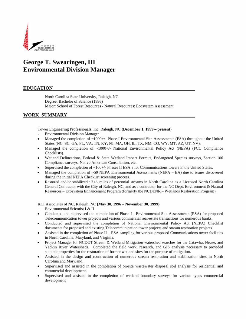
George T. Swearingen, III Environmental Division Manager
EDUCATION___________________________________________________________
North Carolina State University, Raleigh, NC Degree: Bachelor of Science (1996) Major: School of Forest Resources - Natural Resources: Ecosystem Assessment
WORK_SUMMARY_____________________________________________________ Tower Engineering Professionals, Inc. Raleigh, NC (December 1, 1999 – present) - Environmental Division Manager • Managed the completion of ~1000+/- Phase I Environmental Site Assessments (ESA) throughout the United
States (NC, SC, GA, FL, VA, TN, KY, NJ, MA, OH, IL, TX, NM, CO, WY, MT, AZ, UT, NV). • Managed the completion of ~1000+/- National Environmental Policy Act (NEPA) (FCC Compliance
Checklists). • Wetland Delineations, Federal & State Wetland Impact Permits, Endangered Species surveys, Section 106
Compliance surveys, Native American Consultation, etc. • Supervised the completion of ~100+/- Phases II ESA’s for Communications towers in the United States. • Managed the completion of ~50 NEPA Environmental Assessments (NEPA – EA) due to issues discovered
during the initial NEPA Checklist screening process. • Restored and/or stabilized ~3+/- miles of perennial streams in North Carolina as a Licensed North Carolina
General Contractor with the City of Raleigh, NC, and as a contractor for the NC Dept. Environment & Natural Resources – Ecosystem Enhancement Program (formerly the NCDENR – Wetlands Restoration Program).
KCI Associates of NC, Raleigh, NC (May 30, 1996 – November 30, 1999) - Environmental Scientist I & II • Conducted and supervised the completion of Phase I - Environmental Site Assessments (ESA) for proposed
Telecommunication tower projects and various commercial real-estate transactions for numerous banks. • Conducted and supervised the completion of National Environmental Policy Act (NEPA) Checklist
documents for proposed and existing Telecommunication tower projects and stream restoration projects. • Assisted in the completion of Phase II – ESA sampling for various proposed Communications tower facilities
in North Carolina, Maryland, and Virginia. • Project Manager for NCDOT Stream & Wetland Mitigation watershed searches for the Catawba, Neuse, and
Yadkin River Watersheds. Completed the field work, research, and GIS analysis necessary to provided suitable properties for the restoration of former wetland sites for the purpose of mitigation.
• Assisted in the design and construction of numerous stream restoration and stabilization sites in North Carolina and Maryland.
• Supervised and assisted in the completion of on-site wastewater disposal soil analysis for residential and commercial development.
• Supervised and assisted in the completion of wetland boundary surveys for various types commercial development
Andrew B. Blake
Environmental Division – Environmental Scientist II
EDUCATION___________________________________________________________
North Carolina State University
Raleigh, NC – College of Natural Resources Degree: Bachelor of Science (2011)
Major: Environmental Technology and Management
OSHA 40-hr HAZWOPER Certification
WORK_SUMMARY_____________________________________________________
Tower Engineering Professionals, Inc. Raleigh, NC (December 2010 – present)
- Environmental Scientist II
• Assisted with the completion of Phase I - Environmental Site Assessments (ESA) for proposed Telecommunication tower projects throughout the southeastern United States (NC, SC, VA, GA, WV, TX IL,
OH, FL, MD, UT, NV, AZ, WY, NM, CO and Canada).
• Assisted with the completion of National Environmental Policy Act (NEPA) Checklist (FCC Compliance
Checklists) documents for proposed and existing Telecommunications tower projects.
• Assisted with the completion of NEPA Environmental Assessments (NEPA – EA) due to issues discovered
during the initial NEPA Checklist screening process
• Completed Biological Assessments for Rare, Threatened and Endangered Species
• Assisted with Section 106 Compliance Surveys
• Completed Native American Consultation for proposed Telecommunication tower structures as per FCC-
TCNS guidelines.
• Conducted the completion of perennial stream restoration and/or stabilizations for the City of Raleigh, NC
North Carolina State University Raleigh, NC (June 2010 – November 2010)
- Progress Energy/Environmental Technology Intern
• Assisted two graduate students in the Natural Resources - Ecological Restoration program at North Carolina
State University evaluate and assess stream restoration projects throughout the Piedmont Region of North
Carolina.
• Collected and assessed 1,000+ soil samples for chemical analysis and Bulk Density analysis
• Assessed the condition and installation of in-stream structures in previous stream restoration projects.
• Presented results of soil chemical analysis and bulk density testing at the North Carolina undergraduate research symposium at Meredith College in the November of 2010.