
Cover: Catchpool Stream. Photo: Jeremy Rolfe
Published by:Department of ConservationPōneke/Wellington OfficePO Box 5086, Lambton QuayWellington 6145August 2015
Rimutaka Forest ParkCatchpool Valley and Orongorongo Valley
9 421005 172522
Mountain biking and horse riding
Hunting
WAINUIOMATA
Catchpool
UPPER HUTT
Palliser Bay
LakeWairarapa
COO
ASASASTTR OR OR OO
AADDD
WELLINGTON
Turakirae Head
WAINUIOMATA
Catchpool
UPPER HUTT
Palliser Bay
LakeWairarapa
CO
AST R
OA
D
WELLINGTON
Turakirae Head
RRRR IIII MMMM UUUU TTTT AAAAAAAAAA KKKK AAAAFFFF OOOO
RRRREEEE SSSSSSSSSSSSSSSSS TTTTTTTTTTT
PPPPPPPPPPPPPPPPPPPPPPPPPPPPPPAAAAAAAAAAAAAAAAAAAAAAAAAAAAAAAAARRRRRRRRRRRRRRRRR KKKKKKKKKKK
Photo: Jerem
y Rolfe
Photo: Lisa P
aton
Photo: M
att Barnett
Photo: Jerem
y Rolfe
Photo: D
OC
.
How to get to Catchpool Valley Catchpool Valley is a 45 minute drive from Wellington. The entrance to the park is on Coast Road, 12 km south of Wainuiomata. The entrance gates are open from 6am to 8pm in summer (October-April)/6am to 6pm in winter (May-September).
Please remember
• Dogs must be kept on a leash except in the Dog Exercise Area opposite the Catchpool Centre (see map) and in the Orongorongo river bed.
• Dogs are not permitted at all in the Turere catchment kiwi zone or the Landcare Research area (see map).
• Do not carry loaded firearms in Catchpool Valley.
• Shooting is prohibited in Catchpool Valley and the Orongorongo River bed.
• Fires are not permitted in Catchpool Valley.
• You must have a permit from Wellington Rural Fire Authority to light a fire in Rimutaka Forest Park – please take extreme care. If the area's fire status is ‘prohibited’ then there is a fire ban and all permits are revoked.
• Mountain bikes are not permitted on walking tracks.
• Rubbish bins are not provided – take your rubbish home with you.
Take care visiting natural areas
Check, Clean, DryStop the spread of didymo and other freshwater pests. Remember to Check, Clean, Dry all items before entering, and when moving between, waterways.
• Plan ahead and prepare• Travel and camp on durable ground• Dispose of waste properly• Leave what you find• Minimise the effects of fire• Respect wildlife and farm animals• Be considerate of others
For your safetyCommunication There is no cell phone or radio communication in the Catchpool and Orongorongo valleys. A public phone is situated at the Catchpool Centre.
Be prepared• Always take warm, waterproof clothing, food and drink,
even on short walks. Sturdy shoes or walking boots should be worn on tramping tracks.
• Groups on overnight trips should always include experienced trampers.
• Check the weather forecast—the weather in the forest park can change rapidly.
• Always tell someone where you are going.
• Maps are recommended for longer trips. Use NZTopo50, BQ32 Lower Hutt
• If the ford across Catchpool Valley Road is flooded, do not attempt to drive through it.
• The Orongorongo River rises quickly. Do not attempt to cross swollen rivers or streams.
If you think there is a safety hazard in a conservation area, call DOC HOTline or the nearest DOC office.
Further information
For further information please contact or visit:Pōneke/Wellington Visitor Centre18 Manners Street, Wellington 6011Phone: 04 384 7770 Email: [email protected] further information about recreation activities and conservation visit: www.doc.govt.nz
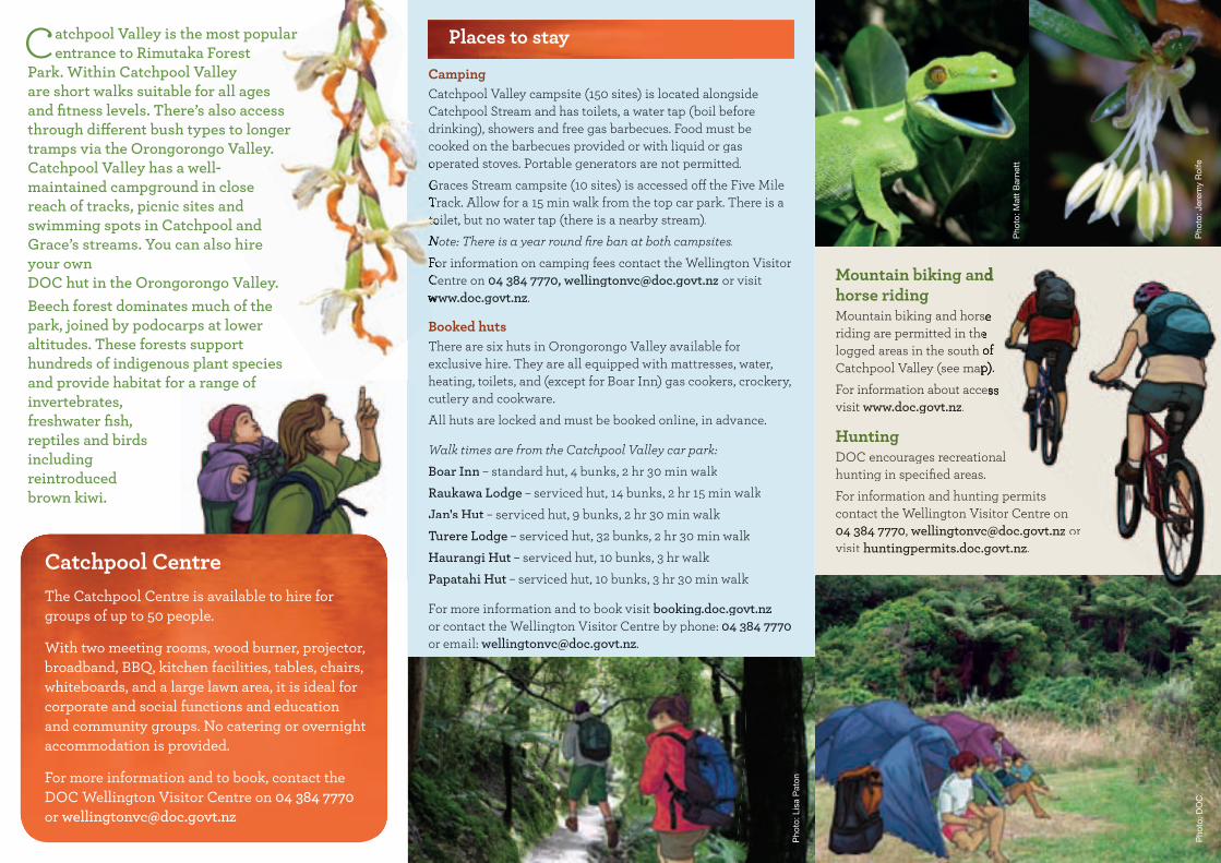
Catchpool CentreThe Catchpool Centre is available to hire for groups of up to 50 people.
With two meeting rooms, wood burner, projector, broadband, BBQ, kitchen facilities, tables, chairs, whiteboards, and a large lawn area, it is ideal for corporate and social functions and education and community groups. No catering or overnight accommodation is provided.
For more information and to book, contact the DOC Wellington Visitor Centre on 04 384 7770 or [email protected]
Places to stay
Camping
Booked huts
Catchpool Valley is the most popular entrance to Rimutaka Forest
Park. Within Catchpool Valley are short walks suitable for all ages and fitness levels. There’s also access through different bush types to longer tramps via the Orongorongo Valley. Catchpool Valley has a well-maintained campground in close reach of tracks, picnic sites and swimming spots in Catchpool and Grace’s streams. You can also hire your own DOC hut in the Orongorongo Valley. Beech forest dominates much of the park, joined by podocarps at lower altitudes. These forests support hundreds of indigenous plant species and provide habitat for a range of invertebrates, freshwater fish, reptiles and birds including reintroduced brown kiwi.
Cover: Catchpool Stream. Photo: Jeremy Rolfe
Rimutaka Forest ParkCatchpool Valley and Orongorongo Valley
9421005172522
Mountain biking and horse ridingMountain biking and horse riding are permitted in the logged areas in the south of Catchpool Valley (see map).For information about access visit www.doc.govt.nz.
HuntingDOC encourages recreational hunting in specified areas.For information and hunting permits contact the Wellington Visitor Centre on 04 384 7770, [email protected] or visit huntingpermits.doc.govt.nz.
WAINUIOMATA
Catchpool
UPPER HUTT
Palliser Bay
LakeWairarapa
COAST ROA
D
WELLINGTON
Turakirae Head
Pho
to: J
erem
y R
olfe
Pho
to: L
isa
Pat
on
Pho
to: M
att
Bar
nett
Pho
to: J
erem
y R
olfe
Pho
to: D
OC
.
How to get to Catchpool Valley
Please remember
•
•
•
•
•
•
•
•
Take care visiting natural areas
For your safetyCommunication
Be prepared•
•
•
•
•
•
•
Further information
Catchpool CentreThe Catchpool Centre is available to hire for groups of up to 50 people.
With two meeting rooms, wood burner, projector, broadband, BBQ, kitchen facilities, tables, chairs, whiteboards, and a large lawn area, it is ideal for corporate and social functions and education and community groups. No catering or overnight accommodation is provided.
For more information and to book, contact the DOC Wellington Visitor Centre on 04 384 7770 or [email protected]
Places to stay
CampingCatchpool Valley campsite (150 sites) is located alongside Catchpool Stream and has toilets, a water tap (boil before drinking), showers and free gas barbecues. Food must be cooked on the barbecues provided or with liquid or gas operated stoves. Portable generators are not permitted.Graces Stream campsite (10 sites) is accessed off the Five Mile Track. Allow for a 15 min walk from the top car park. There is a toilet, but no water tap (there is a nearby stream).Note: There is a year round fire ban at both campsites.For information on camping fees contact the Wellington Visitor Centre on 04 384 7770, [email protected] or visit www.doc.govt.nz.
Booked hutsThere are six huts in Orongorongo Valley available for exclusive hire. They are all equipped with mattresses, water, heating, toilets, and (except for Boar Inn) gas cookers, crockery, cutlery and cookware. All huts are locked and must be booked online, in advance.
Walk times are from the Catchpool Valley car park:Boar Inn – standard hut, 4 bunks, 2 hr 30 min walkRaukawa Lodge – serviced hut, 14 bunks, 2 hr 15 min walkJan's Hut – serviced hut, 9 bunks, 2 hr 30 min walkTurere Lodge – serviced hut, 32 bunks, 2 hr 30 min walkHaurangi Hut – serviced hut, 10 bunks, 3 hr walkPapatahi Hut – serviced hut, 10 bunks, 3 hr 30 min walk
For more information and to book visit booking.doc.govt.nzor contact the Wellington Visitor Centre by phone: 04 384 7770or email: [email protected].
operated stoves. Portable generators are not permitted.Graces Stream campsite (10 sites) is accessed off the Five Mile Track. Allow for a 15 min walk from the top car park. There is a toilet, but no water tap (there is a nearby stream).Note: There is a year round fire ban at both campsites.For information on camping fees contact the Wellington Visitor Centre on www.doc.govt.nz
Booked huts
Mountain biking and
Mountain biking and horse riding are permitted in the logged areas in the south of Catchpool Valley (see map).For information about access
Catchpool Valley is the most popular entrance to Rimutaka Forest
Park. Within Catchpool Valley are short walks suitable for all ages and fitness levels. There’s also access through different bush types to longer tramps via the Orongorongo Valley. Catchpool Valley has a well-maintained campground in close reach of tracks, picnic sites and swimming spots in Catchpool and Grace’s streams. You can also hire your own DOC hut in the Orongorongo Valley. Beech forest dominates much of the park, joined by podocarps at lower altitudes. These forests support hundreds of indigenous plant species and provide habitat for a range of invertebrates, freshwater fish, reptiles and birds including reintroduced brown kiwi.
Track categories
NORTH
Orongorongo River
McKerrow Stream
Graces Stream
Turere Stream
Catchpool StreamC atchpool Strea
m
Catc
hpoo
l Stre
am
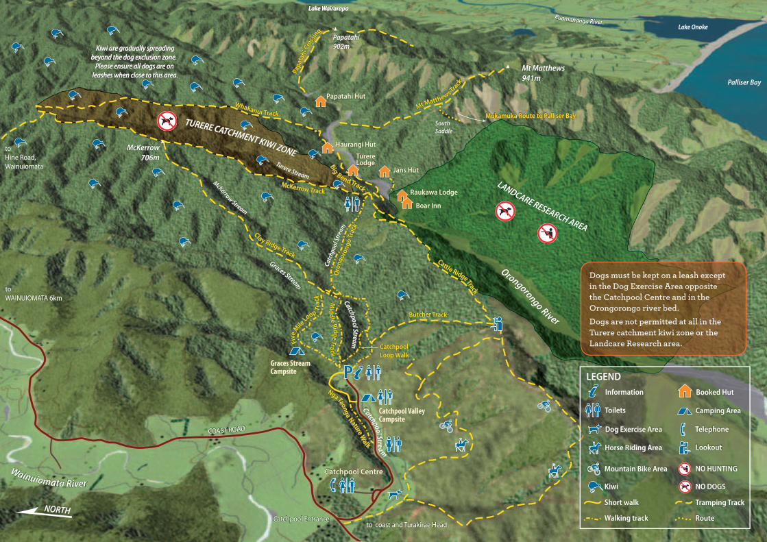
TURERE CATCHMENT KIWI ZONE
LANDCARE RESEARCH AREA
Ruamahanga RiverLake Onoke
Palliser Bay
McKerrow706m
Mt Matthews941m
SouthSaddle
Papatahi902m
Wainuiomata River
Kiwi are gradually spreadingbeyond the dog exclusion zone.
Please ensure all dogs are on leashes when close to this area.
Kiwi are gradually spreadingKiwi are gradually spreadingKiwi are gradually spreadingKiwi are gradually spreadingKiwi are gradually spreadingKiwi are gradually spreadingKiwi are gradually spreadingKiwi are gradually spreadingKiwi are gradually spreadingKiwi are gradually spreadingKiwi are gradually spreadingKiwi are gradually spreadingKiwi are gradually spreadingKiwi are gradually spreadingKiwi are gradually spreadingKiwi are gradually spreadingKiwi are gradually spreadingKiwi are gradually spreadingKiwi are gradually spreadingKiwi are gradually spreadingKiwi are gradually spreadingKiwi are gradually spreadingKiwi are gradually spreadingKiwi are gradually spreadingKiwi are gradually spreadingKiwi are gradually spreadingKiwi are gradually spreadingKiwi are gradually spreadingbeyond the dog exclusion zone. beyond the dog exclusion zone. beyond the dog exclusion zone. beyond the dog exclusion zone. beyond the dog exclusion zone. beyond the dog exclusion zone. beyond the dog exclusion zone. beyond the dog exclusion zone. beyond the dog exclusion zone. beyond the dog exclusion zone. beyond the dog exclusion zone. beyond the dog exclusion zone. beyond the dog exclusion zone. beyond the dog exclusion zone. beyond the dog exclusion zone. beyond the dog exclusion zone. beyond the dog exclusion zone. beyond the dog exclusion zone. beyond the dog exclusion zone. beyond the dog exclusion zone. beyond the dog exclusion zone. beyond the dog exclusion zone. beyond the dog exclusion zone. beyond the dog exclusion zone. beyond the dog exclusion zone. beyond the dog exclusion zone. beyond the dog exclusion zone. beyond the dog exclusion zone. beyond the dog exclusion zone. beyond the dog exclusion zone. beyond the dog exclusion zone.
Please ensure all dogs are on Please ensure all dogs are on Please ensure all dogs are on Please ensure all dogs are on Please ensure all dogs are on Please ensure all dogs are on Please ensure all dogs are on Please ensure all dogs are on Please ensure all dogs are on Please ensure all dogs are on Please ensure all dogs are on Please ensure all dogs are on Please ensure all dogs are on Please ensure all dogs are on Please ensure all dogs are on Please ensure all dogs are on Please ensure all dogs are on Please ensure all dogs are on Please ensure all dogs are on Please ensure all dogs are on Please ensure all dogs are on Please ensure all dogs are on Please ensure all dogs are on Please ensure all dogs are on Please ensure all dogs are on Please ensure all dogs are on Please ensure all dogs are on Please ensure all dogs are on leashes when close to this area.leashes when close to this area.leashes when close to this area.leashes when close to this area.leashes when close to this area.leashes when close to this area.leashes when close to this area.leashes when close to this area.leashes when close to this area.leashes when close to this area.leashes when close to this area.leashes when close to this area.leashes when close to this area.leashes when close to this area.leashes when close to this area.leashes when close to this area.leashes when close to this area.leashes when close to this area.leashes when close to this area.leashes when close to this area.leashes when close to this area.leashes when close to this area.leashes when close to this area.leashes when close to this area.leashes when close to this area.leashes when close to this area.leashes when close to this area.leashes when close to this area.leashes when close to this area.leashes when close to this area.
Kiwi are gradually spreadingbeyond the dog exclusion zone.
Please ensure all dogs are on leashes when close to this area.
Kiwi are gradually spreadingbeyond the dog exclusion zone.
Please ensure all dogs are on leashes when close to this area.
Catchpool Centre
Catchpool Entrance
COAST ROAD
to WAINUIOMATA 6km
to coast and Turakirae Head
to Hine Road,Wainuiomata
Boar Inn
Raukawa Lodge
TurereLodgeTurereTurereTurereTurereTurereTurereLodgeLodgeLodgeLodgeLodgeTurereLodge
Jans Hut
Haurangi Hut
Papatahi Hut
Butcher Track
Oro
ngor
ongo
Trac
k
Clay Ridge Track
McKerrow Track
Whakanui Track
Cattle Ridge Track
Nga Taonga Nature Walk
Mid
dle Ridge Track
Five M
ile Lo
op Tra
ck
Mt Matthews Track
Papa
tahi
Cro
ssing
Mukamuka Route to Palliser BayMukamuka Route to Palliser BayMukamuka Route to Palliser BayMukamuka Route to Palliser BayMukamuka Route to Palliser BayMukamuka Route to Palliser BayMukamuka Route to Palliser BayMukamuka Route to Palliser BayMukamuka Route to Palliser BayMukamuka Route to Palliser BayMukamuka Route to Palliser BayMukamuka Route to Palliser BayMukamuka Route to Palliser BayMukamuka Route to Palliser BayMukamuka Route to Palliser BayMukamuka Route to Palliser BayMukamuka Route to Palliser BayMukamuka Route to Palliser BayMukamuka Route to Palliser BayMukamuka Route to Palliser BayMukamuka Route to Palliser BayMukamuka Route to Palliser BayMukamuka Route to Palliser BayMukamuka Route to Palliser BayMukamuka Route to Palliser BayMukamuka Route to Palliser BayMukamuka Route to Palliser BayMukamuka Route to Palliser Bay
Big Bend Track
Lake WairarapaLake WairarapaLake WairarapaLake WairarapaLake WairarapaLake WairarapaLake WairarapaLake WairarapaLake WairarapaLake WairarapaLake WairarapaLake WairarapaLake WairarapaLake WairarapaLake WairarapaLake WairarapaLake Wairarapa
Catchpool Loop Walk
Short walk
Route
Tramping Track
Walking track
LEGENDInformation
Toilets
Telephone
Camping Area
Booked Hut
Lookout
Dog Exercise Area
Horse Riding Area
Mountain Bike Area
Kiwi
NO HUNTING
NO DOGS
Short walk Tramping Track
Walking track Route
South Coast Track
Turakirae Head
Orongorongo River
TURAKIRAE HEADSCIENTIFIC RESERVE
seal haulout
Access crosses private land.Please stay on marked track
Wainuiomata River
COAST ROAD
RIMUTAKAFOREST PARK
Barneys Whare(private)
Barneys Strm to Corner Creek(5km approx)
Walking and tramping
Turakirae Head Scientific Reserve
Dogs must be kept on a leash except in the Dog Exercise Area opposite the Catchpool Centre and in the Orongorongo river bed. Dogs are not permitted at all in the Turere catchment kiwi zone or the Landcare Research area.
Catchpool Valley Campsite
Graces Stream Campsite
Mount Matthews10 hr, 9 km (return)
Begins near the mouth of Matthews Stream and climbs steeply to the summit of Mount Matthews (941 m). Enjoy outstanding views of Wellington Harbour, Wairarapa, the Tararua Range, and the Kaikoura Ranges.
Mukamuka Valley 6 hr, 6 km (one-way)
The Mukamuka Valley is reached by following the the Mt Matthews track for approximately 1 hour 30 mins to the South Saddle track. This rough track sidles southwest, dropping from the saddle into the shrubby headwaters of Mukamuka Stream which leads to Palliser Bay.
Papatahi Crossing12 hr, 10 km (one-way)
A crossing of the Rimutaka Range via Papatahi (902 m) from the mid-Orongorongo Valley at North Boulder Creek to the Wharepapa River and Battery Stream on the Wairarapa side of the park. It requires a very full day from the Catchpool carpark for a fit party. Most parties are recommended to overnight at, or near, Papatahi Hut.
Middle Ridge Track 1 hr, 3.2 km (return)
Follows the ridge between Graces Stream and Catchpool Stream. Here, the vegetation consists of more drought-tolerant plants such as mānuka. The track gives good views of the Catchpool Valley.
Clay Ridge Track 2 hr 30 min, 6.3 km (one-way to Mount McKerrow)
5 hr, 12.6 km (return)From Clay Forks, this track ascends Clay Ridge to the east of Graces Stream to the summit of Mount McKerrow (706 m). A round trip back to the Catchpool carpark is possible by returning via the McKerrow and Orongorongo tracks.
Orongorongo Walking Track 2 hr, 5.2 km (one-way)
One of New Zealand’s most popular walks, leading to the Orongorongo River and Turere Bridge through different forest types. There are swimming holes at Turere Stream at the end of the track.
Butcher Track and Cattle Ridge Track 4 hr, 12 km (round trip)
Begins about 10 minutes along the Orongorongo Track. A stiff 2 hour climb through a range of forest types and shrubland, brings magnificent views of Wellington Harbour. From here Cattle Ridge heads north to join the Orongorongo Track near Turere Stream.
Big Bend Track and Whakanui Track 7 hr, 18 km (one-way)
Big Bend Track begins at Turere bridge and follows the Orongorongo River to Whakanui Creek. The Whakanui Track begins on the true right (the right as you look downstream) of Whakanui Creek and climbs to the ridge between Whakanui Creek and Turere Stream before descending to Hine Road / Sunny Grove in Wainuiomata. There are good views of the main Rimutaka Range from the higher parts of the track.
McKerrow Track 6 hr, 13.3 km (one-way)
McKerrow Track begins 10 minutes from the end of the Orongorongo Track. It climbs through podocarp, broadleaf and beech forest to Mount McKerrow (706 m) and continues along McKerrow Ridge, then joins the Whakanui Track and descends to Sunny Grove, Wainuiomata.
Track categoriesTracks are categorised to help you choose the most appropriate for your level of fitness and the skills and abilities of your party. You must be well prepared with suitable clothing and equipment for all weather and conditions. Safety is your responsibility.
Short Walk: well formed, easy walking for up to an hour
Walking Track: well formed easy walks from a few minutes to a day
Easy Tramping Track: generally well formed for comfortable overnight tramping / hiking trips
Tramping Track: mostly unformed but have track directional markers, poles or cairns
Route: unformed, suitable only for people with high level backcountry skills and experience
NORTH
Orongorongo River
McKerrow Stream
Graces Stream
Turere Stream
Catchpool StreamC atchpool Strea
m
Catc
hpoo
l Stre
am
TURERE CATCHMENT KIWI ZONE
LANDCARE RESEARCH AREA
Ruamahanga RiverLake Onoke
Palliser Bay
McKerrow706m
Mt Matthews941m
SouthSaddle
Papatahi902m
Wainuiomata River
Kiwi are gradually spreadingbeyond the dog exclusion zone.
Please ensure all dogs are on leashes when close to this area.
Kiwi are gradually spreadingbeyond the dog exclusion zone.
Please ensure all dogs are on leashes when close to this area.
Kiwi are gradually spreadingbeyond the dog exclusion zone.
Please ensure all dogs are on leashes when close to this area.
Catchpool Centre
Catchpool Entrance
COAST ROAD
to WAINUIOMATA 6km
to coast and Turakirae Head
to Hine Road,Wainuiomata
Boar Inn
Raukawa Lodge
TurereLodgeTurereLodge
Jans Hut
Haurangi Hut
Papatahi Hut
Butcher Track
Oro
ngor
ongo
Trac
k
Clay Ridge Track
McKerrow Track
Whakanui Track
Cattle Ridge Track
Nga Taonga Nature Walk
Mid
dle Ridge Track
Five M
ile Lo
op Tra
ck
Mt Matthews Track
Papa
tahi
Cro
ssing
Mukamuka Route to Palliser BayMukamuka Route to Palliser Bay
Big Bend Track
Lake WairarapaLake WairarapaLake Wairarapa
Catchpool Loop Walk
LEGENDInformation
Toilets
Telephone
Camping Area
Booked Hut
Lookout
Dog Exercise Area
Horse Riding Area
Mountain Bike Area
Kiwi
NO HUNTING
NO DOGS
Short walk Tramping Track
Walking track Route
South Coast Track
Turakirae Head
Orrooonnngggooorrroonnngggooo Riiiveerrr
TURAKIRAE HEADSCIENTIFIC RESERVE
seal haulout
Access crosses private land.Please stay on marked track
Waaiinnuiiiooommmaaataaa Riiiveerrr
COOOOAAASSTTT ROOAAADD
RIMUTAKAFOREST PARK
Barneys Whare(private)
Baaarrnneyeyeyyssysyss Stttrrmm to Corner Creek(5km approx)
Turakirae Head
Orongorongo River
TURAKIRAE HEADSCIENTIFIC RESERVE
seal haulout
Access crosses private land.Please stay on marked track
Wainuiomata River
COAST ROAD
RIMUTAKAFOREST PARK
Barneys Whare(private)
Barneys Strm to Corner Creek(5km approx)
Walking and trampingTimes are based on a walker of average fitness.
Nga Taonga Nature Walk 45 min, 1.3 km (one-way)
Information signs describe plant life of the forest. Begins in the clearing beside the Graces Stream footbridge. Ends at road, 5 min from the Catchpool Centre.
Catchpool Loop Walk 30 min, 1.6 km (round trip)
Begins just beyond the bridge across Catchpool Stream and leads upstream through nīkau groves and mature podocarp and broadleaf forest to another bridge and the Orongorongo Track. The round trip is completed by returning down the Orongorongo Track.
Five Mile Loop Walking Track 1 hr 30 min, 3.8 km (round trip)
Passes through beech forest in the lower reaches of Graces Stream. The track climbs to Clay Forks at the junction with Clay Ridge Track, giving good views of the Rimutaka Range and the forest canopy.
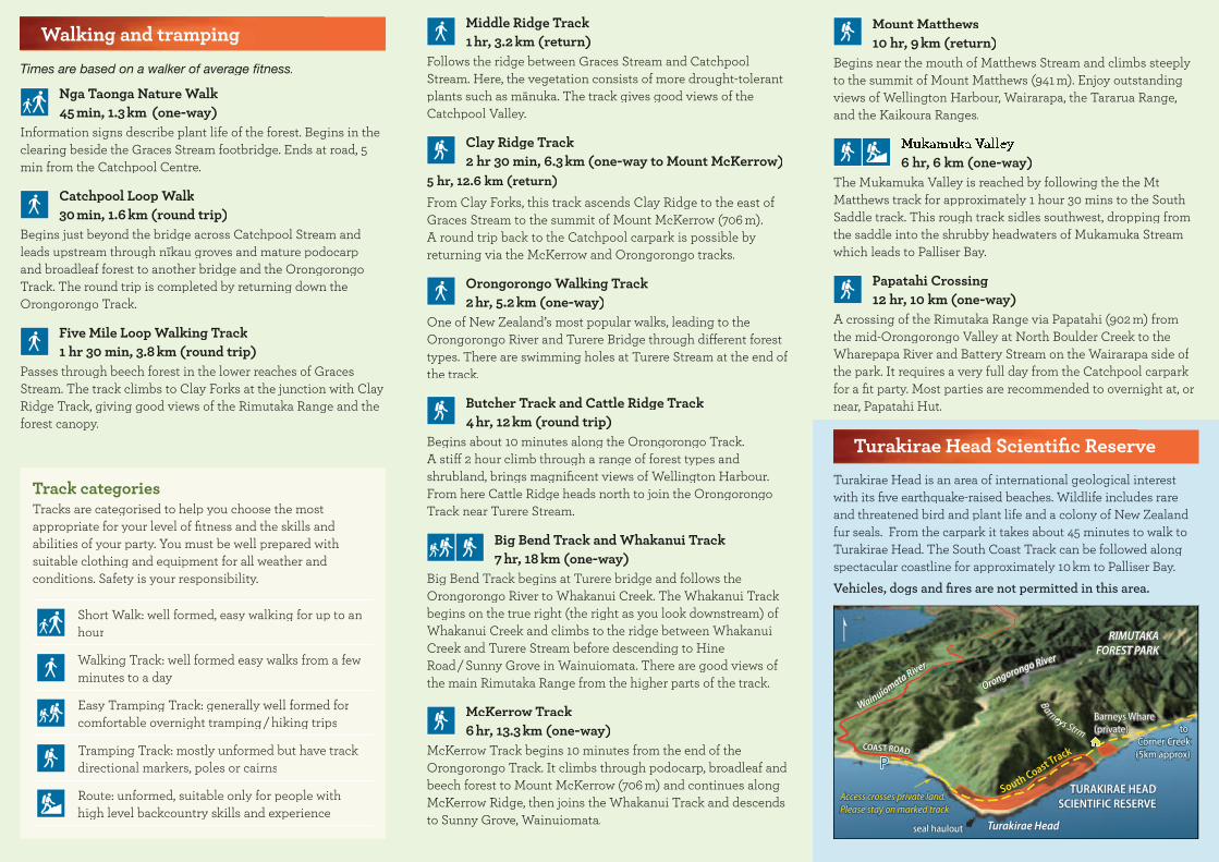
Turakirae Head Scientific ReserveTurakirae Head is an area of international geological interest with its five earthquake-raised beaches. Wildlife includes rare and threatened bird and plant life and a colony of New Zealand fur seals. From the carpark it takes about 45 minutes to walk to Turakirae Head. The South Coast Track can be followed along spectacular coastline for approximately 10 km to Palliser Bay. Vehicles, dogs and fires are not permitted in this area.
Dogs must be kept on a leash except in the Dog Exercise Area opposite the Catchpool Centre and in the Orongorongo river bed. Dogs are not permitted at all in the Turere catchment kiwi zone or the Landcare Research area.
Catchpool Valley Campsite
Graces Stream Campsite


