
Technology Update
Shane Ayers Safety Program Manager
Division of Utility and Railroad Safety

Integrity Management for Gas Distribution Report for the Pipeline and Hazardous Material
Safety Administration (Dec. 2005)
Comprehensive damage prevention programs that include
effective enforcement have a significantly lower risk of excavation damage and the potential for incidents.
Elements of a comprehensive damage prevention program
include:
• Enhanced communication between operators and excavators
• Fostering support and partnership of all stakeholders in all phases (enforcement, public education, etc.) of the program
• Operator’s use of performance measures regarding persons performing location and pipeline construction
• Partnership in employee training

Integrity Management for Gas Distribution Report for the Pipeline and Hazardous Material
Safety Administration (Dec. 2005)
• (continued) Elements of a comprehensive damage prevention program :
• Partnership in public education
• Enforcement agency’s role as a partner and facilitator to help resolve issues
• Fair and consistent enforcement of the law to all stakeholders
• Use of technology to improve all parts of the process
• Analysis of data to continually evaluate/improve program effectiveness


GPS Early Adoption in Virginia
• City of Richmond initiated a project to incorporate GPS locations of all critical valves and included photographs of the site locations in their mapping systems. They were among the first operators in Virginia to adopt such technologies on a large scale…


Virginia One Call Technology Pilot Project
• Phase I: Electronic white lining
– Excavator using hand-held device gathered GPS coordinate data at proposed excavation site and transmitted electronic locate request ticket to VUPS
– Excavation areas were: Single point (bulls eye); line; or polygon area
– Automated map selection by VUPS upon locate request ticket entry based on GPS coordinates

Results from Phase I
Pilot Projects tickets were 89% smaller in size


Virginia One Call Technology Pilot Project Phase II
• Locate Facilities and collect GPS data to create electronic manifest
• Provide manifest to excavators with Positive Response System data
• Provide data to operators for verification of maps and plans
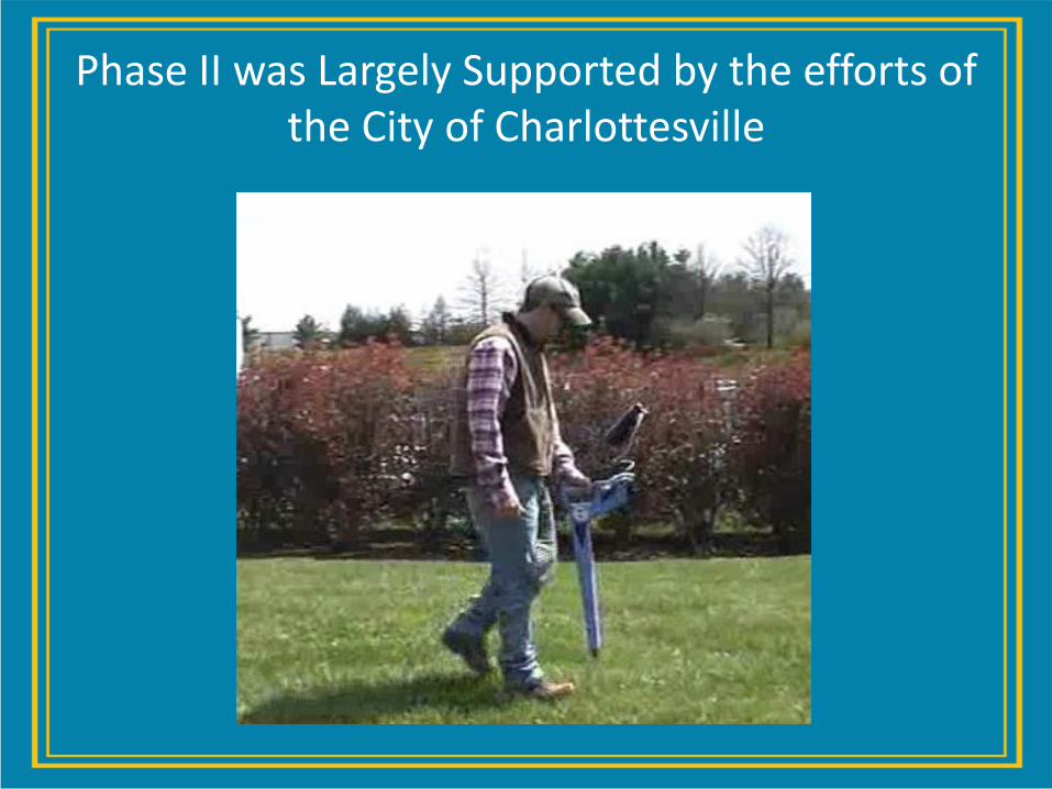
Phase II was Largely Supported by the efforts of the City of Charlottesville
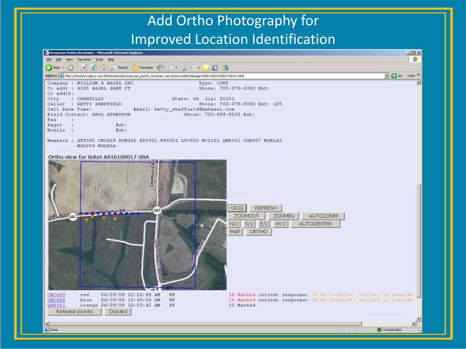
Add Ortho Photography for Improved Location Identification

An example of how the Locate Industry has adopted similar technology as explored in the Virginia Pilot Project for One Call Technology is currently being used in northern Virginia…

Electronic Marking Wand

Wand Generated Documentation

Virginia One Call Technology Pilot Project Phase III
• Phase III: Electronic Excavation – Utilize GPS with excavation equipment to prevent facility hits
– Operator’s view
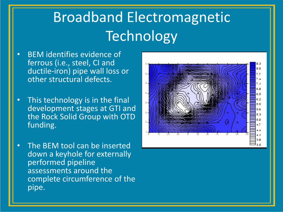
Broadband Electromagnetic Technology
• BEM identifies evidence of ferrous (i.e., steel, CI and ductile-iron) pipe wall loss or other structural defects.
• This technology is in the final development stages at GTI and the Rock Solid Group with OTD funding.
• The BEM tool can be inserted down a keyhole for externally performed pipeline assessments around the complete circumference of the pipe.

BEM
• BEM tools can be assembled for most any size pipe
• Antennas are as small as 1-inch
• BEM smart pig attachments start at 6 inches – Pigs are not intrinsically safe, so pipe
segment would have to be out of service
• Data can be linked to a company's
existing GIS using Esri or other GIS systems, such as GE Smallworld.
• Main and service evaluation these can be plotted on company maps.

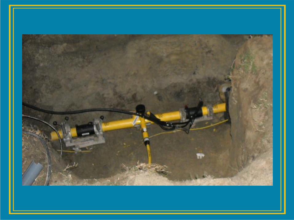
Electro-Fusion and Bar Coding

Data May be Stored, Retrieved, and Incorporated into Records
• Fitting resistance • Ambient temperature • Starting primary voltage • Data input • Fusion voltage applied • Fusion time • Fusion current • Cooling time • Pipes prepared • GPS Coordinates
• Serial number of the electro- fusion unit • Job number • Operator Identity • Date/Time of welding cycle • Fusion cycle number • Error number • Fitting manufacturer • Fitting type • Fitting size

Training and Inspection
• Use the data to guide efforts for greatest impact
• Focus inspection, outreach and education efforts on large threats first
• Mitigate threats though a better understanding of what causes damages
• Share with others what works/ doesn’t
• Coordinate inspection, outreach and education efforts with other stakeholders

Risk Based Excavation Inspection Tool

Field Inspection Documentation Using iPads

Field Inspection Documentation Using iPads

Location Enhanced Ticket Search (“LETS”)
26
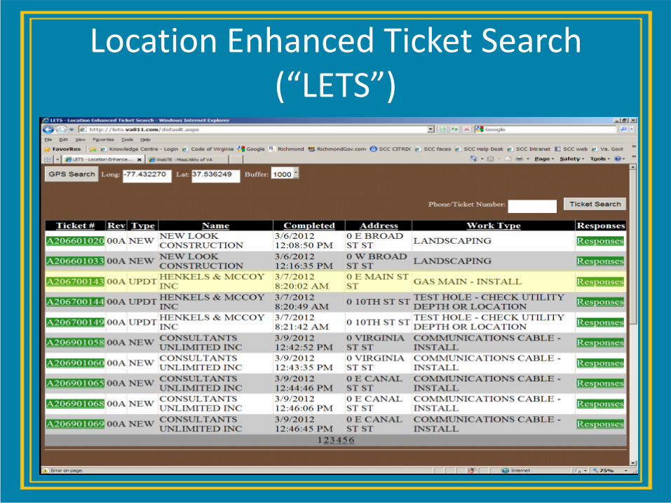
Location Enhanced Ticket Search (“LETS”)

Location Enhanced Ticket Search (“LETS”)

Location Enhanced Ticket Search (“LETS”)

Locating Advancements in Acoustics

Acoustic Locating
What if you perform acoustic locating inductively? Stay tuned…

Broken Tracer Wires

Utility Congestion

Utility Congestion

Rte. 29/Gallows Rd.
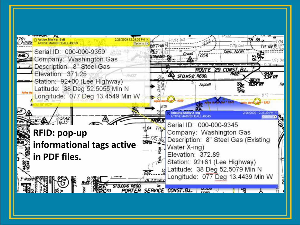
RFID: pop-up informational tags active in PDF files.

Data Collection

The Value of Location
• Regularly spaced RFID markers ensure that you are keeping track of what’s in the ground.
• Tied in with GPS, RFID markers allow automatic as-built creation and easier locating
– Provide unique ID for each piece of inventory

Every Accident can be Catastrophic

Multiple Signals

Problem Becomes Clearer

Abandoned 2” Main Parallels Active 4” Main

Issue is Identified

New Construction and Renewal Projects

Leveraging New Technologies
• One Large LDC will be installing about 5 miles of Tracer Tape in 2012 • Another will be installing Tracer Tape on all new open trench installations • A number of utility operators, including municipal systems, plan to use
both programmable and non-programmable EMS devices
– Gas – Power – Telecommunications – Water – Sewer
• Installations are done parallel to conventional tracer sytems
– (18 gauge or thicker, braided or Neptco Tracer wire systems)
• A study will be conducted and a white paper will be published in 2013

In Summary…
• Technology can greatly assist in dealing with known issues and forecasting future problems
• Technology solutions can be low cost and still be effective
• Technology can assist in analyzing data from multiple legacy systems
• Focus efforts on large threats first
• Share with others what works/ doesn’t
• We must not become complacent. The minimum requirement may not prevent the next catastrophic incident.


Advancements in Plastic Pipe Locating
Corey Willson
3M Locating and Marking Solutions
Austin, Tx

The challenges for utilities globally are three fold:
Where are my assets?
How do I know they are mine?
How do I protect them?
© 3M 2012 All Rights Reserved.

EM Locating
The Benchmark
© 3M 2012 All Rights Reserved.

Locating & Marking
Provides solutions for locating, fault finding, and accurate marking of buried
utilities for companies committed to ensuring safety, quickly restoring outages,
minimizing operating costs and efficiently managing assets.
Telephone Gas CATV Power Water Wastewater GP/Rec Wtr

Locating – Basic Concept
The cable must radiate or transmit an electrical signal so it can be located and traced by a Signal Receiver
Ground
Rod
Cable
Shield
Soil Black
Clip
Far-End
Ground
Near-
End
Ground
Remove
d
Red
Clip
Return Current
Outgoing Current
Strong Signal Decaying Signal
Trans
mitter
Receiver
© 3M 2012 All Rights Reserved.

Capacitive Coupling to Ground
OPEN-
END
SOIL
GROUND
ROD BLACK CLIP
RED CLIP
TRANSMITTER
CABLE SHIELD
CURRENT FLOW
DISTRIBUTED CABLE CAPACITANCE
C C C C C C C
Current flow created by capacitive coupling to ground

Issues with Congestion of Utilities
using EM Locating
Cable Locate
Freq ModeDepth
Alert
577 Dir Pk O f f
97.3 dB
60%
Cable Locate
Freq ModeDepth
Alert
577 Dir Pk O f f
85.2 dB
60%
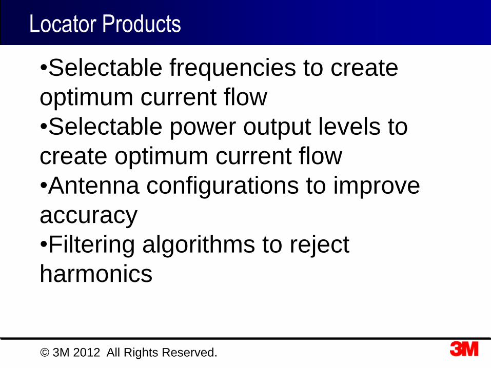
Locator Products
2250M
2250M-ID
2273M
2273M-ID
2273 2250
Best
2500 Series
2220M
Good
2200
Series Best
Cable/Fault
Locate 4 Freqs
Better Cable Locate
4 Freqs
Good Cable Locate
2 Freqs
2573
2573-ID 2550
2550-ID
Better
2200M Series
© 3M 2012 All Rights Reserved.
•Selectable frequencies to create
optimum current flow
•Selectable power output levels to
create optimum current flow
•Antenna configurations to improve
accuracy
•Filtering algorithms to reject
harmonics

What is the best locator in the world ?
The person who is using the locator
© 3M 2012 All Rights Reserved.

Electronic Marking Products
© 3M 2012 All Rights Reserved.

RFID Marker Technology
Enhanced Marker
A.S.I.C
. User
Data
ID
Data
AC/DC
Demodulator
Modulator
Central Control
Unit
Protection
© 3M 2012 All Rights Reserved.

User Input Data
• Facility information
• Owner information
• Location information
• Unique Serial No.
pre-programmed EMS
SIGNAL
BALL
MARKER
SOIL
Locator Energizes
RFID Marker
BALL
MARKER
SOIL
MARKER
SIGNAL
BALL
RFID Data
read by Locator
Electronic Marking

Oil & Gas Marking
Annode Electrodes,
Test points for CPS/CPM
Encasement ends
Access points
Service Stubs
Repair Points
Squeeze points
Valves
Valve Boxes
Non-metallic pipe
Path on straight sections
Bends & Arcs
Depth Changes
Laterals / Tee’s
Crossings
- Water
- Major roads
- Rail
- Other Utilities

Locatable Pipe and Caution Tape
Transforming L&M to Infrastructure Asset Management Solutions
Locating Plastic Pipe
© 3M 2012 All Rights Reserved.

• Tracer wire was not required for non-metallic facilities – No maintenance to maintain a wireline network that doesn’t carry revenue
– Reduced material cost
• No installation costs – No more issues with breakage, corrosion, access points getting lost
• No issues with metallic wires that could attract
lightning or cause other safety issues
• No need for locator transmitters and reduced labor for
location
• No issues associated with electromagnetic locating
and congestion of utilities and bleed over
• No issues with congestion in public right of ways
• No interference from – Nearby utilities
– Chain link fences, guardrails, cars/vehicles, above ground objects
The Dream . . .
© 3M 2011 All Rights Reserved.

How does it work ?
• Detection method:
– Electronic resonant markers are placed 1 - 2m spacing
– Detector based on integrated unit that locates existing marker frequencies and RFID markers, cable/pipe locator option
– Different frequencies will be created for each utility, allowing for differentiation in detection
Detection Pattern
Resonant electronic markers
Conduit
© 3M 2012 All Rights Reserved.
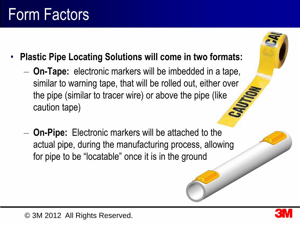
Form Factors
© 3M 2012 All Rights Reserved.
• Plastic Pipe Locating Solutions will come in two formats:
– On-Tape: electronic markers will be imbedded in a tape,
similar to warning tape, that will be rolled out, either over
the pipe (similar to tracer wire) or above the pipe (like
caution tape)
– On-Pipe: Electronic markers will be attached to the
actual pipe, during the manufacturing process, allowing
for pipe to be “locatable” once it is in the ground

• Training on locator is reduced to 10 minutes and location is
always exact even in harsh field conditions. – Reduced complexity of locator and training requirements
– Easier to learn for field technicians, more accurate in difficult field conditions
• Tracer wire not required – No maintenance to maintain a wireline network that doesn’t carry revenue
– Reduced cost
– No installation costs
• Eliminates problems with – Tracer wire breakage
– Access points getting lost or damaged
– Lightning, does not provide a conductive path
– Corrosion
• Locator transmitter not required – Reduced labor to perform a locate since there is no hook up
• No interference from nearby utilities or issues with congestion
Major breakthrough in improving underground safety
Benefits. . .
© 3M 2012 All Rights Reserved.

Thank You !
© 3M 2012. All Rights Reserved.


