1Intelligent Robotics Groupirg.arc.nasa.gov
Maria BualatIntelligent Robotics Group
NASA Ames Research [email protected]
Robotics TechnologyPerception, User Interfaces and Architecture
https://ntrs.nasa.gov/search.jsp?R=20200001289 2020-05-14T13:08:30+00:00Z

2Intelligent Robotics Group
NASA Ames Intelligent Robotics Group
Overview• 40 researchers (>1/3 PhDs)• 20+ student interns yearly• 90+% NASA work • TRL 1 to 9
Research themes• Automated planetary mapping
§ Base maps & terrain models§ Geospatial data systems
• Exploration user interfaces§ Robot & science operations§ Accessible science data
• Robots for human explorers§ Improve efficiency & productivity § Free-flyers, lake lander, & rovers
irg.arc.nasa.gov
3Intelligent Robotics Group
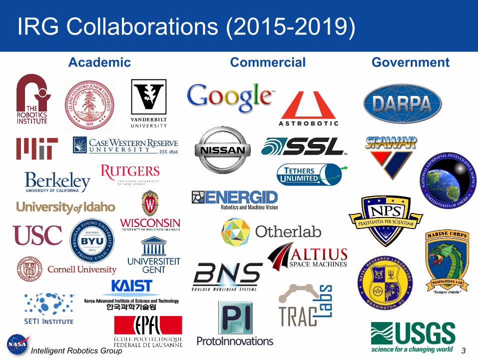
IRG Collaborations (2015-2019)GovernmentAcademic Commercial
ProtoInnovations
4Intelligent Robotics Group
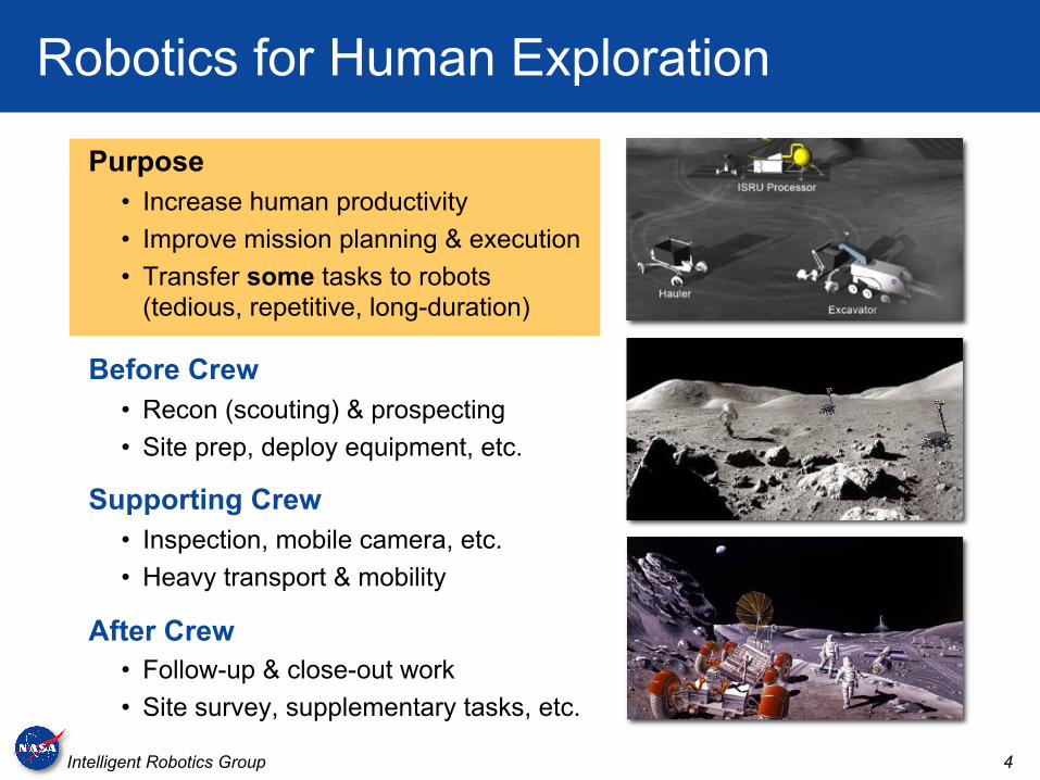
Robotics for Human Exploration
Purpose• Increase human productivity• Improve mission planning & execution• Transfer some tasks to robots
(tedious, repetitive, long-duration)
Before Crew• Recon (scouting) & prospecting• Site prep, deploy equipment, etc.
Supporting Crew• Inspection, mobile camera, etc.• Heavy transport & mobility
After Crew• Follow-up & close-out work• Site survey, supplementary tasks, etc.
5Intelligent Robotics Group
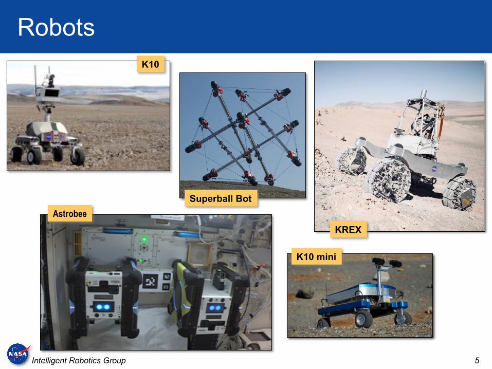
RobotsK10
K10 mini
Astrobee
Superball Bot
KREX
6Intelligent Robotics Group
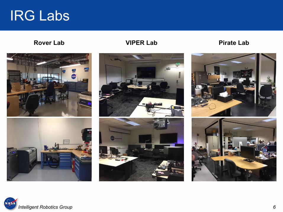
IRG Labs
Rover Lab VIPER Lab Pirate Lab
7Intelligent Robotics Group
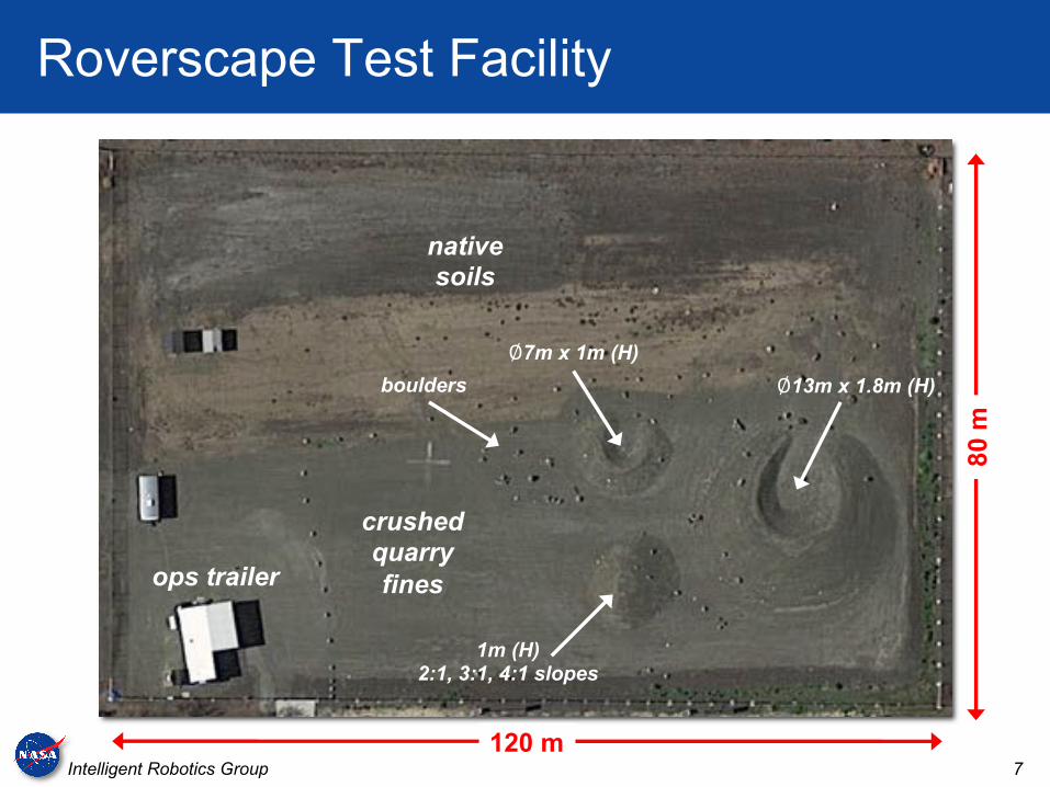
Roverscape Test Facility
120 m
80 m
ops trailer
crushedquarry fines
native soils
∅13m x 1.8m (H)
∅7m x 1m (H)
1m (H)2:1, 3:1, 4:1 slopes
boulders
8Intelligent Robotics Group
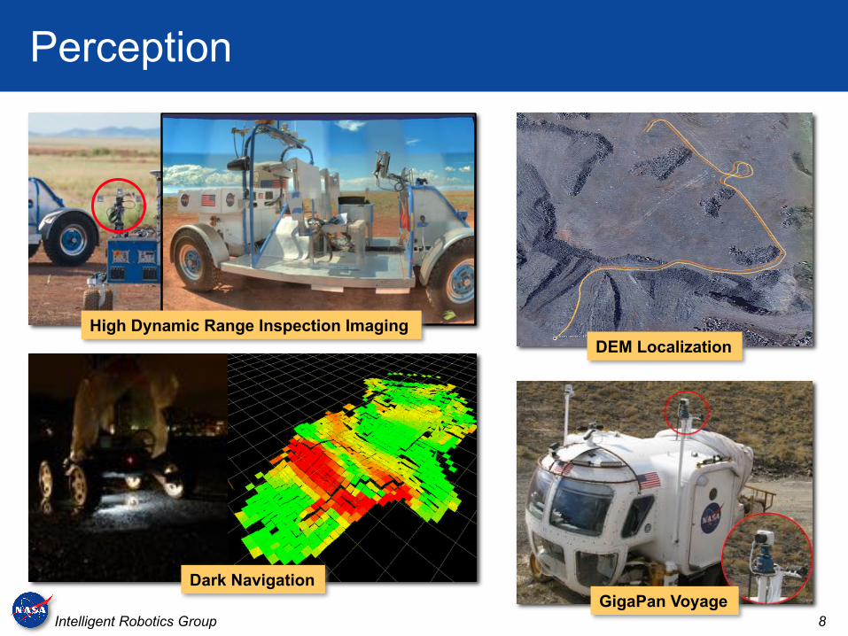
Perception
Dark Navigation
High Dynamic Range Inspection Imaging
GigaPan Voyage
DEM Localization

9Intelligent Robotics Group
User Interfaces
Visual Environment for Remote Virtual Exploration (VERVE) Exploration Ground Data System (xGDS)
10Intelligent Robotics Group
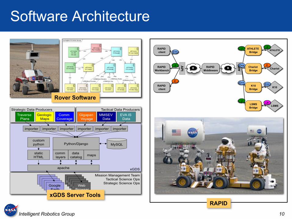
Software Architecture
Strategic Data Producers Tactical Data Producers
xGDS
Mission Management Team
Tactical Science Ops
Strategic Science Ops
MySQL Python/Django
comm
layers
data
catalog maps
apache
custom
python
static
HTML
Earth
Web
Browser Google
Earth Google
Earth Google
Earth Google
Earth
Web
Browser Web
Browser Web
Browser Web
Browser
importer
Gigapan
Voyage
MMSEV
Data
EVA IS
Data
Traverse
Plans
Geologic
Maps
Comm
Coverage
importer importer importer importer importer
RAPID
Workbench Chariot
Chariot
Bridge
RAPID
Middleware
AP
I AP
I
ATHLETE
K10 RAPID
client
LSMS
K10
Bridge
ATHLETE
Bridge
LSMS
Bridge
RAPID
client
C++
J
R C J
LV
C
C++
R
J
C++
C++
J Rover Software
RAPIDxGDS Server Tools

11Intelligent Robotics Group
Open Source Software
VisionWorkbench
RoverSW
Neo GeographyToolkit
(Ames Stereo Pipeline)
Exploration GroundData Systems(xGDS)
Visual Environment for Remote Virtual Exploration (VERVE)
RAPID(NASA robotmiddleware)
Apache 2
Apache 2 Apache 2
Apache 2
Apache 2
NOSA 1.3
NASA TensegrityRobotics Toolkit
Apache 2
Astrobee Robot Software (ARS), Astrobee Simulator, Astrobee Control Station
Apache 2
12Intelligent Robotics Group
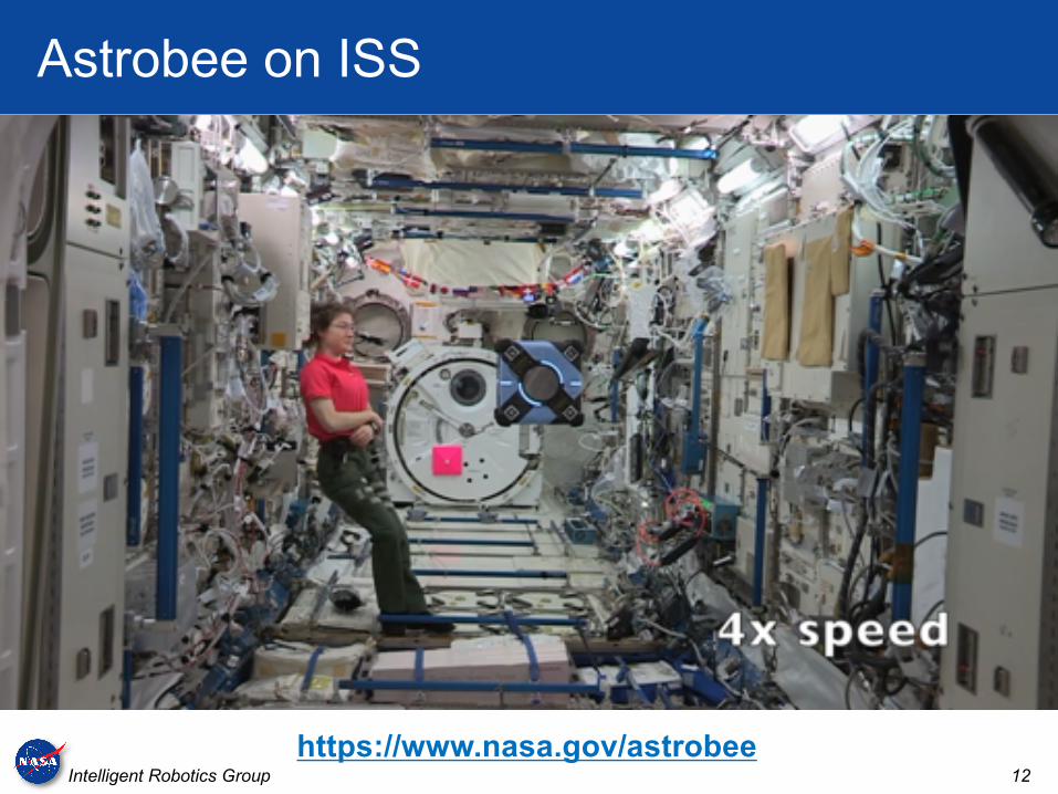
Astrobee on ISS
https://www.nasa.gov/astrobee

13Intelligent Robotics Group
Deep Learning for Flood Mapping (DELTA)
Developing open-source toolkit for deep learning on satellite imagery
Initial application: flood mapping for disaster response
Achieve state of the art classification for Earth scientists with little knowledge of machine learning and limited computing resources
Provides pre-trained compressed representations for various satellites (starting with Worldview, Sentinel-1, and Landsat)
Collaboration between NASA Ames, USGS, NGA, and University of Alabama
DELTA
Training DataNeural Network
ClassifierTraining
Classification
Neural NetworkClassifier
Input Image ClassifiedOutput
14Intelligent Robotics Group
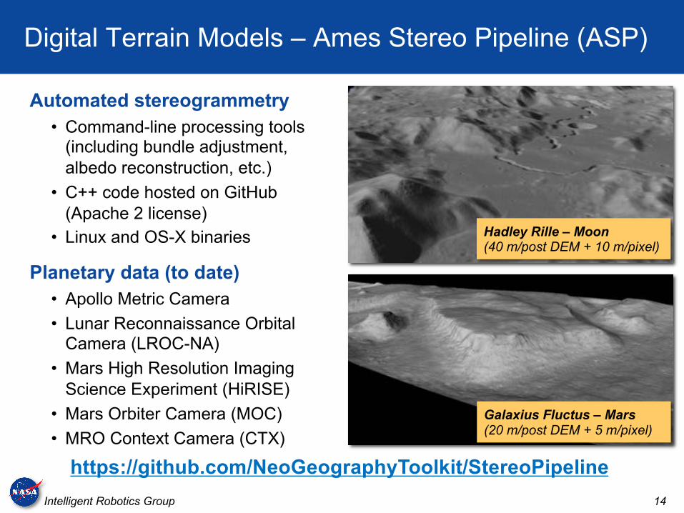
Digital Terrain Models – Ames Stereo Pipeline (ASP)
Automated stereogrammetry• Command-line processing tools
(including bundle adjustment, albedo reconstruction, etc.)
• C++ code hosted on GitHub(Apache 2 license)
• Linux and OS-X binaries
Planetary data (to date)• Apollo Metric Camera• Lunar Reconnaissance Orbital
Camera (LROC-NA)• Mars High Resolution Imaging
Science Experiment (HiRISE)• Mars Orbiter Camera (MOC)• MRO Context Camera (CTX)
https://github.com/NeoGeographyToolkit/StereoPipeline
Hadley Rille – Moon(40 m/post DEM + 10 m/pixel)
Galaxius Fluctus – Mars(20 m/post DEM + 5 m/pixel)
15Intelligent Robotics Group
ASP for Earth
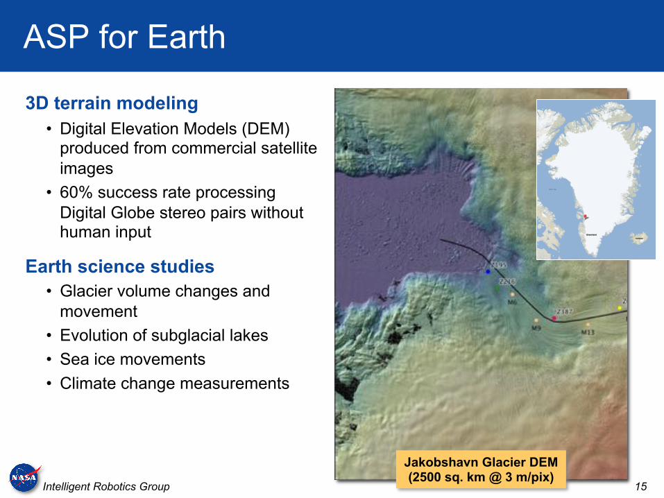
3D terrain modeling• Digital Elevation Models (DEM)
produced from commercial satellite images
• 60% success rate processing Digital Globe stereo pairs without human input
Earth science studies• Glacier volume changes and
movement• Evolution of subglacial lakes• Sea ice movements• Climate change measurements
Jakobshavn Glacier DEM(2500 sq. km @ 3 m/pix)
16Intelligent Robotics Group
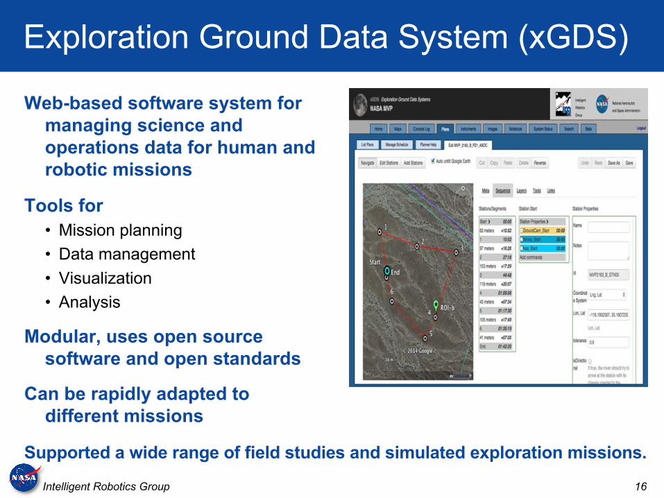
Exploration Ground Data System (xGDS)
Web-based software system for managing science and operations data for human and robotic missions
Tools for• Mission planning• Data management• Visualization• Analysis
Modular, uses open source software and open standards
Can be rapidly adapted to different missions
Supported a wide range of field studies and simulated exploration missions.
17Intelligent Robotics Group
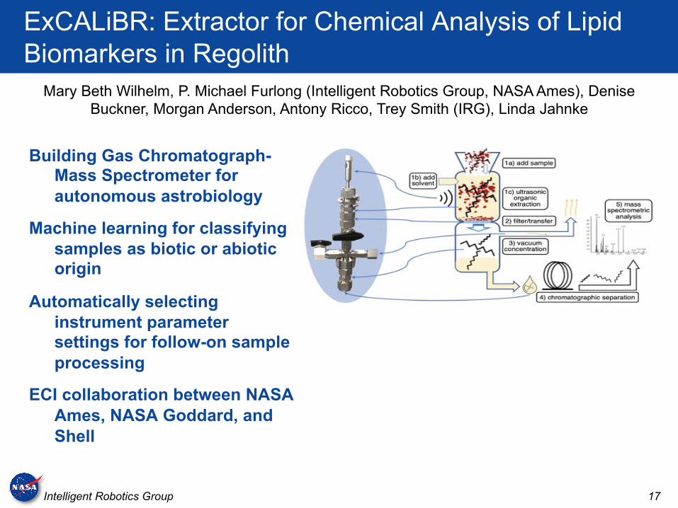
ExCALiBR: Extractor for Chemical Analysis of Lipid Biomarkers in Regolith
Building Gas Chromatograph-Mass Spectrometer for autonomous astrobiology
Machine learning for classifying samples as biotic or abiotic origin
Automatically selecting instrument parameter settings for follow-on sample processing
ECI collaboration between NASA Ames, NASA Goddard, and Shell
Mary Beth Wilhelm, P. Michael Furlong (Intelligent Robotics Group, NASA Ames), Denise Buckner, Morgan Anderson, Antony Ricco, Trey Smith (IRG), Linda Jahnke
18Intelligent Robotics Group
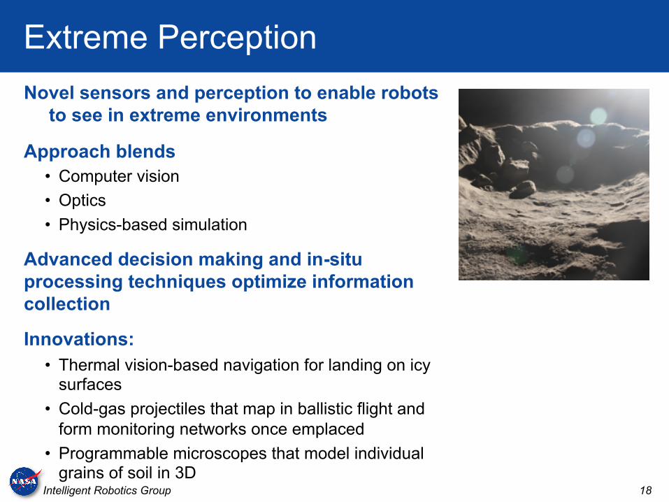
Extreme PerceptionNovel sensors and perception to enable robots
to see in extreme environments
Approach blends• Computer vision• Optics• Physics-based simulation
Advanced decision making and in-situ processing techniques optimize information collection
Innovations:• Thermal vision-based navigation for landing on icy
surfaces• Cold-gas projectiles that map in ballistic flight and
form monitoring networks once emplaced• Programmable microscopes that model individual
grains of soil in 3D
19Intelligent Robotics Group
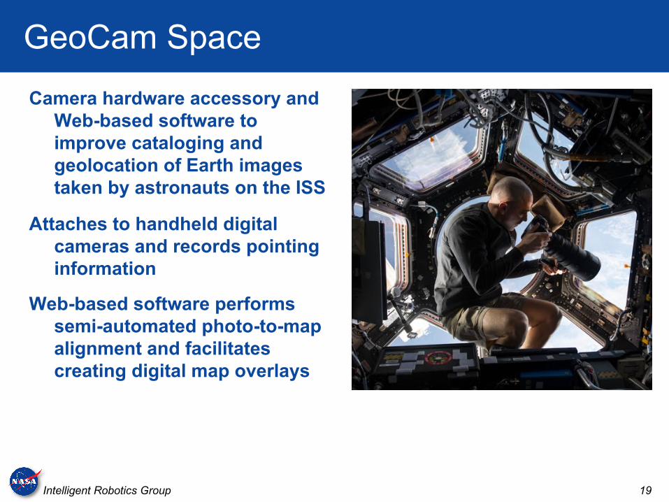
GeoCam Space
Camera hardware accessory and Web-based software to improve cataloging and geolocation of Earth images taken by astronauts on the ISS
Attaches to handheld digital cameras and records pointing information
Web-based software performs semi-automated photo-to-map alignment and facilitates creating digital map overlays
20Intelligent Robotics Group
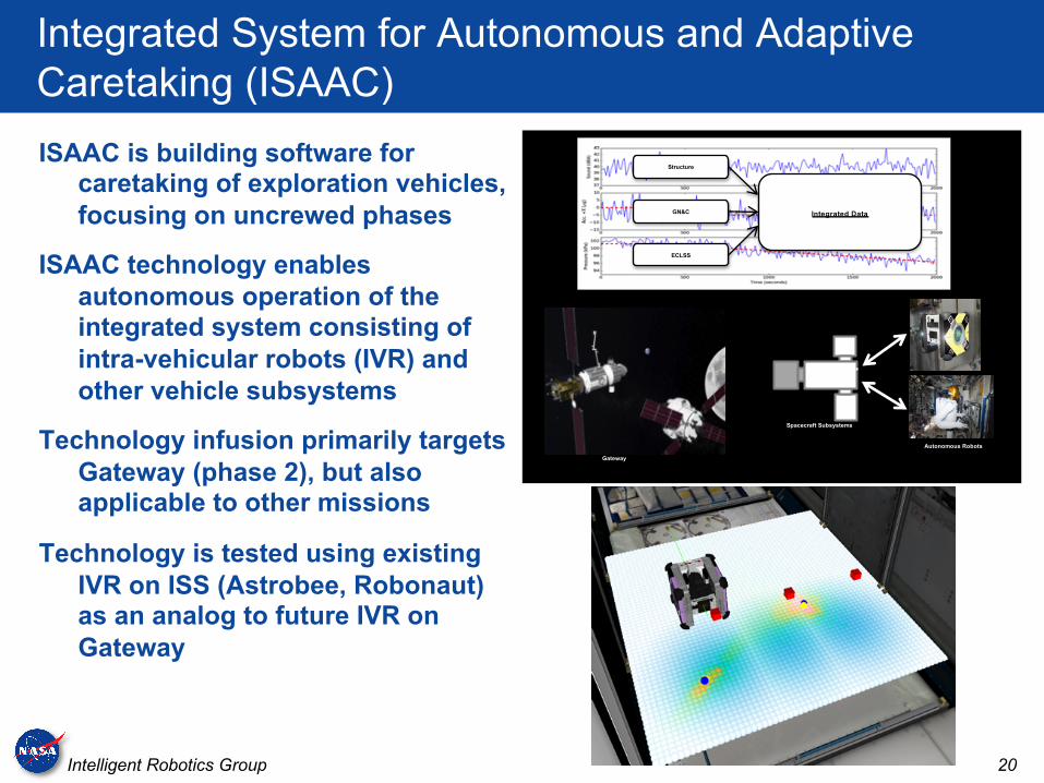
Integrated System for Autonomous and Adaptive Caretaking (ISAAC)
ISAAC is building software for caretaking of exploration vehicles, focusing on uncrewed phases
ISAAC technology enables autonomous operation of the integrated system consisting of intra-vehicular robots (IVR) and other vehicle subsystems
Technology infusion primarily targets Gateway (phase 2), but also applicable to other missions
Technology is tested using existing IVR on ISS (Astrobee, Robonaut) as an analog to future IVR on Gateway
Gateway
Spacecraft Subsystems
Autonomous Robots
Structure
Integrated DataGN&C
ECLSS
21Intelligent Robotics Group
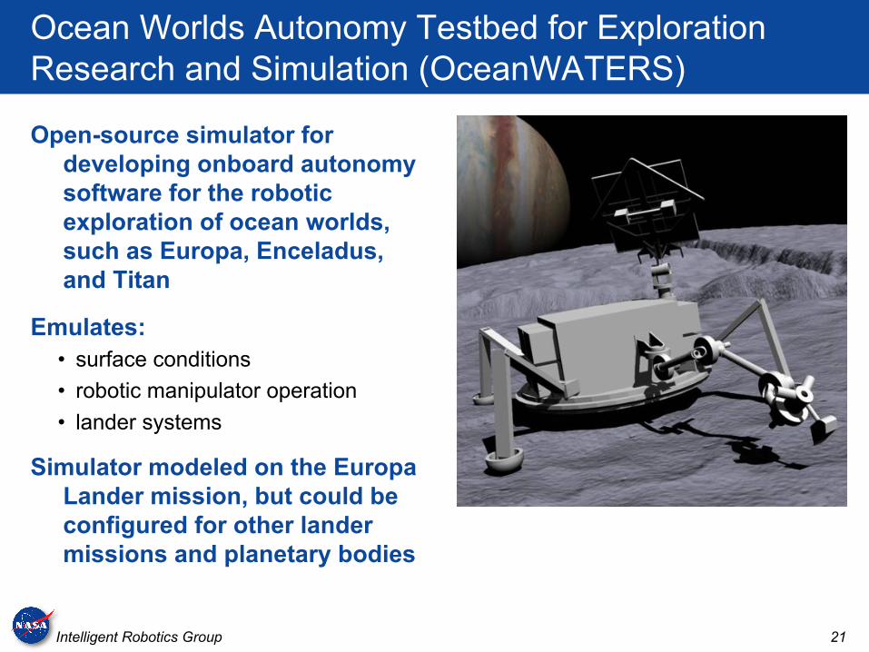
Ocean Worlds Autonomy Testbed for Exploration Research and Simulation (OceanWATERS)
Open-source simulator for developing onboard autonomy software for the robotic exploration of ocean worlds, such as Europa, Enceladus, and Titan
Emulates:• surface conditions• robotic manipulator operation• lander systems
Simulator modeled on the Europa Lander mission, but could be configured for other lander missions and planetary bodies
22Intelligent Robotics Group
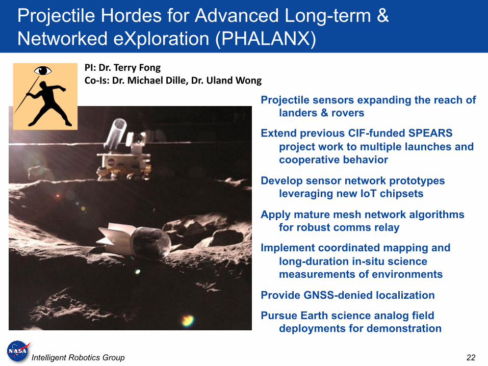
Projectile Hordes for Advanced Long-term & Networked eXploration (PHALANX)
Projectile sensors expanding the reach of landers & rovers
Extend previous CIF-funded SPEARS project work to multiple launches and cooperative behavior
Develop sensor network prototypes leveraging new IoT chipsets
Apply mature mesh network algorithms for robust comms relay
Implement coordinated mapping and long-duration in-situ science measurements of environments
Provide GNSS-denied localization
Pursue Earth science analog field deployments for demonstration
PI: Dr. Terry FongCo-Is: Dr. Michael Dille, Dr. Uland Wong
23Intelligent Robotics Group
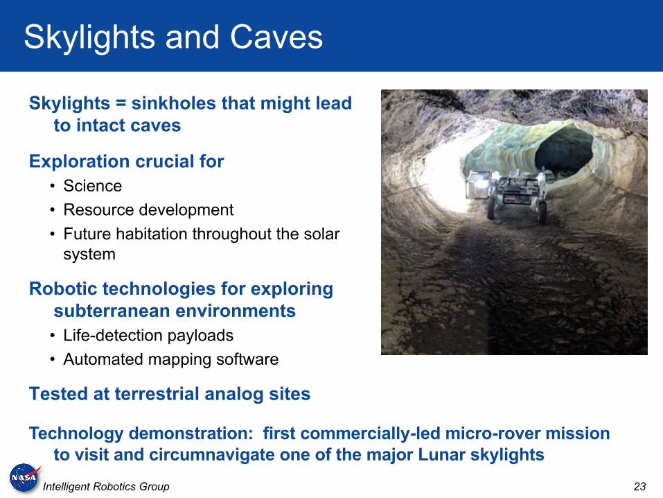
Skylights and Caves
Skylights = sinkholes that might lead to intact caves
Exploration crucial for• Science• Resource development• Future habitation throughout the solar
system
Robotic technologies for exploring subterranean environments• Life-detection payloads• Automated mapping software
Tested at terrestrial analog sites
Technology demonstration: first commercially-led micro-rover mission to visit and circumnavigate one of the major Lunar skylights
24Intelligent Robotics Group
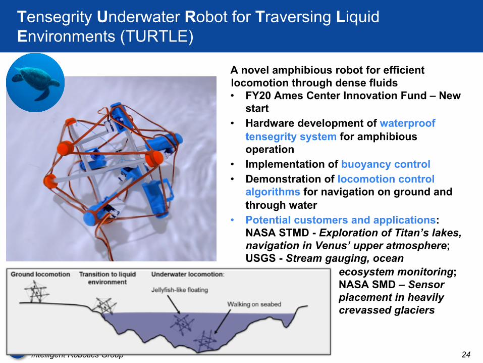
Tensegrity Underwater Robot for Traversing Liquid Environments (TURTLE)
A novel amphibious robot for efficient locomotion through dense fluids• FY20 Ames Center Innovation Fund – New
start• Hardware development of waterproof
tensegrity system for amphibious operation
• Implementation of buoyancy control• Demonstration of locomotion control
algorithms for navigation on ground and through water
• Potential customers and applications: NASA STMD - Exploration of Titan’s lakes, navigation in Venus’ upper atmosphere; USGS - Stream gauging, ocean
ecosystem monitoring; NASA SMD – Sensor placement in heavily crevassed glaciers
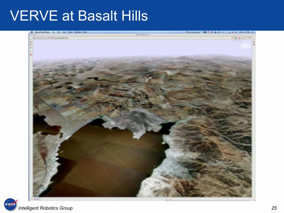
25Intelligent Robotics Group
VERVE at Basalt Hills

26Intelligent Robotics Group
Volatiles Investigating Polar Exploration Rover (VIPER)
2023 rover mission
Search for subsurface volatiles (e.g. water ice) in the polar regions of the Moon
IRG Role:• Onboard software• Navigation systems• Robot driving tools• 3D Lunar terrain maps from
satellite images for mission planning
• Software to support high-tempo science operations

27Intelligent Robotics Group
Questions?
Intelligent Robotics GroupIntelligent Systems Division
NASA Ames Research Center
irg.arc.nasa.gov
![Google apps and Python para Python Brasil [7]](https://cdn.vdocuments.mx/doc/165x107/54972bf7ac79590e2e8b52e4/google-apps-and-python-para-python-brasil-7.jpg)


