
1
Mangrove Ecosystems, Communities and Conflict: Developing Knowledge-based
Approaches to Reconcile Multiple Demands
Mangroves in Thailand
Kasetsart University9th November 2005
NACA Secretariat Office, Bangkok
OutlineGeneral information
Loss of mangroves
Management practices
Ecological & management issues
Criteria for site selection
Conclusion & recommendation

2
General information
Location of ThailandSituation of mangroves Species of mangrovesDistribution of mangroves
Thailand, centrally located in the Indochina Peninsula
The total area of Thailand is 513,115 sq.km.
76 provinces
Location of Thailand

3
Situation of mangroves in Thailand
Thai coast = 2,670 km (Gulf of Thailand =1,870 km, Andaman Sea = 800 km)
Mangrove forest covers 23 provinces along the coast
More mangrove in South: Andaman
Mangrove area: decreased about 0.12 Million Rai(1.58 Million Rai* in 2000 1.46 Million Rai in 2004)
Caused by human activities, especially shrimp farming
* 625 Rai = 1 Sq.km.
Three Groups of Mangrove Species
1. Pioneer species community
2. Rhizophora species community
3. Mixed species community

4
1. Pioneer species community
Avicennia alba (Sa Mae Kao)
Avicennia marina (Sa Mae Tale)
2. Rhizophora species community
Rhizophora mucronata (Kong Kang Bai Yai)
Rhizophora apiculata (Kong Kang Bai Lek)

5
3. Mixed Species community
Bruguiera sexangula(Pang Ka Hua Sum Dok Khao) พงักาหัวสุมดอกขาว
Bruguiera gymnorrhiza(Pang Ka Hua Sum Dok Daeng)
พงักาหัวสุมดอกแดง
Ceriops decandra (Prong Khao)โปรงขาว
Ceriops tagal (Prong Daeng)โปรงแดง
3. Mixed Species community (2)

6
Nipa fruticans (Ton Jak)
3. Mixed Species community (3)
Distribution of mangroves in Thailand by region
- 119,158.90 1,460,621.86 1,579,780.77 Total
- 37,030.02 178,985.70 216,015.72 South: Gulf of Thailand
- 44,040.41 1,089,592.61 1,133,633.02 South: Andaman
- 25,106.22 39,733.80 64,840.02 Central
- 12,982.25 152,309.76 165,292.01 East
Changes(Rai)
Mangrove area (Rai)
2004
Mangrove area (Rai)
2000Region

7
Eastern part
- 12,982.25 152,309.76 165,292.01 Total area (East)
- 3,575.56 7,341.99 10,917.55 Chachoengsao5
0.00 4,547.87 4,547.87 Chon Buri4
- 2,045.15 9,718.86 11,764.01 Rayong3
- 5,315.87 73,264.48 78,580.35 Chantaburi2
- 2,045.68 57,436.55 59,482.23 Trat1
Changes (Rai)
Mangrove area (Rai) 2004
Mangrove area (Rai) 2000 ProvinceNo.
Central part
- 25,106.22 39,733.80 64,840.02 Total area (Central)
- 12,614.88 6,550.71 19,165.59 Phetchaburi5
- 3,426.31 12,530.26 15,956.57 Samut Songkhram4
- 8,722.34 10,530.41 19,252.75 Samut Sakhon3
- 711.81 2,537.28 3,249.09 Bangkok2
369.12 7,585.14 7,216.02 Samut Prakan1
Changes (Rai)
Mangrove area (Rai) 2004
Mangrove area(Rai) 2000 ProvinceNo.

8
South: Andaman
- 44,040.41 1,089,592.61 1,133,633.02 Total area
(South: Andaman)
- 23,537.50 222,284.09 245,821.59 Satun6
- 32,359.74 191,317.17 223,676.91 Trang5
6,310.69 225,649.07 219,338.38 Krabi4
- 1,220.66 10,504.20 11,724.86 Phuket3
14,148.39 276,884.87 262,736.48 Phangnga2
- 7,381.61 162,953.19 170,334.80 Ranong1
Changes (Rai)
Mangrove area (Rai) 2004
Mangrove area (Rai) 2000ProvinceNo.
South: Gulf of Thailand
- 37,030.02 178,985.70 216,015.72 Total area
(South:Gulf of Thailand)
- 3,333.84 23,106.03 26,439.87 Pattani7
- 13,245.33 8,559.78 21,805.11 Songkhla6
- 932.00 422.38 1,354.38 Phatthalung5
4,361.23 64,236.87 59,875.64 Nakhon Si Thammarat4
- 17,442.82 40,684.22 58,127.04 Surat Thani3
- 5,007.77 40,284.03 45,291.80 Chumphon2
- 1,429.50 1,692.38 3,121.88 Prachuap Khiri Khan1
Changes (Rai)
Mangrove area (Rai)
2004
Mangrove area (Rai)
2000ProvinceNo.

9
Loss of Mangroves
in Thailand
Loss of Mangroves in Thailand (1)The population has increased: 26 M (1960) to 59 M (1995) and 63 M (2003).
The nation’s economy has grown continuously, resulting in an increase in income/capita/year from 2,100 THB (1961) to 77,000 THB (1996) and 62,800 THB (2002).
However, increases in population and economic development have led to the uncontrolled use of large quantities of natural resources.
Such unsustainable use has resulted in serious environmental degradation.
Mangroves suffered the same fate as other natural resources, with mangrove areas being used for industry, agriculture, and residential areas beyond the limits of their natural ability to regenerate.
This caused rapid loss and damage to Thailand’s mangroves.
(Source: UNEP/GEF/SCS/RWG-M: National Action Plan of Thailand, 2004)
10
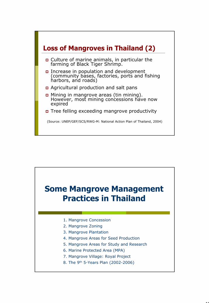
Loss of Mangroves in Thailand (2)
Culture of marine animals, in particular the farming of Black Tiger Shrimp.
Increase in population and development (community bases, factories, ports and fishing harbors, and roads)
Agricultural production and salt pans
Mining in mangrove areas (tin mining). However, most mining concessions have now expired
Tree felling exceeding mangrove productivity
(Source: UNEP/GEF/SCS/RWG-M: National Action Plan of Thailand, 2004)
Some Mangrove Management Practices in Thailand
1. Mangrove Concession
2. Mangrove Zoning
3. Mangrove Plantation
4. Mangrove Areas for Seed Production
5. Mangrove Areas for Study and Research
6. Marine Protected Area (MPA)
7. Mangrove Village: Royal Project
8. The 9th 5-Years Plan (2002-2006)

11
1. Mangroves Concession
The first mangroves concession was issued in 1968 and in the first 15 year period, concessions have been issued for 310 felling series with the area of 1,769.49 Sq.km.
Since 1996 all mangrove cutting concessions have been suspended.
2. Mangroves Zoning in ThailandIn order to reduce the conversions of mangrove to the minimum, the national mangrove forest zoning and management measures was approved by the Cabinet resolution on 15 December 1987 (UNEP, 1998):
Classifying mangrove forest area into 3 zones:1. Conservation Zone: 426 Sq.km. (11.46%) 2. Economic Zone A: 1,996 Sq.km. (53.61%)3. Economic Zone B: 1,300 sq.km. (34.93%)

12
Mangrove Zoning: The Conservation Zonewhere all utilization and disturbances are prohibited; this includes:
a) Areas for preservation of economic plants and animals
b) Nursing grounds for plant and animals
c) Areas susceptible to damage and erosion
d) Historic areas
e) Area with local uniqueness
f) National parks, tourist areas, wildlife sanctuaries, non-hunting areas
g) Wind shield areas
h) Area significant for research
i) Area significant for environmental and ecological preservation
j) Areas more than 20 m. from natural rivers or streams, or more than 70 m. from the sea coast.
Mangrove Zoning: Economic Zone A
In which only sustainable uses of mangrove trees are permitted; this includes:
a) Concession areasb) Community forestsc) Mangrove plantations

13
Mangrove Zoning: Economic Zone B
For degraded mangroves in which other land uses and developments are allowed but which must consider the environment; this includes:
a) Agriculture (crops, husbandry, fisheries, salt farms)b) Industry (mining, factories)c) Urban areasd) Trading and commercial arease) Piers and harborsf) Others.
According to this cabinet resolution, shrimp farms will be allowed only in Economic Zone B and by renting or concession from the Government only. However, as of 23 July 1991 the cabinet issued another resolution to prohibit any new concessions of any kind in any mangrove zone.
3. Mangroves Plantation (1)Since 1960
2 main mangrove sps Rhizophora apiculata and R. mucronata
Other species such as Ceriops spp. and Bruguiera spp.
1991 - 1996 the government planted mangroves through a number of various projects but the average annual increase was only 320 Sq.km.
The private sectors have participated in government programs andwere able to plant about 480 Sq.km./ year (1994 – 1999).
However, these numbers are still low and are unable to substitute for mangrove areas which have been damaged.
(Source: UNEP/GEF/SCS/RWG-M: National Action Plan of Thailand, 2004 and
Havanond, S., http://www.assn.moe.go.th/: April 2, 2005)

14
Mangrove plantation (2)
4. Mangrove Areas for Seed ProductionIn order to serve the mangrove plantation project during 1992 - 1996
The government has supported budget about 275 MTHB to construct 4 mangrove seedling production centers in Trat and PhangngaProvince in 1992, Nakhon Si Thammarat and Satun Province in 1993
(Source: Havanond, S., http://www.assn.moe.go.th/: April 2, 2005)

15
5. Mangrove Areas for Study and Research
The cabinet's resolutions on 1 May 1984 and 27 April 1993 were issued to establishment the Mangrove Research Center in Ranong
Mangrove Research and Conservation Stations in all important coastal ecosystems
6. Marine Protected Area (MPA)Marine National Park (MNP)
Department of National Parks, Wildlife and PlantConservation (DONP), Ministry of Natural Resourcesand Environment (MONRE)21 MPAs cover 5,810.23 sq.km. (1.13% of the country)4 MPAs applying to become World Heritage Sites :Tarutao, Surin, Similan and Ao Phangnga MNP
(Source: The World Commission on Protected Areas 2nd Southeast Asia Regional Forum, IUCN, 1999 + http://www.mekong-protectd-areas.org :Nov 3, 2003)

16
7. Mangrove Village: Royal Project
By DMCR to celebrate HerMajesty’s 6th cycle or 72nd
birthday anniversary
In the preliminary step
E.g., Mangrove village project in Village 1, KhlongYang Sub-district, Koh LantaDistrict, Krabi Province
Village locationVillage boundaryMangrove area: 906 Rai
8. The 9th Socio-Economic Development plan: 5-Years Plan (2002-2006)
Efforts to conserve coastal resources including mangroves.
The new Environmental Quality Promotion Act has improved coastal management by declaring environment protection zones in several areas to strengthen local capabilities for environmental management.

17
Issues
Ecological issuesManagement issues
Ecological issuesConversion of mangrove areas to shrimp farm area
Sludge discharged from shrimp farm
Waste & Solid water discharged from communities
Mangrove area encroachment e.g. mangrove cutting for Oil palm plantation, settlement
Tourism development in mangrove area
18
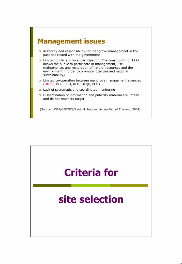
Management issuesAuthority and responsibility for mangrove management in the past has rested with the government
Limited public and local participation (The constitution of 1997allows the public to participate in management, use, maintenance, and restoration of natural resources and the environment in order to promote local use and national sustainability)
Limited co-operation between mangrove management agencies (DMCR, DOF, LDD, RFD, DEQP, PCD)
Lack of systematic and coordinated monitoring
Dissemination of information and publicity material are limited and do not reach its target
(Source: UNEP/GEF/SCS/RWG-M: National Action Plan of Thailand, 2004)
Criteria for
site selection
19
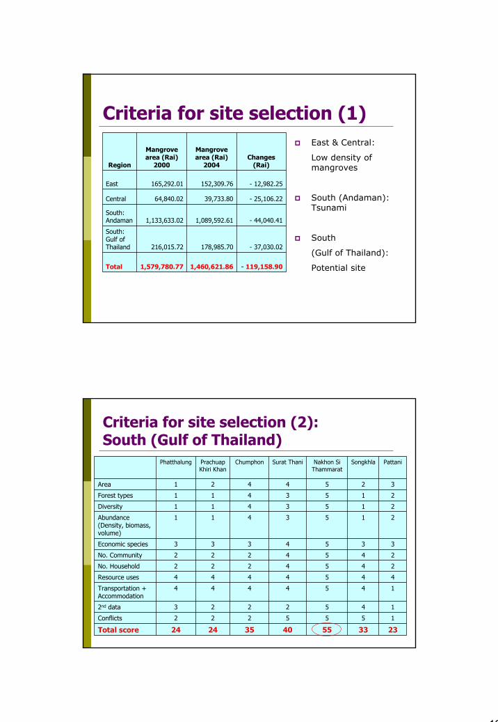
Criteria for site selection (1)
- 119,158.90 1,460,621.86 1,579,780.77 Total
- 37,030.02 178,985.70 216,015.72
South: Gulf of Thailand
- 44,040.41 1,089,592.61 1,133,633.02 South: Andaman
- 25,106.22 39,733.80 64,840.02 Central
- 12,982.25 152,309.76 165,292.01 East
Changes(Rai)
Mangrove area (Rai)
2004
Mangrove area (Rai)
2000Region
East & Central:
Low density of mangroves
South (Andaman): Tsunami
South
(Gulf of Thailand):
Potential site
Criteria for site selection (2): South (Gulf of Thailand)
23335540352424Total score
1555222Conflicts
14522232nd data
1454444Transportation + Accommodation
4454444Resource uses
2454222No. Household
2454222No. Community
3354333Economic species
2153411Abundance (Density, biomass, volume)
2153411Diversity
2153411Forest types
3254421Area
PattaniSongkhlaNakhon SiThammarat
Surat ThaniChumphonPrachuapKhiri Khan
Phatthalung

20
Conclusion and RecommendationNakhon Si Thammarat is received the highest scores
Mangroves of Thailand have been heavily exploited for shrimp farming since 1975.
Various management programs have been done to conserve and maintenance mangroves.
To manage & conserve mangroves,People participation is needed
People capacity building should be conducted
Need the co-operation between mangrove management agencies
Monitoring programs should be set in systematic way
Information distribution is also needed
Thank you very much


