
EU Regional Workshop on Space Application in Latin America08 September 2017, Santiago - Chile
By Aureline BorelGalileo Services Permanent Representative
GNSS Services and Applications: Views from the European GNSS Downstream Industry

Focus: GNSS Downstream SegmentApplications, Services, Equipment
Space
Segment
Ground
Segment
User
Segment
Galileo/EGNOS Infrastructure
Applications / Downstream Segment
Other GNSS

European GNSS Downstream Industry
▪ At the forefront of many technological innovation in many areas
▪ Ranges all domains:
▪ Chipset design and manufacturing▪ Integration and certification of major systems▪ Provision of innovative services
▪ Leading position in GNSS security and resilience domains
▪ Leader in systems integration in Surveying & Agriculture
▪ Strong position in system integration Rail & Road
▪ Strong performance in Road, Surveying & Maritime
▪ Performs strongly in the development of value-addedapplications
.
European companies account for 25% of the global GNSS market

▪ Non-profit organisation founded in 2002
▪ Designed to be a major partner for the Galileo downstream technology and business development
▪ Members include companies from the whole GNSS value chain :
R&D Services providersEquipment manufacturers Chip producers
▪ Activities: ▪ Meetings with European GNSS programmes main stakeholders▪ Dissemination of strategic information to GS members ▪ Organisation of regular working meetings…
▪ Galileo Services federates the most active and representative players ofGNSS industry & research supporting the Galileo & EGNOS Programmes
▪ Substantial investments in research projects on the development of applications leveraging Galileo differentiators in all domains
▪ Direct involvement in the definition of the European GNSS services
Galileo Services Association

Contact : Aureline Borel, Permanent Representative – [email protected] further information : www.galileo-services.org
Galileo Services & OREGIN together represent a community of almost
180 organisationsranging from SMEs to large companies and academia
Join our forces!

Contact : Aureline Borel, Permanent Representative – [email protected] further information : www.galileo-services.org
Galileo Services Growing Community
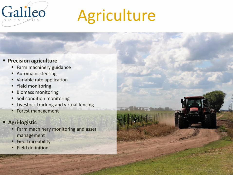
Agriculture
▪ Precision agriculture▪ Farm machinery guidance ▪ Automatic steering ▪ Variable rate application ▪ Yield monitoring ▪ Biomass monitoring ▪ Soil condition monitoring ▪ Livestock tracking and virtual fencing ▪ Forest management
▪ Agri-logistic▪ Farm machinery monitoring and asset
management ▪ Geo-traceability▪ Field definition

SERVICEPROVIDERS
(RECEIVERS & OTHERS)
Farmers & Contractors
Firms providing compatible products with Galileo
Agriculture system integratorsCLAAS, Leica Geosystems AG, Novatel
Receivers for field measurements in agriculture
Leica Geosystems AG, Javad
Augmentation for cm-level precision
Septentrio, Sogei, Veripos, Leica, Javad
Receivers for agriculture machinesSeptentrio, Leica, Novatel, Javad
VeriposSeptentrioSogeiJavadLeica
SeptentrioNovatel JavadLeica
MANUFACTURERS
VENDORS
CLAAS
INSURANCE PROVIDERS
FARM MANAGEMENTSOLUTIONS & APPLICATION PROVIDERS
END
USERSTRACTORAUGMENTATION
COMPONENTS
DEVICE
MANUFACTURERS
Leica GeosystemsNovatel
CLAAS
System integrators
European & Galileo Services Key Players

Key features
▪ 544 channels for tracking all known and future signals from GPS, GLONASS, GALILEO, BEIDOU, IRNSS, QZSS & SBAS on both antennas
▪ Precise and solid heading calculation
▪ centimetre-level (RTK) and dm-level (PPP) position accuracy
▪ Dual L-band channel with support for TerraStar corrections
▪ Solid performance even in regions of evaluated ionospheric activity
▪ Technology to maintain tracking during heavy vibration machine
▪ Integrated cellular modem, Bluetooth and WiFi; optional UHF radio
Multi-constellation, dual antenna GNSS receiver
Machine guidance in agriculture, construction & mining industry
AsteRx-U
USE CASE

28/08/2017
Surveying
▪ Land Surveying Applications▪ Cadastral surveying▪ Construction surveying
▪ Machine control▪ Person-based
▪ Mapping▪ Mine Surveying▪ Infrastructure Monitoring
▪ Marine Surveying Applications▪ Seabed exploration▪ Tide and current estimation▪ Offshore surveying

Examples of compatible products with Galileo
ReceiversSeptentrio, Leica Geosystems, Javad
Surveying system integratorsKongsberg, Leica Geosystems AG
Augmentation for cm-level precision
SOGEI, Veripos, Leica Geosystems, Javad
KongsbergLeica Geosystems AG
FugroSeptentrioVeripos Leica GeosystemsJavad
AUGMENTATION SERVICE PROVIDERS
SYSTEM INTEGRATORS (RELEVANT ESPECIALLY FOR MACHINE CONTROL)
•Constructors •Educators •Engineers •Environmentalists •Farmers •Mining companies •Oil & Gas companies •Scientists •Surveyors
SOFTWARE, APPLICATIONS AND ADDED VALUE SERVICES
PROFESSIONAL USERS
KongsbergSeptentrioLeica GeosystemsNovatelJavad
COMPONENTS AND RECEIVER MANUFACTURERS
FugroVeripos SOGEIGMV
European & Galileo Services Key Players

USE CASE
High precision surveying and mapping
PREGEO: Italian Land Registry Map Update Information System:
▪ Management of the Cadastral Cartography Automatic UpdatingSystem
▪ 300,000 map updates/year through hybridization of GNSS andtraditional topographic measurements performed byProfessional Surveyors
GRDNet (GNSS R&D Network):
▪ Experimental GNSS Augmentation System
▪ Provides innovative GNSS High Precision corrections for theItalian Land Revenue Agency activities with advanced IntegrityMonitoring systems
GNSS High Precision topography and digitalised cartography Supported by Advanced GIS technologies, Developed for the Italian Revenue Agency

Aviation
▪ Regulated applications▪ Performance Based Navigation (PBN)▪ Emergency Locator Transmitters (ELTs)▪ Automatic Depended Surveillance (ADS-B)
▪ Unregulated applications▪ Moving maps▪ Infringement alarms▪ Personal Locator Beacons (PLBs)

DEVICE
International AirportsPrivate AirportsRegional Airports
Examples of compatible products with Galileo
EGNOS-enabled avionicsAirbus Helicopters, Bombardier, Thales
UAS (Unmanned Aerial Systems) receiversSeptentrio, Trimble, Javad, Novatel, u-blox
HoneywellThales Avionics
Airbus Bombardier
MANUFACTURESAIRLINES / AIRCRAFT OWNERS
AERODROMESAIR NAVIGATION
SERVICE PROVIDERS
MANUFACTURERSAIRCRAFT
Main Airlines AlliancesUser Group Associations
Main Organisations: CANSOICAO
European & Galileo Services Key Players

TopStar CCertified GNSS receiver solution for every flight phase
Reliable navigation and approach for aircraft and helicopters
Benefits• EASA and FAA certifications• High precision navigation system• Linefit and retrofit device• At the cornerstone of avionic navigation systems: LPV, RNP, SBAS, GBAS & ADS-B
New opportunities for the future• Upgrade of TopStar with multi-constellation capability: GPS and Galileo• Crucial role in the development and testing of safety/liability critical solutions for all
forms of transportation, including rail
USE CASE

Maritime
▪ Navigation▪ Sea: SOLAS vessels, Non-SOLAS vessels ▪ Inland Waterways (IWW)
▪ Positioning▪ Traffic management and surveillance▪ Search and Rescue▪ Fishing vessel control▪ Port operations▪ Marine engineering

MARITIME(RECEIVERS &
OTHERS)
SAR ResponseCoast GuardsCoordinationCentresCospas-SarsatJoint Rescue
Port authoritiesSurveillance authoritiesExamples of compatible products with Galileo
Maritime navigation applicationKongsberg, Septentrio, Fugro Furuno, Leica Geosystems AG, Javad,Novatel
Vessel navigation equipmentFuruno, Fugro
CIRMIALAIAPH & ESPOICS & BIMCOIMOIMPA & EMPA
FurunoNovatelOroliaTrimble
MANUFACTURESSYSTEM INTEGRATORS
SAR BEACON MANUFACTURERS
USERS OF POSITIONINGINFORMATION
USERSORGANIsATIONS
COMPONENTS
OroliaGMV
Kongsberg Maritime Furuno
Ship owners/operators
Fishing boatOperatorsOff-shore operatorsSole marinersRecreational Boaters
European & Galileo Services Key Players

High-performance positioning services, primarily to the offshore oil and gasindustry
USE CASE (1/2)
Users
▪ Offshore support vessels
▪ Drilling ships and rigs
▪ Floating production units
▪ Shuttle tankers
▪ Service vessels
▪ Offshore loading vessels
Benefits
▪ 24/7 worldwide support
▪ Highest levels of signal reliability to ensure continuoussignal reception
▪ Independent augmentation solutions providing additionalredundancy
▪ Sub metre and decimetre level accuracy services
▪ Unique purpose made L-band antenna for low elevationsatellites
▪ GNSS capability using GPS, GLONASS, BeiDou & Galileo
▪ Compatible with Kongsberg Seatex DPS/DARPS systems

AUTONOMOUS SHIPS▪ E-GNSS / Multi Constellation GNSS▪ Sensor Fusion / Proximity Sensing including Radar, LiDAR, Surround Cameras, AIS/VDES,
Broad-Band Communications, AIS/Radar/Communications Infrastructure▪ Full scale commercial projects
FOUNDATION
▪ Integrated GNSS solutions
▪ Trondheim unique Autonomous Ships Test Range
▪ Reliable solutions from offshore DP operations
▪ Unmanned operation
▪ Close cooperation between industry, academia and authorities
▪ Innovative logistics solutions
▪ Environmentally friendly concepts
USE CASE (2/2)

Rail
▪ Main Line Command & Control Systems applications
▪ Asset Management
▪ Low Density Line Command & Control Systems applications
▪ Passenger Information applications
▪ Driver Advisory System (DAS)

RECEIVERMANUFACTURERS
SYSTEM INTEGRATORS
TRAIN MANUFACTURERS
TRAIN OWNERS OPERATORS
Car ownersCar sharing operatorsCommercial vehicle driversEnforcersFleet operatorsInsurance CompaniesMember statesRoad Network Operators
Examples of compatible products with Galileo
Component manufacturers
Septentrio, Thales, Leica, CSR, Furuno,, u-blox, Javad, Novatel
Rail positioning applications
Command and control systems : Ansaldo, Thales
Nottingham Scientific Limited SeptentrioErwinKayser-ThredeLeica CSRFurunoU-bloxJavad
Ansaldo STSGMVSiemens
Bombardier Siemens
Urban transport operatorsConsortiaInvestment BanksNational Companies
INFRASTRUCTURE
MANAGERS
European & Galileo Services Key Players

SAE-R®All-in system for railway transport operation, management and planning
USE CASE
Basic principles
▪ Designed for passenger and goods railway operators
▪ Fleet tracking based on GNSS, odometer and track-side balises - Sub-meter accuracy
▪ Planning, management and operation tools
▪ Permanent, real-time communications
▪ 24/7 control center
Onboard segment Control center Passenger information

Road
▪ Smart mobility applications▪ Navigation▪ Fleet management▪ Satellite road traffic
monitoring
▪ Safety-critical applications ▪ Cooperative ITS▪ Advanced Driver Assistance
Systems (ADAS)▪ Autonomous Vehicles▪ Dangerous goods tracking
▪ Safety-critical applications ▪ Cooperative ITS▪ Advanced Driver Assistance
Systems (ADAS)▪ Autonomous Vehicles▪ Dangerous goods tracking
▪ Regulated applications ▪ eCall▪ Smart tachographs
▪ Liability-critical applications ▪ Road User Charging (RUC) ▪ Insurance telematics

COMPONENTS MANUFACTURERS (RECEIVERS AND OTHERS)
TIER 1 SUPPLIERS
USERSVEHICLE MANUFACTURERS
MARKET DEVICE VENDORS
SERVICE PROVIDERS
FDCGMVFurunoSTMicroU-blox
Car ownersCar sharing operatorsCommercial vehicle driversEnforcersFleet operatorsInsurance CompaniesMember statesRoad Network Operators
Bosch Continental Siemens FICOSA
Traffic information providers TOMTOM
BMWDaimler
TOMTOM
Examples of compatible products with Galileo
Type of navigation devicesIn-vehicle systems: Continental, SiemensPND: TOMTOM
Automotive chipsetFuruno, ST Microelectronics, u-blox
Road tollingOn-board units: Bosch, Siemens, GMV
System Integrators
European & Galileo Services Key Players

First Secured, Trusted and Resilient GNSS Receiver for ITS applications
Two-in-One device: GNSS & Secure MCU
▪ GNSS replay, spoofing & meaconing attack mitigation
▪ GNSS interferences & jamming detection
▪ Attack identification
▪ Galileo OS authentication capability
▪ Ciphered or/and signed data delivery
▪ Additional IT security services
▪ Tamper resistant
▪ Automotive grade
USE CASE
Applications
Pay as you drive, Intelligent car sharing, Fleet management, RUC, ADAS, In-vehicle Systems, Digital Tachograph, Dangerous Goods Transport
Contact: [email protected]

Location-Based Services
▪ Navigation
▪ Mapping & GIS
▪ Geo marketing and advertising
▪ Safety and emergency
▪ Enterprise applications
▪ Sports
▪ Games/Augmented reality
▪ mHealth
▪ Personal Tracking
▪ Social networking

SYSTEMS INTEGRATOR
S
Mass Market Users,Professional Users,Users With Special Needs, Retailers
Examples of compatible products with Galileo
Chipsets: u-blox
U-BLOXHertz Systems
MANUFACTURES
GLORYTECHFDC
VALUE-ADDED SERVICES PROVIDERS(RECEIVERS
& OTHERS)
USERS
COMPONENTS
European & Galileo Services Key Players

Personal trackingSafety of the elderly, children, organised groups, participants of outdoor games & sports events
Tangible benefits▪ Location of the monitored person known at all times (Accuracy ~2 meters)▪ Combines the benefits of a GNSS transmitter and a mobile phone▪ Real-time visualisation of the monitored person location▪ Determining safe areas associated with SMS messages when the perimeter is left ▪ Easy to use – two buttons for all of its functions▪ Very low weight of 65 g▪ Resistance to weather conditions
USE CASE

▪ Telecommunication applications▪ Digital Cellular Network (DCN)▪ Public Switched Telephone Network (PSTN)▪ Professional Mobile Radio (PMR)▪ Satellite Communication (SATCOM)▪ Small cells
▪ Finance applications▪ Phasor Measurement Units▪ Stock Exchanges
▪ Energy applications▪ Phasor Measurement Units
Timing & Synchronisation

COMPONENTS MANUFACTURERS (RECEIVERS AND
OTHERS)
DEVICESYSTEM INTEGRATORS
DESIGN CONSULTANCIESTESTING & MAINTENANCE
NETWORK OPERATORS
Banks and Stock ExchangesTelecom OperatorsTransmission System Operators
SeptentrioSTMicroelectronicsu—bloxNovatel
Spectracom7-solutions
EricssonNokiaSiemens
MANUFACTURERS
European & Galileo Services Key Players

Conclusion


