
BOWTHORPECONSERVATION AREA APPRAISALNUMBER 11 OCTOBER 2013

CONSERVATION AREAS IN NORWICH:
PAGE 2 // CONSERVATION AREA APPRAISAL // BOWTHORPE
A14
0
A140
B1108
A147
A47
RiverYare
River Y
are
River Wensum
1. CITY CENTRE
2. BRACONDALE
3. NEWMARKET ROAD
4. HEIGHAM GROVE
5. THORPE ST ANDREW
6. SEWELL
7. EATON
8. TROWSE MILLGATE
9. EARLHAM
10.OLD LAKENHAM
11.BOWTHORPE
12.MILE CROSS
13.THORPE HAMLET
14.THORPE RIDGE
15.UNTHANK & CHRISTCHURCH
16.HELLESDON VILLAGE
17.ST MATTHEW’S

INTRODUCTION
04HISTORICDEVELOPMENT
07URBAN DESIGN ANDSTREETSCAPE
15ARCHITECTURE
19NATURAL CHARACTER
23
MANAGEMENT ANDENHANCEMENT
27FURTHER READING
31LISTED BUILDINGSREGISTER
31LOCAL LIST REGISTER
31
CONTENTS:
PAGE 3 // CONSERVATION AREA APPRAISAL // BOWTHORPE
Front cover: History Wall by Tim Weatherstone

PAGE 4 // CONSERVATION AREA APPRAISAL // BOWTHORPE
INTRODUCTION
The appraisal assesses the characterand appearance of the Bowthorpeconservation area and includesproposals for its management andenhancement. This is in line withsections 69 and 71 of the Planning(Listed Building and ConservationAreas) Act 1990.
The appraisal was subject to public consultation during July 2013and was approved by the city council’scabinet on 9 October 2013. It shouldbe read in conjunction with nationalpolicy advice on the historicenvironment set out in the NationalPlanning Policy Framework (NPPF) andwith adopted and emerging localplanning policies for Norwich.
Policies in the site allocations anddevelopment management policiesplans will replace the policies of the2004 local plan once adopted – this is expected mid 2014.
Bowthorpe is a relatively smallconservation area centred on andcharacterised by the historic buildingsof Bowthorpe Church and BowthorpeHall, with the wider parkland ofBowthorpe Hall to the east.
Since the 1970s the fields thatsurround the settlement have beenextensively redeveloped as a newresidential suburb of Norwich. Thenew settlement has been plannedaround the three new ‘village centres’
of Clover Hill to the north-east,Chapel Break to the north-west,and Three Score to the south andeast. The population of the widerBowthorpe settlement area iscurrently approximately 15,000.
The historic buildings and parkland that constitute theconservation area provide animportant link to the historicsettlement and its rural past.Additional community facilities such as the Worship Centre,community garden, and communityworkshops in former agriculturalbuildings, mean that the area is stillvery much at the centre and heartof the wider local community.
Bowthorpe was designated a conservation areaon 6 December 1983. The area lies to the westof the city and currently covers 6.9 hectares(16.9 acres).
Bowthorpe Hall by Aaron Kelly

PAGE 5 // CONSERVATION AREA APPRAISAL // BOWTHORPE
The area can be divided into threeseparate character areas: BowthorpeHall and its curtilage within the historicboundary wall (sub area A); the church,estate cottages and farm outbuildingsto the west of the hall, (it is proposedto extend the boundary to include theadjacent lane); and parkland and openspace to the south and east (sub area C.)
The south-west corner of theconservation area is proposed to bedeleted because it has been developedwith modern housing and thereforefeels different in character from the rest of the conservation area. A smallarea has also been included to thenorth-west to include all of the lane to the west of the Worship Centre, the cottages and the workshops.
The houses no longer in theconservation area are 20 to 43 Tolye Road.
“Summer Sanctuary” by Sean Chard
Afternoon sun on my back,I amble along a grey and pittedpath –soft breezes fan hedgerows,trees whisper with distant crowds.The sweet air of mid-summer joins meLike warmed honey and torn grass.
I swim in a sea of undulatingpasture which swells with huesof iridescent green and gold.Three fluorescent darts clip thetops – small flashes of lightabove brushes of meadow.
Blazes of sapphire chasingcolonies of tiny insects, theircream-buff bellies exposed incut throat turns – they break from formationto rise high in soft curves,feeding on shoals from out of the sun.
I watch the dance climb upwards,winged performers free-fall andSkim corridors of pasture,feeding on-the-wing, flittingback and forth, circling in gracefulturns – a circus of acrobats.
Their rambling warbles and humsOf contentment tumble downAs I stroll past nettles and docks,Afternoon sun on my back andThis mid-summer memory of Bowthorpe’s trail stays with me.
Azaria and ‘Honey’ listening in by Sally Simpson

PAGE 6 // CONSERVATION AREA APPRAISAL // BOWTHORPE
CONSERVATION AREA MAP
DPP9135 Bowthorpe conservation area appraisal consultation - Final Oct 2013:Layout 1 15/10/13 17:09 Page 6

PAGE 7 // CONSERVATION AREA APPRAISAL // BOWTHORPE
HISTORIC DEVELOPMENT
The settlement of Bowthorpe hasan established history dating backto pre-conquest times. The nameBowthorpe derives from the word‘Boethorp’, a mixture of Saxon andViking words. Archaeological digshave discovered Saxon coins and abrooch dating back to 700-800 AD.
The hamlet is recorded in 1086 in theDomesday Survey as ‘Boethorp’ beingheld by Hakene, a Saxon, although thename is likely to be a derivative of theOld Norse, or Viking name, ‘Hákon’.
The name ‘Boethorp’ is derived from theold Norse words ‘Boge’ or ‘Bok’ meaningcurve, and Anglo-Saxon ‘Thorpe’ or theDanish ‘Torp’ which means a village orsmall collection of houses.
Bronze Age burials were found near thewater tower in Chapel Break and this isthought to be the location of an earliersettlement. Various Roman coins havealso been found in the area indicatingthat a track once crossed the area fromDereham Road through to the ford atColney, and onto Caistor St Edmund.
Following the Conquest, the landaround Bowthorpe became Crownland, and was handed downthrough a succession of manorialfamilies, including the Peverellsand Leyhams.
The Domesday Survey states that therewere fourteen tax paying men living in the settlement (along with theirwives and children). Ten of these were‘villeins’ and three serfs. ‘Villein’ wasthe name given to the lowest order ofserf, effectively tied to labouring on
Bowthorpe has its origins as a manorial settlement dating back to theDomesday Survey and earlier. The surviving historic buildings provide animportant historic link to the social history of the village, in particular theremnants of the feudal farming system and historic connections betweenthe landowning family and Catholicism in the 16th and 17th centuries.During the 18th and 19th centuries the hall became a commercialfarmstead, and for much of the later 20th century, was well known as the Bell Language School. The school moved out in 2006, and the hall hassubsequently been used as offices. The rural isolation of the settlementchanged dramatically during the 1970s and 1980s when the surroundingfields were acquired and earmarked for development as a new settlement,becoming the largest planned urban extension to Norwich.

PAGE 8 // CONSERVATION AREA APPRAISAL // BOWTHORPE
HISTORIC DEVELOPMENT
the land under the Lord of the manorand not allowed to leave the villagewithout permission (so not muchbetter than slavery). The survey recordstwo plough teams operating theCrown land, held as part of the royalestate, and two teams working thetenanted land, held by the Lord of themanor. There was a pannage (an areafor free range rearing of pigs) for 16hogs, and 10 acres of meadow, onemill, seven hogs and 16 sheep.
The feudal system of farming wasintroduced to England from France by the Normans, and the practise ofserfdom remained little changed untilthe 14th century when shortage of
labour caused by the plaques such as the Black Death made tiedagricultural labouring impractical.Elements of the manorial practise of farming however remained andformed the basis of landowning and farming in some cases into the 20th century.
Bowthorpe was on the list ofsettlements qualifying for relief in 1353 due to the Black Death. The Black Death had a significantimpact on the way in whichagricultural settlements weremanaged across the country, although Bowthorpe appears to have remained relatively prosperous.
In 1420 the lands were sold to the College of St Mary In the Fields (the ‘Chapel-in-the-fields’). St. Mary’s was built on the site of the Assembly House, and partsof it survive in the fabric. Its landsreached as far as the city wall, and included Chapelfield Gardens,hence its name.
De-population of the settlementoccurred toward the end of the 15thand 16th centuries due to the earlieracts of enclosure, where wealthier and more prosperous farmers beganto enforce the enclosure of commonland. In 1577 it was reported that 66 acres had been enclosed atBowthorpe, 44 acres of which hadbeen converted to grain, and that two houses had become derelict.
The oldest building in thesettlement is the church of StMichael and All Angels, now aruin, which was first recorded andconsecrated in 1304. Much of thepresent church was rebuilt in theearly 15th century in flint, as wasthe case with many other churchesin Norfolk, a sign of relativeprosperity deriving from the wooland worsted trades.
Robert Ladbroke’s drawing of St Michael and All Angels c1850 (© Norfolk County Council)

PAGE 9 // CONSERVATION AREA APPRAISAL // BOWTHORPE
HISTORIC DEVELOPMENT
Originally the church is known to havehad a round tower. Round towers datefrom the Saxon period through to theearly 12th century, and were acommon feature of Norfolk villages,where cut stone to provide structuralstrength to corners was scarce andexpensive. It was cheaper and moreefficient to build circular towers withlocal flints. In towns and cities many ofthese towers were later replaced withsquare towers in the more prosperous15th century, however in more ruralsettlements with smaller populations,round towers survived.
During the 16th century, Englandwent through a particularly difficultperiod with rising tensions between
the Protestant Church of Englandfounded by Henry VIII, and theCatholic Church led from Rome.The College of St Mary in the Fieldswas disestablished by Henry VIII in the early 1540s and sold to itsformer Dean, Miles Spencer.
Although the reformation causedconsiderable change, many ‘noble’ landowning Catholic families remained richand powerful. In order to keep theirversion of the Christian faith, practisingCatholics often worshiped in secret toavoid the attention and disapproval ofthe reigning monarchs. Bowthorpe wastypical of a number of smaller manorialsettlements where the landownerssought to keep their Catholic faith.
Following the death of Spencer in 1569, Bowthorpe fell into thehands of the Cornwallis family,who appear to have granted it theCatholic Yaxley family. The Yaxleyswere united through marriage with the Waldegraves of CostesseyHall, and for a time members ofthe latter family also lived atBowthorpe Hall.
During the late 16th century in the reign of the Protestant QueenElizabeth I, the church is thought tohave been deliberately made ruinous.At that time churches were required to hold Protestant Church of Englandservices unless they were ruinous.Many manors held by Catholic familiescontinued to hold Catholic services inthe privacy of their own houses, whilstallowing their parish churches to fallinto ruin, or in some cases deliberatelydamaged. At Bowthorpe it is recordedthat at the end of the 16th centurythe nave had become a barn, and thetower a dovecot.
In 1635 Mathew Wren, a notoriousHigh Churchman (ie someone whopromoted a more traditional andconservative liturgy) became theBishop of Norwich. (Wren was the uncle of the famous architectChristopher Wren.) Wren wasassociated with Laudianism – an early
Matthew Wren (1585-1667) Bishop of Norwich(1635-1638)
Sir Robert Yallop (1636-1705) ‘The King ofBowthorpe’

PAGE 10 // CONSERVATION AREA APPRAISAL // BOWTHORPE
O.S. MAP 1906-1914 BOWTHORPE HISTORIC MAP

PAGE 11 // CONSERVATION AREA APPRAISAL // BOWTHORPE
O.S. MAP 1955-66 BOWTHORPE HISTORIC MAP

PAGE 12 // CONSERVATION AREA APPRAISAL // BOWTHORPE
HISTORIC DEVELOPMENT
17th century protestant doctrine – and was a notorious persecutor ofPuritans. He ordered the rebuilding of the church by Thomas Yaxley.
The rebuilding work had been carriedout by the summer of 1639 at a costof £131 6s 8d. The salary of a priestwas ordered to be paid by Yaxley andall others after him, however followingthe ruling, the church appears to haveagain fallen back into ruin, perhapsthis time due to the depopulation ofthe parish and the decline in churchgoing in general during the 18thcentury. By 1792 the church was againunroofed. Following the English CivilWar and the rise of the Puritians,Wren was imprisoned in the Tower of London between 1641 and 1659for his Laudianist religious practices.
In 1660 the Yaxleys passed the estateto Sir Robert Yallop (1636-1705).Around 1620 Henry Yaxley, in order to avoid his estate being confiscatedas a practising Catholic, conveyed the property to Browne of Colney as a trustee. He appears to have been dishonest, and the hall was‘rescued’ by Yaxley’s friend and former neighbour Yallop during theCommonwealth. In return he wasgiven the estate by Yaxley. AlthoughYallop’s father came from the nearby
parish of Bawburgh, Yallop himselfwas educated at Wadham CollegeOxford, and was a practicing LondonBarrister at Grays Inn, being knightedin 1664.
The present hall is considered tohave been extensively rebuilt byYallop (probably as his countryseat) and dates from the late 17thcentury, with the principal façadeto the east being re-fronted circa1700 in the Queen Anne style. The bust in the east elevation ofthe hall is generally supposed to be Sir Robert Yallop in his moremature years.
In 1751 the Bacon Franks of Campsall Hall, Yorkshire, bought the estate along with nearby Earlham Hall and parts of Colney.During the 19th century the houseand its estate was leased as afarmstead. In 1836 John Howlettleased the land as a tenant farmer and remained for 28 years. There is ahistoric record in the Sheffield archivesof Frederick Bacon Frank of CampsallPark, Yorkshire, which details theleasing of Bowthorpe Hall to JohnHowlett together with outbuildings,13 cottages, and 1,095 acres of land, lying in Bowthorpe, Earlham,Bawburgh, Colney and Tunstall
in Norfolk; for £1,524. 15s per yearfor 12 years.
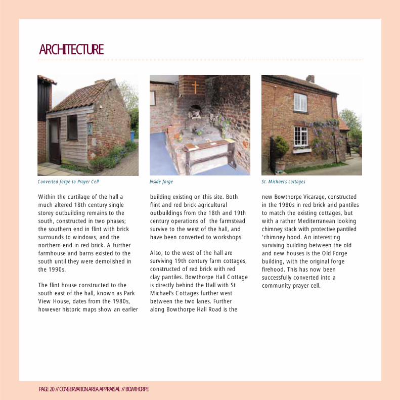
From this period there is an old forgebuilding with the original forgefirehood surviving. This has now beenconverted to a prayer cell, associatedwith St Walstan, who is a patron saint of farmworkers and animals. St Walstan gave up a privileged life to work as a farm labourer amongpeasants in Taverham, where he died.He was buried in nearby Bawburgh.
On September 20 1877 the localhistorian, The Reverend AugustusJessopp, presented his archaeologicalpaper on the history of the settlementto the visiting Norwich and NorfolkArchaeological Society. He told thestory of the settlement, including thehistoric connections to Catholicism.This account is available from theNorfolk and Norwich Library LocalStudies Section.
In 1930 the estate was sold to theOverland family. Bill Overland was a self-made businessman who ran acement firm and both the Haymarketand De Luxe cinemas in Norwich. Hisson refurbished the hall in 1938, butdied in 1943. His son inherited thehall, but chose not to permanently livethere, being a very active businessman

PAGE 13 // CONSERVATION AREA APPRAISAL // BOWTHORPE
HISTORIC DEVELOPMENT
himself, and a director of Sainsbury’ssupermarkets.
During the second world war the hallwas leased to the RAF and severalfighter aces are understood to havestayed at the hall, including DouglasBader. During the 1960s the land of the estate was leased to CaptainThorndick Dawson of Costessey, and the hall appears to have beenneglected, until being taken over byBell Language School. For the first few years this was a summer school,becoming a fully operating languageschool in 1969. The school operated in the building until 2006, after whichthe Hall was developed as offices.
The school was a hive of activityduring the 70s and 80s, full ofinternational students who playedtennis and croquet on the lawns.English and creative writing studentsfrom the UEA often helped out parttime as teachers, including the well-known novelist Ian McEwan.
More recently the area has beensubject to initiatives to increase theawareness of the history of the site.Former farm buildings were convertedto community buildings in the mid1980s assisted with donations fromLady Bader and the Conservativecabinet member William Waldergrave, a direct descendent of the 17th
century Waldergrave family. In 2008the Bowthorpe Community Gardenwas opened on the site of an 18thcentury barn to the south west of the hall, and in 2009 the church ruins were repaired and consolidatedand the landscape of the churchimproved to create a garden. Thedevelopment of the adjacent ThreeScore site to the east will see the area,particularly the park land immediatelyto the east, become further enhancedand more actively used for informalrecreation as the population of thesettlement grows.
19th century croquet game at Bowthorpe Hall (© Norfolk county Council)
Chris Davis calling a folk dance in church gardensby Sally Simpson

PAGE 14 // CONSERVATION AREA APPRAISAL // BOWTHORPE
HISTORIC DEVELOPMENT
History Plaque by St. Michael’s Workshop (DuncanGordon, Jonathon England and David George)
PAGE 15 // CONSERVATION AREA APPRAISAL // BOWTHORPE
URBAN DESIGN AND STREETSCAPE
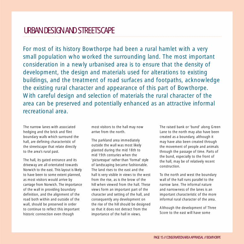
For most of its history Bowthorpe had been a rural hamlet with a verysmall population who worked the surrounding land. The most importantconsideration in a newly urbanised area is to ensure that the density ofdevelopment, the design and materials used for alterations to existingbuildings, and the treatment of road surfaces and footpaths, acknowledgethe existing rural character and appearance of this part of Bowthorpe.With careful design and selection of materials the rural character of thearea can be preserved and potentially enhanced as an attractive informalrecreational area.
The narrow lanes with associatedhedging and the brick and flintboundary walls which surround thehall, are defining characteristic of the streetscape that relate directly to the area’s rural past.
The hall, its gated entrance and itsdriveway are all orientated towardsNorwich to the east. This layout is likelyto have been to some extent planned,as most visitors would arrive bycarriage from Norwich. The importanceof the wall in providing boundarydefinition, and the alignment of theroad both within and outside of thewall, should be preserved in order to continue to reflect this importanthistoric connection even though
most visitors to the hall may nowarrive from the north.
The parkland area immediately outside the wall was most likelyplanted during the mid 18th to mid 19th centuries when the‘picturesque’ rather than ‘formal’ style of landscaping became fashionable. The land rises to the east and the hall is very visible in views to the westfrom the rise, as is the brow of the hill when viewed from the hall. Theseviews form an important part of thecharacter and setting of the hall, andconsequently any development on the rise of the hill should be designedso that it does not detract from theimportance of the hall in views.
The raised bank or ‘bund’ along GreenLane to the north may also have beencreated as a boundary, although itmay have also been created throughthe movement of people and animalsthrough the passage of time. Parts ofthe bund, especially to the front of the hall, may be of relatively recentconstruction.
To the north and west the boundarywall of the hall runs parallel to thenarrow lane. The informal nature and narrowness of the lanes is animportant characteristic of the moreinformal rural character of the area.
Although the development of ThreeScore to the east will have some

PAGE 16 // CONSERVATION AREA APPRAISAL // BOWTHORPE
URBAN DESIGN AND STREETSCAPE
impact on the character of the GreenLane to the north-east of the sitethrough the provision of a bus lane to the shopping centre, general traffichas been restricted. Elsewhere in theconservation area, any enhancementof the lanes and paths should respectin terms of design and use ofmaterials the more rural character of this part of the Bowthorpe area.
There is a distinct change in characterbetween the area within the boundarywall of the Hall and the area outside.Within the curtilage, it is importantthat the house remains dominant, and in particularly the open space to
the east, to the front of the principalfacade. In the south east corner thewalled garden is a characteristicfeature of the ‘small’ country houseand therefore contributes to theoverall character of the listed building.The character of the walled garden as an enclosed space needs to bepreserved if any development occurswithin it.
To the south and east the open spacesretain a sense of being picturesquegrazed land. Any new paths should be designed to fit in with this morerural character i.e. treated more as a ‘country’ rather than ‘urban’ park.
To the south of the conservation arealarge pylons dominate over housingand the landscape and are very visiblein views. It is proposed that thesepylons are removed and electricityplaced underground as part of theThree Score development proposals.
Any development within the walledgarden should also take into accountthe wider setting of the hall andrespect the architectural hierarchybetween the hall and the simplerbuildings and structures that surround it.
Boundary wall to Bowthorpe Hall with historicGreen Lane in background
Landscape separation between area insideboundary wall and the parkland setting
Old wall near St Michael’s Cottages

PAGE 17 // CONSERVATION AREA APPRAISAL // BOWTHORPE
URBAN DESIGN AND STREETSCAPE
DPP9135 Bowthorpe conservation area appraisal consultation - Final Oct 2013:Layout 1 15/10/13 17:09 Page 17

PAGE 18 // CONSERVATION AREA APPRAISAL // BOWTHORPE
URBAN DESIGN AND STREETSCAPE MAP
DPP9135 Bowthorpe conservation area appraisal consultation - Final Oct 2013:Layout 1 15/10/13 17:09 Page 18

PAGE 19 // CONSERVATION AREA APPRAISAL // BOWTHORPE
ARCHITECTURE
Bowthorpe Church is now aconsolidated ruin of flint with somestone dressing and later brick repair. A modern worship centre was built in red brick adjacent to the historicchurch in 1984 and designed by localarchitect Peter Codling. Ayers (2001)considers that the church was likely to have been built in three phases:Initially, the church was constructedtowards the end of the 12th centurywith a characteristic round tower.
The second phase took place in the15th century with the construction ofthe Chancel, at a time when Norfolkwas relatively prosperous with theburgeoning wool and garment trades.
The present ruinous phase dates fromthe end of the 18th century. A drawingby Robert Ladbroke as part of his seriesof Norfolk Churches shows the churchas a ‘picturesque’ ruin in 1850. Thereis evidence that the round tower was
deliberately destroyed by fire in thelate 18th century after it had beenused as an oven.
Evidence for the construction of theChurch was extensively recorded byAyers and published in Two MedievalChurches in Norfolk 2001 NMASOlwen Beazley.
The present Bowthorpe Hall dates from17th century with the imposing redbrick east façade dating from circa1700. The east façade is an applied skinof red/orange brick with fine jointingand rubbed brick quoins of some qualityin order for the building to keep up-to-date with fashion, and to make itappear ‘high status’. There is someindication that this façade was alsorendered or lime-washed, however thequality of brickwork with cut (‘rubbed’)bricks and fine pointing suggest that itwas originally intended to be exposed.
The north and west wings wereconstructed in the 1980s in red brickand have effectively created a rearenclosed courtyard. Both the red brickwalled garden and curtilage boundarywalls remain intact and have beensubject to ongoing repairs.
The conservation area is characterised principally by Bowthorpe Hall, itsancillary farm outbuildings and workers cottages, and the ruins of St Michaeland All Angels Church alongside the adjacent modern Worship Centre.Within the settlement there is a distinct difference between the ‘polite’ andhigh status architecture of the hall and church, and the more ‘vernacular’ andfunctional architecture of the surviving agricultural cottages and outbuildings.
Bowthorpe Hall
PAGE 20 // CONSERVATION AREA APPRAISAL // BOWTHORPE
Within the curtilage of the hall amuch altered 18th century singlestorey outbuilding remains to thesouth, constructed in two phases; the southern end in flint with bricksurrounds to windows, and thenorthern end in red brick. A furtherfarmhouse and barns existed to thesouth until they were demolished inthe 1990s.
The flint house constructed to thesouth east of the hall, known as ParkView House, dates from the 1980s,however historic maps show an earlier
building existing on this site. Both flint and red brick agriculturaloutbuildings from the 18th and 19thcentury operations of the farmsteadsurvive to the west of the hall, andhave been converted to workshops.
Also, to the west of the hall aresurviving 19th century farm cottages,constructed of red brick with red clay pantiles. Bowthorpe Hall Cottageis directly behind the Hall with StMichael’s Cottages further westbetween the two lanes. Further along Bowthorpe Hall Road is the
new Bowthorpe Vicarage, constructedin the 1980s in red brick and pantilesto match the existing cottages, butwith a rather Mediterranean lookingchimney stack with protective pantiled‘chimney hood. An interestingsurviving building between the oldand new houses is the Old Forgebuilding, with the original forgefirehood. This has now beensuccessfully converted into acommunity prayer cell.
Inside forge St. Michael’s cottages
ARCHITECTURE
Converted forge to Prayer Cell

PAGE 21 // CONSERVATION AREA APPRAISAL // BOWTHORPE
ARCHITECTURE
St Michael and All Angels preserved as a ruin Created by Oliver Creed in the Bowthorpe Craftworkshop
St Michael and All Angels in 1936 (© GeorgePlunkett)
“St Michael and All Angels” By Jenny Holmwood
“St Michaels and All Angels stands in ruins,It earned a mention in the Domesday Book,Our ancient church once sported a round towerSaxon and Norman influenced its look,Old records of rectors have been found,A thousand years have seen its sad decayCruel plagues and hardship took its toll on man,Community and life was wiped away,Echoes and secrets lurk around these flintsOf babies, weddings, funerals in an ageWhere life was harsh and short – such precious timeWhere souls gave thanks to God in song and praise,As mellow sunlight glazes stones that shine,Reflecting glory of forgotten time.
What of these jagged walls of flint and stone?We come for peace and love their sense of placeWith prayers and thanks to One who has no age,Who rescued us and comes to us through grace.At evensong when busy birds were stillWe felt a strange but real expectancy,Yes God was there among us on that eveReaching throughout time, eternally.From past to present Godly love remainsTo nourish souls to come in future yearsTo celebrate our happiness and joyTo comfort broken lives in pain and tearsWhen we no more are bowed with earthly careSaint Michael and All Angels will be there!”

PAGE 22 // CONSERVATION AREA APPRAISAL // BOWTHORPE
HISTORIC BUILDINGS MAP
KeyBowthorpeHISTORICBUILDINGS
Listed buildings
Locally listedbuildings
Additions to local list
0 50 100 200 metres
BOWTHORPE HALL ROAD
TOLYE ROAD
FRESHER MEWS
BISHY BARNEBEE WAY
TIPPETT CLOSE
Bowthorpe Hall
HealthCentre
THACKER WAY
Cycle Track
Cycle Track
Cycle Track
THE SWALE
WENDENE
ELD
ERFL
OW
ER M
EWS
TOLYE ROAD
CH
APEL B
REA
K R
OA
D
PIT
Worship CentreThe Bowthorpe
N
© Crown Copyright and database right 2013. Ordnance Survey 100019747.
Centreee
Cycle T acrack
C
cle ac
CeHealthH
rack
Cycle TCycle TTrTr
rackCy crackackCycle TyclCycle Tle T
E
p
NN
epThe Bowthorpe
NNEEEN
DDENND
EEEENWWW
E
retorship CentreWo
OBOWTHORPE HAOWTHORPE HAOWTHORPE HAOWBOOWOOBOOOWTHORPE
Bowthorpe Hall
ROADROADROADALLALLALL
OLOOLTTTO
EKCAHT
AERR
EB
LEP
AAP
HC
YE ROAD
YEEYE R
W
AROAD
YEAD
ROADA
LLY
YAAYWRE
PIT
DAA
DO
RK
A
FRESHER ME
Cycle T
E
rackC
ycleT
c
O
Trackrack
Cycle T
Cycle T
ELLLEAAAL
WWWA
HSSW
EHHHETTTH
OTT
MEWS
BI E
YE ROAD
S
W
OOW
E
O
ERM
EWWS
EEL
DER
FLO
YAAYBARNEBEE WBISHY
ELD
ERFL
OW
ER M
EWS
YE ROADOLOL
TIPPETT CLOSE
TIPPETT CLOS
PT
PETTET
LO
TIPPETT CLOSELO
50 0 5 50
BUILDINGSORICHIST
pewthoroB
© Crown Copyright and databas
es0 s01 s0001 e0 se2002 es00 es110 2 0 m
Keybuildings
eocally listL
ed buildList
200 metretr100
se right 2013. Ordnance Survey 100019747.
ed
dings
local listo dditions tA
N
py g
g y

PAGE 23 // CONSERVATION AREA APPRAISAL // BOWTHORPE
NATURAL CHARACTER
The wider setting of Bowthorpe Hall to the eastand south provides an attractive area oflandscaping still very rural in character. With thedevelopment of the Three Score settlement tothe east, which will effectively ‘enclose’ the areaas an open space, it will be important that thearea’s rural character is retained and that thearea does not become too ‘urbanised’.
The most important remaining naturalcharacter areas are to the east andsouth of the hall. The areas within the walled garden have been subjectto greater change, and are nowcharacterised by predominantly 20th century planting.
Immediately to the east of the hall isopen parkland, which although notwithin the immediate listed curtilageof the hall, is connected to it in termsof contributing to the wider designedlandscaped setting of the Hall. Ofparticular note is the planted avenueof ‘veteran’ Lime trees, which hascreated an interesting vista leadingdirectly away from the east of theHall, framing circa1700 east frontage.
These trees were likely to have beenplanted during the mid 18th to themid 19th century, when planting lime tree avenues and creating‘picturesque’ views of open parklandwas the height of fashion. It isinteresting to note however that itwould have taken decades for theplanted vista to mature to full growntrees, so the owner who planted itprobably never saw the vista mature.
The avenue now appears slightlyneglected with some gaps, howeverthis lends the parkland an even more‘rustic’ and ‘picturesque’ character.The epicormic growth around thebases provides a natural habitat forsmaller mammals and invertebrates,
and protects the base of the tree from larger animals. If the ‘gaps’ arereplanted, it would be preferable tomaintain this more informal character.It would also be important to ensurethat any safety-related worksnecessary on the veteran lime treesare carried out in a sympatheticmanner that does not detract fromtheir special character. Any newfootpaths should be careful not toappear incongruous amongst thisinformal setting of the hall, and it will be important to manage hedgingin a way that retains its more informalrural character and does not appeartoo suburban.
View of Bowthorpe Hall from the east acrossparkland

PAGE 24 // CONSERVATION AREA APPRAISAL // BOWTHORPE
Directly to the south of the hall is anexisting farmed space, which has tosome extent lost its rural character but lacks a new defined use. Part ofthe land has been successfully reused to form a more urban communitygarden, and it would be desirable to landscape the adjacent space as a more informal meadow wildlifearea, providing an attractive transitionbetween the more urban developmentof housing and the parkland.
As part of the proposed developmentof Three Score for housing to the eastof the conservation area, proposalswill be brought forward to enhancethe historic parkland, includingimproving paths to make them moreaccessible, clearer definition of publicspace with repair and erection ofestate railings, replanting missing treesin the tree lined vista to the east ofthe hall, and the possibility of plantinga wild flower meadow to the south of the hall to tie in with the existingcommunity garden.
Bowthorpe Community Garden by Jill Wragg
NATURAL CHARACTER
Missing tree in vista to east of hall

PAGE 25 // CONSERVATION AREA APPRAISAL // BOWTHORPE
NATURAL CHARACTER
Bowthorpe in Winter by Mark Elvin Bowthorpe in Summer by Mark Elvin

PAGE 26 // CONSERVATION AREA APPRAISAL // BOWTHORPE
NATURAL CHARACTER MAP
DPP9135 Bowthorpe conservation area appraisal consultation - Final Oct 2013:Layout 1 15/10/13 17:10 Page 26

PAGE 27 // CONSERVATION AREA APPRAISAL // BOWTHORPE
MANAGEMENT AND ENHANCEMENT
No. Location Issue Action Term Responsibility
1
The city council has a duty to enhancethe character and appearance of theconservation area where possible. Thefollowing table highlights opportunitiesto improve the management of theconservation area and to carry outenhancement. Inclusion on the list isnot a commitment by the council toundertake the work and further workwill be required to establish thefeasibility of these proposals. Eachopportunity has been identified as ashort, medium or long term goalreflecting its cost and complexity.
Enhancement of the conservation areaalso depends on the care that individualowners take with the maintenance andrepair of their properties and thatconsideration is given to preserving andenhancing the conservation area whencarrying out alterations. The listtherefore also identifies opportunitiesfor private owners.
After five years the appraisal will bereviewed to see whether the characterand appearance of the conservationarea has been successfully enhancedand to assess whether newopportunities are available.
(S) Short termStraightforward enhancementproposals, which should berelatively easy to achieve or are included in existing workprogrammes
(M)Medium termInvolves some expenditure and/or complexity
(L) Long term Complex proposals involving larger financial commitments
Lane runningto the west ofBowthorpeHall
Poor surfacing andlack of definitionbetween vehicle andpedestrian use.
Surfacing could beimproved with amore pedestrianorientated/trafficcalming measures, orproviding cleardefinition of cyclepath/footpath.
M-L Norwich CityCouncil (NCC)
Path to thewest ofWorshipCentre
Existing rutted graveltrack not attractivein rural setting
Seek resurfacing withmore appropriatematerial
L NCC2

PAGE 28 // CONSERVATION AREA APPRAISAL // BOWTHORPE
No. Location Issue Action Term Responsibility
3
4
5
Tolye Road
Historicparkland:Railings alongGreen Lane
Historicparkland:Meadow toSouth of halladjacent tocommunitygarden
Steel girders installedand erosion of grassverges with throughcycling/path erosion.
Railings are bent anddamaged.
Area appearsovergrown andunkempt.
‘Tidy up’ area throughreplacing unsightlyvehicle barriers withmore attractivebollards/barriers andimproving surfaces andlandscaping.
The railings will berepaired and replaced to coincide withdevelopment of Three Score.
Explore possibility ofplanting Wild Meadow.This will be exploredwhen the Three Scoredevelopment proceedsto full application stage.
M
M-L
M-L
NCC
NCC
NCC/privatedevelopers
MANAGEMENT AND ENHANCEMENT

PAGE 29 // CONSERVATION AREA APPRAISAL // BOWTHORPE
MANAGEMENT AND ENHANCEMENT
No. Location Issue Action Term Responsibility
6
7
8
Historicparkland:Footpaths inopen space tothe south andeast of Hall
Historicparkland:Gaps in treelined vista tothe east ofthe hall
Large pylonsto the southof the Hall
Informal footpathshave been createdalong desire lines –in some placesthese are verymuddy/rutted andresult in accessissues.
The impact of thevista is slightlydiminished throughgaps in the line oftrees.
These are visuallyvery intrusive andunsightly.
The intention is to improvethe surfacing of these pathsto create easier access forall. This will be looked at aspart of the proposal toenhance the area to coincidewith the redevelopment ofThree Score.
Replanting of trees to fillin the gaps is intended tobe carried out as part ofThree Score public spaceenhancement.
It is proposed to place thewires underground as partof the Three Scoredevelopment proposals
M-L
M-L
M-L
NCC/privatedevelopers
NCC/privatedevelopers.
Statutoryundertakers

PAGE 30 // CONSERVATION AREA APPRAISAL // BOWTHORPE
MANAGEMENT AND ENHANCEMENT MAP
DPP9135 Bowthorpe conservation area appraisal consultation - Final Oct 2013:Layout 1 15/10/13 17:10 Page 30

PAGE 31 // CONSERVATION AREA APPRAISAL // BOWTHORPE
FURTHER READING“A Community’s Beginnings” (1982)Ray Simpson
“Bowthorpe Hall : a paper read at theexcursion meeting, Sept. 20, 1877”Augustus Jessopp
“The Country Houses of Norfolk: PartThree: The City and Suburbs” (2011)David Clarke
“Let the Stones Speak”(2010) StMichael & All Angels Ruin Preservation& enhancement trust
“Two Medieval Churches in Norfolk”(2001) Ayers and published in NMASOlwen Beazley.
History of the Bell School at Bowthorpe:http://hasthebellgone.blogspot.co.uk/
CONTRIBUTIONS TO DOCUMENTNorwich City Council would like tothank representatives of the localcommunity for contributing artworkand poems to be included in theconservation area appraisal. Individualcredit is given where photographs and poems have been included.
LISTED BUILDINGSThe following buildings have beenlisted Grade II either because of theirarchitectural interest, their historicinterest, their close historicalassociation or because they form part of an important group.
Bowthorpe HallRuins of Church of St. Michael
LOCAL LIST The following buildings within theconservation area are included on thelocal list for their architectural and/orhistorical importance. These buildingsare valued for their contribution tothe local scene, or for local historicalassociations, but do not merit fullstatutory protection.
Bowthorpe Hall CottagesSt Michael’s CottagesStable ComplexThe BarnBowthorpe Worship CentreThe Old Forge building (prayer cell)
It is proposed to add the BowthorpeWorship Centre to the Local list due toits significance to the local community,its origins as a community focal point atthe start of the planned new settlementof Bowthorpe, and its historic link to St Michael’s Church. Also, it isproposed to include the Old Forgebuilding that has been successfullyconverted into a prayer cell.

CONTACT DETAILSPLANNING SERVICESCITY HALLNORWICH NR2 1NHT: 0344 980 3333
IF YOU NEED THIS APPRAISAL IN ANOTHER FORMAT OR LANGUAGE PLEASE PHONE 0344 980 3333, FAX 01603 213000 OR EMAIL [email protected]


