×
Log in
Upload File
Most Popular
Study
Business
Design
Technology
Travel
Explore all categories
Download -
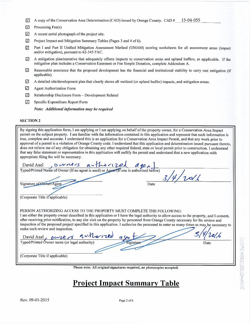
· A copy of the Conservation Area Determination (CAD) issued by Orange County. CAD # Processing Fee(s) A recent aerial photograph of the project site
Download
Transcript
Page 1
Page 2
Page 3
Page 4
Page 5
Page 6
Page 7
Page 8
Page 9
Page 10
Page 11
Page 12
Page 13
Page 14
LOAD MORE
Top Related
Aerial photograph of the Williams Power plant taken prior ... · PDF fileWilliams Dam Historical Photographs Lawson-Fisher Associates P.C. 1 Aerial photograph of the Williams Power
ADVANCED MAP AND AERIAL PHOTOGRAPH READING Army... · WAR DEPARTMENT Washington 25, D. C., 23 December 1944 FM 21-26, Advanced Map and Aerial Photograph Reading, is published for
Appendix D – Historical Aerial Photos€¦ · Appendix D – Historical Aerial Photos . Appendix D - Page D1. Table D1 - Aerial Photograph Review - North & East (Rapid Creek Catchment)
Aerial Photographs In Geology - ASPRS€¦ · field geology that most people have less difficulty in visualizing terrain from an aerial photograph than they do from a conventional
A) Types of aerial photographs on the basis of orientation of … of aerial... · Tilted photograph: An aerial photograph in which the camera axis is unintentionally tilted by small
Jfr ADVANCED MAP AND AERIAL PHOTOGRAPH READING · · 2010-01-13mhi copy 3 fm 21-26 war department basic field manual jfr advanced map and aerial photograph reading september 17,1941
FIGURE 3-14 AERIAL PHOTOGRAPH · FIGURE 3-14 AERIAL PHOTOGRAPH MAY 19, 1955 Date: 05/19/55 Roll/Frame(s ... PGE Topock Compressor Station, Topock, PGE, Pacific Gas and Electric Company,
THE SMITHSONIAN TO 1965/SIA_000371_1965_10.pdfSI GIVEN WORLD'S LARGEST AERIAL PHOTO The world's largest aerial photograph-a continuous color-film strip of a 2700-mile long, 4-mile-wide