
Megan Czarnecki Native American Unit Plan SST 309
1
Table of Contents Introduction/Rationale/Michigan's Grade level Content Expectations ..................................................................................................... 2
KUDs: Know, Understand, Do, Vocabulary and “I Can” Statements .......................................................................................................... 3
2. Assessment ideas: a. How will you know they’ve learned it? And b. How will you grade it? ................................................................ 6
Lesson One: Locating the Four Major Regions ........................................................................................................................................... 7
Vocabulary List 1: ..................................................................................................................................................................................................... 11
Attachment A ........................................................................................................................................................................................................... 12
Attachment B ........................................................................................................................................................................................................... 13
Map/Vocabulary Foldable Rubric Attachment D ..................................................................................................................................................... 15
Lesson Two: Desert Southwest vs Pacific Northwest ............................................................................................................................... 16
Vocabulary List 2: ..................................................................................................................................................................................................... 20
Attachment E ........................................................................................................................................................................................................... 22
Attachment E ........................................................................................................................................................................................................... 22
Attachment F ........................................................................................................................................................................................................... 23
Attachment G ........................................................................................................................................................................................................... 25
Attachment H ........................................................................................................................................................................................................... 27
Attachment I ............................................................................................................................................................................................................ 29
Lesson 3: Eastern Woodland..................................................................................................................................................................... 30
Attachment J ............................................................................................................................................................................................................ 34
Unit Test .................................................................................................................................................................................................... 35
Unit Test Answer Key ................................................................................................................................................................................ 39
Resources .................................................................................................................................................................................................. 43
5th Grade Native American Unit Plan

Megan Czarnecki Native American Unit Plan SST 309
2
5th Grade Native American Unit Plan
Introduction In fifth grade, the Michigan standards focus on the early history of the United States. The first era that students are introduced to is that of the American Indians. In this unit, students will be introduced to the four general American Indian regions and how those regions differ from one another. Students will learn about culture, lifestyles, and the early government that was in place during this chapter of American history. By the end, students should have a stable understanding of what life was like for American Indians.
Rationale American history is an important topic for all Americans. These young students should have an understanding of how their country began, stating with the Native Americans. Not only is it important for students to learn this information, but it needs to be meaningful to them. They need to see how American life has changed throughout time, starting with American Indians. This unit gives students fun ways to learn and take notes on American history. With hands on activities and creative engagement, students should find this topic exciting and memorable.
Michigan’s Grade Level Content Expectations for this unit: 5 – U1.1.1 Use maps to locate peoples in the desert Southwest, the Pacific Northwest, the nomadic nations of the Great Plains, and the woodland peoples east of the Mississippi River (Eastern Woodland). 5 – U1.1.2 Compare how American Indians in the desert Southwest and the Pacific Northwest adapted to or modified the environment. 5-U1.1.3 Describe Eastern Woodland American Indian life with respect to governmental and family structures, trade, and views on property ownership and land use.

Megan Czarnecki Native American Unit Plan SST 309
3
KUDs: Know, Understand, Do, Vocabulary and “I Can” Statements
GLCE Verbs Know – What will students know upon learning this?
Understand that – What will students understand?
Do – What will students do to show they understand?
Vocabulary I Can
5 – U1.1.1 Use maps to locate peoples in the desert Southwest, the Pacific Northwest, the nomadic nations of the Great Plains, and the woodland peoples east of the Mississippi River (Eastern Woodland).
Use maps, locate
The peoples in the desert Southwest were in the states of Arizona, New Mexico, Southern Colorado and the Northern part of Mexico. The people of the Pacific Northwest were in parts of Alaska, British Columbia, Washington, Oregon, Idaho, and Montana. The nomadic nations of the Great Plains occupied the area from the Mississippi River to the Rocky Mountains and from Canada to Mexico. And the woodland people
Students will understand that the different native peoples were located in four different regions in the United States.
Students will create a envelope foldable map on a blank map of the United States that they will draw the four different regions, shade each region with a different color, labeling the names of the regions, and drawing and labeling the major landform (Mississippi River, Rocky Mountains, desert, etc.) On each tab students will label the four different group
American Indians Territory Region Desert Pacific Northwest Nomadic Great Plains Eastern Woodland Apache Chinook Sioux Cheyenne Iroquois
I can find the four different areas that the Native Americans lived on a map.

Megan Czarnecki Native American Unit Plan SST 309
4
east of the Mississippi River (Eastern Woodland) occupied the area from the Atlantic to the Mississippi River, including the Great Lakes
regions, Under each tab students will list the states in that region.
5 – U1.1.2 Compare how American Indians in the desert Southwest and the Pacific Northwest adapted to or modified the environment.
Compare Native Americans adapted to and modified the environment where they lived. American Indians in the desert Southwest were mostly farmers, hunters, and gatherers. They lived near water where the rivers would flood to water corn crops and made homes out of adobe (clay, straw, dung) and wore little clothing. The Pacific Northwest Indians used the
Students will understand that the Southwest Indians lived differently than the Pacific Northwest Indians.
In groups, students will make models of the different lifestyles of the Southwest and Pacific Northwest Indians. Students will make representations of the different shelters, different clothing, and different ways of obtaining food. Students will then present their models to the
Adobe Big House Adapt Modify Hunters and Gatherers
I can describe the differences between the Northwest Indians' lifestyle and the Southwest Indians' lifestyle.

Megan Czarnecki Native American Unit Plan SST 309
5
trees in the forests to build Big Houses. They hunted seals, fish, and whales. Used cedar bark to make clothing for cold seasons.
class. Students will write up comparisons between the models.
5-U1.1.3 Describe Eastern Woodland American Indian life with respect to governmental and family structures, trade, and views on property ownership and land use.
Describe The Eastern Woodland American Indians had a democratic government. 5 tribes created a council to agree upon big decisions. The rivers allowed these people to trade. The large cities were slave cities where slaves were to marry high ranking women. Women were shown a great deal of respect.
Students will understand the lifestyle and customs of the Eastern Woodland Indians.
Students will create an alphabet book, each page has a letter of the alphabet with each letter representing an aspect of the Eastern Woodland Indian lifestyle. Students will have to draw a picture and describe each of the pages. The words they use for each letter can be words that they learned from previous
Iroquois Cherokee Hunters and Gatherers Fur Trade Settlers Chief European Settlers
I can describe the life of Eastern Woodland Indians.

Megan Czarnecki Native American Unit Plan SST 309
6
2. Assessment ideas: a. How will you know they’ve learned it? And b. How will you grade it? a) Students will create a foldable that has a map in the middle that students have labeled the four different Native American
territories. Also, on each tab, students will put 4 vocabulary words and definitions and a picture that represents each Native
American group. The foldable will be graded on a rubric.
b) Students will create a journal entry after each lesson discussing something they learned and a question they still have. Students
will be graded on completion of both.
c) After reading Plank House and Pueblo, students will work in groups to create a Venn Diagram to compare the similarities and
differences between the environments of the Pacific Northwest and Southwest and how the Native Americans living in those
areas adapted to their environments.
d) Students will create a foldable booklet with each page containing a vocabulary word, a picture, the definition in their own
words, and a sentence using that vocabulary word. They will continue to add to this booklet as they progress through the unit.
Each part will be worth a point.***
e) Students will work in groups to create a model representation of the shelter, the clothing, and different ways of obtaining food
for either the Pacific Northwest or Southwest Native Americans. Students will be graded with a rubric (or a checklist???).
f) Students will write a persuasive paragraph explaining which of the four areas they would rather live in and why.
g) Students will create an alphabet book with each page containing each letter of the alphabet and they must choose an aspect of
the Eastern woodland lifestyle that starts with the letter of the alphabet. They must also include a picture and a sentence
explaining the aspects they chose. This will encompass all four regions of Native Americans. Students will be graded with a
checklist.
h) Unit Test
lessons in this unit.

Megan Czarnecki Native American Unit Plan SST 309
7
Lesson One: Locating the Four Major Regions TIME 1 day
GLCE Verbs Know – What will students know upon learning this?
Understand that – What will students understand?
Do – What will students do to show they understand?
Vocabulary I Can
5 – U1.1.1 Use maps to locate peoples in the desert Southwest, the Pacific Northwest, the nomadic nations of the Great Plains, and the woodland peoples east of the Mississippi River (Eastern Woodland).
Use maps, locate
The peoples in the desert Southwest were in the states of Arizona, New Mexico, Southern Colorado and the Northern part of Mexico. The people of the Pacific Northwest were in parts of Alaska, British Columbia, Washington, Oregon, Idaho, and Montana. The nomadic nations of the Great Plains occupied the area from the Mississippi River to the Rocky Mountains and from Canada to
Students will understand that the different native peoples were located in four different regions in the United States.
Students will create a envelope foldable map on a blank map of the United States that they will draw the four different regions, shade each region with a different color, labeling the names of the regions, and drawing and labeling the major landform (Mississippi River, Rocky Mountains, desert, etc.) On each tab students will
American Indians Territory Region Desert Pacific Northwest Nomadic Great Plains Eastern Woodland Apache Chinook Sioux Cheyenne Iroquois
I can find the four different areas that the Native Americans lived on a map.

Megan Czarnecki Native American Unit Plan SST 309
8
2. Assessment ideas: a. How will you know they’ve learned it? And b. How will you grade it?
a) Students will create a foldable that has a map in the middle that students have labeled the four different Native American
territories. Also, on each tab, students will put 4 vocabulary words and definitions and a picture that represents each Native
American group. The foldable will be graded on a rubric.
b) Students will create a journal entry after each lesson discussing something they learned and a question they still have. Students
will be graded on completion of both.
Lessons: How will you take them where they need to go? (Step-by-Step plan from A-Z)
Instructional strategies/Social constructs: How will they work?
(AND what will YOU do?)
Resources needed: What materials and resources will they need?
(Page #s read, graphic organizers, books, posters, realia, etc…)
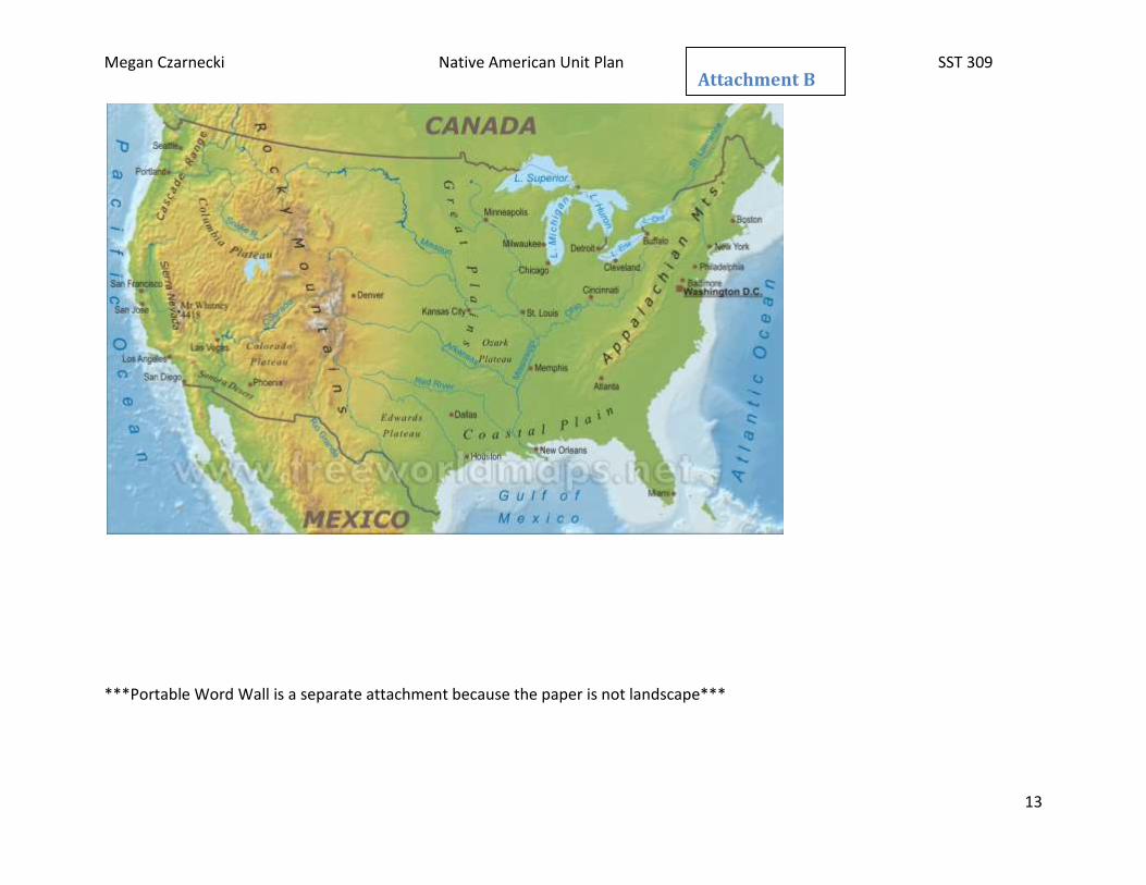
Anticipatory Set: Students will be shown a short powerpoint with different maps of the United States and discuss as a class the characteristics of the country that people would be challenged with.
Students will first be shown the map with the state boundaries. What would this map look like without the states? Then show them the physical map that shows the names of major places and landforms, then show them the blank
Anticipatory Map Power Point
Mexico. And the woodland people east of the Mississippi River (Eastern Woodland) occupied the area from the Atlantic to the Mississippi River, including the Great Lakes
label the four different group regions, Under each tab students will list the states in that region.
Megan Czarnecki Native American Unit Plan SST 309
9
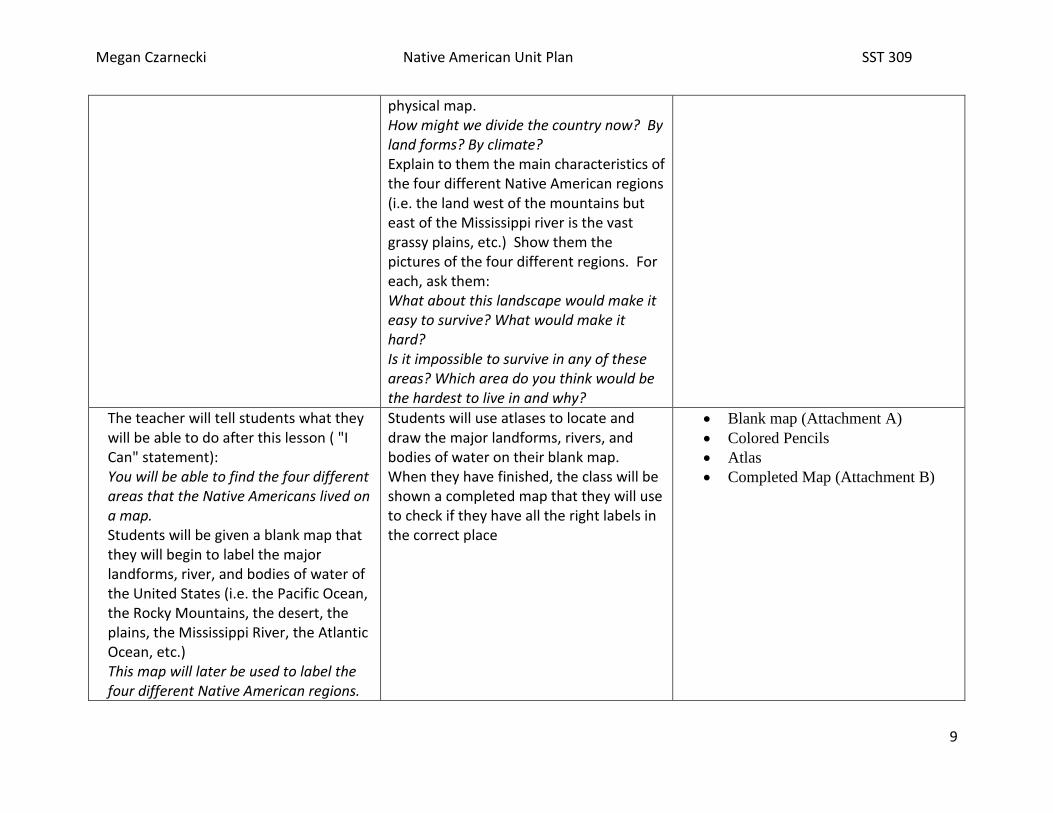
physical map. How might we divide the country now? By land forms? By climate? Explain to them the main characteristics of the four different Native American regions (i.e. the land west of the mountains but east of the Mississippi river is the vast grassy plains, etc.) Show them the pictures of the four different regions. For each, ask them: What about this landscape would make it easy to survive? What would make it hard? Is it impossible to survive in any of these areas? Which area do you think would be the hardest to live in and why?
The teacher will tell students what they will be able to do after this lesson ( "I Can" statement): You will be able to find the four different areas that the Native Americans lived on a map. Students will be given a blank map that they will begin to label the major landforms, river, and bodies of water of the United States (i.e. the Pacific Ocean, the Rocky Mountains, the desert, the plains, the Mississippi River, the Atlantic Ocean, etc.) This map will later be used to label the four different Native American regions.
Students will use atlases to locate and draw the major landforms, rivers, and bodies of water on their blank map. When they have finished, the class will be shown a completed map that they will use to check if they have all the right labels in the correct place
Blank map (Attachment A)
Colored Pencils
Atlas
Completed Map (Attachment B)
Megan Czarnecki Native American Unit Plan SST 309
10
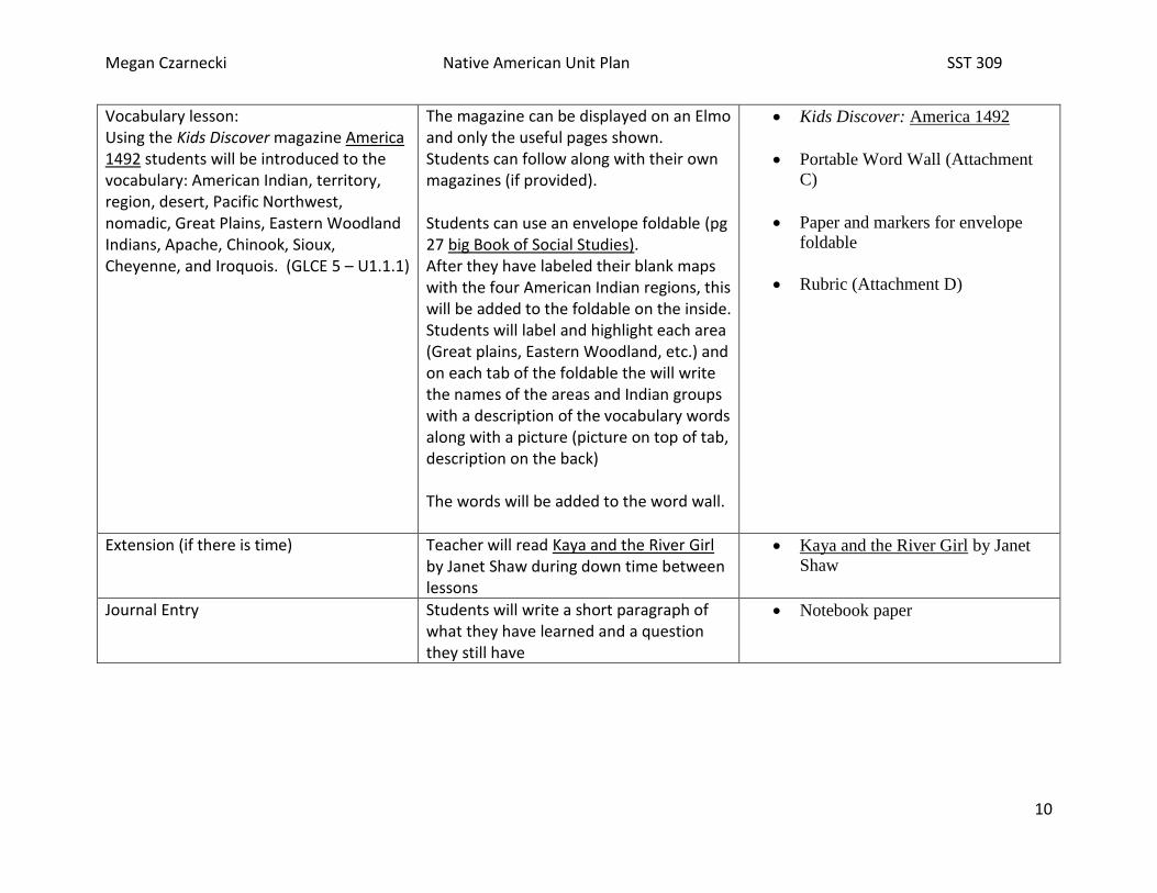
Vocabulary lesson: Using the Kids Discover magazine America 1492 students will be introduced to the vocabulary: American Indian, territory, region, desert, Pacific Northwest, nomadic, Great Plains, Eastern Woodland Indians, Apache, Chinook, Sioux, Cheyenne, and Iroquois. (GLCE 5 – U1.1.1)
The magazine can be displayed on an Elmo and only the useful pages shown. Students can follow along with their own magazines (if provided). Students can use an envelope foldable (pg 27 big Book of Social Studies). After they have labeled their blank maps with the four American Indian regions, this will be added to the foldable on the inside. Students will label and highlight each area (Great plains, Eastern Woodland, etc.) and on each tab of the foldable the will write the names of the areas and Indian groups with a description of the vocabulary words along with a picture (picture on top of tab, description on the back) The words will be added to the word wall.
Kids Discover: America 1492
Portable Word Wall (Attachment
C)
Paper and markers for envelope
foldable
Rubric (Attachment D)
Extension (if there is time) Teacher will read Kaya and the River Girl by Janet Shaw during down time between lessons
Kaya and the River Girl by Janet
Shaw
Journal Entry Students will write a short paragraph of what they have learned and a question they still have
Notebook paper

Megan Czarnecki Native American Unit Plan SST 309
11
Vocabulary List 1:
Iroquois- a member of a group of North American Indians of the Eastern United States
3-4 of the vocabulary words and their definitions should be under each tab of the envelope foldable. The name of the American Indian region will be on the top of each tab with a corresponding picture.
Native American/American Indian- the first Americans to be born in North America
Territory- a large area of land assigned or controlled by a nation of people
Region- a large land area that has geographic, political, or cultural characteristics that distinguish it from others
Desert- an area of land, usually in very hot climates, that consists only of sand, gravel, or rock with little or no vegetations, no
permanent bodies of water, and irregular rainfall
o not dessert!
Pacific Northwest- a part of the northwestern United States on the Pacific coast that includes the states of Washington and
Oregon and sometimes southwestern British Columbia, Canada
Nomadic- a member of a people who move seasonally from place to place to search for food and water or pasture for their
livestock
Great Plains- a relatively dry region East of the Rocky Mountains in the US and Canada
Eastern Woodland Indians- the Native Americans living in the forests East of the Mississippi River to the Atlantic coast
Apache- a member of a group of North American Indians of the Southwest United States
Chinook- a member of a group of North American Indians of Washington and Oregon
Sioux- a member of a group of North American Indians of Northern United States and Southern Canada
Cheyenne- a member of a group of North American Indians of the Western Great Plains

Megan Czarnecki Native American Unit Plan SST 309
12
Attachment A
Megan Czarnecki Native American Unit Plan SST 309
13
***Portable Word Wall is a separate attachment because the paper is not landscape***
Attachment B

Megan Czarnecki Native American Unit Plan SST 309
14

Megan Czarnecki Native American Unit Plan SST 309
15
Map/Vocabulary Foldable Rubric Attachment D
3 Points
Map is neat with colors
and correct
representation of the
Pacific Ocean, the
Atlantic Ocean, the
Rocky Mountains, the
dessert, the Great Plains,
and the Mississippi
River
Correctly labeled all 4 of
the regions: the
Southwest region, the
Pacific Northwest
region, the Great Plains
region, and the Eastern
Woodland region
Top tabs are labeled
with the four regions
with a neat and colorful
picture that relates to the
label
3-4 vocabulary words
correctly spelled with
the correct definition of
each on all four tabs
2 points
Map is neat with colors
with most of the major
water and landforms
correctly labeled
3 of the 4 regions are
correctly labeled
Top tabs are labeled
with the four regions but
the pictures are not neat
or do not relate to the
label
3-4 vocabulary words on
each tab, but the words
are misspelled and the
definitions are not
correct
1 point
Map is not neat with
little color and the water
and land form are not all
correctly labeled
2 of the 4 regions are
correctly labeled
Top tabs are labeled
with the four regions but
do not have a
corresponding picture
1-2 vocabulary words on
each tab with the
corresponding definition
0 points
Map is not complete, no
color, water and land
forms are not all present
or correctly labeled
1-0 of the 4 regions are
correctly labeled
The top tabs have no
label nor a picture
1-2 Vocabulary words
are misspelled with
incorrect definitions

Megan Czarnecki Native American Unit Plan SST 309
16
Lesson Two: Desert Southwest vs Pacific Northwest TIME 2-3 days
GLCE Verbs Know – What will students know upon learning this?
Understand that – What will students understand?
Do – What will students do to show they understand?
Vocabulary I Can
5 – U1.1.2 Compare how American Indians in the desert Southwest and the Pacific Northwest adapted to or modified the environment.
Compare Native Americans adapted to and modified the environment where they lived. American Indians in the desert Southwest were mostly farmers, hunters, and gatherers. They lived near water where the rivers would flood to water corn crops and made homes out of adobe (clay, straw, dung) and wore little clothing. The Pacific Northwest Indians used the trees in the forests to build Big Houses. They
Students will understand that the Southwest Indians lived differently than the Pacific Northwest Indians.
In groups, students will make models of the different lifestyles of the Southwest and Pacific Northwest Indians. Students will make representations of the different shelters, different clothing, and different ways of obtaining food. Students will then present their models to the class. Students will write up comparisons between the models.
Adobe Big House Adapt Modify Hunters and Gatherers
I can describe the differences between the Northwest Indians' lifestyle and the Southwest Indians' lifestyle.

Megan Czarnecki Native American Unit Plan SST 309
17
2. Assessment ideas: a. How will you know they’ve learned it? And b. How will you grade it?
a) After reading Plank House and Pueblo, students will work in groups to create a Venn Diagram to compare the similarities and
differences between the environments of the Pacific Northwest and Southwest and how the Native Americans living in those
areas adapted to their environments.
b) Students will create a booklet with each page containing a vocabulary word, a picture, the definition in their own words, and a
sentence using that vocabulary word. They will continue to add to this booklet as they progress through the unit. Each part
will be worth a point.
c) Students will work in groups to create a model representation of the shelter, the clothing, and different ways of obtaining food
for either the Pacific Northwest or Southwest Native Americans. Students will be graded with a rubric (or a checklist???).
Lessons: How will you take them where they need to go? (Step-by-Step plan from A-Z)
Instructional strategies/Social constructs: How will they work?
(AND what will YOU do?)
Resources needed: What materials and resources will they need?
(Page #s read, graphic organizers, books, posters, realia, etc…)
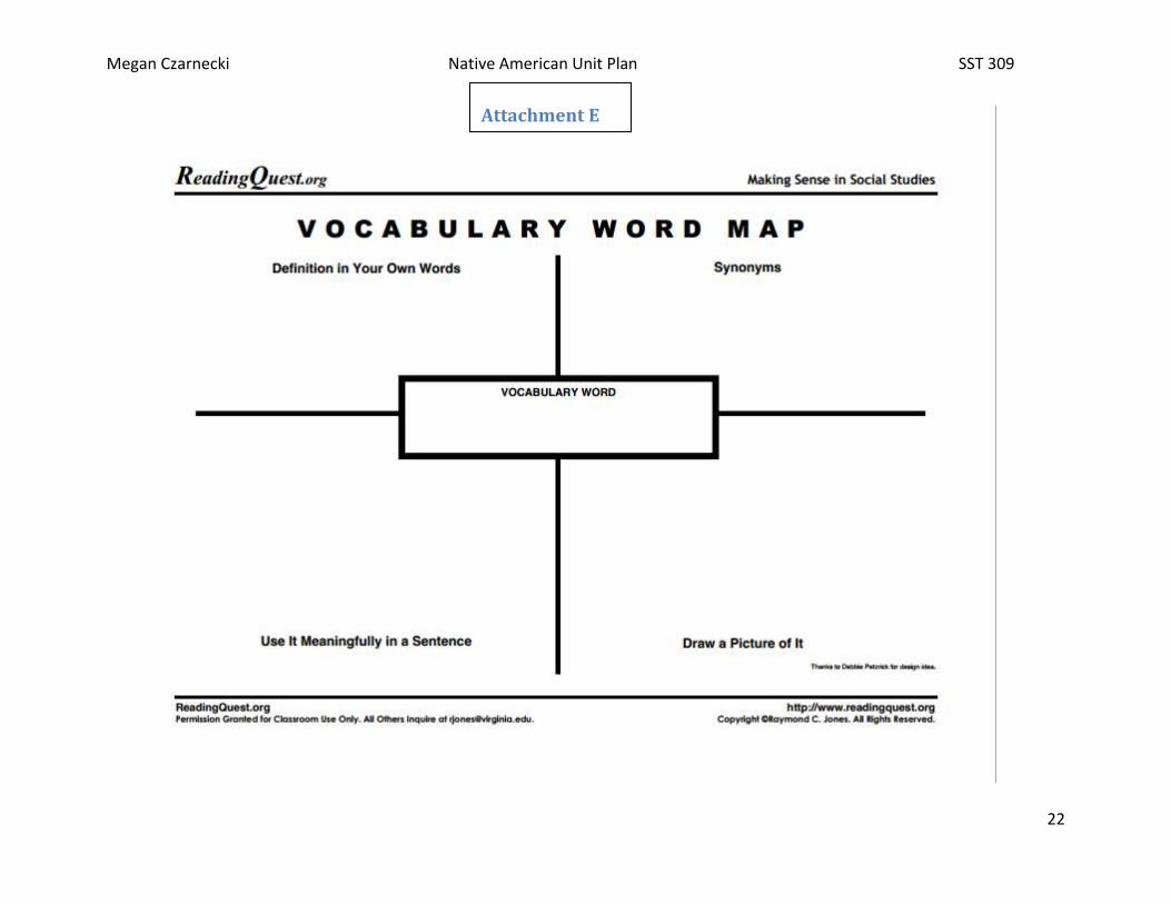
Vocabulary lesson: Using the Kids Discover magazine Native America students will be introduced to the vocabulary: Hunters, gatherers, farmers, Anasazi, drought, Navaho, mesa, plank house, affluent, pueblo, potlatch, nomads, teepee, Mound Builders, Stinkards, Cahokian City, wigwams, long house, Sachems modify, trade, settlers,
Students can use a word map for each vocabulary word. They will write the word, write what they think it means, write the definition in their own words, draw a picture, and use the word in a sentence. Students can work on this while the magazine is being presented or in small groups. Students will use the magazine to look back on to create their own definitions and descriptions. The word maps will be attached together to
Kids Discover: Native America
Word Map (Personal Vocabulary
Journal) Attachment E
Portable Word Wall (Attachment
hunted seals, fish, and whales. Used cedar bark to make clothing for cold seasons.

Megan Czarnecki Native American Unit Plan SST 309
18
create a booklet. The words will be added to the word wall.
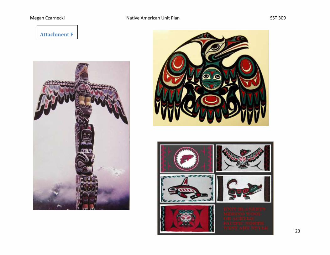
Teacher will tell students what they will be able to do after this less ("I Can" statement): You will be able to describe the differences between the Northwest Indians' lifestyle and the Southwest Indians' lifestyle. The teacher will go over the Power Point “A Glance at the First Americans” slides 1-21 The teacher will read to the class Plank House by Dolores Dyer The teacher will read to the class Pueblo by R. Kent Rasmussen The teacher will also show student the artwork of the Pacific Northwest and Southwest Indians The teacher will guide the students through a Venn diagram comparing what they have learned from the two books.
Students will follow along with the power point by taking notes on the guided note sheet provided. Students will be divided into two groups. On the white board will be two Venn diagrams, one for each group. The groups must work together to compare the differences and similarities of the Pacific Northwest and Southwest lifestyle from the information they learned from the book.
Power Point “A Glance at the First
Americans”
Note Sheet (Attachment G)
Note Sheet Key (Attachment H)
Plank House by Dolores Dyer
Pueblo by R. Kent Rasmussen
White board
Dry Erase Markers
Pictures of artwork (Attachment F)
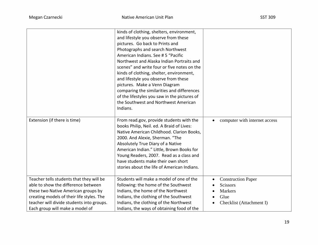
Teacher will present students with primary sources from the Library of Congress to compare the differences between the Pacific Northwest and Southwest Indians.
From the home page of the LOC, www.loc.gov, click on the square called Prints and Photographs. In the search box, type Southwest American Indians. See # 3 “Native Americans of the Southwest” and explore the pictures provided. Write four or five notes on the
Computers with internet access
Megan Czarnecki Native American Unit Plan SST 309
19
kinds of clothing, shelters, environment, and lifestyle you observe from these pictures. Go back to Prints and Photographs and search Northwest American Indians. See # 5 “Pacific Northwest and Alaska Indian Portraits and scenes” and write four or five notes on the kinds of clothing, shelter, environment, and lifestyle you observe from these pictures. Make a Venn Diagram comparing the similarities and differences of the lifestyles you saw in the pictures of the Southwest and Northwest American Indians.
Extension (if there is time) From read.gov, provide students with the books Philip, Neil. ed. A Braid of Lives: Native American Childhood. Clarion Books, 2000. And Alexie, Sherman. “The Absolutely True Diary of a Native American Indian.” Little, Brown Books for Young Readers, 2007. Read as a class and have students make their own short stories about the life of American Indians.
computer with internet access
Teacher tells students that they will be able to show the difference between these two Native American groups by creating models of their life styles. The teacher will divide students into groups. Each group will make a model of
Students will make a model of one of the following: the home of the Southwest Indians, the home of the Northwest Indians, the clothing of the Southwest Indians, the clothing of the Northwest Indians, the ways of obtaining food of the
Construction Paper
Scissors
Markers
Glue
Checklist (Attachment I)
Megan Czarnecki Native American Unit Plan SST 309
20
something that represents the way of life for either the Pacific Northwest or Southwest Indians.
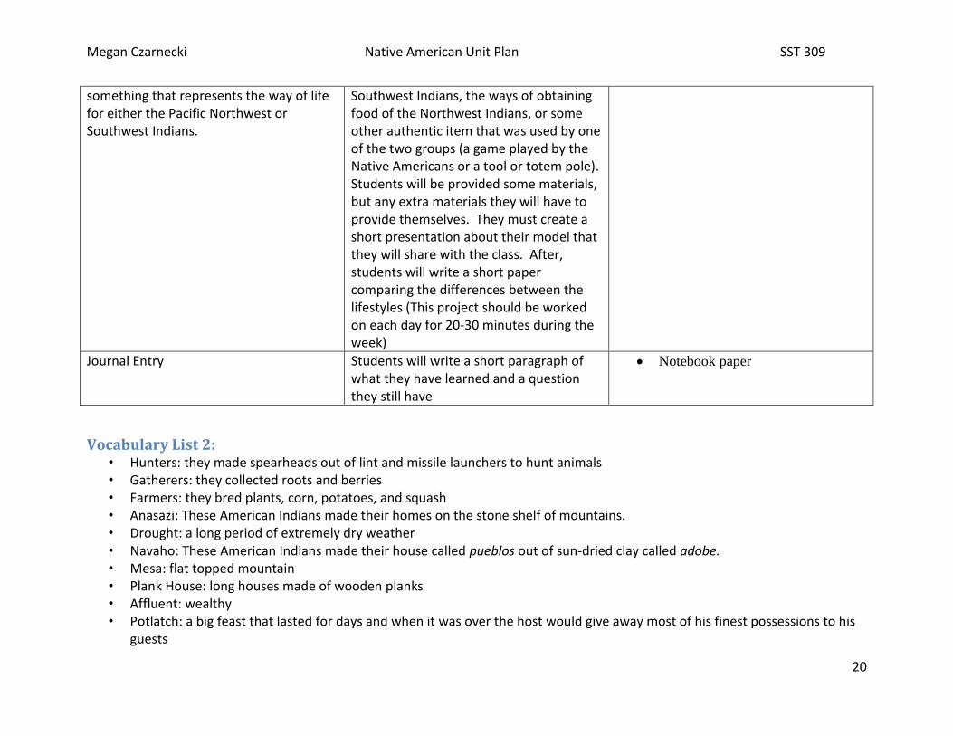
Southwest Indians, the ways of obtaining food of the Northwest Indians, or some other authentic item that was used by one of the two groups (a game played by the Native Americans or a tool or totem pole). Students will be provided some materials, but any extra materials they will have to provide themselves. They must create a short presentation about their model that they will share with the class. After, students will write a short paper comparing the differences between the lifestyles (This project should be worked on each day for 20-30 minutes during the week)
Journal Entry Students will write a short paragraph of what they have learned and a question they still have
Notebook paper
Vocabulary List 2: • Hunters: they made spearheads out of lint and missile launchers to hunt animals • Gatherers: they collected roots and berries • Farmers: they bred plants, corn, potatoes, and squash • Anasazi: These American Indians made their homes on the stone shelf of mountains. • Drought: a long period of extremely dry weather • Navaho: These American Indians made their house called pueblos out of sun-dried clay called adobe. • Mesa: flat topped mountain • Plank House: long houses made of wooden planks • Affluent: wealthy • Potlatch: a big feast that lasted for days and when it was over the host would give away most of his finest possessions to his
guests
Megan Czarnecki Native American Unit Plan SST 309
21
• Nomads: people who move from place to place • Teepee: tent-like home made from animal skins • Mound Builders: Native Americans who created hills of dirt for graves, temples, and religious symbols • Stinkards: slaves captured from battles between tribes • Cahokian City: great trading city • Wigwams: houses made of branches lashed together and covered in bark • Long House: houses made of wood, very long • Sachems: Eastern Woodland chiefs • Trade: the exchange of goods • Settlers: new people who come to a place to live • Modify: to change
Megan Czarnecki Native American Unit Plan SST 309
22
Attachment E
Attachment E
Megan Czarnecki Native American Unit Plan SST 309
23
Attachment F
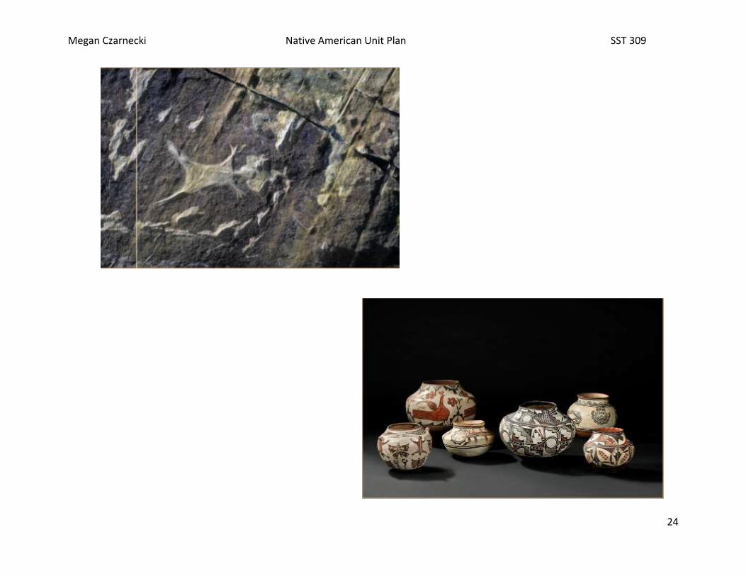
Megan Czarnecki Native American Unit Plan SST 309
24

Megan Czarnecki Native American Unit Plan SST 309
25
Attachment G Power Point Notes:
How did the first Americans survive?
o _____________: they made spearheads out of
flint and missile launchers to hunt animals.
o _____________: they collected roots and
berries.
o _____________: they bred plants, corn,
potatoes, and squash.
Were horses native to America?
o ______, they were brought over by the explorers
from _________ along with mules and oxen.
Inuit
o Alaska, _________, very cold and few trees
o Too cold to _________
o No ________ to make a _________
o Igloo and dogsleds
Southwest American Indians
o New Mexico, ___________, Colorado, and
_________
o ____________, Anasazi, Flat Heads
Anasazi
o These American Indians made their homes on
the ________ __________ of mountains.
o They carved their homes out of the ______ and
clay. They dug out rooms from the ground
called ________.
o Living near the river, the ____ _________
allowed them to farm.
o ___________ made farm life tough
Navaho
o These American Indians made their houses
called ___________ out of sun-dried clay called
___________.
o Mesa- a flat topped ___________.
o Depended on ___________ but it was _______
to grow crops. The land was too _____ and too
______
o Rivers were needed to _________ the crops
Pacific Northwest
o Washington and ___________
o Chinook
o Life here was _______!
o The land provided the people with everything
they needed.
o Rivers, ocean, woods
o Plenty to _______ and _________
Fish, whales, roots, berries
o No need to ________!
o Lived in _______ houses made of wooden
planks
o These people were _________ (wealthy)
Affluent
o These people had so much that they had plenty
of time for ______ and games
o They did not __________ everything within the
tribe

Megan Czarnecki Native American Unit Plan SST 309
26
o They cared about ________, property, and
prestige (reputation)
o They wore _________ clothes
Potlatch!
o The Pacific Northwest Native Americans liked
their ________. A potlatch was a big
_________ that lasted for days and when it was
over the host would _______ ________ most of
his finest possessions to his guests.
The Great Plains
o This region stretched across from the ______
________ to the ____________ _________.
o Tall grasses cover much of the land with few
trees
o The people who lived here were __________
moving from place to place
o It was difficult to _______ in this area
o __________ nuts and berries
o They hunted with ______ and __________.
o These people lived in __________
o Hunting buffalo, nothing goes to ___________
o ________ changed the lives of the Plains
Indians and made __________ easier
o Now these people became affluent and a bit
wasteful.
Eastern Woodland Indians
o East of the ___________ River to the
___________ Ocean
o Mound builders and Woodland Indians
o These dirt mounds were created for graves,
platforms for temples, and for _________
symbols
o There were many great rivers in this area for
_________.
o __________ were built by these trade rivers.
o Cahokia City was a large _________ society.
o These slaves (__________) were captured in
battles with rival tribes.
o High ranking women of the city __________
the slaves so they may rise up in society
o There were plenty of ______ for the Woodland
Indians.
o Gatherers, hunters, and farmers
o Their houses, called ________ were made of
branches lashed together and covered in bark.
o The Iroquois built ______ __________ (150
feet long!) out of wood.
o The chiefs were called __________.
o Their government was a ______________
league of 5 American Indian nations.
o Each nation had its own _____.
o The big decisions (war) were decided by a
________ of all the tribes
o The men on the council were chosen by
_________.
o Everyone on the council had to _________.
Newcomers
o The lives of the Native Americans changed
when the ___________ came.
o They had a very different __________ than the
American Indians
o These people would have a _______ time
getting along together.

Megan Czarnecki Native American Unit Plan SST 309
27
Attachment H Power Point Notes: Key
How did the first Americans survive?
o Hunters: they made spearheads out of flint and
missile launchers to hunt animals.
o Gatherers: they collected roots and berries.
o Farmers: they bred plants, corn, potatoes, and
squash.
Were horses native to America?
o No, they were brought over by the explorers
from Spain along with mules and oxen.
Inuit
o Alaska, tundra, very cold and few trees
o Too cold to farm
o No wood to make a fire.
o Igloo and dogsleds
Southwest American Indians
o New Mexico, Arizona, Colorado, and Utah.
o Navaho, Anasazi, Flat Heads
Anasazi
o These American Indians made their homes on
the stone shelf of mountains.
o They carved their homes out of the rock and
clay. They dug out rooms from the ground
called kivas.
o Living near the river, the Rio Grande allowed
them to farm.
o Drought made farm life tough
Navaho
o These American Indians made their houses
called pueblos out of sun-dried clay called
adobe.
o Mesa- a flat topped mountain.
o Depended on farming but it was hard to grow
crops. The land was too hot and too dry
o Rivers were needed to irrigate the crops
Pacific Northwest
o Washington and Oregon
o Chinook
o Life here was easy!
o The land provided the people with everything
they needed.
o Rivers, ocean, woods.
o Plenty to hunt and gather.
Fish, whales, roots, berries
o No need to farm!
o Lived in plank houses made of wooden planks
o These people were affluent (wealthy)
Affluent
o These people had so much that they had plenty
of time for fun and games
o They did not share everything within the tribe
o They cared about wealth, property, and prestige
(reputation)
o They wore fancy clothes
Potlatch!
o The Pacific Northwest Native Americans liked
their parties. A potlatch was a big feast that
lasted for days and when it was over the host
would give away most of his finest possessions
to his guests.
The Great Plains

Megan Czarnecki Native American Unit Plan SST 309
28
o This region stretched across from the Rocky
Mountains to the Mississippi River.
o Tall grasses cover much of the land with few
trees
o The people who lived here were nomads
moving from place to place
o It was difficult to farm in this area
o Gathered nuts and berries
o They hunted with bows and arrows.
o These people lived in teepees
o Hunting buffalo, nothing goes to waste
o Horses changed the lives of the Plains Indians
and made hunting easier
o Now these people became affluent and a bit
wasteful.
Eastern Woodland Indians
o East of the Mississippi River to the Atlantic
Ocean
o Mound builders and Woodland Indians
o These dirt mounds were created for graves,
platforms for temples, and for religious symbols
o There were many great rivers in this area for
trading
o Cities were built by these trade rivers.
o Cahokia City was a large slave society.
o These slaves (stinkards) were captured in battles
with rival tribes.
o High ranking women of the city married the
slaves so they may rise up in society
o There were plenty of trees for the Woodland
Indians.
o Gatherers, hunters, and farmers
o Their houses, called wigwams were made of
branches lashed together and covered in bark.
o The Iroquois built long houses (150 feet long!)
out of wood.
o The chiefs were called sachems
o Their government was a democratic league of 5
American Indian nations.
o Each nation had its own laws.
o The big decisions (war) were decided by a
council of all the tribes
o The men on the council were chosen by women.
o Everyone on the council had to agree.
Newcomers
o The lives of the Native Americans changed
when the Europeans came.
o They had a very different culture than the
American Indians
o These people would have a hard time getting
along together

Megan Czarnecki Native American Unit Plan SST 309
29
Attachment I Model Checklist
Title (2 Point)
Materials are used to create model (5 points)
Correct representation (10 points)
Written explanation of model (5 points)
Creativity (3 points)
Megan Czarnecki Native American Unit Plan SST 309
30
Lesson 3: Eastern Woodland TIME- 1 Day
GLCE Verbs Know – What will students know upon learning this?
Understand that – What will students understand?
Do – What will students do to show they understand?
Vocabulary I Can
5-U1.1.3 Describe Eastern Woodland American Indian life with respect to governmental and family structures, trade, and views on property ownership and land use.
Describe The chief is the most powerful person of the tribe. The entire tribe contributed in gathering, hunting, growing. Men were hunters and women were gatherers. Traded beaver furs with other Indians and European settlers. Hand no sense of land ownership. Lived off the land and only took what their tribe needed.
Students will understand the lifestyle and customs of the Eastern Woodland Indians.
Students will create an alphabet book, each page has a letter of the alphabet with each letter representing an aspect of the Eastern Woodland Indian lifestyle. Students will have to draw a picture and describe each of the pages. The words they use for each letter can be words that they learned from previous lessons in this unit.
Iroquois Cherokee Hunters and Gatherers Fur Trade Settlers Chief European Settlers
I can describe the life of Eastern Woodland Indians.

Megan Czarnecki Native American Unit Plan SST 309
31
2. Assessment ideas: a. How will you know they’ve learned it? And b. How will you grade it?
a) Students will write a persuasive paragraph explaining which of the four areas they would rather live in and why.
b) Students will create an alphabet book with each page containing each letter of the alphabet and they must choose an aspect of
the Eastern woodland lifestyle that starts with the letter of the alphabet. They must also include a picture and a sentence
explaining the aspects they chose. This will encompass all four regions of Native Americans. Students will be graded with a
checklist.
c) Unit Test
Lessons: How will you take them where they need to go? (Step-by-Step plan from A-Z)
Instructional strategies/Social constructs: How will they work?
(AND what will YOU do?)
Resources needed: What materials and resources will they need?
(Page #s read, graphic organizers, books, posters, realia, etc…)
Vocabulary lesson: Students will be instructed to create a word map to connect vocabulary words. An example will be provided on the board with the entire class. The teacher will start them off with the word “American Indians” in the main bubble, and then “Southwest” in one of the next main four bubbles. From there, desert can go next, then drought, farming, etc.
Using think, pair, share, students will first discuss which vocabulary words are associated with each other. Students will then work in groups to make a Bubble word map that focuses on the four major territories of the American Indians (Eastern Woodland, Pacific Northwest, Southwest, and Great Plains) and they will connect all of the vocabulary words that are associated with the main territory.
Bubble Word Map (Attachment J)
o Kidsperation would allow
students to create their own
word bubble map
Vocabulary Lesson: Students will match the vocabulary words with their definitions using a memory game.
Students will create memory cards with the vocabulary word on one card and the definition in their own words on another card. They will make these for each vocabulary word. Then, in groups of two to three, students will play memory by mixing the cards up face-down on the table and then taking turns matching the vocabulary word with the definition.
Construction Paper
Markers/colored pencils
Scissors
Megan Czarnecki Native American Unit Plan SST 309
32
The teacher will tell students what they will be able to do after this lesson ("I Can" statement): You will be able to describe the life of the Eastern Woodland Indians. Teacher will present the next slides of the power point “A Glance at the First Americans” (slides 22-28). A guided not sheet will be provided for students to fill out as the class goes through the slides.
Students will need to pay attention to the information in the power point to fill out the note sheet they were provided.
Note taking sheet (Attachment G)
The teacher will have the students create a alphabet book that covers the information learned about the Eastern Woodland Indians
Students will use printer paper/construction paper, fold it in half, and on each section (there will be four), student write a letter and a word that goes along with that letter that correlates with the Eastern Woodland Indians. For example: for the letter D, students could write “Democracy”. They will then write a sentence explaining how this relates to these Native Americans and draw a picture representing it. They only need to do 12 letters (not the whole alphabet). They can use their notes from the power point to help them come up with ideas. They should use about 4 pieces of paper for all 12 letters (four on each sheet). The cover page should also have a title, a picture, and their name. They will staple the completed booklet together. They will get three points for every page (one point for the word, one point for the definition,
Paper
Markers/colored pencils
Stapler
Megan Czarnecki Native American Unit Plan SST 309
33
and one point for the picture plus 4 points for neatness and creativity, total of 40 points.
Journal Entry Students will write a short paragraph of what they have learned and a question they still have
Notebook paper
Unit Test Unit Test
Unit Test Answer Key

Megan Czarnecki Native American Unit Plan SST 309
34
Attachment J
Megan Czarnecki Native American Unit Plan SST 309
35
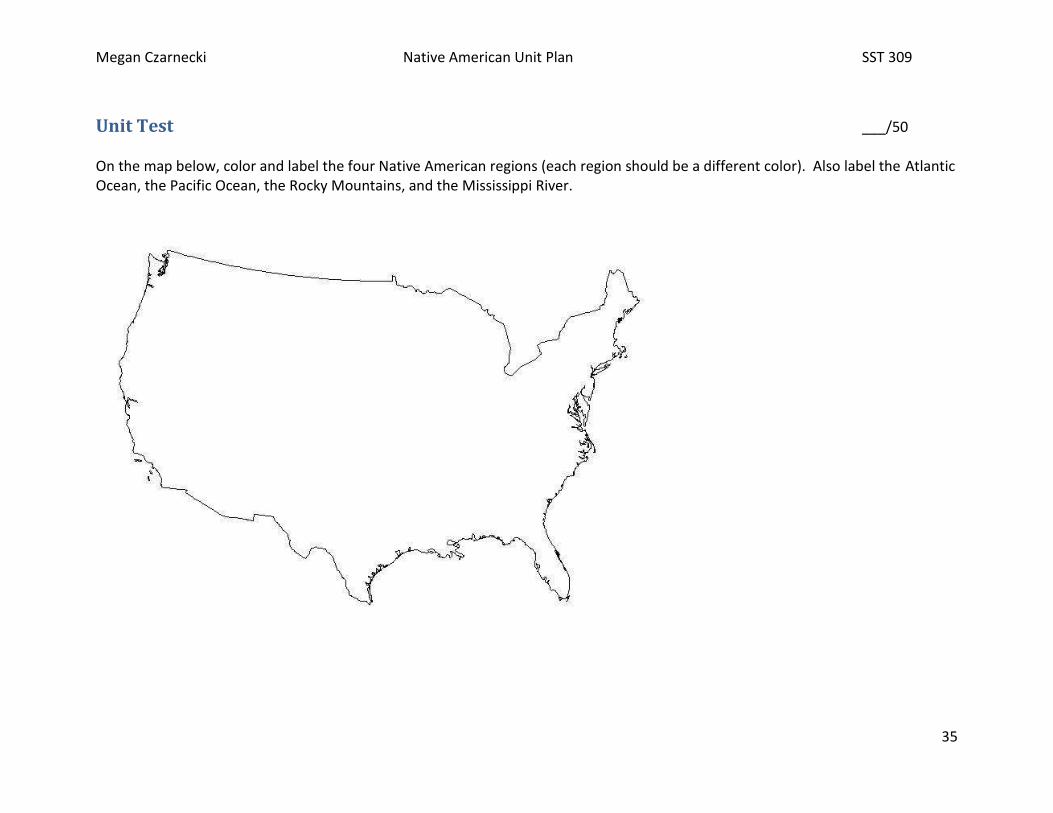
Unit Test ___/50 On the map below, color and label the four Native American regions (each region should be a different color). Also label the Atlantic Ocean, the Pacific Ocean, the Rocky Mountains, and the Mississippi River.
Megan Czarnecki Native American Unit Plan SST 309
36
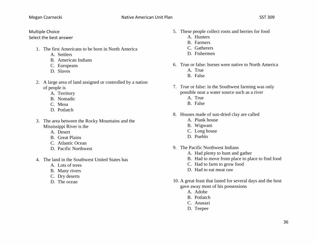
Multiple Choice Select the best answer
1. The first Americans to be born in North America
A. Settlers
B. American Indians
C. Europeans
D. Slaves
2. A large area of land assigned or controlled by a nation
of people is
A. Territory
B. Nomadic
C. Mesa
D. Potlatch
3. The area between the Rocky Mountains and the
Mississippi River is the
A. Desert
B. Great Plains
C. Atlantic Ocean
D. Pacific Northwest
4. The land in the Southwest United States has
A. Lots of trees
B. Many rivers
C. Dry deserts
D. The ocean
5. These people collect roots and berries for food
A. Hunters
B. Farmers
C. Gatherers
D. Fishermen
6. True or false: horses were native to North America
A. True
B. False
7. True or false: in the Southwest farming was only
possible near a water source such as a river
A. True
B. False
8. Houses made of sun-dried clay are called
A. Plank house
B. Wigwam
C. Long house
D. Pueblo
9. The Pacific Northwest Indians
A. Had plenty to hunt and gather
B. Had to move from place to place to find food
C. Had to farm to grow food
D. Had to eat meat raw
10. A great feast that lasted for several days and the host
gave away most of his possessions
A. Adobe
B. Potlatch
C. Anasazi
D. Teepee

Megan Czarnecki Native American Unit Plan SST 309
37
11. True or false: Life for the Pacific Northwest Indians
was hard.
A. True
B. False
12. The people of the Great Plains were
A. Farmers
B. Always affluent
C. Slaves
D. Nomads
13. Life for the Great Plains Indians became easier when
they got
A. Wigwams
B. Snowshoes
C. Horses
D. Canoes
14. The rivers in the Eastern Woodland region made it easy
for
A. Trading
B. Hunting
C. Gathering
D. Sharing
15. True or false: Women of the Eastern Woodlands had no
respect.
A. True
B. False
16. The tribes of the Eastern Woodlands each had their own
A. City
B. King
C. Council
D. Laws
17. In the democratic league of the five tribes, the big
decisions were made by a
A. Council
B. King
C. Woman
D. Slave
18. True or false: Everyone in the council had to agree.
A. True
B. False
19. True or false: The European settlers had the same
culture as the American Indians.
A. True
B. False
20. The settlers and the Native Americans
A. Would get along just fine
B. Would not interact with each other
C. Would never be friends
D. Would have a hard time getting along together
Megan Czarnecki Native American Unit Plan SST 309
38
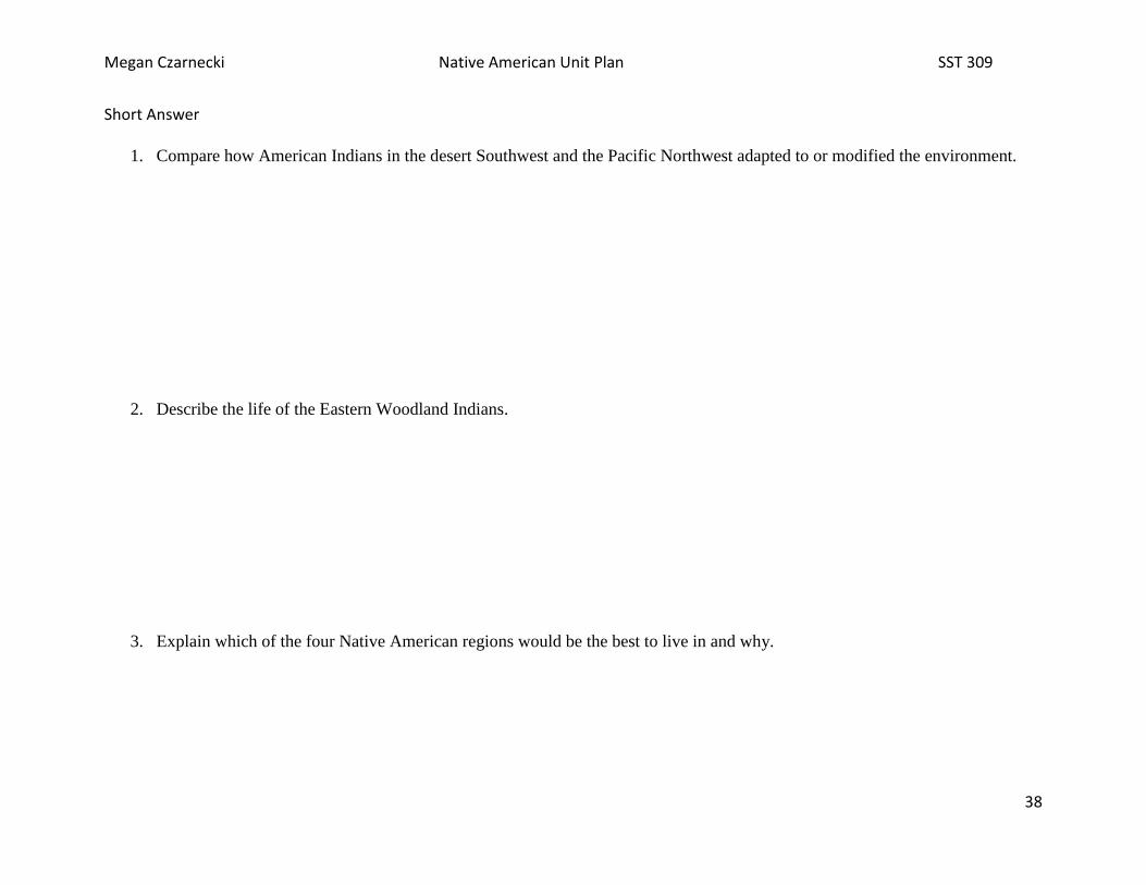
Short Answer
1. Compare how American Indians in the desert Southwest and the Pacific Northwest adapted to or modified the environment.
2. Describe the life of the Eastern Woodland Indians.
3. Explain which of the four Native American regions would be the best to live in and why.

Megan Czarnecki Native American Unit Plan SST 309
39
Unit Test Answer Key ___/50 On the map below, color and label the four Native American regions (each region should be a different color). Also label the Atlantic Ocean, the Pacific Ocean, the Rocky Mountains, and the Mississippi River. (10 points)

Megan Czarnecki Native American Unit Plan SST 309
40
Multiple Choice Select the best answer
21. The first Americans to be born in North America
A. Settlers
B. American Indians
C. Europeans
D. Slaves
22. A large area of land assigned or controlled by a nation
of people is
A. Territory
B. Nomadic
C. Mesa
D. Potlatch
23. The area between the Rocky Mountains and the
Mississippi River is the
A. Desert
B. Great Plains
C. Atlantic Ocean
D. Pacific Northwest
24. The land in the Southwest United States has
A. Lots of trees
B. Many rivers
C. Dry deserts
D. The ocean
25. These people collect roots and berries for food
A. Hunters
B. Farmers
C. Gatherers
D. Fishermen
26. True or false: horses were native to North America
A. True
B. False
27. True or false: in the Southwest farming was only
possible near a water source such as a river
A. True
B. False
28. Houses made of sun-dried clay are called
A. Plank house
B. Wigwam
C. Long house
D. Pueblo
29. The Pacific Northwest Indians
A. Had plenty to hunt and gather
B. Had to move from place to place to find food
C. Had to farm to grow food
D. Had to eat meat raw
30. A great feast that lasted for several days and the host
gave away most of his possessions
A. Adobe
B. Potlatch
C. Anasazi
D. Teepee
31. True or false: Life for the Pacific Northwest Indians
was hard.
A. True
B. False

Megan Czarnecki Native American Unit Plan SST 309
41
32. The people of the Great Plains were
A. Farmers
B. Always affluent
C. Slaves
D. Nomads
33. Life for the Great Plains Indians became easier when
they got
A. Wigwams
B. Snowshoes
C. Horses
D. Canoes
34. The rivers in the Eastern Woodland region made it easy
for
A. Trading
B. Hunting
C. Gathering
D. Sharing
35. True or false: Women of the Eastern Woodlands had no
respect.
A. True
B. False
36. The tribes of the Eastern Woodlands each had their own
A. City
B. King
C. Council
D. Laws
37. In the democratic league of the five tribes, the big
decisions were made by a
A. Council
B. King
C. Woman
D. Slave
38. True or false: Everyone in the council had to agree.
A. True
B. False
39. True or false: The European settlers had the same
culture as the American Indians.
A. True
B. False
40. The settlers and the Native Americans
A. Would get along just fine
B. Would not interact with each other
C. Would never be friends
D. Would have a hard time getting along together

Megan Czarnecki Native American Unit Plan SST 309
42
Short Answer Answers should hit on most of the following:
4. Compare how American Indians in the desert Southwest and the Pacific Northwest adapted to or modified the environment.
Southwest Indians made houses out of stone shelves of mountains and adobe pueblos. They depended on farming. They could only farm near rivers to irrigate crops. The Pacific Northwest Indians had plenty to hunt and gather. They made plank houses out of wood. They didn't need to farm.
5. Describe the life of the Eastern Woodland Indians.
They were able to trade on the rivers. They were able to gather and hunt and farm. They had large slave cities. Slaves would marry high ranking women to rise up in class. Each tribe had its own laws. 5 of the tribes joined together in a council to make big decisions. Women had respect and choose the sachem chiefs.
6. Explain which of the four Native American regions would be the best to live in and why.
Pacific Northwest: life was easy, had plenty to hunt and gather, had big parties (potlatch). Eastern Woodland: trade, each tribe had its own laws, women had respect. Great Plains: life became easier with horses, buffalo were very useful (used all of it), able to move from place to place. Desert Southwest: could farm near rivers, lived on the side of mountains, made houses out of sun-dried clay (adobe) **Any of these answers are acceptable as long as they are clearly and accurately supported.

Megan Czarnecki Native American Unit Plan SST 309
43
Resources Artwork images from google.com Dryer, D. A. (2001). Plank House (Native American Homes). Florida: Rourke Publishing. Library of Congress. (n.d.). Retrieved December 8, 2012, from http://www.loc.gov Rasmussen, R. K. (2001). Pueblo (Native American Homes). Florida: Rourke Publishing. Read.gov. (n.d.). Retrieved December 8, 2012, from Library of Congress: http://read.gov/ Sands, Stella. (1992, August/September). America 1492. Kids Discover Magazine. Sands, Stella. (1996, August/September). Native America. Kids Discover Magazine, volume 6. Shaw, J. (2003). Kaya and the River Girl. American Girl. Word Maps. (2012). Retrieved December 8, 2012, from Reading Rockets: http://www.readingrockets.org/strategies/word_maps/ Word Wall. (2012). Retrieved December 8, 2012, from Reading Rockets: http://www.readingrockets.org/strategies/word_walls/ Zike, D. (2002). Big Book of Social Studies for Elementary K-6. San Antonio: Dinah-Mighty Adventures.


