the great kai'mia way - sutherland shire environment centre
TRANSCRIPT
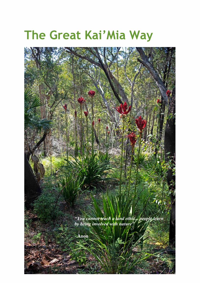
The Great Kai’Mia Way
“You cannot teach a land ethic... people learn
by being involved with nature”
- Anon
2
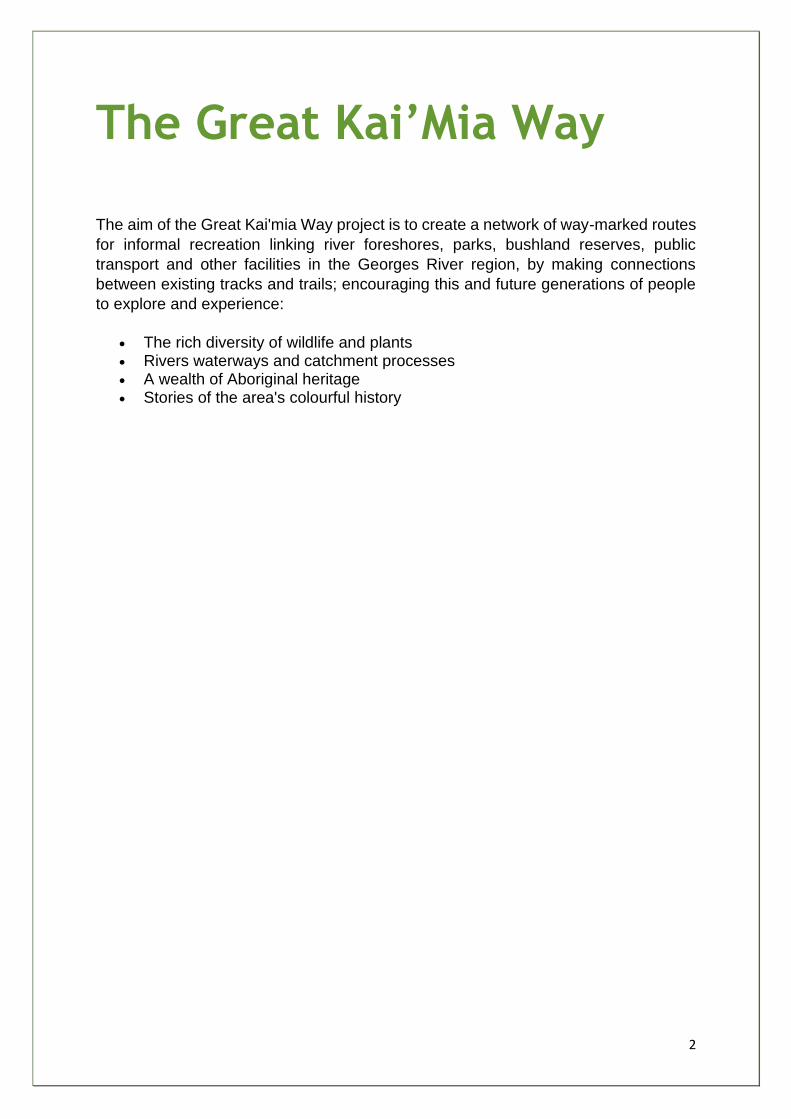
The Great Kai’Mia Way
The aim of the Great Kai'mia Way project is to create a network of way-marked routes
for informal recreation linking river foreshores, parks, bushland reserves, public
transport and other facilities in the Georges River region, by making connections
between existing tracks and trails; encouraging this and future generations of people
to explore and experience:
• The rich diversity of wildlife and plants • Rivers waterways and catchment processes • A wealth of Aboriginal heritage • Stories of the area's colourful history
3
Table of Contents
Forward ....................................................................................................................................... 8
Executive Summary .................................................................................................................... 10
Introduction .............................................................................................................................. 16
Report Structure ............................................................................................................................... 17
Aims of this report ............................................................................................................................ 18
Chapter One .............................................................................................................................. 19
Background ....................................................................................................................................... 20
The Great Kai'Mia Way Vision ........................................................................................................... 25
Caring for Country ..................................................................................................................... 25
Sustainability ............................................................................................................................. 26
Community Stewardship ........................................................................................................... 27
Safety ........................................................................................................................................ 27
Loops, Linkages and Regional Coordination ............................................................................. 28
Improved Health and Active Transport - Who Benefits? .................................................................. 29
Chapter Two .............................................................................................................................. 31
Partnering with Stakeholders and the Community .......................................................................... 32
Advisory Board .................................................................................................................................. 33
Working Groups ................................................................................................................................ 34
Community Events ............................................................................................................................ 34
Menai Celtic Festival: ............................................................................................................ 35
Sutherland Shire Council School Environment Fair: ............................................................. 35
Naidoc Day: ........................................................................................................................... 36
Survey................................................................................................................................................ 36
A Sample Use of the Way .................................................................................................................. 36
Stakeholder Contributions ................................................................................................................ 37
Ongoing Stakeholder Role ................................................................................................................ 40
Chapter 3 ................................................................................................................................... 42
Outcomes of the Study ..................................................................................................................... 43
Standardised Information ................................................................................................................. 45
Recommendation .............................................................................................................................. 46
The Georges River ............................................................................................................................. 47
The Sub-Regions of the Georges River .............................................................................................. 48
Georges Lower Reaches - Area Map ................................................................................................. 50
4
GLR 1 - Botany Bay ............................................................................................................................ 51
GLR 2 - Kogarah Bay .......................................................................................................................... 54
GLR 3 - Shipwrights Bay .................................................................................................................... 57
GLR 4 - Oatley Bay ............................................................................................................................. 60
GLR 5 - Lime Kiln Bay ......................................................................................................................... 63
GLR 6 - Salt Pan Creek - Lugarno ....................................................................................................... 66
GLR 7 - Salt Pan Creek - Canterbury .................................................................................................. 68
GLR 8 - F6 Corridor ............................................................................................................................ 71
GLR 9 - Oyster Bay ............................................................................................................................. 74
GLR 10 - Mill Creek/Rock Wallaby .................................................................................................... 77
Georges Middle Reaches .................................................................................................................. 80
Georges Middle Reaches - Area Map................................................................................................ 80
GMR 1 - Padstow Heights ................................................................................................................. 81
GMR 2 - Picnic Point .......................................................................................................................... 84
GMR 3 - Milperra .............................................................................................................................. 87
GMR 4 - Mirambeena........................................................................................................................ 89
GMR 5 - Lower Prospect ................................................................................................................... 91
GMR 6 - Upper Prospect ................................................................................................................... 94
GMR 7 - Racecourse .......................................................................................................................... 96
GMR 8 - Powerhouse ........................................................................................................................ 99
GMR 9 - Voyager Point .................................................................................................................... 101
GMR 10 - Moorebank ..................................................................................................................... 103
Georges Upper Reaches .................................................................................................................. 106
Georges Upper Reaches - Area Map ............................................................................................... 107
GUR 1 - Long Point .......................................................................................................................... 108
GUR 2 - The Basin ............................................................................................................................ 110
GUR 3 - The Woolwash ................................................................................................................... 112
Chapter 4 ................................................................................................................................. 127
The Woronora River ........................................................................................................................ 128
The Glen .......................................................................................................................................... 133
W1-A1 - Paruna ............................................................................................................................... 135
W1-A2 - The Glen Reserve .............................................................................................................. 140
W1-A3 - Skinner Creek .................................................................................................................... 143
W1-B1 - Koolangarra ....................................................................................................................... 146
W1-A4 - Burnum Burnum Sanctuary .............................................................................................. 149
W1-B2 - Bonnet Bay Foreshore....................................................................................................... 152
5
Wooloonara .................................................................................................................................... 155
W2-A5 - Woronora Village .............................................................................................................. 157
W2-A6 - Forbes Creek ..................................................................................................................... 160
Sabugal ............................................................................................................................................ 162
W3-A7 - Needles View .................................................................................................................... 164
W3-A8 - Scouters View ................................................................................................................... 169
Freshwater ...................................................................................................................................... 172
W4-A9 - Tamaroo ............................................................................................................................ 175
W4-A10 - Lake Eckersley ................................................................................................................. 178
W4-A11 - Goanna Track and Bullawaring Track (N) ........................................................................ 181
W4-A12 - Bullawaring Track South ................................................................................................. 184
W4-B3 - Mirang Road ...................................................................................................................... 186
W4-B4 - Yarrawarrah Ridge ............................................................................................................ 189
W4-C3 - Girronba ............................................................................................................................ 192
W4-C4 - Woronora Dam Road ........................................................................................................ 194
W4-C5 - Princes ............................................................................................................................... 196
W4-A13 - Helensburgh Link ............................................................................................................ 199
Shackles Area .................................................................................................................................. 202
W5-D1 - Sabugal Pass...................................................................................................................... 204
W5-D2 - Barden Ridge ..................................................................................................................... 207
West Menai Nature Trail (Burnum Burnum Track section) ............................................................ 210
W5-D3 - Burnum Burnum Track South ........................................................................................... 212
Still Creek ........................................................................................................................................ 215
W6-D4 - Burnum Burnum Track Central ......................................................................................... 218
W6-D5 - Burnum Burnum Track North ........................................................................................... 223
W6-D6 - Georges River National Park Link ..................................................................................... 226
Route E - Connector - Loftus Creek and Engadine .......................................................................... 231
Route F - Connector - New Road Bridge Woronora ........................................................................ 234
W5-G The Shackels Estate - Potential Long Term Walking Route .................................................. 237
Community Loop Walks - A Vehicle for Local Environmental Stewardship .................................... 246
Existing Loop Project - The Como Heritage and Environment Trail (CHET) .................................... 250
W1-J Jannali and Bonnet Bay .......................................................................................................... 251
W2-K Sutherland and Woronora .................................................................................................... 253
W2-L Loftus ..................................................................................................................................... 255
W2-M Woronora Heights ................................................................................................................ 257
W3-N Yarrawarra ............................................................................................................................ 259
6
W3-P Engadine ................................................................................................................................ 260
W4-Q Heathcote ............................................................................................................................. 262
W5-R Barden Ridge ......................................................................................................................... 264
W5&6-S West Menai Nature Trail .................................................................................................. 266
W6-T Menai and Menai High School .............................................................................................. 268
W6-U Bangor ................................................................................................................................... 270
W6-V Illawong ................................................................................................................................. 272
W6-W Alfords Point ........................................................................................................................ 275
Benefits of the Pedestrian Loop Concept ....................................................................................... 277
Community Loop Implementation Strategy ................................................................................... 283
Woronora River Canoe Trail ............................................................................................................ 285
Trail Routes ..................................................................................................................................... 290
Stakeholders and Issues to Address................................................................................................ 294
Chapter Five ............................................................................................................................ 297
Coordination ................................................................................................................................... 298
Sustainability and Safety ................................................................................................................. 298
Minimal Impact Recreation - Treading Lightly Protocols and Codes of Conduct ........................... 299
Walking in the Natural Areas of the Way ....................................................................................... 300
Planning Your Trip ........................................................................................................................... 300
Cycling the Way ............................................................................................................................... 301
Canoeing ......................................................................................................................................... 305
Track Facilities .............................................................................................................................. 307
Signage ............................................................................................................................................ 313
Chapter Six .............................................................................................................................. 334
Summary and Implementation ....................................................................................................... 335
Glossary................................................................................................................................... 341
Appendices .............................................................................................................................. 346
Appendix 1 - Botany Bay Trail Pre-feasibility Study ........................................................................ 347
Appendix 2 - Questionnaire ............................................................................................................ 350
Appendix 3 - Board Notes ............................................................................................................... 354
Appendix 4 - List of Stakeholders in The Great Kai'mia Way Project ............................................. 371
Appendix 5 – Safety Guide .............................................................................................................. 373
Appendix 6 - Australian Standard - Track Classification System ..................................................... 375
Appendix 7 – Values of the Burnum Burnam Track ........................................................................ 378
Appendix 8 - Threatened and Significant Species Occurring in the Woronora Catchment ............ 382
Appendix 9 - Woronora Foreshore Reserves .................................................................................. 384

7
Appendix 10 - Recommendations ................................................................................................... 388
Appendix 11 - Voluntary Conservation Agreements ...................................................................... 391
Appendix 12 - Shackles Estate Acquisition Program ....................................................................... 394
Appendix 13 - Recreational Vehicles on Public Land ...................................................................... 395
Appendix 14 - Sydney Morning Herald Article (24 Feb 2003) ........................................................ 407
Appendix 15 - NPA Letter (Southern Sydney Branch) ..................................................................... 408
8
Forward The vision of The Great Kai'mia Way was the establishment of over two hundred kilometres of sustainable walking tracks and cycleways to link Botany Bay, the Woronora valley, large parts of southern and western Sydney, and the Illawarra Escarpment. The vision arose from community concern for the Georges and Woronora Rivers and Botany Bay and an acknowledgement that parts of these river systems were under great environmental stress. The Great Kai'mia Way originated from a need for people to connect with our river systems. The aim was to enhance an understanding through interaction, thereby promoting people to love, value and look after them. In August 2002, the Sutherland Shire Environment Centre and Georges River Environmental Alliance obtained funding from PlanningNSW's Georges River Foreshores Improvement Program to conduct feasibility studies for creating the Great Kai'mia Way through the Georges and Woronora River catchments. The project was managed by Project Coordinators and Natural Area Campaigners based at the Sutherland Shire Environment Centre. Stage one of the project was completed and route options were plotted along the Georges and Woronora Rivers catchments for walking tracks, cycleways, and even water transport. This report, a detailed feasibility study, was produced with directions for the next steps to make the vision a reality. The project was a collaborative work involving broad participation, including: Indigenous Elders; Local Aboriginal Land Council representatives; six state government and two local government agencies; a number of schools; and no less than 24 community groups and NGO’s. A diverse range of community groups, from precinct residents’ associations, wildflower and bushcare groups to cycling, canoe and Rotary groups participated. Partnering with stakeholders was valued as a strategic cornerstone of the project; the study was launched at a public forum and stakeholder participation was facilitated throughout the project in both formal and informal meetings and working groups and through a representative Advisory Board. A fundamental principle of the project was that of stewardship. It was hoped that the participating organisations would play an ongoing role, taking the vision of the Great Kai'mia Way to the next step of progressive implementation in partnership with landholders, land managers and the community. At the time of writing – nearly 20 years after the official launch of the Project and Feasibility Study Report in 2004 – it is inspiring to read the scope and depth of the study. The original vision has not been implemented as a system of interconnecting active transport routes branded The Great Kai’Mia Way. However, The Way has been described as a concept rather than a blueprint for implementation; in this sense the project has proved invaluable, having been referenced for many years by councils, government agencies and community groups. Natural systems are connected systems and municipal boundaries bear no relationship to natural systems. Consideration of this interconnection was too often ignored by planning authorities. The Great Kai’Mia Way advocated for the natural systems– such as wildlife corridors and water catchments - to be incorporated into municipal planning.
9
Clearly, more needs to be done by planning and governance authorities to further the vision of The Great Kai’Mia Way, to incorporate interconnected natural systems into development that can truly be sustainable. A 2019 NSW Upper House Inquiry into Koala Populations and their Habitat found that disruption of wildlife corridors by roads and development was preventing koalas from roaming and breeding. Too many koalas are being killed on roads and too little suitable habitat is left. The koala is on track to become extinct by 2050 unless government acts to protect these animals and their bushland home. The cute and popular koala is just one species, but similar challenges apply to a distressing number of native animals, birds, reptiles, insects and plants. This document, encapsulating the original project website into a single, searchable resource, is intended to make the concept of The Way more accessible and easier to navigate. It is hoped that the original vision of the study will continue to guide and inspire, connecting communities - both human and natural – in the spirit of mutual flourishing and respect. Tassia Kolesnikow Chair, Sutherland Shire Environment Centre February, 2021
10
Executive Summary
“You cannot teach a land ethic... people learn by being involved with nature”
- Anon
The Great Kai'mia Way is over 200 kilometres of sustainable access routes to the foreshores of the Georges And Woronora Rivers, linking with the Illawarra Escarpment and Botany Bay. It is a vision of non-motorised movement through the valleys - on foot, by bicycle or in canoe, respecting the ecological, cultural, social and heritage values of the area. It is also a vision about partnerships and community participation, about building an asset that respects the past, the current and future generations.
Background The Great Kai'mia Way project arose from the insight of a number of individuals who have had a long-term love and involvement in the Georges River Catchment. It was given momentum through a series of inquiries and studies that highlighted the need to enable access to foreshores and bushland areas to encourage better management and community engagement with nature. In 1998, the State Government established the Georges River Foreshores Improvement Program (GRIFP) to find means to improve the health of the Georges River. The Sutherland Shire Environment Centre (SSEC) and Georges River Environmental Alliance (GREA) recommended that a feasibility study be carried out into the establishment of a continuous system of trails and tracks along the foreshores of the Georges and Woronora Rivers. This report is the result of that study, managed by SSEC and GREA. It is intended for use by councils and community in the catchment, as well as state government departments with responsibility for urban planning, environment and health. It provides the rationale underlying the study, the routes that seem to be the most suitable for sustainable access, and recommendations for the coordination and action required to implement the Great Kai'mia Way.
11
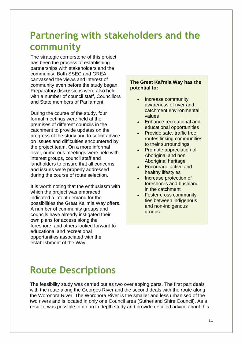
Partnering with stakeholders and the community The strategic cornerstone of this project has been the process of establishing partnerships with stakeholders and the community. Both SSEC and GREA canvassed the views and interest of community even before the study began. Preparatory discussions were also held with a number of council staff, Councillors and State members of Parliament. During the course of the study, four formal meetings were held at the premises of different councils in the catchment to provide updates on the progress of the study and to solicit advice on issues and difficulties encountered by the project team. On a more informal level, numerous meetings were held with interest groups, council staff and landholders to ensure that all concerns and issues were properly addressed during the course of route selection. It is worth noting that the enthusiasm with which the project was embraced indicated a latent demand for the possibilities the Great Kai'mia Way offers. A number of community groups and councils have already instigated their own plans for access along the foreshore, and others looked forward to educational and recreational opportunities associated with the establishment of the Way.
The Great Kai'mia Way has the potential to:
• Increase community awareness of river and catchment environmental values
• Enhance recreational and educational opportunities
• Provide safe, traffic free routes linking communities to their surroundings
• Promote appreciation of Aboriginal and non Aboriginal heritage
• Encourage active and healthy lifestyles
• Increase protection of foreshores and bushland in the catchment
• Foster cross community ties between indigenous and non-indigenous groups
Route Descriptions
The feasibility study was carried out as two overlapping parts. The first part deals with the route along the Georges River and the second deals with the route along the Woronora River. The Woronora River is the smaller and less urbanised of the two rivers and is located in only one Council area (Sutherland Shire Council). As a result it was possible to do an in depth study and provide detailed advice about this
12
part of the Great Kai'mia Way. The study of the longer, more urbanised Georges River, on the other hand, involved discussions with many councils, state and federal government agencies, and other landholders. The advice about the route for this section is more generalised. It is envisaged that a next step in the project will be carry out the same in-depth work for the Georges River as was done for the Woronora River section of the Way. Although in two parts and with different data detail, the Way information presented in this report is in a standardised format:
1. The routes have been divided into subsections and each subsection has been given a name. The information in the tables also identify suitability of the route for pedestrians, cyclists and canoeists.
2. A standard grading system has been adopted to indicate difficulty of the walk from 1 (wheelchair accessible) to 5 (experienced walkers only).
3. Some parts of the Great Kai'mia Way are already in place, other parts require construction. Subsections are prioritised to highlight the importance of the section to the function of the Way, and the difficulty and funding opportunities for implementation: A - Highest priority - recommended completion within two years B - Medium priority - recommended completion in next five years C - Lowest priority - within ten years.
4. Each subsection presents its own benefits and challenges which are listed in short form. 5. The project team has done its best to ensure that all relevant stakeholders for each subsection
have been contacted. The project team hopes that by listing stakeholders in this way, those who have not been identified will contact the team to provide relevant input.
6. Actions and estimated costs of implementing each subsections are also noted. 7. Maps are a critical part of the way information is delivered in this report. Each subsection is
accompanied by a map of that subsection. Larger scale landscape maps are also provided to increase ease of orientation.
These routes should not be seen as final, and are subject to further community consultation and refinement as the project evolves.
Coordination
A factor that became evident during the course of the study was the need for a coordinated approach to implementation of the Way. The Great Kai'mia Way traverses twelve local government areas, tracts of Crown Land, National Parks, Aboriginal Land Council land, private land, Sydney Water Land and land belonging to other government authorities and agencies. Many sections of the Way already exist, but the standards of access and signage vary considerably. Many sections of the Way are missing and commitment from landholders varies from area to area. These issues are part of the subsections discussion. The project team identified four aspects of the Great Kai'mia Way that require coordination:
13
1. Sustainability and safety 2. Signage 3. Use of materials 4. Implementation.
The report recommends a range of protocols for users of the Way, for infrastructure works, signage along the route, and for materials used. A number of stakeholders were particularly concerned about the damage and danger caused by trail bikes and four wheel drive vehicles in natural areas, as well as inappropriate use of pedestrian tracks by mountain bikes. The report acknowledges concerns and therefore recommends limiting access through infrastructure works and appropriate policing.
The future of the Great Kai'mia Way and recommendations
This report delivers information necessary for the progressive implementation of the Great Kai'mia Way. It details where routes could best be allocated, the priority for implementation of sections of the route and guidelines for the coordinated implementation of the project. Many stakeholders have been involved in the provision of information for this report. The project team recommends the following to ensure that stakeholders remain involved and the Great Kai'mia Way vision is realised:
1. That the precautionary principle guide development of the great Kai'mia Way, and that no development proceeds till appropriate management measures have been agreed to by stakeholders.
2. That the Great Kai'mia Way vision be implemented, appreciating the information for routing and priorities noted in Chapters 3 and 4 of this report, and ensuring that the precautionary principle is the arbiter of both route selection and implementation.
3. That the relevant communities name subsections of the Way. 4. That the safety code developed by the Great Kai'mia Way project team be adopted as the
minimum standard for work carried out on the Great Kai'mia Way. 5. That the codes of conduct detailed in the Great Kai'mia Way report be noted on signage and
on literature relating to the Way for the three main categories of non-motorised recreational uses: walking, cycling and canoeing.
6. That a regional strategy be developed to provide opportunities for cycling experiences while controlling inappropriate access through bushland.
7. That trackside benches and drinking fountains, such as bubblers, be provided where mains water supply is available at strategic access points along the Way, generally at roadside stops.
8. Access to the Great Kai'mia Way should encourage legitimate non-motorised transport through appropriate entry points, and the provision of bike racks and parking.
9. Level or gently sloping sectors of the Way with good access should be developed and promoted to provide opportunities for less mobile people to use the Great Kai'mia Way.
10. Bans on the use of 4WDs and Trail Bikes on the Great Kai'mia Way should be reinforced with:
14
o Provision of alternative places to go which are affordable; o Police and rangers should have powers to confiscate bikes; o System of fines and heavy penalties for transgressing law; o Amendment of laws to ban their use on the Great Kai'mia Way; o More frequent patrols by rangers backed up by police enforcement teams; and o Signage.
11. That land managers adopt a protocol for closing routes during severe fire danger periods, and maps show routes to enable quick exit in case of emergencies.
12. That the Great Kai'mia Way maximises the potential for people to use public transport and local amenities.
13. That traffic calming measures and associated signage be installed at intersections of roads and the Great Kai'mia Way.
14. That landmanagers be encouraged to adopt the guidelines for signage recommended in the report and adopt the "family of signs" concept for the Great Kai'mia Way.
15. That a standard be adopted for construction and upgrade of track works, consistent with existing Australian Standards for walking track classification signage and infrastructure AS 2156.1-2001 and AS 2156.2-2001: a combination of Class 2, Class 3 and occasionally Class 4 out of 6 classes, where 6 is the least developed class (see appendix dd for details of standards).
16. That infrastructure on the the Great Kai'mia Way is free of all CCA treated pine products. 17. Effective measures be implemented to exclude trail bikes and 4WDs from sensitive areas by
using, for example, gates made from galvanized steel pipe, fencing made from galvanized steel double rope, and kissing gates to enable access by legitimate users.
18. That Type A barriers as described in AS2156.2-2001: Track Infrastructure be be installed at lookouts and other relevant locations for safety and risk management at the discretion of track managers based on an assessment of effective fall height.
19. That stakeholders adopt the feasibility study through a signed memorandum that commits them to:
i) a project staging plan as detailed in the feasibility study; ii) a coordinated strategy for implementation of the Great Kai'mia Way, including:
a. common signage as detailed in Chapter 5; b. ongoing communication between stakeholder groups to ensure appropriate linkages;
iii) adoption of the principles of sustainability in the implementation of the Great Kai'mia Way backed by increased research into the aspects of sustainable management;
iv) adoption of the planning checklist for development as detailed in Chapter 5
20. That Councils incorporate the Great Kai'mia Way route and vision for sustainability into their planning instruments and provide consistent funding through budget allocations and S94 developer contributions.
21. That Way community groups - local "friends of the Great Kai'mia Way" - be recognised and if necessary, established to help with the implementation of the Great Kai'mia Way vision.
22. That the Aboriginal community be an integral partner in the design and implementation of the Great Kai'mia Way.
23. That a management and implementation system be set up that will enable:
15
a. An ongoing structure for decision making that involves land holders, land managers and interested community members, with particular note to engage the Aboriginal community;
b. A funding structure that encourages contribution from a wide pool of stakeholders: community, private organisations and government;
c. A commitment to continued promotion of the Great Kai'mia Way for environmental, cultural, recreational and health purposes;
d. A commitment to sustainability whilst enabling access to as many users as possible.
1. The names provided in this report are suggestions only. 2. Councils and government agencies, and other landholders and managers will have more detailed occupational health and
safety procedures. These will, of course, be the ones applicable for works on their land. The recommendation here is for minimum standards only.
3. The Great Kai'mia Way: Chapter 5. 4. For example: Trail Bikes and all unauthorised vehicles prohibited - Max Penalty $11, 500.
16
Introduction The Great Kai'mia Way is over 200 kilometres of sustainable access routes to the foreshores of the Georges and Woronora Rivers, linking with the Illawarra Escarpment and Botany Bay. It is a vision of non-motorised movement through the valleys - on foot, by bicycle or in canoe, respecting the ecological, cultural, social and heritage values of the area. It is also a vision about partnerships and community participation, about building an asset that respects the past, the current and future generations.
This report is about how the community, councils and government agencies can
achieve that vision. It is the result of a twelve-month study undertaken by the
Sutherland Shire Environment Centre (SSEC) in conjunction with the Georges River
Environmental Alliance (GREA) and funded by the Georges River Foreshores
Improvement Program (GRFIP).
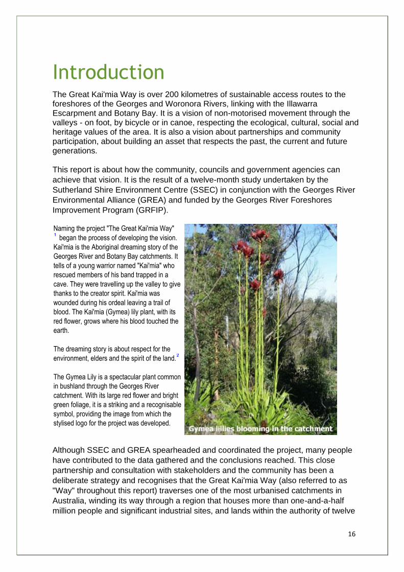
Naming the project "The Great Kai'mia Way"
began the process of developing the vision.
Kai'mia is the Aboriginal dreaming story of the
Georges River and Botany Bay catchments. It
tells of a young warrior named "Kai'mia" who
rescued members of his band trapped in a
cave. They were travelling up the valley to give
thanks to the creator spirit. Kai'mia was
wounded during his ordeal leaving a trail of
blood. The Kai'mia (Gymea) lily plant, with its
red flower, grows where his blood touched the
earth.
The dreaming story is about respect for the
environment, elders and the spirit of the land.
The Gymea Lily is a spectacular plant common
in bushland through the Georges River
catchment. With its large red flower and bright
green foliage, it is a striking and a recognisable
symbol, providing the image from which the
stylised logo for the project was developed.
Although SSEC and GREA spearheaded and coordinated the project, many people
have contributed to the data gathered and the conclusions reached. This close
partnership and consultation with stakeholders and the community has been a
deliberate strategy and recognises that the Great Kai'mia Way (also referred to as
"Way" throughout this report) traverses one of the most urbanised catchments in
Australia, winding its way through a region that houses more than one-and-a-half
million people and significant industrial sites, and lands within the authority of twelve
17
councils, several government agencies, Aboriginal Land Councils and private
landholders. By attempting to involve a maximum number of stakeholders, the
project managers hoped to ensure that most issues regarding route features and
selection are identified and appropriately considered in the discussion and
recommendations for route implementation.
Community consultation is one of the four integrated components that underpinned
the study. The other three components are:
• Research and documentation of the natural and cultural features (including existing routes and planned routes) in the areas close to the rivers to provide the groundwork for Kai'mia Way routes.
• Creation of opportunities to increase sustainable use of the environment and care of our cultural heritage. This includes opportunities to promote the project and stimulate ideas for the different uses of the system of routes, tracks and trails.
• Establishment of funding strategy for implementation and ongoing care of the Great Kai'mia Way.
The following discussion will deal with each of these components and a fifth one which
stakeholders also identified as important for implementation of the Great Kai'mia Way:
• Coordinated implementation of the Great Kai'mia Way.
Report Structure
This report begins with background information about the Georges River Catchment, the GRFIP, SSEC and GREA. Chapter 1 also explains how the Great Kai'mia Way can improve the health of the catchment and the wellbeing of people living in the catchment. To provide a framework for maximising outcomes, the project team adopted five guiding principles:
• Caring for Country • Sustainability • Community stewardship • Safety • Loops and linkages
Chapter 2 then provides the details of how the project team engaged stakeholders, the contribution of stakeholders and the ongoing role they have in the Great Kai'mia Way project. Chapters 3 and 4 provide the details of the groundwork done for location of routes. For quick reference for all stakeholders, the information is provided in standardised tables and broken into sections. Chapter 3 contains information about routes in the Georges River Catchment. Chapter 4 contains information about routes in the Woronora River Catchment. The recommendations arising from the study are discussed section by section and listed in Appendix 10. Chapter 5 provides suggestions for the coordinated implementation of the Great Kai'mia way. These suggestions range from the use of materials for making tracks and signage through to safety issues and design to control and manage usage and
18
ongoing management of routes. Finally, Chapter 6 discusses recommendations and options for implementation of the Great Kai'mia Way. Implementation will require ongoing commitment from stakeholders and a commitment of resources to ensure that the full potential of the Way is realised.
Report Intent
The information in this report is intended for use by councils, agencies and community members interested in either building and maintaining the Great Kai'mia Way, or using it for environmental, health and community capacity-building programs. It aims to enhance opportunities for regional coordination, efficiency and sustainability, as well as to promote general principals for sustainable trail route planning, design, construction and maintenance. Much care has been taken to propose routes for the Great Kai'mia Way that are sustainable and inviting. However the report authors are aware that there are many contingencies guiding the selection and implementation of routes - and these contingencies change over time. This report is not meant to bind landholders or managers to proposed routes. It is ultimately up to landholders and managers to work together with stakeholders to ensure that the final route meets their special needs and objectives. The authors hope that the work that has been done in this feasibility study provides a sound foundation for making decisions about timing and routing of the Great Kai'mia Way.
Aims of this report
• Assist the community, councils and agencies to implement the Great Kai'mia Way (Way) while promoting general principals for sustainable Way route planning, design, construction and maintenance.
• Enhance regional coordination, efficiency and sustainability through the implementation of the Great Kai'mia Way through an extensive network of community, local and state government support.
• Present comprehensive information on the existing network of routes in the Georges and Woronora catchments, including the identification of opportunities for bush regeneration, environmental restoration and heritage conservation and community building along the foreshores of the waterways.
• Outline funding options for the construction and maintenance of the Great Kai'mia Way.
• Outline community use, education and promotion strategies for the Great Kai'mia Way.
1. Pronounced Ki may Way 2. The source of this story is Gavin Andrews of the Dharawal People, and permission for its use was provided by the Dharawal
elders.

19
Chapter One
20
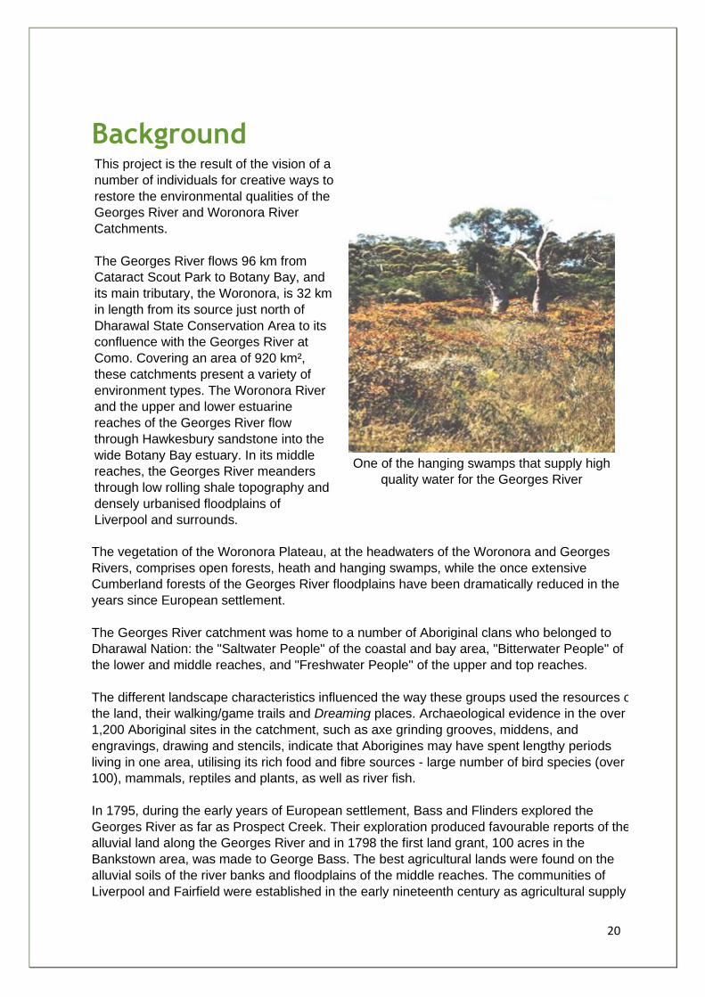
Background This project is the result of the vision of a
number of individuals for creative ways to
restore the environmental qualities of the
Georges River and Woronora River
Catchments.
The Georges River flows 96 km from
Cataract Scout Park to Botany Bay, and
its main tributary, the Woronora, is 32 km
in length from its source just north of
Dharawal State Conservation Area to its
confluence with the Georges River at
Como. Covering an area of 920 km²,
these catchments present a variety of
environment types. The Woronora River
and the upper and lower estuarine
reaches of the Georges River flow
through Hawkesbury sandstone into the
wide Botany Bay estuary. In its middle
reaches, the Georges River meanders
through low rolling shale topography and
densely urbanised floodplains of
Liverpool and surrounds.
One of the hanging swamps that supply high
quality water for the Georges River
The vegetation of the Woronora Plateau, at the headwaters of the Woronora and Georges
Rivers, comprises open forests, heath and hanging swamps, while the once extensive
Cumberland forests of the Georges River floodplains have been dramatically reduced in the
years since European settlement.
The Georges River catchment was home to a number of Aboriginal clans who belonged to
Dharawal Nation: the "Saltwater People" of the coastal and bay area, "Bitterwater People" of
the lower and middle reaches, and "Freshwater People" of the upper and top reaches.
The different landscape characteristics influenced the way these groups used the resources of
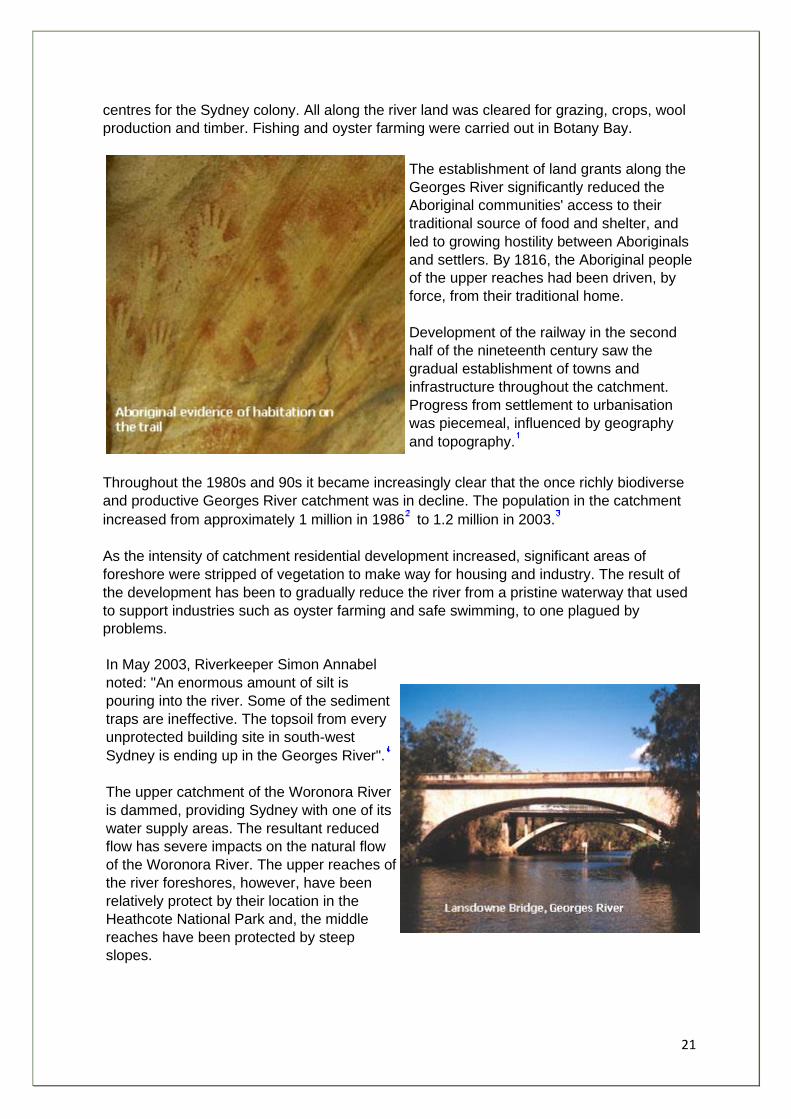
the land, their walking/game trails and Dreaming places. Archaeological evidence in the over
1,200 Aboriginal sites in the catchment, such as axe grinding grooves, middens, and
engravings, drawing and stencils, indicate that Aborigines may have spent lengthy periods
living in one area, utilising its rich food and fibre sources - large number of bird species (over
100), mammals, reptiles and plants, as well as river fish.
In 1795, during the early years of European settlement, Bass and Flinders explored the
Georges River as far as Prospect Creek. Their exploration produced favourable reports of the
alluvial land along the Georges River and in 1798 the first land grant, 100 acres in the
Bankstown area, was made to George Bass. The best agricultural lands were found on the
alluvial soils of the river banks and floodplains of the middle reaches. The communities of
Liverpool and Fairfield were established in the early nineteenth century as agricultural supply
21
centres for the Sydney colony. All along the river land was cleared for grazing, crops, wool
production and timber. Fishing and oyster farming were carried out in Botany Bay.
The establishment of land grants along the
Georges River significantly reduced the
Aboriginal communities' access to their
traditional source of food and shelter, and
led to growing hostility between Aboriginals
and settlers. By 1816, the Aboriginal people
of the upper reaches had been driven, by
force, from their traditional home.
Development of the railway in the second
half of the nineteenth century saw the
gradual establishment of towns and
infrastructure throughout the catchment.
Progress from settlement to urbanisation
was piecemeal, influenced by geography
and topography.
Throughout the 1980s and 90s it became increasingly clear that the once richly biodiverse
and productive Georges River catchment was in decline. The population in the catchment
increased from approximately 1 million in 1986 to 1.2 million in 2003.
As the intensity of catchment residential development increased, significant areas of
foreshore were stripped of vegetation to make way for housing and industry. The result of
the development has been to gradually reduce the river from a pristine waterway that used
to support industries such as oyster farming and safe swimming, to one plagued by
problems.
In May 2003, Riverkeeper Simon Annabel
noted: "An enormous amount of silt is
pouring into the river. Some of the sediment
traps are ineffective. The topsoil from every
unprotected building site in south-west
Sydney is ending up in the Georges River".
The upper catchment of the Woronora River
is dammed, providing Sydney with one of its
water supply areas. The resultant reduced
flow has severe impacts on the natural flow
of the Woronora River. The upper reaches of
the river foreshores, however, have been
relatively protect by their location in the
Heathcote National Park and, the middle
reaches have been protected by steep
slopes.
22
In the 1990s community activists lobbied to protect the health of the rivers and their
foreshores. These efforts culminated in the formation of the Shaping the Georges River
Catchment (GRC) Strategic Plan and the announcement by the State Government of a $6
million program - the Georges River Foreshore Improvement Program (GRFIP). The stated
aim of the Program was to:
“Provide funding for projects that enhance the ecological sustainability, environmental
quality, and recreational amenity of the Georges River Catchment by focusing on improving
the foreshores of the Georges River and its tributaries.”
A Section 22 Committee, formed under
the Environmental Planning and Assessment
Act 1979, was established in 1995 by the
Minister for Urban Affairs and Planning. The
brief of the committee was to offer advice on
the state and management of the Georges
River. The Committee expanded the scope of
the review to include the entire Georges
River Catchment.
In 2000, Planning NSW commissioned a
study of the feasibility of creating a
continuous route for pedestrians and cyclists
along the foreshore of the Georges River.
The study concluded that such a route was
possible.
Sutherland Shire Environment Centre
(SSEC) and Georges River Environmental
Alliance (GREA) made separate applications
to GRFIP in 2002 to take the study further
and begin the coordination work to enable
the foreshore access route to become a
reality. Since there were obvious synergies in
the two projects it was decided to combine
them and manage both from SSEC's offices.
Objectives of the GRFIP:
• To improve the Catchment's ecological integrity and environmental values by implementing best practice, ecologically sustainable and integrated foreshore improvement works;
• To equitably implement the metropolitan objectives for the environment including the initiatives for open space and waterways;
• To improve the Catchment's scenic and recreational amenity by improving foreshore open space areas and access to, and linkages between those areas;
• To help implement other components of the "Shaping the Georges River Catchment (GRC) Strategy, including the GRC Planning Strategy and The GRC Regional Environment Plan; and
• To promote cooperation and partnerships through consultation with the community, all levels of Government and key stakeholders.
23
GREA is a network of local
community groups within the
Georges River catchment. Its
prime objective is to encourage
protection of the catchment, its
biodiversity, and to improve river
water quality. It supports only
ecologically sustainable
development.
The combined project has the potential to incorporate an even grander vision of route systems throughout the Botany Bay catchment, including the Botany Bay Trail which can be progressively implemented as resources and opportunities arise over the next decade. In its application to GRFIP, the SSEC noted the potential benefits of such a project:
• Increased awareness of the value of the catchment's ecosystem biodiversity and its cultural, spiritual and heritage significance for both Aboriginal and non-Aboriginal people.
• Heightened capacity of the local communities to sustain their involvement in future environmental protection and enhancement activities.
• A focus for practical environmental education projects for local schools/colleges including the monitoring of the impact of the path on the catchment's biodiversity.
SSEC aims to enhance management and understanding of the environment in Sutherland Shire and its bioregion, working in partnership with community, business and government. It is an independent non-government organisation funded through donations, fundraising and project-specific grants.
Botany Bay Trail
The Botany Bay Program, a study of
the Botany Bay environment managed
by the Southern Sydney Region
Organisation of Councils (SSROC),
commissioned SSEC to carry out a
pre-feasibility study of a trail system
around Botany Bay. The findings for
this study were delivered at the Trails
Forum held at Sutherland Shire
Entertainment Centre on 7 th
September 2002. ( See Appendix 1 )
Similarly, GREA stated in its application that walks along the Georges River would raise community awareness of the river. Few people know of the historical and cultural significance of the river, nor fully comprehend the impacts of urbanisation on its health. GREA saw the feasibility study as an opportunity to promote the environmental/historical/cultural issues of the catchment, and encourage cooperation between the community, industry, environmental groups and all levels of government. Both GREA and SSEC are organisations committed to working towards better management of the Georges River Catchment and to seek pro-active ways of doing so whilst continuously engaging stakeholders.
24
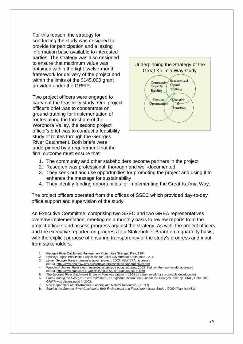
For this reason, the strategy for conducting the study was designed to provide for participation and a lasting information base available to interested parties. The strategy was also designed to ensure that maximum value was obtained within the tight twelve-month framework for delivery of the project and within the limits of the $145,000 grant provided under the GRFIP. Two project officers were engaged to carry out the feasibility study. One project officer's brief was to concentrate on ground-truthing for implementation of routes along the foreshore of the Woronora Valley, the second project officer's brief was to conduct a feasibility study of routes through the Georges River Catchment. Both briefs were underpinned by a requirement that the final outcome must ensure that:
Underpinning the Strategy of the
Great Kai'mia Way study
1. The community and other stakeholders become partners in the project 2. Research was professional, thorough and well-documented 3. They seek out and use opportunities for promoting the project and using it to
enhance the message for sustainability 4. They identify funding opportunities for implementing the Great Kai'mia Way.
The project officers operated from the offices of SSEC which provided day-to-day
office support and supervision of the study.
An Executive Committee, comprising two SSEC and two GREA representatives
oversaw implementation, meeting on a monthly basis to review reports from the
project officers and assess progress against the strategy. As well, the project officers
and the executive reported on progress to a Stakeholder Board on a quarterly basis,
with the explicit purpose of ensuring transparency of the study's progress and input
from stakeholders.
1. Georges River Catchment Management Committee Strategic Plan, 1994 2. Sydney Region Population Projections for Local Government Areas 1986 - 2011 3. Lower Georges River stormwater action project , 2003, NSW EPA, accessed
8/9/03, http://www.epa.nsw.gov.au/stormwater/casestudies/georgesriver.htm 4. Woodford, James. River sleuth despairs as sewage pours into bay, 2003, Sydney Morning Herald, accessed
8/9/03, http://www.smh.com.au/articles/2003/05/21/1053196639402.html 5. The Georges River Catchment Strategic Plan was written in 1994 as a framework for sustainable development 6. From Sharing the Georges River Catchment , a Regional Environment Plan for the Georges River by DUAP, 1999. The
GRIFP was discontinued in 2003. 7. Now Department of Infrastructure Planning and Natural Resources (DIPNR) 8. Sharing the Georges River Catchment: Built Environment and Foreshore Access Study . (2000) PlanningNSW.
25
The Great Kai'Mia Way Vision From its inception, the Great Kai'mia Way project was a grand vision with the potential for achieving many environmental, heritage and recreational objectives. As the project unfolded, the promise was reflected by the enthusiasm with which many stakeholders participated in information gathering and decision-making. Without doubt, implementation of the Great Kai'mia Way is an initiative that has come of age.
The Great Kai'mia Way has the potential to:
• Enhance recreational and educational opportunities of existing open space
• Provide safe traffic free routes linking communities to their surroundings
• Increase community awareness of river and catchment environmental values
• Promote Aboriginal and non Aboriginal heritage
• Encourage active and healthy lifestyles for a wide range of people in the community
• Increase protection of foreshores and bushland in the catchment • Foster cross community ties between indigenous and non-indigenous groups • Develop stewardship partnerships between land owners, residents, local
Aboriginal Land Councils, agencies and local government
It became quickly obvious from stakeholder meetings and research that adopting the
following five principles would be a useful aid in guiding research and reporting:
Caring for Country
Since European settlement, the mentality of land management in Australia has been one of taming, conquering, mastering and manipulation. This strategy is at odds with the nature of the Australian landscape, which contains mostly old, infertile soils and ecosystems in delicate balance. The land requires a management system that acknowledges the uniqueness of the Australian environment. Aboriginal people learnt to work with the land, adapting to their home in intricate ways , placing value on relationships between their "Country" and neighbouring "Country". The Aboriginal landscape is a shared landscape. "Country", in Aboriginal English, is a proper noun. People. speak to Country, sing to Country, visit Country, worry about Country, feel sorry for Country, and long for Country. People say that country knows, hears, smells, takes notice, takes care, is sorry or happy. Because of
26
this richness, Country is home and peace; nourishment for body; mind and spirit; and heart's ease. .
The Great Kai'mia Way project aims to revive these values of Country as a living entity.
Sustainability
The GRFIP aimed to achieve: increased recreational opportunities; better environmental care; and enhanced community welfare. The Great Kai'mia Way helps to achieve these aims by promoting sustainable access to foreshore areas, improving recreational opportunities and community environmental awareness.
The inappropriate intensity of development occurring along the foreshores of Georges River and the often poorly planned nature of development throughout the catchment result in greatly increased stormwater runoff impacts, erosion, turbidity and sedimentation. These impacts, along with the environmental damage caused by unsustainable recreational activities - such as illegal 4WD/trail bike access and inappropriate boat use, challenge the health of the catchment.
Sustainable Project Management is essential to achieving the implementation of a sustainable Great Kai'mia Way. The project manager should coordinate and monitor the Environmental Management Plans (EMPs) that ensure best practice environmental outcomes. The Great Kai'mia Way adopts the environmental benchmarks established during the Sydney 2000 Olympics :
• Chapter 5 recommendations for construction and materials are mindful of issues such as Life Cycle Analysis ; • Throughout the report maintaining and enhancing biodiversity is a key consideration; • How to reduce waste is considered in projects; • Heritage values are respected; • Community educational opportunities maximised; • Trail planning and design involves community consultation and real involvement; and • Stewardship is encouraged.
One of the principles of sustainability is the precautionary principle. It is recommended that the precautionary principle guide development of the Great Kai'mia Way.
Recommendation:
1. That the precautionary principle guide development of the great Kai'mia Way, and that no development proceeds till appropriate management measures have been agreed to by stakeholders.
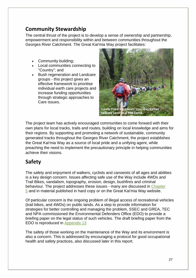
27
Community Stewardship The central thrust of the project is to develop a sense of ownership and partnership, empowerment and responsibility within and between communities throughout the Georges River Catchment. The Great Kai'mia Way project facilitates:
• Community building; • Local communities connecting to
"Country"; and • Bush regeneration and Landcare
groups - this project gives an effective framework to prioritise individual earth care projects and increase funding opportunities through strategic approaches to Care issues.
The project team has actively encouraged communities to come forward with their
own plans for local tracks, trails and routes, building on local knowledge and aims for
their regions. By supporting and promoting a network of sustainable, community
generated tracks throughout the Georges River Catchment, the project establishes
the Great Kai'mia Way as a source of local pride and a unifying agent, while
preaching the need to implement the precautionary principle in helping communities
achieve their visions.
Safety
The safety and enjoyment of walkers, cyclists and canoeists of all ages and abilities is a key design concern. Issues affecting safe use of the Way include 4WDs and Trail Bikes, vandalism, topography, erosion, design, bushfires and criminal behaviour. The project addresses these issues - many are discussed in Chapter 5 and in material published in hard copy or on the Great Kai'mia Way website.
Of particular concern is the ongoing problem of illegal access of recreational vehicles (trail bikes, and 4WDs) on public lands. As a step to provide information for strategies for better controlling and managing the problem, SSEC and GREA, TEC and NPA commissioned the Environmental Defenders Office (EDO) to provide a briefing paper on the legal status of such vehicles. The draft briefing paper from the EDO is reproduced in Appendix 13
The safety of those working on the maintenance of the Way and its environment is also a concern. This is addressed by encouraging a protocol for good occupational health and safety practices, also discussed later in this report.
28
There are potential liability issues raised through the development of the Way; and the management of risk to the public and landowners from using the Way is an important consideration for Councils and other land managers.
Understandably, Councils will only be responsible for parts of the Great Kai'mia Way on land under their care and control, ownership, or properties providing easements for the route; and when requesting consent from owners, including Crown Lands and LALCs, Councils are likely to be required to provide owners with indemnity against public liability on the track.
Currently the public use fire-trails for walking and cycling without any controls. NSW
Rural Fire Service (RFS) consider that through the use of Great Kai'mia Way
signage, an opportunity will be created to close trails to the public during extreme
bush fire hazard conditions or during hazard reduction activities .
Loops, Linkages and Regional Coordination
Loop tracks provide the means for experiencing the Great Kai'mia Way in segments. Local communities relate best to their own local loop tracks and the features (parks/foreshore reserves/sports facilities/shops/schools/etc) which these tracks access and connect. The majority of walkers and cyclists will only use their local tracks, but they will benefit in terms of the improved recreational opportunities resulting from better regional linkages.
Walkers and cyclists often prefer to arrive back where they started - where (reasonably) safe car parking or public transport is available .
The Great Kai'mia Way project aims to overcome some of the current problems of poor route usage and maintenance by providing loops and linkages most appropriate to the local community.
An important factor in the success of the Great Kai'mia Way will be its links to the Great North Walk, the Federation Track, the (very popular) Coast Walk in the Royal National Park, The Great River Walk and the Bay to Bay Cycleway. What is emerging is a network of sustainable transport, with great tourist, public health and environmental benefits.
It has attracted widespread media interest including an article in the Sydney Morning
Herald, which is reproduced in Appendix 14.
1. Robyn Smith (1998). Caring for Country. http://www.abc.net.au/science/slab/country/story.htm 2. Deborah Bird Rose (1996). Nourishing Terrains - Australian Aboriginal Views of Landscape and Wilderness. Australian
Heritage Commission, Canberra, p7-8 3. Sydney 2000 Olympic and Paralympic Games Environmental
Benchmarks. http://www.csp.uts.edu.au/resources/benchmarks.pdf 4. Examples of suggested actions by land managers to minimise risks involved in track use are discussed further in Chapter
Five - Sustainability and Safety - Risk Management and Liability
5. Results from Community Survey undertaken during feasibility study - See Appendix 2
29
Improved Health and Active Transport - Who Benefits? As well as recreational benefits, the Way - particularly in the urbanised lower reaches of the Georges River - has the potential to contribute widely to facilitating 'active transport' - i.e transport that involves incidental physical activity, such as walking, cycling and traveling by public transport - and its known links to improved health .
Research in Perth (WA) has shown that problems such as obesity are associated with poor access to footpaths and recreational facilities, and perceiving that no shop is within walking distance . Also, the current consensus of among health professionals is that, to protect health, every adult should accumulate 30 minutes or more of moderate-intense, endurance -type physical activity - such as walking or cycling - on most days of the week .
The Way can act as a focus for programs such as: walking for pleasure (NSW Sport and Recreation); and healthy walks (South East Sydney Area Health Service), which promote active transport as a sustainable positive lifestyle habit .
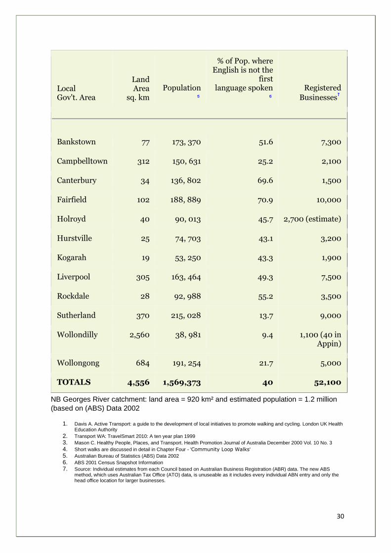
The following table provides a snapshot of population statistics from the twelve local
government areas of the Georges River catchment. The Way has the potential to
benefit more than one third of Sydney's population - a diverse multi-cultural
community. Local businesses will benefit from improved recreational and active
transport facilities for staff, and those on or close to the Way will benefit financially
from increased patronage by residents, visitors and tourists.
30
Local Gov't. Area
Land Area
sq. km
Population
% of Pop. where English is not the
first language spoken
Registered
Businesses
Bankstown 77 173, 370 51.6 7,300
Campbelltown 312 150, 631 25.2 2,100
Canterbury 34 136, 802 69.6 1,500
Fairfield 102 188, 889 70.9 10,000
Holroyd 40 90, 013 45.7 2,700 (estimate)
Hurstville 25 74, 703 43.1 3,200
Kogarah 19 53, 250 43.3 1,900
Liverpool 305 163, 464 49.3 7,500
Rockdale 28 92, 988 55.2 3,500
Sutherland 370 215, 028 13.7 9,000
Wollondilly 2,560 38, 981 9.4 1,100 (40 in Appin)
Wollongong 684 191, 254 21.7 5,000
TOTALS 4,556 1,569,373 40 52,100
NB Georges River catchment: land area = 920 km² and estimated population = 1.2 million
(based on (ABS) Data 2002
1. Davis A. Active Transport: a guide to the development of local initiatives to promote walking and cycling. London UK Health Education Authority
2. Transport WA: TravelSmart 2010: A ten year plan 1999
3. Mason C. Healthy People, Places, and Transport. Health Promotion Journal of Australia December 2000 Vol. 10 No. 3
4. Short walks are discussed in detail in Chapter Four - 'Community Loop Walks'
5. Australian Bureau of Statistics (ABS) Data 2002
6. ABS 2001 Census Snapshot Information
7. Source: Individual estimates from each Council based on Australian Business Registration (ABR) data. The new ABS method, which uses Australian Tax Office (ATO) data, is unuseable as it includes every individual ABN entry and only the head office location for larger businesses.

31
Chapter Two
32
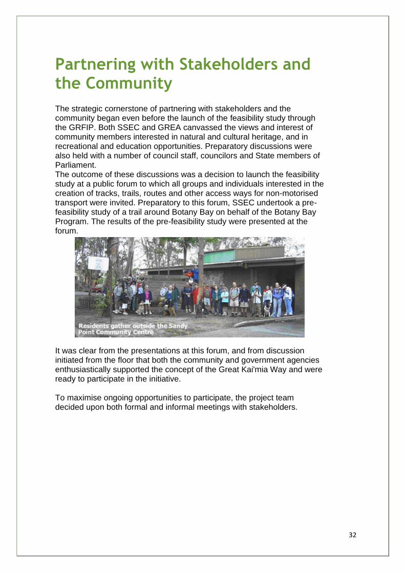
Partnering with Stakeholders and the Community The strategic cornerstone of partnering with stakeholders and the community began even before the launch of the feasibility study through the GRFIP. Both SSEC and GREA canvassed the views and interest of community members interested in natural and cultural heritage, and in recreational and education opportunities. Preparatory discussions were also held with a number of council staff, councilors and State members of Parliament. The outcome of these discussions was a decision to launch the feasibility study at a public forum to which all groups and individuals interested in the creation of tracks, trails, routes and other access ways for non-motorised transport were invited. Preparatory to this forum, SSEC undertook a pre-feasibility study of a trail around Botany Bay on behalf of the Botany Bay Program. The results of the pre-feasibility study were presented at the forum.
It was clear from the presentations at this forum, and from discussion initiated from the floor that both the community and government agencies enthusiastically supported the concept of the Great Kai'mia Way and were ready to participate in the initiative. To maximise ongoing opportunities to participate, the project team decided upon both formal and informal meetings with stakeholders.
33
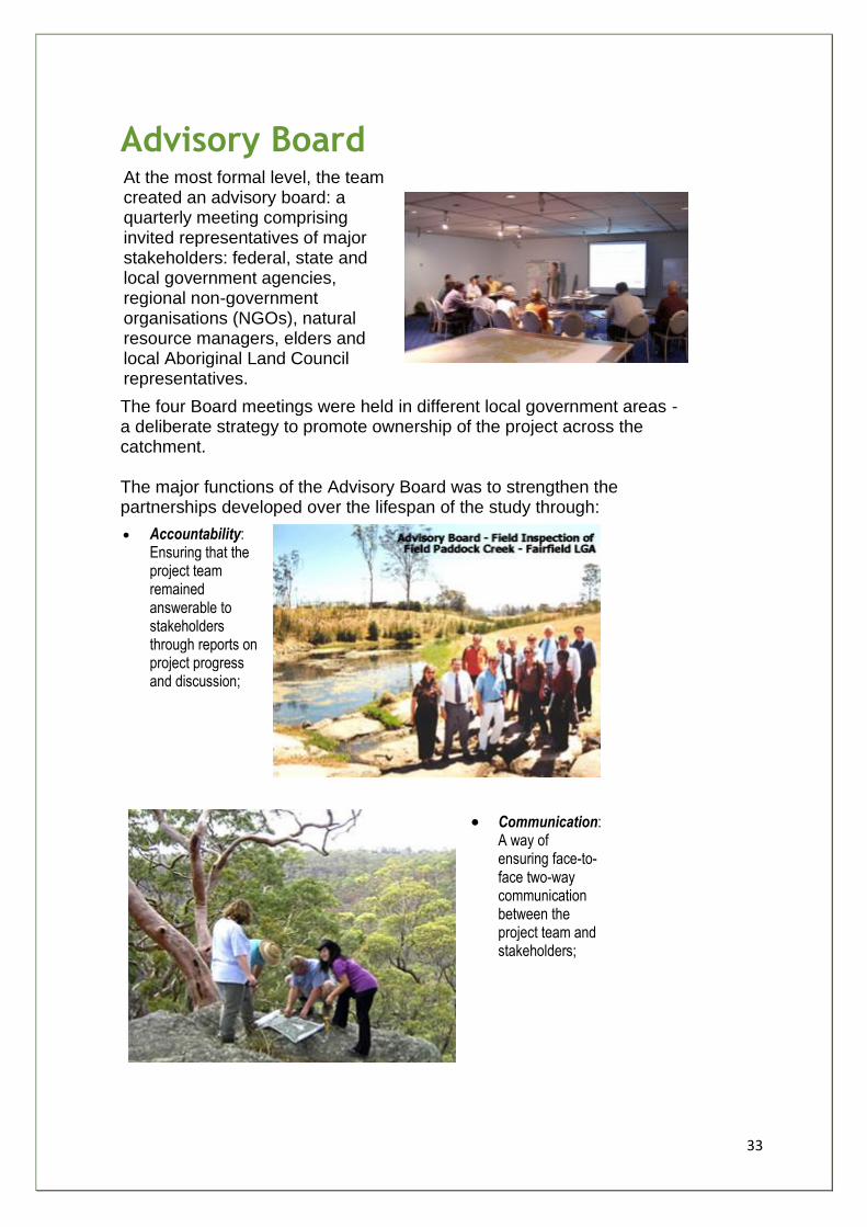
Advisory Board At the most formal level, the team created an advisory board: a quarterly meeting comprising invited representatives of major stakeholders: federal, state and local government agencies, regional non-government organisations (NGOs), natural resource managers, elders and local Aboriginal Land Council representatives.
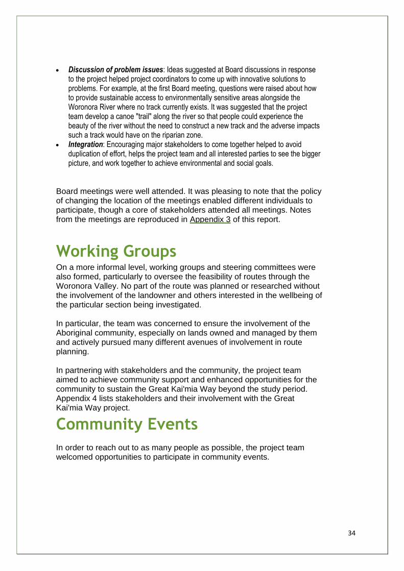
The four Board meetings were held in different local government areas - a deliberate strategy to promote ownership of the project across the catchment. The major functions of the Advisory Board was to strengthen the partnerships developed over the lifespan of the study through:
• Accountability: Ensuring that the project team remained answerable to stakeholders through reports on project progress and discussion;
• Communication: A way of ensuring face-to-face two-way communication between the project team and stakeholders;
34
• Discussion of problem issues: Ideas suggested at Board discussions in response to the project helped project coordinators to come up with innovative solutions to problems. For example, at the first Board meeting, questions were raised about how to provide sustainable access to environmentally sensitive areas alongside the Woronora River where no track currently exists. It was suggested that the project team develop a canoe "trail" along the river so that people could experience the beauty of the river without the need to construct a new track and the adverse impacts such a track would have on the riparian zone.
• Integration: Encouraging major stakeholders to come together helped to avoid duplication of effort, helps the project team and all interested parties to see the bigger picture, and work together to achieve environmental and social goals.
Board meetings were well attended. It was pleasing to note that the policy of changing the location of the meetings enabled different individuals to participate, though a core of stakeholders attended all meetings. Notes from the meetings are reproduced in Appendix 3 of this report.
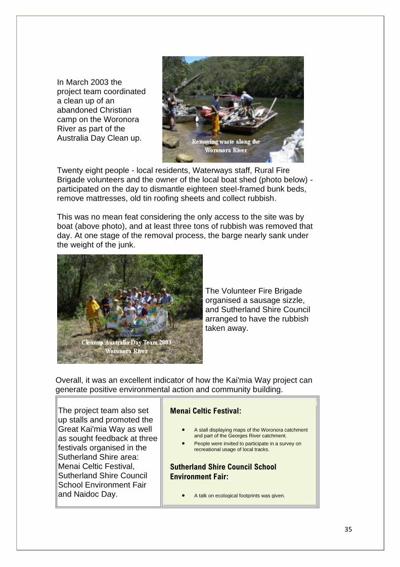
Working Groups On a more informal level, working groups and steering committees were also formed, particularly to oversee the feasibility of routes through the Woronora Valley. No part of the route was planned or researched without the involvement of the landowner and others interested in the wellbeing of the particular section being investigated. In particular, the team was concerned to ensure the involvement of the Aboriginal community, especially on lands owned and managed by them and actively pursued many different avenues of involvement in route planning. In partnering with stakeholders and the community, the project team aimed to achieve community support and enhanced opportunities for the community to sustain the Great Kai'mia Way beyond the study period. Appendix 4 lists stakeholders and their involvement with the Great Kai'mia Way project.
Community Events
In order to reach out to as many people as possible, the project team welcomed opportunities to participate in community events.
35
In March 2003 the project team coordinated a clean up of an abandoned Christian camp on the Woronora River as part of the Australia Day Clean up.
Twenty eight people - local residents, Waterways staff, Rural Fire Brigade volunteers and the owner of the local boat shed (photo below) - participated on the day to dismantle eighteen steel-framed bunk beds, remove mattresses, old tin roofing sheets and collect rubbish. This was no mean feat considering the only access to the site was by boat (above photo), and at least three tons of rubbish was removed that day. At one stage of the removal process, the barge nearly sank under the weight of the junk.
The Volunteer Fire Brigade organised a sausage sizzle, and Sutherland Shire Council arranged to have the rubbish taken away.
Overall, it was an excellent indicator of how the Kai'mia Way project can generate positive environmental action and community building.
The project team also set up stalls and promoted the Great Kai'mia Way as well as sought feedback at three festivals organised in the Sutherland Shire area: Menai Celtic Festival, Sutherland Shire Council School Environment Fair and Naidoc Day.
Menai Celtic Festival:
• A stall displaying maps of the Woronora catchment and part of the Georges River catchment.
• People were invited to participate in a survey on recreational usage of local tracks.
Sutherland Shire Council School
Environment Fair:
• A talk on ecological footprints was given.
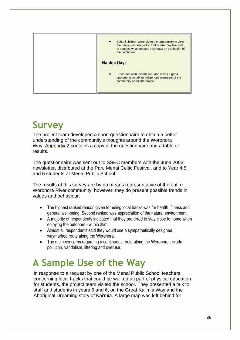
36
• School children were given the opportunity to view the maps, encouraged to find where they live and to suggest what impacts they have on the health of the catchment.
Naidoc Day:
• Brochures were distributed, and it was a good opportunity to talk to indigenous members of the community about the project.
Survey The project team developed a short questionnaire to obtain a better understanding of the community's thoughts around the Woronora Way. Appendix 2 contains a copy of the questionnaire and a table of results. The questionnaire was sent out to SSEC members with the June 2003 newsletter, distributed at the Parc Menai Celtic Festival, and to Year 4,5 and 6 students at Menai Public School. The results of this survey are by no means representative of the entire Woronora River community, however, they do present possible trends in values and behaviour:
• The highest ranked reason given for using local tracks was for health, fitness and general well-being. Second ranked was appreciation of the natural environment.
• A majority of respondents indicated that they preferred to stay close to home when enjoying the outdoors - within 3km.
• Almost all respondents said they would use a sympathetically designed, waymarked route along the Woronora.
• The main concerns regarding a continuous route along the Woronora include pollution, vandalism, littering and overuse.
A Sample Use of the Way In response to a request by one of the Menai Public School teachers concerning local tracks that could be walked as part of physical education for students, the project team visited the school. They presented a talk to staff and students in years 5 and 6, on the Great Kai'mia Way and the Aboriginal Dreaming story of Kai'mia. A large map was left behind for
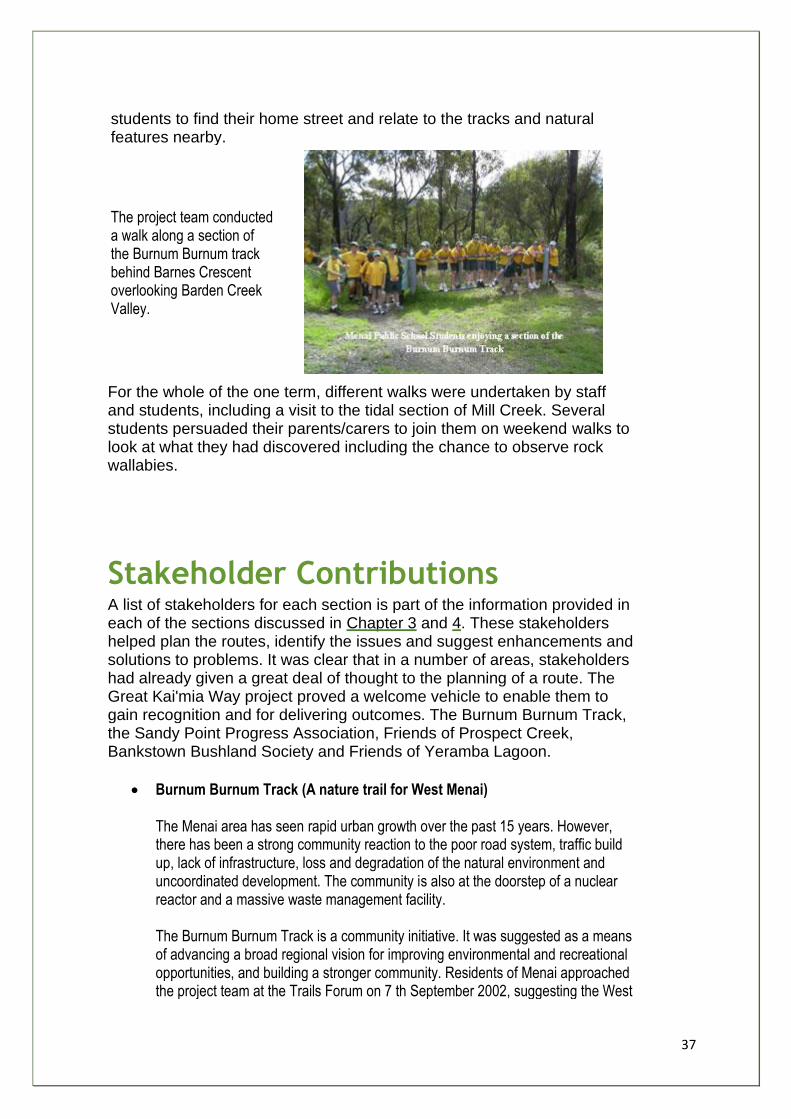
37
students to find their home street and relate to the tracks and natural features nearby.
The project team conducted a walk along a section of the Burnum Burnum track behind Barnes Crescent overlooking Barden Creek Valley.
For the whole of the one term, different walks were undertaken by staff and students, including a visit to the tidal section of Mill Creek. Several students persuaded their parents/carers to join them on weekend walks to look at what they had discovered including the chance to observe rock wallabies.
Stakeholder Contributions A list of stakeholders for each section is part of the information provided in each of the sections discussed in Chapter 3 and 4. These stakeholders helped plan the routes, identify the issues and suggest enhancements and solutions to problems. It was clear that in a number of areas, stakeholders had already given a great deal of thought to the planning of a route. The Great Kai'mia Way project proved a welcome vehicle to enable them to gain recognition and for delivering outcomes. The Burnum Burnum Track, the Sandy Point Progress Association, Friends of Prospect Creek, Bankstown Bushland Society and Friends of Yeramba Lagoon.
• Burnum Burnum Track (A nature trail for West Menai) The Menai area has seen rapid urban growth over the past 15 years. However, there has been a strong community reaction to the poor road system, traffic build up, lack of infrastructure, loss and degradation of the natural environment and uncoordinated development. The community is also at the doorstep of a nuclear reactor and a massive waste management facility. The Burnum Burnum Track is a community initiative. It was suggested as a means of advancing a broad regional vision for improving environmental and recreational opportunities, and building a stronger community. Residents of Menai approached the project team at the Trails Forum on 7 th September 2002, suggesting the West
38
Menai Nature Trail as a logical link between the Georges River Way and the Woronora River Way. The project team contacted Sutherland Shire Council and Gandangara Local Aboriginal Land Council and brought them together to discuss the possibilities for the route. The community indicated a desire to name the track after Burnum Burnum, a famous resident of nearby Woronora Valley who was an advocate and campaigner for Aboriginal rights and nature conservation . Sutherland Shire Council has now set aside funds to establish the Burnum Burnum Track. Written and oral information, as well as maps were provided by members of West Menai and Barden Ridge Precinct Residents' Association to supplement the efforts of the project team.
• Sandy Points The Way Residents of Sandy Point may be small in number but their contribution to the success of the Great Kai'mia Way project has been outstanding. In March 2003, the Sandy Point Progress Association (SPPA) organised a community walk through the Federal Government's lands between Sandy Point and Mill Creek. The walk was aimed at promoting the cause of transferring the 178 ha of remnant bushland and salt marshes to the NSW National Parks and Wildlife Service for inclusion into the Georges River National Park. SPPA strongly endorsed the Great Kai'mia Way - naming this particular section the 'Rock Wallaby Way' because of the presence of that and several other indigenous animal species of conservation significance. 50 residents (approximately one third of the Sandy Point population) took part in the walk - enjoying the bonding and the outstanding environmental values. Members of the SPPA and the project team had previously marked out a route for the 'Wallaby Way' from Sandy Point Community Centre to the historic former mill site on Mill Creek. This site also represented another high point in community stewardship as representatives of SPPA met up with members of West Menai and Barden Ridge Precinct Residents Association and Gandangara Local Aboriginal Land Council. The meeting symbolised the joining together of Burnum Burnum Track and planned tracks through Gandangara lands with the Rock Wallaby Way. Sandy Point residents certainly made a strong point - that communities can take the initiative for environmental management of their local regions - and this point is the central aim of the Great Kai'mia Way project and will ensure its success.
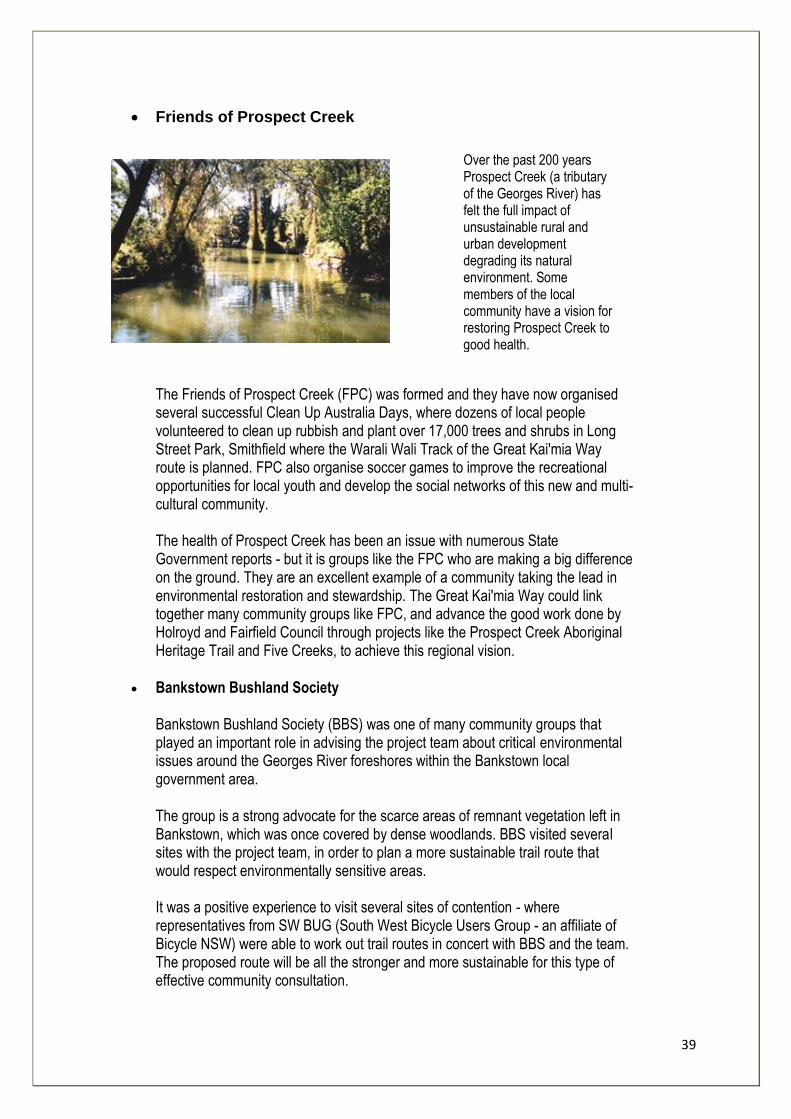
39
• Friends of Prospect Creek
Over the past 200 years Prospect Creek (a tributary of the Georges River) has felt the full impact of unsustainable rural and urban development degrading its natural environment. Some members of the local community have a vision for restoring Prospect Creek to good health.
The Friends of Prospect Creek (FPC) was formed and they have now organised several successful Clean Up Australia Days, where dozens of local people volunteered to clean up rubbish and plant over 17,000 trees and shrubs in Long Street Park, Smithfield where the Warali Wali Track of the Great Kai'mia Way route is planned. FPC also organise soccer games to improve the recreational opportunities for local youth and develop the social networks of this new and multi-cultural community. The health of Prospect Creek has been an issue with numerous State Government reports - but it is groups like the FPC who are making a big difference on the ground. They are an excellent example of a community taking the lead in environmental restoration and stewardship. The Great Kai'mia Way could link together many community groups like FPC, and advance the good work done by Holroyd and Fairfield Council through projects like the Prospect Creek Aboriginal Heritage Trail and Five Creeks, to achieve this regional vision.
• Bankstown Bushland Society Bankstown Bushland Society (BBS) was one of many community groups that played an important role in advising the project team about critical environmental issues around the Georges River foreshores within the Bankstown local government area. The group is a strong advocate for the scarce areas of remnant vegetation left in Bankstown, which was once covered by dense woodlands. BBS visited several sites with the project team, in order to plan a more sustainable trail route that would respect environmentally sensitive areas. It was a positive experience to visit several sites of contention - where representatives from SW BUG (South West Bicycle Users Group - an affiliate of Bicycle NSW) were able to work out trail routes in concert with BBS and the team. The proposed route will be all the stronger and more sustainable for this type of effective community consultation.
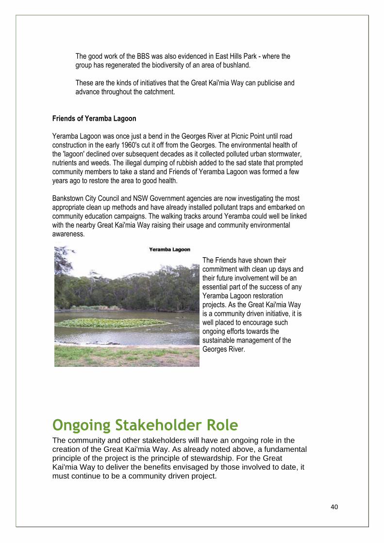
40
The good work of the BBS was also evidenced in East Hills Park - where the group has regenerated the biodiversity of an area of bushland. These are the kinds of initiatives that the Great Kai'mia Way can publicise and advance throughout the catchment.
Friends of Yeramba Lagoon Yeramba Lagoon was once just a bend in the Georges River at Picnic Point until road construction in the early 1960's cut it off from the Georges. The environmental health of the 'lagoon' declined over subsequent decades as it collected polluted urban stormwater, nutrients and weeds. The illegal dumping of rubbish added to the sad state that prompted community members to take a stand and Friends of Yeramba Lagoon was formed a few years ago to restore the area to good health. Bankstown City Council and NSW Government agencies are now investigating the most appropriate clean up methods and have already installed pollutant traps and embarked on community education campaigns. The walking tracks around Yeramba could well be linked with the nearby Great Kai'mia Way raising their usage and community environmental awareness.
The Friends have shown their commitment with clean up days and their future involvement will be an essential part of the success of any Yeramba Lagoon restoration projects. As the Great Kai'mia Way is a community driven initiative, it is well placed to encourage such ongoing efforts towards the sustainable management of the Georges River.
Ongoing Stakeholder Role The community and other stakeholders will have an ongoing role in the creation of the Great Kai'mia Way. As already noted above, a fundamental principle of the project is the principle of stewardship. For the Great Kai'mia Way to deliver the benefits envisaged by those involved to date, it must continue to be a community driven project.
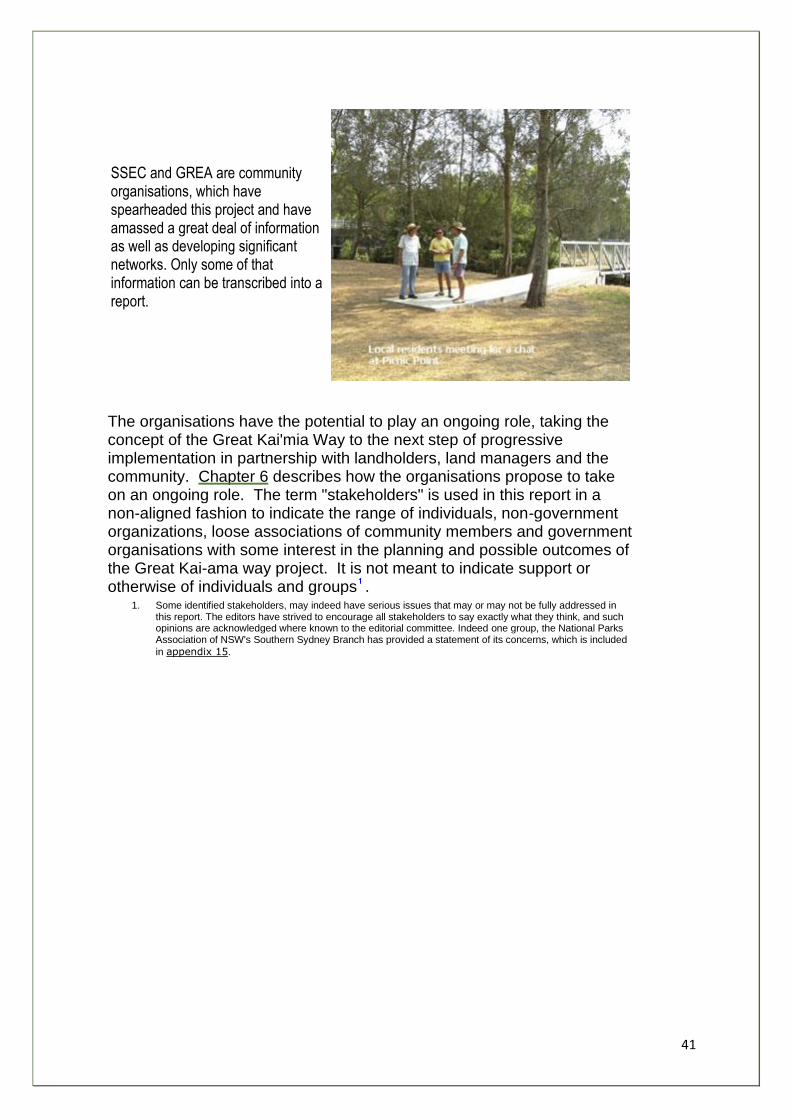
41
SSEC and GREA are community organisations, which have spearheaded this project and have amassed a great deal of information as well as developing significant networks. Only some of that information can be transcribed into a report.
The organisations have the potential to play an ongoing role, taking the concept of the Great Kai'mia Way to the next step of progressive implementation in partnership with landholders, land managers and the community. Chapter 6 describes how the organisations propose to take on an ongoing role. The term "stakeholders" is used in this report in a non-aligned fashion to indicate the range of individuals, non-government organizations, loose associations of community members and government organisations with some interest in the planning and possible outcomes of the Great Kai-ama way project. It is not meant to indicate support or otherwise of individuals and groups .
1. Some identified stakeholders, may indeed have serious issues that may or may not be fully addressed in this report. The editors have strived to encourage all stakeholders to say exactly what they think, and such opinions are acknowledged where known to the editorial committee. Indeed one group, the National Parks Association of NSW's Southern Sydney Branch has provided a statement of its concerns, which is included
in appendix 15.

42
Chapter 3
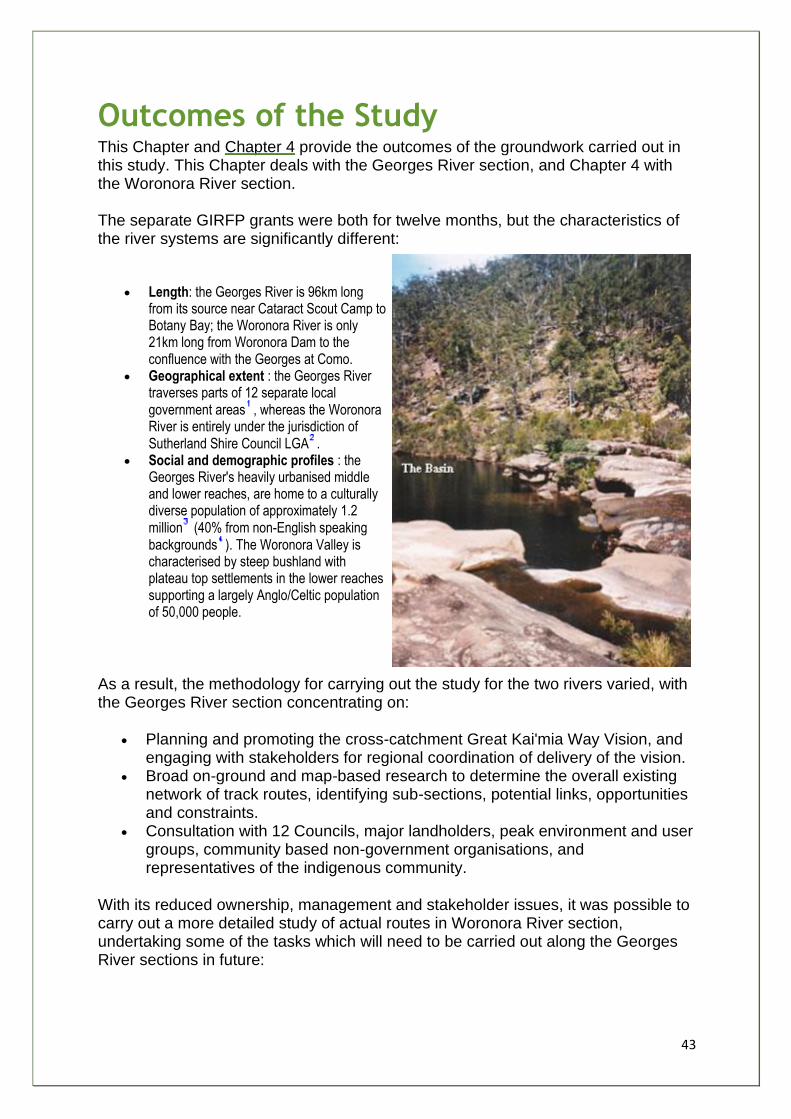
43
Outcomes of the Study This Chapter and Chapter 4 provide the outcomes of the groundwork carried out in this study. This Chapter deals with the Georges River section, and Chapter 4 with the Woronora River section. The separate GIRFP grants were both for twelve months, but the characteristics of the river systems are significantly different:
• Length: the Georges River is 96km long from its source near Cataract Scout Camp to Botany Bay; the Woronora River is only 21km long from Woronora Dam to the confluence with the Georges at Como.
• Geographical extent : the Georges River traverses parts of 12 separate local government areas , whereas the Woronora River is entirely under the jurisdiction of Sutherland Shire Council LGA .
• Social and demographic profiles : the Georges River's heavily urbanised middle and lower reaches, are home to a culturally diverse population of approximately 1.2 million (40% from non-English speaking backgrounds ). The Woronora Valley is characterised by steep bushland with plateau top settlements in the lower reaches supporting a largely Anglo/Celtic population of 50,000 people.
As a result, the methodology for carrying out the study for the two rivers varied, with the Georges River section concentrating on:
• Planning and promoting the cross-catchment Great Kai'mia Way Vision, and engaging with stakeholders for regional coordination of delivery of the vision.
• Broad on-ground and map-based research to determine the overall existing network of track routes, identifying sub-sections, potential links, opportunities and constraints.
• Consultation with 12 Councils, major landholders, peak environment and user groups, community based non-government organisations, and representatives of the indigenous community.
With its reduced ownership, management and stakeholder issues, it was possible to carry out a more detailed study of actual routes in Woronora River section, undertaking some of the tasks which will need to be carried out along the Georges River sections in future:
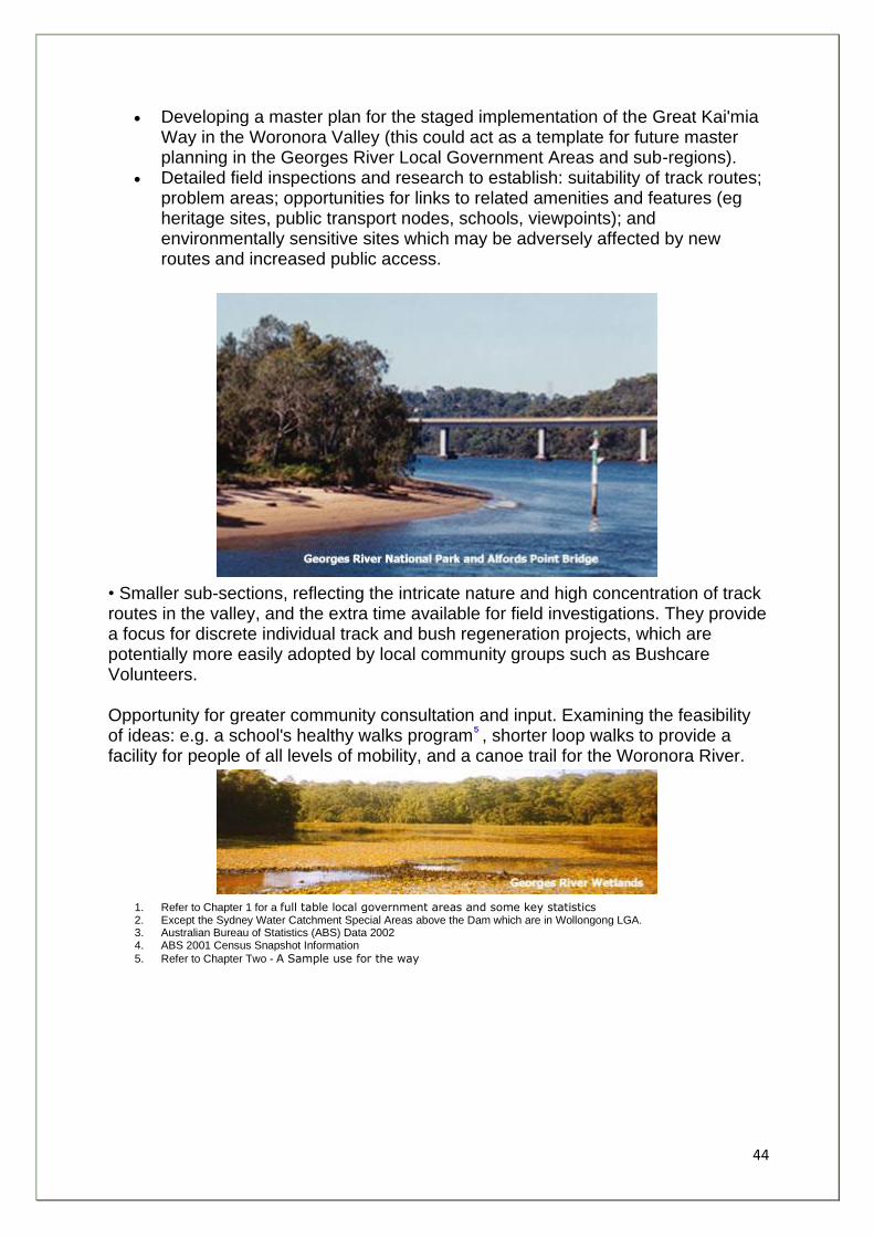
44
• Developing a master plan for the staged implementation of the Great Kai'mia Way in the Woronora Valley (this could act as a template for future master planning in the Georges River Local Government Areas and sub-regions).
• Detailed field inspections and research to establish: suitability of track routes; problem areas; opportunities for links to related amenities and features (eg heritage sites, public transport nodes, schools, viewpoints); and environmentally sensitive sites which may be adversely affected by new routes and increased public access.
• Smaller sub-sections, reflecting the intricate nature and high concentration of track routes in the valley, and the extra time available for field investigations. They provide a focus for discrete individual track and bush regeneration projects, which are potentially more easily adopted by local community groups such as Bushcare Volunteers.
Opportunity for greater community consultation and input. Examining the feasibility of ideas: e.g. a school's healthy walks program , shorter loop walks to provide a facility for people of all levels of mobility, and a canoe trail for the Woronora River.
1. Refer to Chapter 1 for a full table local government areas and some key statistics 2. Except the Sydney Water Catchment Special Areas above the Dam which are in Wollongong LGA. 3. Australian Bureau of Statistics (ABS) Data 2002 4. ABS 2001 Census Snapshot Information
5. Refer to Chapter Two - A Sample use for the way
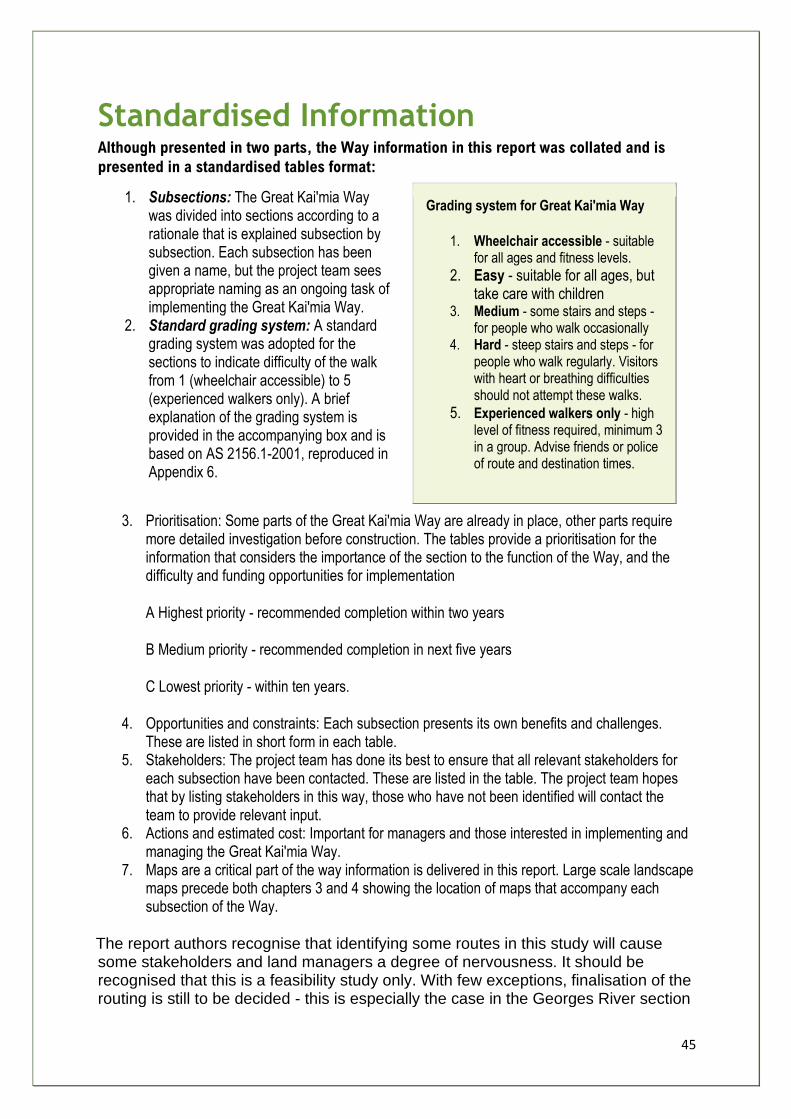
45
Standardised Information Although presented in two parts, the Way information in this report was collated and is
presented in a standardised tables format:
1. Subsections: The Great Kai'mia Way was divided into sections according to a rationale that is explained subsection by subsection. Each subsection has been given a name, but the project team sees appropriate naming as an ongoing task of implementing the Great Kai'mia Way.
2. Standard grading system: A standard grading system was adopted for the sections to indicate difficulty of the walk from 1 (wheelchair accessible) to 5 (experienced walkers only). A brief explanation of the grading system is provided in the accompanying box and is based on AS 2156.1-2001, reproduced in Appendix 6.
Grading system for Great Kai'mia Way
1. Wheelchair accessible - suitable for all ages and fitness levels.
2. Easy - suitable for all ages, but take care with children
3. Medium - some stairs and steps -for people who walk occasionally
4. Hard - steep stairs and steps - for people who walk regularly. Visitors with heart or breathing difficulties should not attempt these walks.
5. Experienced walkers only - high level of fitness required, minimum 3 in a group. Advise friends or police of route and destination times.
3. Prioritisation: Some parts of the Great Kai'mia Way are already in place, other parts require more detailed investigation before construction. The tables provide a prioritisation for the information that considers the importance of the section to the function of the Way, and the difficulty and funding opportunities for implementation
A Highest priority - recommended completion within two years
B Medium priority - recommended completion in next five years
C Lowest priority - within ten years.
4. Opportunities and constraints: Each subsection presents its own benefits and challenges. These are listed in short form in each table.
5. Stakeholders: The project team has done its best to ensure that all relevant stakeholders for each subsection have been contacted. These are listed in the table. The project team hopes that by listing stakeholders in this way, those who have not been identified will contact the team to provide relevant input.
6. Actions and estimated cost: Important for managers and those interested in implementing and managing the Great Kai'mia Way.
7. Maps are a critical part of the way information is delivered in this report. Large scale landscape maps precede both chapters 3 and 4 showing the location of maps that accompany each subsection of the Way.
The report authors recognise that identifying some routes in this study will cause some stakeholders and land managers a degree of nervousness. It should be recognised that this is a feasibility study only. With few exceptions, finalisation of the routing is still to be decided - this is especially the case in the Georges River section
46
where, as already explained, the complexity of the task precluded the detailed planning required to finalise routes. The routes recommended in this report are proposed routes. The active participation of stakeholders will be crucial to ensure that no formal access is provided to areas before the full range of concerns and issues that might endanger sustainability are addressed.
Recommendation
That the Great Kai'mia Way vision be implemented, appreciating the information for routing and priorities noted in Chapters 3 and 4 of this report, and ensuring that the precautionary principle is the arbiter of both route selection and implementation.
47
The Georges River
The project team divided the Georges River catchment into three major (sub-regional)
sections which were then further divided into subsections. Table 3.1 lists the local councils
in the sub-regions and briefly summarises major issues confronting implementation of the
Great Kai'mia Way in those sub-regions.
The project team chose easy half-day and daily walking and cycling distances to decide on
the distances in the 28 subsections, as well as distinct local environmental features. The
intent of this form of subdivision is to increase the capacity of local communities involvement
and inspire them to take on a stewardship role in their area.
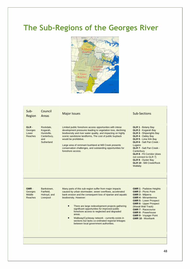
48
The Sub-Regions of the Georges River
Sub-
Region
Council
Areas Major Issues Sub-Sections
GLR -
Georges
Lower
Reaches
Rockdale,
Kogarah,
Hurstville,
Canterbury,
and
Sutherland
Limited public foreshore access opportunites with intese
development pressures leading to vegetation loss, declining
biodiversity and river water quality, and impacting on highly
scenic sandstone landforms, The cost of public buyback
would be prohibitive.
Large area of remmant bushland at Mill Creek presents
conservation challenges, and outstanding opportunities for
foreshore access.
GLR 1 - Botany Bay
GLR 2 - Kogarah Bay
GLR 3 - Shipwrights Bay
GLR 4 - Oatley Bay
GLR 5 - Lime Kiln Bay
GLR 6 - Salt Pan Creek -
Lugano
GLR 7 - Salt Pan Creek -
Canterbury
GLR 8 - F6 Corridor (does
not connect to GLR 7)
GLR 9 - Oyster Bay
GLR 10 - Mill Creek/Rock
Wallaby
GMR -
Georges
Middle
Reaches
Bankstown,
Fairfield,
Holroyd, and
Liverpool
Many parts of this sub-region suffer from major impacts
caused by urban stormwater, sewer overflows, accelerated
bank erosion and the consequent loss of riparian and aquatic
biodiversity. However:
• There are large redevelopment projects gathering significant opportunites for improved public foreshore access to neglected and degraded areas.
• Walkway/Cycleway network - currently exists in sections but lacks co-ordinated regional linkages between local government authorities.
GMR 1 - Padstow Heights
GMR 2 - Picnic Point
GMR 3 - Milperra
GMR 4 - Mirrambenna
GMR 5 - Lower Prospect
GMR 6 - Upper Prospect
(Warali Wali Track)
GMR 7 - Racecourse
GMR 8 - Powerhouse
GMR 9 - Voyager Point
GMR 10 - Moorbank
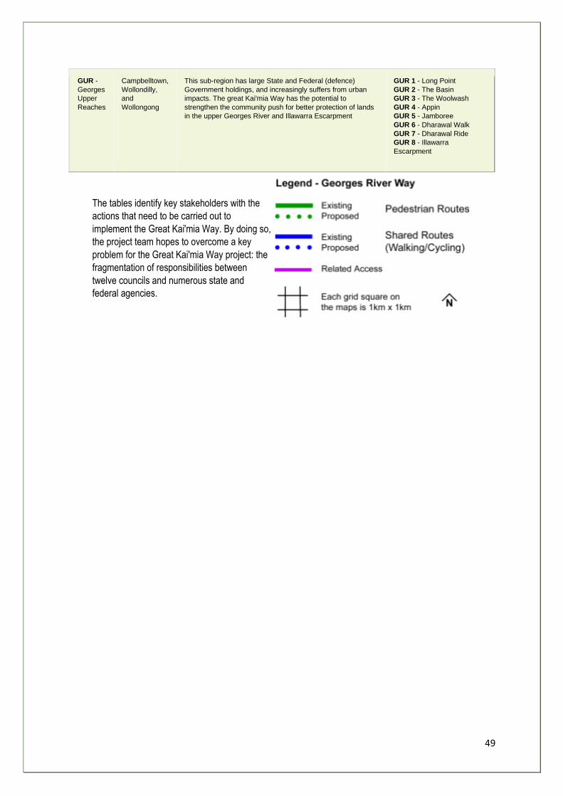
49
GUR -
Georges
Upper
Reaches
Campbelltown,
Wollondilly,
and
Wollongong
This sub-region has large State and Federal (defence)
Government holdings, and increasingly suffers from urban
impacts. The great Kai'mia Way has the potential to
strengthen the community push for better protection of lands
in the upper Georges River and Illawarra Escarpment
GUR 1 - Long Point
GUR 2 - The Basin
GUR 3 - The Woolwash
GUR 4 - Appin
GUR 5 - Jamboree
GUR 6 - Dharawal Walk
GUR 7 - Dharawal Ride
GUR 8 - Illawarra
Escarpment
The tables identify key stakeholders with the
actions that need to be carried out to
implement the Great Kai'mia Way. By doing so,
the project team hopes to overcome a key
problem for the Great Kai'mia Way project: the
fragmentation of responsibilities between
twelve councils and numerous state and
federal agencies.
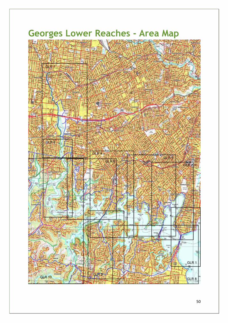
50
Georges Lower Reaches - Area Map
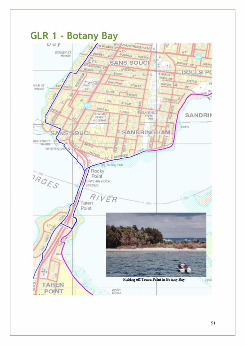
51
GLR 1 - Botany Bay
52
Georges River Way Lower Reaches
LGA(s) - ROCKDALE & KOGARAH
Sub-section Botany Bay GLR 1
Start and finish Scott Park/San Souci Park (San Souci)
Distance 0.75km
Grade 1-2
Main features • Botany Bay • Scott Park • Captain Cook Bridge
Description A section of the Rockdale recreational cycleway along Botany Bay
foreshore with good resting and vantage points along Riverside Drive.
Opportunities
and constraints
• Scott Park constructed wetlands (GRFIP/RCC) project - potential educational signage
• St George Sailing Club - no trail through carpark/safety issue • San Souci Park (F6 Corridor) - poor landscaping/no community
ownership • Trails (4 way) intersection (Sutherland, Botany Bay, Rockdale,
and Kogarah networks) - weak trail junction/inadequate signage
Actions • RCC/KCC joint planning of upgraded major trails intersection - signage
• RCC plan safe marked route through carpark • RCC coordinate local bushcare group/CVA - regenerate
degraded San Souci Park (north) - (potential 4 way trail intersection - F6 Greenway)
Priority B
Estimated cost $25k
Key
stakeholders RCC/KCC/St George Sailing Club
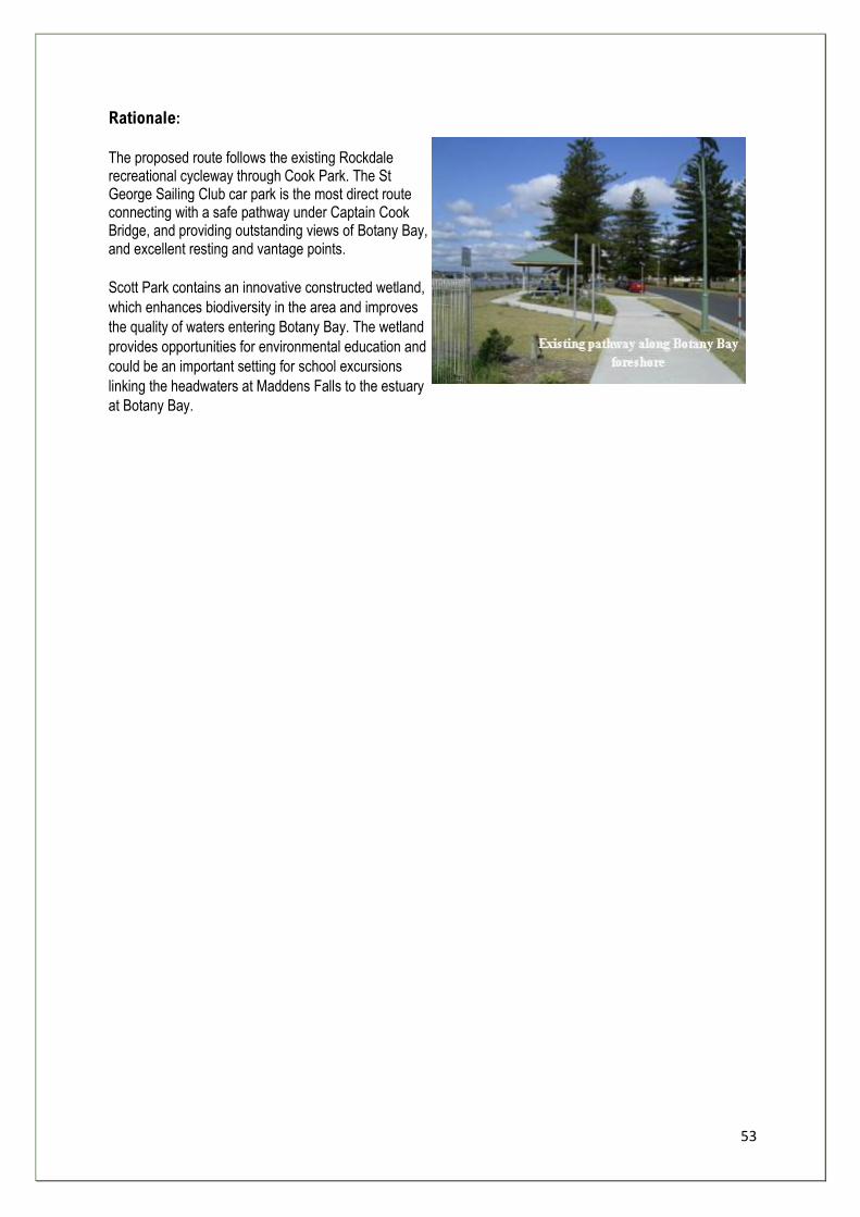
53
Rationale:
The proposed route follows the existing Rockdale recreational cycleway through Cook Park. The St George Sailing Club car park is the most direct route connecting with a safe pathway under Captain Cook Bridge, and providing outstanding views of Botany Bay, and excellent resting and vantage points.
Scott Park contains an innovative constructed wetland,
which enhances biodiversity in the area and improves
the quality of waters entering Botany Bay. The wetland
provides opportunities for environmental education and
could be an important setting for school excursions
linking the headwaters at Maddens Falls to the estuary
at Botany Bay.
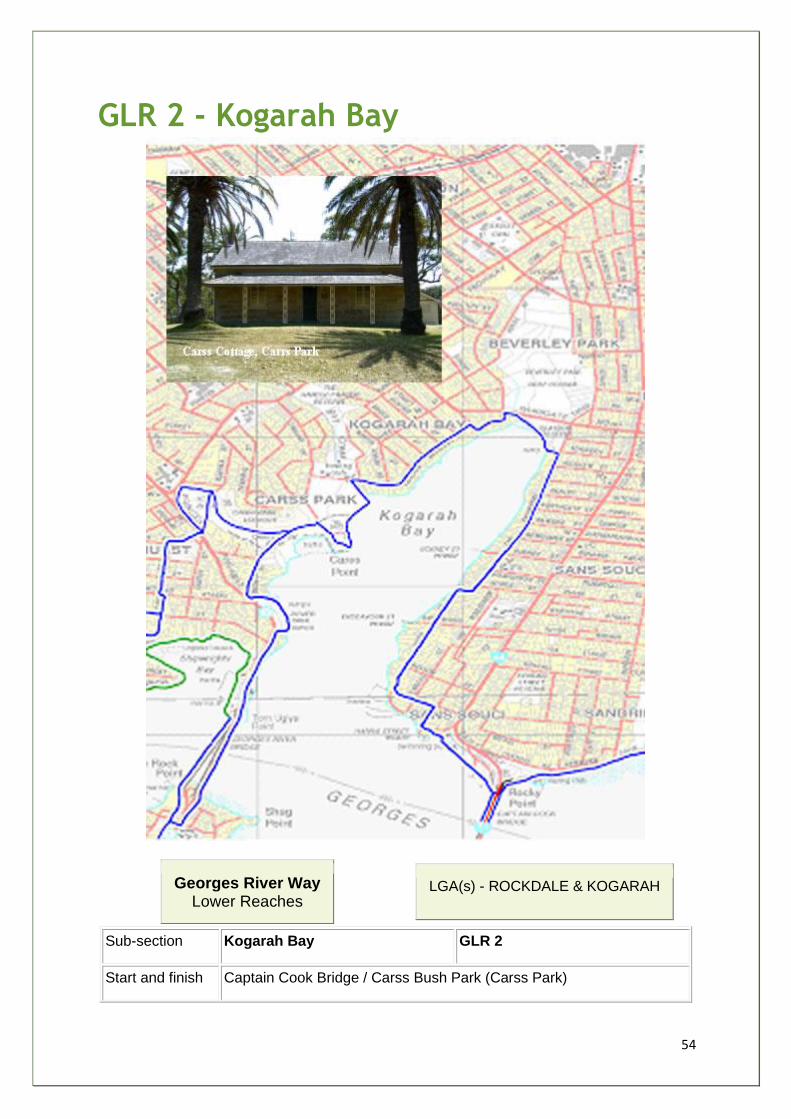
54
GLR 2 - Kogarah Bay
Georges River Way Lower Reaches
LGA(s) - ROCKDALE & KOGARAH
Sub-section Kogarah Bay GLR 2
Start and finish Captain Cook Bridge / Carss Bush Park (Carss Park)
55
Distance 5.0km
Grade 1-2
Main features • Kogarah Bay • Carss Bush Park (Olympic pool) • Carss Cottage • Claydon Reserve • Sans Souci Park (Olympic pool) • Anderson Park
Description Route mostly follows footpaths (3.0km) / off-road sections through
parklands (2.0km)
Opportunities
and constraints
• Limited opportunities to increase public foreshore access - prohibitive land acquisition
• Unclear access under Captain Cook Bridge • Speed of cyclists under-bridge dangerous • San Souci Park, Claydon Reserve and Carss Bush Park and
several small foreshore parks have good resting and Kogarah Bay vantage points
• No route marked through Sans Souci car park/poor safety • No marked cycling shoulder - Vista Street and The Promenade • Claydon Reserve - eroded seawall/footpaths and toilet block/car
park - degraded • Dangerous corner/intersection - Ramsgate Road and Vaudan
St (need for cyclists to demount and walk on footpath) • Kogarah Bay/Claydon Reserve stormwater damage requires
integrated solution - Beverley Park Golf Course and soft engineering seawall alternative
• Opportunity to name Stormwater Channel flowing through Beverley Park and sign detailing stormwater impacts and links with Kogarah CBD ESD initiatives
• Opportunity to improve Kogarah Bay water quality with constructed wetlands along Kogarah Creek in Harold Fraser Reserve
• Educational signage - Kogarah Creek GPT • No foreshore pathway through northern part of Carss Bush
Park and no signs to Olympic Pool and Carss Cottage • Tidal Baths repairs required • Pathway link to Todd Park needs upgrading
Actions • RCC/KCC signage linking LGA's pathway networks • RTA/KCC/RCC to sign and construct bicycle speed controls -
Captain Cook Bridge underpass approaches • KCC plan safe marked route through San Souci carpark • KCC to mark on-road shoulder routes on local roads and sign
accordingly • KCC/RTA investigate cycle safety - Ramsgate/Vaudan
intersection - consider boardwalk (linking Claydon Reserve and Park Rd)
56
• KCC - pathway and signage - Carss Bush Park and Claydon Reserve
Priority B
Estimated cost $95k
Key
stakeholders RCC/KCC/RTA/SW
Rationale:
The proposed route is an easy walking/cycling grade following existing paths through Sans Souci Park, Claydon Reserve and Carss Bush Park, using footpaths along Harris, Wellington, and Vista Street, The Promenade, Vaudan Street and Carlton Crescent. It avoids busy roads and permits good views of Kogarah Bay as well as providing links to several small foreshore parks and two Olympic swimming pools.
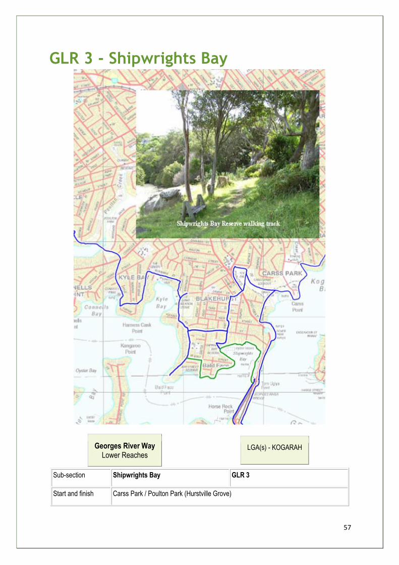
57
GLR 3 - Shipwrights Bay
Georges River Way Lower Reaches
LGA(s) - KOGARAH
Sub-section Shipwrights Bay GLR 3
Start and finish Carss Park / Poulton Park (Hurstville Grove)
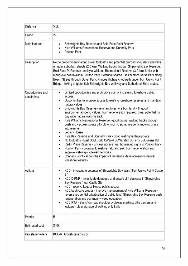
58
Distance 5.0km
Grade 2-3
Main features • Shipwrights Bay Reserve and Bald Face Point Reserve • Kyle Williams Recreational Reserve and Donnelly Park • Poulton Park
Description Route predominantly along street footpaths and potential on-road shoulder cycleways
on quiet suburban streets (2.0 km). Walking tracks through Shipwrights Bay Reserve,
Bald Face Pt Reserve and Kyle Williams Recreational Reserve (3.0 km). Links with
mangrove boardwalk in Poulton Park. Potential shared use link from Carss Park along
Beach Street, through Dover Park, Princes Highway, footpath under Tom Ugly's Point
Bridge - linking to (potential) Shipwrights Bay walkway and Sutherland Shire routes.
Opportunities and
constraints
• Limited opportunities and prohibitive cost of increasing foreshore public access
• Opportunities to improve access to existing foreshore reserves and maintain natural values
• Shipwrights Bay Reserve - remnant foreshore bushland with good environmental/scenic values, bush regeneration required, great potential for bay wide natural walking track
• Kyle Williams Recreational Reserve - good natural walking tracks through bushland - access points difficult to find/ no signs/ residents mowing grass into reserve
• Legacy House • Kyle Bay Reserve and Donnelly Park - good resting/vantage points • No footpaths - East St/M Dodd Cr/Gold St/Waratah St/Terry St/Queens Rd • Redin Place Reserve - unclear access near houses/no signs to Poulton Park • Poulton Park - potential to restore natural creek, bush regeneration and
improve walkway/cycleway networks • Connells Point - shows the impact of residential development on natural
foreshore features
Actions • KCC - investigate potential of Shipwrights Bay Walk (Tom Ugly's Point/ Castle St)
• KCC/DIPNR - investigate damaged and unsafe cliff staircase in Shipwrights Bay Reserve (near Castle St)
• KCC - resolve Legacy House public access • KCC/bush care groups - improve management of Kyle Williams Reserve -
reverse residential privatisation of public land, Shipwrights Bay Reserve bush regeneration and community weed education
• KCC/RTA - Signs/ on-road shoulder cycleway marking/ bike barriers and lockups - clear signage of walking only trails
Priority B
Estimated cost $40k
Key stakeholders KCC/RTA/bush care groups

59
Rationale:
Development limits foreshore access in this part of the Way. The proposed route follows
quiet residential streets, avoiding those with steep slopes and uses links to foreshore parks
- Shipwrights Bay Reserve, Dover Park, Bald Face Point Reserve, Kyle Williams Reserve,
Donnelly Park and Poulton Park, to enable people to reach the Georges River.
The route also promotes expansion of Shipwrights Bay Reserve walkway and links with
Sutherland Shire sections of the Great Kai'mia Way.
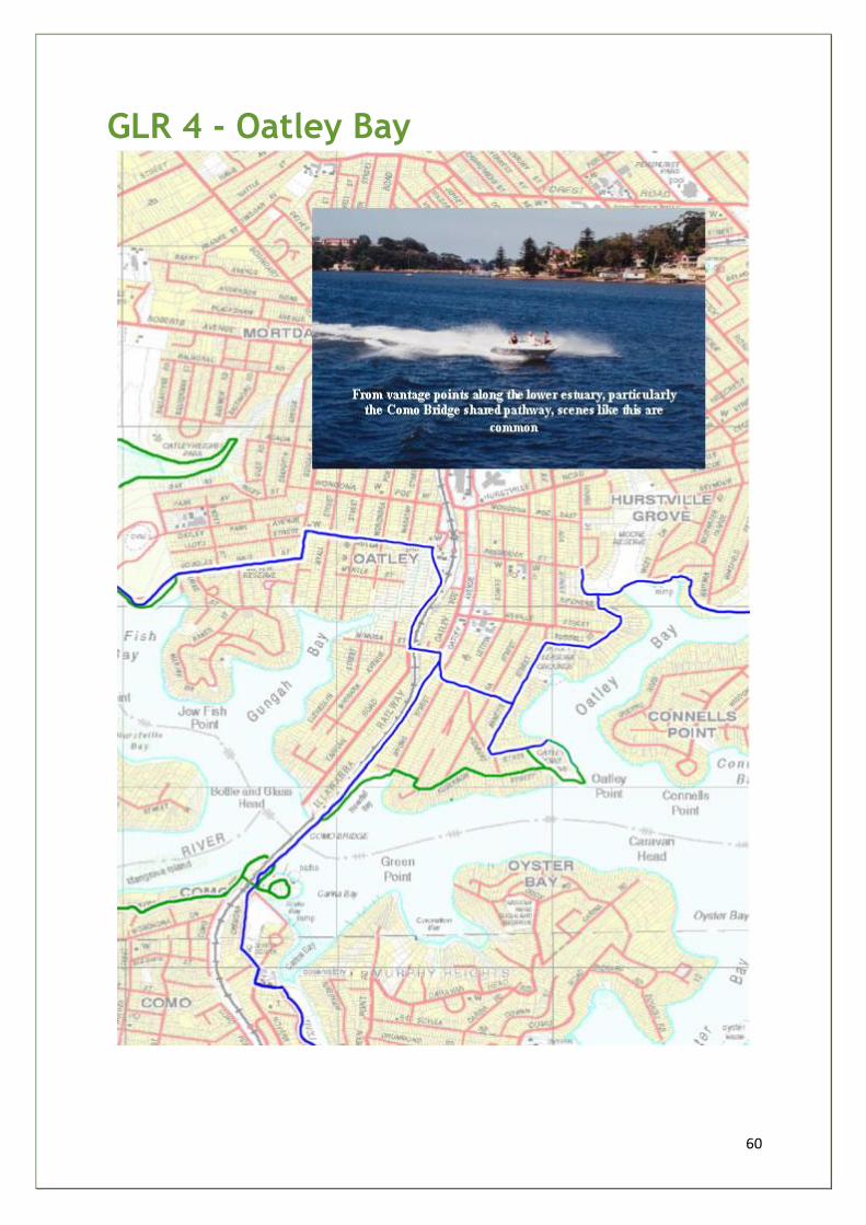
60
GLR 4 - Oatley Bay
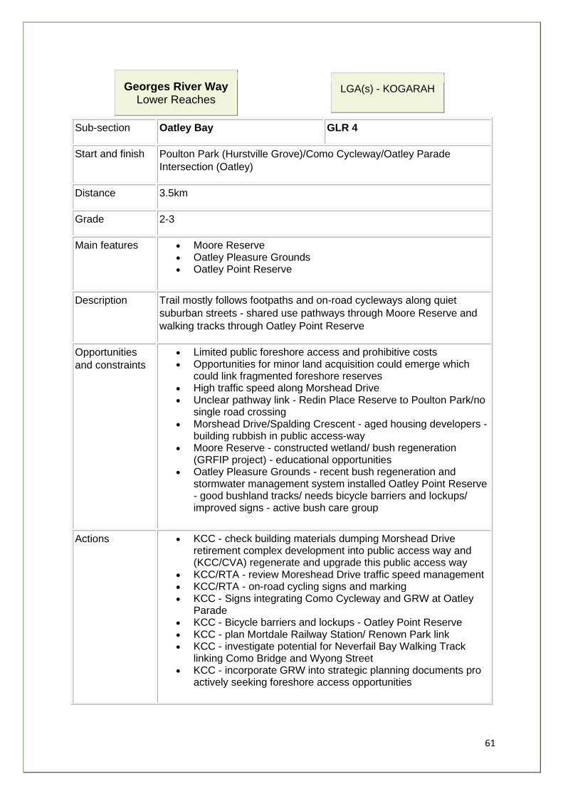
61
Georges River Way Lower Reaches
LGA(s) - KOGARAH
Sub-section Oatley Bay GLR 4
Start and finish Poulton Park (Hurstville Grove)/Como Cycleway/Oatley Parade
Intersection (Oatley)
Distance 3.5km
Grade 2-3
Main features • Moore Reserve • Oatley Pleasure Grounds • Oatley Point Reserve
Description Trail mostly follows footpaths and on-road cycleways along quiet
suburban streets - shared use pathways through Moore Reserve and
walking tracks through Oatley Point Reserve
Opportunities
and constraints
• Limited public foreshore access and prohibitive costs • Opportunities for minor land acquisition could emerge which
could link fragmented foreshore reserves • High traffic speed along Morshead Drive • Unclear pathway link - Redin Place Reserve to Poulton Park/no
single road crossing • Morshead Drive/Spalding Crescent - aged housing developers -
building rubbish in public access-way • Moore Reserve - constructed wetland/ bush regeneration
(GRFIP project) - educational opportunities • Oatley Pleasure Grounds - recent bush regeneration and
stormwater management system installed Oatley Point Reserve - good bushland tracks/ needs bicycle barriers and lockups/ improved signs - active bush care group
Actions • KCC - check building materials dumping Morshead Drive retirement complex development into public access way and (KCC/CVA) regenerate and upgrade this public access way
• KCC/RTA - review Moreshead Drive traffic speed management • KCC/RTA - on-road cycling signs and marking • KCC - Signs integrating Como Cycleway and GRW at Oatley
Parade • KCC - Bicycle barriers and lockups - Oatley Point Reserve • KCC - plan Mortdale Railway Station/ Renown Park link • KCC - investigate potential for Neverfail Bay Walking Track
linking Como Bridge and Wyong Street • KCC - incorporate GRW into strategic planning documents pro
actively seeking foreshore access opportunities

62
Priority B
Estimated cost $55k
Key
stakeholders KCC/RTA/bush care groups/Oatley Flora & Fauna Society
Rationale:
Residential development in this section limits public foreshore access but the proposed route links the following foreshore parks: Poulton Park, Moore Reserve, Oatley Pleasure Grounds, Oatley Point Reserve and Myles Dunphy Bushland Reserve.
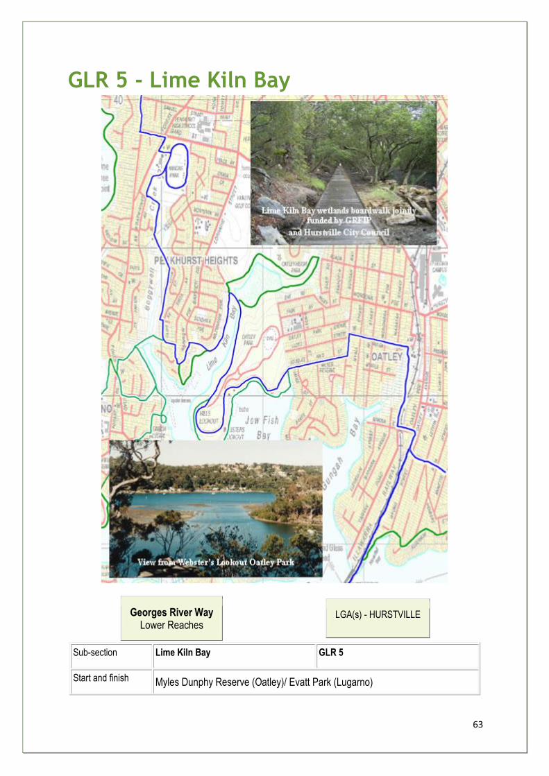
63
GLR 5 - Lime Kiln Bay
Georges River Way Lower Reaches
LGA(s) - HURSTVILLE
Sub-section Lime Kiln Bay GLR 5
Start and finish Myles Dunphy Reserve (Oatley)/ Evatt Park (Lugarno)
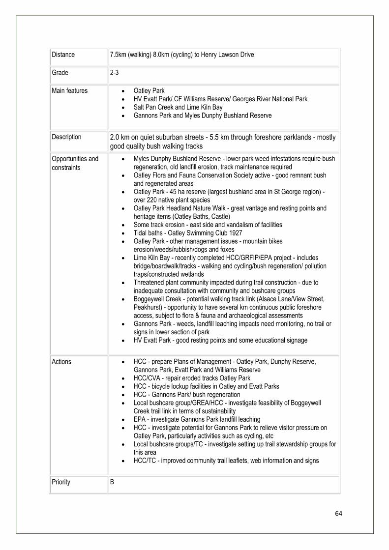
64
Distance 7.5km (walking) 8.0km (cycling) to Henry Lawson Drive
Grade 2-3
Main features • Oatley Park • HV Evatt Park/ CF Williams Reserve/ Georges River National Park • Salt Pan Creek and Lime Kiln Bay • Gannons Park and Myles Dunphy Bushland Reserve
Description 2.0 km on quiet suburban streets - 5.5 km through foreshore parklands - mostly good quality bush walking tracks
Opportunities and
constraints
• Myles Dunphy Bushland Reserve - lower park weed infestations require bush regeneration, old landfill erosion, track maintenance required
• Oatley Flora and Fauna Conservation Society active - good remnant bush and regenerated areas
• Oatley Park - 45 ha reserve (largest bushland area in St George region) - over 220 native plant species
• Oatley Park Headland Nature Walk - great vantage and resting points and heritage items (Oatley Baths, Castle)
• Some track erosion - east side and vandalism of facilities • Tidal baths - Oatley Swimming Club 1927 • Oatley Park - other management issues - mountain bikes
erosion/weeds/rubbish/dogs and foxes • Lime Kiln Bay - recently completed HCC/GRFIP/EPA project - includes
bridge/boardwalk/tracks - walking and cycling/bush regeneration/ pollution traps/constructed wetlands
• Threatened plant community impacted during trail construction - due to inadequate consultation with community and bushcare groups
• Boggeywell Creek - potential walking track link (Alsace Lane/View Street, Peakhurst) - opportunity to have several km continuous public foreshore access, subject to flora & fauna and archaeological assessments
• Gannons Park - weeds, landfill leaching impacts need monitoring, no trail or signs in lower section of park
• HV Evatt Park - good resting points and some educational signage
Actions • HCC - prepare Plans of Management - Oatley Park, Dunphy Reserve, Gannons Park, Evatt Park and Williams Reserve
• HCC/CVA - repair eroded tracks Oatley Park • HCC - bicycle lockup facilities in Oatley and Evatt Parks • HCC - Gannons Park/ bush regeneration • Local bushcare group/GREA/HCC - investigate feasibility of Boggeywell
Creek trail link in terms of sustainability • EPA - investigate Gannons Park landfill leaching • HCC - investigate potential for Gannons Park to relieve visitor pressure on
Oatley Park, particularly activities such as cycling, etc • Local bushcare groups/TC - investigate setting up trail stewardship groups for
this area • HCC/TC - improved community trail leaflets, web information and signs
Priority B

65
Estimated cost $75k
Key stakeholders HCC/bush care groups/Oatley Flora & Fauna Society
Rationale:
The proposed route follows quiet local streets, linking Myles Dunphy Bushland Reserve, Oatley Park, Gannons Park, Evatt Park, and Lime Kiln Bay pedestrian bridge, boardwalk and walking tracks. A spur links Edith Bay Reserve and Old Lugarno Ferry Wharf and Boardwalk .
1. Under construction at the time of report writing.
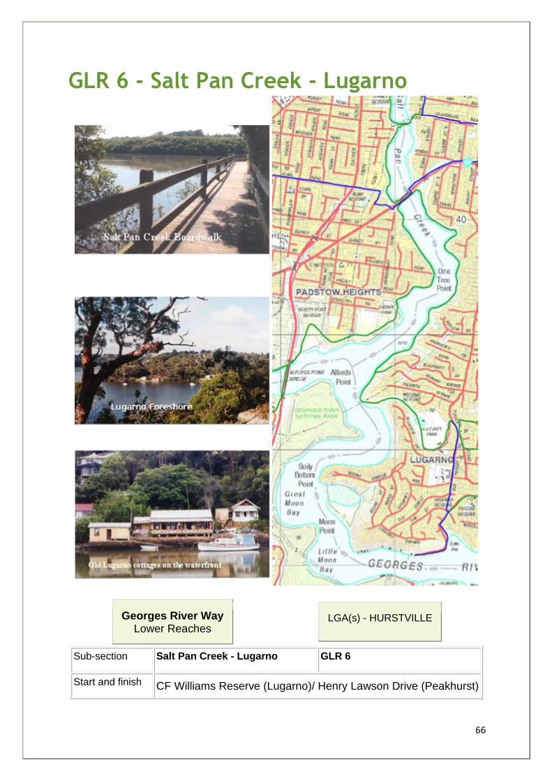
66
GLR 6 - Salt Pan Creek - Lugarno
Georges River Way Lower Reaches
LGA(s) - HURSTVILLE
Sub-section Salt Pan Creek - Lugarno GLR 6
Start and finish CF Williams Reserve (Lugarno)/ Henry Lawson Drive (Peakhurst)
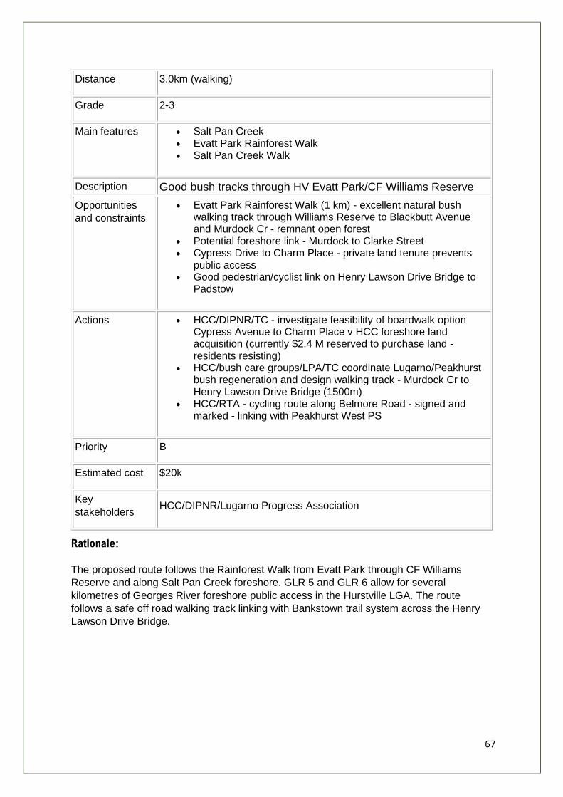
67
Distance 3.0km (walking)
Grade 2-3
Main features • Salt Pan Creek • Evatt Park Rainforest Walk • Salt Pan Creek Walk
Description Good bush tracks through HV Evatt Park/CF Williams Reserve
Opportunities
and constraints
• Evatt Park Rainforest Walk (1 km) - excellent natural bush walking track through Williams Reserve to Blackbutt Avenue and Murdock Cr - remnant open forest
• Potential foreshore link - Murdock to Clarke Street • Cypress Drive to Charm Place - private land tenure prevents
public access • Good pedestrian/cyclist link on Henry Lawson Drive Bridge to
Padstow
Actions • HCC/DIPNR/TC - investigate feasibility of boardwalk option Cypress Avenue to Charm Place v HCC foreshore land acquisition (currently $2.4 M reserved to purchase land - residents resisting)
• HCC/bush care groups/LPA/TC coordinate Lugarno/Peakhurst bush regeneration and design walking track - Murdock Cr to Henry Lawson Drive Bridge (1500m)
• HCC/RTA - cycling route along Belmore Road - signed and marked - linking with Peakhurst West PS
Priority B
Estimated cost $20k
Key
stakeholders HCC/DIPNR/Lugarno Progress Association
Rationale:
The proposed route follows the Rainforest Walk from Evatt Park through CF Williams
Reserve and along Salt Pan Creek foreshore. GLR 5 and GLR 6 allow for several
kilometres of Georges River foreshore public access in the Hurstville LGA. The route
follows a safe off road walking track linking with Bankstown trail system across the Henry
Lawson Drive Bridge.
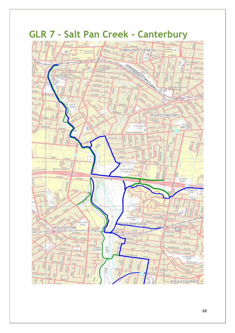
68
GLR 7 - Salt Pan Creek - Canterbury

69
Georges River Way Lower Reaches
LGA(s) - CANTERBURY, HURSTVILLE
Sub-section Salt Pan Creek - Canterbury GLR 7
Start and finish Henry Lawson Drive Footbridge (Peakhurst) / Henry Lawson Drive Bridge (Padstow Heights)
Distance 6.0km
Grade 2
Main features • Salt Pan Reserve/Sporting Facilities • Salt Marshes • Riverwood Park
Description Potential shared use walkway/cycleway from Henry Lawson Drive Footbridge along Ogilvy Street North, Clarendon Road, Salt Pan Road, Webb Street, through Riverwood Park and Salt Pan Reserve, Moxon Road, Gow Street - connecting with existing Bankstown networks back to Henry Lawson Drive Bridge at Padstow Heights
Opportunities
and constraints
• Opportunity to integrate Canterbury walkway/cycleways with those of Bankstown and Hurstville - creating an integrated recreational network around Salt Pan Creek with increased usage
Actions • CCC/RTA/HCC - plan and construct trail network linking Hurstville, Canterbury and Bankstown LGA's
Priority B
Estimated cost $150k
Key
stakeholders CCC/HCC/BUGs/Sports Clubs
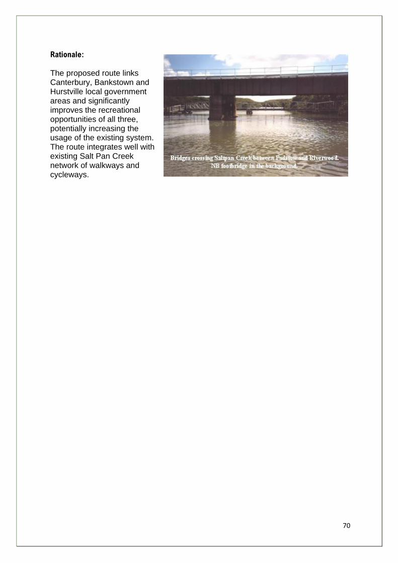
70
Rationale: The proposed route links Canterbury, Bankstown and Hurstville local government areas and significantly improves the recreational opportunities of all three, potentially increasing the usage of the existing system. The route integrates well with existing Salt Pan Creek network of walkways and cycleways.
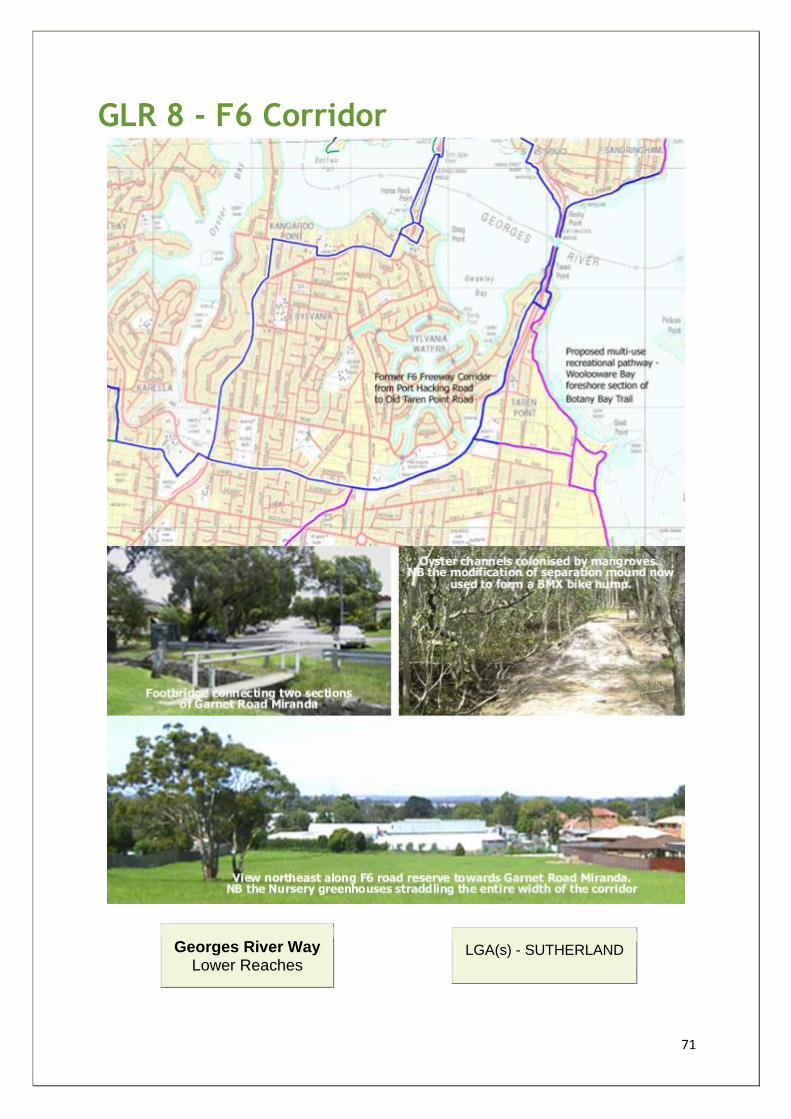
71
GLR 8 - F6 Corridor
Georges River Way Lower Reaches
LGA(s) - SUTHERLAND
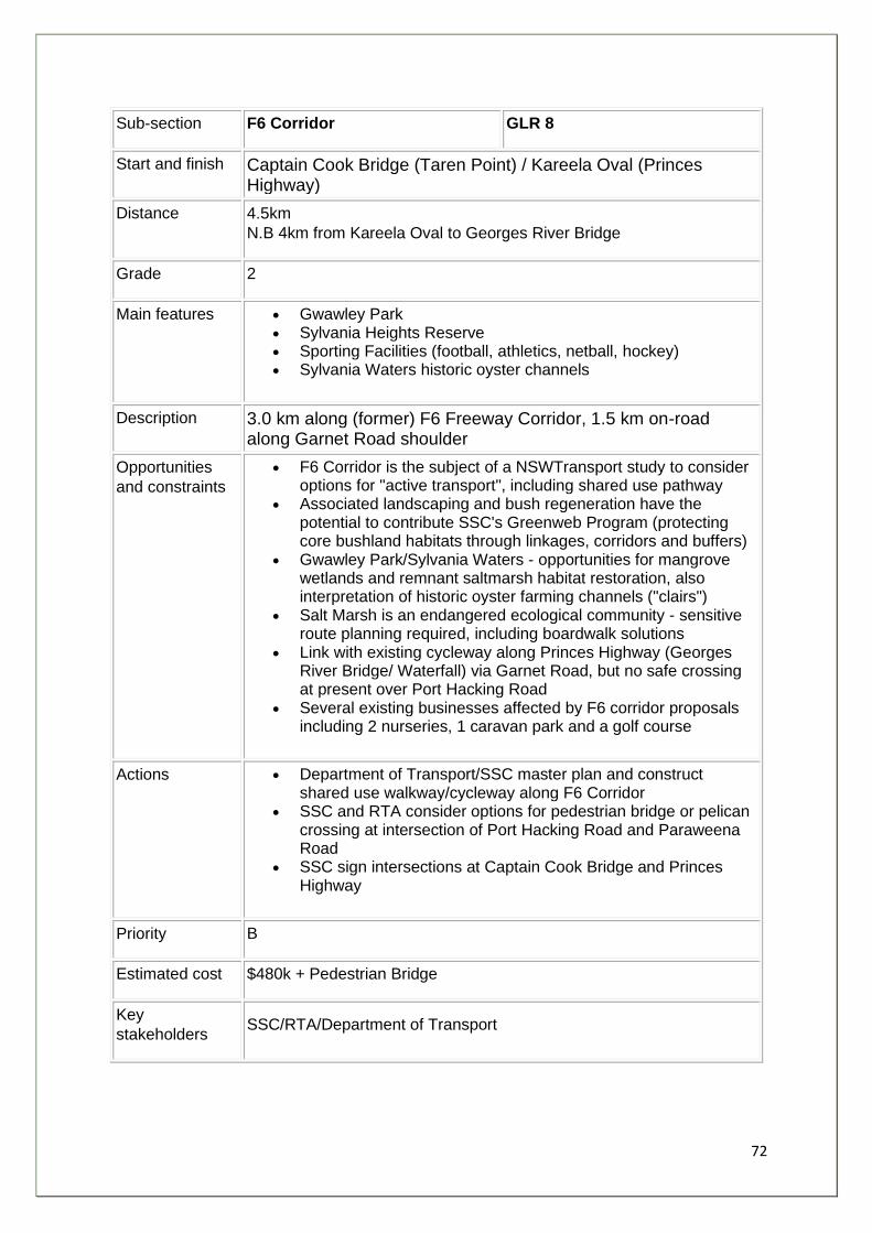
72
Sub-section F6 Corridor GLR 8
Start and finish Captain Cook Bridge (Taren Point) / Kareela Oval (Princes Highway)
Distance 4.5km
N.B 4km from Kareela Oval to Georges River Bridge
Grade 2
Main features • Gwawley Park • Sylvania Heights Reserve • Sporting Facilities (football, athletics, netball, hockey) • Sylvania Waters historic oyster channels
Description 3.0 km along (former) F6 Freeway Corridor, 1.5 km on-road along Garnet Road shoulder
Opportunities
and constraints
• F6 Corridor is the subject of a NSWTransport study to consider options for "active transport", including shared use pathway
• Associated landscaping and bush regeneration have the potential to contribute SSC's Greenweb Program (protecting core bushland habitats through linkages, corridors and buffers)
• Gwawley Park/Sylvania Waters - opportunities for mangrove wetlands and remnant saltmarsh habitat restoration, also interpretation of historic oyster farming channels ("clairs")
• Salt Marsh is an endangered ecological community - sensitive route planning required, including boardwalk solutions
• Link with existing cycleway along Princes Highway (Georges River Bridge/ Waterfall) via Garnet Road, but no safe crossing at present over Port Hacking Road
• Several existing businesses affected by F6 corridor proposals including 2 nurseries, 1 caravan park and a golf course
Actions • Department of Transport/SSC master plan and construct shared use walkway/cycleway along F6 Corridor
• SSC and RTA consider options for pedestrian bridge or pelican crossing at intersection of Port Hacking Road and Paraweena Road
• SSC sign intersections at Captain Cook Bridge and Princes Highway
Priority B
Estimated cost $480k + Pedestrian Bridge
Key
stakeholders SSC/RTA/Department of Transport
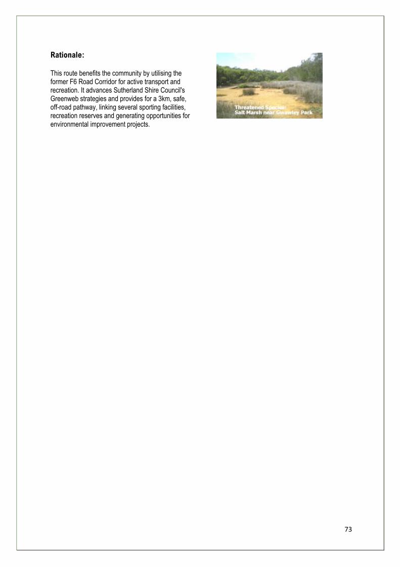
73
Rationale: This route benefits the community by utilising the former F6 Road Corridor for active transport and recreation. It advances Sutherland Shire Council's Greenweb strategies and provides for a 3km, safe, off-road pathway, linking several sporting facilities, recreation reserves and generating opportunities for environmental improvement projects.
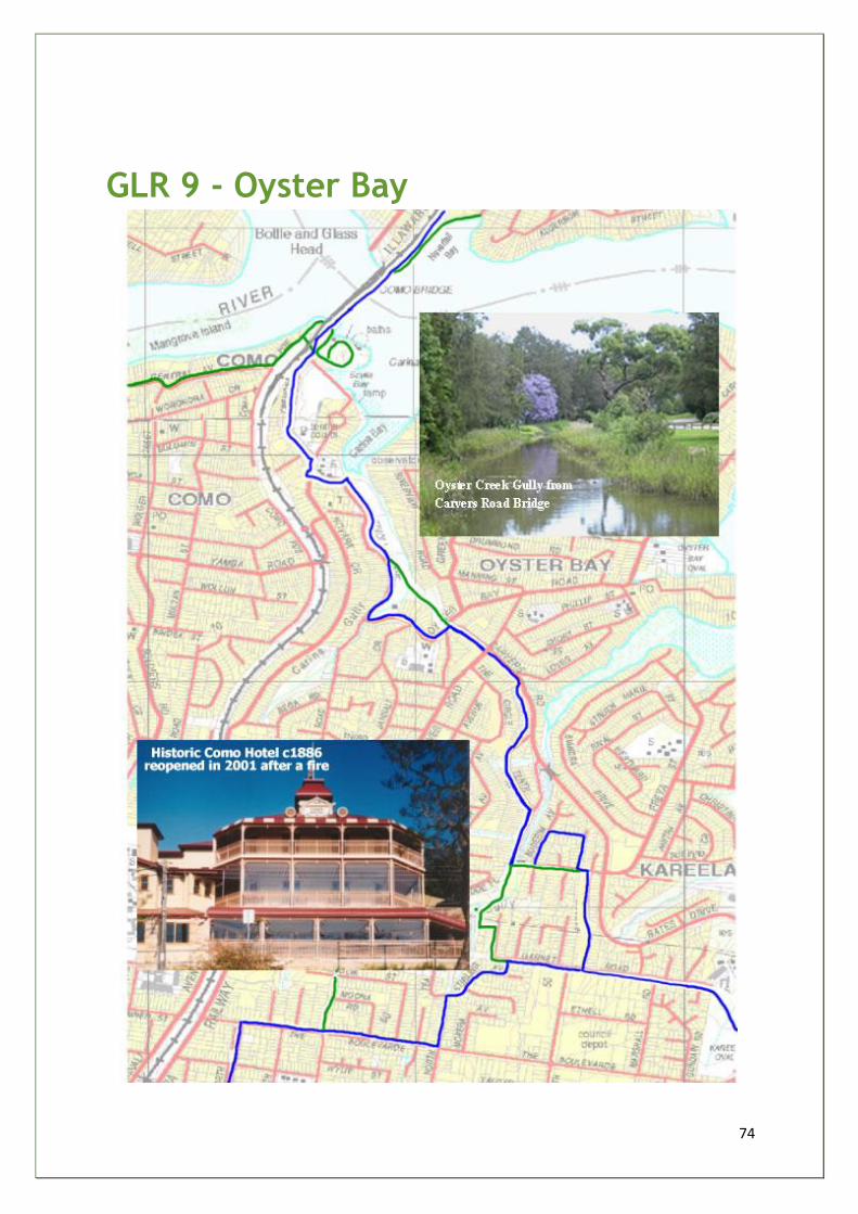
74
GLR 9 - Oyster Bay
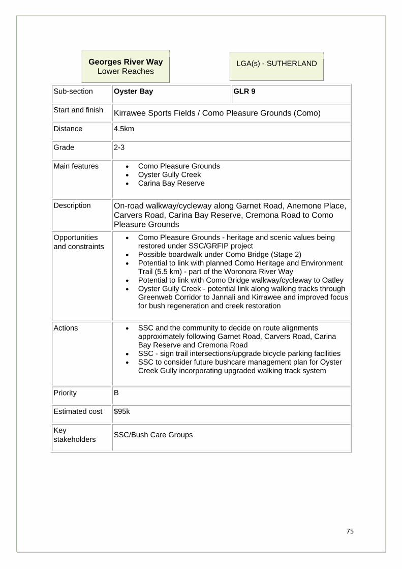
75
Georges River Way Lower Reaches
LGA(s) - SUTHERLAND
Sub-section Oyster Bay GLR 9
Start and finish Kirrawee Sports Fields / Como Pleasure Grounds (Como)
Distance 4.5km
Grade 2-3
Main features • Como Pleasure Grounds • Oyster Gully Creek • Carina Bay Reserve
Description On-road walkway/cycleway along Garnet Road, Anemone Place, Carvers Road, Carina Bay Reserve, Cremona Road to Como Pleasure Grounds
Opportunities
and constraints
• Como Pleasure Grounds - heritage and scenic values being restored under SSC/GRFIP project
• Possible boardwalk under Como Bridge (Stage 2) • Potential to link with planned Como Heritage and Environment
Trail (5.5 km) - part of the Woronora River Way • Potential to link with Como Bridge walkway/cycleway to Oatley • Oyster Gully Creek - potential link along walking tracks through
Greenweb Corridor to Jannali and Kirrawee and improved focus for bush regeneration and creek restoration
Actions • SSC and the community to decide on route alignments approximately following Garnet Road, Carvers Road, Carina Bay Reserve and Cremona Road
• SSC - sign trail intersections/upgrade bicycle parking facilities • SSC to consider future bushcare management plan for Oyster
Creek Gully incorporating upgraded walking track system
Priority B
Estimated cost $95k
Key
stakeholders SSC/Bush Care Groups
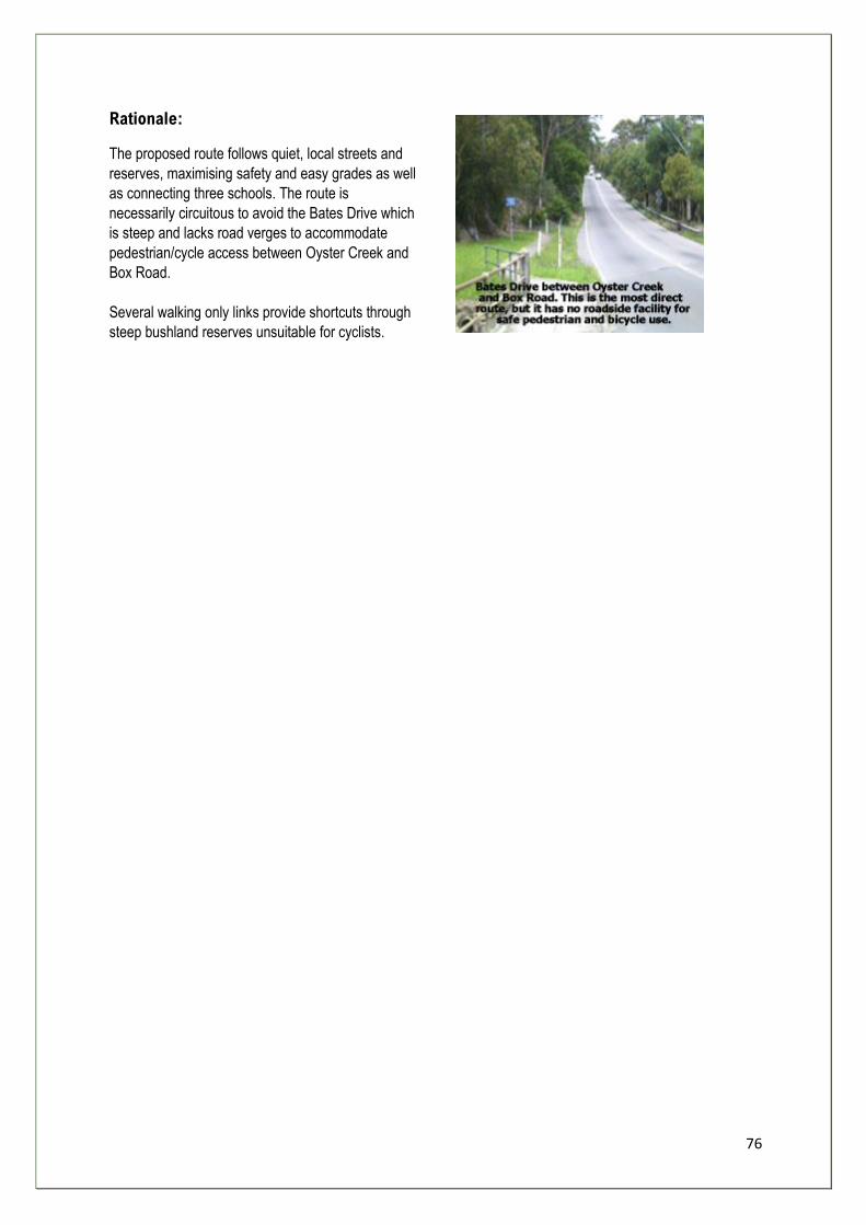
76
Rationale:
The proposed route follows quiet, local streets and
reserves, maximising safety and easy grades as well
as connecting three schools. The route is
necessarily circuitous to avoid the Bates Drive which
is steep and lacks road verges to accommodate
pedestrian/cycle access between Oyster Creek and
Box Road.
Several walking only links provide shortcuts through
steep bushland reserves unsuitable for cyclists.
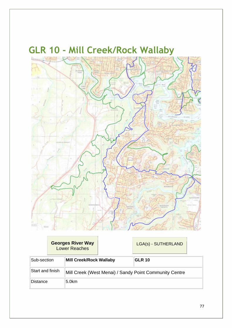
77
GLR 10 - Mill Creek/Rock Wallaby
Georges River Way Lower Reaches
LGA(s) - SUTHERLAND
Sub-section Mill Creek/Rock Wallaby GLR 10
Start and finish Mill Creek (West Menai) / Sandy Point Community Centre
Distance 5.0km
78
Grade 3-4
Main features • Federal government land - Mill Creek to Sandy Point • Mill Creek, weir and heritage mill site • Gandangara Land Council land • Bushland vantage points towards GR National Park
Description Mill Creek/Rock Wallaby is a rough walking track linking the old mill site on Mill Creek with Sandy Point Community Centre - the track follows fire trails, electricity line easements, heritage and even animal tracks. Near Sandy Point, tracks are well formed and popular with locals - Mill Creek area is relatively inaccessible and tracks are degraded. The route crosses into land owned by Gandangara Local Aboriginal Land Council.
Opportunities
and constraints
• Mill Creek Federal land - (formerly Department of Defence) rugged remnant bushland with environmental, scenic, cultural and heritage values - complimenting those of the Georges River National Park on opposite (Bankstown) foreshore
• Great diversity of flora, pristine salt-marshes, mangroves, sandstone cliffs and caves, potentially of aboriginal heritage
• Cars and rubbish dumped in a few areas only • Four wheel drive vehicles and trail bikes - causing serious track
erosion problems - and on Gandangara Lands - severe erosion and vegetation and habitat loss including sedimentation impacting on health of Mill Creek and Georges River
• All fire trails dangerous for walkers due to (illegal) trial bike activity
• Lucas Heights tip at headwaters of Mill Creek a possible source of contaminants and turbidity
Actions • DIPNR/ SSC / Gandangara LALC / DFA - establish task force to prepare EMP for Gandangara/ Mill Creek and Quarry lands - immediate policing of four wheel drive and trail bike regulations
• Restrict access with steel fencing along Heathcote Road / community education campaign
• GLALC / SSC - investigate access to a restricted area for off road vehicles
• Federal Government - transfer Mill Creek lands to NSW NPWS for inclusion in the GR National Park (or GR SCA)
• NPWS/ SPPA / TC - plan walking track from Sandy Point Community Centre to Mill Creek to link with Burnum Burnum (West Menai) Nature Trail
• DIPNR/ GLALC /SSC / Bush Care Groups - urgently commence bush regeneration and clean up project on GLALC land
Priority A
Estimated cost $600k
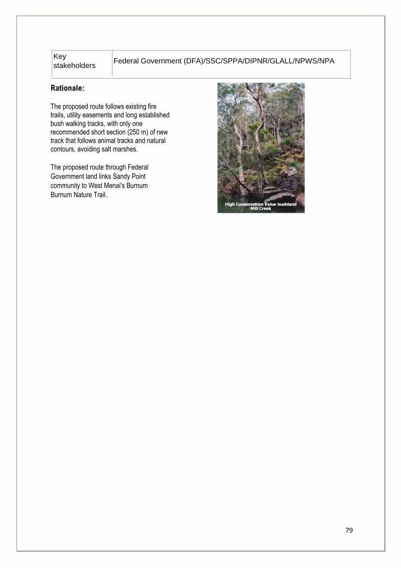
79
Key
stakeholders Federal Government (DFA)/SSC/SPPA/DIPNR/GLALL/NPWS/NPA
Rationale:
The proposed route follows existing fire trails, utility easements and long established bush walking tracks, with only one recommended short section (250 m) of new track that follows animal tracks and natural contours, avoiding salt marshes.
The proposed route through Federal
Government land links Sandy Point
community to West Menai's Burnum
Burnum Nature Trail.
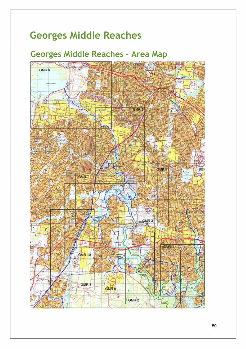
80
Georges Middle Reaches
Georges Middle Reaches - Area Map
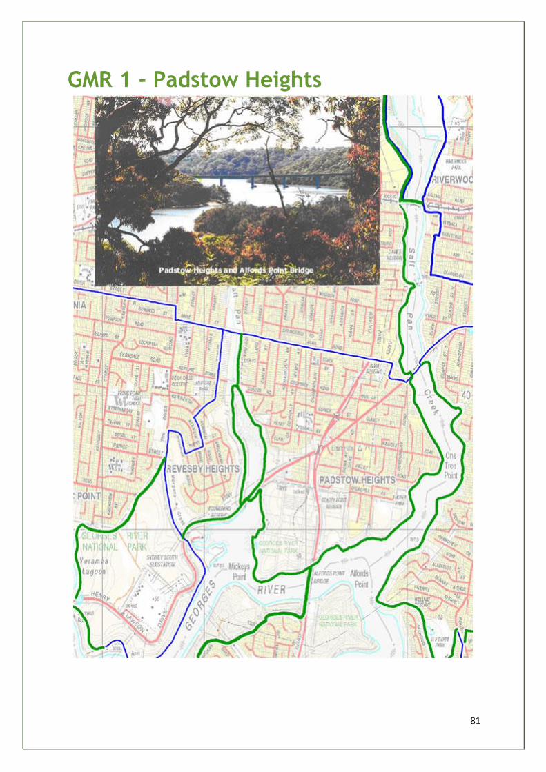
81
GMR 1 - Padstow Heights
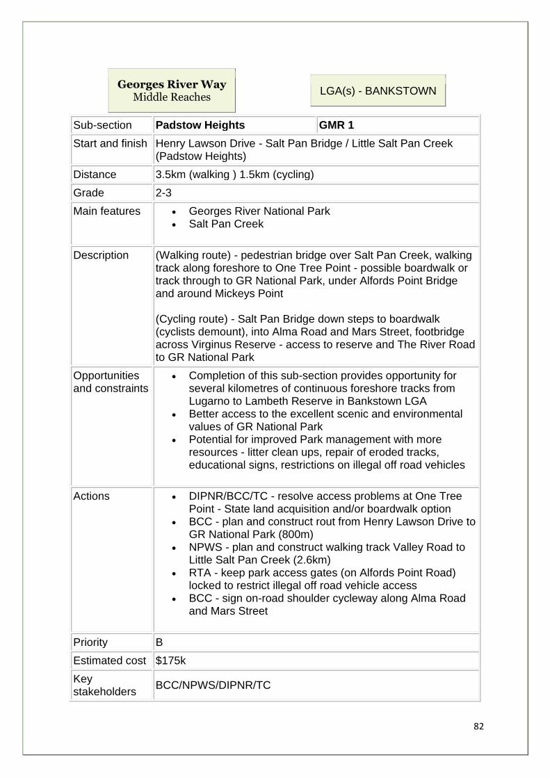
82
Georges River Way Middle Reaches
LGA(s) - BANKSTOWN
Sub-section Padstow Heights GMR 1
Start and finish Henry Lawson Drive - Salt Pan Bridge / Little Salt Pan Creek (Padstow Heights)
Distance 3.5km (walking ) 1.5km (cycling)
Grade 2-3
Main features • Georges River National Park • Salt Pan Creek
Description (Walking route) - pedestrian bridge over Salt Pan Creek, walking track along foreshore to One Tree Point - possible boardwalk or track through to GR National Park, under Alfords Point Bridge and around Mickeys Point (Cycling route) - Salt Pan Bridge down steps to boardwalk (cyclists demount), into Alma Road and Mars Street, footbridge across Virginus Reserve - access to reserve and The River Road to GR National Park
Opportunities and constraints
• Completion of this sub-section provides opportunity for several kilometres of continuous foreshore tracks from Lugarno to Lambeth Reserve in Bankstown LGA
• Better access to the excellent scenic and environmental values of GR National Park
• Potential for improved Park management with more resources - litter clean ups, repair of eroded tracks, educational signs, restrictions on illegal off road vehicles
Actions • DIPNR/BCC/TC - resolve access problems at One Tree Point - State land acquisition and/or boardwalk option
• BCC - plan and construct rout from Henry Lawson Drive to GR National Park (800m)
• NPWS - plan and construct walking track Valley Road to Little Salt Pan Creek (2.6km)
• RTA - keep park access gates (on Alfords Point Road) locked to restrict illegal off road vehicle access
• BCC - sign on-road shoulder cycleway along Alma Road and Mars Street
Priority B
Estimated cost $175k
Key stakeholders
BCC/NPWS/DIPNR/TC

83
Rationale:
This walking route follows Georges River foreshores through Georges River National Park with its excellent scenic and natural beauty, improving public foreshore access and appreciation, additional signs and track maintenance.
The route links with the existing Salt Pan boardwalk system and Picnic Point Regional Accessway project. Walkers can cross Alfords Point Bridge to Sutherland.
The cycling route avoids dangerous Henry Lawson Drive from Salt Pan Creek to Little Salt Pan Creek tracks, following quiet local streets with spurs linking to various points of interest on the Georges River.
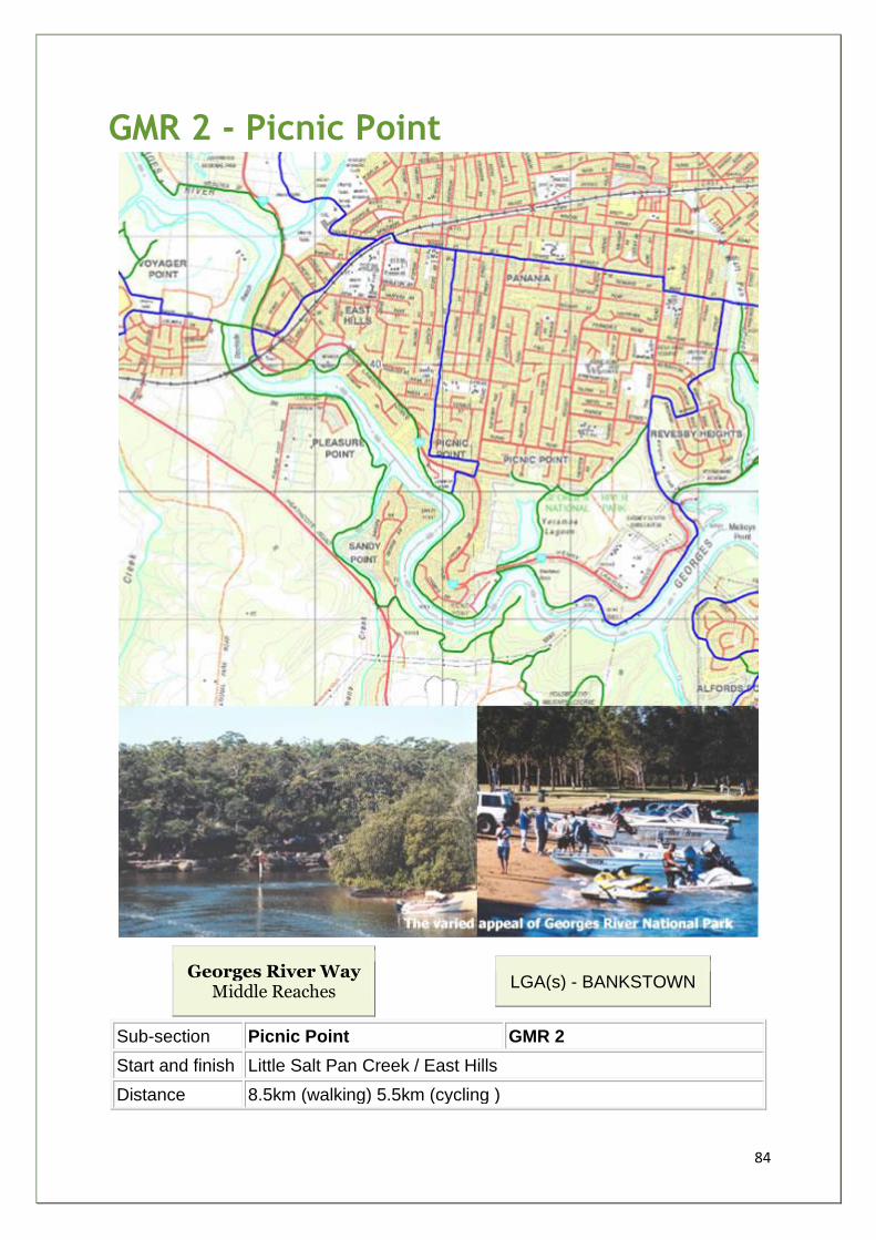
84
GMR 2 - Picnic Point
Georges River Way Middle Reaches
LGA(s) - BANKSTOWN
Sub-section Picnic Point GMR 2
Start and finish Little Salt Pan Creek / East Hills
Distance 8.5km (walking) 5.5km (cycling )
85
Grade 2-3
Main features Georges River National Park and Picnic Point Reserve Fitzpatrick Park and East Hills Park and Yeramba Lagoon Monash Reserve and Lambeth Reserve Sylvan Grove Native Garden at Picnic Point
Description Walking track through GRNP - mostly existing, minor section under construction from Cattle Duffers Flat to Yeramba Lagoon (NPWS/ GRFIP project). Track goes through Fitzpatrick Park, Picnic Point Reserve, Lambeth Reserve, along Henry Lawson Drive, Monash Reserve and East Hills Park and footbridge over Georges River to Voyager Point track network. Cycling route follows on-road shoulders along Mars Street, west along Tower Street, across railway at Park Street, south on Childs Street and into Kelso Park. Spur link along Park Rd to East Hills footbridge - to join up with Voyager Point track network, and another along Picnic Point Road to Monash Reserve
Opportunities and constraints
Opportunity for continuous public foreshore access from Little Salt Pan Creek to Kelso Park (7.5 km) - three minor sections (total of 1.0 km) along Henry Lawson Drive footpaths Picnic Point Regional Accessway (2.5 km) under construction (BCC/GRFIP) - well designed foreshore link with walking tracks and boardwalk GRNP section - scenic and environmental values - track improves access to popular fishing spot and vantage points Yeramba Lagoon - potential walking link to Kennedy Street and on to Boomerang Reserve to create (4.5 km) walking loop around GRNP Potential walking track link with Revesby Station through Little Salt Pan Creek Reserve/ Virginius Reserve/ Montgomery Reserve Monash Reserve - potential to upgrade facilities, signs, carparking area, build path and bush regeneration (local RSL might be interested in project as park is named after WW1 Australian general) East Hills Park - BBS bushcare project in eastern park section (remnant bush) - more sustainable park management required to maintain regenerated bush areas Potential pedestrian link to railway bridge to eastern park with footpath to shop East Hills footbridge to Liverpool LGA (reopens late 2003)
Actions BCC plan and construct (1.6 km) walking track from Little Salt Pan Creek through Boomerang Reserve to GRNP at Morgans Creek NPWS restore and upgrade track along eastern side of Yeramba Lagoon to Kennedy Street and on to The River Road
86
BCC - footpaths through Monash Reserve, bush regeneration and park facilities upgrade, TC approach RSL park signs upgrade BCC - East Hills eastern park to be natural regenerated bush land with minimal council maintenance, build path alongside railway linking western park and shop - minimise tracks through eastern park RTA - investigate feasibility of pedestrian link attached to railway bridge over Henry Lawson Drive BCC - sign trail intersections - Little Salt Pan Creek, the River Road, Yeramba Lagoon and East Hills footbridge BCC/ LCC / DIPNR / NPWS / Georges River Keeper (WA) - develop strategic plan to sustainability restore foreshore banks avoiding over-engineered options
Priority B
Estimated cost $300k
Key stakeholders
BCC/ DIPNR / LCC / WA/ TC/ BBS/ SW BUG
Rationale:
The walking route follows existing tracks through the Georges River National Park and tracks and boardwalk through Picnic Point Reserve and Lambeth Reserve. This subsection has over 5km of continuous foreshore access, through areas with high scenic and environmental values (8.5km when linked to Padstow Heights subsection). The cycling route avoids dangerous Henry Lawson Drive, follows local streets and links with East Hills Park and footbridge to Voyager Point.
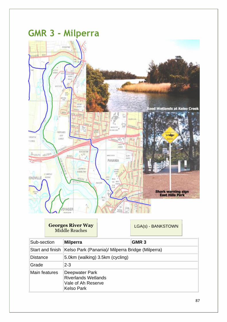
87
GMR 3 - Milperra
Georges River Way Middle Reaches
LGA(s) - BANKSTOWN
Sub-section Milperra GMR 3
Start and finish Kelso Park (Panania)/ Milperra Bridge (Milperra)
Distance 5.0km (walking) 3.5km (cycling)
Grade 2-3
Main features Deepwater Park Riverlands Wetlands Vale of Ah Reserve Kelso Park
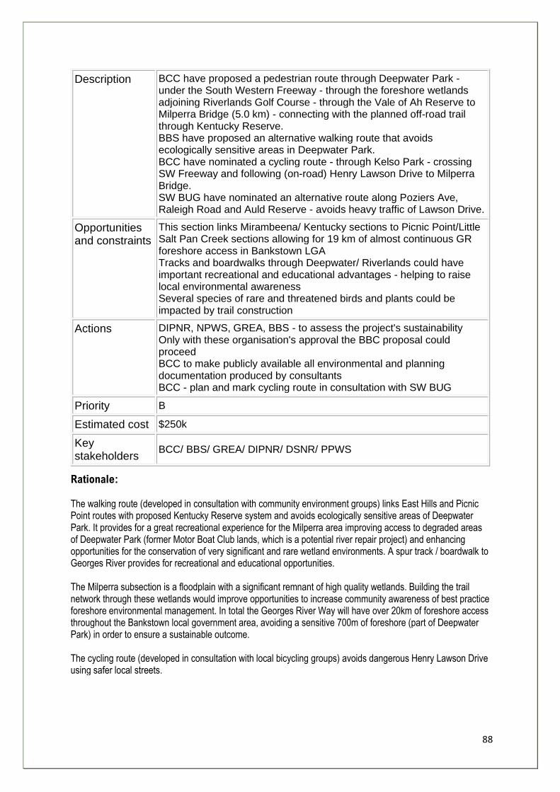
88
Description BCC have proposed a pedestrian route through Deepwater Park - under the South Western Freeway - through the foreshore wetlands adjoining Riverlands Golf Course - through the Vale of Ah Reserve to Milperra Bridge (5.0 km) - connecting with the planned off-road trail through Kentucky Reserve. BBS have proposed an alternative walking route that avoids ecologically sensitive areas in Deepwater Park. BCC have nominated a cycling route - through Kelso Park - crossing SW Freeway and following (on-road) Henry Lawson Drive to Milperra Bridge. SW BUG have nominated an alternative route along Poziers Ave, Raleigh Road and Auld Reserve - avoids heavy traffic of Lawson Drive.
Opportunities and constraints
This section links Mirambeena/ Kentucky sections to Picnic Point/Little Salt Pan Creek sections allowing for 19 km of almost continuous GR foreshore access in Bankstown LGA Tracks and boardwalks through Deepwater/ Riverlands could have important recreational and educational advantages - helping to raise local environmental awareness Several species of rare and threatened birds and plants could be impacted by trail construction
Actions DIPNR, NPWS, GREA, BBS - to assess the project's sustainability Only with these organisation's approval the BBC proposal could proceed BCC to make publicly available all environmental and planning documentation produced by consultants BCC - plan and mark cycling route in consultation with SW BUG
Priority B
Estimated cost $250k
Key stakeholders
BCC/ BBS/ GREA/ DIPNR/ DSNR/ PPWS
Rationale: The walking route (developed in consultation with community environment groups) links East Hills and Picnic Point routes with proposed Kentucky Reserve system and avoids ecologically sensitive areas of Deepwater Park. It provides for a great recreational experience for the Milperra area improving access to degraded areas of Deepwater Park (former Motor Boat Club lands, which is a potential river repair project) and enhancing opportunities for the conservation of very significant and rare wetland environments. A spur track / boardwalk to Georges River provides for recreational and educational opportunities. The Milperra subsection is a floodplain with a significant remnant of high quality wetlands. Building the trail network through these wetlands would improve opportunities to increase community awareness of best practice foreshore environmental management. In total the Georges River Way will have over 20km of foreshore access throughout the Bankstown local government area, avoiding a sensitive 700m of foreshore (part of Deepwater Park) in order to ensure a sustainable outcome. The cycling route (developed in consultation with local bicycling groups) avoids dangerous Henry Lawson Drive using safer local streets.
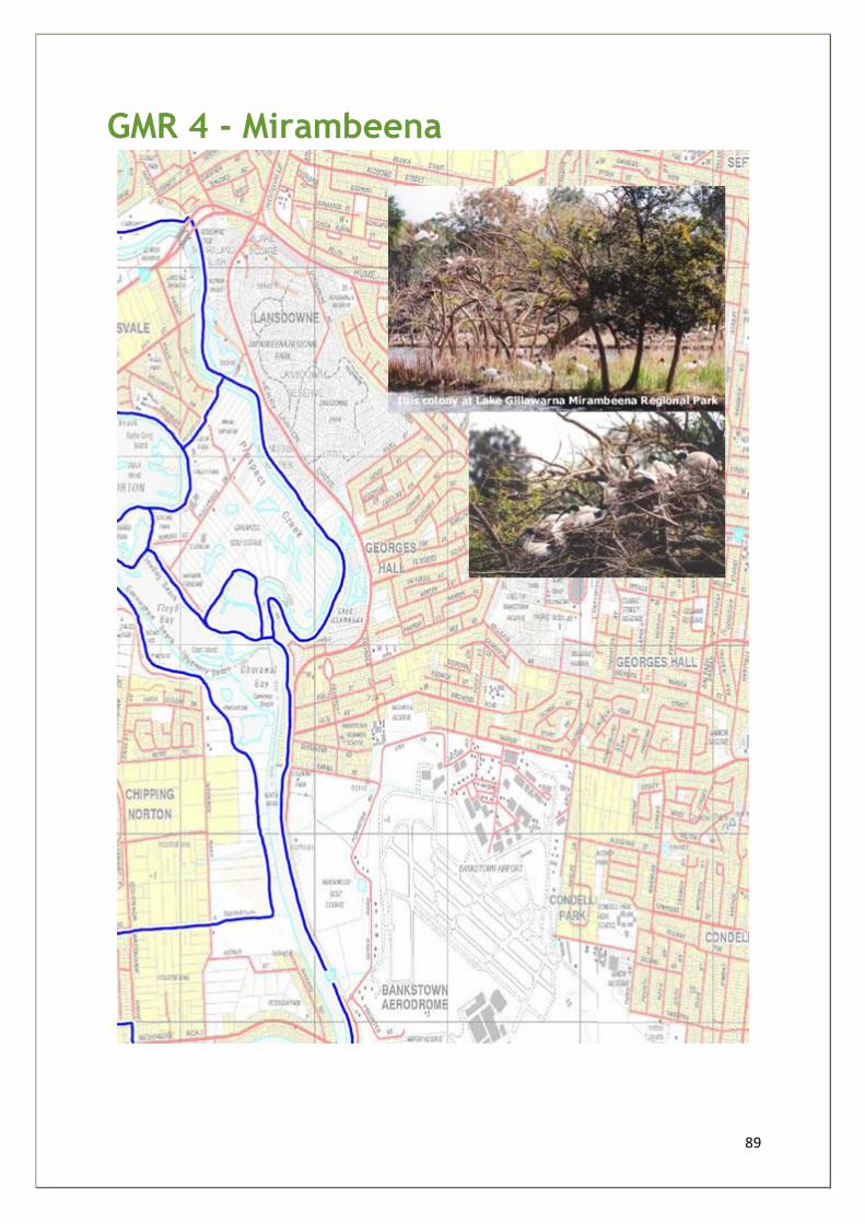
89
GMR 4 - Mirambeena
90
Georges River Way Middle Reaches
LGA(s) - BANKSTOWN
Sub-section Mirambeena GMR 4
Start and finish Milperra Bridge to Lansdowne Bridge
Distance 5.5km
Grade 2-3
Main features Mirambeena Regional Park/ Shortland Brush Garrison Point / Beatty Reserve Lake Gillawarna / Kentucky Reserve
Description Trail route goes through Kentucky Reserve linking to existing network at Garrison Point and on through Mirambeena Reserve to Lansdowne Bridge.
Opportunities and constraints
This section links with FCC trail network to the north of Lansdowne Bridge extending through Holroyd to Prospect Reservoir Kentucky Reserve is degraded with good bush regeneration opportunities Potential pedestrian bridge at Garrison Point to Chipping Norton Lakes and Liverpool CBD BCC Planning shared use bridge over Henry Lawson Drive from Mirambeena to Amaroo Reserve - avoids impact on CPW and improves access link with the velodrome and regional cycleway More sustainable management of foreshores park system - avoid woodchip weed infestations Regional recreational opportunities are expanded - links to school and sports facilities can be planned and constructed
Actions BCC - construct trail through Kentucky Reserve using best practice sustainable building materials Bush care groups - identify bush regeneration projects RTA/ BCC/ FCC/ TC - investigate feasibility and cost of pedestrian bridge linking Garrison Point and Lansvale BCC/ BBS/ bush regenerators - educational signage along this regional walk/cycleway
Priority A
Estimated cost $250-300k
Key stakeholders
BCC/RTA/BBS/TC
Rationale:
The proposed route follows the foreshores of Georges River and Prospect Creek along 5.5 kms of safe off-road
trails. There is great potential for bush regeneration and riverbank restoration at Kentucky Reserve. A
pedestrian bridge at Garrison Point would link with the existing and planned trail networks of Fairfield and
Liverpool and Holroyd local government areas and Chipping Norton Lake (north side), creating an outstanding
regional recreational network of shared use walkways and cycleways and would help to reduce anti-social
activities in the Lansvale open space areas.
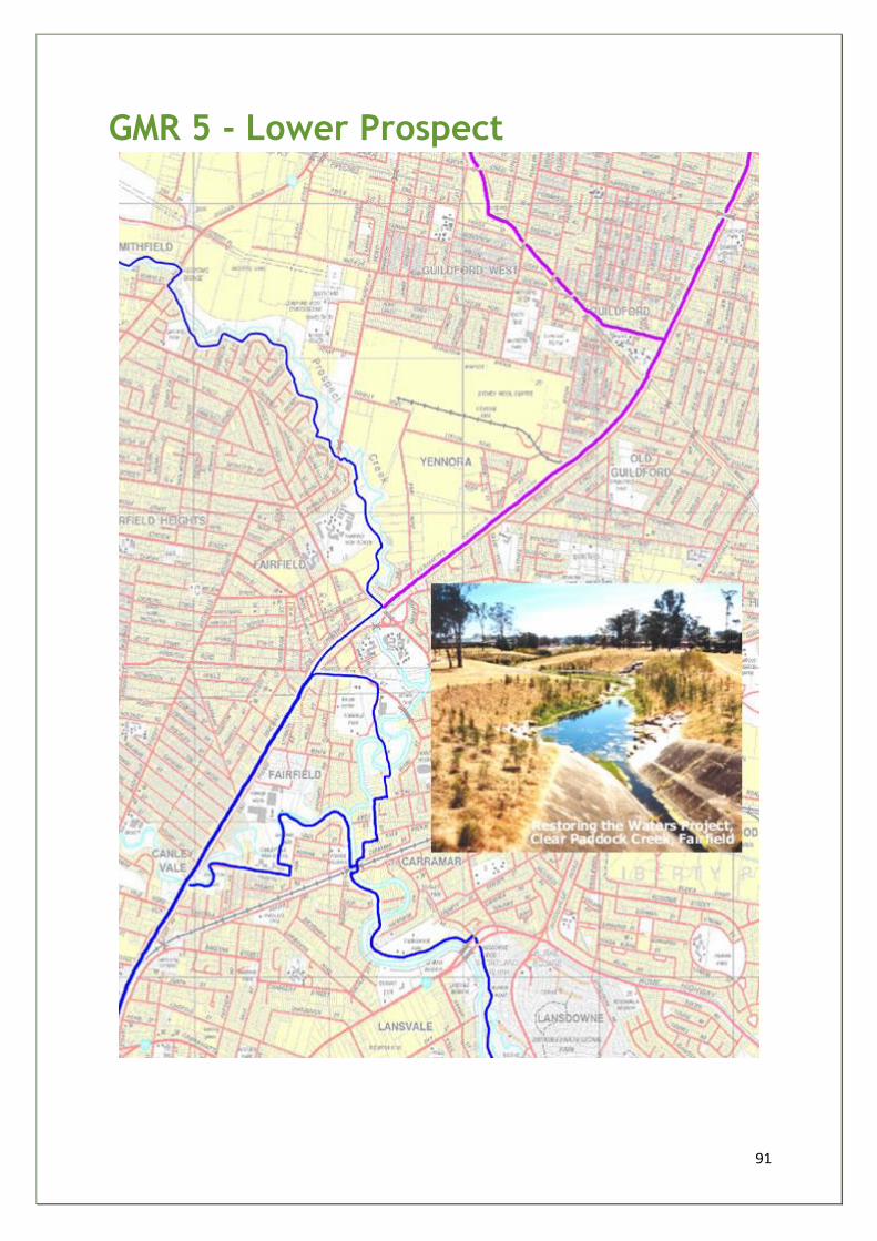
91
GMR 5 - Lower Prospect
92
Georges River Way Middle Reaches
LGA(s) - FAIRFIELD
Sub-section Lower Prospect GMR 5
Start and finish Lansdowne Bridge to Kenyons Bridge (Smithfield)
Distance 5.5km
Grade 2-3
Main features Prospect Creek Carrawood Park Fairfield Park De Frieras Wetlands
Description FCC's shared use cycleway/walkway exists from Hume Highway at Lansdowne Bridge - north through Carrawood Park -crossing over new Prospect Creek pedestrian bridge to Fairfield under railway through Parkes Reserve - (intersection with existing system along Orphan School Creek to Western Sydney Regional Park) - linking to Carramar Railway Station - through Fairfield Park to Fairfield Railway Station - north along the Rail Trail (Liverpool/Parramatta) - north west along the Prospect Creek through Fairfield High School Ace Reserve and Smithfield Park and across Prospect Creek into Holroyd at Kenyons Bridge (Cumberland Highway).
Opportunities and constraints
Good connections to RTA's Rail Trail Network and FCC's other networks Link to Ophan School Creek (Restoring the Waters/de-channelisation) - environmental education opportunity Potential for Rail Trail along Canley Vale/Villawood rail line to Bankstown, then linking with Salt Pan Creek network FCC - innovative community art works program along 'Five Creeks' - could be model for whole GR catchment - art works and stories are relevant to the future (sustainability and multiculturalism) rather than just the past Railway stations and schools need upgraded cycle parking facilities Opportunity for regional signs that inform and empower the community of this growing sustainable transport network Several bush regeneration and creek repair project opportunities along Prospect Creek
Actions RTA/FCC - do feasibility study on Villawood rail trail to Bankstown CBD FCC - community education and promotional campaign to increase trail network usage - focusing on sustainable transport as well as recreation (Excellent brochure produced August 2003)
93
FCC - initiate cycling school program - following on from City of Geelong's (Victoria) successful program - improving safety and responsibility FCC/ RTA - develop model information trail signs that could be used by whole Georges River catchment Bicycle NSW - organise 4 major seasonal rides/walks along the existing trail network through Bankstown, Fairfield and Holroyd to Prospect Reservoir - integrated with other community events
Priority A
Estimated cost $95k
Key stakeholders
FCC/RTA/TC/Bushcare and community groups
Rationale:
The route is part of existing and under-construction trail networks of Fairfield, Bankstown and Holroyd local
government areas, linking Mirambeena Reserve to Prospect Reservoir. The entire 5.5 km shared use section of
the trail is off-road running through Carrawood Park, Parkes Reserve, Fairfield Park and Long Street Park.
Existing environmental restoration projects and community stewardship will be strengthened as future projects
are planned along this route. Much good work has been done already but there are still significant weed,
dumping and pollution problems to resolve.
Well planned loops and spurs would increase usage of existing system.
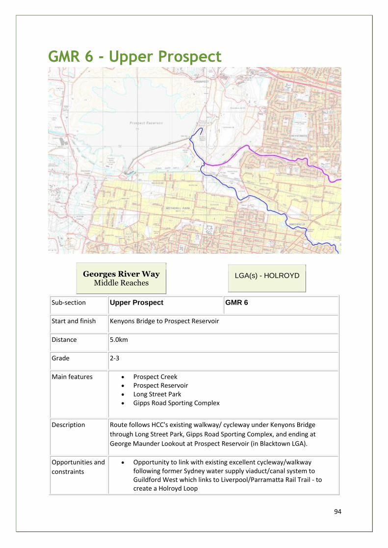
94
GMR 6 - Upper Prospect
Georges River Way Middle Reaches
LGA(s) - HOLROYD
Sub-section Upper Prospect GMR 6
Start and finish Kenyons Bridge to Prospect Reservoir
Distance 5.0km
Grade 2-3
Main features • Prospect Creek • Prospect Reservoir • Long Street Park • Gipps Road Sporting Complex
Description Route follows HCC's existing walkway/ cycleway under Kenyons Bridge
through Long Street Park, Gipps Road Sporting Complex, and ending at
George Maunder Lookout at Prospect Reservoir (in Blacktown LGA).
Opportunities and
constraints
• Opportunity to link with existing excellent cycleway/walkway following former Sydney water supply viaduct/canal system to Guildford West which links to Liverpool/Parramatta Rail Trail - to create a Holroyd Loop
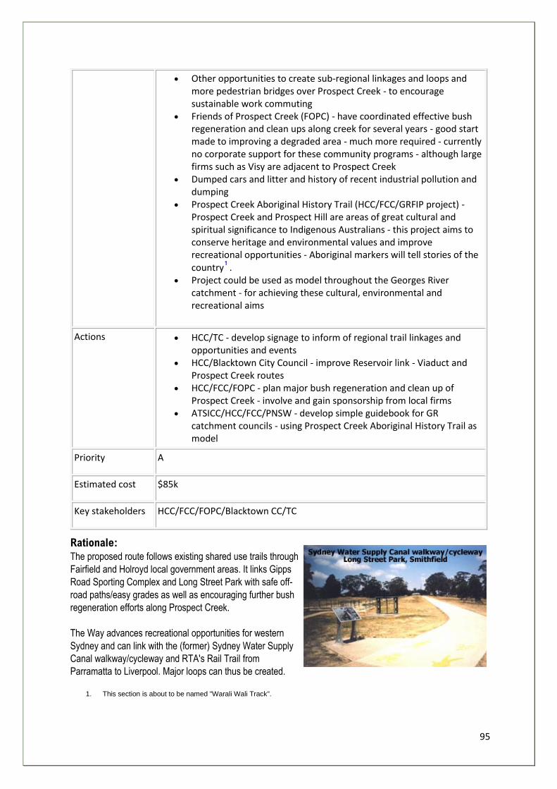
95
• Other opportunities to create sub-regional linkages and loops and more pedestrian bridges over Prospect Creek - to encourage sustainable work commuting
• Friends of Prospect Creek (FOPC) - have coordinated effective bush regeneration and clean ups along creek for several years - good start made to improving a degraded area - much more required - currently no corporate support for these community programs - although large firms such as Visy are adjacent to Prospect Creek
• Dumped cars and litter and history of recent industrial pollution and dumping
• Prospect Creek Aboriginal History Trail (HCC/FCC/GRFIP project) - Prospect Creek and Prospect Hill are areas of great cultural and spiritual significance to Indigenous Australians - this project aims to conserve heritage and environmental values and improve recreational opportunities - Aboriginal markers will tell stories of the country .
• Project could be used as model throughout the Georges River catchment - for achieving these cultural, environmental and recreational aims
Actions • HCC/TC - develop signage to inform of regional trail linkages and opportunities and events
• HCC/Blacktown City Council - improve Reservoir link - Viaduct and Prospect Creek routes
• HCC/FCC/FOPC - plan major bush regeneration and clean up of Prospect Creek - involve and gain sponsorship from local firms
• ATSICC/HCC/FCC/PNSW - develop simple guidebook for GR catchment councils - using Prospect Creek Aboriginal History Trail as model
Priority A
Estimated cost $85k
Key stakeholders HCC/FCC/FOPC/Blacktown CC/TC
Rationale:
The proposed route follows existing shared use trails through
Fairfield and Holroyd local government areas. It links Gipps
Road Sporting Complex and Long Street Park with safe off-
road paths/easy grades as well as encouraging further bush
regeneration efforts along Prospect Creek.
The Way advances recreational opportunities for western
Sydney and can link with the (former) Sydney Water Supply
Canal walkway/cycleway and RTA's Rail Trail from
Parramatta to Liverpool. Major loops can thus be created.
1. This section is about to be named "Warali Wali Track".
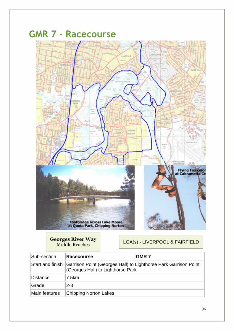
96
GMR 7 - Racecourse
Georges River Way Middle Reaches
LGA(s) - LIVERPOOL & FAIRFIELD
Sub-section Racecourse GMR 7
Start and finish Garrison Point (Georges Hall) to Lighthorse Park Garrison Point (Georges Hall) to Lighthorse Park
Distance 7.5km
Grade 2-3
Main features Chipping Norton Lakes
97
Prospect Creek Cabramatta Creek Warwick Farm Racecourse Lighthorse Park/Liverpool CBD/Weir The perched freshwater wetlands of Howard Park
Description Pedestrian bridge over Prospect Creek - through north side of Chipping Norton Lakes in Lansvale, through Chipping Norton Lake foreshores, pedestrian bridge over Cabramatta Creek, through foreshores of Warwick Farm Racecourse lands, boardwalk under Governor Macquarie Drive, south through Sydney Water land and Liverpool Hospital land into Lighthorse Park.
Opportunities and constraints
This section links together Lower Prospect/Bankstown with Liverpool/Campbelltown Rail Trail - 85/90 km of almost continuous recreational pathways - a magnificent network serving West and South West Sydney Usage of existing Rail Trail system could be dramatically increased with linkages to foreshore recreational facilities and parks, schools and job zones - combined with community education and promotional programs Major regional opportunity to create sustainable transport and recreational network - improving the amenity and environment Liverpool CBD has 17000 students - great potential to plan for safe cycle/walkway networks linking into regional networks Chipping Norton Lakes - 6 km existing walkways/ cycleways Potential for trail along Cabramatta Creek - linking Great Kai'mia Way with Rail Trail - another loop would be created around Canley Vale and Lansvale AJC have expressed interest in granting community pathway access through their lands Lighthorse Park - renewed focus of Liverpool CBD - LCC plans to integrate park and city and railway station - landscaping, bush regeneration, upgraded amenities, improved access and possible boardwalk Weir - important part of Liverpool's heritage, classified by the National Trust Cabramatta and Brickmakers Creeks - environmental restoration and improved public access projects on-going
Actions LCC/ FCC/ BCC/ AJC/ SW/ DIPNR/ TC - set up Task Force to plan and build and promote regional trail network following the Great Kai'mia Way routes and linking with an integrated system for new urban release areas (pre-development) Task Force identify opportunities associated with the trail - eg. environmental restoration, bush regeneration, Aboriginal and Non-Aboriginal heritage stories and environmental education - system of heritage markers be considered (Prospect Creek Aboriginal History Project could be model)
98
Major environmental restoration has created regional recreational resource at Chipping Norton Lakes - a former sand mining area
Priority B
Estimated cost $480k+ bridges
Key stakeholders
LCC/FCC/AJC/SW/DIPNR/BCC/NSW Health Dept
Rationale: The pedestrian bridge at Garrison Point would allow people using Beatty Point Reserve to access under-used park lands of Lansvale at Chipping Norton Lake. It would integrate the recreational networks of Bankstown, Fairfield, Holroyd and Liverpool local government areas and greatly improve their communities' recreational opportunities.
The entire route is safe and off-road, with easy walking grades. The area has good scenic and environmental values that will be improved with better access and community awareness.
The proposed Cabramatta Creek pedestrian bridge would link Fairfield and Liverpool trails, adding to pressure for further bush regeneration and riverbank restoration projects. A linking route to Lighthorse Park and Liverpool CBD creates great opportunities for the Georges River Way to become a major/ safe/ sustainable transport and recreation network for thousands of secondary school students within the Liverpool CBD.
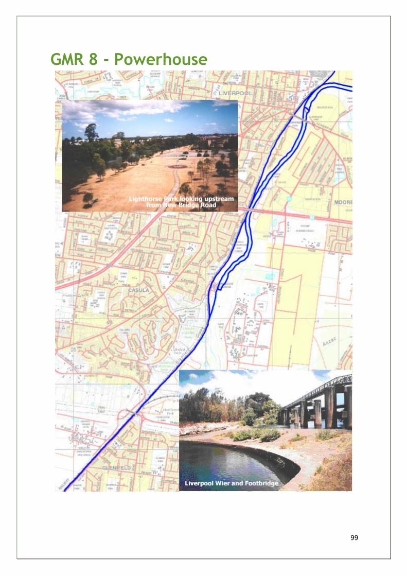
99
GMR 8 - Powerhouse
100
Georges River Way Middle Reaches
LGA(s) - LIVERPOOL
Sub-section Powerhouse GMR 8
Start and finish Lighthorse Park (Liverpool) to Glenfield Station
Distance 5.0km
Grade 2-3
Main features Casula Powerhouse Arts Centre and Park Leacock Regional Park
Description South along tracks through foreshore reserves (former golf course) to Casula Powerhouse, along section of existing Powerhouse walkway/cycleway, along Liverpool/Campbelltown Rail Trail to Glenfield Station
Opportunities and constraints
Section links Georges River Way into planned Liverpool/Campbelltown Rail Trail (2008) Provides improved recreational opportunities in high demand area Improves community linkages with Powerhouse Arts Centre with its bush regeneration and Aboriginal Weaving Garden projects Provides foreshore access to long degraded/ neglected areas - bush regeneration opportunities
Actions LCC/CCC/RTA/ TC - plan and build trail from Lighthorse Park to Glenfield Station CVA and local Aboriginal community - could be involved in associated environmental restoration and heritage projects EPA - commission study of leachate impacts from Glenfield Waste Disposals into Georges River
Priority B
Estimated cost $490k
Key stakeholders
LCC/LALC/RTA/TC
Rationale: The proposed route would be safe and off-road, with easy grades. It links Lighthorse Park to the Casula Powerhouse Arts Centre (3 km along GR foreshore) and the RTA's proposed Rail Trail to Glenfield Station. It also brings people back to neglected areas and provides an excellent recreational network close to growing population centres of Liverpool, Casula and Glenfield. There is a potential for building a pedestrian bridge over Georges River from Casula Powerhouse to Chatham Village - with a trail link north to Newbridge Road Bridge and Lighthorse Park which should be considered in the future as redevelopment opportunities emerge.
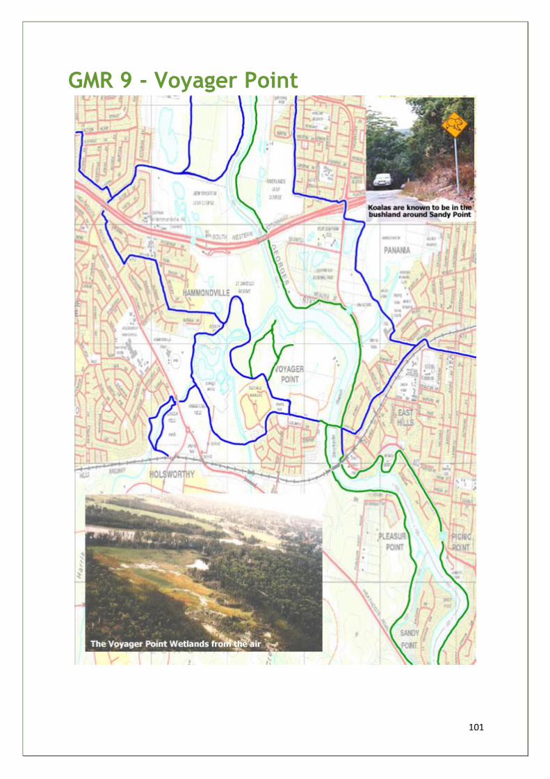
101
GMR 9 - Voyager Point
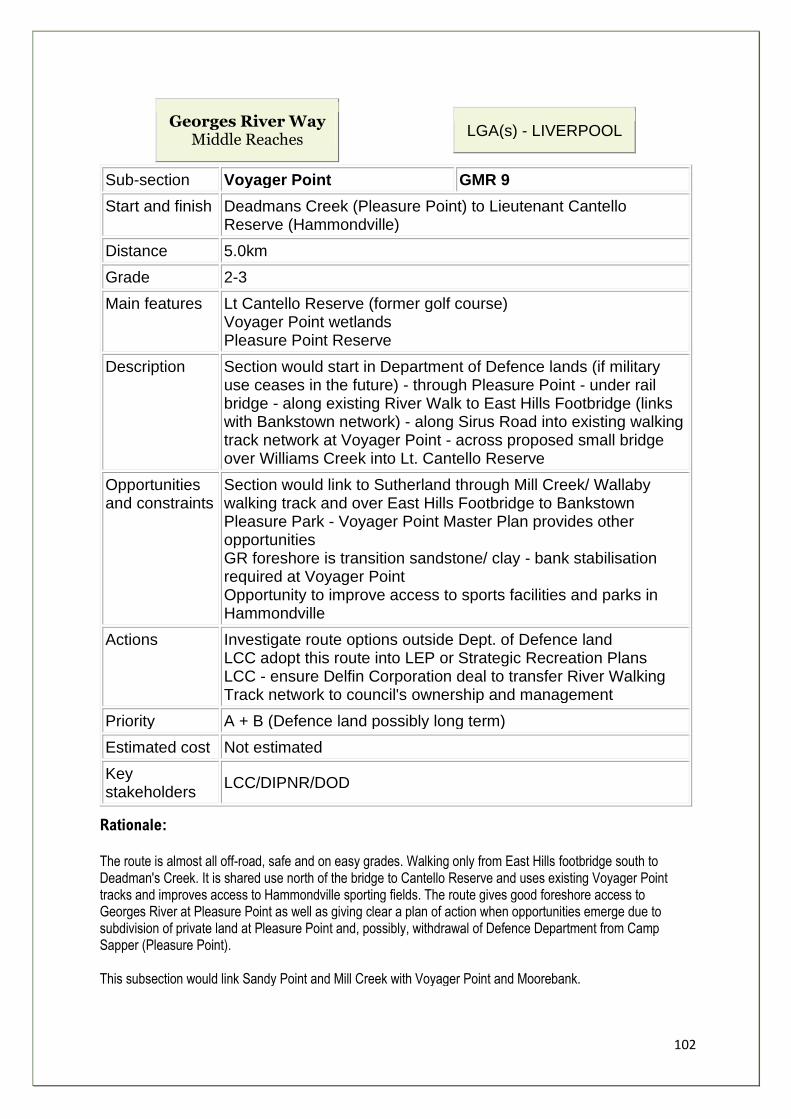
102
Georges River Way Middle Reaches
LGA(s) - LIVERPOOL
Sub-section Voyager Point GMR 9
Start and finish Deadmans Creek (Pleasure Point) to Lieutenant Cantello Reserve (Hammondville)
Distance 5.0km
Grade 2-3
Main features Lt Cantello Reserve (former golf course) Voyager Point wetlands Pleasure Point Reserve
Description Section would start in Department of Defence lands (if military use ceases in the future) - through Pleasure Point - under rail bridge - along existing River Walk to East Hills Footbridge (links with Bankstown network) - along Sirus Road into existing walking track network at Voyager Point - across proposed small bridge over Williams Creek into Lt. Cantello Reserve
Opportunities and constraints
Section would link to Sutherland through Mill Creek/ Wallaby walking track and over East Hills Footbridge to Bankstown Pleasure Park - Voyager Point Master Plan provides other opportunities GR foreshore is transition sandstone/ clay - bank stabilisation required at Voyager Point Opportunity to improve access to sports facilities and parks in Hammondville
Actions Investigate route options outside Dept. of Defence land LCC adopt this route into LEP or Strategic Recreation Plans LCC - ensure Delfin Corporation deal to transfer River Walking Track network to council's ownership and management
Priority A + B (Defence land possibly long term)
Estimated cost Not estimated
Key stakeholders
LCC/DIPNR/DOD
Rationale: The route is almost all off-road, safe and on easy grades. Walking only from East Hills footbridge south to Deadman's Creek. It is shared use north of the bridge to Cantello Reserve and uses existing Voyager Point tracks and improves access to Hammondville sporting fields. The route gives good foreshore access to Georges River at Pleasure Point as well as giving clear a plan of action when opportunities emerge due to subdivision of private land at Pleasure Point and, possibly, withdrawal of Defence Department from Camp Sapper (Pleasure Point). This subsection would link Sandy Point and Mill Creek with Voyager Point and Moorebank.
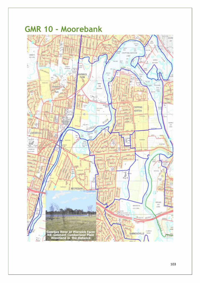
103
GMR 10 - Moorebank
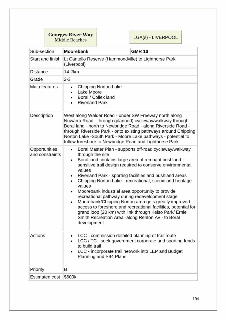
104
Georges River Way Middle Reaches
LGA(s) - LIVERPOOL
Sub-section Moorebank GMR 10
Start and finish Lt Cantello Reserve (Hammondville) to Lighthorse Park (Liverpool)
Distance 14.2km
Grade 2-3
Main features • Chipping Norton Lake • Lake Moore • Boral / Collex land • Riverland Park
Description West along Walder Road - under SW Freeway north along Nuwarra Road - through (planned) cycleway/walkway through Boral land - north to Newbridge Road - along Riverside Road - through Riverside Park - onto existing pathways around Chipping Norton Lake -South Park - Moore Lake pathways - potential to follow foreshore to Newbridge Road and Lighthorse Park.
Opportunities and constraints
• Boral Master Plan - supports off-road cycleway/walkway through the site
• Boral land contains large area of remnant bushland - sensitive trail design required to conserve environmental values
• Riverland Park - sporting facilities and bushland areas • Chipping Norton Lake - recreational, scenic and heritage
values • Moorebank industrial area opportunity to provide
recreational pathway during redevelopment stage • Moorebank/Chipping Norton area gets greatly improved
access to foreshore and recreational facilities, potential for grand loop (20 km) with link through Kelso Park/ Ernie Smith Recreation Area -along Renton Av - to Boral development
Actions • LCC - commission detailed planning of trail route • LCC / TC - seek government corporate and sporting funds
to build trail • LCC - incorporate trail network into LEP and Budget
Planning and S94 Plans
Priority B
Estimated cost $600k
105
Key stakeholders
LCC/Boral /sporting and football clubs/Sport and Rec/TC
Rationale: The route links existing trails around Chipping Norton Lake (south side) and Lake Moore with planned trails through several large foreshore redevelopment sites that are currently being master planned by Liverpool City Council. The route maximises the recreational and environmental opportunities flowing from these redevelopments. It also creates subregional trail network servicing Moorebank and Chipping Norton - mostly off-road, safe, easy grades, which respect environmentally sensitive areas. It provides several kilometres of foreshore access, could become a major sustainable transport network, and gives a clear focus for directing future bush regeneration and environmental restoration projects.

106
Georges Upper Reaches
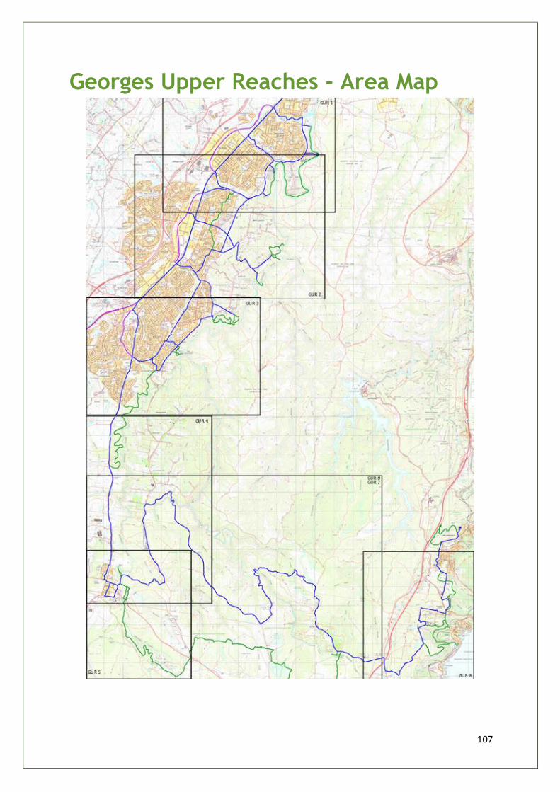
107
Georges Upper Reaches - Area Map

108
GUR 1 - Long Point
Georges River Way Upper Reaches
LGA(s) - CAMPBELLTOWN
Sub-section Long Point GUR 1
Start and finish Glenfield Station to Ingleburn Reserve
Distance 11.5km (walking) 8.5km (cycling)
Grade 2-3
Main features • Simmos Beach Recreation Reserve • Long Point • Ingleburn Reserve
Description From Glenfield Station south along Railway Parade - through Bunbury
Curran Park to Georges River Parkway (GRP) south to Simmos Beach
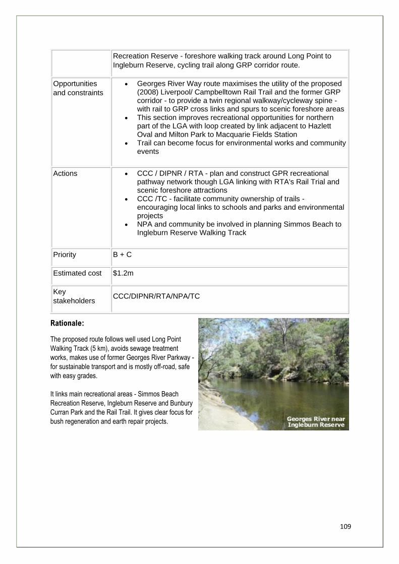
109
Recreation Reserve - foreshore walking track around Long Point to
Ingleburn Reserve, cycling trail along GRP corridor route.
Opportunities
and constraints
• Georges River Way route maximises the utility of the proposed (2008) Liverpool/ Campbelltown Rail Trail and the former GRP corridor - to provide a twin regional walkway/cycleway spine - with rail to GRP cross links and spurs to scenic foreshore areas
• This section improves recreational opportunities for northern part of the LGA with loop created by link adjacent to Hazlett Oval and Milton Park to Macquarie Fields Station
• Trail can become focus for environmental works and community events
Actions • CCC / DIPNR / RTA - plan and construct GPR recreational pathway network though LGA linking with RTA's Rail Trial and scenic foreshore attractions
• CCC /TC - facilitate community ownership of trails - encouraging local links to schools and parks and environmental projects
• NPA and community be involved in planning Simmos Beach to Ingleburn Reserve Walking Track
Priority B + C
Estimated cost $1.2m
Key
stakeholders CCC/DIPNR/RTA/NPA/TC
Rationale:
The proposed route follows well used Long Point
Walking Track (5 km), avoids sewage treatment
works, makes use of former Georges River Parkway -
for sustainable transport and is mostly off-road, safe
with easy grades.
It links main recreational areas - Simmos Beach
Recreation Reserve, Ingleburn Reserve and Bunbury
Curran Park and the Rail Trail. It gives clear focus for
bush regeneration and earth repair projects.
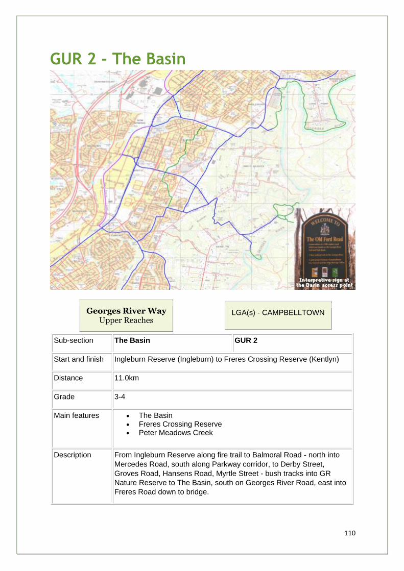
110
GUR 2 - The Basin
Georges River Way Upper Reaches
LGA(s) - CAMPBELLTOWN
Sub-section The Basin GUR 2
Start and finish Ingleburn Reserve (Ingleburn) to Freres Crossing Reserve (Kentlyn)
Distance 11.0km
Grade 3-4
Main features • The Basin • Freres Crossing Reserve • Peter Meadows Creek
Description From Ingleburn Reserve along fire trail to Balmoral Road - north into
Mercedes Road, south along Parkway corridor, to Derby Street,
Groves Road, Hansens Road, Myrtle Street - bush tracks into GR
Nature Reserve to The Basin, south on Georges River Road, east into
Freres Road down to bridge.
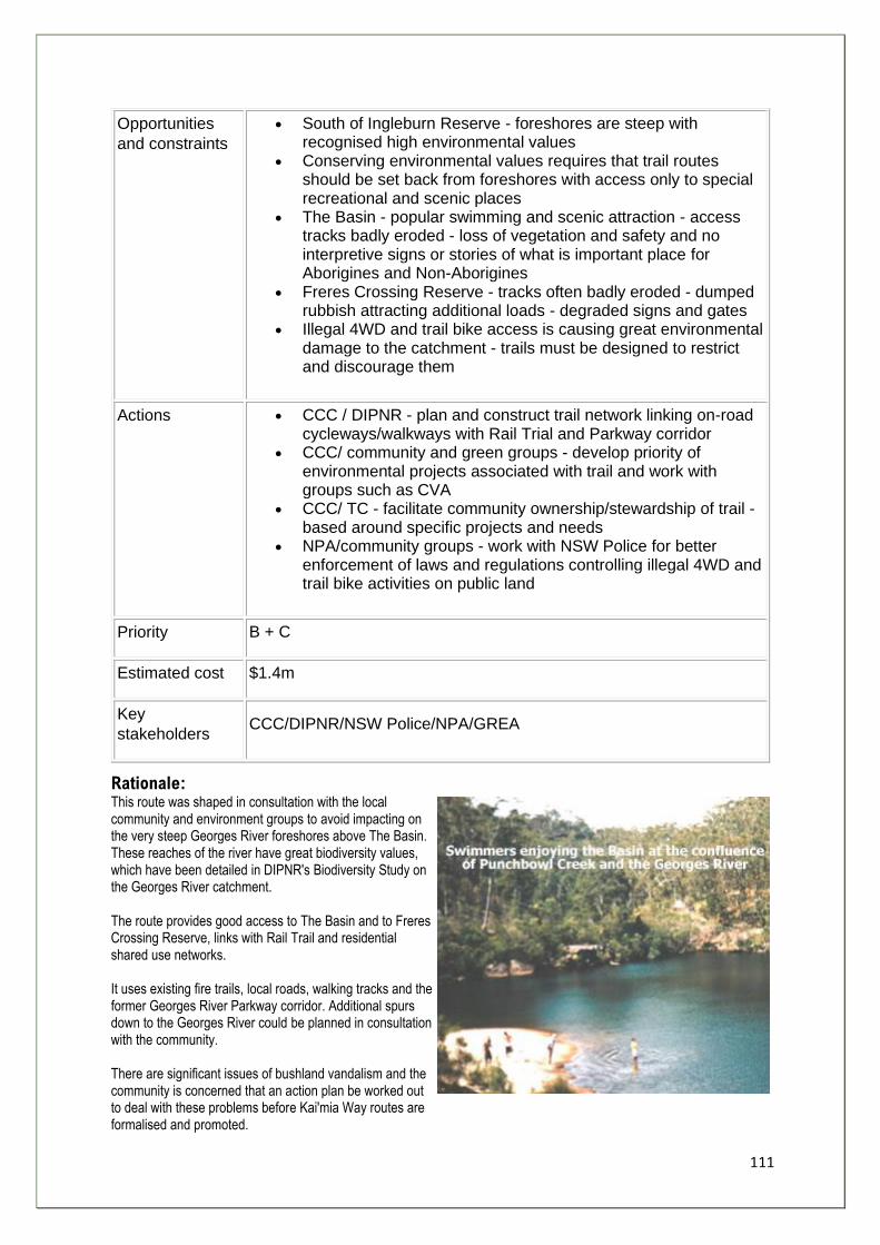
111
Opportunities
and constraints
• South of Ingleburn Reserve - foreshores are steep with recognised high environmental values
• Conserving environmental values requires that trail routes should be set back from foreshores with access only to special recreational and scenic places
• The Basin - popular swimming and scenic attraction - access tracks badly eroded - loss of vegetation and safety and no interpretive signs or stories of what is important place for Aborigines and Non-Aborigines
• Freres Crossing Reserve - tracks often badly eroded - dumped rubbish attracting additional loads - degraded signs and gates
• Illegal 4WD and trail bike access is causing great environmental damage to the catchment - trails must be designed to restrict and discourage them
Actions • CCC / DIPNR - plan and construct trail network linking on-road cycleways/walkways with Rail Trial and Parkway corridor
• CCC/ community and green groups - develop priority of environmental projects associated with trail and work with groups such as CVA
• CCC/ TC - facilitate community ownership/stewardship of trail - based around specific projects and needs
• NPA/community groups - work with NSW Police for better enforcement of laws and regulations controlling illegal 4WD and trail bike activities on public land
Priority B + C
Estimated cost $1.4m
Key
stakeholders CCC/DIPNR/NSW Police/NPA/GREA
Rationale: This route was shaped in consultation with the local community and environment groups to avoid impacting on the very steep Georges River foreshores above The Basin. These reaches of the river have great biodiversity values, which have been detailed in DIPNR's Biodiversity Study on the Georges River catchment. The route provides good access to The Basin and to Freres Crossing Reserve, links with Rail Trail and residential shared use networks. It uses existing fire trails, local roads, walking tracks and the former Georges River Parkway corridor. Additional spurs down to the Georges River could be planned in consultation with the community. There are significant issues of bushland vandalism and the community is concerned that an action plan be worked out to deal with these problems before Kai'mia Way routes are formalised and promoted.
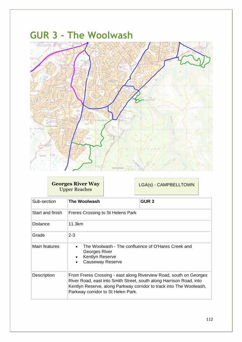
112
GUR 3 - The Woolwash
Georges River Way Upper Reaches
LGA(s) - CAMPBELLTOWN
Sub-section The Woolwash GUR 3
Start and finish Freres Crossing to St Helens Park
Distance 11.3km
Grade 2-3
Main features • The Woolwash - The confluence of O'Hares Creek and Georges River
• Kentlyn Reserve • Causeway Reserve
Description From Freres Crossing - east along Riverview Road, south on Georges
River Road, east into Smith Street, south along Harrison Road, into
Kentlyn Reserve, along Parkway corridor to track into The Woolwash,
Parkway corridor to St Helen Park.
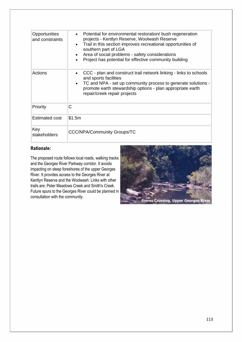
113
Opportunities
and constraints
• Potential for environmental restoration/ bush regeneration projects - Kentlyn Reserve, Woolwash Reserve
• Trail in this section improves recreational opportunities of southern part of LGA
• Area of social problems - safety considerations • Project has potential for effective community building
Actions • CCC - plan and construct trail network linking - links to schools and sports facilities
• TC and NPA - set up community process to generate solutions - promote earth stewardship options - plan appropriate earth repair/creek repair projects
Priority C
Estimated cost $1.5m
Key
stakeholders CCC/NPA/Community Groups/TC
Rationale:
The proposed route follows local roads, walking tracks
and the Georges River Parkway corridor. It avoids
impacting on steep foreshores of the upper Georges
River. It provides access to the Georges River at
Kentlyn Reserve and the Woolwash. Links with other
trails are: Peter Meadows Creek and Smith's Creek.
Future spurs to the Georges River could be planned in
consultation with the community.
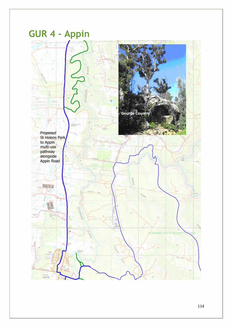
114
GUR 4 - Appin
115
Georges River Way Upper Reaches
LGA(s) - WOLLONDILLY &
CAMPBELLTOWN
Sub-section Appin GUR 4
Start and finish St Helens Park to Appin
Distance 12.0km
Grade 2-3
Main features • Rural and bushland area • Hume and Hovell Monument
Description Off-road recreational pathway required linking southern Campbelltown
with Appin.
Opportunities
and constraints
• This section would affect one of the last green corridors which should not be compromised - threatened species Shale Sandstone Transition Forest is known Koala habitat
• Section links Campbelltown LGA to Appin and provides safe cycling/walking pathway to regional destinations - Appin, Dharawal SRA and the Illawarra
• State government has made commitments to 'upgrade' this walkway/cycleway - but recent road work have failed to deliver safe off-road system
Actions • Future urban development will reduce options for building tracks and trails, but generate additional demand for such a recreational facility
• Proposal is in accord with findings of Wollondilly Shire Council's Visions Project
• CCC / WSC / RTA - plan and build walkway/cycleway linking Campbelltown and Appin - along Appin Road and existing fire trails between Appin Road and Georges River
Priority B
Estimated cost $800k
Key
stakeholders CCC/WSC/RTA/DIPNR/BUG and community groups
Rationale:
This shared use route follows along the west side of Appin Road, linking Campbelltown and Appin. As future
urban development extends from Campbelltown southwards to Appin, the Way could be developed as an
alternative transport and recreation route servicing newly developed residential areas. It could be funded from

116
Section 94 Developer Contributions and would increase recreational opportunities for the growing regional
population. There are, however, significant environmental issues as a section of the route would affect one of
the last green corridors connecting the Georges River and Hawkesbury-Napean Rivers catchments. Much work
needs to be done to ensure that ecological issues are appropriately considered and stakeholders consulted
before this route is progressed. Recommendation 1 is especially pertinent to this section of the Way.
Existing fire trails along the Georges River could also be a part of this network - providing an interesting
bushland loop route - when activities which currently vandalise bushland, are resolved.
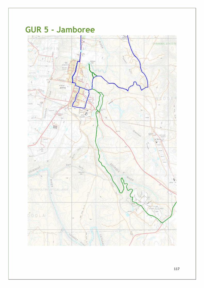
117
GUR 5 - Jamboree
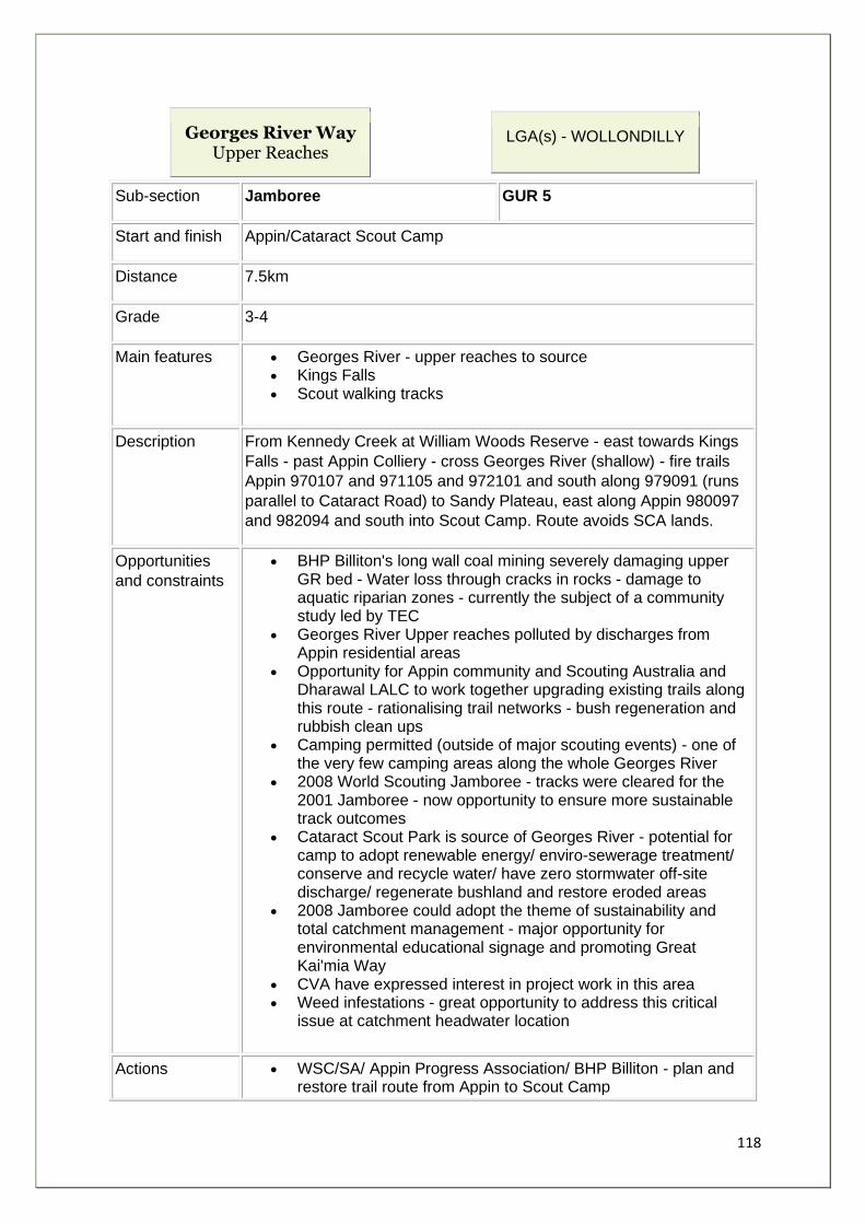
118
Georges River Way Upper Reaches
LGA(s) - WOLLONDILLY
Sub-section Jamboree GUR 5
Start and finish Appin/Cataract Scout Camp
Distance 7.5km
Grade 3-4
Main features • Georges River - upper reaches to source • Kings Falls • Scout walking tracks
Description From Kennedy Creek at William Woods Reserve - east towards Kings
Falls - past Appin Colliery - cross Georges River (shallow) - fire trails
Appin 970107 and 971105 and 972101 and south along 979091 (runs
parallel to Cataract Road) to Sandy Plateau, east along Appin 980097
and 982094 and south into Scout Camp. Route avoids SCA lands.
Opportunities
and constraints
• BHP Billiton's long wall coal mining severely damaging upper GR bed - Water loss through cracks in rocks - damage to aquatic riparian zones - currently the subject of a community study led by TEC
• Georges River Upper reaches polluted by discharges from Appin residential areas
• Opportunity for Appin community and Scouting Australia and Dharawal LALC to work together upgrading existing trails along this route - rationalising trail networks - bush regeneration and rubbish clean ups
• Camping permitted (outside of major scouting events) - one of the very few camping areas along the whole Georges River
• 2008 World Scouting Jamboree - tracks were cleared for the 2001 Jamboree - now opportunity to ensure more sustainable track outcomes
• Cataract Scout Park is source of Georges River - potential for camp to adopt renewable energy/ enviro-sewerage treatment/ conserve and recycle water/ have zero stormwater off-site discharge/ regenerate bushland and restore eroded areas
• 2008 Jamboree could adopt the theme of sustainability and total catchment management - major opportunity for environmental educational signage and promoting Great Kai'mia Way
• CVA have expressed interest in project work in this area • Weed infestations - great opportunity to address this critical
issue at catchment headwater location
Actions • WSC/SA/ Appin Progress Association/ BHP Billiton - plan and restore trail route from Appin to Scout Camp
119
• WSC/TC coordinate Landcare/ CVA/ SA /APA - trail repair and bush regeneration
• WSC/SA/ TC - develop and implement sustainability action plan for a Green 2008 Jamboree - seek corporate sponsorship.
• TEC study to provide direction for care of Longwall mining sites.
Priority B
Estimated cost $45k
Key
stakeholders WSC/SA/CVA/BHP Billiton/APA/TEC
Rationale:
The route follows existing fire and utility trails and
scout hiking tracks from Appin to Cataract Scout
Camp. It keeps away from Sydney Catchment
Authority lands ($11,500 trespass fines). Starting near
Appin township, the trail picks up on existing Appin
River Walk and follows the upper section of Georges
River with views down steep gorges to rocky pools.
The entire subsection is safe and off-road with varied
terrain and medium to hard grades.
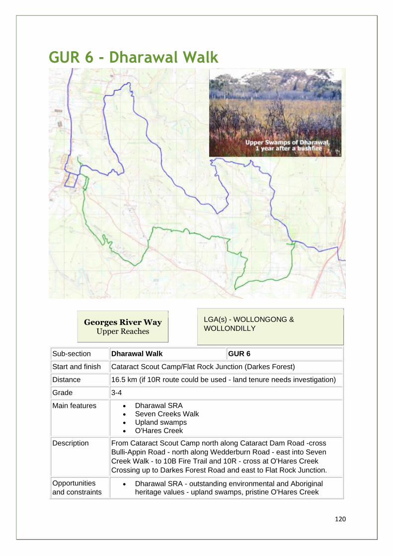
120
GUR 6 - Dharawal Walk
Georges River Way Upper Reaches
LGA(s) - WOLLONGONG &
WOLLONDILLY
Sub-section Dharawal Walk GUR 6
Start and finish Cataract Scout Camp/Flat Rock Junction (Darkes Forest)
Distance 16.5 km (if 10R route could be used - land tenure needs investigation)
Grade 3-4
Main features • Dharawal SRA • Seven Creeks Walk • Upland swamps • O'Hares Creek
Description From Cataract Scout Camp north along Cataract Dam Road -cross
Bulli-Appin Road - north along Wedderburn Road - east into Seven
Creek Walk - to 10B Fire Trail and 10R - cross at O'Hares Creek
Crossing up to Darkes Forest Road and east to Flat Rock Junction.
Opportunities
and constraints • Dharawal SRA - outstanding environmental and Aboriginal
heritage values - upland swamps, pristine O'Hares Creek
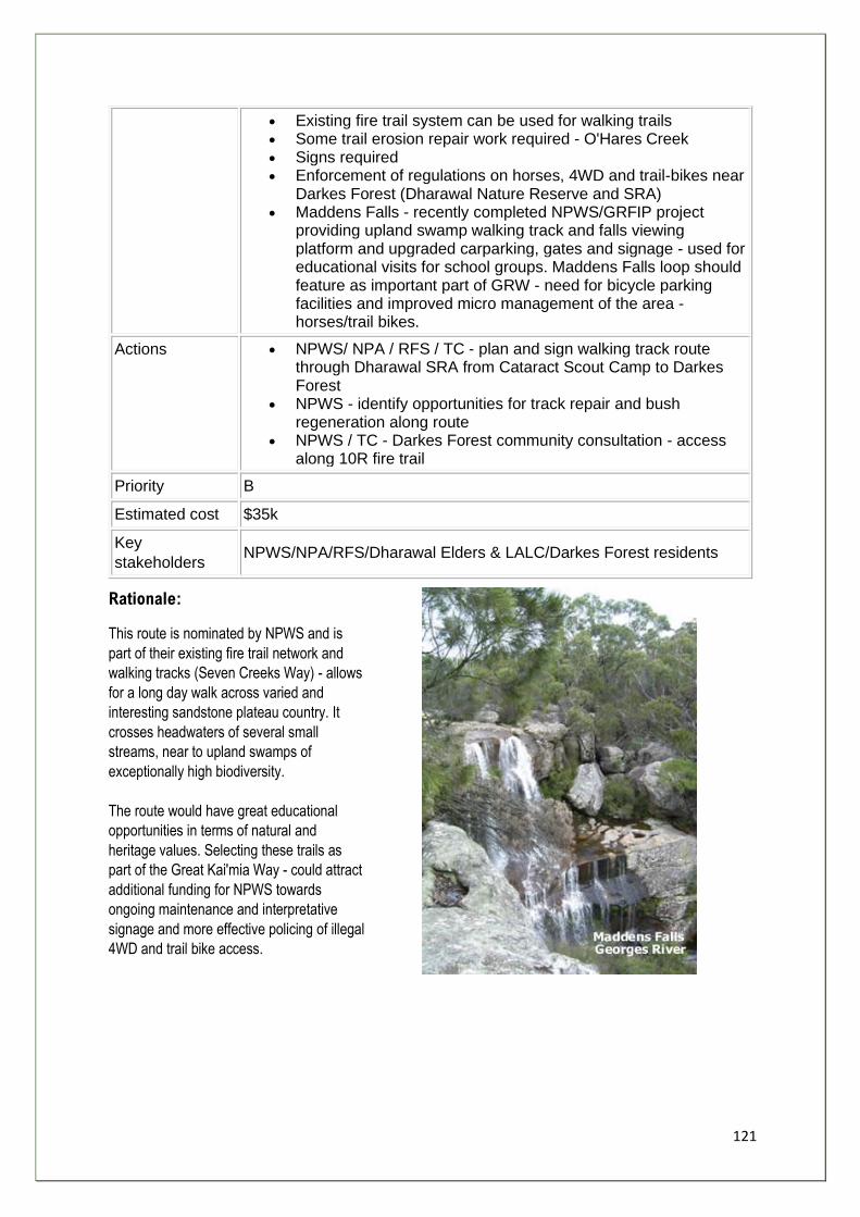
121
• Existing fire trail system can be used for walking trails • Some trail erosion repair work required - O'Hares Creek • Signs required • Enforcement of regulations on horses, 4WD and trail-bikes near
Darkes Forest (Dharawal Nature Reserve and SRA) • Maddens Falls - recently completed NPWS/GRFIP project
providing upland swamp walking track and falls viewing platform and upgraded carparking, gates and signage - used for educational visits for school groups. Maddens Falls loop should feature as important part of GRW - need for bicycle parking facilities and improved micro management of the area - horses/trail bikes.
Actions • NPWS/ NPA / RFS / TC - plan and sign walking track route through Dharawal SRA from Cataract Scout Camp to Darkes Forest
• NPWS - identify opportunities for track repair and bush regeneration along route
• NPWS / TC - Darkes Forest community consultation - access along 10R fire trail
Priority B
Estimated cost $35k
Key
stakeholders NPWS/NPA/RFS/Dharawal Elders & LALC/Darkes Forest residents
Rationale:
This route is nominated by NPWS and is
part of their existing fire trail network and
walking tracks (Seven Creeks Way) - allows
for a long day walk across varied and
interesting sandstone plateau country. It
crosses headwaters of several small
streams, near to upland swamps of
exceptionally high biodiversity.
The route would have great educational
opportunities in terms of natural and
heritage values. Selecting these trails as
part of the Great Kai'mia Way - could attract
additional funding for NPWS towards
ongoing maintenance and interpretative
signage and more effective policing of illegal
4WD and trail bike access.
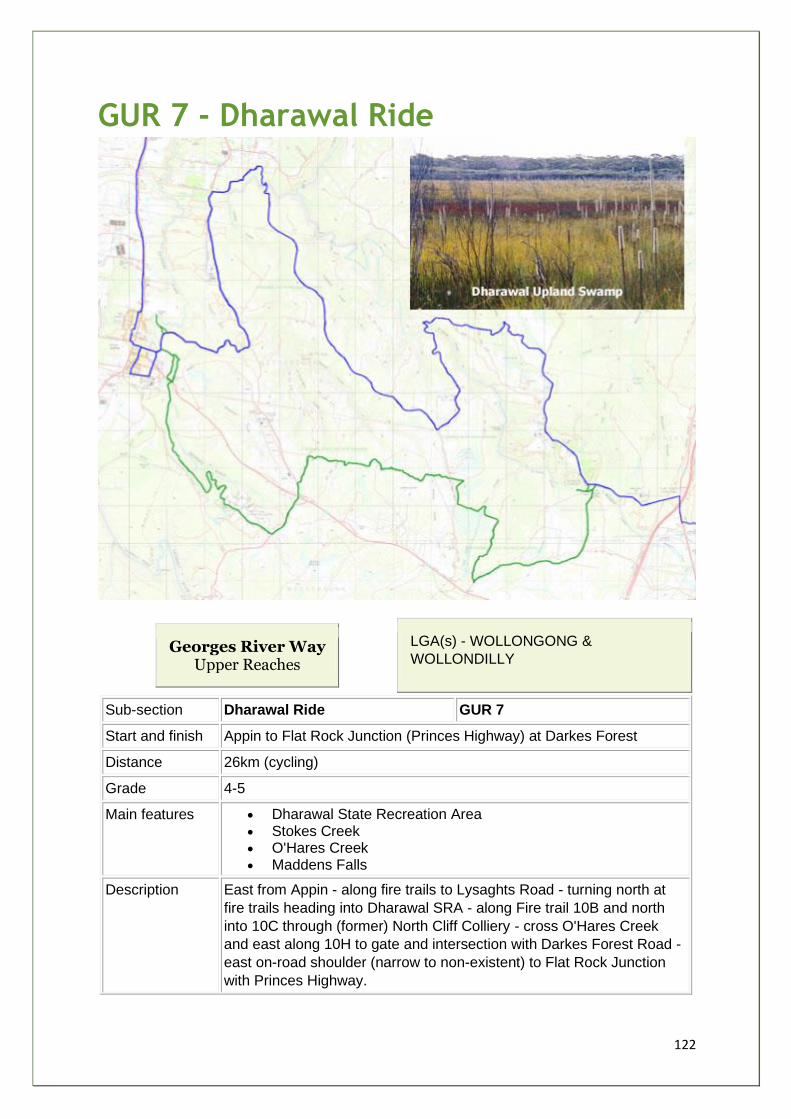
122
GUR 7 - Dharawal Ride
Georges River Way Upper Reaches
LGA(s) - WOLLONGONG &
WOLLONDILLY
Sub-section Dharawal Ride GUR 7
Start and finish Appin to Flat Rock Junction (Princes Highway) at Darkes Forest
Distance 26km (cycling)
Grade 4-5
Main features • Dharawal State Recreation Area • Stokes Creek • O'Hares Creek • Maddens Falls
Description East from Appin - along fire trails to Lysaghts Road - turning north at
fire trails heading into Dharawal SRA - along Fire trail 10B and north
into 10C through (former) North Cliff Colliery - cross O'Hares Creek
and east along 10H to gate and intersection with Darkes Forest Road -
east on-road shoulder (narrow to non-existent) to Flat Rock Junction
with Princes Highway.
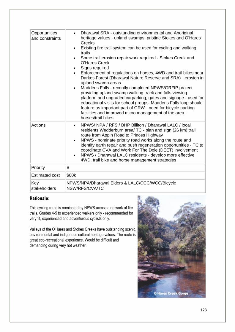
123
Opportunities
and constraints
• Dharawal SRA - outstanding environmental and Aboriginal heritage values - upland swamps, pristine Stokes and O'Hares Creeks
• Existing fire trail system can be used for cycling and walking trails
• Some trail erosion repair work required - Stokes Creek and O'Hares Creek
• Signs required • Enforcement of regulations on horses, 4WD and trail-bikes near
Darkes Forest (Dharawal Nature Reserve and SRA) - erosion in upland swamp areas
• Maddens Falls - recently completed NPWS/GRFIP project providing upland swamp walking track and falls viewing platform and upgraded carparking, gates and signage - used for educational visits for school groups. Maddens Falls loop should feature as important part of GRW - need for bicycle parking facilities and improved micro management of the area - horses/trail bikes.
Actions • NPWS/ NPA / RFS / BHP Billiton / Dharawal LALC / local residents Wedderburn area/ TC - plan and sign (26 km) trail route from Appin Road to Princes Highway
• NPWS - nominate priority road works along the route and identify earth repair and bush regeneration opportunities - TC to coordinate CVA and Work For The Dole (DEET) involvement
• NPWS / Dharawal LALC residents - develop more effective 4WD, trail bike and horse management strategies
Priority B
Estimated cost $60k
Key
stakeholders
NPWS/NPA/Dharawal Elders & LALC/CCC/WCC/Bicycle
NSW/RFS/CVA/TC
Rationale:
This cycling route is nominated by NPWS across a network of fire
trails. Grades 4-5 to experienced walkers only - recommended for
very fit, experienced and adventurous cyclists only.
Valleys of the O'Hares and Stokes Creeks have outstanding scenic,
environmental and indigenous cultural heritage values. The route is
great eco-recreational experience. Would be difficult and
demanding during very hot weather.
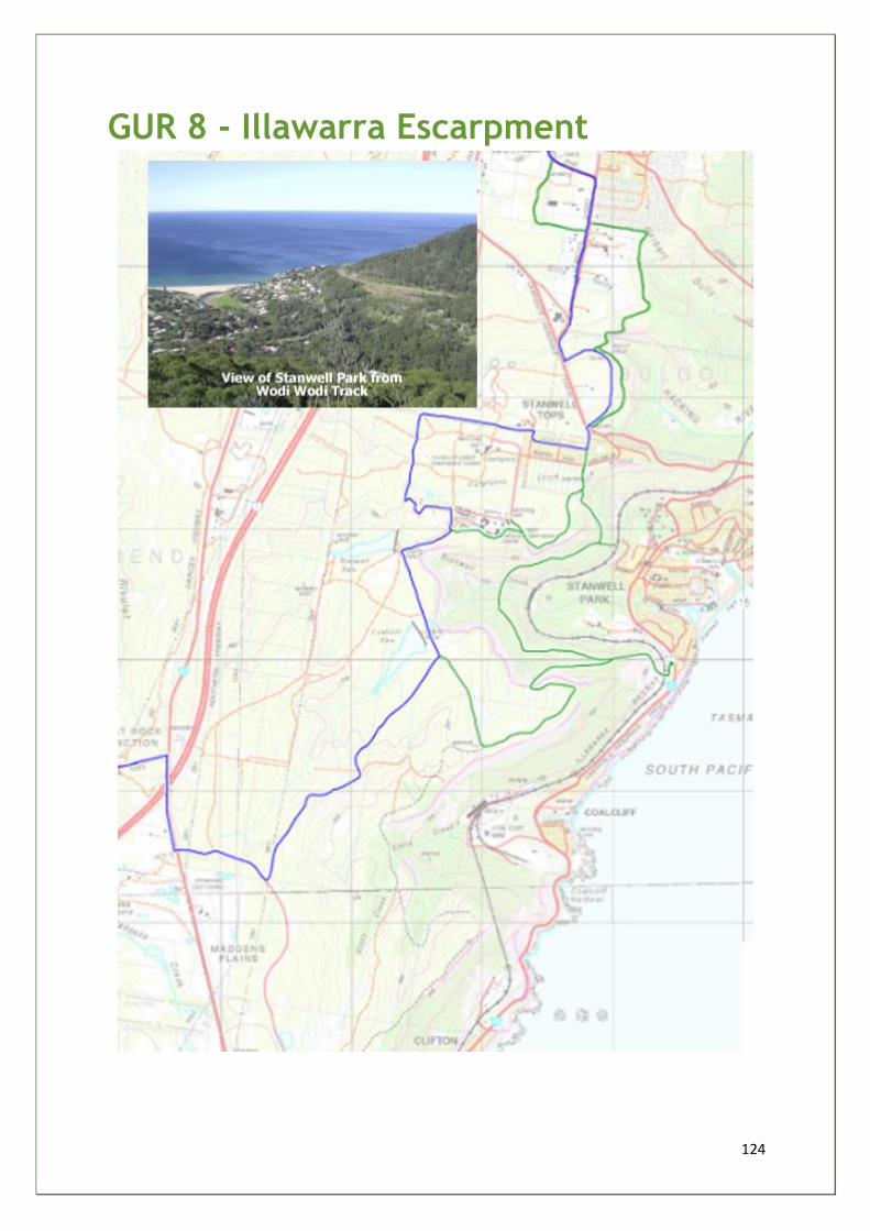
124
GUR 8 - Illawarra Escarpment
125
Georges River Way Upper Reaches
LGA(s) - WOLLONGONG
Sub-section Illawarra Escarpment GUR 8
Start and finish Flat Rock Junction (Darkes Forest Road/ Princes Highway) to Kellys
Falls (Stanwell Tops)
Distance 8.0km
Grade 3-4
Main features • Illawarra Escarpment and Kellys Falls and Princess Marina Walk
• Stanwell Creek/Hargraves Creek/Wodi-wodi Track and Forest Walk Track
• Hindu Temple (Stanwell Tops)
Description From the Darkes Forest Road intersection - south along the shoulder of
the Princes Highway over the Southern Freeway - 80 m turn left into
Illawarra Coke Company unsealed road - 80 m - turn north 800m to
Coalcliff Dam and intersection with track leading south for 1.0km to
intersection with Forest Walk Track (walking only from here 2. km to
intersection with Wodi-wodi Track which drops off Escarpment into
Stanwell Park). From Coalcliff Dam - 1km north to (now empty)
Stanwell Dam - great Stanwell Creek waterfall views over South Coast.
3.0km north along tracks and Annesley Ave to Kellys Falls.
Opportunities
and constraints
• Route from Flat Rock Junction to Stanwell Tops is a more interesting and safer walking/cycling route than along Princes Highway to Waterfall
• Creating a walking/cycling track network through this area would strengthen community support for proposed Illawarra Escarpment National Park - the most effective way of ensuring a sustainable future for this region
• The Illawarra Escarpment is one of world's three most mega-biodiverse areas with exceptional environmental and scenic values
• Potential for walking and cycling track through land owned by Illawarra Coke Company - heathland/hanging swamps/forest - future of coking plant in Coalcliff? - possible corporate sponsorship? Mining heritage landscape - dams/ servicing roads/ mostly good quality bushland
• Link through coal company land - would allow for making the Wodi-wodi Track into loop system - providing outstanding walking experience, Stanwell Loop (9-10 km) and Maddens Plains Loop (18 km)
• Possible cycling link from Helensburgh to Otford (along Rail Trails) could go through the (abandoned) Otford/Stanwell Park Rail Tunnel (the Mushroom Tunnel) - avoiding dangerous Hargrave Drive via Bald Hill
• Cycle Trail could become world's most outstanding - linking Sydney and Wollongong and Kiama (already existing from Wombarra to Kiama) - with green jobs potential
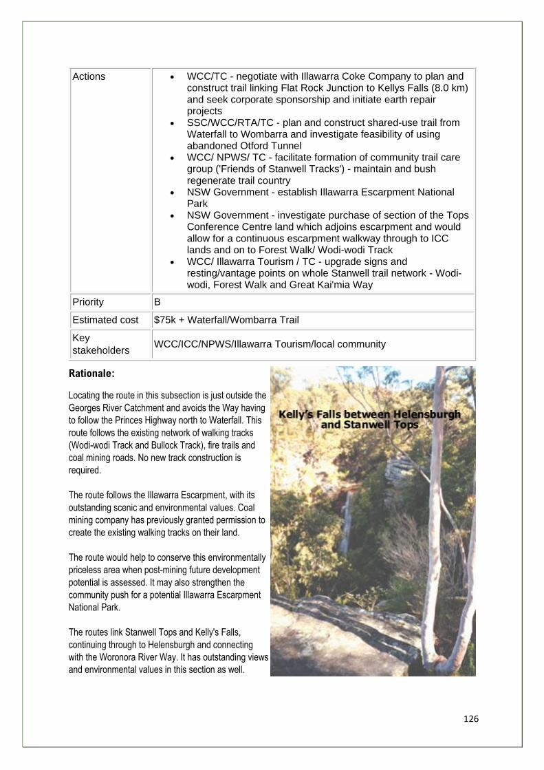
126
Actions • WCC/TC - negotiate with Illawarra Coke Company to plan and construct trail linking Flat Rock Junction to Kellys Falls (8.0 km) and seek corporate sponsorship and initiate earth repair projects
• SSC/WCC/RTA/TC - plan and construct shared-use trail from Waterfall to Wombarra and investigate feasibility of using abandoned Otford Tunnel
• WCC/ NPWS/ TC - facilitate formation of community trail care group ('Friends of Stanwell Tracks') - maintain and bush regenerate trail country
• NSW Government - establish Illawarra Escarpment National Park
• NSW Government - investigate purchase of section of the Tops Conference Centre land which adjoins escarpment and would allow for a continuous escarpment walkway through to ICC lands and on to Forest Walk/ Wodi-wodi Track
• WCC/ Illawarra Tourism / TC - upgrade signs and resting/vantage points on whole Stanwell trail network - Wodi-wodi, Forest Walk and Great Kai'mia Way
Priority B
Estimated cost $75k + Waterfall/Wombarra Trail
Key
stakeholders WCC/ICC/NPWS/Illawarra Tourism/local community
Rationale:
Locating the route in this subsection is just outside the
Georges River Catchment and avoids the Way having
to follow the Princes Highway north to Waterfall. This
route follows the existing network of walking tracks
(Wodi-wodi Track and Bullock Track), fire trails and
coal mining roads. No new track construction is
required.
The route follows the Illawarra Escarpment, with its
outstanding scenic and environmental values. Coal
mining company has previously granted permission to
create the existing walking tracks on their land.
The route would help to conserve this environmentally
priceless area when post-mining future development
potential is assessed. It may also strengthen the
community push for a potential Illawarra Escarpment
National Park.
The routes link Stanwell Tops and Kelly's Falls,
continuing through to Helensburgh and connecting
with the Woronora River Way. It has outstanding views
and environmental values in this section as well.

127
Chapter 4
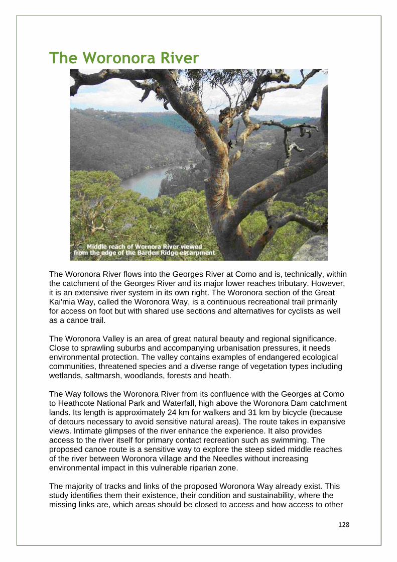
128
The Woronora River
The Woronora River flows into the Georges River at Como and is, technically, within the catchment of the Georges River and its major lower reaches tributary. However, it is an extensive river system in its own right. The Woronora section of the Great Kai'mia Way, called the Woronora Way, is a continuous recreational trail primarily for access on foot but with shared use sections and alternatives for cyclists as well as a canoe trail. The Woronora Valley is an area of great natural beauty and regional significance. Close to sprawling suburbs and accompanying urbanisation pressures, it needs environmental protection. The valley contains examples of endangered ecological communities, threatened species and a diverse range of vegetation types including wetlands, saltmarsh, woodlands, forests and heath. The Way follows the Woronora River from its confluence with the Georges at Como to Heathcote National Park and Waterfall, high above the Woronora Dam catchment lands. Its length is approximately 24 km for walkers and 31 km by bicycle (because of detours necessary to avoid sensitive natural areas). The route takes in expansive views. Intimate glimpses of the river enhance the experience. It also provides access to the river itself for primary contact recreation such as swimming. The proposed canoe route is a sensitive way to explore the steep sided middle reaches of the river between Woronora village and the Needles without increasing environmental impact in this vulnerable riparian zone. The majority of tracks and links of the proposed Woronora Way already exist. This study identifies them their existence, their condition and sustainability, where the missing links are, which areas should be closed to access and how access to other
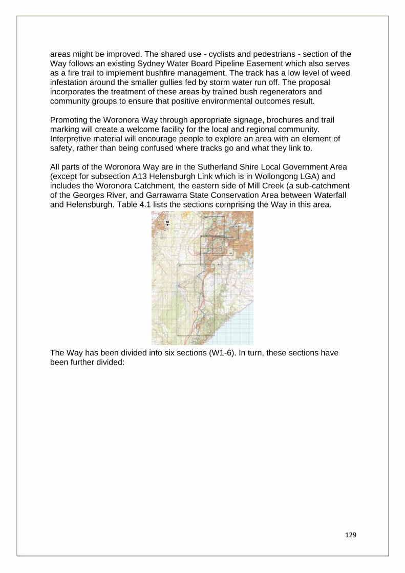
129
areas might be improved. The shared use - cyclists and pedestrians - section of the Way follows an existing Sydney Water Board Pipeline Easement which also serves as a fire trail to implement bushfire management. The track has a low level of weed infestation around the smaller gullies fed by storm water run off. The proposal incorporates the treatment of these areas by trained bush regenerators and community groups to ensure that positive environmental outcomes result. Promoting the Woronora Way through appropriate signage, brochures and trail marking will create a welcome facility for the local and regional community. Interpretive material will encourage people to explore an area with an element of safety, rather than being confused where tracks go and what they link to. All parts of the Woronora Way are in the Sutherland Shire Local Government Area (except for subsection A13 Helensburgh Link which is in Wollongong LGA) and includes the Woronora Catchment, the eastern side of Mill Creek (a sub-catchment of the Georges River, and Garrawarra State Conservation Area between Waterfall and Helensburgh. Table 4.1 lists the sections comprising the Way in this area.
The Way has been divided into six sections (W1-6). In turn, these sections have been further divided:
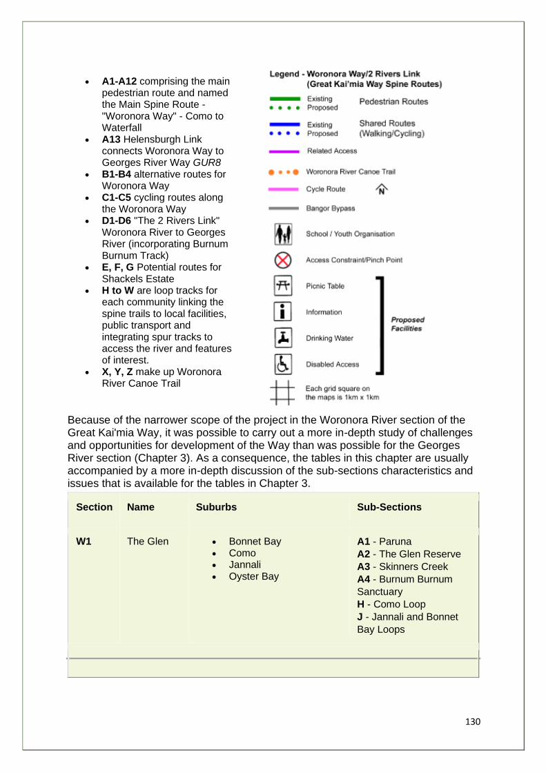
130
• A1-A12 comprising the main pedestrian route and named the Main Spine Route - "Woronora Way" - Como to Waterfall
• A13 Helensburgh Link connects Woronora Way to Georges River Way GUR8
• B1-B4 alternative routes for Woronora Way
• C1-C5 cycling routes along the Woronora Way
• D1-D6 "The 2 Rivers Link" Woronora River to Georges River (incorporating Burnum Burnum Track)
• E, F, G Potential routes for Shackels Estate
• H to W are loop tracks for each community linking the spine trails to local facilities, public transport and integrating spur tracks to access the river and features of interest.
• X, Y, Z make up Woronora River Canoe Trail
Because of the narrower scope of the project in the Woronora River section of the Great Kai'mia Way, it was possible to carry out a more in-depth study of challenges and opportunities for development of the Way than was possible for the Georges River section (Chapter 3). As a consequence, the tables in this chapter are usually accompanied by a more in-depth discussion of the sub-sections characteristics and issues that is available for the tables in Chapter 3.
Section Name Suburbs Sub-Sections
W1 The Glen • Bonnet Bay • Como • Jannali • Oyster Bay
A1 - Paruna
A2 - The Glen Reserve
A3 - Skinners Creek
A4 - Burnum Burnum
Sanctuary
H - Como Loop
J - Jannali and Bonnet
Bay Loops
131
W2 Wooloonara • Loftus • Sutherland • Woronora • Woronora Heights
A5 - Woronora Village
A6 - Forbes Creek
E1 - Connector
F3 - Connector
K - Sutherland and
Woronora Loops
L - Loftus Loops
M - Woronora Heights
Loops
W3 Sabugal • Engadine • North Engadine • Yarrawarra
A7 - Sabugal
A8 - Scouters View
E2-4 - Connector
N - Yarrawarra Loops
P - Engadine Loops
W4 Freshwater • Heathcote • Heathcote National Park • Waterfall • Garrawarra State
Conservation Area • Helensburgh
A9 - Tamaroo A10 - Lake Eckersley A11 - Bullawaring Track North A12 - Bullawaring Track South A13 - Helensburgh Link B2 - Mirang Road B3 - Yarrawarra Ridge C3 - Girronba C4 - Woronora Dam Road C5 - Princes Q - Heathcote Loops
W5 Shackles • Bangor (south) Barden Ridge
• Lucas Heights • Menai (south)
D1 - Sabugal Pass D2 - Barden Ridge D3 - Burnum Burnum Track (South) R - Barden Ridge Loops G - Shackles Estate

132
W6 Still Creek • Bangor (north) • Menai (north) • Illawong • Alfords Point
D4 - Burnum Burnum
Track (Central)
D5 - Burnum Burnum
Track (North)
D6 - Georges River NP
Link
F1-2 - Connector
S - West Menai Native
Trail Loops
T - Bangor Loops
U - Menai Loops
V - Illawong
W - Alfords Point
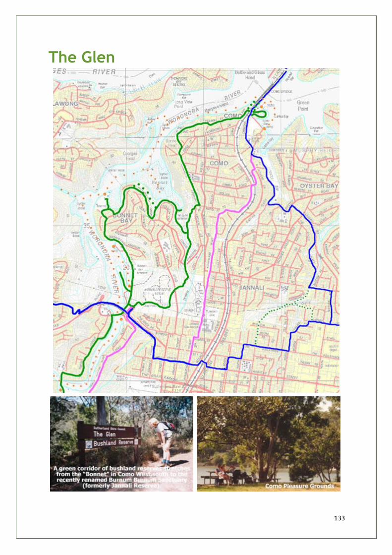
133
The Glen
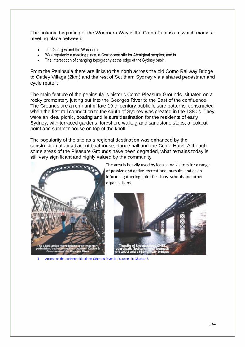
134
The notional beginning of the Woronora Way is the Como Peninsula, which marks a meeting place between:
• The Georges and the Woronora; • Was reputedly a meeting place, a Corroboree site for Aboriginal peoples; and is • The intersection of changing topography at the edge of the Sydney basin.
From the Peninsula there are links to the north across the old Como Railway Bridge to Oatley Village (2km) and the rest of Southern Sydney via a shared pedestrian and
cycle route . The main feature of the peninsula is historic Como Pleasure Grounds, situated on a rocky promontory jutting out into the Georges River to the East of the confluence. The Grounds are a remnant of late 19 th century public leisure patterns, constructed when the first rail connection to the south of Sydney was created in the 1880's. They were an ideal picnic, boating and leisure destination for the residents of early Sydney, with terraced gardens, foreshore walk, grand sandstone steps, a lookout point and summer house on top of the knoll. The popularity of the site as a regional destination was enhanced by the construction of an adjacent boathouse, dance hall and the Como Hotel. Although some areas of the Pleasure Grounds have been degraded, what remains today is still very significant and highly valued by the community.
The area is heavily used by locals and visitors for a range
of passive and active recreational pursuits and as an
informal gathering point for clubs, schools and other
organisations.
1. Access on the northern side of the Georges River is discussed in Chapter 3.
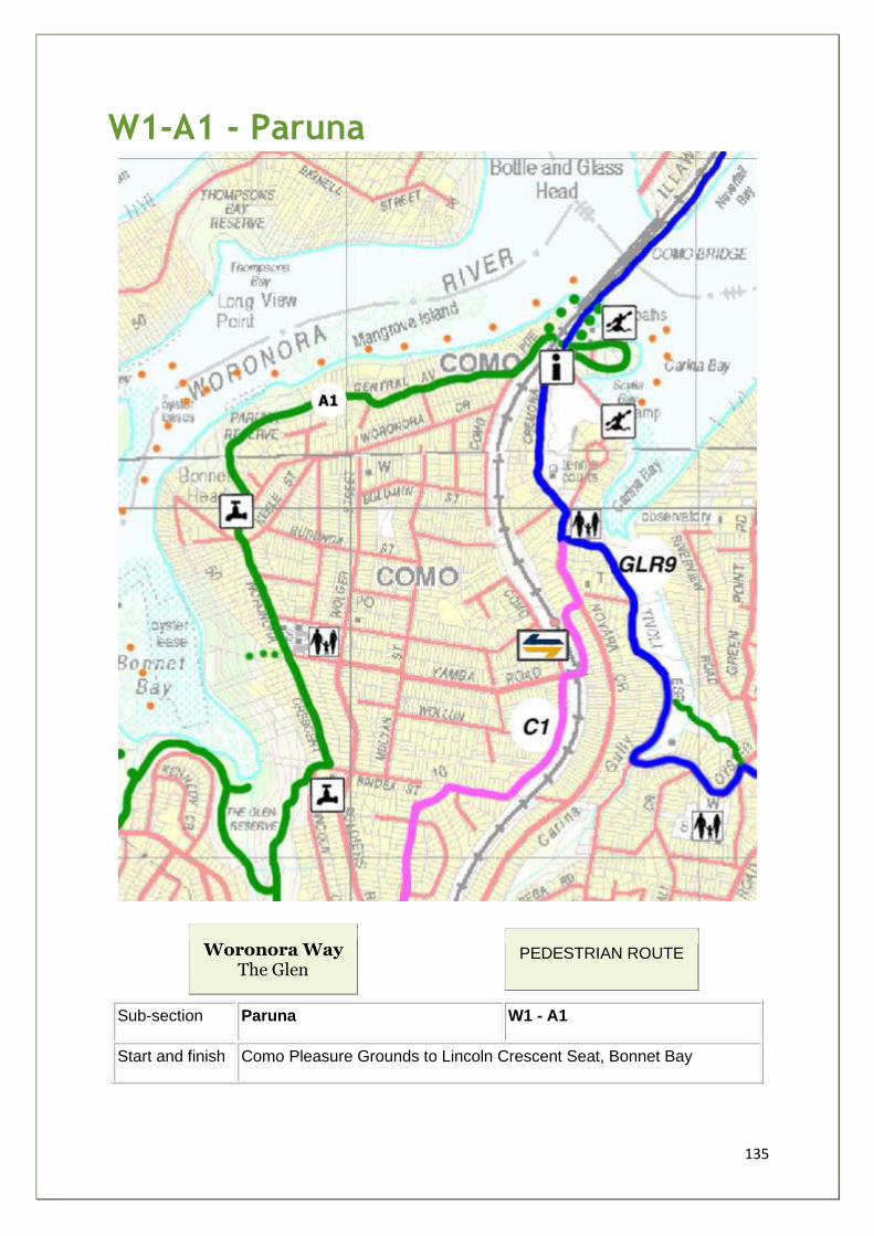
135
W1-A1 - Paruna
Woronora Way The Glen
PEDESTRIAN ROUTE
Sub-section Paruna W1 - A1
Start and finish Como Pleasure Grounds to Lincoln Crescent Seat, Bonnet Bay
136
Distance 2km
Grade 2-3 Time 1hr
Main features • Confluence of Rivers • Historic Railway Bridge • Como Pleasure Grounds • Mangrove Island • Paruna Bushland Reserve
Description 90% along quiet streets, 10% on bush tracks along plateau with
intermittent views of Woronora and Georges Rivers, Mangroves and
River Flat Forest. Paruna Reserve - evidence of Aboriginal occupation
and linked to Henry Lawson. 50% on streets with grass verge and no
pavement.
Facilities • Pleasure Grounds • Cafes • 2 x Playgrounds • Paruna Reserve • Como Hotel • Toilets
Opportunities
and constraints
• Part of SSC CHET which is a GRFIP project • SSC Master Plan for CPG and CHET completed • Community fully consulted and favourable • 2 long flights of steps to negotiate • Track drainage works required to track in Paruna Reserve • Interpret Aboriginal/Henry Lawson connections • Potential community arts project to improve railway pedestrian
tunnel and approaches
Actions
Required
• Adoption of CPG and CHET Masterplan - SSC • Plan of management - SSC • Phased Construction - SSC • Include GKW Shelter/Route Signage in CPG Plans • Add GKW logo to CHET waymarkers - SSC/SSEC-GREA
Priority A
Estimated cost $372k - whole CHET
Stakeholders
Community
Paruna Reserve Bushcare Group, Como Amateur Swimming Club,
Como West School, Birralee Kindergarten, Birralee Church, Como
Marina, Kurrunulla Aboriginal Corporation.
Agency/Land
Manager
SSC, Public Transport Commission NSW, SRA, Sydney Water
Corporation, Gandangara LALC
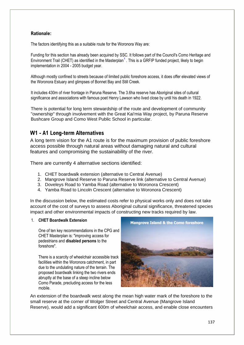
137
Rationale: The factors identifying this as a suitable route for the Woronora Way are:
Funding for this section has already been acquired by SSC. It follows part of the Council's Como Heritage and
Environment Trail (CHET) as identified in the Masterplan . This is a GRFIP funded project, likely to begin implementation in 2004 - 2005 budget year.
Although mostly confined to streets because of limited public foreshore access, it does offer elevated views of the Woronora Estuary and glimpses of Bonnet Bay and Still Creek.
It includes 430m of river frontage in Paruna Reserve. The 3.6ha reserve has Aboriginal sites of cultural significance and associations with famous poet Henry Lawson who lived close by until his death in 1922.
There is potential for long term stewardship of the route and development of community "ownership" through involvement with the Great Kai'mia Way project, by Paruna Reserve Bushcare Group and Como West Public School in particular.
W1 - A1 Long-term Alternatives
A long term vision for the A1 route is for the maximum provision of public foreshore access possible through natural areas without damaging natural and cultural features and compromising the sustainability of the river.
There are currently 4 alternative sections identified:
1. CHET boardwalk extension (alternative to Central Avenue) 2. Mangrove Island Reserve to Paruna Reserve link (alternative to Central Avenue) 3. Doveleys Road to Yamba Road (alternative to Woronora Crescent) 4. Yamba Road to Lincoln Crescent (alternative to Woronora Crescent)
In the discussion below, the estimated costs refer to physical works only and does not take
account of the cost of surveys to assess Aboriginal cultural significance, threatened species
impact and other environmental impacts of constructing new tracks required by law.
1. CHET Boardwalk Extension One of ten key recommendations in the CPG and CHET Masterplan is: "improving access for pedestrians and disabled persons to the foreshore".
There is a scarcity of wheelchair accessible track facilities within the Woronora catchment, in part due to the undulating nature of the terrain. The proposed boardwalk linking the two rivers ends abruptly at the base of a steep incline below Como Parade, precluding access for the less mobile.
An extension of the boardwalk west along the mean high water mark of the foreshore to the
small reserve at the corner of Wolger Street and Central Avenue (Mangrove Island
Reserve), would add a significant 600m of wheelchair access, and enable close encounters

138
with Mangrove Island.
A turning point in the reserve and passing places at regular intervals along the structure
would facilitate two-way access along the boardwalk to and from Como Pleasure Grounds
where improvements to disabled facilities are proposed in the Master Plan.
Altogether this represents approximately 1.2km of continuous wheelchair access to the
foreshore (potentially 3.2km total access with appropriate upgrading of links across the
bridge to Oatley). It is one of the few areas along the Woronora Way that falls within Class 1
of the Australian standard classification system for walking tracks, described as an.
"opportunity for large numbers of visitors, including those with reduced mobility, to
undertake walks which are provided with a high level of interpretation and facilities."
The major constraints to this scheme are:
• the presence of 4 private jetties out into the river, despite there being a 20 metres foreshore building line setback
• 25 private properties along this section of foreshore • damage to the foreshore during construction • human disturbance of native shore birds
The estimated cost of a boardwalk 600m x 1.5m at $370m2 is $333,000.
2. Mangrove Island Reserve to Paruna Reserve Link Between these two reserves there is a 30 metres foreshore building line setback and the houses are further back from the river. There is evidence of informal tracks on dry land above the mean high water mark through dense stands of Casuarina and Coastal River Flat Forest. An opportunity exists to formalise one track and revegetate the others and help protect a 200 meters section of foreshore from further development. There is significant evidence of property owners destroying native vegetation within the setback zone. The major issue to be resolved is the ownership of the land by seven private landholders. Estimated cost of 200 meters stone surfaced track - $25,000.
Doveleys Road to Yamba Road
The reason for suggesting this route are the spectacular views of the river and surrounding hills from a fairly high (60 meters above sea level) vantage point. As well as the aesthetic beauty of the area, the geography, landforms and succession of vegetation communities from Grey Mangroves to Ridgetop Open Forests can be appreciated. It offers potential for environmental education close to Como West Public School. From Doveley Road the route descends via an existing timber and steel staircase construction down to Bonnet Avenue. At the southern end of the Avenue is a faint track that quickly peters out. A new track would need to be constructed for 350 metres through to Yamba Road Reserve opposite Como West Public school.
139
The issues here are:
• The steep gradient of the slope down to the river - any new track would need associated revetment works to maintain even surface and impact severely on bushland and river hydrology during construction and after, as material is washed down in storms.
• Fragmentation of sensitive plant communities and wildlife habitats characterised by magnificent Angophora costata - Smooth Bark Apple, Eucalyptus piperita - the Sydney Peppermint, and Eucalyptus gummifera - the Red Bloodwood, prominent.
• Although the setback is a generous 70 meters, 60 percent of the land is in private ownership requiring negotiations for use.
The estimated cost of 350 meters of track is $45,000 (excluding land acquisition costs).
3. Yamba Road to Lincoln Crescent Following on from Doverley and Yamba Roads section described above, this potential route is accessed via the Yamba Road reserve opposite Como West Public School and continues south through the northern tip of the Glen Bushland Reserve to Lincoln Crescent for 650 metres. The views of the river and surrounds are again excellent. The advantages of this route are that:
• The gradient of the river bank is significantly less steep than the Doverley and Yamba Roads section
• Sutherland Shire Council has zoned the land for public recreation and future public recreation
• Sutherland Shire Council owns 60 percent of the land and has an active program to acquire the remainder
• It links to an existing management trail without the need to negotiate a steep
section of path (graded 4/5) down from Lincoln Crescent - refer to W1 - A2
The issues are:
• fragmentation of the bushland as above
• The area is identified as a threatened species and riparian buffer zone by Sutherland Shire Council in its Draft LEP 2003
Estimated cost of 650 metres of track is $80,000 (excluding land acquisition costs).
1. Sutherland Shire Council & PlanningNSW. (2002). Como Pleasure Grounds and Heritage and Environment Trail:
Masterplan and Conservation Management Plan: Vol. 1 - Masterplan & Background Reports, Vol. 2 - Conservation Management Plan.
2. Standards Australia 2001 - refer to appendix 6. 3. Based on an Sutherland Shire Council quote dated 13-1-03 for part of the Woolooware Bay Cycleway
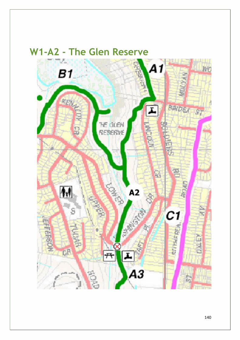
140
W1-A2 - The Glen Reserve
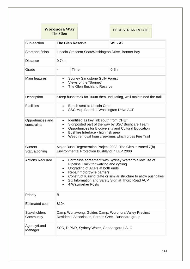
141
Woronora Way The Glen
PEDESTRIAN ROUTE
Sub-section The Glen Reserve W1 - A2
Start and finish Lincoln Crescent Seat/Washington Drive, Bonnet Bay
Distance 0.7km
Grade 4 Time 0.5hr
Main features • Sydney Sandstone Gully Forest • Views of the "Bonnet" • The Glen Bushland Reserve
Description Steep bush track for 100m then undulating, well maintained fire trail.
Facilities • Bench seat at Lincoln Cres • SSC Map Board at Washington Drive ACP
Opportunities and
constraints
• Identified as key link south from CHET • Signposted part of the way by SSC Bushcare Team • Opportunities for Biodiversity and Cultural Education • Bushfire Interface - high risk area • Weed removal from creeklines which cross Fire Trail
Current
Status/Zoning
Major Bush Regeneration Project 2003. The Glen is zoned 7(b)
Environmental Protection Bushland in LEP 2000
Actions Required • Formalise agreement with Sydney Water to allow use of Pipeline Track for walking and cycling
• Upgrading of ACPs at both ends • Repair motorcycle barriers • Construct Kissing Gate or similar structure to allow pushbikes • 2 x Information and Safety Sign at Thorp Road ACP • 4 Waymarker Posts
Priority B
Estimated cost $10k
Stakeholders
Community
Camp Wonawong, Guides Camp, Woronora Valley Precinct
Residents Association, Forbes Creek Bushcare group
Agency/Land
Manager SSC, DIPNR, Sydney Water, Gandangara LALC
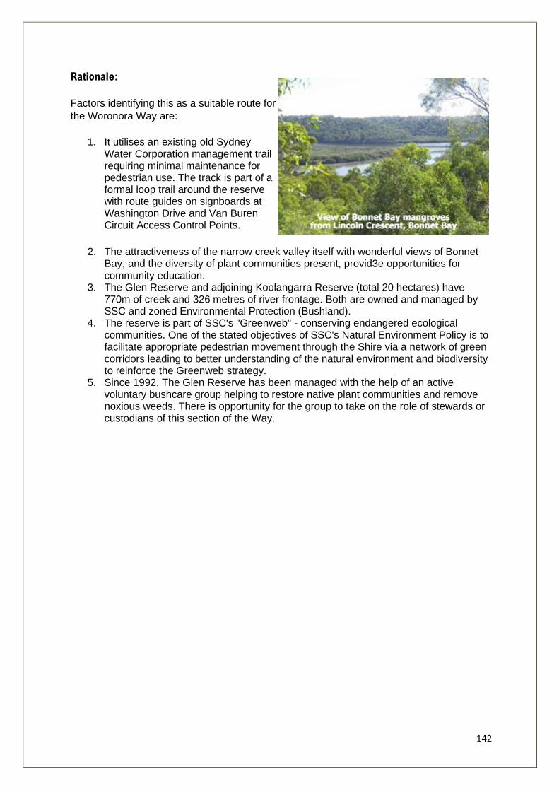
142
Rationale:
Factors identifying this as a suitable route for
the Woronora Way are:
1. It utilises an existing old Sydney Water Corporation management trail requiring minimal maintenance for pedestrian use. The track is part of a formal loop trail around the reserve with route guides on signboards at Washington Drive and Van Buren Circuit Access Control Points.
2. The attractiveness of the narrow creek valley itself with wonderful views of Bonnet Bay, and the diversity of plant communities present, provid3e opportunities for community education.
3. The Glen Reserve and adjoining Koolangarra Reserve (total 20 hectares) have 770m of creek and 326 metres of river frontage. Both are owned and managed by SSC and zoned Environmental Protection (Bushland).
4. The reserve is part of SSC's "Greenweb" - conserving endangered ecological communities. One of the stated objectives of SSC's Natural Environment Policy is to facilitate appropriate pedestrian movement through the Shire via a network of green corridors leading to better understanding of the natural environment and biodiversity to reinforce the Greenweb strategy.
5. Since 1992, The Glen Reserve has been managed with the help of an active voluntary bushcare group helping to restore native plant communities and remove noxious weeds. There is opportunity for the group to take on the role of stewards or custodians of this section of the Way.
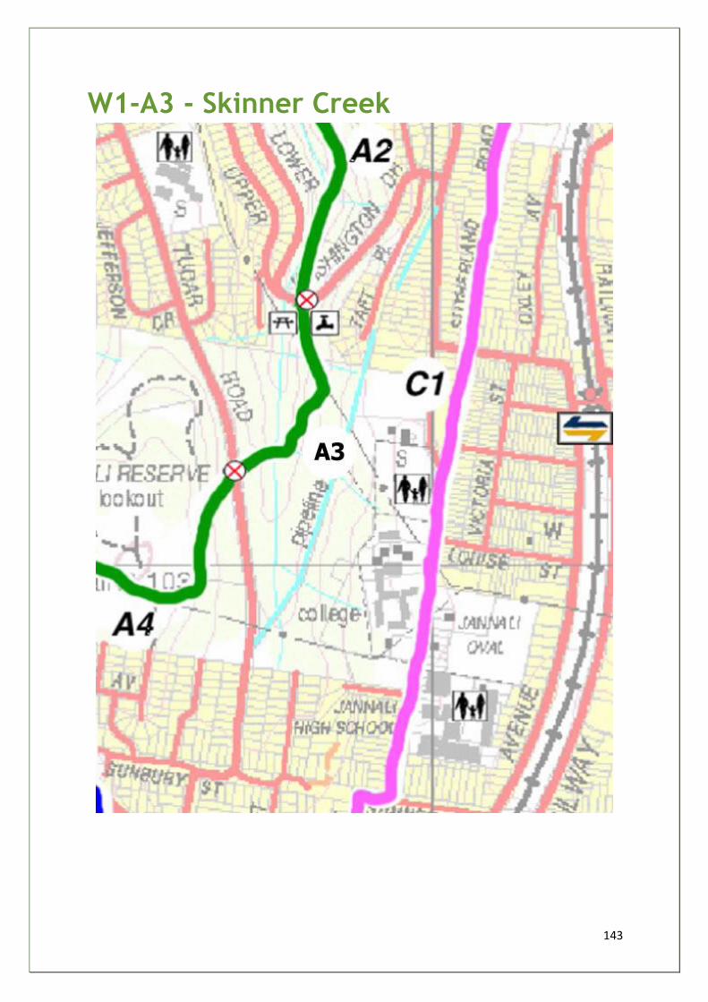
143
W1-A3 - Skinner Creek

144
Woronora Way The Glen
PEDESTRIAN ROUTE
Sub-section Skinner Creek W1 - A3
Start and finish Washington Drive to Tudor Road
Distance 0.6km
Grade 3 Time 0.5hr
Main features • Hidden waterfall • Rockshelf Tudor Rd • Constructed Wetland
Description Begins in flat grassy clearing, crosses small creek, ascends via goat
track to rockshelf, descends via poorly drained eroded track to waterfall
then steady incline to Tudor Rd.
Facilities • None
Opportunities
and constraints
• Key "missing link" between the Glen Reserve and Burnum Burnum Sanctuary
• Access for Bush Regeneration work on creek weeds • Waterfall - feature for educational walk - Between 3 schools • Opportunity to trial sustainable building materials • Flat area near Washington Drive suitable for picnic/rest area • Route crosses creek • Washington Drive is a known microbat habitat • 1 main road crossing
Current
Status/Zoning
Zoned as 7(b) Environmental Protection (Bushland). SSC owned and
maintained
Actions
Required
• Access Control Improvements at both ends • Type 2 sign at Washington Drive, Type 3 sign at Tudor Rd • 3 sets of steps, 2 small footbridges • 4 x type 4 way marker signs • Picnic table and water bubbler at Washington Drive ACP
Priority A
Estimated cost $25k
Stakeholders
Community
Bonnet Bay PS, Jannali HS and PS, 1 st Jannali Scouts, Guides, St
George and Sutherland Community College, Kurrunulla Aboriginal
Corporation. The Glen Res. and Jannali Res. Bushcare groups.
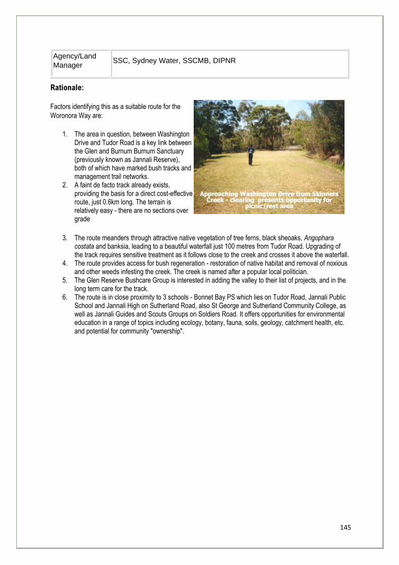
145
Agency/Land
Manager SSC, Sydney Water, SSCMB, DIPNR
Rationale:
Factors identifying this as a suitable route for the
Woronora Way are:
1. The area in question, between Washington Drive and Tudor Road is a key link between the Glen and Burnum Burnum Sanctuary (previously known as Jannali Reserve), both of which have marked bush tracks and management trail networks.
2. A faint de facto track already exists, providing the basis for a direct cost-effective route, just 0.6km long. The terrain is relatively easy - there are no sections over grade
3. The route meanders through attractive native vegetation of tree ferns, black sheoaks, Angophara costata and banksia, leading to a beautiful waterfall just 100 metres from Tudor Road. Upgrading of the track requires sensitive treatment as it follows close to the creek and crosses it above the waterfall.
4. The route provides access for bush regeneration - restoration of native habitat and removal of noxious and other weeds infesting the creek. The creek is named after a popular local politician.
5. The Glen Reserve Bushcare Group is interested in adding the valley to their list of projects, and in the long term care for the track.
6. The route is in close proximity to 3 schools - Bonnet Bay PS which lies on Tudor Road, Jannali Public School and Jannali High on Sutherland Road, also St George and Sutherland Community College, as well as Jannali Guides and Scouts Groups on Soldiers Road. It offers opportunities for environmental education in a range of topics including ecology, botany, fauna, soils, geology, catchment health, etc. and potential for community "ownership".
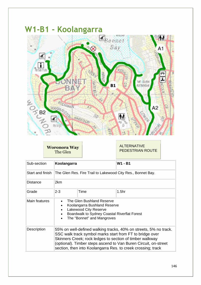
146
W1-B1 - Koolangarra
Woronora Way The Glen
ALTERNATIVE
PEDESTRIAN ROUTE
Sub-section Koolangarra W1 - B1
Start and finish The Glen Res. Fire Trail to Lakewood City Res., Bonnet Bay.
Distance 2km
Grade 2-3 Time 1.5hr
Main features • The Glen Bushland Reserve • Koolangarra Bushland Reserve • Lakewood City Reserve • Boardwalk to Sydney Coastal Riverflat Forest • The "Bonnet" and Mangroves
Description 55% on well-defined walking tracks, 40% on streets, 5% no track. SSC walk track symbol marks start from FT to bridge over Skinners Creek; rock ledges to section of timber walkway (optional). Timber steps ascend to Van Buren Circuit, on-street section, then into Koolangarra Res. to creek crossing; track
147
becomes indefinite. Arthur St exit is overgrown and steep. Join lower Washington Dr., Coolridge Cres. to Lakewood City Res.
Facilities • Lakewood City Res. - toilets, carpark, BBQ, picnic, play, oval • Bonnet Bay Shopping Centre (short detour) • SSC Glen Bushland Reserve Map and Sign board
Opportunities
and constraints
• Missing link from Koolangarra Reserve to Arthur Street. Approx. 100m plus a short set of steps - potential venture between Koolangarra and Arthur Place Bushcare groups.
• Showcase efforts of the Glen, Koolangarra and Arthur Place Bushcare Groups to restore bushland and foreshore, control noxious weeds, and facilitate indigenous seed collection.
• Interpret importance of SSC's Greenweb - protecting endangered ecological communities such as SCRFF.
• Fine prone area • Storm water management issues below Van Buren Circuit.
Potential to seek small SSCMB grant
Current
Status/Zoning Council owned, zoned Environmental Protection Bushland 7(b)
Actions
Required
• Detailed consultation with Bushcare groups • Consult residents regarding Arthur Street link • Construct steps from Arthur St to Koolangarra Reserve. • 1 x display shelter for Lakewood City Reserve (sign type 1) • 6 x marker posts (sign type 4) • Seek SSCMB stormwater control grants
Priority B
Estimated cost $10k
Stakeholders
Community
Koolangarra Res., Glen Res., Arthur Pl and Nixon Pl. Bushcare Groups,
Bonnet Bay PS, Bonnet Bay Shopping Centre, Sports clubs
Agency/Land
Manager SSC, SSCMB, Sydney Water, Riverkeeper, DIPNR
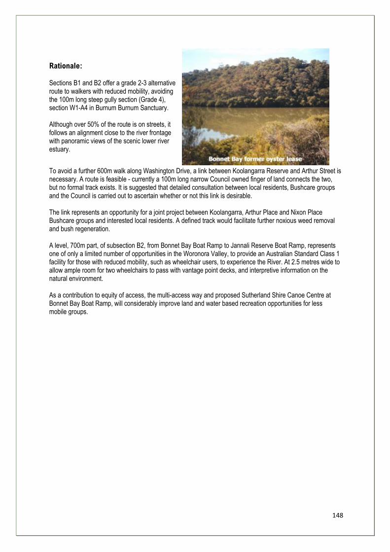
148
Rationale: Sections B1 and B2 offer a grade 2-3 alternative route to walkers with reduced mobility, avoiding the 100m long steep gully section (Grade 4), section W1-A4 in Burnum Burnum Sanctuary. Although over 50% of the route is on streets, it follows an alignment close to the river frontage with panoramic views of the scenic lower river estuary.
To avoid a further 600m walk along Washington Drive, a link between Koolangarra Reserve and Arthur Street is necessary. A route is feasible - currently a 100m long narrow Council owned finger of land connects the two, but no formal track exists. It is suggested that detailed consultation between local residents, Bushcare groups and the Council is carried out to ascertain whether or not this link is desirable. The link represents an opportunity for a joint project between Koolangarra, Arthur Place and Nixon Place Bushcare groups and interested local residents. A defined track would facilitate further noxious weed removal and bush regeneration. A level, 700m part, of subsection B2, from Bonnet Bay Boat Ramp to Jannali Reserve Boat Ramp, represents one of only a limited number of opportunities in the Woronora Valley, to provide an Australian Standard Class 1 facility for those with reduced mobility, such as wheelchair users, to experience the River. At 2.5 metres wide to allow ample room for two wheelchairs to pass with vantage point decks, and interpretive information on the natural environment. As a contribution to equity of access, the multi-access way and proposed Sutherland Shire Canoe Centre at Bonnet Bay Boat Ramp, will considerably improve land and water based recreation opportunities for less mobile groups.
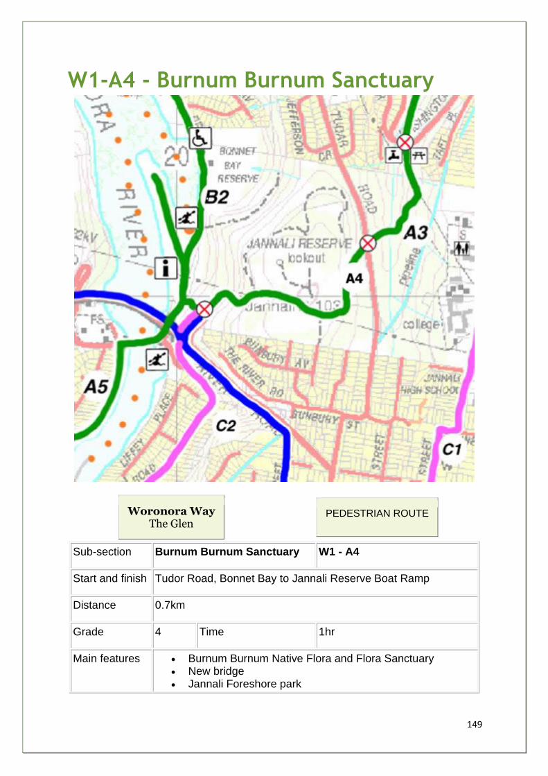
149
W1-A4 - Burnum Burnum Sanctuary
Woronora Way The Glen
PEDESTRIAN ROUTE
Sub-section Burnum Burnum Sanctuary W1 - A4
Start and finish Tudor Road, Bonnet Bay to Jannali Reserve Boat Ramp
Distance 0.7km
Grade 4 Time 1hr
Main features • Burnum Burnum Native Flora and Flora Sanctuary • New bridge • Jannali Foreshore park
150
• Constructed wetland
Description 80 % on well defined bush tracks, 15% FT and 5% on road. Cross Tudar Rd to Sanctuary ascending short rocky slope then level tracks eroded in places to summit of Sanctuary. Descend to Foreshore via steep gully. High level views of river and new bridge.
Facilities • SSC signage • Jannali foreshore - carpark, toilets, play area, BBQ, picnic,
oval, boat ramp, canoe launch.
Opportunities
and constraints
• 1970s scheme CDEP - 100m of steps/slope - needs reconstructing to meet Australian Standards
• Revegetate eroded tracks in Jannali Reserve • Waymarking to improve navigation • Signage to interpret constructed wetland beside foreshore • 1 Main road to cross - suggest crossing point • Eroded steep access into Sanctuary from Tudar Rd
Current
Status/Zoning Crown Land managed by SSC, zoned 7(b) and 6(a)
Actions
Required
• Rebuild CDEP scheme • 1 x sign 1 • 1 x sign 3 • 1 x sign 4 • 6 x Waymarkers • Educational Leaflets • Provide traffic calmed crossing point on Tudar Rd (SSC) • 6 x steps into Sanctuary from Tudar Rd
Priority A
Estimated cost $30k
Stakeholders
Community
Kurrunulla Aboriginal Corporation, Jannali High School, Bonnet
Bay Bombers, Billies Bushies, Woronora Bushfire Brigade,
Sutherland Shire Canoe Club, Bushcare groups
Agency/Land
Manager SSC, DIPNR, SSCMB, Gandangara LALC
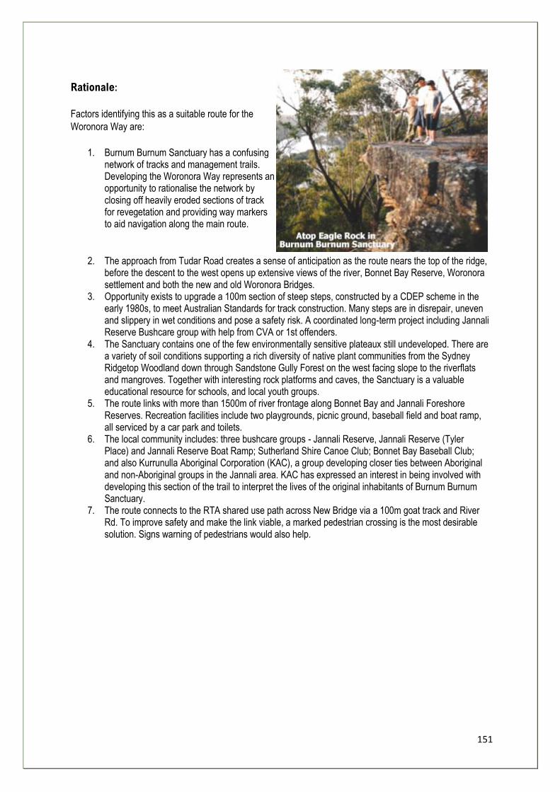
151
Rationale:
Factors identifying this as a suitable route for the
Woronora Way are:
1. Burnum Burnum Sanctuary has a confusing network of tracks and management trails. Developing the Woronora Way represents an opportunity to rationalise the network by closing off heavily eroded sections of track for revegetation and providing way markers to aid navigation along the main route.
2. The approach from Tudar Road creates a sense of anticipation as the route nears the top of the ridge, before the descent to the west opens up extensive views of the river, Bonnet Bay Reserve, Woronora settlement and both the new and old Woronora Bridges.
3. Opportunity exists to upgrade a 100m section of steep steps, constructed by a CDEP scheme in the early 1980s, to meet Australian Standards for track construction. Many steps are in disrepair, uneven and slippery in wet conditions and pose a safety risk. A coordinated long-term project including Jannali Reserve Bushcare group with help from CVA or 1st offenders.
4. The Sanctuary contains one of the few environmentally sensitive plateaux still undeveloped. There are a variety of soil conditions supporting a rich diversity of native plant communities from the Sydney Ridgetop Woodland down through Sandstone Gully Forest on the west facing slope to the riverflats and mangroves. Together with interesting rock platforms and caves, the Sanctuary is a valuable educational resource for schools, and local youth groups.
5. The route links with more than 1500m of river frontage along Bonnet Bay and Jannali Foreshore Reserves. Recreation facilities include two playgrounds, picnic ground, baseball field and boat ramp, all serviced by a car park and toilets.
6. The local community includes: three bushcare groups - Jannali Reserve, Jannali Reserve (Tyler Place) and Jannali Reserve Boat Ramp; Sutherland Shire Canoe Club; Bonnet Bay Baseball Club; and also Kurrunulla Aboriginal Corporation (KAC), a group developing closer ties between Aboriginal and non-Aboriginal groups in the Jannali area. KAC has expressed an interest in being involved with developing this section of the trail to interpret the lives of the original inhabitants of Burnum Burnum Sanctuary.
7. The route connects to the RTA shared use path across New Bridge via a 100m goat track and River Rd. To improve safety and make the link viable, a marked pedestrian crossing is the most desirable solution. Signs warning of pedestrians would also help.
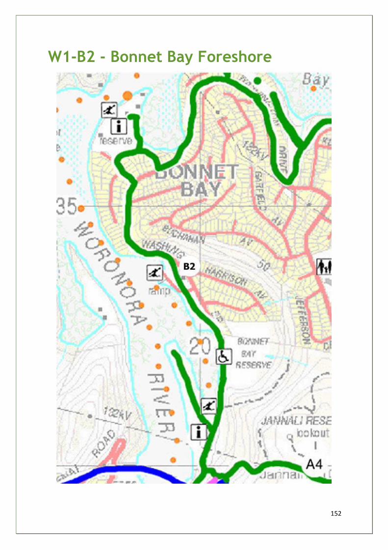
152
W1-B2 - Bonnet Bay Foreshore
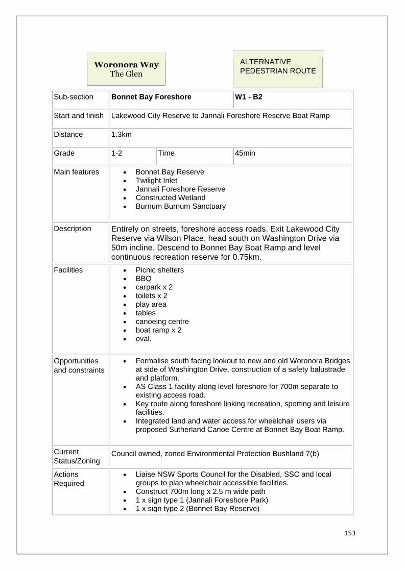
153
Woronora Way The Glen
ALTERNATIVE
PEDESTRIAN ROUTE
Sub-section Bonnet Bay Foreshore W1 - B2
Start and finish Lakewood City Reserve to Jannali Foreshore Reserve Boat Ramp
Distance 1.3km
Grade 1-2 Time 45min
Main features • Bonnet Bay Reserve • Twilight Inlet • Jannali Foreshore Reserve • Constructed Wetland • Burnum Burnum Sanctuary
Description Entirely on streets, foreshore access roads. Exit Lakewood City Reserve via Wilson Place, head south on Washington Drive via 50m incline. Descend to Bonnet Bay Boat Ramp and level continuous recreation reserve for 0.75km.
Facilities • Picnic shelters • BBQ • carpark x 2 • toilets x 2 • play area • tables • canoeing centre • boat ramp x 2 • oval.
Opportunities
and constraints
• Formalise south facing lookout to new and old Woronora Bridges at side of Washington Drive, construction of a safety balustrade and platform.
• AS Class 1 facility along level foreshore for 700m separate to existing access road.
• Key route along foreshore linking recreation, sporting and leisure facilities.
• Integrated land and water access for wheelchair users via proposed Sutherland Canoe Centre at Bonnet Bay Boat Ramp.
Current
Status/Zoning Council owned, zoned Environmental Protection Bushland 7(b)
Actions
Required
• Liaise NSW Sports Council for the Disabled, SSC and local groups to plan wheelchair accessible facilities.
• Construct 700m long x 2.5 m wide path • 1 x sign type 1 (Jannali Foreshore Park) • 1 x sign type 2 (Bonnet Bay Reserve)
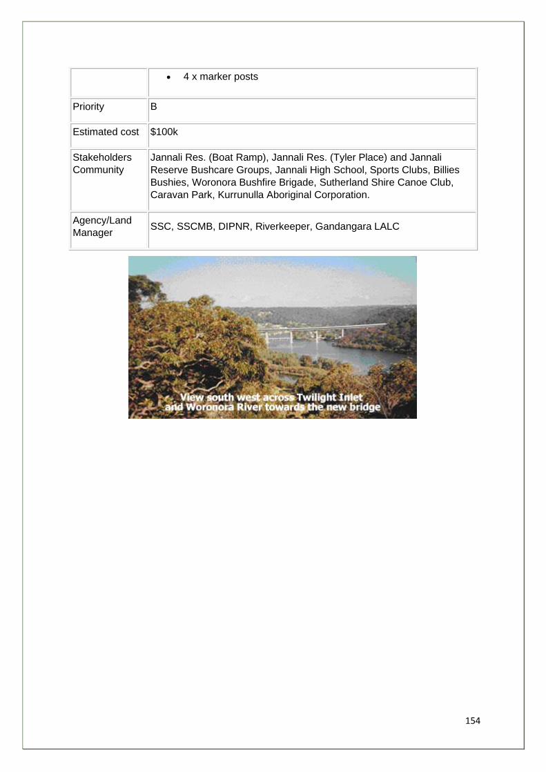
154
• 4 x marker posts
Priority B
Estimated cost $100k
Stakeholders
Community
Jannali Res. (Boat Ramp), Jannali Res. (Tyler Place) and Jannali
Reserve Bushcare Groups, Jannali High School, Sports Clubs, Billies
Bushies, Woronora Bushfire Brigade, Sutherland Shire Canoe Club,
Caravan Park, Kurrunulla Aboriginal Corporation.
Agency/Land
Manager SSC, SSCMB, DIPNR, Riverkeeper, Gandangara LALC
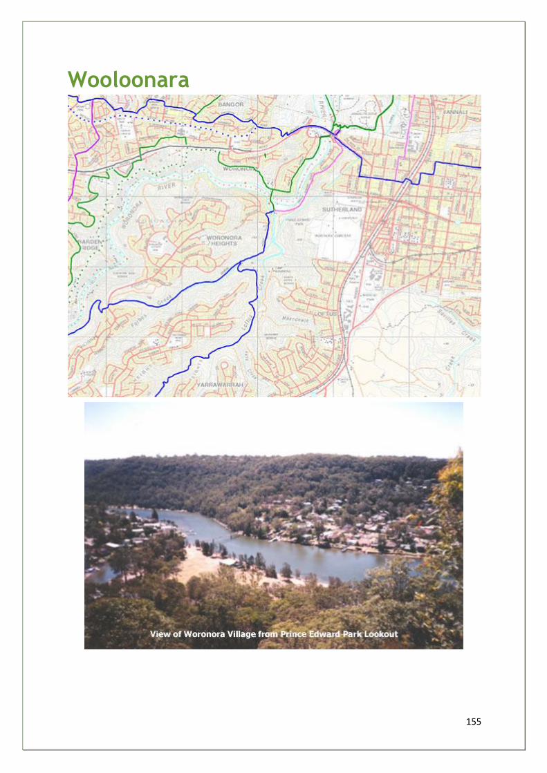
155
Wooloonara
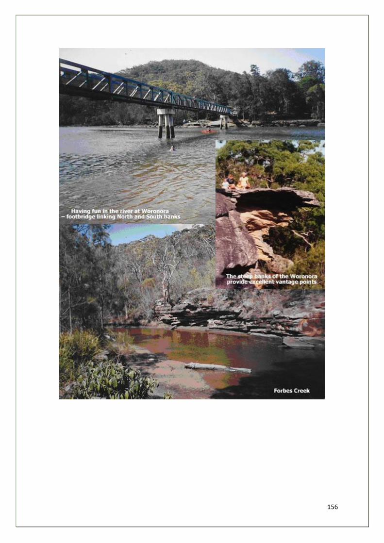
156
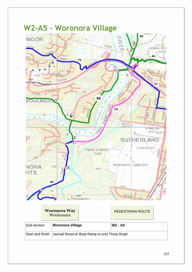
157
W2-A5 - Woronora Village
Woronora Way Wooloonara
PEDESTRIAN ROUTE
Sub-section Woronora Village W2 - A5
Start and finish Jannali Reserve Boat Ramp to end Thorp Road
158
Distance 1.8km
Grade 2 Time 1hr
Main features • New and old bridge • Prices Reserve • Footbridge • Prince Edward Park • Forbes Creek
Description 65% on quiet streets in the heart of the Woronora Valley, 35% through
foreshore reserves, two river crossings. From Jannali Boat Ramp via
access road to Prince Edward Park Road and across old bridge. South
into Prices Reserve. Via Prices Circuit to Woronora Public School.
Descend to cross river via footbridge through PEP to RSC across
Forbes Creek and turn into Thorp Road. Ascend to end of road.
Facilities • Caravan Park, Cafes • Restaurant • Beaches • Boatshed • Lifesaving Club • RSL • Boat Ramps • Football Oval • Toilets • Shop • BBQ • Picnic Area • 2 x play areas
Opportunities
and constraints
• Attractive Riverside Environment - added reason to upgrade PEP foreshore retaining wall
• Increased visitors will benefit local businesses • Very narrow footbridge • 2 Main Street Crossings
Actions
Required
• Better segregation of cyclists and walkers • 1 x Display Shelter in PEP (type 1) • 5 x Waymarking Signs (type 4)
Current
Status/Zoning
Foreshore Reserve owned by SSC Prince Edward Park is Crown Land
managed by SSC, zoned 6(a)
Priority A
Estimated cost $10k
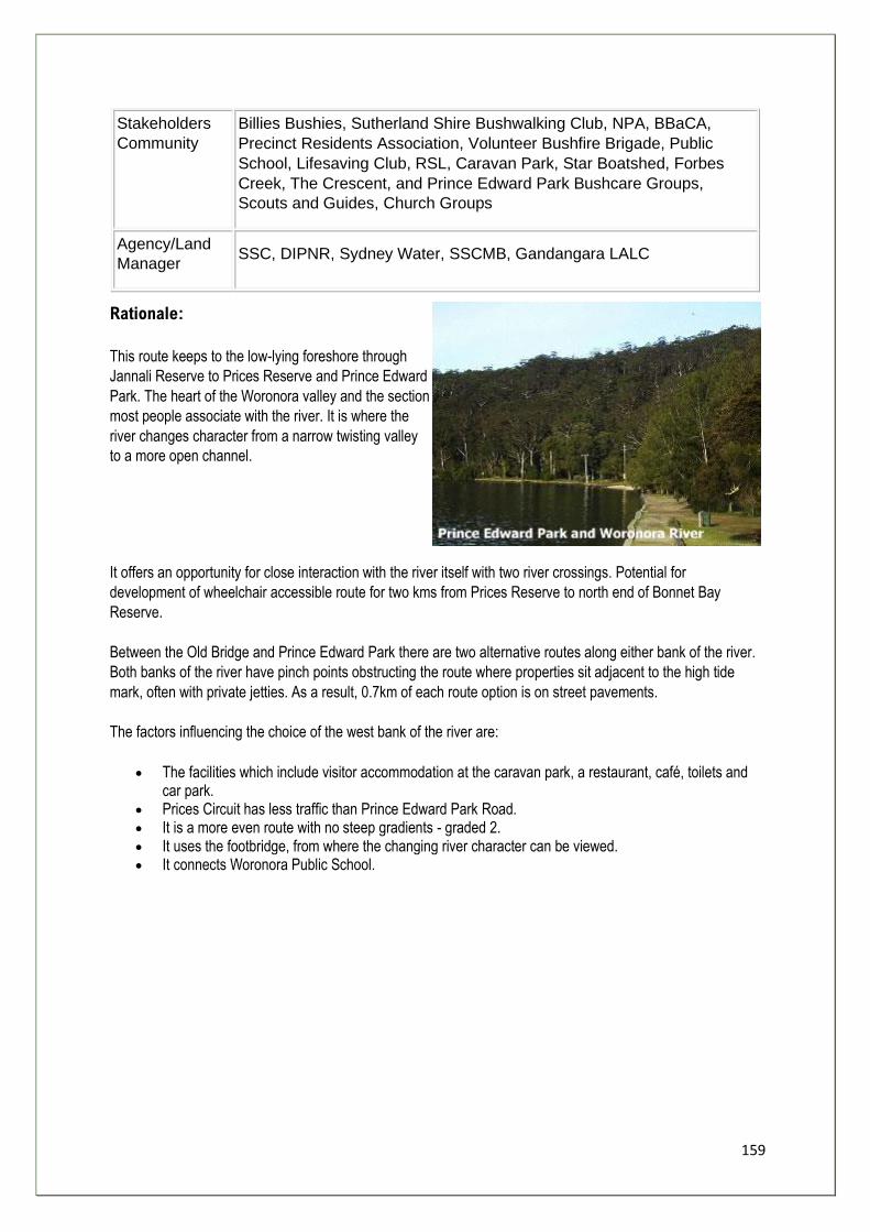
159
Stakeholders
Community
Billies Bushies, Sutherland Shire Bushwalking Club, NPA, BBaCA,
Precinct Residents Association, Volunteer Bushfire Brigade, Public
School, Lifesaving Club, RSL, Caravan Park, Star Boatshed, Forbes
Creek, The Crescent, and Prince Edward Park Bushcare Groups,
Scouts and Guides, Church Groups
Agency/Land
Manager SSC, DIPNR, Sydney Water, SSCMB, Gandangara LALC
Rationale:
This route keeps to the low-lying foreshore through
Jannali Reserve to Prices Reserve and Prince Edward
Park. The heart of the Woronora valley and the section
most people associate with the river. It is where the
river changes character from a narrow twisting valley
to a more open channel.
It offers an opportunity for close interaction with the river itself with two river crossings. Potential for
development of wheelchair accessible route for two kms from Prices Reserve to north end of Bonnet Bay
Reserve.
Between the Old Bridge and Prince Edward Park there are two alternative routes along either bank of the river.
Both banks of the river have pinch points obstructing the route where properties sit adjacent to the high tide
mark, often with private jetties. As a result, 0.7km of each route option is on street pavements.
The factors influencing the choice of the west bank of the river are:
• The facilities which include visitor accommodation at the caravan park, a restaurant, café, toilets and car park.
• Prices Circuit has less traffic than Prince Edward Park Road. • It is a more even route with no steep gradients - graded 2. • It uses the footbridge, from where the changing river character can be viewed. • It connects Woronora Public School.

160
W2-A6 - Forbes Creek
Woronora Way Wooloonara
PEDESTRIAN ROUTE
Sub-section Forbes Creek W2 - A6
Start and finish Thorp Road ACP to Bundanoon Road
Distance 2.4km
Grade 2 Time 1.5hr (walking) 0.5hr (cycling)
Main features • Waterfall • Sydney Sandstone Gully Forest • Woronora Dam pipeline
Description Well maintained, decomposed granite surface maintenance track, 4-5
metres wide alongside water supply pipeline.
Facilities • None
Opportunities
and constraints
• Major access link to Loftus and Forbes Creek track network. • Sydney Water Pipeline Maintenance Track • Interpretation of Journey of Drinking Water • Where creeklines cross replace concrete culverts with natural
materials/plants - Education Opportunity
Actions Required • Better segregation of cyclists and walkers • 1 x Display Shelter in PEP (type 1)
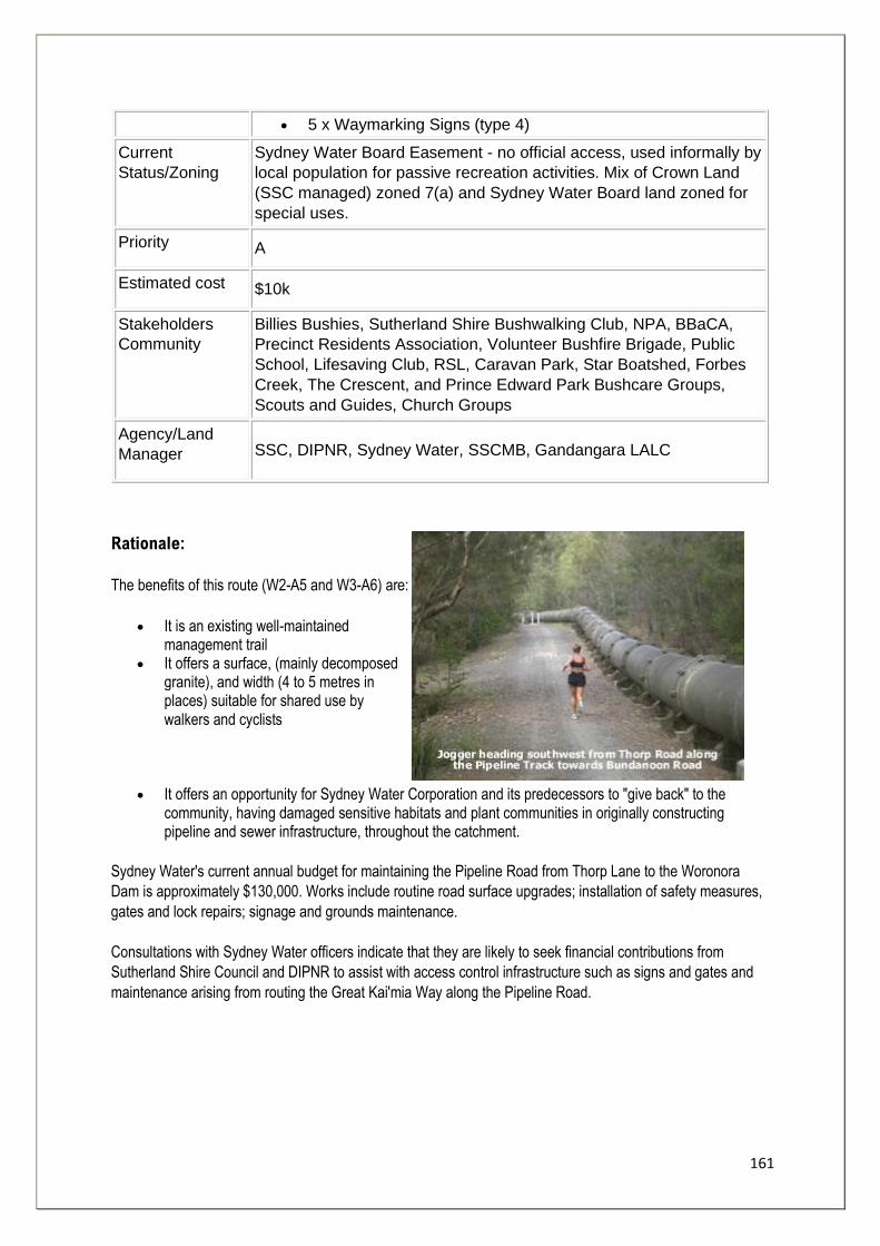
161
• 5 x Waymarking Signs (type 4)
Current
Status/Zoning
Sydney Water Board Easement - no official access, used informally by
local population for passive recreation activities. Mix of Crown Land
(SSC managed) zoned 7(a) and Sydney Water Board land zoned for
special uses.
Priority A
Estimated cost $10k
Stakeholders
Community
Billies Bushies, Sutherland Shire Bushwalking Club, NPA, BBaCA,
Precinct Residents Association, Volunteer Bushfire Brigade, Public
School, Lifesaving Club, RSL, Caravan Park, Star Boatshed, Forbes
Creek, The Crescent, and Prince Edward Park Bushcare Groups,
Scouts and Guides, Church Groups
Agency/Land
Manager SSC, DIPNR, Sydney Water, SSCMB, Gandangara LALC
Rationale:
The benefits of this route (W2-A5 and W3-A6) are:
• It is an existing well-maintained management trail
• It offers a surface, (mainly decomposed granite), and width (4 to 5 metres in places) suitable for shared use by walkers and cyclists
• It offers an opportunity for Sydney Water Corporation and its predecessors to "give back" to the community, having damaged sensitive habitats and plant communities in originally constructing pipeline and sewer infrastructure, throughout the catchment.
Sydney Water's current annual budget for maintaining the Pipeline Road from Thorp Lane to the Woronora
Dam is approximately $130,000. Works include routine road surface upgrades; installation of safety measures,
gates and lock repairs; signage and grounds maintenance.
Consultations with Sydney Water officers indicate that they are likely to seek financial contributions from
Sutherland Shire Council and DIPNR to assist with access control infrastructure such as signs and gates and
maintenance arising from routing the Great Kai'mia Way along the Pipeline Road.
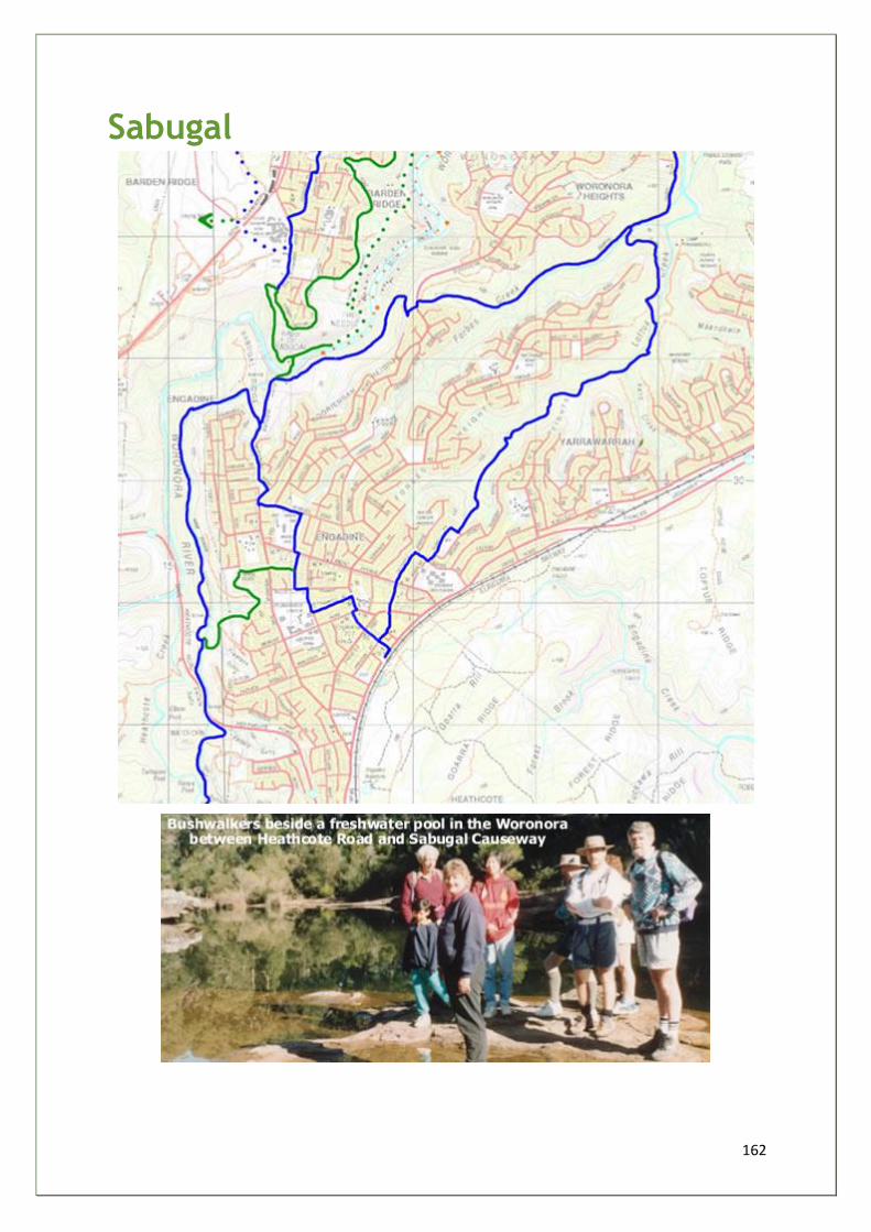
162
Sabugal
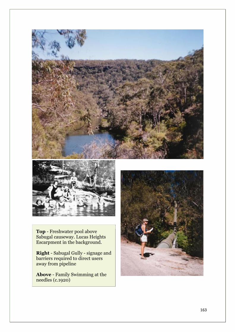
163
Top - Freshwater pool above Sabugal causeway. Lucas Heights Escarpment in the background. Right - Sabugal Gully - signage and barriers required to direct users away from pipeline Above - Family Swimming at the needles (c.1920)
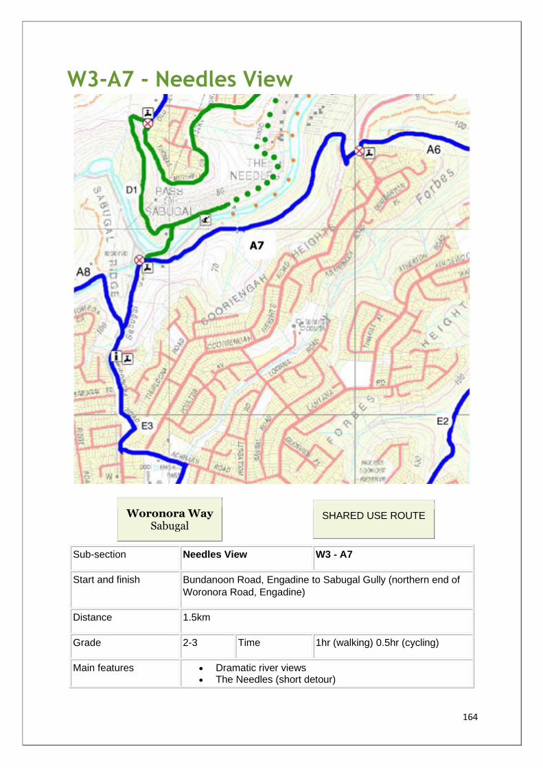
164
W3-A7 - Needles View
Woronora Way Sabugal
SHARED USE ROUTE
Sub-section Needles View W3 - A7
Start and finish Bundanoon Road, Engadine to Sabugal Gully (northern end of
Woronora Road, Engadine)
Distance 1.5km
Grade 2-3 Time 1hr (walking) 0.5hr (cycling)
Main features • Dramatic river views • The Needles (short detour)
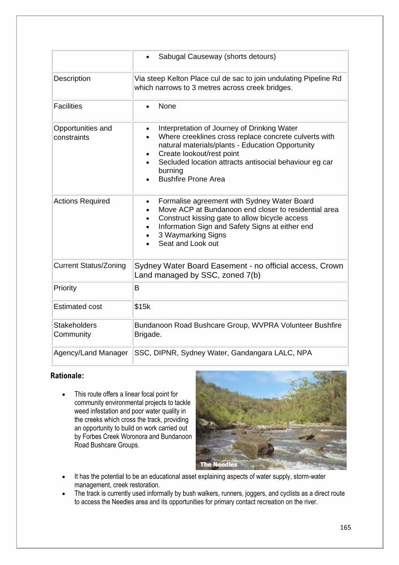
165
• Sabugal Causeway (shorts detours)
Description Via steep Kelton Place cul de sac to join undulating Pipeline Rd
which narrows to 3 metres across creek bridges.
Facilities • None
Opportunities and
constraints
• Interpretation of Journey of Drinking Water • Where creeklines cross replace concrete culverts with
natural materials/plants - Education Opportunity • Create lookout/rest point • Secluded location attracts antisocial behaviour eg car
burning • Bushfire Prone Area
Actions Required • Formalise agreement with Sydney Water Board • Move ACP at Bundanoon end closer to residential area • Construct kissing gate to allow bicycle access • Information Sign and Safety Signs at either end • 3 Waymarking Signs • Seat and Look out
Current Status/Zoning Sydney Water Board Easement - no official access, Crown Land managed by SSC, zoned 7(b)
Priority B
Estimated cost $15k
Stakeholders
Community
Bundanoon Road Bushcare Group, WVPRA Volunteer Bushfire
Brigade.
Agency/Land Manager SSC, DIPNR, Sydney Water, Gandangara LALC, NPA
Rationale:
• This route offers a linear focal point for community environmental projects to tackle weed infestation and poor water quality in the creeks which cross the track, providing an opportunity to build on work carried out by Forbes Creek Woronora and Bundanoon Road Bushcare Groups.
• It has the potential to be an educational asset explaining aspects of water supply, storm-water management, creek restoration.
• The track is currently used informally by bush walkers, runners, joggers, and cyclists as a direct route to access the Needles area and its opportunities for primary contact recreation on the river.
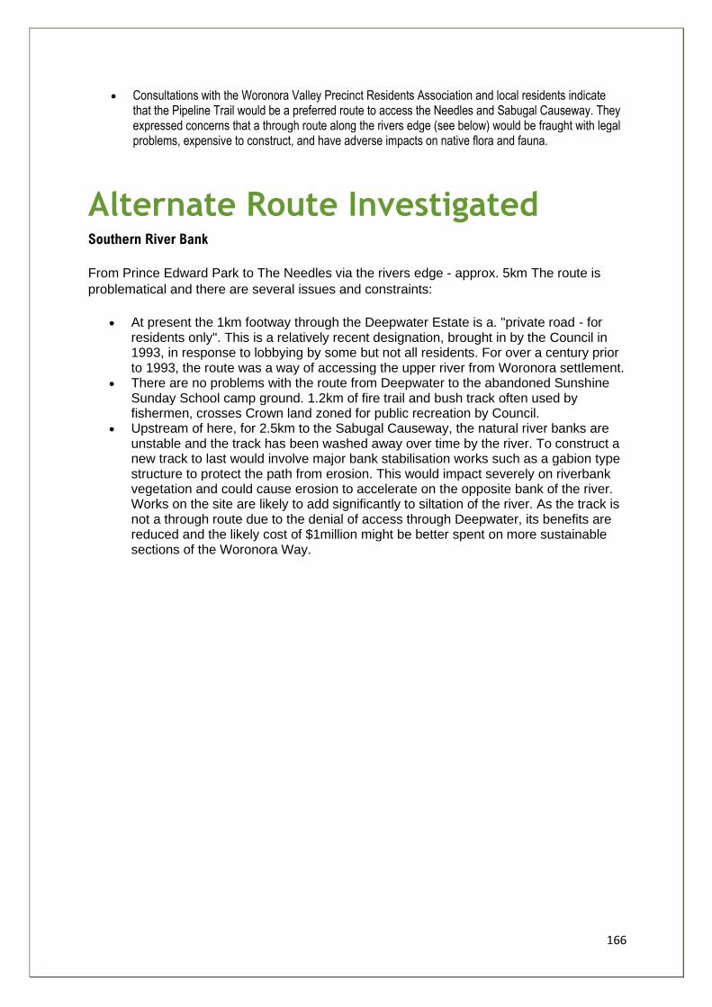
166
• Consultations with the Woronora Valley Precinct Residents Association and local residents indicate that the Pipeline Trail would be a preferred route to access the Needles and Sabugal Causeway. They expressed concerns that a through route along the rivers edge (see below) would be fraught with legal problems, expensive to construct, and have adverse impacts on native flora and fauna.
Alternate Route Investigated Southern River Bank
From Prince Edward Park to The Needles via the rivers edge - approx. 5km The route is
problematical and there are several issues and constraints:
• At present the 1km footway through the Deepwater Estate is a. "private road - for residents only". This is a relatively recent designation, brought in by the Council in 1993, in response to lobbying by some but not all residents. For over a century prior to 1993, the route was a way of accessing the upper river from Woronora settlement.
• There are no problems with the route from Deepwater to the abandoned Sunshine Sunday School camp ground. 1.2km of fire trail and bush track often used by fishermen, crosses Crown land zoned for public recreation by Council.
• Upstream of here, for 2.5km to the Sabugal Causeway, the natural river banks are unstable and the track has been washed away over time by the river. To construct a new track to last would involve major bank stabilisation works such as a gabion type structure to protect the path from erosion. This would impact severely on riverbank vegetation and could cause erosion to accelerate on the opposite bank of the river. Works on the site are likely to add significantly to siltation of the river. As the track is not a through route due to the denial of access through Deepwater, its benefits are reduced and the likely cost of $1million might be better spent on more sustainable sections of the Woronora Way.
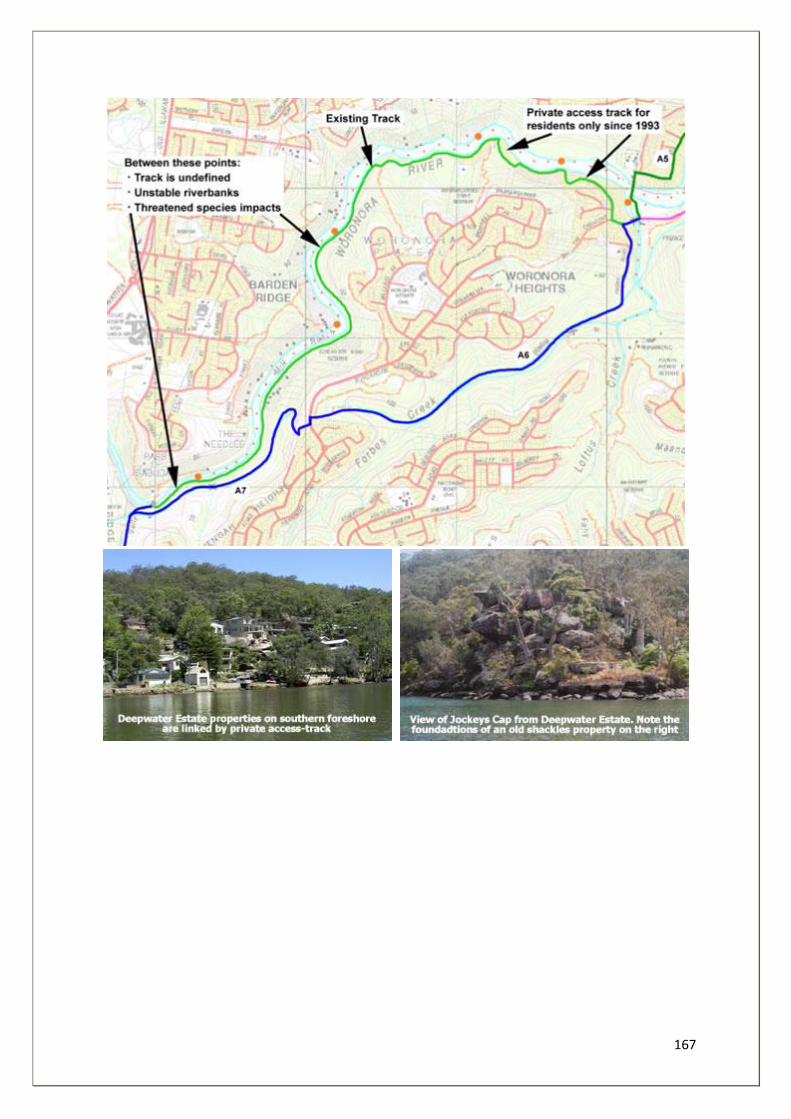
167
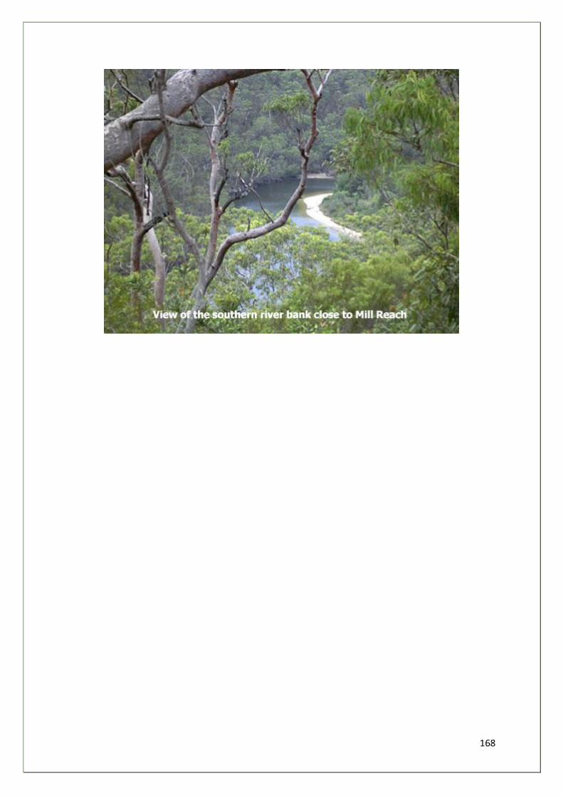
168
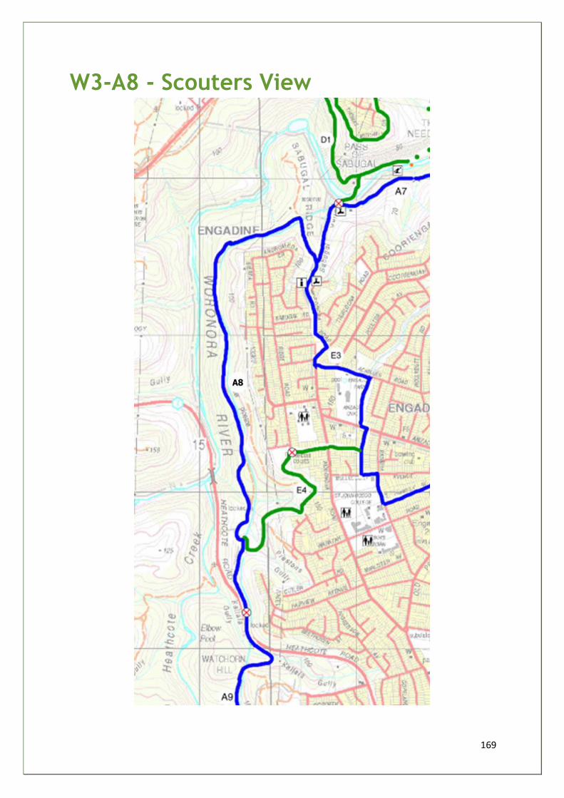
169
W3-A8 - Scouters View
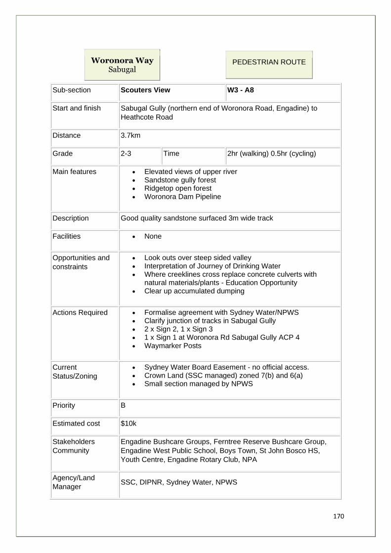
170
Woronora Way Sabugal
PEDESTRIAN ROUTE
Sub-section Scouters View W3 - A8
Start and finish Sabugal Gully (northern end of Woronora Road, Engadine) to
Heathcote Road
Distance 3.7km
Grade 2-3 Time 2hr (walking) 0.5hr (cycling)
Main features • Elevated views of upper river • Sandstone gully forest • Ridgetop open forest • Woronora Dam Pipeline
Description Good quality sandstone surfaced 3m wide track
Facilities • None
Opportunities and
constraints
• Look outs over steep sided valley • Interpretation of Journey of Drinking Water • Where creeklines cross replace concrete culverts with
natural materials/plants - Education Opportunity • Clear up accumulated dumping
Actions Required • Formalise agreement with Sydney Water/NPWS • Clarify junction of tracks in Sabugal Gully • 2 x Sign 2, 1 x Sign 3 • 1 x Sign 1 at Woronora Rd Sabugal Gully ACP 4 • Waymarker Posts
Current
Status/Zoning
• Sydney Water Board Easement - no official access. • Crown Land (SSC managed) zoned 7(b) and 6(a) • Small section managed by NPWS
Priority B
Estimated cost $10k
Stakeholders
Community
Engadine Bushcare Groups, Ferntree Reserve Bushcare Group,
Engadine West Public School, Boys Town, St John Bosco HS,
Youth Centre, Engadine Rotary Club, NPA
Agency/Land
Manager SSC, DIPNR, Sydney Water, NPWS
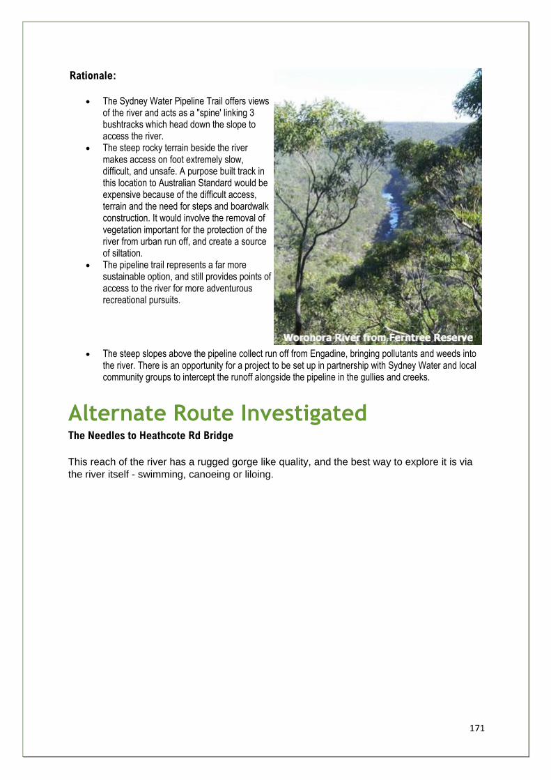
171
Rationale:
• The Sydney Water Pipeline Trail offers views of the river and acts as a "spine' linking 3 bushtracks which head down the slope to access the river.
• The steep rocky terrain beside the river makes access on foot extremely slow, difficult, and unsafe. A purpose built track in this location to Australian Standard would be expensive because of the difficult access, terrain and the need for steps and boardwalk construction. It would involve the removal of vegetation important for the protection of the river from urban run off, and create a source of siltation.
• The pipeline trail represents a far more sustainable option, and still provides points of access to the river for more adventurous recreational pursuits.
• The steep slopes above the pipeline collect run off from Engadine, bringing pollutants and weeds into the river. There is an opportunity for a project to be set up in partnership with Sydney Water and local community groups to intercept the runoff alongside the pipeline in the gullies and creeks.
Alternate Route Investigated The Needles to Heathcote Rd Bridge
This reach of the river has a rugged gorge like quality, and the best way to explore it is via
the river itself - swimming, canoeing or liloing.
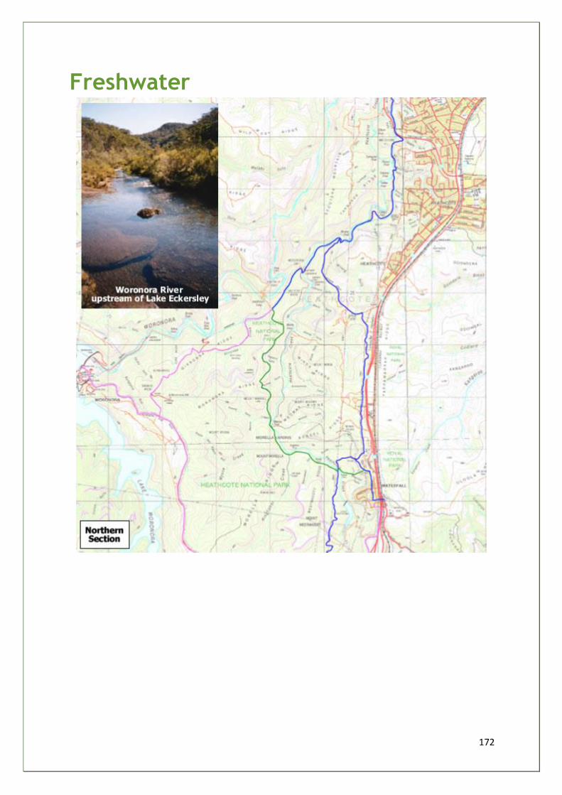
172
Freshwater
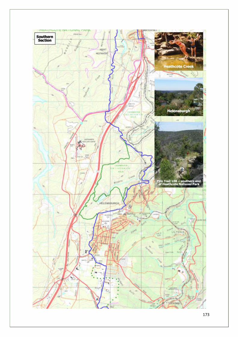
173
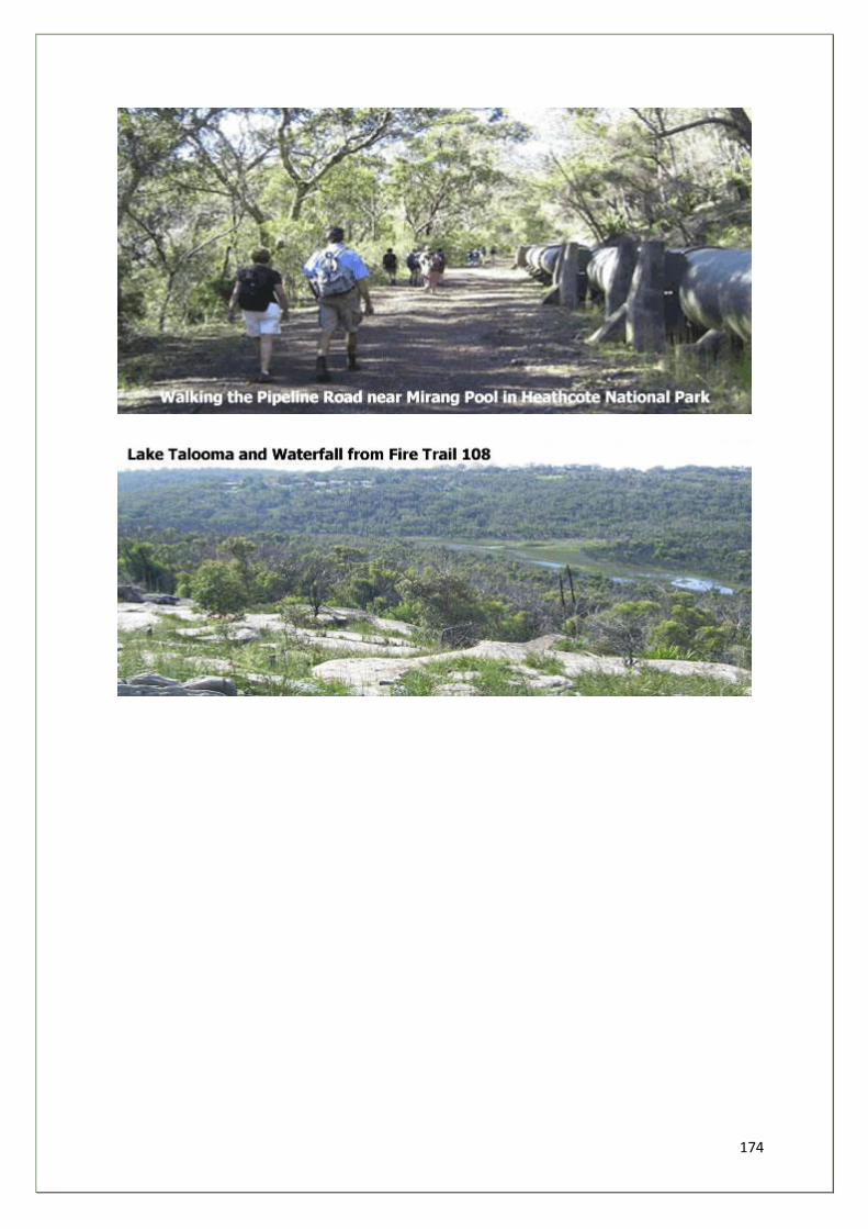
174
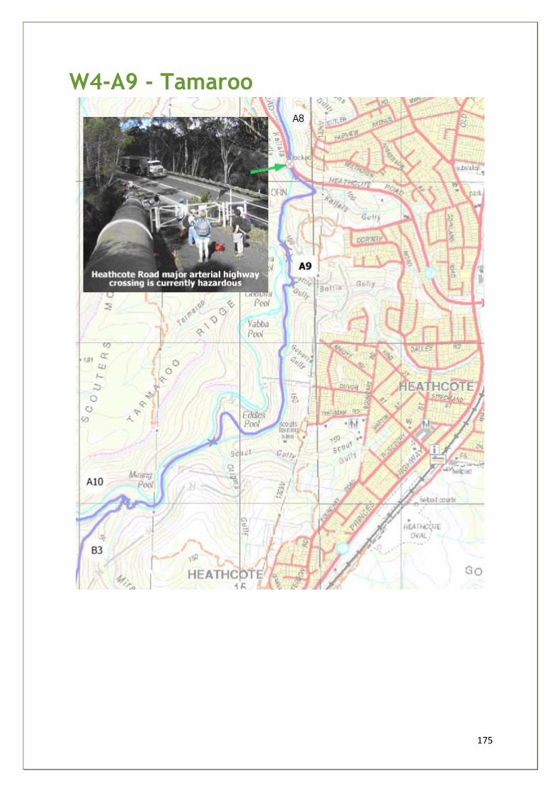
175
W4-A9 - Tamaroo
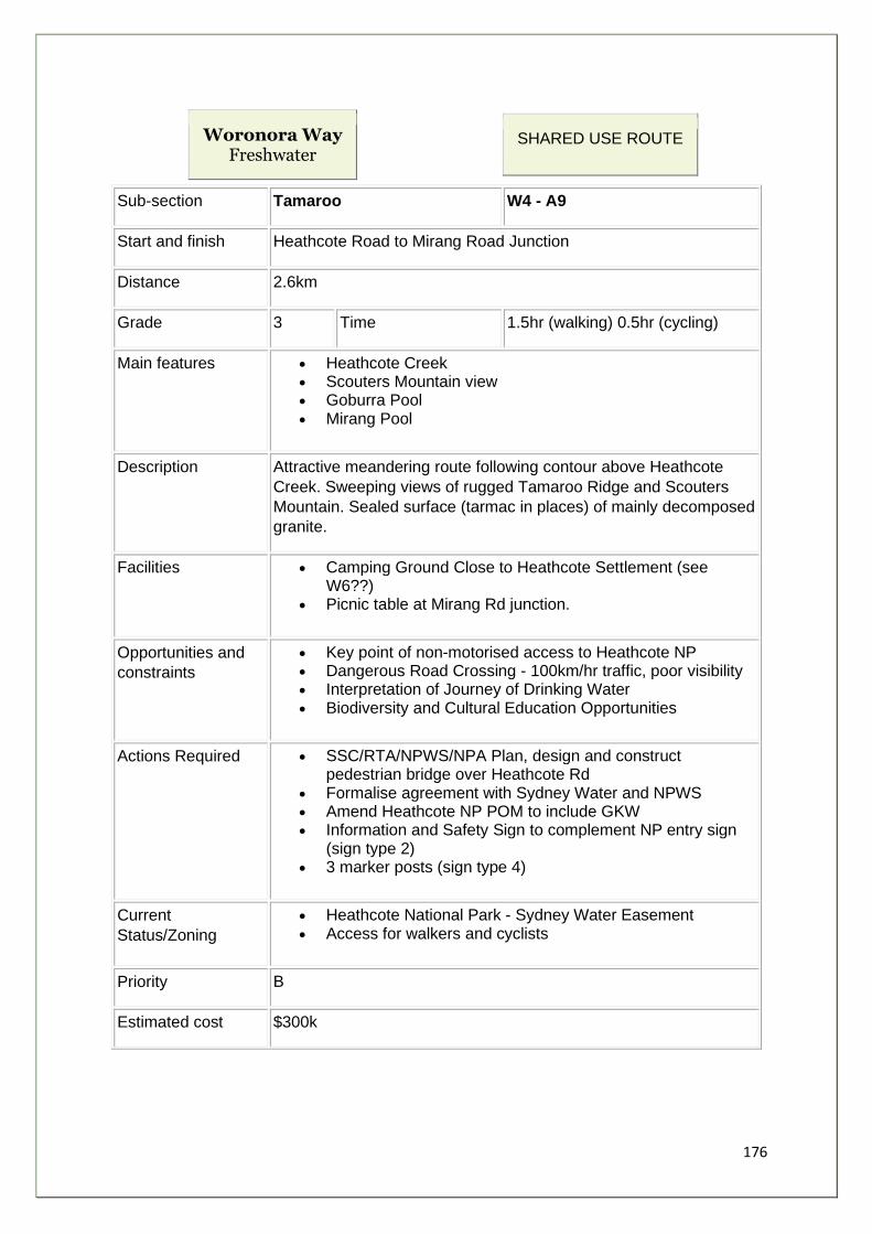
176
Woronora Way Freshwater
SHARED USE ROUTE
Sub-section Tamaroo W4 - A9
Start and finish Heathcote Road to Mirang Road Junction
Distance 2.6km
Grade 3 Time 1.5hr (walking) 0.5hr (cycling)
Main features • Heathcote Creek • Scouters Mountain view • Goburra Pool • Mirang Pool
Description Attractive meandering route following contour above Heathcote
Creek. Sweeping views of rugged Tamaroo Ridge and Scouters
Mountain. Sealed surface (tarmac in places) of mainly decomposed
granite.
Facilities • Camping Ground Close to Heathcote Settlement (see W6??)
• Picnic table at Mirang Rd junction.
Opportunities and
constraints
• Key point of non-motorised access to Heathcote NP • Dangerous Road Crossing - 100km/hr traffic, poor visibility • Interpretation of Journey of Drinking Water • Biodiversity and Cultural Education Opportunities
Actions Required • SSC/RTA/NPWS/NPA Plan, design and construct pedestrian bridge over Heathcote Rd
• Formalise agreement with Sydney Water and NPWS • Amend Heathcote NP POM to include GKW • Information and Safety Sign to complement NP entry sign
(sign type 2) • 3 marker posts (sign type 4)
Current
Status/Zoning
• Heathcote National Park - Sydney Water Easement • Access for walkers and cyclists
Priority B
Estimated cost $300k
177
Stakeholders
Community
NPA, Heathcote Settlement, J. Harold Kaye Scout Centre,
Heathcote Progress Association, Sutherland Shire Bush Walking
Club
Agency/Land
Manager NPWS, Sydney Water, NPA, SSC, DIPNR, SSCMB
Rationale:
For this section of the route to be viable a safe link across Heathcote Road is vital (see
photo).Four factors contribute to the present hazardous crossing situation:
1. speed of vehicles - speed limit is 90 km/h 2. speed is exacerbated by the steep downslope on the Heathcote National Park side
of the road 3. heavy volume of heavy traffic 4. crossing point is on a bend in the road, limiting the time to see approaching vehicles
and for them to see pedestrians
The preferred option is to construct a purpose built pedestrian bridge across the
carriageway. Because of the nature of the terrain a long flight of steps is necessary on the
Heathcote National Park side. This will inconvenience but should not deter cyclists from
using the bridge.
The Pipeline Track in the National Park is open to public use for both walkers and cyclists,
and is generally a good quality surface, either bitumen or decomposed granite. Long term
maintenance of the track corridor is carried out by National Parks, with Sydney Water
responsible for the repair of specific structures such as bridges. There are good views of
the National Park and the pools in Heathcote Creek. The wild, rugged nature of the park
can be appreciated as well as marveling at some of the engineering feats accomplished to
provide Woronora Dam Pipeline.
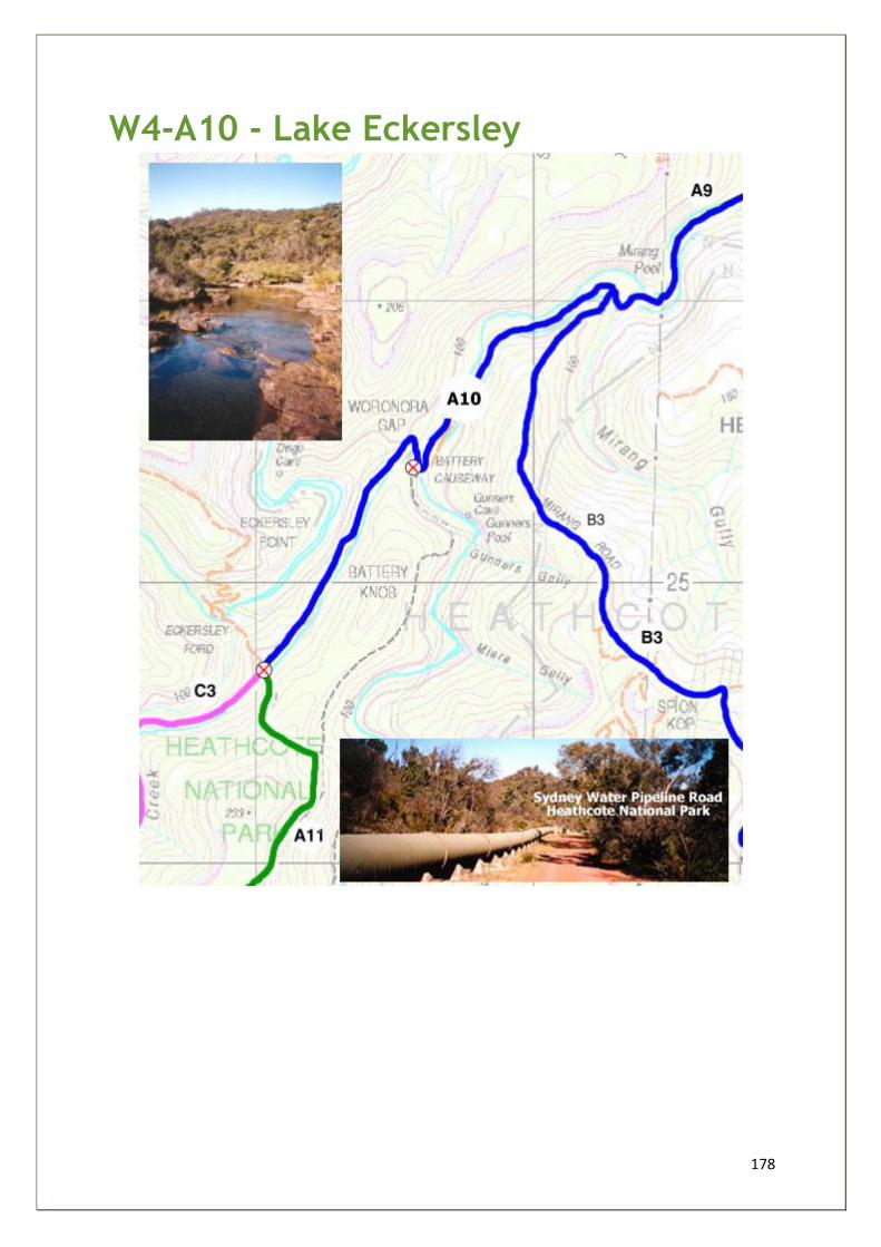
178
W4-A10 - Lake Eckersley
179
Woronora Way Freshwater
SHARED USE ROUTE
Sub-section Lake Eckersley W4 - A10
Start and finish Mirang Road Junction to Eckersley Ford Crossroads
Distance 1.8km
Grade 2 Time 1hr (walking) 0.25hr (cycling)
Main features • Battery Causeway • Lake Eckersley (a detour) • Views of Eckersley Ridge
Description Bitumen surface and quality sandstone surfaced 3m wide track
Facilities • Camping Ground at Lake Eckersley
Opportunities and
constraints
• Interpretation of Journey of Drinking Water on publicity materials
• Biodiversity, Cultural and Historical Education Opportunities • Prevent cycle access to Bullawaring and Eckersley Ford
tracks - walking-only signs, sympathetically designed bike racks at Battery Causeway.
Actions Required • Formalise agreement with Sydney Water and NPWS • Amend Heathcote NP POM to include GKW • 1 x information/waymarker sign at junction of Pipeline Road
and Goanna track
Current
Status/Zoning
• Heathcote National Park - Sydney Water Board Easement • Shared access for walking and cycling
Priority C
Estimated cost $500
Stakeholders
Community NPA
Agency/Land
Manager NPWS, Sydney Water
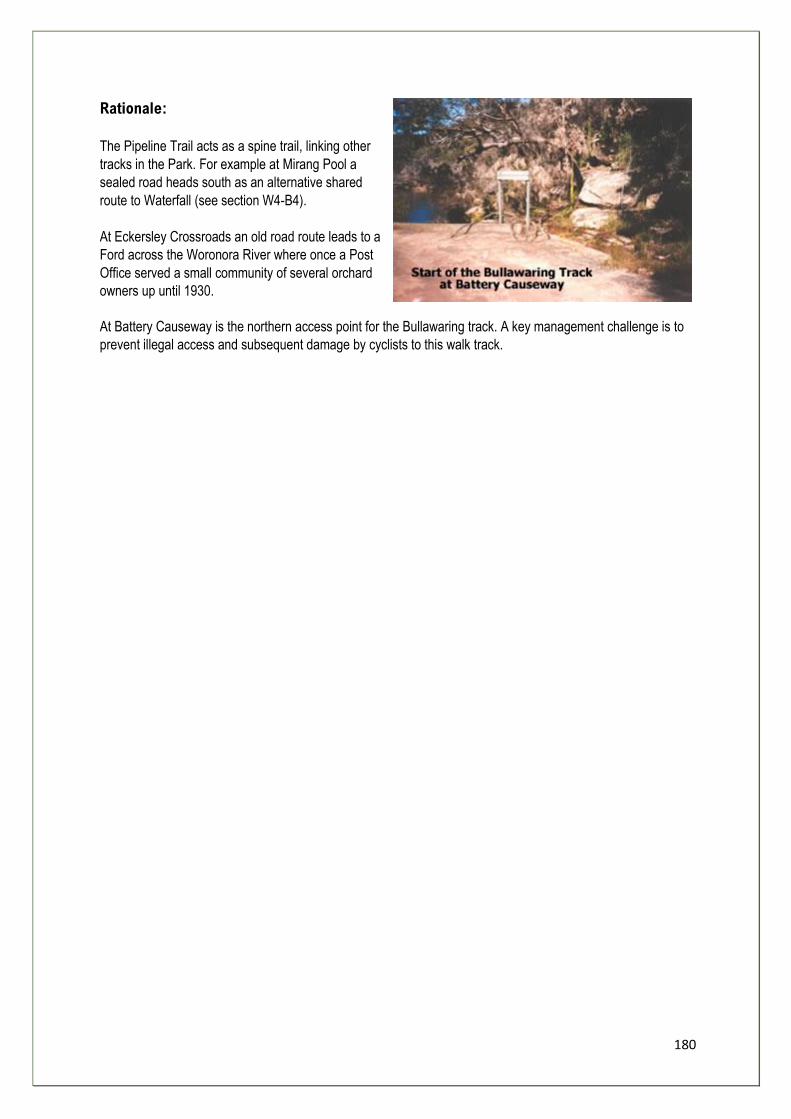
180
Rationale:
The Pipeline Trail acts as a spine trail, linking other
tracks in the Park. For example at Mirang Pool a
sealed road heads south as an alternative shared
route to Waterfall (see section W4-B4).
At Eckersley Crossroads an old road route leads to a
Ford across the Woronora River where once a Post
Office served a small community of several orchard
owners up until 1930.
At Battery Causeway is the northern access point for the Bullawaring track. A key management challenge is to
prevent illegal access and subsequent damage by cyclists to this walk track.
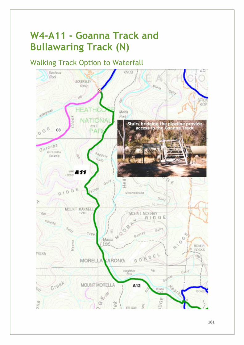
181
W4-A11 - Goanna Track and Bullawaring Track (N)
Walking Track Option to Waterfall
182
Woronora Way Freshwater
PEDESTRIAN ROUTE
Sub-section Goanna Track and Bullawaring
Track (N) W4 - A11
Start and finish Eckersley Ford Crossroads to Myuna Pool
Distance 2.8km
Grade 2-4 Time 2hr
Main features • Marks Lookout - 360 degree views (incl. Eckersley Ridge, Holsworthy military land and Yarrawarra Ridge)
• Myuna Pool • Links to Mooray Track Views of and the to North West
Description NPWS-managed walking track, recently refurbished with new signs (Winter
2003), bare sandstone, loosely defined in places, steep gully sections.
Facilities • Camp Ground
Opportunities
and constraints
• Preventing Cycle Access from Pipeline Road • Clarify signage at junction of Goanna and Bullawaring Tracks • Sensitive Plant Communities • Biodiversity and Cultural Education Opportunities • Views over hills to the east
Actions Required • Amend Heathcote NP POM to include GKW • 5 x waymarker signs
Current
Status/Zoning • Heathcote National Park - designated walking track
Priority B
Estimated cost $500
Stakeholders
Community NPA
Agency/Land
Manager NPWS
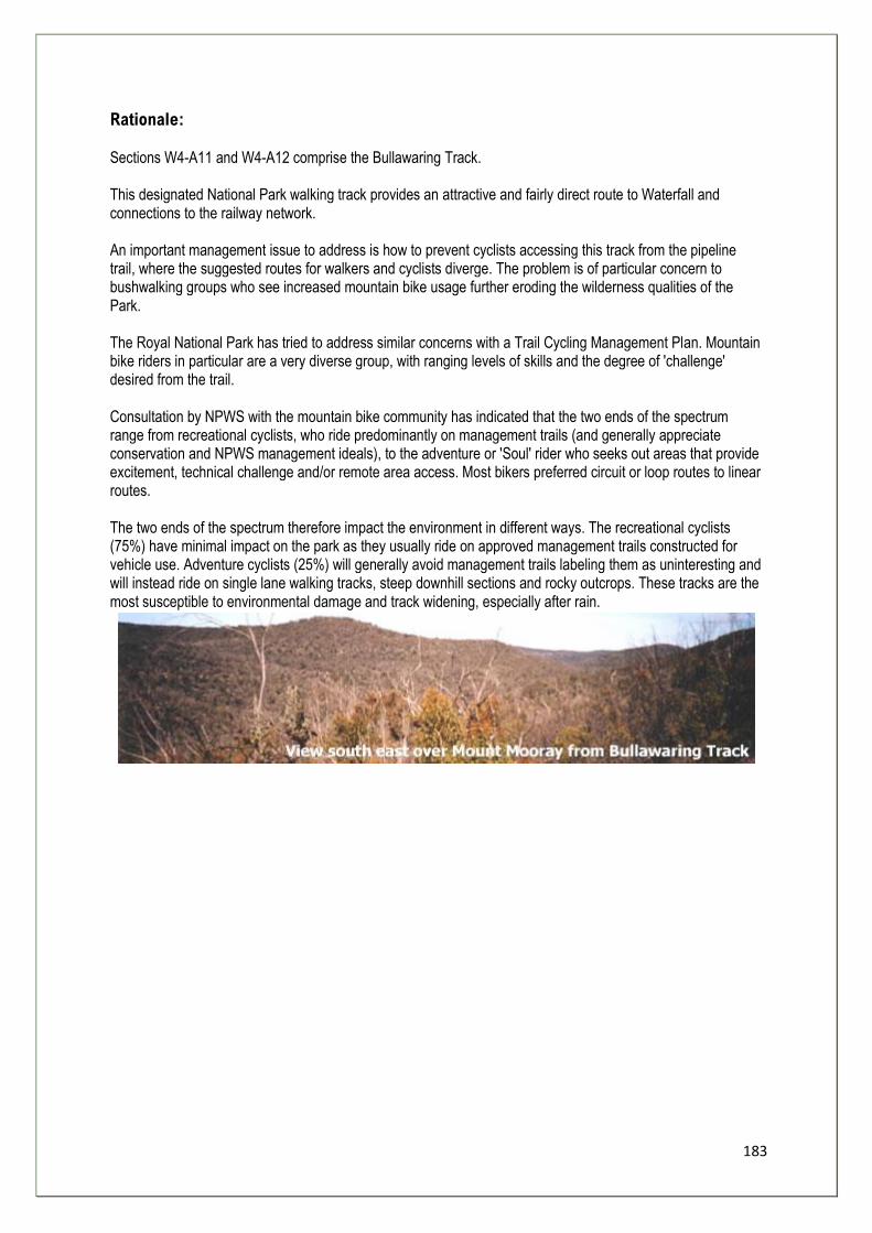
183
Rationale: Sections W4-A11 and W4-A12 comprise the Bullawaring Track. This designated National Park walking track provides an attractive and fairly direct route to Waterfall and connections to the railway network. An important management issue to address is how to prevent cyclists accessing this track from the pipeline trail, where the suggested routes for walkers and cyclists diverge. The problem is of particular concern to bushwalking groups who see increased mountain bike usage further eroding the wilderness qualities of the Park. The Royal National Park has tried to address similar concerns with a Trail Cycling Management Plan. Mountain bike riders in particular are a very diverse group, with ranging levels of skills and the degree of 'challenge' desired from the trail. Consultation by NPWS with the mountain bike community has indicated that the two ends of the spectrum range from recreational cyclists, who ride predominantly on management trails (and generally appreciate conservation and NPWS management ideals), to the adventure or 'Soul' rider who seeks out areas that provide excitement, technical challenge and/or remote area access. Most bikers preferred circuit or loop routes to linear routes. The two ends of the spectrum therefore impact the environment in different ways. The recreational cyclists (75%) have minimal impact on the park as they usually ride on approved management trails constructed for vehicle use. Adventure cyclists (25%) will generally avoid management trails labeling them as uninteresting and will instead ride on single lane walking tracks, steep downhill sections and rocky outcrops. These tracks are the most susceptible to environmental damage and track widening, especially after rain.
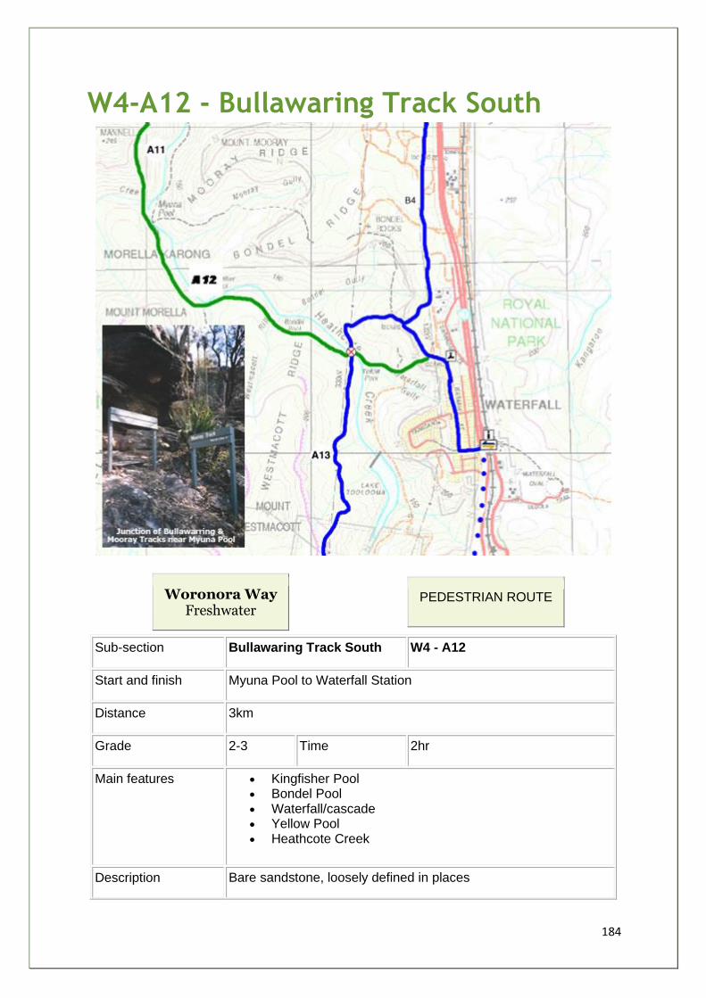
184
W4-A12 - Bullawaring Track South
Woronora Way Freshwater
PEDESTRIAN ROUTE
Sub-section Bullawaring Track South W4 - A12
Start and finish Myuna Pool to Waterfall Station
Distance 3km
Grade 2-3 Time 2hr
Main features • Kingfisher Pool • Bondel Pool • Waterfall/cascade • Yellow Pool • Heathcote Creek
Description Bare sandstone, loosely defined in places
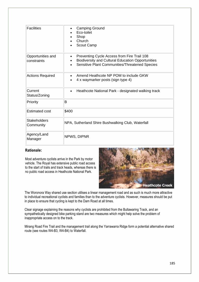
185
Facilities • Camping Ground • Eco-toilet • Shop • Church • Scout Camp
Opportunities and
constraints
• Preventing Cycle Access from Fire Trail 108 • Biodiversity and Cultural Education Opportunities • Sensitive Plant Communities/Threatened Species
Actions Required • Amend Heathcote NP POM to include GKW • 4 x waymarker posts (sign type 4)
Current
Status/Zoning
• Heathcote National Park - designated walking track
Priority B
Estimated cost $400
Stakeholders
Community NPA, Sutherland Shire Bushwalking Club, Waterfall
Agency/Land
Manager NPWS, DIPNR
Rationale: Most adventure cyclists arrive in the Park by motor vehicle. The Royal has extensive public road access to the start of trails and track heads, whereas there is no public road access in Heathcote National Park.
The Woronora Way shared use section utilises a linear management road and as such is much more attractive to individual recreational cyclists and families than to the adventure cyclists. However, measures should be put in place to ensure that cycling is kept to the Dam Road at all times. Clear signage explaining the reasons why cyclists are prohibited from the Bullawaring Track, and an sympathetically designed bike parking stand are two measures which might help solve the problem of inappropriate access on to the track. Mirang Road Fire Trail and the management trail along the Yarrawarra Ridge form a potential alternative shared route (see routes W4-B3, W4-B4) to Waterfall.
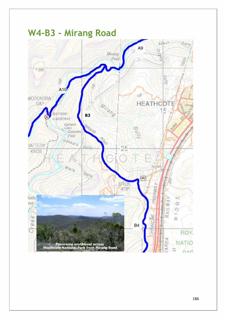
186
W4-B3 - Mirang Road
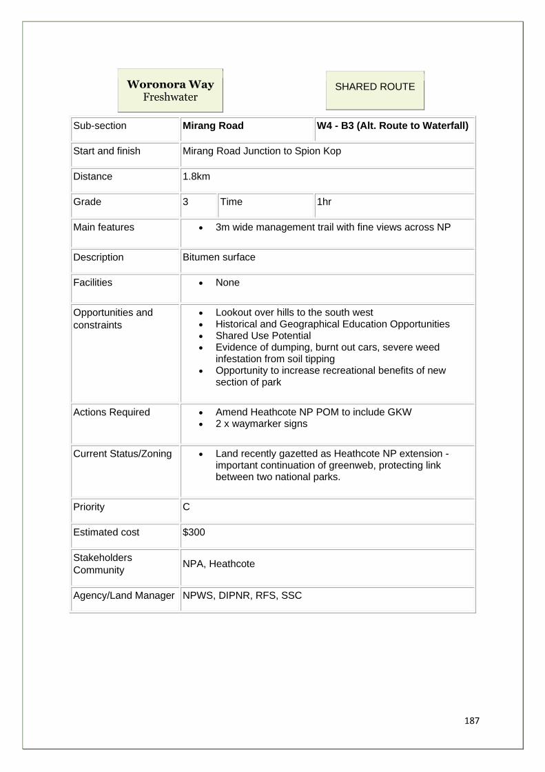
187
Woronora Way Freshwater
SHARED ROUTE
Sub-section Mirang Road W4 - B3 (Alt. Route to Waterfall)
Start and finish Mirang Road Junction to Spion Kop
Distance 1.8km
Grade 3 Time 1hr
Main features • 3m wide management trail with fine views across NP
Description Bitumen surface
Facilities • None
Opportunities and
constraints
• Lookout over hills to the south west • Historical and Geographical Education Opportunities • Shared Use Potential • Evidence of dumping, burnt out cars, severe weed
infestation from soil tipping • Opportunity to increase recreational benefits of new
section of park
Actions Required • Amend Heathcote NP POM to include GKW • 2 x waymarker signs
Current Status/Zoning • Land recently gazetted as Heathcote NP extension - important continuation of greenweb, protecting link between two national parks.
Priority C
Estimated cost $300
Stakeholders
Community NPA, Heathcote
Agency/Land Manager NPWS, DIPNR, RFS, SSC

188
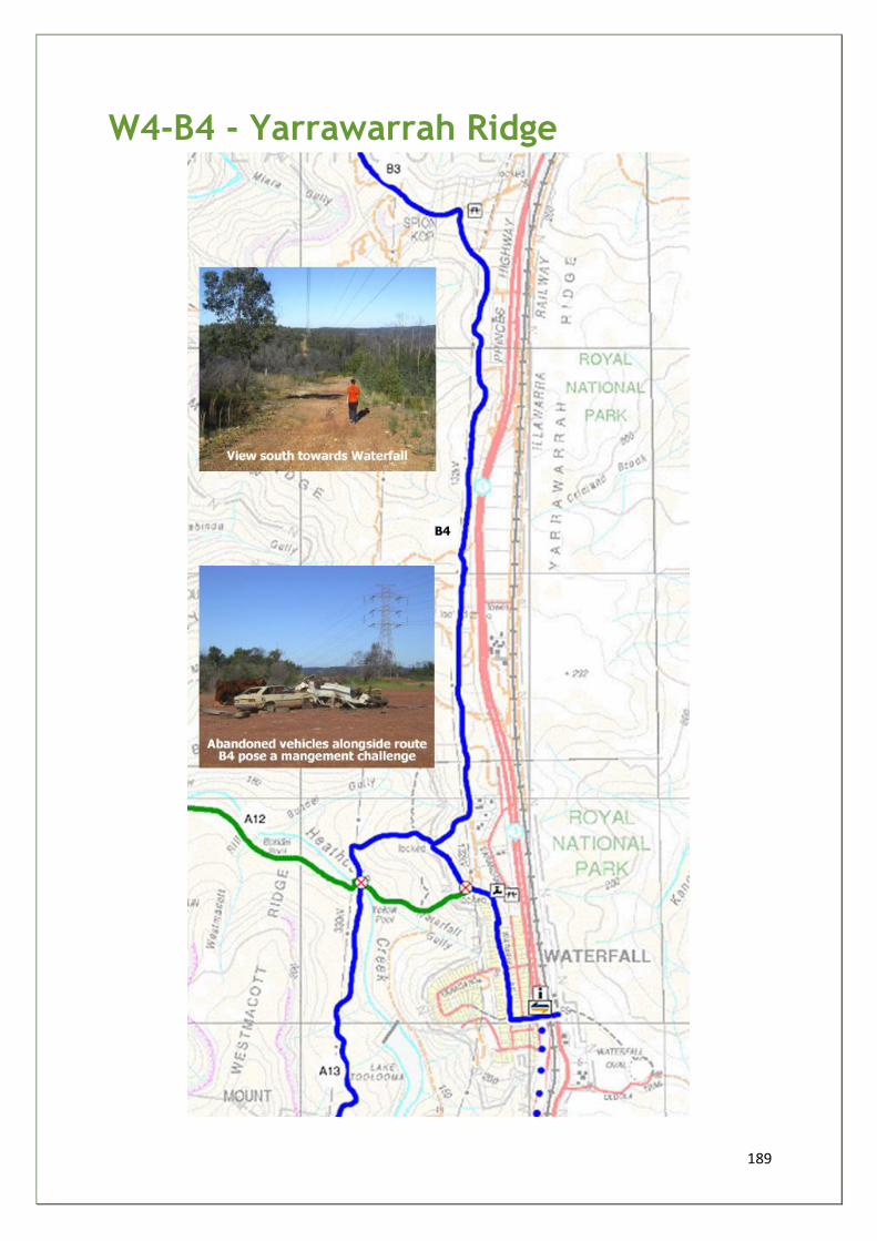
189
W4-B4 - Yarrawarrah Ridge
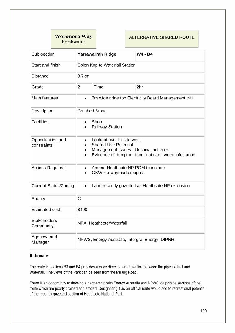
190
Woronora Way Freshwater
ALTERNATIVE SHARED ROUTE
Sub-section Yarrawarrah Ridge W4 - B4
Start and finish Spion Kop to Waterfall Station
Distance 3.7km
Grade 2 Time 2hr
Main features • 3m wide ridge top Electricity Board Management trail
Description Crushed Stone
Facilities • Shop • Railway Station
Opportunities and
constraints
• Lookout over hills to west • Shared Use Potential • Management Issues - Unsocial activities • Evidence of dumping, burnt out cars, weed infestation
Actions Required • Amend Heathcote NP POM to include • GKW 4 x waymarker signs
Current Status/Zoning • Land recently gazetted as Heathcote NP extension
Priority C
Estimated cost $400
Stakeholders
Community NPA, Heathcote/Waterfall
Agency/Land
Manager NPWS, Energy Australia, Intergral Energy, DIPNR
Rationale:
The route in sections B3 and B4 provides a more direct, shared use link between the pipeline trail and
Waterfall. Fine views of the Park can be seen from the Mirang Road.
There is an opportunity to develop a partnership with Energy Australia and NPWS to upgrade sections of the
route which are poorly drained and eroded. Designating it as an official route would add to recreational potential
of the recently gazetted section of Heathcote National Park.

191
However the route takes users away from the heart of the park and its natural and cultural values. People are
also further removed from the Woronora River and its main tributary Heathcote Creek.
The attractiveness of Yarrawarra Ridge B3 as a route is considerably reduced, by 4 factors:
• For most of its length it utilises an Energy Australia maintenance trail, beneath overhead electric cables and supporting pylons.
• The constant noise from vehicles on Princes Highway. • There are unresolved management issues such as illegal 4WD access, illegal dumping of hazardous
materials, burning out of cars, etc. • Despite running close to the ridge top, there are few opportunities for views across the Park and the
track is enclosed by vegetation on both sides.
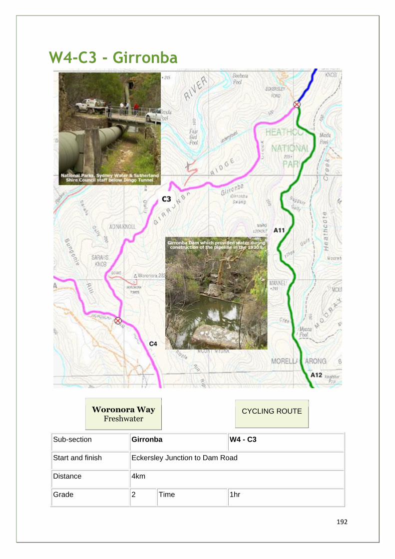
192
W4-C3 - Girronba
Woronora Way Freshwater
CYCLING ROUTE
Sub-section Girronba W4 - C3
Start and finish Eckersley Junction to Dam Road
Distance 4km
Grade 2 Time 1hr
193
Main features • Girronba Dam • Historical Dingo tunnel (Pipeline) • Views of Woronora Dam
Description Bitumen surface, ironstone or sandstone surfaced 4m wide road
Facilities • Girronba Picnic Area
Opportunities and
constraints
• Lookout over hills to west • Interpret Girronba and tunnel on literature • Historical and Geographical Education Opportunities • At junction with Dam Rd signage to prevent SCA access -
extra signage • Rare Orchids and vulnerable species - Heath Monitor • Evidence of dumping, burnt out cars, weed infestation
Actions Required • Amend Heathcote NP POM to include GKW • 4 x waymarker signs
Current Status/Zoning • Sydney Water Easement managed by NPWS
Priority C
Estimated cost $400
Stakeholders
Community NPA, Sutherland Shire Bushwalking Club, Sharkbike
Agency/Land Manager NPWS, Sydney Water, SCA
Rationale:
Cycling Route to Waterfall via Woronora Dam
The following 3 sections of the Way, W4-C3 to C5, suggest a route where cycling is
permitted, continuing along the pipeline road, utilising existing management roads to
access the Woronora Dam and Woronora Dam Road. At the junction with Princes Highway
the Way continues east for 800m before rejoining the shared route south along Cawleys
Road to Helensburgh (refer to W4-A13)
Although the route is used by walkers to connect to bush tracks, there are risks in using the
Dam Road because of its narrow width and the presence of heavy vehicles accessing the
Dam. For these reasons it has not been chosen as a walking route for the Way.
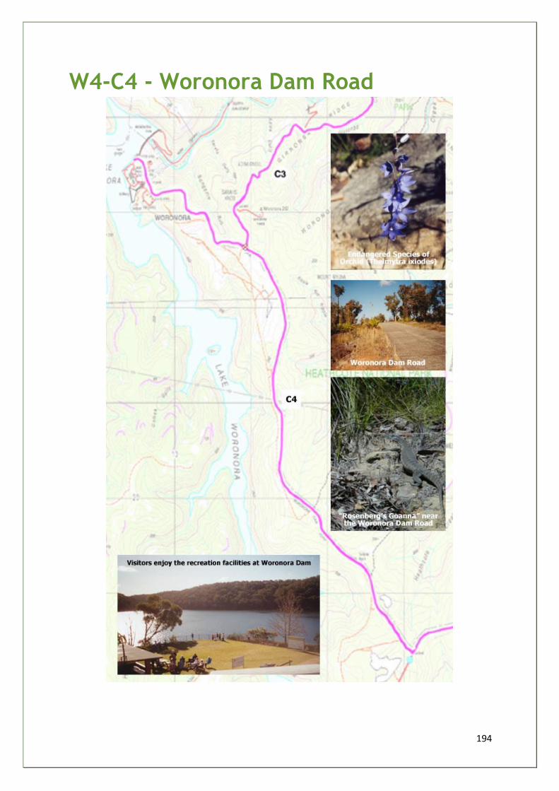
194
W4-C4 - Woronora Dam Road
195
Woronora Way Freshwater
CYCLING ROUTE
Sub-section Woronora Dam Road W4 - C4
Start and finish Dam Road Junction to Princes Highway (Dam Spur)
Distance 5.2km
Grade 2 Time 1hr
Main features • Sealed surface service Road overlooking Woronora dam
Description Good condition
Facilities • Picnic grounds • Toilets at Dam
Opportunities and
constraints
• Interpretation of Journey of Drinking Water • Sydney Catchment Authority have concerns with bike use on
road because of lack of shoulder • Potential for inappropriate access to protected catchment
lands
Actions Required • Amend Heathcote NP POM to include GKW • Extra penalty notices along a SCA special area boundary • 2 x waymarker signs
Current
Status/Zoning
Sydney Water Corporation own road between land under care and
control of NPWS and SCA
Priority C
Estimated cost $200
Stakeholders
Community NPA, Sharkbike
Agency/Land
Manager NPWS, Sydney Catchment Authority, Sydney Water
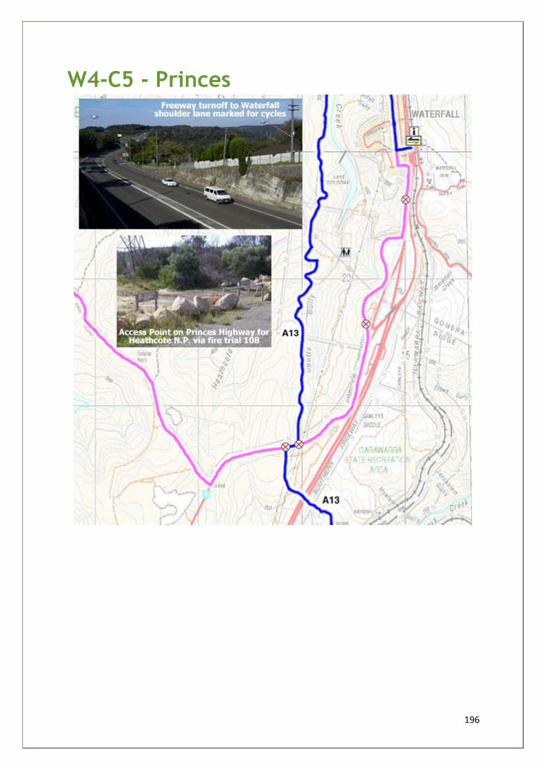
196
W4-C5 - Princes
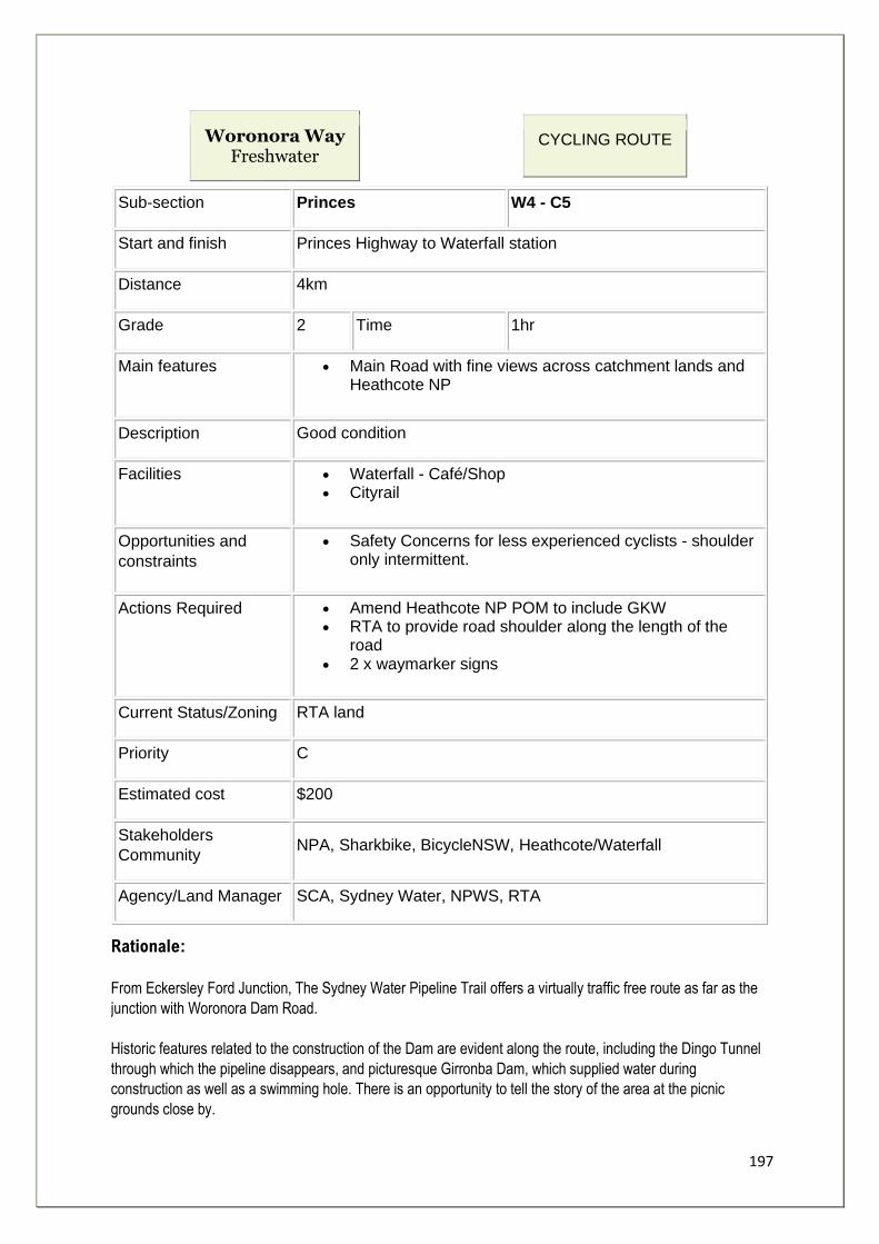
197
Woronora Way Freshwater
CYCLING ROUTE
Sub-section Princes W4 - C5
Start and finish Princes Highway to Waterfall station
Distance 4km
Grade 2 Time 1hr
Main features • Main Road with fine views across catchment lands and Heathcote NP
Description Good condition
Facilities • Waterfall - Café/Shop • Cityrail
Opportunities and
constraints
• Safety Concerns for less experienced cyclists - shoulder only intermittent.
Actions Required • Amend Heathcote NP POM to include GKW • RTA to provide road shoulder along the length of the
road • 2 x waymarker signs
Current Status/Zoning RTA land
Priority C
Estimated cost $200
Stakeholders
Community NPA, Sharkbike, BicycleNSW, Heathcote/Waterfall
Agency/Land Manager SCA, Sydney Water, NPWS, RTA
Rationale:
From Eckersley Ford Junction, The Sydney Water Pipeline Trail offers a virtually traffic free route as far as the
junction with Woronora Dam Road.
Historic features related to the construction of the Dam are evident along the route, including the Dingo Tunnel
through which the pipeline disappears, and picturesque Girronba Dam, which supplied water during
construction as well as a swimming hole. There is an opportunity to tell the story of the area at the picnic
grounds close by.
198
At Sarahs Knob views can be seen of the Dam Wall and the body of water behind.
The Dam visitor centre provides an interesting detour from the spine route.
Sydney Catchment Authority have raised the issue of safety for cyclists using the Dam Road from the Dam to
Princes Highway W4-C5 and W4-C6. Two solutions are suggested:
• Traffic calming measures to reduce vehicle speeds along the road; and • Provision of a shoulder with white cycle markings to one side of the road. The shoulder option is
complicated by the presence of rare orchids in the roadside verges, which are protected under the provisions of the Threatened Species and Conservation Act.
The provision of a marked shoulder for cyclists along Princes Highway between the Dam road turn off and the
freeway would be desirable. The freeway has a cycle lane marked which turns off to Waterfall. The driver
training centre road provides a potential alternative route for 1km just before Waterfall.
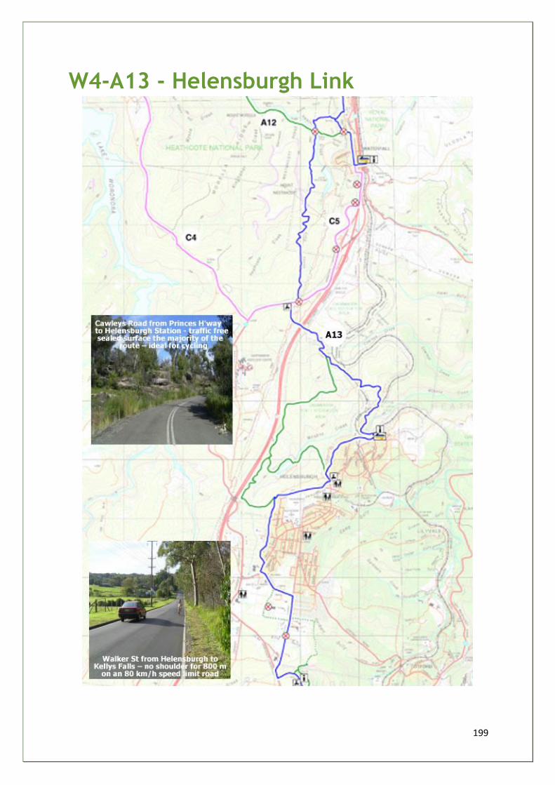
199
W4-A13 - Helensburgh Link
200
Woronora Way Freshwater
SHARED USE ROUTE
LGA(s) - Sutherland & Wollongong
Sub-section Helensburgh Link W4 - A13
Start and
finish Waterfall to Kellys Falls (Stanwell Tops) via Helensburgh
Distance 12.5km
Grade 2-3
Main features • Heathcote National Park - Lake Toolooma and Coutts Gully • Garrawarra State Conservation Area - Wilsons Creek Dam • Kellys Falls and Princess Marina Walk • Sri Venkateswara (Hindu) Temple • Symbio Wildlife Gardens Zoo and Fauna Park
Description S through Heathcote NP and section leased for Scout Camp Coutts on
fire trail 108. Princes H/way shoulder for 100m to join Cawleys Rd.
(closed to traffic) to Helensburgh Station. (Walking route heads S and W
from Road looping around Wilsons Dam, rejoins shared route at The
Ridge). The Ridge, Helensburgh Park, streets/tracks to Cemetery Rd,
Walker St. and Kellys Falls.
Facilities • Waterfall Café • Waterfall and Helensburgh Rail Stations • Helensburgh Shopping Centre • Helensburgh Park - Playground, BBQ, Picnic, Toilets. • Helensburgh Caravan Park
Opportunities
and
constraints
• Cross community partnership between SSC and WCC LGAs • Improve Access Control points along Princes Highway to deter
unauthorised 4WDs, illegal trail bikes, dumping, etc, encouraging legitimate access to Garrawarra SRA
• NPWS interested in acquiring riparian lands at Kellys and Gills Creeks - maintaining wildlife corridors and potential to formalise walking track between Walker Street and Kellys Falls
• Safety issue - 80kph speeds on Walker Street with no shoulder for 800m
• Investigate potential of existing route on private land between Cemetery Road and Temple Road as alternative to Walker Street
• Economic benefits to Helensburgh from increase in visitors • Rail link from Helensburgh to Waterfall completes a loop • Partnership with SCMB to use tracks as focus for Hacking River
catchment health/biodiversity/cultural education
201
Actions
Required
• SSEC/SSC/WCC - liaise with NPWS and NPA re: suitability of routes and consent to add GKW emblem to existing signage
• NPWS/WCC/Energy Australia - upgrade gates and barriers at ACPs along Princes Highway. Consider surveillance cameras
• SSEC/WCC - negotiate access easement/VCA with land owner behind cemetery
• NPWS - acquire and develop POM for Kellys Creek area • WCC - install Way display panel in Helensburgh Park
Priority B
Estimated cost $50k + acquisition costs
Stakeholders
Community
Waterfall PS, Helensburgh Schools, Health and Youth Centre, Bush Fire
Brigade, Helensburgh Progress Assoc., Masonic Centre, Helensburgh
Workmens Club, Churches, Landcare Groups, Illawarra Escarpment
Coalition, NPA
Agency/Land
Manager
SSC, WCC, NPWS, SCMB, DIPNR, SRA, SCA, Sydney Water,
Dharawal LALC, Illawarra Tourism
Rationale:
In order to avoid crossing the Special Area lands managed by Sydney Catchment Authority at the head of the
Woronora, and to avoid using Princes Highway, the route detours into the Hacking River catchment.
Fire Trail 108 follows a utility easement through the southern section of Heathcote National Park offering
sweeping views of Lake Toolooma and Waterfall. Cyclists taking the Woronora Dam Road option (W4-C4) can
rejoin the Way at the junction of Princes Highway and Cawleys Road, or carry on along Princes Highway to
Waterfall (W4-C5).
Cawleys Road provides a traffic free shared route through the undulating topography of Garrawarra State
Conservation Area as far as Helensburgh, although initially the route is blighted by refuse dumping and
evidence of burnouts. A walking only alternative route is identified, using existing management and walking
tracks to explore Garrawarra SCA, including Wilsons Creek and Dam.
Around Helensburgh the options are limited by private land ownership constraints, and a lack of existing off-
road routes. It is recommended that a walking route alternative to Walker Street be pursued - either on the west
side requiring land owner consent/compensation; or the east side, where NPWS may acquire land.
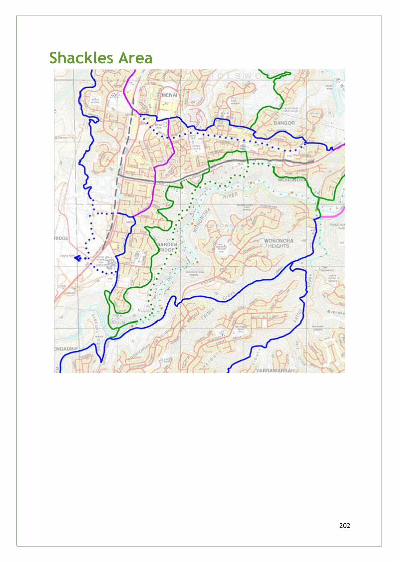
202
Shackles Area
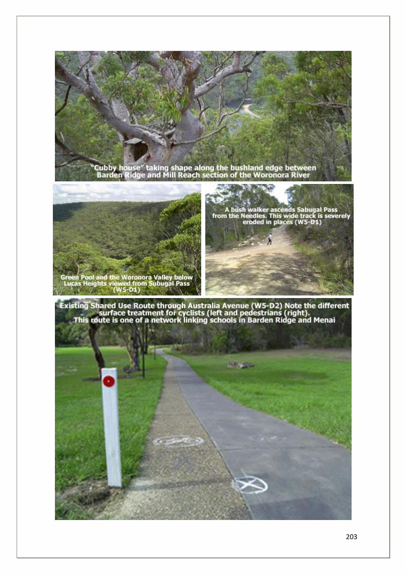
203
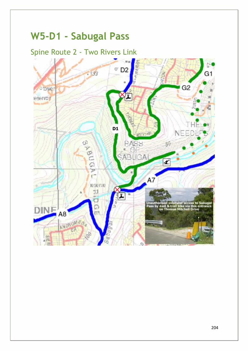
204
W5-D1 - Sabugal Pass
Spine Route 2 - Two Rivers Link
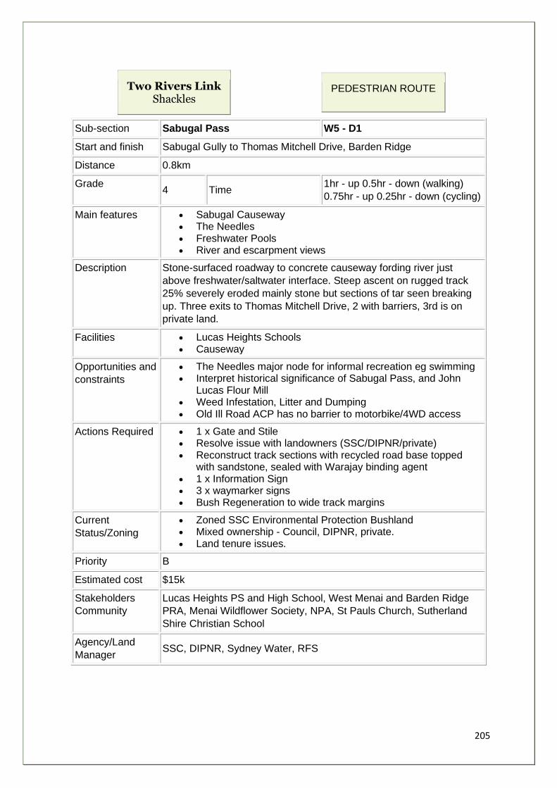
205
Two Rivers Link Shackles
PEDESTRIAN ROUTE
Sub-section Sabugal Pass W5 - D1
Start and finish Sabugal Gully to Thomas Mitchell Drive, Barden Ridge
Distance 0.8km
Grade 4 Time
1hr - up 0.5hr - down (walking)
0.75hr - up 0.25hr - down (cycling)
Main features • Sabugal Causeway • The Needles • Freshwater Pools • River and escarpment views
Description Stone-surfaced roadway to concrete causeway fording river just
above freshwater/saltwater interface. Steep ascent on rugged track
25% severely eroded mainly stone but sections of tar seen breaking
up. Three exits to Thomas Mitchell Drive, 2 with barriers, 3rd is on
private land.
Facilities • Lucas Heights Schools • Causeway
Opportunities and
constraints
• The Needles major node for informal recreation eg swimming • Interpret historical significance of Sabugal Pass, and John
Lucas Flour Mill • Weed Infestation, Litter and Dumping • Old Ill Road ACP has no barrier to motorbike/4WD access
Actions Required • 1 x Gate and Stile • Resolve issue with landowners (SSC/DIPNR/private) • Reconstruct track sections with recycled road base topped
with sandstone, sealed with Warajay binding agent • 1 x Information Sign • 3 x waymarker signs • Bush Regeneration to wide track margins
Current
Status/Zoning
• Zoned SSC Environmental Protection Bushland • Mixed ownership - Council, DIPNR, private. • Land tenure issues.
Priority B
Estimated cost $15k
Stakeholders
Community
Lucas Heights PS and High School, West Menai and Barden Ridge
PRA, Menai Wildflower Society, NPA, St Pauls Church, Sutherland
Shire Christian School
Agency/Land
Manager SSC, DIPNR, Sydney Water, RFS
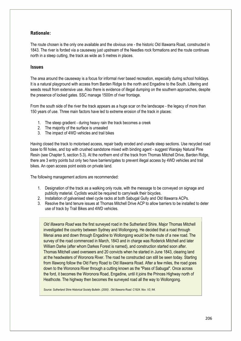
206
Rationale:
The route chosen is the only one available and the obvious one - the historic Old Illawarra Road, constructed in
1843. The river is forded via a causeway just upstream of the Needles rock formations and the route continues
north in a steep cutting, the track as wide as 5 metres in places.
Issues
The area around the causeway is a focus for informal river based recreation, especially during school holidays.
It is a natural playground with access from Barden Ridge to the north and Engadine to the South. Littering and
weeds result from extensive use. Also there is evidence of illegal dumping on the southern approaches, despite
the presence of locked gates. SSC manage 1500m of river frontage.
From the south side of the river the track appears as a huge scar on the landscape - the legacy of more than
150 years of use. Three main factors have led to extreme erosion of the track in places:
1. The steep gradient - during heavy rain the track becomes a creek 2. The majority of the surface is unsealed 3. The impact of 4WD vehicles and trail bikes
Having closed the track to motorised access, repair badly eroded and unsafe steep sections. Use recycled road
base to fill holes, and top with crushed sandstone mixed with binding agent - suggest Warajay Natural Pine
Resin (see Chapter 5, section 5.3). At the northern end of the track from Thomas Mitchell Drive, Barden Ridge,
there are 3 entry points but only two have barriers/gates to prevent illegal access by 4WD vehicles and trail
bikes. An open access point exists on private land.
The following management actions are recommended:
1. Designation of the track as a walking only route, with the message to be conveyed on signage and publicity material. Cyclists would be required to carry/walk their bicycles.
2. Installation of galvanised steel cycle racks at both Sabugal Gully and Old Illawarra ACPs. 3. Resolve the land tenure issues at Thomas Mitchell Drive ACP to allow barriers to be installed to deter
use of track by Trail Bikes and 4WD vehicles.
Old Illawarra Road was the first surveyed road in the Sutherland Shire. Major Thomas Mitchell
investigated the country between Sydney and Wollongong. He decided that a road through
Menai area and down through Engadine to Wollongong would be the route of a new road. The
survey of the road commenced in March, 1843 and in charge was Roderick Mitchell and later
William Darke (after whom Darkes Forest is named), and construction started soon after.
Thomas Mitchell used overseers and 20 convicts when he started in June 1843, clearing land
at the headwaters of Woronora River. The road he constructed can still be seen today. Starting
from Illawong follow the Old Ferry Road to Old Illawarra Road. After a few miles, the road goes
down to the Woronora River through a cutting known as the "Pass of Sabugal". Once across
the ford, it becomes the Woronora Road, Engadine, until it joins the Princes Highway north of
Heathcote. The highway then becomes the surveyed road all the way to Wollongong.
Source: Sutherland Shire Historical Society Bulletin. (2000) . Old Illawarra Road. C1924. Nov. V3, N4.
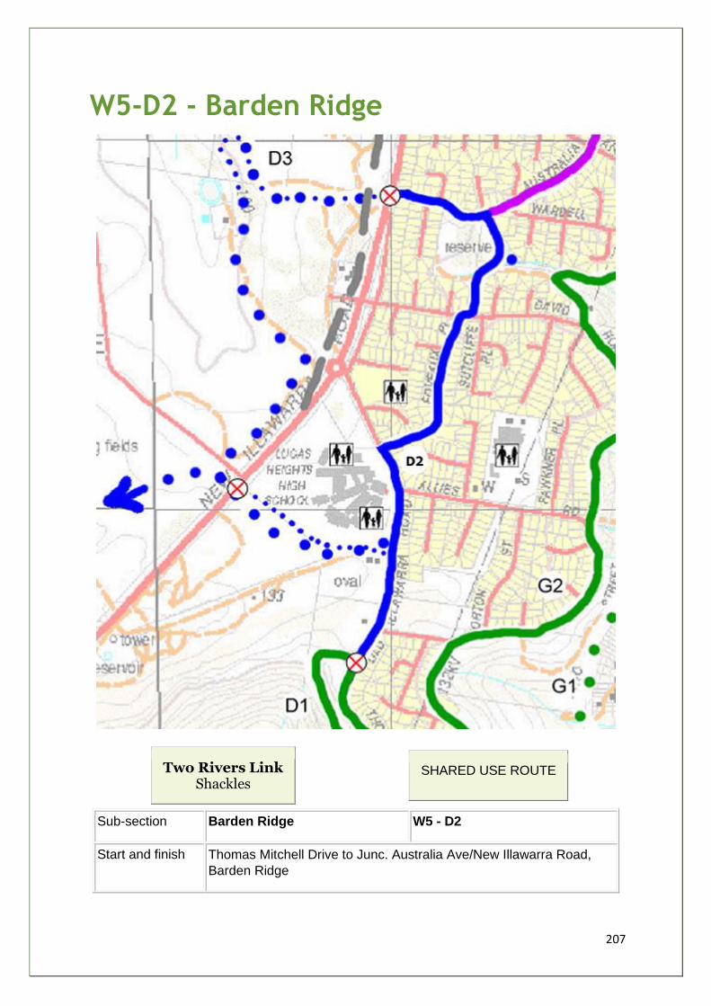
207
W5-D2 - Barden Ridge
Two Rivers Link Shackles
SHARED USE ROUTE
Sub-section Barden Ridge W5 - D2
Start and finish Thomas Mitchell Drive to Junc. Australia Ave/New Illawarra Road,
Barden Ridge
208
Distance 1.5km
Grade 2 Time 0.75hr (walking) 0.25hr (cycling)
Main features • Elevated views of river • Australia Road Reserve • Constructed wetland
Description An intricate network of street pavements and off-road short cuts.
Streets and small reserves mainly on firm concrete or tarmac surface
from Thomas Mitchell Drive north along Old Illawarra Rd to school
crossing. East through small reserve to Foveaux Place, cross David
Rd to shared track through Australia Avenue Reserve to Australia
Road. Rejoin Old Illawarra Road.
Facilities • Lucas Heights Schools • Australia Road Reserve
Opportunities
and constraints
• Develop ties with schools • No pavement on west side of Old Illawarra Road • 3 Street Crossings
Actions Required • 4 x waymarker signs
Current
Status/Zoning
• Zoned SSC
Priority B
Estimated cost $400k
Stakeholders
Community
Lucas Heights PS and High School, West Menai and Barden Ridge
PRA, Menai Wildflower Society, St Pauls Church, Sutherland Shire
Christian School
Agency/Land
Manager SSC, DIPNR, RTA, Gandangara LALC
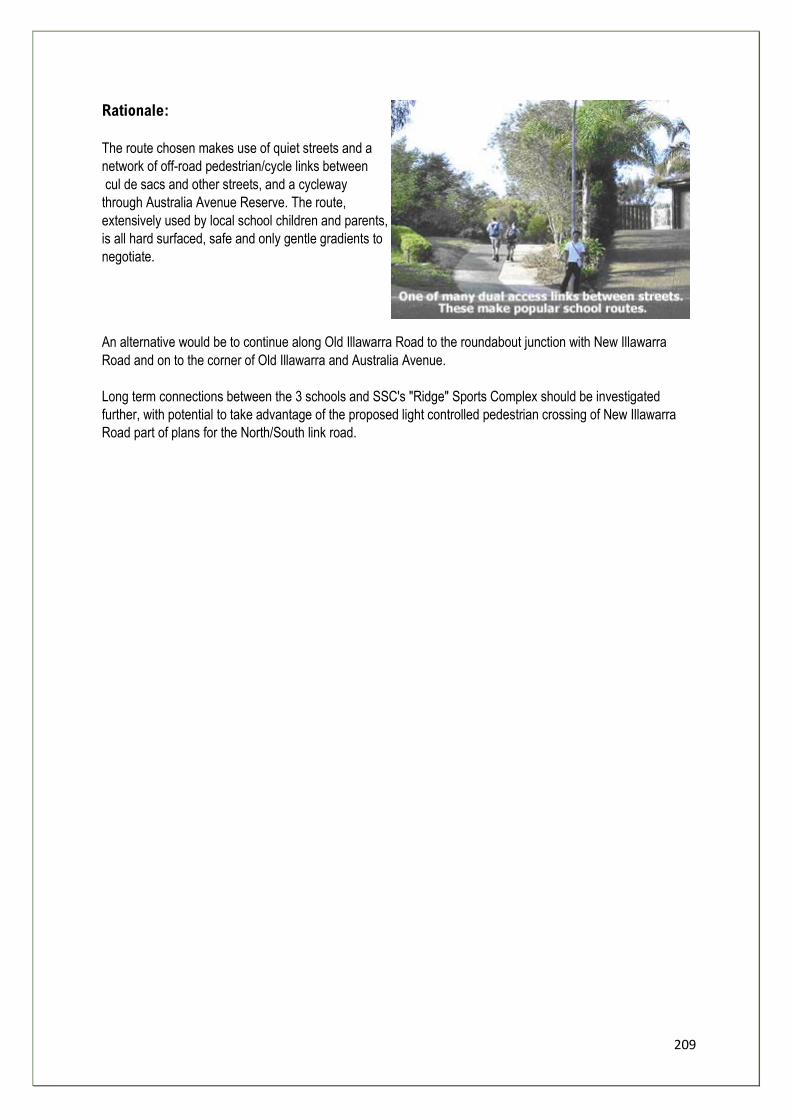
209
Rationale:
The route chosen makes use of quiet streets and a
network of off-road pedestrian/cycle links between
cul de sacs and other streets, and a cycleway
through Australia Avenue Reserve. The route,
extensively used by local school children and parents,
is all hard surfaced, safe and only gentle gradients to
negotiate.
An alternative would be to continue along Old Illawarra Road to the roundabout junction with New Illawarra
Road and on to the corner of Old Illawarra and Australia Avenue.
Long term connections between the 3 schools and SSC's "Ridge" Sports Complex should be investigated
further, with potential to take advantage of the proposed light controlled pedestrian crossing of New Illawarra
Road part of plans for the North/South link road.
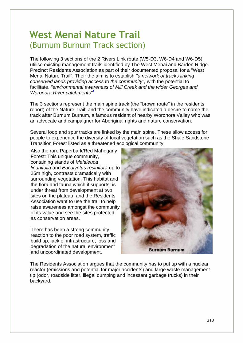
210
West Menai Nature Trail (Burnum Burnum Track section)
The following 3 sections of the 2 Rivers Link route (W5-D3, W6-D4 and W6-D5) utilise existing management trails identified by The West Menai and Barden Ridge Precinct Residents Association as part of their documented proposal for a "West Menai Nature Trail". Their the aim is to establish "a network of tracks linking conserved lands providing access to the community", with the potential to facilitate. "environmental awareness of Mill Creek and the wider Georges and Woronora River catchments" The 3 sections represent the main spine track (the "brown route" in the residents report) of the Nature Trail; and the community have indicated a desire to name the track after Burnum Burnum, a famous resident of nearby Woronora Valley who was an advocate and campaigner for Aboriginal rights and nature conservation. Several loop and spur tracks are linked by the main spine. These allow access for people to experience the diversity of local vegetation such as the Shale Sandstone Transition Forest listed as a threatened ecological community.
Also the rare Paperbark/Red Mahogany Forest: This unique community, containing stands of Melaleuca linariifolia and Eucalyptus resinifora up to 25m high, contrasts dramatically with surrounding vegetation. This habitat and the flora and fauna which it supports, is under threat from development at two sites on the plateau, and the Residents Association want to use the trail to help raise awareness amongst the community of its value and see the sites protected as conservation areas. There has been a strong community reaction to the poor road system, traffic build up, lack of infrastructure, loss and degradation of the natural environment and uncoordinated development.
The Residents Association argues that the community has to put up with a nuclear reactor (emissions and potential for major accidents) and large waste management tip (odor, roadside litter, illegal dumping and incessant garbage trucks) in their backyard.
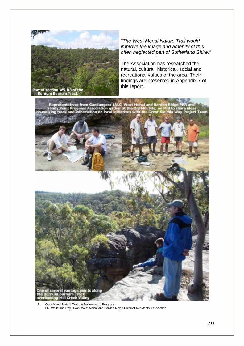
211
"The West Menai Nature Trail would improve the image and amenity of this often neglected part of Sutherland Shire." The Association has researched the natural, cultural, historical, social and recreational values of the area. Their findings are presented in Appendix 7 of this report.
1. West Menai Nature Trail - A Document In Progress Phil Wells and Roy Dixon, West Menai and Barden Ridge Precinct Residents Association
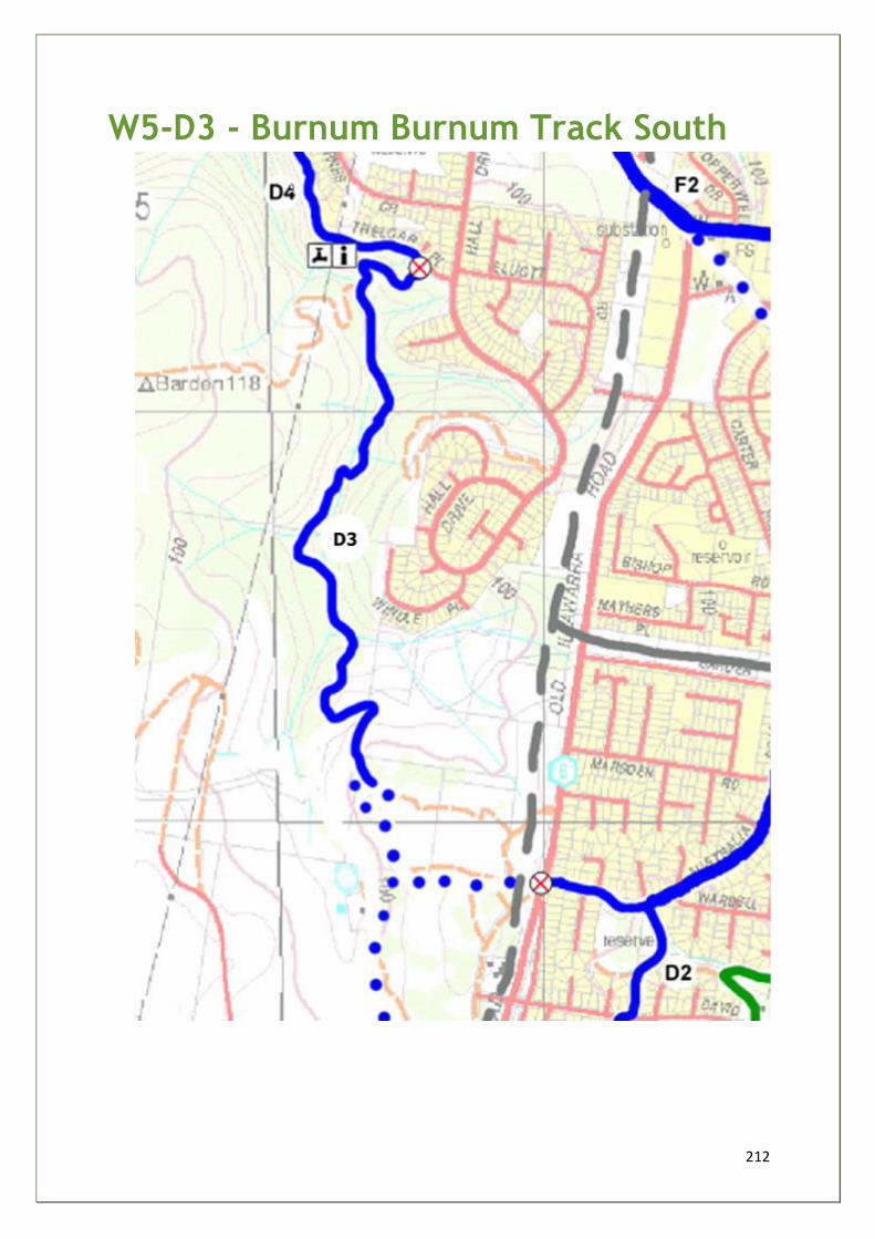
212
W5-D3 - Burnum Burnum Track South
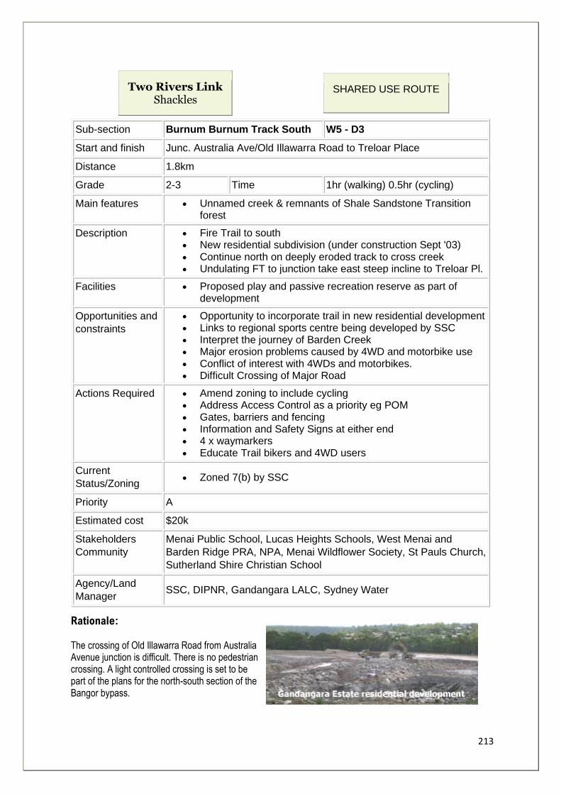
213
Two Rivers Link Shackles
SHARED USE ROUTE
Sub-section Burnum Burnum Track South W5 - D3
Start and finish Junc. Australia Ave/Old Illawarra Road to Treloar Place
Distance 1.8km
Grade 2-3 Time 1hr (walking) 0.5hr (cycling)
Main features • Unnamed creek & remnants of Shale Sandstone Transition forest
Description • Fire Trail to south • New residential subdivision (under construction Sept '03) • Continue north on deeply eroded track to cross creek • Undulating FT to junction take east steep incline to Treloar Pl.
Facilities • Proposed play and passive recreation reserve as part of development
Opportunities and
constraints
• Opportunity to incorporate trail in new residential development • Links to regional sports centre being developed by SSC • Interpret the journey of Barden Creek • Major erosion problems caused by 4WD and motorbike use • Conflict of interest with 4WDs and motorbikes. • Difficult Crossing of Major Road
Actions Required • Amend zoning to include cycling • Address Access Control as a priority eg POM • Gates, barriers and fencing • Information and Safety Signs at either end • 4 x waymarkers • Educate Trail bikers and 4WD users
Current
Status/Zoning • Zoned 7(b) by SSC
Priority A
Estimated cost $20k
Stakeholders
Community
Menai Public School, Lucas Heights Schools, West Menai and
Barden Ridge PRA, NPA, Menai Wildflower Society, St Pauls Church,
Sutherland Shire Christian School
Agency/Land
Manager SSC, DIPNR, Gandangara LALC, Sydney Water
Rationale: The crossing of Old Illawarra Road from Australia Avenue junction is difficult. There is no pedestrian crossing. A light controlled crossing is set to be part of the plans for the north-south section of the Bangor bypass.
214
Beyond the crossing, a new subdivision is being developed by the Gandangara LALC on the site of an old quarry. The fire trail to the south of the development is the route, but this has been diverted by ground works taking place. One of the consequences of the development is that trail bikes and four wheeled drive vehicles previously using the Quarry site, are finding their way on to the fire trails to the north and the route of the Burnum Burnum Track on the West Menai Nature Trail. Urgent action is needed to prevent such illegal use is to be halted. The Safety of walkers is an issue as well as degradation of the track and the natural environment through which it passes The track needs repairs. At several spots the erosion is so severe that bypass tracks have been formed... SSC are keen to link Burnum Burnum Track (W5 04) to the new regional sports centre on the site of the old Lucas Heights waste tip. Cycleways and parking facilities are planned providing the potential for a major "trackhead" for the Great Kai'mia Way.
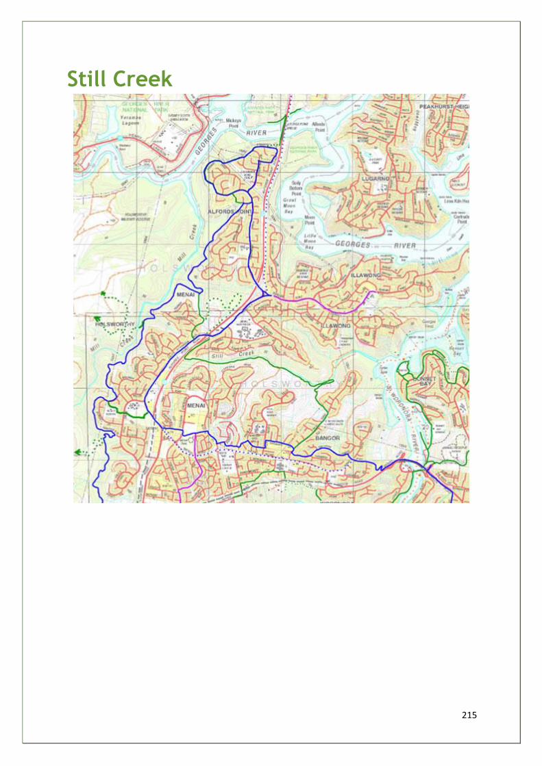
215
Still Creek
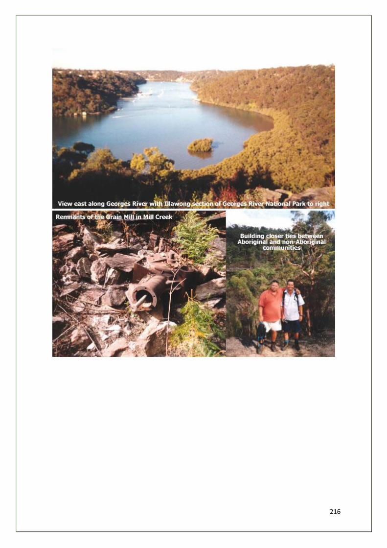
216
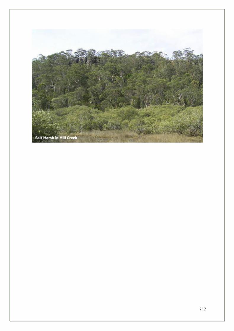
217
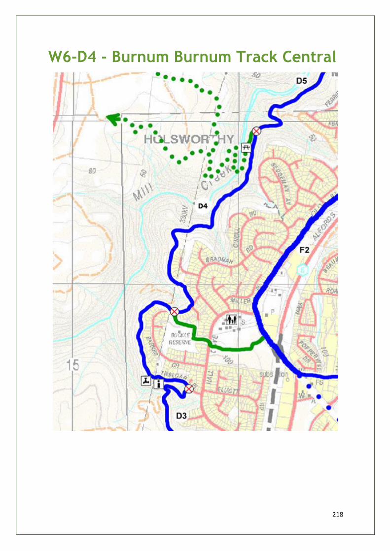
218
W6-D4 - Burnum Burnum Track Central
219
Two Rivers Link Still Creek
SHARED USE ROUTE
Sub-section Burnum Burnum Track Central W6 - D4
Start and finish Treloar Place to Mill Creek Access Track
Distance 2km
Grade 2-3 Time 1hr (walking) 0.5hr (cycling)
Main features • 90% Fire Trails, 10% quiet streets • Rock shelters • Elevated views of Barden/Mill creeks • Variety of plant communities • Buckle Reserve
Description 90% on Sydney Water Sewage maintenance tracks, 10% quiet streets.
To end of Treloar Pl through Pipecrate FT to Barnes Crescent
opposite. Rejoin FT, two steep sections with signs of gullying track
junction. South west arm for 300m to Mill Creek.
Facilities • Menai Public School • Buckle Reserve • Close to shops
Opportunities
and constraints
• Interpret the journey of Barden Creek/Mill Creek - lookouts • Biodiversity, Cultural, Historical, Geographical Education • Local area studies for 10 schools in local area • Develop low key picnic site by Mill Creek • Interpret Old Mill site • Evidence of increasing trail bike use
Actions
Required
• Address Access Control as a priority - eg POM • DA by SSC, Statement of Environmental Effects • 3ACPs - Gates, Stiles, Barriers, Fencing • Information and Safety Sign - Type 3 at Mill Creek, Type 1 at
Treloar End • 5 x waymarkers • Educate Trail bikers • Promotional and Curriculum material • Amend zoning regulations to include cycle access.
Current
Status/Zoning Zoned 7(b) by SSC, maintained by SSC and RFS Subject of Metropolitan Greenspace Funding Bid by SSC
Priority A
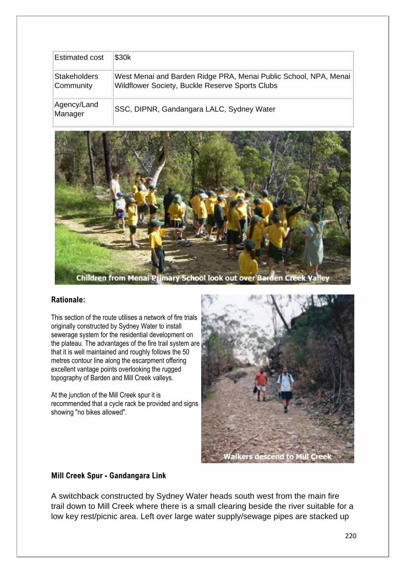
220
Estimated cost $30k
Stakeholders
Community
West Menai and Barden Ridge PRA, Menai Public School, NPA, Menai
Wildflower Society, Buckle Reserve Sports Clubs
Agency/Land
Manager SSC, DIPNR, Gandangara LALC, Sydney Water
Rationale: This section of the route utilises a network of fire trials originally constructed by Sydney Water to install sewerage system for the residential development on the plateau. The advantages of the fire trail system are that it is well maintained and roughly follows the 50 metres contour line along the escarpment offering excellent vantage points overlooking the rugged topography of Barden and Mill Creek valleys. At the junction of the Mill Creek spur it is recommended that a cycle rack be provided and signs showing "no bikes allowed".
Mill Creek Spur - Gandangara Link
A switchback constructed by Sydney Water heads south west from the main fire
trail down to Mill Creek where there is a small clearing beside the river suitable for a
low key rest/picnic area. Left over large water supply/sewage pipes are stacked up
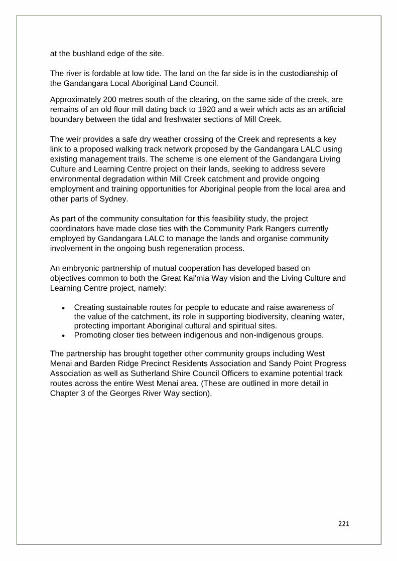
221
at the bushland edge of the site.
The river is fordable at low tide. The land on the far side is in the custodianship of
the Gandangara Local Aboriginal Land Council.
Approximately 200 metres south of the clearing, on the same side of the creek, are
remains of an old flour mill dating back to 1920 and a weir which acts as an artificial
boundary between the tidal and freshwater sections of Mill Creek.
The weir provides a safe dry weather crossing of the Creek and represents a key
link to a proposed walking track network proposed by the Gandangara LALC using
existing management trails. The scheme is one element of the Gandangara Living
Culture and Learning Centre project on their lands, seeking to address severe
environmental degradation within Mill Creek catchment and provide ongoing
employment and training opportunities for Aboriginal people from the local area and
other parts of Sydney.
As part of the community consultation for this feasibility study, the project
coordinators have made close ties with the Community Park Rangers currently
employed by Gandangara LALC to manage the lands and organise community
involvement in the ongoing bush regeneration process.
An embryonic partnership of mutual cooperation has developed based on
objectives common to both the Great Kai'mia Way vision and the Living Culture and
Learning Centre project, namely:
• Creating sustainable routes for people to educate and raise awareness of the value of the catchment, its role in supporting biodiversity, cleaning water, protecting important Aboriginal cultural and spiritual sites.
• Promoting closer ties between indigenous and non-indigenous groups.
The partnership has brought together other community groups including West
Menai and Barden Ridge Precinct Residents Association and Sandy Point Progress
Association as well as Sutherland Shire Council Officers to examine potential track
routes across the entire West Menai area. (These are outlined in more detail in
Chapter 3 of the Georges River Way section).
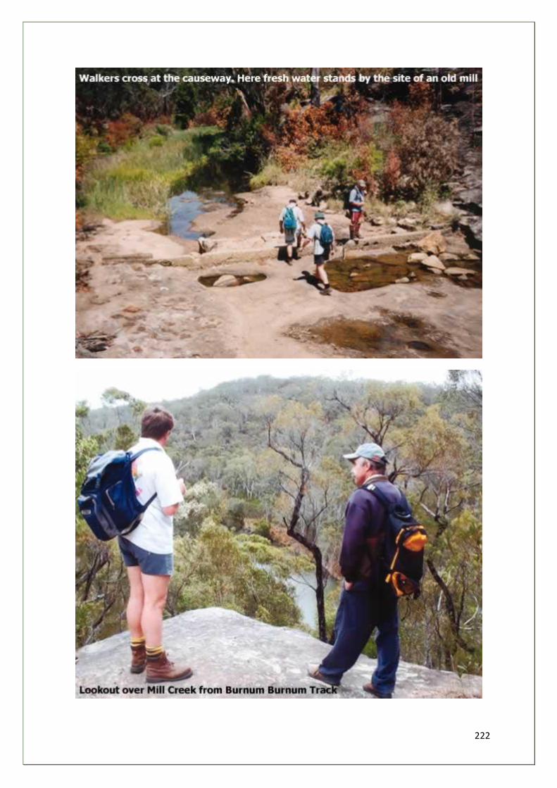
222
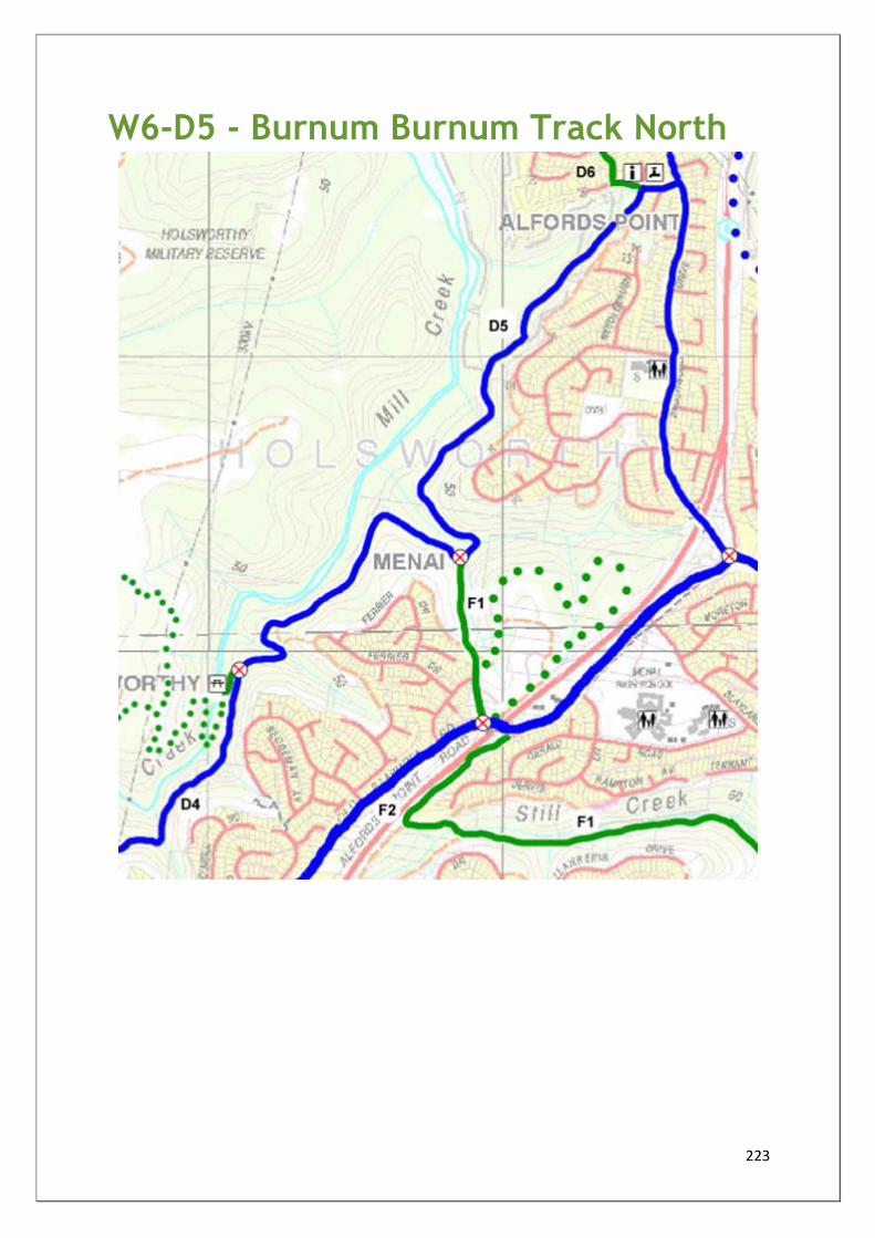
223
W6-D5 - Burnum Burnum Track North
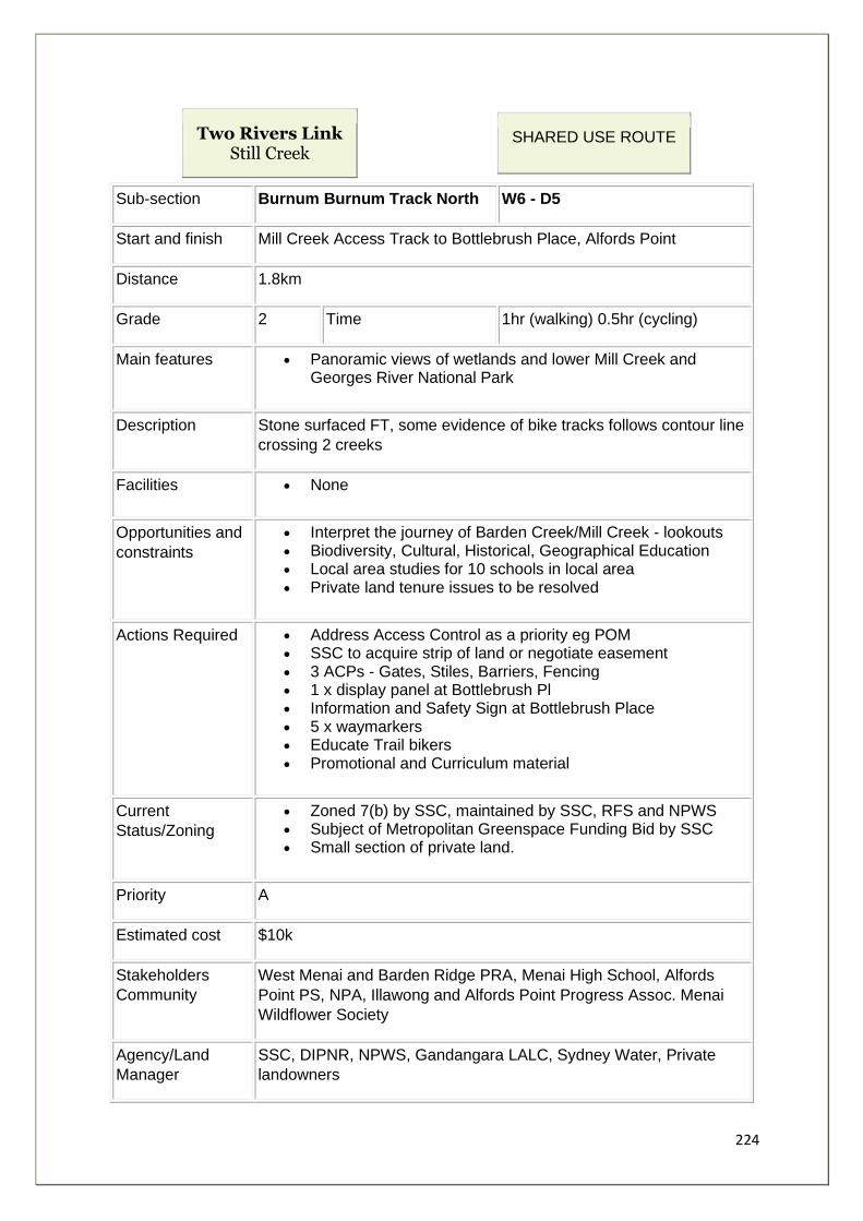
224
Two Rivers Link Still Creek
SHARED USE ROUTE
Sub-section Burnum Burnum Track North W6 - D5
Start and finish Mill Creek Access Track to Bottlebrush Place, Alfords Point
Distance 1.8km
Grade 2 Time 1hr (walking) 0.5hr (cycling)
Main features • Panoramic views of wetlands and lower Mill Creek and Georges River National Park
Description Stone surfaced FT, some evidence of bike tracks follows contour line
crossing 2 creeks
Facilities • None
Opportunities and
constraints
• Interpret the journey of Barden Creek/Mill Creek - lookouts • Biodiversity, Cultural, Historical, Geographical Education • Local area studies for 10 schools in local area • Private land tenure issues to be resolved
Actions Required • Address Access Control as a priority eg POM • SSC to acquire strip of land or negotiate easement • 3 ACPs - Gates, Stiles, Barriers, Fencing • 1 x display panel at Bottlebrush Pl • Information and Safety Sign at Bottlebrush Place • 5 x waymarkers • Educate Trail bikers • Promotional and Curriculum material
Current
Status/Zoning
• Zoned 7(b) by SSC, maintained by SSC, RFS and NPWS • Subject of Metropolitan Greenspace Funding Bid by SSC • Small section of private land.
Priority A
Estimated cost $10k
Stakeholders
Community
West Menai and Barden Ridge PRA, Menai High School, Alfords
Point PS, NPA, Illawong and Alfords Point Progress Assoc. Menai
Wildflower Society
Agency/Land
Manager
SSC, DIPNR, NPWS, Gandangara LALC, Sydney Water, Private
landowners
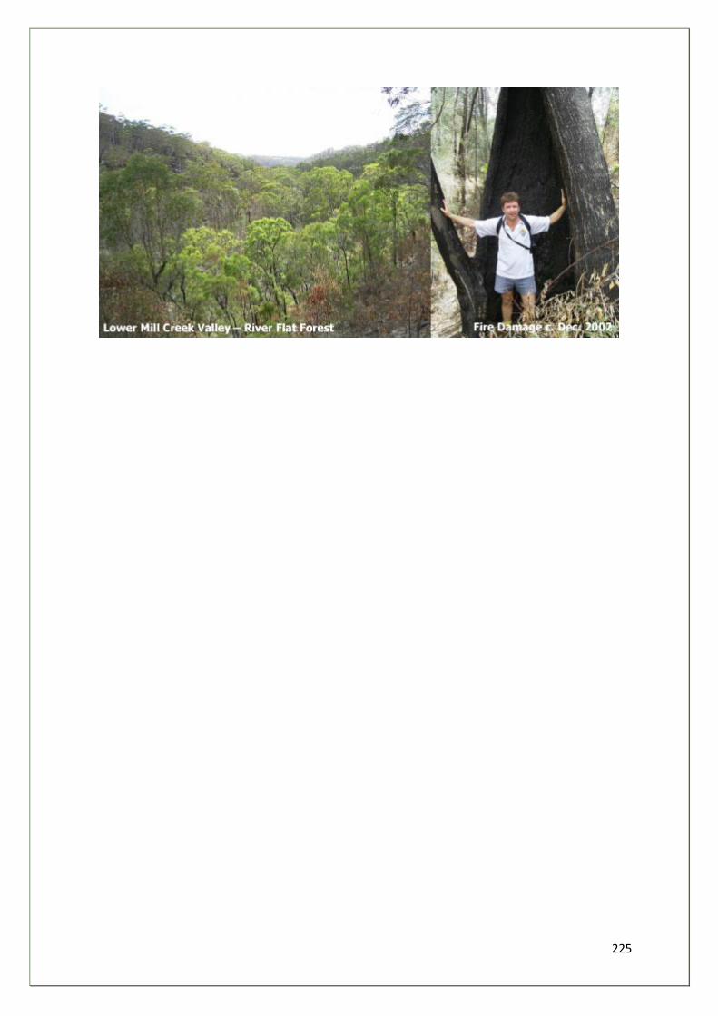
225
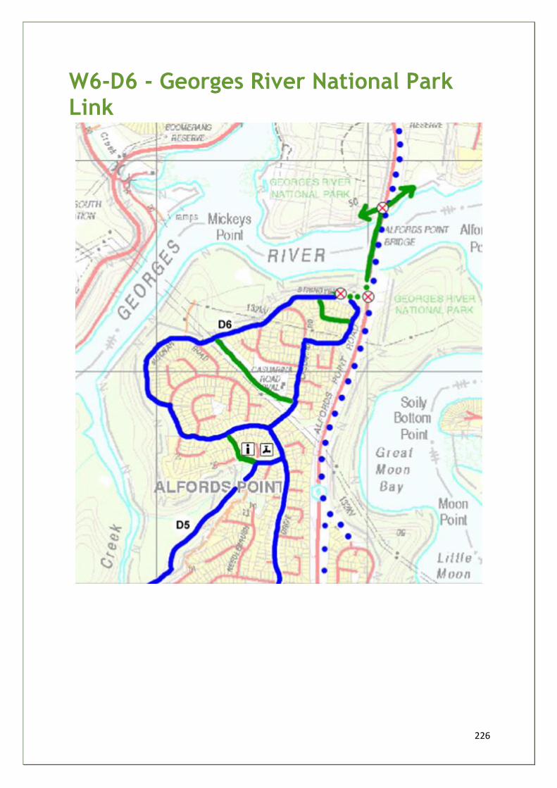
226
W6-D6 - Georges River National Park Link
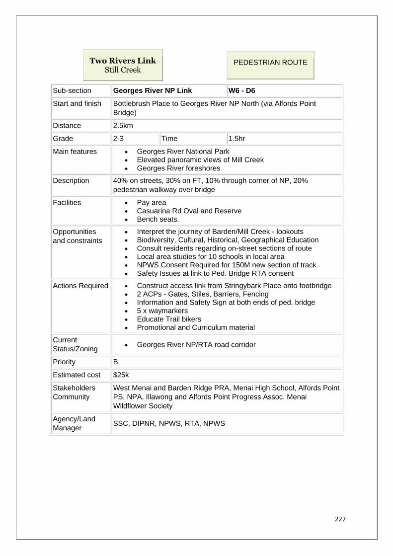
227
Two Rivers Link Still Creek
PEDESTRIAN ROUTE
Sub-section Georges River NP Link W6 - D6
Start and finish Bottlebrush Place to Georges River NP North (via Alfords Point
Bridge)
Distance 2.5km
Grade 2-3 Time 1.5hr
Main features • Georges River National Park • Elevated panoramic views of Mill Creek • Georges River foreshores
Description 40% on streets, 30% on FT, 10% through corner of NP, 20%
pedestrian walkway over bridge
Facilities • Pay area • Casuarina Rd Oval and Reserve • Bench seats.
Opportunities
and constraints
• Interpret the journey of Barden/Mill Creek - lookouts • Biodiversity, Cultural, Historical, Geographical Education • Consult residents regarding on-street sections of route • Local area studies for 10 schools in local area • NPWS Consent Required for 150M new section of track • Safety Issues at link to Ped. Bridge RTA consent
Actions Required • Construct access link from Stringybark Place onto footbridge • 2 ACPs - Gates, Stiles, Barriers, Fencing • Information and Safety Sign at both ends of ped. bridge • 5 x waymarkers • Educate Trail bikers • Promotional and Curriculum material
Current
Status/Zoning • Georges River NP/RTA road corridor
Priority B
Estimated cost $25k
Stakeholders
Community
West Menai and Barden Ridge PRA, Menai High School, Alfords Point
PS, NPA, Illawong and Alfords Point Progress Assoc. Menai
Wildflower Society
Agency/Land
Manager SSC, DIPNR, NPWS, RTA, NPWS
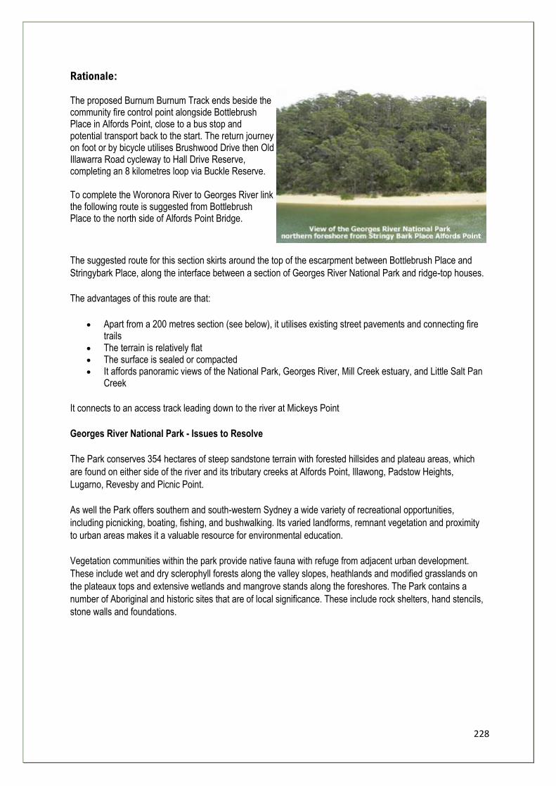
228
Rationale: The proposed Burnum Burnum Track ends beside the community fire control point alongside Bottlebrush Place in Alfords Point, close to a bus stop and potential transport back to the start. The return journey on foot or by bicycle utilises Brushwood Drive then Old Illawarra Road cycleway to Hall Drive Reserve, completing an 8 kilometres loop via Buckle Reserve. To complete the Woronora River to Georges River link the following route is suggested from Bottlebrush Place to the north side of Alfords Point Bridge.
The suggested route for this section skirts around the top of the escarpment between Bottlebrush Place and
Stringybark Place, along the interface between a section of Georges River National Park and ridge-top houses.
The advantages of this route are that:
• Apart from a 200 metres section (see below), it utilises existing street pavements and connecting fire trails
• The terrain is relatively flat • The surface is sealed or compacted • It affords panoramic views of the National Park, Georges River, Mill Creek estuary, and Little Salt Pan
Creek
It connects to an access track leading down to the river at Mickeys Point
Georges River National Park - Issues to Resolve
The Park conserves 354 hectares of steep sandstone terrain with forested hillsides and plateau areas, which
are found on either side of the river and its tributary creeks at Alfords Point, Illawong, Padstow Heights,
Lugarno, Revesby and Picnic Point.
As well the Park offers southern and south-western Sydney a wide variety of recreational opportunities,
including picnicking, boating, fishing, and bushwalking. Its varied landforms, remnant vegetation and proximity
to urban areas makes it a valuable resource for environmental education.
Vegetation communities within the park provide native fauna with refuge from adjacent urban development.
These include wet and dry sclerophyll forests along the valley slopes, heathlands and modified grasslands on
the plateaux tops and extensive wetlands and mangrove stands along the foreshores. The Park contains a
number of Aboriginal and historic sites that are of local significance. These include rock shelters, hand stencils,
stone walls and foundations.
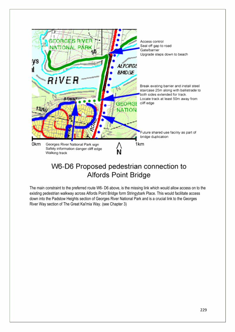
229
The main constraint to the preferred route W6- D6 above, is the missing link which would allow access on to the
existing pedestrian walkway across Alfords Point Bridge form Stringybark Place. This would facilitate access
down into the Padstow Heights section of Georges River National Park and is a crucial link to the Georges
River Way section of The Great Kai'mia Way. (see Chapter 3)
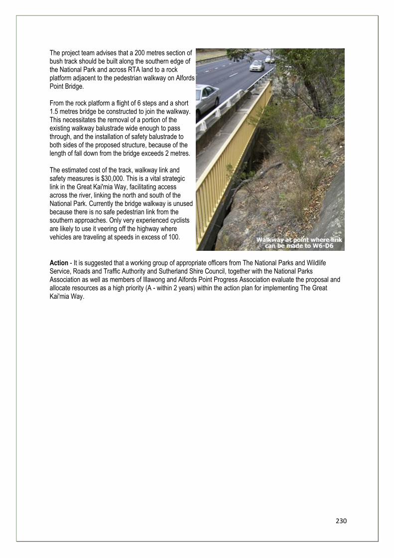
230
The project team advises that a 200 metres section of bush track should be built along the southern edge of the National Park and across RTA land to a rock platform adjacent to the pedestrian walkway on Alfords Point Bridge. From the rock platform a flight of 6 steps and a short 1.5 metres bridge be constructed to join the walkway. This necessitates the removal of a portion of the existing walkway balustrade wide enough to pass through, and the installation of safety balustrade to both sides of the proposed structure, because of the length of fall down from the bridge exceeds 2 metres. The estimated cost of the track, walkway link and safety measures is $30,000. This is a vital strategic link in the Great Kai'mia Way, facilitating access across the river, linking the north and south of the National Park. Currently the bridge walkway is unused because there is no safe pedestrian link from the southern approaches. Only very experienced cyclists are likely to use it veering off the highway where vehicles are traveling at speeds in excess of 100.
Action - It is suggested that a working group of appropriate officers from The National Parks and Wildlife Service, Roads and Traffic Authority and Sutherland Shire Council, together with the National Parks Association as well as members of Illawong and Alfords Point Progress Association evaluate the proposal and allocate resources as a high priority (A - within 2 years) within the action plan for implementing The Great Kai'mia Way.
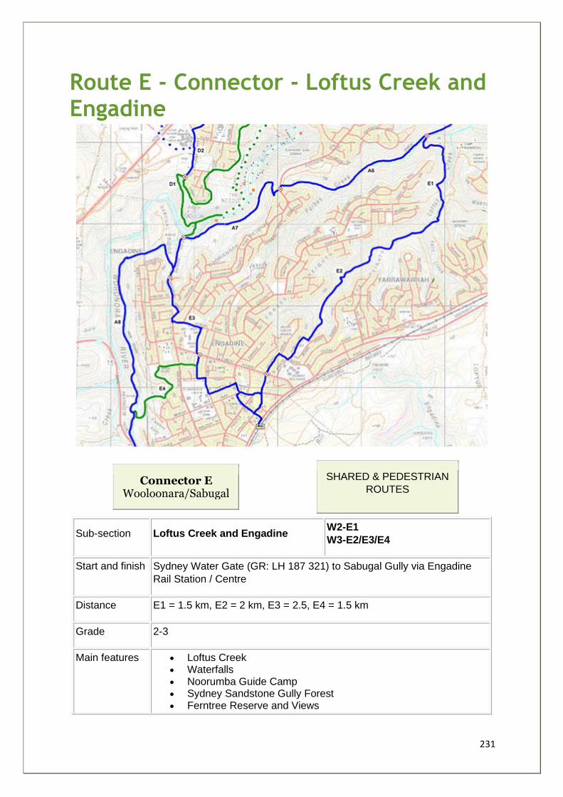
231
Route E - Connector - Loftus Creek and Engadine
Connector E Wooloonara/Sabugal
SHARED & PEDESTRIAN
ROUTES
Sub-section Loftus Creek and Engadine W2-E1
W3-E2/E3/E4
Start and finish Sydney Water Gate (GR: LH 187 321) to Sabugal Gully via Engadine
Rail Station / Centre
Distance E1 = 1.5 km, E2 = 2 km, E3 = 2.5, E4 = 1.5 km
Grade 2-3
Main features • Loftus Creek • Waterfalls • Noorumba Guide Camp • Sydney Sandstone Gully Forest • Ferntree Reserve and Views
232
• Engadine Park / Anzac Oval
Description Route heads SE from Pipeline Road at gate, across Forbes Creek via
bridge, fire trail (Sewer Easement) via Noorumba Guide Camp. At Loftus
Creek several routes converge. Across creek and go S - detour to
waterfall - route is steep for 100 m. Sandstone surface in poor condition
- erosion severe in places. Leave fire trail at Dobell Res., then via streets
to City Rail Engadine.
On local streets to Engadine Park via 3 main street crossings. Then
Woronora Rd. and steep descent to access control gate.
Walk link E4 goes via Amiens Ave, Ferntree Rd and Fire Trail.
Facilities • Dobell Reserve • Engadine Shopping Centre • Engadine Park - Swim, BBQ, Picnic, Oval, Play • Ferntree Park - Play, Picnic
Opportunities
and constraints
• Trail Bikes increasing track and bush degradation around E1 • User conflict/safety issues • 2 x waterfalls ideal rest point features • 7(b) zoning requires amendment by SSC to include cycling • Display Shelter in Engadine Park and display panels at end of
Woronora Rd. and City Rail Station • Several safer road crossings required in Engadine • Partner with youth groups such as Boystown / sponsorship from
local business
Actions
Required
• SWC/SSC Upgrade Gates at Pipeline Road, Dobell Reserve and Ferntree Res. ACPs
• DIPNR/SSC/SWC Track improvements - sandstone + binding agent on slopes
• SSC/SSEC locate and install 16 x markers • SSC/SWC 2 x safety info signs • SSC install 2 x display boards
Current
Status/Zoning Crown Land under care and control of SSC - Gandangara LALC land claim / SWC Sewer Maintenance Easement / Public Roads
Priority B
Estimated cost $50k
Stakeholders
Community
NPA, Billies Bushies, Sutherland Shire Bushwalking Club, Sharkbike,
Scouts and Guides, Maandowie Creek, Loftus Creek and Fahy Creek
and Urana Road Bushcare Groups, Yarrawarrah PS, Engadine HS and
PS, Engadine Rotary Club, St John Bosco Cath. Coll. and PS and Youth
Centre, Boystown, Engadine West PS, Engadine Bowling Club, PCYC,
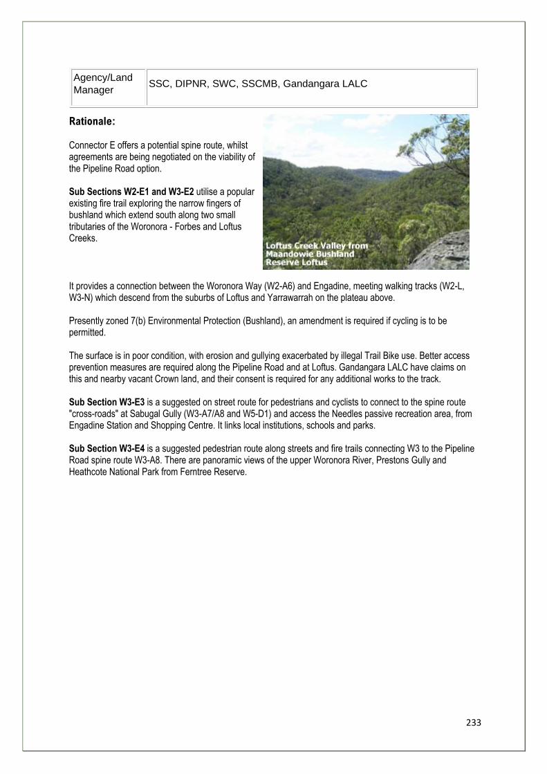
233
Agency/Land
Manager SSC, DIPNR, SWC, SSCMB, Gandangara LALC
Rationale: Connector E offers a potential spine route, whilst agreements are being negotiated on the viability of the Pipeline Road option. Sub Sections W2-E1 and W3-E2 utilise a popular existing fire trail exploring the narrow fingers of bushland which extend south along two small tributaries of the Woronora - Forbes and Loftus Creeks.
It provides a connection between the Woronora Way (W2-A6) and Engadine, meeting walking tracks (W2-L, W3-N) which descend from the suburbs of Loftus and Yarrawarrah on the plateau above. Presently zoned 7(b) Environmental Protection (Bushland), an amendment is required if cycling is to be permitted. The surface is in poor condition, with erosion and gullying exacerbated by illegal Trail Bike use. Better access prevention measures are required along the Pipeline Road and at Loftus. Gandangara LALC have claims on this and nearby vacant Crown land, and their consent is required for any additional works to the track. Sub Section W3-E3 is a suggested on street route for pedestrians and cyclists to connect to the spine route "cross-roads" at Sabugal Gully (W3-A7/A8 and W5-D1) and access the Needles passive recreation area, from Engadine Station and Shopping Centre. It links local institutions, schools and parks. Sub Section W3-E4 is a suggested pedestrian route along streets and fire trails connecting W3 to the Pipeline Road spine route W3-A8. There are panoramic views of the upper Woronora River, Prestons Gully and Heathcote National Park from Ferntree Reserve.
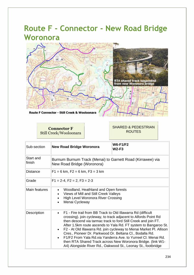
234
Route F - Connector - New Road Bridge Woronora
Connector F Still Creek/Wooloonara
SHARED & PEDESTRIAN
ROUTES
Sub-section New Road Bridge Woronora W6-F1/F2
W2-F3
Start and
finish Burnum Burnum Track (Menai) to Garnett Road (Kirrawee) via New Road Bridge (Woronora)
Distance F1 = 6 km, F2 = 6 km, F3 = 3 km
Grade F1 = 2-4, F2 = 2, F3 = 2-3
Main features • Woodland, Heathland and Open forests • Views of Mill and Still Creek Valleys • High Level Woronora River Crossing • Menai Cycleway
Description • F1 - Fire trail from BB Track to Old Illawarra Rd (difficult crossing). join cycleway, to track adjacent to Alfords Point Rd then descend via tarmac track to ford Still Creek and join FT. After 1.5km route ascends to Yala Rd. FT system to Bangaroo St.
• F2 - At Old Illawarra Rd. join cycleway to Menai Market Pl. Allison Cres., Pioneer Dr. Parkwood Dr. Beltana Cl., Bodalla Rd.
• F1/F2 From Yala Rd.via Yanderra Ave. to Yurreel Cl. Menai Rd. then RTA Shared Track across New Woronora Bridge. (link W1-A4) Alongside River Rd., Oakwood St., Leonay St., footbridge
235
over railway, Waratah St.,Glencoe St.,The Boulevarde, Oak Rd. (N), Stirling Ave. to Garnett Road and join route GLR 8.
Facilities • Menai Market Place • Bangor Shopping Centre
Opportunities
and
constraints
• RTA Proposed Menai Road Shared Track, after completion of Bangor Bypass (East to West)
• Creek restoration and bush regeneration in Still Creek and tributaries - local bushcare groups,SSCMB/SSC/EPA/SWC
• Private land tenure issues in Monash Rd. area Gandangara LALC land claim in Still Creek - potential indigenous management/education opportunities.
Actions
Required
• SSC - formalise route as part of Draft Bicycle Network Plan, and statutory planning instruments eg LEP 2003
• SSC/RTA - upgrade crossing at Linden Road/Leonay St. to Pelican type.
• SSC install "Wombat"/traffic calming at Old Illawarra Rd • 1 x display panel (sign type 1) at Menai Marketplace • 3 x direction/safety (sign type 2) • 20 x marker (sign type 4)
Current
Status/Zoning Crown Reserve in Still Creek Valley, some private lots, Public Roads/Shared Track managed by RTA/SSC
Priority C
Estimated cost $20k + Pelican and Wombat Crossings
Stakeholders
Community
NPA, KAC, Sharkbike, Billies Bushies, SSBC, Menai HS and PS, Holy
Family Cath. Ch. and PS, St Aquinas Coll., Bangor PS, Inaburra PS and
Bapt. Ch., Sutherland (N) PS, Scouts and Guides, Bushcare Groups,
WMBRPRA, WVPRA,
Agency/Land
Manager
RTA, SSC, SWC, SSCMB, DIPNR, EPA, BicycleNSW, Gandangara
LALC
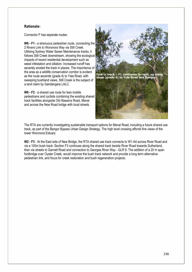
236
Rationale: Connector F has separate routes:
W6 - F1 - a strenuous pedestrian route, connecting the 2 Rivers Link to Woronora Way via Still Creek. Utilising Sydney Water Sewer Maintenance tracks, it follows Still Creek downstream, showing the ecological impacts of recent residential development such as weed infestation and siltation. Increased runoff has severely eroded the track in places. The importance of the area as a wildlife conservation corridor is evident as the route ascends (grade 4) to Yala Road, with sweeping bushland views. Still Creek is the subject of a land claim by Gandangara LALC. W6 - F2 - a shared use route for less mobile pedestrians and cyclists combining the existing shared track facilities alongside Old Illawarra Road, Menai and across the New Road bridge with local streets.
The RTA are currently investigating sustainable transport options for Menai Road, including a future shared use track, as part of the Bangor Bypass Urban Design Strategy. The high level crossing affords fine views of the lower Woronora Estuary
W2 - F3 - At the East side of New Bridge, the RTA shared use track connects to W1-A4 across River Road and via a 100m bush track. Section F3 continues along the shared track beside River Road towards Sutherland, then via streets to Garnett Road and connection to Georges River Way - GLR 9. The addition of a 20 m span footbridge over Oyster Creek, would improve the bush track network and provide a long term alternative pedestrian link, and focus for creek restoration and bush regeneration projects.
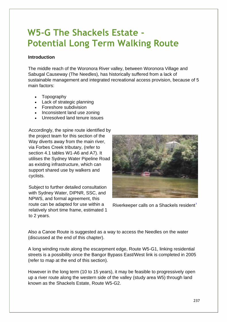
237
W5-G The Shackels Estate - Potential Long Term Walking Route
Introduction
The middle reach of the Woronora River valley, between Woronora Village and
Sabugal Causeway (The Needles), has historically suffered from a lack of
sustainable management and integrated recreational access provision, because of 5
main factors:
• Topography • Lack of strategic planning • Foreshore subdivision • Inconsistent land use zoning • Unresolved land tenure issues
Accordingly, the spine route identified by
the project team for this section of the
Way diverts away from the main river,
via Forbes Creek tributary, (refer to
section 4.1 tables W1-A6 and A7). It
utilises the Sydney Water Pipeline Road
as existing infrastructure, which can
support shared use by walkers and
cyclists.
Subject to further detailed consultation
with Sydney Water, DIPNR, SSC, and
NPWS, and formal agreement, this
route can be adapted for use within a
relatively short time frame, estimated 1
to 2 years.
Riverkeeper calls on a Shackels resident
Also a Canoe Route is suggested as a way to access the Needles on the water
(discussed at the end of this chapter).
A long winding route along the escarpment edge, Route W5-G1, linking residential
streets is a possibility once the Bangor Bypass East/West link is completed in 2005
(refer to map at the end of this section).
However in the long term (10 to 15 years), it may be feasible to progressively open
up a river route along the western side of the valley (study area W5) through land
known as the Shackels Estate, Route W5-G2.
238
Planning Background
The valley is surrounded by residential development - which directly affects the
health of the natural bushland through polluted urban runoff, siltation, weed
invasion, vandalism, and feral dogs and cats. The protection of the valley from over-
development is vital in maintaining a wildlife corridor, interconnected to the
surrounding bushland corridors of Forbes Creek, Loftus Creek and Fahy Creek to
form a larger ecosystem.
A Woronora Valley Master Plan (1998) has been formulated by Sutherland Shire
Council to rationalise previous ad hoc planning policies and to guide future
development of the valley.
The Woronora Valley was proposed for public recreation open space, under the
Green Belt zoning in the 1951.
However, a previous decision in 1916, to allow the waterfront on the Shackels side
to be subdivided - 314 lots for building of weekender / residential properties with
limited services and water access - prevented the zoning being adopted. Nearly all
the residents have provided water, power and road access for over 40 years at their
own cost.
Eventually in 1961 the valley was excluded from the County of Cumberland
Planning Scheme, and was zoned as an undetermined category and controlled as
non-urban. Currently dwellings can be constructed on a minimum of 5 acres.
In 1973, the Shackles Estate buy back program, set up jointly between Sutherland
Shire Council and DIPNR (previously NSW Dept. of Urban Affairs and Planning),
was an initiative to: acquire ownership of Shackles properties; clear all development;
restore environmental integrity; and return the area to its original zoning of public
recreation open space .
Situation in 2003
Sutherland Shire Council officers are dissatisfied with the acquisition process as a
means of implementing open space policies for the valley contained in the latest
Master Plan, and argue that a more pro-active approach is required based on
planning for passive recreation around open space already in the care and control of
Council.
Residents interviewed, reported that some officers did not respect their use rights, a
situation which they felt prevented constructive dialogue on environmental issues.
The Sutherland Shire Council's Draft LEP 2003 proposes land use zoning changes,
acquired properties are Public Recreation and remaining properties zoned Future
Recreation. Private land above is zoned Environmental Protection (Bushland).
239
The whole valley is identified in the proposed "Greenweb" Strategy - another layer of
environmental protection - for conservation of bio-diversity .
Benefits of a Walking Track
Fulfilling Strategic Planning Objectives
Aside from contributing to the foreshore access and recreation objectives of the
GRFIP (refer to Chapter 1), the progressive development of a walking track through
the Shackles could help realise the two strategic goals of the Woronora Valley
Master Plan , namely:
• The maintenance and improvement of the environmental health and integrity of the Woronora Valley
• The introduction of a passive recreation plan that is compatible with the aims of 1
Master Plan Goal 1: In support of the first goal, a walking track provides access to the Shackles for programs to help restore the environmental health of the bushland and the river, such as:
• Weed eradication and bush regeneration As Shackels Estate properties have been vacated, and services provided to Menai and Bangor residents, exotic species have become invasive to the detriment of natives. The track has the potential to be the focus of a bush management plan involving remaining residents, local voluntary bushcare and conservation groups, first offenders and work for the dole participants, supported by professional bush regeneration teams and State and local government resources.
• Clearing Debris From Vacant Properties A coordinated cleanup would help to relieve the area of abandoned motor vehicles (these vehicles have been reported to Council and will be removed when resources are available), as well as building materials from demolished dwellings (including fibrolite) and other waste, which was not removed at the time of acquisition.
• Restoration of Riparian Vegetation and Improved Stormwater Management
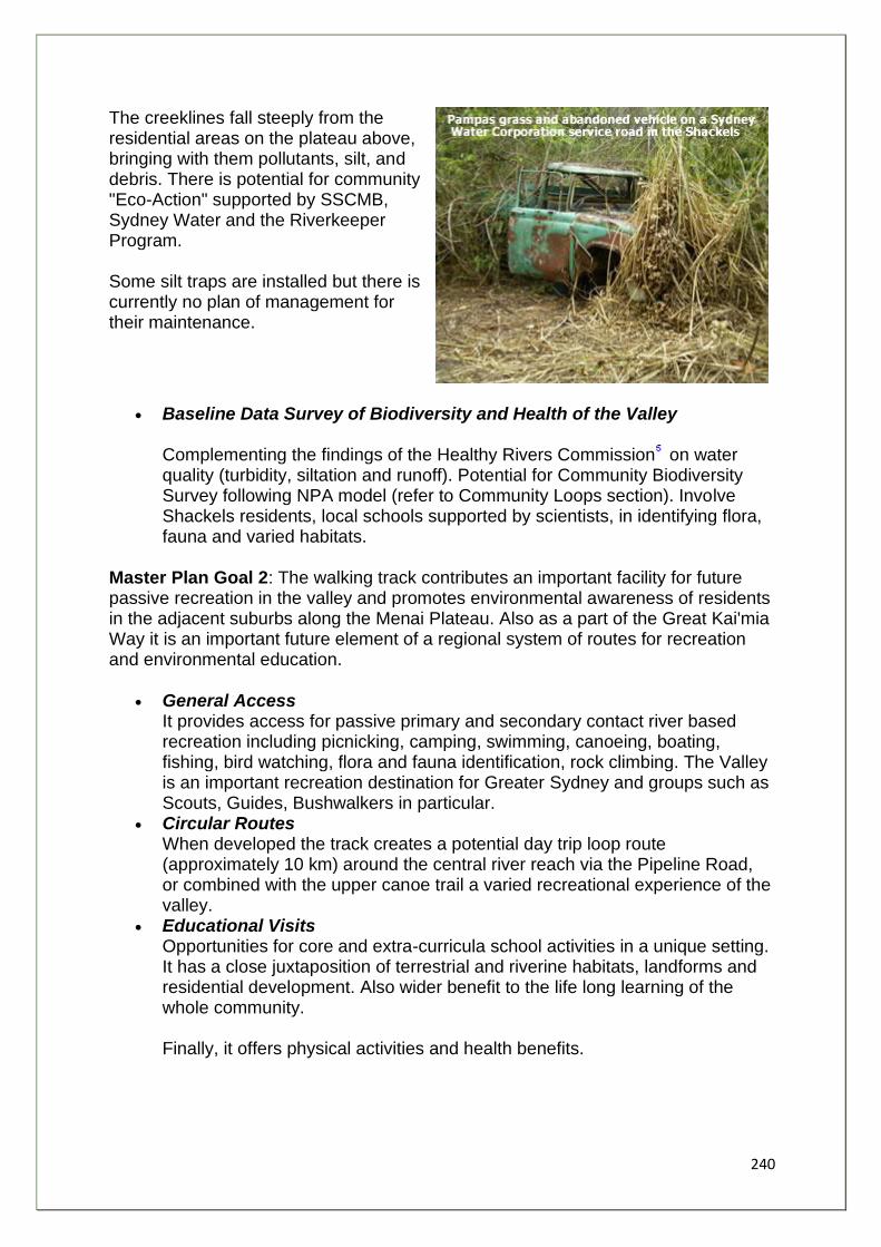
240
The creeklines fall steeply from the residential areas on the plateau above, bringing with them pollutants, silt, and debris. There is potential for community "Eco-Action" supported by SSCMB, Sydney Water and the Riverkeeper Program. Some silt traps are installed but there is currently no plan of management for their maintenance.
• Baseline Data Survey of Biodiversity and Health of the Valley Complementing the findings of the Healthy Rivers Commission on water quality (turbidity, siltation and runoff). Potential for Community Biodiversity Survey following NPA model (refer to Community Loops section). Involve Shackels residents, local schools supported by scientists, in identifying flora, fauna and varied habitats.
Master Plan Goal 2: The walking track contributes an important facility for future passive recreation in the valley and promotes environmental awareness of residents in the adjacent suburbs along the Menai Plateau. Also as a part of the Great Kai'mia Way it is an important future element of a regional system of routes for recreation and environmental education.
• General Access It provides access for passive primary and secondary contact river based recreation including picnicking, camping, swimming, canoeing, boating, fishing, bird watching, flora and fauna identification, rock climbing. The Valley is an important recreation destination for Greater Sydney and groups such as Scouts, Guides, Bushwalkers in particular.
• Circular Routes When developed the track creates a potential day trip loop route (approximately 10 km) around the central river reach via the Pipeline Road, or combined with the upper canoe trail a varied recreational experience of the valley.
• Educational Visits Opportunities for core and extra-curricula school activities in a unique setting. It has a close juxtaposition of terrestrial and riverine habitats, landforms and residential development. Also wider benefit to the life long learning of the whole community. Finally, it offers physical activities and health benefits.
241
Equity of Access and Compromise
The walking track would progressively allow access for the wider community to a
significant stretch of the river foreshore where it has previously been restricted. The
key is to design the track sympathetically to consider and address the concerns of
remaining residents.
Developing the walking track in stages may act as a catalyst to resolve outstanding
issues of social and environmental issues in the Shackels Estate. Project Officers
have interviewed two prominent long-term residents to record:
• their experiences of living in the Shackels; • the changing river environment; and • their concerns and ideas regarding a through route for walkers.
Along with most residents, they were initially attracted to the area and its "back to
nature" way of life, because of its aesthetic beauty, its isolation from urban Sydney,
and the fact that the river dominated the environment.
As the unofficial custodians or "gatekeepers" of the valley, residents have noticed
the fluctuation in the quality of the terrestrial and riverine environments over time.
Currently the major problems identified are:
• Increased bank erosion from power boat wash. • Water quality has been affected by pollution from urban run-off, storm water
and a lack of environmental flow and regular flushing. • Decline of ecological integrity of the remaining bushland through weed
infestation.
However the river's decline has been reversed in recent years. Improvements
include:
• Recovery of sea-grass/weed beds - important fish breeding grounds - which had been adversely affected by commercial dredging in the nineteen sixties and seventies.
• Recovery of the sand-flats which are important feeding areas for fish. • Residents persuaded ANSTO to cease discharging wastes into the River. • Sewerage system has been provided to the majority of residents of the
Woronora Valley. • Improved fish numbers and successful fish migration upstream.
Vandalism and Anti-Social Activities
Residents value their privacy and security the most. Residential development has
encroached on the Shackels Estate and residents fear vandals and undesirables
- "ghouls and stickybeaks" - will increasingly threaten their seclusion. The Estate is
accessed by several different tracks. A lack of surveillance and barriers at track
entrances has added to the problems, which include:
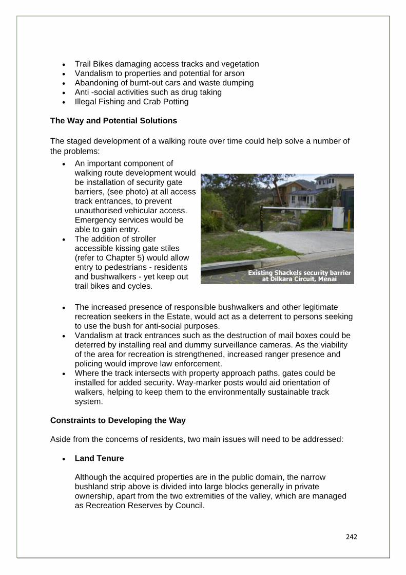
242
• Trail Bikes damaging access tracks and vegetation • Vandalism to properties and potential for arson • Abandoning of burnt-out cars and waste dumping • Anti -social activities such as drug taking • Illegal Fishing and Crab Potting
The Way and Potential Solutions
The staged development of a walking route over time could help solve a number of
the problems:
• An important component of walking route development would be installation of security gate barriers, (see photo) at all access track entrances, to prevent unauthorised vehicular access. Emergency services would be able to gain entry.
• The addition of stroller accessible kissing gate stiles (refer to Chapter 5) would allow entry to pedestrians - residents and bushwalkers - yet keep out trail bikes and cycles.
• The increased presence of responsible bushwalkers and other legitimate recreation seekers in the Estate, would act as a deterrent to persons seeking to use the bush for anti-social purposes.
• Vandalism at track entrances such as the destruction of mail boxes could be deterred by installing real and dummy surveillance cameras. As the viability of the area for recreation is strengthened, increased ranger presence and policing would improve law enforcement.
• Where the track intersects with property approach paths, gates could be installed for added security. Way-marker posts would aid orientation of walkers, helping to keep them to the environmentally sustainable track system.
Constraints to Developing the Way Aside from the concerns of residents, two main issues will need to be addressed:
• Land Tenure Although the acquired properties are in the public domain, the narrow bushland strip above is divided into large blocks generally in private ownership, apart from the two extremities of the valley, which are managed as Recreation Reserves by Council.
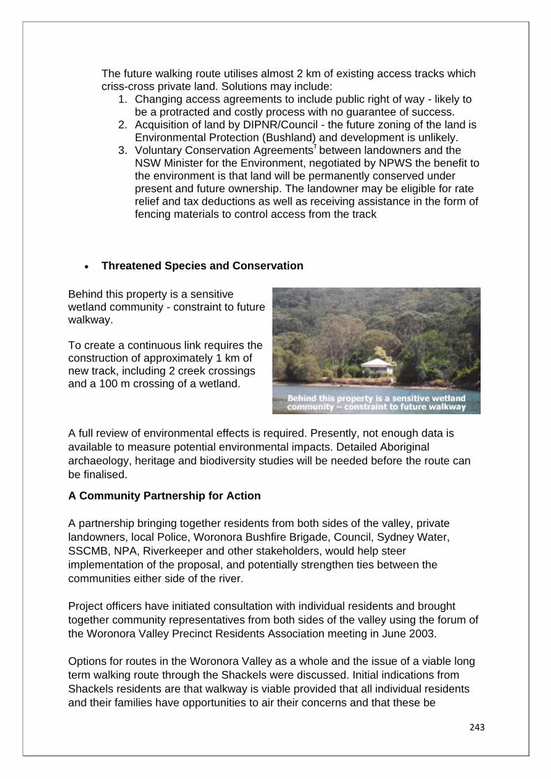
243
The future walking route utilises almost 2 km of existing access tracks which criss-cross private land. Solutions may include:
1. Changing access agreements to include public right of way - likely to be a protracted and costly process with no guarantee of success.
2. Acquisition of land by DIPNR/Council - the future zoning of the land is Environmental Protection (Bushland) and development is unlikely.
3. Voluntary Conservation Agreements between landowners and the NSW Minister for the Environment, negotiated by NPWS the benefit to the environment is that land will be permanently conserved under present and future ownership. The landowner may be eligible for rate relief and tax deductions as well as receiving assistance in the form of fencing materials to control access from the track
• Threatened Species and Conservation
Behind this property is a sensitive wetland community - constraint to future walkway. To create a continuous link requires the construction of approximately 1 km of new track, including 2 creek crossings and a 100 m crossing of a wetland.
A full review of environmental effects is required. Presently, not enough data is
available to measure potential environmental impacts. Detailed Aboriginal
archaeology, heritage and biodiversity studies will be needed before the route can
be finalised.
A Community Partnership for Action
A partnership bringing together residents from both sides of the valley, private
landowners, local Police, Woronora Bushfire Brigade, Council, Sydney Water,
SSCMB, NPA, Riverkeeper and other stakeholders, would help steer
implementation of the proposal, and potentially strengthen ties between the
communities either side of the river.
Project officers have initiated consultation with individual residents and brought
together community representatives from both sides of the valley using the forum of
the Woronora Valley Precinct Residents Association meeting in June 2003.
Options for routes in the Woronora Valley as a whole and the issue of a viable long
term walking route through the Shackels were discussed. Initial indications from
Shackels residents are that walkway is viable provided that all individual residents
and their families have opportunities to air their concerns and that these be
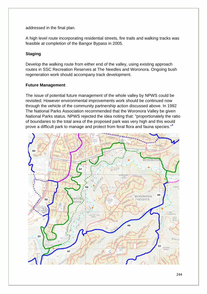
244
addressed in the final plan.
A high level route incorporating residential streets, fire trails and walking tracks was
feasible at completion of the Bangor Bypass in 2005.
Staging
Develop the walking route from either end of the valley, using existing approach
routes in SSC Recreation Reserves at The Needles and Woronora. Ongoing bush
regeneration work should accompany track development.
Future Management
The issue of potential future management of the whole valley by NPWS could be
revisited. However environmental improvements work should be continued now
through the vehicle of the community partnership action discussed above. In 1992
The National Parks Association recommended that the Woronora Valley be given
National Parks status. NPWS rejected the idea noting that: "proportionately the ratio
of boundaries to the total area of the proposed park was very high and this would
prove a difficult park to manage and protect from feral flora and fauna species."

245
1. The Riverkeeper Program is jointly funded by NSW Waterways and the Georges River Combined Councils Committee. The Riverkeeper is based at the NSW Waterways office in Sutherland.
2. Appendix 12 explains the Shackles Estate Acquisition Program in greater detail. 3. Greenweb - Sutherland Shire Council initiative to conserve remnant bushland and restore
vegetation links between reserves by encouraging residents to plant native trees and bushes.
4. Sutherland Shire Council, (1998). Woronora Valley Master Plan. 5. Healthy River Commission, (2001). Independent Inquiry into the Georges River Botany Bay
System - Final Report, September 6. Australian Nuclear Science and Technologies Organisation based at Lucas Heights 7. A description of Voluntary Conservation Agreements is available on-line
at www.npws.nsw.gov.au under "how you can help" section and in Appendix 11 8. Sutherland Shire Council (May, 1998). Draft Woronora Valley Masterplan.
246
Community Loop Walks - A Vehicle for Local Environmental Stewardship
This section of the report looks at how the two main spine trail proposals, The Woronora
Way and the Woronora/Georges Link might be integrated with public access to and from the
residential suburbs, through the development of circular or loop routes for each community.
It goes on to examine ways in which the community based loop track projects can
strengthen people's ties to their surroundings, improve quality of life, increase people's
appreciation of and desire to conserve remaining natural areas, and promote the long term
sustainable management of these areas for future generations.
Value of Loop Walks
Loop walks are important as they provide access for walkers with small children, limited
time or poor mobility, or those who rely on public transport. They also provide school groups
with a good circuit for educational purposes.
Value of the Woronora River to the Community
As the population of the Sutherland Shire expanded in the last fifty years, the settlement
pattern has extended westwards, consuming all but the remaining ridge top bushland of the
lower Woronora catchment.
As a result the Woronora River, its tributaries and surrounding bushland are an increasingly
important and essential community recreational, educational, and heritage resource. The
River and creeks are integral to the natural processes and functioning of the ecosystem.
Conservation Values
Estuarine waterways, riverbeds and shorelines create essential habitats for flora and fauna
including seagrass meadows, saltmarshes mangroves and estuarine vegetation
communities including the endangered Sydney Coastal Riverflat Forests. These
communities support a diverse range of animals including fish, crustaceans, molluscs and
other invertebrates, as well as shore and migratory birds.
The freshwater river and creeks and riparian vegetation provide habitat for a range of
mammals, birds reptiles, fish, amphibians and invertebrates.
Vegetation within the catchment forms extensive bushland fingers into the Woronora, Mill
and Still Creek valleys that are critical fauna and flora corridors. These areas function as
refuges to a variety of species when other areas such as the Royal and Heathcote National
parks are burnt. Swamp wallabies, eastern grey kangaroos, sooty owls, powerful owls as
well as more common species of mammals and birds are known to move between burnt
and unburnt areas. Appendix 8 shows a table of threatened and significant species
occurring in the Woronora catchment.
247
The conservation of the catchment is acknowledged in several planning instruments,
(including the Sutherland Shire Council's Local Environment Plan 2000 and Draft LEP
2003), and supported actively by the National Parks Association of New South Wales. The
Upper catchment has increased protection in the form of Heathcote National Park and the
Special Area lands managed by Sydney Catchment Authority.
The Greenweb Initiative
Sutherland Shire Council has identified and acknowledged bushland areas of high
conservation value and included them in the SSC "Greenweb". The objectives of the
strategy are:
1. To identify, conserve and enhance biodiversity, environmental health, natural health and landscape amenity.
2. To maintain and enhance the unique bushland character of the Shire. 3. To protect habitat from degradation caused by inappropriate use and management. 4. To create and conserve core habitat areas for the conservation of native flora and
fauna. 5. To create and conserve wildlife corridors between core habitat areas for the
movement of flora and fauna. 6. To encourage natural regeneration and encourage planting of native vegetation on
public and private lands. 7. To maintain and enhance aquatic ecosystems. 8. To maintain and enhance and protect riparian vegetation for its contribution to water
quality. 9. To assist the council with implementation under its obligations under the Threatened
Species Conservation Act 1995. 10. To provide for public access to publicly owned bushland. 11. To facilitate pedestrian movement through the Shire via a network of green
corridors. 12. To identify options for funding of biodiversity conservation measures. 13. To conserve and enhance links with bushland and corridors in adjoining local
government areas.
Objectives 10 and 11 are consistent with the aims of the Great Kai'mia Way project.
Recreational Values
The River, its tributaries, bushland reserves and open space are extensively used by the
residents of Sutherland Shire and visitors for a variety of recreational purposes. Also there
are several kilometres of interface between urban areas and Crown Land within the
catchment that allows access for passive recreation for residents. Several foreshore
reserves provided with seating, tables and BBQ facilities encourage picnicking and
recreation facilities, including sports ovals and community halls are located along the
foreshores.
Boating
Boat ramps provide public access to river for boating, fishing and canoeing at Jannali
Reserve, Prince Edward Park, Menai Road and from Como (located in Scylla Bay, Georges
River). A public jetty is provided at River Road Woronora.
248
Fishing and swimming
Swimming and fishing are popular forms of primary contact recreation in the saltwater and
freshwater sections of the Woronora river. There is an amateur swimming club in Como
Pleasure grounds using tidal baths and an in grounds pool, and a life saving club based at
Prince Edward Park.
Bushwalking
There are a number of small existing tracks and fire trails, some formalised by SSC or local
bushcare groups, but many tracks are isolated linear routes to vantage points for example,
and overall there is a lack of formal access, lack of linkage and lack of promotion of walks.
This problem was highlighted in the 1995 Sutherland Shire Open Space and Recreation
Needs Survey (SSC). Strong support was given by surveyed residents to improving access
with walking tracks/boardwalks. Bushland regeneration was also high in the list of priorities.
The survey also found that bushwalking was the most popular activity, chosen by 70% of all
respondents.
Cycling
There is a general lack of cycling facilities in the valley, in part due to the terrain and steep
access to the foreshore. However there are linear cycleways: across Como bridge, on the
Menai plateau between Menai Centre and Illawong High School, across the new Woronora
Bridge as well as cycle tracks for youngsters located in parks at Sutherland and Engadine.
Educational Values
The natural and cultural resources of the Woronora valley are important for community
education purposes. Students from primary, secondary and tertiary education facilities as
well as scouts guides and community groups utilise waterways, bushland, wetlands and
other natural areas to study a range of topics including: ecology, botany, fauna, soils,
geology, geography, history, Aboriginal culture, pollution, fire, etc.
Community education promoting the value of bushland and waterways and raising
awareness of the impacts of urbanisation, including pollution, weed invasion, erosion and
feral animals is also achieved through the Bushcare Program run by SSC.
Over 40 Bushcare Groups involving local volunteers are actively working in the study area,
to rehabilitate several kilometres of creeks and unnamed watercourses. The construction
and maintenance of walking tracks to promote improved public access and protection of
vegetation is often accomplished through bushcare projects.
Appendix 9 provides a list of Woronora Foreshore Reserves and features of interest.
The Circular Route Concept in the Woronora
The key to developing the Woronora Way and the two rivers Link is through a chain of
pedestrian loops "owned" by the communities through which they pass.
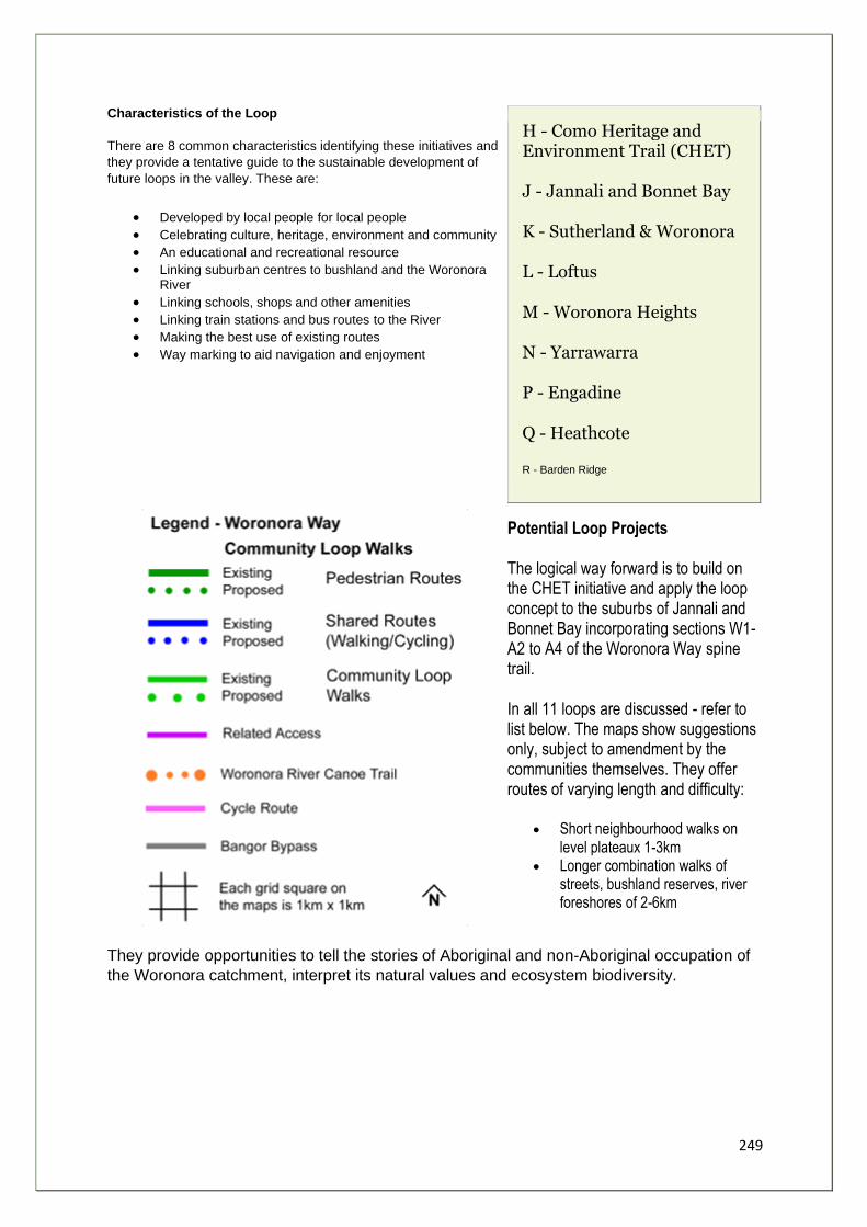
249
Characteristics of the Loop
There are 8 common characteristics identifying these initiatives and
they provide a tentative guide to the sustainable development of
future loops in the valley. These are:
• Developed by local people for local people
• Celebrating culture, heritage, environment and community
• An educational and recreational resource
• Linking suburban centres to bushland and the Woronora River
• Linking schools, shops and other amenities
• Linking train stations and bus routes to the River
• Making the best use of existing routes
• Way marking to aid navigation and enjoyment
H - Como Heritage and Environment Trail (CHET)
J - Jannali and Bonnet Bay
K - Sutherland & Woronora
L - Loftus
M - Woronora Heights
N - Yarrawarra
P - Engadine
Q - Heathcote
R - Barden Ridge
Potential Loop Projects The logical way forward is to build on the CHET initiative and apply the loop concept to the suburbs of Jannali and Bonnet Bay incorporating sections W1- A2 to A4 of the Woronora Way spine trail. In all 11 loops are discussed - refer to list below. The maps show suggestions only, subject to amendment by the communities themselves. They offer routes of varying length and difficulty:
• Short neighbourhood walks on level plateaux 1-3km
• Longer combination walks of streets, bushland reserves, river foreshores of 2-6km
They provide opportunities to tell the stories of Aboriginal and non-Aboriginal occupation of
the Woronora catchment, interpret its natural values and ecosystem biodiversity.
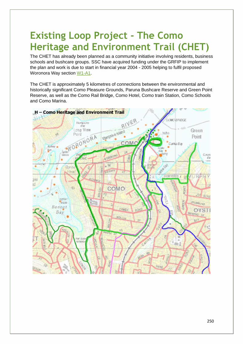
250
Existing Loop Project - The Como Heritage and Environment Trail (CHET) The CHET has already been planned as a community initiative involving residents, business
schools and bushcare groups. SSC have acquired funding under the GRFIP to implement
the plan and work is due to start in financial year 2004 - 2005 helping to fulfil proposed
Woronora Way section W1-A1.
The CHET is approximately 5 kilometres of connections between the environmental and
historically significant Como Pleasure Grounds, Paruna Bushcare Reserve and Green Point
Reserve, as well as the Como Rail Bridge, Como Hotel, Como train Station, Como Schools
and Como Marina.
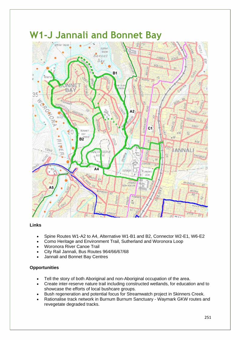
251
W1-J Jannali and Bonnet Bay
Links
• Spine Routes W1-A2 to A4, Alternative W1-B1 and B2, Connector W2-E1, W6-E2 • Como Heritage and Environment Trail, Sutherland and Woronora Loop • Woronora River Canoe Trail • City Rail Jannali, Bus Routes 964/66/67/68 • Jannali and Bonnet Bay Centres
Opportunities
• Tell the story of both Aboriginal and non-Aboriginal occupation of the area. • Create inter-reserve nature trail including constructed wetlands, for education and to
showcase the efforts of local bushcare groups. • Bush regeneration and potential focus for Streamwatch project in Skinners Creek. • Rationalise track network in Burnum Burnum Sanctuary - Waymark GKW routes and
revegetate degraded tracks.
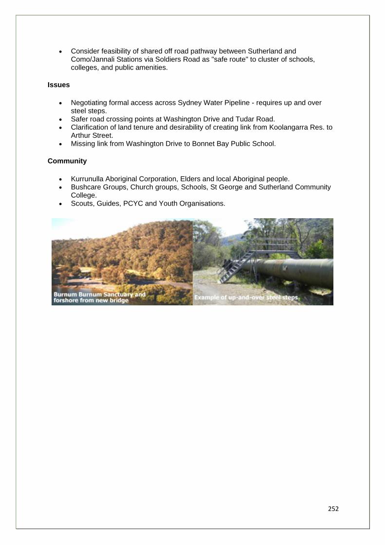
252
• Consider feasibility of shared off road pathway between Sutherland and Como/Jannali Stations via Soldiers Road as "safe route" to cluster of schools, colleges, and public amenities.
Issues
• Negotiating formal access across Sydney Water Pipeline - requires up and over steel steps.
• Safer road crossing points at Washington Drive and Tudar Road. • Clarification of land tenure and desirability of creating link from Koolangarra Res. to
Arthur Street. • Missing link from Washington Drive to Bonnet Bay Public School.
Community
• Kurrunulla Aboriginal Corporation, Elders and local Aboriginal people. • Bushcare Groups, Church groups, Schools, St George and Sutherland Community
College. • Scouts, Guides, PCYC and Youth Organisations.
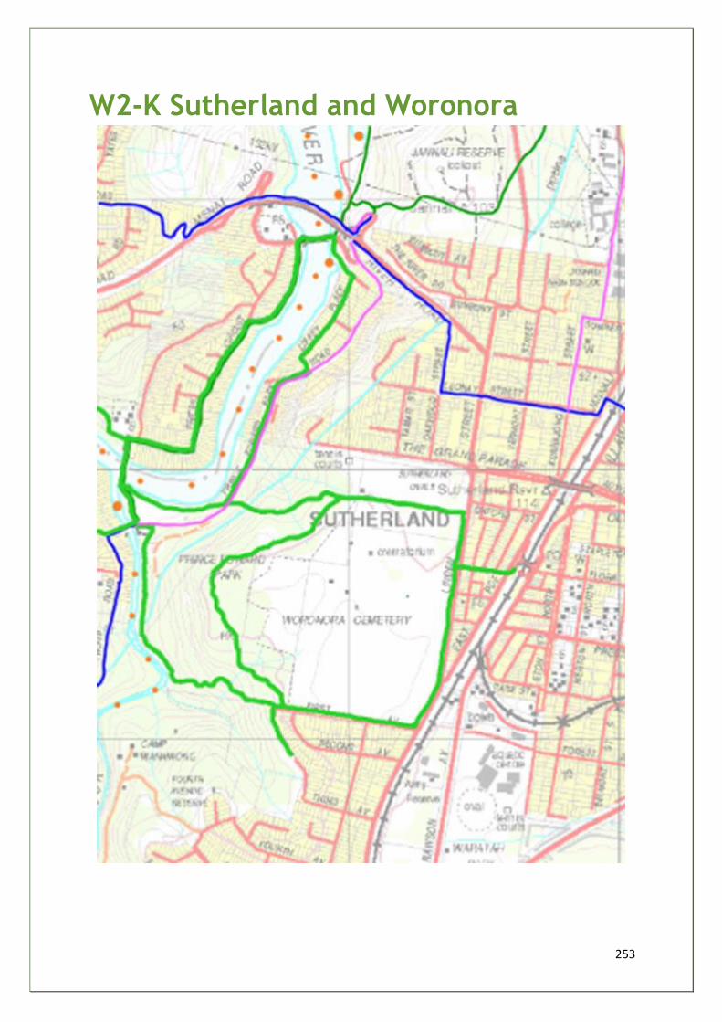
253
W2-K Sutherland and Woronora
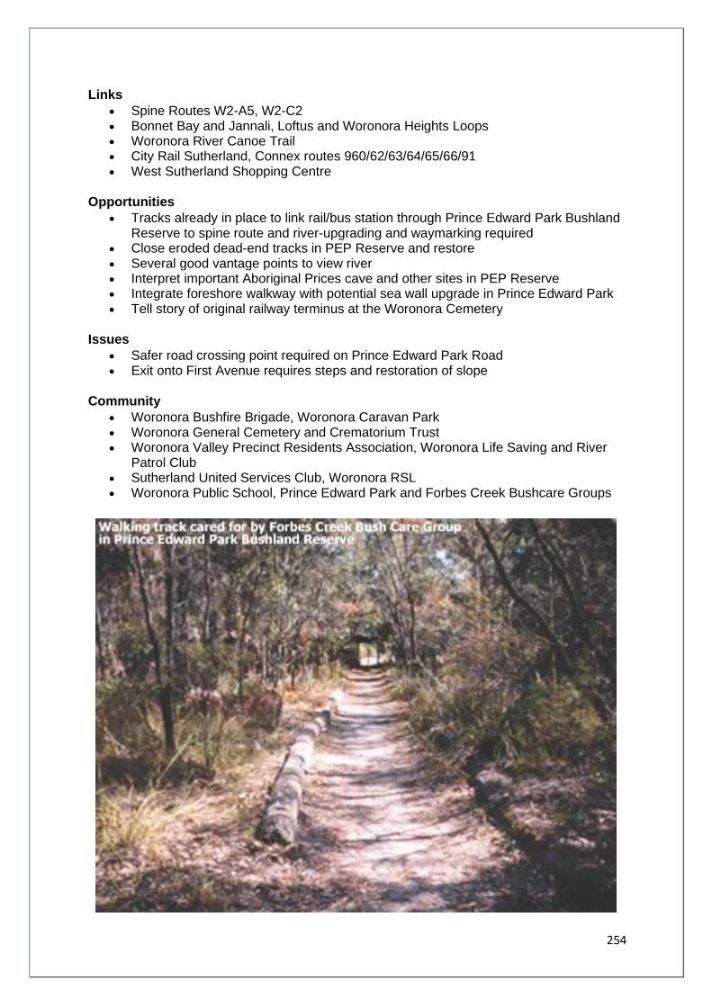
254
Links
• Spine Routes W2-A5, W2-C2 • Bonnet Bay and Jannali, Loftus and Woronora Heights Loops • Woronora River Canoe Trail • City Rail Sutherland, Connex routes 960/62/63/64/65/66/91 • West Sutherland Shopping Centre
Opportunities
• Tracks already in place to link rail/bus station through Prince Edward Park Bushland Reserve to spine route and river-upgrading and waymarking required
• Close eroded dead-end tracks in PEP Reserve and restore • Several good vantage points to view river • Interpret important Aboriginal Prices cave and other sites in PEP Reserve • Integrate foreshore walkway with potential sea wall upgrade in Prince Edward Park • Tell story of original railway terminus at the Woronora Cemetery
Issues
• Safer road crossing point required on Prince Edward Park Road • Exit onto First Avenue requires steps and restoration of slope
Community
• Woronora Bushfire Brigade, Woronora Caravan Park • Woronora General Cemetery and Crematorium Trust • Woronora Valley Precinct Residents Association, Woronora Life Saving and River
Patrol Club • Sutherland United Services Club, Woronora RSL • Woronora Public School, Prince Edward Park and Forbes Creek Bushcare Groups
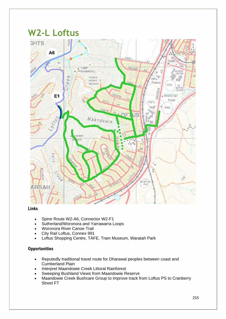
255
W2-L Loftus
Links
• Spine Route W2-A6, Connector W2-F1 • Sutherland/Woronora and Yarrawarra Loops • Woronora River Canoe Trail • City Rail Loftus, Connex 991 • Loftus Shopping Centre, TAFE, Tram Museum, Waratah Park
Opportunities
• Reputedly traditional travel route for Dharawal peoples between coast and Cumberland Plain
• Interpret Maandowie Creek Littoral Rainforest • Sweeping Bushland Views from Maandowie Reserve • Maandowie Creek Bushcare Group to improve track from Loftus PS to Cranberry
Street FT
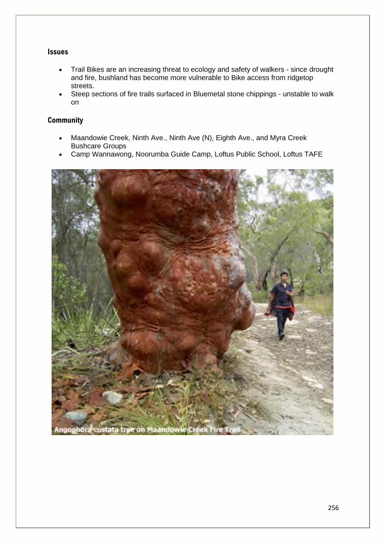
256
Issues
• Trail Bikes are an increasing threat to ecology and safety of walkers - since drought and fire, bushland has become more vulnerable to Bike access from ridgetop streets.
• Steep sections of fire trails surfaced in Bluemetal stone chippings - unstable to walk on
Community
• Maandowie Creek, Ninth Ave., Ninth Ave (N), Eighth Ave., and Myra Creek Bushcare Groups
• Camp Wannawong, Noorumba Guide Camp, Loftus Public School, Loftus TAFE
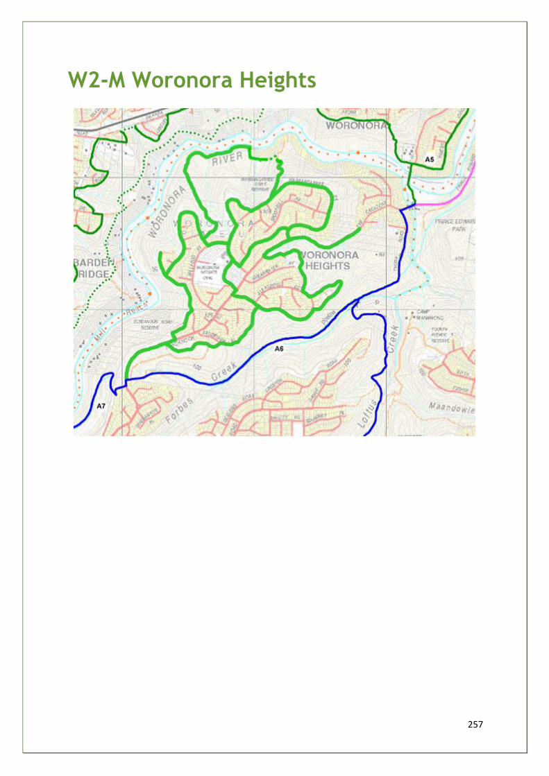
257
W2-M Woronora Heights
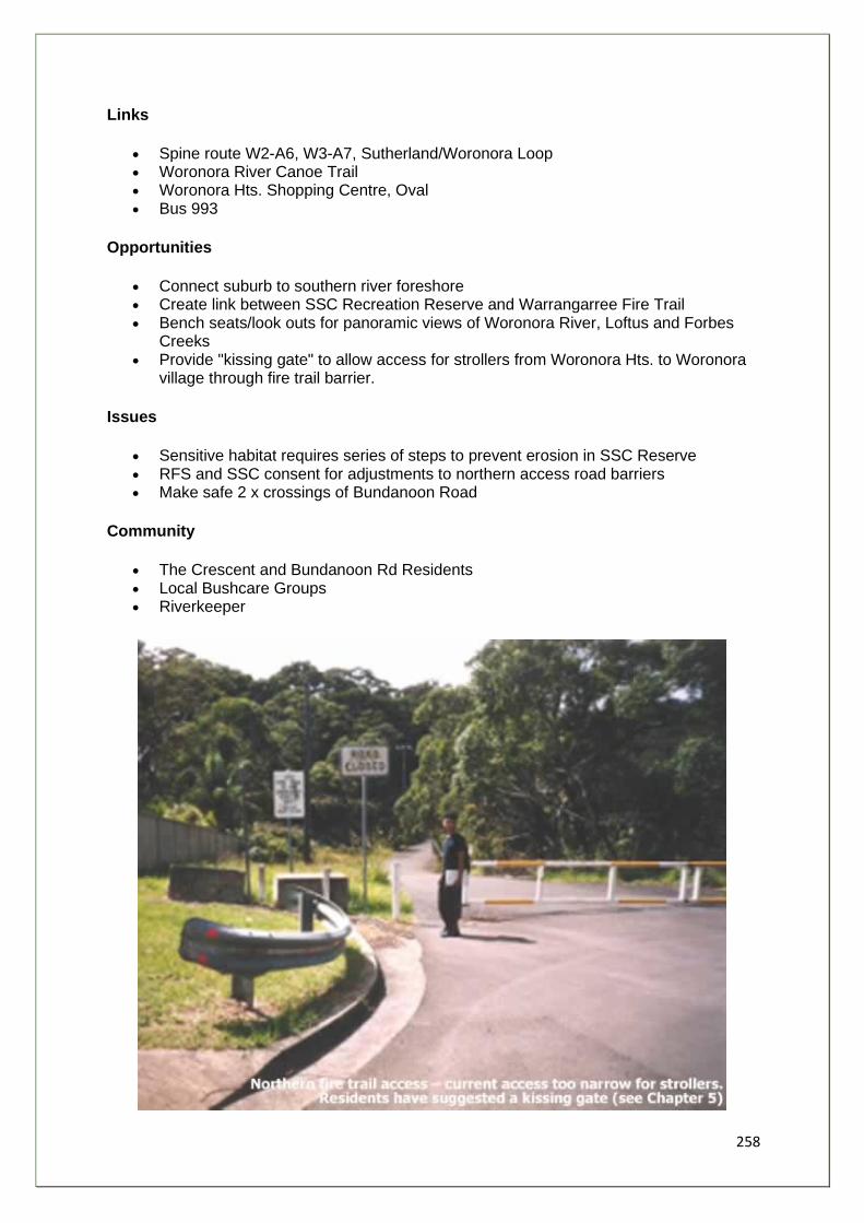
258
Links
• Spine route W2-A6, W3-A7, Sutherland/Woronora Loop • Woronora River Canoe Trail • Woronora Hts. Shopping Centre, Oval • Bus 993
Opportunities
• Connect suburb to southern river foreshore • Create link between SSC Recreation Reserve and Warrangarree Fire Trail • Bench seats/look outs for panoramic views of Woronora River, Loftus and Forbes
Creeks • Provide "kissing gate" to allow access for strollers from Woronora Hts. to Woronora
village through fire trail barrier.
Issues
• Sensitive habitat requires series of steps to prevent erosion in SSC Reserve • RFS and SSC consent for adjustments to northern access road barriers • Make safe 2 x crossings of Bundanoon Road
Community
• The Crescent and Bundanoon Rd Residents • Local Bushcare Groups • Riverkeeper
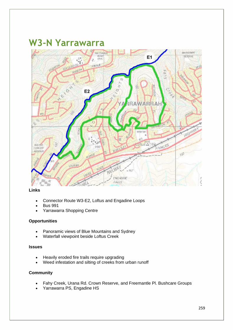
259
W3-N Yarrawarra
Links
• Connector Route W3-E2, Loftus and Engadine Loops • Bus 991 • Yarrawarra Shopping Centre
Opportunities
• Panoramic views of Blue Mountains and Sydney • Waterfall viewpoint beside Loftus Creek
Issues
• Heavily eroded fire trails require upgrading • Weed infestation and silting of creeks from urban runoff
Community
• Fahy Creek, Urana Rd. Crown Reserve, and Freemantle Pl. Bushcare Groups • Yarrawarra PS, Engadine HS

260
W3-P Engadine
Links
• Spine routes: W2-A6, W3-A7/A8; W5-D1, Connector W3-E2/E3/E4 • Yarrawarra and Barden Ridge Loops • City Rail Engadine, Bus 991/92/93/96/97 • Engadine Shopping Centre, Parks, Ovals, Bowling Club
Opportunities
• Incorporate community initiative - "Remembrance Walkway" alongside Upper Forbes Creek
• Interpret Aboriginal sites and historical growth of Engadine
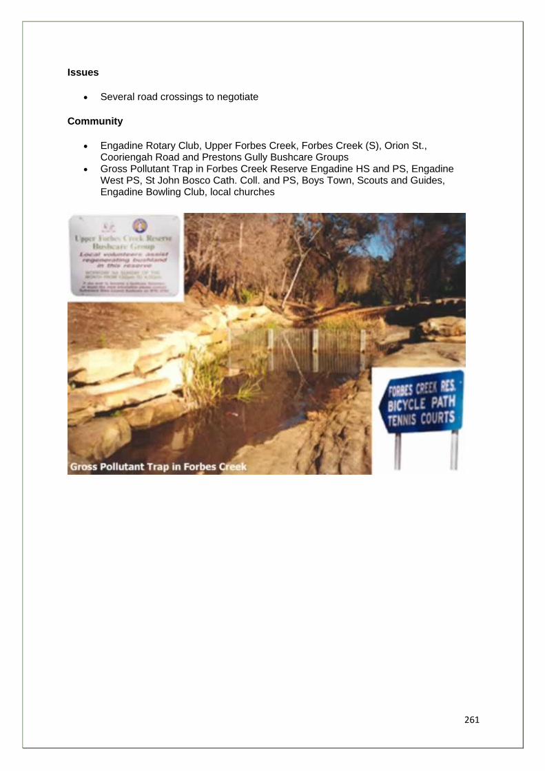
261
Issues
• Several road crossings to negotiate
Community
• Engadine Rotary Club, Upper Forbes Creek, Forbes Creek (S), Orion St., Cooriengah Road and Prestons Gully Bushcare Groups
• Gross Pollutant Trap in Forbes Creek Reserve Engadine HS and PS, Engadine West PS, St John Bosco Cath. Coll. and PS, Boys Town, Scouts and Guides, Engadine Bowling Club, local churches
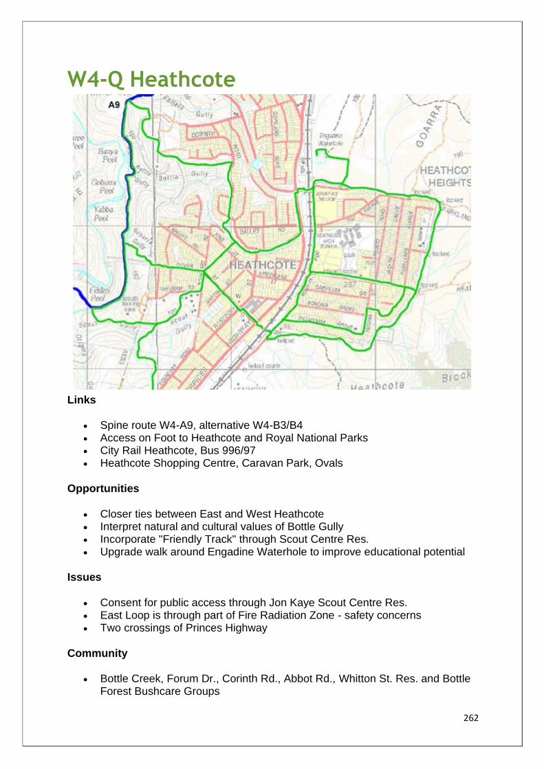
262
W4-Q Heathcote
Links
• Spine route W4-A9, alternative W4-B3/B4 • Access on Foot to Heathcote and Royal National Parks • City Rail Heathcote, Bus 996/97 • Heathcote Shopping Centre, Caravan Park, Ovals
Opportunities
• Closer ties between East and West Heathcote • Interpret natural and cultural values of Bottle Gully • Incorporate "Friendly Track" through Scout Centre Res. • Upgrade walk around Engadine Waterhole to improve educational potential
Issues
• Consent for public access through Jon Kaye Scout Centre Res. • East Loop is through part of Fire Radiation Zone - safety concerns • Two crossings of Princes Highway
Community
• Bottle Creek, Forum Dr., Corinth Rd., Abbot Rd., Whitton St. Res. and Bottle Forest Bushcare Groups
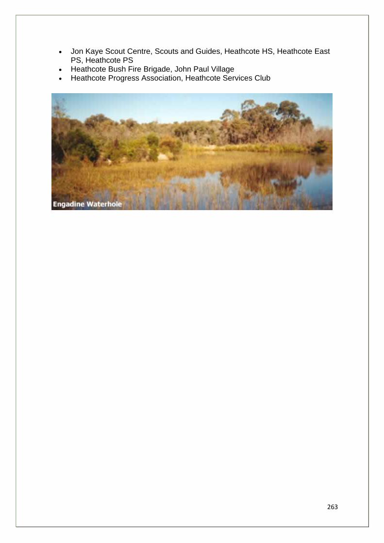
263
• Jon Kaye Scout Centre, Scouts and Guides, Heathcote HS, Heathcote East PS, Heathcote PS
• Heathcote Bush Fire Brigade, John Paul Village • Heathcote Progress Association, Heathcote Services Club
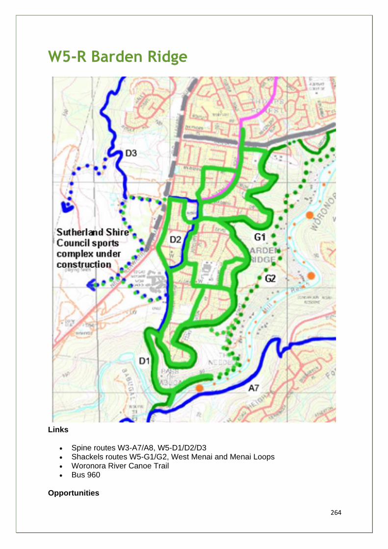
264
W5-R Barden Ridge
Links
• Spine routes W3-A7/A8, W5-D1/D2/D3 • Shackels routes W5-G1/G2, West Menai and Menai Loops • Woronora River Canoe Trail • Bus 960
Opportunities
265
• Strengthen community stewardship of the Needles/Sabugal Pass area • Incorporate first section of Shackels long term walking route • Long term connection to shared route circling SSC sports complex
Issues
• Track network currently severed by construction of Bangor bypass • Private land tenure below Thomas Mitchell Drive • Prevention of Illegal Trail bike and 4WD access to Sabugal Pass
Community
• Lucas Heights HS and PS, Suth. Shire Christian School, St Paul's Church • Gandangara LALC, Australia Ave. Res., Sorrel Pl. and other Bushcare
Groups • West Menai and Barden Ridge PRA
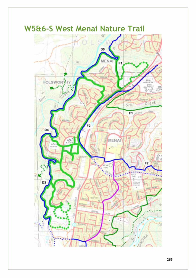
266
W5&6-S West Menai Nature Trail
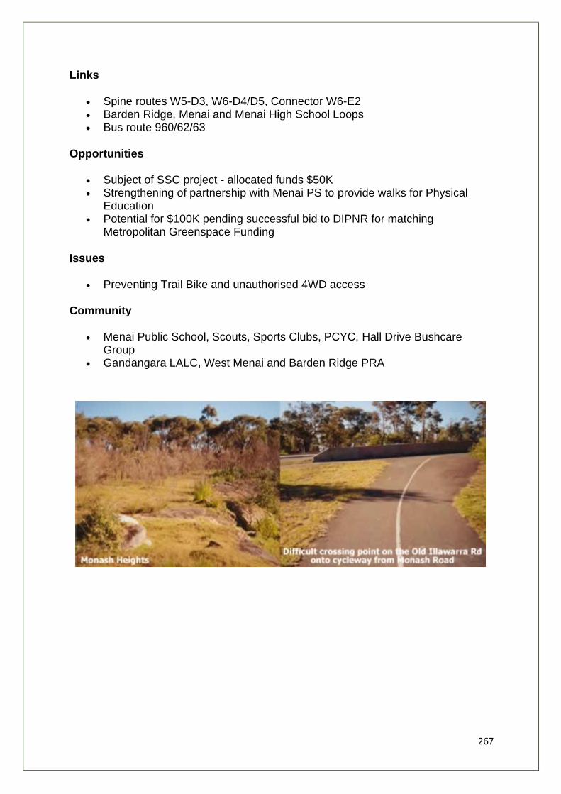
267
Links
• Spine routes W5-D3, W6-D4/D5, Connector W6-E2 • Barden Ridge, Menai and Menai High School Loops • Bus route 960/62/63
Opportunities
• Subject of SSC project - allocated funds $50K • Strengthening of partnership with Menai PS to provide walks for Physical
Education • Potential for $100K pending successful bid to DIPNR for matching
Metropolitan Greenspace Funding
Issues
• Preventing Trail Bike and unauthorised 4WD access
Community
• Menai Public School, Scouts, Sports Clubs, PCYC, Hall Drive Bushcare Group
• Gandangara LALC, West Menai and Barden Ridge PRA
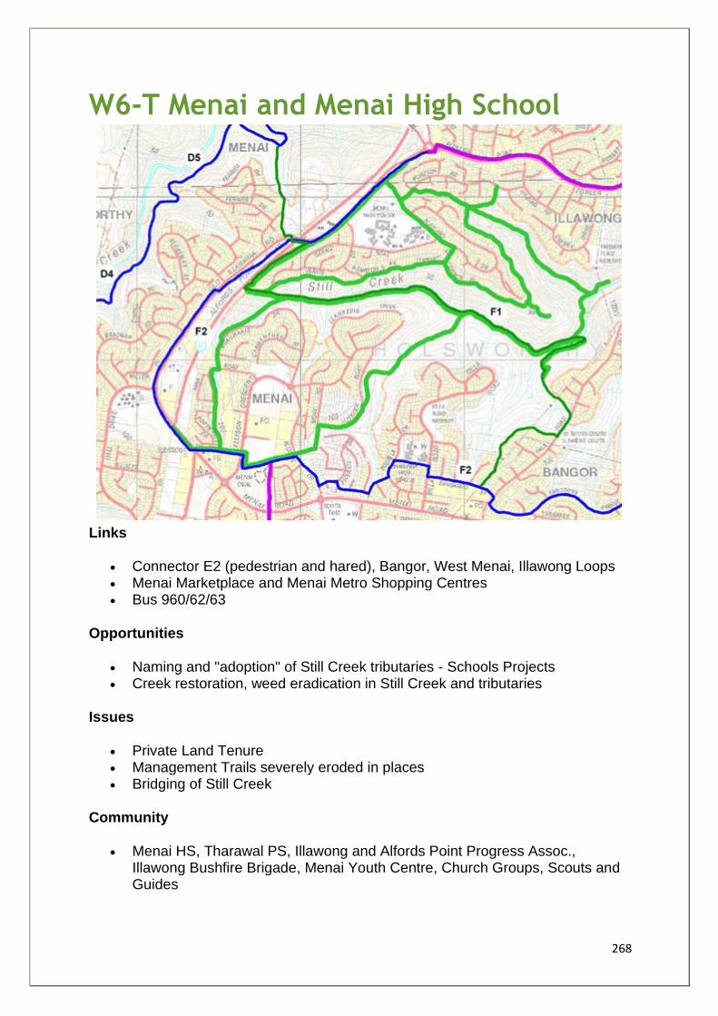
268
W6-T Menai and Menai High School
Links
• Connector E2 (pedestrian and hared), Bangor, West Menai, Illawong Loops • Menai Marketplace and Menai Metro Shopping Centres • Bus 960/62/63
Opportunities
• Naming and "adoption" of Still Creek tributaries - Schools Projects • Creek restoration, weed eradication in Still Creek and tributaries
Issues
• Private Land Tenure • Management Trails severely eroded in places • Bridging of Still Creek
Community
• Menai HS, Tharawal PS, Illawong and Alfords Point Progress Assoc., Illawong Bushfire Brigade, Menai Youth Centre, Church Groups, Scouts and Guides
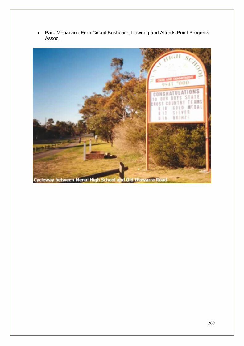
269
• Parc Menai and Fern Circuit Bushcare, Illawong and Alfords Point Progress Assoc.
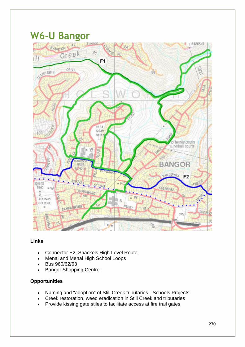
270
W6-U Bangor
Links
• Connector E2, Shackels High Level Route • Menai and Menai High School Loops • Bus 960/62/63 • Bangor Shopping Centre
Opportunities
• Naming and "adoption" of Still Creek tributaries - Schools Projects • Creek restoration, weed eradication in Still Creek and tributaries • Provide kissing gate stiles to facilitate access at fire trail gates
271
• Improve road crossing safety
Issues
• Footbridge is only safe crossing point on Menai Road, which lacks formal kerb and footway pavement on south side
• Private land tenure
Community
• Bangor PS, Inaburra School, Holy Family Cath. PS, St Aquinas Coll. Scouts and Guides
• Church Groups, Bangaroo St. and Ballina Place Bushcare Groups
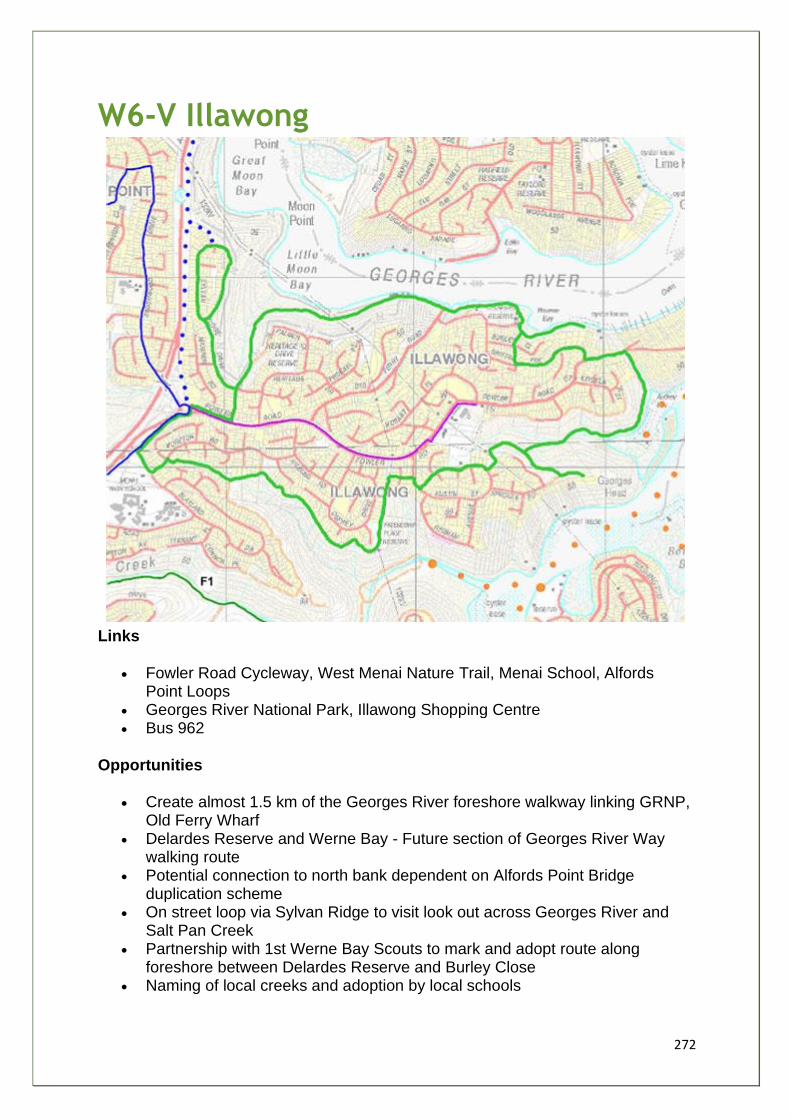
272
W6-V Illawong
Links
• Fowler Road Cycleway, West Menai Nature Trail, Menai School, Alfords Point Loops
• Georges River National Park, Illawong Shopping Centre • Bus 962
Opportunities
• Create almost 1.5 km of the Georges River foreshore walkway linking GRNP, Old Ferry Wharf
• Delardes Reserve and Werne Bay - Future section of Georges River Way walking route
• Potential connection to north bank dependent on Alfords Point Bridge duplication scheme
• On street loop via Sylvan Ridge to visit look out across Georges River and Salt Pan Creek
• Partnership with 1st Werne Bay Scouts to mark and adopt route along foreshore between Delardes Reserve and Burley Close
• Naming of local creeks and adoption by local schools
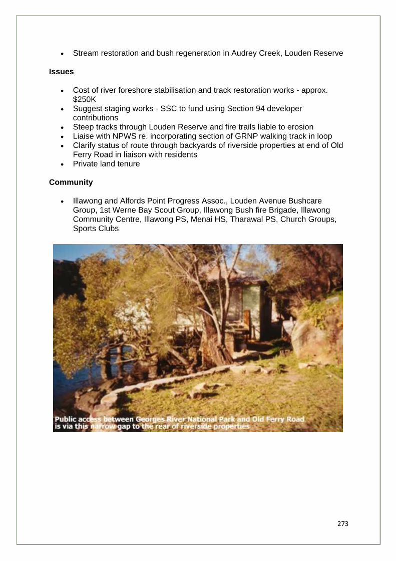
273
• Stream restoration and bush regeneration in Audrey Creek, Louden Reserve
Issues
• Cost of river foreshore stabilisation and track restoration works - approx. $250K
• Suggest staging works - SSC to fund using Section 94 developer contributions
• Steep tracks through Louden Reserve and fire trails liable to erosion • Liaise with NPWS re. incorporating section of GRNP walking track in loop • Clarify status of route through backyards of riverside properties at end of Old
Ferry Road in liaison with residents • Private land tenure
Community
• Illawong and Alfords Point Progress Assoc., Louden Avenue Bushcare Group, 1st Werne Bay Scout Group, Illawong Bush fire Brigade, Illawong Community Centre, Illawong PS, Menai HS, Tharawal PS, Church Groups, Sports Clubs
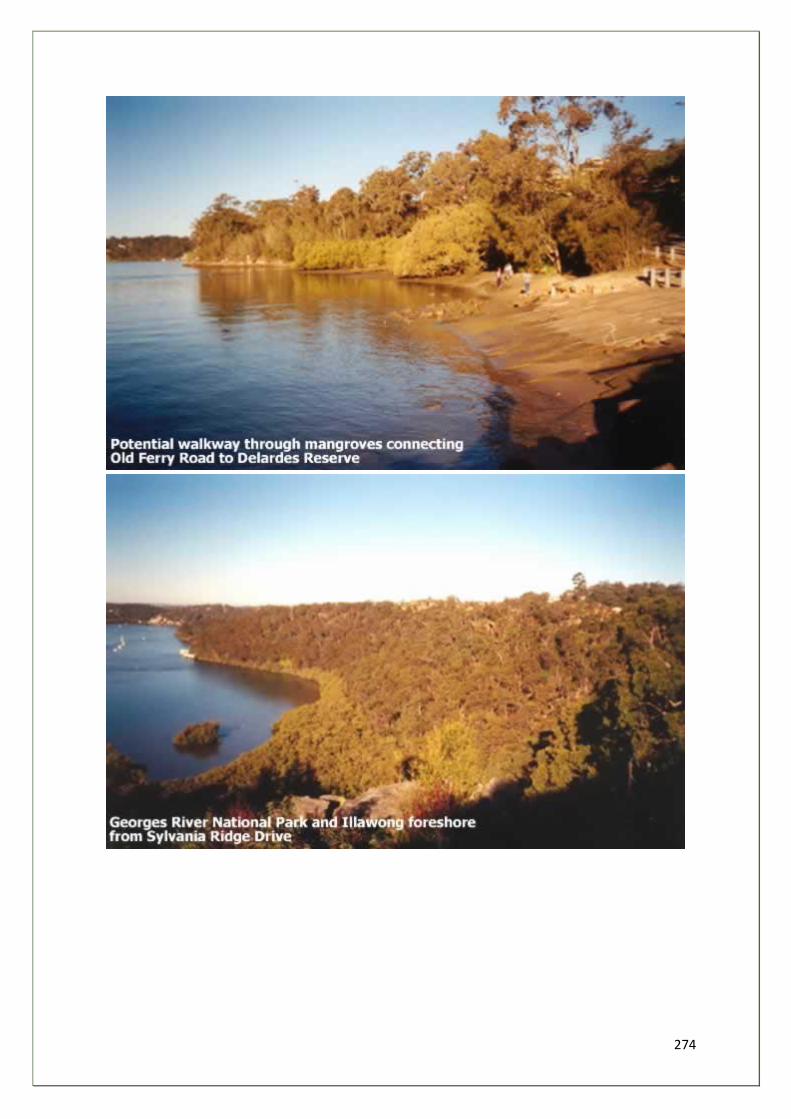
274
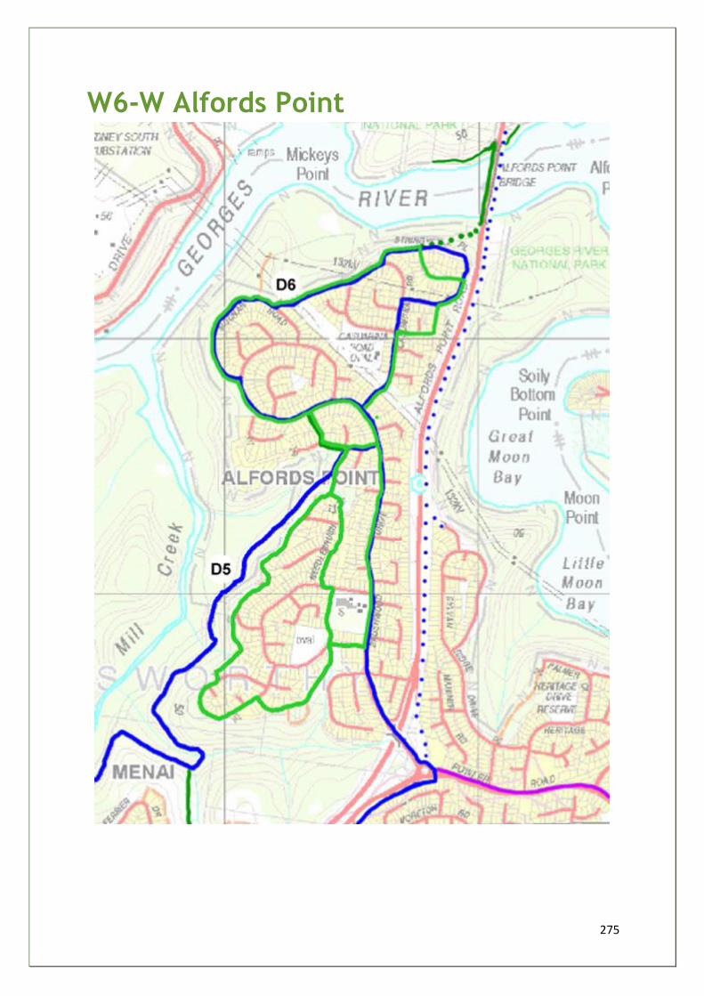
275
W6-W Alfords Point
276
Links
• Spine W6-D5/D6 GMR1 • Loops - Illawong, West Menai Nature Trail • Alfords point Shopping Centre • Bus 962
Opportunities
• Integrate north and south of suburb via local streets and fire trail system • Improved voluntary surveillance of National Park boundary • Increase number of local bushcare groups
Issues
• Liaise with NPWS re integration of GRNP walking tracks in loop
Community
• Illawong and Alfords Point Progress Assoc., Casuarina Road Res. Bushcare Group, Alfords Point Community Centre, Alfords Point PS, Church Groups, Sports Clubs, Illawong Bush Fire Brigade
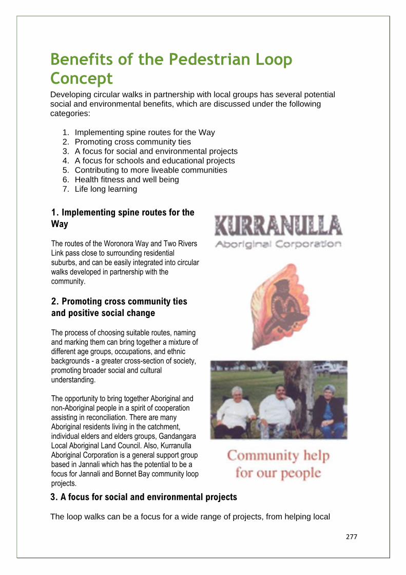
277
Benefits of the Pedestrian Loop Concept Developing circular walks in partnership with local groups has several potential social and environmental benefits, which are discussed under the following categories:
1. Implementing spine routes for the Way 2. Promoting cross community ties 3. A focus for social and environmental projects 4. A focus for schools and educational projects 5. Contributing to more liveable communities 6. Health fitness and well being 7. Life long learning
1. Implementing spine routes for the
Way
The routes of the Woronora Way and Two Rivers Link pass close to surrounding residential suburbs, and can be easily integrated into circular walks developed in partnership with the community.
2. Promoting cross community ties
and positive social change
The process of choosing suitable routes, naming and marking them can bring together a mixture of different age groups, occupations, and ethnic backgrounds - a greater cross-section of society, promoting broader social and cultural understanding. The opportunity to bring together Aboriginal and non-Aboriginal people in a spirit of cooperation assisting in reconciliation. There are many Aboriginal residents living in the catchment, individual elders and elders groups, Gandangara Local Aboriginal Land Council. Also, Kurranulla Aboriginal Corporation is a general support group based in Jannali which has the potential to be a focus for Jannali and Bonnet Bay community loop projects.
3. A focus for social and environmental projects The loop walks can be a focus for a wide range of projects, from helping local
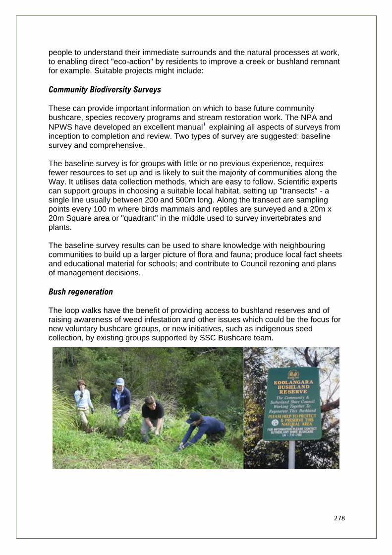
278
people to understand their immediate surrounds and the natural processes at work, to enabling direct "eco-action" by residents to improve a creek or bushland remnant for example. Suitable projects might include:
Community Biodiversity Surveys
These can provide important information on which to base future community bushcare, species recovery programs and stream restoration work. The NPA and
NPWS have developed an excellent manual explaining all aspects of surveys from inception to completion and review. Two types of survey are suggested: baseline survey and comprehensive. The baseline survey is for groups with little or no previous experience, requires fewer resources to set up and is likely to suit the majority of communities along the Way. It utilises data collection methods, which are easy to follow. Scientific experts can support groups in choosing a suitable local habitat, setting up "transects" - a single line usually between 200 and 500m long. Along the transect are sampling points every 100 m where birds mammals and reptiles are surveyed and a 20m x 20m Square area or "quadrant" in the middle used to survey invertebrates and plants. The baseline survey results can be used to share knowledge with neighbouring communities to build up a larger picture of flora and fauna; produce local fact sheets and educational material for schools; and contribute to Council rezoning and plans of management decisions.
Bush regeneration The loop walks have the benefit of providing access to bushland reserves and of raising awareness of weed infestation and other issues which could be the focus for new voluntary bushcare groups, or new initiatives, such as indigenous seed collection, by existing groups supported by SSC Bushcare team.
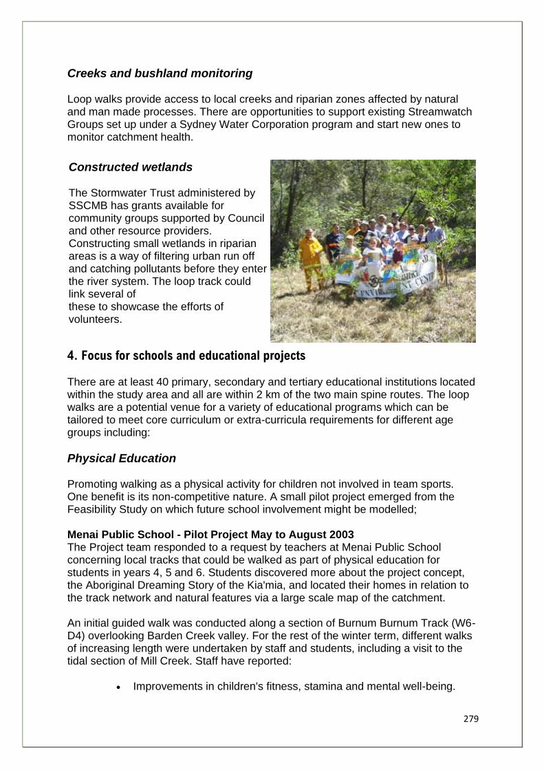
279
Creeks and bushland monitoring Loop walks provide access to local creeks and riparian zones affected by natural and man made processes. There are opportunities to support existing Streamwatch Groups set up under a Sydney Water Corporation program and start new ones to monitor catchment health.
Constructed wetlands The Stormwater Trust administered by SSCMB has grants available for community groups supported by Council and other resource providers. Constructing small wetlands in riparian areas is a way of filtering urban run off and catching pollutants before they enter the river system. The loop track could link several of these to showcase the efforts of volunteers.
4. Focus for schools and educational projects There are at least 40 primary, secondary and tertiary educational institutions located within the study area and all are within 2 km of the two main spine routes. The loop walks are a potential venue for a variety of educational programs which can be tailored to meet core curriculum or extra-curricula requirements for different age groups including:
Physical Education Promoting walking as a physical activity for children not involved in team sports. One benefit is its non-competitive nature. A small pilot project emerged from the Feasibility Study on which future school involvement might be modelled; Menai Public School - Pilot Project May to August 2003 The Project team responded to a request by teachers at Menai Public School concerning local tracks that could be walked as part of physical education for students in years 4, 5 and 6. Students discovered more about the project concept, the Aboriginal Dreaming Story of the Kia'mia, and located their homes in relation to the track network and natural features via a large scale map of the catchment. An initial guided walk was conducted along a section of Burnum Burnum Track (W6-D4) overlooking Barden Creek valley. For the rest of the winter term, different walks of increasing length were undertaken by staff and students, including a visit to the tidal section of Mill Creek. Staff have reported:
• Improvements in children's fitness, stamina and mental well-being.
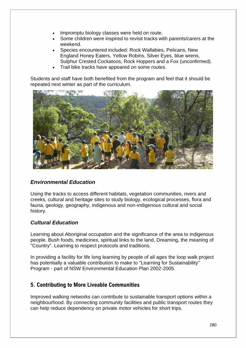
280
• Impromptu biology classes were held on route. • Some children were inspired to revisit tracks with parents/carers at the
weekend. • Species encountered included: Rock Wallabies, Pelicans, New
England Honey Eaters, Yellow Robins, Silver Eyes, blue wrens, Sulphur Crested Cockatoos, Rock Hoppers and a Fox (unconfirmed).
• Trail bike tracks have appeared on some routes.
Students and staff have both benefited from the program and feel that it should be repeated next winter as part of the curriculum.
Environmental Education Using the tracks to access different habitats, vegetation communities, rivers and creeks, cultural and heritage sites to study biology, ecological processes, flora and fauna, geology, geography, indigenous and non-indigenous cultural and social history.
Cultural Education Learning about Aboriginal occupation and the significance of the area to indigenous people. Bush foods, medicines, spiritual links to the land, Dreaming, the meaning of "Country". Learning to respect protocols and traditions. In providing a facility for life long learning by people of all ages the loop walk project has potentially a valuable contribution to make to "Learning for Sustainability" Program - part of NSW Environmental Education Plan 2002-2005.
5. Contributing to More Liveable Communities
Improved walking networks can contribute to sustainable transport options within a neighbourhood. By connecting community facilities and public transport routes they can help reduce dependency on private motor vehicles for short trips.
281
Natural Realms Walks can link the four "natural realms" of the neighbourhood and improve opportunities for people to encounter the natural environment and feel connected to the web of life. Recent research by NSW National Parks and Wildlife Service suggests that people tend to mentally construct 4 natural realms:
1. Urban paces, yards, streets - these are places made by humans for humans to live in. Only attractive and beneficial or harmless forms of wildlife are considered appropriate here - small attractive birds, lady bugs, blue-tongue lizards, kookaburras, frogs, butterflies and earthworms.
2. Urban nature - local parks and gardens - these are considered leisure places with lawns and manicured trees. Their purpose is human recreation. A wider range of wildlife is appropriate here, but needs to make room for humans.
3. Accessible bush - urban bushland, bush reserve/parks. These are managed bush areas e.g. Burnum Burnum Sanctuary, Bonnet Bay. They should be reasonably safe for humans to visit. Nevertheless they are basically there for the wildlife.
4. The natural environment - unspoiled original nature, not really intended for humans. Visits may involve discomfort and a degree of danger i.e. snakes, spiders wasps.
Home Range "Home range" is the territory within which a person's day to day movements and activities normally take place. It increases as children grow up. Historically planners have placed barriers to people movement, which have severely limited young people's home range. The development of loop walks has the potential to widen the home range and increase young people's freedom for independent exploration. Children and young people require access to diverse learning experiences to discover their natural talents and develop their abilities. By providing safe accessible routes, ideally linking public open spaces of varying character such a s bushland and parks (natural realms) in close proximity to residential areas, opportunities are created which can complement formal schooling. These include:
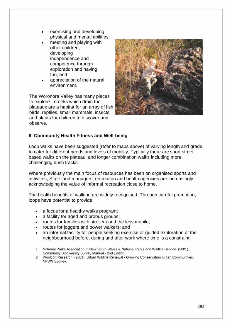
282
• exercising and developing physical and mental abilities;
• meeting and playing with other children, developing independence and competence through exploration and having fun; and
• appreciation of the natural environment.
The Woronora Valley has many places to explore - creeks which drain the plateaux are a habitat for an array of fish, birds, reptiles, small mammals, insects, and plants for children to discover and observe.
6. Community Health Fitness and Well-being Loop walks have been suggested (refer to maps above) of varying length and grade, to cater for different needs and levels of mobility. Typically there are short street based walks on the plateau, and longer combination walks including more challenging bush tracks. Where previously the main focus of resources has been on organised sports and activities, State land managers, recreation and health agencies are increasingly acknowledging the value of informal recreation close to home. The health benefits of walking are widely recognised. Through careful promotion, loops have potential to provide:
• a focus for a healthy walks program; • a facility for aged and probus groups; • routes for families with strollers and the less mobile; • routes for joggers and power walkers; and • an informal facility for people seeking exercise or guided exploration of the
neighbourhood before, during and after work where time is a constraint.
1. National Parks Association of New South Wales & National Parks and Wildlife Service. (2001). Community Biodiversity Survey Manual - 2nd Edition.
2. Woolcott Research. (2001). Urban Wildlife Renewal - Growing Conservation Urban Communities. NPWS Sydney.
283
Community Loop Implementation Strategy Jannali and Bonnet Bay Example
This section considers the practical implementation of the ideas discussed above, using the
Jannali and Bonnet Bay Loops (W1-J) as an example.
The table below summarises a suggested staged approach involving a full range of
stakeholders along the lines of Local Agenda 21 active community partnering initiatives.
Staging Community Involvement
Stage One - Develop a Community Partnership
• Identify key Community Groups • Identify local champions • Identify resource agencies:
o SSC o SSEC/GREA o DIPNR o SSCMB o Sydney Water o Gandangara LALC o DSR o SESAHS o DET o CDEP o CVA
• Formalise the Partnership
• Kurrunulla Aboriginal Corporation
• Jannali and Bonnet Bay Community Halls
• Local bushcare groups • Local schools and colleges • Church groups • Scouts and guides • Sports clubs • PCYC • Family Centre • Billies Bushies • Sutherland Shire Canoe Club • Sutherland Shire Bushwalking
Club • Private land owners.
Stage Two - Bare Foot Mapping
Community Partnership to organise
Barefoot Mapping exercise, open to all
interested groups and individuals
"Barefoot Mapping" is a name given to ecosystem mapping, which does not rely on high-tech tools or specialised knowledge. Ecosystem mapping takes into account all of the natural and human-made features of a neighbourhood. Mapping is a way for local people to get to know and reconnect with the place they live in. It has potential to empower people to protect their community, its natural and built environment and shape
A practical tool for exploration and
awareness building. A way for the
communities of Jannali and Bonnet
Bay. to record walking tracks and
nearby features, significant landforms,
trees, vegetation communities,
evidence of wildlife, cultural and
historical features - items which are
important to them.
The idea is to build up a holistic
picture of the immediate environment
including threats such as weed
infestation, pollution, dumping waste,
vandalism and so on.
284
it in ways that work now and for future generations.
From the findings of the mapping
exercise the community can better
choose suitable community access
loops and become aware of
environmental issues relating to the
chosen routes.
Stage Three - Action Planning
Produce a Plan based on the findings of
the mapping exercise as a tool for
gleaning funding and support in the wider
community:
• Routes selected by community • Chosen themes and use of routes • Priority of Development • Private land tenure/consent
requirements • OHandS Risk Assessments of
Routes • Other Issues • Estimated Costs and Funding
Sources • Actions and responsibilities • Long term Stewardship and
maintenance arrangements
• Plan owned by Community Partnership
• Produced with support of SSC and SSEC/GREA resources
Stage Four - Completion
Secure funding for:
• Track construction and upgrade • Signage, track infrastructure • Brochures and educational
material • Involve state and commonwealth
program in support of volunteers to carryout on ground works
• Construct missing links with help of Conservation Volunteers Australia, CDEP, 1 st Offenders and other teams
• Seek VCA s with private landowners and Council where applicable
• Community partnership to organise naming and marking events.
• Build on Bushcare network to establish Stewardship Group to monitor use of trail and access support from Council for associated bush regeneration works
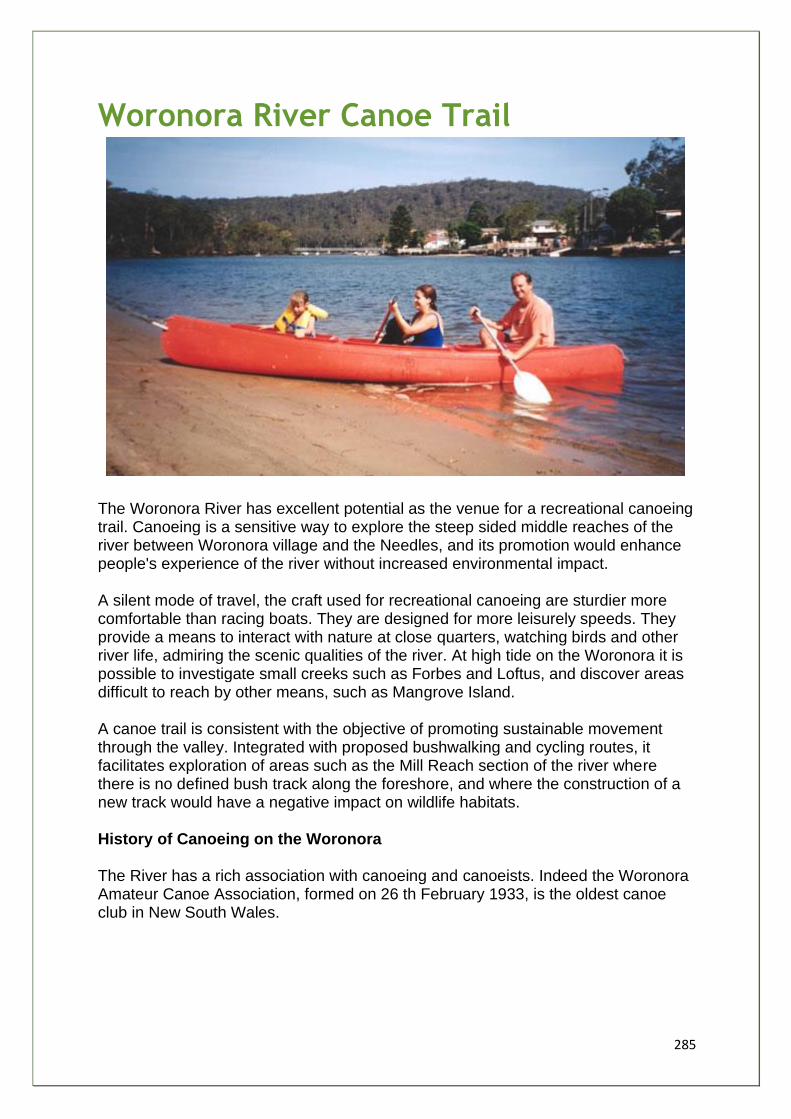
285
Woronora River Canoe Trail
The Woronora River has excellent potential as the venue for a recreational canoeing trail. Canoeing is a sensitive way to explore the steep sided middle reaches of the river between Woronora village and the Needles, and its promotion would enhance people's experience of the river without increased environmental impact. A silent mode of travel, the craft used for recreational canoeing are sturdier more comfortable than racing boats. They are designed for more leisurely speeds. They provide a means to interact with nature at close quarters, watching birds and other river life, admiring the scenic qualities of the river. At high tide on the Woronora it is possible to investigate small creeks such as Forbes and Loftus, and discover areas difficult to reach by other means, such as Mangrove Island. A canoe trail is consistent with the objective of promoting sustainable movement through the valley. Integrated with proposed bushwalking and cycling routes, it facilitates exploration of areas such as the Mill Reach section of the river where there is no defined bush track along the foreshore, and where the construction of a new track would have a negative impact on wildlife habitats. History of Canoeing on the Woronora The River has a rich association with canoeing and canoeists. Indeed the Woronora Amateur Canoe Association, formed on 26 th February 1933, is the oldest canoe club in New South Wales.
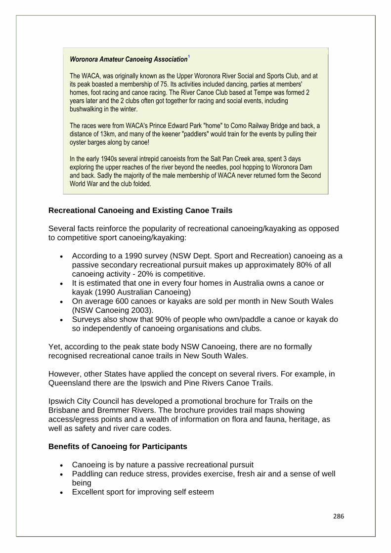
286
Woronora Amateur Canoeing Association The WACA, was originally known as the Upper Woronora River Social and Sports Club, and at its peak boasted a membership of 75. Its activities included dancing, parties at members' homes, foot racing and canoe racing. The River Canoe Club based at Tempe was formed 2 years later and the 2 clubs often got together for racing and social events, including bushwalking in the winter. The races were from WACA's Prince Edward Park "home" to Como Railway Bridge and back, a distance of 13km, and many of the keener "paddlers" would train for the events by pulling their oyster barges along by canoe! In the early 1940s several intrepid canoeists from the Salt Pan Creek area, spent 3 days exploring the upper reaches of the river beyond the needles, pool hopping to Woronora Dam and back. Sadly the majority of the male membership of WACA never returned form the Second World War and the club folded.
Recreational Canoeing and Existing Canoe Trails Several facts reinforce the popularity of recreational canoeing/kayaking as opposed to competitive sport canoeing/kayaking:
• According to a 1990 survey (NSW Dept. Sport and Recreation) canoeing as a passive secondary recreational pursuit makes up approximately 80% of all canoeing activity - 20% is competitive.
• It is estimated that one in every four homes in Australia owns a canoe or kayak (1990 Australian Canoeing)
• On average 600 canoes or kayaks are sold per month in New South Wales (NSW Canoeing 2003).
• Surveys also show that 90% of people who own/paddle a canoe or kayak do so independently of canoeing organisations and clubs.
Yet, according to the peak state body NSW Canoeing, there are no formally recognised recreational canoe trails in New South Wales. However, other States have applied the concept on several rivers. For example, in Queensland there are the Ipswich and Pine Rivers Canoe Trails. Ipswich City Council has developed a promotional brochure for Trails on the Brisbane and Bremmer Rivers. The brochure provides trail maps showing access/egress points and a wealth of information on flora and fauna, heritage, as well as safety and river care codes. Benefits of Canoeing for Participants
• Canoeing is by nature a passive recreational pursuit • Paddling can reduce stress, provides exercise, fresh air and a sense of well
being • Excellent sport for improving self esteem
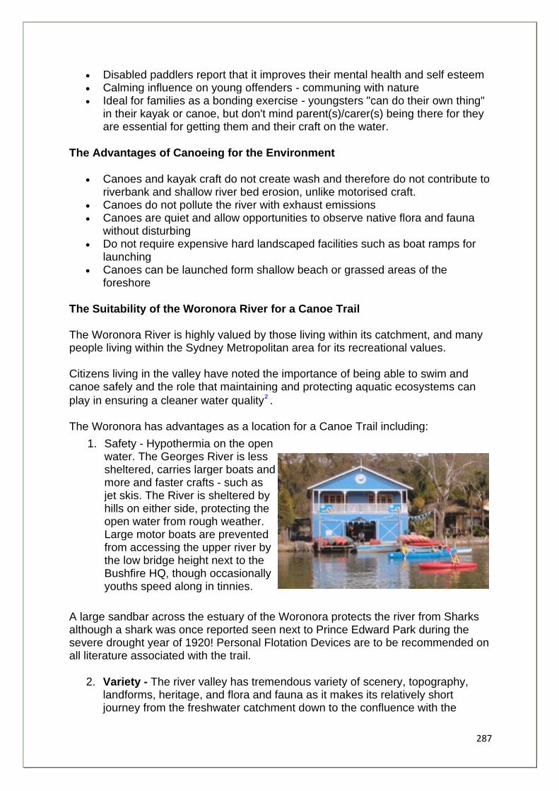
287
• Disabled paddlers report that it improves their mental health and self esteem • Calming influence on young offenders - communing with nature • Ideal for families as a bonding exercise - youngsters "can do their own thing"
in their kayak or canoe, but don't mind parent(s)/carer(s) being there for they are essential for getting them and their craft on the water.
The Advantages of Canoeing for the Environment
• Canoes and kayak craft do not create wash and therefore do not contribute to riverbank and shallow river bed erosion, unlike motorised craft.
• Canoes do not pollute the river with exhaust emissions • Canoes are quiet and allow opportunities to observe native flora and fauna
without disturbing • Do not require expensive hard landscaped facilities such as boat ramps for
launching • Canoes can be launched form shallow beach or grassed areas of the
foreshore
The Suitability of the Woronora River for a Canoe Trail The Woronora River is highly valued by those living within its catchment, and many people living within the Sydney Metropolitan area for its recreational values. Citizens living in the valley have noted the importance of being able to swim and canoe safely and the role that maintaining and protecting aquatic ecosystems can
play in ensuring a cleaner water quality . The Woronora has advantages as a location for a Canoe Trail including:
1. Safety - Hypothermia on the open water. The Georges River is less sheltered, carries larger boats and more and faster crafts - such as jet skis. The River is sheltered by hills on either side, protecting the open water from rough weather. Large motor boats are prevented from accessing the upper river by the low bridge height next to the Bushfire HQ, though occasionally youths speed along in tinnies.
A large sandbar across the estuary of the Woronora protects the river from Sharks although a shark was once reported seen next to Prince Edward Park during the severe drought year of 1920! Personal Flotation Devices are to be recommended on all literature associated with the trail.
2. Variety - The river valley has tremendous variety of scenery, topography, landforms, heritage, and flora and fauna as it makes its relatively short journey from the freshwater catchment down to the confluence with the
288
Georges at Como. - approximately 11kms from The Needles to the mouth of the river.
3. Access - There are several existing points of safe public access to the river for canoeing concentrated in the central reach of river from Lakewood City Reserve at Bonnet Bay upstream to Prince Edward Park. Most have car parks and toilets as well as other facilities. A central starting point such as the Star Boatshed is ideal. A trail can be followed upstream or downstream dependent on the participants involved. The Boatshed is located opposite Prince Edward Park where the Woronora Way walking and cycling routes and the canoe trail join. A combination of routes is then possible.
4. Achievable - The River has a high standard of existing access facilities. The main items requiring development are community consultation, installation of trail markers and trail promotion through brochures/maps.
5. Location - in close proximity to large population - The Woronora catchment has accommodated significant urban development in the last 10 to 15 years, increasing the population to an estimated 53,000. The Canoe Trail can contribute significantly to the management of increased recreational demand placed on the river by the emerging population and the existing population of Sutherland Shire (200,000 in total), It provides a sustainable recreational use of the river, has potential to raise awareness of the rivers intrinsic values, and contributes to life long learning for the community.
Aspects of a Woronora River Canoe Trail Trail users Different trail options to suit all levels of skill (beginner, average, experienced) in both canoe and kayak. For example family Groups (parent(s)/carer(s) kids), seniors, singles or couples, school or youth groups, disabled groups. Trail to benefit as many people as possible from beginners to experienced. Three main groups of users need to be catered for:
• Independent canoeists bringing their own craft to the access points from outside the valley
• Local paddlers - most waterfront properties have at least one canoe • Individuals and groups hiring craft from the Star Boatshed
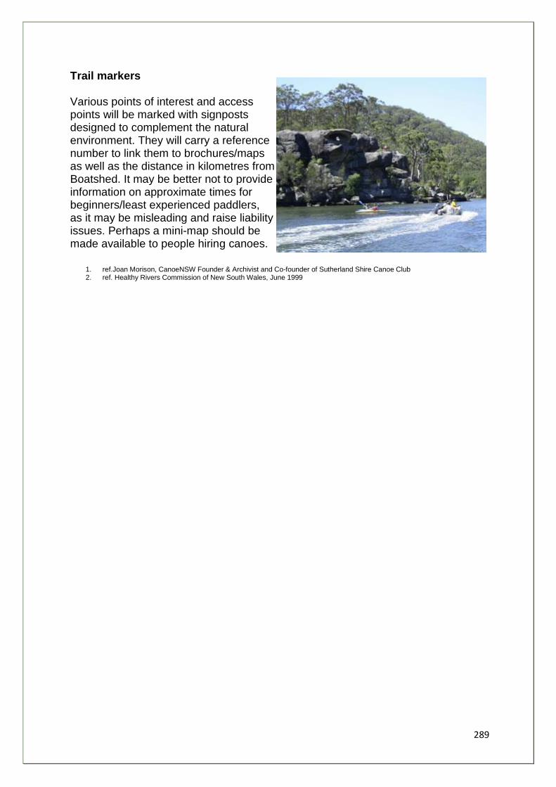
289
Trail markers Various points of interest and access points will be marked with signposts designed to complement the natural environment. They will carry a reference number to link them to brochures/maps as well as the distance in kilometres from Boatshed. It may be better not to provide information on approximate times for beginners/least experienced paddlers, as it may be misleading and raise liability issues. Perhaps a mini-map should be made available to people hiring canoes.
1. ref.Joan Morison, CanoeNSW Founder & Archivist and Co-founder of Sutherland Shire Canoe Club 2. ref. Healthy Rivers Commission of New South Wales, June 1999
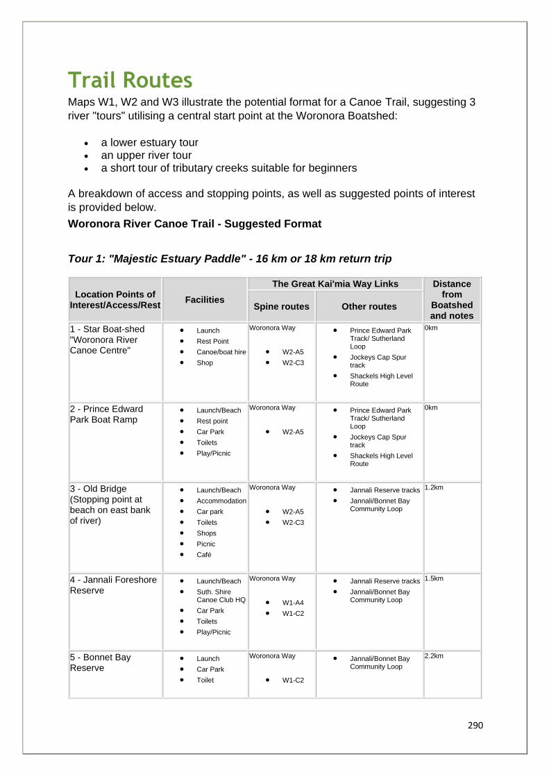
290
Trail Routes Maps W1, W2 and W3 illustrate the potential format for a Canoe Trail, suggesting 3
river "tours" utilising a central start point at the Woronora Boatshed:
• a lower estuary tour • an upper river tour • a short tour of tributary creeks suitable for beginners
A breakdown of access and stopping points, as well as suggested points of interest
is provided below.
Woronora River Canoe Trail - Suggested Format
Tour 1: "Majestic Estuary Paddle" - 16 km or 18 km return trip
Location Points of Interest/Access/Rest
Facilities
The Great Kai'mia Way Links Distance from
Boatshed and notes
Spine routes Other routes
1 - Star Boat-shed "Woronora River Canoe Centre"
• Launch
• Rest Point
• Canoe/boat hire
• Shop
Woronora Way
• W2-A5
• W2-C3
• Prince Edward Park Track/ Sutherland Loop
• Jockeys Cap Spur track
• Shackels High Level Route
0km
2 - Prince Edward Park Boat Ramp
• Launch/Beach
• Rest point
• Car Park
• Toilets
• Play/Picnic
Woronora Way
• W2-A5
• Prince Edward Park Track/ Sutherland Loop
• Jockeys Cap Spur track
• Shackels High Level Route
0km
3 - Old Bridge (Stopping point at beach on east bank of river)
• Launch/Beach
• Accommodation
• Car park
• Toilets
• Shops
• Picnic
• Café
Woronora Way
• W2-A5
• W2-C3
• Jannali Reserve tracks
• Jannali/Bonnet Bay Community Loop
1.2km
4 - Jannali Foreshore Reserve
• Launch/Beach
• Suth. Shire Canoe Club HQ
• Car Park
• Toilets
• Play/Picnic
Woronora Way
• W1-A4
• W1-C2
• Jannali Reserve tracks
• Jannali/Bonnet Bay Community Loop
1.5km
5 - Bonnet Bay Reserve
• Launch
• Car Park
• Toilet
Woronora Way
• W1-C2
• Jannali/Bonnet Bay Community Loop
2.2km
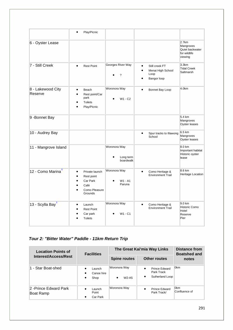
291
• Play/Picnic
6 - Oyster Lease 2.7km
Mangroves
Quiet backwater
for wildlife
viewing
7 - Still Creek • Rest Point Georges River Way
• ?
• Still creek FT
• Menai High School Loop
• Bangor loop
3.3km
Tidal Creek
Saltmarsh
8 - Lakewood City Reserve
• Beach
• Rest point/Car park
• Toilets
• Play/Picnic
Woronora Way
• W1 - C2
• Bonnet Bay Loop 4.0km
9 -Bonnet Bay 5.4 km
Mangroves
Oyster leases
10 - Audrey Bay • Spur tracks to Illawong School
6.5 km
Mangroves
Oyster leases
11 - Mangrove Island Woronora Way
• Long term boardwalk
8.0 km
Important habitat
Historic oyster
lease
12 - Como Marina • Private launch
• Rest point
• Car Park
• Café
• Como Pleasure Grounds
Woronora Way
• W1 - A1 Paruna
• Como Heritage & Environment Trail
8.6 km
Heritage Location
13 - Scylla Bay • Launch
• Rest Point
• Car park
• Toilets
Woronora Way
• W1 - C1
• Como Heritage & Environment Trail
9.0 km
Historic Como
Hotel
Reserve
Pier
Tour 2: "Bitter Water" Paddle - 11km Return Trip
Location Points of
Interest/Access/Rest Facilities
The Great Kai'mia Way Links Distance from
Boatshed and
notes Spine routes Other routes
1 - Star Boat-shed • Launch
• Canoe hire
• Shop
Woronora Way
• W2-A5
• Prince Edward Park Track
• Sutherland Loop
0km
2 -Prince Edward Park
Boat Ramp • Launch
Point
• Car Park
Woronora Way • Prince Edward Park Track/
0km
Confluence of
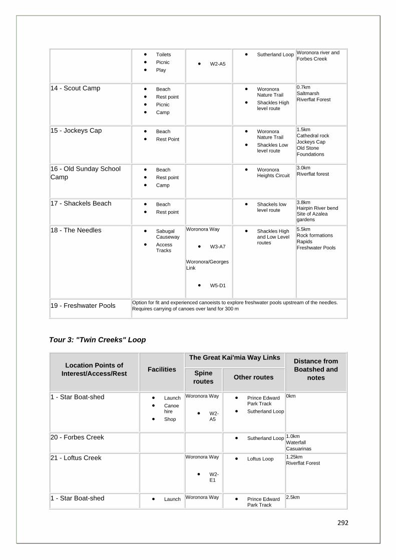
292
• Toilets
• Picnic
• Play
• W2-A5
• Sutherland Loop Woronora river and
Forbes Creek
14 - Scout Camp • Beach
• Rest point
• Picnic
• Camp
• Woronora Nature Trail
• Shackles High level route
0.7km
Saltmarsh
Riverflat Forest
15 - Jockeys Cap • Beach
• Rest Point
• Woronora Nature Trail
• Shackles Low level route
1.5km
Cathedral rock
Jockeys Cap
Old Stone
Foundations
16 - Old Sunday School
Camp
• Beach
• Rest point
• Camp
• Woronora Heights Circuit
3.0km
Riverflat forest
17 - Shackels Beach • Beach
• Rest point
• Shackels low level route
3.8km Hairpin River bend Site of Azalea gardens
18 - The Needles • Sabugal Causeway
• Access Tracks
Woronora Way
• W3-A7
Woronora/Georges
Link
• W5-D1
• Shackles High and Low Level routes
5.5km
Rock formations
Rapids
Freshwater Pools
19 - Freshwater Pools Option for fit and experienced canoeists to explore freshwater pools upstream of the needles.
Requires carrying of canoes over land for 300 m
Tour 3: "Twin Creeks" Loop
Location Points of
Interest/Access/Rest Facilities
The Great Kai'mia Way Links Distance from
Boatshed and
notes Spine
routes Other routes
1 - Star Boat-shed • Launch
• Canoe hire
• Shop
Woronora Way
• W2-A5
• Prince Edward Park Track
• Sutherland Loop
0km
20 - Forbes Creek • Sutherland Loop 1.0km
Waterfall
Casuarinas
21 - Loftus Creek Woronora Way
• W2-E1
• Loftus Loop 1.25km
Riverflat Forest
1 - Star Boat-shed • Launch Woronora Way • Prince Edward Park Track
2.5km

293
• Canoe hire
• Shop • W2-
A5
• Sutherland Loop
1. To reach these two destinations entails negotiating the confluence of Woronora and Georges Rivers, a large expanse of open tidal water - hazards include:
• exposure to stronger winds
• cross currents
• jetskis
• wash from large motor boats
Recommended for participants accompanied by a qualified guide only
294
Stakeholders and Issues to Address Stakeholders
• Australian Canoeing Since 1949 Australian Canoeing (AC) has been the Peak Industry Body for canoeing in Australia. They are very supportive of the idea of a Woronora River Canoe Trail.
• NSW Canoeing Formed in 1953, the peak state body is also extremely supportive of the idea and keen to be a partner. Canoe NSW help to provide training and implement the AC award scheme for guides, instructors, and participants. They see the Woronora as being a suitable river for a prototype Canoe Trail in NSW because of:
o The proximity of the river to urban Sydney o The location of access facilities in the central reach of the river o The position of the Sutherland Shire Canoe Club facility on the banks of the
river.
• Sutherland Shire Canoe Club The local canoe club was established in 1972 and has been based in Jannali Reserve at its current location since 1980. The SSCC's mission is "to promote recreational canoeing in the Sutherland Shire by providing a facility and safe environment where participants of all ages can learn the basic skills in all types of canoe and kayak to further their enjoyment of not only the waterways of the Sutherland Shire but all the rivers of Australia." They have a number of qualified instructors and coaches and are willing to assist in the establishment of a Woronora River Canoe Trail. The Club fully supports the trail concept, seeing it as a way to encourage more canoeists, potential members and assist in the Club's long term plan to set up a Canoe Centre for Sutherland Shire at the northern end of Bonnet Bay Reserve next to the boat ramp.
• Lilli Pilli Kayak Club Formed in the early 1960s, the Lilli Pilli Kayak Club promotes mainly competitive canoeing and kayaking including sprints, marathons, middle distance, whitewater, flat water, slalom, but they are keen to acknowledge the worth of a recreational canoe trail. Their 40 plus members utilise the Woronora River for training and races because of its sheltered conditions.
• The Local Community The local community is likely to benefit considerably from the establishment
295
of a canoe trail. Virtually every waterfront property along the river has a canoe or kayak. The Woronora Valley Precinct Residents Association have indicated their preference for canoeing/boating against walking/cycling as the way to explore the more environmentally sensitive areas reaches of the river upstream of Deepwater. The Star Boatshed hires out canoes, kayaks and small boats and is ideally placed to benefit financially from an increase in visitors. Since the construction of the high level road bridge across the river in 2000 there has been a steady fall-off in casual customers, as traffic no longer has to drop down into the valley. Other businesses are likely to benefit including the Woronora RSL Club and the Riverside Café and Woronora Caravan Park.
• Sutherland Shire Council Council manages a range of assets along the river foreshore including the boat ramps and car parks at Prince Edward, Jannali and Bonnet Bay Bay Reserves - the main access points for the trail. In the case of The Brisbane River and Bremmer Canoe Trails in Queensland, Ipswich City Council was responsible for promoting the trail through education and publicity materials. The support of council will be vital to help fund a brochure and manage any increase in use of Reserves.
• Gandangara Local Aboriginal Land Council The entire Woronora River downstream of Heathcote Road below the high water mark is currently under claim by Gandangara Local Aboriginal Land Council, under the Aboriginal Lands Rights Act 1983 legislation. Also the Land Council has lodged claims on crown land along both banks of the river. Whilst DIPNR is investigating the claims no development can take place without the consent of the Land Council. This includes the construction of any new canoe launching facilities such as floating timber slats. There is an opportunity for involvement of the Land Council and the indigenous community in the future management of a Trail including organised guided tours focusing on the significance of the river for Aboriginal people.
296
Issues to Address
• Water Quality/Health/Flooding
o The large natural areas of the upper Woronora catchment provides an important source of clean water to counterbalance the polluted water emanating from the urbanised lower catchment and the larger Georges River catchment. While the lower estuary is fairly rapidly "flushed" (every two to five days) by the Georges River water, the water is generally of poorer quality. However in prolonged dry spells there is little inflow from the freshwater river and/or the immediate tidal catchment.
o Certainly canoeing should be avoided for up to three days after rain when stormwater run off and sewage overflow contribute to poor water quality in the river.
o The gross pollutant trap in Forbes Creek is close to the central launch point for the Canoe Trail and increased maintenance of the trap is desirable. Local people feel that the trap has caused more erosion and led to muddying and siltation of the lower creek.
o For general safety, Canoe trail literature will advise that canoeing should not take place in the event a flood.
• Access Although the existing access provision is quite extensive, it is suggested that as part of the project better facilities be provided for disabled canoeists, including separate vehicle parking and an on/off water access facility eg pontoon.
• Cultural Heritage and Significance The river and its shores have played a central role in the lives of Aboriginal people, providing places for birth and ceremonies. Also Aboriginal people were dependent on the river for food supply, including fish, worms, freshwater mussels, prawns, and yabbies.
• Links to other recreation activities o Primary e.g. swimming, and secondary e.g. boating, picnicking. o Increased pressure on number of car park spaces at Prince Edward Park
and Jannali Boat Ramp, in particular.
• Plan of Action o Develop the concept map o Involve the community along the river - WVPRA, SSCC, SSC, individual
residents o Field investigations and consultations o Consult regarding points of interest o Develop design of trail markers o Seek funding to produce a brochure - SSC, Star Boatshed, NSWCanoeing,
NSW Sport and Recreation. o Seek funding to provide timber ramps next to concrete boat ramps in Prince
Edward Park and Jannali Foreshore Reserve

297
Chapter Five
298
Coordination The Great Kai'mia Way traverses twelve local government areas, tracts of Crown
Land, National Parks, Aboriginal Land Council land, private land, Sydney Water
Land and land belonging to other government authorities and agencies. Many
sections of the Way already exist, but the standards of access and signage vary
considerably. Many sections of the Way are missing and commitment from
landholders varies from area to area. These issues are part of the discussions in
Chapter 3 and 4. A consistent theme in the feedback the project team received in
meetings with stakeholders in the Great Kai'mia Way study was the need for a
coordinated approach.
The project team identified four aspects of the Great Kai'mia Way that require
coordination:
1. Sustainability and safety 2. Signage 3. Use of materials 4. Implementation
This Chapter is concerned with the first three. Chapter 6 will discuss the fourth issue.
Sustainability and Safety One of the goals of the creation of the Great Kai'mia Way is to provide appropriate
access to the Woronora and Georges River foreshores. Land managers, the
community in general and track users all have a role to play in ensuring that
ecological values of the foreshores are not compromised. All parties also have a role
to ensure that safety is a key consideration in both working on and using the Way.
As part of the feasibility study carried out for this report, the project team developed
a safety code (reproduced in Appendix 5).
Recommendation:
4. That the safety code developed by the Great Kai'mia Way project team be adopted as the minimum standard for work carried out on the Great Kai'mia Way .
Risk Management and Liability
The staged development of the Great Kai'mia Way raises potential liability issues,
and t he management of risk to the public and landowners from using the Way is an
important consideration for Councils and other land managers.
Consultations with Sutherland Shire Council (SSC) , for example, indicated that the
299
following actions might be undertaken as part of a package of measures to minimise
risk:
• Council would only be responsible for parts of the Great Kai'mia Way within the Sutherland Shire on land under its care and control, ownership or properties providing easements for the route.
• Provide risk warnings on brochures and signs specifying latent dangers including steep grades, uneven surfaces, lose rocks, falling branches and service vehicles.
• When requesting consent from owners, including Crown Lands and Gandangara LALC, Council is likely to be required to provide owners with indemnity against public liability on the track.
• Council will need to demonstrate a certain level of maintenance on the track. This would include an appropriate inspection regime.
SSC and NSW Rural Fire Services (RFS) have discussed potential impacts of
increased use of the firetrail in west Menai as a result of promoting the Burnum
Burnum Track. Currently the public use the firetrails for walking and cycling without
any controls. It is considered that through the use of Kai'mia Way signage an
opportunity will be created to close the trails to the public during extreme bush fire
hazard conditions or during hazard reduction activities. "Track Closed" signs will be
incorporated into information signs at both ends of the Burnum Burnum Track.
Maintaining good lines of communication with National Parks staff should ensure
that trail closures across the catchment are coordinated.
Minimal Impact Recreation - Treading Lightly Protocols and Codes of Conduct Increasing access to bushland requires a "tread softly" approach.
Recommendation:
5. That the codes of conduct detailed in the Great Kai'mia Way report be noted on signage and on literature relating to the Way for the three main categories of non-motorised recreational uses: walking, cycling and canoeing.
1. Councils and government agencies, and other landholders and managers will have more detailed occupational health and safety procedures. These will, of course, be the ones applicable for works on their land. The recommendation here is for minimum standards only.
2. Sutherland Shire Council Parks and Waterways Draft Report on The Great Kai'mia Way October 2003 3. The Great Kai'mia Way: Chapter 5.
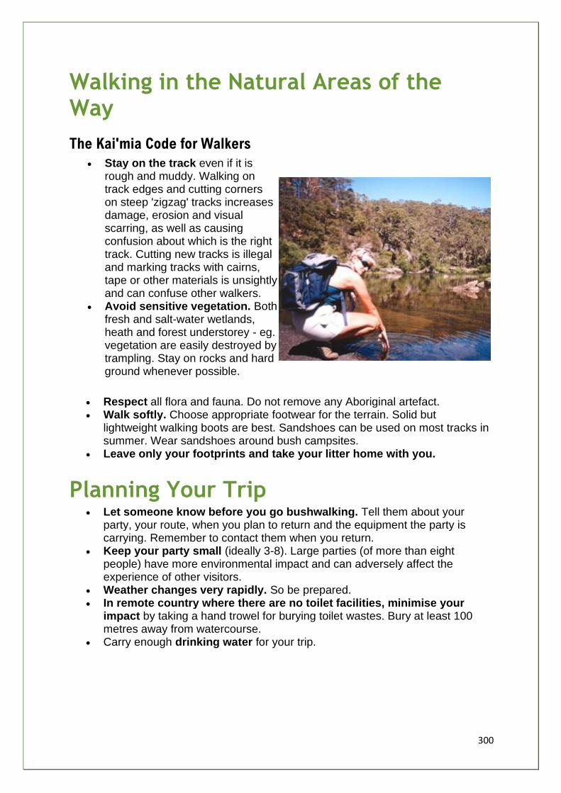
300
Walking in the Natural Areas of the Way
The Kai'mia Code for Walkers
• Stay on the track even if it is rough and muddy. Walking on track edges and cutting corners on steep 'zigzag' tracks increases damage, erosion and visual scarring, as well as causing confusion about which is the right track. Cutting new tracks is illegal and marking tracks with cairns, tape or other materials is unsightly and can confuse other walkers.
• Avoid sensitive vegetation. Both fresh and salt-water wetlands, heath and forest understorey - eg. vegetation are easily destroyed by trampling. Stay on rocks and hard ground whenever possible.
• Respect all flora and fauna. Do not remove any Aboriginal artefact. • Walk softly. Choose appropriate footwear for the terrain. Solid but
lightweight walking boots are best. Sandshoes can be used on most tracks in summer. Wear sandshoes around bush campsites.
• Leave only your footprints and take your litter home with you.
Planning Your Trip • Let someone know before you go bushwalking. Tell them about your
party, your route, when you plan to return and the equipment the party is carrying. Remember to contact them when you return.
• Keep your party small (ideally 3-8). Large parties (of more than eight people) have more environmental impact and can adversely affect the experience of other visitors.
• Weather changes very rapidly. So be prepared. • In remote country where there are no toilet facilities, minimise your
impact by taking a hand trowel for burying toilet wastes. Bury at least 100 metres away from watercourse.
• Carry enough drinking water for your trip.
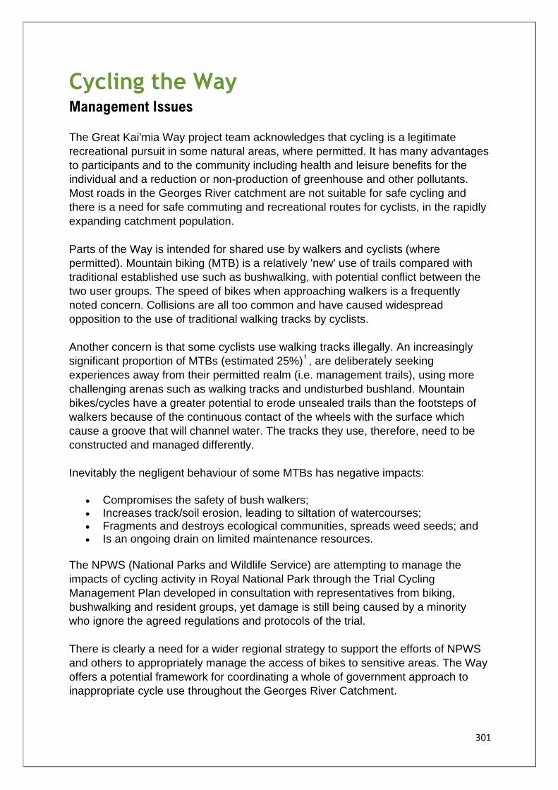
301
Cycling the Way Management Issues
The Great Kai'mia Way project team acknowledges that cycling is a legitimate
recreational pursuit in some natural areas, where permitted. It has many advantages
to participants and to the community including health and leisure benefits for the
individual and a reduction or non-production of greenhouse and other pollutants.
Most roads in the Georges River catchment are not suitable for safe cycling and
there is a need for safe commuting and recreational routes for cyclists, in the rapidly
expanding catchment population.
Parts of the Way is intended for shared use by walkers and cyclists (where
permitted). Mountain biking (MTB) is a relatively 'new' use of trails compared with
traditional established use such as bushwalking, with potential conflict between the
two user groups. The speed of bikes when approaching walkers is a frequently
noted concern. Collisions are all too common and have caused widespread
opposition to the use of traditional walking tracks by cyclists.
Another concern is that some cyclists use walking tracks illegally. An increasingly
significant proportion of MTBs (estimated 25%) , are deliberately seeking
experiences away from their permitted realm (i.e. management trails), using more
challenging arenas such as walking tracks and undisturbed bushland. Mountain
bikes/cycles have a greater potential to erode unsealed trails than the footsteps of
walkers because of the continuous contact of the wheels with the surface which
cause a groove that will channel water. The tracks they use, therefore, need to be
constructed and managed differently.
Inevitably the negligent behaviour of some MTBs has negative impacts:
• Compromises the safety of bush walkers; • Increases track/soil erosion, leading to siltation of watercourses; • Fragments and destroys ecological communities, spreads weed seeds; and • Is an ongoing drain on limited maintenance resources.
The NPWS (National Parks and Wildlife Service) are attempting to manage the
impacts of cycling activity in Royal National Park through the Trial Cycling
Management Plan developed in consultation with representatives from biking,
bushwalking and resident groups, yet damage is still being caused by a minority
who ignore the agreed regulations and protocols of the trial.
There is clearly a need for a wider regional strategy to support the efforts of NPWS
and others to appropriately manage the access of bikes to sensitive areas. The Way
offers a potential framework for coordinating a whole of government approach to
inappropriate cycle use throughout the Georges River Catchment.
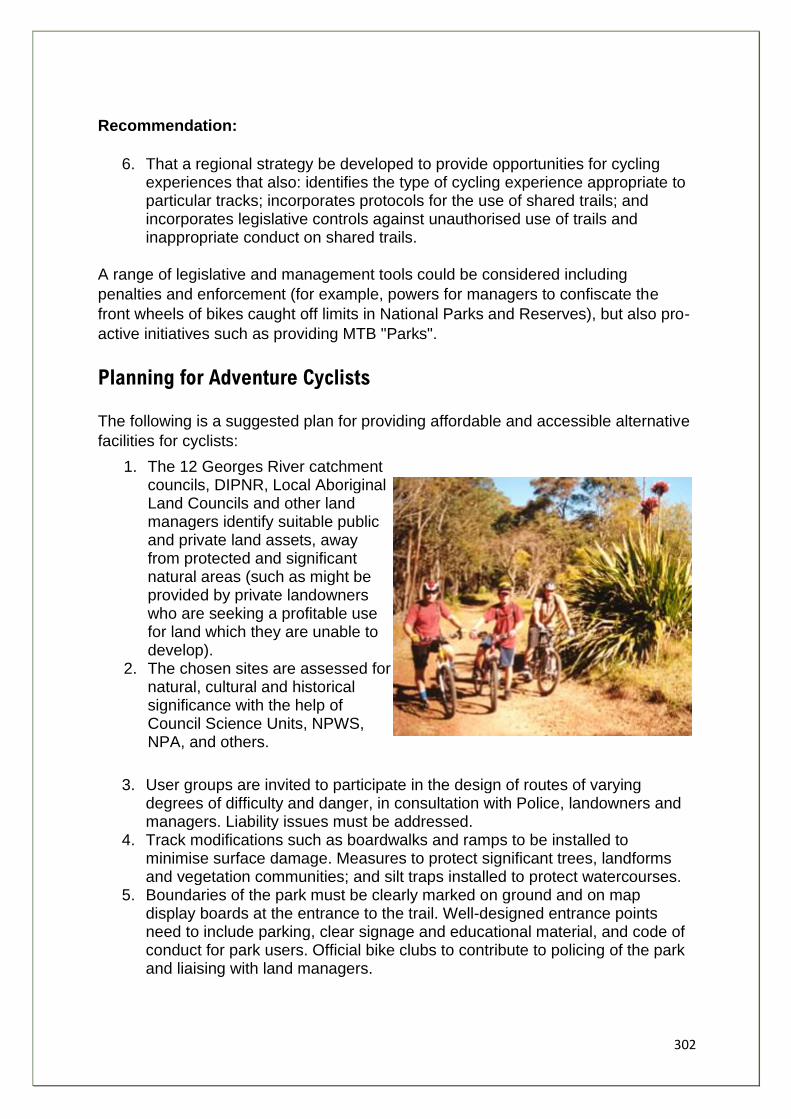
302
Recommendation:
6. That a regional strategy be developed to provide opportunities for cycling experiences that also: identifies the type of cycling experience appropriate to particular tracks; incorporates protocols for the use of shared trails; and incorporates legislative controls against unauthorised use of trails and inappropriate conduct on shared trails.
A range of legislative and management tools could be considered including
penalties and enforcement (for example, powers for managers to confiscate the
front wheels of bikes caught off limits in National Parks and Reserves), but also pro-
active initiatives such as providing MTB "Parks".
Planning for Adventure Cyclists
The following is a suggested plan for providing affordable and accessible alternative
facilities for cyclists:
1. The 12 Georges River catchment councils, DIPNR, Local Aboriginal Land Councils and other land managers identify suitable public and private land assets, away from protected and significant natural areas (such as might be provided by private landowners who are seeking a profitable use for land which they are unable to develop).
2. The chosen sites are assessed for natural, cultural and historical significance with the help of Council Science Units, NPWS, NPA, and others.
3. User groups are invited to participate in the design of routes of varying degrees of difficulty and danger, in consultation with Police, landowners and managers. Liability issues must be addressed.
4. Track modifications such as boardwalks and ramps to be installed to minimise surface damage. Measures to protect significant trees, landforms and vegetation communities; and silt traps installed to protect watercourses.
5. Boundaries of the park must be clearly marked on ground and on map display boards at the entrance to the trail. Well-designed entrance points need to include parking, clear signage and educational material, and code of conduct for park users. Official bike clubs to contribute to policing of the park and liaising with land managers.
303
New Zealand and Canada already have such purpose-built parks. For example cycle parks in Whistler , British Columbia have been designed to strict environmental standards respecting ecological integrity.
Great Kai'mia Way Cycling Access Policy
Organisations such as Australian Association of Bush Regenerators
(AABR) , National Parks Association (NPA) and Nature Conservation
Council (NCCNSW) have developed policies and principles concerned with cycle
access and environmental protection. The International Mountain Biking Association
(IMBA) has suggested a hierarchy of options for managing track user conflict. The
project team has drawn on this work to produce a Great Kai'mia Way Cycling
Access Policy.
The policy has three strands:
1. Track planning and construction 2. Track management 3. Track users code of conduct.
1. Planning and Construction
• Restrict new bicycle paths to non-bushland areas. • No construction of bicycle paths through or adjacent to any Endangered Ecological
Community. • No construction of bicycle paths in linear reserves in or adjacent to remnant bushland areas
where construction of a path and associated landscaping will compromise ecological values. • Where bicycle paths are adjacent to bushland, all potential impacts must be taken into
account, including landscaping, noise, scent, litter and light, and the paths must be made impact neutral.
• The creation of on-road bicycle friendly or alongside road shared routes near to bushland with points of access to the bushland to encourage cyclists to travel to those areas.
• The provision of bicycle storage facilities (racks) at access points to bushland walking tracks.
2. Management
• Land managers such as Councils, to manage cycling activities so that there is minimal impact on the environment, natural and cultural heritage values.
• Managers to adopt a hierarchy of options for managing user conflicts beginning with the most preferred option - informative signage, to least preferred - close the area to cyclists altogether.
• Option 1 - develop signage and literature promoting appropriate track use protocols - e.g. Kai'mia Code (see below). Display Panels and brochures to present good maps to show tracks that are shared, where cycling is permitted and which are walking only tracks. (Refer to Family of Signs)
• Option 2 - develop education programs targeted at those using bushland areas for informal cycling. Work with schools, colleges, youth groups, cycling clubs, walking clubs and Councils to educate cyclists and potential cyclists about low impact use and consideration for other
304
users. Ensure that cyclists who care, but don't know the proper etiquette, have enough information to monitor themselves.
• If the more preferred options are failing, then patrolling the track, restrictions, separate routes for walkers and cyclists should be considered, with closing all tracks to cyclists as a last resort when all other efforts have proven ineffective.
• Managers to investigate provision of MTB parks - see above
3. The Kai'mia Code for Cyclists
• Ride on roads and management vehicle tracks only . Even roads are susceptible to damage when wet; they cannot be used when they are seasonally closed. Walking tracks are managed for walkers and are not available for use by bicycles.
• Respect the rights of others . Other track users have the same rights as you do, so let them go about their activities without interference. Keep speeds down to avoid frightening other users.
• Wear your helmet whenever you are cycling. It is required by law even on management trails. • If you meet walkers , announce your presence, slow down, signal with sound (ring a bell or
call a greeting) and give them right of way as you pass. • Avoid skidding . Skidding damages tracks by removing the harder surface layer. This can
lead to erosion. Cutting corners also causes erosion. Don't cut corners, stay on the track. • Stay away from wet, muddy areas . Muddy areas are very prone to damage. The tracks you
leave behind channel the water when it rains and this leads to erosion. • Check before you leave . It is a good idea to check with local land managers to find out about
track closures and fire regulations, limits on camping or other general information. • Respect all flora and fauna and do not remove any Aboriginal artifact. Take your litter home
with you.
4. Planning your trip
• Let someone know before you go mountain bike riding. Tell them about your party, your route, when you plan to return and the equipment the party is carrying. Remember to contact them when you get back.
• Keep your party small (four to eight people). Large parties have more environmental impact, affect the experience of others and are harder to manage.
• In remote country where there are no toilet facilities, minimise your impact by taking a hand trowel for burying toilet wastes. Bury at least 100 metres away from watercourse.
• Carry enough drinking water for your trip.
1. MTBA and state bodies 2. DeBoer, Andrew. "Whistler Trail Standards - Environmental and Technical Trail Features" First Draft,
Resort Municipality of Whistler, September 2001
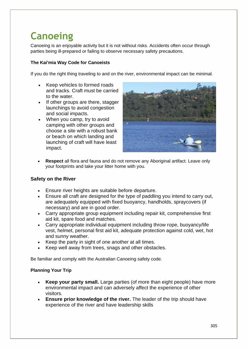
305
Canoeing Canoeing is an enjoyable activity but it is not without risks. Accidents often occur through
parties being ill-prepared or failing to observe necessary safety precautions.
The Kai'mia Way Code for Canoeists
If you do the right thing traveling to and on the river, environmental impact can be minimal.
• Keep vehicles to formed roads and tracks. Craft must be carried to the water.
• If other groups are there, stagger launchings to avoid congestion and social impacts.
• When you camp, try to avoid camping with other groups and choose a site with a robust bank or beach on which landing and launching of craft will have least impact.
• Respect all flora and fauna and do not remove any Aboriginal artifact. Leave only your footprints and take your litter home with you.
Safety on the River
• Ensure river heights are suitable before departure. • Ensure all craft are designed for the type of paddling you intend to carry out,
are adequately equipped with fixed buoyancy, handholds, spraycovers (if necessary) and are in good order.
• Carry appropriate group equipment including repair kit, comprehensive first aid kit, spare food and matches.
• Carry appropriate individual equipment including throw rope, buoyancy/life vest, helmet, personal first aid kit, adequate protection against cold, wet, hot and sunny weather.
• Keep the party in sight of one another at all times. • Keep well away from trees, snags and other obstacles.
Be familiar and comply with the Australian Canoeing safety code.
Planning Your Trip
• Keep your party small. Large parties (of more than eight people) have more environmental impact and can adversely affect the experience of other visitors.
• Ensure prior knowledge of the river. The leader of the trip should have experience of the river and have leadership skills

306
o Only take appropriately skilled party members. Be sure your party members are capable of: swimming confidently; and rescuing themselves and other party members from a capsize.
• Protect yourself and other group members against sunburn, cold, wind and rain. Protect your skin and always wear a long-sleeved top, a hat and sunscreen.
• Plan your escape routes. Carry maps and be familiar with potential escape routes should a mishap occur which necessitates walking out. Have appropriate walking gear (shoes, day pack, map, compass, torch) in case this should be needed.
• Let someone know before you go on the river. Tell them about your party, your planned day of return, and the equipment you are carrying. Remember to contact them when you return.
• In remote country where there are no toilet facilities, minimise your impact by taking a hand trowel for burying toilet wastes. Bury at least 100 metres away from watercourses.
• Carry enough drinking water for your trip.
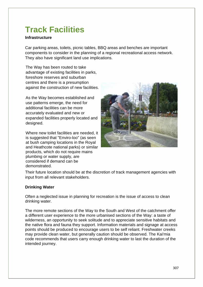
307
Track Facilities Infrastructure
Car parking areas, toilets, picnic tables, BBQ areas and benches are important
components to consider in the planning of a regional recreational access network.
They also have significant land use implications.
The Way has been routed to take
advantage of existing facilities in parks,
foreshore reserves and suburban
centres and there is a presumption
against the construction of new facilities.
As the Way becomes established and
use patterns emerge, the need for
additional facilities can be more
accurately evaluated and new or
expanded facilities properly located and
designed.
Where new toilet facilities are needed, it is suggested that "Enviro-loo" (as seen at bush camping locations in the Royal and Heathcote national parks) or similar products, which do not require mains plumbing or water supply, are considered if demand can be demonstrated.
Their future location should be at the discretion of track management agencies with
input from all relevant stakeholders.
Drinking Water Often a neglected issue in planning for recreation is the issue of access to clean drinking water. The more remote sections of the Way to the South and West of the catchment offer a different user experience to the more urbanised sections of the Way: a taste of wilderness, an opportunity to seek solitude and to appreciate sensitive habitats and the native flora and fauna they support. Information materials and signage at access points should be produced to encourage users to be self reliant. Freshwater creeks may provide clean water, but generally caution should be observed. The Kai'mia code recommends that users carry enough drinking water to last the duration of the intended journey.
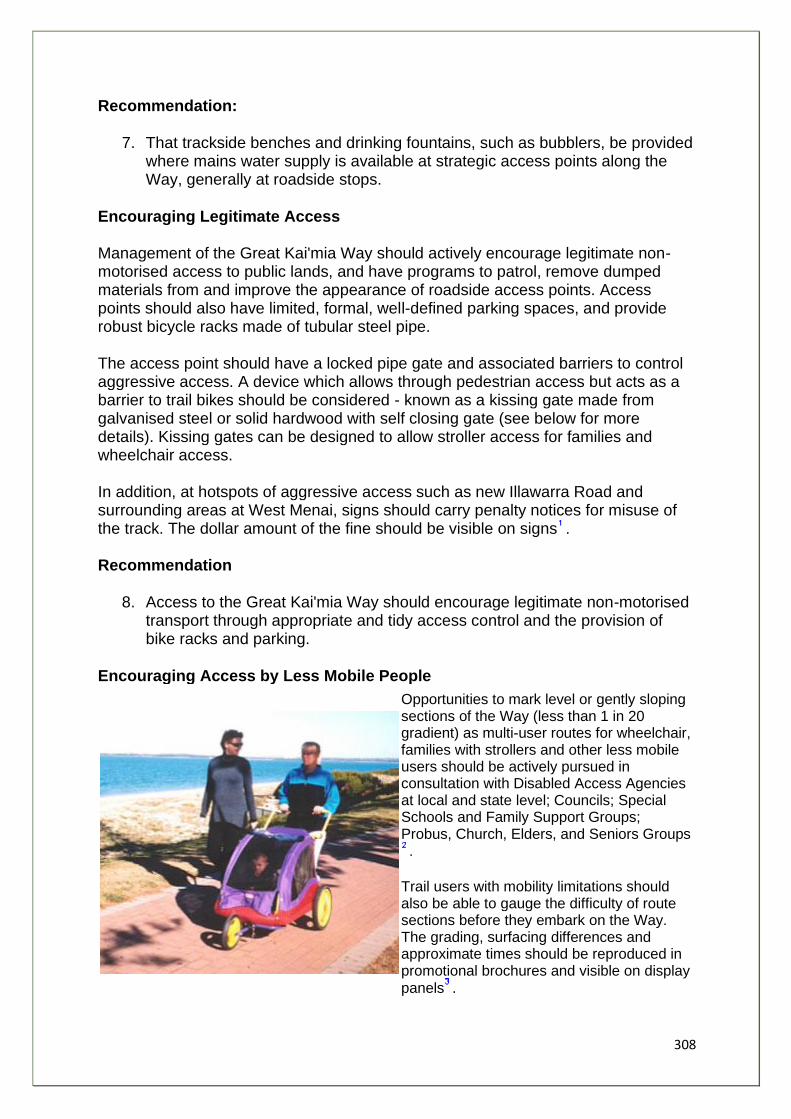
308
Recommendation:
7. That trackside benches and drinking fountains, such as bubblers, be provided where mains water supply is available at strategic access points along the Way, generally at roadside stops.
Encouraging Legitimate Access Management of the Great Kai'mia Way should actively encourage legitimate non-motorised access to public lands, and have programs to patrol, remove dumped materials from and improve the appearance of roadside access points. Access points should also have limited, formal, well-defined parking spaces, and provide robust bicycle racks made of tubular steel pipe. The access point should have a locked pipe gate and associated barriers to control aggressive access. A device which allows through pedestrian access but acts as a barrier to trail bikes should be considered - known as a kissing gate made from galvanised steel or solid hardwood with self closing gate (see below for more details). Kissing gates can be designed to allow stroller access for families and wheelchair access. In addition, at hotspots of aggressive access such as new Illawarra Road and surrounding areas at West Menai, signs should carry penalty notices for misuse of the track. The dollar amount of the fine should be visible on signs . Recommendation
8. Access to the Great Kai'mia Way should encourage legitimate non-motorised transport through appropriate and tidy access control and the provision of bike racks and parking.
Encouraging Access by Less Mobile People
Opportunities to mark level or gently sloping sections of the Way (less than 1 in 20 gradient) as multi-user routes for wheelchair, families with strollers and other less mobile users should be actively pursued in consultation with Disabled Access Agencies at local and state level; Councils; Special Schools and Family Support Groups; Probus, Church, Elders, and Seniors Groups.
Trail users with mobility limitations should also be able to gauge the difficulty of route sections before they embark on the Way. The grading, surfacing differences and approximate times should be reproduced in promotional brochures and visible on display
panels .
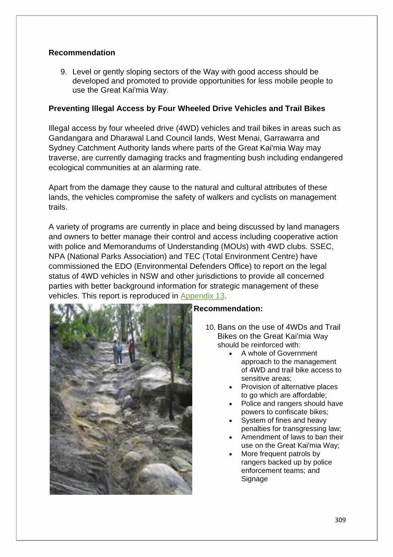
309
Recommendation
9. Level or gently sloping sectors of the Way with good access should be developed and promoted to provide opportunities for less mobile people to use the Great Kai'mia Way.
Preventing Illegal Access by Four Wheeled Drive Vehicles and Trail Bikes
Illegal access by four wheeled drive (4WD) vehicles and trail bikes in areas such as
Gandangara and Dharawal Land Council lands, West Menai, Garrawarra and
Sydney Catchment Authority lands where parts of the Great Kai'mia Way may
traverse, are currently damaging tracks and fragmenting bush including endangered
ecological communities at an alarming rate.
Apart from the damage they cause to the natural and cultural attributes of these
lands, the vehicles compromise the safety of walkers and cyclists on management
trails.
A variety of programs are currently in place and being discussed by land managers
and owners to better manage their control and access including cooperative action
with police and Memorandums of Understanding (MOUs) with 4WD clubs. SSEC,
NPA (National Parks Association) and TEC (Total Environment Centre) have
commissioned the EDO (Environmental Defenders Office) to report on the legal
status of 4WD vehicles in NSW and other jurisdictions to provide all concerned
parties with better background information for strategic management of these
vehicles. This report is reproduced in Appendix 13.
Recommendation:
10. Bans on the use of 4WDs and Trail Bikes on the Great Kai'mia Way should be reinforced with:
• A whole of Government approach to the management of 4WD and trail bike access to sensitive areas;
• Provision of alternative places to go which are affordable;
• Police and rangers should have powers to confiscate bikes;
• System of fines and heavy penalties for transgressing law;
• Amendment of laws to ban their use on the Great Kai'mia Way;
• More frequent patrols by rangers backed up by police enforcement teams; and Signage
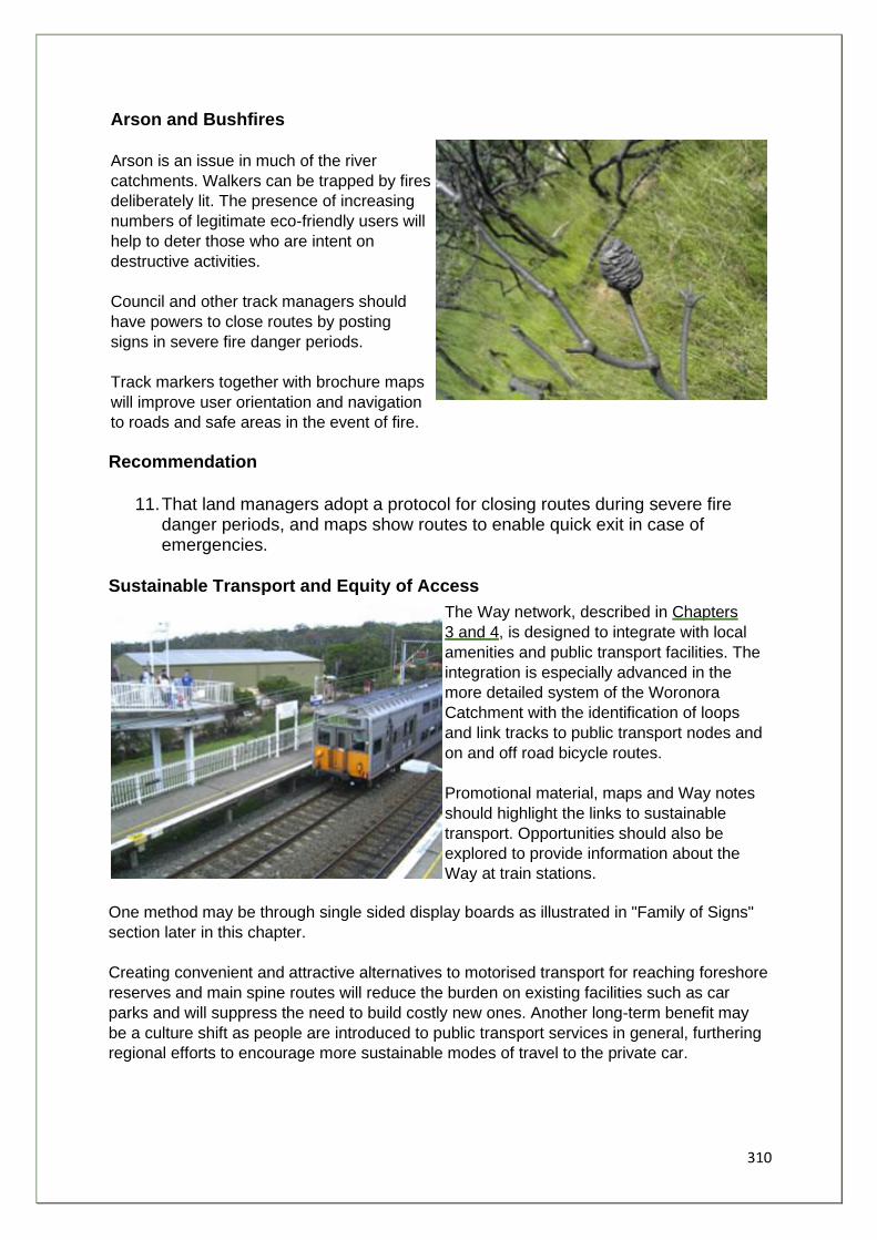
310
Arson and Bushfires
Arson is an issue in much of the river
catchments. Walkers can be trapped by fires
deliberately lit. The presence of increasing
numbers of legitimate eco-friendly users will
help to deter those who are intent on
destructive activities.
Council and other track managers should
have powers to close routes by posting
signs in severe fire danger periods.
Track markers together with brochure maps
will improve user orientation and navigation
to roads and safe areas in the event of fire.
Recommendation
11. That land managers adopt a protocol for closing routes during severe fire danger periods, and maps show routes to enable quick exit in case of emergencies.
Sustainable Transport and Equity of Access
The Way network, described in Chapters
3 and 4, is designed to integrate with local
amenities and public transport facilities. The
integration is especially advanced in the
more detailed system of the Woronora
Catchment with the identification of loops
and link tracks to public transport nodes and
on and off road bicycle routes.
Promotional material, maps and Way notes
should highlight the links to sustainable
transport. Opportunities should also be
explored to provide information about the
Way at train stations.
One method may be through single sided display boards as illustrated in "Family of Signs"
section later in this chapter.
Creating convenient and attractive alternatives to motorised transport for reaching foreshore
reserves and main spine routes will reduce the burden on existing facilities such as car
parks and will suppress the need to build costly new ones. Another long-term benefit may
be a culture shift as people are introduced to public transport services in general, furthering
regional efforts to encourage more sustainable modes of travel to the private car.
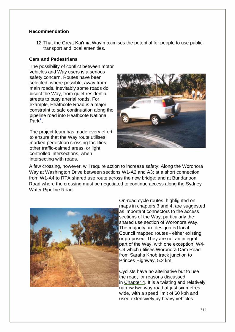
311
Recommendation
12. That the Great Kai'mia Way maximises the potential for people to use public transport and local amenities.
Cars and Pedestrians
The possibility of conflict between motor vehicles and Way users is a serious safety concern. Routes have been selected, where possible, away from main roads. Inevitably some roads do bisect the Way, from quiet residential streets to busy arterial roads. For example, Heathcote Road is a major constraint to safe continuation along the pipeline road into Heathcote National Park . The project team has made every effort to ensure that the Way route utilises marked pedestrian crossing facilities, other traffic-calmed areas, or light controlled intersections, when intersecting with roads.
A few crossing, however, will require action to increase safety: Along the Woronora
Way at Washington Drive between sections W1-A2 and A3; at a short connection
from W1-A4 to RTA shared use route across the new bridge; and at Bundanoon
Road where the crossing must be negotiated to continue access along the Sydney
Water Pipeline Road.
On-road cycle routes, highlighted on maps in chapters 3 and 4, are suggested as important connectors to the access sections of the Way, particularly the shared use section of Woronora Way. The majority are designated local Council mapped routes - either existing or proposed. They are not an integral part of the Way, with one exception; W4-C4 which utilises Woronora Dam Road from Sarahs Knob track junction to Princes Highway, 5.2 km.
Cyclists have no alternative but to use the road, for reasons discussed in Chapter 4. It is a twisting and relatively narrow two-way road at just six metres wide, with a speed limit of 60 kph and used extensively by heavy vehicles.
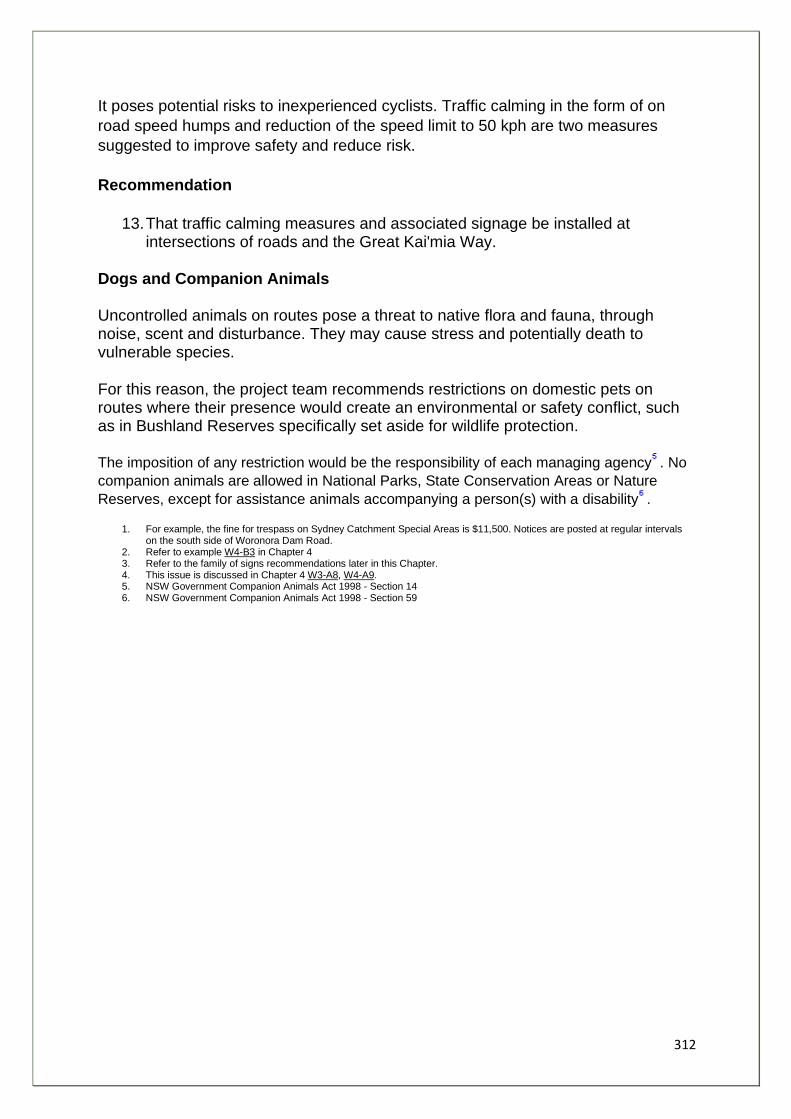
312
It poses potential risks to inexperienced cyclists. Traffic calming in the form of on
road speed humps and reduction of the speed limit to 50 kph are two measures
suggested to improve safety and reduce risk.
Recommendation
13. That traffic calming measures and associated signage be installed at intersections of roads and the Great Kai'mia Way.
Dogs and Companion Animals Uncontrolled animals on routes pose a threat to native flora and fauna, through noise, scent and disturbance. They may cause stress and potentially death to vulnerable species.
For this reason, the project team recommends restrictions on domestic pets on routes where their presence would create an environmental or safety conflict, such as in Bushland Reserves specifically set aside for wildlife protection.
The imposition of any restriction would be the responsibility of each managing agency . No
companion animals are allowed in National Parks, State Conservation Areas or Nature
Reserves, except for assistance animals accompanying a person(s) with a disability .
1. For example, the fine for trespass on Sydney Catchment Special Areas is $11,500. Notices are posted at regular intervals on the south side of Woronora Dam Road.
2. Refer to example W4-B3 in Chapter 4 3. Refer to the family of signs recommendations later in this Chapter. 4. This issue is discussed in Chapter 4 W3-A8, W4-A9. 5. NSW Government Companion Animals Act 1998 - Section 14 6. NSW Government Companion Animals Act 1998 - Section 59
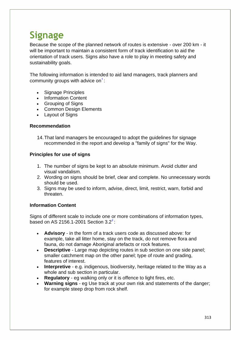
313
Signage Because the scope of the planned network of routes is extensive - over 200 km - it
will be important to maintain a consistent form of track identification to aid the
orientation of track users. Signs also have a role to play in meeting safety and
sustainability goals.
The following information is intended to aid land managers, track planners and
community groups with advice on :
• Signage Principles • Information Content • Grouping of Signs • Common Design Elements • Layout of Signs
Recommendation
14. That land managers be encouraged to adopt the guidelines for signage recommended in the report and develop a "family of signs" for the Way.
Principles for use of signs
1. The number of signs be kept to an absolute minimum. Avoid clutter and visual vandalism.
2. Wording on signs should be brief, clear and complete. No unnecessary words should be used.
3. Signs may be used to inform, advise, direct, limit, restrict, warn, forbid and threaten.
Information Content Signs of different scale to include one or more combinations of information types, based on AS 2156.1-2001 Section 3.2 :
• Advisory - in the form of a track users code as discussed above: for example, take all litter home, stay on the track, do not remove flora and fauna, do not damage Aboriginal artefacts or rock features.
• Descriptive - Large map depicting routes in sub section on one side panel; smaller catchment map on the other panel; type of route and grading, features of interest.
• Interpretive - e.g. indigenous, biodiversity, heritage related to the Way as a whole and sub section in particular.
• Regulatory - eg walking only or it is offence to light fires, etc. • Warning signs - eg Use track at your own risk and statements of the danger;
for example steep drop from rock shelf.
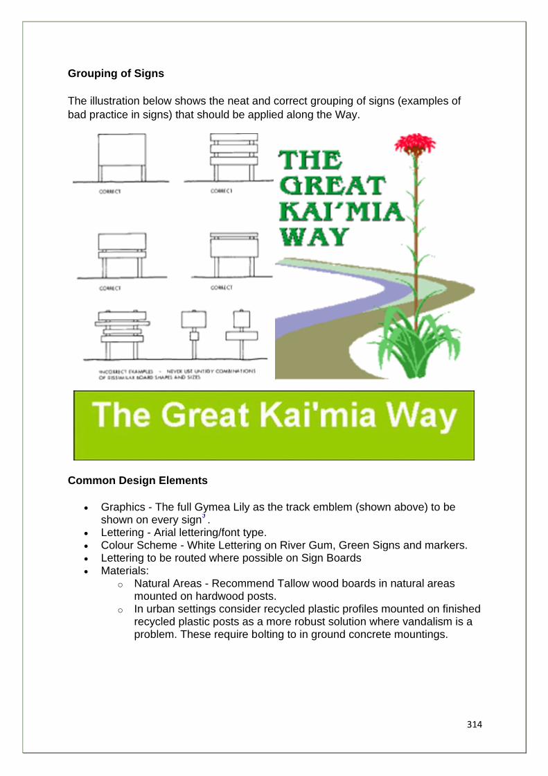
314
Grouping of Signs
The illustration below shows the neat and correct grouping of signs (examples of
bad practice in signs) that should be applied along the Way.
Common Design Elements
• Graphics - The full Gymea Lily as the track emblem (shown above) to be shown on every sign .
• Lettering - Arial lettering/font type. • Colour Scheme - White Lettering on River Gum, Green Signs and markers. • Lettering to be routed where possible on Sign Boards • Materials:
o Natural Areas - Recommend Tallow wood boards in natural areas mounted on hardwood posts.
o In urban settings consider recycled plastic profiles mounted on finished recycled plastic posts as a more robust solution where vandalism is a problem. These require bolting to in ground concrete mountings.
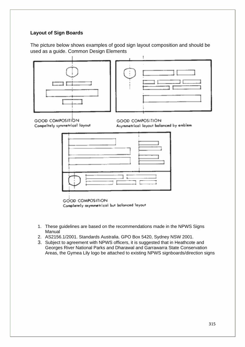
315
Layout of Sign Boards
The picture below shows examples of good sign layout composition and should be
used as a guide. Common Design Elements
1. These guidelines are based on the recommendations made in the NPWS Signs Manual
2. AS2156.1/2001. Standards Australia. GPO Box 5420, Sydney NSW 2001.
3. Subject to agreement with NPWS officers, it is suggested that in Heathcote and Georges River National Parks and Dharawal and Garrawarra State Conservation Areas, the Gymea Lily logo be attached to existing NPWS signboards/direction signs
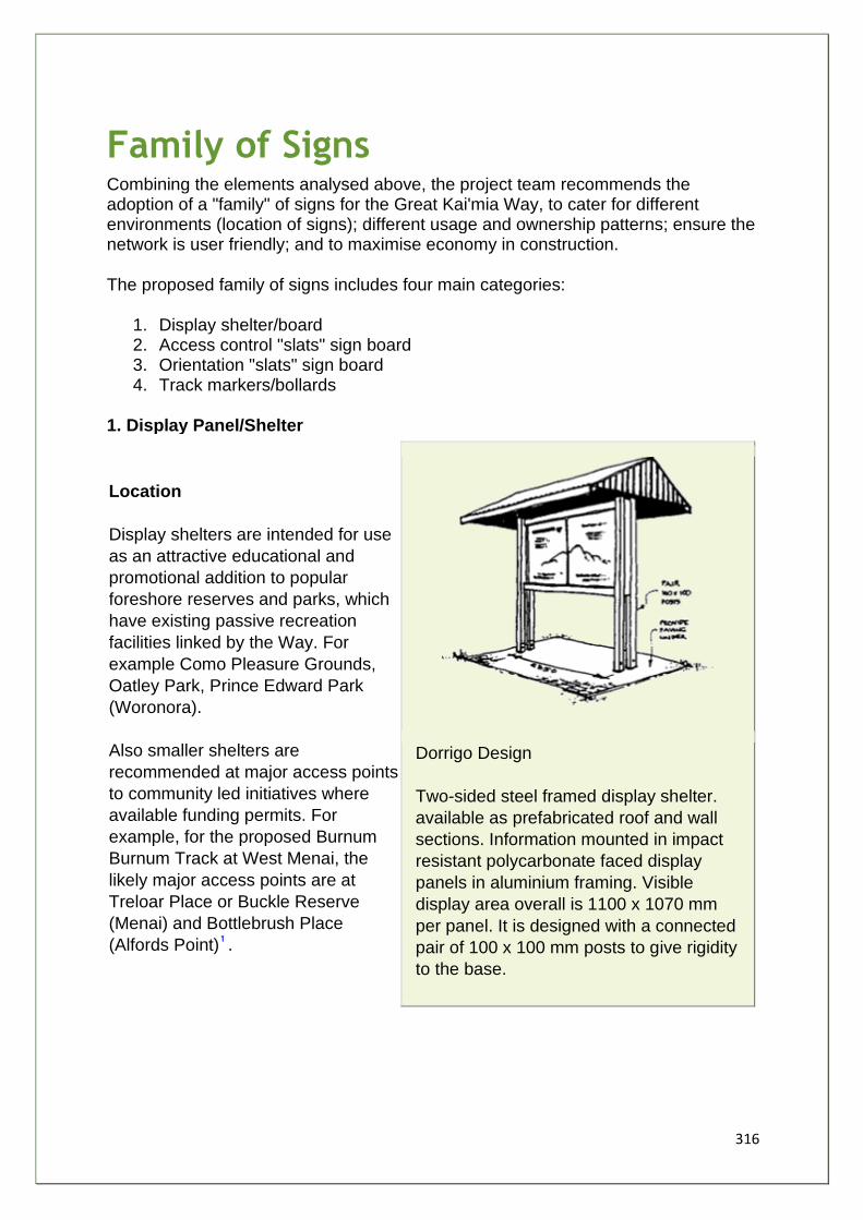
316
Family of Signs Combining the elements analysed above, the project team recommends the adoption of a "family" of signs for the Great Kai'mia Way, to cater for different environments (location of signs); different usage and ownership patterns; ensure the network is user friendly; and to maximise economy in construction.
The proposed family of signs includes four main categories:
1. Display shelter/board 2. Access control "slats" sign board 3. Orientation "slats" sign board 4. Track markers/bollards
1. Display Panel/Shelter
Location
Display shelters are intended for use
as an attractive educational and
promotional addition to popular
foreshore reserves and parks, which
have existing passive recreation
facilities linked by the Way. For
example Como Pleasure Grounds,
Oatley Park, Prince Edward Park
(Woronora).
Also smaller shelters are
recommended at major access points
to community led initiatives where
available funding permits. For
example, for the proposed Burnum
Burnum Track at West Menai, the
likely major access points are at
Treloar Place or Buckle Reserve
(Menai) and Bottlebrush Place
(Alfords Point) .
Dorrigo Design
Two-sided steel framed display shelter.
available as prefabricated roof and wall
sections. Information mounted in impact
resistant polycarbonate faced display
panels in aluminium framing. Visible
display area overall is 1100 x 1070 mm
per panel. It is designed with a connected
pair of 100 x 100 mm posts to give rigidity
to the base.
317
Single sided display panels at City Rail and bus stations are suggested as the Way
develops, beginning with a trial along the Illawarra line from Oatley to Helensburgh
and at Connex bus stations within the Woronora catchment.
Design Elements
The Display Panel should include all the Australian Standard information types as
listed above in Information Content section, together with:
• The Aboriginal Dreaming Story of Kai'mia. • Acknowledgment of the traditional custodians of the land . • The section name and acknowledgement of the community, which named it
as part of their stewardship area; for example, Woronora Way - Washington Drive to Old Bridge - "part of the Jannali Community Nature Walk".
• A contact telephone number (for example, Council or NPWS) for reporting incidents such as conflict with trail bikes and other anti-social behaviour.
• Advice on bushfire safety and emergency number 000. • Acknowledgement of other major stakeholders: landholders or carers, and
sponsors. • A number to match against printed information, which could be produced
separately. • Direction arrows to be attached to signs at junction of one or more tracks and
to Waymarkers.
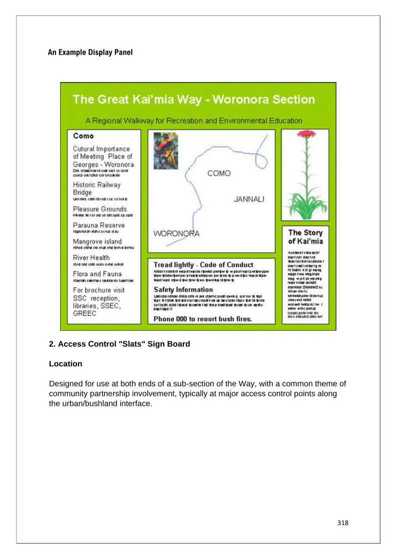
318
An Example Display Panel
2. Access Control "Slats" Sign Board
Location
Designed for use at both ends of a sub-section of the Way, with a common theme of
community partnership involvement, typically at major access control points along
the urban/bushland interface.
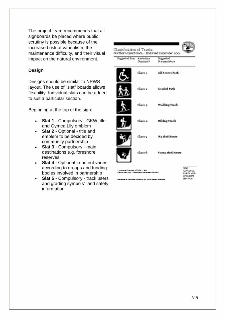
319
The project team recommends that all
signboards be placed where public
scrutiny is possible because of the
increased risk of vandalism, the
maintenance difficulty, and their visual
impact on the natural environment.
Design
Designs should be similar to NPWS
layout. The use of "slat" boards allows
flexibility. Individual slats can be added
to suit a particular section.
Beginning at the top of the sign:
• Slat 1 - Compulsory - GKW title and Gymea Lily emblem
• Slat 2 - Optional - title and emblem to be decided by community partnership
• Slat 3 - Compulsory - main destinations e.g. foreshore reserves
• Slat 4 - Optional - content varies according to groups and funding bodies involved in partnership
• Slat 5 - Compulsory - track users and grading symbols and safety information
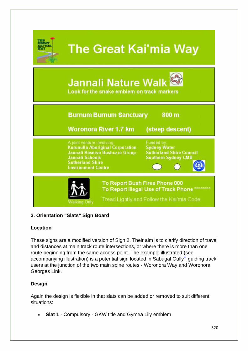
320
3. Orientation "Slats" Sign Board
Location
These signs are a modified version of Sign 2. Their aim is to clarify direction of travel
and distances at main track route intersections, or where there is more than one
route beginning from the same access point. The example illustrated (see
accompanying illustration) is a potential sign located in Sabugal Gully guiding track
users at the junction of the two main spine routes - Woronora Way and Woronora
Georges Link.
Design
Again the design is flexible in that slats can be added or removed to suit different
situations:
• Slat 1 - Compulsory - GKW title and Gymea Lily emblem
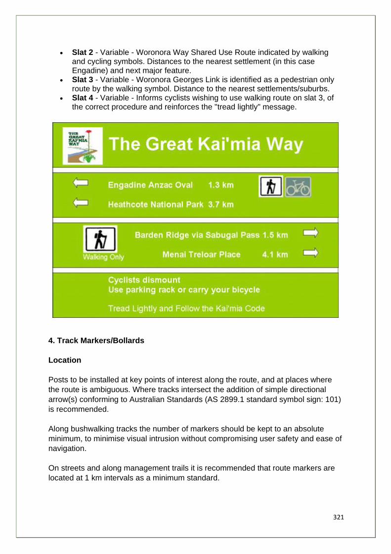
321
• Slat 2 - Variable - Woronora Way Shared Use Route indicated by walking and cycling symbols. Distances to the nearest settlement (in this case Engadine) and next major feature.
• Slat 3 - Variable - Woronora Georges Link is identified as a pedestrian only route by the walking symbol. Distance to the nearest settlements/suburbs.
• Slat 4 - Variable - Informs cyclists wishing to use walking route on slat 3, of the correct procedure and reinforces the "tread lightly" message.
4. Track Markers/Bollards
Location
Posts to be installed at key points of interest along the route, and at places where
the route is ambiguous. Where tracks intersect the addition of simple directional
arrow(s) conforming to Australian Standards (AS 2899.1 standard symbol sign: 101)
is recommended.
Along bushwalking tracks the number of markers should be kept to an absolute
minimum, to minimise visual intrusion without compromising user safety and ease of
navigation.
On streets and along management trails it is recommended that route markers are
located at 1 km intervals as a minimum standard.
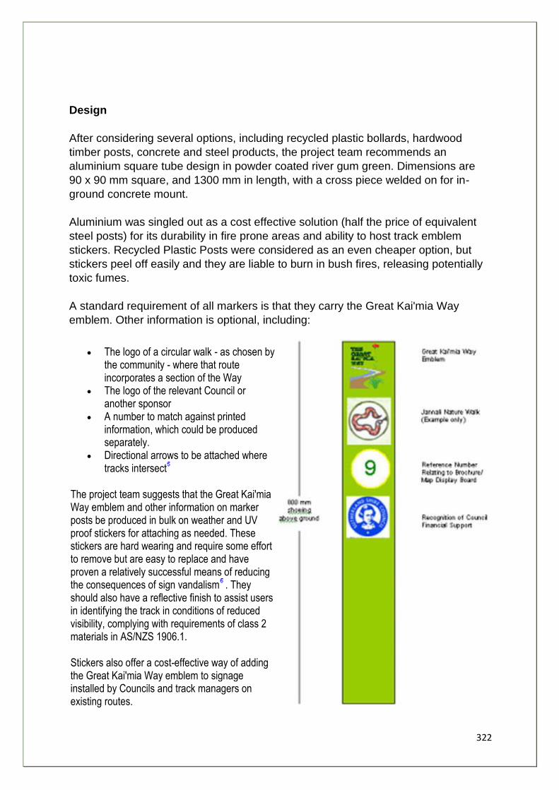
322
Design
After considering several options, including recycled plastic bollards, hardwood
timber posts, concrete and steel products, the project team recommends an
aluminium square tube design in powder coated river gum green. Dimensions are
90 x 90 mm square, and 1300 mm in length, with a cross piece welded on for in-
ground concrete mount.
Aluminium was singled out as a cost effective solution (half the price of equivalent
steel posts) for its durability in fire prone areas and ability to host track emblem
stickers. Recycled Plastic Posts were considered as an even cheaper option, but
stickers peel off easily and they are liable to burn in bush fires, releasing potentially
toxic fumes.
A standard requirement of all markers is that they carry the Great Kai'mia Way
emblem. Other information is optional, including:
• The logo of a circular walk - as chosen by the community - where that route incorporates a section of the Way
• The logo of the relevant Council or another sponsor
• A number to match against printed information, which could be produced separately.
• Directional arrows to be attached where tracks intersect
The project team suggests that the Great Kai'mia Way emblem and other information on marker posts be produced in bulk on weather and UV proof stickers for attaching as needed. These stickers are hard wearing and require some effort to remove but are easy to replace and have proven a relatively successful means of reducing the consequences of sign vandalism . They should also have a reflective finish to assist users in identifying the track in conditions of reduced visibility, complying with requirements of class 2 materials in AS/NZS 1906.1.
Stickers also offer a cost-effective way of adding the Great Kai'mia Way emblem to signage installed by Councils and track managers on existing routes.

323
1. Refer to Chapter 4 - W6-D5 2. This may be done, for example, with the addition of Aboriginal artworks to the edging frame,
and interpretation of the historical experiences and events shared by Sydney Aboriginal people. A separate project involving local Aboriginal Elders, indigenous groups, schools and TAFE could help with design and content of signs.
3. Designed by Kerry Cooper, Community Programs Unit, NPWS Northern Directorate. Corresponds to AS 2156.1-2001 Walking Tracks Part 1: Classification and signage.
4. Refer to W2-A6/W3-A7, Chapter 4. 5. AS 2899.1 Standard symbol sign 101
6. These stickers have been used along the route for the Bundeena Maianbar Heritage Walk.
324
Use of Materials Track Construction
The Great Kai'mia Way is based around maximising the use of existing routes,
however there are significant links to be made where new sections of track, bridges
and structures are necessary.
Track standards should be a function of route, track condition alignment, width,
length, steepness of grade and the kind of natural and man made barriers, which
must be traversed, combined with the type of use planned for.
Recommendation:
15. That a standard be adopted for construction and upgrade of track works, consistent with existing Australian Standards for walking track classification signage and infrastructure AS 2156.1-2001 and AS 2156.2-2001: a combination of Class 2, Class 3 and occasionally Class 4 out of 6 classes, where 6 is the least developed class
This Standard is meant for use by land and recreation managers in parks and reserves and is not as applicable to the urban and shared use sections of the Way. It is recommend that three categories be adopted which cover the majority of routes along the Way based on AS 2156-1978 and adapted by NPWS:
• Walk - A well-constructed and hard surfaced path designed for high use by persons of all ages and physical condition. Easy grades suitable for disabled use may be required with bridges or boardwalks where necessary. Development costs of "Walks" are high but means lower maintenance costs.
• Track - Well defined and suitable for people of average fitness with some experience. These routes are benched and drained as necessary to account for erosion and water damage.
• Route - Lightly marked for well-equipped and experienced walkers. Routes are unconstructed except for erosion control work; there are examples of this in sections in Dharawal State Conservation Area.
Track Surface
Bushland Situation - (Preferred Methods of Bushcare Groups)
The simplest form of track surfacing and the first option always to be considered is
to use the mineral soil found in-situ. With correct drainage this will often be adequate
to carry normal intermittent foot traffic.
When surfacing is required, a suitable material indigenous to the area, such as local
sandstone, should first be considered before importing material. However do not
remove habitat!
325
Edgings to both sides of the track are not recommended as they tend to concentrate
gullying, leading to break up of the stone surface.
In a situation where a track is cut along a contour line, the lower track edge can be
retained by either fallen timber, provided it is not habitat, or sustainable sourced
hardwood sections.
Management Trails
Generally based on roadstone, surfaced with crushed granite or sandstone
occasionally bluemetal gravel. These trails are prone to erosion from maintenance
vehicle use, stormwater, and trail bike use. Tar-sealed sections often break up
under heavy vehicle use.
Roadstone, recycled crushed concrete and blue metal change the ph of the soil in
sandstone areas making track edges nutrient rich and promoting weed growth.
Crushed sandstone held together with binding agent should be the preferred
material for use on management trails.
The binding agent leaves the surface permeable but resistant to erosion. This
technique is particularly suited to repairing gullied steeper grades or as a
preventative treatment on steep grades. A less satisfactory solution is to tar seal the
steeper sections.
Steps and Stairs
A popular material for constructing steps and stairs has been CCA treated pine
product. Recently, however, there are increasing doubts about its safety. Many
councils, such as Brisbane City Council now ban its use. It is allegedly connected to
cancers in children from exposure in playground areas. When on fire, it releases
potentially fatal toxic fumes.
Recommendation:
16. That infrastructure on the Great Kai'mia Way is free of all CCA treated pine products.
Alternatives are:
• Durable hardwood - sourced from plantation; for example, tallowood. • Recycled Plastic - post user HDPE and LDPE - non toxic. Life expectancy is
approximately 40 years. It has a lower combustible threshold than timber and is "less toxic" according to research in USA. Kosziosko National Park is rebuilding Charlottes Pass walking track replacing treated pine steps with
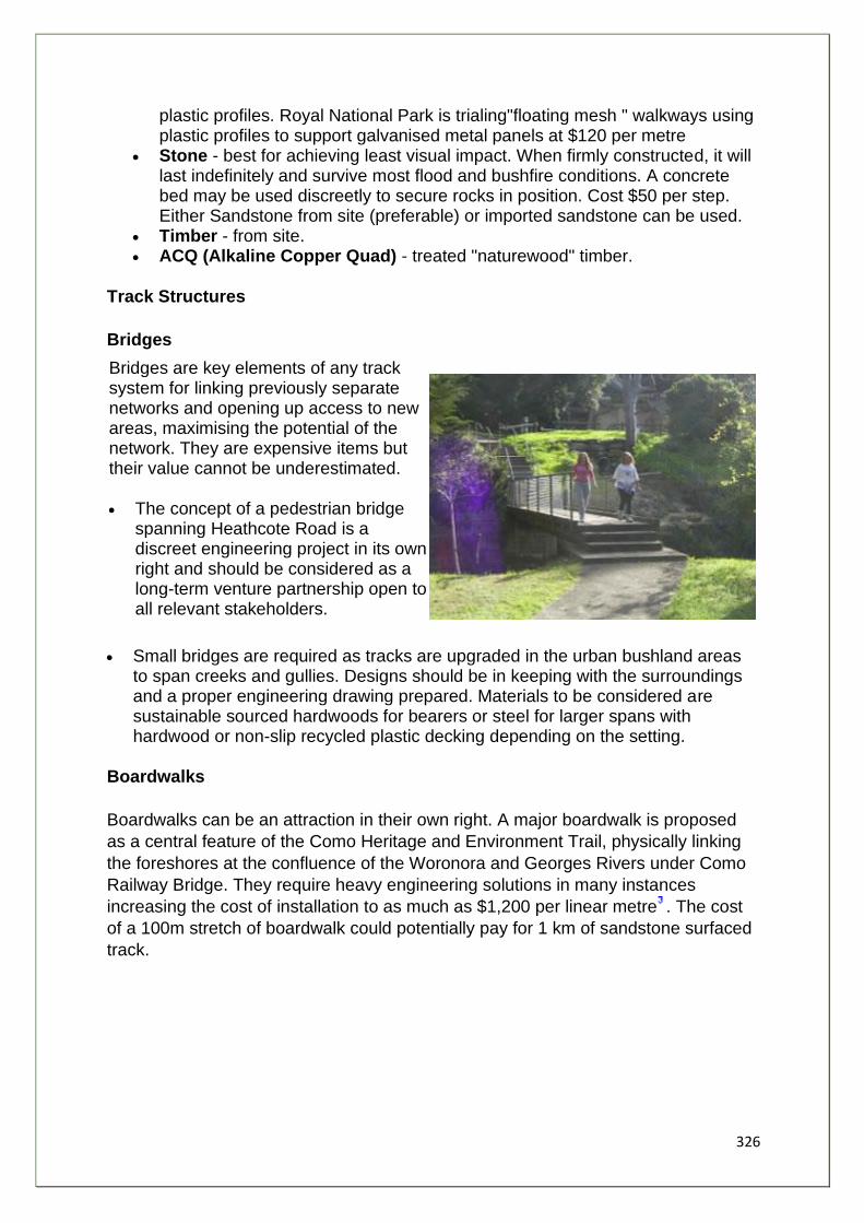
326
plastic profiles. Royal National Park is trialing"floating mesh " walkways using plastic profiles to support galvanised metal panels at $120 per metre
• Stone - best for achieving least visual impact. When firmly constructed, it will last indefinitely and survive most flood and bushfire conditions. A concrete bed may be used discreetly to secure rocks in position. Cost $50 per step. Either Sandstone from site (preferable) or imported sandstone can be used.
• Timber - from site. • ACQ (Alkaline Copper Quad) - treated "naturewood" timber.
Track Structures
Bridges
Bridges are key elements of any track system for linking previously separate networks and opening up access to new areas, maximising the potential of the network. They are expensive items but their value cannot be underestimated.
• The concept of a pedestrian bridge spanning Heathcote Road is a discreet engineering project in its own right and should be considered as a long-term venture partnership open to all relevant stakeholders.
• Small bridges are required as tracks are upgraded in the urban bushland areas to span creeks and gullies. Designs should be in keeping with the surroundings and a proper engineering drawing prepared. Materials to be considered are sustainable sourced hardwoods for bearers or steel for larger spans with hardwood or non-slip recycled plastic decking depending on the setting.
Boardwalks
Boardwalks can be an attraction in their own right. A major boardwalk is proposed
as a central feature of the Como Heritage and Environment Trail, physically linking
the foreshores at the confluence of the Woronora and Georges Rivers under Como
Railway Bridge. They require heavy engineering solutions in many instances
increasing the cost of installation to as much as $1,200 per linear metre . The cost
of a 100m stretch of boardwalk could potentially pay for 1 km of sandstone surfaced
track.
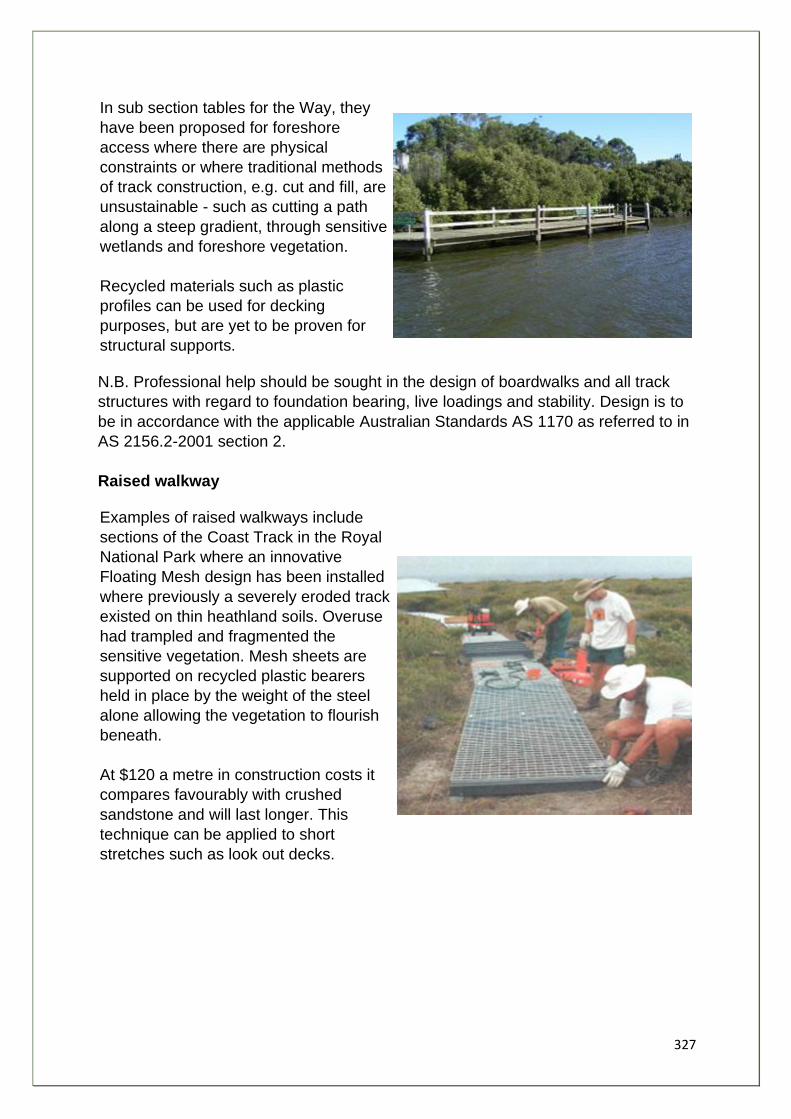
327
In sub section tables for the Way, they
have been proposed for foreshore
access where there are physical
constraints or where traditional methods
of track construction, e.g. cut and fill, are
unsustainable - such as cutting a path
along a steep gradient, through sensitive
wetlands and foreshore vegetation.
Recycled materials such as plastic
profiles can be used for decking
purposes, but are yet to be proven for
structural supports.
N.B. Professional help should be sought in the design of boardwalks and all track
structures with regard to foundation bearing, live loadings and stability. Design is to
be in accordance with the applicable Australian Standards AS 1170 as referred to in
AS 2156.2-2001 section 2.
Raised walkway
Examples of raised walkways include
sections of the Coast Track in the Royal
National Park where an innovative
Floating Mesh design has been installed
where previously a severely eroded track
existed on thin heathland soils. Overuse
had trampled and fragmented the
sensitive vegetation. Mesh sheets are
supported on recycled plastic bearers
held in place by the weight of the steel
alone allowing the vegetation to flourish
beneath.
At $120 a metre in construction costs it
compares favourably with crushed
sandstone and will last longer. This
technique can be applied to short
stretches such as look out decks.
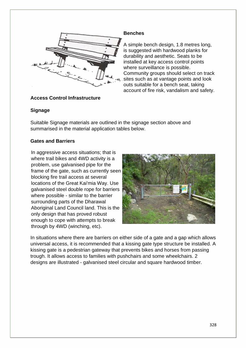
328
Benches
A simple bench design, 1.8 metres long, is suggested with hardwood planks for durability and aesthetic. Seats to be installed at key access control points where surveillance is possible. Community groups should select on track sites such as at vantage points and look outs suitable for a bench seat, taking account of fire risk, vandalism and safety.
Access Control Infrastructure
Signage
Suitable Signage materials are outlined in the signage section above and
summarised in the material application tables below.
Gates and Barriers
In aggressive access situations; that is
where trail bikes and 4WD activity is a
problem, use galvanised pipe for the
frame of the gate, such as currently seen
blocking fire trail access at several
locations of the Great Kai'mia Way. Use
galvanised steel double rope for barriers
where possible - similar to the barrier
surrounding parts of the Dharawal
Aboriginal Land Council land. This is the
only design that has proved robust
enough to cope with attempts to break
through by 4WD (winching, etc).
In situations where there are barriers on either side of a gate and a gap which allows
universal access, it is recommended that a kissing gate type structure be installed. A
kissing gate is a pedestrian gateway that prevents bikes and horses from passing
trough. It allows access to families with pushchairs and some wheelchairs. 2
designs are illustrated - galvanised steel circular and square hardwood timber.
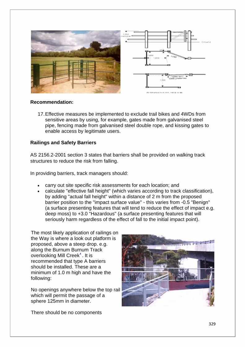
329
Recommendation:
17. Effective measures be implemented to exclude trail bikes and 4WDs from sensitive areas by using, for example, gates made from galvanised steel pipe, fencing made from galvanised steel double rope, and kissing gates to enable access by legitimate users.
Railings and Safety Barriers
AS 2156.2-2001 section 3 states that barriers shall be provided on walking track
structures to reduce the risk from falling.
In providing barriers, track managers should:
• carry out site specific risk assessments for each location; and • calculate "effective fall height" (which varies according to track classification),
by adding "actual fall height" within a distance of 2 m from the proposed barrier position to the "impact surface value" - this varies from -0.5 "Benign" (a surface presenting features that will tend to reduce the effect of impact e.g. deep moss) to +3.0 "Hazardous" (a surface presenting features that will seriously harm regardless of the effect of fall to the initial impact point).
The most likely application of railings on the Way is where a look out platform is proposed, above a steep drop. e.g. along the Burnum Burnum Track overlooking Mill Creek . It is recommended that type A barriers should be installed. These are a minimum of 1.0 m high and have the following:
No openings anywhere below the top rail which will permit the passage of a sphere 125mm in diameter. There should be no components
330
providing a toe-hold between the heights of 150mm and 760mm above deck (or stair nosing) level.
Horizontal rails are acceptable if the barrier geometry is such as will prevent children
under six climbing over the top.
For steps, the triangular opening formed by the riser, tread and bottom rail at the
open side if the stairway shall be such a size that a 125 diameter sphere cannot
pass through it.
Recommendation:
18. That Type A barriers, as described in AS 2156.2-2001: Track Infrastructure be installed at lookouts and other relevant locations for safety and risk management, at the discretion of track managers, based on an assessment of effective fall height.
1. Refer to Appendix 6 for a summary of relevant track classifications 2. such as modified timber resins from sustainable plantation forests manufactured by " Warajay" a NZ company 3. 1.5 m wide hardwood boardwalk at Lugarno by Hurstville City Council - GRFIP Project
4. Refer to W6-D4/D5, Chapter 4
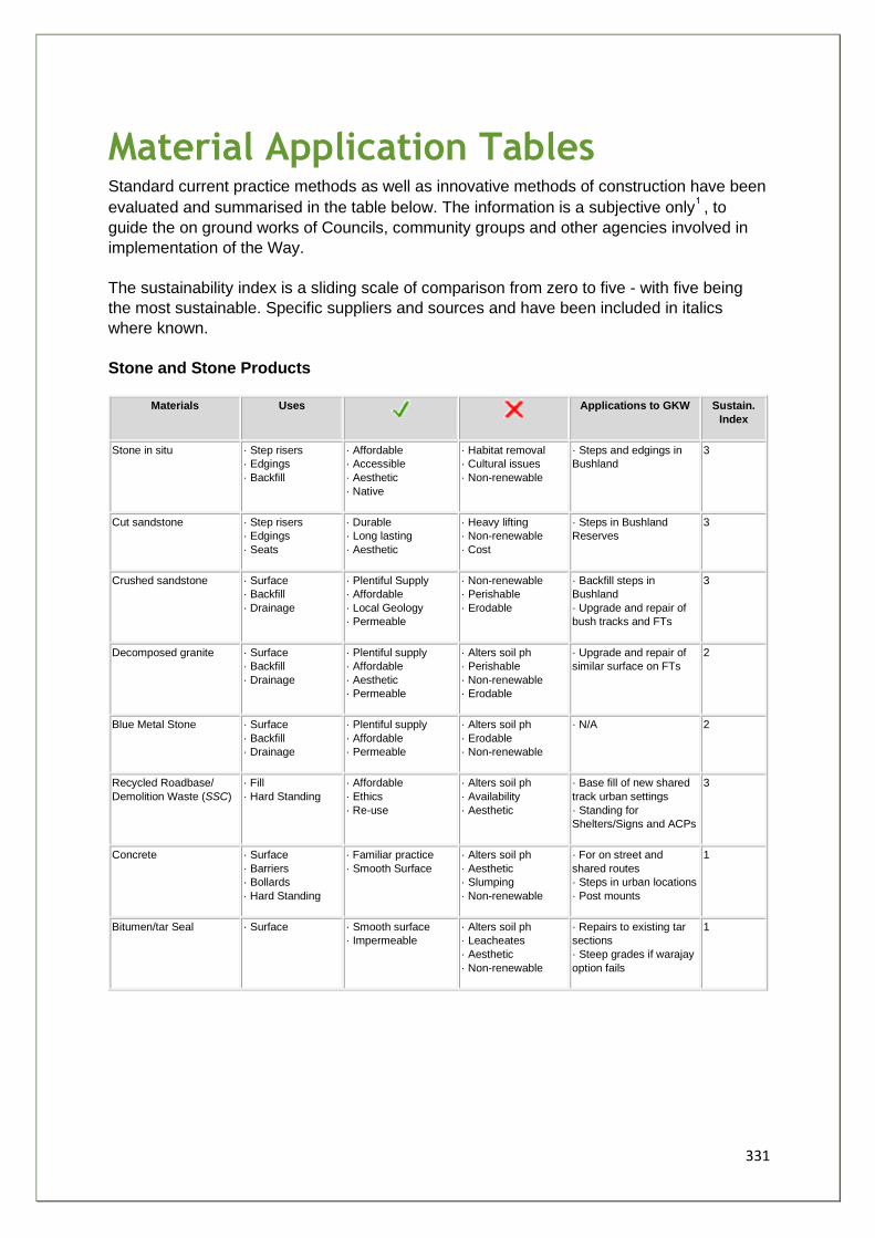
331
Material Application Tables Standard current practice methods as well as innovative methods of construction have been
evaluated and summarised in the table below. The information is a subjective only , to
guide the on ground works of Councils, community groups and other agencies involved in
implementation of the Way.
The sustainability index is a sliding scale of comparison from zero to five - with five being
the most sustainable. Specific suppliers and sources and have been included in italics
where known.
Stone and Stone Products
Materials Uses
Applications to GKW Sustain.
Index
Stone in situ · Step risers
· Edgings
· Backfill
· Affordable
· Accessible
· Aesthetic
· Native
· Habitat removal
· Cultural issues
· Non-renewable
· Steps and edgings in
Bushland
3
Cut sandstone · Step risers
· Edgings
· Seats
· Durable
· Long lasting
· Aesthetic
· Heavy lifting
· Non-renewable
· Cost
· Steps in Bushland
Reserves
3
Crushed sandstone · Surface
· Backfill
· Drainage
· Plentiful Supply
· Affordable
· Local Geology
· Permeable
· Non-renewable
· Perishable
· Erodable
· Backfill steps in
Bushland
· Upgrade and repair of
bush tracks and FTs
3
Decomposed granite · Surface
· Backfill
· Drainage
· Plentiful supply
· Affordable
· Aesthetic
· Permeable
· Alters soil ph
· Perishable
· Non-renewable
· Erodable
· Upgrade and repair of
similar surface on FTs
2
Blue Metal Stone · Surface
· Backfill
· Drainage
· Plentiful supply
· Affordable
· Permeable
· Alters soil ph
· Erodable
· Non-renewable
· N/A 2
Recycled Roadbase/
Demolition Waste (SSC)
· Fill
· Hard Standing
· Affordable
· Ethics
· Re-use
· Alters soil ph
· Availability
· Aesthetic
· Base fill of new shared
track urban settings
· Standing for
Shelters/Signs and ACPs
3
Concrete · Surface
· Barriers
· Bollards
· Hard Standing
· Familiar practice
· Smooth Surface
· Alters soil ph
· Aesthetic
· Slumping
· Non-renewable
· For on street and
shared routes
· Steps in urban locations
· Post mounts
1
Bitumen/tar Seal · Surface · Smooth surface
· Impermeable
· Alters soil ph
· Leacheates
· Aesthetic
· Non-renewable
· Repairs to existing tar
sections
· Steep grades if warajay
option fails
1
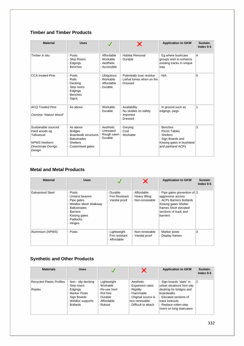
332
Timber and Timber Products
Material Uses
Application to GKW Sustain.
Index 0-5
Timber in situ · Posts
· Step Risers
· Edgings
· Benches
· Affordable
· Workable
· Aesthetic
· Accessible
· Habitat Removal
· Durable
· Eg where bushcare
groups wish to enhance
existing tracks in unique
way
4
CCA treated Pine · Posts
· Rails
· Decking
· Step risers
· Edgings
· Benches
· Signs
· Ubiquitous
· Workable
· Affordable
· Durable
· Potentially toxic residue
· Lethal fumes when on fire
· Dressed
· N/A 0
ACQ Treated Pine
Osmose "Nature Wood"
· As above · Workable
· Durable
· Availability
· No studies on safety
· Imported
· Dressed
· In ground such as
edgings, pegs
1
Sustainable sourced
Hard woods eg
Tallowood
NPWS Northern
Directorate Dorrigo
Design
· As above
· Bridges
· Boardwalk structures
· Balustrades
· Shelters
· Customised gates
· Aesthetic · Untreated · Rough sawn · Durable
· Greying
· Cost
· Workable
· Benches
· Picnic Tables
· Shelters
· Sign Boards and
Kissing gates in bushland
and parkland ACPs
3
Metal and Metal Products
Material Uses
Application to GKW Sustain
Index 0-5
Galvanised Steel · Posts
· Unistrut bearers
· Pipe gates
· Weldloc Mesh Walkway
· Ballustrades
· Barriers
· Kissing gates
· Padlocks
· Hinges
· Durable
· Fire Resistant
· Vandal proof
· Affordable
· Heavy lifting
· Non-renewable
· Pipe gates prevention of
aggressive access
· ACPs Barriers Bollards
Kissing gates Shelter
frames Short elevated
sections of track and
barriers
3
Aluminium (NPWS) · Posts · Lightweight
· Fire resistant
· Affordable
· Non-renewable
· Vandal proof
· Marker posts
· Display frames
3
Synthetic and Other Products
Materials Uses
Application to GKW Sustain.
Index 0-5
Recycled Plastic Profiles
Replas
· Non - slip decking
· Step risers
· Edgings
· Marker Posts
· Sign Boards
· Weldloc supports
· Bollards
· Lightweight
· Workable
· Re-use Inert
· Rot free
· Durable
· Affordable
· Robust
· Aesthetic
· Expansion rates
· Rigidity
· Flammable
· Original source is
non-renewable
· Difficult to attach
· Sign boards "slats" in
urban situations Non-slip
decking for bridges and
boardwalks
· Elevated sections of
track lookouts
· Replace rotten step
risers on long staircases
2
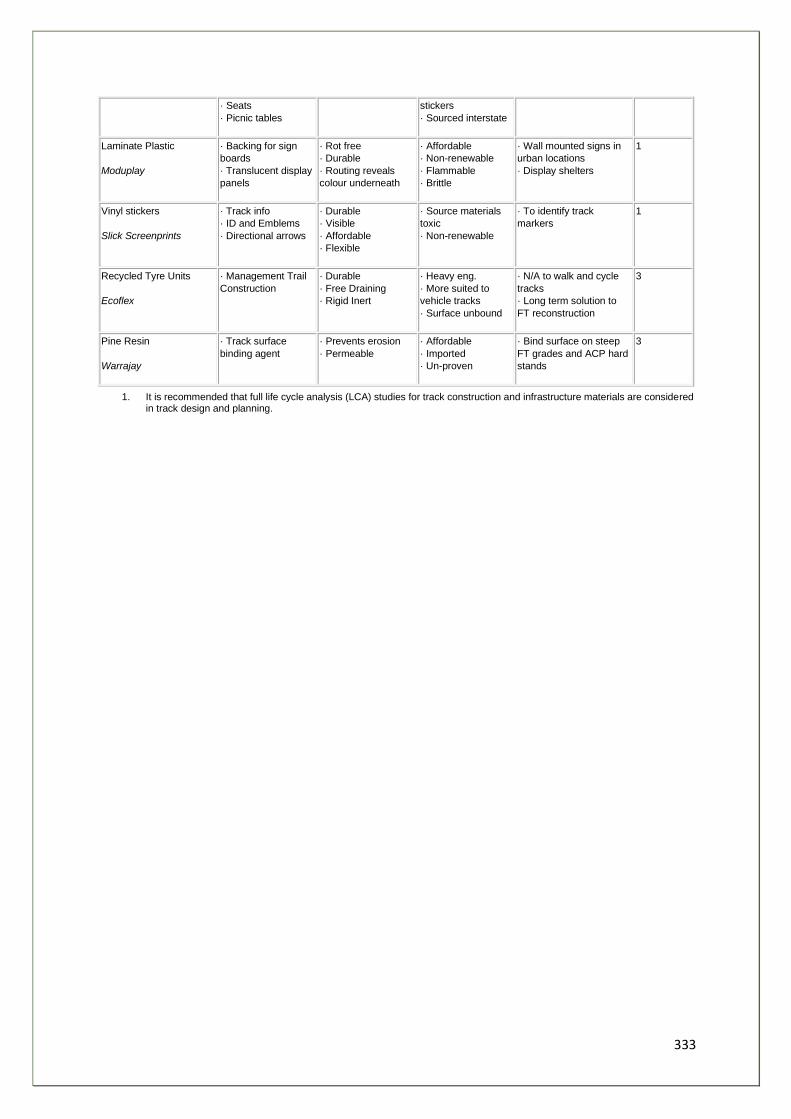
333
· Seats
· Picnic tables
stickers
· Sourced interstate
Laminate Plastic
Moduplay
· Backing for sign
boards
· Translucent display
panels
· Rot free
· Durable
· Routing reveals
colour underneath
· Affordable
· Non-renewable
· Flammable
· Brittle
· Wall mounted signs in
urban locations
· Display shelters
1
Vinyl stickers
Slick Screenprints
· Track info
· ID and Emblems
· Directional arrows
· Durable
· Visible
· Affordable
· Flexible
· Source materials
toxic
· Non-renewable
· To identify track
markers
1
Recycled Tyre Units
Ecoflex
· Management Trail
Construction
· Durable
· Free Draining
· Rigid Inert
· Heavy eng.
· More suited to
vehicle tracks
· Surface unbound
· N/A to walk and cycle
tracks
· Long term solution to
FT reconstruction
3
Pine Resin
Warrajay
· Track surface
binding agent
· Prevents erosion
· Permeable
· Affordable
· Imported
· Un-proven
· Bind surface on steep
FT grades and ACP hard
stands
3
1. It is recommended that full life cycle analysis (LCA) studies for track construction and infrastructure materials are considered in track design and planning.

334
Chapter Six
335
Summary and Implementation
This report delivers information necessary for the progressive implementation of the
Great Kai'mia Way. It details where routes could best be allocated, the priority for
implementation of sections of the route and guidelines for the coordinated
implementation of the project.
Many stakeholders have been involved in the provision of information for this report,
and many stakeholders will need to be involved to realise the vision presented by
the Great Kai'mia Way. The following table lists the categories of stakeholders,
some of the benefits they could gain from continuing involvement in the Great
Kai'mia Way project and the role they might play.
The project team has endeavoured to engage a full range of stakeholders in
developing the information presented in Chapters 3 and 4. In addition, Chapter 5
has begun to detail the issues that should be considered during implementation and
maintenance of the Great Kai'mia Way. Recognising that more work should be done
on this aspect of the project and to ensure that the information is utilised
appropriately, it is recommended that stakeholders adopt this report as a guideline:
Recommendation:
19. That stakeholders adopt the feasibility study as a guideline for the development of the Great Kai'mia Way through a signed memorandum that commits them to:
19. 1 a project staging plan;
19.2 a coordinated strategy for implementation of the Great Kai'mia Way, including:
19.2.1 common signage as detailed in Chapter 5;
19.2.2 ongoing communication between stakeholder groups to ensure appropriate route linkages;
19.3 adoption of the principles of sustainability in the implementation of the Great Kai'mia Way backed by increased research into the aspects of sustainable management;
19.4 adoption of the planning checklist for development, detailed in Chapter 5.
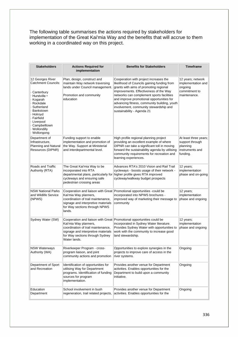
336
The following table summarises the actions required by stakeholders for implementation of the Great Kai'mia Way and the benefits that will accrue to them working in a coordinated way on this project.
Stakeholders Actions Required for
implementation
Benefits for Stakeholders Timeframe
12 Georges River Catchment Councils:
· Canterbury · Hurstville • · Kogarah · Rockdale · Sutherland · Bankstown · Holroyd · Fairfield · Liverpool · Campbelltown · Wollondilly · Wollongong
Plan, design, construct and
maintain Way network traversing
lands under Council management.
Promotion and community
education
Cooperation with project increases the
likelihood of Councils gaining funding from
grants with aims of promoting regional
improvements. Effectiveness of the Way
networks can complement sports facilities
and improve promotional opportunities for
advancing fitness, community building, youth
involvement, community stewardship and
sustainability - Agenda 21
12 years; network
implementation and
ongoing
commitment to
maintenance.
Department of
Infrastructure,
Planning and Natural
Resources (DIPNR)
Funding support to enable
implementation and promotion of
the Way. Support at Ministerial
and interdepartmental level.
High profile regional planning project
providing an excellent example of where
DIPNR can take a significant toll in moving
forward the sustainability agenda by utilising
community requirements for recreation and
learning experiences.
At least three years;
support through
planning
instruments and
funding.
Roads and Traffic
Authority (RTA)
The Great Kai'mia Way to be
incorporated into RTA
departmental plans, particularly for
cycleways and ensuring safe
pedestrian crossing areas
Advances RTA's 2010 Vision and Rail Trail
cycleways - boosts usage of their network -
higher profile gives RTA improved
cycleway/walkway budget prospects
12 years;
implementation
phase and on-going
NSW National Parks
and Wildlife Service
(NPWS)
Cooperation and liaison with Great
Kai'mia Way planners,
coordination of trail maintenance,
signage and interpretive materials
for Way sections through NPWS
lands.
Promotional opportunities -could be
incorporated into NPWS brochures -
improved way of marketing their message to
community
12 years;
implementation
phase and ongoing
Sydney Water (SW) Cooperation and liaison with Great
Kai'mia Way planners,
coordination of trail maintenance,
signage and interpretive materials
for Way sections through Sydney
Water lands.
Promotional opportunities could be
incorporated in Sydney Water literature.
Provides Sydney Water with opportunities to
work with the community to increase good
land stewardship.
12 years;
implementation
phase and ongoing
NSW Waterways
Authority (WA)
Riverkeeper Program - cross-
program liaison, and joint
community actions and promotion
Opportunities to explore synergies in the
projects to improve care of access in the
river systems.
Ongoing
Department of Sport
and Recreation
Identification of opportunities for
utilising Way for Department
programs. Identification of funding
sources for program
implementation.
Provides another venue for Department
activities. Enables opportunities for the
Department to build upon a community
initiative.
Ongoing
Education
Department
School involvement in bush
regeneration, trail related projects,
Provides another venue for Department
activities. Enables opportunities for the
Ongoing
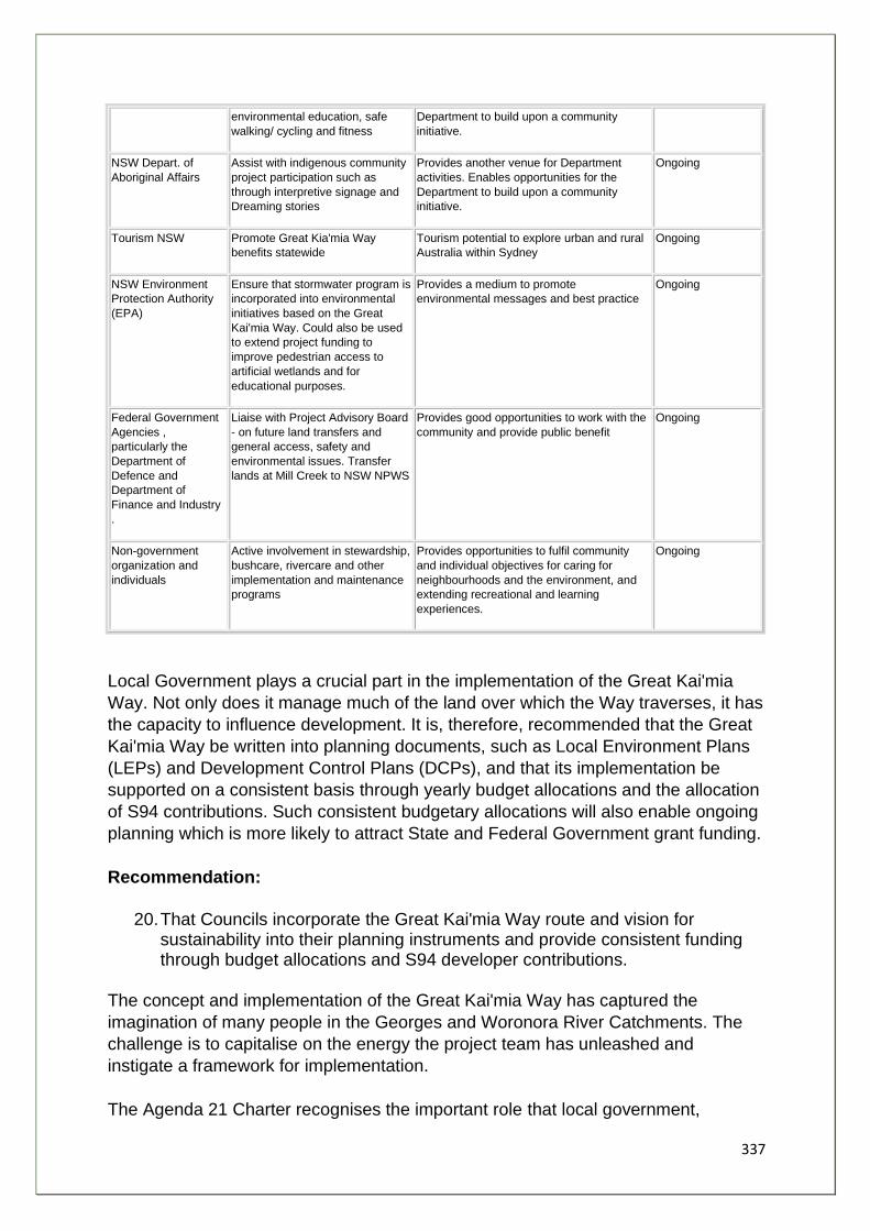
337
environmental education, safe
walking/ cycling and fitness
Department to build upon a community
initiative.
NSW Depart. of
Aboriginal Affairs
Assist with indigenous community
project participation such as
through interpretive signage and
Dreaming stories
Provides another venue for Department
activities. Enables opportunities for the
Department to build upon a community
initiative.
Ongoing
Tourism NSW Promote Great Kia'mia Way
benefits statewide
Tourism potential to explore urban and rural
Australia within Sydney
Ongoing
NSW Environment
Protection Authority
(EPA)
Ensure that stormwater program is
incorporated into environmental
initiatives based on the Great
Kai'mia Way. Could also be used
to extend project funding to
improve pedestrian access to
artificial wetlands and for
educational purposes.
Provides a medium to promote
environmental messages and best practice
Ongoing
Federal Government
Agencies ,
particularly the
Department of
Defence and
Department of
Finance and Industry
.
Liaise with Project Advisory Board
- on future land transfers and
general access, safety and
environmental issues. Transfer
lands at Mill Creek to NSW NPWS
Provides good opportunities to work with the
community and provide public benefit
Ongoing
Non-government
organization and
individuals
Active involvement in stewardship,
bushcare, rivercare and other
implementation and maintenance
programs
Provides opportunities to fulfil community
and individual objectives for caring for
neighbourhoods and the environment, and
extending recreational and learning
experiences.
Ongoing
Local Government plays a crucial part in the implementation of the Great Kai'mia
Way. Not only does it manage much of the land over which the Way traverses, it has
the capacity to influence development. It is, therefore, recommended that the Great
Kai'mia Way be written into planning documents, such as Local Environment Plans
(LEPs) and Development Control Plans (DCPs), and that its implementation be
supported on a consistent basis through yearly budget allocations and the allocation
of S94 contributions. Such consistent budgetary allocations will also enable ongoing
planning which is more likely to attract State and Federal Government grant funding.
Recommendation:
20. That Councils incorporate the Great Kai'mia Way route and vision for sustainability into their planning instruments and provide consistent funding through budget allocations and S94 developer contributions.
The concept and implementation of the Great Kai'mia Way has captured the
imagination of many people in the Georges and Woronora River Catchments. The
challenge is to capitalise on the energy the project team has unleashed and
instigate a framework for implementation.
The Agenda 21 Charter recognises the important role that local government,
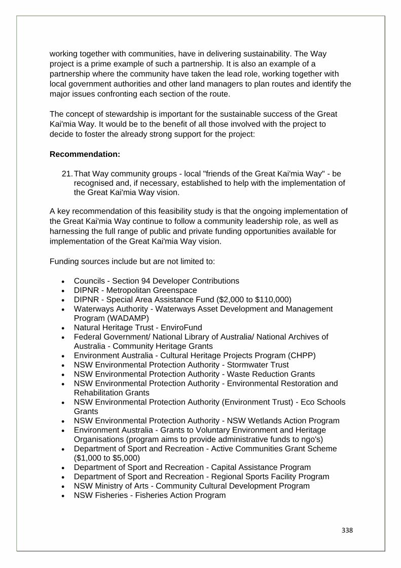
338
working together with communities, have in delivering sustainability. The Way
project is a prime example of such a partnership. It is also an example of a
partnership where the community have taken the lead role, working together with
local government authorities and other land managers to plan routes and identify the
major issues confronting each section of the route.
The concept of stewardship is important for the sustainable success of the Great
Kai'mia Way. It would be to the benefit of all those involved with the project to
decide to foster the already strong support for the project:
Recommendation:
21. That Way community groups - local "friends of the Great Kai'mia Way" - be recognised and, if necessary, established to help with the implementation of the Great Kai'mia Way vision.
A key recommendation of this feasibility study is that the ongoing implementation of
the Great Kai'mia Way continue to follow a community leadership role, as well as
harnessing the full range of public and private funding opportunities available for
implementation of the Great Kai'mia Way vision.
Funding sources include but are not limited to:
• Councils - Section 94 Developer Contributions • DIPNR - Metropolitan Greenspace • DIPNR - Special Area Assistance Fund ($2,000 to $110,000) • Waterways Authority - Waterways Asset Development and Management
Program (WADAMP) • Natural Heritage Trust - EnviroFund • Federal Government/ National Library of Australia/ National Archives of
Australia - Community Heritage Grants • Environment Australia - Cultural Heritage Projects Program (CHPP) • NSW Environmental Protection Authority - Stormwater Trust • NSW Environmental Protection Authority - Waste Reduction Grants • NSW Environmental Protection Authority - Environmental Restoration and
Rehabilitation Grants • NSW Environmental Protection Authority (Environment Trust) - Eco Schools
Grants • NSW Environmental Protection Authority - NSW Wetlands Action Program • Environment Australia - Grants to Voluntary Environment and Heritage
Organisations (program aims to provide administrative funds to ngo's) • Department of Sport and Recreation - Active Communities Grant Scheme
($1,000 to $5,000) • Department of Sport and Recreation - Capital Assistance Program • Department of Sport and Recreation - Regional Sports Facility Program • NSW Ministry of Arts - Community Cultural Development Program • NSW Fisheries - Fisheries Action Program
339
• Sydney Catchment Authority - Catchment Protection and Improvement Grants ($8,000) (Woronora Catchment)
• Heritage Office (NSW) - Heritage Incentives Program • Ian Potter Foundation - environment and conservation and education grants • Myer Foundation - Water and The Environment, Arts and Humanities, Social
Justice (both for Indigenous cultural projects) • Westpac Bank - Westpac Operation Backyard (local environmental projects • BHP Billiton - Corporate Community Program
Another group who play a crucial role in the design and implementation of the Great
Kai'mia Way is the aboriginal community. The Way has the potential to highlight
past and present Aboriginal culture, adding to widespread efforts at Reconciliation.
Recommendation:
22. That the Aboriginal community be an integral partner in the design and implementation of the Great Kai'mia Way.
The Great Kai'mia Way logo could be used as a springboard for attracting private
and public sector funding for a community project that has readily demonstrable
community benefits and popular support.
Recommendation:
23. That a management and implementation system be set up that will enable:
23.1 An ongoing structure for decision making that involves land holders, land
managers and interested community members, with particular note to engage
the Aboriginal community;
23.2 A funding structure that encourages contribution from a wide pool of
stakeholders: community, private organisations and government;
23.3 A commitment to continued promotion of the Great Kai'mia Way for
environmental, cultural, recreational and health purposes;
23.4 A commitment to sustainability whilst enabling access to as many users
as possible.
Appendix 12 provides a Draft Charter for the operation of such a group. The major task of a group established under such an arrangement would be to:
1. Employ individuals to provide the coordination and liaison support necessary to implement the Great Kai'mia Way as detailed in this report;
2. To purchase such equipment and information as necessary to enable the Way project to be implemented;

340
3. To promote the Great Kai'mia Way and its vision for improved sustainable access to foreshores, increased care and maintenance of natural and cultural heritage in the surrounding area, increased recreational and health benefits, and educational opportunities; and
4. To provide assistance to stakeholders in achieving the objectives of the Great Kai'mia Way project.

341
Glossary
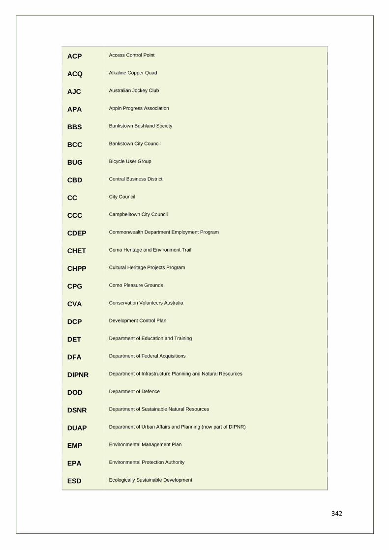
342
ACP Access Control Point
ACQ Alkaline Copper Quad
AJC Australian Jockey Club
APA Appin Progress Association
BBS Bankstown Bushland Society
BCC Bankstown City Council
BUG Bicycle User Group
CBD Central Business District
CC City Council
CCC Campbelltown City Council
CDEP Commonwealth Department Employment Program
CHET Como Heritage and Environment Trail
CHPP Cultural Heritage Projects Program
CPG Como Pleasure Grounds
CVA Conservation Volunteers Australia
DCP Development Control Plan
DET Department of Education and Training
DFA Department of Federal Acquisitions
DIPNR Department of Infrastructure Planning and Natural Resources
DOD Department of Defence
DSNR Department of Sustainable Natural Resources
DUAP Department of Urban Affairs and Planning (now part of DIPNR)
EMP Environmental Management Plan
EPA Environmental Protection Authority
ESD Ecologically Sustainable Development
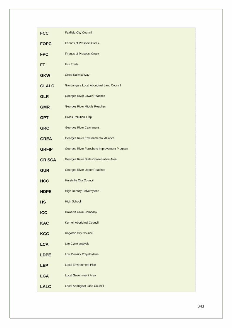
343
FCC Fairfield City Council
FOPC Friends of Prospect Creek
FPC Friends of Prospect Creek
FT Fire Trails
GKW Great Kai'mia Way
GLALC Gandangara Local Aboriginal Land Council
GLR Georges River Lower Reaches
GMR Georges River Middle Reaches
GPT Gross Pollution Trap
GRC Georges River Catchment
GREA Georges River Environmental Alliance
GRFIP Georges River Foreshore Improvement Program
GR SCA Georges River State Conservation Area
GUR Georges River Upper Reaches
HCC Hurstville City Council
HDPE High Density Polyethylene
HS High School
ICC Illawarra Coke Company
KAC Kurnell Aboriginal Council
KCC Kogarah City Council
LCA Life Cycle analysis
LDPE Low Density Polyethylene
LEP Local Environment Plan
LGA Local Government Area
LALC Local Aboriginal Land Council
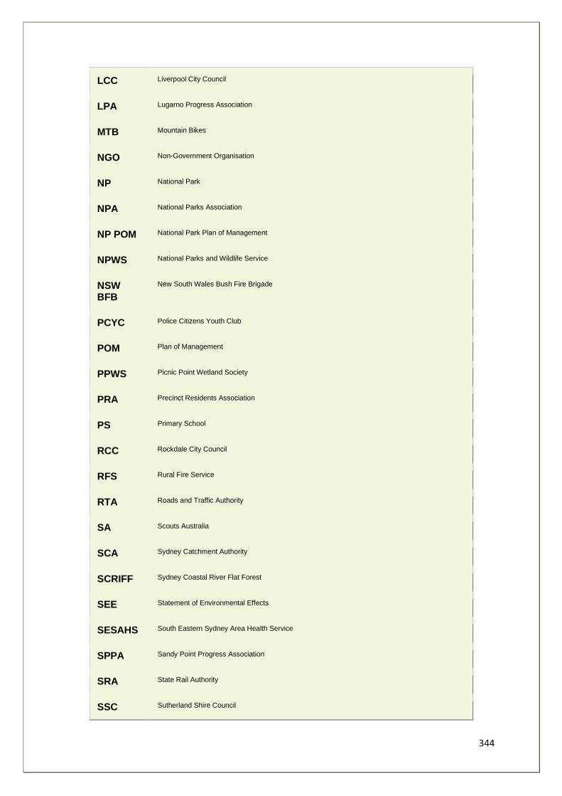
344
LCC Liverpool City Council
LPA Lugarno Progress Association
MTB Mountain Bikes
NGO Non-Government Organisation
NP National Park
NPA National Parks Association
NP POM National Park Plan of Management
NPWS National Parks and Wildlife Service
NSW BFB
New South Wales Bush Fire Brigade
PCYC Police Citizens Youth Club
POM Plan of Management
PPWS Picnic Point Wetland Society
PRA Precinct Residents Association
PS Primary School
RCC Rockdale City Council
RFS Rural Fire Service
RTA Roads and Traffic Authority
SA Scouts Australia
SCA Sydney Catchment Authority
SCRIFF Sydney Coastal River Flat Forest
SEE Statement of Environmental Effects
SESAHS South Eastern Sydney Area Health Service
SPPA Sandy Point Progress Association
SRA State Rail Authority
SSC Sutherland Shire Council
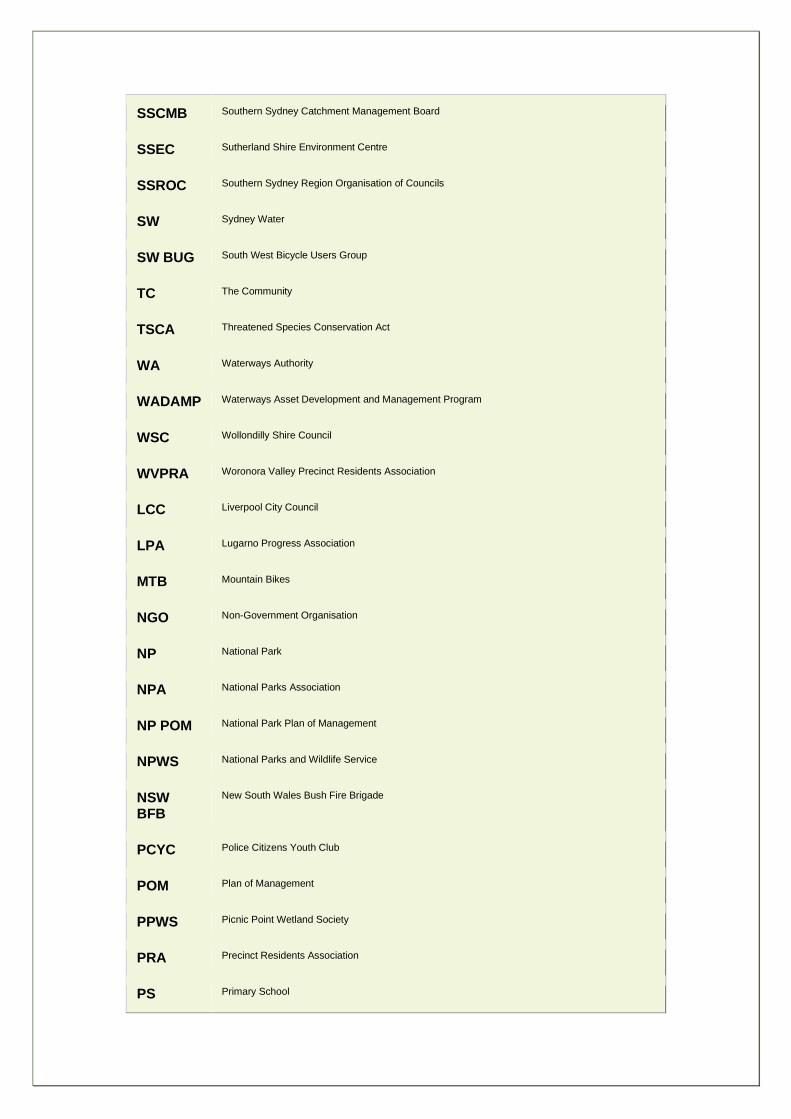
345
SSCMB Southern Sydney Catchment Management Board
SSEC Sutherland Shire Environment Centre
SSROC Southern Sydney Region Organisation of Councils
SW Sydney Water
SW BUG South West Bicycle Users Group
TC The Community
TSCA Threatened Species Conservation Act
WA Waterways Authority
WADAMP Waterways Asset Development and Management Program
WSC Wollondilly Shire Council
WVPRA Woronora Valley Precinct Residents Association
LCC Liverpool City Council
LPA Lugarno Progress Association
MTB Mountain Bikes
NGO Non-Government Organisation
NP National Park
NPA National Parks Association
NP POM National Park Plan of Management
NPWS National Parks and Wildlife Service
NSW BFB
New South Wales Bush Fire Brigade
PCYC Police Citizens Youth Club
POM Plan of Management
PPWS Picnic Point Wetland Society
PRA Precinct Residents Association
PS Primary School

346
Appendices

347
Appendix 1 - Botany Bay Trail Pre-feasibility Study
Notes from a presentation made by Nick Benson
Background The Botany Bay Trail is a recommendation made in "The Tide is Turning", Final Report of the Botany Bay Program . It is an opportunity to bring community and government together, building trust and respect while working towards a common goal. The San Francisco Bay Trail, a very similar project, is a good working example of this. A population of more than 1 million currently access land and water based recreation in the Bay. Public access exists in many places, but no plan yet exists for a continuous system. Southern Sydney Region of Councils (SSROC) is a readymade focus for initial work supported by SSEC and SSC. Objectives
• Identify an in principle route and test its potential for gradual implementation • Divide the route into sectors and apply the trail concept to each sector
o opportunities and existing infrastructure o constraints and barriers to movement
• Suggest future detailed studies • Planning, design, costing, implementation • Recommend priorities for action
Approach
• Search for possible routes for a trail • Liaise with key landholders and developers:
o Sydney Airport o Sydney Ports Corporation o South Sydney Development Corporation o Sydney Harbour Foreshores Authority
• Help in form of maps, air photos, technical reports • Accurately identify existing infrastructure and landward boundaries of their
sites • Liaise with Councils and Government: (All Bayside SSROC Councils,
National Parks and Wildlife Service, Roads and Traffic Authority)
348
o Obtain reaction to trail concept o Info on existing trail elements o Their thoughts on problem areas and constraints o Ongoing walk/cycle path projects which could form part of ultimate
network
Community and User Group Consultation
• La Perouse people, BicycleNSW, Botany Environment Watch • Botany Bay and Catchment Alliance, Kurnell Regional Environment Planning
Council • Rockdale Wetlands Society, Taren Point Wetlands Group
o obtain reaction to trail proposal o issues and concerns raised o opportunities for future participation
• A general picture of land ownership pattern along the foreshore: o commonwealth, state, council, private, institutional
• Mapping of overall route and individual sectors • Trail design:
o tentative suggestions for engineering solutions, drainage, surfacing, signage, access
• Field inspections • Brief discussion of links to other existing and proposed trails
o Woronora, Georges River, Cooks River etc.
Botany Bay is Unique in Character Rich Aboriginal and European history, cultural diversity of its people, wide open spaces and vistas, a variety of wildlife habitats, wealth of heritage - it holds a special place in the hearts of locals and visitors alike. Despite the massive presence of industry, it still manages to inspire the imagination and a trail will enable everyone to explore this special Bay, to raise awareness of its environmental state both good and bad, and help promote a better sense of belonging to country. Parts of the trail will be suitable for all, including wheelchair users, whilst others will be appropriate for walkers only with alternative routes for cyclists.
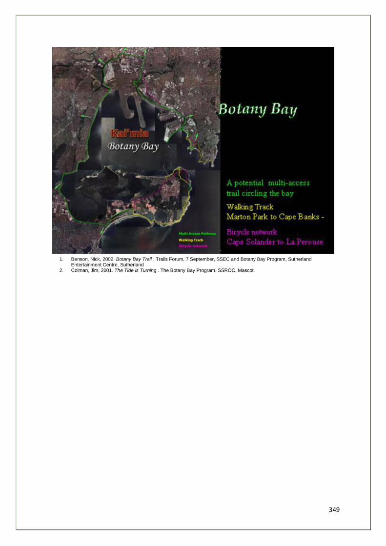
349
1. Benson, Nick, 2002. Botany Bay Trail , Trails Forum, 7 September, SSEC and Botany Bay Program, Sutherland Entertainment Centre, Sutherland
2. Colman, Jim, 2001. The Tide is Turning . The Botany Bay Program, SSROC, Mascot.
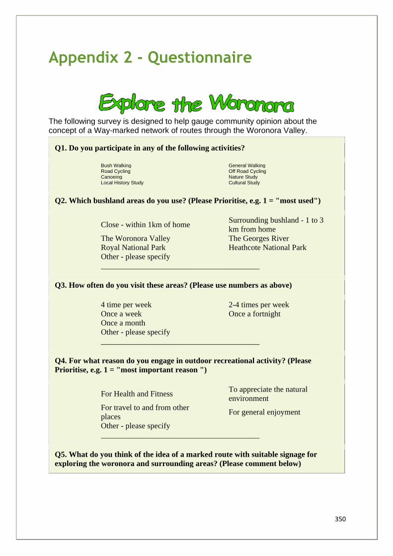
350
Appendix 2 - Questionnaire
The following survey is designed to help gauge community opinion about the concept of a Way-marked network of routes through the Woronora Valley.
Q1. Do you participate in any of the following activities?
Bush Walking
General Walking
Road Cycling
Off Road Cycling Canoeing
Nature Study
Local History Study
Cultural Study
Q2. Which bushland areas do you use? (Please Prioritise, e.g. 1 = "most used")
Close - within 1km of home Surrounding bushland - 1 to 3
km from home The Woronora Valley The Georges River Royal National Park Heathcote National Park
Other - please specify
________________________________________
Q3. How often do you visit these areas? (Please use numbers as above)
4 time per week 2-4 times per week Once a week Once a fortnight Once a month
Other - please specify
________________________________________
Q4. For what reason do you engage in outdoor recreational activity? (Please
Prioritise, e.g. 1 = "most important reason ")
For Health and Fitness To appreciate the natural
environment
For travel to and from other
places For general enjoyment
Other - please specify
________________________________________
Q5. What do you think of the idea of a marked route with suitable signage for
exploring the woronora and surrounding areas? (Please comment below)
351
__________________________________________________________________
__________________________________________________________________
__________________________________________________________________
Q6. Are there any tracks and trails near you which you would like to see included
in the marked route? If so, state which one(s)
__________________________________________________________________
__________________________________________________________________
__________________________________________________________________
Q7. Do you have any concerns regarding a continuous route for the Woronora?
(e.g. increased access)
__________________________________________________________________
__________________________________________________________________
__________________________________________________________________
Q8. Are the any route near you which are in need of repair, upgrading, etc? If so
please state which one(s)
__________________________________________________________________
__________________________________________________________________
__________________________________________________________________
Q9. Where would you like to see new paths built for walking/cycling access? (e.g.
link to schools, local facilities, parks and reserves, streets)
__________________________________________________________________
__________________________________________________________________
__________________________________________________________________
Q10. If an environmentally sensitive, easy to follow route was created along the
Woronora, would you be likely to use it?
__________________________________________________________________
__________________________________________________________________
__________________________________________________________________
Q11. Which suburb do you live in?
__________________________________________________________________
Q12. Please suggest a name to describe a loop route to help you explore your local
area (e.g. creek, indigenous, cultural, historical, flora and fauna)
352
__________________________________________________________________
__________________________________________________________________
__________________________________________________________________
Q13. Please Suggest a suitable name for a track along the Woronora Valley
__________________________________________________________________
Q14. Do you belong to a bushcare group? If so, which one?
__________________________________________________________________
Q15. Which of the following themes would you like to see interpreted on route
signage? (Please Prioritise, e.g. 1 = "most preferred")
Bio-diversity The River System
Indigenous Culture and
Heritage Non-indiginous Culture and
Heritage Route and Points of Interest None
Other - please specify
________________________________________
Q16. Gender (Please Circle)
Male Female
Q17. Age (Please Circle)
0-12 13-18 19-25 26-40 41-55 56-70 70+
353
Thank you for taking part in the survey. We are very grateful for you contribution to the Great Kai'mia Way Project - Nick Benson, Coordinator Please return questionnaire to:
SSEC PO Box 589 Sutherland NSW 1499 or Fax to: 9521 1477
by Friday 20th June 2003
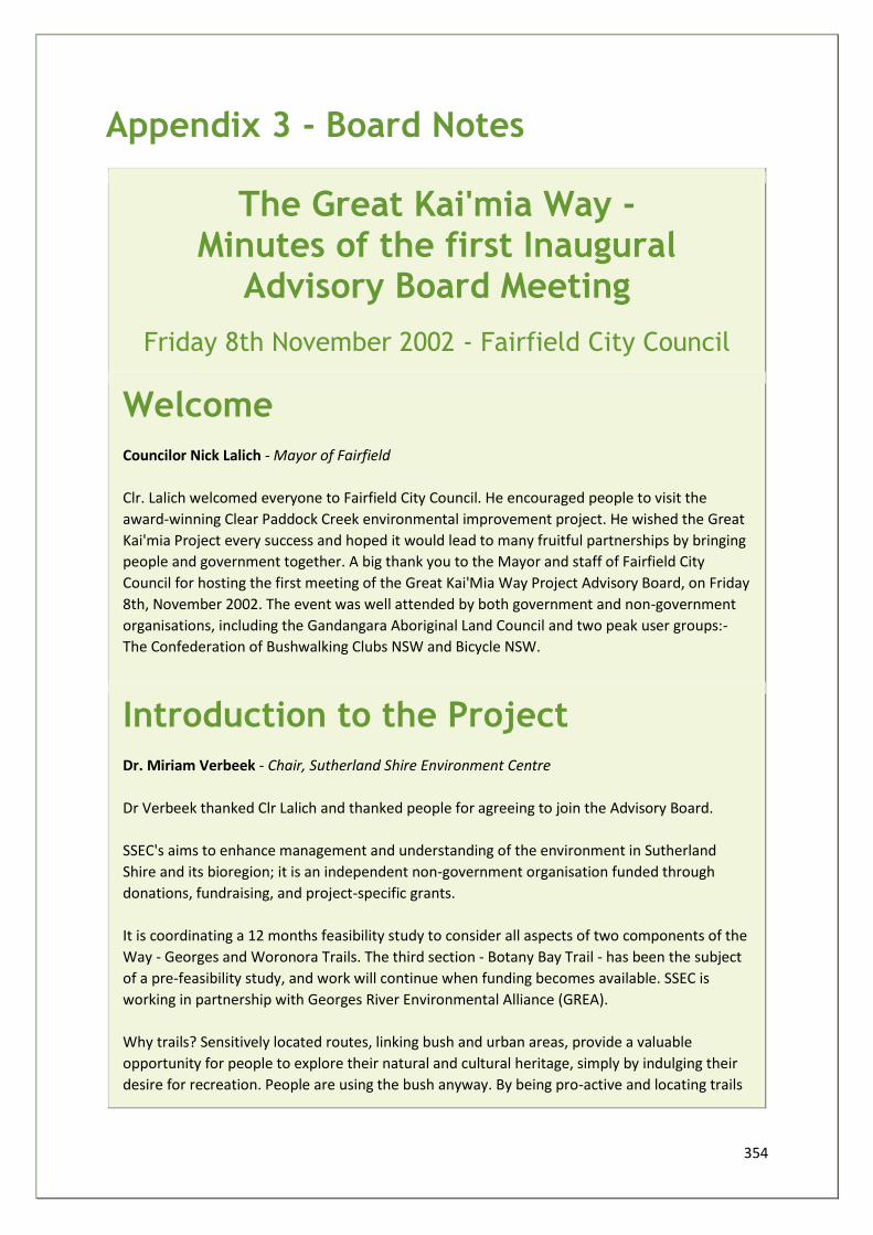
354
Appendix 3 - Board Notes
The Great Kai'mia Way - Minutes of the first Inaugural
Advisory Board Meeting
Friday 8th November 2002 - Fairfield City Council
Welcome
Councilor Nick Lalich - Mayor of Fairfield
Clr. Lalich welcomed everyone to Fairfield City Council. He encouraged people to visit the
award-winning Clear Paddock Creek environmental improvement project. He wished the Great
Kai'mia Project every success and hoped it would lead to many fruitful partnerships by bringing
people and government together. A big thank you to the Mayor and staff of Fairfield City
Council for hosting the first meeting of the Great Kai'Mia Way Project Advisory Board, on Friday
8th, November 2002. The event was well attended by both government and non-government
organisations, including the Gandangara Aboriginal Land Council and two peak user groups:-
The Confederation of Bushwalking Clubs NSW and Bicycle NSW.
Introduction to the Project
Dr. Miriam Verbeek - Chair, Sutherland Shire Environment Centre
Dr Verbeek thanked Clr Lalich and thanked people for agreeing to join the Advisory Board.
SSEC's aims to enhance management and understanding of the environment in Sutherland
Shire and its bioregion; it is an independent non-government organisation funded through
donations, fundraising, and project-specific grants.
It is coordinating a 12 months feasibility study to consider all aspects of two components of the
Way - Georges and Woronora Trails. The third section - Botany Bay Trail - has been the subject
of a pre-feasibility study, and work will continue when funding becomes available. SSEC is
working in partnership with Georges River Environmental Alliance (GREA).
Why trails? Sensitively located routes, linking bush and urban areas, provide a valuable
opportunity for people to explore their natural and cultural heritage, simply by indulging their
desire for recreation. People are using the bush anyway. By being pro-active and locating trails
355
where they will do least damage, we hope to reduce the harm to the bush by indiscriminate
access.
Four concurrent themes of the project:
• Research and document the natural and cultural features (including existing and planned tracks and trails) of the river valleys to locate a suitable route or routes.
• Ensure high level of community (stakeholders) involvement in route planning and research developing partnerships for further involvement in implementation stage.
• Create opportunities to use the project to increase sustainable use of the environment and care of cultural heritage.
• Set up a funding strategy for the implementation of the trails network.
The functions of the advisory board are to:
• Provide advice about management of the project. • Help integrate the efforts straddling jurisdictions. • Avoid duplication of effort. • Ensure that we are all working together to achieve environmental and social goals.
The Georges River Foreshores Improvement Program
Bob Symington
Mr Symington explained that the Great Kai'mia Way Project had received funding under the
GRFIP scheme. This PlanningNSW initiative had supported several environmental projects
which had led to a distinct improvement in the health of the Georges River. The GRFIP faces an
uncertain future with no grants planned for 2003 - 2004. He urged all stakeholders to actively
support the next round of funding for GRFIP by contacting their local MP.
The Great Kai'mia Way Vision
Dr. Peter Tralaggan - Georges River Environmental Alliance
Dr. Tralaggan spoke passionately for the need for a long term vision to protect remaining
bushland of the Georges River catchment, on Sydneys urban fringe, from development.
He explained how coordinating the tracks and trails system has a vital role to play in achieving
this, by saving a riparian corridor for public amenity, which could be adopted by statutory
planning authorities.
356
Explore the Woronora Way Project Update
Nick Benson - Project Co-ordinator
Nick had begun "ground truthing", i.e. researching existing and potential track infrastructure,
loop tracks and links to settlements, public transport and amenities.
Issues: concerns of individual property owners, avoiding sensitive wildlife habitats, where
bicycle access was appropriate, antisocial behavior.
The study area - 20km long by 2km wide - allows for in depth analysis, fully inclusive of
community contributions.
The Georges River Way Project
Bob Symington - Project Co-ordinator
Bob is forming four project working groups, based on local authority boundaries, which will
include relevant stakeholders:
• WG1 lower reach (north) Canterbury, Kogarah, Hurstville and Rockdale • WG2 middle reach Bankstown, Fairfield, Holroyd and Liverpool • WG3 upper reach Cambelltown and Wollondilly • WG4 lower reach (south) & headwaters Sutherland and Wollongong
He has toured the river system by boat to look at existing foreshore amenity projects, as well as
some of the barriers to movement created by foreshore residential development.
Open Discussion
Advisory Board Members
It was asked if Gandangara LALC had been included as one of the stakeholders. Yes, they had
been invited to join the project from the start, through the Explore-the-Woronora Steering
Committee, and that it was encouraging to see them today.
Important to explain the Dreaming Path along the trail, interpret different Tribal areas along
the way.
Interpretation signs should document killings and displacement of Aboriginal people by
European settlers.
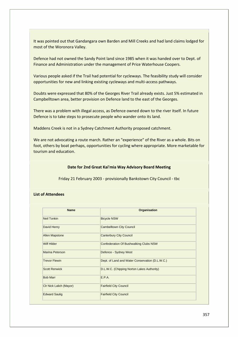
357
It was pointed out that Gandangara own Barden and Mill Creeks and had land claims lodged for
most of the Woronora Valley.
Defence had not owned the Sandy Point land since 1985 when it was handed over to Dept. of
Finance and Administration under the management of Price Waterhouse Coopers.
Various people asked if the Trail had potential for cycleways. The feasibility study will consider
opportunities for new and linking existing cycleways and multi-access pathways.
Doubts were expressed that 80% of the Georges River Trail already exists. Just 5% estimated in
Campbelltown area, better provision on Defence land to the east of the Georges.
There was a problem with illegal access, as Defence owned down to the river itself. In future
Defence is to take steps to prosecute people who wander onto its land.
Maddens Creek is not in a Sydney Catchment Authority proposed catchment.
We are not advocating a route march. Rather an "experience" of the River as a whole. Bits on
foot, others by boat perhaps, opportunities for cycling where appropriate. More marketable for
tourism and education.
Date for 2nd Great Kai'mia Way Advisory Board Meeting
Friday 21 February 2003 - provisionally Bankstown City Council - tbc
List of Attendees
Name Organisation
Neil Tonkin Bicycle NSW
David Henry Cambelltown City Council
Allen Mapstone Canterbury City Council
Wilf Hilder Confederation Of Bushwalking Clubs NSW
Marina Peterson Defence - Sydney West
Trevor Flewin Dept. of Land and Water Conservation (D.L.W.C.)
Scott Renwick D.L.W.C. (Chipping Norton Lakes Authority)
Bob Marr E.P.A.
Clr Nick Lalich (Mayor) Fairfield City Council
Edward Saulig Fairfield City Council
358
Nilmina De Silva Fairfield City Council
Fred Malone Gandangara L.A.L.C.
Robert Bell Gandangara L.A.L.C.
Maria Woodgate Gandangara L.A.L.C. (C.M. Jewell and Associates Pty Ltd)
Sharyn Cullis Georges River Environmental Alliance (G.R.E.A.)
Dr Peter Tralaggan G.R.E.A.
Peter Jenson Greening Australia (Bushcare Support)
Brett Calear Holroyd City Council
Vince Conroy Holroyd City Council
Cindy Cunningham Hurstville City Council
Nerida Williams Kogarah Council
Amit Chanan Kogarah Council
Lisa Mcgill Liverpool City Council
Matt Napper Liverpool City Council
Michaela Hopkins Rockdale City Council
Dr Miriam Verbeek Sutherland Shire Environment Centre (S.S.E.C.)
Jim Sloan S.S.E.C.
Nick Benson S.S.E.C.
Bob Symington S.S.E.C.
Juanita Higgs Southern Sydney Regional Organisation Of Councils (S.S.R.O.C.)
Stephen Black Waterways Authority
The Great Kai'mia Way - 2nd Advisory Board Meeting Notes
February 21st 2003 - Bankstown City Council
1. Welcome and Introduction - Dr. Miriam Verbeek
• Future Board role post Feasibility Study will depend upon funding. • Project is acting as facilitator/ community input ensured/ funding role. • Initiating educational & recreational projects. • Project also ground truthing/ mapping access routes & missing links & land ownership.
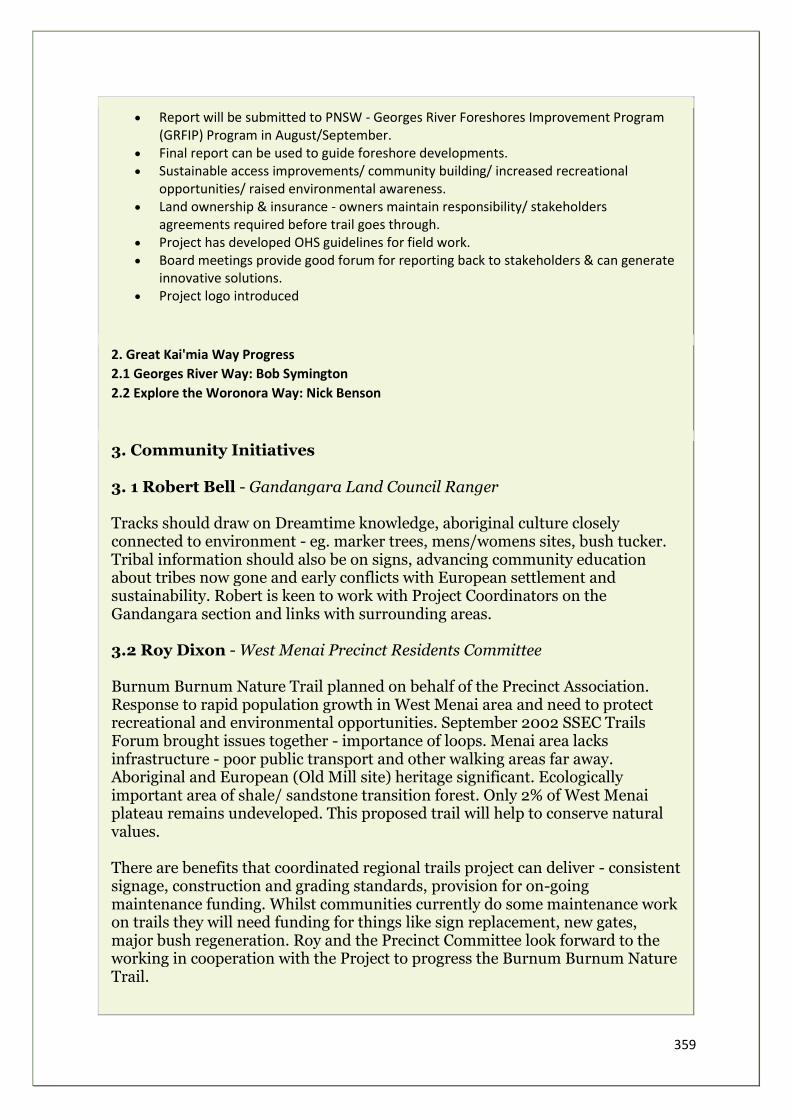
359
• Report will be submitted to PNSW - Georges River Foreshores Improvement Program (GRFIP) Program in August/September.
• Final report can be used to guide foreshore developments. • Sustainable access improvements/ community building/ increased recreational
opportunities/ raised environmental awareness. • Land ownership & insurance - owners maintain responsibility/ stakeholders
agreements required before trail goes through. • Project has developed OHS guidelines for field work. • Board meetings provide good forum for reporting back to stakeholders & can generate
innovative solutions. • Project logo introduced
2. Great Kai'mia Way Progress
2.1 Georges River Way: Bob Symington
2.2 Explore the Woronora Way: Nick Benson
3. Community Initiatives
3. 1 Robert Bell - Gandangara Land Council Ranger Tracks should draw on Dreamtime knowledge, aboriginal culture closely connected to environment - eg. marker trees, mens/womens sites, bush tucker. Tribal information should also be on signs, advancing community education about tribes now gone and early conflicts with European settlement and sustainability. Robert is keen to work with Project Coordinators on the Gandangara section and links with surrounding areas. 3.2 Roy Dixon - West Menai Precinct Residents Committee Burnum Burnum Nature Trail planned on behalf of the Precinct Association. Response to rapid population growth in West Menai area and need to protect recreational and environmental opportunities. September 2002 SSEC Trails Forum brought issues together - importance of loops. Menai area lacks infrastructure - poor public transport and other walking areas far away. Aboriginal and European (Old Mill site) heritage significant. Ecologically important area of shale/ sandstone transition forest. Only 2% of West Menai plateau remains undeveloped. This proposed trail will help to conserve natural values. There are benefits that coordinated regional trails project can deliver - consistent signage, construction and grading standards, provision for on-going maintenance funding. Whilst communities currently do some maintenance work on trails they will need funding for things like sign replacement, new gates, major bush regeneration. Roy and the Precinct Committee look forward to the working in cooperation with the Project to progress the Burnum Burnum Nature Trail.
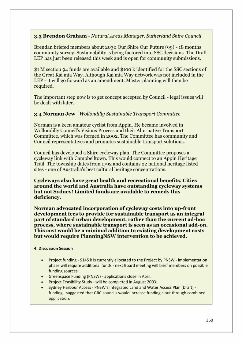
360
3.3 Brendon Graham - Natural Areas Manager, Sutherland Shire Council Brendan briefed members about 2030 Our Shire Our Future (99) - 18 months community survey. Sustainability is being factored into SSC decisions. The Draft LEP has just been released this week and is open for community submissions. $1 M section 94 funds are available and $100 k identified for the SSC sections of the Great Kai'mia Way. Although Kai'mia Way network was not included in the LEP - it will go forward as an amendment. Master planning will then be required. The important step now is to get concept accepted by Council - legal issues will be dealt with later. 3.4 Norman Jew - Wollondilly Sustainable Transport Committee Norman is a keen amateur cyclist from Appin. He became involved in Wollondilly Council's Visions Process and their Alternative Transport Committee, which was formed in 2002. The Committee has community and Council representatives and promotes sustainable transport solutions. Council has developed a Shire cycleway plan. The Committee proposes a cycleway link with Campbelltown. This would connect to an Appin Heritage Trail. The township dates from 1792 and contains 22 national heritage listed sites - one of Australia's best cultural heritage concentrations. Cycleways also have great health and recreational benefits. Cities around the world and Australia have outstanding cycleway systems but not Sydney! Limited funds are available to remedy this deficiency. Norman advocated incorporation of cycleway costs into up-front development fees to provide for sustainable transport as an integral part of standard urban development, rather than the current ad-hoc process, where sustainable transport is seen as an occasional add-on. This cost would be a minimal addition to existing development costs but would require PlanningNSW intervention to be achieved.
4. Discussion Session
• Project funding - $145 k is currently allocated to the Project by PNSW - implementation phase will require additional funds - next Board meeting will brief members on possible funding sources.
• Greenspace Funding (PNSW) - applications close in April. • Project Feasibility Study - will be completed in August 2003. • Sydney Harbour Access - PNSW's Integrated Land and Water Access Plan (Draft) -
funding - suggested that GRC councils would increase funding clout through combined application.
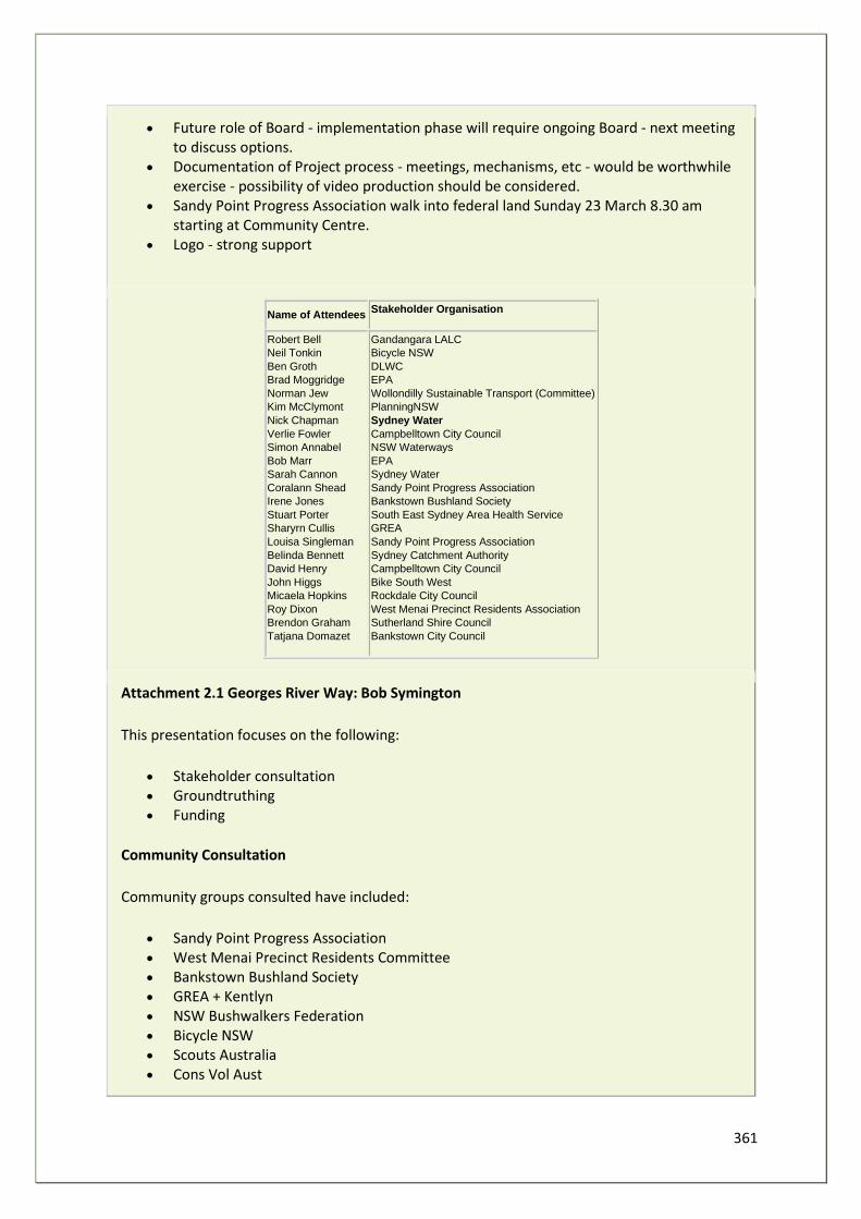
361
• Future role of Board - implementation phase will require ongoing Board - next meeting to discuss options.
• Documentation of Project process - meetings, mechanisms, etc - would be worthwhile exercise - possibility of video production should be considered.
• Sandy Point Progress Association walk into federal land Sunday 23 March 8.30 am starting at Community Centre.
• Logo - strong support
Name of Attendees Stakeholder Organisation
Robert Bell
Neil Tonkin
Ben Groth
Brad Moggridge
Norman Jew
Kim McClymont
Nick Chapman
Verlie Fowler
Simon Annabel
Bob Marr
Sarah Cannon
Coralann Shead
Irene Jones
Stuart Porter
Sharyrn Cullis
Louisa Singleman
Belinda Bennett
David Henry
John Higgs
Micaela Hopkins
Roy Dixon
Brendon Graham
Tatjana Domazet
Gandangara LALC
Bicycle NSW
DLWC
EPA
Wollondilly Sustainable Transport (Committee)
PlanningNSW
Sydney Water
Campbelltown City Council
NSW Waterways
EPA
Sydney Water
Sandy Point Progress Association
Bankstown Bushland Society
South East Sydney Area Health Service
GREA
Sandy Point Progress Association
Sydney Catchment Authority
Campbelltown City Council
Bike South West
Rockdale City Council
West Menai Precinct Residents Association
Sutherland Shire Council
Bankstown City Council
Attachment 2.1 Georges River Way: Bob Symington
This presentation focuses on the following:
• Stakeholder consultation • Groundtruthing • Funding
Community Consultation
Community groups consulted have included:
• Sandy Point Progress Association • West Menai Precinct Residents Committee • Bankstown Bushland Society • GREA + Kentlyn • NSW Bushwalkers Federation • Bicycle NSW • Scouts Australia • Cons Vol Aust
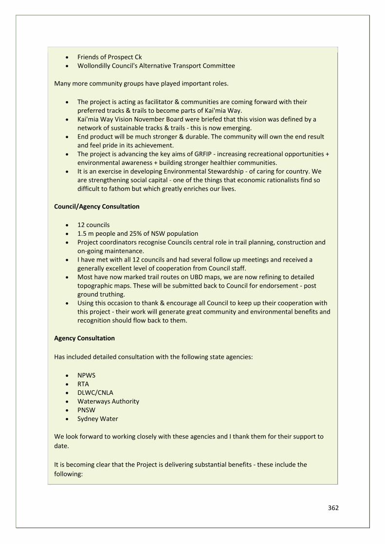
362
• Friends of Prospect Ck • Wollondilly Council's Alternative Transport Committee
Many more community groups have played important roles.
• The project is acting as facilitator & communities are coming forward with their preferred tracks & trails to become parts of Kai'mia Way.
• Kai'mia Way Vision November Board were briefed that this vision was defined by a network of sustainable tracks & trails - this is now emerging.
• End product will be much stronger & durable. The community will own the end result and feel pride in its achievement.
• The project is advancing the key aims of GRFIP - increasing recreational opportunities + environmental awareness + building stronger healthier communities.
• It is an exercise in developing Environmental Stewardship - of caring for country. We are strengthening social capital - one of the things that economic rationalists find so difficult to fathom but which greatly enriches our lives.
Council/Agency Consultation
• 12 councils • 1.5 m people and 25% of NSW population • Project coordinators recognise Councils central role in trail planning, construction and
on-going maintenance. • I have met with all 12 councils and had several follow up meetings and received a
generally excellent level of cooperation from Council staff. • Most have now marked trail routes on UBD maps, we are now refining to detailed
topographic maps. These will be submitted back to Council for endorsement - post ground truthing.
• Using this occasion to thank & encourage all Council to keep up their cooperation with this project - their work will generate great community and environmental benefits and recognition should flow back to them.
Agency Consultation
Has included detailed consultation with the following state agencies:
• NPWS • RTA • DLWC/CNLA • Waterways Authority • PNSW • Sydney Water
We look forward to working closely with these agencies and I thank them for their support to
date.
It is becoming clear that the Project is delivering substantial benefits - these include the
following:
363
• Regional coordination efficiencies, improving LGA links. • Identify missing links, establish priorities. • Honest broker, community ngos/ councils/ agencies. • To encourage community action + the emergence of champions. • Brokerage, sustainable solutions + sustainable building materials. • Coordinators - are currently developing on a common logo/ signage/ brochures/ on-
line info/ trail grading. • Identifying environmental problems - we now have extensive photos dbase. • We are in a key position to gain implementation funding - the Project now has strong
momentum.
Groundtruthing
• Last few weeks walking tracks and trails. • Hundreds of photos. • Bellbirds in Bankstown. • Wallabies. • Marijuana plantations. • Foxes. • Aboriginal cave paintings. • Rivers disappearing into cracks. • Softwood pine bridges burnt. • Trail bike destruction. • Leachates oozing into wetlands. • Recent SMH articles confirm great natural beauty, but Georges River also in
environmental decline - due mainly to intensive residential development/redevelopment.
• Incremental loss of environmental /scenic values. • Almost total absence of boat speed enforcement. • Consequent bank erosion / turbidity / aquatic life decline. • Walking/cycleway could clearly show what is happening on the Georges. • Increasing community pressure to save and restore the Georges back to good health
Powerpoint Presentation
Funding
I have gained the support of several champions that have emerged during the consultation and
groundtruthing phases - to form an informal group to seek funding for the implementation of
this project - this group will meet soon and will include - Phil Sansom, Kim McClymont, Neil
Tonkin, Wilf Hilder and Norman Jew. I look forward to reporting back to you in 3 months on the
progress of this group and the overall Project.
Attachment 2.2 Explore the Woronora Way: Nick Benson
This presentation focuses on the following:
364
• Research component of the project - ground truthing. • The Contributions of individuals and groups within the community. • Liaison with government at all levels. • Developing the common Great Kai'mia Way vision through track signage, access control
infrastructure, brochures. • Education and Promotion. • The main challenges to implementation.
Primary and Secondary Contact Recreation
In conjunction with the powerpoint photos
1. Experiencing the river There are many ways to experience the special qualities of the Woronora River - some more unusual than most - an adventurous family attempting to lilo down the stretch between Heathcote Bridge and the Needles.
2. Bushwalking Bushwalking is the most common form of recreation in Sutherland Shire, according to the Sutherland Shire Open Space and Recreation Needs Survey in 1995. The public voted that the highest council spending priority should be the provision of walking tracks and boardwalks.
3. Canoeing A canoe trail along the river would link beaches and points of interest, many of which are inappropriate to link via a continuous land route.
4. Cycling Cycling is popular on the main fire trials in the valley, although in areas zoned as 7(b) Environmental Protection (Bushland) cycling is a prohibited activity. There is scope to identify a network on the quiet residential streets and to incorporate the new shared use track across the river suspended from the road bridge. A challenge is to allow cycles but not motorbikes at the main access control points along the track.
Ground Truthing
5/6/7/8 So, how to determine which existing or potential track routes are suitable and appropriate to different user groups for exploring the Woronora? I have developed a "ground truth" checklist, which can be taken out on site to help collect information. The checklist has space for a sketch map. Further information on heritage and biodiversity for example can be added later, so that a comprehensive file is built up on the track network of the whole valley. Each track is given an ID, when the information is transferred to a trails database on computer.
Community Building
9. Local "Champions" Example: Exchange of ideas between reps of Gandangara LALC and West Menai Precinct Residents Association. We have helped facilitate cross community ties between local precinct groups who are interested in
365
developing their own sections of trail, and between people from the Aboriginal community and their non-Aboriginal neighbours. A common theme is the protection of bushland and wildlife habitat for future generations to enjoy and appreciate.
10. Bushcare Groups Example: Maandowie Reserve Bushcare Group - secretary Geoff Broadhead. Part of detailed community consultation has involved liaising with Bushcare Groups in the valley, to verify the suitability of identifying tracks as part of the network. Addressing any concerns such as erosion and impacts on native bushland. Also seeking ways of future stewardship for tracks e.g. "Friends of the Woronora Way".
11. Major Stakeholders/Landholders Example: Liaison with Sydney Water, NPWS and Sutherland Shire Council over the use of the Woronora Dam Pipeline Service Track as part of the Woronora Way. The track cannot happen without the cooperation of the key landholders and land managers who will ultimately be responsible for future maintenance.
Potential Woronora Way
12 and 13 Maps based on first 4 months investigation
Suggest Alternative routes for walkers and cyclists between Como and
Thorp Road Woronora. Canoe trail highlights beaches and picnic grounds
as well as short walks from the canoe landing spots. From Thorp Road to
Heathcote Road suggested shared route along Sydney Water pipeline
track. A footbridge is needed to cross Heathcote Road safely. In
Heathcote National Park trail continues along pipeline track. At Battery
Point walkers head up Birrawong track to Waterfall, cyclists continue
along service track to Woronora Dam Road and then via Old Princes
Highway to Waterfall. Links from each railway station along the route
down to the main "spine" trail are suggested.
14. Logo In order to keep the common theme of Kia'mia for the whole track system throughout the Woronora and the Georges, we have looked at logo designs suitable for signage and publications.
15. Waymarker Design This is how a common waymarker for the Great Kia'mia Way might look. Aluminium post with heavy duty stickers which can be replaced if removed by vandals. Cost approx. $60.
16. No Common theme at present A common waymarker would help to rationalise the signage in the valley which varies considerably. Helps make the track easier to follow and more user friendly.
Major Issue Securing Public Access to Pipeline Service Track
366
17. Heathcote Road The key to establishing the Woronora Way is to develop a partnership between Sydney Water, NPWS and Sutherland Shire Council to allow the use of the pipeline service track. Currently, public access is prohibited. The major physical barrier is Heathcote Road. Council have set aside funds to help with the cost of a shared use bridge to cross the road should permission be granted.
18. Jogging along the pipeline track The track is already used extensively by local residents. Sydney Water have obvious risk management and liability concerns which need to be addressed.
19. Protecting the Upper Valley The benefit of using the service track is that it would control access by keeping users to easy to follow route, of good standard. This negates the need to build a continuous route through sensitive steep bushland habitats upstream of the Deepwater Estate.
Education and Promotion 20 and 21 Clean Up Australia Day
A key goal of the overall project strategy is to target calendar events to help
promote the project to a wider audience. For Clean Up Australia Day - Sunday
2nd March 2003, we are organising an event with the help of Waterways and the
Bush Fire Brigade. An abandoned church camp is to be restored to a grassy
meadow suitable as a landing point on the canoe trail. The site is only
accessible by boat.
22. Parc Menai Celtic Festival The following week, Sunday 9th March 2003, we are hiring a stall to help publicise the project. People will be able to pick up a brochure and be asked to complete a questionnaire on local outdoor recreation habits, gauging opinion of the Great Kai'mia Way vision, any local knowledge, ideas or concerns. A large map display will help people pinpoint existing tracks, walkways, cycleways, heritage sites, interesting flora and fauna.
Funding
Sutherland Shire Council are positively supporting the GKW vision and seeing it
as a way of integrating the LGA's pedestrian and cycling network. Unfortunately
the concept plan just failed to make it into the LEP although there is still time for
a submission to be made to alter the plan. Endorsement by council could pave
the way for significant funding for track infrastructure such as Heathcote Road
footbridge.
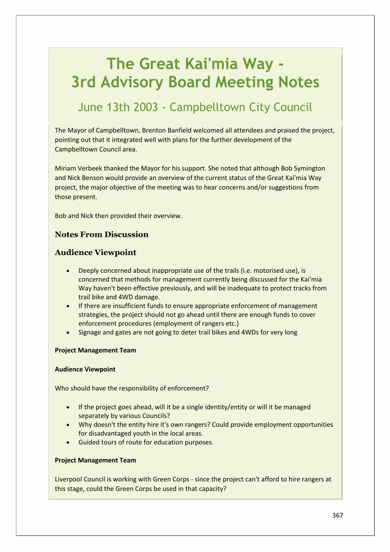
367
The Great Kai'mia Way - 3rd Advisory Board Meeting Notes
June 13th 2003 - Campbelltown City Council
The Mayor of Campbelltown, Brenton Banfield welcomed all attendees and praised the project,
pointing out that it integrated well with plans for the further development of the
Campbelltown Council area.
Miriam Verbeek thanked the Mayor for his support. She noted that although Bob Symington
and Nick Benson would provide an overview of the current status of the Great Kai'mia Way
project, the major objective of the meeting was to hear concerns and/or suggestions from
those present.
Bob and Nick then provided their overview.
Notes From Discussion Audience Viewpoint
• Deeply concerned about inappropriate use of the trails (i.e. motorised use), is concerned that methods for management currently being discussed for the Kai'mia Way haven't been effective previously, and will be inadequate to protect tracks from trail bike and 4WD damage.
• If there are insufficient funds to ensure appropriate enforcement of management strategies, the project should not go ahead until there are enough funds to cover enforcement procedures (employment of rangers etc.)
• Signage and gates are not going to deter trail bikes and 4WDs for very long
Project Management Team
Audience Viewpoint
Who should have the responsibility of enforcement?
• If the project goes ahead, will it be a single identity/entity or will it be managed separately by various Councils?
• Why doesn't the entity hire it's own rangers? Could provide employment opportunities for disadvantaged youth in the local areas.
• Guided tours of route for education purposes.
Project Management Team
Liverpool Council is working with Green Corps - since the project can't afford to hire rangers at
this stage, could the Green Corps be used in that capacity?
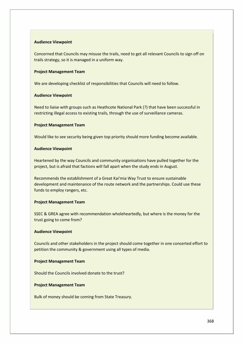
368
Audience Viewpoint
Concerned that Councils may misuse the trails, need to get all relevant Councils to sign off on
trails strategy, so it is managed in a uniform way.
Project Management Team
We are developing checklist of responsibilities that Councils will need to follow.
Audience Viewpoint
Need to liaise with groups such as Heathcote National Park (?) that have been successful in
restricting illegal access to existing trails, through the use of surveillance cameras.
Project Management Team
Would like to see security being given top priority should more funding become available.
Audience Viewpoint
Heartened by the way Councils and community organisations have pulled together for the
project, but is afraid that factions will fall apart when the study ends in August.
Recommends the establishment of a Great Kai'mia Way Trust to ensure sustainable
development and maintenance of the route network and the partnerships. Could use these
funds to employ rangers, etc.
Project Management Team
SSEC & GREA agree with recommendation wholeheartedly, but where is the money for the
trust going to come from?
Audience Viewpoint
Councils and other stakeholders in the project should come together in one concerted effort to
petition the community & government using all types of media.
Project Management Team
Should the Councils involved donate to the trust?
Project Management Team
Bulk of money should be coming from State Treasury.
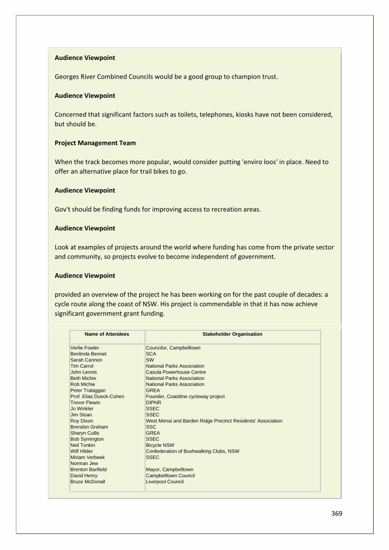
369
Audience Viewpoint
Georges River Combined Councils would be a good group to champion trust.
Audience Viewpoint
Concerned that significant factors such as toilets, telephones, kiosks have not been considered,
but should be.
Project Management Team
When the track becomes more popular, would consider putting 'enviro loos' in place. Need to
offer an alternative place for trail bikes to go.
Audience Viewpoint
Gov't should be finding funds for improving access to recreation areas.
Audience Viewpoint
Look at examples of projects around the world where funding has come from the private sector
and community, so projects evolve to become independent of government.
Audience Viewpoint
provided an overview of the project he has been working on for the past couple of decades: a
cycle route along the coast of NSW. His project is commendable in that it has now achieve
significant government grant funding.
Name of Attendees Stakeholder Organisation
Verlie Fowler
Benlinda Bennet
Sarah Cannon
Tim Carrol
John Lennis
Beth Michie
Rob Michie
Peter Tralaggan
Prof. Elias Dueck-Cohen
Trevor Flewin
Jo Winkler
Jim Sloan
Roy Dixon
Brendon Graham
Sharyn Cullis
Bob Symington
Neil Tonkin
Wilf Hilder
Miriam Verbeek
Norman Jew
Brenton Banfield
David Henry
Bruce McDonall
Councilor, Campbelltown
SCA
SW
National Parks Association
Casula Powerhouse Centre
National Parks Association
National Parks Association
GREA
Founder, Coastline cycleway project
DIPNR
SSEC
SSEC
West Menai and Barden Ridge Precinct Residents' Association
SSC
GREA
SSEC
Bicycle NSW
Confederation of Bushwalking Clubs, NSW
SSEC
Mayor, Campbelltown
Campbelltown Council
Liverpool Council
370
The Great Kai'mia Way - 4th Advisory Board Meeting Notes
August 15th 2003 - Bankstown City Council
(The 4th Board meeting discussed a funding proposal, reproduced in Appendix 12)
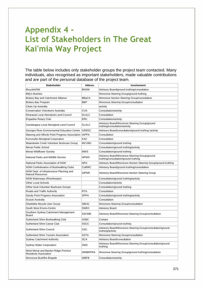
371
Appendix 4 - List of Stakeholders in The Great Kai'mia Way Project
The table below includes only stakeholder groups the project team contacted. Many individuals, also recognised as important stakeholders, made valuable contributions and are part of the personal database of the project team.
Stakeholder Abbrev. Involvement
BicycleNSW BNSW Advisory Board/ground truthing/consultation
Billy's Bushies Woronora Steering Group/ground truthing
Botany Bay and Catchment Alliance BBaCA Woronora Section Steering Group/consultation
Botany Bay Program BBP Woronora Steering Group/consultation
Clean Up Australia activity
Conservation Volunteers Australia CVA Consultation/activity
Dharawal Local Aboriginal Land Council DLALC Consultation
Engadine Rotary Club ERC Consultation/activity
Gandangara Local Aboriginal Land Council GLALC Advisory Board/Woronora Steering Group/ground truthing/consultation/activity
Georges River Environmental Education Centre GREEC Advisory Board/consultation/ground truthing /activity
Illawong and Alfords Point Progress Association IAPPA Consultation
Kurrunulla Aboriginal Corporation KAC Consultation
Maandowie Creek Volunteer Bushcare Group MCVBG Consultation/ground truthing
Menai Public School Consultation/ground truthing/activity
Menai Wildflower Society MWS Consultation/ground truthing
National Parks and Wildlife Service NPWS Advisory Board/Woronora Steering Group/ground truthing/consultation/ground truthing
National Parks Association of NSW NPA Advisory Board/Woronora Section Steering Group/ground truthing
NSW Confederation of Bushwalking Clubs CoBWC Advisory Board/ground truthing/consultation
NSW Dept. of Infrastructure Planning and Natural Resources
DIPNR Advisory Board/Woronora Section Steering Group
NSW Waterways (Riverkeeper) Consultation/ground truthing/activity
Other Local Schools Consultation/activity
Other local Volunteer Bushcare Groups Consultation/ground truthing
Roads and Traffic Authority RTA Consultation
Sandy Point Progress Association SPPA Consultation/ground truthing/activity
Scouts Australia Consultation
Sharkbike Bicycle User Group SBUG Woronora Steering Group/consultation
South West Enviro-Centre SWEC Advisory Board
Southern Sydney Catchment Management Board
SSCMB Advisory Board/Woronora Steering Group/consultation
Sutherland Shire Bushwalking Club SSBC Contact
Sutherland Shire Canoe Club SSCC Consultation/ground truthing
Sutherland Shire Council SSC Advisory Board/Woronora Steering Group/consultation/ground truthing/activity
Sutherland Shire Tourism Association SSTA Woronora Steering Group/consultation
Sydney Catchment Authority SCA Advisory Board/consultation
Sydney Water Corporation SWC Advisory Board/Woronora Steering Group/consultation/ground truthing
West Menai and Barden Ridge Precinct Residents Association
WMBRPRA Woronora Steering Group/ground truthing/consultation
Woronora Bushfire Brigade WBFB Consultation/activity

372
Woronora Valley Precinct Residents Association
WVPRA Woronora Steering Group/ground truthing/consultation
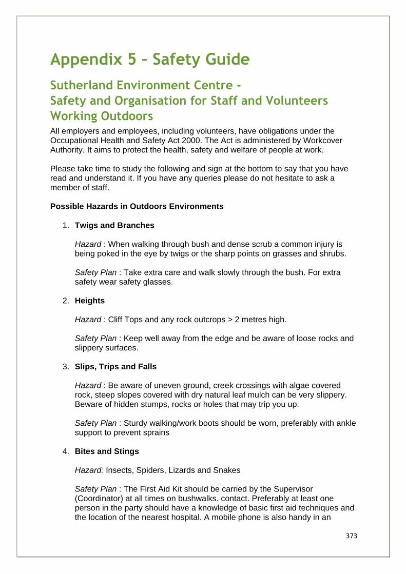
373
Appendix 5 – Safety Guide
Sutherland Environment Centre -
Safety and Organisation for Staff and Volunteers
Working Outdoors All employers and employees, including volunteers, have obligations under the Occupational Health and Safety Act 2000. The Act is administered by Workcover Authority. It aims to protect the health, safety and welfare of people at work. Please take time to study the following and sign at the bottom to say that you have read and understand it. If you have any queries please do not hesitate to ask a member of staff. Possible Hazards in Outdoors Environments
1. Twigs and Branches Hazard : When walking through bush and dense scrub a common injury is being poked in the eye by twigs or the sharp points on grasses and shrubs. Safety Plan : Take extra care and walk slowly through the bush. For extra safety wear safety glasses.
2. Heights Hazard : Cliff Tops and any rock outcrops > 2 metres high. Safety Plan : Keep well away from the edge and be aware of loose rocks and slippery surfaces.
3. Slips, Trips and Falls Hazard : Be aware of uneven ground, creek crossings with algae covered rock, steep slopes covered with dry natural leaf mulch can be very slippery. Beware of hidden stumps, rocks or holes that may trip you up. Safety Plan : Sturdy walking/work boots should be worn, preferably with ankle support to prevent sprains
4. Bites and Stings Hazard: Insects, Spiders, Lizards and Snakes Safety Plan : The First Aid Kit should be carried by the Supervisor (Coordinator) at all times on bushwalks. contact. Preferably at least one person in the party should have a knowledge of basic first aid techniques and the location of the nearest hospital. A mobile phone is also handy in an
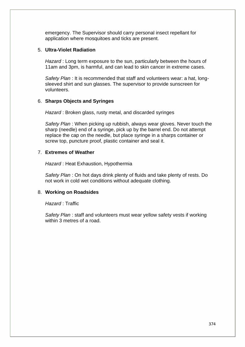
374
emergency. The Supervisor should carry personal insect repellant for application where mosquitoes and ticks are present.
5. Ultra-Violet Radiation Hazard : Long term exposure to the sun, particularly between the hours of 11am and 3pm, is harmful, and can lead to skin cancer in extreme cases. Safety Plan : It is recommended that staff and volunteers wear: a hat, long-sleeved shirt and sun glasses. The supervisor to provide sunscreen for volunteers.
6. Sharps Objects and Syringes Hazard : Broken glass, rusty metal, and discarded syringes Safety Plan : When picking up rubbish, always wear gloves. Never touch the sharp (needle) end of a syringe, pick up by the barrel end. Do not attempt replace the cap on the needle, but place syringe in a sharps container or screw top, puncture proof, plastic container and seal it.
7. Extremes of Weather Hazard : Heat Exhaustion, Hypothermia Safety Plan : On hot days drink plenty of fluids and take plenty of rests. Do not work in cold wet conditions without adequate clothing.
8. Working on Roadsides Hazard : Traffic Safety Plan : staff and volunteers must wear yellow safety vests if working within 3 metres of a road.
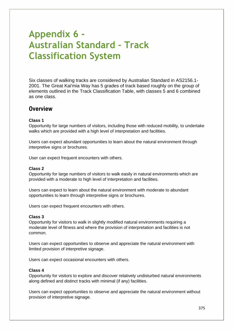
375
Appendix 6 - Australian Standard - Track Classification System
Six classes of walking tracks are considered by Australian Standard in AS2156.1-2001. The Great Kai'mia Way has 5 grades of track based roughly on the group of elements outlined in the Track Classification Table, with classes 5 and 6 combined as one class.
Overview
Class 1
Opportunity for large numbers of visitors, including those with reduced mobility, to undertake
walks which are provided with a high level of interpretation and facilities.
Users can expect abundant opportunities to learn about the natural environment through
interpretive signs or brochures.
User can expect frequent encounters with others.
Class 2
Opportunity for large numbers of visitors to walk easily in natural environments which are
provided with a moderate to high level of interpretation and facilities.
Users can expect to learn about the natural environment with moderate to abundant
opportunities to learn through interpretive signs or brochures.
Users can expect frequent encounters with others.
Class 3
Opportunity for visitors to walk in slightly modified natural environments requiring a
moderate level of fitness and where the provision of interpretation and facilities is not
common.
Users can expect opportunities to observe and appreciate the natural environment with
limited provision of interpretive signage.
Users can expect occasional encounters with others.
Class 4
Opportunity for visitors to explore and discover relatively undisturbed natural environments
along defined and distinct tracks with minimal (if any) facilities.
Users can expect opportunities to observe and appreciate the natural environment without
provision of interpretive signage.
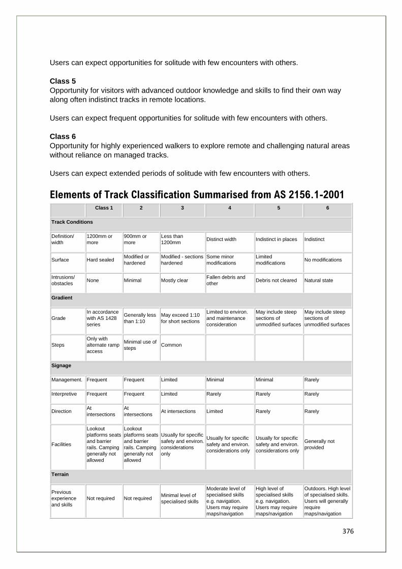
376
Users can expect opportunities for solitude with few encounters with others.
Class 5
Opportunity for visitors with advanced outdoor knowledge and skills to find their own way
along often indistinct tracks in remote locations.
Users can expect frequent opportunities for solitude with few encounters with others.
Class 6
Opportunity for highly experienced walkers to explore remote and challenging natural areas
without reliance on managed tracks.
Users can expect extended periods of solitude with few encounters with others.
Elements of Track Classification Summarised from AS 2156.1-2001
Class 1 2 3 4 5 6
Track Conditions
Definition/
width
1200mm or
more
900mm or
more
Less than
1200mm Distinct width Indistinct in places Indistinct
Surface Hard sealed Modified or
hardened
Modified - sections
hardened
Some minor
modifications
Limited
modifications No modifications
Intrusions/
obstacles None Minimal Mostly clear
Fallen debris and
other Debris not cleared Natural state
Gradient
Grade
In accordance
with AS 1428
series
Generally less
than 1:10
May exceed 1:10
for short sections
Limited to environ.
and maintenance
consideration
May include steep
sections of
unmodified surfaces
May include steep
sections of
unmodified surfaces
Steps
Only with
alternate ramp
access
Minimal use of
steps Common
Signage
Management. Frequent Frequent Limited Minimal Minimal Rarely
Interpretive Frequent Frequent Limited Rarely Rarely Rarely
Direction At
intersections
At
intersections At intersections Limited Rarely Rarely
Facilities
Lookout
platforms seats
and barrier
rails. Camping
generally not
allowed
Lookout
platforms seats
and barrier
rails. Camping
generally not
allowed
Usually for specific
safety and environ.
considerations
only
Usually for specific
safety and environ.
considerations only
Usually for specific
safety and environ.
considerations only
Generally not
provided
Terrain
Previous
experience
and skills
Not required Not required Minimal level of
specialised skills
Moderate level of
specialised skills
e.g. navigation.
Users may require
maps/navigation
High level of
specialised skills
e.g. navigation.
Users may require
maps/navigation
Outdoors. High level
of specialised skills.
Users will generally
require
maps/navigation

377
equip. to complete
track
equip. to complete
track
equip. to complete
track
Hazards and
safety
Users
expected to
exercise
normal care
regarding their
personal safety
Users
expected to
exercise
normal care
regarding their
personal safety
Users may
encounter steep
slopes, unstable
surfaces and
minor water
crossings.
Responsible for
their own safety
Users need to be
self reliant,
particularly in regard
to emergency first
aid and weather
hazards
Users need to be
self reliant,
particularly in regard
to emergency first
aid and weather
hazards
Users need to be
self reliant,
particularly in regard
to emergency first
aid and weather
hazards
Weather N/A N/A
Storms may effect
navigation and
safety
Storms and severe
weather may effect
navigation and
safety
Storms and severe
weather may effect
navigation and
safety
Storms and severe
weather may effect
navigation and
safety
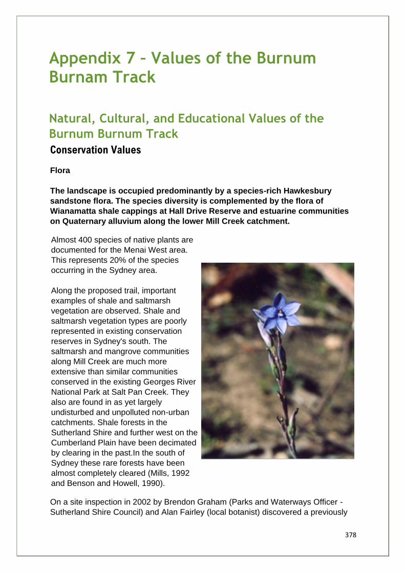
378
Appendix 7 – Values of the Burnum Burnam Track
Natural, Cultural, and Educational Values of the
Burnum Burnum Track
Conservation Values
Flora
The landscape is occupied predominantly by a species-rich Hawkesbury
sandstone flora. The species diversity is complemented by the flora of
Wianamatta shale cappings at Hall Drive Reserve and estuarine communities
on Quaternary alluvium along the lower Mill Creek catchment.
Almost 400 species of native plants are
documented for the Menai West area.
This represents 20% of the species
occurring in the Sydney area.
Along the proposed trail, important
examples of shale and saltmarsh
vegetation are observed. Shale and
saltmarsh vegetation types are poorly
represented in existing conservation
reserves in Sydney's south. The
saltmarsh and mangrove communities
along Mill Creek are much more
extensive than similar communities
conserved in the existing Georges River
National Park at Salt Pan Creek. They
also are found in as yet largely
undisturbed and unpolluted non-urban
catchments. Shale forests in the
Sutherland Shire and further west on the
Cumberland Plain have been decimated
by clearing in the past.In the south of
Sydney these rare forests have been
almost completely cleared (Mills, 1992
and Benson and Howell, 1990).
On a site inspection in 2002 by Brendon Graham (Parks and Waterways Officer -
Sutherland Shire Council) and Alan Fairley (local botanist) discovered a previously
379
unknown Paperbark/ Red Mahogany Forest located in a low depression opposite
Barden Road only 50m from the Old Illawarra Road. The forest occupies several
hundred square metres and contains a canopy of Melaleuca
linariifolia and Eucalyptus resinifera at a height of 20-25m. These species are
associated in the Shire with the Sydney Coastal Riverflat Forest (listed on the TSC
Act) and are found on alluvial soils along the Woronora, Hacking and Georges
Rivers and their tributaries. The Menai community is different again with similarities
to vegetation found on poorly drained areas of the Cumberland Plain. This is the
only known example of this community in the Sutherland Shire.
Alan Fairley summarises the progressive degradation of the western region of
Sutherland Shire.
He states: (Fairley, 1992)
"What was uncommon yesterday is rare today and could be extinct tomorrow. Examples of this are some of the plants I photographed in the Menai-Lucas Heights area in the mid 1980's. A native pea Dillwynnia parvifolia. has been cleared for housing and elsewhere around Sydney its survival is threatened as their restricted habitat is eaten away by subdivision and clearing. The finest stand of Showy-pea (Dillwynnia serlcea) I have ever seen - and to which I had taken numerous groups of naturalists -is now metres beneath the garbage of the existing tip. Darwinia diminuta, a rare plant, has disappeared from most of its former locations in the Shire of Sutherland, and maintains a tenuous hold within the former proposed Lucas Heights tip extension... This area, due to both diversity of habitats and flora present, the large range of rare and significant plants and especially the discovery of the most significant populations of the native she-oak Allocasuarina diminuta ssp mimica in Australia, should never have been considered as part of a waste depot extension."
(Fairley, 2001)
"In an area like Menai-Bangor where there is both shale and sandstone habitats and which has been sub-divided so extensively over the last 10 years, every patch of bushland is valuable. In the past, I have photographed numerous wildflowers on the Menai plateau, but unfortunately many of those sites are now covered with houses. Shale ridges and shale-sandstone interfaces are habitats, which are becoming increasingly scarce in the Sydney area and contain a number of rare and threatened species of native plants. The preservation of these species depends on the preservation of their habitat. The areas currently threatened with development (DUAP/LANDCOM) are, in general, fine areas of forested plateau and slopes and are rich in wildflowers (and no doubt in wildlife). Any sub-division for houses would destroy valuable bushland and seriously affect the adjoining catchments of Mill Creek and Georges River by run-off and urban pollution"
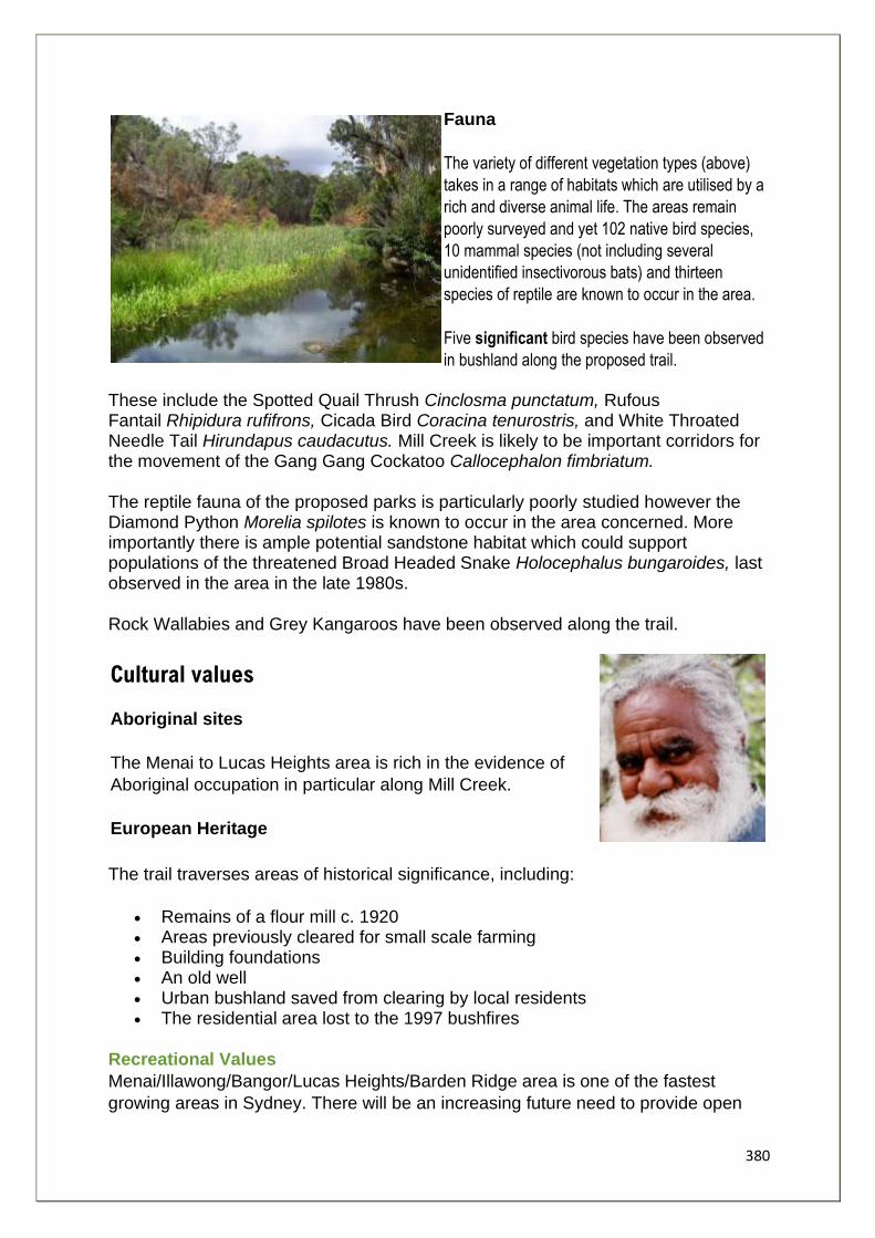
380
Fauna
The variety of different vegetation types (above)
takes in a range of habitats which are utilised by a
rich and diverse animal life. The areas remain
poorly surveyed and yet 102 native bird species,
10 mammal species (not including several
unidentified insectivorous bats) and thirteen
species of reptile are known to occur in the area.
Five significant bird species have been observed
in bushland along the proposed trail.
These include the Spotted Quail Thrush Cinclosma punctatum, Rufous Fantail Rhipidura rufifrons, Cicada Bird Coracina tenurostris, and White Throated Needle Tail Hirundapus caudacutus. Mill Creek is likely to be important corridors for the movement of the Gang Gang Cockatoo Callocephalon fimbriatum.
The reptile fauna of the proposed parks is particularly poorly studied however the Diamond Python Morelia spilotes is known to occur in the area concerned. More importantly there is ample potential sandstone habitat which could support populations of the threatened Broad Headed Snake Holocephalus bungaroides, last observed in the area in the late 1980s.
Rock Wallabies and Grey Kangaroos have been observed along the trail.
Cultural values
Aboriginal sites
The Menai to Lucas Heights area is rich in the evidence of
Aboriginal occupation in particular along Mill Creek.
European Heritage
The trail traverses areas of historical significance, including:
• Remains of a flour mill c. 1920 • Areas previously cleared for small scale farming • Building foundations • An old well • Urban bushland saved from clearing by local residents • The residential area lost to the 1997 bushfires
Recreational Values
Menai/Illawong/Bangor/Lucas Heights/Barden Ridge area is one of the fastest
growing areas in Sydney. There will be an increasing future need to provide open
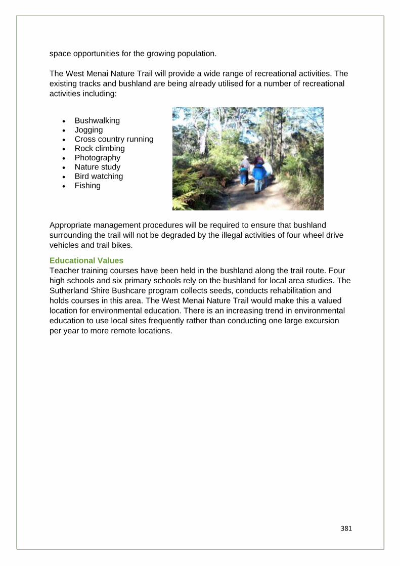
381
space opportunities for the growing population.
The West Menai Nature Trail will provide a wide range of recreational activities. The
existing tracks and bushland are being already utilised for a number of recreational
activities including:
• Bushwalking • Jogging • Cross country running • Rock climbing • Photography • Nature study • Bird watching • Fishing
Appropriate management procedures will be required to ensure that bushland
surrounding the trail will not be degraded by the illegal activities of four wheel drive
vehicles and trail bikes.
Educational Values
Teacher training courses have been held in the bushland along the trail route. Four
high schools and six primary schools rely on the bushland for local area studies. The
Sutherland Shire Bushcare program collects seeds, conducts rehabilitation and
holds courses in this area. The West Menai Nature Trail would make this a valued
location for environmental education. There is an increasing trend in environmental
education to use local sites frequently rather than conducting one large excursion
per year to more remote locations.
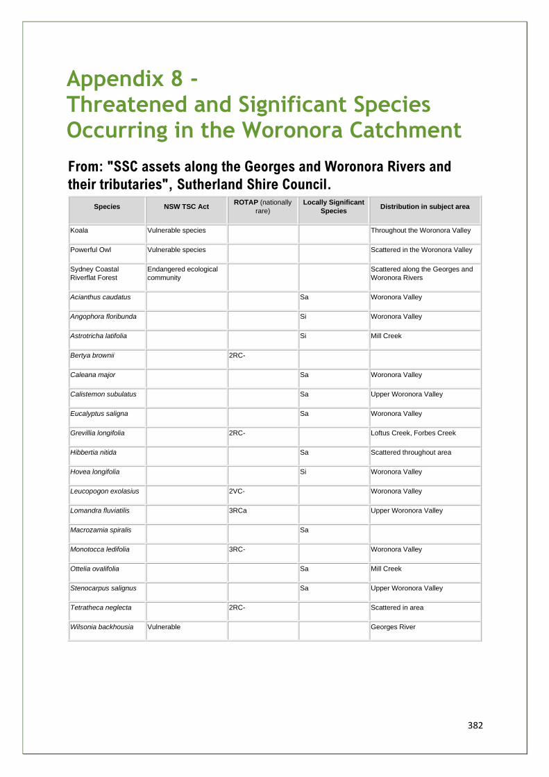
382
Appendix 8 - Threatened and Significant Species Occurring in the Woronora Catchment
From: "SSC assets along the Georges and Woronora Rivers and
their tributaries", Sutherland Shire Council.
Species NSW TSC Act ROTAP (nationally
rare)
Locally Significant
Species Distribution in subject area
Koala Vulnerable species Throughout the Woronora Valley
Powerful Owl Vulnerable species Scattered in the Woronora Valley
Sydney Coastal
Riverflat Forest
Endangered ecological
community
Scattered along the Georges and
Woronora Rivers
Acianthus caudatus Sa Woronora Valley
Angophora floribunda Si Woronora Valley
Astrotricha latifolia Si Mill Creek
Bertya brownii 2RC-
Caleana major Sa Woronora Valley
Calistemon subulatus Sa Upper Woronora Valley
Eucalyptus saligna Sa Woronora Valley
Grevillia longifolia 2RC- Loftus Creek, Forbes Creek
Hibbertia nitida Sa Scattered throughout area
Hovea longifolia Si Woronora Valley
Leucopogon exolasius 2VC- Woronora Valley
Lomandra fluviatilis 3RCa Upper Woronora Valley
Macrozamia spiralis Sa
Monotocca ledifolia 3RC- Woronora Valley
Ottelia ovalifolia Sa Mill Creek
Stenocarpus salignus Sa Upper Woronora Valley
Tetratheca neglecta 2RC- Scattered in area
Wilsonia backhousia Vulnerable Georges River
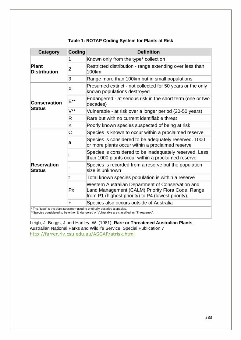
383
Table 1: ROTAP Coding System for Plants at Risk
Category Coding Definition
Plant Distribution
1 Known only from the type* collection
2 Restricted distribution - range extending over less than 100km
3 Range more than 100km but in small populations
Conservation Status
X Presumed extinct - not collected for 50 years or the only known populations destroyed
E** Endangered - at serious risk in the short term (one or two decades)
V** Vulnerable - at risk over a longer period (20-50 years)
R Rare but with no current identifiable threat
K Poorly known species suspected of being at risk
Reservation Status
C Species is known to occur within a proclaimed reserve
a Species is considered to be adequately reserved. 1000 or more plants occur within a proclaimed reserve
i Species is considered to be inadequately reserved. Less than 1000 plants occur within a proclaimed reserve
- Species is recorded from a reserve but the population size is unknown
t Total known species population is within a reserve
Px Western Australian Department of Conservation and Land Management (CALM) Priority Flora Code. Range from P1 (highest priority) to P4 (lowest priority).
+ Species also occurs outside of Australia * The "type" is the plant specimen used to originally describe a species.
**Species considered to be either Endangered or Vulnerable are classified as "Threatened".
Leigh, J, Briggs, J and Hartley, W. (1981); Rare or Threatened Australian Plants,
Australian National Parks and Wildlife Service, Special Publication 7
http://farrer.riv.csu.edu.au/ASGAP/atrisk.html
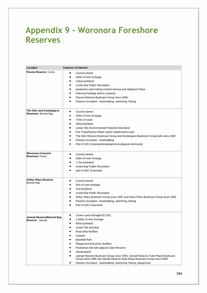
384
Appendix 9 - Woronora Foreshore Reserves
Location Features of Interest
Paruna Reserve, Como • Council owned
• 430m of river frontage
• 3.6ha bushland
• zoned 6(a) Public Recreation
• pedestrian track linking Central Avenue and Highpoint Place
• historical heritage (Henry Lawson)
• Paruna Reserve Bushcare Group since 1996
• Passive recreation - bushwalking, swimming, fishing
The Glen and Koolangarra Reserves, Bonnet Bay
• Council owned
• 326m of river frontage
• 770m of creek
• 20ha bushland
• zoned 7(b) Environmental Protection Bushland
• Fire Trails/Sydney Water sewer maintenance track
• The Glen Reserve Bushcare Group and Koolangarra Bushcare Group both since 1992
• Passive recreation - bushwalking
• Part of SSC Greenweb/endangered ecological community
Woronora Crescent Reserves, Como
• Council owned
• 250m of river frontage
• 1.7ha bushland
• zoned 6(a) Public Recreation
• part of SSC Greenweb
Arthur Place Reserve, Bonnet Bay
• Council owned
• 50m of river frontage
• 1ha bushland
• zoned 6(a) Public Recreation
• Arthur Place Bushcare Group since 1997 and Nixon Place Bushcare Group since 1993
• Passive recreation - bushwalking, swimming, fishing
• Part of SSC Greenweb
Jannali Reserve/Bonnet Bay Reserve , Jannali
• Crown Land managed by SSC
• 1,500m of river frontage
• 65ha bushland
• zoned 7(b) and 6(a)
• Boat ramp facilities
• Carpark
• Baseball field
• Playground and picnic facilities
• Pedestrian link with adjacent Glen Reserve
• Streamwatch
• Jannali Reserve Bushcare Group since 1993, Jannali Reserve (Tyler Place) Bushcare Group since 1999 and Jannali Reserve Boat Ramp Bushcare Group since 2000
• Passive recreation - bushwalking, swimming, fishing, playground
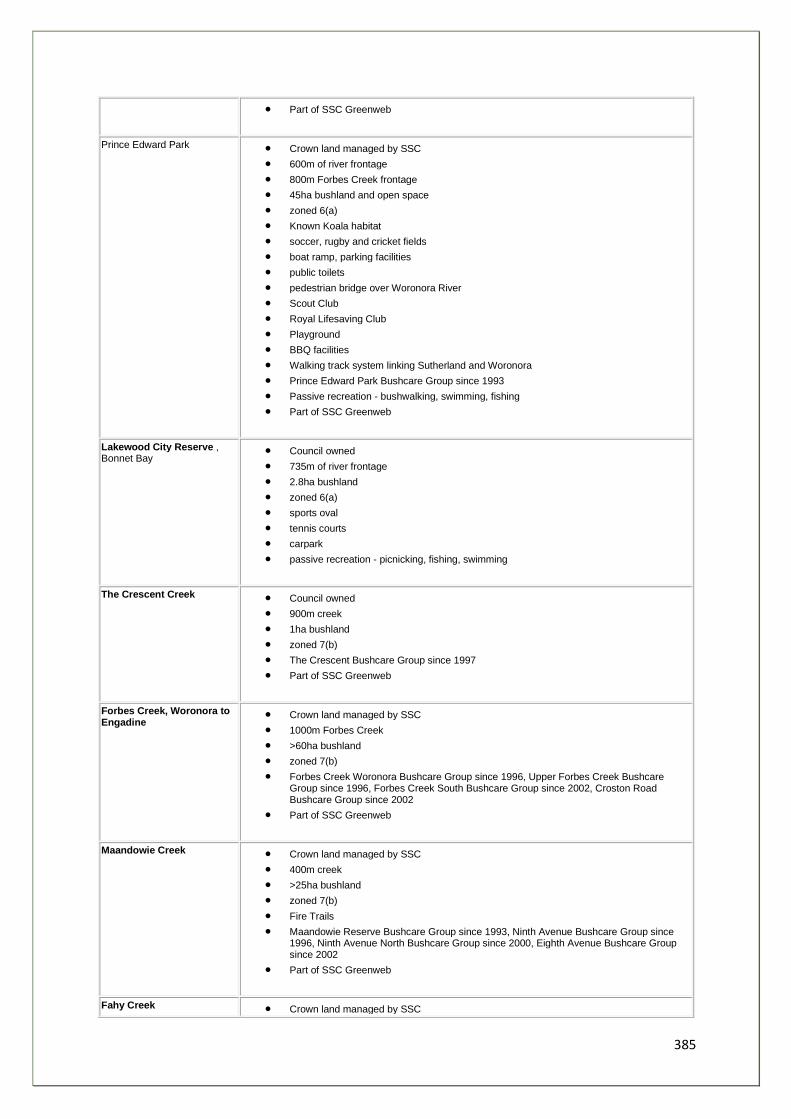
385
• Part of SSC Greenweb
Prince Edward Park • Crown land managed by SSC
• 600m of river frontage
• 800m Forbes Creek frontage
• 45ha bushland and open space
• zoned 6(a)
• Known Koala habitat
• soccer, rugby and cricket fields
• boat ramp, parking facilities
• public toilets
• pedestrian bridge over Woronora River
• Scout Club
• Royal Lifesaving Club
• Playground
• BBQ facilities
• Walking track system linking Sutherland and Woronora
• Prince Edward Park Bushcare Group since 1993
• Passive recreation - bushwalking, swimming, fishing
• Part of SSC Greenweb
Lakewood City Reserve , Bonnet Bay
• Council owned
• 735m of river frontage
• 2.8ha bushland
• zoned 6(a)
• sports oval
• tennis courts
• carpark
• passive recreation - picnicking, fishing, swimming
The Crescent Creek • Council owned
• 900m creek
• 1ha bushland
• zoned 7(b)
• The Crescent Bushcare Group since 1997
• Part of SSC Greenweb
Forbes Creek, Woronora to Engadine
• Crown land managed by SSC
• 1000m Forbes Creek
• >60ha bushland
• zoned 7(b)
• Forbes Creek Woronora Bushcare Group since 1996, Upper Forbes Creek Bushcare Group since 1996, Forbes Creek South Bushcare Group since 2002, Croston Road Bushcare Group since 2002
• Part of SSC Greenweb
Maandowie Creek • Crown land managed by SSC
• 400m creek
• >25ha bushland
• zoned 7(b)
• Fire Trails
• Maandowie Reserve Bushcare Group since 1993, Ninth Avenue Bushcare Group since 1996, Ninth Avenue North Bushcare Group since 2000, Eighth Avenue Bushcare Group since 2002
• Part of SSC Greenweb
Fahy Creek • Crown land managed by SSC
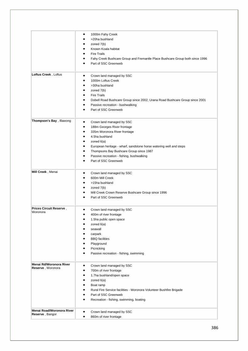
386
• 1000m Fahy Creek
• >20ha bushland
• zoned 7(b)
• Known Koala habitat
• Fire Trails
• Fahy Creek Bushcare Group and Fremantle Place Bushcare Group both since 1996
• Part of SSC Greenweb
Loftus Creek , Loftus • Crown land managed by SSC
• 1000m Loftus Creek
• >30ha bushland
• zoned 7(b)
• Fire Trails
• Dobell Road Bushcare Group since 2002, Urana Road Bushcare Group since 2001
• Passive recreation - bushwalking
• Part of SSC Greenweb
Thompson's Bay , Illawong • Crown land managed by SSC
• 188m Georges River frontage
• 335m Woronora River frontage
• 4.5ha bushland
• zoned 6(a)
• European heritage - wharf, sandstone horse watering well and steps
• Thompsons Bay Bushcare Group since 1987
• Passive recreation - fishing, bushwalking
• Part of SSC Greenweb
Mill Creek , Menai • Crown land managed by SSC
• 600m Mill Creek
• >15ha bushland
• zoned 7(b)
• Mill Creek Crown Reserve Bushcare Group since 1996
• Part of SSC Greenweb
Prices Circuit Reserve , Woronora
• Crown land managed by SSC
• 400m of river frontage
• 1.5ha public open space
• zoned 6(a)
• seawall
• carpark
• BBQ facilities
• Playground
• Picnicking
• Passive recreation - fishing, swimming
Menai Rd/Woronora River Reserve , Woronora
• Crown land managed by SSC
• 700m of river frontage
• 1.7ha bushland/open space
• zoned 6(a)
• Boat ramp
• Rural Fire Service facilities - Woronora Volunteer Bushfire Brigade
• Part of SSC Greenweb
• Recreation - fishing, swimming, boating
Menai Road/Woronora River Reserve , Bangor
• Crown land managed by SSC
• 860m of river frontage
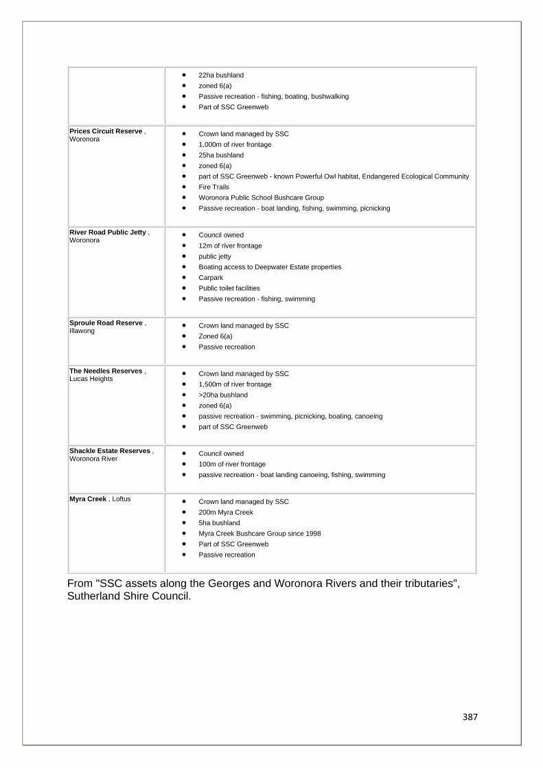
387
• 22ha bushland
• zoned 6(a)
• Passive recreation - fishing, boating, bushwalking
• Part of SSC Greenweb
Prices Circuit Reserve , Woronora
• Crown land managed by SSC
• 1,000m of river frontage
• 25ha bushland
• zoned 6(a)
• part of SSC Greenweb - known Powerful Owl habitat, Endangered Ecological Community
• Fire Trails
• Woronora Public School Bushcare Group
• Passive recreation - boat landing, fishing, swimming, picnicking
River Road Public Jetty , Woronora
• Council owned
• 12m of river frontage
• public jetty
• Boating access to Deepwater Estate properties
• Carpark
• Public toilet facilities
• Passive recreation - fishing, swimming
Sproule Road Reserve , Illawong
• Crown land managed by SSC
• Zoned 6(a)
• Passive recreation
The Needles Reserves , Lucas Heights
• Crown land managed by SSC
• 1,500m of river frontage
• >20ha bushland
• zoned 6(a)
• passive recreation - swimming, picnicking, boating, canoeing
• part of SSC Greenweb
Shackle Estate Reserves , Woronora River
• Council owned
• 100m of river frontage
• passive recreation - boat landing canoeing, fishing, swimming
Myra Creek , Loftus • Crown land managed by SSC
• 200m Myra Creek
• 5ha bushland
• Myra Creek Bushcare Group since 1998
• Part of SSC Greenweb
• Passive recreation
From "SSC assets along the Georges and Woronora Rivers and their tributaries", Sutherland Shire Council.
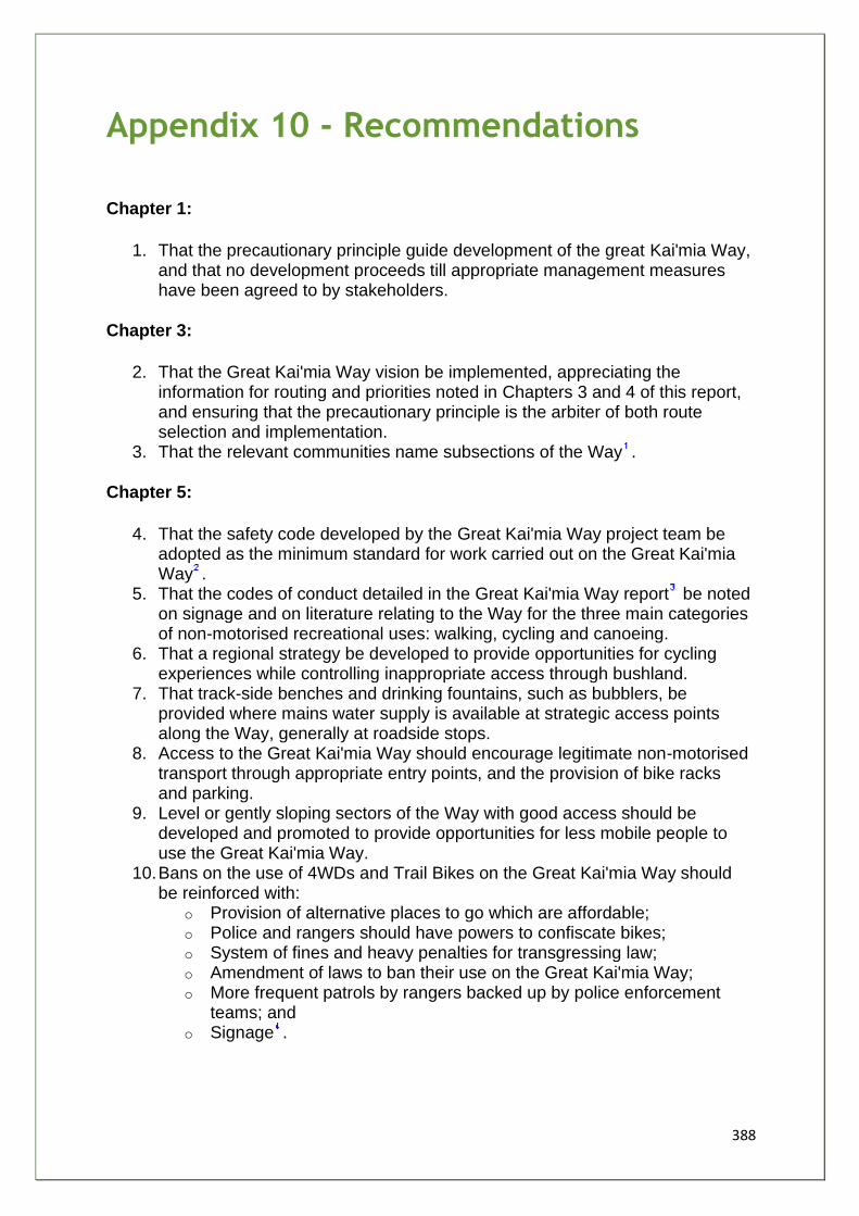
388
Appendix 10 - Recommendations
Chapter 1:
1. That the precautionary principle guide development of the great Kai'mia Way, and that no development proceeds till appropriate management measures have been agreed to by stakeholders.
Chapter 3:
2. That the Great Kai'mia Way vision be implemented, appreciating the information for routing and priorities noted in Chapters 3 and 4 of this report, and ensuring that the precautionary principle is the arbiter of both route selection and implementation.
3. That the relevant communities name subsections of the Way .
Chapter 5:
4. That the safety code developed by the Great Kai'mia Way project team be adopted as the minimum standard for work carried out on the Great Kai'mia Way .
5. That the codes of conduct detailed in the Great Kai'mia Way report be noted on signage and on literature relating to the Way for the three main categories of non-motorised recreational uses: walking, cycling and canoeing.
6. That a regional strategy be developed to provide opportunities for cycling experiences while controlling inappropriate access through bushland.
7. That track-side benches and drinking fountains, such as bubblers, be provided where mains water supply is available at strategic access points along the Way, generally at roadside stops.
8. Access to the Great Kai'mia Way should encourage legitimate non-motorised transport through appropriate entry points, and the provision of bike racks and parking.
9. Level or gently sloping sectors of the Way with good access should be developed and promoted to provide opportunities for less mobile people to use the Great Kai'mia Way.
10. Bans on the use of 4WDs and Trail Bikes on the Great Kai'mia Way should be reinforced with:
o Provision of alternative places to go which are affordable; o Police and rangers should have powers to confiscate bikes; o System of fines and heavy penalties for transgressing law; o Amendment of laws to ban their use on the Great Kai'mia Way; o More frequent patrols by rangers backed up by police enforcement
teams; and o Signage .
389
11. That land managers adopt a protocol for closing routes during severe fire danger periods, and maps show routes to enable quick exit in case of emergencies.
12. That the Great Kai'mia Way maximises the potential for people to use public transport and local amenities.
13. That traffic calming measures and associated signage be installed at intersections of roads and the Great Kai'mia Way
14. That land managers be encouraged to adopt the guidelines for signage recommended in the report and adopt the "family of signs" concept for the Great Kai'mia Way.
15. That a standard be adopted for construction and upgrade of track works, consistent with existing Australian Standards for walking track classification signage and infrastructure AS 2156.1-2001 and AS 2156.2-2001: a combination of Class 2, Class 3 and occasionally Class 4 out of 6 classes, where 6 is the least developed class (see Appendix 6 for details of standards).
16. That infrastructure on the the Great Kai'mia Way is free of all CCA treated pine products.
17. Effective measures be implemented to exclude trail bikes and 4WDs from sensitive areas by using, for example, gates made from galvanized steel pipe, fencing made from galvanized steel double rope, and kissing gates to enable access by legitimate users.
18. That Type A barriers as described in AS2156.2-2001: Track Infrastructure be be installed at lookouts and other relevant locations for safety and risk management at the discretion of track managers based on an assessment of effective fall height.
Chapter 6:
19. That stakeholders adopt the feasibility study through a signed memorandum that commits them to:
19.1 a project staging plan as detailed in the feasibility study;
19.2 a coordinated strategy for implementation of the Great Kai'mia Way,
including:
19.2.1 common signage as detailed in Chapter 5; 19.2.2 ongoing communication between stakeholder groups to ensure appropriate linkages;
19.3 adoption of the principles of sustainability in the implementation of the
Great Kai'mia Way backed by increased research into the aspects of
sustainable management;
19.4 adoption of the planning checklist for development as detailed
in Chapter 5
390
20. That Councils incorporate the Great Kai'mia Way route and vision for sustainability into their planning instruments and provide consistent funding through budget allocations and S94 developer contributions.
21. That Way community groups - local "friends of the Great Kai'mia Way" - be recognised and if necessary, established to help with the implementation of the Great Kai'mia Way vision.
22. That the Aboriginal community be an integral partner in the design and implementation of the Great Kai'mia Way.
23. That a management and implementation system be set up that will enable: 23.1 An ongoing structure for decision making that involves land holders, land managers and interested community members, with particular note to engage the Aboriginal community; 23.2 A funding structure that encourages contribution from a wide pool of stakeholders: community, private organisations and government; 23.3 A commitment to continued promotion of the Great Kai'mia Way for environmental, cultural, recreational and health purposes; 23.4 A commitment to sustainability whilst enabling access to as many users as possible.
1. The names provided in this report are suggestions only. 2. Councils and government agencies, and other landholders and managers will have more detailed occupational health and
safety procedures. These will, of course, be the ones applicable for works on their land. The recommendation here is for minimum standards only.
3. The Great Kai'mia Way: Chapter 5. 4. For example: Trail Bikes and all unauthorised vehicles prohibited - Max Penalty $11, 500.
391
Appendix 11 - Voluntary Conservation Agreements
A voluntary conservation agreement is most suited to people who:
• have high conservation value vegetation or habitat on their property • want their investment in the conservation of the area to be protected after they
leave the property.
Voluntary conservation agreements are joint agreements between a landholder and
the Minister for the Environment. They allow you to conserve the natural, cultural or
scientific values of an area of land. The agreements provide permanent protection
for the special features of your property.
The agreements are entirely voluntary. The terms of each agreement are negotiated
between the landholder and the National Parks and Wildlife Service (NPWS), which
works on behalf of the Minister.
Areas that a voluntary conservation agreement can protect
Several agreements are already in place to protect land:
• containing significant native plants and animals, rare and endangered species • containing important habitat and vegetation types which are not represented
in the existing national parks and reserves • on which there are Aboriginal sites or historic places • containing remnant vegetation • linking areas of native vegetation • containing special geological or landscape features • containing critical habitat, or a threatened species population, ecological
community or habitat • containing limestone caves (Karst areas).
A voluntary conservation agreement is for owners of freehold land, lessees of Crown
land and local councils are eligible to enter into these agreements.
Benefits from a voluntary conservation agreement
A voluntary conservation agreement gives a landholder the opportunity for his/her
land to be permanently conserved - not just under their ownership, but for all future
owners. When entering into a voluntary conservation agreement, the NPWS may
provide assistance to the landholder in the form of:
• fencing materials • plant and animal surveys • stabilisation of works on Aboriginal sites and historic places
392
• specialist advice or other assistance.
Landholders who enter into a voluntary conservation agreement may be eligible for
rate relief and tax deductions, although this is not controlled by the NPWS.
How are conservation agreements negotiated?
If you're interested in a voluntary conservation agreement, you can fill in an online
form on the National Parks web-site to find out more. Alternatively, the NPWS may
identify land suitable for an agreement, and will approach the landholder personally.
In both cases, the NPWS will:
• explain the process of establishing a conservation agreement • discuss any concerns held by the landholder • inspect the area to evaluate its conservation value and identify any
management issues.
If both the landholder and the NPWS wish to proceed with the agreement, a draft is
produced in consultation with the landholder. This process can take from between
three months and a year - we realise that landholders may need time to discuss this
important step with their family or just to think about it. Several drafts may be
developed before a final one is produced.
Once the details of the agreement are settled, the voluntary conservation agreement
is signed by the landholder and the Minister for the Environment.
A detailed plan of management for the conservation area may also be prepared in
consultation with the landholder.
Terms of a voluntary conservation agreement
The terms of individual voluntary conservation agreements are determined by the
special features contained in the area, and the wishes of the landholder.
Officers and researchers of the NPWS may seek permission to visit the property
occasionally to monitor the condition of the area and its features. The conservation
agreement may also limit activities such as the clearing of native vegetation. It may
also include specific commitments from the landholder, such as the maintenance of
fences.
After the agreement is signed
Once the agreement is complete, the NPWS maintains contact with the landholder to
provide advice and assistance, and to monitor the land as detailed in the voluntary
conservation agreement. The landholder continues to undertake responsibility for the
management of the land, including control of weeds and feral animals.

393
A voluntary conservation agreement provides permanent protection for the feature or
area. If the land is sold, the agreement remains in place.
Any publicity of individual voluntary conservation agreements only takes place with
the consent of the landholder. A list of all voluntary conservation agreements is kept
by the NPWS and is available for public inspection.
Reference - National Parks Website September 2003: http://www.nationalparks.nsw.gov.au
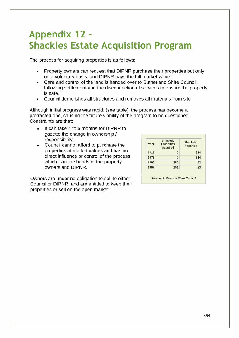
394
Appendix 12 - Shackles Estate Acquisition Program
The process for acquiring properties is as follows:
• Property owners can request that DIPNR purchase their properties but only on a voluntary basis, and DIPNR pays the full market value.
• Care and control of the land is handed over to Sutherland Shire Council, following settlement and the disconnection of services to ensure the property is safe.
• Council demolishes all structures and removes all materials from site
Although initial progress was rapid, (see table), the process has become a protracted one, causing the future viability of the program to be questioned. Constraints are that:
• It can take 4 to 6 months for DIPNR to gazette the change in ownership / responsibility.
• Council cannot afford to purchase the properties at market values and has no direct influence or control of the process, which is in the hands of the property owners and DIPNR.
Owners are under no obligation to sell to either Council or DIPNR, and are entitled to keep their properties or sell on the open market.
Year Shackels Properties Acquired
Shackels Properties
1916 0 314
1973 0 314
1990 252 62
1997 291 23
Source: Sutherland Shire Council
395
Appendix 13 - Recreational Vehicles on Public Land
(Environmental Defenders Office (2003). Draft. Commissioned by SSEC and GREA, TEC
and NPA)
Introduction/Background
1. Vehicles are increasingly being used for recreational purposes such as off-road driving on beaches, through areas of bushland, on fire trails, parks and unoccupied lands. For the purposes of this paper, these types of lands are collectively referred to as "public land". However, as will be demonstrated in this paper, the concept of when a vehicle is legally on or off road is not clear.
2. In most instances, the types of vehicles that are being taken off road are four wheel drive ( 4WD ) vehicles and trail bikes that are able to handle difficult terrain. However, standard vehicles (usually stolen) are often used for joy riding and may be abandoned on public land. In this paper, a reference to a "recreational vehicle" applies to any vehicle that is driven on public or private land for recreational purposes.
3. Increasingly, conservation groups and government agencies are becoming concerned about the environmental damage being caused by recreational vehicles being driven irresponsibly or recklessly on public land. There have been a number of instances where individuals and groups of drivers have wrecked devastation on areas of natural bushland. For example, the camping ground in the Deua National Park was torn up by 50-60 4WD vehicles in June 2003 and extensive damage was caused to a number of locations in the Bendethera Valley by 4WD vehicles practicing hill climbs on steep slopes in muddy conditions .
4. The range of environmental damage caused includes the destruction of habitat, harm to native species of flora and fauna and soil and land degradation which has flow on effects in terms of erosion and pollution (particularly to water catchments). Conservation groups agree that reckless and irresponsible driving on public land poses a significant threat to the bio-diversity values of that land.
5. Whilst there are a number of 4WD clubs and associations that promote responsible driving amongst their members - being the driving of registered vehicles by licensed drivers on designated 4WD trails, there is clearly a significant number of people who may be unlicensed and who are driving unregistered vehicles. This group of people are of particular concern to the Conservation Groups as they appear to have no regard for the damage they cause or the fact that their activities are illegal .
6. A number of agencies including the NSW Police Service, the National Parks and Wildlife Service ( NPWS ) State Forests, the Department of Lands and local councils have various statutory responsibilities and powers in relation to recreational vehicles. The functions of each agency are not, however, clearly defined, particularly in relation to vehicles that are being driven off road. Furthermore, because of the large areas of public land and often the
396
remoteness of that land, it is particularly difficult to catch and properly identify drivers and vehicles. In many instances, where drivers are detained, false names and addresses may be given to officers and officers generally do not have powers to confiscate vehicles.
7. As a wide range of government departments and local authorities have powers and functions for managing activities on public land and roads, there is often considerable uncertainty as to who bares responsibility for unlawful driving. This is especially evident where NSW Police has responsibility for driving matters, but the driving is not on a public road. In these circumstances, it is more often the case that no-one takes action to enforce what legal options may be available.
8. The purpose of this paper is to explore the current problems with the regulation of recreational vehicles on public land and to suggest options for law reform.
Legal Issues
9. There are a number of NSW Acts and Regulations that control the use of vehicles on public and private roads and land.
Recreational Vehicles Act 1983 (NSW)
10. The Recreational Vehicles Act 1983 enables an occupier of land to apply to EPA for designation of land as a recreation vehicles area (s.10). Upon consideration of an application, the EPA may then designate land for that purpose (s.11). The Act applies only to private land and to date only a small number of areas have been designated as recreational vehicle areas. Vehicles that are driven in recreation vehicle areas are required to by registered, in registrable condition and to have number-plates. Section 31 of the Recreational Vehicles Act 1983 creates the following offences (with a maximum penalty of 5 penalty units):
• driving a motor vehicle on restricted land (being land which is neither a public road nor a recreation vehicle area) or
• permitting a motor vehicle to be driven on restricted land in contravention of a direction given by the occupier of the land.
11. Authorised EPA officers and police officers have a range of functions and powers pursuant to the Recreational Vehicles Act 1983, including to inspect and test vehicles in recreation vehicle area, remove vehicles from land and issue directions not to drive vehicles upon restricted land (section 33).
12. The Recreational Vehicles Act 1983 creates a framework within which recreational driving can be contained on suitable premises and whereby activities can be monitored by the appropriate authorities. However, in reality, the vast majority of recreational vehicle use is not in designated recreational vehicle areas. Where the Act may apply, such as on restricted areas, it is exceptionally difficult to police as those areas are either private (and subject to occupier direction/discretion) or public land governed by one of a number of government agencies. In these circumstances, although the police and the EPA have the power to fine drivers for unauthorised driving, these powers are not well known to officers and are very rarely relied upon.
397
Roads Legislation
13. Another fundamental problem arises when determining what is a public road. The Road Transport (General) Act 1999 defines "road" and "road related areas" as follows:
road means an area that is open to or used by the public and is developed for, or has as one of its main uses, the driving or riding of motor vehicles. road related area means:
(a) an area that divides a road, or (b) a footpath or nature strip adjacent to a road, or (c) an area that is open to the public and is designated for use by cyclists or animals, or (d) an area that is not a road and that is open to or used by the public for driving, riding or parking vehicles, or (e) a shoulder of a road, or (f) any other area that is open to or used by the public and that has been declared under section 9 of the Road Transport (General) Act 1999 to be an area to which specified provisions of this Act or the regulations apply
The Roads Act 1993 states that a public road means:
(a) any road that is opened or dedicated as a public road, whether under this or any other Act or law, and
(b) any road that is declared to be a public road for the purposes of this Act.
14. The Roads Act 1993 further classifies roads into the following categories:
(a) a main road, (b) a State highway, (c) a freeway, (d) a controlled access road, (e) a secondary road, (f) a tourist road, (g) a tollway, (g1) a transitway, and (h) a State work.
15. Pursuant to the Roads Act , the relevant roads authority will maintain ownership of public roads. That authority will be the RTA for most State roads (such as state highways, freeways etc.) and local councils will ordinarily retain responsibility for main roads and secondary roads within their local
398
government area. That responsibility is primarily for development, upkeep and maintenance of the road infrastructure. Overarching this is the role of the NSW Police Service to enforce offences under a number of Road Acts
16. There are a number of offence provisions in the Road Transport (General) Act 1999 . These include -
• Section 25, which enables drivers to be disqualified for major offences committed under the Road Transport (Safety and Traffic Management) Act 1999;
• Section 39, which enables officers to seize and take charge of vehicles suspected of being involved in an offence under section 40 or 41 of the Road Transport (Safety and Traffic Management) Act 1999 , including to cause any locking device or other feature of the motor vehicle concerned that is impeding the exercise of those powers to be removed, dismantled or neutralised and may, if the driver or any other person will not surrender the keys to the vehicle, start the vehicle by other means; and
• Section 52, which creates the offence of the unauthorised use of a vehicle.
17. Sections 40 and 41 of the Road Transport (Safety and Traffic Management) Act 1999 create offences with relation to the conduct of races and speed trials on roads and road related areas. Additionally, section 42 of that Act creates an offence of " driving a vehicle on a road or road related area in a manner that is negligent, furious or reckless " .
18. The penalties for offences under the Road Transport (Safety and Traffic Management) Act 1999 range from 5 -50 penalty units and up to 2 years imprisonment depending upon the seriousness of the offence and the culpability of the driver.
19. As mentioned above, the difficulty with the present regime for driving offences is that it is focused only upon driving on roads and road related areas. Police and other authorised officers can, under this legislation, only exercise their powers when a person is driving on a road or road related area. Their powers do not expressly extend to driving upon land per se.
Interpretation of the meaning of "public roads"
20. In NSW there have been very few cases that deal with the driving of recreational vehicles on areas that do not fall within the definitions of a road or road related area. The cases that do consider this issue have arisen in personal injury scenarios where accidents have occurred on public land and the liability of responsible authorities has been raised.
21. For example, in The Nominal Defendant v Wardle [2003] NSWCA 163 the Court of Appeal considered the question of whether a collision between two trail bikes on a council reserve access track occurred on a "public street". The Court of Appeal found that, as the section of land was not "open to or used by the public" in a material sense, the accident did not occur on a public street.
22. In contrast, in the earlier case of Boyton v the Nominal Defendant [1980] 2 NSWLR 509 held that land rovers, beach buggies and motorcycles, driven along a beach for recreational purposes, were on a "road" as the beach was a place commonly used by the public or to which the public had access.
399
23. What appears to be critical to whether a vehicle is being driven on a public road, particularly for the purposes of determining liability for accidents (and arguably for determining the unlawful nature of the driving), is whether the area or place is open to or used by the public.
24. The High Court considered the meaning of the term "open to or used by the public" in the case of Schubert v Lee (1945) 71 CLR 589, where it stated at p.592:
"These words . are apt to describe a factual condition consisting of any real use of the place by the public as the public - as distinct from use by licence of a particular person or only casual or occasional use."
25. The definition of a "road" varies slightly between jurisdictions. In South Australia the Motor Vehicles Act 1959 (SA) defines the term road as meaning "(a) a road, street or thoroughfare; and (b) any other place commonly used by the public or to which the public are permitted to have access". Keeping that definition in mind, the South Australian Supreme Court, in the case of Elliott v Hentschke (1984) 36 SASR 481, held that tracks through clay pans and sandhills used for recreational motorcycle riding did not constitute a road for the purposes of para (a) of the aforementioned definition. The Court also held that although there was evidence that some motorcycle riders used the area for recreational purposes, that was insufficient to establish that it was commonly used by the public for that purpose, or that the public were permitted access to that place.
26. In the case of McBain v Reyne (unreported SCSA 19/12/97 BC9707311) the Court found that para (b) of the definition in the Motor Vehicles Act 1959 (SA) should take an unrestricted meaning and stated that " there is no limit as to the kind of place which might qualify as a road other than the two adjectival phrases 'commonly used by the public' and 'to which the public have access'. In terms of limiting the application of those phrases, the judgment in McBain v Reyne considered that it was not necessary for all segments of the public to access the place, provided that; firstly, the place is available to the public without discrimination. Secondly, a segment of it in fact goes onto the place; and thirdly, entry is not limited to a restricted class (such as members of an organisation or invitees). Furthermore, the Judge held that a place may be a road for some occasions but not others, such as on prescribed days when a filed is used as a carpark for a particular activity.
27. The cases referred to above are not an exhaustive of the scenarios that may arise in relation to recreational driving. However, they do illustrate the difficulties that arise in interpreting the various Roads Acts when the place used for driving does not neatly fall within the commonly accepted definition of a "road" or "road related area". In those circumstances, what becomes important to the application of the Act to the driving event is the concept of a place being (commonly) open to or used by the public. This will depend upon the facts in each case. For example, if a fire trail in a portion of a National Park has gates at either end which are closed, it could be construed that that trail is not open to or used by the public. However, if no gates are present the contrary construction could apply.
28. In the event that the land upon which recreational vehicles are being driven does not fall within the definition of a road or road related area, the next issue is whether any relevant legislation limits the use of that land by vehicles. At
400
common law, where drivers are not on a road or place open to or used by the public, then there is a strong argument that the driver is trespassing. Therefore, it is the owner of that land, whether it be a local Council, NPWS or some other agency, who could bring proceedings against the driver. In reality, many of these areas are accessed when relevant officers are not on duty, if in fact they do regularly monitor the land. Therefore, detection of the unlawful driving does not occur until well after the damage has been caused.
29. A further problem is that, in circumstances where an offence is not on a road or road related area, there is uncertainty as to whether the NSW Police Service, who ordinarily have jurisdiction for driving offences, have jurisdiction over the offence. Police resources are limited and, although targeted campaigns against unlawful drivers are being run, the relevant officers can only cover a limited area.
Laws relating to management of lands
Crown Lands Act 1960
30. The Crown Lands Act 1960 contains provisions that enable the Minister to make directions in relation to driving on vacant Crown Land. Section 4 of the Act states that Crown land means:
Land that is vested in the Crown or was acquired under the Closer Settlement Acts as in force before their repeal, not in either case being: (a) land dedicated for a public purpose, or (b) land that has been sold or lawfully contracted to be sold and in respect of which the purchase price or other consideration for the sale has been received by the Crown.
31. Section 160(3)-(6) of the Crown Lands Act states that:
(3) The Minister may give such directions as to the bringing of vehicles into, and the use and parking or mooring of vehicles in, any vacant public land as the Minister thinks fit, and any such direction:
(a) may be limited as to time, place or subject-matter, and (b) may be varied or revoked by the Minister.
(4) A direction given under subsection (3) has effect only while there is erected or displayed on or near, or marked on, the land to which the direction relates a sign that is notice of the direction. (5) The direction appearing on a sign that is:
(a) erected or displayed on or near, or (b) marked on,
any vacant public land with the authority of the Minister has effect as a direction, for the time being in force, given under subsection (3) in relation to
401
the land, and the sign is, for the purposes of subsection (4), notice of that direction. (6) A person shall not contravene a direction having effect under this section."
32. It is assumed that the intent of these provisions is to enable the Minister to identify areas for public access that may, subject to conditions, be used for recreational purposes, including recreational driving.
33. As mentioned above, a number of the vehicles that are being used for illegal purposes have been stolen. Section 161 of the Crown Lands Act places the liability for an offence under section 160(3) of that Act upon the owner of the vehicles unless the owner can satisfy an officer or the Court that the vehicle was stolen. This creates difficulties for officers (either Lands officers or NSW Police) to enforce the provisions of the Act, as in many instances, even if a number plate is recorded, there is no way to catch the relevant offender.
Local Government Act 1993
34. The Local Government Act 1993 provides for land dedicated for public purposes by declaring such land to be "community land" under that Act. All land that is declared "community land" must, in accordance with section 36 of the Local Government Act 1993 be managed in accordance with a Plan of Management. That Plan may make provision for the use of the land by recreational vehicles. However, that is rare.
35. It is anticipated that local councils may make provisions for use of land within their local government area by recreational vehicles. This is specifically contemplated by section 79 of the North Coast Regional Environmental Plan , which prevents councils zoning land as a recreational area within the meaning of the Recreational Vehicles Act 1983 if that land has certain environmental values. These types of measures support the importance of ensuring that recreational driving, if it is to be carried out, be done in appropriate regulated areas. Yet, it does not avoid the reality, as illustrated by the Wardle case mentioned in paragraph 21 above, that council land will be used unlawfully by some recreational drivers.
36. In addition to the powers of local councils to regulate the use of community land through management plans, section 629 of the Local Government Act 1993 provides that:
(1) A person who, without lawful excuse, wilfully or negligently injures, damages or unnecessarily disturbs any plant, animal, rock or soil in a public place is guilty of an offence. Maximum penalty: 20 penalty units. (2) A person who, without lawful excuse, removes any plant, animal, rock or soil from a public place is guilty of an offence. Maximum penalty: 20 penalty units.
402
37. A public place is defined in the section to mean:
(a) a public reserve, public bathing reserve, public baths or public swimming pool, or (b) a public road, public bridge, public wharf or public road-ferry, or (c) a Crown reserve comprising land reserved for future public requirements, or (d) public land or Crown land that is not:
(i) a Crown reserve (other than a Crown reserve that is a public place because of paragraph (a), (b) or (c)), or (ii) a common, or (iii) land subject to the Trustees of Schools of Arts Enabling Act 1902, or (iv) land that has been sold or leased or lawfully contracted to be sold or leased, or
(e) land that is declared by the regulations to be a public place for the purposes of this definition .
38. Similar provisions to those found in the Roads legislation in relation to demanding the name and details of an offender are also found in section 680 of the Local Government Act 1993 . Furthermore, section 681 of the Local Government Act enables authorised persons to use reasonable force to remove an offender from community land.
National Parks and Wildlife Act 1974
39. In relation to destructive driving in National Parks, section 154A of the National Parks and Wildlife Act 1974 creates offence of damaging or removing any vegetation, rock, soil, sand, stone or similar substance land reserved under the Act. This section can be used against recreational vehicle drivers in the event that their driving causes damage. However, as discussed above, the difficulty remains in catching drivers in the act, or linking certain drivers to particular damage.
40. In addition to the main offence in section 154A of the National Parks and Wildlife Act 1974 the following additional minor offences are also provided for:
• Section 157 creates the offences of failing to provide full name and address or drivers licence to the Director General or a NPWS officer if requested to do so;
• Section 158 enables an officer to compel the owner of vehicle to provide identification details of the driver of a vehicle alleged to be guilty of an offence under the Act. A further offence arises if a person provides misleading information to an officer; and
403
• There are also offences for parking offences for deserted vehicles (these are also available under section 38C of the Forestry Act 1916 ).
41. The NPWS had developed Plans of Management for each of its parks. These plans will determine the extent to which land within the parks may be used for a variety of recreational purposes, including recreational driving. Those areas will ordinarily be identified by signage and information about trails is readily available on the NPWS website.
42. The NPWS has also entered into a Memorandum of Understanding ( MOU ) with the Recreational 4WD Clubs Association. The MOU seeks to:
• Promote better understanding and conservation of State heritage and natural areas;
• Improve enjoyment of protected areas; • Improved communication between parties; • Promote road safety and conservation; and • Promote cooperative ventures and research projects to achieve joint
outcomes.
43. The MOU does not create any obligations upon the 4WD Clubs Association. Rather it is a generic document that states laudable goals, but no meaningful way of achieving them. Whilst education of club members is a key component of improving responsible driving in National Parks, often the persons who are creating the most damage have no affiliation with such groups. Accordingly, any tightening of laws relating to unlawful driving of recreational vehicles, should not necessarily impact upon the enjoyment of such a pursuit by responsible club members.
Commonwealth Land
44. The Environmental Protection and Bio-diversity Act 1999 regulates activities on Commonwealth land. Section 360(4) and (5) of the Environmental Protection and Bio-diversity Act 1999 states:
(4) A person other than the Director must not do any of the following acts in the Commonwealth reserve or zone:
(b) damage heritage; . (e) establish a track; (f) use a vehicle, aircraft or vessel ;
(5) The Director must not do an act described in subsection (4) in the Commonwealth reserve or zone, except for purposes essential to the management of the reserve or zone and in accordance with:
(a) the provisions of the management plan in operation for the reserve or zone; or (b) if there is not a management plan in operation for the reserve or zone and a Proclamation assigned the reserve or zone to the IUCN category of wilderness area-the provisions of the Proclamation.
404
45. Section 390(1) of the Environmental Protection and Bio diversity Act 1999 enables the Commonwealth to make Regulations in respect of:
(e) regulate or prohibit access to all or part of a conservation zone by persons or classes of persons; and (f) provide for the removal of trespassers from conservation zones; and . (l) regulate the use of vehicles in conservation zones and provide for signs and road markings for those purposes; and (m) provide for:
(i) the removal of vehicles, aircraft or vessels from places in conservation zones where they have been left in contravention of the regulations or have been abandoned; and (ii) the impounding of such vehicles, aircraft or vessels; and
(n) provide that the person taken for the purposes of the regulations to be the owner of a motor vehicle involved in a contravention of a provision of the regulations relating to the parking or stopping of vehicles in a conservation zone is, except as provided otherwise, taken to commit an offence against the provision; and (o) provide for a person to be taken to be the owner of a motor vehicle for the purposes of regulations made under paragraph (n) (including a person in whose name the motor vehicle is registered under the law of a State or Territory); and . (x) provide for any matter incidental to or connected with a matter described in another paragraph.
46. The Environmental Protection and Bio-diversity Regulation 2000 makes provisions regulating the matters referred to in section 390(1) of the Act. In particular, Reg 12.41 provides that:
(1) A person may drive, ride or tow a vehicle only:
(a) on a road that is not a restricted access road; or (b) on a public access track; or (c) in a camping area or parking area.
(2) A person must not drive, ride or tow a vehicle on a track or road in contravention of any prohibition or restriction imposed by the Director under subregulation 12.42 (4) .
47. It is arguable that the framework established for Commonwealth land is markedly more clear than for State or public lands in NSW as it is assumed that driving will be unlawful unless specifically provided for by the Director. Again, there is difficulty in
405
policing the use of vehicles on Commonwealth Lands. However, it is likely that the offences created under the Environmental Protection and Biodiversity Act 1999 would provide a greater deterrent than the NSW offences as the penalties are significantly higher.
Summary of Key Issues and Options
48. In light of the discussion above, the following key issues arise: • there is a lack of understanding of the significance of harm caused by
recreational vehicles; • there is a lack of consideration of environmental harm in any of the
relevant legislation; • the present system operates as an uncoordinated approach to
management of recreational vehicles; • in many instances there is a lack of appropriate signage/ restrictions
as to where vehicles can go; • there is confusion amongst authorities in relation to who is responsible
for policing offences; • there are considerable difficulties in policing offences across large
areas out of public view; • the current penalties are insufficient to provide a deterrent to
offenders; • use of unregistered vehicles and provision of false information to
officers is common; • it is difficulty to prosecute or recover fines from 'unknowns'; • officers have only a limited ability to confiscate property from offenders on
the spot;
49. The purpose of this paper is not to explore the creation of driving offences specifically relating to environmental damage as it arguable that, at least in National Parks, if the offender can be caught the current legislative regimes are acceptable. These issues may require more detailed consideration in terms of providing education to the community as to the environmental impacts of recreational vehicles.
50. The focus of legal and policy debate should be on what measures can be adopted to enable NSW Police and other authorised officers deal with those drivers acting unlawfully or recklessly on public roads, road related areas and public land.
51. Any solution to this issue needs to address: • How are roads and land defined; • Who will have power to regulate the activity; • What is the extent of that power to be; and • What resources are available to those exercising power.
52. From a legal perspective, it is not the intent of this briefing paper to suggest that a new piece of legislation be drafted to deal with the types of driving problems, and their environmental impacts, outlined above. Rather, the following types of legislative amendments may be considered as options to strengthen existing legislation:
• ensure the definition of a "road" and "road related area" is consistent across all legislation that deals with those places;
406
• define, probably within the Road Transport (General) Act 1999 , a definition of a "public land" or "restricted land" that is not a road or road related area and that is consistent with the Recreational Vehicles Act 1983 ;
• Create an offence of driving on "public land" or "restricted land" either separately, or by amending the existing offence provisions in the various Roads legislation to extend the offences relating to roads and road related areas to cover "public land" or "restricted land".
• set penalties for unlawful driving on "public land" or "restricted land" to reflect the potential seriousness of the offence above the same offence on a road or road related area (ie: to inadvertently cover potential environmental damage)
• where not already provided for, create powers within relevant Roads and Land Management legislation to enable authorised officers to confiscate (all or part of) vehicles used in the commission of an offence.
53. Any response to this issue would need to be combined with an increase in funding to relevant authorities, particularly the NSW Police Service, to enable the legislation to be enforced effectively. At present a least 1 trail bike squad has been set up in the south-west Sydney area. A regional squad, or squads should also be set out to target key areas.
1. www.nationalparks.nsw.gov.au - media release 11/07/03 2. For example, in June 2003 over 32 fines were issued to drivers in the Watagan State Forest and Watagan National Parks
for illegal driving offences. 3. Note that s.42 of this Act also applies to the Recreational Vehicles Act 1983 4. Civil penalty up to 500 units, criminal penalty up to 5,000 penalty units 5. Penalty: 15 penalty units.
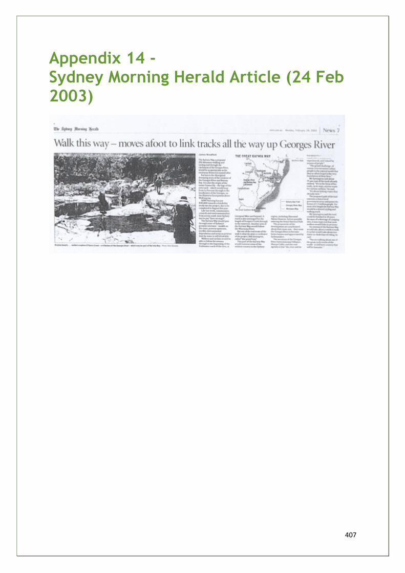
407
Appendix 14 - Sydney Morning Herald Article (24 Feb 2003)
408
Appendix 15 - NPA Letter (Southern Sydney Branch)
SOUTHERN SYDNEY BRANCH PO Box 135 Oatley NSW 2223 Phone :(02) 95701813 Fax :(02) 95701813 Email: [email protected]
Statement by National Parks Association of NSW
Southern Sydney Branch regarding the Great Kai`mia Way
While our Branch of NPA has written to Sutherland Environment Centre offering "in-
principle" support for this project, we wish to place on record some particular concerns.
These concerns have been communicated in detail to the "Centre" and several of them
have been acknowledged in formal and informal communications to us and through some
changes already made to the feasibility study.
We thank the Environment Centre for the degree of conciliation it has displayed in
accepting, acting on and publishing our concerns.
Our branch acknowledges the fact that our Association is no longer referred to as a
"partner" within the feasibility study. We understand that the Environment Centre only
wished there to be an explicit acknowledgement of NPA as being a contributor to "ground
truthing" information about some tracks within Heathcote National Park to supplement an
audit of tracks from maps only. There is a shared agreement between Sutherland
Environment Centre and NPA that NPA is not giving a formal imprimatur to any tracks being
promoted within Heathcote National Park for biking purposes.
The former reference in draft 1 to NPA as being a "truthing partner" has been removed.
The term "stakeholder" has been more clearly defined (Chapter 2, page 15) so as not to
give the unintentional impression that all contributors to this project support everything
within it 100%.
NPA believes that there should be no future promotion of "biking tracks" within National
Parks. There is increasing current evidence to suggest that there is a not inconsiderable
proportion of bike riders who flout rules and use non-bike tracks or go off track to find
adventurous experiences, with negative consequences for the natural environment. Any
further promotion of the potential for biking in National Parks is, we believe, counter-
409
productive to the need to promote only sustainable and passive activities in National Parks.
Bike riders will find "legal" tracks without major promotions anyway.
While the Environment Centre, in formal correspondence to us, acknowledges that it is the
prime responsibility of NPWS to manage uses of activities on lands under their control, we
in NPA wish to place on the formal record the fact that we support this principle beyond all
other actions by community groups which promote regionally based recreational pursuits.
Indeed, NPA advocates that no consideration of bikeways or shared tracks within a National
Park should take place in the absence of good regional planning while acknowledging that
potential bike paths do occur beyond the park system. In no way should planning for
bikeways in projects such as this be a replacement for good regional recreational planning.
Cross-government agency planning for mountain bike, trail bike and 4WD provision is
occurring in Western Sydney at this moment (Bob Conroy, Central Region Manager,
NPWS, personal communication) and a similar scale of planning for other parts of Sydney
should also occur. NPA has been consistently advocating within different forums that this
occurs.
Besides issues about the risk of promotions of activities that may be unsustainable, NPA is
aware that NPWS's resources for policing escalating activities such as mountain bike riding
are very limited. NPWS should not find itself in a situation where resources to police
activities that should be a whole of region concern will contribute to cutting back expenditure
on other necessary works and activities within the National Parks Estate. We in NPA
regularly see the negative consequences of lack of resources on National Park
management, and expend much of our efforts trying to address this issue at whole of
government level.
In summary, NPA urges the Environment Centre and any partners and contributing
organisations to heed this specific advice from the premier non-government group in NSW
and to proceed extremely cautiously when dealing with issues that may lead to increased
pressures on our natural areas.
NPA looks forward to being a continuing participants in helping the Environment Centre
ensure that its visionary aims in this project are matched by the best possible advice about
risks and ways of ensuring sustainability of the region's natural lands.
Gary Schoer, Secretary 19/12/03

410
The End