public copy - confidential information removed - nyserda
TRANSCRIPT

RSection 3
Attachments
PUBLIC COPY - CONFIDENTIAL INFORMATION REMOVED

RAttachment 3.A
Key Employee Resumes
REDACTED
PUBLIC COPY - CONFIDENTIAL INFORMATION REMOVED

RAttachment 3.B
Equinor Project Details
REDACTED
PUBLIC COPY - CONFIDENTIAL INFORMATION REMOVED

Section 4
Attachments
PUBLIC COPY - CONFIDENTIAL INFORMATION REMOVED

RAttachment 4.A
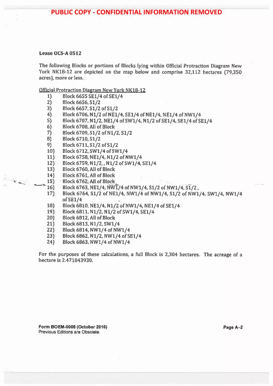
Lease OCS‐A 0512
PUBLIC COPY - CONFIDENTIAL INFORMATION REMOVED

PUBLIC COPY - CONFIDENTIAL INFORMATION REMOVED

PUBLIC COPY - CONFIDENTIAL INFORMATION REMOVED

PUBLIC COPY - CONFIDENTIAL INFORMATION REMOVED

PUBLIC COPY - CONFIDENTIAL INFORMATION REMOVED

PUBLIC COPY - CONFIDENTIAL INFORMATION REMOVED

PUBLIC COPY - CONFIDENTIAL INFORMATION REMOVED

PUBLIC COPY - CONFIDENTIAL INFORMATION REMOVED

PUBLIC COPY - CONFIDENTIAL INFORMATION REMOVED
PUBLIC COPY - CONFIDENTIAL INFORMATION REMOVED

PUBLIC COPY - CONFIDENTIAL INFORMATION REMOVED

PUBLIC COPY - CONFIDENTIAL INFORMATION REMOVED

PUBLIC COPY - CONFIDENTIAL INFORMATION REMOVED

PUBLIC COPY - CONFIDENTIAL INFORMATION REMOVED

PUBLIC COPY - CONFIDENTIAL INFORMATION REMOVED

PUBLIC COPY - CONFIDENTIAL INFORMATION REMOVED

PUBLIC COPY - CONFIDENTIAL INFORMATION REMOVED

PUBLIC COPY - CONFIDENTIAL INFORMATION REMOVED

PUBLIC COPY - CONFIDENTIAL INFORMATION REMOVED

PUBLIC COPY - CONFIDENTIAL INFORMATION REMOVED

PUBLIC COPY - CONFIDENTIAL INFORMATION REMOVED

PUBLIC COPY - CONFIDENTIAL INFORMATION REMOVED

PUBLIC COPY - CONFIDENTIAL INFORMATION REMOVED

PUBLIC COPY - CONFIDENTIAL INFORMATION REMOVED

PUBLIC COPY - CONFIDENTIAL INFORMATION REMOVED

PUBLIC COPY - CONFIDENTIAL INFORMATION REMOVED

PUBLIC COPY - CONFIDENTIAL INFORMATION REMOVED

PUBLIC COPY - CONFIDENTIAL INFORMATION REMOVED

PUBLIC COPY - CONFIDENTIAL INFORMATION REMOVED

PUBLIC COPY - CONFIDENTIAL INFORMATION REMOVED

PUBLIC COPY - CONFIDENTIAL INFORMATION REMOVED

PUBLIC COPY - CONFIDENTIAL INFORMATION REMOVED

PUBLIC COPY - CONFIDENTIAL INFORMATION REMOVED

PUBLIC COPY - CONFIDENTIAL INFORMATION REMOVED

PUBLIC COPY - CONFIDENTIAL INFORMATION REMOVED

PUBLIC COPY - CONFIDENTIAL INFORMATION REMOVED

PUBLIC COPY - CONFIDENTIAL INFORMATION REMOVED

PUBLIC COPY - CONFIDENTIAL INFORMATION REMOVED

PUBLIC COPY - CONFIDENTIAL INFORMATION REMOVED

PUBLIC COPY - CONFIDENTIAL INFORMATION REMOVED

PUBLIC COPY - CONFIDENTIAL INFORMATION REMOVED

PUBLIC COPY - CONFIDENTIAL INFORMATION REMOVED

PUBLIC COPY - CONFIDENTIAL INFORMATION REMOVED

PUBLIC COPY - CONFIDENTIAL INFORMATION REMOVED

PUBLIC COPY - CONFIDENTIAL INFORMATION REMOVED

PUBLIC COPY - CONFIDENTIAL INFORMATION REMOVED

PUBLIC COPY - CONFIDENTIAL INFORMATION REMOVED

PUBLIC COPY - CONFIDENTIAL INFORMATION REMOVED

PUBLIC COPY - CONFIDENTIAL INFORMATION REMOVED

PUBLIC COPY - CONFIDENTIAL INFORMATION REMOVED

PUBLIC COPY - CONFIDENTIAL INFORMATION REMOVED

RAttachment 4.B
Lease OCS‐A 0520
PUBLIC COPY - CONFIDENTIAL INFORMATION REMOVED

UNITED STATES Office Renewable Energy DEPARTMENT OF THE INTERIOR Lease Number
BUREAU OF OCEAN ENERGY MANAGEMENT Sterling, VA OCS-A 0520
Cash Bonus and/or Resource Type COMMERCIAL LEASE OF Acquisition Fee
SUBMERGED LANDS FOR $135,000,000.00 Wind RENEWABLE ENERGY DEVELOPMENT
ON THE Effective Date Block Number(s) OUTER CONTINENTAL SHELF
April 1, 2019 See Addendum A Paperwork Reduction Act o/ 1995 statement: This form does not constitute an Information collection as defined by 44 U.S.C. §
3501 et seq. and therefore does not require approval by the Office of Manaaement and Budaet.
This lease, which includes any addenda hereto, is hereby entered into by and between the United States of America, ("Lessor"), acting through the Bureau of Ocean Energy Management ("BOEM"), its authorized officer, and
Lessee Interest Held Equinor Wind US LLC 100%
("Lessee"). This lease is effective on the date written above ("Effective Date") and will continue in effect until the lease terminates as set forth in Addendum "B." In consideration of any cash payment heretofore made by the Lessee to the Lessor and in consideration of the promises, terms, conditions, covenants, and stipulations contained herein and attached hereto, the Lessee and the Lessor agree as follows:
Section 1: Statutes and Regulations.
This lease is issued pursuant to subsection B(p) of the Outer Continental Shelf Lands Act ("the Act"), 43 U.S.C. §§ 1331 et seq. This lease is subject to the Act and regulations promulgated pursuant to the Act, including but not limited to, offshore renewable energy and alternate use regulations at 30 CFR Part 585 as well as other applicable statutes and regulations in existence on the Effective Date of this lease. This lease is also subject to those statutes enacted (including amendments to the Act or other statutes) and regulations promulgated thereafter, except to the extent that they explicitly conflict with an express provision of this lease. It is expressly understood that amendments to existing statutes, including but not limited to the Act, and regulations may be made, and/or new statutes may be enacted or new regulations promulgated, which do not explicitly conflict with an express provision of this lease, and that the Lessee bears the risk that such amendments, regulations, and statutes may increase or decrease the Lessee's obligations under the lease.
Form BOEM-0008 (October 2016) Previous Editions are Obsolete.
Paget
PUBLIC COPY - CONFIDENTIAL INFORMATION REMOVED

Section 2: Rights of the Lessee.
(a) The Lessor hereby grants and leases to the Lessee the exclusive right and privilege, subject to the terms and conditions of this lease and applicable regulations, to: (1) submit to the Lessor for approval a Site Assessment Plan (SAP) and Construction and Operations Plan (COP) for the project identified in Addendum "A" of this lease; and (2) conduct activities in the area identified in Addendum "A" of this lease ("leased area") and/or Addendum "D" of this lease ("project easement(s)"), that are described in a SAP or COP that has been approved by the Lessor. This lease does not, by itself, authorize any activity within the leased area.
(b) The rights granted to the Lessee herein are limited to those activities described in any SAP or COP approved by the Lessor. The rights granted to the Lessee are limited by the lease-specific terms, conditions, and stipulations required by the Lessor per Addendum "C."
(c) This lease does not authorize the Lessee to conduct activities on the Outer Continental Shelf (OCS) relating to or associated with the exploration for, or development or production of, oil, gas, other seabed minerals, or renewable energy resources other than those renewable energy resources identified in Addendum "A."
Section 3: Reservations to the Lessor.
(a) All rights in the leased area and project easement(s) not expressly granted to the Lessee by the Act, applicable regulations, this lease, or any approved SAP or COP, are hereby reserved to the Lessor.
(b) The Lessor will decide whether to approve a SAP or COP in accordance with the applicable regulations in 30 CFR Part 585. The Lessor retains the right to disapprove a SAP or COP based on the Lessor's determination that the proposed activities would have unacceptable environmental consequences, would conflict with one or more of the requirements set forth in subsection 8(p)(4) of the Act (43 U.S.C. § 1337(p)(4)), or for other reasons provided by the Lessor pursuant to 30 CFR 585.613(e)(2) or 30 CFR 585.628(f)(2). Disapproval of plans will not subject the Lessor to liability under the lease. The Lessor also retains the right to approve with modifications a SAP or COP, as provided in applicable regulations.
(c) The Lessor reserves the right to suspend the Lessee's operations in accordance with the national security and defense provisions of Section 12 of the Act and applicable regulations.
(d) The Lessor reserves the right to authorize other uses within the leased area and project easements(s) that will not unreasonably interfere with activities described in an approved SAP and/or COP, pursuant to this lease.
Form BOEM-0008 (October 2016) Previous Editions are Obsolete.
PageZ
PUBLIC COPY - CONFIDENTIAL INFORMATION REMOVED

Section 4: Payments.
(a) The Lessee must make all rent payments to the Lessor in accordance with applicable regulations in 30 CFR Part 585, unless otherwise specified in Addendum "B."
(b) The Lessee must make all operating fee payments to the Lessor in accordance with applicable regulations in 30 CFR Part 585, as specified in Addendum "B."
Section 5: Plans.
The Lessee may conduct those activities described in Addendum "A" only in accordance with a SAP or COP approved by the Lessor. The Lessee may not deviate from an approved SAP or COP except as provided in applicable regulations in 30 CFR Part 585.
Section 6: Associated Project Easement(s).
Pursuant to 30 CFR 585.200(b), the Lessee has the right to one or more project easement(s), without further competition, for the purpose of insta1ling gathering, transmission, and distribution cables, pipelines, and appurtenances on the OCS, as necessary for the full enjoyment of the lease, and under applicable regulations in 30 CFR Part 585. As part of submitting a COP for approval, the Lessee may request that one or more easement(s) be granted by the Lessor. If the Lessee requests that one or more easement(s) be granted when submitting a COP for approval, such project easements will be granted by the Lessor in accordance with the Act and applicable regulations in 30 CFR Part 585 upon approval of the COP in which the Lessee has demonstrated a need for such easements. Such easements must be in a location acceptable to the Lessor, and will be subject to such conditions as the Lessor may require. The project easement(s) that would be issued in conjunction with an approved COP under this lease will be described in Addendum "D" to this lease, which will be updated as necessary.
Section 7: Conduct of Activities.
The Lessee must conduct, and agrees to conduct, all activities in the leased area and project easement(s) in accordance with an approved SAP or COP, and with all applicable laws and regulations.
The Lessee further agrees that no activities authorized by this lease will be carried out in a manner that:
(a) could unreasonably interfere with or endanger activities or operations carried out under any lease or grant issued or maintained pursuant to the Act, or under any other license or approval from any Federal agency;
(b) could cause any undue harm or damage to the environment;
(c) could create hazardous or unsafe conditions; or
Form BOEM·OOOB [October 2016) Previous Editions are Obsolete.
Page3
PUBLIC COPY - CONFIDENTIAL INFORMATION REMOVED

( d) could adversely affect sites, structures, or objects of historical, cultural, or archaeological significance, without notice to and direction from the Lessor on how to proceed.
Section 8: Violations, Suspensions, Cancellations, and Remedies.
If the Lessee fails to comply with (1) any of the applicable provisions of the Act or regulations, (2) the approved SAP or COP, or (3) the terms of this lease, including associated Addenda, the Lessor may exercise any of the remedies that are provided under the Act and applicable regulations, including, without limitation, issuance of cessation of operations orders, suspension or cancellation of the lease, and/or the imposition of penalties, in accordance with the Act and applicable regulations.
The Lessor may also cancel this lease for reasons set forth in subsection S(a)(2) of the Act (43 U.S.C. § 1334(a)(2)), or for other reasons provided by the Lessor pursuant to 30 CFR 585.437.
Non-enforcement by the Lessor of a remedy for any particular violation of the applicable provisions of the Act or regulations, or the terms of this lease, will not prevent the Lessor from exercising any remedy, including cancellation of this lease, for any other violation or for the same violation occurring at any other time.
Section 9: Indemnification.
The Lessee hereby agrees to indemnify the Lessor for, and hold the Lessor harmless from, any claim caused by or resulting from any of the Lessee's operations or activities on the leased area or project easement(s) or arising out of any activities conducted by or on behalf of the Lessee or its employees, contractors (including Operator, if applicable), subcontractors, or their employees, under this lease, including claims for:
a. loss or damage to natural resources, b. the release of any petroleum or any Hazardous Materials, c. other environmental injury of any kind, d. damage to property, e. injury to persons, and/or f. costs or expenses incurred by the Lessor.
Except as provided in any addenda to this lease, the Lessee will not be liable for any losses or damages proximately caused by the activities of the Lessor or the Lessor's employees, contractors, subcontractors, or their employees. The Lessee must pay the Lessor for damage, cost, or expense due and pursuant to this Section within 90 days after written demand by the Lessor. Nothing in this lease will be construed to waive any liability or relieve the Lessee from any penalties, sanctions, or claims that would otherwise apply by
Form BOEM-0008 (October 2016) Previous Editions are Obsolete.
Page4
PUBLIC COPY - CONFIDENTIAL INFORMATION REMOVED

statute, regulation, operation of law, or could be imposed by the Lessor or other government agency acting under such laws.
"Hazardous Material" means 1. Any substance or material defined as hazardous, a pollutant, or a contaminant under
the Comprehensive Environmental Response, Compensation, and liability Act at 42 U.S.C. §§ 9601(14) and (33);
2. Any regulated substance as defined by the Resource Conservation and Recovery Act ("RCRA") at 42 U.S.C. § 6991 (7), whether or not contained in or released from underground storage tanks, and any hazardous waste regulated under RCRA pursuant to 42 U.S.C. §§ 6921 et seq.;
3. Oil, as defined by the Clean Water Act at 33 U.S.C. § 1321(a)(l) and the Oil Pollution Act at 33 U.S.C. § 2701(23); or
4. Other substances that applicable Federal, state, tribal, or local laws define and regulate as "hazardous."
Section 10: Financial Assurance.
The Lessee must provide and maintain at all times a surety bond(s) or other form(s) of financial assurance approved by the Lessor in the amount specified in Addendum "B." As required by the applicable regulations in 30 CFR Part 585, if, at any time during the term of this lease, the Lessor requires additional financial assurance, then the Lessee must furnish the additional financial assurance required by the Lessor in a form acceptable to the Lessor within 90 days after receipt of the Lessor's notice of such adjustment.
Section 11: Assignment or Transfer of Lease.
This lease may not be assigned or transferred in whole or in part without written approval of the Lessor. The Lessor reserves the right, in its sole discretion, to deny approval of the Lessee's application to transfer or assign all or part of this lease. Any assignment will be effective on the date the Lessor approves the Lessee's application. Any assignment made in contravention of this section is void.
Section 12: Relinquishment of Lease.
The Lessee may relinquish this entire lease or any officially designated subdivision thereof by filing with the appropriate office of the Lessor a written relinquishment application, in accordance with applicable regulations in 30 CFR Part 585. No relinquishment of this lease or any portion thereof will relieve the Lessee or its surety of the obligations accrued hereunder, including but not limited to, the responsibility to remove property and restore the leased area and project easement(s) pursuant to section 13 of this lease and applicable regulations.
Form BOEM-0008 (October 2016) Previous Editions are Obsolete.
Pages
PUBLIC COPY - CONFIDENTIAL INFORMATION REMOVED
Section 13: Removal of Property and Restoration of the Leased Area and Project Easement(s) on Termination of Lease.
Unless otherwise authorized by the Lessor, pursuant to the applicable regulations in 30 CFR Part 585, the Lessee must remove or decommission all facilities, projects, cables, pipelines, and obstructions and clear the seafloor of all obstructions created by activities on the leased area and project easement(s) within two years following lease termination, whether by expiration, cancellation, contraction, or relinquishment, in accordance with any approved SAP, COP, or approved Decommissioning Application, and applicable regulations in 30 CFR Part 585.
Section 14: Safety Requirements.
The Lessee must:
a. maintain all places of employment for activities authorized under this lease in compliance with occupational safety and health standards and, in addition, free from recognized hazards to employees of the Lessee or of any contractor or subcontractor operating under this lease;
b. maintain all operations within the leased area and project easement(s) in compliance with regulations in 30 CFR Part 585 and orders from the Lessor and other Federal agencies with jurisdiction, intended to protect persons, property and the environment on the OCS; and
c. provide any requested documents and records, which are pertinent to occupational or public health, safety, or environmental protection, and allow prompt access, at the site of any operation or activity conducted under this lease, to any inspector authorized by the Lessor or other Federal agency with jurisdiction.
Section 15: Debarment Compliance,
The Lessee must comply with the Department of the Interior's non-procurement debarment and suspension regulations set forth in 2 CFR Parts 180 and 1400 and must communicate the requirement to comply with these regulations to persons with whom it does business related to this lease by including this requirement in all relevant contracts and transactions.
Section 16: Equal Opportunity Clause.
During the performance of this lease, the Lessee must fully comply with paragraphs (1) through (7) of Section 202 of Executive Order 11246, as amended (reprinted in 41 CFR 60-1.4(a)), and the implementing regulations, which are for the purpose of preventing employment discrimination against persons on the basis of race, color, religion, sex, or national origin. Paragraphs (1) through (7) of Section 202 of Executive Order 11246, as amended, are incorporated in this lease by reference.
Form BOEM-0008 (October 2016) Previous Editions are Obsolete.
Page6
PUBLIC COPY - CONFIDENTIAL INFORMATION REMOVED

Section 17: Certification of Nonsegregated Facilities.
By entering into this lease, the Lessee certifies, as specified in 41 CFR 60-1.8, that it does not and will not maintain or provide for its employees any segregated facilities at any of its establishments and that it does not and will not permit its employees to perform their services at any location under its control where segregated facilities are maintained. As used in this certification, the term "facilities" means, but is not limited to, any waiting rooms, work areas, restrooms and washrooms, restaurants and other eating areas, timeclocks, locker rooms and other storage or dressing areas, parking lots, drinking fountains, recreation or entertainment areas, transportation, and housing facilities provided for employees. Segregated facilities include those that are segregated by explicit directive or those that are in fact segregated on the basis of race, color, religion, sex, or national origin, because of habit, local custom, or otherwise; provided, that separate or single-user restrooms and necessary dressing or sleeping areas must be provided to assure privacy as appropriate. The Lessee further agrees that it will obtain identical certifications from proposed contractors and subcontractors prior to awarding contracts or subcontracts unless they are exempt under 41CFR 60-1.5.
Section 18: Notices.
All notices or reports provided from one party to the other under the terms of this lease must be in writing, except as provided herein and in the applicable regulations in 30 CFR Part 585. Written notices and reports must be delivered to the Lessee's or Lessor's Lease Representative, as specifically listed in Addendum "A," either electronically, by hand, by facsimile, or by United States first class mail, adequate postage prepaid. Each party must, as soon as practicable, notify the other of a change to their Lessee's or Lessor's Contact Information listed in Addendum "A" by a written notice signed by a duly authorized signatory and delivered by hand or United States first class mail, adequate postage prepaid. Until such notice is delivered as provided in this section, the last recorded contact information for either party will be deemed current for service of all notices and reports required under this lease. For all operational matters, notices and reports must be provided to the party's Operations Representative, as specifically listed in Addendum "A." as well as the Lease Representative.
Section 19: Severability Clause.
If any provision of this lease is held unenforceable, all remaining provisions of this lease will remain in full force and effect.
Form BOEM-0008 (October 2016) Previous Editions are Obsolete.
Page7
PUBLIC COPY - CONFIDENTIAL INFORMATION REMOVED

-
Section 20: Modification.
Unless otherwise authorized by the applicable regulations in 30 CFR Part 585, this lease may be modified or amended only by mutual agreement of the Lessor and the Lessee. No such modification or amendment will be binding unless it is in writing and signed by duly authorized signatories of the Lessor and the Lessee.
Equinor Wind US LLC
Lessee
~s:~ (Signature of uthorized Officer)
Tim Thompson
(Name of Signatory)
Project Lead - Business Development
(Title)
February 11, 2019
(Date)
Form BOEM-0008 (October 2016) Previous Editions are Obsolete.
The United States of America Lessor
J ames F. Bennett
(Name of Signatory) Program Manager, Office of Renewable Energy Programs
(Title)
March 5, 2019
(Date)
Page8
PUBLIC COPY - CONFIDENTIAL INFORMATION REMOVED

I.
(a)
Title
U.S. DEPARTMENT OF THE INTERIOR BUREAU OF OCEAN ENERGY MANAGEMENT
ADDENDUM "A"
DESCRIPTION OF LEASED AREA AND LEASE ACTIVITIES
Lease Number OCS-A 0520
Lessor and Lessee Contact Information
Lessee Company Number: _1_5_0_5_8 __ _
Lessor's Contact Information Lease Representative Ooerations Representative Program Manaeer Same as Lease Reoresentative.
Address U.S. Department of the Interior Bureau of Ocean Energy Management 45600 Woodland Road Sterline:. Vinzinia 20166
Phone (703) 787-1300 Fax (7031 787-1708 Email renewableenere:[email protected]
Name Title Address
Phone Fax
II. Description of Leased Area
The total acreage of the leased area is approximately 128,811 acres.
This area is subject to later adjustment, in accordance with applicable regulations [e.g., contraction, relinquishment).
PUBLIC COPY - CONFIDENTIAL INFORMATION REMOVED

Lease OCS-A 0520
The following Blocks or portions of Blocks lying within Official Protraction Diagram Providence NKl 9-07, are depicted on the map below and comprise 5,337 acres, more or less.
1) Block 7079, SEl/4 of SEl/4 2) Block 7128, SEl/4 of SEl/4 3) Block 7129, El/2, SEl/ 4 of NWl/ 4, SWl/ 4
The following Blocks or portions of Blocks lying within Official Protraction Diagram Block Island Shelf NK19-10, are depicted on the map below and comprise 123,474 acres, more or less.
1) Block 6028, SEl/4 of SEl/4 2) Block 6029, El/2, SEl/4 of NWl/4, SWl/4 3) Block 6030, All of Block 4) Block 6077, SEl/4 of SEl/4 5) Block 6078, El/2, SEl/4 of NWl/4, SWl/4 6) Block 6079, All of Block 7) Block 6080, All of Block 8) Block 6081, Nl/2, SWl/4, NWl/4 of SEl/4 9) Block 6082, NWl/4 ofNWl/4 10) Block 6126, SEl/4 of SEl/4 11) Block 6127, El/2, SEl/ 4 of NWl/ 4, SWl/ 4 12) Block 6128, All of Block 13) Block 6129, All of Block 14) Block 6130, Nl/2, SWl/4, NWl/4 of SEl/4 15) Block 6131, NWl/4 ofNWl/4 16) Block 6175, SEl/4 of SEl/4 17) Block 6176, El/2, SEl/4 of NWl/4, SWl/4 18) Block6177,AllofBlock 19) Block 6178, All of Block 20) Block 6179, Nl/2, SWl/4, NWl/4 of SEl/4 21) Block 6180, NWl'/ 4 of NWl/ 4 22) Block 6224, SEl/4 of SEl/4 23) Block 6225, El/2, SEl/ 4 of NW!/ 4, SWl/ 4 24) Block 6226, All of Block 25) Block 6227, All of Block 26) Block 6228, Nl/2, SWl/4, NWl/4 of SEl/4 27) Block 6229, NWl/4 of NWl/4 28) Block 6275, All of Block 29) Block 6276, All of Block 30) Block 6277, Nl/2, SWl/4, NWl/4 of SEl/4 31) Block 6278, NWl/4 ofNWl/4
Form BOEM-0008 (October 2016) Previous Editions are Obsolete.
Page A - 2
PUBLIC COPY - CONFIDENTIAL INFORMATION REMOVED

32) Block 6325, All of Block 33) Block 6326, Nl/2, SWl/4, NWl/4 ofSEl/4 34) Block 6327, NWl/4 ofNWl/4 35) Block 6376, NW1/4ofNW1/4
For the purposes of these calculations, a full Block is 2,304 hectares. The acreage of a hectare is 2.471043930.
1or1 [! 7172 Tim t 111, • ms 1011 1111 • 1e11 ,; :f 1011 1e11 ™:l : 7tl, 11;'2 , u , 111... 71:25 JIZJ 7121 1'121 mm~ 7110 rn, 71:ll 1 7tlJ
I p UINI O p NK 19~7 •••••••••••••••••• ···•-••••••••••••••••••'I* •••••••••ii;;;;j :i:t;;;:i; """'H-yd_ro_g_r11_p_ho-r--.-1
•m Ir IOU 102• 1325 u~ ~ "'11 ' "" IOU U-11 1812 001, I ..,,. Canyon IOl2 I J K L
f ' p UTNTO p NK 19•10 NK 19-11
D A 8ICID1AI
,u, r.G14 U:'!!I c:r1, c:ort EL IU1' w.10 _! ~G H 1t12 C1Ji:1 ., I J K
P M NIO P ii N Ml\
~· Chatham
rttit 1 to2 NK19-0B
IOSZ
I •~ D A B I CI D A
1122 1 .,~ ..... .u, .,,. r,f,f. ~ , 1:1 .... 1 .u~r .,,, f' PMINIQP \1N UJ.0
• 117; r:-·-: - 6115 I~~ 1111 1171 : ii: A m~- ~ -,.,-· - 11'2 ~L I JI(
l ~'"Pj°=u-,ln~N:.i;ll""otL!..p~---1-..---1-=UµN .,,. I ~D ABC:DA
I G._'""HL E~G 11 EUJ G:J w, 1121 i ll7 I-
i IP UINIO P i ~ :a. 1
! . A SIC:10 A 1 Utt I CZTJ f;T,'J ,.u, 1211 ~ ~Q Ii '211
+ I J ~
~ N 1271 • ·-=-r:--·-~· - t---n-zs_:.,.~r,~"'~"":i~:t-,A+m7- -- - l~:-r: OW WI -· ~ -~~U-- -·~·=-i '301 ~ - ..
1-~~~--r-~~~:-- $111 I~:.:-- ~;- u:-r.,,. -WO - - IJU om - . :~ - .m i:I. 1111 - 6.!ll '-
'D MA Lease Area OCS·A 0520 ; I f ; • • : Protraction i ..,. .. 2: ..,, ! ..,,. .. ,. 1-<1t ~ I .. 3:1 ..,.. 1 .. .,
~ .l ! : ocs Lease Blocks r--·- -- ' ----· - - ·----.-T-- - --1·------1---1
NautlcaJ Miln ' I I j I 1 1 1 1 1 AJt "'~ 4r1U M!t ""° ua1 NU l '""' "'" , uu w.b 012345 . .1 ! -
llJZ .,,. &101 1,n
_,_
11'3 1114 1151
a:tt Olli czo,
•21111 QU ....
III. Renewable Enere,y Resource
Wind
IV. Description of the Project
A project to generate energy using wind turbine generators and any associated resource assessment activities, located on the Outer Continental Shelf (OCS) in the leased area, as well as associated offshore substation platforms, inner array cables, and subsea export cables.
Form BOEM-0008 (October 2016) Previous Editions are Obsolete.
Page A· 3
PUBLIC COPY - CONFIDENTIAL INFORMATION REMOVED

V. Description of Project Easement(s)
Once approved, the Lessor will incorporate Lessee's project easement(s) in this lease as ADDENDUM "D."
Form BOEM-0008 (October 2016) Previous Editions are Obsolete.
PageA-4
PUBLIC COPY - CONFIDENTIAL INFORMATION REMOVED

I. Lease Term
U.S. DEPARTMENT OF THE INTERIOR BUREAU OF OCEAN ENERGY MANAGEMENT
ADDENDUM "B"
LEASE TERM AND FINANCIAL SCHEDULE
Lease Number OCS-A 0520
The duration of each term of the lease is described below. The terms may be extended or otherwise modified in accordance with applicable regulations in 30 C.F.R. Part 585.
Lease Term Duration Preliminarv Term 1 vear Site Assessment Term 5 years Ooerations Term 33 vears
Schedule: Addendum "C" includes a schedule and reporting requirements for conducting site characterization activities.
Renewal: The Lessee may request renewal of the operations term of this lease, in accordance with applicable regulations in 30 CFR Part 585. The Lessor, at its discretion, may approve a renewal request to conduct substantially similar activities as were originally authorized under this lease or in an approved plan. The Lessor will not approve a renewal request that involves development of a type of renewable energy not originally authorized in the lease. The Lessor may revise or adjust payment terms of the original lease as a condition of lease ~~. .
II. Definitions
"Lease Issuance Date" refers to the date on which this lease has been signed by both the Lessee and the Lessor.
"Effective Date" has the same meaning as "effective date" in the Bureau of Ocean Energy Management (BOEM) regulations provided in 30 CFR 585.237.
"Lease Anniversary" refers to the anniversary of the Effective Date of the lease.
"End Date" refers to the earlier ofa) the last calendar day of the last month of the Operations Term: orb) the date on which the lease terminates in the event of a lease termination.
Form BOEM-0008 (October 2016) Previous Editions are Obsolete.
Page B-1
PUBLIC COPY - CONFIDENTIAL INFORMATION REMOVED

"Commercial Operations" means the generation of electricity or other energy product for commercial use, sale, or distribution.
"Commercial Operation Date," or "COD," refers to the date on which the Lessee first begins Commercial Operations on the lease.
"Delivery Point" is the meter identified in the COP where the Lessee's facility interconnects with the electric grid to deliver electricity for sale.
An individual wind generation turbine is said to be "available for Commercial Operations" on or after the first day that it engages in Commercial Operations on the lease; and to be no longer available for Commercial Operations on or after the day when it is permanently decommissioned. These dates are determined by the Construction and Operations Plan (COP).
Ill. Payments
Unless otherwise authorized by the Lessor in accordance with the applicable regulations in 30 CFR Part 585, the Lessee must make payments as described below.
(a) Rent. The Lessee must pay rent as described below:
Rent payments prior to the COD, or prior to the lease End Date in the event that the lease terminates prior to the COD, are calculated by multiplying the acres in the leased area times the rental rate per acre as follows:
Lease OCS-A 0520 • Acres in Leased Area: 128,811 • Annual Rental Rate: $3.00 per acre or fraction thereof • Rental Fee for Entire Leased Area: $3.00 x 128,811 = $386,433
The first year's rent payment of $386,433 is due within 45 days of the date that the lease is received by the Lessee for execution. Rent for the entire leased area for the next year and for each subsequent year is due on or before each Lease Anniversary through the year in which the COD occurs. The rent for each year subsequent to the COD on the imputed portion of the lease not authorized for Commercial Operations is due on or before each Lease Anniversary. The imputed portion of the lease that is not authorized for Commercial Operations at each Lease Anniversary in year t, St, and the corresponding Adjusted Annual Rent Payment will be determined as follows:
(A) S = (1 - M: ) t MAX(M:: for all ti!:Z)
Form BOEM-0008 (October 2016) Previous Editions are Obsolete.
PageB-2
PUBLIC COPY - CONFIDENTIAL INFORMATION REMOVED

(B) Adjusted Annual Rent Payment :.,;; St* Rental Fee for Entire Leased Area
Where: St = Portion of the lease not authorized for Commercial Operations in year t based on the definition oft in Section Ill (b) ( 4) below.
M; = Actual Nameplate capacity expressed in megawatts (MW) rounded to the nearest second decimal in year t of Commercial Operations on the lease as defined in Section II I (b) ( 4) below, prior to any adjustments as specified in the most recent approved COP for turbine maintenance, replacements, repowering, or decommissioning. For our purposes nameplate capacity is the maximum rated electric output the turbines of the wind farm facility under commercial operations can produce at their rated wind speed designated by the turbine's manufacturer.
MAX(M;) = Highest value of M; projected in the most recent approved version of the COP to be achieved in any year of Commercial Operations on the lease.
The Adjusted Annual Rent Payment calculated in Equation (A) herein, will be rounded up to the nearest dollar. The annual rent payments will be set forth in Addendum "E" when the COP is initially approved or subsequently revised.
Consider an example of a 1,000 MW project on a lease with an Effective Date of January 1, 2014 and a COD of January 1, 2022 on a lease area consisting of 100,000 acres as follows:
BiilMm .. ( - M' ) l - MAX(M;) I
Rental rec for Entire Area
Payment Amount
' 2011_ __ j O j I : _l1fill I __ $300i()QQi ... . .. 2021--=:]J _Q] 2022 500
[ 2023 lf ~QO 2024 500 1,000
[ioZs __ .] 000 2026 800
L2021-_=:J ~ 2028 1,000 - ...:.:......--
. .. c __ :MJ 0.5
11-___ ]ru 0.5
{ ' 0.21 0.2 c __ _.,o=.2=], 0.0
$300~000
. .. C J3DO]__QQ]
$150,000 _$:tso,.ooo] $150,000
C-J&o·ooo $60,000
In the event a revised COP is approved by BOEM that identifies an alternative installation schedule that differs from the previously-approved COP, the Lessee must make subsequent payments based on the revised installation schedule. In addition, the Lessee must make a payment equal to the sum of any incremental annual rent payments that would have been due at the Lease Anniversary of prior years based on the differences between the Initial Installation Schedules specified in the previously-approved COP and the revised COP, plus interest on the annual balances, in accordance with 30 CFR 1218.54.
Consider an example whereby the initial COP specified an installation schedule with all 1,000 MW online at the COD, i.e., M; is 1,000 MW at COD. The following table demonstrates how the back rent payments would be calculated if the project was initially scheduled as a
Form BOEM-0008 (October 2016) Previous Editions are Obsolete.
Page B -3
PUBLIC COPY - CONFIDENTIAL INFORMATION REMOVED

single phase, but then later determined to be the three-phase project as shown in the previous example in a revised COP approved prior to the payment due on January 1, 2023.
Singlc·Ph-a.•fo"11 P,;iy~ cnt' Amount
7# Th rec-P h~isc"' . Payme nt': , ,
-- ..,.., .... 1,.-'Amount ,~ 0 :,
... ... ... ... . ..
· Subsequent Rent Payment
Amount __ .$Q
'29.?1...: ::Jr- rur o l - 1 300,oo[]C JM>'{)ffe f $gt-_ o 2022 1,000 500 $0 $150,000 $150,000 $0
[ 2023 L--1t000 ]t__ ~00 1 -- ---'=OJ 1SQ&_QO [- - [9] - 150,000 ' 2024 1,000 500 $0 $150,000 $0 $150,000
[iQ2s ~:J[ ~~oj)Q]I aoo I · 10.J."~$60 ooo J _ ---~ ]JC $~ goo 2026 1,000 800 $0 $60,000 $0 $60,000
( 2027 J J;oog C Jrn!OC _ oJ 60 ooo - _ -::·F[_~· $60,000 20_28 1,000 1,000 $0 0 $0 $0
The last rent payment prior to Commercial Operations being authorized on the entire lease area, i.e., the year in which the value of St is equal to zero, or prior to the lease End Date, in the event that the lease terminates prior to Commercial Operations being authorized on the entire lease area, will represent the final rent payment, unless a revised COP identifying an alternative maximum initial capacity is approved by BOEM. All rent payments, including the last rent payment, are payable for the full year and will not be prorated to the COD or other installation milestones. The COD is equivalent to the authorization date for the first phase of development on the lease, to be updated based on the initial or revised approved COP documentation. The schedule of rent payments on the lease is defined in Addendum "E". All rent payments, except for the first 6-month rent payment, must be made as required in 30 CFR 1218.51. Late rent payments will be charged interest in accordance with 30 CFR 1218.54.
(1) Project Easement.
Rent for any project easement(s) is described in ADDENDUM "D".
(2) Relinquishment.
If the Lessee submits an application for relinquishment of a portion of the leased area within the first 45 calendar days following the date that the lease is received by the Lessee for execution, and the Lessor approves that application, no rent payment will be due on that relinquished portion of the leased area. Later relinquishments of any leased area will reduce the Lessee's rent payments due the year following the Lessor's approval of the relinquishment, through a reduction in the Acres in Leased Area and the corresponding Rental Fee for the Entire Leased Area and any related Adjusted Annual Rent Payments.
Form BOEM-0008 (October 2016) Previous Editions are Obsolete.
PageB-4
PUBLIC COPY - CONFIDENTIAL INFORMATION REMOVED

(b) Operating Fee. The Lessee must pay an operating fee as described below:
(1) Initial Operating Fee Payment.
The Lessee must pay an initial prorated operating fee within 45 calendar days after the COD. The initial operating fee payment covers the first year of Commercial Operations on the lease and will be calculated in accordance with subsection (4) below, using an operating fee rate of 0.02 and a capacity factor of 0.4.
(2) Annual Operating Fee Payments.
The Lessee must pay the operating fee for each subsequent year of Commercial Operations on or before each Lease Anniversary following the formula in subsection (4) below. The Lessee must calculate each operating fee annually subsequent to the initial operating fee payment using an operating fee rate of 0.02 through the thirty-three year operations term of the lease. The capacity factor of 0.4 will remain in effect until the Lease Anniversary of the year in which the Lessor adjusts the capacity factor.
(3) Final Operating Fee Payment
The final operating fee payment is due on the Lease Anniversary prior to the End Date. The final operating fee payment covers the last year of Commercial Operations on the lease and will be calculated in accordance with the formula in subsection (4) below.
Where: t=
Ft= Mt =
( 4) The formula for calculating the operating fee in year t.
= Mt (nameplate
* H (hours per
ear
* C
(capacity factor
* Pt (power
rice
* rt (operating fee rate
the year of Commercial Operations on the lease starting from each Lease Anniversary, where t equals 1 represents the year beginning on the Lease Anniversary prior to, or on, the COD. the dollar amount of the annual ooeratinl! fee in vear t. the nameplate capacity expressed in megawatts (MW) rounded to the nearest second decimal place in year t of Commercial Operations on the lease.
The value of Mt, reflecting the availability of turbines, will be determined based on the COP. This value will be adjusted to reflect any modifications to the COP approved by BOEM as of the date each operating fee payment is due, in accordance with the calculation in Eauation 1, for each year of Commercial Ooerations on the lease.
Form BOEM-0008 (October 2016) Previous Editions are Obsolete.
Page B-5
PUBLIC COPY - CONFIDENTIAL INFORMATION REMOVED

M = ~w, [N *[~:.1E.,,,,,J)lJ (1) t L.,IL'=I w D J
Where:
W, = Number of individual wind generation turbines, w, that will be available for
Commercial Operations during any day of the year, t, per the COP.
N 11• = Nameplate capacity of individual wind generation turbine, w, per the COP
expressed in MW.
EIL',t ,d = Indicates whether individual wind generation turbine, w, will be available
for Commercial Operations on day d of year t. The value is set to 1 for any day in year t for which the condition is true, i.e., the wind turbine will be available for Commercial Operations, and zero for any day in year t for which the condition is false, i.e., the wind turbine will not be available for Commercial Operations. The month of February is always assumed to have 28 days for purposes of this calculation, where March 1st will be counted as the first day of Commercial Operations if Commercial Operations commence on February 29th of a leap year.
D = Days in the year set equal to 365 in all years for purposes of this calculation.
Mt may be reduced only in the event that installed capacity is permanently decommissioned per the COP. Mt will not be changed in response to routine or unplanned maintenance of units, including the temporary removal of a nacelle for offsite repair or replacement with a similar unit.
EXAMPLE: Assume that the Lease Anniversary is January 1st, the COD is July 1, 2018, that the facility will ultimately have 100 individual wind generation turbines with a nameplate capacity of 5.0 MW each, and that the COP specifies the following, cumulative installation schedule for wind turbines to become available for Commercial Operations:
• July 1, 2018 (COD): 20 turbines (20 new units); • October 1, 2018: 45 turbines (25 new units); • January 1, 2019: 50 turbines (5 new units); • July l, 2019: 65 turbines (15 new units); • January 1, 2020: 95 turbines (30 new units); • February 29, 2020: 100 turbines (5 new units).
Form BOEM-0008 (October 2016) Previous Editions are Obsolete.
Page B-6
PUBLIC COPY - CONFIDENTIAL INFORMATION REMOVED

H=
Further assume that the COP calls for 50 of the turbines to be decommissioned after September 30, 2039 (t = 22), and that the remaining turbines are decommissioned at the End Date of March 15, 2040 (t = 23).
The value of Mt would be estimated as demonstrated in Table la for each year of Commercial Operations on the lease in this example.
Table la: Exam le of Mt Calculations for Installation and Decommissionin Turbi1ws MW Comnwrci,ll Comm. Ddys Sh,m! ~1\'11 M,
OpPr<1t1011s l'Priod Ops. in ofDdys Oilys Yt>dr
1 25 92 81.92
2 so 365 100.00%
287.81 15 184 50.41%
3 95 365 100.00%
495.96 5 306 83.84% 4 100 365
365 100.00% 500.00
21 100 365 100.00% 500.00 500.00
22 50 365 100.00% 250.00
436.98 so 273 74.79% 186.98 23 so 74 20.27% 50.68 50.68
To illustrate the impact of decommissioning a portion of the individual wind generation turbines and replacing them with units of greater capacity on the calculation of Mt, assume that at the end of March 31, 2022, 10 units are to be made unavailable due to decommissioning, and that the incremental units have a capacity of 7.0 MW and are expected to be made available for Commercial Operations on September 15, 2022. The impact on Mt in 2022 and in subsequent years starting in 2023 and continuing until decommissioning is illustrated in Table lb.
24.66% 12.33 483.04 1----4--=.::....i..:..:.::...,_4-___:....:....i~:c..:....:=-=---==-===---1-=-10.::.:a=------i 365 29.59% 20. 11
6 365 100.00% 450.00 520.00 10 7.0 Jan.1st to Dec. 31s1 365 100.00% 70.00
the number of hours in the year for billing purposes which is equal to 8,760 for all years of Commercial O erations on the lease. the "Capacity Factor" in Performance Period p, which represents the share of anticipated generation of the facility that is delivered to where the Lessee's facility interconnects with the electric rid i.e. the Delive Point relative to its eneration at
Form BOEM-0008 (October 2016) Previous Editions are Obsolete.
Page B-7
PUBLIC COPY - CONFIDENTIAL INFORMATION REMOVED

continuous full power operation at the nameplate capacity, expressed as a decimal between zero and one.
The initial Capacity Factor (co) will be set to 0.4.
The Capacity Factor will be subject to adjustment at the end of each Performance Period. After the sixth year of Commercial Operations on the lease has concluded, the Lessee will utilize data gathered from years two through six of Commercial Operations on the lease and propose a revised Capacity Factor to be used to calculate subsequent annual payments, as provided for in Table 2 below. A similar process will be conducted at the conclusion of each five-year Performance Period, thereafter.
Table 2: Definition of Performance Periods
0 (COD) Not Applicable Payments 1 to 7 Co:0,4 1 t= 2 to 6 Payments 8 to 12 C1 n1=6 2 t= 7 to 11 Payments 13 to 17 Cz nz=ll 3 t= 12 to 16 Payments 18 to 22 CJ nJ=16 4 t= 17 to 21 Payments 23 to 27 C4 n4=21 5 t = 22 to 26 Payments 28 to 32 Cs ns=26 6 t = 27 to 31 Payment 33 C6 n6=31
Adjustments to the Capacity Factor The Actual 5-year Average Capacity Factor (Xp) is calculated for each Performance Period after COD (p > OJ per Equation 2 below. Xp represents the sum of actual, metered electricity generation in megawatt-hours (MWh) at the Oelivery Point to the electric grid (At) divided by the amount of electricity generation in MWh that would have been produced if the facility operated continuously at its full, stated capacity (Mt) in all of the hours (h, ) in each year, t, of the corresponding five-year period.
~11 A X _ L.Jt:en- 4 1
(2) P - ~~=n- 4 M, * h, ) Where: Mt= Nameplate Capacity as defined above.
n = "Date End Year" value for the Performance Period, p, as defined in Table 2.
p = Performance Period as defined in Table 2.
At= Actual generation in MWh associated with each year of Commercial Operations, t, on the lease that is transferred at the Deliver Point; Delive Point meter data
Form BOEM-0008 (October 2016) Previous Editions are Obsolete.
Page B-8
PUBLIC COPY - CONFIDENTIAL INFORMATION REMOVED
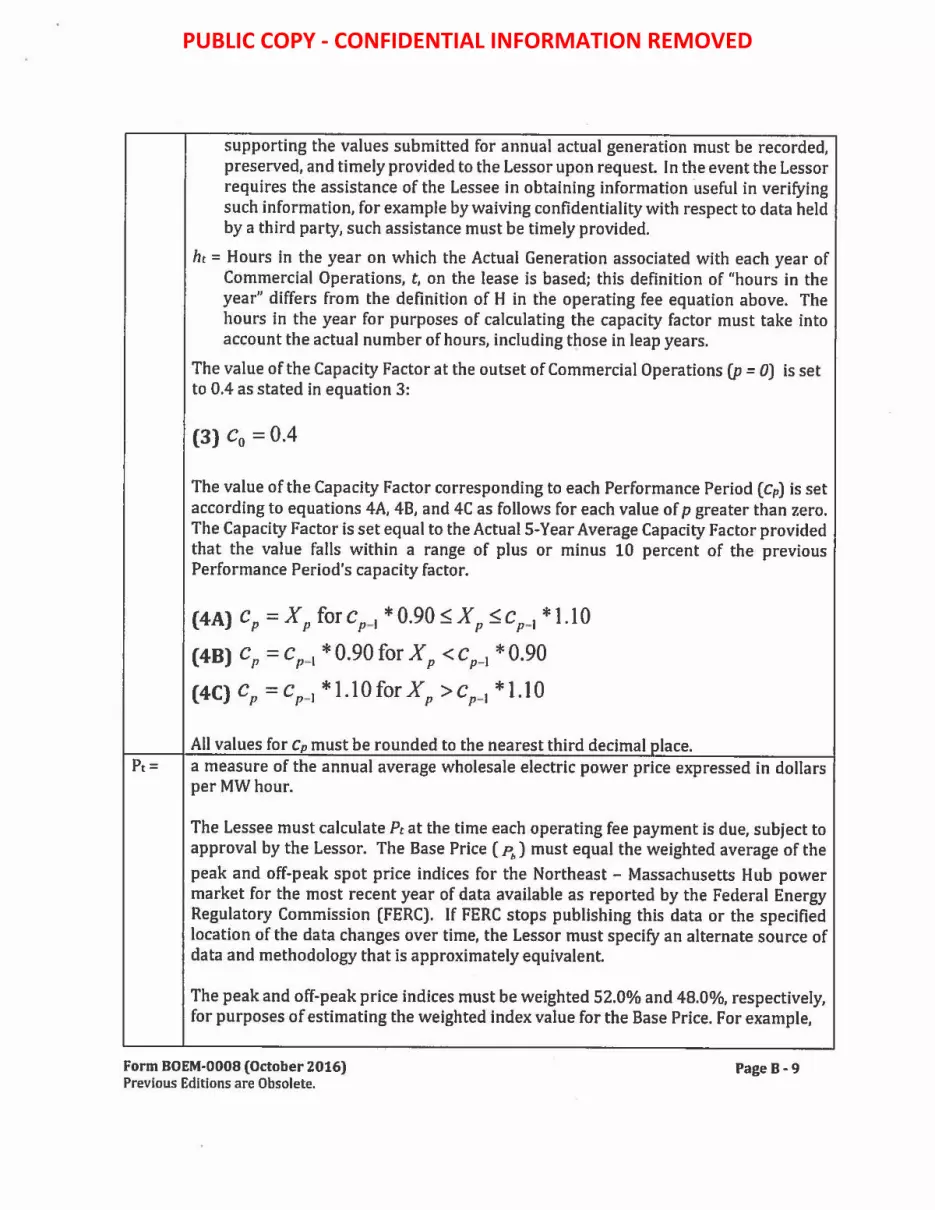
supporting the values submitted for annual actual generation must be recorded, preserved, and timely provided to the Lessor upon request. In the event the Lessor requires the assistance of the Lessee in obtaining information useful in verifying such information, for example by waiving confidentiality with respect to data held by a third party, such assistance must be timely provided.
ht = Hours in the year on which the Actual Generation associated with each year of Commercial Operations, t, on the lease is based; this definition of "hours in the year" differs from the definition of H in the operating fee equation above. The hours in the year for purposes of calculating the capacity factor must take into account the actual number of hours, including those in leap years.
The value of the Capacity Factor at the outset of Commercial Operations (p = OJ is set to 0.4 as stated in equation 3:
(3) C0 = 0.4
The value of the Capacity Factor corresponding to each Performance Period (Cp) is set according to equations 4A, 48, and 4C as follows for each value of p greater than zero. The Capacity Factor is set equal to the Actual 5-Year Average Capacity Factor provided that the value falls within a range of plus or minus 10 percent of the previous Performance Period's capacity factor.
(4A) cP =XP forcP_1 *0.90:5XP:5cP_1 *1.10
(4BJ cp =cp-i *0.90for Xp <Cp-i *0.90
( 4C) C p = C p - 1 * 1.10 for X p > C p- 1 * 1.10
All values for Cp must be rounded to the nearest third decimal olace. Pt= a measure of the annual average wholesale electric power price expressed in dollars
per MW hour.
The Lessee must calculate Pt at the time each operating fee payment is due, subject to approval by the Lessor. The Base Price ( ~) must equal the weighted average of the
peak and off-peak spot price indices for the Northeast - Massachusetts Hub power market for the most recent year of data available as reported by the Federal Energy Regulatory Commission (FERC). If FERC stops publishing this data or the specified location of the data changes over time, the Lessor must specify an alternate source of data and methodology that is approximately equivalent.
The peak and off-peak price indices must be weighted 52.0% and 48.0%, respectively, for purposes of estimating the weighted index value for the Base Price. For example,
Form BOEM-0008 (October 2016) Previous Editions are Obsolete.
Page B-9
PUBLIC COPY - CONFIDENTIAL INFORMATION REMOVED

in the March 12, 2012 State of the Markets Report the peak price index for 2011 was $51.99/MWh and the corresponding off-peak price index for 2011 was $33.94/MWh, resulting in a weighted index value for the Base Price for 2011 (P2011) of $43.33/MWh (=52.0% * $51.99 / MWh + 48.0% *$33.94 / MWh). The calculation of Pb must be rounded up to the nearest, second decimal place.
The Base Price must be adjusted for inflation from the year associated with the published spot prices to the year in which the operating fee is to be paid as shown in equations (SA) and (SB):
( GDP Jy-g ( GDP )
(SA) P, = P,, * g * g for g ~ b GDPg-i GDP,,
( GDP J) -b
(SB) P, = P,, * c for g < b GDPg-i
Where: GDP = Annual Implicit Price Deflators for Gross Domestic Product (GDP
deflator index) published by the U.S. Bureau of Economic Analysis (BEA) for the specified period.
If BEA stops publishing the data required for this calculation, or the specified location of the data changes over time, the Lessor will specify an alternative source of data and methodology that it considers approximately equivalent.
b = The most recent year for which FERC reports the appropriate electricity spot price data expressed as the year, e.g., 2009, as in the illustrative example below.
g = The most recent year for which GDP deflator indices are available from BEA expressed as the year, e.g., 2011, as in the illustrative example below.
y = The year the annual payment is due expressed as the year corresponding to the value oft described above, e.g., 2013, as in the illustrative example below.
The second term on the right-hand side of equation (SA) represents a projected annual change in the index of inflation employing the last year of data available from BEA, while the third term represents the cumulative change in the index of inflation up to the previous year.
Example: The following hypothetical example is provided to illustrate the methodology using Equation (SA) and the illustrative values provided for b, g, and y above, applied to historical GDP deflator data. If the actual FERC price indices are based on 2009 data and the GDP deflator indices are available for 2011, the inflation-adjusted orice index
Form BOEM-0008 (October 2016) Previous Editions are Obsolete.
Page B-10
PUBLIC COPY - CONFIDENTIAL INFORMATION REMOVED

value would be determined from equation (SA) as follows for a payment occurring in y = 2013:
P. ; p * ( GD P,,11 )"''-"" • ( GDP ,,11 ) ; $38.40 , ( 113.361 ) 1
• ( 113 .361 ) ; $41.38 '(
20'3l
2009 GDPi,010 GDP2009 MWh 110.992 109.729 MWh
Note: The current GDP denator index is 113.361 for 2011, 110.992 for 2010, and 109.729 for 2009 (last revised by BEA on April 27, 2012); the FERC index price for the year 2009 is $38.40/MWh (On-peak: $44.60/MWh; Off-peak: $31.68/MWh; last revised March 12, 2012). Although 2011 FERC prices are available, the 2009 prices are used in the example to illustrate the concept.
The Lessor and the Lessee will use the latest FERC price indices and revised BEA GDP denator index values at the time the pricing adjustments are made. The source of data used in the calculations must be noted in the Lessee's documentation supporting their estimate of the value of Pt each vear for review and approval by the Lessor.
ft= the operating fee rate of 0.02 (2%).
(c) Reporting, Validation, Audits, and Late Payments.
The Lessee must submit the values used in the operating fee formula to the Lessor at the time the annual payment based on these values is made. Submission of this and other reporting, validation, audit and late payment information as requested by the Lessor must be sent to the Lessor using the contact information indicated in Addendum "A", unless the Lessor directs otherwise. Failure to submit the estimated values and the associated documentation on time to the Lessor may result in penalties as specified in applicable regulations.
Within 60 days of the submission by the Lessee of the annual payment, the Lessor will review the data submitted and validate that the operating fee formula was applied correctly. If the Lessor validation results in a different operating fee amount, the amount of the annual operating fee payment will be revised to the amount determined by the Lessor.
The Lessor also reserves the right to audit the meter data upon which the Actual 5-year Average Capacity Factor is based at any time during the lease term. If, as a result of such audit, the Lessor determines that any annual operating fee payment was calculated incorrectly, the Lessor has the right to correct any errors and collect the correct annual operating fee payment amount.
If the annual operating fee is revised downward as a result of the Lessee's calculations, as validated by the Lessor, or an audit of meter data conducted by the Lessee or Lessor, the Lessee will be refunded the difference between the amount of the payment received and the
Form BOEM-0008 (October 2016) Previous Editions are Obsolete.
Page 8-11
PUBLIC COPY - CONFIDENTIAL INFORMATION REMOVED

amount of the revised annual operating fee, without interest. Similarly, if the payment amount is revised upward, the Lessee is required to pay the difference between the amount of the payment received and the amount of the revised annual operating fee, plus interest on the balance, in accordance with 30 CFR § 1218.54.
Late operating fee payments will be charged interest in accordance with 30 CFR § 1218.54.
IV. Financial Assurance
The Lessor will base the determination for the amounts of all Site Assessment Plan (SAP), COP, and decommissioning financial assurance requirements on estimates of the cost to meet all accrued lease obligations. The Lessor determines the amount of supplemental and decommissioning financial assurance requirements on a case-by-case basis. The amount of financial assurance required to meet all lease obligations includes:
(a) Initial Financial Assurance. Prior to the Lease Issuance date, the Lessee must provide an initial lease-specific bond, or other approved means of meeting the Lessor's initial financial assurance requirements in an amount equal to $100,000.
(b) Additional Financial Assurance. In addition to the initial lease-specific financial assurance discussed above, the Lessee is also required to provide additional supplemental bonds associated with the SAP and COP, or other form of financial assurances and a decommissioning bond or other approved means of meeting the Lessee's decommissioning obligations.
(I) Prior to the Lessor's approval of a SAP, the Lessor will require an additional supplemental bond or other form of financial assurance in an amount determined by the Lessor based on the complexity, number, and location of all facilities involved in the site assessment activities planned in the SAP, and estimates of the costs to meet all accrued obligations, in accordance with applicable BOEM regulations (30 CFR 585.515-537). The supplemental financial assurance requirement is in addition to the initial lease-specific financial assurance in the amount of $100,000. The Lessee may meet these obligations by providing a new bond or other acceptable form of financial assurance, or increasing the amount of its existing bond or other form of financial assurance.
{2) Prior to the Lessor's approval of a COP, the Lessor may require an additional supplemental bond or other form of financial assurance in an amount determined by the Lessor based on the complexity, number, location of all facilities, activities and Commercial Operations planned in the COP, and estimates of the costs to meet all accrued obligations, in accordance with applicable BOEM regulations (30 CFR 585.515-537). The supplemental financial assurance requirement is in addition to the initial lease-specific financial assurance in the amount of $100,000 and an additional supplemental bond or
Form BOEM-0008 (October 2016) Previous Editions are Obsolete.
Page B -12
PUBLIC COPY - CONFIDENTIAL INFORMATION REMOVED
other form of financial assurance required with the SAP. The Lessee may meet this obligation by providing a new bond or other acceptable form of financial assurance, or increasing the amount of its existing bond or other form of financial assurance.
(3) The Lessor will require a decommissioning bond or other form of financial assurance based on the anticipated decommissioning costs in accordance with applicable BOEM regulations (30 CFR 585.515-537). The decommissioning obligation must be guaranteed through an acceptable form of financial assurance and will be due according to the schedule beginning before commencement of the installation of commercial facilities on a date or dates to be determined by the Lessor.
(c) Adjustments to Financial Assurance Amounts. The Lessor reserves the right to adjust the amount of any financial assurance requirement (initial, supplemental, or decommissioning) associated with this lease and/or reassess the Lessee's cumulative lease obligations, including decommissioning obligations, at any time. If the Lessee's cumulative lease obligations and/or liabilities increase or decrease, the Lessor will notify the Lessee of any intended adjustment to the financial assurance requirements and provide the Lessee an opportunity to comment in accordance with applicable BOEM regulations.
Form BOEM-0008 (October 2016) Previous Editions are Obsolete.
Page 8-13
PUBLIC COPY - CONFIDENTIAL INFORMATION REMOVED

U.S. DEPARTMENT OF THE INTERIOR BUREAU OF OCEAN ENERGY MANAGEMENT
ADDENDUM "C"
LEASE-SPECIFIC TERMS, CONDITIONS, AND STIPULATIONS
Lease Number OCS-A 0520
The Lessee's rights to conduct activities on the leased area are subject to the following terms, conditions, and stipulations. The Lessor reserves the right to impose additional terms and conditions incident to the future approval or approval with modifications of plans, such as a Site Assessment Plan (SAP) or Construction and Operations Plan (COP).
1 DEFINITIONS
2 SCHEDULE
2.1 Site Characterization
2.2 Progress Reporting
3 43.1 Hold and Save Harmless
3.2 Evacuation or Suspension of Activities
3.3 Electromagnetic Emissions
4 STANDARD OPERATING CONDITIONS
4.1 General
4.2 Archaeological Survey Requirements
4.3 Geological and Geophysical (G&G) Survey Requirements
4.4 Reporting Requirements
5 SITING CONDITIONS
5.1 Vessel Transit Corridors
5.2 Surface Structure Setback
2
3
3
4
4
5
6
6
6
8
11
15
18
18
18
Form BOEM-0008 (October 2016) Previous Editions are Obsolete.
Page C-1
PUBLIC COPY - CONFIDENTIAL INFORMATION REMOVED

1 DEFINITIONS
1.1 Definition of "Archaeological Resource": The term "archaeological resource" has the same meaning as "archaeological resource" in the Bureau of Ocean Energy Management (BOEM) regulations provided in 30 CFR 585.112.
1.2 Definition of"Dynamic Management Area (OMA)": The term "DMA" refers to a temporary area designated by the National Oceanic and Atmospheric Administration (NOAA) National Marine Fisheries Service (NMFS) and consisting of a circle around a confirmed North Atlantic right whale sighting. The radius of this circle expands incrementally with the number of whales sighted, and a buffer is included beyond the core area to allow for whale movement. Mandatory or voluntary speed restrictions may be applied by NOAA NMFS within DMAs. Information regarding the location and status of applicable DMAs is available from the NMFS Office of Protected Resources.
1.3 Definition of "Effective Date": The term "Effective Date" has the same meaning as "effective date'' in BOEM regulations provided in 30 CFR 585.237.
1.4 Definition of "Geological and Geophysical Survey (G&G Survey)": The term "G&G Survey" serves as a collective term for surveys that collect data on the geology of the seafloor and landforms below the seafloor. High resolution geophysical surveys and geotechnical (sub-bottom) exploration are components of G&G surveys.
1.5 Definition of"Geotechnical Exploration": The term "Geotechnical Exploration," also referred to as "Sub-bottom Sampling," or "Geotechnical Testing," is used to collectively refer to site specific sediment and underlying geologic data acquired from the seafloor and the sub-bottom and includes geotechnical surveys utilizing deep borings, vibracores, and cone penetration tests.
1.6 Definition of"High Resolution Geophysical Survey (HRG Survey)": The term "HRG Survey" means a marine remote-sensing survey using, but not limited to, such equipment as side-scan sonar, magnetometer, shallow and medium (Seismic) penetration sub-bottom profiler systems, narrow beam or multibeam echo sounder, or other such equipment employed for the purposes of providing data on geological conditions, identifying shallow hazards, identifying archaeological resources, charting bathymetry, and gathering other site characterization information.
1.7 Definition of"Protected Species": The term "protected species" includes marine mammals (those protected under the Endangered Species Act and those protected under the Marine Mammal Protection Act), sea turtles, sturgeon, and giant manta ray.
1.8 Definition of "Protected-Species Observer": The term "protected-species observer," or "PSO," means an individual who is trained in the shipboard identification and behavior of protected species.
Form BOEM-0008 (October 2016) Previous Editions are Obsolete.
PageC-2
PUBLIC COPY - CONFIDENTIAL INFORMATION REMOVED

1.9 Definition of"Ramp-up": The term "ramp-up" means the process of incrementally increasing the acoustic source level of the survey equipment when conducting HRG surveys until it reaches the operational setting.
1.10 Definition of "Site Assessment Activities": The term "site assessment activities" or "site assessment," has the same meaning as "site assessment activities" in 30 CFR 585.112.
1.11 Definition of "Qualified Marine Archaeologist": The term "qualified marine archaeologist" means a person retained by the Lessee who meets the Secretary of the Interior's Professional Qualifications Standards for Archaeology (48 FR 44738-44739), and has experience analyzing marine geophysical data.
2 SCHEDULE
2.1 Site Characterization
2.1.1 Survey Plan(s). Prior to conducting survey activities in support of the submission of a plan, the Lessee must submit to the Lessor at least one complete survey plan. Each distinct survey effort (e.g., mobilization) must be addressed by a survey plan, although a single survey plan may cover more than one effort. Each survey plan must include details and time lines of the surveys to be conducted on this lease necessary to support the submission of a plan (i.e., necessary to satisfy the information requirements in the applicable regulations, including but not limited to 30 CFR 585.606, 610,611,621,626,627). Each survey plan must include a description of historic property identification surveys that will be conducted to gather the information required by BOEM to complete review of a plan under the National Historic Preservation Act (e.g., offshore and onshore archaeological surveys and surveys within the viewshed of proposed renewable energy structures). Each survey plan must be consistent with the Lessee's Fisheries Communication Plan (see 4.1.3) and include a description of the Lessee's intentions to coordinate with the U.S. Coast Guard to prepare a Notice to Mariners for the specific survey activities described in the survey plan.
The Lessee must submit each survey plan to the Lessor at least 30 calendar days prior to the date of the required pre-survey meeting with the Lessor (See 2.1.2). Prior to the commencement of any survey activities described in the survey plan, the Lessee must modify each survey plan to address any comments the Lessor submits to the Lessee on the contents of the survey plan in a manner deemed satisfactory by the Lessor.
Form BOEM-0008 (October 2016) Previous Editions are Obsolete.
Page C-3
PUBLIC COPY - CONFIDENTIAL INFORMATION REMOVED

2.1.2 Pre-Survey Meeting(s) with the Lessor. At least 60 days prior to the initiation of survey activities in support of the submission of a plan (i.e., SAP and/or COP), the Lessee m.ust hold a pre-survey meeting with the Lessor to discuss the applicable proposed survey plan and timelines. The Lessee must ensure the presence at this meeting of a Qualified Marine Archaeologist and any other relevant subject matter experts (e.g., terrestrial archaeologist, architectural historians) related to the proposed historic property identification surveys described in the survey plan unless otherwise authorized by the Lessor. The Lessor may request the presence of other relevant subject matter experts at this meeting.
2.2 Progress Reporting
2.2.1 Semi-Annual Procress Report. The Lessee must submit to the Lessor a semi-annual (i.e., every six months) progress report through the duration of the site assessment term that includes a brief narrative of the overall progress since the last progress report, or - in the case of the first report - since the Effective Date. The progress report must include an update regarding progress in executing the activities included in the survey plan(s), and include as an enclosure an updated survey plan(s) accounting for any modifications in schedule.
3 NATIONAL SECURITY AND MILITARY OPERATIONS
The Lessee must comply with the requirements specified in stipulations 3.1, 3.2 and 3.3 when conducting site characterization activities in support of plan (i.e., SAP and/or COP) submittal.
3.1 Hold and Save Harmless
Whether compensation for such damage or injury might be due under a theory of strict or absolute liability or otherwise, the Lessee assumes all risks of damage or injury to persons or property, which occur in, on, or above the Outer Continental Shelf (OCS), to any persons or to any property of any person or persons in connection with any activities being performed by the Lessee in, on, or above the OCS, if such injury or damage to such person or property occurs by reason of the activities of any agency of the United States Government, its contractors, or subcontractors, or any of its officers, agents or employees, being conducted as a part of, or in connection with, the programs or activities of the individual military command headquarters (hereinafter "the appropriate command headquarters") listed in the contact information provided as an enclosure to this lease.
Form BOEM-0008 (October 2016) Previous Editions are Obsolete.
Page C-4
PUBLIC COPY - CONFIDENTIAL INFORMATION REMOVED

Notwithstanding any limitation of the Lessee's liability in Section 9 of the lease, the Lessee assumes this risk whether such injury or damage is caused in whole or in part by any act or omission, regardless of negligence or fault, of the United States, its contractors or subcontractors, or any of its officers, agents, or employees. The Lessee further agrees to indemnify and save harmless the United States against all claims for loss, damage, or injury in connection with the programs or activities of the command headquarters, whether the same be caused in whole or in part by the negligence or fault of the United States, its contractors, or subcontractors, or any of its officers, agents, or employees and whether such claims might be sustained under a theory of strict or absolute liability or otherwise.
3.2 Evacuation or Suspension of Activities
3.2.1 General. The Lessee hereby recognizes and agrees that the United States reserves and has the right to temporarily suspend operations and/or require evacuation on this lease in the interest of national security pursuant to Section 3(c) of this lease.
3.2.2 Notification. Every effort will be made by the appropriate military agency to provide as much advance notice as possible of the need to suspend operations and/or evacuate. Advance notice will normally be given before requiring a suspension or evacuation. Temporary suspension of operations may include, but is not limited to the evacuation of personnel and appropriate sheltering of personnel not evacuated. "Appropriate sheltering" means the protection of all Lessee personnel for the entire duration of any Department of Defense activity from flying or falling objects or substances and will be implemented by an order (oral and/or written) from the BOEM, Office of Renewable Energy Programs (OREP) Program Manager, after consultation with the appropriate command headquarters or other appropriate military agency, or higher Federal authority. The appropriate command headquarters, military agency, or higher authority will provide information to allow the Lessee to assess the degree of risk to, and provide sufficient protection for, the Lessee's personnel and property.
3.2.3 Duration. Suspensions or evacuations for national security reasons will not generally exceed seventy-two (72) hours; however, any such suspension may be extended by order of the OREP Program Manager. During such periods, equipment may remain in place, but all operations, if any, must cease for the duration of the temporary suspension if so directed by the OREP Program Manager. Upon cessation of any temporary suspension, the OREP Program Manager will immediately notify the Lessee such suspension has terminated and operations on the leased area can resume.
3.2.4 Lessee Point-of-Contact for Evacuation/Suspension Notifications. The Lessee must inform the Lessor of the persons/offices to be notified to implement the terms of 3.2.2 and 3.2.3.
Form BOEM-0008 (October 2016) Previous Editions are Obsolete.
Page C-S
PUBLIC COPY - CONFIDENTIAL INFORMATION REMOVED

3.2.5 Coordination with Command Headquarters. The Lessee must establish and maintain early contact and coordination with the appropriate command headquarters, in order to avoid or minimize the potential to conflict with and minimize the potential effects of conflicts with military operations.
3.2.6 Reimbursement. The Lessee is not entitled to reimbursement for any costs or expenses associated with the suspension of operations or activities or the evacuation of property or personnel in fulfillment of the military mission in accordance with 3.2.1 through 3.2.5 above.
3.3 Electromagnetic Emissions
The Lessee, prior to entry into any designated defense operating area, warning area, or water test area, for the purpose of commencing survey activities undertaken to support SAP or COP submittal must enter into an agreement with the commander of the appropriate command headquarters to coordinate the electromagnetic emissions associated with such survey activities. The Lessee must ensure that all electromagnetic emissions associated with such survey activities are controlled as directed by the commander of the appropriate command headquarters.
4 STANDARD OPERATING CONDITIONS
4.1 General
4.1.1 Vessel Strjke Avoidance Measures. The Lessee must ensure that all vessels conducting activities in support of plan (i.e., SAP and COP) submittal, including those transiting to and from local ports and the lease area, comply with the vessel-strike avoidance measures specified in stipulations 4.1.1.1 through 4.1.1.8.3, except under extraordinary circumstances when complying with these requirements would put the safety of the vessel or crew at risk.
4.1.1.1 The Lessee must ensure that vessel operators and crews maintain a vigilant watch for marine mammals (whales, dolphins, porpoises, seals), sea turtles, and giant manta rays, and slow down or stop their vessel to avoid striking these protected species.
4.1.1.2 The Lessee must ensure that vessels 19.8 meters (m) (65 feet [ft]) in length or greater that operate between November 1 through July 31, operate at speeds of 10 knots (11.5 mph) or less.
4.1.1.3 The Lessee must ensure that vessel operators monitor NMFS North Atlantic Right Whale reporting systems ( e.g., the Early Warning System, Sighting Advisory System, and Mandatory Ship Reporting System) from November 1 through July 31 and whenever a DMA is established within any area vessels operate.
4.1.1.4 The Lessee must ensure that all vessel operators comply with 10 knot (18.5 kilometers per hour [km/hr]) speed restrictions in any OMA.
Form BOEM-0008 (October 2016) Previous Editions are Obsolete.
Page C-6
PUBLIC COPY - CONFIDENTIAL INFORMATION REMOVED

4.1.1.5 The Lessee must ensure that all vessel operators reduce vessel speed to 10 knots or less when mother/calf pairs, pods, or large assemblages of marine mammals are observed near an underway vessel.
4.1.1.6 North Atlantic Right Whales.
4.1.1.6.1 The Lessee must ensure all vessels maintain a separation distance of 500 m (1,640 ft} or greater from any sighted North Atlantic right whale or unidentified large marine mammal.
4.1.1.6.2 The Lessee must ensure that the following avoidance measures are taken if a vessel comes within 500 m (1,640 ft} of any North Atlantic right whale:
4.1.1.6.2.1 If underway, any vessel must steer a course away from any North Atlantic right whale at 10 knots ( 18.5 km/h) or less until the 500 m (1,640 ft) minimum separation distance has been established (except as provided in 4.1.1.6.2.2).
4.1.1.6.2.2 If a North Atlantic right whale is sighted within 100 m (328 ft} to an underway vessel, the vessel operator must immediately reduce speed and promptly shift the engine to neutral. The vessel operator must not engage the engines until the North Atlantic right whale has moved beyond 100 m (328 ft), at which point the Lessee must comply with 4.1.1.6.2.1.
4.1.1.6.2.3 If a vessel is stationary, the vessel must not engage engines until the North Atlantic right whale has moved beyond 100 m (328 ft), at which point the Lessee must comply with 4.1.1.6.2.1. ·
4.1.1.7 Large Whales other than the North Atlantic Right Whale.
4.1.1.7.1 The Lessee must ensure all vessels maintain a separation distance of 100 m (328 ft) or greater from any sighted Endangered Species Act (ESA)-listed whales or humpback whales.
4.1.1.7.2 The Lessee must ensure that the following avoidance measures are taken if a vessel comes within 100 m (328 ft) of whale:
4.1.1.7.2.1 If underway, the vessel must reduce speed and shift the engine to neutral, and must not engage the engines until the whale has moved beyond 100 m (328 ft).
4.1.1.7.2.2 If stationary, the vessel must not engage engines until the whale has moved beyond 100 m (328 ft).
4.1.1.8 Small Cetaceans (Dolphins and Porpoises). Seals. Giant Manta Rays, and Sea Turtles.
4.1.1.8.1 The Lessee must ensure that all vessels underway do not divert to approach any small cetacean, seal, sea turtle, or giant manta ray.
Form BOEM-0008 (October 2016) Previous Editions are Obsolete.
Page C-7
PUBLIC COPY - CONFIDENTIAL INFORMATION REMOVED

4.1.1.8.2 The Lessee must ensure that all vessels maintain a separation distance of 50 meters (164 ft) or greater from any sighted small cetacean, seal, sea turtles, or giant manta ray, except when a small cetacean or seal approaches the vessel, in which case, the Lessee must follow 4.1.1.8.3 below.
4.1.1.8.3 If a small cetacean or seal approaches any vessel underway, the vessel underway must avoid excessive speed or abrupt changes in direction to avoid injury to the animal.
4.1.1.9 Vessel Operator Briefing. The Lessee must ensure that all vessel operators are briefed to ensure they are familiar with the requirements specified in 4.1.1.
4.1.2 Marine Trash and Debris Prevention. The Lessee must ensure that vessel operators, employees, and contractors actively engaged in activity in support of a plan (i.e., SAP and COP) submittal are briefed on marine trash and debris awareness and elimination, as described in the BSEE NTL No. 2015-G03 ("Marine Trash and Debris Awareness and Elimination") or any NTL that supersedes this NTL, except that the Lessor will not require the Lessee to post placards. The Lessee must ensure that these vessel operator employees and contractors receive training on the environmental and socioeconomic impacts associated with marine trash and debris and their responsibilities for ensuring that trash and debris are not intentionally or accidentally discharged into the marine environment. Briefing materials on marine debris awareness, elimination, and protected species are available at http:// oocma in. theooc. us /page41.html.
4.1.3 Fisheries Communications Plan (FCP) and Fisheries Liaison. The Lessee must develop a publicly available FCP that describes the strategies that the Lessee intends to use for communicating with fisheries stakeholders prior to and during activities in support of the submission of a plan. The FCP must include the contact information for an individual retained by the Lessee as its primary point of contact with fisheries stakeholders (i.e., Fisheries Liaison). If the Lessee does not develop a project website, the FCP must be made available to the Lessor and the public upon request.
4.1.4 EntanelementAvoidance.
4.1.4. l The Lessee must ensure that any structures or devices attached to the seafloor for continuous periods greater than 24 hours use the best available mooring systems for minimizing the risk of entanglement or entrainment of marine mammals, manta rays and sea turtles, while still ensuring the safety and integrity of the structure or device. The best available mooring system may include, but is not limited to, vertical and float lines ( chains, cables, or coated rope systems), swivels, shackles, and anchor designs.
4.1.4.2 All mooring lines and ancillary attachment lines must use one or more of the following measures to reduce entanglement risk: shortest practicable line length, rubber sleeves,
Form BOEM-0008 (October 2016) Previous Editions are Obsolete.
Page C-8
PUBLIC COPY - CONFIDENTIAL INFORMATION REMOVED

weak-links, chains, cables or similar equipment types that prevent lines from looping or wrapping around animals, or entrapping protected species.
4.1.4.3 Any equipment must be attached by a line within a rubber sleeve for rigidity. The length of the line must be as short as necessary to meet its intended purpose.
4.1.4.4 If an entangled live or dead marine protected species is reported, the Lessee must provide any assistance to authorized stranding response personnel as requested by BOEM or NMFS.
4.2 Archaeological Survey Requirements
4.2.1 Archaeological Survey Required. The Lessee must provide the results of an archaeological survey with its plans.
4.2.2 Qua)ified Marine Archaeologist. The Lessee must ensure that the analysis of archaeological survey data collected in support of plan ( e.g., SAP and/or COP) submittal and the preparation of archaeological reports in support of plan submittal are conducted by a Qualified Marine Archaeologist.
4.2.3 Tribal Pre-Survey Meeting. The Lessee must invite by certified mail the Narragansett Indian Tribe, the Mashpee Wampanoag Tribe, and the Wampanoag Tribe of Gay Head (Aquinnah) to a tribal pre-survey meeting. The purpose of this meeting will be for the Lessee and the Lessee's Qualified Marine Archaeologist to discuss the Lessee's Survey Plan and consider requests to monitor portions of the archaeological survey and the geotechnical exploration activities, including the visual logging and analysis of geotechnical samples ( e.g., cores, etc.). The meeting must be held subsequent to the pre-survey meeting with the Lessor (see 2.1.2). Invitation to the tribal pre-survey meeting must be made at least 15 calendar days prior to the date of the proposed tribal pre-survey meeting. The meeting must be scheduled for a date at least 30 calendar days prior to commencement of survey activities performed in support of plan submittal and at a location and time that affords the participants a reasonable opportunity to participate. The anticipated date for the meeting must be identified in the timeline of activities described in the applicable survey plan (see 2.1.1).
4.2.4 Geotechnical Exploration. The Lessee may only conduct geotechnical exploration activities performed in support of plan (i.e., SAP and/or COP) submittal in locations where an analysis of the results of geophysical surveys has been completed. This analysis must include a determination by a Qualified Marine Archaeologist as to whether any potential archaeological resources are present in the area. Except as allowed by the Lessor under 4.2.6, the geotechnical exploration activities must avoid potential archaeological resources by a minimum of 50 m (164 ft), and the avoidance distance must be calculated from the maximum discernible extent of the archaeological resource. A Qualified Marine Archaeologist must certify, in the Lessee's archaeological reports, that geotechnical exploration activities did not
Form BOEM-0008 (October 2016) Previous Editions are Obsolete.
PageC · 9
PUBLIC COPY - CONFIDENTIAL INFORMATION REMOVED

impact potential historic properties identified as a result of the HRG surveys performed in support of plan submittal, except as follows: in the event that the geotechnical exploration activities did impact potential historic properties identified in the archaeological surveys without the Lessor's prior approval, the Lessee and the Qualified Marine Archaeologist who prepared the report must instead provide a statement documenting the extent of these impacts.
4.2.5 Monitoring and Avoidance. The Lessee must inform the Qualified Marine Archaeologist that he or she may be present during HRG surveys and bottomdisturbing activities performed in support of plan (i.e., SAP and/or COP) submittal to ensure avoidance of potential archaeological resources, as determined by the Qualified Marine Archaeologist (including bathymetric, seismic, and magnetic anomalies; side scan sonar contacts; and other seafloor or sub-surface features that exhibit potential to represent or contain potential archaeological sites or other historic properties). In the event that this Qualified Marine Archaeologist indicates that he or she wishes to be present, the Lessee must facilitate the Qualified Marine Archaeologist's presence, as requested by the Qualified Marine Archaeologist, and provide the Qualified Marine Archaeologist the opportunity to inspect data quality.
4.2.6 No Impact wjthout Approval. In no case may the Lessee knowingly impact a potential archaeological resource without the Lessor's prior approval.
4.2.7 Post-Review Discovery Clauses. If the Lessee, while conducting geotechnical exploration or any other bottom-disturbing site characterization activities in support of plan (i.e., SAP and COP) submittal and after review of the location by a Qualified Marine Archaeologist under 4.2.4, discovers an unanticipated potential archaeological resource, such as the presence ofa shipwreck (e.g., a sonar image or visual confirmation of an iron, steel, or wooden hull, wooden timbers, anchors, concentrations of historic objects, piles of ballast rock) or evidence of a pre-contact archaeological site (e.g. stone tools, pottery or other pre-contact artifacts) within the project area, the Lessee must:
4.2.7.1 Immediately halt seafloor/bottom-disturbing activities within the area of discovery;
4.2.7.2 Notify the Lessor within 24 hours of discovery;
4.2.7.3 Notify the Lessor in writing via report to the Lessor within 72 hours of its discovery;
4.2.7.4 Keep the location of the discovery confidential and take no action that may adversely affect the archaeological resource until the Lessor has made an evaluation and instructs the applicant on how to proceed; and
4.2.7.5 Conduct any additional investigations as directed by the Lessor to determine if the resource is eligible for listing in the National Register of Historic Places (30 CFR 585.802(b)). The Lessor will do this if: (1) the site has been impacted by
Form BOEM-0008 (October 2016) Previous Editions are Obsolete.
Page C-10
PUBLIC COPY - CONFIDENTIAL INFORMATION REMOVED

the Lessee's project activities; or (2) impacts to the site or to the area of potential effect cannot be avoided. If investigations indicate that the resource is potentially eligible for listing in the National Register of Historic Places, the Lessor will tell the Lessee how to protect the resource or how to mitigate adverse effects to the site. If the Lessor incurs costs in protecting the resource, under Section llO(g) of the National Historic Preservation Act, the Lessor may charge the Lessee reasonable costs for carrying out preservation responsibilities under the OCS Lands Act (30 CFR 585.802(c-d)).
4.3 Geological and Geophysical (G&G) Survey Requirements
4.3.1 General. The Lessee must ensure that all vessels conducting activity in support of a plan (i.e., SAP and COP) submittal comply with the geological and geophysical survey requirements specified in 4.3 except under extraordinary circumstances when complying with these requirements would put the safety of the vessel or crew at risk.
4.3.2 Visibility. The Lessee must not conduct G&G surveys in support of plan (i.e., SAP and COP) submittal at night or if any observation conditions (e.g., darkness, rain, fog, and sea state) prevent visual monitoring of the HRG survey exclusion zone (see 4.3.6.1) or the geotechnical exploration exclusion zone (see 4.3.7.1), except as allowed under 4.3.3.
4.3.3 Niehttime Survey Reguirements. If the Lessee intends to conduct G&G survey operations in support of plan submittal at night or when visual observation is otherwise impaired, the Lessee must use PS Os supplemented with night vision technology and a passive acoustic monitoring system to monitor the exclusion zone. The Lessee must submit to the Lessor an alternative monitoring plan detailing the monitoring methodology (e.g., active or passive acoustic monitoring technologies). No nighttime surveys may begin until the Lessor determines that the alternative monitoring plan is adequate to monitor for protected species.
4.3.4 Protected-Species Observer. The Lessee must ensure that the exclusion zone for all G&G surveys performed in support of plan (i.e., SAP and COP) submittal is monitored by NMFS-approved protected-species observers.
4.3.4.1 The Lessor must ensure all PSOs and Passive Acoustic Monitoring (PAM) Operators have completed a PSO and/or PAM training program, as appropriate. PS0s must be approved by NMFS prior to the start of a survey. Instructions and application requirements to become a NMFS-approved PSO can be found at: https://www.greateratlantic.fisheries.noaa.gov/protected/esaobserver/index.html.
4.3.4.2 No later than 7 calendar days prior to the scheduled start of survey activities that require PSOs, the Lessee must provide to the Lessor a list of PSOs that will implement best management practices (BMPs) during survey work. The Lessee must provide the Lessor a current approval from NMFS that indicates the PSOs are currently qualified to work on survey, and documentation or certificate of
Form BOEM-0008 (October 2016) Page C - 11 Previous Editions are Obsolete.
PUBLIC COPY - CONFIDENTIAL INFORMATION REMOVED

individual PSOs' successful completion of a commercial PSO training course and/or PAM operator course with an overall examination score of 80% or greater (Baker et. al 2013 available at https://www.fisheries.noaa.gov/resource/ document/national-standards-protected-species-observer-and-data-managemen t-progra m ).
4.3.4.3 The Lessee must submit a PSO/PAM Operator schedule showing the number of PSOs/PAM Operators used is sufficient to effectively monitor the affected area identified for each project (e.g., surveys or pile driving) according to the following: a) PSOs/PAM must not be on watch for more than 4 consecutive hours, with at least a 2-hour break after a 4-hour watch, unless otherwise accepted by the Lessor; b) PSOs/ PAM must not work for more than 12 hours in any 24-hour period (Baker et al. 2013).
4.3.4.4 The Lessee must ensure PSO data is collected in accordance with standard reporting forms, software tools, and electronic data forms approved by BOEM for the particular activity.
4.3.5 Observation Location and Optical Device Availability. The Lessee must ensure that monitoring occurs from the highest available vantage point on the associated operational platform, allowing for 360-degree scanning. The Lessee must ensure that reticle binoculars and other suitable equipment are available to each observer to adequately perceive and monitor protected marine species within the exclusion zone during surveys conducted in support of plan (i.e., SAP and COP) submittal.
4.3.6 Hieh-Resolution Geophysical Surveys. Stipulations specific to HRG surveys conducted in support of plan (i.e., SAP and COP) submittal where one or more acoustic sound sources is operating at frequencies below 200 kHz are provided in 4.3.6.1 through 4.3.6.9.
4.3.6.1 Establishment of Default Exclusion Zone. The Lessee must ensure a 200-meter radius exclusion zone around the sound source for ESA-listed whales and sea turtles. In the case of the North Atlantic right whale, the Lessee must observe a minimum separation distance of 500 m (1,640 ft), as required under 4.1.1.6.1. Exclusion zones for non-listed marine mammals will be determined through project-specific mitigation and monitoring requirements of Incidental Take Authorizations (IT As) provided by the National Marine Fisheries Service. If an ITA is not required, default exclusion zones of 100 m (328 ft) for harbor porpoises and humpback whales, and 50 m (164 ft) for all other non-listed marine mammals must be established around each vessel conducting HRG survey activities.
4.3.6.2 Hieh Resolution Geophysical Sound Source Verification. No later than 45 calendar days prior to the commencement of survey activities, the Lessee must submit the results of sound source verification for any active acoustic devices that may be used. The Lessee must submit sound source verification results containing the frequencies, source
Form BOEM-0008 (October 2016) Previous Editions are Obsolete.
Page C-12
PUBLIC COPY - CONFIDENTIAL INFORMATION REMOVED

level (dB re lµPa), and modeled distances to most current guidance specified by the Lessor for ear injury and behavioral disturbance in the survey area. If existing data is available, the analysis must provide an explanation why the existing data is expected to be representative for the equipment in the area to be surveyed. This explanation must include a discussion of any differences between the equipment tested and the equipment to be used, a discussion of any differences in propagation characteristics conditions (depth, water temperature and bottom conditions), and an explanation for how those differences would affect sound propagation and injury and behavioral disturbance distances. No surveys may begin until the Lessor determines that the sound source verification use of existing information is acceptable.
4.3.6.3 If the existing SSV information is not acceptable, the Lessee must submit to the Lessor a sound source verification plan for field measurements of any HRG equipment that will be used, no later than 30 calendar days prior to the commencement of survey activities. Acoustic measurements must be sufficient to establish the following: frequencies, source level (Peak, SEL, and RMS sound pressure levels re 1 µPa at 1 m), and the sound exposure distance for ear injury and behavioral harassment thresholds for marine mammal hearing groups, sea turtles, and fish specified by the Lessor. The Lessee must take these sound measurements from at least three reference distances at two depths (i.e., a depth at mid-water and a depth at approximately 1 m above the seafloor). The results of the field measurements must be provided to the Lessor for review at least 24 hours in advance of commencing a survey.
4.3.6.3.1 If the Lessor determines that the exclusion zone does not encompass the soundexposure threshold for ear injury to protected species, the Lessor will consult with NMFS and may impose additional requirements on the Lessee.
4.3.6.4 Modification of Exclusion Zone per Lessee Request. The Lessee may use the field verification results to request modification of the exclusion zone for the specific HRG survey equipment under consideration. Any new exclusion zone radius proposed by the Lessee must be based on the most conservative field measurements of the largest exclusion zone and diving behavior of the protected species in the survey area. The Lessee may periodically reevaluate the modified zone using the field verification procedures described in 4.3.6.3. The Lessee must obtain Lessor approval of any new exclusion zone before it is implemented.
4.3.6.5 Clearance of Exclusion Zone. The Lessee must ensure that active acoustic sound sources will not be activated until the PSO has reported the exclusion zone clear of all marine mammals and sea turtles for 60 minutes.
4.3.6.6 Electromechanical Survey Eguipment Ramp-Up. The Lessee must ensure that, when technically feasible, a "ramp-up" of the electromechanical survey
Form BOEM-0008 (October 2016) Previous Editions are Obsolete.
Page C-13
PUBLIC COPY - CONFIDENTIAL INFORMATION REMOVED

equipment occurs at the start or re-start of HRG survey activities. A ramp-up would begin with the power of the smallest acoustic equipment for the HRG survey at its lowest power output. The power output would be gradually turned up and other acoustic sources added in a way such that the source level would increase in steps not exceeding 6 dB per 5-minute period.
4.3.6.7 Shut Down for Protected Species. The Lessee must ensure that anytime a protected species is sighted within the exclusion zone defined in 4.3.6.1, the PSO must notify the Resident Engineer or other authorized individual, and call for an immediate shutdown of the electromechanical survey equipment. HRG survey equipment may be allowed to continue operating if marine mammals voluntarily approach the vessel (e.g., to bow ride) when the sound sources are at full operating power. The vessel operator must comply immediately with such a call by the PSO. Any disagreement or discussion must occur only after shut-down. Subsequent restart of the electromechanical survey equipment may only occur following clearance of the exclusion zone (see 4.3.6.5) and implementation of ramp-up procedures (see 4.3.6.6).
4.3.6.8 Pauses in Electromechanical Survey Sound Source. The Lessee must ensure that, if the electromechanical sound source shuts down for reasons other than encroachment into the exclusion zone by a whale or sea turtle, including reasons such as, but not limited to, mechanical or electronic failure, resulting in the cessation of the sound source for a period greater than 20 minutes, restart of the electromechanical survey equipment commences only after clearance of the exclusion zone (see 4.3.6.5) and implementation of ramp-up procedures (see 4.3.6.6). If the pause is less than 20 minutes the equipment may be restarted as soon as practicable at its operational level as long as visual surveys were continued diligently throughout the silent period and the exclusion zone remained clear of marine mammals and sea turtles. If visual surveys were not continued diligently during the pause of 20-minutes or less, the Lessee must clear the exclusion zone, as described in 9.3.6.5, and implement ramp-up procedures, as described in 4.3.6.6, prior to restarting the electromechanical survey equipment.
4.3. 7 Geotechnical Exploration. Stipulations specific to geotechnical exploration limited to borings and vibracores and conducted in support of plan (i.e., SAP and COP) submittal are provided in 4.3.7.1 through 4.3.7.6.
4.3.7.1 Establishment of Default Exclusion Zones. A default exclusion zone distance of 500 m (1,640 ft) for North Atlantic right whales and other listed species must be monitored around each vessel conducting geotechnical survey activities where North Atlantic right whales are expected to occur. If surveys are conducted in an area where North Atlantic right whales are not expected to occur, a default exclusion zone of 200 m (656 ft) for other large whales and sea turtles must be
Form BOEM-0008 (October 2016) Previous Editions are Obsolete.
PageC-14
PUBLIC COPY - CONFIDENTIAL INFORMATION REMOVED

established around each vessel conducting HRG survey activities. Exclusion zones for non-listed marine mammals will be determined through projectspecific mitigation and monitoring requirements of IT As provided by the NM FS. If an ITA is not required, default exclusion zones of 100 m (328 ft) for harbor porpoises and humpback whales, and SO m (164 ft) for all other non-listed marine mammals must be established around each vessel conducting HRG survey activities.
4.3.7.2 Geotechnical Sound Source Verification. No later than 45 calendar days prior to the commencement of any surveys with any geotechnical survey equipment producing underwater sound levels, the Lessee must submit existing information on the sound levels produced by the equipment. If adequate information on the equipment is not available, the Lessor may require the Lessee to submit a plan to the Lessor for field verification of the sound source levels and of any geotechnical survey equipment operating at frequencies below 200 kHz. The Lessor must approve this verification plan prior to the commencement of the survey. The Lessor may require the Lessee to modify the plan in a manner deemed satisfactory by the Lessor.
4.3.7.2.1 If the Lessor determines that the exclusion zone is not effective to minimize impacts to protected species, the Lessor may impose additional requirements on the Lessee, including, but not limited to, required expansion of this exclusion zone.
4.3.7.3 Clearance of Exclusion Zone. The Lessee must ensure that the geotechnical sound source is not activated until the PSO has reported the exclusion zone clear of all marine mammals and sea turtles for 60 minutes.
4.3.7.4 Modification of Exclusion Zone per Lessee Reguest. If the Lessee wishes to modify the default exclusion zone for specific geotechnical exploration equipment, the Lessee must submit a plan for verifying the sound source levels of the specific geotechnical exploration equipment to the Lessor. The plan must demonstrate how the field verification activities will comply with the requirements of 4.3. 7.2. The Lessor may require that the Lessee modify the plan to address any comments the Lessor submits to the Lessee on the contents of the plan in a manner deemed satisfactory to the Lessor prior to the commencement of field verification activities. Any new exclusion zone radius proposed by the Lessee must be based on the sound exposure distance for ear injury or behavioral harassment thresholds for marine mammal hearing groups, sea turtles, and fish as defined by the Lessor. The Lessee must use this modified zone for all subsequent use of field-verified equipment. The Lessee may periodically reevaluate the modified zone using the field verification procedures described in 4.3.7.2. The Lessee must obtain Lessor approval of any new exclusion zone before it is implemented.
Form BOEM-0008 (October 2016) Previous Editions are Obsolete.
PageC-15
PUBLIC COPY - CONFIDENTIAL INFORMATION REMOVED

4.3.7.5 Shut Down for Whales and Sea Turtles. If any whales or sea turtles are sighted at or within the exclusion zone, an immediate shut-down of the geotechnical survey equipment is required. The vessel operator must comply immediately with such a call by the PSO. Any disagreement or discussion must occur only after shutdown. Subsequent restart of the geotechnical survey equipment may only occur following clearance of the exclusion zone (see 4.3.7.3).
4.3.7.6 Pauses in Geotechnical Survey Sound Source. The Lessee must ensure that, if the geotechnical sound source shuts down for reasons other than encroachment into the exclusion zone by a whale or sea turtle, including reasons such as, but not limited to, mechanical or electronic failure, resulting in the cessation of the sound source for a period greater than 20 minutes, restart of the geotechnical survey equipment commences only following clearance of the exclusion zone (see 4.3.7.3). If the pause is less than 20 minutes, the equipment may be restarted as soon as practicable as long as visual surveys were continued diligently throughout the silent period and the exclusion zone remained clear of marine mammals and sea turtles. If visual surveys were not continued diligently during the pause of 20 minutes or less, the Lessee must clear the exclusion zone, as described in 4.3.7.3, prior to restarting the geotechnical survey equipment.
4.4 Reporting Requirements
4.4.1 The Lessee must ensure compliance with the following reporting requirements for site characterization activities performed in support of plan (i.e., SAP and COP) submittal and must use the contact information provided as an enclosure to this lease, or updated contact information as provided by the Lessor, to fulfill these requirements:
4.4.2 Field Verification of Exclusion Zone Preliminary Report. The Lessee must report the results of any required sound source verification of the exclusion zone for G&G survey equipment operating below 200 kHz to the Lessor and NMFS prior to using the equipment during survey activities conducted in support of plan submittal. The Lessee must include in its report a preliminary interpretation of the results for all sound sources, which will include details of the operating frequencies, sound pressure levels (SPLs) (measured in Peak, SEL, and RMS), the distance to the ear injury and behavior thresholds, frequency bands measured, as well as associated latitude/longitude positions, ranges, depths and bearings between sound sources and receivers.
4.4.3 Reports of Survey Activities and Observations. The Lessee must provide the Lessor with reports every 90 calendar days following the completion of HRG or geotechnical exploration activities, and a final report at the conclusion of the HRG or geotechnical exploration activities. Each report must include a summary of survey activities, all PSO and incident reports (See Appendices A and BJ, and an estimate of the number oflisted marine mammals, sea turtles, and sturgeon observed and/or taken during these survey activities. The final report must contain a detailed
Form B0EM·0008 (October 2016} Previous Editions are Obsolete.
Page C-16
PUBLIC COPY - CONFIDENTIAL INFORMATION REMOVED

analysis and interpretation of the sound source verification data, if such data was collected by the Lessee.
4.4.4 Reporting Injured or Dead Protected Species. The Lessee must ensure that sightings of any injured or dead protected species ( e.g., marine mammals, sea turtles, giant manta ray or sturgeon) are reported to the Lessor, NMFS, and the NMFS Greater Atlantic (Northeast) Region's Stranding Hotline (866-755-6622 or current) within 24 hours of sighting, regardless of whether the injury or death is caused by a vessel. In addition, if the injury or death was caused by a collision with a project-related vessel, the Lessee must ensure that the Lessor is notified of the incident within 24 hours. The Lessee must use the form provided in Appendix A to ADDENDUM "C" to report the sighting or incident. If the Lessee's activity is responsible for the injury or death, the Lessee must ensure that the vessel assist in any salvage effort as requested by NMFS.
4.4.5 Reporting Observed Impacts to Protected Species.
4.4.5.1 The Lessee must report any observed takes of listed marine mammals, sea turtles sturgeon, or giant manta ray resulting in injury or mortality within 24 hours to the Lessor and NMFS.
4.4.5.2 The Lessee must record any observed injuries or mortalities using the form provided in Appendix A to ADDENDUM "C".
4.4.6 Protected Specjes Observer Reports. The Lessee must ensure that the PSOs record all observations of protected species using standard marine mammal observer data collection protocols. The list of required data elements for these reports is provided in Appendix B to ADDENDUM "C".
4.4.7 Marine Mammal Protection Act Authorization(s). If the Lessee is required to obtain an authorization pursuant to section 101(a)(S) of the Marine Mammal Protection Act prior to conducting survey activities in support of plan submittal, the Lessee must provide to the Lessor a copy of the authorization prior to commencing these activities.
5 SITING CONDITIONS
5.1 Vessel Transit Corridors. In its COP project design, Lessee must extend any BOEMapproved vessel transit corridors in adjacent lease areas, unless BOEM determines that such corridors are not necessary or can be modified. Lessee may not construct any surface structures in such vessel transit corridors.
5.2 Surface Structure Setback. In its COP project design, the Lessee must incorporate a 750 m setback from any shared lease boundary within which the Lessee may not construct any surface structures, unless the Lessee and the adjacent lessee agree to a smaller setback, the Lessee submits such agreement to BOEM, and BOEM approves it.
U.S. DEPARTMENT OF THE INTERIOR
Form BOEM-0008 (October 2016) Previous Editions are Obsolete.
Page C-17
PUBLIC COPY - CONFIDENTIAL INFORMATION REMOVED

BUREAU OF OCEAN ENERGY MANAGEMENT
APPENDIX A TO ADDENDUM "C"
Lease Number OCS-A 0520
Incident Report: Protected Species Injury or Mortality
Photographs/Video should be taken of all injured or dead animals.
Observer's full name:-------------------------Reporter's full name: ________________________ _
Species Identification:. ________________________ _
Name and type of platform:. ______________________ _
Date animal observed: _________ Time animal observed:. ______ _
Date animal collected: Time animal collected: -------Environmental conditions at time of observation (i.e. tidal stage, Beaufort Sea State,
weather):
Water temperature (°C) and depth (m/ft) at site:. ______________ _
Describe location of animal and events 24 hours leading up to, including and after, the incident (incl. vessel speeds, vessel activity and status of all sound source use):
Photograph/Video taken: YES / NO If Yes, was the data provided to NMFS? YES / NO (Please label species, date, geographic site and vessel name when transmitting photo and/or video)
Date and Time reported to NMFS Stranding Hotline: _____________ _
Form BOEM-0008 (October 2016) Previous Editions are Obsolete.
PageC-18
PUBLIC COPY - CONFIDENTIAL INFORMATION REMOVED

SturKeon Information: (please designate cm/m or inches and kg or lbs) Species:, _____________________________ _
Fork length (or total length):, _________ Weight:, ________ _
Condition of sp~cimen/description of animal:----------------
Fish Decomposed: NO SLIGHTLY MODERATELY SEVERELY
Fish tagged: YES/ NO If Yes, please record all tag numbers. Tag#(s):, _________________________ _
Genetic samples collected: YES / NO
Genetics samples transmitted to:. _____________ on __ / _/20_
Sea Turtle Species Information: (please designate cm/m or inches)
Species:, ______________ Weight (kg or lbs): _______ _
Sex: Male Female Unknown
How was sex determined?: ______________________ _
Straight carapace length: _________ .Straight carapace width:. ______ _
Curved carapace length: Curved carapace width:. ______ _
Plastron length: Plastron width:, _________ _
Tail length: Head width:. __________ _
Condition of specimen/description of animal:. _______________ _
Existing Flipper Tag Information
Left: _______________ Right: ____________ _
PlTTag#: _________________________ _
Miscellaneous:
Genetic biopsy collected: YES NO
Turtle Release Information:
Photographs taken: YES NO
Date: ________________ Time:. ____________ _
Latitude: Longitude:. __________ _
Form BOEM·0008 (October 2016) Previous Editions are Obsolete.
Page C· 19
PUBLIC COPY - CONFIDENTIAL INFORMATION REMOVED

State: _______________ County:. ____________ _
Remarks: (note if turtle was involved with tar or oil, gear or debris entanglement, wounds, or mutilations, propeller damage, papillomas, old tag locations, etc.). ____ _
Marine Mammal information: (please designate cm/m or ft/inches)
Length of marine mammal (note direct or estimated): ____________ _
Weight (if possible, kg or lbs):. ____________________ _
Sex of marine mammal (if possible):. ___________________ _
How was sex determined?: ______________________ _
Confidence of Species Identification: SURE UNSURE BEST GUESS
Description of Identification characteristics of marine mammal:. _________ _
Genetic samples collected: YES / NO
Genetic samples transmitted to: on__J __ /20_
Fate of marine mammal:, _______________________ _
Description of Injuries Observed: ____________________ _
Other Remarks/Drawings:. ______________________ _
Form BOEM-0008 (October 2016) Previous Editions are Obsolete.
PageC-20
PUBLIC COPY - CONFIDENTIAL INFORMATION REMOVED

U.S. DEPARTMENTOFTHE INTERIOR BUREAU OF OCEAN ENERGY MANAGEMENT
APPENDIX B TO ADDENDUM "C"
Lease Number OCS-A 0520
REQUIRED DATA ELEMENTS FOR PROTECTED SPECIES OBSERVER REPORTS
The Lessee must ensure that the PSO record all observations of protected species using standard marine mammal observer data collection protocols. The list of required data elements for these reports is provided below:
1. Vessel name;
2. PSOs' names and affiliations;
3. Date;
4. Time and latitude/longitude when daily visual survey began;
5. Time and latitude/longitude when daily visual survey ended; and
6. Average environmental conditions during visual surveys including:
a. Wind speed and direction;
b. Sea state (glassy, slight, choppy, rough, or Beaufort scale);
c. Swell (low, medium, high, or swell height in meters); and
d. Overall visibility (poor, moderate, good).
7. Species (or identification to lowest possible taxonomic level);
8. Certainty of identification (sure, most likely, best guess);
9. Total number of animals;
10. Number of juveniles;
11. Description (as many distinguishing features as possible of each individual seen, including length, shape, color and pattern, scars or marks, shape and size of dorsal fin, shape of head, and blow characteristics);
12. Direction of animal's travel relative to the vessel (preferably accompanied by a drawing);
13. Behavior (as explicit and detailed as possible, noting any observed changes in behavior);
14. Activity of vessel when sighting occurred.
Form B0EM~0008 (October 2016) Previous Editions are Obsolete.
Page C-21
PUBLIC COPY - CONFIDENTIAL INFORMATION REMOVED

U.S. DEPARTMENT OF THE INTERIOR BUREAU OF OCEAN ENERGY MANAGEMENT
ADDENDUM "D"
PROJECT EASEMENT
Lease Number OCS-A 0520
This section includes a description of the Project Easement(s), if any, associated with this lease, and the financial terms associated with it. This section will be updated as necessary.
The Lessee must begin submitting rent payments for any project easement associated with this lease commencing on the date that BOEM approves the Construction and Operations Plan or modification of the COP describing the project easement. Annual rent for a project easement 200 feet wide, centered on the transmission cable, is $70.00 per statute mile. For any additional acreage required, the Lessee must also pay the greater of $5.00 per acre per year or $450.00 per year.
Form BOEM-0008 (October 2016) Previous Editions are Obsolete.
Page D-1
PUBLIC COPY - CONFIDENTIAL INFORMATION REMOVED

U.S. DEPARTMENT OF THE INTERIOR BUREAU OF OCEAN ENERGY MANAGEMENT
ADDENDUM "E"
RENT SCHEDULE
Lease Number OCS-A 0520
This section includes a description of the schedule for rent payments that will be determined after the Construction and Operations Plan has been approved or approved with modifications. This section will be updated as necessary.
Unless otherwise authorized by the Lessor in accordance with the applicable regulations in 30 CFR Part 585, the Lessee must make rent payments as described below.
Form BOEM-0008 (October 2016) Previous Editions are Obsolete.
Page E -1
PUBLIC COPY - CONFIDENTIAL INFORMATION REMOVED

U.S. DEPARTMENT OF THE INTERIOR BUREAU OF OCEAN ENERGY MANAGEMENT
Lease Number OCS-A 0520
CONTACT INFORMATION FOR REPORTING REQUIREMENTS
The following contact information must be used for the reporting and coordination requirements specified in ADDENDUM "C", Stipulation 3:
United States Fleet Forces (USFF) N46 1562 Mitscher Ave, Suite 250 Norfolk, VA 23551 (757) 836-6206
The following contact information must be used for the reporting requirements in ADDENDUM C, Stipulation 4.4:
Reporting Injured or Dead Protected Species
National Oceanic and Atmospheric Administration Fisheries Northeast Region's Stranding Hotlipe 800-900-3622
All other reporting requirements in Stipulation 4.4
Bureau of Ocean Energy Management Environment Branch for Renewable Energy Phone: 703-787-1340 Email: [email protected]
National Marine Fisheries Service Northeast Regional Office, Protected Resources Division Section 7 Coordinator Phone: 978-281-9328 Email: [email protected]
Vessel operators may send a blank email to [email protected] for an automatic response listing all current dynamic management areas.
ENCLOSURE
PUBLIC COPY - CONFIDENTIAL INFORMATION REMOVED

RAttachment 4.C
USCG Port Access Route Study
PUBLIC COPY - CONFIDENTIAL INFORMATION REMOVED

UNITED STATES COAST GUARD
The Areas Offshore of
Massachusetts and
Rhode Island Port
Access Route Study
Final Report
Docket Number USCG-2019-0131
May 14, 2020
PUBLIC COPY - CONFIDENTIAL INFORMATION REMOVED

This page was intentionally left blank
PUBLIC COPY - CONFIDENTIAL INFORMATION REMOVED

i
Table of Contents
Page
Number
I. EXECUTIVE SUMMARY ..........................................................................................1
II. BACKGROUND ..........................................................................................................4
A. Procedural Background: ...............................................................................................4
B. Legal Authority: ...........................................................................................................7
C. Administrative Procedure: ............................................................................................8
III. VESSEL TRAFFIC AND CHARACTERISTICS ANALYSIS ................................10
A. The Massachusetts/Rhode Island Port Access Route Study (MA/RI PARS) Area: ..10
B. Vessel Traffic Characteristics: ...................................................................................11
C. Future Traffic Characteristics: ....................................................................................19
D. Outer Continental Shelf (OCS) Resource Development Activities: ..........................21
E. Native American Tribal Activities: ............................................................................22
F. Military and National Security: ..................................................................................23
G. Aids to Navigation (ATON): ......................................................................................24
H. Radar: .........................................................................................................................24
I. Weather: .....................................................................................................................26
J. Search and Rescue: .....................................................................................................27
PUBLIC COPY - CONFIDENTIAL INFORMATION REMOVED

ii
IV. SAFE NAVIGATION ANALYSIS ...........................................................................30
A. Existing Routing Measures: .......................................................................................30
B. Need for New Routing Measures: ..............................................................................31
C. Type of Mitigation Measures: ....................................................................................32
D. Determining Appropriate Distance Between Turbines in the Array: .........................33
V. CONCLUSION: .........................................................................................................37
VI. RECOMMENDATIONS: ..........................................................................................38
VII. CONTINUED ACTIONS: .........................................................................................39
PUBLIC COPY - CONFIDENTIAL INFORMATION REMOVED

iii
Appendices
Appendix A - The MA/RI PARS Area
Appendix B - Definitions of Terms
Appendix C - Abbreviations and Acronyms
Appendix D - Contact List
Appendix E - Synopsis of Comments
Appendix F - Vessel Transits Summary
Appendix G - Vessel Trackline Data
Appendix H - Automatic Identification System (AIS) Data Abstract of Commercial
Fishing Vessel Information
Appendix I - Weather Information
List of Enclosures
Enc. 1 - Federal Register Notice, USCG-2019-0131 (84 FR 11314), March 26, 2019
Enc. 2 - Federal Register Notice, USCG-2019-0131 (84 FR 14384). April 10, 2019
Enc. 3 - Marine Safety Information Bulletin (MSIB) 01-19
PUBLIC COPY - CONFIDENTIAL INFORMATION REMOVED

This page was intentionally left blank
PUBLIC COPY - CONFIDENTIAL INFORMATION REMOVED

1
I. EXECUTIVE SUMMARY
The Bureau of Ocean Energy Management (BOEM) has leased seven adjacent areas of the outer
continental shelf (OCS) south of Martha's Vineyard, Massachusetts and east of Rhode Island that
together constitute the Massachusetts/Rhode Island Wind Energy Area (MA/RI WEA). Offshore
renewable energy installations (“wind farms”) could be constructed within each leased area-each
with its own number, size, type of wind turbines, and distinct array.
There is no federal requirement, through either statute or lease, that adjacent wind farms adopt
uniform array spacing and alignment. From the projects that have published intended layouts as
of the date of this study, there are significant differences that may require substantial
maneuvering by mariners to safely navigate the wind farms if they are built as proposed.
Additionally, the study area is primarily beyond 12 nautical miles (NM) and outside most of the
regulatory jurisdiction of the U.S. Coast Guard (USCG), severely limiting regulatory, safety and
security actions that can be taken.
The topic of safe navigation routes to facilitate vessel transits through the MA/RI WEA has been
considered since at least May of 2018, when the USCG first invited developers to discuss the
issue. At various subsequent meetings throughout southeastern New England, which included
participation by the USCG, other federal, state, and local agencies, fishing industry
representatives, and myriad stakeholders, various layout plans were proposed. After a consensus
among all stakeholders could not be reached, the USCG concluded that a Port Access Route
Study (PARS) should be conducted to determine the best possible alternative.
On March 26, 2019, the USCG announced The Areas Offshore of Massachusetts and Rhode
Island Port Access Route Study (MARIPARS), in the Federal Register (84 FR 11314), to: 1)
determine what, if any, navigational safety concerns exist with vessel transits in the study area;
2) whether to recommend changes to enhance navigational safety by examining existing shipping
routes and waterway uses as any or all of the lease areas within the MA/RI WEA are partially or
fully developed as wind farms; and 3) to evaluate the need for establishing vessel routing
measures.
The MARIPARS was conducted according to the methodology outlined in USCG Commandant
Instruction 16003.2B, Marine Planning to Operate and Maintain the Marine Transportation
System (MTS) and Implement National Policy. The public was afforded a 60-day comment
period, and three public meetings were held (one each in Massachusetts, Rhode Island, and New
York) to receive public input. All comments and supporting documents are available in the
public docket.1
1 The Federal Register notice (84 FR 11314) of March 26, 2019, (see Enclosure 1) provided for a 60-day period to
receive written public comments. Thirty comments were posted to the public docket. The comments and documents
in the docket can be viewed at http://www.regulations.gov. In the “Search” box insert “USCG-2019-0131” and click
“Search.” Click the “Open Docket Folder” in the “Actions” column. A synopsis of those comments is contained in
Appendix E.
PUBLIC COPY - CONFIDENTIAL INFORMATION REMOVED

2
In August of 2019, after the announcement and public comment period for the MARIPARS, the
USCG released Navigation Vessel Inspection Circular (NVIC) 01-19 GUIDANCE ON THE
COAST GUARD'S ROLES AND RESPONSIBILITIES FOR OFFSHORE RENEWABLE
ENERGY INSTALLATIONS (OREI). NVIC 01-19 provides further guidance to USCG units and
external stakeholders on factors the USCG considers when evaluating risk in an OREI.
The recommendations of this PARS are based in large part on the comments received to the
docket, public outreach, and consultation with other government agencies. The PARS evaluated
several concerns that resulted in the following recommendations:
A. That the MA/RI WEA’s turbine layout be developed along a standard and uniform
grid pattern with at least three lines of orientation and standard spacing to
accommodate vessel transits, traditional fishing operations, and search and rescue
(SAR) operations, throughout the MA/RI WEA. The adoption of a standard and
uniform grid pattern through BOEM's approval process will likely eliminate the
need for the USCG to pursue formal or informal routing measures within the
MA/RI WEA at this time.
Lanes for vessel transit should be oriented in a northwest to southeast direction, 0.6
NM to 0.8 NM wide. This width will allow vessels the ability to maneuver in
accordance with the COLREGS while transiting through the MA/RI WEA.
Lanes for commercial fishing vessels actively engaged in fishing should be oriented
in an east to west direction, 1 NM wide.
Lanes for USCG SAR operations should be oriented in a north to south and east to
west direction, 1 NM wide. This will ensure two lines of orientation for USCG
helicopters to conduct SAR operations.
In the event that subsequent MA/RI WEA project proposals diverge from a
standard and uniform grid pattern approved in previous projects, the USCG will
revisit the need for informal and formal measures to preserve safe, efficient
navigation and SAR operations.
PUBLIC COPY - CONFIDENTIAL INFORMATION REMOVED

3
B. That mariners transiting in or near the MA/RI WEA should use extra caution,
ensure proper watch and assess all risk factors. Offshore renewable energy
installations present new challenges to safe navigation, but proper voyage planning and
access to relevant safety information should ensure that safety is not compromised.
In general, mariners transiting through this WEA should make a careful assessment of all
factors associated with their voyage. These factors at a minimum should include;
1) The operator’s experience and condition with regard to fitness and rest.
2) The vessels characteristics, which should include the size, maneuverability, and
sea keeping ability. The overall reliability and operational material condition of
propulsion, steering, and navigational equipment.
3) Weather conditions – both current and predicted including sea state and visibility.
4) Voyage planning to include up-to-date information regarding the positions of
completed wind towers or wind towers under construction and their associated
construction vessels. A great deal of consideration should also be given to
whether the transit will be conducted during day or night.
The USCG will continue to serve as a National Environmental Policy Act (NEPA) cooperating
agency to BOEM’s environmental review of each proposed project. In that role, the USCG will
evaluate the navigational safety risks of each proposal on a case-by-case basis.
The First Coast Guard District actively monitors all waterways subject to its jurisdiction to
ensure navigation safety and will continue to monitor the areas offshore of Massachusetts and
Rhode Island for evolving conditions, which may require additional studies to ensure
navigational safety and minimize impacts to USCG operations.
PUBLIC COPY - CONFIDENTIAL INFORMATION REMOVED

4
II. BACKGROUND
A. Procedural Background:
1. In 2012, BOEM identified seven adjacent areas of the OCS south of Martha's Vineyard,
MA and east of Rhode Island that together constituted the MA/RI WEA. From 2013 to
2019, BOEM sold the leases to these seven areas to wind energy developers to facilitate
production and transmission of energy from offshore sources other than oil and natural
gas.
2. As the lead federal agency for OCS development, BOEM leads the federal
government’s environmental analysis of specific project proposals within each offshore
lease area in accordance with NEPA. The USCG serves as a cooperating agency to
BOEM. As a cooperating agency, the USCG examines project proposals and advises
BOEM on the projects’ potential impacts to the Marine Transportation System,
navigation safety, traditional uses of the waterways, and USCG missions.
3. Two planned, adjacent projects within the MA/RI WEA published their intended
turbine layouts, which were different from each other. Given that the projects were in
close proximity to each other in the MA/RI WEA, substantial maneuvering by mariners
to safely navigate through the wind farms could be required. Neither project
accommodated navigation safety corridors,2 and the projects did not align the
orientation of their turbines with each other.
4. Through a variety of forums, the wind energy developers and waterway users made
many attempts to come to consensus on navigation safety corridors through adjacent
lease areas in the WEA:
(a) In May 2018, the USCG invited developers to its East Providence, Rhode Island,
office to discuss safe navigation routes in order to facilitate vessel transits through
the MA/RI WEA. The USCG made these efforts to foster conversation that would
lead to a position with regard to navigational safety amenable to all stakeholders
that the USCG could then promote via its role as a cooperating agency.
2 “Navigation safety corridors" are defined in Appendix E to COMDTINST 16003.2B. While navigation safety
corridors are not official routing measures recognized by the USCG or the IMO, they are a planning tool to identify
the sea space necessary for vessels to safely transit along a route under all situations and to delineate areas where no
offshore development should be considered. The USCG's initial use of the term, "navigation safety corridors" was in
Enclosure 1 to the 2015 Atlantic Coast Port Access Route Study (ACPARS). In that study, the USCG identified
areas where the vast majority of traffic moved along the Atlantic Coast and sought to preserve those areas for
navigation, free from obstructions. In the MARIPARS, the navigation safety corridors discussed are the result of our
recommendation for a standard and uniform grid pattern with at least three lines of orientation and standard spacing.
In effect, the standard and uniform grid pattern results in numerous straight, unobstructed lanes that function like
navigation safety corridors through which traffic can safely transit. With adequate spacing between wind turbine
generators, the totality of the resultant corridors can safely accommodate observed traffic density for the largest
vessels typically transiting through or operating within the MA/RI WEA.
PUBLIC COPY - CONFIDENTIAL INFORMATION REMOVED

5
(b) In September 2018, the Massachusetts Office of Coastal Zone Management (MA
CZM) convened a Fisheries Working Group (MA FWG) consisting of a broad
cross-section of commercial fishing interests, primarily from Massachusetts. The
USCG, wind energy developers, and fishing representatives from Rhode Island,
Connecticut, and New York also attended. The MA FWG developed and
presented the vessel transit layout plan depicted in Figure 1:
Figure 1. Massachusetts Fisheries Working Group Vessel Transit Layout Plan of September 2018
PUBLIC COPY - CONFIDENTIAL INFORMATION REMOVED

6
(c) In December 2018, the Responsible Offshore Development Alliance (RODA)
sponsored a day-long workshop attended by the USCG and many MA FWG
participants. The participants developed and provided an alternative vessel transit
layout plan Figure 2:
Figure 2. Responsible Offshore Development Alliance Vessel Transit Layout Plan of December 2018
5. Following these meetings, it became clear that unanimous consensus among all
stakeholders could not be reached. In an effort to ensure all stakeholders had access to a
repeatable process, established in policy, the USCG concluded that a Port Access Route
Study (PARS) should be conducted.3
6. On March 26, 2019, the USCG announced it was conducting the MARIPARS. The
purpose of the MARIPARS was to determine what routing measures, if any, may be
necessary for navigation safety should any or all of the leased areas within the MA/RI
WEA be partially or fully developed as wind farms.4 The USCG sought public input
through a 60-day comment period, and public meetings in Massachusetts, Rhode
Island, and New York.5 All comments were recorded in the public docket.
3 On March 15, 2019, the USCG announced that it was conducting a Supplemental Atlantic Coast Port Access Route
Study (Supplemental ACPARS) to examine the need for east/west access routes to/from various Atlantic coast ports,
including New Bedford, MA, Pt Judith, RI, Narragansett Bay, RI, and eastern Connecticut ports. This MARIPARS
is a separate study but will inform the Supplemental ACPARS. See
https://www.federalregister.gov/documents/2019/03/15/2019-04891/atlantic-coast-port-access-route-study-port-
approaches-and-international-entry-and-departure-transit. 4 PARS are typically for port access routes and evaluating the need for routing measures to and from a particular
shipping port. In this instance PARS was used to evaluate impacts to MTS, safe navigation, USCG missions and
traditional uses of the waterway in the WEA. 5 All comments and supporting documents are available in a public docket.
PUBLIC COPY - CONFIDENTIAL INFORMATION REMOVED

7
7. On January 29, 2020, the USCG published a Notice of availability of draft report;
request for comments entitled “Port Access Route Study (PARS): The Areas Offshore
of Massachusetts and Rhode Island” in the Federal Register (85 FR 5222) announcing
the availability of the draft version of the study report. During the 45-day public
comment period, the USCG received 48 comments in response to our Federal Register
Notice and other outreach efforts which included announcements via a Marine Safety
Information Bulletin (MSIB), publication in the Local Notice to Mariners (LNM), and
Twitter posts. All comments and supporting documents are available in the public
docket.
B. Legal Authority:
1. The Ports and Waterways Safety Act (PWSA), which in relevant part was recodified to
46 U.S.C. 70003 during the course of this Study, requires the USCG to conduct a study
of port access routes before determining the need for, establishing, or adjusting
fairways or traffic separation schemes (TSS). The USCG must announce the study
through a Federal Register notice and then coordinated with federal and state agencies
(as appropriate) to consider the views of maritime community representatives,
environmental groups, and other interested stakeholders. A primary purpose of this
coordination is to reconcile the need for safe access routes with other reasonable
waterway uses. Information and analysis developed through the PARS process may
also be used to support other routing measures, areas to be avoided or limited access
areas.
2. This MARIPARS was conducted in accordance with the PWSA, employing the
methodology outlined in USCG Commandant Instruction 16003.2B, Marine Planning
to Operate and Maintain the Marine Transportation System (MTS) and Implement
National Policy. The objectives of this MARIPARS are to:
(a) Determine present traffic types, patterns, and density;
(b) Determine potential traffic types, patterns, and density;
(c) Determine if existing vessel routing measures are adequate;
(d) Determine if existing vessel routing measures require modifications;
(e) Determine the type of modifications;
(f) Define and justify the needs for new vessel routing measures;
(g) Determine the type of new vessel routing measures; and
(h) Determine if the usage of the vessel routing measures must be mandatory for
specific classes of vessels.
PUBLIC COPY - CONFIDENTIAL INFORMATION REMOVED

8
C. Administrative Procedure:
1. In accordance with policy, the USCG collected and analyzed data on the following
factors:
(a) Present traffic density, to include vessel traffic characteristics and trends (both
existing and potential), traffic volume, size and types of vessels, potential
interference with the flow of commercial traffic, presence of any unusual cargoes,
and other similar information;
(b) Fishing activity;
(c) Recreational boating data;
(d) Commercial ferry traffic;
(e) Military activities;
(f) Existing and potential OCS resource development activities;
(g) Environmental information and factors which may be impacted by potential or
amended vessel routing measures;
(h) Underway and projected dredging projects;
(i) Port development activities;
(j) Native American Tribal activities and impacts of potential or amended vessel
routing measures;
(k) Economic (cost and benefit) effects and impacts; and
(l) Information that arises as a result of public comments.
2. Engagement Process and Outreach:
(a) A “Notice of study; request for comments” (USCG-2019-0131) was published in
the Federal Register (84 FR 11314) on March 26, 2019. A copy of this Federal
Register notice is included as Enclosure 1.
(b) On March 26, 2019, USCG Sector Southeastern New England issued Marine
Safety Information Bulletin 01-19 to announce the study. This bulletin was
distributed via e-mail to 870 subscribers. A copy of the bulletin is included as
Enclosure 3 to this study.
(c) Notice of the MARIPARS was published each week for nine consecutive weeks
in the First Coast Guard District Local Notice to Mariners (more than 5,000
subscribers) from LNM 13-19 to LNM 21-19.
(d) The USCG also discussed the MARIPARS and solicited comments at several
public forums:
1) The March 27, 2019, New York Bight Transit Lane Workshop sponsored by
the New York State Energy Research and Development Authority
(NYSERDA), held at Port Jefferson, New York.
2) The March 29, 2019, Southeastern New England Passenger Vessel Industry
Day held at Fall River, Massachusetts, sponsored by USCG Sector
Southeastern New England.
PUBLIC COPY - CONFIDENTIAL INFORMATION REMOVED

9
3) The March 29, 2019, and May 16, 2019, meetings of the Massachusetts
Fisheries Working Group held at New Bedford, Massachusetts.
4) The April 3, 2019, Southeastern Massachusetts Port Safety and Security
Forum held at Wareham, Massachusetts.
5) The April 5, 2019, Rhode Island Port Safety and Security Forum held at
Providence, Rhode Island.
6) The April 10, 2019, meeting of the Rhode Island Fisheries Advisory Board
held at Narragansett, Rhode Island.
7) The April 11, 2019, Offshore Wind International Partnership Forum, held at
New York, New York.
(e) In conducting this PARS, the USCG communicated and coordinated with
appropriate federal and state agencies, non-government organizations, and other
public stakeholders listed in Appendix D. Additionally, the USCG received input
from the Rhode Island Coastal Resources Management Council, Massachusetts
Coastal Zone Management, National Oceanic Atmospheric Administration
(NOAA) National Marine Fisheries Service (NMFS), World Shipping Council,
American Waterways Operators, and Passenger Vessel Association
representatives.
(f) Comments and Public Meetings:
1) The Federal Register notice (84 FR 11314) of March 26, 2019 (see Enclosure
1) provided for a 60-day period to receive written public comments. Thirty
comments were posted to the public docket. The comments and documents in
the docket can be viewed at www.regulations.gov. In the “Search” box insert
“USCG-2019-0131” and click “Search.” Click the “Open Docket Folder” in
the “Actions” column. A synopsis of those comments is contained in
Appendix E.
2) The USCG also held three public meetings to receive public comments
directly. Notes of these public meetings are also included in Appendix E and
in the public docket at the link above. The meetings were held:
(i) April 23, 2019, at the University of Rhode Island, Narragansett, Rhode
Island.
(ii) April 25, 2019, at the Massachusetts Maritime Academy, Buzzards Bay,
Massachusetts.
(iii) April 29, 2019, at the Inland Seafood Restaurant, Montauk, New York.
PUBLIC COPY - CONFIDENTIAL INFORMATION REMOVED

10
III. VESSEL TRAFFIC AND CHARACTERISTICS ANALYSIS
A. The MARIPARS Area:
The MARIPARS area, depicted in Figure 3 below, encompassed the entire MA/RI WEA.
The MA/RI WEA consists of seven adjacent lease areas as depicted in Figure 4.
Figure 3. MARIPARS Study Area
The MARIPARS study area is bounded by a line connecting the following geographic positions:
(1) 41°20′ N, 070°00′ W;
(2) 40°35′ N, 070°00′ W;
(3) 40°35′ N, 071°15′ W;
(4) 41°20′ N, 071°15′ W.
(Geographic coordinates are defined using North American 1983 Datum (NAD 83))
PUBLIC COPY - CONFIDENTIAL INFORMATION REMOVED

11
Figure 4. MA/RI WEA’s Seven Lease Areas
B. Vessel Traffic Characteristics:
1. The USCG examined vessel traffic Automatic Identification System (AIS) density
data, drawn from the USCG Navigation Center (NAVCEN). The vessel traffic AIS
density maps are contained in Appendix G. Not all vessels are required to broadcast
or transmit their location using AIS or the vessel monitoring system (VMS). The
USCG reviewed AIS track lines through the MA/RI WEA for years 2015, 2016,
2017, and 2018 to identify current traffic characteristics. Based on this data, annual
vessel transits through the MA/RI WEA range from 13,000 to 46,900 transits. AIS
annual vessel traffic data shows that vessel activity and vessel density quadruples
during the summer months compared to the colder months of January and February.
2. Present Vessel Traffic Density: AIS data from 2018 is graphically represented in the
following figures and in Appendix G. It demonstrates vessel traffic density based on
the type of vessel and is referred to as a heat map. Blue lines represent single vessel
transits, yellow areas represent moderately high trafficked areas and red wide lines
represent highly trafficked areas.
PUBLIC COPY - CONFIDENTIAL INFORMATION REMOVED

12
(a) Fishing vessels: Figure 5 graphically represents the fishing vessels that use AIS
that regularly transit through the WEA. Most traffic appears to travel in a
northwest to southeast direction. The yellow and red areas indicate areas of mass
transit, primarily used to get to and from the fishing grounds and other areas
southeast of the WEA. The red area in the northeast corner of the graphic shows
what appears to be an area used for fishing.
Figure 5. Fishing vessels
Input received at several MA FWG and RODA workshops, and validated further
by AIS data and NOAA commercial fishing licenses,6 showed commercial fishing
vessels transiting through the study area generally originated in one of several
primary ports. They transited to fishing grounds south and east of the WEA as
listed below:
1) New Bedford, Massachusetts: This fleet generally transits from New Bedford,
Massachusetts, across Buzzards Bay and through or around the Elizabeth
Islands to the vicinity of Nomans Land, then southeasterly to fishing grounds
east of the study area. This fleet follows a reciprocal track to return to port.
6 There are 781 vessels possessing valid NOAA commercial fishing licenses from Massachusetts, Rhode Island,
Connecticut and New York that would reasonably fish in the MA/RI WEA. AIS data showed that there is also a
presence of fishing vessels transiting the MA/RI WEA hailing from ports further south of New England and New
York, located in New Jersey and Virginia.
PUBLIC COPY - CONFIDENTIAL INFORMATION REMOVED

13
2) Pt. Judith, Rhode Island: This fleet generally transits from Pt. Judith, Rhode
Island, to fishing grounds south and east of the study area. This fleet follows a
reciprocal track to return to port. Some members of this fleet fish within the
WEA.
3) Quonset, Rhode Island: This fleet generally transits from Quonset, Rhode
Island, south through the West Passage of Narragansett Bay then southeasterly
to fishing grounds south and east of the study area. This fleet follows a
reciprocal track to return to port.
4) Montauk, New York: This fleet generally transits from Montauk, New York,
east/southeast through the study area to fishing grounds further east. This fleet
follows a reciprocal track to return to port.
5) Connecticut ports (Stonington, New London, and several smaller ports): This
fleet generally transits from Connecticut ports east/southeast through the study
area to fishing grounds further east. This fleet follows a reciprocal track to
return to port.
(b) Recreational vessels: Figure 6 shows voyages of recreational vessels that
broadcast AIS through the WEA. These vessels leave from of a variety of ports
and transit in many directions. Given their size and maneuverability, recreational
vessels are more likely than other classes of vessels to transit within the turbine
arrays, and less likely to use any designated routing measure.
Figure 6. Recreational vessels
PUBLIC COPY - CONFIDENTIAL INFORMATION REMOVED

14
(c) Other vessels: Figure 7 graphically represents a group of unidentified vessels and
their track lines. Based on their tracks, a large portion of these vessels appear to
be fishing vessels (i.e., taking routes seemingly aimed at Quicks Hole/New
Bedford area, as well as the concentration of tracks in the common fishing area
just southwest of Nantucket). Some also seem to be smaller vessels with the
tracks transiting between Martha’s Vineyard and Nantucket. It is possible the AIS
users failed to register their information properly and the equipment defaulted to
this category. The USCG included them as part of the study, but did not evaluate
them extensively since there was no way to identify how to classify them and how
to evaluate their activity for purposes of determining safe navigation or preserving
historical uses of the waterway. Nonetheless, their transit tracks do not vary
widely from the other categories of vessels.
Figure 7. “Other” vessels
PUBLIC COPY - CONFIDENTIAL INFORMATION REMOVED

15
(d) Passenger vessels: Figure 8 indicates there was no significant commercial ferry
traffic through the WEA. Feedback provided to the USCG was that, once the
wind farms were fully built out, the larger commercial passenger vessels, mostly
cruise ships, would divert around the arrays. Some small passenger vessel
operations may conduct sightseeing tours in or around the turbines.
Figure 8. Passenger vessels
(e) Cargo and tanker vessels: Figures 9 and 10 show larger commercial cargo and
tank vessel transits through the WEA, especially the western sections.
Figure 9. Cargo vessels
PUBLIC COPY - CONFIDENTIAL INFORMATION REMOVED

16
Figure 10. Tank vessels
These vessels generally transit on the southwestern edge of the MA/RI WEA.
Some heavy traffic indicated by red lines appears to currently transit through the
WEA from the Nantucket-Ambrose lanes to the approaches into Providence or
into Connecticut ports, taking the most direct routes into port. Based on early
discussions with the pilots and industry trade groups, we believe most of the large
commercial ships will avoid the turbine arrays and follow the traditional deep-
draft lanes. A review of United Kingdom (UK) guidance suggests the same: that
large commercial vessels tend not to navigate through wind farms.
(f) Tug and tow vessels: Figure 11 shows tracks for tug and tow vessels through the
WEA. The data confirmed that the frequency of tug and tow vessel transits is low.
This fact was also validated by a comment to this study from the American
Waterways Operators.
PUBLIC COPY - CONFIDENTIAL INFORMATION REMOVED

17
Figure 11. Tug and tow vessels
(g) Early in the information gathering stages of the BOEM permitting process,
dialogue from the state coastal resources offices, state fishing vessel working
groups, and fishing vessel industry meetings indicated there was east-west fishing
vessel traffic not captured by AIS or VMS. The majority of these vessels are
smaller fishing vessels (less than 65 feet in length), not required to employ an AIS
or VMS transponder. Data from the Rhode Island Coastal Resources Management
Council (CRMC) showed a population of fishing vessels that fish in an east-west
pattern. This population included squid, mackerel and butterfish trawlers and
lobster boats. With assistance from the CRMC, the USCG was able to find more
information to substantiate this finding. Appendix G graphically illustrates some
of the fishing vessel traffic through the WEA over several years.
(h) Based on fishing vessel tracks, specifically squid, mackerel, and butterfish
vessels, there is significant east to west fishing activity in the WEA, particularly
in August and September, following the north to south migration of the fish.
Based on comments received on this report, there is a “gentlemen’s agreement”
between the fixed gear fishermen and the mobile gear fishermen to prevent gear
entanglement.7 The fixed gear fishermen set their gear along traditional LORAN-
C lines that are generally in an east to west direction. The mobile gear fishermen
fish in functional lanes between the set fixed gear, in a general east to west
direction. While figures 12, 13, and 14 focus on squid, mackerel, and butterfish,
the same areas are also lobster fishing grounds.
7 The agreement among fixed and mobile gear fishermen was mentioned in prior public meetings held by BOEM for
the Vineyard Wind project, in conversations with the RI CRMC and is a widely known practice to local mariners.
PUBLIC COPY - CONFIDENTIAL INFORMATION REMOVED

18
Figure 12. Squid, Mackerel, Butterfish (August 2017)
Figure 13. Squid, Mackerel, Butterfish (Sept. 2017)
PUBLIC COPY - CONFIDENTIAL INFORMATION REMOVED

19
Figure 14. Squid, Mackerel, Butterfish (Oct. 2017)
(i) Charter fishing and excursions. The USCG found no database documenting
active charter fishing or excursion activity and no specific vessel counts are
available, thus making reliable year-to-year trend comparisons impossible.
However, outreach to area charter and excursion operations through the USCG
Sector Southeastern New England Port Safety Forum, coupled with direct
conversation with charter boat operators, indicates a modest, steady increase in
active vessels since the mid-1990s. These vessels may be captured in fishing
vessels, passenger vessels, or other.
(j) In summary, from a variety of sources including the information in Appendices F,
G, and H, input from mariners, and USCG organic expertise and experience, the
study area appears to be primarily used for commercial fishing vessels engaged in
fishing or transiting through the area to fishing grounds adjacent to the MA/RI
WEA. Other vessel traffic includes recreational fishing and general recreational
traffic (e.g., sailing vessels, vessels participating in organized marine events, etc.)
that have unidentifiable origins and destinations.
C. Future Traffic Characteristics:
1. It is difficult to gauge future traffic characteristics within the WEA. Port development
activities may be the only way to predict future vessel traffic and density, since the lack
of proper infrastructure and waterway depths would deter vessels larger than the current
sizes to make port calls. Additionally, a lack of expansion would also indicate that
capacity would not change significantly as well.
PUBLIC COPY - CONFIDENTIAL INFORMATION REMOVED

20
2. A review of port development activities was conducted to assess future traffic
characteristics. This review considered current and planned dredging projects, and
canvassed some of the larger local facilities on whether there are any significant plans
to develop. Additionally, the review also included surveying any permits that were
sought or granted for bridge construction or to raise bridges in order to increase air
draft.
(a) Port Development Activities - Underway/Projected Dredging Projects.8 Current or
projected dredging projects in Massachusetts, Rhode Island, or Connecticut are
not expected to impact vessel traffic or vessel density in the MA/RI WEA.9
Vessel density data reviewed for this report incorporates the previous dredging
projects and any impacts they may have had on vessel traffic and vessel density.
Most dredging projects are to maintain the currently authorized depths.
(b) Port Development Activities – Bridge Permits.10 There are no current or planned
permitted bridge projects with the intention to increase air drafts.
(c) Port Development Activities – Maritime Facilities. The following information
regarding port development activities comes from the local government or
organizational websites of the ports described:
1) Port of Providence: The Port of Providence is a strategically located northeast
port anchored by a strong tenant base, which utilizes the port as a distribution
center within the New England area. Sea3 has reopened the Liquid Propane
Gas (LPG) terminal, which will increase the number of LPG vessels into
Providence. The anticipated number of LPG ship transits is six to eight
annually.
2) Ports of New Bedford and Fairhaven: The Port of New Bedford is a deepwater
commercial port located on the northwestern side of Buzzards Bay. The Port
is approximately nine nautical miles from the Cape Cod shipping canal, 83
miles south of Boston, and 166 miles north of New York. Home port to more
than 500 commercial scallopers and fishermen, New Bedford currently has the
highest valued commercial fisheries catch in the nation. The town of
Fairhaven shares a harbor with the city of New Bedford. Fairhaven's history,
economy, and culture are closely aligned with those of its larger neighbor.
South Terminal in New Bedford Harbor is located inside the hurricane barrier
and has over 25 acres of marine industrial land, with a 1,600-linear foot
bulkhead and depths of 20 feet, for offloading fish and seafood directly into
8 Dredging would enable vessels with greater drafts to transit safely within the area. Dredging projects could
indicate a port’s plans to receive larger vessels. For example, some U.S. ports dredged in anticipation of the Panama
Canal expansion to prepare for larger ships that would transit to the United States once the Panama Canal reopened. 9 https://www.nae.usace.army.mil/Missions/Navigation/Connecticut-Projects/
https://www.nae.usace.army.mil/Missions/Navigation/Rhode-Island-Projects/
https://www.nae.usace.army.mil/Missions/Navigation/Massachusetts-Projects/
(last seen 28 August 2019) 10 Bridge construction projects can be indicators of future expansion. Raising vertical clearances under bridges
allows for some increase in vessel size. Bridge construction activities require a USCG permit if they impact a
navigable waterway. First Coast Guard District Bridges division reports no major construction projects to increase
vertical clearances.
PUBLIC COPY - CONFIDENTIAL INFORMATION REMOVED

21
the fish processing plants that occupy most of the site. In 2015, the state
completed the 2-year construction of the Marine Commerce Terminal, a 29-
acre facility built specifically for the construction, assembly, and deployment
of offshore wind turbines.
3) Port of Davisville: The Port of Davisville is located at Quonset Point, a small
peninsula in North Kingstown, Rhode Island. Situated near the mouth of
Narragansett Bay, Davisville offers four berths and five terminals with 58
acres of laydown and terminal storage. Davisville is an automobile and frozen
seafood port. In February 2016, Governor Gina Raimondo announced a
proposal to modernize and expand the port of Davisville. This initiative calls
for the state to modernize and reconstruct Pier 2 at Quonset's Port of
Davisville to add more berthing space at the pier. The port anticipates a 20
percent increase in vessel activity at its port related to wind farm construction
and maintenance projects.
4) Port of Galilee: The Port of Galilee, part of Narragansett, Rhode Island, is
home to many charter fishing vessels. The port is also a major hub for year
round ferry service to Block Island and the Town of New Shoreham.
5) Brayton Point: For 50 years, Brayton Point in Somerset, Massachusetts, was
home to a coal-fired power plant that, which before decommissioning,
generated 1600 MW for electricity to local homes and businesses. Current
plans for Brayton Point include redevelopment of 300 acres of waterfront
property into a logistics, manufacturing, and support center for offshore wind
and other industries.
6) Newport: Newport, Rhode Island, hosts dozens of cruise ships each spring and
fall. In recent years, the port has seen a slight increase from 40 to 50 cruise
ship visits in the summer months. The port anticipates the number of cruise
ship visits to Newport to double.
In summary, there is a significant amount of planned port development activity,
however, it is predominantly intended to support the evolution of the wind energy
industry. Bridgeport and New London, Connecticut, as well as Port Jefferson, New
York, have announced upgrade projects to support offshore wind supply and
construction. During the wind farm construction phases, there might be a slight
increase in certain vessel characteristics and traffic, but it is unlikely significant
enough to impact safe navigation through the wind farms. A new PARS study may be
needed if the activity increases or otherwise changes significantly.
D. OCS Resource Development Activities:
1. The WEA consists of OCS areas leased by BOEM for construction and operation of
offshore wind farms. Figure 15 below depicts the individual leased areas with the
estimated number of towers to be erected in each area, current as of March 2019.
Several of the lease areas may develop in phases; the final number of towers in a full
leased area could differ than shown below. (Note: The Block Island Wind Farm is
operational with five towers. As it is located in Rhode Island state waters, it is not
within a BOEM-leased area.)
PUBLIC COPY - CONFIDENTIAL INFORMATION REMOVED

22
Figure 15. MA/RI Wind Energy Area
2. A temporary increase in vessel traffic associated with construction of each wind farm
(including cable installation) is expected to be localized to only those areas under
construction. In the long term, there could be increased vessel activity to and from, and
within the turbine arrays, associated with wind farm maintenance and support vessels.
3. Future waterway uses by other classes of vessels, such as general recreational vessels,
excursion vessels, and recreational fishing vessels are expected to increase based on
post-construction activity. These increases have been observed in European wind farms
and around the Block Island Wind Farm.
4. Some commenters requested that the USCG consider the potential impacts to the
endangered North Atlantic Right Whale, resulting from vessel routing measures within
the MA/RI WEA. The commenters’ concern was that routing measures may facilitate
higher-speed vessel transits, which could negatively impact right whales. Should the
USCG pursue regulatory action to officially implement one or more routing measures,
potential impacts to right whales would be considered as part of the review process
under NEPA, which would include consultations under applicable environmental
control laws.
E. Native American Tribal Activities:
1. No Native American tribes indicated to the USCG any current or future navigation
safety concerns related to the MARIPARS study area.
PUBLIC COPY - CONFIDENTIAL INFORMATION REMOVED

23
F. Military and National Security:
1. USCG: The primary military activities occurring in the study area are USCG operations
supporting maritime safety and security, search and rescue, aids to navigation, pollution
response, living marine resource enforcement, and other law enforcement. SAR is
discussed more in depth in a later section of this study. USCG cutters patrol the
offshore areas of the Atlantic Coast. Typically, the largest of these are 270-foot medium
endurance cutters. In the coming years, they will be replaced by 360-foot offshore
patrol cutters (OPC). The OPC will primarily conduct the following missions: law
enforcement, drug and migrant interdiction, search and rescue and other homeland
security and defense operations.
2. Navy and Other Department of Defense: The U.S. Navy operates the Offshore
Narragansett Bay Range Complex off the coasts of Massachusetts, Rhode Island, and
New York. A range complex is a designated set of specifically bounded geographic
areas and may encompass a water component (above and below the surface) and
airspace through established Operating Areas and Special Use Airspace.11 Part of the
complex, Warning Area 105 (W-105A) is a Special Use Airspace that partially overlaps
the wind energy area. 12
Figure 16. Training Range/OPAREA
11http://portal.midatlanticocean.org/static/data_manager/metadata/pdf/NationalSecurityMidAMilitary_Range_Comp
lex.pdf 12https://sua.faa.gov/sua/siteFrame.app
PUBLIC COPY - CONFIDENTIAL INFORMATION REMOVED

24
Figure 17. Warning Area 105A
G. Aids to Navigation:
1. There are two federal aids-to-navigation (buoys) in the MARIPARS Study Area:
(a) The Muskeget Channel “MC” buoy marks the southern entrance to that waterway.
(b) The “G1” buoy east of Nomans Land, marks shoal water.
2. There are several private aids to navigation (buoys) in the MA/RI WEA which serve as
data collection and/or research instruments, installed by wind farm developers or
research/educational institutions.
3. Structures within a wind farm, in addition to being obstructions, will possibly serve as
aids to navigation as well. Developers constructing and operating wind farms in the
MA/RI WEA will mark and light each structure in accordance with Federal regulations
and international standards. BOEM may, as a condition of a construction and
operations permit, require the wind energy companies to submit a comprehensive aids-
to-navigation plan for USCG review.
4. The USCG would seek to develop a special and perhaps unique system of aids-to-
navigation marking and lighting for Wind Turbine Generators (WTGs) to assist
mariners to identify specific locations and navigate safely within the WEA.
H. Radar:
1. Fishing vessels are not currently required to have a marine radar system for surface
navigation unless they carry 16 or more persons onboard or are engaged in the Aleutian
trade.13 14 However, the International Regulations for Preventing Collisions at Sea 1972
(COLREGS) Rule 8 requires all vessel operators to avoid collision by using “all
available means appropriate to the prevailing circumstances and conditions to
determine if risk of collision exists.” COLREGS Rule 5 requires that “every vessel
shall at all times maintain a proper lookout by sight and hearing as well as by all
13 See, generally, 46 CFR Subchapter C, Part 28. See also, 46 CFR 28.400(a) and 46 CFR 28.875(a). 14 Typically, for larger commercial vessels required to carry radars, USCG mariner credentialing regulations require
masters and officers in charge of navigational watches of such vessels to earn an endorsement on their credential for
radar observer. This endorsement certifies that the member has demonstrated a level of proficiency to safely operate
a radar for safe navigation.
PUBLIC COPY - CONFIDENTIAL INFORMATION REMOVED
25
available means appropriate in the prevailing circumstances and conditions so as to
make a full appraisal of the situation and risk of collision.” Combined, these rules
suggest that proper use of a radar is required if the vessel is fitted with one.
2. The potential for interference with marine radar is site specific and depends on many
factors including, but not limited to, turbine size, array layouts, number of turbines,
construction material(s), and the vessel types. A number of commenters mentioned the
potential for radar interference by WTGs. The USCG reviewed several studies that
address correlations between wind turbines and marine radar interference. To date, the
USCG is not aware of an authoritative scientific study that confirms or refutes the
concern that WTGs will degrade marine radar.
3. Some of the general types of interference may include radar clutter, radar saturation,
and radar shadowing.15
(a) Radar clutter is unwanted radar returns, including “false targets.”
(b) Radar saturation occurs when signal levels exceed the dynamic range of the
receiver or cause multiple reflections, also known as “ghost targets.”
(c) Radar shadowing is where an object in the line-of-sight may act to block the
radar, reducing the signal strength of a target behind that object.
4. Vessels have different types of radar with varying capabilities. UK radar studies have
concluded that the location of radar antenna aboard vessels may contribute to the ability
of radar to properly detect targets and may even cause false echoes.16 For example,
radars that are off-center or obstructed by railings, antennas, masts and the like are
more likely to detect objects falsely.17 Additionally, radar operator proficiency plays an
essential role in a radar system’s ability to properly detect targets in and around a wind
farm.
5. The UK studies also show that additional mitigation measures, such as properly trained
radar operators, properly installed and adjusted equipment, marked wind turbines and
the use of AIS, enable safe navigation with minimal loss of radar detection.18
6. Comments requested the USCG review a report on an allision between a vessel
navigating within a European wind farm and an unlit wind turbine.
(a) In March 2019, marineinsight.com19 reported a 2012 incident wherein a vessel’s
captain “as was the practice once inside the wind farm, had put the radar into
standby mode” because “trials have demonstrated that, at close range, a wind farm
may produce multiple reflected and side lobe echoes that can mask real targets.
Employing radar within a wind farm is not reliable; therefore, the decision by the
captain not to employ the radar while transiting the wind farm was
understandable.”
15 These types of interference are not limited to wind farms and can be experienced even without the presence of a
wind farm. See “Assessment of the Impact of the Proposed Block Island Wind Farm on Vessel Radar Systems”,
QINETIQ 15/0165/2.0, 2015. See also “Investigation of Technical and Operational Effects on Marine Radar Close
to Kentish Flats Offshore Wind Farm, British Wind Energy Association (BWEA), April 2007. 16 See, BWEA, 2007. 17 See id. 18 See id. See also, QINETIQ, 2015. 19 https://www.marineinsight.com/case-studies/wind-farm-vessel-collides-with-turbine-tower
PUBLIC COPY - CONFIDENTIAL INFORMATION REMOVED

26
(b) A closer investigation by the United Kingdom’s Maritime and Coast Guard
Agency (MCA) Marine Accident Investigation Board (MAIB) found the vessel’s
master at fault due to several contributing factors: operating in 30-knot winds, in
heavy seas, driving rain, at night, with excessive speed, and all without a proper
lookout.
(c) Ultimately, the Board found the master relied too heavily on his own visual
monitoring as the sole method of detection, made insufficient use of a proper
lookout and available navigation equipment, and failed to adequately monitor the
vessel’s passage in light of the prevailing circumstances.20
I. Weather:
1. Weather is an important consideration for all parties engaged within the MA/RI WEA.
The USCG examined marine weather information from a variety of sources to gauge
historic wind and wave data, including data from National Data Buoy Center Station
44097 (Block Island), part of the Scripps Institute of Oceanography Coastal Data
Information Program (CDIP, also referred to as CDIP 154), and the Coastal and Marine
Automated Network (C-MAN) station BUZM3, located at the far end of the Elizabeth
Islands.
2. Weekly average wave heights for CDIP 154, the closest data source to the WEA, were
obtained from 2017 to 2019 through the Northeastern Regional Association of Coastal
Ocean Observing Systems (NERACOOS) website21 and are contained in Appendix I.
3. CDIP 154 does not provide wind data; monthly mean and maximum wind speeds with
available data were retrieved from BUZM3 for 2014 through March of 2019 are
provided in Appendix I.
4. According to the Rhode Island Ocean Special Area Management Plan, winds in the
region “contain a seasonal, diurnal (e.g., late morning through late afternoon/early
evening) summer breeze component blowing from the southwest, with winter winds
generally blowing from the northwest that are stronger than summer winds (Loder et al.
1998).22 The data retrieved from sources and contained in Appendix I indicates a
seasonal fluctuation in wave and wind that could impact vessel transits through the
WEA.
20 https://assets.publishing.service.gov.uk/media/547c6f44e5274a429000001b/W9IPReport_Web.pdf, last accessed
on Sept 25, 2019. 21 http://www.neracoos.org/datatools/historical 22 https://seagrant.gso.uri.edu/oceansamp/pdf/samp_approved/200_Ecol_OCRMchanges_5.4_Clean.pdf
PUBLIC COPY - CONFIDENTIAL INFORMATION REMOVED

27
J. Search and Rescue:
1. An examination of USCG SAR data indicates an average of 9.5 incidents annually
within or near the WEA from 2005 through 2018. Table A provides the number of SAR
cases annually. Table B breaks these cases down by type.
2. Of note, the incidents in Tables A and B represent cases captured from USCG SAR
database records, which originated within or near the WEA and contained accurate data
quality. Other relevant cases not reflected in Tables A and B may include: responding
USCG assets transiting through the WEA to reach a SAR location, SAR cases which,
due to environmental factors, drift into the confines of the WEA, and subjects of SAR
cases which are towed or otherwise transported through the WEA from originating
points outside of it, such as from south of Cape Cod to the New Bedford area. The fact
that the database only reflects originating points and destinations is significant since, as
seen by case type ranking, the most likely case in the WEA involves towing a disabled
vessel. The second highest ranked type involves large search areas due to minimal
information received in the initial alerts.
PUBLIC COPY - CONFIDENTIAL INFORMATION REMOVED

28
Figure 18. SAR Cases within the WEA 2005 – 2018
3. Figure 18 is a graphical representation of SAR cases. It highlights the need for SAR
operations within the WEA.
4. The USCG also utilizes portions of the electromagnetic spectrum to maintain
surveillance and communications in the WEA for SAR purposes. A large portion of this
WEA lies within Sea Area A1.23 A greater portion is under the umbrella of USCG
communications coverage provided by Rescue 21. Vessels transiting below the WEA
would sail beyond this coverage. See Figure 19.
23 Sea Area A1 is an area within the radiotelephone coverage of at least one VHF coast station in which continuous
digital selective calling alerting and radiotelephony services are available, as defined by the International Maritime
Organization and applicable portions of the Safety of Life at Sea (SOLAS) convention.
PUBLIC COPY - CONFIDENTIAL INFORMATION REMOVED

29
Figure 19. Rescue 21 Regional Coverage
5. The USCG uses a combination of surface and aviation assets to conduct the SAR
mission within the WEA. Like other government, commercial, and recreational craft,
these assets will be most impacted if WTGs and associated components are not placed
in predictable patterns and adequately spaced.
6. SAR capabilities in the WEA will be impacted by the presence of structures in the
ocean where before there were no such structures. Due to the time it takes for the
smaller USCG surface assets to reach the WEA, USCG helicopters will be most heavily
relied upon for SAR. In order to conduct search patterns, USCG Air Station Cape Cod
pilots recommend a minimum of 1 NM between turbines along a search path.24 The 1
NM spacing between WTGs creates a 0.5 NM navigational buffer on either side of the
helicopter as it transits. The capability of turning within a wind farm is critical in the
execution of SAR operations. Normal search speeds for USCG helicopter operations
range from 70 to 90 knots indicated airspeed. The turn diameter for a helicopter
operating at normal search speeds, utilizing normal flight procedures will range from
0.8 to 1 NM. One NM spacing between WTGs allows aircrews to safely execute turns
to the adjacent lane using normal flight procedures in visual conditions. On scene
conditions or WTG spacing less than 1 NM may require aircrews to deviate from
normal flight procedures or to transit the entire length and conduct turns outside of the
wind farm. One NM spacing may allow sufficient navigational room for aircrews to
execute USCG missions in diverse and challenging weather conditions or deal with an
aircraft emergency and/or navigational malfunction. The USCG will continue to
evaluate WTG impacts to SAR capabilities and recommend additional mitigation
strategies to enhance SAR mission effectiveness. Similar to the USCG recommendation
that a standard and uniform grid pattern will assist vessels to safely navigate the MA/RI
WEA, they will also assist SAR in favorable weather conditions.
24 Based on visual flight rules for helicopters as cited in 14 CFR 91.155.
PUBLIC COPY - CONFIDENTIAL INFORMATION REMOVED

30
7. Multiple orientations of 1 NM spacing between structures would provide more flexible
options for search patterns, especially where USCG assets are constricted by weather
and wind. In some cases, weather and wind may be so severe as to not allow for USCG
assets to enter the WEA.
8. Environmental conditions will greatly influence helicopter operations in the MA/RI
WEA. Normal search altitudes in optimal weather are 200-300 feet above the water.
Searches within the wind farm will require extensive visual maneuvering and helicopter
crews will be required to stay below the clouds while in the confines of the MA/RI
WEA. In cases of emergency, or to exit from a wind farm, there will be times when the
flight crews will need to operate at an altitude higher than 200-300 feet above the
water. Environmental conditions such as icing, thunderstorms, or turbulence will
impact how high the crews can operate or will be able to operate due to safety
concerns. There may be times that crews will be forced to stay low due to an
atmospheric icing layer at certain altitudes. Flying through those icing layers could
exceed the capabilities of the aircraft's systems. Minimizing the length of time a flight
crew is required to operate in these types of conditions is critical.
9. Based on the size of the MA/RI WEA, additional space could be helpful to increase
aviation crew welfare during search and rescue operations, especially in conditions
involving exceptionally strong winds and inclement weather. USCG aviators will
continue to examine this issue as the MA/RI WEA is built out and experience is gained
on which distances would provide the appropriate reaction time when flying during
periods of significantly reduced visibility.
IV. SAFE NAVIGATION ANALYSIS
Several assumptions guided the safe navigation analysis.
No laws or regulations currently exist to prevent vessels from transiting through, fishing
or recreating in the WEA.
Mariners are required to follow the COLREGs, also known as “rules of the road.”
Mariners will likely have to adjust their watchkeeping requirements and level of vigilance
when navigating within the WEA.
The USCG’s recommendations for a standard and uniform grid pattern with at least three
lines of orientation and standard spacing should accommodate vessel transits in accordance
with the COLREGs.
A. Existing Routing Measures:
1. There are no existing routing measures within the study area. The Nantucket –
Ambrose fairway is south of the study area. The approaches to ports in Rhode Island
and Connecticut (via Block Island pilot station) are west of the study area.
PUBLIC COPY - CONFIDENTIAL INFORMATION REMOVED

31
B. Need for New Routing Measures:
1. Due to the location of the WEA and its limited use by commercial cargo or passenger
vessels, there is no current need for a regulatory project to establish routing measures
through the WEA.
2. The presence of WTGs where only open ocean previously existed introduces a new
impact to safe navigation for vessels transiting through the MA/RI WEA. Absent
mitigation measures the only option available for some vessels will be to navigate
around the MA/RI WEA.
3. Mitigation measures are necessary due to the following factors:
(a) Of the seven adjacent or near-adjacent lease areas within the MA/RI WEA, the
preliminary designs of the first two projects submitted to BOEM were not
congruent; and
(b) The lack of congruent designs submitted by the first two developers would require
vessels transiting the area to make multiple course alterations in order to avoid
alliding with structures; and
(c) The multiple course alterations necessary to transit through the 65 NM long
WEA, avoiding non-standardized WTG placement and other vessels, would
present an increased navigational risk to mariners.
(d) The seven adjacent lease areas cover 1400 square miles of ocean.
4. Both developers with proposed projects stated in their navigational safety risk
assessments that vessels would likely go around the WEA. Depending upon the port
of departure and the intended destination, there may appear to be reasonable alternate
routes around the MA/RI WEA. However, once all the leased WEA’s are fully
constructed, altering course around the entire WEA could require excessive additional
travel, time, and distance. A comment submitted by Orsted 25provided some examples
of “go around” calculations. Figure 20, created by USCG Sector Southeastern New
England, is another example. Vessel operators will have to balance the risks of going
through a WEA against the economic impacts associated with the additional distance,
fuel, and passage time. Expecting all vessels to go around may be impractical. AIS
data showed more than 46,000 vessel transits through the MARIPARS Study Area
annually. Those annual numbers did not include vessels less than 65 feet not carrying
AIS. These smaller vessels may take a longer time to transit the same distances.
25 Comment USCG-2019-0131-0028 summited by Orsted Wind Power North America LLC. Can be viewed at
www.regulations.gov, enter Tracking Number: 1k3-9a5r-7p14 in the search bar and click “search”.
PUBLIC COPY - CONFIDENTIAL INFORMATION REMOVED

32
Figure 20. Transit Distances Through and Around the MA/RI WEA
5. Additionally, as described in the SAR discussion, the "go around" options would
require vessels to transit either further towards open ocean, away from safe haven, or
further from some of the USCG’s marine communications coverage.
C. Type of Mitigation Measures:
1. Vessel operators will have the freedom to navigate through the wind farms, and it is
anticipated that some will opt to continue transiting through, fishing in, or recreating
within the MA/RI WEA. The two initially proposed incongruent turbine array designs
foreshadow the navigational challenge that would be extended by seven adjacent
wind farm projects.
2. International and U.S. guidance recommend offshore developers design their arrays to
maximize the ability of vessels to transit through them on straight-line courses. For
the purposes of safe navigation, the USCG strongly recommends that BOEM require
a standard array throughout the MA/RI WEA that would allow for multiple, straight-
line navigation safety corridors through the MA/RI WEA. A standard and uniform
grid pattern for offshore structures with multiple straight orientations throughout the
MA/RI WEA would maximize safe navigation within the MA/RI WEA.
3. In addition to recommending a standard and uniform grid pattern throughout the
MA/RI WEA, the USCG also considered the following routing measures for possible
application to the MA/RI WEA. (A consolidated list of routing measure definitions is
included in Appendix B).
(a) “Traffic Separation Scheme” (TSS) means a routing measure intended to separate
opposing streams of traffic by the establishment of traffic lanes with a separation
zone between them. An official TSS is an IMO-sanctioned routing measure that
is typically designed to safely guide commercial vessels transiting in and out of
major ports.
PUBLIC COPY - CONFIDENTIAL INFORMATION REMOVED

33
(b) “Recommended route” means a route of undefined width for the convenience of
vessels in transit, which is often marked by centerline buoys.
(c) “Recommended track” is a route that has been specially examined to ensure, so
far as possible, that it is free of dangers. Typically, vessels are advised to navigate
along those routes. Conceivably, a recommended track, or tracks, could be drawn
within the MA/RI WEA with appropriate turns to avoid WTGs. Without a
standard array, these tracks would require multiple turns as they weave their way
through several arrays with differing layouts.
(d) “Traffic lane” means an area within defined limits in which one-way traffic is
established. Natural obstacles, including those forming separation zones, may
constitute a boundary.
(e) “Two-way route” means a route within defined limits inside which two-way
traffic is established. A two-way route is aimed at providing safe passage of ships
through waters where navigation is difficult or dangerous.
(f) “Fairway or shipping safety fairway” means a lane or corridor in which no
artificial island or fixed structure, whether temporary or permanent, will be
permitted. Aids to navigation approved by the USCG may be established in a
fairway.
4. After considering all options and the vessel traffic patterns within the MA/RI WEA, a
standard and uniform grid pattern with at least three lines of orientation throughout
the MA/RI WEA would allow for safe navigation and continuity of USCG missions
through seven adjacent wind farm lease areas over more than 1400 square miles of
ocean.
D. Determining Appropriate Distance Between Turbines in the Array:
1. According to international guidelines, the purpose of routing measures is to improve
safety of navigation where freedom of movement is inhibited by restricted sea room,
the existence of obstructions to navigation and/or unfavorable meteorological
conditions.
2. Determining an appropriate distance between structures, or the need for any vessel
routing measure between structures is an inexact science. There is no single
international standard or common methodology for determining such widths.
3. Some comments requested that we review a discussion in the British guidance
document MGN 543.26 It recommends some of the following considerations:
(a) Standard turning circles for vessels for collision avoidance are six times the
vessel’s length;
(b) Requirements for stopping in an emergency, following mechanical failures and/or
to avoid collision; and
(c) Adequate space for vessels to safely pass and overtake each other, equivalent to a
distance of two to four vessel lengths, depending on traffic density.
26 MGN 543, "Safety of Navigation: Offshore Renewable Energy Installations (OREIs) - Guidance on UK
Navigational Practice, Safety and Emergency Response"
PUBLIC COPY - CONFIDENTIAL INFORMATION REMOVED

34
4. MGN 543 refers to a Netherlands study, which assesses sea room requirements by
taking into consideration data from the World Association for Waterborne Transport
Infrastructure (known as PIANC).27 The study describes a methodology based on
experience gained from masters of commercial vessels. It preserves space for a
navigation path, a collision avoidance zone, and a safety margin, based on the length
of a “standard” vessel and traffic density. There is also room reserved for a possible
future safety zone around individual WTGs.
(a) Navigation Path: A space (adjusted for a typical vessel size) for normal vessel
transiting.
(b) Collision Avoidance Zone: A space reserved for normal maneuvering in
accordance with the COLREGS.
(c) Safety Margin: A space to be used by a vessel in an emergency to avoid an
accident.
(d) Safety Zone: An area around turbines to provide a measure of safety to both
passing vessels and maintenance vessels that may be servicing one or more
WTGs.
(e) Standard Vessel: A length representative of the length of the standard size vessel
that transits the area over a specific timeframe.
(f) Traffic Density: The number of vessel transits through a particular area.
5. The UK uses the guidance described above to help determine how far turbines should
be from an established shipping route, or determine the width of a “shipping corridor”
if needed within an array. These shipping corridors are intended for large commercial
vessels (typically 400m) that cannot or would not typically transit through a WEA.
Below, the USCG uses this methodology to determine the turbine spacing that would
enable safe transits through a single navigation safety corridor within the WEA. With
sufficient spacing between turbines, the USCG’s recommended standard and uniform
grid pattern will create multiple navigation safety corridors. Vessels that transit
within the WEA are also able to maneuver to different lanes within the WEA. Both
of these factors will add to the overall navigation safety determined by the
calculations for a single corridor.
(a) Standard Vessel: For the turbine array, the USCG relied on the length of the
largest fishing vessel routinely transiting the MA/RI WEA, since that industry
was the heaviest population of waterway users. While AIS data showed that larger
vessels transited through the MA/RI WEA, input from trade organizations and the
USCG’s own understanding of large ship navigational watchstanding
requirements led to the conclusion that larger ships would likely follow the deep
draft lanes around the MA/RI WEA, rather than go through the wind farms once
constructed. The USCG concluded that smaller vessels, predominately
commercial fishing vessels, would be the primary users of the MA/RI WEA.
27 "Assessment Framework for Defining Safety Distances between Shipping Lanes and Offshore Wind Farms" (the
"framework") published by The Ministry of Infrastructure and the Environment and the Ministry of Economic
Affairs of the Netherlands in 2015.
PUBLIC COPY - CONFIDENTIAL INFORMATION REMOVED

35
Based on AIS data, the length of the largest fishing vessel routinely found in the
MA/RI WEA was 144 feet.28
(b) Navigation Path: Space in a lane should allow a vessel to transit and overtake
another vessel, transiting in the same direction. As previously discussed, this
space is largely dependent on vessel density, or the number and types of vessels
that transit in the area. Four lengths of the standard vessel (“L”) is widely
accepted as space adequate for vessels to safely pass, overtake and avoid each
other where the anticipated traffic is more than 18,000 vessel transits annually.29
While the USCG does not expect more than 18,000 vessel transits in every lane
between turbines, the additional spacing provides buffering space and additional
distance between turbines for inclement weather and vessel emergencies.
(c) Collision Avoidance Zone: The Netherlands study preserved space to allow
vessels to make normal collision avoidance maneuvers and, when necessary, give
way to other traffic to starboard in accordance with COLREGS. The advance
needed for a vessel’s initial collision avoidance maneuver has been calculated at
1.5 vessel lengths.
(d) Safety Margins: Space is needed for vessels to exercise emergency maneuvering
to avoid collisions. For emergency maneuvering, that is, when the collision
avoidance maneuver to starboard is ineffective, a vessel may have to make 180
degree turn to starboard. To safely make that turn, the vessel will need a space
equivalent to six vessel lengths.
(e) Safety Zone: A temporary 500m safety zone around structures during construction
and maintenance is well-recognized in international law. U.S. law does not
currently authorize the USCG to establish safety zones around structures for
offshore wind farms beyond 12 NM from the territorial sea baseline. However,
the safety zones were included in the analysis to preserve the space in the event
that the USCG receives the statutory authority to establish safety zones around
WTGs. The USCG does have similar authority for oil and gas, exploration and
production on the outer continental shelf.
28 In 2015, 2016 and 2017, AIS data shows that the largest fishing vessel in the WEA was 144 feet long. In 2018,
there were some AIS data integrity issues. The largest fishing vessel may not have been 144 feet in 2018. However,
the USCG is confident that 144 feet was still representative of the largest fishing vessels in the WEA from 2015 to
2018. While there may have been some fishing vessels larger than 144 feet (two vessels out of more than 500 fishing
vessels whose sizes we could not confirm with certainty but may have been up to two feet larger), the difference in
sizes did not make a marked difference in the associated calculations. 29 The World Association for Waterborne Transport Infrastructure, Maritime Navigation Commission, “MarCom
WG 161: Interaction Between Offshore Wind Farms and Maritime Navigation” (2018).
PUBLIC COPY - CONFIDENTIAL INFORMATION REMOVED

36
6. Figure 21 graphically represents the methodology for determining lanes for fishing
vessel transits (northwest to southeast). Based on these considerations, the USCG
recommends the minimum spacing between turbines for navigational safety to be 0.6
NM to 0.8 NM. If the 500m safety distance is not included, the minimum spacing
between turbines should be no less than 0.6 NM.
Figure 21. Methodology for spacing between turbines
7. Based on the above, the spacing between turbines within the array should be 0.6 NM
to 0.8 NM for navigation safety. The fishing vessel transit trends shown in AIS data
and validated by comments from the fishing vessel industry show that most traffic
through the MA/RI WEA moves in a northwest to southeast direction, and on a
reciprocal track. Thus, it would make sense to have at least one line of orientation
with a spacing of at least 0.6 NM to 0.8 NM for safe navigation in a northwest to
southeast orientation.
8. State coastal resources offices and fishing vessel interest groups have consistently
requested a minimum of 1 NM spacing in an east to west orientation to continue to
safely fish in the MA/RI WEA. Creating at least 1 NM spacing in the east to west
orientation would meet the needs of state and fishing vessel interests. The USCG
recommends a second line of orientation should be in an east to west direction.
PUBLIC COPY - CONFIDENTIAL INFORMATION REMOVED

37
9. USCG NVIC 01-19 advises that there be at least two straight lines of orientation
through an array. 30 Given the need for an east to west orientation for fishing
operations, an additional north to south orientation for search and rescue and a
northwest to southeast orientation for transit, the USCG recommends a minimum of
three lines of orientation in the MA/RI WEA.
10. Multiple orientations of 1 NM spacing would provide more flexible options for search
patterns, especially where USCG assets are constricted by weather and wind. Such
additional lines of orientation are necessary when environmental conditions (i.e., fog,
wind, and sea state) limit or reduce SAR options. It also improves safe navigation for
the same reason: increasing the number of directional options for vessels to transit
through the MA/RI WEA.
11. Comments submitted to this study expressed concerns with compression and
funneling traffic through relatively narrow lanes. Some commenters expressed their
concerns about the potential for all transiting traffic to be funneled into a navigation
safety corridor, thus increasing the risk to mariners. The standard and uniform grid
pattern discussed above should alleviate these concerns by providing vessels with
sufficient spacing and multiple options to transit safely through the array. If the
entire MA/RI WEA is developed consistent with such a grid pattern, mariners could
choose among the many resulting navigation safety corridors to safely navigate
through the entire MA/RI WEA.
V. CONCLUSION:
A. The PARS process provides a way to solicit and evaluate data and input to inform the
USCG’s understanding of impacts resulting from multiple adjacent wind farms in an
open and transparent manner. Through this process, the USCG reviewed vessel transit
and search and rescue data, current and reasonably foreseeable future waterways uses,
and marine incidents. The review included AIS and anecdotal data, various studies, U.S.
and European guidance documents and practices, and developer assessments previously
submitted to BOEM. The USCG also considered written comments submitted to the
docket and stakeholders engagement through public meetings.
B. Within the MA/RI WEA, lack of a federal requirement or industry standard for
uniformity in array layouts with sufficient minimum spacing may present mariners with
an untenable navigation safety challenge.
C. Given the traditional use of the water space within the MA/RI WEA, it is reasonable to
preserve for mariners the ability and option to transit on a single or near-single course
through the entire length of the MA/RI WEA. Safety considerations require a standard
and uniform grid pattern with sufficient path width and spacing between turbines to
provide adequate sea room for vessels to avoid collision in passing, crossing, and
overtaking situations, and adequate room to react to various potential emergencies.
30 NVIC 01-19 reccommends straightline columns or rows with two lines of orientation. The USCG acknowledges
that two lines of orientation will in most every scenario create a third and fourth line of orientation.
PUBLIC COPY - CONFIDENTIAL INFORMATION REMOVED

38
VI. RECOMMENDATIONS:
A. That the MA/RI WEA’s turbine layout be developed along a standard and uniform
grid pattern with at least three lines of orientation and standard spacing to
accommodate vessel transits, traditional fishing operations, and SAR operations,
throughout the MA/RI WEA. The adoption of a standard and uniform grid pattern
through BOEM's approval process will likely eliminate the need for the USCG to
pursue formal or informal routing measures within the MA/RI WEA at this time.
Lanes for vessel transit should be oriented in a northwest to southeast direction, 0.6
NM to 0.8 NM wide. This width will allow vessels the ability to maneuver in
accordance with the COLREGS while transiting through the MA/RI WEA.
Lanes for commercial fishing vessels actively engaged in fishing should be oriented
in an east to west direction, 1 NM wide.
Lanes for USCG SAR operations should be oriented in a north to south and east to
west direction, 1 NM wide. This will ensure two lines of orientation for USCG
helicopters to conduct SAR operations.
In the event that subsequent MA/RI WEA project proposals diverge from a
standard and uniform grid pattern approved in previous projects, the USCG will
revisit the need for informal and formal measures to preserve safe, efficient
navigation and SAR operations.
B. That mariners transiting in or near the MA/RI WEA should use extra caution,
ensure proper watch and assess all risk factors. Offshore renewable energy
installations present new challenges to safe navigation, but proper voyage planning and
access to relevant safety information should ensure that safety is not compromised.
In general, mariners transiting through this WEA should make a careful assessment of all
factors associated with their voyage. These factors at a minimum should include;
1) The operator’s experience and condition with regard to fitness and rest.
2) The vessels characteristics, which should include the size, maneuverability, and
sea keeping ability. The overall reliability and operational material condition of
propulsion, steering, and navigational equipment.
3) Weather conditions – both current and predicted including sea state and visibility.
4) Voyage planning to include up-to-date information regarding the positions of
completed wind towers or wind towers under construction and their associated
construction vessels. A great deal of consideration should also be given to
whether the transit will be conducted during day or night.
PUBLIC COPY - CONFIDENTIAL INFORMATION REMOVED

39
VII. CONTINUED ACTIONS:
A. The USCG will continue to serve as a NEPA cooperating agency to BOEM’s
environmental review of each proposed project. In that role, the USCG will evaluate the
navigational safety risks of each proposal on a case-by-case basis.
B. The First Coast Guard District actively monitors all waterways subject to its jurisdiction
to ensure navigation safety and will continue to monitor the areas offshore of
Massachusetts and Rhode Island for evolving conditions, which may require additional
studies to ensure navigational safety and minimize impacts to USCG operations.
PUBLIC COPY - CONFIDENTIAL INFORMATION REMOVED

40
This page was intentionally left blank
PUBLIC COPY - CONFIDENTIAL INFORMATION REMOVED

PORT ACCESS ROUTE STUDY:
THE AREAS OFFSHORE OF MASSACHUSETTS AND RHODE
ISLAND
APPENDICES AND ENCLOSURES
PUBLIC COPY - CONFIDENTIAL INFORMATION REMOVED

This page was intentionally left blank
PUBLIC COPY - CONFIDENTIAL INFORMATION REMOVED

APPENDIX A
The MA/RI PARS Area
PUBLIC COPY - CONFIDENTIAL INFORMATION REMOVED

This page was intentionally left blank
PUBLIC COPY - CONFIDENTIAL INFORMATION REMOVED

1
PUBLIC COPY - CONFIDENTIAL INFORMATION REMOVED

This page was intentionally left blank
PUBLIC COPY - CONFIDENTIAL INFORMATION REMOVED

APPENDIX B
Definitions of Terms
PUBLIC COPY - CONFIDENTIAL INFORMATION REMOVED

This page was intentionally left blank
PUBLIC COPY - CONFIDENTIAL INFORMATION REMOVED

1
1. Area To Be Avoided or ATBA means a routing measure comprising an area within
defined limits in which either navigation is particularly hazardous or it is exceptionally
important to avoid casualties and which should be avoided by all vessels, or certain
classes of vessels.
2. Deep-water Route means a route within defined limits, which has been accurately
surveyed for clearance of sea bottom and submerged obstacles as indicated on nautical
charts.
3. Fairway means a lane or corridor in which no artificial island or structure, whether
temporary or permanent, will be permitted so that vessels using U.S. ports will have
unobstructed approaches.
4. Inshore Traffic Zone means a routing measure comprising a designated area between the
landward boundary of a traffic separation scheme and the adjacent coast, to be used in
accordance with the provisions of Rule 10(d), as amended, of the International
Regulations for Preventing Collisions at Sea, 1972 (COLREGS), 33 USC §1601, et seq.
5. Marine Environment as defined by the Ports and Waterways Safety Act, means the
navigable waters of the United States and the land resources therein and thereunder; the
waters and fishery resources of any area over which the United States asserts exclusive
fishery management authority; the seabed and subsoil of the Outer Continental Shelf of
the United States, the resources thereof and the waters superjacent thereto; and the
recreational, economic, and scenic values of such waters and resources.
6. Navigation safety corridors are defined in Appendix E to COMDTINST 16003.2B. While
navigation safety corridors are not official routing measures recognized by the USCG or
the IMO, they are a planning tool to identify the sea space necessary for vessels to safely
transit along a route under all situations and to delineate areas where no offshore
development should be considered. The USCG's initial use of the term, "navigation safety
corridors" was in Enclosure 1 to the 2015 Atlantic Coast Port Access Route Study
(ACPARS). In that study, the USCG identified areas where the vast majority of traffic
moved along the Atlantic Coast and sought to preserve those areas for navigation, free
from obstructions. In the MARIPARS, the navigation safety corridors discussed are the
result of our recommendation for a standard and uniform grid pattern with at least three
lines of orientation and standard spacing. In effect, the standard and uniform grid pattern
PUBLIC COPY - CONFIDENTIAL INFORMATION REMOVED

2
results in numerous straight, unobstructed lanes that function like navigation safety
corridors through which traffic can safely transit. With adequate spacing between wind
turbine generators, the totality of the resultant corridors can safely accommodate
observed traffic density for the largest vessels typically transiting through or operating
within the MA/RI WEA.
7. No Anchoring Area means a routing measure comprising an area within defined limits
where anchoring is hazardous or could result in unacceptable damage to the marine
environment. Anchoring in a no anchoring area should be avoided by all vessels or
certain classes of vessels, except in case of immediate danger to the vessel or the persons
on board.
8. Precautionary Area means a routing measure comprising an area within defined limits
where vessels must navigate with particular caution and within which the direction of
traffic flow may be recommended.
9. Recommended Route means a route of undefined width, for the convenience of vessels in
transit, which is often marked by centerline buoys.
10. Recommended Track means a route which has been specially examined to ensure so far
as possible that it is free of dangers and along which vessels are advised to navigate.
11. Regulated Navigation Area or RNA means a water area within a defined boundary for
which regulations for vessels navigating within the area have been established under 33
CFR part 165.
12. Roundabout means a routing measure comprising a separation point or circular separation
zone and a circular traffic lane within defined limits. Traffic within the roundabout is
separated by moving in a counterclockwise direction around the separation point or zone.
13. Separation Zone or Separation Line means a zone or line separating the traffic lanes in
which vessels are proceeding in opposite or nearly opposite directions; or from the
adjacent sea area; or separating traffic lanes designated for particular classes of vessels
proceeding in the same direction.
14. Traffic Lane means an area within defined limits in which one-way traffic is established.
15. Traffic Separation Scheme or TSS means a routing measure aimed at the separation of
opposing streams of traffic by appropriate means and by the establishment of traffic
lanes.
PUBLIC COPY - CONFIDENTIAL INFORMATION REMOVED

3
16. Two-way Route means a route within defined limits inside which two-way traffic is
established, aimed at providing safe passage of ships through waters where navigation is
difficult or dangerous.
17. Vessel Routing System means any system of one or more routes or routing measures
aimed at reducing the risk of casualties; it includes traffic separation schemes, two-way
routes, recommended tracks, areas to be avoided, no anchoring areas, inshore traffic
zones, roundabouts, precautionary areas, and deep-water routes.
PUBLIC COPY - CONFIDENTIAL INFORMATION REMOVED

This page was intentionally left blank
PUBLIC COPY - CONFIDENTIAL INFORMATION REMOVED

APPENDIX C
Abbreviations and Acronyms
PUBLIC COPY - CONFIDENTIAL INFORMATION REMOVED

This page was intentionally left blank
PUBLIC COPY - CONFIDENTIAL INFORMATION REMOVED

1
ACPARS – Atlantic Coast Port Access Route Study
ATBA – Area to be Avoided
AtoN – Aids to Navigation
AIS – Automatic Identification System
BOEM – Bureau of Ocean Energy Management
CFR – Code of Federal Regulations
COLREGS - International Regulations for Preventing Collisions at Sea 1972
COP – Construction and Operations Plan
FR – Federal Register
FWG – Fisheries Working Group
IMO – International Maritime Organization
NAVCEN – Coast Guard Navigation Center
NEPA – National Environmental Policy Act
NMFS – National Marine Fisheries Service
NM – Nautical Mile
NOAA – National Oceanic and Atmospheric Administration
MEDEVAC – Medical Evacuation
MEDICO – Medical Communication
OCS – Outer Continental Shelf
OPC – Offshore Patrol Cutters
OREI – Offshore Renewable Energy Installation
PARS – Port Access Route Study
PWSA – Ports and Waterways Safety Act
RNA – Regulated Navigation Area
RODA – Responsible Offshore Development Alliance
SAP – Site Assessment Plan
SAR – Search and Rescue
SOW – Statement of Work
TEU – Twenty-foot Equivalent Unit
TSS – Traffic Separation Scheme
UK – United Kingdom
UK MGN – United Kingdom Maritime Guidance Note
USC – United States Code
USCG – United States Coast Guard
VMS – Vessel Monitoring System
WEA – Wind Energy Area
WTG – Wind Turbine Generator
PUBLIC COPY - CONFIDENTIAL INFORMATION REMOVED

This page was intentionally left blank
PUBLIC COPY - CONFIDENTIAL INFORMATION REMOVED

APPENDIX D
Contact List
PUBLIC COPY - CONFIDENTIAL INFORMATION REMOVED

This page was intentionally left blank
PUBLIC COPY - CONFIDENTIAL INFORMATION REMOVED

1
Coast Guard Sector Southeastern New England
Stakeholder Outreach Through Marine Safety Information Bulletin (MSIB)
E-Mail Distribution Database Note: Two or more entries for the same organization indicates outreach to separate individuals within that
organization Organization
1. 12 Meter Charters
2. 12 Meter Charters
3. 13th Civil Support Team. Rhode Island National Guard
4. 13th Civil Support Team. Rhode Island National Guard
5. A & J Boat Corp.
6. A&R Marine Corp/ DBA Prudence Island & Bay Island Transport
7. Absolute Sport Fishing
8. AC Leasing Corp.
9. Acushnet - Emergency Management Agency
10. AcuTech Consulting Group
11. Adirondack Sailing Excursions
12. ALBATROSS
13. Allen Harbor Marine Service Inc.
14. Althea K Sport Fishing
15. America's Cup Charters - Intrepid Charters, LLC - Nefertiti Charters, LLC
16. America's Cup Charters - Intrepid Charters, LLC - Nefertiti Charters, LLC
17. ANG 1st WWD-CST
18. Apponaug Harbor Marina (Dickerson's Marina, Inc.)
19. Aquinnah - Fire Department
20. Aquinnah - Harbormaster
21. Aquinnah - Police
22. Arabella Sail Charters
23. Atlantic Commercial Diving Co
24. Atlantic Star Lines, LLC
25. Atlantic Star Lines, LLC
26. Avondale Boatyard
27. Bannister's Wharf Marina
28. Barden's Boat Yard, Inc.
29. Bareboat Sailing Charters
30. Barnstable - Fire Department - West Barnstable
31. Barnstable - Harbormaster
32. Barnstable - Harbormaster
PUBLIC COPY - CONFIDENTIAL INFORMATION REMOVED

2
33. Barnstable - Police Department
34. Barnstable - Police Department
35. Barnstable - Police Department
36. Barnstable County
37. Barnstable County
38. Barnstable County Department of Health & Environment (REPC)
39. Barnstable County Sheriff's Department
40. Barnstable County Sheriff's Office
41. Barnstable County Sheriff's Office
42. Barnstable County Sheriff's Office
43. Barnstable Fire Department
44. Barnstable HarborMaster
45. Barnstable Police Department
46. Barnstable Police Department
47. Barrington - Fire Department
48. Barrington Harbormaster
49. Barrington Yacht Club
50. Barrington Yacht Club / US Sailing
51. Bay Fuel Inc.
52. Bay Marine, Inc.
53. Bay Queen Cruises / Spirit of Newport / Rhode Island Cruise Company (Water Street Dock)
54. Bay Queen Cruises / Spirit of Newport / Rhode Island Cruise Company (Water Street Dock)
55. Bay Queen Cruises / Spirit of Newport / Rhode Island Cruise Company (Water Street Dock)
56. Bayline Boatyard & Transport
57. Belle Vue Yachting Center (Point Judith Marina)
58. Beth Ann Fishing Charters
59. Beverly Yacht Club
60. Beverly Yacht Club
61. Bigeye Charters
62. Blackstone Valley Tourism Council
63. Blackstone Valley Tourism Council (Warwick Harbor Master)
64. Block Island Boat Basin
65. Block Island Parasail & Watersports
66. Blount Boats, Inc.
67. Blount Small Ship Adventures
68. Blount Small Ship Adventures
69. Blount Small Ship Adventures
70. Borden & Remington Corporation
PUBLIC COPY - CONFIDENTIAL INFORMATION REMOVED

3
71. Borden Light Marina
72. Borden Light Marine Contracting, Inc.
73. Boston Coastline Pilots
74. Boston Coastwise Pilots
75. Boston Coastwise Pilots
76. Boston Coastwise Pilots
77. Boston Harbor Cruises
78. Boston Harbor Cruises
79. Boston Harbor Pilot Association, LLC
80. Boston Harbor Pilot Association, LLC
81. Bourne Department of Natural Resources
82. Bourne Department of Natural Resources
83. Bourne Department of Natural Resources
84. Bourne Enterprise / Sandwich Enterprise
85. Bourne Fire Department
86. Bowen's Wharf Co.
87. Bowen's Wharf Co.
88. Brayton Point Energy, LLC
89. Brayton Point LLC
90. Brewer Cove Haven Marina
91. Brewster - Conservation & Natural Resources
92. Brewster - Fire Department
93. Brewster - Police Department - Boat Patrol
94. Bristol - Harbor Master
95. Bristol - Police Department
96. Bristol Marine
97. Bristol Yacht Club
98. Bucky Barlow's Boat Yard, LLC
99. Burr Brothers Boats, Inc.
100. Buzzards Bay Coalition
101. Cape Cod Bay Sail, Inc
102. Cape Cod Bay Watersports
103. Cape Cod Chronicle
104. Cape Cod Commercial Hook Fishermen's Association - Nantucket Soundkeeper
105. Cape Cod Duckmobiles
106. Cape Cod Times
107. Capital Terminal Company
108. Capt. John Boats
PUBLIC COPY - CONFIDENTIAL INFORMATION REMOVED

4
109. Capt. John Boats
110. Capt. John Boats - Cape Cod Cruises
111. Capt. Leroy's Fishing Parties
112. Capt. O'Connell's
113. Casey's Oil
114. CEE JAY Corporation
115. Center for Coastal Studies
116. Centerville-Osterville-Marstons Mills Fire Dept
117. Champlin's Block Island Marina
118. Charlestown - Harbor Master
119. Charlestown - Police Department
120. Chatham - Fire Department
121. Chatham - Fire Department
122. Chatham - Fire Department
123. Chatham - Harbor Master (President - C&I HMA)
124. Chatham - Police Department
125. Chatham Boat Company
126. Chatham Yacht Basin
127. Chilmark - Fire Department
128. Chilmark - Harbor Master
129. Chilmark - Police Department
130. Clean Harbors
131. Clean Harbors Environmental Services
132. Clean Harbors Environmental Services
133. Clean Harbors Environmental Services
134. Coalition for Buzzards Bay
135. Coast Line Service
136. Community Boating Center
137. Conanicut Marine Services, Inc.
138. Conanicut Yacht Club
139. Conanicut Yacht Club
140. Concordia Company, Inc.
141. Cove Haven Marina (Brewer)
142. Cranston - Fire Department
143. Cranston - Harbor Master
144. Crosby Yacht Yard, Inc.
145. Crosby Yacht Yard, Inc.
146. Cross Sound Ferry (JESSICA W - New London to BI)
PUBLIC COPY - CONFIDENTIAL INFORMATION REMOVED

5
147. Cruising Club of America, Buzzards Bay Post
148. Cuttyhunk Boat Lines
149. Cuttyhunk Ferry Company Inc.
150. Cuttyhunk Ferry Company Inc.
151. Cuttyhunk Water Taxi
152. Dartmouth - Fire Department District 1
153. Dartmouth - Harbormaster
154. Deepwater Wind
155. Deepwater Wind
156. Deepwater Wind, LLC
157. Dennis Fire Department
158. Dennis Fire Department
159. Dennis Harbormaster
160. Dennis Harbormaster
161. Dennis Police Department (Cape Cod Regional Law Enforcement Council)
162. Department of Conservation and Recreation
163. Department of Environmental Management
164. Department of Homeland Security (D
165. Department of Homeland Security
166. Department of Homeland Security - US Customs and Border Protection
167. DHS
168. DHS Office of Intelligence and Analysis
169. DHS- TSA
170. DHS- TSA
171. Dog Gone Sailing Charters
172. Dolphin Fleet of Provincetown
173. Dolphin Fleet of Provincetown
174. DONG Energy Wind Power
175. Dukes County Emergency Management
176. East Bay Newspapers
177. East Bay Newspapers
178. East Bay Newspapers
179. East Bay Newspapers
180. East Greenwich - Harbor Master
181. East Greenwich - Police Department
182. East Greenwich Yacht Club
183. East Passage Yachting Center
184. East Providence - Fire Department - Marine Unit
PUBLIC COPY - CONFIDENTIAL INFORMATION REMOVED

6
185. East Providence - Harbor Master
186. East Providence - Harbor Master
187. East Providence - Harbor Master
188. East Providence - Harbor Master
189. East Providence - Harbor Master
190. East Providence - Police Department
191. Eastham - Department of Natural Resources
192. Eastham - Fire Department
193. Eastham - Natural Resources Officer
194. Edgartown - Fire Department
195. Edgartown - Police Department
196. Edgartown Police Dept
197. Edgartown Yacht Club
198. Edgartown Yacht Club
199. ENDEAVOR
200. Enterprise Terminals and Storage, LLC (EPCO, Inc.)
201. Enterprise Terminals and Storage, LLC (EPCO, Inc.)
202. EPA Region 1
203. Esco Terminal
204. ExxonMobil
205. ExxonMobil
206. Fairhaven - Harbor Master
207. Fairhaven - Police Department (SEMLEC)
208. Fairhaven Police
209. Fairhaven Police Department
210. Fairhaven Police Dept
211. Fairhaven Shellfish Dept./Harbormaster
212. Fairhaven Shipyard & Marina, Inc.
213. Fall River - Emergency Management (LEPC)
214. Fall River - Harbor Master
215. Fall River - Harbor Master
216. Fall River - Police Department
217. Fall River Harbor Master
218. Fall River Herald News
219. Fall River Line Pier, Inc.
220. Fall River Police Department
221. Fall River Police department
222. Fall River Police Dept
PUBLIC COPY - CONFIDENTIAL INFORMATION REMOVED

7
223. Fall River Police Dept
224. Falmouth - Harbor Master
225. Falmouth - Harbor Master
226. Falmouth Fire Rescue Department
227. Falmouth Fire Rescue Department (LEPC)
228. Falmouth Marine
229. Federal Air Marshall Service
230. Federal Air Marshall Service
231. Federal Bureau of Investigation
232. Fiddler's Cove Marina (Brewer)
233. FISHTALES
234. FLYER Catamaran
235. Flyer's Boat Rentals
236. Fortier Boats
237. Frances Fleet
238. Frank Corp. Environmental Services
239. Frogmen Divers, Inc.
240. G.W. Connors, Inc
241. Gannon and Benjamin Marine Railway
242. Gansett Cruises
243. General Dynamics - Electric Boat
244. General Dynamics - Electric Boat
245. Genon Canal LLC
246. Genon Canal LLC
247. Ginny G Cape Cod Fishing Charters
248. Global Companies LLC
249. Global Petroleum - Sandwich
250. Goat Island Marina
251. Golden Eagle Deep Sea Fishing
252. Great Harbor Yacht Club
253. Great Lakes Dredge & Drydock Co.
254. Great Lakes Dredge and Dock Company
255. Green Pond Tackle and Marina
256. Greenwich Bay Marina (Brewer)
257. Harbor Fuel Oil Corporation
258. Harbor Launch Nantucket
259. Harbormaster Jamestown
260. Harborside Inn
PUBLIC COPY - CONFIDENTIAL INFORMATION REMOVED

8
261. Harwich - Fire Department
262. Harwich - Fire Department
263. Harwich - Harbor Master
264. Harwich - Harbor Master
265. Harwich - Police Department
266. Harwich Port Boat Yard, Inc.
267. Hayward Industries, Inc
268. HEL-CAT II
269. Helen H Deep Sea Fishing
270. Hexagon Metrology Inc
271. High Tides Charter & Guide Service
272. Holcim US (St. Lawrence Cement Co.)
273. Holland & Knight LLP
274. Hooked Up Charters
275. Hospital Association of Rhode Island
276. Hudson Terminal Corp. / Northeast Petroleum Terminal (NEPT) North & South
277. Hudson Terminal Corp. / Northeast Petroleum Terminal (NEPT) North & South
278. Hunt Marine Towing & Transport
279. Hyannis - Fire Department
280. Hyannis Marina
281. Hyannis Marina
282. Hyannis Pirate Adventures
283. Hyannis Yacht Club
284. Hy-Line Cruises - Hyannis Harbor Tours, Inc.
285. Hy-Line Cruises - Hyannis Harbor Tours, Inc.
286. Hy-Line Cruises - Hyannis Harbor Tours, Inc.
287. Ida Lewis Yacht Club
288. Ida Lewis Yacht Club
289. Inchcape Shipping Services
290. Inland Fuel Terminals
291. Inspire Environmental
292. International Longshoremen's Association Local 2001
293. Interstate Navigation Company - "The Block Island Ferry"
294. Interstate Navigation Company - "The Block Island Ferry"
295. Interstate Navigation Company - "The Block Island Ferry" - Security
296. Interstate Navigation Company - "The Block Island Ferry"
297. Island Commuter Corp.
298. Island Commuter Corp.
PUBLIC COPY - CONFIDENTIAL INFORMATION REMOVED

9
299. J & J Fishing Corporation - DBA: Hyannis WHALE WATCHER
300. J Class Management, Inc.
301. J.P. Noonan
302. Jamestown - Fire Department
303. Jamestown - Fire Department
304. Jamestown - Harbor Master
305. Jamestown - Police Department
306. Jamestown Boat Yard
307. Jamestown Press
308. Johnson & Wales University - Safety & Security
309. Johnson & Wales University - Safety & Security
310. Johnson and Wales University
311. JUST DO IT TOO
312. Kamelot Marine Services - LNG
313. Kelly J Sportfishing Charters
314. Kelly's Marine, Inc.
315. Kingman Yacht Center
316. Lawrence Lynch Corp.
317. Lehigh Northeast Cement
318. Lincoln - Lime Rock Fire District
319. Little Compton - Fire Department
320. Little Compton - Harbor Master
321. Little Compton - Police Department
322. LMS Ship Management
323. Machaca Charters
324. MAKO II
325. Marine Safety Consultants
326. Marine Safety Consultants
327. Marine Safety Consultants, Inc
328. Marine Safety Consultants, Inc
329. Marine Safety Consultants. INC
330. Maritime Consultants
331. Maritime International Inc.
332. Maritime International Inc.
333. Mashpee - Harbormaster
334. Mashpee - Police Department
335. Mashpee Wampanoag Tribe
336. Mashpee Wampanoag Tribe
PUBLIC COPY - CONFIDENTIAL INFORMATION REMOVED
10
337. Mass Department of Environmental Protection
338. Mass Department of Environmental Protection - Emergency Response - SERO
339. Mass Department of Environmental Protection - SERO
340. Mass Division of Fisheries and Wildlife
341. Mass Division of Marine Fisheries
342. Mass Division of Marine Fisheries
343. Mass Emergency Management Agency
344. Mass Emergency Management Agency
345. Mass Emergency Management Agency
346. Mass Marine Trade Association
347. Mass Maritime Academy
348. Mass Maritime Academy
349. Mass Maritime Academy
350. Mass Maritime Academy - T/S KENNEDY
351. Mass Maritime Academy - T/S KENNEDY
352. Mass Office of Coastal Zone Management
353. Mass Office of Coastal Zone Management
354. Mass Office of Coastal Zone Management / Buzzards Bay Basin
355. Mass Office of Coastal Zone Management / Regional Coordinator
356. Mass State Police - Marine Unit
357. Massachusetts Air National Guard
358. Massachusetts Clean Energy Center
359. Massachusetts Environmental Police
360. Massachusetts Environmental Police
361. Massachusetts Environmental Police
362. Massachusetts Environmental Police
363. Massachusetts Governor's Seaport Advisory Council
364. Massachusetts Maritime Academy
365. Massachusetts Maritime Academy
366. Massachusetts Maritime Academy
367. Massachusetts Office of Environmental Law Engorcement
368. Massachusetts State Police
369. Massachusetts State Police
370. MAT Marine - Hallam Marine Construction, Inc.
371. Mattapoisett - Fire Department
372. Mattapoisett - Harbor Master
373. Mattapoisett - Police Department - Mass Chiefs of Police Association
374. Mattapoisett Boatyard, Inc.
PUBLIC COPY - CONFIDENTIAL INFORMATION REMOVED

11
375. Mattapoisett Harbormaster
376. Maverick Charters Ltd.
377. McAllister Towing
378. Metals Recycling
379. Middletown - Fire Department
380. Middletown - Harbor Master
381. Middletown - Police Department
382. Middletown - Police Department - Boat Patrol
383. Middletown - Town Administrator
384. Millway Marina
385. Millway Marina
386. Molchan Marine Services
387. Monomoy Island Ferry
388. Moran Environmental Recovery LLC
389. Moran Environmental Recovery LLC
390. Moran Shipping
391. Moran Shipping Agencies
392. Moran Shipping Agencies, Inc.
393. Moran Shipping Agencies, Inc.
394. Moran Shipping Agencies, Inc.
395. Moran Shipping Agencies, Inc.
396. Moran Towing Corp
397. Moran Towing of New York, New Jersey
398. Motiva Enterprises LLC
399. MRW Marine Services
400. MSP-Critical Infrastructure Program
401. Nantucket - Fire Department
402. Nantucket - Harbor Master
403. Nantucket - Harbor Master - MA Harbormasters Association
404. Nantucket - Harbor Master - MA Harbormasters Association
405. Nantucket - Police Department
406. Nantucket - Police Department
407. Nantucket Adventures
408. Nantucket Boat Basin
409. Nantucket Fire Dept
410. Nantucket Fire Dept
411. Nantucket Moorings
412. Nantucket Yacht Club
PUBLIC COPY - CONFIDENTIAL INFORMATION REMOVED

12
413. Nantucket Yacht Club
414. Narragansett - Harbormaster - Bonnet Shores
415. Narragansett Bay Commission
416. Narragansett Fire Department
417. Narragansett Fire Department
418. Narragansett Indian Tribe
419. National Grid
420. National Response Corporation
421. National Response Corporation
422. Nauset Marine, Inc.
423. Naushon Ferries
424. Neat Lady Fishing, LLC
425. Network Technical Solutions, Inc
426. New Bedford - Emergency Management Department
427. New Bedford - Emergency Management Department
428. New Bedford - Police Department - Port Security Unit
429. New Bedford - Police Department - Port Security Unit
430. New Bedford Fire Department
431. New Bedford Fire Department
432. New Bedford Fire Dept
433. New Bedford Harbor Development Committee
434. New Bedford Marine Rescue - TowBoat US
435. New Bedford Police
436. New Bedford Police
437. New Bedford Police Department
438. New Bedford Police Port Security Unit
439. New Bedford Port Authority
440. New Bedford Port Authority
441. New Bedford Port Authority
442. New Bedford Seafood Consulting
443. New Bedford Standard Times
444. New Bedford State Pier
445. New Bedford State Pier - Mass DCR
446. New Bedford Yacht Club
447. New England Fast Ferry Company / Bay State Cruise Company
448. New England Stevedore Service Corp.
449. New Seabury Marina
450. New Shoreham - Harbor Master
PUBLIC COPY - CONFIDENTIAL INFORMATION REMOVED

13
451. New Shoreham - Police Department
452. New York Yacht Club
453. New York Yacht Club
454. Newport - Fire Department
455. Newport - Harbor Master (Perotti Park)
456. Newport - Police Department
457. Newport Cruise Company
458. Newport Daily News
459. Newport Police Department
460. Newport Shipyard
461. Newport Yacht Club
462. Newport Yachting Center Marina
463. Newport Yachting Center Marina
464. Nice Day Too Fishing Charters
465. Niemiec Marine
466. NOAA Northeast Marine Support Facility
467. NOAA Northeast Marine Support Facility
468. NOAA Office of Coast Survey
469. NOAA Ship OKEANOS EXPLORER
470. North Kingstown - Fire Department
471. North Kingstown - Fire Department
472. North Kingstown - Fire Department
473. North Kingstown - Harbor Master (North Kingstown Town Wharf)
474. North Kingstown - Harbor Master (North Kingstown Town Wharf)
475. North Kingstown - Police Department
476. North Kingstown - Police Department.
477. North Kingstown - Police Department.
478. North Kingstown Fire Department
479. North Kingstown Fire department
480. North Shore Charters
481. Northeast Marine Pilot
482. Northeast Marine Pilots
483. Northeast Marine Pilots
484. Northeast Marine Pilots
485. Northeast Marine Pilots
486. Northeast Marine Pilots Inc.
487. Northeast Marine Pilots Inc.
488. Northeast Marine Pilots Inc.
PUBLIC COPY - CONFIDENTIAL INFORMATION REMOVED

14
489. Northeast Marine Pilots Inc.
490. Northeast Marine Pilots Inc.
491. Northeast Regional Ocean Council
492. Northern Pelagic Group, LLC
493. Northside Marina at Sesuit Harbor
494. Norton's Shipyard and Marina Inc.
495. Norwegian Cruise Lines - (Agents)
496. NRG - Somerset Power LLC
497. Oak Bluffs - Harbor Master - Oak Bluffs Marina
498. Oak Bluffs - Police Department
499. Oak Bluffs - Police Department
500. Oak Bluffs - Police Department (OB Harbor Terminal)
501. Oak Bluffs - Police Department (OB Harbor Terminal)
502. Office of Congressman Jim Langevin
503. Office of US Senator Sheldon Whitehouse
504. Offshore Wind Development Coalition
505. Oil Heat Institute
506. Oldport Marine Services, Inc.
507. Olmsted Marine Service
508. Orleans - Fire Department
509. Orleans - Harbormaster
510. Orleans - Police Department
511. OS Security Associates Inc
512. Oyster Harbors Marine, Inc.
513. Oyster River Boat Yard
514. P. K. O'Connell Marina
515. Parker's Boatyard, Inc.
516. Patriot Party Boats, Inc
517. Pawtucket - Fire Department
518. Pawtucket - Police Department
519. Pawtuxet Cove Marina
520. Peck's Boats Inc.
521. Pettis Boat Yard and Yacht Sales
522. Pier Oil Co. - TB 450, TB 451
523. Pirate Adventures Orleans
524. Plymouth - Fire Department
525. Plymouth - Fire Department
526. Plymouth County Sheriff's Department
PUBLIC COPY - CONFIDENTIAL INFORMATION REMOVED

15
527. Plymouth Fire Department
528. Pope's Island Marina
529. Portsmouth - Police Department - Harbor Master
530. Portsmouth - Police Department - Harbor Master
531. Portsmouth Fire Department
532. Portuguese Princess Excursions
533. Providence - Emergency Management Agency
534. Providence - Police Department
535. Providence - Police Department - Marine Patrol
536. Providence - Police Department - Marine Patrol
537. Providence - Police Department - Marine Patrol
538. Providence Emergency Management
539. Providence Emergency Management Agency
540. Providence Fire Department
541. Providence Fire Department
542. Providence Fire Marine 1
543. Providence Journal
544. Providence Piers
545. Providence River Boat Co.
546. Providence Steamboat - McAllister Towing of Narragansett Bay
547. Provincetown - Fire Department
548. Provincetown - Harbor Master (MacMillan Pier)
549. Provincetown - Harbor Master (MacMillan Pier)
550. Provincetown - Police Department
551. ProvPort Inc. - Waterson Terminal Services, LLC
552. Prudence Island Ferry
553. Quonset Development Corporation
554. Quonset Development Corporation
555. R.M. Packer Co., Inc.
556. R.M. Packer Co., Inc. - Tisbury Towing
557. Ram Point Marina, Inc.
558. Ram Point Marina, Inc.
559. Reinauer / Windserve Marine
560. Reinauer Transportation Company
561. Reinhauer Transportation
562. Rescue Captain BIRS
563. Rhode Island National Guard
564. Rhode Island Cruise Co. - (Water Street Docks)
PUBLIC COPY - CONFIDENTIAL INFORMATION REMOVED

16
565. Rhode Island Mooring Services, Inc.
566. Rhode Island Mooring Services, Inc.
567. Rhode Island National Guard
568. Rhode Island Office of Energy Resources
569. Rhode Island State Police
570. Rhode Island State Police / RI Fusion Center
571. Rhode Island Yacht Club
572. RI Army National Guard
573. RI Army National Guard
574. RI Civil Air Patrol - USAF Auxiliary
575. RI Coastal Resources Management Council
576. RI Coastal Resources Management Council
577. RI Coastal Resources Management Council
578. RI Coastal Resources Management Council
579. RI Coastal Resources Management Council
580. RI Committee for Occupational Safety and Health
581. RI DEM - Boating and Commercial Licensing Office
582. RI DEM - Director's Office
583. RI DEM - Division Of Coastal Resources (Galilee State Pier #3)
584. RI DEM - Emergency Response
585. RI DEM - Emergency Response
586. RI DEM - Emergency Response
587. RI DEM - Emergency Response
588. RI DEM - Emergency Response
589. RI DEM - Law Enforcement
590. RI DEM - Law Enforcement
591. RI DEM - Law Enforcement
592. RI DEM - Water Resources
593. RI DEM - Water Resources
594. RI Emergency Management Agency
595. RI Emergency Management Agency
596. RI Emergency Management Agency
597. RI Emergency Management Agency
598. RI Lobstermen's Association, Inc.
599. RI State Police
600. RI State Police
601. RI State Senator's Staff
602. RI State Yachting Committee
PUBLIC COPY - CONFIDENTIAL INFORMATION REMOVED

17
603. RIBI Security
604. Ryan Marine, Inc.
605. Ryder's Cove Boat Yard
606. Safe Sea RI
607. Safe/Sea
608. Safe/Sea - TowBoat US Narragansett Bay
609. Safe/Sea Marine Rescue
610. Sail Martha's Vineyard
611. Sail Newport
612. Sail Newport
613. Sail Newport
614. Sail Newport
615. Sandwich - Fire Department
616. Sandwich - Natural Resources Officer
617. Sandwich - Police Department
618. Sandwich Harbor Master
619. Sandwich Harbor Master
620. Save the Bay
621. Save the Bay
622. Save the Bay
623. Save The Bay
624. Save the Bay
625. Save The Bay - Narragansett Bay
626. Save The Bay - Narragansett Bay
627. Save The Bay Inc. - MV ALLETTA MORRIS
628. Sea Education Association
629. Sea Education Association
630. Sea Fuels Marine Services - CO-OP NO. 4
631. Sea Hawk Charters
632. Sea Risk Solutions, LLC
633. Sea Tow
634. Sea Tow Cape & Islands / Sea Tow Rhode Island
635. Sea Tow Cape & Islands / Sea Tow Rhode Island
636. Sea Tow Cape and Islands
637. Sea Tow Cape and Islands
638. Sea Tow Rhode Island
639. Sea Tow South Shore
640. Sea-3 Providence LLC
PUBLIC COPY - CONFIDENTIAL INFORMATION REMOVED

18
641. Seaboats Inc.
642. Seaboats Inc.
643. Seacope Yacht Charters - Gleam Charters, Inc.
644. Seacope Yacht Charters - Northern Light Charters. Inc.
645. Seafreeze, Ltd.
646. Securitas USA
647. Seven B's V Deep Sea Fishing
648. Shell Oil Products US
649. Shell Trading (US) Company (Motiva)
650. Ship Shops Inc.
651. Shoreline Diving Services
652. Sightsailing, Inc.
653. Sightsailing, Inc.
654. Simms
655. Skippy's Pier I Marina
656. Snappa Fishing & Diving Charter
657. Snug Harbor Marina
658. Somerset - Fire Department
659. Somerset - Police Department
660. Somerset Fire Department
661. Sortie Charters
662. South Kingstown - Fire Department - Union
663. South Kingstown - Harbor Master
664. South Kingstown - Police Department
665. South Kingstown Harbormaster
666. South Kingstown Harbormaster
667. Southern Rhode Island Newspapers
668. Sprague Energy
669. Sprague Energy Corp.
670. Sprague Operating Resources LLC
671. St. Georges School
672. Standish Boat Yard
673. Steamship Authority
674. Steamship Authority
675. Steamship Authority
676. Steamship Authority
677. Steamship Authority
678. Steamship Authority Board of Governors
PUBLIC COPY - CONFIDENTIAL INFORMATION REMOVED

19
679. Stonebridge Marina - Atlantic Boats
680. Striper Marina
681. SUE-Z
682. Sun Tan Yacht Charters
683. Tabor Academy
684. Tabor Academy
685. TAKE IT E-Z
686. Tall Ships RI
687. The Black Dog Tall Ships - a.k.a. The Coastwise Packet Company
688. The Inquirer and Mirror
689. The Nature Conservancy
690. The Response Group
691. The Sunken Ship - Diving and Salvage
692. Three Flags Holding Company
693. Three Flags Holding Company, LLC
694. Tisbury - Fire Department
695. Tisbury Towing and Transportation
696. Tiverton - Harbor Master
697. Tomahawk Charters
698. Town of Barrington
699. Town of Chatham
700. Town of Dennis
701. Town of Mashpee
702. Town of Mattapoisett
703. Town of Mattapoisett
704. Town of Nantucket
705. Town of Tisbury, MA
706. Tripps Boatyard & Marina - F. L. Tripp & Sons, Inc.
707. Truro - Fire Department
708. Truro - Harbormaster
709. Tucker-Roy Marine Towing & Salvage
710. Tucker-Roy Marine Towing & Salvage
711. U.S. Army Corps of Engineers (CCC)
712. U.S. Army Corps of Engineers (CCC)
713. U.S. Army Corps of Engineers (CCC)
714. U.S. Army Corps of Engineers (CCC)
715. U.S. Army Corps of Engineers (CCC)
716. U.S. Customs and Border Protection
PUBLIC COPY - CONFIDENTIAL INFORMATION REMOVED

20
717. U.S. Customs and Border Protection
718. U.S. Customs and Border Protection
719. U.S. Department of Commerce - NOAA - Office of Coast Survey
720. U.S. Department of Commerce - NOAA - Office of Coast Survey
721. U.S. Department of Commerce - NOAA - Office of Coast Survey
722. U.S. Department of Commerce - NOAA - Office of Coast Survey
723. U.S. Department of Commerce - NOAA - Stellwagen Bank National Marine Sanctuary
724. U.S. Department of Commerce - NOAA Fisheries Service - Office of Law Enforcement
725. U.S. Department of Commerce - NOAA Fisheries Service - Ship Strike Reduction
726. U.S. Department of Commerce - NOAA Fisheries Service - Ship Strike Reduction
727. U.S. Department of Homeland Security - Customs & Border Protection - Boston
728. U.S. Department of Homeland Security - Customs & Border Protection - Boston
729. U.S. Department of Homeland Security - Customs & Border Protection - New Bedford
730. U.S. Department of Homeland Security - Customs & Border Protection - New Bedford
731. U.S. Department of Homeland Security - Customs & Border Protection - Providence
732. U.S. Department of Homeland Security - Customs & Border Protection - Providence
733. U.S. Department of Homeland Security - FEMA Region 1-Rhode Island
734. U.S. Department of Homeland Security - Transportation Security Administration - Providence
735. U.S. Department of Interior - National Park Service - Cape Cod National Seashore
736. U.S. Environmental Protection Agency - Region I
737. U.S. Navy - Naval Station Newport - Fire Department//Emergency Management Coordinator
738. U.S. Rep James Lanqevin
739. U.S. Senator Jack Reed's Office
740. U.S. Senator Sheldon Whitehouse
741. United States Coast Guard
742. United States Coast Guard
743. United States Coast Guard Auxiliary
744. United States Coast Guard Auxiliary
745. United States Coast Guard Maritime Safety and Security Team (MSST)
746. United States Coast Guard Maritime Safety and Security Team (MSST)
747. United States Naval Station Newport
748. Univar
749. Univar Usa
750. Univar USA
751. Univar USA
752. Univar USA
753. University of Rhode Island School of Oceanography
754. URI College of the Environment and Life Sciences
PUBLIC COPY - CONFIDENTIAL INFORMATION REMOVED

21
755. URI Graduate School of Oceanography - Coastal Resource Center
756. URI Graduate School of Oceanography - Coastal Resource Center
757. URI Graduate School of Oceanography - R/V ENDEAVOR
758. URI Graduate School of Oceanography - R/V ENDEAVOR
759. US Army Corps of Engineers
760. US Army Corps of Engineers Cape Cod Canal
761. US Coast Guard Auxiliary
762. US Coast Guard Auxiliary
763. US Coast Guard Investigation Service
764. US Coast Guard Sector Southeastern New England
765. US Coast Guard Sector Southeastern New England
766. US Coast Guard Station Castle Hill
767. US Customs and Border Protection
768. US Customs and Border Protection Agency
769. US Department of Homeland Security
770. US Naval Station Newport
771. US Navy Region Atlantic
772. US Navy Underwater Weapons Center
773. US Wind Power
774. USCG Auxiliary
775. USCG Auxiliary
776. USCG Auxiliary - D1NR
777. USCG Auxiliary - D1NR
778. USCG Auxiliary - D1NR
779. USCG Auxiliary - D1NR
780. USCG Auxiliary - Division 10 - Flotilla 7
781. USCG Auxiliary - Division 10 (Central Mass)
782. USCG Auxiliary - Division 11 - Flotilla 1 (Chatham)
783. USCG Auxiliary - Division 11 - Flotilla 2 (Woods Hole)
784. USCG Auxiliary - Division 11 - Flotilla 3 (Lewis Bay, Barnstable)
785. USCG Auxiliary - Division 11 - Flotilla 6 (Nauset)
786. USCG Auxiliary - Division 11 - Flotilla 7 (Nantucket)
787. USCG Auxiliary - Division 11 - Flotilla 8 (Oyster Harbor, Sandwich)
788. USCG Auxiliary - Division 11 (Cape & Islands)
789. USCG Auxiliary - Division 11 (Cape & Islands)
790. USCG Auxiliary - Division 11 (Cape & Islands)
791. USCG Auxiliary - Division 11 (Cape & Islands)
792. USCG Auxiliary - Division 6 - Flotilla 3 (Onset)
PUBLIC COPY - CONFIDENTIAL INFORMATION REMOVED

22
793. USCG Auxiliary - Division 6 - Flotilla 5 (New Bedford)
794. USCG Auxiliary - Division 6 - Flotilla 5 (New Bedford)
795. USCG Auxiliary - Division 6 - Flotilla 5 (New Bedford)
796. USCG Auxiliary - Division 7 - Flotilla 2 (East Providence)
797. USCG Auxiliary - Division 7 - Flotilla 6 (Warwick)
798. USCG Auxiliary - Division 7 - Flotilla 7 (Wickford)
799. USCG Auxiliary - Division 7 - Flotilla 8 (Providence)
800. USCG Auxiliary - Division 7 (Narragansett West Bay)
801. USCG Auxiliary - Division 8 - Flotilla 3 (Bristol)
802. USCG Auxiliary - Division 8 - Flotilla 4 (Somerset)
803. USCG Auxiliary - Division 8 (Narragansett East Bay)
804. USCG Auxiliary - Division 8 (Narragansett East Bay) - AWMC
805. USCG Civil Engineering Unit Providence
806. USCG D1 (dpi)
807. USCG D1 (dpi)
808. USCG D1 (dpw)
809. USCG D1 (dpw) - P-ATON
810. USCG D1 (dpw-1)
811. USCG D1 (dpw-3)
812. USCG D1 (drmp)
813. USCG D1 (drmp)
814. USCG MSD Cape Cod
815. USCG MSST Cape Cod
816. USCG Sector Southeastern New England
817. USCG Sector Southeastern New England
818. USCG Sector Southeastern New England
819. USCG Sector Southeastern New England
820. USCG Sector Southeastern New England
821. USCG Sector Southeastern New England
822. USCG Sector Southeastern New England
823. USCG Sector Southeastern New England
824. USCG Sector Southeastern New England
825. USCG STA Castle Hill
826. USS Vessel Management LLC
827. Viking Fleet Ferry (Montauk, NY to BI & MV)
828. Vineyard Fast Ferry
829. Vineyard Fast Ferry
830. Vineyard Gazette
PUBLIC COPY - CONFIDENTIAL INFORMATION REMOVED

23
831. Vineyard Haven Marina
832. Vineyard Porthole / Dockside Marina
833. Vineyard Sound Charters, Inc.
834. Vineyard Wind
835. Wampanoag Tribe of Gay Head - Cultural Resource Protection
836. Wampanoag Tribe of Gay Head - Natural Resource Dept.
837. Wampanoag Tribe of Gay Head (Aquinnah)
838. Wampanoag Tribe of Gay Head(Aquinnah) THPO dept
839. Waquoit Bay National Estuarine Research Reserve
840. Wareham - Asst Harbor Master
841. Wareham - Emergency Management
842. Wareham - Fire Department
843. Wareham - Harbor Master
844. Wareham - Harbor Master
845. Wareham - Police Department
846. Wareham Boat Yard & Marina
847. Warren - Fire Department
848. Warren - Harbor Master
849. Warren - Police Department
850. Warrior Fuel Corp. - MORGAN NO. 6
851. Warwick - Fire Department
852. Warwick - Harbor Master
853. Warwick - Harbor Master (RI Harbormaster's Association)
854. Warwick - Police Department
855. Warwick Fire Dept. Marine/Dive Ops
856. Warwick Police Department
857. Warwick Police Department
858. Watch Hill Boat Yard
859. Watch Hill Yact Club
860. Wauwinet Inn, LLC
861. Wellfleet - Fire Department
862. Wellfleet - Harbormaster
863. Wellfleet - Harbormaster
864. Wellfleet - Police Department
865. Wequassett Inn
866. West Dennis Yacht Club
867. West Tisbury - Fire Department
868. West Tisbury - Police Department
PUBLIC COPY - CONFIDENTIAL INFORMATION REMOVED

24
869. West Warwick - Fire Department - Chief
870. Westerly - Civil Defense
871. Westerly - Watch Hill Fire Department
872. Westerly - Westerly Fire Department
873. Westport - Fire Department
874. Westport - Harbormaster
875. Westport - Police Department
876. Westport Fisherman's Association
877. Wickford Cove Marina (Brewer)
878. Wickford Marina
879. Woods Hole Group
880. Woods Hole Marine
881. Woods Hole Oceanographic Institution
882. Woods Hole Oceanographic Institution
883. Woods Hole Oceanographic Institution
884. Woods Hole Oceanographic Institution
885. Woods Hole Oceanographic Institution
886. Woods Hole Oceanographic Institution
887. YANKEE Deep Sea Fishing
888. Yarmouth - DNR & Harbormaster Department
889. Yarmouth - DNR & Harbormaster Department
890. Yarmouth - Police Department
PUBLIC COPY - CONFIDENTIAL INFORMATION REMOVED

APPENDIX E
Synopsis of Comments
PUBLIC COPY - CONFIDENTIAL INFORMATION REMOVED

This page was intentionally left blank
PUBLIC COPY - CONFIDENTIAL INFORMATION REMOVED

1
A. COMMENTS:
30 comments were submitted to regulations.gov in response to our Federal Register Notice
published on March 26, 2019 (84 FR 11314). and other outreach efforts.
1. Two comments were duplicates (i.e., the same comment by the same author submitted
twice, presumably by mistake.)
2. Two comments simply endorsed the view(s) contained in other comments within the
docket.
3. One comment endorsed offshore wind farms and renewable energy in general, but
offered no views with respects to access routes within the MARIPARS study area.
4. One comment was essentially a revision of an earlier comment, and the author requested
that we disregard the first.
5. One comment requested that we consider vessel speeds in our evaluation of potential
access routes, as cavitation and noise therefrom may adversely impact right whales.
6. One comment recommended a 9-mile wide "towing vessel navigation fairway" to
accommodate potential (but admittedly rare) tug/barge traffic that may have a need to
transit through the MA/RI WEA.
7. One comment recommended the USCG follow the "Guidance on Maritime Security
Transit Corridor" published by the Combined Maritime Forces. This guidance was
designed to provide for maritime security in the Gulf of Aden and Somali Basin.
8. One comment requested we consider the safe transit requirements of the NOAA vessel
R/V BIGELOW, and consider research vessels as a separate class when determining
navigation safety corridors.
9. One comment recommended that the USCG adopt the "precautionary principle" in
determining navigation safety corridors. (Essentially the "precautionary principle" states
that when the risks of a particular activity are unclear or unknown, assume the worst and
avoid the activity.)
PUBLIC COPY - CONFIDENTIAL INFORMATION REMOVED

2
10. The remaining written comments generally advocated for one or more of the following
positions:
a. Navigation corridors must be a minimum width of 4 nautical miles (NM) to
provide for navigation safety of transiting vessels. Generally, members or
representative of the commercial fishing vessel community supported this
position (though one fisher advocated for 3 NM-wide lanes).
b. Navigation corridors are unnecessary, as there are sufficient mitigations that can
reduce risks to navigation and there will be sufficient width between offshore
wind towers for vessels to navigate safely. Or, vessels may navigate around the
MA/RI WEA with minimal adverse impact. However, if there are to be
navigation corridors, a maximum width of 2 NM is sufficient to provide for
navigation safety. Generally, MA/RI WEA leaseholders (developers) or their
representatives support this position.
c. Some comments supported the MA FWG navigation safety corridor, while others
supported the RODA model.
d. Several comments expressed concern about the possibility of vessel traffic
compression, or "funneling" into navigation safety corridors by vessels that would
otherwise choose a different transit route, with greater separation, if wind farms in
the MA/RI WEA were not present.
e. Several comments expressed concerns about the USCG's ability to conduct
effective search-and-rescue (SAR) operations within a wind farm.
f. Several comment expressed concern about potential adverse impacts to vessel
radar from WTGs.
g. Some comments referenced a 2012 accident in a European wind farm where a
transiting maintenance vessel hit a wind turbine generator (WTG) at speed.
h. Some comments recommended adoption of the "20 degree" formula described in
the United Kingdom's Maritime and USCG agency publication MGN-543, which
supports a 5.5NM-wide navigation safety corridor.
i. Several comments requested a similar PARS study for other wind energy areas
along the Atlantic coast. Those requests have been forwarded to the appropriate
office (CG-NAV) at USCG Headquarters.
PUBLIC COPY - CONFIDENTIAL INFORMATION REMOVED

3
j. RODA recommended its model's five specific navigation safety corridors:
i. Route 1: North-South transit through the western portion of the WEA. Fishermen
require a western N-S lane for vessels traveling through the WEA to fishing
grounds near or at the dump and the canyons, such as for monkfish fishermen
who are “on the clock” while transiting due to the fishery’s days-at-sea
management regime.
ii. Route 2: North-South transit to the East in the middle portion of the WEA This
transit corridor would allow fishermen and others from a number of ports to
move north and south to and from multiple areas for fishing. In particular, it
supports an active fishery that moves between squid and whiting grounds
diurnally.
iii. Routes 3 and 4: East-West transit Fishermen from Rhode Island, Connecticut
and New York transit directly E-W across the WEA to get to Nantucket Shoals in
the south. To the North, New York fishermen in particular move directly from
port to the productive fishing grounds just south of Martha’s Vineyard and north
of the WEA. (Note that the “open’ area between the two Ørsted lease areas was
originally intended to preserve fishing near Cox Ledge. It is unclear how project
proposals will affect the ability of vessels to fish in that area. If there is enough
spacing between turbines to allow any fishing activity there, vessels may be
transiting to and from those grounds. However, its designation as a transit
corridor could then lead to conflict between transiting and fishing vessels. )
iv. Route 5: Transit from Northwest of the WEA to the Southeast (“the diagonal”)
The “diagonal” route identified in each of the maps contained in the Notice of
Study is another extremely important vessel transit route, particularly in foul
weather when steaming through the shallower area to the Northeast of the lease
areas poses greater navigational risk. It is commonly used for this purpose by
larger vessels from New Bedford and other ports. Rhode Island, Connecticut, and
New York fishermen must also transit from the ports located to the Northwest of
the WEA (e.g., Pt Judith, Montauk), through the WEA in a direction generally
aligned with its long axis, toward the South and East to very productive fishing
grounds on the shelf edge. “
k. The Massachusetts Executive Office of Energy and Environmental Affairs and the
City of New Bedford each provided a thorough history of the navigation safety
corridor issue and each endorsed the MA FWG navigation safety corridor model
l. The City of New Bedford noted that "poorly placed" navigation safety corridors
could disproportionately harm fisheries governed by days-at-sea rules.
m. One comment from the American Wind Energy Association (AWEA) opposed
any navigation safety corridors. AWEA encouraged the USCG to conduct a
"project specific" review of navigation safety impacts rather than a multi-project
or regional approach. AWEA noted low volume of transiting vessel traffic in the
MA/RI WEA and is opposed to "one size fits all" routing measures.
PUBLIC COPY - CONFIDENTIAL INFORMATION REMOVED

4
n. One comment ask the USCG to consider the following design criteria for
navigation safety corridors:
i. Select transit routes based on objective evidence (AIS data, VMS data,
and input from consulted fishermen);
ii. Select the shortest and most direct transit routes;
iii. Select transit routes which minimize unnecessary transit through turbine
fields;
iv. Avoid creating unsafe traffic patterns such as congestion and collision
risk; and
v. Pursue safe navigation consistent with the Mariners Rules of the Road.
o. The Bureau of Ocean Energy Management (BOEM) requested that the USCG:
i. Use AIS and VMS to determine historical vessel transit patterns.
ii. Consider vessel traffic analyses already submitted through developer
NSRAs (Navigation Safety Risk Assessments).
iii. Consider “objective vessel needs” in determining navigation safety
corridor widths.
iv. Consider fishing vessel traffic practices internationally.
v. Consider the offshore wind energy goals of MA, RI, CT, and NY, and the
commercial viability of the seven areas already leased.
p. Several comments requested that the USCG review and consider certain articles,
publications, policies, and studies.
PUBLIC COPY - CONFIDENTIAL INFORMATION REMOVED

5
B. PUBLIC MEETINGS:
1. In addition to written comments, the public was afforded opportunities to provide oral
comments to the USCG at three public meetings:
a. April 23, 2019, University of Rhode Island, Narragansett, RI
b. April 25, 2019, Massachusetts Maritime Academy, Buzzards Bay, MA
c. April 29, 2019, Inlet Seafood Restaurant, Montauk, NY
In total 64 people attended the public meetings and offered 17 comments. Written notes from
the public meetings are included in the docket and incorporated into the summary of written
comments. Generally oral comments were consistent with written comments, with concerns
expressed about potential navigation safety corridor width, vessel congestion, SAR, and radar,
along with potential crew proficiency and fatigue issues transiting through adjacent wind farms
within the MA/RI WEA. Some supported the MA FWG model, others the RODA model. Some
advocated for 5-to-6 nautical-mile wide lanes to provide sufficient "room for error".
PUBLIC COPY - CONFIDENTIAL INFORMATION REMOVED

6
This page was intentionally left blank
PUBLIC COPY - CONFIDENTIAL INFORMATION REMOVED

APPENDIX F
Vessel Transits Summary
PUBLIC COPY - CONFIDENTIAL INFORMATION REMOVED

This page was intentionally left blank
PUBLIC COPY - CONFIDENTIAL INFORMATION REMOVED

1
Time Vessel type Totals
Year Month Cargo Fishing Others/
Not
Available
Passenger Pleasure
Craft/Sailing
Tanker Tug/Tow Monthly Yearly
2015 1 79 77 58 216 9 30 36 505
2015 2 52 49 23 101 8 21 27 281
2015 3 54 109 35 55 12 27 48 340
2015 4 27 145 121 59 74 28 44 498
2015 5 34 245 293 103 182 27 40 924
2015 6 27 273 460 189 649 46 61 1705
2015 7 30 325 625 242 1258 22 65 2567
2015 8 23 421 491 203 1223 14 66 2441
2015 9 34 414 269 302 613 30 38 1700
2015 10 55 276 135 241 69 34 60 870
2015 11 55 276 253 241 69 34 60 988
2015 12 86 334 86 366 43 26 59 1000
TOTAL
556 2944 2849 2318 4209 339 604
13819
2016 1 18 104 28 47 6 8 22 233
2016 2 20 184 30 23 0 14 26 297
2016 3 24 298 39 22 0 15 25 423
2016 4 13 364 40 33 12 7 24 493
2016 5 53 914 227 141 216 19 46 1616
2016 6 26 1781 431 175 621 22 54 3110
2016 7 36 2243 474 279 1450 27 75 4584
2016 8 42 2287 492 247 1659 24 45 4796
2016 9 37 2408 303 215 545 31 64 3603
2016 10 54 1066 143 109 134 18 53 1577
2016 11 64 809 101 76 40 35 89 1214
2016 12 28 496 39 81 17 27 85 773
TOTAL
415 12954 2347 1448 4700 247 608
22719
2017 1 48 544 38 79 2 42 89 842
2017 2 32 740 108 0 151 22 87 1140
2017 3 64 534 145 49 7 17 104 920
2017 4 62 1241 219 180 46 27 57 1832
2017 5 62 1188 278 231 208 25 62 2054
2017 6 25 1365 496 203 668 30 34 2821
2017 7 50 2165 1226 346 1780 21 52 5640
2017 8 120 1652 1746 462 2206 40 56 6282
2017 9 84 1351 387 499 508 43 45 2917
2017 10 52 1352 293 326 239 12 66 2340
2017 11 72 585 212 97 80 18 66 1130
2017 12 32 512 189 169 13 31 75 1021
TOTAL
703 13229 5337 2641 5908 328 793
28939
PUBLIC COPY - CONFIDENTIAL INFORMATION REMOVED

2
Time Vessel type Totals
Year Month Cargo Fishing Others/
Not
Available
Passenger Pleasure
Craft/Sailing
Tanker Tug/Tow Monthly Yearly
2018 1 226 643 203 161 5 69 38 1345 2018 2 151 604 300 146 19 62 28 1310 2018 3 205 562 246 160 6 28 37 1244 2018 4 110 1310 582 249 46 47 68 2412 2018 5 82 2436 766 292 410 63 52 4101 2018 6 32 3145 1009 381 1589 23 43 6222 2018 7 82 4356 994 495 2749 33 58 8767 2018 8 71 3713 898 462 3121 24 59 8348 2018 9 55 2598 736 344 1012 36 31 4812 2018 10 107 2334 666 287 249 48 60 3751 2018 11 107 1398 488 194 159 43 34 2423 2018 12 110 1275 564 186 41 36 34 2246
TOTAL 1338 24374 7452 3357 9406 512 542 46981
Source: CG NAVCEN
PUBLIC COPY - CONFIDENTIAL INFORMATION REMOVED

3
Source: CG NAVCEN
Source: CG NAVCEN
331
446
568
617
2295
2442
2914
4206
0 500 1000 1500 2000 2500 3000 3500 4000 4500
Tanker
Others
Cargo
TugTow
Not Available
Passenger
Fishing
Pleasure Craft/Sailing
Vessel Transits 2015
247
407
415
608
1448
1940
4700
12954
0 2000 4000 6000 8000 10000 12000 14000
Tanker
Others
Cargo
TugTow
Passenger
Not Available
Pleasure Craft/Sailing
Fishing
Vessel Transits 2016
PUBLIC COPY - CONFIDENTIAL INFORMATION REMOVED

4
Source: CG NAVCEN
Source: CG NAVCEN
0 2000 4000 6000 8000 10000 12000 14000
Tanker
Cargo
Others
TugTow
Passenger
Not Available
Pleasure Craft/Sailing
Fishing
Vessel Transits 2017
0 5000 10000 15000 20000 25000 30000
Tanker
TugTow
Cargo
Others
Passenger
Not Available
Pleasure Craft/Sailing
Fishing
Vessel Transits 2018
PUBLIC COPY - CONFIDENTIAL INFORMATION REMOVED

NOTE: The data presented may not match by vessel type year to year, primarily due to the fact that starting on
March 2, 2016, USCG promulgated a requirement that commercial vessels greater than 65 feet are required to be
equipped with and use AIS. Every effort was made to ensure the consistency and validity of the data presented here.
APPENDIX G
Vessel
Trackline Data
PUBLIC COPY - CONFIDENTIAL INFORMATION REMOVED

This page was intentionally left blank
PUBLIC COPY - CONFIDENTIAL INFORMATION REMOVED

1
Multiple Commercial Fishing Vessel Trawling Track Plots
Source: Commercial Fishing Center of Rhode Island (1993-2014)
Single Commercial Fishing Vessel Trawling Track Plots
Source: Commercial Fishing Center of Rhode Island (1993-2015)
PUBLIC COPY - CONFIDENTIAL INFORMATION REMOVED

2
2018 Coast Guard NAVCEN Data
2018
Type Count
Tanker 512
TugTow 542
Cargo 1338
Others 1705
Passenger 3357
Not Available 5747
Pleasure Craft/Sailing 9406
Fishing 24374
Total 46981
0 5000 10000 15000 20000 25000 30000
Tanker
TugTow
Cargo
Others
Passenger
Not Available
Pleasure Craft/Sailing
Fishing
Vessel Transits 2018
PUBLIC COPY - CONFIDENTIAL INFORMATION REMOVED

3
2018 Coast Guard NAVCEN Data
All Vessels
PUBLIC COPY - CONFIDENTIAL INFORMATION REMOVED

4
2018 Coast Guard NAVCEN Data
Fishing Vessels
PUBLIC COPY - CONFIDENTIAL INFORMATION REMOVED

5
2018 Coast Guard NAVCEN Data
More Than 100 Meters
PUBLIC COPY - CONFIDENTIAL INFORMATION REMOVED

6
2018 Coast Guard NAVCEN Data
Cargo
PUBLIC COPY - CONFIDENTIAL INFORMATION REMOVED

7
2018 Coast Guard NAVCEN Data
Tankers
PUBLIC COPY - CONFIDENTIAL INFORMATION REMOVED

8
2018 Coast Guard NAVCEN Data
Tug/Tow
PUBLIC COPY - CONFIDENTIAL INFORMATION REMOVED

9
2018 Coast Guard NAVCEN Data
Passenger Vessels
PUBLIC COPY - CONFIDENTIAL INFORMATION REMOVED

10
2018 Coast Guard NAVCEN Data
Pleasure Craft
PUBLIC COPY - CONFIDENTIAL INFORMATION REMOVED

11
2018 Coast Guard NAVCEN Data
Other Vessels
PUBLIC COPY - CONFIDENTIAL INFORMATION REMOVED

12
2017 Coast Guard NAVCEN Data
0 2000 4000 6000 8000 10000 12000 14000
Tanker
Cargo
Others
TugTow
Passenger
Not Available
Pleasure Craft/Sailing
Fishing
Vessel Transits 2017
2017
Type Count
Tanker 328
Cargo 703
Others 721
Tug/Tow 793
Passenger 2792
Not Available 4616
Pleasure Craft/Sailing 5757
Fishing 13229
Total 28939
PUBLIC COPY - CONFIDENTIAL INFORMATION REMOVED

13
2017 Coast Guard NAVCEN Data
All Vessels
PUBLIC COPY - CONFIDENTIAL INFORMATION REMOVED

14
2017 Coast Guard NAVCEN Data
Fishing Vessels
PUBLIC COPY - CONFIDENTIAL INFORMATION REMOVED

15
2017 Coast Guard NAVCEN Data
More Than 100 Meters
PUBLIC COPY - CONFIDENTIAL INFORMATION REMOVED

16
2017 Coast Guard NAVCEN Data
Cargo
PUBLIC COPY - CONFIDENTIAL INFORMATION REMOVED

17
2017 Coast Guard NAVCEN Data
Tankers
PUBLIC COPY - CONFIDENTIAL INFORMATION REMOVED

18
2017 Coast Guard NAVCEN Data
Tug/Tow
PUBLIC COPY - CONFIDENTIAL INFORMATION REMOVED

19
2017 Coast Guard NAVCEN Data
Passenger Vessels
PUBLIC COPY - CONFIDENTIAL INFORMATION REMOVED

20
2017 Coast Guard NAVCEN Data
Pleasure Craft
PUBLIC COPY - CONFIDENTIAL INFORMATION REMOVED

21
2017 Coast Guard NAVCEN Data
Other Vessels
PUBLIC COPY - CONFIDENTIAL INFORMATION REMOVED

22
2016 Coast Guard NAVCEN Data
2016
Type Count
Tanker 247
Others 407
Cargo 415
Tug/Tow 608
Passenger 1448
Not Available 1940
Pleasure Craft/Sailing 4700
Fishing 12954
Total 22719
PUBLIC COPY - CONFIDENTIAL INFORMATION REMOVED

23
2016 Coast Guard NAVCEN Data
All Vessels
PUBLIC COPY - CONFIDENTIAL INFORMATION REMOVED

24
2016 Coast Guard NAVCEN Data
Fishing Vessels
PUBLIC COPY - CONFIDENTIAL INFORMATION REMOVED

25
2016 Coast Guard NAVCEN Data
Over 100 Meters
PUBLIC COPY - CONFIDENTIAL INFORMATION REMOVED

26
2016 Coast Guard NAVCEN Data
Cargo
PUBLIC COPY - CONFIDENTIAL INFORMATION REMOVED

27
2016 Coast Guard NAVCEN Data
Tankers
PUBLIC COPY - CONFIDENTIAL INFORMATION REMOVED

28
2016 Coast Guard NAVCEN Data
Tug/Tow
PUBLIC COPY - CONFIDENTIAL INFORMATION REMOVED

29
2016 Coast Guard NAVCEN Data
Passenger
PUBLIC COPY - CONFIDENTIAL INFORMATION REMOVED

30
2016 Coast Guard NAVCEN Data
Pleasure
PUBLIC COPY - CONFIDENTIAL INFORMATION REMOVED

31
2016 Coast Guard NAVCEN Data
Other
PUBLIC COPY - CONFIDENTIAL INFORMATION REMOVED

32
2015 Coast Guard NAVCEN Data
2015 Type Count
Tanker 331
Others 446
Cargo 568
Tug/Tow 617
Not Available 2295
Passenger 2442
Fishing 2914
Pleasure Craft/Sailing 4206
Total: 13819
PUBLIC COPY - CONFIDENTIAL INFORMATION REMOVED

33
2015 Coast Guard NAVCEN Data
Tug/Tow
PUBLIC COPY - CONFIDENTIAL INFORMATION REMOVED

34
2015 Coast Guard NAVCEN Data
Tankers
PUBLIC COPY - CONFIDENTIAL INFORMATION REMOVED

35
2015 COAST GUARD NAVCEN DATA
Pleasure Craft
PUBLIC COPY - CONFIDENTIAL INFORMATION REMOVED

36
2015 COAST GUARD NAVCEN DATA
Cargo Vessels
PUBLIC COPY - CONFIDENTIAL INFORMATION REMOVED

37
2015 COAST GUARD NAVCEN DATA
Fishing Vessels
PUBLIC COPY - CONFIDENTIAL INFORMATION REMOVED

This page was intentionally left blank
PUBLIC COPY - CONFIDENTIAL INFORMATION REMOVED

APPENDIX H
AIS Abstract of Commercial
Fishing Vessel Information
PUBLIC COPY - CONFIDENTIAL INFORMATION REMOVED

This page was intentionally left blank
PUBLIC COPY - CONFIDENTIAL INFORMATION REMOVED

1
Year MMSI
Length (rounded, in
meters) Name
2015 367411970 44 ESS PURSUIT
2015 366850380 36 F/V ENDURANCE
2015 367394060 35 F/V RELENTLESS
2015 368065000 34 F/V PROVIDIAN
2015 366900670 33 F/V SUNLIGHT
2016 367411970 44 ESS PURSUIT
2016 367411950 44 ESS PRIDE
2016 367411920 44 ESS ENDEAVOR
2016 367010820 41 F/V SEA WATCHER
2016 367600150 39 VOYAGER
2017 367411970 44 ESS PURSUIT
2017 367411950 44 ESS PRIDE
2017 367411920 44 ESS ENDEAVOR
2017 367010820 41 F/V SEA WATCHER
2017 367600150 39 VOYAGER
2018 366983070 43 F/V CHALLENGER*
2018 367394060 42 F/V RELENTLESS
2018 367514630 42 ENDEAVOR
2018 367010820 40 F/V SEA WATCHER
2018 368016810 40 F/V FREEDOM
* Four commercial fishing vessels were listed as larger than F/V Challenger, according to AIS data, in 2018, including the
FV JERSEY GIRL, MMSI 367010750. After cross-checking the data, we were not confident about their listed sizes to
include them but the largest of the four appears to be 44 meters. Accordingly, we believe 144 feet to be representative
of the largest commercial fishing vessels operating in the WEA.
Sizes of the largest fishing vessels transiting through WEA based on AIS data
PUBLIC COPY - CONFIDENTIAL INFORMATION REMOVED
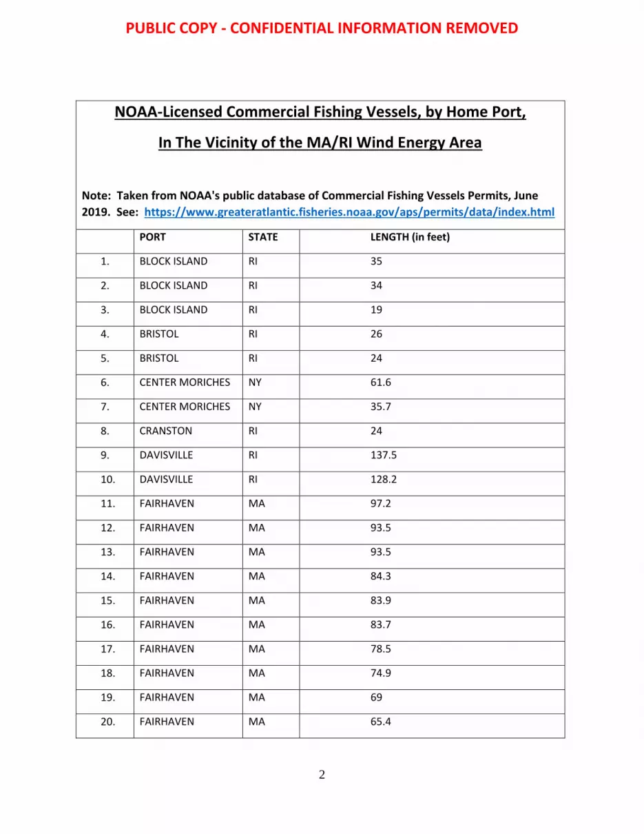
2
NOAA-Licensed Commercial Fishing Vessels, by Home Port,
In The Vicinity of the MA/RI Wind Energy Area
Note: Taken from NOAA's public database of Commercial Fishing Vessels Permits, June
2019. See: https://www.greateratlantic.fisheries.noaa.gov/aps/permits/data/index.html
PORT STATE LENGTH (in feet)
1. BLOCK ISLAND RI 35
2. BLOCK ISLAND RI 34
3. BLOCK ISLAND RI 19
4. BRISTOL RI 26
5. BRISTOL RI 24
6. CENTER MORICHES NY 61.6
7. CENTER MORICHES NY 35.7
8. CRANSTON RI 24
9. DAVISVILLE RI 137.5
10. DAVISVILLE RI 128.2
11. FAIRHAVEN MA 97.2
12. FAIRHAVEN MA 93.5
13. FAIRHAVEN MA 93.5
14. FAIRHAVEN MA 84.3
15. FAIRHAVEN MA 83.9
16. FAIRHAVEN MA 83.7
17. FAIRHAVEN MA 78.5
18. FAIRHAVEN MA 74.9
19. FAIRHAVEN MA 69
20. FAIRHAVEN MA 65.4
PUBLIC COPY - CONFIDENTIAL INFORMATION REMOVED

3
21. FAIRHAVEN MA 59.4
22. FAIRHAVEN MA 52.5
23. FAIRHAVEN MA 45
24. FAIRHAVEN MA 44
25. FAIRHAVEN MA 44
26. FAIRHAVEN MA 42
27. FAIRHAVEN MA 38.30
28. FAIRHAVEN MA 35
29. FAIRHAVEN MA 34.2
30. FAIRHAVEN MA 34.11
31. FAIRHAVEN MA 34
32. FAIRHAVEN MA 24
33. FAIRHAVEN MA 20
34. FAIRHAVEN MA 104.5
35. FALL RIVER MA 31.4
36. FALMOUTH MA 35.8
37. FALMOUTH MA 32
38. FALMOUTH MA 26
39. GALILEE RI 56.7
40. GALILEE RI 43
41. GALILEE RI 40.7
42. GALILEE RI 40
43. GALILEE RI 39.3
44. GALILEE RI 34.9
45. GALILEE RI 34.3
46. GALILEE RI 32
47. GALILEE RI 30
48. GALLILEE RI 25
PUBLIC COPY - CONFIDENTIAL INFORMATION REMOVED

4
49. GROTON CT 44
50. GROTON CT 42
51. GROTON CT 42
52. GROTON CT 100.3
53. HAMPTON BAYS NY 59.8
54. HAMPTON BAYS NY 53.8
55. HAMPTON BAYS NY 46
56. HAMPTON BAYS NY 44.6
57. HAMPTON BAYS NY 44
58. HAMPTON BAYS NY 42
59. HAMPTON BAYS NY 41
60. HAMPTON BAYS NY 39.4
61. HAMPTON BAYS NY 38
62. HAMPTON BAYS NY 36
63. HAMPTON BAYS NY 35.3
64. HAMPTON BAYS NY 31.2
65. JAMESTOWN RI 32.6
66. LITTLE COMPTON RI 41
67. LITTLE COMPTON RI 36.8
68. MATTAPOISETT MA 33.6
69. MATTAPOISETT MA 28.2
70. MATTITUCK NY 30.6
71. MATTITUCK NY 16
72. MEDFORD MA 27
73. MENEMSHA MA 47
74. MENEMSHA MA 38.1
75. MENEMSHA MA 38
76. MENEMSHA MA 37.7
PUBLIC COPY - CONFIDENTIAL INFORMATION REMOVED

5
77. MENEMSHA MA 34
78. MENEMSHA MA 34
79. MENEMSHA MA 33.8
80. MENEMSHA MA 32
81. MENEMSHA MA 31.9
82. MENEMSHA MA 30.7
83. MENEMSHA MA 20
84. MENEMSHA MA 18
85. MONTAUK NY 92.3
86. MONTAUK NY 90.4
87. MONTAUK NY 88.2
88. MONTAUK NY 80.4
89. MONTAUK NY 76
90. MONTAUK NY 75.7
91. MONTAUK NY 73.9
92. MONTAUK NY 73
93. MONTAUK NY 72
94. MONTAUK NY 69.7
95. MONTAUK NY 64.8
96. MONTAUK NY 64.5
97. MONTAUK NY 63
98. MONTAUK NY 61.3
99. MONTAUK NY 60.8
100. MONTAUK NY 60.4
101. MONTAUK NY 59.3
102. MONTAUK NY 57
103. MONTAUK NY 57
104. MONTAUK NY 55.9
PUBLIC COPY - CONFIDENTIAL INFORMATION REMOVED

6
105. MONTAUK NY 55
106. MONTAUK NY 51
107. MONTAUK NY 51
108. MONTAUK NY 48.6
109. MONTAUK NY 47.3
110. MONTAUK NY 45.7
111. MONTAUK NY 45
112. MONTAUK NY 45
113. MONTAUK NY 45
114. MONTAUK NY 45
115. MONTAUK NY 45
116. MONTAUK NY 45
117. MONTAUK NY 44
118. MONTAUK NY 44
119. MONTAUK NY 44
120. MONTAUK NY 43.9
121. MONTAUK NY 43.9
122. MONTAUK NY 43
123. MONTAUK NY 43
124. MONTAUK NY 43
125. MONTAUK NY 42.3
126. MONTAUK NY 42.3
127. MONTAUK NY 42
128. MONTAUK NY 41.8
129. MONTAUK NY 41.7
130. MONTAUK NY 41.6
131. MONTAUK NY 41
132. MONTAUK NY 40.7
PUBLIC COPY - CONFIDENTIAL INFORMATION REMOVED

7
133. MONTAUK NY 40.1
134. MONTAUK NY 40
135. MONTAUK NY 39.9
136. MONTAUK NY 39.4
137. MONTAUK NY 39.1
138. MONTAUK NY 39
139. MONTAUK NY 39
140. MONTAUK NY 38.5
141. MONTAUK NY 38.4
142. MONTAUK NY 38.3
143. MONTAUK NY 38.2
144. MONTAUK NY 38.1
145. MONTAUK NY 38.1
146. MONTAUK NY 38.1
147. MONTAUK NY 37.3
148. MONTAUK NY 37
149. MONTAUK NY 36.7
150. MONTAUK NY 36.3
151. MONTAUK NY 36
152. MONTAUK NY 35.3
153. MONTAUK NY 35.3
154. MONTAUK NY 35.1
155. MONTAUK NY 35
156. MONTAUK NY 35
157. MONTAUK NY 35
158. MONTAUK NY 35
159. MONTAUK NY 35
160. MONTAUK NY 35
PUBLIC COPY - CONFIDENTIAL INFORMATION REMOVED

8
161. MONTAUK NY 35
162. MONTAUK NY 34.9
163. MONTAUK NY 34.9
164. MONTAUK NY 34.8
165. MONTAUK NY 34.7
166. MONTAUK NY 34.6
167. MONTAUK NY 34
168. MONTAUK NY 34
169. MONTAUK NY 33.8
170. MONTAUK NY 32
171. MONTAUK NY 32
172. MONTAUK NY 31.8
173. MONTAUK NY 31.7
174. MONTAUK NY 31.6
175. MONTAUK NY 31.4
176. MONTAUK NY 31.3
177. MONTAUK NY 31.3
178. MONTAUK NY 31
179. MONTAUK NY 31
180. MONTAUK NY 31
181. MONTAUK NY 30.2
182. MONTAUK NY 30
183. MONTAUK NY 30
184. MONTAUK NY 29.1
185. MONTAUK NY 29
186. MONTAUK NY 29
187. MONTAUK NY 29
188. MONTAUK NY 28.5
PUBLIC COPY - CONFIDENTIAL INFORMATION REMOVED

9
189. MONTAUK NY 28.4
190. MONTAUK NY 28.4
191. MONTAUK NY 28.2
192. MONTAUK NY 28
193. MONTAUK NY 28
194. MONTAUK NY 27
195. MONTAUK NY 27
196. MONTAUK NY 27
197. MONTAUK NY 27
198. MONTAUK NY 26.7
199. MONTAUK NY 26
200. MONTAUK NY 26
201. MONTAUK NY 25.1
202. MONTAUK NY 25
203. MONTAUK NY 25
204. MONTAUK NY 25
205. MONTAUK NY 24.5
206. MONTAUK NY 23
207. MONTAUK NY 21.25
208. MONTAUK NY 19
209. MONTAUK NY 13
210. MONTAUK NY 12
211. MONTAUK NY 117.4
212. MONTAUK NY 101
213. MYSTIC CT 73.1
214. MYSTIC CT 43.2
215. NANTUCKET MA 36
216. NANTUCKET MA 35
PUBLIC COPY - CONFIDENTIAL INFORMATION REMOVED

10
217. NANTUCKET MA 35
218. NANTUCKET MA 35
219. NANTUCKET MA 31.9
220. NANTUCKET MA 31.5
221. NANTUCKET MA 26.7
222. NARRAGANSETT RI 77.9
223. NARRAGANSETT RI 77
224. NARRAGANSETT RI 76.7
225. NARRAGANSETT RI 69.2
226. NARRAGANSETT RI 49.3
227. NARRAGANSETT RI 44
228. NARRAGANSETT RI 42
229. NARRAGANSETT RI 41.7
230. NARRAGANSETT RI 36.8
231. NARRAGANSETT RI 35.9
232. NARRAGANSETT RI 35.3
233. NARRAGANSETT RI 35
234. NARRAGANSETT RI 33
235. NARRAGANSETT RI 31.3
236. NARRAGANSETT RI 30
237. NARRAGANSETT RI 26
238. NARRAGANSETT RI 20
239. NAUSET MA 36
240. NEW BEDFORD MA 99.8
241. NEW BEDFORD MA 99.1
242. NEW BEDFORD MA 98.9
243. NEW BEDFORD MA 98.8
244. NEW BEDFORD MA 98.8
PUBLIC COPY - CONFIDENTIAL INFORMATION REMOVED

11
245. NEW BEDFORD MA 97.2
246. NEW BEDFORD MA 97.2
247. NEW BEDFORD MA 95.6
248. NEW BEDFORD MA 93.9
249. NEW BEDFORD MA 93.5
250. NEW BEDFORD MA 93.5
251. NEW BEDFORD MA 93.4
252. NEW BEDFORD MA 92.8
253. NEW BEDFORD MA 92.7
254. NEW BEDFORD MA 92.2
255. NEW BEDFORD MA 92.1
256. NEW BEDFORD MA 92.1
257. NEW BEDFORD MA 92
258. NEW BEDFORD MA 91.9
259. NEW BEDFORD MA 91.9
260. NEW BEDFORD MA 91.9
261. NEW BEDFORD MA 91.7
262. NEW BEDFORD MA 91.7
263. NEW BEDFORD MA 91.6
264. NEW BEDFORD MA 90.6
265. NEW BEDFORD MA 9.5
266. NEW BEDFORD MA 9.4
267. NEW BEDFORD MA 9.4
268. NEW BEDFORD MA 9.4
269. NEW BEDFORD MA 9.4
270. NEW BEDFORD MA 9.4
271. NEW BEDFORD MA 9.4
272. NEW BEDFORD MA 9.4
PUBLIC COPY - CONFIDENTIAL INFORMATION REMOVED

12
273. NEW BEDFORD MA 89.5
274. NEW BEDFORD MA 89.5
275. NEW BEDFORD MA 89.3
276. NEW BEDFORD MA 88.7
277. NEW BEDFORD MA 88.4
278. NEW BEDFORD MA 88.4
279. NEW BEDFORD MA 88.4
280. NEW BEDFORD MA 88.4
281. NEW BEDFORD MA 88.4
282. NEW BEDFORD MA 88.4
283. NEW BEDFORD MA 88.4
284. NEW BEDFORD MA 88.1
285. NEW BEDFORD MA 88.1
286. NEW BEDFORD MA 88.1
287. NEW BEDFORD MA 88.1
288. NEW BEDFORD MA 88.1
289. NEW BEDFORD MA 88.1
290. NEW BEDFORD MA 88.1
291. NEW BEDFORD MA 88.1
292. NEW BEDFORD MA 88
293. NEW BEDFORD MA 87.5
294. NEW BEDFORD MA 87.3
295. NEW BEDFORD MA 86.8
296. NEW BEDFORD MA 86.5
297. NEW BEDFORD MA 86.3
298. NEW BEDFORD MA 86.2
299. NEW BEDFORD MA 86.2
300. NEW BEDFORD MA 86.1
PUBLIC COPY - CONFIDENTIAL INFORMATION REMOVED

13
301. NEW BEDFORD MA 86
302. NEW BEDFORD MA 85.7
303. NEW BEDFORD MA 85.3
304. NEW BEDFORD MA 85.3
305. NEW BEDFORD MA 85.3
306. NEW BEDFORD MA 85.3
307. NEW BEDFORD MA 85
308. NEW BEDFORD MA 84.7
309. NEW BEDFORD MA 84.6
310. NEW BEDFORD MA 84.6
311. NEW BEDFORD MA 84.6
312. NEW BEDFORD MA 84.6
313. NEW BEDFORD MA 84.6
314. NEW BEDFORD MA 84.6
315. NEW BEDFORD MA 84.6
316. NEW BEDFORD MA 84.5
317. NEW BEDFORD MA 84.5
318. NEW BEDFORD MA 84.5
319. NEW BEDFORD MA 84.5
320. NEW BEDFORD MA 84.5
321. NEW BEDFORD MA 84.4
322. NEW BEDFORD MA 84.4
323. NEW BEDFORD MA 84.4
324. NEW BEDFORD MA 84.3
325. NEW BEDFORD MA 84.2
326. NEW BEDFORD MA 84.1
327. NEW BEDFORD MA 84
328. NEW BEDFORD MA 84
PUBLIC COPY - CONFIDENTIAL INFORMATION REMOVED

14
329. NEW BEDFORD MA 83.7
330. NEW BEDFORD MA 83.7
331. NEW BEDFORD MA 83.6
332. NEW BEDFORD MA 83.4
333. NEW BEDFORD MA 83.4
334. NEW BEDFORD MA 83.4
335. NEW BEDFORD MA 83.4
336. NEW BEDFORD MA 83.4
337. NEW BEDFORD MA 83.4
338. NEW BEDFORD MA 83.3
339. NEW BEDFORD MA 83
340. NEW BEDFORD MA 83
341. NEW BEDFORD MA 82.6
342. NEW BEDFORD MA 82.4
343. NEW BEDFORD MA 82.3
344. NEW BEDFORD MA 82.1
345. NEW BEDFORD MA 82.1
346. NEW BEDFORD MA 82.1
347. NEW BEDFORD MA 81.8
348. NEW BEDFORD MA 81.6
349. NEW BEDFORD MA 81.6
350. NEW BEDFORD MA 81.6
351. NEW BEDFORD MA 81.6
352. NEW BEDFORD MA 81.6
353. NEW BEDFORD MA 81.6
354. NEW BEDFORD MA 81.6
355. NEW BEDFORD MA 81
356. NEW BEDFORD MA 81
PUBLIC COPY - CONFIDENTIAL INFORMATION REMOVED

15
357. NEW BEDFORD MA 81
358. NEW BEDFORD MA 80.5
359. NEW BEDFORD MA 80.5
360. NEW BEDFORD MA 80.3
361. NEW BEDFORD MA 80.2
362. NEW BEDFORD MA 8.3
363. NEW BEDFORD MA 79.9
364. NEW BEDFORD MA 79.9
365. NEW BEDFORD MA 79.7
366. NEW BEDFORD MA 79.2
367. NEW BEDFORD MA 78.5
368. NEW BEDFORD MA 78.3
369. NEW BEDFORD MA 78.3
370. NEW BEDFORD MA 78
371. NEW BEDFORD MA 77.9
372. NEW BEDFORD MA 77.9
373. NEW BEDFORD MA 77.8
374. NEW BEDFORD MA 77.8
375. NEW BEDFORD MA 77.7
376. NEW BEDFORD MA 77.5
377. NEW BEDFORD MA 76.6
378. NEW BEDFORD MA 76.5
379. NEW BEDFORD MA 76.4
380. NEW BEDFORD MA 76.3
381. NEW BEDFORD MA 76.3
382. NEW BEDFORD MA 76.1
383. NEW BEDFORD MA 75.7
384. NEW BEDFORD MA 75.7
PUBLIC COPY - CONFIDENTIAL INFORMATION REMOVED

16
385. NEW BEDFORD MA 75.7
386. NEW BEDFORD MA 75.4
387. NEW BEDFORD MA 75.3
388. NEW BEDFORD MA 75.3
389. NEW BEDFORD MA 75
390. NEW BEDFORD MA 74.8
391. NEW BEDFORD MA 74.8
392. NEW BEDFORD MA 74.8
393. NEW BEDFORD MA 74.6
394. NEW BEDFORD MA 74.4
395. NEW BEDFORD MA 73.9
396. NEW BEDFORD MA 73.9
397. NEW BEDFORD MA 73.7
398. NEW BEDFORD MA 73.7
399. NEW BEDFORD MA 73.6
400. NEW BEDFORD MA 73.6
401. NEW BEDFORD MA 73.1
402. NEW BEDFORD MA 72.1
403. NEW BEDFORD MA 72.1
404. NEW BEDFORD MA 72.1
405. NEW BEDFORD MA 71.5
406. NEW BEDFORD MA 71.3
407. NEW BEDFORD MA 71.1
408. NEW BEDFORD MA 70.5
409. NEW BEDFORD MA 70.3
410. NEW BEDFORD MA 70.3
411. NEW BEDFORD MA 69.7
412. NEW BEDFORD MA 69.5
PUBLIC COPY - CONFIDENTIAL INFORMATION REMOVED

17
413. NEW BEDFORD MA 69.5
414. NEW BEDFORD MA 68.4
415. NEW BEDFORD MA 68.4
416. NEW BEDFORD MA 67.8
417. NEW BEDFORD MA 66.4
418. NEW BEDFORD MA 65.4
419. NEW BEDFORD MA 65.2
420. NEW BEDFORD MA 65
421. NEW BEDFORD MA 64.9
422. NEW BEDFORD MA 64.8
423. NEW BEDFORD MA 64.8
424. NEW BEDFORD MA 64.7
425. NEW BEDFORD MA 63
426. NEW BEDFORD MA 63
427. NEW BEDFORD MA 62.9
428. NEW BEDFORD MA 62.2
429. NEW BEDFORD MA 61
430. NEW BEDFORD MA 61
431. NEW BEDFORD MA 60.6
432. NEW BEDFORD MA 60
433. NEW BEDFORD MA 60
434. NEW BEDFORD MA 6
435. NEW BEDFORD MA 58
436. NEW BEDFORD MA 57.9
437. NEW BEDFORD MA 56.6
438. NEW BEDFORD MA 55.2
439. NEW BEDFORD MA 55
440. NEW BEDFORD MA 55
PUBLIC COPY - CONFIDENTIAL INFORMATION REMOVED

18
441. NEW BEDFORD MA 51.6
442. NEW BEDFORD MA 51.4
443. NEW BEDFORD MA 51
444. NEW BEDFORD MA 49.11
445. NEW BEDFORD MA 47.1
446. NEW BEDFORD MA 47
447. NEW BEDFORD MA 46.8
448. NEW BEDFORD MA 45.1
449. NEW BEDFORD MA 44.11
450. NEW BEDFORD MA 44
451. NEW BEDFORD MA 44
452. NEW BEDFORD MA 43.5
453. NEW BEDFORD MA 42
454. NEW BEDFORD MA 42
455. NEW BEDFORD MA 41
456. NEW BEDFORD MA 38.1
457. NEW BEDFORD MA 36.8
458. NEW BEDFORD MA 32.2
459. NEW BEDFORD MA 32
460. NEW BEDFORD MA 29.1
461. NEW BEDFORD MA 28.2
462. NEW BEDFORD MA 25.2
463. NEW BEDFORD MA 25
464. NEW BEDFORD MA 21
465. NEW BEDFORD MA 20.9
466. NEW BEDFORD MA 19
467. NEW BEDFORD MA 18
468. NEW BEDFORD MA 16
PUBLIC COPY - CONFIDENTIAL INFORMATION REMOVED

19
469. NEW BEDFORD MA 15.8
470. NEW BEDFORD MA 14.1
471. NEW BEDFORD MA 14
472. NEW BEDFORD MA 13
473. NEW BEDFORD MA 129.5
474. NEW BEDFORD MA 120.8
475. NEW BEDFORD MA 12
476. NEW BEDFORD MA 11.1
477. NEW BEDFORD MA 108.6
478. NEW BEDFORD MA 107.2
479. NEW BEDFORD MA 106.2
480. NEW BEDFORD MA 101.3
481. NEW BEDFORD MA 101.3
482. NEW BEDFORD MA 10
483. NEW BEDFORD MA 10
484. NEW LONDON CT 80
485. NEW LONDON CT 52
486. NEW LONDON CT 49
487. NEW LONDON CT 49
488. NEW LONDON CT 44.3
489. NEW LONDON CT 42.5
490. NEW LONDON CT 39.9
491. NEW LONDON CT 39.1
492. NEW LONDON CT 38.2
493. NEW LONDON CT 38.1
494. NEW LONDON CT 36.1
495. NEWPORT RI 77
496. NEWPORT RI 76
PUBLIC COPY - CONFIDENTIAL INFORMATION REMOVED

20
497. NEWPORT RI 75.5
498. NEWPORT RI 69.4
499. NEWPORT RI 65.8
500. NEWPORT RI 64.9
501. NEWPORT RI 63.5
502. NEWPORT RI 62.1
503. NEWPORT RI 60
504. NEWPORT RI 43
505. NEWPORT RI 42
506. NEWPORT RI 40.1
507. NEWPORT RI 40
508. NEWPORT RI 40
509. NEWPORT RI 39
510. NEWPORT RI 39
511. NEWPORT RI 38
512. NEWPORT RI 37.9
513. NEWPORT RI 36.4
514. NEWPORT RI 32
515. NEWPORT RI 20
516. NEWPORT RI 15
517. NEWPORT RI 13
518. NEWPORT RI 10
519. NIANTIC CT 64
520. NIANTIC CT 36.4
521. NOANK CT 59.2
522. NOANK CT 50
523. NOANK CT 42
524. NOANK CT 42
PUBLIC COPY - CONFIDENTIAL INFORMATION REMOVED

21
525. NOANK CT 38.1
526. NOANK CT 38
527. NOANK CT 24
528. NORTH KINGSTOWN RI 30.5
529. NORTH KINGSTOWN RI 25.7
530. NORWALK CT 55
531. OLD SAYBROOK CT 28.4
532. ORIENT NY 44.8
533. ORIENT NY 39.9
534. ORIENT POINT NY 40.3
535. ORIENT POINT NY 31.3
536. POINT JUDITH RI 83
537. POINT JUDITH RI 81.3
538. POINT JUDITH RI 80
539. POINT JUDITH RI 79.3
540. POINT JUDITH RI 78.6
541. POINT JUDITH RI 78.5
542. POINT JUDITH RI 77.7
543. POINT JUDITH RI 77.2
544. POINT JUDITH RI 76.8
545. POINT JUDITH RI 76.7
546. POINT JUDITH RI 76.4
547. POINT JUDITH RI 75.7
548. POINT JUDITH RI 73.5
549. POINT JUDITH RI 72.7
550. POINT JUDITH RI 72.4
551. POINT JUDITH RI 72.2
552. POINT JUDITH RI 72
PUBLIC COPY - CONFIDENTIAL INFORMATION REMOVED

22
553. POINT JUDITH RI 71.6
554. POINT JUDITH RI 71.2
555. POINT JUDITH RI 69.2
556. POINT JUDITH RI 67.7
557. POINT JUDITH RI 67.5
558. POINT JUDITH RI 67.1
559. POINT JUDITH RI 67.1
560. POINT JUDITH RI 67.1
561. POINT JUDITH RI 67
562. POINT JUDITH RI 67
563. POINT JUDITH RI 65.7
564. POINT JUDITH RI 65.2
565. POINT JUDITH RI 64.9
566. POINT JUDITH RI 64.9
567. POINT JUDITH RI 64.8
568. POINT JUDITH RI 64.4
569. POINT JUDITH RI 64.3
570. POINT JUDITH RI 63
571. POINT JUDITH RI 62.7
572. POINT JUDITH RI 62.7
573. POINT JUDITH RI 62.1
574. POINT JUDITH RI 61.9
575. POINT JUDITH RI 61.5
576. POINT JUDITH RI 60.8
577. POINT JUDITH RI 59.2
578. POINT JUDITH RI 58.7
579. POINT JUDITH RI 58.2
580. POINT JUDITH RI 56.9
PUBLIC COPY - CONFIDENTIAL INFORMATION REMOVED

23
581. POINT JUDITH RI 56.5
582. POINT JUDITH RI 55
583. POINT JUDITH RI 55
584. POINT JUDITH RI 54
585. POINT JUDITH RI 52.6
586. POINT JUDITH RI 50
587. POINT JUDITH RI 50
588. POINT JUDITH RI 50
589. POINT JUDITH RI 49.8
590. POINT JUDITH RI 46.2
591. POINT JUDITH RI 46
592. POINT JUDITH RI 46
593. POINT JUDITH RI 46
594. POINT JUDITH RI 45
595. POINT JUDITH RI 45
596. POINT JUDITH RI 45
597. POINT JUDITH RI 44.5
598. POINT JUDITH RI 44.11
599. POINT JUDITH RI 44
600. POINT JUDITH RI 44
601. POINT JUDITH RI 44
602. POINT JUDITH RI 43.5
603. POINT JUDITH RI 43
604. POINT JUDITH RI 43
605. POINT JUDITH RI 42.5
606. POINT JUDITH RI 42.3
607. POINT JUDITH RI 42.2
608. POINT JUDITH RI 42.2
PUBLIC COPY - CONFIDENTIAL INFORMATION REMOVED

24
609. POINT JUDITH RI 42
610. POINT JUDITH RI 41.2
611. POINT JUDITH RI 40.7
612. POINT JUDITH RI 40
613. POINT JUDITH RI 40
614. POINT JUDITH RI 40
615. POINT JUDITH RI 40
616. POINT JUDITH RI 39.9
617. POINT JUDITH RI 39.3
618. POINT JUDITH RI 39.2
619. POINT JUDITH RI 38.3
620. POINT JUDITH RI 38.3
621. POINT JUDITH RI 38.2
622. POINT JUDITH RI 38.1
623. POINT JUDITH RI 38.1
624. POINT JUDITH RI 38
625. POINT JUDITH RI 38
626. POINT JUDITH RI 38
627. POINT JUDITH RI 37.5
628. POINT JUDITH RI 37
629. POINT JUDITH RI 37
630. POINT JUDITH RI 36.7
631. POINT JUDITH RI 36.7
632. POINT JUDITH RI 36
633. POINT JUDITH RI 35.9
634. POINT JUDITH RI 35.8
635. POINT JUDITH RI 35.7
636. POINT JUDITH RI 35
PUBLIC COPY - CONFIDENTIAL INFORMATION REMOVED

25
637. POINT JUDITH RI 35
638. POINT JUDITH RI 35
639. POINT JUDITH RI 35
640. POINT JUDITH RI 35
641. POINT JUDITH RI 34.3
642. POINT JUDITH RI 34.1
643. POINT JUDITH RI 33
644. POINT JUDITH RI 31.8
645. POINT JUDITH RI 31.3
646. POINT JUDITH RI 30.1
647. POINT JUDITH RI 29.7
648. POINT JUDITH RI 29.6
649. POINT JUDITH RI 28.5
650. POINT JUDITH RI 28.2
651. POINT JUDITH RI 28.2
652. POINT JUDITH RI 25
653. POINT JUDITH RI 23
654. POINT JUDITH RI 21
655. POINT JUDITH RI 18
656. POINT JUDITH RI 16
657. POINT JUDITH RI 14
658. POINT JUDITH RI 12
659. POINT JUDITH RI 10
660. POINT LOOKOUT NY 62
661. POINT LOOKOUT NY 56.8
662. PORT JEFFERSON NY 61.6
663. PORT JEFFERSON NY 24
664. PORT JEFFERSON NY 22
PUBLIC COPY - CONFIDENTIAL INFORMATION REMOVED

26
665. PORTSMOUTH RI 62
666. PORTSMOUTH RI 24
667. PROVIDENCE RI 66.6
668. SAKONET PT RI 26
669. SAKONNET RI 8
670. SAKONNET RI 50
671. SAKONNET RI 45
672. SAKONNET RI 32
673. SAKONNET RI 18
674. SAKONNET RI 15
675. SAKONNET POINT RI 53
676. SAKONNET POINT RI 40.8
677. SAKONNET POINT RI 38.8
678. SAKONNET POINT RI 35
679. SHINNECOCK NY 68.5
680. SHINNECOCK NY 64.8
681. SHINNECOCK NY 55
682. SHINNECOCK NY 50
683. SHINNECOCK NY 49.9
684. SHINNECOCK NY 47.7
685. SHINNECOCK NY 45
686. SHINNECOCK NY 40
687. SHINNECOCK NY 38.8
688. SHINNECOCK NY 38.2
689. SHINNECOCK NY 38
690. SHINNECOCK NY 35
691. SHINNECOCK NY 34.6
692. SHINNECOCK NY 31.7
PUBLIC COPY - CONFIDENTIAL INFORMATION REMOVED

27
693. SHINNECOCK NY 15
694. SNUG HARBOR RI 64
695. SNUG HARBOR RI 45
696. SNUG HARBOR RI 45
697. SNUG HARBOR RI 37.5
698. SNUG HARBOR RI 37
699. SNUG HARBOR RI 36
700. SNUG HARBOR RI 33.3
701. SNUG HARBOR RI 32.9
702. SOUTH
DARTMOUTH
MA 32
703. SOUTH
DARTMOUTH
MA 28.6
704. SOUTH
DARTMOUTH
MA 28
705. SOUTH KINGSTOWN RI 74
706. SOUTH KINGSTOWN RI 23
707. SOUTHOLD NY 38
708. SOUTHOLD NY 29.1
709. SOUTHOLD NY 28
710. STONINGTON CT 9.4
711. STONINGTON CT 81.4
712. STONINGTON CT 77
713. STONINGTON CT 74.1
714. STONINGTON CT 71.9
715. STONINGTON CT 53.4
716. STONINGTON CT 50
717. STONINGTON CT 43.3
718. STONINGTON CT 42.9
PUBLIC COPY - CONFIDENTIAL INFORMATION REMOVED

28
719. STONINGTON CT 42.2
720. STONINGTON CT 42
721. STONINGTON CT 39.5
722. STONINGTON CT 36
723. STONINGTON CT 32
724. STONINGTON CT 30.4
725. STONINGTON CT 30.3
726. STRATFORD CT 54
727. TIVERTON RI 69.2
728. TIVERTON RI 50
729. TIVERTON RI 42
730. TIVERTON RI 40
731. TIVERTON RI 38.3
732. TIVERTON RI 30
733. VINEYARD HAVEN MA 65.8
734. VINEYARD HAVEN MA 49.3
735. VINEYARD HAVEN MA 39.9
736. VINEYARD HAVEN MA 29
737. VINEYARD HAVEN MA 22.9
738. WAKEFIELD RI 38
739. WAKEFIELD RI 37.1
740. WAKEFIELD RI 35.8
741. WAKEFIELD RI 35.1
742. WAKEFIELD RI 13
743. WAKEFIELD RI 13
744. WAKEFIELD RI 12
745. WARREN RI 92.9
746. WARWICK RI 43
PUBLIC COPY - CONFIDENTIAL INFORMATION REMOVED

29
747. WARWICK RI 38
748. WARWICK RI 37.3
749. WARWICK RI 23
750. WARWICK RI 23
751. WATCH HILL RI 32.7
752. WATERFORD CT 80
753. WATERFORD CT 52.6
754. WATERFORD CT 48.8
755. WATERFORD CT 42.2
756. WATERFORD CT 41.8
757. WATERFORD CT 38.7
758. WATERFORD CT 36
759. WATERFORD CT 30.6
760. WESTERLY RI 41.5
761. WESTERLY RI 36.4
762. WESTPORT MA 63
763. WESTPORT MA 47
764. WESTPORT MA 46
765. WESTPORT MA 45.2
766. WESTPORT MA 44
767. WESTPORT MA 43.9
768. WESTPORT MA 41.8
769. WESTPORT MA 39.3
770. WESTPORT MA 38
771. WESTPORT MA 36.8
772. WESTPORT MA 36.7
773. WESTPORT MA 35
774. WESTPORT MA 19
PUBLIC COPY - CONFIDENTIAL INFORMATION REMOVED

30
775. WESTPORT MA 12
776. WESTPORT POINT MA 47.4
777. WESTPORT POINT MA 37
778. WICKFORD RI 37.6
779. WICKFORD RI 24
780. WICKFORD RI 22
781. WICKFORD RI 12
PUBLIC COPY - CONFIDENTIAL INFORMATION REMOVED

APPENDIX I
WEATHER INFORMATION
PUBLIC COPY - CONFIDENTIAL INFORMATION REMOVED

This page was intentionally left blank
PUBLIC COPY - CONFIDENTIAL INFORMATION REMOVED

1
Weather Station Locations
PUBLIC COPY - CONFIDENTIAL INFORMATION REMOVED

2
Weekly High Wave Height
0
5
10
15
20
25
CDIP 154 Weekly High Wave Height (ft) - 2019Source: Northeastern Regional Association of Coastal Ocean Observing Systems (NERACOOS)
0
5
10
15
20
25
1/1 2/1 3/1 4/1 5/1 6/1 7/1 8/1 9/1 10/1 11/1 12/1
CDIP 154 Weekly High Wave Height (ft) - 2018Source: Northeastern Regional Association of Coastal Ocean Observing Systems (NERACOOS)
0
5
10
15
20
25
1/2 2/2 3/2 4/2 5/2 6/2 7/2 8/2 9/2 10/2 11/2 12/2
CDIP 154 Weekly High Wave Height (ft) - 2017(Buoy data unavailable 8/21-11/20)
Source: Northeastern Regional Association of Coastal Ocean Observing Systems (NERACOOS)
PUBLIC COPY - CONFIDENTIAL INFORMATION REMOVED

3
Monthly Average Wind Speed
0.0
5.0
10.0
15.0
20.0
25.0
Monthly Average Wind Speed (Knots) - BUZM3Source: Northeastern Regional Association of Coastal Ocean Observing Systems (NERACOOS)
2019 2018 2017 2016 2015 2014
PUBLIC COPY - CONFIDENTIAL INFORMATION REMOVED

4
Monthly Maximum Wind Speed
0.0
10.0
20.0
30.0
40.0
50.0
60.0
Monthly Maximum Wind Speed (Knots) - BUZM3Source: Northeastern Regional Association of Coastal Ocean Observing Systems (NERACOOS)
2019 2018 2017 2016 2015 2014
PUBLIC COPY - CONFIDENTIAL INFORMATION REMOVED

5
PUBLIC COPY - CONFIDENTIAL INFORMATION REMOVED

6
PUBLIC COPY - CONFIDENTIAL INFORMATION REMOVED

ENCLOSURE 1
Federal Register Notice USCG-
2019-0131
(84 FR 11314)
March 26, 2019
PUBLIC COPY - CONFIDENTIAL INFORMATION REMOVED

This page was intentionally left blank
PUBLIC COPY - CONFIDENTIAL INFORMATION REMOVED

1
PUBLIC COPY - CONFIDENTIAL INFORMATION REMOVED

2
PUBLIC COPY - CONFIDENTIAL INFORMATION REMOVED

3
PUBLIC COPY - CONFIDENTIAL INFORMATION REMOVED

4
PUBLIC COPY - CONFIDENTIAL INFORMATION REMOVED

5
PUBLIC COPY - CONFIDENTIAL INFORMATION REMOVED

6
PUBLIC COPY - CONFIDENTIAL INFORMATION REMOVED

ENCLOSURE 2
Federal Register Notice USCG-
2019-0131
(84 FR 14384)
April 10, 2019
PUBLIC COPY - CONFIDENTIAL INFORMATION REMOVED

This page was intentionally left blank
PUBLIC COPY - CONFIDENTIAL INFORMATION REMOVED

1
PUBLIC COPY - CONFIDENTIAL INFORMATION REMOVED

2
PUBLIC COPY - CONFIDENTIAL INFORMATION REMOVED

ENCLOSURE 3
Marine Safety Information
Bulletin (MSIB) 01-19
PUBLIC COPY - CONFIDENTIAL INFORMATION REMOVED

This page was intentionally left blank
PUBLIC COPY - CONFIDENTIAL INFORMATION REMOVED

1
This email is sent to you as a member of the Marine Safety Information Bulletin mass emailing system.
Commander, U.S. Coast Guard Sector Southeastern New England
1 Little Harbor Road
Woods Hole, MA 02543
Tel: 508-457-3211
MARINE SAFETY INFORMATION BULLETIN
[MSIB # 01-19]
26 March 2019
MA/RI WIND ENERGY AREA
PORT ACCESS ROUTE STUDY
The Coast Guard is conducting a Massachusetts and Rhode Island Port Access Route Study to
evaluate the need for establishing vessel routing measures through the MA/RI Wind Energy Area
(MA/RI WEA). The information gathered during this study may result in the establishment of one
or more vessel routing measures through the MA/RI WEA. The goal of the study is to enhance
navigational safety by examining existing shipping routes and waterway uses. The
recommendations of the study may lead to future rulemaking action or appropriate international
agreements.
A summary of the Federal Register announcement is attached which includes the process for
submitting comments, and lists details on two scheduled public meetings.
For more complete information about this study and its purpose, and how to participate in the
study, see the Federal Register announcement at https://www.govinfo.gov/content/pkg/FR-2019-
03-26/pdf/2019-05730.pdf.
Questions regarding this Bulletin may be addressed to Mr. Edward G. LeBlanc at
[email protected], or 401-435-2351.
C. J. Glander
Captain, U.S. Coast Guard
Captain of the Port
Southeastern New England
PUBLIC COPY - CONFIDENTIAL INFORMATION REMOVED

2
MA/RI WIND ENERGY AREA
PORT ACCESS ROUTE STUDY
The Coast Guard is conducting a Massachusetts and Rhode Island Port Access Route Study
(MARIPARS) to evaluate the need for establishing vessel routing measures through the MA/RI
Wind Energy Area (MA/RI WEA). The information gathered during this MARIPARS may result
in the establishment of one or more vessel routing measures. The goal of the MARIPARS is to
enhance navigational safety by examining existing shipping routes and waterway uses. The
recommendations of the study may lead to future rulemaking action or appropriate international
agreements.
The Bureau of Ocean Energy Management (BOEM) has leased seven adjacent areas of the outer
continental shelf (OCS) south of Martha’s Vineyard and east of Rhode Island that together
constitute the MA/RI WEA. Potentially seven distinct offshore renewable energy installations
(“wind farms”) could be constructed, each with its own number, size, type of wind turbines, and
distinct turbine layout. The topic of safe navigation routes to facilitate vessel transit through the
MA/RI WEA has been discussed at various forums throughout southeastern New England. The
forums have included participation by the Coast Guard, other federal, state, and local agencies,
fishing industry representatives, and myriad stakeholders. Various transit plans have been
proposed through these different forums.
We are attempting to determine what, if any, navigational safety concerns exist with vessel transits
in the study area. We expect that information gathered during the study will help us identify
anticipated impacts to navigation that may be experienced by mariners intending to transit in,
around and through the study area which includes the MA/RI WEA, which is an area of wind farm
leases south of Martha’s Vineyard. All leases are currently being studied for development
including the construction of wind energy generating turbines affixed to the sea floor. These
installations could impact routes used to access ports (e.g., transiting from Georges Bank through
the MA/RI WEA to New Bedford; or from the vicinity of Montauk, NY/Point Judith, RI, to
Georges Bank, etc.). Impacts could result from factors such as number, size, type, and layout of
wind farm turbines and electric service platform(s), subsea cabling, increased vessel traffic,
changing vessel traffic patterns, weather conditions, or navigational difficulty. Comments should
include or reference data (both empirical and anecdotal) where available, published studies
(academic, government, or industry), and other supporting documentation.
As part of this study, we may collect and analyze data and other information on vessel traffic
characteristics and trends in an attempt to balance the needs of all waterway users.
PUBLIC COPY - CONFIDENTIAL INFORMATION REMOVED

3
MA/RI WIND ENERGY AREA
PORT ACCESS ROUTE STUDY
This study includes the following objectives:
1. Determine present vessel traffic types, patterns, and density;
2. Determine potential vessel traffic types, patterns, and density;
3. Determine if existing vessel routing measures are adequate;
4. Determine if existing vessel routing measures require modifications;
5. Determine the type of modifications;
6. Define and justify the needs for new vessel routing measures;
7. Determine the type of new vessel routing measures; and
8. Determine if the usage of the vessel routing measures must be mandatory for specific classes of
vessels.
Public Meetings: Two public meetings will be held to receive public comments:
1. Tuesday, April 23, 2019, from 6 p.m. to 9 p.m., at Corless Auditorium (Watkins
Laboratory Building), University of Rhode Island, Graduate School of
Oceanography, 215 South Ferry Road, Narragansett, RI 02882-1197.
2. Thursday, April 25, 2019, from 6 p.m. to 9 p.m., at Flanagan Hall, Massachusetts
Maritime Academy, 101 Academy Drive, Buzzards Bay, MA 02532.
Comments: Comments and related material must be received by the Coast Guard on or before
May 28, 2019. You may submit comments identified by docket number USCG-2019-0131 using
the Federal eRulemaking Portal at http://www.regulations.gov. If you submit comments to the
online public docket, please include the docket number for this rulemaking (USCG-2019-0131),
indicate the specific section of this document to which each comment applies, and provide a reason
for each suggestion or recommendation. We accept anonymous comments.
To submit your comment online, go to http://www.regulations.gov, and insert “USCG-2019-0131”
in the “search box.” Click “Search”. Then click “Comment Now.” We will consider all comments
and material received during the comment period.
Results: We will publish the results of the PARS in the Federal Register. It is possible the study
may validate the status quo (no routing measures) and conclude that no changes are necessary. It
is also possible the study may recommend one or more changes to enhance navigational safety and
the efficiency of vessel traffic management. The recommendations may lead to future rulemakings
or appropriate international agreements.
Questions: Questions regarding this study may be addressed to Mr. Edward G. LeBlanc at
[email protected], or 401-435-2351.
PUBLIC COPY - CONFIDENTIAL INFORMATION REMOVED

Section 5
Attachments
PUBLIC COPY - CONFIDENTIAL INFORMATION REMOVED

RAttachment 5.A
Empire Wind Phase 2 Wind Assessment
REDACTED
PUBLIC COPY - CONFIDENTIAL INFORMATION REMOVED

RAttachment 5.B
Beacon Wind Project Wind Assessment
REDACTED
PUBLIC COPY - CONFIDENTIAL INFORMATION REMOVED

RAttachment 5.C
KVT Hindcast Model
REDACTED
PUBLIC COPY - CONFIDENTIAL INFORMATION REMOVED

RAttachment 5.D
Empire Wind Phase 2 Hourly Wind Data
REDACTED
PUBLIC COPY - CONFIDENTIAL INFORMATION REMOVED

RAttachment 5.E
Beacon Wind Hourly Wind Data
REDACTED
PUBLIC COPY - CONFIDENTIAL INFORMATION REMOVED

Section 6
Attachments
PUBLIC COPY - CONFIDENTIAL INFORMATION REMOVED

RAttachment 6.A
O&M Schedules
REDACTED
PUBLIC COPY - CONFIDENTIAL INFORMATION REMOVED

RAttachment 7.A
Financing Plan
REDACTED
PUBLIC COPY - CONFIDENTIAL INFORMATION REMOVED

RAttachment 7.B
Financing Evaluation
REDACTED
PUBLIC COPY - CONFIDENTIAL INFORMATION REMOVED

RAttachment 7.C
Letters of Support from Leading Banks
REDACTED
PUBLIC COPY - CONFIDENTIAL INFORMATION REMOVED

RAttachment 7.D
Letters of Support from Leading Tax Equity Investors
REDACTED
PUBLIC COPY - CONFIDENTIAL INFORMATION REMOVED

RAttachment 7.E
Tax Analysis
REDACTED
PUBLIC COPY - CONFIDENTIAL INFORMATION REMOVED

RAttachment 7.F
Equinor ASA Financial Statements
PUBLIC COPY - CONFIDENTIAL INFORMATION REMOVED

Equinor Wind US LLC Page 1 ORECRFP20-1 October 2020
Equinor ASA’s Annual Reports and Sustainability Reports for the last three years can be found at the links below. If NYSERDA would prefer hard copies, Equinor would be happy to provide them. Please do not hesitate to contact Equinor with any additional questions
Annual Reports Sustainability Reports 2019 2019 2018 2018 2017 2017
PUBLIC COPY - CONFIDENTIAL INFORMATION REMOVED

RAttachment 7.G
Equinor US Holdings Financial Statements
REDACTED
PUBLIC COPY - CONFIDENTIAL INFORMATION REMOVED

RAttachment 7.H
Fisheries Survival Fund v. Sally Jewell Documents
PUBLIC COPY - CONFIDENTIAL INFORMATION REMOVED

1
UNITED STATES DISTRICT COURTFOR THE DISTRICT OF COLUMBIA
)FISHERIES SURVIVAL FUND, et al., )
)Plaintiffs, )
)v. ) Case No. 16-cv-2409 (TSC)
)SALLY JEWELL, et al., )
)Defendants. )
)
MEMORANDUM OPINION
This case concerns a Bureau of Ocean Energy Management (“BOEM”) plan to lease a
nautical area off the coast of New York to Defendant-Intervenor Statoil Wind US, LLC
(“Statoil”), for development of a wind energy facility. Plaintiffs1, including the Fisheries
Survival Fund, claim that in issuing the lease, BOEM violated the National Environmental
Policy Act (“NEPA”), the Outer Continental Shelf Lands Act (“OCSLA”), and the
Administrative Procedure Act (“APA”). Plaintiffs filed a motion for preliminary injunction,
which this court denied. Memorandum Opinion, ECF No. 26. Now before the court are
Plaintiffs’ Motion for Summary Judgment, ECF No. 39, Defendant-Intervenor’s Cross-Motion
for Summary Judgment, ECF No. 40, and Defendants’ Motion for Summary Judgment, ECF No.
42. For the reasons stated herein, Plaintiffs’ motion will be DENIED, Defendants’ motion will
be GRANTED, and Defendant-Intervenor’s motion will be DENIED as moot.
1 The other Plaintiffs are: Borough of Barnegat Light, NJ; the Town Dock; Seafreeze Shoreside; Sea Fresh USA; Rhode Island Fishermen’s Alliance; Garden State Seafood Association; Long Island Commercial Fishing Association; the Town of Narragansett, RI; the NarragansettChamber of Commerce; the City of New Bedford, MA; and the Fishermen’s Dock Co-Operative of Point Pleasant.
Case 1:16-cv-02409-TSC Document 59 Filed 09/30/18 Page 1 of 24PUBLIC COPY - CONFIDENTIAL INFORMATION REMOVED

2
I. BACKGROUND
A. Statutory & Regulatory Framework
1. OCSLA
As amended by the Energy Policy Act of 2005, Pub. L. 109-58, 119 Stat. 594 (2005),
OCSLA authorizes BOEM to issue leases, easements, or rights-of-way for offshore renewable
energy projects. 43 U.S.C. § 1337(p)(1)(C). In exercising this authority, BOEM is required to
consult with the U.S. Coast Guard and other relevant federal agencies, and must consider several
factors that include, inter alia, safety, protection of the environment, prevention of waste,
conservation of natural resources, national security interests, and—critically—“the location of . .
. a lease. . . for an area of the outer Continental Shelf” and “any other use of the sea or seabed,
including use for a fishery, a sealane, a potential site of a deepwater port, or navigation.” Id. §
1337(p)(4)(A)–(L) & (J)(i)–(ii).
2. NEPA
NEPA was enacted to establish “a national policy [to] encourage productive and
enjoyable harmony between man and his environment,” to “prevent or eliminate damage to the
environment,” and “to enrich the understanding of the ecological systems and natural resources
important to the Nation.” 42 U.S.C. § 4321; see also Dep’t of Transp. v. Pub. Citizen, 541 U.S.
752, 756–57 (2004). NEPA serves these goals by imposing “procedural requirements on federal
agencies with a particular focus on requiring agencies to undertake analyses of the environmental
impact of their proposals and actions.” Pub. Citizen, 541 U.S. at 756–57; Theodore Roosevelt
Conservation P’ship v. Salazar, 616 F.3d 497, 503 (D.C. Cir. 2010) (noting that “[NEPA] is an
‘essentially procedural’ statute, meant to ensure ‘a fully informed and well-considered decision,
not necessarily’ the best decision”) (quoting Vermont Yankee Nuclear Power Corp. v. Natural
Case 1:16-cv-02409-TSC Document 59 Filed 09/30/18 Page 2 of 24PUBLIC COPY - CONFIDENTIAL INFORMATION REMOVED

3
Res. Def. Council, Inc., 435 U.S. 519, 558 (1978)). The statute requires that the relevant agency
(1) “consider every significant aspect of the environmental impact of a proposed action,”
Baltimore Gas & Elec. Co. v. Nat. Res. Def. Council, Inc., 462 U.S. 87, 97 (1983) (quoting
Vermont Yankee, 435 U.S. at 553), and (2) “inform the public that the agency has considered
environmental concerns in its decisionmaking process.” Weinberger v. Catholic Action of
Hawaii/Peace Educ. Project, 454 U.S. 139, 143 (1981).
“NEPA requires that when an agency proposes a ‘major Federal action[] significantly
affecting the quality of the human environment,’ the agency must prepare and circulate for
public review and comment an environmental impact statement (“EIS”) that examines the
environmental impact of the proposed action and compares the action to other alternatives.”
Theodore Roosevelt Conservation P’ship, 616 F.3d at 503 (quoting 42 U.S.C. § 4332(2)(C)); see
also Sierra Club v. Van Antwerp, 661 F.3d 1147, 1153 (D.C. Cir. 2011). Nevertheless, an EIS is
not always necessary. See Public Citizen v. NHTSA, 848 F.2d 256, 265 (1988) (“NEPA requires
the preparation of a complete EIS for ‘major federal actions significantly affecting the quality of
the human environment.’”) (emphasis in original). Agencies may “prepare a more limited
document”—known as an Environmental Assessment (“EA”)—if a proposed action is neither
categorically excluded from the EIS requirement nor of the kind that would normally require an
EIS. See 40 C.F.R. §§ 1501.4(a)–(b); Pub. Citizen, 541 U.S. at 757 (“CEQ regulations allow an
agency to prepare . . . an [EA] . . . if the agency’s proposed action neither is categorically
excluded from the requirement to produce an EIS nor would clearly require the production of an
EIS.”). An EA is a “concise public document” intended to “[b]riefly provide sufficient evidence
and analysis for determining whether to prepare an environmental impact statement or a finding
of no significant impact.” 40 C.F.R. §§ 1508.9(a)(1); Pub. Citizen, 541 U.S. at 757–58. Where
Case 1:16-cv-02409-TSC Document 59 Filed 09/30/18 Page 3 of 24PUBLIC COPY - CONFIDENTIAL INFORMATION REMOVED

4
preparation of an EA leads an agency to decide that an EIS is unnecessary, the agency is required
to issue a “finding of no significant impact”—“a document . . . briefly presenting the reasons
why an action . . . will not have a significant effect on the human environment and for which an
environmental impact statement will therefore not be prepared.” 40 C.F. R. §§ 1501.4(e),
1508.13.
B. BOEM’s Leasing Process
In accordance with OCSLA, BOEM promulgated a series of regulations governing the
leasing and management of offshore renewable energy projects. See 30 C.F.R. § 585.200–234.
Pursuant to these regulations, the commercial leasing process may be initiated by both solicited
and unsolicited applications. A solicited application is one in which BOEM itself identifies the
potential development site and initiates the leasing process by publishing a notice of Request for
Interest (“RFI”) or a Call for Information and Nominations in the Federal Register. See 30
C.F.R. §§ 585.210, 585.211(a). An unsolicited application is one in which a potential developer
applies for a site not otherwise under consideration by BOEM. See 30 C.F.R. § 585.230.
Upon receiving an unsolicited request, BOEM publishes a RFI to seek public comment
and determine whether there is competitive interest from other developers. Id. § 585.231(b). If
there is competitive interest, BOEM proceeds with the competitive process. Id. § 585.231(c)(1).
Otherwise, it publishes a notice of Determination of No Competitive Interest and follows a
separate procedure. Id. § 585.231(d)–(i). Regardless of the procedure adopted in any case,
BOEM must consult throughout the leasing process with state task forces, other state and local
representatives, and with representatives of Indian Tribes whose interests may be affected. Id.
§§ 585.102(e), 585.211(a)–(d), 585.231(e).
Case 1:16-cv-02409-TSC Document 59 Filed 09/30/18 Page 4 of 24PUBLIC COPY - CONFIDENTIAL INFORMATION REMOVED

5
Before issuing a lease, BOEM follows a four-step procedure, issuing a Call for
Information and Nominations, completing the Area Identification process, publishing a Proposed
Sale Notice, and publishing a Final Sale Notice. Id. § 585.211(a)–(d). Once BOEM has issued a
lease, the lessee must submit a Site Assessment Plan for review before any assessment activity
takes place. Id. §§ 585.601, 585.605. Even after completing a site assessment, a lessee may not
begin construction until it has submitted, and BOEM has approved, a Construction and
Operations Plan. Id. § 585.620(c). BOEM can accept, reject, or accept with modifications a
lessee’s Site Assessment or Construction and Operations Plan, id. §§ 585.613, 585.628, and must
analyze the potential environmental impacts of the plans. See id. §§ 585.613, 585.620(c).
C. Lease OCS–A 0512
In September 2011, a consortium of energy companies consisting of the New York Power
Authority, Long Island Power Authority, and Consolidated Edison (collectively, “the
Consortium”), proposed developing a wind energy facility covering approximately 81,500 acres
of ocean off the coast of New York. NYAR-0074853, 0074854. Due to safety concerns about
shipping lanes, the Consortium later amended the request to cover 81,130 acres, or about 127
square miles. NYAR-0074140. The Consortium claims the proposed project has “the potential
to be the largest offshore wind energy facility in the United States.” NYAR-0074853. Since the
Consortium’s request was unsolicited, BOEM initiated an RFI on January 4, 2013 to gauge other
companies’ interest in developing the area. 78 Fed. Reg. 760-02 (Jan. 4, 2013). The RFI also
requested that “interested and affected parties comment and provide information about site
conditions and multiple uses within the area identified in this notice that would be relevant to the
proposed project or its impacts.” Id. at 760 –61.
Case 1:16-cv-02409-TSC Document 59 Filed 09/30/18 Page 5 of 24PUBLIC COPY - CONFIDENTIAL INFORMATION REMOVED

6
After reviewing nominations of interest and acknowledging competitive interest in the
area, BOEM initiated the competitive leasing process. Compl. ¶ 54. On May 28, 2014, BOEM
published (1) a Notice of Intent to prepare an EA and (2) a Call for Information and Nominations
from companies interested in commercial wind energy leases in the proposed wind farm area. 79
Fed. Reg. 30,643–44 (May 28, 2014); 79 Fed. Reg. 30,645. BOEM also began the “Area
Identification” process to “identify offshore locations that appear most suitable for wind energy
development” and “designat[e] . . . an area with the greatest wind resource potential, minimal
environmental and space use conflict, and possible alternatives for environmental analysis.”
NYAR-0044172; 30 C.F.R. § 585.211(b). BOEM completed this process on March 14, 2016,
thereby marking the area as available for lease. See NYAR-0045776.
On June 6, 2016, BOEM published a “Proposed Sale Notice for Commercial Leasing for
Wind Power on the Outer Continental Shelf Offshore New York” in the Federal Register. 81
Fed. Reg. 36,336 (June 6, 2016) (NYAR-0047230). The Proposed Sale Notice included a sixty-
day comment period, which closed on August 6, 2016. Id. On June 6, BOEM also published an
EA, along with a Notice of Availability for a thirty-day public comment period. 81 Fed. Reg.
36,344 (June 6, 2016) (NYAR-0047238). According to the Notice of Availability, the EA
focused on assessing the potential impact of and reasonable alternatives to “commercial wind
lease issuance, site characterization activities (geophysical, geotechnical, archaeological, and
biological surveys) and site assessment activities (including the installation and operation of a
meteorological tower and/or buoys).” Id. The Notice also stated that “[s]hould a lessee propose
to construct a commercial wind facility through submission of a [Construction and Operations
Plan], BOEM would conduct a separate site and project-specific [NEPA] analysis, likely an
[EIS], and would provide additional opportunities for public involvement . . . .” Id. After
Case 1:16-cv-02409-TSC Document 59 Filed 09/30/18 Page 6 of 24PUBLIC COPY - CONFIDENTIAL INFORMATION REMOVED

7
requests from Plaintiff Fisheries Survival Fund and other groups, BOEM extended the public
comment period to July 13, 2016. Compl. ¶ 62.
On October 31, 2016, BOEM published the Final Sale Notice for the lease sale of the
area. 81 Fed. Reg. 75,429 (Oct. 31, 2016) (NYAR-0075588). BOEM determined that fourteen
different bidders were “legally, technically, and financially qualified to hold a commercial wind
lease” and to bid in the auction. Id. at 75,430 (NYAR-0075589). BOEM also published its
revised EA, which found no significant impact for commercial wind lease issuance and related
activities within the area. 81 Fed. Reg. 75,438 (Oct. 31, 2016). The finding of no significant
impact concluded that “the reasonably foreseeable environmental impacts . . . would not
significantly impact the quality of the human environment,” and “therefore, the preparation of an
environmental impact statement [was] not required.” Id.; see also NYAR-0074241. The EA
stated that “BOEM reduces its impacts early in the planning process by conducting site
identification through public stakeholder meetings to avoid areas that may have significant
impacts on the environment, including marine mammals.” NYAR-0074521.
On December 15 and 16, BOEM held a lease auction, which Statoil won with a
$42,469,725 bid. See Commercial Lease of Submerged Lands for Renewable Energy
Development on Continental Shelf (NYAR-0046753). BOEM and Statoil executed the lease on
March 15, 2017. NYAR-0046759. The lease grants Statoil the exclusive right to conduct site
characterization activities and, within one year of lease issuance, to propose a Site Assessment
Plan. NYAR-0046753; 30 C.F.R. §§ 585.601, 585.605. If BOEM approves the Plan, Statoil will
have five years to engage in site assessment—including conducting surveys and using towers or
buoys to evaluate wind resources—and propose a Construction and Operations Plan, 30 C.F.R.
§§ 585.235(a)(2), 585.601(b), which must include detailed data and information to support the
Case 1:16-cv-02409-TSC Document 59 Filed 09/30/18 Page 7 of 24PUBLIC COPY - CONFIDENTIAL INFORMATION REMOVED

8
plan for the wind facility, and proposals for minimizing environmental impact. 30 C.F.R. §
585.626(b). BOEM would then conduct “an appropriate NEPA analysis” based on the
information included in the Construction and Operations Plan, before deciding whether to
approve the Plan. 30 C.F.R. § 585.628(b).
II. LEGAL STANDARD
The APA requires courts to “set aside any agency action that is ‘arbitrary and capricious,
an abuse of discretion, or otherwise not in accordance with law.” 5 U.S.C. § 706(2)(A). In
assessing a summary judgment motion brought under the APA, courts are “not empowered to
substitute [their] judgment for that of the agency.” Beyond Nuclear v. U.S Dep’t of Energy, 233
F. Supp. 3d 40, 47 (D.D.C. 2017) (quoting Citizens to Preserve Overton Park, Inc. v. Volpe, 401
U.S. 402, 416 (1971)). Rather, the court’s role is to “determine whether or not as a matter of law
the evidence in the administrative record permitted the agency to make the decision it did.” Coe
v. McHugh, 968 F. Supp. 2d 237, 239–40 (D.D.C. 2013) (quoting Occidental Eng’g Co. v. INS,
753 F.2d 766, 769–70 (9th Cir. 1985)).
Generally, an agency action is arbitrary if:
the agency has relied on factors which Congress has not intended it to consider, entirely failed to consider an important aspect of the problem, offered an explanation for its decision that runs counter to the evidence before the agency, or is so implausible that it could not be ascribed to a difference in view or the product of agency expertise.
Delaware Riverkeeper Network v. FERC, 753 F.3d 1304, 1313 (D.C. Cir. 2014) (quoting Motor
Vehicle Mfrs. Ass’n of the U.S., Inc. v. State Farm Mut. Auto. Ins., 463 U.S. 29, 43 (1983)). This
standard also applies when assessing compliance with NEPA and the adequacy of an EIS. City of
Olmsted Falls, OH v. FAA, 292 F.3d 261, 269 (D.C. Cir. 2002) (citing Marsh v. Oregon Natural
Resources Council, 490 U.S. 360, 376 (1989)). “Courts may not use their review of an agency’s
Case 1:16-cv-02409-TSC Document 59 Filed 09/30/18 Page 8 of 24PUBLIC COPY - CONFIDENTIAL INFORMATION REMOVED

9
environmental analysis to second-guess substantive decisions committed to the discretion of the
agency,” Del. Riverkeeper Network, 753 F.3d at 1313, and must instead “review the EIS to
‘ensure that the agency took a “hard look” at the environmental consequences of its decision to
go forward with the project.’” Olmsted Falls, 292 F.3d at 269 (quoting City of Grapevine, Tex. v.
DOT, 17 F.3d 1502, 1503–04 (D.C. Cir. 1994)).
III. DISCUSSION
The parties’ motions for summary judgment present two broad issues: (1) whether
Defendants violated NEPA by improperly segmenting their NEPA analysis, failing to consider a
reasonable range of alternatives, and failing to prepare an EIS in deciding the site of the
proposed wind farm area; and (2) whether Defendants violated their obligations under OCSLA
by failing to consider a number of relevant factors in the site selection process, failing to
consider those factors in proceeding with the lease sale, and/or acting in accordance with a
regulatory procedure that exceeds the authority granted under OCSLA. Pls. Mot. Summ. J. at
38–47, 47–54, ECF No. 39-1; Def. Intervenors Mot. Summ. J. at 17–24, 24–32, ECF No. 40;
Defs. Mot. Summ. J. at 29–44, 45–54, ECF No. 42. The parties also raise issues of standing and
constitutional ripeness. See, e.g., ECF No. 42 at 22–28. As these latter issues present
jurisdictional questions, this court will address them at the threshold.
A. Standing
Plaintiffs, who bear the burden of establishing standing, see Kokkonen v. Guardian Life
Ins. Co. of Am., 511 U.S. 375, 377 (1994), claim a procedural injury relating to BOEM’s
issuance of the lease. Plaintiffs contend that “the heart of [their] injury” results from BOEM’s
decision to issue the lease on key fishing grounds “prior to obtaining any public input or
considering fishing, environmental, or safety interests with respect to the physical boundaries of
Case 1:16-cv-02409-TSC Document 59 Filed 09/30/18 Page 9 of 24PUBLIC COPY - CONFIDENTIAL INFORMATION REMOVED

10
that area,” in violation of NEPA and OCSLA. ECF No. 39-1 at 37. Plaintiffs further allege that
they will be injured by the “exploration and development of a wind farm” in the area that will
likely follow from issuance of the lease and “directly damage the natural resources in that area, .
. . physically preclude . . . fisheries from operating fishing vessels in that area, . . . [and] pose
navigational safety issues.” ECF No. 39-1 at 37.
Defendants respond that Plaintiffs’ allegations of harm do not establish standing “because
they all relate to the possible future approval of the construction of a wind energy facility,” rather
than “the site characterization and site assessment activities associated with issuance of the
lease.” Defs. Opp’n Mot. at 23, ECF No. 43. According to Defendants, Plaintiffs’ alleged future
injuries “fail to demonstrate that the construction of a wind energy facility is substantially
probable,” ECF No. 53 at 3 (emphasis in original), insofar as the construction depends on future
events—including the preparation and approval of multiple reports and a development plan—
that have not occurred and may not occur for six years, if at all. ECF No. 43 at 24.
Standing is a jurisdictional prerequisite—an “irreducible constitutional minimum” that
requires a plaintiff to show: (1) an “injury in fact” that is “concrete and particularized” and
“actual or imminent, not conjectural or hypothetical”; (2) that the injury is “fairly traceable to the
challenged action of the defendant”; and (3) that it is “likely, as opposed to merely speculative,
that the injury will be redressed by a favorable decision.” Chamber of Commerce of U.S. v.
E.P.A., 642 F.3d 192, 200 (D.C. Cir. 2011) (quoting Bennett v. Spear, 520 U.S. 154, 167 (1997));
Summers v. Earth Island Inst., 555 U.S. 488, 492 (2009) (noting that standing doctrine “requires
federal courts to satisfy themselves that ‘the plaintiff has alleged such a personal stake in the
outcome of the controversy’ as to warrant his invocation of federal-court jurisdiction.”) (quoting
Warth v. Seldin, 422 U.S. 490, 498 (1975)).
Case 1:16-cv-02409-TSC Document 59 Filed 09/30/18 Page 10 of 24PUBLIC COPY - CONFIDENTIAL INFORMATION REMOVED

11
When a party alleges injury to its procedural rights, “courts relax the normal standards of
redressability and imminence.” Sierra Club v. Fed. Energy Regulatory Comm’n, 827 F.3d 59, 65
(D.C. Cir. 2016). In such cases, “the primary focus of the standing inquiry is not the imminence
or redressability of the injury to the plaintiff, but whether a plaintiff who has suffered a personal
and particularized injury has sued a defendant who has caused that injury.” City of Dania Beach
v. FAA, 485 F.3d 1181, 1185 (D.C. Cir. 2007) (quoting Fla. Audubon Soc’y v. Bentsen, 94 F.3d
68, 664 (D.C. Cir. 1996) (en banc)). “To establish injury-in-fact in a ‘procedural injury’ case,
petitioners must show that ‘the government act performed without the procedure in question will
cause a distinct risk to a particularized interest of the plaintiff.’” Id. at 1185 (quoting Fla.
Audubon Soc’y, 94 F.3d at 663). In other words, “[a] violation of the procedural requirements of
a statute is sufficient to grant a plaintiff standing to sue, so long as the procedural requirement
was designed to protect some threatened concrete interest of the plaintiff.” City of Dania Beach,
485 F.3d at 1185 (quoting City of Waukesha v. EPA, 320 F.3d 228, 234 (D.C. Cir. 2003)); see
also Sierra Club, 827 F.3d at 65 (“[A]n adequate causal chain must contain at least two links:
one connecting the omitted [NEPA analysis] to some substantive government decision that may
have been wrongly decided because of the lack of [proper NEPA analysis] and one connecting
that substantive decision to the plaintiff’s particularized injury.”). A plaintiff alleging a violation
of some procedural right “never has to prove that if he had received the procedure the substantive
result would have been altered,” and need only show “that the procedural step was connected to
the substantive result.” Sugar Cane Growers Cooperative v. Veneman, 289 F.3d 89, 95 (D.C.
Cir. 2002).
Plaintiffs are entitled to bring their OCSLA and NEPA claims under a procedural
standing theory because they have demonstrated a threat to a sufficiently concrete and
Case 1:16-cv-02409-TSC Document 59 Filed 09/30/18 Page 11 of 24PUBLIC COPY - CONFIDENTIAL INFORMATION REMOVED

12
particularized interest in the wind farm area, and the alleged procedural deficiencies are
connected to a substantive governmental decision—issuing the lease—that is in turn connected
to a risk of harm to Plaintiffs’ identified interests. See Dania Beach, 485 F.3d at 1185
(describing need for distinct risk to particularized interest in procedural injury context); Sierra
Club, 827 F.3d at 65 (discussing components of an adequate causal chain in procedural injury
context). The Plaintiffs in this case include those who use or depend on the use of the wind farm
area and the natural resources contained therein for fishing, navigation, and associated economic
and recreational benefits. See ECF No. 39-1 at 15–17, 21–25. The use or enjoyment of wildlife
is a cognizable interest for standing purposes, see Ctr. for Biological Diversity v. U.S.
Department of Interior, 563 F.3d 466, 479 (D.C. Cir. 2009) (“CBD”) (citing Lujan v. Defenders
of Wildlife, 504 U.S. 555, 562–63 (1992)) (affirming the appropriateness of an interest in
enjoyment of wildlife), and here, that interest is concrete and particularized insofar as it refers to
specific marine species and activities within a distinct, identified area. See Bentsen, 94 F.3d at
667–68 (emphasizing need for particularization of alleged environmental interests in form of
geographic nexus to claim of particularized injury). Furthermore, Plaintiffs claim—in multiple
declarations—that their interest in the use or enjoyment of the area under the lease will be
damaged or altogether precluded by development. See, e.g., ECF No. 3-1 at 2–3, 5–9, 133–40,
115–16.
The court notes that the lease only authorizes site characterization and assessment, and
that construction—the development phase involving the most transformative activity—has not
yet received approval, and depends on multiple contingencies occurring over a six-year period.
See ECF No. 43 at 24; ECF No. 53 at 11. Nevertheless, this fact does not render Plaintiffs’
alleged injury too speculative or hypothetical for purposes of standing. The relevant injury here
Case 1:16-cv-02409-TSC Document 59 Filed 09/30/18 Page 12 of 24PUBLIC COPY - CONFIDENTIAL INFORMATION REMOVED

13
is the injury that Plaintiffs allege regarding the development process as a whole, including the
lease sale phase. While the lease itself may not authorize construction of the wind farm, it is
undeniably a milestone in the lessee’s plan to transform an area currently used for industrial and
recreational fishing into an area that Plaintiffs allege is likely to be rendered unsuitable for such
purposes. Although the lease does not dispel all contingencies associated with the project, it
does increase the probability that any planned development will occur in the designated area. In
other words, Plaintiffs have alleged a particularized threat to their concrete interest in use of the
leased area insofar as their stated concern is the progress of a development project affecting that
interest.
It also appears that the challenged leasing decision is causally connected to an increased
risk of harm to Plaintiffs’ particularized interests, insofar as the decision increases the risk to
their enjoyment of the marine life in the area likely to be affected by the development. See CBD,
563 F.3d at 479 (approving procedural theory of standing because “adoption of an irrationally
based Leasing Program could cause a substantial increase in the risk to [Petitioners’] enjoyment
of the animals affected by the offshore drilling”); see also 827 F.3d at 65 (noting need to connect
substantive decision that may have been wrongly decided to a particularized injury). For these
reasons, Plaintiffs have successfully articulated a procedural theory of Article III standing.2
2 While the analysis of the standing issue applies directly to the municipal plaintiffs, the associational plaintiffs must satisfy additional requirements. Organizations have standing to sue on behalf of their members if: “(1) at least one of [the organization’s] members would have standing to sue in his or her own right; (2) ‘the interests it seeks to protect are germane to the organization’s purpose’; and (3) ‘neither the claim asserted nor the relief requested requires the participation of individual members in the lawsuit.’” Sierra Club v. FERC, 827 F.3d 59, 65 (D.C. Cir. 2016) (quoting WildEarth Guardians v. Jewell, 738 F.3d 298, 305 (D.C. Cir. 2013)). Here, the associational plaintiffs have standing to sue on behalf of their members, whose declarations demonstrate that they share the interest and injury identified above. See, e.g., ECF No. 3-1 at 1–5, 133–40, 115–16. Moreover, the associational plaintiffs’ organizational purposes—broadly, to promote the interests of Atlantic fishermen—plainly relate to the fishing industry and commercial
Case 1:16-cv-02409-TSC Document 59 Filed 09/30/18 Page 13 of 24PUBLIC COPY - CONFIDENTIAL INFORMATION REMOVED

14
B. Ripeness of NEPA Claims
Plaintiffs contend that their NEPA3 claims are ripe because “the Lease precludes any
further action for the most critical stage of the leasing process—project siting—and constitutes
an irretrievable commitment of resources,” the key trigger for an agency’s NEPA obligations.
Pls. Opp. to Def. & Def. Intervenor Mot. at 23, ECF No. 48. Defendants argue that the NEPA
claims are not ripe because they “allege that BOEM failed to properly analyze the environmental
impacts of constructing and operating a wind energy facility,” even though BOEM has yet to
approve the construction or operation of such a facility. ECF No. 43 at 25.
The ripeness doctrine is related to standing, and requires that a litigant’s claims be
“constitutionally and prudentially ripe,” so as to protect (1) “the agency’s interest in crystallizing
its policy before that policy is subjected to judicial review,” (2) “the court’s interests in avoiding
unnecessary adjudication and in deciding issues in a concrete setting,” and (3) “the petitioner’s
interest in prompt consideration of allegedly unlawful agency action.” Nevada v. Department of
Energy, 457 F.3d 78, 84 (D.C. Cir. 2006) (quoting Eagle–Picher Indus., Inc. v. EPA, 759 F.2d
905, 915 (D.C. Cir. 1985)). In “determining whether a dispute is ripe for review, courts consider
‘both the fitness of the issues for judicial decision and the hardship to the parties of withholding
court consideration.’” Am. Tort Reform Ass’n v. Occupational Safety & Health Admin., 738 F.3d
387, 396 (D.C. Cir. 2013) (quoting Abbott Laboratories v. Gardner, 387 U.S. 136, 149 (1967)).
or recreational fishing. See ECF No. 39 at 2, 34 (describing plaintiffs and organizational purpose); Ctr. for Sustainable Economy v. Jewell, 779 F.3d 588, 597 (D.C. Cir. 2015) (“CSE”) (“The germaneness requirement [of associational standing] mandates ‘pertinence between litigation subject and organizational purpose.’”) (quoting Humane Soc. of the United States v. Hodel, 840 F.2d 45, 58 (D.C. Cir. 1988)).
3 Plaintiffs’ OCSLA claims “concern OCSLA requirements that are implicated at the initial stage of a leasing program,” and are therefore ripe. CBD, 563 F.3d at 484.
Case 1:16-cv-02409-TSC Document 59 Filed 09/30/18 Page 14 of 24PUBLIC COPY - CONFIDENTIAL INFORMATION REMOVED

15
Courts must also consider: “(1) whether delayed review would cause hardship to the plaintiffs;
(2) whether judicial intervention would inappropriately interfere with further administrative
action; and (3) whether the courts would benefit from further factual development of the issues
presented.” Nevada, 457 F.3d at 84 (quoting Ohio Forestry Ass’n, Inc. v. Sierra Club, 523 U.S.
726, 733 (1998)). Typically, “[a] claim is not ripe for adjudication if it rests upon contingent
future events that may not occur as anticipated, or indeed may not occur at all.” Nevada, 457
F.3d at 85 (quoting Texas v. United States, 523 U.S. 296, 300 (1998)).
An agency’s NEPA obligations mature “only once it reaches a ‘critical stage of a decision
which will result in irreversible and irretrievable commitments of resources to an action that will
affect the environment.’” CBD, 563 F.3d at 480 (quoting Wyoming Outdoor Council v. United
States Forest Service, 165 F.3d 43, 49 (D.C. Cir. 1999) (“Wyo. Outdoor Council II”)). Cases
involving multiple-stage leasing programs—arising in the oil and gas context—indicate that an
agency reaches this critical stage when it “no longer retain[s] the authority to preclude all surface
disturbing activities subsequent to issuing an oil and gas lease,” such that “an EIS assessing the
full environmental consequences of leasing must be prepared before commitment to any actions
that might affect the quality of the human environment.” Wyo. Outdoor Council II, 165 F.3d at
49 (alteration in original) (quoting Sierra Club v. Peterson, 717 F.2d 1409, 1415 (D.C. Cir.
1983)); see also Conner v. Burford, 848 F.2d 1441, 1451 (9th Cir. 1988) (“[U]nless surface-
disturbing activities may be absolutely precluded, the government must complete an EIS before
it makes an irretrievable commitment of resources . . . .”). In other words, lease issuance triggers
Case 1:16-cv-02409-TSC Document 59 Filed 09/30/18 Page 15 of 24PUBLIC COPY - CONFIDENTIAL INFORMATION REMOVED

16
NEPA obligations unless the issuing agency “retain[s] the authority to preclude all surface
disturbing activities.” Wyo. Outdoor Council II, 165 F.3d at 49.4
Though the parties agree that the above legal standard is appropriate, they disagree on
how it should be applied. Plaintiffs contend that to avoid making an irreversible commitment of
resources, the agency making a lease sale must unilaterally retain “the absolute right to prevent
all surface-disturbing activity.” ECF No. 48 at 22 (quoting Conner, 848 F.2d at 1449) (emphasis
in original). They argue that BOEM does not retain the absolute right because its ability to
cancel a lease is limited by lease criteria and Statoil’s regulatory compliance. ECF No. 48 at 11–
12. Defendants respond that the lease language establishes BOEM’s absolute authority to
preclude activity in the leased area, that Plaintiffs misunderstand the applicable legal standard in
contending otherwise, and that “because BOEM retains the authority to deny a [Construction and
Operations Plan], the issuance of the lease to Statoil was not an irreversible and irretrievable
commitment of resources.” ECF No. 53 at 14, 15. In the court’s view, the applicable regulations
and the terms of the lease preclude Statoil from engaging in any construction activities, and vest
complete authority in BOEM to preclude such activity in the leased area before the Construction
and Operations Plan is approved. Therefore, issuing the lease does not constitute an irreversible
and irretrievable commitment of resources. See Wyo. Outdoor Council II, 165 F.3d at 49.
Accordingly, Plaintiffs’ NEPA claims must be dismissed as unripe at this stage.
4 Plaintiffs do not address ripeness in their memorandum in support of their motion for summary judgment. In their opposition to Defendants’ motion, Plaintiffs appear to question in passing whether the standard in cases involving oil and gas leases should apply in the Outer Continental Shelf context or to renewable energy leases. ECF No. 48 at 19. Nevertheless, they do not offer any argument as to why the court should decline to apply that standard, and do not offer any alternative standard, instead opting to argue their position from within the oil and gas lease legal framework, which the court finds analogous and appropriate.
Case 1:16-cv-02409-TSC Document 59 Filed 09/30/18 Page 16 of 24PUBLIC COPY - CONFIDENTIAL INFORMATION REMOVED

17
On its own, the lease at issue does no more than grant Statoil the exclusive right to submit
a Site Assessment Plan and Construction and Operations Plan to BOEM for approval. NYAR-
0046754. No activity is permitted absent the submission and approval of these plans, NYAR-
0046754, and the lease provides that (1) “[the] lease does not, by itself, authorize any activity
within the leased area,” (2) “the Lessor will decide whether to approve a SAP or COP in
accordance with the applicable regulations in 30 CFR Part 585,” and (3) “the Lessor retains the
right to disapprove a SAP or COP based on the Lessor’s determination that the proposed
activities would have unacceptable environmental consequences . . . .” NYAR-0046754.
Moreover, BOEM regulations provide that a lease can be cancelled if, after “notice and
opportunity for a hearing,” BOEM determines that “continued activity under the lease or grant”:
(i) Would cause serious harm or damage to natural resources; life (including human and wildlife); property; the marine, coastal, or human environment; or sites, structures, or objects of historical or archaeological significance; and
(ii) That the threat of harm or damage would not disappear or decrease to an acceptable extent within a reasonable period of time; and
(iii) The advantages of cancellation outweigh the advantages of continuing the lease or grant in force.
30 C.F.R. § 585.437(b)(4)(i)–(iii).
The thrust of Plaintiffs’ first argument is that BOEM’s authority to preclude activity in
the wind farm area cannot be absolute if it is subject to conditions, and that the criteria set forth
above are conditions. Thus, Plaintiffs argue, the lease represents a commitment of resources, and
therefore their NEPA claims are ripe. See Conner, 848 F.2d at 1449–50 (noting that leases
permitting surface-disturbing activities subject to conditions do not retain authority to absolutely
preclude activities and, therefore, constitute a commitment of resources); Peterson, 717 F.2d at
1412, 1414–15 (same).
Case 1:16-cv-02409-TSC Document 59 Filed 09/30/18 Page 17 of 24PUBLIC COPY - CONFIDENTIAL INFORMATION REMOVED

18
Though it is true that the criteria may be “conditions” in the sense that BOEM must make
certain findings—after notice and an opportunity for a hearing—before disapproving a
Construction and Operations Plan and/or cancelling a lease, it does not necessarily follow that
“BOEM’s own regulations preclude BOEM from changing its mind unilaterally.” ECF No. 48 at
20. That is because none of the “conditions” at issue involve or presuppose any transfer of
authority to prevent lease activities out of BOEM’s hands, which was not the case with the leases
in Peterson and Conner.
Peterson involved an oil and gas leasing program for certain National Forests,
administered by the United States Forest Service and Department of the Interior (“Department”).
717 F.2d at 1410. The leasing program divided lands into those designated as “highly
environmentally sensitive” and “non-highly environmentally sensitive.” Id. Leases contained
either a “No Surface Occupancy Stipulation (NSO Stipulation)”—preventing any surface
activities without departmental approval—or stipulations representing “reasonable,” “mitigating”
conditions on drilling and other activities, but with no ability to bar those activities entirely. Id.
at 1412, 1414. The D.C. Circuit concluded that the Department had failed to comply with NEPA
by neglecting to conduct a full EIS before issuing leases that relinquished the authority to
prevent all development. 717 F.2d at 1414. Critical to the Circuit’s reasoning was that under the
terms of the leases without NSO Stipulations, “the government could not deny an application for
a permit to drill, but could only enforce the lease stipulations to control and/or mitigate any
environmental damage which result[s] from the drilling.” Id. at 1414 & n.7 (emphasis in
original).
Conner involved the same legal issue in virtually identical factual circumstances. 848
F.2d at 1444–46 (describing NEPA challenge to leasing program that issued NSO or non-NSO
Case 1:16-cv-02409-TSC Document 59 Filed 09/30/18 Page 18 of 24PUBLIC COPY - CONFIDENTIAL INFORMATION REMOVED

19
oil and gas leases in forest land). Citing Peterson, the Ninth Circuit concluded that issuing non-
NSO oil and gas leases effectively traded the authority to preclude all activity for the authority to
regulate that activity, and such a trade required an EIS. See id. at 1450 (emphasis added).5
In this case, the criteria at issue do not contemplate trading preclusion authority for
regulatory authority. The criteria do not alter the fact that Statoil must submit Site Assessment
and Construction and Operations Plans before starting development, or that BOEM retains the
authority to prevent any activity in the wind farm area by rejecting any Site Assessment or
Constructions and Operations Plan that Statoil submits. The criteria stem from BOEM’s
commitment to “NEPA’s goal of insuring that federal agencies infuse in project planning a
thorough consideration of environmental values,” id. at 1451, and ensuring that NEPA-related
preclusion authority is exercised according to due process and for NEPA-related reasons.
Accordingly, the presence of these “conditions” does not transform the lease into an irretrievable
commitment of resources.6
Plaintiffs also contend that their NEPA claims are ripe because the lease is the final word
“for the most critical stage of the leasing process—the siting of development,” ECF No. 48 at 14,
and therefore constitutes an irretrievable commitment of resources. But this contention
5 Although these cases do not address ripeness per se, their analysis applies here because an agency’s irretrievable commitment of resources also triggers the obligation to conduct an EIS. See 848 F.2d at 1450; CBD, 563 F.3d at 480.
6 Plaintiffs also contend that 30 C.F.R. § 585.628(f)(2) constitutes a “condition” on BOEM’s right to absolutely preclude development activities, because it indicates that BOEM will give reasons for any disapproval of a Construction and Operations Plan and allow the lessee to resubmit without the identified defects. Id. However, as with the other criteria described above, Section 585.628(f)(2) does not appear to require BOEM to relinquish authority to preclude all activity within the leased area. Though the provision does grant the lessee an opportunity to cure any defects in the Plan, it does not confer any right to engage in the equivalent of surface disturbing activities, which still require approval from BOEM.
Case 1:16-cv-02409-TSC Document 59 Filed 09/30/18 Page 19 of 24PUBLIC COPY - CONFIDENTIAL INFORMATION REMOVED

20
misrepresents the nature of the lease, which makes no promises other than giving the lessee the
exclusive right to survey the area and submit a proposal. See NYAR-0046754, 0046760.
Indeed, at least part of the purpose of conducting site characterization in the leased area is to
determine whether the site is suitable for the proposed purpose. NYAR-0074262 (“After lease
issuance, a lessee would conduct surveys and, if authorized to do so pursuant to an approved
SAP, install meteorological measurement devices to characterize the site’s environmental and
socioeconomic resources and conditions and to assess the wind resources in the proposed lease
area. A lessee would collect this information to determine whether the site is suitable for
commercial development . . . .”). Against this background, the lease sale does not represent the
final word on anything, nor does it commit any resources, even putting aside the question of
whether it does so irretrievably.7
7 Plaintiffs also note in passing that several of the cases addressing ripeness in the context of multi-stage leasing programs identified lease issuance as the point when NEPA claims ripen. ECF No. 48 at 10–11 & n.8; see also, e.g., CBD, 563 F.3d at 480 (identifying specific lease sales as pointof irreversible and irretrievable commitment). But this interpretation is misleading. Wyoming Outdoor Council II—the case upon which more recent cases such as CBD and CSE relied—described lease issuance as the critical stage for ripeness only as part of an explicit application of the Peterson rule. See Wyoming Outdoor Council II, 165 F.3d at 49. As this court has already discussed, the heart of the Peterson rule is the question of whether the agency retains the authority to preclude all surface disturbing activity. Peterson, 717 F.2d at 1414-15; see also Wyoming Outdoor Council v. Bosworth, 284 F. Supp. 2d 81, 92–93 (D.D.C. 2003) (noting that Wyoming II “based its irreversible commitment finding on the fact that the agency had chosen not to retain its authority to preclude all surface-disturbing activities after lease issuance,” that the NEPA claim in the case before it was unripe where lease issuance did not involve relinquishment of preclusive authority or resolution of development contingency, and that ripeness is a “flexible” doctrine, not “a per se rule”). In Wyoming II, CBD, and CSE, the agency could not have relinquished its preclusive authority because it had yet to take any specific action under the leasing program. See CBD, 563 F.3d at 480 (noting that agency “had only approved the Leasing Program at issue,” and that “[n]o lease-sales had yet occurred”); CSE, 779 F.3d at 599–600 (same); Wyo. Outdoor Council II, 165 F.3d at 49–50 (same). In Peterson and Conner, ripeness turned on lease issuance becausethe agency relinquished authority by the terms of the leases. Peterson, 717 F.2d at 1414 (noting that since the “decision to allow surface disturbing activities” was made “at the leasing stage,” NEPA obligations attached at that point) (emphasis in original). But in this case—as in Bosworth—the lease does not relinquish preclusive authority. See 284 F. Supp. 2d at 93.
Case 1:16-cv-02409-TSC Document 59 Filed 09/30/18 Page 20 of 24PUBLIC COPY - CONFIDENTIAL INFORMATION REMOVED

21
For these reasons, Plaintiffs’ NEPA claims are not ripe.
C. OCSLA Violations
Plaintiffs allege that Defendants violated OCSLA by (1) failing to properly consider and
provide for fishing, safety, conservation of natural resources, and navigation during both the site
selection and the lease issuance process; and (2) adopting a set of regulations that on their face
exceed the authority granted by OCSLA. ECF No. 39 at 47, 51–52. Statoil responds that (1) the
regulations BOEM adopted were a reasonable interpretation of OCSLA’s congressional
mandate, ECF No. 40 at 17–19; (2) BOEM considered all relevant OCSLA factors at all relevant
stages—through stakeholder meetings and public commentary—before reasonably deciding to
adopt some changes and defer consideration of certain potential risks, ECF No. 40 at 19–22; and
(3) BOEM’s analysis of potential alternatives to development of the wind farm area was
adequate. ECF No. 40 at 22–28. BOEM echoes these contentions and further argues that
Plaintiffs’ OCSLA claims are procedurally barred by their failure to observe the statutorily
mandated sixty-day waiting period. ECF No. 42 at 28. The court agrees that Plaintiffs’ OCSLA
claims are barred for noncompliance with the statute.
OCSLA establishes a private right of action for persons “having a valid legal interest
which is or may be adversely affected” by an agency’s violation of OCSLA or its associated
regulations. 43 U.S.C. § 1349(a)(1). OCSLA also provides that “[e]xcept as provided in
paragraph (3) of this subsection, no action may be commenced . . . prior to sixty days after the
plaintiff has given notice of the alleged violation, in writing, under oath, to the Secretary.” 43
U.S.C. § 1349(a)(2)(A). Compliance with the sixty-day notice period is mandatory, although
Section 1349(a)(3) provides an exception when “the alleged violation constitutes an imminent
threat to the public health or safety or would immediately affect a legal interest of the plaintiff.”
Case 1:16-cv-02409-TSC Document 59 Filed 09/30/18 Page 21 of 24PUBLIC COPY - CONFIDENTIAL INFORMATION REMOVED

22
Id. § 1349(a)(3). See Hallstrom v. Tillamook County, 493 U.S. 20, 23 n.1, 26, 31 (1989)
(holding that nearly identical sixty-day notice provision in Resource Conservation and Recovery
Act represented a mandatory precondition to suit and expressly noting similarity to 43 U.S.C. §
1349(a)(2)); Duke Energy Field Servs. Assets, LLC v. Fed. Energy Regulatory Comm’n, 150 F.
Supp. 2d 150, 156 (D.D.C. 2001) (“[T]he citizen suit provision in the instant [OCSLA] case
plainly bars all cases which do not comply with the provision . . . .”) (emphasis in original).
Thus, unless they face an imminent threat to public health or safety or some immediate effect on
a legal interest, plaintiffs must comply with the sixty-day notice provision. Hornbeck Offshore
Servs., LLC v. Salazar, 696 F. Supp. 2d 627, 633 (E.D. La. 2010) (citing Duke Energy, 150 F.
Supp. 2d at 156).
Plaintiffs advance two arguments in support of their compliance with OCSLA’s pre-suit
requirements: (1) since the lease auction occurred only forty-five days after the Final Sale Notice
was published, they did not have sixty days to notify Defendants of their claims before the Final
Sale and should therefore be excused from compliance with the sixty-day requirement, ECF No.
48 at 23–24; and (2) their claims fall within Section 1349(a)(3)’s exception because the lease
“immediately affect[s] a legal interest of the plaintiff” insofar as it grants Statoil a property
interest, along with “attendant rights to condition the access of others,” and firmly determines the
boundaries of the wind farm area. ECF No. 48 at 24.
Neither of these arguments is persuasive. The fact that there were fewer than sixty days
between publication of the Final Sale Notice and the lease sale does not excuse Plaintiffs from
compliance with the sixty-day notice period. They have identified no provision of the statute
that requires BOEM to schedule its lease sales to accommodate potential claimants, and the plain
language of Section 1349(a)(1) contains no ambiguity that is susceptible to such an
Case 1:16-cv-02409-TSC Document 59 Filed 09/30/18 Page 22 of 24PUBLIC COPY - CONFIDENTIAL INFORMATION REMOVED

23
interpretation. Rather, as in Hallstrom, Plaintiffs essentially argue that the statute “should be
given a flexible or pragmatic construction” that would accommodate their view of the equities.
493 U.S. at 26. The court declines to engage in such an exercise. Congress has already
addressed this situation in Section 1349(a)(1), which contains “explicit and unambiguous”
language that “must be given palpable effect.” Duke Energy, 150 F. Supp. 2d at 155; see also
Hallstrom, 493 U.S. at 27 (noting in analogous context that “[g]iving full effect to the words of
the statute preserves the compromise struck by Congress”). Against this background, the court
sees no justification for adopting an interpretation of Section 1349(a)(1) that “flatly contradicts
the language of the statute.” Hallstrom, 493 U.S. at 27.
Moreover, Congress provided for situations in which the rigid sixty-day notice
requirement of Section 1349(a)(1) would create unacceptable hardship by carving out an
exception for exigent circumstances. See 43 U.S.C. § 1349(a)(3). To be eligible for that
exception, a plaintiff must (1) provide notice of the alleged violation, and (2) demonstrate an
imminent threat to public health or safety or that the alleged violation would immediately affect
a plaintiff’s legal interests. 43 U.S.C. § 1349(a)(3). While Plaintiffs in this case provided notice,
and even signaled their intention to invoke the provision in their notice letter, ECF No. 3-1 at
148, they have failed to demonstrate any imminent threat to public health or safety, or any
immediate effect on their legal interests that would authorize their claim under Section
1349(a)(3). As noted earlier, the lease has no immediate effect except to grant Statoil the right to
submit an Site Assessment Plan and, potentially, a Construction and Operations Plan. Nothing
in the lease authorizes Statoil to exclude others from the leased area or condition access to that
area, and to the extent that the lease grants a type of property interest to Statoil, this grant fails to
Case 1:16-cv-02409-TSC Document 59 Filed 09/30/18 Page 23 of 24PUBLIC COPY - CONFIDENTIAL INFORMATION REMOVED

24
satisfy Section 1349(a)(3), which concerns the effect on a plaintiff’s legal interest. See 43 U.S.C.
§ 1349(a)(3).
This case therefore differs from those in which the requirements of Section 1349(a)(3)
were met. See Chevron, U.S.A., Inc. v. FERC, 193 F. Supp. 2d 54, 64–65 (D.D.C. 2002) (finding
Section 1349(a)(3) satisfied where agency intended to “disclose the plaintiffs’ commercially
sensitive information within five days,” which “would detrimentally affect the plaintiffs’ legal
interest in preserving the confidentiality of the information and in maintaining its suits
[challenging disclosure orders]”); Hornbeck, 696 F. Supp. 2d at 636 n.8 (noting in alternative
that immediate loss of business relationships satisfied requirements of Section 1349(a)(3)).
Here, compliance with the sixty-day notice period would not have caused any immediate injury
or loss of a legal right. Accordingly, Plaintiffs cannot invoke Section 1349(a)(3), and their
OCSLA claims are barred for failure to comply with the terms of Section 1349(a)(1).
IV. CONCLUSION
For the foregoing reasons, the court hereby concludes that Defendants’ Motion for
Summary Judgment will be GRANTED, Plaintiffs’ Motion for Summary Judgment will be
DENIED, and Defendant-Intervenor’s Motion will be DENIED AS MOOT. An appropriate
order accompanies this memorandum opinion.
Date: September 30, 2018
TANYA S. CHUTKANUnited States District Judge
Case 1:16-cv-02409-TSC Document 59 Filed 09/30/18 Page 24 of 24
2018.09.30 23:28:44 -04'00'
PUBLIC COPY - CONFIDENTIAL INFORMATION REMOVED

UNITED STATES DISTRICT COURTFOR THE DISTRICT OF COLUMBIA
)FISHERIES SURVIVAL FUND, et al., )
)Plaintiffs, )
)v. ) Case No. 16-cv-2409 (TSC)
)SALLY JEWELL, et al., )
)Defendants. )
)
ORDER
For the reasons set forth in the accompanying Memorandum Opinion, Defendants’
Motion for Summary Judgment [42] is hereby GRANTED. Plaintiffs’ Motion for Summary
Judgment [39] is hereby DENIED. Defendant-Intervenor’s Motion [40] is hereby DENIED AS
MOOT.
This is a final appealable order.
Date: September 30, 2018
TANYA S. CHUTKANUnited States District Judge
Case 1:16-cv-02409-TSC Document 60 Filed 09/30/18 Page 1 of 1
2018.09.30 18:13:35 -04'00'
PUBLIC COPY - CONFIDENTIAL INFORMATION REMOVED

1
IN THE UNITED STATES DISTRICT COURT
FOR THE DISTRICT OF COLUMBIA
__________________________________________
)
FISHERIES SURVIVAL FUND, et al. )
)
Plaintiffs, )
)
v. ) Civ. No. 1:16-cv-02409 TSC
)
RYAN ZINKE, et al. )
)
Defendants )
)
and )
)
STATOIL WIND US LLC, )
)
Defendant-Intervenor )
__________________________________________)
PLAINTIFFS’ MOTION TO ALTER OR AMEND JUDGMENT AND
ACCOMPANYING MEMORANDUM OF POINTS AND AUTHORITIES
Pursuant to Federal Rule of Civil Procedure 59(e), Plaintiffs Fisheries Survival Fund, the
Borough of Barnegat Light, NJ, The Town Dock, SeaFreeze Shoreside, Sea Fresh USA, Rhode
Island Fishermen’s Alliance, Garden State Seafood Association, Long Island Commercial Fishing
Association, the Town of Narragansett, Rhode Island, the Narragansett Chamber of Commerce,
the City of New Bedford, Massachusetts, and the Fishermen’s Dock Co-Operative of Point
Pleasant (NJ) (collectively, “Plaintiffs”), by and through their undersigned attorneys, hereby
respectfully submit this motion requesting that the Court alter or amend its September 30, 2018
Memorandum Opinion (“Opinion”) and Order (“Order”), Dkt. Nos. 59-60, to recognize that
Plaintiffs’ National Environmental Policy Act (“NEPA”) claims are ripe. Plaintiffs bring this
motion because of new evidence that definitively demonstrates Defendant the United States
Bureau of Ocean Energy Management’s (“BOEM”) issuance of an offshore wind energy lease
Case 1:16-cv-02409-TSC Document 61 Filed 10/29/18 Page 1 of 12PUBLIC COPY - CONFIDENTIAL INFORMATION REMOVED

2
represents a critical stage of the offshore wind energy development process, and constitutes an
irretrievable commitment of resources. Specifically, multiple states and utilities are now staking
their energy future and infrastructure needs on the same types of offshore wind energy leases at
issue here. As set forth herein, this new evidence warrants an amendment to the Court’s Order
and Opinion to grant summary judgment in Plaintiffs’ favor.1
FACTUAL BACKGROUND
Plaintiffs originally brought this action challenging BOEM’s issuance of a lease to
Defendant-Intervenor Statoil Wind US LLC (“Statoil”) for the development of a windfarm in an
area offshore New York that comprises critical and historic fishing grounds for Plaintiffs and their
members, known as the New York Wind Energy Area (“NY WEA”). Plaintiffs argued BOEM’s
issuance of a lease violated the agency’s obligations under NEPA, which had matured because the
lease constitutes an “irreversible and irretrievable commitment of resources.” See, e.g., Plaintiffs’
Opposition to Defendants’ Motion for Summary Judgment and Reply in Support of Plaintiffs’
Motion for Summary Judgment (“Plaintiffs’ Reply”), Dkt. No. 48, at 9-14. Specifically, because
the lease issuance cements the wind farm project footprint, Statoil’s future wind farm cannot be
re-sited outside of the NY WEA, and thus the lease issuance is the “critical stage of [BOEM’s]
decision which will result in irreversible and irretrievable commitments of resources to an action
that will affect the environment.” Ctr. for Biological Diversity v. U.S. Department of Interior, 563
F.3d 466, 480 (D.C. Cir. 2009) (“CBD”) (citations and quotations omitted). Accordingly,
Plaintiffs argued, their NEPA claims were ripe at the time of lease issuance.
1 Pursuant to Local Rule 7(m), counsel for Plaintiffs conferred with counsel for Defendants and Defendant-Intervenor on October 26, 2018. Both Defendants and Defendant-Intervenor oppose this motion.
Case 1:16-cv-02409-TSC Document 61 Filed 10/29/18 Page 2 of 12PUBLIC COPY - CONFIDENTIAL INFORMATION REMOVED

3
Shortly after the parties completed their briefing on cross-motions for summary judgment,
Plaintiffs filed a “Notice of Request for Hearing” (Dkt. 55), in which Plaintiffs requested the Court
grant oral argument on the cross-motions for summary judgment, and set forth the parties’ jointly-
agreed upon proposed dates for the hearing. The Court did not rule on, or otherwise respond to,
this Notice of Request for Hearing. Several months later, while the case was still pending,
Plaintiffs filed a “Motion for Judicial Notice” (Dkt. 56), requesting that the Court take judicial
notice of the National Marine Fisheries Service’s (“NMFS”) recent comments to BOEM’s Call for
Information and Nominations for Commercial Leasing for Wind Power on the Outer Continental
Shelf in the New York Bight, 70 Fed. Reg. 15602 (April 11, 2018). Those comments directly
contradicted BOEM’s position in this litigation that the development of a wind farm is not a
foreseeable consequence of issuing a lease. Once again, the Court did not rule on, or otherwise
respond to, Plaintiffs’ Motion for Judicial Notice.
On September 30, 2018, the Court issued its Opinion and Order denying Plaintiffs’ Motion
for Summary Judgment and granting Defendants and Defendant-Intervenors’ Cross-Motion for
Summary Judgment. In relevant part, the Court disagreed with Plaintiffs’ argument that their
NEPA claims were ripe, finding “the applicable regulations and the terms of the lease preclude
Statoil from engaging in any construction activities, and vest complete authority in BOEM to
preclude such activity in the leased area before the Construction and Operations Plan [“COP”] is
approved. Therefore, issuing the lease does not constitute an irreversible and irretrievable
commitment of resources.” Opinion at 16. Notably, the Court found that the “irreversible and
irretrievable” standard – which has not been applied outside of the oil and gas context – was an
“analogous and appropriate” standard for offshore wind development, but did not discuss how this
standard may differ in the offshore wind context.
Case 1:16-cv-02409-TSC Document 61 Filed 10/29/18 Page 3 of 12PUBLIC COPY - CONFIDENTIAL INFORMATION REMOVED

4
Since the conclusion of the summary judgment briefing, however, several states and
electric distribution companies have announced and entered long-term power purchase agreements
(“PPAs”) with offshore wind developers based on nothing more than the existence of the
developer’s lease with BOEM. In brief, three states have committed 1,400 megawatts of their
future energy needs – and concomitant infrastructure planning decisions – to the lease-holding
developers based solely on the strength of these developers’ offshore wind energy leases from
BOEM and ultimate plans to construct and operate wind farms on these lease sites. Stated
differently, three different states have staked their long-term legislative and/or regulatory
renewable energy planning goals, not to mention the long-term energy needs of hundreds of
thousands of their citizen ratepayers, to BOEM leases. In sum:
On May 23, 2018, Massachusetts announced that its Electric Distribution Companies
would purchase 800 megawatts from Vineyard Wind’s offshore wind energy development
planned on a BOEM lease.2
That same day, Rhode Island independently announced it would purchase 400 megawatts
from Deepwater Wind’s offshore wind energy development planned on a BOEM lease.3
On June 13, 2018, Connecticut announced that it also would procure 200 megawatts from
Deepwater Wind’s offshore wind energy development planned on a BOEM lease.4
2 See Press Release, Commonwealth of Massachusetts, Project Selected to Bring Offshore Wind Energy to the Commonwealth (May 23, 2018), attached as Exhibit 1 (available at https://www.mass.gov/news/project-selected-to-bring-offshore-wind-energy-to-the-commonwealth). 3 See Press Release, State of Rhode Island, Rhode Island and Massachusetts Announce Largest Procurement of Offshore Wind in Nation's History (May 23, 2018), attached as Exhibit 2 (available at https://www.ri.gov/press/view/33287). 4 See Press Release, State of Connecticut, Gov. Malloy and DEEP Announce Selection of 250 MW of Renewable Energy Projects (June 13, 2018), attached as Exhibit 3 (available at https://www.ct.gov/deep/cwp/view.asp?A=4965&Q=603300).
Case 1:16-cv-02409-TSC Document 61 Filed 10/29/18 Page 4 of 12PUBLIC COPY - CONFIDENTIAL INFORMATION REMOVED

5
On July 31, 2018, Unitil Corp., National Grid Plc, and Eversource Energy filed their long-
term (20 year) contracts for 800 megawatts of power from Vineyard Wind with the
Massachusetts Department of Public Utilities.5 These contracts satisfy half of
Massachusetts’ distribution companies required 1,600 megawatts of offshore wind energy
procurement by 2027.6
As with the NY WEA lease, BOEM has not approved a COP or prepared an EIS for any of
the above leases on which long term energy decisions have been made.7
As set forth herein, the Court should exercise its judgment to grant this Motion under Rule
59(e), admit this new evidence into the record, and amend its Order and Opinion to reflect the
effect of this new evidence of the legal and practical impact of BOEM’s action in issuing wind
energy leases, such as that for the NY WEA.
5 See Petition of NSTAR Electric Company d/b/a Eversource Energy for Approval of a Long-Term Power Purchase Agreement Pursuant to St. 2008, C. 169, § 83C, D.P.U. 18-76 (Mass. Dep. of Public Utilities July 31, 2018), attached as Exhibit 4 (available at https://eeaonline.eea.state.ma.us/EEA/FileService/FileService.Api/file/FileRoom/9676519); Petition of Massachusetts Electric Company and Nantucket Electric Company d/b/a National Grid for Approval of a Long-Term Power Purchase Agreement Pursuant to St. 2008, C. 169, § 83C, D.P.U. 18-77 (Mass. Dep. of Public Utilities July 31, 2018), attached as Exhibit 5 (available at https://eeaonline.eea.state.ma.us/EEA/FileService/FileService.Api/file/FileRoom/9676541); and Petition of Fitchburg Gas and Electric Light Company d/b/a Unitil for Approval of a Long-Term Power Purchase Agreement Pursuant to St. 2008, C. 169, § 83C, D.P.U. 18-78 (Mass. Dep. of Public Utilities July 31, 2018), attached as Exhibit 6 (available at https://eeaonline.eea.state.ma.us/EEA/FileService/FileService.Api/file/FileRoom/9676758). The proceedings associated with each utility’s long-term contracts with Vineyard Wind and the individual PPAs can be found at: https://eeaonline.eea.state.ma.us/DPU/Fileroom/dockets/bynumber under dockets 18-76, 18-77, and 18-78. The six PPAs are attached as Exhibits 7-12. 6 See An Act to Promote Energy Diversity, Massachusetts Chapter 188 (2016), Section 83C, available at https://malegislature.gov/Laws/SessionLaws/Acts/2016/Chapter188. 7 See, e.g., https://www.boem.gov/Vineyard-Wind/; https://www.boem.gov/Massachusetts/; https://www.boem.gov/Rhode-Island/.
Case 1:16-cv-02409-TSC Document 61 Filed 10/29/18 Page 5 of 12PUBLIC COPY - CONFIDENTIAL INFORMATION REMOVED

6
ARGUMENT
A. Legal Standard
Federal Rule of Evidence 59(e) affords the court “considerable discretion,” to alter or
amend a ruling based on the “availability of new evidence[] or the need to correct a clear legal
error or prevent manifest injustice.” Int'l Ctr. for Tech. Assessment v. Thompson, 421 F. Supp. 2d
1, 6 (D.D.C. 2006) (citing Firestone v. Firestone, 76 F.3d 1205, 1205 (D.C. Cir. 1996); Ciralsky
v. Cent. Intelligence Agency, 355 F.3d 661, 671 (D.C. Cir. 2004)). Notably, in this Circuit, the
standard for amending a judgment under Rule 59(e) is lower than the standard for relief from a
judgment under Rule 60(b). Kline v. Archuleta, 309 F.R.D. 91, 92 (D.D.C. 2015) (quoting Uberoi,
271 F. Supp. 2d at 2).
B. The State PPAs and Energy Commitments Constitute New Evidence Warranting
Amendment of the Court’s Judgment
The Court should amend and reverse its grant of summary judgment to the Defendants and
Defendant-Intervenors, and against the Plaintiffs, on Plaintiffs’ NEPA claims because new
evidence of state PPAs and energy commitments directly undermines the Court’s opinion that a
lease sale does not constitute an irreversible and irretrievable commitment of resources.
In particular, the Court’s Opinion interpreted the “nature of the lease” as making “no
promises other than giving the lessee the exclusive right to survey the area and submit a
proposal…. [T]he lease sale does not represent the final word on anything, nor does it commit any
resources, even putting aside the question of whether it does so irretrievably.” Opinion at 20; see
also id. at 17 (“the lease at issue does no more than grant Statoil the exclusive right to submit
a Site Assessment Plan and [COP] to BOEM for approval . . . No activity is permitted absent the
submission and approval of these plans.”). Plaintiffs have argued wind leases are not so limited,
Case 1:16-cv-02409-TSC Document 61 Filed 10/29/18 Page 6 of 12PUBLIC COPY - CONFIDENTIAL INFORMATION REMOVED

7
and, at the very least, set in stone the siting area for a future windfarm. See, e.g., Plaintiffs’ Reply
at 10.
Since the parties’ briefing on summary judgment completed, states and utilities all along
the Eastern seaboard have been announcing long-term contractual commitments to procure
offshore wind energy based on the existence of a wind lease alone.8 These PPAs and commitments
prove that much more is at stake in a wind energy lease than merely “determin[ing] whether the
site is suitable” for a wind farm. Opinion at 20. To the contrary, a number of states and utilities
have concluded wind farm development is so foreseeable as a result of BOEM’s issuance of a lease
that they are now irretrievably relying on these leases for securing a substantial portion of their
long-term renewable energy needs. And then, developers use these commitments to secure
additional financing and support, and BOEM factors the developers’ enhanced position into its
NEPA and regulatory calculations, and the projects just keep inexorably gaining more momentum.
Too many reliance and financial interests are being created for BOEM – a wind energy proponent
itself – simply to “pull the plug” on these leases. This evidence is directly relevant to the question
whether BOEM’s issuance of a wind energy lease constitutes an “irretrievable commitment of
resources,” and should be considered by the Court.
8 Although these announcements are dated prior to the Court’s ruling on the parties’ cross-motions for summary judgment, Plaintiffs deferred any additional post-summary judgment submissions regarding judicial notice of these PPAs and energy commitments while they awaited some indication on how the Court planned to handle the Parties’ pending Request for Oral Argument (Dkt. 55) and Plaintiffs’ Motion for Judicial Notice of NMFS’ comment letter (Dkt. 56). Particularly given the nature of the Court’s review function under the Administrative Procedure Act, Plaintiffs’ failure to submit this new evidence prior to the Court’s Opinion and Order was not due to any lack of diligence on Plaintiffs’ part. C.f. Alpern v. UtiliCorp United, 84 F.3d 1525 (8th Cir. 1996) (in context of Rule 60(b) motion, court found plaintiffs were justifiably excused from producing “new evidence” prior to the court’s summary judgment ruling, where plaintiffs “lacked sufficient time to analyze and submit the evidence”).
Case 1:16-cv-02409-TSC Document 61 Filed 10/29/18 Page 7 of 12PUBLIC COPY - CONFIDENTIAL INFORMATION REMOVED

8
Indeed, now that multiple states have staked their own energy needs on the procurement of
wind energy from projects still in the initial leasing stage (i.e., prior to the approval of a COP and
the initiation of any construction activities), BOEM’s contention – credited by the Court – that it
can just “unilaterally change its mind” with respect to construction activities in the wind energy
areas relied upon by these states is unmasked as inconsistent with how the offshore wind energy
development process is proceeding in actual fact.9 See Envtl. Def. Fund, Inc. v. Andrus, 596 F.2d
848, 852 (9th Cir. 1979). The Government has characterized the lease in the record in a way that
does not accurately depict the actual arc of wind farm development. In reality, these PPAs and
commitments make it extremely unlikely that BOEM can retain the unilateral authority to revoke
the leases or preclude wind farm development. Offshore renewable energy development simply
proceeds along a different path than does oil or gas development and, as the PPAs and energy
commitments demonstrate, the effects of a renewable energy lease issuance are not so narrow as
the Court believed at the time it issued its Opinion. The Court’s analysis of the “irretrievable
commitment of resources” standard in this case should acknowledge the differences between more
discrete oil and gas lease drilling projects, on the one hand, and renewable energy leasing, on the
other. Accordingly, Plaintiffs request the Court to take into account the broad, real-world effects
of the Statoil’s lease on its analysis of whether BOEM’s lease issuance constitutes an “irreversible
and irretrievable commitment of resources” such that its obligations under NEPA have matured
and Plaintiffs’ NEPA claims are ripe.
9 Plaintiffs and the Court can be excused for their failure to appreciate fully how the offshore wind energy development process is to proceed. BOEM has never before administered the development of offshore wind energy projects under the “Smart from the Start” regulations at issue here. Wind energy development offshore the U.S. is in its infancy.
Case 1:16-cv-02409-TSC Document 61 Filed 10/29/18 Page 8 of 12PUBLIC COPY - CONFIDENTIAL INFORMATION REMOVED

9
Finally – and setting aside these states and utilities’ understanding of BOEM’s leases10 –
these states’ willingness to enter into commitments for energy at the lease stage further change the
calculus relative to the environmental harm that can reasonably be expected to be tolerated if
BOEM does not prepare an EIS at the lease issuance stage. As courts have recognized,
environmental harms inevitably grow more tolerable as greater sums are invested into a project.
See, e.g., Envtl. Def. Fund v. Andrus, 596 F.2d 848, 853 (9th Cir. 1979) (“[D]elay in preparing an
EIS may make all parties less flexible. After major investment of both time and money, it is likely
that more environmental harm will be tolerated.”) (citation omitted). With multiple states and
utilities pledging their future energy needs to developers on the basis of BOEM’s leases, it is
difficult to imagine whether any amount of environmental harm could cause a project to be re-
sited. Given the massive commitments that governments and utilities are now routinely making
based on lease issuance, it is evermore implausible for BOEM to argue that the siting and issuance
of the NY WEA lease is not a “critical stage of [BOEM’s] decision which will result in irreversible
and irretrievable commitments of resources to an action that will affect the environment.” CBD,
563 F.3d at 480 (citations and quotations omitted).
C. The Court Should Take Judicial Notice of or, Alternatively, Supplement the Record
with, this New Evidence
The Court can take judicial notice of or, alternatively, supplement the record with, this new
evidence of PPAs and energy commitments for multiple reasons. First, the court can review the
material “when the record is so bare that it prevents effective judicial review.” Theodore Roosevelt
Conservation P'ship v. Salazar, 616 F.3d 497, 514 (D.C. Cir. 2010). See also United Student Aid
Funds, Inc. v. Devos, 237 F. Supp. 3d 1, 4 (D.D.C. 2017) (“[T]he D.C. Circuit has consistently
10 Or for that matter Statoil, who invested over $40 million for the lease.
Case 1:16-cv-02409-TSC Document 61 Filed 10/29/18 Page 9 of 12PUBLIC COPY - CONFIDENTIAL INFORMATION REMOVED

10
stated that where the district court cannot determine from the administrative record whether the
agency complied with its procedural obligations, the district court may consider extra-record
evidence.”). At issue here is a brand new regulatory regime that has yet to produce any operational
wind farms. Yet, the record contains no evidence that BOEM contemplated whether states,
utilities, or other third parties would begin making long-term decisions based on the NY WEA
lease. Instead, the record only demonstrates BOEM’s narrow focus on lease issuance, which this
Court accepted in its Opinion. These new PPAs and energy commitments highlight the foreseeable
consequences that BOEM ignored when it issued the NY WEA lease.
Second, the evidence can be admitted as it tends to show whether BOEM’s decision was
correct and because this is a NEPA case. See Silver State Land, LLC v. Beaudreau, 59 F. Supp.
3d 158, 165 n.1, 172 (D.D.C 2014) (quoting Esch v. Yeutter, 876 F.2d 976, 991 (D.C. Cir. 1989)
and Dist. Hosp. Partners, L.P. v. Sebelius, 971 F.Supp.2d 15, 32 n.14 (D.D.C. 2013)). See also
American Wildlands v. Kempthorne, 530 F.3d 991, 1002 (D.C. Cir. 2008) (the court may
supplement the record “with ‘background information’ in order to determine whether the agency
considered all of the relevant factors” or where “the agency failed to explain administrative action
so as to frustrate judicial review.”) (Quotations and citations omitted).
Finally, the Court can take judicial notice of the PPAs and commitments “as relevant” to
its decision of whether BOEM complied with NEPA in issuing the lease. Banner Health v.
Burwell, 126 F. Supp. 3d 28, 37, 62 (D.D.C. 2015) (taking judicial notice of documents “as
necessary in resolving th[e] matter.”).
CONCLUSION
For the reasons set forth herein, Plaintiffs respectfully request that the Court alter or amend
its judgment and grant summary judgment in favor of Plaintiffs, and against Defendants and
Case 1:16-cv-02409-TSC Document 61 Filed 10/29/18 Page 10 of 12PUBLIC COPY - CONFIDENTIAL INFORMATION REMOVED

11
Defendant-Intervenors, because new evidence demonstrates that BOEM’s issuance of an offshore
wind energy lease is a critical stage that results in an irreversible and irretrievable commitment of
resources to an action affecting the environment.
Dated: October 29, 2018 Respectfully submitted,
/s/ David E. Frulla
David E. Frulla
D.C. Bar No. 414170
Andrew E. Minkiewicz
D.C. Bar No. 981552
Elizabeth C. Johnson
D.C. Bar No. 987429
KELLEY DRYE & WARREN LLP
3050 K Street, N.W., Suite 400
Washington, D.C. 20007
Telephone: (202) 342-8400
Facsimile: (202) 342-8451
Attorneys for Plaintiffs
Case 1:16-cv-02409-TSC Document 61 Filed 10/29/18 Page 11 of 12PUBLIC COPY - CONFIDENTIAL INFORMATION REMOVED

12
CERTIFICATE OF SERVICE
I hereby certify that, on the 29th day of October, 2018, I caused the foregoing to be filed
on the Court’s CM/ECF system, which will electronically serve counsel for Defendants,
Defendant-Intervenor, and Amicus Curiae in this case.
/s/ David E. Frulla
David E. Frulla
Attorney for Plaintiffs
Case 1:16-cv-02409-TSC Document 61 Filed 10/29/18 Page 12 of 12PUBLIC COPY - CONFIDENTIAL INFORMATION REMOVED

IN THE UNITED STATES DISTRICT COURT FOR THE DISTRICT OF COLUMBIA
______________________________________ FISHERIES SURVIVAL FUND, et al. Plaintiff, vs. RYAN ZINKE, et al. Defendants, and STATOIL WIND US LLC, Defendant-Intervenor. ______________________________________
) ) ) ) ) ) ) ) ) ) ) ) ) ) ) ) )
No. 1:16-cv-2409
Honorable Tanya S. Chutkan
DEFENDANTS’ OPPOSITION TO PLAINTIFFS’ MOTION TO ALTER OR AMEND JUDGMENT
Case 1:16-cv-02409-TSC Document 63 Filed 11/13/18 Page 1 of 13PUBLIC COPY - CONFIDENTIAL INFORMATION REMOVED

1
INTRODUCTION
Plaintiffs request that the Court alter or amend its judgment based on power purchase
agreements entered into by offshore wind providers and state utilities. These agreements do not
involve the lease at issue in this case, and the federal government is not a party to the
agreements. But even if the agreements did implicate this lease, the motion should be denied
because the agreements were issued well after BOEM’s final agency action (i.e., its decision to
issue the lease) and therefore cannot be considered as a matter of law in this APA case—they are
not part of the record and do not meet the narrow standard for admitting extra-record evidence.
Further, these agreements are not “new evidence” as they were available to Plaintiffs during
summary judgment proceedings. Plaintiffs could have moved this court to consider the
agreements as extra-record evidence and therefore they should be precluded from making such
arguments after summary judgment proceedings have concluded and the Court has issued a final
judgment. Finally, the existence of power purchase agreements—to which the federal
government is not a party and had no role in approving—has no effect on the Court’s ruling that
the National Environmental Policy Act (“NEPA”) claims in this case are not ripe.
The Court’s summary judgment ruling was based on the language of the lease and the
applicable regulations, which allow BOEM to preclude development in the lease areas unless and
until a construction and operations plan (“COP”) is approved. See Sept. 30, 2018 Mem. Op. at
16 (ECF No. 59). Because such development is precluded, BOEM has not irreversibly and
irretrievable committed resources to the project and therefore the NEPA claims are not ripe. Id.
The fact that other wind energy companies have entered into power purchase agreements—or
that Equinor (formerly known as Statoil) may enter into such agreements in the future—has no
bearing BOEM’s lease or its regulations and therefore is irrelevant to the legal issue of whether
Case 1:16-cv-02409-TSC Document 63 Filed 11/13/18 Page 2 of 13PUBLIC COPY - CONFIDENTIAL INFORMATION REMOVED

2
BOEM has irreversibly and irretrievably committed resources. Plaintiffs’ attempt to revisit their
summary judgment arguments through the guise of allegedly new evidence is contrary to
applicable law and should be rejected.
STANDARD FOR A MOTION TO ALTER OR AMEND JUDGMENT
Plaintiffs’ motion is brought under Rule 59(e). See Fed. R. Civ. P. 59(e). “A Rule 59(e)
motion ‘is discretionary’ and need not be granted unless the district court finds that there is an
‘intervening change of controlling law, the availability of new evidence, or the need to correct a
clear error or prevent manifest injustice.” Firestone v. Firestone, 76 F.3d 1205, 1208 (D.C. Cir.
1996) (quoting Nat’l Trust for Historic Pres. v. Dep’t of State, 834 F. Supp. 453, 455 (D.D.C.
1993)) (additional citations omitted). “Rule 59(e) does not provide a vehicle ‘to relitigate old
matters, or to raise new arguments or present evidence that could have been raised prior to the
entry of judgment.” Kline v. Archuleta, 309 F.R.D. 91, 92 (D.D.C. 2015) (quoting Exxon
Shipping Co. v. Baker, 554 U.S. 471, 485 n.5 (2008), aff’d sub nom. Kline v. Cobert, No. 15-
5248, 2016 WL 1272945 (D.C. Cir. Feb. 10, 2016). “[M]otions to amend a judgment under Rule
59(e) are disfavored and should be granted only in extraordinary circumstances.” Kline, 309
F.R.D. at 92 (citing Liberty Prop. Trust v. Republic Props. Corp., 570 F. Supp. 2d 95, 97-98
(D.D.C. 2008)) (additional citation omitted).
ARGUMENT
I. Plaintiffs’ Alleged New Evidence Post-Dates BOEM’s Decision and Therefore Cannot Be Considered As a Matter of Law
There is no basis for Plaintiffs’ assertion that documents post-dating BOEM’s leasing
decision should be considered now, either through supplementation of the record or the Court
taking judicial notice of the documents. Judicial review under the Administrative Procedure Act
(“APA”) is limited to the administrative record, which consists of those materials considered by
Case 1:16-cv-02409-TSC Document 63 Filed 11/13/18 Page 3 of 13PUBLIC COPY - CONFIDENTIAL INFORMATION REMOVED

3
the agency at the time it made the challenged decision. Fla. Power & Light Co. v. Lorion, 470
U.S. 729, 743-44 (1985). The Supreme Court and this Circuit have repeatedly emphasized that
“the focal point for judicial review should be the administrative record already in existence, not
some new record made initially in the reviewing court.” Camp v. Pitts, 411 U.S. 138, 142
(1973); Envtl. Defense Fund v. Costle, 657 F.2d 275, 284 (D.C. Cir. 1981). Consequently,
judicial review is limited “to the administrative record except when there has been a strong
showing of bad faith or improper behavior or when the record is so bare that it prevents effective
judicial review.” Theodore Roosevelt Conservation P’ship v. Salazar, 616 F.3d 497, 514 (D.C.
Cir. 2010) (citations omitted).
Where there has been a showing of bad faith or the record is so bare as to preclude
effective judicial review, one of the limited exceptions to record review may be applied. See
Costle, 657 F.2d at 285; Commercial Drapery Contractors v. United States, 133 F.3d 1, 7 (D.C.
Cir. 1998). If the Court finds that these criteria are met, the record may be supplemented with
extra-record evidence if one of three exceptions applies: “(1) if the agency deliberately or
negligently excluded documents that may have been adverse to its decision, (2) if background
information was needed to determine whether the agency considered all the relevant factors, or
(3) if the “agency failed to explain administrative action so as to frustrate judicial review.” City
of Dania Beach v. FAA, 628 F.3d 581, 590 (D.C. Cir. 2010) (quoting Am. Wildlands v.
Kempthorne, 530 F.3d 991, 1002 (D.C. Cir. 2008)) (internal quotation marks omitted).
“Reliance on extra-record evidence ‘is the exception, not the rule.’” Am. Petroleum Inst. v. SEC,
714 F.3d at 1334 (quoting Theodore Roosevelt Conservation P’ship, 616 F.3d at 514).
Here, Plaintiffs make no effort to show bad faith or that the record is so bare that
effective judicial review was precluded or that any exception for extra-record evidence applies.
Case 1:16-cv-02409-TSC Document 63 Filed 11/13/18 Page 4 of 13PUBLIC COPY - CONFIDENTIAL INFORMATION REMOVED

4
Instead, they argue that the Court should consider to records that post-date BOEM’s decision.
There is no basis for doing so in an APA case because the agency could not have considered
those documents in the decision-making process, and the court likewise could not have
considered them because they were not part of the administrative record.
There is also no basis for the Court to take judicial notice of the documents. When faced
with a request to take judicial notice of a document in an APA case, the court must first
determine whether the document either should have been part of the record in the first instance or
may be considered under an exception for extra-record documents. See, e.g., Rybachek v. U.S.
Envtl. Prot. Agency, 904 F.2d 1276, 1296 n.25 (9th Cir. 1990) (rejecting Plaintiffs’ submission
of extra-record materials offered under the auspices of “judicial notice,” as the materials did not
satisfy any of the exceptions to the rule limiting review of agency action to the record created at
the time of the agency’s decision); see also Madison Servs., Inc. v. United States, 92 Fed. Cl.
120, 130 n.6 (2010); Great Basin Mine Watch v. Hankins, 456 F.3d 955, 975-76 (9th Cir. 2006);
see also Murakami v. United States, 46 Fed. Cl. 731, 739 (2000). Plaintiffs have failed to show
that a recognized exception for extra-record evidence applies here. 1
Moreover, Plaintiffs are incorrect that the Court may consider the documents merely
because the Plaintiffs believe them to be relevant. See Pls.’ Mot. to Alter or Amend Judgment
1 Contrary to Plaintiffs’ arguments, the D.C. Circuit does not recognize an exception to record review for documents “to show whether BOEM’s decision was correct” or for “NEPA case[s].” Pls. Mot. at 10 (citing Silver State Land, LLC v. Beaudreau, 59 F. Supp. 3d 158, 165 n.1, 172 (D.D.C. 2014). Silver State referred to dicta in Esch v. Yeutter, 876 F.2d 976, 991 (D.C. Cir. 1989), which has been narrowly construed by the D.C. Circuit. See Hill Dermaceuticals, Inc. v. Food & Drug Admin., 709 F.3d 44, 47 (D.C. Cir. 2013) (“Esch has been given a limited interpretation since it was decided, and at most it may be invoked to challenge gross procedural deficiencies—such as where the administrative record itself is so deficient as to preclude effective review.”); see also Axiom Res. Mgmt. v. United States, 564 F.3d 1374, 1380–81 (Fed. Cir. 2009).
Case 1:16-cv-02409-TSC Document 63 Filed 11/13/18 Page 5 of 13PUBLIC COPY - CONFIDENTIAL INFORMATION REMOVED

5
and Accompanying Mem. of Pts. and Auths. (“Pls. Mot.”) at 10 (ECF No. 61) (citing Banner
Health v. Burwell, 126 F. Supp. 3d 28, 37, 62 (D.D.C. 2015), aff’d in part and rev’d in part sub
nom. Banner Health v. Price, 867 F.3d 1323 (D.C. Cir. 2017)). Banner Health followed the
D.C. Circuit standard and found that taking judicial notice would only be appropriate if an
exception to record review applied. Banner Health, 126 F. Supp. 3d at 61-62.
In sum, Plaintiffs have failed to demonstrate that an exception to record review applies
that would allow the Court to consider the proffered extra-record documents at this stage or any
stage in the litigation, and therefore their motion to alter or amend the judgment based on those
documents should be denied.
II. Plaintiffs Could Have Made Arguments Regarding Power Purchase Agreements During the Summary Judgment Proceedings
Even if the Court were to consider the extra-record material offered by Plaintiffs, their
motion also should be denied because they could have made arguments about the effect of power
purchase agreements on BOEM’s leasing process during summary judgment proceedings. See
Kline, 309 F.R.D. at 92. Plaintiffs’ motion is based on announcements of power purchase
agreements in May and June of 2018 and power purchase agreements entered into on July 31,
2018 between energy companies and electricity providers to purchase energy generated by wind
energy facilities. See Pls. Mot. at 4-5. The proffered evidence is not “new” and therefore cannot
serve as a basis for a Rule 59(e) motion.
The documents submitted with Plaintiffs’ motion were publicly available between two
and four months prior to the Court’s decision on September 30, 2018 (ECF No. 59). In fact,
Plaintiffs freely admit that the documents that they submitted with their motion were available
prior to the Court’s summary judgment ruling. See Pls. Mot. at 7 n.8. They attempt to excuse
their failure to submit the documents earlier by arguing that they were waiting for the Court’s
Case 1:16-cv-02409-TSC Document 63 Filed 11/13/18 Page 6 of 13PUBLIC COPY - CONFIDENTIAL INFORMATION REMOVED

6
resolution of their pending Request for Oral Argument and an unrelated motion for judicial
notice. See id. But that does not change the fact that the information is not new and that
Plaintiffs could have made the same arguments that it is making now prior to the entry of
judgment. See Kline, 309 F.R.D. at 92 (Rule 59(e) does not permit a litigant to “raise new
arguments or present evidence that could have been raised prior to the entry of judgment.”).
Plaintiffs argue that the Court should nonetheless consider this evidence because in an Eighth
Circuit case, the court allowed the plaintiffs to submit information that could have been
submitted prior to judgment in the context of a Rule 60(b) motion because the plaintiffs “lacked
sufficient time to analyze and submit the evidence.” Pls. Mot. at 7 n.8 (quoting Alpern v.
UtiliCorp United, 84 F.3d 1525, 1536-37 (8th Cir. 1996)). In Alpern, the defendants in a
securities fraud case produced a significant amount of discovery after the deadline, which gave
the plaintiffs little time to review the information prior to the court’s summary judgment ruling.
See 84 F.3d at 1534-38. No similar circumstances are present in this case, and Plaintiffs had
ample time to present evidence regarding power purchase agreements prior to the Court’s
summary judgment ruling. Even assuming that the D.C. Circuit would adopt that standard in the
context of Rule 59(e) motion, Plaintiffs have failed to show that they lacked sufficient time to
bring the evidence to the Court’s attention prior to the Court’s summary judgment ruling—
indeed, they admit that they could have done so.
Further, it was well known before this past summer that a BOEM lessee might enter into
a power purchase agreement to sell wind energy to an electricity provider. It is a common
practice for wind energy providers to seek to enter into power purchase agreements while
concurrently seeking BOEM’s approval for a lease or a COP. For example, in 2008, Bluewater
Wind executed a power purchase agreement for offshore wind energy before obtaining a BOEM
Case 1:16-cv-02409-TSC Document 63 Filed 11/13/18 Page 7 of 13PUBLIC COPY - CONFIDENTIAL INFORMATION REMOVED

7
lease.2 Bluewater Wind later acquired a BOEM lease in 2012,3 but assigned it to another
company in 2016 without ever submitting a COP.4 In 2010, Cape Wind obtained a power
purchase agreement,5 but lost it in early 2015 when it failed to timely start construction of its
planned wind energy project.6 And in May 2017, the State of Maryland’s Public Service
Commission awarded offshore renewable energy credits (“OREC”) to the holders of two nearby
BOEM leases.7 The application period for the Maryland award opened on February 25, 2016,
more than nine months before this lawsuit commenced, and was based on a state law enacted in
2013.8 Neither recipient of the Maryland awards has submitted a COP to date. Indeed, even the
bidding process for the Massachusetts power purchase agreements that plaintiffs attached to their
motion commenced with a June 2017 solicitation9 and was conducted pursuant to a state law
enacted in 2016.10
2 http://www.offshorewindhub.org/sites/default/files/resources/delmarva_6-23-2008_bluewaterwindppa.pdf. 3 https://www.boem.gov/uploadedFiles/BOEM/Renewable_Energy_Program/State_Activities/Executed%20Lease%20OCS-A(1).pdf. 4 https://www.boem.gov/Assignment-of-Lease-OCS-A-0482/. 5 http://www.offshorewindhub.org/sites/default/files/resources/madpu_11-22-2010_finalordernationalgridcapewind_5.pdf. 6 https://www.renewableenergyworld.com/articles/2015/01/cape-wind-in-jeopardy-as-two-utilities-seek-to-terminate-power-purchase-agreements.html. 7 See https://www.psc.state.md.us/wp-content/uploads/Order-No.-88192-Case-No.-9431-Offshore-Wind.pdf (Maryland Order). These OREC awards are functionally the same as the PPAs awarded to Vineyard Wind in Massachusetts: they set a price at which the developer can sell electricity into the grid, contingent on receiving BOEM approval of its plan. Compare, e.g., Maryland Order with Pls. Ex. 7; see also Maryland Order at Appendix A-2 (“The OREC award is contingent on the positive review and/or approval of the SAP, COP, and NEPA documents by BOEM or the relevant federal agency.”). 8 https://www.psc.state.md.us/wp-content/uploads/Offshore-Wind-Application-Period-opens_02242016.pdf. 9 https://macleanenergy.com/83c/83c-timeline/. 10 https://www.mass.gov/files/documents/2017/10/11/220cmr23.pdf.
Case 1:16-cv-02409-TSC Document 63 Filed 11/13/18 Page 8 of 13PUBLIC COPY - CONFIDENTIAL INFORMATION REMOVED

8
In sum, the fact that BOEM wind energy lessees have sought, and have entered into,
power purchase agreement for the sale of wind energy is not new. Plaintiffs could have filed a
motion asking the Court to supplement the record to present evidence and argument regarding
power purchase agreements during summary judgment briefing, but they did not do so.
Therefore, their motion to alter or amend the judgment should be denied. See Kattan v. Dist. of
Columbia, 995 F.2d 274, 276 (D.C. Cir. 1993) (“[A] losing party may not use a Rule 59 motion
to raise new issues that could have been raised previously.”).
III. The Existence of Power Purchase Agreements Does Not Alter BOEM’s Authority to Preclude Development Until a COP is Approved
Even if the Court considers the power purchase agreements offered by Plaintiffs, those
agreements do not alter BOEM’s authority to preclude development before a COP is approved
and therefore are irrelevant to the Court’s ruling that the NEPA claims are not ripe. None of the
power purchase agreements submitted by Plaintiffs involve Equinor, the BOEM lessee in this
case. Moreover, the fact that a BOEM lessee generally may enter into a power purchase
agreement does not bear on the Court’s legal conclusion that Plaintiffs’ NEPA claims
challenging BOEM’s leasing decision are not ripe.11 The Court’s ruling that the NEPA claims
were not ripe was based on BOEM’s regulations and the language of the lease, which preserve
BOEM’s authority to preclude any construction activities unless and until BOEM approves a
COP. See Sept. 30, 2018 Mem. Op. at 16. The Court considered and rejected Plaintiffs’
arguments that the lease only allowed BOEM to condition COP approval, not deny construction,
and that issuance of the lease was a critical point in the decision-making process that required a
NEPA analysis. See id. at 17-20. The fact that a BOEM lessee may seek to enter into a power
11 The power purchase agreements also have no bearing on the Court’s ruling on the OCSLA claims, and Plaintiffs do not claim that they do.
Case 1:16-cv-02409-TSC Document 63 Filed 11/13/18 Page 9 of 13PUBLIC COPY - CONFIDENTIAL INFORMATION REMOVED

9
purchase agreement does not change the Court’s analysis because a power purchase agreement is
not authorized by BOEM and has no legal effect on a BOEM lease or on BOEM’s authority to
deny a COP.
BOEM had no involvement in the competitive procurement processes run by
Massachusetts, Rhode Island, and Connecticut. See Pls.’ Exs. 1-12 (demonstrating no BOEM
participation in the referenced state procurement processes) (ECF Nos. 61-1 – 61-12). A BOEM
lease does not entitle a lessee to obtain a power purchase agreement, and obtaining a power
purchase agreement does not exempt a BOEM lessee from any of BOEM’s regulatory
requirements for the approval of a COP. To the contrary, power purchase agreements are
typically contingent on the wind energy developer/lease holder ultimately meeting applicable
regulatory requirements to actually construct and operate a power generating facility on the
leasehold. If a developer wishes to construct a wind energy facility in order to fulfill the
obligations of its power purchase agreement, it must still submit a COP to BOEM—which would
then conduct an environmental review under NEPA, potentially prepare an environmental impact
statement, and either approve the COP, disapprove it, or approve it with modifications. See
Defs.’ Mem. in Supp. of Summ. J. and in Opp. to Pls.’ Mot. for Summ. J. (“Defs. Summ. J.
Mem.”) at 7-8 (ECF No. 43). With respect to the lease at issue in this case, BOEM has
repeatedly made clear that it will indeed prepare an environmental impact statement before
approving or denying a COP. Indeed, as with the Maryland OREC discussed above, the power
purchase agreements cited by plaintiffs are dependent on the energy company showing that is has
“obtained and demonstrated possession of all Permits required for the lawful construction and
operation of the Facility.” ECF No. 61-12 at 22; see also id. at 17-18 (stating that “receipt of all
Permits necessary to construct the Facility” constitute a “Critical Milestone” needed for
Case 1:16-cv-02409-TSC Document 63 Filed 11/13/18 Page 10 of 13PUBLIC COPY - CONFIDENTIAL INFORMATION REMOVED

10
performance of the contract). The required permits include approval of a COP. See id. at 66.
Thus, the power purchase agreements are contingent upon a wind energy provider ultimately
obtaining approval from BOEM to construct and operate a wind energy facility.
Further, the existence of a power purchase agreement does not affect BOEM’s authority
to approve or deny a COP. There can be no legitimate dispute that power purchase agreements
do not give lessees the right to build projects on their lease—they are simply a private agreement
to one day in the future sell electricity to utility providers, if they actually obtain approval to
construct a wind energy facility. BOEM has the sole authority to allow or disallow the
construction of such a facility, and the entry of a lessee into a power purchase agreement in no
way curtails BOEM’s authority. See generally 43 U.S.C. § 1337(p) (establishing the Department
of the Interior as the exclusive authority for leasing the OCS for offshore wind energy and
approving activities on those leases). Further, the existence of a power purchase agreement does
not make it more likely that BOEM will approve a COP. If Equinor submits a COP for BOEM’s
approval, BOEM must still consider whether a COP should be approved in light of potential
impacts to the environment and the factors in 43 U.S.C. § 1337(p), including impacts to fisheries.
See Defs. Summ. J. Mem. at 3-4, 7-8, 37-44. Therefore, the existence of power purchase
agreements obtained by other wind energy companies, and the fact that Equinor may at some
point seek to enter into such an agreement, are irrelevant to the Court’s ruling that Plaintiffs’
NEPA claims challenging BOEM’s leasing decision are not ripe.
CONCLUSION
For the foregoing reasons, Plaintiffs’ motion to alter or amend judgment should be denied
because it relies on extra-record evidence, offers an argument that could have been made during
the summary judgment proceedings, and, in any event, is immaterial to the Court’s judgment.
Case 1:16-cv-02409-TSC Document 63 Filed 11/13/18 Page 11 of 13PUBLIC COPY - CONFIDENTIAL INFORMATION REMOVED

11
Respectfully submitted this 13th day of November, 2018,
JEAN E. WILLIAMS Deputy Assistant Attorney General Environment & Natural Resources Division
/s/ Luther L. Hajek___________________ LUTHER L. HAJEK Trial Attorney U.S. Department of Justice Environment & Natural Resources Division Natural Resources Section 999 18th Street, South Terrace, Suite 370 Denver, CO 80202 Tel: (303) 844-1376; Fax: (303) 844-1350 E-mail: [email protected]
Counsel for Defendants
OF COUNSEL: JOSHUA M. KAPLOWITZ PEDRO MELÉNDEZ-ARREAGA United States Department of Interior Office of the Solicitor 1849 C St. NW Washington, DC 20240
Case 1:16-cv-02409-TSC Document 63 Filed 11/13/18 Page 12 of 13PUBLIC COPY - CONFIDENTIAL INFORMATION REMOVED

12
CERTIFICATE OF SERVICE
I hereby certify that on this 13th day of November, 2018, I filed the above pleading with
the Court’s CM/ECF system, which provided notice of this filing by e-mail to all counsel of
record.
/s/ Luther L. Hajek Luther L. Hajek
Case 1:16-cv-02409-TSC Document 63 Filed 11/13/18 Page 13 of 13PUBLIC COPY - CONFIDENTIAL INFORMATION REMOVED

IN THE UNITED STATES DISTRICT COURT FOR THE DISTRICT OF COLUMBIA
FISHERIES SURVIVAL FUND, et al., Plaintiffs, v. RYAN ZINKE, et al., Defendants, and EQUINOR WIND US LLC, Defendant-Intervenor.
Case No. 1:16-cv-02409 (TSC)
DEFENDANT-INTERVENOR’S OPPOSITION TO PLAINTIFFS’ MOTION TO ALTER OR AMEND JUDGMENT
Defendant-Intervenor Equinor Wind US LLC (“Equinor Wind”),1 by and through its
attorneys, respectfully submits this opposition to Plaintiffs’ motion to alter or amend judgment
(“Pl. Mot.”) [#61].
I. INTRODUCTION
Plaintiffs’ request to alter or amend the Court’s September 30, 2018 Memorandum Opinion
and Order (together, “Opinion”) should be denied because the material Plaintiffs submit as new
evidence that their NEPA claims have ripened is neither new nor relevant to the facts and legal
underpinnings of the Court’s Opinion in this case. Motions for reconsideration under Rule 59(e)
are granted by this Court only under extraordinary circumstances. Plaintiffs have failed to
establish any intervening change of controlling law, the availability of new evidence, or any need
1 Statoil Wind US LLC was renamed Equinor Wind US LLC; BOEM recently amended the lease to reflect this name change.
Case 1:16-cv-02409-TSC Document 64 Filed 11/13/18 Page 1 of 8PUBLIC COPY - CONFIDENTIAL INFORMATION REMOVED

-2-
to correct a clear error or prevent manifest injustice in this case that would justify reconsideration.
Therefore, Equinor Wind joins with the Government Defendants in opposing Plaintiffs’ motion.
II. ARGUMENT
Plaintiffs have not met the standard for altering or amending the judgment. Although this
Court has discretion in ruling on a Rule 59(e) motion to alter or amend a judgment, this Circuit
has made clear that such a motion “need not be granted unless the district court finds that there is
an intervening change of controlling law, the availability of new evidence, or the need to correct a
clear error or prevent manifest injustice.” Firestone v. Firestone, 76 F.3d 1205, 1208 (D.C. Cir.
1996) (internal quotations omitted). Moreover, “[a] Rule 59(e) motion to reconsider is not simply
an opportunity to reargue facts and theories upon which a court has already ruled,” New York v.
United States, 880 F.Supp. 37, 38 (D.D.C. 1995), or a vehicle for presenting theories or arguments
that could have been advanced earlier, see Kattan v. Dist. of Columbia, 995 F.2d 274, 276 (D.C.
Cir. 1993). This Court has stated that motions for reconsideration under Rule 59(e) are “generally
disfavored” and “should be granted only under extraordinary circumstances.” Moses v. Dodaro,
856 F. Supp. 2d 99, 102 (D.D.C. 2012), aff’d, 685 F. App’x 1 (D.C. Cir. 2017).
Here, Plaintiffs argue that the announcement of long-term power purchase agreements
(“PPAs”) between certain states and electric distribution companies constitutes new evidence
bearing on their challenge to BOEM’s decision to issue to Equinor Wind the lease for the New
York Wind Energy Area (“NYWEA”). Pl. Mot. at 6-9. To the contrary, the PPAs necessarily had
no impact on the federal agency’s decision challenged in this lawsuit; the PPAs all post-date
BOEM’s decision and therefore could not have been part of BOEM’s consideration.2 It is
axiomatic that judicial review under the Administrative Procedure Act is limited to the
2 BOEM and Statoil Wind executed the lease in March of 2017. The announcements Plaintiffs ask the Court to consider were made on May 23, 2018, June 13, 2018, and July 31, 2018.
Case 1:16-cv-02409-TSC Document 64 Filed 11/13/18 Page 2 of 8PUBLIC COPY - CONFIDENTIAL INFORMATION REMOVED

-3-
administrative record that was considered by the agency when it made the decision at issue.
Theodore Roosevelt Conservation P’ship v. Salazar, 616 F.3d 497, 514 (D.C. Cir. 2010). Plaintiffs
have not established any exception to this rule. See id. (noting exceptions for a strong showing of
bad faith or improper behavior or when the record is so bare that it prevents effective judicial
review).
Plaintiffs’ motion is also belated in bringing to the Court’s attention the purported new
evidence, as each PPA announcement upon which Plaintiffs rely occurred before the Court issued
its Opinion on September 30, 2018.3 Late notice does not make the material “new evidence”
appropriate for reconsideration under Rule 59(e). See, e.g., Moses v. Dodaro, 856 F. Supp. 2d at
104 (“Courts routinely deny Rule 59(e) motions where all relevant facts were known by the party
prior to the entry of judgment and the party failed to present those facts.”).
The PPAs are also substantively irrelevant to BOEM’s decision-making. The PPAs
referenced by Plaintiffs do not involve BOEM, the NYWEA, or the lease issued to Equinor Wind.
The PPAs described in the motion are commercial agreements between an offshore wind facility
developer and public utilities serving Massachusetts. Pl. Mot. Ex. 7-12 (hereinafter, “Exhibits” or
“Exhibit”). No aspect of these agreements binds BOEM, alters the decision made by BOEM to
issue leases to those offshore wind facility developers, or expands the authority granted in their
leases. Even if New York were to announce the execution of a PPA between public utilities and
Equinor Wind in relation to the NYWEA, the lease still would not authorize construction or
operation of a wind project in the NYWEA. Without such an authorization, Plaintiffs’ claims are
not ripe. See Opinion at 16-20.
3 On June 29, 2018, Plaintiffs moved for judicial notice of certain comments of the National Marine Fisheries Service. Three of the four announcements referenced in the instant motion had been made at the time of the June 29 motion.
Case 1:16-cv-02409-TSC Document 64 Filed 11/13/18 Page 3 of 8PUBLIC COPY - CONFIDENTIAL INFORMATION REMOVED

-4-
Accordingly, this motion should be denied.4
A. Power Purchase Agreements have no bearing on the legal rights at issue in this case.
The execution of PPAs for the long-term acquisition of energy, capacity, and renewable
energy credits (“RECs”) does not impinge on BOEM’s authority, nor can it. In the context of
offshore wind development, PPAs – like the PPAs offered by Plaintiffs – are commercial
agreements between the developer and the buyer detailing the price and the products to be
delivered, the term of the agreement, the consequences for failure to perform, and other key
contractual provisions. See Exhibits 7-12. PPAs have no bearing on the authority or rights of a
governmental regulator, like BOEM, or on the lease, which is a separate legal instrument, issued
pursuant to BOEM’s authority under the Outer Continental Shelf Lands Act. Governmental
regulators, such as BOEM, are typically not parties to PPAs, and indeed BOEM has no role or
obligations in the PPAs submitted by Plaintiffs. Id. BOEM typically has no role in the commercial
terms under which a buyer procures energy, capacity, and RECs from an offshore wind developer,
and PPAs neither compel the construction and operation of an offshore wind facility nor compel
BOEM to authorize the construction and operation of such a facility. To be clear, BOEM’s
authority and duties under OCSLA and its implementing regulations are in no way constrained or
augmented simply because a developer executes a commercial contract like a PPA.
The commercial terms of PPAs commonly recognize and address the uncertainty of
permitting processes administered by regulatory agencies, such as BOEM. For instance, PPAs
governing energy, capacity, and RECs for proposed facilities that have not been constructed and
which lack regulatory approvals typically contain conditions obligating the project developer to
4 For the same reasons stated herein, Plaintiffs’ motion for judicial notice of this material, Pl. Mot. at 9-10, should be denied.
Case 1:16-cv-02409-TSC Document 64 Filed 11/13/18 Page 4 of 8PUBLIC COPY - CONFIDENTIAL INFORMATION REMOVED

-5-
obtain all necessary government approvals. Failure of the developer to obtain the necessary
permits allows the buyer to avoid paying for energy products from a project that may never be
built. This risk sharing is addressed contractually in PPAs through various escape clauses,
termination rights, potential penalties, or rights to alternative supply. Indeed, the PPAs submitted
by Plaintiffs have many of these features. See, e.g., Exhibit 7, § 9 (allowing termination of the
PPA if the developer fails to secure necessary permits); Exhibit 8, § 9 (same).
B. States and developers enter into commercial agreements despite uncertainty about final project development.
Executing a PPA and other contracts before an offshore wind facility enters operation is
standard practice for a project developer and future buyer. A PPA is but one such contract, and it
often provides additional support to allow project development to proceed by identifying a buyer
and setting forth the commercial terms of future sales. As commercial entities, project developers
may enter other contracts, including those related to the financing of the project, legal and technical
expertise, real estate rights, equipment supply and manufacturing, and other needs. Execution of
these contracts helps enable the further development of a project but does not guarantee or
authorize construction and operation of an offshore wind facility.
As noted, the uncertainty associated with developing highly regulated offshore wind
facilities is addressed, in part, by the use of conditions or other mechanisms in a PPA to apportion
risk. For instance, should a buyer enter into a contract with a facility developer, it should not
reasonably expect to remain liable for purchase obligations from a generator that is never
constructed because of the developer’s failure to secure the necessary approvals. However, the
conditional purchase obligation is an important step in securing market-based or internal funding
for continued development of a proposed project.
Case 1:16-cv-02409-TSC Document 64 Filed 11/13/18 Page 5 of 8PUBLIC COPY - CONFIDENTIAL INFORMATION REMOVED

-6-
States and utilities may rationally enter into PPAs with project developers for a range of
reasons. For example, a state may seek to assure, years ahead of time, that it has the required
optionality, sufficiency, and continuity of its power supply. Additionally, state agencies may seek
to assure compliance with statutorily required renewable energy goals. Awaiting the development,
construction, and operation of needed offshore wind facilities, without the use of a risk-
apportioning PPA, may result in a state’s failure to meet its energy procurement goals or renewable
portfolio requirements. Similarly, state reliance on the spot market also may be misguided because
there may be no qualifying energy, capacity, and RECs available absent the appropriate contractual
obligations to incentivize the construction and operation of an offshore wind facility years in
advance.
Moreover, from the developer’s perspective, it may not be reasonable to commit to
spending billions of investment dollars on the development, construction, and operation of an
offshore wind project that may have no off-taker or no sustainable source of revenue. In effect,
the PPA, with its conditions and risk sharing provisions, provides the appropriate market signal to
the developer that such a project is needed. But, execution of the PPA does not compel a regulator,
such as BOEM, to approve the development, construction, or operation of any offshore wind
facility.
Plaintiffs allege that “reliance and financial interests” created by leases create too much
momentum for BOEM to prohibit project development. Mot. at 7. However, as explained above,
neither execution of a PPA by a lease holder nor commercial momentum changes BOEM’s role in
regulating the development of offshore wind facilities. BOEM is typically not a party to PPAs,
including those submitted by Plaintiffs, and BOEM’s right to “pull the plug,” id., and deny any
and all approvals remains unquestionably unchanged.
Case 1:16-cv-02409-TSC Document 64 Filed 11/13/18 Page 6 of 8PUBLIC COPY - CONFIDENTIAL INFORMATION REMOVED

-7-
III. CONCLUSION
This Court determined that Plaintiffs’ NEPA claims were unripe because the limited scope
of BOEM’s leasing decision did not authorize or irretrievably and irreversibly commit BOEM to
authorize any phase of development that could allegedly result in the harms of which Plaintiffs
complained. Legally and factually, nothing in the proffered material changes the scope of the
leasing decision or irretrievably and irreversibly commits the agency to action. In fact, the
materials referenced by Plaintiffs do not relate to BOEM, Equinor Wind, the NYWEA lease, or
any development of the NYWEA.
Accordingly, Equinor Wind respectfully requests that the Court deny Plaintiffs’ motion.
Dated: November 13, 2018 Respectfully submitted, /s/ Kevin A. Ewing
Kevin A. Ewing (D.C. Bar #440444) Laura Prebeck Hang (D.C. Bar #888314184) BRACEWELL LLP 2001 M Street NW, Suite 900 Washington, DC 20006 Telephone: (202) 828-7638 Facsimile: (800) 404-3970 Email: [email protected] [email protected] and
Rachel B. Goldman (admitted pro hac vice)
BRACEWELL LLP 1251 Avenue of the Americas, 49th Floor New York, New York 10020 Telephone: (212) 508-6135 Facsimile: (212) 938-3835 Email: [email protected]
Counsel for Defendant-Intervenor
Equinor Wind US LLC
Case 1:16-cv-02409-TSC Document 64 Filed 11/13/18 Page 7 of 8PUBLIC COPY - CONFIDENTIAL INFORMATION REMOVED

CERTIFICATE OF SERVICE
I HEREBY CERTIFY that on this 13th day of November 2018, a true and complete copy
of the foregoing Defendant-Intervenor’s Opposition to Plaintiffs’ Motion to Alter or Amend
Judgment has been filed with the Clerk of the Court pursuant to the Court’s electronic filing
procedures, and served on counsel of record via the Court’s electronic filing system.
/s/ Kevin A. Ewing
Kevin A. Ewing (D.C. Bar #440444)
Case 1:16-cv-02409-TSC Document 64 Filed 11/13/18 Page 8 of 8PUBLIC COPY - CONFIDENTIAL INFORMATION REMOVED

1
UNITED STATES DISTRICT COURT FOR THE DISTRICT OF COLUMBIA
) FISHERIES SURVIVAL FUND, et al., ) )
Plaintiffs, ) )
v. ) Case No. 16-cv-2409 (TSC) ) DAVID BERNHARDT, et al., ) )
Defendants, and EQUINOR WIND US LLC, Defendant-Intervenor.
) ) ) ) ) ) )
)
ORDER
For the reasons stated in the accompanying memorandum opinion, the court hereby
DENIES Plaintiffs’ Motion to Alter or Amend (ECF No. 61).
Date: February 14, 2020
Tanya S. Chutkan TANYA S. CHUTKAN United States District Judge
Case 1:16-cv-02409-TSC Document 74 Filed 02/14/20 Page 1 of 1PUBLIC COPY - CONFIDENTIAL INFORMATION REMOVED

1
UNITED STATES DISTRICT COURT FOR THE DISTRICT OF COLUMBIA
) FISHERIES SURVIVAL FUND, et al., ) )
Plaintiffs, ) )
v. ) Case No. 16-cv-2409 (TSC) ) DAVID BERNHARDT, et al., ) )
Defendants, and EQUINOR WIND US LLC, Defendant-Intervenor.
) ) ) ) ) ) )
)
Memorandum Opinion
By Memorandum Opinion and Order dated September 30, 2018, this court found that
Plaintiffs’ claims under the National Environmental Policy Act (NEPA) were not ripe. (ECF No.
59 (“Mem. Op.”); ECF No. 60 (“Order”).) Plaintiffs now move this court to reconsider that
finding. (ECF. No. 61 (“Pls. Mot. to Alter”).) For the reasons stated below, Plaintiffs’ motion
will be DENIED.
I. BACKGROUND1
This case concerns a Bureau of Ocean Energy Management (“BOEM”) plan to lease a
nautical area off the coast of New York to Defendant-Intervenor Statoil Wind US, LLC
(“Statoil”) for development of a wind energy facility. On December 15 and 16, 2016, BOEM
1 The court assumes the parties’ familiarity with the facts of this case and recites only what is necessary to resolve the issues now before it. Additional background information can be found in the court’s September 30, 2018 Memorandum Opinion. (ECF No. 59.)
Case 1:16-cv-02409-TSC Document 73 Filed 02/14/20 Page 1 of 6PUBLIC COPY - CONFIDENTIAL INFORMATION REMOVED

2
held a lease auction, which Statoil won with a $42,469,725 bid. See Commercial Lease of
Submerged Lands for Renewable Energy Development on Continental Shelf (NYAR-0046753).
BOEM and Statoil executed the lease on March 15, 2017. See NYAR-0046759. The lease
grants Statoil the exclusive right to conduct site characterization activities and, within one year
of lease issuance, to propose a Site Assessment Plan. See NYAR-0046753; 30 C.F.R. §§
585.601(a), 585.605. Upon BOEM’s approval of the Plan, Statoil has five years to engage in site
assessment—including conducting surveys and using towers or buoys to evaluate wind
resources—and propose a Construction and Operations Plan (“COP”), see 30 C.F.R. §§
585.235(a)(2), 585.601(b), which must include detailed data and information to support the plan
for the wind facility, and proposals for minimizing environmental impact. See 30 C.F.R. §
585.626(b). BOEM would then conduct “an appropriate NEPA analysis” based on the
information included in the COP, before deciding whether to approve it. 30 C.F.R. § 585.628(b).
Plaintiffs allege, inter alia, that this process violated NEPA because BOEM failed to
produce an Environmental Impact Statement (EIS) before issuing the lease. (ECF No. 1
(Compl.) ¶¶ 106–11.) This court disagreed, holding that the issuance of the lease did not trigger
an obligation under NEPA to produce an EIS, and thus Plaintiffs’ NEPA claims were not ripe.
(Mem. Op. at 14–21.) Through a motion and three notices of supplemental authority, Plaintiffs
ask this court to revisit that holding. (See Pls. Mot. to Alter; ECF No. 65 (Supp. Authority); ECF
No. 67 (2nd Supp. Authority); ECF No. 70 (3rd Supp. Authority).)
II. LEGAL STANDARD
“A Rule 59(e) motion is discretionary and need not be granted unless the district court
finds that there is an intervening change of controlling law, the availability of new evidence, or
the need to correct a clear error or prevent manifest injustice.” Firestone v. Firestone, 76 F.3d
Case 1:16-cv-02409-TSC Document 73 Filed 02/14/20 Page 2 of 6PUBLIC COPY - CONFIDENTIAL INFORMATION REMOVED

3
1205, 1208 (D.C. Cir. 1996) (internal quotations omitted). Rule 59(e) does not permit a litigant
to “present evidence that could have been raised prior to the entry of judgment,” Kline v.
Archuleta, 309 F.R.D. 91, 92 (D.D.C. 2015), and “a losing party may not use a Rule 59 motion
to raise new issues that could have been raised previously.” Kattan v. District of Columbia, 995
F.2d 274, 276 (D.C. Cir. 1993).
III. DISCUSSION
Plaintiffs argue that they meet the Rule 59(e) standard because of the “availability of new
evidence.” Firestone, 76 F.3d at 1208. They direct the court to allegedly new documents
concerning the continued development of multiple offshore wind projects, including the one at
issue here. Even assuming the evidence is in fact new, and further assuming that the court could
take notice of it, the evidence does not alter the court’s original conclusion that the NEPA claims
are not ripe.
That original conclusion focused on whether issuing the lease to Statoil triggered
BOEM’s obligation to produce an EIS. (See, e.g., ECF No. 48 (Pls. MSJ Reply) at 9–14.) The
D.C. Circuit has held that an agency does have an obligation to produce an EIS upon initiation of
a project, but only when the agency reaches a “critical stage of a decision which will result in
irreversible and irretrievable commitments of resources.” Ctr. for Biological Diversity v. U.S.
Dep’t of Interior, 563 F.3d 466, 480 (D.C. Cir. 2009) (quoting Wyo. Outdoor Council v. U.S.
Forest Serv., 165 F. 3d 43, 49 (D.C. Cir. 1999) (“Wyo. Outdoor Council II”)). In cases like this,
involving multiple-stage leasing programs, an agency does not reach this “critical stage” unless
and until it “no longer retain[s] the authority to preclude all surface disturbing activities . . .”
Wyo. Outdoor Council II, 165 F.3d at 49 (alteration in original) (quoting Sierra Club v. Peterson,
717 F.2d 1409, 1415 (D.C. Cir. 1983)). Here, this court reviewed the lease and the relevant
Case 1:16-cv-02409-TSC Document 73 Filed 02/14/20 Page 3 of 6PUBLIC COPY - CONFIDENTIAL INFORMATION REMOVED

4
regulations and determined that even after issuing the lease, BOEM retained complete authority
to preclude all surface disturbing activities. (Mem. Op. at 17, 19.) Accordingly, the court held
that there was no obligation to issue an EIS and thus Plaintiffs’ NEPA claims were not ripe. (Id.
at 20–21.)
Plaintiffs now direct the court to four pieces of evidence, but because the evidence does
not bear on BOEM’s legal authority to preclude construction, it does not undermine the court’s
original holding. First, Plaintiffs provide evidence that various states and electric distribution
companies have entered into power purchase agreements with offshore wind developers based on
“nothing more than the existence of the developer’s lease with BOEM.” (Mot. to Alter at 4.)
According to Plaintiffs, these agreements indicate that “multiple states and utilities are now
staking their energy future and infrastructure needs on the same types of offshore wind energy
leases at issue here.” (Id. at 2.) Plaintiffs argue that the existence of these power purchase
agreements makes it “extremely unlikely that BOEM can retain the unilateral authority to revoke
the leases or preclude wind farm development.” (Id. at 8.) But in making this argument
Plaintiffs are not claiming that the power purchase agreements legally undermine BOEM’s
authority to approve or disapprove of future construction. Therefore, this evidence does not alter
the court’s prior judgment.
Second, in their first Notice of Supplemental Authority, Plaintiffs point to a BOEM
Notice announcing that three new leases for other offshore wind energy sites were recently
purchased for approximately $135 million each. (Supp. Authority at 1– 2.) Plaintiffs argue that
these high prices for similar leases show that private developers consider development of a
revenue-generating wind farm to be “foreseeable” even at the lease stage. (Id.) But even if
Case 1:16-cv-02409-TSC Document 73 Filed 02/14/20 Page 4 of 6PUBLIC COPY - CONFIDENTIAL INFORMATION REMOVED

5
companies are investing heavily in the possibility of construction, that fact does not undermine
the court’s conclusion that BOEM nonetheless retains the right to preclude construction.
Third, in a second Notice of Supplemental Authority, Plaintiffs point the court to an
announcement by the New York State Energy Research and Development Authority
(“NYSERDA”) that it awarded an offshore wind contract for the site at issue in this case. (2nd
Supp. Authority at 2.) Plaintiffs argue that this evidence reveals the “foreseeable consequences”
of issuing the lease. (Id. at 2.) But even if that is true, it does not alter BOEM’s legal authority
to preclude construction even after issuing the lease.
Finally, in a third notice of Supplemental Authority, Plaintiffs provide a BOEM statement
from 2019 that “buildout of offshore wind capacity [including in the area relevant to this suit] is
reasonably foreseeable.” (3rd Supp. Authority at 2.) Plaintiffs characterize this as a concession
by BOEM that “build out of offshore wind capacity is a ‘reasonably foreseeable’ consequence of
lease issuance.” (Id. at 3.) However, BOEM’s statement in 2019 that development is
foreseeable does not mean that it was foreseeable at the time the lease was issued. Many events
that occur after lease issuance, such as the results of evaluations and the development of power
purchase agreements, can affect whether development is foreseeable. And even if development
was foreseeable when the lease was issued, that fact does not mean that BOEM could not still
preclude construction.
In sum, none of the evidence Plaintiffs proffer undermines the fact that BOEM retains
authority to preclude construction. At most, the evidence suggests that the lease gave way to
various decisions (such as energy reliance and investments) that make BOEM unlikely to
exercise its authority to preclude construction. But even if that is true, it is not enough to
establish that in issuing the lease Defendants ceded “the authority to preclude all surface
Case 1:16-cv-02409-TSC Document 73 Filed 02/14/20 Page 5 of 6PUBLIC COPY - CONFIDENTIAL INFORMATION REMOVED

6
disturbing activities.” Wyo. Outdoor Council II, 165 F.3d at 49. As this court previously found,
“the lease sale does not represent the final word on anything, nor does it commit any resources,
even putting aside the question of whether it does so irretrievably.” (Mem. Op. at 20.) The court
finds no reason to alter or amend that conclusion.
IV. CONCLUSION
For the foregoing reasons, the court hereby concludes that Plaintiffs’ Motion to Alter or
Amend will be DENIED. An appropriate order accompanies this memorandum opinion.
Date: February 14, 2020
Tanya S. Chutkan TANYA S. CHUTKAN United States District Judge
Case 1:16-cv-02409-TSC Document 73 Filed 02/14/20 Page 6 of 6PUBLIC COPY - CONFIDENTIAL INFORMATION REMOVED

IN THE UNITED STATES DISTRICT COURT
FOR THE DISTRICT OF COLUMBIA
__________________________________________ ) FISHERIES SURVIVAL FUND, et al. ) ) Plaintiffs, ) ) v. ) Civ. No. 1:16-cv-02409 TSC ) DAVID BERNHARDT, et al. ) ) Defendants, ) ) and ) ) EQUINOR WIND US LLC, ) ) Defendant-Intervenor. ) __________________________________________)
NOTICE OF APPEAL
Notice is hereby given this 13th day of April, 2020, that Plaintiffs Fisheries Survival Fund
(“FSF”), the Borough of Barnegat Light, NJ, The Town Dock, Seafreeze Shoreside (“Seafreeze”),
Sea Fresh USA, Rhode Island Fishermen’s Alliance (“RIFA”), Long Island Commercial Fishing
Association (“LICFA”), the Town of Narragansett, Rhode Island, the Narragansett Chamber of
Commerce (“NCC”), the City of New Bedford, Massachusetts, and the Fishermen’s Dock Co-
Operative of Point Pleasant (NJ) (“Point Pleasant Co-Op”) (collectively, “Plaintiffs”), hereby
appeal to the United States Court of Appeals for the District of Columbia Circuit from (1) the
judgment of this Court entered on September 30, 2018, granting summary judgment against
Plaintiffs and in favor of Defendants David Bernhardt, in his official capacity as the Secretary of
the Department of the Interior, and the Bureau of Ocean Energy Management (“BOEM”), and
Case 1:16-cv-02409-TSC Document 75 Filed 04/13/20 Page 1 of 2PUBLIC COPY - CONFIDENTIAL INFORMATION REMOVED

Defendant-Intervenor Equinor Wind US LLC (Dkt. 61), and (2) the judgment of this Court entered
on February 14, 2020, denying Plaintiffs’ Motion to Alter or Amend (Dkt. 74).
Dated: April 13, 2020 Respectfully submitted,
/s/ David E. Frulla David E. Frulla (D.C. Bar 414170) Bezalel A. Stern (D.C. Bar 1025745)
KELLEY DRYE & WARREN LLP 3050 K Street, N.W. – Suite 400 Washington, D.C. 20007 Telephone: (202) 342-8400 Facsimile: (202) 342-8451 [email protected] [email protected]
Attorneys for Plaintiffs
CLERK: Please mail copies of the above Notice of Appeal to the following at the addresses indicated:
Luther L. Hajek U.S. Department of Justice Environment & Natural Resources Division Natural Resources Section 999 18th Street, South Terrace, Suite 370 Denver, CO 80202 Tel: (303) 844-1376 Fax: (303) 844-1350 Email: [email protected] Attorney for Defendants
Kevin A. Ewing BRACEWELL LLP 2001 M Street NW, Suite 900 Washington, DC 20006 Tel: (202) 828-7638 Fax: (800) 404-3970 Email: [email protected] Rachel B. Goldman BRACEWELL LLP 1251 Avenue of the Americas, 49th Floor New York, New York 10020 Tel: (212) 508-6135 Fax: (212) 938-3835 Email: [email protected] Attorneys for Defendant-Intervenor
Case 1:16-cv-02409-TSC Document 75 Filed 04/13/20 Page 2 of 2PUBLIC COPY - CONFIDENTIAL INFORMATION REMOVED

APPEAL,CLOSED,TYPE−D
U.S. District CourtDistrict of Columbia (Washington, DC)
CIVIL DOCKET FOR CASE #: 1:16−cv−02409−TSC
FISHERIES SURVIVAL FUND et al v. JEWELL et alAssigned to: Judge Tanya S. ChutkanCause: 42:4332 Environmental Policy − Coop of Agency Repo
Date Filed: 12/08/2016Date Terminated: 10/02/2018Jury Demand: NoneNature of Suit: 890 Other StatutoryActionsJurisdiction: U.S. Government Defendant
Plaintiff
FISHERIES SURVIVAL FUND represented byDavid Earl FrullaKELLEY, DRYE & WARREN, LLP3050 K Street, NWSuite 400Washington, DC 20007(202) 342−8400Fax: (202) 342−8451Email: [email protected] ATTORNEYATTORNEY TO BE NOTICED
Elizabeth C. JohnsonKELLEY DRYE & WARREN LLPWashington Harbour3050 K Street, NWSuite 400Washington, DC 20007(202) 342−8625Fax: (202) 342−8451Email: [email protected] ATTORNEYATTORNEY TO BE NOTICED
Plaintiff
BOROUGH OF BARNEGAT LIGHT,NJ
represented byDavid Earl Frulla(See above for address)LEAD ATTORNEYATTORNEY TO BE NOTICED
Elizabeth C. Johnson(See above for address)LEAD ATTORNEYATTORNEY TO BE NOTICED
Plaintiff
TOWN DOCK represented byDavid Earl Frulla
1
Case 1:16-cv-02409-TSC Document 76 Filed 04/13/20 Page 1 of 22USCA Case #20-5094 Document #1838389 Filed: 04/16/2020 Page 1 of 22
PUBLIC COPY - CONFIDENTIAL INFORMATION REMOVED

(See above for address)LEAD ATTORNEYATTORNEY TO BE NOTICED
Elizabeth C. Johnson(See above for address)LEAD ATTORNEYATTORNEY TO BE NOTICED
Plaintiff
SEAFREEZE SHORESIDE represented byDavid Earl Frulla(See above for address)LEAD ATTORNEYATTORNEY TO BE NOTICED
Elizabeth C. Johnson(See above for address)LEAD ATTORNEYATTORNEY TO BE NOTICED
Plaintiff
SEA FRESH USA represented byDavid Earl Frulla(See above for address)LEAD ATTORNEYATTORNEY TO BE NOTICED
Elizabeth C. Johnson(See above for address)LEAD ATTORNEYATTORNEY TO BE NOTICED
Plaintiff
GARDEN STATE SEAFOODASSOCIATION
represented byDavid Earl Frulla(See above for address)LEAD ATTORNEYATTORNEY TO BE NOTICED
Elizabeth C. Johnson(See above for address)LEAD ATTORNEYATTORNEY TO BE NOTICED
Plaintiff
RHODE ISLAND FISHERMEN'SALLIANCE
represented byDavid Earl Frulla(See above for address)LEAD ATTORNEYATTORNEY TO BE NOTICED
Elizabeth C. Johnson(See above for address)
2
Case 1:16-cv-02409-TSC Document 76 Filed 04/13/20 Page 2 of 22USCA Case #20-5094 Document #1838389 Filed: 04/16/2020 Page 2 of 22
PUBLIC COPY - CONFIDENTIAL INFORMATION REMOVED

LEAD ATTORNEYATTORNEY TO BE NOTICED
Plaintiff
LONG ISLAND COMMERCIALFISHING ASSOCIATION, INC.
represented byDavid Earl Frulla(See above for address)LEAD ATTORNEYATTORNEY TO BE NOTICED
Elizabeth C. Johnson(See above for address)LEAD ATTORNEYATTORNEY TO BE NOTICED
Plaintiff
TOWN OF NARRAGANSETT,RHODE ISLAND
represented byDavid Earl Frulla(See above for address)LEAD ATTORNEYATTORNEY TO BE NOTICED
Elizabeth C. Johnson(See above for address)LEAD ATTORNEYATTORNEY TO BE NOTICED
Plaintiff
NARRANGANSETT CHAMBER OFCOMMERCE
represented byDavid Earl Frulla(See above for address)LEAD ATTORNEYATTORNEY TO BE NOTICED
Elizabeth C. Johnson(See above for address)LEAD ATTORNEYATTORNEY TO BE NOTICED
Plaintiff
CITY OF NEW BEDFORD,MASSACHUSETTS
represented byDavid Earl Frulla(See above for address)LEAD ATTORNEYATTORNEY TO BE NOTICED
Elizabeth C. Johnson(See above for address)LEAD ATTORNEYATTORNEY TO BE NOTICED
Plaintiff
POINT PLEASANT (NJ) DOCKCO−OPERATIVE
represented byDavid Earl Frulla(See above for address)
3
Case 1:16-cv-02409-TSC Document 76 Filed 04/13/20 Page 3 of 22USCA Case #20-5094 Document #1838389 Filed: 04/16/2020 Page 3 of 22
PUBLIC COPY - CONFIDENTIAL INFORMATION REMOVED

LEAD ATTORNEYATTORNEY TO BE NOTICED
Elizabeth C. Johnson(See above for address)LEAD ATTORNEYATTORNEY TO BE NOTICED
V.
Defendant
SALLY JEWELLHonorable, in her official capacity as theSecretary of the InteriorTERMINATED: 11/08/2018
represented byLuther L. HajekU.S. DEPARTMENT OF JUSTICEEnvironment and Natural ResourcesDivision999 18th StreetSouth Terrace, Suite 370Denver, CO 80202(303) 844−1376Fax: (303) 844−1350Email: [email protected] ATTORNEYATTORNEY TO BE NOTICED
Ty BairUS DEPARTMENT OF JUSTICEENRD/NRS601 D Street, NWSuite 3535Washington, DC 20004(202) 307−3316Email: [email protected]: 02/21/2017
Defendant
BUREAU OF OCEAN ENERGYMANAGEMENT
represented byLuther L. Hajek(See above for address)LEAD ATTORNEYATTORNEY TO BE NOTICED
Ty Bair(See above for address)TERMINATED: 02/21/2017
Defendant
RYAN ZINKESecretary of the Interior
represented byLuther L. Hajek(See above for address)LEAD ATTORNEYATTORNEY TO BE NOTICED
4
Case 1:16-cv-02409-TSC Document 76 Filed 04/13/20 Page 4 of 22USCA Case #20-5094 Document #1838389 Filed: 04/16/2020 Page 4 of 22
PUBLIC COPY - CONFIDENTIAL INFORMATION REMOVED

V.
Intervenor Defendant
STATOIL WIND US LLCTERMINATED: 11/08/2018
represented byKevin A. EwingBRACEWELL LLP2001 M Street, NWSuite 900Washington, DC 20036(202) 828−7638Fax: (202) 857−2108Email: [email protected] ATTORNEYPRO HAC VICEATTORNEY TO BE NOTICED
Laura Prebeck HangBRACEWELL LLP2001 M Street, NWSuite 900Washington, DC 20036202−828−5855Fax: 800−404−3970Email: [email protected] HAC VICEATTORNEY TO BE NOTICED
Rachel Bess GoldmanBRACEWELL LLP1251 Avenue of the Americas49th FloorNew York, NY 10020212−508−6135Fax: 212−938−3835Email: [email protected] HAC VICEATTORNEY TO BE NOTICED
Intervenor Defendant
EQUINOR WIND US LLCformerly known asSTATOIL WIND US LLC
represented byKevin A. Ewing(See above for address)LEAD ATTORNEYPRO HAC VICEATTORNEY TO BE NOTICED
Laura Prebeck Hang(See above for address)PRO HAC VICEATTORNEY TO BE NOTICED
Rachel Bess Goldman(See above for address)
5
Case 1:16-cv-02409-TSC Document 76 Filed 04/13/20 Page 5 of 22USCA Case #20-5094 Document #1838389 Filed: 04/16/2020 Page 5 of 22
PUBLIC COPY - CONFIDENTIAL INFORMATION REMOVED

PRO HAC VICEATTORNEY TO BE NOTICED
Movant
JOHN KOSTYACK
Amicus
AMERICAN WIND ENERGYASSOCIATION
represented byMatthew W. MorrisonPILLSBURY WINTHROP SHAWPITTMAN, LLP1200 17th Street, NWWashington, DC 20036(202) 663−8036Email: [email protected] ATTORNEYATTORNEY TO BE NOTICED
Date Filed # Page Docket Text
12/08/2016 1 COMPLAINT against BUREAU OF OCEAN ENERGY MANAGEMENT,SALLY JEWELL ( Filing fee $ 400, receipt number 4616081961) filed byGARDEN STATE SEAFOOD ASSOCIATION, CITY OF NEW BEDFORD,MASSACHUSETTS, BOROUGH OF BARNEGAT LIGHT, NJ, SEAFREEZESHORESIDE, SEA FRESH USA, TOWN OF NARRAGANSETT, RHODEISLAND, LONG ISLAND COMMERCIAL FISHING ASSOCIATION, INC.,FISHERIES SURVIVAL FUND, NARRANGANSETT CHAMBER OFCOMMERCE, POINT PLEASANT (NJ) DOCK CO−OPERATIVE, RHODEISLAND FISHERMEN'S ALLIANCE, TOWN DOCK. (Attachments: # 1 CivilCover Sheet)(td) (Entered: 12/08/2016)
12/08/2016 2 LCvR 7.1 CERTIFICATE OF DISCLOSURE of Corporate Affiliations andFinancial Interests by BOROUGH OF BARNEGAT LIGHT, NJ, CITY OFNEW BEDFORD, MASSACHUSETTS, FISHERIES SURVIVAL FUND,GARDEN STATE SEAFOOD ASSOCIATION, LONG ISLANDCOMMERCIAL FISHING ASSOCIATION, INC., NARRANGANSETTCHAMBER OF COMMERCE, POINT PLEASANT (NJ) DOCKCO−OPERATIVE, RHODE ISLAND FISHERMEN'S ALLIANCE, SEAFRESH USA, SEAFREEZE SHORESIDE, TOWN DOCK, TOWN OFNARRAGANSETT, RHODE ISLAND identifying Corporate Parent NONE forBOROUGH OF BARNEGAT LIGHT, NJ, CITY OF NEW BEDFORD,MASSACHUSETTS, FISHERIES SURVIVAL FUND, GARDEN STATESEAFOOD ASSOCIATION, LONG ISLAND COMMERCIAL FISHINGASSOCIATION, INC., NARRANGANSETT CHAMBER OF COMMERCE,POINT PLEASANT (NJ) DOCK CO−OPERATIVE, RHODE ISLANDFISHERMEN'S ALLIANCE, SEA FRESH USA, SEAFREEZE SHORESIDE,TOWN DOCK, TOWN OF NARRAGANSETT, RHODE ISLAND. (td)(Entered: 12/08/2016)
12/08/2016 3 MOTION for Temporary Restraining Order, MOTION for PreliminaryInjunction by BOROUGH OF BARNEGAT LIGHT, NJ, CITY OF NEWBEDFORD, MASSACHUSETTS, FISHERIES SURVIVAL FUND, GARDEN
6
Case 1:16-cv-02409-TSC Document 76 Filed 04/13/20 Page 6 of 22USCA Case #20-5094 Document #1838389 Filed: 04/16/2020 Page 6 of 22
PUBLIC COPY - CONFIDENTIAL INFORMATION REMOVED

STATE SEAFOOD ASSOCIATION, LONG ISLAND COMMERCIALFISHING ASSOCIATION, INC., NARRANGANSETT CHAMBER OFCOMMERCE, POINT PLEASANT (NJ) DOCK CO−OPERATIVE, RHODEISLAND FISHERMEN'S ALLIANCE, SEA FRESH USA, SEAFREEZESHORESIDE, TOWN DOCK, TOWN OF NARRAGANSETT, RHODEISLAND (Attachments: # 1 Exhibit, # 2 Text of Proposed Order)(td) (Entered:12/08/2016)
12/08/2016 SUMMONS (4) Issued as to All Defendants, U.S. Attorney and U.S. AttorneyGeneral (jd) (Entered: 12/08/2016)
12/08/2016 SUMMONS (4) REISSUED as to All Defendants, and non−parties U.S.Attorney and U.S. Attorney General (jd) (Entered: 12/08/2016)
12/08/2016 4 RETURN OF SERVICE/AFFIDAVIT of Summons and Complaint Executed asto the United States Attorney. Date of Service Upon United States Attorney on12/8/2016. Answer due for ALL FEDERAL DEFENDANTS by 2/6/2017.(Frulla, David) (Entered: 12/08/2016)
12/08/2016 5 RETURN OF SERVICE/AFFIDAVIT of Summons and Complaint Executed.SALLY JEWELL served on 12/8/2016 (Frulla, David) (Entered: 12/08/2016)
12/08/2016 6 RETURN OF SERVICE/AFFIDAVIT of Summons and Complaint Executedon United States Attorney General. Date of Service Upon United StatesAttorney General 12/08/2016. (Frulla, David) (Entered: 12/08/2016)
12/08/2016 7 RETURN OF SERVICE/AFFIDAVIT of Summons and Complaint Executed.BUREAU OF OCEAN ENERGY MANAGEMENT served on 12/8/2016(Frulla, David) (Entered: 12/08/2016)
12/08/2016 8 MOTION for Leave to File Additional Declaration by BOROUGH OFBARNEGAT LIGHT, NJ, CITY OF NEW BEDFORD, MASSACHUSETTS,FISHERIES SURVIVAL FUND, GARDEN STATE SEAFOODASSOCIATION, LONG ISLAND COMMERCIAL FISHINGASSOCIATION, INC., NARRANGANSETT CHAMBER OF COMMERCE,POINT PLEASANT (NJ) DOCK CO−OPERATIVE, RHODE ISLANDFISHERMEN'S ALLIANCE, SEA FRESH USA, SEAFREEZE SHORESIDE,TOWN DOCK, TOWN OF NARRAGANSETT, RHODE ISLAND(Attachments: # 1 Text of Proposed Order)(Frulla, David) (Entered:12/08/2016)
12/08/2016 MINUTE ORDER granting 8 Plaintiffs' Motion for Leave to File an AdditionalDeclaration. Signed by Judge Tanya S. Chutkan on 12/8/2016. (lctsc2)(Entered: 12/08/2016)
12/08/2016 9 NOTICE by BOROUGH OF BARNEGAT LIGHT, NJ, CITY OF NEWBEDFORD, MASSACHUSETTS, FISHERIES SURVIVAL FUND, GARDENSTATE SEAFOOD ASSOCIATION, LONG ISLAND COMMERCIALFISHING ASSOCIATION, INC., NARRANGANSETT CHAMBER OFCOMMERCE, POINT PLEASANT (NJ) DOCK CO−OPERATIVE, RHODEISLAND FISHERMEN'S ALLIANCE, SEA FRESH USA, SEAFREEZESHORESIDE, TOWN DOCK, TOWN OF NARRAGANSETT, RHODEISLAND re Order on Motion for Leave to File (Attachments: # 1 ExhibitDeclaration of Jon Mitchell)(Frulla, David) (Entered: 12/08/2016)
7
Case 1:16-cv-02409-TSC Document 76 Filed 04/13/20 Page 7 of 22USCA Case #20-5094 Document #1838389 Filed: 04/16/2020 Page 7 of 22
PUBLIC COPY - CONFIDENTIAL INFORMATION REMOVED

12/09/2016 10 NOTICE of Appearance by Ty Bair on behalf of All Defendants (Bair, Ty)(Entered: 12/09/2016)
12/09/2016 MINUTE ORDER. A telephone conference is scheduled for 2:00 p.m. todayDecember 9, 2016. No appearances are required. Not later than 12:00 p.m.Counsel must jointly email Courtroom Deputy Sarah Moser [email protected] and provide the court with a SINGLE landlinetelephone number at which all the parties can be reached for the telephoneconference. The court will contact the parties using that number at 1:50 p.m. toinitiate the conference. Signed by Judge Tanya S. Chutkan on 12/9/16. (zsm)(Entered: 12/09/2016)
12/09/2016 Minute Entry for proceedings held before Judge Tanya S. Chutkan: TelephoneConference held on 12/9/2016. Response due by 12/13/2016 no later than 5PM. Reply due by 12/14/2016. Motion Hearing set for 12/14/2016 at 2:15 PMin Courtroom 2 before Judge Tanya S. Chutkan. (Court Reporter Lisa Moreira.)(zsm) (Entered: 12/09/2016)
12/09/2016 11 STIPULATION re Telephone Conference,, Set Deadlines/Hearings, 3MOTION for Temporary Restraining Order MOTION for PreliminaryInjunction and Joint Request to Modify Schedule by BUREAU OF OCEANENERGY MANAGEMENT, SALLY JEWELL. (Bair, Ty) (Entered:12/09/2016)
12/09/2016 MINUTE ORDER: Having considered the parties' Stipulation 11 the courthereby VACATES the December 13 and 14, 2016, briefing deadlines, as wellas the hearing previously scheduled for December 14, 2016. The court willcontact to the parties for the purpose of setting new deadlines and a hearingdate. Signed by Judge Tanya S. Chutkan on 12/9/16.(DJS) (Entered:12/09/2016)
12/12/2016 MINUTE ORDER: A hearing is hereby set for 2/8/2017 at 10:00 a.m. toconsider 3 Plaintiffs' Motion for Preliminary Injunction. Defendants' Oppositionis due on 1/9/2017. Plaintiffs' Reply is due 1/23/2017. Pursuant to 11 theparties' Joint Stipulation, Defendants must notify the court and Plaintiffs at least14 days before executing the prospective lease at issue. Should Defendantsprovide such notice before the court rules on Plaintiffs' Motion, the parties areordered to immediately file a proposed schedule for any additional proceedingsthat may be necessary. Signed by Judge Tanya S. Chutkan on 12/12/2016.(lctsc2) (Entered: 12/12/2016)
12/13/2016 Set/Reset Deadlines/Hearings: Response due by 1/9/2017. Reply due by1/23/2017. Motion Hearing set for 2/8/2017 at 10:00 AM in Courtroom 2 beforeJudge Tanya S. Chutkan. (zsm) (Entered: 12/13/2016)
12/21/2016 12 NOTICE of Appearance by Luther L. Hajek on behalf of All Defendants(Hajek, Luther) (Entered: 12/21/2016)
01/09/2017 13 MOTION to Intervene by STATOIL WIND US LLC (Attachments: # 1Memorandum in Support, # 2 LCvR 7.1 Corporate Disclosures, # 3 Text ofProposed Order)(Ewing, Kevin) (Entered: 01/09/2017)
01/09/2017 14 Memorandum in opposition to re 3 MOTION for Temporary Restraining OrderMOTION for Preliminary Injunction Defendants' Opposition to Plaintiffs'Motion for Preliminary Injunction filed by BUREAU OF OCEAN ENERGY
8
Case 1:16-cv-02409-TSC Document 76 Filed 04/13/20 Page 8 of 22USCA Case #20-5094 Document #1838389 Filed: 04/16/2020 Page 8 of 22
PUBLIC COPY - CONFIDENTIAL INFORMATION REMOVED

MANAGEMENT, SALLY JEWELL. (Attachments: # 1 Exhibit 1, # 2 Exhibit2, # 3 Exhibit 3, # 4 Exhibit 4, # 5 Exhibit 5, # 6 Exhibit 6, # 7 Exhibit 7, # 8Exhibit 8, # 9 Exhibit 9, # 10 Exhibit 10, # 11 Exhibit 11, # 12 Exhibit 12, # 13Exhibit 13, # 14 Exhibit 14, # 15 Exhibit 15, # 16 Exhibit 16, # 17 Exhibit 17, #18 Exhibit 18, # 19 Exhibit 19, # 20 Exhibit 20, # 21 Exhibit 21)(Hajek, Luther)(Entered: 01/09/2017)
01/10/2017 15 NOTICE of Filing Two Exhibits to Defendants' Opposition to Plaintiffs' Motionfor Preliminary Injunction by BUREAU OF OCEAN ENERGYMANAGEMENT, SALLY JEWELL re 14 Memorandum in Opposition,,(Attachments: # 1 Exhibit 3, # 2 Declaration of James F. Bennett)(Hajek,Luther) (Entered: 01/10/2017)
01/16/2017 MINUTE ORDER granting 13 Statoil Wind's unopposed Motion to Intervene.Statoil Wind's Response in Opposition to 3 Plaintiffs' Motion for PreliminaryInjunction is due by 1/26/2017. Pursuant to this court's 12/12/2016 MinuteOrder, Plaintiffs' initial Reply is due by 1/23/2017. Plaintiffs may file a Reply toStatoil Wind's Opposition by 2/6/2017, but this Reply should be limited only tonew arguments raised in Statoil Wind's Opposition, rather than repeatingarguments already raised in their 1/23/2017 Reply. Signed by Judge Tanya S.Chutkan on 1/16/2017. (lctsc2) (Entered: 01/16/2017)
01/16/2017 18 LCvR 7.1 CERTIFICATE OF DISCLOSURE of Corporate Affiliations andFinancial Interests by STATOIL WIND US LLC identifying Corporate ParentSTATOIL ASA, Corporate Parent Statoil Wind US LLC for STATOIL WINDUS LLC. (td) (Entered: 01/17/2017)
01/17/2017 16 MOTION for Leave to Appear Pro Hac Vice :Attorney Name− Rachel BessGoldman, :Firm− Bracewell LLP, :Address− 1251 Avenue of the Americas,49th Floor, New York, New York 10020. Phone No. − 212−508−6135. Fax No.− 212−938−3835 Filing fee $ 100, receipt number 0090−4808212. Fee Status:Fee Paid. by STATOIL WIND US LLC (Attachments: # 1 Declaration ofRachel B. Goldman, # 2 Text of Proposed Order)(Ewing, Kevin) Modified on1/17/2017 to correct adddress (zrdj). (Entered: 01/17/2017)
01/17/2017 17 MOTION for Leave to Appear Pro Hac Vice :Attorney Name− Laura PrebeckHang, :Firm− Bracewell LLP, :Address− 2001 M Street NW, Suite 900,Washington, DC 20036. Phone No. − 202−828−5855. Fax No. −800−404−3970 Filing fee $ 100, receipt number 0090−4808230. Fee Status:Fee Paid. by STATOIL WIND US LLC (Attachments: # 1 Declaration of LauraPrebeck Hang, # 2 Text of Proposed Order)(Ewing, Kevin) (Entered:01/17/2017)
01/17/2017 Set/Reset Deadlines: Statoil Wind's response due by 1/26/2017. Plaintiff's replyto Statoil Wind's response due by 2/6/2017. (tb) (Entered: 01/17/2017)
01/17/2017 MINUTE ORDER: Granting 16 Motion for Leave to Appear Pro Hac Vice.Attorney Rachel Bess Goldman is hereby admitted pro hac vice to appear in thismatter on behalf of Defendant−Intervenor Statoil Wind US LLC. Signed byJudge Tanya S. Chutkan on 1/17/17. (DJS) (Entered: 01/17/2017)
01/17/2017 MINUTE ORDER: Granting 17 Motion for Leave to Appear Pro Hac Vice.Attorney Laura Prebeck Hang is hereby admitted pro hac vice to appear in thismatter on behalf of Defendant−Intervenor Statoil Wind US LLC. Signed byJudge Tanya S. Chutkan on 1/17/17. (DJS) (Entered: 01/17/2017)
9
Case 1:16-cv-02409-TSC Document 76 Filed 04/13/20 Page 9 of 22USCA Case #20-5094 Document #1838389 Filed: 04/16/2020 Page 9 of 22
PUBLIC COPY - CONFIDENTIAL INFORMATION REMOVED

01/23/2017 19 REPLY to opposition to motion re 3 MOTION for Temporary RestrainingOrder MOTION for Preliminary Injunction filed by BOROUGH OFBARNEGAT LIGHT, NJ, CITY OF NEW BEDFORD, MASSACHUSETTS,FISHERIES SURVIVAL FUND, GARDEN STATE SEAFOODASSOCIATION, LONG ISLAND COMMERCIAL FISHINGASSOCIATION, INC., NARRANGANSETT CHAMBER OF COMMERCE,POINT PLEASANT (NJ) DOCK CO−OPERATIVE, RHODE ISLANDFISHERMEN'S ALLIANCE, SEA FRESH USA, SEAFREEZE SHORESIDE,TOWN DOCK, TOWN OF NARRAGANSETT, RHODE ISLAND.(Attachments: # 1 Exhibit Attachment A, # 2 Exhibit Attachment B, # 3 ExhibitAttachment C)(Frulla, David) (Entered: 01/23/2017)
01/24/2017 20 MOTION for Leave to Appear Pro Hac Vice :Attorney Name− Julia Dreyer,:Firm− AMERICAN WIND ENERGY ASSOCIATION, :Address− 1501 MSTREET., N.W. STE. 1000. Phone No. − (202) 383−2500. Fax No. − (202)290−9404 Filing fee $ 100, receipt number 0090−4816215. Fee Status: FeePaid. by John Kostyack (Attachments: # 1 Text of Proposed Order)(Kostyack,John) (Entered: 01/24/2017)
01/26/2017 21 Memorandum in opposition to re 3 MOTION for Temporary Restraining OrderMOTION for Preliminary Injunction filed by STATOIL WIND US LLC.(Attachments: # 1 Declaration of Stephen Bull)(Ewing, Kevin) (Entered:01/26/2017)
01/27/2017 22 Unopposed MOTION for Extension of Time to Respond to Plaintiffs'Complaint by SALLY JEWELL (Attachments: # 1 Text of Proposed OrderProposed Order)(Hajek, Luther) (Entered: 01/27/2017)
01/30/2017 MINUTE ORDER: Granting 22 Motion for Extension of Time to File Answer.Defendants shall answer or otherwise respond to the complaint by March 8,2017. Signed by Judge Tanya S. Chutkan on 1/30/17. (DJS) (Entered:01/30/2017)
01/31/2017 23 Unopposed MOTION for Extension of Time to File Answer re 1 Complaint,, bySTATOIL WIND US LLC (Attachments: # 1 Text of Proposed Order)(Ewing,Kevin) (Entered: 01/31/2017)
02/01/2017 Set/Reset Deadlines: Answer due by 3/8/2017. (tb) (Entered: 02/01/2017)
02/01/2017 MINUTE ORDER: Granting 23 Consent Motion for Extension of Time toAnswer. Defendant−Intervenor STATOIL WIND US LLC shall answer orotherwise respond to the complaint by 3/8/2017. Signed by Judge Tanya S.Chutkan on 2/1/17. (DJS) (Entered: 02/01/2017)
02/02/2017 Set/Reset Deadlines: Answer due by 3/8/2017. (tb) (Entered: 02/02/2017)
02/06/2017 MINUTE ORDER: Granting in part and denying in part 20 Motion forAdmission Pro Hac Vice. Plaintiff's counsel Julia Dreyer may be heard in opencourt, but may not file papers in this court. See Local Civil Rule 83.2(c)(2) ("Anattorney who engages in the practice of law from an office located in theDistrict of Columbia must be a member of the District of Columbia Bar ANDthe Bar of this Court to file papers in this Court."). Signed by Judge Tanya S.Chutkan on 2/6/17. (DJS) (Entered: 02/06/2017)
02/06/2017 24
10
Case 1:16-cv-02409-TSC Document 76 Filed 04/13/20 Page 10 of 22USCA Case #20-5094 Document #1838389 Filed: 04/16/2020 Page 10 of 22
PUBLIC COPY - CONFIDENTIAL INFORMATION REMOVED

REPLY to opposition to motion re 3 MOTION for Temporary RestrainingOrder MOTION for Preliminary Injunction filed by BOROUGH OFBARNEGAT LIGHT, NJ, CITY OF NEW BEDFORD, MASSACHUSETTS,FISHERIES SURVIVAL FUND, GARDEN STATE SEAFOODASSOCIATION, LONG ISLAND COMMERCIAL FISHINGASSOCIATION, INC., NARRANGANSETT CHAMBER OF COMMERCE,POINT PLEASANT (NJ) DOCK CO−OPERATIVE, RHODE ISLANDFISHERMEN'S ALLIANCE, SEA FRESH USA, SEAFREEZE SHORESIDE,TOWN DOCK, TOWN OF NARRAGANSETT, RHODE ISLAND.(Attachments: # 1 Exhibit, # 2 Exhibit, # 3 Exhibit, # 4 Exhibit)(Frulla, David)(Entered: 02/06/2017)
02/07/2017 25 MOTION for Leave to File Amicus Curiae Brief by AMERICAN WINDENERGY ASSOCIATION (Attachments: # 1 Exhibit Amicus Curiae Brief, # 2Exhibit Corporate Disclosure Statement)(Morrison, Matthew) (Entered:02/07/2017)
02/08/2017 Minute Entry: Motion Hearing held on 2/8/2017 before Judge Tanya S.Chutkan re 3 MOTION for Temporary Restraining Order MOTION forPreliminary Injunction filed by TOWN OF NARRAGANSETT, RHODEISLAND, GARDEN STATE SEAFOOD ASSOCIATION, BOROUGH OFBARNEGAT LIGHT, NJ, SEA FRESH USA, POINT PLEASANT (NJ)DOCK CO−OPERATIVE, LONG ISLAND COMMERCIAL FISHINGASSOCIATION, INC., CITY OF NEW BEDFORD, MASSACHUSETTS,NARRANGANSETT CHAMBER OF COMMERCE, SEAFREEZESHORESIDE, RHODE ISLAND FISHERMEN'S ALLIANCE, FISHERIESSURVIVAL FUND, TOWN DOCK; heard and taken under advisement.Motion 25 for Leave to File Amicus Curiae Brief by AMERICAN WINDENERGY ASSOCIATION; DENIED. (Court Reporter Bryan Wayne) (tb)(Entered: 02/09/2017)
02/15/2017 26 MEMORANDUM AND OPINION re 3 Plaintiffs' motion for preliminaryinjunction. Signed by Judge Tanya S. Chutkan on 2/15/2017. (lctsc2) (Entered:02/15/2017)
02/15/2017 27 ORDER denying 3 Plaintiffs' motion for preliminary injunction. Signed byJudge Tanya S. Chutkan on 2/15/2017. (lctsc2) (Entered: 02/15/2017)
02/16/2017 28 TRANSCRIPT OF 2/8/17 MOTIONS HEARING before Judge Tanya S.Chutkan, held on February 8, 2017. Page Numbers: 1−59. Date of Issuance:2/16/2017. Court Reporter: Bryan A. Wayne. Transcripts may be ordered bysubmitting the Transcript Order Form
For the first 90 days after this filing date, the transcript may be viewed at thecourthouse at a public terminal or purchased from the court reporter referencedabove. After 90 days, the t ranscript may be accessed via PACER. Othertranscript formats, (multi−page, condensed, CD or ASCII) may be purchasedfrom the court reporter.
NOTICE RE REDACTION OF TRANSCRIPTS: The parties havetwenty−one days to file with the court and the court reporter any request toredact personal identifiers from this transcript. If no such requests are filed, thetranscript will be made available to the public via PACER without redaction
11
Case 1:16-cv-02409-TSC Document 76 Filed 04/13/20 Page 11 of 22USCA Case #20-5094 Document #1838389 Filed: 04/16/2020 Page 11 of 22
PUBLIC COPY - CONFIDENTIAL INFORMATION REMOVED

after 90 days. The policy, which includes the five personal identifiersspecifically covered, is located on our website at www.dcd.uscourts.gov.
Redaction Request due 3/9/2017. Redacted Transcript Deadline set for3/19/2017. Release of Transcript Restriction set for 5/17/2017.(Wayne, Bryan)(Entered: 02/16/2017)
02/21/2017 29 NOTICE OF WITHDRAWAL OF APPEARANCE as to BUREAU OFOCEAN ENERGY MANAGEMENT, SALLY JEWELL. Attorney Ty Bairterminated. (Hajek, Luther) (Entered: 02/21/2017)
02/22/2017 30 NOTICE of Execution of Lease by BUREAU OF OCEAN ENERGYMANAGEMENT, SALLY JEWELL (Hajek, Luther) (Entered: 02/22/2017)
02/27/2017 31 Unopposed MOTION for Extension of Time to Respond to Plaintiffs'Complaint by SALLY JEWELL (Attachments: # 1 Text of ProposedOrder)(Hajek, Luther) (Entered: 02/27/2017)
02/28/2017 MINUTE ORDER: Granting 31 Consent Motion for Extension of Time toAnswer. Defendants shall answer or otherwise respond to the complaint by May8, 2017. Signed by Judge Tanya S. Chutkan on 2/28/17. (DJS) (Entered:02/28/2017)
02/28/2017 32 Unopposed MOTION for Extension of Time to File Answer re 1 Complaint,, bySTATOIL WIND US LLC (Attachments: # 1 Text of Proposed Order)(Ewing,Kevin) (Entered: 02/28/2017)
03/01/2017 Set/Reset Deadlines: Answer due by 5/8/2017. (tb) (Entered: 03/01/2017)
03/02/2017 33 ERRATA Re: Demonstrative Slides by BOROUGH OF BARNEGAT LIGHT,NJ, CITY OF NEW BEDFORD, MASSACHUSETTS, FISHERIESSURVIVAL FUND, GARDEN STATE SEAFOOD ASSOCIATION, LONGISLAND COMMERCIAL FISHING ASSOCIATION, INC.,NARRANGANSETT CHAMBER OF COMMERCE, POINT PLEASANT(NJ) DOCK CO−OPERATIVE, RHODE ISLAND FISHERMEN'SALLIANCE, SEA FRESH USA, SEAFREEZE SHORESIDE, TOWN DOCK,TOWN OF NARRAGANSETT, RHODE ISLAND. (Attachments: # 1 Exhibit,# 2 Exhibit)(Frulla, David) (Entered: 03/02/2017)
03/17/2017 MINUTE ORDER: Granting 32 Consent Motion for Extension of Time toAnswer. Defendant−Intervenor STATOIL WIND US LLC's answer due5/8/2017.. Signed by Judge Tanya S. Chutkan on 3/17/17. (DJS) (Entered:03/17/2017)
05/08/2017 34 ANSWER to 1 Complaint,, by STATOIL WIND US LLC.(Ewing, Kevin)(Entered: 05/08/2017)
05/08/2017 35 ANSWER to 1 Complaint,, by BUREAU OF OCEAN ENERGYMANAGEMENT, SALLY JEWELL.(Hajek, Luther) (Entered: 05/08/2017)
05/17/2017 MINUTE ORDER: Before the Court are a complaint and an answer in this casewhere the Plaintiffs challenge the actions of the Defendant federal Agency asarbitrary and capricious. The requirements of LCvR 16.3 and Rule 26(f) of theFederal Rules of Civil procedure appear to be inapplicable. IT IS HEREBYORDERED that the parties shall meet and confer and propose a schedule forproceeding in this matter. When proposing deadlines, the parties shall avoid
12
Case 1:16-cv-02409-TSC Document 76 Filed 04/13/20 Page 12 of 22USCA Case #20-5094 Document #1838389 Filed: 04/16/2020 Page 12 of 22
PUBLIC COPY - CONFIDENTIAL INFORMATION REMOVED

proposing a schedule that contains submission of simultaneous dispositivecross−motions. The jointly proposed schedule shall be filed not later than5/31/17 and shall include a report on any settlement efforts made by the parties,as well as the extent to which the parties believe court sponsored alternativedispute resolution might be helpful in settling this action. A proposed ordershall accompany the proposed schedule. Signed by Judge Tanya S. Chutkan on5/17/17. (DJS) (Entered: 05/17/2017)
05/18/2017 Set/Reset Deadlines: Joint Proposed Briefing Schedule due by 5/31/2017. (tb)(Entered: 05/18/2017)
05/31/2017 36 PROPOSED BRIEFING SCHEDULE by BUREAU OF OCEAN ENERGYMANAGEMENT, SALLY JEWELL. (Attachments: # 1 Text of ProposedOrder)(Hajek, Luther) (Entered: 05/31/2017)
06/07/2017 37 SCHEDULING ORDER: Certified index to the Administrative Record due8/8/17. Deadline for motions to complete or supplement the AdministrativeRecord or to submit extra−record evidence 9/8/2017. The parties will submit aproposed summary judgment briefing schedule and proposed order within 14days of the Court's resolution of any such motions. In the absence of any suchmotions the following briefing schedule shall apply: Plaintiffs' motion forsummary judgment due 9/12/17. Federal Defendants and Defendant−Intervenoreach file combined cross−motions for summary judgment and oppositions toPlaintiffs' motion for summary judgment by 10/24/17. Plaintiffs file combinedopposition to Federal Defendants' and Intervenor− Defendants' cross−motionsfor summary judgment and reply in support of summary judgment by 11/21/17.Federal Defendants and Defendant−Intervenor each file replies in support ofsummary judgment by 12/20/17. (See order for further details). Signed by JudgeTanya S. Chutkan on 6/7/17. (DJS) (Entered: 06/07/2017)
06/09/2017 Set/Reset Deadlines: Administrative Record due by 8/8/2017. Cross Motionsdue by 10/24/2017. Response to Cross Motions due by 11/21/2017. Reply toCross Motions due by 12/20/2017. Motions to complete or supplement theAdministrative Record or submit extra−record evidence due by 9/8/2017.Summary Judgment motions due by 9/12/2017. Response to Motion forSummary Judgment due by 10/24/2017. Reply to Motion for SummaryJudgment due by 11/21/2017. (tb) (Entered: 06/09/2017)
08/08/2017 38 ADMINISTRATIVE RECORD Certified Indices of the Contents of theAdministrative Record by BUREAU OF OCEAN ENERGY MANAGEMENT,SALLY JEWELL. (Attachments: # 1 NEPA Index, # 2 Leasing Index, # 3E−mail Index, # 4 Certification)(Hajek, Luther) (Entered: 08/08/2017)
09/12/2017 39 MOTION for Summary Judgment by BOROUGH OF BARNEGAT LIGHT,NJ, CITY OF NEW BEDFORD, MASSACHUSETTS, FISHERIESSURVIVAL FUND, GARDEN STATE SEAFOOD ASSOCIATION, LONGISLAND COMMERCIAL FISHING ASSOCIATION, INC.,NARRANGANSETT CHAMBER OF COMMERCE, POINT PLEASANT(NJ) DOCK CO−OPERATIVE, RHODE ISLAND FISHERMEN'SALLIANCE, SEA FRESH USA, SEAFREEZE SHORESIDE, TOWN DOCK,TOWN OF NARRAGANSETT, RHODE ISLAND (Attachments: # 1Memorandum in Support, # 2 Text of Proposed Order)(Frulla, David) (Entered:09/12/2017)
13
Case 1:16-cv-02409-TSC Document 76 Filed 04/13/20 Page 13 of 22USCA Case #20-5094 Document #1838389 Filed: 04/16/2020 Page 13 of 22
PUBLIC COPY - CONFIDENTIAL INFORMATION REMOVED

10/24/2017 40 Cross MOTION for Summary Judgment by STATOIL WIND US LLC(Attachments: # 1 Text of Proposed Order)(Ewing, Kevin) (Entered:10/24/2017)
10/24/2017 41 Memorandum in opposition to re 39 MOTION for Summary Judgment filed bySTATOIL WIND US LLC. (Attachments: # 1 Text of Proposed Order)(Ewing,Kevin) (Entered: 10/24/2017)
10/24/2017 42 MOTION for Summary Judgment by BUREAU OF OCEAN ENERGYMANAGEMENT, SALLY JEWELL (Attachments: # 1 Memorandum inSupport, # 2 Text of Proposed Order)(Hajek, Luther) (Entered: 10/24/2017)
10/24/2017 43 Memorandum in opposition to re 39 MOTION for Summary Judgment filed byBUREAU OF OCEAN ENERGY MANAGEMENT, SALLY JEWELL.(Hajek, Luther) (Entered: 10/24/2017)
10/31/2017 44 MOTION for Leave to File Amicus Brief by AMERICAN WIND ENERGYASSOCIATION (Attachments: # 1 Corporate Disclosure Statement, # 2Amicus Brief in Support of Defendants and Defendant−Intervenor)(Morrison,Matthew) (Entered: 10/31/2017)
11/03/2017 45 Memorandum in opposition to re 44 MOTION for Leave to File Amicus Brieffiled by BOROUGH OF BARNEGAT LIGHT, NJ, CITY OF NEWBEDFORD, MASSACHUSETTS, FISHERIES SURVIVAL FUND, GARDENSTATE SEAFOOD ASSOCIATION, LONG ISLAND COMMERCIALFISHING ASSOCIATION, INC., NARRANGANSETT CHAMBER OFCOMMERCE, POINT PLEASANT (NJ) DOCK CO−OPERATIVE, RHODEISLAND FISHERMEN'S ALLIANCE, SEA FRESH USA, SEAFREEZESHORESIDE, TOWN DOCK, TOWN OF NARRAGANSETT, RHODEISLAND. (Frulla, David) (Entered: 11/03/2017)
11/15/2017 MINUTE ORDER: Granting 44 American Wind Energy Association's Motionfor Leave to File Amicus Brief. The court hereby grants Plaintiffs an additional10 pages for their combined opposition to Federal Defendants' andIntervenor−Defendant's cross−motions for summary judgment and reply insupport of summary judgment, which is now due on November 28, 2017.Federal Defendants' and Defendant−Intervenor's replies are now due onDecember 27, 2017. Signed by Judge Tanya S. Chutkan on 11/15/2017.(lctsc2). (Entered: 11/15/2017)
11/15/2017 46 AMICUS BRIEF by AMERICAN WIND ENERGY ASSOCIATION. (znmw)(Entered: 11/16/2017)
11/15/2017 47 LCvR 7.1 CERTIFICATE OF DISCLOSURE of Corporate Affiliations andFinancial Interests by AMERICAN WIND ENERGY ASSOCIATION (znmw)(Entered: 11/16/2017)
11/16/2017 Set/Reset Deadlines: Response to Cross Motion due by 11/28/2017. Reply toMotion for Summary Judgment due by 12/27/2017. (tb) (Entered: 11/16/2017)
11/28/2017 48 REPLY to opposition to motion re 39 MOTION for Summary Judgment filedby BOROUGH OF BARNEGAT LIGHT, NJ, CITY OF NEW BEDFORD,MASSACHUSETTS, FISHERIES SURVIVAL FUND, GARDEN STATESEAFOOD ASSOCIATION, LONG ISLAND COMMERCIAL FISHINGASSOCIATION, INC., NARRANGANSETT CHAMBER OF COMMERCE,
14
Case 1:16-cv-02409-TSC Document 76 Filed 04/13/20 Page 14 of 22USCA Case #20-5094 Document #1838389 Filed: 04/16/2020 Page 14 of 22
PUBLIC COPY - CONFIDENTIAL INFORMATION REMOVED

POINT PLEASANT (NJ) DOCK CO−OPERATIVE, RHODE ISLANDFISHERMEN'S ALLIANCE, SEA FRESH USA, SEAFREEZE SHORESIDE,TOWN DOCK, TOWN OF NARRAGANSETT, RHODE ISLAND.(Attachments: # 1 Exhibit)(Frulla, David) Modified link on 11/29/2017 (znmw).(Entered: 11/28/2017)
11/28/2017 49 Memorandum in opposition to re 42 MOTION for Summary Judgment , 40Cross MOTION for Summary Judgment filed by BOROUGH OF BARNEGATLIGHT, NJ, CITY OF NEW BEDFORD, MASSACHUSETTS, FISHERIESSURVIVAL FUND, GARDEN STATE SEAFOOD ASSOCIATION, LONGISLAND COMMERCIAL FISHING ASSOCIATION, INC.,NARRANGANSETT CHAMBER OF COMMERCE, POINT PLEASANT(NJ) DOCK CO−OPERATIVE, RHODE ISLAND FISHERMEN'SALLIANCE, SEA FRESH USA, SEAFREEZE SHORESIDE, TOWN DOCK,TOWN OF NARRAGANSETT, RHODE ISLAND.(See Docket Entry 48 toview document). (znmw) (Entered: 11/29/2017)
11/28/2017 50 RESPONSE re 46 Amicus Brief filed by BOROUGH OF BARNEGATLIGHT, NJ, CITY OF NEW BEDFORD, MASSACHUSETTS, FISHERIESSURVIVAL FUND, GARDEN STATE SEAFOOD ASSOCIATION, LONGISLAND COMMERCIAL FISHING ASSOCIATION, INC.,NARRANGANSETT CHAMBER OF COMMERCE, POINT PLEASANT(NJ) DOCK CO−OPERATIVE, RHODE ISLAND FISHERMEN'SALLIANCE, SEA FRESH USA, SEAFREEZE SHORESIDE, TOWN DOCK,TOWN OF NARRAGANSETT, RHODE ISLAND.(See Docket Entry 48 toview document). (znmw) (Entered: 11/29/2017)
12/08/2017 51 Unopposed MOTION for Extension of Time to File Response/Reply as to 42MOTION for Summary Judgment and for an Extension of the Page Limit byBUREAU OF OCEAN ENERGY MANAGEMENT, SALLY JEWELL(Attachments: # 1 Text of Proposed Order)(Hajek, Luther) (Entered:12/08/2017)
12/19/2017 MINUTE ORDER: Defendants' Motion 51 for Extension of the BriefingSchedule is hereby granted. The USA and Defendant−Intervenor Statoil WindUS LLC shall file their replies in support of their motions for summaryjudgment by January 10, 2018. Defendants are granted an additional 5 pages fortheir reply briefs. Signed by Judge Tanya S. Chutkan on 12/19/17. (DJS)(Entered: 12/19/2017)
12/19/2017 Set/Reset Deadlines: USA and Defendant−Intervenor Statoil Wind US LLCreplies to motion for summary judgment due by 1/10/2018. (tb) (Entered:12/19/2017)
12/20/2017 Set/Reset Deadlines: Reply to Motion for Summary Judgment due by1/10/2018. (tb) (Entered: 12/20/2017)
01/10/2018 52 REPLY to opposition to motion re 40 Cross MOTION for Summary Judgmentfiled by STATOIL WIND US LLC. (Ewing, Kevin) (Entered: 01/10/2018)
01/10/2018 53 REPLY to opposition to motion re 42 MOTION for Summary Judgment filedby BUREAU OF OCEAN ENERGY MANAGEMENT, SALLY JEWELL.(Hajek, Luther) (Entered: 01/10/2018)
01/24/2018 54
15
Case 1:16-cv-02409-TSC Document 76 Filed 04/13/20 Page 15 of 22USCA Case #20-5094 Document #1838389 Filed: 04/16/2020 Page 15 of 22
PUBLIC COPY - CONFIDENTIAL INFORMATION REMOVED

JOINT APPENDIX by BOROUGH OF BARNEGAT LIGHT, NJ, CITY OFNEW BEDFORD, MASSACHUSETTS, FISHERIES SURVIVAL FUND,GARDEN STATE SEAFOOD ASSOCIATION, LONG ISLANDCOMMERCIAL FISHING ASSOCIATION, INC., NARRANGANSETTCHAMBER OF COMMERCE, POINT PLEASANT (NJ) DOCKCO−OPERATIVE, RHODE ISLAND FISHERMEN'S ALLIANCE, SEAFRESH USA, SEAFREEZE SHORESIDE, TOWN DOCK, TOWN OFNARRAGANSETT, RHODE ISLAND. (Attachments: # 1 Part 1 of 6, # 2 Part2 of 6, # 3 Part 3 of 6, # 4 Part 4 of 6, # 5 Part 5 of 6, # 6 Part 6 of 6)(Johnson,Elizabeth) (Entered: 01/24/2018)
02/01/2018 55 NOTICE of Request for Oral Argument by BOROUGH OF BARNEGATLIGHT, NJ, CITY OF NEW BEDFORD, MASSACHUSETTS, FISHERIESSURVIVAL FUND, GARDEN STATE SEAFOOD ASSOCIATION, LONGISLAND COMMERCIAL FISHING ASSOCIATION, INC.,NARRANGANSETT CHAMBER OF COMMERCE, POINT PLEASANT(NJ) DOCK CO−OPERATIVE, RHODE ISLAND FISHERMEN'SALLIANCE, SEA FRESH USA, SEAFREEZE SHORESIDE, TOWN DOCK,TOWN OF NARRAGANSETT, RHODE ISLAND (Johnson, Elizabeth)(Entered: 02/01/2018)
06/29/2018 56 MOTION to Take Judicial Notice by BOROUGH OF BARNEGAT LIGHT,NJ, CITY OF NEW BEDFORD, MASSACHUSETTS, FISHERIESSURVIVAL FUND, GARDEN STATE SEAFOOD ASSOCIATION, LONGISLAND COMMERCIAL FISHING ASSOCIATION, INC.,NARRANGANSETT CHAMBER OF COMMERCE, POINT PLEASANT(NJ) DOCK CO−OPERATIVE, RHODE ISLAND FISHERMEN'SALLIANCE, SEA FRESH USA, SEAFREEZE SHORESIDE, TOWN DOCK,TOWN OF NARRAGANSETT, RHODE ISLAND (Attachments: # 1 Exhibit,# 2 Text of Proposed Order)(Johnson, Elizabeth) (Entered: 06/29/2018)
07/13/2018 57 Memorandum in opposition to re 56 MOTION to Take Judicial Notice filed byBUREAU OF OCEAN ENERGY MANAGEMENT, SALLY JEWELL.(Attachments: # 1 Exhibit, # 2 Exhibit)(Hajek, Luther) (Entered: 07/13/2018)
07/20/2018 58 REPLY to opposition to motion re 56 MOTION to Take Judicial Notice filedby BOROUGH OF BARNEGAT LIGHT, NJ, CITY OF NEW BEDFORD,MASSACHUSETTS, FISHERIES SURVIVAL FUND, GARDEN STATESEAFOOD ASSOCIATION, LONG ISLAND COMMERCIAL FISHINGASSOCIATION, INC., NARRANGANSETT CHAMBER OF COMMERCE,POINT PLEASANT (NJ) DOCK CO−OPERATIVE, RHODE ISLANDFISHERMEN'S ALLIANCE, SEA FRESH USA, SEAFREEZE SHORESIDE,TOWN DOCK, TOWN OF NARRAGANSETT, RHODE ISLAND. (Johnson,Elizabeth) (Entered: 07/20/2018)
07/28/2018 NOTICE OF ERROR re 58 Reply to opposition to Motion; emailed [email protected], cc'd 20 associated attorneys −− The PDF file youdocketed contained errors: 1. Invalid attorney signature, 2. DO NOT REFILE−Login/Password must match signature page (zjf, ) (Entered: 07/28/2018)
09/30/2018 59 MEMORANDUM AND OPINION re Defendants' Motion for SummaryJudgment 42 ; Plaintiffs' Motion for Summary Judgment 39 ;Defendant−Intervenor's Motion 40 . Signed by Judge Tanya S. Chutkan on9/30/18. (DJS) (Entered: 09/30/2018)
16
Case 1:16-cv-02409-TSC Document 76 Filed 04/13/20 Page 16 of 22USCA Case #20-5094 Document #1838389 Filed: 04/16/2020 Page 16 of 22
PUBLIC COPY - CONFIDENTIAL INFORMATION REMOVED

09/30/2018 60 ORDER denying 39 Plaintiffs' Motion for Summary Judgment; finding as moot40 Defendant−Intervenor's Motion for Summary Judgment; granting 42Defendants' Motion for Summary Judgment. This is a final appealable order.Signed by Judge Tanya S. Chutkan on 9/30/18. (DJS) (Entered: 09/30/2018)
10/29/2018 61 MOTION to Alter Judgment Alter or Amend Judgment by BOROUGH OFBARNEGAT LIGHT, NJ, CITY OF NEW BEDFORD, MASSACHUSETTS,FISHERIES SURVIVAL FUND, GARDEN STATE SEAFOODASSOCIATION, LONG ISLAND COMMERCIAL FISHINGASSOCIATION, INC., NARRANGANSETT CHAMBER OF COMMERCE,POINT PLEASANT (NJ) DOCK CO−OPERATIVE, RHODE ISLANDFISHERMEN'S ALLIANCE, SEA FRESH USA, SEAFREEZE SHORESIDE,TOWN DOCK, TOWN OF NARRAGANSETT, RHODE ISLAND(Attachments: # 1 Exhibit, # 2 Exhibit, # 3 Exhibit, # 4 Exhibit, # 5 Exhibit, # 6Exhibit, # 7 Exhibit, # 8 Exhibit, # 9 Exhibit, # 10 Exhibit, # 11 Exhibit, # 12Exhibit, # 13 Text of Proposed Order)(Frulla, David) Modified event title on10/31/2018 (znmw). (Entered: 10/29/2018)
11/08/2018 62 NOTICE of Name Change by STATOIL WIND US LLC (Ewing, Kevin)(Entered: 11/08/2018)
11/13/2018 63 Memorandum in opposition to re 61 MOTION to Alter Judgment filed byBUREAU OF OCEAN ENERGY MANAGEMENT, RYAN ZINKE. (Hajek,Luther) (Entered: 11/13/2018)
11/13/2018 64 Memorandum in opposition to re 61 MOTION to Alter Judgment filed byEQUINOR WIND US LLC. (Ewing, Kevin) (Entered: 11/13/2018)
12/21/2018 65 NOTICE OF SUPPLEMENTAL AUTHORITY by BOROUGH OFBARNEGAT LIGHT, NJ, CITY OF NEW BEDFORD, MASSACHUSETTS,FISHERIES SURVIVAL FUND, GARDEN STATE SEAFOODASSOCIATION, LONG ISLAND COMMERCIAL FISHINGASSOCIATION, INC., NARRANGANSETT CHAMBER OF COMMERCE,POINT PLEASANT (NJ) DOCK CO−OPERATIVE, RHODE ISLANDFISHERMEN'S ALLIANCE, SEA FRESH USA, SEAFREEZE SHORESIDE,TOWN DOCK, TOWN OF NARRAGANSETT, RHODE ISLAND(Attachments: # 1 Exhibit)(Frulla, David) (Entered: 12/21/2018)
01/31/2019 66 RESPONSE re 65 NOTICE OF SUPPLEMENTAL AUTHORITY, filed byBUREAU OF OCEAN ENERGY MANAGEMENT, RYAN ZINKE. (Hajek,Luther) (Entered: 01/31/2019)
08/12/2019 67 NOTICE OF SUPPLEMENTAL AUTHORITY by FISHERIES SURVIVALFUND (Frulla, David) (Entered: 08/12/2019)
08/20/2019 68 RESPONSE re 67 NOTICE OF SUPPLEMENTAL AUTHORITY filed byBUREAU OF OCEAN ENERGY MANAGEMENT, SALLY JEWELL,RYAN ZINKE. (Hajek, Luther) (Entered: 08/20/2019)
08/23/2019 69 RESPONSE re 67 NOTICE OF SUPPLEMENTAL AUTHORITY filed byEQUINOR WIND US LLC. (Ewing, Kevin) (Entered: 08/23/2019)
09/11/2019 70 NOTICE OF SUPPLEMENTAL AUTHORITY by BOROUGH OFBARNEGAT LIGHT, NJ, CITY OF NEW BEDFORD, MASSACHUSETTS,FISHERIES SURVIVAL FUND, GARDEN STATE SEAFOOD
17
Case 1:16-cv-02409-TSC Document 76 Filed 04/13/20 Page 17 of 22USCA Case #20-5094 Document #1838389 Filed: 04/16/2020 Page 17 of 22
PUBLIC COPY - CONFIDENTIAL INFORMATION REMOVED

ASSOCIATION, LONG ISLAND COMMERCIAL FISHINGASSOCIATION, INC., NARRANGANSETT CHAMBER OF COMMERCE,POINT PLEASANT (NJ) DOCK CO−OPERATIVE, RHODE ISLANDFISHERMEN'S ALLIANCE, SEA FRESH USA, SEAFREEZE SHORESIDE,TOWN DOCK, TOWN OF NARRAGANSETT, RHODE ISLAND (Frulla,David) (Entered: 09/11/2019)
10/16/2019 71 RESPONSE re 70 NOTICE OF SUPPLEMENTAL AUTHORITY, filed byBUREAU OF OCEAN ENERGY MANAGEMENT, RYAN ZINKE. (Hajek,Luther) (Entered: 10/16/2019)
10/17/2019 72 RESPONSE re 70 NOTICE OF SUPPLEMENTAL AUTHORITY, filed byEQUINOR WIND US LLC. (Ewing, Kevin) (Entered: 10/17/2019)
02/14/2020 73 MEMORANDUM OPINION regarding Plaintiffs' 61 Motion to Alter/Amend.Signed by Judge Tanya S. Chutkan on 2/14/2020. (lcdl) (Entered: 02/14/2020)
02/14/2020 74 ORDER denying Plaintiffs 61 Motion to Alter/Amend. Signed by Judge TanyaS. Chutkan on 2/14/2020. (lcdl) (Entered: 02/14/2020)
04/13/2020 75 NOTICE OF APPEAL TO DC CIRCUIT COURT as to 74 Order on Motion toAlter Judgment, 60 Order on Motion for Summary Judgment,,,,, by BOROUGHOF BARNEGAT LIGHT, NJ, CITY OF NEW BEDFORD,MASSACHUSETTS, FISHERIES SURVIVAL FUND, LONG ISLANDCOMMERCIAL FISHING ASSOCIATION, INC., NARRANGANSETTCHAMBER OF COMMERCE, POINT PLEASANT (NJ) DOCKCO−OPERATIVE, RHODE ISLAND FISHERMEN'S ALLIANCE, SEAFRESH USA, SEAFREEZE SHORESIDE, TOWN DOCK, TOWN OFNARRAGANSETT, RHODE ISLAND. Filing fee $ 505, receipt numberADCDC−7015672. Fee Status: Fee Paid. Parties have been notified. (Frulla,David) (Entered: 04/13/2020)
18
Case 1:16-cv-02409-TSC Document 76 Filed 04/13/20 Page 18 of 22USCA Case #20-5094 Document #1838389 Filed: 04/16/2020 Page 18 of 22
PUBLIC COPY - CONFIDENTIAL INFORMATION REMOVED

IN THE UNITED STATES DISTRICT COURT
FOR THE DISTRICT OF COLUMBIA
__________________________________________ ) FISHERIES SURVIVAL FUND, et al. ) ) Plaintiffs, ) ) v. ) Civ. No. 1:16-cv-02409 TSC ) DAVID BERNHARDT, et al. ) ) Defendants, ) ) and ) ) EQUINOR WIND US LLC, ) ) Defendant-Intervenor. ) __________________________________________)
NOTICE OF APPEAL
Notice is hereby given this 13th day of April, 2020, that Plaintiffs Fisheries Survival Fund
(“FSF”), the Borough of Barnegat Light, NJ, The Town Dock, Seafreeze Shoreside (“Seafreeze”),
Sea Fresh USA, Rhode Island Fishermen’s Alliance (“RIFA”), Long Island Commercial Fishing
Association (“LICFA”), the Town of Narragansett, Rhode Island, the Narragansett Chamber of
Commerce (“NCC”), the City of New Bedford, Massachusetts, and the Fishermen’s Dock Co-
Operative of Point Pleasant (NJ) (“Point Pleasant Co-Op”) (collectively, “Plaintiffs”), hereby
appeal to the United States Court of Appeals for the District of Columbia Circuit from (1) the
judgment of this Court entered on September 30, 2018, granting summary judgment against
Plaintiffs and in favor of Defendants David Bernhardt, in his official capacity as the Secretary of
the Department of the Interior, and the Bureau of Ocean Energy Management (“BOEM”), and
Case 1:16-cv-02409-TSC Document 75 Filed 04/13/20 Page 1 of 2
19
Case 1:16-cv-02409-TSC Document 76 Filed 04/13/20 Page 19 of 22
USCA Case #20-5094 Document #1838389 Filed: 04/16/2020 Page 19 of 22
PUBLIC COPY - CONFIDENTIAL INFORMATION REMOVED

Defendant-Intervenor Equinor Wind US LLC (Dkt. 61), and (2) the judgment of this Court entered
on February 14, 2020, denying Plaintiffs’ Motion to Alter or Amend (Dkt. 74).
Dated: April 13, 2020 Respectfully submitted,
/s/ David E. Frulla David E. Frulla (D.C. Bar 414170) Bezalel A. Stern (D.C. Bar 1025745)
KELLEY DRYE & WARREN LLP 3050 K Street, N.W. – Suite 400 Washington, D.C. 20007 Telephone: (202) 342-8400 Facsimile: (202) 342-8451 [email protected] [email protected]
Attorneys for Plaintiffs
CLERK: Please mail copies of the above Notice of Appeal to the following at the addresses indicated:
Luther L. Hajek U.S. Department of Justice Environment & Natural Resources Division Natural Resources Section 999 18th Street, South Terrace, Suite 370 Denver, CO 80202 Tel: (303) 844-1376 Fax: (303) 844-1350 Email: [email protected] Attorney for Defendants
Kevin A. Ewing BRACEWELL LLP 2001 M Street NW, Suite 900 Washington, DC 20006 Tel: (202) 828-7638 Fax: (800) 404-3970 Email: [email protected] Rachel B. Goldman BRACEWELL LLP 1251 Avenue of the Americas, 49th Floor New York, New York 10020 Tel: (212) 508-6135 Fax: (212) 938-3835 Email: [email protected] Attorneys for Defendant-Intervenor
Case 1:16-cv-02409-TSC Document 75 Filed 04/13/20 Page 2 of 2
20
Case 1:16-cv-02409-TSC Document 76 Filed 04/13/20 Page 20 of 22
USCA Case #20-5094 Document #1838389 Filed: 04/16/2020 Page 20 of 22
PUBLIC COPY - CONFIDENTIAL INFORMATION REMOVED

UNITED STATES DISTRICT COURT FOR THE DISTRICT OF COLUMBIA
) FISHERIES SURVIVAL FUND, et al., ) )
Plaintiffs, ) )
v. ) Case No. 16-cv-2409 (TSC) ) SALLY JEWELL, et al., ) )
Defendants. ) )
ORDER
For the reasons set forth in the accompanying Memorandum Opinion, Defendants’
Motion for Summary Judgment [42] is hereby GRANTED. Plaintiffs’ Motion for Summary
Judgment [39] is hereby DENIED. Defendant-Intervenor’s Motion [40] is hereby DENIED AS
MOOT.
This is a final appealable order.
Date: September 30, 2018
TANYA S. CHUTKAN United States District Judge
Case 1:16-cv-02409-TSC Document 60 Filed 09/30/18 Page 1 of 1
21
Case 1:16-cv-02409-TSC Document 76 Filed 04/13/20 Page 21 of 22
USCA Case #20-5094 Document #1838389 Filed: 04/16/2020 Page 21 of 22
PUBLIC COPY - CONFIDENTIAL INFORMATION REMOVED

1
UNITED STATES DISTRICT COURT FOR THE DISTRICT OF COLUMBIA
) FISHERIES SURVIVAL FUND, et al., ) )
Plaintiffs, ) )
v. ) Case No. 16-cv-2409 (TSC) ) DAVID BERNHARDT, et al., ) )
Defendants, and EQUINOR WIND US LLC, Defendant-Intervenor.
) ) ) ) ) ) )
)
ORDER
For the reasons stated in the accompanying memorandum opinion, the court hereby
DENIES Plaintiffs’ Motion to Alter or Amend (ECF No. 61).
Date: February 14, 2020
Tanya S. Chutkan TANYA S. CHUTKAN United States District Judge
Case 1:16-cv-02409-TSC Document 74 Filed 02/14/20 Page 1 of 1
22
Case 1:16-cv-02409-TSC Document 76 Filed 04/13/20 Page 22 of 22
USCA Case #20-5094 Document #1838389 Filed: 04/16/2020 Page 22 of 22
PUBLIC COPY - CONFIDENTIAL INFORMATION REMOVED

United States Court of AppealsFOR THE DISTRICT OF COLUMBIA CIRCUIT
____________
No. 20-5094 September Term, 2019
1:16-cv-02409-TSC
Filed On: April 16, 2020 [1838394]
Fisheries Survival Fund, et al.,
Appellants
v.
David Longly Bernhardt, Secretary of theInterior, et al.,
Appellees
O R D E R
The notice of appeal was filed on April 13, 2020, and docketed in this court onApril 16, 2020. It is, on the court's own motion,
ORDERED that appellants submit the documents listed below by the datesindicated.
Certificate as to Parties, Rulings, andRelated Cases
May 18, 2020
Docketing Statement Form May 18, 2020
Entry of Appearance Form May 18, 2020
Procedural Motions, if any May 18, 2020
Statement of Intent to Utilize DeferredJoint Appendix
May 18, 2020
Statement of Issues to be Raised May 18, 2020
Transcript Status Report May 18, 2020
Underlying Decision from Which Appealor Petition Arises
May 18, 2020
Dispositive Motions, if any (Original and 4copies)
June 1, 2020
USCA Case #20-5094 Document #1838394 Filed: 04/16/2020 Page 1 of 2
PUBLIC COPY - CONFIDENTIAL INFORMATION REMOVED

United States Court of AppealsFOR THE DISTRICT OF COLUMBIA CIRCUIT
____________
No. 20-5094 September Term, 2019
It is
FURTHER ORDERED that appellees submit the documents listed below by thedates indicated.
Certificate as to Parties, Rulings, andRelated Cases
May 18, 2020
Entry of Appearance Form May 18, 2020
Procedural Motions, if any May 18, 2020
Dispositive Motions, if any (Original and 4copies)
June 1, 2020
It is
FURTHER ORDERED that appellant submit a transcript status report every 30days after the filing of the initial report, until all transcripts have been received. Withinthree days of receipt of all transcripts, appellant is directed to file a Final Status Reportindicating the date the complete transcript was received. All reports must be served onthe parties and each reporter. It is
FURTHER ORDERED that briefing in this case be deferred pending further orderof the court.
FOR THE COURT:Mark J. Langer, Clerk
BY: /s/Laura M. ChipleyDeputy Clerk
The following forms and notices are available on the Court's website:
Civil Docketing Statement FormEntry of Appearance FormTranscript Status Report FormRequest to Enter Appellate Mediation ProgramNotice Concerning Expedition of Appeals and Petitions for ReviewStipulation to be Placed in Stand-By Pool of Cases
Page 2
USCA Case #20-5094 Document #1838394 Filed: 04/16/2020 Page 2 of 2
PUBLIC COPY - CONFIDENTIAL INFORMATION REMOVED

IN THE UNITED STATES COURT OF APPEALS FOR THE DISTRICT OF COLUMBIA CIRCUIT
FISHERIES SURVIVAL FUND, et al.
Plaintiff-Appellants,
v.
DAVID BERNHARDT, et al.
Defendants-Appellees,
and EQUINOR WIND US LLC,
Intervenor-Defendant-Appellee.
Case No. 20-5094
AMENDED CONSENT MOTION TO STAY BRIEFING FOR FOUR WEEKS
Pursuant to Rule 27 of the Federal Rules of Appellate Procedure and D.C.
Circuit Rule 27, Appellants, through undersigned counsel, file this Amended
Consent Motion superseding the currently pending Motion to Stay filed on
September 3, 2020. For the reasons discussed in the original Motion to Stay,
Appellants believe it would conserve judicial resources to stay briefing in this case
during the Department of Interior’s rulemaking on an integrally related issue. After
USCA Case #20-5094 Document #1861015 Filed: 09/11/2020 Page 1 of 3
PUBLIC COPY - CONFIDENTIAL INFORMATION REMOVED

2
extended discussions, the parties did not agree to a stay. However, the parties do
consent to a four (4) week extension of the briefing schedule.
WHEREFORE, and for the reasons more fully explained in Appellants’
earlier Motion to Stay, Appellants respectfully request that briefing in this appeal be
stayed for four (4) weeks. All parties consent to this request.
Dated: September 11, 2020 Respectfully submitted,
/s/ David E. Frulla David E. Frulla (D.C. Bar 414170) Bezalel A. Stern (D.C. Bar 1025745) KELLEY DRYE & WARREN LLP 3050 K Street, N.W., Suite 400 Washington, D.C. 20007 Telephone: (202) 342-8400 Facsimile: (202) 342-8451 [email protected] [email protected] Counsel for Appellants
USCA Case #20-5094 Document #1861015 Filed: 09/11/2020 Page 2 of 3
PUBLIC COPY - CONFIDENTIAL INFORMATION REMOVED

CERTIFICATE OF SERVICE
I hereby certify that on September 11, 2020, I caused the foregoing to be
electronically filed with the Clerk of the Court using the CM/ECF system, which
effects service electronically on the following counsel of record:
John Smeltzer David Gunter U.S. Department of Justice Washington, DC 20530 (202) 353-1873 [email protected] [email protected] Counsel for Appellees
David A. Super Kevin A. Ewing Bracewell LLP 2001 M Street, NW, Suite 900 Washington, DC 20036 (202) 828-5800 [email protected] [email protected] Counsel for Intervenor-Appellee
/s/ David E. Frulla David E. Frulla (D.C. Bar 414170) KELLEY DRYE & WARREN LLP 3050 K Street, N.W., Suite 400 Washington, D.C. 20007 Telephone: (202) 342-8400 Facsimile: (202) 342-8451 [email protected]
USCA Case #20-5094 Document #1861015 Filed: 09/11/2020 Page 3 of 3
PUBLIC COPY - CONFIDENTIAL INFORMATION REMOVED

RSection 8
Attachments
PUBLIC COPY - CONFIDENTIAL INFORMATION REMOVED

RAttachment 8.A
Interconnection and Deliverability Plan
REDACTED
PUBLIC COPY - CONFIDENTIAL INFORMATION REMOVED

RAttachment 8.B
Empire Wind Phase 2 Landfall and Onshore Cable Routing Study
REDACTED
PUBLIC COPY - CONFIDENTIAL INFORMATION REMOVED

RAttachment 8.C
Empire Wind Phase 2 Export Cable Routing Study
REDACTED
PUBLIC COPY - CONFIDENTIAL INFORMATION REMOVED

RAttachment 8.D
Empire Wind Phase 2 Electrical System Design Study
REDACTED
PUBLIC COPY - CONFIDENTIAL INFORMATION REMOVED

RAttachment 8.E
Empire Wind Phase 2 Load Flow Study
REDACTED
PUBLIC COPY - CONFIDENTIAL INFORMATION REMOVED

RAttachment 8.F
Empire Wind Phase 2 System Reliability Impact Study
REDACTED
PUBLIC COPY - CONFIDENTIAL INFORMATION REMOVED

RAttachment 8.G
Empire Wind Phase 2 Deliverability Study
REDACTED
PUBLIC COPY - CONFIDENTIAL INFORMATION REMOVED

RAttachment 8.H
Empire Wind Phase 2 Interconnection Request Q#958
REDACTED
PUBLIC COPY - CONFIDENTIAL INFORMATION REMOVED

RAttachment 8.I
Empire Wind Phase 2 Interconnection Request Q#959
REDACTED
PUBLIC COPY - CONFIDENTIAL INFORMATION REMOVED

RAttachment 8.J
Interconnection Evaluation Study
REDACTED
PUBLIC COPY - CONFIDENTIAL INFORMATION REMOVED

RAttachment 8.K
Beacon Wind Injection Study
REDACTED
PUBLIC COPY - CONFIDENTIAL INFORMATION REMOVED

RAttachment 8.L
Beacon Wind Export Cable Routing Study
REDACTED
PUBLIC COPY - CONFIDENTIAL INFORMATION REMOVED

RAttachment 8.M
Beacon Wind Onshore Cable Routing Study
REDACTED
PUBLIC COPY - CONFIDENTIAL INFORMATION REMOVED

RAttachment 8.N
Beacon Wind Electrical System Design Study
REDACTED
PUBLIC COPY - CONFIDENTIAL INFORMATION REMOVED

RAttachment 8.O
Beacon Wind Interconnection Request Q#1016
REDACTED
PUBLIC COPY - CONFIDENTIAL INFORMATION REMOVED

RAttachment 8.P
Empire Wind Phase 2 Single‐Line Diagram
REDACTED
PUBLIC COPY - CONFIDENTIAL INFORMATION REMOVED

RAttachment 8.Q
Beacon Wind Single‐Line Diagram
REDACTED
PUBLIC COPY - CONFIDENTIAL INFORMATION REMOVED

RAttachment 8.R
Beacon Wind Deliverability Study
REDACTED
PUBLIC COPY - CONFIDENTIAL INFORMATION REMOVED

RAttachment 8.S
Empire Wind Phase 2 Art. VII Maps
REDACTED
PUBLIC COPY - CONFIDENTIAL INFORMATION REMOVED

RAttachment 8.T
Beacon Wind Art. VII Maps
REDACTED
PUBLIC COPY - CONFIDENTIAL INFORMATION REMOVED

RAttachment 8.U
Empire Wind Phase 2 Substation Letter of Intent
REDACTED
PUBLIC COPY - CONFIDENTIAL INFORMATION REMOVED

RSection 9
Attachments
PUBLIC COPY - CONFIDENTIAL INFORMATION REMOVED

RAttachment 9.A
Empire Wind Phase 2 Permitting Matrix
REDACTED
PUBLIC COPY - CONFIDENTIAL INFORMATION REMOVED

Attachment 9.B R
Beacon Wind Permitting Matrix
REDACTED
PUBLIC COPY - CONFIDENTIAL INFORMATION REMOVED

RAttachment 9.C
Dept. of Defense Letter
REDACTED
PUBLIC COPY - CONFIDENTIAL INFORMATION REMOVED

RAttachment 9.D
Equinor Wind Radar Mitigation Commitment Letter
REDACTED
PUBLIC COPY - CONFIDENTIAL INFORMATION REMOVED

RSection 10
Attachments
PUBLIC COPY - CONFIDENTIAL INFORMATION REMOVED

RAttachment 10.A
Turbine Certification Schedule
REDACTED
PUBLIC COPY - CONFIDENTIAL INFORMATION REMOVED

RAttachment 10.B
Turbine Development Confirmation
REDACTED
PUBLIC COPY - CONFIDENTIAL INFORMATION REMOVED

RSection 11
Attachments
PUBLIC COPY - CONFIDENTIAL INFORMATION REMOVED

RAttachment 11.A
Empire Wind Phase 2 Project Master Schedule
REDACTED
PUBLIC COPY - CONFIDENTIAL INFORMATION REMOVED

RAttachment 11.B
Beacon Wind Project Master Schedule
REDACTED
PUBLIC COPY - CONFIDENTIAL INFORMATION REMOVED

RAttachment 11.C
Empire Wind Phase 2 Permitting Schedule
REDACTED
PUBLIC COPY - CONFIDENTIAL INFORMATION REMOVED

RAttachment 11.D
Beacon Wind Permitting Schedule
REDACTED
PUBLIC COPY - CONFIDENTIAL INFORMATION REMOVED

RAttachment 11.E
Empire Wind Phase 2 Construction Schedule
REDACTED
PUBLIC COPY - CONFIDENTIAL INFORMATION REMOVED

RAttachment 11.F
Beacon Wind Construction Schedule
REDACTED
PUBLIC COPY - CONFIDENTIAL INFORMATION REMOVED

RAttachment 11.G
Empire Wind Phase 2 WTG Schedule
REDACTED
PUBLIC COPY - CONFIDENTIAL INFORMATION REMOVED

RAttachment 11.H
Beacon Wind WTG Schedule
REDACTED
PUBLIC COPY - CONFIDENTIAL INFORMATION REMOVED

RAttachment 11.I
Empire Wind Phase 2 Foundations Schedule
REDACTED
PUBLIC COPY - CONFIDENTIAL INFORMATION REMOVED

RAttachment 11.J
Beacon Wind Foundations Schedule
REDACTED
PUBLIC COPY - CONFIDENTIAL INFORMATION REMOVED

RAttachment 11.K
Empire Wind Phase 2 Cables Schedule
REDACTED
PUBLIC COPY - CONFIDENTIAL INFORMATION REMOVED

RAttachment 11.L
Beacon Wind Cables Schedule
REDACTED
PUBLIC COPY - CONFIDENTIAL INFORMATION REMOVED

RAttachment 11.M
Empire Wind Phase 2 Electrical System Schedule
REDACTED
PUBLIC COPY - CONFIDENTIAL INFORMATION REMOVED

RAttachment 11.N
Beacon Wind Electrical System Schedule
REDACTED
PUBLIC COPY - CONFIDENTIAL INFORMATION REMOVED

RAttachment 11.O
Empire Wind Phase 2 Marine Operations Schedule
REDACTED
PUBLIC COPY - CONFIDENTIAL INFORMATION REMOVED

RAttachment 11.P
Beacon Wind Marine Operations Schedule
REDACTED
PUBLIC COPY - CONFIDENTIAL INFORMATION REMOVED

RSection 12
Attachments
PUBLIC COPY - CONFIDENTIAL INFORMATION REMOVED

RAttachment 12.A
Supplier Letters of Support
REDACTED
PUBLIC COPY - CONFIDENTIAL INFORMATION REMOVED

Attachment 13.A R
Empire Wind Phase 2 Fisheries Mitigation Plan
PUBLIC COPY - CONFIDENTIAL INFORMATION REMOVED

Fisheries Mitigation Plan for
Empire Wind 2 Version 1.0
Prepared pursuant to [contract number, date (TBD)]
with
New York State Energy Research and Development Authority Albany, NY
Prepared by
Equinor Wind US LLC 120 Long Ridge Road Ste 3EO1
Stamford, CT 06902
October 20, 2020
PUBLIC COPY - CONFIDENTIAL INFORMATION REMOVED

Record of Revision Version No. and
Revision Date Description of changes Revision on pages
8/27/20 Built on an earlier version FMP for Empire Wind 1
PUBLIC COPY - CONFIDENTIAL INFORMATION REMOVED

Communication Officers, Contact Information, Links Name/Title Role Contact Information Elizabeth Marchetti
Fisheries Manager, Equinor Wind US
Primary point of contact between the project and fisheries
Stephen Drew Fisheries Liaison Officer for Equinor Wind US
Primary point of contact between the project and fisheries
Scott Lundin Head of Permitting – New England, Equinor Wind US
Overall responsibility for Fisheries Manager, Fisheries Liaison Officers
Julia Bovey
Director, External Affairs
Stakeholder Manager [email protected]
Links to project information: Project website: www.empirewind.com
Fisheries website: www.empirewind.com/fisheries (click on Information for Mariners)
PUBLIC COPY - CONFIDENTIAL INFORMATION REMOVED

Table of Contents 1. Fisheries Mitigation Plan Summary ...................................................................................... 1
1.1. Overall philosophy and principles ................................................................................... 1
1.2. Overall approach to incorporating data and stakeholder feedback ...................................... 1
1.3. Existing guidance and best practices that will be followed.................................................. 2
2. Communications and Collaboration Approach ....................................................................... 5
2.1. Overview and communication plan objectives.................................................................. 5
2.3. Identification of fishing industry stakeholders .................................................................. 7
2.4. Participation in stakeholder and technical working groups ................................................. 8
2.4.1. Communication with F-TWG ................................................................................... 8
2.4.2. Communication with other New York State agencies.................................................. 8
2.4.3. Communication with other stakeholder and working groups ....................................... 8
2.5. Communication methods and tools ................................................................................ 9
2.5.1. Methods by phase................................................................................................. 9
2.5.2. Communication with vessels..................................................................................10
3. Monitoring and Research Pre-, During, and Post-Construction ................................................12
3.1. Identification of scope of monitoring activities/studies .....................................................12
3.2. Baseline data and characterization approach ..................................................................12
3.2.1. Existing literature and data of benthic and fisheries resources ....................................12
3.2.2. Data collected of benthic and fisheries resources......................................................13
3.3. Monitor for potential impacts during each phase.............................................................13
3.4. Assess and quantify changes to fishery resources ............................................................15
3.5. Assess potential changes to commercial and recreational fishing activities ..........................15
3.5.1. Current and historical usage ..................................................................................15
3.5.2. Changes in usage .................................................................................................16
3.6. Addressing data gaps...................................................................................................16
3.7. Data availability ..........................................................................................................16
4. Supporting Other Research.................................................................................................18
4.1. Support of collaborative research ..................................................................................18
4.2. Handling/processing requests .......................................................................................18
4.3. Proposed restrictions...................................................................................................19
4.4. Financial commitment for third party research ................................................................19
4.5. Proposed or existing commitments/collaborations ..........................................................20
PUBLIC COPY - CONFIDENTIAL INFORMATION REMOVED

5. Proposed Mitigation of Impacts to Benthic/Fishery Resources................................................21
5.1. Potential impacts/risks and mitigation measures by project stage ......................................21
5.2. Coordination with F-TWG and other stakeholders............................................................24
6. Proposed Mitigation of Impacts to the Recreational and Commercial Fishing Industry...............25
6.1. Potential impacts/risks and mitigation measures by project stage ......................................25
6.1.1. General approach to avoiding and mitigating fishing gear loss ....................................30
6.1.2. Processing claims for lost fishing gear .....................................................................30
6.2. Coordination with F-TWG and other stakeholders............................................................31
7. Project Decommissioning ...................................................................................................33
7.1. Potential impacts based on available information and experience ......................................33
7.2. Approach for developing plan and coordination with stakeholders.....................................33
8. (Optional) Fisheries Compensation Plan ...............................................................................34
8.1. Consideration of compensation plan..............................................................................34
8.2. Approach to developing compensation plan ...................................................................34
8.2.1. Coordination with stakeholders .............................................................................34
8.2.2. Third-party administration ....................................................................................34
9. Additional Considerations ..................................................................................................35
9.1. Additional mitigation strategies and FMP refinement .......................................................35
9.2. Process for updating the FMP .......................................................................................35
PUBLIC COPY - CONFIDENTIAL INFORMATION REMOVED

1. Fisheries Mitigation Plan Summary
1.1. Overall philosophy and principles
This section should describe the overall philosophy and principles the Proposer will follow to avoid, minimize, restore, and off-set potential fisheries impacts.
• Equinor Wind’s approach and philosophy to project development is premised on the belief that the fishing industry and offshore wind energy developments can share ocean resources. Equinor Wind believes that impacts to fisheries can be minimized by carefully evaluating existing uses of the lease area, avoiding impacts where feasible, or reducing impacts through mitigation.
• Equinor Wind’s approach to fisheries mitigation is founded upon the fisheries mitigation hierarchy. More specifically, this approach means that we anticipate and avoid impacts on fisheries resource and fishers; minimize impacts where avoidance is not possible; and take steps to offset any significant residual adverse impacts that are predicted to remain.
• Equinor Wind believes that Empire Wind 2 can be developed in a manner that minimizes disruption to the natural environment, natural resources, and existing uses of the Lease Area. Equinor Wind believes that a successful cooperation requires open and regular communication between the Project team and the fishing industry, starting with the development and survey phase, and continuing through permitting, construction, operation, and decommissioning of the wind farm.
• Equinor Wind does not intend to restrict or apply for broad-based restrictions on fishing activities within the operational wind farm. To the extent that any restrictions are necessary, these may be limited to standard safety zones during the construction phase, and operational safety zones around manned or sensitive offshore platforms or access points.
• Equinor Wind recognizes the importance of adaptive management and will continue to evolve its procedures for the evaluation and mitigation of fisheries resources.
o For example, the Plan described herein is an update to the details described in the original Empire Wind 1 bid submittal, reviewed and commented on by NYSERDA, and subsequently presented to the F-TWG on November 20, 2019.
1.2. Overall approach to incorporating data and stakeholder feedback
This section should describe how the Developer will use research, data, and stakeholder feedback to update the FMP and support decision-making throughout the life cycle of the project (pre-construction, surveys, site design, construction, operations, and decommissioning).
• Equinor Wind will seek consultation and coordinate with relevant stakeholders. • Equinor Wind will review existing research and data and seek input from stakeholders regarding
data gaps to inform decisions made throughout the Project life cycle. • Equinor Wind will review and seek input from stakeholders on proposed and conducted survey
rationales and methodologies as well as design, construction and operation, and decommissioning plans for the Project.
PUBLIC COPY - CONFIDENTIAL INFORMATION REMOVED

• Pre- and post-construction monitoring shall be designed to improve the understanding of the impacts of offshore wind energy development and operations on fisheries.
• Additionally, • Equinor Wind will identify mitigation measures with relevant fisheries stakeholders through
an iterative process of project design, including site selection, cable routing, timing of works, and consideration of construction and operations methods.
• Equinor Wind has already taken the following steps to minimize potential impacts: o Modifying survey schedules and locations in survey planning, and in real-time by
adaptive management of survey locations to avoid areas with active and/or seasonal fishing;
o Early spatial planning incorporating data and feedback, and real-time adaptive management during survey data acquisition, to avoid high use, high value, and high sensitivity fisheries areas in planning the export cable routes;
o Establishing a fisheries communications and outreach strategy to effectively engage with and solicit input from a wide range of fishers and stakeholders in multiple regions; and
o Applying data and fisheries feedback in early spatial planning for the project area, including setting “Layout Rules” for the wind farm layouts that aim to minimize impacts on fishing and facilitate continued safe access to traditional fishing grounds, establishing principles around layouts for EW1 and EW2, and establishing preferred layouts for Empire Wind 1 through engagement with the Responsible Offshore Development Alliance (RODA) and non-RODA members.
1.3. Existing guidance and best practices that will be followed
This section should present a list of existing guidance documents, publications, tools, and/or plans that will be followed to support the FMP. Include links, if available, for all references.
• Equinor Wind’s Fisheries Communication Plan (FCP), which provides an overview of Equinor Wind’s overall approach to offshore wind development and consideration of fisheries resources; the principles of which have been adopted for the Empire Wind 1 and 2 projects. The FCP can be found at www.empirewind.com/fisheries
• To achieve the objective of cooperation, Equinor Wind has been and will continue to follow industry best practices, including, but not limited to:
o Development of Mitigation Measures to Address Potential Use Conflicts between Commercial Wind Energy Lessees/Grantees and Commercial Fishermen on the Atlantic Outer Continental Shelf, Bureau of Ocean Energy Management (BOEM) 2014-654;
o Best Practice Guidance for Offshore Renewables Developments: Recommendations for Fisheries Liaison - Fishing Liaison with Offshore Wind and Wet Renewables Group (FLOWW), UK;
o Fishing and Submarine Cables Working Together – published by the International Cable Protection Committee;
o Bureau of Ocean Energy Management (BOEM) 2020 – Guidelines for Providing Information on Fisheries Social and Economic Conditions for Renewable Energy
PUBLIC COPY - CONFIDENTIAL INFORMATION REMOVED

Development on the Atlantic Outer Continental Shelf Pursuant to 30 Code of Federal Regulations (CFR) Part 585, available at https://www.boem.gov/sites/default/files/documents/about-boem/Social%20%26amp%3B%20Econ%20Fishing%20Guidelines.pdf;
o BOEM 2019 – Guidelines for Providing Information on Fisheries for Renewable Energy Development on the Atlantic Outer Continental Shelf Pursuant to 30 CFR Part 585, available at https://www.boem.gov/sites/default/files/renewable-energy-program/BOEM-Fishery-Guidelines.pdf;
o BOEM n.d.(a) – Previously Identified Offshore Wind Development Concerns; o BOEM n.d.(b) – Possible Best Management Practices and Mitigation Measures to
Reduce Conflicts between Fishing and Wind Industries; o Hooker 2014 – Bureau of Ocean Energy Management Fishing and Offshore Energy -
Best Management Practices; o McCann 2012 – Developing Environmental Protocols and Modelling Tools to
Support Ocean Renewable Energy and Stewardship; o Ecology and Environment 2014 – Development of Mitigation Measures to Address
Potential Use Conflicts between Commercial Wind Energy Lessees/Grantees and Commercial Fishermen on the Atlantic Outer Continental Shelf: Report on Best Management Practices and Mitigation Measures;
o Virginia Coastal Zone Management Program (VCZMP) 2015 – Collaborative Fisheries Planning for Virginia’s Offshore Wind Energy Area;
o Lipsky et al. 2016 – Addressing Interactions between Fisheries and Offshore Wind Development: The Block Island Wind Farm;
o Moura et al. 2015 – Options for Cooperation between Commercial Fishing and Offshore Wind Energy Industries: A Review of Relevant Tools and Best Practices;
o Gray et al. 2016 – Changes to fishing practices around the UK as a result of the development of offshore windfarms – Phase 1;
o Petruny-Parker et al. 2015 – Identifying Information Needs and Approaches for Assessing Potential Impacts of Offshore Wind Farm Development on Fisheries Resources in the Northeast Region;
o Mid-Atlantic Fishery Management Council (MAFMC) 2014 – Offshore Wind Best Management Practices Workshop;
o New York States Offshore Wind Master Plan: Fish & Fisheries Study, Section 6 and Appendix D (2017);
o Anticipated best practice guidance tools that may be developed through initiatives such as F-TWG, E-TWG, Responsible Offshore development Alliance (RODA) Task Force, and other groups;
o BOEM 2019. Guidelines for Providing Benthic Habitat Survey Information for Renewable Energy Development on the Atlantic Outer Continental Shelf Pursuant to 30 C.F.R. Part 585, available at https://www.boem.gov/sites/default/files/renewable-energy-program/Regulatory-Information/BOEM-Renewable-Benthic-Habitat-Guidelines.pdf. The guidance recommends that the NMFS EFH mapper tool
PUBLIC COPY - CONFIDENTIAL INFORMATION REMOVED

(http://www.habitat.noaa.gov/protection/efh/habitatmapper.html) be used for species identification and habitat characteristics at any particular location (page 7);
o Experience gained from collaborating with the fishing industry in Equinor’s offshore wind energy developments in Europe; and
o The application of lessons learned from the US as the offshore wind industry develops.
PUBLIC COPY - CONFIDENTIAL INFORMATION REMOVED

2. Communications and Collaboration Approach
2.1. Overview and communication plan objectives
This section should provide an overview of the communication plan and objectives and its importance in fisheries mitigation.
• Equinor Wind will seek methods and processes to allow for a two-way flow of information between key stakeholders and developers, highlighting how feedback informs their decision making.
• Equinor Wind will provide updates to the fishing industry stakeholders in an appropriate manner that is easily accessed and widely distributed.
• Additionally: • Openness is a core value and cornerstone of Equinor Wind’s approach to fisheries liaison
and communications. Regular, open consultation will be key to ensuring that all parties are well informed of offshore activities and project updates, and in order to provide meaningful input in design and mitigation options.
• Equinor Wind understands that effective, clear and inclusive communication is required to ensure as many affected stakeholders as possible can be reached.
• Equinor Wind intends that its fisheries outreach will be as inclusive as possible; including engagement with fisheries stakeholders through Fishing Industry Representatives (“FIR”) and/or groups such as F-TWG and RODA, as well as engaging with organizations or individual fishers not represented in these groups.
2.2. Communication officers/positions, responsibilities, and contact information
This section will provide a list of communication officers, their role, and name and contact information. The list should provide stakeholders with an understanding of who should be called for a particular issue or question. It should also include links to the project website so readers know where to find additional information.
Name/Title Role/Responsibilities Contact Information Elizabeth Marchetti; Fisheries Manager, Equinor Wind US
• Primary contact with Equinor Wind Management Team on fisheries matters;
• Member of the New England Fisheries Management Council (NEFMC) Habitat Advisory Panel;
• Representative on F-TWG, Responsible Offshore Science Alliance (ROSA), Mass FWG and other working groups;
• Point of contact between Project and fishing fleets;
PUBLIC COPY - CONFIDENTIAL INFORMATION REMOVED

Name/Title Role/Responsibilities Contact Information • Maintain database of fisheries
interactions; • Arrange meetings and disseminate
project information; • Consult with FIRs (see below); • Monitor fishing activity during surveys
and for assessments; • Attendance at Fisheries Council
meetings; • Fisheries data collection and supporting
on impact assessments and identification of appropriate mitigation;
• Provision of Offshore Fishery Liaison Officer’s (OFLRs) and scout vessels during surveys and construction activities.
Stephen Drew; Fisheries Liaison Officer (FLO; Empire Wind Project)
• Point of contact between Project and fishing fleets;
• Maintain database and track all interactions between project team and fishers;
• Arrange meetings and disseminate information;
• Consult with FIRs (see below); • Support development of procedures to
address lost/damaged fishing gear claims as appropriate;
• Monitor fishing activity during surveys and for assessments;
• Attendance at Fisheries Council meetings;
• Fisheries data collection and supporting on impact assessments and identification of appropriate mitigation
Fishing Industry Representatives (FIRs)
• Essential contacts within fishing community to represent/relay views of majority of fishers;
• Main point of contact for FLO; • Identify individuals/groups to provide
feedback on specific topics; • Assist in distribution of information.
FIRs are being sourced from the following organizations: • Port of New Bedford, MA • Massachusetts
Lobsterman’s Association • Commercial Fisheries
Center of Rhode Island
PUBLIC COPY - CONFIDENTIAL INFORMATION REMOVED

Name/Title Role/Responsibilities Contact Information Offshore Fisheries Liaison Officer (OFLR), representing Equinor Wind US
• Present onboard vessels working on behalf of Equinor Wind, for example survey and construction vessels;
• Maintain daily contact with and keep records of fishing vessels;
• Keep masters and watch officers informed of fishing vessels or fishing gear in the area;
• Outreach to fishing vessels; • Ad-hoc assistance to wind farm-related
vessel officers to support co-existence, including ensuring the principles of the Fisheries Mitigation Plan (FMP) are adhered to offshore.
Contact details for contacting OFLRs vessel to vessel at sea will be distributed with Survey Flyers. Equinor Wind FLOs will be the primary point of contact for enquiries related to survey activity (see above)
2.3. Identification of fishing industry stakeholders
This section should describe the process by which stakeholders relevant to fisheries and the fishing industry will be identified and classified by stakeholder group.
Effective consultation is essential for sharing information and soliciting feedback. Effective consultation is facilitated with the establishment of a comprehensive contact database for local and regional fisheries associations, societies, groups, individual fishers and the various industry organizations. This database is maintained and regularly updated by the FLO in conjunction with Equinor Wind’s key project team members.
Members of the commercial and recreational fishing communities are identified through various channels and include, but are not limited to:
• Contacting fishing industry leaders known through the combined FLOs’ and Fisheries Manager’s liaison and industry experience;
• Contacting fishing industry association leaders; • Attending Fishery Management Council meetings; • Attending meetings related to offshore wind and fisheries interactions; • Manning stands at commercial and recreational fishing forums; • Recommendations from state and federal fisheries staff; • Fisheries Management Council Advisory Panel lists online; • Public comments and documents online; • Word of mouth from the fishing community; • Automatic Identification System (AIS) monitoring including ship identification; • Fishing vessels identified offshore during surveys by the OFLR; • NMFS permit holder lists online; • Dock visits; and
PUBLIC COPY - CONFIDENTIAL INFORMATION REMOVED

• Fisheries contacts information referenced in NYSERDA’s New York State Offshore Wind Master Plan Fish and Fisheries Study (NYSERDA, 2017; Appendix J);
2.4. Participation in stakeholder and technical working groups
2.4.1. Communication with F-TWG This should describe the communication and collaboration approach with members of the F-TWG and consultations. • Equinor Wind will dedicate project specific technical resources to the F-TWG. • Equinor Wind will work with and attend future F-TWG meetings and sponsored conferences. • Additionally:
• Equinor Wind will continue to participate in the F-TWG, represented by those listed within the Communication Officers table located in Section 2.2.
• Equinor Wind will present all aspects of the Empire Wind 2 FMP to the F-TWG during dedicated workshops at appropriate timing intervals to ensure the goals of the FMP are met and the FMP is evolved to reflect feedback.
• As well as the F-TWG, Equinor Wind will proactively engage with the fishing industry not represented on F-TWG, or in addition to those on F-TWG. This may be via industry groups such as RODA, other FIRs, or with individual fishing organizations or fishers.
2.4.2. Communication with other New York State agencies This should describe communication with New York State agencies during each phase of the project. Equinor Wind is committed to continuing consultation with New York state agencies throughout the Empire Wind 2 project development process. This includes:
• Consultation on matters including the Empire Wind 2 project development updates and schedules, benthic and fisheries resources and fisheries outreach and cooperation.
• Site Assessment Plan (SAP), approved on November 21, 2018, included consultation with the New York State Department of Environmental Conservation (NYSDEC).
• The New York State agencies including: o New York Department of State; o New York State Department of Environmental Conservation; o New York State Office of Parks, Recreation and Historic Preservation; o New York State Department of Public Service; o New York Office of General Services; and o New York State Energy Research and Development Authority.
2.4.3. Communication with other stakeholder and working groups This should describe any relevant participation with other stakeholder groups, such as international fisheries groups that would help inform the FMP.
• Equinor is participating on international fisheries groups, including the UK’s Fishing Liaison with Offshore Wind and Wet Renewables Group (FLOWW);
PUBLIC COPY - CONFIDENTIAL INFORMATION REMOVED

• Equinor Wind is a founding member of the RODA joint industry task force and participates regularly in meetings;
• Equinor Wind is a founding board member of ROSA (Responsible Offshore Science Alliance) and participates as a member of the advisory council;
• Equinor Wind is hosting webinars for fisheries open houses during COVID-19 pandemic • Equinor Wind’s Fisheries Manager is a member of the New England Fisheries
Management Council (NEFMC) Habitat Advisory Panel • Equinor Wind will continue to engage with federal agencies, including:
o BOEM as the lead agency to ensure a smooth permitting process and soliciting feedback on baseline data requirements;
o NOAA’s National Marine Fisheries Service (“NMFS”) in relation to development of survey plans, baseline characterization data, for example, benthic and fisheries data sources and providing feedback on Equinor Wind’s data collection efforts, strategic advice on threatened and endangered species, Incidental Harassment Authorizations (“IHAs”) for geophysical surveys and the potential future requirements for IHAs in relation to construction activities.
o U.S. Fish and Wildlife Service (“USFWS”); o U.S. Environmental Protection Agency (“EPA”); o U.S. Coastguard (“USCG”) and U.S. Army Corps of Engineers (“USACE”); and o National Park Service (“NPS”)
• Equinor Wind will continue to engage with the general public, which includes open houses and public hearings to address comments and questions. Equinor Wind’s fisheries team has over 1,100 contact events with fishermen documented since 2018.
2.5. Communication methods and tools
2.5.1. Methods by phase This section should describe the communication and outreach methods and tools that will be employed for each stakeholder group during each phase of the project.
Proposed Outreach Methods/Tools Phase*
1 2 3 4 Contact with FIRs X X X X Contact with fisheries associations X X X X Directly from the FLO to individual fishermen not represented by an FIR, but identified on the FLO’s database
X X X X
USCG Local Notice to Mariners X X X X Electronic email distribution to commercial fishing permit holders (National Oceanic and Atmospheric Administration (NOAA) or state agencies)
X X X X
Empire Wind’s website- “Fisheries” page X X X X Offshore Wind-Fisheries-specific websites for disseminating information, for example F-TWG
X X X X
Local harbor masters X X X X State Fisheries mailing lists X X X X
PUBLIC COPY - CONFIDENTIAL INFORMATION REMOVED

Proposed Outreach Methods/Tools Phase* 1 2 3 4
3D Simulation Tool demonstrations (provides perspective on turbine layouts, spacing, which facilitates discussions on ability to fish and transit between turbines)
X X
Survey flyers / Notification Flyers (includes information related to surveys, construction or maintenance schedules and activities, contact information and requests for feedback)
X X X X
Statements of Common Ground (SoCG) (Established between developers and stakeholders to set out areas of agreement, disagreements, and unresolved issues. May include description of development and affected parties, summary of consultation to date, issues discussed, resolved, unresolved, etc.)
X X X X
Fisheries specific newsletters (includes project overview, schedules, meetings; requests for information; contact information and other information)
X X X X
Presentations or networking at fishing conferences and exhibitions and webinars
X X X X
Notices in fishing news publications X X X X *Phase: 1: Survey/Design; 2: Construction; 3: Operation; 4: Decommission
2.5.2. Communication with vessels This section should describe communication methods/tools with vessels actively fishing in areas in or adjacent to the Project area during site assessment and construction activities and facilitate proper notification to vessels and resource managers.
• To avoid fisheries conflicts, to the greatest extent practicable Equinor Wind shall seek to employ a fishing captain or other experienced fishing industry representative to be onboard vessels during key time/activities were potential conflicts could be greatest.
• Additionally: • Notification of upcoming site assessment and/or construction activities via various
sources, including Survey Flyers, Local Notice to Mariners (LNMs), email notifications, details on project specific webpages and relevant fisheries web pages.
• The OFLR will be responsible for monitoring the presence of fishing vessels and/or fishing gear in or around locations of site assessments and/or construction activity, and communications with vessels at sea and for relaying information back to the FLO.
• The FLO and Fisheries Manager will be responsible for engaging with fisheries managers, fleet managers, FIRs and individual fishermen prior to and during site assessment and/or construction activity.
• The FLO will monitor AIS in real-time to identify fishing activity (for those fishing vessels carrying AIS) in or around locations of sites assessment and/or construction activity.
PUBLIC COPY - CONFIDENTIAL INFORMATION REMOVED

• Where appropriate, scout vessels acting on behalf of Equinor Wind will monitor for the presence of static fishing gear, identify owners and contact details, and relay the information to site assessment/construction vessels/OFLRs and the FLO.
PUBLIC COPY - CONFIDENTIAL INFORMATION REMOVED

3. Monitoring and Research Pre-, During, and Post-Construction
3.1. Identification of scope of monitoring activities/studies
This section should provide an overview of the anticipated monitoring activities, including how the specific scope of monitoring activities will be identified and what types of scientific questions will be addressed.
• Monitoring methods and scientific designs shall meet the highest scientific standards. • To the greatest extent practicable, fisheries and related research will be performed onboard
commercial and recreational fishing vessels. These vessels shall meet all appropriate regulatory safety and scientific standards prior to the beginning of any monitoring activity.
• Additionally: • Baseline data characterization and monitoring will be conducted in accordance with best
practices, including BOEM guidance as well as consideration of recommendations for further research from groups such as F-TWG, E-TWG and ROSA.
• Equinor Wind will explore appropriate monitoring protocols, including, for example, monitoring of potential behavioral responses or changes in spatial and temporal distribution of biological resources or fishing practices as a direct result of the offshore wind energy development.
• Monitoring plans for the Empire Wind 2 project are not yet defined. It is felt this is best dealt with in consultation and in collaboration with other wind developers, the fishing industry and the regulators.
3.2. Baseline data and characterization approach
This section should describe how baseline data will be established on the spatial and temporal presence of fish and invertebrates in the proposed area of the Project at multiple life history stages included egg, larval, juvenile, adult, and spawning stages, as well as associated fish and invertebrate habitats.
3.2.1. Existing literature and data of benthic and fisheries resources Describe key existing literature and datasets that are available for baseline characterization.
• Public data sources suitable for characterizing benthic habitat and fisheries resources in the relevant area, including evaluation of NYSERDA’s Master Plan Fish and Fisheries Study (2017; Appendix J).
• NOAA National Centers for Coastal Ocean Science and BOEM Comprehensive Seafloor Substrate Mapping and Model Validation in the Atlantic (2019).
• Estuarine Living Marine Resource database (NOAA 2000) provide descriptions of spatial and temporal distributions of species (by life stage) in Hudson River/Raritan Bay and the Great South Bay, however, the database is not updated regularly.
• Use of fisheries effort data as a proxy for fish species (see 3.2.3).
PUBLIC COPY - CONFIDENTIAL INFORMATION REMOVED

3.2.2. Data collected of benthic and fisheries resources This section should describe survey activities undertaken or that will be undertaken by the developer that will inform the baseline characterization of benthic and fisheries resources.
• NOAA National Centers for Coastal Ocean Science and BOEM Comprehensive Seafloor Substrate Mapping and Model Validation in the Atlantic research/survey collected sediment grab samples at 400 locations in the lease area, as well as bathymetric data and opportunistic fisheries data. o Status: Complete
• Equinor Wind commissioned benthic sampling in 2018 by Gardline Environmental covering the entire Lease Area and building on previous comprehensive benthic surveys carried out by NOAA’s National Center for Coastal Ocean Science (NOS). These Equinor Wind surveys were conducted at a total of 67 sample stations, and included grab samples, drop down digital video and stills imagery. Grab samples were analyzed for sediment grain size distribution and macro faunal analysis. This report has been made publicly available for download from the Empire Wind website. o Status: Complete
• Equinor Wind commissioned, benthic sampling was conducted in 2019 by Inspire Environmental, covering proposed potential export cable routes for the Lease Area, including the proposed Gowanus export cable route for the Empire Wind 1 project. Sampling included Sediment Profile Imaging (SPI) and Plan View (PV) imaging at 157 sample stations, with 15 reference stations and sediment grab samples for sediment grain size analysis and macrofaunal analysis for verification. This report has been made publicly available for download from the Empire Wind website.
o Status: Complete • Geophysical, benthic habitat (through geophysical interpretation), and geotechnical
surveys from March 2018 to November 2018 across the entire Lease Area and export cable corridors, with additional geophysical and geotechnical surveys carried out in 2019 to fill in data gaps and cover areas from landfall to the 65 ft (20 m) depth contour.
o Status: Complete • With the site specific and existing benthic data, and the existing fisheries data, there is
sufficient data for the purpose of the COP impact assessments, spatial planning and/or mitigation. However, Equinor Wind will consult with E-TWG and relevant federal agencies and stakeholders on requirements for further surveys for targeted benthic and fisheries monitoring and research.
3.3. Monitor for potential impacts during each phase
This section should describe how potential impacts will be monitored on these types of life history stages during each phase of physical work for the Project (site assessment, construction, operation, and decommissioning) to inform mitigation planning for later phases of the Project as well as for future Projects.
PUBLIC COPY - CONFIDENTIAL INFORMATION REMOVED

• Equinor Wind will seek to collaborate with other regulatory agencies and stakeholder groups (e.g., E-TWG, F-TWG, and ROSA) to identify research needs and opportunities.
• Additionally, • Equinor Wind acknowledges that ongoing research and monitoring at the lease area and
wider regional scale is important to refine the understanding of impacts, potential mitigation options, and for future planning purposes, including facilitating the responsible leasing and development of future offshore wind energy areas within the Northeast and Mid-Atlantic Ocean.
• Equinor Wind understands that from the outset, any research and monitoring to assess changes and impacts should be statistically robust. However, for some biological monitoring, this level of robustness to adequately detect change as a direct result of an offshore wind farm is not always possible as many outside factors can influence these variations with much greater significance than the factors that can be attributed to causes from offshore wind energy developments (e.g., seawater temperature, nutrient levels, etc.).
• As such, Equinor Wind is open to monitoring and exploring other approaches to detect and quantify change, where further monitoring is appropriate, for example, behavioral responses or changes in temporal or spatial distribution of biological resources or fishing practices as a direct result of the offshore wind energy development. Equinor Wind will work with the regulatory agencies, F-TWG and relevant stakeholders to identify research and monitoring needs and agree on methodology.
• Equinor Wind proposes to conduct studies consistent with identified needs and priorities in collaboration with other developers and stakeholders, such as: regulatory agencies, fishers, F-TWG and other fisheries groups or initiatives, such as ROSA and the RODA Task Force.
• Potential studies should be tested for statistical power prior to initiating. • Equinor Wind is in favor of developing and supporting research initiatives aimed at
improving opportunities for continued and enhanced access for recreational and commercial fishing in the operational offshore wind energy developments. For example, Equinor Wind is supportive of research aimed at innovative technical approaches to issues such as turbine spacing, impacts on navigation equipment, trawling equipment, safety equipment, training and/or information dissemination options.
• Ideally, specific questions and focal taxa will be chosen for the project either based on site-specific fisheries risk assessment, or in relation to broader regional efforts to assess variation between sites and understand cumulative impacts for sensitive species.
• Outside expertise will, if practicable, be consulted during study design and data analysis processes.
• Equinor Wind is committed to exploring appropriate monitoring protocols, for example monitoring of potential behavioral responses or changes in spatial and temporal distribution of biological resources or fishing practices as a direct result of the offshore wind energy development.
• Monitoring and research should ideally be targeted towards interactions between offshore wind energy developments and the receptors it is being judged against.
PUBLIC COPY - CONFIDENTIAL INFORMATION REMOVED

• Monitoring will, to the extent practicable, use appropriate study designs and methodologies to effectively analyze risk prior to construction and evaluate impacts during construction and operation by testing hypotheses and helping to assure statistical power for meaningful data analysis.
3.4. Assess and quantify changes to fishery resources
This section should describe how changes to fisheries resources will be quantified using statistically sound methods.
• Ideally, specific questions and focal taxa shall be chosen for the project either based on site-specific fisheries risk assessment, or in relation to broader regional efforts to assess variation between sites and understand cumulative impacts for sensitive species.
• Monitoring will, to the extent practicable, use appropriate study designs and methodologies to effectively analyze risk prior to construction and evaluate impacts during construction and operation by testing hypotheses and helping to assure statistical power for meaningful data analysis.
• Outside expertise will, if practicable, be consulted during study design and data analysis processes.
• Additionally: • Detecting change in biological resources such as fisheries resources as a direct result of
an offshore wind development can be challenging, as the fisheries resource may be subject to natural fluctuations in abundance and spatial and temporal distribution due to outside factors, for example oceanographic conditions. As such, any proposals for monitoring should be statistically robust and Equinor Wind advocates for technical experts to conduct statistical power analyses up front in the planning process before implementing future studies.
• Equinor Wind will collaborate with F-TWG and E-TWG and seek input from stakeholders on monitoring requirements and methods.
• Equinor Wind supports collaborative research and monitoring opportunities. • Equinor Wind is committed to exploring appropriate monitoring protocols, for example
monitoring of potential behavioral responses or changes in spatial and temporal distribution of biological resources as a direct result of the offshore wind energy development.
• Equinor Wind is willing to explore collaborative fisheries research and monitoring initiatives, such as ROSA.
3.5. Assess potential changes to commercial and recreational fishing activities
3.5.1. Current and historical usage This section should describe how the proposed Project area is used by commercial and recreational fisheries in the region, including current and historic usage as well as how associated transit routes will be determined.
• Current and historical use of the Empire Wind 2 project area by commercial and recreational fisheries has and will continue to be determined by the means described in section 2.4.
PUBLIC COPY - CONFIDENTIAL INFORMATION REMOVED

3.5.2. Changes in usage This section should describe how changes in commercial and recreational fishing patterns will be calculated postconstruction using statistically sound methods.
• Monitoring changes in pre and post construction fishing effort due to the presence of an offshore wind energy development can be challenging. Many factors dictate fishing effort within a given area on a seasonal and year by year basis which make statistically detecting “change” difficult. For example, fishing effort may be influenced by factors independent of an offshore wind farm such as quota, presence of a mobile species, market prices, fuel prices and fisheries closures. As such, due to the complexities and the need to design a methodology that has both industry and fisheries support, Equinor Wind proposes that if required, such studies be discussed as part of the F-TWG.
• Equinor Wind will consult on potential monitoring and research with the fishing industry.
• Equinor Wind is committed to exploring alternative monitoring protocols, such as behavioral responses or changes in spatial and temporal distribution of biological resources or fishing practices.
• If impacts are present, Equinor Wind can consider several options, including: o (i) exploring whether further mitigation can be applied to reduce impacts (e.g.,
improved access through technical solutions to fishing practices and/or navigation equipment);
o (ii) using adaptive management by applying mitigation in the spatial planning and layouts of later phases of the Lease development; and
o (iii) sharing the results so that they can be used in adaptive management on a wider scale, for development of future lease areas in the Northeast and Mid-Atlantic Ocean and wider offshore wind energy space.
3.6. Addressing data gaps
This section should describe how data gaps will be addressed.
• Equinor Wind will seek to work with stakeholders, including regulatory agencies, to identify data gaps to be addressed through surveys or permitting applications.
• Additionally, • Equinor Wind is committed to working with F-TWG, regulators, and the fishing community
to establish if fisheries data gaps exist, the potential data sources and/or studies that can better inform these gaps or impacts, and to agree on methodologies for conducting meaningful studies.
3.7. Data availability
This section should describe how fisheries data will be made available in accordance with Section 2.2.6 of the RFP.
PUBLIC COPY - CONFIDENTIAL INFORMATION REMOVED

• Equinor Wind will make non-proprietary environmental and fisheries data publicly available in a format and manner best suited for efficient distribution.
• Additionally: • Equinor Wind has made the following fisheries related studies publicly available:
o 2018 benthic survey report covering the “SAP” related survey locations within Lease Area (benthic grab samples with grain size and macro fauna analysis, drop down video stills, habitat description). This report is currently available on the Empire Wind webpage;
o 2018 benthic survey report covering “COP” related survey locations within Lease Area totaling 67 sample locations (benthic grab samples with grain size and macro fauna analysis, drop down video stills, habitat description). This report will be made available on the Empire Wind webpage;
o 2019 benthic survey report covering “COP” related survey locations within the proposed export cable corridors (Sediment Profile Imaging (SPI) Plan View Imaging (PVI), benthic grab samples with grain size and macro fauna analysis, drop down video stills, habitat description). This report will be made available on the Empire Wind webpage ;
o 2017 to 2018 digital aerial survey images, monthly, quarterly and annual reports of avian species, marine mammals, sea turtles and data of large bony fish assemblages as observed from the 12 x monthly digital aerial surveys carried out from November 2017 to October 2018. These data and reports are all currently available on the ReMOTe webpage https://remote.normandeau.com/ewind_overview.php ;
o 2018 to 2019 digital aerial survey images, monthly and quarterly reports of large bony fish assemblages as observed from the 12 x monthly digital aerial surveys carried out from November 2018 to October 2019. These data and reports will be made available on the ReMOTe webpage https://remote.normandeau.com/ewind_overview.php; and
o Oceanographic data, not deemed proprietary, for example seawater temperature and salinity, from the “Metocean Facilities” deployed within the Lease Area. Requests to be made directly via Dave Phillips at [email protected].
PUBLIC COPY - CONFIDENTIAL INFORMATION REMOVED

4. Supporting Other Research
4.1. Support of collaborative research
This section should describe how opportunities for developing or investing in collaborative research with the fishing industry to collect ecological and/or fishing data will be identified and undertaken. The description must account for the need to coordinate with members of the F-TWG during data gathering and assessment.
• Equinor Wind is committed to collaborate with the scientific community, F-TWG, relevant stakeholders, other offshore wind energy developers and third-party groups to conduct robust and relevant research studies that relate to fisheries and offshore wind energy developments. Studies may include fishing feasibility (by technique) within operational wind farms.
• Options for research can be discussed through the F-TWG, or other fisheries related initiatives such as ROSA and the fishing industry.
• Equinor Wind is a board member of the ROSA and active member of the Advisory Council. • Additionally, Equinor Wind will:
o Consider making existing wind farm related vessels or buoys available for research opportunities where this does not materially impact existing objectives of those resources. For example, Equinor Wind will consider proposals for adding additional or third-party self-contained sensors on survey vessels, construction vessels, operations and maintenance (O&M) vessels, wind farm structures or wind farm related buoys and metocean moorings.
o Explore appropriate monitoring protocols, for example monitoring of potential behavioral responses or changes in spatial and temporal distribution of biological resources as a direct result of the offshore wind energy development.
o Consider requests to access existing Equinor’s operating offshore wind energy developments in Europe.
• Equinor Wind advocates that technical experts conduct statistical power analyses up front in the planning process before implementing any future studies. In addition, F-TWG and/or E-TWG are appropriate forums in which to discuss the development of such analyses and should be part of this process.
4.2. Handling/processing requests
This section should describe how requests for coordination with third-party supported scientists will be processed - including providing reasonably-requested Project data and access to the Project area for independent scientists examining environmental and fishery sensitivities and/or the impacts of offshore wind energy development on fish, invertebrates and fisheries for the purpose of publication in peer reviewed journals.
• Equinor Wind will make an effort to meet with any interested parties when contacted to discuss prospective research.
PUBLIC COPY - CONFIDENTIAL INFORMATION REMOVED

• Equinor Wind is willing to consider requests to access Equinor Wind’s existing operating offshore wind energy developments in Europe to conduct research and monitoring.
4.3. Proposed restrictions
This section should describe any restrictions on data provision or access that may be required to protect trade secrets or maintain site security.
• Equinor Wind shall seek to explain why identified data types are considered commercially sensitive.
• Additionally: • Equinor Wind will restrict access to commercially sensitive data (e.g., wind resource
data and operational availability estimates, geological information, etc.).
4.4. Financial commitment for third party research
This section should provide a level of financial commitment, if elected, that will be appropriated to leverage third-party environmental research funding related to fish, invertebrates and fisheries, including federal or State-supported research. Or, if elected, provide the level of commitment to a general fund for supporting third-party research into relevant fish and invertebrate communities and associated commercial and recreational fisheries and the effects of offshore wind energy development.
• Equinor Wind, contingent upon a winning bid under the Request for Proposals
ORECRFP20-1, is committed to supporting regional monitoring of wildlife and key commercial fish stocks equivalent to the specified value of $10,000 per MW. Half of this will support regional monitoring of key commercial fish stocks to better understand how offshore wind energy development is potentially altering the biomass and/or distribution of these stocks; and the other half will support regional monitoring of wildlife to better understand how offshore wind energy development effects distribution and abundance of sensitive species. These monitoring efforts may be committed via regional monitoring organizations (e.g., ROSA, Regional Wildlife Science Entity (RWSE) or similar) or independently by Equinor Wind.
• Equinor Wind is committed to continue participating in the development of RWSE, and Laura Morales (Head of Environment and Permitting (NY)) sits on the Steering Committee.
• Equinor Wind is committed to continue participating in ROSA, where Scott Lundin (Head of Environment and Permitting (MA)) sits on the Board of Directors.
• Equinor Wind is committed to continue participating in the Massachusetts Fisheries and Habitat Working Groups (MA FWG and MA HWG, respectively).
• Equinor Wind’s OFLR is a member of the New England Fishery Management Council’s Habitat Committee Advisory Panel. The Council’s Habitat Committee is actively engaged in the development of offshore wind in the Northeast region, participating in various groups seeking to mitigate the effects of offshore wind on marine species and fisheries and helping to facilitate coordinated regional science and monitoring.
PUBLIC COPY - CONFIDENTIAL INFORMATION REMOVED

4.5. Proposed or existing commitments/collaborations
This section should describe proposed or existing commitments and collaborations with third-party researchers in support of monitoring activities and assessing impacts.
• Equinor Wind has collaborated with SUNY Stony Brook to attach four fish tag receiver gates to the Empire Wind 1 and 2 Metocean Facilities. The receiver gates, used primarily for detecting Atlantic sturgeon but also capable of detecting other tagged species, were part of a previously BOEM-funded study. Equinor Wind has been coordinating with Stony Brook on opportunities to download and service the sensors during scheduled service for the sensors approximately every 6 months. Equinor intends to explore continuing this collaboration.
• Equinor Wind is collaborating with the Wildlife Conservation Society (WCS) and Woods Hole Oceanographic Institute (WHOI) on real-time large whale detection and notification buoys in a minimum 3-year monitoring program. This includes an exhibit at the New York Aquarium concerning the program.
• Equinor Wind has and will continue to contribute to the startup of ROSA. • Equinor Wind is a member of the RODA Task Force.
PUBLIC COPY - CONFIDENTIAL INFORMATION REMOVED

5. Proposed Mitigation of Impacts to Benthic/Fishery Resources
5.1. Potential impacts/risks and mitigation measures by project stage
The table below should list the potential impacts and risks to benthic/fishery resources and proposed mitigation measures. To this end, a description of how the potential adverse impacts of infrastructure design elements (e.g., turbine spacing and layout, turbine foundation type, cable burial and protection methods, and cable crossing designs) on fishing in the proposed Project area will be considered in mitigating impacts should be included. The mitigation measures should also demonstrate that the Project area and proposed site design allows for reasonable flexibility in the site layout (e.g. orientation of turbine lines, distance between turbines, and navigation areas) to accommodate changes that may be needed in the future. The section should also describe the planned operational protocol to avoid, minimize, and mitigate impacts to fish, invertebrates and fisheries during Project construction and operation phases, such as vessel transit routes, designation and monitoring of safety zones, gear monitoring and retrieval, and communication with fishing vessels and resource managers.
Potential Impacts Proposed Mitigation Measures Phase*
1 2 3 4 Micro-siting conflicts with habitats and fishery resources
• Equinor Wind will seek input from regulatory
authorities, the fishing industry, and maritime industry to locate foundations and cable routes in the least impactful manner that is practicable.
Additionally, • Equinor Wind will avoid, to the extent possible,
siting structures (wind turbines, offshore substations, and submarine cables) in areas of sensitive habitat, where feasible;
• Equinor Wind will consider the timing of construction activities; working with the fishing industry and fisheries agencies on sensitive spawning and fishing periods to actively avoid or reduce interaction with receptors, where feasible.
• Micro-siting of the export cable route to further reduce potential impacts on sensitive habitats and minimize areas where burial is more challenging.
X
Temporary, alteration of the seabed and localized increases in noise and turbidity
General: • Most construction vessels will maintain position
using dynamic positioning, limiting the use of anchors and jack-up features, where feasible. Any anchors or jack-up features would be placed within the previously cleared and/or disturbed area around the foundations;
• Equinor Wind will consider the use of HDD at landfall to minimize physical disturbance of coastal
X X X X
PUBLIC COPY - CONFIDENTIAL INFORMATION REMOVED

Potential Impacts Proposed Mitigation Measures Phase* 1 2 3 4
habitats. Equinor Wind would implement appropriate measures during HDD activities at landfalls to minimize potential release of HDD fluid. To minimize an inadvertent fluid return, an HDD Contingency Plan would be developed and implemented; and
• Equinor Wind will consider the use of appropriate measures and timing during cable installation activities to minimize sediment resuspension and dispersal in areas of known historically contaminated sediments.
Long-term changes to seabed and habitat
• Equinor Wind will, to the extent possible, avoid sensitive benthic habitats.
• Equinor Wind will implement mitigation and avoidance measures to protect water quality, such as spill prevention. Specifically, Equinor Wind will use appropriate measures for vessel operation and implementing an OSRP, which includes measures to prevent, detect, and contain accidental release of oil and other hazardous materials. Project personnel will be trained in accordance with relevant laws, regulations, and project policies, as described in the OSRP;
• During construction and maintenance, Equinor Wind will implement an agency-reviewed OSRP;
• During construction, operations, and maintenance, Equinor Wind will utilize sensitive lighting schemes to minimize exposure of light, as available;
• Most construction vessels will maintain position using dynamic positioning, limiting the use of
X X X X
PUBLIC COPY - CONFIDENTIAL INFORMATION REMOVED

Potential Impacts Proposed Mitigation Measures Phase* 1 2 3 4
anchors and jack-up features, where feasible. Any anchors or jack-up features would be placed within the previously cleared and/or disturbed area around the foundations;
• Equinor Wind will consider the use of HDD at the landfall to minimize physical disturbance of coastal habitats. Equinor Wind would implement appropriate measures during HDD activities at landfalls to minimize potential release of HDD fluid. To minimize an inadvertent fluid return, an HDD Contingency Plan would be developed and implemented.
EMF Impacts
• Equinor Wind will use proper shielding to reduce EMF impacts, where necessary;
• Equinor Wind will conduct EMF modeling and assessments to identify potential mitigation requirements;
• Electrical cables shall be sufficiently buried where feasible to reduce EMF effects; and
• As noted above, Equinor Wind will conduct both onshore and offshore EMF assessments for the COP.
X X
Cable burial
• Equinor Wind shall bury export cables to an appropriate minimal depth to reduce exposure risk. If depth cannot be reached, Equinor Wind will add protective materials over the cable.
X X
Additional proposed mitigations
• Equinor Wind will install of scour protection, as needed; and
• Equinor Wind will develop a monitoring program to address specific questions, identify key species of interest, and when possible, contribute to the understanding of long-term project-specific impacts and large scale efforts to understand cumulative impacts.
X X X X
*Phase: 1: Survey/Design; 2: Construction; 3: Operation; 4: Decommission
PUBLIC COPY - CONFIDENTIAL INFORMATION REMOVED

5.2. Coordination with F-TWG and other stakeholders
This section should describe how the Developer will engage with stakeholder groups such as the F-TWG and other regional fishermen that address stakeholder concerns related to benthic and fisheries resource. Specifically, describe the key types of information and design decisions where feedback will be solicited from stakeholders.
• Equinor Wind shall coordinate with the F-TWG stakeholders to address concerns and mitigate impacts to benthic/fisheries resources.
• Upon request the developer shall provide a detailed, step by step breakdown of the process used to create the Project layout.
• Additionally, • Equinor Wind has and will continue to engage in discussion on the following topics with
F-TWG, E-TWG, regulators and other stakeholder groups as appropriate to solicit feedback on studies and designs: o Spatial planning of export cable routing; o Sediment transport modeling; o EMF modeling and assessment; o Project Design Envelope; o Project Layouts; and o Benthic and fisheries resource data collected and assessed as part of the COP
submission.
PUBLIC COPY - CONFIDENTIAL INFORMATION REMOVED

6. Proposed Mitigation of Impacts to the Recreational and Commercial Fishing Industry
6.1. Potential impacts/risks and mitigation measures by project stage
The table below should list the potential impacts and risks to recreational and commercial fishing and proposed mitigation measures. To this end, this section should describe how the potential adverse impacts of infrastructure design elements (e.g., turbine spacing and layout, turbine foundation type, cable burial and protection methods, and cable crossing designs) on fishing in the proposed Project area will be considered in mitigating impacts. The mitigation measures should also demonstrate that the Project area and proposed site design allows for reasonable flexibility in the site layout (e.g. orientation of turbine lines, distance between turbines, and navigation areas) to accommodate changes that may be needed in the future. The section should also describe the planned operational protocol to avoid, minimize, and mitigate impacts to fish, invertebrates and fisheries during Project construction and operation phases, such as vessel transit routes, designation and monitoring of safety zones, gear monitoring and retrieval, and communication with fishing vessels and resource managers.
Potential Impacts Proposed Mitigation Measures Phase*
1 2 3 4 Fishing gear loss • Equinor Wind will seek consultation with regulatory
authorities and fisheries stakeholders for the development and use of a Gear Loss Prevention and Claim Procedure.
• Use scout vessels to identify fixed gear in advance of project specific activities;
• Continue implementation of a Fisheries Mitigation Plan throughout the construction process to alert local fishing industries to relevant construction activities through the use of in-person communications, social media, website communications, and LNMs;
• Undertake cable route planning to avoid areas of high fishing activity;
• Where feasible, plan the location and timing of construction activities to minimize overlap with areas or times of high activity;
• Continue active engagement with the fishing industry on the timing and location of construction so that they can, where possible, elect to fish in other areas and plan accordingly;
• Continue to use offshore OFLRs to facilitate communications with the fishing community;
• Continue communications between FLO and fisheries on the areas of temporary construction
X X X X
PUBLIC COPY - CONFIDENTIAL INFORMATION REMOVED

Potential Impacts Proposed Mitigation Measures Phase* 1 2 3 4
closures, when they are re-opened, updates on schedules through email serves, flyers, websites;
• Utilize a CBRA to determine sufficient burial depth along the export cable route and, where target burial depth cannot be reached, secondary protection shall be considered;
• Utilize a guard vessel to alert mariners to Safety Zones and/or active construction areas where appropriate;
• In the event of maintenance within the offshore environment, alert the fishing industry to the occurrence of these activities. Communication methods will include the use of FLOs, social media, website communications, and LNM;
• Utilize the Layout Rules to achieve wind farm layouts, wind turbine spacing, and lines of orientation within the array that facilitate continued access to traditional fishing grounds;
• Bury export and interarray cables to a target burial depth of 4 ft (1.2 m) and 6 ft (1.8 m) where clam dredging is known to occur in order to minimize the risk of snagging;
• Following installation of the export and interarray cables, conduct cable burial surveys at appropriate intervals to assess if target burial depth is being maintained;
• To minimize risk of anchors and fishing gear snagging the submarine export cable, route the export cable route to target areas where chances of burial are improved;
• Minimize the use of concrete mattresses as surface cable protection, to the extent practicable;
• Provide all submarine export cable, interarray cable, wind turbine, and offshore substation locations to NOAA for updates to nautical charts;
• To the extent practicable and in consultation with the fishing industry, mark turbine locations and cable routes on the most common types of software used by fishermen for navigation and fishing
Navigation safety concerns
• Equinor Wind will seek consultation with appropriate regulators, F-TWG and fishing community, to minimize the overall area of temporary closed areas;
• Highly visible marking and lighting of active construction sites;
X X
PUBLIC COPY - CONFIDENTIAL INFORMATION REMOVED

Potential Impacts Proposed Mitigation Measures Phase* 1 2 3 4
• Compliance by vessels associated with the project with international and flag state regulations including the COLREGs and the SOLAS;
• Utilization of existing TSSs, maintained channels, and transit lanes by vessels associated with the project to comply with existing uses and management of the surrounding waterway, to the extent practicable;
• Marine coordination for vessels associated with the project (i.e., a central coordination hub from which all project vessel movements will be managed, and third-party traffic will be monitored);
• Minimum advisory safe passing distances for cable laying vessels (where feasible);
• Monitoring of third-party vessel traffic by AIS; • The implementation of up to a 1,640-ft (500-m)
dynamic safety zone around active construction sites (including partially installed wind turbines) pending agreement with USCG;
• Implementation of the Layout Rules; • Regular updates, including the positions of installed
and partially installed structures, to the local marine community through social media, the USCG LNM, and active engagement with Maritime Association of the Port of New York and New Jersey Harbor Safety, Navigation, and Operations Committee;
• The potential use of buoys and/or support vessels to mark temporary working areas or potential hazards (e.g., partially-installed structures).
Displacement/loss of access to traditional fishing grounds during survey and construction activities
• Equinor Wind will coordinate with fishing stakeholders to determine spatial and temporal use;
• Equinor Wind will, to the extent practicable, avoid heavily fished areas;
• Equinor Wind is actively avoiding areas being fished during survey activities;
• Pre-survey consultation with fishing industry to determine upcoming spatial and temporal use, which is avoided by survey vessels where feasible;
• Planning of export cables routes that avoid heavily fished areas, for example static gear, prior to surveying as practicable;
• Timing of offshore surveys to avoid seasonal fishing where feasible;
X X X X
PUBLIC COPY - CONFIDENTIAL INFORMATION REMOVED

Potential Impacts Proposed Mitigation Measures Phase* 1 2 3 4
• Dissemination of information related to offshore survey activities, with contact details for further information;
• Real-time adaptive management and monitoring of fishing activity – using OFLRs, real-time AIS and consultation with the fishing community to modify survey areas of coverage as appropriate;
• Engagement with recreational fishermen in the field by the OFLR;
• To the extent possible and reasonable, actively avoiding areas being fished during construction activities through pre-planning the timing and location of activities;
• Dissemination of construction scheduling information as early as possible with fishers;
• Use of real-time fisheries monitoring and adaptive management of construction timing and location, to the extent possible;
• Potential for use of construction practices such as rolling construction safety zones in consultation with the appropriate regulators, F-TWG and fishing community, to minimize overall area of temporary closed areas.
EMF Impacts • Equinor Wind will use proper shielding to reduce EMF impacts;
• Equinor Wind will conduct EMF modeling and assessments to identify potential mitigation requirements;
• Electrical cables will be armored and sufficiently buried where feasible to reduce EMF effects; and
• As noted above, Equinor Wind will conduct both onshore and offshore EMF assessments for the COP.
Cable Burial • Equinor Wind will bury export cables to an appropriate minimal depth to reduce risk. If depth cannot be reached, Equinor Wind shall add protective materials over cable which allows fishing activity to occur;
• Sufficient burial of inter-array and export cables to facilitate continued seabed penetrating fishing activity;
• Dissemination of information to fishers on cable locations including inclusion on navigational charts;
• Intention to bury inter-array and export cables based on Cable Burial Risk Assessment;
PUBLIC COPY - CONFIDENTIAL INFORMATION REMOVED

Potential Impacts Proposed Mitigation Measures Phase* 1 2 3 4
• Periodical post installation cable surveys as appropriate, with sharing of information on identified navigational risks as appropriate;
• Completion of a Cable Installation Plan, detailing how cable installation will be managed.
Impacts to Sensitive areas
• Equinor Wind will collaborate with state regulatory authorities and key stakeholders to collect data and avoid sensitive areas to the extent that is reasonably practicable;
• Equinor Wind will, to the extent possible, avoid sensitive benthic habitats;
• Equinor Wind will implement mitigation and avoidance measures to protect water quality, such as spill prevention. Specifically, Equinor Wind will use appropriate measures for vessel operation and implementing an OSRP, which includes measures to prevent, detect, and contain accidental release of oil and other hazardous materials. Project personnel will be trained in accordance with relevant laws, regulations, and Project policies, as described in the OSRP;
• During construction and maintenance, Equinor Wind will implement an agency-reviewed OSRP;
• During construction, operations, and maintenance, Equinor Wind will utilize sensitive lighting schemes to minimize exposure of light, as available;
• Most construction vessels will maintain position using dynamic positioning, limiting the use of anchors and jack-up features, where feasible. Any anchors or jack-up features would be placed within the previously cleared and/or disturbed area around the foundations;
• Equinor Wind will consider the use of HDD at the landfall to minimize physical disturbance of coastal habitats. Equinor Wind would implement appropriate measures during HDD activities at landfalls to minimize potential release of HDD fluid. To minimize an inadvertent fluid return, an HDD Contingency Plan would be developed and implemented.
X X X
Displacement/loss of access to traditional fishing grounds during operations phase activities
• Equinor Wind does not intend to restrict or apply for broad-based restrictions on fishing activities within the operational wind farm. To the extent that any restrictions are necessary, these may be limited to standard safety zones during the construction
X
PUBLIC COPY - CONFIDENTIAL INFORMATION REMOVED

Potential Impacts Proposed Mitigation Measures Phase* 1 2 3 4
phase, and operational safety zones around manned or sensitive offshore platforms or access points.
*Phase: 1: Survey/Design; 2: Construction; 3: Operation; 4: Decommission
6.1.1. General approach to avoiding and mitigating fishing gear loss This section should describe how potential loss of fishing gear due to snags on turbine structures, associated cables or cable mattresses, or related structures installed or deployed as a result of offshore wind energy development, will be minimized. • Equinor Wind will endeavor to bury export cables to sufficient to minimize exposure risk. If
the “appropriate depth” cannot be reached, the developer will add protective materials over the cable which to the extent practicable also allows for fishing to occur.
• Additionally: o Mitigation measures include:
o Use of scout vessels to identify fixed gear in advance of project specific activities;
o Marking & lighting of partially built structures following Private Aids to Navigations (PATONS);
o Dissemination of charted locations of partially built and installed structures to the fishing community;
o Provision of locations of partially built structures and installed structures in digital formats that can be uploaded to typical navigation equipment, for example navigation plotters;
o USCG Local Notice to Mariners (LNMs); o Provision of locations of partially built structures and installed structures for
updating NOAA Nautical Charts, as well as USCG LNM at greater frequency (i.e., weekly);
o Consultation with the fishing community with the potential to establish temporary safety exclusion zones around partially installed wind farm electrical cables;
o Provision of safety vessels around high-risk structures; o Prescribed transit routes for project related vessels; o Real-time monitoring and notifications to fishing vessels; o Bury cables to depths below fishing gear penetration where feasible and making
the position of cables available for the fishing community; Where burial is not feasible, use of cable protection where appropriate to findings of the cable burial risk assessment (CBRA) and consultation;
o Avoidance of use of concrete mattresses in areas of snagging risk, where feasible.
6.1.2. Processing claims for lost fishing gear
PUBLIC COPY - CONFIDENTIAL INFORMATION REMOVED

This section should describe how the Developer will approach claims of lost gear in the event of a snag that provides for a fair and timely review of the claim and appropriate compensation of impacted parties. Per NYSERDA:
• Equinor Wind shall work with F-TWG and fishing community to establish the appropriate
procedures in advance of the start of construction activities. When practical, the procedures shall be standardized across projects, fisheries, gear types, and geographic regions.
• Additionally: o Equinor Wind will work with F-TWG and fishing community to establish the
appropriate procedures in advance of the start of construction activities.
6.2. Coordination with F-TWG and other stakeholders
This section should describe how the Developer will engage with stakeholder groups such as the F-TWG and other regional fishermen and shipping and navigation to determine Project layouts that address stakeholder concerns. Specifically, describe the key types of information and design decisions where feedback will be solicited from stakeholders. Describe how changes to environmental resources will be quantified using statistically sound methods.
• Equinor Wind will coordinate with the F-TWG (in accordance with Section 12.04 of the
Agreement) and stakeholders to address concerns and mitigate impacts to the fishing industry. • Equinor Wind will engage with the F-TWG, regional fishermen and other maritime stakeholders
such as maritime experts, consultants and marine safety committees to refine project layouts that aim to minimize impacts on existing fishing practices and facilitate ongoing access to traditional fishing grounds.
• Equinor Wind will work with fisherman and other stakeholders through the developer’s dedicated fisheries staff to help address key concerns such as navigation, vessel access, and safety.
• Additionally, o Fisheries data and consultation feedback from the fishing industry and maritime
community has resulted in the Empire Wind 1 and 2 projects establishing Layout Rules that aim to minimize impacts on existing fishing practices and facilitate ongoing access to traditional fishing grounds. The Layout Rules also take into account existing and future maritime navigation trends and Search and Rescue capabilities.
o Equinor Wind has and will continue to consult with the fishing industry on the project’s Layout Rules and indicative layouts via F-TWG, RODA and fishing organizations.
o Equinor Wind presented the project’s Layout Rules and some indicative layouts to facilitate feedback in a “Layouts Brochure”. Equinor Wind distributed the layouts brochure directly to fisheries contacts and made the brochure publicly available on the Empire Wind webpage at www.empirewind.com/fisheries .
PUBLIC COPY - CONFIDENTIAL INFORMATION REMOVED

o Feedback from the Layouts consultations has been used to develop a potential layout for Empire Wind 1 and will be considered in further consultations for potential layouts for Empire Wind 2.
PUBLIC COPY - CONFIDENTIAL INFORMATION REMOVED

7. Project Decommissioning
7.1. Potential impacts based on available information and experience
This section should describe potential impacts to benthic/fisheries and the fishing industry from decommissioning the project, based on available information and relevant experience (if any).
• Equinor Wind’s waste handling processes during decommissioning shall focus on re-use or recycling, with disposal as the last option.
• Equinor Wind will collaborate with regulatory authorities and key fisheries stakeholder groups to better understand the effects and potential impacts associated with decommissioning.
• Additionally, • At this early stage it is not possible to accurately predict impacts and appropriate
mitigation from decommissioning. It can be reasonably judged that impacts from decommissioning are not expected to exceed impacts from construction.
• Potential impacts and mitigation options will become clearer post construction and during operations, facilitated by monitoring.
• Equinor Wind will consult regulators and fisheries stakeholders to study the potential impacts of decommissioning.
7.2. Approach for developing plan and coordination with stakeholders
This section should describe how a decommissioning plan will be developed to identify and mitigate potential impacts, including coordination with fisheries stakeholders, and any elements of its contemplated decommissioning plan that can be identified at this stage.
• Equinor Wind will decommission the project in accordance with all necessary laws and regulations and generate a detailed project-specific decommissioning plan.
• Equinor Wind will seek input on the detailed project-specific decommissioning plan from regulatory agencies, fisheries and marine stakeholders, and local communities.
• Equinor Wind will use “lessons learned” from the construction and operation activities and apply them when appropriate to the decommissioning plan.
• Additionally, • The process for development of a decommissioning plan will be discussed further will E-
TWG and F-TWG and relevant regulators and stakeholders. • Lessons learned from the construction and operations activities will be applied to the
decommissioning plan at the appropriate time. • Equinor Wind will consult with the fishing industry on the Empire Wind 2 decommissioning
plans at the appropriate time, closer to the decommissioning activities.
PUBLIC COPY - CONFIDENTIAL INFORMATION REMOVED

8. (Optional) Fisheries Compensation Plan
8.1. Consideration of compensation plan
If a fisheries compensation plan is being considered to offset impacts, this section should describe how it will determine instances where all reasonable attempts to avoid and minimize Project impacts, or restoration to predevelopment conditions are not feasible and some type of fisheries compensation plan is warranted.
8.2. Approach to developing compensation plan
8.2.1. Coordination with stakeholders This section should describe how a fisheries compensation plan was, or will be developed; how the Developer will coordinate with the F-TWG and other entities in the design or review of the fisheries compensation plan.
8.2.2. Third-party administration This section should describe how the compensation plan will be administered by an nongovernmental third-party to provide reasonable and fair compensation for impacts that cannot be sufficiently addressed through other means.
PUBLIC COPY - CONFIDENTIAL INFORMATION REMOVED

9. Additional Considerations
9.1. Additional mitigation strategies and FMP refinement
This section should describe any additional mitigation strategies not otherwise described herein that would improve the Plan and reduce impacts on the fishing community. In addition, describe how the FMP will be updated and refined based on additional information and stakeholder feedback.
• Equinor Wind will engage with the F-TWG and fisheries organizations and use feedback in these discussions to evolve the FMP.
• Equinor Wind will support collaborative research on potential mitigation strategies, with other developers, agencies and stakeholders.
• Additionally, • Equinor Wind will continuously evaluate and evolve this FMP, including addressing additional
guidance and information, so it remains complete and sufficient. • Equinor Wind will engage with the F-TWG and fisheries organizations and use feedback in these
discussions to evolve the FMP.
9.2. Process for updating the FMP
This section should describe how feedback from the fishing industry stakeholders, F-TWG, and other agencies and working groups will be incorporated and updated in the FMP.
• The developer shall update the FMP to reflect the results of iterative exchanges with members of the F-TWG and other relevant stakeholders.
• Additionally: • Currently Equinor Wind is working with the F-TWG to establish a process for updating the
Empire Wind 1 FMP, where formal updates will likely occur after major Project milestones (e.g., a project NOI).
• Equinor Wind will continuously evaluate and evolve this FMP so that all the components of the FMP are complete and sufficient.
• Equinor Wind expects that additional guidance and information will become available throughout the planning and regulatory process and as such will continue to consider its relevance to the FMP at the appropriate intervals.
PUBLIC COPY - CONFIDENTIAL INFORMATION REMOVED

RAttachment 13.B
Beacon Wind Fisheries Mitigation Plan
PUBLIC COPY - CONFIDENTIAL INFORMATION REMOVED

Fisheries Mitigation Plan for
Beacon Wind Version 1.0
Prepared pursuant to [contract number, date (TBD)]
with
New York State Energy Research and Development Authority Albany, NY
Prepared by
Equinor Wind US LLC 120 Long Ridge Road Ste 3EO1
Stamford, CT 06902
October 20, 2020
PUBLIC COPY - CONFIDENTIAL INFORMATION REMOVED

Record of Revision Version No. and
Revision Date Description of changes Revision on pages
1, 8/27/20 Built on an earlier version FMP for Empire Wind 1
PUBLIC COPY - CONFIDENTIAL INFORMATION REMOVED

Communication Officers, Contact Information, Links Name/Title Role Contact Information Elizabeth Marchetti
Fisheries Manager, Equinor Wind US
Primary point of contact between the project and fisheries
Stephen Drew Fisheries Liaison Officer for Equinor Wind US
Primary point of contact between the project and fisheries
Scott Lundin Head of Permitting – New England, Equinor Wind US
Overall responsibility for Fisheries Manager, Fisheries Liaison Officers
Julia Bovey
Director, External Affairs
Stakeholder Manager [email protected]
Links to project information: Project website: https://www.equinor.com/en/what-we-do/beaconwind.html
Fisheries website: https://www.equinor.com/en/what-we-do/beaconwind.html
PUBLIC COPY - CONFIDENTIAL INFORMATION REMOVED

Table of Contents 1. Fisheries Mitigation Plan Summary ...................................................................................... 1
1.1. Overall philosophy and principles ................................................................................... 1
1.2. Overall approach to incorporating data and stakeholder feedback ...................................... 1
1.3. Existing guidance and best practices that will be followed.................................................. 2
2. Communications and Collaboration Approach ....................................................................... 5
2.1. Overview and communication plan objectives.................................................................. 5
2.3. Identification of fishing industry stakeholders .................................................................. 7
2.4. Participation in stakeholder and technical working groups ................................................. 8
2.4.1. Communication with F-TWG ................................................................................... 8
2.4.2. Communication with other New York State agencies.................................................. 8
2.4.3. Communication with other stakeholder and working groups ....................................... 8
2.5. Communication methods and tools ................................................................................ 9
2.5.1. Methods by phase................................................................................................. 9
2.5.2. Communication with vessels..................................................................................10
3. Monitoring and Research Pre-, During, and Post-Construction ................................................12
3.1. Identification of scope of monitoring activities/studies .....................................................12
3.2. Baseline data and characterization approach ..................................................................12
3.2.1. Existing literature and data of benthic and fisheries resources ....................................12
3.2.2. Data collected of benthic and fisheries resources......................................................13
3.3. Monitor for potential impacts during each phase.............................................................13
3.4. Assess and quantify changes to fishery resources ............................................................14
3.5. Assess potential changes to commercial and recreational fishing activities ..........................15
3.5.1. Current and historical usage ..................................................................................15
3.5.2. Changes in usage .................................................................................................15
3.6. Addressing data gaps...................................................................................................16
3.7. Data availability ..........................................................................................................16
4. Supporting Other Research.................................................................................................18
4.1. Support of collaborative research ..................................................................................18
4.2. Handling/processing requests .......................................................................................18
4.3. Proposed restrictions...................................................................................................19
4.4. Financial commitment for third party research ................................................................19
4.5. Proposed or existing commitments/collaborations ..........................................................20
PUBLIC COPY - CONFIDENTIAL INFORMATION REMOVED

5. Proposed Mitigation of Impacts to Benthic/Fishery Resources................................................21
5.1. Potential impacts/risks and mitigation measures by project stage ......................................21
5.2. Coordination with F-TWG and other stakeholders............................................................24
6. Proposed Mitigation of Impacts to the Recreational and Commercial Fishing Industry...............25
6.1. Potential impacts/risks and mitigation measures by project stage ......................................25
6.1.1. General approach to avoiding and mitigating fishing gear loss ....................................30
6.1.2. Processing claims for lost fishing gear .....................................................................31
6.2. Coordination with F-TWG and other stakeholders............................................................31
7. Project Decommissioning ...................................................................................................32
7.1. Potential impacts based on available information and experience ......................................32
7.2. Approach for developing plan and coordination with stakeholders.....................................32
8. (Optional) Fisheries Compensation Plan ...............................................................................33
8.1. Consideration of compensation plan..............................................................................33
8.2. Approach to developing compensation plan ...................................................................33
8.2.1. Coordination with stakeholders .............................................................................33
8.2.2. Third-party administration ....................................................................................33
9. Additional Considerations ..................................................................................................34
9.1. Additional mitigation strategies and FMP refinement .......................................................34
9.2. Process for updating the FMP .......................................................................................34
PUBLIC COPY - CONFIDENTIAL INFORMATION REMOVED

1. Fisheries Mitigation Plan Summary
1.1. Overall philosophy and principles
This section should describe the overall philosophy and principles the Proposer will follow to avoid, minimize, restore, and off-set potential fisheries impacts.
• Equinor Wind’s approach and philosophy to project development is premised on the belief that the fishing industry and offshore wind energy developments can share ocean resources. Equinor Wind believes that impacts to fisheries can be minimized by carefully evaluating existing uses of the lease area, avoiding impacts where feasible, or reducing impacts through mitigation.
• Equinor Wind’s approach to fisheries mitigation is founded upon the fisheries mitigation hierarchy. More specifically, this approach means that we anticipate and avoid impacts on fisheries resource and fishers; minimize impacts where avoidance is not possible; and take steps to offset any significant residual adverse impacts that are predicted to remain.
• Equinor Wind believes that the Beacon Wind can be developed in a manner that minimizes disruption to the natural environment, natural resources, and existing uses of the Lease Area. Equinor Wind believes that a successful cooperation requires open and regular communication between the Project team and the fishing industry, starting with the development and survey phase, and continuing through permitting, construction, operation, and decommissioning of the wind farm.
• Equinor Wind does not intend to restrict or apply for broad-based restrictions on fishing activities within the operational wind farm. To the extent that any restrictions are necessary, these may be limited to standard safety zones during the construction phase, and operational safety zones around manned or sensitive offshore platforms or access points.
• Equinor Wind recognizes the importance of adaptive management and will continue to evolve its procedures for the evaluation and mitigation of fisheries resources.
o For example, the Plan described herein is an update to the details described in the original Empire Wind 1 bid submittal, reviewed and commented on by NYSERDA, and subsequently presented to the F-TWG on November 20, 2019.
1.2. Overall approach to incorporating data and stakeholder feedback
This section should describe how the Developer will use research, data, and stakeholder feedback to update the FMP and support decision-making throughout the life cycle of the project (pre-construction, surveys, site design, construction, operations, and decommissioning).
• Equinor Wind will seek consultation and coordinate with relevant stakeholders. • Equinor Wind will review existing research and data and seek input from stakeholders regarding
data gaps to inform decisions made throughout the project life cycle.
PUBLIC COPY - CONFIDENTIAL INFORMATION REMOVED

• Equinor Wind will review and seek input from stakeholders on proposed and conducted survey rationales and methodologies as well as design, construction and operation, and decommissioning plans for the project.
• Pre- and post-construction monitoring shall be designed to improve the understanding of the impacts of offshore wind energy development and operations on fisheries.
• Additionally: • Mitigation measures will be identified and developed with relevant fisheries stakeholders
through an iterative process of project design, including site selection, cable routing, timing of works, and consideration of construction and operations methods.
• Equinor Wind has already taken the following steps to minimize potential impacts: o Modifying survey schedules and locations in survey planning, and in real-time by
adaptive management of survey locations to avoid areas with active and/or seasonal fishing;
o Early spatial planning incorporating data and feedback, and real-time adaptive management during survey data acquisition, to avoid high use, high value, and high sensitivity fisheries areas in planning the export cable routes;
o Establishing a fisheries communications and outreach strategy to effectively engage with and solicit input from a wide range of fishers and stakeholders in multiple regions; and
o Applying data and fisheries feedback in early spatial planning for the project area by establishing a 1x1 nm wind farm layout to minimize impacts on fishing and facilitate continued safe access to traditional fishing grounds.
1.3. Existing guidance and best practices that will be followed
This section should present a list of existing guidance documents, publications, tools, and/or plans that will be followed to support the FMP. Include links, if available, for all references.
• Equinor Wind US Fisheries Communication Plan (FCP), which provides an overview of Equinor Wind’s overall approach to offshore wind development and consideration of fisheries resources; the principles of which have been adopted for the Beacon Wind project. The FCP will be available at www.beaconwind.com/fisheries.
• To achieve the objective of cooperation, Equinor Wind has been and will continue to follow industry best practices, including, but not limited to:
o Development of Mitigation Measures to Address Potential Use Conflicts between Commercial Wind Energy Lessees/Grantees and Commercial Fishermen on the Atlantic Outer Continental Shelf, Bureau of Ocean Energy Management (BOEM) 2014-654;
o Best Practice Guidance for Offshore Renewables Developments: Recommendations for Fisheries Liaison - Fishing Liaison with Offshore Wind and Wet Renewables Group (FLOWW), UK;
o Fishing and Submarine Cables Working Together – published by the International Cable Protection Committee;
o Bureau of Ocean Energy Management (BOEM) 2020 – Guidelines for Providing Information on Fisheries Social and Economic Conditions for Renewable Energy
PUBLIC COPY - CONFIDENTIAL INFORMATION REMOVED

Development on the Atlantic Outer Continental Shelf Pursuant to 30 Code of Federal Regulations (CFR) Part 585, available at https://www.boem.gov/sites/default/files/documents/about-boem/Social%20%26amp%3B%20Econ%20Fishing%20Guidelines.pdf;
o BOEM 2019 – Guidelines for Providing Information on Fisheries for Renewable Energy Development on the Atlantic Outer Continental Shelf Pursuant to 30 CFR Part 585, available at https://www.boem.gov/sites/default/files/renewable-energy-program/BOEM-Fishery-Guidelines.pdf;
o BOEM n.d.(a) – Previously Identified Offshore Wind Development Concerns; o BOEM n.d.(b) – Possible Best Management Practices and Mitigation Measures to
Reduce Conflicts between Fishing and Wind Industries; o Hooker 2014 – Bureau of Ocean Energy Management Fishing and Offshore Energy -
Best Management Practices; o McCann 2012 – Developing Environmental Protocols and Modelling Tools to
Support Ocean Renewable Energy and Stewardship; o Ecology and Environment 2014 – Development of Mitigation Measures to Address
Potential Use Conflicts between Commercial Wind Energy Lessees/Grantees and Commercial Fishermen on the Atlantic Outer Continental Shelf: Report on Best Management Practices and Mitigation Measures;
o Virginia Coastal Zone Management Program (VCZMP) 2015 – Collaborative Fisheries Planning for Virginia’s Offshore Wind Energy Area;
o Lipsky et al. 2016 – Addressing Interactions between Fisheries and Offshore Wind Development: The Block Island Wind Farm;
o Moura et al. 2015 – Options for Cooperation between Commercial Fishing and Offshore Wind Energy Industries: A Review of Relevant Tools and Best Practices;
o Gray et al. 2016 – Changes to fishing practices around the UK as a result of the development of offshore windfarms – Phase 1;
o Petruny-Parker et al. 2015 – Identifying Information Needs and Approaches for Assessing Potential Impacts of Offshore Wind Farm Development on Fisheries Resources in the Northeast Region;
o Mid-Atlantic Fishery Management Council (MAFMC) 2014 – Offshore Wind Best Management Practices Workshop;
o New York States Offshore Wind Master Plan: Fish & Fisheries Study, Section 6 and Appendix D (2017);
o Anticipated best practice guidance tools that may be developed through initiatives such as F-TWG, E-TWG, Responsible Offshore development Alliance (RODA) Task Force, and other groups;
o BOEM 2019. Guidelines for Providing Benthic Habitat Survey Information for Renewable Energy Development on the Atlantic Outer Continental Shelf Pursuant to 30 C.F.R. Part 585, available at https://www.boem.gov/sites/default/files/renewable-energy-program/Regulatory-Information/BOEM-Renewable-Benthic-Habitat-Guidelines.pdf. The guidance recommends that the NMFS EFH mapper tool
PUBLIC COPY - CONFIDENTIAL INFORMATION REMOVED

(http://www.habitat.noaa.gov/protection/efh/habitatmapper.html) be used for species identification and habitat characteristics at any particular location (page 7);
o Experience gained from collaborating with the fishing industry in Equinor’s offshore wind energy developments in Europe; and
o The application of lessons learned from the US as the offshore wind industry develops.
PUBLIC COPY - CONFIDENTIAL INFORMATION REMOVED

2. Communications and Collaboration Approach
2.1. Overview and communication plan objectives
This section should provide an overview of the communication plan and objectives and its importance in fisheries mitigation.
• Equinor Wind will seek methods and processes to allow for a two-way flow of information between key stakeholders and Equinor Wind, highlighting how feedback informs decision making.
• Equinor Wind will provide updates to the fishing industry stakeholders in an appropriate manner that is easily accessed and widely distributed.
• Additionally: • Openness is a core value and cornerstone of Equinor Wind’s approach to fisheries liaison
and communications. Regular, open consultation will be key to ensuring that all parties are well informed of offshore activities and project updates, and in order to provide meaningful input in design and mitigation options.
• Equinor Wind understands that effective, clear and inclusive communication is required to ensure as many affected stakeholders as possible can be reached.
• Equinor Wind intends that its fisheries outreach will be as inclusive as possible; including engagement with fisheries stakeholders through Fishing Industry Representatives (“FIR”) and/or groups such as F-TWG and RODA, as well as engaging with organizations or individual fishers not represented in these groups.
• Equinor Wind notes that this approach has proven effective and well-received throughout the continued development of projects in the New England Wind Energy Area.
2.2. Communication officers/positions, responsibilities, and contact information
This section will provide a list of communication officers, their role, and name and contact information. The list should provide stakeholders with an understanding of who should be called for a particular issue or question. It should also include links to the project website so readers know where to find additional information.
Name/Title Role/Responsibilities Contact Information Elizabeth Marchetti; Fisheries Manager, Equinor Wind US
• Primary contact with Equinor Wind Management Team on fisheries matters;
• Member of the New England Fisheries Management Council (NEFMC) Habitat Advisory Panel;
• Representative on F-TWG, Responsible Offshore Science Alliance (ROSA), Mass FWG and other working groups;
• Point of contact between Project and fishing fleets;
PUBLIC COPY - CONFIDENTIAL INFORMATION REMOVED

Name/Title Role/Responsibilities Contact Information • Maintain database of fisheries
interactions; • Arrange meetings and disseminate
project information; • Consult with FIRs (see below); • Monitor fishing activity during surveys
and for assessments; • Attendance at Fisheries Council
meetings; • Fisheries data collection and supporting
on impact assessments and identification of appropriate mitigation;
• Provision of Offshore Fishery Liaison Officer’s (OFLRs) and scout vessels during surveys and construction activities.
Stephen Drew; Fisheries Liaison Officer (FLO; Empire Wind Project)
• Point of contact between Project and fishing fleets;
• Maintain database and track all interactions between project team and fishers;
• Arrange meetings and disseminate information;
• Consult with FIRs (see below); • Support development of procedures to
address lost/damaged fishing gear claims as appropriate;
• Monitor fishing activity during surveys and for assessments;
• Attendance at Fisheries Council meetings;
• Fisheries data collection and supporting on impact assessments and identification of appropriate mitigation
Fishing Industry Representatives (FIRs)
• Essential contacts within fishing community to represent/relay views of majority of fishers;
• Main point of contact for FLO; • Identify individuals/groups to provide
feedback on specific topics; • Assist in distribution of information.
FIRs are being sourced from the following organizations: • Port of New Bedford, MA • Massachusetts
Lobsterman’s Association • Commercial Fisheries
Center of Rhode Island Offshore Fisheries Liaison Officer (OFLR), representing Equinor Wind US
• Present onboard vessels working on behalf of Equinor Wind, for example survey and construction vessels;
Contact details for contacting OFLRs vessel to vessel at sea will be distributed with Survey Flyers.
PUBLIC COPY - CONFIDENTIAL INFORMATION REMOVED

Name/Title Role/Responsibilities Contact Information • Maintain daily contact with and keep
records of fishing vessels; • Keep masters and watch officers
informed of fishing vessels or fishing gear in the area;
• Outreach to fishing vessels; • Ad-hoc assistance to wind farm-related
vessel officers to support co-existence, including ensuring the principles of the Fisheries Mitigation Plan (FMP) are adhered to offshore.
Equinor Wind FLOs will be the primary point of contact for enquiries related to survey activity (see above)
2.3. Identification of fishing industry stakeholders
This section should describe the process by which stakeholders relevant to fisheries and the fishing industry will be identified and classified by stakeholder group.
Effective consultation is essential for sharing information and soliciting feedback. Effective consultation is facilitated with the establishment of a comprehensive contact database for local and regional fisheries associations, societies, groups, individual fishers and the various industry organizations. This database is maintained and regularly updated by the FLO in conjunction with Equinor Wind’s key project team members.
Members of the commercial and recreational fishing communities are identified through various channels and include, but are not limited to:
• Contacting fishing industry leaders known through the combined FLOs’ and Fisheries Manager’s liaison and industry experience;
• Contacting fishing industry association leaders; • Attending Fishery Management Council meetings; • Attending meetings related to offshore wind and fisheries interactions; • Manning stands at commercial and recreational fishing forums; • Recommendations from state and federal fisheries staff; • Fisheries Management Council Advisory Panel lists online; • Public comments and documents online; • Word of mouth from the fishing community; • Automatic Identification System (AIS) monitoring including ship identification; • Fishing vessels identified offshore during surveys by the OFLR; • NMFS permit holder lists online; • Dock visits; and • Fisheries contacts information referenced in NYSERDA’s New York State Offshore Wind
Master Plan Fish and Fisheries Study (NYSERDA, 2017; Appendix J).;
PUBLIC COPY - CONFIDENTIAL INFORMATION REMOVED

• Stakeholders have been identified as part of a Stakeholder Outreach Plan and Beacon Wind Permitting Plan developed in support of the Beacon Wind Project. The Beacon Wind Project held its latest ENGO roundtable September 17th, 2020.
2.4. Participation in stakeholder and technical working groups
2.4.1. Communication with F-TWG This should describe the communication and collaboration approach with members of the F-TWG and consultations.
• Equinor Wind will dedicate project specific technical resources to the F-TWG. • Equinor Wind will work with and attend future F-TWG meetings and sponsored conferences. • Additionally:
• Equinor Wind will continue to participate in the F-TWG, represented by those listed within the Communication Officers table located in Section 2.2 of this document
• Equinor Wind will present all aspects of the Beacon Wind FMP to the F-TWG during dedicated workshops at appropriate timing intervals to ensure the goals of the FMP are met and the FMP is evolved to reflect feedback.
• As well as the F-TWG, Equinor Wind will proactively engage with the fishing industry not represented on F-TWG, or in addition to those on F-TWG. This may be via industry groups such as RODA, other FIRs, or with individual fishing organizations or fishers.
2.4.2. Communication with other New York State agencies This should describe communication with New York State agencies during each phase of the project. Equinor Wind is committed to continuing consultation with New York State agencies throughout the Beacon Wind project development process. This includes:
• Consultation on matters including the Beacon Wind project development updates and schedules, benthic and fisheries resources, and fisheries outreach and cooperation. This has included an introductory presentation of the Beacon Wind Project to New York State agencies on September 25, 2020.
• The New York State agencies including: o New York Department of State; o New York State Department of Environmental Conservation; o New York State Office of Parks, Recreation and Historic Preservation; o New York State Department of Public Service; o New York Office of General Services; and o New York State Energy Research and Development Authority.
2.4.3. Communication with other stakeholder and working groups This should describe any relevant participation with other stakeholder groups, such as international fisheries groups that would help inform the FMP.
PUBLIC COPY - CONFIDENTIAL INFORMATION REMOVED

• Equinor is participating on international fisheries groups, including the UK’s Fishing Liaison with Offshore Wind and Wet Renewables Group (FLOWW).
• Equinor Wind will consult with New England state agencies, as appropriate. • Equinor Wind participates in other state Fisheries Working Groups, for example the
Massachusetts Fisheries Working Group. • Equinor Wind is a founding member of the RODA joint industry task force and
participates regularly in meetings. • Equinor Wind is a founding board member of ROSA (Responsible Offshore Science
Alliance) and participates as a member of the advisory council. • Equinor Wind is hosting webinars for fisheries open houses during COVID-19 pandemic • Equinor Wind’s Fisheries Manager is a member of the New England Fisheries
Management Council (NEFMC) Habitat Advisory Panel; • Equinor Wind will continue to engage with federal agencies, including:
o BOEM as the lead agency to ensure a smooth permitting process and soliciting feedback on baseline data requirements;
o NOAA’s National Marine Fisheries Service (“NMFS”) in relation to development of survey plans, baseline characterization data, for example, benthic and fisheries data sources and providing feedback on Equinor Wind’s data collection efforts, strategic advice on threatened and endangered species, Incidental Harassment Authorizations (“IHAs”) for geophysical surveys and the potential future requirements for IHAs in relation to construction activities.
o U.S. Fish and Wildlife Service (“USFWS”); o U.S. Environmental Protection Agency (“EPA”); o U.S. Coastguard (“USCG”) and U.S. Army Corps of Engineers (“USACE”); and o National Park Service (“NPS”)
• Equinor Wind will continue to engage with the general public, which includes open houses and public hearings to address comments and questions. Equinor Wind’s fisheries team has over 1,100 contact events with fishermen documented since 2018.
2.5. Communication methods and tools
2.5.1. Methods by phase This section should describe the communication and outreach methods and tools that will be employed for each stakeholder group during each phase of the project.
Proposed Outreach Methods/Tools Phase* 1 2 3 4
Contact with FIRs X X X X Contact with fisheries associations X X X X Directly from the FLO to individual fishermen not represented by an FIR, but identified on the FLO’s database
X X X X
USCG Local Notice to Mariners (LNM) X X X X Electronic email distribution to commercial fishing permit holders (National Oceanic and Atmospheric Administration (NOAA) or state agencies)
X X X X
PUBLIC COPY - CONFIDENTIAL INFORMATION REMOVED

Proposed Outreach Methods/Tools Phase* 1 2 3 4
Beacon Wind’s website- “Fisheries” page X X X X Offshore Wind-Fisheries-specific websites for disseminating information, for example F-TWG
X X X X
Local harbor masters X X X X State Fisheries mailing lists X X X X 3D Simulation Tool demonstrations (provides perspective on turbine layouts, spacing, which facilitates discussions on ability to fish and transit between turbines)
X X
Survey flyers / Notification Flyers (includes information related to surveys, construction or maintenance schedules and activities, contact information and requests for feedback)
X X X X
Statements of Common Ground (SoCG) (Established between developers and stakeholders to set out areas of agreement, disagreements, and unresolved issues. May include description of development and affected parties, summary of consultation to date, issues discussed, resolved, unresolved, etc.)
X X X X
Fisheries specific newsletters (includes project overview, schedules, meetings; requests for information; contact information and other information)
X X X X
Presentations or networking at fishing conferences and exhibitions and webinars
X X X X
Notices in fishing news publications X X X X *Phase: 1: Survey/Design; 2: Construction; 3: Operation; 4: Decommission
2.5.2. Communication with vessels This section should describe communication methods/tools with vessels actively fishing in areas in or adjacent to the Project area during site assessment and construction activities and facilitate proper notification to vessels and resource managers.
• To avoid fisheries conflicts, to the greatest extent practicable Equinor Wind will seek to employ a fishing captain or other experienced fishing industry representative (referred to below as an Offshore Fisheries Liaison Representative - OFLR) to be onboard vessels during key time/activities were potential conflicts could be greatest.
• Additionally: • Notification of upcoming site assessment and/or construction activities via various
sources, including Survey Flyers, Local Notice to Mariners (LNMs), email notifications, details on project specific webpages and relevant fisheries web pages.
• The OFLR will be responsible for monitoring the presence of fishing vessels and/or fishing gear in or around locations of site assessments and/or construction activity, and communications with vessels at sea and for relaying information back to the FLO.
• The FLO and Fisheries Manager will be responsible for engaging with fisheries managers, fleet managers, FIRs and individual fishermen prior to and during site assessment and/or construction activity.
PUBLIC COPY - CONFIDENTIAL INFORMATION REMOVED

• The FLO will monitor AIS in real-time to identify fishing activity (for those fishing vessels carrying AIS) in or around locations of sites assessment and/or construction activity.
• Where appropriate, Scout Vessels acting on behalf of Equinor Wind will monitor for the presence of static fishing gear, identify owners and contact details, and relay the information to site assessment/construction vessels/OFLRs and the FLO.
PUBLIC COPY - CONFIDENTIAL INFORMATION REMOVED

3. Monitoring and Research Pre-, During, and Post-Construction
3.1. Identification of scope of monitoring activities/studies
This section should provide an overview of the anticipated monitoring activities, including how the specific scope of monitoring activities will be identified and what types of scientific questions will be addressed.
• Monitoring methods and scientific designs will meet the highest scientific standards. • To the greatest extent practicable, fisheries and related research will be performed onboard
commercial and recreational fishing vessels. These vessels shall meet all appropriate regulatory safety and scientific standards prior to the beginning of any monitoring activity.
• Additionally: • Baseline data characterization and monitoring will be conducted in accordance with best
practices, including BOEM guidance as well as consideration of recommendations for further research from groups such as F-TWG and E-TWG and potentially ROSA;
• Equinor Wind will explore appropriate monitoring protocols, including, for example, monitoring of potential behavioral responses or changes in spatial and temporal distribution of biological resources or fishing practices as a direct result of the offshore wind energy development.
• Monitoring plans for the Beacon Wind project are not yet defined. It is felt this is best dealt with in consultation and in collaboration with other wind developers, the fishing industry and the regulators.
3.2. Baseline data and characterization approach
This section should describe how baseline data will be established on the spatial and temporal presence of fish and invertebrates in the proposed area of the Project at multiple life history stages included egg, larval, juvenile, adult, and spawning stages, as well as associated fish and invertebrate habitats.
3.2.1. Existing literature and data of benthic and fisheries resources Describe key existing literature and datasets that are available for baseline characterization.
• Public data sources are suitable for characterizing benthic habitat and fisheries resources in the project area.
• NOAA National Centers for Coastal Ocean Science and BOEM Comprehensive Seafloor Substrate Mapping and Model Validation in the Atlantic (2019).
• Estuarine Living Marine Resource database (NOAA 2000) provide descriptions of spatial and temporal distributions of species (by life stage).
• Use of commercial and recreational fisheries effort data as a proxy for fish species.
PUBLIC COPY - CONFIDENTIAL INFORMATION REMOVED

3.2.2. Data collected of benthic and fisheries resources This section should describe survey activities undertaken or that will be undertaken by the developer that will inform the baseline characterization of benthic and fisheries resources.
• Equinor Wind has commissioned geophysical and benthic sampling in August 2020 by MMT covering the entire Lease Area. Cable route surveys will be conducted in 2021 along with a comprehensive benthic assessment program covering the lease area and cable route corridors.
o Status: Active • Equinor Wind has funded a study by the Anderson Cabot Center for Ocean Life at the New
England Aquarium to establish monitoring systems to assess the impacts of offshore wind development on highly migratory species (HMS; sharks, tunas, billfishes) and the large recreational fishery that targets them. The study will occur over an 18-month period and will expand upon a MassCEC project to monitor Highly Migratory Species (HMS) presence and will also work to monitor recreational fishing activities for HMS.
o Status: Active • Equinor Wind also notes that for the Beacon Wind project, neighboring lease holders are also
engaged in the collection of baseline data that will strengthen the regional understanding of baseline characterization within the project area.
o Status: Active • Equinor Wind will consult with E-TWG, F-TWG, ROSA and the fishing industry, including fisheries
scientists and managers, on requirements for further surveys for targeted fisheries monitoring and research.
3.3. Monitor for potential impacts during each phase
This section should describe how potential impacts will be monitored on these types of life history stages during each phase of physical work for the Project (site assessment, construction, operation, and decommissioning) to inform mitigation planning for later phases of the Project as well as for future Projects.
• Equinor Wind will seek to collaborate with other regulatory agencies and stakeholder groups (e.g., E-TWG, F-TWG, and ROSA) to identify research needs and opportunities.
• Additionally: • Equinor Wind acknowledges that ongoing research and monitoring at the lease area and
wider regional scale is important to refine the understanding of impacts, potential mitigation options, and for future planning purposes, including facilitating the responsible leasing and development of future offshore wind energy areas within the Northeast and Mid-Atlantic Ocean.
• Equinor Wind understands that from the outset, any research and monitoring to assess changes and impacts should be statistically robust. However, for some biological monitoring, this level of robustness to adequately detect change as a direct result of an offshore wind farm is not always possible as many outside factors can influence these variations with much greater significance than the factors that can be attributed to causes
PUBLIC COPY - CONFIDENTIAL INFORMATION REMOVED

from offshore wind energy developments (e.g., seawater temperature, nutrient levels, etc.).
• As such, Equinor Wind is open to monitoring that explore other approaches to detect and quantify change, where further monitoring is appropriate, for example behavioral responses. Equinor Wind will work with the regulatory agencies, E-TWG and relevant stakeholders to identify research and monitoring needs and agree on methodology.
• Equinor Wind proposes to conduct studies in collaboration with other developers, fishers, F-TWG and other fisheries groups or initiatives, such as ROSA and the RODA Task Force.
• Potential studies should be tested for statistical power prior to initiating. • Equinor Wind is in favor of developing and supporting research initiatives aimed at
improving opportunities for continued and enhanced access for recreational and commercial fishing in the operational offshore wind energy developments. For example, Equinor Wind is supportive of research aimed at innovative technical approaches to issues such as turbine spacing, impacts on navigation equipment, trawling equipment, safety equipment, training and/or information dissemination options.
• Ideally, specific questions and focal taxa shall be chosen for the Project either based on site-specific fisheries risk assessment, or in relation to broader regional efforts to assess variation between sites and understand cumulative impacts for sensitive species.
• Outside expertise will, if practicable, be consulted during study design and data analysis processes.
• Equinor Wind is committed to exploring appropriate monitoring protocols, for example monitoring of potential behavioral responses or changes in spatial and temporal distribution of biological resources or fishing practices as a direct result of the offshore wind energy development.
• Monitoring and research should ideally be targeted towards interactions between offshore wind energy developments and the receptors it is being judged against.
• Monitoring will, to the extent practicable, use appropriate study designs and methodologies to effectively analyze risk prior to construction and evaluate impacts during construction and operation by testing hypotheses and helping to assure statistical power for meaningful data analysis.
3.4. Assess and quantify changes to fishery resources
This section should describe how changes to fisheries resources will be quantified using statistically sound methods.
• Ideally, specific questions and focal taxa shall be chosen for the project either based on site-
specific fisheries risk assessment, or in relation to broader regional efforts to assess variation between sites and understand cumulative impacts for sensitive species.
• Monitoring will, to the extent practicable, use appropriate study designs and methodologies to effectively analyze risk prior to construction and evaluate impacts during construction and operation by testing hypotheses and helping to assure statistical power for meaningful data analysis.
PUBLIC COPY - CONFIDENTIAL INFORMATION REMOVED

• Outside expertise will, if practicable, be consulted during study design and data analysis processes.
• Additionally: • Detecting change in biological resources such as fisheries resources as a direct result of an
offshore wind development can be challenging, as the fisheries resource may be subject to natural fluctuations in abundance and spatial and temporal distribution due to outside factors, for example oceanographic conditions. As such, any proposals for monitoring should be statistically robust and Equinor Wind advocates for technical experts to conduct statistical power analyses up front in the planning process before implementing future studies.
• Equinor Wind will collaborate with F-TWG and E-TWG and seek input from stakeholders on monitoring requirements and methods.
• Equinor Wind supports collaborative research and monitoring opportunities. • Equinor Wind is committed to exploring appropriate monitoring protocols, for example
monitoring of potential behavioral responses or changes in spatial and temporal distribution of biological resources as a direct result of the offshore wind energy development.
• Equinor Wind is willing to explore collaborative fisheries research and monitoring initiatives, such as ROSA.
3.5. Assess potential changes to commercial and recreational fishing activities
3.5.1. Current and historical usage This section should describe how the proposed Project area is used by commercial and recreational fisheries in the region, including current and historic usage as well as how associated transit routes will be determined. • Current and historical use of the Beacon Wind project area by commercial and recreational
fisheries has and will continue to be determined by the means described in sections 2.4. Fisheries data and consultation feedback from the fishing industry and maritime community has resulted in the Beacon Wind project establishing a 1x1 nm layout along with other developers in the Massachusetts – Rhode Island Wind Energy Area to minimize impacts on existing fishing practices and facilitate ongoing access to traditional fishing grounds. The layout also takes into account existing and future maritime navigation trends and Search and Rescue capabilities.
3.5.2. Changes in usage This section should describe how changes in commercial and recreational fishing patterns will be calculated postconstruction using statistically sound methods.
• Monitoring changes in pre and post construction fishing effort due to the presence of an offshore wind energy development can be challenging. Many factors dictate fishing effort within a given area on a seasonal and year by year basis which make statistically
PUBLIC COPY - CONFIDENTIAL INFORMATION REMOVED

detecting “change” difficult. For example, fishing effort may be influenced by factors independent of an offshore wind farm such as quota, presence of a mobile species, market prices, fuel prices and fisheries closures. As such, due to the complexities and the need to design a methodology that has both industry and fisheries support, Equinor Wind proposes that if required, such studies be discussed as part of the F-TWG.
• Equinor Wind will consult on potential monitoring and research with the fishing industry.
• Equinor Wind is committed to explore alternate monitoring protocols, such as behavioral responses or changes in spatial and temporal distribution of biological resources or fishing practices.
• If impacts are present, Equinor Wind can consider several options, including: o (i) explore whether further mitigation can be applied to reduce impacts (e.g.,
improved access through technical solutions to fishing practices and/or navigation equipment);
o (ii) using adaptive management by applying mitigation in the spatial planning and layouts of later phases of the Lease development; and
o (iii) sharing the results so that they can be used in adaptive management on a wider scale, for development of future lease areas in the Northeast and Mid-Atlantic Ocean and wider offshore wind energy space.
3.6. Addressing data gaps
This section should describe how data gaps will be addressed.
• Equinor Wind will seek to work with stakeholders, including regulatory agencies, to identify data gaps to be addressed through surveys or permitting applications.
• Additionally: • Equinor Wind is committed to working with F-TWG, regulators and the fishing community
to establish if fisheries data gaps still exist, the potential data sources and/or studies that can better inform these gaps or impacts, and to agree on methodologies for conducting meaningful studies.
3.7. Data availability
This section should describe how fisheries data will be made available in accordance with Section 2.2.6 of the RFP.
• Equinor Wind will make non-proprietary environmental and fisheries data publicly available in a format and manner best suited for efficient distribution.
• Additionally: • Equinor Wind will make the following fisheries related studies publicly available:
o Equinor Wind is collaborating with the New England Aquarium to fund a study of highly migratory fish species, which are targeted by recreational fishermen. Data collected from this study will likely be combined with similar research being conducted by NEAq in the region and published in an academic-peer reviewed journal for wide application and benefit.
PUBLIC COPY - CONFIDENTIAL INFORMATION REMOVED

o Benthic survey data collected across the Lease Area and along cable route corridors will be publicly available.
o Oceanographic data, not deemed proprietary, for example seawater temperature and salinity, from the “Metocean Facilities” deployed within the Lease Area. Requests to be made directly via Dave Phillips at [email protected].
PUBLIC COPY - CONFIDENTIAL INFORMATION REMOVED

4. Supporting Other Research
4.1. Support of collaborative research
This section should describe how opportunities for developing or investing in collaborative research with the fishing industry to collect ecological and/or fishing data will be identified and undertaken. The description must account for the need to coordinate with members of the F-TWG during data gathering and assessment.
• Equinor Wind is committed to collaborate with the scientific community, F-TWG, relevant stakeholders, other offshore wind energy developers and third-party groups to conduct robust and relevant research studies that relate to fisheries and offshore wind energy developments. Studies may include fishing feasibility (by technique) within operational wind farms.
• Options for research can be discussed through the F-TWG, or other fisheries related initiatives such as ROSA and the fishing industry.
• Equinor Wind is a board member of the ROSA and active member of the Advisory Council. • Additionally, Equinor Wind will:
o Consider making existing wind farm related vessels, buoys or structures available for research opportunities where this does not materially impact existing objectives of those resources. For example, Equinor Wind will consider proposals for adding additional or third-party self-contained sensors on survey vessels, construction vessels, operations and maintenance (O&M) vessels, wind farm structures or wind farm related buoys and metocean moorings.
o Explore appropriate monitoring protocols, for example monitoring of potential behavioral responses or changes in spatial and temporal distribution of biological resources as a direct result of the offshore wind energy development.
o Leverage Empire Wind 1 construction and operation activities to conduct collaborative research.
o Consider requests to access existing Equinor’s operating offshore wind energy developments in Europe.
• Equinor Wind advocates that technical experts conduct statistical power analyses up front in the planning process before implementing any future studies. In addition, F-TWG and/or E-TWG are appropriate forums in which to discuss the development of such analyses and should be part of this process.
4.2. Handling/processing requests
This section should describe how requests for coordination with third-party supported scientists will be processed - including providing reasonably-requested Project data and access to the Project area for independent scientists examining environmental and fishery sensitivities and/or the impacts of offshore wind energy development on fish, invertebrates and fisheries for the purpose of publication in peer reviewed journals.
PUBLIC COPY - CONFIDENTIAL INFORMATION REMOVED

• Equinor Wind will make an effort to meet with any interested parties when contacted to discuss prospective research.
• Equinor Wind is willing to consider requests to access Equinor Wind’s existing operating offshore wind energy developments in Europe to conduct research and monitoring.
4.3. Proposed restrictions
This section should describe any restrictions on data provision or access that may be required to protect trade secrets or maintain site security.
• Equinor Wind shall seek to explain why identified data types are considered commercially sensitive.
• Additionally: o Equinor Wind will restrict access to commercially sensitive data (e.g., wind resource
data and operational availability estimates, geological information, etc.).
4.4. Financial commitment for third party research
This section should provide a level of financial commitment, if elected, that will be appropriated to leverage third-party environmental research funding related to fish, invertebrates and fisheries, including federal or State-supported research. Or, if elected, provide the level of commitment to a general fund for supporting third-party research into relevant fish and invertebrate communities and associated commercial and recreational fisheries and the effects of offshore wind energy development.
• Equinor Wind, contingent upon a winning bid under the Request for Proposals ORECRFP20-
1, is committed to supporting regional monitoring of wildlife and key commercial fish stocks equivalent to the specified value of $10,000 per MW. Half of this will support regional monitoring of key commercial fish stocks to better understand how offshore wind energy development is potentially altering the biomass and/or distribution of these stocks; and the other half will support regional monitoring of wildlife to better understand how offshore wind energy development effects distribution and abundance of sensitive species. These monitoring efforts may be committed via regional monitoring organizations (e.g., ROSA, Regional Wildlife Science Entity (RWSE) or similar) or independently by Equinor Wind.
• Equinor Wind is committed to continue participating in the development of RWSE, and Laura Morales (Head of Environment and Permitting (NY)) sits on the Steering Committee.
• Equinor Wind is committed to continue participating in ROSA, where Scott Lundin (Head of Environment and Permitting (MA)) sits on the Board of Directors.
• Equinor Wind is committed to continue participating in the Massachusetts Fisheries and Habitat Working Groups (MA FWG and MA HWG, respectively).
• Equinor Wind’s OFLR is a member of the New England Fishery Management Council’s Habitat Committee Advisory Panel. The Council’s Habitat Committee is actively engaged in the development of offshore wind in the Northeast region, participating in various groups
PUBLIC COPY - CONFIDENTIAL INFORMATION REMOVED

seeking to mitigate the effects of offshore wind on marine species and fisheries and helping to facilitate coordinated regional science and monitoring.
4.5. Proposed or existing commitments/collaborations
This section should describe proposed or existing commitments and collaborations with third-party researchers in support of monitoring activities and assessing impacts.
• Equinor Wind is funding a study with the Anderson Cabot Center for Ocean Life at the New England Aquarium to establish monitoring systems to assess the impacts of offshore wind development on highly migratory species (HMS; sharks, tunas, billfishes) and the large recreational fishery that targets them.
• Equinor Wind is collaborating with SUNY Stony Brook to attach four fish tag receiver gates to the Empire Wind Metocean Facilities. The receiver gates, used primarily for detecting Atlantic sturgeon but also capable of detecting other tagged species, were part of a previously BOEM-funded study. Equinor Wind has been coordinating with Stony Brook on opportunities to download and service the sensors during scheduled service visits every 6 months. Equinor Wind intends to continue this collaboration.
• Equinor Wind is collaborating with the Wildlife Conservation Society (WCS) and Woods Hole Oceanographic Institute (WHOI) on real-time large whale detection and notification buoys in a minimum 3-year monitoring program. This includes an exhibit that will be set up at the New York Aquarium concerning the program.
• As soon as the Beacon Wind metocean facilities (e.g., current meters and wave buoys) are deployed; non-proprietary oceanographic data will be made available upon requests made to Dave Phillips at [email protected];
• Equinor Wind has and will continue to contribute to the startup of ROSA. • Equinor Wind is a member of the RODA Task Force.
PUBLIC COPY - CONFIDENTIAL INFORMATION REMOVED

5. Proposed Mitigation of Impacts to Benthic/Fishery Resources
5.1. Potential impacts/risks and mitigation measures by project stage
The table below should list the potential impacts and risks to benthic/fishery resources and proposed mitigation measures. To this end, a description of how the potential adverse impacts of infrastructure design elements (e.g., turbine spacing and layout, turbine foundation type, cable burial and protection methods, and cable crossing designs) on fishing in the proposed Project area will be considered in mitigating impacts should be included. The mitigation measures should also demonstrate that the Project area and proposed site design allows for reasonable flexibility in the site layout (e.g. orientation of turbine lines, distance between turbines, and navigation areas) to accommodate changes that may be needed in the future. The section should also describe the planned operational protocol to avoid, minimize, and mitigate impacts to fish, invertebrates and fisheries during Project construction and operation phases, such as vessel transit routes, designation and monitoring of safety zones, gear monitoring and retrieval, and communication with fishing vessels and resource managers.
Potential Impacts Proposed Mitigation Measures Phase* 1 2 3 4
Micro-siting conflicts with habitats and fishery resources
• Equinor Wind will seek input from regulatory authorities, the fishing industry, and maritime industry to locate foundations and cable routes in the least impactful manner that is practicable.
Additionally, • Equinor Wind will avoid, to the extent possible,
siting structures (wind turbines, offshore substations, and submarine cables) in areas of sensitive habitat, where feasible;
• Equinor Wind will consider the timing of construction activities; working with the fishing industry and fisheries agencies on sensitive spawning and fishing periods to actively avoid or reduce interaction with receptors, where feasible.
• Micro-siting of the export cable route to further reduce potential impacts on sensitive habitats and minimize areas where burial is more challenging.
X
Temporary, alteration of the seabed and localized increases in noise and turbidity
• Most construction vessels will maintain position
using dynamic positioning, limiting the use of anchors and jack-up features, were feasible. Any anchors or jack-up features would be placed within
X X X X
PUBLIC COPY - CONFIDENTIAL INFORMATION REMOVED

Potential Impacts Proposed Mitigation Measures Phase* 1 2 3 4
the previously cleared and/or disturbed area around the foundations;
• Equinor Wind will consider the use of HDD at landfall to minimize physical disturbance of coastal habitats. Equinor Wind would implement appropriate measures during HDD activities at landfalls to minimize potential release of HDD fluid. To minimize an inadvertent fluid return, an HDD Contingency Plan would be developed and implemented;
• Equinor Wind will consider the use of appropriate measures and timing during cable installation activities to minimize sediment resuspension and dispersal in areas of known historically contaminated sediments.
Long-term changes to seabed and habitat
• Equinor Wind will, to the extent possible, avoid sensitive benthic habitats.
• Equinor Wind will implement mitigation and avoidance measures to protect water quality, such as spill prevention. Specifically, Equinor Wind will use appropriate measures for vessel operation and implementing an OSRP, which includes measures to prevent, detect, and contain accidental release of oil and other hazardous materials. Project personnel will be trained in accordance with relevant laws, regulations, and project policies, as described in the OSRP;
• During construction and maintenance, Equinor Wind will implement an agency-reviewed OSRP;
• During construction, operations, and maintenance, Equinor Wind will utilize sensitive
X X X X
PUBLIC COPY - CONFIDENTIAL INFORMATION REMOVED

Potential Impacts Proposed Mitigation Measures Phase* 1 2 3 4
lighting schemes to minimize exposure of light, as available;
• Most construction vessels will maintain position using dynamic positioning, limiting the use of anchors and jack-up features, where feasible. Any anchors or jack-up features would be placed within the previously cleared and/or disturbed area around the foundations;
• Equinor Wind will consider the use of HDD at the landfall to minimize physical disturbance of coastal habitats. Equinor Wind would implement appropriate measures during HDD activities at landfalls to minimize potential release of HDD fluid. To minimize an inadvertent fluid return, an HDD Contingency Plan would be developed and implemented.
EMF Impacts
• Equinor Wind will use proper shielding to reduce EMF impacts;
• Equinor Wind will conduct EMF modeling and assessments to identify potential mitigation requirements;
• Electrical cables will be armored and sufficiently buried where feasible to reduce EMF effects; and
• As noted above, Equinor Wind will conduct both onshore and offshore EMF assessments for the COP.
X X
Cable burial
• Equinor Wind shall bury export cables to an appropriate minimal depth to reduce exposure risk. If depth cannot be reached, Equinor Wind will add protective materials over the cable.
X X
Additional proposed mitigations
• Equinor Wind will install scour protection, as needed; and
• Equinor Wind will develop a monitoring program to address specific questions, identify key species of interest, and when possible, contribute to the understanding of long-term project-specific impacts and large scale efforts to understand cumulative impacts.
X X X X
*Phase: 1: Survey/Design; 2: Construction; 3: Operation; 4: Decommission
PUBLIC COPY - CONFIDENTIAL INFORMATION REMOVED

5.2. Coordination with F-TWG and other stakeholders
This section should describe how the Developer will engage with stakeholder groups such as the F-TWG and other regional fishermen that address stakeholder concerns related to benthic and fisheries resource. Specifically, describe the key types of information and design decisions where feedback will be solicited from stakeholders.
• Equinor will coordinate with the F-TWG stakeholders to address concerns and mitigate impacts to benthic/fisheries resources.
• Upon request Equinor Wind will provide a detailed, step by step breakdown of the process used to create the Project layout.
• Additionally: • Equinor Wind has and will continue to engage in discussion on the following topics with F-
TWG, E-TWG, regulators and other stakeholder groups as appropriate to solicit feedback on studies and designs:
o Spatial planning of export cable routing; o Sediment transport modeling; o EMF modeling and assessment; o Project Design Envelope; and o Project Layouts.
PUBLIC COPY - CONFIDENTIAL INFORMATION REMOVED

6. Proposed Mitigation of Impacts to the Recreational and Commercial Fishing Industry
6.1. Potential impacts/risks and mitigation measures by project stage
The table below should list the potential impacts and risks to recreational and commercial fishing and proposed mitigation measures. To this end, this section should describe how the potential adverse impacts of infrastructure design elements (e.g., turbine spacing and layout, turbine foundation type, cable burial and protection methods, and cable crossing designs) on fishing in the proposed Project area will be considered in mitigating impacts. The mitigation measures should also demonstrate that the Project area and proposed site design allows for reasonable flexibility in the site layout (e.g. orientation of turbine lines, distance between turbines, and navigation areas) to accommodate changes that may be needed in the future. The section should also describe the planned operational protocol to avoid, minimize, and mitigate impacts to fish, invertebrates and fisheries during Project construction and operation phases, such as vessel transit routes, designation and monitoring of safety zones, gear monitoring and retrieval, and communication with fishing vessels and resource managers.
Potential Impacts Proposed Mitigation Measures Phase*
1 2 3 4 Fishing gear loss • Equinor Wind will seek consultation with regulatory
authorities and fisheries stakeholders for the development and use of a Gear Loss Prevention and Claim Procedure.
• Use scout vessels to identify fixed gear in advance of project specific activities.
• Continue implementation of a Fisheries Mitigation Plan throughout the construction process to alert local fishing industries to relevant construction activities through the use of in-person communications, social media, website communications, and LNMs;
• Undertake cable route planning to avoid areas of high fishing activity;
• Where feasible, plan the location and timing of construction activities to minimize overlap with areas or times of high activity;
• Continue active engagement with the fishing industry on the timing and location of construction so that they can, where possible, elect to fish in other areas and plan accordingly;
• Continue to use offshore OFLRs to facilitate communications with the fishing community;
• Continue communications between FLO and fisheries on the areas of temporary construction
X X X X
PUBLIC COPY - CONFIDENTIAL INFORMATION REMOVED

Potential Impacts Proposed Mitigation Measures Phase* 1 2 3 4
closures, when they are re-opened, updates on schedules through email serves, flyers, websites;
• Utilize a CBRA to determine sufficient burial depth along the export cable route and, where target burial depth cannot be reached, secondary protection shall be considered;
• Utilize a guard vessel to alert mariners to Safety Zones and/or active construction areas where appropriate;
• In the event of maintenance within the offshore environment, the Project will alert the fishing industry to the occurrence of these activities. Communication methods will include the use of FLOs, social media, website communications, and LNM;
• Utilize the Layout Rules (as described in Section 3) to achieve wind farm layouts, wind turbine spacing and lines of orientation within the array that facilitate continued access to traditional fishing grounds;
• Bury export and interarray cables to a target burial depth of 4 ft (1.2 m) and 6 ft (1.8 m) where clam dredging is known to occur in order to minimize the risk of snagging;
• Following installation of the export and interarray cables, conduct cable burial surveys at appropriate intervals to assess if target burial depth is being maintained;
• To minimize risk of anchors and fishing gear snagging the submarine export cable, route the export cable to target areas where chances of burial are improved;
• Minimize the use of concrete mattresses as surface cable protection, to the extent practicable;
• Provide all submarine export cable, interarray cable, wind turbine, and offshore substation locations to NOAA for updates to nautical charts;
• To the extent practicable and in consultation with the fishing industry, mark turbine locations and cable routes on the most common types of software used by fishermen for navigation and fishing;
Navigational safety concerns
• Equinor Wind will seek consultation with appropriate regulators, F-TWG and fishing community, to minimize the overall area of temporary closed areas.
• Adoption of a 1nm x 1nm N/S/E/W regional layout in consultation with other developers in the region to support active fishing agreement between static and
X X X X
PUBLIC COPY - CONFIDENTIAL INFORMATION REMOVED
Potential Impacts Proposed Mitigation Measures Phase* 1 2 3 4
mobile fishing gear that is configured along the E-W oriented loran lines that cross the area.
• All wind turbines and offshore substations will be marked and lit in accordance with USCG, BOEM, and IALA O-139 guidance;
• Highly visible marking and lighting of active construction sites;
• Compliance by vessels associated with the project with international and flag state regulations including the COLREGs and the SOLAS;
• Utilization of existing TSSs, maintained channels, and transit lanes by vessels associated with the project to comply with existing uses and management of the surrounding waterway, to the extent practicable;
• Marine coordination for vessels associated with the project (i.e., a central coordination hub from which all project vessel movements will be managed, and third-party traffic will be monitored);
• Minimum advisory safe passing distances for cable laying vessels (where feasible);
• Monitoring of third-party vessel traffic by AIS. • The implementation of up to a 1,640-ft (500-m)
dynamic safety zone around active construction sites (including partially installed wind turbines) pending agreement with USCG;
• Regular updates, including the positions of installed and partially installed structures, to the local marine community through social media, the USCG LNM, and active engagement with Maritime Association of the Port of New York and New Jersey Harbor Safety, Navigation, and Operations Committee;
• The potential use of buoys and/or support vessels to mark temporary working areas or potential hazards (e.g., partially-installed structures);
Displacement/loss of access to traditional fishing grounds during survey and construction activities
• Equinor Wind will coordinate with fishing stakeholders to determine spatial and temporal use;
• Equinor Wind will, to the extent practicable, avoid heavily fished areas;
• Equinor Wind is actively avoiding areas being fished during survey activities;
• Pre-survey consultation with fishing industry to determine upcoming spatial and temporal use, which is avoided by survey vessels where feasible;
X X X X
PUBLIC COPY - CONFIDENTIAL INFORMATION REMOVED

Potential Impacts Proposed Mitigation Measures Phase* 1 2 3 4
• Planning of export cables routes that avoid heavily fished areas, for example static gear, prior to surveying, as practicable;
• Timing of offshore surveys to avoid seasonal fishing where feasible;
• Dissemination of information related to offshore survey activities, with contact details for further information;
• Real-time adaptive management and monitoring of fishing activity – using OFLRs, real-time AIS and consultation with the fishing community to modify survey areas of coverage as appropriate;
• Engagement with recreational fishermen in the field by the OFLR;
• To the extent possible and reasonable, actively avoiding areas being fished during construction activities through pre-planning the timing and location of activities;
• Dissemination of construction scheduling information as early as possible with fishers;
• Use of real-time fisheries monitoring and adaptive management of construction timing and location, to the extent possible;
• Potential for use of construction practices such as rolling construction safety zones in consultation with the appropriate regulators, F-TWG and fishing community, to minimize overall area of temporary closed areas.
EMF Impacts • Equinor Wind will use proper shielding to reduce EMF impacts;
• Equinor Wind will conduct EMF modeling and assessments to identify potential mitigation requirements;
• Electrical cables will be armored and sufficiently buried where feasible to reduce EMF effects;
• As noted above, Equinor Wind will conduct both onshore and offshore EMF assessments for the COP.
X X X
Cable Burial • Equinor Wind will bury export cables to an appropriate minimal depth to reduce risk. If depth cannot be reached, Equinor shall add protective materials over cable which allows fishing activity to occur.
X X
PUBLIC COPY - CONFIDENTIAL INFORMATION REMOVED

Potential Impacts Proposed Mitigation Measures Phase* 1 2 3 4
• Sufficient burial of inter-array and export cables to facilitate continued seabed penetrating fishing activity.
• Dissemination of information to fishers on cable locations including inclusion on navigational charts.
• Intention to bury inter-array and export cables based on Cable Burial Risk Assessment.
• Periodical post installation cable surveys as appropriate, with sharing of information on identified navigational risks as appropriate.
• Completion of a Cable Installation Plan, detailing how cable installation will be managed.
Impacts to sensitive areas
• Equinor Wind will collaborate with state regulatory authorities and key stakeholders to collect data and avoid sensitive areas to the extent that is reasonably practicable.
• Equinor Wind will avoid sensitive benthic habitat to the maximum extent practicable.
• Equinor Wind will implement mitigation and avoidance measures to protect water quality, such as spill prevention. Specifically, Equinor Wind will use appropriate measures for vessel operation and implementing an OSRP, which includes measures to prevent, detect, and contain accidental release of oil and other hazardous materials. Project personnel will be trained in accordance with relevant laws, regulations, and Project policies, as described in the OSRP;
• During construction and maintenance, Equinor Wind will implement an agency-reviewed OSRP;
• During construction, operations, and maintenance, Equinor Wind will utilize sensitive lighting schemes to minimize exposure of light, as available;
• Most construction vessels will maintain position using dynamic positioning, limiting the use of anchors and jack-up features, where feasible. Any anchors or jack-up features would be placed within the previously cleared and/or disturbed area around the foundations;
• Equinor Wind will consider the use of HDD at the landfall to minimize physical disturbance of coastal
X X X
PUBLIC COPY - CONFIDENTIAL INFORMATION REMOVED

Potential Impacts Proposed Mitigation Measures Phase* 1 2 3 4
habitats. Equinor Wind would implement appropriate measures during HDD activities at landfalls to minimize potential release of HDD fluid. To minimize an inadvertent fluid return, an HDD Contingency Plan would be developed and implemented.
Displacement/loss of access to traditional fishing grounds during operations phase activities
• Equinor Wind does not intend to restrict or apply for broad-based restrictions on fishing activities within the operational wind farm. To the extent that any restrictions are necessary, these may be limited to standard safety zones during the construction phase, and operational safety zones around manned or sensitive offshore platforms or access points.
X
*Phase: 1: Survey/Design; 2: Construction; 3: Operation; 4: Decommission
6.1.1. General approach to avoiding and mitigating fishing gear loss This section should describe how potential loss of fishing gear due to snags on turbine structures, associated cables or cable mattresses, or related structures installed or deployed as a result of offshore wind energy development, will be minimized.
• Equinor Wind will endeavor to bury export cables to sufficient to minimize exposure risk. If
the “appropriate depth” cannot be reached, Equinor will add protective materials over the cable which to the extent practicable also allows for fishing to occur.
• Additionally: • Mitigation measures include:
o Use of scout vessels to identify fixed gear in advance of project specific activities;
o Marking & lighting of partially built structures following Private Aids to Navigations (PATONS);
o Dissemination of charted locations of partially built and installed structures to the fishing community;
o Provision of locations of partially built structures and installed structures in digital formats that can be uploaded to typical navigation equipment, for example navigation plotters;
o USCG LNMs; o Provision of locations of partially built structures and installed structures for
updating NOAA Nautical Charts, as well as USCG LNMs at greater frequency (i.e., weekly);
o Consultation with the fishing community with the potential to establish temporary safety exclusion zones around partially installed wind farm electrical cables;
o Provision of safety vessels around high-risk structures;
PUBLIC COPY - CONFIDENTIAL INFORMATION REMOVED

o Prescribed transit routes for project related vessels; o Real-time monitoring and notifications to fishing vessels; o Bury cables to depths below fishing gear penetration where feasible and
making the position of cables available for the fishing community; where burial is not feasible, use of cable protection where appropriate to findings of the cable burial risk assessment (CBRA) and consultation;
o Avoidance of use of concrete mattresses in areas of snagging risk, where feasible.
6.1.2. Processing claims for lost fishing gear This section should describe how the Developer will approach claims of lost gear in the event of a snag that provides for a fair and timely review of the claim and appropriate compensation of impacted parties.
• Equinor Wind will work with F-TWG and fishing community to establish the appropriate
procedures in advance of the start of construction activities. When practical, the procedures shall be standardized across projects, fisheries, gear types, and geographic regions.
• Additionally: • Equinor Wind will work with F-TWG and fishing community to establish the
appropriate procedures in advance of the start of construction activities.
6.2. Coordination with F-TWG and other stakeholders
This section should describe how the Developer will engage with stakeholder groups such as the F-TWG and other regional fishermen and shipping and navigation to determine Project layouts that address stakeholder concerns. Specifically, describe the key types of information and design decisions where feedback will be solicited from stakeholders. Describe how changes to environmental resources will be quantified using statistically sound methods.
• Equinor Wind will coordinate with the F-TWG (in accordance with Section 12.04 of the Agreement) and stakeholders to address concerns and mitigate impacts to the fishing industry.
• Equinor Wind will work with fisherman and other stakeholders through the developer’s dedicated fisheries staff to help address key concerns such as navigation, vessel access, and safety.
• Additionally: o Fisheries data and consultation feedback from the fishing industry and maritime
community has resulted in the Beacon Wind Project establishing a 1x1 nm layout along with other developers in the Massachusetts – Rhode Island Wind Energy Area to minimize impacts on existing fishing practices and facilitate ongoing access to traditional fishing grounds. The layout also takes into account existing and future maritime navigation trends and Search and Rescue capabilities.
PUBLIC COPY - CONFIDENTIAL INFORMATION REMOVED

7. Project Decommissioning
7.1. Potential impacts based on available information and experience
This section should describe potential impacts to benthic/fisheries and the fishing industry from decommissioning the project, based on available information and relevant experience (if any).
• Equinor Wind’s waste handling processes during decommissioning shall focus on re-use or recycling, with disposal as the last option.
• Equinor Wind will collaborate with regulatory authorities and key fisheries stakeholder groups to better understand the effects and potential impacts associated with decommissioning.
• Additionally: • At this early stage it is not possible to accurately predict impacts and appropriate mitigation
from decommissioning. It can be reasonably judged that impacts from decommissioning are not expected to exceed impacts from construction.
• Potential impacts and mitigation options will become clearer post construction and during operations, facilitated by monitoring.
• Equinor Wind will consult regulators and fisheries stakeholders to study the potential impacts of decommissioning.
7.2. Approach for developing plan and coordination with stakeholders
This section should describe how a decommissioning plan will be developed to identify and mitigate potential impacts, including coordination with fisheries stakeholders, and any elements of its contemplated decommissioning plan that can be identified at this stage.
• Equinor Wind will decommission the project in accordance with all necessary laws and regulations and generate a detailed project-specific decommissioning plan.
• Equinor Wind will seek input on the detailed project-specific decommissioning plan from regulatory agencies, fisheries and marine stakeholders, and local communities.
• Equinor Wind will use “lessons learned” from the construction and operation activities and apply them when appropriate to the decommissioning plan.
• Additionally: • The process for development of a decommissioning plan will be discussed further will E-
TWG and F-TWG and relevant regulators and stakeholders. • Lessons learned from the construction and operations activities will be applied to the
decommissioning plan at the appropriate time. • Equinor Wind will consult with the fishing industry on the Beacon Wind decommissioning
plans at the appropriate time, closer to the decommissioning activities.
PUBLIC COPY - CONFIDENTIAL INFORMATION REMOVED

8. (Optional) Fisheries Compensation Plan
8.1. Consideration of compensation plan
If a fisheries compensation plan is being considered to offset impacts, this section should describe how it will determine instances where all reasonable attempts to avoid and minimize Project impacts, or restoration to predevelopment conditions are not feasible and some type of fisheries compensation plan is warranted.
8.2. Approach to developing compensation plan
8.2.1. Coordination with stakeholders This section should describe how a fisheries compensation plan was, or will be developed; how the Developer will coordinate with the F-TWG and other entities in the design or review of the fisheries compensation plan.
8.2.2. Third-party administration This section should describe how the compensation plan will be administered by an nongovernmental third-party to provide reasonable and fair compensation for impacts that cannot be sufficiently addressed through other means.
PUBLIC COPY - CONFIDENTIAL INFORMATION REMOVED

9. Additional Considerations
9.1. Additional mitigation strategies and FMP refinement
This section should describe any additional mitigation strategies not otherwise described herein that would improve the Plan and reduce impacts on the fishing community. In addition, describe how the FMP will be updated and refined based on additional information and stakeholder feedback. • Equinor Wind will engage with the F-TWG and fisheries organizations and use feedback in these
discussions to evolve the FMP. • Equinor Wind will support collaborative research on potential mitigation strategies, with other
developers, agencies and stakeholders. • Additionally:
• Equinor Wind will continuously evaluate and evolve this FMP, including addressing additional guidance and information, so it remains complete and sufficient.
• Equinor Wind will engage with the F-TWG and fisheries organizations and use feedback in these discussions to evolve the FMP.
9.2. Process for updating the FMP
This section should describe how feedback from the fishing industry stakeholders, F-TWG, and other agencies and working groups will be incorporated and updated in the FMP. • Equinor Wind will update the FMP to reflect the results of iterative exchanges with members of
the F-TWG and other relevant stakeholders. • Additionally:
o Currently Equinor Wind is working with the F-TWG to establish a process for updating the Beacon Wind FMP, where formal updates will likely occur after major project milestones (e.g., a project NOI).
o Equinor Wind will continuously evaluate and evolve this FMP so that all the components of the FMP are complete and sufficient.
o Equinor Wind expects that additional guidance and information will become available throughout the planning and regulatory process and as such will continue to consider its relevance to the FMP at the appropriate intervals.
PUBLIC COPY - CONFIDENTIAL INFORMATION REMOVED

RAttachment 14.A
Empire Wind Phase 2 Environmental Mitigation Plan
PUBLIC COPY - CONFIDENTIAL INFORMATION REMOVED

Environmental Mitigation Plan for
Empire Wind 2 Version 1.0
Prepared pursuant to [contract number, date (TBD)]
with
New York State Energy Research and Development Authority Albany, NY
Prepared by
Equinor Wind US LLC 120 Long Ridge Road Ste 3EO1
Stamford, CT 06902
October 20, 2020
PUBLIC COPY - CONFIDENTIAL INFORMATION REMOVED

Record of Revision Version No. and
Revision Date Description of changes Revision on pages
[Version No; date]
[Original issue] [page(s)]
PUBLIC COPY - CONFIDENTIAL INFORMATION REMOVED

Communication Officers, Contact Information, Links Name/Title Role Contact Information Laura Morales
Head of Environment & Permitting- NY, Equinor Wind US
Primary point of contact for Equinor Wind US on environmental matters. E-TWG representative (primary)
Scott Lundin
Head of Permitting – New England, Equinor Wind US
Secondary point of contact for Equinor Wind US on environmental matters. F-TWG representative (primary)
Dave Phillips Environment & Permitting Manager, Equinor Wind US
Point of contact for Equinor Wind US on matters related to wildlife assessment and impacts. E-TWG representative (alternate)
Julia Lewis
Environment & Permitting Manager, Equinor Wind US
Point of contact for Equinor Wind US on matters related to navigation safety.
Julia Bovey Director, External Affairs
Stakeholder Manager [email protected]
Elizabeth Marchetti Fisheries Manager, Equinor Wind US
Point of contact for Equinor Wind US on matter related to commercial and recreational fisheries. F-TWG representative (alternate)
Links to project information: Project website: www.empirewind.com
PUBLIC COPY - CONFIDENTIAL INFORMATION REMOVED

Table of Contents 1. Environmental Mitigation Plan Summary .............................................................................. 1
1.1. Overall philosophy and principles ................................................................................... 1
1.2. Overall approach to incorporating data and stakeholder feedback ...................................... 1
1.3. Existing guidance and best practices that will be followed.................................................. 2
2. Communications and Collaboration Approach ....................................................................... 4
2.1. Overview and communication plan objectives.................................................................. 4
2.3. Identification of stakeholders ........................................................................................ 5
2.4. Participation in stakeholder and technical working groups ................................................. 5
2.4.1. Communication with E-TWG ................................................................................... 5
2.4.2. Communication with other New York State agencies.................................................. 6
2.4.3. Communication with other stakeholder and working groups ....................................... 7
2.5. Communication methods and tools by phase ................................................................... 8
3. Supporting Other Research.................................................................................................. 9
3.1. Support of collaborative research ................................................................................... 9
3.2. Handling/processing requests ........................................................................................ 9
3.3. Data availability ..........................................................................................................10
3.4. Proposed restrictions...................................................................................................11
3.5. Financial commitment for third party research ................................................................11
3.6. Proposed or existing commitments/collaborations ..........................................................12
4. Proposed Mitigation of Impacts to Marine Mammals and Sea Turtles......................................13
4.1. Baseline characterization .............................................................................................13
4.1.1. Available information ...........................................................................................13
4.1.2. Data Collected .....................................................................................................14
4.2. Species at risk.............................................................................................................16
4.3. Potential impacts and mitigation measures by phase .......................................................17
4.4. Monitor for impacts during each phase ..........................................................................22
4.4.1. Pre/Post Monitoring to assess and quantify impacts and changes ...............................22
4.4.2. Address data gaps ................................................................................................23
4.5. Strategies for developing alternate protocols ..................................................................23
5. Proposed Mitigation of Impacts to Birds and Bats .................................................................25
5.1. Baseline characterization .............................................................................................25
5.1.1. Available information ...........................................................................................25
PUBLIC COPY - CONFIDENTIAL INFORMATION REMOVED

5.1.2. Data Collected .....................................................................................................27
Describe data collected, or will be collected, to support baseline characterization........................27
5.2. Species at risk.............................................................................................................28
5.3. Potential impacts and mitigation measures by phase .......................................................28
5.4. Monitor for impacts during each phase ..........................................................................30
5.4.1. Pre/Post Monitoring to assess and quantify changes .................................................30
5.4.2. Address data gaps ................................................................................................31
5.5. Strategies for developing alternate protocols ..................................................................31
6. Proposed Mitigation of Impacts to Fish, Invertebrates, and their Habitats ...............................33
6.1. Baseline characterization .............................................................................................33
6.1.1. Available information ...........................................................................................33
6.1.2. Data being collected .............................................................................................33
6.2. Species at risk.............................................................................................................34
6.3. Potential impacts/risks and mitigation measures by project stage ......................................35
6.4. Monitor for impacts during each phase ..........................................................................38
6.4.1. Pre/Post Monitoring to assess and quantify changes .................................................38
6.4.2. Address data gaps ................................................................................................39
6.5. Strategies for developing alternate protocols ..................................................................39
7. Project Decommissioning ...................................................................................................40
7.1. Potential impacts on marine wildlife, birds, bats, and fisheries ..........................................40
7.2. Approach for developing a decommissioning plan and coordination with stakeholders .........40
8. Additional Considerations ..................................................................................................42
8.1. Additional mitigation strategies and EMP refinement .......................................................42
8.2. Process for updating the EMP .......................................................................................42
PUBLIC COPY - CONFIDENTIAL INFORMATION REMOVED

1. Environmental Mitigation Plan Summary
1.1. Overall philosophy and principles
This section should describe the overall philosophy and principles the Developer will follow to avoid, minimize, restore, and off-set potential impacts to environmental resources.
• Equinor Wind believes that from the outset, measures to avoid or mitigate adverse environmental impacts, while maximizing the positive beneficial environmental impacts of an offshore wind energy project, should be:
o Identified and developed in consultation and coordination with the relevant stakeholders;
o Based on robust baseline characterization that has been developed in consultation with relevant stakeholders;
o Evidence based and founded on the latest science; o Where data gaps exist or the receptor-effect interactions are unknown,
information gaps are satisfied through targeted data collection, monitoring and/or research;
o Incorporated into spatial planning, for example project siting and design; and o Applied to how the project is implemented, for example surveys, construction
methods and operations and maintenance activities. • Equinor Wind recognizes the importance of adaptive management and will continue to
evolve its procedures for the evaluation and mitigation of environmental resources. o For example, the Plan described herein is an update to the details described in the
original Empire Wind bid submittal, reviewed and commented on by NYSERDA, and subsequently presented to the E-TWG on November 20, 2019.
1.2. Overall approach to incorporating data and stakeholder feedback
This section should describe how the Developer will use research, data, and stakeholder feedback to update the EMP and support decision-making throughout the life cycle of the project (pre-construction, surveys, site design, construction, operations, and decommissioning).
• Equinor Wind will seek consultation and coordinate with relevant stakeholders. • Equinor Wind will review existing research and data and seek input from stakeholders
regarding data gaps to inform decisions made throughout the project life cycle. • Equinor Wind will review and seek input from stakeholders on proposed and conducted
survey rationales and methodologies as well as design, construction and operation, and decommissioning plans for the Project.
• Pre- and post-construction monitoring will be designed to improve the understanding of impacts of offshore wind energy development and operations on wildlife.
• Additionally:
PUBLIC COPY - CONFIDENTIAL INFORMATION REMOVED

o Equinor Wind believes consultation and coordination with relevant stakeholders is important as a means of identifying potential risks or opportunities for sufficiently avoiding and mitigating environmental impacts.
o Equinor Wind has identified proven steps to consult with the relevant stakeholder groups to get feedback on plans, data, mitigation, and buy in on decisions in advance of the regulatory process – a “no surprises” approach.
1.3. Existing guidance and best practices that will be followed
This section should present a list of existing guidance documents, publications, tools, and/or plans that will be followed to support the EMP. Include links, if available, for all references.
• Equinor Wind will follow the following guidance documents, updating the guidance documents list as appropriate:
o NOAA NMFS. 2018. 2018 Revision to: Technical Guidance for Assessing the Effects of Anthropogenic Sound on Marine Mammal Hearing: Underwater Acoustic Thresholds for Onset of Permanent and Temporary Threshold Shifts, April 1, 2018. Available at: https://www.fisheries.noaa.gov/resource/document/technical-guidance-assessing-effectsanthropogenic-sound-marine-mammal-hearing
o NMFS GARFO. 2020. Recommendations for Mapping Fish Habitat. NMFS GARFO Habitat Conservation and Ecosystem Services Division.
o BOEM. 2019. Guidelines for Providing Information on Marine Mammals and Sea Turtles for Renewable Energy Development on the Atlantic Outer Continental Shelf Pursuant to 30 C.F.R. Part 585 Subpart F. Available online at: https://www.boem.gov/sites/default/files/renewable-energy-program/Regulatory-Information/BOEM-Marine-Mammals-and-Sea-Turtles-Guidelines.pdf.
o BOEM. 2019. Guidelines for Providing Information on Fisheries for Renewable Energy Development on the Atlantic Outer Continental Shelf Pursuant to 30 C.F.R. Part 585. Fisheries Study Guidelines. Available at https://www.boem.gov/sites/default/files/renewable-energy-program/BOEM-Fishery-Guidelines.pdf
o BOEM. 2019. Guidelines for Providing Benthic Habitat Survey Information for Renewable Energy Development on the Atlantic Outer Continental Shelf Pursuant to 30 C.F.R. Part 585. Available at https://www.boem.gov/sites/default/files/renewable-energy-program/Regulatory-Information/BOEM-Renewable-Benthic-Habitat-Guidelines.pdf. The guidance recommends that the NMFS EFH mapper tool (http://www.habitat.noaa.gov/protection/efh/habitatmapper.html ) be used for species identification and habitat characteristics at any particular location (page 7)
o BOEM. 2020. Guidelines for Providing Information on Fisheries Social and Economic Conditions for Renewable Energy Development on the Atlantic Outer Continental Shelf Pursuant to 30 C.F.R. Part 585. October 20, 2015. Available
PUBLIC COPY - CONFIDENTIAL INFORMATION REMOVED

at https://www.boem.gov/sites/default/files/documents/about-boem/Social%20%26amp%3B%20Econ%20Fishing%20Guidelines.pdf
o BOEM 2020. Guidelines for Providing Avian Survey Information for Renewable Energy Development on the Outer Continental Shelf. United State Department of the Interior – Bureau of Ocean Energy Management, Office of Renewable Energy Programs. May 27, 2020. Available at https://www.boem.gov/sites/default/files/documents/newsroom/Avian%20Survey%20Guidelines.pdf
PUBLIC COPY - CONFIDENTIAL INFORMATION REMOVED

2. Communications and Collaboration Approach
2.1. Overview and communication plan objectives
This section should provide an overview of the communication plan and objectives and its importance in fisheries migration.
• Equinor Wind will seek methods and processes to allow for a two-way flow of information between key stakeholders and Equinor Wind, specifically highlighting how Equinor Wind uses this feedback to inform their decision making.
• Equinor Wind will provide updates to environmental stakeholders in an appropriate manner that would be easily accessed and widely distributed.
• Additionally: o Openness is a core value and cornerstone of Equinor Wind’s approach to engaging
with and sharing data with stakeholders. o Equinor Wind will approach project development and other state and federal
permits on a “no surprises” basis. This includes sharing project updates, plans, results and information regularly and at all stages of the project so that all relevant interested parties have had sufficient opportunities to input into these processes, while also being sensitive to the potential for stakeholder fatigue.
2.2. Communication officers/positions, responsibilities, and contact information
This section will provide a list of communication officers, their role, and name and contact information. The list should provide stakeholders with an understanding of who should be called for a particular issue or question. It will also include links to the project website so readers know where to find additional information.
Communication Officers, Contact Information, Links Name/Title Role Contact Information Laura Morales
Head of Environment & Permitting- NY, Equinor Wind US
Primary point of contact for Equinor Wind US on environmental matters. E-TWG representative (primary)
Scott Lundin
Secondary point of contact for Equinor Wind US on environmental matters.
PUBLIC COPY - CONFIDENTIAL INFORMATION REMOVED

Head of Permitting – New England, Equinor Wind US
F-TWG representative (primary)
Dave Phillips Environment & Permitting Manager, Equinor Wind US
Point of contact for Equinor Wind US on matters related to wildlife assessment and impacts.
E-TWG representative (alternate)
Julia Lewis
Environment & Permitting Manager, Equinor Wind US
Point of contact for Equinor Wind US on matters related to navigation safety.
Julia Bovey Director, External Affairs
Stakeholder Manager [email protected]
Elizabeth Marchetti Fisheries Manager, Equinor Wind US
Point of contact for Equinor Wind US on matter related to commercial and recreational fisheries. F-TWG representative (alternate)
Project website: www.empirewind.com
2.3. Identification of stakeholders
This section should describe the process by which stakeholders will be identified and classified by stakeholder group.
• Equinor Wind will continue to engage with regulatory agencies, Environmental NGOs (“ENGOs”), research institutions and relevant stakeholders either via independent meetings or through environmental round tables in order to maximize opportunities to discuss the project and solicit feedback.
• This process will continue throughout the development of all of Equinor Wind’s projects. • Stakeholder lists, contact details, and correspondence are listed on Equinor Wind’s internal
stakeholder tracking tool and classified accordingly.
2.4. Participation in stakeholder and technical working groups
2.4.1. Communication with E-TWG This should describe the communication and collaboration approach with members of the E-TWG and consultations.
PUBLIC COPY - CONFIDENTIAL INFORMATION REMOVED

• Equinor Wind will coordinate with the E-TWG (in accordance with Section 12.04 of the Agreement) and stakeholders to address concerns and mitigate impacts to the wildlife and environmental resources.
• Equinor Wind will dedicate project-specific technical resources to the E-TWG. • Equinor Wind will work with the E-TWG and shall attend E-TWG meetings and
workshops. • Additionally:
o Equinor Wind has been active in the E-TWG since its inception and is committed to active participation as a means to collaborate on best practices and research for offshore wind energy development, balancing environmental concerns with responsible technically and commercially feasible development, while fostering opportunities for future offshore wind energy development.
o Equinor Wind will engage with the E-TWG on the basis of the portfolio of projects in development, rather than on a project-by-project basis. This is approach is intended to streamline communication by providing a single point of contact for information exchange and consistent message
o Current representation of Equinor Wind can be found within the Communication Officers table located in Section 2.2 of this document.
o Equinor Wind considers the ENGOs on E-TWG as a proxy “ENGO steering committee” for engagement with the ENGO community on responsible development and to provide guidance on additional outreach that may be valuable.
o Equinor Wind will also proactively engage with ENGOs not directly represented on the E-TWG, for example through direct engagement or Environmental Round Tables hosted by Equinor Wind, as appropriate.
2.4.2. Communication with other New York State agencies This should describe communication with New York State agencies during each phase of the project.
• Equinor Wind will continue to engage with NY State Agencies throughout the project development process, including project updates and plans, environmental data collection, baseline data, potential mitigation options, terrestrial archaeology, historic architecture, and permitting.
PUBLIC COPY - CONFIDENTIAL INFORMATION REMOVED

2.4.3. Communication with other stakeholder and working groups This should describe any relevant participation with other stakeholder groups, such as international fisheries groups that would help inform the EMP.
• Equinor Wind is a member of the Steering Committee that is working with NYSERDA and other partners to stand-up a Regional Wildlife Science Entity (RWSE) that is envisioned to provide support for regional science collaboration focused on studying the potential impacts from offshore wind development on sensitive environmental receptors.
• Equinor Wind is a board member of the Responsible Offshore Science Alliance (ROSA) and active member of the Advisory Council.
• Equinor Wind is a founding member of the Responsible Offshore Development Alliance (RODA) Joint Industry Task Force.
• Equinor Wind’s Fisheries Manager is a member of the New England Fisheries Management Council Habitat Advisory Panel
• Equinor Wind will continue to participate in the F-TWG and current representation can be found in Section 2.2 of this document.
• Equinor Wind actively participates in the Massachusetts Habitat Working Group and Fisheries Working Group, which are similar in scope and membership to the E-TWG and F-TWG.
• Equinor Wind will continue to engage with Tribal Nations, including but not limited to the Shinnecock Indian Nation.
• Equinor Wind will continue to engage with federal agencies, including: o BOEM as the lead agency to ensure a smooth permitting process and
soliciting feedback on baseline data requirements; o NOAA’s National Marine Fisheries Service (“NMFS”) in relation to
development of survey plans, baseline characterization data, for example, benthic and fisheries data sources and providing feedback on Equinor Wind’s data collection efforts, strategic advice on threatened and endangered species, Incidental Harassment Authorizations (“IHAs”) for geophysical surveys and the potential future requirements for IHAs in relation to construction activities.
o U.S. Fish and Wildlife Service (“USFWS”); o U.S. Environmental Protection Agency (“EPA”); o U.S. Coastguard (“USCG”) and U.S. Army Corps of Engineers (“USACE”);
and o National Park Service (“NPS”)
• Equinor Wind will continue to engage with the general public, which includes open houses and public hearings to address comments and questions.
PUBLIC COPY - CONFIDENTIAL INFORMATION REMOVED

2.5. Communication methods and tools by phase
This section should describe the communication and outreach methods and tools that will be employed for each stakeholder group during each phase of the project.
Proposed Outreach Methods/Tools Phase*
1 2 3 4 Public meetings, Open houses X X X X Stakeholder workgroups X X X X Website promotion X X X X Visual simulation tools X X X X ENGO Round Tables, in person X X X X Federal Agency Meetings, in person, webinars X X X X State Agency Meetings, in person, webinars X X X X E-TWG and F-TWG Meetings X X X X Tribal Meetings; in person, webinars X X X X Project Newsletters X X X X *Phase: 1: Survey/Design; 2: Construction; 3: Operation; 4: Decommission
PUBLIC COPY - CONFIDENTIAL INFORMATION REMOVED

3. Supporting Other Research
3.1. Support of collaborative research
This section should describe how opportunities for developing or investing in collaborative research with environmental and academic entities to collect ecological data will be identified and undertaken. The description must account for the need to coordinate with members of the E-TWG during data gathering and assessment.
• Equinor Wind is committed to collaborating with the scientific community, E-TWG, relevant stakeholders, other offshore wind energy developers and third-party groups to conduct robust and relevant research studies that relate to environmental resources and offshore wind energy developments.
• Equinor Wind is a member of the Steering Committee that is working with NYSDERA and other partners to stand-up a Regional Science Entity that is envisioned to provide support for regional science collaboration focused on studying the potential impacts from offshore wind development on sensitive environmental receptors.
• Equinor Wind is a board member of the ROSA and active member of the Advisory Council. • Specifically, Equinor Wind will:
o Consider making existing wind farm related vessels, buoys, or structures available for research opportunities.
o Explore appropriate monitoring protocols, for example monitoring of potential behavioral responses or changes in spatial and temporal distribution of biological resources as a direct result of the offshore wind energy development.
• Equinor Wind advocates that technical experts conduct statistical power analyses up front in the planning process before implementing any future studies. In addition, F-TWG and/or E-TWG are appropriate forums in which to discuss the development of such analyses and should be part of this process.
3.2. Handling/processing requests
This section should describe how requests for coordination with third-party supported scientists will be processed - including providing reasonably-requested Project data and access to the Project area for independent scientists examining environmental and fishery sensitivities and/or the impacts of offshore wind energy development on fish, invertebrates and fisheries for the purpose of publication in peer reviewed journals.
• Equinor Wind will make an effort to meet with any interested parties when contacted to discuss prospective research.
• Equinor Wind is willing to consider requests to access Equinor Wind’s existing operating offshore wind energy developments in Europe to conduct research and monitoring.
PUBLIC COPY - CONFIDENTIAL INFORMATION REMOVED

3.3. Data availability
This section should describe how data will be made available in accordance with Section 2.2.5 of the RFP.
• Equinor Wind is committed to make publicly available relevant information or data and supporting metadata that is developed across our portfolio of projects to enhance the understanding of environmental characteristics, or use by wildlife, of any offshore, nearshore or onshore areas, so long as it is not considered proprietary in nature.
• 2017 to 2018 digital aerial survey images, monthly and quarterly reports of avian species, marine mammals, sea turtles and large bony fish assemblages as observed from the 12 x monthly digital aerial surveys carried out from November 2017 to October 2018. These data and reports are currently or will be made available at the following website: https://remote.normandeau.com/ewind_overview.php;
• The following studies are currently available for download from the Empire Wind website: o 2018 benthic survey report covering the “SAP” related survey locations within the
lease area (benthic grab samples with grain size and macro fauna analysis, drop down video stills, habitat description);
o 2018 benthic survey report covering “COP” related survey locations within the lease area totaling 67 sample locations (benthic grab samples with grain size and macro fauna analysis, drop down video stills, habitat description).
o 2019 benthic survey report covering “COP” related survey locations within the proposed export cable corridors (sampling included Sediment Profile Imaging (SPI) and Plan View (PV) imaging at 157 sample stations, with 15 reference stations and sediment grab samples for sediment grain size analysis and macrofaunal analysis for verification).
• The following data can be obtained by contacting the Equinor Wind representative indicated below:
o Oceanographic data, not deemed proprietary, for example seawater temperature and salinity, from the “Metocean Facilities” deployed within the lease area. Requests to be made directly to Dave Phillips at [email protected] ;
o Non-commercially sensitive data from metocean buoys. Requests to be made directly to Dave Phillips at [email protected];
o Protected Species Observer (PSO) observation reports, as appropriate. Requests to be made directly to Dave Phillips at [email protected].
• The following studies and reports will be available to the public once the COP has been issued by BOEM for public comment:
o Ornithological and Marine Fauna Aerial Survey o Avian Impact Assessment for the Proposed Equinor Wind Project in the New York
Bight o 2018 Bat Survey Report o Bat Impact Assessment for the Proposed Equinor Wind Project in the New York
Bight
PUBLIC COPY - CONFIDENTIAL INFORMATION REMOVED

o Benthic Resources Characterization Reports o Essential Fish Habitat (EFH) Assessment o Offshore Electric and Magnetic Field Assessment o Onshore Electric and Magnetic Field Assessment o In-Air Acoustic Assessment o Underwater Acoustic Assessment o Sediment Transport Analysis o Analysis of Visual Effects to Historic Properties o Visual Impact Assessment o Aircraft Detection Lighting System (ADLS) o Obstruction Evaluation & Airspace Analysis o Navigation Safety Risk Assessment o Information for Planning and Conservation (IPaC) Report and New York State
Department of Environmental Conservation Natural Heritage Response Letters o Air Emissions Calculations and Methodology o Conceptual Project Design Drawings o Oil Spill Response Plan o Safety Management System o Coastal Zone Management Consistency Statements o Summary of Agency and Stakeholder Engagement
• Prior to any disclosure, data made available by Equinor Wind will undergo final quality assurance/quality control (“QA/QC”) to be performed by Equinor Wind.
• Equinor Wind is open to exploring additional outlets for sharing information (e.g., the E-TWG webpage or other data portals), however, version control will be important.
3.4. Proposed restrictions
This section should describe any restrictions on data provision or access that may be required to protect trade secrets or maintain site security.
• Equinor Wind will restrict confidential, propriety, and commercially sensitive data (as noted above).
3.5. Financial commitment for third party research
This section should provide a level of financial commitment, if elected, that will be appropriated to leverage third-party environmental research funding related to fish, invertebrates and fisheries, including federal or State-supported research. Or, if elected, provide the level of commitment to a general fund for supporting third-party research into relevant fish and invertebrate communities and associated commercial and recreational fisheries and the effects of offshore wind energy development.
• Equinor Wind, contingent upon a winning bid under this Request for Proposals ORECRFP20-1, is committed to support regional monitoring of wildlife and key commercial fish stocks equivalent to the specified value of $10,000 per MW. Half of this will support regional monitoring of key commercial fish stocks to better understand how offshore wind energy
PUBLIC COPY - CONFIDENTIAL INFORMATION REMOVED

development is potentially altering the biomass and/or distribution of these stocks; and the other half will support regional monitoring of wildlife to better understand how offshore wind energy development effects distribution and abundance of sensitive species. These monitoring efforts may be committed via regional monitoring organizations (e.g., ROSA, Regional Wildlife Science Entity (RWSE) or similar) or independently by Equinor Wind.
3.6. Proposed or existing commitments/collaborations
This section should describe proposed or existing commitments and collaborations with third-party researchers in support of monitoring activities and assessing impacts.
• Equinor Wind has collaborated with SUNY Stony Brook to attach four fish tag receiver gates to the Empire Wind Metocean Facilities. The receiver gates, used primarily for detecting Atlantic sturgeon but also capable of detecting other tagged species, were part of a previously BOEM-funded study. Equinor Wind has been coordinating with Stony Brook on opportunities to download and service the sensors during scheduled service visits approximately every 6 months. Equinor Wind intends to explore continuing this collaboration.
• Equinor Wind entered into a funding agreement related to a grant with the Wildlife Conservation Society (WCS) and Woods Hole Oceanographic Institute (WHOI) up to 3 years, which consists of two “Blue York” style real-time acoustic whale monitoring buoys spaced appropriately in the lease area to add to the existing data from the buoy on the eastern edge of the lease area which were deployed in January 2020. As a part of this funding, Equinor Wind will explore opportunities to expand these studies further.
• Equinor Wind is committed to continue to participate in the development of the Regional Wildlife Science Entity (RWSE) as it matures, where Laura Morales (Head of Environment and Permitting (NY)) sits on the Steering Committee.
• Equinor Wind was a founding board member of ROSA and is committed to continue supporting ROSA. Scott Lundin (Head of Environment and Permitting – New England) sits on the Board of Directors and is a member of the Advisory Council.
• Equinor Wind has funded and collaborated in the UK Carbon Trust ORJIP One Bird Collision Avoidance Study (ORJIP One), UK Carbon Trust ORJIP Four Acoustic Deterrent Devices (ORJIP Four), and the developer-led DEPONS (Disturbance Effect on the Harbour Porpoise in the North Sea, DEPONS, 2015).
PUBLIC COPY - CONFIDENTIAL INFORMATION REMOVED

4. Proposed Mitigation of Impacts to Marine Mammals and Sea Turtles
4.1. Baseline characterization
4.1.1. Available information Describe key existing literature and datasets that are available for baseline characterization.
• Equinor Wind evaluated the extent to which existing and publicly available data sources were suitable for characterizing environmental resources in the relevant area, including evaluation of NYSERDA’s Master Plan (2017).
• Equinor Wind has referenced the NYSERDA Master Plan Marine Mammals and Sea Turtles Study (2017; Appendix L) to characterize baseline conditions. This study reviewed the available data and has provided summaries of “Best Available Data” in the form of comprehensive lists of datasets for marine mammals and sea turtles and notes that current studies will provide reliable species counts when they are complete. Equinor Wind has also referenced NOAA Fisheries Stock Assessment Reports and monitoring surveys conducted for NYSDEC to characterize baseline conditions.
• NOAA Fisheries 2019. Annual Report of a Comprehensive Assessment of Marine Mammal, Marine Turtle, and Seabird Abundance and Spatial Distribution in US waters of the Western North Atlantic Ocean – AMAPPS II. In Press. 2019.
• Tetra Tech and LGL. 2020. Final Comprehensive New York Bight Whale Monitoring Aerial Surveys Years 1-3 Survey Report for March 2017 – February 2020. Technical Report produced By Tetra Tech and LGL for NYSDEC under Tetra Tech contract C009926. May 18, 2020.
• WHOI (Woods Hole Oceanographic Institution). 2018. Autonomous real-time marine mammal detections – New York Bight Buoy. Woods Hole Oceanographic Institution and Wildlife Conservation Society. Available online at: http://dcs.whoi.edu/nyb0218/nyb0218_buoy.shtml.
• Equinor Wind will rely on additional studies to assess the impact of noise on marine mammals and sea turtles, as follows: • Popper, A.N., A.D. Hawkins, R.R. Fay, D. Mann, S. Bartol, T. Carlson, S. Coombs,
W.T. Ellison, R. Gentry, M.B. Halvorsen, S. Lokkeborg, P. Rogers, B.L. Southall, D.G. Zeddies, and W.N. Tavolga. 2014. ASA S3/SC1.4 TR-2014 Sound Exposure Guidelines for Fishes and Sea Turtles: A Technical Report prepared by ANSI-Accredited Standards Committee S3/SC1 and registered with ANSI, ASA Press. This study found that sea turtles have fairly limited capacity to detect sound, although all results are based on a limited number of individuals and must be interpreted cautiously.
• Limited research has shown that the upper limit of the hearing range of sea turtles is generally in the range of 1,000 to 1,200 hertz (Hz):
PUBLIC COPY - CONFIDENTIAL INFORMATION REMOVED

Tech Environmental, Inc. 2006. Final EIR Underwater Noise Analysis. Tech Environmental, Inc. (Report 5.3.2-2). Waltham, Massachusetts.
Martin, K.J., S.C. Alessi, J.C. Gaspard, A.D. Tucker, G.B. Bauer, and D.A. Mann. 2012. Underwater hearing in the loggerhead turtle (Caretta caretta): a comparison of behavioral and auditory evoked potential audiograms. The Journal of Experimental Biology 215:3001-3009.
• McCauley, R.D., J. Fewtrell, A.J. Duncan, C. Jenner, M.N. Jenner, J.D. Penrose, R.I.T. Prince, A. Adhitya, J. Murdoch, and K. McCabe. 2000. Marine seismic surveys: A study of environmental implications. Appea Journal 692-706. This study serves as the best available information on the levels of underwater noise that may produce a startle, avoidance, and/or other behavioral or physiological response in sea turtles.
• Noise injury thresholds established by the Fisheries Hydroacoustic Working Group and adopted by NOAA Fisheries.
• Some data covering several years of time-series currently exists on the ambient underwater sound levels within or near to the lease area, collected from noise sensors installed by WCS as part of their ‘Blue York’ real-time whale monitoring buoy.
• NOAA-established guidance for evaluating noise impacts, which defines harassment thresholds for broad categories of marine species: NOAA Fisheries. 2018a. 2018 Revisions to: Technical Guidance for Assessing
the Effects of Anthropogenic Sound on Marine Mammal Hearing (Version 2.0): Underwater Thresholds for Onset of Permanent and Temporary Threshold Shifts. U.S. Dept. of Commerce, NOAA. NOAA Technical Memorandum NMFS-OPR-59, 167 p.
• Equinor Wind will comply with BOEM’s requirements in 30 C.F.R. § 585.626. • In consultation with federal agencies, Equinor Wind has concluded that there are
sufficient data to appropriately characterize and assess impacts to marine mammals and sea turtles in support of project development.
• Empire Wind COP will provide a detailed review of the available baseline data.
4.1.2. Data Collected Describe data collected, or will be collected, to support baseline characterization. • Observations of all right whales and dead, entangled, or distressed marine mammals will be
communicated to federal authorities as soon as is practicable, and no later than 24 hours after occurrence.
• Additionally: • Data collected during NYSDEC’s multi-year, monthly aerial survey data collection effort
from March 2017 through February 2020. Reports, including the two annual and final 3-year compendium are available here: https://www.dec.ny.gov/lands/113818.html
PUBLIC COPY - CONFIDENTIAL INFORMATION REMOVED

Status: Data collection complete; Synthesis reporting ongoing • NYSDEC, Schlesinger and Bonacci 2014, NYSERDA, WCS, and the Atlantic Marine
Assessment Program for Protected Species (“AMAAPS”) surveys (NOAA NEFSC 2017 and SEFSC 2016). Status: Complete
• NYSERDA quarterly digital aerial survey program to evaluate the NY Bight area and Empire Wind project area. Status: Complete
• WCS/WHOI collection of near real-time acoustic observations of whale species, including North Atlantic right whale, sei whale, humpback whale and fin whale. The data buoys are also recording the ambient sound environment at the eastern end of the lease area. Real time detections are available here: http://dcs.whoi.edu/ Status: Active
• Atlantic Marine Assessment Program for Protected Species (“AMAAPS”) surveys (NOAA NEFSC 2017 and SEFSC 2016). Recent reports available here: https://www.fisheries.noaa.gov/resource/publication-database/atlantic-marine-assessment-program-protected-species Status: Active. Information is currently available from surveys conducted from 2010-
2016. • Cornell University passive acoustic monitoring survey for 6 large whale species (right,
fin, sei, blue, sperm, and humpback) in NY Bight. Status: Active
• The following unpublished reports that could be made available by request of the authors: Bioacoustic Research Program (BRP). 2010. Determining the Seasonal Occurrence of
Cetaceans in New York Coastal Waters using Passive Acoustic Monitoring February 2008 – March 2009. Final Report 14 June 2010 Prepared for: State Wildlife Grants Program 205 Funding C/O Bureau of Fisheries New York State Dept. of Environmental Conservation R2 625 Broadway, Albany NY 12233-4753
Estabrook, B.J., D.V. Harris, K.B. Hodge, D.P. Salisbury, D. Ponirakis, J. Zeh, S.E. Parks, A.N. Rice. 2019. “Year 1 Annual Survey Report for New York Bight Whale Monitoring Passive Acoustic Surveys October 2017– July 2018.” Contract C009925. New York State Department of Environmental Conservation. East Setauket, NY.
Estabrook, B.J., K. B. Hodge, D. P. Salisbury, D. Ponirakis, D. V. Harris, J. M. Zeh, S. E. Parks, A. N. Rice. 2020. “Year 2 Annual Survey Report for the New York Bight Whale Monitoring Passive Acoustic Surveys October 2018 – October 2019. Contract C009925. New York State Department of Environmental Conservation. East Setauket, NY.
• Other data collection efforts include the Georgia Department of Natural Resources’ focus on tagging right whales and Geographic Information Gateway, CetMap, and other efforts to collect spatial data. https://cetsound.noaa.gov/cda-index • Status: Active
PUBLIC COPY - CONFIDENTIAL INFORMATION REMOVED

• The following items are representative of additional data being collected by Equinor Wind to address data gaps and support baseline characterization:
• Equinor Wind completed the following assessments to support the baseline
characterization: o Offshore site characterization surveys including, oceanographic and
meteorological (metocean) measurements, geophysical and geotechnical investigations, sediment & water quality sampling, and benthic sampling;
o Underwater acoustic modeling; o Sediment transport analysis; o Navigation Risk Safety Assessment; o Tourism and recreation; o Offshore cable burial risk assessments (still in progress); and o Electromagnetic Field (“EMF”) modeling.
• Equinor Wind contracted APEM supported by Normandeau to conduct monthly digital aerial surveys, which captures digital images and of marine mammals and sea turtles in addition to avian species, large fish assemblages and opportunistic vessel sightings. o The Avian Survey Protocol, which included marine mammals and sea turtles,
was submitted and approved by BOEM and USFWS. o Data and reports from past and future surveys have been and will continue to
be made available at: https://remote.normandeau.com/ewind_overview.php • Equinor Wind will use data and observations from Protected Species Observers
(PSOs) onboard project related offshore survey vessels where appropriate. PSOs recorded observations from March 2018 to December 2018, and April 2019 to August 2019 and ongoing surveys initiated in June 2020.
4.2. Species at risk
Describe which species Equinor Wind believes to be of greatest concern and why.
• Equinor Wind notes that 39 marine mammals and 5 sea turtles are known to occur within the waters of the NY Bight and the lease area. All 39 marine mammals are protected by the MMPA, and some are protected by the ESA or NY State Law.
• Equinor Wind is also aware of the importance of the species categorized with the additional protections mention above. The project’s assessments, design, and mitigations are being
PUBLIC COPY - CONFIDENTIAL INFORMATION REMOVED

developed in a manner meant to appropriately address the needs and requirements of all of the species known to occur within the Lease Area without having to prioritize some over others.
4.3. Potential impacts and mitigation measures by phase
The table below should list the potential impacts to marine mammals and sea turtles and proposed mitigation measures. To this end, a description of proposed measures to minimize the impacts of sound on marine mammals and sea turtles during all phases of Project development should be included. In addition, provide a description of the minimum size of exclusion zone intended to be monitored during geophysical surveys and construction; planned approaches to understanding marine mammal and sea turtle presence and absence within the development site exclusion zone during site assessment and construction (e.g., a combination of visual monitoring by protected species observers and passive acoustic monitoring, the use of night vision and infra-red cameras during nighttime activities, etc.); proposed temporal constraints on construction activities and geophysical surveys with noise levels that could cause injury or harassment in marine mammals (e.g., seasonal restrictions during periods of heightened vulnerability for priority species; commencing activities during daylight hours and good visibility conditions, dynamic adjustments following the detection of a marine mammal); and proposed equipment and technologies Equinor Wind would use to reduce the amount of sound at the source, if any.
Potential Impacts Proposed Mitigation Measures Phase*
1 2 3 4 Underwater Noise impacts from geophysical survey equipment
• Exclusion, clearance, and monitoring zones will be
maintained as necessary to help measure and mitigate potential effects on marine mammals;
• Monitoring during noise-generating activities shall be done through an integrated monitoring approach, including the use of PAM, NMFS-approved PSOs, and other proven technologies, as appropriate, to the extent practicable and in compliance with federal regulation; and
• Noise generating geophysical survey work shall not commence after dark or at other times of low visibility that would prevent sufficient monitoring of exclusion zones, to the extent compatible with practicability and worker safety;
• Soft starts and shut-down procedures to minimize impacts associated with noise emitting survey equipment, where technically feasible and in accordance with associated authorizations.
X X X
PUBLIC COPY - CONFIDENTIAL INFORMATION REMOVED

Potential Impacts Proposed Mitigation Measures Phase* 1 2 3 4
Underwater noise impacts from construction and installation activities
General: • Monitoring during construction and installation
activities, including those done during times of reduced visibility, will be done through an integrated monitoring approach, including the use of PAM, NMFS-approved PSOs, and other proven technologies, as appropriate, to the extent practicable;
X
Vessel strikes on marine mammals
• Equinor Wind shall ensure that all vessel personnel are trained regarding animal identification and protocols when sightings occur
• Equinor Wind shall provide reference materials on board all project vessels for identification of marine mammals and sea turtles
• Appropriate project-related personnel onboard project vessels will be provided marine mammal sighting and reporting procedures training appropriate for each specific phase and its potential
X X X X
PUBLIC COPY - CONFIDENTIAL INFORMATION REMOVED

Potential Impacts Proposed Mitigation Measures Phase* 1 2 3 4
impacts to marine mammal species, as necessary. These monitoring, sighting, and reporting protocols will be outlined in any Incidental Harassment Authorization (IHA) deemed necessary for the Project, in an effort to emphasize individual responsibility for marine mammal awareness and protection.
• Use of exclusion/safety zones: o Real-time monitoring systems as appropriate
(e.g., visual observations by PSOs, passive acoustic monitoring, use of night vision and infrared during nighttime activities) to facilitate exclusion and monitoring zones for survey and construction vessels;
o NOAA NMFS approved PSOs and PAMS where appropriate for monitoring during vessel transits
• Equinor Wind empowers all personnel onboard a vessel to raise an alert of potential marine mammals and sea turtle risk via the Lead PSO, with the Lead PSO given full mandate for mitigation decisions
• Equinor Wind’s vessel strike avoidance measures will (and have been) consistent with: (1) NOAA NMFS guidance to avoid ship collision with marine mammals and sea turtles; (2) conditions within the lease area; (3) and any Incidental Take Authorizations issued by NOAA NMFS.
• Vessel collision avoidance mitigation measures include: o Use of dedicated shipping lanes o Vessel operators and crew awareness of collision
avoidance measures; o Project-related vessels will comply with NOAA
Fisheries speed restrictions within the Mid-Atlantic U.S. SMA for right whales of 10 knots (18.5 km/h) or less for vessels 65 ft (20 m) or greater during the period of November 1 through April 30. Project-related vessels will also comply with the 10 knot (<18.5 km/h) speed restrictions in any DMA;
o Reduction of speed to 10 knots or less if mammal identified near an vessel (within 330 ft/100 m)
o Maintain separation distance of 1,640 ft or greater from North Atlantic right whale. If observed, must move away from whale at 10
PUBLIC COPY - CONFIDENTIAL INFORMATION REMOVED

Potential Impacts Proposed Mitigation Measures Phase* 1 2 3 4
knots or less until separation distance is achieved. If in vessels path, engines must not be engaged until it has moved outside path and beyond 330 ft/100m.
o Maintain separation distance of 300 ft or greater from any sighted non-delphinoid cetacean. If sighted – follow similar procedures for siting North Atlantic right whale.
o Maintain separation distance of 164 ft (50 m) or greater from any sighted delphinoid cetacean. If sighted – follow similar procedures for siting North Atlantic right whale.
o Maintain a separation distance of 164 ft (50 m) or greater from any sighted pinniped
• Equinor Wind will adopt vessel collision avoidance measures for project-related vessels working in or in transit to and from the Lease Area, including a 164 ft (50 m) separation distance from all sea turtle species;
• Will adopt vessel speed restrictions associated with seasonal management areas (“SMA”) and dynamic management areas (“DMA”) relevant to the size of the vessels used and other vessel strike avoidance measures;
• Real-time marine mammal monitoring systems for
monitoring and exclusion zones, as appropriate; • Vessel collision avoidance mitigation measures for
project-related vessels working in or in transit to and from the Lease Area, including a 328 ft (100 m) separation distance from all marine mammals, except for the right whale, which requires a 1,640 ft (500 m) separation;
• Any vessel larger than 300 gross tonnes moving into right whale habitat will report in as part of the right whale Mandatory Ship Reporting System, where they will be immediately responded to with updated reports of right whale sightings in the area, in addition to reminders of safe vessel speeds and movements within the management area. In the event of contact with a North Atlantic right whale, a
PUBLIC COPY - CONFIDENTIAL INFORMATION REMOVED

Potential Impacts Proposed Mitigation Measures Phase* 1 2 3 4
report must be made immediately to NOAA’s National Marine Mammal Stranding Network;
• Marine mammal observers and/or Project personnel will check NOAA’s website for any update on DMAs and will respond with vessel movement strategies or work hours accordingly;
• Equinor Wind will consider the use of dedicated trained crew members (independent of PSOs) to help reduce the risk of collision under certain circumstances; and
• Equinor Wind will consider the use of a Service Operations Vessel (SOV) concept, supported by a Crew Transfer Vessel (CTV), to reduce vessel traffic associated with Operations and Maintenance for the Project, if technically and commercially feasible.
Electromagnetic Fields (EMF), resulting in potential disturbance to marine mammals/sea turtles and/or their prey resource
• Equinor Wind shall use proper shielding to reduce EMF impacts, where necessary.
• Equinor Wind shall conduct EMF modeling assessments to identify potential mitigation requirements
• Electrical cables shall be sufficiently buried where feasible to reduce EMF effects.
• Surface cable protection where sufficient burial is
not possible and where appropriate based on a Cable Burial Risk Assessment (CBRA) and EMF assessments (acting as a further barrier between EMF and receptor).
X X X
Additional proposed mitigations
• Continued engagement with regulatory agencies and ENGOs on potential mitigation and best practices, as appropriate;
• Project-related vessels will operate in accordance with laws regulating the at-sea discharges of vessel-generated waste;
• During operations and maintenance, Equinor Wind will commit to vessel and structure lighting that minimizes illumination of the sea surface where feasible and subject to approval;
• Equinor Wind will consider siting of project-components to avoid and minimize impacts to sensitive benthic habitat and habitat of high value to
X X X X
PUBLIC COPY - CONFIDENTIAL INFORMATION REMOVED

Potential Impacts Proposed Mitigation Measures Phase* 1 2 3 4
marine mammals and sea turtles, directly and indirectly; and
• Development of a monitoring program to address specific questions, to include identifying key species of interest, and when possible, to contribute to the understanding of long-term project-specific impacts and larger scale efforts to understand cumulative impacts.
*Phase: 1: Survey/Design; 2: Construction; 3: Operation; 4: Decommission
4.4. Monitor for impacts during each phase
Describe how potential impacts will be monitored on these species during each phase of physical work for the Project (site assessment, construction, operation, and decommissioning) to inform mitigation planning for later phases of the Project as well as for future Projects.
• Equinor Wind shall seek to collaborate with other regulatory agencies and stakeholder groups to identify research needs and opportunities.
4.4.1. Pre/Post Monitoring to assess and quantify impacts and changes Describe how changes to environmental resources will be quantified using statistically sound methods • Ideally, specific questions and focal taxa shall be chosen for the Project either based on
site-specific fisheries risk assessment, or in relation to broader regional efforts to assess variation between sites and understand cumulative impacts for sensitive species.
• Monitoring will, to the extent practicable, use appropriate study designs and methodologies to effectively analyze risk prior to construction and evaluate impacts during construction and operation by testing hypotheses and helping to assure statistical power for meaningful data analysis.
• Outside expertise will, if practicable, be consulted during study design and data analysis processes.
• Additionally: o Equinor Wind will ideally target monitoring and research towards interactions
between offshore wind energy developments and the receptors it is being judged against.
o Equinor Wind, in collaboration with WCS/WHOI, has installed two monitoring buoys to help to further understand the spatial and temporal distribution of the four large whale species within the lease area, including potential for extending deployments to post-construction monitoring.
o The WCS/WHOI buoys offer an opportunity for real-time monitoring and detection during survey and installation activities.
PUBLIC COPY - CONFIDENTIAL INFORMATION REMOVED

o Equinor Wind will explore the use of Habitat and Agent Based Modeling to facilitate a better understanding of the spatial and temporal distribution and fine scale movements of key large whale species within the New York Bight, in particular in relation to changes in environmental conditions (e. g., prey resource, seawater temperature).
o Equinor Wind understands that from the outset, any research and monitoring to assess changes and impacts should be statistically robust. However, for some biological monitoring, this level of robustness is not always possible as many outside factors can influence these variations with much greater significance than the factors that can be attributed to causes from offshore wind energy developments (e.g., seawater temperature, nutrient levels, etc.). As such, Equinor Wind is open to sharing or using oceanographic data from the Metocean facilities for a better understanding of these relationships.
4.4.2. Address data gaps Describe how data gaps will be addressed. • Equinor Wind shall work with stakeholders, including regulatory agencies and local groups,
in the design phase of the project to identify data gaps to be addressed through surveys or permitting applications.
• Additionally: o Equinor Wind believes there is sufficient marine mammal and sea turtle data to
inform spatial planning and support assessments in the COP and IHA applications. However, Equinor Wind is willing to collaborate on studies, research, and monitoring to supplement what is required under the regulations, to inform mitigation options. For example, the collaboration with WCS/WHOI as described previously.
o Equinor Wind will engage with relevant stakeholders, for example through the regulatory process and E-TWG to identify areas where data gaps beyond the COP exist for further monitoring and research and will consider proposals for research on a case by case basis.
4.5. Strategies for developing alternate protocols
Describe the process for determining when mitigation strategies are insufficient and under what conditions they might elect to rehabilitate or restore impacted marine mammals and sea turtles in an alternative location.
• As necessary, Equinor Wind shall explore this further in consultation with the E-TWG, regulatory agencies, and relevant stakeholders.
• Additionally:
PUBLIC COPY - CONFIDENTIAL INFORMATION REMOVED

o Equinor Wind has not finalized a process for alternative protocols, but it is open to exploring this further in consultation with the E-TWG, regulatory agencies and relevant stakeholders.
o Equinor Wind will take additional measures to avoid or reduce potential impacts to marine mammal and sea turtle prey resources in consultation with E-TWG and BOEM and other stakeholders, consistent with the EMP.
o Equinor Wind will continue to consult with NOAA NMFS and other key stakeholders throughout the project development process in order to determine if any alternative or additional appropriate and proportionate mitigation measures may be necessary.
o All required mitigation and monitoring measures will be integrated into the project’s “Protected Species Mitigation Protocol(s)”.
o Equinor Wind is open to consulting with relevant agencies, ENGOs, and the E-TWG on further appropriate and proportionate mitigation options, for example, real-time monitoring or observations of marine mammals when in transit and commitments to monitor daily reports on marine mammal sightings and DMAs.
PUBLIC COPY - CONFIDENTIAL INFORMATION REMOVED

5. Proposed Mitigation of Impacts to Birds and Bats
5.1. Baseline characterization
Describe how baseline data will be established on the presence of bird and bat assemblages, temporal and spatial use of the site by key species within the area of the proposed Project.
5.1.1. Available information Describe key existing literature and datasets that are available for baseline characterization.
• Equinor Wind will rely on the following information for its baseline characterization of birds:
• NYSERDA-funded digital aerial avian surveys covering the Lease Area over four quarterly surveys and the Offshore Planning Area (OPA) over twelve quarterly surveys (data have been combined with Equinor’s surveys for species abundance modelling). Data and reports are also publicly available on https://remote.normandeau.com/nyserda_overview.php
• Information on threatened and endangered species and/or their habitat is also available through USFWS IPaC, available at https://ecos.fws.gov/ipac/
• NYSDEC Environmental Resource Mapper, available at https://www.dec.ny.gov/animals/38801.html
• Kinlan, B.P., Menza, C., & F. Huettmann. 2012. Predictive Modeling of Seabird Distribution Patterns in the New York Bight. Chapter 6 in “A biogeographic assessment of seabirds, deep sea corals and ocean habitats of the New York Bight: science to support offshore spatial planning." NOAA Technical Memorandum NOS NCCOS 141 (2012).
• NYSERDA 2010a. Pre-development of avian species for the proposed Long Island – New York City Offshore Wind Project Area. Final Report prepared for the New York State Energy Research and Development Authority. October 2010.
• Kinlan, B.P., Winship, A.J., White, T.P., & J. Christensen. 2016. Modeling At-Sea Occurrence and Abundance of Marine Birds to Support Atlantic Marine Renewable Energy Planning: Phase I Report. U.S. Department of the Interior, Bureau of Ocean Energy Management, Office of Renewable Energy Programs, Sterling, VA. OCS Study BOEM 2016-039. xvii+113 pp., available at https://www.data.boem.gov/PI/PDFImages/ESPIS/5/5512.pdf .
• NYSERDA 2017. New York State Offshore Wind Master Plan, November 2017, available at https://www.nyserda.ny.gov/All-Programs/Programs/Offshore-Wind/Offshore-Wind-in-NewYork-State-Overview/NYS-Offshore-Wind-Master-Plan
• Studies funded by BOEM on baseline offshore and near-shore avian studies:
PUBLIC COPY - CONFIDENTIAL INFORMATION REMOVED

Paton, P., K. Winiarski, C. Trocki, and C. McWilliams. 2010. Spatial Distribution, Abundance and Flight Ecology of Birds in Nearshore and Offshore Waters in Rhode Island. Chapter 11a in: Rhode Island Ocean Special Area Management Plan (Ocean SAMP) Volume 2. University of Rhode Island, Kingston, RI. 304pp.
Veit, R.R., T.P. White, S.A. Perkins, and S. Curley. 2016. Abundance and Distribution of Seabirds off Southeastern Massachusetts, 2011-2015. U.S. Department of the Interior, Bureau of Ocean Energy Management, Sterling, Virginia. OCS Study BOEM 2016-067. 82 pp.
Williams, K.A, I.J. Stenhouse, E.E. Connelly, and S.M. Johnson. 2015. Mid-Atlantic Wildlife Studies: Distribution and Abundance of Wildlife along the Eastern Seaboard 2012-2014. Biodiversity Research Institute. Portland, Maine. Science Communications. Series BRI 2015-19. 32 pp.
• NJDEP 2010a. Ocean/Wind Power Ecological Baseline Studies, Final Report, January 2008 - December 2009. New Jersey Department of Environmental Protection Office of Science, available at https://www.nj.gov/dep/dsr/ocean-wind/report.htm
• Cetacean and Seabird Assessment Program (CSAP) database of bird observations from 1980-1988
• Rhode Island Block Island Wind Farm and the Massachusetts Cape Wind Project baseline assessment data
• Carbon Trust ORJIP One Bird Collision Avoidance Study co-funded by Equinor - Skov, H., Heinanen, S. Norman, T., Ward, R.M., Mendez-Roldan, S & Ellis, I. 2018. ORJIP Bird Collision and Avoidance Study. Final Report- April 2018. The Carbon Trust. United Kingdom. 247 pp., available at https://www.carbontrust.com/media/675793/orjip-bird-collision-avoidance-study_april2018.pdf
• Equinor Wind will rely on the following existing information for its baseline characterization of bats:
o NYSDEC. 2015a. List of Endangered, Threatened and Special Concern Fish & Wildlife Species of New York State. New York State Department of Environmental Conservation. Available at http://www.dec.ny.gov/animals/7494.html. NYSDEC. 2015b. New York State Wildlife Action Plan (SWAP) Species of Greatest Conservation Need, available at http://www.dec.ny.gov/animals/7179.html
o NYSERDA 2017. New York State Offshore Wind Master Plan, November 2017, available at https://www.nyserda.ny.gov/All-Programs/Programs/Offshore-Wind/Offshore-Wind-in-NewYork-State-Overview/NYS-Offshore-Wind-Master-Plan
PUBLIC COPY - CONFIDENTIAL INFORMATION REMOVED

5.1.2. Data Collected
Describe data collected, or will be collected, to support baseline characterization.
• Equinor Wind contracted APEM, supported by Normandeau, to conduct monthly digital aerial surveys from November 2017 to October 2018 for the Empire Wind Lease Area, with monthly results, monthly reports, and quarterly and final reports made publicly available on the following webpage: https://remote.normandeau.com/ewind_overview.php.
o Status: Completed • APEM and the methodology chosen was similar to the approach taken by NYSERDA
having used APEM and these methods to conduct quarterly digital aerial surveys over the New York Bight and Lease Area. A summary of the scope of the digital aerial survey is as follows:
• Surveys conducted once per month over a 12-month period; • Image resolution at sea surface of 1.5 cm ground sampling distance (“GSD”); • Grid survey design; • Grid imagery footprint of 310 m by 219 m; • A 2.5-mi (4 km) buffer around the lease area; • Minimum of 20% of the lease area and buffer imaged, with 10% of area analyzed; • Monthly results displayed online; and • Monthly, quarterly and annual reporting, also provided online.
• The assessment approach and methods were designed to supplement the substantial body of existing data and to meet BOEM’s data requirements for site characterization studies to evaluate the potential effects of the proposed project. In addition, the supplemental quarterly digital aerial surveys conducted by APEM Ltd. on behalf of NYSERDA provide an excellent spatial and temporal characterization of the lease area.
• The Empire Wind “Avian Survey Protocol” survey plan, which included marine mammals and sea turtles, was submitted and accepted by BOEM and USFWS.
o Status: Complete • Equinor Wind installed a passive bat detector onboard the survey vessel RV Ocean
Researcher to detect passing bats while the vessel was engaged in other survey activity in the lease area from April 2018 through December 2018.
o Status: Complete • Equinor Wind installed a passive bat detector onboard the survey vessel RV Stril
Explorer to detect passing bats while the vessel was engaged in other survey activity in the 0520 lease area starting in August 2020.
o Status: Active • Equinor Wind has and will continue to share the results of the monitoring with the
relevant regulatory authorities and stakeholders, and consider whether there is a further need to collect additional site-specific data offshore.
o Status: Active
PUBLIC COPY - CONFIDENTIAL INFORMATION REMOVED

• In addition to the above survey work, Equinor Wind has performed a number of desktop studies to characterize bird and bat baseline conditions.
o Status: Complete
5.2. Species at risk
Describe which species Empire Wind believes to be of greatest concern and why.
• The Lease Area provides habitat for approximately 40 waterbird species, including seaducks, loons, gulls, scoters, terns, alcids, gannets, and shorebirds (NYSERDA 2010a, Kinlan et al. 2012, Kinlan et al. 2016, NYSERDA 2017d).
• Equinor Wind identified the following bats with the greatest potential to migrate
through the lease area on their way between breeding and wintering grounds in the spring and fall:
o eastern red bat, o hoary bat, and o silver-haired bat.
• Equinor Wind has followed BOEM’s guidelines and has used the Mid-Atlantic Ocean Data Portal’s data of temporal use, abundance, and species distribution by avian species or groups in the Lease Area. The modeling data can also be used to potentially identify species that are high risk for collision or displacement, and species that are protected by federal and/or state laws.
5.3. Potential impacts and mitigation measures by phase
The table below should list the potential impacts and mitigation measures to understand and minimize the Project’s risk to birds and bats. At a minimum this should include the steps the Empire Wind will pursue to minimize risk to birds and bats (e.g. lighting); and identification of technological approaches to assess impacts or any Proposals for other research or mitigations relating to birds or bats planned or under consideration at this time.
Potential Impacts Proposed Mitigation Measures Phase*
1 2 3 4 Collision risk to marine birds and bats
• To avoid and minimize attraction- and disorientation-related impacts to birds and bats, artificial lighting on Equinor Wind projects will be reduced to the extent practicable while maintaining human safety and compliance with FAA, USCG, BOEM and other regulations;
• Monitoring will be conducted to determine if there is a need for perching-related deterrents
X X X
PUBLIC COPY - CONFIDENTIAL INFORMATION REMOVED

Potential Impacts Proposed Mitigation Measures Phase* 1 2 3 4
to reduce attraction and minimize potential perching and loafing opportunities for birds;
• During construction, installation of anti-perching devices where appropriate on offshore, above-water, project-related vessels and structures to minimize introduction of perching structures to the offshore environment;
• Project-related vessels will be instructed to avoid rafting seabirds to minimize disturbance during construction, operations, and maintenance;
• Equinor Wind will consider the use of HDD for installation of the export cable landfall to avoid surficial disturbances; and
• Equinor Wind will consider the maintenance of anti-perching devices where appropriate on offshore, above-water Project-related vessels and structures to minimize introduction of perching structures to the offshore environment, during operations and maintenance.
Habitat impacts, including breeding and nesting areas
• Siting and construction of nearshore and onshore project components for offshore wind farms (including but not limited to nearshore export cable routes, landfall sites, onshore cable routes, and onshore substations) shall be conducted in such a way as to avoid or minimize the loss or alteration of bird and bat habitat, as well as avoid or minimize disturbance and direct and indirect effects to bird and bat populations and their prey. Specifically, onshore infrastructure (i.e., landfall site, cable routes, substations) and development activities should 1) maximize the use of previously developed or disturbed areas, and 2) avoid unique or protected habitats, as well as habitat for key species, where feasible;
• For bats, Equinor Wind will avoid tree-clearing at the onshore project components, unless otherwise determined acceptable by the USFWS and NYSDEC, to minimize risks to bats;
X X X
PUBLIC COPY - CONFIDENTIAL INFORMATION REMOVED

Potential Impacts Proposed Mitigation Measures Phase* 1 2 3 4
• Avoidance of key habitats and tree clearing within the onshore substation sites where appropriate and required during sensitive times of year (e.g., breeding season), to minimize risk to bats and tree nesting birds;
• Adherence to time of year restrictions as necessary in sensitive onshore bird habitats, where feasible and required, unless otherwise determined acceptable by the applicable agencies; and
• For both birds and bats, temporarily disturbed areas will be revegetated with appropriate native species, as appropriate.
Additional proposed mitigations
• Development of a monitoring program to address specific questions, including identification of key species of interest, and when possible, to contribute to the understanding of long-term project-specific impacts and larger scale efforts to understand cumulative impacts.
X X X X
*Phase: 1: Survey/Design; 2: Construction; 3: Operation; 4: Decommission
5.4. Monitor for impacts during each phase
Describe how potential impacts will be monitored on these species during each phase of physical work for the Project (site assessment, construction, operation, and decommissioning) to inform mitigation planning for later phases of the Project as well as for future Projects.
5.4.1. Pre/Post Monitoring to assess and quantify changes Describe how changes to environmental resources will be quantified using statistically sound methods
• Pre- and post-construction monitoring will be designed in such a way that it improves understanding of the impacts of offshore wind energy development on birds and bats, including identifying specific questions and taxa on which to focus monitoring efforts for the proposed project, or in relation to broader regional efforts to assess variation between sites and understand cumulative impacts for sensitive species.
• Monitoring will, to the extent practicable, use appropriate study designs and methodologies to effectively analyze risk prior to construction and evaluate impacts during construction and operation by testing hypotheses and helping to assure statistical power for meaningful data analysis.
PUBLIC COPY - CONFIDENTIAL INFORMATION REMOVED

• Outside expertise will, if practicable, be consulted during study design and data analysis processes.
• Additionally: o Equinor Wind believes that monitoring of highly mobile species, such as birds,
should focus on behavioral responses rather than pre-, during, and post construction monitoring of abundance, which may not always have robust statistical power to identify change as a direct result of the wind farm.
o Should further monitoring of birds be required, for example for Roseate terns, then Equinor Wind is willing to explore monitoring through novel techniques such as GPS tagging exercises, subject to approvals from the relevant regulatory agencies.
o Equinor Wind will continue desktop studies and stakeholder discussions for avian and bat species. During field studies, Equinor Wind will complete appropriate surveys to further characterize the project area and determine presence/absence of habitat within proposed project activities.
o Impacts to avian and bat species will be sufficiently examined as part of BOEM’s NEPA process and as part of the COP, through state permitting processes, and in consultation with USFWS and relevant stakeholders. Where appropriate, mitigation will be implemented to reduce impacts to as low as practicable.
5.4.2. Address data gaps Describe how data gaps will be addressed.
• Equinor Wind shall work with stakeholders, including regulatory agencies and local groups, in the design phase of the project to identify data gaps to be addressed through surveys or permitting applications.
• Additionally: o Equinor Winds notes that further research and monitoring is important where data
and knowledge gaps remain and where there remains uncertainties over potential significant adverse impacts attributable to the offshore wind farm.
o Equinor Wind will engage with relevant stakeholders, for example through the regulatory process and E-TWG, to identify areas where data gaps may exist for further monitoring and research and will consider proposals for research on a case by case basis.
5.5. Strategies for developing alternate protocols
Describe the process for determining when mitigation strategies are insufficient and under what conditions they might elect to rehabilitate or restore impacted birds and bats in an alternative location.
• As necessary, Equinor Wind will explore this further in consultation with the E-TWG, regulatory agencies and relevant stakeholders.
• Additionally:
PUBLIC COPY - CONFIDENTIAL INFORMATION REMOVED

o Equinor Wind has yet to finalize a process for alternative protocols, but is open to exploring this further in consultation with the E-TWG, regulatory agencies and relevant stakeholders.
PUBLIC COPY - CONFIDENTIAL INFORMATION REMOVED

6. Proposed Mitigation of Impacts to Fish, Invertebrates, and their Habitats
6.1. Baseline characterization
Describe what is known about the proposed site in terms fish and invertebrate assemblage, and temporal and spatial variations in fish, invertebrates and their habitats at the proposed site. The use of collaborative monitoring models with the fishing community is encouraged to develop trusted baseline data.
6.1.1. Available information Describe existing literature and datasets that are available for baseline characterization.
• Public data sources are suitable for characterizing benthic habitat and fisheries resources in the project area, including:
• The evaluation of NYSERDA’s Master Plan Fish and Fisheries Study (2017; Appendix J);
• NOAA National Centers for Coastal Ocean Science and BOEM Comprehensive Seafloor Substrate Mapping and Model Validation in the Atlantic (2019);
• Estuarine Living Marine Resource database (NOAA 2000) provide descriptions of spatial and temporal distributions of species (by life stage) in Hudson River/Raritan Bay and the Great South Bay, however, the database is not updated regularly; and
• Use of commercial and recreational fisheries effort data as a proxy for fish species.
6.1.2. Data being collected Describe data collected, or will be collected, to support baseline characterization.
• NOAA National Centers for Coastal Ocean Science and BOEM Comprehensive Seafloor Substrate Mapping and Model Validation in the Atlantic research/survey collected sediment grab samples at 400 locations in the lease area, as well as bathymetric data and opportunistic fisheries data.
o Status: Complete • Equinor Wind commissioned benthic sampling in 2018 by Gardline Environmental
covering the entire Lease Area and building on previous comprehensive benthic surveys carried out by NOAA’s National Center for Coastal Ocean Science (NOS). These Equinor Wind surveys were conducted at a total of 67 sample stations, and included grab samples, drop down digital video and stills imagery. Grab samples were analyzed for sediment grain size distribution and macro faunal analysis. This report has been made publicly available for download from the Empire Wind website.
PUBLIC COPY - CONFIDENTIAL INFORMATION REMOVED

o Status: Complete • Benthic sampling was conducted in 2019 by Inspire Environmental covering proposed
potential export cable routes for the Lease Area. Sampling included Sediment Profile Imaging (SPI) and Plan View (PV) imaging at 157 sample stations, with 15 reference stations and sediment grab samples for sediment grain size analysis and macrofaunal analysis for verification. This report has been made publicly available for download from the Empire Wind website.
o Status: Complete • Geophysical, benthic habitat (through geophysical interpretation), and geotechnical
surveys were conducted from March 2018 to November 2018 across the entire Lease Area and export cable corridors, with additional geophysical and geotechnical surveys carried out in 2019 to fill in data gaps and cover areas from landfall to the 65 ft (20 m) depth contour.
o Status: Complete
6.2. Species at risk
Describe which species Equinor Wind believes to be of greatest concern and why.
• Equinor Wind notes that fish and invertebrate species of interest in the Lease Area fall into three groups based on regulatory status: (1) species managed under the MSA; (2) species listed under the ESA; and (3) non-game fish and invertebrate species that are considered important prey (or shelter, in the case of biogenic habitats) for fish and wildlife.
• In addition, the role of the benthic habitat as a fisheries resource is fundamental to the identification of essential fishing habitat (EFH), as reflected in the emphasis on EFH in BOEM’s benthic survey guidance (BOEM 2019). EFH has been designated in the Lease Area for various life stages of more than two dozen nonmigratory managed species, including finfish, sharks and rays, and invertebrates.
• Designated EFH for three (3) coastal migratory pelagic and seventeen (17) highly migratory managed fish species also occurs in the Lease Area.
• Three federally-listed endangered fish may occur in the Lease Area: o Atlantic salmon (Salmo salar); o Atlantic sturgeon (Acipenser oxyrinchus); and o shortnose sturgeon (Acipenser brevirostrum).
• NYSDEC lists a number of other fish species as endangered, most if not all, are associated with freshwater habitat which will be evaluated, as applicable to the export cable route.
PUBLIC COPY - CONFIDENTIAL INFORMATION REMOVED

6.3. Potential impacts/risks and mitigation measures by project stage
The table below should list the potential impacts to fish, invertebrates, and their habitats and proposed mitigation measures. To this end, this section should describe how the Developer will minimize risk to fish, invertebrates and their habitats (e.g., foundation type, scour protection, cable shielding for electromagnetic fields, construction windows, siltation/turbidity controls, use of dynamic-positioning vessels and jet plow embedment).
Potential Impacts Proposed Mitigation Measures Phase*
1 2 3 4 Micro-siting conflicts with habitats and fishery resources
• Equinor Wind will seek input from regulatory authorities, the fishing industry, and maritime industry to locate foundations and cable routes in the least impactful manner that is practicable.
• Equinor Wind will avoid, to the extent possible, siting structures (wind turbines, offshore substations, and submarine cables) in areas of sensitive habitat, where feasible;
• Equinor Wind will consider the timing of construction activities; working with the fishing industry and fisheries agencies on sensitive spawning and fishing periods to actively avoid or reduce interaction with receptors, where feasible.
X
Temporary, alteration of the seabed and localized increases in noise and turbidity
General: • Most construction vessels will maintain position
using dynamic positioning, limiting the use of anchors and jack-up features, where feasible. Any anchors or jack-up features would be placed within the previously cleared and/or disturbed area around the foundations;
• Equinor Wind will consider the use of HDD at landfall to minimize physical disturbance of coastal habitats. Equinor Wind would implement appropriate measures during HDD activities at landfalls to minimize potential release of HDD fluid. To minimize an inadvertent fluid return, an HDD Contingency Plan would be developed and implemented; and
X X X X
PUBLIC COPY - CONFIDENTIAL INFORMATION REMOVED

Potential Impacts Proposed Mitigation Measures Phase* 1 2 3 4
• Equinor Wind will consider the use of appropriate measures and timing during cable installation activities to minimize sediment resuspension and dispersal in areas of known historically contaminated sediments.
Long-term changes to seabed and habitat
• Equinor Wind will, to the extent possible, avoid sensitive benthic habitats.
• Equinor Wind will implement mitigation and avoidance measures to protect water quality, such as spill prevention. Specifically, Equinor Wind will use appropriate measures for vessel operation and implement an OSRP, which includes measures to prevent, detect, and contain accidental release of oil and other hazardous materials. Project personnel will be trained in accordance with relevant laws, regulations, and project policies, as described in the OSRP;
• During construction, operations, and maintenance, Equinor Wind will utilize sensitive lighting schemes to minimize exposure of light, as practicable;
• Most construction vessels will maintain position using dynamic positioning, limiting the use of anchors and jack-up features, where feasible. Any anchors or jack-up features would be placed within the previously cleared and/or disturbed area around the foundations;
• Equinor Wind will consider the use of HDD at the landfall to minimize physical disturbance of
X X X X
PUBLIC COPY - CONFIDENTIAL INFORMATION REMOVED

Potential Impacts Proposed Mitigation Measures Phase* 1 2 3 4
coastal habitats. Equinor Wind would implement appropriate measures during HDD activities at landfalls to minimize potential release of HDD fluid. To minimize an inadvertent fluid return, an HDD Contingency Plan would be developed and implemented.
EMF Impacts
• Equinor Wind will use proper shielding to reduce EMF impacts;
• Equinor Wind will conduct EMF modeling and assessments to identify potential mitigation requirements;
• Electrical cables will be armored and sufficiently buried where feasible to reduce EMF effects; and
• As noted above, Equinor Wind will conduct both onshore and offshore EMF assessments for the COP.
X X
Cable burial
• Equinor Wind shall bury export cables to an appropriate minimal depth to reduce exposure risk. If depth cannot be reached, Equinor Wind will add protective materials over the cable. Sufficient burial of inter-array and export cables to facilitate continued seabed penetrating fishing activity.
• Dissemination of information to fishers on cable locations including inclusion on navigational charts.
• Intention to bury inter-array and export cables based on Cable Burial Risk Assessment.
• Periodical post installation cable surveys as appropriate, with sharing of information on identified navigational risks as appropriate.
• Development of a Cable Installation Plan, detailing how cable installation will be managed.
X X
Additional proposed mitigations
• Equinor Wind will install scour protection, as needed; and
• Equinor Wind will development a monitoring program to address specific questions, to include identifying key species of interest, and when possible, to contribute to the understanding of long-term project-specific
X X X X
PUBLIC COPY - CONFIDENTIAL INFORMATION REMOVED

Potential Impacts Proposed Mitigation Measures Phase* 1 2 3 4
impacts and larger scale efforts to understand cumulative impacts.
*Phase: 1: Survey/Design; 2: Construction; 3: Operation; 4: Decommission
6.4. Monitor for impacts during each phase
Describe how potential impacts will be monitored on these types of fish and invertebrates during each phase of physical work for the Project (site assessment, construction, operation, and decommissioning) to inform mitigation planning for later phases of the Project as well as for future Projects.
6.4.1. Pre/Post Monitoring to assess and quantify changes Describe how changes to environmental resources will be quantified using statistically sound methods.
• Ideally, specific questions and focal taxa shall be chosen for the project either based on site-specific fisheries risk assessment, or in relation to broader regional efforts to assess variation between sites and understand cumulative impacts for sensitive species.
• Monitoring will, to the extent practicable, use appropriate study designs and methodologies to effectively analyze risk prior to construction and evaluate impacts during construction and operation by testing hypotheses and helping to assure statistical power for meaningful data analysis.
• Outside expertise will, if practicable, be consulted during study design and data analysis processes.
• Equinor Wind shall seek to collaborate with other regulatory agencies and stakeholder groups to identify research needs and opportunities.
• Additionally: o Equinor Wind understands that from the outset, any research and monitoring to
assess changes and impacts should be statistically robust. However, for some biological monitoring, this level of robustness to adequately detect change as a direct result of an offshore wind farm is not always possible as many outside factors can influence these variations with much greater significance than the factors that can be attributed to causes from offshore wind energy developments (e.g., seawater temperature, nutrient levels, etc.).
o As such, Equinor Wind is open to monitoring that explore other approaches to detect and quantify change, where further monitoring is appropriate, for example behavioral responses. Equinor Wind will work with the regulatory agencies, E-TWG and relevant stakeholders to identify research and monitoring needs and agree on methodology.
PUBLIC COPY - CONFIDENTIAL INFORMATION REMOVED

6.4.2. Address data gaps Describe how data gaps will be addressed.
• Equinor Wind will work with stakeholders, including regulatory agencies, to identify data gaps to be addressed through surveys or permitting applications.
• Additionally: o Equinor Wind will conduct further research and monitoring where data and
knowledge gaps remain that present uncertainties over potential significant adverse impacts attributable to the effects of offshore wind farm development.
o Equinor Wind is open to discussing further monitoring and research to fill data gaps as appropriate through regulatory agencies, E-TWG and relevant stakeholders.
6.5. Strategies for developing alternate protocols
Describe the process for determining when mitigation strategies are insufficient and under what conditions they might elect to rehabilitate or restore impacted fisheries in an alternative location or when the provision of compensation of some form may be appropriate.
• As necessary, Equinor Wind will explore this further in consultation with the E-TWG, regulatory agencies and relevant stakeholders.
• Additionally: o Equinor Wind has yet to finalize a process for alternative protocols, but is open to
exploring this further in consultation with the E-TWG, regulatory agencies and relevant stakeholders.
PUBLIC COPY - CONFIDENTIAL INFORMATION REMOVED

7. Project Decommissioning
7.1. Potential impacts on marine wildlife, birds, bats, and fisheries
This section should describe potential impacts to marine mammals, sea turtles, birds, bats, and fisheries and habitats from decommissioning the project, based on available information and relevant experience (if any).
• Equinor Wind’s waste handling processes during decommissioning will focus on re-use or recycling, with disposal as the last option.
• Equinor Wind will collaborate with regulatory authorities and key environmental stakeholder groups to better understand the effects and potential impacts associated with decommissioning.
• Additionally: o Equinor Wind does not expect impacts from decommissioning to exceed impacts
resulting from the maximum design scenarios associated with construction. o As monitoring during operations provides a better understanding of the spatial and
temporal presence of marine mammals, sea turtles, birds, bats, and fish habitats within the Lease Area, mitigation measures can be more tailored and effective at further reducing the likelihood and level of impacts.
o Equinor Wind will collaborate on further research into the effects and potential impacts associated with decommissioning, including coordination with the E-TWG and F-TWG, using the experiences in Europe to help inform that process as well as experiences from decommissioning of oil and gas installations and other offshore wind developments on the eastern seaboard of the United States.
7.2. Approach for developing a decommissioning plan and coordination with stakeholders
This section should describe how a decommissioning plan will be developed to identify and mitigate potential impacts, including coordination with stakeholders, and any elements of its contemplated decommissioning plan that can be identified at this stage.
• Equinor Wind will decommission the project in accordance with all necessary laws and regulations and generate a detailed Project-specific decommissioning plan.
• Equinor Wind will seek input on the detailed project-specific decommissioning plan from regulatory agencies, fisheries and marine stakeholders, and local communities.
• Equinor Wind will use “lessons learned” from the construction and operations activities and apply them when appropriate to the decommissioning plan.
• Additionally: o Equinor Wind has and will continuously evaluate and improve this EMP so that all
the components of the EMP are complete and sufficient, including the decommissioning plan.
PUBLIC COPY - CONFIDENTIAL INFORMATION REMOVED

o Equinor Wind expects that additional guidance and information will become available throughout the planning and regulatory process and will continue to consider its relevance to the EMP at the appropriate intervals.
PUBLIC COPY - CONFIDENTIAL INFORMATION REMOVED

8. Additional Considerations
8.1. Additional mitigation strategies and EMP refinement
This section should describe any additional mitigation strategies not otherwise described herein that would improve the Plan and reduce impacts on the environment. In addition, describe how the EMP will be updated and refined based on additional information and stakeholder feedback.
• Equinor Wind will support collaborative research on potential mitigation strategies and best management practices, with other developers, agencies, and stakeholders.
• Additionally: o Equinor Wind will continue to monitor new and novel approaches to mitigation in
the offshore wind industry both in the US and from Equinor’s existing offshore wind farms and developments elsewhere in the world, including the forums and networks in which Equinor Wind participates.
8.2. Process for updating the EMP
This section should describe how feedback from the fishing industry stakeholders, F-TWG, and other agencies and working groups will be incorporated and updated in the EMP.
• Updates to the EMP are intended to reflect the results of iterative exchanges with members of the E-TWG, F-TWG, and relevant stakeholders.
• Additionally: o Equinor Wind has and will continuously evaluate and improve this EMP so that all
the components of the EMP are complete and sufficient. o Equinor Wind expects that additional guidance and information will become
available throughout the planning and regulatory process and as such will continue to consider its relevance to the EMP at the appropriate intervals.
o Currently Equinor Wind is working with the E-TWG in establishing a process for updating the EMP, where formal updates will likely occur after major project milestones (e.g., NOI).
PUBLIC COPY - CONFIDENTIAL INFORMATION REMOVED

RAttachment 14.B
Beacon Wind Environmental Mitigation Plan
PUBLIC COPY - CONFIDENTIAL INFORMATION REMOVED

Environmental Mitigation Plan for
Beacon Wind Version 1.0
Prepared pursuant to [contract number, date (TBD)]
with
New York State Energy Research and Development Authority Albany, NY
Prepared by
Equinor Wind US LLC 120 Long Ridge Road Ste 3EO1
Stamford, CT 06902
October 20, 2020
PUBLIC COPY - CONFIDENTIAL INFORMATION REMOVED

Record of Revision Version No. and
Revision Date Description of changes Revision on pages
[Version No; date]
[Original issue] [page(s)]
PUBLIC COPY - CONFIDENTIAL INFORMATION REMOVED

Communication Officers, Contact Information, Links Name/Title Role Contact Information Laura Morales
Head of Environment & Permitting- NY, Equinor Wind US
Primary point of contact for Equinor Wind US on environmental matters. E-TWG representative (primary)
Scott Lundin
Head of Permitting – New England, Equinor Wind US
Secondary point of contact for Equinor Wind US on environmental matters. F-TWG representative (primary)
Dave Phillips Environment & Permitting Manager, Equinor Wind US
Point of contact for Equinor Wind US on matters related to wildlife assessment and impacts. E-TWG representative (alternate)
Julia Lewis
Environment & Permitting Manager, Equinor Wind US
Point of contact for Equinor Wind US on matters related to navigation safety.
Julia Bovey Director, External Affairs
Stakeholder Manager [email protected]
Elizabeth Marchetti Fisheries Manager, Equinor Wind US
Point of contact for Equinor Wind US on matter related to commercial and recreational fisheries. F-TWG representative (alternate)
Links to project information: Project website: www.equinor.com/en/what-we-do/beaconwind.html.com
PUBLIC COPY - CONFIDENTIAL INFORMATION REMOVED

Table of Contents 1. Environmental Mitigation Plan Summary .............................................................................. 1
1.1. Overall philosophy and principles ................................................................................... 1
1.2. Overall approach to incorporating data and stakeholder feedback ...................................... 1
1.3. Existing guidance and best practices that will be followed.................................................. 2
2. Communications and Collaboration Approach ....................................................................... 4
2.1. Overview and communication plan objectives.................................................................. 4
2.3. Identification of stakeholders ........................................................................................ 5
2.4. Participation in stakeholder and technical working groups ................................................. 5
2.4.1. Communication with E-TWG ................................................................................... 5
2.4.2. Communication with other New York State agencies.................................................. 6
2.4.3. Communication with other stakeholder and working groups ....................................... 7
2.5. Communication methods and tools by phase ................................................................... 8
3. Supporting Other Research.................................................................................................. 9
3.1. Support of collaborative research ................................................................................... 9
3.2. Handling/processing requests ........................................................................................ 9
3.3. Data availability ..........................................................................................................10
3.4. Proposed restrictions...................................................................................................11
3.5. Financial commitment for third party research ................................................................11
3.6. Proposed or existing commitments/collaborations ..........................................................12
4. Proposed Mitigation of Impacts to Marine Mammals and Sea Turtles......................................13
4.1. Baseline characterization .............................................................................................13
4.1.1. Available information ...........................................................................................13
4.1.2. Data Collected ...................................................................................................... 1
4.2. Species at risk.............................................................................................................. 1
4.3. Potential impacts and mitigation measures by phase ........................................................ 2
4.4. Monitor for impacts during each phase ........................................................................... 6
4.4.1. Pre/Post Monitoring to assess and quantify impacts and changes ................................ 7
4.4.2. Address data gaps ................................................................................................. 7
4.5. Strategies for developing alternate protocols ................................................................... 8
5. Proposed Mitigation of Impacts to Birds and Bats .................................................................. 9
5.1. Baseline characterization .............................................................................................. 9
5.1.1. Available information ............................................................................................ 9
PUBLIC COPY - CONFIDENTIAL INFORMATION REMOVED

5.1.2. Data being collected .............................................................................................11
5.2. Species at risk.............................................................................................................12
5.3. Potential impacts and mitigation measures by phase .......................................................12
5.4. Monitor for impacts during each phase ..........................................................................14
5.4.1. Pre/Post Monitoring to assess and quantify changes .................................................14
5.4.2. Address data gaps ................................................................................................15
5.5. Strategies for developing alternate protocols ..................................................................15
6. Proposed Mitigation of Impacts to Fish, Invertebrates, and their Habitats ...............................17
6.1. Baseline characterization .............................................................................................17
6.1.1. Available information ...........................................................................................17
6.1.2. Data being collected .............................................................................................17
6.2. Species at risk.............................................................................................................18
6.3. Potential impacts and mitigation measures by phase .......................................................18
6.4. Monitor for impacts during each phase ..........................................................................21
6.4.1. Pre/Post Monitoring to assess and quantify changes .................................................21
6.4.2. Address data gaps ................................................................................................22
6.5. Strategies for developing alternate protocols ..................................................................22
7. Project Decommissioning ...................................................................................................23
7.1. Potential impacts on marine wildlife, birds, bats, and fisheries ..........................................23
7.2. Approach for developing a decommissioning plan and coordination with stakeholders .........23
8. Additional Considerations ..................................................................................................25
8.1. Additional mitigation strategies and EMP refinement .......................................................25
8.2. Process for updating the EMP .......................................................................................25
PUBLIC COPY - CONFIDENTIAL INFORMATION REMOVED

1. Environmental Mitigation Plan Summary
1.1. Overall philosophy and principles
This section should describe the overall philosophy and principles the Developer will follow to avoid, minimize, restore, and off-set potential impacts to environmental resources.
• Equinor Wind believes that from the outset, measures to avoid or mitigate adverse environmental impacts, while maximizing the positive beneficial environmental impacts of an offshore wind energy project should be:
o Identified and developed in consultation and coordination with the relevant stakeholders;
o Based on robust baseline characterization that has been developed in consultation with relevant stakeholders;
o Evidence based and founded on the latest science; o Where data gaps exist or the receptor-effect interactions are unknown,
information gaps are satisfied through targeted data collection, monitoring and/or research;
o Incorporated into spatial planning, for example project siting and design; and o Applied to how the project is implemented, for example surveys, construction
methods and operations and maintenance activities. • Equinor Wind recognizes the importance of adaptive management and will continue to
evolve its procedures for the evaluation and mitigation of environmental resources. o For example, the Plan described herein is an update to the details described in the
original Empire Wind bid submittal, reviewed and commented on by NYSERDA, and subsequently presented to the E-TWG on November 20, 2019.
1.2. Overall approach to incorporating data and stakeholder feedback
This section should describe how the Developer will use research, data, and stakeholder feedback to update the EMP and support decision-making throughout the life cycle of the project (pre-construction, surveys, site design, construction, operations, and decommissioning).
• Equinor Wind will seek consultation and coordinate with relevant stakeholders. • Equinor Wind will review existing research and data and seek input from stakeholders
regarding data gaps to inform decisions made throughout the project life cycle. • Equinor Wind will review and seek input from stakeholders on proposed and conducted
survey rationales and methodologies as well as design, construction and operation, and decommissioning plans for the project.
• Pre- and post-construction monitoring will be designed to improve the understanding of impacts of offshore wind energy development and operations on wildlife.
• Additionally:
PUBLIC COPY - CONFIDENTIAL INFORMATION REMOVED

o Equinor Wind believes consultation and coordination with relevant stakeholders is important as a means of identifying potential risks or opportunities for sufficiently avoiding and mitigating environmental impacts.
o Equinor Wind has identified proven steps to consult with the relevant stakeholder groups to get feedback on plans, data, mitigation, and buy in on decisions in advance of the regulatory process – a “no surprises” approach.
1.3. Existing guidance and best practices that will be followed
This section should present a list of existing guidance documents, publications, tools, and/or plans that will be followed to support the EMP. Include links, if available, for all references.
o Equinor Wind will follow the following guidance documents and update the guidance documents list as appropriate. Equinor Wind also notes that, several adjacent New England offshore wind projects are currently under review by BOEM and will provide case studies for best management practices and mitigation measures. Equinor Wind will consider and potentially adopt or improve such practices for the Beacon Wind project to the maximum extent practicable.
o NOAA NMFS. 2018. 2018 Revision to: Technical Guidance for Assessing the Effects of Anthropogenic Sound on Marine Mammal Hearing: Underwater Acoustic Thresholds for Onset of Permanent and Temporary Threshold Shifts, April 1, 2018. Available at: https://www.fisheries.noaa.gov/resource/document/technical-guidance-assessing-effectsanthropogenic-sound-marine-mammal-hearing
o NMFS GARFO. 2020. Recommendations for Mapping Fish Habitat. NMFS GARFO Habitat Conservation and Ecosystem Services Division.
o BOEM. 2019. Guidelines for Providing Information on Marine Mammals and Sea Turtles for Renewable Energy Development on the Atlantic Outer Continental Shelf Pursuant to 30 C.F.R. Part 585 Subpart F. Available online at: https://www.boem.gov/sites/default/files/renewable-energy-program/Regulatory-Information/BOEM-Marine-Mammals-and-Sea-Turtles-Guidelines.pdf.
o BOEM. 2019. Guidelines for Providing Information on Fisheries for Renewable Energy Development on the Atlantic Outer Continental Shelf Pursuant to 30 C.F.R. Part 585. Fisheries Study Guidelines. Available at https://www.boem.gov/sites/default/files/renewable-energy-program/BOEM-Fishery-Guidelines.pdf
o BOEM. 2019. Guidelines for Providing Benthic Habitat Survey Information for Renewable Energy Development on the Atlantic Outer Continental Shelf Pursuant to 30 C.F.R. Part 585. Available at https://www.boem.gov/sites/default/files/renewable-energy-program/Regulatory-Information/BOEM-Renewable-Benthic-Habitat-Guidelines.pdf. The guidance recommends that the NMFS EFH mapper tool (http://www.habitat.noaa.gov/protection/efh/habitatmapper.html ) be used for species identification and habitat characteristics at any particular location (page 7)
PUBLIC COPY - CONFIDENTIAL INFORMATION REMOVED

o BOEM. 2020. Guidelines for Providing Information on Fisheries Social and Economic Conditions for Renewable Energy Development on the Atlantic Outer Continental Shelf Pursuant to 30 C.F.R. Part 585. October 20, 2015. Available at https://www.boem.gov/sites/default/files/documents/about-boem/Social%20%26amp%3B%20Econ%20Fishing%20Guidelines.pdf
o BOEM 2020. Guidelines for Providing Avian Survey Information for Renewable Energy Development on the Outer Continental Shelf. United State Department of the Interior – Bureau of Ocean Energy Management, Office of Renewable Energy Programs. May 27, 2020. Available at https://www.boem.gov/sites/default/files/documents/newsroom/Avian%20Survey%20Guidelines.pdf
PUBLIC COPY - CONFIDENTIAL INFORMATION REMOVED

2. Communications and Collaboration Approach
2.1. Overview and communication plan objectives
This section should provide an overview of the communication plan and objectives and its importance in fisheries migration.
• Equinor Wind will seek methods and processes to allow for a two-way flow of information between key stakeholders and developers, specifically highlighting how the developer uses this feedback to inform their decision making.
• Equinor Wind will provide updates to environmental stakeholders in an appropriate manner that would be easily accessed and widely distributed.
• Additionally: o Openness is a core value and cornerstone of Equinor Wind’s approach to engaging
with and sharing data with stakeholders. o Equinor Wind will approach project development of the COP for Beacon Wind and
other state and federal permits on a “no surprises” basis. This includes sharing project updates, plans, results and information regularly and at all stages of the project so that all relevant interested parties have had sufficient opportunities to input into these processes, while also being sensitive to the potential for stakeholder fatigue.
2.2. Communication officers/positions, responsibilities, and contact information
This section will provide a list of communication officers, their role, and name and contact information. The list should provide stakeholders with an understanding of who should be called for a particular issue or question. It will also include links to the project website so readers know where to find additional information.
Communication Officers, Contact Information, Links Name/Title Role Contact Information Laura Morales
Head of Environment & Permitting- NY, Equinor Wind US
Primary point of contact for Equinor Wind US on environmental matters. E-TWG representative (primary)
Scott Lundin
Secondary point of contact for Equinor Wind US on environmental matters.
PUBLIC COPY - CONFIDENTIAL INFORMATION REMOVED

Head of Permitting – New England, Equinor Wind US
F-TWG representative (primary)
Dave Phillips Environment & Permitting Manager, Equinor Wind US
Point of contact for Equinor Wind US on matters related to wildlife assessment and impacts.
E-TWG representative (alternate)
Julia Lewis
Environment & Permitting Manager, Equinor Wind US
Point of contact for Equinor Wind US on matters related to navigation safety.
Julia Bovey Director, External Affairs
Stakeholder Manager [email protected]
Elizabeth Marchetti Fisheries Manager, Equinor Wind US
Point of contact for Equinor Wind US on matter related to commercial and recreational fisheries. F-TWG representative (alternate)
Project website: www.beaconwind.com
2.3. Identification of stakeholders
This section should describe the process by which stakeholders will be identified and classified by stakeholder group.
• Equinor Wind will continue to engage with regulatory agencies, Environmental NGOs (“ENGOs”), research institutions, and relevant stakeholders either via independent meetings or through environmental round tables in order to maximize opportunities to discuss the project and solicit feedback. The Beacon Wind project held its latest ENGO roundtable September 17th, 2020.
• This process will continue throughout the development of all of Equinor Wind’s projects. • Stakeholder lists, contact details and correspondence are listed on Equinor Wind’s internal
stakeholder tracking tool and classified accordingly.
2.4. Participation in stakeholder and technical working groups
2.4.1. Communication with E-TWG This should describe the communication and collaboration approach with members of the E-TWG and consultations.
PUBLIC COPY - CONFIDENTIAL INFORMATION REMOVED

• Equinor Wind will coordinate with the E-TWG (in accordance with Section 12.04 of the Agreement) and stakeholders to address concerns and mitigate impacts to the wildlife and environmental resources.
• Equinor Wind will dedicate Project-specific technical resources to the E-TWG. • Equinor Wind will work with the E-TWG and shall attend E-TWG meetings and
workshops. • Additionally:
o Equinor Wind has been active in the E-TWG since its inception and is committed to active participate as a means to collaborate on best practices and research for offshore wind energy development, balancing environmental concerns with responsible technically and commercially feasible development, while fostering opportunities for future offshore wind energy development.
o Equinor Wind will engage with the E-TWG on the basis of the portfolio of projects in development, rather than on a project-by-project basis. This is approach is intended to streamline communication by providing a single point of contact for information exchange and consistent message.
o Current representation of Equinor Wind on the E-TWG can be found within the Communication Officers table located within Section 2.2 of this document.
o Equinor Wind considers the ENGOs on E-TWG as a proxy “ENGO steering committee” for engagement with the ENGO community on responsible development and to provide guidance on additional outreach that may be valuable.
o Equinor Wind will also proactively engage with ENGOs not directly represented on the E-TWG, for example through direct engagement or Environmental Round Tables hosted by Equinor Wind, as appropriate. For the Beacon Wind Project, this may include additional ENGOs focused specifically on the New England area.
2.4.2. Communication with other New York State agencies This should describe communication with New York State agencies during each phase of the project.
• Equinor Wind will continue to engage with NY State Agencies throughout the project development process, including project updates and plans, environmental data collection, baseline data, potential mitigation options, terrestrial archaeology, historic architecture, and permitting.
PUBLIC COPY - CONFIDENTIAL INFORMATION REMOVED

• Equinor Wind also will consult with additional New England state agencies, as
appropriate.
2.4.3. Communication with other stakeholder and working groups This should describe any relevant participation with other stakeholder groups, such as international fisheries groups that would help inform the EMP.
• Equinor Wind is a member of the Steering Committee that is working with NYSERDA and other partners to stand-up a Regional Wildlife Science Entity (RWSE) that is envisioned to provide support for regional science collaboration focused on studying the potential impacts from offshore wind development on sensitive environmental receptors.
• Equinor Wind is a board member of the Responsible Offshore Science Alliance (ROSA) and active member of the Advisory Council.
• Equinor Wind is a founding member of the Responsible Offshore Development Alliance (RODA) Joint Industry Task Force.
• Equinor Wind’s Fisheries Manager is a member of the New England Fisheries Management Council Habitat Advisory Panel
• Equinor Wind will continue to participate in the F-TWG and current representation can be found within Section 2.2 of this document.
• Equinor Wind actively participates in the Massachusetts Habitat Working Group and Fisheries Working Group, which are similar in scope and membership to the E-TWG and F-TWG.
• Equinor Wind will continue to engage with Tribal Nations, including but not limited to the Shinnecock Indian Nation, Mashpee Wampanoag Tribe, Mashantucket Pequot Tribal Nation, Wampanoag Tribe of Gay Head – Aquinnah, and the Narragansett Indian Tribe.
• Equinor Wind will continue to engage with federal agencies, including: o BOEM as the lead agency to ensure a smooth permitting process and
soliciting feedback on baseline data requirements; o NOAA’s National Marine Fisheries Service (“NMFS”) in relation to
development of survey plans, baseline characterization data, for example, benthic and fisheries data sources and providing feedback on Equinor Wind’s data collection efforts, strategic advice on threatened and endangered species, Incidental Harassment Authorizations (“IHAs”) for geophysical surveys and the potential future requirements for IHAs in relation to construction activities.
o U.S. Fish and Wildlife Service (“USFWS”); o U.S. Environmental Protection Agency (“EPA”);
PUBLIC COPY - CONFIDENTIAL INFORMATION REMOVED

o U.S. Coastguard (“USCG”) and U.S. Army Corps of Engineers (“USACE”); and
o National Park Service (“NPS”) • Equinor Wind will continue to engage with the general public, which includes open
houses and public hearings to address comments and questions.
2.5. Communication methods and tools by phase
This section should describe the communication and outreach methods and tools that will be employed for each stakeholder group during each phase of the project.
Proposed Outreach Methods/Tools Phase*
1 2 3 4 Public meetings, Open houses X X X X Stakeholder workgroups X X X X Website promotion X X X X Visual simulation tools X X X X ENGO Round Tables, in person X X X X Federal Agency Meetings, in person, webinars X X X X State Agency Meetings, in person, webinars X X X X E-TWG and F-TWG Meetings X X X X Tribal Meetings; in person, webinars X X X X Project Newsletters X X X X *Phase: 1: Survey/Design; 2: Construction; 3: Operation; 4: Decommission
PUBLIC COPY - CONFIDENTIAL INFORMATION REMOVED

3. Supporting Other Research
3.1. Support of collaborative research
This section should describe how opportunities for developing or investing in collaborative research with environmental and academic entities to collect ecological data will be identified and undertaken. The description must account for the need to coordinate with members of the E-TWG during data gathering and assessment.
• Equinor Wind is committed to collaborating with the scientific community, E-TWG, relevant stakeholders, other offshore wind energy developers and third-party groups to conduct robust and relevant research studies that relate to environmental resources and offshore wind energy developments.
• Equinor Wind is a member of the Steering Committee that is working with NYSDERA and other partners to stand-up a Regional Science Entity that is envisioned to provide support for regional science collaboration focused on studying the potential impacts from offshore wind development on sensitive environmental receptors.
• Equinor Wind is a board member of the ROSA and active member of the Advisory Council. • Equinor Wind has partnered with the other New England offshore wind developers to
support a continuation of the Massachusetts Clean Energy Center and New England Aquarium regional aerial survey for marine mammals and sea turtles, covering all seven lease areas in the region that has been ongoing since 2011.
• Additionally, Equinor Wind will: o Consider making existing wind farm related vessels, buoys, or structures available
for research opportunities. o Explore appropriate monitoring protocols, for example monitoring of potential
behavioral responses or changes in spatial and temporal distribution of biological resources as a direct result of the offshore wind energy development.
• Equinor Wind advocates that technical experts conduct statistical power analyses up front in the planning process before implementing any future studies. In addition, F-TWG and/or E-TWG are appropriate forums in which to discuss the development of such analyses and should be part of this process.
3.2. Handling/processing requests
This section should describe how requests for coordination with third-party supported scientists will be processed - including providing reasonably-requested Project data and access to the Project area for independent scientists examining environmental and fishery sensitivities and/or the impacts of offshore wind energy development on fish, invertebrates and fisheries for the purpose of publication in peer reviewed journals.
• Equinor Wind will make an effort to meet with any interested parties when contacted to discuss prospective research.
PUBLIC COPY - CONFIDENTIAL INFORMATION REMOVED

• Equinor Wind is willing to consider requests to access Equinor Wind’s existing operating offshore wind energy developments in Europe to conduct research and monitoring.
3.3. Data availability
This section should describe how data will be made available in accordance with Section 2.2.5 of the RFP.
• Equinor Wind is committed to make publicly available relevant information or data and supporting metadata that is developed across our portfolio of projects to enhance the understanding of environmental characteristics, or use by wildlife, of any offshore, nearshore or onshore areas, so long as it is not considered proprietary in nature. This includes the following data/studies:
o Aerial wildlife survey data for the Beacon Wind project is being shared on a public website to make information readily available to the public regarding wildlife species diversity and abundance across the lease area on a monthly basis. www.remote.normandeau.com
o Protected Species Observer (PSO) data is currently being shared in support of a research study being conducted by NMFS and the New England Aquarium to evaluate how PSO data can be utilized to support regional species stock assessments.
o Equinor Wind is funding a study with the Woods Hole Oceanographic Institute to evaluate the effectiveness of Infrared Camera Technology and artificial intelligence data processing as a tool for autonomous marine mammal mitigation. Results from this study are expected to be published in an academic-peer reviewed journal for wide application and benefit.
o Equinor Wind is collaborating with the New England Aquarium to fund a study of highly migratory fish species, which are targeted by recreational fishermen. Data collected from this study will likely be combined with similar research being conducted by NEAq in the region and published in an academic-peer reviewed journal for wide application and benefit.
• Prior to any disclosure, data made available by Equinor Wind will undergo final quality assurance/quality control (“QA/QC”) to be performed by Equinor Wind.
• Equinor Wind is open to exploring outlets for sharing information (e.g., the E-TWG webpage or other data portals), however, version control will be important.
• The following studies and reports will be available to the public once the COP has been issued by BOEM for public comments:
o Ornithological and Marine Fauna Aerial Survey o Avian Impact Assessment for the Proposed Equinor Wind Project in the New York
Bight
PUBLIC COPY - CONFIDENTIAL INFORMATION REMOVED

o 2018 Bat Survey Report o Bat Impact Assessment for the Proposed Equinor Wind Project in the New York
Bight o Benthic Resources Characterization Reports o Essential Fish Habitat (EFH) Assessment o Analysis of Visual Effects to Historic Properties o Visual Impact Assessment o Aircraft Detection Lighting System (ADLS) o Obstruction Evaluation & Airspace Analysis o Navigation Safety Risk Assessment o Offshore Electric and Magnetic Field Assessment o Onshore Electric and Magnetic Field Assessment o In-Air Acoustic Assessment o Underwater Acoustic Assessment o Information for Planning and Conservation (IPaC) Report and New York State
Department of Environmental Conservation Natural Heritage Response Letters o Sediment Transport Analysis o Air Emissions Calculations and Methodology o Conceptual Project Design Drawings o Oil Spill Response Plan o Safety Management System o Coastal Zone Management Consistency Statements o Summary of Agency and Stakeholder Engagement
3.4. Proposed restrictions
This section should describe any restrictions on data provision or access that may be required to protect trade secrets or maintain site security.
• Equinor Wind will restrict confidential, propriety, and commercially sensitive data (as noted above).
3.5. Financial commitment for third party research
This section should provide a level of financial commitment, if elected, that will be appropriated to leverage third-party environmental research funding related to fish, invertebrates and fisheries, including federal or State-supported research. Or, if elected, provide the level of commitment to a general fund for supporting third-party research into relevant fish and invertebrate communities and associated commercial and recreational fisheries and the effects of offshore wind energy development.
• Equinor Wind, contingent upon a winning bid under this Request for Proposals ORECFRP20-1, is committed to support regional monitoring of wildlife and key commercial fish stocks equivalent to the specified value of $10,000 per MW. Half of this will support regional monitoring of key commercial fish stocks to better understand how offshore wind energy development is potentially altering the biomass and/or
PUBLIC COPY - CONFIDENTIAL INFORMATION REMOVED

distribution of these stocks; and the other half will support regional monitoring of wildlife to better understand how offshore wind energy development effects distribution and abundance of sensitive species. These monitoring efforts may be committed via regional monitoring organizations (e.g., ROSA, Regional Wildlife Science Entity (RWSE) or similar) or independently by Equinor Wind.
3.6. Proposed or existing commitments/collaborations
This section should describe proposed or existing commitments and collaborations with third-party researchers in support of monitoring activities and assessing impacts.
• Equinor Wind is funding a study with the Anderson Cabot Center for Ocean Life at the New England Aquarium to establish monitoring systems to assess the impacts of offshore wind development on highly migratory species (HMS; sharks, tunas, billfishes) and the large recreational fishery that targets them.
• Equinor Wind has partnered with the other New England offshore wind developers to support a continuation of the Massachusetts Clean Energy Center and New England Aquarium regional aerial survey for marine mammals and sea turtles, covering all seven lease areas in the region that has been ongoing since 2011.
• Equinor Wind is collaborating with the Woods Hole Oceanographic Institute to support evaluation the effectiveness of a commercially available high-resolution infrared detection system in comparison to the performance of dedicated professional protected species observers (PSO) in whale detection.
• Equinor Wind is committed to continue to participate in the development of the Regional Wildlife Science Entity (RWSE) as it matures, where Laura Morales (Head of Environment and Permitting (NY)) sits on the Steering Committee.
• Equinor Wind has funded and collaborated in the UK Carbon Trust ORJIP One Bird Collision Avoidance Study (ORJIP One), UK Carbon Trust ORJIP Four Acoustic Deterrent Devices (ORJIP Four), and the developer led DEPONS (Disturbance Effect on the Harbour Porpoise in the North Sea, DEPONS, 2015).
PUBLIC COPY - CONFIDENTIAL INFORMATION REMOVED

4. Proposed Mitigation of Impacts to Marine Mammals and Sea Turtles
4.1. Baseline characterization
4.1.1. Available information Describe key existing literature and datasets that are available for baseline characterization.
• Equinor Wind evaluated the extent to which existing and publicly available data sources were suitable for characterizing environmental resources in the relevant area, including evaluation of NYSERDA’s Master Plan (2017).
• Equinor Wind has referenced the NYSERDA Master Plan Marine Mammals and Sea Turtles Study (2017; Appendix L) to characterize baseline conditions. This study reviewed the available data and has provided summaries of “Best Available Data” in the form of comprehensive lists of datasets for marine mammals and sea turtles and notes that current studies will provide reliable species counts when they are complete. Equinor Wind has also referenced NOAA Fisheries Stock Assessment Reports and monitoring surveys conducted for NYSDEC to characterize baseline conditions.
o NOAA Fisheries 2019. Annual Report of a Comprehensive Assessment of Marine Mammal, Marine Turtle, and Seabird Abundance and Spatial Distribution in US waters of the Western North Atlantic Ocean – AMAPPS II. In Press. 2019.
o Tetra Tech and LGL. 2020. Final Comprehensive New York Bight Whale Monitoring Aerial Surveys Years 1-3 Survey Report for March 2017 – February 2020. Technical Report produced By Tetra Tech and LGL for NYSDEC under Tetra Tech contract C009926. May 18, 2020.
o WHOI (Woods Hole Oceanographic Institution). 2018. Autonomous real-time marine mammal detections – New York Bight Buoy. Woods Hole Oceanographic Institution and Wildlife Conservation Society. Available online at: http://dcs.whoi.edu/nyb0218/nyb0218_buoy.shtml.
• Equinor Wind also notes that for the Beacon Wind project, neighboring lease holders are also engaged in the collection of baseline data that will strengthen the regional understanding of baseline characterization within the project area.
• The Beacon Wind COP will provide a detailed review of available baseline data.
PUBLIC COPY - CONFIDENTIAL INFORMATION REMOVED

4.1.2. Data Collected Describe data collected, or will be collected, to support baseline characterization.
• Observations of all right whales and dead, entangled, or distressed marine mammals will be communicated to federal authorities as soon as is practicable, and no later than 24 hours after occurrence.
• Additionally: • Equinor Wind contracted APEM, as supported by Normandeau, to conduct
monthly digital aerial surveys, which capture digital images and of marine mammals and sea turtles in addition to avian species, large fish assemblages and opportunistic vessel sightings. o The Avian Survey Protocol, which included marine mammals and sea turtles,
was submitted and approved by BOEM and USFWS. o Data and reports from past and future surveys have been and will continue
to be made available at: https://remote.normandeau.com/ewind_overview.php
o Status: Active • Equinor Wind will use data and observations from Protected Species Observers
(PSOs) onboard project related offshore survey vessels across projects comprising of a northeast regional dataset, where appropriate. PSOs recorded observations from ongoing and future surveys (initiated August 2020).
o Status: Active
4.2. Species at risk
Describe which species Equinor Wind believes to be of greatest concern and why.
• Equinor Wind notes that BOEM’s Environmental Assessment (2014) reports 38 species of marine mammals in the Northwest Atlantic Outer Continental Shelf (OCS) region of the mid-Atlantic that are protected by the MMPA, five of which are listed under the Endangered Species Act (ESA) and are known to be present, at least seasonally, in the Beacon Wind Lease Area and potential export cable areas.
• Equinor Wind is also aware of the importance of the species categorized with the additional protections mention above. The Equinor Wind’s assessments, design, and mitigations are developed in a manner meant to appropriately address the needs and requirements of all of the species known to occur within the Project Area without having to prioritize some over others.
• Full details of species at risk, likely impact, and proposed mitigation will be described in the COP, which will be developed in consultation with the relevant stakeholders, including the E-TWG.
PUBLIC COPY - CONFIDENTIAL INFORMATION REMOVED

4.3. Potential impacts and mitigation measures by phase
The table below should list the potential impacts to marine mammals and sea turtles and proposed mitigation measures. To this end, a description of proposed measures to minimize the impacts of sound on marine mammals and sea turtles during all phases of Project development should be included. In addition, provide a description of the minimum size of exclusion zone intended to be monitored during geophysical surveys and construction; planned approaches to understanding marine mammal and sea turtle presence and absence within the development site exclusion zone during site assessment and construction (e.g., a combination of visual monitoring by protected species observers and passive acoustic monitoring, the use of night vision and infra-red cameras during nighttime activities, etc.); proposed temporal constraints on construction activities and geophysical surveys with noise levels that could cause injury or harassment in marine mammals (e.g., seasonal restrictions during periods of heightened vulnerability for priority species; commencing activities during daylight hours and good visibility conditions, dynamic adjustments following the detection of a marine mammal); and proposed equipment and technologies Equinor Wind would use to reduce the amount of sound at the source, if any.
Potential Impacts Proposed Mitigation Measures Phase*
1 2 3 4 Underwater Noise impacts from geophysical survey equipment
• Exclusion, clearance, and monitoring zones will be maintained as necessary to help measure and mitigate potential effects on marine mammals, including NMFS-approved PSOs, as identified through the survey plan approval process;
• Monitoring during times of reduced visibility, will be done through an integrated monitoring approach, including the use of PAM, and/or other proven technologies, as appropriate, to the extent practicable and in compliance with federal regulation;
• Noise generating geophysical survey work shall not commence after dark or at other times of low visibility that would prevent sufficient monitoring of exclusion zones, to the extent compatible with practicability and worker safety; and
• Soft starts and shut-down procedures to minimize impacts associated with noise emitting survey equipment, where technically feasible and in accordance with associated authorizations.
X X X
Underwater noise impacts from construction and installation activities
• Monitoring during construction and installation activities, including those done during times of reduced visibility, will be done through an integrated monitoring approach, including the use of PAM, NMFS-approved PSOs, and other proven
X
PUBLIC COPY - CONFIDENTIAL INFORMATION REMOVED

Potential Impacts Proposed Mitigation Measures Phase* 1 2 3 4
technologies, as appropriate, to the extent practicable;
• Equinor Wind will apply monitoring and exclusion zones as appropriate to underwater noise assessments and impact thresholds, enforced by:
o Qualified NOAA Fisheries approved PSOs; o Real-time monitoring systems, as
appropriate; o Use of PAM systems; o Use of reduced visibility monitoring
tools/technologies (e.g., night vision, infrared and/or thermal cameras); and/or
o Ramping up of noise generating activities for an agreed upon duration based on consultation with the authorities.
Vessel strikes on marine mammals
• Equinor shall ensure that all vessel personnel are trained regarding animal identification and protocols when sightings occur;
• Equinor Wind shall provide reference materials on board all project vessels for identification of marine mammals and sea turtles;
• Appropriate project-related personnel onboard project vessels will be provided marine mammal sighting and reporting procedures training appropriate for each specific phase and its potential impacts to marine mammal species, as necessary. These monitoring, sighting, and reporting protocols will be outlined in any IHA deemed necessary for the Project, in an effort to emphasize individual responsibility for marine mammal awareness and protection.
• Use of exclusion/safety zones: o Real-time monitoring systems as appropriate
(e.g., visual observations by PSOs, passive acoustic monitoring, use of night vision and infrared during nighttime activities) to facilitate exclusion and monitoring zones for survey and construction vessels;
o NOAA NMFS approved PSOs and PAMS where appropriate for monitoring during vessel transits
X X X X
PUBLIC COPY - CONFIDENTIAL INFORMATION REMOVED

Potential Impacts Proposed Mitigation Measures Phase* 1 2 3 4
• Equinor Wind empowers all personnel onboard a vessel to raise an alert of potential marine mammals and sea turtle risk via the Lead PSO, with the Lead PSO given full mandate for mitigation decisions.
• Equinor Wind’s vessel strike avoidance measures will (and have been) consistent with: (1) NOAA NMFS guidance to avoid ship collision with marine mammals and sea turtles; (2) conditions within the lease area; (3) and any Incidental Take Authorizations issued by NOAA NMFS.
• Vessel collision avoidance mitigation measures include: o Vessel operators and crew awareness of collision
avoidance measures; o Project-related vessels will comply with NOAA
Fisheries speed restrictions within the Mid-Atlantic U.S. Seasonal Management Area (SMA) for right whales of 10 knots (18.5 km/h) or less for vessels 65 ft (20 m) or greater during the period of November 1 through April 30. Project-related vessels will also comply with the 10 knot (<18.5 km/h) speed restrictions in any Dynamic Management Area (DMA);
o Reduction of speed to 10 knots or less if mammal identified near an vessel (within 330 ft/100 m)
o Maintain separation distance of 1,640 ft or greater from North Atlantic right whale. If observed, must move away from whale at 10 knots or less until separation distance is achieved. If in vessels path, engines must not be engaged until it has moved outside path and beyond 330 ft/100m.
o Maintain separation distance of 300 ft or greater from any sighted non-delphinoid cetacean. If sighted – follow similar procedures for siting North Atlantic right whale.
o Maintain separation distance of 164 ft (50 m) or greater from any sighted delphinoid cetacean. If sighted – follow similar procedures for siting North Atlantic right whale.
o Maintain a separation distance of 164 ft (50 m) or greater from any sighted pinniped
• Equinor Wind will adopt vessel collision avoidance measures for project-related vessels working in or in
PUBLIC COPY - CONFIDENTIAL INFORMATION REMOVED

Potential Impacts Proposed Mitigation Measures Phase* 1 2 3 4
transit to and from the Lease Area, including a 164 ft (50 m) separation distance from all sea turtle species;
• Will adopt vessel speed restrictions associated with SMA and DMA relevant to the size of the vessels used and other vessel strike avoidance measures;
• The development and enforcement of an Oil Spill Response Plan;
• Real-time marine mammal monitoring systems for monitoring and exclusion zones, as appropriate;
• Vessel collision avoidance mitigation measures for Project-related vessels working in or in transit to and from the Lease Area, including a 328 ft (100 m) separation distance from all marine mammals, except for the right whale, which requires a 1,640 ft (500 m) separation;
• Any vessel larger than 300 gross tonnes moving into right whale habitat will report in as part of the right whale Mandatory Ship Reporting System, where they will be immediately responded to with updated reports of right whale sightings in the area, in addition to reminders of safe vessel speeds and movements within the management area. In the event of contact with a North Atlantic right whale, a report must be made immediately to NOAA’s National Marine Mammal Stranding Network;
• Marine mammal observers and/or project personnel will check NOAA’s website for any update on DMAs and will respond with vessel movement strategies or work hours accordingly;
• Equinor Wind will consider the use of dedicated trained crew members (independent of PSOs) to help reduce the risk of collision under certain circumstances; and
• Equinor Wind will consider the use of a Service Operations Vessel (SOV) concept, supported by a Crew Transfer Vessel (CTV), to reduce vessel traffic associated with Operations and Maintenance for the project, if technically and commercially feasible;
Electromagnetic Fields (EMF), resulting in potential
• Equinor Wind shall use proper shielding to reduce EMF impacts, where necessary.
X X X
PUBLIC COPY - CONFIDENTIAL INFORMATION REMOVED

Potential Impacts Proposed Mitigation Measures Phase* 1 2 3 4
disturbance to marine mammals/sea turtles and/or their prey resource
• Equinor Wind shall conduct EMF modeling assessments to identify potential mitigation requirements
• Electrical cables shall be sufficiently buried where feasible to reduce EMF effects.
• Equinor Wind will conduct both onshore and offshore EMF assessments for the COP.
• Surface cable protection where sufficient burial is not possible and where appropriate based on a Cable Burial Risk Assessment (CBRA) and EMF assessments (acting as a further barrier between EMF and receptor).
Additional proposed mitigations
• Continued engagement with regulatory agencies and ENGOs on potential mitigation and best practices, as appropriate;
• Project-related vessels will operate in accordance with laws regulating the at-sea discharges of vessel-generated waste;
• During operations and maintenance, Equinor Wind will commit to vessel and structure lighting that minimizes illumination of the sea surface where feasible and subject to approval;
• Equinor Wind will consider micro-siting of Project-components to avoid and minimize impacts to sensitive benthic habitat and habitat of high value to marine mammals and sea turtles, directly and indirectly;
• Equinor Wind will consider development of appropriate monitoring program(s) in close coordination with regulatory agencies and stakeholders; and
• Development of a monitoring program to address specific questions, to include identifying key species of interest, and when possible, to contribute to the understanding of long-term project-specific impacts and larger scale efforts to understand cumulative impacts.
X X X X
*Phase: 1: Survey/Design; 2: Construction; 3: Operation; 4: Decommission
4.4. Monitor for impacts during each phase
PUBLIC COPY - CONFIDENTIAL INFORMATION REMOVED

Describe how potential impacts will be monitored on these species during each phase of physical work for the Project (site assessment, construction, operation, and decommissioning) to inform mitigation planning for later phases of the Project as well as for future Projects.
• Equinor Wind shall seek to collaborate with other regulatory agencies and stakeholder groups to identify research needs and opportunities.
4.4.1. Pre/Post Monitoring to assess and quantify impacts and changes Describe how changes to environmental resources will be quantified using statistically sound methods • Ideally, specific questions and focal taxa shall be chosen for the Project either based on
site-specific fisheries risk assessment, or in relation to broader regional efforts to assess variation between sites and understand cumulative impacts for sensitive species.
• Monitoring will, to the extent practicable, use appropriate study designs and methodologies to effectively analyze risk prior to construction and evaluate impacts during construction and operation by testing hypotheses and helping to assure statistical power for meaningful data analysis.
• Outside expertise will, if practicable, be consulted during study design and data analysis processes.
• Additionally: o Equinor Wind will ideally target monitoring and research towards interactions
between offshore wind energy developments and the receptors it is being judged against.
o Equinor Wind, in collaboration with WCS/WHOI has installed two monitoring buoys to help to further understand the spatial and temporal distribution of the four large whale species within the lease area, including potential for extending deployments to post construction monitoring.
o The WCS/WHOI buoys offer an opportunity for real-time monitoring and detection during survey and installation activities.
o Equinor Wind understands that from the outset, any research and monitoring to assess changes and impacts should be statistically robust. However, for some biological monitoring, this level of robustness is not always possible as many outside factors can influence these variations with much greater significance than the factors that can be attributed to causes from offshore wind energy developments (e.g., seawater temperature, nutrient levels, etc.). As such, Equinor Wind is open to sharing or using oceanographic data from the Metocean facilities for a better understanding of these relationships. Requests to be made directly to Dave Phillips at [email protected].
4.4.2. Address data gaps Describe how data gaps will be addressed.
PUBLIC COPY - CONFIDENTIAL INFORMATION REMOVED

• Equinor Wind believes there is sufficient marine mammal and sea turtle data to inform spatial planning and support assessments in the COP and IHA applications. However, Equinor Wind is willing to collaborate on studies, research and monitoring to supplement what is required under the regulations, to inform mitigation options. For example, the collaboration with WCS/WHOI as described previously.
• Equinor Wind will engage with relevant stakeholders, for example through the regulatory process and E-TWG to identify areas where data gaps beyond the COP document design exist for further monitoring and research and will consider proposals for research on a case by case basis.
4.5. Strategies for developing alternate protocols
Describe the process for determining when mitigation strategies are insufficient and under what conditions they might elect to rehabilitate or restore impacted marine mammals and sea turtles in an alternative location.
• Equinor Wind will work with stakeholders, including regulatory agencies and local groups, in the design phase of the Project to identify data gaps to be addressed through surveys or permitting applications.
• Additionally: o Equinor Wind has not finalized a process for alternative protocols, but is open to
exploring this further in consultation with the E-TWG, regulatory agencies and relevant stakeholders.
o Equinor Wind will take additional measures to avoid or reduce potential impacts to marine mammal and sea turtle prey resources in consultation with E-TWG and BOEM and other stakeholders, consistent with the EMP.
o Equinor Wind will continue to consult with NOAA NMFS and other key stakeholders throughout the project development process in order to determine if any alternative or additional appropriate and proportionate mitigation measures may be necessary.
o All required mitigation and monitoring measures will be integrated into the Project’s “Protected Species Mitigation Protocol(s)”.
o Equinor Wind is open to consulting with relevant agencies, ENGOs and E-TWG on further appropriate and proportionate mitigation options, for example, real-time monitoring or observations of marine mammals when in transit and commitments to monitor daily reports on marine mammal sightings and DMAs.
PUBLIC COPY - CONFIDENTIAL INFORMATION REMOVED

5. Proposed Mitigation of Impacts to Birds and Bats
5.1. Baseline characterization
Describe how baseline data will be established on the presence of bird and bat assemblages, temporal and spatial use of the site by key species within the area of the proposed Project.
5.1.1. Available information Describe key existing literature and datasets that are available for baseline characterization.
• Equinor Wind will rely on the following information for its baseline characterization of birds:
• NYSERDA funded digital aerial avian surveys covering the Lease Area over four quarterly surveys and the Offshore planning Area (OPA) over twelve quarterly surveys (data have been combined with Equinor’s surveys for species abundance modelling). Data and reports are also publicly available on https://remote.normandeau.com/nyserda_overview.php
• Information on threatened and endangered species and/or their habitat is also available through USFWS IPaC, available at https://ecos.fws.gov/ipac/
• NYSDEC Environmental Resource Mapper, available at https://www.dec.ny.gov/animals/38801.html
• Kinlan, B.P., Menza, C., & F. Huettmann. 2012. Predictive Modeling of Seabird Distribution Patterns in the New York Bight. Chapter 6 in “A biogeographic assessment of seabirds, deep sea corals and ocean habitats of the New York Bight: science to support offshore spatial planning." NOAA Technical Memorandum NOS NCCOS 141 (2012).
• NYSERDA 2010a. Pre-development of avian species for the proposed Long Island – New York City Offshore Wind Project Area. Final Report prepared for the New York State Energy Research and Development Authority. October 2010.
• Kinlan, B.P., Winship, A.J., White, T.P., & J. Christensen. 2016. Modeling At-Sea Occurrence and Abundance of Marine Birds to Support Atlantic Marine Renewable Energy Planning: Phase I Report. U.S. Department of the Interior, Bureau of Ocean Energy Management, Office of Renewable Energy Programs, Sterling, VA. OCS Study BOEM 2016-039. xvii+113 pp., available at https://www.data.boem.gov/PI/PDFImages/ESPIS/5/5512.pdf .
• NYSERDA 2017. New York State Offshore Wind Master Plan, November 2017, available at https://www.nyserda.ny.gov/All-Programs/Programs/Offshore-
PUBLIC COPY - CONFIDENTIAL INFORMATION REMOVED

Wind/Offshore-Wind-in-NewYork-State-Overview/NYS-Offshore-Wind-Master-Plan
• Studies funded by BOEM on baseline offshore and near-shore avian studies: Paton, P., K. Winiarski, C. Trocki, and C. McWilliams. 2010. Spatial
Distribution, Abundance and Flight Ecology of Birds in Nearshore and Offshore Waters in Rhode Island. Chapter 11a in: Rhode Island Ocean Special Area Management Plan (Ocean SAMP) Volume 2. University of Rhode Island, Kingston, RI. 304pp.
Veit, R.R., T.P. White, S.A. Perkins, and S. Curley. 2016. Abundance and Distribution of Seabirds off Southeastern Massachusetts, 2011-2015. U.S. Department of the Interior, Bureau of Ocean Energy Management, Sterling, Virginia. OCS Study BOEM 2016-067. 82 pp.
Williams, K.A, I.J. Stenhouse, E.E. Connelly, and S.M. Johnson. 2015. Mid-Atlantic Wildlife Studies: Distribution and Abundance of Wildlife along the Eastern Seaboard 2012-2014. Biodiversity Research Institute. Portland, Maine. Science Communications. Series BRI 2015-19. 32 pp.
• NJDEP 2010a. Ocean/Wind Power Ecological Baseline Studies, Final Report, January 2008December 2009. New Jersey Department of Environmental Protection Office of Science, available at https://www.nj.gov/dep/dsr/ocean-wind/report.htm
• Cetacean and Seabird Assessment Program (CSAP) database of bird observations from 1980-1988
• Rhode Island Block Island Wind Farm and the Massachusetts Cape Wind Project baseline assessment data
• Carbon Trust ORJIP One Bird Collision Avoidance Study co-funded by Equinor - Skov, H., Heinanen, S. Norman, T., Ward, R.M., Mendez-Roldan, S & Ellis, I. 2018. ORJIP Bird Collision and Avoidance Study. Final Report- April 2018. The Carbon Trust. United Kingdom. 247 pp., available at https://www.carbontrust.com/media/675793/orjip-bird-collision-avoidance-study_april2018.pdf
• Bocetti, Carol I., Deahn M. Donner and Harold F. Mayfield. 2014. Kirtland's Warbler (Setophaga kirtlandii), version 2.0. In The Birds of North America (P. G. Rodewald, editor). Cornell Lab of Ornithology, Ithaca, New York, USA, available at https://doi.org/10.2173/bna.19.
• Brown, Charles R. and Mary B. Brown. 1999. Barn Swallow (Hirundo rustica), version 2.0. In The Birds of North America (P. G. Rodewald, editor). Cornell Lab of Ornithology, Ithaca, New York, USA, available at https://doi.org/10.2173/bna.452.
• ESRI. 2016. Audubon Important Bird Areas – Polygon. Available at https://www.arcgis.com/home/item.html?id=af5fe0b13bae4f8297700345d27201fa. Accessed April 6, 2020.
PUBLIC COPY - CONFIDENTIAL INFORMATION REMOVED

• Kerlinger, P., J.D. Cherry, and K.D. Powers. 1982. “Records of Migrant Hawks from the North Atlantic Ocean.” The Auk 100;488-490.
• Vineyard Wind. (2020). Construction and Operations Plan (COP), Vineyard Wind Lease OCS-A 0501.
• Bureau of Ocean Energy Management Office of Renewable Energy Programs. (2018). Vineyard Wind Offshore Wind Energy Project Draft Environmental Impact Statement.
• Equinor Wind will rely on the following existing information for its baseline characterization of bats: o NYSDEC. 2015a. List of Endangered, Threatened and Special Concern Fish & Wildlife
Species of New York State. New York State Department of Environmental Conservation. Available at http://www.dec.ny.gov/animals/7494.html. NYSDEC. 2015b. New York State Wildlife Action Plan (SWAP) Species of Greatest Conservation Need, available at http://www.dec.ny.gov/animals/7179.html
o NYSERDA 2017. New York State Offshore Wind Master Plan, November 2017, available at https://www.nyserda.ny.gov/All-Programs/Programs/Offshore-Wind/Offshore-Wind-in-NewYork-State-Overview/NYS-Offshore-Wind-Master-Plan
o Vineyard Wind. (2020). Construction and Operations Plan (COP), Vineyard Wind Lease OCS-A 0501.
o Bureau of Ocean Energy Management Office of Renewable Energy Programs. (2018). Vineyard Wind Offshore Wind Energy Project Draft Environmental Impact Statement.
5.1.2. Data being collected Describe data that is currently being collected or will be collected to support baseline characterization.
• Equinor Wind is involved in avian surveys within the Beacon Wind project area. Status: Active
• Additionally, data is being collected in neighboring Lease Areas which would be applicable to the Beacon Wind project.
Status: Active • Equinor Wind will be deploying acoustic receivers on data buoys that will detect
VEMCO tags and provide information about avian species and abundance in the area surrounding the buoys.
Status: Active • Equinor Wind installed a passive bat detector onboard the survey vessel RV Stril
Explorer to detect bats while the vessel was engaged in other survey activity in the 0520 lease area starting in August 2020.
o Status: Active • Equinor Wind has and will continue to share the results of the monitoring with the
relevant regulatory authorities and stakeholders, and consider whether there is a further need to collect additional site-specific data offshore.
o Status: Active.
PUBLIC COPY - CONFIDENTIAL INFORMATION REMOVED

5.2. Species at risk
Describe which species Beacon Wind believes to be of greatest concern and why.
• BOEM’s Revised Environmental Assessment for the Commercial Wind Lease Issuance and Site Assessment Activities on the Atlantic Outer Continental Shelf Offshore Massachusetts states that, “…the most likely taxa to occur in the offshore areas [of the Massachusetts WEAs] include approximately 19 species of waterfowl, 4 species of loons and grebes, 10 species of shearwaters and petrels, 3 species of gannets and cormorants, 2 shorebirds, 3 jaegers, 6 alcids, 3 sulids, and 20 species of gulls and terns (eBird, 2014; Table 4-5). Long-tailed Duck (Clangula hyemalis) and other sea ducks winter in the WEA and surrounding areas and especially large populations of Long-tailed Duck occur in the area during November through March (Table 4-5; Allison et al., 2006; Allison et al., 2009)”.
• Equinor Wind identified the following bats with the greatest potential to migrate
through the lease area on their way between breeding and wintering grounds in the spring and fall:
o eastern red bat, o hoary bat, and o silver-haired bat.
• Equinor Wind has followed BOEM’s guidelines and use the Mid-Atlantic Ocean Data Portal’s data of temporal use, abundance, and species distribution by avian species or groups in the Lease Area. The modeling data can also be used to potentially identify species that are high risk for collision or displacement, and species that are protected by federal and/or state laws.
5.3. Potential impacts and mitigation measures by phase
The table below should list the potential impacts and mitigation measures to understand and minimize the Project’s risk to birds and bats. At a minimum this should include the steps the Empire Wind will pursue to minimize risk to birds and bats (e.g. lighting); and identification of technological approaches to assess impacts or any Proposals for other research or mitigations relating to birds or bats planned or under consideration at this time.
Potential Impacts Proposed Mitigation Measures Phase* 1 2 3 4
Collision risk to marine birds and bats
• To avoid and minimize attraction- and disorientation-related impacts to birds and bats, artificial lighting on Equinor Wind projects will be reduced to the extent practicable while maintaining human safety and compliance with FAA, USCG, BOEM and other regulations;
X X X
PUBLIC COPY - CONFIDENTIAL INFORMATION REMOVED

Potential Impacts Proposed Mitigation Measures Phase* 1 2 3 4
• Monitoring will be conducted to determine if there is a need for perching-related deterrents to reduce attraction and minimize potential perching and loafing opportunities for birds;
• During construction, installation of anti-perching devices where appropriate on offshore, above-water, project-related vessels and structures to minimize introduction of perching structures to the offshore environment;
• Project-related vessels will be instructed to avoid rafting seabirds to minimize disturbance during construction, operations, and maintenance;
• Equinor Wind will consider the use of HDD for installation of the export cable landfalls.
• Equinor Wind will consider the maintenance of anti-perching devices where appropriate on offshore, above-water Project-related vessels and structures to minimize introduction of perching structures to the offshore environment, during operations and maintenance.
Habitat impacts, including breeding and nesting areas
• Siting and construction of nearshore and onshore project components for offshore wind farms (including but not limited to nearshore export cable routes, landfall sites, onshore cable routes, and onshore substations) shall be conducted in such a way as to avoid or minimize the loss or alteration of bird and bat habitat, as well as avoid or minimize disturbance and direct and indirect effects to bird and bat populations and their prey. Specifically, onshore infrastructure (i.e., landfall site, cable routes, substations) and development activities should 1) maximize the use of previously developed or disturbed areas, and 2) avoid unique or protected habitats, as well as habitat for key species, where feasible;
• For bats, Equinor Wind will avoid tree-clearing at the onshore project components, unless otherwise determined acceptable by the USFWS
X X X
PUBLIC COPY - CONFIDENTIAL INFORMATION REMOVED

Potential Impacts Proposed Mitigation Measures Phase* 1 2 3 4
and relevant state agencies, to minimize risks to bats;
• Avoidance of key habitats and tree clearing within the onshore substation sites where appropriate and required during sensitive times of year (e.g., breeding season), to minimize risk to tree nesting birds.
• Adherence to time of year restrictions as necessary in sensitive onshore bird habitats, where feasible and required, unless otherwise determined acceptable by the applicable agencies.
• For both birds and bats, temporarily disturbed areas will be revegetated with appropriate native species, as appropriate.
Additional proposed mitigations
• Development of a monitoring program to address specific questions, to include identifying key species of interest, and when possible, to contribute to the understanding of long-term project-specific impacts and larger scale efforts to understand cumulative impacts.
X X X X
*Phase: 1: Survey/Design; 2: Construction; 3: Operation; 4: Decommission
5.4. Monitor for impacts during each phase
Describe how potential impacts will be monitored on these species during each phase of physical work for the Project (site assessment, construction, operation, and decommissioning) to inform mitigation planning for later phases of the Project as well as for future Projects.
5.4.1. Pre/Post Monitoring to assess and quantify changes Describe how changes to environmental resources will be quantified using statistically sound methods
• Pre- and post-construction monitoring will be designed in such a way that it improves understanding of the impacts of offshore wind energy development on birds and bats, including identifying specific questions and taxa on which to focus monitoring efforts for the proposed project, or in relation to broader regional efforts to assess variation between sites and understand cumulative impacts for sensitive species.
• Monitoring will, to the extent practicable, use appropriate study designs and methodologies to effectively analyze risk prior to construction and evaluate impacts
PUBLIC COPY - CONFIDENTIAL INFORMATION REMOVED

during construction and operation by testing hypotheses and helping to assure statistical power for meaningful data analysis.
• Outside expertise will, if practicable, be consulted during study design and data analysis processes.
• Additionally: o Equinor Wind believes that monitoring of highly mobile species, such as birds,
should focus on behavioral responses rather than pre-, during, and post-construction monitoring of abundance, which may not always have robust statistical power to identify change as a direct result of the wind farm.
o Should further monitoring of birds be required, for example for Roseate terns, then Equinor Wind is willing to explore monitoring through novel techniques such as GPS tagging exercises, subject to approvals from the relevant regulatory agencies.
o Equinor Wind will continue desktop studies and stakeholder discussions for avian and bat species. During field studies, Equinor Wind will complete appropriate surveys to further characterize the project area and determine presence/absence of habitat within proposed project activities.
o Impacts to avian and bat species will be sufficiently examined as part of BOEM’s NEPA process and as part of the COP, through state permitting processes, and in consultation with USFWS and relevant stakeholders. Where appropriate, mitigation will be implemented to reduce impacts to as low as practicable.
5.4.2. Address data gaps Describe how data gaps will be addressed.
• Equinor Wind shall work with stakeholders, including regulatory agencies and local groups, in the design phase of the project to identify data gaps to be addressed through surveys or permitting applications.
• Additionally: o Equinor Winds notes that further research and monitoring is important where data
and knowledge gaps remain and where there remains uncertainties over potential significant adverse impacts attributable to the offshore wind farm.
o Equinor Wind will engage with relevant stakeholders, for example through the regulatory process and E-TWG to identify areas where data gaps may exist for further monitoring and research and will consider proposals for research on a case by case basis.
5.5. Strategies for developing alternate protocols
Describe the process for determining when mitigation strategies are insufficient and under what conditions they might elect to rehabilitate or restore impacted birds and bats in an alternative location.
• As necessary, Equinor Wind will explore this further in consultation with the E-TWG, regulatory agencies and relevant stakeholders.
PUBLIC COPY - CONFIDENTIAL INFORMATION REMOVED

• Additionally: o Equinor Wind has yet to finalize a process for alternative protocols, but is open to
exploring this further in consultation with the E-TWG, regulatory agencies and relevant stakeholders.
PUBLIC COPY - CONFIDENTIAL INFORMATION REMOVED

6. Proposed Mitigation of Impacts to Fish, Invertebrates, and their Habitats
6.1. Baseline characterization
Describe what is known about the proposed site in terms fish and invertebrate assemblage, and temporal and spatial variations in fish, invertebrates and their habitats at the proposed site. The use of collaborative monitoring models with the fishing community is encouraged to develop trusted baseline data.
6.1.1. Available information Describe existing literature and datasets that are available for baseline characterization.
• Public data sources are suitable for characterizing benthic habitat and fisheries resources in the project area, including:
• The evaluation of NYSERDA’s Master Plan Fish and Fisheries Study (2017; Appendix J).
• NOAA National Centers for Coastal Ocean Science and BOEM Comprehensive Seafloor Substrate Mapping and Model Validation in the Atlantic (2019).
• Estuarine Living Marine Resource database (NOAA 2000) provide descriptions of spatial and temporal distributions of species (by life stage) in Hudson River/Raritan Bay and the Great South Bay, however, the database is not updated regularly.
• Use of commercial and recreational fisheries effort data as a proxy for fish species.
• The Beacon Wind COP will provide a detailed review of available baseline data.
6.1.2. Data being collected Describe data collected, or will be collected, to support baseline characterization.
• Equinor Wind has funded a study by the Anderson Cabot Center for Ocean Life at the New England Aquarium to establish monitoring systems to assess the impacts of offshore wind development on highly migratory species (Highly Migratory Species (HMS); sharks, tunas, billfishes) and the large recreational fishery that targets them. The study will occur over an 18-month period and will expand upon a MassCEC project to monitor HMS presence and will also work to monitor recreational fishing activities for HMS.
o Status: Active • Equinor Wind also notes that for the Beacon Wind project, neighboring lease holders
are also engaged in the collection of baseline data that will strengthen the regional understanding of baseline characterization within the project area.
o Status: Active
PUBLIC COPY - CONFIDENTIAL INFORMATION REMOVED

6.2. Species at risk
Describe which species Equinor Wind believes to be of greatest concern and why.
• Equinor Wind notes that fish and invertebrate species of interest in the lease area fall into three groups based on regulatory status: (1) species managed under the MSA; (2) species listed under the ESA; and (3) non-game fish and invertebrate species that are considered important prey (or shelter, in the case of biogenic habitats) for fish and wildlife.
• In addition, the role of the benthic habitat as a fisheries resource is fundamental to the identification of essential fishing habitat (EFH), as reflected in the emphasis on EFH in BOEM’s benthic survey guidance (BOEM 2019). There are 29 species in the Beacon Wind Project Area with designated EFH life stages in the blocks where the proposed area of the Project will be located.
• Full details of species at risk, likely impacts, and proposed mitigation will be described in the COP with consultation from relevant stakeholders, including in presentation and update of this EMP at the E-TWG.
6.3. Potential impacts and mitigation measures by phase
The table below should list the potential impacts to fish, invertebrates, and their habitats and proposed mitigation measures. To this end, this section should describe how the Developer will minimize risk to fish, invertebrates and their habitats (e.g., foundation type, scour protection, cable shielding for electromagnetic fields, construction windows, siltation/turbidity controls, use of dynamic-positioning vessels and jet plow embedment).
Potential Impacts Proposed Mitigation Measures Phase*
1 2 3 4 Micro-siting conflicts with habitats and fishery resources
• Equinor Wind will seek input from regulatory authorities, the fishing industry, and maritime industry to locate foundations and cable routes in the least impactful manner that is practicable.
• Equinor Wind will avoid, to the extent possible, siting structures (wind turbines, offshore substations, and submarine cables) in areas of sensitive habitat, where feasible;
• Equinor Wind will consider the timing of construction activities; working with the fishing industry and fisheries agencies on sensitive spawning and fishing periods to actively avoid or reduce interaction with receptors, where feasible.
X
Temporary, alteration of the seabed and
X X X X
PUBLIC COPY - CONFIDENTIAL INFORMATION REMOVED

Potential Impacts Proposed Mitigation Measures Phase* 1 2 3 4
localized increases in noise and turbidity
• Most construction vessels will maintain position using dynamic positioning, limiting the use of anchors and jack-up features, where feasible. Any anchors or jack-up features would be placed within the previously cleared and/or disturbed area around the foundations;
• Equinor Wind will consider the use of HDD at landfall to minimize physical disturbance of coastal habitats. Equinor Wind would implement appropriate measures during HDD activities at landfalls to minimize potential release of HDD fluid. To minimize an inadvertent fluid return, an HDD Contingency Plan would be developed and implemented; and
• Equinor Wind will consider the use of appropriate measures and timing during cable installation activities to minimize sediment resuspension and dispersal in areas of known historically contaminated sediments.
Long-term changes to seabed and habitat
• Equinor Wind will, to the extent possible, avoid sensitive benthic habitats.)
• Equinor Wind will implement mitigation and avoidance measures to protect water quality, such as spill prevention. Specifically, Equinor Wind will use appropriate measures for vessel operation and implementation of an OSRP, which will include measures to prevent, detect, and contain accidental release of oil and other hazardous materials. Project personnel will be trained in accordance with relevant laws, regulations, and Project policies, as described in the OSRP;
• During construction, operations, and maintenance, Equinor Wind will utilize sensitive lighting schemes to minimize exposure of light, as practicable;
X X X X
PUBLIC COPY - CONFIDENTIAL INFORMATION REMOVED

Potential Impacts Proposed Mitigation Measures Phase* 1 2 3 4
• Most construction vessels will maintain position using dynamic positioning, limiting the use of anchors and jack-up features, where feasible. Any anchors or jack-up features would be placed within the previously cleared and/or disturbed area around the foundations;
• Equinor Wind will consider the use of HDD at the landfall to minimize physical disturbance of coastal habitats. Equinor Wind would implement appropriate measures during HDD activities at landfalls to minimize potential release of HDD fluid. To minimize an inadvertent fluid return, an HDD Contingency Plan would be developed and implemented.
EMF Impacts
• Equinor Wind will use proper shielding to reduce EMF impacts;
• Equinor Wind will conduct EMF modeling and assessments to identify potential mitigation requirements;
• Electrical cables will be armored and sufficiently buried where feasible to reduce EMF effects; and
• As noted above, Equinor Wind will conduct both onshore and offshore EMF assessments for the COP.
X X
Cable burial
• Equinor Wind shall bury export cables to an appropriate minimal depth to reduce exposure risk. If depth cannot be reached, Equinor Wind will add protective materials over the cable.
• Sufficient burial of inter-array and export cables to facilitate continued seabed penetrating fishing activity.
• Dissemination of information to fishers on cable locations including inclusion on navigational charts.
• Intention to bury inter-array and export cables based on Cable Burial Risk Assessment.
• Periodical post installation cable surveys as appropriate, with sharing of information on identified navigational risks as appropriate.
• Development of a Cable Installation Plan, detailing how cable installation will be managed.
X X
PUBLIC COPY - CONFIDENTIAL INFORMATION REMOVED

Potential Impacts Proposed Mitigation Measures Phase* 1 2 3 4
Additional proposed mitigations
• Equinor Wind will install scour protection, as needed; and
• Equinor Wind will develop a monitoring program to address specific questions, to include identifying key species of interest, and when possible, to contribute to the understanding of long-term project-specific impacts and larger scale efforts to understand cumulative impacts.
X X X X
*Phase: 1: Survey/Design; 2: Construction; 3: Operation; 4: Decommission
6.4. Monitor for impacts during each phase
Describe how potential impacts will be monitored on these types of fish and invertebrates during each phase of physical work for the Project (site assessment, construction, operation, and decommissioning) to inform mitigation planning for later phases of the Project as well as for future Projects.
6.4.1. Pre/Post Monitoring to assess and quantify changes Describe how changes to environmental resources will be quantified using statistically sound methods.
• Ideally, specific questions and focal taxa shall be chosen for the Project either based on site-specific fisheries risk assessment, or in relation to broader regional efforts to assess variation between sites and understand cumulative impacts for sensitive species.
• Monitoring will, to the extent practicable, use appropriate study designs and methodologies to effectively analyze risk prior to construction and evaluate impacts during construction and operation by testing hypotheses and helping to assure statistical power for meaningful data analysis.
• Outside expertise will, if practicable, be consulted during study design and data analysis processes.
• Equinor Wind will seek to collaborate with other regulatory agencies and stakeholder groups to identify research needs and opportunities.
• Additionally: o Equinor Wind understands that from the outset, any research and monitoring to
assess changes and impacts should be statistically robust. However, for some biological monitoring, this level of robustness to adequately detect change as a direct result of an offshore wind farm is not always possible as many outside factors can influence these variations with much greater significance than the
PUBLIC COPY - CONFIDENTIAL INFORMATION REMOVED

factors that can be attributed to causes from offshore wind energy developments (e.g., seawater temperature, nutrient levels, etc.).
o As such, Equinor Wind is open to monitoring that explore other approaches to detect and quantify change, where further monitoring is appropriate, for example behavioral responses. Equinor Wind will work with the regulatory agencies, E-TWG and relevant stakeholders to identify research and monitoring needs and agree on methodology.
6.4.2. Address data gaps Describe how data gaps will be addressed.
• Equinor Wind will seek to work with stakeholders, including regulatory agencies, to identify data gaps to be addressed through surveys or permitting applications.
• Additionally: o Equinor Wind will conduct further research and monitoring where data and
knowledge gaps remain that present uncertainties over potential significant adverse impacts attributable to the effects of offshore wind farm development.
o Equinor Wind is open to discussing further monitoring and research to fill data gaps as appropriate through regulatory agencies, E-TWG and relevant stakeholders.
6.5. Strategies for developing alternate protocols
Describe the process for determining when mitigation strategies are insufficient and under what conditions they might elect to rehabilitate or restore impacted fisheries in an alternative location or when the provision of compensation of some form may be appropriate.
• As necessary, Equinor Wind shall explore this further in consultation with the E-TWG, regulatory agencies and relevant stakeholders.
• Additionally: o Equinor Wind has yet to finalize a process for alternative protocols, but is open to
exploring this further in consultation with the E-TWG, regulatory agencies and relevant stakeholders.
PUBLIC COPY - CONFIDENTIAL INFORMATION REMOVED

7. Project Decommissioning
7.1. Potential impacts on marine wildlife, birds, bats, and fisheries
This section should describe potential impacts to marine mammals, sea turtles, birds, bats, and fisheries and habitats from decommissioning the project, based on available information and relevant experience (if any).
• Equinor Wind’s waste handling processes during decommissioning will focus on re-use or recycling, with disposal as the last option.
• Equinor Wind will collaborate with regulatory authorities and key environmental stakeholder groups better understand the effects and potential impacts associated with decommissioning.
• Additionally: o Equinor Wind does not expect impacts from decommissioning to exceed impacts
resulting from the maximum design scenarios associated with construction. o As monitoring during operations provides a better understanding of the spatial and
temporal presence of marine mammals, sea turtles, birds, bats, and fish habitats within the Lease Area, mitigation measures can be more tailored and effective at further reducing the likelihood and level of impacts.
o Equinor Wind will collaborate on further research into the effects and potential impacts associated with decommissioning, including coordination with the E-TWG and F-TWG, using the experiences in Europe to help inform that process as well as experiences from decommissioning of oil and gas installations and other offshore wind developments on the eastern seaboard of the United States.
7.2. Approach for developing a decommissioning plan and coordination with stakeholders
This section should describe how a decommissioning plan will be developed to identify and mitigate potential impacts, including coordination with stakeholders, and any elements of its contemplated decommissioning plan that can be identified at this stage
• Equinor Wind will decommission the project in accordance with all necessary laws and regulations and generate a detailed Project-specific decommissioning plan.
• Equinor Wind will seek input on the detailed project-specific decommissioning plan from regulatory agencies, fisheries and marine stakeholders, and local communities.
• Equinor Wind will use “lessons learned” from the construction and operations activities and apply them when appropriate to the decommissioning plan.
• Additionally: o Equinor Wind will continuously evaluate and improve this EMP so that all the
components of the EMP are complete and sufficient, including the decommissioning plan.
PUBLIC COPY - CONFIDENTIAL INFORMATION REMOVED

o Equinor Wind expects that additional guidance and information will become available throughout the planning and regulatory process and will continue to consider its relevance to the EMP at the appropriate intervals.
PUBLIC COPY - CONFIDENTIAL INFORMATION REMOVED

8. Additional Considerations
8.1. Additional mitigation strategies and EMP refinement
This section should describe any additional mitigation strategies not otherwise described herein that would improve the Plan and reduce impacts on the environment. In addition, describe how the EMP will be updated and refined based on additional information and stakeholder feedback.
• Equinor Wind will support collaborative research on potential mitigation strategies and best management practices, with other developers, agencies, and stakeholders.
• Additionally: o Equinor Wind will continue to monitor new and novel approaches to mitigation in
the offshore wind industry both in the US and from Equinor’s existing offshore wind farms and developments elsewhere in the world, including the forums and networks in which Equinor Wind participates.
8.2. Process for updating the EMP
This section should describe how feedback from the fishing industry stakeholders, F-TWG, and other agencies and working groups will be incorporated and updated in the EMP.
• Updates to the EMP are intended to reflect the results of iterative exchanges with members of the E-TWG, F-TWG, and relevant stakeholders.
• Additionally: o Equinor Wind will continuously evaluate and improve this EMP so that all the
components of the EMP are complete and sufficient. o Equinor Wind expects that additional guidance and information will become
available throughout the planning and regulatory process and as such will continue to consider its relevance to the EMP at the appropriate intervals.
o Currently Equinor Wind is working with the E-TWG to establish a process for updating the Empire Wind EMP, where formal updates will likely occur after major Project milestones (e.g., a project NOI).
PUBLIC COPY - CONFIDENTIAL INFORMATION REMOVED

RAttachment 15.A
Community Letters of Support
REDACTED
PUBLIC COPY - CONFIDENTIAL INFORMATION REMOVED

RAttachment 15.B
Equinor Projects Press Clippings
PUBLIC COPY - CONFIDENTIAL INFORMATION REMOVED

Empire Wind & Beacon Wind Media Clips
PUBLIC COPY - CONFIDENTIAL INFORMATION REMOVED

Date Title Outlet Author(s)
October 15, 2020 Empire Wind Project, Offshore New
York Power Technology N/A
September 28, 2020
Equinor plans to place bids for Empire Wind 2 project in NY and NJ offshore
wind auctions Recharge Richard A. Kessler
September 18, 2020 Wind Power Project Progressing:
Addabbo
The Forum Newsgroup (Howard
Beach, NY) N/A
September 17, 2020
Wind farm project off Rockaway coast expected to be ‘an economic generator for the state,’ Queens lawmaker says
Queens News Service (Far
Rockaway, Queens) N/A
September 10, 2020 BP/Equinor: spinning windmills Financial Times N/A
August 26, 2020 Rice Calls On Feds To Let Offshore Wind
Projects Move Forward Patch (Long Beach,
NY) Alex Costello
August 10, 2020 Equinor appoints new chief in green
energy push Financial Times Richard Milne & Anjli
Raval
July 22, 2020
Cuomo launches record-breaking 2.5-GW solicitation for New York offshore
wind Riviera Maritime
Media David Foxwell
June 4, 2020 Equinor Releases Details on New England Offshore Wind Project
North American Windpower Michael Bates
June 3, 2020 Equinor Lights the Way Offshore New
England OffshoreWIND Biz Adnan Durakovic
June 3, 2020 Equinor Officially Names Its U.S Offshore
Wind Project Offshore Engineer N/A
June 3, 2020 Equinor names US offshore wind farm
Beacon Wind Windtech
International N/A
June 2, 2020 Equinor strikes a light in US Atlantic with
2GW Beacon offshore wind project Recharge Darius Snieckus
June 2, 2020 Equinor names New England offshore
Beacon Wind reNews Biz N/A
PUBLIC COPY - CONFIDENTIAL INFORMATION REMOVED

Date Title Outlet Author(s)
February 21, 2020
Norwegian energy group in talks to build the innovative substructures for the
816MW Empire Wind facility at the Port of Coeymans Recharge Richard A. Kessler
January 9, 2020 Offshore wind is gearing up for liftoff GreenBiz Nathanael Greene
December 5, 2019 Equinor Picks Prysmian Inter-Array
Cables Offshore New York OffshoreWIND Biz Nadja Skopljak
October 24, 2019 Offshore wind pricetag unveiled POLITICO New York
Marie J. French & Samantha
Maldonado
July 24, 2019 Equinor still eyeing Island Park plant for
future wind-power cable Newsday Mark Harrington
PUBLIC COPY - CONFIDENTIAL INFORMATION REMOVED

Articles
Empire Wind Project, Offshore New York Power Technology 10/15/20 Empire wind project is an 816MW offshore wind farm being developed offshore New York, US. It is expected to meet the power needs of more than half a million households in New York. To be developed in two phases, the lease area of the project has a potential generation capacity of more than 2GW, which will power more than one million homes. The first phase involves the development of 816MW generating capacity. Equinor is currently the sole owner of the Empire wind project and will remain the operator throughout the development, construction and operations phases. In September 2020, Equinor entered an agreement with BP to sell a 50% non-operated stake in the project under a $1.1bn deal that also includes a 50% interest in the Beacon wind project on the US east coast. The transaction is expected to be completed in early-2021, subject to regulatory approvals and other conditions. The project is expected to generate approximately 800 local jobs during the construction and operation phases. Empire wind project development The federal offshore wind area was auctioned by the Department of the Interior’s Bureau of Ocean Energy Management (BOEM) and the commercial lease was signed by Equinor in 2017. The first step of the project involved the development and submission of a Site Assessment Plan (SAP) to BOEM, which was completed in June 2018. The second step is the development of the Construction and Operations Plan (COP), describing the necessary activities for the construction, operation, and decommissioning of the project. The Empire wind project won the New York State’s first large-scale competitive offshore wind solicitation in July 2019. It will contribute to the state’s renewable energy and climate goals of achieving 9,000MW of offshore wind by 2035. Equinor obtained the lease rights for the project for $42.5m. The total investment in the wind farm project will be approximately $3bn. The construction of the project will be financed by private investors. In October 2019, the company signed a power purchase agreement for the Empire project with the New York State Energy Research and Development Authority (NYSERDA). The project is currently in the research and permitting phase, which is expected to take four to five years to complete. First power from the farm is anticipated by 2024 or 2025. Empire wind project location
PUBLIC COPY - CONFIDENTIAL INFORMATION REMOVED

Empire wind will be situated in federal waters, approximately 32km south of Long Island, east of the Rockaways in New York and 22.5km away from Jones Beach State Park. The project site spans 32,374ha in water depth ranging between 65ft and 131ft. Empire wind project details The first phase of Empire wind is expected to include 60 to 80 wind turbines, each with an installed capacity of 10MW to 15MW. The offshore wind farm will incorporate gravity-based foundations to minimise the risks to marine wildlife. The foundations will be produced in the Capital Region at the Port of Coeymans. The project will involve the installation and operation of two floating light detection and ranging buoys (FLiDARs), one subsurface current meter mooring, and one MetOcean buoy for the collection and analysis of meteorological data. The final designs of the FLiDAR met and wave buoy mooring include a combination of rubber cords and chain from the buoy to the primary anchor weight. The rubber cords will absorb the tension and curtail any snatching action on the buoy and mooring. A 66kV XLPE-insulated inter-array cable system will transmit power from the wind turbines. With a total length of 150km, the cables will transmit twice the current industry standard ensured by 33kV systems. The cable system is expected to be completed in 2022 for final installation by 2024. The wind farm will be connected to the electricity grid at the Gowanus Substation in Brooklyn, New York. An operations and maintenance base will also be established in the area. Contractors involved Tetra Tech prepared the site assessment plan for the project. Equinor Wind contracted RPS Group for the transportation and deployment of the MetOcean facilities. Prysmian Group will supply submarine inter-array cable system for the offshore wind project. The cable system will undergo fabrication at Prysmian’s facilities in France and Germany. _____________________________________________________________________________________
Equinor plans to place bids for Empire Wind 2 project in NY and NJ offshore wind auctions Recharge By: Richard A. Kessler 9/28/20 Equinor plans to place bids into New York and New Jersey offshore wind auctions using the unused part of its lease area south of Long Island, which will become the Empire Wind Phase 2 project, Siri Kindem, president of Equinor Wind US, told lawmakers in Washington DC.
PUBLIC COPY - CONFIDENTIAL INFORMATION REMOVED

The 324sq km (80,000 acre) zone in federal waters has about 2GW nameplate generation capacity with 816MW contracted last year in New York State’s first offshore wind power solicitation, according to the US Department of Energy. The area has gained strategic importance for Equinor since the Norwegian company paid a then-record $42.5m to acquire the lease in a late 2016 competitive auction, a fraction of its value today given surging demand since for offshore wind power from northeastern states. On 10 September, Equinor announced it had reached agreement with BP to sell it a 50% interest in the Empire Wind lease area, and in another called Beacon Hill with 2.4GW potential off the southern Massachusetts coast for $1.1bn. Not only is the Empire Wind site the closest to the metropolitan New York City region — the nation’s largest consumer market and a major consumer of electricity — but also to the numerous energy-intensive chemical plants and two oil refineries in northeastern New Jersey. Equally important, the Empire Wind arrays are positioned to have early access to the best and limited number of export cable routes through The Narrows — the tidal strait separating Brooklyn and Staten Island — which is constrained by navigable depth of water, to reach New York Upper Bay where larger substations are located. While the US Department of Interior has proposed various commercial offshore wind energy areas to the east and west of Equinor’s, they are not fully vetted by stakeholders and there is no timetable to auction any or all of them. In July, New York launched a second round for up to 2.5GW of capacity, the largest yet by any state, with bids due by 20 October and contracts executed in the fourth quarter. New Jersey followed last month with a tender for 1.2-2.4GW with a 10 December bid deadline. This will be Equinor’s second attempt to find off-take for remaining capacity in the zone, which lies 22-56 km (14-35 miles) from the shoreline in Nassau County bordering the densely populated New York City borough of Queens. In June 2019, New Jersey selected Orsted as the winner of its initial 1.1GW solicitation, the largest for a single project thus far in the US, ahead of Equinor and the Atlantic Shores consortium owned jointly by EDF Renewables and Shell. The Orsted tract is located off the state’s southern coast. Turning to the 816MW Empire Wind Phase I, which is due to come on line in 2025, Kindem said it will require $3bn in total investments and Equinor has committed $792m in economic benefits to New York state. The project will employ 60 to 80 turbines. The lower number suggests Equinor is considering the latest-generation 13-14MW models from GE and Siemens Gamesa. In her prepared remarks before the Senate Committee on Energy and Natural Resources, Kindem said: “The transaction [with BP] is in line with Equinor’s renewable strategy to access attractive acreage early and at scale, mature projects, and capture value by de-risking high equity ownership positions,” she said. Empire Wind Phase I is due on line in 2025.
PUBLIC COPY - CONFIDENTIAL INFORMATION REMOVED

Kindem said Equinor will remain the project operator through the development, construction and operations phases, and it will be equally staffed by BP. Equinor has submitted a Construction and Operations Plan (COP) to the federal industry regulator, the Bureau of Ocean Energy Management, and is working on a supplement for submittal this month, she told lawmakers. A COP outlines project construction, operations, and conceptual decommissioning under a commercial wind lease and is a critical part of the application process for a federal permit. _____________________________________________________________________________________
Wind Power Project Progressing: Addabbo The Forum Newsgroup (Howard Beach, NY) 9/18/20 State Sen. Joe Addabbo, Jr. (D-Howard Beach) recently received an update from the New York State Energy Research and Development Authority on the renewable energy project off the Rockaway shore—and reported that he was pleased with its progress. NYSERDA also informed Addabbo of another solicitation for a $400 million renewable energy project—which is the largest clean energy solicitation in the nation’s history—following up on last year’s procurement of offshore wind projects, including the Empire Wind Project off the shore of the Rockaways. Included in this new procurement with the Empire Wind Project is the Sunrise Wind Project and several land-based renewable energy projects issued by NYSERDA and the New York Power Authority. Together, the combined solicitations from NYSERDA and NYPA seek to procure more than 4,000 megawatts of clean, renewable energy, enough to power nearly 1.5 million homes. “New York continues to lead the nation as we move towards a greener future by maximizing our renewable energy sources,” Addabbo said. “These procurements will create 9,000 megawatts of offshore wind power by 2035, enough to power six million homes, meeting the climate and environment goals under the Climate Leadership and Community Protection Act.” The project will also study the impact offshore wind turbines have on marine wildlife and its effect on ocean users, such as commercial and recreational fishing. The project will provide financial and technical support to regional monitoring of wildlife and key commercial fishing stocks. As New York continues to battle the COVID-19 pandemic, these solicitations, combined with a competitive multi-port funding opportunity, are expected to create about $7 billion in direct investments and to create nearly 4,500 jobs, both short- and long-term. This will add a major boost to the economy, which has been suffering due to the impact of the coronavirus. “This project will also be an economic generator for the state,” Addabbo added. “Thousands of workers will be hired to plan and construct all aspects of the project, and many more will be needed to run and maintain the facilities and wind turbines once they are operational. I look forward to working with NYSERDA and other entities towards having local residents obtain access to these job opportunities.” The senator also mentioned that the creators of this plan have pledged to work with environmental groups to study and monitor the project’s effect on wildlife and fishing.
PUBLIC COPY - CONFIDENTIAL INFORMATION REMOVED

“While Gov. Cuomo and the State work diligently to safely reopen New York’s economy, clean energy represents an optimal tool to jumpstart these activities. Our second offshore wind solicitation combined with this historic investment in the state’s port infrastructure will ensure that New York continues to be a leader in our nation-leading pursuit of offshore wind. New York’s ports will serve a critically important role in supporting the long-term development of offshore wind projects not only in New York but along the entire East Coast while supporting new jobs and investment in the state during the state’s recovery from COVID-19,” Acting NYSERDA President and CEO Doreen Harris said in July. _____________________________________________________________________________________
Wind farm project off Rockaway coast expected to be ‘an economic generator for the state,’ Queens lawmaker says Queens News Service (Far Rockaway, Queens) 9/17/20 As the West Coast is overwhelmed with wildfires of epic proportions and the Gulf Coast is hit hard by hurricanes, New York state is moving forward with innovative climate change measures and natural energy resources. After state Senator Joseph Addabbo virtually met with the state’s Energy Research and Development Authority (NYSERDA), he was pleased to receive a positive update on the wind farm project off the Rockaway shores. NYSERDA also informed Addabbo of another solicitation for a $400 million renewable energy project, which is the largest clean energy solicitation in the nation’s history, following up on last year’s procurement of offshore wind projects, including the Empire Wind Project off the Rockaway coast. Included in this new procurement with the Empire Wind Project is the Sunrise Wind Project and several land-based renewable energy projects issued by NYSERDA and New York Power Authority (NYPA). The project will also study the impact offshore wind turbines have on marine wildlife and its effects on ocean users, such as commercial and recreational fishing. The project will provide financial and technical support to regional monitoring of wildlife and key commercial fishing stocks. As New York continues to battle the COVID-19 pandemic, these solicitations, combined with a competitive multi-port funding opportunity, are expected to create about $7 billion in direct investments and to create nearly 4,500 jobs, both short- and long-term. This will add a major boost to the economy, which has been heavily impacted by the coronavirus shutdown. “This project will also be an economic generator for the state. Thousands of workers will be hired to plan and construct all aspects of the project, and many more will be needed to run and maintain the facilities and wind turbines once they are operational,” Addabbo said. “I look forward to working with NYSERDA and other entities towards having local residents obtain access to these job opportunities.” Addabbo added that the creators of this plan will also work with environmental groups to study and monitor the project’s effects on wildlife and fishing. _____________________________________________________________________________________
PUBLIC COPY - CONFIDENTIAL INFORMATION REMOVED

BP/Equinor: spinning windmills Financial Times 9/10/20 Bernard Looney was not just spouting hot air last month on BP’s results call. On Thursday, the new boss of the UK oil producer announced the $1.1bn purchase of a stake in US offshore wind projects from Equinor. The deal generates good headlines for both companies. Mr Looney can point to a large renewables investment. The Norwegian group gets a big chunk of money, improving the return on investment. A billion dollars shows commitment by BP. But not everyone thinks Mr Looney has made the correct strategic call. The deal may be emblematic of the group’s status as a Johnny-come-lately in clean energy. There are obvious similarities between unfashionable hydrocarbon projects and all-conquering offshore wind. In both cases, a pioneer invites in new investors to reduce risk and cost. The key difference is that offshore wind’s revenue streams are much less volatile. BP has bought half of two early-stage projects, Empire off New York and Beacon off Massachusetts. Each has two phases. Empire I already has a power price agreement at a steep $99 per megawatt hour for 25 years. Together, the projects could eventually generate 4.4 gigawatts of power. Equinor — like Denmark’s Orsted before it — is showing very clearly how to profit from renewable energy: move early. Equinor will book a capital gain of about $1bn, having spent just $177m on US federal lease auctions for both Empire and Beacon. Shareholders applauded and its stock price jumped 4 per cent. Internal returns on investment for BP should approach 10 per cent, but only by using plenty of debt and careful cost control. With profits in hand, Equinor should beat that. However, BP is getting some great PR ahead of investor presentations next week. Equinor has promised to work with the UK oil major on other wind farms around the world. Understandably, both sides are extolling the growth potential for offshore wind power capacity, a near seven multiple over today’s 30GW by 2030. Keeping returns up will be the next test, as oil majors belatedly scramble for market share. _____________________________________________________________________________________ Rice Calls On Feds To Let Offshore Wind Projects Move Forward Patch (Long Beach, NY) By: Alex Costello 8/26/20 Government, environment and labor leaders gathered in Long Beach today to call on the federal Department of Interior to allow lease auctions to be held for New York offshore wind farms. The group was gathered by Representative Kathleen Rice, who penned a letter to the DOI today asking it to designate final wind energy areas in the New York Bight and hold lease auctions before the end of 2020. She was joined in the letter by a bi-partisan group of New York representatives.
PUBLIC COPY - CONFIDENTIAL INFORMATION REMOVED

"Offshore wind is a vital part of our renewable energy future in New York and up and down the Eastern Seaboard," Rice said. "Making the switch to clean, renewable energy is the only chance we have against climate change, so delaying these projects is not only harmful to the environment and to public health, but also a hindrance to our economy which will reap the rewards of thousands of new jobs from this industry. The Department of Interior must move this process forward and clear the way for new offshore wind projects to get underway." The Bureau of Ocean Energy Management (BOEM), a federal agency within DOI, was scheduled to announce Wind Energy Areas in early 2019. Yet over a year and a half later, the final designations have still not been made. Final designations must be made prior to lease auctions for developers to bid on the right to apply for federal permits to construct wind projects in these areas. Last year, Gov. Andrew Cuomo approved two wind farms that would sit off the coast of Long Island: the Empire Wind Project, which would be about 14 miles off the cost of Jones Beach, and the Sunrise Wind Project, which would sit about 30 miles from Montauk Point. Those two projects, Cuomo said, would generate 1,700 megawatts of renewable energy (which would power more than 1 million homes), create 1,600 jobs and generate $3.2 billion in economic activity. Several individuals and groups joined Rice in supporting the call for action, including New York State Senator Todd Kaminsky, New York Offshore Wind Alliance, New York League of Conservation Voters, Citizens Campaign for the Environment, Climate Jobs NY, Long Island Association, American Wind Energy Association (AWEA) and National Ocean Industries Association (NOIA). "The wind energy areas in the New York Bight represent an untapped potential for Long Island to lead New York State's effort to reduce its carbon footprint," said Julie Tighe, president of the New York League of Conservation Voters. "Investing in these areas is also an important opportunity for our economic recovery. It will create well-paying jobs, slash emissions, and reduce energy costs - a win-win for the environment and the economy." _____________________________________________________________________________________
Equinor appoints new chief in green energy push Financial Times By: Richard Milne and Anjli Raval 8/10/20 Eldar Saetre has resigned after six years as chief executive of Equinor, with his successor primed to accelerate a push for Norway’s state-controlled oil and gas group into renewable energy. Anders Opedal, a 23-year veteran of Equinor who is currently head of technology, projects and drilling, will take over from the 64-year-old Mr Saetre in November when he retires after four decades at the company. “Equinor is entering a phase of significant change as the world needs to take more forceful action to combat climate change,” chairman Jon Erik Reinhardsen said on Monday. “Anders is the right person to further develop Equinor as a force in the green shift.”
PUBLIC COPY - CONFIDENTIAL INFORMATION REMOVED

Mr Opedal, who has also been chief operating officer, has worked across the legacy oil business, including in Brazil and the newer renewables divisions. He said he was confident of the company’s “ability to change and continue creating long-term value for our shareholders also in a low-carbon future”. He added: “Together, we will accelerate the development of Equinor as a broad energy company and our growth within renewables.” The biggest European oil companies are under mounting pressure from investors, environmental activists and the general public to take greater responsibility for their role in enabling climate change. Equinor has pledged to halve the carbon intensity of the energy it produces by 2050 and has net-zero emissions goals for its operations. But it has not gone as far as overhauling its long-term price assumptions that have triggered billions of dollars in impairments among rivals. Mr Saetre, a former finance director at the company previously known as Statoil, was initially reluctant to become chief executive but has steered the group through two sharp falls in the oil price and oversaw the development of Johan Sverdrup, an offshore oil project, which is expected to be a core revenue generator for Equinor for many years to come. He also led the company in its pursuit to become a large participant in offshore wind. Equinor is the largest oil and gas group on the Norwegian continental shelf but faces questions about its Arctic exploration plans in the Barents Sea, as well as its international operations after heavy losses in its North American business, including oil sands and shale. The company, like its peers, has seen its finances take a massive hit after the coronavirus pandemic triggered a drop in oil demand and prices. Equinor, which was the first among its peers to slash its dividend, reported a nearly 90 per cent plunge in adjusted earnings before interest and tax to $350m in the second quarter. _____________________________________________________________________________________
Cuomo launches record-breaking 2.5-GW solicitation for New York offshore wind Riviera Maritime Media By: David Foxwell 7/22/20 The offshore wind solicitation also includes a multi-port strategy and requirement for offshore wind generators to partner with any of the 11 prequalified New York ports to stage, construct, manufacture key components or co-ordinate operations and maintenance activity. The solicitation has the potential to bring New York State halfway toward its goal of 9.0 GW of offshore wind by 2035 and meet Governor Cuomo’s nation-leading climate and environment goals under the Climate Leadership and Community Protection Act. Funding for port investment will include US$400M in public and private funding. “In one of the most challenging years New York has ever faced, we remain laser-focused on implementing our nation-leading climate plan and growing our clean energy economy, not only to bring significant economic benefits and jobs to the state, but to quickly attack climate change at its source by reducing our emissions,” said Governor Cuomo.
PUBLIC COPY - CONFIDENTIAL INFORMATION REMOVED

“With these record-breaking solicitations for renewable energy and new port infrastructure, New York continues to lead the way with the most ambitious Green New Deal in the nation, creating a future fuelled by clean, renewable energy sources.” The combined offshore wind and port solicitation marks an important next step in New York’s offshore wind programme to build on the state’s first two offshore wind projects, Empire Wind and Sunrise Wind, which represent the single largest renewable energy procurement in US history, at nearly 1.7 GW. The solicitation will accept bids that combine offshore wind generation with investment in ports, to support the state’s burgeoning offshore wind industry through an innovative public/private partnership. NYSERDA acting president and chief executive Doreen Harris said, “New York’s ports will have a critically important role supporting the long-term development of offshore wind projects, not only in New York but along the entire east coast, supporting new jobs and investment in the state during the recovery from Covid-19.” NYSERDA said it will accept offshore wind bids between 400 MW and up to 2,500 MW. The solicitation is being issued later than originally planned due to the difficulties created by the Covid-19 pandemic. Speaking during the US Offshore Wind Virtual Conference on 18 June 2020, NYSERDA’s then president and chief executive Alicia Barton said she was confident that the delayed solicitation would see “very strong” competition from developers. _____________________________________________________________________________________
Equinor Releases Details on New England Offshore Wind Project North American Windpower By: Michael Bates 6/4/20 Equinor Wind has unveiled the official name of its wind project off the coast of New England, Beacon Wind. “Beacon conveys a sense of hope and guidance, qualities that we value very highly at Equinor, especially now. Equinor is making substantial progress, even during these challenging times, in strengthening our ability to deliver renewable energy and further advancing our ambitions in the U.S.,” says Siri Espedal Kindem, president of Equinor Wind U.S. “We are at a pivotal moment in the offshore wind industry and this project builds on the region’s momentum to bring renewable energy to Northeast households. I look forward to advancing Equinor’s position in the U.S. offshore wind industry through the development of Beacon Wind,” adds Kindem. Equinor is pursuing the development of offshore wind projects on the east and west coasts of the U.S. and is at the forefront of the country’s growing offshore wind industry. Beacon Wind will be a key contributor to Equinor’s position in the U.S. alongside its 816 MW project in New York, Empire Wind. Beacon Wind is located approximately 20 miles south of Massachusetts and 70 miles east of New York. The project initiated wildlife surveys in 2019 and this summer will undertake survey work to characterize
PUBLIC COPY - CONFIDENTIAL INFORMATION REMOVED

conditions of the lease area including geologic conditions, benthic habitat and presence of obstructions and sensitive resources that will be considered during the development of the project. To ensure that the development of Beacon Wind coexists successfully with traditional Northeast maritime industries, Equinor Wind’s Boston-based team is actively engaged with commercial fishermen and their representatives. Insights and feedback from the fishing industry are critical to the collaborative development of Beacon Wind. Equinor is committed to similar engagement with all regional communities and industries with an interest in the project. _____________________________________________________________________________________
Equinor Lights the Way Offshore New England OffshoreWIND Biz By: Adnan Durakovic 6/3/20 Equinor has named its wind project off the coast of New England, US, Beacon Wind. “Beacon conveys a sense of hope and guidance, qualities that we value very highly at Equinor, especially now,” said Siri Espedal Kindem, President of Equinor Wind U.S. “Equinor is making substantial progress, even during these challenging times, in strengthening our ability to deliver renewable energy and further advancing our ambitions in the U.S.” In early 2019, Equinor secured Lease OCS-A 0520, now known as Beacon Wind, offshore New England for USD 135 million in the Department of the Interior’s Bureau of Ocean Energy Management lease auction. The area covers 128,000 acres and is located approximately 20 miles south of Massachusetts and 70 miles east of New York. “We are at a pivotal moment in the offshore wind industry and this project builds on the region’s momentum to bring renewable energy to Northeast households. I look forward to advancing Equinor’s leadership in the U.S. offshore wind industry through the development of Beacon Wind,” Kindem said. Project Update The Beacon Wind project initiated wildlife surveys in 2019 and this summer will undertake survey work to characterize conditions of the lease area including geologic conditions, benthic habitat, and presence of obstructions and sensitive resources that will be considered during the development of the wind farm. Equinor Wind’s Boston-based team is also actively engaged with commercial fishermen and their representatives, the company said. The developer expects to secure all the necessary permits for the project in the next five to seven years. _____________________________________________________________________________________
PUBLIC COPY - CONFIDENTIAL INFORMATION REMOVED

Equinor Officially Names Its U.S Offshore Wind Project Offshore Engineer 6/3/20 Norwegian energy company Equinor has officially named its wind project off the coast of New England, USA. The name is Beacon Wind. "Beacon conveys a sense of hope and guidance, qualities that we value very highly at Equinor, especially now,” said Siri Espedal Kindem, President of Equinor Wind U.S. “Equinor is making substantial progress, even during these challenging times, in strengthening our ability to deliver renewable energy and further advancing our ambitions in the U.S.” Beacon Wind, a 128,000-acre lease area in federal waters off New England, is located approximately 20 miles south of Massachusetts and 70 miles east of New York. The project initiated wildlife surveys in 2019 and this summer will undertake survey work to characterize conditions of the lease area including geologic conditions, benthic habitat, and presence of obstructions and sensitive resources that will be considered during the development of the offshore wind project. When complete, Beacon Wind will power to more than a million households in the Northeast. Kindem said: "We are at a pivotal moment in the offshore wind industry and this project builds on the region’s momentum to bring renewable energy to Northeast households. I look forward to advancing Equinor’s leadership in the U.S. offshore wind industry through the development of Beacon Wind.” Equinor said that Beacon Wind would be a key contributor to Equinor’s strategic position in the U.S. alongside its 816 MW project in New York, Empire Wind. _____________________________________________________________________________________
Equinor names US offshore wind farm Beacon Wind WindTech International 6/3/20 Equinor has announced the official name of its wind project off the coast of New England (USA), Beacon Wind. Beacon Wind is located approximately 20 miles south of Massachusetts and 70 miles east of New York. The project initiated wildlife surveys in 2019 and this summer will undertake survey work to characterize conditions of the lease area including geologic conditions, benthic habitat, and presence of obstructions and sensitive resources that will be considered during the development of the project. _____________________________________________________________________________________
PUBLIC COPY - CONFIDENTIAL INFORMATION REMOVED

Equinor strikes a light in US Atlantic with 2GW Beacon offshore wind project Recharge By: Darius Snieckus 6/2/20 Norwegian energy giant Equinor has christened its giant 2GW offshore wind power project in the US Atlantic as Beacon Wind. Located on the lease won by the company for $135m in 2018, the newly named project’s construction site, sprawled across 128,000 acres in federal waters some 20 miles off Massachusetts and 70 miles from New York state, is to be developed into an offshore plant to supply up to 1 million New England homes at full power. “We are at a pivotal moment in the offshore wind industry and this project builds on the region’s momentum to bring renewable energy to Northeast [US] households,” said Equinor Wind US president Siri Espedal Kindem, who noted the name Beacon was seen as “conveying a sense of hope and guidance”. “Equinor is making substantial progress, even during these challenging times, in strengthening our ability to deliver renewable energy and further advancing our ambitions in the US. “I look forward to advancing Equinor’s leadership in the US offshore wind industry through the development of Beacon.” Equinor expects Beacon to be a “key contributor” to its strategic position in the US alongside its 816MW Empire Wind project off New York and 1.1GW Boardwalk off New Jersey. The Beacon project, sited in water depths of 37-62 metres (120-200ft), started wildlife surveys in 2019 and this summer is slated to undertake survey work to scope out geologic conditions, benthic habitat, and the “presence of obstructions and sensitive resources that will be considered during development” of the project. To ensure the offshore wind farm “coexists successfully with traditional Northeast maritime industries”, Equinor said it would continue its “active” engagement with the local commercial fishermen and others. Equinor said Beacon would keep to “a robust review process to secure all necessary permits for the project” over the next five to seven years. Before the coronavirus outbreak, investment in the US offshore wind power industry was on track to eclipse that going into the country’s offshore oil & gas sector within five years as the turbine build-out off its Atlantic seaboard grows to 20GW by 2030, according to new research from Rystad Energy, with annual capital expenditure forecast to surpass $15bn “by the mid-2020s”. Industry analyst forecasts see the US Atlantic as still on track to deliver 4.5GW by 2025 and end the decade with at least 10GW of offshore wind power installed. The US’ National Renewable Energy Laboratory estimates there is a 2TW offshore wind resource – equal to twice the nation’s current electricity use – flowing over the the country’s Pacific and Atlantic oceans. _____________________________________________________________________________________
PUBLIC COPY - CONFIDENTIAL INFORMATION REMOVED

Equinor names New England offshore Beacon Wind reNews Biz 6/2/20 Norwegian energy company Equinor has given the name Beacon Wind to a planned offshore wind farm off the US New England coast. Beacon Wind will be located about 32km south of Massachusetts and 112km east of New York. Wildlife surveys for the project kicked off last year and this summer more surveys will be undertaken to characterise conditions of the lease area, the company said. These include looking at the geologic conditions, benthic habitat and checking for the presence of obstructions and sensitive resources. Equinor Wind said its Boston-based team is actively engaged with commercial fishermen and their representatives to ensure that the development of Beacon Wind coexists successfully with traditional northeast maritime industries. “Insights and feedback from the fishing industry are critical to the collaborative development of Beacon Wind,” the company said. Equinor added that it is committed to similar engagement with all regional communities and industries with an interest in the project. Equinor Wind US president Siri Espedal Kindem said: “Beacon conveys a sense of hope and guidance, qualities that we value very highly at Equinor, especially now. “Equinor is making substantial progress, even during these challenging times, in strengthening our ability to deliver renewable energy and further advancing our ambitions in the US. “We are at a pivotal moment in the offshore wind industry and this project builds on the region’s momentum to bring renewable energy to Northeast households. “I look forward to advancing Equinor’s leadership in the US offshore wind industry through the development of Beacon Wind.” Equinor secured the lease in early 2019 through the Department of the Interior’s Bureau of Ocean Energy Management lease auction. In December 2016, the company secured the lease for the site of the 816MW Empire Wind offshore wind development off New York and New Jersey. _____________________________________________________________________________________
PUBLIC COPY - CONFIDENTIAL INFORMATION REMOVED

Norwegian energy group in talks to build the innovative substructures for the 816MW Empire Wind facility at the Port of Coeymans Recharge By: Richard A. Kessler 2/21/20 Talks are under way that could see Equinor name Port of Coeymans on the Hudson River as its preferred site in upstate New York for manufacturing 60-80 concrete gravity base foundations (GBFs) for its 816MW Empire Wind offshore project. The GBFs would be floated out to the installation site 15-30 miles (24-48km) south of Long Island using low-cost tug boats, before being sunk in 20-40-metre waters to the ocean floor, where gravity alone will keep them anchored to the seabed. This method removes the need for expensive heavy-lift installation vessels and the hydraulic pile-driving hammers required by monopiles. GBFs may become the foundation type most suitable for New York's coastal waters. Pile driving can be more challenging there due to tough glacial till (sediment) and sometimes rocky sea bottom. Use of large pile driving hammers is also a noisy activity that can be detrimental or irritating to marine animals and this may result in costly delays during seasonal migrations. Protecting the maritime environment is a high priority for the industry, New York City and state officials. The Norwegian energy group envisions the concrete being mixed, poured and cast onsite there by one of several suppliers currently competing to design and fabricate the GBFs. The 8,000-tonne hollow foundations would then be loaded, likely on barges, and floated downriver about 160km to a location in New York harbour where a steel transition piece will be mechanically connected to the top of each. For transport upright, the GBFs cannot exceed 134 feet (40.8 metres) in height given the air draft restriction of the Mid-Hudson Bridge near Poughkeepsie. Equinor has not named a turbine supplier for Empire Wind, which is due on line in 2024. As developers compete for entry into the nation's largest offshore wind market, finding a site suitable for cost-effective fabrication of GBFs could improve their projects' economics and help develop a robust industry supply chain within the state — a key goal of Governor Andrew Cuomo's administration. Last October, the New York State Energy and Research Authority (NYSERDA), which leads the state's 9GW offshore wind development effort, signed a 25-year contract to provide Empire Wind with financial support through the purchase of offshore renewable energy credits (ORECs). Empire Wind is the first offshore project in the New York Bight, a generally shallow Atlantic Ocean coastal indentation southeast and southwest of New York City whose features include the Hudson River estuary. Equinor's lease area is part of the Hudson North zone, one of four identified by the Federal government for large-scale offshore wind development.
PUBLIC COPY - CONFIDENTIAL INFORMATION REMOVED

Orsted is supplying 130MW of capacity over 20 years to the Long Island Power Authority and with Eversource, 880MW over 25 years to New York utilities — the only other contracts thus far in the state. The electricity, however, will come from projects to be located off the coasts of Massachusetts and Rhode Island. Port of Coeymans Equinor believes the GBF manufacturing process for Empire Wind will create more than 1,000 direct jobs and 4,000 indirect ones in the state with 80% of them tied to the planned Port of Coeymans fabrication site and the balance at a yet-to-be-determined New York harbour location. The developer also expects the GBFs to generate a wide range of economic activity including significant port upgrade investment, barge and tug manufacturing, and production of gravel and sand to create ballast for them when they rest on the seabed. The Port of Coeymans is privately owned unlike many of the 54 waterfront sites and 11 other area along the New York harbour, Hudson River and Long Island that could serve offshore wind development requirements. Located 16km south of the state capital Albany, the port has a nine-metre draft, a heavy-lift capacity dock, 1km of water frontage and rail availability. Officials there are investigating what marine permits may be required for infrastructure upgrades to transfer the GBFs to barges. The US Coast Guard and state Department of Environmental Conservation are two lead regulatory entities for such work. There is ample onshore space for manufacturing the foundations and the port would sign a lease with Equinor's supplier. Up to 600 people have worked on the site at one time. "We're excited about the opportunity for the upstate New York region and being part of this industry in its infancy," said Josh Kowalski, vice-president sales and business development at the Port of Coeymans. _____________________________________________________________________________________
Offshore wind is gearing up for liftoff GreenBiz By: Nathanael Greene 1/9/20 Imagine a source of clean, renewable electricity that could fight climate change, has been used in countries around the world for almost three decades and produces enough electricity to power tens of millions of homes. Then imagine that this source was growing faster than any other form of electricity except for solar power, and that states along the Eastern seaboard had estimated that this source could create tens of thousands of jobs. Finally, imagine if this source of electricity just happened to be available right next to our largest population centers, eliminating the need to build long transmission lines. Well, you don’t have to imagine. This miraculous source of electricity does exist — it’s offshore wind. Given the enormous potential, surely the United States must be leading the way, right? Unfortunately, no. We’re barely on the map, but if you close your eyes and imagine all the pieces falling into place, you
PUBLIC COPY - CONFIDENTIAL INFORMATION REMOVED

can almost feel the ocean wind on your face. That’s how close we are to launching the offshore wind industry. Offshore wind origins The first commercial offshore wind farm went up in Europe in 1991, almost 30 years ago. From 2010 to 2018, the global offshore wind market has been growing at nearly 30 percent per year. According to the International Energy Administration (PDF), as of mid-2019, over 5,500 turbines were producing electricity for 17 countries around the world. Collectively, they provide up to 23 gigawatts (GW) of electricity over the course of a year, enough to power 17 million homes. Offshore wind in the U.S. In 2016, the first offshore wind farm came online in the United States off the coast of Rhode Island, consisting of just five 6-megawatt (MW) turbines. Since then, states from Maine to Virginia have begun to recognize offshore wind’s clean energy and economic potential. As of the end of 2019, seven states have set goals to collectively procure nearly 27 GW of offshore wind by 2035. Once built, it will be enough to power 20 million homes. Creating jobs and protecting marine life In addition to the clean energy produced, there also could be between 50,000 and 120,000 jobs created. A 2017 study co-authored by New York, Massachusetts, Rhode Island and the Clean Energy States Alliance found that developing 8 GW of offshore wind in the region by 2030 could create between 16,000 and 36,000 full-time jobs. States have committed to 4.5 times as much offshore wind. And the potential for job creation is only going up. Currently, most offshore wind turbines are put on top of tall metal piles that are hammered into the ocean floor. Not only is the hammering a threat to marine wildlife, but the piles are fabricated overseas. But as we wrote in a blog in July, New York has awarded a contract to Equinor to build 816 MW of wind off the southern coast of Long Island. Equinor’s turbines will be on piles held up by huge cement bases. Those foundations will be made in New York. By simply avoiding the need for pile driving, these foundations are also inherently safer for wildlife, including the critically endangered North Atlantic Right Whale. Only about 400 of these majestic creatures are left in the world, and the noise of pile driving can damage their hearing and drive them away from important feeding and breeding grounds. NRDC, working with the National Wildlife Foundation and the Conservation Law Foundation, entered into an agreement with another offshore wind developer, Vineyard Wind, around a set of practices that reduces the noise from pile driving and aims to minimize the potential exposure by limiting when pile driving can occur to the times of year when the whales are least likely to be present. But avoiding the noise altogether and creating more local jobs certainly makes the so-called "quiet foundations" something worth encouraging. A look ahead – 2020
PUBLIC COPY - CONFIDENTIAL INFORMATION REMOVED

2020 will be a year of more progress, and while we won’t see construction start on the first utility-scale offshore wind project in U.S. waters, we should see many projects moving forward. The Vineyard Wind project was on the verge of receiving final approval last summer, but at the last minute the Secretary of the Interior delayed the approval and required a supplemental analysis of cumulative impacts. While some have seen a silver lining to the delay in that it likely will reduce the risk of litigation in the future, others see the long arm of the oil and gas industry. Regardless, the environmental impact statement should be finalized by next summer and then we’ll see if the Trump administration really believes in a so-called "all-of-the-above energy strategy" that includes offshore wind. In any case, New York is on track to sign another round of contracts next year, and Virginia utility Dominion is expected to complete a small 12 MW offshore wind demonstration project as a first step toward a significantly larger 2,600 MW project scheduled to come online in 2026. These are only the most recent pieces of the launch pad that continues to come together at a breakneck pace. One recent study (PDF) estimates that the offshore wind industry will grow to a $70 billion industry in the United States by 2030. We’re in the final countdown. _____________________________________________________________________________________
Equinor Picks Prysmian Inter-Array Cables Offshore New York Offshore WIND By: Nadja Skopljak 12/5/19 Equinor has signed an agreement with the Prysmian Group for the supply of inter-array cables for the Empire Wind offshore wind project in New York.
Prysmian revealed that it is responsible for the design, supply and storage of approximately 150km of 66kV XLPE-insulated inter-array cables, which will transmit twice the current industry standard ensured by 33kV systems.
The cable system will undergo continuous fabrication at Prysmian’s centers of excellence in Montereau, France, and Nordenham, Germany.
The construction of the cable system’s power cores is set to begin this month. The completion of the cable is expected in the summer of 2022, with final installation in 2023 or 2024.
“This agreement marks an important step forward in the development of Empire Wind and will allow us to transport twice as much power over a single inter-array cable as current industry practice. The agreement with Prysmian will help ensure that Empire Wind brings affordable and renewable energy to New Yorkers as efficiently as possible,” said Christer Af Geijerstam, President of Equinor Wind US.
Empire Wind will feature 60-80 turbines, with an installed capacity of 10-15MW, that will be located approximately 20 miles south of Long Island. The 816MW offshore wind project is expected to be operational in 2024.
To remind, Equinor secured the rights to develop the Empire Wind project this July. _____________________________________________________________________________________
PUBLIC COPY - CONFIDENTIAL INFORMATION REMOVED

Offshore wind pricetag unveiled POLITICO New York By: Marie J. French & Samantha Maldonado 10/24/19 WIND CONTRACTS FINALIZED Consumers in New York state will pay subsidies for two offshore wind projects under contracts worth $2.2 billion in net present value, according to a filing Wednesday. The total cost per megawatt hour for the state’s first offshore wind projects is $83.36. The New York State Energy Research and Development Authority forecasts that the indexed offshore renewable energy credit payments will be $25.14 per megawatt hour over the 25-year-term of the contracts based on future energy and capacity prices, which are subtracted from the higher strike price. Gov. Andrew Cuomo announced in July that NYSERDA had selected Denmark power company Ørsted and Northeast utility owner Eversource to build an 880-megawatt wind project, and Equinor, a Norwegian energy company, to build an 816-megawatt project. Cuomo has set a goal of 9,000 megawatts of offshore wind by 2035, a target now enshrined in state law. Advocates see offshore wind as a key part of the state’s future energy mix because it provides renewable power close to major demand downstate. "By finalizing the contract awards for the nation's largest offshore wind procurement, we are realizing the positive impacts these projects will have on the environment, while diversifying our economy and bringing significant economic benefits to the Empire State,” Cuomo said in a statement. — Offshore wind remains part of the Trump administration's energy agenda, the Bureau of Ocean Energy Management's acting director said yesterday. _____________________________________________________________________________________
Equinor still eyeing Island Park plant for future wind-power cable Newsday By: Mark Harrington 7/24/19 The prospect of converting the E.F. Barrett power station in Island Park into a major cable-receiving station for a large offshore wind cable remains on the drawing board for a latter phase of a project called Empire Wind, an official said, but a local lawmaker wants it back on the front burner. When Norway-based Equinor's Empire Wind project was selected by the state last week to bring 816-megawatts of offshore wind to the New York grid, its connection point was listed as a Con Edison substation in the Gowanus section of Brooklyn. Equinor had been eyeing several potential connecting points, said its director of external affairs, Julia Bovey, but in the final submission it selected the Brooklyn site because that connecting point had existing availability for the big infusion of new power. “We have to advance our plan to interconnect on the grid at a place that needs power" and has system availability "or else we’ll fall behind schedule,” Bovey said. “At the same time we can continue our conversations and do what we must to be ready, so that if there’s a way we can make Barrett work, we’ll be ready even if it’s the next phase” of development for a future state contract.
PUBLIC COPY - CONFIDENTIAL INFORMATION REMOVED

Equinor has an 80,000-acre federal lease area and the first phase involves 60 to 80 wind turbines more than 600 feet tall in waters starting 15 miles from Long Beach to 35 miles from Patchogue, to power as many as 500,000 homes. It plans to bid future projects for the maximum 9,000 megawatts Gov. Andrew M. Cuomo plans for the state grid by 2040. “We are enthusiastic about Barrett if not for phase one then for phase two,” Bovey said. Equinor has released to stakeholders a map of possible cable routes, which includes possible interconnections at New York Harbor, New Jersey, and two on Long Island — one at Long Beach near the Barrett plant and another at Jones Beach that would require 15 miles of land cable to a LIPA substation in Melville. The Barrett plant is owned by National Grid and its power output takes all the availability of the grid connection there. The decision to connect the cable in Brooklyn was a setback for State Sen. Todd Kaminsky (D-Long Beach), a backer of Cuomo’s wind-farm vision. On Monday, Kaminsky sent a letter to Christer af Geijerstam the president of Equinor, asking the company to “reconsider” the cable route to land it at the Barrett plant. The letter was also sent to John Bruckner, president of National Grid New York, which would need to partner with Equinor or even sell the plant. “As you embark on this partnership with our state, we urge you to consider the Barrett Generation Station as an integral component of the project,” Kaminsky wrote, noting that Barrett would “strategically place your interconnection point midway between Long Island and New York City, thereby [generating] the potential to provide both regions with clean energy and green jobs.” Kaminsky, in his letter, noted the 127-acre facility has been “underutilized for too long,” and is a “perfect candidate for transition …” It’s also the subject of a tax challenge by LIPA, which seeks to ramp down the property taxes it pays for the plant by 50 percent over nine years. LIPA and Nassau have been negotiating a settlement of the utility’s tax dispute. Kaminsky wrote that the plant is "incredibly important to the local community and school district, and its residents would welcome the notion of the plant having a bright, clean and green future." Bovey said Equinor "wants to have that conversation, we’d love to work something out, but at the end of the day that power plant is not ours to use." Asked if Equinor would consider buying the plant, Bovey would only say, “We are considering all options.” A National Grid spokesman wouldn't say whether the plant is for sale, or whether it's negotiating a sale, but said: "We’re committed to helping the state achieve its renewable energy and greenhouse gas emission reduction goals." The spokesman noted all National Grid's Long Island plants operate under long-term contract with LIPA, and, "We’re committed to fulfilling the terms of that contract." National Grid and NextEra had been working on a plan to overhaul the Barrett plant with efficient new generation equipment, but LIPA cited declining use and lower overall electric demand in deciding to forestall the plan. _____________________________________________________________________________________
PUBLIC COPY - CONFIDENTIAL INFORMATION REMOVED

Page 1 of 7
www.equinor.com
Testimony of Siri Kindem, President, Equinor Wind U.S.
Before the U.S. Senate Committee on Energy and Natural Resources
September 22, 2020
Chairman Murkowski, Ranking Member Manchin and members of the Committee, I appreciate the opportunity to discuss with you emerging offshore energy technologies, and more specifically offshore wind. My name is Siri Espedal Kindem and I am the President of Equinor Wind US. My responsibilities include our offshore wind portfolio throughout the U.S. East Coast, including Empire Wind, an 816 MW project off the coast of Long Island. I have had various roles at Equinor, most recently as head of Operations North in the Norwegian and Barents Sea and previously I was head of renewables for Equinor’s New Energy Solutions (NES), having led operations, investment strategy, technology, and development for numerous projects. I am very enthusiastic to be here today to take you through some of the developments in this exciting and burgeoning industry.
Background Equinor Wind US LLC (Equinor Wind) is a subsidiary of Equinor ASA (Equinor), a global energy company with over four decades of experience developing, owning, and operating large-scale offshore energy projects. As a broad energy company, Equinor has 21,000 committed colleagues developing oil, gas, wind and solar energy in more than 30 countries worldwide. The resources, experience, and technical capabilities that Equinor has acquired have allowed us to become a global leader in the development and operation of offshore renewable resources and to build a growing renewable portfolio. Equinor currently owns, operates, and markets the output of numerous offshore wind facilities in operation, including the world’s first floating offshore wind farm, Hywind Scotland. Equinor Wind is actively developing offshore wind projects on the east coast of the U.S., namely Beacon Wind in lease area OCS-A 0520, in the waters offshore New England, and Empire Wind in lease area OCS-A 0512 in the waters offshore New York. We are also pursuing opportunities on the west coast.
Equinor’s Transition to a Broad Energy Company In 2015, we launched a new vision for the company. We determined that business as usual was not an option. We had to change in order to be competitive at all times, reduce costs and work simpler and smarter. We also set out to help transform the oil and gas industry, and transition to a low carbon future, both through producing oil and gas with as low emissions as possible and by maximizing opportunities in renewable and low carbon solutions. It was on this basis that Equinor’s New Energy Solutions business area was established and Equinor became “an energy company” rather than an oil and gas company. As stated recently by Equinor’s CEO, Eldar Sætre, “Equinor’s strategic direction is clear. We are developing as a broad energy company, leveraging the strong synergies between oil, gas, [and] renewables . . . . “1 New Energy Solutions was tasked with developing a profitable renewables business and new lower-carbon opportunities for Equinor’s core products – oil and gas. The competence we have gained through more than 40 years as an oil and gas company forms the backbone of our efforts in offshore wind. By 2026 Equinor expects to increase our installed capacity from renewable projects to between 4 and 6 GW, based mainly on our current project portfolio. This is approximately 10 times higher than today’s capacity, implying an annual
1 Equinor’s Climate Roadmap, https://www.equinor.com/en/how-and-why/climate.html, 2020.
PUBLIC COPY - CONFIDENTIAL INFORMATION REMOVED

Page 2 of 7
www.equinor.com
average growth rate of more than 30% in electricity production. Towards 2035, we anticipate increasing installed renewables capacity further to between 12 and 16 GW, depending on availability of attractive project opportunities. Equinor’s New Energy Solutions unit also plans annual gross capital expenditure of between $500 million and $1 billion in 2020-21 and between $2 billion and $3 billion in 2022-23. The past few years have been transformational for Equinor’s offshore wind portfolio and we are on the path to becoming a global offshore wind major.
Empire Wind
Empire Wind Phase 1 is planned for the western half of our New York Bight lease area of approximately 80,000 acres, in federal waters an average of 20 miles south of Long Island and between 72 and 138 feet deep. The project is expected to be developed with 60-80 wind turbines, with an installed capacity of more than 10 MW each. Total investments will be approximately $3 billion. In July 2019, Empire Wind was awarded a long-term contract for renewable energy certificates for 816 MW in New York State’s first competitive large-scale offshore wind solicitation. The project will be a major contributor to meeting the state’s ambitious clean energy and climate goals and will power over 500,000 New York homes. We plan to participate in additional state processes in New York and New Jersey to compete to provide power from the remainder of the Empire lease as Empire Wind Phase 2. Commercial operation is expected to begin in the mid-2020s. We have submitted to BOEM our Construction and Operations Plan and are working on a supplement for submittal this month.
Beacon Wind
In early 2019, Equinor successfully secured Lease OCS-A 0520 offshore New England for $135 million. The project, called Beacon Wind, covers 128,000 acres and is located approximately 60 miles east of Montauk Point and 20 miles south of Nantucket. The lease has the potential to be developed with a total capacity of more than 2.4 GW. We initiated state-of-the-art aerial wildlife surveys in December 2019, and we will take steps to secure all necessary permits for the project over the next 5-7 years. We will also undertake geophysical and geotechnical surveys to gain information about seabed features, geological conditions, presence of hazards, and other features of the lease area. When complete, Beacon Wind will provide renewable power to more than a million households in the Northeast. We anticipate submitting permit applications in 2022 and depending on the review timeline beginning construction in the mid-2020s and commencing operation in the second half of the 2020s.
Stakeholder Engagement
Since 2016, Equinor Wind has been engaged intensively with key stakeholders, including fisheries, in the planning and development of its U.S. offshore wind projects. In 2017, we began meeting with commercial fishermen and their representatives, universities, and research organizations on the East Coast. Fisheries outreach intensified in January 2018 with the selection of a Fisheries Liaison Officer (FLO). Since then, we have documented more than 1,000 fisheries contacts with commercial and recreational fishermen including meetings on docks, company offices and more formal settings, fisheries trade shows, telephone calls, emails, presentations, social media, the Equinor website, and others. Equinor Wind added a Fisheries Manager in 2019. Between them, the FLO and Fisheries Manager have over sixty years’ experience working with
PUBLIC COPY - CONFIDENTIAL INFORMATION REMOVED

Page 3 of 7
www.equinor.com
commercial and recreational fisheries. Fisheries Communications Plans and Fisheries Mitigation Plans have been developed and discussed at length with fishermen and agencies and published on the Equinor website. Equinor Wind strongly believes that mitigation measures to reduce impacts on fisheries should be identified and developed in close consultation with relevant fisheries stakeholders early in the project development process. This is accomplished through an iterative process of project design, including spatial planning, cable routing, timing of works, wind farm layouts, and consideration of construction and operations methods. The Empire Wind and Beacon Wind Project Teams have been following these principles rigorously since Equinor Wind secured a Lease Area in 2017. Equinor Wind endeavours to minimize disruption to fisheries at all stages of project life, including during survey activity, construction, operations, maintenance, and decommissioning. Consultations have already yielded valuable insights that have been incorporated into our survey and planning processes. We have taken various actions and played multiple roles to minimize potential impacts on fisheries, including the following:
• Modifying survey schedules to avoid areas with active seasonal fishing (over 300 survey days with no fishing gear interaction);
• Early spatial planning and real-time adaptive management to avoid high use, high value, and high sensitivity fisheries areas in planning the export cable routes;
• Holding extended consultations (in progress) with fisheries, including the Responsible Offshore Development Alliance (RODA), regarding the Empire Wind layout,
• In cooperation with other developers, agreeing to lay out Beacon Wind on a 1 x 1 nautical mile grid;
• Founding member of the RODA Joint Industry Task Force;
• Board member of the Responsible Offshore Science Alliance (ROSA);
• Member of the New England Fishery Management Council Habitat Advisory Panel;
• Establishing a fisheries communications and outreach strategy to effectively engage with and solicit input from a wide range of fishers and stakeholders in multiple regions; and
• Applying feedback in early spatial planning and setting “Layout Rules” for the thoughtful development of project areas.
Floating Offshore Wind
With tried and tested floating wind turbines already in production, Equinor is the world’s leading floating offshore wind developer. We expect floating wind to be the next big breakthrough in renewables due to the numerous benefits it provides. For example, up to 80 % of the world’s offshore wind potential is in water depths that are not suited for bottom-fixed foundations. Moreover, floating wind farms can capture winds that are stronger and more consistent further out to sea. In addition, removing water depth constraints allows us to select the best sites in the world, thereby taking advantage of higher capacity factors because of the better wind conditions farther offshore. Finally, floating turbines can be placed almost anywhere the water is deeper than about 200 feet, thereby opening a world of new markets and opportunities. We believe that our offshore experience from the North Sea and around the world makes us uniquely qualified to lead the way and further develop floating offshore wind. Indeed, most floating offshore wind designs originated in the oil and gas industry. Equinor’s Hywind technology, for example, is based on a spar buoy design with stability provided by gravity. In addition, our proprietary floating wind turbine motion controller uses sensors and computers to regulate the turbine blades in relation to the wind gusts, dampening tower
PUBLIC COPY - CONFIDENTIAL INFORMATION REMOVED

Page 4 of 7
www.equinor.com
movements, reducing strain on the moorings and maximizing electricity production. As a technology-agnostic developer, however, we will select the substructures and designs for our floating wind installations best suited to the local conditions where they will be used. Our experience with the Hywind demo floating wind turbine offshore Norway and our Hywind Scotland wind farm has given us valuable experience to build on. Currently, we are developing Hywind Tampen, the first floating wind farm in the North Sea and the world’s first floating wind farm to power offshore oil and gas platforms. Hywind Tampen will also be the world’s largest floating wind farm and it will be a test case for further development of floating wind, exploring the use of new and larger turbines, installation methods, simplified moorings, concrete substructures and integration between gas and wind power generation systems. The project will consist of 11 wind turbines based on Equinor’s Hywind floating offshore wind technology and will have a combined capacity of 88 MW. The project is estimated to meet about 35% of the annual power demand of the Snorre A and B, and Gullfaks A, B and C platforms in the Norwegian North Sea. In periods of higher wind speed this percentage will be significantly higher. Hywind Tampen will help reduce the use of gas turbine power, while also offsetting 200,000 tons of CO2 emissions and 1000 tons of NOx emissions per year. Together with our partners in the Snorre and Gullfaks fields, we reached a final investment decision (FID) in October 2019 and awarded key contracts for project in the same month. Floating wind technology is in an early phase compared with bottom fixed. Relatively few megawatts have been installed worldwide, and the supply chain is immature. This makes the current cost of floating offshore wind higher than bottom fixed. This is about to change, and we expect gigawatt projects in Asia and Europe within the next 5-10 years. We are seeing a cost reduction of 40% from Hywind Scotland to Hywind Tampen, and we believe floating wind will compete with bottom fixed prices/cost by the end of this decade.
Partnership with BP On September 10, 2020 Equinor announced an agreement with BP to sell 50% non-operated interests in the Empire Wind and Beacon Wind assets for a total consideration before adjustments of $1.1 billion. Currently, Equinor holds a 100% interest in the Empire Wind lease, and the Beacon Wind lease. The transaction is in line with Equinor’s renewable strategy to access attractive acreage early and at scale, mature projects, and capture value by de-risking high equity ownership positions. Equinor will remain the operator of the projects in these leases through the development, construction and operations phases and it is anticipated that the wind farms will be equally staffed, during the operations phase. The partnership underlines both companies’ strong commitment to accelerate the energy transition and demonstrates Equinor’s ability to create value from developing offshore wind projects. Combining our strengths will enable us to grow a profitable offshore wind business together in the U.S. Through this partnership Equinor and BP will consider future joint opportunities in the U.S. for both bottom-fixed and floating offshore wind and will leverage relevant expertise to jointly grow scale. As the partnership develops, both companies hope to expand this cooperation further in a market that is forecast to grow to between 600 and 800 GW globally by 2050. BP’s acquisition of the interests in Empire Wind and Beacon Wind has an effective date of 1 January 2020 and is expected to close in early 2021, subject to customary conditions including purchase price adjustments and authority approval.
PUBLIC COPY - CONFIDENTIAL INFORMATION REMOVED

Page 5 of 7
www.equinor.com
Permitting in the United States
Equinor Wind is closely following BOEM’s review of the Vineyard Wind project, and we commend the agency for its efforts in the Draft Supplemental Environmental Impact Statement (DSEIS) to fulfill its obligations under the National Environmental Policy Act (NEPA) and to advance its statutory mandate under the Outer Continental Shelf Lands Act to develop the nation’s offshore renewable resources subject to appropriate environmental safeguards. Equinor submitted comments to BOEM on the DSEIS and we would like to highlight for the Committee a few of the issues that we addressed. Turbine Spacing BOEM presented many alternatives for turbine spacing in the DSEIS. We have agreed to a uniform 1 x 1 nautical mile spacing between wind turbines in the New England wind energy areas in order to enhance safety and navigation, reflected in alternative D.2. This option best balances the needs of developers, other offshore users, and navigation safety. Alternative D.2 involves arranging the wind turbines with a minimum spacing of one nautical mile between all turbines in the east-west orientation so that vessels have an unobstructed path between rows of turbines. As the DSEIS explained, this alternative should reduce conflicts with existing ocean uses, such as commercial fishing, by facilitating the established methods of mobile and fixed gear fishing practices and vessels fishing in an east-west direction. This uniform layout was presented to the Coast Guard for its consideration in November 2019, and the uniform spacing concept was reviewed in the Massachusetts Rhode Island Port Access Route Study (MARIPARS). Coast Guard’s final MARIPARS report, issued on May 27, 2020, clearly supports the selection of Alternative D.2. In our comments, we urged BOEM to closely consider Coast Guard’s expertise and advice, as reflected in the MARIPARS report. In addition, we urged that the 1 x 1 nautical mile spacing agreement not be used to pre-ordain turbine spacing requirements for other offshore wind projects. These projects will be subject to individual and specific review by BOEM, with Coast Guard’s input as a cooperating agency. Economic Impact The starting point for BOEM’s cumulative effects analysis in the DSEIS broadly included all development that would meet the renewable energy goals of the states, within the available wind resource. These states, in turn, require or expect significant economic development within the state as part of awarding offtake agreements. For instance, Equinor has committed $792 million in economic benefits to New York. The efforts to develop offshore wind projects will result in significant economic development in many forms, such as increased tax revenues and thousands of jobs, as well as intangible benefits such as increased energy security. The DSEIS mentions little of the considerable contributions offshore wind development is expected to make. For instance, the DSEIS does not address the significant direct and indirect jobs offshore wind development is expected to generate, nor does it appear to account for the domestic supply chain that will be developed to support the burgeoning industry. Congress should join industry in urging that BOEM give greater consideration and weight to the beneficial impacts from offshore wind development off the Atlantic Coast and should appropriately compare the full scope of the expected economic benefits, not just those from New England, to the potentially adverse impacts.
PUBLIC COPY - CONFIDENTIAL INFORMATION REMOVED

Page 6 of 7
www.equinor.com
Looking Forward
Several policy considerations should be considered by the Department of the Interior, the Department of Energy, and Congress to help ensure a thriving offshore wind industry.
• We urge the Department of the Interior to issue Notices of Intent to prepare Environmental Impact Statements (NOIs) for leased offshore wind projects. There are many projects in the queue awaiting BOEM’s issuance to begin the environmental review and public comment period. By moving forward with NOIs, certainty will be provided not only to the developers, but the market will see forward progress leading to investments in the supply chain as well.
• Unlike the mature offshore oil and gas leasing program, there currently is no schedule for offshore wind auctions. Now that the offshore wind program is more mature, development has gained momentum and attracted significant capital. To continue the orderly and expeditious development of OCS wind resources, developers and other participants in the offshore wind sector need more certainty around future leasing. Consequently, we urge BOEM, working in consultation with state partners, to develop an offshore wind leasing schedule. Doing so will provide better information for planning and prioritizing investments, and it would be another step in demonstrating the Department’s commitment
to offshore wind.
• With respect to the Investment Tax Credit (ITC), Congress should provide an option to satisfy the continuity requirement by meeting “continuous efforts” and extend the Continuity Safe Harbor deadline for the “start of construction” to seven years. Making these changes will allow taxpayers to demonstrate that a business may show either continuous efforts or continuous construction, regardless of how construction started, for purposes of meeting the continuity requirement. Additionally, it will allow continuous efforts for projects in any start year regardless of whether a project started under the physical work test or the five percent test. This will ease the administrative burden for both IRS and taxpayers if continuous efforts, rather than continuous construction, is applied. Along with these efforts, Equinor supports an extension of the ITC for offshore wind projects beyond the end of 2020 expiration.
• Congress should increase funding to BOEM, in line with the President’s budget, for permitting review to provide reliable schedules, which will alleviate uncertainty for the offshore industry about the feasibility of getting through the relevant permitting processes. Additional funding will allow BOEM to ensure timely permitting, reliable access, and a predictable regulatory environment throughout the American energy sector. This certainty will provide schedules, which are critical to attracting investment, securing supply chain commitments, and addressing workforce development needs in the offshore industry.
• We encourage Congress to provide robust funding for the Office of Energy Efficiency and Renewable Energy and the Wind Energy Technologies Office at the Department of Energy (DOE). As members of the National Offshore Wind Research & Development Consortium, and frequent partners with the DOE National Labs, Equinor supports funding for needed research and development efforts by DOE.
PUBLIC COPY - CONFIDENTIAL INFORMATION REMOVED

Page 7 of 7
www.equinor.com
Conclusion
We appreciate the Committee’s interest in offshore wind development in the U.S. and we are looking forward to working with you to move this burgeoning industry forward. I look forward to answering your questions.
PUBLIC COPY - CONFIDENTIAL INFORMATION REMOVED

RSection 16
Attachments
PUBLIC COPY - CONFIDENTIAL INFORMATION REMOVED

RAttachment 16.A
Empire Wind Phase 2 Visual Simulations
REDACTED
PUBLIC COPY - CONFIDENTIAL INFORMATION REMOVED

RAttachment 16.B
Beacon Wind Visual Simulations
REDACTED
PUBLIC COPY - CONFIDENTIAL INFORMATION REMOVED

RAttachment 16.C
Empire Wind Phase 2 COP Visual Assessment
REDACTED
PUBLIC COPY - CONFIDENTIAL INFORMATION REMOVED

RAttachment 16.D
Beacon Wind Visibility and Viewshed Impact
REDACTED
PUBLIC COPY - CONFIDENTIAL INFORMATION REMOVED

RAttachment 16.E
Empire Wind Phase 2 GIS Shapefiles
REDACTED
PUBLIC COPY - CONFIDENTIAL INFORMATION REMOVED
RAttachment 16.F
Beacon Wind GIS Shapefiles
REDACTED
PUBLIC COPY - CONFIDENTIAL INFORMATION REMOVED

RSection 18
Attachments
PUBLIC COPY - CONFIDENTIAL INFORMATION REMOVED

RAttachment 18.A
Embedded Emissions Study
REDACTED
PUBLIC COPY - CONFIDENTIAL INFORMATION REMOVED