placer county planning commission from
TRANSCRIPT
COMMUNITY DEVELOPMENT RESOURCE AGENCY PLANNING SERVICES DIVISION County of Placer
Page 1 of 30
TO: Placer County Planning Commission FROM: Development Review Committee DATE: September 23, 2021 SUBJECT: HOUSING-RELATED CODE AMENDMENTS
GENERAL PLAN AMENDMENT, ZONING TEXT AMENDMENT, REZONE, AND MULTIFAMILY AND MIXED USE DESIGN MANUAL (PLN18-00320) FINAL ENVIRONMENTAL IMPACT REPORT (SCH #2019080460) ALL SUPERVISORIAL DISTRICTS
*CONTINUED FROM JULY 22, 2021*
GENERAL / COMMUNITY PLAN AREA: Placer County General Plan and all Community Plans Except the Tahoe Basin Area Plan LOCATION: Unincorporated Placer County APPLICANT: Placer County Planning Services Division STAFF PLANNER: Patrick Dobbs, AICP, Senior Planner PROPOSAL The proposed Housing-Related Code Amendments (HCA) project consists of targeted housing-related amendments to the General Plan, targeted changes to the Zoning Ordinance, proposed rezoning of certain real properties within unincorporated Placer County, and adoption of the Multifamily and Mixed Use Design Manual (“Design Manual”). The proposed targeted housing-related amendments to the Placer County General Plan consist of: revisions to Land Use Element Table 1-2 (“Development Standards by Land Use Designation”) to increase the Maximum nonresidential Floor Area Ratio (FAR) for the High Density Residential (HDR) land use designation from 1.05 to 2.0; revisions to Land Use Element Table 1-3 (“General Plan Land Use Designations and Consistent Zoning Districts”) to add General Commercial (C2), Commercial Planned Development (CPD), and Mixed Use Community (MU) as Consistent Zoning Districts for the High Density Residential (HDR) land use designation; and to add Residential Multifamily (RM) to the General Commercial (GC) General Plan land use designation. The proposed amendments to the County Code Chapter 17 (“Zoning Ordinance”), Articles 17.04, 17.06, 17.08, 17.10, 17.20, 17.22, 17.26, 17.27, 17.30, 17.32, 17.34, 17.38, 17.44, 17.46, 17.48, 17.50, 17.52, 17.54, and 17.56 consist of: allowing multifamily development in the Neighborhood Commercial (C1), General Commercial (C2), and Commercial Planned Development (CPD) zone districts subject to “zoning clearance required” and subject to conformance with the new Multifamily and Mixed Use Design Manual; updating various zoning districts’ housing development standards relating to parking, setbacks, building heights, lot coverage and allowances for by-right development for caretaker and employee housing, and multifamily dwellings; adjusting allowable residential density for mobile home parks; adding additional workforce housing construction allowances; creating a Mixed Use Community (MU) district; establishing
HEARING DATE: October 7, 2021 ITEM NO.: 2
TIME: 10:30 A.M.
1
Page 2 of 30
mixed use development standards; updating Section 17.54.120 (Residential Density Bonuses and Incentives) for consistency with state housing law; and adding development regulation for cluster lot development and moveable tiny houses. The proposed rezoning of certain real properties consists of an ordinance to rezone 1,927 parcels with residential multifamily (RM) or commercial base zoning to replace “building site” (-B), “conditional use permit required” (-UP), and “density limitation” (-DL) combining zone districts on all commercial and multifamily zones where adequate infrastructure and public services are available with the “design scenic corridor” (-Dc) combining zone district requiring design review for future development. The proposed new Design Manual includes development standards and design guidelines intended to streamline multifamily and mixed use development. PUBLIC NOTICES AND REFERRAL FOR COMMENTS A public hearing notice was published in the Sacramento Bee, Auburn Journal, and Sierra Sun newspapers. Notices for the Planning Commission public hearing on October 7, 2021, were also mailed to property owners of record with proposed combining zone district amendments, and all persons and parties that commented on the Environmental Impact Report (EIR) prepared for the proposed project. In addition, notice was also distributed to various public interest groups and citizen stakeholders, all the Municipal Advisory Councils, Community Development Resource Agency staff, and the Placer County Department of Public Works, Facilities Management, Environmental Health Services, the Air Pollution Control District, and all other responsible agencies. OVERVIEW The proposed HCA’s primary focus is to create policies and development standards that will facilitate higher density, mixed use, transit-oriented, and infill housing development within established community areas where adequate infrastructure exists. In addition, the proposed changes create standards that incentivize deed restricted affordable housing development and align residential and commercial zoning regulations with housing and mixed use strategies developed in recently adopted specific plans, community plans, and area plans. The proposed changes are intended to bring the County housing policies, ordinances, and design standards and guidelines into conformance with recent changes in State law, and to continue to promote achievable housing diversity and balance land use with environmental stewardship. BACKGROUND State law requires that every jurisdiction in California must adopt a General Plan, and every General Plan must contain a Housing Element that is updated at least every eight years. The Housing Element is required to identify ways to reduce the constraints on housing production and to identify sites that can be developed for housing within the planning period for the jurisdiction and that are sufficient to provide for the jurisdiction’s share of the regional housing needs for all income levels. The proposed HCA project was initiated under the 2013-2021 Housing Element Update and is also informed by policies and programs in the 2021-2029 Housing Element Update that was adopted by the Board of Supervisors on May 11, 2021. The adopted 2021-2029 Housing Element Update includes a fair housing assessment in compliance with Assembly Bill (AB) 686 which requires that all housing elements due on or after January 1, 2021, must contain an Assessment of Fair Housing consistent with the core elements of the analysis required by the federal Affirmatively Furthering Fair Housing (AFFH) Final Rule of July 16, 2015. The 2021-2029 Housing Element contains an objective, goal, six policies, and five programs to address AFFH. Housing Element Goal G was included to promote and affirmatively further fair housing opportunities throughout the community for all persons regardless of age, race, religion, color, ancestry, national origin, sex, marital status, disability, familial status, or sexual orientation. Policy HE-G-1 (Fair Housing Choice) requires that the County shall promote housing opportunities for all persons regardless of race, religion, color, ancestry, national origin, sex, marital status,
2
Page 3 of 30
disability, family status, income, sexual orientation, or other barriers that prevent choice in housing. Policy HE-G-4 (Concentration of Affordable Housing) requires that the County shall strive to avoid the concentration of affordable housing projects in any one area of the county while ensuring that affordable housing has appropriate access to infrastructure, services, and amenities. The Housing-Related Code Amendments project supports the AFFH policies and programs in the 2021-2029 Housing Element Update. Both Housing Element Updates include policies and programs that require the County to reduce constraints on housing production. The proposed Housing-Related Code Amendments project addresses revisions to the County’s zoning code needed to support and incentivize residential development to meet Placer County’s share of the regional housing obligation and to ensure Placer County has sufficient housing supply for its residents, support economic development, and offset associated transportation-related environmental impacts. The proposed HCA project was also informed by the Placer County Housing Strategy and Development Plan Recommendations Report (June 2019) which identifies ways the County can improve local controls to address the housing crisis and state housing requirements. The Recommendations Report includes six key strategy areas with recommendations that target housing policy and process reforms. The proposed HCA implements two key strategy areas identified in the Recommendations Report:
• Policy and Planning – focused on policy tools (i.e., State Laws, General Plan and Community
Plans), and certain zoning strategies that are closely tied to the policy level recommendations.
• Regulatory Relief – focused on zoning and other barriers including development standards that may be too restrictive to accommodate the full range of housing needed to support area household needs.
One of the primary objectives of the Housing Strategy and Development Plan is to bring County housing policies, ordinance, standards, and guidelines into conformance with recent changes in State law. In 2017, the California Legislature passed several high-profile housing laws. The Legislature has sustained its focus on housing laws from 2017 into 2021. These laws continue a significant trend towards increasing the expectations on local governments to make progress toward approving sufficient housing to meet State housing goals. Locally, Placer County’s General Plan and associated Community/Area Plans include several housing-related goals and policies that support housing, especially located in infill development areas as well as a mix of housing types. However, as identified in the Recommendations Report, there are several changes that need to be made to County policy documents to address State housing goals. In 2019, based on the State legislative changes coupled with the Recommendations Report, staff began to work on the proposed HCA project. As local challenges to housing development have intensified the ability of the Placer County housing market to respond to expanding demand has been strained. Providing sufficient housing for the local workforce is necessary to attract and retain essential employees to the community. During the project kick-off in 2018, staff interviewed several builders and developers with extensive experience processing building permits through the County to identify what are some of the pitfalls and barriers they have encountered, and where the County might be able to help provide relief to streamline desired housing development. The Housing Strategy and Development Plan also included a best practices Jurisdictional Comparison Report that looked at other rural, suburban, and urban jurisdictions including the counties of Sonoma, Napa, San Bernardino, and Riverside, and cities including Sacramento, San Diego, San Francisco, San Jose, Austin, Seattle, and Denver whose well-documented success of streamlining housing regulations served as a model for the proposed project changes. The amendments feature focused policy changes that promote more housing choices and compact development patterns, are consistent with state planning priorities (Government Code Section 65041.1) and will assist the County’s designation as a Prohousing Jurisdiction (Government Code Section 65589.9). Created through AB101
3
Page 4 of 30
(the California 2019 - 2020 Budget Act), the Prohousing Designation Program is a new certification program for cities and counties who enact policies which go beyond state requirements to enable new housing development. Initially, the program will offer bonus points on applications for state funding programs but could be expanded to offer additional funding solely for jurisdictions which are part of the program. PROJECT DESCRIPTION General Plan Amendments Amendments are proposed to General Plan Land Use Element Table 1-2 (“Development Standards by Land Use Designation”) that will increase the Maximum Nonresidential Floor Area Ratio (FAR) for the High Density Residential (HDR) land use designation from 1.05 to 2.0. This change will make the FAR consistent with the maximum FAR for the General Commercial (GC) General Plan land use designation in the General Plan and provide flexibility in unit size for residential units when part of a mixed use project. Additionally, General Plan Land Use Element Table 1-3 (General Plan Land Use Designations and Consistent Zoning Districts) is proposed to be amended to add General Commercial (C2), Commercial Planned Development (CPD) and Mixed Use Community (MU) as Consistent Zoning Districts for the High Density Residential (HDR) General Plan land use designation. This change provides that the new created MU zone district may be applied to General Plan land uses where the land use designation is found consistent. In addition, Residential Multifamily (RM) is proposed to be added as a Consistent Zoning District to the General Commercial (GC) General Plan land use designation. This change provides that the RM zone district may be applied to the GC land use designation. The General Plan Introduction Chapter would also be amended to include a reference to the Multifamily and Mixed Use Design Manual (June 2021) within the list of design guideline documents. The proposed amendments to the General Plan are provided as Attachment B. Zoning Ordinance Text Amendments Multiple amendments are proposed to the Zoning Ordinance (County Code Chapter 17), which are summarized below, and the proposed draft language is provided in Attachment C. The amendments include changes to various commercial zone districts to change multifamily development to zoning clearance required (i.e., by right if in conformance with established standards) subject to project conformance with the Design Manual. This will allow for more housing variations within the existing commercial zone districts and will establish a review process that relies upon objective zoning and design review standards. Except for the Forestry (FOR) and Timberland Production (TPZ) zone districts, the amendments replace the Use Permit discretionary entitlement requirement with Zoning Clearance for caretaker and employee workforce housing development. Also proposed are updates to various zoning districts’ housing development standards relating to parking, building heights, lot coverage, and a non-discretionary permitting process for caretaker and employee housing construction. Standardized language has been added to multiple zone districts to clarify that the allowed residential dwelling density will be based upon the applicable general plan, specific plan, community or area plan, or master plan land use designation. Also, the allowable residential density for mobile home parks is proposed to be increased from 8 dwelling units per acre to 12 dwelling units per acre. A new Mixed Use Community District is proposed to be added to the Commercial Districts. The Mixed Use Community (MU) Commercial District is intended to provide a balanced mix of residential and employment opportunities to create focal points of activity in the form of mixed use centers, nodes, or corridors. The MU District would support service, commercial, employment, and housing needs by fostering a mix of housing types and employment opportunities. Additionally, the MU District would provide access to alternative transportation options, thus, reducing reliance on the automobile, and provide business services close to major employment centers. The mixed use standards in the Design Manual will help preserve neighborhood character compatibility with surrounding areas.
4
Page 5 of 30
Changes are proposed to the General Development Regulations section of Article 17.54 for planned development permit and processing to provide a permitting process for new housing types being proposed called “Cluster Lot Development” and added standards for three types of Cluster Lot Developments: 1) Agriculture, Conservation, Open Space; 2) Cottage Housing; and 3) Moveable Tiny House Community. The Agriculture, Conservation, Open Space cluster lot development standards provide for smaller residential lots to be “clustered” with common open areas if they preserve and maintain working agricultural lands, natural lands, or open areas. The Cottage Housing and Moveable Tiny House Community Cluster Lot Developments provide for smaller units to be “clustered” with common open areas and emphasis placed on community social interaction. Cottage housing units range from 1,000 to 2,000 square feet and tiny house units are limited to 400 square feet. Cluster lot developments are proposed to be permissible in Multifamily Residential (RM), Residential Agricultural (RA), Forest Residential (RF), Commercial Planned Development (CPD), Resort (RES), Mixed Use Community (MU), and Farm (F) zone districts. The cluster lot development options offer pathways for a greater mix of housing while promoting a variety of housing choices. A definition for “Moveable Tiny House” has been proposed that establishes this land use as an independent living quarters that is no larger than 400 square feet; includes basic functional areas that support normal daily routines; is mounted on a wheeled trailer chassis; is designed and built to look like a conventional residential structure using conventional building materials; is architecturally distinct from traditional mobile homes and recreational vehicles; and is titled and registered to tow legally under the California Department of Motor Vehicles or licensed with the California Department of Housing and Community Development. Development standards for Moveable Tiny Houses are also included in the proposed zoning text amendment language under Section 17.56.400. The existing residential density bonuses and incentives section (17.54.120) is proposed to be amended to bring it consistent with State law; expanded to allow for a greater density bonus up to 100 percent when part of a mixed use infill project; establishes dwelling unit equivalence standards; and allows more flexibility of multifamily residential development on infill sites. The proposed amendments also further expand the residential density bonuses and incentives provisions to create incentives within the single-family residential zone where adequate infrastructure and public transit are available to allow duplexes, triplexes, and fourplexes. Combining Zone District Map Amendments The proposed rezoning targets 1,927 parcels located within communities where adequate infrastructure and public services are available and will replace limiting combining districts such as “building site” (-B), “conditional use permit required” (-UP), and “density limitation” (-DL) with the “design scenic corridor” (-Dc) combining zone district which will require future development to complete the design review process. The proposed rezoning is intended to promote infill development and redevelopment on underutilized land in existing communities with adequate infrastructure and public services to support development, and ideally within one-half of a mile of a transit stop. These areas generally represent various commercial nodes or could be considered town centers and are typically along the primary roadway in communities throughout the unincorporated areas of the County. This includes communities such as but not limited to: North Auburn, Penryn, Newcastle, Granite Bay, Sheridan, Sabre City, Alpine Meadows, and Northstar. A list of parcels that are proposed to be rezoned are provided in Exhibit 1 of Attachment D. Multifamily and Mixed Use Design Manual A new Multifamily and Mixed Use Design Manual (“Design Manual”) is being proposed that creates objective development standards and aesthetic design guidelines for multifamily and mixed use development project types. The standards and guidelines are intended as a regulatory tool rather than a set of policies, meaning development applications must be consistent with the standards and guidelines to be approved. This will provide measurable, objective standards that will streamline the review process and provide greater entitlement certainty, thereby reducing time and cost to building housing. The Design Manual would apply to new construction of affordable and market rate duplexes, triplexes, fourplexes,
5
Page 6 of 30
townhouses, multifamily, and mixed use projects. The Design Manual would bring the County into compliance with Senate Bill 35 by providing objective development and design standards that can be used to ministerially approve new development. SB 35 added Section 65913.4 to the Government Code providing for a streamlined, ministerial approval process for multi-unit residential development in localities that have not met their Regional Housing Needs Assessment (RHNA) targets for any given year, subject to certain conditions and consistent with objective planning (zoning and design review) standards in effect at the time the development application is submitted for approval. Because the County has made insufficient progress towards its RHNA for the moderate and low-income category, multi-unit infill residential projects meeting certain criteria (10% to 50% affordability) may currently request a streamlined ministerial approval process. The Design Manual also establishes development standards for multifamily and mixed use development projects for overall design, proportion, scale, arrangement, and architectural form and massing. The Design Manual also includes guidelines for building facades, including windows, materials and detailing, outdoor living space, landscaping and drainage, exterior lighting, fences and walls, and equipment and service areas. The design guidelines are intended to complement the development standards by offering flexible solutions for various building elements and site planning considerations. The proposed Multifamily and Mixed Use Design Manual (June 2021) is included as Attachment E. DISCUSSION / ANALYSIS The proposed HCA project builds from the Housing Strategy and Recommendations Report to create more incentives to build affordable and workforce housing and to change regulations to make building housing easier. The Recommendations Report provided policy and planning tools for best practice housing strategies which staff used as guidance to develop the specific policy changes presented with this project. Selected best practice housing strategies are summarized below with a discussion on how the HCA project incorporates the housing strategy. Village Strategy The village strategy is a concept to direct development to more concentrated areas. A village strategy considers villages or centers as ideal locations for future housing growth because it can accommodate a variety of housing needs in an environment that is more compact, mixed use, pedestrian-friendly, and closer to transit and jobs. Placer County’s General Plan Land Use and Housing Elements contain policies that support a village strategy. The County has used many community/area/master/specific plans to promote village strategies based on community characteristics. The village strategy concept is the key housing concept that connects all the proposed HCAs together. Mixed Use and Multifamily Zone District Mixed use zoning, multifamily zoning and overlay districts are planning tools that can further implement a village strategy. The current General Plan and Zoning Ordinance does not include a traditional mixed use designation or zone that allows housing and commercial or employment uses to be developed within one site. However, some community plans do include a mixed use land use designation, but each community plan varies in how the mixed use designation is implemented and some community plans are more policy-oriented in their direction while others include regulatory elements. Also, the Zoning Ordinance does include a Town Center Commercial (-TC) district that can be used in combination with any residential or commercial district that has been identified in a community plan for mixed use, however; the -TC combining district has only been applied in the Sheridan Community Plan. The Zoning Ordinance also allows multifamily residential uses in the General Commercial (C2) and Commercial Planned Development (CPD) zone districts; however, that allowance does not explicitly address mixed use. Some services, recreation, education, and public assembly uses can also be accommodated within the multifamily residential zone, but again, mixed use is not explicitly addressed. The combination of changes being proposed with the HCA are intentionally designed to provide an appropriate zoning structure with an incentive program that includes the necessary regulations and
6
Page 7 of 30
standards to promote a vibrant and successful mixed use district and appropriate standards for the desired physical development of mixed use communities; thus, creating the development framework to further the village strategy. The specific mixed use and multifamily changes being proposed include:
• Creation of a Mixed Use Community (MU) District under Article 17.27, (Mixed Use Community), Section 17.27.010. The new zone district is intended to provide neighborhood-scaled pedestrian-oriented mixed use centers and corridors with a range of residential, retail, service, and office uses that are compatible with adjacent development. The MU District has been structured to mirror other zoning districts within the ordinance and includes allowed land uses, permit requirements, and development features for the district. By design, the zone is flexible to application and can be used county-wide, while ensuring established design elements of an approved community, area, master, or specific plan take precedence, before the more general standards for this zone district. The zone would not be mapped as part of these changes but could be added to as community, area, master, or specific plans are updated or created with future projects.
• Addition of a defined “mixed use development” as a land use which allows for the combination of residential, commercial, office and/or recreational land uses. The uses are physically and functionally integrated and provide pedestrian connections. The form of mixed use can encompass a single building, neighborhood, or town center. Mixed use development regulations are proposed to be established under Article 17.56 (Specific Use Regulations) with the addition of Section 17.56.135 (Multifamily and Mixed Use Development) and allowed with zoning clearance in the Residential Multifamily (RM), Neighborhood Commercial (C1), General Commercial (C2), Commercial Planned Development (CPD), Office and Professional (OP), Resort (RES), Mixed Use Community (MU), and Business Park (BP) zone districts.
• Addition of the Multifamily dwellings (21 or more units) land use to the Office and Professional (OP) zone with a minor use permit (MUP), and the allowance of the Multifamily dwellings land use with zoning clearance in the Neighborhood Commercial (C1), General Commercial (C2), Commercial Planned Development (CPD).
• The Caretaker and Employee Housing land use is proposed to be allowed as zoning clearance in Heavy Commercial (C3), Resort (RES), Business Park (BP), Agriculture Exclusion (AE), and Farm (F) zones. Currently, it requires a MUP. Designating additional zoning districts that can encourage additional multifamily housing development in desired locations also provide more opportunities for mixed use development.
Residential Densities Several policies within various County documents set residential density standards: including the General Plan, Zoning Ordinance, and community, area, master, and specific plans. The General Plan establishes density ranges (including minimum and maximum dwelling units per acre) for residential land use designations and the Tourist/Resort Commercial (-TC) designation but does not establish a minimum density for residential uses allowed in the General Commercial (GC) General Plan land use designation. The Zoning Ordinance allows housing in the residential zone districts, some commercial zone districts, and the resort zone district, but does not establish minimum density standards for housing. As described in the Recommendations Report and General Plan Housing Element, multifamily sites have been lost when developed with single-family residential units because there is no minimum density requirement. This has led to areas being built out at much lower densities than was envisioned by the County General Plan. The combination of changes being proposed with the Housing-Related Code Amendments sets density ranges countywide to be consistent with the established community, area, master, and specific plans. This will provide a range of residential densities that will accommodate the full range of housing types
7
Page 8 of 30
appropriate for each community to be with approved plans. In addition, the changes create policies around “clustering units”, transferring development rights, and preventing most single family homes in the multifamily zone district. The specific changes related to residential density being proposed include:
• Residential multifamily development regulations are proposed to be established under Article 17.56 (Specific Use Requirements) with the addition of Section 17.56.135 (Multifamily and Mixed Use Development) which will align the allowed density with the relevant plan; specifically, that the density allowed for multifamily development must be consistent with the relevant General Plan, community, area, master, or specific plan.
• Addition of a defined “cluster lot development” as a land use which is a residential or mixed-used development intended to create a more compact residential footprint to preserve and maintain working agricultural lands, natural lands, or open areas, or to create a cooperative community or workspace. Cluster lot development may also encourage affordability, innovation and variety in housing design and site development while ensuring compatibility with surrounding land uses. Cluster lot development may occur on single or multiple parcels and may consist of single-family or multifamily dwelling units. Cluster lot development is a clustered group of 4 to 12 dwellings arranged on a development site around or adjacent to a usable common area. Common spaces are protected with an easement and maintained and monitored by a homeowner’s association or other entity. Cohousing is an example of a cluster lot development in which community facilities are constructed to foster social interaction.
• Creation of Cluster Lot Developments, under Article 17.54 (General Development Regulations), Section 17.54.115 (Cluster Lot Development), establishes general regulations to guide the location, design, and development for cluster lot developments. Since cluster lot development can have multiple types, this section provides general standards for cluster lot development and specific standards for three types of cluster lot development (Cottage Housing, Moveable Tiny House Community, and Agricultural, Conservation, Open Space Cluster Lot). Cohousing is defined under the Cottage Housing section since most cohousing is a type of Cottage Housing.
• Allowable Land Use Tables are proposed to be updated to add Cluster Lot Development – Agriculture, Conservation, Open Space land use in Farm (F), Residential Agriculture (RA), and Residential Multifamily (RM) zone district with a Conditional Use Permit (CUP). Add Cluster Lot Development – Cottage Housing land use in the Residential Multifamily (RM), Commercial Planned Commercial (CPD) zone districts with zoning clearance and in Residential Agriculture (RA) and Resort (RES) zone districts with a CUP. Add Cluster Lot Development – Moveable Tiny House Community land use in Residential Multifamily (RM), Neighborhood Commercial (C1), Commercial Planned Development (CPD) zone districts with zoning clearance and the Residential Agriculture (RA) and Resort (RES) zone districts with a CUP.
• Addition of a defined “moveable tiny houses” as a land use which is defined as a separate, independent living quarters that is no larger than 400 square feet; includes basic functional areas that support normal daily routines, including a bathroom, a kitchen, and a sleeping area; is mounted on a wheeled trailer chassis; is designed and built to look like a conventional residential structure, using conventional building materials, and is thus architecturally distinct from traditional mobile homes and recreational vehicles.
• Creation of moveable tiny houses, under Article 17.56, Section 17.56.400 (Moveable Tiny Houses) that establishes general regulations to guide the location, design, and development for moveable tiny houses. These regulations are based on an ordinance passed in San Diego in August 2020, which provides design and safety standards to ensure this housing type is safe and compatible with surrounding development. A tiny house is required to have its own address, either through an electrical permit or through a sewer or septic permit if the tiny house uses solar; and
8
Page 9 of 30
must be licensed by the California Department of Motor Vehicles. It will also have to meet the standards of the base zone, or the standards of an accessory dwelling unit if the tiny house is being used as an accessory home. Based on concerns about design, language was added to mandate design which respects the surrounding neighborhood and does not allow for recreational vehicles or campers to qualify as tiny houses.
• Section 17.48.010 (Residential multifamily) has been amended to align the allowed density with the relevant plan in addition to density minimums regarding single-family residential uses. Single-family homes would not be prohibited in the Residential Multifamily (RM) zone district unless developed as part of a cluster lot development. This change is intended to protect land zoned for multifamily use from being underdeveloped as single-family housing.
• Creation of incentives for more housing with allowances for transfer of development rights. Section 17.54.120(L) (Transfer of Development Rights) was added to detail how eligible projects may transfer development rights (TDR) to allow for the sale or trade of residential density rights to move density from one area to another within a designated area. Development within the Mixed Use Community District (MU) and development within the urban service boundary that is one-half mile from a major transit stop are allowed to utilize the TDR program for residential development. The TDR is a tool used to help allow communities focus development toward designated growth areas.
Design Guidelines and Development Standards, and Regulatory Relief Design guidelines are an important tool for implementation of a village strategy and mixed use zoning, including multifamily housing. Design building layout, site design, and public realm spaces that shape development contribute to a more attractive, vibrant, and livable community. Design guidelines, if done well, are also useful in reducing processing delays and providing greater certainty for the development review process, thus, providing regulatory relief Design guidelines that are reflective of the community’s valued character can help to manage the public’s expectations for projects that are subject to a public review process and reduce subjectivity in the review of a project’s design. In addition to design guidelines, development standards including zoning provisions and multiple overlays, as well as site and development standards, can constrain housing development. The Zoning Ordinance currently has 13 combining districts that are used in combination with the zone districts to address special needs or characteristics in areas. However, when there are overlapping combining districts for a given site it can be cumbersome and confusing for the public and development community to understand which provisions of combining district apply. These types of zoning provisions add uncertainty to the development review process and can potentially lengthen the process. The combination of the design guidelines and development standards with the changes being proposed with the Housing-Related Code Amendments are designed to provide a straightforward guidance roadmap for the public, administrators, decision makers, and developers which will help to reduce processing delays and provide greater certainty regarding the development review process, as well as simplify the development code and allow for flexible development standards to facilitate housing by enabling more units to be built and reducing housing costs.
• Multifamily and mixed use developments will be required to complete the design review process using the proposed Multifamily and Mixed Use Design Manual. The Design Manual provides objective aesthetic design standards and guidelines for multifamily and mixed use development projects. The standards and guidelines are intended as a regulatory tool rather than a set of policies, meaning development applications must be consistent with the standards and guidelines to be approved. This will provide measurable, objective standards that will streamline the review process and provide greater entitlement certainty, thereby reducing time and cost to building housing.
9
Page 10 of 30
Rezone of 1,927 Identified Parcels The Housing-Related Code Amendments project includes the proposed rezoning of 1,927 specific parcels located within communities where adequate infrastructure and public services are available to replace the “building site” (-B), “conditional use permit required” (-UP), and “density limitation” (-DL) limiting combining districts with the “design scenic corridor” (-Dc) combining zone district which will require future development to complete the design review process. The proposed rezoning is intended to promote infill development and redevelopment on underutilized land in existing communities with adequate infrastructure and public services to support development, and ideally within one-half mile of a transit stop. The staff report has been updated since the July 22, 2021, Planning Commission meeting to reflect a change from 1,929 parcels to 1,927 parcels. Seven Assessor Parcel Numbers (APNs) were removed and 5 were added. Four APNs were removed from the list due to parcel merges (APNs 114-130-003-000, 114-130-004-000, 114-130-005-000, and 114-130-006-000); three APNs were removed due to a discrepancy between the parcel and zoning boundaries (APNs 110-051-014-000, 110-051-020-000, and 110-051-027-000); two APNs were added to the list due to parcel merges (APNs 114-130-016-000 and 114-130-017-000); two APNs were added due to a rezone (APNs 023-221-020-000 and 023-221-021-000); and one APN was added due to a parcel mapping error (APN 051-120-058-000).
Proposed Changes to Parking Requirements for Multifamily Development Changes are proposed to the parking requirements, Article 17.54 (Sections 17.54.060 (Parking space requirements by land use) and 17.54.070 (Design and improvement of parking) to reduce the cost of housing. Flexible parking standards for multifamily development are proposed in Section 17.54.060 (Parking space requirements by land use). Additional parking is waived if the new multifamily development meets any of the following conditions:
• The development is within one-half mile from a transit stop • The development is within an architecturally and historically significant historic district • The development is within one block of a car or vehicle share pick-up location • The development has an approved shared parking agreement • There is sufficient on-street parking available as determined by County staff
Residential Density Bonuses and Incentives Residential density bonus programs provide an increase in the overall number of housing units that a developer may build on a site in exchange for including more affordable units. The Density Bonus Law, found under Sections 65915-65918 of the California Government Code, offers a density bonus and incentives in exchange for providing affordable housing. In 2006, Placer County adopted the current Residential Density Bonus ordinance (Section 17.54.120) to implement the density bonus provisions required by State Law. It was amended in 2009 to allow projects in the Lake Tahoe Basin Redevelopment Area 1 to request a residential density bonus to increase beyond the cumulative total of 50 percent up to a total of 100 percent, subject to the discretion of the Planning Director that the higher percentage is reasonable. The existing residential density bonuses and incentives has had very limited use in the past. In September 2016, several Assembly Bills (AB 2501, AB 2556, AB 2442, and AB 1934) were approved to clarify the density bonus law and further reduce local barriers to housing. The new law expanded the types of projects that are eligible for a density bonus including mixed use developments; housing for transitional foster youth, disabled veterans, or transitional housing for homeless persons; and replacement units. The new law also lowers the standard of review for granting incentives and concessions to applicants. The combination of changes the Residential Density Bonus ordinance being proposed with the Housing-Related Code Amendments are designed to update the existing residential density bonuses and incentives section with the new requirements as well as establish additional local incentives.
10
Page 11 of 30
• Changes are being proposed to Section 17.54.120 (Residential density bonuses and incentives)
to implement the requirements of the State Density Bonus Law (California Government Code Title 7, Division 1, Chapter 4.3, Sections 65915, et seq.). The new State law allows projects up to 50 percent more units depending on the number of affordable units included in the proposed project. The project applicant can also ask for incentives or concessions for providing affordable housing. The number of incentives or concessions is determined by the percentage of affordable units. These incentives include the reduction of development standards; modification of zoning code requirements or architectural design requirements; allowing mixed use development in conjunction with the proposed residential project, if nonresidential land uses will reduce the cost of the residential project; or other regulatory incentives proposed by the applicant or the County which result in identifiable, financially sufficient, and actual cost reductions. Very low and low-income rental units that qualified the applicant for the award of the density bonus must continue to be affordable for at least 55 years.
• Section 17.54.120(E) (Small Project Requirements) was added to provide requirements for a
density bonus process in which a duplex, triplex or fourplex can be constructed in any residential district where duplexes, triplexes, or fourplexes are allowed. The provision also establishes a small project as fewer than five units, controls the number of duplex, triplex or fourplex buildings that can be constructed per block, and requires continuing affordability of units designated for lower income households and very low income households for a term of at least 30 years. As part of this incentive program, Section 17.50.010 (Residential single-family (RS)) has been amended to allow duplexes, triplexes, or fourplexes in the RS zone district. These housing types (duplex, triplex, or fourplex) would require design review as well as require larger lot sizes (ranging from 7,200 square feet to 13,000 square feet) to ensure that they remain compatible with the residential character of the neighborhood.
• Section 17.54.120(H) (Unit equivalency) was added which establishes dwelling unit equivalence standards based on number of bedrooms.
JULY 22, 2021, PLANNING COMMISSION HEARING On July 22, 2021, the Planning Commission held a duly noticed public hearing for the proposed Housing-Related Code Amendments. Staff presented the proposed project and recommended the Planning Commission make a recommendation to the Board of Supervisors to approve the project. Following public comment and Planning Commissioners deliberations and questions of staff, the Commission voted unanimously to continue the item and asked staff to return with additional information regarding questions which are grouped below under the following topic areas: Project Goals and Objectives; State Law, General Plan Consistency, and Community Plans; Proposed Rezone of Combining Zone Districts; Proposed Changes to Zoning Standards; Cluster Lot Development; Cook Development Request Regarding Building Setbacks; and Residential Care Homes. Project Goals and Objectives Further describe the key changes proposed to be codified that will streamline processes in the future. The Housing-Related Code Amendment (HCA) is not proposing to change County processes. In response to the many recent changes in State law allowing certain housing development projects to be reviewed and permitted with limited to no local discretion, the HCA project proposes standards that future multifamily and mixed use housing projects in Commercial and Residential Multifamily zone districts will be required to meet. If the project meets standards set by a Community Plan, Specific Plan, or Area Plan and where applicable the development standards set forth in the Multifamily and Mixed Use Design Manual, then the project would be entitled through a staff level design review without public noticing. If the project requests a variance or waiver from these standards or if the project is not a residential project, it will not be afforded this streamlined level of review and entitlement.
11
Page 12 of 30
Effects to rights of current property owners Owners of existing multifamily residential and commercial zoned properties wanting to develop housing will benefit from the flexible development standards and streamlined entitlement process resulting from the proposed amendments. The HCA does not affect property rights of owners of land adjacent to existing multifamily residential and commercial zoned property. Property rights are inclusive of and determine how a property may be used. The HCA specifically addresses compatibility of residential use and project design with allowed land uses. Under the design standards in the Multifamily and Mixed Use Design Manual, multifamily and mixed use development would not have the potential for incompatible uses in Commercial and Multifamily zone districts. Non-residential projects are not modified by this project and would still be subject to any current noticing and public hearing requirements. Questions Regarding State Law, General Plan Consistency, and Community Plans What proposed changes are required by State law? The majority of the proposed amendments are a result of recommendations set forth in the Board directed Housing Strategy and Development Plan Recommendations Report (June 2019). The Housing Strategy and Development Plan provides a road map for the regulatory, policy, and program changes needed to support housing choices for County residents. Only amendments to Section 17.54.120 – Residential Density Bonuses and Incentives (AB 1763 – Density Bonus Law) and the new Multifamily and Mixed Use Design Manual (SB35; SB330; SB167, AB1515; AB3194) are in direct response to recent changes in State law as it relates to the review and permitting of housing development projects.
All of the recommendations presented with the proposed HCA were initiated through the Board’s direction to create ways to achieve attenable and affordable housing. Specifically, the Board directed staff in the 2017 Housing Program Work Plan approved on August 8, 2017, to, “Revise policies, ordinances, regulations, and procedures that may unnecessarily add to the cost or delay of housing.” Board direction was followed by substantive discussion with community and stakeholder outreach after which staff took the input received during those processes and translated it into the recommended changes being presented today. In 2018, the Board directed the development of the Housing Stakeholders Group to address housing financing and development. The Housing Stakeholders Group was comprised of 24 individuals representing housing and homeless advocates, builders, developers, real estate professionals, statewide housing associations, and supportive housing practitioners. Participating entities included: Placer Community Foundation, North State Building Industry Association, Placer County Association of Realtors, Legal Services of Northern California, Placer People of Faith Together, First 5 Placer, California Apartment Association, Placer Independent Resource Services, Roseville Chamber of Commerce, Homeless Resource Council of the Sierras, Prosper Placer, and various builders, developers, development attorneys and consultants, and financial consultants. The Housing Stakeholders Group reviewed the proposed project and provided input on the package of housing code amendments.
The Housing Accountability Act (HAA), Government Code section 65589.5, establishes limitations on a local government’s ability to deny, reduce the density of, or make infeasible any housing development projects, emergency shelters, or farmworker housing that are consistent with adopted objective local development standards. This means that when a housing project is proposed the density standard is established by the general plan land use designation even if the zoning designation would limit density below the general plan. For example, a site designated high density in the Granite Bay Community Plan would be allowed a density of 4 to 10 units per acre under the Community Plan, but if that site also has a combining density limitation zone of 8 units per acre, HAA would not allow the County to limit the density to 8 units if a project proposed 10 units per acre. In Placer County, Community and Area Plans function as an equivalent of the general plan for these designated areas.
The County is required to bring its policies, codes, and processes into conformance with state and federal laws, as well as County plans, codes and processes must be integrated, and internally consistent and compatible. There have been many recent changes in State law that allow certain housing development projects to be reviewed and permitted with limited to no local discretion. Based on this, the proposed
12
Page 13 of 30
Housing-Related Code Amendments project proposes revisions to the County’s zoning text, combining zone districts, and an update of the County’s Community Development Guidelines, found necessary to implement these requirements. Absent these proposed amendments the County will have minimal ability to limit project design. Although not strictly required by State law to make amendments to local zoning code, the revisions to the Residential Density Bonus code section and the Community Design Manual to address multifamily and mixed use design standards ensures County desired design standards are met. Aside from the amendments to Density Bonus and the Multifamily and Mixed Use Design Manual to be consistent with changes to State housing law, the majority of the proposed changes originated from several sources including the 2017 Annual Housing Program Work Plan, recommendations by the Housing Stakeholders Group, a Tiny House Ordinance Zoning Text Amendment that was presented to the Planning Commission in October 2018 and to the Board of Supervisors in December 2018, the Placer County Housing Strategy and Development Plan Recommendations Report, the General Plan Housing Element, and direction from the Board of Supervisors. Attached is a matrix of the key project components noting which General Plan policies, State laws, and project objectives it supports/implements. (See Attachment I.) Section 17.56.400 (Moveable Tiny Homes) was added in response to direction from the Board of Supervisors. On October 25, 2018, the Planning Commission held a public hearing for the Tiny House Ordinance Zoning Text Amendment (ZTA). On December 18, 2018, the Tiny House Ordinance ZTA was heard by the Board of Supervisors. The Board voted unanimously to continue this item off calendar and directed staff to include the ZTA in the Housing-Related Code Amendments. Subsequently, staff discussed tiny houses with community members during numerous meetings, phone calls, and emails to address a variety of questions, ranging from concerns about the transient nature of tiny houses to aesthetics, setbacks, and fire safety impacts and adjusted based on the feedback. As proposed, requirements for moveable tiny houses exceed that of counterpart small homes built on foundations or mobile/modular housing allowed. Proposed changes to Section 17.56.140 (Mobile home parks) is a density increase from a maximum of 8 to 12 spaces per acre. This proposed change is in response to a recommendation by the Housing Stakeholders Group. In 2018, the Board directed the development of the Housing Stakeholders Group to address housing financing and development. The Housing Stakeholders Group reviewed the proposed project and provided input on the package of housing code amendments, including the request to increase densities allowed within mobile home parks. As this use requires a conditional use permit, any proposed new or amendment mobile home application requires a discretionary review and approval.
Does Cluster Lot Development comply with the General Plan? Since all Cluster Lot Development cannot exceed the number of units allowed under the base zone, it is compatible with the Goals and Policies of the Placer County General Plan. Cluster Lot Development furthers General Plan Goals 1.A (To promote the wise, efficient, and environmentally sensitive use of Placer County lands to meet the present and future needs of Placer County residents and businesses.) and 1.B (To provide adequate land in a range of residential densities to accommodate the housing needs of all income groups expected to reside in Placer County.). What affect will this have on Community Plans and Area Plans? The combination of changes being proposed with the HCA does not propose amendments to density ranges already established in community, area, master, and specific plans. The proposed HCA builds on and implements the existing goals and policies of the General Plan and community plans, reflecting the County’s and many of the communities’ visions for more diverse housing opportunities. Where there are conflicts between the governing documents, the standards set by the smallest geographic plan (e.g., Master Plan or Specific Plan, then the Community or Area Plan) shall apply. A proposed use must first
13
Page 14 of 30
meet the site development standards set forth in an adopted master plan. Where no standards are provided for in an adopted master plan, then the standards contained in an adopted community plan or equivalent document (i.e., Area Plan) shall apply. Where no standards are provided for in an adopted Community/Area Plan, then the standards contained in the Placer County Zoning Ordinance (Chapter 17 of the County Code), Multifamily and Mixed Use Design Manual, and/or Land Development Manual shall apply. The Housing-Related Code Amendments will not amend the density limits set by the Master/Specific/Community/Area plans.
Questions Regarding the Proposed Rezone of Combining Zone Districts The rezoning portion of this project affects only combining zone districts and does not change the base zoning of any property. This rezoning affects properties that have either a commercial or residential multifamily base zone. These zones were selected as they are commercial and multifamily zone districts that have allowed residential uses. Affected properties would have the following combining zones removed:
• Density Limitation (-DL) • Use Permit (-UP) • Building Site (-B)
A Design Review (-Dc) combining zone will be added to these properties if one does not already exist (or a corresponding -Ds or -Dh combining district). Currently 61% of the affected parcels (1,178) already have a Design Review combining zone (-Dc, -Ds, or -Dh). Any other combing zones would not be affected. The zones are as follows:
• Neighborhood Commercial (C1) • General Commercial (C2) • Heavy Commercial (C3) • Highway Services (HS) • Office and Professional (OP) • Resort (RES) • Multifamily Residential (RM)
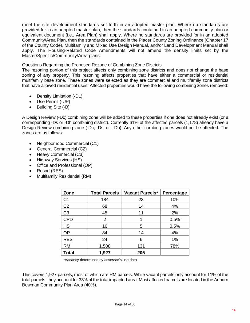
Zone Total Parcels Vacant Parcels* Percentage C1 184 23 10% C2 68 14 4% C3 45 11 2% CPD 2 1 0.5% HS 16 5 0.5% OP 84 14 4% RES 24 6 1% RM 1,508 131 78% Total 1,927 205 *Vacancy determined by assessor’s use data
This covers 1,927 parcels, most of which are RM parcels. While vacant parcels only account for 11% of the total parcels, they account for 33% of the total impacted area. Most affected parcels are located in the Auburn Bowman Community Plan Area (40%).
14
Page 15 of 30
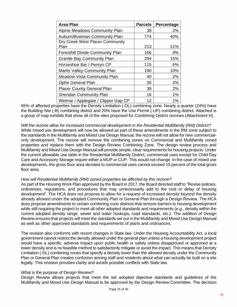
Area Plan Parcels Percentage Alpine Meadows Community Plan 38 2% Auburn/Bowman Community Plan 774 40% Dry Creek West Placer Community Plan 213 11% Foresthill Divide Community Plan 166 9% Granite Bay Community Plan 294 15% Horseshoe Bar / Penryn CP 115 6% Martis Valley Community Plan 190 10% Meadow Vista Community Plan 40 2% Ophir General Plan 30 2% Placer County General Plan 39 2% Sheridan Community Plan 16 1% Weimar / Applegate / Clipper Gap CP 12 1%
65% of affected properties have the Density Limitation (-DL) combining zone. Nearly a quarter (24%) have the Building Site (-B) combining district and 20% have the Use Permit (-UP) combining district. Attached is a group of map exhibits that show all of the sites proposed for Combining District rezones (Attachment H). Will the rezone allow for increased commercial development in the Residential Multifamily (RM) District? While mixed use development will now be allowed as part of these amendments in the RM zone subject to the standards in the Multifamily and Mixed Use Design Manual, the rezone will not allow for new commercial-only development. The rezone will remove the combining zones on Commercial and Multifamily zoned properties and replace them with the Design Review Combining Zone. The design review process and Multifamily and Mixed Use Design Manual will provide simple, clear requirements for housing projects. Under the current allowable use table in the Residential Multifamily District, commercial uses except for Child Day Care and Accessory Storage require either a MUP or CUP. This would not change. In the case of mixed use developments, the gross floor area devoted to commercial uses cannot exceed 15 percent of the total gross floor area. How will Residential Multifamily (RM) zoned properties be affected by this rezone? As part of the Housing Work Plan approved by the Board in 2017, the Board directed staff to “Revise policies, ordinances, regulations, and procedures that may unnecessarily add to the cost or delay of housing development”. The HCA does not propose to allow for a request of increased density beyond the density already allowed under the adopted Community Plan or General Plan through a Design Review. The HCA does propose amendments to certain combining zone districts that remove barriers to housing development while still requiring the project to meet all other adopted standards and requirements (e.g., density within the current adopted density range, sewer and water hookups, road standards, etc.). The addition of Design Review ensures that projects will meet the standards set out in the Multifamily and Mixed Use Design Manual as well as other approved standards and requirements of plans and ordinances. The revision also conforms with recent changes in State law. Under the Housing Accountability Act, a local government cannot restrict the density allowed under the general plan unless a housing development project would have a specific, adverse impact upon public health or safety unless disapproved or approved at a lower density and is no feasible method to satisfactorily mitigate or avoid the impact. This means that Density Limitation (-DL) combining zones that specify a density lower than the allowed density under the Community Plan or General Plan creates confusion among staff and residents about what can actually be built on a site legally. This revision provides clarity and avoids possible conflicts with State law. What is the purpose of Design Review? Design Review allows projects that meet the set adopted objective standards and guidelines of the Multifamily and Mixed Use Design Manual to be approved by the Design Review Committee. The decision
15

Page 16 of 30
of the Committee is a finding that the proposed project meets all County adopted standards. This would allow projects which meet the approved standards greater certainty, incentivizing more housing production. These proposed standards were reached through an extensive outreach effort that including the Board directed Housing Stakeholders Group, FlashVote Surveys of the community, workshops with the Planning Commission, and consultations with architects, builders and other experts who have experience with the permitting and entitlement process in Placer County. Commercial projects will still be required to obtain the entitlement set forth in the allowable use table of the base zone. This can include either a CUP or a MUP. These code amendments specifically target housing and allow for housing projects which meet the set design standards in the Multifamily and Mixed Use Design Manual to receive their entitlement through the Design Review Process. Questions Regarding Proposed Changes to Zoning Standards Explain the reduction in setbacks as well as the increase in height and lot coverage for the Residential Multifamily (RM) Zone. As part of the Housing Strategy and Development Plan, flexible height and lot coverage standards were identified as two strategies to facilitate the development of housing. The new proposed standards were established to ensure the ability of a project to reach densities adopted within the General Plan or Community/Area Plans. To ensure projects fit with the surrounding community, the Multifamily and Mixed Use Design Manual sets specific standards based on distance to single family residential zones to ensure compatibility. Projects that are proposing higher height limits than these standards would not be afforded streamlined review and would require a variance. Explain the increase in lot coverage for the Residential Single family (RS) Zone. In the Single Family (RS) zone district, the increase in allowable site coverage is to allow for projects on smaller lots to have enough buildable space to construct. These projects would still be subject to the height and setback requirements of the zone. Given concerns raised that this could lead to large single family homes on lots greater than one acre and zoned RS, the draft ordinance is proposed to be revised to have no site coverage requirements for lots smaller than 13,000 square feet and for duplex, triplex, and fourplex developments which require public water and sewer hook ups, one-half mile proximity to transit and include a deed restricted affordable unit. Can the word “comparable” be added to the Residential Single family (RS) Zone District. Group Homes that serve seven or more persons in the RA zone district are required to obtain a Minor Use Permit. As part of this process, the proposed development project is required to go through a public hearing which requires specific findings that the project is compatible with the neighborhood in addition to other health and safety considerations (Section 17.58.140 of the Placer County Zoning Code). Furthermore, staff is proposing a revision to the development standards for small lots 13,000 square feet or less, and for duplex, triplex, and fourplex developments (which require proximity to transit and a deed restricted affordable unit). The revision will result in no site coverage requirements, while keeping a 40 percent site coverage requirement for single family lots larger than 13,000 square feet. Staff is reviewing State law with regards to Residential Care Homes. Any proposed modifications will be included in a separate future project. Questions Regarding Cluster Lot Development How is a Cluster Lot Development Different than a Planned Development? Cluster Lot Development allows for smaller lot sizes if open space or agricultural space is preserved or if a specific housing type (Cottage Housing for example) is being built. However, only the number of units already allowed under the base zone can be built. A Planned Development allows for increased density in exchange for public benefits such as open space or recreation areas which requires a rezone process. Where is Cluster Lot Development Allowed? Cluster Lot Development has three separate land use types: Cluster Lot Development - Agriculture, Conservation, and Open Space, Cluster Lot Development – Cottage Housing, and Cluster Lot Development
16
Page 17 of 30
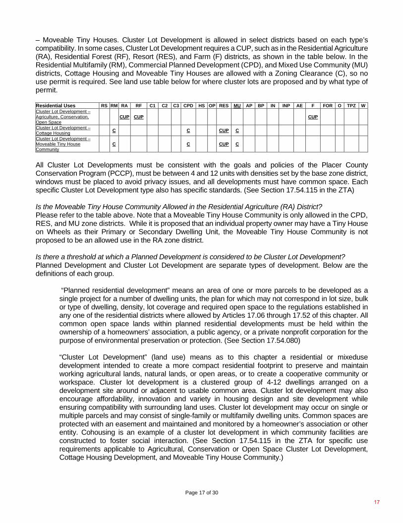
– Moveable Tiny Houses. Cluster Lot Development is allowed in select districts based on each type’s compatibility. In some cases, Cluster Lot Development requires a CUP, such as in the Residential Agriculture (RA), Residential Forest (RF), Resort (RES), and Farm (F) districts, as shown in the table below. In the Residential Multifamily (RM), Commercial Planned Development (CPD), and Mixed Use Community (MU) districts, Cottage Housing and Moveable Tiny Houses are allowed with a Zoning Clearance (C), so no use permit is required. See land use table below for where cluster lots are proposed and by what type of permit. Residential Uses RS RM RA RF C1 C2 C3 CPD HS OP RES MU AP BP IN INP AE F FOR O TPZ W Cluster Lot Development – Agriculture, Conservation, Open Space
CUP CUP CUP
Cluster Lot Development – Cottage Housing C C CUP C
Cluster Lot Development – Moveable Tiny House Community
C C CUP C
All Cluster Lot Developments must be consistent with the goals and policies of the Placer County Conservation Program (PCCP), must be between 4 and 12 units with densities set by the base zone district, windows must be placed to avoid privacy issues, and all developments must have common space. Each specific Cluster Lot Development type also has specific standards. (See Section 17.54.115 in the ZTA) Is the Moveable Tiny House Community Allowed in the Residential Agriculture (RA) District? Please refer to the table above. Note that a Moveable Tiny House Community is only allowed in the CPD, RES, and MU zone districts. While it is proposed that an individual property owner may have a Tiny House on Wheels as their Primary or Secondary Dwelling Unit, the Moveable Tiny House Community is not proposed to be an allowed use in the RA zone district. Is there a threshold at which a Planned Development is considered to be Cluster Lot Development? Planned Development and Cluster Lot Development are separate types of development. Below are the definitions of each group.
“Planned residential development” means an area of one or more parcels to be developed as a single project for a number of dwelling units, the plan for which may not correspond in lot size, bulk or type of dwelling, density, lot coverage and required open space to the regulations established in any one of the residential districts where allowed by Articles 17.06 through 17.52 of this chapter. All common open space lands within planned residential developments must be held within the ownership of a homeowners’ association, a public agency, or a private nonprofit corporation for the purpose of environmental preservation or protection. (See Section 17.54.080)
“Cluster Lot Development” (land use) means as to this chapter a residential or mixeduse development intended to create a more compact residential footprint to preserve and maintain working agricultural lands, natural lands, or open areas, or to create a cooperative community or workspace. Cluster lot development is a clustered group of 4-12 dwellings arranged on a development site around or adjacent to usable common area. Cluster lot development may also encourage affordability, innovation and variety in housing design and site development while ensuring compatibility with surrounding land uses. Cluster lot development may occur on single or multiple parcels and may consist of single-family or multifamily dwelling units. Common spaces are protected with an easement and maintained and monitored by a homeowner’s association or other entity. Cohousing is an example of a cluster lot development in which community facilities are constructed to foster social interaction. (See Section 17.54.115 in the ZTA for specific use requirements applicable to Agricultural, Conservation or Open Space Cluster Lot Development, Cottage Housing Development, and Moveable Tiny House Community.)
17
Page 18 of 30
What are the Standards of Cluster Lot Development? All Cluster Lot Developments must be consistent with the goals and policies of the Placer County Conservation Program (PCCP), the clusters must be between 4 and 12 units, the number of units is set by the base zone district, windows must be placed to avoid privacy issues, and all developments must have common space. Each specific Cluster Lot Development type also has specific standards. (See Section 17.54.115 in the ZTA). What are the Affordable Housing Requirements of Cluster Lot Development? After January 1, 2021, all new residential developments are subject to the County’s Affordable Housing and Employee Accommodation Ordinance which provides an in-lieu fee option for residential developments of 8 to 100 units, and a 10 percent inclusionary requirement for larger projects with more than 100 units. Information on the ordinance can be found here: https://www.placer.ca.gov/6954/Affordable-Employee-Housing-Ordinance-Fe. Cook Development Request Regarding Building Setbacks On March 8, 2021, staff received written comments on the Draft EIR from Dave Cook of Cook Development. The comment letter includes proposed text changes to Placer County Code Section 17.52.040 - Building Site (-B), and Section 17.42.060 - Density Limitation (-DL) Combining Zone Districts and asks that the County include the proposed amendments as part of the Project to provide for “alley-loaded” housing. The proposed changes would have modified building setbacks and lot coverage standards for smaller parcels with either the -B or -DL Combining District. Some of the ideas presented such as less-reliance on lot coverage for residential land uses is addressed with the Project, however, because incorporation of other recommended amendments to the -B and -DL Combining Districts was not analyzed in the Draft EIR, the decision was made not to include the recommendations from Cook Development at this time.
The changes proposed would lower setback requirements, increase lot coverage allowances, and other reduced regulation to make feasible “alley-loaded” housing. This product is a type of single family home in which off-street parking is located at the back of the lot and connected by an alley, allowing for dwelling units to respond to the street and create a ‘traditional’ front façade. This is allowable in Roseville and other regional jurisdictions. Consideration of these revisions will be considered in subsequent amendments. Questions Regarding Residential Care Homes Can Residential Care Homes be addressed in this project? Planning staff will bring forward a separate zoning text amendment at a later time that is focused on community care facilities. This project will consider community concerns raised, as well as any revisions required to bring the County’s code into conformance with State law. PROJECT REFINEMENTS Staff has made various refinements to the ZTA language after receiving feedback from community members and the Planning Commission. These changes resulted from on-going discussion between housing and planning staff related to the housing concepts being proposed and the existing structure and content of the zoning ordinance. These changes are as follows: Page No. Proposed Changes Reason for
Change 17.04.030 Definitions of land uses, specialized terms and phrases.
“Common Area – Cluster Lot Development” for purposes of this chapter means a parcel or parcels of land used by all occupants of a cluster lot development per Section 17.54.115. The common area shall be outside of ponds, wetlands, streams, and sensitive area buffers and on slopes of 10
Clarification – Requested by ESD
18
Page 19 of 30
percent or less and developed and maintained so it is usable for active or passive recreation activities.
17.06.050 Land use and permit tables.
Added Footnote to Multifamily dwellings, RS allowed use stating: “Multifamily dwellings development are only permitted through Density Bonus (Section 17.54.115).
Clarification that multifamily is only allowed through density bonus.
17.20.010 Commercial Planned Development (CPD).
Modified Footnote 3 in subsection (F) – “The percentage of total site area that may be covered by non-residential buildings or structures. Residential and Mixed Use structures are exempt from site coverage but are subject to setback requirements.”
Clarification of Site Coverage Requirements
17.22.010 General commercial (C2). Modified Footnote 4 in subsection (E) – “The percentage of total site area
that may be covered by non-residential buildings or structures. Residential and Mixed Use structures are exempt from site coverage but are subject to setback requirements.”
Clarification of Site Coverage Requirements
17.26.010 Highway services (HS). Modified Footnote 4 in subsection (E) – “The percentage of total site area
that may be covered by non-residential buildings or structures. Residential and Mixed Use structures are exempt from site coverage but are subject to setback requirements.”
Clarification of Site Coverage Requirements
Section: 17.27.010 Mixed Use Community (MU). Modified Footnote 4 in subsection (E) – “The percentage of total site area
that may be covered by non-residential buildings or structures. Residential and Mixed Use structures are exempt from site coverage but are subject to setback requirements.”
Clarification of Site Coverage Requirements
17.30.010 Neighborhood Commercial (C1) Modified Footnote 5 in subsection (E) – “The percentage of total site area
that may be covered by non-residential buildings or structures. Residential and Mixed Use structures are exempt from site coverage but are subject to setback requirements.”
Clarification of Site Coverage Requirements
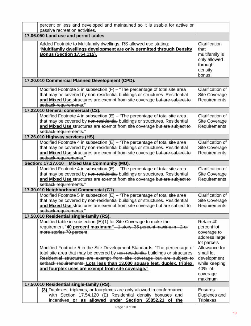
17.50.010 Residential single-family (RS). Modified table in subsection (E)(1) for Site Coverage to make the
requirement “40 percent maximum” - 1 story; 35 percent maximum - 2 or more stories 70 percent
Retain 40 percent lot coverage to address large lot parcels
Modified Footnote 5 in the Site Development Standards: “The percentage of total site area that may be covered by non residential buildings or structures. Residential structures are exempt from site coverage but are subject to setback requirements. Lots less than 13,000 square feet, duplex, triplex, and fourplex uses are exempt from site coverage.”
Allowance for small lot development while keeping 40% lot coverage maximum
17.50.010 Residential single-family (RS). (3) Duplexes, triplexes, or fourplexes are only allowed in conformance
with Section 17.54.120 (E) Residential density bonuses and incentives or as allowed under Section 65852.21 of the
Ensures Duplexes and Triplexes
19
Page 20 of 30
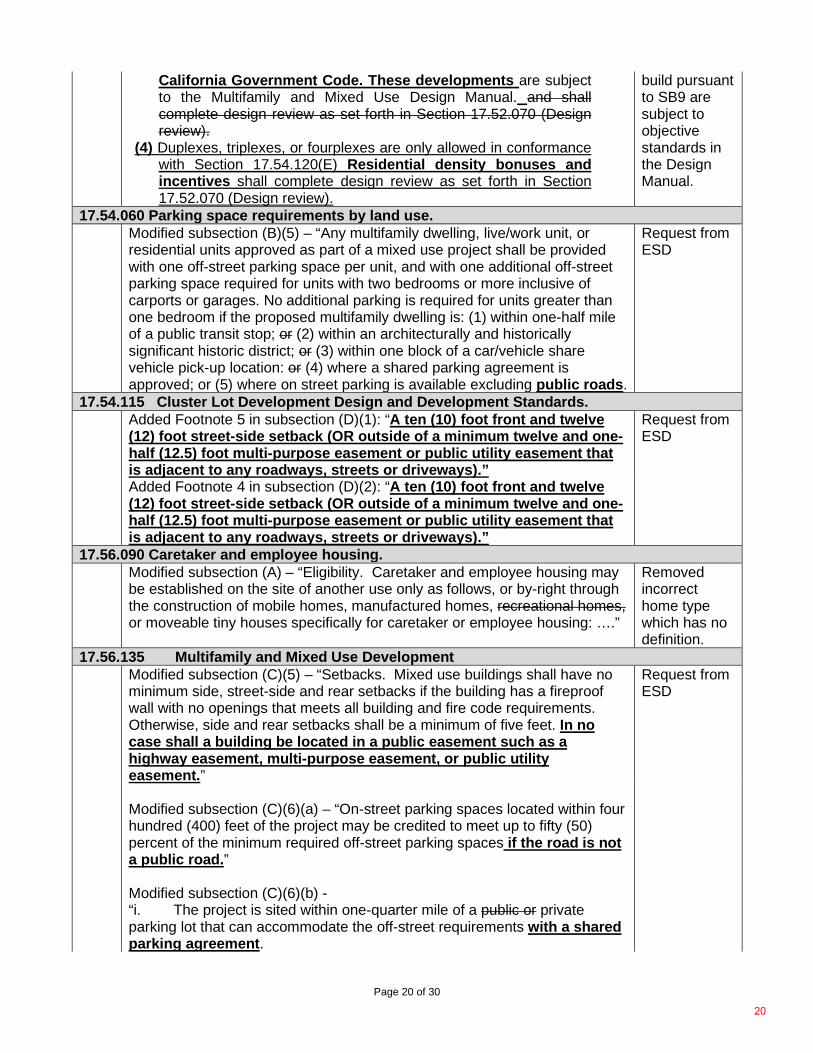
California Government Code. These developments are subject to the Multifamily and Mixed Use Design Manual. and shall complete design review as set forth in Section 17.52.070 (Design review).
(4) Duplexes, triplexes, or fourplexes are only allowed in conformance with Section 17.54.120(E) Residential density bonuses and incentives shall complete design review as set forth in Section 17.52.070 (Design review).
build pursuant to SB9 are subject to objective standards in the Design Manual.
17.54.060 Parking space requirements by land use. Modified subsection (B)(5) – “Any multifamily dwelling, live/work unit, or
residential units approved as part of a mixed use project shall be provided with one off-street parking space per unit, and with one additional off-street parking space required for units with two bedrooms or more inclusive of carports or garages. No additional parking is required for units greater than one bedroom if the proposed multifamily dwelling is: (1) within one-half mile of a public transit stop; or (2) within an architecturally and historically significant historic district; or (3) within one block of a car/vehicle share vehicle pick-up location: or (4) where a shared parking agreement is approved; or (5) where on street parking is available excluding public roads.
Request from ESD
17.54.115 Cluster Lot Development Design and Development Standards. Added Footnote 5 in subsection (D)(1): “A ten (10) foot front and twelve
(12) foot street-side setback (OR outside of a minimum twelve and one-half (12.5) foot multi-purpose easement or public utility easement that is adjacent to any roadways, streets or driveways).”
Request from ESD
Added Footnote 4 in subsection (D)(2): “A ten (10) foot front and twelve (12) foot street-side setback (OR outside of a minimum twelve and one-half (12.5) foot multi-purpose easement or public utility easement that is adjacent to any roadways, streets or driveways).”
17.56.090 Caretaker and employee housing. Modified subsection (A) – “Eligibility. Caretaker and employee housing may
be established on the site of another use only as follows, or by-right through the construction of mobile homes, manufactured homes, recreational homes, or moveable tiny houses specifically for caretaker or employee housing: ….”
Removed incorrect home type which has no definition.
17.56.135 Multifamily and Mixed Use Development Modified subsection (C)(5) – “Setbacks. Mixed use buildings shall have no
minimum side, street-side and rear setbacks if the building has a fireproof wall with no openings that meets all building and fire code requirements. Otherwise, side and rear setbacks shall be a minimum of five feet. In no case shall a building be located in a public easement such as a highway easement, multi-purpose easement, or public utility easement.”
Request from ESD
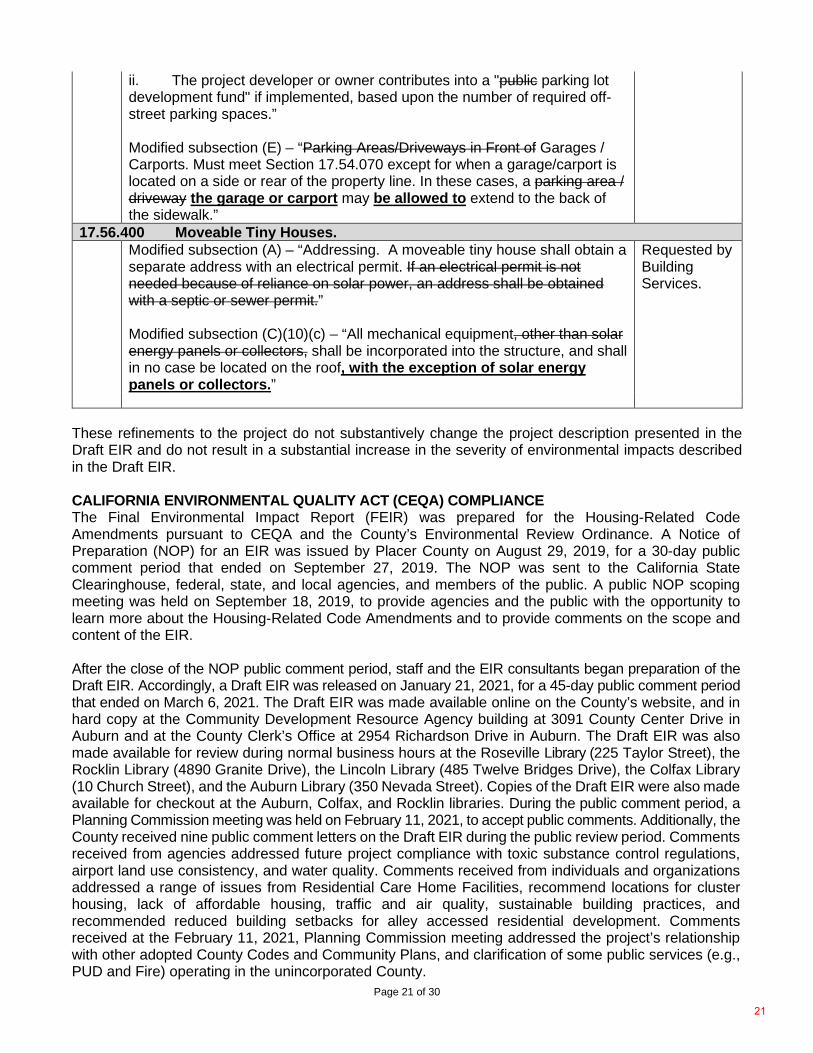
Modified subsection (C)(6)(a) – “On-street parking spaces located within four hundred (400) feet of the project may be credited to meet up to fifty (50) percent of the minimum required off-street parking spaces if the road is not a public road.” Modified subsection (C)(6)(b) -
“i. The project is sited within one-quarter mile of a public or private parking lot that can accommodate the off-street requirements with a shared parking agreement.
20
Page 21 of 30
These refinements to the project do not substantively change the project description presented in the Draft EIR and do not result in a substantial increase in the severity of environmental impacts described in the Draft EIR. CALIFORNIA ENVIRONMENTAL QUALITY ACT (CEQA) COMPLIANCE The Final Environmental Impact Report (FEIR) was prepared for the Housing-Related Code Amendments pursuant to CEQA and the County’s Environmental Review Ordinance. A Notice of Preparation (NOP) for an EIR was issued by Placer County on August 29, 2019, for a 30-day public comment period that ended on September 27, 2019. The NOP was sent to the California State Clearinghouse, federal, state, and local agencies, and members of the public. A public NOP scoping meeting was held on September 18, 2019, to provide agencies and the public with the opportunity to learn more about the Housing-Related Code Amendments and to provide comments on the scope and content of the EIR. After the close of the NOP public comment period, staff and the EIR consultants began preparation of the Draft EIR. Accordingly, a Draft EIR was released on January 21, 2021, for a 45-day public comment period that ended on March 6, 2021. The Draft EIR was made available online on the County’s website, and in hard copy at the Community Development Resource Agency building at 3091 County Center Drive in Auburn and at the County Clerk’s Office at 2954 Richardson Drive in Auburn. The Draft EIR was also made available for review during normal business hours at the Roseville Library (225 Taylor Street), the Rocklin Library (4890 Granite Drive), the Lincoln Library (485 Twelve Bridges Drive), the Colfax Library (10 Church Street), and the Auburn Library (350 Nevada Street). Copies of the Draft EIR were also made available for checkout at the Auburn, Colfax, and Rocklin libraries. During the public comment period, a Planning Commission meeting was held on February 11, 2021, to accept public comments. Additionally, the County received nine public comment letters on the Draft EIR during the public review period. Comments received from agencies addressed future project compliance with toxic substance control regulations, airport land use consistency, and water quality. Comments received from individuals and organizations addressed a range of issues from Residential Care Home Facilities, recommend locations for cluster housing, lack of affordable housing, traffic and air quality, sustainable building practices, and recommended reduced building setbacks for alley accessed residential development. Comments received at the February 11, 2021, Planning Commission meeting addressed the project’s relationship with other adopted County Codes and Community Plans, and clarification of some public services (e.g., PUD and Fire) operating in the unincorporated County.
ii. The project developer or owner contributes into a "public parking lot development fund" if implemented, based upon the number of required off-street parking spaces.”
Modified subsection (E) – “Parking Areas/Driveways in Front of Garages / Carports. Must meet Section 17.54.070 except for when a garage/carport is located on a side or rear of the property line. In these cases, a parking area / driveway the garage or carport may be allowed to extend to the back of the sidewalk.”
17.56.400 Moveable Tiny Houses. Modified subsection (A) – “Addressing. A moveable tiny house shall obtain a
separate address with an electrical permit. If an electrical permit is not needed because of reliance on solar power, an address shall be obtained with a septic or sewer permit.” Modified subsection (C)(10)(c) – “All mechanical equipment, other than solar energy panels or collectors, shall be incorporated into the structure, and shall in no case be located on the roof, with the exception of solar energy panels or collectors.”
Requested by Building Services.
21
Page 22 of 30
On July 9, 2021, the County released the Final EIR, which included responses to comments received on the Draft EIR. The Draft EIR and the Final EIR together constitute the Final EIR for the Housing-Related Code Amendments. At the Planning Commission hearing on October 7, 2021, the Planning Commission will be asked to consider and make a recommendation to the Board of Supervisors on the certification of the Housing-Related Code Amendments Final EIR, Findings of Fact and a Statement of Overriding Considerations, and the Mitigation Monitoring Reporting Program (MMRP). The Board of Supervisors is responsible under CEQA for certifying the Housing-Related Code Amendments Final EIR and adopting the Findings of Fact and a Statement of Overriding Considerations, and the MMRP. EIR Organization of Analysis The EIR includes a program level analysis of the Housing-Related Code Amendments. The analysis in the EIR address the project’s short- and long-term adverse impacts on the physical (i.e., natural and built) environment, under the assumption the project will be built out. Existing conditions are the baseline against which the significance of the project’s potential impacts are evaluated. Therefore, the reasonably foreseeable impacts of the proposed project, which consists of targeted amendments to the General Plan, Zoning Ordinance, Zoning Maps, and Multifamily and Mixed Use Design Manual, are compared to the existing environment and not to the provisions of the existing General Plan, Zoning Ordinance, Zoning Maps, and Design Guidelines Manuals. Revisions to the EIR The Final EIR includes an analysis of the Housing-Related Code Amendment revisions and determined that none of the revisions would result in new impacts that were not previously analyzed nor would any of the revisions result in a substantial increase in the severity of impacts described in the Draft EIR. Because the Final EIR did not result in the identification of any new significant environmental impacts or a substantial increase in the severity of an environmental impact, it was concluded that recirculation of the Draft EIR was not required prior to preparation and release of the Final EIR. Revisions to the Draft EIR are included in Chapter 3 of the Final EIR. Environmental Impacts The following provides an outline of the environmental resource areas impacts associated with the proposed Housing-Related Code Amendments Project. For a complete summary of environmental impacts, see the Draft EIR’s Executive Summary contained in Exhibit 1 of Attachment A. No Impact, Less Than Significant Conclusions The analysis for the proposed Project determined that no impacts or less-than-significant impacts would occur to the following issue areas and mitigation would not be required:
• Agriculture & Forestry Resources • Hazards and Hazardous Materials • Land Use and Planning • Mineral Resources • Noise • Population & Housing • Public Services, Recreation, and Utilities & Service Systems • Transportation • Wildfire
Less-than-Significant Impacts with Mitigation The analysis for the proposed Project identified “potentially significant” impacts to the environmental resource areas noted below. These resource areas include impacts that would be “less than significant” with implementation of mitigation measures identified in the Initial Study and summarized in the Draft EIR, Table ES-1 (Impacts and Mitigation) in the Executive Summary.
22
Page 23 of 30
• Aesthetics • Air Quality • Biological Resources • Energy • Geology, Soils, and Paleontological Resources • Greenhouse Gas Emissions • Hydrology and Water Quality • Tribal Cultural Resources
Significant and Unavoidable Environmental Impacts The analysis determined that the proposed Project would result in significant and unavoidable impacts to the following environmental resource area:
• Cultural Resources: Due to the uncertainty of future impacts to historic resources and the requirement that destruction of an historic resource would result in a significant and unavoidable impact, implementation of the proposed Project is considered to have a significant and unavoidable impact on historic resources (Chapter 3: Impact CUL-1). There are no mitigation measures suggested since the current General Plan policies and County ordinances cover typical CEQA mitigation measures.
CEQA ALTERNATIVES CEQA requires that an EIR analyze a reasonable range of feasible alternatives that meet most or all project objectives while reducing the magnitude of or avoiding one or more significant environmental effects of the project. In determining what alternatives should be considered in the EIR, it is important to consider the objectives of the project, the project’s significant effects, unique project considerations, and the feasibility of proposed alternatives. The following three project alternatives were considered in Chapter 4 (Alternatives Analysis) of the Draft EIR: Alternative 1: No Project Alternative 1 will consist of the continuation of the existing adopted General Plan and Zoning Ordinance, without any changes. Under this alternative, the County would continue to operate under the existing policies and zoning regulations established by the Adopted 1994 General Plan, as updated May 21, 2013. Alternative 2: No Workforce Housing Alternative Under Alternative 2, the No Workforce Housing Alternative, the project alternative would involve all proposed General Plan Amendments, Zoning Text Amendments, and the new Multifamily and Mixed Use Design Manual as presented in Table 2-3 (Estimated Maximum Development Capacity in Unincorporated Placer County) with the exclusion of Workforce Housing Changes (WF-1 and WF-2). The removal of workforce housing would reduce the scope of the proposed Project which would reduce the potential for new “mobile homes, recreational homes, or tiny houses when they are for caretaker or employee housing, with the exception of Forestry (FOR) and Timberland Production Zone (TPZ) zones,” but this change would not reduce the potential number of units that could be developed throughout the County. Therefore, Alternative 2: No Workforce Housing Alternative would result in the same number of total housing units and be subject to the same mitigation measures as the proposed Project. As with the proposed Project, the No Workforce Housing Alternative would result in a significant and unavoidable impact in the cultural resources category. Alternative 3: Reduced Intensity Alternative Under Alternative 3, the Reduced Intensity Alternative would involve all proposed General Plan Amendments, Zoning Text Amendments, and the new Multifamily and Mixed Use Design Manual as presented in Table 2-3 (Estimated Maximum Development Capacity in Unincorporated Placer County) with the exclusion of the permitting of a fourth unit on select parcels as presently listed under Zoning Text Amendment “Density Bonus DB-4.”
23
Page 24 of 30
The Reduced Intensity Alternative would have the potential to result in reduced air quality impacts because of construction, because it would reduce the overall potential for development by approximately 30 percent. This Alternative does not include site-specific development projects. Therefore, as with the proposed Project, it is not possible to predetermine the presence of archaeological resources, thus, would have the same cultural resources impacts as the proposed Project and would result in a significant and unavoidable impact. Environmentally Superior Alternative CEQA requires that an environmentally superior alternative be identified. Generally, the environmentally superior alternative is the alternative that would cause the least damage to the biological and physical environment. CEQA Guidelines Section 15126.6(e)(2) states that if the environmentally superior alternative is the No Project alternative, the EIR shall also identify an environmentally superior alternative among the other alternatives. Alternative 3 (Reduced Intensity Alternative) would be the environmentally superior alternative because it would marginally reduce construction air quality, cultural resources, and greenhouse gas (GHG) emission impacts below the level of the proposed Project, but not to a less-than-significant level. While Alternative 2 (No Workforce Housing Alternative) may marginally reduce the project’s significant impacts on air quality and GHG emissions, those effects would remain significant and unavoidable, and it would not affect impacts on cultural resources compared to the project. PUBLIC OUTREACH An integral part of the Housing-Related Code Amendments update process was the utilization of various public outreach methods to inform residents, housing developers, property owners, and other stakeholders of the proposed amendments and to receive comments and public input in the process. The public outreach methods used included: community forums, focus groups, stakeholder meetings, surveys, project website, housing e-newsletter, email subscription list, community presentations to the County’s municipal advisory councils (MACs), and presentations/workshops with the County’s Agricultural Commission, Planning Commission and Board of Supervisors. Prior to the COVID-19 stay-at-home directives ordered by the Governor in March 2020, most of the public engagement was conducted in-person. During the COVID-19 shutdown, public engagement was conducted with “virtual” meetings using Zoom and other similar remote meeting tools. Community Forum Public outreach conducted as part of the preparation of the Housing Strategy and Development Plan helped identify potential housing policy and code amendments necessary to reduce the constraints to housing development. A community forum, sponsored in partnership with the Placer County Community Foundation, was held on March 20, 2018. Approximately 75 individuals attended the forum at the Placer County Community Development Resource Agency building in Auburn. The consultant team (BAE Urban Economics and ESA) and County staff outlined the various housing needs and limitations on housing development within the unincorporated area of the County including the Tahoe area. Presenters then followed with ideas to increase local, affordable and workforce housing that may be appropriate for the area. Participants in the community forum were encouraged to provide feedback, opinions, and personal insight into the housing crisis and ideas on what the County could do to reduce constraints on housing development. The housing forum was publicized through several communication channels including a dedicated housing website at: www.placer.ca.gov/housing, a news release and various county social media outlets. Many local organizations, such as Mountain Housing Council, Placer County Association of Realtors and Contractors Association of Truckee Tahoe, also helped spread the news and information about the housing forum and the County's efforts. Housing Industry Focus Groups Staff followed the forum with two housing industry focus groups that included architects, builders, designers, realtors, legal and social service professionals to gain an understanding of possible impediments to the development of housing. Additionally, staff gave presentations to 11 out of the 13
24
Page 25 of 30
municipal advisory councils (MACs) during the months of April and May of 2018. Notice on various social media sites such as Facebook and Nextdoor preceded each meeting, encouraging participation. A fact sheet on the Housing Strategy and Development Plan was also prepared and distributed to all the MAC members. FlashVote Surveys Another component of the public outreach for the Housing Strategy and Development Plan was a countywide survey using the FlashVote survey tool. Five FlashVote surveys were released related to five housing issues and over 10,000 participants as shown in the table below.
Date Housing Issue No. of Participants
# (%) County Residents
April 16, 2018 Second Home Rental Program Ideas 555 555 (100%) June 27, 2018 Housing Costs and Needs 3,238 1,806 (55.8%) August 29, 2018 Housing Choices 2,311 1,727 (74.7%) August 21, 2019 Accessory Dwelling Units 1,988 1,820 (91.5%)
June 29, 2020 County Housing Policy (and impacts from the pandemic) 2,860 2,545 (89%)
Total Participants 10,952 8453 (77%) Social Media / Housing E-Newsletter Outreach to notify individuals of the FlashVote surveys was made across the County’s outreach platforms, including social media and the County newsletter. A Nextdoor post sharing the opportunity reached 24,655 residents. The County’s Communications and Public Affairs Office also established a housing newsletter to keep interested stakeholders informed of the County’s housing efforts (which had about 5,000 subscribers). Presentations to Municipal Advisory Councils Staff presented an overview of the Housing-Related Code Amendments as an informational item to all 13 of the County’s MACs from September 2019 to January 2020. Staff presented a second overview as an informational item to 9 of the 13 MACs (Donner Summit, North Tahoe, Squaw Valley, Foresthill, Granite Bay, Horseshoe Bay/Penryn, North Auburn, Rural Lincoln, and Sheridan) between April and May 2021. Workshops with Agricultural / Planning Commissions and Board of Supervisors On September 25, 2018, staff provided the Board with an update on the Housing Strategy and Development Plan and current efforts to assist in streamlining housing project submittals and review processes. The Board discussed concerns with recent legislation creating additional costs associated with new home development and expressed interest in looking at form-based code to help reduce time and cost on developments in priority areas. On December 12, 2018, staff submitted to the Board a proposed zoning text amendment (ZTA) to add regulations of tiny homes to the zoning code. Following a brief discussion, the Board directed staff to include the proposed amendment in the more comprehensive housing code amendment project. The proposed zoning code amendment to allow tiny houses was made in response to numerous requests staff received from many community members at various outreach venues including: the Housing Forum presented on March 20, 2018 by Placer County and the Placer Community Foundation, a Mountain Housing Council Think Tank on October 25, 2017, and in a recent county Flashvote survey on housing. In addition, staff presented an overview of the Tiny Home ZTA as an informational item to all the MACs from June to September in 2018, and twice to the Placer County Association of Realtors during the summer of 2018. Additionally, staff discussed tiny houses and the proposed zoning ordinance amendments with community members during numerous meetings, phone calls, and emails. Individual
25
Page 26 of 30
feedback was and has been largely supportive, with a majority requesting the County to allow tiny houses as primary and secondary dwellings and as tiny house communities. On July 25, 2019, staff presented the Planning Commission with information on the Housing Strategy and Development Plan with regards to the preparation of a design manual for multifamily and mixed use development and requesting input and direction from the Planning Commission on design preferences. Staff presented on the Board’s directive to explore a menu of strategies that could be adapted to different communities’ priorities and needs including, but not limited to, code changes, incentives, funding sources, and other non-traditional approaches to housing as a means to achieve that goal. Feedback from the Planning Commissioners was positive that the guidance provided for in the Design Manual should be clear and well-defined. One Commissioner raised the issue of the recent volume and frequency of changes occurring with State housing laws and how the proposed amendments may have to be modified to align with future changes to housing law. The Commission noted the high costs to construct and maintain development and how many of the costs for state mandated housing allowances often get absorbed by local governments. On August 27, 2019, staff presented the Board of Supervisors with the final Housing Strategy and Development Plan Recommendations Report, along with the Housing Funding and Investment Strategy Report (prepared for the County by BAE Urban Economics, Inc.) Discussions included the high cost of developing housing and the need to further reduce barriers, especially in targeted areas to assist the County in meeting RHNA requirements. An initial discussion on the development of a private housing trust that supports a stronger public private partnership was also discussed. On September 9, 2019, staff provided the Agricultural Commission with an informational overview of the proposed Housing-Related Code Amendments aimed at increasing housing availability and affordability while promoting continued agricultural use of land. The presentation explained the limited changes to existing agricultural zoned land and that the proposed changes will allow for increased residential capacity on commercial and multi-family zoned parcels and will align with recent changes to State housing laws, with higher density, mixed use, transit-oriented, and infill housing development primarily located where existing infrastructure and public services are currently available. On March 12, 2020, staff provided an informational overview to the Planning Commission of the draft Design Manual for Multifamily and Mixed Use Development, which is one component of the County-initiated housing code update. The Design Manual establishes objective aesthetic design standards and guidelines that would only apply to new applications for multifamily and Mixed use projects on vacant and underutilized land that is currently designated for residential and commercial development in the unincorporated areas of the county. The purpose of this second workshop (the first workshop was on June 13, 2019) was to receive comments from the public, and input and feedback from the Planning Commission. Commissioners stated that their comments from previous workshops regarding issues such as fire safety and need for adequate public facilities had been incorporated into the revised draft of the Design Manual. On February 11, 2021, the Planning Commission conducted a public meeting to receive comments on the Draft Environmental Impact Report (Draft EIR) for the Housing-Related Code Amendments Project. The majority of comments received at the meeting were from Commissioners and have been responded to in the Final EIR and the Discussion of Issues section above. Commissioner Woodward asked for clarification on how the proposed housing code amendments apply within adopted community plans, and why the EIR included evaluation of potential environmental impacts for housing regulations supporting state statutes. Commissioner Herzog asked for confirmation that the development standards that currently apply to the parcels affected by combining zone district changes would not be lost and staff confirmed the standards are addressed elsewhere in the Code or Design Manual. Commissioner Johnson asked several clarifying questions and suggested corrections to some of the exhibits and public services listed in the EIR which were accordingly revised in the FEIR.
26
Page 27 of 30
Virtual Community Workshops On January 20, 2021, Planning Services staff held two virtual community workshops for property owners of all commercial and multifamily zoned parcels affected by the proposed amendments to their property’s Combining Zone Districts. The purpose of the workshops was to educate property owners how the Combining Zone District amendments and Design Manual would affect future development on those parcels by eliminating constraints and providing a clear roadmap based on objective site development and design standards for the development of projects that include housing. Public attendance at the workshop was limited, however, staff did receive positive feedback from some attendees regarding their desire to reduce time and costs associated with processing housing applications and permits. Mass Mailing to All Affected Property Owners Part of the public outreach for this public hearing included a mass mailing to the 1,927property owners of existing commercial and multifamily zoned parcels with proposed zoning changes to their combining zone districts. The purpose of the letter was to follow-up with those owners notified for the January 20, 2021, virtual community workshops and included information about the specific zoning changes for their parcel and how to participate in the Planning Commission and Board of Supervisor’s public hearings for the project. MUNICIPAL ADVISORY COUNCILS (MACS) Staff presented an overview of the proposed housing code amendments as an informational item to all the MACs from September 2019 to January 2020. Staff presented a second overview of the proposed amendments as an informational item to the Squaw Valley, Donner Summit, North Tahoe, Foresthill, Granite Bay, North Auburn, Sheridan, Rural Lincoln, and Horseshoe Bay MACs between April and May 2021. Feedback received has been largely supportive. Few questions were asked at most of the MAC meetings, with many expressing support for the housing code amendments. During the Granite Bay MAC presentation, staff received a variety of questions, ranging from concerns about the transient nature and health and safety standards of tiny houses, and existing allowances for residential care facilities. AIRPORT LAND USE COMMISSION (ALUC) On March 24, 2021, Placer County submitted a request to the Placer County Airport Land Use Commission (ALUC) to review the County’s proposed Housing-Related Code Amendments for a determination of consistency with the Placer County Airport Land Use Compatibility Plan (ALUCP). On April 28, 2021, the ALUC determined that the Housing Related Code Amendments are consistent ALUCP requirements (The ALUC consistency determination letter is included as Attachment F). CALIFORNIA DEPARTMENT OF HOUSING AND COMMUNITY DEVELOPMENT (HCD) On March 2, 2021, the California Department of Housing and Community Development (HCD) issued a letter of support for the proposed Housing-Related Code Amendments (The HCD letter of support is included as Attachment G). RECOMMENDATION The Development Review Committee recommends the Planning Commission forward a recommendation to the Board of Supervisors for approval of the following: 1. Adopt a resolution to certify the Final Environmental Impact Report for the Housing-Related Code
Amendments (SCH# 2019080460) prepared pursuant to the California Environmental Quality Act (CEQA) and adopt the Findings of Fact and Statement of Overriding Considerations and adopt the Mitigation Monitoring Reporting Program supported by the findings set forth in said resolution and attachments (Attachment A, Exhibits 1-4) and the following statements. a. The Housing-Related Code Amendments Final Environmental Impact Report has been prepared as
required by law and in accordance with all requirements of CEQA and the CEQA Guidelines, and the document as adopted reflects the independent judgment and analysis of Placer County which has exercised overall control and direction of the preparation of the Environmental Impact Report.
27
Page 28 of 30
b. The custodian of records for the Housing-Related Code Amendments Final Environmental Impact Report is the Placer County Planning Director, 3091 County Center Drive, Suite 140, Auburn, CA 95603.
2. Adopt a resolution amending the Placer County General Plan Introduction Chapter; and Land Use
Element Table 1-2 (“Development Standards By Land Use Designation”) will be amended to increase the Maximum Nonresidential Floor Area Ratio (FAR) for the High Density Residential (HDR) General Plan land use designation from 1.05 to 2.0; and the Land Use Element Table 1-3 (“General Plan Land Use Designations and Consistent Zoning Districts”) will be amended to add General Commercial (C2), Commercial Planned Development (CPD), and Mixed Use Community (MU) as Consistent Zone Districts for the High Density Residential (HDR) General Plan land use designation; and add Residential Multifamily (RM) zoning to the General Commercial (GC) General Plan land use designation. a. The Housing-Related Code Amendments present a vision for implementing adopted General
Plan and Community Plan policies that support efficient, resilient, and sustainable housing development patterns improved framework for future housing development in the County balancing population growth, economic factors, demographics, and community needs and wants and are consistent with the Placer County General Plan goals and policies related to housing.
b. The proposed amendments to the Placer County General Plan promote the health, safety, peace, comfort, convenience, and general welfare of the citizens of Placer County.
c. The amendments are consistent with the provision and applicable policies of the General Plan and are in compliance with applicable requirements of State law.
3. Adopt an ordinance amending Chapter 17 (Zoning Ordinance) Articles 17.04, 17.06, 17.08, 17.10,
17.20, 17.22, 17.26, 17.27, 17.30, 17.32, 17.34, 17.38, 17.44, 17.46, 17.48, 17.50, 17.52, 17.54, and 17.56, including a mixed use community zone, mixed use land use type, seasonal worker housing, density bonus, cluster lot development, and moveable tiny house regulations (Attachment C) supported by the findings set forth below and included in said ordinance: a. The proposed Housing-Related Zoning Text Amendment is consistent with the Placer County
General Plan and implements the Land Use and Housing following policies: i. Policy 1.A.4. The County shall promote patterns of development that facilitate the efficient
and timely provision of urban infrastructure and services. ii. Policy 1.B.1. The County shall promote the concentration of new residential development in
higher density residential areas located along major transportation corridors and transit routes.
iii. Policy 1.B.2. The County shall encourage the concentration of multi-family housing in and near downtowns, village centers, major commercial areas, and neighborhood commercial centers.
iv. Policy 1.M.1: The County shall concentrate most new growth within existing communities emphasizing infill development, intensified use of existing development, and expanded services, so individual communities become more complete, diverse, and balanced.
v. Policy HE-A-2: Streamline Development. The County shall continue efforts to streamline and improve the development review process based on objective design standards, and to eliminate any unnecessary delays in the processing of development applications.
vi. Policy HE-A-3: Remove Barriers. The County shall strive to remove barriers to new housing production including advancing adaptive policies, regulations, and procedures, as well as addressing market constraints as admissible.
vii. Policy HE-A-4: Encourage Innovative Design and Variety of Housing. The County shall encourage innovative subdivision design and a range of housing types within larger‐scale development projects to encourage mixed‐income communities (e.g., single‐family detached homes, accessory dwelling units, duplexes/triplexes, live‐work units, multifamily housing).
28
Page 29 of 30
viii. Policy HE-A-5: Infill Development. The County shall promote and maintain balanced growth by encouraging compatible residential development on infill sites within established communities where urban services are in place.
ix. Policy HE-A-6: Facilitate Multifamily Development. The County shall facilitate the development of higher‐density multifamily development in locations where adequate infrastructure and public services are available by permitting residential uses in commercial zones, allowing flexible development standards, and providing other incentives.
x. Policy HE-B-1: Workforce Housing. The County shall facilitate expanded housing opportunities that are affordable to the workforce of Placer County.
xi. Policy HE-B-19: Meet State Density Bonus Requirements. The County shall meet the state requirements for density bonus incentives in order to facilitate the development of new affordable housing.
xii. Policy HE-C-1: Innovative Housing and Construction Technologies. The County shall promote innovative housing types, including tiny homes, co‐op housing, cohousing, and shared/boarding housing, and encourage alternative materials and construction techniques to reduce costs (e.g., modular, shipping containers, insulated concrete forms, and 3‐D printing technology).
xiii. Policy HE-C-4: Missing Middle Housing. The County shall encourage missing middle housing types, such as duplexes, triplexes, fourplexes, courtyard buildings, bungalow courts, cottage housing, townhouses, multiplexes, and live/work buildings to provide middle‐class and workforce housing compatible with single‐family neighborhoods.
b. The Zoning Text Amendments related to the Housing-Related Code Amendments implement County adopted Strategic Framework which supports new housing construction that provides a mix of housing types for people of all income ranges through for existing and future residents.
c. The proposed Zoning Text Amendment is consistent with housing objectives outlined in the
County’s overall housing work plan, including: i. Increase the availability of a mix of housing types in the County for existing and future
residents, students, and employees whose income cannot support the cost of housing in the County;
ii. Improve the County’s overall employment growth by assisting County employers in reducing critical labor shortages of skilled workers in part driven by a lack of available housing; and
iii. Reduce vehicles mile traveled (VMT) by shortening commute distances for those who commute into Placer County for education or work, but who otherwise live elsewhere.
4. Adopt an ordinance (Attachment D) to rezone certain real properties within unincorporated Placer
County (Attachment D, Exhibit 1) supported by the findings set forth in said ordinance and incorporating the findings set forth in Section 3 above. a. The zoning, as amended through this action, consistent with the objectives, policies, general land
uses and programs otherwise specified in the Placer County General Plan and State law and support and enhance the general health, safety and welfare of the residents of the County.
5. Adopt an ordinance approving the Mixed Use and Multifamily Design Manual (Attachment E)
supported by the findings in said ordinance and incorporating the findings set forth in Section 3 above. a. The proposed Mixed Use and Multifamily Design Manual is consistent with the objectives, policies,
general land uses and programs otherwise specified in the Placer County General Plan and State law and supports and enhances the general health, safety and welfare of the residents of the County
29
Page 30 of 30
Respectfully submitted, _____________________________ Patrick Dobbs, AICP, Senior Planner ATTACHMENTS Attachment A – Resolution to certify the Final Environmental Impact Report for the Housing-Related
Code Amendments (SCH# 2019080460) Exhibit 1: Draft Environmental Impact Report for the Housing-Related Code Amendments
and Appendices (Under Separate Cover) Housing Related Code Amendments | Placer County, CA
Exhibit 2: Final Environmental Impact Report for the Housing-Related Code Amendments and Appendices (Under Separate Cover) Housing Related Code Amendments | Placer County, CA
Exhibit 3: Findings of Fact and Statement of Overriding Considerations for the Housing-Related Code Amendments and Appendices
Exhibit 4: Mitigation Monitoring Reporting Program for the Housing-Related Code Amendments and Appendices
Attachment B – Resolution amending the Placer County General Plan Introduction Chapter and Part 1 Land Use and Circulation Chapter. Exhibit 1: Amendments to General Plan Introduction Chapter Exhibit 2: Amendments to General Plan Table 1-2: Development Standards by Land Use
Designation Exhibit 3: Amendments to General Plan Table 1-3: General Plan Land Use Designations
and Consistent Zoning Districts Attachment C – Ordinance amending Chapter 17 Articles 17.04, 17.06, 17.08, 17.10, 17.20, 17.22,
17.26, 17.27, 17.30, 17.32, 17.34, 17.38, 17.44, 17.46, 17.48, 17.50, 17.52, 17.54, and 17.56, Pertaining to The Housing-Related Code Amendments (PLN18-00320), Including A Mixed Use Community Zone and Land Use Type, Density Bonus, Cluster Lot Development, And Moveable Tiny House Regulation
Attachment D – Ordinance to rezone certain real properties within unincorporated Placer County for the Housing-Related Code Amendments Exhibit 1: List of Certain Real Properties for Proposed Rezoning
Attachment E – Ordinance adopting the Multifamily and Mixed Use Design Manual Exhibit 1: Multifamily and Mixed Use Design Manual (Under Separate Cover) Proposed-
Design-Manual_June-2021 (ca.gov) Attachment F – ALUC consistency determination letter Attachment G – HCD letter of support Attachment H – Exhibits of Properties with Proposed Combining District Rezones Attachment I – Consistency matrix cc: Steve Pedretti – CDRA Director Shawna Purvines – CDRA Deputy Director
EJ Ivaldi – Planning Director Karin Schwab – County Counsel
30
Page 1 of 8
Before the Board of Supervisors County of Placer, State of California
Resolution No.:
The following Resolution was duly passed by the Board of Supervisors of the County of Placer at
a regular meeting held on ______________, by the following vote:
Ayes:
Noes:
Absent:
Signed and approved by me after its passage.
_______________________________ Chair, Board of Supervisors
Attest:
_______________________ Clerk of said Board
WHEREAS, the County of Placer (“County”) acting as lead agency pursuant to the California Environmental Quality Act (Public Resources Code sections 21000 et seq.) (“CEQA”) prepared an environmental impact report (“EIR”) for the “Housing-Related Code Amendments” project (SCH# 2019080460); and
WHEREAS, for purposes of the County acting as lead agency pursuant to CEQA, the EIR analyzed the following:
1. Targeted housing-related amendments to the General Plan, targeted changes to the ZoningOrdinance, proposed rezoning of certain real properties within unincorporated Placer County,
In the matter of: A RESOLUTION CERTIFYING THE FINAL ENVIRONMENTAL IMPACT REPORT FOR THE HOUSING-RELATED CODE AMENDMENTS; ADOPTING FINDINGS OF FACT AND A STATEMENT OF OVERRIDING CONSIDERATIONS; AND A MITIGATION MONITORING AND REPORTING PROGRAM.
Attachment A
31
Page 2 of 8
and adoption of the “Multifamily and Mixed Use Design Manual” (collectively the “Project”); and
2. General Plan Amendments to Land Use Element Table 1-2 (“Development Standards By
Land Use Designation”) to increase the maximum nonresidential floor area ratio (FAR) for the High Density Residential (HDR) land use designation from 1.05 to 2.0; and
3. General Plan Amendments to Land Use Element Table 1-3 (“General Plan Land Use
Designations and Consistent Zoning Districts”) to add General Commercial (C2), Commercial Planned Development (CPD), and Mixed Use Community (MU) as Consistent Zoning Districts for the High Density Residential (HDR) land use designation; and add Residential Multifamily (RM) to the General Commercial (GC) land use designation; and
4. Zoning Text Amendments to County Code Chapter 17 (“Zoning Ordinance”), Articles 17.04,
17.06, 17.08, 17.10, 17.20, 17.22, 17.26, 17.27, 17.30, 17.32, 17.34, 17.38, 17.44, 17.46, 17.48, 17.50, 17.52, 17.54, and 17.56 consist of: allowing multifamily development in the Neighborhood Commercial (C1), General Commercial (C2), and Commercial Planned Development (CPD) zone districts to “zoning clearance required” (i.e., by right), subject to conformance with the new Multifamily and Mixed Use Design Manual; update various zoning districts’ housing development standards relating to parking, setbacks, building heights, lot coverage and allowances for by-right development for caretaker and employee housing, and multifamily dwellings; adjust allowable residential density for mobile home parks; add additional workforce housing construction allowances; create a Mixed Use Community (MU) district; establish mixed use development standards; update Section 17.54.120 (Residential Density Bonuses and Incentives) for consistency with state housing law; and add development regulation for cluster lot development and moveable tiny houses; and
5. Proposed rezoning of certain real properties within unincorporated Placer County for existing
properties with residential multifamily (-RM) or commercial base zoning to replace “building site” (-B), “conditional use permit required” (-UP), and “density limitation” (-DL) combining zone districts on all commercial and multifamily zones where adequate infrastructure and public services are available with the “design scenic corridor” (-Dc) combining zone district requiring design review for future development; and
6. Multifamily and Mixed Use Design Manual dated June 2021 which includes proposed
development standards and design guidelines intended to streamline multifamily and mixed use development.
(Hereinafter collectively referred to as “Project” or “Project Approvals”).
WHEREAS, the EIR analyzed the Housing-Related Code Amendments on a programmatic level basis; and
WHEREAS, the Project Approvals constitute a “Project” for purposes of CEQA pursuant to CEQA Guidelines section 15378 and these determinations of the Placer County Board of Supervisors (“Board”); and WHEREAS, a notice of preparation for the Project was issued on August 28, 2019; and WHEREAS, on January 21, 2021, the County released the Draft EIR that was prepared for the Project under the direction of the County; and
32
Page 3 of 8
WHEREAS, the Draft EIR was made available for public comment in accordance with CEQA from January 21, 2021 through March 8, 2021; and WHEREAS, the County received written and oral comments on the Draft EIR, in response to which the County prepared and released a Final EIR on ____________, 2021 (“FEIR”); and WHEREAS, the County as lead agency under CEQA brought forward the FEIR to the County Planning Commission for consideration at a duly noticed public hearing on _____________, 2021, during which hearing the Planning Commission considered the FEIR and written and oral testimony on the same; and WHEREAS, at the conclusion of the public hearing, the Planning Commission recommended certification of the FEIR by the Board of Supervisors; and WHEREAS, the Board of Supervisors gave full and legal notice of a public hearing to consider and act upon the Project Approvals and the FEIR, which was held on ________________, 2021; and WHEREAS, the Board has duly considered the FEIR for the Project, which consists of the Draft EIR and the Final EIR, the appendices and references thereto, the comments of the public, both oral and written, and all written materials in the administrative record connected therewith; and WHEREAS, the Board has duly considered the Findings of Fact and Statement of Overriding Considerations and the Mitigation Monitoring and Reporting Program prepared for certification of the FEIR. NOW, THEREFORE, BE IT RESOLVED BY THE BOARD OF SUPERVISORS OF THE COUNTY OF PLACER: (1) The Draft and Final EIR (Exhibits 1 and 2) has been prepared in accordance with all requirements of CEQA and the CEQA Guidelines. (2) The FEIR was presented to and reviewed by the Board. The FEIR was prepared under supervision by the County and reflects the independent judgment of the County. The Board bases its findings on such review and other substantial evidence in the record. (3) The Board hereby certifies the FEIR as complete, adequate and in full compliance with CEQA and considers such certification as a basis for considering and acting upon the Project Approvals and exercising its independent judgment. (4) The Clerk of the Board is the custodian of record of the FEIR. (5) The Board has considered and hereby adopts the “Findings of Fact” as set forth in Exhibit 3, attached hereto and incorporated herein by reference. (6) The Board hereby adopts the Mitigation Monitoring and Reporting Program (“MMRP”) prepared for the Project Approvals and as set forth in Exhibit 4 and incorporated herein by reference. All mitigation measures proposed in the FEIR shall be implemented, and the MMRP will implement all mitigation measures adopted with respect to the Project pursuant to all of the
33
Page 4 of 8
Project Approvals. The MMRP is hereby incorporated into the Project and thereby becomes part of and limitations upon the entitlements conferred by the Project Approvals. BE IT FURTHER RESOLVED: That notwithstanding the imposition of the mitigation measures in the MMRP as set forth above, not all significant impacts of the Project have been reduced to a level of insignificance or eliminated by changes in the proposed Project. The Board of Supervisors finds that the Project will bring substantial benefits to the County and that the Plan’s benefits outweigh the Project’s significant unmitigated adverse impacts, and pursuant to CEQA Guidelines section 15093 adopts and makes the Statement of Overriding Considerations as set forth in Exhibit 3, attached hereto and incorporated herein by reference, to explain why the Project’s benefits override its unavoidable impacts. Having carefully considered the Project, its impacts and the foregoing benefits, the Board of Supervisors finds, in light of the important social, economic and other benefits that the Project will bring as set forth in the Statement of Overriding Considerations, the adverse environmental impacts of the Project that are not fully mitigated are acceptable. BE IT FURTHER RESOLVED: That the Planning Services Division is directed to file a Notice of Determination with the County Clerk within five (5) working days in accordance with Public Resources Code section 21152(a) and CEQA Guidelines section 15094.
34
Page 5 of 8
Draft Environmental Impact Report (“DEIR”) for the “Housing-Related Code Amendments” and Appendices
(SCH# 2019080460)
NOTE: The above documents are on file with the Community Development Resource Agency and County of Placer Clerk of the Board and available on the County’s website.
Housing Related Code Amendments | Placer County, CA
Attachment AExhibit 1
35

36
Page 6 of 8
Exhibit 2
Final Environmental Impact Report (“FEIR”) for the “Housing-Related Code Amendments” and Appendices
(SCH# 2019080460)
NOTE: The above documents are on file with the Community Development Resource Agency and County of Placer Clerk of the Board and available on the County’s website.
Housing Related Code Amendments | Placer County, CA
Attachment AExhibit 2
37

38
PROPOSED HOUSING-RELATED CODE AMENDMENTS
Findings of Fact and Statement of Overriding Considerations
May 2021
Attachment AExhibit 3
39

40
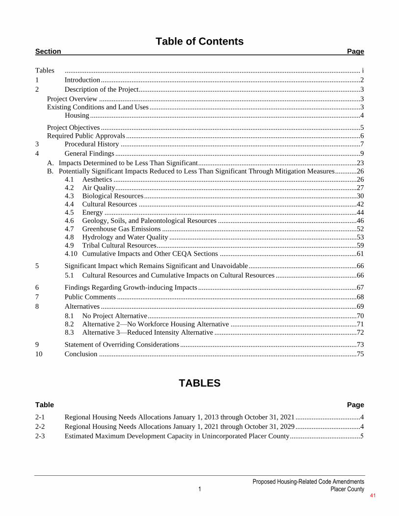
Proposed Housing-Related Code Amendments 1 Placer County
Table of Contents Section Page
Tables .................................................................................................................................................................... i
1 Introduction ................................................................................................................................................2
2 Description of the Project ...........................................................................................................................3
Project Overview .................................................................................................................................................3 Existing Conditions and Land Uses .....................................................................................................................3
Housing ......................................................................................................................................................4
Project Objectives ................................................................................................................................................5 Required Public Approvals ..................................................................................................................................6
3 Procedural History .....................................................................................................................................7
4 General Findings ........................................................................................................................................9
A. Impacts Determined to be Less Than Significant ........................................................................................ 23 B. Potentially Significant Impacts Reduced to Less Than Significant Through Mitigation Measures ............ 26
4.1 Aesthetics ....................................................................................................................................... 26 4.2 Air Quality ...................................................................................................................................... 27 4.3 Biological Resources ...................................................................................................................... 30 4.4 Cultural Resources ......................................................................................................................... 42 4.5 Energy ............................................................................................................................................ 44 4.6 Geology, Soils, and Paleontological Resources ............................................................................. 46 4.7 Greenhouse Gas Emissions ............................................................................................................ 52 4.8 Hydrology and Water Quality ........................................................................................................ 53 4.9 Tribal Cultural Resources ............................................................................................................... 59 4.10 Cumulative Impacts and Other CEQA Sections ............................................................................ 61
5 Significant Impact which Remains Significant and Unavoidable ............................................................ 66
5.1 Cultural Resources and Cumulative Impacts on Cultural Resources ............................................. 66
6 Findings Regarding Growth-inducing Impacts ........................................................................................ 67
7 Public Comments ..................................................................................................................................... 68
8 Alternatives .............................................................................................................................................. 69
8.1 No Project Alternative .................................................................................................................... 70 8.2 Alternative 2—No Workforce Housing Alternative ...................................................................... 71 8.3 Alternative 3—Reduced Intensity Alternative ............................................................................... 72
9 Statement of Overriding Considerations .................................................................................................. 73
10 Conclusion ............................................................................................................................................... 75
TABLES
Table Page 2-1 Regional Housing Needs Allocations January 1, 2013 through October 31, 2021 ....................................4
2-2 Regional Housing Needs Allocations January 1, 2021 through October 31, 2029 ....................................4
2-3 Estimated Maximum Development Capacity in Unincorporated Placer County .......................................5
41
Proposed Housing-Related Code Amendments 2 Placer County
1 INTRODUCTION The Proposed Housing-Related Code Amendments (proposed project) has been considered by the Placer County
Board of Supervisors, as the decision-making body of Placer County (County), the lead agency for the project under
the California Environmental Quality Act (CEQA). The environmental analysis contained in the Environmental
Impact Report (EIR) for the project provides a thorough evaluation of significant and potentially significant effects
on the environment that would occur as a result of project development and alternatives to the project.
The State CEQA Guidelines state the following regarding approving a project in Public Resources Code, Section
21081:
No public agency shall approve or carry out a project for which an environmental impact report
has been certified which identifies one or more significant effects on the environment that would
occur if the project is approved or carried out unless both of the following occur:
(a) The public agency makes one or more of the following findings with respect to each
significant effect:
(1) Changes or alterations have been required in, or incorporated into, the project which
mitigate or avoid the significant effects on the environment.
(2) Those changes or alterations are within the responsibility and jurisdiction of another
public agency and have been, or can and should be, adopted by that other agency.
(3) Specific economic, legal, social, technological, or other considerations, including
considerations for the provision of employment opportunities for highly trained
workers, make infeasible the mitigation measures or alternatives identified in the
environmental impact report.
(b) With respect to significant effects which were subject to a finding under paragraph (3) of
subdivision (a), the public agency finds that specific overriding economic, legal, social,
technological, or other benefits of the project outweigh the significant effects on the
environment.
Because the EIR identified significant effects that would occur as a result of the project, and in accordance with the
provisions of the State CEQA Guidelines, the Board of Supervisors hereby adopts these findings as part of the
approval of the project.
These findings do not attempt to describe the full analysis of each environmental impact contained in the EIR.
Instead, the findings provide a summary description of each impact, describe the applicable mitigation measures
identified in the EIR and adopted by the Board of Supervisors, and state the Board of Supervisors’ findings on the
significance of each impact after imposition of the adopted mitigation measures, accompanied by a brief
explanation. Full explanations of these environmental findings and conclusions can be found in the EIR. These
findings hereby incorporate by reference the discussion and analysis in those documents supporting the EIR’s
determinations regarding mitigation measures and the project’s impacts and mitigation measures designed to
address those impacts. In making these findings, the Board of Supervisors ratifies, adopts, and incorporates into
these findings the analysis and explanation in the EIR and ratifies, adopts, and incorporates in these findings the
determinations and conclusions of the EIR relating to environmental impacts and mitigation measures.
42
Proposed Housing-Related Code Amendments 3 Placer County
2 DESCRIPTION OF THE PROJECT The proposed project would amend the existing Placer County General Plan, Placer County Zoning Ordinance,
Zoning Combining Districts, and Community Design Manual for Multi-Family and Mixed-Use Development.
PROJECT OVERVIEW
The proposed project consists of targeted amendments to the Placer County General Plan, Placer County Zoning
Ordinance, Zoning Combining Districts, and Community Design Manual for Multi-Family and Mixed-Use
Development, which would provide a framework for future housing development in Placer County that takes into
account population growth, economic factors, demographics, and community needs and wants. The updates to the
General Plan, Zoning Ordinance, the rezoning of parcels’ combining zone, and the adoption of a Design Manual
for multi-family and mixed-use development constitute the project.
Unincorporated Placer County currently has sufficient area to meet its housing demand, as described in Section
2.2.2, Existing Conditions and Land Uses of the DEIR; however, housing development in unincorporated Placer
County has been slow and difficult for multiple reasons, including market conditions, infrastructure constraints,
and regulatory/environmental barriers. Through its updates to the General Plan, Zoning Ordinance, Zoning Map,
and the Design Manual for Multi-Family and Mixed-Use Development, the project proposes to facilitate housing
development by allowing for more variation of development in areas where infrastructure and development
already exists and has capacity to accommodate further development. The project is geared towards implementing
the County’s existing General Plan policies and current State housing regulations.
EXISTING CONDITIONS AND LAND USES
The population of the unincorporated area of the county was estimated to be 115,247 on January 1, 2020. The
County seat is in the incorporated city of Auburn, approximately 30 miles northeast of Sacramento. The city of
Auburn’s population was estimated by the U.S. Census to be 14,392 in 2019. The city of Roseville, with an
estimated population of 139,643 in 2019, is the largest city in the county (California Department of Finance
2019).
The western part of Placer County, which is part of the Sacramento Valley, is generally flat and ranges in
elevation from 45 to 1,000 feet. This part of the county, called South Placer, contains the cities of Roseville,
Rocklin, Lincoln, and Loomis, as well as the unincorporated communities of Sheridan and Granite Bay. The
South Placer area has experienced the county’s most significant growth in recent years, in terms of both new
housing and commercial and industrial development. Most of the county’s major manufacturing facilities are
located in this part of the county. South Placer County also supports the bulk of the county’s agricultural
activities, including over 86,000 acres of land enrolled in the California Land Conservation Act (Williamson Act)
contracts (Placer County 1994).
The central part of Placer County consists of the foothills region, which includes the cities of Auburn and Colfax,
and the unincorporated communities of Foresthill, Penryn, Newcastle, Applegate, Weimar, Gold Run, Meadow
Vista, Dutch Flat, Alta, and Baxter. The foothills region is the heart of what constituted Gold Rush County in the
19th century. As in South Placer, many residents of the foothills area commute to work in the Sacramento area
(Placer County 1994).
The eastern part of Placer County is the High Sierra region. The High Sierra area includes resort communities and
ski areas around Lake Tahoe. This area is an internationally known resort area with visitors coming to hike, fish,
golf, enjoy the outdoors, visit nearby Nevada casinos, and ski. Tourism and recreation are the dominant industries
in the region, providing jobs for the residents of the unincorporated communities of Tahoe City, Tahoe Vista,
Carnelian Bay, Homewood, Kings Beach, Tahoma, Emigrant Gap, Soda Springs, and Squaw Valley (Placer
County 1994).
43
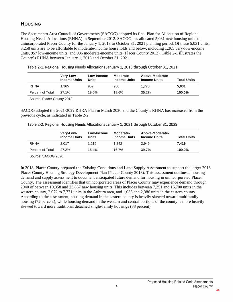
Proposed Housing-Related Code Amendments 4 Placer County
HOUSING
The Sacramento Area Council of Governments (SACOG) adopted its final Plan for Allocation of Regional
Housing Needs Allocations (RHNA) in September 2012. SACOG has allocated 5,031 new housing units to
unincorporated Placer County for the January 1, 2013 to October 31, 2021 planning period. Of these 5,031 units,
3,258 units are to be affordable to moderate-income households and below, including 1,365 very-low-income
units, 957 low-income units, and 936 moderate-income units (Placer County 2013). Table 2-1 illustrates the
County’s RHNA between January 1, 2013 and October 31, 2021.
Table 2-1. Regional Housing Needs Allocations January 1, 2013 through October 31, 2021
Very-Low-Income Units
Low-Income Units
Moderate-Income Units
Above-Moderate-Income Units Total Units
RHNA 1,365 957 936 1,773 5,031
Percent of Total 27.1% 19.0% 18.6% 35.2% 100.0%
Source: Placer County 2013
SACOG adopted the 2021-2029 RHRA Plan in March 2020 and the County’s RHNA has increased from the
previous cycle, as indicated in Table 2-2.
Table 2-2. Regional Housing Needs Allocations January 1, 2021 through October 31, 2029
Very-Low-Income Units
Low-Income Units
Moderate-Income Units
Above-Moderate-Income Units Total Units
RHNA 2,017 1,215 1,242 2,945 7,419
Percent of Total 27.2% 16.4% 16.7% 39.7% 100.0%
Source: SACOG 2020
In 2018, Placer County prepared the Existing Conditions and Land Supply Assessment to support the larger 2018
Placer County Housing Strategy Development Plan (Placer County 2018). This assessment outlines a housing
demand and supply assessment to document anticipated future demand for housing in unincorporated Placer
County. The assessment identifies that unincorporated areas of Placer County may experience demand through
2040 of between 10,358 and 23,857 new housing units. This includes between 7,251 and 16,700 units in the
western county, 2,072 to 7,771 units in the Auburn area, and 1,036 and 2,386 units in the eastern county.
According to the assessment, housing demand in the eastern county is heavily skewed toward multifamily
housing (72 percent), while housing demand in the western and central portions of the county is more heavily
skewed toward more traditional detached single-family housings (88 percent).
44
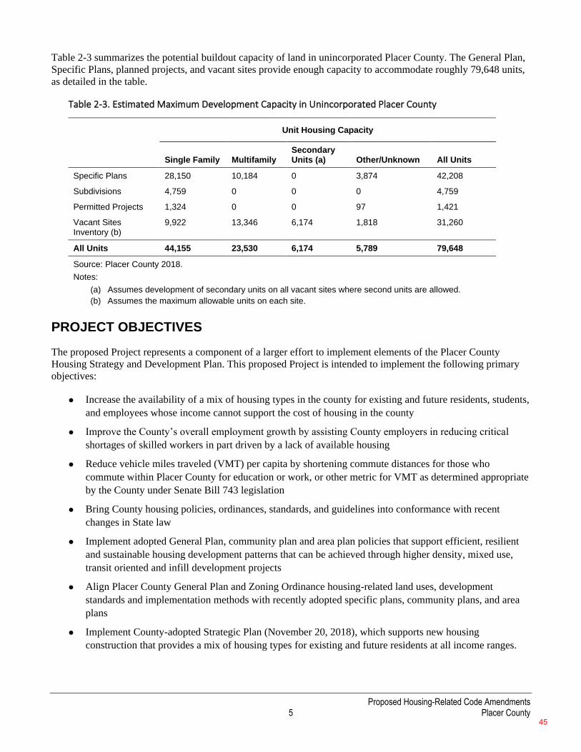
Proposed Housing-Related Code Amendments 5 Placer County
Table 2-3 summarizes the potential buildout capacity of land in unincorporated Placer County. The General Plan,
Specific Plans, planned projects, and vacant sites provide enough capacity to accommodate roughly 79,648 units,
as detailed in the table.
Table 2-3. Estimated Maximum Development Capacity in Unincorporated Placer County
Unit Housing Capacity
Single Family Multifamily
Secondary Units (a) Other/Unknown All Units
Specific Plans 28,150 10,184 0 3,874 42,208
Subdivisions 4,759 0 0 0 4,759
Permitted Projects 1,324 0 0 97 1,421
Vacant Sites Inventory (b)
9,922 13,346 6,174 1,818 31,260
All Units 44,155 23,530 6,174 5,789 79,648
Source: Placer County 2018. Notes:
(a) Assumes development of secondary units on all vacant sites where second units are allowed. (b) Assumes the maximum allowable units on each site.
PROJECT OBJECTIVES
The proposed Project represents a component of a larger effort to implement elements of the Placer County
Housing Strategy and Development Plan. This proposed Project is intended to implement the following primary
objectives:
⚫ Increase the availability of a mix of housing types in the county for existing and future residents, students,
and employees whose income cannot support the cost of housing in the county
⚫ Improve the County’s overall employment growth by assisting County employers in reducing critical
shortages of skilled workers in part driven by a lack of available housing
⚫ Reduce vehicle miles traveled (VMT) per capita by shortening commute distances for those who
commute within Placer County for education or work, or other metric for VMT as determined appropriate
by the County under Senate Bill 743 legislation
⚫ Bring County housing policies, ordinances, standards, and guidelines into conformance with recent
changes in State law
⚫ Implement adopted General Plan, community plan and area plan policies that support efficient, resilient
and sustainable housing development patterns that can be achieved through higher density, mixed use,
transit oriented and infill development projects
⚫ Align Placer County General Plan and Zoning Ordinance housing-related land uses, development
standards and implementation methods with recently adopted specific plans, community plans, and area
plans
⚫ Implement County-adopted Strategic Plan (November 20, 2018), which supports new housing
construction that provides a mix of housing types for existing and future residents at all income ranges.
45

Proposed Housing-Related Code Amendments 6 Placer County
REQUIRED PUBLIC APPROVALS
The proposed project will be considered by the Planning Commission, who will make a recommendation to the
Board of Supervisors regarding adoption of the revised Proposed Housing-Related Code Amendments. If
approved, the following actions will be required:
1. Certification of the EIR for the proposed project by the County Board of Supervisors
2. Adoption of the Proposed Housing-Related Code Amendments by the County Board of Supervisors
46
Proposed Housing-Related Code Amendments 7 Placer County
3 PROCEDURAL HISTORY A Notice of Preparation (NOP) to prepare an EIR for the proposed project was circulated to agencies and the
public from August 29, 2019 to September 27, 2019. Placer County held an NOP scoping meeting during the
review period on September 18, 2019, for the purpose of receiving comments on the scope of the environmental
analysis to be prepared for the proposed project.
The County prepared a Draft EIR and released it for public comment on January 21, 2021. Public comments on
the Draft EIR were received through March 8, 2021 and a public meeting on the Draft EIR was held in front of
the Planning Commission on February 11, 2021. Responses were prepared to all environmental issues raised in
public comments. The County provided copies of responses to comments from agencies and individuals to those
agencies and individuals per Section 15088 (b) of the CEQA Guidelines. The County published and released the
Final EIR along with an associated Notice of Availability (NOA) on MONTH 00, 2021.
The County gave due notice of the public hearing to be held by the Planning Commission to consider and
recommend upon the Final EIR for the project, and a public hearing was held before the Planning Commission.
The County gave due notice of the public hearing to be held by the Board of Supervisors to consider and act upon
the Final EIR for the project, and a public hearing was held before the Board of Supervisors.
After closing the hearing to public comment, the Board of Supervisors, having considered the Final EIR as
prepared for the project (which includes the Draft EIR dated January 2021) and the Final EIR, (dated MONTH
2021), the comments of the public, both oral and written, the Planning Commission’s recommendation, and all
written materials in the record connected with the Draft and Final EIR, and the project, makes the following
findings:
1. The Final EIR has been prepared in accordance with all requirements of State CEQA Guidelines.
2. The Final EIR was presented to and reviewed by the Board of Supervisors. The Final EIR was prepared
under the supervision of the County and reflects the independent judgment of the County. The Board of
Supervisors has reviewed the Final EIR, and bases the findings stated below on such review and other
substantial evidence in the record.
3. The County finds that the Final EIR considers a reasonable range of potentially feasible alternatives,
sufficient to foster informed decision making, public participation and a reasoned choice. Thus, the
alternatives analysis in the Draft EIR is sufficient to carry out the purposes of such analysis under State
CEQA Guidelines.
4. The Board of Supervisors hereby certifies the Final EIR as complete, adequate and in full compliance with
CEQA, and as providing an adequate basis for considering and acting upon the project approval and makes
the following specific findings with respect thereto.
5. The Board of Supervisors agrees with the characterization of the Draft EIR and Final EIR with respect to
those impacts identified as “less-than-significant” and finds that those impacts have been described
accurately and are less-than-significant as so described in the Draft EIR and Final EIR. This finding does
not apply to impacts identified as significant or potentially significant that are reduced by mitigation
measures to a level characterized in the Draft EIR and Final EIR as less-than-significant or the impact
characterized in the Draft EIR and Final EIR as significant and unavoidable. Each of those impacts, and the
mitigation measures adopted to reduce them, are addressed specifically by the findings below.
6. The Board of Supervisors agrees with the characterization of the Draft EIR and Final EIR with respect to
the following impact: Impact CUL-1, “Cause a substantial adverse change in the significance of an
47
Proposed Housing-Related Code Amendments 8 Placer County
historical resource.” The impact listed above is identified as significant and unavoidable because feasible
mitigation with respect to the impact beyond existing General Plan policies does not currently exist to fully
reduce cultural resources impacts on historical resources and cumulative cultural resources impacts to a
less-than-significant level.
7. All mitigation measures proposed in the Draft EIR and Final EIR are adopted and incorporated into the
project.
8. The Mitigation Monitoring and Reporting Program (MMRP) will apply to all mitigation measures adopted
with respect to the project pursuant to all of the project approvals, and will be implemented.
9. The descriptions of the impacts in these findings are summary statements. Reference should be made to the
Draft EIR and Final EIR for a more complete description.
10. The Community Development Resource Agency is directed to file a Notice of Determination with the
County Clerk within five (5) working days in accordance with Public Resources Code section 21152(a) and
CEQA Guidelines section 15094.
48
Proposed Housing-Related Code Amendments 9 Placer County
4 GENERAL FINDINGS
The County has reviewed the Final EIR, consisting of Responses to Comments on the Draft EIR, Revisions to the
Draft EIR Text, and the MMRP. The County has also considered the public record on the project, including all
oral and written comments received. In addition to this Statement of Findings, the public record for the project
additionally includes the following elements, as well as the mandatory elements of a record set forth in Public
Resources Code section 21167.7, subdivision (e) (a full reference list is provided in each resource section of
Chapter 3 of the Draft EIR):
Aesthetics
California Department of Transportation. 2020. Scenic Highways. https://dot.ca.gov/programs/design/lap-
landscape-architecture-and-community-livability/lap-liv-i-scenic-highways. Accessed May 29, 2020.
Placer County. 2003. Placer County Design Guidelines Manual.
https://www.placer.ca.gov/DocumentCenter/View/10136/Design-Guidelines-Manual-PDF. Accessed June 1,
2020.
Placer County. 2019. Design Manual: Development Standards and Design Guidelines for Multi-Family and
Mixed-Use Development. Public Review Draft. September 30, 2019.
Placer County Planning Services Division. 2013. Placer County Landscape Design Guidelines.
https://www.placer.ca.gov/DocumentCenter/View/10131/Landscape-Design-Guidelines-PDF. Accessed June
1, 2020.
U.S. Environmental Protection Agency. 2020. About Lake Tahoe. https://www.epa.gov/lake-tahoe/about-lake-
tahoe. Accessed May 29, 2020.
Agriculture and Forestry Resources
California Department of Conservation. 2006. Farmland Mapping and Monitoring Program. Placer County.
Available: https://www.conservation.ca.gov/dlrp/fmmp/Pages/Placer.aspx. Accessed: June 4, 2020.
California Department of Conservation. 2016. Farmland Mapping and Monitoring Program. Placer County.
Available: https://www.conservation.ca.gov/dlrp/fmmp/Pages/Placer.aspx. Accessed: May 2020.
Placer County. 1994. Countywide General Plan: Final Environmental Impact Report. July 26, 1994. Prepared
by: Crawford Multari & Starr, DKS Associates, Psomas and Associates, Jones & Stokes Associates, Recht
Hausrath & Associates, J. Laurence Mintier & Associates. https://www.placer.ca.gov/2981/General-Plan-
Environmental-Impact-Report. Accessed May 18, 2020.
Placer County. 2013. Placer County General Plan. Section 7 Agricultural and Forestry Resources. May 2013.
https://www.placer.ca.gov/DocumentCenter/View/8566/Agricultural-and-Forestry-Resources-PDF. Accessed
May 18, 2020.
Placer County. 2020a. Placer County: Parcels. Available: http://gis-
placercounty.opendata.arcgis.com/datasets/e49d7e972674481cbb5ecc047b8f98eb_0. Last updated: April 2020.
Date accessed: May 28, 2020.
Placer County. 2020b. Placer County: Zoning. Available: http://gis-
placercounty.opendata.arcgis.com/datasets/cf289230d7b74fcf9ca6a858ca8ccb18_0. Last updated: April 2020.
Date accessed: May 28, 2020
49
Proposed Housing-Related Code Amendments 10 Placer County
Air Quality
California Air Resources Board 2005. Air Quality and Land Use Handbook: A Community Health Perspective.
April. Available: http://www.arb.ca.gov/ch/landuse.htm. Accessed May 2020.
California Air Resources Board. 2019. California Ambient Air Quality Standards. Available: <
https://ww2.arb.ca.gov/resources/california-ambient-air-quality-standards>. Accessed May 2020
California Air Resources Board. 2020a. California Ambient Air Quality Standards. Available:
https://ww2.arb.ca.gov/resources/california-ambient-air-quality-standards. Accessed May 2020.
California Air Resources Board. 2020b. National Ambient Air Quality Standards.
https://ww2.arb.ca.gov/resources/national-ambient-air-quality-standards. Accessed May 2020.
California Air Resources Board. 2020c. iADAM: Air Quality Data Statistics Top 4 Summary. Available:
https://www.arb.ca.gov/adam/topfour/topfour1.php. Accessed May 2020.
Placer County. 2008. Naturally Occurring Asbestos Hazard. Available:
https://www.placer.ca.gov/DocumentCenter/View/1435/Placer-County-Naturally-Occurring-Asbestos-Hazard-
--Index-Map-PDF. Accessed May 2020.
Placer County. 2013. Placer County General Plan. May. Available: https://www.placer.ca.gov/2977/Placer-
County-General-Plan. Accessed May 2020.
Placer County. 2017. Placer County CEQA Handbook. Available: https://www.placer.ca.gov/1801/CEQA-
Handbook. Accessed June 2020.
Placer County Air Pollution Control District. 2014. Asbestos Dust Mitigation Plan (ADMP) Guidance. May
21. Available: https://www.placer.ca.gov/DocumentCenter/View/1226/Naturally-Occurring-Asbestos-Dust-
Mitigation-Plan-ADMP-Guidance-PDF. Accessed June 2020.
Placer County Air Pollution Control District 2017. CEQA Handbook. Available:
https://www.placerair.org/1801/CEQA-Handbook. Accessed July 2020.
Placer County Air Pollution Control District. 2020a. Rules. Available: https://www.placer.ca.gov/1861/Rules.
Accessed May 2020.
Placer County Air Pollution Control District. 2020b. Dust Control for Projects in Areas “Most Likely” to
Contain Naturally-Occurring Asbestos (NOA) Fact Sheet. Available:
https://www.placerair.org/DocumentCenter/View/1401/Dust-Control-for-Projects-in-Areas--Most-Likely-to-
Contain-Naturally-Occurring-Asbestos-PDF. Accessed June 2020.
Placer County Air Pollution Control District. 2020c. NOA Construction & Grading. Available:
https://www.placer.ca.gov/1621/NOA-Construction-Grading. Accessed July 2020.
Ramboll. 2019. GUIDANCE TO ADDRESS THE FRIANT RANCH RULING FOR CEQA PROJECTS IN THE
SAC METRO AIR DISTRICT. December. Available:
http://www.airquality.org/LandUseTransportation/Documents/SMAQMD_FriantRanch_DraftFinalPublic.pdf.
Accessed May 2020.
Sacramento Metropolitan Air Quality Management District 2016. Guide to Air Quality Assessment in
Sacramento County. Last revision August 2016.
U.S. Environmental Protection Agency. 2018. Health and Environmental Effects of Particulate Matter (PM).
Available: <https://www.epa.gov/pm-pollution/health-and-environmental-effects-particulate-matter-pm>.
Accessed May 2020.
50
Proposed Housing-Related Code Amendments 11 Placer County
U.S. Environmental Protection Agency 2019a. Health Effects of Ozone Pollution. Available:
https://www.epa.gov/ground-level-ozone-pollution/health-effects-ozone-pollution. Accessed April 12, 2019.
U.S. Environmental Protection Agency 2019b. Health Effects of Ozone In the General Population. Available:
https://www.epa.gov/ozone-pollution-and-your-patients-health/health-effects-ozone-general-population.
Accessed April 12, 2019.
U.S. Environmental Protection Agency 2019c. Health and Environmental Effects of Particulate Matter (PM).
Available: https://www.epa.gov/pm-pollution/health-and-environmental-effects-particulate-matter-pm.
Accessed April 12, 2019
U.S. Environmental Protection Agency. 2020. The Greenbook Nonattainment Areas for Criteria Pollutants.
Last updated: April 30, 2020. Available: https://www.epa.gov/green-book. Accessed: May 2020.
Personal Communications
Tokarski, David. DKS Associates. April 22, 2020—email correspondence with Erin Efner, ICF.
Chang, Yu-Shuo. Placer County Air Pollution Control District. October 21, 2020—email correspondence with
Sarah Halterman, ICF.
Biological Resources
California Department of Fish and Wildlife. 2018. Protocols for Surveying and Evaluating Impacts to Special
Status Native Plant Populations and Sensitive Natural Communities. March 20, 2018. Available:
https://nrm.dfg.ca.gov/FileHandler.ashx?DocumentID=18959&inline.
California Department of Fish and Wildlife. 2020. California Natural Diversity Database—GIS Dataset
(includes RareFind searches), May 1, 2020 update.
California Native Plant Society. 2020. Inventory of Rare and Endangered Plants (online edition, v8-03 0.39).
California Native Plant Society, Sacramento, CA. http://www.rareplants.cnps.org.
Environmental Laboratory. 1987. Corps of Engineers Wetlands Delineation Manual. (Technical Report Y-87-
1.) Vicksburg, MS: U.S. Army Waterways Experiment Station.
Google Earth. 2020. Imagery date: September 12, 2019.
Lichvar, R.W. and S.M. McColley. 2008. A Field Guide to the Identification of the Ordinary High Water Mark
in the Arid West Region of the Western United States. ERDC/CRREL TR-08-12. Hanover, NH: U.S. Army
Engineer Research and Development Center. Available:<http://el.erdc.usace.army.mil/elpubs/pdf/trcrrel08-
12.pdf>.
Mersel, M.K. and R.W. Lichvar. 2014. A Guide to Ordinary High Water Mark (OHWM) Delineation for Non-
Perennial Streams in the Western Mountains, Valleys, and Coast Region of the United States. Available:
http://acwc.sdp.sirsi.net/client/search/asset/1036027.
National Invasive Species Council. 2008. 2008–2012 National Invasive Species Management Plan.
Washington, DC.
Natural Resources Conservation Service. 2019. Soil Survey Western Placer County. Last updated: September
16, 2019. Available: https://websoilsurvey.nrcs.usda.gov/app/WebSoilSurvey.aspx.
Placer County. 2013. Placer County General Plan. Adopted August 16, 1994. Updated May 21, 2013. Auburn,
CA.
51
Proposed Housing-Related Code Amendments 12 Placer County
Placer County. 2018. Western Placer County Habitat Conservation Plan and Natural Community
Conservation Plan. Working Draft. December 2018.
Placer County 2020. Placer County Conservation Program Final Environmental Impact
Statement/Environmental Impact Report. Prepared by ICF. Sacramento, CA.
Placer County Planning Department. 2004. Placer County Natural Resources Report. A Scientific Assessment
of Watersheds, Ecosystems, and Species of the Phase I Planning Area. Prepared Jones & Stokes Associates.
Sacramento, CA.
State Water Resources Control Board. 2019. State wetland definition and procedures for discharges of dredged
or fill material to waters of the State. Adopted April 2, 2019.
U.S. Army Corps of Engineers. 2008. Regional Supplement to the Corps of Engineers Wetlands Delineation
Manual: Arid West Region (Version 2.0). J. S. Wakeley, R. W. Lichvar, and C.V. Noble (eds.). ERDC/EL TR-
08-28. Vicksburg, MS: U.S. Army Engineer Research and Development Center.
U.S. Army Corps of Engineers. 2010. Regional Supplement to the Corps of Engineers Wetlands Delineation
Manual: Western Mountains, Valleys, and Coast Region (Version 2.0). ed. J. S. Wakeley, R. W. Lichvar, and
C.V. Noble. ERDC/EL TR-10-3. Vicksburg, MS: U.S. Army Engineer Research and Development Center.
U.S. Fish and Wildlife Service. 2020. Information for Planning and Consultation Trust Resource Report. List
of Federal Endangered and Threatened Species That Occur in or May Be Affected by the Project. Sacramento
Fish and Wildlife Office. Sacramento, CA. Available: http://ecos.fws.gov/ipac.
Cultural Resources
Elsasser, A.B. 1978. Development of Regional Prehistoric Cultures. Pages 37-57 in Robert F. Heizer (ed.),
Handbook of North American Indians, California. Volume 8. Washington, DC: Smithsonian Institution.
Kowta, M. 1988. The Archaeology and Prehistory of Plumas and Butte Counties, California: an Introduction
and Interpretive Model. California Archaeological Site Inventory, Northeast Information Center, California
State University, Chico, California.
Meyer and Rosenthal 2008. A Geoarchaeological Overview and Assessment of Caltrans District 3 – Cultural
Resources Inventory of Caltrans District 3 Rural Conventional Highways. Prepared by Far Western
Anthropological Research Group. Prepared for The California Department of Transportation, District 3, North
Region, Marysville, California.
Mineral Resources Data System 2020. “MRDS records graded”. Available: https://mrdata.usgs.gov/mrds/map-
graded.html. Accessed August 25, 2020.
Moratto, M.J. 1984. California Archaeology. Academic Press, New York.
Placer County. 1994. Placer County General Plan Update: Countywide General Plan Final Environmental
Impact Report. Volume 1. Chapter 7: Recreational and Cultural Resources; pages 7.8–7.12.
Placer County. 2013. Placer County General Plan. Section 5: Recreational and Cultural Resources; pages 7.8-
7.12.
Placer County. 2020. Placer County Register of Cultural and Historic Resources. Information on file with the
County of Placer.
Rosenthal, J. S., G. G. White, and M. Q. Sutton. 2007. The Central Valley: A View from the Catbird’s Seat. In
California Prehistory: Colonization, Culture, and Complexity, edited by Terry L. Jones and Kathryn A. Klar,
pp. 147-163. AltaMira Press, Lanham, Maryland.
52
Proposed Housing-Related Code Amendments 13 Placer County
Thompson and West. 1882. History of Placer County, California with Illustrations and Biographical Sketches
of its Prominent Men and Pioneers. Thompson and West Publishers; San Francisco.
Energy
California Energy Commission. 2020a. Electricity Consumption by Entity. Available:
https://ecdms.energy.ca.gov/elecbyutil.aspx. Accessed May 26, 2020.
California Energy Commission. 2020b. Gas Consumption by Entity. Available:
https://ecdms.energy.ca.gov/gasbyutil.aspx. Accessed May 26, 2020.
California Energy Commission. 2020c. Electricity Consumption by County. Available:
https://ecdms.energy.ca.gov/elecbycounty.aspx. Accessed May 26, 2020.
California Energy Commission. 2020d. Gas Consumption by County. Available:
https://ecdms.energy.ca.gov/gasbycounty.aspx. Accessed May 26, 2020.
Pacific Gas and Electric Company. 2019. Where Your Electricity Comes From. Available:
https://www.pge.com/pge_global/common/pdfs/your-account/your-bill/understand-your-bill/bill-
inserts/2019/1019-Power-Content-Label.pdf. Accessed April 22, 2020.
U.S. Energy Information Administration 2020a. Rankings: Total Energy Production, 2018 (trillion Btu).
Available: https://www.eia.gov/state/rankings/?sid=CA#series/101. Accessed: August 2020.
U.S. Energy Information Administration 2020b. California State Energy Profile. Available:
https://www.eia.gov/state/print.php?sid=CA. Accessed: August 2020.
U.S. Energy Information Administration 2020c. Profile Overview: Available:
https://www.eia.gov/state/?sid=CA#tabs-3. Accessed: August 2020.
Geology, Soils, and Paleontological Resources
California Department of Conservation. 2006. Relative Likelihood for the Presence of Naturally Occurring
Asbestos in Place County, California. Available:
http://www.capcoa.org/Docs/noa/%5B7%5D%20Placer%20County%20NOA%20-
%20CGS%20Report%20190.pdf. Accessed May 29, 2020.
California Earthquake Authority. 2020. California Earthquake Risk Map & Faults By County. Available:
https://www.earthquakeauthority.com/California-Earthquake-Risk/Faults-By-County. Accessed: May 30,
2020.
California Geological Survey. 2020a. The Alquist-Priolo Earthquake Fault Zoning Act. Available:
http://www.conservation.ca.gov/cgs/rghm/ap. Accessed: March 17, 2020.
California Geological Survey. 2020b. CGS Information Warehouse. Available:
http://maps.conservation.ca.gov/cgs/informationwarehouse/index.html?map=regulatorymaps. Accessed May
30, 2020.
City of Auburn General Plan Citizens Advisory Committee. 1993. City of Auburn General Plan, VII Open
Space and Conservation. Available: https://www.auburn.ca.gov/399/Planning. Accessed: May 8, 2020.
City of Roseville. 2016. City of Roseville General Plan 2035, VIII Safety Element. Available:
https://www.roseville.ca.us/government/departments/development_services/planning/general_plan_developme
nt_guidelines. Accessed: May 8, 2020.
53
Proposed Housing-Related Code Amendments 14 Placer County
Dundas, R.G. and Chatters, J.C. 2013. The mid-Irvingtonian Fairmead Landfill fossil site, Madera County
Paleontology Collection, and Fossil Discovery Center of Madera County, California. In Putirka, K., ed.,
Geologic Excursions from Fresno, California, and the Central Valley: A Tour of California’s Iconic Geology:
Geological Society of America Field Guide 32, pp. 63-78. Available:
https://pubs.geoscienceworld.org/books/chapter-pdf/3739273/9780813756325_ch04.pdf. Accessed: July 30,
2020.
Geological Society of America. 2012. Seismic Hazard: Faults Discovered Near Lake Tahoe Could Generate
Earthquakes Ranging from 6.3 to 6.9. ScienceDaily. Available:
www.sciencedaily.com/releases/2012/05/120524123236.htm. Accessed May 30, 2020.
High Sierra Resource Conservation and Development Council. 2005. Vegetation Establishment Guidelines for
the Sierra Nevada Foothills and Mountains. Available: http://placerrcd.org/wp-
content/uploads/documents/NEW-2005-Vegetation-Guidelines.pdf. Accessed: June 5, 2020.
Marchand, D.E. and Allwardt, A. 1981. Late Cenozoic Stratigraphic Units, Northeastern San Joaquin Valley,
California. (Geological Survey Bulletin 1470.) Available: https://pubs.usgs.gov/bul/1470/report.pdf. Accessed:
June 5, 2020.
National Park Service. n.d. Fossils and Paleontology: Paleontological Resource Monitoring. Available:
https://www.nps.gov/subjects/fossils/resource-monitoring.htm. Accessed: June 5, 2020.
North Fork Associates. 2010. Martis Valley Regional Trail Initial Study. Available:
https://evogov.s3.amazonaws.com/media/186/media/161211.pdf. Accessed May 29, 2020.
Placer County. 1994. Countywide General Plan: Final Environmental Impact Report. July 26. Prepared by:
Crawford Multari & Starr, DKS Associates, Psomas and Associates, Jones & Stokes Associates, Recht
Hausrath & Associates, J. Laurence Mintier & Associates. Available: https://www.placer.ca.gov/2981/General-
Plan-Environmental-Impact-Report. Accessed: May 18, 2020.
Placer County. 2013. Placer County General Plan. Section 5: Recreation and Cultural Resources. Available:
https://www.placer.ca.gov/DocumentCenter/View/8564/Recreation-and-Cultural-Resources-PDF. Accessed
May 26, 2020.
Saucedo, G.J. and Wagner, D.L. 1992. Geologic Map of the Chico Quadrangle, California, 1:250,000.
Available: ftp://ftp.consrv.ca.gov/pub/dmg/pubs/rgm/RGM_007A/. Accessed: May 19, 2020.
SE Group & Assent. 2018. Squaw Valley/Alpine Meadows Bases-to-Base Gondola Project Draft EIS/EIR.
Available: https://www.placer.ca.gov/2680/Squaw-Valley-Alpine-Meadows-Base-to-Base. Accessed: May 29,
2020.
University of California Museum of Paleontology. n.d. Fossils: Window to the Past. Available:
https://ucmp.berkeley.edu/paleo/fossils/. Accessed: June 5, 2020.
University of California Museum of Paleontology. 2020a. Advanced Specimen Search: Riverbank Formation.
Available: https://ucmpdb.berkeley.edu/advanced.html. Accessed: June 5, 2020.
University of California Museum of Paleontology. 2020b. Advanced Specimen Search: Mehrten Formation.
Available: https://ucmpdb.berkeley.edu/advanced.html. Accessed: May 26, 2020.
Wagner, D.L., Jennings, C.W., Bedrossian, T.L., and Bortugno, E.J. 1991. Geologic Map of the Sacramento
Quadrangle, California, 1:250,000. Available: ftp://ftp.consrv.ca.gov/pub/dmg/pubs/rgm/RGM_001A/.
Accessed: May 19, 2020.
54
Proposed Housing-Related Code Amendments 15 Placer County
Greenhouse Gas Emissions
Blasing, T.J. 2016. Recent Greenhouse Gas Concentrations. DOI: 10.3334/CDIAC/atg.032. Updated April.
Available: https://www.osti.gov/dataexplorer/biblio/dataset/1394398. Accessed August 2020.
California Air Resources Board (CARB). 2008. Climate Change Scoping Plan. Available:
https://ww3.arb.ca.gov/cc/scopingplan/document/adopted_scoping_plan.pdf. Accessed May 21, 2020.
California Air Resources Board. 2017. The 2017 Climate Change Scoping Plan Update: The Strategy for
Achieving California’s 2030 GHG Target. January. Available:
https://www.arb.ca.gov/cc/scopingplan/scopingplan.htm. Accessed June 2020.
California Air Resources Board. 2019. California Greenhouse Gas Emission Inventory- 2019 Edition.
Available at: https://www.arb.ca.gov/cc/inventory/data/data.htm. Accessed April 2020.
California Energy Commission 2012. Guide to the (Non-Residential) California Green Building Standards
Code. July 1, 2012. Available:
https://sfplanning.org/sites/default/files/documents/reports/bicycle_parking_reqs/ExhibitD.pdf. Accessed
August 2020.
Energy Future Initiative. 2019. Pathways for Deep Decarbonization in California. Available:
https://static1.squarespace.com/static/58ec123cb3db2bd94e057628/t/5ccb4cf87817f7881c4c58e6/1556827401
738/FINAL+OFI.pdf. Accessed June 2020.
Intergovernmental Panel on Climate Change (IPCC). 2007. Climate Change 2007: The Physical Science Basis.
Contribution of Working Group I to the Fourth Assessment Report of the Intergovernmental Panel on Climate
Change. Solomon, S., D. Qin, M. Manning, Z. Chen, M. Marquis, K. B. Averyt, M. Tignor and H. L. Miller
(eds.).
Intergovernmental Panel on Climate Change. 2014. Climate Change 2014: Synthesis Report. Available:
http://www.ipcc.ch/report/ar5/syr.
Lempert, Robert, Preston, Benjamin, Edmonds, Jae, Clarke, Leon, Wild, Tom, Binsted, Matthew, Diringer,
Elliot, and Townsend, Brad. Pathways to 2050: Alternative Scenarios for Decarbonizing the U.S. Economy.
Available: https://www.c2es.org/site/assets/uploads/2019/05/pathways-to-2050-scenarios-for-decarbonizing-
the-us-economy-final.pdf. Accessed June 2020.
Mahone, Amber, Zachary Subin, Jenya Kahn-Lang, Douglas Allen, Vivian Li, Gerrit De Moor, Nancy Ryan,
Snuller Price. 2018. Deep Decarbonization in a High Renewables Future: Updated Results from the California
PATHWAYS Model. California Energy Commission. Publication Number: CEC-500-2018-012.
Myhre, G., D. Shindell, F.-M. Bréon, W. Collins, J. Fuglestvedt, J. Huang, D. Koch, J.-F. Lamarque, D. Lee,
B. Mendoza, T. Nakajima, A. Robock, G. Stephens, T. Takemura and H. Zhang, 2013: Anthropogenic and
Natural Radiative Forcing. In: Climate Change 2013: The Physical Science Basis. Contribution of Working
Group I to the Fifth Assessment Report of the Intergovernmental Panel on Climate Change [Stocker, T.F., D.
Qin, G.-K. Plattner, M. Tignor, S.K. Allen, J. Boschung, A. Nauels, Y. Xia, V. Bex and P.M. Midgley (eds.)].
Cambridge University Press, Cambridge, United Kingdom and New York, NY, USA.
National Park Service 2019 What is Climate Change? August 2. Available:
https://www.nps.gov/goga/learn/nature/climate-change-causes.htm. Accessed: August 2020.
Pacific Gas and Electric Company. 2019. PG&E’s 2018 Power Content Label. Available:
https://www.pge.com/pge_global/common/pdfs/your-account/your-bill/understand-your-bill/bill-
inserts/2019/1019-Power-Content-Label.pdf. Accessed June 2020.
55
Proposed Housing-Related Code Amendments 16 Placer County
Placer County Air Pollution Control District. 2016. Review of Land Use Projects Under CEQA. October 13.
Available: https://www.placer.ca.gov/DocumentCenter/View/2060/Review-of-Land-Use-Projects-Under-
CEQA-Policy-PDF. Accessed August 2020.
Placer County. 2017. Placer County CEQA Handbook. Available: https://www.placer.ca.gov/1801/CEQA-
Handbook. Accessed June 2020.
Placer County. 2018. Community-Wide and County-Operations 2015 Greenhouse Gas Emissions Inventories.
January. Available: https://www.placer.ca.gov/DocumentCenter/View/8533/Greenhouse-Gas-Emissions-
Inventory-PDF. Accessed June 2020.
Placer County. 2020. Placer County Sustainability Plan: A Greenhouse Gas Emission Reduction Plan and
Adaptation Strategy. Adopted January 28. Available:
https://www.placer.ca.gov/DocumentCenter/View/42940/PCSP-ADOPTION?bidId=. Accessed May 21, 2020.
Sacramento Metropolitan Air Quality Management District. 2016. Guide to Air Quality Assessment in
Sacramento County. Last revision August 2016.
U.S. Environmental Protection Agency. 2020. Inventory of U.S. Greenhouse Gas Emissions and Sinks (2018).
Last updated April 13. Available: https://www.epa.gov/ghgemissions/inventory-us-greenhouse-gas-emissions-
and-sinks. Accessed: April 17, 2020.
Personal Communications
Tokarski, David. DKS Associates. April 22, 2020—email correspondence with Erin Efner, ICF.
Hazards and Hazardous Materials
California Department of Forestry and Fire Protection. 2007. Fire Hazard Severity Zones, Placer County.
Prepared by Fire and Resource Assessment Program. Sacramento, CA.
California Department of Forestry and Fire Protection. 2012. Fire Hazard Severity Zone Maps. Last revised:
November 1, 2007. Available: http://www.fire.ca.gov/fire_prevention/
fire_prevention_wildland_zones.php. Accessed: September 19, 2015.
California Department of Toxic Substances Control. 2020. Envirostor Search Results. Available:
https://www.envirostor.dtsc.ca.gov/public/map/?myaddress=roseville%2C+ca. Accessed: June 1, 2020.
Placer County. 1994. Placer County General Plan Update: Countywide General Plan Final Environmental
Impact Report.
Placer County. 2020. Orchard at Penryn Vesting Tentative Subdivision Map and Variance (PLN14-00052) for
the Previously Certified Final Environmental Impact report and Addendum. Community Development
Resource Agency, Planning Services Division. Available:
https://www.placer.ca.gov/DocumentCenter/View/44869/SR-F-PC-14-00052-Orchard-at-Penryn-061120-
ALL-PDF. Accessed: August 27, 2020.
Placer County Office of Education. 2020. Educational Snapshot. Office of Planning and Research. Available:
https://www.placercoe.org/Pages/PCOE/About/About.aspx. Accessed: June 1, 2020.
Placer County Transportation Planning Agency. 2010. Placer County 2035 Regional Transportation Plan
Document. Final. September. Available: http://www.pctpa.net/library/rtp/2035/Chapter%206.4.pdf. Accessed:
May 12, 2020.
State of California. 2010. California Military Land Use Compatibility Analyst. Office of Planning and
Research. Available: http://cmluca.gis.ca.gov/. Accessed: May 12, 2020.
56
Proposed Housing-Related Code Amendments 17 Placer County
Hydrology and Water Quality
California Department of Water Resources. n.d. SGMA Basin Prioritization Dashboard. Available:
https://gis.water.ca.gov/app/bp-dashboard/final/. Accessed: May 11, 2020.
California Department of Water Resources. 2006a. Bulletin 118 Sacramento Valley Groundwater Basin North
American Subbasin. January 20. Available:
https://water.ca.gov/LegacyFiles/pubs/groundwater/bulletin_118/basindescriptions/5-21.64.pdf. Accessed:
May 18, 2020.
California Department of Water Resources. 2006b. Bulletin 118 Olympic Valley Groundwater Basin. January
20. Available: https://water.ca.gov/LegacyFiles/pubs/groundwater/bulletin_118/basindescriptions/6-108.pdf.
Accessed: May 18, 2020.
California Department of Water Resources. 2006c. Bulletin 118 Martis Valley Groundwater Basin. January 20.
California State Water Resources Control Board. 2018. 2014/2016 Integrated Report (Clean Water Act Section
303(d) List/305(b) Report)—Statewide. San Francisco Bay Regional Water Quality Control Board. USEPA
approved: April 6, 2018. Available:
https://www.waterboards.ca.gov/water_issues/programs/tmdl/integrated2014_2016.shtml. Accessed: May 18,
2020.
Central Valley Regional Water Quality Control Board. 2018. Water Quality Control Plan for the Sacramento
River and San Joaquin River Basins, Fifth Edition (Basin Plan). May.
Federal Emergency Management Agency. 2020. GIS Web Services for the FEMA National Flood Hazard
Layer Available: https://hazards.fema.gov/femaportal/wps/portal/NFHLWMS. Accessed March 12, 2020.
Fram, M.S., and Belitz, Kenneth. 2012. Groundwater Quality in the Tahoe and Martis Basins, California: U.S.
Geological Survey Fact Sheet 2011-3143, 4 p.
Lahontan Regional Water Quality Control Board. 2019. The Water Quality Control Plan for the Lahontan
Region, (Basin Plan). October 29.
Placer County. n.d. Auburn Ravine/Coon Creek Ecosystem Restoration Plan Summary.
Placer County. 1990. Placer County Flood Control and Water Conservation District Stormwater Management
Manual. September 1.
Placer County. 2002. Auburn Ravine/Coon Creek Restoration Plan Chapter 4: Water Resources Management.
June 28.
Placer County. 2016. West Placer Storm Water Quality Design Manual. Revised May 2018. April.
Placer County. 2017. East Placer Storm Water Quality Design Manual. Revised May 2018. May.
Placer County Stormwater Coordination Group. 2005. Guidance Document for Volume and Flow-based sizing
of Permanent Post-construction Best Management Practices for Stormwater Quality Protection. May 25.
Sacramento River Watershed Program. n.d.(a). Bear River Watershed.
Sacramento River Watershed Program. n.d.(b). Lower American River Watershed.
Sacramento River Watershed Program. n.d.(c). Upper American River Watershed.
Sacramento River Watershed Program. n.d.(d). Yuba River Watershed.
57
Proposed Housing-Related Code Amendments 18 Placer County
Land Use and Planning
California Air Resources Board. 2017. Proposed Update to the SB 375 Greenhouse Gas Emission Reduction
Targets. June 2017. https://ww3.arb.ca.gov/cc/sb375/staff_report_sb375_target_update_june_full_report.pdf.
Accessed June 12, 2020.
Placer County. 2003. Placer County Design Guidelines Manual.
https://www.placer.ca.gov/DocumentCenter/View/10136/Design-Guidelines-Manual-PDF. Accessed June 1,
2020.
Placer County. 2013. Placer County General Plan. 2013-2021 Housing Element. Part I: Policy Document.
https://www.placer.ca.gov/DocumentCenter/View/9439/Housing-Element-Policy-Document-PDF. Accessed
April 20, 2020.
Placer County. 2019a. Placer County Housing Strategy and Development Plan: Recommendations Report.
June 2019. Available: https://www.placer.ca.gov/DocumentCenter/View/37642/Housing-Strategy-and-
Development-Plan-PDF?bidId. Accessed June 12, 2020.
Placer County. 2019b. Design Manual: Development Standards and Design Guidelines for Multi-Family and
Mixed-Use Development. Public Review Draft. September 30, 2019.
Placer County. 2020a. Placer County Sustainability Plan: Greenhouse Gas Emissions Reduction Plan and
Adaptation Strategy. Adopted January 28, 2020.
https://www.placer.ca.gov/DocumentCenter/View/42940/PCSP-ADOPTION?bidId=. Accessed June 12, 2020.
Placer County. 2020b. Placer County Conservation Program: Western Placer County Habitat Conservation
Plan/Natural Community Conservation Plan. February 2020.
https://www.placer.ca.gov/DocumentCenter/View/44657/Placer-County-Conservation-Program---Volume-I-
Placer County. 2020c. Government Jurisdictions in Placer County. May 17.
Sacramento Area Council of Governments. 2016. Metropolitan Transportation Plan/Sustainable Communities
Strategy: Building a Sustainable System. https://www.sacog.org/sites/main/files/file-
attachments/mtpscs_complete.pdf?1489089196. Accessed June 12, 2020.
Sacramento Area Council of Governments. 2020a. About SACOG. Available: https://www.sacog.org/about-
sacog. Accessed: June 10, 2020.
Sacramento Area Council of Governments. 2020b. Sacramento Region Blueprint.
https://www.sacog.org/sacramento-region-blueprint. Accessed: June 10, 2020.
Sacramento Area Council of Governments. 2020c. Rural-Urban Connections Strategy.
https://www.sacog.org/rural-urban-connections-strategy. Accessed: June 10, 2020.
Minerals
California Department of Conservation. 1995. Mineral Land Classification of Placer County, California.
Division of Mines and Geology. Available:
https://www.google.com/url?sa=t&rct=j&q=&esrc=s&source=web&cd=&ved=2ahUKEwiKsaTNquTpAhXwl
HIEHYxHAZgQFjAAegQIARAB&url=ftp%3A%2F%2Fftp.consrv.ca.gov%2Fpub%2Fdmg%2Fpubs%2Fofr
%2FOFR_95-10%2FOFR_95-10_Text.pdf&usg=AOvVaw2FPLTO3QU2aHD83zoQAUMZ. Accessed: June
2, 2020.
58
Proposed Housing-Related Code Amendments 19 Placer County
Placer County. 1994. Countywide General Plan: Final Environmental Impact Report. July 26. Prepared by:
Crawford Multari & Starr, DKS Associates, Psomas and Associates, Jones & Stokes Associates, Recht
Hausrath & Associates, J. Laurence Mintier & Associates. Available: https://www.placer.ca.gov/2981/General-
Plan-Environmental-Impact-Report. Accessed: May 18, 2020.
Placer County. 2013. Placer County General Plan. Part I: Land Use/Circulation Diagrams and Standards.
Available: https://www.placer.ca.gov/DocumentCenter/View/8572/Land-Use-and-Circulation-PDF. Accessed:
May 26, 2020.
Noise
California Department of Transportation. 2013. Technical Noise Supplement to the Traffic Noise Analysis
Protocol. September. Available: https://dot.ca.gov/-/media/dot-media/programs/environmental-
analysis/documents/env/tens-sep2013-a11y.pdf. Accessed: May 21, 2020.
California Department of Transportation. 2020. Transportation and Construction Vibration Guidance Manual.
April. Available: https://dot.ca.gov/-/media/dot-media/programs/environmental-
analysis/documents/env/tcvgm-apr2020-a11y.pdf. Accessed: June 10, 2020.
California Governor’s Office of Planning and Research. 2017. State of California General Plan Guidelines.
Available: http://opr.ca.gov/docs/OPR_COMPLETE_7.31.17.pdf. Accessed: June 2, 2020.
Federal Transit Administration. 2018. Transit Noise and Vibration Impact Assessment. FTA-VA-90-1003-06.
Office of Planning and Environment. May. Available:
https://www.transit.dot.gov/sites/fta.dot.gov/files/docs/research-innovation/118131/transit-noise-and-vibration-
impact-assessment-manual-fta-report-no-0123_0.pdf. Accessed: May 21, 2020.
Hoover and Keith. 2000. Noise Control for Buildings and Manufacturing Plants.
Placer County. 2013. Placer County General Plan – Section 9, Noise. May. Available:
https://www.placer.ca.gov/DocumentCenter/View/8568/Noise-PDF. Accessed: June 2, 2020.
U.S. Environmental Protection Agency. 1971. Noise from Construction Equipment and Operations, Building
Equipment and Home Appliances. December 31. Available:
https://nepis.epa.gov/Exe/ZyPDF.cgi/9101NN3I.PDF?Dockey=9101NN3I.PDF. Accessed: June 2, 2020.
Personal Communications
Tokarski, David. Senior Transportation Planner, DKS. Personal communication. Electronic mail
communication with Erin Efner of ICF on April 22, 2020 about traffic volume data.
Population and Housing
California Department of Finance. 2020a. E-1 Population Estimates for Cities, Counties, and the State—
January 2018 and 2019. Available: http://www.dof.ca.gov/Forecasting/Demographics/Estimates/e-1//
Accessed: April 20, 2020.
California Department of Finance. 2020b. E-1: City/County Population Estimates with Annual Percentage
Change. Available: http://www.dof.ca.gov/Forecasting/Demographics/Estimates/e-1/. Accessed: May 28,
2020.
Placer County. 1994. Placer County General Plan EIR.
Placer County. 2013. Placer County General Plan. May 2013. Available:
https://www.placer.ca.gov/2977/Placer-County-General-Plan. Accessed: June 10, 2020.
59
Proposed Housing-Related Code Amendments 20 Placer County
Placer County. 2019. Placer County Housing Strategy and Development Plan Recommendations Report. June
2019.
World Population Review. 2020. Population of Counties in California (2020). Available:
https://worldpopulationreview.com/us-counties/ca/. Accessed: June 1, 2020.
Public Services
California Department of Forestry and Fire Protection. 2007. Fire Hazard Severity Zones in SRA: Placer
County. Available https://osfm.fire.ca.gov/media/6742/fhszs_map31.pdf. Accessed May 28, 2020.
California Department of Resources Recycling and Recovery. 2019a. SWIS Facility Detail: Western Regional
Landfill (31-AA-02-10). Available https://www2.calrecycle.ca.gov/SWFacilities/Directory/31-AA-
0210/Detail/. Accessed May 28, 2020.
California Department of Resources Recycling and Recovery. 2019b. Jurisdiction Diversion/Disposal Rate
Summary (2007–Current). Jurisdiction: Placer-Unincorporated. Available
https://www2.calrecycle.ca.gov/LGCentral/DiversionProgram/JurisdictionDiversionPost2006. Accessed May
29, 2020.
California Department of Resources Recycling and Recovery. 2019c. SWIS Facility Detail: Eastern Regional
Landfill (31-AA-0560). Available:
https://www2.calrecycle.ca.gov/SolidWaste/SiteActivity/Details/2550?siteID=2280. Accessed August 31,
2020.
California Department of Water Resources. 2003. Guidebook for Implementation of Senate Bill 610 and Senate
Bill 221 of 2001 to Assist Water Suppliers, Cities, and Counties in Integrating Water and Land Use Planning.
Available: https://water.ca.gov/LegacyFiles/pubs/use/sb_610_sb_221_guidebook/guidebook.pdf. Accessed
May 28, 2020.
Nevada Division of Environmental Protection. 2012. Lockwood Regional Landfill. Bureau of Waste
Management. Available
http://www.trpa.org/documents/rseis/3.13%20Public%20Services%20and%20Utilities/3.13_NDEP%202012.p
df. Accessed August 31, 2020.
Nevada Division of Environmental Protection. n.d. Lockwood Regional Landfill fact Sheet. Bureau of Waste
Management. Available https://ndep.nv.gov/uploads/land-waste-solid-fac-docs/lockwood-fact-sheet.pdf.
Accessed August 31, 2020.
Pacific Gas & Electric Company. 2020. Economic Development Site Tool. Available
https://www.pge.com/en_US/large-business/services/economic-development/opportunities/sitetool.page.
Accessed May 28, 2020.
Placer County. n.d.(a). Land Information Search GIS Tool: Water Districts. Available
http://maps.placer.ca.gov/Html5viewer/Index.html?configBase=http://arcgis/Geocortex/Essentials/REST/sites/
LIS_Public/viewers/LIS_Base-Public/virtualdirectory/Resources/Config/Default. Accessed May 21, 2020.
Placer County. n.d.(b). Sewer Services. Available https://www.placer.ca.gov/1790/Sewer-Services. Accessed
May 28, 2020.
Placer County. n.d.(c). Stations. Available https://www.placer.ca.gov/3333/Stations. Accessed May 28, 2020.
Placer County. n.d.(d). Placer County Library Locations & Hours. Available
https://www.placer.ca.gov/2182/Locations-Hours. Accessed May 20, 2020.
60
Proposed Housing-Related Code Amendments 21 Placer County
Placer County. 2009. Placer County “All Districts” Sewer System Master Plan. Available
https://www.placer.ca.gov/DocumentCenter/View/2573/Volume-1---All-Districts-PDF. Accessed May 28,
2020.
Placer County. 2012. Placer County Low Impact Development (LID) Guidebook. Available
https://www.placer.ca.gov/3634/Low-Impact-Development-Guidebook. Accessed May 29, 2020.
Placer County. 2013a. Placer County General Plan. Section 4: Public Facilities and Services. Available
https://www.placer.ca.gov/DocumentCenter/View/8576/Public-Facilities-and-Services-PDF. Accessed May
28, 2020.
Placer County. 2013b. Placer County General Plan. Section 8: Health and Safety. Available
https://www.placer.ca.gov/DocumentCenter/View/8567/Health-and-Safety-PDF. Accessed May 28, 2020.
Placer County. 2013c. Placer County General Plan. Section 5: Recreation and Cultural Resources. Available
https://www.placer.ca.gov/DocumentCenter/View/8564/Recreation-and-Cultural-Resources-PDF. Accessed
May 28, 2020.
Placer County. 2017. EIR Guidance Document Placer County Department of Facility Services Environmental
Engineering Division (Solid Waste). Updated October 31, 2017.
Placer County. 2019a. Public Draft Placer County Parks & Trails Master Plan. Volume I. March. Available
http://placerparksplan.com/wp-content/uploads/2019/03/Placer-PT-MP-Volume-1_190305.pdf. Accessed May
29, 2020.
Placer County. 2019b. United Auburn Indian Community School Project Final Environmental Impact Report.
SCH # 2017102081. Prepared by Raney Planning & Management, Inc.
https://www.placer.ca.gov/DocumentCenter/View/34291/UAIC-School-Final-EIR_January2019pdf.
Placer County Office of Education. 2020. District Locator. Available
https://www.placercoe.org/Pages/PCOE/Whats-My-District.aspx.
Placer County Sheriff’s Office. 2016. Placer County Sheriff’s Office Strategic Plan 2016–2020. Available
https://www.placer.ca.gov/DocumentCenter/View/8212/Strategic-Plan-PDF. Accessed May 22, 2020.
Placer County Sheriff’s Office. 2018. Placer County Sheriff’s Office 2018 Annual Report. Available
https://www.placer.ca.gov/ArchiveCenter/ViewFile/Item/652. Accessed May 22, 2020.
Placer County Water Agency. 2016a. 2015 Urban Water Management Plan. Available:
https://cdn.cosmicjs.com/8f300fc0-70c5-11e8-a5be-c3d0d175fd82-PCWA%202015%20UWMP%20-
%20Final%207.14.16.pdf. Adopted June 2, 2016. Accessed May 21, 2020.
Placer County Water Agency. 2016b. About PCWA. Available https://www.pcwa.net/about-pcwa/board-of-
directors. Accessed May 21, 2020.
Western Placer Waste Management Authority. 2015. About WPWMA. Available
https://www.wpwma.ca.gov/about-wpwma/. Accessed May 28, 2020.
Transportation
California Department of Transportation. 2016. California Transportation Plan 2040. June. Available:
https://dot.ca.gov/-/media/dot-media/programs/transportation-
planning/documents/f0004899_ctp2040_a11y.pdf. Accessed: June 26, 2020.
61
Proposed Housing-Related Code Amendments 22 Placer County
California Transportation Commission. 2019. State Transportation Improvement Program Guidelines.
Available: https://catc.ca.gov/-/media/ctc-media/documents/ctc-meetings/2019/2019_08/
20-4-4-a11y.pdf. August. Accessed: June 26, 2020.
Kittleson & Associates, Inc. 2018. Placer County Regional Bikeway Plan, 2018 Update. June. Available:
http://pctpa.net/library/BikewayPlanning/PlacerCounty_RegionalBikewayPlan_FINAL_20180629.pdf.
Accessed: August 17, 2020.
Office of Planning and Research. 2018. Technical Advisory on Evaluating Transportation Impacts in CEQA.
December. Available: http://opr.ca.gov/docs/20190122-743_Technical_Advisory.pdf. Accessed: December 18,
2019.
Sacramento Area Council of Governments. 2018a. Metropolitan Transportation Improvement Program 2019-
2020. September. Available: https://www.sacog.org/sites/main/files/file-attachments/
final_2019_mtip_10-1-2018.pdf?1538438403. Accessed: June 24, 2020.
Sacramento Area Council of Governments. 2018b. Household Travel Survey. Available:
https://www.sacog.org/post/2018-sacog-regional-household-travel-survey.
Sacramento Area Council of Governments. 2019. Metropolitan Transportation Plan and Sustainable
Communities Strategy (MTP/SCS). November. Available: https://www.sacog.org/sites/main/
files/file-attachments/2020_mtp-scs_final_draft_for_web.pdf?1574444708. Accessed: June 24, 2020.
Tribal Cultural Resources
d’Azevedo, Warren L.
1978. Washoe. Pages 466–498 in Warren L. d’Azevedo (ed.), Handbook of North American Indians,
California. Volume 11. Washington, DC: Smithsonian Institution.
Jacobsen, W.H., Jr.
1986. Washoe Language. Pages 107–112 in Warren L. d’Azevedo (ed.), Handbook of North American
Indians, California. Volume 11. Washington, DC: Smithsonian Institution.
Kroeber, A.L.
1925 Handbook of the Indians of California. (Bureau of American Ethnology, Bulletin No. 78.)
Smithsonian Institution, Washington, DC.
Shipley, W.F.
1978 Native Languages of California. Handbook of North American Indians California. Volume 8:80-90.
R. F. Heizer, ed. Smithsonian Institution, Washington, DC.
Wilson, Norman L and Arlean H. Towne.
1978. Nisenan. Pages 387-397 in Robert F. Heizer (ed.), Handbook of North American Indians, California.
Volume 8. Washington, DC: Smithsonian Institution.
Wildfire
Anchorpoint Wildland Fire Solutions. 2012. Placer County Community Wildfire Protection Plan. December.
https://www.placer.ca.gov/DocumentCenter/View/506/Community-Wildfire-Protection-Plan-PDF. Accessed:
May 26, 2020.
California Department of Forestry and Fire Protection. 2007. Fire Hazard Severity Zones in SRA. November.
Available: https://osfm.fire.ca.gov/divisions/wildfire-planning-engineering/wildland-hazards-building-
codes/fire-hazard-severity-zones-maps/. Accessed: May 26, 2020.
62

Proposed Housing-Related Code Amendments 23 Placer County
California Department of Forestry and Fire Protection. 2008. Very High Fire Hazard Severity Zones in LRA.
November. Available: https://osfm.fire.ca.gov/divisions/wildfire-planning-engineering/wildland-hazards-
building-codes/fire-hazard-severity-zones-maps/. Accessed: May 26, 2020.
Placer County. 2013. Placer County General Plan, Section 8—Health and Safety. Available:
https://www.placer.ca.gov/DocumentCenter/View/8567/Health-and-Safety-PDF. Accessed: June 10, 2020.
Placer County. 2016. Placer County Local Hazard Mitigation Plan Updated. March. Available:
https://www.placer.ca.gov/1381/Local-Hazard-Mitigation-Plan. Accessed: May 26, 2020.
The Board of Supervisors has relied on all of the documents listed above in reaching its decision on the project,
even if not every document was formally presented to the Board of Supervisors or County staff as part of the
County files generated in connection with the project. Without exception, any documents set forth above not
found in the project files fall into one of two categories: 1) prior planning or legislative decisions with which the
Board of Supervisors was aware when it approved the proposed project. (See City of Santa Cruz v. Local Agency
Formation Commission (1978) 76 Cal.App.3d 381, 391-392; Dominey v. Department of Personnel Administration
(1988) 205 Cal.App.3d 729, 738, fn. 6.), or 2) documents which influenced the expert advice provided to County
staff or consultants, including the EIR preparer, who then provided advice to the Board of Supervisors. Such
documents form part of the underlying factual basis for the Board of Supervisors’ decisions relating to the
approval of the project. (See Pub. Resources Code, § 21167.6, subd. (e)(10); Browning-Ferris Industries v. City
Council of City of San Jose (1986) 181 Cal.App.3d 852, 866; Stanislaus Audubon Society, Inc. v. County of
Stanislaus (1995) 33 Cal.App.4th 144, 153, 155.)
After reviewing the public record, the County hereby makes the following findings regarding the significant
effects of the project, pursuant to Public Resources Code Section 21081 and Section 15091 of the State CEQA
Guidelines.
A. IMPACTS DETERMINED TO BE LESS THAN SIGNIFICANT
The County agrees with the characterization in the Draft EIR with respect to all environmental effects initially
identified to have a “less-than-significant” impact or “no impact” and finds that those have been described
accurately in the Draft EIR.
The finding of a “less-than-significant” impact applies to the following in the DEIR:
3.1 Aesthetics
• Have a substantial adverse effect on a scenic vista?
• Substantially damage scenic resources along a scenic highway
• Degrade existing visual character or quality of public views of the site and its surroundings; in
urbanized areas, conflict with zoning or other regulations governing scenic quality
3.2 Agricultural and Forestry Resources
• Convert Important Farmland to nonagricultural use; conflict with existing zoning for agricultural
use or with a Williamson Act contract; conflict with existing zoning of forest land, timberland, or
timberland zoned Timberland Production; loss of forest land or conversion of forest land to non-
forest use
• Cause changes in the existing environment that could result in conversion of Farmland to
nonagricultural use or conversion of forest land to non-forest us
3.3 Air Quality
• Conflict with or obstruction of implementation of the applicable air quality plan
• Create other emissions (such as those leading to odors) adversely affecting a substantial number
of people
63
Proposed Housing-Related Code Amendments 24 Placer County
3.7 Geology, Soils, and Paleontological Resources
• Cause substantial adverse effects involving rupture of a known earthquake fault, strong seismic
ground shaking, seismic-related ground failure, including liquefaction, or landslides
3.9 Hazards and Hazardous Materials
• Create a significant hazard to the public or the environment through the routine transport, use,
or disposal of hazardous materials
• Create a significant hazard to the public or the environment through reasonably foreseeable upset
and accident conditions involving the release of hazardous materials into the environment
• Emit hazardous emissions or handling of hazardous or acutely hazardous materials, substances,
or waste within 0.25 mile of an existing or proposed school
• Place project-related facilities on a site that is included on a list of hazardous materials sites, and
resulting creation of a significant hazard to the public or the environment
• Place project-related facilities within an airport land use plan area or, where such a plan has not
been adopted, within 2 miles of a public airport or public use airport, resulting in a safety hazard
or excessive noise for people residing or working in the project area
• Impair implementation of or physical interference with an adopted emergency response plan or
emergency evacuation plan
• Expose people or structures, either directly or indirectly, to a significant risk involving wildland
fires
3.10 Hydrology and Water Quality
• Create a substantial decrease of groundwater supplies or substantial interference with
groundwater recharge such that the project may impede sustainable groundwater management
of the basin
3.11 Land Use and Planning
• Physically divide an established community
• Conflict with any land use plan, policy, or regulation adopted for the purpose of avoiding or
mitigating an environmental effect
• In combination with other foreseeable development in the SACOG region, be inconsistent with
applicable land use plans, policies, and regulations
3.13 Noise
• Generate increased ambient noise levels in the project vicinity in excess of applicable standards
• Generate excessive groundborne vibration or groundborne noise levels
• Placer project-related activities in the vicinity of a private airstrip or an airport land use plan or
within 2 miles of a public airport or public use airport, resulting in exposure of people residing or
working in the project area to excessive noise levels
3.14 Population and Housing
• Create substantial population growth either directly or indirectly
3.15 Public Services, Recreation, and Utilities and Service Systems
• Create a need for new or physically altered governmental facilities to maintain acceptable service
ratios, response times, or other performance objectives for fire protection, police protection,
schools, or other public facilities
• Increase use of existing recreational facilities resulting in substantial physical deterioration;
construction or expansion of recreational facilities, resulting in adverse effect on the environment
• Relocate or construct new or expanded water, wastewater treatment, stormwater drainage,
electric power, natural gas, or telecommunications facilities, with the potential to cause significant
environmental effects
• Create a need for new or expanded entitlements or resources for sufficient water supply to serve
the project and reasonably foreseeable future development during normal, dry, and multiple dry
years
64
Proposed Housing-Related Code Amendments 25 Placer County
• Exceed state or local solid waste standards or of the capacity of local infrastructure, or other
impediments to attaining solid waste reduction goals, or failure to comply with federal, state, and
local management and reduction statutes and regulations related to solid waste
3.16 Transportation
• Conflict with a program, plan, ordinance, or policy, except LOS, addressing the circulation system
including transit, roadway, bicycle, and pedestrian facilities
• Result in VMT which exceeds an applicable threshold of significance, except as provided in CEQA
Guidelines Section 15064.3 subdivision (b).
• Cause inadequate emergency access
• Result in insufficient parking capacity on-site or off-site
3.18 Wildfire
• Substantially impair an adopted emergency response plan or emergency evacuation plan Result
in VMT which exceeds an applicable threshold of significance, except as provided in CEQA
Guidelines Section 15064.3 subdivision (b).
• Exacerbate of wildfire risks associated with pollutant concentrations or uncontrolled spread of
wildfire
• Exacerbate fire risk or result in temporary or ongoing environmental impacts due to project-
related installation or maintenance of associated infrastructure
• Expose people or structures to significant risks such as downslope or downstream flooding or
landslide as a result of runoff, post-fire slope instability, or drainage changes
The finding of “no impact” applies to the following in the EIR:
3.2 Agricultural and forestry Resources
• Convert of Important Farmland to nonagricultural use; conflict with existing zoning for
agricultural use or with a Williamson Act contract; conflict with existing zoning of forest land,
timberland, or timberland zoned Timberland Production; loss of forest land or conversion of
forest land to non-forest use
3.7 Geology, Soils, and Paleontological Resources
• Placement of facilities on soils incapable of adequately supporting the use of septic tanks or
alternative wastewater disposal systems in areas where sewers are not available for the disposal
of wastewater
3.10 Hydrology and Water Quality
• Conflict with or obstruction of implementation of a water quality control plan or sustainable
groundwater management plan
3.12 Mineral Resources
• Result in the loss of availability of a known mineral resource that would be of value to the region
and the residents of the state
• Result in the loss of availability of a locally important mineral resource recovery site delineated
on a local general plan, specific plan, or other land use plan
3.14 Population and Housing
• Displace a substantial number of existing housing or people, necessitating the construction of
replacement housing elsewhere
3.16 Transportation
• Substantial increase in hazards because of a geometric design feature (e.g., sharp curves,
dangerous intersections) or incompatible uses (e.g., farm equipment)
65
Proposed Housing-Related Code Amendments 26 Placer County
B. POTENTIALLY SIGNIFICANT IMPACTS REDUCED TO LESS THAN SIGNIFICANT THROUGH MITIGATION MEASURES
4.1 AESTHETICS
SIGNIFICANT EFFECT: INTRODUCTION OF A NEW SOURCE OF SUBSTANTIAL LIGHT OR GLARE THAT WOULD ADVERSELY AFFECT DAYTIME OR NIGHTTIME VIEWS IN THE AREA. (IMPACT AES-4)
Finding
Implementation of the Project would incorporate development, in portions of the foothill region and the High
Sierra region, that would convert underdeveloped land in a rural and semi-rural setting to a more developed
landscape, resulting in new sources of light and glare. Development of these project areas could expose offsite
residents to new sources of lighting. If this lighting is not adequately directed toward its intended use, it may
cause spill-over and glare that would present a nuisance to surrounding uses. However, the housing development
projects in the foothill and the High Sierra regions would adhere to the Design Manual lighting specifications,
shielding techniques, light pollution considerations, and glare limitations.
During construction, nighttime lighting may be required. However, Section 9.36.030 of the Placer County Code
stipulates that construction activities are not permitted after 8:00 PM. Therefore, future construction activities
may require minimal hours of evening/nighttime construction lighting, which would cease by 8:00 PM. In
addition, the County would ensure that construction-related lighting be oriented away from adjacent residential
areas and, if necessary, reduce lighting wattage to the lowest necessary to provide safety at the construction site.
The project would allow for changes in the General Plan and zoning that would increase density in certain areas
throughout the county, which in turn would intensify related lighting sources and light spillage onto adjacent land
uses. These changes could include larger buildings that might have exterior glazing which could result in new
sources of glare. While compliance with Design Manual lighting specifications will reduce light and glare
impacts, a mitigation measure is included to ensure that in areas that do not currently have a substantial amount of
lighting, like the foothill region and the High Sierra region, light and glare impacts would be reduced to a less-
than-significant level.
Facts in Support of Finding
The County adopted the following mitigation measure that will reduce to a less-than-significant level the project’s
adverse effects regarding light and glare.
AES-4 Implement Lighting Plan
A lighting plan will be developed for individual projects that are located on
underdeveloped parcels in areas that are surrounded by limited urban development. The
lighting plan will be submitted to the Development Review Committee for review and
approval. The lighting plan will include a detailed lighting and photometric plan that:
• Demonstrates compliance with the lighting requirements outlined in the Design
Manual. This includes minimizing impacts on adjoining and nearby land uses.
• Streetlights will not exceed the minimum number required by the County unless
otherwise approved by the DRC. Parking lots would be lit, but would allow gaps in
lighting.
• Includes the type of lighting fixtures proposed in parking areas (as needed for
additional housing developments), including pole height. All site lighting in parking
66
Proposed Housing-Related Code Amendments 27 Placer County
lots will be full cut-off design. The metal pole color will be such that the pole blends
into the landscape (i.e., black, bronze, or dark bronze).
• Includes building lighting that is shielded and directed downward, such that the bulb
or ballast is not visible. Lighting fixture design will complement the building colors
and materials and will be used to light entries, soffits, covered walkways and
pedestrian areas such as plazas. Roof and wall pack lighting will not be used. Lighting
intensity will be of a level that only highlights the adjacent building area and ground
area and will not impose glare on any pedestrian or vehicular traffic.
• Includes landscape lighting that will not impose glare on any pedestrian or vehicular
traffic.
Finding after Mitigation
Implementation of Mitigation Measure AES-4 will reduce Impact AES-4 (Introduction of a new source of
substantial light or glare) to a less-than-significant level because the mitigation measure would ensure that a
lighting plan be developed for individual projects that are located on underdeveloped parcels in areas that are
surrounded by limited urban development. The lighting plan would include a detailed lighting and photometric
plan designed to reduce light spillage. This would ensure that the proposed project would result in a less-than-
significant impact.
4.2 AIR QUALITY
SIGNIFICANT EFFECT: CAUSE A CUMULATIVELY CONSIDERABLE NET INCREASE OF ANY CRITERIA POLLUTANT FOR WHICH THE PROJECT REGION IS A NONATTAINMENT AREA FOR AN APPLICABLE FEDERAL OR STATE AMBIENT AIR QUALITY STANDARD. (IMPACT AQ-2)
Finding
The proposed Project would allow for the development of 194 units. This could result in changes in travel patterns
and VMT in the local and regional transportation network, thereby increasing vehicle emissions. Emissions would
also be generated by energy and area sources (e.g., architectural coatings, consumer products, landscaping).
Compared to PCAPCD’s ROG, NOX, and PM10 thresholds, the Project would exceed thresholds for ROG. ROG
emissions from the project are mainly attributed to use of hearths, which account for 97 percent of the total
emissions of ROG during project operation. In order to reduce ROG emissions, a mitigation measure is included
to reduce hearth emissions which would require the 194 units be constructed with all electric appliances,
prohibiting the use of wood-burning or natural gas appliances.
Changes to the General Plan and Zoning Ordinance serve primarily to facilitate new uses in certain areas in order
to promote mixed-use development and change density controls. Without mitigation, operation of future
development associated with these changes, beyond the anticipated 194 units explicitly discussed here, would also
contribute to ROG emissions beyond PCAPCD’s thresholds. Therefore, future development would be subject to
the same mitigation measure designed to reduce ROG emissions specified for the 194 new potential units.
The mitigation measure is included to ensure that future residential units will have no wood-burning or natural gas
fireplaces or stoves, thus reducing ROG emission impacts to a less-than-significant level.
Facts in Support of Finding
The County adopted the following mitigation measure that will reduce to a less-than-significant level the project’s
impact related to substantial adverse effects regarding ROG emissions.
67
Proposed Housing-Related Code Amendments 28 Placer County
AQ-2 Installation of Electric Appliances in New Construction
Require the installation of only electric appliances in future residential construction
associated with the proposed project. Future residential units will have no wood-burning
or natural gas fireplaces or stoves.
Finding after Mitigation
Implementation of Mitigation Measure AQ-2 will reduce Impact AQ-2 (Cumulatively considerable net increase of
any criteria pollutant for which the project region is a nonattainment area for an applicable federal or state
ambient air quality standard) to a less-than-significant level because. ROG emissions from the project are mainly
attributed to use of hearths, which account for 97 percent of the total emissions of ROG during project operation,
and the mitigation would require the installation of electric appliances in future residential construction instead of
wood-burning or natural gas fireplaces or stoves, which would result in hearth emissions. This would ensure that
the proposed project would result in a less-than-significant impact
SIGNIFICANT EFFECT: EXPOSE SENSITIVE RECEPTORS TO SUBSTANTIAL POLLUTANT CONCENTRATIONS. (IMPACT AQ-3).
Finding
Construction activities of future development projects under the proposed project would generate diesel
particulate matter (DPM) that could expose existing and future receptors to significant health risks. Without
specific project-level information for the development of the proposed 194 units, a quantitative evaluation of
potential health risk impacts is not possible at this time. Depending on the size and scale of an individual
development project, along with its construction schedule and proximity to receptors, there may be instances
where DPM emissions could result in cancer or non-cancer health risks that exceed PCAPCD’s thresholds.
Development (i.e., earthmoving activities) under the proposed project could occur in areas that contain naturally
occurring asbestos (NOA). More specifically, residential units in the North Auburn region would be in an area
that is “most likely to contain” NOA. Earthmoving activities during construction could expose NOA and increase
the potential for individuals to become exposed. This would be a potentially significant impact. For this reason,
future developments in NOA areas may be subject to PCAPCD’s Asbestos Airborne Toxic Control Measures and
the applicable PCAPCD dust control measures. For construction and grading activities that would disturb 1 acre
or less, PCAPCD’s Airborne Toxic Control Measures require various measures to minimize dust emissions,
including vehicle speed limitations, application of water prior to and during ground disturbance, keeping storage
piles wet or covered, and track-out prevention and removal. However, given the possibility for grading and
ground disturbing activities in previously undisturbed areas, the potential for encountering NOA exists, and a
significant impact could occur. Therefore, mitigation measures are included to ensure that DPM levels are
reduced below thresholds and that an asbestos dust mitigation plan prior to construction that would disturb more
than 1 acre in areas that are known to have NOA. This would ensure that the proposed project would result in a
less-than-significant impact.
Facts in Support of Finding
The County adopted the following mitigation measures that will reduce to a less-than-significant level the
project’s potential to expose receptors to DPM and NOA during project construction and ground disturbing
activities.
AQ-3a Compliance with PCAPCD Recommended Construction Mitigation Measures
To control emissions of criteria air pollutants during construction, the project
proponent/operator and/or its contractor(s) will implement the following measures during
construction of the proposed residential units, subject to verification by the County:
68
Proposed Housing-Related Code Amendments 29 Placer County
• Maintain all construction equipment properly according to manufacturer’s
specifications.
• Fuel all off-road and portable diesel-powered equipment with CARB certified
motor vehicle diesel fuel (non-taxed version suitable for use off-road).
• Comply with the State Off-Road Regulation by using diesel construction equipment
meeting CARB's Tier 2 certified engines or cleaner off-road heavy-duty diesel
engines.
• Comply with the State On-Road Regulation by using on-road heavy-duty trucks
that meet the CARB’s Tier 3 standard for on-road heavy-duty diesel engines.
• All on and off-road diesel equipment shall not idle for more than 5 minutes. Signs
shall be posted in the designated queuing areas and/or job sites to remind drivers
and operators of the 5-minute idling limit.
• Diesel idling within 1,000 feet of sensitive receptors is not permitted.
• Staging and queuing areas shall not be located within 1,000 feet of sensitive
receptors.
• Use Electrified equipment when feasible.
• Substitute gasoline-powered in place of diesel-powered equipment, where feasible.
• Use alternatively fueled construction equipment on-site where feasible, such as
compressed natural gas (CNG), liquefied natural gas (LNG), propane or biodiesel.
• Require contractors to repower equipment with the cleanest engines available.
• Require construction equipment use installed California Verified Diesel Emission
Control Strategies. These strategies are listed at:
http://www.arb.ca.gov/diesel/verdev/vt/cvt.htm
• Require the contractor to prepare a dust control plan when the disturbed area is
more than one (1) acre.
• Reduce the amount of the disturbed area where possible.
• Use water trucks or sprinkler systems in sufficient quantities to prevent airborne
dust from leaving the site. Increased watering frequency is required whenever
wind speeds exceed 15 mph. Reclaimed (non-potable) water should be used
whenever possible.
• All dirt stock-pile areas should be sprayed daily as needed.
• All roadways, driveways, sidewalks, etc. to be paved should be completed as soon
as possible, with building pads laid as soon as possible after grading unless
seeding or soil binders are used.
AQ-3b Discovery of Naturally Occurring Asbestos during Construction
During construction activity, if NOA, serpentine, or ultramafic rock is discovered by the
owner/operator and an ADMP has not been submitted, the following measures shall be
implemented. For additional information, visit the PCAPCD’s website at
https://www.placer.ca.gov/1621/NOA-Construction-Grading.
⚫ When the construction area is equal to or greater than 1 acre, the applicant will
prepare an ADMP and obtain approval by the PCAPCD within 14 days of the
discovery of NOA, serpentine, or ultramafic rock. The applicant will contact the
PCAPCD before retaining a qualified state registered geologist to conduct initial
geologic evaluations as part of the ADMP application process
⚫ Maintain the dust mitigation measures until the provisions of the PCAPCD-
approved ADMP plan are implemented
69
Proposed Housing-Related Code Amendments 30 Placer County
⚫ Implement the provisions of the PCAPCD-approved ADMP within 14 days of its
approval
⚫ Maintain the provisions of the PCAPCD-approved ADMP throughout the
remainder of the construction or grading activity
⚫ Each subsequent individual lot developer will prepare an ADMP when the
construction area is equal to or greater than 1 acre
⚫ The project developer and each subsequent lot seller must disclose the presence
of ultramafic rock, serpentine, or NOA during any subsequent real estate
transaction processes. The disclosure must include a copy of the CARB pamphlet
entitled “Asbestos-Containing Rock and Soil—What California Homeowners and
Renters Need to Know,” or other similar fact sheets which may be found on the
PCAPCD’s website (Placer County Air Pollution Control District 2020c).
Finding after Mitigation
Implementation of Mitigation Measure AQ-3a (Compliance with PCAPCD Recommended Construction
Mitigation Measures) will reduce Impact AQ-3 (Exposure of sensitive receptors to substantial pollutant
concentrations) to a less-than-significant level by requiring compliance with PCAPCD recommended construction
measures such as using CARB-certified diesel fuel and Tier 2 engines for diesel construction equipment.
Implementation of this mitigation measure will reduce emissions of DPM to levels below PCAPCD’s 10 in one
million cancer risk thresholds.
Implementation of Mitigation Measure AQ-3b (Discovery of Naturally Occurring Asbestos during Construction)
will reduce Impact AQ-3 (Exposure of sensitive receptors to substantial pollutant concentrations) to a less-than-
significant level because the mitigation measure would ensure that PCAPCD-approved measures (e.g., vehicle
speed limitations, application of water prior to and during ground disturbance, keeping storage piles wet or
covered) will be followed. Implementation of this mitigation measure will reduce impacts related to exposure to
NOA during construction.
4.3 BIOLOGICAL RESOURCES
SIGNIFICANT EFFECT: CAUSE A DISTURBANCE OR LOSS OF SPECIAL-STATUS PLANT POPULATIONS AS A RESULT OF CONSTRUCTION MADE POSSIBLE BY PROPOSED GENERAL PLAN AND ZONING ORDINANCE UPDATES. (IMPACT BIO-1)
Finding
The project’s proposed amendments to the General Plan and Zoning Ordinance would directly result in
development of new units (194) and serve primarily to facilitate new uses in certain areas in order to promote
mixed-use development and change density controls. This future development and construction activities could
result in the indirect disturbance or direct loss of special-status plants (or those identified as special status in the
future) that are known to occur or that have potential to occur in the project area. These changes primarily affect
previously developed areas but, depending on the exact location of future development, could still result in
indirect disturbances of special-status plants. This impact would be considered significant because special-status
plants may be protected by state and/or federal agencies. General Plan Policy 6.C.11 requires evaluation of
parcels prior to development to determine the presence or absence of special-status species and implementation of
feasible measures to mitigate impacts on special-status species. This, and other habitat protection policies, will
reduce significant impacts on special-status plants but are not detailed enough to ensure reduction to a less-than-
70
Proposed Housing-Related Code Amendments 31 Placer County
significant level. Therefore, mitigation measures are included to ensure that identification, documentation occur
before construction. This would ensure that the proposed project would result in a less-than-significant impact.
Facts in Support of Finding
The County adopted the following mitigation measures that will reduce to a less-than-significant level the
project’s impact on special-status plants species.
BIO-1a Identify and Document Special-Status Plant Populations
For proposed development in previously undeveloped areas, prior to design or
construction, the County will require documentation of the presence or absence of special-
status plant populations. A qualified botanist will be retained to survey the affected area
before project design and construction. To document special-status plant populations, the
following steps will be undertaken before construction. At any point during implementation
of this mitigation measure, a proposed project may be re-designed or modified to avoid
direct and indirect impacts on special- status plants,and will not need to complete the
remaining steps identified in this mitigation measure.
• Review Existing Information. The botanist will review existing information to
develop a list of special-status plants that could grow within the affected area.
Sources of information consulted will include the CNDDB; USFWS list of
endangered, threatened, and proposed species for the project region; previously
prepared environmental documents; City and County general plans; HCPs; and
the CNPS inventory.
• Conduct Field Surveys. The botanist will evaluate existing habitat conditions in
each affected area and determine what level of botanical surveys may be required.
The type of botanical survey will depend on species richness, habitat type and
quality, and the probability of special-status species occurring in a particular
habitat type. Depending on these factors and the proposed extent of construction,
one or both of the following levels of survey will be required:
o Habitat Assessment. A habitat assessment determines whether suitable
habitat is present. This type of assessment can be conducted at any time of
year and is used to assess and characterize habitat conditions and
determine whether return surveys are necessary. If no suitable habitat is
present, no additional surveys will be required.
o Floristic Protocol-Level Surveys. Floristic surveys that follow the CDFW
protocols for surveying native plant species (California Department of
Fish and Wildlife 2018) will be conducted in areas that are relatively
undisturbed or have moderate to high potential to support multiple
special-status plants. The CDFW Survey Guidelines require that all
species be identified to the level necessary to determine whether they
qualify as special-status plants. The guidelines also require that field
surveys be conducted when special-status plants that could occur in the
area are evident and identifiable. To account for different special-status
plant identification periods, one or more series of field surveys may be
required in spring and summer.
• Document Survey Results. If special-status plants are found during the field survey,
they will be mapped and documented, Mitigation Measure BIO-1b will be
implemented in conjunction with this mitigation measure to avoid or minimize
significant impacts on special-status plants.
BIO-1b Avoid or Minimize Impacts on Special-Status Plant Populations
71
Proposed Housing-Related Code Amendments 32 Placer County
Where development in an affected area would have potential to result in direct loss or
indirect disturbance to special-status plants, the following measures to avoid or minimize
impacts on special-status plants will be implemented:
• Redesign or modify the proposed development during future site design to avoid
direct and indirect impacts on special-status plants, if feasible.
• During construction, protect special-status plants by installing environmentally
sensitive area fencing (orange construction barrier fencing) around special-status
plant populations. The environmentally sensitive area fencing will be installed at
least 20 feet from the edge of the population. The location of the fencing will be
marked in the field with stakes and flagging and shown on the construction
drawings. The construction specifications will contain clear language that
prohibits construction related activities, vehicle operation, material and
equipment storage, and other surface-disturbing activities within the fenced
environmentally sensitive area.
• If population avoidance is not possible, coordinate with the appropriate resource
agencies and local experts to determine whether transplantation is feasible. If the
agencies concur that transplantation is a feasible mitigation measure, the botanist
will develop and implement a transplantation plan through coordination with the
appropriate agencies. The special-status plant transplantation plan will involve
identifying a suitable transplant site; moving the plant material and seed bank to
the transplant site; collecting seed material and propagating it in a nursery; and
monitoring the transplant sites to document recruitment and survival rates.
• If transplantation of special-status plants is not feasible, the effects of the project
on special-status plants will be compensated for by offsite preservation at a ratio
to be negotiated with the resource agencies. Suitable habitat for affected special
status–plant species will be purchased in a conservation area, preserved, and
managed in perpetuity. Detailed information will be provided to the agencies on
the location and quality of the preservation area, the feasibility of protecting and
managing the area in perpetuity, and the responsible parties. Other pertinent
information also will be provided, to be determined through future coordination
with the resource agencies.
Finding after Mitigation
Implementation of Mitigation Measures BIO-1a (Identify and Document Special-Status Plant Populations) and
BIO-1b (Avoid or Minimize Impacts on Special-Status Plant Populations) will reduce Impact BIO-1 (Potential
disturbance or loss of special-status plant populations as a result of construction made possible by proposed
General Plan and Zoning Ordinance updates) to a less-than-significant level because the mitigation measures
would ensure that prior to issuance of any grading permits, the County would impose biological resource
protection measures such as floristic protocol level surveys, proper documentation, measures to avoid or
transplant special-status plants as conditions of the grading permit, if possible. Additionally, if transplantation is
not feasible, compensation via offsite preservation would be required.
SIGNIFICANT EFFECT: CAUSE A DISTURBANCE OR LOSS OF SPECIAL-STATUS WILDLIFE SPECIES AND THEIR HABITAT AS A RESULT OF CONSTRUCTION MADE POSSIBLE BY PROPOSED GENERAL PLAN AND ZONING ORDINANCE UPDATES. (IMPACT BIO-2)
Finding
The project’s proposed amendments to the General Plan and Zoning Ordinance would directly result in
development of new units (194) and serve primarily to facilitate new uses in certain areas in order to promote
mixed-use development and change density controls. Future development and construction activities could result
72
Proposed Housing-Related Code Amendments 33 Placer County
in the indirect disturbance or direct loss of special-status wildlife (or those identified as special status in the
future) that are known to occur or that have potential to occur in the project area, potentially leading to a
substantial reduction in local population size, lowered reproductive success, or habitat fragmentation.
These changes primarily affect previously developed areas but, depending on the exact location of future
development, could still result in indirect disturbances of special-status wildlife such as loss of breeding and
foraging habitat resulting from filling of seasonal or perennial wetlands or nest abandonment as a result of
construction noise. This impact would be considered significant because special-status wildlife may be protected
by state and/or federal agencies. General Plan Policy 6.C.11 requires evaluation of parcels prior to development to
determine the presence or absence of special-status species and implementation of feasible measures to mitigate
impacts on special-status species. In addition, General Plan Policies 6.C.1 through 6.C.9 promote the protection of
special-status wildlife and their habitat through reasonable and prudent conservation measures. These General
Plan policies will reduce significant impacts on special-status wildlife but are not detailed enough to ensure
reduction to a less-than-significant level. Therefore, mitigation measures are included to ensure that identification,
documentation occur before construction. This would ensure that the proposed project would result in a less-than-
significant impact
Facts in Support of Finding
The County adopted the following mitigation measure that will reduce to a less-than-significant level the project’s
impact on special-status wildlife species
BIO-2a Document Special-Status Wildlife Species and Their Habitats
Prior to design or construction for future development in previously undeveloped areas,
the County will require documentation of the presence or absence of special-status wildlife
populations or suitable habitat for these species. A qualified wildlife biologist will be
retained to survey the affected area before project design and construction. To document
special-status wildlife and habitats, the following steps will be undertaken before
construction. At any point during implementation of this mitigation measure, a proposed
project may be re-designed or modified to avoid direct and indirect impacts on special-
status wildlife, and will not need to complete the remaining steps identified in this
mitigation measure.
• Review Existing Information. The wildlife biologist will review existing
information to develop a list of special-status wildlife species that could occur in
the affected area. The following information will be reviewed as part of this
process: the USFWS IPaC species list for the affected area, CNDDB occurrences
within the vicinity of the affected area, NMFS species lists, previously prepared
environmental documents, City and County general plans, PCCP, and USFWS-
issued biological opinions for previous projects in the vicinity of the affected area.
• Coordinate with State and Federal Agencies, as Necessary. The wildlife biologist
will coordinate with the County and appropriate agencies (CDFW, USFWS,
NMFS), as necessary, to discuss wildlife resource issues in the region and
determine the appropriate level of surveys necessary to document special-status
wildlife and their habitats.
• Conduct Field Studies. The wildlife biologist will evaluate existing habitat
conditions and determine what level of biological surveys may be required. The
type of survey required will depend on species richness, habitat type and quality,
and the probability of special-status species occurring in habitat types present in
the affected area. Depending on the existing conditions in the area and the
proposed construction activity, one or more of the following levels of survey may
be required:
73
Proposed Housing-Related Code Amendments 34 Placer County
o Habitat Assessment. A habitat assessment determines whether suitable
habitat is present. This type of assessment can be conducted at any time of
year and is used to assess and characterize habitat conditions and to
determine whether return surveys are necessary. If no suitable habitat is
present, no additional surveys will be required.
o Species-Focused Surveys. Species-focused surveys (or target species
surveys) will be conducted if suitable habitat is present for special-status
wildlife and if it is necessary to determine the presence or absence of the
species in the affected area or immediate vicinity. The surveys will focus
on special-status wildlife species that have the potential to occur in the
affected area (Table 3.4-3). The surveys will be conducted during a period
when the target species are present and/or active.
o Protocol-Level Wildlife Surveys. The County will require compliance with
protocols and guidelines issued by responsible agencies for certain
special-status species. USFWS and CDFW have issued survey protocols
and guidelines for several special-status wildlife species that could occur
in the affected areas, including valley elderberry longhorn beetle,
California red-legged frog, foothill yellow-legged frog, Sierra Nevada
yellow-legged frog, California spotted owl, northern goshawk, and great
grey owl. In some cases, the County may choose to require the assumption
of the presence of a species rather than conduct a protocol-level survey.
The protocols and guidelines may require that surveys be conducted
during a particular time of year or time of day when the species is present
and active. Many survey protocols require that only a USFWS- or CDFW-
approved biologist perform the surveys. Because some species can be
difficult to detect or observe, multiple field techniques may be used during
a survey period and additional surveys may be required in subsequent
seasons or years as outlined in the protocol or guidelines for each species.
Special-status wildlife or suitable habitat identified during the field surveys will be mapped
and documented. If surveys determine that special-status wildlife species are present or
assumed to be present in or near the affected area, the County will require implementation
of Mitigation Measure BIO-2b to avoid or minimize significant impacts on special-status
wildlife.
BIO-2b Avoid and Minimize Impacts on Special-Status Wildlife Species through Redesign,
Protection, or Monitoring
Where development in an affected area would have potential to result in direct or indirect
loss or disturbance to special-status wildlife, the County will implement the following
measures to avoid or minimize impacts on special-status wildlife:
• Redesign or modify program elements to avoid direct and indirect impacts on
special-status wildlife or their habitats, if feasible.
• During ground-disturbing construction activities, protect special-status wildlife
and their habitats by installing environmentally sensitive area fencing or staking
around habitat features, such as wetlands, streams, burrows, and/or active nests.
The environmentally sensitive area fencing or staking will be installed at a
minimum distance from the edge of the resource as determined by a qualified
biologists and through coordination with state and federal agency biologists
(USFWS and CDFW), as applicable. The location of the fencing will be marked
in the field with stakes and flagging and shown on the construction drawings.
The construction specifications will contain clear language that prohibits
construction-related activities, vehicle operation, material and equipment
74
Proposed Housing-Related Code Amendments 35 Placer County
storage, and other surface-disturbing activities within the fenced environmentally
sensitive area.
• Restrict construction-related activities to the non-breeding season for special-
status wildlife species that could occur in the affected area. Timing restrictions
may vary depending on the species and could occur during any time of the year.
• Coordinate with the appropriate resource agencies to determine whether a
monitoring plan for special-status wildlife is necessary during construction. If a
monitoring plan is required, it will be developed and implemented in
coordination with appropriate agencies and will include:
o A description of each of the wildlife species and suitable habitat for
species that could occur in the affected area
o The location and size of no-disturbance zones in and adjacent to
environmentally sensitive areas for wildlife
o Directions on the handling and relocating of special-status wildlife
species found on the site that are in immediate danger of being injured or
killed
o Notification and reporting requirements for special-status species that are
identified in the affected area
BIO-2c Coordinate with Resource Agencies and Develop Appropriate Compensation Plans
In the event that, despite implementation of Mitigation Measure BIO-2b: Avoid and
Minimize Impacts on Special-Status Wildlife Species through Redesign, Protection, or
Monitoring, construction activities would result in significant impacts on state- or federally
listed wildlife species, the County will require development of a compensation plan in
coordination with the appropriate resource agency (CDFW, USFWS, NMFS), and/or their
compensation guidelines followed, to reduce the impact to a less-than-significant level.
The amount of compensation will vary depending on the amount of habitat loss or degree
of habitat disturbance anticipated. The compensation plan will be developed and
implemented in coordination with the appropriate state or federal agency and
compensatory mitigation would be accomplished through one or a combination of the
following options.
• Purchase the appropriate number and type of habitat credits at a USFWS and/or
CDFW-approved mitigation bank or conservation area.
• Establish a conservation easement on a parcel(s) containing a sufficient amount
of preserved or restored habitat and adaptively mange the mitigation lands
consistent with the most current information on the species habitat requirements.
• Mitigate through an approved habitat conservation plan (i.e., PCCP) by
contributing applicable mitigation fees based on the special-status wildlife
habitat type that is affected by the project
If the PCCP is the permitting mechanism used to address impacts associated with listed
species and their habitats, waters of the State, and waters of the U.S., the PCCP’s
mitigation fees and conditions on covered activities may be used to address this resource
impact and avoidance minimization measures as set forth in the PCCP implementation
document to the extent compliance with the PCCP provides equal or greater mitigation or
reduction in the significance of impacts. If PCCP enrollment is chosen and/or required by
the State and federal agencies as mitigation for one or more biological resource area
impacts, then the PCCP avoidance, minimization, and mitigation measures shall apply to
those species, habitat types, and waters that are covered by the PCCP.
As applicable, compensatory mitigation for special-status wildlife species would be
coordinated with compensatory mitigation for other local, state and federally regulated
habitats, such as waters of the United States, riparian, and oak woodlands.
75
Proposed Housing-Related Code Amendments 36 Placer County
Finding after Mitigation
Implementation of Mitigation Measures BIO-2a (Document Special-Status Wildlife Species and Their Habitats),
BIO-2b (Avoid and Minimize Impacts on Special-Status Wildlife Species through Redesign, Protection, or
Monitoring), and BIO-2c (Coordinate with Resource Agencies and Develop Appropriate Compensation Plans)
will reduce Impact BIO-2 (Potential disturbance or loss of special-status wildlife species and their habitat as a
result of construction made possible by proposed General Plan and Zoning Ordinance updates) to a less-than-
significant level because the mitigation measures would ensure that prior to issuance of any grading permits, the
County would impose biological resource protection measures such as protocol level wildlife studies, proper
documentation, measures to restrict construction-related activities during non-breeding season as conditions of the
grading permit, and coordinate with resource agencies to determine whether a monitoring plan for special-status
wildlife is necessary during construction. Additionally, if avoidance is not possible, compensation will be required
in coordination with the appropriate resource agency (CDFW, USFWS, NMFS).
SIGNIFICANT EFFECT: CAUSE A LOSS OR DISTURBANCE OF RIPARIAN HABITAT AS A RESULT OF CONSTRUCTION OF PROPOSED GENERAL PLAN AND ZONING ORDINANCE UPDATES. (IMPACT BIO-3)
Finding
The project’s proposed amendments to the General Plan and Zoning Ordinance would directly result in
development of new units (194) and serve primarily to facilitate new uses in certain areas in order to promote
mixed-use development and change density controls. Future development and construction activities in the
Loomis/Newcastle and eastern county areas could result in the long-term degradation of a sensitive natural
community, fragmentation or isolation of an important wildlife habitat, and disruption of natural wildlife
movement corridors. Because riparian habitats are protected by CDFW and native riparian trees are protected
under the Placer County tree preservation ordinance, this impact would be considered significant. General Plan
Policy 6.A.1 requires sensitive habitat buffers around streams and riparian zones, and General Plan Policy 6.C.11
requires evaluation of parcels prior to development for the presence of valley foothill and montane riparian
habitats. These General Plan policies and CDFW requirements will reduce significant impacts on riparian habitat
to a less-than-significant level. To further reduce this impact, mitigation measures are included to protect riparian
habitat before and during construction. This would ensure that the proposed project would result in a less-than-
significant impact.
Facts in Support of Finding
The County adopted the following mitigation measures that will reduce to a less-than-significant level the
project’s impact on riparian habitat.
BIO-3a Avoid and minimize disturbance of riparian habitats
To the extent possible, the County will require avoidance of impacts on riparian habitats
by implementing the following measures:
• Redesign or modify the proposed development to avoid direct and indirect
impacts on riparian habitats, if feasible.
• Protect riparian habitats that occur near the project site by installing
environmentally sensitive area fencing at least 20 feet from the edge of the
riparian vegetation, if feasible. Depending on site-specific conditions, this buffer
may be narrower or wider than 20 feet. The location of the fencing will be
marked in the field with stakes and flagging and shown on the construction
drawings. The construction specifications will contain clear language that
prohibits construction-related activities, vehicle operation, material and
76
Proposed Housing-Related Code Amendments 37 Placer County
equipment storage, and other surface-disturbing activities within the fenced
environmentally sensitive area.
• Minimize the potential for long-term loss of riparian vegetation by trimming
vegetation, rather than removing the entire shrub. Shrub vegetation will be cut at
least 1 foot above ground level to leave the root systems intact and allow for
more-rapid regeneration of the species. Cutting will be limited to a minimum
area necessary within the construction zone.
BIO-3b Compensate for the Loss of Riparian Habitat
If riparian habitat is removed as part of future development associated with project
implementation, the County will require compensation for the loss of riparian vegetation
to ensure no net loss of habitat functions and values. Compensation ratios will be based
on site-specific information and determined through coordination with state and federal
agencies (including CDFW, USFWS, USACE, and NMFS). Compensation will be provided
at a minimum 1:1 ratio (1 acre restored or created for every 1 acre removed) and may be
a combination of onsite restoration/creation, offsite restoration, and mitigation credits.
The County will require the development of a restoration and monitoring plan that
describes how riparian habitat will be enhanced or recreated and monitored over a
minimum period of time, as determined by the appropriate state and federal agencies. The
County will require implementation the restoration and monitoring plan.
Finding after Mitigation
Implementation of Mitigation Measures BIO-3a (Avoid and minimize disturbance of riparian habitats) and BIO-
3b (Compensate for the Loss of Riparian Habitat), will further reduce Impact BIO-3 (Potential loss or disturbance
of riparian habitat as a result of construction of proposed General Plan and Zoning Ordinance updates) to a less-
than-significant level because the mitigation measures would require avoidance of impacts through either project
redesign or modification and utilizing construction fencing to protect sensitive areas. Additionally, if avoidance is
not possible, compensation will be required in coordination with the appropriate resource agency (CDFW,
USFWS, NMFS). Mitigation measures will ensure that riparian habitat affected by the proposed project will be
replaced at a 1:1 ratio at a minimum together with development of a monitoring and restoration plan to be
reviewed and approved by the County.
SIGNIFICANT EFFECT: CAUSE A LOSS OR DISTURBANCE OF OAK WOODLANDS AS A RESULT OF CONSTRUCTION OF PROPOSED GENERAL PLAN AND ZONING ORDINANCE UPDATES. (IMPACT BIO-4)
Finding
The project’s proposed amendments to the General Plan and Zoning Ordinance would directly result in
development of new units (194) and serve primarily to facilitate new uses in certain areas in order to promote
mixed-use development and change density controls. Construction activities associated with project
implementation in the Loomis/Newcastle and Auburn/Bowman areas could result in the disturbance or removal of
oak woodlands, potentially leading to a long-term degradation of a sensitive natural community, fragmentation or
isolation of an important wildlife habitat, and disruption of natural wildlife movement corridors. General Plan
Policy 6.A.1 requires sensitive habitat buffers around old growth woodlands, and General Plan Policy 6.C.11
requires evaluation of parcels prior to development for the presence of blue oak and valley oak woodlands. These
General Plan policies and other habitat protection policies will reduce significant impacts on oak woodlands. The
Placer County tree preservation ordinance requires replacement of individual native oak trees that are 6 inches or
larger DBH at an inch-to-inch replacement standard which would further reduce this impact. CDFW has
additional compensation requirements for disturbance of oak woodlands. General Plan policies, the oak
ordinance, and potential CDFW requirements will reduce the level of this potential impact, but possibly not to a
77
Proposed Housing-Related Code Amendments 38 Placer County
less than significant level. Therefore, to further reduce this impact, mitigation measures are included to protect
oak woodland habitat. This would ensure that the proposed project would result in a less-than-significant impact
Facts in Support of Finding
The County adopted the following mitigation measure that will reduce to a less-than-significant level the project’s
impact on oak woodland habitat.
BIO-4a Avoid and Minimize Disturbance of Oak Woodlands
To the extent possible, the County will require avoidance of impacts on oak woodlands by
implementing the following measures:
• Redesign or modify the proposed development to avoid direct and indirect
impacts on oak woodlands, if feasible.
• Protect oak woodlands that occur near the project site by installing
environmentally sensitive area fencing at least 20 feet from the edge of oak trees.
Depending on site-specific conditions, this buffer may be narrower or wider than
20 feet. The location of the fencing will be marked in the field with stakes and
flagging and shown on the construction drawings. The construction
specifications will contain clear language that prohibits construction-related
activities, vehicle operation, material and equipment storage, and other surface-
disturbing activities within the fenced environmentally sensitive area.
• Minimize the potential for long-term loss of woody vegetation by pruning
vegetation rather than removing entire trees or shrubs in areas where complete
removal is not required. Any trees or shrubs that need to be trimmed will be cut
at least 1 foot above ground level to leave the root systems intact and allow for
more rapid regeneration. Cutting will be limited to the minimum area necessary
within the construction zone. To protect nesting birds, no pruning or removal of
woody vegetation will be performed between February 1 and August 31 without
pre-construction bird surveys conducted in accordance with CDFW and/or
USFWS requirements.
• Operation or parking of vehicles, digging, trenching, slope cuts, soil compaction,
grading, paving, or placement of fill will be prohibited within at least 6 feet
outside the driplines of retained trees.
• All construction, staging (including vehicle parking), and access areas will be
restricted to the direct impact areas.
• Runoff from the development area will be directed in such a way as to prevent
drainage into any adjacent open space area. Drainage systems will be designed
to prevent runoff from flowing into oak woodlands and direct it into a storm
drainage system, which will discharge runoff into existing drainages. Retaining
walls will be installed at the edge of development areas where fill is placed to
avoid ponding of water around adjacent retained oak trees.
BIO-4b Compensate for the Loss of Oak Woodlands
Where future development associated with implementation of the project would have
potential to result in the loss of oak woodland, the County will require compensation for
the loss of oak woodland to ensure no net loss of habitat functions and values.
Compensation ratios will be based on site-specific information and determined through
coordination with CDFW. Compensation will be provided at a minimum 1:1 ratio (1 acre
restored or created for every 1 acre removed). Compensation for loss of oak woodlands
can be accomplished using one or more of the following options:
78
Proposed Housing-Related Code Amendments 39 Placer County
• Offsite deed restriction or conservation easement acquisition and/or acquisition
in fee title by a land conservation organization for purposes of off-site oak
woodland conservation
• In-lieu fee payment
• Replacement planting onsite within an area subject to deed restriction or
conservation easement
• Replacement planting offsite within an area subject to a conservation easement
• A combination of the options 1 through 4
In accordance with requirements of the California Public Resources Code Section
21083.4(b), replacement planting will not account for more than 50 percent of the oak
woodland mitigation requirement. The replacement planting area must be suitable for tree
planting, will not conflict with current or planned land uses, and will be large enough to
accommodate replacement plantings at a density equal to the density of oak woodlands
affected, up to a maximum density of 200 trees per acre. The County will require
development a mitigation and monitoring plan that describes how replacement planting
will be installed and monitored over a minimum period of time, as determined by CDFW.
The County will require implementation of the restoration and monitoring plan. The
remaining portion of the project’s oak woodland impact mitigation requirement would be
implemented in the form of an in-lieu fee payment to the County.
Finding after Mitigation
Implementation of Mitigation Measures BIO-4a (Avoid and Minimize Disturbance of Oak Woodlands) and BIO-
4b (Compensate for the Loss of Oak Woodlands) will reduce Impact BIO-4 (Potential loss or disturbance of oak
woodlands as a result of construction of proposed General Plan and Zoning Ordinance updates) to a less-than-
significant level because the mitigation measures would require the County to impose biological resource
protection measures such as project avoidance or redesign and utilizing construction fencing to protect sensitive
areas as conditions of the grading permit. Additionally, if avoidance is not possible, the County will require
development of a mitigation and monitoring plan that describes how replacement planting will be installed and
monitored over a minimum period of time, as determined by CDFW and a restoration and monitoring plan and in-
lieu fee payment to the County.
SIGNIFICANT EFFECT: CAUSE A DISTURBANCE OR LOSS OF WATERS OF THE UNITED STATES AND WATERS OF THE STATE. (IMPACT BIO-5)
Finding
The project’s proposed amendments to the General Plan and Zoning Ordinance would directly result in
development of new units (194) and serve primarily to facilitate new uses in certain areas in order to promote
mixed-use development and change density controls. Future development and construction activities in the
Loomis/Newcastle, Auburn/Bowman, and eastern county areas could result in the disturbance or loss of waters of
the United States and waters of the state, potentially including fresh emergent wetland, wet meadow, pond,
riverine, and canal. Various construction activities, including dewatering and fill could affect wetlands and non-
wetland waters resulting in long-term degradation of sensitive natural communities, fragmentation or isolation of
an important wildlife habitat, and disruption of natural wildlife movement corridors. Waters of the United States
and waters of the state are protected under the CWA and Porter-Cologne Act, respectively, and impacts on these
features require permits from USACE and the State Water Board. General Plan Policy 6.A.1 requires sensitive
habitat buffers around streams and wetlands, and General Plan Policy 6.C.11 requires evaluation of parcels prior
to development for the presence of wetlands and streams. These and other habitat protection policies will reduce
significant impacts on waters of the United States and waters of the state. To further reduce impacts, mitigation
measures are included to protect waters of the United States and waters of the state. This would ensure that the
proposed project would result in a less-than-significant impact.
79
Proposed Housing-Related Code Amendments 40 Placer County
Facts in Support of Finding
The County adopted the following mitigation measure that will reduce to a less-than-significant level the project’s
impact on waters of the United States and waters of the state.
BIO-5a Identify and Delineate Waters of the United States and Waters of the State
Prior to design or construction of future projects resulting from implementation of the
project, a qualified botanist will be retained to identify areas that could qualify as waters
of the United States, including wetlands and non-wetland waters, and waters of the state,
assuming such features exist in the affected area. Wetlands will be identified using both
the current USACE and State Water Board definitions of wetlands and the current required
methods, most likely the USACE Wetlands Delineation Manual (Environmental
Laboratory 1987), Arid West or Western Mountains, Valleys, and Coast regional
supplements (U.S. Army Corps of Engineers 2008, 2010). The jurisdictional boundary of
non-wetland waters will be identified based on the ordinary high water mark (33 CFR §
328.3(e)) using current methods, most likely the Arid West and Western Mountains,
Valleys, and Coast field guides (Lichvar and McColley 2008; Mersel and Lichvar 2014).
This information will be mapped and documented as part of aquatic resources delineation
reports according to current USACE minimum standards and mapping standards.
Mitigation Measures BIO-5b and BIO-5c will be implemented as necessary to avoid,
minimize, or compensate for impacts on waters of the United States and waters of the state.
BIO-5b Avoid and Minimize Disturbance of Waters of the United States and Waters of the State
To the extent possible, the County will require avoidance and minimization of impacts on
wetlands and non-wetland waters (creeks, streams, rivers, and canals) by implementing
the following measures:
• Redesign or modify the proposed development to avoid direct and indirect
impacts on wetland habitats, if feasible. For underground components, this may
be accomplished through the use of trenchless installation methods (e.g., jack
and bore).
• Protect wetland habitats that occur near the project site by installing
environmentally sensitive area fencing at least 20 feet from the edge of the
wetland. Depending on site-specific conditions and permit requirements, this
buffer may be wider than 20 feet. The location of the fencing will be marked in
the field with stakes and flagging and shown on the construction drawings. The
construction specifications will contain clear language that prohibits
construction-related activities, vehicle operation, material and equipment
storage, and other surface-disturbing activities within the fenced environmentally
sensitive area.
• Avoid installation activities in saturated or ponded wetlands during the wet
season (spring and winter) to the maximum extent possible. Where such activities
are unavoidable, protective practices, such as use of padding or vehicles with
balloon tires, will be used.
• Where determined necessary by resource specialists, use geotextile cushions and
other materials (e.g., timber pads, prefabricated equipment pads, or geotextile
fabric) in saturated conditions to minimize damage to the substrate and
vegetation.
• Stabilize exposed slopes and streambanks immediately on completion of
installation activities. Non-wetland waters will be restored in a manner that
encourages vegetation to re establish to its pre-construction condition and that
reduces the effects of erosion on the drainage system.
80
Proposed Housing-Related Code Amendments 41 Placer County
• In highly erodible stream systems, stabilize banks using a non vegetative material
that will bind the soil initially and break down within a few years. If the project
engineers determine that more aggressive erosion control treatments are needed,
use geotextile mats, excelsior blankets, or other soil stabilization products.
• During construction, remove trees, shrubs, debris, or soils that are inadvertently
deposited below the ordinary high water mark of drainages in a manner that
minimizes disturbance of the drainage bed and bank
These measures will be incorporated into contract specifications and implemented by the
project contractor. In addition, the County will ensure that the contractor incorporates all
permit conditions into construction specifications.
BIO-5c Compensate for the Loss of Wetlands and Non-wetland Waters of the United States and
Waters of the State
Where development associated with project implementation would have potential to result
in the loss of wetlands or non-wetland waters of the United States or waters of the state,
the County will require compensation for the loss of wetlands and/or non-wetland waters
to ensure no net loss of habitat functions and values. Compensation ratios will be based
on site-specific information and determined through coordination with state and federal
agencies, including USACE and the Regional Water Board. The compensation will be at a
minimum 1:1 ratio (1 acre restored or created for every 1 acre filled) and may be a
combination of onsite restoration/creation, offsite restoration, and mitigation credits. A
restoration and monitoring plan will be developed and implemented that describes how
wetlands and non-wetland waters will be restored or created and monitored over a
minimum period of time.
Finding after Mitigation
Implementation of Mitigation Measures BIO-5a (Identify and Delineate Waters of the United States and Waters
of the State), BIO-5b (Avoid and Minimize Disturbance of Waters of the United States and Waters of the State),
and BIO-5c (Compensate for the Loss of Wetlands and Non-wetland Waters of the United States and Waters of
the State), will further reduce Impact BIO-5 (Disturbance or loss of waters of the United States and waters of the
state) to a less-than-significant level because the mitigation measures would require identification and mapping of
wetlands and avoidance of impacts through measures such as project redesign or modification and utilizing
construction fencing to protect sensitive areas. Additionally, if avoidance is not possible, compensation will be
required in coordination with the state and federal agencies at a minimum 1:1 ratio.
SIGNIFICANT EFFECT: CAUSE INTRODUCTION OR SPREAD OF NOXIOUS WEEDS. (IMPACT BIO-6)
Finding
The project’s proposed amendments to the General Plan and Zoning Ordinance would directly result in
development of new units (194) and serve primarily to facilitate new uses in certain areas in order to promote
mixed-use development and change density controls. Plants or seeds dispersed through construction equipment
could introduce or spread noxious weeds into uninfested areas, possibly resulting in the displacement of special-
status plant species and degradation of habitat for special-status wildlife, reducing or eliminating species diversity
or abundance. To reduce this impact, a mitigation measure is included to identify and avoid the spread of invasive
plants before and during construction. This would ensure that the proposed project would result in a less-than-
significant impact.
81
Proposed Housing-Related Code Amendments 42 Placer County
Facts in Support of Finding
The County adopted the following mitigation measure that will reduce to a less-than-significant level the project’s
impact relating to the spread of invasive plant species.
BIO-6 Mitigation Measure BIO-6: Avoid the Dispersal of Invasive Plants into Uninfested Areas
During the evaluation of biological resources on parcels prior to development, a qualified
biologist will determine whether invasive plant species present a risk to native plants on
the site and whether they could displace native plants. If invasive plant species are present,
and to avoid the introduction or spread of invasive plants into uninfested areas, the County
will require the incorporation of the following measures into construction project plans
and specifications.
• Use certified, weed-free, imported erosion-control materials (or rice straw in
upland areas).
• Educate construction supervisors and managers about weed identification and
the importance of controlling and preventing the spread of invasive plants.
• The invasive plant avoidance measures will be reflected in contract documents
and implemented by the construction contractor.
Finding after Mitigation
Implementation of Mitigation Measure BIO-6 (Avoid the Dispersal of Invasive Plants into Uninfested Areas) will
reduce Impact BIO-6 (Potential introduction or spread of noxious weeds) to a less-than-significant level because
the mitigation measure would require the County to require incorporation of measures into construction project
plans and specifications including identification and classification of invasive species by a qualified biologists and
measures to avoid the spread of noxious weeds such as weed-free erosion control materials and educating
construction supervisors and managers.
4.4 CULTURAL RESOURCES
SIGNIFICANT EFFECT: CAUSE A SUBSTANTIAL ADVERSE CHANGE IN THE SIGNIFICANCE OF AN ARCHAEOLOGICAL RESOURCE. (IMPACT CUL-2)
Finding
The project’s proposed amendments to the General Plan and Zoning Ordinance would directly result in
development of new units (194) and serve primarily to facilitate new uses in certain areas in order to promote
mixed-use development and change density controls. Future development and construction activities could result
in ground disturbance unearthing subsurface archaeological resources. However, each project resulting from
implementation of the project would be required to undergo site-specific CEQA analysis which would evaluate
potential impacts on archaeological resources. Also, General Plan Policies 5.D.6 (identification and protection of
historical resources), 5.D.7 (unavoidable impacts shall be reduced to a less than significant level and/or shall be
mitigated by extracting maximum recoverable data) and Ordinances 15.60.150 (approval of permits) and
15.60.180 (demolition or destruction of cultural/historic resources, including sites in a cultural/historic district)
also require identification and avoidance as part of project design. Although compliance with these policies and
ordinances will reduce impacts on archaeological resources, they would not do so to a less-than-significant level.
Generally, given the richness of archaeological resources in Placer County, it is likely that there are many
unknown archaeological resources, many of which could be in areas affected by future growth associated with the
project. Therefore, to reduce this impact, a mitigation measure is included to protect archaeological resources as
82
Proposed Housing-Related Code Amendments 43 Placer County
site-specific projects are proposed. This would ensure that the proposed project would result in a less-than-
significant impact.
Facts in Support of Finding
The County adopted the following mitigation measure that will reduce to a less-than-significant level the project’s
impact related to substantial adverse changes in the significance of an archaeological resources.
CUL-2 Implement Avoidance Measures to Avoid Direct or Indirect Impacts on Archaeological
Resources
If a previously unknown archaeological resource were encountered during construction
activity, implementation of inadvertent discovery procedures, as are provided below will
help minimize or eliminate direct or indirect impacts on archaeological resources.
If cultural resources are discovered during project-related ground disturbance, all
ground-disturbing activities will immediately stop within 100 feet (30 meters) of the
discovery, the location of the discovery will be marked for avoidance, and efforts will be
made to prevent inadvertent destruction of the find. The contractor must notify the County.
The County will evaluate the resource to determine whether it is a historical resource or
unique archaeological resource under CEQA. If the County determines that the discovery
is not a historical resource, the discovery will be documented, and construction may
proceed at the direction of the County.
Treatment will be implemented where necessary to resolve significant effects on
inadvertently discovered California Register–eligible cultural resources. The County will
consider preservation in place as the preferred mitigation, as required under CEQA
Guidelines Section 15126.4(b), for all California Register–eligible resources and non-
eligible resources that would be subject to significant effects; the County will prepare a
discussion that documents the basis for the selection of treatment consistent with this
section.
Finding after Mitigation
Implementation of Mitigation Measure CUL-2 will reduce Impact CUL-2 (Potential to cause a substantial adverse
change in the significance of an archaeological resource) to a less-than-significant level because prior to approval
of the grading permits, the County would impose cultural resource protection measures including the requirement
to cease work within 100-feet of any potential archaeological resource and consider avoidance and preservation in
place, if feasible, which will protect resources.
SIGNIFICANT EFFECT: CAUSE A DISTURBANCE OF ANY HUMAN REMAINS, INCLUDING THOSE INTERRED OUTSIDE OF DEDICATED CEMETERIES. (IMPACT CUL-3)
Finding
The project’s proposed amendments to the General Plan and Zoning Ordinance would directly result in
development of new units (194) and serve primarily to facilitate new uses in certain areas in order to promote
mixed-use development and change density controls. Although no human remains are known to be located in or
near the project area, the possibility always exists that unmarked burials may be unearthed during project
construction. This impact would be significant. However, state regulations requiring the reporting and proper,
respectful handling of human remains uncovered during construction activities will reduce this impact (California
Health and Safety Code § 7050.5; PRC § 5097.98). This would ensure that the proposed project would result in a
less-than-significant impact.
83
Proposed Housing-Related Code Amendments 44 Placer County
Facts in Support of Finding
The County adopted the following mitigation measure that will reduce to a less-than-significant level the project’s
impact on human remains and provides means for the respectful handling of any remains
CUL-3 Implement Human Remains Discovery Procedures
If human remains are discovered during project implementation, work will cease in the
immediate vicinity and within 100 feet of the find to avoid further disturbance. The County
will coordinate with the Placer County Coroner to make determinations and perform the
management steps prescribed in California Health and Safety Code Section 7050.5 and
PRC Section 5097.98. This coordination requires the following steps:
• Once notified by the County, the coroner will determine if an investigation
regarding the cause of death is required.
• If the coroner determines that the remains are of prehistoric Native American
origin, the coroner will then notify the NAHC.
• The NAHC will designate and contact the most likely descendant, who must make
recommendations for treatment of the remains within 48 hours from completion of
the commission's examination of the finds.
• If the NAHC fails to identify a most likely descendant or if the parties cannot reach
agreement as to how to reinter the remains, as described in PRC Section
5097.98(e), the landowner will reinter the remains at a location not subject to
further disturbance.
• If the remains are found not to be Native American in origin and do not appear to
be in an archaeological context, ground disturbance will proceed at the direction
of the coroner and the County.
Finding after Mitigation
Implementation of Mitigation Measure CUL-3 (Implement Human Remains Discovery Procedures ), will further
reduce Impact CUL-3 (Disturbance of any human remains, including those interred outside of dedicated
cemeteries) to a less-than-significant level because the mitigation measure would ensure compliance with
California Health and Safety Code Section 7050.5 and PRC Section 5097.98 which includes stopping work upon
discovery and notification of the Placer County Coroner and, if the remains are of Native American origin, the
Native American Heritage Commission (NAHC) would be contacted to determine the most likely descendant
(MLD).
4.5 ENERGY
SIGNIFICANT EFFECT: CAUSE WASTEFUL, INEFFICIENT, OR UNNECESSARY CONSUMPTION OF ENERGY RESOURCES DURING PROJECT CONSTRUCTION OR OPERATION. (IMPACT EN-1)
Finding
The project’s proposed amendments to the General Plan and Zoning Ordinance would directly result in
development of new units (194) and serve primarily to facilitate new uses in certain areas in order to promote
mixed-use development and change density controls. This future development and construction activities would
result in energy use from construction. Since the project does not directly propose development, it is not possible
to know with certainty how many units would be constructed within a single year. However, it is possible that up
to 25 percent (49 units) be constructed in a single year. Total energy consumed during the construction period
represents a small demand on local and regional fuel supplies. However, while the project may not require a
significant amount of energy during construction, it could still result in the wasteful, inefficient, or unnecessary
consumption of energy resources if measures are not taken to ensure energy is used efficiently.
84
Proposed Housing-Related Code Amendments 45 Placer County
Under project operation, buildout of the 194 units under the proposed project has the potential to result in
increased energy requirements during operations from motor vehicle travel and building-related energy
consumption for lighting; cooling and heating; and conveyance, treatment, and distribution of water, Utility and
fuel consumptions estimates indicate that the proposed project would result in increased energy consumption in
the county which would in turn, increase regional energy demand, increase reliance on fossil fuels, and potentially
increase per capita energy consumption. Therefore, mitigation measures are included to ensure a more efficient
use of energy. This would ensure that the proposed project would result in a less-than-significant impact.
Facts in Support of Finding
The County adopted the following mitigation measures that will reduce to a less-than-significant level the
project’s impact related energy consumption.
EN-1a Construction Best Management Practices
During construction of the residential units, the County will require the contractor to
incorporate BMPs to reduce the inefficient use of energy, as applicable. BMPs may include
but are not limited to the following.
• Use of local building materials.
• Recycling construction waste.
• Implementing employee carpool programs.
• Maintaining all construction equipment in proper working condition according to
manufacturer's specifications. The equipment must be checked by a certified
mechanic and be determined to be running in proper condition before it is
operated.
EN-1b Comply with Energy Efficiency Measures in the Placer County General Plan (2013) and
Placer County Sustainability Plan (2020)
Prior to approval of the final design plans for development under the proposed project, the
County will require the contractor to list all the energy-efficiency measures that will be
implemented and demonstrate in the plans where these measures will be located.
The following is a list of proposed sustainability measures from the County’s General Plan,
and PCSP that will be required for project approval.
• Reduce building energy consumption through one or more of the following
methods, where feasible.
o Incorporate energy efficiency design features that exceed 2019 Title 24
California Energy Efficiency Standards by at least 15 percent.
o Prioritize use of electricity as the primary energy source in new
developments.
o Implement CALGreen Tier 1 standards.
o Use of zero net energy design in new developments, where feasible.
• Orient development for solar access, to the extent practicable.
• Implement onsite renewable energy on new buildings, where feasible.
• Prioritize development that is within proximity of non-auto public transit.
• Use native, drought-tolerant plantings in landscaping.
Finding after Mitigation
Implementation of Mitigation Measures EN-1a (Construction Best Management Practices) and EN-1b (Comply
with Energy Efficiency Measures in the Placer County General Plan (2013) and Placer County Sustainability Plan
(2020)) will reduce Impact EN-1 (Wasteful, inefficient, or unnecessary consumption of energy resources during
project construction or operation) to a less-than-significant level because the mitigation measures would ensure
that new developments under the proposed project implement the relevant energy-reducing measures from the
85
Proposed Housing-Related Code Amendments 46 Placer County
County’s General Plan and PCSP which would incorporate energy efficiency design features that exceed Title 24
standards and inn addition, the County would require new development to incorporate energy-efficient measures
prior to approval of final design plans.
SIGNIFICANT EFFECT: CONFLICT WITH OR OBSTRUCTION OF A STATE OR LOCAL PLAN FOR RENEWABLE ENERGY OR ENERGY EFFICIENCY. (IMPACT EN-2)
Finding
The project’s proposed amendments to the General Plan and Zoning Ordinance would directly result in
development of new units (194) and serve primarily to facilitate new uses in certain areas in order to promote
mixed-use development and change density controls. This future development is required to comply with state
and local plans and regulations relating increasing energy efficiency and renewable energy development. Some
plans and regulations are statewide and do not require local or project action to implement. To avoid a potential
conflict with local energy plans and regulations (i.e., County’s General Plan and the Placer County Sustainability
Plan), mitigation measures would be implemented. This would ensure that the proposed project would result in a
less-than-significant impact.
Facts in Support of Finding
The County adopted the following mitigation measure that will reduce to a less-than-significant level the project’s
impact related to consistency with state and local energy plans and regulations.
EN-2 Comply with Energy Efficiency Measures in the Placer County General Plan (2013) and
Placer County Sustainability Plan (2020)
Complete text above under Impact EN-1.
Finding after Mitigation
Implementation of Mitigation Measure EN-1b (Comply with Energy Efficiency Measures in the Placer County
General Plan (2013) and Placer County Sustainability Plan (2020)) will reduce Impact EN-2 (Conflict with or
obstruction of a state or local plan for renewable energy or energy efficiency) to a less-than-significant level
because the mitigation measure would ensure require new developments under the proposed project implement
the relevant energy-reducing measures from the County’s General Plan and Placer County Sustainability Plan.
This mitigation measure also applies to future development that could result from changes to the General Plan and
Zoning Ordinance.
4.6 GEOLOGY, SOILS, AND PALEONTOLOGICAL RESOURCES
SIGNIFICANT EFFECT: RESULT IN SUBSTANTIAL SOIL EROSION OR THE LOSS OF TOPSOIL. (IMPACT GEO-2)
Finding
While the proposed project does not itself include any specific developments, the amendments and changes to the
General Plan and Zoning Ordinance could result in the future development of up to 194 units, including up to 82
units in the eastern portion of the county. Future development and construction activities could result in ground
disturbance which could expose soils to erosion or lead to the loss of topsoil, especially in the eastern portion of
Placer County that have a high potential for erosion. However, project grading activity would be subject to the
permitting requirements of Chapter 15.48 and would undergo County review prior to initiation. This will reduce
significant impacts regarding erosion but not enough to ensure reduction to a less than significant level.
86
Proposed Housing-Related Code Amendments 47 Placer County
Therefore, a mitigation measure is included to ensure that soil erosion and loss of topsoil is reduced to a less-
than-significant impact.
Facts in Support of Finding
The County adopted the following mitigation measure that will reduce to a less-than-significant level the project’s
impact related to soil erosion and loss of topsoil.
GEO-2 Obtain Approval from Engineering and Surveying Division
• The applicant will prepare and submit Improvement Plans, specifications and cost
estimates (per the requirements of Section II of the Land Development Manual
(LDM) that are in effect at the time of submittal) to the Engineering and Surveying
Division (ESD) for review and approval. The plans will show all physical
improvements as required by the conditions for the project as well as pertinent
topographical features both on and off site. All existing and proposed utilities and
easements, on site and adjacent to the project, which may be affected by planned
construction, will be shown on the plans. All landscaping and irrigation facilities
within the public right-of-way (or public easements), or landscaping within sight
distance areas at intersections, will be included in the Improvement Plans. The
applicant will pay plan check and inspection fees and, if applicable, Placer County
Fire Department improvement plan review and inspection fees with the 1st
Improvement Plan submittal. (NOTE: Prior to plan approval, all applicable
recording and reproduction costs will be paid). The cost of the above-noted
landscape and irrigation facilities will be included in the estimates used to
determine these fees. It is the applicant's responsibility to obtain all required
agency signatures on the plans and to secure department approvals. If the
Design/Site Review process and/or Development Review Committee (DRC) review
is required as a condition of approval for the project, said review process will be
completed prior to submittal of Improvement Plans.
Conceptual landscape plans submitted prior to project approval may require
modification during the Improvement Plan process to resolve issues of drainage
and traffic safety.
The Final Map(s) will not be submitted to the ESD until the Improvement Plans
are submitted for the second review. Final technical review of the Final
Subdivision Map(s) will not conclude until after the Improvement Plans are
approved by the ESD.
Any Building Permits associated with this project will not be issued until, at a
minimum, the Improvement Plans are approved by the Engineering and Surveying
Division.
Prior to the County’s final acceptance of the project’s improvements, submit to the
Engineering and Surveying Division one copy of the Record Drawings in digital
format (on compact disc or other acceptable media) along with one blackline
hardcopy (black print on bond paper) and one PDF copy. The digital format is to
allow integration with Placer County’s Geographic Information System (GIS). The
final approved blackline hardcopy Record Drawings will be the official document
of record.
• The Improvement Plans will show all proposed grading, drainage improvements,
vegetation and tree removal and all work will conform to provisions of the County
Grading Ordinance (Ref. Article 15.48, Placer County Code) and Stormwater
Quality Ordinance (Ref. Article 8.28, Placer County Code) that are in effect at the
time of submittal. No grading, clearing, or tree disturbance will occur until the
Improvement Plans are approved and all temporary construction fencing has been
87
Proposed Housing-Related Code Amendments 48 Placer County
installed and inspected by a member of the Development Review Committee
(DRC). All cut/fill slopes will be at a maximum of 2:1 (horizontal: vertical) unless
a soils report supports a steeper slope and the ESD concurs with said
recommendation.
The applicant will revegetate all disturbed areas. Revegetation, undertaken from
April 1 to October 1, will include regular watering to ensure adequate growth. A
winterization plan will be provided with project Improvement Plans. It is the
applicant's responsibility to ensure proper installation and maintenance of erosion
control/winterization before, during, and after project construction. Soil
stockpiling or borrow areas, will have proper erosion control measures applied
for the duration of the construction as specified in the Improvement Plans. Provide
for erosion control where roadside drainage is off of the pavement, to the
satisfaction of the ESD.
The applicant will submit to the ESD a letter of credit or cash deposit in the amount
of 110 percent of an approved engineer's estimate using the County’s current Plan
Check and Inspection Fee Spreadsheet for winterization and permanent erosion
control work prior to Improvement Plan approval to guarantee protection against
erosion and improper grading practices. For an improvement plan with a
calculated security that exceeds $100,000, a minimum of $100,000 will be
provided as letter of credit or cash security and the remainder can be bonded. One
year after the County's acceptance of improvements as complete, if there are no
erosion or runoff issues to be corrected, unused portions of said deposit will be
refunded or released, as applicable, to the project applicant or authorized agent.
If, at any time during construction, a field review by County personnel indicates a
significant deviation from the proposed grading shown on the Improvement Plans,
specifically with regard to slope heights, slope ratios, erosion control,
winterization, tree disturbance, and/or pad elevations and configurations, the
plans will be reviewed by the DRC/ESD for a determination of substantial
conformance to the project approvals prior to any further work proceeding.
Failure of the DRC/ESD to make a determination of substantial conformance may
serve as grounds for the revocation/modification of the project approval by the
appropriate hearing body.
• If project ground disturbance exceeds one acre, prior to any construction
commencing, the applicant will provide evidence to the Engineering and Surveying
Division of a WDID number generated from the State Regional Water Quality
Control Board’s Stormwater Multiple Application & Reports Tracking System
(SMARTS). This serves as the Regional Water Quality Control Board approval or
permit under the National Pollutant Discharge Elimination System (NPDES)
construction storm water quality permit.
Finding after Mitigation
Implementation of Mitigation Measure GEO-2 (Obtain Approval from Engineering and Surveying Division) will
reduce Impact GEO-2 (Potential to result in substantial soil erosion or the loss of topsoil) to a less-than-significant
level because the mitigation measure would ensure that in addition to compliance with Section 15.48.070 of the
Placer County Code prior to issuance of any grading permits, the project applicant would be required to prepare
and submit Improvement Plans, specifications and cost estimates to the County Engineering and Surveying
Division (ESD) for review and approval. This will ensure the inclusion of erosion control measures, revegetation
of disturbed areas; the maintenance of erosion control/winterization of area prior, during, and after construction;
and the securing of soil stockpiles.
88
Proposed Housing-Related Code Amendments 49 Placer County
SIGNIFICANT EFFECT: PLACEMENT OF PROJECT-RELATED FACILITIES ON A GEOLOGIC UNIT OR SOIL THAT IS UNSTABLE OR THAT WOULD BECOME UNSTABLE AS A RESULT OF THE PROJECT AND POTENTIALLY RESULT IN AN ONSITE OR OFFSITE LANDSLIDE, LATERAL SPREADING, SUBSIDENCE, LIQUEFACTION, OR COLLAPSE. (IMPACT GEO-3)
Finding
While the proposed project does not include any specific developments, future developments that could result
from the proposed project could potentially be placed on geologic unit or soil that is unstable or that would
become unstable as a result of the project, specifically, on parcels underlain by liquefiable soils. Although
liquefaction has not been a significant problem in South Placer County, the eastern part of the county near Lake
Tahoe is assumed to pose a greater risk of liquefaction than South Placer County or the foothill region.
Development on soils prone to liquefaction could put people and structures at risk. Structures placed on ground
that is subject to liquefaction can result in the structure sinking and soil being displaced. Liquefaction can occur
during ground shaking associated with an earthquake can also result in ground settlement. Therefore, a mitigation
measure is included that ensures unstable soils are identified and mitigated for in for future development. This
would ensure that the proposed project would result in a less-than-significant impact.
Facts in Support of Finding
The County adopted the following mitigation measure that will reduce to a less-than-significant level the project’s
impact related to placement of future development resulting from the project on unstable soil.
GEO-3 Submit Final Geotechnical Engineering Report for Approval
The Improvement Plan submittal will include a final geotechnical engineering report
produced by a California Registered Civil Engineer or Geotechnical Engineer for
Engineering and Surveying Division review and approval. The report will address and
make recommendations on the following:
• Road, pavement, and parking area design;
• Structural foundations, including retaining wall design (if applicable);
• Grading practices;
• Erosion/winterization;
• Special problems discovered on-site, (i.e., groundwater, expansive/unstable soils,
etc.)
• Slope stability
Once approved by ESD, two copies of the final report will be provided to the ESD and one
copy to the Building Services Division for its use. It is the responsibility of the developer
to provide for engineering inspection and certification that earthwork has been performed
in conformity with recommendations contained in the report.
If the geotechnical engineering report indicates the presence of critically expansive or
other soil problems that, if not corrected, could lead to structural defects, a certification of
completion of the requirements of the soils report will be required for subdivisions, prior
to issuance of Building Permits. This certification may be completed on a lot-by-lot basis
or on a Tract basis. This will be so noted on the Improvement Plans, in the Development
Notebook (if required), in the Conditions, Covenants and Restrictions (CC&Rs), and on
the Informational Sheet filed with the Final Subdivision Map(s).
89
Proposed Housing-Related Code Amendments 50 Placer County
Finding after Mitigation
Implementation of Mitigation Measure GEO-3 (Submit Final Geotechnical Engineering Report for Approval) will
reduce Impact GEO-3 (Placement of project-related facilities on a geologic unit or soil that is unstable or that
would become unstable as a result of the project and potentially result in an onsite or offsite landslide, lateral
spreading, subsidence, liquefaction, or collapse) to a less-than-significant level because the mitigation measure
would require future project applicants to submit a final geotechnical engineering report for review and approval
by the County Engineering and Surveying Division (ESD). The geotechnical report would identify any underlying
unstable soils or geologic units which could lead to structural defects and would provide recommendations which
would be required by this mitigation measure to be implemented. All of these elements of Mitigation Measure
GEO-3 will reduce the impacts.
SIGNIFICANT EFFECT: PLACEMENT OF PROJECT-RELATED FACILITIES ON EXPANSIVE SOIL, CREATING SUBSTANTIAL DIRECT OR INDIRECT RISKS TO LIFE OR PROPERTY. (IMPACT GEO-4)
Finding
While the proposed project does not itself include any specific developments, it could provide for the future
development of up to 194 units, including up to 50 units in the western part of the county. Soils considered to
have moderate to high shrink-swell potential are mostly concentrated in the low-lying areas in western Placer
County, from Rocklin to the county line. Studies in the High Sierra have found low levels of clay and therefore
have low shrink-swell potential. Therefore, the highest risk of impacts resulting from expansive soils are expected
to be in the western part of the county, though other areas may be affected as well. While the majority of these
parcels in the western portion of the county are previously developed and would be less likely to be underlain by
expansive soils, the potential exists for new structures to be placed on parcels underlain by expansive soils.
Development on expansive soils can result in structural damage, putting people and structures at risk. Therefore, a
mitigation measure is included to ensure that future development is not constructed on expansive soils and this
risk is reduced to a less-than-significant impact.
Facts in Support of Finding
The County adopted the following mitigation measure that will reduce to a less-than-significant level the project’s
impact related to placement of future development resulting from the project on expansive soil.
GEO-4 Submit Final Geotechnical Engineering Report for Approval
Complete text above under Impact GEO-3.
Finding after Mitigation
Implementation of Mitigation Measure GEO-4 (Submit Final Geotechnical Engineering Report for Approval) will
reduce Impact GEO-4 (Placement of project-related facilities on expansive soil, creating substantial direct or
indirect risks to life or property) to a less-than-significant level because the mitigation measure would require
future project applicants to submit a final geotechnical engineering report for review and approval by the County
Engineering and Surveying Division (ESD). The geotechnical report would identify any underlying
expansive soils underlying a site of a future development project and would provide recommendations which will
reduce impacts related to expansive soils, which would be required by this mitigation measure to be implemented.
All of these elements of Mitigation Measure GEO-4 will reduce the impacts.
90
Proposed Housing-Related Code Amendments 51 Placer County
SIGNIFICANT EFFECT: CAUSE DIRECT OR INDIRECT DESTRUCTION OF A UNIQUE PALEONTOLOGICAL RESOURCE OR SITE OR UNIQUE GEOLOGIC FEATURE. (IMPACT GEO-6)
Finding
While the proposed project does not itself include any specific developments, the amendments and changes to the
General Plan and Zoning Ordinance could result in the future development of up to 194 units. Future development
and construction activities could result in ground disturbance. Because paleontological resources are located
below the ground surface, ground disturbances such as excavating, grading, and resurfacing can affect any
paleontological resources that may be present. Indeed, geologic units underlying the proposed project are known
to contain significant fossils. Destruction of paleontological resources constitute a significant impact. Further,
the General Plan EIR found that impacts on paleontological resources in the county from implementation of the
General Plan would be significant even with implementation of policies contained in the General Plan.
Therefore, a mitigation measure is included to ensure that construction personnel are aware of the potential to
encounter fossils. This would ensure that the proposed project would result in a less-than-significant impact
Facts in Support of Finding
The County adopted the following mitigation measure that will reduce to a less-than-significant level the project’s
impact related to paleontological resources.
GEO-6 Halt Construction Activity, Evaluate Find, and Implement Mitigation for
Paleontological Resources
In the event that previously unidentified paleontological resources are uncovered during
site preparation, excavation, or other construction activity, all such activity within 25 feet
of the discovery will cease until the resources have been evaluated by a qualified
professional, and specific measures can be implemented to protect these resources in
accordance with PRC Sections 21083.2 and 21084.1. If the find is significant, a qualified
paleontologist will excavate the find in compliance with state law, keeping project delays
to a minimum. Any significant finds will be curated and assessments will be incorporated
into the countywide cultural resource database, maintained by the Division of Museums,
consistent with General Plan policy. If the qualified paleontologist determines the find is
not significant then proper recordation and identification will ensue and the project will
continue without delay.
Finding after Mitigation
Implementation of Mitigation Measure GEO-6 (Halt Construction Activity, Evaluate Find, and Implement
Mitigation for Paleontological Resources) will reduce Impact GEO-6 (Direct or indirect destruction of a unique
paleontological resource or site or unique geologic feature) to a less-than-significant level because the mitigation
measure would require ceasing all earthmoving activities within 25 feet of any potential fossil find and
providing for the recovery of fossils at the project site.
91
Proposed Housing-Related Code Amendments 52 Placer County
4.7 GREENHOUSE GAS EMISSIONS
SIGNIFICANT EFFECT: GENERATION OF GREENHOUSE GAS EMISSIONS, EITHER DIRECTLY OR INDIRECTLY, THAT MAY HAVE A SIGNIFICANT IMPACT ON THE ENVIRONMENT. (IMPACT GHG-1)
Finding
The project’s proposed amendments to the General Plan and Zoning Ordinance would directly result in
development of new units (194) and serve primarily to facilitate new uses in certain areas in order to promote
mixed-use development and change density controls. Construction of the future 194 units would occur
intermittently throughout the county during the course of the buildout period, (2030), resulting in direct GHG
emissions generated by vehicle trips (i.e., trips by construction workers and haul trucks) and operation of
construction equipment. Indirect GHG emissions would be generated by the electricity used to power any electric
construction equipment, mobile offices, or water delivered to construction sites. While timing and intensity of
future development is unknown, using a conservative assumption of 25 percent of total project buildout was
analyzed. Under this scenario, emissions resulting from construction of 25 percent of the total proposed residential
units would be well below emissions thresholds recommended by PCAPCD.
However, project operation would result in changes in travel patterns and VMT in the local and regional
transportation network would occur. Emissions from other sources such as onsite combustion of natural gas for
space and water heating, waste generation, and use of electricity would increase. Full buildout of the project, which
could include up to 194 units, could result in an increase in population of up to 555 new individuals within the
county. Modeling the anticipated buildout indicates the project would generate GHG emissions that would exceed
the numerical efficiency target for urban residential development. The primary sources of these emissions are
mobile and energy sources, followed by area sources, which is driven by wood-burning hearths, and solid waste. In
order to reduce GHG emissions, a mitigation measure is included to reduce hearth emissions which would require
the 194 units be constructed with all electric appliances, prohibiting the use of wood-burning or natural gas
appliances. The mitigation measure is included to ensure that GHG emissions resulting from proposed project
operation would not exceed the numerical efficiency target for urban residential development, thus reducing GHG
emission impacts to a less-than-significant level.
Facts in Support of Finding
The County adopted the following mitigation measure that will reduce to a less-than-significant level the project’s
impact related to substantial adverse effects regarding GHG emissions.
AQ-2 Installation of Electric Appliances in New Construction
For complete text see impact AQ-2.
Finding after Mitigation
Implementation of Mitigation Measure AQ-2 (Installation of Electric Appliances in New Construction) will reduce
Impact GHG-1 (Generation of greenhouse gas emissions, either directly or indirectly, that may have a significant
impact on the environment) to a less-than-significant level because the mitigation would require the installation of
electric appliances in future residential construction instead of wood-burning or natural gas fireplaces or stoves.
This would ensure that the proposed project would result in a less-than-significant impact
92
Proposed Housing-Related Code Amendments 53 Placer County
SIGNIFICANT EFFECT: CAUSE A CONFLICT WITH AN APPLICABLE PLAN, POLICY, OR REGULATION
ADOPTED FOR THE PURPOSE OF REDUCING THE EMISSIONS OF GREENHOUSE GASES. (IMPACT GHG-2)
Finding
The proposed project would not be consistent with the PCSP because it would not implement all applicable
reduction measures. The proposed project would be required to implement mitigation measures to ensure
consistency with the PCSP. These measures include restrictions on wood-burning and natural gas hearths through
Mitigation Measure AQ-2; installation of electric vehicle (EV) charging stations with Mitigation Measure GHG-
2a; and installation of greywater and rainwater catchment systems through Mitigation Measure GHG-2b.
Implementation of mitigation would ensure the proposed project is consistent with the applicable GHG reduction
strategies in the PCSP. As such, the impact would be less than significant with mitigation.
Facts in Support of Finding
The County adopted the following mitigation measure that will reduce to a less-than-significant level the project’s
impact related to consistency with the PCSP.
AQ-2 Installation of Electric Appliances in New Construction
For complete text see impact AQ-2.
GHG-2a Installation of Electric Vehicle (EV) Charging Stations. In accordance with the Placer
County Sustainability Plan, project applicants will be encouraged to install EV charging
stations at new residential units associated with the proposed project.
GHG-2b Installation of Greywater and Rainwater Catchment Systems
In accordance with the Placer County Sustainability Plan, installation of greywater
systems, and rainwater catchment systems in new residential construction will be
encouraged where feasible.
Finding after Mitigation
Implementation of Mitigation Measures AQ-2, GHG-2a, and GHG-2b will reduce Impact GHG-2 (Cause a
conflict with an applicable plan, policy, or regulation adopted for the purpose of reducing the emissions of
greenhouse gases) to a less-than-significant level because the mitigations would require compliance with the
PCSP.
4.8 HYDROLOGY AND WATER QUALITY
SIGNIFICANT EFFECT: VIOLATE OF ANY WATER QUALITY STANDARDS OR WASTE DISCHARGE REQUIREMENTS OR OTHER DEGRADATION OF SURFACE OR GROUNDWATER QUALITY. (IMPACT WQ-1)
Finding
While the proposed project does not itself include any specific developments, the amendments and changes to the
General Plan and Zoning Ordinance could result in the future development of up to 194 units. Future development
and construction activities would include activities such as grading, stockpiling of spoil materials, and other
93
Proposed Housing-Related Code Amendments 54 Placer County
construction-related ground-disturbing activities. This could cause short-term water quality impacts associated
with soil erosion and sediment transport to adjacent properties, roadways, or watercourses via storm drains.
Sediment transport could reduce storm flow capacity, resulting in localized flooding or ponding during storm
event. Other potential water quality impacts include chemical spills into storm drains or groundwater aquifers if
proper minimization measures are not implemented. However, construction activities must comply with the
NPDES Construction General Permit, the Statewide Phase II MS4 Permit, County grading permit requirements,
and General Plan and ordinances, which contain standards to ensure that water quality is not degraded.
Water quality in the vicinity of the project area is directly affected by stormwater runoff that contains fertilizers,
pesticides, automobile and traffic pollutants (e.g., oil, grease, metals), sediment with associated pollutants from
soil erosion, trash, and other pollutants. Pollutants accumulate on impervious areas and are mobilized during
precipitation events. Initial storms of the season could carry these accumulated pollutants into receiving waters,
thus impacting water quality. However, adverse impacts on water quality are temporary, and are limited to wet
weather runoff.
Future development would result in an increase in impervious surfaces. Increased impervious surfaces result in
increased runoff rates and volumes, and associated pollutants such as automobile and pesticide use. Increased
stormwater runoff would also increase the potential for erosion and sedimentation. and increased pollutants to
surface waters as well as degraded groundwater quality. Future project operations would comply with the
appropriate MS4 permit and a stormwater quality plan would be developed and implemented, as required by the
West and East Placer Storm Water Quality Design Manuals. This will reduce significant impacts regarding water
quality standards but not enough to ensure reduction to a less than significant level. Therefore, mitigation
measures are included to ensure that water quality standards are maintained. This would ensure that the proposed
project would result in a less-than-significant impact.
Facts in Support of Finding
The County adopted the following mitigation measures that will reduce to a less-than-significant level the
project’s impact related to substantial adverse effects on water quality standards.
WQ-1a Submit a Drainage Report
A Drainage Report will be submitted in final format. The final Drainage Report will be
reviewed in concert with the Improvement Plans to confirm conformity between the two.
The report will be prepared by a Registered Civil Engineer and will, at a minimum,
include: A written text addressing existing conditions, the effects of the proposed
improvements, all appropriate calculations, watershed maps, changes in flows and
patterns, and proposed on- and off-site improvements and drainage easements to
accommodate flows from this project. The report will identify water quality protection
features and methods to be used during construction, as well as long-term post-
construction water quality measures. The final Drainage Report will be prepared in
conformance with the requirements of Section 5 of the Land Development Manual and the
Placer County Stormwater Management Manual that are in effect at the time of
Improvement Plan submittal.
WQ-1b Design Water Quality Treatment Facilities/Best Management Practices
Water quality treatment facilities/Best Management Practices (BMPs) will be designed
according to the guidance of the California Stormwater Quality Association Stormwater
Best Management Practice Handbooks for Construction, for New Development /
Redevelopment, and for Industrial and Commercial (or other similar source as approved
by the Engineering and Surveying Division (ESD)).
Storm drainage from on- and off-site impervious surfaces (including roads) will be
collected and routed through specially designed catch basins, vegetated swales, vaults,
94
Proposed Housing-Related Code Amendments 55 Placer County
infiltration basins, water quality basins, filters, etc. for entrapment of sediment, debris and
oils/greases or other identified pollutants, as approved by the Engineering and Surveying
Division (ESD). BMPs will be designed in accordance with the West or East Placer Storm
Water Quality Design Manual for sizing of permanent post-construction Best Management
Practices for stormwater quality protection. No water quality facility construction will be
permitted within any identified wetlands area, floodplain, or right-of-way, except as
authorized by project approvals.
All permanent BMPs will be maintained as required to ensure effectiveness. The applicant
will provide for the establishment of vegetation, where specified, by means of proper
irrigation. Proof of on-going maintenance, such as contractual evidence, will be provided
to ESD upon request. The project owners/permittees will provide maintenance of these
facilities and annually report a certification of completed maintenance to the County DPW
Stormwater Coordinator, unless, and until, a County Service Area is created and said
facilities are accepted by the County for maintenance. Contractual evidence of a monthly
parking lot sweeping and vacuuming, and catch basin cleaning program will be provided
to the ESD upon request. Failure to do so will be grounds for discretionary permit
revocation. Prior to Improvement Plan or Final Map approval, easements will be created
and offered for dedication to the County for maintenance and access to these facilities in
anticipation of possible County maintenance.
WQ-1c Protect Storm Drain Inlets
The project will include the message details, placement, and locations showing that all
storm drain inlets and catch basins within the project area will be permanently
marked/embossed with prohibitive language such as “No Dumping! Flows to Creek.” or
other language /graphical icons to discourage illegal dumping as approved by the
Engineering and Surveying Division (ESD). ESD-approved signs and prohibitive language
and/or graphical icons, which prohibit illegal dumping, will be posted at public access
points along channels and creeks within the project area. The Homeowners’ / Property
Owners’ association and/or Property Owner is responsible for maintaining the legibility
of stamped messages and signs.
WQ-1d Compliance with National Pollutant Discharge Elimination System Requirements
For projects within the East or West Phase II Permit Area, the following mitigation
measure applies. If a project is located within the permit area covered by Placer County’s
Small Municipal Separate Storm Sewer System (MS4) Permit (State Water Resources
Control Board National Pollutant Discharge Elimination System (NPDES)), project-
related storm water discharges are subject to all applicable requirements of said permit.
The project will implement permanent and operational source control measures as
applicable. Source control measures will be designed for pollutant generating activities or
sources consistent with recommendations from the California Stormwater Quality
Association (CASQA) Stormwater BMP Handbook for New Development and
Redevelopment, or equivalent manual, and will be shown on the Improvement Plans.
The project is also required to implement Low Impact Development (LID) standards
designed to reduce runoff, treat storm water, and provide baseline hydromodification
management as outlined in the West OR East Placer Storm Water Quality Design Manual.
WQ-1e Compliance with Placer County Stormwater Quality Ordinance
For projects outside the Phase II Permit Area, the following mitigation measure applies.
The Improvement Plans will include BMPs designed to ensure that pollutants contained in
project-related storm water discharges are reduced to the maximum extent practicable and
that non-storm water discharges are prevented from leaving the site, both during and after
95
Proposed Housing-Related Code Amendments 56 Placer County
construction, as required by Placer County’s Stormwater Quality Ordinance (Placer
County Code, Article 8.28).
WQ-1f Storm Water Quality Report
For projects within East or West Phase II Permit Area, the following mitigation measure
applies. Per the State of California NPDES Phase II MS4 Permit, this project is a
Regulated Project that creates and/or replaces 5,000 square feet or more of impervious
surface. A final Storm Water Quality Plan (SWQP) will be submitted, either within the final
Drainage Report or as a separate document that identifies how this project will meet the
Phase II MS4 permit obligations. Site design measures, source control measures, and Low
Impact Development (LID) standards, as necessary, will be incorporated into the design
and shown on the Improvement Plans. In addition, per the Phase II MS4 permit, projects
creating and/or replacing one acre or more of impervious surface (excepting projects that
do not increase impervious surface area over the pre-project condition) are also required
to demonstrate hydromodification management of storm water such that post-project
runoff is maintained to equal or below pre-project flow rates for the 2 year, 24-hour storm
event, generally by way of infiltration, rooftop and impervious area disconnection,
bioretention, and other LID measures that result in post-project flows that mimic pre-
project conditions.
Finding after Mitigation
Implementation of the above Mitigation Measures WQ-1a (Submit a Drainage Report), WQ-1b (Design Water
Quality Treatment Facilities/Best Management Practice). WQ-1c (Protect Storm Drain Inlets). WQ-1d
(Compliance with National Pollutant Discharge Elimination System Requirements), WQ-1e (Compliance with
Placer County Stormwater Quality Ordinance), and WQ-1f (Storm Water Quality Report) will reduce Impact
WQ-1 (Violation of any water quality standards or waste discharge requirements or other degradation of surface
or groundwater quality) to a less-than-significant level because the mitigation measures would ensure that in
addition to compliance with NPDES Construction General Permit, the Statewide Phase II MS4 Permit, and
General Plan and ordinances, the project applicant would be required to prepare and submit a final Drainage
Report identifying water quality protection features and methods to be used during construction; employ BMPs
during construction and operations to reduce sedimentation of waterways and loss of topsoil; include measures to
protect storm drain inlets; implement National Pollutant Discharge Elimination System requirements; comply
with County Stormwater Quality Ordinance which would ensure pollutants contained in project-related
stormwater discharges are reduced; prepare and submit a storm water quality report that would identify how the
project will meet Phase II MS4 permit obligations. All of these requirements will ensure that water quality is
protected.
96
Proposed Housing-Related Code Amendments 57 Placer County
SIGNIFICANT EFFECT: CAUSE A SUBSTANTIAL ALTERATION OF EXISTING DRAINAGE PATTERNS IN A MANNER THAT WOULD RESULT IN SUBSTANTIAL EROSION OR SILTATION ONSITE OR OFFSITE; SUBSTANTIAL INCREASE IN THE AMOUNT OF SURFACE RUNOFF IN A MANNER THAT WOULD RESULT IN FLOODING ONSITE OR OFFSITE; CREATION OF OR CONTRIBUTION TO RUNOFF WATER THAT WOULD EXCEED THE CAPACITY OF EXISTING OR PLANNED STORMWATER DRAINAGE SYSTEMS OR PROVIDE SUBSTANTIAL ADDITIONAL SOURCES OF POLLUTED RUNOFF; ALTERATION OF THE EXISTING DRAINAGE PATTERN IN A MANNER THAT WOULD IMPEDE OR REDIRECT FLOOD FLOWS. (IMPACT WQ-3)
Finding
While the proposed project does not itself include any specific developments, the amendments and changes to the
General Plan and Zoning Ordinance could result in the future development of up to 194 units. During construction
of future projects, stormwater drainage patterns could be temporarily altered. However, projects would be
required to implement SWPPP BMPs and measures required by the NPDES Construction General Permit. These
would limit site runoff during construction and would not alter stormwater drainage patterns. For projects that
exceed 1 acre disturbance, the project applicant would be required to obtain NPDES construction stormwater
quality permit which would include provisions for reducing site runoff, ensure proper stormwater control and
treatment, and reduce the discharge of pollution to the storm drain system. Although the impervious surface area
under future project conditions is unknown, it is assumed to increase as new development is constructed.
Additional impervious surface cover is related to increased stormwater runoff. Therefore, stormwater flows would
increase with future development. Implementing sustainable design features such as stormwater treatment areas,
surface landscaping design, and permeable materials would increase permeability and reduce stormwater runoff
flows and associated pollutants. These measures will reduce significant impacts related to drainage capacity but
not to a less than significant level. Therefore, mitigation measures are included to ensure that soil erosion and loss
of topsoil is reduced to a less-than-significant impact.
Facts in Support of Finding
The County adopted the following mitigation measures that will reduce to a less-than-significant level the
project’s impact related to substantial adverse changes in drainage capacity.
WQ-3a Storm Water Requirements in Improvement Plan
The Improvement Plan submittal and final Drainage Report will provide details showing
that storm water run-off peak flows and volumes will be reduced to at least pre-project
conditions through the installation of detention/retention facilities. Detention/retention
facilities will be designed in accordance with the requirements of the Placer County
Stormwater Management Manual or other regulatory document that are in effect at the
time of submittal, and to the satisfaction of the Engineering and Surveying Division (ESD)
and will be shown on the Improvement Plans. The ESD may, after review of the project’s
final Drainage Report, delete this requirement if it is determined that drainage conditions
do not warrant installation of this type of facility. Maintenance of detention/retention
facilities by the homeowner’s association, property owner’s association, property owner,
or entity responsible for project maintenance will be required. No detention/retention
facility construction will be permitted within any identified wetlands area, floodplain, or
right-of-way, except as authorized by project approvals.
WQ-3b Flood Plain Requirements
On the Improvement Plans and Informational Sheet(s) filed with a Final Map(s), show the
limits of the future, unmitigated, fully developed, 100-year flood plain (after grading) for
97
Proposed Housing-Related Code Amendments 58 Placer County
any drainageway with a tributary area of 20 acres or more and designate same as a
building setback line unless greater setbacks are required by other conditions contained
herein.
WQ-3c Building Elevation Reporting Requirements
On the Improvement Plans and Informational Sheet(s) filed with a Final Map(s), show that
finished house pad elevations will be a minimum of two feet above the 100-year flood plain
line (or finished floor -three feet above the 100-year floodplain line). The final pad
elevation will be certified by a California registered civil engineer or licensed land
surveyor and submitted to the Engineering and Surveying Division. This certification will
be done prior to construction of the foundation or at the completion of final grading,
whichever comes first. No building construction is allowed until the certification has been
received by the Engineering and Surveying Division and approved by the floodplain
manager. Benchmark elevation and location will be shown on the Improvement Plans and
Informational Sheet (s) to the satisfaction of Development Review Committee.
Finding after Mitigation
Implementation of Mitigation Measures WQ-3a (Storm Water Requirements in Improvement Plan), WQ-3b
(Flood Plain Requirements), and WQ-3c (Building Elevation Reporting Requirements) will reduce Impact WQ-3
(Substantial alteration of existing drainage patterns in a manner that would result in substantial erosion or siltation
onsite or offsite; Substantial increase in the amount of surface runoff in a manner that would result in flooding
onsite or offsite; Creation of or contribution to runoff water that would exceed the capacity of existing or planned
stormwater drainage systems or provide substantial additional sources of polluted runoff; Alteration of the
existing drainage pattern in a manner that would impede or redirect flood flows) to a less-than-significant level
because the mitigation measures would ensure that in addition to compliance with NPDES Construction General
Permit, the Statewide Phase II MS4 Permit, and General Plan and ordinances, project applicants will be required
to have prepared and comply with the recommendation of a Drainage Report that will identify how storm water
run-off peak flows and volumes will be reduced to at least pre-project conditions through the installation of
detention/retention facilities; show limits of the future, unmitigated, fully developed, 100-year flood plain (after
grading) for any drainageway with a tributary area of 20 acres or more; show in Final Maps the housing pad
elevations will be set to minimums designed to be above 100-year floodplain line.
SIGNIFICANT EFFECT: IN FLOOD HAZARD, TSUNAMI, OR SEICHE ZONES, RISK OF RELEASE OF POLLUTANTS AS A RESULT OF PROJECT INUNDATION. (IMPACT WQ-4)
Finding
While the proposed project does not itself include any specific developments, the amendments and changes to the
General Plan and Zoning Ordinance could result in the future development of up to 194 units. The project is not
within a tsunami inundation area and is therefore not subject to inundation by a tsunami. There are no reservoirs
adjacent to the project site; therefore, the project would not be prone to inundation by a seiche. While this future
development would be located mostly outside of the FEMA-designated 100-year floodplain, a small portion of the
project area is within the 100-year floodplain (FEMA Zone AE) or other local 100-year floodplain and may be
subject to inundation by a flood. To reduce the potential of locating development in a floodplain, mitigation
measures are included to ensure that this impact is reduced to a less-than-significant level.
Facts in Support of Finding
The County adopted the following mitigation measures that will reduce to a less-than-significant level the
project’s impact related to flooding and release of pollutants as result of project inundation.
98
Proposed Housing-Related Code Amendments 59 Placer County
WQ-1a Submit a Drainage Report
For complete text see Impact WQ-1.
WQ-1b Design Water Quality Treatment Facilities/Best Management Practices
For complete text see Impact WQ-1.
WQ-1d Comply with National Pollutant Discharge Elimination System Requirements
For complete text see Impact WQ-1.
WQ-1f Storm Water Quality Report
For complete text see Impact WQ-1.
Finding after Mitigation
Implementation of Mitigation Measures WQ-1a (Submit a Drainage Report), WQ-1b (Design Water Quality
Treatment Facilities/Best Management Practice), WQ-1d (Compliance with National Pollutant Discharge
Elimination System Requirements), and WQ-1f (Storm Water Quality Report) will reduce Impact WQ-4 (In flood
hazard, tsunami, or seiche zones, risk of release of pollutants as a result of project inundation) to a less-than-
significant level because the mitigation measures would ensure that construction and maintenance activities would
comply with local stormwater ordinances, stormwater requirements established by the appropriate MS4
requirements; require the project applicant to prepare and submit a final Drainage Report identifying water quality
protection features and methods to be used during construction; employ BMPs during construction and operations
to reduce sedimentation of waterways and loss of topsoil; include measures to protect storm drain inlets;
implement National Pollutant Discharge Elimination System requirements; comply with County Stormwater
Quality Ordinance which would ensure pollutants contained in project-related stormwater discharges are reduced;
prepare and submit a storm water quality report that would identify how the project will meet Phase II MS4
permit obligations.
4.9 TRIBAL CULTURAL RESOURCES
SIGNIFICANT EFFECT: CAUSE A SUBSTANTIAL ADVERSE CHANGE IN THE SIGNIFICANCE OF A TRIBAL CULTURAL RESOURCE WITH CULTURAL VALUE TO A CALIFORNIA NATIVE AMERICAN TRIBE AND THAT IS LISTED OR ELIGIBLE FOR LISTING IN THE CALIFORNIA REGISTER OF HISTORICAL RESOURCES OR IN A LOCAL REGISTER OF HISTORICAL RESOURCES AS DEFINED IN PUBLIC RESOURCES CODE SECTION 5020.1(K). (IMPACT TCR-1)
Finding
The project’s proposed amendments to the General Plan and Zoning Ordinance would directly result in
development of new units (194) and serve primarily to facilitate new uses in certain areas in order to promote
mixed-use development and change density controls. This future development and construction could result in
impacts on tribal cultural resources. Tribal cultural resources are identified through consultation between
interested Native American tribes and the County. Consultation with the United Auburn Indian Community has
not yet identified any tribal cultural resources. However, considering that the exact location of future development
is not known, it is impossible to know if TCRs could be impacts be the proposed project. Therefore, the United
Auburn Indian Community has declined to consult further at this time but has requested that they be consulted on
subsequent projects involving ground disturbance so that they can assess those specific project areas for the
presence of tribal cultural resources. Generally, given the richness of archaeological an cultural resources in
Placer County, it is likely that there are many unknown tribal cultural resources that could be in areas affected by
99
Proposed Housing-Related Code Amendments 60 Placer County
future growth associated with the project. Therefore, to reduce this impact, a mitigation measure is included to
protect tribal cultural resources as site-specific projects are proposed. This would ensure that the proposed project
would result in a less-than-significant impact.
Facts in Support of Finding
The County adopted the following mitigation measure that will reduce to a less-than-significant level the project’s
impact related to substantial adverse changes in the significance of tribal cultural resources.
CUL-2 Implement Avoidance Measures to Avoid Direct or Indirect Impacts on Archaeological
Resources
For complete text, see Impact CUL-2 above.
Finding after Mitigation
Implementation of Mitigation Measure CUL-2 (Implement Avoidance Measures to Avoid Direct or Indirect
Impacts on Archaeological Resources) will reduce Impact TCR-1 (Potential to cause a substantial adverse change
in the significance of a tribal cultural resource with cultural value to a California Native American tribe and that is
listed or eligible for listing in the California Register of Historical Resources or in a local register of historical
resources as defined in Public Resources Code Section 5020.1(k)) to a less-than-significant level because prior to
approval of the grading permits, the County would impose cultural resource protection measures such as the
requirement implement pre-construction archaeological sensitivity training for construction personnel, protocols
for stopping work if cultural resources are encountered during ground-disturbing activities, and ensuring that
tribal cultural resources be properly treated if found during construction.
SIGNIFICANT EFFECT: CAUSE A SUBSTANTIAL ADVERSE CHANGE IN THE SIGNIFICANCE OF A TRIBAL CULTURAL RESOURCE WITH CULTURAL VALUE TO A CALIFORNIA NATIVE AMERICAN TRIBE AND THAT IS A RESOURCE DETERMINED BY THE LEAD AGENCY TO BE SIGNIFICANT PURSUANT TO CRITERIA SET FORTH IN SUBDIVISION (C) OF PUBLIC RESOURCES CODE SECTION 5024.1. (IMPACT TCR-2)
Finding
The project’s proposed amendments to the General Plan and Zoning Ordinance would directly result in
development of new units (194) and serve primarily to facilitate new uses in certain areas in order to promote
mixed-use development and change density controls. This future development and construction could result in
impacts on tribal cultural resources. While no tribal cultural resources have been identified within the project area,
project-specific consultation with interested Native American parties may identify potentially significant tribal
cultural resources near future project sites. Therefore, to reduce this impact, a mitigation measure is included to
protect tribal cultural resources as site-specific projects are proposed. This would ensure that the proposed project
would result in a less-than-significant impact.
Facts in Support of Finding
The County adopted the following mitigation measure that will reduce to a less-than-significant level the project’s
impact related to substantial adverse changes in the significance of tribal cultural resources.
CUL-2 Implement Avoidance Measures to Avoid Direct or Indirect Impacts on Archaeological
Resources
For complete text, see Impact CUL-2 above.
100
Proposed Housing-Related Code Amendments 61 Placer County
Finding after Mitigation
Implementation of Mitigation Measure CUL-2 (Implement Avoidance Measures to Avoid Direct or Indirect
Impacts on Archaeological Resources) will reduce Impact TCR-2 (Potential to cause a substantial adverse change
in the significance of a tribal cultural resource with cultural value to a California Native American tribe and that is
a resource determined by the lead agency to be significant pursuant to criteria set forth in subdivision (c) of Public
Resources Code Section 5024.1) to a less-than-significant level because prior to approval of the grading permits,
the County would impose cultural resource protection measures such as the requirement implement pre-
construction archaeological sensitivity training for construction personnel, protocols for stopping work if cultural
resources are encountered during ground-disturbing activities, and ensuring that tribal cultural resources be
properly treated if found during construction.
4.10 CUMULATIVE IMPACTS AND OTHER CEQA SECTIONS
SIGNIFICANT EFFECT: RESULT IN CUMULATIVE LIGHT AND GLARE IMPACTS
Finding
Future development under the proposed project, combined with other approved and proposed projects in the
county, would potentially result in alteration of the existing urban, semi-rural, rural, and natural landscape of the
region. However, individual projects proposed in the county must be designed consistent with policies established
in the Placer County General Plan and Design Manual. Each development proposal would be reviewed by the
County’s Development Review Committee to ensure that proposed development projects are designed in harmony
and compatible with the existing landscape and surrounding development.
Impacts are typically mitigated separately for each project. Cumulative impacts can be mitigated to less-than-
significant levels with use of building materials that are consistent with the general character of the area,
landscaping design, scenic resource preservation, open space conservation, and proper lighting techniques to
direct light on-site and away from adjacent properties. As the proposed project areas develop, the visual impacts
on the existing scenic resources and rural character of the community would be reduced to less-than-significant
levels with consistency with the Design Manual. Further, projects proposed within the proposed project area
would be analyzed on a project-by-project basis and be subject to the County’s Design Manual and review
process. Adherence to the Design Manual would ensure building design, site planning, lighting, and tree
protection are consistent with the General Plan and the Zoning Ordinance. In addition, implementation of
Mitigation Measure AES-4 will ensure that the project’s contribution to cumulative light, and glare impacts would
be less than cumulatively considerable.
Facts in Support of Finding
The County adopted the following mitigation measure that will reduce to a less than cumulatively considerable
level the project’s potential to result in light and glare impacts.
AES-4 Implement Lighting Plan
Complete text above under Impact AES-4.
Finding after Mitigation
Implementation of Mitigation Measure AES-4 will reduce the project’s contribution to cumulative aesthetic, light,
and glare impacts by requiring a lighting plan that would comply with the Design Manual.
101
Proposed Housing-Related Code Amendments 62 Placer County
SIGNIFICANT EFFECT: CAUSE A CUMULATIVELY CONSIDERABLE NET INCREASE OF ANY CRITERIA POLLUTANT FOR WHICH THE PROJECT REGION IS A NONATTAINMENT AREA FOR AN APPLICABLE FEDERAL OR STATE AMBIENT AIR QUALITY STANDARD.
Finding
As discussed above under Impact AQ-2, project operational emissions would be cumulatively considerable if
emissions exceed 55 pounds per day of ROG, 55 pounds per day of NOX, or 82 pounds per day of PM10. Table
3.3-7 in Section 3.2, Air Quality, outlines daily emissions related to operation of the potential 194 additional units
within the county. Prior to mitigation, operation of the proposed units would generate emissions of ROG in excess
of PCAPCD’s cumulative significance thresholds. Implementation of Mitigation Measure AQ-2 will ensure that
the project’s impact related to emissions of criteria air pollutants during operation would be less than
cumulatively considerable.
Facts in Support of Finding
The County adopted the following mitigation measure that will reduce to a less than cumulatively considerable
level the project’s impact related to substantial adverse effects regarding ROG emissions during project operation.
AQ-2 Installation of Electric Appliances in New Construction
Complete text above under Impact AQ-2.
Finding after Mitigation
Implementation of Mitigation Measure AQ-2 will reduce Impact AQ-2 (Cumulatively considerable net increase of
any criteria pollutant for which the project region is a nonattainment area for an applicable federal or state
ambient air quality standard) to a less-than-significant level because the mitigation would require the installation
of electric appliances in future residential construction instead of wood-burning or natural gas fireplaces or stoves.
ROG emissions from the project are mainly attributed to use of hearths, which account for 97 percent of the total
emissions of ROG during project operation, and the mitigation would require the installation of electric
appliances in future residential construction instead of wood-burning or natural gas fireplaces or stoves, which
would result in hearth emissions.
SIGNIFICANT EFFECT: CAUSE THE LOSS OF SENSITIVE BIOLOGICAL RESOURCES.
Finding
The proposed project does not include any specific development projects, and future development projects
resulting from the project would require site-specific biological resource surveys, which could inform design
recommendations to reduce each project’s impacts. The proposed project would convert relatively small portions
of the county that are currently undeveloped to residential uses, which would have potential to contribute to the
loss of sensitive biological resources, including special-status species and their habitats, sensitive natural
communities, and federally and state regulated wetlands. With the General Plan’s extensive goals, policies, and
actions to minimize effects of development on biological resources, impacts on biological resources would be
reduced. However, implementation of mitigation measures would be required to ensure the project does not make
a cumulatively considerable contribution to losses of sensitive biological resources in the county.
Facts in Support of Finding
The County adopted the following mitigation measures (described in detail above) that will reduce to a less than
cumulatively considerable level the project’s potential to result in loss of sensitive biological resources.
102
Proposed Housing-Related Code Amendments 63 Placer County
BIO-1a Identify and Document Special-Status Plant Populations
BIO-1b Avoid or Minimize Impacts on Special-Status Plant Populations
BIO-2a Document Special-Status Wildlife Species and Their Habitats
BIO-2b Avoid and Minimize Impacts on Special-Status Wildlife Species through Redesign,
Protection, or Monitoring
BIO-2c Coordinate with Resource Agencies and Develop Appropriate Compensation Plans
BIO-3a Avoid and minimize disturbance of riparian habitats
BIO-3b Compensate for the Loss of Riparian Habitat
BIO-4a Avoid and Minimize Disturbance of Oak Woodlands
BIO-4b Compensate for the Loss of Oak Woodlands
BIO-5a Identify and Delineate Waters of the United States and Waters of the State
BIO-5b Avoid and Minimize Disturbance of Waters of the United States and Waters of the State
BIO-5c Compensate for the Loss of Wetlands and Non-wetland Waters of the United States and
Waters of the State
BIO-6 Avoid the Dispersal of Invasive Plants into Uninfested Areas
Finding after Mitigation
Implementation of the above mitigation measures will reduce cumulative impacts on sensitive biological
resources to a less-than-significant level because the mitigation measures would require the project to minimize
impacts and compensate for impacts that cannot be further reduced.
SIGNIFICANT EFFECT: CAUSE A CUMULATIVELY CONSIDERABLE IMPACT ON PALEONTOLOGICAL RESOURCES.
Finding A cumulative impact on paleontological resources exists in Placer County because of the existence of geologic
units with high paleontological sensitivity in the county and the nonrenewable nature of paleontological resources.
Because paleontological resources are assessed by geologic unit, which is generally larger than project sites,
paleontological resource impacts are not site-specific. Past, present, and reasonably foreseeable future projects all
have potential to affect paleontological resources in the county. However, project-level mitigation would fully
mitigate for impacts on paleontological resources, ensuring that scientific information that fossils convey would
not be lost. The project would not make a cumulatively considerable contribution to the existing cumulative
impact.
Facts in Support of Finding
The County adopted the following mitigation measure that will reduce to a less than cumulatively considerable
level project’s impact on paleontological resources.
GEO-6 Halt Construction Activity, Evaluate Find, and Implement Mitigation for
Paleontological Resources
For complete text see Impact GEO-6.
Finding after Mitigation
Implementation of Mitigation Measure GEO-6 (Halt Construction Activity, Evaluate Find, and Implement
Mitigation for Paleontological Resources) will reduce the project’s contribution to cumulative impacts on
paleontological resources to less than cumulatively considerable because the mitigation measure would require
103
Proposed Housing-Related Code Amendments 64 Placer County
ceasing all earthmoving activities within 25 feet of any potential fossil find and providing for the recovery of
fossils at the project site.
SIGNIFICANT EFFECT: CAUSE A CUMULATIVELY CONSIDERABLE IMPACT RELATED TO THE GENERATION OF GREENHOUSE GAS EMISSIONS.
Finding
As discussed under Impact GHG-1 and GHG-2, the proposed project would result in operational GHG emissions
in excess of the applicable PCAPCD efficiency threshold. In combination with other development projects, this
impact would be cumulatively considerable. However, implementation of Mitigation Measure AQ-2 will reduce
the above impact associated with the generation of GHG Emissions to a level considered less than cumulatively
considerable by reducing project-related emissions to a level sufficient to meet the PCAPCD’s efficiency
threshold. Further, implementation of Mitigation Measures GHG-2a and GHG-2b would ensure that the project
would comply with the applicable local and statewide plans, policies, and regulatory programs designed to reduce
GHG emissions. Therefore, the proposed project would not be considered to generate GHG emissions, either
directly or indirectly, that would have a significant impact on the environment, or conflict with any applicable
plan, policy, or regulation adopted for the purpose of reducing the emissions of GHGs. Consequently, the project
would not result in a cumulatively considerable incremental contribution to impacts related to GHG emissions or
climate change and the project’s impact would be less than cumulatively considerable.
Facts in Support of Finding
The County adopted the following mitigation measures (described in detail above) that will reduce to a less than
cumulatively considerable level the project’s potential to result in an increase in increase in GHG emissions.
AQ-2 Installation of Electric Appliances in New Construction
GHG-2a Installation of Electric Vehicle (EV) Charging Stations
GHG-2b Installation of Greywater and Rainwater Catchment Systems
Finding after Mitigation
Implementation of the above mitigation measures will reduce cumulative impacts on greenhouse gas emissions to
a less-than-significant level because the mitigation measures would require new development to employ GHG-
reducing measures.
SIGNIFICANT EFFECT: CAUSE A CUMULATIVELY CONSIDERABLE IMPACT ON WATER QUALITY.
Finding
Effects of the proposed project on water quality in combination with the potential effects of other cumulative
projects, have the potential for cumulative impacts on surface and groundwater quality resulting in a cumulatively
significant impact.
Facts in Support of Finding
All new projects are subject to the requirements of the Placer County Municipal Separate Storm Sewer System
Permit, the construction general permit, and Placer County General Plan and ordinances as they relate to water
quality; these regulatory requirements have been designed to protect water quality. New projects are also required
to comply with the County’s standards for low-impact development (LID) to reduce stormwater runoff and
associated pollutants. Additionally, development projects would be subject to an environmental review process as
well as Mitigation Measures WQ-1a through WQ-1f, WQ-3a through WQ-3c, which would identify potential site-
104
Proposed Housing-Related Code Amendments 65 Placer County
and/or project-specific water quality impacts and mitigate for any potential significant impacts. Therefore,
cumulative impacts on water quality as a result of the proposed project would be less than considerable.
WQ-1a Submit a Drainage Report
For complete text see Impact WQ-1.
WQ-1b Design Water Quality Treatment Facilities/Best Management Practices
For complete text see Impact WQ-1.
WQ-1d Comply with National Pollutant Discharge Elimination System Requirements
For complete text see Impact WQ-1.
WQ-1f Storm Water Quality Report
For complete text see Impact WQ-1.
WQ-3a Storm Water Requirements in Improvement Plan
For complete text see Impact WQ-3.
WQ-3b Flood Plain Requirements
For complete text see Impact WQ-3.
WQ-3c Building Elevation Reporting Requirements
For complete text see Impact WQ-3.
Finding after Mitigation
Implementation of Mitigation Measures WQ-1a through WQ-1f, WQ-3a through WQ-3c, would ensure project
level impacts on water quality would be reduced through site and project design methods, and would reduce the
contribution of the project to a cumulative impact to less than cumulatively considerable. Therefore, the project’s
incremental contribution to a cumulative impact on water quality would not be cumulatively considerable.
SIGNIFICANT EFFECT: CAUSE A CUMULATIVELY CONSIDERABLE IMPACT ON TRIBAL CULTURAL RESOURCES.
Finding
Because the project would permit development in areas that have not experienced substantial growth or other
disturbance, these cumulative impacts could be significant. County policies related to tribal cultural resources
avoidance and mitigation would be applicable to the proposed project and any foreseeable projects proposed for
permitting. However, to ensure the project would not result in a cumulatively considerable incremental
contribution to impacts related to TCRs, implementation of Mitigation Measure CUL-2 would reduce the
project’s impact would be less than cumulatively considerable.
Facts in Support of Finding
Implementation of Mitigation Measure CUL-2 would ensure the project’s incremental contribution to a
cumulative impact on tribal cultural resources would not be considerable.
CUL-2 Implement Avoidance Measures to Avoid Direct or Indirect Impacts on Archaeological
Resources
Finding after Mitigation
Implementation of the above mitigation measure would ensure that any previously undiscovered tribal cultural
resources would be properly treated if found during construction. Therefore, the project’s incremental
contribution to a cumulative impact on tribal cultural resources would not be considerable.
105
Proposed Housing-Related Code Amendments 66 Placer County
5 SIGNIFICANT IMPACT WHICH REMAINS SIGNIFICANT AND
UNAVOIDABLE
5.1 CULTURAL RESOURCES AND CUMULATIVE IMPACTS ON CULTURAL RESOURCES
SIGNIFICANT EFFECT: CAUSE A SUBSTANTIAL ADVERSE CHANGE IN THE SIGNIFICANCE OF AN HISTORICAL RESOURCE. (IMPACT CUL-1)
Finding
The project’s proposed amendments to the General Plan and Zoning Ordinance would directly result in
development of new units (194) and serve primarily to facilitate new uses in certain areas in order to promote
mixed-use development and change density controls. Future development and construction activities could result
in the destruction of a historic resource. Each individual project would be required to undergo a site-specific
CEQA analysis to evaluate potential impacts to historical resources. In addition, General Plan Policies 5.D.6
(identification and protection of historical resources), 5.D.7 (unavoidable impacts shall be reduced to a less than
significant level and/or shall be mitigated by extracting maximum recoverable data) and Ordinances 15.60.150
(approval of permits) and 15.60.180 (demolition or destruction of cultural/historic resources, including sites in a
cultural/historic district) also require identification and avoidance as part of project design.
Although all future projects would be required to comply with these policies and ordinances, due to lack of
specificity on specific development sites, it cannot be stated with certainty that future projects would avoid all
impacts. If a future project would permanently destroy a historic resource, however, mitigation measures would
not reduce the impact to a less-than-significant level thereby requiring an environmental impact report which
would include (among other things) consideration of alternatives to the project.
If it were to affect any historic resources, the project, in combination with other development in the region, could
cause a substantial adverse change in the significance of a historical resource, thus resulting in a cumulatively
significant impact.
Facts in Support of Finding
It is reasonable to assume that future projects could result in a significant and unavoidable effect on one or more
historical resources. Due to lack of specificity on specific development sites, it cannot be stated with certainty that
future project would avoid all impacts. If a significant effect associated with a future project were to be identified,
CEQA requires the adoption of mitigation measures to reduce or avoid the effect. The General Plan policies and
ordinances mentioned above would largely duplicate CEQA’s requirements to avoid or reduce the impacts. If a
future project would permanently destroy a historic resource, however, mitigation measures would not reduce the
impact to a less-than-significant level thereby requiring an environmental impact report which would include
(among other things) consideration of alternatives to the project. Due to the uncertainty of future impacts to
historic resources and the requirement that destruction of a historic resource would result in a significant and
unavoidable impact, implementation of the proposed project is considered to have a significant and unavoidable
impact on historic resources. Since the General Plan policies and ordinances cited above are duplicative of typical
CEQA mitigation measures, no further mitigation measures are available, and the impact remains significant and
unavoidable.
106
Proposed Housing-Related Code Amendments 67 Placer County
6 FINDINGS REGARDING GROWTH-INDUCING IMPACTS
State CEQA Guidelines Section 15126.2(e) requires an EIR to evaluate the potential growth-inducing impacts of
a proposed project. Specifically, an EIR must discuss the ways in which a proposed project could foster economic
or population growth, or the construction of additional housing, either directly or indirectly, in the surrounding
environment. Growth can be induced in a number of ways, including the elimination of obstacles to growth, or by
encouraging and/or facilitating other activities that could induce growth.
As discussed in Section 5.2 of the EIR, the CEQA Guidelines are clear that while an analysis of growth-inducing
effects is required, it should not be assumed that induced growth is necessarily significant or adverse. Rather, the
EIR evaluated the following potential growth-inducing impacts related to implementation of the proposed project
and assessed whether such effects were significant and adverse.
As discussed on pages 5-13 through 5-14 of the EIR, the proposed project would not directly induce growth
because it would not directly authorize new development. The project could, however, indirectly induce growth
by removing barriers to growth, by creating a condition that attracts additional population or new economic
activity, or by providing a catalyst for future growth in the area. Nonetheless, while the project may have a
potential to induce growth, it would not automatically result in growth. Growth can happen only through capital
investment in new economic opportunities by the public or private sectors. However, such growth would be
within the County’s development plans and would align with the County’s share of projected future housing
growth under the General Plan. Thus, the proposed project would not result in any growth-inducing impacts.
107
Proposed Housing-Related Code Amendments 68 Placer County
7 PUBLIC COMMENTS
The County received 9 comment letters and conducted one hearing to receive verbal comments on the Draft EIR.
In considering specific recommendations from commenters, the County has been cognizant of its legal obligation
under CEQA to substantially lessen or avoid significant environmental effects to the extent feasible. The County
recognizes, moreover, that comments frequently offer thoughtful suggestions regarding how a commenter
believes that a particular mitigation measure can be modified, or perhaps changed significantly, in order to more
effectively, in the commenter’s eyes, reduce the severity of environmental effects. The County is also cognizant,
however, that the mitigation measures recommended in the Draft EIR represent the professional judgment and
extensive experience of the County’s expert staff and retained environmental consultants. The County therefore
believes that the recommendations of County staff and professional consultants should not be disregarded or
altered without compelling justification or reason. Thus, in determining whether to accept such suggestions, either
in whole or in part, the County has considered the following factors, among others: (i) whether the suggestion
relates to a significant and unavoidable environmental effect of the originally proposed project or alternative, or
instead relates to an effect that can already be mitigated to a less-than-significant level by proposed mitigation
measures in the Draft EIR; (ii) whether the proposed language represents a clear improvement, from an
environmental standpoint, over the mitigation provision that a commenter seeks to replace; (iii) whether the
proposed language is sufficiently clear as to be easily understood by those who will implement the mitigation as
finally adopted; (iv) whether the language might be too inflexible to allow for pragmatic implementation; (v)
whether the suggestions are feasible from an economic, technical, legal, or other standpoint, as CEQA requires;
and (vi) whether the proposed language is consistent with the project objectives. In no instance did the County fail
to take seriously a suggestion made by a commenter or fail to appreciate the sincere effort that went into the
formulation of suggestions.
108
Proposed Housing-Related Code Amendments 69 Placer County
8 ALTERNATIVES
The CEQA Guidelines require that an EIR describe a reasonable range of alternatives that would feasibly attain
most of the basic project objectives but would avoid or substantially lessen any of the significant environmental
effects of the project and evaluate the comparative merits of the alternatives. (Guidelines §15126(a)). The CEQA
Guidelines note that alternatives evaluated in the EIR should be able to attain most of the basic objectives of the
project (Guidelines §15126.6(a)). An EIR need not present alternatives that are incompatible with fundamental
project objectives (Save San Francisco Bay Association vs. San Francisco Bay Conservation & Development
Commission (1992), 10 Cal.App.4th 908); and the Guidelines provide that an EIR need not consider alternatives
that are infeasible. (CEQA Guidelines §15126.6(a)). The Guidelines provide that among the factors that may be
taken into account when addressing the feasibility of alternatives are “site suitability, economic viability,
availability of infrastructure, general plan consistency, other plans or regulatory limitations, jurisdictional
boundaries, and whether the proponent can reasonably acquire, control or otherwise have access to the alternative
site.” (CEQA Guidelines §15126.6(f)(1)). The range of alternatives required in an EIR is governed by a “rule of
reason” that requires the EIR to set forth only those alternatives necessary to permit a reasoned choice (CEQA
Guidelines §15126.6(f)).
Public Resources Code section 21061.1 defines “feasible” to mean “capable of being accomplished in a
successful manner within a reasonable period of time, taking into account economic, environmental, social and
technological factors.” CEQA Guidelines section 15364 adds another factor: “legal” considerations. (See also
Citizens of Goleta Valley v. Board of Supervisors (“Goleta II”) (1990) 52 Cal.3d 553, 565.)
The concept of “feasibility” also encompasses the question of whether a particular alternative or mitigation
measure promotes the underlying goals and objectives of a project. (City of Del Mar v. City of San Diego (1982)
133 Cal.App.3d 410, 417.) “‘[F]easibility’ under CEQA encompasses ‘desirability’ to the extent that desirability
is based on a reasonable balancing of the relevant economic, environmental, social, and technological factors.”
(Id.; see also California Native Plant Society v. City of Santa Cruz (2009) 177 Cal.App.4th 957, 1001-1002 (City
of Santa Cruz.)
The review of project alternatives is guided primarily by the need to substantially reduce significant and
unavoidable impacts associated with the project, while still achieving the basic objectives of the project, which
can be found above under Project Objectives in this document. The Board of Supervisors finds that a good faith
effort was made to evaluate a range of potentially feasible alternatives in the EIR that are reasonable alternatives
to the proposed project and could feasibly obtain most of the basic objectives, even when the alternatives might
impede the attainment of some of the project objectives and might be more costly (CEQA Guidelines Section
15126.6(b)). As a result, the range of alternatives analyzed in the EIR is reasonable.
The detailed discussions in Sections 4 and 5 demonstrate that most of the significant environmental effects of the
project have been either substantially lessened or avoided through the imposition of existing policies or
regulations or by the adoption of additional, formal mitigation measures required by the EIR.
The County can fully satisfy its CEQA obligations by determining whether any alternatives identified in the Draft
EIR are both feasible and environmentally superior with respect to the project impacts identified in the EIR. (See
Laurel Hills Homeowners Assn. v. City Council (1978) 83 Cal.App.3d 515, 520-521, 526-527; Kings County
Farm Bureau, supra, 221 Cal.App.3d at pp. 730-731; and Laurel Heights Improvement Assn. v. Regents of the
University of California (1988) 47 Cal.3d 376, 400-403; see also Pub. Resources Code, Section 21002.) These
Findings will assess whether an alternative is feasible in light of the objectives for the project, which, as noted
earlier, the Board of Supervisors finds to be acceptable.
As discussed in California Native Plant Society v. City of Santa Cruz (2009) 177 Cal.App.4th 957, the issue of
feasibility arises at two different junctures: (1) in the assessment of alternatives in the EIR, and (2) during the
agency's later consideration of whether to approve the project. But differing factors come into play at each stage.
109
Proposed Housing-Related Code Amendments 70 Placer County
For the first phase -- inclusion in the EIR -- the standard is whether the alternative is potentially feasible.
(Guidelines, § 15126.6, subd. (a).) By contrast, at the second phase -- the final decision on project approval -- the
decisionmaking body evaluates whether the alternatives are actually feasible. (See Guidelines, § 15091, subd.
(a)(3).) At that juncture, the decisionmakers may reject as infeasible alternatives that were identified in the EIR as
being potentially feasible, allowing for approval of the project on the basis of overriding considerations.
As the following discussion describes, no identified alternative qualifies as both feasible and environmentally
superior to the project because the project objectives are focused on providing a framework for future housing
development in Placer County that takes into account population growth, economic factors, demographics, and
community needs and wants, facilitating housing development by allowing for more variation of development in
areas where infrastructure and development already exists and has capacity to accommodate further development,
as well as implementing the County’s existing General Plan policies and current State housing regulations.
The EIR examined the alternatives shown in Table ES-2. The alternatives and their impacts are described in
Chapter 4, Alternatives.
While the EIR analyzes the physical environmental effects of the project, it is also incumbent on decision makers
to evaluate the alternatives below as a matter of good policy.
8.1 NO PROJECT ALTERNATIVE
CEQA requires the evaluation of the comparative impacts of the “No Project” alternative (CEQA Guidelines
Section 15126.6[e]). Analysis of the no project alternative shall:
“… discuss […] existing conditions […] as well as what would be reasonably expected to occur in
the foreseeable future if the project were not approved, based on current plans and consistent with
available infrastructure and community services.” (Id., subd. [e][2]) “If the project is other than a
land use or regulatory plan, for example a development project on identifiable property, the ‘no
project’ alternative is the circumstance under which the project does not proceed. Here the
discussion would compare the environmental effects of the property remaining in the property’s
existing state versus environmental effects that would occur if the project were approved. If
disapproval of the project under consideration would result in predictable actions by others, such
as the proposal of some other project, this ‘no project’ consequence should be discussed. In certain
instances, the no project alternative means ‘no build,’ wherein the existing environmental setting
is maintained. However, where failure to proceed with the project would not result in preservation
of existing environmental conditions, the analysis should identify the practical result of the project's
non-approval and not create and analyze a set of artificial assumptions that would be required to
preserve the existing physical environment.” (Id., subd. [e][3][B]).
The EIR evaluates a No Project Alternative, which assumes that the County would not approve the proposed
Housing Related Code Amendment and the Zoning Ordinance would not be altered. The No Project Alternative
will consist of the continuation of the existing adopted General Plan and Zoning Ordinance, without changes.
Under this alternative, the County would continue to operate under the existing policies and zoning regulations
established by the Adopted 1994 General Plan, as updated May 21, 2013.
The No Project Alternative would have the same impacts identified in the Adopted General Plan as updated May
21, 2013. The No Project Alternative would have fewer impacts than the project because it does not include
amendments to the General Plan. the Zoning Ordinance, Zoning Maps, and Community Design Guidelines
Manual that could result in new development in certain areas of the County and potentially result in significant
and unavoidable impacts related to cultural resources.
110
Proposed Housing-Related Code Amendments 71 Placer County
Finding: Implementation of the No Project Alternative would result in overall fewer impacts because it does not
include amendments to the General Plan, the Zoning Ordinance, Zoning Maps, and Community Design
Guidelines Manual that could result in new development in certain areas of the County and potentially result in
significant and unavoidable impacts related to cultural resources. However, the No Project Alternative would not
meet any of the project objectives.
The No Project (No Build) Alternative would not help to meet County policies supporting the availability of
housing, including affordable housing.
Thus, the County has determined that the above-mentioned economic, social, and environmental considerations
would render the No Project Alternative infeasible. (See CEQA Guidelines, Section 15091, subd. (a)(3).). Under
CEQA, “Feasible” means “[…] capable of being accomplished in a successful manner in a reasonable period of
time, taking into account economic, environmental, legal, social, and technological factors.” (CEQA Guidelines,
Section 15364.) As noted above, the concept of “feasibility” also encompasses the question of whether a
particular alternative or mitigation measure promotes the underlying goals and objectives of a project. (City of Del
Mar, supra, 133 Cal.App.3d at p. 417; City of Santa Cruz, supra, 177 Cal.App.4th at pp. 992, 1000-1003.) The
No Project Alternative would not promote the objectives of the project, The No Project (No Build) Alternative
would not meet any of the proposed project’s objectives, which alone would be considered grounds for rejection
of an alternative.
To the extent that the project has greater environmental impacts than the No Project Alternative, the County
believes they are acceptable, given the efforts taken to mitigate all environmental impacts to the extent feasible
and the overriding considerations identified in these Findings. In sum, the County believes that the benefits of the
project as proposed outweigh its environmental costs. (See Laurel Hills, supra, 83 Cal.App.3d at p. 521 (a public
agency may approve [ ] a project once its significant adverse effects have been reduced to an acceptable level - -
that is, all avoidable damage has been eliminated and that which remains is otherwise acceptable”).)
8.2 ALTERNATIVE 2—NO WORKFORCE HOUSING ALTERNATIVE
Under Alternative 2—No Workforce Housing Alternative, the project alternative would involve all General Plan,
Zoning Text Amendments, and Community Design Guidelines Manual changes as presented in Table 2-3 (see
Chapter 2) with the exclusion of Workforce Housing Changes WF-1 and WF-2.
As with the project, the No Workforce Housing Alternative would also provide updates to areas that have Higher
Density Residential (HDR) and General Commercial (GC) land use designations and would clarify the allowance
for the Mixed-Use/Multifamily uses in HDR and GC land use designations, in part, by updating Floor Area Ratio
(FAR) guidelines. The Zoning Ordinance amendments would also allow Multifamily development by right in
several commercial zones and the new Mixed-Use zone, subject to conformance with the new Mixed-Use and
Multifamily Design Standards and Guidelines Manual. While the No Workforce Housing Alternative would be
consistent with the project in that it would include new standards and guidelines that permit an increase in the
allowable density of mobile home parks; updates to the development standards, including standards for parking,
building heights, and lot coverage standards; updates to the review for by-right development; updates to the
Density Bonus Ordinance; and allowance for cluster housing, (that collectively would enable the development of
up to 194 units); it would not permit the additional allowance of construction workforce housing. All revisions to
the Community Design Guidelines Manual would continue as presented under Section 2.4.3, Community Design
Guidelines Manual.
The changes to the Zoning Ordinance under the No Workforce Housing Alternative would result in no expansion
of the availability of “mobile homes, recreational home, or tiny houses.” However, as with the project, a total of
194 units could be developed in areas throughout the county. Any future development resulting from project
implementation must adhere to design controls, similar to the project.
111
Proposed Housing-Related Code Amendments 72 Placer County
Finding: Implementation of the No Workforce Housing Alternative would generally meet the project objectives.
However, this alternative would not reduce the impacts associated with the Project. As described in detail in 4.5.2
of the EIR, the No Workforce Housing Alternative would result in the same level of impacts as those of the
Project.
8.3 ALTERNATIVE 3—REDUCED INTENSITY ALTERNATIVE
Alternative 3—Reduced Intensity Alternative, would involve all General Plan, Zoning Text Amendments, and
Community Design Guidelines Manual changes as the Project, with the exclusion of the permitting of a fourth unit
on select parcels as presently listed under Zoning Text Amendment “Density Bonus DB-4.”
As with the project, the Reduced Intensity Alternative would also provide updates to areas that have HDR and GC
land use designations and would clarify the allowance for the Mixed-Use/Multifamily uses in HDR and GC land
use designations, in part, by updating FAR guidelines. The Zoning Ordinance amendments would also allow
Multifamily development by right in several commercial zones and the new Mixed-Use zone, subject to
conformance with the new Mixed-Use and Multifamily Design Standards and Guidelines Manual. While the
Reduced Intensity Alternative would be consistent with the project in that it would include new standards and
guidelines that permit an increase in the allowable density of mobile home parks; allowance of construction
workforce housing; updates to the development standards, including standards for parking, building heights, and
lot coverage standards; updates to the review for by-right development; and allowance for cluster housing; its
updates to the Density Bonus Ordinance would be limited to allow only duplexes and triplexes on Single Family
(RS) and permitting duplexes, triplexes, and fourplexes on Multifamily residential zones where adequate
infrastructure and public services are available. Fourplexes would no longer be included on all lots zoned for Low
Density Residential. All revisions to the Community Design Guidelines Manual would be the same as under the
Project. The changes to the Zoning Ordinance under the Reduced Intensity Alternative would result in an
approximately 30 percent reduction in total number of new units constructed as a result of the project by reducing
the density of units permitted on land zoned RS. Any future development resulting from project implementation
would be required to adhere to design controls, similar to the project.
Finding: Alternative 3—Reduced Intensity Alternative would be the environmentally superior alternative because
it would marginally reduce construction air quality, cultural resource, and GHG emission impacts below the level
of the project, but not to a less than significant level. The Reduced Intensity Alternative would not meet all of the
objectives of the proposed project, as it would provide substantially fewer housing units and would not help the
County comply with AB 725.
As such, the specific economic, social, and environmental considerations render the Reduced Intensity Alternative
infeasible. (See CEQA Guidelines, Section 15091, subd. (a)(3).). Under CEQA, “Feasible” means “[…] capable
of being accomplished in a successful manner in a reasonable period of time, taking into account economic,
environmental, legal, social, and technological factors.” (CEQA Guidelines, Section 15364.) As noted above, the
concept of “feasibility” also encompasses the question of whether a particular alternative or mitigation measure
promotes the underlying goals and objectives of a project. (City of Del Mar, supra, 133 Cal.App.3d at p. 417; City
of Santa Cruz, supra, 177 Cal.App.4th at pp. 992, 1000-1003.)
To the extent that the project has greater environmental impacts than the Reduced Intensity Alternative, the
County believes they are acceptable, given the efforts taken to mitigate all environmental impacts to the extent
feasible and the overriding considerations identified in these Findings. In sum, the County believes that the
benefits of the project as proposed outweigh its environmental costs. (See Laurel Hills, supra, 83 Cal.App.3d at p.
521 (a public agency may approve [ ] a project once its significant adverse effects have been reduced to an
acceptable level - - that is, all avoidable damage has been eliminated and that which remains is otherwise
acceptable”).)
112
Proposed Housing-Related Code Amendments 73 Placer County
9 STATEMENT OF OVERRIDING CONSIDERATIONS
As discussed in Section 5 of these CEQA Findings, the Final EIR concludes that the project, even with the
incorporation of all feasible mitigation measures and consideration of alternatives, will nonetheless cause a direct
significant and unavoidable impact related to the following:
• Cause a substantial adverse change in the significance of an historical resource.
Due to the nature of the project as a planning and regulatory project, no feasible mitigation measures with respect
to the impact beyond existing General Plan policies are available.
Under CEQA, before a project that is determined to have a significant, unmitigated environmental effect can be
approved, the public agency must consider and adopt a “statement of overriding considerations” pursuant to
CEQA Guidelines Sections 15043 and 15093. As the primary purpose of CEQA is to fully inform the decision
makers and the public as to the environmental effects of a project and to include feasible mitigation measures and
alternatives to reduce any such adverse effects below a level of significance, CEQA nonetheless recognizes and
authorizes the approval of projects where not all adverse impacts can be fully lessened or avoided. However, that
agency must explain and justify its conclusion to approve such project through the statement of overriding
considerations, setting forth the project’s general social, economic, policy, or other public benefits that support the
agency’s informed conclusion to approve the project.
The Board of Supervisors has balanced the benefits of the project against its unavoidable environmental risks in
determining whether to approve the project, and has determined that the benefits of the project outweigh the
unavoidable adverse environmental effects. The reasons set forth below are based on the EIR and other
information in the record. As set forth in the preceding sections, approving the Project will result in one
significant adverse environmental effect that cannot be reduced to a less-than-significant level. As determined
above, however, there are no feasible mitigation measures, nor are there feasible alternatives, that would mitigate
or substantially lessen the impact to a less-than-significant level. Therefore, despite this significant environmental
effect, the Board of Supervisors, in accordance with Public Resources Code Sections 21001, 21002.1(c), 21081(b)
and CEQA Guidelines Section 15093, chooses to approve the Project because, in its judgment, the following
economic, social, and other benefits that the Project will produce will render the significant effect acceptable.
Substantial evidence supporting the benefits cited in this Statement of Overriding Considerations can be found in
the preceding findings, which are incorporated by reference into this section, and in the documents found in the
record of proceedings. Any one of the following reasons is sufficient to demonstrate that the benefits of the
project outweigh its unavoidable adverse environmental effect, thereby justifying approval of the Project. There is
substantial evidence that these public benefits outweigh the significant impact of the project and therefore is
acceptable to Placer County.
The project will provide for the following benefits:
⚫ The Project will increase the availability of a mix of housing types in the county for existing and future
residents, students, and employees whose income cannot support the cost of housing in the county.
⚫ The Project will improve the county’s overall employment growth by assisting County employers in
reducing critical shortages of skilled workers in part driven by a lack of available housing through
increasing housing opportunities.
⚫ The Project will reduce vehicle miles traveled (VMT) per capita by shortening commute distances for
those who commute within Placer County for education or work, through increasing housing
opportunities within the county.
113
Proposed Housing-Related Code Amendments 74 Placer County
⚫ The Project will bring County housing policies, ordinances, standards, and guidelines into conformance
with recent changes in State law as discussed in Section 2.4.5 of the EIR.
⚫ The Project will implement adopted General Plan, community plan and area plan policies that support
efficient, resilient and sustainable housing development patterns that can be achieved through higher
density, mixed use, transit oriented and infill development projects.
⚫ Through amending the General Plan and Zoning Ordinance, the project will align Placer County General
Plan and Zoning Ordinance housing-related land uses, development standards and implementation
methods with recently adopted specific plans, community plans, and area plans.
⚫ The Project will implement the County-adopted Strategic Plan (November 20, 2018), which supports new
housing construction that provides a mix of housing types for existing and future residents at all income
ranges.
As explained earlier, the Board of Supervisors has balanced these benefits and considerations against the
significant unavoidable adverse environmental effects of the project. The Board of Supervisors hereby concludes
that those impacts are outweighed by these benefits, among others. After balancing the environmental risks
against project benefits, the County concludes and therefore finds that the project benefits outlined above
outweigh the significant and unavoidable environmental costs associated with the project.
114
Proposed Housing-Related Code Amendments 75 Placer County
10 CONCLUSION
The mitigation measures listed in conjunction with each of the findings set forth above, as implemented through
the MMRP, have eliminated or reduced, or will eliminate or reduce to a level of less than significant, all adverse
environmental impacts, except for the single significant and unavoidable impact described above in Section 5.
Taken together, the Final EIR, the mitigation measures, and the MMRP provide an adequate basis for approval of
the Proposed Housing-Related Code Amendments Project.
Based on the foregoing Findings and the information contained in the record, it is determined that:
1. All significant effects on the environment due to the approval of the project have been eliminated or
substantially lessened where feasible; and
2. Any remaining significant effects on the environment found to be unavoidable are acceptable due to the
factors described in the Statement of Overriding Considerations in Section 9, above.
115

116
Proposed Housing-Related Code Amendments Final Environmental Impact Report
4-1 May 2021
ICF 00299.19
Chapter 4 Final Mitigation Monitoring and Reporting Program
Introduction Section 21081.6 of the California Environmental Quality Act (CEQA) and Section 15097 of the State
CEQA Guidelines require a lead agency that adopts an environmental impact report (EIR) to
establish a program to monitor and report on the adopted mitigation measures in order to ensure
that approved mitigation measures are implemented subsequent to project approval. Specifically,
the lead agency must adopt a reporting or monitoring program for mitigation measures
incorporated into a project or imposed as conditions of approval. The program must be designed to
ensure compliance during project implementation. As stated in California Public Resources Code
Section 21081.6(a)(1):
The public agency shall adopt a reporting or monitoring program for the changes made to the project or conditions of project approval, adopted in order to mitigate or avoid significant effects on the environment. The reporting or monitoring program shall be designed to ensure compliance during project implementation. For those changes which have been required or incorporated into the project at the request of a responsible agency or a public agency having jurisdiction by law over natural resources affected by the project, that agency shall, if so requested by the lead agency or a responsible agency, prepare and submit a proposed reporting or monitoring program.
This mitigation monitoring and reporting program (MMRP) is designed to meet that requirement.
As lead agency for this project, Placer County will use this MMRP to ensure compliance with
mitigation measures associated with implementation of the proposed project. Mitigation measures
identified in this MMRP were developed in the EIR prepared for the proposed project. The MMRP
will provide for monitoring of implementation of mitigation measures.
The following table indicates the mitigation measure number, the mitigation measure text,
implementation timing, the monitoring agency, and an area to record monitoring compliance.
Attachment AExhibit 4
117
County of Placer
DRAFT Final Mitigation Monitoring and Reporting Program
Proposed Housing-Related Code Amendments Final Environmental Impact Report
4-2 May 2021
ICF 00299.19
This Page Intentionally Left Blank
118
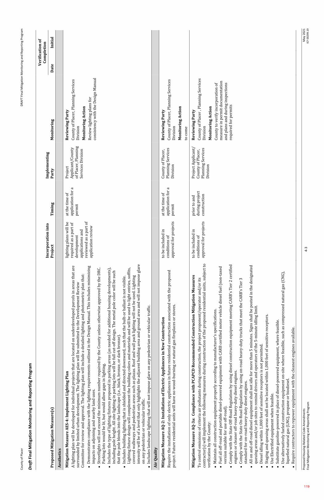
Co
un
ty o
f P
lace
r
DR
AFT
Fin
al M
itig
atio
n M
on
ito
rin
g an
d R
epo
rtin
g P
rogr
am
Pro
po
sed
Ho
usi
ng-
Rel
ated
Co
de
Am
end
men
ts
Fin
al M
itig
atio
n M
on
ito
rin
g an
d R
epo
rtin
g P
rogr
am
4-3
M
ay 2
02
1
ICF
00
29
9.1
9
Draft
Fin
al M
itig
atio
n M
on
ito
rin
g an
d R
ep
ort
ing
Pro
gram
Pro
po
sed
Mit
iga
tio
n M
ea
sure
(s)
Inco
rpo
rati
on
in
to
Pro
ject
T
imin
g
Imp
lem
en
tin
g
Pa
rty
M
on
ito
rin
g
Ve
rifi
cati
on
of
Co
mp
leti
on
Da
te
Init
ial
Ae
sth
eti
cs
Mit
iga
tio
n M
ea
sure
AE
S-4
: Im
ple
me
nt
Lig
hti
ng
Pla
n
A li
ghti
ng
pla
n w
ill b
e d
evel
op
ed f
or
ind
ivid
ual
pro
ject
s th
at a
re lo
cate
d o
n u
nd
erd
evel
op
ed p
arce
ls in
are
as t
hat
are
su
rro
un
ded
by
lim
ited
urb
an d
evel
op
men
t. T
he
ligh
tin
g p
lan
wil
l be
sub
mit
ted
to
th
e D
evel
op
men
t R
evie
w
Co
mm
itte
e fo
r re
vie
w a
nd
ap
pro
val.
Th
e li
ghti
ng
pla
n w
ill i
ncl
ud
e a
det
aile
d li
ghti
ng
and
ph
oto
met
ric
pla
n t
hat
:
⚫
Dem
on
stra
tes
com
pli
ance
wit
h t
he
ligh
tin
g re
qu
irem
ents
ou
tlin
ed in
th
e D
esig
n M
anu
al. T
his
incl
ud
es m
inim
izin
g im
pac
ts o
n a
djo
inin
g an
d n
earb
y la
nd
use
s.
⚫
Stre
etli
ghts
wil
l no
t ex
ceed
th
e m
inim
um
nu
mb
er r
equ
ired
by
th
e C
ou
nty
un
less
oth
erw
ise
app
rov
ed b
y t
he
DR
C.
Par
kin
g lo
ts w
ou
ld b
e li
t, b
ut
wo
uld
all
ow
gap
s in
ligh
tin
g.
⚫
Incl
ud
es t
he
typ
e o
f li
ghti
ng
fixt
ure
s p
rop
ose
d i
n p
ark
ing
area
s (a
s n
eed
ed f
or
add
itio
nal
ho
usi
ng
dev
elo
pm
ents
),
incl
ud
ing
po
le h
eigh
t. A
ll s
ite
ligh
tin
g in
par
kin
g lo
ts w
ill b
e fu
ll c
ut-
off
des
ign
. Th
e m
etal
po
le c
olo
r w
ill b
e su
ch
that
th
e p
ole
ble
nd
s in
to t
he
lan
dsc
ape
(i.e
., b
lack
, bro
nze
, or
dar
k b
ron
ze).
⚫
Incl
ud
es b
uil
din
g li
ghti
ng
that
is s
hie
lded
an
d d
irec
ted
do
wn
war
d, s
uch
th
at t
he
bu
lb o
r b
alla
st is
no
t v
isib
le.
Lig
hti
ng
fixt
ure
des
ign
wil
l co
mp
lem
ent
the
bu
ild
ing
colo
rs a
nd
mat
eria
ls a
nd
wil
l be
use
d t
o li
ght
entr
ies,
so
ffit
s,
cove
red
wal
kw
ays
and
ped
estr
ian
are
as s
uch
as
pla
zas.
Ro
of
and
wal
l pac
k li
ghti
ng
wil
l no
t b
e u
sed
. Lig
hti
ng
inte
nsi
ty w
ill b
e o
f a
lev
el t
hat
on
ly h
igh
ligh
ts t
he
adja
cen
t b
uil
din
g a
rea
and
gro
un
d a
rea
and
wil
l no
t im
po
se g
lare
o
n a
ny
ped
estr
ian
or
veh
icu
lar
traf
fic.
⚫
Incl
ud
es la
nd
scap
e li
ghti
ng
that
wil
l no
t im
po
se g
lare
on
an
y p
edes
tria
n o
r ve
hic
ula
r tr
affi
c.
ligh
tin
g p
lan
s w
ill b
e re
qu
ired
as
a p
art
of
dev
elo
pm
ent
app
lica
tio
ns
and
re
vie
wed
as
a p
art
of
app
lica
tio
n r
evie
w
at t
he
tim
e o
f ap
pli
cati
on
fo
r a
per
mit
Pro
ject
A
pp
lica
nt/
Co
un
ty
of
Pla
cer,
Pla
nn
ing
Serv
ices
Div
isio
n
Re
vie
win
g P
art
y
Co
un
ty o
f P
lace
r, P
lan
nin
g Se
rvic
es
Div
isio
n
Mo
nit
ori
ng
Act
ion
Rev
iew
ligh
tin
g p
lan
s fo
r co
nsi
sten
cy w
ith
th
e D
esig
n M
anu
al
Air
Qu
ali
ty
Mit
iga
tio
n M
ea
sure
AQ
-2: I
nst
all
ati
on
of
Ele
ctri
c A
pp
lia
nce
s in
Ne
w C
on
stru
ctio
n
Req
uir
e th
e in
stal
lati
on
of
on
ly e
lect
ric
app
lian
ces
in f
utu
re r
esid
enti
al c
on
stru
ctio
n a
sso
ciat
ed w
ith
th
e p
rop
ose
d
pro
ject
. Fu
ture
res
iden
tial
un
its
wil
l hav
e n
o w
oo
d-b
urn
ing
or
nat
ura
l gas
fir
epla
ces
or
sto
ves.
to b
e in
clu
ded
in
con
dit
ion
s o
f ap
pro
val f
or
pro
ject
s
at t
he
tim
e o
f ap
pli
cati
on
fo
r a
per
mit
Co
un
ty o
f P
lace
r,
Pla
nn
ing
Serv
ices
D
ivis
ion
Re
vie
win
g P
art
y
Co
un
ty o
f P
lace
r, P
lan
nin
g Se
rvic
es
Div
isio
n
Mo
nit
ori
ng
Act
ion
to c
om
e
Mit
iga
tio
n M
ea
sure
AQ
-3a
: C
om
pli
an
ce w
ith
PC
AP
CD
Re
com
me
nd
ed
Co
nst
ruct
ion
Mit
iga
tio
n M
ea
sure
s
To
co
ntr
ol e
mis
sio
ns
of
crit
eria
air
po
llu
tan
ts d
uri
ng
con
stru
ctio
n, t
he
pro
ject
pro
po
nen
t/o
per
ato
r an
d/o
r it
s co
ntr
acto
r(s)
wil
l im
ple
men
t th
e fo
llo
win
g m
easu
res
du
rin
g co
nst
ruct
ion
of
the
pro
po
sed
res
iden
tial
un
its,
su
bje
ct t
o
ver
ific
atio
n b
y t
he
Co
un
ty:
⚫
Mai
nta
in a
ll c
on
stru
ctio
n e
qu
ipm
ent
pro
per
ly a
cco
rdin
g to
man
ufa
ctu
rer’
s sp
ecif
icat
ion
s.
⚫
Fu
el a
ll o
ff-r
oad
an
d p
ort
able
die
sel-
po
wer
ed e
qu
ipm
ent
wit
h C
AR
B c
erti
fied
mo
tor
veh
icle
die
sel f
uel
(n
on
-tax
ed
ver
sio
n s
uit
able
fo
r u
se o
ff-r
oad
).
⚫
Co
mp
ly w
ith
th
e St
ate
Off
-Ro
ad R
egu
lati
on
by
usi
ng
die
sel c
on
stru
ctio
n e
qu
ipm
ent
mee
tin
g C
AR
B's
Tie
r 2
cer
tifi
ed
engi
nes
or
clea
ner
off
-ro
ad h
eav
y-d
uty
die
sel e
ngi
nes
.
⚫
Co
mp
ly w
ith
th
e St
ate
On
-Ro
ad R
egu
lati
on
by
usi
ng
on
-ro
ad h
eavy
-du
ty t
ruck
s th
at m
eet
the
CA
RB
’s T
ier
3
stan
dar
d f
or
on
-ro
ad h
eav
y-d
uty
die
sel e
ngi
nes
.
⚫
All
on
an
d o
ff-r
oad
die
sel e
qu
ipm
ent
shal
l no
t id
le f
or
mo
re t
han
5 m
inu
tes.
Sig
ns
shal
l be
po
sted
in t
he
des
ign
ated
q
ueu
ing
area
s an
d/o
r jo
b s
ites
to
rem
ind
dri
ver
s an
d o
per
ato
rs o
f th
e 5
-min
ute
idli
ng
lim
it.
⚫
Die
sel i
dli
ng
wit
hin
1,0
00
fee
t o
f se
nsi
tive
rec
epto
rs is
no
t p
erm
itte
d.
⚫
Stag
ing
and
qu
euin
g ar
eas
shal
l no
t b
e lo
cate
d w
ith
in 1
,00
0 f
eet
of
sen
siti
ve
rece
pto
rs.
⚫
Use
Ele
ctri
fied
eq
uip
men
t w
hen
fea
sib
le.
⚫
Sub
stit
ute
gas
oli
ne-
po
wer
ed in
pla
ce o
f d
iese
l-p
ow
ered
eq
uip
men
t, w
her
e fe
asib
le.
⚫
Use
alt
ern
ativ
ely
fu
eled
co
nst
ruct
ion
eq
uip
men
t o
n-s
ite
wh
ere
feas
ible
, su
ch a
s co
mp
ress
ed n
atu
ral g
as (
CN
G),
li
qu
efie
d n
atu
ral g
as (
LN
G),
pro
pan
e o
r b
iod
iese
l.
⚫
Req
uir
e co
ntr
acto
rs t
o r
epo
wer
eq
uip
men
t w
ith
th
e cl
ean
est
engi
nes
av
aila
ble
.
to b
e in
clu
ded
in
con
dit
ion
s o
f ap
pro
val f
or
pro
ject
s
pri
or
to a
nd
d
uri
ng
pro
ject
co
nst
ruct
ion
Pro
ject
Ap
pli
can
t/
Co
un
ty o
f P
lace
r,
Pla
nn
ing
Serv
ices
D
ivis
ion
Re
vie
win
g P
art
y
Co
un
ty o
f P
lace
r , P
lan
nin
g Se
rvic
es
Div
isio
n
Mo
nit
ori
ng
Act
ion
Co
un
ty t
o v
erif
y in
corp
ora
tio
n o
f m
easu
re in
per
mit
do
cum
enta
tio
n
and
pla
ns
and
du
rin
g in
spec
tio
ns
req
uir
ed f
or
per
mit
s
119
Co
un
ty o
f P
lace
r
DR
AFT
Fin
al M
itig
atio
n M
on
ito
rin
g an
d R
epo
rtin
g P
rogr
am
Pro
po
sed
Ho
usi
ng-
Rel
ated
Co
de
Am
end
men
ts
Fin
al M
itig
atio
n M
on
ito
rin
g an
d R
epo
rtin
g P
rogr
am
4-4
M
ay 2
02
1
ICF
00
29
9.1
9
Pro
po
sed
Mit
iga
tio
n M
ea
sure
(s)
Inco
rpo
rati
on
in
to
Pro
ject
T
imin
g
Imp
lem
en
tin
g
Pa
rty
M
on
ito
rin
g
Ve
rifi
cati
on
of
Co
mp
leti
on
Da
te
Init
ial
⚫
Req
uir
e co
nst
ruct
ion
eq
uip
men
t u
se in
stal
led
Cal
ifo
rnia
Ver
ifie
d D
iese
l Em
issi
on
Co
ntr
ol S
trat
egie
s. T
hes
e st
rate
gies
are
list
ed a
t: h
ttp
://w
ww
.arb
.ca.
gov
/die
sel/
verd
ev/v
t/cv
t.h
tm
⚫
Req
uir
e th
e co
ntr
acto
r to
pre
par
e a
du
st c
on
tro
l pla
n w
hen
th
e d
istu
rbed
are
a is
mo
re t
han
on
e (1
) ac
re.
⚫
Red
uce
th
e am
ou
nt
of
the
dis
turb
ed a
rea
wh
ere
po
ssib
le.
⚫
Use
wat
er t
ruck
s o
r sp
rin
kle
r sy
stem
s in
su
ffic
ien
t q
uan
titi
es t
o p
reve
nt
airb
orn
e d
ust
fro
m le
avin
g th
e si
te.
Incr
ease
d w
ater
ing
freq
uen
cy is
req
uir
ed w
hen
ever
win
d s
pee
ds
exce
ed 1
5 m
ph
. Rec
laim
ed (
no
n-p
ota
ble
) w
ater
sh
ou
ld b
e u
sed
wh
enev
er p
oss
ible
.
⚫
All
dir
t st
ock
-pil
e ar
eas
sho
uld
be
spra
yed
dai
ly a
s n
eed
ed.
⚫
All
ro
adw
ays,
dri
vew
ays,
sid
ewal
ks,
etc
. to
be
pav
ed s
ho
uld
be
com
ple
ted
as
soo
n a
s p
oss
ible
, wit
h b
uil
din
g p
ads
laid
as
soo
n a
s p
oss
ible
aft
er g
rad
ing
un
less
see
din
g o
r so
il b
ind
ers
are
use
d.
Mit
iga
tio
n M
ea
sure
AQ
-3b
: Dis
cov
ery
of
Na
tura
lly
Occ
urr
ing
Asb
est
os
du
rin
g C
on
stru
ctio
n
Du
rin
g co
nst
ruct
ion
act
ivit
y, if
NO
A, s
erp
enti
ne,
or
ult
ram
afic
ro
ck is
dis
cov
ered
by
the
ow
ner
/op
erat
or
and
an
AD
MP
h
as n
ot
bee
n s
ub
mit
ted
, th
e fo
llo
win
g m
easu
res
shal
l be
imp
lem
ente
d. F
or
add
itio
nal
info
rmat
ion
, vis
it t
he
PC
AP
CD
’s
web
site
at
htt
ps:
//w
ww
.pla
cer.
ca.g
ov/
16
21
/NO
A-C
on
stru
ctio
n-G
rad
ing.
⚫
Wh
en t
he
con
stru
ctio
n a
rea
is e
qu
al t
o o
r gr
eate
r th
an 1
acr
e, t
he
app
lica
nt
wil
l pre
par
e an
AD
MP
an
d o
bta
in
app
rova
l by
th
e P
CA
PC
D w
ith
in 1
4 d
ays
of
the
dis
cove
ry o
f N
OA
, ser
pen
tin
e, o
r u
ltra
maf
ic r
ock
. Th
e ap
pli
can
t w
ill
con
tact
th
e P
CA
PC
D b
efo
re r
etai
nin
g a
qu
alif
ied
sta
te r
egis
tere
d g
eolo
gist
to
co
nd
uct
init
ial g
eolo
gic
eval
uat
ion
s as
p
art
of
the
AD
MP
ap
pli
cati
on
pro
cess
⚫
Mai
nta
in t
he
du
st m
itig
atio
n m
easu
res
un
til t
he
pro
vis
ion
s o
f th
e P
CA
PC
D-a
pp
rove
d A
DM
P p
lan
are
imp
lem
ente
d
⚫
Imp
lem
ent
the
pro
vis
ion
s o
f th
e P
CA
PC
D-a
pp
rove
d A
DM
P w
ith
in 1
4 d
ays
of
its
app
rov
al
⚫
Mai
nta
in t
he
pro
vis
ion
s o
f th
e P
CA
PC
D-a
pp
rove
d A
DM
P t
hro
ugh
ou
t th
e re
mai
nd
er o
f th
e co
nst
ruct
ion
or
grad
ing
acti
vity
⚫
Eac
h s
ub
seq
uen
t in
div
idu
al lo
t d
evel
op
er w
ill p
rep
are
an A
DM
P w
hen
th
e co
nst
ruct
ion
are
a is
eq
ual
to
or
grea
ter
than
1 a
cre
Th
e p
roje
ct d
evel
op
er a
nd
eac
h s
ub
seq
uen
t lo
t se
ller
mu
st d
iscl
ose
th
e p
rese
nce
of
ult
ram
afic
ro
ck, s
erp
enti
ne,
or
NO
A d
uri
ng
any
su
bse
qu
ent
real
est
ate
tran
sact
ion
pro
cess
es. T
he
dis
clo
sure
mu
st in
clu
de
a co
py
of
the
CA
RB
p
amp
hle
t en
titl
ed “
Asb
esto
s-C
on
tain
ing
Ro
ck a
nd
So
il—
Wh
at C
alif
orn
ia H
om
eow
ner
s an
d R
ente
rs N
eed
to
Kn
ow
,” o
r o
ther
sim
ilar
fac
t sh
eets
wh
ich
may
be
fou
nd
on
th
e P
CA
PC
D’s
web
site
(P
lace
r C
ou
nty
Air
Po
llu
tio
n C
on
tro
l Dis
tric
t 2
02
0c)
.
to b
e in
clu
ded
in
con
dit
ion
s o
f ap
pro
val f
or
pro
ject
s
pri
or
to a
nd
d
uri
ng
pro
ject
co
nst
ruct
ion
Pro
ject
Ap
pli
can
t/
PC
AP
CD
Re
vie
win
g P
art
y
PC
AP
CD
Mo
nit
ori
ng
Act
ion
PC
AP
CD
to
ver
ify
inco
rpo
rati
on
of
mea
sure
in p
erm
it d
ocu
men
tati
on
an
d p
lan
s an
d d
uri
ng
insp
ecti
on
s re
qu
ired
fo
r p
erm
its
Bio
log
ica
l R
eso
urc
es
Mit
iga
tio
n M
ea
sure
BIO
-1a
: Id
en
tify
an
d D
ocu
me
nt
Sp
eci
al-
Sta
tus
Pla
nt
Po
pu
lati
on
s
Fo
r p
rop
ose
d d
evel
op
men
t in
pre
vio
usl
y u
nd
evel
op
ed a
reas
, pri
or
to d
esig
n o
r co
nst
ruct
ion
, th
e C
ou
nty
wil
l req
uir
e d
ocu
men
tati
on
of
the
pre
sen
ce o
r ab
sen
ce o
f sp
ecia
l-st
atu
s p
lan
t p
op
ula
tio
ns.
A q
ual
ifie
d b
ota
nis
t w
ill b
e re
tain
ed t
o
surv
ey t
he
affe
cted
are
a b
efo
re p
roje
ct d
esig
n a
nd
co
nst
ruct
ion
. To
do
cum
ent
spec
ial-
stat
us
pla
nt
po
pu
lati
on
s, t
he
foll
ow
ing
step
s w
ill b
e u
nd
erta
ken
bef
ore
co
nst
ruct
ion
. At
any
po
int
du
rin
g im
ple
men
tati
on
of
this
mit
igat
ion
m
easu
re, a
pro
po
sed
pro
ject
may
be
re-d
esig
ned
or
mo
dif
ied
to
av
oid
dir
ect
and
ind
irec
t im
pac
ts o
n s
pec
ial-
stat
us
pla
nts
, an
d w
ill n
ot
nee
d t
o c
om
ple
te t
he
rem
ain
ing
step
s id
enti
fied
in t
his
mit
igat
ion
mea
sure
.
⚫
Rev
iew
Exi
stin
g In
form
atio
n. T
he
bo
tan
ist
wil
l rev
iew
exi
stin
g in
form
atio
n t
o d
evel
op
a li
st o
f sp
ecia
l-st
atu
s p
lan
ts
that
co
uld
gro
w w
ith
in t
he
affe
cted
are
a. S
ou
rces
of
info
rmat
ion
co
nsu
lted
wil
l in
clu
de
the
CN
DD
B; U
SFW
S li
st o
f en
dan
gere
d, t
hre
aten
ed, a
nd
pro
po
sed
sp
ecie
s fo
r th
e p
roje
ct r
egio
n; p
rev
iou
sly
pre
par
ed e
nv
iro
nm
enta
l d
ocu
men
ts; C
ity
an
d C
ou
nty
gen
eral
pla
ns;
HC
Ps;
an
d t
he
CN
PS
inv
ento
ry.
⚫
Co
nd
uct
Fie
ld S
urv
eys.
Th
e b
ota
nis
t w
ill e
val
uat
e ex
isti
ng
hab
itat
co
nd
itio
ns
in e
ach
aff
ecte
d a
rea
and
det
erm
ine
wh
at le
vel o
f b
ota
nic
al s
urv
eys
may
be
req
uir
ed. T
he
typ
e o
f b
ota
nic
al s
urv
ey w
ill d
epen
d o
n s
pec
ies
rich
nes
s,
hab
itat
ty
pe
and
qu
alit
y, a
nd
th
e p
rob
abil
ity
of
spec
ial-
stat
us
spec
ies
occ
urr
ing
in a
par
ticu
lar
hab
itat
typ
e.
to b
e in
clu
ded
in
con
dit
ion
s o
f ap
pro
val f
or
pro
ject
s
pri
or
to a
nd
d
uri
ng
pro
ject
co
nst
ruct
ion
Pro
ject
Ap
pli
can
t/
Co
un
ty o
f P
lace
r,
Pla
nn
ing
Serv
ices
D
ivis
ion
Re
vie
win
g P
art
y
Co
un
ty o
f P
lace
r, P
lan
nin
g Se
rvic
es
Div
isio
n
Mo
nit
ori
ng
Act
ion
Co
un
ty t
o v
erif
y in
corp
ora
tio
n o
f m
easu
re in
per
mit
do
cum
enta
tio
n
and
pla
ns
and
du
rin
g in
spec
tio
ns
req
uir
ed f
or
per
mit
s
120
Co
un
ty o
f P
lace
r
DR
AFT
Fin
al M
itig
atio
n M
on
ito
rin
g an
d R
epo
rtin
g P
rogr
am
Pro
po
sed
Ho
usi
ng-
Rel
ated
Co
de
Am
end
men
ts
Fin
al M
itig
atio
n M
on
ito
rin
g an
d R
epo
rtin
g P
rogr
am
4-5
M
ay 2
02
1
ICF
00
29
9.1
9
Pro
po
sed
Mit
iga
tio
n M
ea
sure
(s)
Inco
rpo
rati
on
in
to
Pro
ject
T
imin
g
Imp
lem
en
tin
g
Pa
rty
M
on
ito
rin
g
Ve
rifi
cati
on
of
Co
mp
leti
on
Da
te
Init
ial
Dep
end
ing
on
th
ese
fact
ors
an
d t
he
pro
po
sed
ext
ent
of
con
stru
ctio
n, o
ne
or
bo
th o
f th
e fo
llo
win
g le
vel
s o
f su
rvey
w
ill b
e re
qu
ired
:
H
abit
at A
sses
smen
t. A
hab
itat
ass
essm
ent
det
erm
ines
wh
eth
er s
uit
able
hab
itat
is p
rese
nt.
Th
is t
ype
of
asse
ssm
ent
can
be
con
du
cted
at
any
tim
e o
f ye
ar a
nd
is u
sed
to
ass
ess
and
ch
arac
teri
ze h
abit
at c
on
dit
ion
s an
d
det
erm
ine
wh
eth
er r
etu
rn s
urv
eys
are
nec
essa
ry. I
f n
o s
uit
able
hab
itat
is p
rese
nt,
no
ad
dit
ion
al s
urv
eys
wil
l be
req
uir
ed.
F
lori
stic
Pro
toco
l-L
evel
Su
rvey
s. F
lori
stic
su
rvey
s th
at f
oll
ow
th
e C
DF
W p
roto
cols
fo
r su
rvey
ing
nat
ive
pla
nt
spec
ies
(Cal
ifo
rnia
Dep
artm
ent
of
Fis
h a
nd
Wil
dli
fe 2
01
8)
wil
l be
con
du
cted
in a
reas
th
at a
re r
elat
ivel
y
un
dis
turb
ed o
r h
ave
mo
der
ate
to h
igh
po
ten
tial
to
su
pp
ort
mu
ltip
le s
pec
ial-
stat
us
pla
nts
. Th
e C
DF
W S
urv
ey
Gu
idel
ines
req
uir
e th
at a
ll s
pec
ies
be
iden
tifi
ed t
o t
he
leve
l nec
essa
ry t
o d
eter
min
e w
het
her
th
ey q
ual
ify
as
spec
ial-
stat
us
pla
nts
. Th
e gu
idel
ines
als
o r
equ
ire
that
fie
ld s
urv
eys
be
con
du
cted
wh
en s
pec
ial-
stat
us
pla
nts
th
at
cou
ld o
ccu
r in
th
e ar
ea a
re e
vid
ent
and
iden
tifi
able
. To
acc
ou
nt
for
dif
fere
nt
spec
ial-
stat
us
pla
nt
iden
tifi
cati
on
p
erio
ds,
on
e o
r m
ore
ser
ies
of
fiel
d s
urv
eys
may
be
req
uir
ed in
sp
rin
g an
d s
um
mer
.
⚫
Do
cum
ent
Surv
ey R
esu
lts.
If
spec
ial-
stat
us
pla
nts
are
fo
un
d d
uri
ng
the
fiel
d s
urv
ey, t
hey
wil
l be
map
ped
an
d
do
cum
ente
d, M
itig
atio
n M
easu
re B
IO-1
b w
ill b
e im
ple
men
ted
in c
on
jun
ctio
n w
ith
th
is m
itig
atio
n m
easu
re t
o a
vo
id
or
min
imiz
e si
gnif
ican
t im
pac
ts o
n s
pec
ial-
stat
us
pla
nts
.
Mit
iga
tio
n M
ea
sure
BIO
-1b
: A
vo
id o
r M
inim
ize
Im
pa
cts
on
Sp
eci
al-
Sta
tus
Pla
nt
Po
pu
lati
on
s
Wh
ere
dev
elo
pm
ent
in a
n a
ffec
ted
are
a w
ou
ld h
ave
po
ten
tial
to
res
ult
in d
irec
t lo
ss o
r in
dir
ect
dis
turb
ance
to
sp
ecia
l-st
atu
s p
lan
ts, t
he
foll
ow
ing
mea
sure
s to
avo
id o
r m
inim
ize
imp
acts
on
sp
ecia
l-st
atu
s p
lan
ts w
ill b
e im
ple
men
ted
:
⚫
Red
esig
n o
r m
od
ify
the
pro
po
sed
dev
elo
pm
ent
du
rin
g fu
ture
sit
e d
esig
n t
o a
void
dir
ect
and
ind
irec
t im
pac
ts o
n
spec
ial-
stat
us
pla
nts
, if
feas
ible
.
⚫
Du
rin
g co
nst
ruct
ion
, pro
tect
sp
ecia
l-st
atu
s p
lan
ts b
y in
stal
lin
g en
vir
on
men
tall
y s
ensi
tiv
e ar
ea f
enci
ng
(ora
nge
co
nst
ruct
ion
bar
rier
fen
cin
g) a
rou
nd
sp
ecia
l-st
atu
s p
lan
t p
op
ula
tio
ns.
Th
e en
vir
on
men
tall
y s
ensi
tiv
e ar
ea f
enci
ng
wil
l be
inst
alle
d a
t le
ast
20
fee
t fr
om
th
e ed
ge o
f th
e p
op
ula
tio
n. T
he
loca
tio
n o
f th
e fe
nci
ng
wil
l be
mar
ked
in
th
e fi
eld
wit
h s
tak
es a
nd
fla
ggin
g an
d s
ho
wn
on
th
e co
nst
ruct
ion
dra
win
gs. T
he
con
stru
ctio
n s
pec
ific
atio
ns
wil
l co
nta
in
clea
r la
ngu
age
that
pro
hib
its
con
stru
ctio
n r
elat
ed a
ctiv
itie
s, v
ehic
le o
per
atio
n, m
ater
ial a
nd
eq
uip
men
t st
ora
ge, a
nd
o
ther
su
rfac
e-d
istu
rbin
g ac
tiv
itie
s w
ith
in t
he
fen
ced
en
vir
on
men
tall
y se
nsi
tiv
e ar
ea.
⚫
If p
op
ula
tio
n a
vo
idan
ce is
no
t p
oss
ible
, co
ord
inat
e w
ith
th
e ap
pro
pri
ate
reso
urc
e ag
enci
es a
nd
loca
l exp
erts
to
d
eter
min
e w
het
her
tra
nsp
lan
tati
on
is f
easi
ble
. If
the
agen
cies
co
ncu
r th
at t
ran
spla
nta
tio
n is
a f
easi
ble
mit
igat
ion
m
easu
re, t
he
bo
tan
ist
wil
l dev
elo
p a
nd
imp
lem
ent
a tr
ansp
lan
tati
on
pla
n t
hro
ugh
co
ord
inat
ion
wit
h t
he
app
rop
riat
e ag
enci
es. T
he
spec
ial-
stat
us
pla
nt
tran
spla
nta
tio
n p
lan
wil
l in
vo
lve
iden
tify
ing
a su
itab
le t
ran
spla
nt
site
; mo
vin
g th
e p
lan
t m
ater
ial a
nd
see
d b
ank
to
th
e tr
ansp
lan
t si
te; c
oll
ecti
ng
seed
mat
eria
l an
d p
rop
agat
ing
it in
a
nu
rser
y; a
nd
mo
nit
ori
ng
the
tran
spla
nt
site
s to
do
cum
ent
recr
uit
men
t an
d s
urv
ival
rat
es.
If t
ran
spla
nta
tio
n o
f sp
ecia
l-st
atu
s p
lan
ts is
no
t fe
asib
le, t
he
effe
cts
of
the
pro
ject
on
sp
ecia
l-st
atu
s p
lan
ts w
ill b
e co
mp
ensa
ted
fo
r b
y o
ffsi
te p
rese
rvat
ion
at
a ra
tio
to
be
neg
oti
ated
wit
h t
he
reso
urc
e ag
enci
es. S
uit
able
hab
itat
fo
r af
fect
ed s
pec
ial s
tatu
s–p
lan
t sp
ecie
s w
ill b
e p
urc
has
ed in
a c
on
serv
atio
n a
rea,
pre
serv
ed, a
nd
man
aged
in
per
pet
uit
y.
Det
aile
d in
form
atio
n w
ill b
e p
rov
ided
to
th
e ag
enci
es o
n t
he
loca
tio
n a
nd
qu
alit
y o
f th
e p
rese
rvat
ion
are
a, t
he
feas
ibil
ity
of
pro
tect
ing
and
man
agin
g th
e ar
ea in
per
pet
uit
y, a
nd
th
e re
spo
nsi
ble
par
ties
. Oth
er p
erti
nen
t in
form
atio
n
also
wil
l be
pro
vid
ed, t
o b
e d
eter
min
ed t
hro
ugh
fu
ture
co
ord
inat
ion
wit
h t
he
reso
urc
e ag
enci
es.
Mit
iga
tio
n M
ea
sure
BIO
-2a
: Do
cum
en
t S
pe
cia
l-S
tatu
s W
ild
life
Sp
eci
es
an
d T
he
ir H
ab
ita
ts
Pri
or
to d
esig
n o
r co
nst
ruct
ion
fo
r fu
ture
dev
elo
pm
ent
in p
rev
iou
sly
un
dev
elo
ped
are
as, t
he
Co
un
ty w
ill r
equ
ire
do
cum
enta
tio
n o
f th
e p
rese
nce
or
abse
nce
of
spec
ial-
stat
us
wil
dli
fe p
op
ula
tio
ns
or
suit
able
hab
itat
fo
r th
ese
spec
ies.
A
qu
alif
ied
wil
dli
fe b
iolo
gist
wil
l be
reta
ined
to
su
rvey
th
e af
fect
ed a
rea
bef
ore
pro
ject
des
ign
an
d c
on
stru
ctio
n. T
o
do
cum
ent
spec
ial-
stat
us
wil
dli
fe a
nd
hab
itat
s, t
he
foll
ow
ing
step
s w
ill b
e u
nd
erta
ken
bef
ore
co
nst
ruct
ion
. At
any
p
oin
t d
uri
ng
imp
lem
enta
tio
n o
f th
is m
itig
atio
n m
easu
re, a
pro
po
sed
pro
ject
may
be
re-d
esig
ned
or
mo
dif
ied
to
av
oid
d
irec
t an
d in
dir
ect
imp
acts
on
sp
ecia
l-st
atu
s w
ild
life
, an
d w
ill n
ot
nee
d t
o c
om
ple
te t
he
rem
ain
ing
step
s id
enti
fied
in
th
is m
itig
atio
n m
easu
re.
to b
e in
clu
ded
in
con
dit
ion
s o
f ap
pro
val f
or
pro
ject
s
Pri
or
to a
nd
d
uri
ng
pro
ject
co
nst
ruct
ion
Pro
ject
Ap
pli
can
t/
Co
un
ty o
f P
lace
r,
Pla
nn
ing
Serv
ices
D
ivis
ion
Re
vie
win
g P
art
y
Co
un
ty o
f P
lace
r, P
lan
nin
g Se
rvic
es
Div
isio
n
Mo
nit
ori
ng
Act
ion
Co
un
ty t
o v
erif
y in
corp
ora
tio
n o
f m
easu
re in
per
mit
do
cum
enta
tio
n
and
pla
ns
and
du
rin
g in
spec
tio
ns
req
uir
ed f
or
per
mit
s
121
Co
un
ty o
f P
lace
r
DR
AFT
Fin
al M
itig
atio
n M
on
ito
rin
g an
d R
epo
rtin
g P
rogr
am
Pro
po
sed
Ho
usi
ng-
Rel
ated
Co
de
Am
end
men
ts
Fin
al M
itig
atio
n M
on
ito
rin
g an
d R
epo
rtin
g P
rogr
am
4-6
M
ay 2
02
1
ICF
00
29
9.1
9
Pro
po
sed
Mit
iga
tio
n M
ea
sure
(s)
Inco
rpo
rati
on
in
to
Pro
ject
T
imin
g
Imp
lem
en
tin
g
Pa
rty
M
on
ito
rin
g
Ve
rifi
cati
on
of
Co
mp
leti
on
Da
te
Init
ial
⚫
Rev
iew
Exi
stin
g In
form
atio
n. T
he
wil
dli
fe b
iolo
gist
wil
l rev
iew
exi
stin
g in
form
atio
n t
o d
evel
op
a li
st o
f sp
ecia
l-st
atu
s w
ild
life
sp
ecie
s th
at c
ou
ld o
ccu
r in
th
e af
fect
ed a
rea.
Th
e fo
llo
win
g in
form
atio
n w
ill b
e re
vie
wed
as
par
t o
f th
is p
roce
ss: t
he
USF
WS
IPaC
sp
ecie
s li
st f
or
the
affe
cted
are
a, C
ND
DB
occ
urr
ence
s w
ith
in t
he
vic
init
y o
f th
e af
fect
ed a
rea,
NM
FS
spec
ies
list
s, p
rev
iou
sly
pre
par
ed e
nv
iro
nm
enta
l do
cum
ents
, Cit
y a
nd
Co
un
ty g
ener
al p
lan
s,
PC
CP
, an
d U
SFW
S-is
sued
bio
logi
cal o
pin
ion
s fo
r p
rev
iou
s p
roje
cts
in t
he
vic
init
y o
f th
e af
fect
ed a
rea.
⚫
Co
ord
inat
e w
ith
Sta
te a
nd
Fed
eral
Age
nci
es, a
s N
eces
sary
. Th
e w
ild
life
bio
logi
st w
ill c
oo
rdin
ate
wit
h t
he
Co
un
ty
and
ap
pro
pri
ate
agen
cies
(C
DF
W, U
SFW
S, N
MF
S), a
s n
eces
sary
, to
dis
cuss
wil
dli
fe r
eso
urc
e is
sues
in t
he
regi
on
an
d
det
erm
ine
the
app
rop
riat
e le
vel
of
surv
eys
nec
essa
ry t
o d
ocu
men
t sp
ecia
l-st
atu
s w
ild
life
an
d t
hei
r h
abit
ats.
⚫
Co
nd
uct
Fie
ld S
tud
ies.
Th
e w
ild
life
bio
logi
st w
ill e
valu
ate
exis
tin
g h
abit
at c
on
dit
ion
s an
d d
eter
min
e w
hat
leve
l of
bio
logi
cal s
urv
eys
may
be
req
uir
ed. T
he
typ
e o
f su
rvey
req
uir
ed w
ill d
epen
d o
n s
pec
ies
rich
nes
s, h
abit
at t
ype
and
q
ual
ity
, an
d t
he
pro
bab
ilit
y o
f sp
ecia
l-st
atu
s sp
ecie
s o
ccu
rrin
g in
hab
itat
ty
pes
pre
sen
t in
th
e af
fect
ed a
rea.
D
epen
din
g o
n t
he
exis
tin
g co
nd
itio
ns
in t
he
area
an
d t
he
pro
po
sed
co
nst
ruct
ion
act
ivit
y, o
ne
or
mo
re o
f th
e fo
llo
win
g le
vels
of
surv
ey m
ay b
e re
qu
ired
:
H
abit
at A
sses
smen
t. A
hab
itat
ass
essm
ent
det
erm
ines
wh
eth
er s
uit
able
hab
itat
is p
rese
nt.
Th
is t
ype
of
asse
ssm
ent
can
be
con
du
cted
at
any
tim
e o
f ye
ar a
nd
is u
sed
to
ass
ess
and
ch
arac
teri
ze h
abit
at c
on
dit
ion
s an
d t
o
det
erm
ine
wh
eth
er r
etu
rn s
urv
eys
are
nec
essa
ry. I
f n
o s
uit
able
hab
itat
is p
rese
nt,
no
ad
dit
ion
al s
urv
eys
wil
l be
req
uir
ed.
S
pec
ies-
Fo
cuse
d S
urv
eys.
Sp
ecie
s-fo
cuse
d s
urv
eys
(or
targ
et s
pec
ies
surv
eys)
wil
l be
con
du
cted
if s
uit
able
hab
itat
is
pre
sen
t fo
r sp
ecia
l-st
atu
s w
ild
life
an
d if
it is
nec
essa
ry t
o d
eter
min
e th
e p
rese
nce
or
abse
nce
of
the
spec
ies
in
the
affe
cted
are
a o
r im
med
iate
vic
init
y. T
he
surv
eys
wil
l fo
cus
on
sp
ecia
l-st
atu
s w
ild
life
sp
ecie
s th
at h
ave
the
po
ten
tial
to
occ
ur
in t
he
affe
cted
are
a (T
able
3.4
-3).
Th
e su
rvey
s w
ill b
e co
nd
uct
ed d
uri
ng
a p
erio
d w
hen
th
e ta
rget
sp
ecie
s ar
e p
rese
nt
and
/or
acti
ve.
P
roto
col-
Lev
el W
ild
life
Su
rvey
s. T
he
Co
un
ty w
ill r
equ
ire
com
pli
ance
wit
h p
roto
cols
an
d g
uid
elin
es is
sued
by
re
spo
nsi
ble
age
nci
es f
or
cert
ain
sp
ecia
l-st
atu
s sp
ecie
s. U
SFW
S an
d C
DF
W h
ave
issu
ed s
urv
ey p
roto
cols
an
d
guid
elin
es f
or
seve
ral s
pec
ial-
stat
us
wil
dli
fe s
pec
ies
that
co
uld
occ
ur
in t
he
affe
cted
are
as, i
ncl
ud
ing
vall
ey
eld
erb
erry
lon
gho
rn b
eetl
e, C
alif
orn
ia r
ed-l
egge
d f
rog,
fo
oth
ill y
ello
w-l
egge
d f
rog,
Sie
rra
Nev
ada
yel
low
-leg
ged
fr
og,
Cal
ifo
rnia
sp
ott
ed o
wl,
no
rth
ern
go
shaw
k, a
nd
gre
at g
rey
ow
l. In
so
me
case
s, t
he
Co
un
ty m
ay c
ho
ose
to
re
qu
ire
the
assu
mp
tio
n o
f th
e p
rese
nce
of
a sp
ecie
s ra
ther
th
an c
on
du
ct a
pro
toco
l-le
vel
su
rvey
. Th
e p
roto
cols
an
d g
uid
elin
es m
ay r
equ
ire
that
su
rvey
s b
e co
nd
uct
ed d
uri
ng
a p
arti
cula
r ti
me
of
year
or
tim
e o
f d
ay w
hen
th
e sp
ecie
s is
pre
sen
t an
d a
ctiv
e. M
any
su
rvey
pro
toco
ls r
equ
ire
that
on
ly a
USF
WS
- o
r C
DF
W-a
pp
rov
ed b
iolo
gist
p
erfo
rm t
he
surv
eys.
Bec
ause
so
me
spec
ies
can
be
dif
ficu
lt t
o d
etec
t o
r o
bse
rve,
mu
ltip
le f
ield
tec
hn
iqu
es m
ay b
e u
sed
du
rin
g a
surv
ey p
erio
d a
nd
ad
dit
ion
al s
urv
eys
may
be
req
uir
ed in
su
bse
qu
ent
seas
on
s o
r ye
ars
as o
utl
ined
in
th
e p
roto
col o
r gu
idel
ines
fo
r ea
ch s
pec
ies.
Spec
ial-
stat
us
wil
dli
fe o
r su
itab
le h
abit
at id
enti
fied
du
rin
g th
e fi
eld
su
rvey
s w
ill b
e m
app
ed a
nd
do
cum
ente
d. I
f su
rvey
s d
eter
min
e th
at s
pec
ial-
stat
us
wil
dli
fe s
pec
ies
are
pre
sen
t o
r as
sum
ed t
o b
e p
rese
nt
in o
r n
ear
the
affe
cted
ar
ea, t
he
Co
un
ty w
ill r
equ
ire
imp
lem
enta
tio
n o
f M
itig
atio
n M
easu
re B
IO-2
b t
o a
vo
id o
r m
inim
ize
sign
ific
ant
imp
acts
o
n s
pec
ial-
stat
us
wil
dli
fe.
Mit
iga
tio
n M
ea
sure
BIO
-2b
: A
vo
id a
nd
Min
imiz
e I
mp
act
s o
n S
pe
cia
l-S
tatu
s W
ild
life
Sp
eci
es
thro
ug
h R
ed
esi
gn
, P
rote
ctio
n, o
r M
on
ito
rin
g
Wh
ere
dev
elo
pm
ent
in a
n a
ffec
ted
are
a w
ou
ld h
ave
po
ten
tial
to
res
ult
in d
irec
t o
r in
dir
ect
loss
or
dis
turb
ance
to
sp
ecia
l-st
atu
s w
ild
life
, th
e C
ou
nty
wil
l im
ple
men
t th
e fo
llo
win
g m
easu
res
to a
vo
id o
r m
inim
ize
imp
acts
on
sp
ecia
l-st
atu
s w
ild
life
:
⚫
Red
esig
n o
r m
od
ify
pro
gram
ele
men
ts t
o a
void
dir
ect
and
ind
irec
t im
pac
ts o
n s
pec
ial-
stat
us
wil
dli
fe o
r th
eir
hab
itat
s, if
fea
sib
le.
⚫
Du
rin
g gr
ou
nd
-dis
turb
ing
con
stru
ctio
n a
ctiv
itie
s, p
rote
ct s
pec
ial-
stat
us
wil
dli
fe a
nd
th
eir
hab
itat
s b
y in
stal
lin
g en
vir
on
men
tall
y s
ensi
tive
are
a fe
nci
ng
or
stak
ing
aro
un
d h
abit
at f
eatu
res,
su
ch a
s w
etla
nd
s, s
trea
ms,
bu
rro
ws,
an
d/o
r ac
tive
nes
ts. T
he
envi
ron
men
tall
y se
nsi
tive
are
a fe
nci
ng
or
stak
ing
wil
l be
inst
alle
d a
t a
min
imu
m d
ista
nce
fr
om
th
e ed
ge o
f th
e re
sou
rce
as d
eter
min
ed b
y a
qu
alif
ied
bio
logi
sts
and
th
rou
gh c
oo
rdin
atio
n w
ith
sta
te a
nd
fe
der
al a
gen
cy b
iolo
gist
s (U
SFW
S an
d C
DF
W),
as
app
lica
ble
. Th
e lo
cati
on
of
the
fen
cin
g w
ill b
e m
ark
ed in
th
e fi
eld
122
Co
un
ty o
f P
lace
r
DR
AFT
Fin
al M
itig
atio
n M
on
ito
rin
g an
d R
epo
rtin
g P
rogr
am
Pro
po
sed
Ho
usi
ng-
Rel
ated
Co
de
Am
end
men
ts
Fin
al M
itig
atio
n M
on
ito
rin
g an
d R
epo
rtin
g P
rogr
am
4-7
M
ay 2
02
1
ICF
00
29
9.1
9
Pro
po
sed
Mit
iga
tio
n M
ea
sure
(s)
Inco
rpo
rati
on
in
to
Pro
ject
T
imin
g
Imp
lem
en
tin
g
Pa
rty
M
on
ito
rin
g
Ve
rifi
cati
on
of
Co
mp
leti
on
Da
te
Init
ial
wit
h s
tak
es a
nd
fla
ggin
g an
d s
ho
wn
on
th
e co
nst
ruct
ion
dra
win
gs. T
he
con
stru
ctio
n s
pec
ific
atio
ns
wil
l co
nta
in c
lear
la
ngu
age
that
pro
hib
its
con
stru
ctio
n-r
elat
ed a
ctiv
itie
s, v
ehic
le o
per
atio
n, m
ater
ial a
nd
eq
uip
men
t st
ora
ge, a
nd
o
ther
su
rfac
e-d
istu
rbin
g ac
tivi
ties
wit
hin
th
e fe
nce
d e
nv
iro
nm
enta
lly
sen
siti
ve
area
.
⚫
Res
tric
t co
nst
ruct
ion
-rel
ated
act
ivit
ies
to t
he
no
n-b
reed
ing
seas
on
fo
r sp
ecia
l-st
atu
s w
ild
life
sp
ecie
s th
at c
ou
ld
occ
ur
in t
he
affe
cted
are
a. T
imin
g re
stri
ctio
ns
may
var
y d
epen
din
g o
n t
he
spec
ies
and
co
uld
occ
ur
du
rin
g an
y t
ime
of
the
year
.
⚫
Co
ord
inat
e w
ith
th
e ap
pro
pri
ate
reso
urc
e ag
enci
es t
o d
eter
min
e w
het
her
a m
on
ito
rin
g p
lan
fo
r sp
ecia
l-st
atu
s w
ild
life
is n
eces
sary
du
rin
g co
nst
ruct
ion
. If
a m
on
ito
rin
g p
lan
is r
equ
ired
, it
wil
l be
dev
elo
ped
an
d im
ple
men
ted
in
coo
rdin
atio
n w
ith
ap
pro
pri
ate
agen
cies
an
d w
ill i
ncl
ud
e:
A
des
crip
tio
n o
f ea
ch o
f th
e w
ild
life
sp
ecie
s an
d s
uit
able
hab
itat
fo
r sp
ecie
s th
at c
ou
ld o
ccu
r in
th
e af
fect
ed a
rea
T
he
loca
tio
n a
nd
siz
e o
f n
o-d
istu
rban
ce z
on
es in
an
d a
dja
cen
t to
en
viro
nm
enta
lly
sen
siti
ve a
reas
fo
r w
ild
life
D
irec
tio
ns
on
th
e h
and
lin
g an
d r
elo
cati
ng
of
spec
ial-
stat
us
wil
dli
fe s
pec
ies
fou
nd
on
th
e si
te t
hat
are
in
imm
edia
te
dan
ger
of
bei
ng
inju
red
or
kil
led
N
oti
fica
tio
n a
nd
rep
ort
ing
req
uir
emen
ts f
or
spec
ial-
stat
us
spec
ies
that
are
iden
tifi
ed in
th
e af
fect
ed a
rea
Mit
iga
tio
n M
ea
sure
BIO
-2c:
Co
ord
ina
te w
ith
Re
sou
rce
Ag
en
cie
s a
nd
De
ve
lop
Ap
pro
pri
ate
Co
mp
en
sati
on
P
lan
s
In t
he
even
t th
at, d
esp
ite
imp
lem
enta
tio
n o
f M
itig
atio
n M
easu
re B
IO-2
b: A
vo
id a
nd
Min
imiz
e Im
pac
ts o
n S
pec
ial-
Stat
us
Wil
dli
fe S
pec
ies
thro
ugh
Red
esig
n, P
rote
ctio
n, o
r M
on
ito
rin
g, c
on
stru
ctio
n a
ctiv
itie
s w
ou
ld r
esu
lt in
sig
nif
ican
t im
pac
ts o
n s
tate
- o
r fe
der
ally
list
ed w
ild
life
sp
ecie
s, t
he
Co
un
ty w
ill r
equ
ire
dev
elo
pm
ent
of
a co
mp
ensa
tio
n p
lan
in
coo
rdin
atio
n w
ith
th
e ap
pro
pri
ate
reso
urc
e ag
ency
(C
DF
W, U
SFW
S, N
MF
S), a
nd
/or
thei
r co
mp
ensa
tio
n g
uid
elin
es
foll
ow
ed, t
o r
edu
ce t
he
imp
act
to a
less
-th
an-s
ign
ific
ant
lev
el. T
he
amo
un
t o
f co
mp
ensa
tio
n w
ill v
ary
dep
end
ing
on
th
e am
ou
nt
of
hab
itat
loss
or
deg
ree
of
hab
itat
dis
turb
ance
an
tici
pat
ed. T
he
com
pen
sati
on
pla
n w
ill b
e d
evel
op
ed a
nd
im
ple
men
ted
in c
oo
rdin
atio
n w
ith
th
e ap
pro
pri
ate
stat
e o
r fe
der
al a
gen
cy a
nd
co
mp
ensa
tory
mit
igat
ion
wo
uld
be
acco
mp
lish
ed t
hro
ugh
on
e o
r a
com
bin
atio
n o
f th
e fo
llo
win
g o
pti
on
s.
⚫
Pu
rch
ase
the
app
rop
riat
e n
um
ber
an
d t
ype
of
hab
itat
cre
dit
s at
a U
SFW
S an
d/o
r C
DF
W-a
pp
rove
d m
itig
atio
n b
ank
o
r co
nse
rvat
ion
are
a.
⚫
Est
abli
sh a
co
nse
rvat
ion
eas
emen
t o
n a
par
cel(
s) c
on
tain
ing
a su
ffic
ien
t am
ou
nt
of
pre
serv
ed o
r re
sto
red
hab
itat
an
d a
dap
tive
ly m
ange
th
e m
itig
atio
n la
nd
s co
nsi
sten
t w
ith
th
e m
ost
cu
rren
t in
form
atio
n o
n t
he
spec
ies
hab
itat
re
qu
irem
ents
.
⚫
Mit
igat
e th
rou
gh a
n a
pp
rov
ed h
abit
at c
on
serv
atio
n p
lan
(i.e
., P
CC
P)
by
con
trib
uti
ng
app
lica
ble
mit
igat
ion
fee
s b
ased
on
th
e sp
ecia
l-st
atu
s w
ild
life
hab
itat
ty
pe
that
is a
ffec
ted
by
the
pro
ject
.
If t
he
PC
CP
is t
he
per
mit
tin
g m
ech
anis
m u
sed
to
ad
dre
ss im
pac
ts a
sso
ciat
ed w
ith
list
ed s
pec
ies
and
th
eir
hab
itat
s,
wat
ers
of
the
Stat
e, a
nd
wat
ers
of
the
U.S
., th
e P
CC
P’s
mit
igat
ion
fee
s an
d c
on
dit
ion
s o
n c
ove
red
act
ivit
ies
may
be
use
d
to a
dd
ress
th
is r
eso
urc
e im
pac
t an
d a
void
ance
min
imiz
atio
n m
easu
res
as s
et f
ort
h in
th
e P
CC
P im
ple
men
tati
on
d
ocu
men
t to
th
e ex
ten
t co
mp
lian
ce w
ith
th
e P
CC
P p
rov
ides
eq
ual
or
grea
ter
mit
igat
ion
or
red
uct
ion
in t
he
sign
ific
ance
of
imp
acts
. If
PC
CP
en
roll
men
t is
ch
ose
n a
nd
/or
req
uir
ed b
y t
he
Stat
e an
d f
eder
al a
gen
cies
as
mit
igat
ion
fo
r o
ne
or
mo
re b
iolo
gica
l res
ou
rce
area
imp
acts
, th
en t
he
PC
CP
avo
idan
ce, m
inim
izat
ion
, an
d m
itig
atio
n m
easu
res
shal
l ap
ply
to
th
ose
sp
ecie
s, h
abit
at t
yp
es, a
nd
wat
ers
that
are
co
vere
d b
y t
he
PC
CP
.
As
app
lica
ble
, co
mp
ensa
tory
mit
igat
ion
fo
r sp
ecia
l-st
atu
s w
ild
life
sp
ecie
s w
ou
ld b
e co
ord
inat
ed w
ith
co
mp
ensa
tory
m
itig
atio
n f
or
oth
er lo
cal,
stat
e an
d f
eder
ally
reg
ula
ted
hab
itat
s, s
uch
as
wat
ers
of
the
Un
ited
Sta
tes,
rip
aria
n, a
nd
oak
w
oo
dla
nd
s.
123
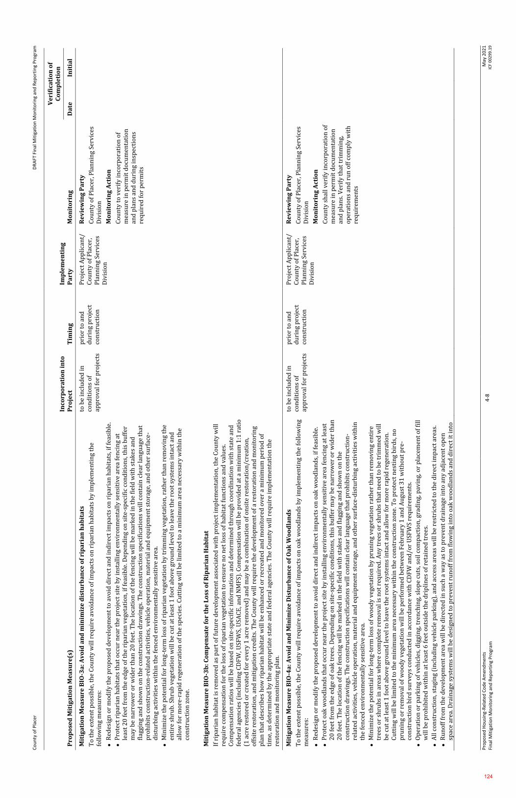
Co
un
ty o
f P
lace
r
DR
AFT
Fin
al M
itig
atio
n M
on
ito
rin
g an
d R
epo
rtin
g P
rogr
am
Pro
po
sed
Ho
usi
ng-
Rel
ated
Co
de
Am
end
men
ts
Fin
al M
itig
atio
n M
on
ito
rin
g an
d R
epo
rtin
g P
rogr
am
4-8
M
ay 2
02
1
ICF
00
29
9.1
9
Pro
po
sed
Mit
iga
tio
n M
ea
sure
(s)
Inco
rpo
rati
on
in
to
Pro
ject
T
imin
g
Imp
lem
en
tin
g
Pa
rty
M
on
ito
rin
g
Ve
rifi
cati
on
of
Co
mp
leti
on
Da
te
Init
ial
Mit
iga
tio
n M
ea
sure
BIO
-3a
: Av
oid
an
d m
inim
ize
dis
turb
an
ce o
f ri
pa
ria
n h
ab
ita
ts
To
th
e ex
ten
t p
oss
ible
, th
e C
ou
nty
wil
l req
uir
e av
oid
ance
of
imp
acts
on
rip
aria
n h
abit
ats
by
imp
lem
enti
ng
the
foll
ow
ing
mea
sure
s:
⚫
Red
esig
n o
r m
od
ify
the
pro
po
sed
dev
elo
pm
ent
to a
void
dir
ect
and
ind
irec
t im
pac
ts o
n r
ipar
ian
hab
itat
s, if
fea
sib
le.
⚫
Pro
tect
rip
aria
n h
abit
ats
that
occ
ur
nea
r th
e p
roje
ct s
ite
by
inst
alli
ng
env
iro
nm
enta
lly
sen
siti
ve a
rea
fen
cin
g at
le
ast
20
fee
t fr
om
th
e ed
ge o
f th
e ri
par
ian
veg
etat
ion
, if
feas
ible
. Dep
end
ing
on
sit
e-s
pec
ific
co
nd
itio
ns,
th
is b
uff
er
may
be
nar
row
er o
r w
ider
th
an 2
0 f
eet.
Th
e lo
cati
on
of
the
fen
cin
g w
ill b
e m
ark
ed in
th
e fi
eld
wit
h s
tak
es a
nd
fl
aggi
ng
and
sh
ow
n o
n t
he
con
stru
ctio
n d
raw
ings
. Th
e co
nst
ruct
ion
sp
ecif
icat
ion
s w
ill c
on
tain
cle
ar la
ngu
age
that
p
roh
ibit
s co
nst
ruct
ion
-rel
ated
act
ivit
ies,
veh
icle
op
erat
ion
, mat
eria
l an
d e
qu
ipm
ent
sto
rage
, an
d o
ther
su
rfac
e-
dis
turb
ing
acti
vit
ies
wit
hin
th
e fe
nce
d e
nv
iro
nm
enta
lly
sen
siti
ve
area
.
⚫
Min
imiz
e th
e p
ote
nti
al f
or
lon
g-t
erm
loss
of
rip
aria
n v
eget
atio
n b
y t
rim
min
g ve
geta
tio
n, r
ath
er t
han
rem
ov
ing
the
enti
re s
hru
b. S
hru
b v
eget
atio
n w
ill b
e cu
t at
leas
t 1
fo
ot
abo
ve g
rou
nd
lev
el t
o le
ave
the
roo
t sy
stem
s in
tact
an
d
allo
w f
or
mo
re-r
apid
reg
ener
atio
n o
f th
e sp
ecie
s. C
utt
ing
wil
l be
lim
ited
to
a m
inim
um
are
a n
eces
sary
wit
hin
th
e co
nst
ruct
ion
zo
ne.
Mit
iga
tio
n M
ea
sure
BIO
-3b
: Co
mp
en
sate
fo
r th
e L
oss
of
Rip
ari
an
Ha
bit
at
If r
ipar
ian
hab
itat
is r
emo
ved
as
par
t o
f fu
ture
dev
elo
pm
ent
asso
ciat
ed w
ith
pro
ject
imp
lem
enta
tio
n, t
he
Co
un
ty w
ill
req
uir
e co
mp
ensa
tio
n f
or
the
loss
of
rip
aria
n v
eget
atio
n t
o e
nsu
re n
o n
et lo
ss o
f h
abit
at f
un
ctio
ns
and
val
ues
. C
om
pen
sati
on
rat
ios
wil
l be
bas
ed o
n s
ite-
spec
ific
in
form
atio
n a
nd
det
erm
ined
th
rou
gh c
oo
rdin
atio
n w
ith
sta
te a
nd
fe
der
al a
gen
cies
(in
clu
din
g C
DF
W, U
SFW
S, U
SAC
E, a
nd
NM
FS)
. Co
mp
ensa
tio
n w
ill b
e p
rov
ided
at
a m
inim
um
1:1
rat
io
(1 a
cre
rest
ore
d o
r cr
eate
d f
or
ever
y 1
acr
e re
mo
ved
) an
d m
ay b
e a
com
bin
atio
n o
f o
nsi
te r
esto
rati
on
/cre
atio
n,
off
site
res
tora
tio
n, a
nd
mit
igat
ion
cre
dit
s. T
he
Co
un
ty w
ill r
equ
ire
the
dev
elo
pm
ent
of
a re
sto
rati
on
an
d m
on
ito
rin
g p
lan
th
at d
escr
ibes
ho
w r
ipar
ian
hab
itat
wil
l be
enh
ance
d o
r re
crea
ted
an
d m
on
ito
red
ov
er a
min
imu
m p
erio
d o
f ti
me,
as
det
erm
ined
by
th
e ap
pro
pri
ate
stat
e an
d f
eder
al a
gen
cies
. Th
e C
ou
nty
wil
l req
uir
e im
ple
men
tati
on
th
e re
sto
rati
on
an
d m
on
ito
rin
g p
lan
.
to b
e in
clu
ded
in
con
dit
ion
s o
f ap
pro
val f
or
pro
ject
s
pri
or
to a
nd
d
uri
ng
pro
ject
co
nst
ruct
ion
Pro
ject
Ap
pli
can
t/
Co
un
ty o
f P
lace
r,
Pla
nn
ing
Serv
ices
D
ivis
ion
Re
vie
win
g P
art
y
Co
un
ty o
f P
lace
r, P
lan
nin
g Se
rvic
es
Div
isio
n
Mo
nit
ori
ng
Act
ion
Co
un
ty t
o v
erif
y in
corp
ora
tio
n o
f m
easu
re in
per
mit
do
cum
enta
tio
n
and
pla
ns
and
du
rin
g in
spec
tio
ns
req
uir
ed f
or
per
mit
s
Mit
iga
tio
n M
ea
sure
BIO
-4a
: Av
oid
an
d M
inim
ize
Dis
turb
an
ce o
f O
ak
Wo
od
lan
ds
To
th
e ex
ten
t p
oss
ible
, th
e C
ou
nty
wil
l req
uir
e av
oid
ance
of
imp
acts
on
oak
wo
od
lan
ds
by
imp
lem
enti
ng
the
foll
ow
ing
mea
sure
s:
⚫
Red
esig
n o
r m
od
ify
the
pro
po
sed
dev
elo
pm
ent
to a
void
dir
ect
and
ind
irec
t im
pac
ts o
n o
ak w
oo
dla
nd
s, if
fea
sib
le.
⚫
Pro
tect
oak
wo
od
lan
ds
that
occ
ur
nea
r th
e p
roje
ct s
ite
by
inst
alli
ng
env
iro
nm
enta
lly
sen
siti
ve a
rea
fen
cin
g at
leas
t 2
0 f
eet
fro
m t
he
edge
of
oak
tre
es. D
epen
din
g o
n s
ite
-sp
ecif
ic c
on
dit
ion
s, t
his
bu
ffer
may
be
nar
row
er o
r w
ider
th
an
20
fee
t. T
he
loca
tio
n o
f th
e fe
nci
ng
wil
l be
mar
ked
in t
he
fiel
d w
ith
sta
kes
an
d f
lagg
ing
and
sh
ow
n o
n t
he
con
stru
ctio
n d
raw
ings
. Th
e co
nst
ruct
ion
sp
ecif
icat
ion
s w
ill c
on
tain
cle
ar la
ngu
age
that
pro
hib
its
con
stru
ctio
n-
rela
ted
act
ivit
ies,
veh
icle
op
erat
ion
, mat
eria
l an
d e
qu
ipm
ent
sto
rage
, an
d o
ther
su
rfac
e-d
istu
rbin
g ac
tivi
ties
wit
hin
th
e fe
nce
d e
nv
iro
nm
enta
lly
sen
siti
ve
area
.
⚫
Min
imiz
e th
e p
ote
nti
al f
or
lon
g-t
erm
loss
of
wo
od
y v
eget
atio
n b
y p
run
ing
veg
etat
ion
rat
her
th
an r
emo
vin
g en
tire
tr
ees
or
shru
bs
in a
reas
wh
ere
com
ple
te r
emo
val
is n
ot
req
uir
ed. A
ny
tre
es o
r sh
rub
s th
at n
eed
to
be
trim
med
wil
l b
e cu
t at
leas
t 1
fo
ot
abo
ve
gro
un
d le
vel t
o le
ave
the
roo
t sy
stem
s in
tact
an
d a
llo
w f
or
mo
re r
apid
reg
ener
atio
n.
Cu
ttin
g w
ill b
e li
mit
ed t
o t
he
min
imu
m a
rea
nec
essa
ry w
ith
in t
he
con
stru
ctio
n z
on
e. T
o p
rote
ct n
esti
ng
bir
ds,
no
p
run
ing
or
rem
ova
l of
wo
od
y v
eget
atio
n w
ill b
e p
erfo
rmed
bet
wee
n F
ebru
ary
1 a
nd
Au
gust
31
wit
ho
ut
pre
-co
nst
ruct
ion
bir
d s
urv
eys
con
du
cted
in a
cco
rdan
ce w
ith
CD
FW
an
d/o
r U
SFW
S re
qu
irem
ents
.
⚫
Op
erat
ion
or
par
kin
g o
f v
ehic
les,
dig
gin
g, t
ren
chin
g, s
lop
e cu
ts, s
oil
co
mp
acti
on
, gra
din
g, p
avin
g, o
r p
lace
men
t o
f fi
ll
wil
l be
pro
hib
ited
wit
hin
at
leas
t 6
fee
t o
uts
ide
the
dri
pli
nes
of
reta
ined
tre
es.
⚫
All
co
nst
ruct
ion
, sta
gin
g (i
ncl
ud
ing
veh
icle
par
kin
g), a
nd
acc
ess
area
s w
ill b
e re
stri
cted
to
th
e d
irec
t im
pac
t ar
eas.
⚫
Ru
no
ff f
rom
th
e d
evel
op
men
t ar
ea w
ill b
e d
irec
ted
in s
uch
a w
ay a
s to
pre
ven
t d
rain
age
into
an
y a
dja
cen
t o
pen
sp
ace
area
. Dra
inag
e sy
stem
s w
ill b
e d
esig
ned
to
pre
ven
t ru
no
ff f
rom
flo
win
g in
to o
ak w
oo
dla
nd
s an
d d
irec
t it
into
to b
e in
clu
ded
in
con
dit
ion
s o
f ap
pro
val f
or
pro
ject
s
pri
or
to a
nd
d
uri
ng
pro
ject
co
nst
ruct
ion
Pro
ject
Ap
pli
can
t/
Co
un
ty o
f P
lace
r,
Pla
nn
ing
Serv
ices
D
ivis
ion
Re
vie
win
g P
art
y
Co
un
ty o
f P
lace
r, P
lan
nin
g Se
rvic
es
Div
isio
n
Mo
nit
ori
ng
Act
ion
Co
un
ty s
hal
l ver
ify
inco
rpo
rati
on
of
mea
sure
in p
erm
it d
ocu
men
tati
on
an
d p
lan
s. V
erif
y t
hat
tri
mm
ing,
o
per
atio
ns
and
ru
n o
ff c
om
ply
wit
h
req
uir
emen
ts
124
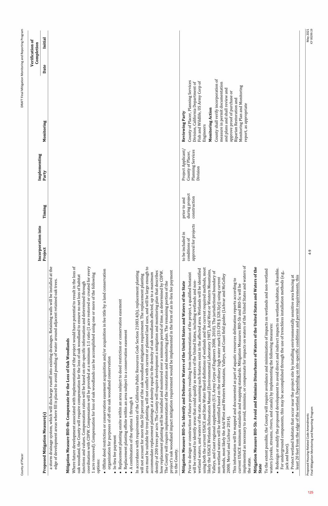
Co
un
ty o
f P
lace
r
DR
AFT
Fin
al M
itig
atio
n M
on
ito
rin
g an
d R
epo
rtin
g P
rogr
am
Pro
po
sed
Ho
usi
ng-
Rel
ated
Co
de
Am
end
men
ts
Fin
al M
itig
atio
n M
on
ito
rin
g an
d R
epo
rtin
g P
rogr
am
4-9
M
ay 2
02
1
ICF
00
29
9.1
9
Pro
po
sed
Mit
iga
tio
n M
ea
sure
(s)
Inco
rpo
rati
on
in
to
Pro
ject
T
imin
g
Imp
lem
en
tin
g
Pa
rty
M
on
ito
rin
g
Ve
rifi
cati
on
of
Co
mp
leti
on
Da
te
Init
ial
a st
orm
dra
inag
e sy
stem
, wh
ich
wil
l dis
char
ge r
un
off
into
exi
stin
g d
rain
ages
. Ret
ain
ing
wal
ls w
ill b
e in
stal
led
at
the
edge
of
dev
elo
pm
ent
area
s w
her
e fi
ll is
pla
ced
to
av
oid
po
nd
ing
of
wat
er a
rou
nd
ad
jace
nt
reta
ined
oak
tre
es.
Mit
iga
tio
n M
ea
sure
BIO
-4b
: Co
mp
en
sate
fo
r th
e L
oss
of
Oa
k W
oo
dla
nd
s
Wh
ere
futu
re d
evel
op
men
t as
soci
ated
wit
h im
ple
men
tati
on
of
the
pro
ject
wo
uld
hav
e p
ote
nti
al t
o r
esu
lt in
th
e lo
ss o
f o
ak w
oo
dla
nd
, th
e C
ou
nty
wil
l req
uir
e co
mp
ensa
tio
n f
or
the
loss
of
oak
wo
od
lan
d t
o e
nsu
re n
o n
et lo
ss o
f h
abit
at
fun
ctio
ns
and
val
ues
. Co
mp
ensa
tio
n r
atio
s w
ill b
e b
ased
on
sit
e-s
pec
ific
in
form
atio
n a
nd
det
erm
ined
th
rou
gh
coo
rdin
atio
n w
ith
CD
FW
. Co
mp
ensa
tio
n w
ill b
e p
rov
ided
at
a m
inim
um
1:1
rat
io (
1 a
cre
rest
ore
d o
r cr
eate
d f
or
ever
y 1
acr
e re
mo
ved
). C
om
pen
sati
on
fo
r lo
ss o
f o
ak w
oo
dla
nd
s ca
n b
e ac
com
pli
shed
usi
ng
on
e o
r m
ore
of
the
foll
ow
ing
op
tio
ns:
⚫
Off
site
dee
d r
estr
icti
on
or
con
serv
atio
n e
asem
ent
acq
uis
itio
n a
nd
/or
acq
uis
itio
n in
fee
tit
le b
y a
lan
d c
on
serv
atio
n
org
aniz
atio
n f
or
pu
rpo
ses
of
off
-sit
e o
ak w
oo
dla
nd
co
nse
rvat
ion
⚫
In-l
ieu
fee
pay
men
t
⚫
Rep
lace
men
t p
lan
tin
g o
nsi
te w
ith
in a
n a
rea
sub
ject
to
dee
d r
estr
icti
on
or
con
serv
atio
n e
asem
ent
⚫
Rep
lace
men
t p
lan
tin
g o
ffsi
te w
ith
in a
n a
rea
sub
ject
to
a c
on
serv
atio
n e
asem
ent
⚫
A c
om
bin
atio
n o
f th
e o
pti
on
s 1
th
rou
gh 4
In a
cco
rdan
ce w
ith
req
uir
emen
ts o
f th
e C
alif
orn
ia P
ub
lic
Res
ou
rces
Co
de
Sect
ion
21
08
3.4
(b),
rep
lace
men
t p
lan
tin
g w
ill n
ot
acco
un
t fo
r m
ore
th
an 5
0 p
erce
nt
of
the
oak
wo
od
lan
d m
itig
atio
n r
equ
irem
ent.
Th
e re
pla
cem
ent
pla
nti
ng
area
mu
st b
e su
itab
le f
or
tree
pla
nti
ng,
wil
l no
t co
nfl
ict
wit
h c
urr
ent
or
pla
nn
ed la
nd
use
s, a
nd
wil
l be
larg
e en
ou
gh t
o
acco
mm
od
ate
rep
lace
men
t p
lan
tin
gs a
t a
den
sity
eq
ual
to
th
e d
ensi
ty o
f o
ak w
oo
dla
nd
s af
fect
ed, u
p t
o a
max
imu
m
den
sity
of
20
0 t
rees
per
acr
e. T
he
Co
un
ty w
ill r
equ
ire
dev
elo
pm
ent
a m
itig
atio
n a
nd
mo
nit
ori
ng
pla
n t
hat
des
crib
es
ho
w r
epla
cem
ent
pla
nti
ng
wil
l be
inst
alle
d a
nd
mo
nit
ore
d o
ver
a m
inim
um
per
iod
of
tim
e, a
s d
eter
min
ed b
y C
DF
W.
Th
e C
ou
nty
wil
l req
uir
e im
ple
men
tati
on
of
the
rest
ora
tio
n a
nd
mo
nit
ori
ng
pla
n. T
he
rem
ain
ing
po
rtio
n o
f th
e p
roje
ct’s
oak
wo
od
lan
d im
pac
t m
itig
atio
n r
equ
irem
ent
wo
uld
be
imp
lem
ente
d in
th
e fo
rm o
f an
in-l
ieu
fee
pay
men
t to
th
e C
ou
nty
.
Mit
iga
tio
n M
ea
sure
BIO
-5a
: Id
en
tify
an
d D
eli
ne
ate
Wa
ters
of
the
Un
ite
d S
tate
s a
nd
Wa
ters
of
the
Sta
te
Pri
or
to d
esig
n o
r co
nst
ruct
ion
of
futu
re p
roje
cts
resu
ltin
g fr
om
imp
lem
enta
tio
n o
f th
e p
roje
ct, a
qu
alif
ied
bo
tan
ist
wil
l be
reta
ined
to
iden
tify
are
as t
hat
co
uld
qu
alif
y as
wat
ers
of
the
Un
ited
Sta
tes,
incl
ud
ing
wet
lan
ds
and
no
n-
wet
lan
d w
ater
s, a
nd
wat
ers
of
the
stat
e, a
ssu
min
g su
ch f
eatu
res
exis
t in
th
e af
fect
ed a
rea.
Wet
lan
ds
wil
l be
iden
tifi
ed
usi
ng
bo
th t
he
curr
ent
USA
CE
an
d S
tate
Wat
er
Bo
ard
def
init
ion
s o
f w
etla
nd
s an
d t
he
curr
ent
req
uir
ed m
eth
od
s, m
ost
li
kel
y t
he
USA
CE
Wet
lan
ds
Del
inea
tio
n M
anu
al (
En
vir
on
men
tal L
abo
rato
ry 1
98
7),
Ari
d W
est
or
Wes
tern
Mo
un
tain
s,
Val
leys
, an
d C
oas
t re
gio
nal
su
pp
lem
ents
(U
.S. A
rmy
Co
rps
of
En
gin
eers
20
08
, 20
10
). T
he
juri
sdic
tio
nal
bo
un
dar
y o
f n
on
-wet
lan
d w
ater
s w
ill b
e id
enti
fied
bas
ed o
n t
he
ord
inar
y h
igh
wat
er m
ark
(3
3 C
FR
§ 3
28
.3(e
)) u
sin
g cu
rren
t m
eth
od
s, m
ost
lik
ely
th
e A
rid
Wes
t an
d W
este
rn M
ou
nta
ins,
Val
ley
s, a
nd
Co
ast
fiel
d g
uid
es (
Lic
hv
ar a
nd
McC
oll
ey
20
08
; Mer
sel a
nd
Lic
hva
r 2
01
4).
Th
is in
form
atio
n w
ill b
e m
app
ed a
nd
do
cum
ente
d a
s p
art
of
aqu
atic
res
ou
rces
del
inea
tio
n r
epo
rts
acco
rdin
g to
cu
rren
t U
SAC
E m
inim
um
sta
nd
ard
s an
d m
app
ing
stan
dar
ds.
Mit
igat
ion
Mea
sure
s B
IO-5
b a
nd
BIO
-5c
wil
l be
imp
lem
ente
d a
s n
eces
sary
to
avo
id, m
inim
ize,
or
com
pen
sate
fo
r im
pac
ts o
n w
ater
s o
f th
e U
nit
ed S
tate
s an
d w
ater
s o
f th
e st
ate.
Mit
iga
tio
n M
ea
sure
BIO
-5b
: A
vo
id a
nd
Min
imiz
e D
istu
rba
nce
of
Wa
ters
of
the
Un
ite
d S
tate
s a
nd
Wa
ters
of
the
S
tate
To
th
e ex
ten
t p
oss
ible
, th
e C
ou
nty
wil
l req
uir
e av
oid
ance
an
d m
inim
izat
ion
of
imp
acts
on
wet
lan
ds
and
no
n-w
etla
nd
w
ater
s (c
reek
s, s
trea
ms,
riv
ers,
an
d c
anal
s) b
y im
ple
men
tin
g th
e fo
llo
win
g m
easu
res:
⚫
Red
esig
n o
r m
od
ify
the
pro
po
sed
dev
elo
pm
ent
to a
void
dir
ect
and
ind
irec
t im
pac
ts o
n w
etla
nd
hab
itat
s, if
fea
sib
le.
Fo
r u
nd
ergr
ou
nd
co
mp
on
ents
, th
is m
ay b
e ac
com
pli
shed
th
rou
gh t
he
use
of
tren
chle
ss in
stal
lati
on
met
ho
ds
(e.g
., ja
ck a
nd
bo
re).
⚫
Pro
tect
wet
lan
d h
abit
ats
that
occ
ur
nea
r th
e p
roje
ct s
ite
by
inst
alli
ng
env
iro
nm
enta
lly
sen
siti
ve a
rea
fen
cin
g at
le
ast
20
fee
t fr
om
th
e ed
ge o
f th
e w
etla
nd
. Dep
end
ing
on
sit
e-s
pec
ific
co
nd
itio
ns
and
per
mit
req
uir
emen
ts, t
his
to b
e in
clu
ded
in
con
dit
ion
s o
f ap
pro
val f
or
pro
ject
s
pri
or
to a
nd
d
uri
ng
pro
ject
co
nst
ruct
ion
Pro
ject
Ap
pli
can
t/
Co
un
ty o
f P
lace
r,
Pla
nn
ing
Serv
ices
D
ivis
ion
Re
vie
win
g P
art
y
Co
un
ty o
f P
lace
r, P
lan
nin
g Se
rvic
es
Div
isio
n, C
alif
orn
ia D
epar
tmen
t o
f F
ish
an
d W
ild
life
, US
Arm
y C
orp
of
En
gin
eers
Mo
nit
ori
ng
Act
ion
Co
un
ty s
hal
l ver
ify
inco
rpo
rati
on
of
mea
sure
in p
erm
it d
ocu
men
tati
on
an
d p
lan
s an
d s
hal
l rev
iew
an
d
app
rove
pro
of
of
pu
rch
ase
or
Rip
aria
n R
esto
rati
on
an
d
Mo
nit
ori
ng
Pla
n a
nd
Mo
nit
ori
ng
rep
ort
, as
app
rop
riat
e
125
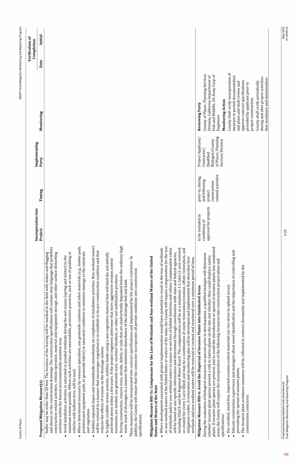
Co
un
ty o
f P
lace
r
DR
AFT
Fin
al M
itig
atio
n M
on
ito
rin
g an
d R
epo
rtin
g P
rogr
am
Pro
po
sed
Ho
usi
ng-
Rel
ated
Co
de
Am
end
men
ts
Fin
al M
itig
atio
n M
on
ito
rin
g an
d R
epo
rtin
g P
rogr
am
4-1
0
May
20
21
IC
F 0
02
99
.19
Pro
po
sed
Mit
iga
tio
n M
ea
sure
(s)
Inco
rpo
rati
on
in
to
Pro
ject
T
imin
g
Imp
lem
en
tin
g
Pa
rty
M
on
ito
rin
g
Ve
rifi
cati
on
of
Co
mp
leti
on
Da
te
Init
ial
bu
ffer
may
be
wid
er t
han
20
fee
t. T
he
loca
tio
n o
f th
e fe
nci
ng
wil
l be
mar
ked
in t
he
fiel
d w
ith
sta
kes
an
d f
lagg
ing
an
d s
ho
wn
on
th
e co
nst
ruct
ion
dra
win
gs. T
he
con
stru
ctio
n s
pec
ific
atio
ns
wil
l co
nta
in c
lear
lan
guag
e th
at p
roh
ibit
s co
nst
ruct
ion
-rel
ated
act
ivit
ies,
veh
icle
op
erat
ion
, mat
eria
l an
d e
qu
ipm
ent
sto
rage
, an
d o
ther
su
rfac
e-d
istu
rbin
g ac
tivi
ties
wit
hin
th
e fe
nce
d e
nv
iro
nm
enta
lly
sen
siti
ve
area
.
⚫
Av
oid
inst
alla
tio
n a
ctiv
itie
s in
sat
ura
ted
or
po
nd
ed w
etla
nd
s d
uri
ng
the
wet
sea
son
(sp
rin
g an
d w
inte
r) t
o t
he
max
imu
m e
xten
t p
oss
ible
. Wh
ere
such
act
ivit
ies
are
un
avo
idab
le, p
rote
ctiv
e p
ract
ices
, su
ch a
s u
se o
f p
add
ing
or
veh
icle
s w
ith
bal
loo
n t
ires
, wil
l be
use
d.
⚫
Wh
ere
det
erm
ined
nec
essa
ry b
y r
eso
urc
e sp
ecia
list
s, u
se g
eote
xtil
e cu
shio
ns
and
oth
er m
ater
ials
(e.
g., t
imb
er p
ads,
p
refa
bri
cate
d e
qu
ipm
ent
pad
s, o
r ge
ote
xtil
e fa
bri
c) in
sat
ura
ted
co
nd
itio
ns
to m
inim
ize
dam
age
to t
he
sub
stra
te
and
veg
etat
ion
.
⚫
Stab
iliz
e ex
po
sed
slo
pes
an
d s
trea
mb
ank
s im
med
iate
ly o
n c
om
ple
tio
n o
f in
stal
lati
on
act
ivit
ies.
No
n-w
etla
nd
wat
ers
wil
l be
rest
ore
d in
a m
ann
er t
hat
en
cou
rage
s ve
geta
tio
n t
o r
e es
tab
lish
to
its
pre
-co
nst
ruct
ion
co
nd
itio
n a
nd
th
at
red
uce
s th
e ef
fect
s o
f er
osi
on
on
th
e d
rain
age
syst
em.
⚫
In h
igh
ly e
rod
ible
str
eam
sys
tem
s, s
tab
iliz
e b
ank
s u
sin
g a
no
n v
eget
ativ
e m
ater
ial t
hat
wil
l bin
d t
he
soil
init
iall
y an
d b
reak
do
wn
wit
hin
a f
ew y
ears
. If
the
pro
ject
en
gin
eers
det
erm
ine
th
at m
ore
agg
ress
ive
ero
sio
n c
on
tro
l tr
eatm
ents
are
nee
ded
, use
geo
text
ile
mat
s, e
xcel
sio
r b
lan
ket
s, o
r o
ther
so
il s
tab
iliz
atio
n p
rod
uct
s.
⚫
Du
rin
g co
nst
ruct
ion
, rem
ove
tre
es, s
hru
bs,
deb
ris,
or
soil
s th
at a
re in
adv
erte
ntl
y d
epo
site
d b
elo
w t
he
ord
inar
y h
igh
w
ater
mar
k o
f d
rain
ages
in a
man
ner
th
at m
inim
izes
dis
turb
ance
of
the
dra
inag
e b
ed a
nd
ban
k.
Th
ese
mea
sure
s w
ill b
e in
corp
ora
ted
into
co
ntr
act
spec
ific
atio
ns
and
imp
lem
ente
d b
y t
he
pro
ject
co
ntr
acto
r. I
n
add
itio
n, t
he
Co
un
ty w
ill e
nsu
re t
hat
th
e co
ntr
acto
r in
corp
ora
tes
all p
erm
it c
on
dit
ion
s in
to c
on
stru
ctio
n
spec
ific
atio
ns.
Mit
iga
tio
n M
ea
sure
BIO
-5c:
Co
mp
en
sate
fo
r th
e L
oss
of
We
tla
nd
s a
nd
No
n-w
etl
an
d W
ate
rs o
f th
e U
nit
ed
S
tate
s a
nd
Wa
ters
of
the
Sta
te
⚫
Wh
ere
dev
elo
pm
ent
asso
ciat
ed w
ith
pro
ject
imp
lem
enta
tio
n w
ou
ld h
ave
po
ten
tial
to
res
ult
in t
he
loss
of
wet
lan
ds
or
no
n-w
etla
nd
wat
ers
of
the
Un
ited
Sta
tes
or
wat
ers
of
the
stat
e, t
he
Co
un
ty w
ill r
equ
ire
com
pen
sati
on
fo
r th
e lo
ss
of
wet
lan
ds
and
/or
no
n-w
etla
nd
wat
ers
to e
nsu
re n
o n
et lo
ss o
f h
abit
at f
un
ctio
ns
and
val
ues
. Co
mp
ensa
tio
n r
atio
s w
ill b
e b
ased
on
sit
e-sp
ecif
ic i
nfo
rmat
ion
an
d d
eter
min
ed t
hro
ugh
co
ord
inat
ion
wit
h s
tate
an
d f
eder
al a
gen
cies
, in
clu
din
g U
SAC
E a
nd
th
e R
egio
nal
Wat
er B
oar
d. T
he
com
pen
sati
on
wil
l be
at a
min
imu
m 1
:1 r
atio
(1
acr
e re
sto
red
o
r cr
eate
d f
or
ever
y 1
acr
e fi
lled
) an
d m
ay b
e a
com
bin
atio
n o
f o
nsi
te r
esto
rati
on
/cre
atio
n, o
ffsi
te r
esto
rati
on
, an
d
mit
igat
ion
cre
dit
s. A
res
tora
tio
n a
nd
mo
nit
ori
ng
pla
n w
ill b
e d
evel
op
ed a
nd
imp
lem
ente
d t
hat
des
crib
es h
ow
w
etla
nd
s an
d n
on
-wet
lan
d w
ater
s w
ill b
e re
sto
red
or
crea
ted
an
d m
on
ito
red
ove
r a
min
imu
m p
erio
d o
f ti
me.
Mit
iga
tio
n M
ea
sure
BIO
-6:
Av
oid
th
e D
isp
ers
al
of
Inv
asi
ve
Pla
nts
in
to U
nin
fest
ed
Are
as
Du
rin
g th
e ev
alu
atio
n o
f b
iolo
gica
l res
ou
rces
on
par
cels
pri
or
to d
evel
op
men
t, a
qu
alif
ied
bio
logi
st w
ill d
eter
min
e w
het
her
inva
sive
pla
nt
spec
ies
pre
sen
t a
risk
to
nat
ive
pla
nts
on
th
e si
te a
nd
wh
eth
er t
hey
co
uld
dis
pla
ce n
ativ
e p
lan
ts. I
f in
vas
ive
pla
nt
spec
ies
are
pre
sen
t, a
nd
to
avo
id t
he
intr
od
uct
ion
or
spre
ad o
f in
vas
ive
pla
nts
into
un
infe
sted
ar
eas,
th
e C
ou
nty
wil
l req
uir
e th
e in
corp
ora
tio
n o
f th
e fo
llo
win
g m
easu
res
into
co
nst
ruct
ion
pro
ject
pla
ns
and
sp
ecif
icat
ion
s:
⚫
Use
cer
tifi
ed, w
eed
-fre
e, im
po
rted
ero
sio
n-c
on
tro
l mat
eria
ls (
or
rice
str
aw in
up
lan
d a
reas
).
⚫
Ed
uca
te c
on
stru
ctio
n s
up
erv
iso
rs a
nd
man
ager
s ab
ou
t w
eed
iden
tifi
cati
on
an
d t
he
imp
ort
ance
of
con
tro
llin
g an
d
pre
ven
tin
g th
e sp
read
of
inv
asiv
e p
lan
ts.
⚫
Th
e in
vasi
ve
pla
nt
avo
idan
ce m
easu
res
wil
l be
refl
ecte
d in
co
ntr
act
do
cum
ents
an
d im
ple
men
ted
by
th
e co
nst
ruct
ion
co
ntr
acto
r.
to b
e in
clu
ded
in
con
dit
ion
s o
f ap
pro
val f
or
pro
ject
s
pri
or
to, d
uri
ng,
an
d f
oll
ow
ing
pro
ject
co
nst
ruct
ion
-re
late
d a
ctiv
itie
s
Pro
ject
Ap
pli
can
t/
Co
ntr
acto
r/
Qu
alif
ied
B
iolo
gist
/Co
un
ty
of
Pla
cer,
Pla
nn
ing
Serv
ices
Div
isio
n
Re
vie
win
g P
art
y
Co
un
ty o
f P
lace
r, P
lan
nin
g Se
rvic
es
Div
isio
n, C
alif
orn
ia D
epar
tmen
t o
f F
ish
an
d W
ild
life
, US
Arm
y C
orp
of
En
gin
eers
Mo
nit
ori
ng
Act
ion
Co
un
ty s
hal
l ver
ify
inco
rpo
rati
on
of
mea
sure
in p
erm
it d
ocu
men
tati
on
an
d p
lan
s an
d s
hal
l rev
iew
an
d
app
rove
co
ntr
act
spec
ific
atio
ns
pro
vid
ed b
y a
pp
lica
nt
pri
or
to
pro
ject
co
nst
ruct
ion
.
Co
un
ty s
hal
l ver
ify
per
iod
ical
ly
du
rin
g an
d a
fter
pro
ject
act
ivit
ies
that
av
oid
ance
an
d m
inim
izat
ion
126
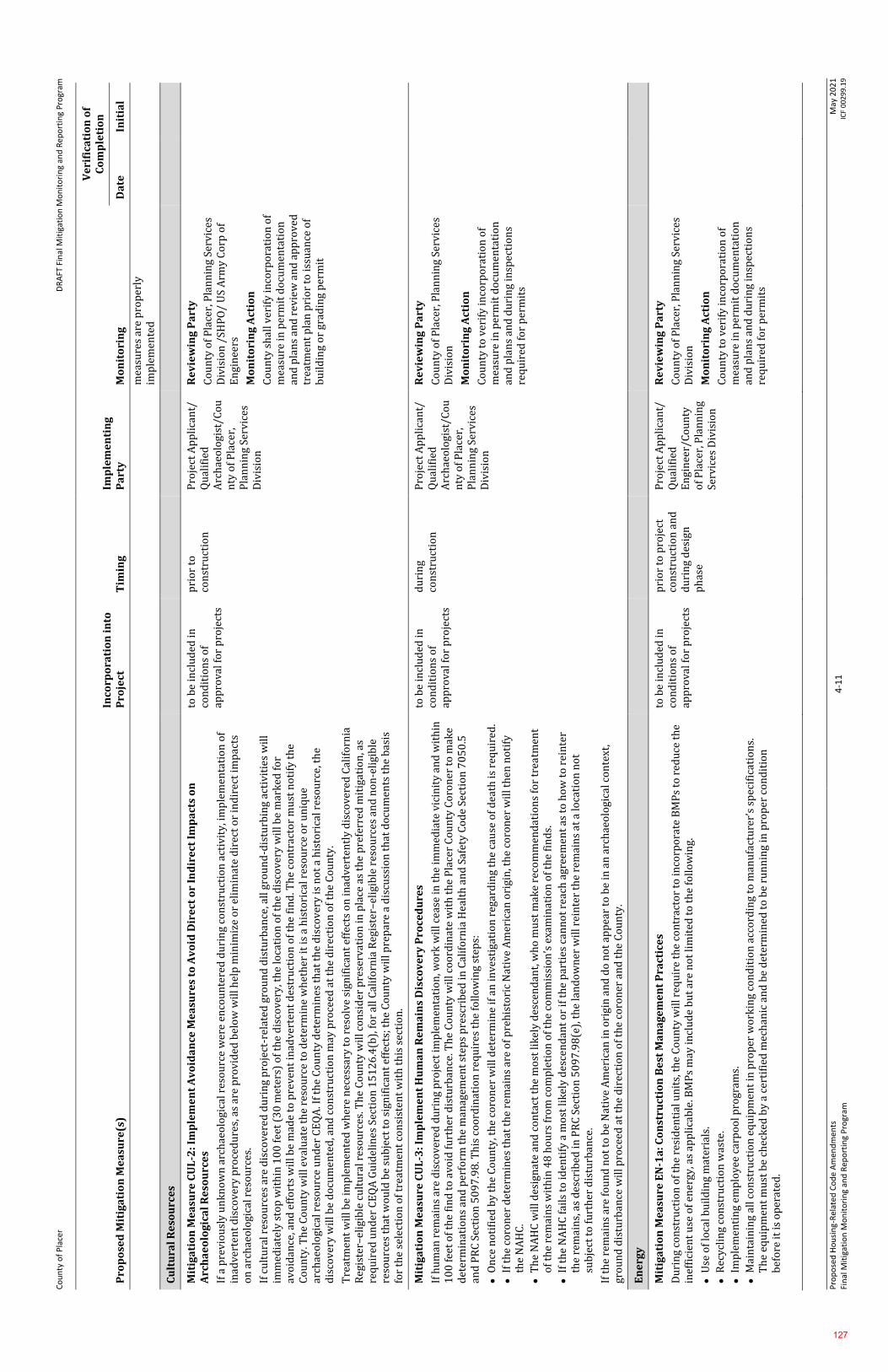
Co
un
ty o
f P
lace
r
DR
AFT
Fin
al M
itig
atio
n M
on
ito
rin
g an
d R
epo
rtin
g P
rogr
am
Pro
po
sed
Ho
usi
ng-
Rel
ated
Co
de
Am
end
men
ts
Fin
al M
itig
atio
n M
on
ito
rin
g an
d R
epo
rtin
g P
rogr
am
4-1
1
May
20
21
IC
F 0
02
99
.19
Pro
po
sed
Mit
iga
tio
n M
ea
sure
(s)
Inco
rpo
rati
on
in
to
Pro
ject
T
imin
g
Imp
lem
en
tin
g
Pa
rty
M
on
ito
rin
g
Ve
rifi
cati
on
of
Co
mp
leti
on
Da
te
Init
ial
mea
sure
s ar
e p
rop
erly
im
ple
men
ted
Cu
ltu
ral
Re
sou
rce
s
Mit
iga
tio
n M
ea
sure
CU
L-2
: Im
ple
me
nt
Av
oid
an
ce M
ea
sure
s to
Av
oid
Dir
ect
or
Ind
ire
ct I
mp
act
s o
n
Arc
ha
eo
log
ica
l R
eso
urc
es
If a
pre
vio
usl
y u
nk
no
wn
arc
hae
olo
gica
l res
ou
rce
wer
e en
cou
nte
red
du
rin
g co
nst
ruct
ion
act
ivit
y, i
mp
lem
enta
tio
n o
f in
adve
rten
t d
isco
very
pro
ced
ure
s, a
s ar
e p
rov
ided
bel
ow
wil
l hel
p m
inim
ize
or
elim
inat
e d
irec
t o
r in
dir
ect
imp
acts
o
n a
rch
aeo
logi
cal r
eso
urc
es.
If c
ult
ura
l res
ou
rces
are
dis
cove
red
du
rin
g p
roje
ct-r
elat
ed g
rou
nd
dis
turb
ance
, all
gro
un
d-d
istu
rbin
g ac
tiv
itie
s w
ill
imm
edia
tely
sto
p w
ith
in 1
00
fee
t (3
0 m
eter
s) o
f th
e d
isco
very
, th
e lo
cati
on
of
the
dis
cove
ry w
ill b
e m
ark
ed f
or
avo
idan
ce, a
nd
eff
ort
s w
ill b
e m
ade
to p
rev
ent
inad
vert
ent
des
tru
ctio
n o
f th
e fi
nd
. Th
e co
ntr
acto
r m
ust
no
tify
th
e C
ou
nty
. Th
e C
ou
nty
wil
l ev
alu
ate
the
reso
urc
e to
det
erm
ine
wh
eth
er it
is
a h
isto
rica
l res
ou
rce
or
un
iqu
e ar
chae
olo
gica
l res
ou
rce
un
der
CE
QA
. If
the
Co
un
ty d
eter
min
es t
hat
th
e d
isco
ver
y is
no
t a
his
tori
cal r
eso
urc
e, t
he
dis
cov
ery
wil
l be
do
cum
ente
d, a
nd
co
nst
ruct
ion
may
pro
ceed
at
the
dir
ecti
on
of
the
Co
un
ty.
Tre
atm
ent
wil
l be
imp
lem
ente
d w
her
e n
eces
sary
to
res
olv
e si
gnif
ican
t ef
fect
s o
n in
adv
erte
ntl
y d
isco
vere
d C
alif
orn
ia
Reg
iste
r–el
igib
le c
ult
ura
l res
ou
rces
. Th
e C
ou
nty
wil
l co
nsi
der
pre
serv
atio
n in
pla
ce a
s th
e p
refe
rred
mit
igat
ion
, as
req
uir
ed u
nd
er C
EQ
A G
uid
elin
es S
ecti
on
15
12
6.4
(b),
fo
r al
l Cal
ifo
rnia
Reg
iste
r–el
igib
le r
eso
urc
es a
nd
no
n-e
ligi
ble
re
sou
rces
th
at w
ou
ld b
e su
bje
ct t
o s
ign
ific
ant
effe
cts;
th
e C
ou
nty
wil
l pre
par
e a
dis
cuss
ion
th
at d
ocu
men
ts t
he
bas
is
for
the
sele
ctio
n o
f tr
eatm
ent
con
sist
ent
wit
h t
his
sec
tio
n.
to b
e in
clu
ded
in
con
dit
ion
s o
f ap
pro
val f
or
pro
ject
s
pri
or
to
con
stru
ctio
n
Pro
ject
Ap
pli
can
t/
Qu
alif
ied
A
rch
aeo
logi
st/C
ou
nty
of
Pla
cer,
P
lan
nin
g Se
rvic
es
Div
isio
n
Re
vie
win
g P
art
y
Co
un
ty o
f P
lace
r, P
lan
nin
g Se
rvic
es
Div
isio
n /
SHP
O/
US
Arm
y C
orp
of
En
gin
eers
Mo
nit
ori
ng
Act
ion
Co
un
ty s
hal
l ver
ify
inco
rpo
rati
on
of
mea
sure
in p
erm
it d
ocu
men
tati
on
an
d p
lan
s an
d r
evie
w a
nd
ap
pro
ved
tr
eatm
ent
pla
n p
rio
r to
issu
ance
of
bu
ild
ing
or
grad
ing
per
mit
Mit
iga
tio
n M
ea
sure
CU
L-3
: Im
ple
me
nt
Hu
ma
n R
em
ain
s D
isco
ve
ry P
roce
du
res
If h
um
an r
emai
ns
are
dis
cov
ered
du
rin
g p
roje
ct im
ple
men
tati
on
, wo
rk w
ill c
ease
in t
he
imm
edia
te v
icin
ity
an
d w
ith
in
10
0 f
eet
of
the
fin
d t
o a
void
fu
rth
er d
istu
rban
ce. T
he
Co
un
ty w
ill c
oo
rdin
ate
wit
h t
he
Pla
cer
Co
un
ty C
oro
ner
to
mak
e d
eter
min
atio
ns
and
per
form
th
e m
anag
emen
t st
eps
pre
scri
bed
in C
alif
orn
ia H
ealt
h a
nd
Saf
ety
Co
de
Sect
ion
70
50
.5
and
PR
C S
ecti
on
50
97
.98
. Th
is c
oo
rdin
atio
n r
equ
ires
th
e fo
llo
win
g st
eps:
⚫
On
ce n
oti
fied
by
th
e C
ou
nty
, th
e co
ron
er w
ill d
eter
min
e if
an
inve
stig
atio
n r
egar
din
g th
e ca
use
of
dea
th is
req
uir
ed.
⚫
If t
he
coro
ner
det
erm
ines
th
at t
he
rem
ain
s ar
e o
f p
reh
isto
ric
Nat
ive
Am
eric
an o
rigi
n, t
he
coro
ner
wil
l th
en n
oti
fy
the
NA
HC
.
⚫
Th
e N
AH
C w
ill d
esig
nat
e an
d c
on
tact
th
e m
ost
lik
ely
des
cen
dan
t, w
ho
mu
st m
ake
reco
mm
end
atio
ns
for
trea
tmen
t o
f th
e re
mai
ns
wit
hin
48
ho
urs
fro
m c
om
ple
tio
n o
f th
e co
mm
issi
on
’s e
xam
inat
ion
of
the
fin
ds.
⚫
If t
he
NA
HC
fai
ls t
o id
enti
fy a
mo
st li
kel
y d
esce
nd
ant
or
if t
he
par
ties
can
no
t re
ach
agr
eem
ent
as t
o h
ow
to
rei
nte
r th
e re
mai
ns,
as
des
crib
ed in
PR
C S
ecti
on
50
97
.98
(e),
th
e la
nd
ow
ner
wil
l rei
nte
r th
e re
mai
ns
at a
loca
tio
n n
ot
sub
ject
to
fu
rth
er d
istu
rban
ce.
If t
he
rem
ain
s ar
e fo
un
d n
ot
to b
e N
ativ
e A
mer
ican
in o
rigi
n a
nd
do
no
t ap
pea
r to
be
in a
n a
rch
aeo
logi
cal c
on
text
, gr
ou
nd
dis
turb
ance
wil
l pro
ceed
at
the
dir
ecti
on
of
the
coro
ner
an
d t
he
Co
un
ty.
to b
e in
clu
ded
in
con
dit
ion
s o
f ap
pro
val f
or
pro
ject
s
du
rin
g co
nst
ruct
ion
P
roje
ct A
pp
lica
nt/
Q
ual
ifie
d
Arc
hae
olo
gist
/Co
un
ty o
f P
lace
r,
Pla
nn
ing
Serv
ices
D
ivis
ion
Re
vie
win
g P
art
y
Co
un
ty o
f P
lace
r, P
lan
nin
g Se
rvic
es
Div
isio
n
Mo
nit
ori
ng
Act
ion
Co
un
ty t
o v
erif
y in
corp
ora
tio
n o
f m
easu
re in
per
mit
do
cum
enta
tio
n
and
pla
ns
and
du
rin
g in
spec
tio
ns
req
uir
ed f
or
per
mit
s
En
erg
y
Mit
iga
tio
n M
ea
sure
EN
-1a
: C
on
stru
ctio
n B
est
Ma
na
ge
me
nt
Pra
ctic
es
Du
rin
g co
nst
ruct
ion
of
the
resi
den
tial
un
its,
th
e C
ou
nty
wil
l req
uir
e th
e co
ntr
acto
r to
inco
rpo
rate
BM
Ps
to r
edu
ce t
he
inef
fici
ent
use
of
ener
gy, a
s ap
pli
cab
le. B
MP
s m
ay in
clu
de
bu
t ar
e n
ot
lim
ited
to
th
e fo
llo
win
g.
⚫
Use
of
loca
l bu
ild
ing
mat
eria
ls.
⚫
Rec
ycl
ing
con
stru
ctio
n w
aste
.
⚫
Imp
lem
enti
ng
emp
loye
e ca
rpo
ol p
rogr
ams.
⚫
Mai
nta
inin
g al
l co
nst
ruct
ion
eq
uip
men
t in
pro
per
wo
rkin
g co
nd
itio
n a
cco
rdin
g to
man
ufa
ctu
rer’
s sp
ecif
icat
ion
s.
Th
e eq
uip
men
t m
ust
be
chec
ked
by
a c
erti
fied
mec
han
ic a
nd
be
det
erm
ined
to
be
run
nin
g in
pro
per
co
nd
itio
n
bef
ore
it i
s o
per
ated
.
to b
e in
clu
ded
in
con
dit
ion
s o
f ap
pro
val f
or
pro
ject
s
pri
or
to p
roje
ct
con
stru
ctio
n a
nd
d
uri
ng
des
ign
p
has
e
Pro
ject
Ap
pli
can
t/
Qu
alif
ied
E
ngi
nee
r/C
ou
nty
o
f P
lace
r, P
lan
nin
g Se
rvic
es D
ivis
ion
Re
vie
win
g P
art
y
Co
un
ty o
f P
lace
r, P
lan
nin
g Se
rvic
es
Div
isio
n
Mo
nit
ori
ng
Act
ion
Co
un
ty t
o v
erif
y in
corp
ora
tio
n o
f m
easu
re in
per
mit
do
cum
enta
tio
n
and
pla
ns
and
du
rin
g in
spec
tio
ns
req
uir
ed f
or
per
mit
s
127
Co
un
ty o
f P
lace
r
DR
AFT
Fin
al M
itig
atio
n M
on
ito
rin
g an
d R
epo
rtin
g P
rogr
am
Pro
po
sed
Ho
usi
ng-
Rel
ated
Co
de
Am
end
men
ts
Fin
al M
itig
atio
n M
on
ito
rin
g an
d R
epo
rtin
g P
rogr
am
4-1
2
May
20
21
IC
F 0
02
99
.19
Pro
po
sed
Mit
iga
tio
n M
ea
sure
(s)
Inco
rpo
rati
on
in
to
Pro
ject
T
imin
g
Imp
lem
en
tin
g
Pa
rty
M
on
ito
rin
g
Ve
rifi
cati
on
of
Co
mp
leti
on
Da
te
Init
ial
Mit
iga
tio
n M
ea
sure
EN
-1b
: Co
mp
ly w
ith
En
erg
y E
ffic
ien
cy M
ea
sure
s in
th
e P
lace
r C
ou
nty
Ge
ne
ral
Pla
n (
20
13
) a
nd
Pla
cer
Co
un
ty S
ust
ain
ab
ilit
y P
lan
(2
02
0)
Pri
or
to a
pp
rov
al o
f th
e fi
nal
des
ign
pla
ns
for
dev
elo
pm
ent
un
der
th
e p
rop
ose
d p
roje
ct, t
he
Co
un
ty w
ill r
equ
ire
the
con
trac
tor
to li
st a
ll t
he
ener
gy-e
ffic
ien
cy m
easu
res
that
wil
l be
imp
lem
ente
d a
nd
dem
on
stra
te in
th
e p
lan
s w
her
e th
ese
mea
sure
s w
ill b
e lo
cate
d.
Th
e fo
llo
win
g is
a li
st o
f p
rop
ose
d s
ust
ain
abil
ity
mea
sure
s fr
om
th
e C
ou
nty
’s G
ener
al P
lan
, an
d P
CSP
th
at w
ill b
e re
qu
ired
fo
r p
roje
ct a
pp
rova
l.
⚫
Red
uce
bu
ild
ing
ener
gy c
on
sum
pti
on
th
rou
gh o
ne
or
mo
re o
f th
e fo
llo
win
g m
eth
od
s, w
her
e fe
asib
le.
I
nco
rpo
rate
en
ergy
eff
icie
ncy
des
ign
fea
ture
s th
at e
xcee
d 2
01
9 T
itle
24
Cal
ifo
rnia
En
ergy
Eff
icie
ncy
Sta
nd
ard
s b
y
at le
ast
15
per
cen
t.
P
rio
riti
ze u
se o
f el
ectr
icit
y as
th
e p
rim
ary
ener
gy s
ou
rce
in n
ew d
evel
op
men
ts.
I
mp
lem
ent
CA
LG
reen
Tie
r 1
sta
nd
ard
s.
U
se o
f ze
ro n
et e
ner
gy d
esig
n in
new
dev
elo
pm
ents
, wh
ere
feas
ible
.
⚫
Ori
ent
dev
elo
pm
ent
for
sola
r ac
cess
, to
th
e ex
ten
t p
ract
icab
le.
⚫
Imp
lem
ent
on
site
ren
ewab
le e
ner
gy o
n n
ew b
uil
din
gs, w
her
e fe
asib
le.
⚫
Pri
ori
tize
dev
elo
pm
ent
that
is w
ith
in p
roxi
mit
y o
f n
on
-au
to p
ub
lic
tran
sit.
Use
nat
ive,
dro
ugh
t-to
lera
nt
pla
nti
ngs
in la
nd
scap
ing.
Mit
iga
tio
n M
ea
sure
EN
-1b
: Co
mp
ly w
ith
En
erg
y E
ffic
ien
cy M
ea
sure
s in
th
e P
lace
r C
ou
nty
Ge
ne
ral
Pla
n (
20
13
) a
nd
Pla
cer
Co
un
ty S
ust
ain
ab
ilit
y P
lan
(2
02
0)
Ge
olo
gy
, So
ils,
Min
era
ls, a
nd
Pa
leo
nto
log
ica
l R
eso
urc
es
Mit
iga
tio
n M
ea
sure
s G
EO
-2:
Ob
tain
Ap
pro
va
l fr
om
En
gin
ee
rin
g a
nd
Su
rve
yin
g D
ivis
ion
⚫
Th
e ap
pli
can
t w
ill p
rep
are
and
su
bm
it I
mp
rove
men
t P
lan
s, s
pec
ific
atio
ns
and
co
st e
stim
ates
(p
er t
he
req
uir
emen
ts
of
Sect
ion
II
of
the
Lan
d D
evel
op
men
t M
anu
al (
LD
M)
that
are
in e
ffec
t at
th
e ti
me
of
sub
mit
tal)
to
th
e E
ngi
nee
rin
g an
d S
urv
eyin
g D
ivis
ion
(E
SD)
for
rev
iew
an
d a
pp
rov
al. T
he
pla
ns
wil
l sh
ow
all
ph
ysic
al im
pro
vem
ents
as
req
uir
ed
by
th
e co
nd
itio
ns
for
the
pro
ject
as
wel
l as
per
tin
ent
top
ogr
aph
ical
fea
ture
s b
oth
on
an
d o
ff s
ite.
All
exi
stin
g an
d
pro
po
sed
uti
liti
es a
nd
eas
emen
ts, o
n s
ite
and
ad
jace
nt
to t
he
pro
ject
, wh
ich
may
be
affe
cted
by
pla
nn
ed
con
stru
ctio
n, w
ill b
e sh
ow
n o
n t
he
pla
ns.
All
lan
dsc
apin
g an
d ir
riga
tio
n f
acil
itie
s w
ith
in t
he
pu
bli
c ri
ght-
of-
way
(o
r p
ub
lic
ease
men
ts),
or
lan
dsc
apin
g w
ith
in s
igh
t d
ista
nce
are
as a
t in
ters
ecti
on
s, w
ill b
e in
clu
ded
in t
he
Imp
rove
men
t P
lan
s. T
he
app
lica
nt
wil
l pay
pla
n c
hec
k a
nd
insp
ecti
on
fee
s an
d, i
f ap
pli
cab
le, P
lace
r C
ou
nty
Fir
e D
epar
tmen
t im
pro
vem
ent
pla
n r
evie
w a
nd
insp
ecti
on
fee
s w
ith
th
e 1
st I
mp
rove
men
t P
lan
su
bm
itta
l. (N
OT
E: P
rio
r to
pla
n
app
rova
l, al
l ap
pli
cab
le r
eco
rdin
g an
d r
epro
du
ctio
n c
ost
s w
ill b
e p
aid
). T
he
cost
of
the
abo
ve-n
ote
d la
nd
scap
e an
d
irri
gati
on
fac
ilit
ies
wil
l be
incl
ud
ed in
th
e es
tim
ates
use
d t
o d
eter
min
e th
ese
fees
. It
is t
he
app
lica
nt'
s re
spo
nsi
bil
ity
to
ob
tain
all
req
uir
ed a
gen
cy s
ign
atu
res
on
th
e p
lan
s an
d t
o s
ecu
re d
epar
tmen
t ap
pro
val
s. I
f th
e D
esig
n/S
ite
Rev
iew
p
roce
ss a
nd
/or
Dev
elo
pm
ent
Rev
iew
Co
mm
itte
e (D
RC
) re
vie
w is
req
uir
ed a
s a
con
dit
ion
of
app
rov
al f
or
the
pro
ject
, sai
d r
evie
w p
roce
ss w
ill b
e co
mp
lete
d p
rio
r to
su
bm
itta
l of
Imp
rove
men
t P
lan
s.
Co
nce
ptu
al la
nd
scap
e p
lan
s su
bm
itte
d p
rio
r to
pro
ject
ap
pro
val m
ay r
equ
ire
mo
dif
icat
ion
du
rin
g th
e Im
pro
vem
ent
Pla
n p
roce
ss t
o r
eso
lve
issu
es o
f d
rain
age
and
tra
ffic
saf
ety
.
Th
e F
inal
Map
(s)
wil
l no
t b
e su
bm
itte
d t
o t
he
ESD
un
til t
he
Imp
rove
men
t P
lan
s ar
e su
bm
itte
d f
or
the
seco
nd
re
vie
w. F
inal
tec
hn
ical
rev
iew
of
the
Fin
al S
ub
div
isio
n M
ap(s
) w
ill n
ot
con
clu
de
un
til a
fter
th
e Im
pro
vem
ent
Pla
ns
are
app
rov
ed b
y t
he
ESD
.
An
y B
uil
din
g P
erm
its
asso
ciat
ed w
ith
th
is p
roje
ct w
ill n
ot
be
issu
ed u
nti
l, at
a m
inim
um
, th
e Im
pro
vem
ent
Pla
ns
are
app
rove
d b
y th
e E
ngi
nee
rin
g an
d S
urv
eyin
g D
ivis
ion
.
Pri
or
to t
he
Co
un
ty’s
fin
al a
ccep
tan
ce o
f th
e p
roje
ct’s
imp
rove
men
ts, s
ub
mit
to
th
e E
ngi
nee
rin
g an
d S
urv
eyin
g D
ivis
ion
on
e co
py
of
the
Rec
ord
Dra
win
gs in
dig
ital
fo
rmat
(o
n c
om
pac
t d
isc
or
oth
er a
ccep
tab
le m
edia
) al
on
g w
ith
o
ne
bla
ckli
ne
har
dco
py
(b
lack
pri
nt
on
bo
nd
pap
er)
and
on
e P
DF
co
py
. Th
e d
igit
al f
orm
at is
to
all
ow
inte
grat
ion
to b
e in
clu
ded
in
con
dit
ion
s o
f ap
pro
val f
or
pro
ject
s
pri
or
to p
roje
ct
con
stru
ctio
n a
nd
d
uri
ng
des
ign
p
has
e
Pro
ject
Ap
pli
can
t/
Qu
alif
ied
E
ngi
nee
r/C
ou
nty
o
f P
lace
r,
En
gin
eeri
ng
and
Su
rvey
ing
Div
isio
n
Re
vie
win
g P
art
y
Co
un
ty o
f P
lace
r, E
ngi
nee
rin
g an
d
Surv
eyin
g D
ivis
ion
Mo
nit
ori
ng
Act
ion
Co
un
ty t
o v
erif
y in
corp
ora
tio
n o
f m
easu
re in
per
mit
do
cum
enta
tio
n
and
pla
ns
and
du
rin
g in
spec
tio
ns
req
uir
ed f
or
per
mit
s
128
Co
un
ty o
f P
lace
r
DR
AFT
Fin
al M
itig
atio
n M
on
ito
rin
g an
d R
epo
rtin
g P
rogr
am
Pro
po
sed
Ho
usi
ng-
Rel
ated
Co
de
Am
end
men
ts
Fin
al M
itig
atio
n M
on
ito
rin
g an
d R
epo
rtin
g P
rogr
am
4-1
3
May
20
21
IC
F 0
02
99
.19
Pro
po
sed
Mit
iga
tio
n M
ea
sure
(s)
Inco
rpo
rati
on
in
to
Pro
ject
T
imin
g
Imp
lem
en
tin
g
Pa
rty
M
on
ito
rin
g
Ve
rifi
cati
on
of
Co
mp
leti
on
Da
te
Init
ial
wit
h P
lace
r C
ou
nty
’s G
eogr
aph
ic I
nfo
rmat
ion
Sys
tem
(G
IS).
Th
e fi
nal
ap
pro
ved
bla
ckli
ne
har
dco
py
Rec
ord
D
raw
ings
wil
l be
the
off
icia
l do
cum
ent
of
reco
rd.
⚫
Th
e Im
pro
vem
ent
Pla
ns
wil
l sh
ow
all
pro
po
sed
gra
din
g, d
rain
age
imp
rov
emen
ts, v
eget
atio
n a
nd
tre
e re
mo
val a
nd
al
l wo
rk w
ill c
on
form
to
pro
vis
ion
s o
f th
e C
ou
nty
Gra
din
g O
rdin
ance
(R
ef. A
rtic
le 1
5.4
8, P
lace
r C
ou
nty
Co
de)
an
d
Sto
rmw
ater
Qu
alit
y O
rdin
ance
(R
ef. A
rtic
le 8
.28
, Pla
cer
Co
un
ty C
od
e) t
hat
are
in e
ffec
t at
th
e ti
me
of
sub
mit
tal.
No
gr
adin
g, c
lear
ing,
or
tree
dis
turb
ance
wil
l occ
ur
un
til t
he
Imp
rove
men
t P
lan
s ar
e ap
pro
ved
an
d a
ll t
emp
ora
ry
con
stru
ctio
n f
enci
ng
has
bee
n in
stal
led
an
d in
spec
ted
by
a m
emb
er o
f th
e D
evel
op
men
t R
ev
iew
Co
mm
itte
e (D
RC
).
All
cu
t/fi
ll s
lop
es w
ill b
e at
a m
axim
um
of
2:1
(h
ori
zon
tal:
ver
tica
l) u
nle
ss a
so
ils
rep
ort
su
pp
ort
s a
stee
per
slo
pe
and
th
e E
SD c
on
curs
wit
h s
aid
rec
om
men
dat
ion
.
Th
e ap
pli
can
t w
ill r
eveg
etat
e al
l dis
turb
ed a
reas
. Rev
eget
atio
n, u
nd
erta
ken
fro
m A
pri
l 1 t
o O
cto
ber
1, w
ill i
ncl
ud
e re
gula
r w
ater
ing
to e
nsu
re a
deq
uat
e gr
ow
th. A
win
teri
zati
on
pla
n w
ill b
e p
rov
ided
wit
h p
roje
ct I
mp
rove
men
t P
lan
s. I
t is
th
e ap
pli
can
t's
resp
on
sib
ilit
y t
o e
nsu
re p
rop
er in
stal
lati
on
an
d m
ain
ten
ance
of
ero
sio
n
con
tro
l/w
inte
riza
tio
n b
efo
re, d
uri
ng,
an
d a
fter
pro
ject
co
nst
ruct
ion
. So
il s
tock
pil
ing
or
bo
rro
w a
reas
, wil
l hav
e p
rop
er e
rosi
on
co
ntr
ol m
easu
res
app
lied
fo
r th
e d
ura
tio
n o
f th
e co
nst
ruct
ion
as
spec
ifie
d in
th
e Im
pro
vem
ent
Pla
ns.
Pro
vid
e fo
r er
osi
on
co
ntr
ol w
her
e ro
adsi
de
dra
inag
e is
off
of
the
pav
emen
t, t
o t
he
sati
sfac
tio
n o
f th
e E
SD.
Th
e ap
pli
can
t w
ill s
ub
mit
to
th
e E
SD a
lett
er o
f cr
edit
or
cash
dep
osi
t in
th
e am
ou
nt
of
11
0 p
erce
nt
of
an a
pp
rove
d
engi
nee
r's
esti
mat
e u
sin
g th
e C
ou
nty
’s c
urr
ent
Pla
n C
hec
k a
nd
In
spec
tio
n F
ee S
pre
adsh
eet
for
win
teri
zati
on
an
d
per
man
ent
ero
sio
n c
on
tro
l wo
rk p
rio
r to
Im
pro
vem
ent
Pla
n a
pp
rova
l to
gu
aran
tee
pro
tect
ion
aga
inst
ero
sio
n a
nd
im
pro
per
gra
din
g p
ract
ices
. Fo
r an
imp
rov
emen
t p
lan
wit
h a
cal
cula
ted
sec
uri
ty t
hat
exc
eed
s $
10
0,0
00
, a m
inim
um
o
f $
10
0,0
00
wil
l be
pro
vid
ed a
s le
tter
of
cred
it o
r ca
sh s
ecu
rity
an
d t
he
rem
ain
der
can
be
bo
nd
ed. O
ne
year
aft
er
the
Co
un
ty's
acc
epta
nce
of
imp
rove
men
ts a
s co
mp
lete
, if
ther
e ar
e n
o e
rosi
on
or
run
off
issu
es t
o b
e co
rrec
ted
, u
nu
sed
po
rtio
ns
of
said
dep
osi
t w
ill b
e re
fun
ded
or
rele
ased
, as
app
lica
ble
, to
th
e p
roje
ct a
pp
lica
nt
or
auth
ori
zed
ag
ent.
If, a
t an
y t
ime
du
rin
g co
nst
ruct
ion
, a f
ield
rev
iew
by
Co
un
ty p
erso
nn
el in
dic
ates
a s
ign
ific
ant
dev
iati
on
fro
m t
he
pro
po
sed
gra
din
g sh
ow
n o
n t
he
Imp
rove
men
t P
lan
s, s
pec
ific
ally
wit
h r
egar
d t
o s
lop
e h
eigh
ts, s
lop
e ra
tio
s, e
rosi
on
co
ntr
ol,
win
teri
zati
on
, tre
e d
istu
rban
ce, a
nd
/or
pad
ele
vati
on
s an
d c
on
figu
rati
on
s, t
he
pla
ns
wil
l be
rev
iew
ed b
y
the
DR
C/E
SD f
or
a d
eter
min
atio
n o
f su
bst
anti
al c
on
form
ance
to
th
e p
roje
ct a
pp
rov
als
pri
or
to a
ny
furt
her
wo
rk
pro
ceed
ing.
Fai
lure
of
the
DR
C/E
SD t
o m
ake
a d
eter
min
atio
n o
f su
bst
anti
al c
on
form
ance
may
ser
ve
as g
rou
nd
s fo
r th
e re
voca
tio
n/m
od
ific
atio
n o
f th
e p
roje
ct a
pp
rov
al b
y th
e ap
pro
pri
ate
hea
rin
g b
od
y.
If p
roje
ct g
rou
nd
dis
turb
ance
exc
eed
s o
ne
acre
, pri
or
to a
ny
co
nst
ruct
ion
co
mm
enci
ng,
th
e ap
pli
can
t w
ill p
rov
ide
evid
ence
to
th
e E
ngi
nee
rin
g an
d S
urv
eyin
g D
ivis
ion
of
a W
DID
nu
mb
er g
ener
ated
fro
m t
he
Stat
e R
egio
nal
Wat
er
Qu
alit
y C
on
tro
l Bo
ard
’s S
torm
wat
er M
ult
iple
Ap
pli
cati
on
& R
epo
rts
Tra
ckin
g Sy
stem
(SM
AR
TS)
. Th
is s
erve
s as
th
e R
egio
nal
Wat
er Q
ual
ity
Co
ntr
ol B
oar
d a
pp
rova
l or
per
mit
un
der
th
e N
atio
nal
Po
llu
tan
t D
isch
arge
Eli
min
atio
n S
yst
em
(NP
DE
S) c
on
stru
ctio
n s
torm
wat
er q
ual
ity
per
mit
.
Mit
iga
tio
n M
ea
sure
s G
EO
-3:
Su
bm
it F
ina
l G
eo
tech
nic
al
En
gin
ee
rin
g R
ep
ort
fo
r A
pp
rov
al
Th
e Im
pro
vem
ent
Pla
n s
ub
mit
tal w
ill i
ncl
ud
e a
fin
al g
eote
chn
ical
en
gin
eeri
ng
rep
ort
pro
du
ced
by
a C
alif
orn
ia
Reg
iste
red
Civ
il E
ngi
nee
r o
r G
eote
chn
ical
En
gin
eer
for
En
gin
eeri
ng
and
Su
rvey
ing
Div
isio
n r
evie
w a
nd
ap
pro
val.
Th
e re
po
rt w
ill a
dd
ress
an
d m
ake
reco
mm
end
atio
ns
on
th
e fo
llo
win
g:
⚫
Ro
ad, p
avem
ent,
an
d p
ark
ing
area
des
ign
;
⚫
Stru
ctu
ral f
ou
nd
atio
ns,
incl
ud
ing
reta
inin
g w
all d
esig
n (
if a
pp
lica
ble
);
⚫
Gra
din
g p
ract
ices
;
⚫
Ero
sio
n/w
inte
riza
tio
n;
⚫
Spec
ial p
rob
lem
s d
isco
ver
ed o
n-s
ite,
(i.e
., gr
ou
nd
wat
er, e
xpan
sive
/un
stab
le s
oil
s, e
tc.)
⚫
Slo
pe
stab
ilit
y
On
ce a
pp
rov
ed b
y E
SD, t
wo
co
pie
s o
f th
e fi
nal
rep
ort
wil
l be
pro
vid
ed t
o t
he
ESD
an
d o
ne
cop
y t
o t
he
Bu
ild
ing
Serv
ices
Div
isio
n f
or
its
use
. It
is t
he
resp
on
sib
ilit
y o
f th
e d
evel
op
er t
o p
rov
ide
for
engi
nee
rin
g in
spec
tio
n a
nd
ce
rtif
icat
ion
th
at e
arth
wo
rk h
as b
een
per
form
ed in
co
nfo
rmit
y w
ith
rec
om
men
dat
ion
s co
nta
ined
in t
he
rep
ort
.
If t
he
geo
tech
nic
al e
ngi
nee
rin
g re
po
rt in
dic
ates
th
e p
rese
nce
of
crit
ical
ly e
xpan
sive
or
oth
er s
oil
pro
ble
ms
that
, if
no
t co
rrec
ted
, co
uld
lead
to
str
uct
ura
l def
ects
, a c
erti
fica
tio
n o
f co
mp
leti
on
of
the
req
uir
emen
ts o
f th
e so
ils
rep
ort
wil
l be
to b
e in
clu
ded
in
con
dit
ion
s o
f ap
pro
val f
or
pro
ject
s
imm
edia
tely
pri
or
to p
roje
ct
con
stru
ctio
n
Pro
ject
Ap
pli
can
t/
Co
un
ty o
f P
lace
r,
En
gin
eeri
ng
and
Su
rvey
ing
Div
isio
n
Re
vie
win
g P
art
y
Co
un
ty o
f P
lace
r, E
ngi
nee
rin
g an
d
Surv
eyin
g D
ivis
ion
Mo
nit
ori
ng
Act
ion
Req
uir
ed P
reli
min
ary
Geo
tech
nic
al
Rep
ort
su
bm
itte
d t
o C
ou
nty
. T
enta
tiv
e M
ap s
hal
l ad
dre
ss t
he
req
uir
emen
ts o
f th
is m
easu
re.
Fin
al G
eote
chn
ical
rep
ort
sh
all b
e re
vie
wed
an
d a
pp
rove
d a
s p
art
of
con
stru
ctio
n a
nd
bu
ild
ing
per
mit
p
lan
s.
129
Co
un
ty o
f P
lace
r
DR
AFT
Fin
al M
itig
atio
n M
on
ito
rin
g an
d R
epo
rtin
g P
rogr
am
Pro
po
sed
Ho
usi
ng-
Rel
ated
Co
de
Am
end
men
ts
Fin
al M
itig
atio
n M
on
ito
rin
g an
d R
epo
rtin
g P
rogr
am
4-1
4
May
20
21
IC
F 0
02
99
.19
Pro
po
sed
Mit
iga
tio
n M
ea
sure
(s)
Inco
rpo
rati
on
in
to
Pro
ject
T
imin
g
Imp
lem
en
tin
g
Pa
rty
M
on
ito
rin
g
Ve
rifi
cati
on
of
Co
mp
leti
on
Da
te
Init
ial
req
uir
ed f
or
sub
div
isio
ns,
pri
or
to is
suan
ce o
f B
uil
din
g P
erm
its.
Th
is c
erti
fica
tio
n m
ay b
e co
mp
lete
d o
n a
lot-
by
-lo
t b
asis
or
on
a T
ract
bas
is. T
his
wil
l be
so n
ote
d o
n t
he
Imp
rove
men
t P
lan
s, in
th
e D
evel
op
men
t N
ote
bo
ok
(if
req
uir
ed),
in
th
e C
on
dit
ion
s, C
ove
nan
ts a
nd
Res
tric
tio
ns
(CC
&R
s), a
nd
on
th
e In
form
atio
nal
Sh
eet
file
d w
ith
th
e F
inal
Su
bd
ivis
ion
Map
(s).
Mit
iga
tio
n M
ea
sure
GE
O-6
: Ha
lt C
on
stru
ctio
n A
ctiv
ity
, Ev
alu
ate
Fin
d, a
nd
Im
ple
me
nt
Mit
iga
tio
n f
or
Pa
leo
nto
log
ica
l R
eso
urc
es
In t
he
even
t th
at p
rev
iou
sly
un
iden
tifi
ed p
aleo
nto
logi
cal r
eso
urc
es a
re u
nco
vere
d d
uri
ng
site
pre
par
atio
n, e
xcav
atio
n,
or
oth
er c
on
stru
ctio
n a
ctiv
ity
, all
su
ch a
ctiv
ity
wit
hin
25
fee
t o
f th
e d
isco
very
wil
l cea
se u
nti
l th
e re
sou
rces
hav
e b
een
ev
alu
ated
by
a q
ual
ifie
d p
rofe
ssio
nal
, an
d s
pec
ific
mea
sure
s ca
n b
e im
ple
men
ted
to
pro
tect
th
ese
reso
urc
es in
ac
cord
ance
wit
h P
RC
Sec
tio
ns
21
08
3.2
an
d 2
10
84
.1. I
f th
e fi
nd
is s
ign
ific
ant,
a q
ual
ifie
d p
aleo
nto
logi
st w
ill e
xcav
ate
the
fin
d in
co
mp
lian
ce w
ith
sta
te la
w, k
eep
ing
pro
ject
del
ays
to a
min
imu
m. A
ny
sig
nif
ican
t fi
nd
s w
ill b
e cu
rate
d a
nd
as
sess
men
ts w
ill b
e in
corp
ora
ted
into
th
e co
un
tyw
ide
cult
ura
l res
ou
rce
dat
abas
e, m
ain
tain
ed b
y th
e D
ivis
ion
of
Mu
seu
ms,
co
nsi
sten
t w
ith
Gen
eral
Pla
n p
oli
cy. I
f th
e q
ual
ifie
d p
aleo
nto
logi
st d
eter
min
es t
he
fin
d is
no
t si
gnif
ican
t th
en p
rop
er r
eco
rdat
ion
an
d id
enti
fica
tio
n w
ill e
nsu
e an
d t
he
pro
ject
wil
l co
nti
nu
e w
ith
ou
t d
elay
.
to b
e in
clu
ded
in
con
dit
ion
s o
f ap
pro
val f
or
pro
ject
s
du
rin
g p
roje
ct
con
stru
ctio
n
Pro
ject
Ap
pli
can
t/
Qu
alif
ied
P
aleo
nto
logi
st/C
ou
nty
of
Pla
cer,
P
lan
nin
g Se
rvic
es
Div
isio
n
Re
vie
win
g P
art
y
Co
un
ty o
f P
lace
r, P
lan
nin
g Se
rvic
es
Div
isio
n
Mo
nit
ori
ng
Act
ion
Co
un
ty s
hal
l ver
ify
inco
rpo
rati
on
of
mea
sure
in p
erm
it d
ocu
men
tati
on
an
d p
lan
s an
d r
evie
w t
ech
nic
al
rep
ort
.
Gre
en
ho
use
Ga
s E
mis
sio
ns
Mit
iga
tio
n M
ea
sure
GH
G-2
a: I
nst
all
ati
on
of
Ele
ctri
c V
eh
icle
(E
V)
Ch
arg
ing
Sta
tio
ns
In a
cco
rdan
ce w
ith
th
e P
lace
r C
ou
nty
Su
stai
nab
ilit
y P
lan
, pro
ject
ap
pli
can
ts w
ill b
e en
cou
rage
d t
o in
stal
l EV
ch
argi
ng
stat
ion
s at
new
res
iden
tial
un
its
asso
ciat
ed w
ith
th
e p
rop
ose
d p
roje
ct.
Mit
iga
tio
n M
ea
sure
GH
G-2
b:
Inst
all
ati
on
of
Gre
yw
ate
r a
nd
Ra
inw
ate
r C
atc
hm
en
t S
yst
em
s
In a
cco
rdan
ce w
ith
th
e P
lace
r C
ou
nty
Su
stai
nab
ilit
y P
lan
, in
stal
lati
on
of
grey
wat
er s
yst
ems,
an
d r
ain
wat
er c
atch
men
t sy
stem
s in
new
res
iden
tial
co
nst
ruct
ion
wil
l be
enco
ura
ged
wh
ere
feas
ible
.
to b
e in
clu
ded
in
con
dit
ion
s o
f ap
pro
val f
or
pro
ject
s
du
rin
g p
roje
ct
con
stru
ctio
n
Pro
ject
Ap
pli
can
t/
Co
un
ty o
f P
lace
r,
Pla
nn
ing
Serv
ices
D
ivis
ion
Re
vie
win
g P
art
y
Co
un
ty o
f P
lace
r, P
lan
nin
g Se
rvic
es
Div
isio
n
Mo
nit
ori
ng
Act
ion
Co
un
ty t
o v
erif
y in
corp
ora
tio
n o
f m
easu
re in
per
mit
do
cum
enta
tio
n
and
pla
ns
and
du
rin
g in
spec
tio
ns
req
uir
ed f
or
per
mit
s
Hy
dro
log
y a
nd
Wa
ter
Qu
ali
ty
Mit
iga
tio
n M
ea
sure
WQ
-1a
: S
ub
mit
a D
rain
ag
e R
ep
ort
A D
rain
age
Rep
ort
wil
l be
sub
mit
ted
in f
inal
fo
rmat
. Th
e fi
nal
Dra
inag
e R
epo
rt w
ill b
e re
vie
wed
in c
on
cert
wit
h t
he
Imp
rove
men
t P
lan
s to
co
nfi
rm c
on
form
ity
bet
wee
n t
he
two
. Th
e re
po
rt w
ill b
e p
rep
ared
by
a R
egis
tere
d C
ivil
E
ngi
nee
r an
d w
ill,
at a
min
imu
m, i
ncl
ud
e: A
wri
tten
tex
t ad
dre
ssin
g ex
isti
ng
con
dit
ion
s, t
he
effe
cts
of
the
pro
po
sed
im
pro
vem
ents
, all
ap
pro
pri
ate
calc
ula
tio
ns,
wat
ersh
ed m
aps,
ch
ange
s in
flo
ws
and
pat
tern
s, a
nd
pro
po
sed
on
- an
d
off
-sit
e im
pro
vem
ents
an
d d
rain
age
ease
men
ts t
o a
cco
mm
od
ate
flo
ws
fro
m t
his
pro
ject
. Th
e re
po
rt w
ill i
den
tify
w
ater
qu
alit
y p
rote
ctio
n f
eatu
res
and
met
ho
ds
to b
e u
sed
du
rin
g co
nst
ruct
ion
, as
wel
l as
lon
g-t
erm
po
st-c
on
stru
ctio
n
wat
er q
ual
ity
mea
sure
s. T
he
fin
al D
rain
age
Rep
ort
wil
l be
pre
par
ed in
co
nfo
rman
ce w
ith
th
e re
qu
irem
ents
of
Sect
ion
5
of
the
Lan
d D
evel
op
men
t M
anu
al a
nd
th
e P
lace
r C
ou
nty
Sto
rmw
ater
Man
agem
ent
Man
ual
th
at a
re i
n e
ffec
t at
th
e ti
me
of
Imp
rov
emen
t P
lan
su
bm
itta
l.
Mit
iga
tio
n M
ea
sure
WQ
-1b
: De
sig
n W
ate
r Q
ua
lity
Tre
atm
en
t F
aci
liti
es/
Be
st M
an
ag
em
en
t P
ract
ice
s
Wat
er q
ual
ity
trea
tmen
t fa
cili
ties
/Bes
t M
anag
emen
t P
ract
ices
(B
MP
s) w
ill b
e d
esig
ned
acc
ord
ing
to t
he
guid
ance
of
the
Cal
ifo
rnia
Sto
rmw
ater
Qu
alit
y A
sso
ciat
ion
Sto
rmw
ater
Bes
t M
anag
emen
t P
ract
ice
Han
db
oo
ks
for
Co
nst
ruct
ion
, fo
r N
ew D
evel
op
men
t /
Red
evel
op
men
t, a
nd
fo
r In
du
stri
al a
nd
Co
mm
erci
al (
or
oth
er s
imil
ar s
ou
rce
as a
pp
rov
ed b
y
the
En
gin
eeri
ng
and
Su
rvey
ing
Div
isio
n (
ESD
)).
Sto
rm d
rain
age
fro
m o
n-
and
off
-sit
e im
per
vio
us
surf
aces
(in
clu
din
g ro
ads)
wil
l be
coll
ecte
d a
nd
ro
ute
d t
hro
ugh
sp
ecia
lly
des
ign
ed c
atch
bas
ins,
veg
etat
ed s
wal
es, v
ault
s, in
filt
rati
on
bas
ins,
wat
er q
ual
ity
bas
ins,
fil
ters
, etc
. fo
r en
trap
men
t o
f se
dim
ent,
deb
ris
and
oil
s/gr
ease
s o
r o
ther
iden
tifi
ed p
oll
uta
nts
, as
app
rove
d b
y t
he
En
gin
eeri
ng
and
Su
rvey
ing
Div
isio
n (
ESD
). B
MP
s w
ill b
e d
esig
ned
in a
cco
rdan
ce w
ith
th
e W
est
or
Eas
t P
lace
r St
orm
Wat
er Q
ual
ity
D
esig
n M
anu
al f
or
sizi
ng
of
per
man
ent
po
st-c
on
stru
ctio
n B
est
Man
agem
ent
Pra
ctic
es f
or
sto
rmw
ater
qu
alit
y
Th
ese
req
uir
emen
ts
are
a p
art
of
exis
tin
g re
gula
tory
an
d
per
mit
tin
g re
qu
irem
ents
at t
he
tim
e o
f p
roje
ct a
pp
lica
tio
n
and
du
rin
g co
nst
ruct
ion
Pro
ject
Ap
pli
can
t/
Co
un
ty o
f P
lace
r,
En
gin
eeri
ng
and
Su
rvey
ing
Div
isio
n
Re
vie
win
g P
art
y
Co
un
ty o
f P
lace
r, E
ngi
nee
rin
g an
d
Surv
eyin
g D
ivis
ion
Mo
nit
ori
ng
Act
ion
Co
un
ty t
o v
erif
y in
corp
ora
tio
n o
f m
easu
re in
per
mit
do
cum
enta
tio
n
and
pla
ns
and
du
rin
g in
spec
tio
ns
req
uir
ed f
or
per
mit
s
130
Co
un
ty o
f P
lace
r
DR
AFT
Fin
al M
itig
atio
n M
on
ito
rin
g an
d R
epo
rtin
g P
rogr
am
Pro
po
sed
Ho
usi
ng-
Rel
ated
Co
de
Am
end
men
ts
Fin
al M
itig
atio
n M
on
ito
rin
g an
d R
epo
rtin
g P
rogr
am
4-1
5
May
20
21
IC
F 0
02
99
.19
Pro
po
sed
Mit
iga
tio
n M
ea
sure
(s)
Inco
rpo
rati
on
in
to
Pro
ject
T
imin
g
Imp
lem
en
tin
g
Pa
rty
M
on
ito
rin
g
Ve
rifi
cati
on
of
Co
mp
leti
on
Da
te
Init
ial
pro
tect
ion
. No
wat
er q
ual
ity
faci
lity
co
nst
ruct
ion
wil
l be
per
mit
ted
wit
hin
an
y id
enti
fied
wet
lan
ds
area
, flo
od
pla
in, o
r ri
ght-
of-
way
, exc
ept
as a
uth
ori
zed
by
pro
ject
ap
pro
vals
.
All
per
man
ent
BM
Ps
wil
l be
mai
nta
ined
as
req
uir
ed t
o e
nsu
re e
ffec
tive
nes
s. T
he
app
lica
nt
wil
l pro
vid
e fo
r th
e es
tab
lish
men
t o
f v
eget
atio
n, w
her
e sp
ecif
ied
, by
mea
ns
of
pro
per
irri
gati
on
. Pro
of
of
on
-go
ing
mai
nte
nan
ce, s
uch
as
con
trac
tual
evi
den
ce, w
ill b
e p
rov
ided
to
ESD
up
on
req
ues
t. T
he
pro
ject
ow
ner
s/p
erm
itte
es w
ill p
rov
ide
mai
nte
nan
ce
of
thes
e fa
cili
ties
an
d a
nn
ual
ly r
epo
rt a
cer
tifi
cati
on
of
com
ple
ted
ma
inte
nan
ce t
o t
he
Co
un
ty D
PW
Sto
rmw
ater
C
oo
rdin
ato
r, u
nle
ss, a
nd
un
til,
a C
ou
nty
Ser
vic
e A
rea
is c
reat
ed a
nd
sai
d f
acil
itie
s ar
e ac
cep
ted
by
th
e C
ou
nty
fo
r m
ain
ten
ance
. Co
ntr
actu
al e
vid
ence
of
a m
on
thly
par
kin
g lo
t sw
eep
ing
and
vac
uu
min
g, a
nd
cat
ch b
asin
cle
anin
g p
rogr
am w
ill b
e p
rov
ided
to
th
e E
SD u
po
n r
equ
est.
Fai
lure
to
do
so
wil
l be
gro
un
ds
for
dis
cret
ion
ary
per
mit
re
vo
cati
on
. Pri
or
to I
mp
rove
men
t P
lan
or
Fin
al M
ap a
pp
rova
l, ea
sem
ents
wil
l be
crea
ted
an
d o
ffer
ed f
or
ded
icat
ion
to
th
e C
ou
nty
fo
r m
ain
ten
ance
an
d a
cces
s to
th
ese
faci
liti
es in
an
tici
pat
ion
of
po
ssib
le C
ou
nty
mai
nte
nan
ce.
Mit
iga
tio
n M
ea
sure
WQ
-1c:
Pro
tect
Sto
rm D
rain
In
lets
Th
e p
roje
ct w
ill i
ncl
ud
e th
e m
essa
ge d
etai
ls, p
lace
men
t, a
nd
loca
tio
ns
sho
win
g th
at a
ll s
torm
dra
in in
lets
an
d c
atch
b
asin
s w
ith
in t
he
pro
ject
are
a w
ill b
e p
erm
anen
tly
mar
ked
/em
bo
ssed
wit
h p
roh
ibit
ive
lan
guag
e su
ch a
s “N
o
Du
mp
ing!
Flo
ws
to C
reek
.” o
r o
ther
lan
guag
e /g
rap
hic
al ic
on
s to
dis
cou
rage
ille
gal d
um
pin
g as
ap
pro
ved
by
th
e E
ngi
nee
rin
g an
d S
urv
eyin
g D
ivis
ion
(E
SD).
ESD
-ap
pro
ved
sig
ns
and
pro
hib
itiv
e la
ngu
age
and
/or
grap
hic
al ic
on
s,
wh
ich
pro
hib
it il
lega
l du
mp
ing,
wil
l be
po
sted
at
pu
bli
c ac
cess
po
ints
alo
ng
chan
nel
s an
d c
reek
s w
ith
in t
he
pro
ject
ar
ea. T
he
Ho
meo
wn
ers’
/ P
rop
erty
Ow
ner
s’ a
sso
ciat
ion
an
d/o
r P
rop
erty
Ow
ner
is r
esp
on
sib
le f
or
mai
nta
inin
g th
e le
gib
ilit
y o
f st
amp
ed m
essa
ges
and
sig
ns.
Mit
iga
tio
n M
ea
sure
WQ
-1d
: Co
mp
lia
nce
wit
h N
ati
on
al
Po
llu
tan
t D
isch
arg
e E
lim
ina
tio
n S
yst
em
Re
qu
ire
me
nts
Fo
r p
roje
cts
wit
hin
th
e E
ast
or
Wes
t P
has
e II
Per
mit
Are
a, t
he
foll
ow
ing
mit
igat
ion
mea
sure
ap
pli
es. I
f a
pro
ject
is
loca
ted
wit
hin
th
e p
erm
it a
rea
cov
ered
by
Pla
cer
Co
un
ty’s
Sm
all M
un
icip
al S
epar
ate
Sto
rm S
ewer
Sy
stem
(M
S4)
Per
mit
(St
ate
Wat
er R
eso
urc
es C
on
tro
l Bo
ard
Nat
ion
al P
oll
uta
nt
Dis
char
ge E
lim
inat
ion
Sys
tem
(N
PD
ES)
), p
roje
ct-
rela
ted
sto
rm w
ater
dis
char
ges
are
sub
ject
to
all
ap
pli
cab
le r
equ
irem
ents
of
said
per
mit
.
Th
e p
roje
ct w
ill i
mp
lem
ent
per
man
ent
and
op
erat
ion
al s
ou
rce
con
tro
l mea
sure
s as
ap
pli
cab
le. S
ou
rce
con
tro
l m
easu
res
wil
l be
des
ign
ed f
or
po
llu
tan
t ge
ner
atin
g ac
tiv
itie
s o
r so
urc
es c
on
sist
ent
wit
h r
eco
mm
end
atio
ns
fro
m t
he
Cal
ifo
rnia
Sto
rmw
ater
Qu
alit
y A
sso
ciat
ion
(C
ASQ
A)
Sto
rmw
ater
BM
P H
and
bo
ok
fo
r N
ew D
evel
op
men
t an
d
Red
evel
op
men
t, o
r eq
uiv
alen
t m
anu
al, a
nd
wil
l be
sho
wn
on
th
e Im
pro
vem
ent
Pla
ns.
Th
e p
roje
ct is
als
o r
equ
ired
to
imp
lem
ent
Lo
w I
mp
act
Dev
elo
pm
ent
(LID
) st
and
ard
s d
esig
ned
to
red
uce
ru
no
ff, t
reat
st
orm
wat
er, a
nd
pro
vid
e b
asel
ine
hyd
rom
od
ific
atio
n m
anag
emen
t as
ou
tlin
ed i
n t
he
Wes
t O
R E
ast
Pla
cer
Sto
rm
Wat
er Q
ual
ity
Des
ign
Man
ual
.
Mit
iga
tio
n M
ea
sure
WQ
-1e
: Co
mp
lia
nce
wit
h P
lace
r C
ou
nty
Sto
rmw
ate
r Q
ua
lity
Ord
ina
nce
Fo
r p
roje
cts
ou
tsid
e th
e P
has
e II
Per
mit
Are
a, t
he
foll
ow
ing
mit
igat
ion
mea
sure
ap
pli
es. T
he
Imp
rov
emen
t P
lan
s w
ill
incl
ud
e B
MP
s d
esig
ned
to
en
sure
th
at p
oll
uta
nts
co
nta
ined
in p
roje
ct-r
elat
ed s
torm
wat
er d
isch
arge
s ar
e re
du
ced
to
th
e m
axim
um
ext
ent
pra
ctic
able
an
d t
hat
no
n-s
torm
wat
er d
isch
arge
s ar
e p
reve
nte
d f
rom
leav
ing
the
site
, bo
th
du
rin
g an
d a
fter
co
nst
ruct
ion
, as
req
uir
ed b
y P
lace
r C
ou
nty
’s S
torm
wat
er Q
ual
ity
Ord
inan
ce (
Pla
cer
Co
un
ty C
od
e,
Art
icle
8.2
8).
Mit
iga
tio
n M
ea
sure
WQ
-1f:
Sto
rm W
ate
r Q
ua
lity
Re
po
rt
Fo
r p
roje
cts
wit
hin
Eas
t o
r W
est
Ph
ase
II P
erm
it A
rea,
th
e fo
llo
win
g m
itig
atio
n m
easu
re a
pp
lies
. Per
th
e St
ate
of
Cal
ifo
rnia
NP
DE
S P
has
e II
MS4
Per
mit
, th
is p
roje
ct is
a R
egu
late
d P
roje
ct t
hat
cre
ates
an
d/o
r re
pla
ces
5,0
00
sq
uar
e fe
et o
r m
ore
of
imp
erv
iou
s su
rfac
e. A
fin
al S
torm
Wat
er Q
ual
ity
Pla
n (
SWQ
P)
wil
l be
sub
mit
ted
, eit
her
wit
hin
th
e fi
nal
D
rain
age
Rep
ort
or
as a
sep
arat
e d
ocu
men
t th
at id
enti
fies
ho
w t
his
pro
ject
wil
l mee
t th
e P
has
e II
MS4
per
mit
o
bli
gati
on
s. S
ite
des
ign
mea
sure
s, s
ou
rce
con
tro
l mea
sure
s, a
nd
Lo
w I
mp
act
Dev
elo
pm
ent
(LID
) st
and
ard
s, a
s n
eces
sary
, wil
l be
inco
rpo
rate
d in
to t
he
des
ign
an
d s
ho
wn
on
th
e Im
pro
vem
ent
Pla
ns.
In
ad
dit
ion
, per
th
e P
has
e II
131
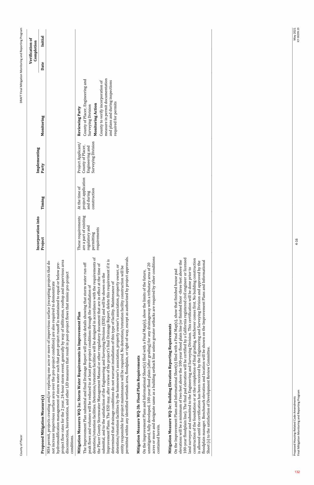
Co
un
ty o
f P
lace
r D
RA
FT F
inal
Mit
igat
ion
Mo
nit
ori
ng
and
Rep
ort
ing
Pro
gram
Pro
po
sed
Ho
usi
ng-
Rel
ated
Co
de
Am
end
men
ts
Fin
al M
itig
atio
n M
on
ito
rin
g an
d R
epo
rtin
g P
rogr
am
4-1
6
May
20
21
IC
F 0
02
99
.19
Pro
po
sed
Mit
iga
tio
n M
ea
sure
(s)
Inco
rpo
rati
on
in
to
Pro
ject
T
imin
g
Imp
lem
en
tin
g
Pa
rty
M
on
ito
rin
g
Ve
rifi
cati
on
of
Co
mp
leti
on
Da
te
Init
ial
MS4
per
mit
, pro
ject
s cr
eati
ng
and
/or
rep
laci
ng
on
e ac
re o
r m
ore
of
imp
erv
iou
s su
rfac
e (e
xcep
tin
g p
roje
cts
that
do
n
ot
incr
ease
imp
erv
iou
s su
rfac
e ar
ea o
ver
th
e p
re-p
roje
ct c
on
dit
ion
) ar
e al
so r
equ
ired
to
dem
on
stra
te
hy
dro
mo
dif
icat
ion
man
agem
ent
of
sto
rm w
ater
su
ch t
hat
po
st-p
roje
ct r
un
off
is
mai
nta
ined
to
eq
ual
or
bel
ow
pre
-p
roje
ct f
low
rat
es f
or
the
2 y
ear,
24
-ho
ur
sto
rm e
ven
t, g
ener
ally
by
way
of
infi
ltra
tio
n, r
oo
fto
p a
nd
im
per
vio
us
area
d
isco
nn
ecti
on
, bio
rete
nti
on
, an
d o
ther
LID
mea
sure
s th
at r
esu
lt in
po
st-p
roje
ct f
low
s th
at m
imic
pre
-pro
ject
co
nd
itio
ns.
Mit
iga
tio
n M
ea
sure
s W
Q-3
a: S
torm
Wa
ter
Re
qu
ire
me
nts
in
Im
pro
ve
me
nt
Pla
n
Th
e Im
pro
vem
ent
Pla
n s
ub
mit
tal a
nd
fin
al D
rain
age
Rep
ort
wil
l pro
vid
e d
etai
ls s
ho
win
g th
at s
torm
wat
er r
un
-off
p
eak
flo
ws
and
vo
lum
es w
ill b
e re
du
ced
to
at
leas
t p
re-p
roje
ct c
on
dit
ion
s th
rou
gh t
he
inst
alla
tio
n o
f d
eten
tio
n/r
eten
tio
n f
acil
itie
s. D
eten
tio
n/r
eten
tio
n f
acil
itie
s w
ill b
e d
esig
ned
in a
cco
rdan
ce w
ith
th
e re
qu
irem
ents
of
the
Pla
cer
Co
un
ty S
torm
wat
er M
anag
emen
t M
anu
al o
r o
ther
reg
ula
tory
do
cum
ent
that
are
in e
ffec
t at
th
e ti
me
of
sub
mit
tal,
and
to
th
e sa
tisf
acti
on
of
the
En
gin
eeri
ng
and
Su
rvey
ing
Div
isio
n (
ESD
) an
d w
ill b
e sh
ow
n o
n t
he
Imp
rove
men
t P
lan
s. T
he
ESD
may
, aft
er r
evie
w o
f th
e p
roje
ct’s
fin
al D
rain
age
Rep
ort
, del
ete
this
req
uir
emen
t if
it is
d
eter
min
ed t
hat
dra
inag
e co
nd
itio
ns
do
no
t w
arra
nt
inst
alla
tio
n o
f th
is t
yp
e o
f fa
cili
ty. M
ain
ten
ance
of
det
enti
on
/ret
enti
on
fac
ilit
ies
by
th
e h
om
eow
ner
’s a
sso
ciat
ion
, pro
per
ty o
wn
er’s
ass
oci
atio
n, p
rop
erty
ow
ner
, or
enti
ty r
esp
on
sib
le f
or
pro
ject
mai
nte
nan
ce w
ill b
e re
qu
ired
. No
det
enti
on
/ret
enti
on
fac
ilit
y c
on
stru
ctio
n w
ill b
e p
erm
itte
d w
ith
in a
ny
iden
tifi
ed w
etla
nd
s ar
ea, f
loo
dp
lain
, or
righ
t-o
f-w
ay, e
xcep
t as
au
tho
rize
d b
y p
roje
ct a
pp
rov
als.
Mit
iga
tio
n M
ea
sure
WQ
-3b
: Flo
od
Pla
in R
eq
uir
em
en
ts
On
th
e Im
pro
vem
ent
Pla
ns
and
In
form
atio
nal
Sh
eet(
s) f
iled
wit
h a
Fin
al M
ap(s
), s
ho
w t
he
lim
its
of
the
futu
re,
un
mit
igat
ed, f
ull
y d
evel
op
ed, 1
00
-yea
r fl
oo
d p
lain
(af
ter
grad
ing)
fo
r an
y d
rain
agew
ay w
ith
a t
rib
uta
ry a
rea
of
20
ac
res
or
mo
re a
nd
des
ign
ate
sam
e as
a b
uil
din
g se
tbac
k li
ne
un
less
gre
ater
set
bac
ks
are
req
uir
ed b
y o
ther
co
nd
itio
ns
con
tain
ed h
erei
n.
Mit
iga
tio
n M
ea
sure
WQ
-3c:
Bu
ild
ing
Ele
va
tio
n R
ep
ort
ing
Re
qu
ire
me
nts
On
th
e Im
pro
vem
ent
Pla
ns
and
In
form
atio
nal
Sh
eet(
s) f
iled
wit
h a
Fin
al M
ap(s
), s
ho
w t
hat
fin
ish
ed h
ou
se p
ad
elev
atio
ns
wil
l be
a m
inim
um
of
two
fee
t ab
ove
th
e 1
00
-yea
r fl
oo
d p
lain
lin
e (o
r fi
nis
hed
flo
or
-th
ree
feet
ab
ov
e th
e 1
00
-yea
r fl
oo
dp
lain
lin
e). T
he
fin
al p
ad e
lev
atio
n w
ill b
e ce
rtif
ied
by
a C
alif
orn
ia r
egis
tere
d c
ivil
en
gin
eer
or
lice
nse
d
lan
d s
urv
eyo
r an
d s
ub
mit
ted
to
th
e E
ngi
nee
rin
g an
d S
urv
eyin
g D
ivis
ion
. Th
is c
erti
fica
tio
n w
ill b
e d
on
e p
rio
r to
co
nst
ruct
ion
of
the
fou
nd
atio
n o
r at
th
e co
mp
leti
on
of
fin
al g
rad
ing,
wh
ich
ever
co
mes
fir
st. N
o b
uil
din
g co
nst
ruct
ion
is
all
ow
ed u
nti
l th
e ce
rtif
icat
ion
has
bee
n r
ecei
ved
by
th
e E
ngi
nee
rin
g an
d S
urv
eyin
g D
ivis
ion
an
d a
pp
rove
d b
y th
e fl
oo
dp
lain
man
ager
. Ben
chm
ark
ele
vati
on
an
d lo
cati
on
wil
l be
sho
wn
on
th
e Im
pro
vem
ent
Pla
ns
and
In
form
atio
nal
Sh
eet
(s)
to t
he
sati
sfac
tio
n o
f D
evel
op
men
t R
evie
w C
om
mit
tee.
Th
ese
req
uir
emen
ts
are
a p
art
of
exis
tin
g re
gula
tory
an
d
per
mit
tin
g re
qu
irem
ents
At
the
tim
e o
f p
roje
ct a
pp
lica
tio
n
and
du
rin
g co
nst
ruct
ion
Pro
ject
Ap
pli
can
t/
Co
un
ty o
f P
lace
r,
En
gin
eeri
ng
and
Su
rvey
ing
Div
isio
n
Re
vie
win
g P
art
y
Co
un
ty o
f P
lace
r, E
ngi
nee
rin
g an
d
Surv
eyin
g D
ivis
ion
Mo
nit
ori
ng
Act
ion
Co
un
ty t
o v
erif
y in
corp
ora
tio
n o
f m
easu
re in
per
mit
do
cum
enta
tio
n
and
pla
ns
and
du
rin
g in
spec
tio
ns
req
uir
ed f
or
per
mit
s
132
Page 1 of 8
Before the Board of Supervisors County of Placer, State of California
Resolution No.: ____________
The following Resolution was duly passed by the Board of Supervisors of the County of Placer at
a regular meeting held on ____________________________, by the following vote:
Ayes:
Noes:
Absent:
Signed and approved by me after its passage.
_______________________________ Chair, Board of Supervisors
Attest:
_______________________ Clerk of said Board
WHEREAS, the proposed Housing-Related Code Amendments includes amendments to the Placer County General Plan (“General Plan”) Land Use Element Table 1-2 (“Development Standards By Land Use Designation”) increasing the Maximum Nonresidential Floor Area Ratio (FAR) for the High Density Residential (HDR) land use designation from 1.05 to 2.0; and
WHEREAS, the proposed Housing-Related Code Amendments includes amendments to the General Plan Land Use Element Table 1-3 (“General Plan Land Use Designations and Consistent Zoning Districts”) to add General Commercial (C2), Commercial Planned Development (CPD), and Mixed Use Community (MU) as Consistent Zone Districts for the High Density Residential
In the matter of: A RESOLUTION AMENDING THE PLACER COUNTY GENERAL PLAN INTRODUCTION CHAPTER AND PART 1: LAND USE AND CIRCULATION CHAPTER AS IT RELATES TO HOUSING-RELATED CODE AMENDMENTS (PLN18-00320)
Attachment B
133
Page 2 of 8
(HDR) land use designation; and add Residential Multifamily (RM) zoning to the General Commercial (GC) land use designation; and WHEREAS, the Housing-Related Code Amendments work program involved a robust public outreach program that included multiple public meetings and workshops and on-going meetings with key stakeholders and community organizations, and various Placer County Municipal Advisory Councils; and WHEREAS, notice of a public hearing was given in compliance with Placer County Code Chapter 17 (Zoning), Article 17.60 (Zoning Administration), Section 17.60.140 (Public hearings), and on July 22, 2021, the Placer County Planning Commission (“Planning Commission”) held a duly noticed public hearing to consider the proposed Housing-Related Code Amendments project, and pursuant to Placer County Code Chapter 17, Article 17.60, Section 17.60.090(C) (Chapter or plan amendments and rezonings – Planning Commission Recommendation), and the Planning Commission has made recommendations to the Placer County Board of Supervisors (“Board”) related thereto; and WHEREAS, notice of a public hearing was given in compliance with Placer County Code Chapter 17, Article 17.60, Section 17.60.140, and on __________, 2021, the Board held a duly noticed public hearing pursuant to Placer County Code Chapter 17, Article 17.60, Section 17.60.090(D) (Chapter or plan amendments and rezonings – Board of Supervisors Hearing and Decision) to consider the recommendations of the Planning Commission and to receive public input regarding the proposed Housing-Related Code Amendments; and WHEREAS, the Board has reviewed the proposed Housing-Related Code Amendments, considered the recommendations of the Planning Commission, received and considered the written and oral comments submitted by the public thereon, and has adopted Resolution No. __-____ certifying the Final Environmental Impact Report for the “Housing-Related Code Amendments – County of Placer (SCH#2019080460)”; and WHEREAS, the Board finds the proposed amendments will facilitate and accelerate housing development by allowing for more variation of development in areas where infrastructure and development already exists; and WHEREAS, the Board further finds that the proposed amendments are consistent with the applicable requirements of State law, and are in compliance with the provisions of the General Plan, including but not limited to the following: Policy 1.A.4. The County shall promote patterns of development that facilitate the efficient
and timely provision of urban infrastructure and services. Policy 1.B.1. The County shall promote the concentration of new residential development
in higher density residential areas located along major transportation corridors and transit routes.
Policy 1.B.2. The County shall encourage the concentration of multi-family housing in and near downtowns, village centers, major commercial areas, and neighborhood commercial centers.
Policy 1.M.1: The County shall concentrate most new growth within existing communities emphasizing infill development, intensified use of existing development, and expanded services, so individual communities become more complete, diverse, and balanced.
134
Page 3 of 8
Policy HE-A-2: Streamline Development. The County shall continue efforts to streamline and improve the development review process based on objective design standards, and to eliminate any unnecessary delays in the processing of development applications.
Policy HE-A-3: Remove Barriers. The County shall strive to remove barriers to new housing production including advancing adaptive policies, regulations, and procedures, as well as addressing market constraints as admissible.
Policy HE-A-4: Encourage Innovative Design and Variety of Housing. The County shall encourage innovative subdivision design and a range of housing types within larger‐scale development projects to encourage mixed‐income communities (e.g., single‐family detached homes, accessory dwelling units, duplexes/triplexes, live‐work units, multifamily housing).
Policy HE-A-5: Infill Development. The County shall promote and maintain balanced growth by encouraging compatible residential development on infill sites within established communities where urban services are in place.
Policy HE-A-6: Facilitate Multifamily Development. The County shall facilitate the development of higher‐density multifamily development in locations where adequate infrastructure and public services are available by permitting residential uses in commercial zones, allowing flexible development standards, and providing other incentives.
Policy HE-B-1: Workforce Housing. The County shall facilitate expanded housing opportunities that are affordable to the workforce of Placer County.
Policy HE-B-19: Meet State Density Bonus Requirements. The County shall meet the state requirements for density bonus incentives in order to facilitate the development of new affordable housing.
Policy HE-C-1: Innovative Housing and Construction Technologies. The County shall promote innovative housing types, including tiny homes, co‐op housing, cohousing, and shared/boarding housing, and encourage alternative materials and construction techniques to reduce costs (e.g., modular, shipping containers, insulated concrete forms, and 3‐D printing technology).
Policy HE-C-4: Missing Middle Housing. The County shall encourage missing middle housing types, such as duplexes, triplexes, fourplexes, courtyard buildings, bungalow courts, cottage housing, townhouses, multiplexes, and live/work buildings to provide middle‐class and workforce housing compatible with single‐family neighborhoods; and
WHEREAS, the Board finds the proposed Housing-Related Code Amendments will serve to protect and enhance the health, safety, and general welfare of the communities within Placer County; and WHEREAS, notice of all hearings required has been given and all hearings have been held as required by County ordinance and State law. NOW, THEREFORE, BE IT RESOLVED BY THE BOARD OF SUPERVISORS OF THE COUNTY OF PLACER that the amendments to the Placer County General Plan Introduction Chapter and Part 1: Land Use and Circulation Chapter as it relates to Housing-Related Code Amendments, as set forth in Exhibits 1 through 3 attached hereto and incorporated herein by reference, are hereby adopted.
135
Page 4 of 8
BE IT FURTHER RESOLVED that this Resolution shall take force and become effective upon the effective date of the ordinance amending Placer County Chapter 17 pertaining to Housing-Related Code Amendments. Exhibit 1 – Amendments to General Plan: Introduction Chapter Exhibit 2 – Amendments to Table 1-2: Development Standards By Land Use Designation Exhibit 3 – Amendments to Table 1-3: General Plan Land Use Designations and Consistent
Zoning Districts
136
Page 5 of 8
EXHIBIT 1
Amendments to General Plan: Introduction Chapter
COUNTYWIDE GENERAL PLAN UPDATE PROCESS
DESIGN GUIDELINES • Design Guidelines Manual, Revised May 21, 1996.• Landscape Design Guidelines, Revised September 1994. New document currently in
draft form.• North Auburn Design Guidelines Modification, September 24, 2003.• North Tahoe Design Guidelines (appendix document to the Community Plans).• Rural Design Guidelines, July 8, 1997.• Multifamily and Mixed Use Design Manual, June 2021.
Attachment BExhibit 1
137

138
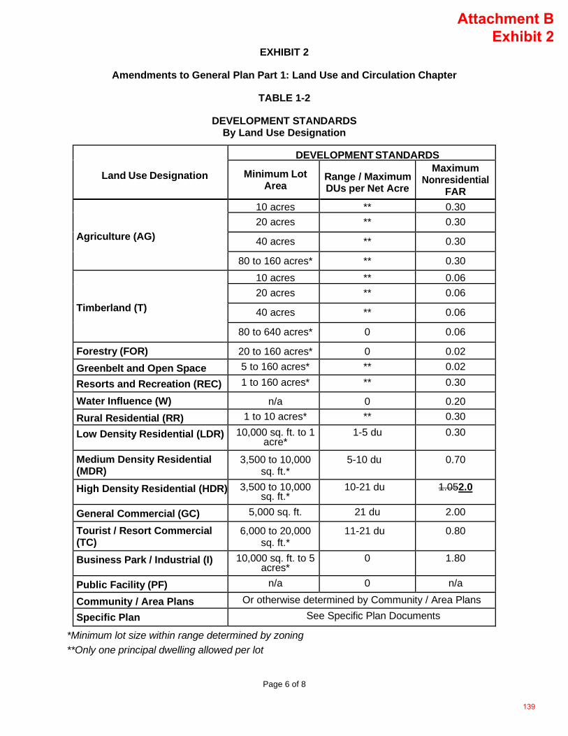
Page 6 of 8
EXHIBIT 2
Amendments to General Plan Part 1: Land Use and Circulation Chapter
TABLE 1-2
DEVELOPMENT STANDARDS By Land Use Designation
Land Use Designation
DEVELOPMENT STANDARDS
Minimum Lot Area
Range / Maximum DUs per Net Acre
Maximum Nonresidential
FAR
Agriculture (AG)
10 acres ** 0.30 20 acres ** 0.30
40 acres ** 0.30
80 to 160 acres* ** 0.30
Timberland (T)
10 acres ** 0.06 20 acres ** 0.06
40 acres ** 0.06
80 to 640 acres* 0 0.06
Forestry (FOR) 20 to 160 acres* 0 0.02 Greenbelt and Open Space
5 to 160 acres* ** 0.02
Resorts and Recreation (REC) 1 to 160 acres* ** 0.30
Water Influence (W) n/a 0 0.20 Rural Residential (RR) 1 to 10 acres* ** 0.30
Low Density Residential (LDR) 10,000 sq. ft. to 1 acre*
1-5 du 0.30
Medium Density Residential (MDR)
3,500 to 10,000 sq. ft.*
5-10 du 0.70
High Density Residential (HDR) 3,500 to 10,000 sq. ft.*
10-21 du 1.052.0
General Commercial (GC) 5,000 sq. ft. 21 du 2.00
Tourist / Resort Commercial (TC)
6,000 to 20,000 sq. ft.*
11-21 du 0.80
Business Park / Industrial (I) 10,000 sq. ft. to 5 acres*
0 1.80
Public Facility (PF) n/a 0 n/a
Community / Area Plans Or otherwise determined by Community / Area Plans
Specific Plan See Specific Plan Documents
*Minimum lot size within range determined by zoning**Only one principal dwelling allowed per lot
Attachment BExhibit 2
139

140
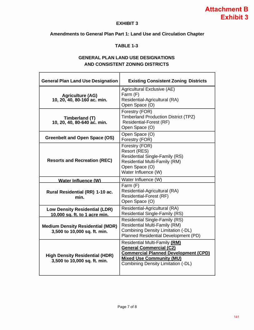
Page 7 of 8
EXHIBIT 3
Amendments to General Plan Part 1: Land Use and Circulation Chapter
TABLE 1-3
GENERAL PLAN LAND USE DESIGNATIONS AND CONSISTENT ZONING DISTRICTS
General Plan Land Use Designation Existing Consistent Zoning Districts
Agriculture (AG) 10, 20, 40, 80-160 ac. min.
Agricultural Exclusive (AE) Farm (F) Residential-Agricultural (RA) Open Space (O)
Timberland (T) 10, 20, 40, 80-640 ac. min.
Forestry (FOR) Timberland Production District (TPZ) Residential-Forest (RF) Open Space (O)
Greenbelt and Open Space (OS) Open Space (O) Forestry (FOR)
Resorts and Recreation (REC)
Forestry (FOR) Resort (RES) Residential Single-Family (RS) Residential Multi-Family (RM) Open Space (O) Water Influence (W)
Water Influence (W) Water Influence (W)
Rural Residential (RR) 1-10 ac. min.
Farm (F) Residential-Agricultural (RA) Residential-Forest (RF) Open Space (O)
Low Density Residential (LDR) 10,000 sq. ft. to 1 acre min.
Residential-Agricultural (RA) Residential Single-Family (RS)
Medium Density Residential (MDR) 3,500 to 10,000 sq. ft. min.
Residential Single-Family (RS) Residential Multi-Family (RM) Combining Density Limitation (-DL) Planned Residential Development (PD)
High Density Residential (HDR) 3,500 to 10,000 sq. ft. min.
Residential Multi-Family (RM) General Commercial (C2) Commercial Planned Development (CPD) Mixed Use Community (MU) Combining Density Limitation (-DL)
Attachment BExhibit 3
141
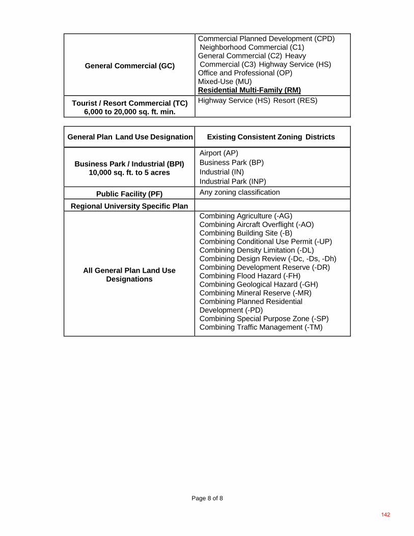
Page 8 of 8
General Commercial (GC)
Commercial Planned Development (CPD) Neighborhood Commercial (C1) General Commercial (C2) Heavy Commercial (C3) Highway Service (HS) Office and Professional (OP) Mixed-Use (MU) Residential Multi-Family (RM)
Tourist / Resort Commercial (TC) 6,000 to 20,000 sq. ft. min.
Highway Service (HS) Resort (RES)
General Plan Land Use Designation Existing Consistent Zoning Districts
Business Park / Industrial (BPI) 10,000 sq. ft. to 5 acres
Airport (AP) Business Park (BP) Industrial (IN) Industrial Park (INP)
Public Facility (PF) Any zoning classification
Regional University Specific Plan
All General Plan Land Use Designations
Combining Agriculture (-AG) Combining Aircraft Overflight (-AO) Combining Building Site (-B) Combining Conditional Use Permit (-UP) Combining Density Limitation (-DL) Combining Design Review (-Dc, -Ds, -Dh) Combining Development Reserve (-DR) Combining Flood Hazard (-FH) Combining Geological Hazard (-GH) Combining Mineral Reserve (-MR) Combining Planned Residential Development (-PD) Combining Special Purpose Zone (-SP) Combining Traffic Management (-TM)
142
Page 1 of 71
Before the Board of Supervisors County of Placer, State of California
Ordinance No.: ____________ Introduced: _______________
The following Ordinance was duly passed by the Board of Supervisors of the County of Placer at
a regular meeting held on ______________, by the following vote:
Ayes:
Noes:
Absent:
Signed and approved by me after its passage.
_______________________________ Chair, Board of Supervisors
Attest:
_______________________ Clerk of said Board
THE BOARD OF SUPERVISORS OF THE COUNTY OF PLACER, STATE OF CALIFORNIA, DOES HEREBY ORDAIN AS FOLLOWS:
WHEREAS, the proposed Housing-Related Code Amendments includes Zoning Text Amendments to Placer County Code Chapter 17 (“Zoning Ordinance” or “Zoning Code”) and is intended to increase the availability and mix of housing types; bring County housing policies
In the matter of: AN ORDINANCE AMENDING CHAPTER 17, ARTICLES 17.04, 17.06, 17.08, 17.10, 17.20, 17.22, 17.26, 17.27, 17.30, 17.32, 17.34, 17.38, 17.44, 17.46, 17.48, 17.50, 17.52, 17.54, AND 17.56 PERTAINING TO THE HOUSING-RELATED CODE AMENDMENTS (PLN18-00320), INCLUDING A MIXED USE COMMUNITY ZONE AND LAND USE TYPE, DENSITY BONUS, CLUSTER LOT DEVELOPMENT, AND MOVEABLE TINY HOUSE REGULATION.
Attachment C
143
Page 2 of 71
consistent with State housing law; implement adopted General Plan policies that support housing development through higher density, mixed use, transit oriented and infill development projects; reduce Vehicle Miles Traveled (VMT) and implement the Board of Supervisors’ adopted Strategic Plan which supports new housing construction for people of all income ranges through for existing and future residents; and
WHEREAS, the Housing-Related Code Amendments’ work program involved a robust public outreach program that included multiple public meetings and workshops and on-going meetings with key stakeholders and community organizations, and various Placer County Municipal Advisory Councils; and
WHEREAS, in accordance with Placer County Code Chapter 17, Article 17.60, Section 17.60.090, on February 25, 2021, notice of the proposed zoning text amendments associated with the Housing-Related Code Amendments was provided to the County’s Municipal Advisory Councils; and
WHEREAS, on October 7, 2021, the Placer County Planning Commission (“Planning Commission”) held a noticed public hearing pursuant to Placer County Code Chapter 17, Article 17.60, Section 17.60.140 to consider the Housing-Related Code Amendments, including the zoning text amendments; and pursuant to Placer County Code Chapter 17, Article 17.60, Section 17.60.090(C), the Planning Commission has made recommendations to the Board of Supervisors (“Board”) related thereto; and
WHEREAS, notice of a public hearing was given in compliance with Placer County Code Chapter 17, Article 17.60, Section 17.60.140, and on ____________, 2021, the Board held the duly noticed public hearing pursuant to Placer County Code Chapter 17, Article 17.60, Section 17.60.090(D) to consider the recommendations of the Planning Commission and to receive public input regarding the proposed Housing-Related Code Amendments, including the proposed zoning text amendments; and
WHEREAS, the purpose of these amendments is to facilitate housing development by allowing for more variation of development in areas where infrastructure and development already exists and capacity to accommodate further residential development. The proposed Housing-Related Code Amendments support implementation of existing General Plan and community plan policies that address the lack of available housing and supports the County’s efforts to have higher-density, mixed-use, transit-oriented and infill development, and are consistent State housing regulations; and
WHEREAS, the Board has reviewed the proposed Housing-Related Code Amendments, considered the recommendations of the Planning Commission, received and considered the written and oral comments submitted by the public thereon, and has adopted Resolution No. ___-_____ certifying the Final Environmental Impact Report for the “Housing-Related Code Amendments” and adopted Resolution No. 2021-________ to approve the Housing-Related Code Amendments; and
WHEREAS, the public hearing to consider adoption of this ordinance was noticed in compliance with State law and County Code.
144
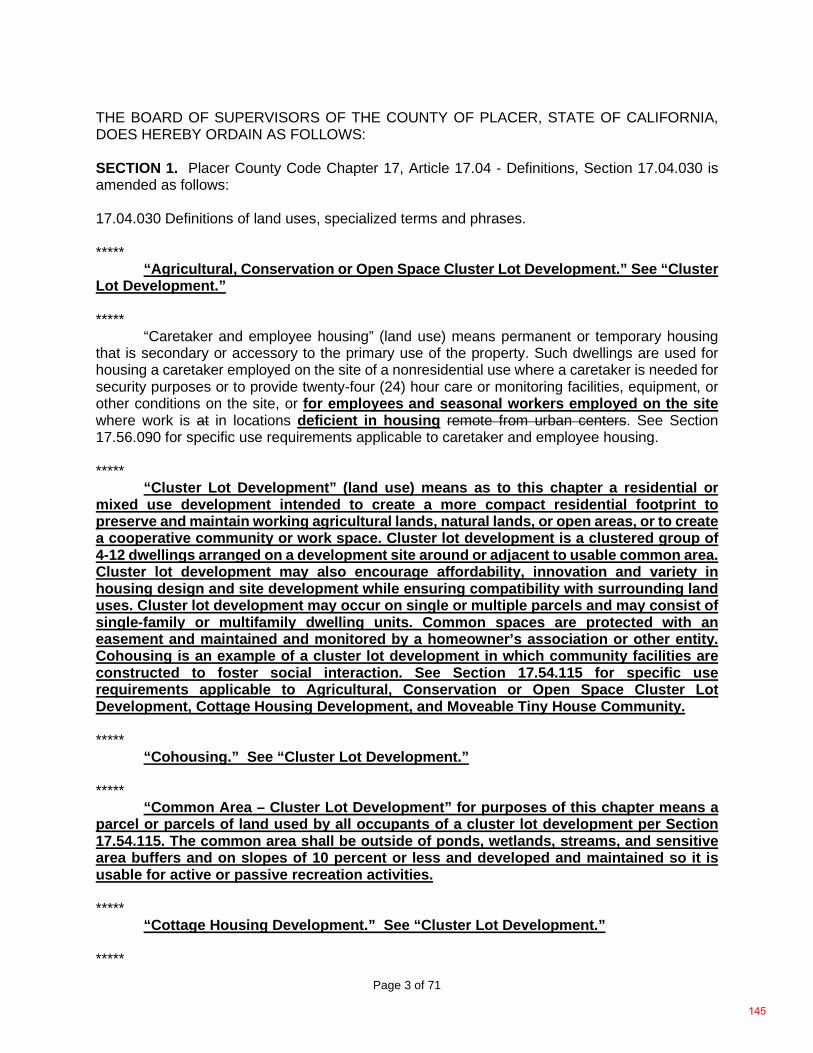
Page 3 of 71
THE BOARD OF SUPERVISORS OF THE COUNTY OF PLACER, STATE OF CALIFORNIA, DOES HEREBY ORDAIN AS FOLLOWS:
SECTION 1. Placer County Code Chapter 17, Article 17.04 - Definitions, Section 17.04.030 is amended as follows:
17.04.030 Definitions of land uses, specialized terms and phrases.
***** “Agricultural, Conservation or Open Space Cluster Lot Development.” See “Cluster
Lot Development.”
***** “Caretaker and employee housing” (land use) means permanent or temporary housing
that is secondary or accessory to the primary use of the property. Such dwellings are used for housing a caretaker employed on the site of a nonresidential use where a caretaker is needed for security purposes or to provide twenty-four (24) hour care or monitoring facilities, equipment, or other conditions on the site, or for employees and seasonal workers employed on the site where work is at in locations deficient in housing remote from urban centers. See Section 17.56.090 for specific use requirements applicable to caretaker and employee housing.
***** “Cluster Lot Development” (land use) means as to this chapter a residential or
mixed use development intended to create a more compact residential footprint to preserve and maintain working agricultural lands, natural lands, or open areas, or to create a cooperative community or work space. Cluster lot development is a clustered group of 4-12 dwellings arranged on a development site around or adjacent to usable common area. Cluster lot development may also encourage affordability, innovation and variety in housing design and site development while ensuring compatibility with surrounding land uses. Cluster lot development may occur on single or multiple parcels and may consist of single-family or multifamily dwelling units. Common spaces are protected with an easement and maintained and monitored by a homeowner’s association or other entity. Cohousing is an example of a cluster lot development in which community facilities are constructed to foster social interaction. See Section 17.54.115 for specific use requirements applicable to Agricultural, Conservation or Open Space Cluster Lot Development, Cottage Housing Development, and Moveable Tiny House Community.
***** “Cohousing.” See “Cluster Lot Development.”
***** “Common Area – Cluster Lot Development” for purposes of this chapter means a
parcel or parcels of land used by all occupants of a cluster lot development per Section 17.54.115. The common area shall be outside of ponds, wetlands, streams, and sensitive area buffers and on slopes of 10 percent or less and developed and maintained so it is usable for active or passive recreation activities.
***** “Cottage Housing Development.” See “Cluster Lot Development.”
*****
145

Page 4 of 71
Fourplex. See “Multifamily dwellings.” *****
“Infill site” means a site in an urbanized area as defined by California Public Resource Code Sections 21061.3, 21071 and 21072. *****
“Live/work unit” or “live/work space” means a building or spaces within a building (e.g., studio, or one bedroom) used jointly for commercial and residential purposes where the residential use of the space is secondary or accessory to the primary use as a place of work. A live/work unit: (a) combines a commercial activity allowed in the zone with a residential living space for the owner of the commercial business, or the owner’s employee, and that person’s household; (b) where the resident owner or employee of the business is responsible for the commercial activity performed; and (c) where the commercial activity conducted takes place subject to a valid business license associated with the premises. Live/work units are an allowed use within the Town Center commercial (-TC) combining district.
***** “Mixed use development” (land use) means a development that allows for the combination of residential, commercial, office and/or recreational land uses. The uses are physically and functionally integrated and provide pedestrian connections. The form of mixed use can encompass a single building, or neighborhood. Mixed use development may be horizontal or vertical in design (see Section 17.56.135). ***** “Moveable Tiny House” or “Moveable Tiny Houses” means a separate, independent living quarters that is no larger than 400 square feet; includes basic functional areas that support normal daily routines, including a bathroom, a kitchen, and a sleeping area; is mounted on a wheeled trailer chassis; is designed and built to look like a conventional residential structure, using conventional building materials, and is thus architecturally distinct from traditional mobile homes and recreational vehicles; and is titled and registered to tow legally under the California Department of Motor Vehicles” (See Section 17.56.400 for specific use requirements applicable to moveable tiny houses). *****
“Moveable Tiny House Community.” See “Cluster Lot Development.” ***** “Multifamily dwellings” (land use) mean and include: (1) a building or a portion of a building used and/or designed as residences for two or more families living independently of each other; or (2) two or more detached single-family dwellings on a single lot where all of the single-family dwellings and the lot are under common ownership, provided that one of the units is not an accessory or junior accessory dwelling unit. Includes halfplex structures (a halfplex is a single dwelling unit that is half of a two-unit building where a property line separates the two units), duplexes, triplexes, and fourplexes (detached buildings under one ownership with two, three or four dwelling units (respectively) in the same building) and apartments (five or more units under one ownership in a single building); common ownership, attached unit projects such as condominiums and townhouses; studio and efficiency apartments; cottage housing development; cohousing; and boarding and rooming houses (see “Boarding and rooming house”). Multifamily dwellings can provide a compatible transition between lower-density residential neighborhoods and high-density urban centers.
146
Page 5 of 71
***** “Seasonal Worker Housing.” See “Caretaker and employee housing.” ***** “Single-family dwelling” (land use) means a building designed for and/or occupied exclusively by one family. Also includes factory-built housing (modular housing), manufactured housing (mobile homes), moveable tiny houses, and the rental of bedrooms within a single-family dwelling to no more than four boarders. More than four boarders constitutes a boarding house, which is included within the definition of “Multifamily dwelling.” See Section 17.56.230 for specific use requirements applicable to single-family dwellings. *****
“Town center” means an area where residential, commercial, employment and civic uses are all present and integrated. Housing can include multifamily dwellings or live/work units or live/work spaces. ***** “Triplex.” See “Multifamily dwellings.”
147
Page 6 of 71
***** SECTION 2. Placer County Code Chapter 17, Article 17.06 – Zoning Districts Established, Section 17.06.050 is hereby amended as follows: 17.06.050 Land use and permit tables. ***** B. Type of Permit Required. When the tables in subsection (D) of this section and the zone and combining district requirements of Sections 17.06.060 et seq., show a particular land use as being allowable in a zone, the use is identified as being subject to one of the following land use permit requirements. 1. Zoning Compliance. These uses are allowed without land use permit approval subject to compliance with all applicable provisions of this chapter (“A” uses on the tables). No land use permit is required for “A” uses because they typically involve no or minimal construction activities, are accessory to some other land use that will be the primary use of a site (which will require a land use permit), or are otherwise entirely consistent with the purposes of the particular zone. 2. Zoning Clearance. These uses are allowable subject to zoning clearance (“C” uses on the tables) (see Section 17.06.040). Zoning clearance is a routine land use approval that involves planning department staff checking a proposed development to ensure that all applicable zoning requirements will be satisfied (e.g., setbacks, height limits, parking requirements, etc.). Zoning clearance is required by this ordinance for land uses that are consistent with the basic purposes of the particular zone (e.g., houses in residential zones), and are un-likely to create any problems that will not be adequately handled by the development standards of Article 17.54 of this ordinance (General Development Standards) and this subchapter. 3. Administrative Review Permit (ARP). These uses are allowable subject to approval of an administrative review permit (see Section 17.58.100). Administrative review permit approval is required for certain land uses that are generally consistent with the purposes of the zone, but could create minor problems for adjoining properties if they are not designed with sensitivity to surrounding land uses. The purposes of an administrative review permit are to allow planning division department staff and the zoning administrator to evaluate a proposed use to ensure that all applicable zoning requirements will be satisfied (e.g., setbacks, height limits, parking requirements, etc.) to determine if problems may occur, to work with the project applicant to adjust the project through conditions of approval to solve any potential problems that are identified, or to disapprove a project if identified problems cannot be acceptably corrected. ***** D. Tables. The following tables, and the lists of allowable uses in Sections 17.06.060 et seq., contain the same requirements for allowable uses and land use permit requirements. The tables in this section are for convenience, to simultaneously show all zone districts, the uses allowed within them, and the permit requirements applicable to each use.
148
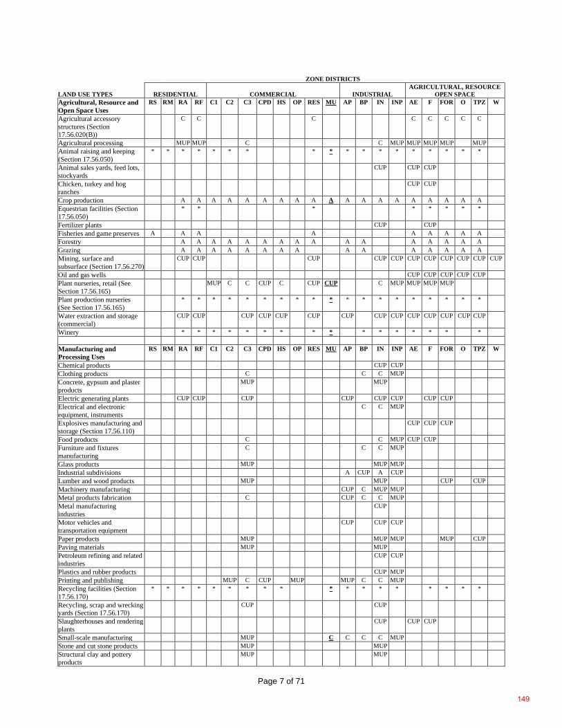
Page 7 of 71
ZONE DISTRICTS
LAND USE TYPES RESIDENTIAL COMMERCIAL INDUSTRIAL AGRICULTURAL, RESOURCE
OPEN SPACE Agricultural, Resource and Open Space Uses
RS RM RA RF C1 C2 C3 CPD HS OP RES MU AP BP IN INP AE F FOR O TPZ W
Agricultural accessory structures (Section 17.56.020(B))
C C C C C C C C
Agricultural processing MUP MUP C C MUP MUP MUP MUP MUP Animal raising and keeping (Section 17.56.050)
* * * * * * * * * * * * * * * * * *
Animal sales yards, feed lots, stockyards
CUP CUP CUP
Chicken, turkey and hog ranches
CUP CUP
Crop production A A A A A A A A A A A A A A A A A A A Equestrian facilities (Section 17.56.050)
* * * * * * * *
Fertilizer plants CUP CUP Fisheries and game preserves A A A A A A A A A Forestry A A A A A A A A A A A A A A A A Grazing A A A A A A A A A A A A A A A Mining, surface and subsurface (Section 17.56.270)
CUP CUP CUP CUP CUP CUP CUP CUP CUP CUP CUP
Oil and gas wells CUP CUP CUP CUP CUP Plant nurseries, retail (See Section 17.56.165)
MUP C C CUP C CUP CUP C MUP MUP MUP MUP
Plant production nurseries (See Section 17.56.165)
* * * * * * * * * * * * * * * * * * *
Water extraction and storage (commercial)
CUP CUP CUP CUP CUP CUP CUP CUP CUP CUP CUP CUP CUP CUP
Winery * * * * * * * * * * * * * * * * Manufacturing and Processing Uses
RS RM RA RF C1 C2 C3 CPD HS OP RES MU AP BP IN INP AE F FOR O TPZ W
Chemical products CUP CUP Clothing products C C C MUP Concrete, gypsum and plaster products
MUP MUP
Electric generating plants CUP CUP CUP CUP CUP CUP CUP CUP Electrical and electronic equipment, instruments
C C MUP
Explosives manufacturing and storage (Section 17.56.110)
CUP CUP CUP
Food products C C MUP CUP CUP Furniture and fixtures manufacturing
C C C MUP
Glass products MUP MUP MUP Industrial subdivisions A CUP A CUP Lumber and wood products MUP MUP CUP CUP Machinery manufacturing CUP C MUP MUP Metal products fabrication C CUP C C MUP Metal manufacturing industries
CUP
Motor vehicles and transportation equipment
CUP CUP CUP
Paper products MUP MUP MUP MUP CUP Paving materials MUP MUP Petroleum refining and related industries
CUP CUP
Plastics and rubber products CUP MUP Printing and publishing MUP C CUP MUP MUP C C MUP Recycling facilities (Section 17.56.170)
* * * * * * * * * * * * * * * * * *
Recycling, scrap and wrecking yards (Section 17.56.170)
CUP CUP
Slaughterhouses and rendering plants
CUP CUP CUP
Small-scale manufacturing MUP C C C C MUP Stone and cut stone products MUP MUP Structural clay and pottery products
MUP MUP
149
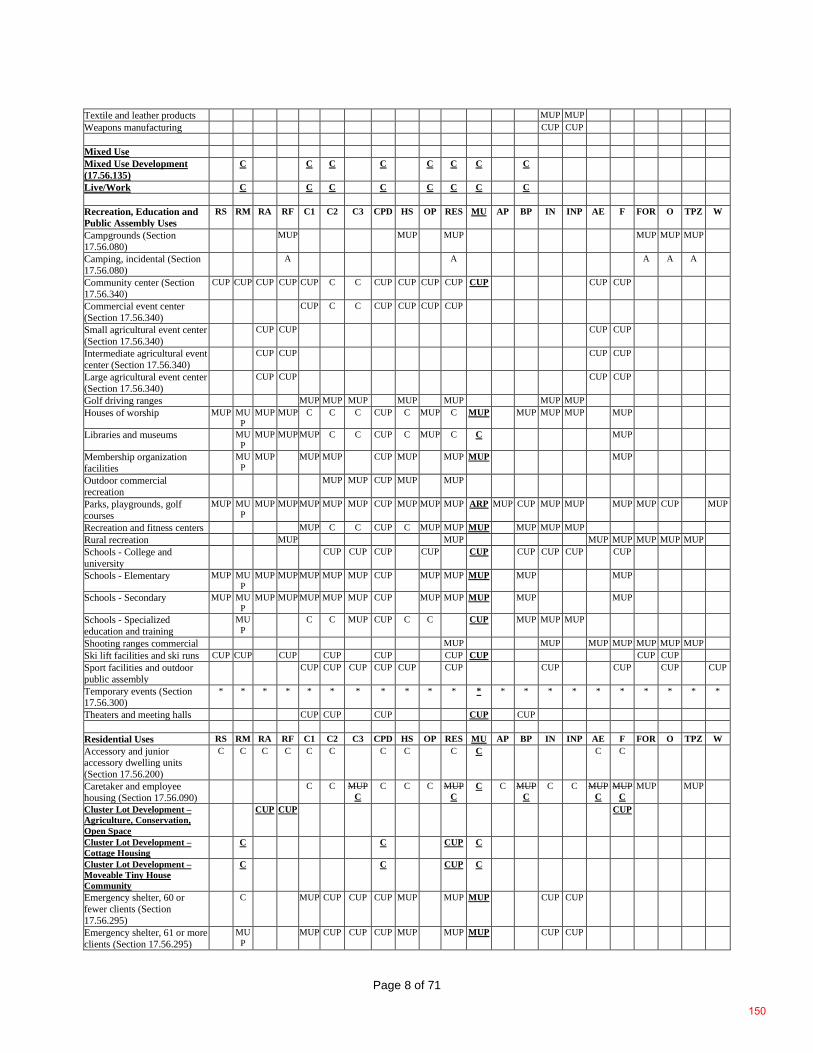
Page 8 of 71
Textile and leather products MUP MUP Weapons manufacturing CUP CUP Mixed Use Mixed Use Development (17.56.135)
C C C C C C C C
Live/Work C C C C C C C C Recreation, Education and Public Assembly Uses
RS RM RA RF C1 C2 C3 CPD HS OP RES MU AP BP IN INP AE F FOR O TPZ W
Campgrounds (Section 17.56.080)
MUP MUP MUP MUP MUP MUP
Camping, incidental (Section 17.56.080)
A A A A A
Community center (Section 17.56.340)
CUP CUP CUP CUP CUP C C CUP CUP CUP CUP CUP CUP CUP
Commercial event center (Section 17.56.340)
CUP C C CUP CUP CUP CUP
Small agricultural event center (Section 17.56.340)
CUP CUP CUP CUP
Intermediate agricultural event center (Section 17.56.340)
CUP CUP CUP CUP
Large agricultural event center (Section 17.56.340)
CUP CUP CUP CUP
Golf driving ranges MUP MUP MUP MUP MUP MUP MUP Houses of worship MUP MU
P MUP MUP C C C CUP C MUP C MUP MUP MUP MUP MUP
Libraries and museums MUP
MUP MUP MUP C C CUP C MUP C C MUP
Membership organization facilities
MUP
MUP MUP MUP CUP MUP MUP MUP MUP
Outdoor commercial recreation
MUP MUP CUP MUP MUP
Parks, playgrounds, golf courses
MUP MUP
MUP MUP MUP MUP MUP CUP MUP MUP MUP ARP MUP CUP MUP MUP MUP MUP CUP MUP
Recreation and fitness centers MUP C C CUP C MUP MUP MUP MUP MUP MUP Rural recreation MUP MUP MUP MUP MUP MUP MUP Schools - College and university
CUP CUP CUP CUP CUP CUP CUP CUP CUP
Schools - Elementary MUP MUP
MUP MUP MUP MUP MUP CUP MUP MUP MUP MUP MUP
Schools - Secondary MUP MUP
MUP MUP MUP MUP MUP CUP MUP MUP MUP MUP MUP
Schools - Specialized education and training
MUP
C C MUP CUP C C CUP MUP MUP MUP
Shooting ranges commercial MUP MUP MUP MUP MUP MUP MUP Ski lift facilities and ski runs CUP CUP CUP CUP CUP CUP CUP CUP CUP Sport facilities and outdoor public assembly
CUP CUP CUP CUP CUP CUP CUP CUP CUP CUP
Temporary events (Section 17.56.300)
* * * * * * * * * * * * * * * * * * * * * *
Theaters and meeting halls CUP CUP CUP CUP CUP Residential Uses RS RM RA RF C1 C2 C3 CPD HS OP RES MU AP BP IN INP AE F FOR O TPZ W Accessory and junior accessory dwelling units (Section 17.56.200)
C C C C C C C C C C C C
Caretaker and employee housing (Section 17.56.090)
C C MUP C
C C C MUP C
C C MUP C
C C MUP C
MUP C
MUP
MUP
Cluster Lot Development – Agriculture, Conservation, Open Space
CUP CUP CUP
Cluster Lot Development – Cottage Housing
C C CUP C
Cluster Lot Development – Moveable Tiny House Community
C C CUP C
Emergency shelter, 60 or fewer clients (Section 17.56.295)
C MUP CUP CUP CUP MUP MUP MUP CUP CUP
Emergency shelter, 61 or more clients (Section 17.56.295)
MUP
MUP CUP CUP CUP MUP MUP MUP CUP CUP
150
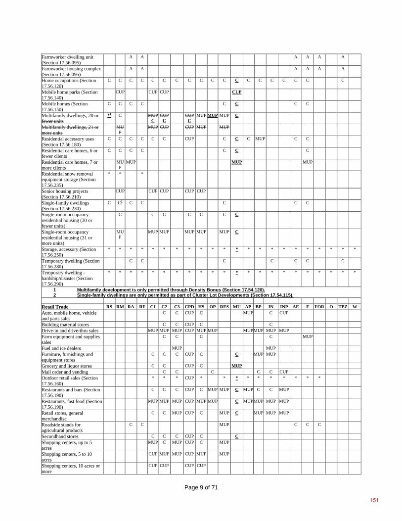
Page 9 of 71
Farmworker dwelling unit (Section 17.56.095)
A A A A A A
Farmworker housing complex (Section 17.56.095)
A A A A A A
Home occupations (Section 17.56.120)
C C C C C C C C C C C C C C C C C C C
Mobile home parks (Section 17.56.140)
CUP CUP CUP CUP
Mobile homes (Section 17.56.150)
C C C C C C C C
Multifamily dwellings, 20 or fewer units
*1 C MUP C
CUP C
CUP C
MUP MUP MUP C
Multifamily dwellings, 21 or more units
MUP
MUP CUP CUP MUP MUP
Residential accessory uses (Section 17.56.180)
C C C C C C CUP C C C MUP C C
Residential care homes, 6 or fewer clients
C C C C C C C
Residential care homes, 7 or more clients
MUP
MUP MUP MUP
Residential snow removal equipment storage (Section 17.56.235)
* * *
Senior housing projects (Section 17.56.210)
CUP CUP CUP CUP CUP
Single-family dwellings (Section 17.56.230)
C C2 C C C C C
Single-room occupancy residential housing (30 or fewer units)
C C C C C C C
Single-room occupancy residential housing (31 or more units)
MUP
MUP MUP MUP MUP MUP C
Storage, accessory (Section 17.56.250)
* * * * * * * * * * * * * * * * * * * * * *
Temporary dwelling (Section 17.56.280)
C C C C C C C
Temporary dwelling - hardship/disaster (Section 17.56.290)
* * * * * * * * * * * * * * * * * * * * * *
1 Multifamily development is only permitted through Density Bonus (Section 17.54.120). 2 Single-family dwellings are only permitted as part of Cluster Lot Developments (Section 17.54.115).
Retail Trade RS RM RA RF C1 C2 C3 CPD HS OP RES MU AP BP IN INP AE F FOR O TPZ W Auto, mobile home, vehicle and parts sales
C C CUP C MUP C CUP
Building material stores C C CUP C C Drive-in and drive-thru sales MUP MUP MUP CUP MUP MUP MUP MUP MUP MUP Farm equipment and supplies sales
C C C C MUP
Fuel and ice dealers MUP MUP Furniture, furnishings and equipment stores
C C C CUP C C MUP MUP
Grocery and liquor stores C C CUP C MUP Mail order and vending C C C C C CUP Outdoor retail sales (Section 17.56.160)
* * * CUP * * * * * * * * * *
Restaurants and bars (Section 17.56.190)
C C C CUP C MUP MUP C MUP C C MUP
Restaurants, fast food (Section 17.56.190)
MUP MUP MUP CUP MUP MUP C MUP MUP MUP MUP
Retail stores, general merchandise
C C MUP CUP C MUP C MUP MUP MUP
Roadside stands for agricultural products
C C MUP C C C
Secondhand stores C C C CUP C C Shopping centers, up to 5 acres
MUP C MUP CUP C MUP
Shopping centers, 5 to 10 acres
CUP MUP MUP CUP MUP MUP
Shopping centers, 10 acres or more
CUP CUP CUP CUP
151
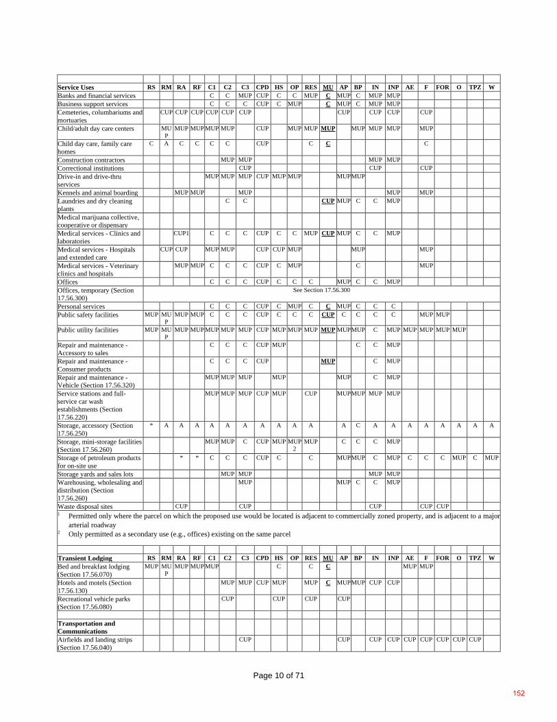
Page 10 of 71
Service Uses RS RM RA RF C1 C2 C3 CPD HS OP RES MU AP BP IN INP AE F FOR O TPZ W Banks and financial services C C MUP CUP C C MUP C MUP C MUP MUP Business support services C C C CUP C MUP C MUP C MUP MUP Cemeteries, columbariums and mortuaries
CUP CUP CUP CUP CUP CUP CUP CUP CUP CUP
Child/adult day care centers MUP
MUP MUP MUP MUP CUP MUP MUP MUP MUP MUP MUP MUP
Child day care, family care homes
C A C C C C CUP C C C
Construction contractors MUP MUP MUP MUP Correctional institutions CUP CUP CUP Drive-in and drive-thru services
MUP MUP MUP CUP MUP MUP MUP MUP
Kennels and animal boarding MUP MUP MUP MUP MUP Laundries and dry cleaning plants
C C CUP MUP C C MUP
Medical marijuana collective, cooperative or dispensary
Medical services - Clinics and laboratories
CUP1 C C C CUP C C MUP CUP MUP C C MUP
Medical services - Hospitals and extended care
CUP CUP MUP MUP CUP CUP MUP MUP MUP
Medical services - Veterinary clinics and hospitals
MUP MUP C C C CUP C MUP C MUP
Offices C C C CUP C C C MUP C C MUP Offices, temporary (Section 17.56.300)
See Section 17.56.300
Personal services C C C CUP C MUP C C MUP C C C Public safety facilities MUP MU
P MUP MUP C C C CUP C C C CUP C C C C MUP MUP
Public utility facilities MUP MUP
MUP MUP MUP MUP MUP CUP MUP MUP MUP MUP MUP MUP C MUP MUP MUP MUP MUP
Repair and maintenance - Accessory to sales
C C C CUP MUP C C MUP
Repair and maintenance - Consumer products
C C C CUP MUP C MUP
Repair and maintenance - Vehicle (Section 17.56.320)
MUP MUP MUP MUP MUP C MUP
Service stations and full-service car wash establishments (Section 17.56.220)
MUP MUP MUP CUP MUP CUP MUP MUP MUP MUP
Storage, accessory (Section 17.56.250)
* A A A A A A A A A A A C A A A A A A A A
Storage, mini-storage facilities (Section 17.56.260)
MUP MUP C CUP MUP MUP2
MUP C C C MUP
Storage of petroleum products for on-site use
* * C C C CUP C C MUP MUP C MUP C C C MUP C MUP
Storage yards and sales lots MUP MUP MUP MUP Warehousing, wholesaling and distribution (Section 17.56.260)
MUP MUP C C MUP
Waste disposal sites CUP CUP CUP CUP CUP 1 Permitted only where the parcel on which the proposed use would be located is adjacent to commercially zoned property, and is adjacent to a major
arterial roadway 2 Only permitted as a secondary use (e.g., offices) existing on the same parcel
Transient Lodging RS RM RA RF C1 C2 C3 CPD HS OP RES MU AP BP IN INP AE F FOR O TPZ W Bed and breakfast lodging (Section 17.56.070)
MUP MUP
MUP MUP MUP C C C MUP MUP
Hotels and motels (Section 17.56.130)
MUP MUP CUP MUP MUP C MUP MUP CUP CUP
Recreational vehicle parks (Section 17.56.080)
CUP CUP CUP CUP
Transportation and Communications
Airfields and landing strips (Section 17.56.040)
CUP CUP CUP CUP CUP CUP CUP CUP CUP
152
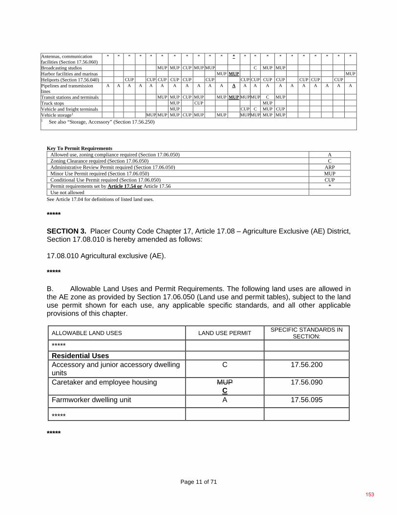
Page 11 of 71
Antennas, communication facilities (Section 17.56.060)
* * * * * * * * * * * * * * * * * * * * * *
Broadcasting studios MUP MUP CUP MUP MUP C MUP MUP Harbor facilities and marinas MUP MUP MUP Heliports (Section 17.56.040) CUP CUP CUP CUP CUP CUP CUP CUP CUP CUP CUP CUP CUP Pipelines and transmission lines
A A A A A A A A A A A A A A A A A A A A A A
Transit stations and terminals MUP MUP CUP MUP MUP MUP MUP MUP C MUP Truck stops MUP CUP MUP Vehicle and freight terminals MUP CUP C MUP CUP Vehicle storage1 MUP MUP MUP CUP MUP MUP MUP MUP MUP MUP 1 See also “Storage, Accessory” (Section 17.56.250)
Key To Permit Requirements
Allowed use, zoning compliance required (Section 17.06.050) A Zoning Clearance required (Section 17.06.050) C Administrative Review Permit required (Section 17.06.050) ARP Minor Use Permit required (Section 17.06.050) MUP Conditional Use Permit required (Section 17.06.050) CUP Permit requirements set by Article 17.54 or Article 17.56 * Use not allowed
See Article 17.04 for definitions of listed land uses. ***** SECTION 3. Placer County Code Chapter 17, Article 17.08 – Agriculture Exclusive (AE) District, Section 17.08.010 is hereby amended as follows: 17.08.010 Agricultural exclusive (AE). ***** B. Allowable Land Uses and Permit Requirements. The following land uses are allowed in the AE zone as provided by Section 17.06.050 (Land use and permit tables), subject to the land use permit shown for each use, any applicable specific standards, and all other applicable provisions of this chapter.
ALLOWABLE LAND USES LAND USE PERMIT SPECIFIC STANDARDS IN SECTION:
*****
Residential Uses Accessory and junior accessory dwelling units
C 17.56.200
Caretaker and employee housing MUP C
17.56.090
Farmworker dwelling unit A 17.56.095
*****
*****
153
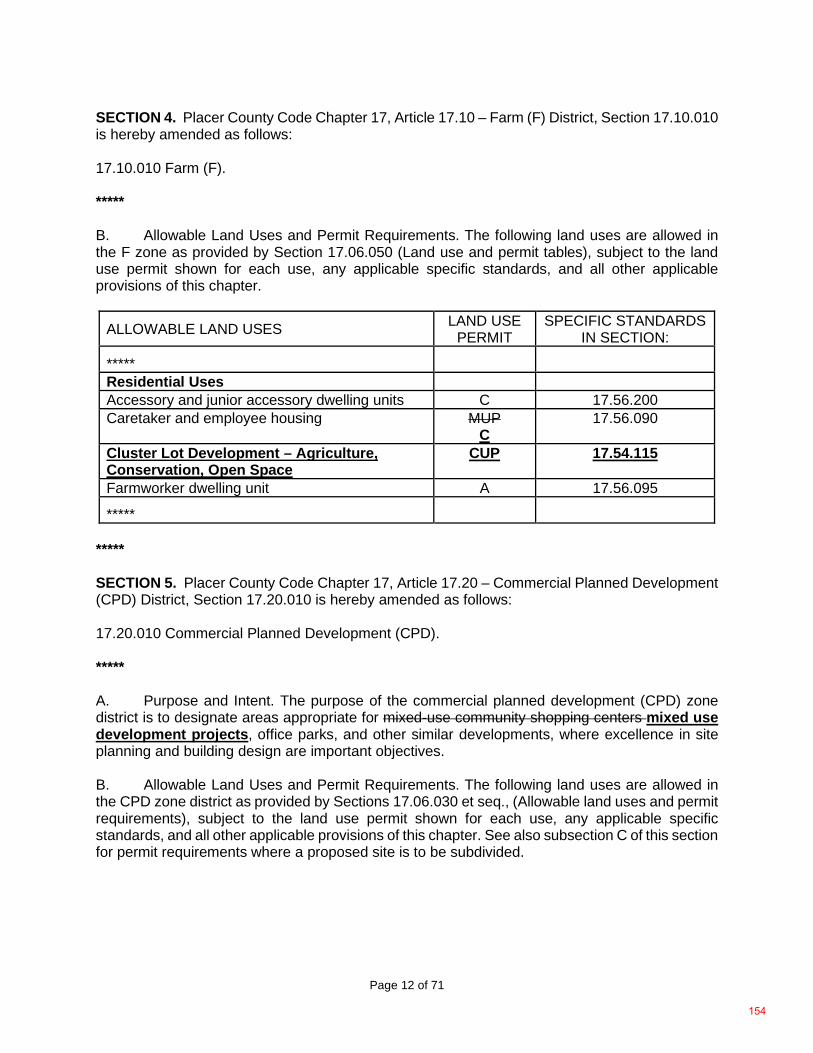
Page 12 of 71
SECTION 4. Placer County Code Chapter 17, Article 17.10 – Farm (F) District, Section 17.10.010 is hereby amended as follows: 17.10.010 Farm (F). ***** B. Allowable Land Uses and Permit Requirements. The following land uses are allowed in the F zone as provided by Section 17.06.050 (Land use and permit tables), subject to the land use permit shown for each use, any applicable specific standards, and all other applicable provisions of this chapter.
ALLOWABLE LAND USES LAND USE PERMIT
SPECIFIC STANDARDS IN SECTION:
*****
Residential Uses Accessory and junior accessory dwelling units C 17.56.200 Caretaker and employee housing MUP
C 17.56.090
Cluster Lot Development – Agriculture, Conservation, Open Space
CUP 17.54.115
Farmworker dwelling unit A 17.56.095
***** ***** SECTION 5. Placer County Code Chapter 17, Article 17.20 – Commercial Planned Development (CPD) District, Section 17.20.010 is hereby amended as follows: 17.20.010 Commercial Planned Development (CPD). ***** A. Purpose and Intent. The purpose of the commercial planned development (CPD) zone district is to designate areas appropriate for mixed-use community shopping centers mixed use development projects, office parks, and other similar developments, where excellence in site planning and building design are important objectives. B. Allowable Land Uses and Permit Requirements. The following land uses are allowed in the CPD zone district as provided by Sections 17.06.030 et seq., (Allowable land uses and permit requirements), subject to the land use permit shown for each use, any applicable specific standards, and all other applicable provisions of this chapter. See also subsection C of this section for permit requirements where a proposed site is to be subdivided.
154
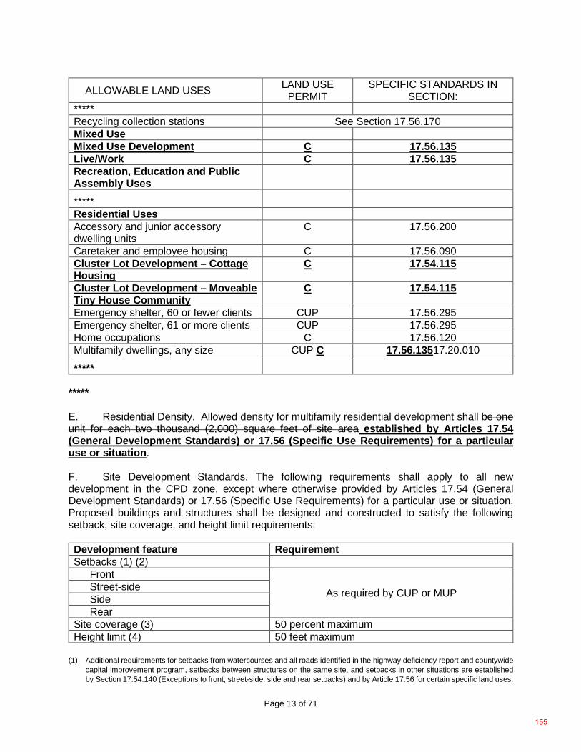
Page 13 of 71
ALLOWABLE LAND USES LAND USE PERMIT
SPECIFIC STANDARDS IN SECTION:
***** Recycling collection stations See Section 17.56.170 Mixed Use Mixed Use Development C 17.56.135 Live/Work C 17.56.135 Recreation, Education and Public Assembly Uses
***** Residential Uses Accessory and junior accessory dwelling units
C 17.56.200
Caretaker and employee housing C 17.56.090 Cluster Lot Development – Cottage Housing
C 17.54.115
Cluster Lot Development – Moveable Tiny House Community
C 17.54.115
Emergency shelter, 60 or fewer clients CUP 17.56.295 Emergency shelter, 61 or more clients CUP 17.56.295 Home occupations C 17.56.120 Multifamily dwellings, any size CUP C 17.56.13517.20.010 *****
***** E. Residential Density. Allowed density for multifamily residential development shall be one unit for each two thousand (2,000) square feet of site area established by Articles 17.54 (General Development Standards) or 17.56 (Specific Use Requirements) for a particular use or situation. F. Site Development Standards. The following requirements shall apply to all new development in the CPD zone, except where otherwise provided by Articles 17.54 (General Development Standards) or 17.56 (Specific Use Requirements) for a particular use or situation. Proposed buildings and structures shall be designed and constructed to satisfy the following setback, site coverage, and height limit requirements: Development feature Requirement Setbacks (1) (2)
Front
As required by CUP or MUP Street-side Side Rear
Site coverage (3) 50 percent maximum Height limit (4) 50 feet maximum
(1) Additional requirements for setbacks from watercourses and all roads identified in the highway deficiency report and countywide
capital improvement program, setbacks between structures on the same site, and setbacks in other situations are established by Section 17.54.140 (Exceptions to front, street-side, side and rear setbacks) and by Article 17.56 for certain specific land uses.
155
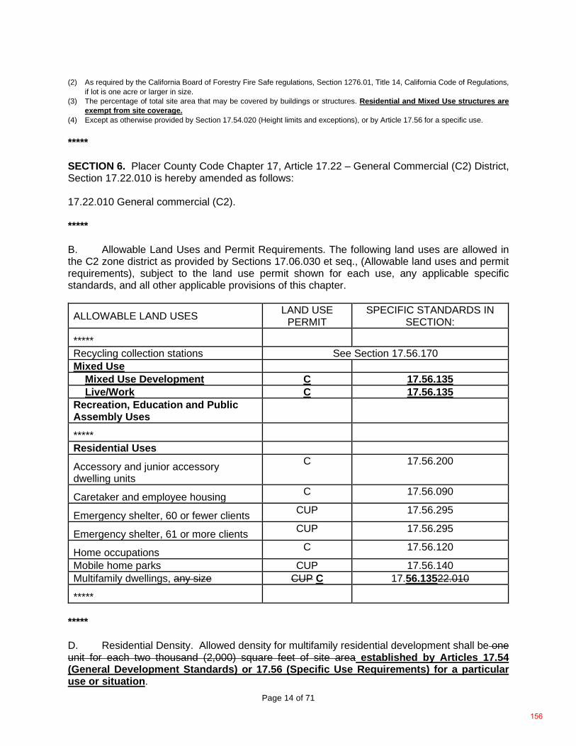
Page 14 of 71
(2) As required by the California Board of Forestry Fire Safe regulations, Section 1276.01, Title 14, California Code of Regulations, if lot is one acre or larger in size.
(3) The percentage of total site area that may be covered by buildings or structures. Residential and Mixed Use structures are exempt from site coverage.
(4) Except as otherwise provided by Section 17.54.020 (Height limits and exceptions), or by Article 17.56 for a specific use. ***** SECTION 6. Placer County Code Chapter 17, Article 17.22 – General Commercial (C2) District, Section 17.22.010 is hereby amended as follows: 17.22.010 General commercial (C2). ***** B. Allowable Land Uses and Permit Requirements. The following land uses are allowed in the C2 zone district as provided by Sections 17.06.030 et seq., (Allowable land uses and permit requirements), subject to the land use permit shown for each use, any applicable specific standards, and all other applicable provisions of this chapter.
ALLOWABLE LAND USES LAND USE PERMIT
SPECIFIC STANDARDS IN SECTION:
***** Recycling collection stations See Section 17.56.170 Mixed Use Mixed Use Development C 17.56.135 Live/Work C 17.56.135 Recreation, Education and Public Assembly Uses
***** Residential Uses Accessory and junior accessory dwelling units
C 17.56.200
Caretaker and employee housing C 17.56.090
Emergency shelter, 60 or fewer clients CUP 17.56.295
Emergency shelter, 61 or more clients CUP 17.56.295
Home occupations C 17.56.120
Mobile home parks CUP 17.56.140 Multifamily dwellings, any size CUP C 17.56.13522.010
*****
***** D. Residential Density. Allowed density for multifamily residential development shall be one unit for each two thousand (2,000) square feet of site area established by Articles 17.54 (General Development Standards) or 17.56 (Specific Use Requirements) for a particular use or situation.
156
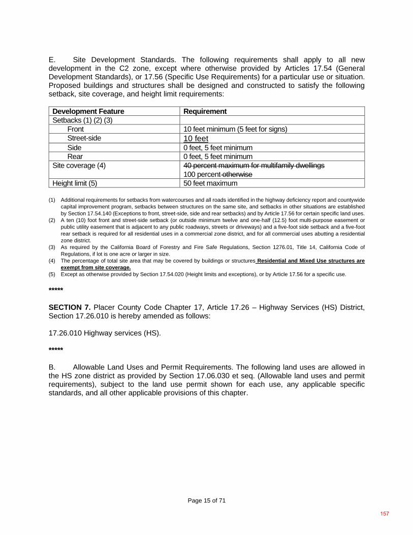
Page 15 of 71
E. Site Development Standards. The following requirements shall apply to all new development in the C2 zone, except where otherwise provided by Articles 17.54 (General Development Standards), or 17.56 (Specific Use Requirements) for a particular use or situation. Proposed buildings and structures shall be designed and constructed to satisfy the following setback, site coverage, and height limit requirements: Development Feature Requirement Setbacks (1) (2) (3)
Front 10 feet minimum (5 feet for signs) Street-side 10 feet Side 0 feet, 5 feet minimum Rear 0 feet, 5 feet minimum
Site coverage (4) 40 percent maximum for multifamily dwellings 100 percent otherwise
Height limit (5) 50 feet maximum (1) Additional requirements for setbacks from watercourses and all roads identified in the highway deficiency report and countywide
capital improvement program, setbacks between structures on the same site, and setbacks in other situations are established by Section 17.54.140 (Exceptions to front, street-side, side and rear setbacks) and by Article 17.56 for certain specific land uses.
(2) A ten (10) foot front and street-side setback (or outside minimum twelve and one-half (12.5) foot multi-purpose easement or public utility easement that is adjacent to any public roadways, streets or driveways) and a five-foot side setback and a five-foot rear setback is required for all residential uses in a commercial zone district, and for all commercial uses abutting a residential zone district.
(3) As required by the California Board of Forestry and Fire Safe Regulations, Section 1276.01, Title 14, California Code of Regulations, if lot is one acre or larger in size.
(4) The percentage of total site area that may be covered by buildings or structures Residential and Mixed Use structures are exempt from site coverage.
(5) Except as otherwise provided by Section 17.54.020 (Height limits and exceptions), or by Article 17.56 for a specific use. ***** SECTION 7. Placer County Code Chapter 17, Article 17.26 – Highway Services (HS) District, Section 17.26.010 is hereby amended as follows: 17.26.010 Highway services (HS). ***** B. Allowable Land Uses and Permit Requirements. The following land uses are allowed in the HS zone district as provided by Section 17.06.030 et seq. (Allowable land uses and permit requirements), subject to the land use permit shown for each use, any applicable specific standards, and all other applicable provisions of this chapter.
157
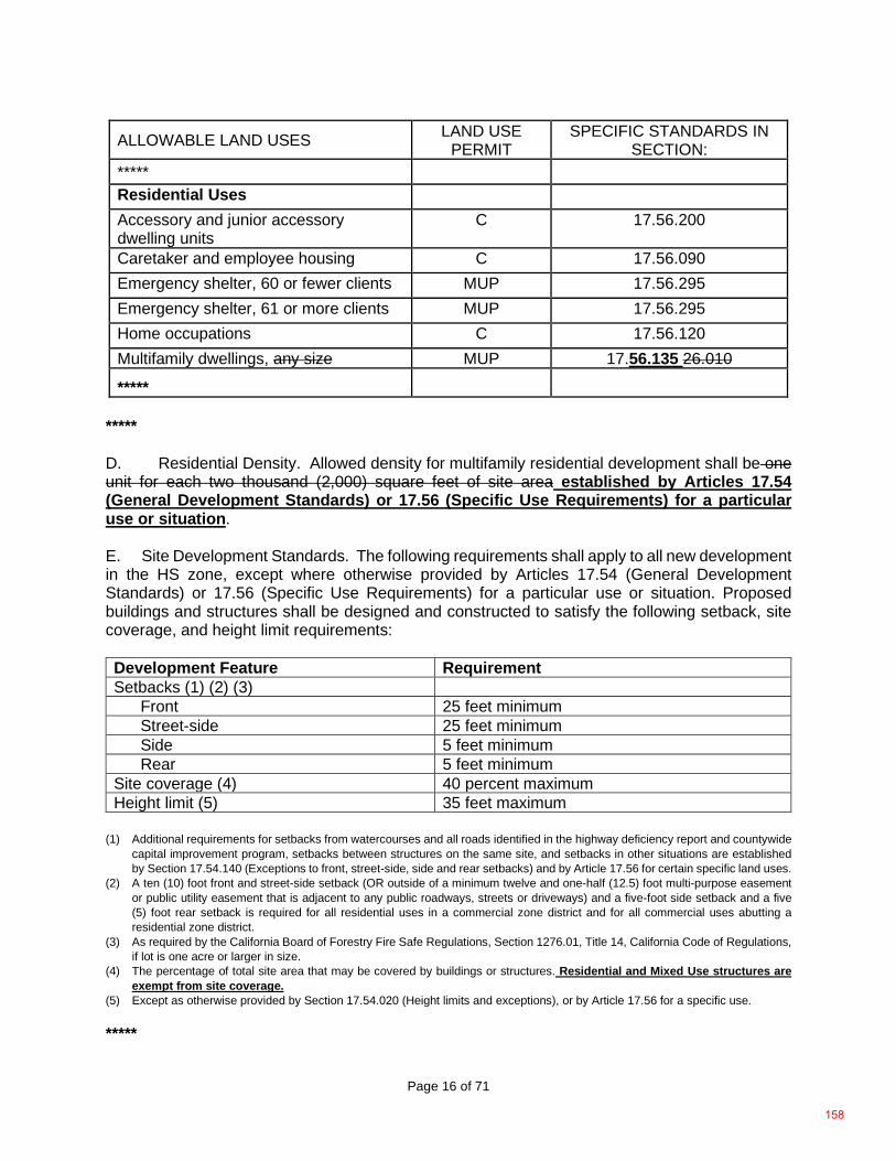
Page 16 of 71
ALLOWABLE LAND USES LAND USE PERMIT
SPECIFIC STANDARDS IN SECTION:
*****
Residential Uses
Accessory and junior accessory dwelling units
C 17.56.200
Caretaker and employee housing C 17.56.090 Emergency shelter, 60 or fewer clients MUP 17.56.295 Emergency shelter, 61 or more clients MUP 17.56.295 Home occupations C 17.56.120 Multifamily dwellings, any size MUP 17.56.135 26.010 *****
***** D. Residential Density. Allowed density for multifamily residential development shall be one unit for each two thousand (2,000) square feet of site area established by Articles 17.54 (General Development Standards) or 17.56 (Specific Use Requirements) for a particular use or situation. E. Site Development Standards. The following requirements shall apply to all new development in the HS zone, except where otherwise provided by Articles 17.54 (General Development Standards) or 17.56 (Specific Use Requirements) for a particular use or situation. Proposed buildings and structures shall be designed and constructed to satisfy the following setback, site coverage, and height limit requirements: Development Feature Requirement Setbacks (1) (2) (3)
Front 25 feet minimum Street-side 25 feet minimum Side 5 feet minimum Rear 5 feet minimum
Site coverage (4) 40 percent maximum Height limit (5) 35 feet maximum
(1) Additional requirements for setbacks from watercourses and all roads identified in the highway deficiency report and countywide
capital improvement program, setbacks between structures on the same site, and setbacks in other situations are established by Section 17.54.140 (Exceptions to front, street-side, side and rear setbacks) and by Article 17.56 for certain specific land uses.
(2) A ten (10) foot front and street-side setback (OR outside of a minimum twelve and one-half (12.5) foot multi-purpose easement or public utility easement that is adjacent to any public roadways, streets or driveways) and a five-foot side setback and a five (5) foot rear setback is required for all residential uses in a commercial zone district and for all commercial uses abutting a residential zone district.
(3) As required by the California Board of Forestry Fire Safe Regulations, Section 1276.01, Title 14, California Code of Regulations, if lot is one acre or larger in size.
(4) The percentage of total site area that may be covered by buildings or structures. Residential and Mixed Use structures are exempt from site coverage.
(5) Except as otherwise provided by Section 17.54.020 (Height limits and exceptions), or by Article 17.56 for a specific use. *****
158
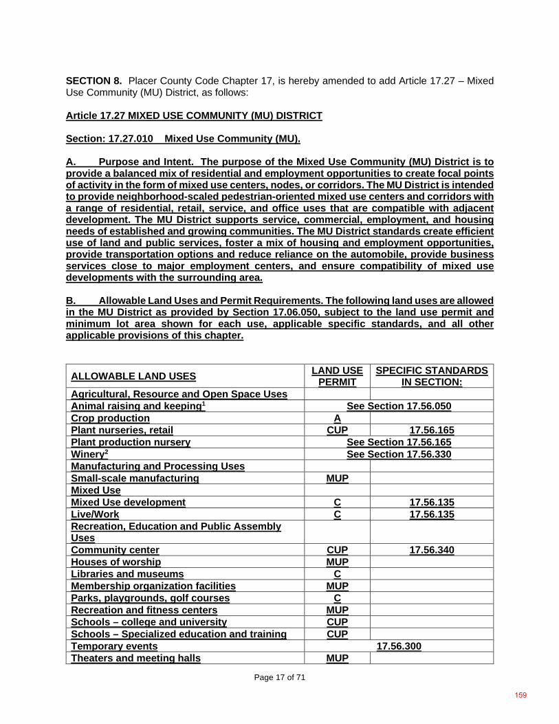
Page 17 of 71
SECTION 8. Placer County Code Chapter 17, is hereby amended to add Article 17.27 – Mixed Use Community (MU) District, as follows: Article 17.27 MIXED USE COMMUNITY (MU) DISTRICT Section: 17.27.010 Mixed Use Community (MU). A. Purpose and Intent. The purpose of the Mixed Use Community (MU) District is to provide a balanced mix of residential and employment opportunities to create focal points of activity in the form of mixed use centers, nodes, or corridors. The MU District is intended to provide neighborhood-scaled pedestrian-oriented mixed use centers and corridors with a range of residential, retail, service, and office uses that are compatible with adjacent development. The MU District supports service, commercial, employment, and housing needs of established and growing communities. The MU District standards create efficient use of land and public services, foster a mix of housing and employment opportunities, provide transportation options and reduce reliance on the automobile, provide business services close to major employment centers, and ensure compatibility of mixed use developments with the surrounding area. B. Allowable Land Uses and Permit Requirements. The following land uses are allowed in the MU District as provided by Section 17.06.050, subject to the land use permit and minimum lot area shown for each use, applicable specific standards, and all other applicable provisions of this chapter. ALLOWABLE LAND USES LAND USE
PERMIT SPECIFIC STANDARDS
IN SECTION: Agricultural, Resource and Open Space Uses Animal raising and keeping1 See Section 17.56.050 Crop production A Plant nurseries, retail CUP 17.56.165 Plant production nursery See Section 17.56.165 Winery2 See Section 17.56.330 Manufacturing and Processing Uses Small-scale manufacturing MUP Mixed Use Mixed Use development C 17.56.135 Live/Work C 17.56.135 Recreation, Education and Public Assembly Uses
Community center CUP 17.56.340 Houses of worship MUP Libraries and museums C Membership organization facilities MUP Parks, playgrounds, golf courses C Recreation and fitness centers MUP Schools – college and university CUP Schools – Specialized education and training CUP Temporary events 17.56.300 Theaters and meeting halls MUP
159
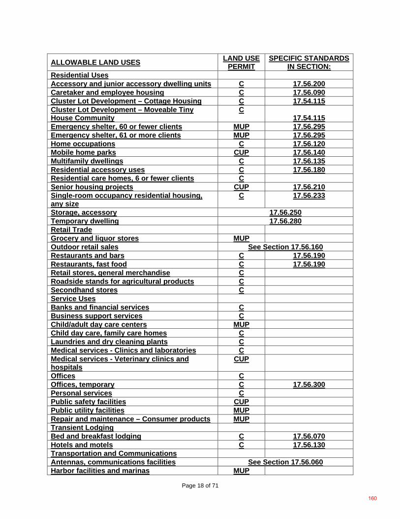
Page 18 of 71
ALLOWABLE LAND USES LAND USE PERMIT
SPECIFIC STANDARDS IN SECTION:
Residential Uses Accessory and junior accessory dwelling units C 17.56.200 Caretaker and employee housing C 17.56.090 Cluster Lot Development – Cottage Housing C 17.54.115 Cluster Lot Development – Moveable Tiny House Community
C 17.54.115
Emergency shelter, 60 or fewer clients MUP 17.56.295 Emergency shelter, 61 or more clients MUP 17.56.295 Home occupations C 17.56.120 Mobile home parks CUP 17.56.140 Multifamily dwellings C 17.56.135 Residential accessory uses C 17.56.180 Residential care homes, 6 or fewer clients C Senior housing projects CUP 17.56.210 Single-room occupancy residential housing, any size
C 17.56.233
Storage, accessory 17.56.250 Temporary dwelling 17.56.280 Retail Trade Grocery and liquor stores MUP Outdoor retail sales See Section 17.56.160 Restaurants and bars C 17.56.190 Restaurants, fast food C 17.56.190 Retail stores, general merchandise C Roadside stands for agricultural products C Secondhand stores C Service Uses Banks and financial services C Business support services C Child/adult day care centers MUP Child day care, family care homes C Laundries and dry cleaning plants C Medical services - Clinics and laboratories C Medical services - Veterinary clinics and hospitals
CUP
Offices C Offices, temporary C 17.56.300 Personal services C Public safety facilities CUP Public utility facilities MUP Repair and maintenance – Consumer products MUP Transient Lodging Bed and breakfast lodging C 17.56.070 Hotels and motels C 17.56.130 Transportation and Communications Antennas, communications facilities See Section 17.56.060 Harbor facilities and marinas MUP
160
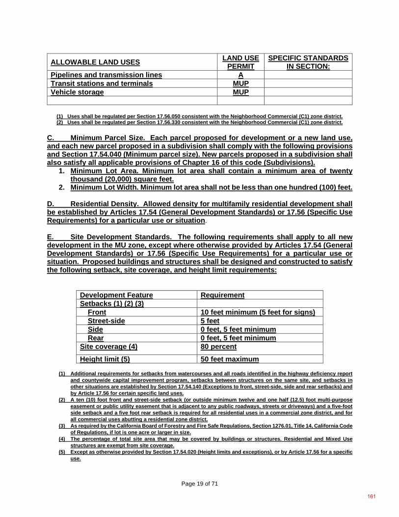
Page 19 of 71
ALLOWABLE LAND USES LAND USE PERMIT
SPECIFIC STANDARDS IN SECTION:
Pipelines and transmission lines A Transit stations and terminals MUP Vehicle storage MUP
(1) Uses shall be regulated per Section 17.56.050 consistent with the Neighborhood Commercial (C1) zone district. (2) Uses shall be regulated per Section 17.56.330 consistent with the Neighborhood Commercial (C1) zone district.
C. Minimum Parcel Size. Each parcel proposed for development or a new land use, and each new parcel proposed in a subdivision shall comply with the following provisions and Section 17.54.040 (Minimum parcel size). New parcels proposed in a subdivision shall also satisfy all applicable provisions of Chapter 16 of this code (Subdivisions).
1. Minimum Lot Area. Minimum lot area shall contain a minimum area of twenty thousand (20,000) square feet.
2. Minimum Lot Width. Minimum lot area shall not be less than one hundred (100) feet.
D. Residential Density. Allowed density for multifamily residential development shall be established by Articles 17.54 (General Development Standards) or 17.56 (Specific Use Requirements) for a particular use or situation. E. Site Development Standards. The following requirements shall apply to all new development in the MU zone, except where otherwise provided by Articles 17.54 (General Development Standards) or 17.56 (Specific Use Requirements) for a particular use or situation. Proposed buildings and structures shall be designed and constructed to satisfy the following setback, site coverage, and height limit requirements:
Development Feature Requirement Setbacks (1) (2) (3)
Front 10 feet minimum (5 feet for signs) Street-side 5 feet Side 0 feet, 5 feet minimum Rear 0 feet, 5 feet minimum
Site coverage (4) 80 percent Height limit (5) 50 feet maximum
(1) Additional requirements for setbacks from watercourses and all roads identified in the highway deficiency report
and countywide capital improvement program, setbacks between structures on the same site, and setbacks in other situations are established by Section 17.54.140 (Exceptions to front, street-side, side and rear setbacks) and by Article 17.56 for certain specific land uses.
(2) A ten (10) foot front and street-side setback (or outside minimum twelve and one half (12.5) foot multi-purpose easement or public utility easement that is adjacent to any public roadways, streets or driveways) and a five-foot side setback and a five foot rear setback is required for all residential uses in a commercial zone district, and for all commercial uses abutting a residential zone district.
(3) As required by the California Board of Forestry and Fire Safe Regulations, Section 1276.01, Title 14, California Code of Regulations, if lot is one acre or larger in size.
(4) The percentage of total site area that may be covered by buildings or structures. Residential and Mixed Use structures are exempt from site coverage.
(5) Except as otherwise provided by Section 17.54.020 (Height limits and exceptions), or by Article 17.56 for a specific use.
161
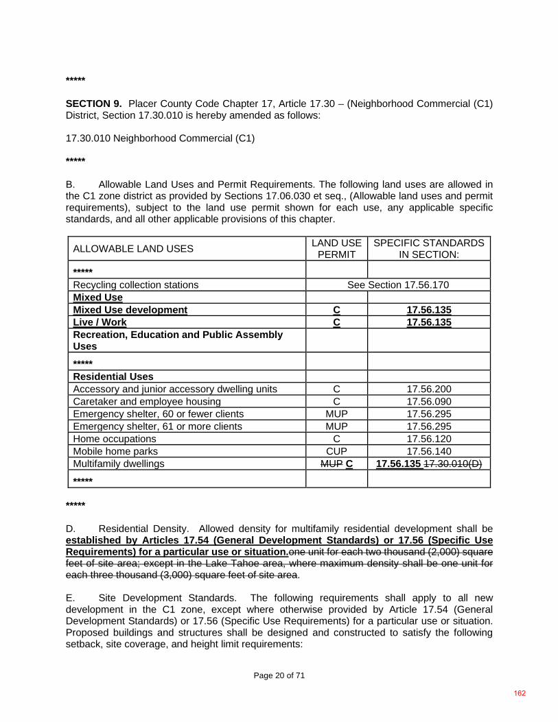
Page 20 of 71
***** SECTION 9. Placer County Code Chapter 17, Article 17.30 – (Neighborhood Commercial (C1) District, Section 17.30.010 is hereby amended as follows: 17.30.010 Neighborhood Commercial (C1) ***** B. Allowable Land Uses and Permit Requirements. The following land uses are allowed in the C1 zone district as provided by Sections 17.06.030 et seq., (Allowable land uses and permit requirements), subject to the land use permit shown for each use, any applicable specific standards, and all other applicable provisions of this chapter.
ALLOWABLE LAND USES LAND USE PERMIT
SPECIFIC STANDARDS IN SECTION:
***** Recycling collection stations See Section 17.56.170 Mixed Use Mixed Use development C 17.56.135 Live / Work C 17.56.135 Recreation, Education and Public Assembly Uses
***** Residential Uses Accessory and junior accessory dwelling units C 17.56.200 Caretaker and employee housing C 17.56.090 Emergency shelter, 60 or fewer clients MUP 17.56.295 Emergency shelter, 61 or more clients MUP 17.56.295 Home occupations C 17.56.120 Mobile home parks CUP 17.56.140 Multifamily dwellings MUP C 17.56.135 17.30.010(D) *****
***** D. Residential Density. Allowed density for multifamily residential development shall be established by Articles 17.54 (General Development Standards) or 17.56 (Specific Use Requirements) for a particular use or situation.one unit for each two thousand (2,000) square feet of site area; except in the Lake Tahoe area, where maximum density shall be one unit for each three thousand (3,000) square feet of site area. E. Site Development Standards. The following requirements shall apply to all new development in the C1 zone, except where otherwise provided by Article 17.54 (General Development Standards) or 17.56 (Specific Use Requirements) for a particular use or situation. Proposed buildings and structures shall be designed and constructed to satisfy the following setback, site coverage, and height limit requirements:
162
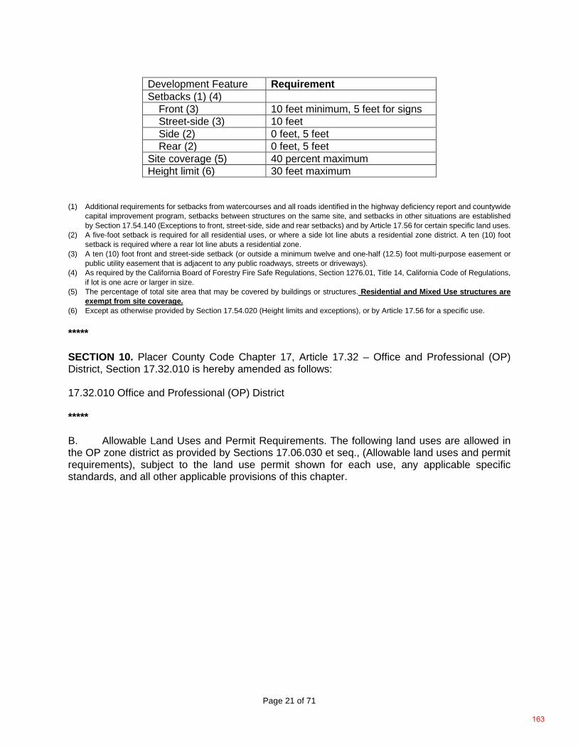
Page 21 of 71
Development Feature Requirement Setbacks (1) (4)
Front (3) 10 feet minimum, 5 feet for signs Street-side (3) 10 feet Side (2) 0 feet, 5 feet Rear (2) 0 feet, 5 feet
Site coverage (5) 40 percent maximum Height limit (6) 30 feet maximum
(1) Additional requirements for setbacks from watercourses and all roads identified in the highway deficiency report and countywide
capital improvement program, setbacks between structures on the same site, and setbacks in other situations are established by Section 17.54.140 (Exceptions to front, street-side, side and rear setbacks) and by Article 17.56 for certain specific land uses.
(2) A five-foot setback is required for all residential uses, or where a side lot line abuts a residential zone district. A ten (10) foot setback is required where a rear lot line abuts a residential zone.
(3) A ten (10) foot front and street-side setback (or outside a minimum twelve and one-half (12.5) foot multi-purpose easement or public utility easement that is adjacent to any public roadways, streets or driveways).
(4) As required by the California Board of Forestry Fire Safe Regulations, Section 1276.01, Title 14, California Code of Regulations, if lot is one acre or larger in size.
(5) The percentage of total site area that may be covered by buildings or structures. Residential and Mixed Use structures are exempt from site coverage.
(6) Except as otherwise provided by Section 17.54.020 (Height limits and exceptions), or by Article 17.56 for a specific use. ***** SECTION 10. Placer County Code Chapter 17, Article 17.32 – Office and Professional (OP) District, Section 17.32.010 is hereby amended as follows: 17.32.010 Office and Professional (OP) District ***** B. Allowable Land Uses and Permit Requirements. The following land uses are allowed in the OP zone district as provided by Sections 17.06.030 et seq., (Allowable land uses and permit requirements), subject to the land use permit shown for each use, any applicable specific standards, and all other applicable provisions of this chapter.
163
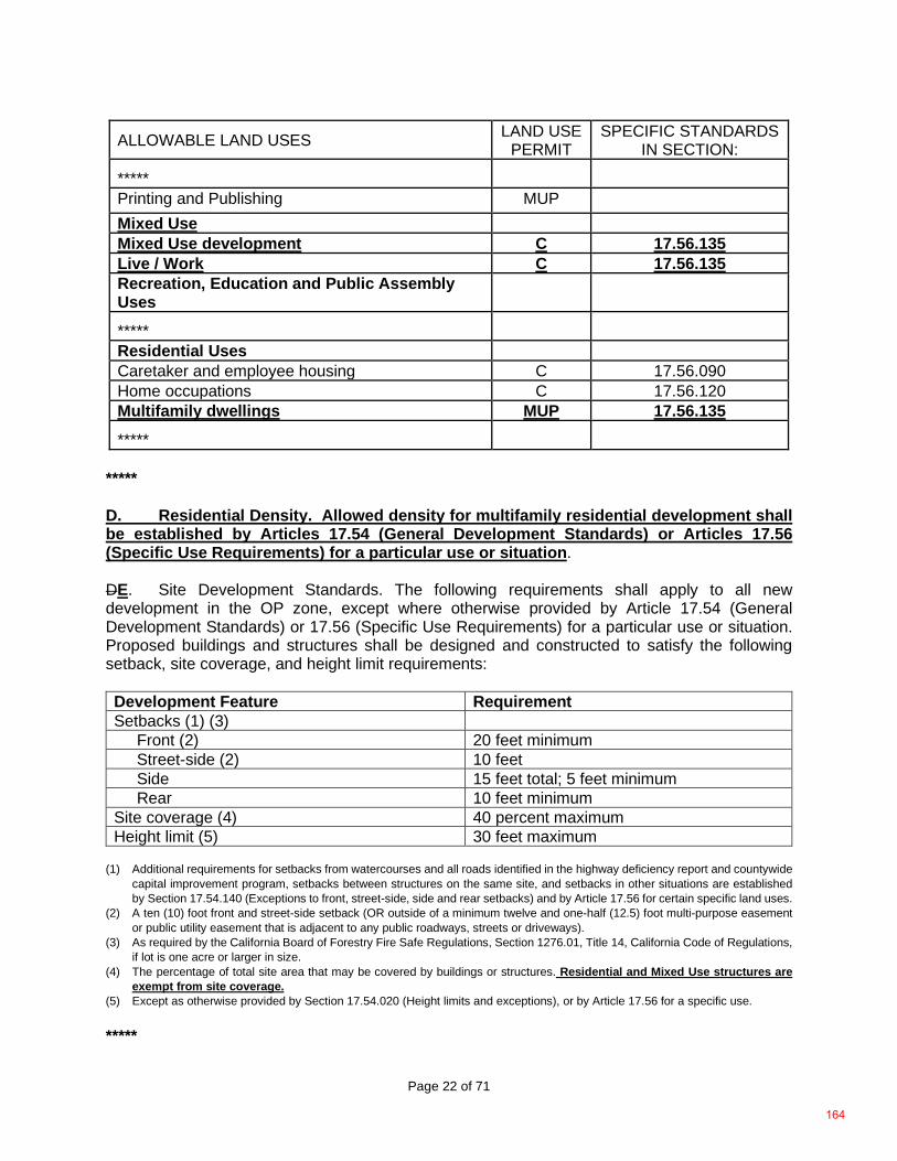
Page 22 of 71
ALLOWABLE LAND USES LAND USE PERMIT
SPECIFIC STANDARDS IN SECTION:
*****
Printing and Publishing MUP
Mixed Use Mixed Use development C 17.56.135 Live / Work C 17.56.135 Recreation, Education and Public Assembly Uses
***** Residential Uses Caretaker and employee housing C 17.56.090 Home occupations C 17.56.120 Multifamily dwellings MUP 17.56.135 *****
***** D. Residential Density. Allowed density for multifamily residential development shall be established by Articles 17.54 (General Development Standards) or Articles 17.56 (Specific Use Requirements) for a particular use or situation. DE. Site Development Standards. The following requirements shall apply to all new development in the OP zone, except where otherwise provided by Article 17.54 (General Development Standards) or 17.56 (Specific Use Requirements) for a particular use or situation. Proposed buildings and structures shall be designed and constructed to satisfy the following setback, site coverage, and height limit requirements: Development Feature Requirement Setbacks (1) (3)
Front (2) 20 feet minimum Street-side (2) 10 feet Side 15 feet total; 5 feet minimum Rear 10 feet minimum
Site coverage (4) 40 percent maximum Height limit (5) 30 feet maximum
(1) Additional requirements for setbacks from watercourses and all roads identified in the highway deficiency report and countywide
capital improvement program, setbacks between structures on the same site, and setbacks in other situations are established by Section 17.54.140 (Exceptions to front, street-side, side and rear setbacks) and by Article 17.56 for certain specific land uses.
(2) A ten (10) foot front and street-side setback (OR outside of a minimum twelve and one-half (12.5) foot multi-purpose easement or public utility easement that is adjacent to any public roadways, streets or driveways).
(3) As required by the California Board of Forestry Fire Safe Regulations, Section 1276.01, Title 14, California Code of Regulations, if lot is one acre or larger in size.
(4) The percentage of total site area that may be covered by buildings or structures. Residential and Mixed Use structures are exempt from site coverage.
(5) Except as otherwise provided by Section 17.54.020 (Height limits and exceptions), or by Article 17.56 for a specific use. *****
164
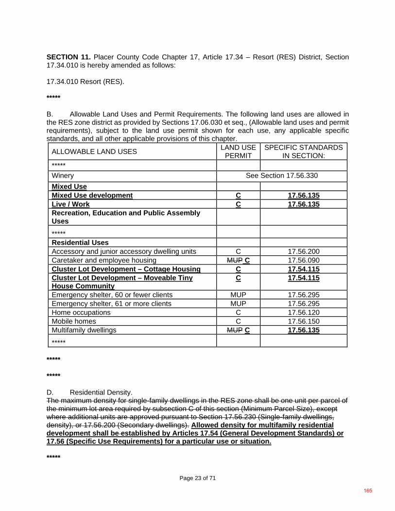
Page 23 of 71
SECTION 11. Placer County Code Chapter 17, Article 17.34 – Resort (RES) District, Section 17.34.010 is hereby amended as follows: 17.34.010 Resort (RES). ***** B. Allowable Land Uses and Permit Requirements. The following land uses are allowed in the RES zone district as provided by Sections 17.06.030 et seq., (Allowable land uses and permit requirements), subject to the land use permit shown for each use, any applicable specific standards, and all other applicable provisions of this chapter.
ALLOWABLE LAND USES LAND USE PERMIT
SPECIFIC STANDARDS IN SECTION:
*****
Winery See Section 17.56.330 Mixed Use Mixed Use development C 17.56.135 Live / Work C 17.56.135 Recreation, Education and Public Assembly Uses
***** Residential Uses Accessory and junior accessory dwelling units C 17.56.200 Caretaker and employee housing MUP C 17.56.090 Cluster Lot Development – Cottage Housing C 17.54.115 Cluster Lot Development – Moveable Tiny House Community
C 17.54.115
Emergency shelter, 60 or fewer clients MUP 17.56.295 Emergency shelter, 61 or more clients MUP 17.56.295 Home occupations C 17.56.120 Mobile homes C 17.56.150 Multifamily dwellings MUP C 17.56.135
***** ***** ***** D. Residential Density. The maximum density for single-family dwellings in the RES zone shall be one unit per parcel of the minimum lot area required by subsection C of this section (Minimum Parcel Size), except where additional units are approved pursuant to Section 17.56.230 (Single-family dwellings, density), or 17.56.200 (Secondary dwellings). Allowed density for multifamily residential development shall be established by Articles 17.54 (General Development Standards) or 17.56 (Specific Use Requirements) for a particular use or situation. *****
165
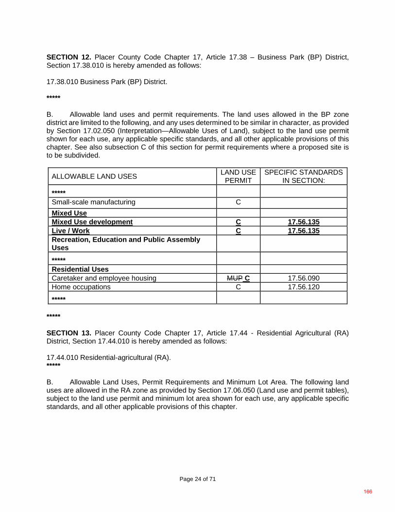
Page 24 of 71
SECTION 12. Placer County Code Chapter 17, Article 17.38 – Business Park (BP) District, Section 17.38.010 is hereby amended as follows: 17.38.010 Business Park (BP) District. ***** B. Allowable land uses and permit requirements. The land uses allowed in the BP zone district are limited to the following, and any uses determined to be similar in character, as provided by Section 17.02.050 (Interpretation—Allowable Uses of Land), subject to the land use permit shown for each use, any applicable specific standards, and all other applicable provisions of this chapter. See also subsection C of this section for permit requirements where a proposed site is to be subdivided.
ALLOWABLE LAND USES LAND USE PERMIT
SPECIFIC STANDARDS IN SECTION:
*****
Small-scale manufacturing C
Mixed Use Mixed Use development C 17.56.135 Live / Work C 17.56.135 Recreation, Education and Public Assembly Uses
***** Residential Uses Caretaker and employee housing MUP C 17.56.090 Home occupations C 17.56.120
*****
***** SECTION 13. Placer County Code Chapter 17, Article 17.44 - Residential Agricultural (RA) District, Section 17.44.010 is hereby amended as follows: 17.44.010 Residential-agricultural (RA). ***** B. Allowable Land Uses, Permit Requirements and Minimum Lot Area. The following land uses are allowed in the RA zone as provided by Section 17.06.050 (Land use and permit tables), subject to the land use permit and minimum lot area shown for each use, any applicable specific standards, and all other applicable provisions of this chapter.
166
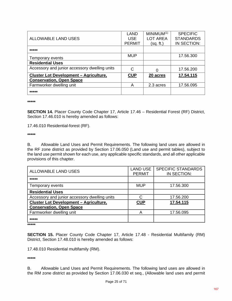
Page 25 of 71
ALLOWABLE LAND USES LAND USE
PERMIT
MINIMUM(1) LOT AREA
(sq. ft.)
SPECIFIC STANDARDS IN SECTION:
*****
Temporary events MUP 17.56.300
Residential Uses Accessory and junior accessory dwelling units C 0 17.56.200 Cluster Lot Development – Agriculture, Conservation, Open Space
CUP 20 acres 17.54.115
Farmworker dwelling unit A 2.3 acres 17.56.095
*****
***** SECTION 14. Placer County Code Chapter 17, Article 17.46 – Residential Forest (RF) District, Section 17.46.010 is hereby amended as follows: 17.46.010 Residential-forest (RF). ***** B. Allowable Land Uses and Permit Requirements. The following land uses are allowed in the RF zone district as provided by Section 17.06.050 (Land use and permit tables), subject to the land use permit shown for each use, any applicable specific standards, and all other applicable provisions of this chapter.
ALLOWABLE LAND USES LAND USE PERMIT
SPECIFIC STANDARDS IN SECTION:
*****
Temporary events MUP 17.56.300 Residential Uses Accessory and junior accessory dwelling units C 17.56.200 Cluster Lot Development – Agriculture, Conservation, Open Space
CUP 17.54.115
Farmworker dwelling unit A 17.56.095
***** ***** SECTION 15. Placer County Code Chapter 17, Article 17.48 - Residential Multifamily (RM) District, Section 17.48.010 is hereby amended as follows: 17.48.010 Residential multifamily (RM). ***** B. Allowable Land Uses and Permit Requirements. The following land uses are allowed in the RM zone district as provided by Section 17.06.030 et seq., (Allowable land uses and permit
167
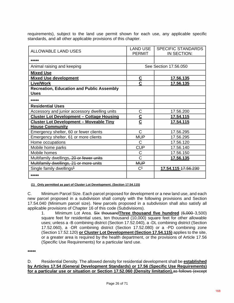
Page 26 of 71
requirements), subject to the land use permit shown for each use, any applicable specific standards, and all other applicable provisions of this chapter.
ALLOWABLE LAND USES LAND USE PERMIT
SPECIFIC STANDARDS IN SECTION:
*****
Animal raising and keeping See Section 17.56.050 Mixed Use Mixed Use development C 17.56.135 Live/Work C 17.56.135 Recreation, Education and Public Assembly Uses
***** Residential Uses Accessory and junior accessory dwelling units C 17.56.200 Cluster Lot Development – Cottage Housing C 17.54.115 Cluster Lot Development – Moveable Tiny House Community
C 17.54.115
Emergency shelter, 60 or fewer clients C 17.56.295 Emergency shelter, 61 or more clients MUP 17.56.295 Home occupations C 17.56.120 Mobile home parks CUP 17.56.140 Mobile homes C 17.56.150 Multifamily dwellings, 20 or fewer units C 17.56.135 Multifamily dwellings, 21 or more units MUP Single family dwellings1 C1 17.54.115 17.56.230
*****
(1) Only permitted as part of Cluster Lot Development. (Section 17.54.115) C. Minimum Parcel Size. Each parcel proposed for development or a new land use, and each new parcel proposed in a subdivision shall comply with the following provisions and Section 17.54.040 (Minimum parcel size). New parcels proposed in a subdivision shall also satisfy all applicable provisions of Chapter 16 of this code (Subdivisions).
1. Minimum Lot Area. Six thousandThree thousand five hundred (6,000 3,500) square feet for residential uses, ten thousand (10,000) square feet for other allowable uses; unless a -B combining district (Section 17.52.040), a -DL combining district (Section 17.52.060), a -DR combining district (Section 17.52.080) or a -PD combining zone (Section 17.52.120) or Cluster Lot Development (Section 17.54.115) applies to the site, or a greater area is required by the health department, or the provisions of Article 17.56 (Specific Use Requirements) for a particular land use.
***** D. Residential Density. The allowed density for residential development shall be established by Articles 17.54 (General Development Standards) or 17.56 (Specific Use Requirements) for a particular use or situation or Section 17.52.060 (Density limitation).as follows (except
168
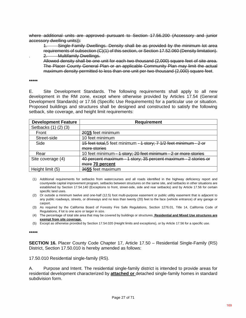
Page 27 of 71
where additional units are approved pursuant to Section 17.56.200 (Accessory and junior accessory dwelling units)):
1. Single-Family Dwellings. Density shall be as provided by the minimum lot area requirements of subsection (C)(1) of this section, or Section 17.52.060 (Density limitation).
. 2. Multifamily Dwellings. Allowed density shall be one unit for each two thousand (2,000) square feet of site area. The Placer County General Plan or an applicable Community Plan may limit the actual maximum density permitted to less than one unit per two thousand (2,000) square feet.
***** E. Site Development Standards. The following requirements shall apply to all new development in the RM zone, except where otherwise provided by Articles 17.54 (General Development Standards) or 17.56 (Specific Use Requirements) for a particular use or situation. Proposed buildings and structures shall be designed and constructed to satisfy the following setback, site coverage, and height limit requirements:
Development Feature Requirement Setbacks (1) (2) (3)
Front 2015 feet minimum Street-side 10 feet minimum Side 15 feet total,5 feet minimum - 1 story; 7 1/2 feet minimum - 2 or
more stories Rear 10 feet minimum - 1 story; 20 feet minimum - 2 or more stories
Site coverage (4) 40 percent maximum - 1 story; 35 percent maximum - 2 stories or more 70 percent
Height limit (5) 3655 feet maximum
(1) Additional requirements for setbacks from watercourses and all roads identified in the highway deficiency report and countywide capital improvement program, setbacks between structures on the same site, and setbacks in other situations are established by Section 17.54.140 (Exceptions to front, street-side, side and rear setbacks) and by Article 17.56 for certain specific land uses.
(2) Or outside a minimum twelve and one-half (12.5) foot multi-purpose easement or public utility easement that is adjacent to any public roadways, streets, or driveways and no less than twenty (20) feet to the face (vehicle entrance) of any garage or carport.
(3) As required by the California Board of Forestry Fire Safe Regulations, Section 1276.01, Title 14, California Code of Regulations, if lot is one acre or larger in size.
(4) The percentage of total site area that may be covered by buildings or structures. Residential and Mixed Use structures are exempt from site coverage.
(5) Except as otherwise provided by Section 17.54.020 (Height limits and exceptions), or by Article 17.56 for a specific use. ***** SECTION 16. Placer County Code Chapter 17, Article 17.50 – Residential Single-Family (RS) District, Section 17.50.010 is hereby amended as follows: 17.50.010 Residential single-family (RS). A. Purpose and Intent. The residential single-family district is intended to provide areas for residential development characterized by attached or detached single-family homes in standard subdivision form.
169
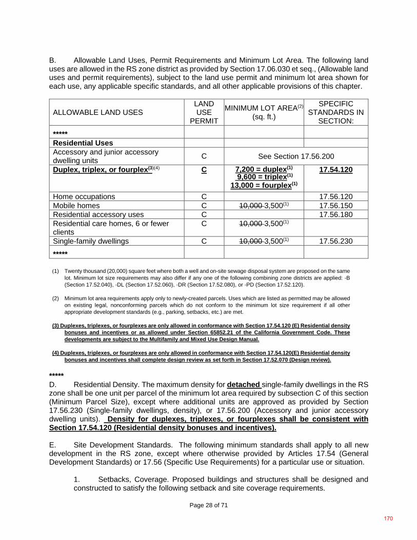
Page 28 of 71
B. Allowable Land Uses, Permit Requirements and Minimum Lot Area. The following land uses are allowed in the RS zone district as provided by Section 17.06.030 et seq., (Allowable land uses and permit requirements), subject to the land use permit and minimum lot area shown for each use, any applicable specific standards, and all other applicable provisions of this chapter.
ALLOWABLE LAND USES LAND USE
PERMIT
MINIMUM LOT AREA(2) (sq. ft.)
SPECIFIC STANDARDS IN
SECTION:
*****
Residential Uses Accessory and junior accessory dwelling units C See Section 17.56.200
Duplex, triplex, or fourplex(3)(4) C 7,200 = duplex(1) 9,600 = triplex(1)
13,000 = fourplex(1)
17.54.120
Home occupations C 17.56.120 Mobile homes C 10,000 3,500(1) 17.56.150 Residential accessory uses C 17.56.180 Residential care homes, 6 or fewer clients
C 10,000 3,500(1)
Single-family dwellings C 10,000 3,500(1) 17.56.230
*****
(1) Twenty thousand (20,000) square feet where both a well and on-site sewage disposal system are proposed on the same
lot. Minimum lot size requirements may also differ if any one of the following combining zone districts are applied: -B (Section 17.52.040), -DL (Section 17.52.060), -DR (Section 17.52.080), or -PD (Section 17.52.120).
(2) Minimum lot area requirements apply only to newly-created parcels. Uses which are listed as permitted may be allowed
on existing legal, nonconforming parcels which do not conform to the minimum lot size requirement if all other appropriate development standards (e.g., parking, setbacks, etc.) are met.
(3) Duplexes, triplexes, or fourplexes are only allowed in conformance with Section 17.54.120 (E) Residential density
bonuses and incentives or as allowed under Section 65852.21 of the California Government Code. These developments are subject to the Multifamily and Mixed Use Design Manual.
(4) Duplexes, triplexes, or fourplexes are only allowed in conformance with Section 17.54.120(E) Residential density
bonuses and incentives shall complete design review as set forth in Section 17.52.070 (Design review).
***** D. Residential Density. The maximum density for detached single-family dwellings in the RS zone shall be one unit per parcel of the minimum lot area required by subsection C of this section (Minimum Parcel Size), except where additional units are approved as provided by Section 17.56.230 (Single-family dwellings, density), or 17.56.200 (Accessory and junior accessory dwelling units). Density for duplexes, triplexes, or fourplexes shall be consistent with Section 17.54.120 (Residential density bonuses and incentives). E. Site Development Standards. The following minimum standards shall apply to all new development in the RS zone, except where otherwise provided by Articles 17.54 (General Development Standards) or 17.56 (Specific Use Requirements) for a particular use or situation.
1. Setbacks, Coverage. Proposed buildings and structures shall be designed and constructed to satisfy the following setback and site coverage requirements.
170
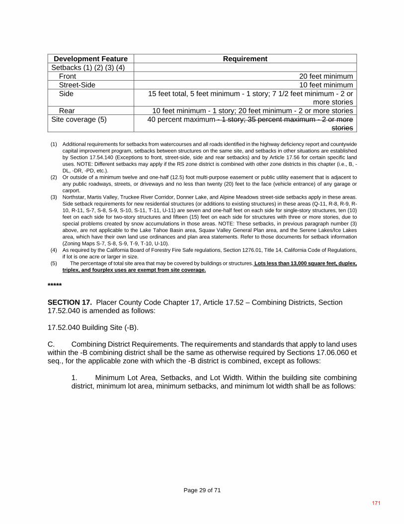
Page 29 of 71
Development Feature Requirement Setbacks (1) (2) (3) (4)
Front 20 feet minimum Street-Side 10 feet minimum Side 15 feet total, 5 feet minimum - 1 story; 7 1/2 feet minimum - 2 or
more stories Rear 10 feet minimum - 1 story; 20 feet minimum - 2 or more stories
Site coverage (5) 40 percent maximum - 1 story; 35 percent maximum - 2 or more stories
(1) Additional requirements for setbacks from watercourses and all roads identified in the highway deficiency report and countywide
capital improvement program, setbacks between structures on the same site, and setbacks in other situations are established by Section 17.54.140 (Exceptions to front, street-side, side and rear setbacks) and by Article 17.56 for certain specific land uses. NOTE: Different setbacks may apply if the RS zone district is combined with other zone districts in this chapter (i.e., B, -DL, -DR, -PD, etc.).
(2) Or outside of a minimum twelve and one-half (12.5) foot multi-purpose easement or public utility easement that is adjacent to any public roadways, streets, or driveways and no less than twenty (20) feet to the face (vehicle entrance) of any garage or carport.
(3) Northstar, Martis Valley, Truckee River Corridor, Donner Lake, and Alpine Meadows street-side setbacks apply in these areas. Side setback requirements for new residential structures (or additions to existing structures) in these areas (Q-11, R-8, R-9, R-10, R-11, S-7, S-8, S-9, S-10, S-11, T-11, U-11) are seven and one-half feet on each side for single-story structures, ten (10) feet on each side for two-story structures and fifteen (15) feet on each side for structures with three or more stories, due to special problems created by snow accumulations in those areas. NOTE: These setbacks, in previous paragraph number (3) above, are not applicable to the Lake Tahoe Basin area, Squaw Valley General Plan area, and the Serene Lakes/Ice Lakes area, which have their own land use ordinances and plan area statements. Refer to those documents for setback information (Zoning Maps S-7, S-8, S-9, T-9, T-10, U-10).
(4) As required by the California Board of Forestry Fire Safe regulations, Section 1276.01, Title 14, California Code of Regulations, if lot is one acre or larger in size.
(5) The percentage of total site area that may be covered by buildings or structures. Lots less than 13,000 square feet, duplex, triplex, and fourplex uses are exempt from site coverage.
***** SECTION 17. Placer County Code Chapter 17, Article 17.52 – Combining Districts, Section 17.52.040 is amended as follows: 17.52.040 Building Site (-B). C. Combining District Requirements. The requirements and standards that apply to land uses within the -B combining district shall be the same as otherwise required by Sections 17.06.060 et seq., for the applicable zone with which the -B district is combined, except as follows:
1. Minimum Lot Area, Setbacks, and Lot Width. Within the building site combining district, minimum lot area, minimum setbacks, and minimum lot width shall be as follows:
171
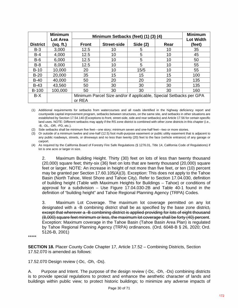
Page 30 of 71
District
Minimum Lot Area (sq. ft.)
Minimum Setbacks (feet) (1) (3) (4) Minimum Lot Width
(feet) Front Street-side Side (2) Rear B-3 3,000 12.5 10 5 10 35 B-4 4,000 12.5 10 5 10 45 B-6 6,000 12.5 10 5 10 50 B-8 8,000 12.5 10 5 10 55 B-10 10,000 20 10 15/5 10 55 B-20 20,000 35 15 15 15 100 B-40 40,000 50 20 20 20 135 B-43 43,560 50 30 30 30 135
B-100 100,000 50 30 30 30 160 B-X Minimum Parcel Size and/or if applicable, Special Setbacks per GPA
or REA
(1) Additional requirements for setbacks from watercourses and all roads identified in the highway deficiency report and countywide capital improvement program, setbacks between structures, on the same site, and setbacks in other situations are established by Section 17.54.140 (Exceptions to front, street-side, side and rear setbacks) and Article 17.56 for certain specific land uses. NOTE: Different setbacks may apply if the RS zone district is combined with other zone districts in this chapter (i.e., -B, -DL, -DR, -PD, etc.).
(2) Side setbacks shall be minimum five feet—one story; minimum seven and one-half feet—two or more stories. (3) Or outside of a minimum twelve and one-half (12.5) foot multi-purpose easement or public utility easement that is adjacent to
any public roadways, streets, or driveways and no less than twenty (20) feet to the face (vehicle entrance) of any garage or carport.
(4) As required by the California Board of Forestry Fire Safe Regulations (§ 1276.01, Title 14, California Code of Regulations) if lot is one acre or larger in size.
2. Maximum Building Height. Thirty (30) feet on lots of less than twenty thousand (20,000) square feet; thirty-six (36) feet on lots that are twenty thousand (20,000) square feet or larger. NOTE: An increase in height of not more than five feet, or ten (10) percent may be granted per Section 17.60.105(A)(3). Exception: This does not apply to the Tahoe Basin (North Tahoe, West Shore and Tahoe City). Refer to Section 17.04.030, definition of building height (Table with Maximum Heights for Buildings – Tahoe) or conditions of approval for a subdivision – Use Figure 17.04.030-2B and Table 40-1 found in the definition of “building height” and Tahoe Regional Planning Agency (TRPA) Codes.
3. Maximum Lot Coverage. The maximum lot coverage permitted on any lot designated with a -B combining district shall be as specified by the base zone district, except that wherever a -B combining district is applied providing for lots of eight thousand (8,000) square feet minimum or less, the maximum lot coverage shall be forty (40) percent. Exception: Maximum coverage in the Tahoe Basin (Tahoe Basin Area Plan) is regulated by Tahoe Regional Planning Agency (TRPA) ordinances. (Ord. 6048-B § 26, 2020; Ord. 5126-B, 2001)
***** SECTION 18. Placer County Code Chapter 17, Article 17.52 – Combining Districts, Section 17.52.070 is amended as follows: 17.52.070 Design review (-Dc, -Dh, -Ds). A. Purpose and Intent. The purpose of the design review (-Dc, -Dh, -Ds) combining districts is to provide special regulations to protect and enhance the aesthetic character of lands and buildings within public view; to protect historic buildings; to minimize any adverse impacts of
172
Page 31 of 71
conflicting land uses; to enhance tourism through the protection of lands and buildings having unique aesthetic characteristics; and to provide special project review procedures for lands and uses which by their nature require special attention to architectural design and massing, landscaping, circulation, and/or energy conservation. B. Establishment of District. The design review combining district may be applied to lands within Placer County through the rezoning of property as a “design scenic corridor” (Dc), “design historical” (Dh), or “design sierra” (Ds) district. The following criteria and findings shall determine which type of design review combining district is applied:
1. Design Scenic Corridor or Sierra (-Dc, -Ds). The Dc or Ds designations shall be applied only to:
a. Areas of special natural beauty and aesthetic interest that constitute a basic resource in the county economy, the preservation of which in its most nearly natural state would enhance tourism; or b. Areas, places, sites, structures or uses, including multifamily and mixed use projects where application of the design review combining district will serve to carry out the other purposes stated in subsection A of this section. The adoption of the Dc or Ds designations shall require that the board make findings of fact stating: the special problems present within the district; how specific areas, places, sites, structures or uses serve to implement the purposes of subsection A of this section; and the reasons why the district should receive the benefit of special regulation.
***** C. Combining District Requirements. The requirements and standards that apply to land uses within the design review combining district shall be the same as otherwise required by Sections 17.06.060 et seq., for the applicable zone with which the design review district is combined, except as follows:
1. Buildings and Projects. No construction, renovation, remodeling, reconstruction, demolition, or other alteration of a building, structure or site (see Section 17.52.070(D)(3)), including any change in the exterior appearance of an historic building shall occur within a design review combining district before obtaining design review approval as required by this section. 2. Issuance of Building Permits. No building permit for a project subject to design review shall be issued before design review approval, or contrary to any conditions of design review approval. 3. Applicability to Designated General Plan/Community Plan Areas. Unless specifically excepted in the implementing ordinances of the Squaw Valley General Plan (Chapter 17, Appendix A), the Ta-hoe City Community Plan or the Tahoe City Area General Plan (Chapter 17, Appendix B), or the North Tahoe Community Plans (Chapter 17, Appendix C), the provisions of this section shall apply to areas requiring Design Review approval within these general plan/community plan areas. 4. Applicability to multifamily and mixed use development with housing. Proposed multifamily or mixed use development with housing located in residential or commercial district with the design scenic corridor or sierra (-Dc, -Ds) districts shall demonstrate conformance with the Multifamily and Mixed Use Design Manual. In the -Dc or -Ds districts, Design Review of a single family structure is only required
173
Page 32 of 71
when that structure is converted into a multifamily, commercial, or mixed use structure. 45. Special Provisions in Design Historical Districts. When any commercial zone district is combined with the design historical (-Dh) designation, special provisions to meet the requirements for on-site parking and front setback regulations shall apply as follows:
a. Parking. During the design review process, the granting authority is empowered to consider the availability of readily available off-site parking to meet the otherwise required on-site parking space standards of this chapter for the land use being proposed. Where it is determined that adequate parking exists off-site and within four hundred (400) feet of the entrance to the commercial use, and it is further determined to be im-practical or unnecessary to construct additional on-site parking, the granting authority may approve such commercial use without the necessity of obtaining a variance to the parking requirements noted in Section 17.54.050 et seq., of this chapter and without the construction of new on-site parking spaces. b. Front Setbacks. The otherwise required front setback requirements of this chapter may be waived by the granting authority in any combining design historical (-Dh) district when it is found that new structures in such areas will complement the historic character of the area without meeting such setback requirements.
***** D. Procedure for Design Review Approval. The authority to grant or deny design review approval pursuant to this section is assigned to the planning director. Applications for development projects within the design review combining district shall be processed according to the provisions of this section. 1. Applications:
a. Content. Requests for design review approval shall be filed on the forms provided by the planning department, and shall include the information and materials required by Section 17.58.030 (Required application contents). b. Concurrent Filing. Design review applications may be filed concurrently with applications for other land use permits required for the same project pursuant to this chapter, but not building permits (see Section 17.52.070(C)(2). When a design review application is filed concurrently with another land use permit, the time limit for final county action on the design review application shall be that required by Section 17.58.160 (Permit time limits and extensions—Time limits for action by county), instead of the time limit established by sub-section E of this section. c. Request for Conceptual Approval Only. If authorized by the planning director, an applicant may submit a partial design review application in order to request conceptual approval of the site plan and basic architectural elements of larger projects; provided that the planning director shall reserve the right to review the required later complete submittals for conformance with all applicable guidelines and standards. d. Filing and Initial Review. A design review application shall be subject to the same requirements established by this chapter for discretionary land use permit applications by Sections 17.58.040 (Filing of applications) and 17.58.050 (Initial review of applications).
174
Page 33 of 71
2. Design/Site Review Committee Evaluation. Where a citizen’s design site review committee has been established pursuant to Section 17.60.070 (design/site review committee), the planning director shall transmit the design review application to the committee before rendering a decision. The committee shall review the application and make comments, if any, to the planning director within fourteen (14) days of the filing of a complete application as determined by the planning director. The staff design/site review committee (as appointed by and acting on behalf of the planning director, pursuant to Section 17.60.070) shall also review the application and shall render its decision within thirty (30) days of the filing of a complete application.
3. Issues to be Considered. Design review by the committee and the planning director shall include, but not be limited to, review of proposed building design and arrangements, setbacks, walls and fences, building exterior appearance, off-street parking, grading, drainage, circulation (including pedestrian and bicycle circulation), landscaping, lighting, and signs, unless the planning director determines that any such items are unnecessary in any specific case.
***** SECTION 19. Placer County Code Chapter 17, Article 17.52 - Combining Districts, Section 17.52.135 is amended as follows: 17.52.135 Town Center commercial (-TC). A. Purpose and Intent.
1. The board of supervisors finds that the Town Center commercial (-TC) district is an overlay district which allows flexibility in the underlying general district regulations (including both permitted use types and development standards) by reference to regulations adopted in a community plan, specific plan, area plan, or master plan which applies to the property so classified. 2. The -TC, Town Center commercial district is intended to be applied in circumstances where the desired mix of uses cannot be achieved with standard commercial or residential zoning.
B. Combining District Requirements. 1. Land Use Permit Requirements. The board of supervisors, in approving a zoning reclassification may combine the -TC, Town Center commercial district with any residential or commercial district. The –TC is intended to include a mix of residential and commercial uses consistent with the applicable community plan, specific plan, area plan, master plan, or as provided by Section 17.56.135 (Multifamily and Mixed Use Development). where said combining district has been identified in a community plan. The -TC, Town Center commercial district section of the applicable community plan shall specify the types of uses allowed or disallowed in the combining district. The allowed uses shall follow the permit requirements of the underlying zone district, unless otherwise specified in the community plan, area plan, master plan, or specific plan. 2. Development Standards. Where property is zoned -TC, Town Center commercial district, -TC development standards provided in the applicable community plan, area plan, master plan, or specific plan, or as provided by Section 17.56.135 (Multifamily and Mixed Use Development Standards) shall supersede development standards contained
175
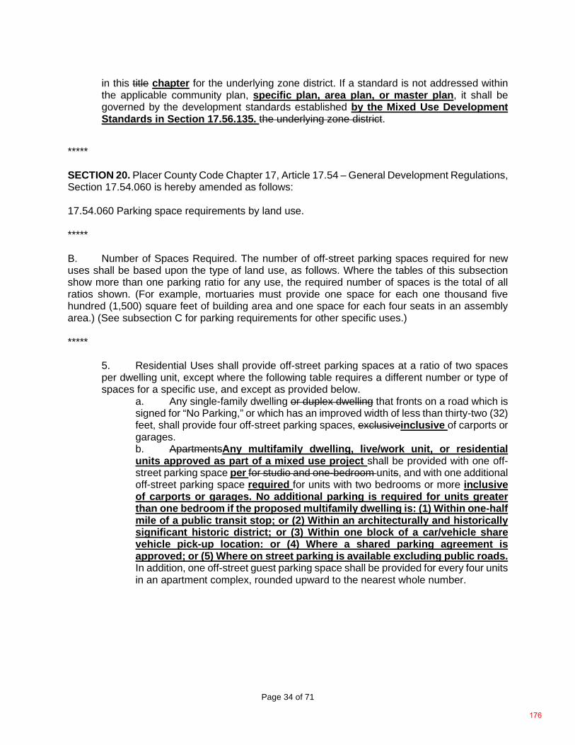
Page 34 of 71
in this title chapter for the underlying zone district. If a standard is not addressed within the applicable community plan, specific plan, area plan, or master plan, it shall be governed by the development standards established by the Mixed Use Development Standards in Section 17.56.135. the underlying zone district.
***** SECTION 20. Placer County Code Chapter 17, Article 17.54 – General Development Regulations, Section 17.54.060 is hereby amended as follows: 17.54.060 Parking space requirements by land use. ***** B. Number of Spaces Required. The number of off-street parking spaces required for new uses shall be based upon the type of land use, as follows. Where the tables of this subsection show more than one parking ratio for any use, the required number of spaces is the total of all ratios shown. (For example, mortuaries must provide one space for each one thousand five hundred (1,500) square feet of building area and one space for each four seats in an assembly area.) (See subsection C for parking requirements for other specific uses.) *****
5. Residential Uses shall provide off-street parking spaces at a ratio of two spaces per dwelling unit, except where the following table requires a different number or type of spaces for a specific use, and except as provided below.
a. Any single-family dwelling or duplex dwelling that fronts on a road which is signed for “No Parking,” or which has an improved width of less than thirty-two (32) feet, shall provide four off-street parking spaces, exclusiveinclusive of carports or garages. b. ApartmentsAny multifamily dwelling, live/work unit, or residential units approved as part of a mixed use project shall be provided with one off-street parking space per for studio and one-bedroom units, and with one additional off-street parking space required for units with two bedrooms or more inclusive of carports or garages. No additional parking is required for units greater than one bedroom if the proposed multifamily dwelling is: (1) Within one-half mile of a public transit stop; or (2) Within an architecturally and historically significant historic district; or (3) Within one block of a car/vehicle share vehicle pick-up location: or (4) Where a shared parking agreement is approved; or (5) Where on street parking is available excluding public roads. In addition, one off-street guest parking space shall be provided for every four units in an apartment complex, rounded upward to the nearest whole number.
176
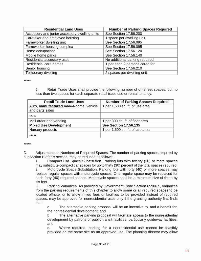
Page 35 of 71
Residential Land Uses Number of Parking Spaces Required Accessory and junior accessory dwelling units See Section 17.56.200 Caretaker and employee housing 1 space per dwelling unit Farmworker dwelling unit See Section 17.56.095 Farmworker housing complex See Section 17.56.095 Home occupations See Section 17.56.120 Mobile home parks See Section 17.56.140 Residential accessory uses No additional parking required Residential care homes 1 per each 2 persons cared for Senior housing See Section 17.56.210 Temporary dwelling 2 spaces per dwelling unit
*****
6. Retail Trade Uses shall provide the following number of off-street spaces, but no less than two spaces for each separate retail trade use or rental tenancy.
Retail Trade Land Uses Number of Parking Spaces Required
Auto, manufactured mobile home, vehicle and parts sales
1 per 1,500 sq. ft. of use area
***** Mail order and vending 1 per 300 sq. ft. of floor area Mixed Use Development See Section 17.56.135 Nursery products 1 per 1,500 sq. ft. of use area
***** ***** D. Adjustments to Numbers of Required Spaces. The number of parking spaces required by subsection B of this section, may be reduced as follows:
1. Compact Car Space Substitution. Parking lots with twenty (20) or more spaces may substitute compact car spaces for up to thirty (30) percent of the total spaces required. 2. Motorcycle Space Substitution. Parking lots with forty (40) or more spaces may replace regular spaces with motorcycle spaces. One regular space may be replaced for each forty (40) required spaces. Motorcycle spaces shall be a minimum size of three by six feet. 3. Parking Variances. As provided by Government Code Section 65906.5, variances from the parking requirements of this chapter to allow some or all required spaces to be located off-site, or to allow in-lieu fees or facilities to be provided instead of required spaces, may be approved for nonresidential uses only if the granting authority first finds that:
a. The alternative parking proposal will be an incentive to, and a benefit for, the nonresidential development; and b. The alternative parking proposal will facilitate access to the nonresidential development by patrons of public transit facilities, particularly guideway facilities; and c. Where required, parking for a nonresidential use cannot be feasibly provided on the same site as an approved use. The planning director may allow
177
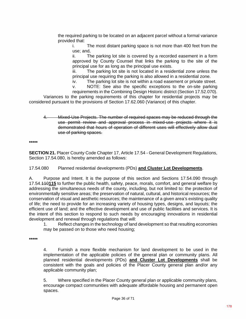
Page 36 of 71
the required parking to be located on an adjacent parcel without a formal variance provided that:
i. The most distant parking space is not more than 400 feet from the use; and, ii. The parking lot site is covered by a recorded easement in a form approved by County Counsel that links the parking to the site of the principal use for as long as the principal use exists. iii. The parking lot site is not located in a residential zone unless the principal use requiring the parking is also allowed in a residential zone. iv. The parking lot site is not within a road easement or private street. v. NOTE: See also the specific exceptions to the on-site parking requirements in the Combining Design Historic district (Section 17.52.070).
Variances to the parking requirements of this chapter for residential projects may be considered pursuant to the provisions of Section 17.62.060 (Variance) of this chapter.
4. Mixed-Use Projects. The number of required spaces may be reduced through the use permit review and approval process in mixed-use projects where it is demonstrated that hours of operation of different uses will effectively allow dual use of parking spaces.
***** SECTION 21. Placer County Code Chapter 17, Article 17.54 - General Development Regulations, Section 17.54.080, is hereby amended as follows: 17.54.080 Planned residential developments (PDs) and Cluster Lot Developments. A. Purpose and Intent. It is the purpose of this section and Sections 17.54.090 through 17.54.110115 to further the public health, safety, peace, morals, comfort, and general welfare by addressing the simultaneous needs of the county, including, but not limited to: the protection of environmentally sensitive areas; the preservation of natural, cultural, and historical resources; the conservation of visual and aesthetic resources; the maintenance of a given area’s existing quality of life; the need to provide for an increasing variety of housing types, designs, and layouts; the efficient use of land; and the effective development and use of public facilities and services. It is the intent of this section to respond to such needs by encouraging innovations in residential development and renewal through regulations that will:
1. Reflect changes in the technology of land development so that resulting economies may be passed on to those who need housing;
*****
4. Furnish a more flexible mechanism for land development to be used in the implementation of the applicable policies of the general plan or community plans. All planned residential developments (PDs) and Cluster Lot Developments shall be consistent with the goals and policies of the Placer County general plan and/or any applicable community plan; 5. Where specified in the Placer County general plan or applicable community plans, encourage compact communities with adequate affordable housing and permanent open spaces.
178
Page 37 of 71
6. Cluster Lot Developments will also create community space, intended to maximize social interaction between residents. A Cluster Lot Development encourages a strong sense of community while preserving personal privacy and promoting a variety of housing choices to meet the needs of a diverse population. The use of the planned residential development (PD) and Cluster Lot Developments as an effective planning tool to achieve the above purposes is encouraged and supported by Placer County; however, it is not the purpose to: confer special privileges to any land owner; provide a means to protect an investment; or compensate a land owner for areas of their property that are unbuildable under standard development policies and procedures due to existing features and/or constraints on the property.
B. Applicability and Development Standards.
1. Where Permitted. A planned residential development (PD) consistent with the provisions of this section may be permitted only on a site to which the planned residential development (-PD) combining district is applied (Section 17.52.120) or where the zone district allows condominiums or townhouses or other types of attached for sale units, or Cluster Lot Developments. 2. Development Standards. Within a planned residential development, lot size, bulk or type of dwelling, density, lot coverage and required open space shall be subject to the provisions of this section rather than to the requirements of the applicable zone district established by Articles 17.06 through 17.52 of this chapter. The number of dwelling units to be permitted shall be determined by considering a number of factors related to the specific site, the specific content of the proposed project, the base zoning, and the provisions of this section. All other features of PD development and Cluster Lot Developments shall comply with requirements of the applicable zone district and other applicable provisions of this chapter. 3. Community Plan Consistency. All PDs and Cluster Lot Developments shall be consistent with the goals and policies of the Placer County general plan, or any applicable specific or community plan. 4. PD Guidelines. All PDs should also be designed to comply with the planned residential development guidelines and rural design guidelines where applicable. 5. Cluster Lot Developments. All cluster lot developments shall be designed consistent with the Section 17.54.115.
C. Allowable Land Uses. The following land uses may be allowed in a planned residential development or Cluster Lot Developments, provided that the conditional use permit authorizing the PD (see Section 17.54.090) or Cluster Lot Developments shall specify the permitted uses and may restrict the uses allowed to one or more of the uses allowed in the underlying zone to which the -PD combining district is applied or the zoning district in which the Cluster Lot Development is approved. For Cluster Lot Developments allowed by zoning clearance (Section 17.06.050) all uses permitted in the underlying zone would be permitted.
1. Any use permitted in the zone applicable to the site; 2. Any of the land uses identified by Section 17.06.050(D) (Land use and permit tables) as residential uses or recreational uses, except for farmworker dwelling units and farmworker housing complexes.
*****
179
Page 38 of 71
SECTION 22. Placer County Code Chapter 17, Article 17.54 - General Development Regulations, Section 17.54.090 is hereby amended, as follows: 17.54.090 PD and Cluster Lot Development permit and processing requirements. A proposed PD or Cluster Lot Development shall require conditional use permit approval pursuant to Section 17.58.130 (Conditional use permits) or if allowed by zoning clearance a design review approval shall be required pursuant to Section 17.58.110 (Design review approval) whichever is applicable, and the approval of a subdivision tentative map or vesting tentative map pursuant to Chapter 16 of this code, with the following additional requirements: A. Application Contents. In addition to the application information required by Section 17.58.030 (Required application contents) and Chapter 16 (Subdivisions) of this code, the applicant shall furnish the following information: 1. Project Description Information.
a. Type of residences to be constructed (e.g., detached single-family dwellings, condominiums, duplexes, cottage housing, etc.) including elevations, floor plans, etc., as deemed necessary by the development review committee (DRC); b. Proposed staging of construction, by units, if the PD or Cluster Lot Development is to be constructed in stages; c. Location and proposed uses of open spaces, location and layout of recreational facilities and parking areas, general location of trees and other vegetation, hydrologic, geologic, topographic, cultural, and historic features on the site, and a specific identification of any features that are proposed to be removed or disturbed.
2. Computations. The developer shall prepare a computation exhibit that demonstrates how the project will satisfy the requirements of Section 17.54.100 or Section 17.54.115 regarding permitted density and required parking, building coverage and open space ratios. The following is a sample computation for a single-family dwelling planned residential development on a forty (40) acre tract of land designated on the zoning map as RS-B-20 with a -PD combining district of 3.0 (a maximum residential intensity factor of 3.0 dwelling units per acre): ***** B. Required Findings for PD. In addition to the findings required for approval of a conditional use permit by Section 17.58.130 (Permit issuance), the approval or disapproval of a PD by written action shall include not only conclusions, but also findings of fact related to the specific proposal. The findings of the hearing body shall explain the specific reasons for approval or denial, and shall specifically explain how the plan would or would not be in the public interest including, but not limited to, findings and conclusions on the following, where applicable: ***** D. Expiration of Approval. A conditional use permit for a planned residential development, a Cluster Lot Development, or design review for a Cluster Lot Development shall be subject to the same time limits and provisions for extension as are established for the PD tentative map by Chapter 16 of this code (Subdivisions) instead of Section 17.58.160 (Permit time limits and extensions). Note: When any subdivision tentative map approved in conjunction with the establishment of a -PD designation expires or such approval is otherwise revoked by the planning commission or the board of supervisors, the -PD designation established for the project shall either revert to the -PD density which existed prior to the project approval, or shall no longer be
180
Page 39 of 71
effective (if no -PD designation existed prior to project approval). (See also Sections 17.52.120(E) and 17.60.090(E)(3).) E. Modifications of PD or Cluster Lot Development After Final Map Recordation. In PDs and Cluster Lot Developments, changes to lot lines can be accomplished through the MBLA process (without a CUP or design review modification), described in Chapter 16 of this code, where all of the following conditions are found:
1. The change affects no more than four lots in the PD or Cluster Lot Development; 2. The density of the project is not increased; 3. The total open space area of the subdivision is not reduced; 4. The boundary change does not reduce minimum development standards, such as lot width, lot size, setbacks, etc.; 5. Such a change does not alter the approved building site on a given lot; 6. The proposed change does not alter a lot line placed in a specific location, due to a natural feature of the site (i.e., a lot line placed along a drainage course, ridge line, etc.) to the extent that equal protection for such a resource is no longer provided. Also in PDs or Cluster Lot Developments, changes to lot coverage, height and setback standards may be processed by the zoning administrator as a CUP modification or underlying entitlements or approvals if such changes meet all of the following criteria:
7. The change affects no more than four lots in the PD or Cluster Lot Development; 8. Such a modification does not result in a larger structure (i.e., no larger building footprint) than could otherwise be constructed pursuant to the limitations shown in Sections 17.54.100(A)(2)(e) or 17.54.100 (A)(3), or 17.54.115 or the basic standards listed as being applicable to the use/property in question in the basic zone district wherein that use/property is located, whichever is the least restrictive; and 9. The proposed structure does not violate any applicable CC&Rs; and 10. The required findings for approval of a use permit are made. F. If the above criteria are not applicable to the modifications proposed, such modifications must be considered by the planning commission or approving body pursuant to the processes discussed in Section 17.58.180 (Changes to an approved project) and in Section 17.58.130 (Conditional use permits) or in Section 17.58.110 (Design review). G. Note. An application to modify any aspect of a PD or Cluster Lot Development which affects a property ownership interest in the common area, a property ownership interest in any private roadways and/or conditions applicable to all of the lots must contain the signatures of all property owners in the PD or Cluster Lot Development. (Ord. 5126-B, 2001) ***** SECTION 23. Placer County Code Chapter 17, Article 17.54 - General Development Regulations, Section 17.54.100 is hereby amended as follows: 17.54.100 Planned Development (PD) Design and development standards. ***** SECTION 24. Placer County Code Chapter 17, Article 17.54 - General Development Regulations, Section 17.54.110 is hereby amended as follows: 17.54.110 Legal documents.
181
Page 40 of 71
In planned residential developments and Cluster Lot Developments with areas of common ownership, the subdivision map, dedications, covenants, and other recorded legal agreements shall provide for the following: A. Requirements to be Included. The required legal documents shall: ***** SECTION 25. Placer County Code Chapter 17, is hereby amended to add Article 17.54 - General Development Regulations, Section 17.54.115, as follows: 17.54.115 Cluster Lot Development Design and Development Standards. A. Cluster Lot Development Requirements.
1. All cluster lot developments shall be consistent with the goals and policies of the Placer County Conservation Program.
2. Determining Allowable Density. Number of dwellings permitted. The number of dwelling units permitted shall be calculated by dividing the project area by the minimum lot area required by the underlying zone district.
3. Common space. Common space shall provide for community necessities and passive and/or active recreational activities, and may consist of uses such as shared lawns, gardens, patios, pools, and community buildings or common houses. More active uses such as playing courts are permitted as long as they do not dominate the common space. Common space shall be organized with houses fronting onto or streets fronting onto such spaces, and pedestrian connections to such open space provided that:
a. At least 20 percent of all housing units shall be adjacent to designated common or open space, unless otherwise noted below. b. The walking distance between all housing units and a portion of the common or open space, measured along street frontages or pedestrian walkways, shall on average not exceed 1,320 feet (one-quarter mile). c. Landscaping. Landscaping and common space shall be maintained for the life of the project. The applicant shall submit proof that a property owners association or other organization has been established for this purpose before any building permits for construction in a cluster lot development shall be issued. d. Dedication. The minimum required dedicated common space shall be 400 square feet per dwelling unit. Such space cannot include existing or proposed public road right-or-ways, other road easements, or major electrical transmission line easements for facilities which carry 60kv or greater. Common space does not include undeveloped portions of subdivision lots held in the ownership of private individuals. The common space shall be preserved from development in perpetuity through the use of a dedication and shall be conveyed to a property owners association or other organization with responsibility for maintenance of the common/open space and the ability to collect assessments or dues for such purpose. The applicant must submit proof that: (a) such a deed restriction and/or conservation easement has been recorded; and that (b) non-profit homeowners’ association or similar entity has been legally created per
182
Page 41 of 71
Section 17.54.110 prior to any building permits for construction in a cluster lot development shall be accepted.
B. General Standards for all Cluster Lot Developments 1. Garages and Alleys: Alleys and lots with garages accessed from alleys, are
encouraged. 2. Fences: Fences may not be located within required common open space
areas unless required for agricultural uses or active recreational areas. 3. Windows: Placement of windows shall avoid creating privacy issues for adjacent units and neighboring properties.
4. Storage: All accessory storage shall comply with Section 17.56.250 (Storage, Accessory-Indoor and outdoor).
C. Zero lot line development. The side setback on one side of the property may be reduced to zero for a grouping of cluster lots sharing a common street frontage, subject to the following requirements 1. The subdivision map shall specify the specific location of each zero-lot line
house on the cluster lot. 2. The side setback reduction shall not apply to the side building setback
adjacent to a street or to lots that are not part of the zero lot line cluster lot project. 3. A 10-foot minimum separation distance shall be maintained between
adjacent principal dwelling structures. 4. An easement between adjacent property owners for maintenance shall be
required if the sidewall or eaves of one house is closer than four (4) feet to the adjacent property line.
5. If the side wall of the house is 3 feet or less from the property line, windows or other openings that allow for visibility into the side yard of the adjacent lot are not allowed. Windows or other openings that do not allow visibility into the side yard of the adjacent lot, such as a translucent window, are allowed.
D. Cluster Housing Type Development Standards 1. Cottage Housing. Proposed Cluster Cottage Housing shall be designed and developed consistent with the following standards:
183
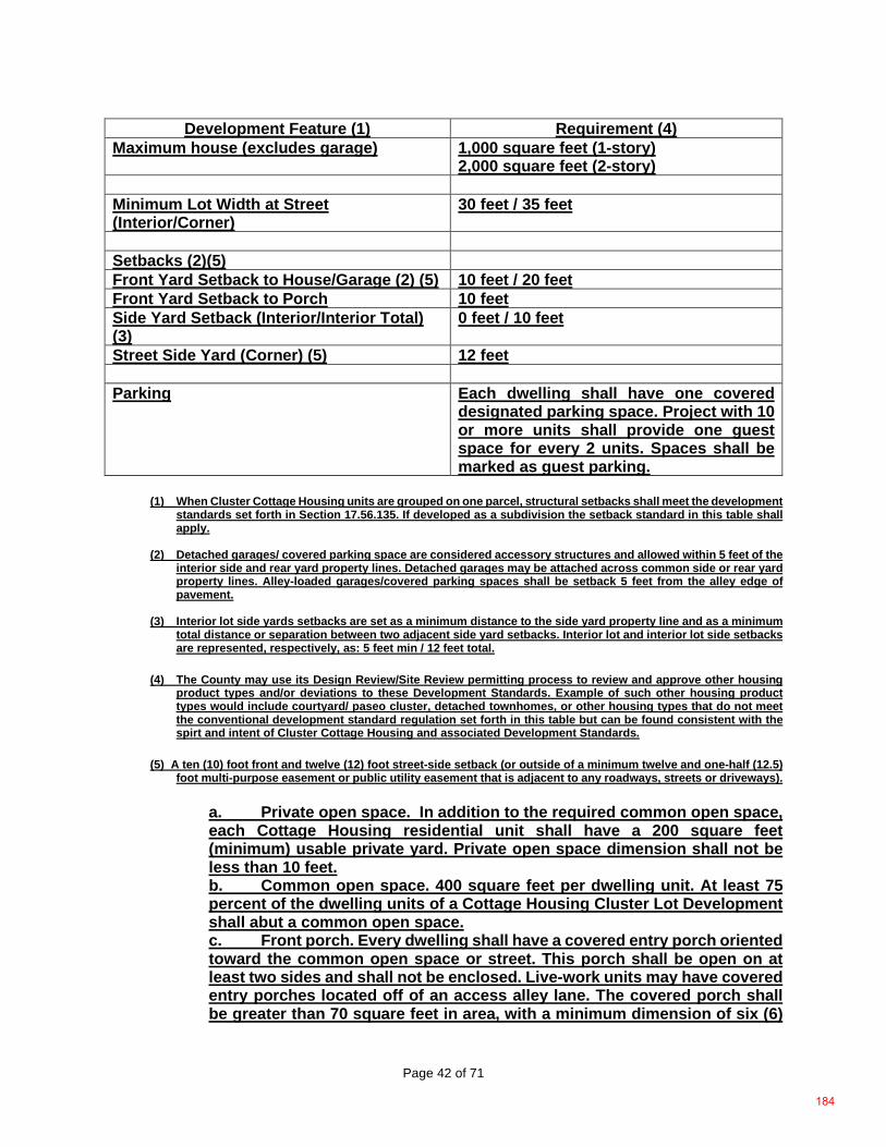
Page 42 of 71
Development Feature (1) Requirement (4) Maximum house (excludes garage) 1,000 square feet (1-story)
2,000 square feet (2-story) Minimum Lot Width at Street (Interior/Corner)
30 feet / 35 feet
Setbacks (2)(5) Front Yard Setback to House/Garage (2) (5) 10 feet / 20 feet Front Yard Setback to Porch 10 feet Side Yard Setback (Interior/Interior Total) (3)
0 feet / 10 feet
Street Side Yard (Corner) (5) 12 feet Parking Each dwelling shall have one covered
designated parking space. Project with 10 or more units shall provide one guest space for every 2 units. Spaces shall be marked as guest parking.
(1) When Cluster Cottage Housing units are grouped on one parcel, structural setbacks shall meet the development
standards set forth in Section 17.56.135. If developed as a subdivision the setback standard in this table shall apply.
(2) Detached garages/ covered parking space are considered accessory structures and allowed within 5 feet of the
interior side and rear yard property lines. Detached garages may be attached across common side or rear yard property lines. Alley-loaded garages/covered parking spaces shall be setback 5 feet from the alley edge of pavement.
(3) Interior lot side yards setbacks are set as a minimum distance to the side yard property line and as a minimum
total distance or separation between two adjacent side yard setbacks. Interior lot and interior lot side setbacks are represented, respectively, as: 5 feet min / 12 feet total.
(4) The County may use its Design Review/Site Review permitting process to review and approve other housing
product types and/or deviations to these Development Standards. Example of such other housing product types would include courtyard/ paseo cluster, detached townhomes, or other housing types that do not meet the conventional development standard regulation set forth in this table but can be found consistent with the spirt and intent of Cluster Cottage Housing and associated Development Standards.
(5) A ten (10) foot front and twelve (12) foot street-side setback (or outside of a minimum twelve and one-half (12.5) foot multi-purpose easement or public utility easement that is adjacent to any roadways, streets or driveways).
a. Private open space. In addition to the required common open space, each Cottage Housing residential unit shall have a 200 square feet (minimum) usable private yard. Private open space dimension shall not be less than 10 feet. b. Common open space. 400 square feet per dwelling unit. At least 75 percent of the dwelling units of a Cottage Housing Cluster Lot Development shall abut a common open space. c. Front porch. Every dwelling shall have a covered entry porch oriented toward the common open space or street. This porch shall be open on at least two sides and shall not be enclosed. Live-work units may have covered entry porches located off of an access alley lane. The covered porch shall be greater than 70 square feet in area, with a minimum dimension of six (6)
184
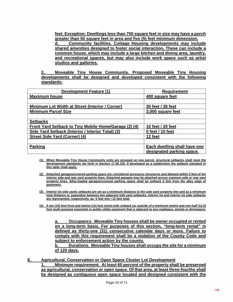
Page 43 of 71
feet. Exception: Dwellings less than 700 square feet in size may have a porch greater than 50 square feet in area and five (5) feet minimum dimension. d. Community facilities. Cottage Housing developments may include shared amenities designed to foster social interaction. These can include a common house, which may include a large kitchen and dining area, laundry, and recreational spaces, but may also include work space such as artist studios and galleries.
2. Moveable Tiny House Community. Proposed Moveable Tiny Housing developments shall be designed and developed consistent with the following standards:
Development Feature (1) Requirement
Maximum house 400 square feet Minimum Lot Width at Street (Interior / Corner) 30 feet / 35 feet Minimum Parcel Size 3,000 square feet Setbacks Front Yard Setback to Tiny Mobile Home/Garage (2) (4) 10 feet / 20 feet Side Yard Setback (Interior / Interior Total) (3) 0 feet / 10 feet Street Side Yard (Corner) (4) 12 feet Parking Each dwelling shall have one
designated parking space.
(1) When Moveable Tiny House Community units are grouped on one parcel, structural setbacks shall meet the development standards set forth in Section 17.56.135. If developed as a subdivision the setback standard in this table shall apply.
(2) Detached garages/covered parking space are considered accessory structures and allowed within 5 feet of the
interior side and rear yard property lines. Detached garages may be attached across common side or rear yard property lines. Alley-loaded garages/covered parking space shall be setback 5 feet from the alley edge of pavement.
(3) Interior lot side yards setbacks are set as a minimum distance to the side yard property line and as a minimum
total distance or separation between two adjacent side yard setbacks. Interior lot and interior lot side setbacks are represented, respectively, as: 5 feet min / 12 feet total.
(4) A ten (10) foot front and twelve (12) foot street-side setback (or outside of a minimum twelve and one-half (12.5)
foot multi-purpose easement or public utility easement that is adjacent to any roadways, streets or driveways).
a. Occupancy. Moveable Tiny houses shall be owner occupied or rented on a long-term basis. For purposes of this section, “long-term rental” is defined as thirty-one (31) consecutive calendar days or more. Failure to comply with this requirement shall be a violation of the County Code and subject to enforcement action by the county. b. Durations. Moveable Tiny houses shall occupy the site for a minimum of 120 days.
E. Agricultural, Conservation or Open Space Cluster Lot Development
1. Minimum requirement. At least 60 percent of the property shall be preserved as agricultural, conservation or open space. Of that area, at least three-fourths shall be designed as contiguous open space located and designed consistent with the
185
Page 44 of 71
standards below. Agricultural, conservation or open space shall meet the requirements of Section 17.54.115 (B)(2)(d). 2. Location. Agricultural, Conservation and Open Space cluster lot developments proposed within the Placer County Conservation Program Area (Article 19.10) shall be consistent with the Program and only located within the Potential Future Growth Area. Other Agricultural, Conservation and Open Space cluster lot developments are encouraged to be located within rural transition areas. 3. Minimum Cluster Lot Size. The minimum size for an Agricultural, Conservation, or Open Space cluster lot development shall be 20 acres. 4. Residential Siting Standards.
a. All residential lots and dwellings shall be grouped into clusters. Each cluster shall contain no more than 12 dwelling units and no less than four (4) units. b. Residential clusters shall be located to minimize negative impacts on the agricultural, natural, scenic and cultural resources of the site and conflicts between incompatible uses. Particular attention should be provided to existing established agricultural land uses. c. Residential clusters shall avoid encroaching on waters of Placer County, rare plant communities, special habitat sites, or endangered species identified by the Placer County Conservation Program or other wildlife regulator agency. d. When possible, open space shall connect with existing or potential open space lands on adjoining parcels and local or regional recreational trails. e. Residential clusters should be sited to achieve the following goals, to the extent practicable.
1. Minimize impacts to prime farmland soils and large tracts of land in agricultural use and avoid interference with normal agricultural practices. 2. Minimize disturbance to woodlands, wetlands, grasslands, streams, wildlife species’ habitat, and mature trees. 3. Prevent downstream impacts due to runoff through adequate on-site storm water management practices. 4. Protect scenic views of open land from adjacent roads. Visual impact should be minimized through use of landscaping or other features. 5. Protect archaeological sites and existing historic buildings or incorporate them through adaptive reuse.
5. Open Space Designation Standards. a. The uses within the open space shall be accessible to the residents of the development. If uses include open space trails that connect to the local or regional trail systems, these uses shall be available to the general public. The required open space shall be restricted in perpetuity from future development. The minimum open space required shall be owned and maintained under one of the alternatives listed below.
1. A homeowners’ association. 2. A condominium association established in accordance with California law. 3. A nonprofit conservation organization. 4. The County of Placer or another governmental body empowered to hold an interest in real property.
186
Page 45 of 71
5. An individual who will use the land for open space purposes as provided by a conservation easement.
b. Open Space Conservation Ranking (in order of significance). The areas to be preserved shall be identified on a case-by-case basis in an effort to conserve and provide the best opportunities to restore and expand the best quality natural features of each particular site.
1. First priority will be given to intact natural communities, rare and endangered species, environmental corridors, natural and restored prairies, significant historic and archaeological properties, and steep slopes. 2. Second priority will be given to areas providing some plant and wildlife habitat and open space values. 3. Third priority will be given to areas providing limited wildlife habitat but providing protections of viewshed, recreation opportunities, or a sense of open space.
c. The following areas or structures may be located within the open space area and shall be counted toward the overall open space percentage required:
1. Parking areas for access to and use of the open space developed at a scale limited to the potential users of the open space. 2. Privately held buildings or structures provided they are accessory to the use of the open space. 3. Shared septic systems and shared potable water systems.
d. No more than 50 percent of the required open space may consist of water bodies, ponds, floodplain, or wetlands. e. That portion of open space designed to provide plant and animal habitat shall be kept as intact as possible. Trails shall be designed to avoid fragmenting these areas. f. Accessible open space in upland areas shall be available for recreational uses such as trails, play fields, or community gardens but should be designed in a manner that avoids adversely impacting conservation values. g. A pathway system connecting open space areas accessible to neighborhood residents and connecting these areas to neighborhood streets and to planned or developed trails on adjacent parcels shall be identified in the plan.
***** SECTION 26. Placer County Code Chapter 17, Article 17.54 – General Development Regulation Standards, Section 17.54.120 is amended as follows: 17.54.120 Residential density bonuses and incentives
A. Purpose. The purpose and intent of this section is to comply with the mandatory requirements of Government Code Section 65915 regarding density bonuses and concessions or incentives for certain types of housing developments.
187
Page 46 of 71
B. Eligibility. In order to be eligible for a density bonus and density bonus incentive(s) as provided by subsections C and D of this section, an applicant shall propose to construct any one of the following:
1. A housing development consisting of five or more units in which at least ten (10) percent of the total units are specified to be for lower income households, as defined in Section 50079.5 of the Health and Safety Code;
2. A housing development consisting of five or more units in which at least five percent of the total units are specified to be for very low income households, as defined in Section 50105 of the Health and Safety Code;
3. A senior citizens’ housing development as defined in Section 51.3 of the Civil Code consisting of five or more units;
4. A condominium project as defined in subsection (f) of Section 1351 of the Civil Code consisting of five or more units in which at least ten (10) percent of the total dwelling units are specified to be for persons and families of moderate income, as defined in Section 50093 of the Health and Safety Code;
5. A planned development as defined in subsection (k) of Section 1351 of the Civil Code consisting of five or more units in which at least ten (10) percent of the total dwelling units are specified to be for persons and families of moderate income, as defined in Section 50093 of the Health and Safety Code.
Amount of Density Bonus. The amount of density bonus to which the applicant is entitled shall be as follows, provided, however, in no event may a housing development receive a density bonus under this subsection that exceeds a cumulative total of fifty (50) percent; further provided, however, for a project that is within a redevelopment area in the Lake Tahoe Basin, an applicant may request a density bonus up to a total of one hundred (100) percent which may be allowed at the discretion of the planning director after taking into account the circumstances of the project and determining that the higher percentage is reasonable:
6. For a housing development in which at least ten (10) percent of the total units are for lower income households, as defined in Section 50079.5 of the Health and Safety Code, a density bonus of at least twenty (20) percent shall be allowed, unless the applicant elects a lesser percentage. For each one percent increase above the ten (10) percent in the percentage of units affordable to lower income households, the density bonus shall be increased by one and one-half percent up to a maximum of thirty-five (35) percent.
For a housing development in which at least five percent of the total units are for very low income households, as defined in Section 50105 of the Health and Safety Code, a density bonus of at least twenty (20) percent shall be allowed, unless the applicant elects a lesser percentage. For each one percent increase above the five percent in the percentage of units affordable to very low income households, the density bonus shall be increased by two and one-half percent up to a maximum of thirty-five (35) percent.
For a condominium project as defined in subsection (f) of Section 1351 of the Civil Code in which at least ten (10) percent of the total dwelling units are for persons and families of moderate income, as defined in Section 50093 of the
188
Page 47 of 71
Health and Safety Code, a density bonus of at least five percent shall be allowed, unless a lesser percentage is elected by the applicant. For each one percent increase above the ten (10) percent in the percentage of units affordable to moderate income households, the density bonus shall be increased by one percent up to a maximum of thirty-five (35) percent.
For a planned development as defined in subsection (k) of Section 1351 of the Civil Code in which at least ten (10) percent of the total dwelling units are for persons and families of moderate income, as defined in Section 50093 of the Health and Safety Code, a density bonus of at least five percent shall be allowed, unless a lesser percentage is elected by the applicant. For each one percent increase above the ten (10) percent in the percentage of units affordable to moderate income households, the density bonus shall be increased by one percent up to a maximum of thirty-five (35) percent.
All density calculations resulting in fractional units shall be rounded up to the next whole number. The density bonus shall not be included when determining the number of housing units that is equal to five or ten (10) percent of the total.
The granting of a density bonus under this section shall not, in and of itself, require an additional application for and granting of a general plan amendment, zoning change or other separate discretionary entitlement.
Density Bonus Incentives.
1. In addition to the density bonus to which an applicant may be entitled by subsection C of this section, an applicant may submit a proposal for specific density bonus incentives as provided by this subsection. The applicant shall receive the number of incentives as provided below unless either of the written findings as specified in this section are made:
a. One density bonus incentive for projects that include at least ten (10) percent of the total units for lower income households, at least five percent for very low income households, or at least ten (10) percent for persons and families of moderate income in a condominium or planned development;
Two density bonus incentives for projects that include at least twenty (20) percent of the total units for lower income households, at least ten (10) percent for very low income households, or at least twenty (20) percent for persons and families of moderate income in a condominium or planned development;
Three density bonus incentives for projects that include at least thirty (30) percent of the total units for lower income households, at least twenty (20) percent for very low income households, or at least thirty (30) percent for persons and families of moderate income in a condominium or planned development.
In accordance with subsection (d)(1) of Government Code Section 56915, no density bonus incentive(s) shall be provided if written findings are made, based upon substantial evidence, that either:
189
Page 48 of 71
a. The density bonus incentive is not required in order to provide for affordable housing costs, as defined in Health and Safety Code Section 50052.5, or for rents for the targeted units to be set aside as specified in subsection H of this section; or
The density bonus incentive would have a specific adverse impact, as defined in paragraph (2) of subsection (d) of Government Code Section 65589.5, upon public health and safety, or physical environment or any real property that is listed in the California Register of Historical Resources and for which there is no feasible method to satisfactorily mitigate or avoid the specific adverse impact without rendering the development unaffordable to low and moderate income households.
Nothing in this subsection shall be interpreted to require the granting of a density bonus incentive that has a specific adverse impact, as defined in paragraph (2) of subsection (d) of Government Code Section 65589.5, upon public health, safety, or physical environment, and for which there is no feasible method to satisfactorily mitigate or avoid the specific adverse impact. Nothing in this subsection shall be interpreted to require the granting of a density bonus incentive that would have an adverse impact on any real property that is listed in the California Register of Historical Resources.
Density Bonus or Additional Incentive for Child Care Facilities.
1. Unless a written finding can be made, based upon substantial evidence, that the community has adequate child care facilities, when an applicant proposes to construct a housing development that complies with the requirements of subsection B of this section and includes a child care facility that will be located on the premises of, as a part of, or adjacent to the project, the approval shall include one of the following:
a. An additional density bonus that is an amount of square feet of residential space that is equal to or greater than the amount of square feet in the child care facility; or
b. An additional density bonus incentive that contributes significantly to the economic feasibility of the construction of the child care facility.
If either the foregoing density bonus or additional density bonus incentive is granted, a condition of approval of the housing development shall require that:
a. The child care facility shall remain in operation for a period of time that is at least as long as the period of time during which the density bonus units are required to remain affordable; or
Of the children who attend the child care facility, the children of very low income households, lower income households, or families of moderate income shall equal a percentage that is equal to or greater than the percentage of dwelling units that are required for very low income households, lower income households, or families of moderate income.
Density Bonus for Land Donation.
190
Page 49 of 71
1. When an applicant for a tentative subdivision map, parcel map, or other residential development approval donates land as provided in this subsection, the applicant shall be entitled to a density bonus of fifteen (15) percent. For each one percent increase above the minimum ten (10) percent land donation requirement of this subsection, the density bonus shall be increased by one percent up to a maximum of thirty-five (35) percent. The density bonus increase provided by this subsection shall be in addition to any density bonus provided by subsection C of this section; provided, however, in no event may the maximum combined density bonus exceed thirty-five (35) percent.
2. An applicant shall be eligible for the density bonus provided by this subsection only if all of the following conditions are met:
a. The land shall be transferred to the county or to an affordable housing developer approved by the county;
The transfer of the land shall occur no later than the date of approval of the final subdivision map, parcel map, or residential development application. No later than the date of approval of the final subdivision map, parcel map or residential development, the land shall have all of the permits and approvals, other than building permits, necessary for the development of the very low income housing units on the land;
The developable acreage and zoning classification of the land being transferred shall be sufficient to permit the construction of units affordable to very low income households in an amount not less than ten (10) percent of the number of residential units of the proposed development;
The land shall be at least one acre in size or of sufficient size to permit development of at least forty (40) units, has the appropriate general plan designation, is appropriately zoned for development as affordable housing, and is or will be served by adequate public facilities and infrastructure. The land shall have appropriate zoning and development standards to make the development of the affordable units feasible;
The land and the affordable units shall be subject to a deed restriction ensuring the continued affordability of the units consistent with subsection H of this section, which shall be recorded on the property at the time of dedication;
The land shall be within the boundary of the proposed development, or if approved by the planning director, within one-quarter mile of the boundary of the proposed development.
Vehicular Parking Ratios. At the request of the applicant of a proposed housing development meeting the criteria set forth in subsection B of this section, in addition to any other concession or incentive requested pursuant to this section, the following vehicular parking ratios, inclusive of handicapped and guest parking, shall apply:
1. Zero to one bedroom units: one on-site parking space;
2. Two to three bedroom units: two on-site parking spaces;
191
Page 50 of 71
3. Four and more bedroom units: two and one-half on-site parking spaces.
For the purposes of this subsection, on-site parking may be provided through tandem parking or uncovered parking, but not through on-street parking. If the total number of parking spaces required is other than a whole number, the number shall be rounded up to the next whole number.
Requirements for Approval of Density Bonus. The following provisions shall apply to any housing development that receives a density bonus as provided by this section:
1. The applicant shall provide an enforceable means, acceptable to the planning director, to ensure that all lower income household units that are utilized to obtain a density bonus shall remain affordable for thirty (30) years or a longer period of time required by the construction or mortgage financing assistance program, mortgage insurance program, or rental subsidy program.
2. The applicant shall provide that the lower income household units be offered at a rent or monthly home ownership cost that does not exceed thirty (30) percent of sixty (60) percent of area median income.
3. The applicant shall provide that the very low income household units be offered at a rent or monthly home ownership cost that does not exceed thirty (30) percent of fifty (50) percent of area median income.
4. An applicant shall provide an enforceable means, acceptable to the planning director, to ensure that the initial occupant of all moderate income units that are utilized to obtain a density bonus pursuant to subsection C of this section shall be persons and families of moderate income, as defined by Health and Safety Code Section 50093. Upon resale, the seller of the unit shall retain the value of any improvements, the down payment, and the proportionate shares of any appreciation that shall be allocated between the seller and the county as provided by subsection (c)(2) of Government Code Section 65915.
Waiver of Development Standard.
1. In the event an applicant contends that the application of a development standard has the effect of precluding the construction of a housing meeting the criteria of subsection B of this section, the applicant may apply for a waiver or modification of the development standard. The burden shall be upon the applicant to show that the waiver or modification is necessary in order to make the housing units economically feasible to construct. The waiver or modification shall be the minimum necessary to allow the project to be constructed.
2. Nothing in this subsection shall be interpreted to require the granting of an incentive that would have a specific adverse impact, as defined in paragraph (2) of subsection (d) of Government Code Section 65589.5, upon the health, safety, or physical environment, and for which there is no feasible method to satisfactorily mitigate or avoid the specific adverse impact. Nothing in this subsection shall be interpreted to require the granting of a density bonus incentive that would have an adverse impact on any real property that is listed in the California Register of Historical Resources.
192
Page 51 of 71
Definitions. For the purposes of this section only, and notwithstanding any other provision of this article, the following definitions apply:
“Child care facility” means a child day care facility other than a family day care home, including, but not limited to, infant centers, preschools, extended day care facilities, and school age child care centers.
“Density bonus” means the amount of density increase allowed over the otherwise maximum allowable residential density under the applicable zoning ordinance and land use element of the general plan as of the date the application is deemed complete.
“Density bonus incentive” means any of the following:
1. A reduction in site development standards or a modification of zoning code requirements or architectural design requirements that exceed the minimum building standards approved by the California Building Standards Commission as provided in Part 2.5 (commencing with Section 18901) of Division 13 of the Health and Safety Code, including, but not limited to, a reduction in the setback and square footage requirements and in the ratio of vehicular parking spaces that would otherwise be required that results in identifiable, financially sufficient, and actual cost reductions;
Approval of mixed use zoning in conjunction with the housing project if commercial, office, industrial, or other land uses will reduce the costs of the housing development and are compatible with the housing project and the existing or planned development in the area where the proposed housing project will be located;
Other concessions or incentives of a regulatory nature proposed by the applicant or the county that result in identifiable, financially sufficient and actual cost reductions;
A density bonus incentive does not include the provision of direct financial or land incentives to the applicant by the county, or the waiver of fees or dedication requirements.
“Development standard” means site or construction conditions that apply to residential development pursuant to any ordinance, general plan element, specific plan, or other regulation.
“Housing development” means one or more groups of projects for residential units constructed in accordance with the planned development of the county, including a subdivision, a planned unit development or condominium project, as defined in Section 1351 of the Civil Code, that consists of residential units or unimproved residential lots, a project to substantially rehabilitate and convert an existing commercial building to residential use, or the substantial rehabilitation of an existing multifamily dwelling, as defined in subsection (d) of Government Code Section 65863.4 where the result of the rehabilitation would be a net increase in available residential units.
“Maximum allowable residential density” means the density allowed under applicable zoning, or if a range of density is permitted, the maximum allowable density for the specific zoning range applicable to the property on which the proposed housing development is sited.
193
Page 52 of 71
Processing of Density Bonus and Density Bonus Incentive Requests. Requests for density bonuses and density bonus incentives under this section shall be included as part of the land use permit required for the residential project by Section 17.06.050 (Land use and permit tables). Within thirty (30) days of the acceptance of the project land use permit application as complete, the planning director shall notify the applicant whether the project qualifies for the requested additional density bonus and density bonus incentive(s).
A. Purpose. The purpose of this section is to implement requirements of the State Density Bonus Law (California Government Code Title 7, Division 1, Chapter 4.3, Sections 65915, et seq., “State Density Bonus Law”), and the County’s Housing Element by specifying how the County shall provide density bonuses and other incentives, concessions, or waivers for certain housing projects affordable to lower income, very low income, senior citizen housing, moderate income condominium projects, and child care facilities.
The State Density Bonus Law, which provides a 35 percent density bonus maximum to eligible projects, shall apply county-wide to eligible residential projects as defined in this Chapter and in State law. In addition, provisions for a Supplemental Density Bonus above the State density bonus maximum, or above the allowed General Plan residential density, is available for eligible projects as outlined in -Section 17.54.120 (I). B. Definitions. For purposes of this section, the following definitions apply.
1. “Affordable units” mean, and are limited to, those dwelling units which are required to be rented at affordable rents or sold at an affordable sales price to households of specified income levels. 2. “Affordable rent” means monthly rent, including utilities and all fees for housing services, affordable to households earning less than 50 percent of the median income or less than 80 percent of the median income as defined herein. Affordable rent shall be based on presumed occupancy levels of one person in a studio unit, two persons in a one-bedroom unit, three persons in a two-bedroom unit, and one additional person for each additional bedroom thereafter. 3. “Affordable sales price” means the maximum purchase price that will be affordable to households earning less than 120 percent of the median income as defined herein.
a. A maximum purchase price shall be considered affordable only if each monthly owner-occupied housing payment is affordable to households earning less than 120 percent of the median income in Placer County. b. In setting the affordable sales price, realistic assumptions regarding down payment, mortgage interest rate and term will be required and those assumptions must demonstrate that targeted income families can reasonably qualify. c. If evidence is presented which shows to the satisfaction of the County that targeted income buyers can qualify for financing even though the percentage of their income allocated to housing is higher than 30 percent,
194
Page 53 of 71
then a corresponding increase may be approved in the affordable sales price. d. Affordable sales price shall be based upon presumed occupancy levels of one person in a studio unit, two persons in a one-bedroom unit, three persons in a two-bedroom unit, and one additional person for each additional bedroom thereafter.
4. “Common interest development” means as defined in Section 4100 of the State Civil Code. 5. “Condominium project” means as defined in Civil Code Section 6542. 6. “Density bonus” means a density increase over the otherwise maximum allowable residential density under the applicable zoning designation and land use element of the general plan as of the date of application by the applicant to the county, as defined in the State Density Bonus Law (see Government Code Section 65915, Subdivision (f)). 7. “Disabled Veterans” are as defined in State Government Code Section 18541. 8. “Homeless Persons” are as defined in the federal McKinney-Vento homeless Assistance Act (42 U.S.C. Sec. 11301 et seq.). 9. “Housing development” is as defined in State Density Bonus Law, (see Government Code Section 65915, Subdivision (i), to mean a development project for five or more residential units, including mixed-use developments. 10. “Large project” means a “housing development” consisting of five or more dwelling units. 11. “Lower income households” are as defined by Health and Safety Code Section 50079.5. 12. “Moderate income households” are as defined by Health and Safety Code Section 50093. 13. “Small project” means a project that includes the construction of fewer than five units in a zoning district that allows for the construction of duplexes, triplexes, and fourplexes. 14. “Transitional foster youth”, is as defined in Section 66025.9 of the State Education Code. 15. “Very low income households” are as defined by Health and Safety Code Section 50105.
C. State Density Bonus.
1. The County will allow a residential development a 50 percent maximum density bonus and concessions or incentives meeting all the applicable eligibility requirements of this section.
a. Very low-income households. If an applicant elects to construct units for very low-income households for at least five percent of the total dwelling units, the development shall be entitled to the following density bonus calculation:
195
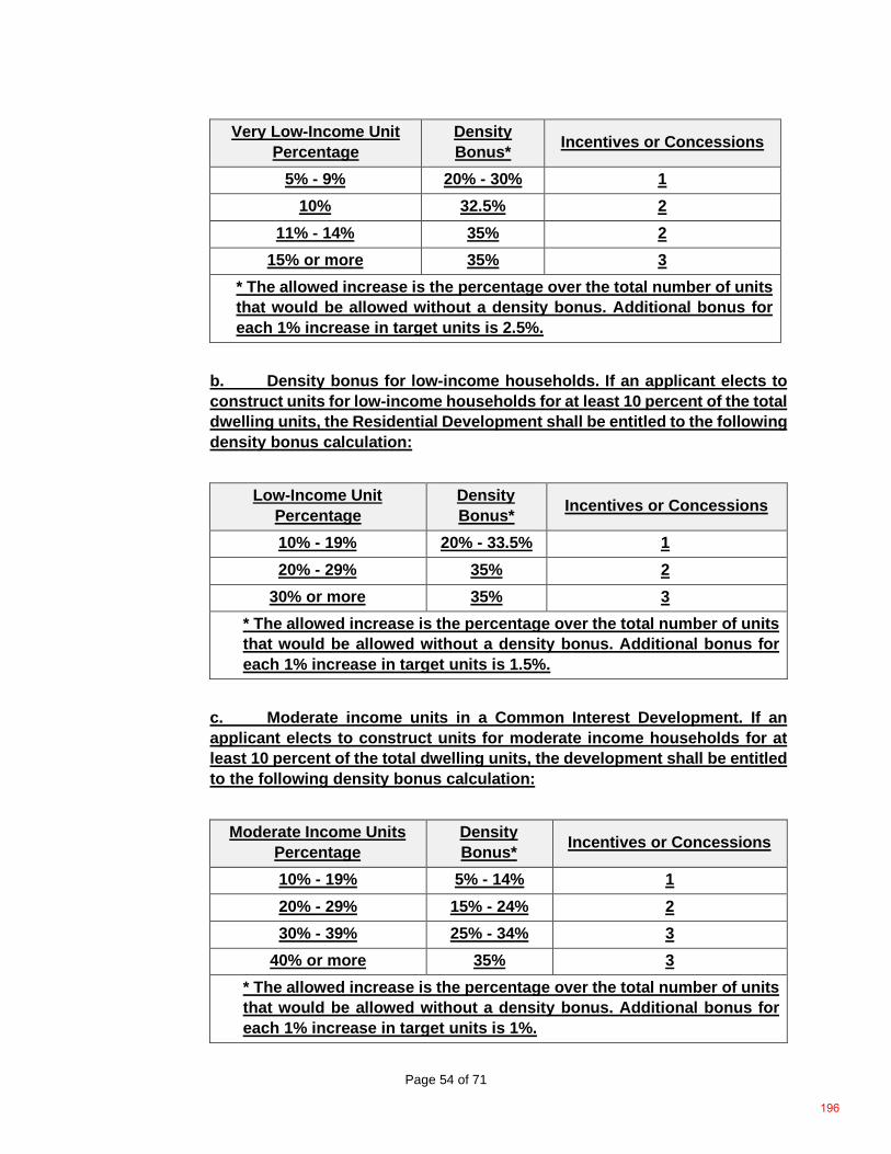
Page 54 of 71
Very Low-Income Unit Percentage
Density Bonus* Incentives or Concessions
5% - 9% 20% - 30% 1 10% 32.5% 2
11% - 14% 35% 2 15% or more 35% 3
* The allowed increase is the percentage over the total number of units that would be allowed without a density bonus. Additional bonus for each 1% increase in target units is 2.5%.
b. Density bonus for low-income households. If an applicant elects to construct units for low-income households for at least 10 percent of the total dwelling units, the Residential Development shall be entitled to the following density bonus calculation:
Low-Income Unit Percentage
Density Bonus* Incentives or Concessions
10% - 19% 20% - 33.5% 1 20% - 29% 35% 2
30% or more 35% 3 * The allowed increase is the percentage over the total number of units that would be allowed without a density bonus. Additional bonus for each 1% increase in target units is 1.5%.
c. Moderate income units in a Common Interest Development. If an applicant elects to construct units for moderate income households for at least 10 percent of the total dwelling units, the development shall be entitled to the following density bonus calculation:
Moderate Income Units Percentage
Density Bonus* Incentives or Concessions
10% - 19% 5% - 14% 1 20% - 29% 15% - 24% 2 30% - 39% 25% - 34% 3
40% or more 35% 3 * The allowed increase is the percentage over the total number of units that would be allowed without a density bonus. Additional bonus for each 1% increase in target units is 1%.
196
Page 55 of 71
d. Senior housing. If an applicant elects to construct a Senior Citizen Housing Development, the density bonus shall be 20 percent of the total number of allowed housing units without the density bonus. e. Transitional housing. If an applicant elects to construct a housing development with at least 10 percent of the total dwelling units for transitional foster youth, disabled veterans, or homeless persons, the density bonus shall be 20 percent of the total number of allowed housing units without the density bonus. f. Student housing. If an applicant elects to construct a student housing development used exclusively for students enrolled full time at an institution of higher education accredited by the Western Association of Schools and Colleges or the Accrediting Commission for Community and Junior Colleges with at least 20 percent of the total dwelling units for lower income students, the density bonus shall be 35 percent of the total number of allowed student housing without the density bonus. g. 80 percent density bonus for the number of units for lower income households. If an applicant elects to construct units for low income households with 100 percent of the total dwelling units, exclusive of manager’s unit(s), except that up to 20 percent of the total units in the development may be for moderate-income households. If the housing development is located within one-half mile of a major transit stop, as defined in Section 21155 of the Public Resources Code, there shall be no maximum density. h. The units described above shall be subject to the continued affordability requirements of all very low and low-income rental units that qualified the applicant for the award of the density bonus for 55 years or a longer period of time, as described in State Density Bonus Law (see Government Code Section 65915, Subdivision (c), Paragraph (1)). Rents for the lower income density bonus units shall be set at an affordable rent as defined in Section 50053 of the Health and Safety Code.
2. Incentives or concessions. An applicant may request the following State defined incentives for affordable housing only when the residential project is eligible for, and the applicant requests, a density bonus pursuant to this section. For the purposes of this section, an incentive means the following:
a. A reduction of development standards or a modification of zoning code requirements or architectural design requirements which exceed the minimum applicable building standards approved by the State Building Standards Commission pursuant to Part 2.5 (commencing with Section 18901) of Division 13 of the Health and Safety Code, including but not limited to building heights, setback, coverage, and/or parking requirements, which result in identifiable, financially sufficient, and actual cost reductions, based upon financial analysis and documentation accepted by the County. b. Allowing mixed use development in conjunction with the proposed residential project, if nonresidential land uses will reduce the cost of the
197
Page 56 of 71
residential project and the nonresidential land uses are compatible with the residential project and existing or planned surrounding development. c. Other regulatory incentives proposed by the applicant or the County which result in identifiable, financially sufficient, and actual cost reductions, based upon appropriate financial analysis and documentation if required by County.
3. A residential project is eligible for incentives as follows: a. One incentive for residential projects that include at least ten percent of the total dwelling units as target units affordable to low income households, at least five percent of the total dwelling units as target units affordable to very low income households, or at least 10 percent of the total dwelling units in a qualified common interest development as target units affordable to moderate income households. b. Two incentives for residential projects that include at least 20 percent of the total dwelling units as target units affordable to low income households, at least 10 percent of the total dwelling units as target units affordable to very low income households, or at least 20 percent of the total dwelling units in a qualified common interest development as target units affordable to moderate income households. c. Three incentives for residential projects that include at least 30 percent of the total dwelling units as target units affordable to low income households, at least 15 percent of the total dwelling units as target units affordable to very low income households, or at least 30 percent of the total dwelling units in a qualified common interest development as target units affordable to moderate income households. d. Four incentives for projects meeting the criteria of Section 17.54.120(C)(1)(g). If the project is located within one-half mile of a major transit stop, as defined in Section 21155 of the Public Resources Code, the applicant shall also receive a height increase of up to three additional stories, or 33 feet.
4. Each component of any density calculation, including base density and bonus density, resulting in fractional units shall be separately rounded up to the next whole number.
198
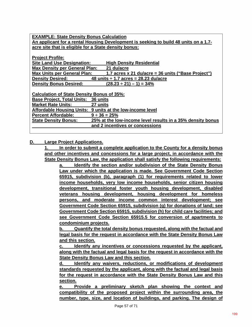
Page 57 of 71
EXAMPLE: State Density Bonus Calculation An applicant for a rental Housing Development is seeking to build 48 units on a 1.7-acre site that is eligible for a State density bonus: Project Profile: Site Land Use Designation: High Density Residential Max Density per General Plan: 21 du/acre Max Units per General Plan: 1.7 acres x 21 du/acre = 36 units (“Base Project”) Density Desired: 48 units ÷ 1.7 acres = 28.23 du/acre Density Bonus Desired: (28.23 ÷ 21) – 1) = 34% Calculation of State Density Bonus of 35%: Base Project, Total Units: 36 units Market Rate Units: 27 units Affordable Housing Units: 9 units at the low-income level Percent Affordable: 9 ÷ 36 = 25% State Density Bonus: 25% at the low-income level results in a 35% density bonus and 2 incentives or concessions
D. Large Project Applications.
1. In order to submit a complete application to the County for a density bonus and other incentives and concessions for a large project, in accordance with the State Density Bonus Law, the application shall satisfy the following requirements:
a. Identify the section and/or subdivision of the State Density Bonus Law under which the application is made. See Government Code Section 65915, subdivision (b), paragraph (1) for requirements related to lower income households, very low income households, senior citizen housing development, transitional foster youth housing development, disabled veterans housing development, housing development for homeless persons, and moderate income common interest development; see Government Code Section 65915, subdivision (g) for donations of land; see Government Code Section 65915, subdivision (h) for child care facilities; and see Government Code Section 65915.5 for conversion of apartments to condominium projects. b. Quantify the total density bonus requested, along with the factual and legal basis for the request in accordance with the State Density Bonus Law and this section. c. Identify any incentives or concessions requested by the applicant, along with the factual and legal basis for the request in accordance with the State Density Bonus Law and this section. d. Identify any waivers, reductions, or modifications of development standards requested by the applicant, along with the factual and legal basis for the request in accordance with the State Density Bonus Law and this section. e. Provide a preliminary sketch plan showing the context and compatibility of the proposed project within the surrounding area, the number, type, size, and location of buildings, and parking. The design of
199
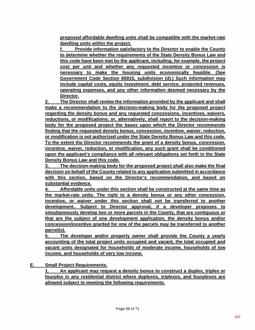
Page 58 of 71
proposed affordable dwelling units shall be compatible with the market-rate dwelling units within the project. f. Provide information satisfactory to the Director to enable the County to determine whether the requirements of the State Density Bonus Law and this code have been met by the applicant, including, for example, the project cost per unit and whether any requested incentive or concession is necessary to make the housing units economically feasible. (See Government Code Section 65915, subdivision (d).) Such information may include capital costs, equity investment, debt service, projected revenues, operating expenses, and any other information deemed necessary by the Director.
2. The Director shall review the information provided by the applicant and shall make a recommendation to the decision-making body for the proposed project regarding the density bonus and any requested concessions, incentives, waivers, reductions, or modifications; or, alternatively, shall report to the decision-making body for the proposed project the bases upon which the Director recommends finding that the requested density bonus, concession, incentive, waiver, reduction, or modification is not authorized under the State Density Bonus Law and this code. To the extent the Director recommends the grant of a density bonus, concession, incentive, waiver, reduction, or modification, any such grant shall be conditioned upon the applicant’s compliance with all relevant obligations set forth in the State Density Bonus Law and this code. 3. The decision-making body for the proposed project shall also make the final decision on behalf of the County related to any application submitted in accordance with this section, based on the Director’s recommendation, and based on substantial evidence. 4. Affordable units under this section shall be constructed at the same time as the market-rate units. The right to a density bonus or any other concession, incentive, or waiver under this section shall not be transferred to another development.. Subject to Director approval, if a developer proposes to simultaneously develop two or more parcels in the County, that are contiguous or that are the subject of one development application, the density bonus and/or concession/incentive granted for one of the parcels may be transferred to another parcel(s). 5. The developer and/or property owner shall provide the County a yearly accounting of the total project units occupied and vacant, the total occupied and vacant units designated for households of moderate income, households of low income, and households of very low income.
E. Small Project Requirements.
1. An applicant may request a density bonus to construct a duplex, triplex or fourplex in any residential district where duplexes, triplexes, and fourplexes are allowed subject to meeting the following requirements.
200
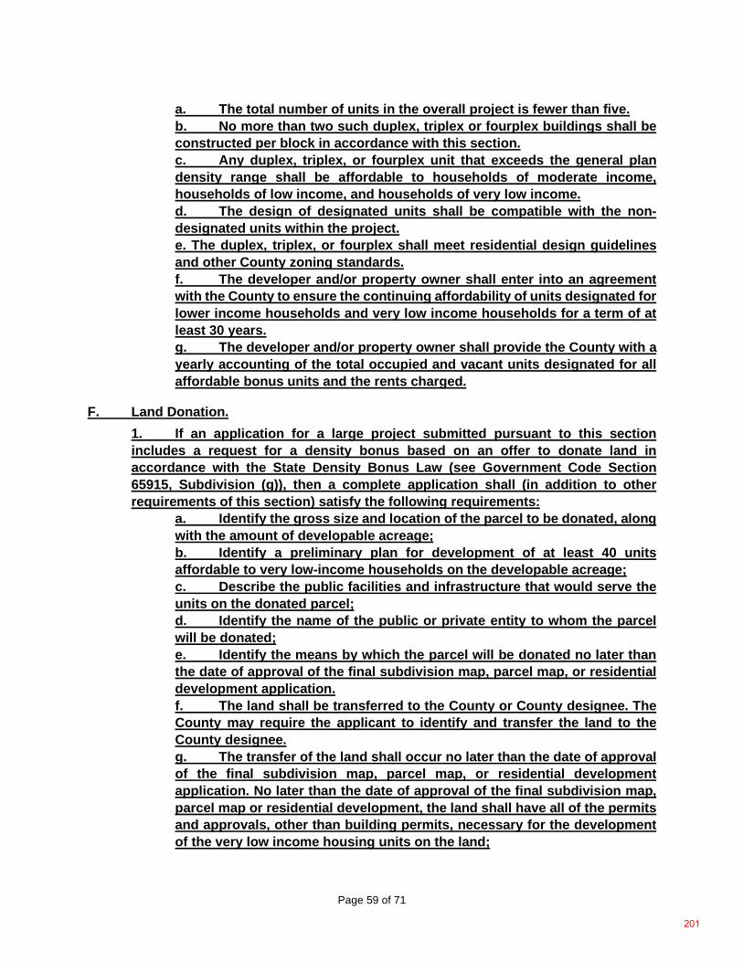
Page 59 of 71
a. The total number of units in the overall project is fewer than five. b. No more than two such duplex, triplex or fourplex buildings shall be constructed per block in accordance with this section. c. Any duplex, triplex, or fourplex unit that exceeds the general plan density range shall be affordable to households of moderate income, households of low income, and households of very low income. d. The design of designated units shall be compatible with the non-designated units within the project. e. The duplex, triplex, or fourplex shall meet residential design guidelines and other County zoning standards. f. The developer and/or property owner shall enter into an agreement with the County to ensure the continuing affordability of units designated for lower income households and very low income households for a term of at least 30 years. g. The developer and/or property owner shall provide the County with a yearly accounting of the total occupied and vacant units designated for all affordable bonus units and the rents charged.
F. Land Donation. 1. If an application for a large project submitted pursuant to this section includes a request for a density bonus based on an offer to donate land in accordance with the State Density Bonus Law (see Government Code Section 65915, Subdivision (g)), then a complete application shall (in addition to other requirements of this section) satisfy the following requirements:
a. Identify the gross size and location of the parcel to be donated, along with the amount of developable acreage; b. Identify a preliminary plan for development of at least 40 units affordable to very low-income households on the developable acreage; c. Describe the public facilities and infrastructure that would serve the units on the donated parcel; d. Identify the name of the public or private entity to whom the parcel will be donated; e. Identify the means by which the parcel will be donated no later than the date of approval of the final subdivision map, parcel map, or residential development application. f. The land shall be transferred to the County or County designee. The County may require the applicant to identify and transfer the land to the County designee. g. The transfer of the land shall occur no later than the date of approval of the final subdivision map, parcel map, or residential development application. No later than the date of approval of the final subdivision map, parcel map or residential development, the land shall have all of the permits and approvals, other than building permits, necessary for the development of the very low income housing units on the land;
201
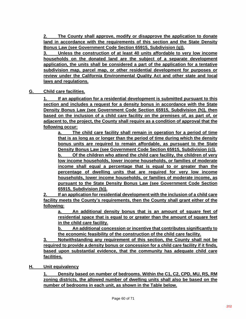
Page 60 of 71
2. The County shall approve, modify or disapprove the application to donate land in accordance with the requirements of this section and the State Density Bonus Law (see Government Code Section 65915, Subdivision (g)). 3. Unless the construction of at least 40 units affordable to very low income households on the donated land are the subject of a separate development application, the units shall be considered a part of the application for a tentative subdivision map, parcel map, or other residential development for purposes or review under the California Environmental Quality Act and other state and local laws and regulations.
G. Child care facilities. 1. If an application for a residential development is submitted pursuant to this section and includes a request for a density bonus in accordance with the State Density Bonus Law (see Government Code Section 65915, Subdivision (h)), then based on the inclusion of a child care facility on the premises of, as part of, or adjacent to, the project, the County shall require as a condition of approval that the following occur:
a. The child care facility shall remain in operation for a period of time that is as long as or longer than the period of time during which the density bonus units are required to remain affordable, as pursuant to the State Density Bonus Law (see Government Code Section 65915, Subdivision (c)). b. Of the children who attend the child care facility, the children of very low income households, lower income households, or families of moderate income shall equal a percentage that is equal to or greater than the percentage of dwelling units that are required for very low income households, lower income households, or families of moderate income, as pursuant to the State Density Bonus Law (see Government Code Section 65915, Subdivision (b)).
2. If an application for residential development with the inclusion of a child care facility meets the County’s requirements, then the County shall grant either of the following:
a. An additional density bonus that is an amount of square feet of residential space that is equal to or greater than the amount of square feet in the child care facility. b. An additional concession or incentive that contributes significantly to the economic feasibility of the construction of the child care facility.
3. Notwithstanding any requirement of this section, the County shall not be required to provide a density bonus or concession for a child care facility if it finds, based upon substantial evidence, that the community has adequate child care facilities.
H. Unit equivalency 1. Density based on number of bedrooms. Within the C1, C2, CPD, MU, RS, RM zoning districts, the allowed number of dwelling units shall also be based on the number of bedrooms in each unit, as shown in the Table below.
202
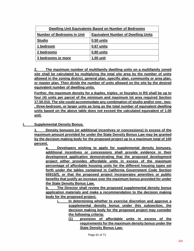
Page 61 of 71
Dwelling Unit Equivalents Based on Number of Bedrooms Number of Bedrooms in Unit Equivalent Number of Dwelling Units Studio 0.50 units 1 bedroom 0.67 units 2 bedrooms 0.80 units 3 bedrooms or more 1.00 unit
2. The maximum number of multifamily dwelling units on a multifamily zoned site shall be calculated by multiplying the total site area by the number of units allowed in the zoning district, general plan, specific plan, community or area plan, or master plan. Then divide the number of units allowed on the site by the desired equivalent number of dwelling units. Further, the maximum density for a duplex, triplex, or fourplex in RS shall be up to four (4) units per parcel of the minimum and maximum lot area required Section 17.50.010. The site could accommodate any combination of studio and/or one-, two-, three-bedroom, or larger units as long as the total number of equivalent dwelling units based on the above table does not exceed the calculated equivalent of 1.00 unit.
I. Supplemental Density Bonus. 1. Density bonuses (or additional incentives or concessions) in excess of the maximum amount provided for under the State Density Bonus Law may be granted by the decision making body for the proposed project up to a maximum total of 100 percent.
a. Developers wishing to apply for supplemental density bonuses, additional incentives or concessions shall provide evidence in their development application demonstrating that the proposed development project either provides affordable units in excess of the maximum percentage of affordable housing units for the different housing types set forth under the tables contained in California Government Code Section 65915(f), or that the proposed project incorporates amenities or public benefits that justify an increase over the maximum bonus provided for under the State Density Bonus Law. b. The Director shall review the proposed supplemental density bonus application materials and make a recommendation to the decision making body for the proposed project.
i. In determining whether to exercise discretion and approve a supplemental density bonus under this subsection, the decision making body for the proposed project may consider the following criteria: (1) provision of affordable units in excess of the
requirements for the maximum density bonus under the State Density Bonus Law;
203
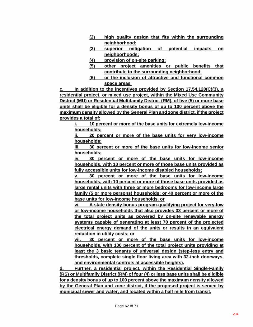
Page 62 of 71
(2) high quality design that fits within the surrounding neighborhood;
(3) superior mitigation of potential impacts on neighborhoods;
(4) provision of on-site parking; (5) other project amenities or public benefits that
contribute to the surrounding neighborhood; (6) or the inclusion of attractive and functional common
space areas. c. In addition to the incentives provided by Section 17.54.120(C)(3), a residential project, or mixed use project, within the Mixed Use Community District (MU) or Residential Multifamily District (RM), of five (5) or more base units shall be eligible for a density bonus of up to 100 percent above the maximum density allowed by the General Plan and zone district, if the project provides a total of:
i. 10 percent or more of the base units for extremely low-income households; ii. 20 percent or more of the base units for very low-income households; iii. 30 percent or more of the base units for low-income senior households; iv. 30 percent or more of the base units for low-income households, with 10 percent or more of those base units provided as fully accessible units for low-income disabled households; v. 30 percent or more of the base units for low-income households, with 10 percent or more of those base units provided as large rental units with three or more bedrooms for low-income large family (5 or more persons) households; or 40 percent or more of the base units for low-income households, or vi. A state density bonus program-qualifying project for very-low or low-income households that also provides 33 percent or more of the total project units as powered by on-site renewable energy systems capable of generating at least 70 percent of the projected electrical energy demand of the units or results in an equivalent reduction in utility costs; or vii. 30 percent or more of the base units for low-income households, with 100 percent of the total project units providing at least the 3 basic tenants of universal design (step-less entry and thresholds, complete single floor living area with 32-inch doorways, and environmental controls at accessible heights).
d. Further, a residential project, within the Residential Single-Family (RS) or Multifamily District (RM) of four (4) or less base units shall be eligible for a density bonus of up to 100 percent above the maximum density allowed by the General Plan and zone district, if the proposed project is served by municipal sewer and water, and located within a half mile from transit.
204
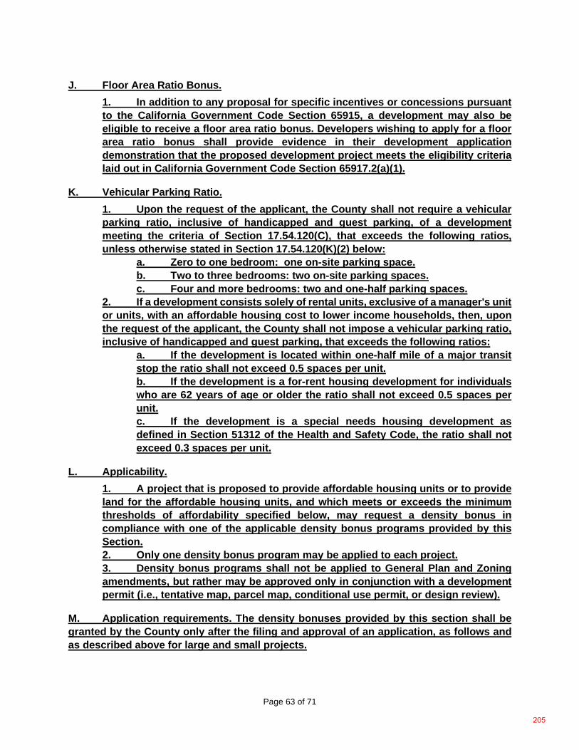
Page 63 of 71
J. Floor Area Ratio Bonus. 1. In addition to any proposal for specific incentives or concessions pursuant to the California Government Code Section 65915, a development may also be eligible to receive a floor area ratio bonus. Developers wishing to apply for a floor area ratio bonus shall provide evidence in their development application demonstration that the proposed development project meets the eligibility criteria laid out in California Government Code Section 65917.2(a)(1).
K. Vehicular Parking Ratio. 1. Upon the request of the applicant, the County shall not require a vehicular parking ratio, inclusive of handicapped and guest parking, of a development meeting the criteria of Section 17.54.120(C), that exceeds the following ratios, unless otherwise stated in Section 17.54.120(K)(2) below:
a. Zero to one bedroom: one on-site parking space. b. Two to three bedrooms: two on-site parking spaces. c. Four and more bedrooms: two and one-half parking spaces.
2. If a development consists solely of rental units, exclusive of a manager's unit or units, with an affordable housing cost to lower income households, then, upon the request of the applicant, the County shall not impose a vehicular parking ratio, inclusive of handicapped and guest parking, that exceeds the following ratios:
a. If the development is located within one-half mile of a major transit stop the ratio shall not exceed 0.5 spaces per unit. b. If the development is a for-rent housing development for individuals who are 62 years of age or older the ratio shall not exceed 0.5 spaces per unit. c. If the development is a special needs housing development as defined in Section 51312 of the Health and Safety Code, the ratio shall not exceed 0.3 spaces per unit.
L. Applicability. 1. A project that is proposed to provide affordable housing units or to provide land for the affordable housing units, and which meets or exceeds the minimum thresholds of affordability specified below, may request a density bonus in compliance with one of the applicable density bonus programs provided by this Section. 2. Only one density bonus program may be applied to each project. 3. Density bonus programs shall not be applied to General Plan and Zoning amendments, but rather may be approved only in conjunction with a development permit (i.e., tentative map, parcel map, conditional use permit, or design review).
M. Application requirements. The density bonuses provided by this section shall be granted by the County only after the filing and approval of an application, as follows and as described above for large and small projects.
205
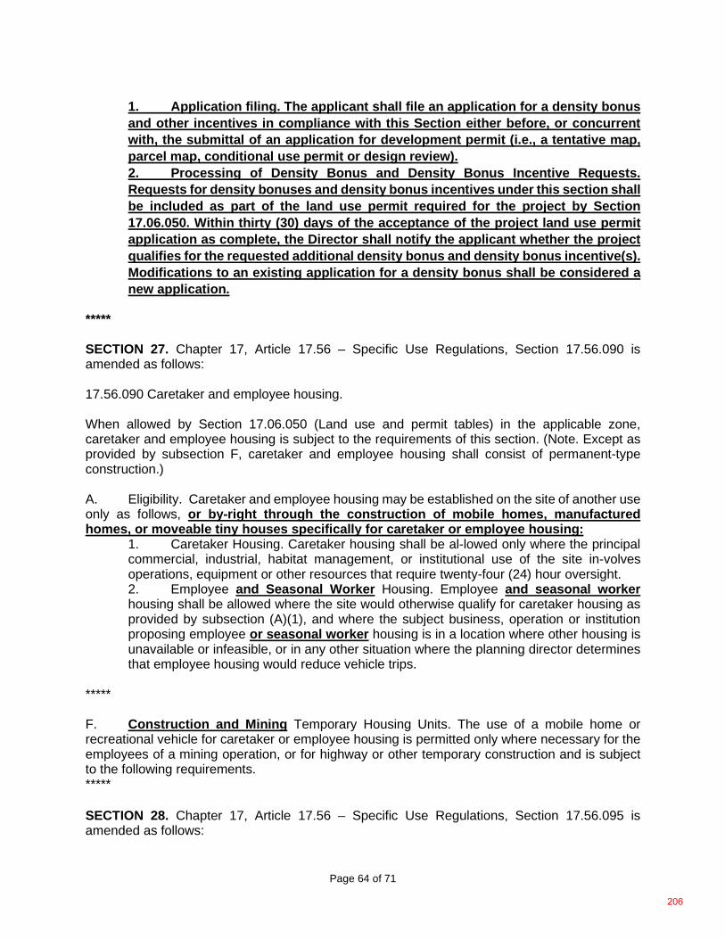
Page 64 of 71
1. Application filing. The applicant shall file an application for a density bonus and other incentives in compliance with this Section either before, or concurrent with, the submittal of an application for development permit (i.e., a tentative map, parcel map, conditional use permit or design review). 2. Processing of Density Bonus and Density Bonus Incentive Requests. Requests for density bonuses and density bonus incentives under this section shall be included as part of the land use permit required for the project by Section 17.06.050. Within thirty (30) days of the acceptance of the project land use permit application as complete, the Director shall notify the applicant whether the project qualifies for the requested additional density bonus and density bonus incentive(s). Modifications to an existing application for a density bonus shall be considered a new application.
***** SECTION 27. Chapter 17, Article 17.56 – Specific Use Regulations, Section 17.56.090 is amended as follows: 17.56.090 Caretaker and employee housing. When allowed by Section 17.06.050 (Land use and permit tables) in the applicable zone, caretaker and employee housing is subject to the requirements of this section. (Note. Except as provided by subsection F, caretaker and employee housing shall consist of permanent-type construction.) A. Eligibility. Caretaker and employee housing may be established on the site of another use only as follows, or by-right through the construction of mobile homes, manufactured homes, or moveable tiny houses specifically for caretaker or employee housing:
1. Caretaker Housing. Caretaker housing shall be al-lowed only where the principal commercial, industrial, habitat management, or institutional use of the site in-volves operations, equipment or other resources that require twenty-four (24) hour oversight. 2. Employee and Seasonal Worker Housing. Employee and seasonal worker housing shall be allowed where the site would otherwise qualify for caretaker housing as provided by subsection (A)(1), and where the subject business, operation or institution proposing employee or seasonal worker housing is in a location where other housing is unavailable or infeasible, or in any other situation where the planning director determines that employee housing would reduce vehicle trips.
***** F. Construction and Mining Temporary Housing Units. The use of a mobile home or recreational vehicle for caretaker or employee housing is permitted only where necessary for the employees of a mining operation, or for highway or other temporary construction and is subject to the following requirements. ***** SECTION 28. Chapter 17, Article 17.56 – Specific Use Regulations, Section 17.56.095 is amended as follows:
206
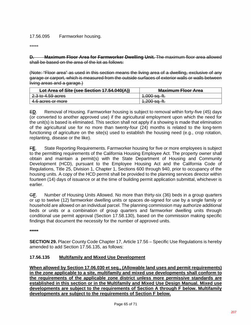
Page 65 of 71
17.56.095 Farmworker housing. ***** D. Maximum Floor Area for Farmworker Dwelling Unit. The maximum floor area allowed shall be based on the area of the lot as follows: (Note: “Floor area” as used in this section means the living area of a dwelling, exclusive of any garage or carport, which is measured from the outside surfaces of exterior walls or walls between living areas and a garage.)
Lot Area of Site (see Section 17.54.040(A)) Maximum Floor Area 2.3 to 4.59 acres 1,000 sq. ft. 4.6 acres or more 1,200 sq. ft.
ED. Removal of Housing. Farmworker housing is subject to removal within forty-five (45) days (or converted to another approved use) if the agricultural employment upon which the need for the unit(s) is based is eliminated. This section shall not apply if a showing is made that elimination of the agricultural use for no more than twenty-four (24) months is related to the long-term functioning of agriculture on the site(s) used to establish the housing need (e.g., crop rotation, replanting, disease or the like). FE. State Reporting Requirements. Farmworker housing for five or more employees is subject to the permitting requirements of the California Housing Employee Act. The property owner shall obtain and maintain a permit(s) with the State Department of Housing and Community Development (HCD), pursuant to the Employee Housing Act and the California Code of Regulations, Title 25, Division 1, Chapter 1, Sections 600 through 940, prior to occupancy of the housing units. A copy of the HCD permit shall be provided to the planning services director within fourteen (14) days of issuance or at the time of building permit application submittal, whichever is earlier. GF. Number of Housing Units Allowed. No more than thirty-six (36) beds in a group quarters or up to twelve (12) farmworker dwelling units or spaces de-signed for use by a single family or household are allowed on an individual parcel. The planning commission may authorize additional beds or units or a combination of group quarters and farmworker dwelling units through conditional use permit approval (Section 17.58.130), based on the commission making specific findings that document the necessity for the number of approved units. ***** SECTION 29. Placer County Code Chapter 17, Article 17.56 – Specific Use Regulations is hereby amended to add Section 17.56.135, as follows: 17.56.135 Multifamily and Mixed Use Development When allowed by Section 17.06.030 et seq., (Allowable land uses and permit requirements) in the zone applicable to a site, multifamily and mixed use developments shall conform to the requirements of the applicable zone district unless more permissive standards are established in this section or in the Multifamily and Mixed Use Design Manual. Mixed use developments are subject to the requirements of Section A through F below. Multifamily developments are subject to the requirements of Section F below.
207
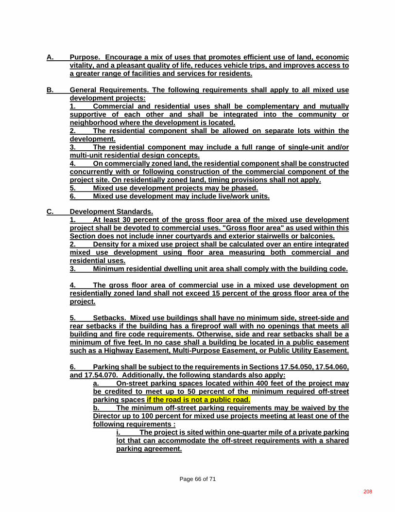
Page 66 of 71
A. Purpose. Encourage a mix of uses that promotes efficient use of land, economic vitality, and a pleasant quality of life, reduces vehicle trips, and improves access to a greater range of facilities and services for residents.
B. General Requirements. The following requirements shall apply to all mixed use
development projects: 1. Commercial and residential uses shall be complementary and mutually supportive of each other and shall be integrated into the community or neighborhood where the development is located. 2. The residential component shall be allowed on separate lots within the development. 3. The residential component may include a full range of single-unit and/or multi-unit residential design concepts. 4. On commercially zoned land, the residential component shall be constructed concurrently with or following construction of the commercial component of the project site. On residentially zoned land, timing provisions shall not apply. 5. Mixed use development projects may be phased. 6. Mixed use development may include live/work units.
C. Development Standards. 1. At least 30 percent of the gross floor area of the mixed use development project shall be devoted to commercial uses. "Gross floor area" as used within this Section does not include inner courtyards and exterior stairwells or balconies. 2. Density for a mixed use project shall be calculated over an entire integrated mixed use development using floor area measuring both commercial and residential uses. 3. Minimum residential dwelling unit area shall comply with the building code. 4. The gross floor area of commercial use in a mixed use development on residentially zoned land shall not exceed 15 percent of the gross floor area of the project. 5. Setbacks. Mixed use buildings shall have no minimum side, street-side and rear setbacks if the building has a fireproof wall with no openings that meets all building and fire code requirements. Otherwise, side and rear setbacks shall be a minimum of five feet. In no case shall a building be located in a public easement such as a Highway Easement, Multi-Purpose Easement, or Public Utility Easement. 6. Parking shall be subject to the requirements in Sections 17.54.050, 17.54.060, and 17.54.070. Additionally, the following standards also apply:
a. On-street parking spaces located within 400 feet of the project may be credited to meet up to 50 percent of the minimum required off-street parking spaces if the road is not a public road. b. The minimum off-street parking requirements may be waived by the Director up to 100 percent for mixed use projects meeting at least one of the following requirements :
i. The project is sited within one-quarter mile of a private parking lot that can accommodate the off-street requirements with a shared parking agreement.
208
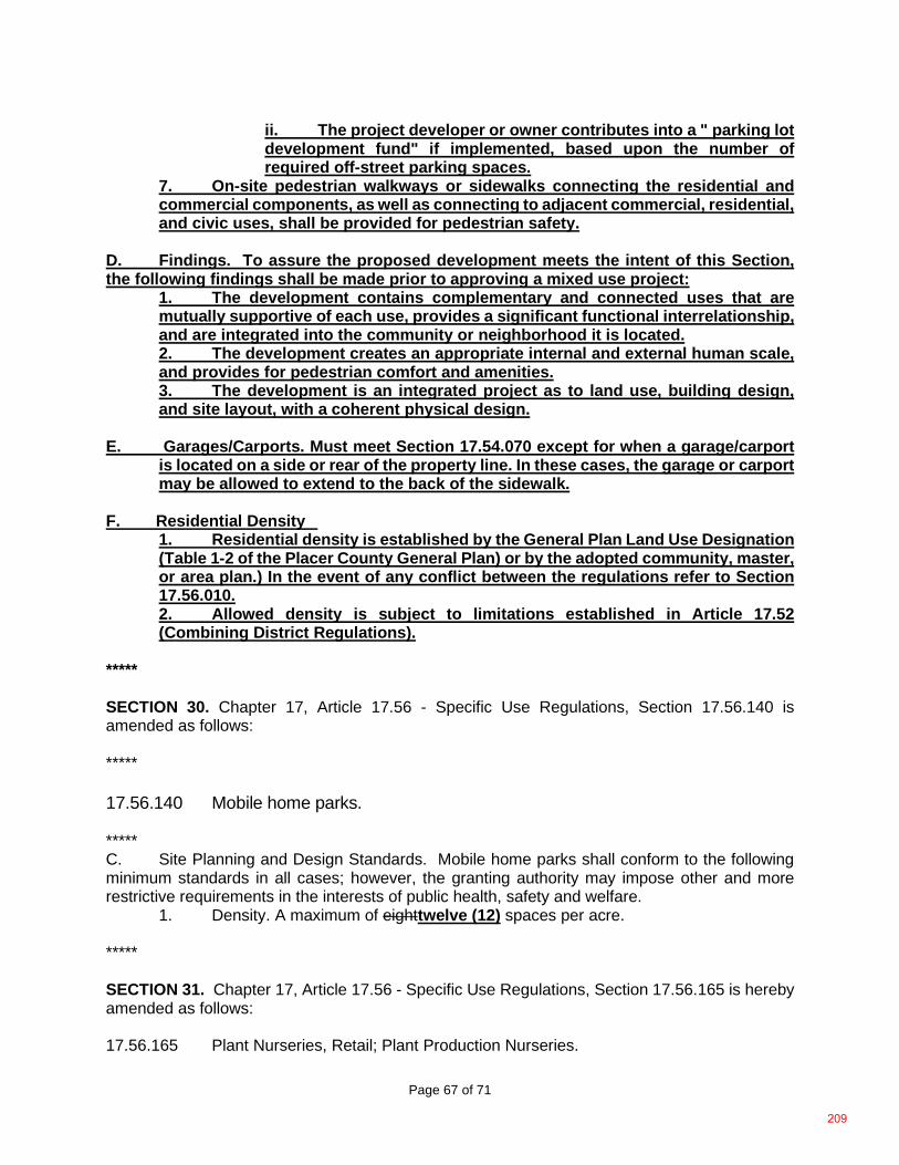
Page 67 of 71
ii. The project developer or owner contributes into a " parking lot development fund" if implemented, based upon the number of required off-street parking spaces.
7. On-site pedestrian walkways or sidewalks connecting the residential and commercial components, as well as connecting to adjacent commercial, residential, and civic uses, shall be provided for pedestrian safety.
D. Findings. To assure the proposed development meets the intent of this Section, the following findings shall be made prior to approving a mixed use project:
1. The development contains complementary and connected uses that are mutually supportive of each use, provides a significant functional interrelationship, and are integrated into the community or neighborhood it is located. 2. The development creates an appropriate internal and external human scale, and provides for pedestrian comfort and amenities. 3. The development is an integrated project as to land use, building design, and site layout, with a coherent physical design.
E. Garages/Carports. Must meet Section 17.54.070 except for when a garage/carport
is located on a side or rear of the property line. In these cases, the garage or carport may be allowed to extend to the back of the sidewalk.
F. Residential Density
1. Residential density is established by the General Plan Land Use Designation (Table 1-2 of the Placer County General Plan) or by the adopted community, master, or area plan.) In the event of any conflict between the regulations refer to Section 17.56.010. 2. Allowed density is subject to limitations established in Article 17.52 (Combining District Regulations).
***** SECTION 30. Chapter 17, Article 17.56 - Specific Use Regulations, Section 17.56.140 is amended as follows: ***** 17.56.140 Mobile home parks. ***** C. Site Planning and Design Standards. Mobile home parks shall conform to the following minimum standards in all cases; however, the granting authority may impose other and more restrictive requirements in the interests of public health, safety and welfare. 1. Density. A maximum of eighttwelve (12) spaces per acre. ***** SECTION 31. Chapter 17, Article 17.56 - Specific Use Regulations, Section 17.56.165 is hereby amended as follows: 17.56.165 Plant Nurseries, Retail; Plant Production Nurseries.
209
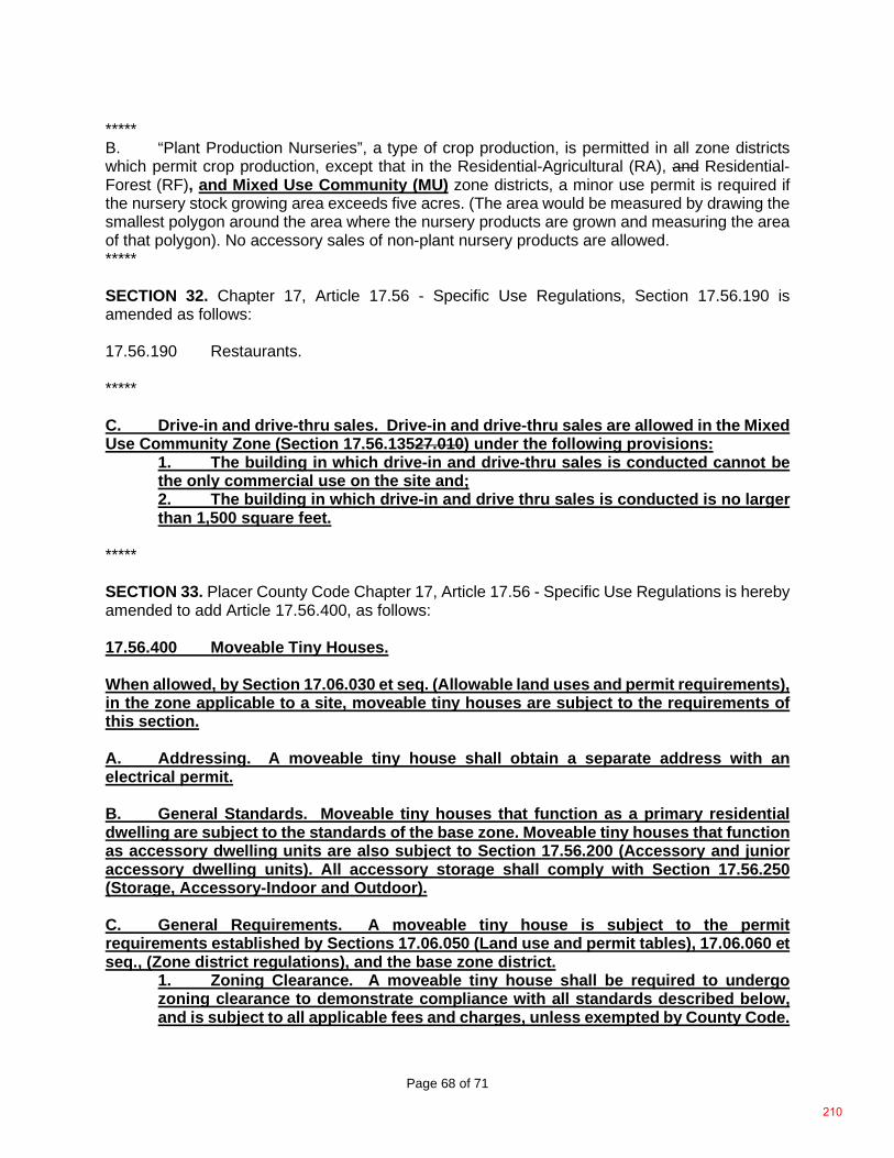
Page 68 of 71
***** B. “Plant Production Nurseries”, a type of crop production, is permitted in all zone districts which permit crop production, except that in the Residential-Agricultural (RA), and Residential-Forest (RF), and Mixed Use Community (MU) zone districts, a minor use permit is required if the nursery stock growing area exceeds five acres. (The area would be measured by drawing the smallest polygon around the area where the nursery products are grown and measuring the area of that polygon). No accessory sales of non-plant nursery products are allowed. ***** SECTION 32. Chapter 17, Article 17.56 - Specific Use Regulations, Section 17.56.190 is amended as follows: 17.56.190 Restaurants. ***** C. Drive-in and drive-thru sales. Drive-in and drive-thru sales are allowed in the Mixed Use Community Zone (Section 17.56.13527.010) under the following provisions:
1. The building in which drive-in and drive-thru sales is conducted cannot be the only commercial use on the site and; 2. The building in which drive-in and drive thru sales is conducted is no larger than 1,500 square feet.
***** SECTION 33. Placer County Code Chapter 17, Article 17.56 - Specific Use Regulations is hereby amended to add Article 17.56.400, as follows: 17.56.400 Moveable Tiny Houses. When allowed, by Section 17.06.030 et seq. (Allowable land uses and permit requirements), in the zone applicable to a site, moveable tiny houses are subject to the requirements of this section. A. Addressing. A moveable tiny house shall obtain a separate address with an electrical permit. B. General Standards. Moveable tiny houses that function as a primary residential dwelling are subject to the standards of the base zone. Moveable tiny houses that function as accessory dwelling units are also subject to Section 17.56.200 (Accessory and junior accessory dwelling units). All accessory storage shall comply with Section 17.56.250 (Storage, Accessory-Indoor and Outdoor). C. General Requirements. A moveable tiny house is subject to the permit requirements established by Sections 17.06.050 (Land use and permit tables), 17.06.060 et seq., (Zone district regulations), and the base zone district.
1. Zoning Clearance. A moveable tiny house shall be required to undergo zoning clearance to demonstrate compliance with all standards described below, and is subject to all applicable fees and charges, unless exempted by County Code.
210
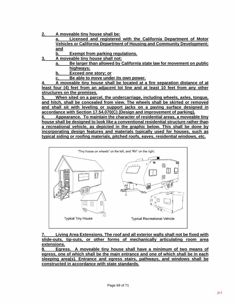
Page 69 of 71
2. A moveable tiny house shall be: a. Licensed and registered with the California Department of Motor Vehicles or California Department of Housing and Community Development; and b. Exempt from parking regulations.
3. A moveable tiny house shall not: a. Be larger than allowed by California state law for movement on public
highways; b. Exceed one story; or c. Be able to move under its own power.
4. A moveable tiny house shall be located at a fire separation distance of at least four (4) feet from an adjacent lot line and at least 10 feet from any other structures on the premises. 5. When sited on a parcel, the undercarriage, including wheels, axles, tongue, and hitch, shall be concealed from view. The wheels shall be skirted or removed and shall sit with leveling or support jacks on a paving surface designed in accordance with Section 17.54.070(C) (Design and improvement of parking). 6. Appearance. To maintain the character of residential areas, a moveable tiny house shall be designed to look like a conventional residential structure rather than a recreational vehicle, as depicted in the graphic below. This shall be done by incorporating design features and materials typically used for houses, such as typical siding or roofing materials, pitched roofs, eaves, residential windows, etc.
7. Living Area Extensions. The roof and all exterior walls shall not be fixed with slide-outs, tip-outs, or other forms of mechanically articulating room area extensions. 8. Egress. A moveable tiny house shall have a minimum of two means of egress, one of which shall be the main entrance and one of which shall be in each sleeping area(s). Entrance and egress stairs, pathways, and windows shall be constructed in accordance with state standards.
211
Page 70 of 71
9. Foundation and Structural Components. a. If a moveable tiny house is retrofitted for placement on a permanent foundation, it must meet building and fire safe standards. b. A moveable tiny house shall be tied down with anchors or otherwise stabilized as designed by the manufacturer; or c. Wheels shall be skirted or removed when parked. Skirting may be made from materials such as lattice, fencing, planter boxes, etc. d. Structures such as porches, decks, sheds, and gazebos shall be designed to detach from the moveable tiny house. Uncovered porches or decks less than 30 inches in height and less than 200 square feet do not require building permits. Permanent roofed structures over 120 square feet do require building permits.
10. Utilities/Equipment. a. Water and Sewer. A moveable tiny house shall be connected to water supply and sewage disposal facilities approved by the County’s Environmental Health Department and Building Services Division. b. Energy. A building permit shall be obtained for installation of a subpanel appropriately sized for the moveable tiny house’s amperage, electrical pedestal, and approved exterior outlets in the location the moveable tiny house will be located, unless otherwise designed to be self-contained to provide equal electrical accommodations (e.g., fully relying on solar power and battery backup). Separate electric meters may be permitted if approved by the building official and utility supplier. c. All mechanical equipment shall be incorporated into the structure, and shall in no case be located on the roof with the exception of solar energy panels or collectors.
11. Certifications. A moveable tiny house shall comply with the standards set forth in California HSC 18027.3. A moveable tiny house shall be certified by a recognized national certification body as complying with these standards and a certified label shall be placed on the moveable tiny house to demonstrate compliance. 12. Fire. When located on a premise where the primary dwelling unit is protected with an automatic fire sprinkler system in accordance with the California Residential Code, a moveable tiny house shall be protected with an automatic fire sprinkler system. 13. When located within the Very High Fire Hazard Severity Zone, a moveable tiny house shall satisfy the following additional requirements:
a. A moveable tiny house shall be protected with an automatic fire sprinkler system in compliance with Section R313 of the California Residential Code even if located on a premise where the primary dwelling unit is not protected with an automatic fire sprinkler system; b. Exterior walls shall be constructed with ignition-resistant materials in compliance with Section R337 of the California Residential Code; and (C) Glazed openings, including skylights, shall comply with Section R337 of the California Residential Code.
14. Minimum Wind and Snow Loads. A moveable tiny house shall be constructed to withstand minimum snow and wind loads for the proposed parking location, as described in Chapter 15, Article 15.04 and Section 15.04.290 of the Placer County Code. 15. Parking. Parking standards are set by the base zone district or use as set forth in Section 17.54.060 (Parking space requirements by land use).
212
Page 71 of 71
16. Access standards. Access roads shall meet state and local fire safe standards as determined by the serving fire agency and County Land Development Manual. Encroachment permits may be required to address ingress, egress, and sight distance requirements for access to county-maintained highways.
***** SECTION 34. This ordinance shall take effect and be in full force thirty (30) days after the date of its passage. The Clerk is directed to publish this ordinance, or a summary thereof, within fifteen (15) days in accordance with Government Code section 25124.
213

214
Page 1 of 4
Before the Board of Supervisors County of Placer, State of California
Ordinance No.: ____________
The following Ordinance was duly passed by the Board of Supervisors of the County of Placer at
a regular meeting held on ______________, by the following vote:
Ayes:
Noes:
Absent:
Signed and approved by me after its passage.
_______________________________ Chair, Board of Supervisors
Attest:
_______________________ Clerk of said Board
WHEREAS, the proposed Housing-Related Code Amendments includes the rezone of certain real properties within unincorporated Placer County (“Proposed Rezoning”) which rezoning is intended to increase the availability and mix of housing types by eliminating impediments to the same caused by certain existing zoning designations. This action will bring County housing policies consistent with State housing law; implement adopted General Plan policies that support housing development through higher density, mixed use, transit oriented and infill development projects; reduce Vehicle Miles Traveled (VMT); align the General Plan, Zoning Code and Multifamily and Mixed Use Design Manual with adopted specific plans, community plans, master and area plans; and implement a portion of the Board of Supervisors’ adopted Strategic Plan which supports new housing construction for existing and future residents of all income ranges; and
In the matter of: AN ORDINANCE REZONING CERTAIN REAL PROPERTIES WITHIN UNINCORPORATED PLACER COUNTY
Attachment D
215
Page 2 of 4
WHEREAS, the Housing-Related Code Amendment proposals, including the Proposed Rezoning, involved a robust public outreach program that included multiple public meetings and workshops and on-going meetings with key stakeholders and community organizations and various Placer County Municipal Advisory Councils; and WHEREAS, notice of a public hearing was given in compliance with Placer County Code Chapter 17 (Zoning), Article 17.60 (Zoning Administration), Section 17.60.140 (Public hearings), and on July 22, 2021, the Placer County Planning Commission (“Planning Commission”) held a duly noticed public hearing to consider the proposed Housing-Related Code Amendments, including the Proposed Rezoning, with individual mailed notice being sent to the owners of the real property identified in Exhibit 1, attached hereto and incorporated herein by reference, and pursuant to Placer County Code Chapter 17, Article 17.60, Section 17.60.090(C) (Chapter or plan amendments and rezonings – Planning Commission Recommendation), the Planning Commission has made recommendations to the Board of Supervisors (“Board”) related thereto; and WHEREAS, notice of a public hearing was given in compliance with Placer County Code Chapter 17, Article 17.60, Section 17.60.140, with individual mailed notice being sent to the owners of the real property identified in Exhibit 1, attached hereto and incorporated herein by reference, and on _________, 2021, the Board held the duly noticed public hearing pursuant to Placer County Code Chapter 17, Article 17.60, Section 17.60.090(D) (Chapter or plan amendments and rezonings – Board of Supervisors Hearing and Decision) to consider the recommendations of the Planning Commission and to receive public input regarding the proposed Housing-Related Code Amendments, including the Proposed Rezoning; and WHEREAS, the Board has reviewed the proposed Housing-Related Code Amendments, including the Proposed Rezoning, considered the recommendations of the Planning Commission, received and considered the written and oral comments submitted by the public thereon, and has adopted Resolution No. __-_____ certifying the Final Environmental Impact Report for the “Housing-Related Code Amendments – County of Placer (SCH#2019080460)”; and WHEREAS, the Board finds the Proposed Rezoning in alignment with applicable requirements of State law and is consistent with the General Plan and is in the best interests of the County. The Board also finds as follows:
The Proposed Rezoning is consistent with General Plan policies on affordable housing by enabling zoning to promote the creation of compact mixed use development and remove housing development barriers caused by certain zoning designations on underutilized land in existing communities near services and jobs, and where municipal infrastructure exists.
The Proposed Rezoning will facilitate achieving high quality design for multifamily and mixed use housing in unincorporated areas of Placer County and will promote creation of compact mixed use development so people can afford to live and work in Placer County, specifically within existing established communities. The Proposed Rezoning will streamline the project approval process for multifamily and mixed use projects, making it easier to navigate not only for projects that have an affordable housing component, which must be allowed “by right” under State law, but also for those that include solely market rate housing.
216
Page 3 of 4
The Proposed Rezoning will establish a housing opportunity framework to create mixed use, urban/suburban centers adjacent to employment centers, which will provide retail goods, services, and multifamily housing that benefit from proximity to job clusters. The Proposed Rezoning includes areas, places, sites, where multifamily and mixed use development projects could be located and the application of the design review combining district will serve to minimize any adverse impacts of conflicting land uses; and to provide special project review procedures for lands and uses which by their nature require special attention to architectural design and massing, landscaping, circulation, and/or energy conservation; and
WHEREAS, the Board finds the Proposed Rezoning will serve to protect and enhance the health, safety, and general welfare of the residents of the and the County as a whole; and WHEREAS, the Board finds the Proposed Rezoning is in conformity with public convenience, general welfare and good land use practice, and will not adversely affect the orderly development of property, or the preservation of property values; and WHEREAS, notice of all hearings required has been given and all hearings have been held as required by County ordinance and State law. NOW, THEREFORE, THE BOARD OF SUPERVISORS OF THE COUNTY OF PLACER ORDAINS AS FOLLOWS: 1. Pursuant to Placer County Code Chapter 17 (Zoning), Article 17.06 (Zoning Districts
Established), Section 17.06.020 (Zoning Maps Adopted), the real properties, identified by Assessor Parcel Number, and set forth in Exhibit “1” are hereby rezoned from their respective current zoning designations to those zoning designations shown in Exhibit “1”.
2. This ordinance shall take effect and be in full force thirty (30) days after the date of its
passage. The Clerk is directed to publish this ordinance, or a summary thereof, within fifteen (15) days in accordance with Government Code section 25124.
Exhibit 1 – List of Certain Real Properties for Proposed Rezoning
217

218
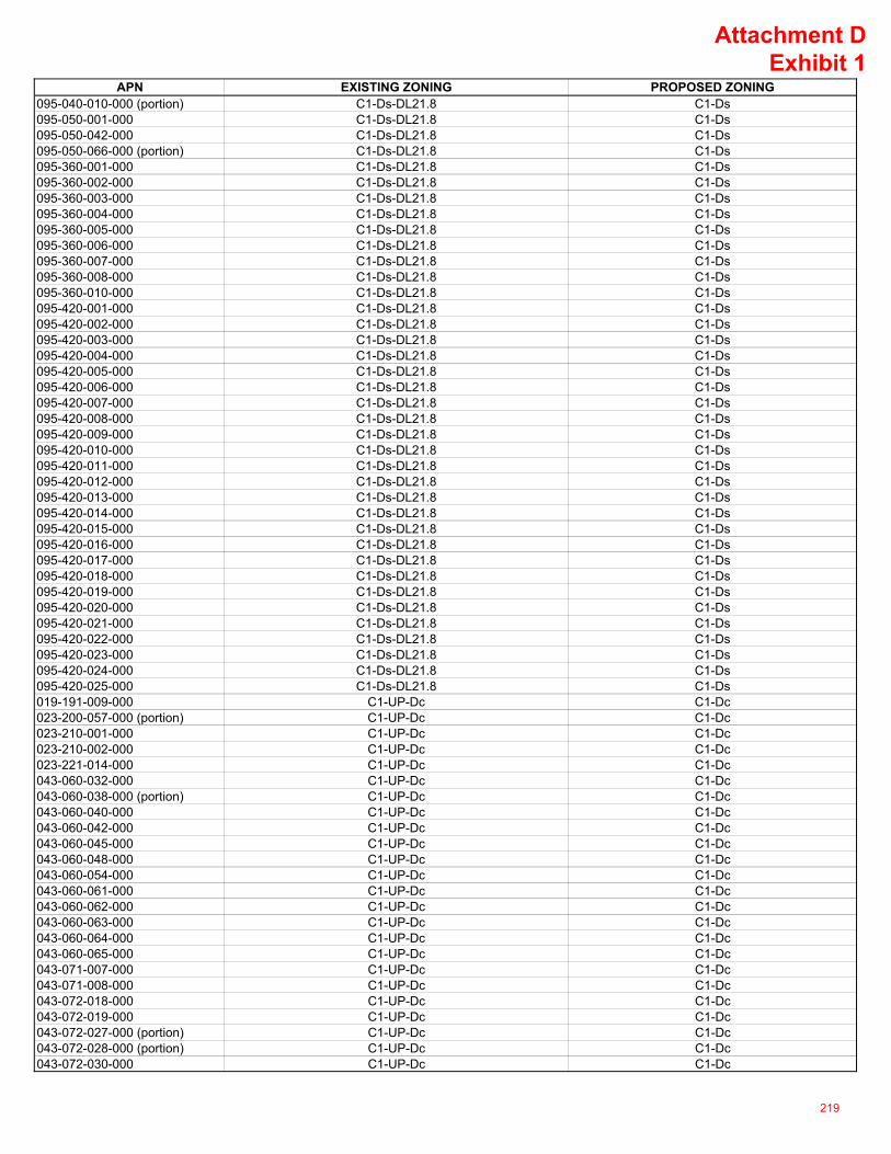
APN EXISTING ZONING PROPOSED ZONING095-040-010-000 (portion) C1-Ds-DL21.8 C1-Ds095-050-001-000 C1-Ds-DL21.8 C1-Ds095-050-042-000 C1-Ds-DL21.8 C1-Ds095-050-066-000 (portion) C1-Ds-DL21.8 C1-Ds095-360-001-000 C1-Ds-DL21.8 C1-Ds095-360-002-000 C1-Ds-DL21.8 C1-Ds095-360-003-000 C1-Ds-DL21.8 C1-Ds095-360-004-000 C1-Ds-DL21.8 C1-Ds095-360-005-000 C1-Ds-DL21.8 C1-Ds095-360-006-000 C1-Ds-DL21.8 C1-Ds095-360-007-000 C1-Ds-DL21.8 C1-Ds095-360-008-000 C1-Ds-DL21.8 C1-Ds095-360-010-000 C1-Ds-DL21.8 C1-Ds095-420-001-000 C1-Ds-DL21.8 C1-Ds095-420-002-000 C1-Ds-DL21.8 C1-Ds095-420-003-000 C1-Ds-DL21.8 C1-Ds095-420-004-000 C1-Ds-DL21.8 C1-Ds095-420-005-000 C1-Ds-DL21.8 C1-Ds095-420-006-000 C1-Ds-DL21.8 C1-Ds095-420-007-000 C1-Ds-DL21.8 C1-Ds095-420-008-000 C1-Ds-DL21.8 C1-Ds095-420-009-000 C1-Ds-DL21.8 C1-Ds095-420-010-000 C1-Ds-DL21.8 C1-Ds095-420-011-000 C1-Ds-DL21.8 C1-Ds095-420-012-000 C1-Ds-DL21.8 C1-Ds095-420-013-000 C1-Ds-DL21.8 C1-Ds095-420-014-000 C1-Ds-DL21.8 C1-Ds095-420-015-000 C1-Ds-DL21.8 C1-Ds095-420-016-000 C1-Ds-DL21.8 C1-Ds095-420-017-000 C1-Ds-DL21.8 C1-Ds095-420-018-000 C1-Ds-DL21.8 C1-Ds095-420-019-000 C1-Ds-DL21.8 C1-Ds095-420-020-000 C1-Ds-DL21.8 C1-Ds095-420-021-000 C1-Ds-DL21.8 C1-Ds095-420-022-000 C1-Ds-DL21.8 C1-Ds095-420-023-000 C1-Ds-DL21.8 C1-Ds095-420-024-000 C1-Ds-DL21.8 C1-Ds095-420-025-000 C1-Ds-DL21.8 C1-Ds019-191-009-000 C1-UP-Dc C1-Dc023-200-057-000 (portion) C1-UP-Dc C1-Dc023-210-001-000 C1-UP-Dc C1-Dc023-210-002-000 C1-UP-Dc C1-Dc023-221-014-000 C1-UP-Dc C1-Dc043-060-032-000 C1-UP-Dc C1-Dc043-060-038-000 (portion) C1-UP-Dc C1-Dc043-060-040-000 C1-UP-Dc C1-Dc043-060-042-000 C1-UP-Dc C1-Dc043-060-045-000 C1-UP-Dc C1-Dc043-060-048-000 C1-UP-Dc C1-Dc043-060-054-000 C1-UP-Dc C1-Dc043-060-061-000 C1-UP-Dc C1-Dc043-060-062-000 C1-UP-Dc C1-Dc043-060-063-000 C1-UP-Dc C1-Dc043-060-064-000 C1-UP-Dc C1-Dc043-060-065-000 C1-UP-Dc C1-Dc043-071-007-000 C1-UP-Dc C1-Dc043-071-008-000 C1-UP-Dc C1-Dc043-072-018-000 C1-UP-Dc C1-Dc043-072-019-000 C1-UP-Dc C1-Dc043-072-027-000 (portion) C1-UP-Dc C1-Dc043-072-028-000 (portion) C1-UP-Dc C1-Dc043-072-030-000 C1-UP-Dc C1-Dc
Attachment DExhibit 1
219
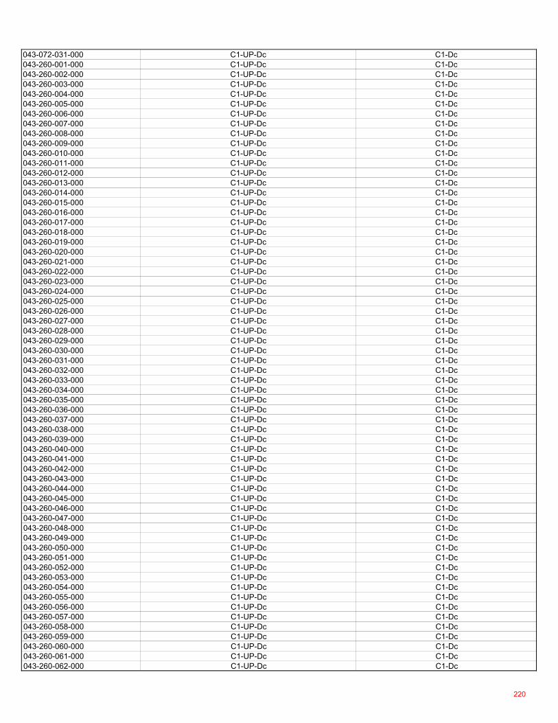
043-072-031-000 C1-UP-Dc C1-Dc043-260-001-000 C1-UP-Dc C1-Dc043-260-002-000 C1-UP-Dc C1-Dc043-260-003-000 C1-UP-Dc C1-Dc043-260-004-000 C1-UP-Dc C1-Dc043-260-005-000 C1-UP-Dc C1-Dc043-260-006-000 C1-UP-Dc C1-Dc043-260-007-000 C1-UP-Dc C1-Dc043-260-008-000 C1-UP-Dc C1-Dc043-260-009-000 C1-UP-Dc C1-Dc043-260-010-000 C1-UP-Dc C1-Dc043-260-011-000 C1-UP-Dc C1-Dc043-260-012-000 C1-UP-Dc C1-Dc043-260-013-000 C1-UP-Dc C1-Dc043-260-014-000 C1-UP-Dc C1-Dc043-260-015-000 C1-UP-Dc C1-Dc043-260-016-000 C1-UP-Dc C1-Dc043-260-017-000 C1-UP-Dc C1-Dc043-260-018-000 C1-UP-Dc C1-Dc043-260-019-000 C1-UP-Dc C1-Dc043-260-020-000 C1-UP-Dc C1-Dc043-260-021-000 C1-UP-Dc C1-Dc043-260-022-000 C1-UP-Dc C1-Dc043-260-023-000 C1-UP-Dc C1-Dc043-260-024-000 C1-UP-Dc C1-Dc043-260-025-000 C1-UP-Dc C1-Dc043-260-026-000 C1-UP-Dc C1-Dc043-260-027-000 C1-UP-Dc C1-Dc043-260-028-000 C1-UP-Dc C1-Dc043-260-029-000 C1-UP-Dc C1-Dc043-260-030-000 C1-UP-Dc C1-Dc043-260-031-000 C1-UP-Dc C1-Dc043-260-032-000 C1-UP-Dc C1-Dc043-260-033-000 C1-UP-Dc C1-Dc043-260-034-000 C1-UP-Dc C1-Dc043-260-035-000 C1-UP-Dc C1-Dc043-260-036-000 C1-UP-Dc C1-Dc043-260-037-000 C1-UP-Dc C1-Dc043-260-038-000 C1-UP-Dc C1-Dc043-260-039-000 C1-UP-Dc C1-Dc043-260-040-000 C1-UP-Dc C1-Dc043-260-041-000 C1-UP-Dc C1-Dc043-260-042-000 C1-UP-Dc C1-Dc043-260-043-000 C1-UP-Dc C1-Dc043-260-044-000 C1-UP-Dc C1-Dc043-260-045-000 C1-UP-Dc C1-Dc043-260-046-000 C1-UP-Dc C1-Dc043-260-047-000 C1-UP-Dc C1-Dc043-260-048-000 C1-UP-Dc C1-Dc043-260-049-000 C1-UP-Dc C1-Dc043-260-050-000 C1-UP-Dc C1-Dc043-260-051-000 C1-UP-Dc C1-Dc043-260-052-000 C1-UP-Dc C1-Dc043-260-053-000 C1-UP-Dc C1-Dc043-260-054-000 C1-UP-Dc C1-Dc043-260-055-000 C1-UP-Dc C1-Dc043-260-056-000 C1-UP-Dc C1-Dc043-260-057-000 C1-UP-Dc C1-Dc043-260-058-000 C1-UP-Dc C1-Dc043-260-059-000 C1-UP-Dc C1-Dc043-260-060-000 C1-UP-Dc C1-Dc043-260-061-000 C1-UP-Dc C1-Dc043-260-062-000 C1-UP-Dc C1-Dc
220
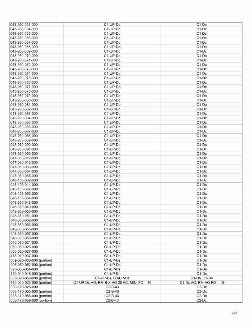
043-260-063-000 C1-UP-Dc C1-Dc043-260-064-000 C1-UP-Dc C1-Dc043-260-065-000 C1-UP-Dc C1-Dc043-260-066-000 C1-UP-Dc C1-Dc043-260-067-000 C1-UP-Dc C1-Dc043-260-068-000 C1-UP-Dc C1-Dc043-260-069-000 C1-UP-Dc C1-Dc043-260-070-000 C1-UP-Dc C1-Dc043-260-071-000 C1-UP-Dc C1-Dc043-260-072-000 C1-UP-Dc C1-Dc043-260-073-000 C1-UP-Dc C1-Dc043-260-074-000 C1-UP-Dc C1-Dc043-260-075-000 C1-UP-Dc C1-Dc043-260-076-000 C1-UP-Dc C1-Dc043-260-077-000 C1-UP-Dc C1-Dc043-260-078-000 C1-UP-Dc C1-Dc043-260-079-000 C1-UP-Dc C1-Dc043-260-080-000 C1-UP-Dc C1-Dc043-260-081-000 C1-UP-Dc C1-Dc043-260-082-000 C1-UP-Dc C1-Dc043-260-083-000 C1-UP-Dc C1-Dc043-260-084-000 C1-UP-Dc C1-Dc043-260-085-000 C1-UP-Dc C1-Dc043-260-086-000 C1-UP-Dc C1-Dc043-260-087-000 C1-UP-Dc C1-Dc043-260-088-000 C1-UP-Dc C1-Dc043-260-089-000 C1-UP-Dc C1-Dc043-260-090-000 C1-UP-Dc C1-Dc043-260-091-000 C1-UP-Dc C1-Dc043-260-092-000 C1-UP-Dc C1-Dc047-060-012-000 C1-UP-Dc C1-Dc047-060-013-000 C1-UP-Dc C1-Dc047-060-033-000 C1-UP-Dc C1-Dc047-060-064-000 C1-UP-Dc C1-Dc047-060-065-000 C1-UP-Dc C1-Dc048-103-002-000 C1-UP-Dc C1-Dc048-103-014-000 C1-UP-Dc C1-Dc048-103-062-000 C1-UP-Dc C1-Dc048-103-063-000 C1-UP-Dc C1-Dc048-103-064-000 C1-UP-Dc C1-Dc048-360-048-000 C1-UP-Dc C1-Dc048-360-049-000 C1-UP-Dc C1-Dc048-360-050-000 C1-UP-Dc C1-Dc048-360-051-000 C1-UP-Dc C1-Dc048-360-052-000 C1-UP-Dc C1-Dc048-360-053-000 C1-UP-Dc C1-Dc048-360-055-000 C1-UP-Dc C1-Dc048-360-057-000 C1-UP-Dc C1-Dc048-360-058-000 C1-UP-Dc C1-Dc050-080-021-000 C1-UP-Dc C1-Dc050-080-026-000 C1-UP-Dc C1-Dc050-080-027-000 C1-UP-Dc C1-Dc473-010-037-000 C1-UP-Dc C1-Dc069-020-058-000 (portion) C1-UP-Ds C1-Ds095-050-052-000 (portion) C1-UP-Ds C1-Ds095-050-054-000 C1-UP-Ds C1-Ds110-040-018-000 (portion) C1-UP-Ds C1-Ds069-020-059-000 (portion) C1-UP-Ds, C3-UP-Ds C1-Ds, C3-Ds110-010-023-000 (portion) C1-UP-Ds-AO, RM-B-X-AO 20 AC. MIN. PD = 10 C1-Ds-AO, RM-AO PD = 10038-170-025-000 C2-B-43 C2-Dc038-170-055-000 (portion) C2-B-43 C2-Dc038-170-058-000 (portion) C2-B-43 C2-Dc038-170-059-000 (portion) C2-B-43 C2-Dc
221
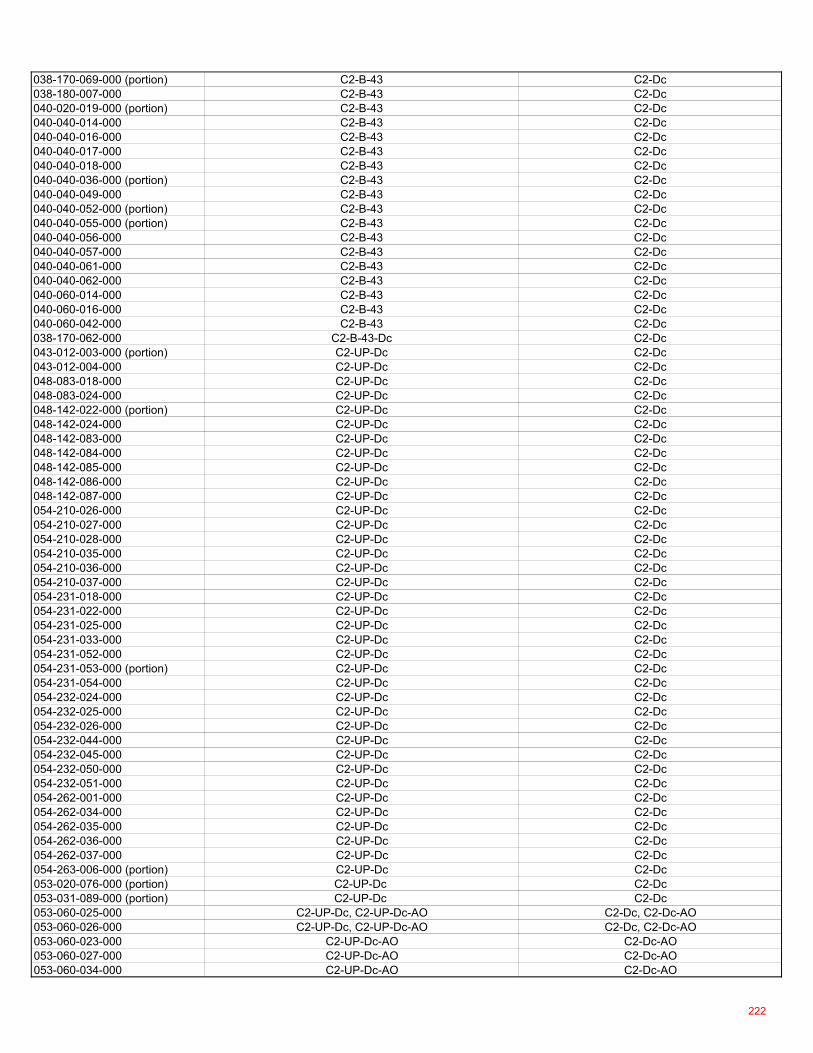
038-170-069-000 (portion) C2-B-43 C2-Dc038-180-007-000 C2-B-43 C2-Dc040-020-019-000 (portion) C2-B-43 C2-Dc040-040-014-000 C2-B-43 C2-Dc040-040-016-000 C2-B-43 C2-Dc040-040-017-000 C2-B-43 C2-Dc040-040-018-000 C2-B-43 C2-Dc040-040-036-000 (portion) C2-B-43 C2-Dc040-040-049-000 C2-B-43 C2-Dc040-040-052-000 (portion) C2-B-43 C2-Dc040-040-055-000 (portion) C2-B-43 C2-Dc040-040-056-000 C2-B-43 C2-Dc040-040-057-000 C2-B-43 C2-Dc040-040-061-000 C2-B-43 C2-Dc040-040-062-000 C2-B-43 C2-Dc040-060-014-000 C2-B-43 C2-Dc040-060-016-000 C2-B-43 C2-Dc040-060-042-000 C2-B-43 C2-Dc038-170-062-000 C2-B-43-Dc C2-Dc043-012-003-000 (portion) C2-UP-Dc C2-Dc043-012-004-000 C2-UP-Dc C2-Dc048-083-018-000 C2-UP-Dc C2-Dc048-083-024-000 C2-UP-Dc C2-Dc048-142-022-000 (portion) C2-UP-Dc C2-Dc048-142-024-000 C2-UP-Dc C2-Dc048-142-083-000 C2-UP-Dc C2-Dc048-142-084-000 C2-UP-Dc C2-Dc048-142-085-000 C2-UP-Dc C2-Dc048-142-086-000 C2-UP-Dc C2-Dc048-142-087-000 C2-UP-Dc C2-Dc054-210-026-000 C2-UP-Dc C2-Dc054-210-027-000 C2-UP-Dc C2-Dc054-210-028-000 C2-UP-Dc C2-Dc054-210-035-000 C2-UP-Dc C2-Dc054-210-036-000 C2-UP-Dc C2-Dc054-210-037-000 C2-UP-Dc C2-Dc054-231-018-000 C2-UP-Dc C2-Dc054-231-022-000 C2-UP-Dc C2-Dc054-231-025-000 C2-UP-Dc C2-Dc054-231-033-000 C2-UP-Dc C2-Dc054-231-052-000 C2-UP-Dc C2-Dc054-231-053-000 (portion) C2-UP-Dc C2-Dc054-231-054-000 C2-UP-Dc C2-Dc054-232-024-000 C2-UP-Dc C2-Dc054-232-025-000 C2-UP-Dc C2-Dc054-232-026-000 C2-UP-Dc C2-Dc054-232-044-000 C2-UP-Dc C2-Dc054-232-045-000 C2-UP-Dc C2-Dc054-232-050-000 C2-UP-Dc C2-Dc054-232-051-000 C2-UP-Dc C2-Dc054-262-001-000 C2-UP-Dc C2-Dc054-262-034-000 C2-UP-Dc C2-Dc054-262-035-000 C2-UP-Dc C2-Dc054-262-036-000 C2-UP-Dc C2-Dc054-262-037-000 C2-UP-Dc C2-Dc054-263-006-000 (portion) C2-UP-Dc C2-Dc053-020-076-000 (portion) C2-UP-Dc C2-Dc053-031-089-000 (portion) C2-UP-Dc C2-Dc053-060-025-000 C2-UP-Dc, C2-UP-Dc-AO C2-Dc, C2-Dc-AO053-060-026-000 C2-UP-Dc, C2-UP-Dc-AO C2-Dc, C2-Dc-AO053-060-023-000 C2-UP-Dc-AO C2-Dc-AO053-060-027-000 C2-UP-Dc-AO C2-Dc-AO053-060-034-000 C2-UP-Dc-AO C2-Dc-AO
222
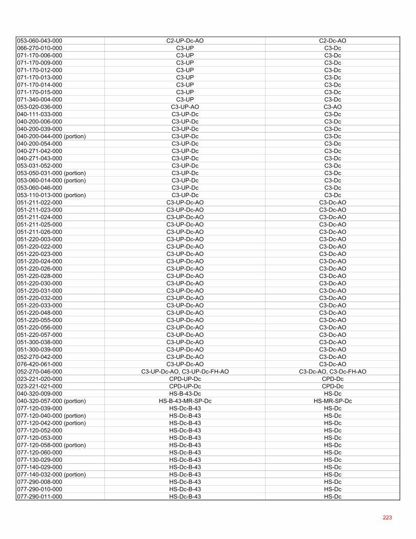
053-060-043-000 C2-UP-Dc-AO C2-Dc-AO066-270-010-000 C3-UP C3-Dc071-170-006-000 C3-UP C3-Dc071-170-009-000 C3-UP C3-Dc071-170-012-000 C3-UP C3-Dc071-170-013-000 C3-UP C3-Dc071-170-014-000 C3-UP C3-Dc071-170-015-000 C3-UP C3-Dc071-340-004-000 C3-UP C3-Dc053-020-036-000 C3-UP-AO C3-AO040-111-033-000 C3-UP-Dc C3-Dc040-200-006-000 C3-UP-Dc C3-Dc040-200-039-000 C3-UP-Dc C3-Dc040-200-044-000 (portion) C3-UP-Dc C3-Dc040-200-054-000 C3-UP-Dc C3-Dc040-271-042-000 C3-UP-Dc C3-Dc040-271-043-000 C3-UP-Dc C3-Dc053-031-052-000 C3-UP-Dc C3-Dc053-050-031-000 (portion) C3-UP-Dc C3-Dc053-060-014-000 (portion) C3-UP-Dc C3-Dc053-060-046-000 C3-UP-Dc C3-Dc053-110-013-000 (portion) C3-UP-Dc C3-Dc051-211-022-000 C3-UP-Dc-AO C3-Dc-AO051-211-023-000 C3-UP-Dc-AO C3-Dc-AO051-211-024-000 C3-UP-Dc-AO C3-Dc-AO051-211-025-000 C3-UP-Dc-AO C3-Dc-AO051-211-026-000 C3-UP-Dc-AO C3-Dc-AO051-220-003-000 C3-UP-Dc-AO C3-Dc-AO051-220-022-000 C3-UP-Dc-AO C3-Dc-AO051-220-023-000 C3-UP-Dc-AO C3-Dc-AO051-220-024-000 C3-UP-Dc-AO C3-Dc-AO051-220-026-000 C3-UP-Dc-AO C3-Dc-AO051-220-028-000 C3-UP-Dc-AO C3-Dc-AO051-220-030-000 C3-UP-Dc-AO C3-Dc-AO051-220-031-000 C3-UP-Dc-AO C3-Dc-AO051-220-032-000 C3-UP-Dc-AO C3-Dc-AO051-220-033-000 C3-UP-Dc-AO C3-Dc-AO051-220-048-000 C3-UP-Dc-AO C3-Dc-AO051-220-055-000 C3-UP-Dc-AO C3-Dc-AO051-220-056-000 C3-UP-Dc-AO C3-Dc-AO051-220-057-000 C3-UP-Dc-AO C3-Dc-AO051-300-038-000 C3-UP-Dc-AO C3-Dc-AO051-300-039-000 C3-UP-Dc-AO C3-Dc-AO052-270-042-000 C3-UP-Dc-AO C3-Dc-AO076-420-061-000 C3-UP-Dc-AO C3-Dc-AO052-270-046-000 C3-UP-Dc-AO, C3-UP-Dc-FH-AO C3-Dc-AO, C3-Dc-FH-AO023-221-020-000 CPD-UP-Dc CPD-Dc023-221-021-000 CPD-UP-Dc CPD-Dc040-320-009-000 HS-B-43-Dc HS-Dc040-320-057-000 (portion) HS-B-43-MR-SP-Dc HS-MR-SP-Dc077-120-039-000 HS-Dc-B-43 HS-Dc077-120-040-000 (portion) HS-Dc-B-43 HS-Dc077-120-042-000 (portion) HS-Dc-B-43 HS-Dc077-120-052-000 HS-Dc-B-43 HS-Dc077-120-053-000 HS-Dc-B-43 HS-Dc077-120-058-000 (portion) HS-Dc-B-43 HS-Dc077-120-060-000 HS-Dc-B-43 HS-Dc077-130-029-000 HS-Dc-B-43 HS-Dc077-140-029-000 HS-Dc-B-43 HS-Dc077-140-032-000 (portion) HS-Dc-B-43 HS-Dc077-290-008-000 HS-Dc-B-43 HS-Dc077-290-010-000 HS-Dc-B-43 HS-Dc077-290-011-000 HS-Dc-B-43 HS-Dc
223
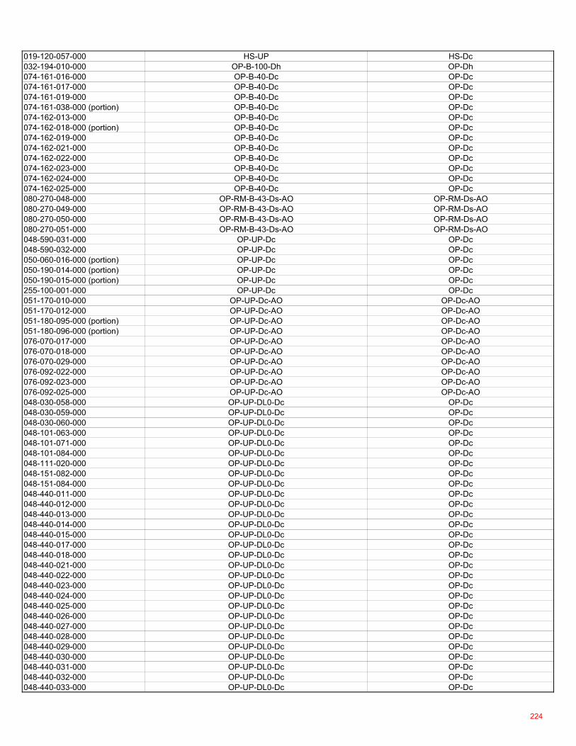
019-120-057-000 HS-UP HS-Dc032-194-010-000 OP-B-100-Dh OP-Dh074-161-016-000 OP-B-40-Dc OP-Dc074-161-017-000 OP-B-40-Dc OP-Dc074-161-019-000 OP-B-40-Dc OP-Dc074-161-038-000 (portion) OP-B-40-Dc OP-Dc074-162-013-000 OP-B-40-Dc OP-Dc074-162-018-000 (portion) OP-B-40-Dc OP-Dc074-162-019-000 OP-B-40-Dc OP-Dc074-162-021-000 OP-B-40-Dc OP-Dc074-162-022-000 OP-B-40-Dc OP-Dc074-162-023-000 OP-B-40-Dc OP-Dc074-162-024-000 OP-B-40-Dc OP-Dc074-162-025-000 OP-B-40-Dc OP-Dc080-270-048-000 OP-RM-B-43-Ds-AO OP-RM-Ds-AO080-270-049-000 OP-RM-B-43-Ds-AO OP-RM-Ds-AO080-270-050-000 OP-RM-B-43-Ds-AO OP-RM-Ds-AO080-270-051-000 OP-RM-B-43-Ds-AO OP-RM-Ds-AO048-590-031-000 OP-UP-Dc OP-Dc048-590-032-000 OP-UP-Dc OP-Dc050-060-016-000 (portion) OP-UP-Dc OP-Dc050-190-014-000 (portion) OP-UP-Dc OP-Dc050-190-015-000 (portion) OP-UP-Dc OP-Dc255-100-001-000 OP-UP-Dc OP-Dc051-170-010-000 OP-UP-Dc-AO OP-Dc-AO051-170-012-000 OP-UP-Dc-AO OP-Dc-AO051-180-095-000 (portion) OP-UP-Dc-AO OP-Dc-AO051-180-096-000 (portion) OP-UP-Dc-AO OP-Dc-AO076-070-017-000 OP-UP-Dc-AO OP-Dc-AO076-070-018-000 OP-UP-Dc-AO OP-Dc-AO076-070-029-000 OP-UP-Dc-AO OP-Dc-AO076-092-022-000 OP-UP-Dc-AO OP-Dc-AO076-092-023-000 OP-UP-Dc-AO OP-Dc-AO076-092-025-000 OP-UP-Dc-AO OP-Dc-AO048-030-058-000 OP-UP-DL0-Dc OP-Dc048-030-059-000 OP-UP-DL0-Dc OP-Dc048-030-060-000 OP-UP-DL0-Dc OP-Dc048-101-063-000 OP-UP-DL0-Dc OP-Dc048-101-071-000 OP-UP-DL0-Dc OP-Dc048-101-084-000 OP-UP-DL0-Dc OP-Dc048-111-020-000 OP-UP-DL0-Dc OP-Dc048-151-082-000 OP-UP-DL0-Dc OP-Dc048-151-084-000 OP-UP-DL0-Dc OP-Dc048-440-011-000 OP-UP-DL0-Dc OP-Dc048-440-012-000 OP-UP-DL0-Dc OP-Dc048-440-013-000 OP-UP-DL0-Dc OP-Dc048-440-014-000 OP-UP-DL0-Dc OP-Dc048-440-015-000 OP-UP-DL0-Dc OP-Dc048-440-017-000 OP-UP-DL0-Dc OP-Dc048-440-018-000 OP-UP-DL0-Dc OP-Dc048-440-021-000 OP-UP-DL0-Dc OP-Dc048-440-022-000 OP-UP-DL0-Dc OP-Dc048-440-023-000 OP-UP-DL0-Dc OP-Dc048-440-024-000 OP-UP-DL0-Dc OP-Dc048-440-025-000 OP-UP-DL0-Dc OP-Dc048-440-026-000 OP-UP-DL0-Dc OP-Dc048-440-027-000 OP-UP-DL0-Dc OP-Dc048-440-028-000 OP-UP-DL0-Dc OP-Dc048-440-029-000 OP-UP-DL0-Dc OP-Dc048-440-030-000 OP-UP-DL0-Dc OP-Dc048-440-031-000 OP-UP-DL0-Dc OP-Dc048-440-032-000 OP-UP-DL0-Dc OP-Dc048-440-033-000 OP-UP-DL0-Dc OP-Dc
224
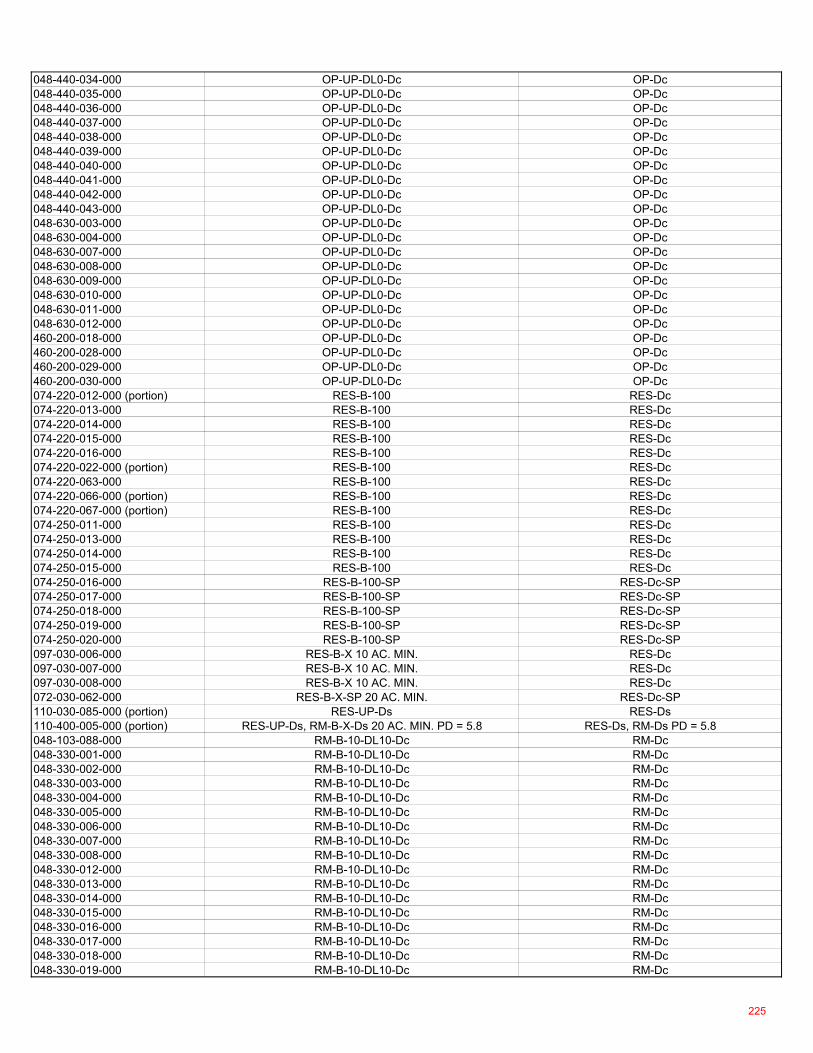
048-440-034-000 OP-UP-DL0-Dc OP-Dc048-440-035-000 OP-UP-DL0-Dc OP-Dc048-440-036-000 OP-UP-DL0-Dc OP-Dc048-440-037-000 OP-UP-DL0-Dc OP-Dc048-440-038-000 OP-UP-DL0-Dc OP-Dc048-440-039-000 OP-UP-DL0-Dc OP-Dc048-440-040-000 OP-UP-DL0-Dc OP-Dc048-440-041-000 OP-UP-DL0-Dc OP-Dc048-440-042-000 OP-UP-DL0-Dc OP-Dc048-440-043-000 OP-UP-DL0-Dc OP-Dc048-630-003-000 OP-UP-DL0-Dc OP-Dc048-630-004-000 OP-UP-DL0-Dc OP-Dc048-630-007-000 OP-UP-DL0-Dc OP-Dc048-630-008-000 OP-UP-DL0-Dc OP-Dc048-630-009-000 OP-UP-DL0-Dc OP-Dc048-630-010-000 OP-UP-DL0-Dc OP-Dc048-630-011-000 OP-UP-DL0-Dc OP-Dc048-630-012-000 OP-UP-DL0-Dc OP-Dc460-200-018-000 OP-UP-DL0-Dc OP-Dc460-200-028-000 OP-UP-DL0-Dc OP-Dc460-200-029-000 OP-UP-DL0-Dc OP-Dc460-200-030-000 OP-UP-DL0-Dc OP-Dc074-220-012-000 (portion) RES-B-100 RES-Dc074-220-013-000 RES-B-100 RES-Dc074-220-014-000 RES-B-100 RES-Dc074-220-015-000 RES-B-100 RES-Dc074-220-016-000 RES-B-100 RES-Dc074-220-022-000 (portion) RES-B-100 RES-Dc074-220-063-000 RES-B-100 RES-Dc074-220-066-000 (portion) RES-B-100 RES-Dc074-220-067-000 (portion) RES-B-100 RES-Dc074-250-011-000 RES-B-100 RES-Dc074-250-013-000 RES-B-100 RES-Dc074-250-014-000 RES-B-100 RES-Dc074-250-015-000 RES-B-100 RES-Dc074-250-016-000 RES-B-100-SP RES-Dc-SP074-250-017-000 RES-B-100-SP RES-Dc-SP074-250-018-000 RES-B-100-SP RES-Dc-SP074-250-019-000 RES-B-100-SP RES-Dc-SP074-250-020-000 RES-B-100-SP RES-Dc-SP097-030-006-000 RES-B-X 10 AC. MIN. RES-Dc097-030-007-000 RES-B-X 10 AC. MIN. RES-Dc097-030-008-000 RES-B-X 10 AC. MIN. RES-Dc072-030-062-000 RES-B-X-SP 20 AC. MIN. RES-Dc-SP110-030-085-000 (portion) RES-UP-Ds RES-Ds110-400-005-000 (portion) RES-UP-Ds, RM-B-X-Ds 20 AC. MIN. PD = 5.8 RES-Ds, RM-Ds PD = 5.8048-103-088-000 RM-B-10-DL10-Dc RM-Dc048-330-001-000 RM-B-10-DL10-Dc RM-Dc048-330-002-000 RM-B-10-DL10-Dc RM-Dc048-330-003-000 RM-B-10-DL10-Dc RM-Dc048-330-004-000 RM-B-10-DL10-Dc RM-Dc048-330-005-000 RM-B-10-DL10-Dc RM-Dc048-330-006-000 RM-B-10-DL10-Dc RM-Dc048-330-007-000 RM-B-10-DL10-Dc RM-Dc048-330-008-000 RM-B-10-DL10-Dc RM-Dc048-330-012-000 RM-B-10-DL10-Dc RM-Dc048-330-013-000 RM-B-10-DL10-Dc RM-Dc048-330-014-000 RM-B-10-DL10-Dc RM-Dc048-330-015-000 RM-B-10-DL10-Dc RM-Dc048-330-016-000 RM-B-10-DL10-Dc RM-Dc048-330-017-000 RM-B-10-DL10-Dc RM-Dc048-330-018-000 RM-B-10-DL10-Dc RM-Dc048-330-019-000 RM-B-10-DL10-Dc RM-Dc
225
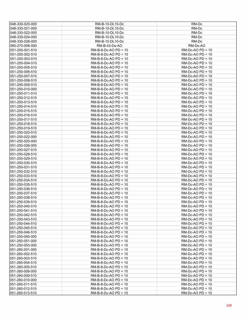
048-330-020-000 RM-B-10-DL10-Dc RM-Dc048-330-021-000 RM-B-10-DL10-Dc RM-Dc048-330-022-000 RM-B-10-DL10-Dc RM-Dc048-330-024-000 RM-B-10-DL10-Dc RM-Dc048-330-026-000 RM-B-10-DL10-Dc RM-Dc080-270-006-000 RM-B-43-Ds-AO RM-Ds-AO051-250-001-510 RM-B-8-Dc-AO PD = 10 RM-Dc-AO PD = 10051-250-002-510 RM-B-8-Dc-AO PD = 10 RM-Dc-AO PD = 10051-250-003-510 RM-B-8-Dc-AO PD = 10 RM-Dc-AO PD = 10051-250-004-510 RM-B-8-Dc-AO PD = 10 RM-Dc-AO PD = 10051-250-005-510 RM-B-8-Dc-AO PD = 10 RM-Dc-AO PD = 10051-250-006-510 RM-B-8-Dc-AO PD = 10 RM-Dc-AO PD = 10051-250-007-510 RM-B-8-Dc-AO PD = 10 RM-Dc-AO PD = 10051-250-008-510 RM-B-8-Dc-AO PD = 10 RM-Dc-AO PD = 10051-250-009-510 RM-B-8-Dc-AO PD = 10 RM-Dc-AO PD = 10051-250-010-000 RM-B-8-Dc-AO PD = 10 RM-Dc-AO PD = 10051-250-011-510 RM-B-8-Dc-AO PD = 10 RM-Dc-AO PD = 10051-250-012-510 RM-B-8-Dc-AO PD = 10 RM-Dc-AO PD = 10051-250-013-510 RM-B-8-Dc-AO PD = 10 RM-Dc-AO PD = 10051-250-014-510 RM-B-8-Dc-AO PD = 10 RM-Dc-AO PD = 10051-250-015-510 RM-B-8-Dc-AO PD = 10 RM-Dc-AO PD = 10051-250-016-510 RM-B-8-Dc-AO PD = 10 RM-Dc-AO PD = 10051-250-017-510 RM-B-8-Dc-AO PD = 10 RM-Dc-AO PD = 10051-250-018-510 RM-B-8-Dc-AO PD = 10 RM-Dc-AO PD = 10051-250-019-510 RM-B-8-Dc-AO PD = 10 RM-Dc-AO PD = 10051-250-020-510 RM-B-8-Dc-AO PD = 10 RM-Dc-AO PD = 10051-250-022-000 RM-B-8-Dc-AO PD = 10 RM-Dc-AO PD = 10051-250-025-000 RM-B-8-Dc-AO PD = 10 RM-Dc-AO PD = 10051-250-026-000 RM-B-8-Dc-AO PD = 10 RM-Dc-AO PD = 10051-250-027-510 RM-B-8-Dc-AO PD = 10 RM-Dc-AO PD = 10051-250-028-510 RM-B-8-Dc-AO PD = 10 RM-Dc-AO PD = 10051-250-029-510 RM-B-8-Dc-AO PD = 10 RM-Dc-AO PD = 10051-250-030-510 RM-B-8-Dc-AO PD = 10 RM-Dc-AO PD = 10051-250-031-510 RM-B-8-Dc-AO PD = 10 RM-Dc-AO PD = 10051-250-032-510 RM-B-8-Dc-AO PD = 10 RM-Dc-AO PD = 10051-250-033-510 RM-B-8-Dc-AO PD = 10 RM-Dc-AO PD = 10051-250-034-510 RM-B-8-Dc-AO PD = 10 RM-Dc-AO PD = 10051-250-035-510 RM-B-8-Dc-AO PD = 10 RM-Dc-AO PD = 10051-250-036-510 RM-B-8-Dc-AO PD = 10 RM-Dc-AO PD = 10051-250-037-510 RM-B-8-Dc-AO PD = 10 RM-Dc-AO PD = 10051-250-038-510 RM-B-8-Dc-AO PD = 10 RM-Dc-AO PD = 10051-250-039-510 RM-B-8-Dc-AO PD = 10 RM-Dc-AO PD = 10051-250-040-510 RM-B-8-Dc-AO PD = 10 RM-Dc-AO PD = 10051-250-041-510 RM-B-8-Dc-AO PD = 10 RM-Dc-AO PD = 10051-250-042-510 RM-B-8-Dc-AO PD = 10 RM-Dc-AO PD = 10051-250-043-510 RM-B-8-Dc-AO PD = 10 RM-Dc-AO PD = 10051-250-044-510 RM-B-8-Dc-AO PD = 10 RM-Dc-AO PD = 10051-250-045-510 RM-B-8-Dc-AO PD = 10 RM-Dc-AO PD = 10051-250-046-510 RM-B-8-Dc-AO PD = 10 RM-Dc-AO PD = 10051-250-050-000 RM-B-8-Dc-AO PD = 10 RM-Dc-AO PD = 10051-250-051-000 RM-B-8-Dc-AO PD = 10 RM-Dc-AO PD = 10051-250-053-000 RM-B-8-Dc-AO PD = 10 RM-Dc-AO PD = 10051-260-001-000 RM-B-8-Dc-AO PD = 10 RM-Dc-AO PD = 10051-260-002-510 RM-B-8-Dc-AO PD = 10 RM-Dc-AO PD = 10051-260-003-510 RM-B-8-Dc-AO PD = 10 RM-Dc-AO PD = 10051-260-004-510 RM-B-8-Dc-AO PD = 10 RM-Dc-AO PD = 10051-260-005-510 RM-B-8-Dc-AO PD = 10 RM-Dc-AO PD = 10051-260-008-000 RM-B-8-Dc-AO PD = 10 RM-Dc-AO PD = 10051-260-009-510 RM-B-8-Dc-AO PD = 10 RM-Dc-AO PD = 10051-260-010-000 RM-B-8-Dc-AO PD = 10 RM-Dc-AO PD = 10051-260-011-510 RM-B-8-Dc-AO PD = 10 RM-Dc-AO PD = 10051-260-012-510 RM-B-8-Dc-AO PD = 10 RM-Dc-AO PD = 10051-260-013-510 RM-B-8-Dc-AO PD = 10 RM-Dc-AO PD = 10
226
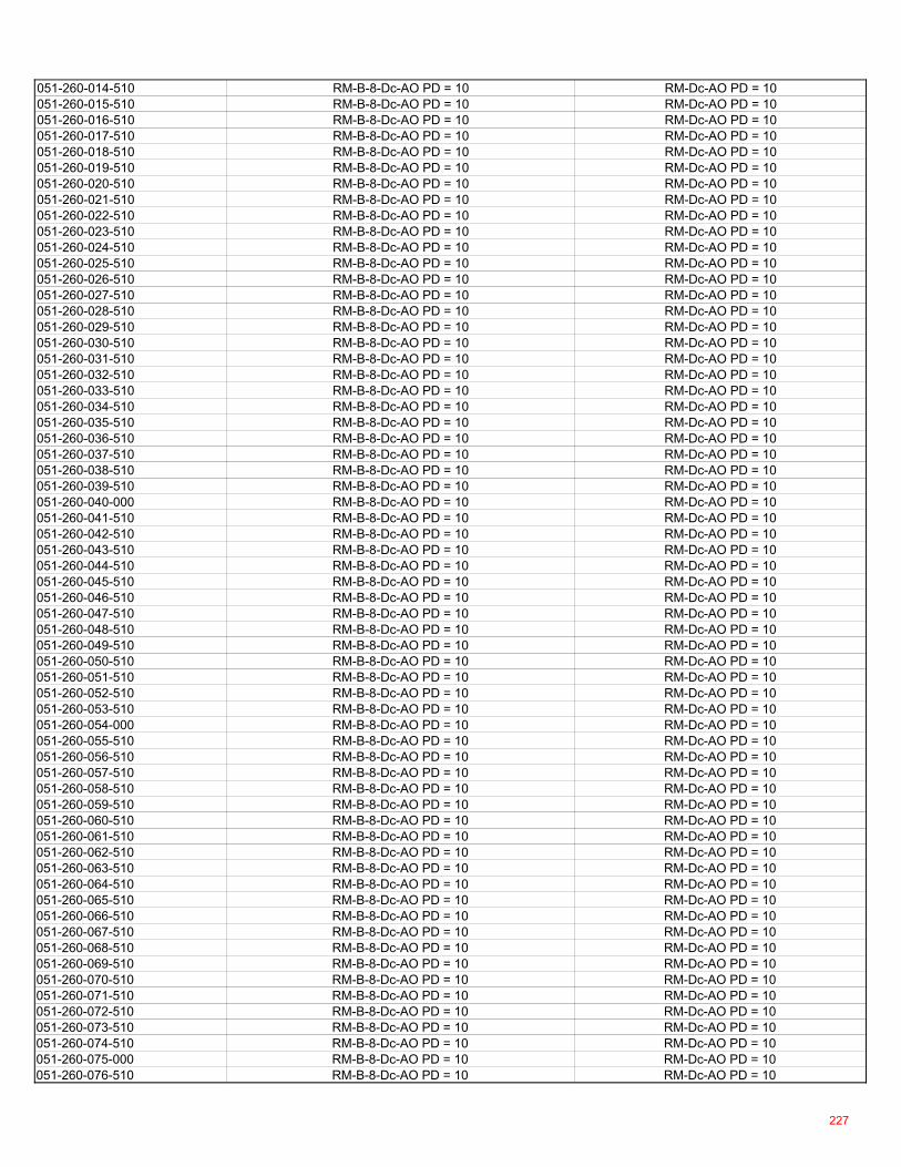
051-260-014-510 RM-B-8-Dc-AO PD = 10 RM-Dc-AO PD = 10051-260-015-510 RM-B-8-Dc-AO PD = 10 RM-Dc-AO PD = 10051-260-016-510 RM-B-8-Dc-AO PD = 10 RM-Dc-AO PD = 10051-260-017-510 RM-B-8-Dc-AO PD = 10 RM-Dc-AO PD = 10051-260-018-510 RM-B-8-Dc-AO PD = 10 RM-Dc-AO PD = 10051-260-019-510 RM-B-8-Dc-AO PD = 10 RM-Dc-AO PD = 10051-260-020-510 RM-B-8-Dc-AO PD = 10 RM-Dc-AO PD = 10051-260-021-510 RM-B-8-Dc-AO PD = 10 RM-Dc-AO PD = 10051-260-022-510 RM-B-8-Dc-AO PD = 10 RM-Dc-AO PD = 10051-260-023-510 RM-B-8-Dc-AO PD = 10 RM-Dc-AO PD = 10051-260-024-510 RM-B-8-Dc-AO PD = 10 RM-Dc-AO PD = 10051-260-025-510 RM-B-8-Dc-AO PD = 10 RM-Dc-AO PD = 10051-260-026-510 RM-B-8-Dc-AO PD = 10 RM-Dc-AO PD = 10051-260-027-510 RM-B-8-Dc-AO PD = 10 RM-Dc-AO PD = 10051-260-028-510 RM-B-8-Dc-AO PD = 10 RM-Dc-AO PD = 10051-260-029-510 RM-B-8-Dc-AO PD = 10 RM-Dc-AO PD = 10051-260-030-510 RM-B-8-Dc-AO PD = 10 RM-Dc-AO PD = 10051-260-031-510 RM-B-8-Dc-AO PD = 10 RM-Dc-AO PD = 10051-260-032-510 RM-B-8-Dc-AO PD = 10 RM-Dc-AO PD = 10051-260-033-510 RM-B-8-Dc-AO PD = 10 RM-Dc-AO PD = 10051-260-034-510 RM-B-8-Dc-AO PD = 10 RM-Dc-AO PD = 10051-260-035-510 RM-B-8-Dc-AO PD = 10 RM-Dc-AO PD = 10051-260-036-510 RM-B-8-Dc-AO PD = 10 RM-Dc-AO PD = 10051-260-037-510 RM-B-8-Dc-AO PD = 10 RM-Dc-AO PD = 10051-260-038-510 RM-B-8-Dc-AO PD = 10 RM-Dc-AO PD = 10051-260-039-510 RM-B-8-Dc-AO PD = 10 RM-Dc-AO PD = 10051-260-040-000 RM-B-8-Dc-AO PD = 10 RM-Dc-AO PD = 10051-260-041-510 RM-B-8-Dc-AO PD = 10 RM-Dc-AO PD = 10051-260-042-510 RM-B-8-Dc-AO PD = 10 RM-Dc-AO PD = 10051-260-043-510 RM-B-8-Dc-AO PD = 10 RM-Dc-AO PD = 10051-260-044-510 RM-B-8-Dc-AO PD = 10 RM-Dc-AO PD = 10051-260-045-510 RM-B-8-Dc-AO PD = 10 RM-Dc-AO PD = 10051-260-046-510 RM-B-8-Dc-AO PD = 10 RM-Dc-AO PD = 10051-260-047-510 RM-B-8-Dc-AO PD = 10 RM-Dc-AO PD = 10051-260-048-510 RM-B-8-Dc-AO PD = 10 RM-Dc-AO PD = 10051-260-049-510 RM-B-8-Dc-AO PD = 10 RM-Dc-AO PD = 10051-260-050-510 RM-B-8-Dc-AO PD = 10 RM-Dc-AO PD = 10051-260-051-510 RM-B-8-Dc-AO PD = 10 RM-Dc-AO PD = 10051-260-052-510 RM-B-8-Dc-AO PD = 10 RM-Dc-AO PD = 10051-260-053-510 RM-B-8-Dc-AO PD = 10 RM-Dc-AO PD = 10051-260-054-000 RM-B-8-Dc-AO PD = 10 RM-Dc-AO PD = 10051-260-055-510 RM-B-8-Dc-AO PD = 10 RM-Dc-AO PD = 10051-260-056-510 RM-B-8-Dc-AO PD = 10 RM-Dc-AO PD = 10051-260-057-510 RM-B-8-Dc-AO PD = 10 RM-Dc-AO PD = 10051-260-058-510 RM-B-8-Dc-AO PD = 10 RM-Dc-AO PD = 10051-260-059-510 RM-B-8-Dc-AO PD = 10 RM-Dc-AO PD = 10051-260-060-510 RM-B-8-Dc-AO PD = 10 RM-Dc-AO PD = 10051-260-061-510 RM-B-8-Dc-AO PD = 10 RM-Dc-AO PD = 10051-260-062-510 RM-B-8-Dc-AO PD = 10 RM-Dc-AO PD = 10051-260-063-510 RM-B-8-Dc-AO PD = 10 RM-Dc-AO PD = 10051-260-064-510 RM-B-8-Dc-AO PD = 10 RM-Dc-AO PD = 10051-260-065-510 RM-B-8-Dc-AO PD = 10 RM-Dc-AO PD = 10051-260-066-510 RM-B-8-Dc-AO PD = 10 RM-Dc-AO PD = 10051-260-067-510 RM-B-8-Dc-AO PD = 10 RM-Dc-AO PD = 10051-260-068-510 RM-B-8-Dc-AO PD = 10 RM-Dc-AO PD = 10051-260-069-510 RM-B-8-Dc-AO PD = 10 RM-Dc-AO PD = 10051-260-070-510 RM-B-8-Dc-AO PD = 10 RM-Dc-AO PD = 10051-260-071-510 RM-B-8-Dc-AO PD = 10 RM-Dc-AO PD = 10051-260-072-510 RM-B-8-Dc-AO PD = 10 RM-Dc-AO PD = 10051-260-073-510 RM-B-8-Dc-AO PD = 10 RM-Dc-AO PD = 10051-260-074-510 RM-B-8-Dc-AO PD = 10 RM-Dc-AO PD = 10051-260-075-000 RM-B-8-Dc-AO PD = 10 RM-Dc-AO PD = 10051-260-076-510 RM-B-8-Dc-AO PD = 10 RM-Dc-AO PD = 10
227
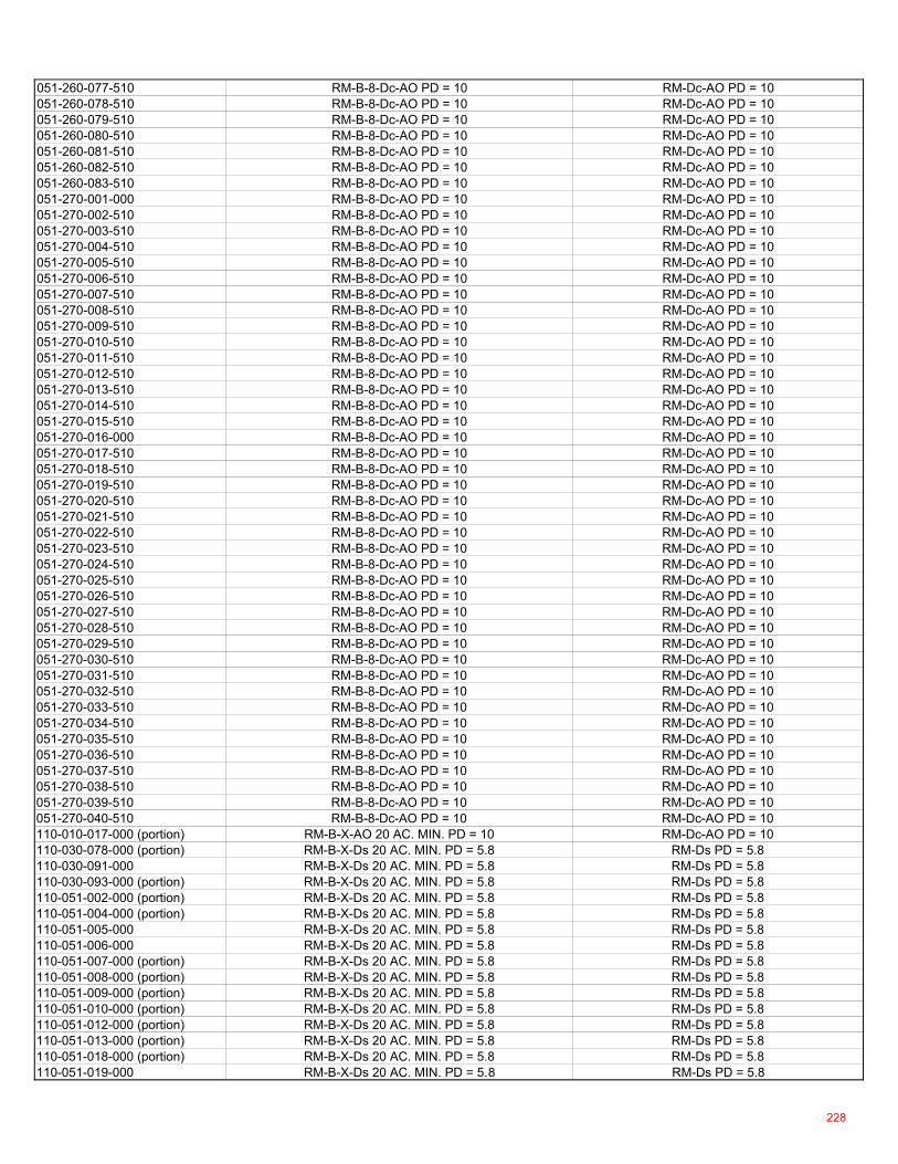
051-260-077-510 RM-B-8-Dc-AO PD = 10 RM-Dc-AO PD = 10051-260-078-510 RM-B-8-Dc-AO PD = 10 RM-Dc-AO PD = 10051-260-079-510 RM-B-8-Dc-AO PD = 10 RM-Dc-AO PD = 10051-260-080-510 RM-B-8-Dc-AO PD = 10 RM-Dc-AO PD = 10051-260-081-510 RM-B-8-Dc-AO PD = 10 RM-Dc-AO PD = 10051-260-082-510 RM-B-8-Dc-AO PD = 10 RM-Dc-AO PD = 10051-260-083-510 RM-B-8-Dc-AO PD = 10 RM-Dc-AO PD = 10051-270-001-000 RM-B-8-Dc-AO PD = 10 RM-Dc-AO PD = 10051-270-002-510 RM-B-8-Dc-AO PD = 10 RM-Dc-AO PD = 10051-270-003-510 RM-B-8-Dc-AO PD = 10 RM-Dc-AO PD = 10051-270-004-510 RM-B-8-Dc-AO PD = 10 RM-Dc-AO PD = 10051-270-005-510 RM-B-8-Dc-AO PD = 10 RM-Dc-AO PD = 10051-270-006-510 RM-B-8-Dc-AO PD = 10 RM-Dc-AO PD = 10051-270-007-510 RM-B-8-Dc-AO PD = 10 RM-Dc-AO PD = 10051-270-008-510 RM-B-8-Dc-AO PD = 10 RM-Dc-AO PD = 10051-270-009-510 RM-B-8-Dc-AO PD = 10 RM-Dc-AO PD = 10051-270-010-510 RM-B-8-Dc-AO PD = 10 RM-Dc-AO PD = 10051-270-011-510 RM-B-8-Dc-AO PD = 10 RM-Dc-AO PD = 10051-270-012-510 RM-B-8-Dc-AO PD = 10 RM-Dc-AO PD = 10051-270-013-510 RM-B-8-Dc-AO PD = 10 RM-Dc-AO PD = 10051-270-014-510 RM-B-8-Dc-AO PD = 10 RM-Dc-AO PD = 10051-270-015-510 RM-B-8-Dc-AO PD = 10 RM-Dc-AO PD = 10051-270-016-000 RM-B-8-Dc-AO PD = 10 RM-Dc-AO PD = 10051-270-017-510 RM-B-8-Dc-AO PD = 10 RM-Dc-AO PD = 10051-270-018-510 RM-B-8-Dc-AO PD = 10 RM-Dc-AO PD = 10051-270-019-510 RM-B-8-Dc-AO PD = 10 RM-Dc-AO PD = 10051-270-020-510 RM-B-8-Dc-AO PD = 10 RM-Dc-AO PD = 10051-270-021-510 RM-B-8-Dc-AO PD = 10 RM-Dc-AO PD = 10051-270-022-510 RM-B-8-Dc-AO PD = 10 RM-Dc-AO PD = 10051-270-023-510 RM-B-8-Dc-AO PD = 10 RM-Dc-AO PD = 10051-270-024-510 RM-B-8-Dc-AO PD = 10 RM-Dc-AO PD = 10051-270-025-510 RM-B-8-Dc-AO PD = 10 RM-Dc-AO PD = 10051-270-026-510 RM-B-8-Dc-AO PD = 10 RM-Dc-AO PD = 10051-270-027-510 RM-B-8-Dc-AO PD = 10 RM-Dc-AO PD = 10051-270-028-510 RM-B-8-Dc-AO PD = 10 RM-Dc-AO PD = 10051-270-029-510 RM-B-8-Dc-AO PD = 10 RM-Dc-AO PD = 10051-270-030-510 RM-B-8-Dc-AO PD = 10 RM-Dc-AO PD = 10051-270-031-510 RM-B-8-Dc-AO PD = 10 RM-Dc-AO PD = 10051-270-032-510 RM-B-8-Dc-AO PD = 10 RM-Dc-AO PD = 10051-270-033-510 RM-B-8-Dc-AO PD = 10 RM-Dc-AO PD = 10051-270-034-510 RM-B-8-Dc-AO PD = 10 RM-Dc-AO PD = 10051-270-035-510 RM-B-8-Dc-AO PD = 10 RM-Dc-AO PD = 10051-270-036-510 RM-B-8-Dc-AO PD = 10 RM-Dc-AO PD = 10051-270-037-510 RM-B-8-Dc-AO PD = 10 RM-Dc-AO PD = 10051-270-038-510 RM-B-8-Dc-AO PD = 10 RM-Dc-AO PD = 10051-270-039-510 RM-B-8-Dc-AO PD = 10 RM-Dc-AO PD = 10051-270-040-510 RM-B-8-Dc-AO PD = 10 RM-Dc-AO PD = 10110-010-017-000 (portion) RM-B-X-AO 20 AC. MIN. PD = 10 RM-Dc-AO PD = 10110-030-078-000 (portion) RM-B-X-Ds 20 AC. MIN. PD = 5.8 RM-Ds PD = 5.8110-030-091-000 RM-B-X-Ds 20 AC. MIN. PD = 5.8 RM-Ds PD = 5.8110-030-093-000 (portion) RM-B-X-Ds 20 AC. MIN. PD = 5.8 RM-Ds PD = 5.8110-051-002-000 (portion) RM-B-X-Ds 20 AC. MIN. PD = 5.8 RM-Ds PD = 5.8110-051-004-000 (portion) RM-B-X-Ds 20 AC. MIN. PD = 5.8 RM-Ds PD = 5.8110-051-005-000 RM-B-X-Ds 20 AC. MIN. PD = 5.8 RM-Ds PD = 5.8110-051-006-000 RM-B-X-Ds 20 AC. MIN. PD = 5.8 RM-Ds PD = 5.8110-051-007-000 (portion) RM-B-X-Ds 20 AC. MIN. PD = 5.8 RM-Ds PD = 5.8110-051-008-000 (portion) RM-B-X-Ds 20 AC. MIN. PD = 5.8 RM-Ds PD = 5.8110-051-009-000 (portion) RM-B-X-Ds 20 AC. MIN. PD = 5.8 RM-Ds PD = 5.8110-051-010-000 (portion) RM-B-X-Ds 20 AC. MIN. PD = 5.8 RM-Ds PD = 5.8110-051-012-000 (portion) RM-B-X-Ds 20 AC. MIN. PD = 5.8 RM-Ds PD = 5.8110-051-013-000 (portion) RM-B-X-Ds 20 AC. MIN. PD = 5.8 RM-Ds PD = 5.8110-051-018-000 (portion) RM-B-X-Ds 20 AC. MIN. PD = 5.8 RM-Ds PD = 5.8110-051-019-000 RM-B-X-Ds 20 AC. MIN. PD = 5.8 RM-Ds PD = 5.8
228
110-051-047-000 (portion) RM-B-X-Ds 20 AC. MIN. PD = 5.8 RM-Ds PD = 5.8110-051-049-000 (portion) RM-B-X-Ds 20 AC. MIN. PD = 5.8 RM-Ds PD = 5.8110-660-001-000 RM-B-X-Ds 20 AC. MIN. PD = 5.8 RM-Ds PD = 5.8110-660-002-000 RM-B-X-Ds 20 AC. MIN. PD = 5.8 RM-Ds PD = 5.8110-660-003-000 RM-B-X-Ds 20 AC. MIN. PD = 5.8 RM-Ds PD = 5.8110-660-004-000 RM-B-X-Ds 20 AC. MIN. PD = 5.8 RM-Ds PD = 5.8110-660-005-000 RM-B-X-Ds 20 AC. MIN. PD = 5.8 RM-Ds PD = 5.8110-660-006-000 RM-B-X-Ds 20 AC. MIN. PD = 5.8 RM-Ds PD = 5.8110-660-007-000 RM-B-X-Ds 20 AC. MIN. PD = 5.8 RM-Ds PD = 5.8110-660-008-000 RM-B-X-Ds 20 AC. MIN. PD = 5.8 RM-Ds PD = 5.8110-660-009-000 RM-B-X-Ds 20 AC. MIN. PD = 5.8 RM-Ds PD = 5.8110-660-010-000 RM-B-X-Ds 20 AC. MIN. PD = 5.8 RM-Ds PD = 5.8110-660-011-000 RM-B-X-Ds 20 AC. MIN. PD = 5.8 RM-Ds PD = 5.8110-660-012-000 RM-B-X-Ds 20 AC. MIN. PD = 5.8 RM-Ds PD = 5.8110-660-016-000 RM-B-X-Ds 20 AC. MIN. PD = 5.8 RM-Ds PD = 5.8110-660-017-000 RM-B-X-Ds 20 AC. MIN. PD = 5.8 RM-Ds PD = 5.8110-660-018-000 RM-B-X-Ds 20 AC. MIN. PD = 5.8 RM-Ds PD = 5.8110-660-019-000 RM-B-X-Ds 20 AC. MIN. PD = 5.8 RM-Ds PD = 5.8110-660-020-000 RM-B-X-Ds 20 AC. MIN. PD = 5.8 RM-Ds PD = 5.8110-660-021-000 RM-B-X-Ds 20 AC. MIN. PD = 5.8 RM-Ds PD = 5.8110-660-022-000 RM-B-X-Ds 20 AC. MIN. PD = 5.8 RM-Ds PD = 5.8110-660-023-000 RM-B-X-Ds 20 AC. MIN. PD = 5.8 RM-Ds PD = 5.8110-660-024-000 RM-B-X-Ds 20 AC. MIN. PD = 5.8 RM-Ds PD = 5.8110-660-025-000 RM-B-X-Ds 20 AC. MIN. PD = 5.8 RM-Ds PD = 5.8110-660-026-000 RM-B-X-Ds 20 AC. MIN. PD = 5.8 RM-Ds PD = 5.8110-660-027-000 (portion) RM-B-X-Ds 20 AC. MIN. PD = 5.8 RM-Ds PD = 5.8110-660-028-000 RM-B-X-Ds 20 AC. MIN. PD = 5.8 RM-Ds PD = 5.8110-660-029-000 RM-B-X-Ds 20 AC. MIN. PD = 5.8 RM-Ds PD = 5.8110-660-030-000 RM-B-X-Ds 20 AC. MIN. PD = 5.8 RM-Ds PD = 5.8110-660-031-000 RM-B-X-Ds 20 AC. MIN. PD = 5.8 RM-Ds PD = 5.8110-660-032-000 RM-B-X-Ds 20 AC. MIN. PD = 5.8 RM-Ds PD = 5.8114-010-001-000 (portion) RM-B-X-Ds 20 AC. MIN. PD = 5.8 RM-Ds PD = 5.8114-010-002-000 RM-B-X-Ds 20 AC. MIN. PD = 5.8 RM-Ds PD = 5.8114-010-003-000 RM-B-X-Ds 20 AC. MIN. PD = 5.8 RM-Ds PD = 5.8114-010-004-000 RM-B-X-Ds 20 AC. MIN. PD = 5.8 RM-Ds PD = 5.8114-010-005-000 RM-B-X-Ds 20 AC. MIN. PD = 5.8 RM-Ds PD = 5.8114-010-006-000 RM-B-X-Ds 20 AC. MIN. PD = 5.8 RM-Ds PD = 5.8114-010-007-000 RM-B-X-Ds 20 AC. MIN. PD = 5.8 RM-Ds PD = 5.8114-010-008-000 RM-B-X-Ds 20 AC. MIN. PD = 5.8 RM-Ds PD = 5.8114-010-009-000 RM-B-X-Ds 20 AC. MIN. PD = 5.8 RM-Ds PD = 5.8114-010-010-000 RM-B-X-Ds 20 AC. MIN. PD = 5.8 RM-Ds PD = 5.8114-010-011-000 RM-B-X-Ds 20 AC. MIN. PD = 5.8 RM-Ds PD = 5.8114-010-012-000 RM-B-X-Ds 20 AC. MIN. PD = 5.8 RM-Ds PD = 5.8114-010-013-000 RM-B-X-Ds 20 AC. MIN. PD = 5.8 RM-Ds PD = 5.8114-010-014-000 RM-B-X-Ds 20 AC. MIN. PD = 5.8 RM-Ds PD = 5.8114-010-015-000 RM-B-X-Ds 20 AC. MIN. PD = 5.8 RM-Ds PD = 5.8114-010-016-000 RM-B-X-Ds 20 AC. MIN. PD = 5.8 RM-Ds PD = 5.8114-010-017-000 (portion) RM-B-X-Ds 20 AC. MIN. PD = 5.8 RM-Ds PD = 5.8114-020-002-000 (portion) RM-B-X-Ds 20 AC. MIN. PD = 5.8 RM-Ds PD = 5.8114-020-003-000 (portion) RM-B-X-Ds 20 AC. MIN. PD = 5.8 RM-Ds PD = 5.8114-020-004-000 (portion) RM-B-X-Ds 20 AC. MIN. PD = 5.8 RM-Ds PD = 5.8114-030-006-000 (portion) RM-B-X-Ds 20 AC. MIN. PD = 5.8 RM-Ds PD = 5.8114-030-014-000 (portion) RM-B-X-Ds 20 AC. MIN. PD = 5.8 RM-Ds PD = 5.8114-030-021-000 (portion) RM-B-X-Ds 20 AC. MIN. PD = 5.8 RM-Ds PD = 5.8114-030-028-000 (portion) RM-B-X-Ds 20 AC. MIN. PD = 5.8 RM-Ds PD = 5.8114-030-033-000 (portion) RM-B-X-Ds 20 AC. MIN. PD = 5.8 RM-Ds PD = 5.8114-040-001-000 (portion) RM-B-X-Ds 20 AC. MIN. PD = 5.8 RM-Ds PD = 5.8114-040-002-000 (portion) RM-B-X-Ds 20 AC. MIN. PD = 5.8 RM-Ds PD = 5.8114-050-002-000 RM-B-X-Ds 20 AC. MIN. PD = 5.8 RM-Ds PD = 5.8114-050-006-000 RM-B-X-Ds 20 AC. MIN. PD = 5.8 RM-Ds PD = 5.8114-060-001-000 (portion) RM-B-X-Ds 20 AC. MIN. PD = 5.8 RM-Ds PD = 5.8114-060-009-000 (portion) RM-B-X-Ds 20 AC. MIN. PD = 5.8 RM-Ds PD = 5.8114-060-010-000 (portion) RM-B-X-Ds 20 AC. MIN. PD = 5.8 RM-Ds PD = 5.8
229
114-060-014-000 (portion) RM-B-X-Ds 20 AC. MIN. PD = 5.8 RM-Ds PD = 5.8114-070-001-000 RM-B-X-Ds 20 AC. MIN. PD = 5.8 RM-Ds PD = 5.8114-070-005-000 (portion) RM-B-X-Ds 20 AC. MIN. PD = 5.8 RM-Ds PD = 5.8114-070-006-000 RM-B-X-Ds 20 AC. MIN. PD = 5.8 RM-Ds PD = 5.8114-070-012-000 (portion) RM-B-X-Ds 20 AC. MIN. PD = 5.8 RM-Ds PD = 5.8114-070-013-000 (portion) RM-B-X-Ds 20 AC. MIN. PD = 5.8 RM-Ds PD = 5.8114-080-001-000 (portion) RM-B-X-Ds 20 AC. MIN. PD = 5.8 RM-Ds PD = 5.8114-080-004-000 RM-B-X-Ds 20 AC. MIN. PD = 5.8 RM-Ds PD = 5.8114-080-017-000 (portion) RM-B-X-Ds 20 AC. MIN. PD = 5.8 RM-Ds PD = 5.8114-080-018-000 RM-B-X-Ds 20 AC. MIN. PD = 5.8 RM-Ds PD = 5.8114-080-025-000 (portion) RM-B-X-Ds 20 AC. MIN. PD = 5.8 RM-Ds PD = 5.8114-090-001-000 RM-B-X-Ds 20 AC. MIN. PD = 5.8 RM-Ds PD = 5.8114-090-002-000 RM-B-X-Ds 20 AC. MIN. PD = 5.8 RM-Ds PD = 5.8114-090-003-000 RM-B-X-Ds 20 AC. MIN. PD = 5.8 RM-Ds PD = 5.8114-090-004-000 RM-B-X-Ds 20 AC. MIN. PD = 5.8 RM-Ds PD = 5.8114-090-005-000 RM-B-X-Ds 20 AC. MIN. PD = 5.8 RM-Ds PD = 5.8114-090-006-000 RM-B-X-Ds 20 AC. MIN. PD = 5.8 RM-Ds PD = 5.8114-090-007-000 RM-B-X-Ds 20 AC. MIN. PD = 5.8 RM-Ds PD = 5.8114-090-008-000 RM-B-X-Ds 20 AC. MIN. PD = 5.8 RM-Ds PD = 5.8114-090-009-000 RM-B-X-Ds 20 AC. MIN. PD = 5.8 RM-Ds PD = 5.8114-090-010-000 RM-B-X-Ds 20 AC. MIN. PD = 5.8 RM-Ds PD = 5.8114-090-011-000 RM-B-X-Ds 20 AC. MIN. PD = 5.8 RM-Ds PD = 5.8114-090-012-000 RM-B-X-Ds 20 AC. MIN. PD = 5.8 RM-Ds PD = 5.8114-090-013-000 RM-B-X-Ds 20 AC. MIN. PD = 5.8 RM-Ds PD = 5.8114-090-014-000 RM-B-X-Ds 20 AC. MIN. PD = 5.8 RM-Ds PD = 5.8114-090-015-000 RM-B-X-Ds 20 AC. MIN. PD = 5.8 RM-Ds PD = 5.8114-090-016-000 RM-B-X-Ds 20 AC. MIN. PD = 5.8 RM-Ds PD = 5.8114-090-017-000 RM-B-X-Ds 20 AC. MIN. PD = 5.8 RM-Ds PD = 5.8114-090-018-000 RM-B-X-Ds 20 AC. MIN. PD = 5.8 RM-Ds PD = 5.8114-090-019-000 RM-B-X-Ds 20 AC. MIN. PD = 5.8 RM-Ds PD = 5.8114-100-001-000 RM-B-X-Ds 20 AC. MIN. PD = 5.8 RM-Ds PD = 5.8114-100-002-000 RM-B-X-Ds 20 AC. MIN. PD = 5.8 RM-Ds PD = 5.8114-100-003-000 RM-B-X-Ds 20 AC. MIN. PD = 5.8 RM-Ds PD = 5.8114-100-004-000 RM-B-X-Ds 20 AC. MIN. PD = 5.8 RM-Ds PD = 5.8114-100-005-000 RM-B-X-Ds 20 AC. MIN. PD = 5.8 RM-Ds PD = 5.8114-100-006-000 (portion) RM-B-X-Ds 20 AC. MIN. PD = 5.8 RM-Ds PD = 5.8114-100-007-000 RM-B-X-Ds 20 AC. MIN. PD = 5.8 RM-Ds PD = 5.8114-100-008-000 (portion) RM-B-X-Ds 20 AC. MIN. PD = 5.8 RM-Ds PD = 5.8114-100-009-000 RM-B-X-Ds 20 AC. MIN. PD = 5.8 RM-Ds PD = 5.8114-100-011-000 (portion) RM-B-X-Ds 20 AC. MIN. PD = 5.8 RM-Ds PD = 5.8114-110-001-000 RM-B-X-Ds 20 AC. MIN. PD = 5.8 RM-Ds PD = 5.8114-110-002-000 RM-B-X-Ds 20 AC. MIN. PD = 5.8 RM-Ds PD = 5.8114-110-003-000 RM-B-X-Ds 20 AC. MIN. PD = 5.8 RM-Ds PD = 5.8114-110-004-000 RM-B-X-Ds 20 AC. MIN. PD = 5.8 RM-Ds PD = 5.8114-110-005-000 RM-B-X-Ds 20 AC. MIN. PD = 5.8 RM-Ds PD = 5.8114-110-006-000 RM-B-X-Ds 20 AC. MIN. PD = 5.8 RM-Ds PD = 5.8114-110-007-000 RM-B-X-Ds 20 AC. MIN. PD = 5.8 RM-Ds PD = 5.8114-110-008-000 RM-B-X-Ds 20 AC. MIN. PD = 5.8 RM-Ds PD = 5.8114-110-009-000 RM-B-X-Ds 20 AC. MIN. PD = 5.8 RM-Ds PD = 5.8114-110-010-000 RM-B-X-Ds 20 AC. MIN. PD = 5.8 RM-Ds PD = 5.8114-110-011-000 RM-B-X-Ds 20 AC. MIN. PD = 5.8 RM-Ds PD = 5.8114-110-012-000 RM-B-X-Ds 20 AC. MIN. PD = 5.8 RM-Ds PD = 5.8114-110-013-000 RM-B-X-Ds 20 AC. MIN. PD = 5.8 RM-Ds PD = 5.8114-110-014-000 (portion) RM-B-X-Ds 20 AC. MIN. PD = 5.8 RM-Ds PD = 5.8114-120-001-000 RM-B-X-Ds 20 AC. MIN. PD = 5.8 RM-Ds PD = 5.8114-120-002-000 RM-B-X-Ds 20 AC. MIN. PD = 5.8 RM-Ds PD = 5.8114-120-003-000 RM-B-X-Ds 20 AC. MIN. PD = 5.8 RM-Ds PD = 5.8114-120-004-000 RM-B-X-Ds 20 AC. MIN. PD = 5.8 RM-Ds PD = 5.8114-120-005-000 RM-B-X-Ds 20 AC. MIN. PD = 5.8 RM-Ds PD = 5.8114-120-006-000 RM-B-X-Ds 20 AC. MIN. PD = 5.8 RM-Ds PD = 5.8114-120-007-000 RM-B-X-Ds 20 AC. MIN. PD = 5.8 RM-Ds PD = 5.8114-120-008-000 RM-B-X-Ds 20 AC. MIN. PD = 5.8 RM-Ds PD = 5.8114-120-009-000 RM-B-X-Ds 20 AC. MIN. PD = 5.8 RM-Ds PD = 5.8
230
114-120-010-000 RM-B-X-Ds 20 AC. MIN. PD = 5.8 RM-Ds PD = 5.8114-120-011-000 RM-B-X-Ds 20 AC. MIN. PD = 5.8 RM-Ds PD = 5.8114-120-012-000 RM-B-X-Ds 20 AC. MIN. PD = 5.8 RM-Ds PD = 5.8114-120-013-000 RM-B-X-Ds 20 AC. MIN. PD = 5.8 RM-Ds PD = 5.8114-130-001-000 RM-B-X-Ds 20 AC. MIN. PD = 5.8 RM-Ds PD = 5.8114-130-002-000 RM-B-X-Ds 20 AC. MIN. PD = 5.8 RM-Ds PD = 5.8114-130-007-000 RM-B-X-Ds 20 AC. MIN. PD = 5.8 RM-Ds PD = 5.8114-130-008-000 RM-B-X-Ds 20 AC. MIN. PD = 5.8 RM-Ds PD = 5.8114-130-009-000 RM-B-X-Ds 20 AC. MIN. PD = 5.8 RM-Ds PD = 5.8114-130-010-000 RM-B-X-Ds 20 AC. MIN. PD = 5.8 RM-Ds PD = 5.8114-130-011-000 RM-B-X-Ds 20 AC. MIN. PD = 5.8 RM-Ds PD = 5.8114-130-012-000 RM-B-X-Ds 20 AC. MIN. PD = 5.8 RM-Ds PD = 5.8114-130-013-000 RM-B-X-Ds 20 AC. MIN. PD = 5.8 RM-Ds PD = 5.8114-130-014-000 RM-B-X-Ds 20 AC. MIN. PD = 5.8 RM-Ds PD = 5.8114-130-015-000 RM-B-X-Ds 20 AC. MIN. PD = 5.8 RM-Ds PD = 5.8114-130-016-000 RM-B-X-Ds 20 AC. MIN. PD = 5.8 RM-Ds PD = 5.8114-130-017-000 RM-B-X-Ds 20 AC. MIN. PD = 5.8 RM-Ds PD = 5.8706-102-000-000 (portion) RM-B-X-Ds 20 AC. MIN. PD = 5.8 RM-Ds PD = 5.8706-103-000-000 (portion) RM-B-X-Ds 20 AC. MIN. PD = 5.8 RM-Ds PD = 5.8706-104-000-000 (portion) RM-B-X-Ds 20 AC. MIN. PD = 5.8 RM-Ds PD = 5.8706-202-000-000 (portion) RM-B-X-Ds 20 AC. MIN. PD = 5.8 RM-Ds PD = 5.8706-203-000-000 (portion) RM-B-X-Ds 20 AC. MIN. PD = 5.8 RM-Ds PD = 5.8706-204-000-000 (portion) RM-B-X-Ds 20 AC. MIN. PD = 5.8 RM-Ds PD = 5.8706-205-000-000 (portion) RM-B-X-Ds 20 AC. MIN. PD = 5.8 RM-Ds PD = 5.8706-207-000-000 (portion) RM-B-X-Ds 20 AC. MIN. PD = 5.8 RM-Ds PD = 5.8706-303-000-000 (portion) RM-B-X-Ds 20 AC. MIN. PD = 5.8 RM-Ds PD = 5.8706-304-000-000 (portion) RM-B-X-Ds 20 AC. MIN. PD = 5.8 RM-Ds PD = 5.8706-305-000-000 (portion) RM-B-X-Ds 20 AC. MIN. PD = 5.8 RM-Ds PD = 5.8706-307-000-000 (portion) RM-B-X-Ds 20 AC. MIN. PD = 5.8 RM-Ds PD = 5.8706-403-000-000 (portion) RM-B-X-Ds 20 AC. MIN. PD = 5.8 RM-Ds PD = 5.8706-404-000-000 (portion) RM-B-X-Ds 20 AC. MIN. PD = 5.8 RM-Ds PD = 5.8706-405-000-000 (portion) RM-B-X-Ds 20 AC. MIN. PD = 5.8 RM-Ds PD = 5.8706-407-000-000 (portion) RM-B-X-Ds 20 AC. MIN. PD = 5.8 RM-Ds PD = 5.8706-503-000-000 (portion) RM-B-X-Ds 20 AC. MIN. PD = 5.8 RM-Ds PD = 5.8706-504-000-000 (portion) RM-B-X-Ds 20 AC. MIN. PD = 5.8 RM-Ds PD = 5.8706-507-000-000 (portion) RM-B-X-Ds 20 AC. MIN. PD = 5.8 RM-Ds PD = 5.8007-080-007-000 (portion) RM-DL 4 RM-Dc007-080-008-000 RM-DL 4 RM-Dc007-080-009-000 RM-DL 4 RM-Dc007-080-010-000 RM-DL 4 RM-Dc007-080-011-000 RM-DL 4 RM-Dc007-080-012-000 RM-DL 4 RM-Dc007-080-014-000 RM-DL 4 RM-Dc007-080-015-000 RM-DL 4 RM-Dc007-080-021-000 RM-DL 4 RM-Dc007-080-025-000 RM-DL 4 RM-Dc007-080-026-000 RM-DL 4 RM-Dc007-080-027-000 RM-DL 4 RM-Dc007-080-028-000 RM-DL 4 RM-Dc007-080-038-000 RM-DL 4 RM-Dc007-080-039-000 RM-DL 4 RM-Dc007-080-040-000 RM-DL 4 RM-Dc007-080-041-000 RM-DL 4 RM-Dc007-080-044-000 RM-DL 4 RM-Dc007-080-045-000 RM-DL 4 RM-Dc007-080-046-000 RM-DL 4 RM-Dc007-080-049-000 RM-DL 4 RM-Dc007-080-050-000 RM-DL 4 RM-Dc007-080-051-000 RM-DL 4 RM-Dc007-080-052-000 RM-DL 4 RM-Dc007-080-054-000 RM-DL 4 RM-Dc007-080-055-000 RM-DL 4 RM-Dc007-080-056-000 RM-DL 4 RM-Dc
231
007-080-057-000 RM-DL 4 RM-Dc007-080-060-000 RM-DL 4 RM-Dc007-080-061-000 RM-DL 4 RM-Dc007-080-062-000 RM-DL 4 RM-Dc007-090-001-000 RM-DL 4 RM-Dc007-090-002-000 RM-DL 4 RM-Dc007-090-003-000 RM-DL 4 RM-Dc007-090-004-000 RM-DL 4 RM-Dc007-090-005-000 RM-DL 4 RM-Dc007-090-006-000 RM-DL 4 RM-Dc007-090-009-000 RM-DL 4 RM-Dc007-090-010-000 RM-DL 4 RM-Dc007-090-013-000 RM-DL 4 RM-Dc007-090-014-000 RM-DL 4 RM-Dc007-090-015-000 RM-DL 4 RM-Dc007-090-018-000 RM-DL 4 RM-Dc007-090-019-000 RM-DL 4 RM-Dc007-090-021-000 RM-DL 4 RM-Dc007-090-023-000 RM-DL 4 RM-Dc007-090-025-000 RM-DL 4 RM-Dc007-090-026-000 RM-DL 4 RM-Dc007-090-027-000 RM-DL 4 RM-Dc007-110-002-000 RM-DL 4 RM-Dc007-110-003-000 RM-DL 4 RM-Dc007-110-004-000 RM-DL 4 RM-Dc007-110-005-000 RM-DL 4 RM-Dc007-110-007-000 RM-DL 4 RM-Dc007-110-008-000 RM-DL 4 RM-Dc007-110-009-000 RM-DL 4 RM-Dc007-110-010-000 RM-DL 4 RM-Dc007-110-011-000 RM-DL 4 RM-Dc007-110-012-000 RM-DL 4 RM-Dc007-110-013-000 RM-DL 4 RM-Dc007-110-019-000 RM-DL 4 RM-Dc007-110-020-000 RM-DL 4 RM-Dc007-110-021-000 RM-DL 4 RM-Dc007-110-022-000 RM-DL 4 RM-Dc007-110-023-000 RM-DL 4 RM-Dc007-110-024-000 RM-DL 4 RM-Dc007-110-025-000 RM-DL 4 RM-Dc007-120-003-000 RM-DL 4 RM-Dc007-140-001-000 RM-DL 4 RM-Dc007-140-005-000 RM-DL 4 RM-Dc007-140-006-000 RM-DL 4 RM-Dc007-140-012-000 RM-DL 4 RM-Dc007-140-013-000 RM-DL 4 RM-Dc007-152-001-000 RM-DL 4 RM-Dc007-152-002-000 RM-DL 4 RM-Dc007-152-003-000 RM-DL 4 RM-Dc007-152-004-000 RM-DL 4 RM-Dc007-152-005-000 RM-DL 4 RM-Dc007-152-006-000 RM-DL 4 RM-Dc007-152-007-000 RM-DL 4 RM-Dc007-153-005-000 RM-DL 4 RM-Dc007-153-007-000 RM-DL 4 RM-Dc007-154-001-000 RM-DL 4 RM-Dc007-154-002-000 RM-DL 4 RM-Dc007-154-003-000 RM-DL 4 RM-Dc007-154-004-000 RM-DL 4 RM-Dc007-154-005-000 RM-DL 4 RM-Dc007-154-006-000 RM-DL 4 RM-Dc007-154-007-000 RM-DL 4 RM-Dc007-154-008-000 RM-DL 4 RM-Dc
232
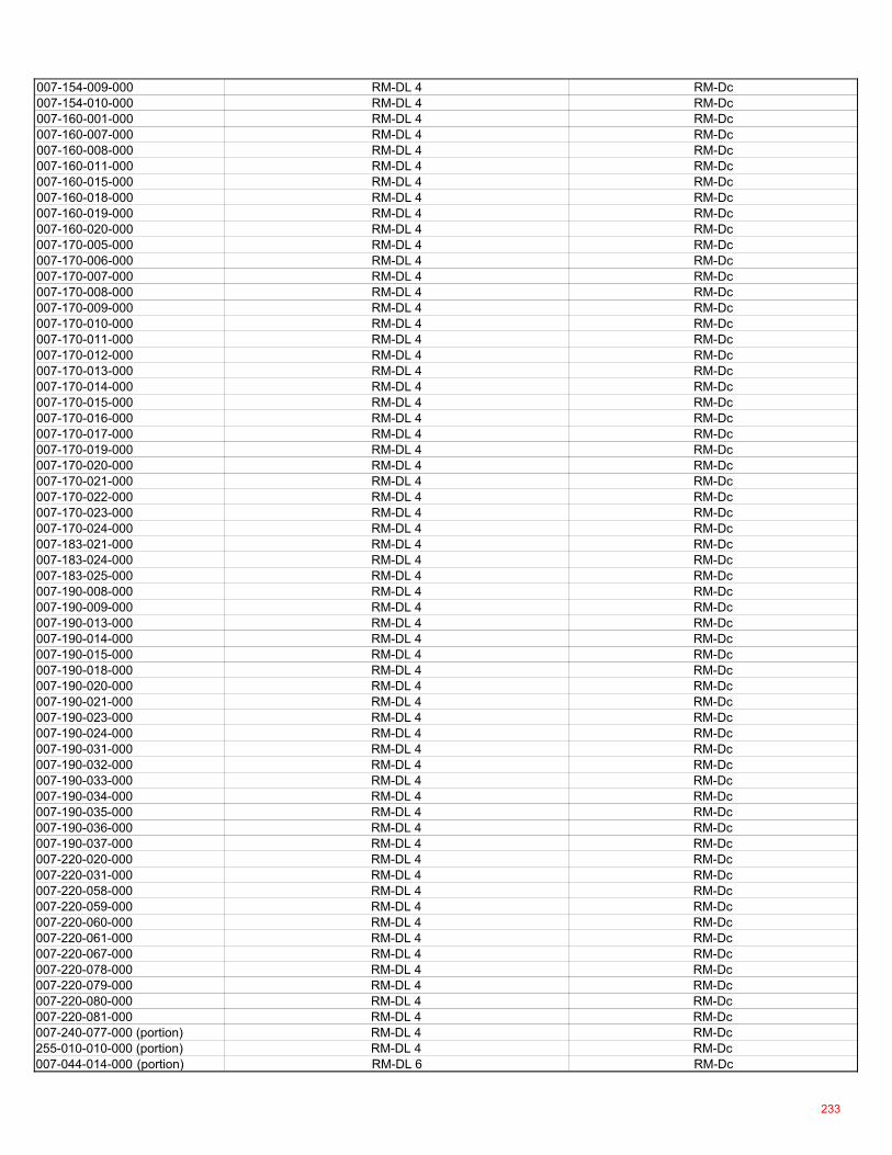
007-154-009-000 RM-DL 4 RM-Dc007-154-010-000 RM-DL 4 RM-Dc007-160-001-000 RM-DL 4 RM-Dc007-160-007-000 RM-DL 4 RM-Dc007-160-008-000 RM-DL 4 RM-Dc007-160-011-000 RM-DL 4 RM-Dc007-160-015-000 RM-DL 4 RM-Dc007-160-018-000 RM-DL 4 RM-Dc007-160-019-000 RM-DL 4 RM-Dc007-160-020-000 RM-DL 4 RM-Dc007-170-005-000 RM-DL 4 RM-Dc007-170-006-000 RM-DL 4 RM-Dc007-170-007-000 RM-DL 4 RM-Dc007-170-008-000 RM-DL 4 RM-Dc007-170-009-000 RM-DL 4 RM-Dc007-170-010-000 RM-DL 4 RM-Dc007-170-011-000 RM-DL 4 RM-Dc007-170-012-000 RM-DL 4 RM-Dc007-170-013-000 RM-DL 4 RM-Dc007-170-014-000 RM-DL 4 RM-Dc007-170-015-000 RM-DL 4 RM-Dc007-170-016-000 RM-DL 4 RM-Dc007-170-017-000 RM-DL 4 RM-Dc007-170-019-000 RM-DL 4 RM-Dc007-170-020-000 RM-DL 4 RM-Dc007-170-021-000 RM-DL 4 RM-Dc007-170-022-000 RM-DL 4 RM-Dc007-170-023-000 RM-DL 4 RM-Dc007-170-024-000 RM-DL 4 RM-Dc007-183-021-000 RM-DL 4 RM-Dc007-183-024-000 RM-DL 4 RM-Dc007-183-025-000 RM-DL 4 RM-Dc007-190-008-000 RM-DL 4 RM-Dc007-190-009-000 RM-DL 4 RM-Dc007-190-013-000 RM-DL 4 RM-Dc007-190-014-000 RM-DL 4 RM-Dc007-190-015-000 RM-DL 4 RM-Dc007-190-018-000 RM-DL 4 RM-Dc007-190-020-000 RM-DL 4 RM-Dc007-190-021-000 RM-DL 4 RM-Dc007-190-023-000 RM-DL 4 RM-Dc007-190-024-000 RM-DL 4 RM-Dc007-190-031-000 RM-DL 4 RM-Dc007-190-032-000 RM-DL 4 RM-Dc007-190-033-000 RM-DL 4 RM-Dc007-190-034-000 RM-DL 4 RM-Dc007-190-035-000 RM-DL 4 RM-Dc007-190-036-000 RM-DL 4 RM-Dc007-190-037-000 RM-DL 4 RM-Dc007-220-020-000 RM-DL 4 RM-Dc007-220-031-000 RM-DL 4 RM-Dc007-220-058-000 RM-DL 4 RM-Dc007-220-059-000 RM-DL 4 RM-Dc007-220-060-000 RM-DL 4 RM-Dc007-220-061-000 RM-DL 4 RM-Dc007-220-067-000 RM-DL 4 RM-Dc007-220-078-000 RM-DL 4 RM-Dc007-220-079-000 RM-DL 4 RM-Dc007-220-080-000 RM-DL 4 RM-Dc007-220-081-000 RM-DL 4 RM-Dc007-240-077-000 (portion) RM-DL 4 RM-Dc255-010-010-000 (portion) RM-DL 4 RM-Dc007-044-014-000 (portion) RM-DL 6 RM-Dc
233
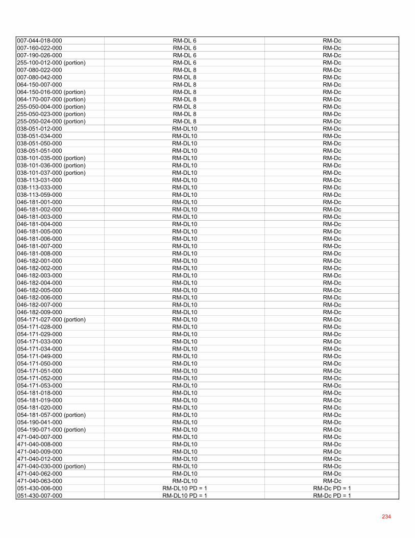
007-044-018-000 RM-DL 6 RM-Dc007-160-022-000 RM-DL 6 RM-Dc007-190-026-000 RM-DL 6 RM-Dc255-100-012-000 (portion) RM-DL 6 RM-Dc007-080-022-000 RM-DL 8 RM-Dc007-080-042-000 RM-DL 8 RM-Dc064-150-007-000 RM-DL 8 RM-Dc064-150-016-000 (portion) RM-DL 8 RM-Dc064-170-007-000 (portion) RM-DL 8 RM-Dc255-050-004-000 (portion) RM-DL 8 RM-Dc255-050-023-000 (portion) RM-DL 8 RM-Dc255-050-024-000 (portion) RM-DL 8 RM-Dc038-051-012-000 RM-DL10 RM-Dc038-051-034-000 RM-DL10 RM-Dc038-051-050-000 RM-DL10 RM-Dc038-051-051-000 RM-DL10 RM-Dc038-101-035-000 (portion) RM-DL10 RM-Dc038-101-036-000 (portion) RM-DL10 RM-Dc038-101-037-000 (portion) RM-DL10 RM-Dc038-113-031-000 RM-DL10 RM-Dc038-113-033-000 RM-DL10 RM-Dc038-113-059-000 RM-DL10 RM-Dc046-181-001-000 RM-DL10 RM-Dc046-181-002-000 RM-DL10 RM-Dc046-181-003-000 RM-DL10 RM-Dc046-181-004-000 RM-DL10 RM-Dc046-181-005-000 RM-DL10 RM-Dc046-181-006-000 RM-DL10 RM-Dc046-181-007-000 RM-DL10 RM-Dc046-181-008-000 RM-DL10 RM-Dc046-182-001-000 RM-DL10 RM-Dc046-182-002-000 RM-DL10 RM-Dc046-182-003-000 RM-DL10 RM-Dc046-182-004-000 RM-DL10 RM-Dc046-182-005-000 RM-DL10 RM-Dc046-182-006-000 RM-DL10 RM-Dc046-182-007-000 RM-DL10 RM-Dc046-182-009-000 RM-DL10 RM-Dc054-171-027-000 (portion) RM-DL10 RM-Dc054-171-028-000 RM-DL10 RM-Dc054-171-029-000 RM-DL10 RM-Dc054-171-033-000 RM-DL10 RM-Dc054-171-034-000 RM-DL10 RM-Dc054-171-049-000 RM-DL10 RM-Dc054-171-050-000 RM-DL10 RM-Dc054-171-051-000 RM-DL10 RM-Dc054-171-052-000 RM-DL10 RM-Dc054-171-053-000 RM-DL10 RM-Dc054-181-018-000 RM-DL10 RM-Dc054-181-019-000 RM-DL10 RM-Dc054-181-020-000 RM-DL10 RM-Dc054-181-057-000 (portion) RM-DL10 RM-Dc054-190-041-000 RM-DL10 RM-Dc054-190-071-000 (portion) RM-DL10 RM-Dc471-040-007-000 RM-DL10 RM-Dc471-040-008-000 RM-DL10 RM-Dc471-040-009-000 RM-DL10 RM-Dc471-040-012-000 RM-DL10 RM-Dc471-040-030-000 (portion) RM-DL10 RM-Dc471-040-062-000 RM-DL10 RM-Dc471-040-063-000 RM-DL10 RM-Dc051-430-006-000 RM-DL10 PD = 1 RM-Dc PD = 1051-430-007-000 RM-DL10 PD = 1 RM-Dc PD = 1
234
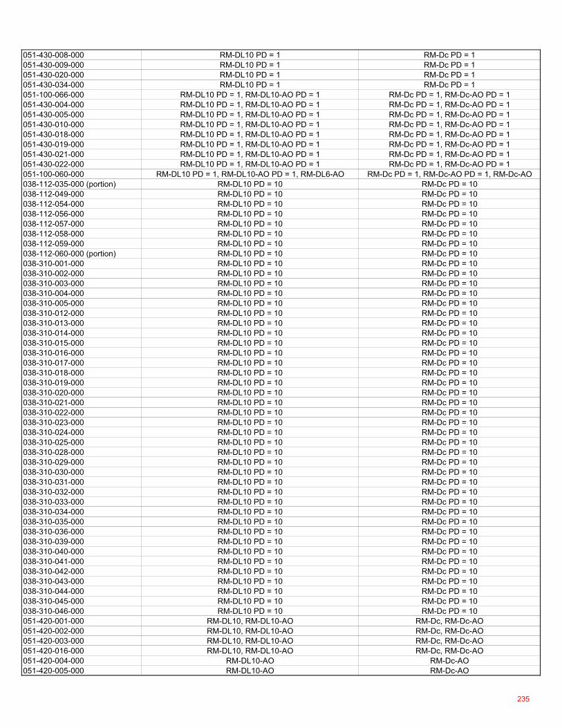
051-430-008-000 RM-DL10 PD = 1 RM-Dc PD = 1051-430-009-000 RM-DL10 PD = 1 RM-Dc PD = 1051-430-020-000 RM-DL10 PD = 1 RM-Dc PD = 1051-430-034-000 RM-DL10 PD = 1 RM-Dc PD = 1051-100-066-000 RM-DL10 PD = 1, RM-DL10-AO PD = 1 RM-Dc PD = 1, RM-Dc-AO PD = 1051-430-004-000 RM-DL10 PD = 1, RM-DL10-AO PD = 1 RM-Dc PD = 1, RM-Dc-AO PD = 1051-430-005-000 RM-DL10 PD = 1, RM-DL10-AO PD = 1 RM-Dc PD = 1, RM-Dc-AO PD = 1051-430-010-000 RM-DL10 PD = 1, RM-DL10-AO PD = 1 RM-Dc PD = 1, RM-Dc-AO PD = 1051-430-018-000 RM-DL10 PD = 1, RM-DL10-AO PD = 1 RM-Dc PD = 1, RM-Dc-AO PD = 1051-430-019-000 RM-DL10 PD = 1, RM-DL10-AO PD = 1 RM-Dc PD = 1, RM-Dc-AO PD = 1051-430-021-000 RM-DL10 PD = 1, RM-DL10-AO PD = 1 RM-Dc PD = 1, RM-Dc-AO PD = 1051-430-022-000 RM-DL10 PD = 1, RM-DL10-AO PD = 1 RM-Dc PD = 1, RM-Dc-AO PD = 1051-100-060-000 RM-DL10 PD = 1, RM-DL10-AO PD = 1, RM-DL6-AO RM-Dc PD = 1, RM-Dc-AO PD = 1, RM-Dc-AO038-112-035-000 (portion) RM-DL10 PD = 10 RM-Dc PD = 10038-112-049-000 RM-DL10 PD = 10 RM-Dc PD = 10038-112-054-000 RM-DL10 PD = 10 RM-Dc PD = 10038-112-056-000 RM-DL10 PD = 10 RM-Dc PD = 10038-112-057-000 RM-DL10 PD = 10 RM-Dc PD = 10038-112-058-000 RM-DL10 PD = 10 RM-Dc PD = 10038-112-059-000 RM-DL10 PD = 10 RM-Dc PD = 10038-112-060-000 (portion) RM-DL10 PD = 10 RM-Dc PD = 10038-310-001-000 RM-DL10 PD = 10 RM-Dc PD = 10038-310-002-000 RM-DL10 PD = 10 RM-Dc PD = 10038-310-003-000 RM-DL10 PD = 10 RM-Dc PD = 10038-310-004-000 RM-DL10 PD = 10 RM-Dc PD = 10038-310-005-000 RM-DL10 PD = 10 RM-Dc PD = 10038-310-012-000 RM-DL10 PD = 10 RM-Dc PD = 10038-310-013-000 RM-DL10 PD = 10 RM-Dc PD = 10038-310-014-000 RM-DL10 PD = 10 RM-Dc PD = 10038-310-015-000 RM-DL10 PD = 10 RM-Dc PD = 10038-310-016-000 RM-DL10 PD = 10 RM-Dc PD = 10038-310-017-000 RM-DL10 PD = 10 RM-Dc PD = 10038-310-018-000 RM-DL10 PD = 10 RM-Dc PD = 10038-310-019-000 RM-DL10 PD = 10 RM-Dc PD = 10038-310-020-000 RM-DL10 PD = 10 RM-Dc PD = 10038-310-021-000 RM-DL10 PD = 10 RM-Dc PD = 10038-310-022-000 RM-DL10 PD = 10 RM-Dc PD = 10038-310-023-000 RM-DL10 PD = 10 RM-Dc PD = 10038-310-024-000 RM-DL10 PD = 10 RM-Dc PD = 10038-310-025-000 RM-DL10 PD = 10 RM-Dc PD = 10038-310-028-000 RM-DL10 PD = 10 RM-Dc PD = 10038-310-029-000 RM-DL10 PD = 10 RM-Dc PD = 10038-310-030-000 RM-DL10 PD = 10 RM-Dc PD = 10038-310-031-000 RM-DL10 PD = 10 RM-Dc PD = 10038-310-032-000 RM-DL10 PD = 10 RM-Dc PD = 10038-310-033-000 RM-DL10 PD = 10 RM-Dc PD = 10038-310-034-000 RM-DL10 PD = 10 RM-Dc PD = 10038-310-035-000 RM-DL10 PD = 10 RM-Dc PD = 10038-310-036-000 RM-DL10 PD = 10 RM-Dc PD = 10038-310-039-000 RM-DL10 PD = 10 RM-Dc PD = 10038-310-040-000 RM-DL10 PD = 10 RM-Dc PD = 10038-310-041-000 RM-DL10 PD = 10 RM-Dc PD = 10038-310-042-000 RM-DL10 PD = 10 RM-Dc PD = 10038-310-043-000 RM-DL10 PD = 10 RM-Dc PD = 10038-310-044-000 RM-DL10 PD = 10 RM-Dc PD = 10038-310-045-000 RM-DL10 PD = 10 RM-Dc PD = 10038-310-046-000 RM-DL10 PD = 10 RM-Dc PD = 10051-420-001-000 RM-DL10, RM-DL10-AO RM-Dc, RM-Dc-AO051-420-002-000 RM-DL10, RM-DL10-AO RM-Dc, RM-Dc-AO051-420-003-000 RM-DL10, RM-DL10-AO RM-Dc, RM-Dc-AO051-420-016-000 RM-DL10, RM-DL10-AO RM-Dc, RM-Dc-AO051-420-004-000 RM-DL10-AO RM-Dc-AO051-420-005-000 RM-DL10-AO RM-Dc-AO
235
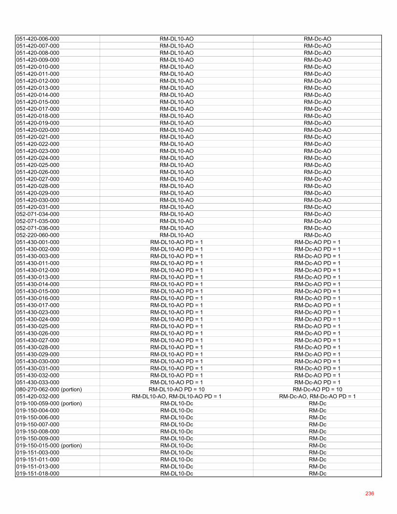
051-420-006-000 RM-DL10-AO RM-Dc-AO051-420-007-000 RM-DL10-AO RM-Dc-AO051-420-008-000 RM-DL10-AO RM-Dc-AO051-420-009-000 RM-DL10-AO RM-Dc-AO051-420-010-000 RM-DL10-AO RM-Dc-AO051-420-011-000 RM-DL10-AO RM-Dc-AO051-420-012-000 RM-DL10-AO RM-Dc-AO051-420-013-000 RM-DL10-AO RM-Dc-AO051-420-014-000 RM-DL10-AO RM-Dc-AO051-420-015-000 RM-DL10-AO RM-Dc-AO051-420-017-000 RM-DL10-AO RM-Dc-AO051-420-018-000 RM-DL10-AO RM-Dc-AO051-420-019-000 RM-DL10-AO RM-Dc-AO051-420-020-000 RM-DL10-AO RM-Dc-AO051-420-021-000 RM-DL10-AO RM-Dc-AO051-420-022-000 RM-DL10-AO RM-Dc-AO051-420-023-000 RM-DL10-AO RM-Dc-AO051-420-024-000 RM-DL10-AO RM-Dc-AO051-420-025-000 RM-DL10-AO RM-Dc-AO051-420-026-000 RM-DL10-AO RM-Dc-AO051-420-027-000 RM-DL10-AO RM-Dc-AO051-420-028-000 RM-DL10-AO RM-Dc-AO051-420-029-000 RM-DL10-AO RM-Dc-AO051-420-030-000 RM-DL10-AO RM-Dc-AO051-420-031-000 RM-DL10-AO RM-Dc-AO052-071-034-000 RM-DL10-AO RM-Dc-AO052-071-035-000 RM-DL10-AO RM-Dc-AO052-071-036-000 RM-DL10-AO RM-Dc-AO052-220-060-000 RM-DL10-AO RM-Dc-AO051-430-001-000 RM-DL10-AO PD = 1 RM-Dc-AO PD = 1051-430-002-000 RM-DL10-AO PD = 1 RM-Dc-AO PD = 1051-430-003-000 RM-DL10-AO PD = 1 RM-Dc-AO PD = 1051-430-011-000 RM-DL10-AO PD = 1 RM-Dc-AO PD = 1051-430-012-000 RM-DL10-AO PD = 1 RM-Dc-AO PD = 1051-430-013-000 RM-DL10-AO PD = 1 RM-Dc-AO PD = 1051-430-014-000 RM-DL10-AO PD = 1 RM-Dc-AO PD = 1051-430-015-000 RM-DL10-AO PD = 1 RM-Dc-AO PD = 1051-430-016-000 RM-DL10-AO PD = 1 RM-Dc-AO PD = 1051-430-017-000 RM-DL10-AO PD = 1 RM-Dc-AO PD = 1051-430-023-000 RM-DL10-AO PD = 1 RM-Dc-AO PD = 1051-430-024-000 RM-DL10-AO PD = 1 RM-Dc-AO PD = 1051-430-025-000 RM-DL10-AO PD = 1 RM-Dc-AO PD = 1051-430-026-000 RM-DL10-AO PD = 1 RM-Dc-AO PD = 1051-430-027-000 RM-DL10-AO PD = 1 RM-Dc-AO PD = 1051-430-028-000 RM-DL10-AO PD = 1 RM-Dc-AO PD = 1051-430-029-000 RM-DL10-AO PD = 1 RM-Dc-AO PD = 1051-430-030-000 RM-DL10-AO PD = 1 RM-Dc-AO PD = 1051-430-031-000 RM-DL10-AO PD = 1 RM-Dc-AO PD = 1051-430-032-000 RM-DL10-AO PD = 1 RM-Dc-AO PD = 1051-430-033-000 RM-DL10-AO PD = 1 RM-Dc-AO PD = 1080-270-062-000 (portion) RM-DL10-AO PD = 10 RM-Dc-AO PD = 10051-420-032-000 RM-DL10-AO, RM-DL10-AO PD = 1 RM-Dc-AO, RM-Dc-AO PD = 1019-100-059-000 (portion) RM-DL10-Dc RM-Dc019-150-004-000 RM-DL10-Dc RM-Dc019-150-006-000 RM-DL10-Dc RM-Dc019-150-007-000 RM-DL10-Dc RM-Dc019-150-008-000 RM-DL10-Dc RM-Dc019-150-009-000 RM-DL10-Dc RM-Dc019-150-015-000 (portion) RM-DL10-Dc RM-Dc019-151-003-000 RM-DL10-Dc RM-Dc019-151-011-000 RM-DL10-Dc RM-Dc019-151-013-000 RM-DL10-Dc RM-Dc019-151-018-000 RM-DL10-Dc RM-Dc
236
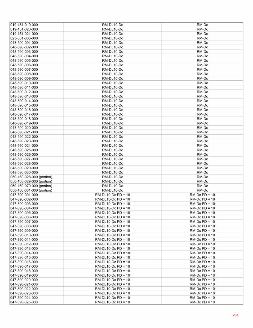
019-151-019-000 RM-DL10-Dc RM-Dc019-151-020-000 RM-DL10-Dc RM-Dc019-151-021-000 RM-DL10-Dc RM-Dc023-301-006-000 RM-DL10-Dc RM-Dc048-590-001-000 RM-DL10-Dc RM-Dc048-590-002-000 RM-DL10-Dc RM-Dc048-590-003-000 RM-DL10-Dc RM-Dc048-590-004-000 RM-DL10-Dc RM-Dc048-590-005-000 RM-DL10-Dc RM-Dc048-590-006-000 RM-DL10-Dc RM-Dc048-590-007-000 RM-DL10-Dc RM-Dc048-590-008-000 RM-DL10-Dc RM-Dc048-590-009-000 RM-DL10-Dc RM-Dc048-590-010-000 RM-DL10-Dc RM-Dc048-590-011-000 RM-DL10-Dc RM-Dc048-590-012-000 RM-DL10-Dc RM-Dc048-590-013-000 RM-DL10-Dc RM-Dc048-590-014-000 RM-DL10-Dc RM-Dc048-590-015-000 RM-DL10-Dc RM-Dc048-590-016-000 RM-DL10-Dc RM-Dc048-590-017-000 RM-DL10-Dc RM-Dc048-590-018-000 RM-DL10-Dc RM-Dc048-590-019-000 RM-DL10-Dc RM-Dc048-590-020-000 RM-DL10-Dc RM-Dc048-590-021-000 RM-DL10-Dc RM-Dc048-590-022-000 RM-DL10-Dc RM-Dc048-590-023-000 RM-DL10-Dc RM-Dc048-590-024-000 RM-DL10-Dc RM-Dc048-590-025-000 RM-DL10-Dc RM-Dc048-590-026-000 RM-DL10-Dc RM-Dc048-590-027-000 RM-DL10-Dc RM-Dc048-590-028-000 RM-DL10-Dc RM-Dc048-590-029-000 RM-DL10-Dc RM-Dc048-590-030-000 RM-DL10-Dc RM-Dc050-160-028-000 (portion) RM-DL10-Dc RM-Dc050-160-029-000 (portion) RM-DL10-Dc RM-Dc050-160-079-000 (portion) RM-DL10-Dc RM-Dc050-160-081-000 (portion) RM-DL10-Dc RM-Dc047-390-001-000 RM-DL10-Dc PD = 10 RM-Dc PD = 10047-390-002-000 RM-DL10-Dc PD = 10 RM-Dc PD = 10047-390-003-000 RM-DL10-Dc PD = 10 RM-Dc PD = 10047-390-004-000 RM-DL10-Dc PD = 10 RM-Dc PD = 10047-390-005-000 RM-DL10-Dc PD = 10 RM-Dc PD = 10047-390-006-000 RM-DL10-Dc PD = 10 RM-Dc PD = 10047-390-007-000 RM-DL10-Dc PD = 10 RM-Dc PD = 10047-390-008-000 RM-DL10-Dc PD = 10 RM-Dc PD = 10047-390-009-000 RM-DL10-Dc PD = 10 RM-Dc PD = 10047-390-010-000 RM-DL10-Dc PD = 10 RM-Dc PD = 10047-390-011-000 RM-DL10-Dc PD = 10 RM-Dc PD = 10047-390-012-000 RM-DL10-Dc PD = 10 RM-Dc PD = 10047-390-013-000 RM-DL10-Dc PD = 10 RM-Dc PD = 10047-390-014-000 RM-DL10-Dc PD = 10 RM-Dc PD = 10047-390-015-000 RM-DL10-Dc PD = 10 RM-Dc PD = 10047-390-016-000 RM-DL10-Dc PD = 10 RM-Dc PD = 10047-390-017-000 RM-DL10-Dc PD = 10 RM-Dc PD = 10047-390-018-000 RM-DL10-Dc PD = 10 RM-Dc PD = 10047-390-019-000 RM-DL10-Dc PD = 10 RM-Dc PD = 10047-390-020-000 RM-DL10-Dc PD = 10 RM-Dc PD = 10047-390-021-000 RM-DL10-Dc PD = 10 RM-Dc PD = 10047-390-022-000 RM-DL10-Dc PD = 10 RM-Dc PD = 10047-390-023-000 RM-DL10-Dc PD = 10 RM-Dc PD = 10047-390-024-000 RM-DL10-Dc PD = 10 RM-Dc PD = 10047-390-025-000 RM-DL10-Dc PD = 10 RM-Dc PD = 10
237
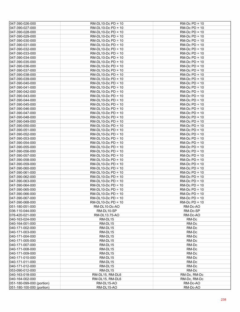
047-390-026-000 RM-DL10-Dc PD = 10 RM-Dc PD = 10047-390-027-000 RM-DL10-Dc PD = 10 RM-Dc PD = 10047-390-028-000 RM-DL10-Dc PD = 10 RM-Dc PD = 10047-390-029-000 RM-DL10-Dc PD = 10 RM-Dc PD = 10047-390-030-000 RM-DL10-Dc PD = 10 RM-Dc PD = 10047-390-031-000 RM-DL10-Dc PD = 10 RM-Dc PD = 10047-390-032-000 RM-DL10-Dc PD = 10 RM-Dc PD = 10047-390-033-000 RM-DL10-Dc PD = 10 RM-Dc PD = 10047-390-034-000 RM-DL10-Dc PD = 10 RM-Dc PD = 10047-390-035-000 RM-DL10-Dc PD = 10 RM-Dc PD = 10047-390-036-000 RM-DL10-Dc PD = 10 RM-Dc PD = 10047-390-037-000 RM-DL10-Dc PD = 10 RM-Dc PD = 10047-390-038-000 RM-DL10-Dc PD = 10 RM-Dc PD = 10047-390-039-000 RM-DL10-Dc PD = 10 RM-Dc PD = 10047-390-040-000 RM-DL10-Dc PD = 10 RM-Dc PD = 10047-390-041-000 RM-DL10-Dc PD = 10 RM-Dc PD = 10047-390-042-000 RM-DL10-Dc PD = 10 RM-Dc PD = 10047-390-043-000 RM-DL10-Dc PD = 10 RM-Dc PD = 10047-390-044-000 RM-DL10-Dc PD = 10 RM-Dc PD = 10047-390-045-000 RM-DL10-Dc PD = 10 RM-Dc PD = 10047-390-046-000 RM-DL10-Dc PD = 10 RM-Dc PD = 10047-390-047-000 RM-DL10-Dc PD = 10 RM-Dc PD = 10047-390-048-000 RM-DL10-Dc PD = 10 RM-Dc PD = 10047-390-049-000 RM-DL10-Dc PD = 10 RM-Dc PD = 10047-390-050-000 RM-DL10-Dc PD = 10 RM-Dc PD = 10047-390-051-000 RM-DL10-Dc PD = 10 RM-Dc PD = 10047-390-052-000 RM-DL10-Dc PD = 10 RM-Dc PD = 10047-390-053-000 RM-DL10-Dc PD = 10 RM-Dc PD = 10047-390-054-000 RM-DL10-Dc PD = 10 RM-Dc PD = 10047-390-055-000 RM-DL10-Dc PD = 10 RM-Dc PD = 10047-390-056-000 RM-DL10-Dc PD = 10 RM-Dc PD = 10047-390-057-000 RM-DL10-Dc PD = 10 RM-Dc PD = 10047-390-058-000 RM-DL10-Dc PD = 10 RM-Dc PD = 10047-390-059-000 RM-DL10-Dc PD = 10 RM-Dc PD = 10047-390-060-000 RM-DL10-Dc PD = 10 RM-Dc PD = 10047-390-061-000 RM-DL10-Dc PD = 10 RM-Dc PD = 10047-390-062-000 RM-DL10-Dc PD = 10 RM-Dc PD = 10047-390-063-000 RM-DL10-Dc PD = 10 RM-Dc PD = 10047-390-064-000 RM-DL10-Dc PD = 10 RM-Dc PD = 10047-390-065-000 RM-DL10-Dc PD = 10 RM-Dc PD = 10047-390-066-000 RM-DL10-Dc PD = 10 RM-Dc PD = 10047-390-067-000 RM-DL10-Dc PD = 10 RM-Dc PD = 10047-390-068-000 RM-DL10-Dc PD = 10 RM-Dc PD = 10051-180-051-000 RM-DL10-Dc-AO RM-Dc-AO036-110-044-000 RM-DL10-SP RM-Dc-SP076-420-021-000 RM-DL13.75-AO RM-Dc-AO040-163-024-000 RM-DL15 RM-Dc040-164-001-000 RM-DL15 RM-Dc040-171-002-000 RM-DL15 RM-Dc040-171-003-000 RM-DL15 RM-Dc040-171-004-000 RM-DL15 RM-Dc040-171-005-000 RM-DL15 RM-Dc040-171-007-000 RM-DL15 RM-Dc040-171-008-000 RM-DL15 RM-Dc040-171-009-000 RM-DL15 RM-Dc040-171-010-000 RM-DL15 RM-Dc040-171-011-000 RM-DL15 RM-Dc040-171-012-000 RM-DL15 RM-Dc053-090-012-000 RM-DL15 RM-Dc040-163-018-000 RM-DL15, RM-DL6 RM-Dc, RM-Dc040-164-002-000 RM-DL15, RM-DL6 RM-Dc, RM-Dc051-180-099-000 (portion) RM-DL15-AO RM-Dc-AO051-180-100-000 (portion) RM-DL15-AO RM-Dc-AO
238
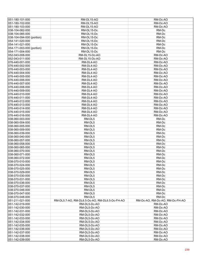
051-180-101-000 RM-DL15-AO RM-Dc-AO051-180-102-000 RM-DL15-AO RM-Dc-AO051-180-103-000 RM-DL15-AO RM-Dc-AO038-104-082-000 RM-DL15-Dc RM-Dc038-104-085-000 RM-DL15-Dc RM-Dc038-104-094-000 (portion) RM-DL15-Dc RM-Dc054-141-020-000 RM-DL15-Dc RM-Dc054-141-021-000 RM-DL15-Dc RM-Dc054-171-003-000 (portion) RM-DL15-Dc RM-Dc054-171-004-000 RM-DL15-Dc RM-Dc052-043-008-000 RM-DL15-Dc-AO RM-Dc-AO052-043-011-000 RM-DL15-Dc-AO RM-Dc-AO076-440-001-000 RM-DL4-AO RM-Dc-AO076-440-002-000 RM-DL4-AO RM-Dc-AO076-440-003-000 RM-DL4-AO RM-Dc-AO076-440-004-000 RM-DL4-AO RM-Dc-AO076-440-005-000 RM-DL4-AO RM-Dc-AO076-440-006-000 RM-DL4-AO RM-Dc-AO076-440-007-000 RM-DL4-AO RM-Dc-AO076-440-008-000 RM-DL4-AO RM-Dc-AO076-440-009-000 RM-DL4-AO RM-Dc-AO076-440-010-000 RM-DL4-AO RM-Dc-AO076-440-011-000 RM-DL4-AO RM-Dc-AO076-440-012-000 RM-DL4-AO RM-Dc-AO076-440-013-000 RM-DL4-AO RM-Dc-AO076-440-014-000 RM-DL4-AO RM-Dc-AO076-440-015-000 RM-DL4-AO RM-Dc-AO076-440-016-000 RM-DL4-AO RM-Dc-AO038-060-003-000 RM-DL5 RM-Dc038-060-004-000 RM-DL5 RM-Dc038-060-005-000 RM-DL5 RM-Dc038-060-009-000 RM-DL5 RM-Dc038-060-039-000 RM-DL5 RM-Dc038-060-040-000 RM-DL5 RM-Dc038-060-057-000 RM-DL5 RM-Dc038-060-058-000 RM-DL5 RM-Dc038-060-065-000 RM-DL5 RM-Dc038-060-070-000 RM-DL5 RM-Dc038-060-071-000 RM-DL5 RM-Dc038-060-072-000 RM-DL5 RM-Dc038-070-010-000 RM-DL5 RM-Dc038-070-024-000 RM-DL5 RM-Dc038-070-025-000 RM-DL5 RM-Dc038-070-029-000 RM-DL5 RM-Dc038-070-030-000 RM-DL5 RM-Dc038-070-031-000 RM-DL5 RM-Dc038-070-036-000 RM-DL5 RM-Dc038-070-037-000 RM-DL5 RM-Dc038-070-046-000 RM-DL5 RM-Dc038-070-047-000 RM-DL5 RM-Dc038-070-048-000 RM-DL5 RM-Dc051-211-021-000 RM-DL5.7-AO, RM-DL6.5-Dc-AO, RM-DL6.5-Dc-FH-AO RM-Dc-AO, RM-Dc-AO, RM-Dc-FH-AO051-142-019-000 RM-DL5-Dc-AO RM-Dc-AO051-142-030-000 RM-DL5-Dc-AO RM-Dc-AO051-142-031-000 RM-DL5-Dc-AO RM-Dc-AO051-142-032-000 RM-DL5-Dc-AO RM-Dc-AO051-142-033-000 RM-DL5-Dc-AO RM-Dc-AO051-142-034-000 RM-DL5-Dc-AO RM-Dc-AO051-142-035-000 RM-DL5-Dc-AO RM-Dc-AO051-142-036-000 RM-DL5-Dc-AO RM-Dc-AO051-142-037-000 RM-DL5-Dc-AO RM-Dc-AO051-142-038-000 RM-DL5-Dc-AO RM-Dc-AO051-142-039-000 RM-DL5-Dc-AO RM-Dc-AO
239
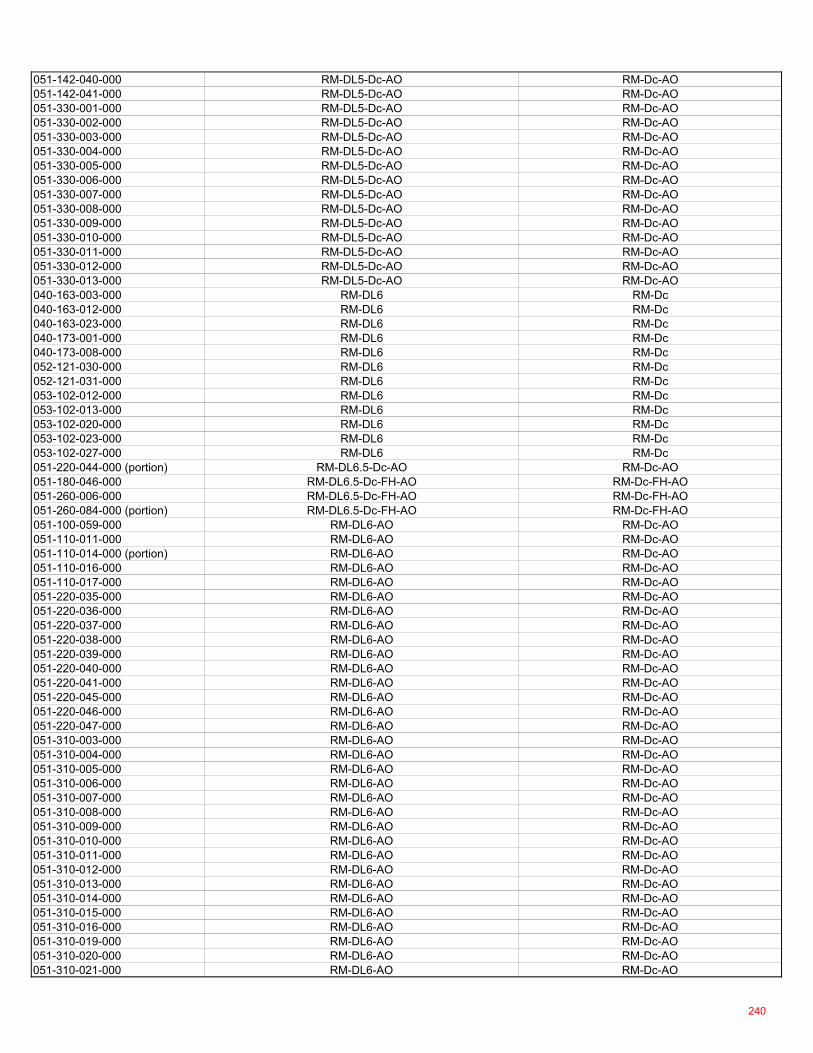
051-142-040-000 RM-DL5-Dc-AO RM-Dc-AO051-142-041-000 RM-DL5-Dc-AO RM-Dc-AO051-330-001-000 RM-DL5-Dc-AO RM-Dc-AO051-330-002-000 RM-DL5-Dc-AO RM-Dc-AO051-330-003-000 RM-DL5-Dc-AO RM-Dc-AO051-330-004-000 RM-DL5-Dc-AO RM-Dc-AO051-330-005-000 RM-DL5-Dc-AO RM-Dc-AO051-330-006-000 RM-DL5-Dc-AO RM-Dc-AO051-330-007-000 RM-DL5-Dc-AO RM-Dc-AO051-330-008-000 RM-DL5-Dc-AO RM-Dc-AO051-330-009-000 RM-DL5-Dc-AO RM-Dc-AO051-330-010-000 RM-DL5-Dc-AO RM-Dc-AO051-330-011-000 RM-DL5-Dc-AO RM-Dc-AO051-330-012-000 RM-DL5-Dc-AO RM-Dc-AO051-330-013-000 RM-DL5-Dc-AO RM-Dc-AO040-163-003-000 RM-DL6 RM-Dc040-163-012-000 RM-DL6 RM-Dc040-163-023-000 RM-DL6 RM-Dc040-173-001-000 RM-DL6 RM-Dc040-173-008-000 RM-DL6 RM-Dc052-121-030-000 RM-DL6 RM-Dc052-121-031-000 RM-DL6 RM-Dc053-102-012-000 RM-DL6 RM-Dc053-102-013-000 RM-DL6 RM-Dc053-102-020-000 RM-DL6 RM-Dc053-102-023-000 RM-DL6 RM-Dc053-102-027-000 RM-DL6 RM-Dc051-220-044-000 (portion) RM-DL6.5-Dc-AO RM-Dc-AO051-180-046-000 RM-DL6.5-Dc-FH-AO RM-Dc-FH-AO051-260-006-000 RM-DL6.5-Dc-FH-AO RM-Dc-FH-AO051-260-084-000 (portion) RM-DL6.5-Dc-FH-AO RM-Dc-FH-AO051-100-059-000 RM-DL6-AO RM-Dc-AO051-110-011-000 RM-DL6-AO RM-Dc-AO051-110-014-000 (portion) RM-DL6-AO RM-Dc-AO051-110-016-000 RM-DL6-AO RM-Dc-AO051-110-017-000 RM-DL6-AO RM-Dc-AO051-220-035-000 RM-DL6-AO RM-Dc-AO051-220-036-000 RM-DL6-AO RM-Dc-AO051-220-037-000 RM-DL6-AO RM-Dc-AO051-220-038-000 RM-DL6-AO RM-Dc-AO051-220-039-000 RM-DL6-AO RM-Dc-AO051-220-040-000 RM-DL6-AO RM-Dc-AO051-220-041-000 RM-DL6-AO RM-Dc-AO051-220-045-000 RM-DL6-AO RM-Dc-AO051-220-046-000 RM-DL6-AO RM-Dc-AO051-220-047-000 RM-DL6-AO RM-Dc-AO051-310-003-000 RM-DL6-AO RM-Dc-AO051-310-004-000 RM-DL6-AO RM-Dc-AO051-310-005-000 RM-DL6-AO RM-Dc-AO051-310-006-000 RM-DL6-AO RM-Dc-AO051-310-007-000 RM-DL6-AO RM-Dc-AO051-310-008-000 RM-DL6-AO RM-Dc-AO051-310-009-000 RM-DL6-AO RM-Dc-AO051-310-010-000 RM-DL6-AO RM-Dc-AO051-310-011-000 RM-DL6-AO RM-Dc-AO051-310-012-000 RM-DL6-AO RM-Dc-AO051-310-013-000 RM-DL6-AO RM-Dc-AO051-310-014-000 RM-DL6-AO RM-Dc-AO051-310-015-000 RM-DL6-AO RM-Dc-AO051-310-016-000 RM-DL6-AO RM-Dc-AO051-310-019-000 RM-DL6-AO RM-Dc-AO051-310-020-000 RM-DL6-AO RM-Dc-AO051-310-021-000 RM-DL6-AO RM-Dc-AO
240

051-310-022-000 RM-DL6-AO RM-Dc-AO051-310-023-000 RM-DL6-AO RM-Dc-AO051-310-024-000 RM-DL6-AO RM-Dc-AO051-310-025-000 RM-DL6-AO RM-Dc-AO051-310-026-000 RM-DL6-AO RM-Dc-AO051-310-027-000 RM-DL6-AO RM-Dc-AO051-310-028-000 RM-DL6-AO RM-Dc-AO051-310-029-000 RM-DL6-AO RM-Dc-AO051-310-030-000 RM-DL6-AO RM-Dc-AO051-310-031-000 RM-DL6-AO RM-Dc-AO051-310-032-000 RM-DL6-AO RM-Dc-AO051-310-036-000 RM-DL6-AO RM-Dc-AO051-310-037-000 RM-DL6-AO RM-Dc-AO051-310-038-000 RM-DL6-AO RM-Dc-AO051-310-039-000 RM-DL6-AO RM-Dc-AO051-310-040-000 RM-DL6-AO RM-Dc-AO051-310-041-000 RM-DL6-AO RM-Dc-AO051-310-042-000 RM-DL6-AO RM-Dc-AO051-310-043-000 RM-DL6-AO RM-Dc-AO051-310-044-000 RM-DL6-AO RM-Dc-AO051-310-045-000 RM-DL6-AO RM-Dc-AO051-310-046-000 RM-DL6-AO RM-Dc-AO051-310-047-000 RM-DL6-AO RM-Dc-AO051-310-048-000 RM-DL6-AO RM-Dc-AO051-310-049-000 RM-DL6-AO RM-Dc-AO051-310-050-000 RM-DL6-AO RM-Dc-AO051-310-051-000 RM-DL6-AO RM-Dc-AO051-310-052-000 RM-DL6-AO RM-Dc-AO051-310-053-000 RM-DL6-AO RM-Dc-AO051-310-054-000 RM-DL6-AO RM-Dc-AO051-310-055-000 RM-DL6-AO RM-Dc-AO051-310-056-000 RM-DL6-AO RM-Dc-AO051-310-057-000 RM-DL6-AO RM-Dc-AO051-310-058-000 RM-DL6-AO RM-Dc-AO051-310-059-000 RM-DL6-AO RM-Dc-AO051-310-060-000 RM-DL6-AO RM-Dc-AO051-310-061-000 RM-DL6-AO RM-Dc-AO051-310-062-000 RM-DL6-AO RM-Dc-AO051-310-063-000 RM-DL6-AO RM-Dc-AO051-310-065-000 RM-DL6-AO RM-Dc-AO076-070-002-000 RM-DL6-Dc-AO RM-Dc-AO076-070-068-000 RM-DL6-Dc-AO RM-Dc-AO076-092-008-000 RM-DL6-Dc-AO RM-Dc-AO038-080-090-000 RM-DL8 RM-Dc038-113-001-000 RM-DL8 RM-Dc038-113-002-000 RM-DL8 RM-Dc038-113-003-000 RM-DL8 RM-Dc038-113-004-000 RM-DL8 RM-Dc038-113-005-000 RM-DL8 RM-Dc038-113-007-000 RM-DL8 RM-Dc038-113-008-000 RM-DL8 RM-Dc038-113-009-000 RM-DL8 RM-Dc038-113-010-000 RM-DL8 RM-Dc038-113-011-000 RM-DL8 RM-Dc038-113-012-000 RM-DL8 RM-Dc038-113-013-000 RM-DL8 RM-Dc038-113-014-000 RM-DL8 RM-Dc038-113-015-000 RM-DL8 RM-Dc038-113-016-000 RM-DL8 RM-Dc038-113-034-000 RM-DL8 RM-Dc038-113-035-000 RM-DL8 RM-Dc038-113-036-000 RM-DL8 RM-Dc038-113-037-000 RM-DL8 RM-Dc
241
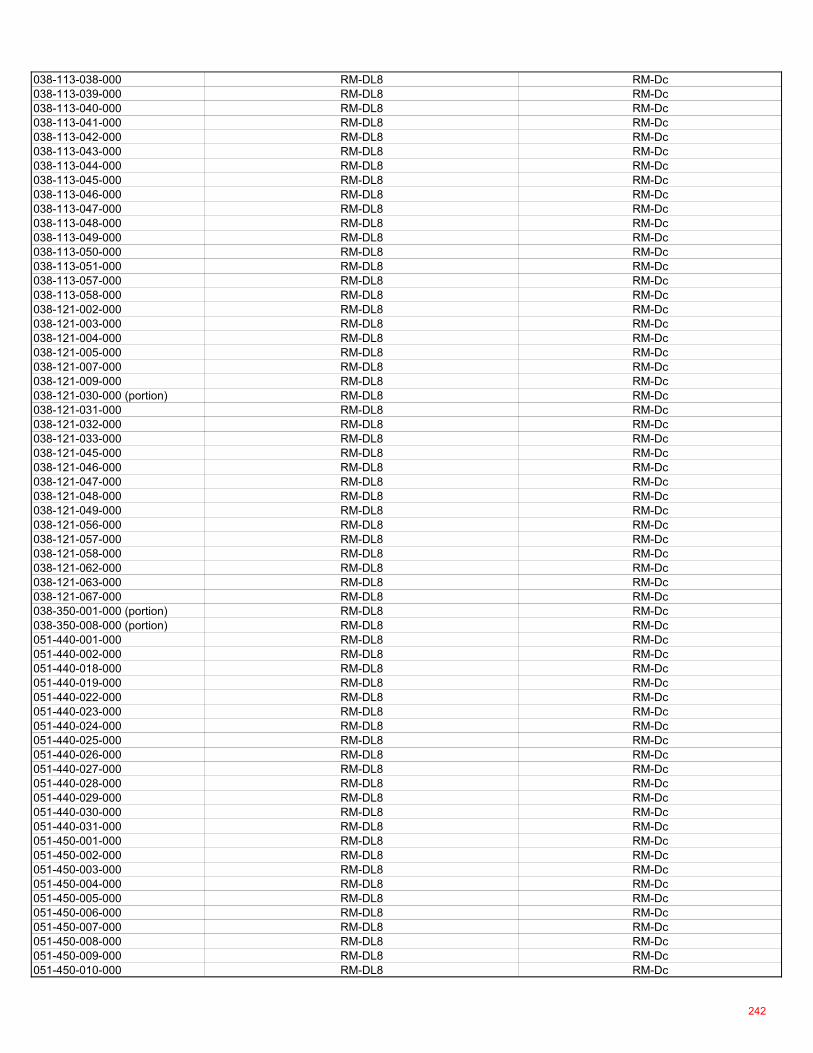
038-113-038-000 RM-DL8 RM-Dc038-113-039-000 RM-DL8 RM-Dc038-113-040-000 RM-DL8 RM-Dc038-113-041-000 RM-DL8 RM-Dc038-113-042-000 RM-DL8 RM-Dc038-113-043-000 RM-DL8 RM-Dc038-113-044-000 RM-DL8 RM-Dc038-113-045-000 RM-DL8 RM-Dc038-113-046-000 RM-DL8 RM-Dc038-113-047-000 RM-DL8 RM-Dc038-113-048-000 RM-DL8 RM-Dc038-113-049-000 RM-DL8 RM-Dc038-113-050-000 RM-DL8 RM-Dc038-113-051-000 RM-DL8 RM-Dc038-113-057-000 RM-DL8 RM-Dc038-113-058-000 RM-DL8 RM-Dc038-121-002-000 RM-DL8 RM-Dc038-121-003-000 RM-DL8 RM-Dc038-121-004-000 RM-DL8 RM-Dc038-121-005-000 RM-DL8 RM-Dc038-121-007-000 RM-DL8 RM-Dc038-121-009-000 RM-DL8 RM-Dc038-121-030-000 (portion) RM-DL8 RM-Dc038-121-031-000 RM-DL8 RM-Dc038-121-032-000 RM-DL8 RM-Dc038-121-033-000 RM-DL8 RM-Dc038-121-045-000 RM-DL8 RM-Dc038-121-046-000 RM-DL8 RM-Dc038-121-047-000 RM-DL8 RM-Dc038-121-048-000 RM-DL8 RM-Dc038-121-049-000 RM-DL8 RM-Dc038-121-056-000 RM-DL8 RM-Dc038-121-057-000 RM-DL8 RM-Dc038-121-058-000 RM-DL8 RM-Dc038-121-062-000 RM-DL8 RM-Dc038-121-063-000 RM-DL8 RM-Dc038-121-067-000 RM-DL8 RM-Dc038-350-001-000 (portion) RM-DL8 RM-Dc038-350-008-000 (portion) RM-DL8 RM-Dc051-440-001-000 RM-DL8 RM-Dc051-440-002-000 RM-DL8 RM-Dc051-440-018-000 RM-DL8 RM-Dc051-440-019-000 RM-DL8 RM-Dc051-440-022-000 RM-DL8 RM-Dc051-440-023-000 RM-DL8 RM-Dc051-440-024-000 RM-DL8 RM-Dc051-440-025-000 RM-DL8 RM-Dc051-440-026-000 RM-DL8 RM-Dc051-440-027-000 RM-DL8 RM-Dc051-440-028-000 RM-DL8 RM-Dc051-440-029-000 RM-DL8 RM-Dc051-440-030-000 RM-DL8 RM-Dc051-440-031-000 RM-DL8 RM-Dc051-450-001-000 RM-DL8 RM-Dc051-450-002-000 RM-DL8 RM-Dc051-450-003-000 RM-DL8 RM-Dc051-450-004-000 RM-DL8 RM-Dc051-450-005-000 RM-DL8 RM-Dc051-450-006-000 RM-DL8 RM-Dc051-450-007-000 RM-DL8 RM-Dc051-450-008-000 RM-DL8 RM-Dc051-450-009-000 RM-DL8 RM-Dc051-450-010-000 RM-DL8 RM-Dc
242
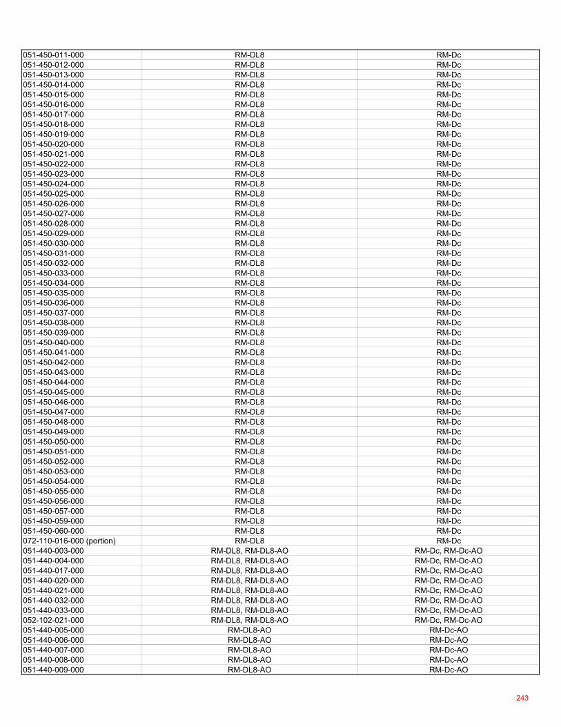
051-450-011-000 RM-DL8 RM-Dc051-450-012-000 RM-DL8 RM-Dc051-450-013-000 RM-DL8 RM-Dc051-450-014-000 RM-DL8 RM-Dc051-450-015-000 RM-DL8 RM-Dc051-450-016-000 RM-DL8 RM-Dc051-450-017-000 RM-DL8 RM-Dc051-450-018-000 RM-DL8 RM-Dc051-450-019-000 RM-DL8 RM-Dc051-450-020-000 RM-DL8 RM-Dc051-450-021-000 RM-DL8 RM-Dc051-450-022-000 RM-DL8 RM-Dc051-450-023-000 RM-DL8 RM-Dc051-450-024-000 RM-DL8 RM-Dc051-450-025-000 RM-DL8 RM-Dc051-450-026-000 RM-DL8 RM-Dc051-450-027-000 RM-DL8 RM-Dc051-450-028-000 RM-DL8 RM-Dc051-450-029-000 RM-DL8 RM-Dc051-450-030-000 RM-DL8 RM-Dc051-450-031-000 RM-DL8 RM-Dc051-450-032-000 RM-DL8 RM-Dc051-450-033-000 RM-DL8 RM-Dc051-450-034-000 RM-DL8 RM-Dc051-450-035-000 RM-DL8 RM-Dc051-450-036-000 RM-DL8 RM-Dc051-450-037-000 RM-DL8 RM-Dc051-450-038-000 RM-DL8 RM-Dc051-450-039-000 RM-DL8 RM-Dc051-450-040-000 RM-DL8 RM-Dc051-450-041-000 RM-DL8 RM-Dc051-450-042-000 RM-DL8 RM-Dc051-450-043-000 RM-DL8 RM-Dc051-450-044-000 RM-DL8 RM-Dc051-450-045-000 RM-DL8 RM-Dc051-450-046-000 RM-DL8 RM-Dc051-450-047-000 RM-DL8 RM-Dc051-450-048-000 RM-DL8 RM-Dc051-450-049-000 RM-DL8 RM-Dc051-450-050-000 RM-DL8 RM-Dc051-450-051-000 RM-DL8 RM-Dc051-450-052-000 RM-DL8 RM-Dc051-450-053-000 RM-DL8 RM-Dc051-450-054-000 RM-DL8 RM-Dc051-450-055-000 RM-DL8 RM-Dc051-450-056-000 RM-DL8 RM-Dc051-450-057-000 RM-DL8 RM-Dc051-450-059-000 RM-DL8 RM-Dc051-450-060-000 RM-DL8 RM-Dc072-110-016-000 (portion) RM-DL8 RM-Dc051-440-003-000 RM-DL8, RM-DL8-AO RM-Dc, RM-Dc-AO051-440-004-000 RM-DL8, RM-DL8-AO RM-Dc, RM-Dc-AO051-440-017-000 RM-DL8, RM-DL8-AO RM-Dc, RM-Dc-AO051-440-020-000 RM-DL8, RM-DL8-AO RM-Dc, RM-Dc-AO051-440-021-000 RM-DL8, RM-DL8-AO RM-Dc, RM-Dc-AO051-440-032-000 RM-DL8, RM-DL8-AO RM-Dc, RM-Dc-AO051-440-033-000 RM-DL8, RM-DL8-AO RM-Dc, RM-Dc-AO052-102-021-000 RM-DL8, RM-DL8-AO RM-Dc, RM-Dc-AO051-440-005-000 RM-DL8-AO RM-Dc-AO051-440-006-000 RM-DL8-AO RM-Dc-AO051-440-007-000 RM-DL8-AO RM-Dc-AO051-440-008-000 RM-DL8-AO RM-Dc-AO051-440-009-000 RM-DL8-AO RM-Dc-AO
243

051-440-010-000 RM-DL8-AO RM-Dc-AO051-440-011-000 RM-DL8-AO RM-Dc-AO051-440-012-000 RM-DL8-AO RM-Dc-AO051-440-013-000 RM-DL8-AO RM-Dc-AO051-440-014-000 RM-DL8-AO RM-Dc-AO051-440-015-000 RM-DL8-AO RM-Dc-AO051-440-016-000 RM-DL8-AO RM-Dc-AO051-440-036-000 RM-DL8-AO RM-Dc-AO051-440-037-000 RM-DL8-AO RM-Dc-AO052-043-012-000 RM-DL8-AO RM-Dc-AO052-071-008-000 RM-DL8-AO RM-Dc-AO052-071-009-000 RM-DL8-AO RM-Dc-AO052-102-022-000 RM-DL8-AO RM-Dc-AO052-240-014-000 RM-DL8-AO RM-Dc-AO052-240-015-000 RM-DL8-AO RM-Dc-AO052-240-016-000 RM-DL8-AO RM-Dc-AO052-240-017-000 RM-DL8-AO RM-Dc-AO052-240-018-000 RM-DL8-AO RM-Dc-AO052-240-019-000 RM-DL8-AO RM-Dc-AO052-240-020-000 RM-DL8-AO RM-Dc-AO052-240-022-000 RM-DL8-AO RM-Dc-AO052-240-023-000 RM-DL8-AO RM-Dc-AO052-240-024-000 RM-DL8-AO RM-Dc-AO023-221-069-000 RM-DL8-Dc RM-Dc023-292-013-000 RM-DL8-Dc RM-Dc023-292-014-000 RM-DL8-Dc RM-Dc023-292-015-000 RM-DL8-Dc RM-Dc023-292-016-000 RM-DL8-Dc RM-Dc023-292-017-000 RM-DL8-Dc RM-Dc023-292-018-000 RM-DL8-Dc RM-Dc023-294-005-000 RM-DL8-Dc RM-Dc023-294-022-000 RM-DL8-Dc RM-Dc023-294-023-000 RM-DL8-Dc RM-Dc023-294-024-000 RM-DL8-Dc RM-Dc023-294-026-000 RM-DL8-Dc RM-Dc023-294-027-000 RM-DL8-Dc RM-Dc023-294-028-000 RM-DL8-Dc RM-Dc023-294-029-000 RM-DL8-Dc RM-Dc023-294-030-000 RM-DL8-Dc RM-Dc023-294-031-000 RM-DL8-Dc RM-Dc023-294-032-000 RM-DL8-Dc RM-Dc023-294-033-000 RM-DL8-Dc RM-Dc023-294-034-000 RM-DL8-Dc RM-Dc023-294-035-000 RM-DL8-Dc RM-Dc023-294-038-000 RM-DL8-Dc RM-Dc023-294-039-000 RM-DL8-Dc RM-Dc023-294-040-000 RM-DL8-Dc RM-Dc023-294-041-000 RM-DL8-Dc RM-Dc023-294-042-000 RM-DL8-Dc RM-Dc023-294-045-000 RM-DL8-Dc RM-Dc023-294-046-000 RM-DL8-Dc RM-Dc023-294-047-000 RM-DL8-Dc RM-Dc023-294-048-000 RM-DL8-Dc RM-Dc023-294-049-000 RM-DL8-Dc RM-Dc023-294-053-000 RM-DL8-Dc RM-Dc023-294-054-000 RM-DL8-Dc RM-Dc023-294-055-000 RM-DL8-Dc RM-Dc023-294-057-000 RM-DL8-Dc RM-Dc023-294-058-000 RM-DL8-Dc RM-Dc023-294-059-000 RM-DL8-Dc RM-Dc023-295-010-000 RM-DL8-Dc RM-Dc023-295-011-000 RM-DL8-Dc RM-Dc023-295-012-000 RM-DL8-Dc RM-Dc
244
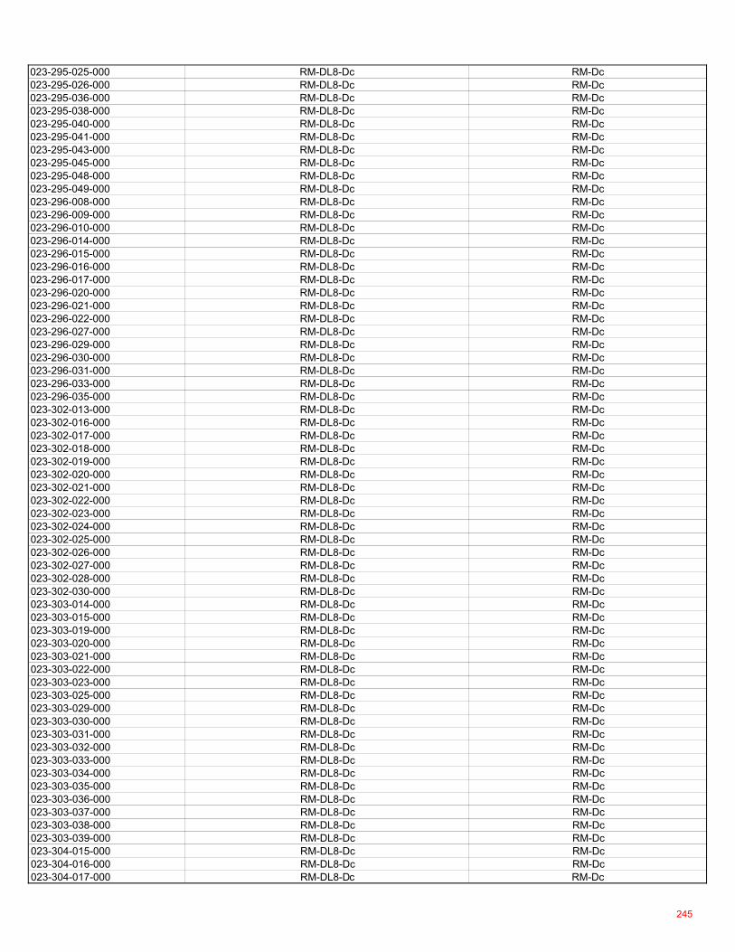
023-295-025-000 RM-DL8-Dc RM-Dc023-295-026-000 RM-DL8-Dc RM-Dc023-295-036-000 RM-DL8-Dc RM-Dc023-295-038-000 RM-DL8-Dc RM-Dc023-295-040-000 RM-DL8-Dc RM-Dc023-295-041-000 RM-DL8-Dc RM-Dc023-295-043-000 RM-DL8-Dc RM-Dc023-295-045-000 RM-DL8-Dc RM-Dc023-295-048-000 RM-DL8-Dc RM-Dc023-295-049-000 RM-DL8-Dc RM-Dc023-296-008-000 RM-DL8-Dc RM-Dc023-296-009-000 RM-DL8-Dc RM-Dc023-296-010-000 RM-DL8-Dc RM-Dc023-296-014-000 RM-DL8-Dc RM-Dc023-296-015-000 RM-DL8-Dc RM-Dc023-296-016-000 RM-DL8-Dc RM-Dc023-296-017-000 RM-DL8-Dc RM-Dc023-296-020-000 RM-DL8-Dc RM-Dc023-296-021-000 RM-DL8-Dc RM-Dc023-296-022-000 RM-DL8-Dc RM-Dc023-296-027-000 RM-DL8-Dc RM-Dc023-296-029-000 RM-DL8-Dc RM-Dc023-296-030-000 RM-DL8-Dc RM-Dc023-296-031-000 RM-DL8-Dc RM-Dc023-296-033-000 RM-DL8-Dc RM-Dc023-296-035-000 RM-DL8-Dc RM-Dc023-302-013-000 RM-DL8-Dc RM-Dc023-302-016-000 RM-DL8-Dc RM-Dc023-302-017-000 RM-DL8-Dc RM-Dc023-302-018-000 RM-DL8-Dc RM-Dc023-302-019-000 RM-DL8-Dc RM-Dc023-302-020-000 RM-DL8-Dc RM-Dc023-302-021-000 RM-DL8-Dc RM-Dc023-302-022-000 RM-DL8-Dc RM-Dc023-302-023-000 RM-DL8-Dc RM-Dc023-302-024-000 RM-DL8-Dc RM-Dc023-302-025-000 RM-DL8-Dc RM-Dc023-302-026-000 RM-DL8-Dc RM-Dc023-302-027-000 RM-DL8-Dc RM-Dc023-302-028-000 RM-DL8-Dc RM-Dc023-302-030-000 RM-DL8-Dc RM-Dc023-303-014-000 RM-DL8-Dc RM-Dc023-303-015-000 RM-DL8-Dc RM-Dc023-303-019-000 RM-DL8-Dc RM-Dc023-303-020-000 RM-DL8-Dc RM-Dc023-303-021-000 RM-DL8-Dc RM-Dc023-303-022-000 RM-DL8-Dc RM-Dc023-303-023-000 RM-DL8-Dc RM-Dc023-303-025-000 RM-DL8-Dc RM-Dc023-303-029-000 RM-DL8-Dc RM-Dc023-303-030-000 RM-DL8-Dc RM-Dc023-303-031-000 RM-DL8-Dc RM-Dc023-303-032-000 RM-DL8-Dc RM-Dc023-303-033-000 RM-DL8-Dc RM-Dc023-303-034-000 RM-DL8-Dc RM-Dc023-303-035-000 RM-DL8-Dc RM-Dc023-303-036-000 RM-DL8-Dc RM-Dc023-303-037-000 RM-DL8-Dc RM-Dc023-303-038-000 RM-DL8-Dc RM-Dc023-303-039-000 RM-DL8-Dc RM-Dc023-304-015-000 RM-DL8-Dc RM-Dc023-304-016-000 RM-DL8-Dc RM-Dc023-304-017-000 RM-DL8-Dc RM-Dc
245
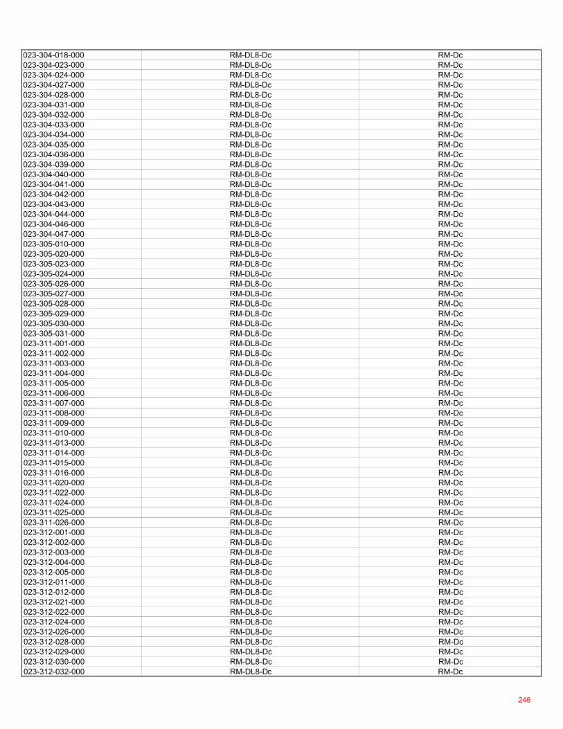
023-304-018-000 RM-DL8-Dc RM-Dc023-304-023-000 RM-DL8-Dc RM-Dc023-304-024-000 RM-DL8-Dc RM-Dc023-304-027-000 RM-DL8-Dc RM-Dc023-304-028-000 RM-DL8-Dc RM-Dc023-304-031-000 RM-DL8-Dc RM-Dc023-304-032-000 RM-DL8-Dc RM-Dc023-304-033-000 RM-DL8-Dc RM-Dc023-304-034-000 RM-DL8-Dc RM-Dc023-304-035-000 RM-DL8-Dc RM-Dc023-304-036-000 RM-DL8-Dc RM-Dc023-304-039-000 RM-DL8-Dc RM-Dc023-304-040-000 RM-DL8-Dc RM-Dc023-304-041-000 RM-DL8-Dc RM-Dc023-304-042-000 RM-DL8-Dc RM-Dc023-304-043-000 RM-DL8-Dc RM-Dc023-304-044-000 RM-DL8-Dc RM-Dc023-304-046-000 RM-DL8-Dc RM-Dc023-304-047-000 RM-DL8-Dc RM-Dc023-305-010-000 RM-DL8-Dc RM-Dc023-305-020-000 RM-DL8-Dc RM-Dc023-305-023-000 RM-DL8-Dc RM-Dc023-305-024-000 RM-DL8-Dc RM-Dc023-305-026-000 RM-DL8-Dc RM-Dc023-305-027-000 RM-DL8-Dc RM-Dc023-305-028-000 RM-DL8-Dc RM-Dc023-305-029-000 RM-DL8-Dc RM-Dc023-305-030-000 RM-DL8-Dc RM-Dc023-305-031-000 RM-DL8-Dc RM-Dc023-311-001-000 RM-DL8-Dc RM-Dc023-311-002-000 RM-DL8-Dc RM-Dc023-311-003-000 RM-DL8-Dc RM-Dc023-311-004-000 RM-DL8-Dc RM-Dc023-311-005-000 RM-DL8-Dc RM-Dc023-311-006-000 RM-DL8-Dc RM-Dc023-311-007-000 RM-DL8-Dc RM-Dc023-311-008-000 RM-DL8-Dc RM-Dc023-311-009-000 RM-DL8-Dc RM-Dc023-311-010-000 RM-DL8-Dc RM-Dc023-311-013-000 RM-DL8-Dc RM-Dc023-311-014-000 RM-DL8-Dc RM-Dc023-311-015-000 RM-DL8-Dc RM-Dc023-311-016-000 RM-DL8-Dc RM-Dc023-311-020-000 RM-DL8-Dc RM-Dc023-311-022-000 RM-DL8-Dc RM-Dc023-311-024-000 RM-DL8-Dc RM-Dc023-311-025-000 RM-DL8-Dc RM-Dc023-311-026-000 RM-DL8-Dc RM-Dc023-312-001-000 RM-DL8-Dc RM-Dc023-312-002-000 RM-DL8-Dc RM-Dc023-312-003-000 RM-DL8-Dc RM-Dc023-312-004-000 RM-DL8-Dc RM-Dc023-312-005-000 RM-DL8-Dc RM-Dc023-312-011-000 RM-DL8-Dc RM-Dc023-312-012-000 RM-DL8-Dc RM-Dc023-312-021-000 RM-DL8-Dc RM-Dc023-312-022-000 RM-DL8-Dc RM-Dc023-312-024-000 RM-DL8-Dc RM-Dc023-312-026-000 RM-DL8-Dc RM-Dc023-312-028-000 RM-DL8-Dc RM-Dc023-312-029-000 RM-DL8-Dc RM-Dc023-312-030-000 RM-DL8-Dc RM-Dc023-312-032-000 RM-DL8-Dc RM-Dc
246
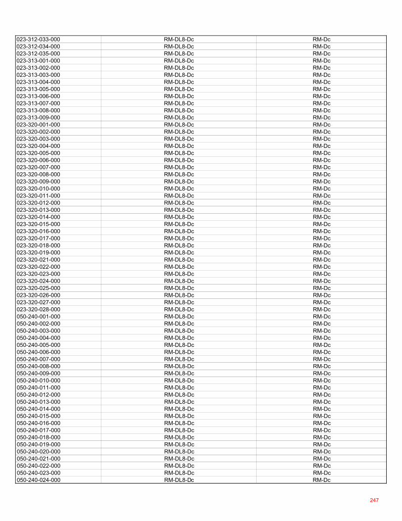
023-312-033-000 RM-DL8-Dc RM-Dc023-312-034-000 RM-DL8-Dc RM-Dc023-312-035-000 RM-DL8-Dc RM-Dc023-313-001-000 RM-DL8-Dc RM-Dc023-313-002-000 RM-DL8-Dc RM-Dc023-313-003-000 RM-DL8-Dc RM-Dc023-313-004-000 RM-DL8-Dc RM-Dc023-313-005-000 RM-DL8-Dc RM-Dc023-313-006-000 RM-DL8-Dc RM-Dc023-313-007-000 RM-DL8-Dc RM-Dc023-313-008-000 RM-DL8-Dc RM-Dc023-313-009-000 RM-DL8-Dc RM-Dc023-320-001-000 RM-DL8-Dc RM-Dc023-320-002-000 RM-DL8-Dc RM-Dc023-320-003-000 RM-DL8-Dc RM-Dc023-320-004-000 RM-DL8-Dc RM-Dc023-320-005-000 RM-DL8-Dc RM-Dc023-320-006-000 RM-DL8-Dc RM-Dc023-320-007-000 RM-DL8-Dc RM-Dc023-320-008-000 RM-DL8-Dc RM-Dc023-320-009-000 RM-DL8-Dc RM-Dc023-320-010-000 RM-DL8-Dc RM-Dc023-320-011-000 RM-DL8-Dc RM-Dc023-320-012-000 RM-DL8-Dc RM-Dc023-320-013-000 RM-DL8-Dc RM-Dc023-320-014-000 RM-DL8-Dc RM-Dc023-320-015-000 RM-DL8-Dc RM-Dc023-320-016-000 RM-DL8-Dc RM-Dc023-320-017-000 RM-DL8-Dc RM-Dc023-320-018-000 RM-DL8-Dc RM-Dc023-320-019-000 RM-DL8-Dc RM-Dc023-320-021-000 RM-DL8-Dc RM-Dc023-320-022-000 RM-DL8-Dc RM-Dc023-320-023-000 RM-DL8-Dc RM-Dc023-320-024-000 RM-DL8-Dc RM-Dc023-320-025-000 RM-DL8-Dc RM-Dc023-320-026-000 RM-DL8-Dc RM-Dc023-320-027-000 RM-DL8-Dc RM-Dc023-320-028-000 RM-DL8-Dc RM-Dc050-240-001-000 RM-DL8-Dc RM-Dc050-240-002-000 RM-DL8-Dc RM-Dc050-240-003-000 RM-DL8-Dc RM-Dc050-240-004-000 RM-DL8-Dc RM-Dc050-240-005-000 RM-DL8-Dc RM-Dc050-240-006-000 RM-DL8-Dc RM-Dc050-240-007-000 RM-DL8-Dc RM-Dc050-240-008-000 RM-DL8-Dc RM-Dc050-240-009-000 RM-DL8-Dc RM-Dc050-240-010-000 RM-DL8-Dc RM-Dc050-240-011-000 RM-DL8-Dc RM-Dc050-240-012-000 RM-DL8-Dc RM-Dc050-240-013-000 RM-DL8-Dc RM-Dc050-240-014-000 RM-DL8-Dc RM-Dc050-240-015-000 RM-DL8-Dc RM-Dc050-240-016-000 RM-DL8-Dc RM-Dc050-240-017-000 RM-DL8-Dc RM-Dc050-240-018-000 RM-DL8-Dc RM-Dc050-240-019-000 RM-DL8-Dc RM-Dc050-240-020-000 RM-DL8-Dc RM-Dc050-240-021-000 RM-DL8-Dc RM-Dc050-240-022-000 RM-DL8-Dc RM-Dc050-240-023-000 RM-DL8-Dc RM-Dc050-240-024-000 RM-DL8-Dc RM-Dc
247
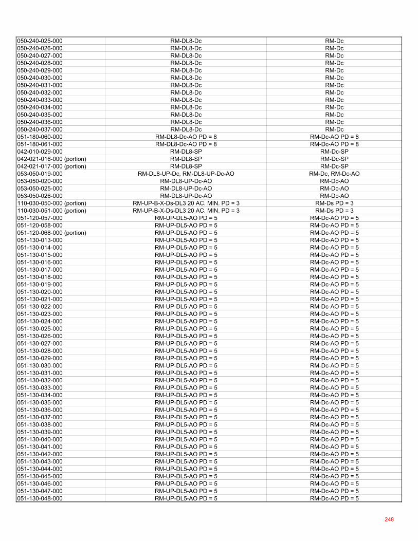
050-240-025-000 RM-DL8-Dc RM-Dc050-240-026-000 RM-DL8-Dc RM-Dc050-240-027-000 RM-DL8-Dc RM-Dc050-240-028-000 RM-DL8-Dc RM-Dc050-240-029-000 RM-DL8-Dc RM-Dc050-240-030-000 RM-DL8-Dc RM-Dc050-240-031-000 RM-DL8-Dc RM-Dc050-240-032-000 RM-DL8-Dc RM-Dc050-240-033-000 RM-DL8-Dc RM-Dc050-240-034-000 RM-DL8-Dc RM-Dc050-240-035-000 RM-DL8-Dc RM-Dc050-240-036-000 RM-DL8-Dc RM-Dc050-240-037-000 RM-DL8-Dc RM-Dc051-180-060-000 RM-DL8-Dc-AO PD = 8 RM-Dc-AO PD = 8051-180-061-000 RM-DL8-Dc-AO PD = 8 RM-Dc-AO PD = 8042-010-029-000 RM-DL8-SP RM-Dc-SP042-021-016-000 (portion) RM-DL8-SP RM-Dc-SP042-021-017-000 (portion) RM-DL8-SP RM-Dc-SP053-050-019-000 RM-DL8-UP-Dc, RM-DL8-UP-Dc-AO RM-Dc, RM-Dc-AO053-050-020-000 RM-DL8-UP-Dc-AO RM-Dc-AO053-050-025-000 RM-DL8-UP-Dc-AO RM-Dc-AO053-050-026-000 RM-DL8-UP-Dc-AO RM-Dc-AO110-030-050-000 (portion) RM-UP-B-X-Ds-DL3 20 AC. MIN. PD = 3 RM-Ds PD = 3110-030-051-000 (portion) RM-UP-B-X-Ds-DL3 20 AC. MIN. PD = 3 RM-Ds PD = 3051-120-057-000 RM-UP-DL5-AO PD = 5 RM-Dc-AO PD = 5051-120-058-000 RM-UP-DL5-AO PD = 5 RM-Dc-AO PD = 5051-120-068-000 (portion) RM-UP-DL5-AO PD = 5 RM-Dc-AO PD = 5051-130-013-000 RM-UP-DL5-AO PD = 5 RM-Dc-AO PD = 5051-130-014-000 RM-UP-DL5-AO PD = 5 RM-Dc-AO PD = 5051-130-015-000 RM-UP-DL5-AO PD = 5 RM-Dc-AO PD = 5051-130-016-000 RM-UP-DL5-AO PD = 5 RM-Dc-AO PD = 5051-130-017-000 RM-UP-DL5-AO PD = 5 RM-Dc-AO PD = 5051-130-018-000 RM-UP-DL5-AO PD = 5 RM-Dc-AO PD = 5051-130-019-000 RM-UP-DL5-AO PD = 5 RM-Dc-AO PD = 5051-130-020-000 RM-UP-DL5-AO PD = 5 RM-Dc-AO PD = 5051-130-021-000 RM-UP-DL5-AO PD = 5 RM-Dc-AO PD = 5051-130-022-000 RM-UP-DL5-AO PD = 5 RM-Dc-AO PD = 5051-130-023-000 RM-UP-DL5-AO PD = 5 RM-Dc-AO PD = 5051-130-024-000 RM-UP-DL5-AO PD = 5 RM-Dc-AO PD = 5051-130-025-000 RM-UP-DL5-AO PD = 5 RM-Dc-AO PD = 5051-130-026-000 RM-UP-DL5-AO PD = 5 RM-Dc-AO PD = 5051-130-027-000 RM-UP-DL5-AO PD = 5 RM-Dc-AO PD = 5051-130-028-000 RM-UP-DL5-AO PD = 5 RM-Dc-AO PD = 5051-130-029-000 RM-UP-DL5-AO PD = 5 RM-Dc-AO PD = 5051-130-030-000 RM-UP-DL5-AO PD = 5 RM-Dc-AO PD = 5051-130-031-000 RM-UP-DL5-AO PD = 5 RM-Dc-AO PD = 5051-130-032-000 RM-UP-DL5-AO PD = 5 RM-Dc-AO PD = 5051-130-033-000 RM-UP-DL5-AO PD = 5 RM-Dc-AO PD = 5051-130-034-000 RM-UP-DL5-AO PD = 5 RM-Dc-AO PD = 5051-130-035-000 RM-UP-DL5-AO PD = 5 RM-Dc-AO PD = 5051-130-036-000 RM-UP-DL5-AO PD = 5 RM-Dc-AO PD = 5051-130-037-000 RM-UP-DL5-AO PD = 5 RM-Dc-AO PD = 5051-130-038-000 RM-UP-DL5-AO PD = 5 RM-Dc-AO PD = 5051-130-039-000 RM-UP-DL5-AO PD = 5 RM-Dc-AO PD = 5051-130-040-000 RM-UP-DL5-AO PD = 5 RM-Dc-AO PD = 5051-130-041-000 RM-UP-DL5-AO PD = 5 RM-Dc-AO PD = 5051-130-042-000 RM-UP-DL5-AO PD = 5 RM-Dc-AO PD = 5051-130-043-000 RM-UP-DL5-AO PD = 5 RM-Dc-AO PD = 5051-130-044-000 RM-UP-DL5-AO PD = 5 RM-Dc-AO PD = 5051-130-045-000 RM-UP-DL5-AO PD = 5 RM-Dc-AO PD = 5051-130-046-000 RM-UP-DL5-AO PD = 5 RM-Dc-AO PD = 5051-130-047-000 RM-UP-DL5-AO PD = 5 RM-Dc-AO PD = 5051-130-048-000 RM-UP-DL5-AO PD = 5 RM-Dc-AO PD = 5
248
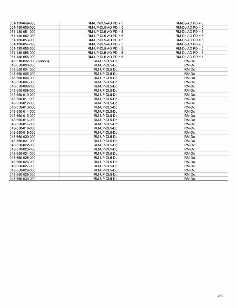
051-130-049-000 RM-UP-DL5-AO PD = 5 RM-Dc-AO PD = 5051-130-050-000 RM-UP-DL5-AO PD = 5 RM-Dc-AO PD = 5051-130-051-000 RM-UP-DL5-AO PD = 5 RM-Dc-AO PD = 5051-130-052-000 RM-UP-DL5-AO PD = 5 RM-Dc-AO PD = 5051-130-053-000 RM-UP-DL5-AO PD = 5 RM-Dc-AO PD = 5051-130-054-000 RM-UP-DL5-AO PD = 5 RM-Dc-AO PD = 5051-130-055-000 RM-UP-DL5-AO PD = 5 RM-Dc-AO PD = 5051-130-056-000 RM-UP-DL5-AO PD = 5 RM-Dc-AO PD = 5051-130-058-000 RM-UP-DL5-AO PD = 5 RM-Dc-AO PD = 5048-510-032-000 (portion) RM-UP-DL5-Dc RM-Dc048-650-003-000 RM-UP-DL5-Dc RM-Dc048-650-004-000 RM-UP-DL5-Dc RM-Dc048-650-005-000 RM-UP-DL5-Dc RM-Dc048-650-006-000 RM-UP-DL5-Dc RM-Dc048-650-007-000 RM-UP-DL5-Dc RM-Dc048-650-008-000 RM-UP-DL5-Dc RM-Dc048-650-009-000 RM-UP-DL5-Dc RM-Dc048-650-010-000 RM-UP-DL5-Dc RM-Dc048-650-011-000 RM-UP-DL5-Dc RM-Dc048-650-012-000 RM-UP-DL5-Dc RM-Dc048-650-013-000 RM-UP-DL5-Dc RM-Dc048-650-014-000 RM-UP-DL5-Dc RM-Dc048-650-015-000 RM-UP-DL5-Dc RM-Dc048-650-016-000 RM-UP-DL5-Dc RM-Dc048-650-017-000 RM-UP-DL5-Dc RM-Dc048-650-018-000 RM-UP-DL5-Dc RM-Dc048-650-019-000 RM-UP-DL5-Dc RM-Dc048-650-020-000 RM-UP-DL5-Dc RM-Dc048-650-021-000 RM-UP-DL5-Dc RM-Dc048-650-022-000 RM-UP-DL5-Dc RM-Dc048-650-023-000 RM-UP-DL5-Dc RM-Dc048-650-024-000 RM-UP-DL5-Dc RM-Dc048-650-025-000 RM-UP-DL5-Dc RM-Dc048-650-026-000 RM-UP-DL5-Dc RM-Dc048-650-027-000 RM-UP-DL5-Dc RM-Dc048-650-028-000 RM-UP-DL5-Dc RM-Dc048-650-029-000 RM-UP-DL5-Dc RM-Dc048-650-030-000 RM-UP-DL5-Dc RM-Dc
249

250
Page 1 of 3
Before the Board of Supervisors County of Placer, State of California
Ordinance No.: ____________
The following Ordinance was duly passed by the Board of Supervisors of the County of Placer at
a regular meeting held on ____________________________, by the following vote:
Ayes:
Noes:
Absent:
Signed and approved by me after its passage.
_______________________________ Chair, Board of Supervisors
Attest:
_______________________ Clerk of said Board
THE BOARD OF SUPERVISORS OF THE COUNTY OF PLACER, STATE OF CLIFORNIA, DOES HEREBY ORDAIN AS FOLLOWS:
WHEREAS, the “Multifamily and Mixed Use Design Manual” (“Design Manual”) includes proposed development standards and design guidelines intended to streamline development of multifamily and mixed use development within unincorporated Placer County; and
In the matter of: AN ORDINANCE ADOPTING THE “MULTIFAMILY AND MIXED USE DESIGN MANUAL”
Attachment E
251
Page 2 of 3
WHEREAS, the preparation of the Design Manual involved a robust public outreach program that included multiple public meetings and workshops and on-going meetings with key stakeholders and community organizations and various Placer County Municipal Advisory Councils; and
WHEREAS, the proposed Design Manual complements the proposed Housing-Related Code Amendments by providing a set of cohesive and innovative design guidelines and development standards intended to implement the General Plan policies on providing more opportunities for available affordable housing and supports the County’s efforts to have higher-density, mixed use, transit-oriented and infill development at appropriate locations identified in the General Plan and zoning; and WHEREAS, on July 22, 2021, the Planning Commission held a noticed public hearing pursuant to Placer County Code Chapter 17, Article 17.60, Sections 17.60.140 to consider the proposed Housing-Related Code Amendments, including the Design Manual, and pursuant to Placer County Code Chapter 17, Article 17.60, Section 17.60.090(C), the Planning Commission has made recommendations to the Board related thereto; and WHEREAS, notice of a public hearing was given in compliance with Placer County Code Chapter 17, Article 17.60, Section 17.60.140, and on __________2021, the Board held the duly noticed public hearing pursuant to Placer County Code Chapter 17, Article 17.60, Section 17.60.090(D) to consider the recommendations of the Planning Commission and to receive public input regarding the proposed Housing-Related Code Amendments, including the Design Manual; and WHEREAS, the Board has reviewed the proposed Housing-Related Code Amendments, including the proposed Design Manual, considered the recommendations of the Planning Commission, received and considered any written and oral comments submitted by the public thereon, and has adopted Resolution No. 2021-________ certifying the Final Environmental Impact Report for the “Housing-Related Code Amendments;” and having adopted Resolution No. 2021-__________ to approve the Housing-Related Code Amendments to the Placer County General Plan; and WHEREAS, the Board finds the proposed Design Manual is consistent with the General Plan and is in the best interests of the County by providing a better framework for the design of future housing development and the permit approval process, ensuring a good fit for multifamily and mixed use projects within existing communities in unincorporated areas; and WHEREAS, notice of all hearings required has been given and all hearings have been held as required by County ordinance and State law. NOW, THEREFORE, BE IT ORDAINED BY THE BOARD OF SUPERVISORS OF THE COUNTY OF PLACER that the “Multifamily and Mixed Use Design Manual”, as set forth in Exhibit 1 hereto and incorporated herein by reference, is hereby adopted. BE IT FURTHER RESOLVED that this Ordinance shall take effect and be in full force thirty (30) days after the date of its passage. The Clerk is directed to publish this ordinance, or a summary thereof, within fifteen (15) days in accordance with Government Code section 25124.
252
Page 3 of 3
Multifamily and Mixed Use Design Manual
Note: The Multifamily and Mixed Use Design Manual is available online at www.placer.ca.gov, on file with the Clerk of the Board’s office, attached to the original ordinance and available on the County’s website.
Proposed-Design-Manual_June-2021 (ca.gov)
Attachment EExhibit 1
Under Separate Cover
253

254
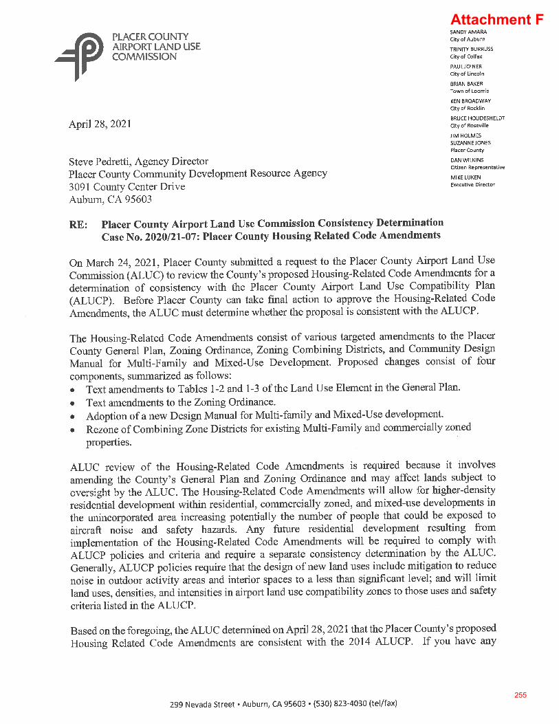
Attachment F
255
256
STATE OF CALIFORNIA - BUSINESS, CONSUMER SERVICES AND HOUSING AGENCY GAVIN NEWSOM, Governor
DEPARTMENT OF HOUSING AND COMMUNITY DEVELOPMENT DIVISION OF HOUSING POLICY DEVELOPMENT 2020 W. El Camino Avenue, Suite 500 Sacramento, CA 95833 (916) 263-2911 / FAX (916) 263-7453 www.hcd.ca.gov
March 2, 2021
Shawna Purvines, Deputy Director Community Development Regional Agency 3091 County Center Drive Auburn, CA 95603
Dear Shawna Purvines:
RE: County of Placer’s Proposed Housing Code Amendments
The purpose of this letter is to express the California Department of Housing and Community Development’s (HCD) support for the County of Placer’s General Plan Amendment, Zoning Text, Map Amendments, and Mixed-Use and Multifamily Design Standards (Amendments).
The amendments will be a valuable step in addressing the housing needs of the County and comply with state requirements. The Design Manual implements objective design standards to carry out Senate Bills 35 (chapter 366 of statutes 2017) and 330 (chapter 654 of statutes 2019), which require housing development that meets certain criteria to be evaluated without discretion or subject to only objective design standards. The standards provide transparency in regulation and streamline approvals to better accelerate housing production. Proposed updates to the Density Bonus Law implement Assembly Bills 1763 (chapter 666 of statutes 2019) and 2753 (chapter 921 of statutes 2018), which allow increased density for affordable housing development. This incentivizes the development of affordable housing for workers in the County while maximizing limited land resources.
Other proposed amendments, such as allowing more housing choices in lower-density development patterns and encouraging compact development in infill areas are consistent with state planning priorities (Government Code Section 65041.1). In addition, these amendments include provisions that could assist the County with HCD’s upcoming Prohousing designation program (Government Code Section 65589.9). The Prohousing designation program enables HCD to designate jurisdictions throughout the state as prohousing when they demonstrate policies and planning that accelerate the production of housing. The benefit to jurisdictions receiving the prohousing designation includes being given preference and, in some cases, additional points when participating in various state-funded programs including, but not limited to the Affordable Housing and Sustainable Communities (AHSC), Transformative Climate Communities (TCC), and Infill Incentive Grant (IIG) programs.
Attachment G
257
Shawna Purvines, Deputy Director, Housing Manager Page 2
HCD applauds the County’s effort to streamline approvals, reduce development costs, promote housing supply, and enhance a variety of housing choices and affordability. For these reasons, HCD supports the County’s efforts to adopt these important and impactful amendments. The proposed Amendments are consistent with the County’s 5th cycle housing element and will be a valuable step forward to the 6th cycle housing element (2021-2029).
Thank you for the opportunity to comment on the proposed amendments. HCD wishes Placer County continued success in implementing the goals and objectives of its housing element. If we can be of any assistance, please do not hesitate to contact me at [email protected].
Sincerely,
Paul McDougall Housing Policy Manager
258
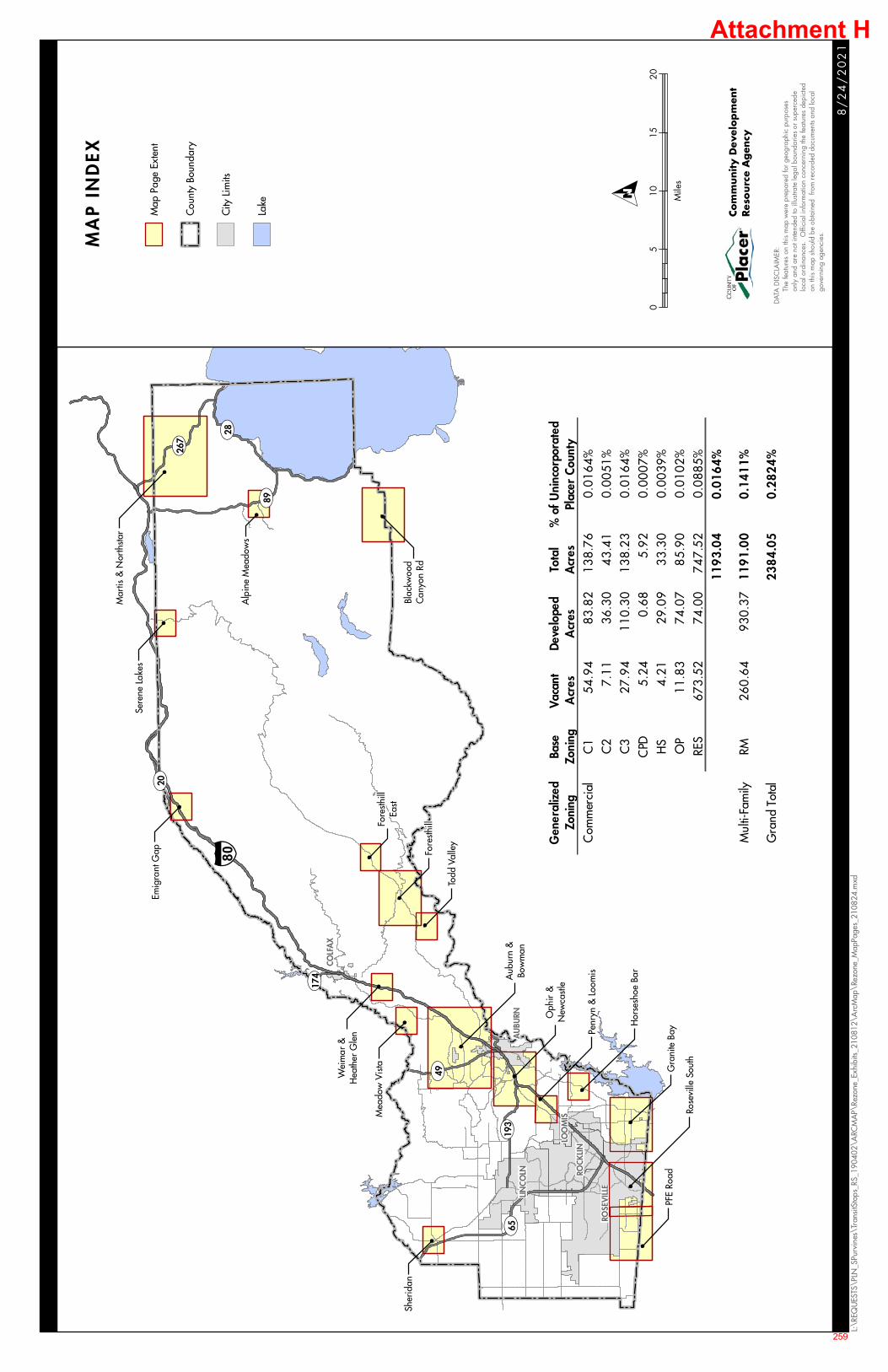
LINCO
LN ROCK
LIN
COLF
AX
ROSE
VIL
LE
AU
BURN
LOO
MIS
UV89
UV49
UV267
UV174
UV20
UV65UV193
UV28§̈ ¦80
!
Hor
sesh
oe B
ar
!
Penr
yn &
Loo
mis
!
Oph
ir &
New
cast
le
!
Rose
ville
Sou
th
!
PFE
Road
!
Aub
urn
&Bo
wm
an
!
Mea
dow
Vis
ta!
Wei
mar
&H
eath
er G
len
!
Fore
sthill
East
!
Emig
rant
Gap
!
Sere
ne L
akes
!
Alp
ine
Mea
dow
s
!
Blac
kwoo
dC
anyo
n Rd
!
Mar
tis &
Nor
thsta
r
!To
dd V
alle
y
!
Fore
sthill
!
Gra
nite
Bay
!
Sher
idan
8/
24
/2
02
1
L:\R
EQU
ESTS
\PLN
_SPu
rvin
es\T
rans
itSto
ps_R
S_19
0402
\ARC
MA
P\Re
zone
_Exh
ibits
_210
812\
Arc
Map
\Rez
one_
Map
Page
s_21
0824
.mxd
Map
Pag
e Ex
tent
Cou
nty
Boun
dary
City
Lim
its
Lake
MA
P I
ND
EX
DATA
DIS
CLA
IMER
: T
he fe
atur
es o
n th
is m
ap w
ere
prep
ared
for g
eogr
aphi
c pu
rpos
es o
nly
and
are
not i
nten
ded
to il
lustr
ate
lega
l bou
ndar
ies
or s
uper
cede
loc
al o
rdin
ance
s. O
ffici
al in
form
atio
n co
ncer
ning
the
feat
ures
dep
icte
d o
n th
is m
ap s
houl
d be
obt
aine
d fr
om re
cord
ed d
ocum
ents
and
loca
l g
over
ning
age
ncie
s.
Com
munity D
evel
op
men
tRes
ourc
e A
gen
cy
05
1015
20
Mile
s
O
Gen
eral
ized
Zo
nin g
Base
Zo
nin g
Vaca
nt
Acr
esDe
velo
ped
Acr
esTo
tal
Acr
es%
of
Uni
ncor
pora
ted
Plac
er C
ount
yC
omm
erci
alC
154
.94
83.8
213
8.7
60.
0164
%C
27.
1136
.30
43.
41
0.00
51%
C3
27.9
411
0.30
138.
23
0.01
64%
CPD
5.24
0.68
5.9
20.
0007
%H
S4.
2129
.09
33.
30
0.00
39%
OP
11.8
374
.07
85.
90
0.01
02%
RES
673.
5274
.00
747.
52
0.08
85%
119
3.0
40
.016
4%
Mul
ti-Fa
mily
RM26
0.64
930.
3711
91.
00
0.1
411%
Gra
nd T
otal
238
4.0
50
.282
4%
Attachment H
259
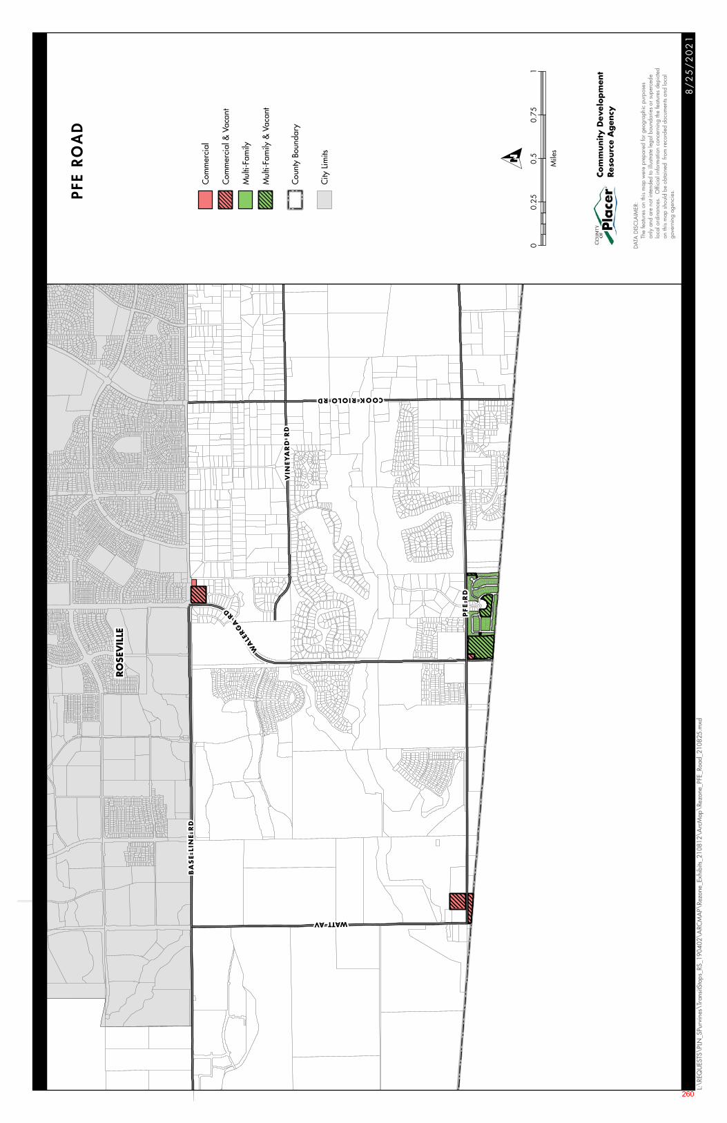
RO
SEV
ILLE
WATT AV
VIN
EY
AR
D R
D
COOK RIOLO RD
WA
LERG
A
RD
BA
SE
LIN
E R
D
PF
E R
D
8/
25
/2
02
1
L:\R
EQU
ESTS
\PLN
_SPu
rvin
es\T
rans
itSto
ps_R
S_19
0402
\ARC
MA
P\Re
zone
_Exh
ibits
_210
812\
Arc
Map
\Rez
one_
PFE_
Road
_210
825.
mxd
Com
mer
cial
Com
mer
cial
& V
acan
t
Mul
ti-Fa
mily
Mul
ti-Fa
mily
& V
acan
t
Cou
nty
Boun
dary
City
Lim
its
PFE
RO
AD
DATA
DIS
CLA
IMER
:
Th
e fe
atur
es o
n th
is m
ap w
ere
prep
ared
for g
eogr
aphi
c pu
rpos
es
on
ly a
nd a
re n
ot in
tend
ed to
illu
strat
e le
gal b
ound
arie
s or
sup
erce
de
lo
cal o
rdin
ance
s. O
ffici
al in
form
atio
n co
ncer
ning
the
feat
ures
dep
icte
d
on
this
map
sho
uld
be o
btai
ned
from
reco
rded
doc
umen
ts an
d lo
cal
gove
rnin
g ag
enci
es.
Com
munity D
evel
op
men
tRes
ourc
e A
gen
cy
00.
250.
50.
751
Mile
s
O
260
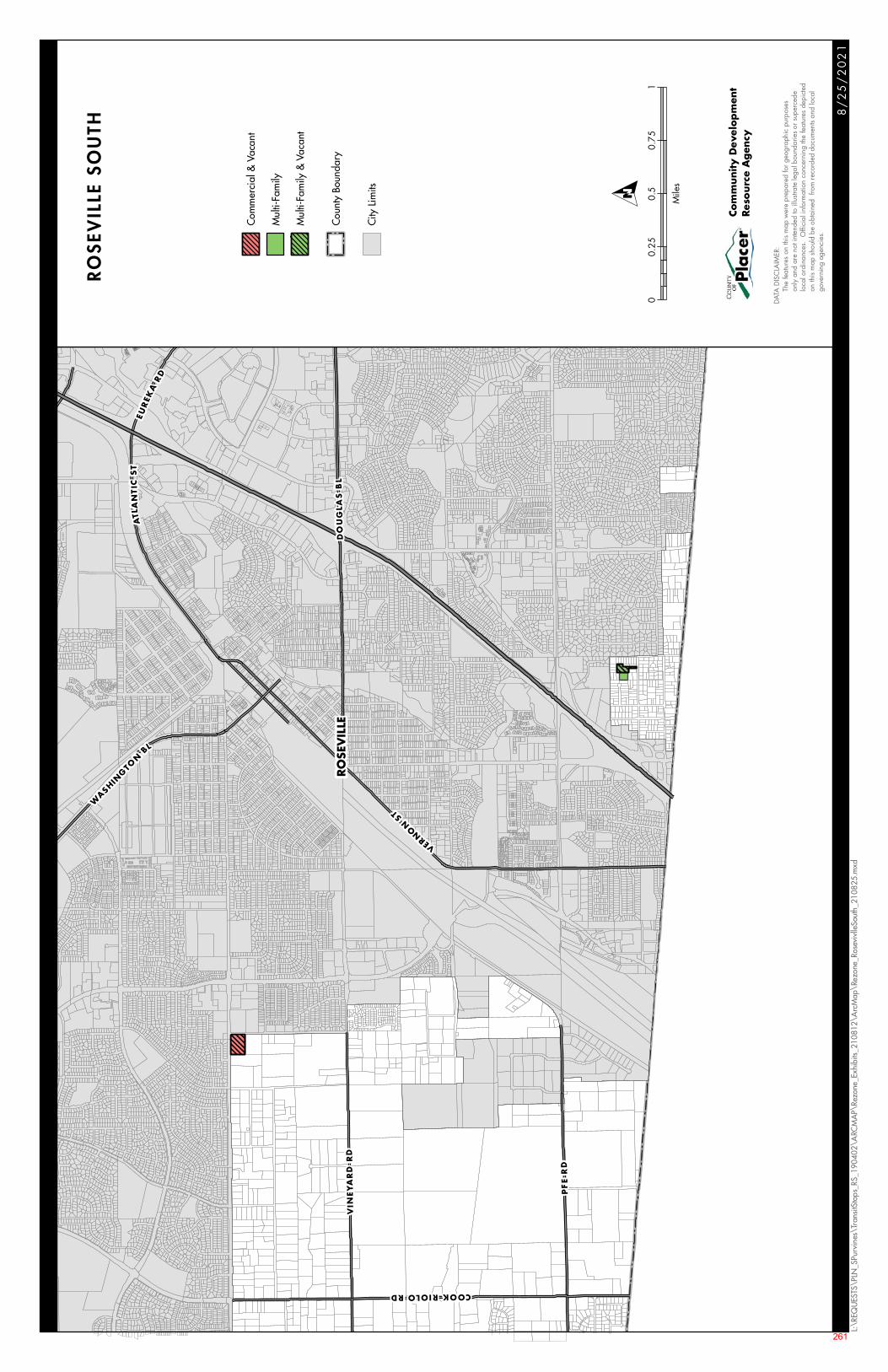
RO
SEV
ILLE
PF
E R
D
VERNO
NST
WASHIN
GTO
NBL
ATL
AN
TIC
ST
DO
UG
LAS
BL
EUR
EKA
RD
COOK RIOLO RD
VIN
EY
AR
D R
D
8/
25
/2
02
1
L:\R
EQU
ESTS
\PLN
_SPu
rvin
es\T
rans
itSto
ps_R
S_19
0402
\ARC
MA
P\Re
zone
_Exh
ibits
_210
812\
Arc
Map
\Rez
one_
Rose
vivl
leSo
uth_
2108
25.m
xd
Com
mer
cial
& V
acan
t
Mul
ti-Fa
mily
Mul
ti-Fa
mily
& V
acan
t
Cou
nty
Boun
dary
City
Lim
its
RO
SEV
ILLE
SO
UTH
DATA
DIS
CLA
IMER
:
Th
e fe
atur
es o
n th
is m
ap w
ere
prep
ared
for g
eogr
aphi
c pu
rpos
es
on
ly a
nd a
re n
ot in
tend
ed to
illu
strat
e le
gal b
ound
arie
s or
sup
erce
de
lo
cal o
rdin
ance
s. O
ffici
al in
form
atio
n co
ncer
ning
the
feat
ures
dep
icte
d
on
this
map
sho
uld
be o
btai
ned
from
reco
rded
doc
umen
ts an
d lo
cal
gove
rnin
g ag
enci
es.
Com
munity D
evel
op
men
tRes
ourc
e A
gen
cy
00.
250.
50.
751
Mile
s
O
261
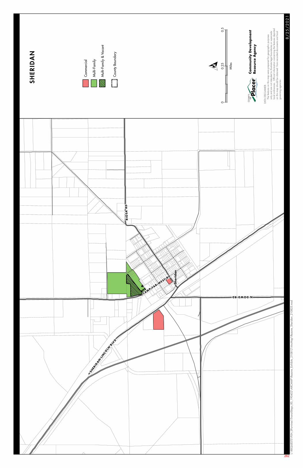
N DOWD RDCAMP FAR W
EST RD
SHER
IDA
NLI
NC
OLN
BLVD
RIO
SA
RD
Sher
idan
8/
25
/2
02
1
L:\R
EQU
ESTS
\PLN
_SPu
rvin
es\T
rans
itSto
ps_R
S_19
0402
\ARC
MA
P\Re
zone
_Exh
ibits
_210
812\
Arc
Map
\Rez
one_
Sher
idan
_210
825.
mxd
Com
mer
cial
Mul
ti-Fa
mily
Mul
ti-Fa
mily
& V
acan
t
Cou
nty
Boun
dary
SHER
IDAN
DATA
DIS
CLA
IMER
:
Th
e fe
atur
es o
n th
is m
ap w
ere
prep
ared
for g
eogr
aphi
c pu
rpos
es
on
ly a
nd a
re n
ot in
tend
ed to
illu
strat
e le
gal b
ound
arie
s or
sup
erce
de
lo
cal o
rdin
ance
s. O
ffici
al in
form
atio
n co
ncer
ning
the
feat
ures
dep
icte
d
on
this
map
sho
uld
be o
btai
ned
from
reco
rded
doc
umen
ts an
d lo
cal
gove
rnin
g ag
enci
es.
Com
munity D
evel
op
men
tRes
ourc
e A
gen
cy
00.
250.
5
Mile
s
O
262
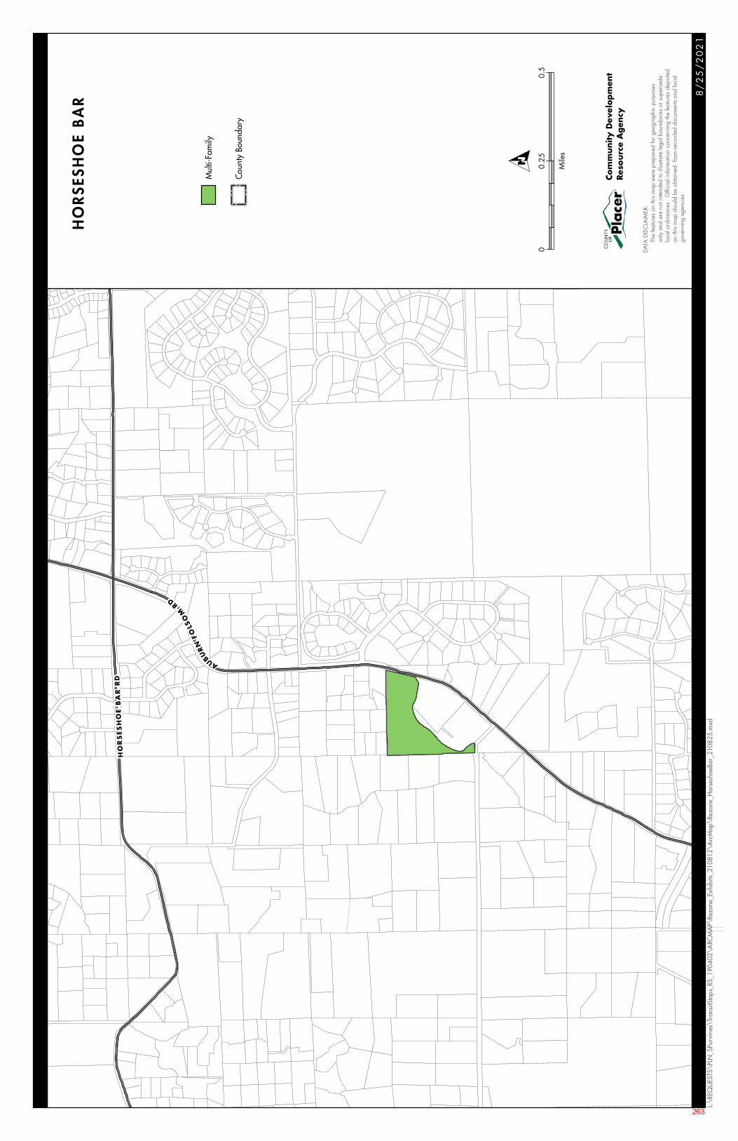
HO
RS
ES
HO
E B
AR
RD
AUBUR
NFO
LSO
M
RD
8/
25
/2
02
1
L:\R
EQU
ESTS
\PLN
_SPu
rvin
es\T
rans
itSto
ps_R
S_19
0402
\ARC
MA
P\Re
zone
_Exh
ibits
_210
812\
Arc
Map
\Rez
one_
Hor
sesh
oeBa
r_21
0825
.mxd
Mul
ti-Fa
mily
Cou
nty
Boun
dary
HO
RS
ESH
OE
BA
R
DATA
DIS
CLA
IMER
:
Th
e fe
atur
es o
n th
is m
ap w
ere
prep
ared
for g
eogr
aphi
c pu
rpos
es
on
ly a
nd a
re n
ot in
tend
ed to
illu
strat
e le
gal b
ound
arie
s or
sup
erce
de
lo
cal o
rdin
ance
s. O
ffici
al in
form
atio
n co
ncer
ning
the
feat
ures
dep
icte
d
on
this
map
sho
uld
be o
btai
ned
from
reco
rded
doc
umen
ts an
d lo
cal
gove
rnin
g ag
enci
es.
Com
munity D
evel
op
men
tRes
ourc
e A
gen
cy
00.
250.
5
Mile
s
O
263
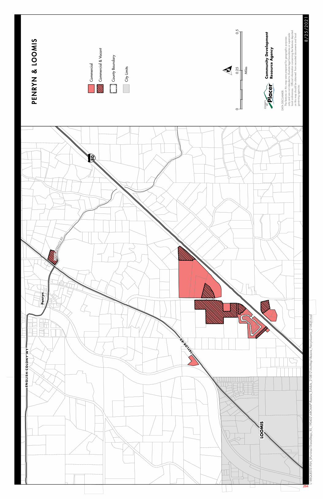
§̈ ¦80
ROC
KSP
RIN
GS
RD
LOO
MIS
EN
GLI
SH
CO
LON
Y W
Y
TAYLO
R RD
Pen
ryn
8/
25
/2
02
1
L:\R
EQU
ESTS
\PLN
_SPu
rvin
es\T
rans
itSto
ps_R
S_19
0402
\ARC
MA
P\Re
zone
_Exh
ibits
_210
812\
Arc
Map
\Rez
one_
Penr
ynLo
omis
_210
825.
mxd
Com
mer
cial
Com
mer
cial
& V
acan
t
Cou
nty
Boun
dary
City
Lim
its
PEN
RY
N &
LO
OM
IS
DATA
DIS
CLA
IMER
:
Th
e fe
atur
es o
n th
is m
ap w
ere
prep
ared
for g
eogr
aphi
c pu
rpos
es
on
ly a
nd a
re n
ot in
tend
ed to
illu
strat
e le
gal b
ound
arie
s or
sup
erce
de
lo
cal o
rdin
ance
s. O
ffici
al in
form
atio
n co
ncer
ning
the
feat
ures
dep
icte
d
on
this
map
sho
uld
be o
btai
ned
from
reco
rded
doc
umen
ts an
d lo
cal
gove
rnin
g ag
enci
es.
Com
munity D
evel
op
men
tRes
ourc
e A
gen
cy
00.
250.
5
Mile
s
O
264
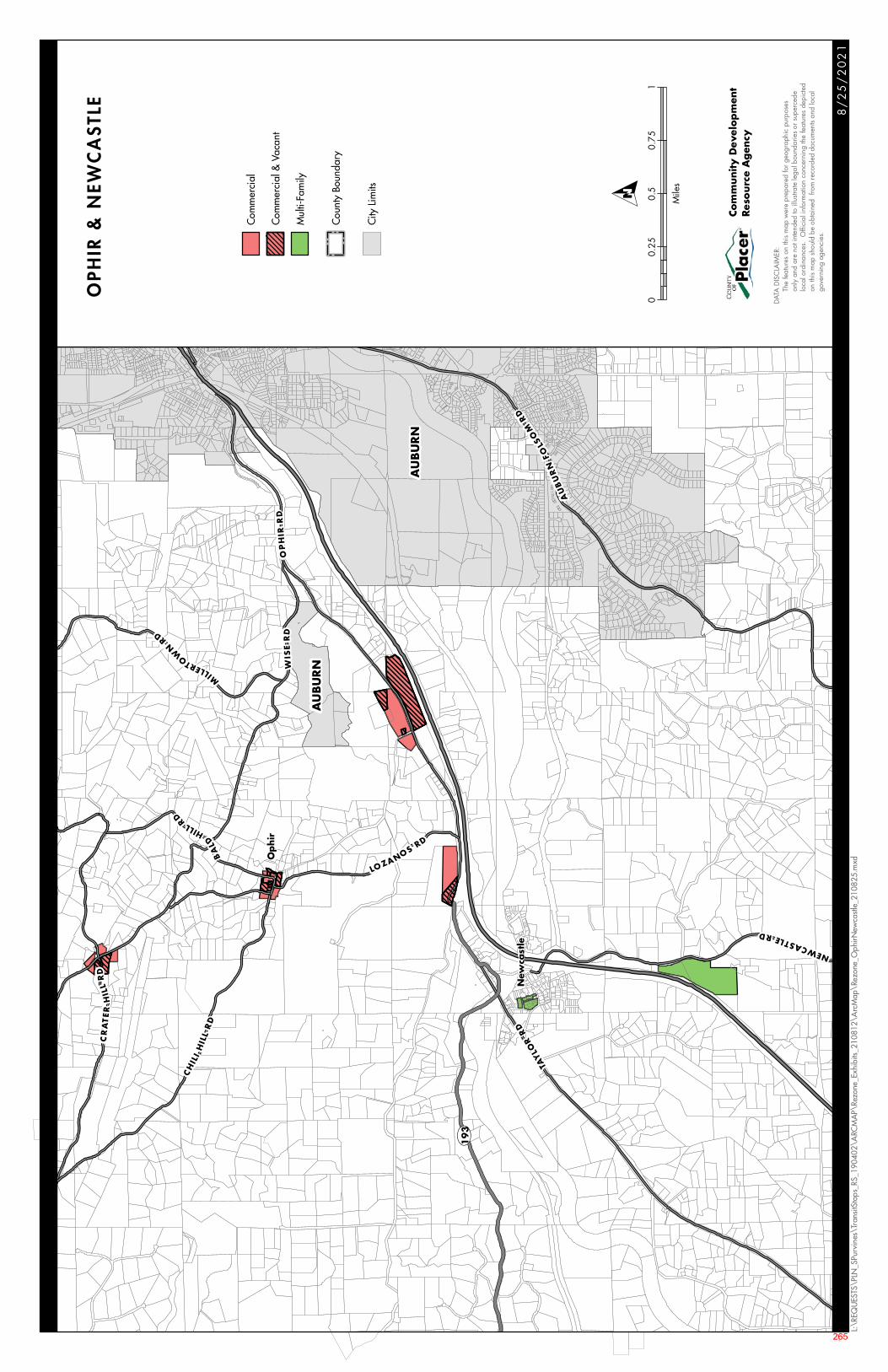
UV193
AU
BU
RN
AU
BU
RN
NEWCASTLERD
WIS
ER
DO
PH
IRR
D
CH
ILI
HIL
LR
D
TAY
LOR
RD
MIL
LERTOW
NRD
AU
BU
RN
FOLS
OM
RD
CR
AT
ER
HIL
LR
D
BA
L
DHILLRD
LOZANOSRD
Op
hir
New
cast
le
8/
25
/2
02
1
L:\R
EQU
ESTS
\PLN
_SPu
rvin
es\T
rans
itSto
ps_R
S_19
0402
\ARC
MA
P\Re
zone
_Exh
ibits
_210
812\
Arc
Map
\Rez
one_
Oph
irNew
castl
e_21
0825
.mxd
Com
mer
cial
Com
mer
cial
& V
acan
t
Mul
ti-Fa
mily
Cou
nty
Boun
dary
City
Lim
its
OP
HIR
& N
EWC
AS
TLE
DATA
DIS
CLA
IMER
:
Th
e fe
atur
es o
n th
is m
ap w
ere
prep
ared
for g
eogr
aphi
c pu
rpos
es
on
ly a
nd a
re n
ot in
tend
ed to
illu
strat
e le
gal b
ound
arie
s or
sup
erce
de
lo
cal o
rdin
ance
s. O
ffici
al in
form
atio
n co
ncer
ning
the
feat
ures
dep
icte
d
on
this
map
sho
uld
be o
btai
ned
from
reco
rded
doc
umen
ts an
d lo
cal
gove
rnin
g ag
enci
es.
Com
munity D
evel
op
men
tRes
ourc
e A
gen
cy
00.
250.
50.
751
Mile
s
O
265
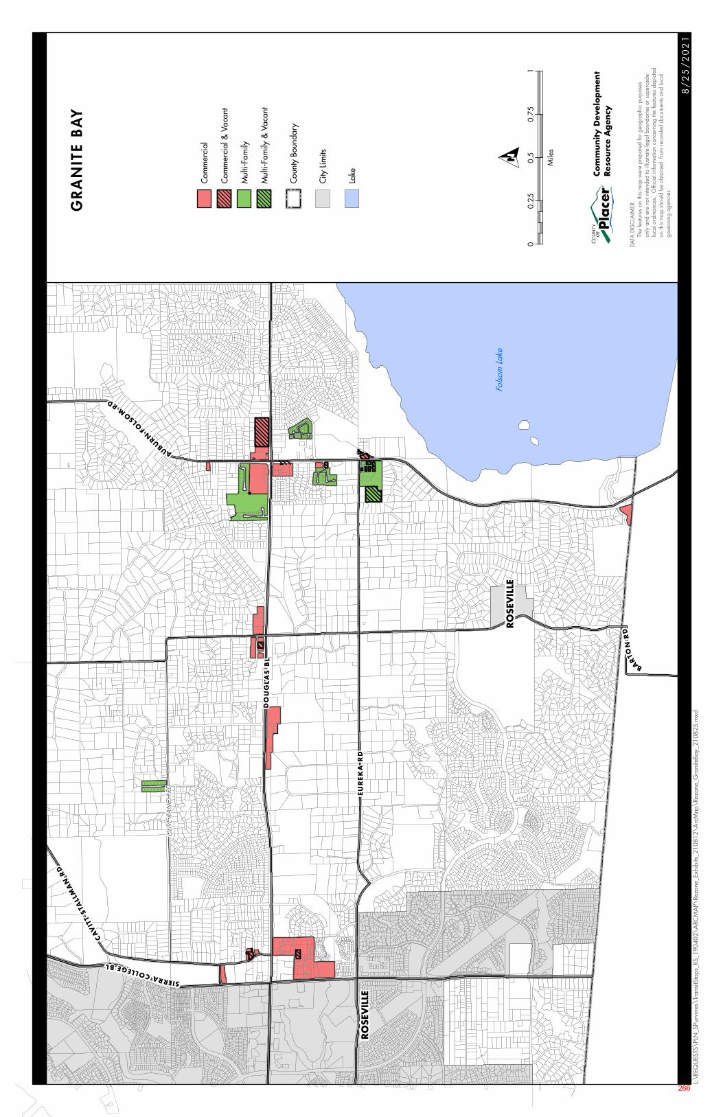
OLIV
E RA
NC
H R
D
RO
SEV
ILLE
RO
SEV
ILLE
CAV
ITT
STA
LLM
AN
RD
BAR
TON
RD
DO
UG
LA
S B
L
AUBURN
FOLS
OM
RD
EU
RE
KA
RD
SIERRACOLLEGEBL
Folso
m L
ake
8/
25
/2
02
1
L:\R
EQU
ESTS
\PLN
_SPu
rvin
es\T
rans
itSto
ps_R
S_19
0402
\ARC
MA
P\Re
zone
_Exh
ibits
_210
812\
Arc
Map
\Rez
one_
Gra
nite
Bay_
2108
25.m
xd
Com
mer
cial
Com
mer
cial
& V
acan
t
Mul
ti-Fa
mily
Mul
ti-Fa
mily
& V
acan
t
Cou
nty
Boun
dary
City
Lim
its
Lake
GR
AN
ITE
BA
Y
DATA
DIS
CLA
IMER
:
Th
e fe
atur
es o
n th
is m
ap w
ere
prep
ared
for g
eogr
aphi
c pu
rpos
es
on
ly a
nd a
re n
ot in
tend
ed to
illu
strat
e le
gal b
ound
arie
s or
sup
erce
de
lo
cal o
rdin
ance
s. O
ffici
al in
form
atio
n co
ncer
ning
the
feat
ures
dep
icte
d
on
this
map
sho
uld
be o
btai
ned
from
reco
rded
doc
umen
ts an
d lo
cal
gove
rnin
g ag
enci
es.
Com
munity D
evel
op
men
tRes
ourc
e A
gen
cy
00.
250.
50.
751
Mile
s
O
266
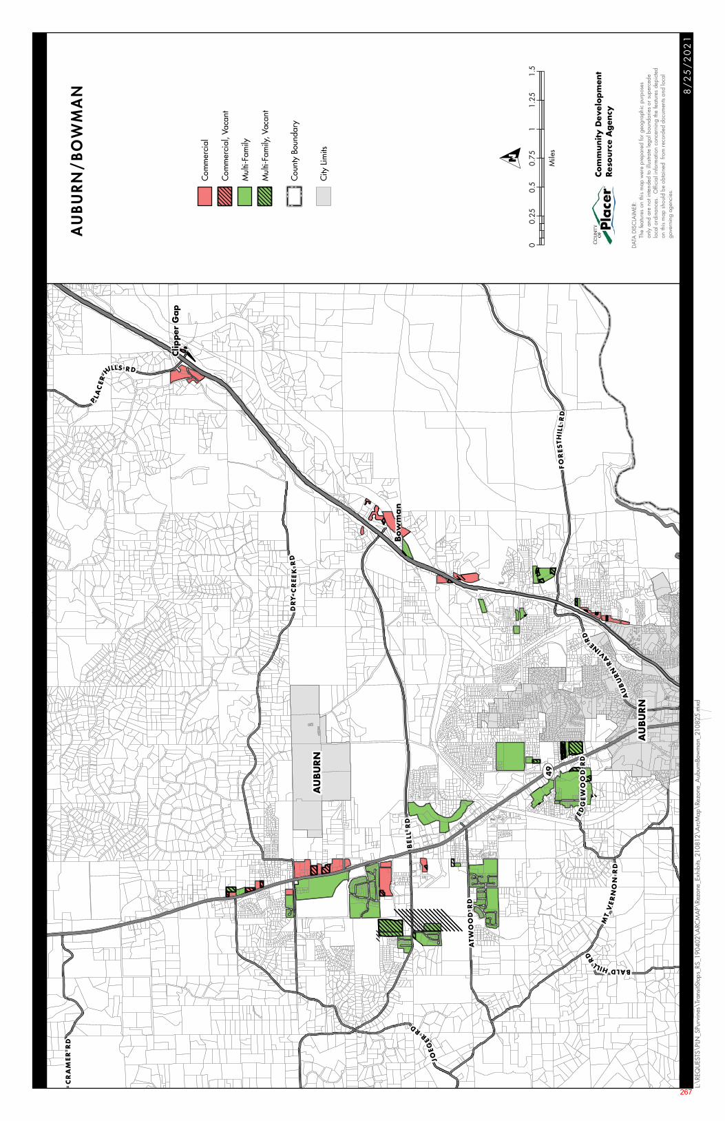
UV49
Bow
ma
n
Clip
per
Gap
AU
BU
RN
AU
BU
RN
AU
BU
RN
RA
VINE
RD
ATW
OO
D R
D
PLA
CER
HILLS RD
EDG
EW
OO
DR
D
BALDHILL
RD
BE
LL R
D
JOEG
ERRD
DR
YC
REE
KR
D
CR
AM
ER
RD
FO
RES
THIL
LR
D
MT
VE
RN
ON
RD
8/
25
/2
02
1
L:\R
EQU
ESTS
\PLN
_SPu
rvin
es\T
rans
itSto
ps_R
S_19
0402
\ARC
MA
P\Re
zone
_Exh
ibits
_210
812\
Arc
Map
\Rez
one_
Aub
urnB
owm
an_2
1082
5.m
xd
Com
mer
cial
Com
mer
cial
, Vac
ant
Mul
ti-Fa
mily
Mul
ti-Fa
mily
, Vac
ant
Cou
nty
Boun
dary
City
Lim
its
AUBURN/BOW
MAN
DATA
DIS
CLA
IMER
:
Th
e fe
atur
es o
n th
is m
ap w
ere
prep
ared
for g
eogr
aphi
c pu
rpos
es
on
ly a
nd a
re n
ot in
tend
ed to
illu
strat
e le
gal b
ound
arie
s or
sup
erce
de
lo
cal o
rdin
ance
s. O
ffici
al in
form
atio
n co
ncer
ning
the
feat
ures
dep
icte
d
on
this
map
sho
uld
be o
btai
ned
from
reco
rded
doc
umen
ts an
d lo
cal
gove
rnin
g ag
enci
es.
Com
munity D
evel
op
men
tRes
ourc
e A
gen
cy
00.
250.
50.
751
1.25
1.5
Mile
s
O
267
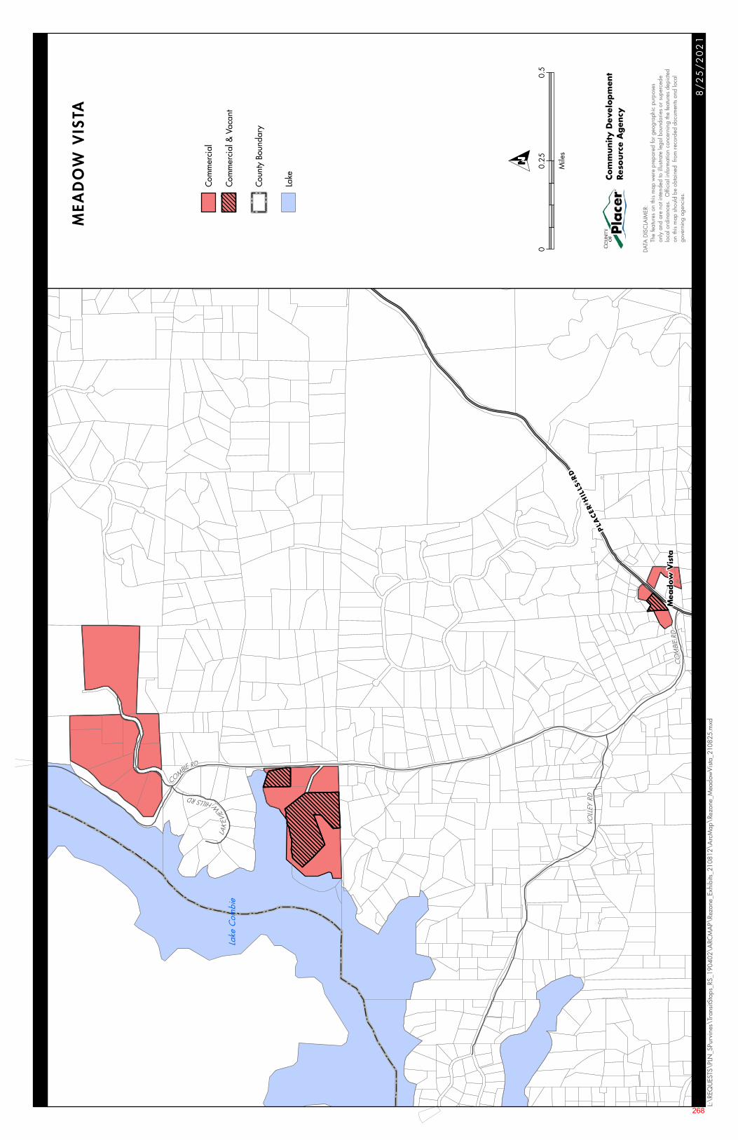
CO
MBI
ERD
VOLL
EY R
D
COMBIERD
LAK
EVIE
W
HILLSRD
PLA
CER
HIL
LS R
D
Lake
Com
bie
Mea
dow
Vis
ta
8/
25
/2
02
1
L:\R
EQU
ESTS
\PLN
_SPu
rvin
es\T
rans
itSto
ps_R
S_19
0402
\ARC
MA
P\Re
zone
_Exh
ibits
_210
812\
Arc
Map
\Rez
one_
Mea
dow
Vis
ta_2
1082
5.m
xd
Com
mer
cial
Com
mer
cial
& V
acan
t
Cou
nty
Boun
dary
Lake
MEA
DO
W V
ISTA
DATA
DIS
CLA
IMER
:
Th
e fe
atur
es o
n th
is m
ap w
ere
prep
ared
for g
eogr
aphi
c pu
rpos
es
on
ly a
nd a
re n
ot in
tend
ed to
illu
strat
e le
gal b
ound
arie
s or
sup
erce
de
lo
cal o
rdin
ance
s. O
ffici
al in
form
atio
n co
ncer
ning
the
feat
ures
dep
icte
d
on
this
map
sho
uld
be o
btai
ned
from
reco
rded
doc
umen
ts an
d lo
cal
gove
rnin
g ag
enci
es.
Com
munity D
evel
op
men
tRes
ourc
e A
gen
cy
00.
250.
5
Mile
s
O
268
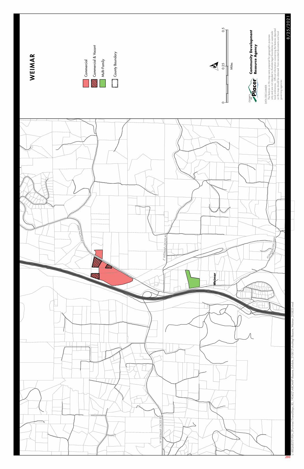
PONDE
ROSA
WAY
CAN
YON
WAY
WW
EIM
AR
CRO
SSRD
EW
EIM
AR
CRO
SSRD
Wei
ma
r
8/
25
/2
02
1
L:\R
EQU
ESTS
\PLN
_SPu
rvin
es\T
rans
itSto
ps_R
S_19
0402
\ARC
MA
P\Re
zone
_Exh
ibits
_210
812\
Arc
Map
\Rez
one_
Wei
mar
_210
825.
mxd
Com
mer
cial
Com
mer
cial
& V
acan
t
Mul
ti-Fa
mily
Cou
nty
Boun
dary
WEIMAR
DATA
DIS
CLA
IMER
:
Th
e fe
atur
es o
n th
is m
ap w
ere
prep
ared
for g
eogr
aphi
c pu
rpos
es
on
ly a
nd a
re n
ot in
tend
ed to
illu
strat
e le
gal b
ound
arie
s or
sup
erce
de
lo
cal o
rdin
ance
s. O
ffici
al in
form
atio
n co
ncer
ning
the
feat
ures
dep
icte
d
on
this
map
sho
uld
be o
btai
ned
from
reco
rded
doc
umen
ts an
d lo
cal
gove
rnin
g ag
enci
es.
Com
munity D
evel
op
men
tRes
ourc
e A
gen
cy
00.
250.
5
Mile
s
O
269
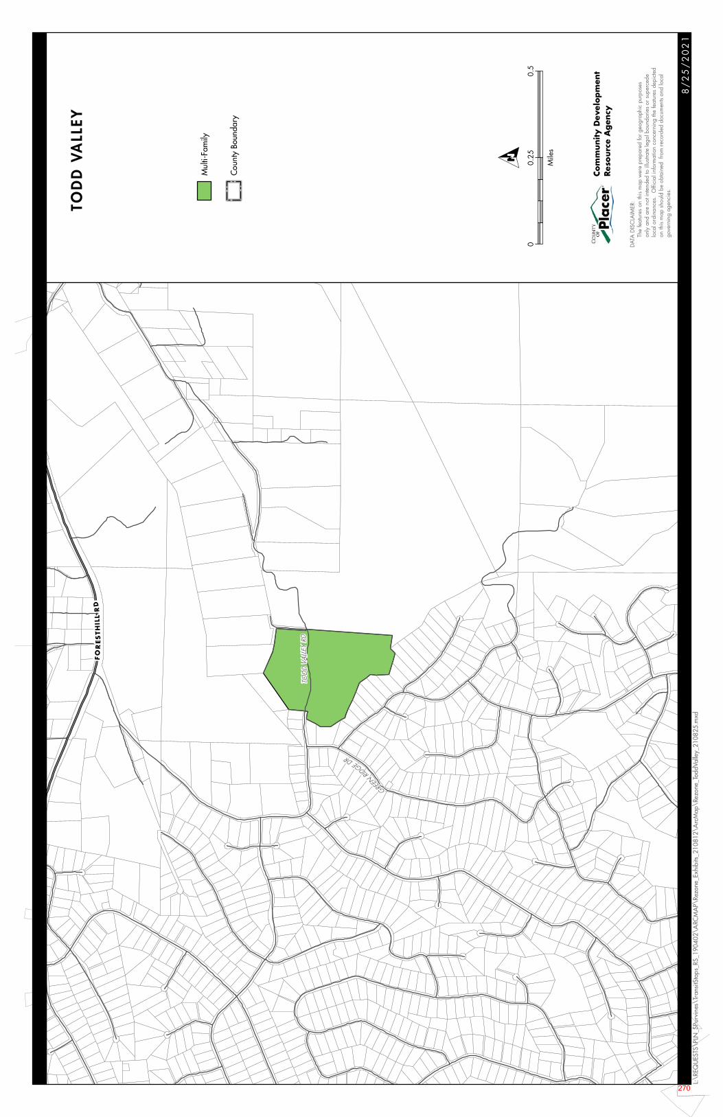
GREEN
RID
GEDR
TOD
DVA
LLEY
RD
FO
RES
TH
ILL
RD
8/
25
/2
02
1
L:\R
EQU
ESTS
\PLN
_SPu
rvin
es\T
rans
itSto
ps_R
S_19
0402
\ARC
MA
P\Re
zone
_Exh
ibits
_210
812\
Arc
Map
\Rez
one_
Todd
Valle
y_21
0825
.mxd
Mul
ti-Fa
mily
Cou
nty
Boun
dary
TOD
D V
ALL
EY
DATA
DIS
CLA
IMER
:
Th
e fe
atur
es o
n th
is m
ap w
ere
prep
ared
for g
eogr
aphi
c pu
rpos
es
on
ly a
nd a
re n
ot in
tend
ed to
illu
strat
e le
gal b
ound
arie
s or
sup
erce
de
lo
cal o
rdin
ance
s. O
ffici
al in
form
atio
n co
ncer
ning
the
feat
ures
dep
icte
d
on
this
map
sho
uld
be o
btai
ned
from
reco
rded
doc
umen
ts an
d lo
cal
gove
rnin
g ag
enci
es.
Com
munity D
evel
op
men
tRes
ourc
e A
gen
cy
00.
250.
5
Mile
s
O
270
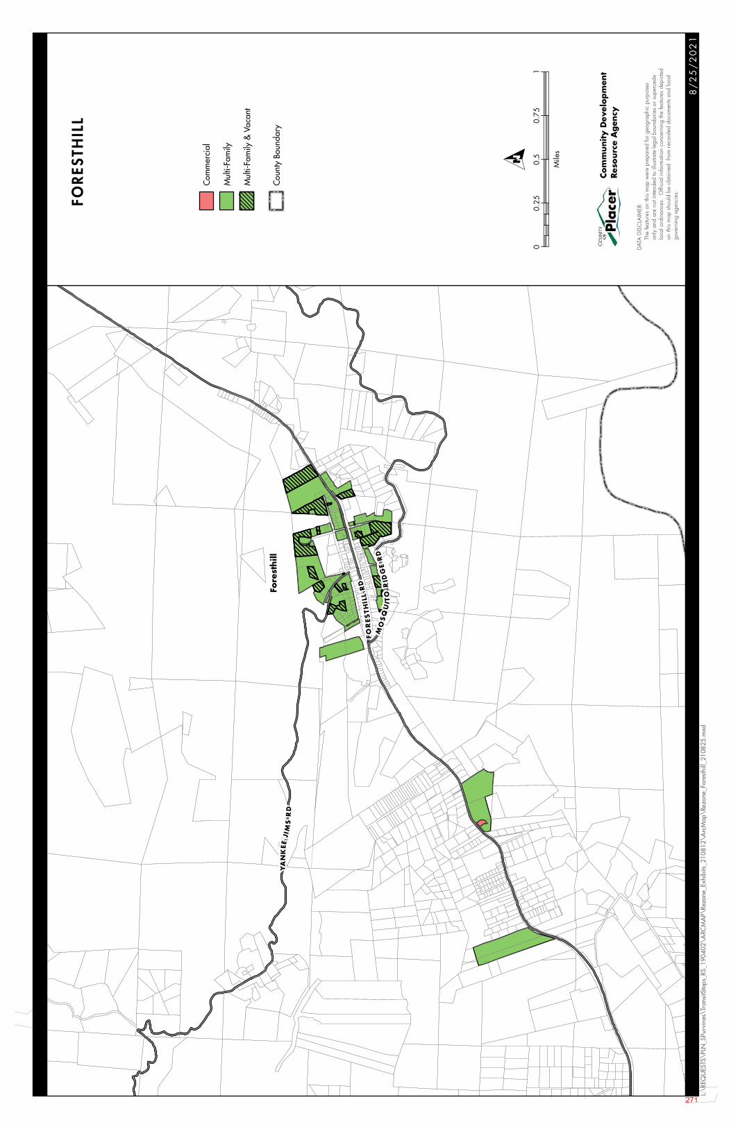
Fore
sthill
YA
NK
EEJI
MS
RD
FO
RE
STH
ILL
RD
MO
SQ
UIT
OR
IDG
ER
D
8/
25
/2
02
1
L:\R
EQU
ESTS
\PLN
_SPu
rvin
es\T
rans
itSto
ps_R
S_19
0402
\ARC
MA
P\Re
zone
_Exh
ibits
_210
812\
Arc
Map
\Rez
one_
Fore
sthill
_210
825.
mxd
Com
mer
cial
Mul
ti-Fa
mily
Mul
ti-Fa
mily
& V
acan
t
Cou
nty
Boun
dary
FORES
THILL
DATA
DIS
CLA
IMER
:
Th
e fe
atur
es o
n th
is m
ap w
ere
prep
ared
for g
eogr
aphi
c pu
rpos
es
on
ly a
nd a
re n
ot in
tend
ed to
illu
strat
e le
gal b
ound
arie
s or
sup
erce
de
lo
cal o
rdin
ance
s. O
ffici
al in
form
atio
n co
ncer
ning
the
feat
ures
dep
icte
d
on
this
map
sho
uld
be o
btai
ned
from
reco
rded
doc
umen
ts an
d lo
cal
gove
rnin
g ag
enci
es.
Com
munity D
evel
op
men
tRes
ourc
e A
gen
cy
00.
250.
50.
751
Mile
s
O
271
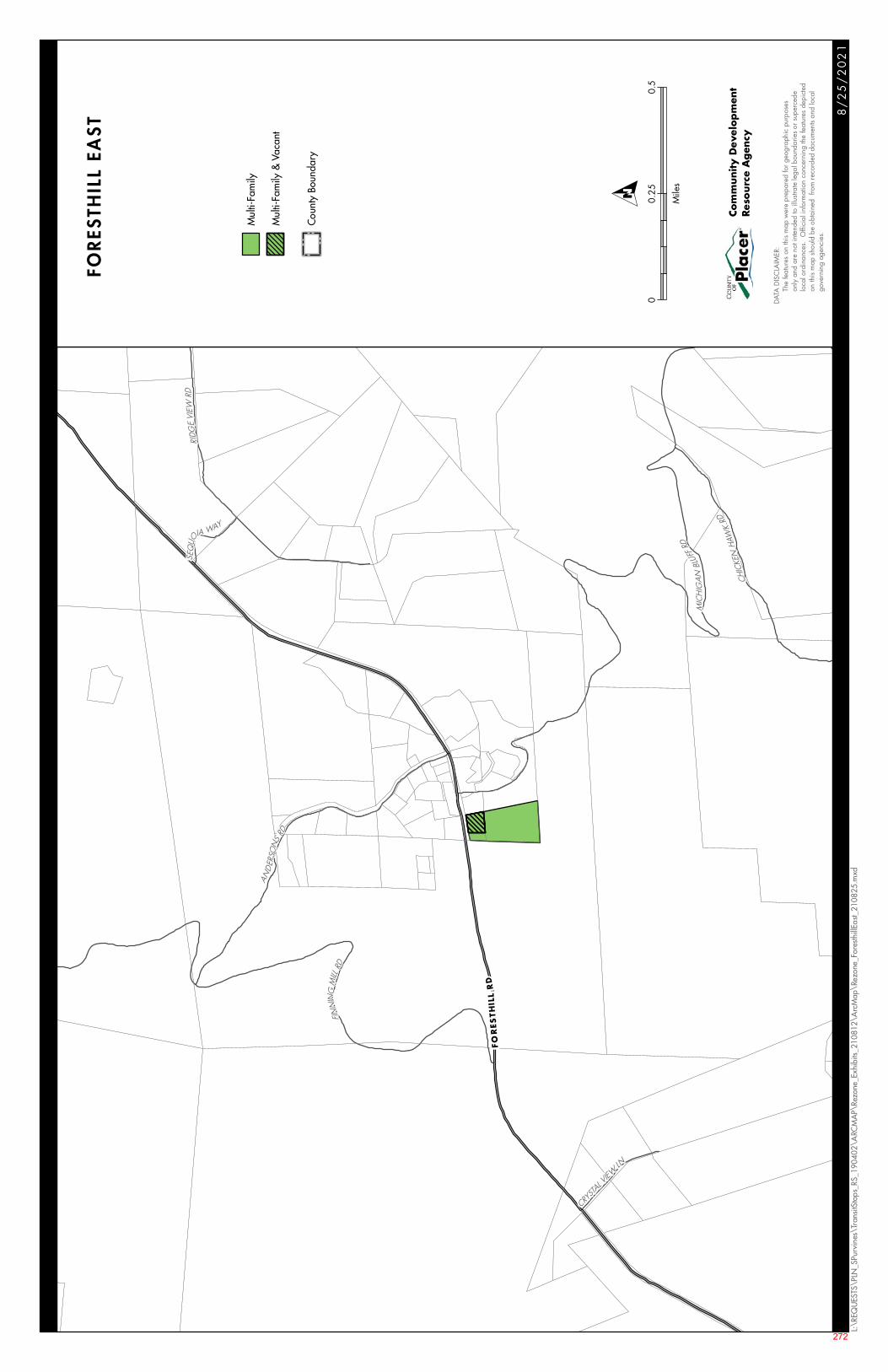
AND
ERSO
N
SRD
CHIC
KEN
HAW
KRD
SEQ
UOIA WAY
CRYST
AL VIEW
LN
RIDG
EVI
EWRD
FINN
ING
MILL
RD
MIC
HIG
AN
BLUF
FRD
FO
RES
TH
ILL
RD
8/
25
/2
02
1
L:\R
EQU
ESTS
\PLN
_SPu
rvin
es\T
rans
itSto
ps_R
S_19
0402
\ARC
MA
P\Re
zone
_Exh
ibits
_210
812\
Arc
Map
\Rez
one_
Fore
sthill
East_
2108
25.m
xd
Mul
ti-Fa
mily
Mul
ti-Fa
mily
& V
acan
t
Cou
nty
Boun
dary
FOR
ESTH
ILL
EAS
T
DATA
DIS
CLA
IMER
:
Th
e fe
atur
es o
n th
is m
ap w
ere
prep
ared
for g
eogr
aphi
c pu
rpos
es
on
ly a
nd a
re n
ot in
tend
ed to
illu
strat
e le
gal b
ound
arie
s or
sup
erce
de
lo
cal o
rdin
ance
s. O
ffici
al in
form
atio
n co
ncer
ning
the
feat
ures
dep
icte
d
on
this
map
sho
uld
be o
btai
ned
from
reco
rded
doc
umen
ts an
d lo
cal
gove
rnin
g ag
enci
es.
Com
munity D
evel
op
men
tRes
ourc
e A
gen
cy
00.
250.
5
Mile
s
O
272
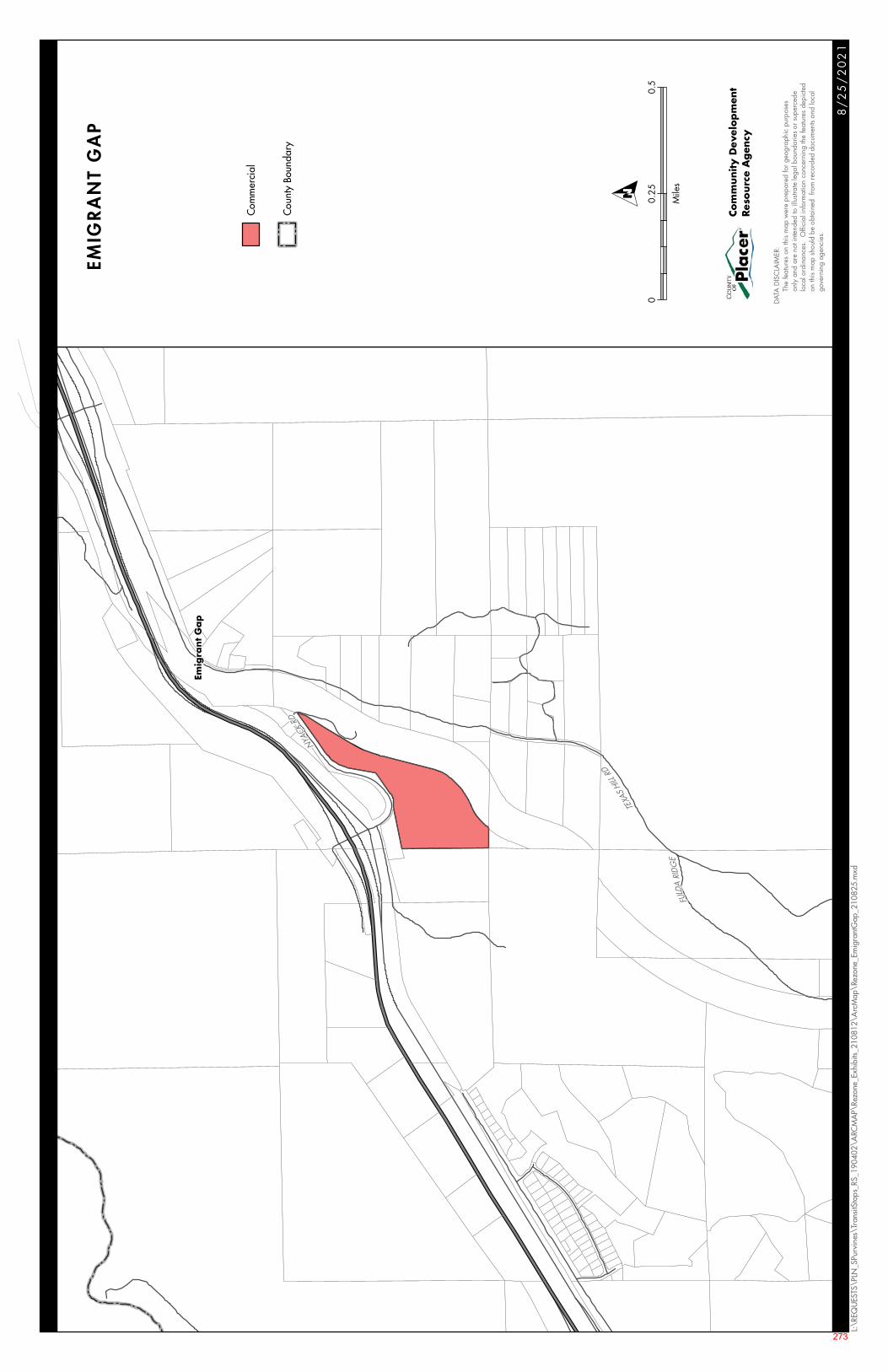
Emig
rant
Ga
p
NYACK
RD
TEXA
SHI
LLRD
FULD
ARI
DG
E
8/
25
/2
02
1
L:\R
EQU
ESTS
\PLN
_SPu
rvin
es\T
rans
itSto
ps_R
S_19
0402
\ARC
MA
P\Re
zone
_Exh
ibits
_210
812\
Arc
Map
\Rez
one_
Emig
rant
Gap
_210
825.
mxd
Com
mer
cial
Cou
nty
Boun
dary
EMIG
RA
NT
GA
P
DATA
DIS
CLA
IMER
:
Th
e fe
atur
es o
n th
is m
ap w
ere
prep
ared
for g
eogr
aphi
c pu
rpos
es
on
ly a
nd a
re n
ot in
tend
ed to
illu
strat
e le
gal b
ound
arie
s or
sup
erce
de
lo
cal o
rdin
ance
s. O
ffici
al in
form
atio
n co
ncer
ning
the
feat
ures
dep
icte
d
on
this
map
sho
uld
be o
btai
ned
from
reco
rded
doc
umen
ts an
d lo
cal
gove
rnin
g ag
enci
es.
Com
munity D
evel
op
men
tRes
ourc
e A
gen
cy
00.
250.
5
Mile
s
O
273
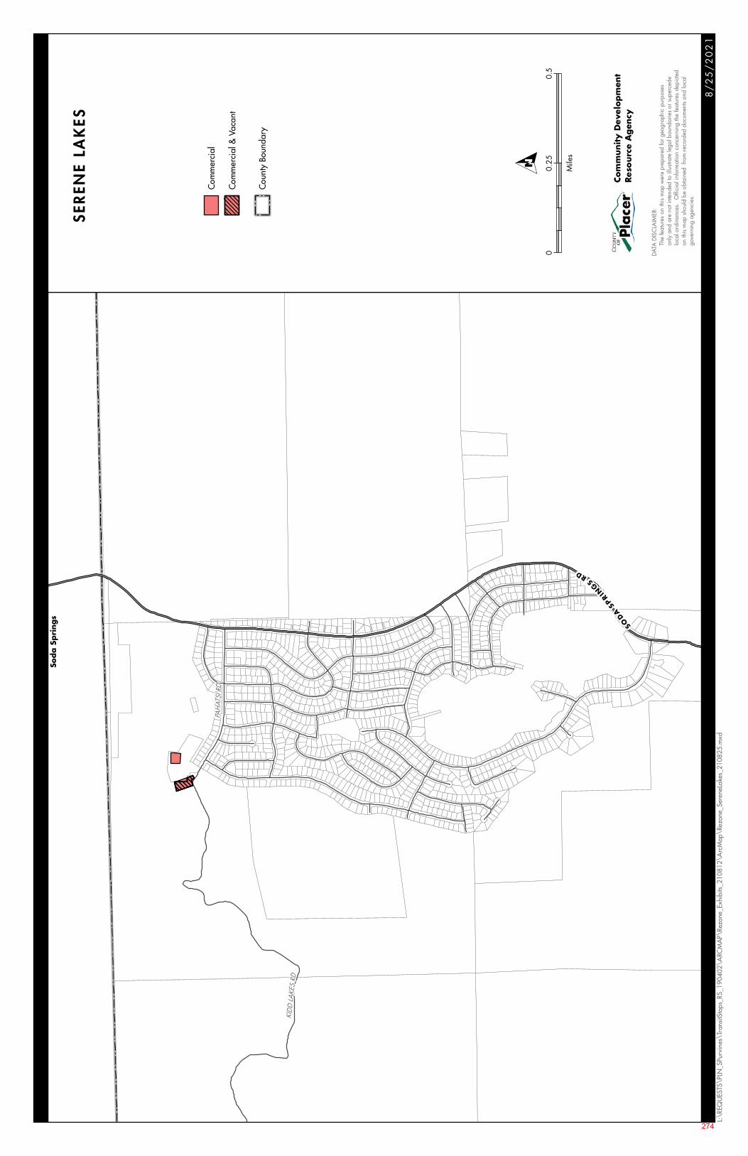
P AH
ATSI
RD
KID
D LA
KES
RD
SOD
ASP
RIN
G
SRD
Sod
a S
pri
ngs
8/
25
/2
02
1
L:\R
EQU
ESTS
\PLN
_SPu
rvin
es\T
rans
itSto
ps_R
S_19
0402
\ARC
MA
P\Re
zone
_Exh
ibits
_210
812\
Arc
Map
\Rez
one_
Sere
neLa
kes_
2108
25.m
xd
Com
mer
cial
Com
mer
cial
& V
acan
t
Cou
nty
Boun
dary
SER
ENE
LAK
ES
DATA
DIS
CLA
IMER
:
Th
e fe
atur
es o
n th
is m
ap w
ere
prep
ared
for g
eogr
aphi
c pu
rpos
es
on
ly a
nd a
re n
ot in
tend
ed to
illu
strat
e le
gal b
ound
arie
s or
sup
erce
de
lo
cal o
rdin
ance
s. O
ffici
al in
form
atio
n co
ncer
ning
the
feat
ures
dep
icte
d
on
this
map
sho
uld
be o
btai
ned
from
reco
rded
doc
umen
ts an
d lo
cal
gove
rnin
g ag
enci
es.
Com
munity D
evel
op
men
tRes
ourc
e A
gen
cy
00.
250.
5
Mile
s
O
274
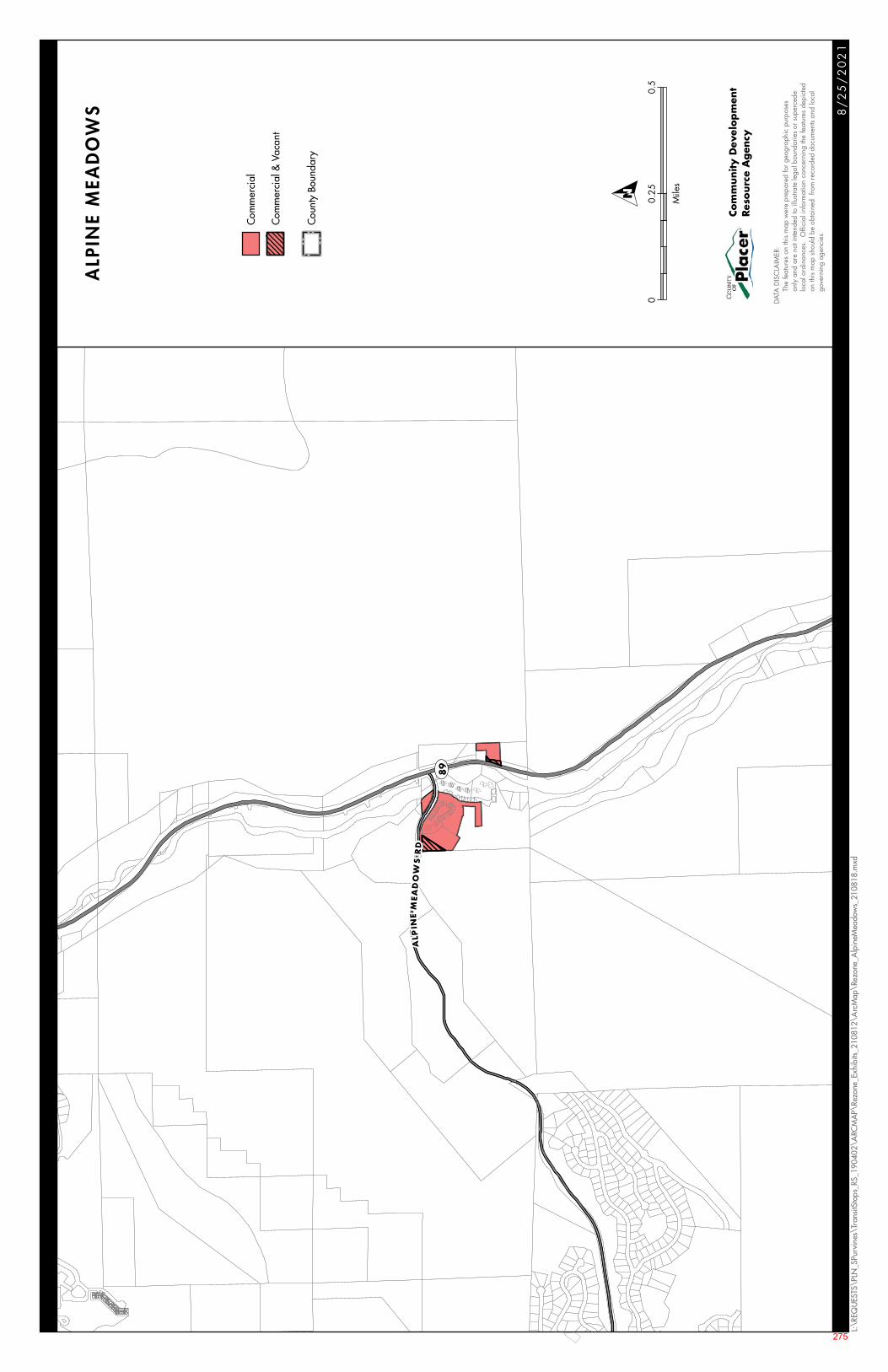
ALP
INE
MEA
DO
WS
RD
UV89
8/
25
/2
02
1
L:\R
EQU
ESTS
\PLN
_SPu
rvin
es\T
rans
itSto
ps_R
S_19
0402
\ARC
MA
P\Re
zone
_Exh
ibits
_210
812\
Arc
Map
\Rez
one_
Alp
ineM
eado
ws_
2108
18.m
xd
Com
mer
cial
Com
mer
cial
& V
acan
t
Cou
nty
Boun
dary
ALP
INE
MEA
DO
WS
DATA
DIS
CLA
IMER
:
Th
e fe
atur
es o
n th
is m
ap w
ere
prep
ared
for g
eogr
aphi
c pu
rpos
es
on
ly a
nd a
re n
ot in
tend
ed to
illu
strat
e le
gal b
ound
arie
s or
sup
erce
de
lo
cal o
rdin
ance
s. O
ffici
al in
form
atio
n co
ncer
ning
the
feat
ures
dep
icte
d
on
this
map
sho
uld
be o
btai
ned
from
reco
rded
doc
umen
ts an
d lo
cal
gove
rnin
g ag
enci
es.
Com
munity D
evel
op
men
tRes
ourc
e A
gen
cy
00.
250.
5
Mile
s
O
275
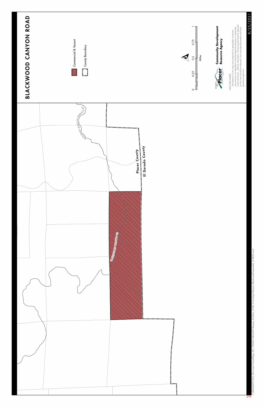
Pla
cer
Co
unty
ElD
ora
do
Co
un
ty
MCK
INN
EYRU
BIC
ON
SP
RIN
GS
R
D
BLAC
KWO
OD
CA
NYO
NRD
8/
25
/2
02
1
L:\R
EQU
ESTS
\PLN
_SPu
rvin
es\T
rans
itSto
ps_R
S_19
0402
\ARC
MA
P\Re
zone
_Exh
ibits
_210
812\
Arc
Map
\Rez
one_
Blac
kwoo
dCan
yonR
d_21
0825
.mxd
Com
mer
cial
& V
acan
t
Cou
nty
Boun
dary
BLA
CK
WO
OD
CA
NY
ON
RO
AD
DATA
DIS
CLA
IMER
:
Th
e fe
atur
es o
n th
is m
ap w
ere
prep
ared
for g
eogr
aphi
c pu
rpos
es
on
ly a
nd a
re n
ot in
tend
ed to
illu
strat
e le
gal b
ound
arie
s or
sup
erce
de
lo
cal o
rdin
ance
s. O
ffici
al in
form
atio
n co
ncer
ning
the
feat
ures
dep
icte
d
on
this
map
sho
uld
be o
btai
ned
from
reco
rded
doc
umen
ts an
d lo
cal
gove
rnin
g ag
enci
es.
Com
munity D
evel
op
men
tRes
ourc
e A
gen
cy
00.
250.
50.
751
Mile
s
O
276
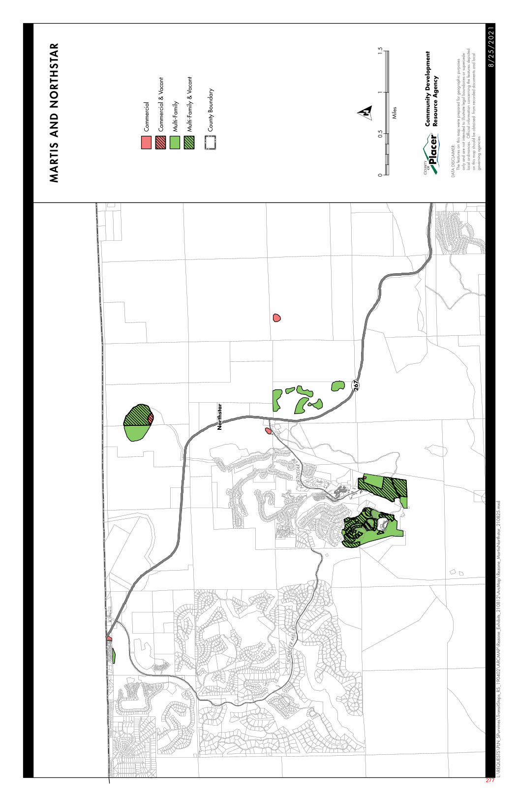
UV267
Nort
hst
ar
SCHA
FFER
MIL L
R D
NORTH
STA
RDR
8/
25
/2
02
1
L:\R
EQU
ESTS
\PLN
_SPu
rvin
es\T
rans
itSto
ps_R
S_19
0402
\ARC
MA
P\Re
zone
_Exh
ibits
_210
812\
Arc
Map
\Rez
one_
Mar
tisN
orth
star_
2108
25.m
xd
Com
mer
cial
Com
mer
cial
& V
acan
t
Mul
ti-Fa
mily
Mul
ti-Fa
mily
& V
acan
t
Cou
nty
Boun
dary
MA
RTI
S A
ND
NO
RTH
STA
R
DATA
DIS
CLA
IMER
:
Th
e fe
atur
es o
n th
is m
ap w
ere
prep
ared
for g
eogr
aphi
c pu
rpos
es
on
ly a
nd a
re n
ot in
tend
ed to
illu
strat
e le
gal b
ound
arie
s or
sup
erce
de
lo
cal o
rdin
ance
s. O
ffici
al in
form
atio
n co
ncer
ning
the
feat
ures
dep
icte
d
on
this
map
sho
uld
be o
btai
ned
from
reco
rded
doc
umen
ts an
d lo
cal
gove
rnin
g ag
enci
es.
Com
munity D
evel
op
men
tRes
ourc
e A
gen
cy
00.
51
1.5
Mile
s
O
277

278
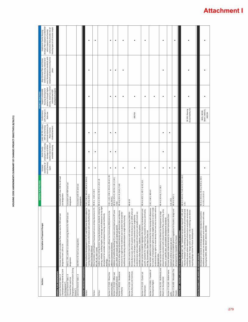
HOUSING CODE AM
ENDMEN
TS SUMMAR
Y OF CH
ANGES PRO
JECT
OBJEC
TIVE
S (8/26/21
)
GEN
ERAL
PLA
N POLICIES
Sections
Descriptio
n of Propo
sed Ch
ange
sIncrea
se
availability of
mix of h
ousin
g type
s
Assis
t Cou
nty
employers in redu
cing
shortage
of skilled
workers due
to lack of
available ho
using
Und
er SB 74
3, re
duce
VMT by sh
ortening
commute distan
ces for
Placer Cou
nty
stud
ents/w
orkers
Conforman
ce
with
cha
nges in
State law
Supp
ort sustainab
le
housing de
velopm
ent
patterns th
roug
h high
er
density
, mixed
use, transit
oriented
and
infill
developm
ent p
rojects
Align Gen
eral Plan an
d Zo
ning
Ordinan
ce hou
sing‐related land
uses/ d
evelop
men
t stand
ards with
ad
opted specific/commun
ity/area
plan
s
Implem
ent C
ounty Ho
using
Strategic Plan
ado
pted
11/20
/201
8 which su
pports new
hou
sing
constructio
n that provide
s mix of
housing type
s at a
ll income rang
es
GEN
ERAL
PLA
N AMEN
DMEN
TSLand
Use Elemen
t Tab
le 1‐2
("De
velopm
ent S
tand
ards by Land
Use Designa
tion")
Increa
se m
axim
um non
resid
entia
l floor area ratio
for H
DR land
use
desig
natio
n from
1.05 to 2.0
Consisten
t with
max. FAR
for G
C land
use de
signa
tion
Land
Use Elemen
t Tab
le 1‐3
("Gen
eral Plan Land
Use
Desig
natio
ns and
Con
sistent Zon
ing
Distric
ts")
Add C2
, CPD
, and
MU as c
onsis
tent zo
ning
distric
ts fo
r HDR
land
use
desig
natio
nCo
nsisten
t with
HDR
land
use
desig
natio
n
Land
Use Elemen
t Tab
le 1‐3
Add RM
to GC land
use designa
tion
Consisten
t with
GC land
use
desig
natio
n
ZONING ORD
INAN
CE AMEN
DMEN
TSVa
rious
Allow m
utifa
mily develop
men
t in C1
, C2, and
CPD
zone
districts su
bject to
"zon
ing clea
rance requ
ired" and
con
form
ance with
new
Mutifa
mily and
Mixed
Use Design Man
ual
1.B.2, 1.M
.1, H
E‐A‐2, HE‐A‐3, HE‐A‐5,
HE‐A‐6, H
E‐B‐1
●●
●●
●●
Vario
usAllow Caretaker and
Employ
ee Hou
sing land
use as z
oning clea
rance in C3,
RES, BP, AE, and
F zo
nes
HE‐B‐1; 1.N.5; 1
.M.1
●●
●●
Vario
usUpd
ate vario
us zo
ning
distric
ts’ h
ousin
g de
velopm
ent stand
ards re
latin
g to
parking, se
tbacks, b
uilding he
ights, lo
t cov
erage an
d allowan
ces for by‐rig
ht
developm
ent for caretaker and
employ
ee hou
sing, and
multifam
ily
dwellin
gs
HE‐A‐3, H
E‐A‐6, HE‐B‐1; 1.A.4; 1
.B
Section 17
.27.01
0 ‐ M
ixed
Use
Commun
ity (M
U)
Add ne
w se
ction to create a Mixed
Use Com
mun
ity (M
U) d
istric
t to be
ad
ded to Com
mercial Distric
ts1.B.1, 1.B.2, 1
.M.1, H
E‐A‐3, HE‐A‐5, HE‐
A‐6, HE‐B‐1,
●●
●●
●●
Section 17
.32.01
0 ‐ O
ffice and
Professio
nal (OP) Distric
tAd
ditio
n of m
ultifam
ily dwellin
g (21 or m
ore un
its) lan
d use to OP zone
with
a M
UP, and
mixed
use with
a C land
use permit
HE‐A‐3, H
E‐A‐5, HE‐E‐6; 1.B.1; 1
.B.2;
7.A.8
●●
●●
●●
Section 17
.48.01
0 ‐ R
esiden
tial
multifam
ilyAm
end to allo
w aligne
d allowed
den
sity with
relevant plan an
d de
nsity
minim
ums for sing
le‐fa
mily re
siden
tial u
ses to protect lan
d zone
d for
multifam
ily from
being
und
erde
velope
d as sing
le‐fa
mily hou
sing
HE‐A‐6, H
E‐C‐4; 1.N.5; 7
.A.8
●●
●●
Section 17
.54.12
0 ‐ R
esiden
tial
Density
Bon
uses and
Incentives
Upd
ate this section for c
onform
ance with
state ho
using law (A
B176
3 ‐
Density
Bon
us Law
); allow fo
r greater den
sity bo
nus u
p to 100
% whe
n art
of a m
ixed
use in
fill project; crea
te in
centives with
in sing
lefamily
resid
entia
l zon
e whe
re ade
quate infrastructure and
pub
lic tran
sit are
available to allo
w dup
lexes, triplexes, and
fourplexes
HE‐B‐19
●AB
1763
●●
Section 17
.54.11
5 ‐ C
luster Lot
Developm
ent
Add ne
w se
ction to estab
lish regu
latio
ns fo
r cluster lo
t develo p
men
t and
specific stan
dards for cottage hou
sing, m
ovea
ble tin
y ho
use commun
ity,
and Ag
, Con
servation, Ope
n Sp
ace Cluster L
ot
HE‐A‐4, H
E‐C‐1, HE‐C ‐4; 6
.E; 6
.6●
●●
Section 17
.54.12
0(L) ‐ Tran
sfer of
Developm
ent R
ights
New
section ad
ded to create incentives fo
r more ho
using with
allo
wan
ces
for transfer o
f develop
men
t rights to allow eligible projects to sell or trad
e resid
entia
l den
sity rig
hts to mov
e de
nsity
from
one
area to ano
ther with
in a
desig
nated area
1.B.2, 1.M
.1, H
E‐A‐3
●
Section 17
.56.13
5 ‐ M
ultifam
ily and
Mixed
Use Develop
men
tAd
d ne
w se
ction for M
ultifam
ily and
Mixed
Use Develop
men
t to align
allowed
den
sity consisten
t with
relevant Gen
eral Plan, com
mun
ity, area,
master, or sp
ecific plan
, and
estab
lish de
velopm
ent stand
ards
HE‐A‐4, H
E‐A‐6; 1.2; 1
.B.2
●●
●●
●●
Section 17
.56.14
0 ‐ M
obile hom
e pa
rks
Increa
se allo
wab
le re
siden
tial d
ensity for m
obile hom
e pa
rks from
maxim
um of 8
to 12 spaces per acre
1.B; 1.N.5
●●
Section 17
.56.40
0 ‐ M
ovea
ble Tiny
Ho
uses
Add ne
w se
ction to estab
lish gene
ral regulations fo
r location, design an
d de
velopm
ent for m
ovea
ble tin
y ho
uses
HE‐A‐4, H
E‐C‐1
●●
●
ZONING M
AP ‐ RE
ZONE 1,92
9 PA
RCELS WITH RM OR CO
MMER
ICAL
BAS
E ZO
NING
Replace “building site” (‐B), “cond
ition
al use permit requ
ired” (‐UP), and
“den
sity lim
itatio
n” (‐DL
) com
bining
zone
distric
ts on all com
mercial and
multifam
ily zo
nes w
here ade
quate infrastructure and
pub
lic se
rvices are
available with
the “design scen
ic corrid
or” (‐D
c) com
bining
zone
distric
t requ
iring
design review
for future de
velopm
ent
HE‐A‐2, H
E‐A‐3; 7.A.8; 4
.C.2; 3
.C; 1
.B.2;
1.B.1
SB 330
, Hou
sing
Accoun
tability Ac
t●
●●
NEW
MUTIFA
MILY AN
D M
IXED
USE DESIGN M
ANUAL
Developm
ent stand
ards and
design gu
idelines in
tend
ed to
stream
line
multifam
ily and
mixed
use develop
men
t and
con
form
ance with
state
housing law (S
B35, SB3
30, SB1
67, A
B151
5, AB3
194)
HE‐A‐2, H
E‐A‐3, HE‐A‐6, HE‐B‐1, HE‐C‐
4; 1.D.2; 1
.D.5l 1.2
●SB
35, SB3
30,
SB16
7, AB1
515,
AB31
94●
●●
PROJECT
OBJEC
TIVE
S
Attachment I
279