mining solutions
TRANSCRIPT
MINING SOLUTIONS
2021
32
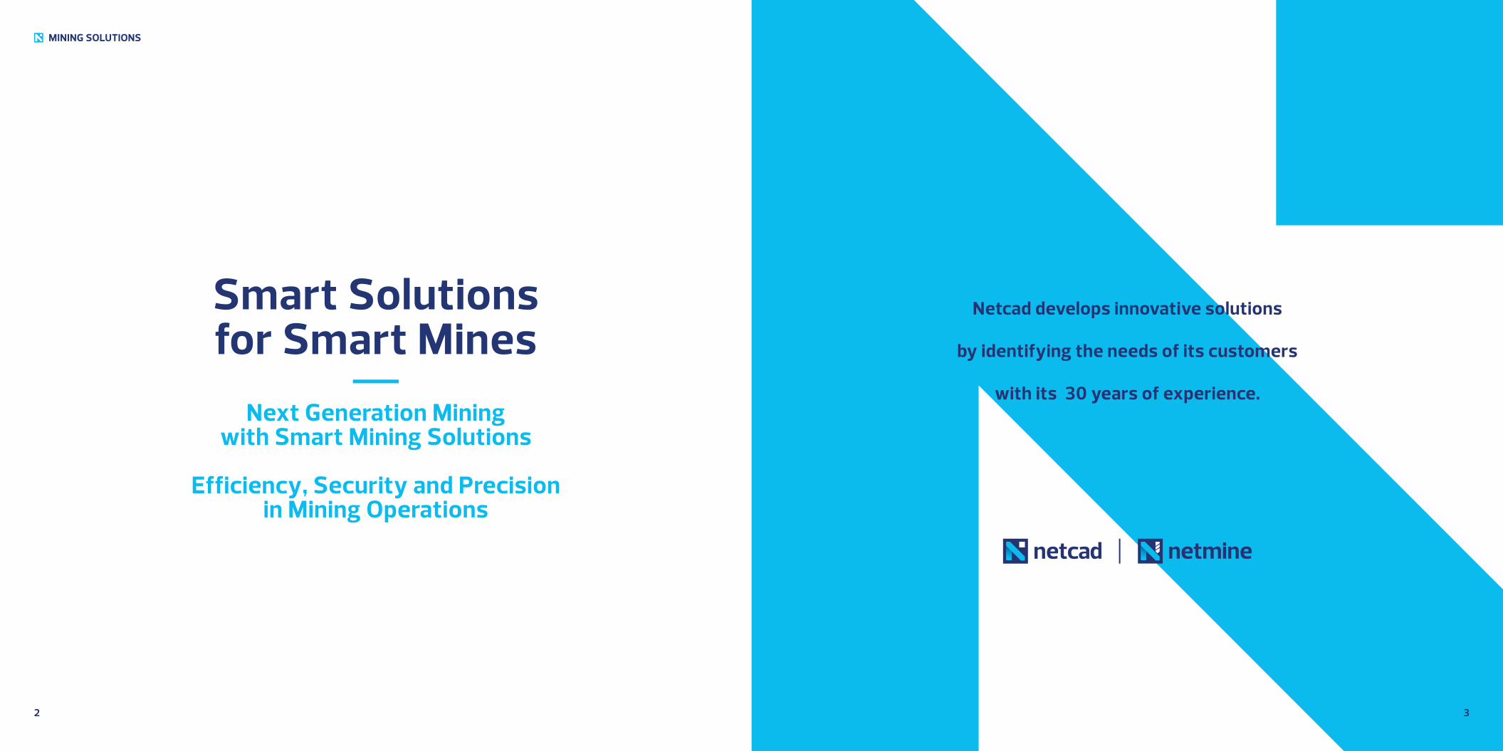
Netcad develops innovative solutions
by identifying the needs of its customers
with its 30 years of experience.
Smart Solutions for Smart Mines
Next Generation Mining with Smart Mining Solutions
Efficiency, Security and Precision in Mining Operations
MINING SOLUTIONS
MINING SOLUTIONS
4 5
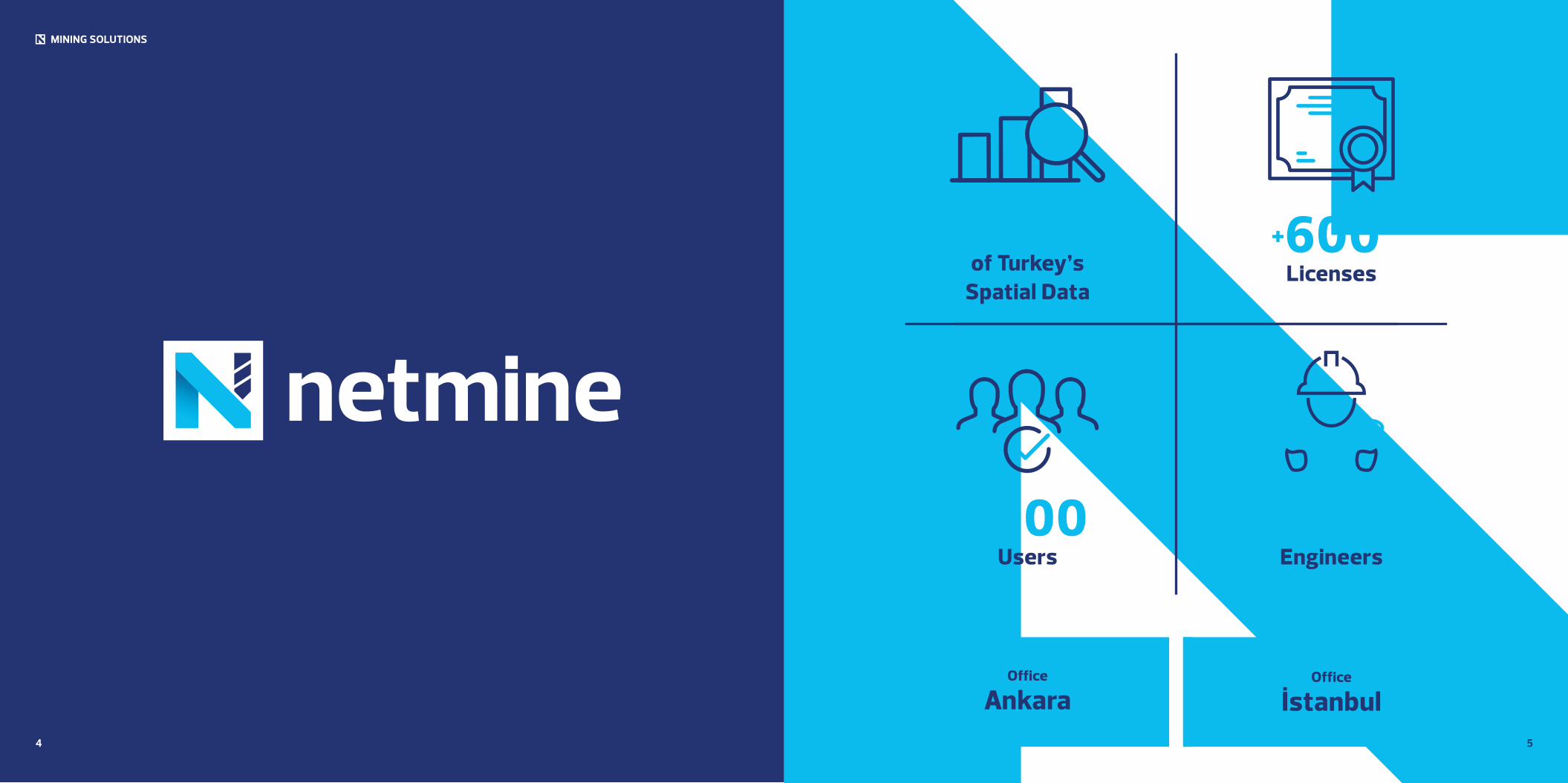
%85of Turkey’s
Spatial Data
+600Licenses
+1000Users
+200Engineers
Office
İstanbulOffice
Ankara
6
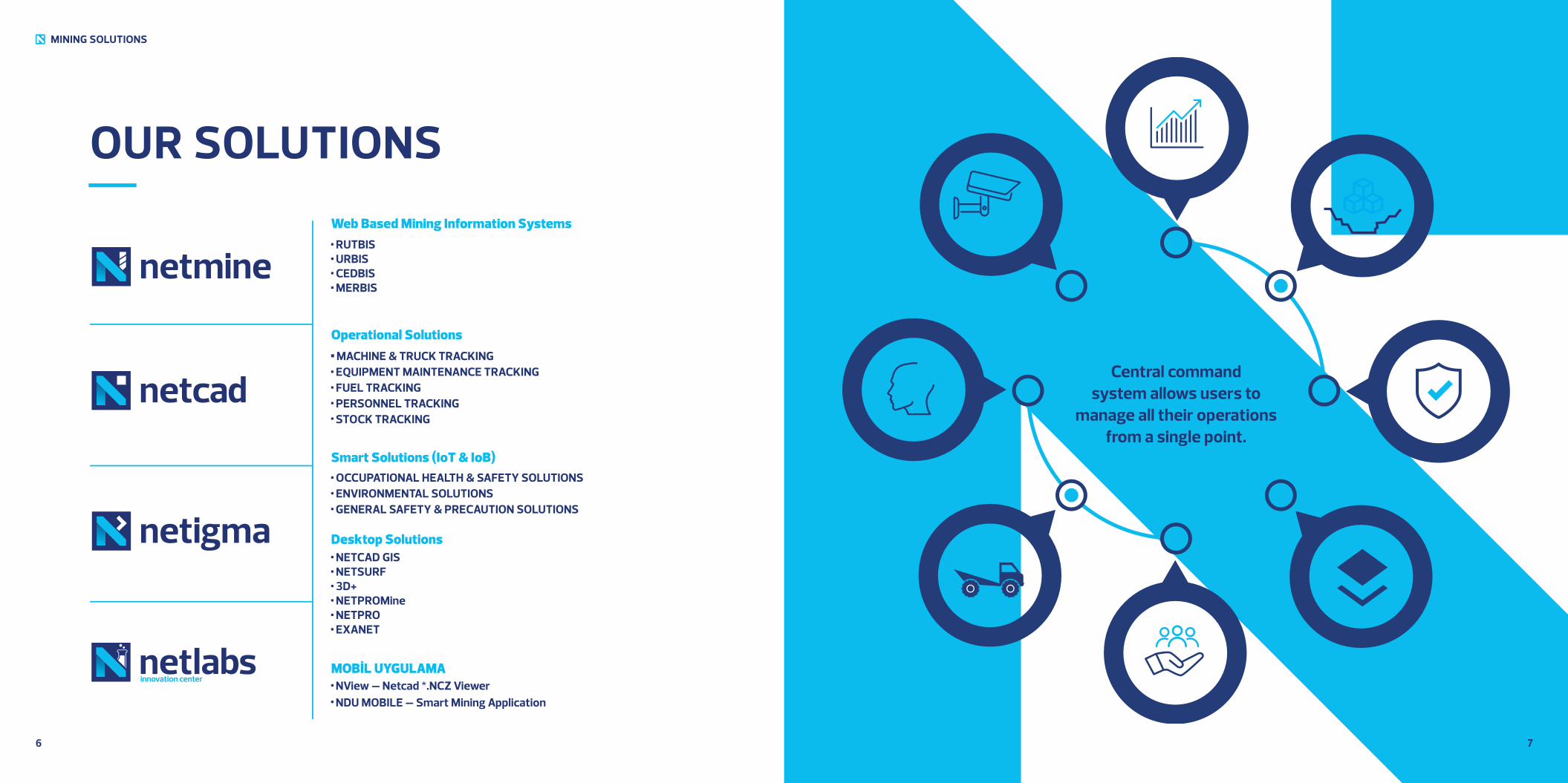
OUR SOLUTIONS
MINING SOLUTIONS
7
C100 M89 Y22 K8 C70 M0 Y0 K0
Desktop Solutions NETCAD GIS NETSURF 3D+ NETPROMine NETPRO EXANET
Operational Solutions MACHINE & TRUCK TRACKING EQUIPMENT MAINTENANCE TRACKING FUEL TRACKING PERSONNEL TRACKING
STOCK TRACKING
Smart Solutions (IoT & IoB) OCCUPATIONAL HEALTH & SAFETY SOLUTIONS
ENVIRONMENTAL SOLUTIONS GENERAL SAFETY & PRECAUTION SOLUTIONS
MOBİL UYGULAMA NView – Netcad *.NCZ Viewer NDU MOBILE – Smart Mining Application
Web Based Mining Information Systems RUTBIS URBIS CEDBIS MERBIS
Smart MiningDashboard
Central command system allows users to
manage all their operations from a single point.
8
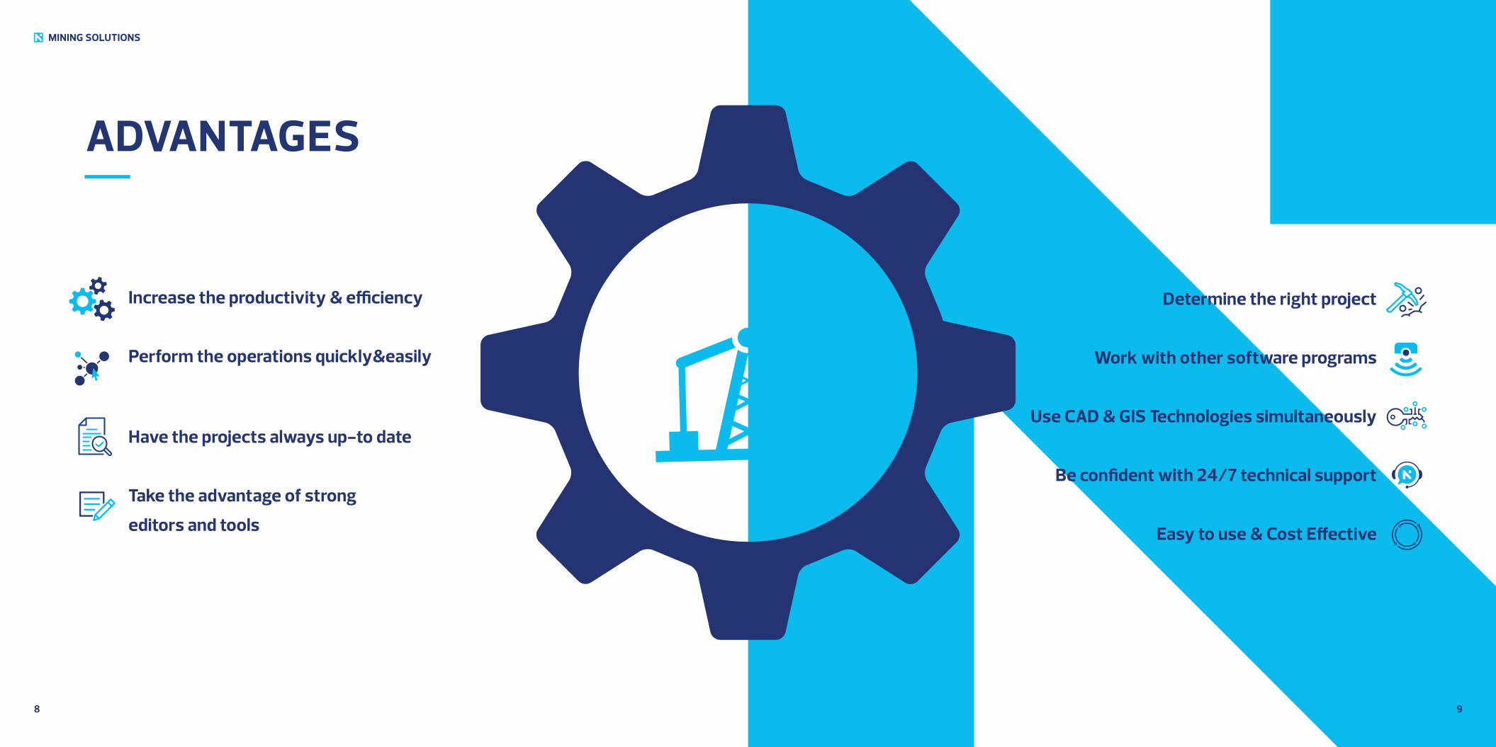
ADVANTAGES
MINING SOLUTIONS
9
Increase the productivity & efficiency
Perform the operations quickly&easily
Have the projects always up-to date
Take the advantage of strong
editors and tools
Determine the right project
Work with other software programs
Use CAD & GIS Technologies simultaneously
Be confident with 24/7 technical support
Easy to use & Cost Effective
MINING SOLUTIONS
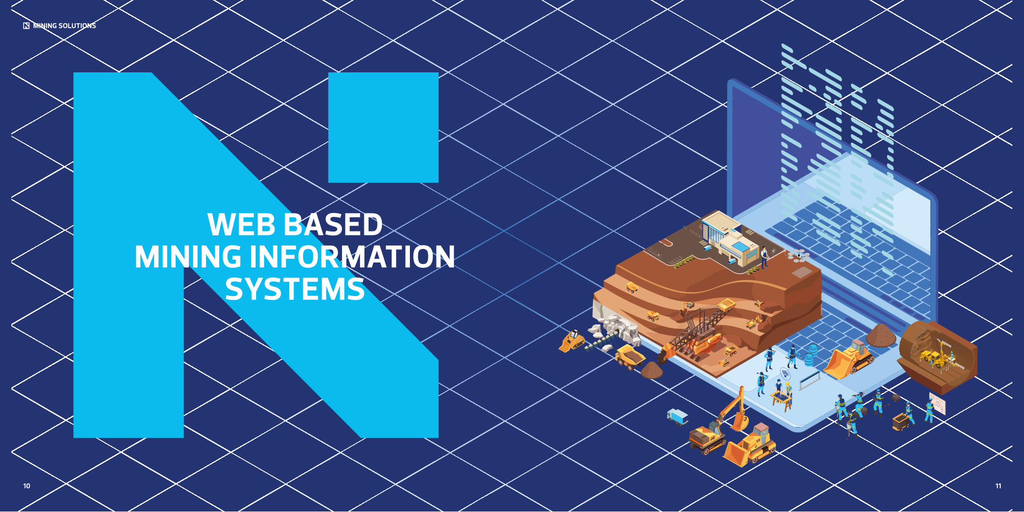
WEB BASED MINING INFORMATION
SYSTEMS
10 11
1312
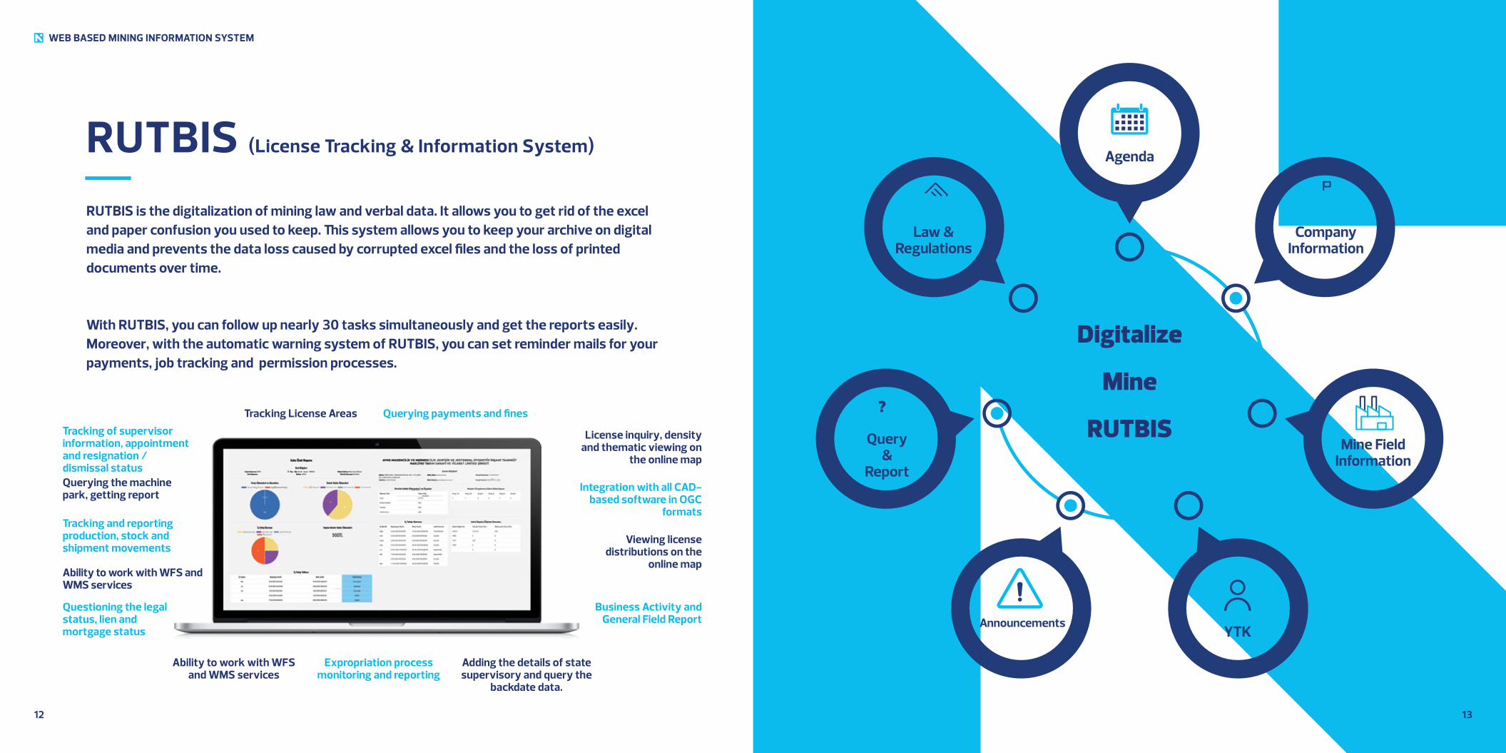
RUTBIS (License Tracking & Information System)
RUTBIS is the digitalization of mining law and verbal data. It allows you to get rid of the excel and paper confusion you used to keep. This system allows you to keep your archive on digital media and prevents the data loss caused by corrupted excel files and the loss of printed documents over time.
With RUTBIS, you can follow up nearly 30 tasks simultaneously and get the reports easily. Moreover, with the automatic warning system of RUTBIS, you can set reminder mails for your payments, job tracking and permission processes.
Tracking License Areas Querying payments and finesTracking of supervisor information, appointment and resignation / dismissal status
Tracking and reporting production, stock and shipment movements
License inquiry, density and thematic viewing on
the online map
Querying the machine park, getting report
Questioning the legal status, lien and mortgage status
Viewing license distributions on the
online map
Business Activity and General Field Report
Ability to work with WFS and WMS services
Expropriation process monitoring and reporting
Adding the details of state supervisory and query the
backdate data.
Ability to work with WFS and WMS services
Integration with all CAD-based software in OGC
formats
WEB BASED MINING INFORMATION SYSTEM
Law &Regulations
CompanyInformation
Mine Field Information
Query&
Report
AnnouncementsYTK
Agenda
?
DigitalizeYour
MineArchives with
RUTBIS
1514
WEB BASED MINING INFORMATION SYSTEM
RUTBIS (License Tracking & Information System)
ADVANTAGES Builds and improves corporate memory.
Query and reports the backdated data.
Measures the performance of personnel
Prevents data loss.
Provides data security.
Speeds up the orientation process of the new personnel
Improves the efficiency and performance of your workplace
Shortens the daily follow up and control of documents.
Enables strong communication between the personnel working in different cities with the
regular data flow.
Increases the quality of daily work processes.
Enables integration between the map-based programs (Netcad, Mapinfo, ArcGIS, QGIS…)
1716
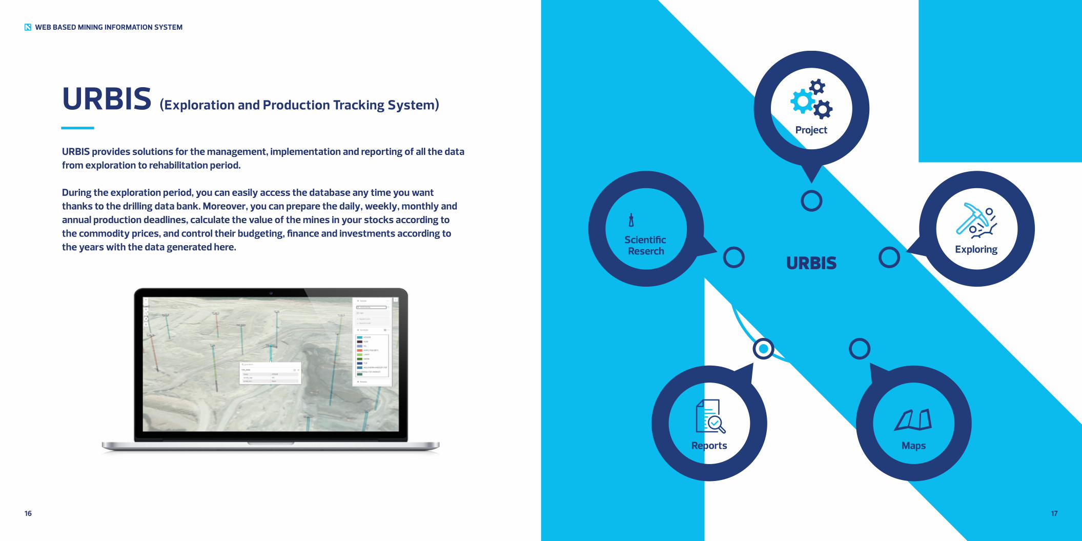
URBIS (Exploration and Production Tracking System)
URBIS provides solutions for the management, implementation and reporting of all the data from exploration to rehabilitation period.
During the exploration period, you can easily access the database any time you want thanks to the drilling data bank. Moreover, you can prepare the daily, weekly, monthly and annual production deadlines, calculate the value of the mines in your stocks according to the commodity prices, and control their budgeting, finance and investments according to the years with the data generated here.
WEB BASED MINING INFORMATION SYSTEM
Scientific Reserch Exploring
Project
Reports Maps
URBISProduction
Information System
1918
WEB BASED MINING INFORMATION SYSTEM
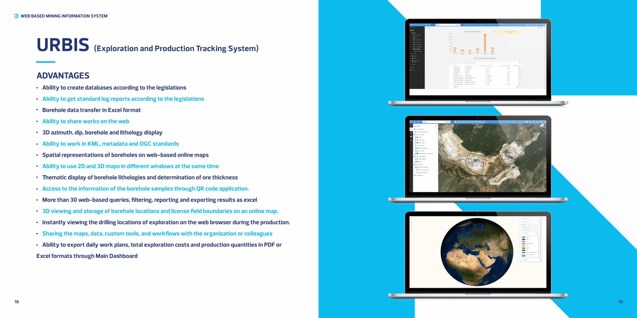
URBIS (Exploration and Production Tracking System)
ADVANTAGES Ability to create databases according to the legislations
Ability to get standard log reports according to the legislations
Borehole data transfer in Excel format
Ability to share works on the web
3D azimuth, dip, borehole and lithology display
Ability to work in KML, metadata and OGC standards
Spatial representations of boreholes on web-based online maps
Ability to use 2D and 3D maps in different windows at the same time
Thematic display of borehole lithologies and determination of ore thickness
Access to the information of the borehole samples through QR code application.
More than 30 web-based queries, filtering, reporting and exporting results as excel
3D viewing and storage of borehole locations and license field boundaries on an online map.
Instantly viewing the drilling locations of exploration on the web browser during the production.
Sharing the maps, data, custom tools, and workflows with the organization or colleagues
Ability to export daily work plans, total exploration costs and production quantities in PDF or
Excel formats through Main Dashboard
2120
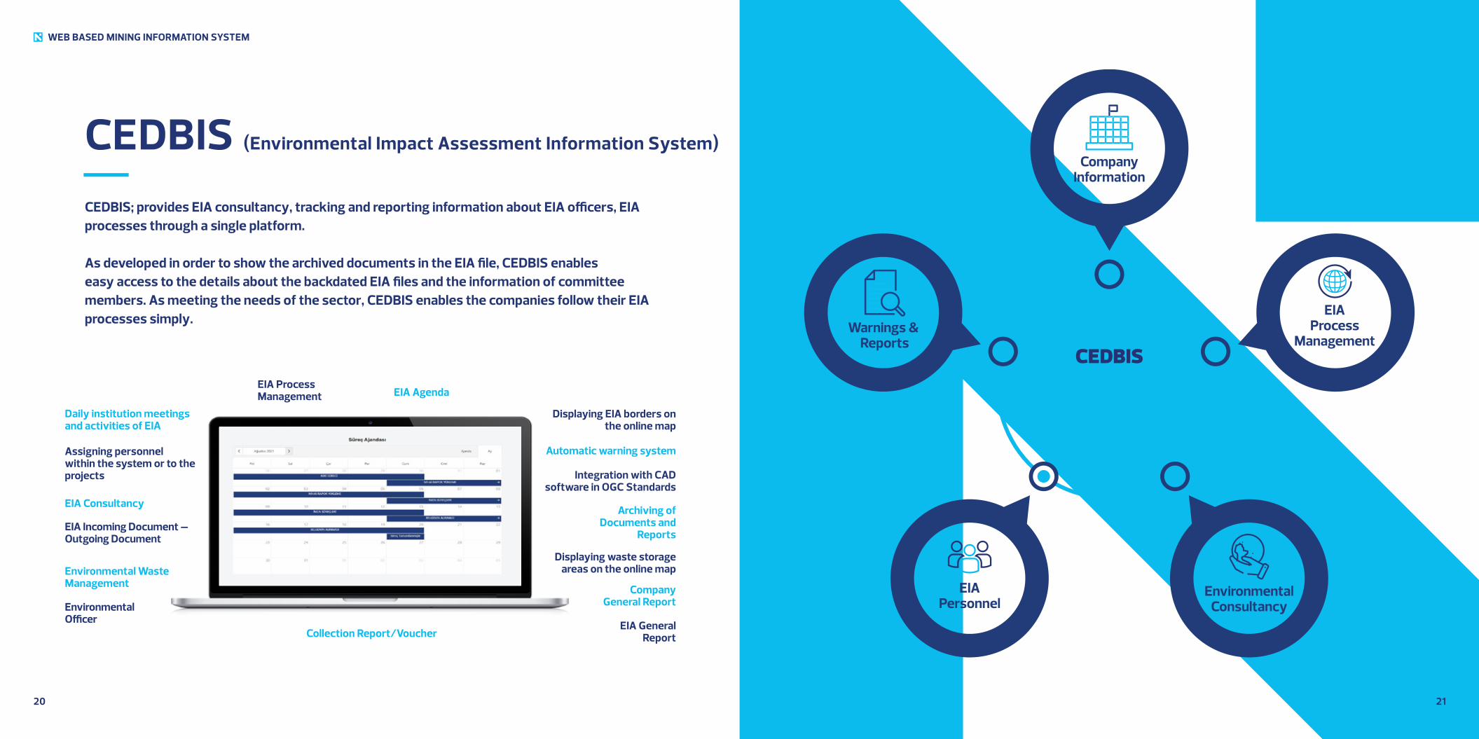
CEDBIS (Environmental Impact Assessment Information System)
CEDBIS; provides EIA consultancy, tracking and reporting information about EIA officers, EIA processes through a single platform.
As developed in order to show the archived documents in the EIA file, CEDBIS enables easy access to the details about the backdated EIA files and the information of committee members. As meeting the needs of the sector, CEDBIS enables the companies follow their EIA processes simply.
EIA Process Management EIA Agenda
Daily institution meetings and activities of EIA
EIA Consultancy
Displaying EIA borders on the online map
Assigning personnel within the system or to the projects
Environmental Waste Management
Integration with CAD software in OGC Standards
Displaying waste storage areas on the online map
EIA General Report
Archiving of Documents and
Reports
Company General Report
Collection Report/Voucher
EIA Incoming Document – Outgoing Document
Environmental Officer
Automatic warning system
WEB BASED MINING INFORMATION SYSTEM
Warnings & Reports
EIAProcess
Management
CompanyInformation
EIAPersonnel
EnvironmentalConsultancy
CEDBISEnvironmental Impact
Assessment Information System

2322
WEB BASED MINING INFORMATION SYSTEM
ADVANTAGES Works on digital maps.
Controlling EIA project distributions on the country map
Classifying the production quantities of company capacity report through EIA process
management
Following environmental waste management, environmental officer personnel assignment, and
the necessary assignment/resignation-dismissal status
Following up the works of EIA consultacy companies with EIA process.
EIA process can be managed in a certain type of EIA file.
Provides a wide range of archiving possibilities
with 39 types of EIA along with possibility to add additional files
Dependent or independent EIA files can be followed daily in different provinces.
Users can work with multiple EIA files.
Deficiencies in the EIA reports can be prevented with the ability to automatically reminding of
certain deadlines.
Daily work plans, tasks, warnings, and the operation of the process can be followed through the
Agenda system which is dependent on the EIA Process management.
CEDBIS (Environmental Impact Assessment Information System )
MINING SOLUTIONS
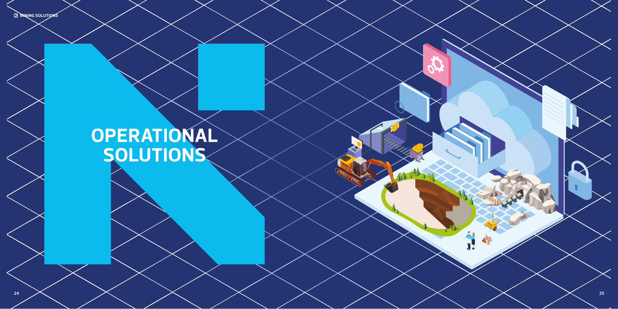
OPERATIONAL SOLUTIONS
24 25
2726
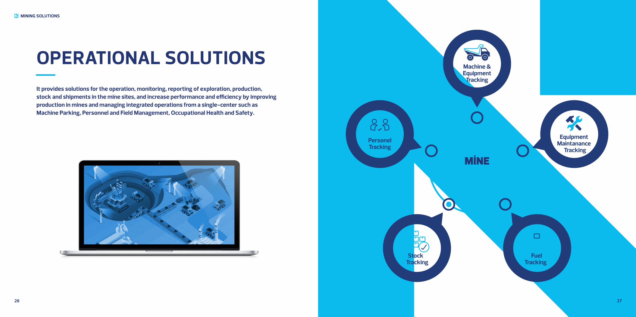
OPERATIONAL SOLUTIONSIt provides solutions for the operation, monitoring, reporting of exploration, production, stock and shipments in the mine sites, and increase performance and efficiency by improving production in mines and managing integrated operations from a single-center such as Machine Parking, Personnel and Field Management, Occupational Health and Safety.
MINING SOLUTIONS
PersonelTracking
EquipmentMaintanance
Tracking
Machine & Equipment
Tracking
Stock Tracking
Fuel Tracking
MİNEERP

MINING SOLUTIONS
SMART SOLUTIONS
(IoT&IoB)
28 29
3130
MINING SOLUTIONS
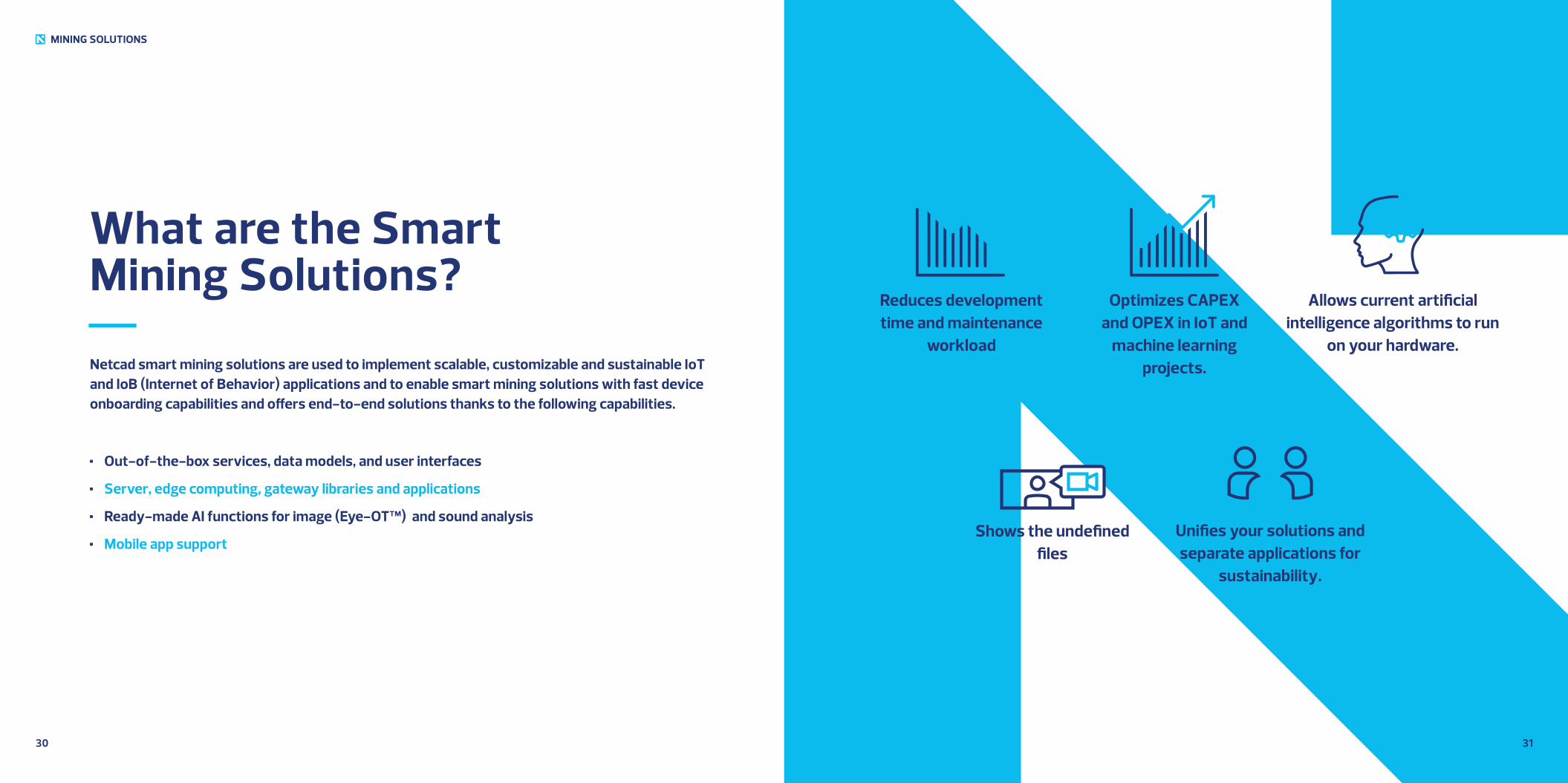
What are the Smart Mining Solutions?
Netcad smart mining solutions are used to implement scalable, customizable and sustainable IoT and IoB (Internet of Behavior) applications and to enable smart mining solutions with fast device onboarding capabilities and offers end-to-end solutions thanks to the following capabilities.
Out-of-the-box services, data models, and user interfaces
Server, edge computing, gateway libraries and applications
Ready-made AI functions for image (Eye-OT™) and sound analysis
Mobile app support
Reduces development time and maintenance
workload
Optimizes CAPEX and OPEX in IoT and
machine learning projects.
Shows the undefined files
Allows current artificial intelligence algorithms to run
on your hardware.
Unifies your solutions and separate applications for
sustainability.

3332
FEATURES & FUNCTIONS Data Collection and Storage (IoT and IoB)
Improved Map and Location Support
Warnings and Alarms
Visualization (Graphics, Admin Panels)
Reports
Actions (RPC, Commands, Control Units)
Panels
Rule Chains
User Management & Authorization
Event Logs
Cloud and Enterprise Server Support
High Level Data Security
Improved AI Features
Ready to Use Models and Recognizers
Ready to Use Widgets and Customizable
Controls
SDK and API Support
Complies with the law on the protection of
personal data and doesn’t collect personal
data
MINING SOLUTIONS
3534
ADVANTAGES
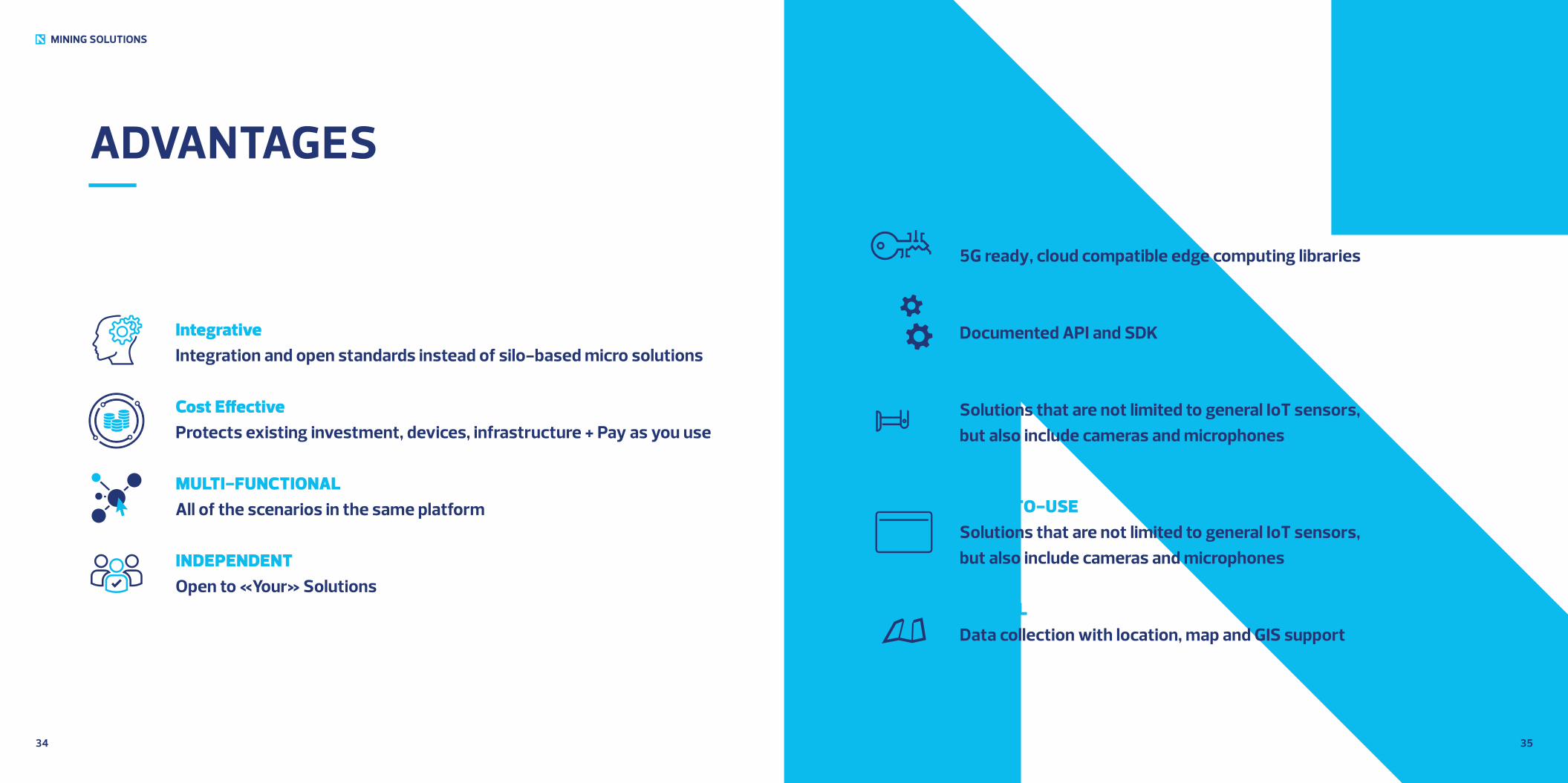
IntegrativeIntegration and open standards instead of silo-based micro solutions
Cost EffectiveProtects existing investment, devices, infrastructure + Pay as you use
MULTI-FUNCTIONALAll of the scenarios in the same platform
INDEPENDENTOpen to «Your» Solutions
FUTURISTIC5G ready, cloud compatible edge computing libraries
CO-DEVELOPMENTDocumented API and SDK
SUPPORTIVESolutions that are not limited to general IoT sensors, but also include cameras and microphones
EASY-TO-USESolutions that are not limited to general IoT sensors, but also include cameras and microphones
SPATIALData collection with location, map and GIS support
MINING SOLUTIONS
3736
MINING SOLUTIONS
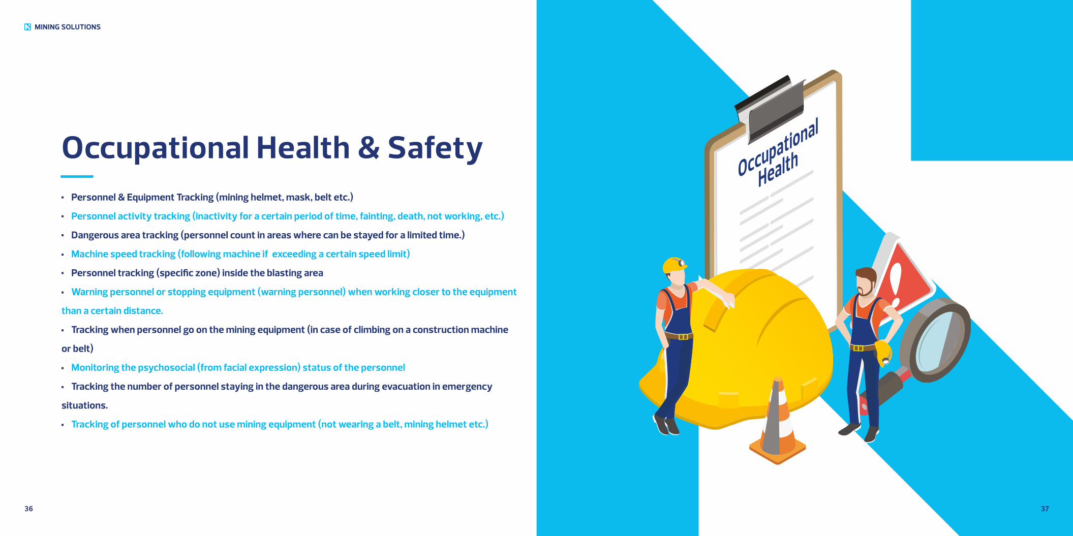
Occupational Health & Safety Personnel & Equipment Tracking (mining helmet, mask, belt etc.)
Personnel activity tracking (inactivity for a certain period of time, fainting, death, not working, etc.)
Dangerous area tracking (personnel count in areas where can be stayed for a limited time.)
Machine speed tracking (following machine if exceeding a certain speed limit)
Personnel tracking (specific zone) inside the blasting area
Warning personnel or stopping equipment (warning personnel) when working closer to the equipment
than a certain distance.
Tracking when personnel go on the mining equipment (in case of climbing on a construction machine
or belt)
Monitoring the psychosocial (from facial expression) status of the personnel
Tracking the number of personnel staying in the dangerous area during evacuation in emergency
situations.
Tracking of personnel who do not use mining equipment (not wearing a belt, mining helmet etc.)
Occupational
Health
3938
MINING SOLUTIONS
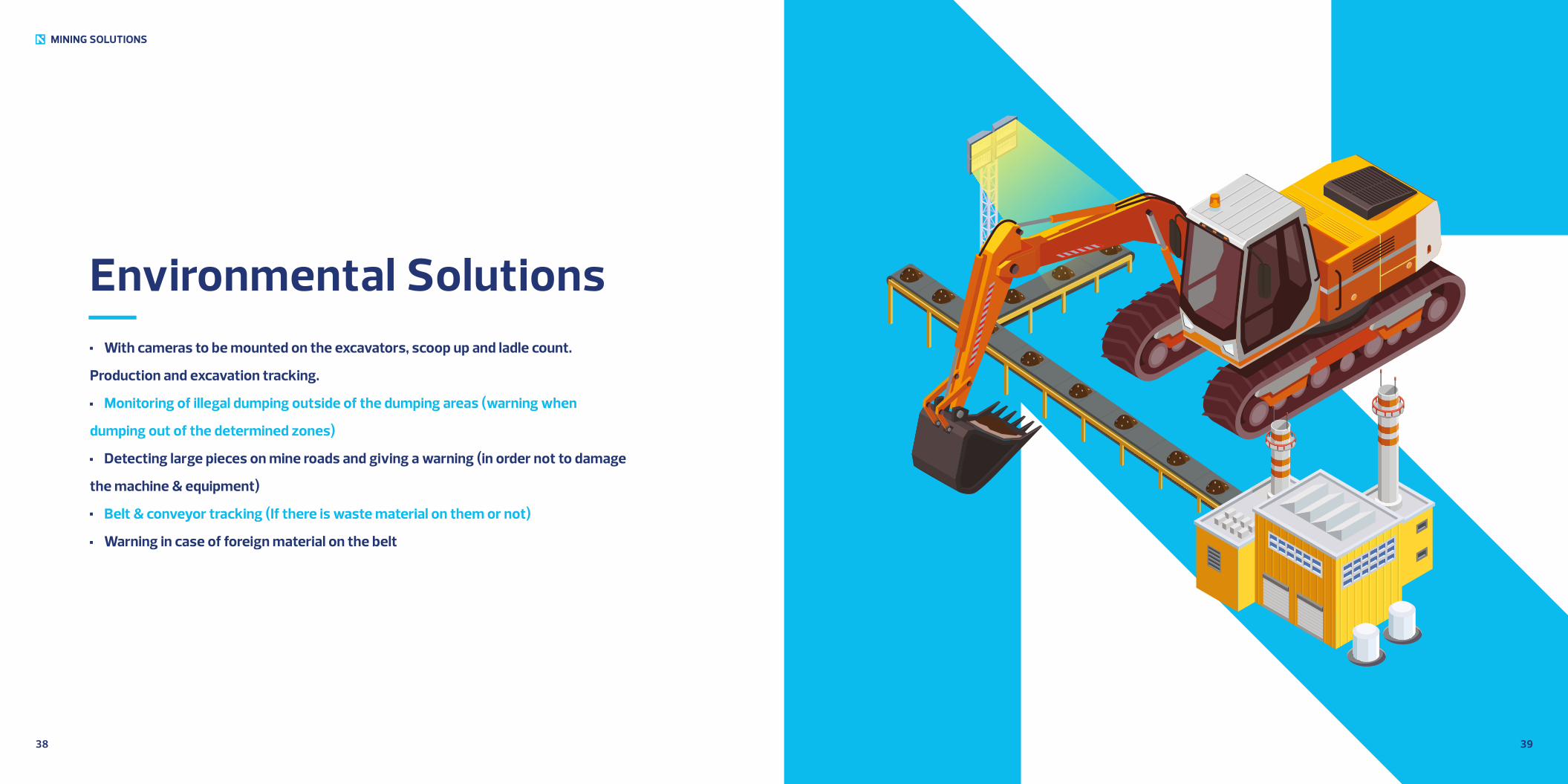
Environmental Solutions With cameras to be mounted on the excavators, scoop up and ladle count.
Production and excavation tracking.
Monitoring of illegal dumping outside of the dumping areas (warning when
dumping out of the determined zones)
Detecting large pieces on mine roads and giving a warning (in order not to damage
the machine & equipment)
Belt & conveyor tracking (If there is waste material on them or not)
Warning in case of foreign material on the belt
4140
MINING SOLUTIONS
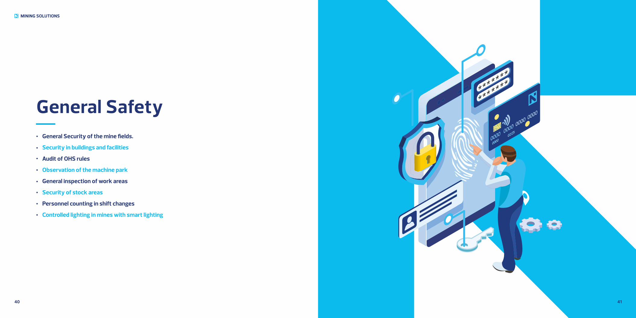
General Safety General Security of the mine fields.
Security in buildings and facilities
Audit of OHS rules
Observation of the machine park
General inspection of work areas
Security of stock areas
Personnel counting in shift changes
Controlled lighting in mines with smart lighting
MINING SOLUTIONS
DESKTOP SOLUTIONS
42 43
4544
MINING SOLUTIONS
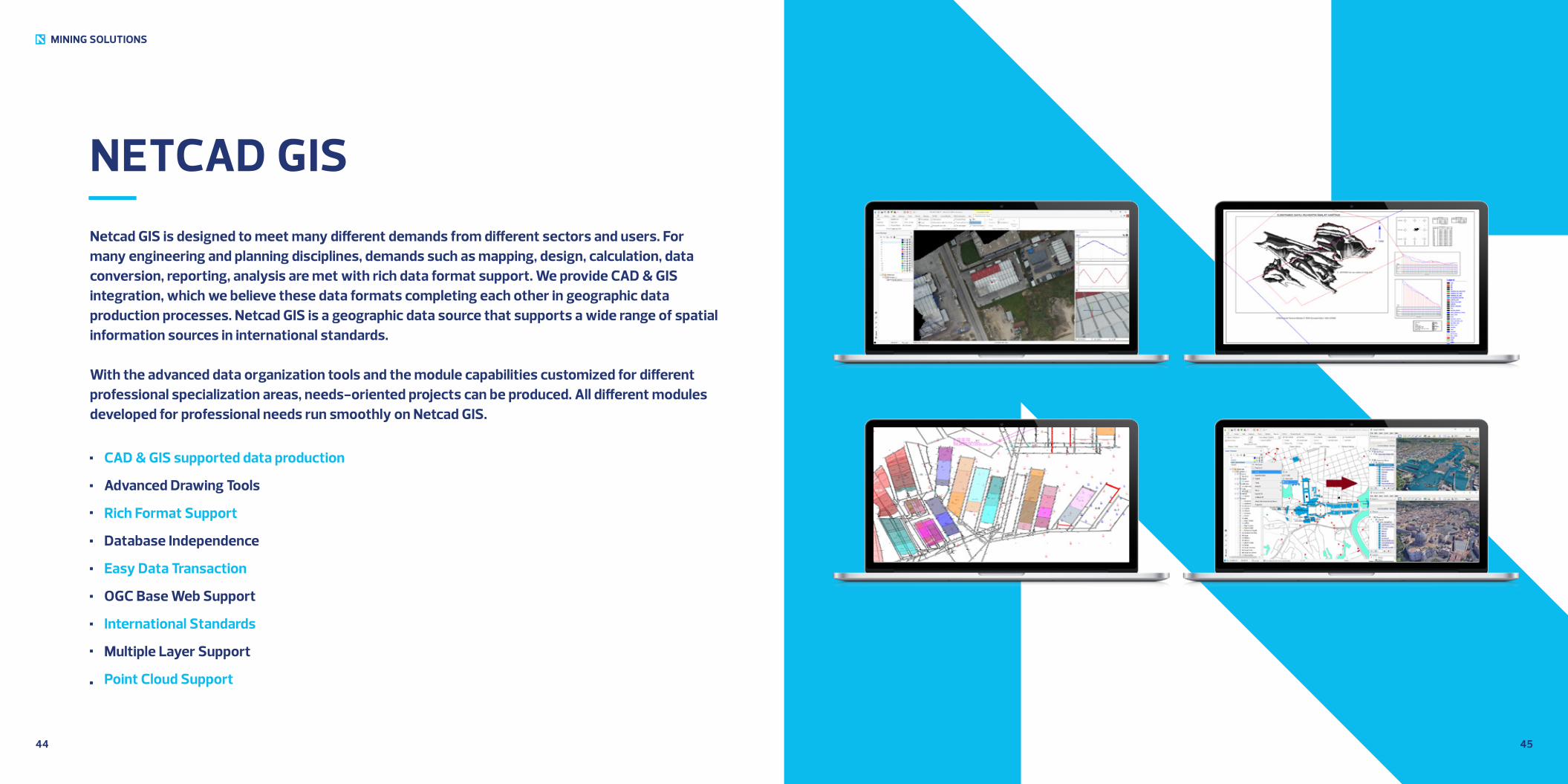
NETCAD GISNetcad GIS is designed to meet many different demands from different sectors and users. For many engineering and planning disciplines, demands such as mapping, design, calculation, data conversion, reporting, analysis are met with rich data format support. We provide CAD & GIS integration, which we believe these data formats completing each other in geographic data production processes. Netcad GIS is a geographic data source that supports a wide range of spatial information sources in international standards.
With the advanced data organization tools and the module capabilities customized for different professional specialization areas, needs-oriented projects can be produced. All different modules developed for professional needs run smoothly on Netcad GIS.
CAD & GIS supported data production
Advanced Drawing Tools
Rich Format Support
Database Independence
Easy Data Transaction
OGC Base Web Support
International Standards
Multiple Layer Support
Point Cloud Support
4746
MINING SOLUTIONS
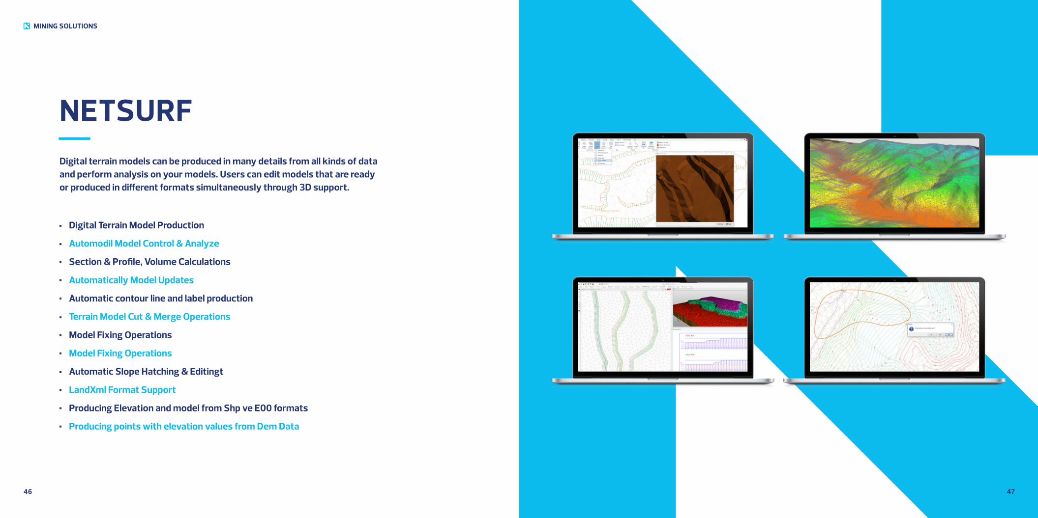
NETSURFDigital terrain models can be produced in many details from all kinds of data and perform analysis on your models. Users can edit models that are ready or produced in different formats simultaneously through 3D support.
Digital Terrain Model Production
Automodil Model Control & Analyze
Section & Profile, Volume Calculations
Automatically Model Updates
Automatic contour line and label production
Terrain Model Cut & Merge Operations
Model Fixing Operations
Model Fixing Operations
Automatic Slope Hatching & Editingt
LandXml Format Support
Producing Elevation and model from Shp ve E00 formats
Producing points with elevation values from Dem Data
4948
MINING SOLUTIONS
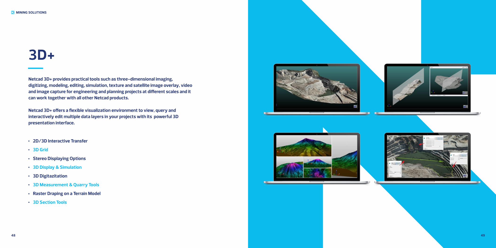
3D+Netcad 3D+ provides practical tools such as three-dimensional imaging, digitizing, modeling, editing, simulation, texture and satellite image overlay, video and image capture for engineering and planning projects at different scales and it can work together with all other Netcad products.
Netcad 3D+ offers a flexible visualization environment to view, query and interactively edit multiple data layers in your projects with its powerful 3D presentation interface.
2D/3D Interactive Transfer
3D Grid
Stereo Displaying Options
3D Display & Simulation
3D Digitazitation
3D Measurement & Quarry Tools
Raster Draping on a Terrain Model
3D Section Tools
5150
MINING SOLUTIONS
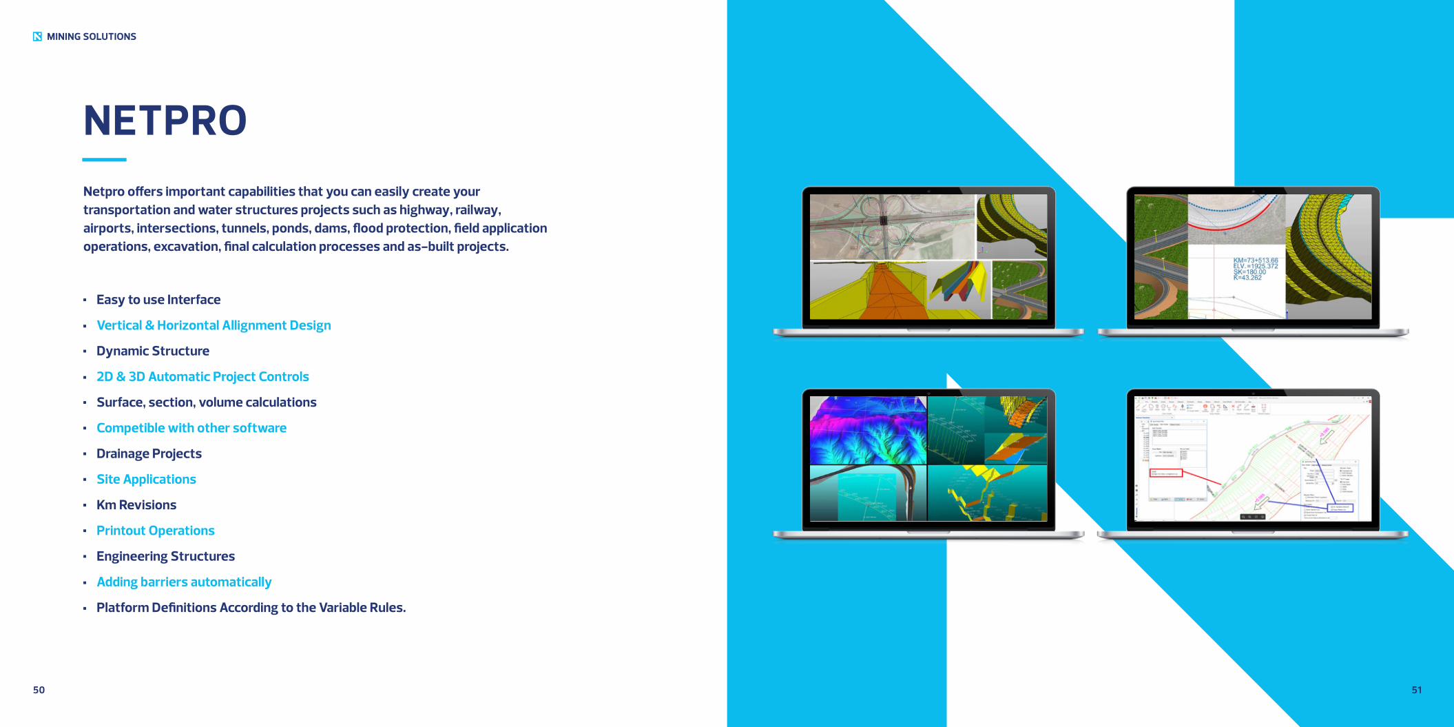
NETPRONetpro offers important capabilities that you can easily create your transportation and water structures projects such as highway, railway, airports, intersections, tunnels, ponds, dams, flood protection, field application operations, excavation, final calculation processes and as-built projects.
Easy to use Interface
Vertical & Horizontal Allignment Design
Dynamic Structure
2D & 3D Automatic Project Controls
Surface, section, volume calculations
Competible with other software
Drainage Projects
Site Applications
Km Revisions
Printout Operations
Engineering Structures
Adding barriers automatically
Platform Definitions According to the Variable Rules.
5352
MINING SOLUTIONS
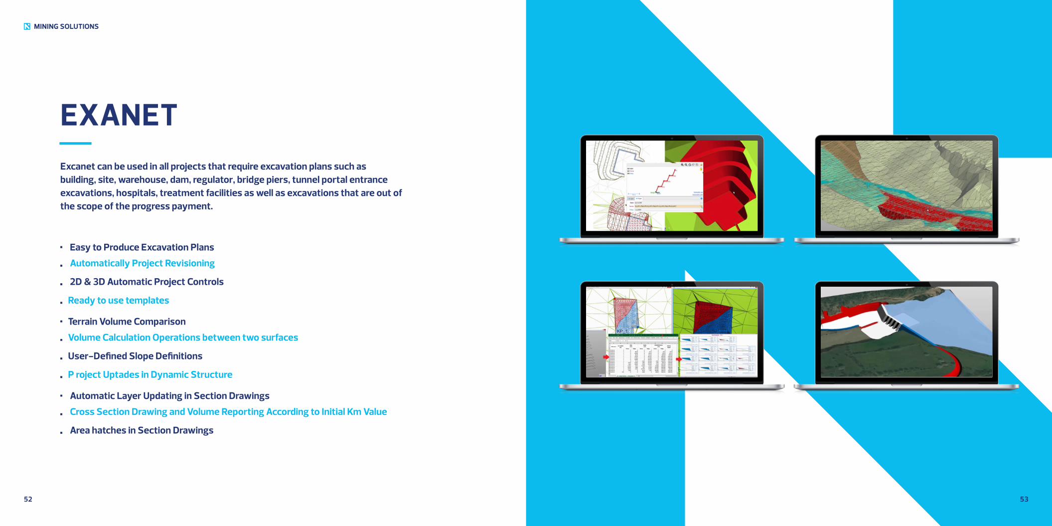
EXANETExcanet can be used in all projects that require excavation plans such as building, site, warehouse, dam, regulator, bridge piers, tunnel portal entrance excavations, hospitals, treatment facilities as well as excavations that are out of the scope of the progress payment.
Easy to Produce Excavation Plans
Automatically Project Revisioning
2D & 3D Automatic Project Controls
Ready to use templates
Terrain Volume Comparison
Volume Calculation Operations between two surfaces
User-Defined Slope Definitions
P roject Uptades in Dynamic Structure
Automatic Layer Updating in Section Drawings
Cross Section Drawing and Volume Reporting According to Initial Km Value
Area hatches in Section Drawings
5554
MINING SOLUTIONS
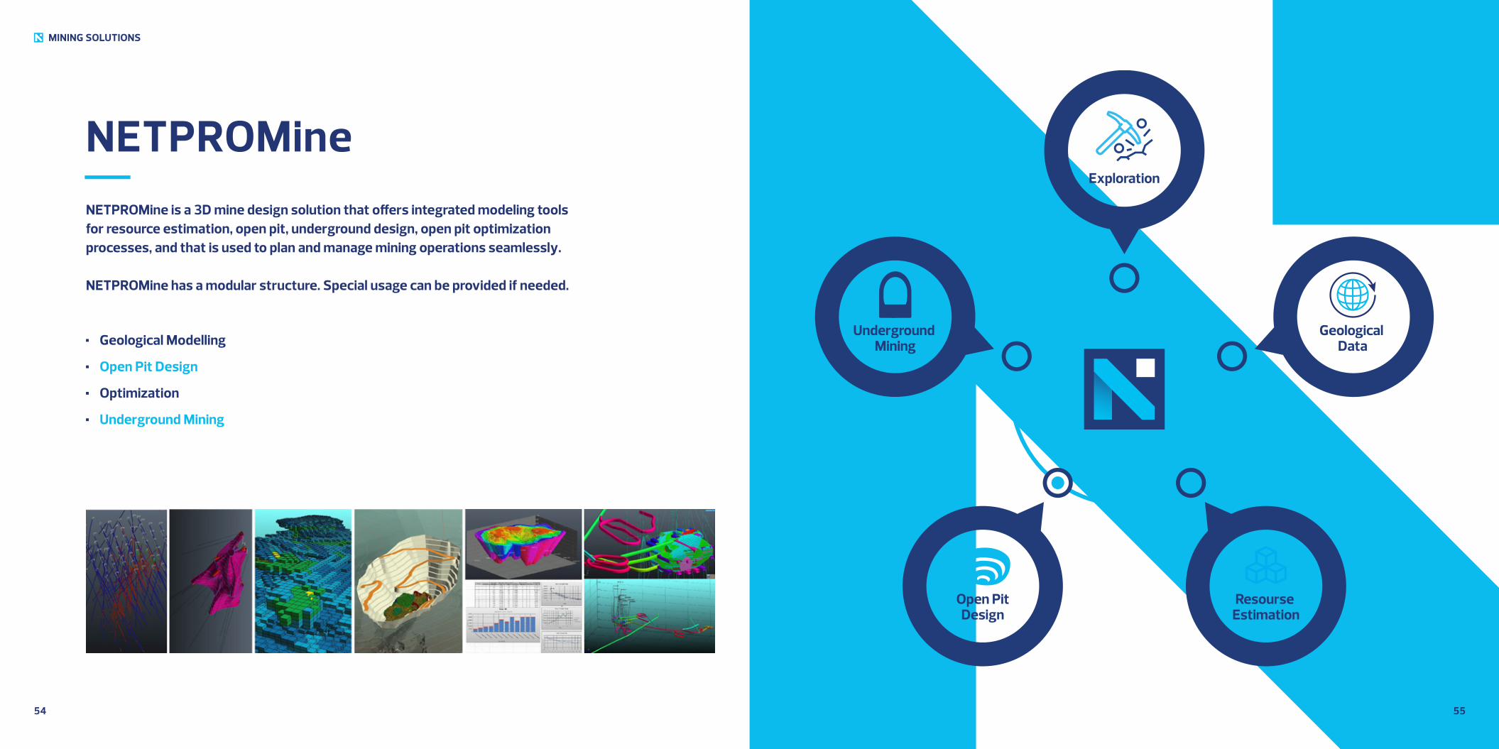
NETPROMineNETPROMine is a 3D mine design solution that offers integrated modeling tools for resource estimation, open pit, underground design, open pit optimization processes, and that is used to plan and manage mining operations seamlessly.
NETPROMine has a modular structure. Special usage can be provided if needed.
Geological Modelling
Open Pit Design
Optimization
Underground Mining
Underground Mining
Geological Data
Exploration
Open PitDesign
Resourse Estimation
5756
MINING SOLUTIONS
NETPROMine
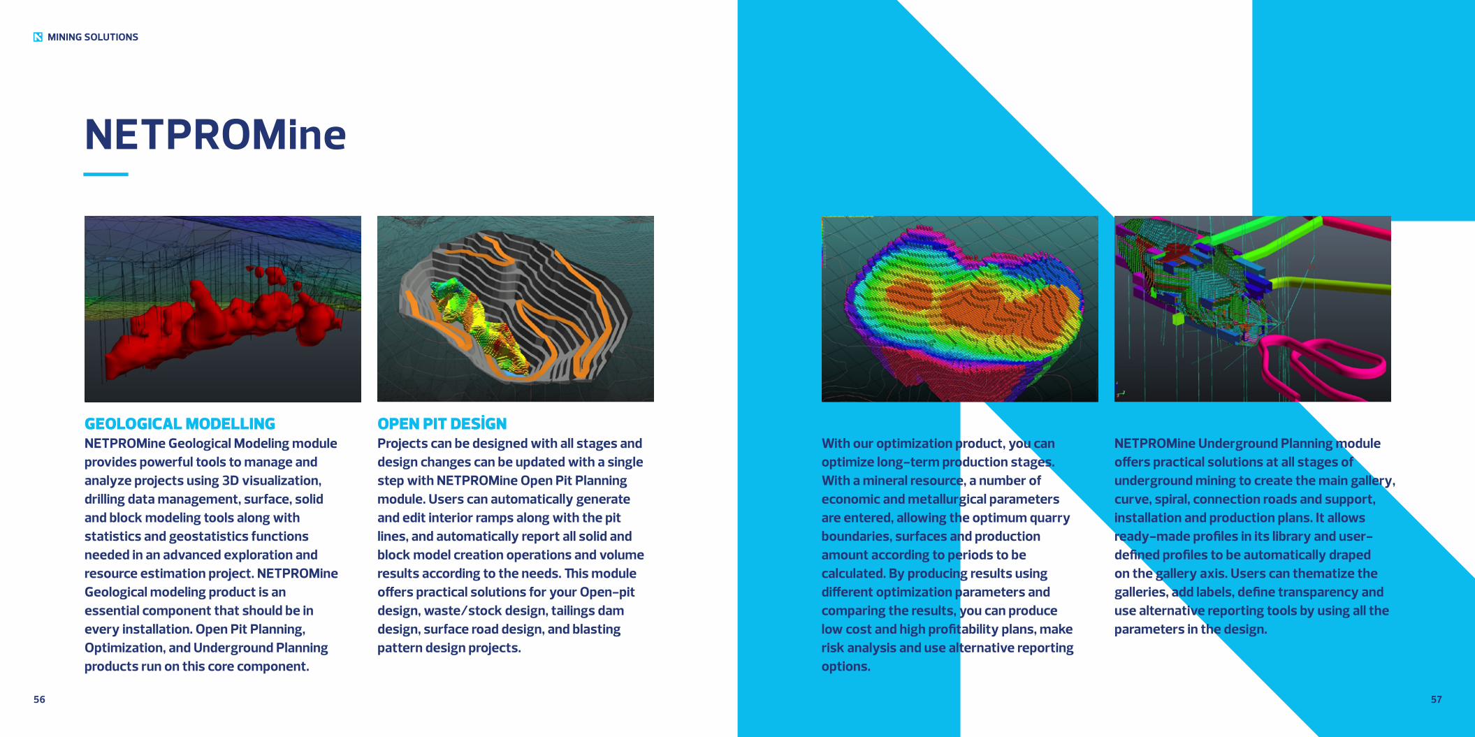
GEOLOGICAL MODELLINGNETPROMine Geological Modeling module provides powerful tools to manage and analyze projects using 3D visualization, drilling data management, surface, solid and block modeling tools along with statistics and geostatistics functions needed in an advanced exploration and resource estimation project. NETPROMine Geological modeling product is an essential component that should be in every installation. Open Pit Planning, Optimization, and Underground Planning products run on this core component.
OPEN PIT DESİGNProjects can be designed with all stages and design changes can be updated with a single step with NETPROMine Open Pit Planning module. Users can automatically generate and edit interior ramps along with the pit lines, and automatically report all solid and block model creation operations and volume results according to the needs. This module offers practical solutions for your Open-pit design, waste/stock design, tailings dam design, surface road design, and blasting pattern design projects.
OPTIMIZATIONWith our optimization product, you can optimize long-term production stages. With a mineral resource, a number of economic and metallurgical parameters are entered, allowing the optimum quarry boundaries, surfaces and production amount according to periods to be calculated. By producing results using different optimization parameters and comparing the results, you can produce low cost and high profitability plans, make risk analysis and use alternative reporting options.
UNDERGROUND MININGNETPROMine Underground Planning module offers practical solutions at all stages of underground mining to create the main gallery, curve, spiral, connection roads and support, installation and production plans. It allows ready-made profiles in its library and user-defined profiles to be automatically draped on the gallery axis. Users can thematize the galleries, add labels, define transparency and use alternative reporting tools by using all the parameters in the design.
5958
MINING SOLUTIONS
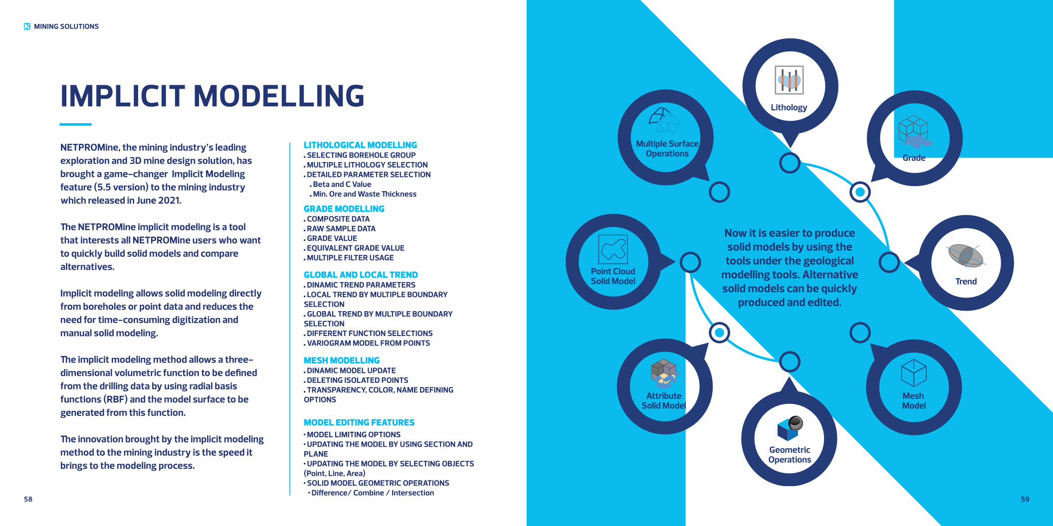
IMPLICIT MODELLINGNETPROMine, the mining industry’s leading exploration and 3D mine design solution, has brought a game-changer Implicit Modeling feature (5.5 version) to the mining industry which released in June 2021.
The NETPROMine implicit modeling is a tool that interests all NETPROMine users who want to quickly build solid models and compare alternatives.
Implicit modeling allows solid modeling directly from boreholes or point data and reduces the need for time-consuming digitization and manual solid modeling.
The implicit modeling method allows a three-dimensional volumetric function to be defined from the drilling data by using radial basis functions (RBF) and the model surface to be generated from this function.
The innovation brought by the implicit modeling method to the mining industry is the speed it brings to the modeling process.
LITHOLOGICAL MODELLING SELECTING BOREHOLE GROUP MULTIPLE LITHOLOGY SELECTION DETAILED PARAMETER SELECTION
Beta and C Value Min. Ore and Waste Thickness
GRADE MODELLING COMPOSITE DATA RAW SAMPLE DATA GRADE VALUE EQUIVALENT GRADE VALUE MULTIPLE FILTER USAGE
GLOBAL AND LOCAL TREND DINAMIC TREND PARAMETERS LOCAL TREND BY MULTIPLE BOUNDARY
SELECTION GLOBAL TREND BY MULTIPLE BOUNDARY
SELECTION DIFFERENT FUNCTION SELECTIONS VARIOGRAM MODEL FROM POINTS
MESH MODELLING DINAMIC MODEL UPDATE DELETING ISOLATED POINTS TRANSPARENCY, COLOR, NAME DEFINING
OPTIONS
MODEL EDITING FEATURES MODEL LIMITING OPTIONS UPDATING THE MODEL BY USING SECTION AND
PLANE UPDATING THE MODEL BY SELECTING OBJECTS
(Point, Line, Area) SOLID MODEL GEOMETRIC OPERATIONS
Difference/ Combine / Intersection
AttributeSolid Model
Point CloudSolid Model
Multiple SurfaceOperations
Trend
Grade
Lithology
Mesh Model
GeometricOperations
IMPLICIT MODELLING
Now it is easier to produce solid models by using the tools under the geological
modelling tools. Alternative solid models can be quickly
produced and edited.
6160
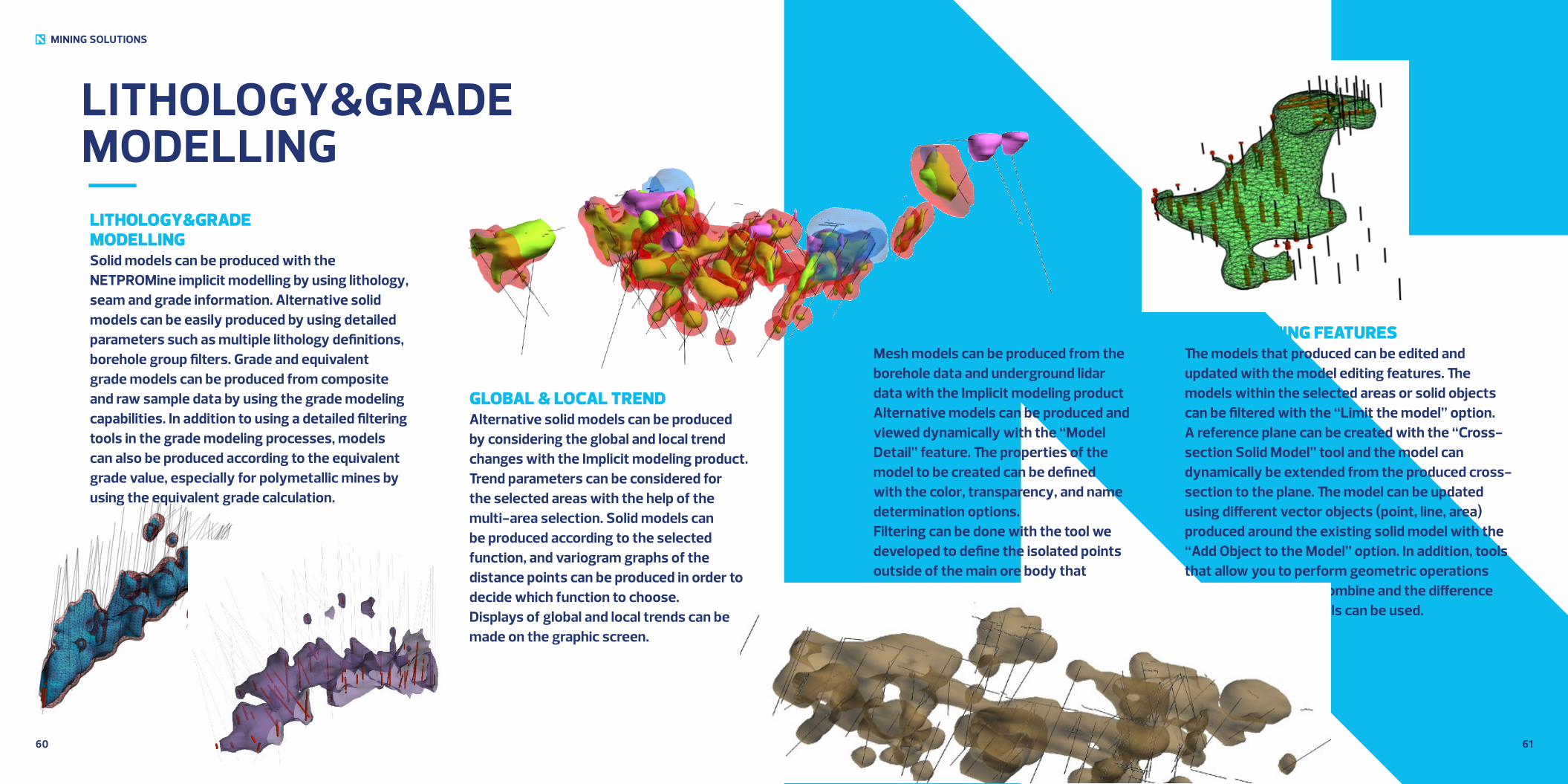
GLOBAL & LOCAL TRENDAlternative solid models can be produced by considering the global and local trend changes with the Implicit modeling product. Trend parameters can be considered for the selected areas with the help of the multi-area selection. Solid models can be produced according to the selected function, and variogram graphs of the distance points can be produced in order to decide which function to choose. Displays of global and local trends can be made on the graphic screen.
MESH MODELLING Mesh models can be produced from the borehole data and underground lidar data with the Implicit modeling product Alternative models can be produced and viewed dynamically with the “Model Detail” feature. The properties of the model to be created can be defined with the color, transparency, and name determination options.Filtering can be done with the tool we developed to define the isolated points outside of the main ore body that produced..
MODEL EDITING FEATURESThe models that produced can be edited and updated with the model editing features. The models within the selected areas or solid objects can be filtered with the “Limit the model” option. A reference plane can be created with the “Cross-section Solid Model” tool and the model can dynamically be extended from the produced cross-section to the plane. The model can be updated using different vector objects (point, line, area) produced around the existing solid model with the “Add Object to the Model” option. In addition, tools that allow you to perform geometric operations such as intersection, combine and the difference between all solid models can be used.
MINING SOLUTIONS
LITHOLOGY&GRADE MODELLING
LITHOLOGY&GRADE MODELLINGSolid models can be produced with the NETPROMine implicit modelling by using lithology, seam and grade information. Alternative solid models can be easily produced by using detailed parameters such as multiple lithology definitions, borehole group filters. Grade and equivalent grade models can be produced from composite and raw sample data by using the grade modeling capabilities. In addition to using a detailed filtering tools in the grade modeling processes, models can also be produced according to the equivalent grade value, especially for polymetallic mines by using the equivalent grade calculation.
MINING SOLUTIONS
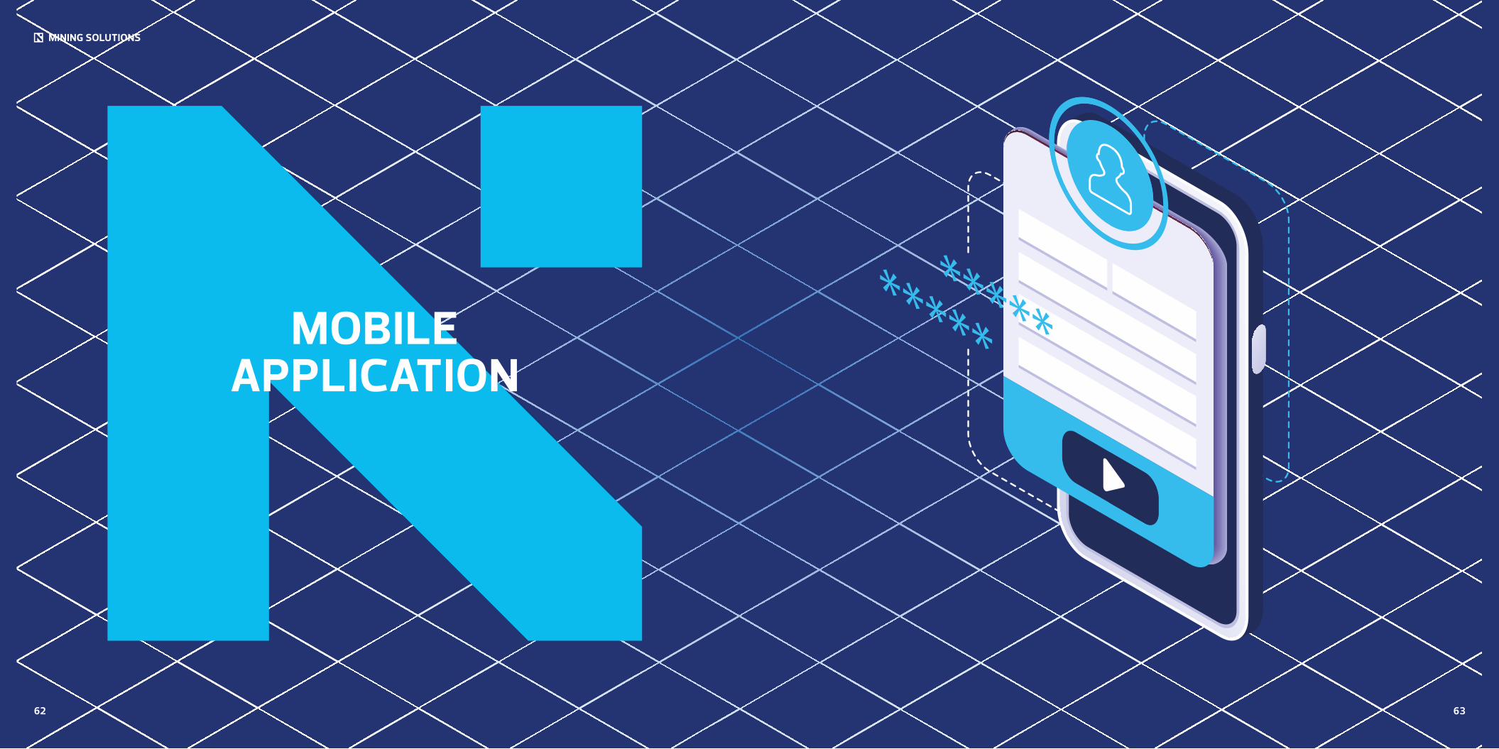
MOBILE APPLICATION
62 63
6564
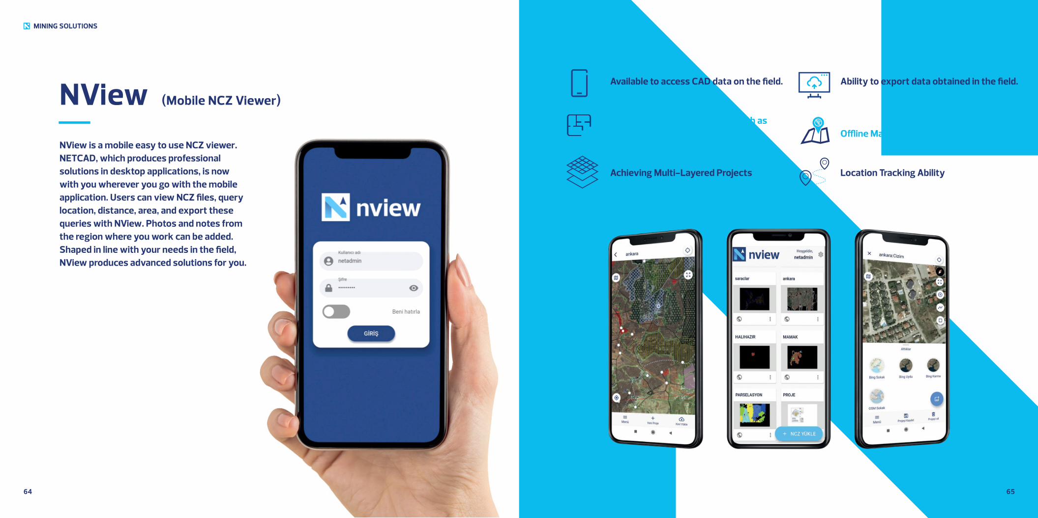
NView (Mobile NCZ Viewer)
MINING SOLUTIONS
NView is a mobile easy to use NCZ viewer. NETCAD, which produces professional solutions in desktop applications, is now with you wherever you go with the mobile application. Users can view NCZ files, query location, distance, area, and export these queries with NView. Photos and notes from the region where you work can be added. Shaped in line with your needs in the field, NView produces advanced solutions for you.
Available to access CAD data on the field.
Ability to perform operations such as drawing, point, and area on the file.
Achieving Multi-Layered Projects
Ability to export data obtained in the field.
Offline Map Feature
Location Tracking Ability
6766
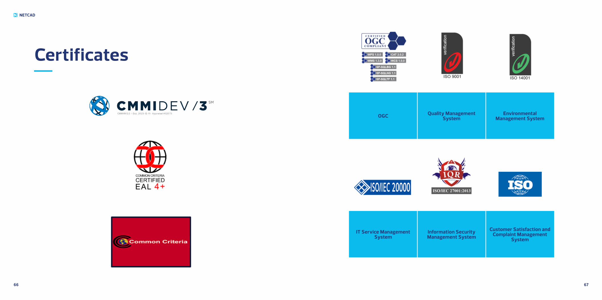
Certificates
NETCAD
IT Service Management System
Information Security Management System
Customer Satisfaction and Complaint Management
System
Environmental Management System
Quality Management SystemOGC
CMMI® V2.0 / Exp . 20 23-12-11 / App raisal # 520 73
AnkaraBilkent Cyber Plaza B Blok No 409 Cyberpark 06800
Çankaya /Ankara T 0312 265 0510
İstanbulNidakule Göztepe Merdivenköy Mah. Bora Sok. No 1, Kat 1 34732Kadıköy /İstanbul T 0216 417 6210