gnss processing how to download reference data - leica
TRANSCRIPT
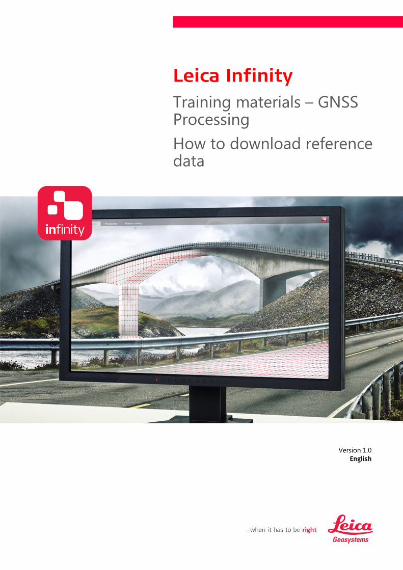
Training materials – GNSS Processing
How to download reference data
Version 1.0

Leica Infinity, How to download reference data 3
Introduction
This is a step-by-step tutorial in which you learn how to download and import static GNSS data from
continuously operating reference stations from service providers like IGN, IGS or SmartNet, as well as
how to manually add a new reference station.
Multi-constellation (GPS, Glonass, Beidou, Galileo) static raw data has been acquired by the GS14
receiver at 1 Hz sampling rate. In order to process the baseline, we need to download the data from
the closest reference station.
The functionality discussed in this guide requires the Basic license option.
The data from the following folders will be used in this tutorial:
· Data\static-cs-s2_1683_0816_141627
Table of Contents
1. Import rover data .......................................................................................................................................................... 4
2. Find the closest reference station ........................................................................................................................... 5
3. Download the data from the selected reference station ............................................................................... 6
4. Edit the control coordinates for the downloaded station ............................................................................. 8
5. Connect to the Leica SmartNet Service .............................................................................................................. 10
6. Add a user defined reference station .................................................................................................................. 11
Leica Infinity, How to download reference data 4
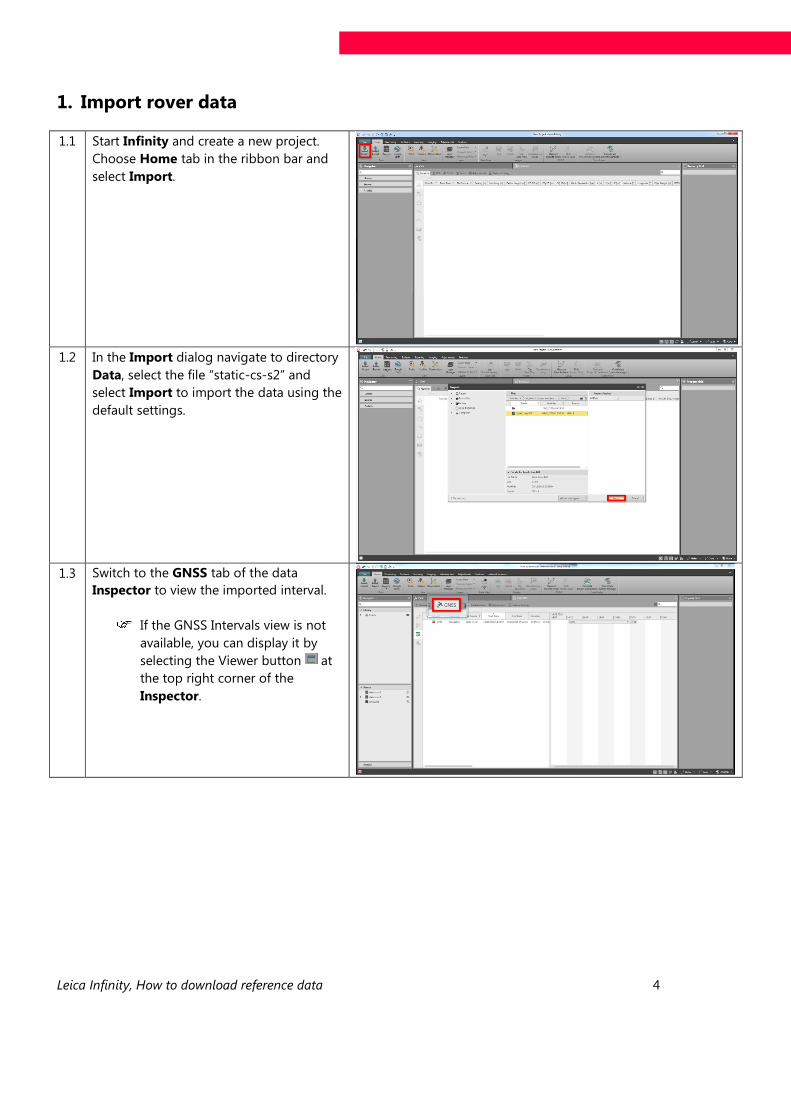
1. Import rover data
1.1 Start Infinity and create a new project.
Choose Home tab in the ribbon bar and
select Import.
1.2 In the Import dialog navigate to directory
Data, select the file “static-cs-s2” and
select Import to import the data using the
default settings.
1.3 Switch to the GNSS tab of the data
Inspector to view the imported interval.
If the GNSS Intervals view is not
available, you can display it by
selecting the Viewer button at
the top right corner of the
Inspector.
Leica Infinity, How to download reference data 5
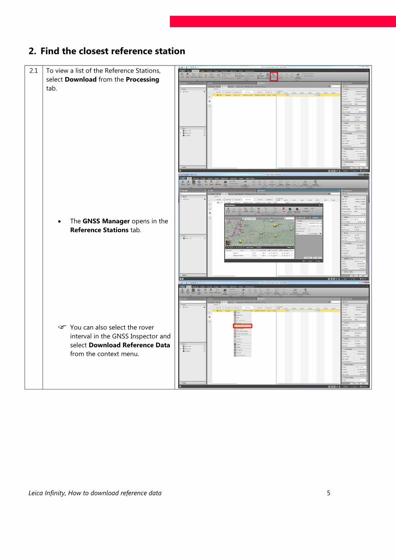
2. Find the closest reference station
2.1 To view a list of the Reference Stations,
select Download from the Processing
tab.
· The GNSS Manager opens in the
Reference Stations tab.
You can also select the rover
interval in the GNSS Inspector and
select Download Reference Data
from the context menu.
Leica Infinity, How to download reference data 6
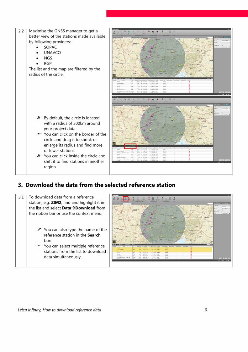
2.2 Maximise the GNSS manager to get a
better view of the stations made available
by following providers:
· SOPAC
· UNAVCO
· NGS
· RGP
The list and the map are filtered by the
radius of the circle.
By default, the circle is located
with a radius of 300km around
your project data .
You can click on the border of the
circle and drag it to shrink or
enlarge its radius and find more
or fewer stations.
You can click inside the circle and
shift it to find stations in another
region.
3. Download the data from the selected reference station
3.1
To download data from a reference
station, e.g. ZIM2, find and highlight it in
the list and select Data Download from
the ribbon bar or use the context menu.
You can also type the name of the
reference station in the Search
box.
You can select multiple reference
stations from the list to download
data simultaneously.
Leica Infinity, How to download reference data 7
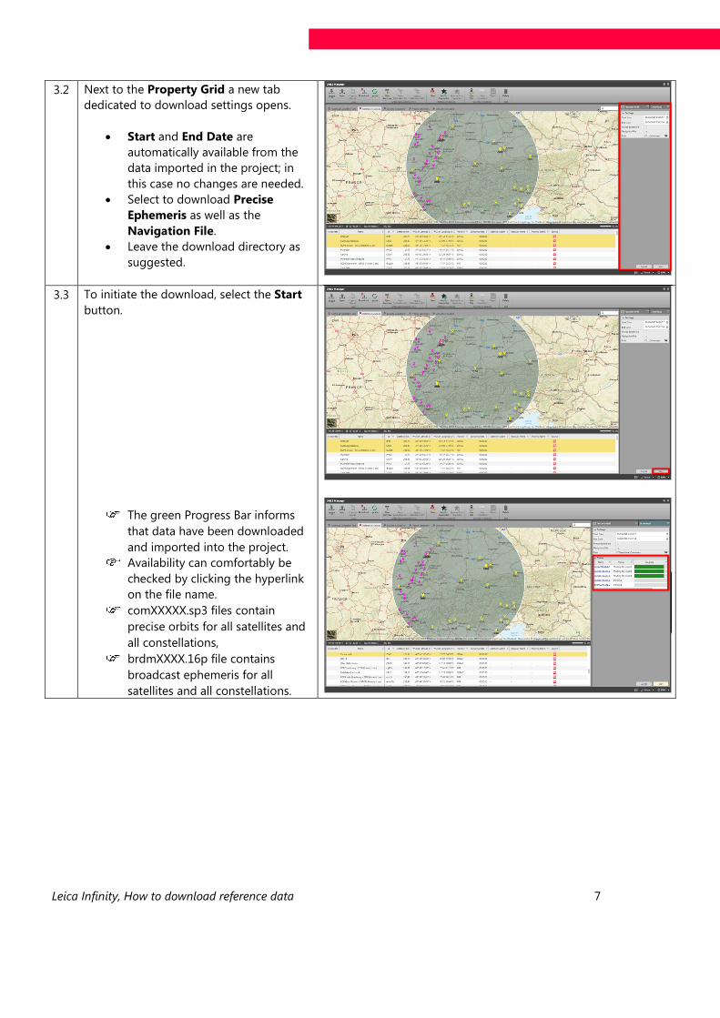
3.2 Next to the Property Grid a new tab
dedicated to download settings opens.
· Start and End Date are
automatically available from the
data imported in the project; in
this case no changes are needed.
· Select to download Precise
Ephemeris as well as the
Navigation File.
· Leave the download directory as
suggested.
3.3 To initiate the download, select the Start
button.
The green Progress Bar informs
that data have been downloaded
and imported into the project.
Availability can comfortably be
checked by clicking the hyperlink
on the file name.
comXXXXX.sp3 files contain
precise orbits for all satellites and
all constellations,
brdmXXXX.16p file contains
broadcast ephemeris for all
satellites and all constellations.
Leica Infinity, How to download reference data 8
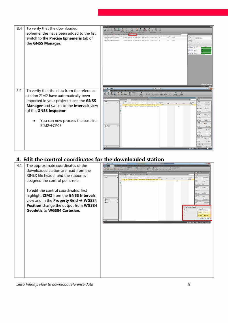
3.4 To verify that the downloaded
ephemerides have been added to the list,
switch to the Precise Ephemeris tab of
the GNSS Manager.
3.5
To verify that the data from the reference
station ZIM2 have automatically been
imported in your project, close the GNSS
Manager and switch to the Intervals view
of the GNSS Inspector.
· You can now process the baseline
ZIM2àCP05.
4. Edit the control coordinates for the downloaded station 4.1 The approximate coordinates of the
downloaded station are read from the
RINEX file header and the station is
assigned the control point role.
To edit the control coordinates, first
highlight ZIM2 from the GNSS Intervals
view and in the Property Grid WGS84
Position change the output from WGS84
Geodetic to WGS84 Cartesian.
Leica Infinity, How to download reference data 9
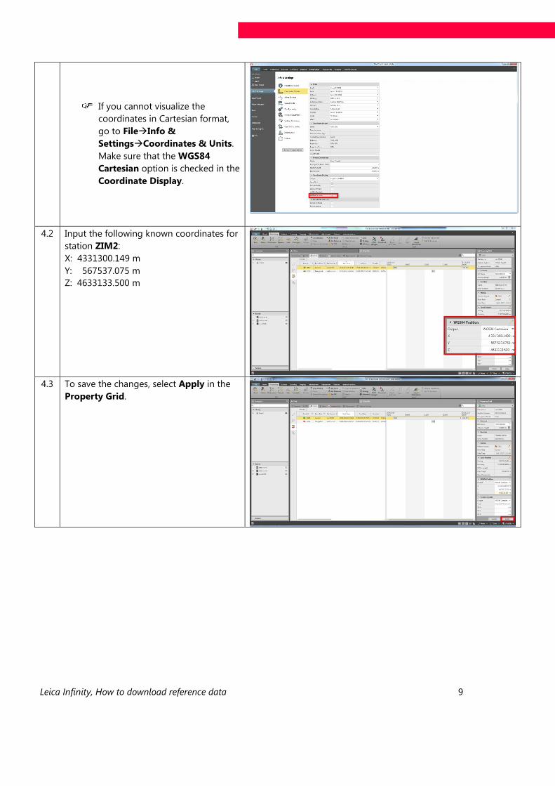
If you cannot visualize the
coordinates in Cartesian format,
go to FileàInfo &
SettingsàCoordinates & Units.
Make sure that the WGS84
Cartesian option is checked in the
Coordinate Display.
4.2 Input the following known coordinates for
station ZIM2:
X: 4331300.149 m
Y: 567537.075 m
Z: 4633133.500 m
4.3 To save the changes, select Apply in the
Property Grid.
Leica Infinity, How to download reference data 10
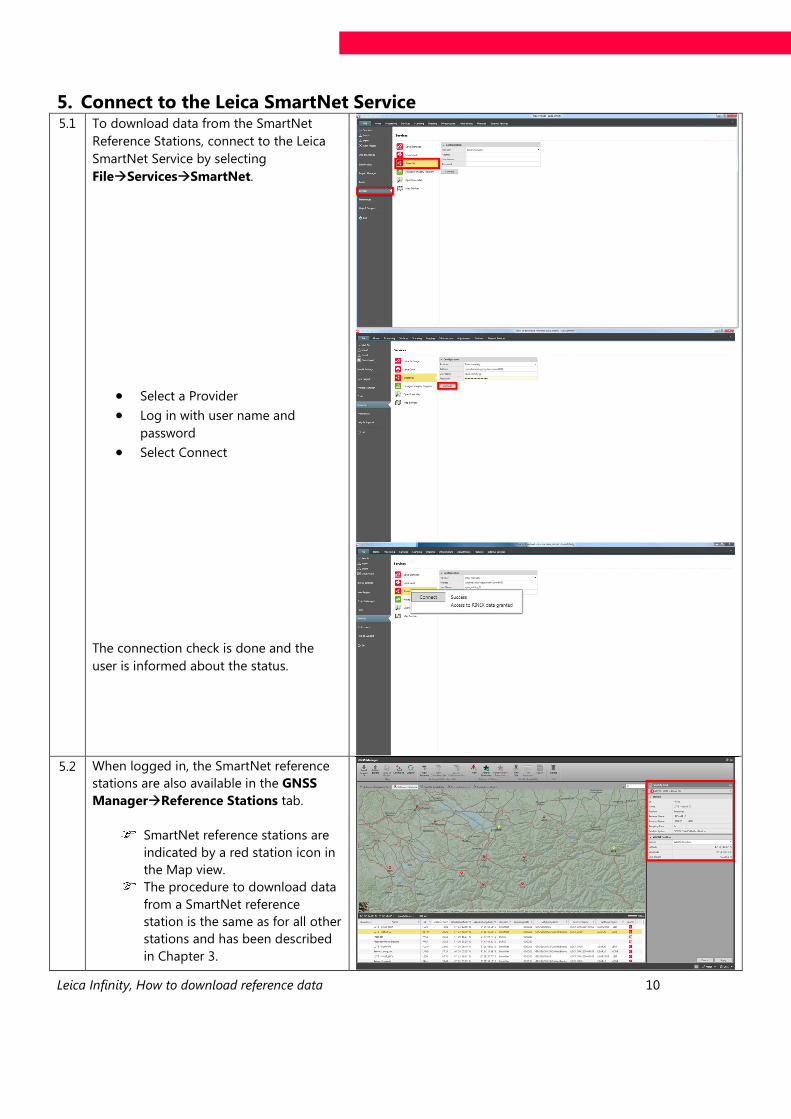
5. Connect to the Leica SmartNet Service 5.1 To download data from the SmartNet
Reference Stations, connect to the Leica
SmartNet Service by selecting
File Services SmartNet.
· Select a Provider · Log in with user name and
password · Select Connect
The connection check is done and the
user is informed about the status.
5.2 When logged in, the SmartNet reference
stations are also available in the GNSS
Manager Reference Stations tab.
SmartNet reference stations are
indicated by a red station icon in
the Map view.
The procedure to download data
from a SmartNet reference
station is the same as for all other
stations and has been described
in Chapter 3.
Leica Infinity, How to download reference data 11
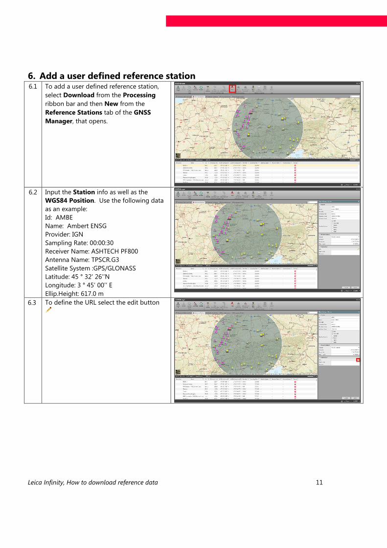
6. Add a user defined reference station 6.1 To add a user defined reference station,
select Download from the Processing
ribbon bar and then New from the
Reference Stations tab of the GNSS
Manager, that opens.
6.2 Input the Station info as well as the
WGS84 Position. Use the following data
as an example:
Id: AMBE
Name: Ambert ENSG
Provider: IGN
Sampling Rate: 00:00:30
Receiver Name: ASHTECH PF800
Antenna Name: TPSCR.G3
Satellite System :GPS/GLONASS
Latitude: 45 ° 32’ 26’’N
Longitude: 3 ° 45‘ 00’’ E
Ellip.Height: 617.0 m
6.3 To define the URL select the edit button
Leica Infinity, How to download reference data 12
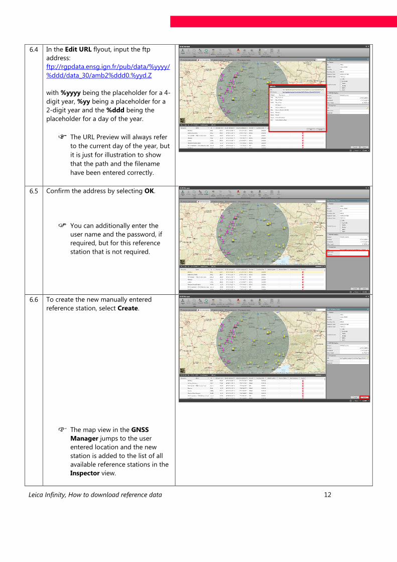
6.4 In the Edit URL flyout, input the ftp
address:
ftp://rgpdata.ensg.ign.fr/pub/data/%yyyy/
%ddd/data_30/amb2%ddd0.%yyd.Z
with %yyyy being the placeholder for a 4-
digit year, %yy being a placeholder for a
2-digit year and the %ddd being the
placeholder for a day of the year.
The URL Preview will always refer
to the current day of the year, but
it is just for illustration to show
that the path and the filename
have been entered correctly.
6.5 Confirm the address by selecting OK.
You can additionally enter the
user name and the password, if
required, but for this reference
station that is not required.
6.6 To create the new manually entered
reference station, select Create.
The map view in the GNSS
Manager jumps to the user
entered location and the new
station is added to the list of all
available reference stations in the
Inspector view.
Leica Infinity, How to download reference data 13
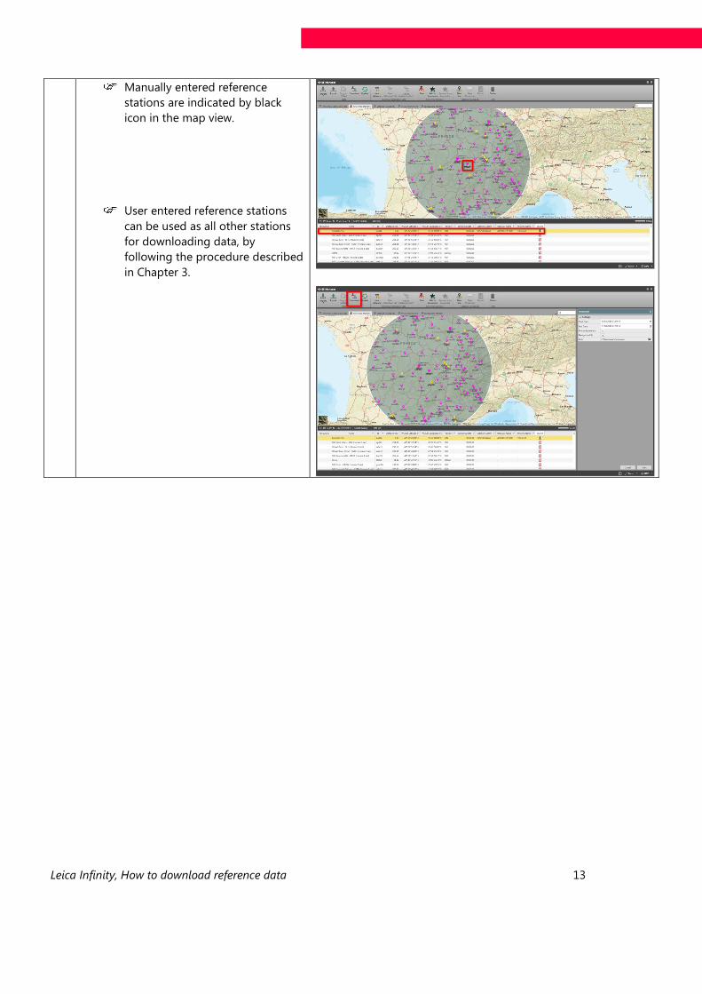
Manually entered reference
stations are indicated by black
icon in the map view.
User entered reference stations
can be used as all other stations
for downloading data, by
following the procedure described
in Chapter 3.

Heinrich-Wild-Strasse
CH-9435 Heerbrugg
Switzerland