diségno - oapen
TRANSCRIPT
Graphic design and cover by Enrico Cicalò and Paola Raffa
diségno the Series of the UID – Unione Italiana per il Disegno
director Francesca Fatta
Scientific Committee Giuseppe Amoruso Politecnico di Milano Paolo Belardi Università degli Studi di Perugia Stefano Bertocci Università degli Studi di Firenze Mario Centofanti Università degli Studi dell’Aquila Enrico Cicalò Università degli Studi di Sassari Antonio Conte Università degli Studi della Basilicata Mario Docci Sapienza Università di Roma Edoardo Dotto Università degli Studi di Catania Maria Linda Falcidieno Università degli Studi di Genova Francesca Fatta Università degli Studi Mediterranea di Reggio CalabriaFabrizio Gay Università IUAV di VeneziaAndrea Giordano Università degli Studi di PadovaElena Ippoliti Sapienza Università di RomaFrancesco Maggio Università degli Studi di PalermoAnna Osello Politecnico di TorinoCaterina Palestini Università degli Studi “G. d’Annunzio” di Chieti-PescaraLia Maria Papa Università degli Studi di Napoli “Federico II”Rossella Salerno Politecnico di MilanoAlberto Sdegno Università degli Studi di UdineChiara Vernizzi Università degli Studi di ParmaOrnella Zerlenga Università degli Studi della Campania “Luigi Vanvitelli”
Members of foreign structuresCaroline Astrid Bruzelius Duke University - USAPilar Chías Universidad de Alcalá - SpagnaFrank Ching University of Washington - USALivio De Luca UMR CNRS/MCC MAP Marseille - FranciaRoberto Ferraris Universidad Nacional de Córdoba - ArgentinaGlaucia Augusto Fonseca Universidade Federal do Rio de Janeiro - BrasilePedro Antonio Janeiro Universidade de Lisboa - PortogalloJacques Laubscher Tshwane University of Technology - SudafricaCornelie Leopold Technische Universität Kaiserslautern - GermaniaJuan José Fernández Martín Universidad de Valladolid - SpagnaCarlos Montes Serrano Universidad de Valladolid - SpagnaCésar Otero Universidad de Cantabria - SpagnaGuillermo Peris Fajarnes Universitat Politècnica de València - SpagnaJosé Antonio Franco Taboada Universidade da Coruña - SpagnaMichael John Kirk Walsh Nanyang Technological University - Singapore
The Series contains volumes of the proceedings of the annual conferences of the Scientific Society UID – Unione Italiana per il Disegno and the results of international meetings, research and symposia organised as part of the activities promoted or patronised by UID. The topics concern the Scientific Disciplinary Sector ICAR/17 Drawing with interdisciplinary research areas.The texts are in Italian or in the author’s mother tongue (French, English, Portuguese, Spanish, German) and/or in English. The international Scientific Committee includes members of the UID Scientific Technical Committee and numerous other foreign scholars who are experts in the field of Representation.The volumes of the series can be published either in print or in open access and all the authors’ contributions are subject to double blind peer review according to the currently standard scientific evaluation criteria.

This volume is published in open access format, i.e. the file of the entire work can be freely downloaded from the FrancoAngeli Open Access platform (http://bit.ly/francoangeli-oa).
On the FrancoAngeli Open Access platform, it is possible to publish articles and monographs, according to ethical and quality standards while ensuring open access to the content itself. It guarantees the preservation in the major international OA archives and repositories. Through
the integration with its entire catalog of publications and series, FrancoAngeli also maximizes visi-bility, user accessibility and impact for the author.
Read more:http://www.francoangeli.it/come_pubblicare/pubblicare_19.asp
Readers who wish to find out about the books and periodicals publishedby us can visit our website www.francoangeli.it and subscribe to our “Informatemi”
(notify me) service to receive e-mail notifications.
REPRESENTATION CHALLENGESAugmented Reality and Artificial Intelligence in Cultural Heritage and Innovative Design Domain
edited by
Andrea GiordanoMichele RussoRoberta Spallone

Scientific Committee
Salvatore Barba Università di Salerno
Marco Giorgio Bevilacqua Università di Pisa
Stefano Brusaporci Università dell’Aquila
Francesca Fatta Università Mediterranea di Reggio Calabria
Andrea Giordano Università di Padova Alessandro Luigini Libera Università di Bolzano
Michele Russo Sapienza Università di Roma Cettina Santagati Università di Catania
Alberto Sdegno Università di Udine
Roberta Spallone Politecnico di Torino
Peer Reviewers
Marinella Arena Università Mediterranea di Reggio Calabria
Salvatore Barba Università di Salerno
Marco Giorgio Bevilacqua Università di Pisa
Cecilia Bolognesi Politecnico di Milano
Stefano Brusaporci Università dell’Aquila
Francesca Fatta Università Mediterranea di Reggio Calabria
Andrea Giordano Università di Padova
Massimo Leserri Università di Napoli “Federico II”
Stefania Landi Università di Pisa
Massimiliano Lo Turco Politecnico di Torino
Alessandro Luigini Libera Università di Bolzano
Pamela Maiezza Università dell’Aquila
Domenico Mediati Università Mediterranea di Reggio Calabria
Cosimo Monteleone Università di Padova
Michele Russo Sapienza Università di Roma Cettina Santagati Università di Catania
Alberto Sdegno Università di Udine
Roberta Spallone Politecnico di Torino
Marco Vitali Politecnico di Torino
Scientific Coordination Andrea Giordano Università di Padova Michele Russo Sapienza Università di Roma Roberta Spallone Politecnico di Torino
Editorial Committee
Isabella Friso Università IUAV di Venezia
Fabrizio Natta Politecnico di Torino
Michele Russo Sapienza Università di Roma
Copyright © 2021 by FrancoAngeli s.r.l., Milano, Italy.
This work, and each part thereof, is protected by copyright law and is published in this digital version under the license Creative Commons Attribution-NonCommercial-NoDerivatives 4.0 International
(CC BY-NC-ND 4.0)
By downloading this work, the User accepts all the conditions of the license agreement for the work as stated and set out on the website
https://creativecommons.org/licenses/by-nc-nd/4.0
The texts as well as all published images have been provided by the authors for publication with copyright and scientific re-sponsibility towards third parties. The revision and editing is by the editors of the book.
Patronage
ISBN printed edition: 9788835116875ISBN digital edition: 9788835125280
REPRESENTATION CHALLENGESAugmented Reality and Artificial Intelligence in Cultural Heritage and Innovative Design Domain
Cover image: Michele Russo
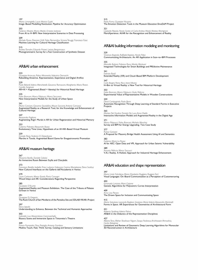
Index
7Francesca Fatta Preface
9Andrea Giordano, Michele Russo, Roberta SpalloneRepresentation Challenges: The Reasons of the Research
AR&AI theoretical concepts
AR&AI virtual reconstruction
AR&AI heritage routes
AR&AI classification and 3D analysis
23Francesco BergamoThe Role of Drawing in Data Analysis and Data Representation
29Giorgio Buratti, Sara Conte, Michela RossiArtificial Intelligency, Big Data and Cultural Heritage
35 Marco Ferrari, Lodovica ValettiVirtual Tours and Representations of Cultural Heritage: Ethical Issues
41Claudio Marchese, Antonino NastasiThe Magnificent AI & AR Combinations: Limits? Gorgeous Imperfections!
47Valerio PalmaData, Models and Computer Vision: Three Hands–on Projects
53Alberto SdegnoDrawing Automata
59Marco Vitali, Giulia Bertola, Fabrizio Natta, Francesca RoncoAI+AR: Cultural Heritage, Museum Institutions, Plastic Models and Prototyping. A State of Art
67Alessio BortotPhysical and Digital Pop–Ups. An AR Application in the Treatises on Stereotomy
73Maurizio Marco Bocconcino, Mariapaola VozzolaThe Value of a Dynamic Memory: from Heritage Conservation in Turin
79Antonio CalandrielloAugmented Reality and the Enhancement of Cultural Heritage: the Case of Palazzo Mocenigo in Padua
85Cristina Càndito, Andrea Quartara, Alessandro MeloniThe Appearance of Keplerian Polyhedra in an Illusory Architecture
91Maria Grazia Cianci, Daniele Calisi, Sara Colaceci, Francesca Paola MondelliDigital Tools at the Service of Public Administrations
97Riccardo Florio, Raffaele Catuogno, Teresa Della Corte, Veronica MarinoStudies for the Virtual Reconstruction of the Terme del Foro of Cumae
103Maurizio Perticarini, Chiara CallegaroMaking the Invisible Visible: Virtual/Interactive Itineraries in Roman Padua
111Marinella Arena, Gianluca LaxSaint Nicholas of Myra. Cataloguing, Identification, and Recognition Through AI
117Stefano Brusaporci, Pamela Maiezza, Alessandra Tata, Fabio Graziosi, Fabio FranchiProsthetic Visualizations for a Smart Heritage
123Gerardo Maria CennamoAdvanced Practices of Augmented Reality: the Open Air Museum Systems for the Valorisation and Dissemination of Cultural Heritage
129Serena Fumero, Benedetta FrezzottiThe Use of AR Illustration in the Promotion of Heritage Sites
135Alessandro Luigini, Stefano Brusaporci, Alessandro Basso, Pamela MaiezzaThe Sanctuary BVMA in Pescara: AR Fruition of the Pre–Conciliar Layout
141Alessandra Pagliano, Greta Attademo, Anna Lisa PecoraPhygitalarcheology for the Phlegraean Fields
147Andrea Rolando, Domenico D’Uva, Alessandro ScandiffioA Technique to Measure the Spatial Quality of Slow Routes in Fragile Territories Using Image Segmentation
153Giorgio Verdiani, Ylenia Ricci, Andrea Pasquali, Stéphane GiraudeauWhen the Real Really Means: VR and AR Experiences in Real Environments
159Ornella Zerlenga, Vincenzo Cirillo, Massimiliano Masullo, Aniello Pascale, Luigi MaffeiDrawing, Visualization and Augmented Reality of the 1791 Celebration in Naples
167Marco Giorgio Bevilacqua, Anthony Fedeli, Federico Capriuoli, Antonella Gioli, Cosimo Monteleone, Andrea PiemonteImmersive Technologies for the Museum of the Charterhouse of Calci
173Massimiliano Campi, Valeria Cera, Francesco Cutugno, Antonella di Luggo, Domenico Iovane, Antonio OrigliaCHROME Project: Representation and Survey for AI Development
179Paolo Clini, Roberto Pierdicca, Ramona Quattrini, Emanuele Frontoni, Romina NespecaDeep Learning for Point Clouds Classification in the Ducal Palace at Urbino
185Pierpaolo D’Agostino, Federico MinelliAutomated Modelling of Masonry Walls: a ML and AR Approach
191Elisabetta Caterina GiovanniniData Modelling in Architecture: Digital Architectural Representations
197Marco Limongiello, Lucas Matias GujskiImage–Based Modelling Restitution: Pipeline for Accuracy Optimisation
203Federica Maietti, Marco Medici, Ernesto IadanzaFrom AI to H–BIM: New Interpretative Scenarios in Data Processing
209Michele Russo, Eleonora Grilli, Fabio Remondino, Simone Teruggi, Francesco FassiMachine Learning for Cultural Heritage Classification
215Andrea Tomalini, Edoardo Pristeri, Letizia BergamascoPhotogrammetric Survey for a Fast Construction of Synthetic Dataset
AR&AI urban enhancement
AR&AI museum heritage
223Giuseppe Amoruso, Polina Mironenko, Valentina DemarchiRebuilding Amatrice. Representation, Experience and Digital Artifice
229Paolo Belardi, Valeria Menchetelli, Giovanna Ramaccini, Margherita Maria Ristori, Camilla SorignaniAR+AI = Augmented (Retail + Identity) for Historical Retail Heritage
235Fabio Bianconi, Marco Filippucci, Marco SeccaroniNew Interpretative Models for the Study of Urban Space
241Marco Canciani, Giovanna Spadafora, Mauro Saccone, Antonio CamassaAugmented Reality as a Research Tool, for the Knowledge and Enhancement of Cultural Heritage
247Alessandra PaglianoAugmenting Angri: Murals in AR for Urban Regeneration and Historical Memory
253Caterina Palestini, Alessandro BassoEvolutionary Time Lines, Hypothesis of an AI+AR–Based Virtual Museum
259Daniele Rossi, Federico O. OppedisanoMarche in Tavola. Augmented Board Game for Enogastronomic Promotion
267Massimo Barilla, Daniele ColistraAn Immersive Room Between Scylla and Charybdis
273Francesco Borella, Isabella Friso, Ludovica Galeazzo, Cosimo Monteleone, Elena SvalduzNew Cultural Interfaces on the Gallerie dell’Accademia in Venice
279Laura Carlevaris, Marco Fasolo, Flavia CamagniWood Inlays and AR: Considerations Regarding Perspective
285Giuseppe D’AcuntoAugmented Reality and Museum Exhibition. The Case of the Tribuna of Palazzo Grimani in Venice
291Giuseppe Di GregorioThe Rock Church of San Micidiario of the Pantalica Site and 3DLAB VR/AR–Project
297Elena IppolitiUnderstanding to Enhance, Between the Technical and Humanist Approaches
303Gabriella Liva, Massimiliano CiammaichellaIllusory Scene and Immersive Space in Tintoretto’s Theatre
309Franco Prampolini, Dina Porpiglia, Antonio GambinoMedma Touch, Feel, Think: Survey, Catalog and Sensory Limitations
AR&AI building information modeling and monitoring
AR&AI education and shape representation
329Vincenzo Bagnolo, Raffaele Argiolas, Nicola PabaCommunicating Architecture. An AR Application in Scan–to–BIM Processes
335Marcello Balzani, Fabiana Raco, Manlio MontuoriIntegrated Technologies for Smart Buildings and PREdictive Maintenance
341Fabrizio BanfiExtended Reality (XR) and Cloud–Based BIM Platform Development
347Carlo Biagini, Ylenia Ricci, Irene VilloresiH–Bim to Virtual Reality: a New Tool for Historical Heritage
353Fabio Bianconi, Marco Filippucci, Giulia PellicciaExperimental Value of Representative Models in Wooden Constructions
359Devid Campagnolo, Paolo BorinAutomatic Recognition Through Deep Learning of Standard Forms in Executive Projects
365Matteo Del Giudice, Daniela De Luca, Anna OselloInteractive Information Models and Augmented Reality in the Digital Age
371Marco Filippucci, Fabio Bianconi, Michela MeschiniSurvey and BIM for Energy Upgrading. Two Case Study
377Raissa GarozzoA Proposal for Masonry Bridge Health Assessment Using AI and Semantics
383Federico Mario La RussaAI for AEC: Open Data and VPL Approach for Urban Seismic Vulnerability
389Assunta Pelliccio, Marco SaccucciV.A.I. Reality. A Holistic Approach for Industrial Heritage Enhancement
397Maria Linda Falcidieno, Maria Elisabetta Ruggiero, Ruggero TortiVisual Languages: On–Board Communication as a Perception of Customercaring
403Emanuela Lanzara, Mara CaponeGenetic Algorithms for Polycentric Curves Interpretation
409Anna Lisa PecoraThe Drawn Space for Inclusion and Communicating Space
415Marta Salvatore, Leonardo Baglioni, Graziano Mario Valenti, Alessandro MartinelliForms in Space. AR Experiences for Geometries of Architectural Form
421Roberta Spallone, Valerio PalmaAR&AI in the Didactics of the Representation Disciplines
427Alberto Tono, Meher Shashwat Nigam, Stasya Fedorova, Amirhossein Ahmadnia, Cecilia BolognesiLimitations and Review of Geometric Deep Learning Algorithms for Monocular 3D Reconstruction in Architecture
315Paola Puma, Giuseppe NicastroThe Emotion Detection Tools in the Museum Education EmoDeM Project
321Leopoldo Repola, Nicola Scotto di Carlo, Andrea Maioli, Matteo MartignoniMareXperience. AI/AR for the Recognition and Enhancement of Reality
doi.org/10.3280/oa-686.17
REPRESENTATION CHALLENGESAugmented Reality and Artificial Intelligence in Cultural Heritage and Innovative Design Domain
PrefaceFrancesca Fatta
When in January 2020 Roberta Spallone with Andrea Giordano and Michele Russo pro-posed a seminar with the complex acronym REAACH– ID to involve a larger group of Augmented Reality scholars, I realized that the time had come to define the context of our initiatives on virtual representation, looking also to the sphere of science that deals with Artificial Intelligence. Their proposal did not want to follow the trend, but rather to respond to the need for methodological relationships and cross competences aimed at promoting a dialogue between human and hard sciences.The starting point consists in the single and shared researches of the scholars involved in the organization of this symposium, they are all teachers of Drawing who have been en-gaged for years in the creation and analysis of drawings, images and models that represent the evolution of existing realities over time or purely designed entities. Moreover, when the Italian teachers of Drawing reorganized the declaration of the sector (UID May 2021), they agreed that the scope of our SSD (Scientific Disciplinary Sector) research: “[…] therefore concerns the geometric–descriptive–configurative domains, graphic–visual–synaesthetic, in-formational–computational features, as well as the related historical, epistemological, seman-tic, technological and applicative aspects. [...] the modeling, including informative modeling, prototyping and visual communication [...]”.The question concerns the definition of the relationships between a physical, real, tangible reality and an intangible spatiality defined with the help of Artificial Intelligence, increasingly able to trigger specific reading processes of complex contexts, which can be represented in a way similar to human thought with amazing space–time simulation effects.
8
Mario Rasetti’s prestigious speech performed for the opening of REAACH–ID symposium indicated how Artificial Intelligence may show new possibilities in the world of representa-tions, underlining the links between AI and Engineering, Information Technology, Cognitive Sciences and Philosophy.During the symposium the scholars asserted several times that reality means everything that is concrete and material, therefore something natural and changeable, but the advent of Artificial and Virtual Reality offers a new version of reality in itself. It cannot be consid-ered anymore as pure vision, but as a participation of all the senses, even of the whole body, thanks to effects created by the digital tools which are so likely that they are accepted by an observer as a real experience.It has been noted that artificial reality is the most advanced form of interaction between man and machine. Inside this deceptive reality everything that is perceived is generated by a computer that responds to our movements with images and sounds designed to give us the illusion of a virtual world that breaks the laws of physics projecting our self in a free space–time. Artificial Reality represents the realization of an invention, a trespassing tool towards a new kind of utopia.If it is true that Artificial Reality involves all the senses with illusory messages, nevertheless visual messages have the upper hand over all the others; it is precisely for this reason that during the symposium the scholars have exalted the world of Artificial Reality as a real op-portunity for exploring and visual communicating. The user, wandering without constraints into a new world, becomes an experimenter of new models of thought and technologies. Furthermore, researchers in our disciplinary sector often study cultural heritage resorting to digital technologies that increase their reading and interpretation in the process of its analysis, design and enhancement. For over fifteen years, the Italian teachers of Drawing have already made use of a fruitful intertwining between Artificial Intelligence and Augment-ed Reality thanks to the new possibilities of identification and connection between digital products and physical consistencies, in a mix of real and virtual world.The way of acting, according to the methodological profile of our research, which starts from physical space, has found in the digital world and Artificial Intelligence those tools for expanding the reality (for this reason called “augmented”) aiming at redefining the way to share cultural heritage, or the way to enhance it through innovative systems of community participation.The success of REAACH–ID encouraged Roberta Spallone, Andrea Giordano and Michele Russo to organize a second symposium. For this I feel the need to thank them for the good work produced in this volume, which collects the results of the open discussion and the scholars’ research presented during the first symposium, as well as for what they are pre-paring in the next future meeting.
UID presidentJuly 2021
Copyright © 2021 by FrancoAngeli s.r.l. Milano, Italy Isbn 9788835125280
doi.org/10.3280/oa-686.29
REPRESENTATION CHALLENGESAugmented Reality and Artificial Intelligence in Cultural Heritage and Innovative Design Domain
Representation Challenges: The Reasons of the ResearchAndrea GiordanoMichele Russo Roberta Spallone
Augmented Reality (AR) and Artificial Intelligence (AI) are technological domains that closely interact with space at architectural and urban scale in the broader ambits of cultural heritage and innovative design. The growing interest is perceivable in many fields of knowledge, supported by the rapid development and advancement of theory and application, software and devices, fueling a pervasive phenomenon within our daily lives. These technologies demonstrate to be best exploited when their application and other information and communication technology (ICT) advancements achieve a continuum. In particular, AR defines an alternative path to observe, analyze and communicate space and artifacts. Besides, AI opens future scenarios in data processing, redefining the relationship between man and computer. In the last few years, the AR/AI expansion and relationship have raised deep trans–disci-plinary speculation. The research experiences have shown many cross–relations in Archi-tecture and Design domains. Representation studies could arise an international debate as a convergence place of multidisciplinary theoretical and applicative contributions relat-ed to architecture, city, environment, tangible and intangible Cultural Heritage. A research synergy between different Universities (Politecnico di Torino, University of Padua, Sapienza University of Rome) was the first occasion to share collected experienc-es. The discussion between scholars led to the importance of fixing a first state of the art about AR/AI topics in the national Representation area, analyzing the role of AR/AI in the chain of knowledge. Besides, critical interest has been focused on exploring the disci-plinary boundaries, identifying affine disciplines involved in similar research, and activating
10
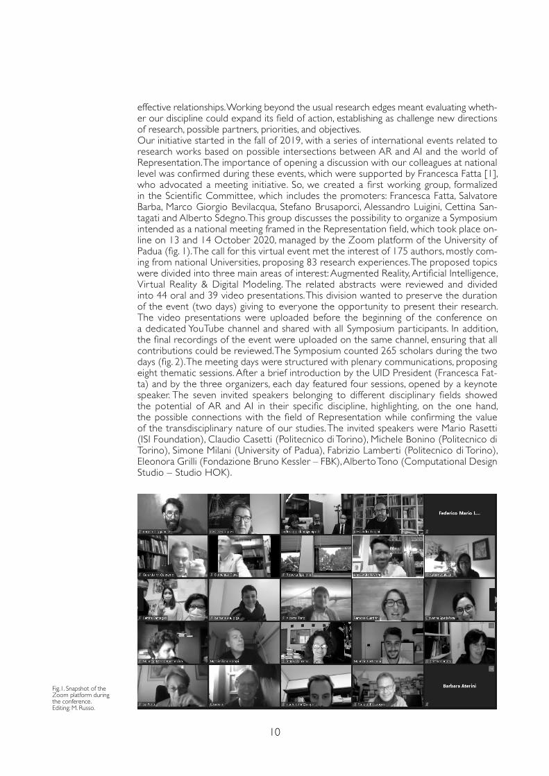
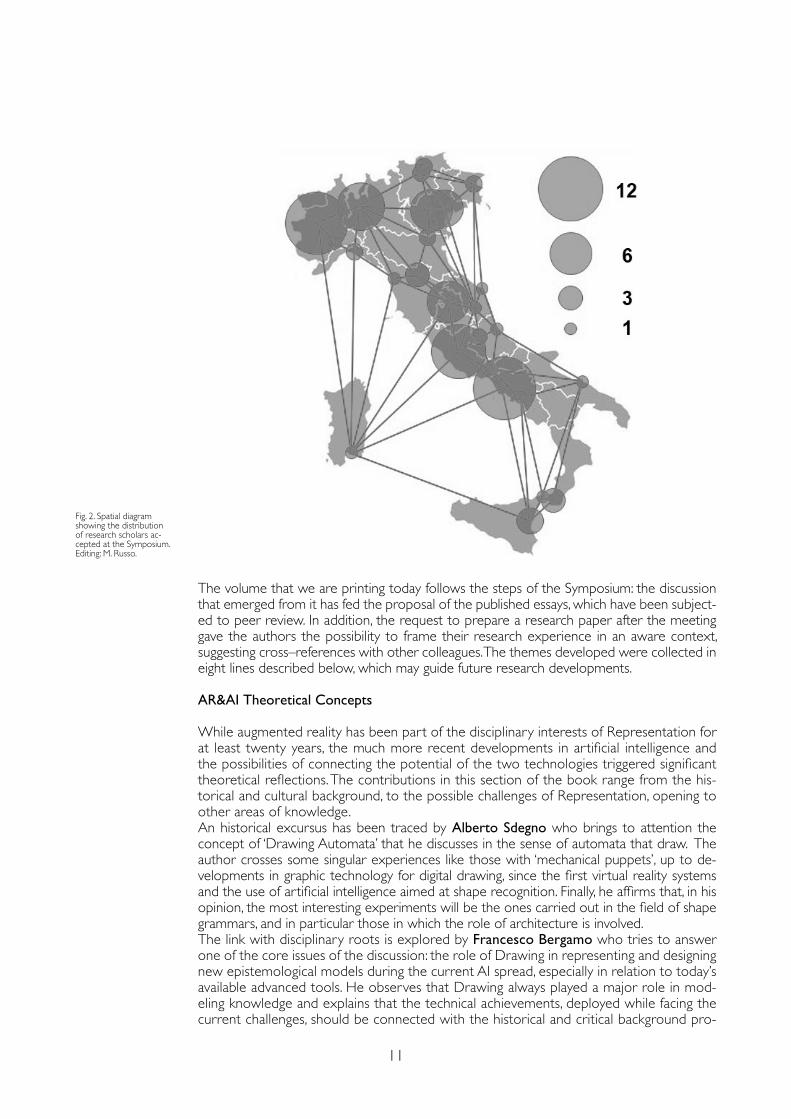
effective relationships. Working beyond the usual research edges meant evaluating wheth-er our discipline could expand its field of action, establishing as challenge new directions of research, possible partners, priorities, and objectives.Our initiative star ted in the fall of 2019, with a series of international events related to research works based on possible intersections between AR and AI and the world of Representation. The importance of opening a discussion with our colleagues at national level was confirmed during these events, which were supported by Francesca Fatta [1], who advocated a meeting initiative. So, we created a first working group, formalized in the Scientific Committee, which includes the promoters: Francesca Fatta, Salvatore Barba, Marco Giorgio Bevilacqua, Stefano Brusaporci, Alessandro Luigini, Cettina San-tagati and Alberto Sdegno. This group discusses the possibility to organize a Symposium intended as a national meeting framed in the Representation field, which took place on-line on 13 and 14 October 2020, managed by the Zoom platform of the University of Padua (fig. 1). The call for this vir tual event met the interest of 175 authors, mostly com-ing from national Universities, proposing 83 research experiences. The proposed topics were divided into three main areas of interest: Augmented Reality, Artificial Intelligence, Vir tual Reality & Digital Modeling. The related abstracts were reviewed and divided into 44 oral and 39 video presentations. This division wanted to preserve the duration of the event (two days) giving to everyone the opportunity to present their research. The video presentations were uploaded before the beginning of the conference on a dedicated YouTube channel and shared with all Symposium participants. In addition, the final recordings of the event were uploaded on the same channel, ensuring that all contributions could be reviewed. The Symposium counted 265 scholars during the two days (fig. 2). The meeting days were structured with plenary communications, proposing eight thematic sessions. After a brief introduction by the UID President (Francesca Fat-ta) and by the three organizers, each day featured four sessions, opened by a keynote speaker. The seven invited speakers belonging to different disciplinary fields showed the potential of AR and AI in their specific discipline, highlighting, on the one hand, the possible connections with the field of Representation while confirming the value of the transdisciplinary nature of our studies. The invited speakers were Mario Rasetti (ISI Foundation), Claudio Casetti (Politecnico di Torino), Michele Bonino (Politecnico di Torino), Simone Milani (University of Padua), Fabrizio Lamberti (Politecnico di Torino), Eleonora Grilli (Fondazione Bruno Kessler – FBK), Alberto Tono (Computational Design Studio – Studio HOK).
Fig.1. Snapshot of the Zoom platform during the conference.Editing: M. Russo.
11
The volume that we are printing today follows the steps of the Symposium: the discussion that emerged from it has fed the proposal of the published essays, which have been subject-ed to peer review. In addition, the request to prepare a research paper after the meeting gave the authors the possibility to frame their research experience in an aware context, suggesting cross–references with other colleagues. The themes developed were collected in eight lines described below, which may guide future research developments.
AR&AI Theoretical Concepts
While augmented reality has been part of the disciplinary interests of Representation for at least twenty years, the much more recent developments in artificial intelligence and the possibilities of connecting the potential of the two technologies triggered significant theoretical reflections. The contributions in this section of the book range from the his-torical and cultural background, to the possible challenges of Representation, opening to other areas of knowledge.An historical excursus has been traced by Alberto Sdegno who brings to attention the concept of ‘Drawing Automata’ that he discusses in the sense of automata that draw. The author crosses some singular experiences like those with ‘mechanical puppets’, up to de-velopments in graphic technology for digital drawing, since the first virtual reality systems and the use of artificial intelligence aimed at shape recognition. Finally, he affirms that, in his opinion, the most interesting experiments will be the ones carried out in the field of shape grammars, and in particular those in which the role of architecture is involved. The link with disciplinary roots is explored by Francesco Bergamo who tries to answer one of the core issues of the discussion: the role of Drawing in representing and designing new epistemological models during the current AI spread, especially in relation to today’s available advanced tools. He observes that Drawing always played a major role in mod-eling knowledge and explains that the technical achievements, deployed while facing the current challenges, should be connected with the historical and critical background pro-
Fig. 2. Spatial diagram showing the distribution of research scholars ac-cepted at the Symposium. Editing: M. Russo.
12
vided by the genealogies of perspective and maps. On the same line, Marco Vitali, Giulia Bertola, Fabrizio Natta & Francesca Ronco note that the links between Representation and artificial intelligence involve many fields of architectural research, recording contin-uous and significant advances that require a constant update of the state of the art and a careful consideration of the role of Representation in interdisciplinary researches. For this reason, they investigate the most cutting–edge case studies in the fields of Cultural Heritage, Museums, and Digital fabrication.Then, Giorgio Buratti, Sara Conte & Michela Rossi explore the new frontiers of AI ap-plied to Cultural Heritage and identify three main lines of research in this field that exploit the synergy between machine learning, big data and AI. They deal with: the development of innovative methodologies and systems to monitor and prevent damage to the cultural heritage; the experiments that focus on automatic data acquisition, such as the application of mobile technologies for three–dimensional surveying and acquisition of CH images; the management of large amounts of analog or digital data and information. Also Valerio Palma notices the unprecedented opportunities of advances in information and communication technologies for the documentation and analysis of architectural and urban assets. Nev-ertheless, he warns of the risk that the schematic understanding of reality produced by eidomatic tools, i.e. automatic recognition and classification become a black box, that is, algorithms we accept the results without questioning how these are produced or whether they can be adapted to changing needs. Then, Palma summarizes three connected research experiences he has been part of. They produced apps and prototypes exploiting geospatial databases, AI for image recognition, and AR based on model tracking, applied to architectur-al heritage, contributing an insight on the interpretation of the built environment form as a means to produce shared knowledge and operational outcomes.Other authors develop broader reasoning regarding the design and ethical impact of new technologies. It is the case of Claudio Marchese & Antonino Nastasi that observe, in the digital age, the persistence of time and space as coordinates for human presence and their intrinsic relationship with Architecture. They analyze as sort of ‘scenarios’ concerning pre-figuration, measurements, and relationships, dealing with AI and AR combinations in a pro-jectual perspective. Moreover, Marco Ferrari & Lodovica Valetti analyze the ethical issues triggered by the integration of new technologies in the management of Cultural Heritage, in particular historical sites and museums, related to ontological, economic, and social as-pects, trying to outline some principles able to limit these critical implications. They focus on the authenticity of reproduction, the costs of VR and AR systems, and individualism due to the use of personal devices. The scholars conclude that the relationship between man and machine and the concepts of real and virtual must be kept at the center of innovation and application in this field.
AR&AI Virtual Reconstruction
Digital convergence in the last decades has favored the development of virtual reconstruc-tions for heritage enhancement. These are connected with documentary analysis and digital survey, dialoguing both with textual, iconographic and archival sources, and with artistic, archaeological, architectural and urban consistencies. Artificial intelligence and augmented reality are intertwined with knowledge, interpretation and communication, enhancing the value of virtual reconstructions from the point of view of scientific validation, knowledge construction, and inclusion.The dialogue with architectural literature is interwoven by Alessio Bortot, who develops his reasoning connecting the treatise of stereotomy by Monduit with AR technology with the aim to better describe the tracing of stone cutting. Starting from the interest for de La Rue stereoscopic approach, which gives the opportunity to go beyond the two–dimen-sional limits of paper surfaces, such as the use of pop–ups, the scholar proposes the use of AR for creating digital pop–ups. The reconstructive 3D models of the treatise plates were provided with different semantic values and, through AR, could be visualized and split into blocks, while the relationship between form and structure was shown through the use
13
of a false color Fem analysis. Similarly, Cristina Càndito, Andrea Quartara & Alessandro Meloni study the scientific sources to deal with the representation of six Keplerian stel-lated dodecahedrons in the decoration of an aulic room in an historical palace in Genoa. Through the virtual reconstruction of the illusory space frescoed on the vault, they illus-trate in a communicative, but not simplified way, through an immersive AR experience, the connections between the Genoese decoration and the wider seventeenth–century scientific milieu. The analysis of archival and bibliographical sources, coupled with digital survey, supports the considerations of Maria Grazia Cianci, Daniele Calisi, Sara Colaceci & Francesca Paola Mondelli in light of the assignment by the municipality of Rome for the realization of three competition dossiers. They reflect on how and to what extent the Public Ad-ministration can now benefit from new technologies and digital tools, and conclude that although the current huge step is towards the digitization of the architectural heritage, it is also desirable to proceed towards Virtual Reality to ensure immersive design for competitors. Also Maurizio Marco Bocconcino & Mariapaola Vozzola present remarks that focus on analysis at urban scale, in order to propose, in this case, solutions aimed at safeguarding memory. They show the methodological framework for a research project on conservation and care of the memory of changing urban contexts and highlight the need of implementation of integrated digital archives with interactive and hypertextual navigation between the assets themselves.Virtual reconstructions, linked to AR and AI technologies, are particularly developed in the archaeological field. It is the case of the research by Riccardo Florio, Raffaele Catuogno, Teresa Della Corte & Veronica Marino. They set up a methodology to deepen the investigation on the current consistencies of the Roman bath of Cumae that, through the preparation of a suitable neural network managed by AI processes, are able to formulate reconstructive hypotheses with scientific authority. Moreover, through the adoption of web–based and open source technologies and the applications of AR and interactive digital visualization, multiple information are associated with the 3D model. Also Maurizio Perticarini & Chiara Callegaro deal with archaeological heritage and pro-pose the creation of an adaptive AR app with the aim to enhance through cultural tour-ism the vestiges of ancient buildings hidden by urban building development of Padua. The workflow identifies a path through the city and connects the analyzed and represented artifacts through documents, digital survey, BIM modeling and, finally, AR app, foreseeing further insights through artificial intelligence to differentiate the contents according to the user’s preferences.Finally, Antonio Calandriello exploits ICTs, i.e. digital reconstruction, virtual and augment-ed reality, video production, and application development, aimed at the enhancement of a Renaissance palace in Padua. In this way, it is possible to increase the inclusiveness and raise the level of use, giving visitors the opportunity to virtually visit the building and its precious frescoed halls, which the public cannot visit.
AR&AI Heritage Routes
Built and environmental heritage are very often made up of a series of artefacts and el-ements that take on a particular value in their constitution as a system. The construction and use of heritage routes can profitably avail of augmented reality and artificial intelligence technologies for the construction of knowledge and its sharing as well as for flow control and route recommendation. The researches presented in this section demonstrate the de-sire to create closer links between the real and the virtual sets, realizing a real continuum between them.In this sense moves the work of Stefano Brusaporci, Pamela Maiezza, Alessandra Tata, Fabio Graziosi & Fabio Franchi dealing with the idea that a smart heritage could be realized through VR/AR/MR combined with AI applications. Their observations are based on a wide experience on the territory of L’Aquila that highlights the potential of the so–called ‘phygital’ with the protection and enhancement of assets often characterized by important elements
14
of fragility. In the same direction, although referring to environmental heritage, Alessandra Pagliano, Greta Attademo & Anna Lisa Pecora propose a systematization of the knowledge of the Phlegraean Fields Park, through surveys and 3D models, integrated by the use of differ-ent digital technologies, AR in particular. Each site becomes the node of a network of thematic routes, traced starting from the major attractions of the area. The goal is to define a hybrid landscape, made of site specific visits and digital experiences, that generate a new model of inclusive museum, configuring cultural relationships between physically distant places. Also An-drea Rolando, Domenico D’Uva & Alessandro Scandiffio work on environmental heritage enhancement. They aim at investigating the potential of image segmentation technology, based on web application, for measuring the spatial quality of slow routes. The method has been ap-plied to some stretches of slow–mobility routes that are localized along a fragile coastal land-scape of southern Italy. Such an update of the tool could take advantage of Machine Learning systems, namely the ability to learn through analysis, to improve its precision and reliability.The research of Gerardo Maria Cennamo is engaged in the so called ‘open air museums’ linking in a single path a series of cultural stops. The author refers to two ongoing experi-ences in Naples and Rome where, thanks to GPS systems it is possible to develop dynamic paths of perception of the archaeological and architectural heritage, integrated by augment-ed reality applications that realize an active involvement of the visitor through pedestrian and vehicular itineraries.Educational aims address the cutting–edge research by Alessandro Luigini, Stefano Brusapor-ci, Alessandro Basso & Pamela Maiezza that present a project addressed to the documenta-tion, investigation of architectural values, and valorization of a Sanctuary in Pescara, through an application of augmented reality technology, able to visualize the previous configuration of the church, enhanced by an artificial intelligence–based tracking application. The awareness–raising program includes online communication and activities with local schools. Also Serena Fumero & Benedetta Frezzotti describe a didactic experience related to the use of AR in the pro-motion of heritage sites. The low cost and the relative ease of creating content of the cultural experience will encourage a similar approach in many other heritage sites.The heritage route set up by Marinella Arena & Gianluca Lax develops a strategy to guide users and scholars in the Byzantine iconographic world, highlighting the elements that contribute to recognizing the sacred figures represented. The artificial–intelligence–based technique used to analyze 19 images of Saint Nicholas set up some preliminary strategies for the morphological classification of the iconography through the identification of the proportional relationships between the parts of the face. In an original way, Ornella Zerlenga, Vincenzo Cirillo, Massimiliano Masullo, Aniello Pascale & Luigi Maffei create a philological heritage route investigating the ephemeral architecture of the eighteenth century in Naples. The goal is an unprecedented represen-tation, modeling and fruition project, accompanied by a graphic visualization of the places to better understand the architectural and urban space. An Augmented–Reality application prototype makes it possible to disseminate the compositional elements of the celebrations to a non–specialist public. Finally, Giorgio Verdiani, Ylenia Ricci, Andrea Pasquali & Stéphane Giraudeau set up a real route between different research experiences personally carried out, that links to-gether digital modelling of no longer and still existing architectures with AR, VR and XR experiences. Not only in the will of capturing the users, but in the true belief that Digital Heritage is an occasion allowing an easier reading and an option for spreading the knowl-edge of Cultural Heritage.
AR&AI Classification and 3D Analysis
AR & AI classification and 3D analysis is an increasingly important area of research through data segmentation and attribution of specific connotations, supporting the architectural analysis process. In particular, the research focus shifts from 3D acquisition to data pro-cessing, defining hierarchical–oriented information systems. This strategy implements the geometrical data structures for reality–based and interpretative definition of model, opti-
15
mizing the model communication passage through AR/MR/VR systems. The papers cover the entire process, from the treatment of the survey data to the Scan–to–BIM passage, up to the building’s analysis and digital heritage enhancement.The first group of articles is oriented towards photogrammetric techniques underlying data processing. Marco Limongiello & Lucas Matias Gujski work directly on data acquired by UAV imagery. They suggest an innovative approach that can support survey methods by applying AI algorithms, improving the accuracy of extracted point clouds. Some parameters are analyzed through a Self–Organizing Map (SOM) to reach a compromise between the variable values, the noise reduction, and the 3D model definition, allowing a fast data clus-tering. Similarly, Andrea Tomalini, Edoardo Pristeri & Letizia Bergamasco start from the UAV imaging approach and suggest the use of a photogrammetric model to generate new image datasets for training Machine Learning (ML) algorithms and recognize built heritage. They apply Physically Based Rendering (PBR) tools to extend the image datasets with artifi-cial data. In the end, Pierpaolo D’Agostino & Federico Minelli propose a methodology for the automated delineation of brick masonries from images to a vector representation. The edge detection and vector delineation of brick joints allow a brick clustering for masonry classification, implemented in AR visualization.The second group is oriented to the segmentation of point clouds acquired by 3D scanners for data classification with the aim to study architecture. Michele Russo, Eleonora Grilli, Fabio Remondino, Simone Teruggi & Francesco Fassi present an iterative multi–level and multi–resolution classification process that improves the learning activity based on a supervised au-tomatic Machine Learning approach to optimize 3D point cloud classification by a hierarchical concept. This strategy requires few annotated 3D data while very detailed semantic segmen-tation results can be achieved. Paolo Clini, Roberto Pierdicca, Ramona Quattrini, Emanuele Frontoni & Romina Nespeca suggest an innovative approach based on HBIM existing models to improve the segmentation of 3D point clouds through the Deep Learning approach. The proposed methodology facilitates Scan–to–HBIM passage, generating a sufficiently large data set of synthetic clouds to train the neural network. The last paper referred to this cluster is a work by Federica Maietti, Marco Medici & Ernesto Iadanza and focuses on AI and 3D point cloud models, showing a new integration within the BIM environment, image classification algorithms, point cloud segmentation, and representation models. This paper presents a pre-liminary experience focused on the AI for processing the large amount of data obtained from digitization processes applied to the Architectural Heritage.In the last three research papers, the modeling activity based on acquired geometrical data assumes a strategic value. In such a sense, Elisabetta Caterina Giovannini presents an extended analysis of the current methodologies and workflows for data modeling in Archi-tecture, deepening the use of standards, descriptive metadata, and ontologies for Cultural Heritage representation. Furthermore, this research underlines the complexity of creating conceptual models able to manage three–dimensional data and descriptive metadata on architectural heritage documentation.The last two articles share common themes of museums and IT, though explored from two different points of view. Massimiliano Campi, Valeria Cera, Francesco Cutugno, Anton-ella di Luggo, Domenico Iovane & Antonio Origlia propose a methodology of collecting, analyzing, and modeling multimodal data, helpful in designing virtual agents in 3D museum environments. This research is part of the national CHROME project, which deepens the interconnections between representation, survey, and information technology domains. The architecture focuses on graph databases and 3D models, using modern peripheral devices and third–party services for capturing and analyzing input signals; it also integrates prob-abilistic decision–making systems for controlling interaction in 3D environments. Besides, Marco Giorgio Bevilacqua, Anthony Fedeli, Federico Capriuoli, Antonella Gioli, Cosimo Monteleone & Andrea Piemonte focus the attention mainly on the communication muse-um strategy. They suggest a new visit path based on immersive experiences of video map-ping, VR/AR, sound immersion, informative totems, audio–visual supports, and multisensory activities. The project aims to investigate the potential in applying new AR/VR technologies to enhance virtual tours and interpret 3D models of real environments.
16
AR&AI Urban Enhancement
This section is dedicated to research that refers mainly to the urban space and the territorial scale, considering also building knowledge connected to the territory and the architecture cul-ture. The central topic of this section is the cultural and sensory itinerary, allowing experiences that go beyond the visible. The use of immersive and augmented virtual reality techniques creates a link between the tangible and intangible, memory and existing real space, underlying the construction logic, the building itineraries spreading knowledge. Both urban systems and single buildings are spatial and historical landmarks. Their disappearance or damage may erase the relation between present and past, causing a sense of disorientation. The first articles ex-plore AR/VR methodologies for the memory recovery of places destroyed by earthquakes. Giuseppe Amoruso, Polina Mironenko & Valentina Demarchi propose a path of memory re–appropriation through multimedia installations, emphasizing the evocative interaction be-tween reality, memory, and reproduction of the intangible to promote collective memory. Thus, the real environment becomes a temporary and experiential museum, expanding the immaterial dimension of accessibility discovery. Besides, Caterina Palestini & Alessandro Bas-so suggest a solution to promote the use of the historical buildings, activating at the same time the dynamics of cultural regeneration in the area, using AR+AI systems for a tour that can show the urban architectural evolution, monitoring and enhancing the knowledge and the transformations undergone by the architectural heritage.Concerning urban routes, the experiential factor plays a central role. The experience occurs mainly through the human vision, which is dominant in AR/MR/VR development without ex-cluding other senses. Alessandra Pagliano presents a project aiming at preserving the memory of murals using AR. In this way, the narrative message of the old murals is expanded thanks to the digital multimedia contents, reinforcing the storytelling, the cultural connection, and the memory of the place. On the other hand, Fabio Bianconi, Marco Filippucci & Marco Secca-roni suggest using EEG helmets synchronized to GPS to collect human cognitive conditions and transform them into representations that reflect the people’s feelings during their itinerary. This research aims to define methodologies based on interdisciplinary interpretative criteria to understand the human–environment impact, directing design choices to improve wellbeing.As mentioned earlier, large architectural spaces can be compared with those at urban scale, especially if the aim is to communicate and promote them through a more profound knowledge. This is the case of Marco Canciani, Giovanna Spadafora, Mauro Saccone & Antonio Camassa, who present two AR applications about important architectonic space, with the final aim to develop some AR multimedia content linked to semantic concepts. The proposed experiences use AR to share the analyses carried out on drawings and canvas, unveiling the constructive meaning of space.The last cluster is dedicated to communication and promotion of local assets and retails, always framed through knowledge itineraries. Paolo Belardi, Valeria Menchetelli, Giovanna Ramaccini, Margherita Maria Ristori & Camilla Sorignani present the concept of “Aug-mented Retail,” representing a strategy to achieve an Augmented Identity, changing the retail space from a ‘product window’ to an ‘experiential theatre’. This research aims to open new perspectives based on AR and AI to enhance local identity promoting itineraries of historic shops. Regarding local assets, Daniele Rossi & Federico O. Oppedisano, illustrates the potential of AR in the valorization of food and wine heritage. They highlight the playful interactive capacities of this technology shifting towards renewed communication models that aim to extend the cultural offer in an increasingly rapid and immediate form.
AR&AI Museum Heritage
In the digital era, museums have seen a significant expansion of spaces and tools for the dis-semination of knowledge. In this sense, the digital takes on multiple roles precisely articulating itself between AI and AR for new ways of disseminating and communicating Cultural Heri-tage. In this sense, Massimo Barilla & Daniele Colistra are involved in the creation of an im-mersive and interactive room – Nello Scill’e Cariddi – in which the marine environment of the
17
Strait of Messina is used as the first experimental scenarios to develop and test technology AI/AR. The room, therefore, transforms film collections, integrating them with the production of specific images, into virtual environments containing structured catalogs and into interac-tive installations for educational, playful, scientific and popular use. Francesco Borella, Isabella Friso, Ludovica Galeazzo, Cosimo Monteleone & Elena Svalduz then deal with the cultural interfaces that make a video installation which is also immersive and interactive. Their aim is to keep a high and active visitor’s attention, in the video dedicated to the Academia insula of Venice several short–term sections have been introduced, which can be interrogated and activated by sensors, while a Sound Shower system facilitates the understanding of the mul-timedia story by listening to the voice of a storyteller. The contribution of Laura Carlevaris, Marco Fasolo & Flavia Camagni is also fundamental, dealing with the options provided by the recent applications of Augmented Reality (AR) to the knowledge and enhancement of a cultural asset: the perspective in wood inlays. The intention is therefore to use perspective in AR ambient as the ideal tool to virtually experience the space represented in the exhibited decoration. The creation of an experiential path linked to perspective, organized by a sensi-tive narrative that begins in the very act of its use, to allow the observer a critical interaction dependent on the process of knowledge of the works and their evoked spaces. This is what Gabriella Liva & Massimiliano Ciammaichella propose for the perspective analysis of some canvases by Jacopo Robusti. Furthermore, for the enhancement of Cultural Heritage it is important to explore the potential of the combined use of Augmented Reality (AR) and rapid prototyping. Giuseppe D’Acunto explores how these innovative methodologies can be effective in the creation of museum installations able not only to show the contents of an exhibition in an original and attractive way, but also to recover the memory of a place by reconstructing the original position of the environment, as in the case of the installation of Palazzo Grimani, where the sculptures have moved from their original position over the centuries. These aspects linked to the relationship between AR and VR for the installations are addressed by Giuseppe Di Gregorio, who highlights the workflow produced for the realization of the 3D models of one of the three churches in the rocks of the necropolis of Pantalica, an Unesco site. In this sense, the ongoing process to achieve the realization of VR and AR models to use with three different levels of immersive reality is important: normal commercial viewers, different types of Oculus viewers, or in special virtual rooms Cave Automatic Virtual Environment (CAVE). In this sense, the paper of Elena Ippoliti also deals with the research experiences of the last 15 years in which the potential of digital technology, and of Augmented Reality in particular, has been tested to enhance Cultural Heritage. This research outlines the value of preliminary digital simulation for form–finding, both in terms of the actual final configuration of the project and in terms of the less tangible aspects of the efficiency of building. As a result, representation takes on a new position as the ‘place’ of the model. The dynamic passage between real and virtual in a spatial model helps in representing intangibly, with high reliability, what is concretely abstract. The challenge of the use of Cultural Heritage by subjects with sensory limits has also become fundamental for museum instal-lations. Franco Prampolini, Dina Porpiglia & Antonio Gambino propose the 3D survey of all the main finds to be exhibited with analytical photo–modeling techniques, their scientific cataloging, the creation of a website with a high interactivity content and an application that allows sharing extended information with blind people, through the combined use of analog 3D models and AR creation software. The topic of facial recognition technologies – already used today in many applications, to support security systems in sensitive buildings – is anoth-er developing theme for museums or art galleries. Indeed, Paola Puma & Giuseppe Nicastro describe an experimentation in a museum of a research in order to provide a tool capable of interpreting the reaction of a user in front of a work of art, proposing a responsive infor-mation content with what is manifested, through facial expressions. Finally, it is important to highlight how generative design is now fundamental for the creation of interactive digital con-figurations, aimed at the creation of artistic languages and for the representation of dynamic contexts. In this sense, Leopoldo Repola, Nicola Scotto di Carlo, Andrea Maioli & Matteo Martignoni have integrated a narrative process, linking aspects of recording the movement of bodies in water with the principles of data visualization.
18
AR&AI Building Information Modeling and Monitoring
AR & AI are currently playing an important role in the advanced implementation of BIM with special reference also to the monitoring of architectural and engineering artifacts. And there are many applications also in terms of Scan–to–BIM, such as the essay of Vincen-zo Bagnolo, Raffaele Argiolas & Nicola Paba which present the first results of an ongo-ing research on the advantages of implementing computational modeling in Scan–to–BIM processes for the representation of historical architecture in AR and VR applications for educational and communication purposes. But if we consider that the conservation and regeneration of the existing built heritage is still characterized by an inefficient manage-ment of time and costs, throughout the life cycle, it is central the research proposed by Marcello Balzani, Fabiana Raco & Manlio Montuori which focus on the development of integrated digital solutions for the acquisition, modeling and visualization of data relating to the building and construction supply chain. At the same time Fabrizio Banfi highlights the convergence of innovative methods, latest generation of technologies and software appli-cations for the representation, archiving, transmission of the material and immaterial values of architecture; for these reasons, he researches the development of a cloud–based open source BIM platform and XR/AI projects able of sharing a knowledge process based on new levels of interactivity and digital creativity. Carlo Biagini, Ylenia Ricci & Irene Villoresi also highlight how, in recent years, the application of BIM to Cultural Heritage has led to the development of solid operating methods that have enabled more efficient information management. They then tested whether BIM models can be exploited to create immersive experiences in digitally simulated environments, setting new ways of viewing and evaluating the built space. In this sense it is important to test the accuracy of the solutions adopted using BIM models, in a representation of the built structure that is also able to summarize the qualities to be detected. Fabio Bianconi, Marco Filippucci & Giulia Pelliccia, with their research, have developed some case studies in the field of wooden constructions, inserting themselves in a framework that emphasizes the relationship between simulation and reali-zation. The introduction of automation methodologies through the use of deep learning of BIM modeling starting from different types of formats, such as digital processing of paper documents and CAD formats, is also important for the relationship between BIM and AI. In this sense, David Campagnolo & Paolo Borin emphasize as a proof of concept of a possible contribution that a technique currently barely adopted in the architectural field – such as deep learning – can lead to the design, in particular in the creation of the information model, an activity that today takes time. If we then consider that in the digital age the construction industry has seen significant changes in the design, construction and learning of spatial pro-cesses through new technological systems, it is important to highlight how these processes influence the management and the way in which data are collected, cataloged and moni-tored using sensors and connected users. Matteo Del Giudice, Daniela De Luca & Anna Osello therefore define new safe and resilient digital models combined with interoperable methods that minimize the impacts of our built heritage during its life cycle. In this direction we find the essay of Raissa Garozzo who proposes a new methodological approach for the evaluation of the health status of railway bridges in masonry based on the definition of image–based and AI–driven investigation protocols useful for the creation of semiauto-matic H–BIM models. Similarly, the research of Federico Mario La Russa which provides an overview of the evolution of the VPL and an application case concerning the classification of seismic vulnerability indices with AI. An important topic involved in this volume regards also energy monitoring that can be implemented in an advanced way with BIM as in the research of Marco Filippucci, Fabio Bianconi & Michela Meschini who analyze, in particular, those buildings that, even if of different eras and construction technologies, require energy requalification. Finally, the contribution of Assunta Pelliccio & Marco Saccucci proposes a methodology (D.V.M.R., acronym for Design, Virtualization, Modeling, Reproduction), which in four temporally consequential phases builds a tool able of providing territorial, envi-ronmental, architectural and historical information of a particular case study (an industrial building) but extendable to the built heritage.
19
AR&AI Education and Shape Representation
A particular area of development of AR & AI could be certainly linked to educational pur-poses. Indeed, there are many repercussions that we can apply to students’ training especial-ly for aspects concerning inclusion and support. For example, the difficulties involving clinical autistics are mainly related to the perception deficit, therefore VR/AR & AI can become a valid support for people with ASD, improving relationships with space and people. Anna Lisa Pecora, in this sense, tries to provide a guiding tool for a human–centered VR design. So, at an academic level of education, AR & AI may facilitate the preparation in faculties such as Architecture and Engineering. For example, Emanuela Lanzara & Mara Capone propose how to improve a dataset of generative algorithmic definitions capable of returning an opti-mized “semi–ideal” curve that best fits a generic profile based on reality, starting from some of its points, with interesting effects in the field of education. Therefore, learning through the direct experimentation of “intelligent” models – in their variety of manifestations and hybridizations – is undoubtedly a very powerful aid in the acquisition of knowledge. This is what Marta Salvatore, Leonardo Baglioni, Graziano Mario Valenti & Alessandro Mar-tinelli assert, entering into the specific role of the architectural configuration: testing or experimenting with models helps not only to understand the shape of existing architecture, but even more to imagine and design new buildings. In this sense, the essay proposed by Roberta Spallone & Valerio Palma presents methodologies, objectives and some of the re-sults of a university course – Techniques of Digital Representation – in which the interaction between the different digital representation techniques in relation to AR and AI technolo-gies is developed, providing tools for investigating critical aspects. Finally, it is important to underline the repercussions that training in these terms has for architecture, engineering and construction (AEC) industries: Alberto Tono, Meher Shashwat Nigam, Stasya Fedor-ova, Amirhossein Ahmadnia & Cecilia Bolognesi test algorithms for 3D reconstruction from a single image, specifically for building envelopes, with end–to–end geometric deep learning approaches. At the same time, the importance of this kind of apprenticeship can be recognized in the touristic industry, from a communication point of view, as Maria Linda Falcidieno, Maria Elisabetta Ruggiero & Ruggiero Torti affirm: their research introduces some insights and proposals shared with the operators of the sector and aimed at the in-telligent reformulation of approaches and languages in order to bring potential customers closer to the Cruise Experience.
Copyright © 2021 by FrancoAngeli s.r.l. Milano, Italy Isbn 9788835125280
AuthorsAndrea Giordano, Dept. of Civil, Environmental and Architectural Engineering, University of Padua, [email protected] Russo, Dept. of History, Representation and Restoration of Architecture, Sapienza University of Rome, [email protected] Roberta Spallone, Dept. of Architecture and Design, Politecnico di Torino, [email protected]
Notes
[1] Francesca Fatta is the actual president of UID (Unione Italiana del Disegno), an association that gathers all the Italian scholars of Representation.

AR&AI theoretical concepts

doi.org/10.3280/oa-686.323
REPRESENTATION CHALLENGESAugmented Reality and Artificial Intelligence in Cultural Heritage and Innovative Design Domain
Abstract
This paper discusses the role of Drawing in representing and designing new epistemological models during the current AI spread, especially in relation to new advanced tools available to scientists. The accelerated development of technologies for data visualization and immersive and augmented expe-riences consolidates shared workflows, while criticism and genealogies of such tools are too often left aside. Therefore, scholars have not only to develop new technological tools and applied meth-odologies but also to work on shared sets of theoretical concepts that are necessary foundations to designed contents. The history of representation – especially maps on one side, perspective on the other – provides most of the necessary common ground, which is much needed if we choose that it is still worth governing AIs as much as we can, instead of abandoning ourselves to ‘the end of theory’, which would imply the end of any meaningful scientific drawing made by and for humans.
Keywords augmented reality, artificial intelligence, DataViz, heritage, interface design.
The Role of Drawing in Data Analysis and Data RepresentationFrancesco Bergamo
24
“It’s easy to forget that a lot of what we do as scientists comprises choosing how to rep-resent our work. These choices are made not only for larger, public–facing events but also among ourselves at individual meetings, small conferences, and even in our emails. Osten-sibly, in parallel, there’s also the question of how much agency the scientist–qua–artist has over the work and its import” [1].
Immersive vs. Disembodied Representations
The many speakers and participants in the REAACH–ID Symposium showed several ad-vanced applications of Augmented Reality and Artificial Intelligence in scientific research, especially in the fields of drawing and representation for cultural heritage and design, besides interdisciplinary exchanges aimed at building innovative tools for analyzing data and augmenting the user’s experience while exploring information – be it for promoting or studying heritage, design approaches, etc.A first rough classification of the theories and practices of representation, in relation to the new modes of production and communication of knowledge, would split common contemporary representational artifacts into two types, apparently antithetical. On the one side, immersive applications and interfaces, where perspective goes ‘hyper’ by taking the observer out of the frame of Alberti’s window and into a virtual or augmented world. On the other, charts, maps, and diagrams, often looking much like traditional representa-tions of networks: they are more and more non–perspectival, abstract, looking much like each other, their form more and more independent from that of the represented object, which often does not have a proper form itself (e.g., what does a pandemic ‘look like’?). The scientific bases of both types in the contemporary world can be found at the origins of the Modern era: the first coming from the western perspectival tradition [2] and the second from cartography but also from the many attempts to represent abstract theories or ideas – and their underlying systems of relations – onto schemes of growing com-plexity. The two paths are apparently disconnected, but they often draw from the same knowledge (the progress of geometry, optics, etc.) and sometimes they cross in ‘places’ such as, for example, memory theatres and, as it will be proposed at the end of this paper, potentially elsewhere today.
Theoretical and Representational Issues
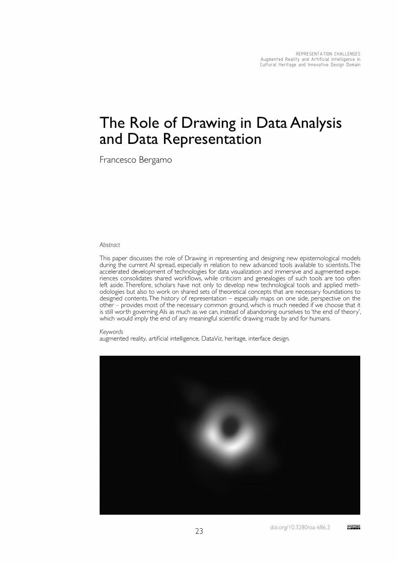
The critical and theoretical literature on both of the aforementioned paths is growing [3]; but while the first takes advantage of its many connections with media studies [Grau 2003; Zucconi 2018, pp. 149-181], the second is still struggling to find its roots mostly on marginal grounds [Facchetti 2019]: despite the fact that we are more and more exposed daily to infographics and data visualizations when it comes to AI [D’Abbraccio, Facchetti 2021], we inevitably face the irrepresentable. Even our interaction with Internet and com-puters often appears mysterious, their responses being ruled by apparent randomness or by non–human wills. In our era, characterised by the availability of large amounts of data, machines, and algorithms capable of correlating them, one can easily yield to the temp-tation of proclaiming “the end of theory” [Anderson 2008] and give up building models that cannot compete with the ostensible objectivity of data and machinic intelligence. For instance, Google Translate has been using since 2016 a neural network developed by Google Brain to replace the previous statistical inference model. No more cross–refer-ences of texts, but a real intelligence: “not a set of two–dimensional connections between words, but a map of the entire territory […]. The map is thus multidimensional, extending in more directions than the human mind can hold. As one Google engineer commented, when pursued by a journalist for an image of such a system, “I do not generally like trying to visualize thousand–dimensional vectors in three–dimensional space. This is the unseea-ble space in which machine learning makes its meaning” [Bridle 2018, p. 148].Yet we are very aware of how much we need visual representations of complex phenom-ena per se and how much we need them to rule those phenomena. During the first stag-
25
es of the Covid–19 pandemic we behaved according to the imperative of ‘flattening the curve’, where ‘the curve’ was a graph looking like two Gaussians, one without protective measure, the other – smoother, contained under the ‘Healthcare system capacity’ line – with. And even though with AIs and Big Data the (unrepresentable) maps tend more and more to coincide with the (inaccessible) territories, the Event Horizon Telescope team spent years and deployed huge resources to process a static bidimensional image of the black hole at the centre of the Messier 87 galaxy, which became viral on social media just a few hours after it was released, on 10 April 2019 [4]. It succeeded largely because it looked like a photography.These questions are crucial for many scientific disciplines, and the problematic folds of their unknown lands are calling for scholars of Drawing to act on the bases of their own knowledge. Consider the pandemic graphs and maps [5]: the more data speak clearly through their representations, the more they are insidious, to the point that they can be interpreted in totally opposite ways or confuted based on one or more steps during the phases of collection, sifting and visualization. In most cases, paradoxically, the representa-tions that are more difficult to understand and decipher are also the most engaging for those who want to understand them in depth, because they force the viewer to activate a sort of critical awareness: they may not be adequate for quickly comparing trends – such as economic growth or the number of infections – but they work because they force us to pay attention to what is underneath. Common experience also shows that much of the work that careful use of these artifacts has to do, to find a thread to follow in such opacity, is in the reading of the texts that accompany visualizations, commonly found in scientific papers as well as in newspapers and magazines. Texts commenting visualizations are fundamental to understand and evaluate the choices made by scientists and/or infographic designers.
Drawing at the Intersection of Digital Humanities and Human Digitalities
The role of humanistic knowledge, therefore should be upgraded in data analysis and representation. Recently, the writer Helen Dewitt and the statistician Andrew Gelman published a short piece together [Dewitt, Gelman 2020] where they addressed the prob-lem of what we could call ‘DataViz criticism’ [6]. The article refers especially to the prolif-eration of data visualizations at the time of the Covid–19 pandemic, to their potential and real “narrative” implications and to the lack of attention given by designers to the possible uses of such graphic artifacts. The two authors begin by comparing an old diagram drawn by Florence Nightingale on the causes of mortality during the Crimean War (1853-56) with a contemporary analogous and much simpler diagram, highlighting how the first is more difficult to read but also more ‘engaging’ for the reader, more suitable for drawing her to a critical–narrative dimension.The role of Drawing, between technical and humanistic knowledge, can be therefore strategic non only when it comes to representing, but also for the structural and infra-structural configuration of the digital clones of reality, or ‘digital twins’, that are becoming bigger and more and more integrated with each other and with everyday life through in-terfaces and algorithms, and that are based upon data collected and processed by means of optical–perspectival devices. These data are getting more and more important to inte-grate and augment reality with synthetic information, which is provided by optical sensors, algorithmic observers and artificial intelligences. If a giant tech corporation should ever monopolize the database of worldwide real time optical scans, it would lead to a sort of diffused global panopticon of enormous power, controlling AR games, self–driving vehicles but also much more [Kelly 2019]. And this is just basically the same technology that schol-ars use when surveying a piece of cultural heritage to obtain a digital twin to preserve it, to promote it, to study it in detail, to plan and design possible interventions, etc.Here is why Drawing must face the challenge not only to represent, but also to define and take part in the construction of new epistemological models: confronting the unfathom-able complexity of AIs demands for new tools to build shared models and govern reality.
26
The alternative is to give up models and representations, to abandon science at the end of theory, to mere correlation among data [7]. Scholars are involved because they are familiar not only with technologies and workflows, but also with the optical, perspectival, geometrical and, more generally, representational knowledge that lies underneath, which is to say: with the very roots of the systems, infrastructures and interfaces that are shaping today’s human interactions with the world.
Between Perception and Scientific Analysis: Metaphors and –scapes
As human beings, we probably need conceptual tools such as metaphors to deal with complexity [Bridle 2018, pp. 2-10]: after all, it’s exactly what we do every time we use a desktop computer, open a folder, and edit a file. Today’s systems of power are often described by and modelled upon scopic regimes, as we have said about the potential of the digital twin of the world [Kelly 2019] and as we know very well from Michel Foucault [Foucault 1975], Martin Jay [Jay 1988] and the last episode of Adam Curtis’ documentary series Can’t Get You Out of My Head (BBC 2021). In fact, we are used to find metaphors coming from optics almost everywhere: transparency is a myth of modernist architecture as well as of interaction designers [8], but we claim it also from finance, economy, politics, at every scale. Catoptrics has been used by post–modernists to critique Modernism’s faith in transparency and to subvert it. And dioptrics may provide useful references to better understand and design today’s world with a critical attitude [Bergamo 2019], together with other optical notions such as, for example, that of parallax [Anderson 2018].It is up to Drawing also the ambitious and relevant task of connecting and interweaving the paths of the two big categories with which this paper began: god eye’s maps and human eye’s perspectival views. Some of the possible meeting points can be found in ‘–scapes’. Not only in the much–debated notion of landscape, which after von Hum-boldt merges the subjective perception of the observer with scientific collection and observation of information [Farinelli 2003, pp. 40-53]. But also, for example, in the many possible representations of soundscapes [Bergamo 2018] and in sound maps, which should star t addressing the problem of placing perspectival and time–dependent au-dio field recordings onto interactive visual maps. And in datascapes, researched in the Nineties by the ar tistic collective Knowbotic Research and today by Ryoji Ikeda: abstract visualizations of digital data become a sort of ar tificial immersive landscape, engaging the viewer and, at the same time, potentially providing her with new visual metaphors, new tools to represent what exists and design what will come.
Conclusions
Technology has evolved, the world has changed, but we are still the same species that tried to visualize and organize such a complex thing like memory in machines that worked like modern theatres, after all. Drawing always played a major role in modeling knowledge. This paper tried to explain why the technical achievements it is deploying while facing the current challenges should be connected with the historical and critical background provided by the genealogies of perspective and maps: this much needed approach could lead to innovation in rep-resentation in today’s world, and it is up to the Drawing scholar.
Notes
[1] George Wong in Frumkin Rebekah (2019). What the Scientists Who Photographed the Black Hole Like to Read. In The Paris Review online edition, www.theparisreview.org, (10 March 2021).
[2] We could think about Paolo Veronese’s frescoes at Palladio’s Villa Barbaro as pictorial devices to “augment” the architectural experience of the owner and inhabitant and to “immerse” him in a virtual extension of the outer landscape, but the genealogy of this approach could go back in time much more, passing through Pompeii and up to cave paintings.
[3] A book about the genealogies of both is e.g. Arcagni 2018.
27
[4] See https://eventhorizontelescope.org/press-release-april-10-2019-astronomers-capture-first-image-black-hole (10 March 2021).
[5] Some media designed their own, as in the case of The New York Times; others, the most, drew from renowned research institutions; expert users could also rely on more sophisticated online tools that allow to compare and filter data according to the answers they needed to retrieve. See https://ourworldindata.org/coronavirus (10 March 2021).
[6] This phrase is not found on their article, but I think that it describes in synthesis what is at stake here.
[7] Which may lead to aberrations, such as nonsense and funny correlations between the number of people who drowned falling into a pool and the films Nicolas Cage appeared in. See the website Spurious Correlations: http://www.tylervigen.com/spurious-correlations (10 March 2021).
[8] A good interface is one the user doesn’t realize it’s there, according to most and especially after Donald Norman. See Norman Donald (1998). The Invisible Computer. Why Good Products Can Fail, the Personal Computer Is So Complex, and Information Appliances Are the Solution. Cambridge (Mass.): The MIT Press.
References
Anderson Chris (2008). End of Theory. In Wired, 23 June 2008. https://www.wired.com/2008/06/pb-theory (10 March 2021).
Anderson Steve F. (2018). Technologies of Vision. The War Between Data and Images. Cambridge (Mass): The MIT Press.
Arcagni Simone (2018). L’occhio della macchina. Torino: Einaudi.
Bergamo Francesco (2018). Il disegno del paesaggio sonoro. Milano-Udine: Mimesis.
Bergamo Francesco (2019). Trasparenze, riflessioni, deformazioni. L’ottica come strumento e metafora nelle forme della rappresentazione / Transparences, Reflections, Deformations. Optics as a Tool and Metaphor in The Forms of Representation. In Riflessioni. L’arte del disegno / il disegno dell’arte / Reflections. The art of drawing / the drawing of art, Proceedings of the 41st Convegno Internazionale dei Docenti delle Discipline della Rappresentazione. Roma: Gangemi International, pp. 41-48.
Bridle James (2018). New Dark Age. Technology and the End of the Future. London-New York: Verso.
D’Abbraccio Francesco, Facchetti Andrea (eds.) (2021). AI & Conflicts, Volume 1. Brescia: Krisis.
Dewitt Helen, Gelman Andrew (2020). Graphic Content: How Visualizing Data Is a Life-Or-Death Matter. In Frieze, vol. 213, September 2020. https://www.frieze.com/article/graphic-content-how-visualizing-data-life-or-death-matter (10 March 2021).
Facchetti Andrea (ed.) (2019). Design&Conflicts. Brescia: Krisis.
Farinelli Franco (2003). Geografia. Un’introduzione ai modelli del mondo. Torino: Einaudi.
Foucault Michel (1975). Surveiller et punir : Naissance de la prison. Paris: Gallimard.
Grau Oliver (2003). Virtual Art: From Illusion to Immersion. Cambridge (Mass.): The MIT Press.
Jay Martin (1988). Scopic Regimes of Modernity. In Foster Hal (ed.). Vision and Visuality. Seattle: Bay Press, pp. 3-28.
Kelly Kevin (2019). AR Will Spark The Next Big Tech Platform – Call It Mirrorworld”. In Wired, 2 December 2019. https://www.wired.com/story/mirrorworld-ar-next-big-tech-platform (10 March 2021).
Zucconi Francesco (2018). Displacing Caravaggio. Art, Media, and Humanitarian Visual Culture. Cham: Palgrave Macmillan.
Copyright © 2021 by FrancoAngeli s.r.l. Milano, Italy Isbn 9788835125280
AuthorFrancesco Bergamo, Dept. of Culture del Progetto, Iuav University of Venice, [email protected]

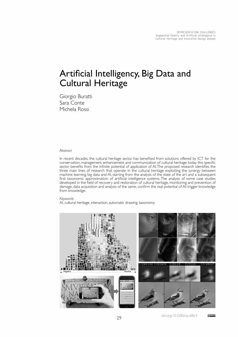
doi.org/10.3280/oa-686.429
REPRESENTATION CHALLENGESAugmented Reality and Artificial Intelligence in Cultural Heritage and Innovative Design Domain
Abstract
In recent decades, the cultural heritage sector has benefited from solutions offered by ICT for the conservation, management, enhancement and communication of cultural heritage; today this specific sector benefits from the infinite potential of application of AI. The proposed research identifies the three main lines of research that operate in the cultural heritage exploiting the synergy between machine learning, big data and AI, starting from the analysis of the state of the art and a subsequent first taxonomic approximation of artificial intelligence systems. The analysis of some case studies developed in the field of recovery and restoration of cultural heritage, monitoring and prevention of damage, data acquisition and analysis of the same, confirm the real potential of AI: trigger knowledge from knowledge.
KeywordsAI, cultural heritage, interaction, automatic drawing, taxonomy.
Artificial Intelligency, Big Data and Cultural HeritageGiorgio BurattiSara ConteMichela Rossi
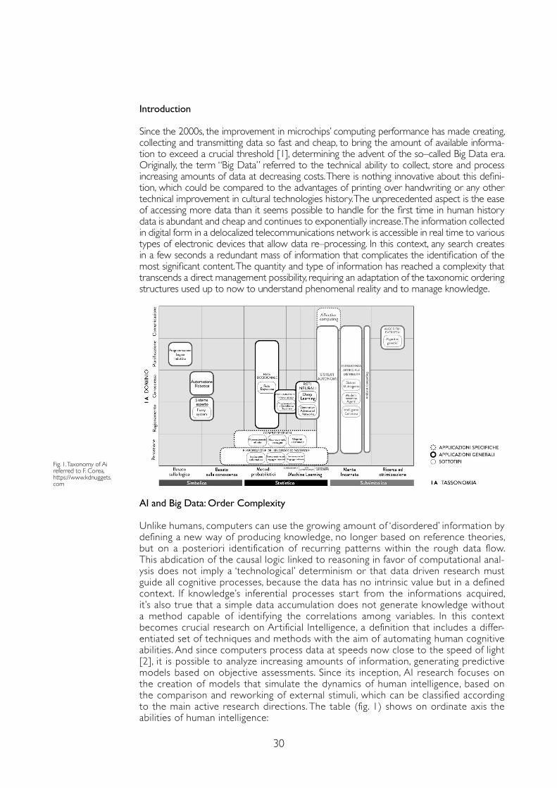
30
Introduction
Since the 2000s, the improvement in microchips’ computing performance has made creating, collecting and transmitting data so fast and cheap, to bring the amount of available informa-tion to exceed a crucial threshold [1], determining the advent of the so–called Big Data era. Originally, the term “Big Data” referred to the technical ability to collect, store and process increasing amounts of data at decreasing costs. There is nothing innovative about this defini-tion, which could be compared to the advantages of printing over handwriting or any other technical improvement in cultural technologies history. The unprecedented aspect is the ease of accessing more data than it seems possible to handle for the first time in human history data is abundant and cheap and continues to exponentially increase. The information collected in digital form in a delocalized telecommunications network is accessible in real time to various types of electronic devices that allow data re–processing. In this context, any search creates in a few seconds a redundant mass of information that complicates the identification of the most significant content. The quantity and type of information has reached a complexity that transcends a direct management possibility, requiring an adaptation of the taxonomic ordering structures used up to now to understand phenomenal reality and to manage knowledge.
AI and Big Data: Order Complexity
Unlike humans, computers can use the growing amount of ‘disordered’ information by defining a new way of producing knowledge, no longer based on reference theories, but on a posteriori identification of recurring patterns within the rough data flow. This abdication of the causal logic linked to reasoning in favor of computational anal-ysis does not imply a ‘technological’ determinism or that data driven research must guide all cognitive processes, because the data has no intrinsic value but in a defined context. If knowledge’s inferential processes star t from the informations acquired, it’s also true that a simple data accumulation does not generate knowledge without a method capable of identifying the correlations among variables. In this context becomes crucial research on Ar tificial Intelligence, a definition that includes a differ-entiated set of techniques and methods with the aim of automating human cognitive abilities. And since computers process data at speeds now close to the speed of light [2], it is possible to analyze increasing amounts of information, generating predictive models based on objective assessments. Since its inception, AI research focuses on the creation of models that simulate the dynamics of human intelligence, based on the comparison and reworking of external stimuli, which can be classified according to the main active research directions. The table (fig. 1) shows on ordinate axis the abilities of human intelligence:
Fig. 1. Taxonomy of Ai referred to F. Corea, https://www.kdnuggets.com
31
• Perception: skill to transform sensory inputs into useful information);• Reasoning: skill to connect / solve problems;• Communication: ability to elaborate a language and transmit concepts;• Knowledge: skill to understand and represent reality;• Planning:skill to define and achieve objectives.The main research lines currently recognized are summarized on the abscissa axis:• Symbolic Approach: which considers intelligence as that process of transforming perceptual stimuli into symbols to which a meaning can be attributed, according to more or less formal rules;• Statistical Approach: based on logical–mathematical tools to extract information content useful for transforming information into knowledge starting from Bayesian inference, formaliz-ing the hypothesis that a greater use of a given data increases the probability of its exactness;• Sub–Symbolic Approach: based on neuronal functioning whereby information is transmit-ted regardless of meanings: knowledge emerges regardless of previous mental models, but on the basis of structures based on experience.From these line of research, six subgroups descend which identify the main AI applications:• Logic–based: tools used for problem solving through the orderly representation of knowledge;• Knowledge–based: tools with extended ontologies and relational databases of notions, information and rules;• Probabilistic Methods: tools that allow agents to act even in incomplete information scenarios;• Machine Learning: tools that generate data from other data;• Embodied Intelligence: engineering toolbox, which assumes that a body (or at least a par-tial set of functions such as movement, perception, interaction, and visualization) is required for higher intelligence• Research and Optimization: predictive calculation tools that allow you to optimize possi-ble solutions according to the specific context.These methods are already used, often unknowingly, on a daily basis: when we ask for directions to our portable device or ask a virtual assistant to turn on the light, we are interacting with natural language interpretation AI and neural networks trained to carry out research and home automation operations.For some years now, the use of genetic or evolutionary algorithms in form finding studies has consolidated the AI tools also in the drawing discipline. These processes consider the different morphological hypotheses as biological individuals and recombine them, similarly to sexual bio-logical reproduction, introducing elements of disorder that simulate random genetic mutations.Thousands of formal solutions (new individuals) are thus generated, among which those that guarantee the highest level of optimization are chosen, just as selective processes promote the survival of the individuals most suitable for an ecosystem. In this way it is possible to explore solutions hitherto unused due to the lack of description and control tools adequate to the problem complexity.
The New Frontiers of AI Applied to Cultural Heritage
The first one collects all the research characterized by the development of innovative meth-odologies and systems to monitor and prevent damage to the cultural heritage, helping to increase the offer for the users. The most common example is the biosensor that can pre-vent damage from biological pests. This is any analog or digital device that works with living organisms (indicators) able to respond to certain environmental stimuli, producing an elec-tro–chemical, optical signal to reach a threshold value. Today automatic biosensors are studied, that work in real time and continuously to signal in indoor environments the achievement of favorable conditions to germinative factors and therefore a constant monitoring of the state of health of the good [Danese et al. 2019]. Significant are the researches based on the use of neural networks in conservative perspective; in particular the one carry on by the research-ers of National Gallery, Duke University and University College of London, that used neural networks to analyze complex high–resolution digital X–ray images of the cathedral of Gand “Adoration of the Mystical Lamb” [Van der Snickt et al. 2020]. Convolutional neural networks (CNN) combined with multi–resolution imaging techniques, initially used to determine the
32
authorship of a work and to distinguish fakes, are now able to reconstruct unfinished or dete-riorated drawings from time as demonstrated by the research of the Dutch Technical Univer-sity of Delft [Zeng et al. 2019]. The goal is the automatic reconstruction, through a pixel wise technology, of Vincent van Gogh’s drawings that are deteriorated by time. The team was able to return works now irretrievably lost to the public, using the algorithm inspired by biological neural networks similar to human brain ones and trained on a data set containing reproduc-tions of original drawings of various qualities, sizes, made at different times. The second area analyses the experiments that focus on automatic data acquisition, such as the application of mobile technologies for three–dimensional surveying and the acquisition of images of monuments, architectures, archaeological sites. The distributed AI is an interesting line of research that is giving the first results in the field of three–dimensional and photogram-metric relief, through drones that are able to direct their flight in strategies similar to the ones of bees and other social insects. Flight trajectories are not pre–programmed for individual units, but depend on the network of interactions given by the continuous communication be-tween the various subjects, and between them and the environment in which they operate, as it is visible in the Aerial Construction project [Willmann et al. 2008]. The project of the DISI of the University of Trento in collaboration with local authorities, such as the MART of Rovereto goes further, developing AI able to analyze the influence on perceptive properties and the emotional level that a work of art arouses in the observer. The AI recognizes the intensity and the type of the emotion through a facial recognition system based on the affective computing and the deep learning, providing useful information for the museum and curators [Sartori et al. 2016]. The work of the CNR–IMATI within the project Horizone 2020, GRAVITATE pro-vides us an example of automatic extraction of features through the Generative adversarial network. The experimentation allows to identify the ceramic fragments, through the combi-nation of semantic and geometric elements, and to assemble them in a semi–automatic way, simplifying the work of the archaeologist and giving the possibility to virtually reunify a spread archaeological heritage. [Moscoso Thompson, Biasotti 2019].The third field aims to develop systems for the management of large amounts of data and informations, analog or digital, contained in libraries, archives, museums, and to provide the user with easier and more immediate access to information. There are many apps today that want to meet the needs of the users, who are visiting cities and monuments, by pro-viding in real time useful and richer content and interpretations of our past, mainly using the ambient computing and the deep learning. Time Machine is a European project that aims at 4D digital reconstruction of every historical place of the main European cities, combining them with data of all types accessible with augmented reality interfaces; Monugram allows to give information of a monument based on the recognition of the image taken by the user in real time; Woolysses is an interactive chatbot for tours enriched with personalized multimedia content and anticipating the needs of the user ; Eagle, allows automatic recogni-tion of Greek/Latin epigraphs and dissemination of associated information. The aim of the different methodologies is unambiguous: to orient the technology towards the rediscovery of the knowledge to protect it or make it accessible, putting the digital reality at the service of the material one.
Conclusion
The fields of application of AI are constantly evolving and searching for new contexts in which the application of predictive algorithms allows the extrapolation of finalized solutions from the automatic reprocessing of a large amount of data. The intelligence of the machine is a consequence of the research speed of comparable information in a network that mim-ics neural connections. The solution is the statistical result of a comparison based on the evidence: a digital reinvention of the empiricism that preceded the development of exper-imental science, which built knowledge on reasoning aided by intuition. New knowledge is born from the empirical reworking of previous knowledge; the added value is parametric definition of reworking and the relationships between algorithms, controlled by humans. The inventiveness that distinguishes it does not depend only on logical capabilities; in fact the
33
Notes
[1] At the time of writing [2021] the amount of data currently engaged in the world each year is about 40 ZB [zettabytes]. One ZB corresponds to 102121 bytes, equivalent to approximately 180 million times the information collected in the records kept in the Library of Congress in Washington, recognized as the largest existing library with over 158 million documents held.
[2] At the time of writing, the most powerful computer in the world is Summit, developed by IBM for the ORNL, United States Department of Energy, capable of handling 100 petaflops, equivalent to 100 million billion operations per second. Summit is used in studies ranging from particle physics to weather/climate forecasts, from the creation of new drugs to the simulation of the effects of nuclear explosions.
[3] Although the paper was conceived jointly, Michela Rossi is the author of Introduction, Gorgio Buratti is the author of AI and Big Data: Order complexity and the related image, Sara Conte is the author of The new frontiers of AI applied to cultural heritage. The Conclusions are drafted jointly.
References
Andreza Sartori, Dubravko Culibrk, Yan Yan, Remo Job, e Nicu Sebe (2016). Computational modeling of affective qualities of abstract paintings. In IEEE MultiMedia, 23 (3), pp. 44-54.
Danese Maria, Sileo Maria, Rosa Lasaponara, Nicola Masini (2019). Proximal remote sensing e spatial analysis per la conservazione delle pitture parietali pompeiane. Il caso del gymnasium. In ArcheomaticA, 2, pp. 12-18.
Moscoso Thompson Elia, Biasotti Silvia (2019). Retrieving color patterns on surface meshes using edgelbp descriptors. In Computers & Graphics, 79, pp. 46-57.
Van der Snickt Geert, Dooley Kathryn, Jana Sanyova, Hélène Dubois, Delaney John, Gifford Melanie, Legrand Stijn, Laquiere Nathalie, Janssens Koen (2020). Dual mode standoff imaging spectroscopy documents the painting process of the Lamb of God in the Ghent Altarpiece by J. and H. Van Eyck. In Science Advances, AAAS, 6 (31), pp. 1-10.
Willmann Jan, Augugliaro Federico, Cadalbert Thomas, D’Andrea Raffaello, Gramazio Fabio, Kohler Matthias (2008). Aerial Robotic. Construction towards a new field of architectural research. In International journal of architectural computing, 03 (10), pp. 439-459.
Zhang Han, Xu Tao, Li Hongsheng, Zhang Pengchuan, Wang Xiaogang, Huang Xaolei, Metaxas Dimitris (2017). Stackgan: Text to photo-realistic image synthesis with stacked generative adversarial networks. IEEE Int. Conf. on Computer Vision, pp. 907-591
Zeng Yuan, van der Lubbe Jan, Loog Marco (2019). Multi-scale convolutional neural network for pixel-wise reconstruction of Van Gogh’s drawings. In Machine Vision and Applications, Cham: Springer, pp. 1229-1241.
described context opens to a series of reflections within the transformations taking place in drawing and in the contribution of the machine to design. For example, the Drawing–Bot is an AI developed by Microsoft in collaboration with three American universities that uses the technology of the antagonistic generative network to create images from its description. A neural generative network creates new images from some keywords, while an antagonistic network compares them with a database of existing images, eliminating the results that differ from it. At present this AI produces good results for short and explanatory expressions; it is able to easily extract the forms and then integrates them autonomously with the absent details from the given description, while the final result is likely to be a confused image for complex descriptions, but it is only a matter of time and speed of calculation. In the example [Zhang et al. 2017] the quality of the representation is close to the photographic one, but the reproduced bird does not exist in the reality, is a representation born from the “imagination” of a computer. This case opens up to a series of reflections on the machine’s learning potential and on how the relationship between the machine and the designer may evolve in the future. Today the machine is able to create a drawing based on the same geometric rules used to trace it by hand, but will it be possible to teach the machine the capacity of autonomous reasoning and to simulate the human creative capacity, through data processing?
Copyright © 2021 by FrancoAngeli s.r.l. Milano, Italy Isbn 9788835125280
AuthorsGiorgio Buratti, Dept. of Design, Politecnico di Milano, [email protected] Conte, Dept. of Design, Politecnico di Milano, [email protected] Rossi, Dept. of Design, Politecnico di Milano, [email protected]

doi.org/10.3280/oa-686.535
REPRESENTATION CHALLENGESAugmented Reality and Artificial Intelligence in Cultural Heritage and Innovative Design Domain
Abstract
Nowadays museums realities are increasingly interested in introducing advanced technological tools, in order to preserve and enhance the Cultural Heritage, as well as to make it more accessible and attractive. In fact, digital tools, such as Virtual Reality (VR) and Augmented Reality (AR), allow to pro-vide effective responses to the needs of different types of users, to enhance the expressive qualities of the cultural asset, as well as to enrich the visitor’s learning possibilities. However, the integration of new technologies in the management of Cultural Heritage involves different type of ethical issues. The paper analyses some of the ethical issues related to ontological, economic, and social aspects, trying to outline some principles able to limit these critical implications.
Keywordsmuseums, ethical issues, accessibility, virtual reality, augmented reality.
Virtual Tours and Representations of Cultural Heritage: Ethical IssuesMarco FerrariLodovica Valetti
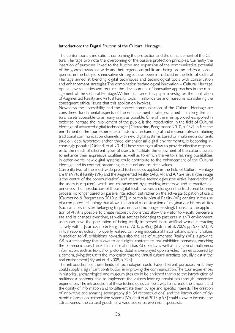
36
Introduction: the Digital Fruition of the Cultural Heritage
The contemporary indications concerning the protection and the enhancement of the Cul-tural Heritage promote the overcoming of the passive protection principles. Currently the insertion of purposes linked to the fruition and expansion of the communicative potential of the goods towards a wide and heterogeneous public are being promoted. As a conse-quence, in the last years innovative strategies have been introduced in the field of Cultural Heritage aimed at blending digital techniques and technological tools with conservation and enhancement strategies. The combination ‘technological innovation – Cultural Heritage’ opens new scenarios and requires the development of innovative approaches in the man-agement of the Cultural Heritage. Within this frame, this paper investigates the application of Augmented Reality and Virtual Reality tools in historic sites and museums, considering the consequent ethical issues that this application involves. Nowadays the accessibility and the correct communication of the Cultural Heritage are considered fundamental aspects of the enhancement strategies, aimed at making the cul-tural assets accessible to as many users as possible. One of the main approaches, applied in order to increase the involvement of the public, is the introduction in the field of Cultural Heritage of advanced digital technologies [Carrozzino, Bergamasco 2010, p. 452]. In fact, the enrichment of the tour experience in historical, archaeological and museum sites, combining traditional communication channels with new digital systems, based on multimedia contents (audio, video, hypertext, and/or three dimensionsal digital environments), is becoming in-creasingly popular [Orlandi et al. 2014]. These strategies allow to provide effective respons-es to the needs of different types of users, to facilitate the enjoyment of the cultural assets, to enhance their expressive qualities, as well as to enrich the visitor’s learning possibilities. In other words, new digital systems could contribute to the enhancement of the Cultural Heritage and its context, promoting its cultural and touristic values.Currently, two of the most widespread technologies applied in the field of Cultural Heritage are the Virtual Reality (VR) and the Augmented Reality (AR). VR and AR are visual (the image is the centre of the communication) and interactive technologies (the active intervention of the users is required), which are characterized by providing immersive and interactive ex-periences. The introduction of these digital tools involves a change in the traditional learning process, no longer based on passive interaction, but rather on the active participation of users [Carrozzino & Bergamasco 2010, p. 453]. In particular, Virtual Reality (VR) consists in the use of a computer technology that allows the virtual reconstruction of imaginary or historical sites (such as cities or sites belonging to past eras and no longer existing). Thanks to the applica-tion of VR, it is possible to create reconstructions that allow the visitor to visually perceive a site and its changes over time, as well as settings belonging to past eras. In a VR environment, users can have the perception of being totally immersed in an artificial world, interacting actively with it [Carrozzino & Bergamasco 2010, p. 453] [Styliani et al. 2009, pp. 522-523]. A virtual reconstruction, if properly realized, can bring educational, historical, and scientific values. In addition to VR exhibitions, nowadays also the use of Augmented Reality (AR) is growing. AR is a technology that allows to add digital contents to real exhibition scenarios, enriching the communication. The virtual information (i.e. 3d objects, as well as any type of multimedia information, such as textual or pictorial data) is overplayed upon a video frames captured by a camera, giving the users the impression that the virtual cultural artefacts actually exist in the real environment [Styliani et al. 2009, p. 523]. The introduction of these kinds of technologies could have different purposes. First, they could supply a significant contribution in improving the communication. The tour experiences in historical, archaeological and museum sites could be enriched thanks to the introduction of multimedia contents, able to implement the visitor’s learning possibilities through immersive experiences. The introduction of these technologies can be a way to increase the amount and the quality of information and to differentiate them by age and specific interests. The creation of innovative and amazing scenography (i.e. 3d reconstructions) and the introduction of dy-namic information transmission systems [Vaudetti et al. 2013, p. 95] could allow to increase the attractiveness the cultural goods for a wide audience, even non–specialists.
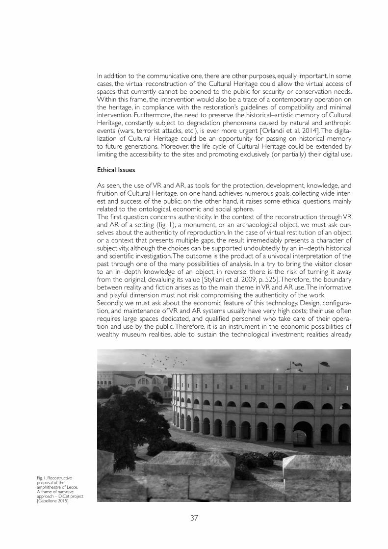
37
In addition to the communicative one, there are other purposes, equally important. In some cases, the virtual reconstruction of the Cultural Heritage could allow the virtual access of spaces that currently cannot be opened to the public for security or conservation needs. Within this frame, the intervention would also be a trace of a contemporary operation on the heritage, in compliance with the restoration’s guidelines of compatibility and minimal intervention. Furthermore, the need to preserve the historical–artistic memory of Cultural Heritage, constantly subject to degradation phenomena caused by natural and anthropic events (wars, terrorist attacks, etc.), is ever more urgent [Orlandi et al. 2014]. The digita-lization of Cultural Heritage could be an opportunity for passing on historical memory to future generations. Moreover, the life cycle of Cultural Heritage could be extended by limiting the accessibility to the sites and promoting exclusively (or partially) their digital use.
Ethical Issues
As seen, the use of VR and AR, as tools for the protection, development, knowledge, and fruition of Cultural Heritage, on one hand, achieves numerous goals, collecting wide inter-est and success of the public; on the other hand, it raises some ethical questions, mainly related to the ontological, economic and social sphere.The first question concerns authenticity. In the context of the reconstruction through VR and AR of a setting (fig. 1), a monument, or an archaeological object, we must ask our-selves about the authenticity of reproduction. In the case of virtual restitution of an object or a context that presents multiple gaps, the result irremediably presents a character of subjectivity, although the choices can be supported undoubtedly by an in–depth historical and scientific investigation. The outcome is the product of a univocal interpretation of the past through one of the many possibilities of analysis. In a try to bring the visitor closer to an in–depth knowledge of an object, in reverse, there is the risk of turning it away from the original, devaluing its value [Styliani et al. 2009, p. 525]. Therefore, the boundary between reality and fiction arises as to the main theme in VR and AR use. The informative and playful dimension must not risk compromising the authenticity of the work.Secondly, we must ask about the economic feature of this technology. Design, configura-tion, and maintenance of VR and AR systems usually have very high costs; their use often requires large spaces dedicated, and qualified personnel who take care of their opera-tion and use by the public. Therefore, it is an instrument in the economic possibilities of wealthy museum realities, able to sustain the technological investment; realities already
Fig. 1. Recostructive proposal of the amphitheatre of Lecce. A frame of narrative approach – DiCet project [Gabellone 2015].
38
started and recognized, which – through their revenues or the support of patrons – im-plement the development of a heritage that may already be widely known, promoting its fruition in an innovative, diversified, modern, and endearing way. In the case of small, less fortunate museums, with reduced spaces and limited resources, the adoption of this technology, for example, would make accessible more objects normally not exposed due to lack of space, as well as it would offer more attractive visiting ways, welcoming broad public interest and obtaining profit and sustenance. An economic gap emerges in the potential of these instruments: they are promoted by already virtuous realities and hardly available to others that would need them to promote themselves.Finally, a delicate question about social context arises. On one hand, the VR and AR use is extremely inclusive, providing opportunities to people with special needs (visual, acoustic, vocal, motor disabilities, and learning difficulties); however, on the other hand, the devices currently in use allow a type of visit characterized by a strong individualism. The isolation in the experience, often combined with the absence of a guide, can entail a loss of inter-est by the user : the deprivation of a stimulating relational exchange – between visitors or with an expert guide – risks to reduce the educational value of the contents offered as well as the indispensable emotional dimension, despite the strong visual impact of the context. Moreover, the growing diffusion and application of these technologies in daily and domestic life, from cinema to videogames, implying the possibility of seeing without imag-ining, can induce an estrangement of the user from the essence and the purpose of the experience itself: the significance of the artwork, the scientific value of the reconstruction, the informative and didactic goal. Therefore, we witness the feared «Guggenheim effect» [Carrozzino & Bergamasco 2010, p. 457]: the fascination of the container overcomes and reduce the content, transforming the experience into mere entertainment rather than an opportunity to transmit information.
Conclusions: Principles for Alternative Scenarios
The use of these technologies, therefore, entails great advantages but also raises questions that lead us to reflect on principles able to limit their critical implications.Firstly, the sources on which to build the virtual reading of the Cultural Property must be undeniable, as a guarantee and protection of its values of authenticity and uniqueness.Secondly, from the point of view of communication, technology must act as a means of knowledge and culture, not as a mere attraction in order to implement tourist and econom-ic flows. The main purpose should be the communication of historical, artistic, and cultural values of a population, as well as the authenticity and uniqueness of a work. Therefore, it is necessary a deep awareness based on education and culture: both on the part of the de-velopers towards the contents to be communicated, and on the part of the users towards the added value that augmented reality offers. VR and AR are also instruments whose use must be calibrated and measured on the monument itself; cultural heritage institutions must assess their actual necessity and usefulness.Concerning the economic gap that underlies the possibilities of each museum, we have to reconsider the criteria for access to funding and redefine the distribution of resources for the design and development of these technologies. In this way, less fortunate museums could benefit from funding for the conservation and enhancement of their heritage, provid-ed that the proposals to be financed are examined by a multidisciplinary scientific commit-tee that controls the methodological validity and the ethical implications. Finally, technological development must increasingly be directed towards collective in-clusiveness, preferring opportunities for comparison and evolving from the individu-al dimension. The correct communication of scientific contents must be guaranteed through the interaction with a guide or through the presence of an interface that can offer support for the visit, hoping that the technological innovation may soon lead to social and increasingly inclusive use.In conclusion, VR and AR represent interesting tools to share knowledge, conservation, and development of the values of Cultural Heritage, provided that both their planning and fru-
39
References
Arcagni Simone (2016). L’etica della realtà virtuale. http://www.ilsole24ore.com/art/tecnologie/2016-05-09/l-etica-realta-virtuale-151037.shtml?uuid=AD4sn7 (February 2021).
Carrozzino Marcello, Bergamasco Massimo (2010). Beyond virtual museums: Experiencing immersive virtual reality in real museum. In Journal of Cultural Heritage, 11, 2010, pp. 452-458.
Felline Francesca (2015). Tecnologie innovative per la fruizione immersiva ed interattiva dei beni culturali. http://www. cniscintille.it/tecnologie-innovative-per-la-fruizione-immersiva-ed-interattiva-dei-beni-culturali/ (March 2018).
Gabellone Francesco (2015). Integrated Technologies for Museum Communication and Interactive Apps in the PON DiCet Project. In: De Paolis Lucio Tommaso, Mongelli Antonio (eds.). Augmented and Virtual Reality. AVR 2015. Lecture Notes in Computer Science, 9254. Cham: Springer, pp. 3-16.
http://www.arapacis.it (May 2021).
http://www.eheritage.org/museum-installations/ (February 2021).
http://ec.europa.eu/research/social-sciences/index.cfm (February 2021).
http://www.progettoitacha.it/partner (February 2021).
http://www.researchers.polito.it/success_stories/progetti_metti_in_rete/nuove_tecnologie_per_le_collezioni_museali (February 2021).
Orlandi Marco, Vazzana Antonino, Zambruno Simone (2014). Tecnologia, Beni Culturali e Turismo: i Tour Virtuali Virtual Tours) come strumento per una corretta comunicazione dei Beni Culturali. http://patrimonioculturale.unibo.it/sge/?page_id=829 (March 2018).
Styliani Sylaiou, Fotis Liarokapis, Kostas Kostsakis, Petros Patias (2009). Virtual museums, a survey and some issues for consideration. In Journal of Cultural Heritage, 10, 2009, pp. 520-528.
Vaudetti Marco, Minucciani Valeria, Canepa Simona (2013). Mostrare l’archeologia – Per un manuale / atlante degli interventi di valorizzazione. Torino: Allemandi&C.
ition are based on awareness and respect for uniqueness, materiality, and cultural, historical, and artistic values. There must be rules that control their use informing users that these technologies are not games: they share contents and information of high cultural value. The relationship between man and machine and the concepts of real and virtual must be kept at the center of innovation and application in this field. The many opportunities and risks impose that society negotiates the uses of these technologies, guided and supported by a coherent philosophical approach [Arcagni 2016]. In this way, these tools will become part of a historical moment and will represent a cultural value of our century to be handed down.
Copyright © 2021 by FrancoAngeli s.r.l. Milano, Italy Isbn 9788835125280
AuthorsMarco Ferrari, Dept. of Architecture and Design, Politecnico di Torino, [email protected] Lodovica Valetti, Dept. of Energy “Galileo Ferraris”, Politecnico di Torino, [email protected]

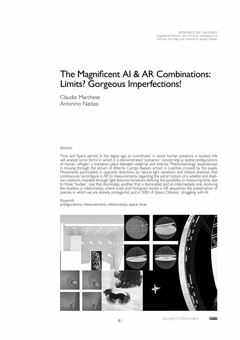
doi.org/10.3280/oa-686.641
REPRESENTATION CHALLENGESAugmented Reality and Artificial Intelligence in Cultural Heritage and Innovative Design Domain
Abstract
Time and Space persist, in the digital age, as coordinates in which human presence is located. We will analyze some forms in which it is demonstrated “scenarios” concerning: a) spatial prefigurations of human ‘refuges’; a transition place between external and internal. Phenomenology experienced, in moving through the atrium of Alberto Campo Baeza’s school in Loeches, crossed by the pupils. Movements punctuated, in opposite directions, by natural light variations and related shadows that continuously reconfigure it. AR b) measurements, regarding the astral motion of a satellite and shad-ow creations, revealed through light features. Variations defining the possibility in measuring time, due to three “bodies”, one that illuminates, another that is illuminated, and an intermediate one, receiving the shadow. c) relationships, where Exalt and Hologram, evoke in AR sequences the preservation of species, in which we are already protagonist, and in ‘2001: A Space Odyssey’, struggling with AI.
Keywordsprefigurations, measurements, relationships, space, time.
The Magnificent AI & AR Combinations: Limits? Gorgeous Imperfections! Claudio Marchese Antonino Nastasi
42
Prefigurations
When Giedion published his ‘Space, Time and Architecture’, it was sanctioned the intrinsic Architectural relationship with the two vital components, space and time, in which the hu-man presence is sited in the world. Humanity becomes aware of itself, as well as in the form of relationships between individuals of the same species and as well with other subjects, an-imate and inanimate that constitute the living environment in which one moves, measured through his proportions: this we call Space.Space, a stable entity, yet varying within the time ordinate, was somewhat immediately re-vealed to man through its cyclical manifestations. Day and night sequences taught man the art of prefiguration, making him feel set in and even cable in forecasting. Prefiguring desired events, essential for man’s existence, brought him to draw on the walls of his first abode caves, essential sketches representing the phase sequences of hunting and gathering food. With this, man is affirmed as a species capable in elaborating paths going from aspiration to the realization of the event. Didactics, initiation rite, affirmation of superiority over other species, are all in the graffiti of the Altamira caves! The thirst for knowledge induced man to move away from his cavern refuge, becoming an explorer of the world. He searches for other shelters for the night and bad weather, rather than a possible return to his cave. The trees house him. First above and then even under, becoming more brave, strengthened by the security of the power of fire. Here were invented the first forms of huts, originated by bending the branches to the ground, illustrated by Abbot Lougier and treatise writers. In the Renaissance, the symbolic hemispherical shape, which previously was raised for some time in the form of a dome, was already mature to find an even more daring and symbolic constructive form, as advocated in the phrase of Filippo Brunelleschi that, regard to the dome of Santa Maria del Fiore in Firenze, states: “[...] la fece si ampia e gonfia da coprir tutti li popoli toscani” (Manetti, ‘Le vite’). The emblematic value assumed by this dome is therefore recognized, which Brunelleschi explained it to his workers with the model of the chalices. The model was intuited by the structure of a vegetable, demonstrating thus the ability to transfer experiences from one world to another. The transitivity of such fantastic inventions was also undertaken generously by the contemporary genius Leonardo. Due to our reason-ing, however, what interests us most is basically the prefigurative capacity of the model that holds within itself the principle of doubling, pretending lightness, and hides the grandeur of the structures from the view. As we know, thanks to the invention of the herringbone brick apparatus, with the mutual contrast immediately stabilizing, the dome can be built and so high, without temporary support ribs. In the same period the art of prefiguration recognizes in Leon Battista Alberti the most convinced supporter. Which, practicing the exact form with the field construction drawings, frees the designer from following the construction site.What point have we reached today in prefigurative art?The control of architecture spatial outcomes, in prefiguration, have reach such sophisti-cations as to bring the user into the most complete simulation of real space and in the condition of being able to act in it; therefore, in space, time and modifying it through the vir-tualization, which we call Augmented Reality. This, however, highlights that even in moving in real spaces within a distractive way could hardly be perceived as the simulated one, leading us perhaps even beyond our own wishes. A tool that has been tested for decades within programs and technologies available to everyone, is what in some programs is called ‘Fly through’. It’s true that it does not allow us to feel the warmth of sunlight and similar com-plexities. Enrolls itself as a perfect duplicate of the buildable but, actually, diminishes it. How-ever, this modest and parsimonious technology feature describes even greater poetry. The ‘Fly through’, a devise in the field of design aids, allows to configure and display what is the revealer of architectural space: which is light with its variations, a fundamental material, and the gradation of shadows on surfaces. A choice in Architecture for the color of white, which elates, in its monochromatic, life that flows within and aside us, has been defined in that role wisely by Aldo Rossi assigning thus the expression “ to be the fixed scene of life”, used for the first time in the school of Broni and characterizing his public architecture. The school foyer in Loeches of Alberto Campo Baeza presented in the video, a linear and monochro-
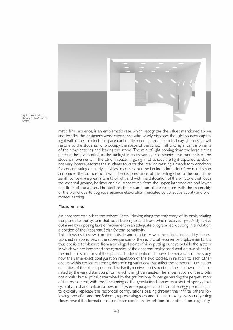
43
matic film sequence, is an emblematic case which recognizes the values mentioned above and testifies the designer’s work experience who wisely displaces the light sources, captur-ing it within the architectural space continually reconfigured. The cyclical daylight passage will restore to the students, who occupy the space of the school hall, two significant moments of their day: entering and leaving the school. The rain of light coming from the large circles piercing the foyer ceiling, as the sunlight intensity varies, accompanies two moments of the student movements in the atrium space. In going in at school, the light captured at dawn, not very intense, escorts the students towards the interior, creating a mandatory condition for concentrating on study activities. In coming out the luminous intensity of the midday sun announces the outside both with the disappearance of the ceiling due to the sun at the zenith conveying a great intensity of light and with the dislocation of the windows that focus the external ground, horizon and sky, respectively from the upper, intermediate and lower exit floor of the atrium. This declares the resumption of the relations with the materiality of the world, due to cognitive essence elaboration mediated by collective activity and pro-moted learning.
Measurements
An apparent star orbits the sphere, Earth. Moving along the trajectory of its orbit, relating the planet to the system that both belong to and from which receives light. A dynamics obtained by imposing laws of movement in an adequate program reproducing, in simulation, a portion of the Apparent Solar System complexity. This allows us to view from the outside and in a faster way, the effects induced by the es-tablished relationalities, in the subsequences of the reciprocal recurrence displacements. It is thus possible to ‘observe’ from a privileged point of view, putting our eye outside the system in which we are immersed, the dynamics of the apparent reality produced on our planet by the mutual dislocations of the spherical bodies mentioned above. It emerges, from the study, how the same exact configuration repetition of the two bodies, in relation to each other, occurs within cyclical cadences, determining variations that affect the temporal illumination quantities of the planet portions. The Earth, receives on its portions the shadow cast, illumi-nated by the very distant Sun, from which the light emanates. The ‘imperfection’ of the orbits, not circular, but elliptical, determined by the gravitational forces, generating the perpetuation of the movement, with the functioning of the gravitational forces, as a sort of springs that cyclically load and unload, allows, in a system equipped of substantial energy permanence, to cyclically replicate the reciprocal configurations passing through the ‘infinite’ others, fol-lowing one after another. Spheres, representing stars and planets, moving away and getting closer, reveal the formation of particular conditions, in relation to another ‘non–regularity’,
Fig. 1. 3D Animation, elaborated by Antonino Nastasi.
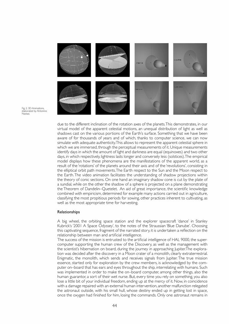
44
due to the different inclination of the rotation axes of the planets. This demonstrates, in our virtual model of the apparent celestial motions, an unequal distribution of light as well as shadows cast on the various portions of the Earth’s surface. Something that we have been aware of for thousands of years and of which, thanks to computer science, we can now simulate with adequate authenticity. This allows to represent the apparent celestial sphere in which we are immersed, through the perceptual measurements of it. Unique measurements identify days in which the amount of light and darkness are equal (equinoxes) and two other days, in which respectively, lightness lasts longer and conversely less (solstices). The empirical model displays how these phenomena are the manifestations of the apparent world, as a result of the ‘rotations’ of the planets around their axis and of the ‘revolutions’, consisting in the elliptical orbit path movements. The Earth respect to the Sun and the Moon respect to the Earth. The video animation facilitates the understanding of shadow projections within the theory of conic sections. On one hand an imaginary shadow cone is cut by the plate of a sundial, while on the other the shadow of a sphere is projected on a plane demonstrating the Theorem of Dandelin–Quetelet. An aid of great importance, the scientific knowledge combined with empiricism, determined for example many actions carried out in agriculture, classifying the most propitious periods for sowing, other practices inherent to cultivating, as well as the most appropriate time for harvesting.
Relationships
A big wheel, the orbiting space station and the explorer spacecraft ‘dance’ in Stanley Kubrick’s ‘2001 A Space Odyssey’, to the notes of the Straussian ‘Blue Danube’. Choosing this captivating sequence, fragment of the narrated story, it is undertaken a reflection on the relationship between man and artificial intelligence. The success of the mission is entrusted to the artificial intelligence of HAL 9000, the super-computer supporting the human crew of the Discovery, as well as the management with the scientist’s hibernation on board, during the journey in approaching Jupiter.The explora-tion was decided after the discovery in a Moon crater of a monolith, clearly extraterrestrial. Enigmatic, the monolith, which sends and receives signals from Jupiter. The true mission essence, started only for exploration by the crew members, is acknowledged by the com-puter on–board that has ears and eyes throughout the ship, interrelating with humans. Such was implemented in order to make the on–board computer, among other things, also the human guarantor, a sort of their wet nurse. But, every time you rely on something, you also lose a little bit of your individual freedom, ending up at the mercy of it. Now, in coincidence with a damage repaired with an external human intervention, another malfunction relegated the astronaut outside, with his small hull, whose destiny ended up in getting lost in space, once the oxygen had finished for him, losing the commands. Only one astronaut remains in
Fig. 2. 3D Animations, elaborated by Antonino Nastasi.
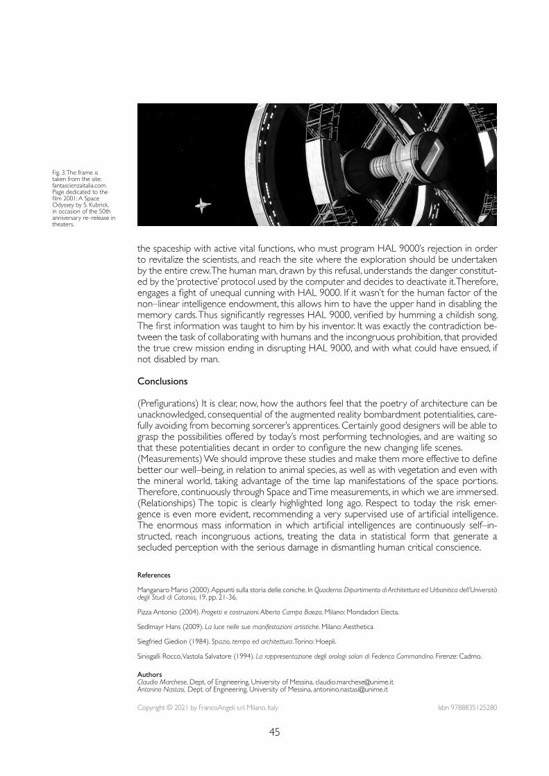
45
References
Manganaro Mario (2000). Appunti sulla storia delle coniche. In Quaderno. Dipartimento di Architettura ed Urbanitica dell’Università degli Studi di Catania, 19, pp. 21-36.
Pizza Antonio (2004). Progetti e costruzioni. Alberto Campo Baeza. Milano: Mondadori Electa.
Sedlmayr Hans (2009). La luce nelle sue manifestazioni artistiche. Milano: Aesthetica
Siegfried Giedion (1984). Spazio, tempo ed architettura. Torino: Hoepli.
Sinisgalli Rocco, Vastola Salvatore (1994). La rappresentazione degli orologi solari di Federico Commandino. Firenze: Cadmo.
the spaceship with active vital functions, who must program HAL 9000’s rejection in order to revitalize the scientists, and reach the site where the exploration should be undertaken by the entire crew. The human man, drawn by this refusal, understands the danger constitut-ed by the ‘protective’ protocol used by the computer and decides to deactivate it. Therefore, engages a fight of unequal cunning with HAL 9000. If it wasn’t for the human factor of the non–linear intelligence endowment, this allows him to have the upper hand in disabling the memory cards. Thus significantly regresses HAL 9000, verified by humming a childish song. The first information was taught to him by his inventor. It was exactly the contradiction be-tween the task of collaborating with humans and the incongruous prohibition, that provided the true crew mission ending in disrupting HAL 9000, and with what could have ensued, if not disabled by man.
Conclusions
(Prefigurations) It is clear, now, how the authors feel that the poetry of architecture can be unacknowledged, consequential of the augmented reality bombardment potentialities, care-fully avoiding from becoming sorcerer’s apprentices. Certainly good designers will be able to grasp the possibilities offered by today’s most performing technologies, and are waiting so that these potentialities decant in order to configure the new changing life scenes. (Measurements) We should improve these studies and make them more effective to define better our well–being, in relation to animal species, as well as with vegetation and even with the mineral world, taking advantage of the time lap manifestations of the space portions. Therefore, continuously through Space and Time measurements, in which we are immersed.(Relationships) The topic is clearly highlighted long ago. Respect to today the risk emer-gence is even more evident, recommending a very supervised use of artificial intelligence. The enormous mass information in which artificial intelligences are continuously self–in-structed, reach incongruous actions, treating the data in statistical form that generate a secluded perception with the serious damage in dismantling human critical conscience.
Fig. 3. The frame is taken from the site: fantascienzaitalia.com. Page dedicated to the film 2001: A Space Odyssey by S. Kubrick, in occasion of the 50th anniversary re–release in theaters.
Copyright © 2021 by FrancoAngeli s.r.l. Milano, Italy Isbn 9788835125280
AuthorsClaudio Marchese, Dept. of Engineering, University of Messina, [email protected] Nastasi, Dept. of Engineering, University of Messina, [email protected]

doi.org/10.3280/oa-686.747
REPRESENTATION CHALLENGESAugmented Reality and Artificial Intelligence in Cultural Heritage and Innovative Design Domain
Abstract
Advances in information and communication technologies unveil unprecedented opportunities in the documentation and analysis of architectural and urban assets. Nevertheless, the (over–)abundance of data does not always seem sufficient for a thorough understanding. This contribution summarizes three connected research experiences that produced apps and prototypes exploiting geospatial da-tabases, AI for image recognition, and AR based on model tracking, applied to built heritage contexts. The three cases contribute to a reflection on the interpretation of the form of the built environment as a means to produce shared knowledge and operational outcomes.
Keywordsaugmented reality, artificial intelligence, digital archives, information modeling.
Data, Models and Computer Vision: Three Hands–on ProjectsValerio Palma
48
Introduction
Much of the narrative about technological advancement associates the collection of exten-sive and precise data with the quality of our understanding of architectural and urban assets. Augmented reality (AR), artificial intelligence (AI), digital survey, and digital modeling nourish this need for information. On the one hand, these rapidly evolving fields allow for unprec-edented and fascinating overlaps and synergies. On the other hand, curbing the hype that surrounds them is often needed. New technologies require attention to their fallibility, to the clarity of the purpose for which we use them, and to the generated models, which mediate our understanding of the documented objects. For example, the problems related to the classification of physical assets affect many tools – and in particular to those of AI, capable of manipulating abstract concepts. As data increase, who chooses the used categories, and how can these be adapted to each application that involves the tools?This contribution collects some ‘fieldwork’, that is, experiences in prototyping with tech-nologies to which, increasingly, we entrust the interpretation, classification, automatic repli-cation, and visualization of the built space. The projects described constitute the stages of a branched but coherent research path started at the ICEA department of the Università di Padova and carried on at the Politecnico di Torino, through the activities of the FULL labo-ratory and with the collaboration between the author, Roberta Spallone and Marco Vitali at the Department of Architecture and Design.The first project concerns the development of a web platform, based on a geospatial da-tabase, and designed to guarantee access and interconnection to the multimedia results of architectural and heritage research. The project fostered a reflection on how even the vast digital information topology can benefit from the physical set of sources and their spatial characters. The second project is part of a study on the vaulted atriums of baroque Turin, which produced a catalog of over 70 sites and analyzed the geometric components of the vaults through digital models. The analysis and representation work was integrated with an AR application to visualize the geometric models superimposed against the images of the real vaults. Besides, we designed the system interaction with the web database built during the first cited project. The third project develops a mobile application that allows access to data on monuments by framing a target object with the camera and exploiting machine learning technologies for image recognition. This conjunction between AI and the built space aims at making cultural heritage more accessible thanks to low–cost, non–perishable, and easy–to–use infrastructures.The research path is an opportunity for reflecting on the processes that, from techniques for the recognition of spatial features – including AI and AR –, produce a schematic understand-ing and operational uses of the built form.
First Project: a Flexible Digital Archive
The first project, entitled Tu–Cult, lasted one year, was carried out at the Università di Pado-va and was directed by Luigi Stendardo and Andrea Giordano [1]. The project produced a digital infrastructure on which subsequent experiences have relied, and involved several aca-demic and industrial partners and eight researchers in different architecture–related fields – including information modeling, geomatics, history, representation. The project featured the study of two churches in Padova, a small sample made significant by the differences between the two cases and conceived as an incremental contribution to a work on other monuments already started by part of the team [Cecchini et al. 2019].The team aimed to enhance cultural tourism by means of information and communica-tion technology (ICT). This objective was pursued through three different kinds of outputs: (1) ‘data’, including documents, raw data, and all the other principal information sources; (2) ‘models’, that is, 3D models, information modeling, and other data processing products; (3) ‘visualization’, that is, tools and applications to deliver data and models to the final user through visual interfaces. Therefore, a significant part of the project dealt with the quantity and heterogeneity of the possible interpretations that characterize built heritage – which the
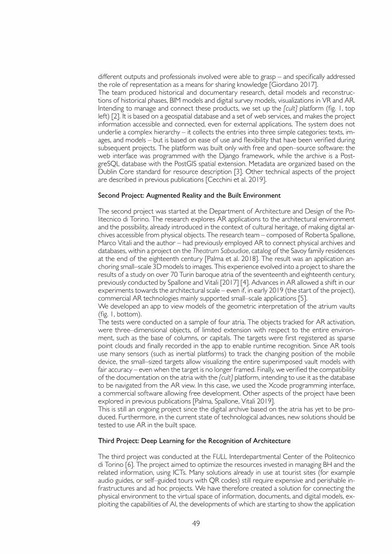
49
different outputs and professionals involved were able to grasp – and specifically addressed the role of representation as a means for sharing knowledge [Giordano 2017].The team produced historical and documentary research, detail models and reconstruc-tions of historical phases, BIM models and digital survey models, visualizations in VR and AR. Intending to manage and connect these products, we set up the [cult] platform (fig. 1, top left) [2]. It is based on a geospatial database and a set of web services, and makes the project information accessible and connected, even for external applications. The system does not underlie a complex hierarchy – it collects the entries into three simple categories: texts, im-ages, and models – but is based on ease of use and flexibility that have been verified during subsequent projects. The platform was built only with free and open–source software: the web interface was programmed with the Django framework, while the archive is a Post-greSQL database with the PostGIS spatial extension. Metadata are organized based on the Dublin Core standard for resource description [3]. Other technical aspects of the project are described in previous publications [Cecchini et al. 2019].
Second Project: Augmented Reality and the Built Environment
The second project was started at the Department of Architecture and Design of the Po-litecnico di Torino. The research explores AR applications to the architectural environment and the possibility, already introduced in the context of cultural heritage, of making digital ar-chives accessible from physical objects. The research team – composed of Roberta Spallone, Marco Vitali and the author – had previously employed AR to connect physical archives and databases, within a project on the Theatrum Sabaudiae, catalog of the Savoy family residences at the end of the eighteenth century [Palma et al. 2018]. The result was an application an-choring small–scale 3D models to images. This experience evolved into a project to share the results of a study on over 70 Turin baroque atria of the seventeenth and eighteenth century, previously conducted by Spallone and Vitali [2017] [4]. Advances in AR allowed a shift in our experiments towards the architectural scale – even if, in early 2019 (the start of the project), commercial AR technologies mainly supported small–scale applications [5].We developed an app to view models of the geometric interpretation of the atrium vaults (fig. 1, bottom). The tests were conducted on a sample of four atria. The objects tracked for AR activation, were three–dimensional objects, of limited extension with respect to the entire environ-ment, such as the base of columns, or capitals. The targets were first registered as sparse point clouds and finally recorded in the app to enable runtime recognition. Since AR tools use many sensors (such as inertial platforms) to track the changing position of the mobile device, the small–sized targets allow visualizing the entire superimposed vault models with fair accuracy – even when the target is no longer framed. Finally, we verified the compatibility of the documentation on the atria with the [cult] platform, intending to use it as the database to be navigated from the AR view. In this case, we used the Xcode programming interface, a commercial software allowing free development. Other aspects of the project have been explored in previous publications [Palma, Spallone, Vitali 2019].This is still an ongoing project since the digital archive based on the atria has yet to be pro-duced. Furthermore, in the current state of technological advances, new solutions should be tested to use AR in the built space.
Third Project: Deep Learning for the Recognition of Architecture
The third project was conducted at the FULL Interdepartmental Center of the Politecnico di Torino [6]. The project aimed to optimize the resources invested in managing BH and the related information, using ICTs. Many solutions already in use at tourist sites (for example audio guides, or self–guided tours with QR codes) still require expensive and perishable in-frastructures and ad hoc projects. We have therefore created a solution for connecting the physical environment to the virtual space of information, documents, and digital models, ex-ploiting the capabilities of AI, the developments of which are starting to show the application
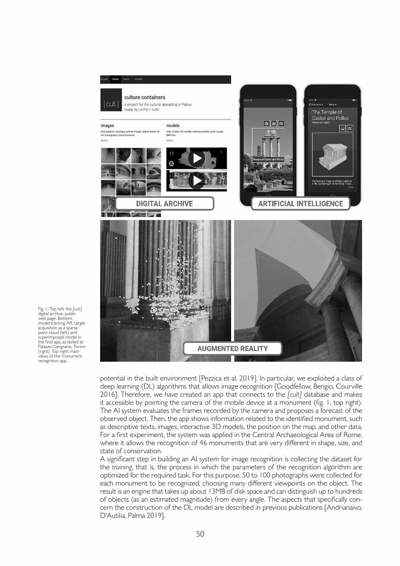
50
potential in the built environment [Pezzica et al. 2019]. In particular, we exploited a class of deep learning (DL) algorithms that allows image recognition [Goodfellow, Bengio, Courville 2016]. Therefore, we have created an app that connects to the [cult] database and makes it accessible by pointing the camera of the mobile device at a monument (fig. 1, top right). The AI system evaluates the frames recorded by the camera and proposes a forecast of the observed object. Then, the app shows information related to the identified monument, such as descriptive texts, images, interactive 3D models, the position on the map, and other data. For a first experiment, the system was applied in the Central Archaeological Area of Rome, where it allows the recognition of 46 monuments that are very different in shape, size, and state of conservation. A significant step in building an AI system for image recognition is collecting the dataset for the training, that is, the process in which the parameters of the recognition algorithm are optimized for the required task. For this purpose, 50 to 100 photographs were collected for each monument to be recognized, choosing many different viewpoints on the object. The result is an engine that takes up about 13MB of disk space and can distinguish up to hundreds of objects (as an estimated magnitude) from every angle. The aspects that specifically con-cern the construction of the DL model are described in previous publications [Andrianaivo, D’Autilia, Palma 2019].
Fig. 1. Top left: the [cult] digital archive, public web page. Bottom: model tracking AR; target acquisition as a sparse point cloud (left) and superimposed model in the final app, as tested at Palazzo Carignano, Torino (right). Top right: main views of the monument recognition app.
51
Conclusions
Technologies that interact with big–data risk replacing the work of interpreting the built en-vironment and the relationship that binds us to it, be it about culture, fruition, or design. We must prevent a general understanding from being neglected. Theory and models are needed to achieve also detailed data–driven knowledge, to value documentation and collection efforts, and to clarify the purpose of these efforts. The presented series of knowledge access models intends to support the identification of some contexts and scopes that can benefit from exper-iments with AR and AI technologies. We investigated how digital techniques for spatial charac-ter recognition support a theoretical understanding and operational uses of the built form. On the one hand, we must strive to keep the landscape of these possible uses broad. On the other hand, even the schematic understanding of reality that tools produce – the categorizations, the standards – should be kept flexible. Otherwise, automatic recognition and classification become the well–known black box, that is, algorithms we accept the results of without ques-tioning how these are produced or whether they can be adapted to changing needs. Finally, experiences suggest that, beyond the schemes we adopt, the tangible aspects of architecture remain a platform for effective knowledge sharing even in the virtuality–pervaded reality.
References
Andrianaivo Louis Nantenaina, D’Autilia Roberto, Palma Valerio (2019). Architecture recognition by means of convolutional neural networks. In ISPRS – International Archives of the Photogrammetry, Remote Sensing and Spatial Information Sciences, XLII–2–W15, pp. 77-84.
Bekele Mafkereseb Kassahun, Pierdicca Roberto, Frontoni Emanuele, Malinverni Eva Savina, Gain James (2018). A Survey of Augmented, Virtual, and Mixed Reality for Cultural Heritage. In Journal on Computing and Cultural Heritage, 11(2), pp. 1-36.
Cecchini Cristina, Cundari Maria Rosaria, Palma Valerio, Panarotto Federico (2019). Data, Models and Visualization: Connected Tools to Enhance the Fruition of the Architectural Heritage in the City of Padova. In Marcos Carlos (ed.). Graphic Imprints. Cham: Springer, pp. 633-646.
Giordano Andrea (2017). Mapping Venice. From Visualizing Venice to Visualizing Cities. In Piga Barbara, Salerno Rossella (eds.). Urban Design and Representation. Cham: Springer, pp. 143-151.
Goodfellow Ian, Bengio Yoshua, Courville Aaron (2016). Deep Learning. Cambridge: MIT Press.
Palma Valerio, Lo Turco Massimiliano, Spallone Roberta, Vitali Marco (2018). Augmented Iconography. AR applications to the fortified Turin in the Theatrum Sabaudiae. In Marotta Anna, Spallone Roberta (eds.). Defensive Architecture of the Mediterranean, IX, pp. 1053-1060.
Palma Valerio, Spallone Roberta, Vitali Marco (2019). Augmented Turin baroque atria: AR experiences for enhancing cultural heritage. In ISPRS – International Archives of Photogrammetry, Remote Sensing and Spatial Information Sciences, XLII–2/W9, pp. 557-564.
Pezzica Camilla, Schroeter, J., Prizeman Oriel E., Jones Christopher B., Rosin, Paul L. (2019). Between Images and Built Form: Automating the Recognition of Standardised Building Components Using Deep Learning. In ISPRS Annals of Photogrammetry, Remote Sensing and Spatial Information Sciences, IV–2/W6, pp. 123-132.
Spallone Roberta, Vitali Marco (2017). Star–shaped and Planterian Vaults in Turin Baroque Atria. Ariccia: Aracne.
Notes
[1] The project was funded by the European program POR FSE 2014–2020 – Regione Veneto. A. Giordano was the principal investigator. L. Stendardo supervised the construction of the [cult] platform.
[2] ICEA department, UniPD (2017). [cult] – culture containers. http://cult.reload.dicea.unipd.it (15 March 2021).
[3] DCMI (2021). DCMI: Home. https://dublincore.org (15 March 2021).
[4] In addition to the work of prof. Spallone and prof. Vitali, the research on the vaulted atria benefited from the collaboration of M.C. López González (Universitat Politècnica de València, project “Nuevas tecnologías para el análisis y conservación del patrimonio arquitectónico” funded by the Ministry of Science, Innovation and the University of Spain) and Ph.D. students G. Bertola, F. Natta and F. Ronco.
[5] Currently, some AR software such as Vuforia allow the tracing of very large environments based on CAD models or point clouds. See PTC (2020). Tools Overview | VuforiaLibrary https://library.vuforia.com/tools/overview.html (15 March 2021).
[6] The team working on the project at FULL | The Future Urban Legacy Lab consisted of M. Robiglio, C. Casetti, F. Frassoldati, L.N. Andrianaivo e V. Palma. The project was carried out in partnership with R. d’Autilia.
Copyright © 2021 by FrancoAngeli s.r.l. Milano, Italy Isbn 9788835125280
AuthorValerio Palma, Dept. of Architecture and Design, Politecnico di Torino, [email protected]

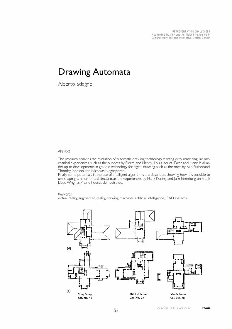
doi.org/10.3280/oa-686.853
REPRESENTATION CHALLENGESAugmented Reality and Artificial Intelligence in Cultural Heritage and Innovative Design Domain
Abstract
The research analyses the evolution of automatic drawing technology, starting with some singular me-chanical experiences, such as the puppets by Pierre and Henry–Louis Jaquet–Droz and Henri Maillar-det up to developments in graphic technology for digital drawing, such as the ones by Ivan Sutherland, Timothy Johnson and Nicholas Negroponte.Finally some potentials in the use of intelligent algorithms are described, showing how it is possible to use shape grammar for architecture, as the experiences by Hank Koning and Julie Eizenberg on Frank Lloyd Wright’s Prairie houses demostrated.
Keywordsvirtual reality, augmented reality, drawing machines, artificial intelligence, CAD systems.
Drawing AutomataAlberto Sdegno
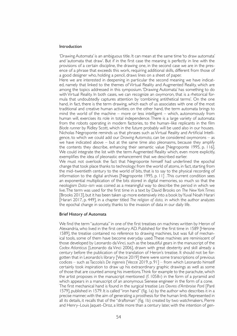
54
Introduction
‘Drawing Automata’ is an ambiguous title. It can mean at the same time ‘to draw automata’ and ‘automata that draw’. But if in the first case the meaning is perfectly in line with the provisions of a certain discipline, the drawing one, in the second case we are in the pres-ence of a phrase that exceeds this work, requiring additional skills, different from those of a good designer who, holding a pencil, draws lines on a sheet of paper.Here we are interested in deepening in particular the second meaning we have indicat-ed, namely that linked to the themes of Virtual Reality and Augmented Reality, which are among the topics addressed in this symposium. ‘Drawing Automata’ has something to do with Virtual Reality. In both cases, we can recognize an oxymoron, that is a rhetorical for-mula that undoubtedly captures attention by ‘combining antithetical terms’. On the one hand, in fact, there is the term drawing, which each of us associates with one of the most traditional and creative human activities; on the other hand, the term automata brings to mind the world of the machine – more or less intelligent – which, autonomously from human will, exercises its role in total independence. There is a large variety of automata: from the robots operating in modern factories, to the human–like replicants in the film Blade runner by Ridley Scott, which in the future probably will be used also in our houses.Nicholas Negroponte reminds us that phrases such as Virtual Reality and Artificial Intelli-gence, to which we could add our Drawing Automata, can be considered oxymorons – as we have indicated above – but at the same time also pleonasms, because they amplify the contents they describe, enhancing their semantic value [Negroponte 1995, p. 116]. We could integrate the list with the term Augmented Reality which, even more explicitly, exemplifies the idea of pleonastic enhancement that we described earlier.We must not overlook the fact that Negroponte himself had underlined the epochal change that took place thanks to technology: from the world of atoms, in fact, starting from the mid–twentieth century to the world of bits, that is to say to the physical recording of information to the digital archives [Negroponte 1995, p. 11] . This current condition sees an exponential multiplication of the bits stored in digital memories, so much so that the neologism Data–ism was coined as a meaningful way to describe the period in which we live. The term was used for the first time in a text by David Brooks on The New York Times [Brooks 2013], but it has been taken up more extensively into a book by Yuval Noah Harari [Harari 2017, p. 449], in a chapter titled The religion of data, in which the author analyzes the epochal change in society, thanks to the invasion of data in our daily life.
Brief History of Automata
We find the term “automata” in one of the first treatises on machines written by Heron of Alexandria, who lived in the first century AD. Published for the first time in 1589 [Herone 1589], the treatise contained no reference to drawing machines, but was full of mechan-ical tools, some of them have become everyday used. These machines are reminiscent of those developed by Leonardo da Vinci, such as the beautiful gears in the manuscript of the Codex Atlanticus [Leonardo da Vinci 2006], drawn with great dexterity and skill already a century before the publication of the translation of Heron’s treatise. It should not be for-gotten that in Leonardo’s library [Vecce 2019] there were some transcriptions of previous codices – such as Taccola’s De ingeneis [Vecce 2019, p. 91] – from which Leonardo himself certainly took inspiration to draw up his extraordinary graphic drawings as well as some of those that are counted among his inventions. Think for example to the parachute, which the artist proposes in the manuscript mentioned (f. 1058v) in the form of a pyramid and which appears in a manuscript of an anonymous Sienese engineer in the form of a cone.The first mechanical hand is found in the surgical treatise Les Oevres d’Ambroise Paré [Paré 1579], published in 1579. It is called “iron hand” (fig. 1a) by the author who describes it in a precise manner, with the aim of generating a prosthesis for the human limb. Represented in all its details, it recalls that of the “draftsman” (fig. 1b) created by two watchmakers, Pierre and Henry–Louis Jaquet–Droz, a little more than a century later, with the intention of gen-
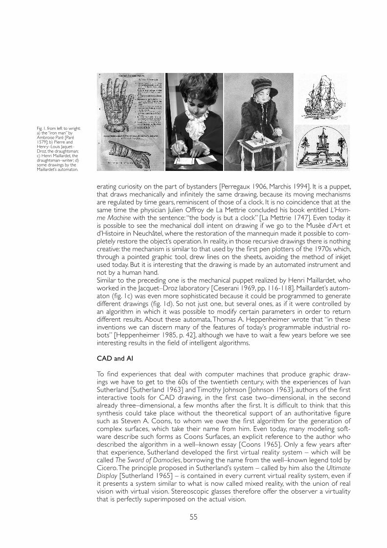
55
erating curiosity on the part of bystanders [Perregaux 1906, Marchis 1994]. It is a puppet, that draws mechanically and infinitely the same drawing, because its moving mechanisms are regulated by time gears, reminiscent of those of a clock. It is no coincidence that at the same time the physician Julien Offroy de La Mettrie concluded his book entitled L’Hom-me Machine with the sentence: “the body is but a clock” [La Mettrie 1747]. Even today it is possible to see the mechanical doll intent on drawing if we go to the Musèe d’Art et d’Histoire in Neuchâtel, where the restoration of the mannequin made it possible to com-pletely restore the object’s operation. In reality, in those recursive drawings there is nothing creative: the mechanism is similar to that used by the first pen plotters of the 1970s which, through a pointed graphic tool, drew lines on the sheets, avoiding the method of inkjet used today. But it is interesting that the drawing is made by an automated instrument and not by a human hand.Similar to the preceding one is the mechanical puppet realized by Henri Maillardet, who worked in the Jacquet–Droz laboratory [Ceserani 1969, pp. 116-118]. Maillardet’s autom-aton (fig. 1c) was even more sophisticated because it could be programmed to generate different drawings (fig. 1d). So not just one, but several ones, as if it were controlled by an algorithm in which it was possible to modify certain parameters in order to return different results. About these automata, Thomas A. Heppenheimer wrote that “in these inventions we can discern many of the features of today’s programmable industrial ro-bots” [Heppenheimer 1985, p. 42], although we have to wait a few years before we see interesting results in the field of intelligent algorithms.
CAD and AI
To find experiences that deal with computer machines that produce graphic draw-ings we have to get to the 60s of the twentieth century, with the experiences of Ivan Sutherland [Sutherland 1963] and Timothy Johnson [Johnson 1963], authors of the first interactive tools for CAD drawing, in the first case two–dimensional, in the second already three–dimensional, a few months after the first. It is difficult to think that this synthesis could take place without the theoretical support of an authoritative figure such as Steven A. Coons, to whom we owe the first algorithm for the generation of complex surfaces, which take their name from him. Even today, many modeling soft-ware describe such forms as Coons Surfaces, an explicit reference to the author who described the algorithm in a well–known essay [Coons 1965]. Only a few years after that experience, Sutherland developed the first vir tual reality system – which will be called The Sword of Damocles, borrowing the name from the well–known legend told by Cicero. The principle proposed in Sutherland’s system – called by him also the Ultimate Display [Sutherland 1965] – is contained in every current vir tual reality system, even if it presents a system similar to what is now called mixed reality, with the union of real vision with vir tual vision. Stereoscopic glasses therefore offer the observer a vir tuality that is perfectly superimposed on the actual vision.
Fig. 1. from left to wright: a) the “iron man” by Ambroise Paré [Paré 1579]; b) Pierre and Henry–Louis Jaquet–Droz, the draughtsman; c) Henri Maillardet, the draughtsman–writer ; d) some drawings by the Maillardet’s automaton.
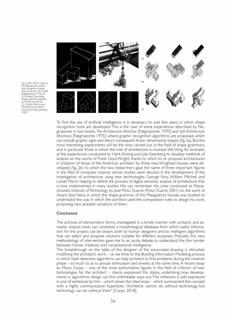
56
To find the use of artificial intelligence, it is necessary to wait few years, in which shape recognition tools are developed. This is the case of some experiences described by Ne-groponte in two books, The Architecture Machine [Negroponte 1970] and Soft Architecture Machines [Negroponte 1975], where graphic recognition algorithms are proposed, which can include graphic signs and return consequent three–dimensional shapes (fig. 2a). But the most interesting experiments will be the ones carried out in the field of shape grammars, and in particular those in which the role of architecture is involved. We thing, for example, at the experiences conducted by Hank Koning and Julie Eizenberg to develop methods of analysis on the works of Frank Lloyd Wright, thanks to which to re–propose architectures in imitation of those of the American architect. So three new Wrightian houses were de-veloped (fig. 2b) to which the two researchers gave the name of three important figures in the filed of computer science, whose studies were decisive in the development of the investigation of architecture using new technologies: George Stiny, William Mitchell and Lionel March, helping to define the process of digital semantic analysis of architecture that is now implemented in many studies. We can remember the ones conducted at Massa-chussets Institute of Technology by José Pinto Duarte (Pinto Duarte 2001) on the work of Alvaro Siza Vieira, in which the shape grammar of the Malagueira’s houses was studied to understand the way in which the architect used the composition rules to design his work, proposing new possible variations of them. Conclusions
The archives of stereometric forms, investigated in a timely manner with syntactic and se-mantic analysis tools, can constitute a morphological database from which useful informa-tion for the project can be drawn, both by human designers and by intelligent algorithms that can select and propose solutions suitable for different purposes. Precisely this new methodology of intervention gave rise to an acute debate to understand the thin border between human creativity and computational intelligence.The breakthrough on the table of the designer of the automated drawing is ultimately modifying the architect’s work – i.e. we think to the Building Information Modeling process, in which clash detection algorithms can help architect to find problems during the creation phase – so much so as to arouse enthusiasm and anxiety at the same time. A recent essay by Mario Carpo – one of the most authoritative figures in the field of criticism of new technologies for the architect – clearly expressed this status, underlining how develop-ments in algorithmic design can find unthinkable ways out. This reflection is well expressed in one of sentences by him – which closes the cited essay – which summarized the concept with a highly communicative hyperbole: “Architects cannot do without technology, but technology can do without them” [Carpo 2018].
Fig. 2. from left to right: a) N. Negroponte, system that recognizes shapes and constructs 3D model [Negroponte 1975]; b) H. Koning, J. Eizenberg, Shape grammar applied to Prairie Houses by F.L. Wright: Stiny house, Mitchell house, March house [Koning, Eizenberg 1981].
57
References
Brooks David (2013). The Philosophy of Data. In The New York Times, Feb. 4.
Carpo Mario (2018). Post–Digital “Quitters”: Why the Shift Toward Collage Is Worrying. In Metropolis, March 26.
Ceserani, Gian Paolo (1969). I falsi Adami. Storia e mito degli automi. Milano: Feltrinelli.
Coons Steven Anson (1965). Surface for Computer–Aided Design of Space Figures. Massachusetts Institute of Technology, Cambridge, Massachusetts July 1965, Technical Memorandum Memo 9442–M–139.
Galluzzi Paolo (ed.) (1991). Prima di Leonardo. Cultura delle macchine a Siena nel Rinascimento. Milano: Electa.
Harari Yuval Noah (2017). Homo Deus. Breve storia del futuro. Milano: Bompiani Heppenheimer Thomas A. (1985). Man Makes Man. In Minsky Marvin (ed.). Robotics. New York: Anchor Press/Doubleday, pp. 29-69.
Herone Alessandrino (1589). De gli automati overo machine se moventi. Venetia: Girolamo Porro.
Johnson Timothy (1963). Sketchpad III. A Computer Program for Drawing in Three Dimensions. In Proceedings of Spring Joint Computer Conference. Washington DC: Spartan Books, pp. 347-353.
Koning Hank, Eizenberg Julie (1981). The Language of the Prairie: Frank Lloyd Wright’s Prairie Houses. In Environment and Planning B, 8 (3), pp. 295-323.
La Mettrie Julien Offroy de (1747). L’Homme Machine. Leyde: Elie Luzac Fils.
Leonardo da Vinci (2006). Il Codice Atlantico della Biblioteca Ambrosiana di Milano. Firenze–Milano: Giunti.
Marchis Vittorio (1994). Storia delle macchine. Tre millenni di cultura tecnologica. Roma–Bari: Laterza.
Negroponte Nicholas (1970). The Architecture Machine. Cambridge Mass.–London: The MIT Press.
Negroponte Nicholas (1975). Soft Architecture Machines. Cambridge Mass.–London: The MIT Press.
Negroponte Nicholas (1995). Being digital. London: Hodder & Stoughton.
Paré Ambroise (1579). Les Oevvres d’Ambroise Paré. Paris: Gabriel Buon.
Perregaux Charles (1906). Les Jaquet–Droz et leurs automates. Neuchatel: Wolfrath & Sperlé.
Pinto Duarte José (2001). Customizing Mass Housing: A Discursive Grammar for Siza’s Malagueira Houses. PhD thesis, Cambridge Mass: Massachussets Institute of Technology.
Sutherland Ivan E. (1963). Sketchpad. A Man–Machine Graphical Communication System. In Proceedings of Spring Joint Computer Conference. Washington DC: Spartan Books, pp. 329-346.
Sutherland Ivan E. (1965). The Ultimate Display. In Proceedings of IFIP Congress, pp. 506-508.
Vecce Carlo (ed.) (2019). Leonardo e i suoi libri. La biblioteca del genio universale. Firenze: Giunti.
Copyright © 2021 by FrancoAngeli s.r.l. Milano, Italy Isbn 9788835125280
AuthorAlberto Sdegno, Dept. Polytechnic of Engineering and Architecture, University of Udine, [email protected]

doi.org/10.3280/oa-686.9
REPRESENTATION CHALLENGESAugmented Reality and Artificial Intelligence in Cultural Heritage and Innovative Design Domain
59
Abstract
The links between representation and artificial intelligence (AI) invade many fields of architectural re-search, recording continuous and significant advances: they require, on the one hand, a constant update of the state of the art and, on the other hand, careful consideration of the role of Representation in interdisciplinary research in this field. The present contribution intends to investigate these intertwining in some of the most frequented research fields in recent years: the valorization and communication of Cultural Heritage and cultural tourism, the experiences in the museum field, the research on the role of the prototype within the processes of artificial intelligence applied to architecture.
Keywordscultural heritage, museum, digital fabrication, artificial intelligence, augmented reality.
AI+AR: Cultural Heritage, Museum Institutions, Plastic Models and Prototyping. A State of ArtMarco VitaliGiulia BertolaFabrizio NattaFrancesca Ronco
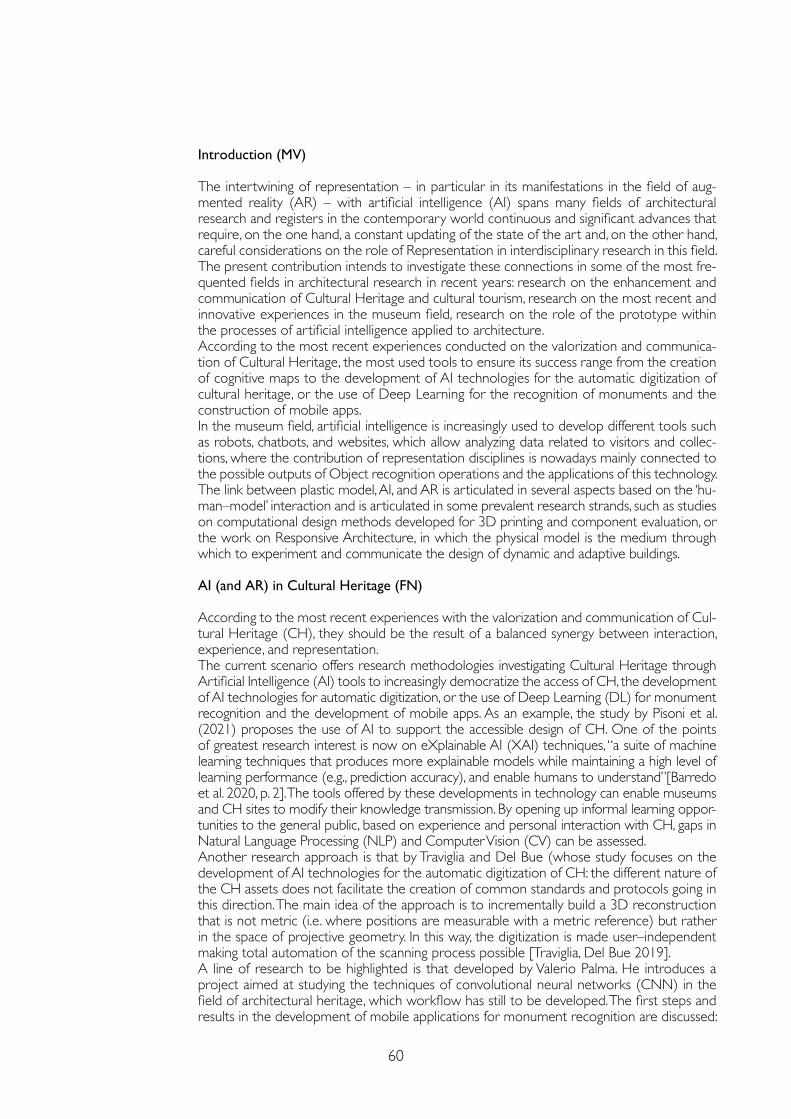
60
Introduction (MV)
The intertwining of representation – in particular in its manifestations in the field of aug-mented reality (AR) – with artificial intelligence (AI) spans many fields of architectural research and registers in the contemporary world continuous and significant advances that require, on the one hand, a constant updating of the state of the art and, on the other hand, careful considerations on the role of Representation in interdisciplinary research in this field. The present contribution intends to investigate these connections in some of the most fre-quented fields in architectural research in recent years: research on the enhancement and communication of Cultural Heritage and cultural tourism, research on the most recent and innovative experiences in the museum field, research on the role of the prototype within the processes of artificial intelligence applied to architecture.According to the most recent experiences conducted on the valorization and communica-tion of Cultural Heritage, the most used tools to ensure its success range from the creation of cognitive maps to the development of AI technologies for the automatic digitization of cultural heritage, or the use of Deep Learning for the recognition of monuments and the construction of mobile apps.In the museum field, artificial intelligence is increasingly used to develop different tools such as robots, chatbots, and websites, which allow analyzing data related to visitors and collec-tions, where the contribution of representation disciplines is nowadays mainly connected to the possible outputs of Object recognition operations and the applications of this technology.The link between plastic model, AI, and AR is articulated in several aspects based on the ‘hu-man–model’ interaction and is articulated in some prevalent research strands, such as studies on computational design methods developed for 3D printing and component evaluation, or the work on Responsive Architecture, in which the physical model is the medium through which to experiment and communicate the design of dynamic and adaptive buildings.
AI (and AR) in Cultural Heritage (FN)
According to the most recent experiences with the valorization and communication of Cul-tural Heritage (CH), they should be the result of a balanced synergy between interaction, experience, and representation.The current scenario offers research methodologies investigating Cultural Heritage through Artificial Intelligence (AI) tools to increasingly democratize the access of CH, the development of AI technologies for automatic digitization, or the use of Deep Learning (DL) for monument recognition and the development of mobile apps. As an example, the study by Pisoni et al. (2021) proposes the use of AI to support the accessible design of CH. One of the points of greatest research interest is now on eXplainable AI (XAI) techniques, “a suite of machine learning techniques that produces more explainable models while maintaining a high level of learning performance (e.g., prediction accuracy), and enable humans to understand”[Barredo et al. 2020, p. 2]. The tools offered by these developments in technology can enable museums and CH sites to modify their knowledge transmission. By opening up informal learning oppor-tunities to the general public, based on experience and personal interaction with CH, gaps in Natural Language Processing (NLP) and Computer Vision (CV) can be assessed.Another research approach is that by Traviglia and Del Bue (whose study focuses on the development of AI technologies for the automatic digitization of CH: the different nature of the CH assets does not facilitate the creation of common standards and protocols going in this direction. The main idea of the approach is to incrementally build a 3D reconstruction that is not metric (i.e. where positions are measurable with a metric reference) but rather in the space of projective geometry. In this way, the digitization is made user–independent making total automation of the scanning process possible [Traviglia, Del Bue 2019].A line of research to be highlighted is that developed by Valerio Palma. He introduces a project aimed at studying the techniques of convolutional neural networks (CNN) in the field of architectural heritage, which workflow has still to be developed. The first steps and results in the development of mobile applications for monument recognition are discussed:
61
while AI is just beginning to interact with the built environment through mobile devices, her-itage technologies have long produced and explored digital models and spatial archives. The interaction between DL algorithms and state–of–art information modeling is addressed as an opportunity both to exploit heritage collections and to optimize new object recognition techniques [Palma 2019, pp. 551-556].The developments that these research can bring are almost all aimed at enriching the data-bases, which are still quantitatively limited and refer much towards two–dimensional objects that are “easier” to read in ML algorithms. Another challenge related to AI relates to the use of personal data. The implementations that augmented CH experiences can provide necessarily involve reading and constantly updating regulations and ethical guides for the responsible use of this powerful tool.
The Digital Transformation in Museums: AI and AR as Tools to Engage Visitors (FR)
Within museum institutions, artificial intelligence is increasingly used to develop different tools such as robots, chatbots, and websites, which allow analyzing data related to visitors and collections [Styx, 2020]. The network “Museums + Artificial Intelligence”(n.d), founded in 2019 by Oonagh Murphy and Elena Villaespesa is proof of this growing interest in AI tools applied in this field.At the same time, VR and AR have become a popular trend worldwide for the dissemina-tion, communication, and enhancement of cultural heritage [Bekele et al. 2018].The contribution of representation disciplines in the AR field is quite evident: just think of the use of 3D virtual models, holograms, graphics for specific apps, and gaming, up to True AR technology [Sandor 2015]. The group coordinated by Geronikolakis (2020) proposes an interesting application in the field of cultural heritage conservation to improve the experi-ence of visitors, involved in the construction and restoration of archaeological sites.In the field of AI, the representation disciplines could mainly be involved in the outputs of Ob-ject Recognition operations. The applications of this technology involve the user also outside the museum, as in the project ‘Recognition’, winner in 2016 of the IK award [Styx, 2020] or the application ‘Art Selfie’. Several museums base the exploration of their collections on Object Recognition: on color similarities, [Cooper Hewitt Smithsonian Design Museum, n.d; Dallas Art Museum, n.d.], formal, line direction, or space and light [Barnes Foundation, n.d].
Fig. 1a. Exibition Mont Saint–Michel. Digital Perspectives on the Model (photo by Microsoft, source: https://iciseattle.com/en/mont-saint-michel-in-mohai/);Fig. 1b. The system of ICAR–CNR group experienced in art and tech exhibitions [Caggianese et al., 2020].
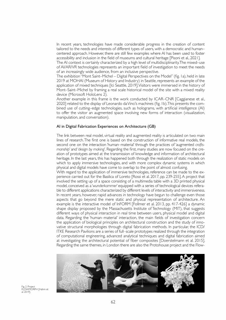
62
In recent years, technologies have made considerable progress in the creation of content tailored to the needs and interests of different types of users, with a democratic and human–centered approach. However, there are still few examples where AI has been used to foster accessibility and inclusion in the field of museums and cultural heritage [Pisoni et al., 2021]. The AI context is certainly characterized by a high level of multidisciplinarity. The mixed–use of AI/AR/VR technologies represents an important field of investigation to meet the needs of an increasingly wide audience, from an inclusive perspective.The exhibition “Mont Saint–Michel – Digital Perspectives on the Model” (fig. 1a), held in late 2019 at MOHAI (Museum of History and Industry) in Seattle, represents an example of the application of mixed techniques [Ici Seattle, 2019]. Visitors were immersed in the history of Mont–Saint–Michel by framing a real scale historical model of the site with a mixed reality device (Microsoft HoloLens 2).Another example in this frame is the work conducted by ICAR–CNR [Caggianese et al., 2020] related to the display of Leonardo da Vinci’s machines (fig. 1b). This presents the com-bined use of cutting–edge technologies, such as holograms, with artificial intelligence (AI) to offer the visitor an augmented space involving new forms of interaction (visualization, manipulation, and conversation).
AI in Digital Fabrication Experiences on Architecture (GB)
The link between real model, virtual reality and augmented reality is articulated on two main lines of research. The first one is based on the construction of informative real models, the second one on the interaction ‘human–material’ through the practices of ‘augmented crafts-manship’ and ‘design by making’. Regarding the first, many studies are now focused on the cre-ation of prototypes aimed at the transmission of knowledge and information of architectural heritage. In the last years, this has happened both through the realization of static models on which to apply immersive technologies, and with more complex dynamic systems in which physical and digital models have come to overlap to the point of almost confusing.With regard to the application of immersive technologies, reference can be made to the ex-perience carried out for the Basilica of Loreto [Rossi et al. 2017, pp. 239-255]. A project that involved the setting up of a space consisting of a multimedia table with a 3D printed physical model, conceived as a ‘wunderkammer’ equipped with a series of technological devices refera-ble to different applications characterized by different levels of interactivity and immersiveness.In recent years, however, rapid advances in technology have begun to challenge even those aspects that go beyond the mere static and physical representation of architecture. An example is the interactive model of InFORM [Follmer et al. 2013, pp. 417-426] a dynamic shape display proposed by the Massachusetts Institute of Technology (MIT), that suggests different ways of physical interaction in real time between users, physical model and digital data. Regarding the ‘human–material’ interaction, the main fields of investigation concern the application of biological principles on architectural construction and the study of inno-vative structural morphologies through digital fabrication methods. In particular, the ICD/ITKE Research Pavilions are a series of full–scale prototypes realized through the integration of computational engineering, advanced analytical techniques and digital fabrication aimed at investigating the architectural potential of fiber composites [Doerstelmann et al. 2015]. Regarding the same themes, in London there are also the Protohouse project and the Flow-
Fig. 2. Project FLOWMORPH [Hahm et al. 2019].
63
References
Barnes Foundation. Barnes Collection Online. https://collection.barnesfoundation.org/ (1 March 2021).
Barredo Arrieta Alejandro et al. (2020). Explainable Artificial Intelligence (XAI): Concepts, Taxonomies, Opportunities and Challenges toward Responsible AI. In Information Fusion, 58, pp. 82-115.
Bekele Mafkereseb Kassahun, Pierdicca Roberto, Frontoni Emanuele, Malinverni Eva, Gain James (2018). A Survey of Augment-ed, Virtual, and Mixed Reality for Cultural Heritage. In Journal on Computing and Cultural Heritage, 11(2), art. 7.
Caggianese Giuseppe, De Pietro Giuseppe, Esposito Massimo, Gallo Luigi, Minutolo Aniello, Neroni Pietro (2020). Discovering Leonardo with artificial intelligence and holograms: A user study. In Pattern Recognition Letters, 131, pp. 361-367.
Carpo Mario (2017). The Second Digital Turn. Design Beyond Intelligence. Cambridge (MA): MIT Press.
Cooper–Hewitt Smithsonian Design Museum. The Collection. https://collection.cooperhewitt.org/ (1 March 2021).
Doerstelmann Moritz, Knippers Jan, Koslowski Valentin, Menges Achim, Prado Marshall, Schieber Gundula, Vasey Lauren (2015). ICD/ITKE Research Pavilion 2014-15: Fibre Placement on a Pneumatic Body Based on a Water Spider Web. In Archi-tectural Design, 85, pp. 60-65.
Follmer Sean Weston, Leithinger Daniel, Olwal Alex, Hogge Akimitsu, Ishii Hiroshi (2013), inFORM: Dynamic Physical Af-fordances and Constraints through Shape and Object Actuation, In Proceedings of the 26th annual ACM symposium on User interface software and technology (UIST ‘13). New York: ACM Digital Library, pp. 417-426.
Geronikolakis Efstratios, Zikas Paul, Kateros Steve, Lydatakis Nick, Georgiou Stelios, Kentros Mike, Papagiannakis George. (2020). A True AR Authoring Tool for Interactive Virtual Museums. In Liarokapis Fotis, Voulodimos Athanasios, Doulamis Niko-laos, Doulamis Anastasios (eds.). Visual Computing for Cultural Heritage. Cham: Springer, pp. 225-242.
Hahm Soomeen, Maciel Abel, Sumitiomo Eri, Rodriguez Alvaro Lopez (2019). FLOWMORPH. Exploring the human–material interaction in digitally augmented craftsmanship. In Proceedings of the 24th International Conference of the Association for Com-puter–Aided Architectural Design Research in Asia (CAADRIA), Vol. 1, Hong Kong, CAADRIA, pp. 553-562.
High Level Expert Group on Artificial Intelligence (2019). Ethics Guidelines for Trustworthy AI; Technical Report. European Commission.
Ici Seattle (2019). The Mont–Saint–Michel in the MOHAI. https://iciseattle.com/en/mont-saint-michel-in-mohai/ (1 March 2021).
Jun Ji Won, llubia Josep Alcover, Silverio Matteo (2015). Remembrane. Responsive Kinetic Structure. http://www.iaacblog.com/programs/remembrane/ (15 March 2021).
Palma Valerio (2019). Towards Deep Learning for Architecture: A Monument Recognition Mobile App. In The International Archives of the Photogrammetry, Remote Sensing and Spatial Information Sciences, Volume XLII–2/W9, pp. 551-556.
Pisoni Galena, Dìaz–Rodrìguez Natalia, Gijlers Hannie, Tonolli Linda (2021). Human–Centred Artificial Intelligence for Design-ing Accessible Cultural Heritage. In Applied Sciences, 11 (2), p. 870.
Rossi Daniele, Meschini Alessandra, Feriozzi Ramona, Olivieri Alessandro (2017). Cose dell’altro mondo. La realtà virtuale immersiva per il patrimonio culturale. In Luigini Alessandro., Panciroli Chiara (eds.), Ambienti digitali per l’educazione all’arte e al patrimonio. Milano, FrancoAngeli Open Access, pp. 239-255.
Sandor Christian, Fuchs Martin, Cassinelli Alvaro, Li Hao, Newcombe Richard, Yamamoto Goshiro, Feiner Steven (2015). In Breaking the barriers to true augmented reality. arXiv preprint arXiv:1512.05471 (1 march 2021).
Styx Lauren (2020). How are museums using artificial intelligence, and is AI the future of museums? Museum Next. https://www.museumnext.com/article/artificial-intelligence-and-the-future-of-museums/ (1 march 2021).
Traviglia Arianna, Del Bue Alessio (2019). Intelligenza Artificiale per la Digitalizzazione 3D del Patrimonio Culturale, In Ital–IA Italia Intelligenza Artificiale. https://www.google.com/search?client=firefox-b-d&q=Traviglia+Arianna%2C+Del+Bue+A-lessio+%282019%29.+Intelligenza+Artificiale+per+la+Digitalizzazione+3D+del+Patrimonio+Culturale%2C+In+Ital–IA+Italia+Intelligenza+Artificiale (1 march 2021).
Morph project [Hahm et al. 2019, pp. 553-562] (fig. 2), that proposes an unconventional method of fabrication using Mixed Reality to materialize highly complex geometries that could not be realized manually or by robotic fabrication alone.The practices of digitally augmented craftsmanship open to a series of reflections on the theme of interactive digital simulations and their link with traditional craft practices. Mario Carpo, within his book The Second Digital Turn [Carpo, 2017], emphasizes the value of such simulations as they allow today’s artisans to learn intuitively, through mistakes, trial and attempts, by making and unmaking as many test samples as possible.
Copyright © 2021 by FrancoAngeli s.r.l. Milano, Italy Isbn 9788835125280
AuthorsMarco Vitali, Dept. of Architecture and Design, Politecnico di Torino, [email protected] Bertola, Dept. of Architecture and Design, Politecnico di Torino, [email protected] Natta, Dept. of Architecture and Design, Politecnico di Torino, [email protected] Ronco, Dept.of Architecture and Design, Politecnico di Torino, [email protected]

AR&AI virtual reconstruction

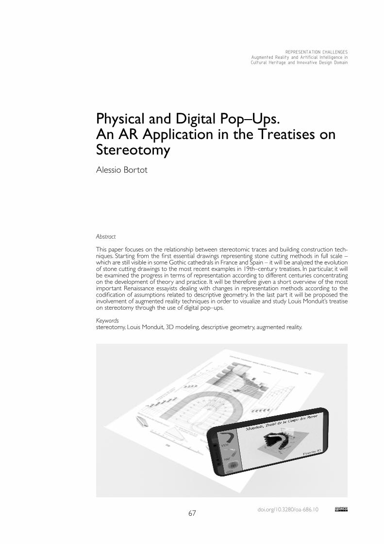
doi.org/10.3280/oa-686.1067
REPRESENTATION CHALLENGESAugmented Reality and Artificial Intelligence in Cultural Heritage and Innovative Design Domain
Abstract
This paper focuses on the relationship between stereotomic traces and building construction tech-niques. Starting from the first essential drawings representing stone cutting methods in full scale – which are still visible in some Gothic cathedrals in France and Spain – it will be analyzed the evolution of stone cutting drawings to the most recent examples in 19th–century treatises. In particular, it will be examined the progress in terms of representation according to different centuries concentrating on the development of theory and practice. It will be therefore given a short overview of the most important Renaissance essayists dealing with changes in representation methods according to the codification of assumptions related to descriptive geometry. In the last part it will be proposed the involvement of augmented reality techniques in order to visualize and study Louis Monduit’s treatise on stereotomy through the use of digital pop–ups. Keywordsstereotomy, Louis Monduit, 3D modeling, descriptive geometry, augmented reality.
Physical and Digital Pop–Ups. An AR Application in the Treatises on Stereotomy Alessio Bortot
68
Evolution of The Trait in the History of Stereotomy
The research carried out in this paper has led me to study several stereotomic drawings in order to understand the reasons why these ‘blueprints’ are connected to the concrete practice of construction. The first stereotomic traces are engravings on the floor (less often on the wall) in some European and Middle Eastern Gothic cathedrals. In this regard Cal-vo–Lopez states “tracings were prepared exactly below the element under construction in order to control the placement of voussoirs. Generally speaking, in the Gothic period they were executed on scaffoldings placed under vaults, at springer level, while in the Early Mod-ern period, they were laid directly on the floor” [Calvo–López 2020, p. 127]. The large–scale drawings – which seem to transform the buildings where they are located in a sort of ‘stone treatise’ – were used to solve specific problems and allow the formal compliance of the piece under construction. In other words, these first stereotomic developments were not intended as a representation of an abstract problem and didn’t want to spread construc-tion skills as well. In fact we should remember that in the Middle Ages stonecutters used to belong to guilds that usually concealed every building skill. As a matter of fact, stereotomy was a type of practical knowledge which used to be conveyed orally by the foreman to his stonecutters only in the construction site. In addition, it should be taken into consid-eration that writing and drawing materials were very expensive at the time. For instance, parchments were much more used in case of public presentations to clients than in stan-dard communication [Erlande–Brandenburg 1993, p. 79]. In this period the most important graphic document is the well–known notebook Livre de portraiture by Villard de Honnen-court (... – XIII century). Even if this latter can’t be really considered a treatise on stereotomy, anyway gives us a meaningful example of representation in the field of construction site machines, building techniques and use of proportions in the Gothic period. According to Sakarovitch, it is quite interesting to notice that in the carnet by de Honnencour one can find some elements which are represented in double projection despite a lack of awareness in terms of a projective correspondence in the two views [Sakarovitch 1998, p. 41]. We know that stereotomy literature thrived in the Renaissance period basically due to Le premier tome de l’architecture (1567) by Philibert de l’Orme (1514-1570) [1]. In this treatise the illustrations show how the medieval secrets – traditionally kept by the guilds – were final-ly unveiled. The stone cutting techniques spread at the same time as the role of the ‘architect’ flourished – intended in the modern meaning. From being a ‘mechanical art’ architecture was gradually turning into a ‘liberal art’. What’s more, these historical dynamics pointed out the separation between the architect and the foreman (the maître–maçon), between the designer and the builder. The authentic expressive medium of the building work is the trait: the technique allowing to trace the layout of the stone structures in order each ashlar to be properly cut. For what concerns this topic, Robin Evans (1944-1993) asserts that the trait is something that is in between two different roles: artisans on one side and architects on the other. Although it isn’t part of any of them, it exists as an independent reference such as geometry [Evans 1995, p. 205]. In this period treatises are didactic tools, but also ways to show the skills of the authors, often very critical of the stereotomic solutions developed by their own predecessors or peers. In the treatise by de L’Orme virtuous artifacts arise along with complex illustrations. One of the best examples is the renowned Trompe d’Anet – a case mentioned a few centuries later by Viollet–le–Duc (1814-1879) as an “artifice that has nothing to do with the rigorous art of the builder, made to amuse curious spirits with unnec-essary problems” [Viollet–le–Duc 1854-1868, book IX, p. 314]. The drawings of this structure (one in pseudo axonometric projection to show the object in a three–dimensional space and some others in pseudo orthogonal projection) aren’t able to solve the problem except for a reader who is also an expert in construction site practices. Something similar occurs to other planches where geometric operations (similar to ‘surface unwrapping’) are applied to each ashlar row in order to obtain the corresponding épures. In Renaissance treatises it is likely to find a certain need for three–dimensional representations. Thanks to the codification of the perspective laws, in this period these models – which in the Middle Ages were kept secret in the constructor’s mind only – acquire education purposes as well.
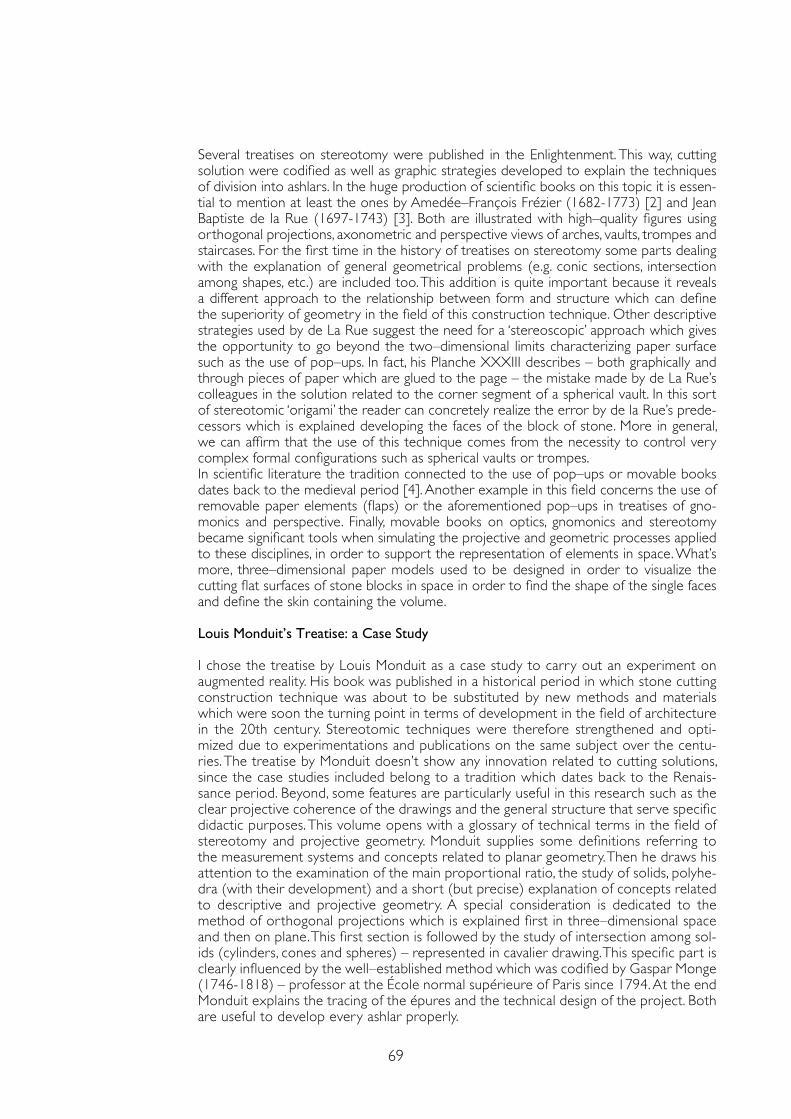
69
Several treatises on stereotomy were published in the Enlightenment. This way, cutting solution were codified as well as graphic strategies developed to explain the techniques of division into ashlars. In the huge production of scientific books on this topic it is essen-tial to mention at least the ones by Amedée–François Frézier (1682-1773) [2] and Jean Baptiste de la Rue (1697-1743) [3]. Both are illustrated with high–quality figures using orthogonal projections, axonometric and perspective views of arches, vaults, trompes and staircases. For the first time in the history of treatises on stereotomy some parts dealing with the explanation of general geometrical problems (e.g. conic sections, intersection among shapes, etc.) are included too. This addition is quite important because it reveals a different approach to the relationship between form and structure which can define the superiority of geometry in the field of this construction technique. Other descriptive strategies used by de La Rue suggest the need for a ‘stereoscopic’ approach which gives the opportunity to go beyond the two–dimensional limits characterizing paper surface such as the use of pop–ups. In fact, his Planche XXXIII describes – both graphically and through pieces of paper which are glued to the page – the mistake made by de La Rue’s colleagues in the solution related to the corner segment of a spherical vault. In this sort of stereotomic ‘origami’ the reader can concretely realize the error by de la Rue’s prede-cessors which is explained developing the faces of the block of stone. More in general, we can affirm that the use of this technique comes from the necessity to control very complex formal configurations such as spherical vaults or trompes. In scientific literature the tradition connected to the use of pop–ups or movable books dates back to the medieval period [4]. Another example in this field concerns the use of removable paper elements (flaps) or the aforementioned pop–ups in treatises of gno-monics and perspective. Finally, movable books on optics, gnomonics and stereotomy became significant tools when simulating the projective and geometric processes applied to these disciplines, in order to support the representation of elements in space. What’s more, three–dimensional paper models used to be designed in order to visualize the cutting flat surfaces of stone blocks in space in order to find the shape of the single faces and define the skin containing the volume.
Louis Monduit’s Treatise: a Case Study
I chose the treatise by Louis Monduit as a case study to carry out an experiment on augmented reality. His book was published in a historical period in which stone cutting construction technique was about to be substituted by new methods and materials which were soon the turning point in terms of development in the field of architecture in the 20th century. Stereotomic techniques were therefore strengthened and opti-mized due to experimentations and publications on the same subject over the centu-ries. The treatise by Monduit doesn’t show any innovation related to cutting solutions, since the case studies included belong to a tradition which dates back to the Renais-sance period. Beyond, some features are particularly useful in this research such as the clear projective coherence of the drawings and the general structure that serve specific didactic purposes. This volume opens with a glossary of technical terms in the field of stereotomy and projective geometry. Monduit supplies some definitions referring to the measurement systems and concepts related to planar geometry. Then he draws his attention to the examination of the main proportional ratio, the study of solids, polyhe-dra (with their development) and a short (but precise) explanation of concepts related to descriptive and projective geometry. A special consideration is dedicated to the method of orthogonal projections which is explained first in three–dimensional space and then on plane. This first section is followed by the study of intersection among sol-ids (cylinders, cones and spheres) – represented in cavalier drawing. This specific part is clearly influenced by the well–established method which was codified by Gaspar Monge (1746-1818) – professor at the École normal supérieure of Paris since 1794. At the end Monduit explains the tracing of the épures and the technical design of the project. Both are useful to develop every ashlar properly.
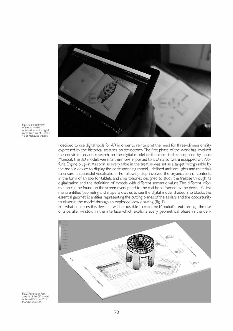
70
I decided to use digital tools for AR in order to reinterpret the need for three–dimensionality expressed by the historical treatises on stereotomy. The first phase of the work has involved the construction and research on the digital model of the case studies proposed by Louis Monduit. The 3D models were furthermore imported to a Unity software equipped with Vo-furia Engine plug–in. As soon as every table in the treatise was set as a target recognizable by the mobile device to display the corresponding model, I defined ambient lights and materials to ensure a successful visualization. The following step involved the organization of contents in the form of an app for tablets and smartphones designed to study the treatise through its digitalization and the definition of models with different semantic values. The different infor-mation can be found on the screen overlapped to the real book framed by the device. A first menu entitled ‘geometry and shape’ allows us to see the digital model divided into blocks, the essential geometric entities representing the cutting planes of the ashlars and the opportunity to observe the model through an exploded view drawing (fig. 1). For what concerns this device it will be possible to read the Monduit’s text through the use of a parallel window in the interface which explains every geometrical phase in the defi-
Fig. 1. Exploded view of the 3d model obtained from the digital reconstruction of Planche 46 of Monduit’s treatise.
Fig. 2. False color Fem analysis of the 3D model obtained Planche 46 of Monduit’s treatise.
71
Notes
[1] De l’Orme Philibert (1567). Le premier tome de l’architecture. Paris: Federic Morel.
[2] Frézier Amedée–François (1737-1739). La théorie et la pratique de la coupe des pierres et des bois pour la construction des voûtes et autres parties des bâtiments civils & militaires, ou Traité de stéréotomie, à l’usage de l’architecture. Paris: Guerin.
[3] De la Rue Jean Baptiste (1728). Traité de la coupe des pierres, où par une méthode facile et abrégée, l’on peut aisément se perfectionner en cette science. Paris: Charles–Antoines Jombert.
[4] To analyzed this topic, please, see for e.g.: Candito Cristina (2018). Drawings and Models in English Perspective Treatises of the XVII and XVIII Centuries. In Cocchiarella Luigi (ed.). ICGG 2018–Proceedings of the 18th International Conference on Geometry and Graphics. Milan: Springer, pp. 1882-1894.
References
Calvo–López José (2020). Stereotomy. Stone Construction and Geometry in Western Europe 1200-1900. Cham, Switzerland: Birkhäuser Springer Nature.
Erlande–Brandenburg Alain (1993). Quand les cathédrales étaient peintes. Paris: Gallimard.
Evans Robin (1995). The projective Cast. Architecture and Its Three Geometries. London: The MIT Press.
Kee Kevin, Compeau Timothy (2019). Seeing the Past with Computers: Experiments with Augmented Reality and Computer Vision for History. Ann Arbor: University of Michigan Press.
Monduit Louis, Denis Alexandre (1889). Traité Théorique et Pratique de la Stérétomie au point de vue de la Coupe des Pierres. Paris: C. Juliot.
Sakarovitch Joël (1998). Épures d’architecture. De la coupe des pierres à la géométrie descriptive XVIe-XIXe siècles. Basel, Boston, Berlin: Birkhauser Verlag.
Viollet–le–Duc Eugène–Emmanuel (1814-1879). Dictionnaire raisonné de l’architecture française du XIe au XVIe siècle. Paris: Édition Bance–Morel.
nition of various traits. Placing the mobile device in front of the book it will be possible to refer to a database of georeferencing associated with every single case study. This database will gather the existing architectures which were carried out and theoretically described by Monduit in order to obtain an extensible catalogue of stereotomic structures with a description of their own historical and artistic features. Anyway, starting from the important relationship between form and structure in the analysis of stereotomic buildings, I decided to add the opportunity to see a structural model in this app showing the strain of the ele-ments through the use of a false color Fem analysis (fig. 2).
Conclusion
This experiment has shown that the augmented reality can be considered an important tool in the enhancement, analysis and dissemination of cultural heritage through the cre-ation of digital pop–ups. Stereotomy can be considered an excellent field to experiment these kinds of technologies and highlight the closer relationship between geometry and structure while interpreting ancient and complex treatises. In addition, we can state that the use of these technologies must be combined with an in–depth critical development of contents as well. Otherwise the risk is to appear as simple tools of entertainment, instead of sources of knowledge.
Copyright © 2021 by FrancoAngeli s.r.l. Milano, Italy Isbn 9788835125280
AuthorAlessio Bortot, Dept. of Architecture and Arts, Iuav University of Venice, [email protected]

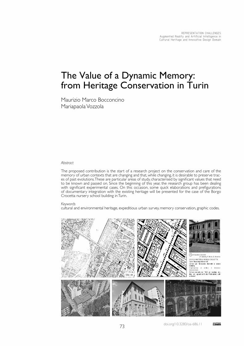
doi.org/10.3280/oa-686.1173
REPRESENTATION CHALLENGESAugmented Reality and Artificial Intelligence in Cultural Heritage and Innovative Design Domain
Abstract
The proposed contribution is the start of a research project on the conservation and care of the memory of urban contexts that are changing and that, while changing, it is desirable to preserve trac-es of past evolutions. These are particular areas of study, characterised by significant values that need to be known and passed on. Since the beginning of this year, the research group has been dealing with significant experimental cases. On this occasion, some quick elaborations and prefigurations of documentary integration with the existing heritage will be presented for the case of the Borgo Crocetta nursery school building in Turin.
Keywordscultural and environmental heritage, expeditious urban survey, memory conservation, graphic codes.
The Value of a Dynamic Memory: from Heritage Conservation in TurinMaurizio Marco BocconcinoMariapaola Vozzola
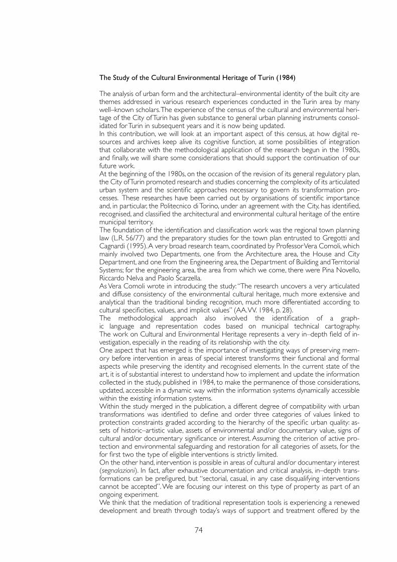
74
The Study of the Cultural Environmental Heritage of Turin (1984)
The analysis of urban form and the architectural–environmental identity of the built city are themes addressed in various research experiences conducted in the Turin area by many well–known scholars. The experience of the census of the cultural and environmental heri-tage of the City of Turin has given substance to general urban planning instruments consol-idated for Turin in subsequent years and it is now being updated.In this contribution, we will look at an important aspect of this census, at how digital re-sources and archives keep alive its cognitive function, at some possibilities of integration that collaborate with the methodological application of the research begun in the 1980s, and finally, we will share some considerations that should support the continuation of our future work.At the beginning of the 1980s, on the occasion of the revision of its general regulatory plan, the City of Turin promoted research and studies concerning the complexity of its articulated urban system and the scientific approaches necessary to govern its transformation pro-cesses. These researches have been carried out by organisations of scientific importance and, in particular, the Politecnico di Torino, under an agreement with the City, has identified, recognised, and classified the architectural and environmental cultural heritage of the entire municipal territory.The foundation of the identification and classification work was the regional town planning law (L.R. 56/77) and the preparatory studies for the town plan entrusted to Gregotti and Cagnardi (1995). A very broad research team, coordinated by Professor Vera Comoli, which mainly involved two Departments, one from the Architecture area, the House and City Department, and one from the Engineering area, the Department of Building and Territorial Systems; for the engineering area, the area from which we come, there were Pina Novello, Riccardo Nelva and Paolo Scarzella. As Vera Comoli wrote in introducing the study: “The research uncovers a very articulated and diffuse consistency of the environmental cultural heritage, much more extensive and analytical than the traditional binding recognition, much more differentiated according to cultural specificities, values, and implicit values” (AA. VV. 1984, p. 28).The methodological approach also involved the identification of a graph-ic language and representation codes based on municipal technical cartography. The work on Cultural and Environmental Heritage represents a very in–depth field of in-vestigation, especially in the reading of its relationship with the city. One aspect that has emerged is the importance of investigating ways of preserving mem-ory before intervention in areas of special interest transforms their functional and formal aspects while preserving the identity and recognised elements. In the current state of the art, it is of substantial interest to understand how to implement and update the information collected in the study, published in 1984, to make the permanence of those considerations, updated, accessible in a dynamic way within the information systems dynamically accessible within the existing information systems.Within the study merged in the publication, a different degree of compatibility with urban transformations was identified to define and order three categories of values linked to protection constraints graded according to the hierarchy of the specific urban quality: as-sets of historic–artistic value, assets of environmental and/or documentary value, signs of cultural and/or documentary significance or interest. Assuming the criterion of active pro-tection and environmental safeguarding and restoration for all categories of assets, for the for first two the type of eligible interventions is strictly limited. On the other hand, intervention is possible in areas of cultural and/or documentary interest (segnalazioni). In fact, after exhaustive documentation and critical analysis, in–depth trans-formations can be prefigured, but “sectorial, casual, in any case disqualifying interventions cannot be accepted”. We are focusing our interest on this type of property as part of an ongoing experiment.We think that the mediation of traditional representation tools is experiencing a renewed development and breath through today’s ways of support and treatment offered by the
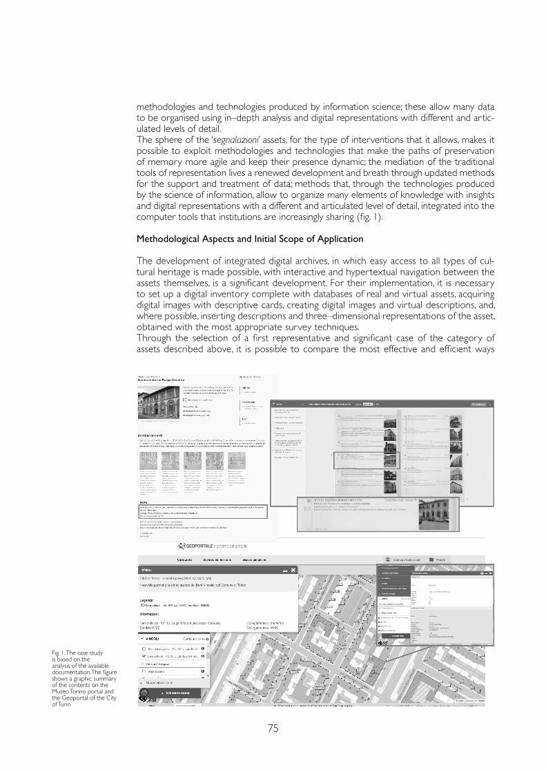
75
methodologies and technologies produced by information science; these allow many data to be organised using in–depth analysis and digital representations with different and artic-ulated levels of detail.The sphere of the ‘segnalazioni’ assets, for the type of interventions that it allows, makes it possible to exploit methodologies and technologies that make the paths of preservation of memory more agile and keep their presence dynamic; the mediation of the traditional tools of representation lives a renewed development and breath through updated methods for the support and treatment of data; methods that, through the technologies produced by the science of information, allow to organize many elements of knowledge with insights and digital representations with a different and articulated level of detail, integrated into the computer tools that institutions are increasingly sharing (fig. 1).
Methodological Aspects and Initial Scope of Application
The development of integrated digital archives, in which easy access to all types of cul-tural heritage is made possible, with interactive and hypertextual navigation between the assets themselves, is a significant development. For their implementation, it is necessary to set up a digital inventory complete with databases of real and virtual assets, acquiring digital images with descriptive cards, creating digital images and virtual descriptions, and, where possible, inserting descriptions and three–dimensional representations of the asset, obtained with the most appropriate survey techniques. Through the selection of a first representative and significant case of the category of assets described above, it is possible to compare the most effective and efficient ways
Fig. 1. The case study is based on the analysis of the available documentation. The figure shows a graphic summary of the contents on the Museo Torino portal and the Geoportal of the City of Turin.
76
of consultation, which are not limited to orderly cataloging but incorporate processes of an expeditious survey and automatic and ‘intelligent’ restitution (photo modeling). This is the step that has to be taken to support the management of a multi–relational database, whose information potential is increased by geometric–spatial and textual–numerical di-mensions, suitable to be implemented to define, record, disseminating, and processing data and information characterised by individual and contextual specificities. The ‘segnalazioni’ of urban areas of environmental and/or documentary interest in-dicates buildings and aggregates of the city which constitute significant evidence of a determined historical period and a particular cultural season or possess intrinsic val-ues for a physical and functional improvement aimed at raising the urban quality. In figure 2 some elaborations were carried out on the Borgo Crocetta school building in Turin, which represents an example of ‘segnalazioni’. The case study is based on the analysis of the available documentation and in-vestigates more interactive tools that bind knowledge within graphic containers. The knowledge supports for Turin have for years been stratified in photographic images and maps that are rapidly accessible and consultable, semantic digital archives, Plan in-struments and general urban planning instruments.The existing wealth of information can be supplemented by expeditious and digital sur-veys, from the photo modeling of the context and of the building at the urban scale, to the instrumental detection of architectural details that can be properly interpreted by artifi-cial intelligence tools and then be integrated into digital information models. By definition, augmented reality offers users the possibility to integrate virtual objects in three dimen-sions into their living environment in real–time. But there are different ways to do this, in-cluding marker–based, or markerless solutions based on global positioning systems (GPS). Solutions based on ‘markers’, or on location or scene recognition, respond to the sen-sors of mobile devices and allow multi–dimensional information to be placed in a giv-en location. The stratifications of indications have followed different skills over time. Their sedimentation can be observed today in the information system of the City of Turin. In this case we observe a partial deficiency, missing an element of connection be-tween studies made, collected in part, and those currently present. In this sense, it will be necessary to pose the issue of criticism and self–criticism on the updates of the Cultural and Environmental heritage, starting from the registration of the size of the urban fabric while recognising the architectural and building value. Furthermore, it will be necessary to create consultation tools that are more ductile and easier to consult and update the data: census resulting from a survey linked to the design of areas linked to the Cultural and Environmental Heritage, producing materials according to standard protocols to support the administrations to verify the reuse of shared data and evaluate integrations.
Concluding Remarks and Future Developments
Integration into the multiplicity of levels referred to must be supported by appropriate dis-semination tools; the dimension of the mutations inherent in the same part of the territory investigated in the future or documented through materials of different origin or temporal
Fig. 2. Spatial survey for memory. More ‘intelligent’ tools that combine knowledge within dynamic graphical containers.
77
References
AA. VV. (1984). Beni culturali ambientali nel Comune di Torino. Torino: Società degli ingegneri e degli architetti in Torino, Politecnico di Torino. Dipartimento Casa Città. https://www.museotorino.it/resources/pdf/books/151/ (1 March 2021).
Garzino Giorgio, Novello Giuseppa, Bocconcino Maurizio Marco (2018). Handbook of Research on Urban and Territorial Systems and the Intangible Dimension: Survey and Representation. In Inglese Carlo, Ippolito Alfonso (eds.) Conservation, Restoration, and Analysis of Architectural and Archaeological Heritage. Hershey, Pennsylvanie, USA: IGI Global, pp. 346-385.
Novello Giuseppa, Bocconcino Maurizio Marco (2018). New methods for the dissemination of the research on the city: multimedia tools for the sharing of documentary archives / Nuovi metodi per la diffusione delle ricerche sulla città: strumenti multimediali per la condivisione degli archivi documentali. In DISEGNARECON, 11 (21), pp. 1-14.
Novello Giuseppa, Bocconcino Maurizio Marco (2019). Dalle mappe ai sistemi informativi.Lungo le rotte del Disegno navigando nell’arcipelago delle esperienze di un gruppo di ricerca (1974-2019) – From Maps to Information Systems Along the Routes of the Drawing Navigating in the Archipelago of the Experiences of a Research Group (1974-2019). In Diségno, 5, pp. 33-44.
Novello Giuseppa, Bocconcino Maurizio Marco (2020). Itinerari digitali tra carte e disegni del patrimonio dell’archivio Porcheddu. Le pratiche delle opere torinesi nel periodo 1894-1927. In History of Engineering Storia dell’Ingegneria 4th International Conference Atti dell’8° Convegno Nazionale, Napoli, pp. 633-654.
derivation is a relevant aspect, just as the heritage of elaborations contained in the research should not be dispersed, or ignored, if we want to encourage an active and dynamic mem-ory for those significant parts of assets and contexts which, although modified or redefined by interventions made necessary over time, could be kept alive and present in virtual scenarios, in order not to forget their primitive value and integrating the different possible forms of reading and interpretation. The setting up of a recognisable and still valid method, whose application today is confront-ed with analysis and recording tools that are more agile and above all more accessible to diversified users with a high degree of accessibility, is today measured by the demateriali-sation of knowledge. It is necessary to recognise technologies that are easy to use so that they can be applied widely and homogeneously, technologies that multiply, but above all go beyond, in the permanence of criteria and standards relating to the data and metadata to be stored: the ambition to ‘put everything together and in relation’ as an interpretation of a problem that derives from alternative technological knowledge that supports information intentions. In this sense, several questions will have to be addressed in the continuation of this research work which has just begun: How should information be managed, does it make the tools chase or does it chase them? How to ‘seed’ urban memory, material identifiers or global positioning systems? We are confronted with this: the transformation has taken place and that place today cannot tell its memory, its memory is mute or not everyone can understand it or can interpret it. The paradigm of what urban memory can lose and not transmit through the place itself, in the very place where it was produced, and not only through documentary heritage and archived knowledge, by their nature not accessible to a wide public, not consultable by walking those streets. One can only feel the distant sense of the human and urban reality that occupied that space in the past, but not visualise it, explore it at a distance of time. The seeds of memory need to be planted where memory is constantly being renewed, lost and reformed. The ma-terial that constitutes cities must therefore be used to narrate their transformation
Acknowledgements
The present research started under the scientific coordination of professor Giuseppa Novello, former researcher in the original BCA Turin working group, to whom we owe the constant confrontation in many of the critical considerations outlined above.
Copyright © 2021 by FrancoAngeli s.r.l. Milano, Italy Isbn 9788835125280
AuthorsMaurizio Marco Bocconcino, Dept.of Structural, Geotechnical and Building Engineering, Politecnico di Torino, [email protected] Vozzola, Dept. of Structural, Geotechnical and Building Engineering, Politecnico di Torino, [email protected]

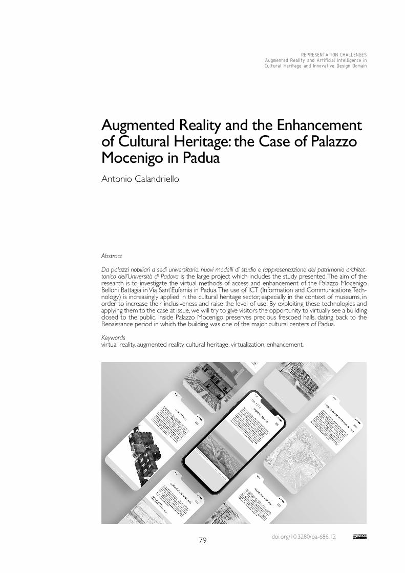
doi.org/10.3280/oa-686.1279
REPRESENTATION CHALLENGESAugmented Reality and Artificial Intelligence in Cultural Heritage and Innovative Design Domain
Abstract
Da palazzi nobiliari a sedi universitarie: nuovi modelli di studio e rappresentazione del patrimonio architet-tonico dell’Università di Padova is the large project which includes the study presented. The aim of the research is to investigate the virtual methods of access and enhancement of the Palazzo Mocenigo Belloni Battagia in Via Sant’Eufemia in Padua. The use of ICT (Information and Communications Tech-nology) is increasingly applied in the cultural heritage sector, especially in the context of museums, in order to increase their inclusiveness and raise the level of use. By exploiting these technologies and applying them to the case at issue, we will try to give visitors the opportunity to virtually see a building closed to the public. Inside Palazzo Mocenigo preserves precious frescoed halls, dating back to the Renaissance period in which the building was one of the major cultural centers of Padua.
Keywordsvirtual reality, augmented reality, cultural heritage, virtualization, enhancement.
Augmented Reality and the Enhancement of Cultural Heritage: the Case of Palazzo Mocenigo in PaduaAntonio Calandriello
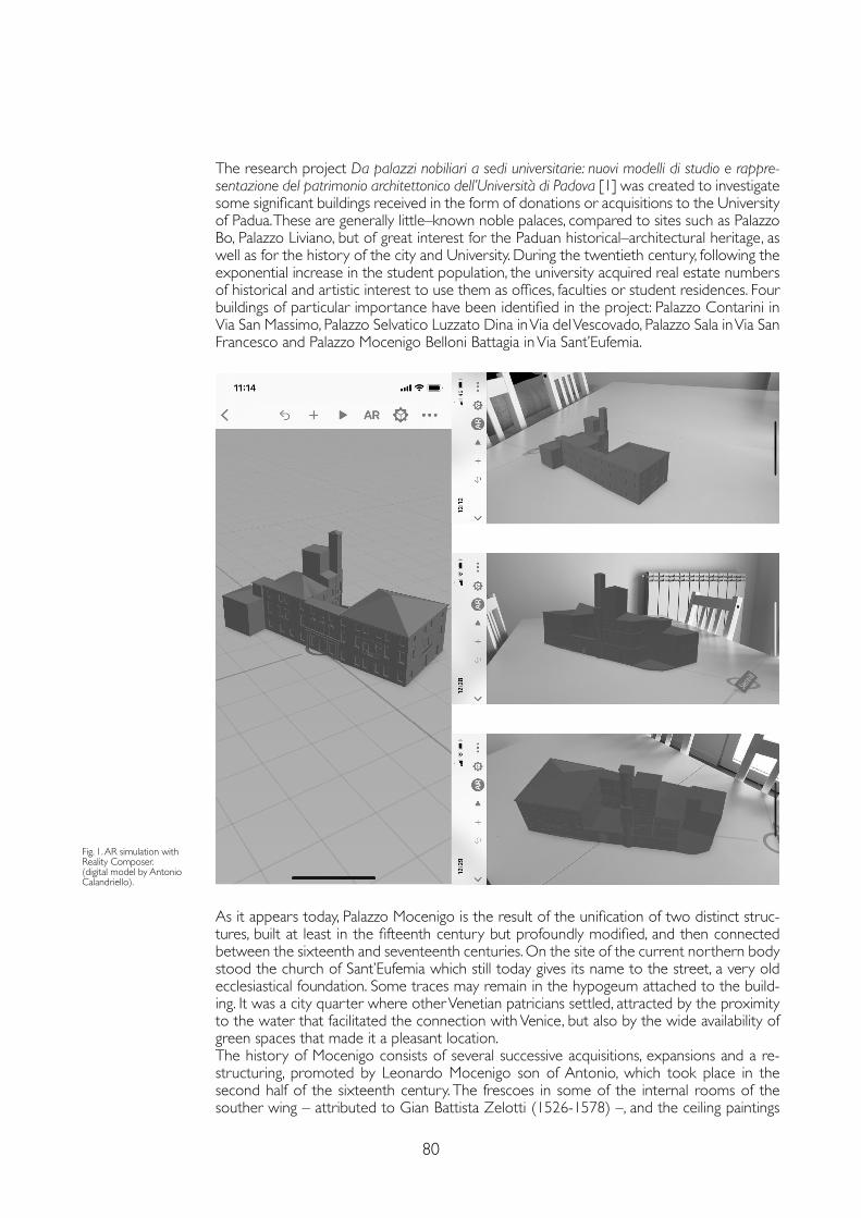
80
The research project Da palazzi nobiliari a sedi universitarie: nuovi modelli di studio e rappre-sentazione del patrimonio architettonico dell’Università di Padova [1] was created to investigate some significant buildings received in the form of donations or acquisitions to the University of Padua. These are generally little–known noble palaces, compared to sites such as Palazzo Bo, Palazzo Liviano, but of great interest for the Paduan historical–architectural heritage, as well as for the history of the city and University. During the twentieth century, following the exponential increase in the student population, the university acquired real estate numbers of historical and artistic interest to use them as offices, faculties or student residences. Four buildings of particular importance have been identified in the project: Palazzo Contarini in Via San Massimo, Palazzo Selvatico Luzzato Dina in Via del Vescovado, Palazzo Sala in Via San Francesco and Palazzo Mocenigo Belloni Battagia in Via Sant’Eufemia.
Fig. 1. AR simulation with Reality Composer. (digital model by Antonio Calandriello).
As it appears today, Palazzo Mocenigo is the result of the unification of two distinct struc-tures, built at least in the fifteenth century but profoundly modified, and then connected between the sixteenth and seventeenth centuries. On the site of the current northern body stood the church of Sant’Eufemia which still today gives its name to the street, a very old ecclesiastical foundation. Some traces may remain in the hypogeum attached to the build-ing. It was a city quarter where other Venetian patricians settled, attracted by the proximity to the water that facilitated the connection with Venice, but also by the wide availability of green spaces that made it a pleasant location.The history of Mocenigo consists of several successive acquisitions, expansions and a re-structuring, promoted by Leonardo Mocenigo son of Antonio, which took place in the second half of the sixteenth century. The frescoes in some of the internal rooms of the souther wing – attributed to Gian Battista Zelotti (1526-1578) –, and the ceiling paintings
81
commissioned to Stefano Dall’Arzere (1515-1575) for one of the rooms on the ground floor – that are now in the Civic Museums of Padua –, belong to this second phase of the work. From this moment Palazzo Mocenigo became a reference cultural center for the city.The building, now owned by the Belloni family, underwent further works in the first half of the seventeenth century, and other rooms were frescoed by Daniel Van Der Dyck (1610-1670). The building as it reaches us today is the result of further changes by successive families and in 1955 it was finally used as a residence for students in memory of Lina Meneghetti. The project was entrusted to Giulio Brunetta (1906-1978) who, in addition to the internal adaptation changes of Palazzo Mocenigo itself, adds a further body of the building. In 1960, the University of Padua also bought Palazzo Mocenigo building, which together with the Brunetta building, has been closed to the public since 2012 following the earthquake in Emilia Romagna.
In the case in question, taking advantage of current digital technologies, also borrowed from other sectors that differ from that of cultural heritage, an attempt is made to offer a solution to the impossibility of visiting the property and at the same time, should it reopen the doors to public, offer an increased level of use. Within this process of enhancement it is necessary to underline how the use of ICT (Information and Communications Technology) not only allows a higher degree of use – enhancing the tangible and intangible – and improving social inclusion, but is also able to play an important role also in the conservation of the asset. If we consider the process behind an enhancement project, we will note that this involves an enormous acquisition of data – often of a multidisciplinary nature – which returns a photo-graph of the current state, both from the point of view of the conservation of the property and of the–state–of–the–art connected to it. It is in this phase that the digitization of the documents that are acquired and processed in order to be adequately disclosed takes place.The study for the enhancement of Palazzo Mocenigo was designed using different digital ap-plications and wants to be paradigmatic also for the other buildings that are part of the key project. Technologies used and intended to be used include virtual reality (VR), augmented reality (AR), video production and application development.VR can have different levels of interaction, a passive one in which the user 'moves' and an-other one extremely interactive that gives him the opportunity to interact with space and virtual objects. In the specific case, as will be seen later, we focus on a less advanced level. Augmented reality is a technology that allows you to view additional information in real
Fig. 2. Hypothesis of VR simulation with smartphone and Google Daydream View. The VR image shows one hall of Palazzo Mocenigo.

82
time through an overlap between real and virtual elements (dynamic audiovisual content, 3D animations, films). Through special markers and a device, the real image is enriched with features and information that integrate and complete it.The video production, on the other hand, allows an informative experience through more traditional channels, but at the same time it was the starting point for some of the immer-sive experiences listed above.In order for augmented reality and virtual reality applications to work, it is necessary to create digital content to be subsequently transferred into the various software and appli-cations. The first step was to create a virtual clone of Palazzo Mocenigo, this happened in two ways: with a digital photogrammetric survey and with 3D modeling. The digital photo-grammetric survey mainly concerned the internal environments – the halls richly decorated with frescoes showing forest scenes with a Flemish taste and the rooms with suggestive painted architectural perspectives – were detected through high–resolution photographs, respecting the criteria of overlapping and spatial distribution dictated by ‘structures from motion’ software [2]. Particular attention was paid to continuously detecting the interior of the building, focusing on the connections between one environment and another. This approach made it possible to return a unique model of the frescoed rooms and the con-necting rooms with the certainty that all the rooms were perfectly oriented and scaled with respect to the others. The information previously acquired and contained in the images of the passage rooms, used simultaneously in different chunks of Agisoft Metashape, made it possible to automatically align the different models of the individual rooms (Workflow> Align Chunks> (Method) Camera Based). At the end of all the various phases for the production of the mesh model and its texture, this was exported to be then combined with the virtual clones of Palazzo Mocenigo.The digital models of the entire building were created through the use of historical doc-umentation as regards the one that shows the formal conformation of the building in the mid–16th century, while for the current state it was based on the digital photogrammetric survey and current documentation. The three–dimensional models, which form the com-mon basis of the various declinations of the enhancement project, were subsequently used in different ways.The structure of the multimedia project of Palazzo Mocenigo foresees as a first output is the creation a totem that will be located in front of the building itself and that represents the 'stargate' for accessing multimedia contents that are recalled and displayed on their devices by scanning of specific QR codes.A first QR code offers the possibility to view a video that tells the story of the building, its historical evolution and the transformations it has undergone in relation to the urban context. Paying particular attention to showing what it is not possible to see today, revealing the contents of the internal rooms and passively guiding the viewer inside and outside the building, both in its current configuration and in that of the sixteenth century.A second tag allows you to download an application that contains a series of multimedia contents, including interactive ones. The application provides that the collection of scientific and educational material is arranged by simple accumulation, starting with the most generic information materials and then descending, based on the user's needs, into a series of in-creasingly specialized information. Through a 'hamburger' menu it is possible to access the different sections that include the historical documents of the land registry, the State Ar-chives of Padua and Venice, the historical information of the building and its transformations over the centuries, the building at the time of residence student, the 360 ° virtual tours of the various frescoed rooms, the historical information connected to them, and finally the building in augmented reality. Some of these experiences, as in the case of 360 ° virtual tours and the building in augmented reality, can be recalled individually by framing other special QR Codes placed on the entrance totem with your device.The idea is not to bind the user to necessarily download an application, but to equally use part of the multimedia content made available on online platforms such as Momento360 [3] or to use applications already present in their device as in the case of RealityComposer or ARCore, respectively for iOS and Android platforms. The models of Palazzo Mocenigo
83
Notes
[1] Born to experiment new ways of studying, narrating and communicating the historical–architectural heritage received by the University of Padua in the form of donations or acquisitions, the research project started by an interdisciplinary team coordinated by Elena Svalduz as scientific director (Dbc), Andrea Caracausi (Disgea), Andrea Giordano (Dicea), Nicola Orio (Dbc), Stefano Zaggia (Dicea), involved some researchers (Antonio Calandriello, Simone Fatuzzo and Umberto Signori). The writer has dealt in particular with the enhancement project that is proposed here.
[2] The software used for image processing was Agisoft Metashape Pro.
[3] https://www.momento360.com
[4] https://sketchfab.com. .
References
Basso Alessandro (2020). Ambienti virtuali per nuove forme di comunicazione. Virtual enviroments for new media. Roma: Aracne Editrice.
Bourdot Patrick, Interrante Victoria, Kopper Regis, Olivier Anne–Hélène, Saito Hideo, Zachmann Gabriel (eds.) (2020). Virtual Reality and Augmented Reality. Cham: Springer International Publishing.
Greengard Samuel (2019). Virtual Reality. Cambridge, Massachusetts; London, England: The MIT Press.
Ioannides Marinos, Fink Eleanor, Brumana Raffaella Patias Petros, Doulamis Anastasios, Martins João, Wallace Manolis (eds.) (2018). Digital Heritage. Progress in Cultural Heritage: Documentation, Preservation, and Protection. Cham: Springer International Publishing.
Ioannides Marinos, Magnenat–Thalmann Nadia, Papagiannakis George (2017). Mixed reality and gamification for cultural heritage. Cham: Springer International Publishing.
Luigini Alessandro, Panciroli Chiara (2018). Ambienti digitali per l’educazione all’arte e al patrimonio. Milano: FrancoAngeli.
Nespeca Romina (2018), Towards a 3D digital model for management and fruition of Ducal Palace at Urbino. An integrated survey with mobile mapping. In SCIRES–IT – SCIentific RESearch and Information Technologies, 8 (2), pp. 1-14.
Rossi Daniele (2020). Realtà virtuale: disegno e design. Roma: Aracne Editrice.
Sdegno Alberto, Masserano Silvia, Mior Denis, Cochelli Paola, Gobbo Eleonora (2015), Augmenting painted architectures for communicating cultural heritage. In SCIRES–IT – SCIentific RESearch and Information Technologies, 5 (1), pp. 93-100.
that should be shared on an opensource platform such as Sketchfab [4] and subsequently displayed directly in AR on their devices. The models created for augmented reality allow you to view the formal and distributive aspects of the building and the arrangement of the frescoed rooms in the two reference periods: at present and in the configuration in the sixteenth century (fig. 1).The virtual tours have been designed to allow the user to mainly explore the interior of the building. Each 360 ° render allows you to explore the interior of the rooms in an immersive and interactive way (fig. 2). Thanks to tags placed on the different points of interest, the user can receive information about the paintings or simply move from one environment to another. The information may be of a different nature, from information about the author, the construction, the construction technique to more interpretative ones, such as for the study of architectural perspectives. This last case would represent the maximum expression of the potential of virtual reality applied to the field of Cultural Heritage. The user would find himself immersed in a completely artificial space that arises from the restitution of the architectures painted on the vaults and on the walls of the rooms. There would therefore be not only the possibility of visiting an inaccessible physical space, that of the rooms of Palazzo Mocenigo, but the possibility of finding oneself even in an different dimension, the one depicted in perspective on the walls and vaults of the building itself.
Copyright © 2021 by FrancoAngeli s.r.l. Milano, Italy Isbn 9788835125280
AuthorAntonio Calandriello, Dept. of Civil, Environmental and Architectural Engineering, University of Padua, [email protected]

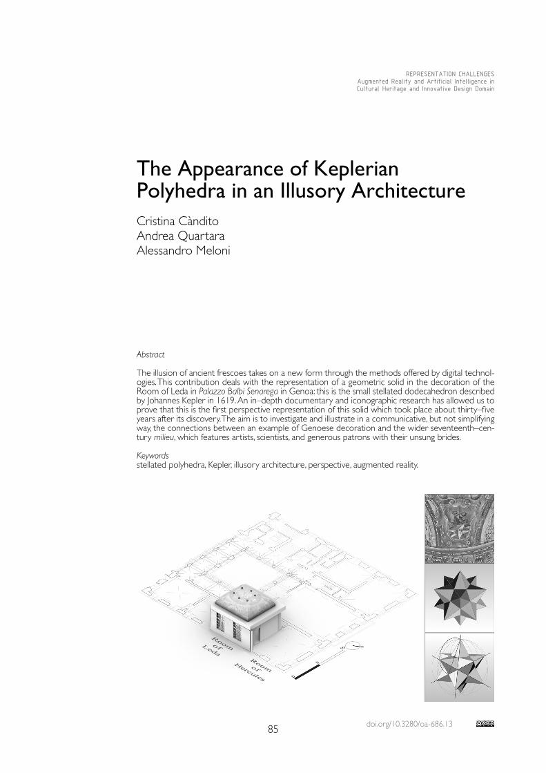
doi.org/10.3280/oa-686.1385
REPRESENTATION CHALLENGESAugmented Reality and Artificial Intelligence in Cultural Heritage and Innovative Design Domain
Abstract
The illusion of ancient frescoes takes on a new form through the methods offered by digital technol-ogies. This contribution deals with the representation of a geometric solid in the decoration of the Room of Leda in Palazzo Balbi Senarega in Genoa: this is the small stellated dodecahedron described by Johannes Kepler in 1619. An in–depth documentary and iconographic research has allowed us to prove that this is the first perspective representation of this solid which took place about thirty–five years after its discovery. The aim is to investigate and illustrate in a communicative, but not simplifying way, the connections between an example of Genoese decoration and the wider seventeenth–cen-tury milieu, which features artists, scientists, and generous patrons with their unsung brides.
Keywordsstellated polyhedra, Kepler, illusory architecture, perspective, augmented reality.
The Appearance of KeplerianPolyhedra in an Illusory ArchitectureCristina CànditoAndrea QuartaraAlessandro Meloni
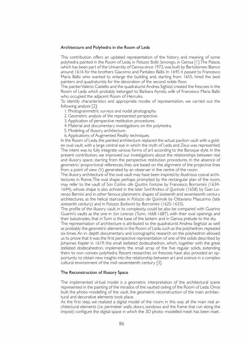
86
Architecture and Polyhedra in the Room of Leda
This contribution offers an updated representation of the history and meaning of some polyhedra painted in the Room of Leda, in Palazzo Balbi Senarega, in Genoa [1]. The Palace, which has been part of the University of Genoa since 1972, was built by Bartolomeo Bianco around 1616 for the brothers Giacomo and Pantaleo Balbi. In 1645 it passed to Francesco Maria Balbi who wanted to enlarge the building and, starting from 1655, hired the best painters and quadraturists for the decoration of the second noble floor.The painter Valerio Castello and the quadraturist Andrea Sighizzi created the frescoes in the Room of Leda which probably belonged to Barbara Ayrolo, wife of Francesco Maria Balbi who occupied the adjacent Room of Hercules.To identify characteristics and appropriate modes of representation, we carried out the following analysis [2]:
1. Photogrammetric surveys and nodal photography.2. Geometric analysis of the represented perspective.3. Application of perspective restitution procedures.4. Material and documentary investigations on the polyhedra.5. Modeling of illusory architecture.6. Applications of Augmented Reality techniques.
In the Room of Leda, the painted architecture replaced the actual pavilion vault with a gold-en oval vault, with a large central eye in which the myth of Leda and Zeus was represented. The intent was to fully integrate various forms of art according to the Baroque style. In the present contribution, we improved our investigations about the relationships between real and illusory space, starting from the perspective restitution procedures. In the absence of geometric–proportional references, they are based on the alignment of the projective lines from a point of view (V) generated by an observer in the centre of the room.The illusory architecture of the oval vault may have been inspired by illustrious coeval archi-tectures in Rome. The oval shape, perhaps prompted by the rectangular plan of the room, may refer to the vault of San Carlino alle Quattro Fontane by Francesco Borromini (1634-1644), whose shape is also echoed in the later Sant’Andrea al Quirinale (1658) by Gian Lo-renzo Bernini and in other famous planimetric shapes of sixteenth and seventeenth century architectures, as the helical staircases in Palazzo del Quirinale by Ottaviano Mascarino (late sixteenth century) and in Palazzo Barberini by Borromini (1625-1633).The profile of the illusory vault, in its complexity, could be also be compared with Guarino Guarini’s vaults as the one in San Lorenzo (Turin, 1668-1687), with their oval openings and their balustrades, that in Turin is the base of the lantern and in Genoa prelude to the sky.The representation of architecture is attributed to the quadraturist Andrea Seghizzi as well as probably the geometric elements in the Room of Leda, such as the polyhedron, repeated six times. An in–depth documentary and iconographic research on the polyhedron allowed us to prove that it was the first perspective representation of one of the solids described by Johannes Kepler in 1619: the small stellated dodecahedron, which, together with the great stellated dodecahedron, implements the small array of the five regular solids, extending them to non–convex polyhedra. Recent researches on frescoes have also provided an op-portunity to obtain new insights into the relationship between art and science in a complex cultural environment of the mid–seventeenth century [3].
The Reconstruction of Illusory Space
The implemented virtual model is a geometric interpretation of the architectural scene represented in the painting of the intrados of the vaulted ceiling of the Room of Leda. Once built the photo–modelling of the vault, the geometric reconstruction of the main architec-tural and decorative elements took place.As the first step, we realized a digital model of the room; in this way all the main real ar-chitectural elements (i.e. perimeter walls, doors, windows and the frame that run along the impost) configure the digital space in which the 3D photo–modelled mesh has been inset.
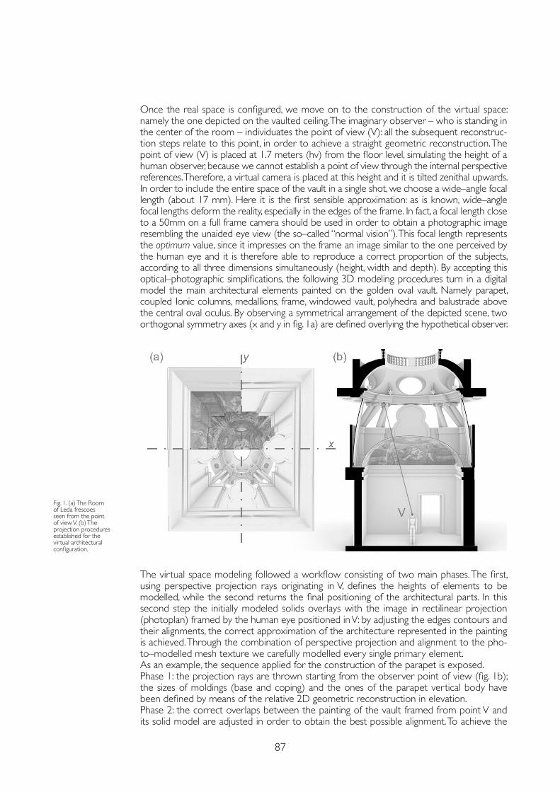
87
Once the real space is configured, we move on to the construction of the virtual space: namely the one depicted on the vaulted ceiling. The imaginary observer – who is standing in the center of the room – individuates the point of view (V): all the subsequent reconstruc-tion steps relate to this point, in order to achieve a straight geometric reconstruction. The point of view (V) is placed at 1.7 meters (hv) from the floor level, simulating the height of a human observer, because we cannot establish a point of view through the internal perspective references. Therefore, a virtual camera is placed at this height and it is tilted zenithal upwards. In order to include the entire space of the vault in a single shot, we choose a wide–angle focal length (about 17 mm). Here it is the first sensible approximation: as is known, wide–angle focal lengths deform the reality, especially in the edges of the frame. In fact, a focal length close to a 50mm on a full frame camera should be used in order to obtain a photographic image resembling the unaided eye view (the so–called “normal vision”). This focal length represents the optimum value, since it impresses on the frame an image similar to the one perceived by the human eye and it is therefore able to reproduce a correct proportion of the subjects, according to all three dimensions simultaneously (height, width and depth). By accepting this optical–photographic simplifications, the following 3D modeling procedures turn in a digital model the main architectural elements painted on the golden oval vault. Namely parapet, coupled Ionic columns, medallions, frame, windowed vault, polyhedra and balustrade above the central oval oculus. By observing a symmetrical arrangement of the depicted scene, two orthogonal symmetry axes (x and y in fig. 1a) are defined overlying the hypothetical observer.
The virtual space modeling followed a workflow consisting of two main phases. The first, using perspective projection rays originating in V, defines the heights of elements to be modelled, while the second returns the final positioning of the architectural parts. In this second step the initially modeled solids overlays with the image in rectilinear projection (photoplan) framed by the human eye positioned in V: by adjusting the edges contours and their alignments, the correct approximation of the architecture represented in the painting is achieved. Through the combination of perspective projection and alignment to the pho-to–modelled mesh texture we carefully modelled every single primary element.As an example, the sequence applied for the construction of the parapet is exposed. Phase 1: the projection rays are thrown starting from the observer point of view (fig. 1b); the sizes of moldings (base and coping) and the ones of the parapet vertical body have been defined by means of the relative 2D geometric reconstruction in elevation. Phase 2: the correct overlaps between the painting of the vault framed from point V and its solid model are adjusted in order to obtain the best possible alignment. To achieve the
Fig. 1. (a) The Room of Leda frescoes seen from the point of view V. (b) The projection procedures established for the virtual architectural configuration.
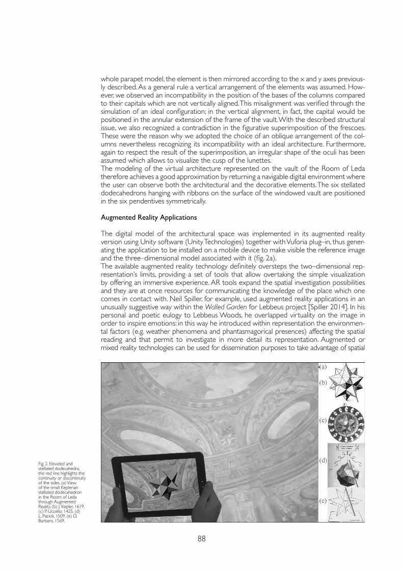
88
whole parapet model, the element is then mirrored according to the x and y axes previous-ly described. As a general rule a vertical arrangement of the elements was assumed. How-ever, we observed an incompatibility in the position of the bases of the columns compared to their capitals which are not vertically aligned. This misalignment was verified through the simulation of an ideal configuration; in the vertical alignment, in fact, the capital would be positioned in the annular extension of the frame of the vault. With the described structural issue, we also recognized a contradiction in the figurative superimposition of the frescoes. These were the reason why we adopted the choice of an oblique arrangement of the col-umns nevertheless recognizing its incompatibility with an ideal architecture. Furthermore, again to respect the result of the superimposition, an irregular shape of the oculi has been assumed which allows to visualize the cusp of the lunettes.The modeling of the virtual architecture represented on the vault of the Room of Leda therefore achieves a good approximation by returning a navigable digital environment where the user can observe both the architectural and the decorative elements. The six stellated dodecahedrons hanging with ribbons on the surface of the windowed vault are positioned in the six pendentives symmetrically.
Augmented Reality Applications
The digital model of the architectural space was implemented in its augmented reality version using Unity software (Unity Technologies) together with Vuforia plug–in, thus gener-ating the application to be installed on a mobile device to make visible the reference image and the three–dimensional model associated with it (fig. 2a). The available augmented reality technology definitely oversteps the two–dimensional rep-resentation’s limits, providing a set of tools that allow overtaking the simple visualization by offering an immersive experience. AR tools expand the spatial investigation possibilities and they are at once resources for communicating the knowledge of the place which one comes in contact with. Neil Spiller, for example, used augmented reality applications in an unusually suggestive way within the Walled Garden for Lebbeus project [Spiller 2014]. In his personal and poetic eulogy to Lebbeus Woods, he overlapped virtuality on the image in order to inspire emotions: in this way he introduced within representation the environmen-tal factors (e.g. weather phenomena and phantasmagorical presences) affecting the spatial reading and that permit to investigate in more detail its representation. Augmented or mixed reality technologies can be used for dissemination purposes to take advantage of spatial
Fig. 2. Elevated and stellated dodecahedra, the red line highlights the continuity or discontinuity of the sides. (a) View of the small Keplerian stellated dodecahedron in the Room of Leda through Augmented Reality. (b) J. Kepler, 1619. (c) P. Uccello, 1425. (d) L. Pacioli, 1509. (e) D. Barbaro, 1569.
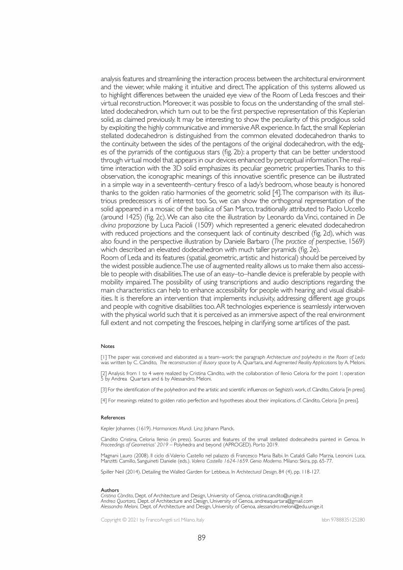
89
Notes
[1] The paper was conceived and elaborated as a team–work: the paragraph Architecture and polyhedra in the Room of Leda was written by C. Càndito, The reconstruction of illusory space by A. Quartara, and Augmented Reality Applications by A. Meloni.
[2] Analysis from 1 to 4 were realized by Cristina Càndito, with the collaboration of Ilenio Celoria for the point 1; operation 5 by Andrea Quartara and 6 by Alessandro. Meloni.
[3] For the identification of the polyhedron and the artistic and scientific influences on Seghizzi’s work, cf. Càndito, Celoria [in press].
[4] For meanings related to golden ratio perfection and hypotheses about their implications, cf. Càndito, Celoria [in press].
References
Kepler Johannes (1619). Harmonices Mundi. Linz: Johann Planck.
Càndito Cristina, Celoria Ilenio (in press). Sources and features of the small stellated dodecahedra painted in Genoa. In Proceedings of Geometrias’ 2019 – Polyhedra and beyond (APROGED). Porto 2019.
Magnani Lauro (2008). Il ciclo di Valerio Castello nel palazzo di Francesco Maria Balbi. In Cataldi Gallo Marzia, Leoncini Luca, Manzitti Camillo, Sanguineti Daniele (eds.). Valerio Castello 1624-1659. Genio Moderno. Milano: Skira, pp. 65-77.
Spiller Neil (2014). Detailing the Walled Garden for Lebbeus. In Architectural Design, 84 (4), pp. 118-127.
analysis features and streamlining the interaction process between the architectural environment and the viewer, while making it intuitive and direct. The application of this systems allowed us to highlight differences between the unaided eye view of the Room of Leda frescoes and their virtual reconstruction. Moreover, it was possible to focus on the understanding of the small stel-lated dodecahedron, which turn out to be the first perspective representation of this Keplerian solid, as claimed previously. It may be interesting to show the peculiarity of this prodigious solid by exploiting the highly communicative and immersive AR experience. In fact, the small Keplerian stellated dodecahedron is distinguished from the common elevated dodecahedron thanks to the continuity between the sides of the pentagons of the original dodecahedron, with the edg-es of the pyramids of the contiguous stars (fig. 2b): a property that can be better understood through virtual model that appears in our devices enhanced by perceptual information. The real–time interaction with the 3D solid emphasizes its peculiar geometric properties. Thanks to this observation, the iconographic meanings of this innovative scientific presence can be illustrated in a simple way in a seventeenth–century fresco of a lady’s bedroom, whose beauty is honored thanks to the golden ratio harmonies of the geometric solid [4]. The comparison with its illus-trious predecessors is of interest too. So, we can show the orthogonal representation of the solid appeared in a mosaic of the basilica of San Marco, traditionally attributed to Paolo Uccello (around 1425) (fig. 2c). We can also cite the illustration by Leonardo da Vinci, contained in De divina proporzione by Luca Pacioli (1509) which represented a generic elevated dodecahedron with reduced projections and the consequent lack of continuity described (fig. 2d), which was also found in the perspective illustration by Daniele Barbaro (The practice of perspective, 1569) which described an elevated dodecahedron with much taller pyramids (fig. 2e). Room of Leda and its features (spatial, geometric, artistic and historical) should be perceived by the widest possible audience. The use of augmented reality allows us to make them also accessi-ble to people with disabilities. The use of an easy–to–handle device is preferable by people with mobility impaired. The possibility of using transcriptions and audio descriptions regarding the main characteristics can help to enhance accessibility for people with hearing and visual disabil-ities. It is therefore an intervention that implements inclusivity, addressing different age groups and people with cognitive disabilities too. AR technologies experience is seamlessly interwoven with the physical world such that it is perceived as an immersive aspect of the real environment full extent and not competing the frescoes, helping in clarifying some artifices of the past.
Copyright © 2021 by FrancoAngeli s.r.l. Milano, Italy Isbn 9788835125280
AuthorsCristina Càndito, Dept. of Architecture and Design, University of Genoa, [email protected] Andrea Quartara, Dept. of Architecture and Design, University of Genoa, [email protected] Meloni, Dept. of Architecture and Design, University of Genoa, [email protected]

doi.org/10.3280/oa-686.1491
REPRESENTATION CHALLENGESAugmented Reality and Artificial Intelligence in Cultural Heritage and Innovative Design Domain
Abstract
Competitions for ideas for architecture have always been sources of stimulus and research, paving the way for innovative projects that have also guaranteed an economic flow and a naturally consequent social response.The municipality of Rome, years ago, was the architect of a campaign of this type: the Cento Piazze project included, for the first time, a number of competitions and projects that had never been ad-dressed by a national and international administration.Our intervention aims to reflect on how and to what extent the Public Administration can now benefit from new technologies and digital tools for the analysis and survey of architecture and pub-lic space. These innovations, in fact, now make it possible to provide design with a valid help in the preparation of competitions that increasingly concern urban regeneration at an international level.
Keywordspublic administration, survey, cento piazze, heritage digitization, planning.
Digital Tools at the Service of Public Administrations Maria Grazia CianciDaniele CalisiSara ColaceciFrancesca Paola Mondelli
92
The Centopiazze Program
In 1996, the Centopiazze program in Rome launched the national competition The neighbor-hood squares, through which young professionals were invited to deal with the design of 19 open spaces in Rome. Centopiazze was a unique urban redevelopment program of its kind in Rome, through which it was intended to deal with the issue of public space extensively throughout the territory, from the center to the periphery. With the council led by the Mayor Francesco Rutelli, and on the proposal of Prof. Arch. Francesco Ghio, a special program coor-dination office was set up in the Mayor’s Cabinet. Over the course of about a decade, around 180 public spaces in the city have been transformed, redeveloped or built from scratch.The Neighborhood squares competition was the first action through which the Centopiazze program was launched. It is very interesting, to date, to look at the competition dossier precisely in order to compare the ways in which, 25 years ago, the areas of intervention were presented with respect to today. The graphic and technical documentation present in the competition dossier reflected the possibilities and means of the time: first of all, a technical plan of the intervention area, with the area within the key–plan of the city of Rome; a brief description of the area with an indication of the functions to be established, location, morphological characteristics of the area, road system, green system, urban context, historical analysis, urban destinations (with reference to the PRG in force in 1996) and the further planned projects in that area; some exemplary axonometric diagrams through which the different lots involved in the competition were compared, drawn with wire; finally, in the most fortunate cases, an aerial photo of the area and some photographs of the site.
Reinventing Cities. Historical–Documentary Research and Surveys
Today, after more than 20 years, the city of Rome confronted again with the theme of urban regeneration and does so through the Reinventing Cities international competition, A global competition for innovative, resilient and zero–emission urban projects. 12 cities on 4 continents have so far taken part in the competition.Among these, Rome participates with 4 different areas that will be subject to redevelopment: Ex Mira Lanza in the Ostiense–Marconi area; Ex–Filanda in the San Giovanni area, close to the Aurelian walls; Ex Mercato di Torre Spaccata, Vertunni, in Torre Spaccata area, on the eastern outskirts of the city; and finally the area of the Roma Tuscolana station.The municipality of Rome has decided to entrust the preparation of historical and analysis doc-uments and the survey of the three areas currently subject to competition as an external assign-ment. The Roma Tre architecture department was awarded the assignment with the scientific responsibility of Professor Maria Grazia Cianci, thus starting the historical documentary research.For the realization of the three competition dossiers for Ex Filanda, Ex Mercato di Torre Spaccata and Ex Mira Lanza, the working group then dealt with the historical archival research and the elaboration of the integrated survey model, and also with the writing of the texts and graphic design. The dossiers open with a timeline that traces the main stages and transformations of each building, and a chronology drawn up in a discursive, more in–depth and explanatory form. The first two chapters of each issue concern the urban setting of the project sites, and an analysis of the main historical cartography for understanding the territorial and urban context, described and reasoned through the accompanying text. The maps were chosen and placed side by side, suggesting a critical comparison between the different drawings, as in the case of the study of the area where the Ex–Filanda building stands. The topography of the area, leaning against the Aure-lian Walls, is compared in the two maps of Du Perac and Bufalini: the first, perspective, shows the lay of the land beyond the walls, in contrast with the dense urban intramural fabric; the second, more technical and zenith, clarifies the territorial conformation with the vallis celimontana in which we see the acquae vocatur marianae flow, the so–called Marrana di San Giovanni. The dossiers contain all the graphic archive documentation that resulted from the historical research: drawings, projects, surveys, contracts, and historical photographs that are significant for the exhaustive description of each building, tracing the history of each of its transformation. Many sources and ar-chives were consulted, including the Capitoline Historical Archives, the Archives of the Conservatory of Heritage of the Municipality of Rome, the Archives of the Istituto Luce, the Central State Archives.
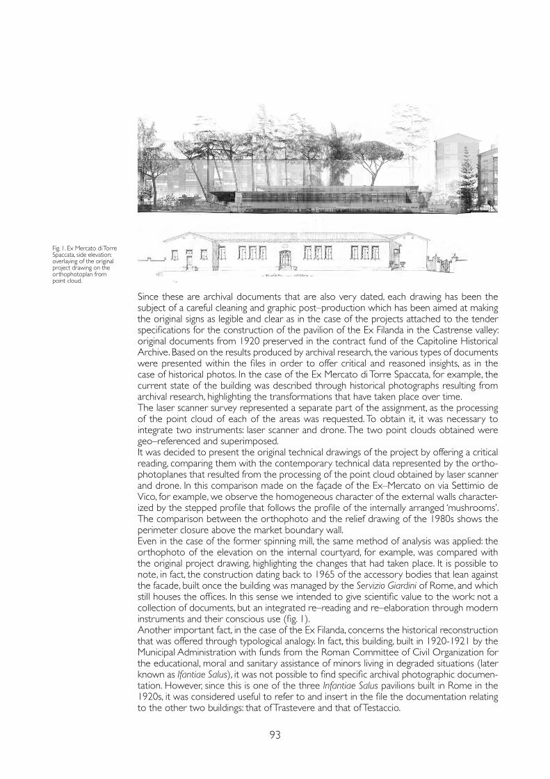
93
Since these are archival documents that are also very dated, each drawing has been the subject of a careful cleaning and graphic post–production which has been aimed at making the original signs as legible and clear as in the case of the projects attached to the tender specifications for the construction of the pavilion of the Ex Filanda in the Castrense valley: original documents from 1920 preserved in the contract fund of the Capitoline Historical Archive. Based on the results produced by archival research, the various types of documents were presented within the files in order to offer critical and reasoned insights, as in the case of historical photos. In the case of the Ex Mercato di Torre Spaccata, for example, the current state of the building was described through historical photographs resulting from archival research, highlighting the transformations that have taken place over time.The laser scanner survey represented a separate part of the assignment, as the processing of the point cloud of each of the areas was requested. To obtain it, it was necessary to integrate two instruments: laser scanner and drone. The two point clouds obtained were geo–referenced and superimposed.It was decided to present the original technical drawings of the project by offering a critical reading, comparing them with the contemporary technical data represented by the ortho-photoplanes that resulted from the processing of the point cloud obtained by laser scanner and drone. In this comparison made on the façade of the Ex–Mercato on via Settimio de Vico, for example, we observe the homogeneous character of the external walls character-ized by the stepped profile that follows the profile of the internally arranged ‘mushrooms’. The comparison between the orthophoto and the relief drawing of the 1980s shows the perimeter closure above the market boundary wall.Even in the case of the former spinning mill, the same method of analysis was applied: the orthophoto of the elevation on the internal courtyard, for example, was compared with the original project drawing, highlighting the changes that had taken place. It is possible to note, in fact, the construction dating back to 1965 of the accessory bodies that lean against the facade, built once the building was managed by the Servizio Giardini of Rome, and which still houses the offices. In this sense we intended to give scientific value to the work: not a collection of documents, but an integrated re–reading and re–elaboration through modern instruments and their conscious use (fig. 1).Another important fact, in the case of the Ex Filanda, concerns the historical reconstruction that was offered through typological analogy. In fact, this building, built in 1920-1921 by the Municipal Administration with funds from the Roman Committee of Civil Organization for the educational, moral and sanitary assistance of minors living in degraded situations (later known as Ifantiae Salus), it was not possible to find specific archival photographic documen-tation. However, since this is one of the three Infantiae Salus pavilions built in Rome in the 1920s, it was considered useful to refer to and insert in the file the documentation relating to the other two buildings: that of Trastevere and that of Testaccio.
Fig. 1. Ex Mercato di Torre Spaccata, side elevation: overlaying of the original project drawing on the orthophotoplan from point cloud.
94
The Digitization of Archival Documentation and Built Heritage
One of the main problems that public administrations in Italy are facing is the digitization of the entire archival apparatus, not only linked to bureaucratic aspects, but above all land registry and concessions and licenses. Considering that the European directives require the use of BIM in public procurement (from 2025 also for minimum contracts of € 100,000), the administrations are al-ready in strong delay in the digitization of the built heritage which is part of the future programmatic planning of the master plans. The three case studies object of the Reinventing Cities campaign have for years (or decades) been strategic sites for the municipality of Rome, the subject of the study of projects for urban redevelopment and regeneration and subject to a succession of events that have greatly entangled the bureaucratic skein made up of restrictions, prohibitions and permits.In this background, the urgency required by the call for the execution of the three surveys with laser scanner technology to be provided to the participants is no coincidence. This con-cern has necessarily imposed a rational and programmatic planning of the survey campaign, taking into account the potential of the tools and the due overlap from two reciprocal laser scanning stations. At the same time, the authorizations were requested for drone flights that were necessary for the photographic campaign and the creation of the discrete 3d model in SFM of the roofs (absent in the ground positions).The point clouds, with a detail of a point every ± 1mm, were mutually aligned in ReCap and subsequently georeferenced, as specifically requested by the PA, thanks to the markers posi-tioned at ground level and for which GPS data has been recorded. The point cloud created for each project site does not, however, exhaust all the drawings needs of a design team. In fact, although it allows the navigability of the site digitally, its interrogation on the formal and dimensional aspects or the perception of the neighboring context, the point cloud must be imported into the CAD environment to provide two–dimensional drawings in orthogonal projections through its management with cutting plans and the redrawing of plans, elevations and sections. This operation is essential to provide the basic iconographic apparatus for the canonical drafting of an architectural project (fig. 2).Not all PAs or even architectural firms know how to manage point clouds whose management, reading and interpretation requires experience first of all in the science of drawing, of its discret-ized representation, in different scales, of reality, be it real or virtual. In addition, knowledge, how-ever technical, of the appropriate software is needed to obtain the desired results. The research group engaged in the work of historical research, survey and representation of the competition sites, had to produce plans, elevations and architectural sections, as well as orthophotoplanes use-ful for understanding the state of decay of the places. Furthermore, the parametric three–dimen-sional model was created, starting from the point clouds, from two–dimensional CAD and having a constant control with archival documentation, in regard and verification of all design phases.The work carried out, in record time, was certainly a first positive experience for the Munic-ipality of Rome, a springboard that highlighted many issues of significant importance, first and foremost the need for a digital database of the architectural heritage that allow to accelerate the bureaucratic and planning processes of public procurement.
Conclusions
While it was once the practice to provide two–dimensional CAD, today technology has al-lowed administrations to add a third dimension and present instrumental surveys performed with laser scanners and photo–modeling carried out with the flight of a drone as basic ma-terial. The point cloud thus obtained will be the three–dimensional basis for design studies, inserting two non–negligible factors into the process. First of all, the now inevitable need to survey, survey and catalog the archaeological, historical and contemporary architectural her-itage through tools that are not usual for public administrations and consequently the need to make use of professional technicians in the sector.In our opinion, moreover, the digital processing of the surveys required by the PA as basic documentation of the insolvency procedures, can represent an intermediate phase towards what could become a real virtualization of the inspection and survey by the designers. The
95
translation of the point cloud and the three–dimensional model into an augmented reality ex-perience could pave the way towards the possibility, for professionals from all over the world, to experience the architectures and urban spaces that are the subject of the competition, without the need to visit the project site directly. Following the limitation of the movements that we are experiencing due to the pandemic, in fact, the importance that digital can have in providing information in real time from any and all parts of the world has been highlighted.Just in the last year, the need for digital adaptation has been strongly felt in many different sectors and research has found new life for projects that were once perhaps only on a hypo-thetical basis, but which today are starting to have concrete foundations.One can think of the ever wider opening of digital archives of artistic works or archival doc-umentation, the concrete creation of apps and navigation sites by museums, the possibility of being able to walk and interact within the virtual museum space, thanks to virtual reality, perhaps in an even more intimate and intense way than analogue reality.In this sense, starting from the experience of digital relief and restitution developed within the Reinventing Cities competition, our reflection invites us to make augmented reality an un-precedented opportunity to expand borders and shorten distances in order to gain knowl-edge, study and transformation of places, even the most distant ones.Point cloud or 3D NURBS model, linked by a close relationship of geometric dimensional dependence of the second with the first, are both navigable and interrogable digital environments, but they do not allow us to have the immersive perception of three–dimensional space as we would have in the real site. Although the first step taken with the Reinventing Cities experience is a huge step towards the digitization of the historical–architectural heritage, it is desirable that public administrations also proceed towards Virtual Reality, through the inclusion of digitized models in platforms such as Unreal Engine or Revit VR, to ensure immersive design for engineering and architecture firms from all over the world. The question raises many other questions that research will have to answer over time: which 3D model will be most useful to navigate? How to make the perceptual and sensory aspects as real as possible for a more conscious design? How to solve the problems associated with all kinds of 3D? The point cloud, although dense, is not material and by approaching the architectures, the points and distances between them are identified, allowing a chromatic perception but not of the material. The NURBS model, derived from the cloud, through the still inevitable passage of 2d interpretation on CAD, is not texturized, and therefore, although making the perception spatial and concrete, it does not give us back the chromatic aspects. A mathematical mesh model that can derive from the point cloud, can only partially solve the problems related to perceptual aspects, but the historically treated issues of the discretization of the points and the inevitable loss of detail, especially of the ornamental apparatus, remain. It is necessary that, over time, the public administration aligns itself with the aspects of communication and representation that begin to be typical of museums and archives, realizing that its historical – building heritage (of all eras) is in fact an asset which must be shared in the appropriate manner and for different types of users.
References
Camagni Flavia, Colaceci Sara, Russo Michele (2019). Reverse modeling of cultural heritage: pipeline and bottlenecks. In International Archives of the Photogrammetry, Remote Sensing and Spatial Information Sciences, XLII–2/W9, pp. 197-204, 10.5194/isprs-archives-XLII–2–W9–197–2019.
Capozzi Maria (1926). I Padiglioni Infantiae Salus. Roma: Unione Arti Grafiche Abruzzesi.
Cianci Maria Grazia (2019). Il Programma “Centopiazze per Roma”. Strategie di riqualificazione dello spazio pubblico romano. Roma: Palombi Editore.
Cianci Maria Grazia, Calisi Daniele, Mondelli Francesca Paola (2020). The Historical and Cultural Memory of the Aurelian Walls: The Archaeological Survey from Ancient Maps to Contemporary Techniques. In Agustín–Hernández L., Vallespín Muniesa A., Fernández–Morales A. (eds .). Graphical Heritage. EGA 2020. Cham: Springer, pp. 605-618.
Cianci Maria Grazia, Calisi Daniele (2018). Draw and survey as a gesture for knowledge. Archaeological and orographic stratifications in Piazza San Luca and Martina in Rome. In Rossella Salerno (ed.). Rappresentazione/materiale/immateriale. Atti del 40° Convegno internazionale dei Docenti delle discipline della Rappresentazione. Roma: Gangemi, pp. 369-380.
Storelli Franco, Currà Edoardo (2003). Il quartiere di Torre Spaccata a Roma (1955-63). In Capomolla Rinaldo, Vittorìni Rosalia (eds.). L’architettura INA Casa (1949-1963). Aspetti e problemi di conservazione e recupero. Roma: Gangemi.
Copyright © 2021 by FrancoAngeli s.r.l. Milano, Italy Isbn 9788835125280
AuthorsMaria Grazia Cianci, Dept. of Architecture, University of Roma Tre, [email protected] Calisi, Dept. of Architecture, University of Roma Tre, [email protected] Colaceci, Dept. of History, Representation and Restoration of Architecture, Sapienza University of Rome, [email protected] Paola Mondelli, Dept.of Architecture, University of Roma Tre, [email protected]

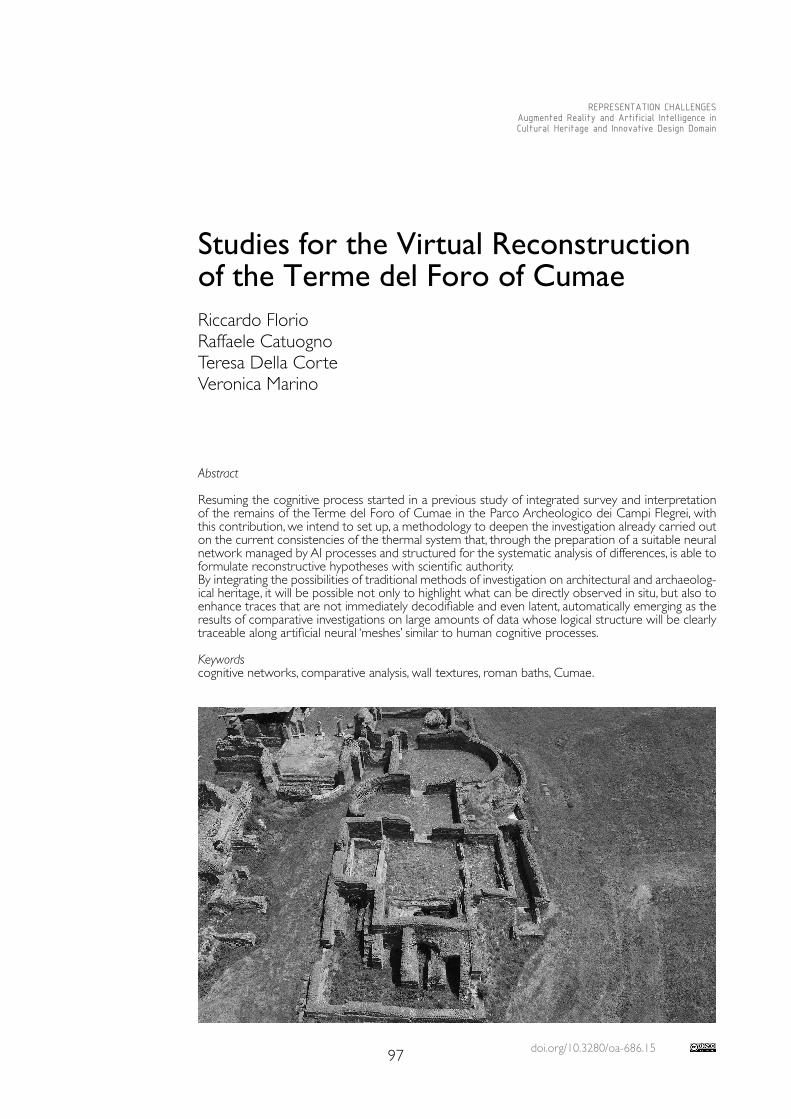
doi.org/10.3280/oa-686.1597
REPRESENTATION CHALLENGESAugmented Reality and Artificial Intelligence in Cultural Heritage and Innovative Design Domain
Abstract
Resuming the cognitive process started in a previous study of integrated survey and interpretation of the remains of the Terme del Foro of Cumae in the Parco Archeologico dei Campi Flegrei, with this contribution, we intend to set up, a methodology to deepen the investigation already carried out on the current consistencies of the thermal system that, through the preparation of a suitable neural network managed by AI processes and structured for the systematic analysis of differences, is able to formulate reconstructive hypotheses with scientific authority.By integrating the possibilities of traditional methods of investigation on architectural and archaeolog-ical heritage, it will be possible not only to highlight what can be directly observed in situ, but also to enhance traces that are not immediately decodifiable and even latent, automatically emerging as the results of comparative investigations on large amounts of data whose logical structure will be clearly traceable along artificial neural ‘meshes’ similar to human cognitive processes.
Keywordscognitive networks, comparative analysis, wall textures, roman baths, Cumae.
Studies for the Virtual Reconstruction of the Terme del Foro of CumaeRiccardo FlorioRaffaele CatuognoTeresa Della CorteVeronica Marino
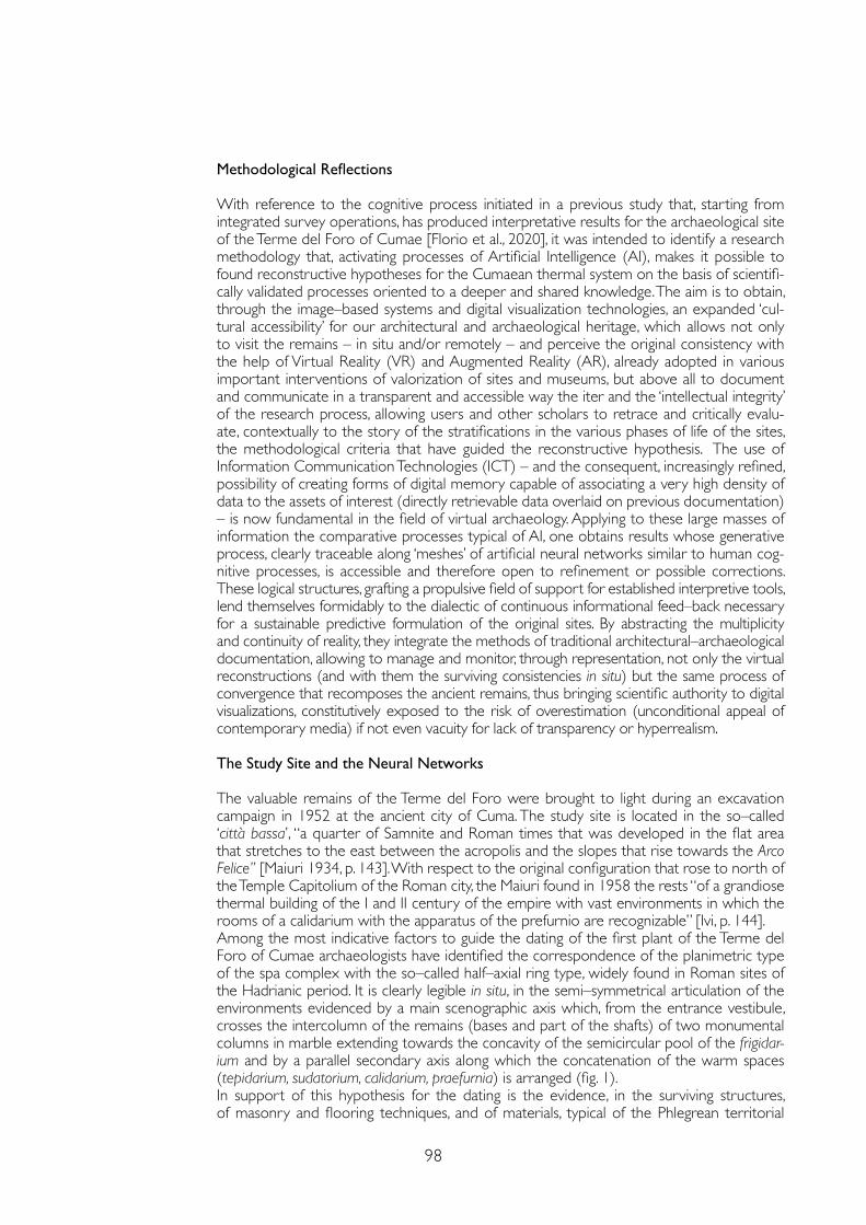
98
Methodological Reflections
With reference to the cognitive process initiated in a previous study that, starting from integrated survey operations, has produced interpretative results for the archaeological site of the Terme del Foro of Cumae [Florio et al., 2020], it was intended to identify a research methodology that, activating processes of Artificial Intelligence (AI), makes it possible to found reconstructive hypotheses for the Cumaean thermal system on the basis of scientifi-cally validated processes oriented to a deeper and shared knowledge. The aim is to obtain, through the image–based systems and digital visualization technologies, an expanded ‘cul-tural accessibility’ for our architectural and archaeological heritage, which allows not only to visit the remains – in situ and/or remotely – and perceive the original consistency with the help of Virtual Reality (VR) and Augmented Reality (AR), already adopted in various important interventions of valorization of sites and museums, but above all to document and communicate in a transparent and accessible way the iter and the ‘intellectual integrity’ of the research process, allowing users and other scholars to retrace and critically evalu-ate, contextually to the story of the stratifications in the various phases of life of the sites, the methodological criteria that have guided the reconstructive hypothesis. The use of Information Communication Technologies (ICT) – and the consequent, increasingly refined, possibility of creating forms of digital memory capable of associating a very high density of data to the assets of interest (directly retrievable data overlaid on previous documentation) – is now fundamental in the field of virtual archaeology. Applying to these large masses of information the comparative processes typical of AI, one obtains results whose generative process, clearly traceable along ‘meshes’ of artificial neural networks similar to human cog-nitive processes, is accessible and therefore open to refinement or possible corrections. These logical structures, grafting a propulsive field of support for established interpretive tools, lend themselves formidably to the dialectic of continuous informational feed–back necessary for a sustainable predictive formulation of the original sites. By abstracting the multiplicity and continuity of reality, they integrate the methods of traditional architectural–archaeological documentation, allowing to manage and monitor, through representation, not only the virtual reconstructions (and with them the surviving consistencies in situ) but the same process of convergence that recomposes the ancient remains, thus bringing scientific authority to digital visualizations, constitutively exposed to the risk of overestimation (unconditional appeal of contemporary media) if not even vacuity for lack of transparency or hyperrealism.
The Study Site and the Neural Networks
The valuable remains of the Terme del Foro were brought to light during an excavation campaign in 1952 at the ancient city of Cuma. The study site is located in the so–called ‘città bassa’, “a quarter of Samnite and Roman times that was developed in the flat area that stretches to the east between the acropolis and the slopes that rise towards the Arco Felice” [Maiuri 1934, p. 143]. With respect to the original configuration that rose to north of the Temple Capitolium of the Roman city, the Maiuri found in 1958 the rests “of a grandiose thermal building of the I and II century of the empire with vast environments in which the rooms of a calidarium with the apparatus of the prefurnio are recognizable” [Ivi, p. 144]. Among the most indicative factors to guide the dating of the first plant of the Terme del Foro of Cumae archaeologists have identified the correspondence of the planimetric type of the spa complex with the so–called half–axial ring type, widely found in Roman sites of the Hadrianic period. It is clearly legible in situ, in the semi–symmetrical articulation of the environments evidenced by a main scenographic axis which, from the entrance vestibule, crosses the intercolumn of the remains (bases and part of the shafts) of two monumental columns in marble extending towards the concavity of the semicircular pool of the frigidar-ium and by a parallel secondary axis along which the concatenation of the warm spaces (tepidarium, sudatorium, calidarium, praefurnia) is arranged (fig. 1). In support of this hypothesis for the dating is the evidence, in the surviving structures, of masonry and flooring techniques, and of materials, typical of the Phlegrean territorial
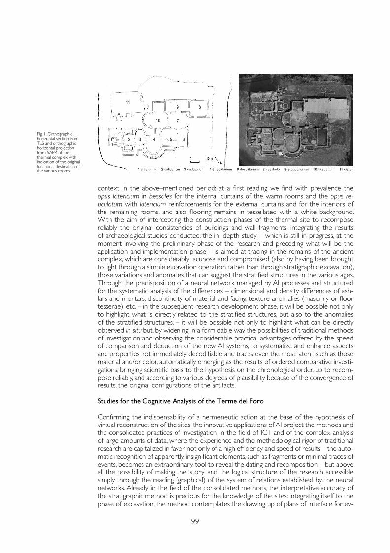
99
context in the above–mentioned period: at a first reading we find with prevalence the opus latericium in bessales for the internal curtains of the warm rooms and the opus re-ticulatum with latericium reinforcements for the external curtains and for the interiors of the remaining rooms, and also flooring remains in tessellated with a white background. With the aim of intercepting the construction phases of the thermal site to recompose reliably the original consistencies of buildings and wall fragments, integrating the results of archaeological studies conducted, the in–depth study – which is still in progress, at the moment involving the preliminary phase of the research and preceding what will be the application and implementation phase – is aimed at tracing in the remains of the ancient complex, which are considerably lacunose and compromised (also by having been brought to light through a simple excavation operation rather than through stratigraphic excavation), those variations and anomalies that can suggest the stratified structures in the various ages. Through the predisposition of a neural network managed by AI processes and structured for the systematic analysis of the differences – dimensional and density differences of ash-lars and mortars, discontinuity of material and facing, texture anomalies (masonry or floor tesserae), etc. – in the subsequent research development phase, it will be possible not only to highlight what is directly related to the stratified structures, but also to the anomalies of the stratified structures. – it will be possible not only to highlight what can be directly observed in situ but, by widening in a formidable way the possibilities of traditional methods of investigation and observing the considerable practical advantages offered by the speed of comparison and deduction of the new AI systems, to systematize and enhance aspects and properties not immediately decodifiable and traces even the most latent, such as those material and/or color, automatically emerging as the results of ordered comparative investi-gations, bringing scientific basis to the hypothesis on the chronological order, up to recom-pose reliably, and according to various degrees of plausibility because of the convergence of results, the original configurations of the artifacts.
Studies for the Cognitive Analysis of the Terme del Foro
Confirming the indispensability of a hermeneutic action at the base of the hypothesis of virtual reconstruction of the sites, the innovative applications of AI project the methods and the consolidated practices of investigation in the field of ICT and of the complex analysis of large amounts of data, where the experience and the methodological rigor of traditional research are capitalized in favor not only of a high efficiency and speed of results – the auto-matic recognition of apparently insignificant elements, such as fragments or minimal traces of events, becomes an extraordinary tool to reveal the dating and recomposition – but above all the possibility of making the ‘story’ and the logical structure of the research accessible simply through the reading (graphical) of the system of relations established by the neural networks. Already in the field of the consolidated methods, the interpretative accuracy of the stratigraphic method is precious for the knowledge of the sites: integrating itself to the phase of excavation, the method contemplates the drawing up of plans of interface for ev-
Fig. 1. Orthographic horizontal section from TLS and orthographic horizontal projection from SAPR of the thermal complex with indication of the original functional destination of the various rooms.
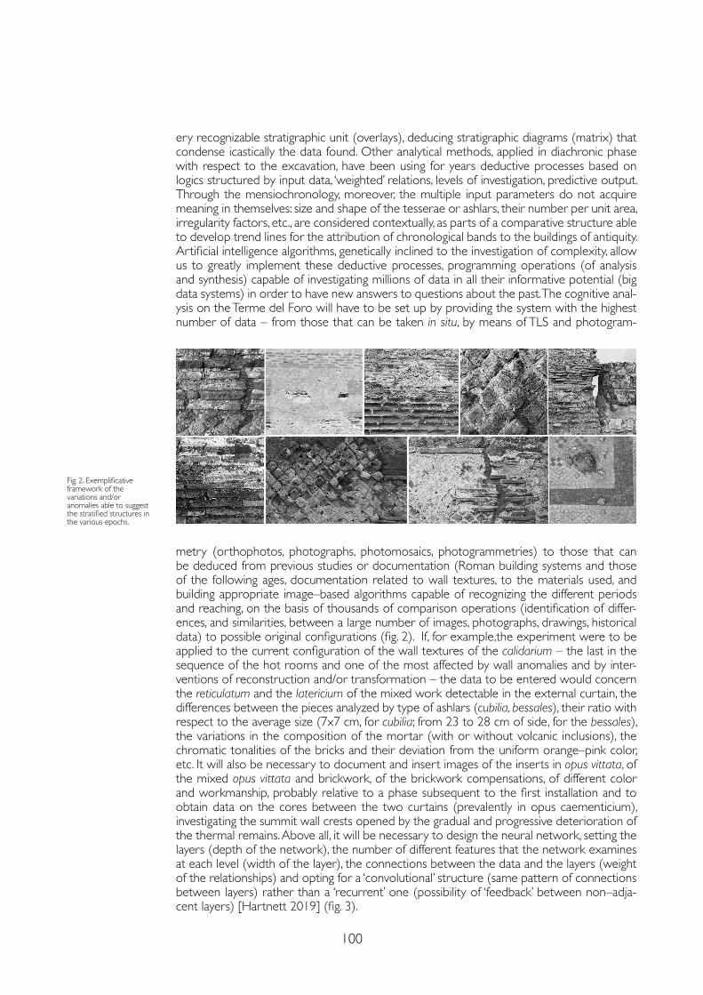
100
ery recognizable stratigraphic unit (overlays), deducing stratigraphic diagrams (matrix) that condense icastically the data found. Other analytical methods, applied in diachronic phase with respect to the excavation, have been using for years deductive processes based on logics structured by input data, ‘weighted’ relations, levels of investigation, predictive output. Through the mensiochronology, moreover, the multiple input parameters do not acquire meaning in themselves: size and shape of the tesserae or ashlars, their number per unit area, irregularity factors, etc., are considered contextually, as parts of a comparative structure able to develop trend lines for the attribution of chronological bands to the buildings of antiquity. Artificial intelligence algorithms, genetically inclined to the investigation of complexity, allow us to greatly implement these deductive processes, programming operations (of analysis and synthesis) capable of investigating millions of data in all their informative potential (big data systems) in order to have new answers to questions about the past. The cognitive anal-ysis on the Terme del Foro will have to be set up by providing the system with the highest number of data – from those that can be taken in situ, by means of TLS and photogram-
Fig. 2. Exemplificative framework of the variations and/or anomalies able to suggest the stratified structures in the various epochs.
metry (orthophotos, photographs, photomosaics, photogrammetries) to those that can be deduced from previous studies or documentation (Roman building systems and those of the following ages, documentation related to wall textures, to the materials used, and building appropriate image–based algorithms capable of recognizing the different periods and reaching, on the basis of thousands of comparison operations (identification of differ-ences, and similarities, between a large number of images, photographs, drawings, historical data) to possible original configurations (fig. 2). If, for example,the experiment were to be applied to the current configuration of the wall textures of the calidarium – the last in the sequence of the hot rooms and one of the most affected by wall anomalies and by inter-ventions of reconstruction and/or transformation – the data to be entered would concern the reticulatum and the latericium of the mixed work detectable in the external curtain, the differences between the pieces analyzed by type of ashlars (cubilia, bessales), their ratio with respect to the average size (7x7 cm, for cubilia; from 23 to 28 cm of side, for the bessales), the variations in the composition of the mortar (with or without volcanic inclusions), the chromatic tonalities of the bricks and their deviation from the uniform orange–pink color, etc. It will also be necessary to document and insert images of the inserts in opus vittata, of the mixed opus vittata and brickwork, of the brickwork compensations, of different color and workmanship, probably relative to a phase subsequent to the first installation and to obtain data on the cores between the two curtains (prevalently in opus caementicium), investigating the summit wall crests opened by the gradual and progressive deterioration of the thermal remains. Above all, it will be necessary to design the neural network, setting the layers (depth of the network), the number of different features that the network examines at each level (width of the layer), the connections between the data and the layers (weight of the relationships) and opting for a ‘convolutional’ structure (same pattern of connections between layers) rather than a ‘recurrent’ one (possibility of ‘feedback’ between non–adja-cent layers) [Hartnett 2019] (fig. 3).
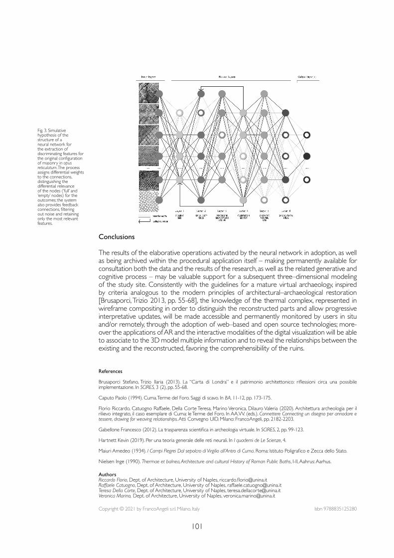
101
Fig. 3. Simulative hypothesis of the structure of a neural network for the extraction of discriminating features for the original configuration of masonry in opus reticulatum. The process assigns differential weights to the connections, distinguishing the differential relevance of the nodes (‘full’ and ‘empty’ nodes) for the outcomes; the system also provides feedback connections, filtering out noise and retaining only the most relevant features.
Conclusions
The results of the elaborative operations activated by the neural network in adoption, as well as being archived within the procedural application itself – making permanently available for consultation both the data and the results of the research, as well as the related generative and cognitive process – may be valuable support for a subsequent three–dimensional modeling of the study site. Consistently with the guidelines for a mature virtual archaeology, inspired by criteria analogous to the modern principles of architectural–archaeological restoration [Brusaporci, Trizio 2013, pp. 55-68], the knowledge of the thermal complex, represented in wireframe compositing in order to distinguish the reconstructed parts and allow progressive interpretative updates, will be made accessible and permanently monitored by users in situ and/or remotely, through the adoption of web–based and open source technologies; more-over the applications of AR and the interactive modalities of the digital visualization will be able to associate to the 3D model multiple information and to reveal the relationships between the existing and the reconstructed, favoring the comprehensibility of the ruins.
References
Brusaporci Stefano, Trizio Ilaria (2013). La “Carta di Londra” e il patrimonio architettonico: riflessioni circa una possibile implementazione. In SCIRES, 3 (2), pp. 55-68.
Caputo Paolo (1994). Cuma. Terme del Foro. Saggi di scavo. In BA, 11-12, pp. 173-175.
Florio Riccardo, Catuogno Raffaele, Della Corte Teresa, Marino Veronica, Dilauro Valeria (2020). Architettura archeologia per il rilievo integrato, il caso esemplare di Cuma: le Terme del Foro. In AA.VV. (eds.). Connettere Connecting un disegno per annodare e tessere, drawing for weaving relationships. Atti Convegno UID. Milano: FrancoAngeli, pp. 2182-2203.
Gabellone Francesco (2012). La trasparenza scientifica in archeologia virtuale. In SCIRES, 2, pp. 99-123.
Hartnett Kevin (2019). Per una teoria generale delle reti neurali. In I quaderni de Le Scienze, 4.
Maiuri Amedeo (1934). I Campi Flegrei Dal sepolcro di Virgilio all’Antro di Cuma. Roma: Istituto Poligrafico e Zecca dello Stato.
Nielsen Inge (1990). Thermae et balnea, Architecture and cultural History of Roman Public Baths, I-II, Aahrus: Aarhus.
Copyright © 2021 by FrancoAngeli s.r.l. Milano, Italy Isbn 9788835125280
AuthorsRiccardo Florio, Dept. of Architecture, University of Naples, [email protected] Raffaele Catuogno, Dept. of Architecture, University of Naples, [email protected] Della Corte, Dept. of Architecture, University of Naples, [email protected] Marino, Dept. of Architecture, University of Naples, [email protected]

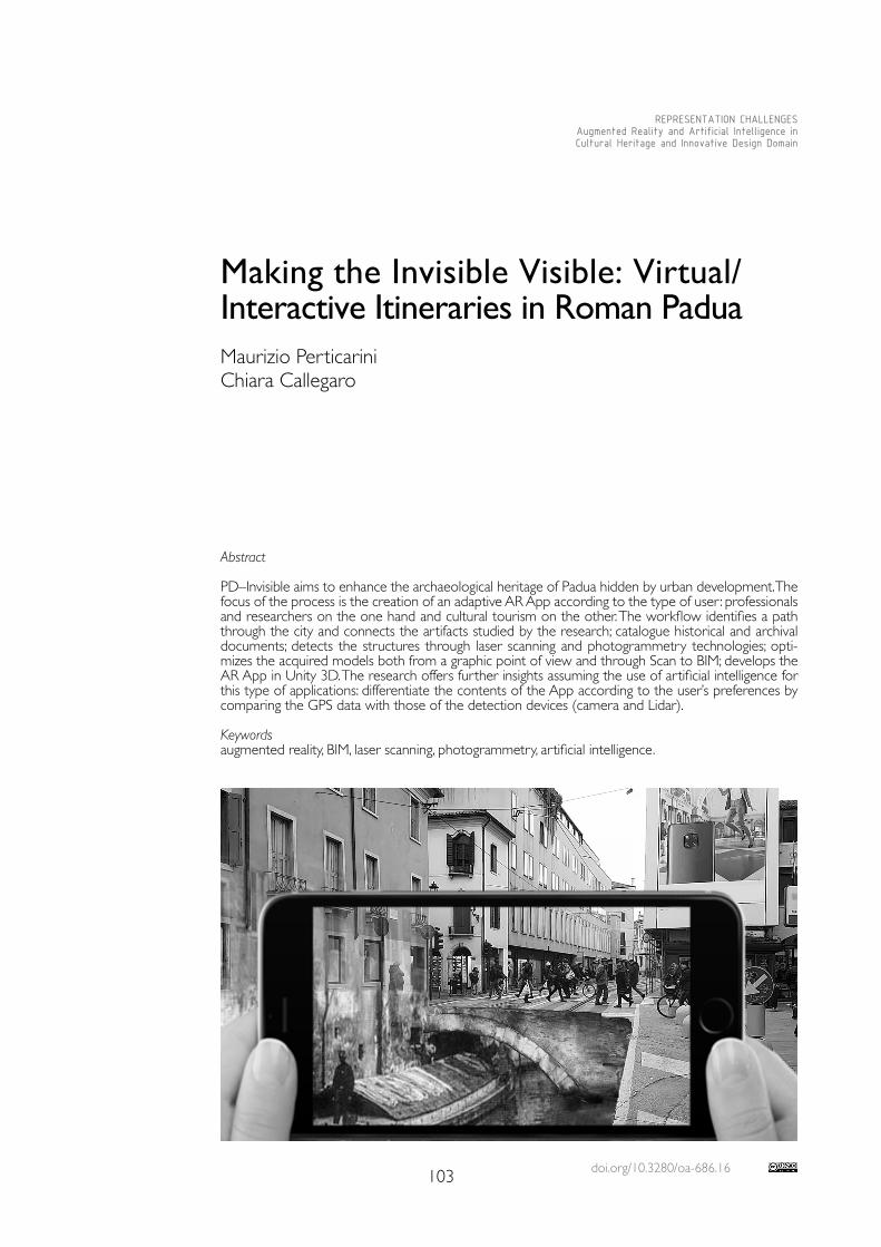
doi.org/10.3280/oa-686.16103
REPRESENTATION CHALLENGESAugmented Reality and Artificial Intelligence in Cultural Heritage and Innovative Design Domain
Abstract
PD–Invisible aims to enhance the archaeological heritage of Padua hidden by urban development. The focus of the process is the creation of an adaptive AR App according to the type of user: professionals and researchers on the one hand and cultural tourism on the other. The workflow identifies a path through the city and connects the artifacts studied by the research; catalogue historical and archival documents; detects the structures through laser scanning and photogrammetry technologies; opti-mizes the acquired models both from a graphic point of view and through Scan to BIM; develops the AR App in Unity 3D. The research offers further insights assuming the use of artificial intelligence for this type of applications: differentiate the contents of the App according to the user’s preferences by comparing the GPS data with those of the detection devices (camera and Lidar).
Keywordsaugmented reality, BIM, laser scanning, photogrammetry, artificial intelligence.
Making the Invisible Visible: Virtual/Interactive Itineraries in Roman Padua Maurizio PerticariniChiara Callegaro
104
Introduction
PD–Invisible, an abbreviation that stands for ‘PaDova INnovative VISions – visualiza-tions and Imaginings Behind the city Learning’, is a well rounded project that involved researchers from multiple fields. Archaeologists, building engineers, architects and in-formatic engineers collaborated for one year with the purpose to make visible what is, actually, invisible to the eyes of many. The project was funded by means of the Eu-ropean Social Fund and the Regione Veneto and included a partnership between the Department of Civil, Environmental and Architectural Engineering and the Department of Cultural Heritage of the University of Padua. The city has a beautiful yet, for the majority, invisible heritage belonging to the Roman age. The urban growth across the centuries and, sometimes, also the lack of attention and care, caused its disappearance. Thus the aim of the research was to promote and valorize these archaeological remains, bringing back their memory and, above all, trying to give them new life. Focus of the project was to create a digital environment suitable and available for both an expert and non–expert public, that provided the visualisation of the outcomes [Johnston et al. 2020; Perticarini, Marzocchella 2021]. The chosen solution included the implementation of an application for smartphone that uses Augmented Reality (AR) and, moreover, Artificial Intelligence (AI). This could enable a simplified fruition of contents, diversifying them depending on the user’s in-tentions and tastes. Multiple data, technical information about the structures, touristic paths and similar point of interests, historical narratives together with pictures and doc-uments, are able to satisfy a wider public in the perspective of a cultural rediscovery of the Roman historical heritage of Padua. The research star ted with the identification of several points of interest across the city, structures connected by a common past and so linked with a touristic path. The Arena, near the Scrovegni Chapel, is the star ting point as it is close to the actual train station, then walking south through the historical centre, along the Riviera dei Ponti Romani, there are Altinate and San Lorenzo Bridges, relevant Roman structures for trades and the economy of the city, hidden under the surface of the street with the tramline. Finally, reaching Prato della Valle, we can find the foundation system of the Zairo Theatre, also hidden under the water of the canal of this huge and unique square [Bonetto, Pet-tenò, Veronese 2017]. San Lorenzo Bridge, between these structures, has an excellent conservation status and very positive conditions for the exploitation of the selected workflow. It is located under the street but enclosed in an underground chamber accessi-ble with an old underpass built in the 1950’s [Galliazzo 1941; Gasparotto 1951; Carraro et al. 2019]. The division in phases of this research project included the initial data acquisition, the possibility to achieve an accurate 3D model with texture and information and the final AR and AI implementation.
The Case Study
As previously mentioned San Lorenzo Bridge is the case study identified as a starting point for developing research in all its phases and as a key to read for further in–depth analysis of the topic. The first very important operation that provides awareness and understanding of the chosen structure is data acquisition. The acquisition of the prelim-inar knowledge is then carried out, on the one hand through archival and documentary research to collect all the sources and testimonies regarding the bridge. On the other hand, the survey performed using laser scanning and photogrammetry to obtain a virtual clone, geometrically similar. These models are the starting point for the subsequent modeling phase. Two different approaches were used: BIM modeling with the aim of providing a container for the information collected, allowing the exchange of data from different sources and the direct connection between different development envi-ronments, especially databases. The BIM model was chosen as the invisible backbone of data on which the realistic 3d model lean [Bonetto et al. 2019].
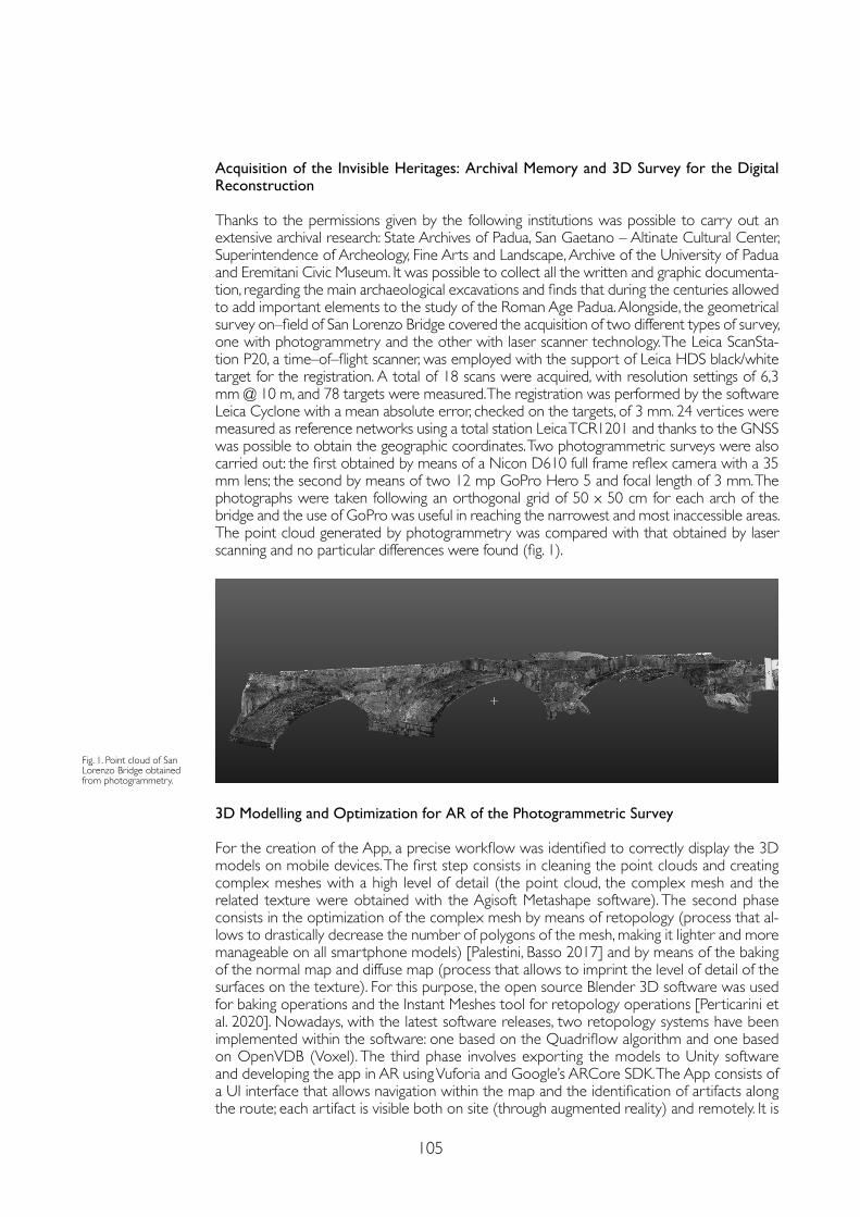
105
Acquisition of the Invisible Heritages: Archival Memory and 3D Survey for the Digital Reconstruction
Thanks to the permissions given by the following institutions was possible to carry out an extensive archival research: State Archives of Padua, San Gaetano – Altinate Cultural Center, Superintendence of Archeology, Fine Arts and Landscape, Archive of the University of Padua and Eremitani Civic Museum. It was possible to collect all the written and graphic documenta-tion, regarding the main archaeological excavations and finds that during the centuries allowed to add important elements to the study of the Roman Age Padua. Alongside, the geometrical survey on–field of San Lorenzo Bridge covered the acquisition of two different types of survey, one with photogrammetry and the other with laser scanner technology. The Leica ScanSta-tion P20, a time–of–flight scanner, was employed with the support of Leica HDS black/white target for the registration. A total of 18 scans were acquired, with resolution settings of 6,3 mm @ 10 m, and 78 targets were measured. The registration was performed by the software Leica Cyclone with a mean absolute error, checked on the targets, of 3 mm. 24 vertices were measured as reference networks using a total station Leica TCR1201 and thanks to the GNSS was possible to obtain the geographic coordinates. Two photogrammetric surveys were also carried out: the first obtained by means of a Nicon D610 full frame reflex camera with a 35 mm lens; the second by means of two 12 mp GoPro Hero 5 and focal length of 3 mm. The photographs were taken following an orthogonal grid of 50 x 50 cm for each arch of the bridge and the use of GoPro was useful in reaching the narrowest and most inaccessible areas. The point cloud generated by photogrammetry was compared with that obtained by laser scanning and no particular differences were found (fig. 1).
Fig. 1. Point cloud of San Lorenzo Bridge obtained from photogrammetry.
3D Modelling and Optimization for AR of the Photogrammetric Survey
For the creation of the App, a precise workflow was identified to correctly display the 3D models on mobile devices. The first step consists in cleaning the point clouds and creating complex meshes with a high level of detail (the point cloud, the complex mesh and the related texture were obtained with the Agisoft Metashape software). The second phase consists in the optimization of the complex mesh by means of retopology (process that al-lows to drastically decrease the number of polygons of the mesh, making it lighter and more manageable on all smartphone models) [Palestini, Basso 2017] and by means of the baking of the normal map and diffuse map (process that allows to imprint the level of detail of the surfaces on the texture). For this purpose, the open source Blender 3D software was used for baking operations and the Instant Meshes tool for retopology operations [Perticarini et al. 2020]. Nowadays, with the latest software releases, two retopology systems have been implemented within the software: one based on the Quadriflow algorithm and one based on OpenVDB (Voxel). The third phase involves exporting the models to Unity software and developing the app in AR using Vuforia and Google’s ARCore SDK. The App consists of a UI interface that allows navigation within the map and the identification of artifacts along the route; each artifact is visible both on site (through augmented reality) and remotely. It is
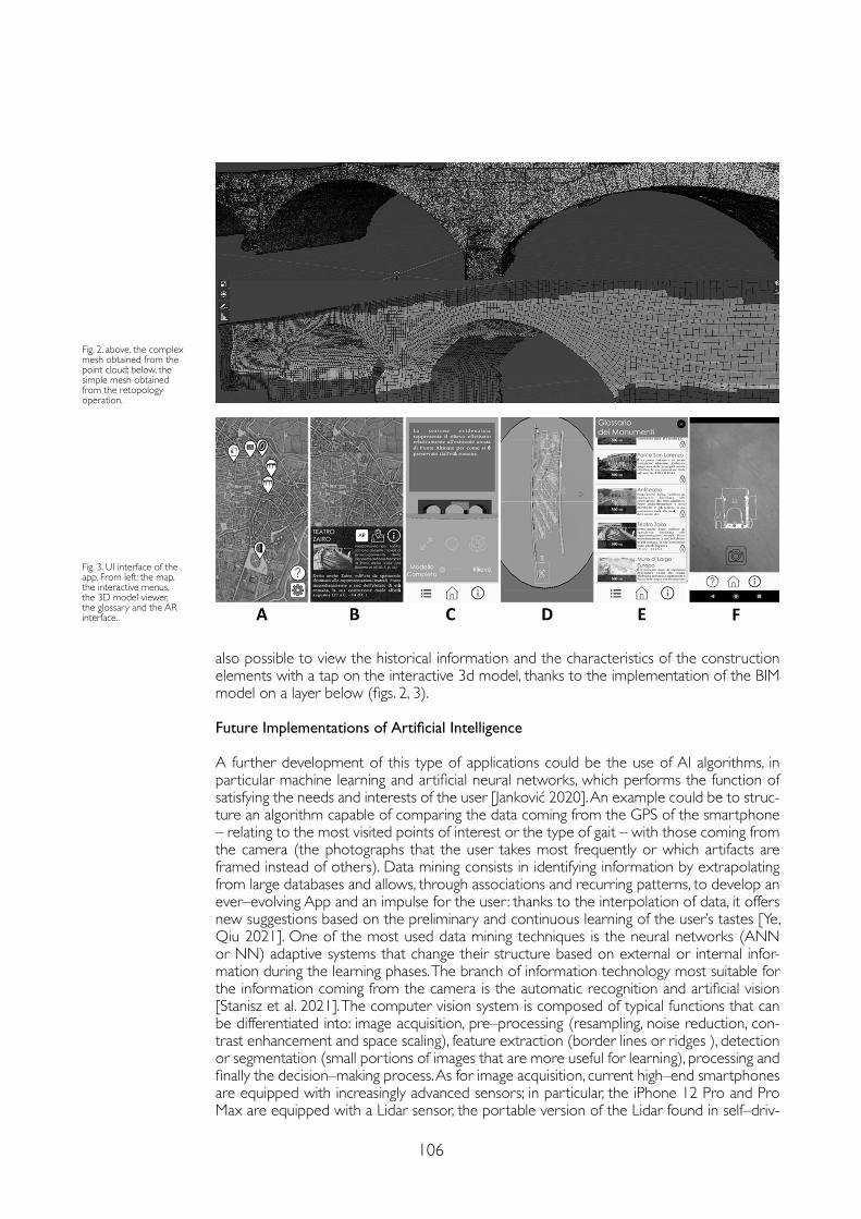
106
Fig. 3. UI interface of the app. From left: the map, the interactive menus, the 3D model viewer, the glossary and the AR interface.
Fig. 2. above, the complex mesh obtained from the point cloud; below, the simple mesh obtained from the retopology operation.
also possible to view the historical information and the characteristics of the construction elements with a tap on the interactive 3d model, thanks to the implementation of the BIM model on a layer below (figs. 2, 3).
Future Implementations of Artificial Intelligence
A further development of this type of applications could be the use of AI algorithms, in particular machine learning and artificial neural networks, which performs the function of satisfying the needs and interests of the user [Janković 2020]. An example could be to struc-ture an algorithm capable of comparing the data coming from the GPS of the smartphone – relating to the most visited points of interest or the type of gait – with those coming from the camera (the photographs that the user takes most frequently or which artifacts are framed instead of others). Data mining consists in identifying information by extrapolating from large databases and allows, through associations and recurring patterns, to develop an ever–evolving App and an impulse for the user : thanks to the interpolation of data, it offers new suggestions based on the preliminary and continuous learning of the user’s tastes [Ye, Qiu 2021]. One of the most used data mining techniques is the neural networks (ANN or NN) adaptive systems that change their structure based on external or internal infor-mation during the learning phases. The branch of information technology most suitable for the information coming from the camera is the automatic recognition and artificial vision [Stanisz et al. 2021]. The computer vision system is composed of typical functions that can be differentiated into: image acquisition, pre–processing (resampling, noise reduction, con-trast enhancement and space scaling), feature extraction (border lines or ridges ), detection or segmentation (small portions of images that are more useful for learning), processing and finally the decision–making process. As for image acquisition, current high–end smartphones are equipped with increasingly advanced sensors; in particular, the iPhone 12 Pro and Pro Max are equipped with a Lidar sensor, the portable version of the Lidar found in self–driv-
107
References
Bonetto Jacopo, Giordano Andrea, Mazzariol Alessandro, Carraro Filippo and Callegaro Chiara (2019). PD–invisible : from drawing to city learning. In Belardi Paolo (ed.), Riflessioni : l’arte del disegno/ il disegno dell’arte. 41° Convegno Internazionale dei Docenti delle Discipline della Rappresentazione. Roma: Gangemi.
Bonetto Jacopo, Pettenò Elena, Veronese Francesca (2017). Padova. La città di Tito Livio. Padova: Cleup.
Filippo Carraro, Monego Michele, Callegaro Chiara, Mazzariol Alessandro, Perticarini Maurizio, Menin Andrea, Achilli Vladimiro, Bonetto Jacopo, Giordano Andrea (2019). The 3d survey of the roman bridge of san lorenzo in padova (Italy): a comparison between sfm and tls methodologies applied to the arch structure. In International Archives of the Photogrammetry, Remote Sensing and Spatial Information Sciences, 42 (2/W15), pp. 255-262.
Galliazzo Vittorio (1971). I ponti di Padova Romana. Saggio di archeologia urbanistica. Padova: Cedam.
Gasparotto Cesira (1951). Padova romana. Roma: L’Erma di Bretschneider.
Janković Radmila (2020). Machine Learning Models for Cultural Heritage Image Classification: Comparison Based on Attribute Selection. In Information, 11 (1), pp. 1-13.
Lesley Johnston, Galloway Romy, Trench Jordan John, Poyade Matthieu, Tromp Jolanda, My Hoang Thi (2020). Augmented Reality at Heritage Sites. In Tromp Jolanda G., Le Dac–Nhuong, Le Chung Van (eds.). Emerging Extended Reality Technologies For Industry 4.0: Early Experiences with Conception, Design, Implementation, Evaluation and Deployment. Hoboken: Wiley, pp. 101-19.
Palestini Caterina, Basso Alessandro (2017). The Photogrammetric Survey Methodologies Applied to Low Cost 3D Virtual Exploration in Multidisciplinary Field. In International Archives of the Photogrammetry, Remote Sensing and Spatial Information Sciences, 42 (2W8), pp. 195-202.
Perticarini Maurizio, Callegaro Chiara, Carraro Filippo, Mazzariol Alessandro (2020). Two Methods of Optimization for an Ar Project: Mesh Retopology and Use of Pbr Materials. In Cicalò Enrico (ed.). Advances in Intelligent Systems and Computing, vol 1140. Springer : Cham.
Perticarini Maurizio, Valeria Marzocchella (2021). 3D Animation Applied to Street Art. Physical and Remote Connections Aimed at Inclusion. In Cheng Liang–Yee (ed.). ICGG 2020 – Proceedings of the 19th International Conference on Geometry and Graphics, pp. 920-923.
Shih Naai Jung, Pei Huang Diao, Yi Chen (2019). ARTS, an AR Tourism System, for the Integration of 3D Scanning and Smartphone AR in Cultural Heritage Tourism and Pedagogy. In Sensors, 19 (17), 3725.
Stanisz Joanna, Konrad Lis, Tomasz Kryjak, Marek Gorgon (2021). Hardware–Software Implementation of the PointPillars Network for 3D Object Detection in Point Clouds. In Workshop on Design and Architectures for Signal and Image Processing (14th Edition), DASIP ’21. New York, NY, USA: Association for Computing Machinery, pp. 44-51.
Yao Zhennan (2020). VTQuestAR : An Augmented Reality Mobile Software Application for Virginia Tech Campus Visitors. Virginia Tech.
Ye Yang, Hongfei Qiu (2021). Exploring Affecting Factors of Park Use Based on Multisource Big Data: Case Study in Wuhan, China. In Journal of Urban Planning and Development, 147 (1), 05020037, pp. 1-11.
ing cars for scanning and recognizing objects along the way [Shih, Diao, Chen 2019] [Yao 2020]. The sensor could be an excellent tool to improve the algorithm in the classification of artifacts framed by the smartphone. For the creation of APP of this type, PyTorch is used: a deep learning framework (class of machine learning algorithms) developed by Facebook AI Research (FAIR) group. This open source software allows you to facilitate the development of algorithms compatible with current Nvidia video cards and take advantage of the GPU.
Conclusions
Technological innovations are changing everyday objects into complex intelligent machines. The new sensors for acquiring the surrounding environment and the new processors make it possible to create projects that were unthinkable until a few years ago. it is obvious that often, the use of these technologies has negative sides, especially as regards the use of big data and privacy issues. With greater reason, innovations should be exploited to the maxi-mum for more noble purposes, such as the enhancement and preservation of historical and cultural heritage.
Copyright © 2021 by FrancoAngeli s.r.l. Milano, Italy Isbn 9788835125280
AuthorsMaurizio Perticarini, Dept. of Architecture and Industrial Design, University of Campania Luigi Vanvitelli, [email protected] Callegaro, Dept. of Civil, Environmental and Architectural Engineering, University of Padua, [email protected]


AR&AI heritage routes

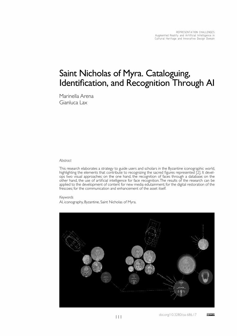
doi.org/10.3280/oa-686.17111
REPRESENTATION CHALLENGESAugmented Reality and Artificial Intelligence in Cultural Heritage and Innovative Design Domain
Abstract
This research elaborates a strategy to guide users and scholars in the Byzantine iconographic world, highlighting the elements that contribute to recognizing the sacred figures represented [2]. It devel-ops two visual approaches: on the one hand, the recognition of faces through a database; on the other hand, the use of artificial intelligence for face recognition. The results of the research can be applied to the development of content for new media edutainment; for the digital restoration of the frescoes; for the communication and enhancement of the asset itself.
KeywordsAI, iconography, Byzantine, Saint Nicholas of Myra.
Saint Nicholas of Myra. Cataloguing, Identification, and Recognition Through AI Marinella ArenaGianluca Lax
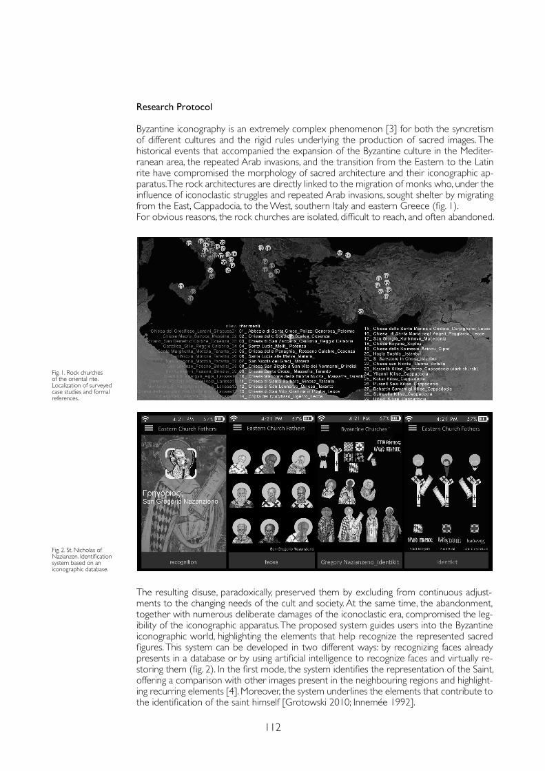
112
Research Protocol
Byzantine iconography is an extremely complex phenomenon [3] for both the syncretism of different cultures and the rigid rules underlying the production of sacred images. The historical events that accompanied the expansion of the Byzantine culture in the Mediter-ranean area, the repeated Arab invasions, and the transition from the Eastern to the Latin rite have compromised the morphology of sacred architecture and their iconographic ap-paratus. The rock architectures are directly linked to the migration of monks who, under the influence of iconoclastic struggles and repeated Arab invasions, sought shelter by migrating from the East, Cappadocia, to the West, southern Italy and eastern Greece (fig. 1).For obvious reasons, the rock churches are isolated, difficult to reach, and often abandoned.
The resulting disuse, paradoxically, preserved them by excluding from continuous adjust-ments to the changing needs of the cult and society. At the same time, the abandonment, together with numerous deliberate damages of the iconoclastic era, compromised the leg-ibility of the iconographic apparatus. The proposed system guides users into the Byzantine iconographic world, highlighting the elements that help recognize the represented sacred figures. This system can be developed in two different ways: by recognizing faces already presents in a database or by using artificial intelligence to recognize faces and virtually re-storing them (fig. 2). In the first mode, the system identifies the representation of the Saint, offering a comparison with other images present in the neighbouring regions and highlight-ing recurring elements [4]. Moreover, the system underlines the elements that contribute to the identification of the saint himself [Grotowski 2010; Innemée 1992].
Fig. 2. St. Nicholas of Nazianzen. Identification system based on an iconographic database.
Fig. 1. Rock churches of the oriental rite. Localization of surveyed case studies and formal references.
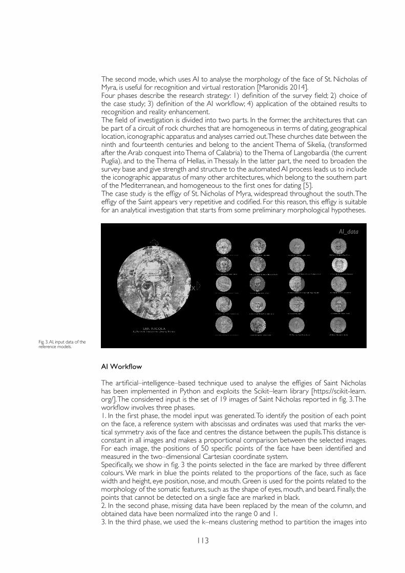
113
The second mode, which uses AI to analyse the morphology of the face of St. Nicholas of Myra, is useful for recognition and virtual restoration [Maronidis 2014].Four phases describe the research strategy: 1) definition of the survey field; 2) choice of the case study; 3) definition of the AI workflow; 4) application of the obtained results to recognition and reality enhancement.The field of investigation is divided into two parts. In the former, the architectures that can be part of a circuit of rock churches that are homogeneous in terms of dating, geographical location, iconographic apparatus and analyses carried out. These churches date between the ninth and fourteenth centuries and belong to the ancient Thema of Sikelia, (transformed after the Arab conquest into Thema of Calabria) to the Thema of Langobardia (the current Puglia), and to the Thema of Hellas, in Thessaly. In the latter part, the need to broaden the survey base and give strength and structure to the automated AI process leads us to include the iconographic apparatus of many other architectures, which belong to the southern part of the Mediterranean, and homogeneous to the first ones for dating [5].The case study is the effigy of St. Nicholas of Myra, widespread throughout the south. The effigy of the Saint appears very repetitive and codified. For this reason, this effigy is suitable for an analytical investigation that starts from some preliminary morphological hypotheses.
AI Workflow
The artificial–intelligence–based technique used to analyse the effigies of Saint Nicholas has been implemented in Python and exploits the Scikit–learn library [https://scikit-learn.org/]. The considered input is the set of 19 images of Saint Nicholas reported in fig. 3. The workflow involves three phases.1. In the first phase, the model input was generated. To identify the position of each point on the face, a reference system with abscissas and ordinates was used that marks the ver-tical symmetry axis of the face and centres the distance between the pupils. This distance is constant in all images and makes a proportional comparison between the selected images. For each image, the positions of 50 specific points of the face have been identified and measured in the two–dimensional Cartesian coordinate system. Specifically, we show in fig. 3 the points selected in the face are marked by three different colours. We mark in blue the points related to the proportions of the face, such as face width and height, eye position, nose, and mouth. Green is used for the points related to the morphology of the somatic features, such as the shape of eyes, mouth, and beard. Finally, the points that cannot be detected on a single face are marked in black. 2. In the second phase, missing data have been replaced by the mean of the column, and obtained data have been normalized into the range 0 and 1.3. In the third phase, we used the k–means clustering method to partition the images into
Fig. 3. AI, input data of the reference models.
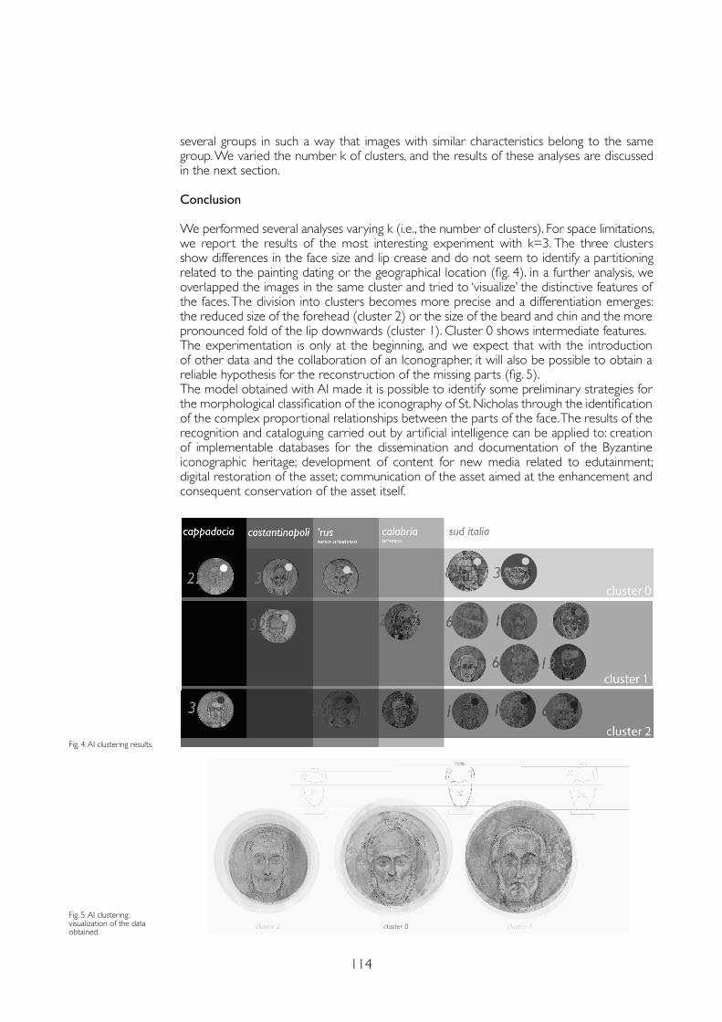
114
several groups in such a way that images with similar characteristics belong to the same group. We varied the number k of clusters, and the results of these analyses are discussed in the next section.
Conclusion
We performed several analyses varying k (i.e., the number of clusters). For space limitations, we report the results of the most interesting experiment with k=3. The three clusters show differences in the face size and lip crease and do not seem to identify a partitioning related to the painting dating or the geographical location (fig. 4). in a further analysis, we overlapped the images in the same cluster and tried to ‘visualize’ the distinctive features of the faces. The division into clusters becomes more precise and a differentiation emerges: the reduced size of the forehead (cluster 2) or the size of the beard and chin and the more pronounced fold of the lip downwards (cluster 1). Cluster 0 shows intermediate features.The experimentation is only at the beginning, and we expect that with the introduction of other data and the collaboration of an Iconographer, it will also be possible to obtain a reliable hypothesis for the reconstruction of the missing parts (fig. 5).The model obtained with AI made it is possible to identify some preliminary strategies for the morphological classification of the iconography of St. Nicholas through the identification of the complex proportional relationships between the parts of the face. The results of the recognition and cataloguing carried out by artificial intelligence can be applied to: creation of implementable databases for the dissemination and documentation of the Byzantine iconographic heritage; development of content for new media related to edutainment; digital restoration of the asset; communication of the asset aimed at the enhancement and consequent conservation of the asset itself.
Fig. 4. AI clustering results.
Fig. 5. AI clustering: visualization of the data obtained.
115
References
Beckwith John (1967). L’arte di Costantinopoli, una introduzione all’arte bizantina (330-1453). Torino: Einaudi. (Original: The art of Constantinople, An Introduction to Byzantine Art. London: Phaidon Press, 1961).
Florenskij Pavel Aleksandrovič (2002). Le porte regali. Saggio sull’icona. Milano: Adelphi.
Fonseca Cosimo Damiano (1970). Civiltà rupestre in terra jonica. Milano: Carlo Bestetti Edizioni.
Grabar André (1964). Bisanzio. Milano: Il Saggiatore (Original: Byzance. Baden Baden: Holle Verlag).
Grotowski Piotr Ł. (2010). Defining the Byzantine Saint, Creating a Message in Orthodox Art in Towards Rewriting? New Approaches to Byzantine Archaeology and Art. Warsaw: P. Ł. Grotowski and S. Skrzyniarz.
Innemée Karel C. (1992). Ecclesiastical Dress in the Medieval Near East. Leiden: Brill.
Maronidis Anastasios, Voutounos C., Lanitis Andreas (2014). Designing and Evaluating an Expert System for Restoring Damaged Byzantine Icons. In Multimedia Tools and Applications, June. New York: Springer Science+Business Media.
Medea Alba (2014). Gli affreschi delle cripte eremitiche pugliesi. Lecce: Capone.
Robinson Gertrude (1930). Some cave chapels of Southern Italy. In The Journal of Hellenic Studies, 50 (2), pp. 186-209.
Settis Salvatore (2005). Iconografia dell’arte italiana 1100-1500: una linea. Torino: Einaudi.
Thierry Nicole, Thierry Michel (1963). Églises rupestres de Cappadoce, région du Hasan Dagi. Paris: Librairie Klincksieck.
Notes
[1] The research presented in this paper is the result of the joint work of the two authors. The Research Protocol is created by Marinella Arena, the AI Workflow is in the name of Gianluca Lax, the Conclusion is jointly signed.
[2] IThis study is part of a wider research, between Ionio and Egeo conducted with Daniele Colistra and Domenico Mediati, which has surveyed many sacred buildings of the Byzantine era.
[3] “at the actual stadium of our knowledge we are not able to establish links between the saved pieces of art and the social structure or the byzantine geography (...) some general facts reaffirm this pessimistic attitude: the systemic anonymity of the byzantine pieces of art, the extreme lack of the written sources, caused by the disruption of almost all the archives; in the end the insufficient differentiation between the pieces of art. “ [Grabar 1964, pp. 27-28].
[4] Just as in language few signs, combined differently, generate a multitude of words, similarly in Byzantine sacred representations the sacred vestments, the nimbus, the homophorus, the polistavrion, or the receding hairline, the colour of the hair, or the shape of the beard, identify the Saint’s figure. Cfr. “Pursuing the ‘representation’ rather than the ‘imitation’, Byzantine artists used a limited range of forms. Within these stylistic norms they changed the physical appearance by modelling the shape of the head and the outline of the cheeks. They used lighter or darker pigments to achieve different skin tones. A wider colour and variety of form was possible in depicting hair and beard. They could be dark, red or white, long or short, whereas the absence of beard and moustache was meant to suggest young age. This method allowed the creation of a very limited number of face–types. This is confirmed by monotonous descriptions in iconographic manuals and eikonismos collections. “ [Grotowski 2010, pp. 137-138].
[5]. Geographical and chronological location of the case studies: 1_Chiesa del Crocifisso Lentini, Siracusa, 1000; 2_Chiesa dello Spedale, Scalea, Cosenza, 1000; 2b_Chiesa dello Spedale, Scalea Cosenza, 1000; 6 a_ San Nicola Mottola, Taranto, 1100; 6 b _San Nicola Mottola, Taranto, 1300; 6 c _ San Nicola, Mottola, Taranto, 1300; 7 _ San Nicola dei Greci, Matera, 1200; 8_ San Lorenzo, Fasano, Brindisi,1200; 13_ San Vito Gravina, Lecce, 1300; 14_ Cripta del Crocifisso, Ugento, Lecce, 1350; 15_ SS. Marina e Cristina, Carpignano, Lecce, 959; 16_ S. Maria degli Angeli, Poggiardo, Lecce, 1200; 18_ Chiesa Boyana, Sophia,1250; 22_ San Nicola, Derme, Antalia, 800; 30_San Giorgio, Sophia,1250; 31_ San Nicola, Steyis, Cypro, 1100; 32_ San Nicola Bolnicki, Macedonia1350; 34_ Monastero Eski Gumus, Turchia1000; 35_ S. Marina, Muro Leccese, Lecce, 1087
Copyright © 2021 by FrancoAngeli s.r.l. Milano, Italy Isbn 9788835125280
AuthorsMarinella Arena, Dept. of Architecture and Territory, dArTe, University of Reggio Calabria, [email protected] Gianluca Lax, Dept. of Information Engineering, Infrastructure and Sustainable Energy, DIIES, University of Reggio Calabria, [email protected]

doi.org/10.3280/oa-686.18117
REPRESENTATION CHALLENGESAugmented Reality and Artificial Intelligence in Cultural Heritage and Innovative Design Domain
Abstract
The development of ICT has favoured the spread of real–time, pervasive and ubiquitous applications. In particular, VR and AR visualizations allow a close interrelation between people, data, environments and objects. Consequently, it is possible to enrich cultural heritage with information by visually superimposing multimedia content, in absolute respect of their physical consistency. In this way, it is possible to create a ‘smart heritage’ dimension that combines the potential of the ‘Phygital’ with the protection and enhance-ment of assets often characterized by important elements of fragility. An important role is played by AI applications, which automatically direct the processes of ‘Interpretation’ and ‘Presentation’ of the heritage. Based on the experience of the 3D reconstruction of the no longer existing Baroque configuration of the Basilica of Collemaggio in L’Aquila, aim of the paper is a theoretical–methodological reflection on the concept of VR / AR / MR for cultural heritage.
Keywordsaugmented reality, architectural heritage, 3D modelling, smart heritage, digital heritage.
Prosthetic Visualizations for a Smart Heritage Stefano BrusaporciPamela MaiezzaAlessandra TataFabio GraziosiFabio Franchi
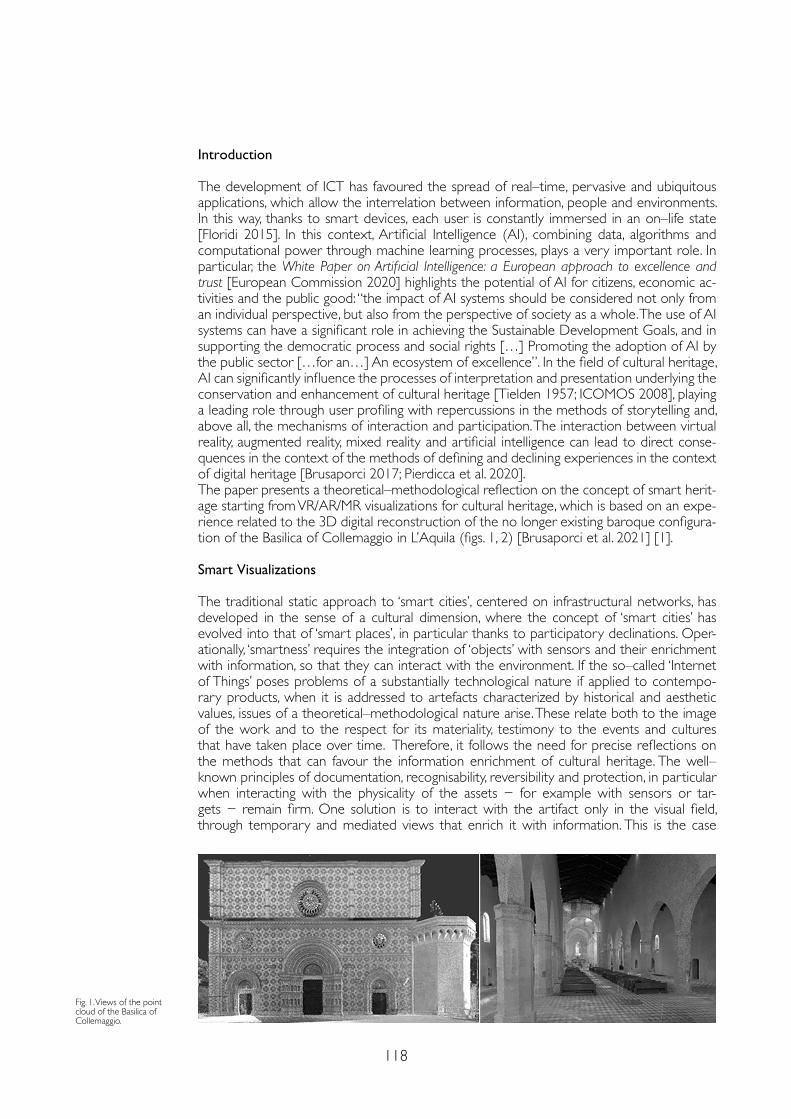
118
Introduction
The development of ICT has favoured the spread of real–time, pervasive and ubiquitous applications, which allow the interrelation between information, people and environments. In this way, thanks to smart devices, each user is constantly immersed in an on–life state [Floridi 2015]. In this context, Artificial Intelligence (AI), combining data, algorithms and computational power through machine learning processes, plays a very important role. In particular, the White Paper on Artificial Intelligence: a European approach to excellence and trust [European Commission 2020] highlights the potential of AI for citizens, economic ac-tivities and the public good: “the impact of AI systems should be considered not only from an individual perspective, but also from the perspective of society as a whole. The use of AI systems can have a significant role in achieving the Sustainable Development Goals, and in supporting the democratic process and social rights […] Promoting the adoption of AI by the public sector […for an…] An ecosystem of excellence”. In the field of cultural heritage, AI can significantly influence the processes of interpretation and presentation underlying the conservation and enhancement of cultural heritage [Tielden 1957; ICOMOS 2008], playing a leading role through user profiling with repercussions in the methods of storytelling and, above all, the mechanisms of interaction and participation. The interaction between virtual reality, augmented reality, mixed reality and artificial intelligence can lead to direct conse-quences in the context of the methods of defining and declining experiences in the context of digital heritage [Brusaporci 2017; Pierdicca et al. 2020]. The paper presents a theoretical–methodological reflection on the concept of smart herit-age starting from VR/AR/MR visualizations for cultural heritage, which is based on an expe-rience related to the 3D digital reconstruction of the no longer existing baroque configura-tion of the Basilica of Collemaggio in L’Aquila (figs. 1, 2) [Brusaporci et al. 2021] [1].
Smart Visualizations
The traditional static approach to ‘smart cities’, centered on infrastructural networks, has developed in the sense of a cultural dimension, where the concept of ‘smart cities’ has evolved into that of ‘smart places’, in particular thanks to participatory declinations. Oper-ationally, ‘smartness’ requires the integration of ‘objects’ with sensors and their enrichment with information, so that they can interact with the environment. If the so–called ‘Internet of Things’ poses problems of a substantially technological nature if applied to contempo-rary products, when it is addressed to artefacts characterized by historical and aesthetic values, issues of a theoretical–methodological nature arise. These relate both to the image of the work and to the respect for its materiality, testimony to the events and cultures that have taken place over time. Therefore, it follows the need for precise reflections on the methods that can favour the information enrichment of cultural heritage. The well–known principles of documentation, recognisability, reversibility and protection, in particular when interacting with the physicality of the assets − for example with sensors or tar-gets − remain firm. One solution is to interact with the artifact only in the visual field, through temporary and mediated views that enrich it with information. This is the case
Fig. 1. Views of the point cloud of the Basilica of Collemaggio.
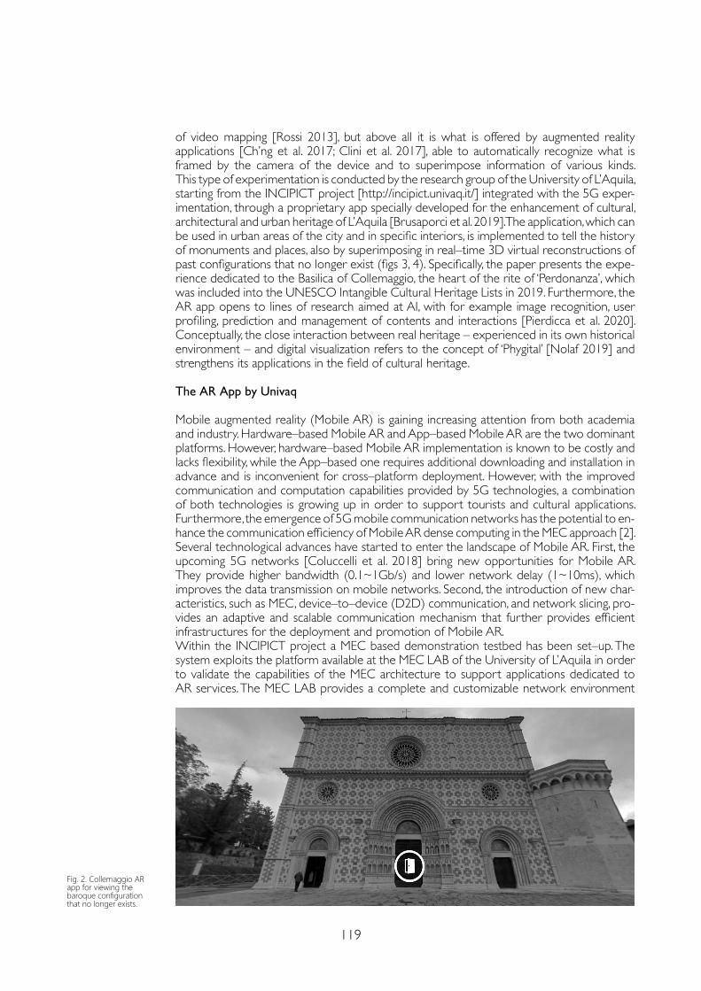
119
of video mapping [Rossi 2013], but above all it is what is offered by augmented reality applications [Ch’ng et al. 2017; Clini et al. 2017], able to automatically recognize what is framed by the camera of the device and to superimpose information of various kinds. This type of experimentation is conducted by the research group of the University of L’Aquila, starting from the INCIPICT project [http://incipict.univaq.it/] integrated with the 5G exper-imentation, through a proprietary app specially developed for the enhancement of cultural, architectural and urban heritage of L’Aquila [Brusaporci et al. 2019]. The application, which can be used in urban areas of the city and in specific interiors, is implemented to tell the history of monuments and places, also by superimposing in real–time 3D virtual reconstructions of past configurations that no longer exist (figs 3, 4). Specifically, the paper presents the expe-rience dedicated to the Basilica of Collemaggio, the heart of the rite of ‘Perdonanza’, which was included into the UNESCO Intangible Cultural Heritage Lists in 2019. Furthermore, the AR app opens to lines of research aimed at AI, with for example image recognition, user profiling, prediction and management of contents and interactions [Pierdicca et al. 2020]. Conceptually, the close interaction between real heritage – experienced in its own historical environment – and digital visualization refers to the concept of ‘Phygital’ [Nolaf 2019] and strengthens its applications in the field of cultural heritage.
The AR App by Univaq
Mobile augmented reality (Mobile AR) is gaining increasing attention from both academia and industry. Hardware–based Mobile AR and App–based Mobile AR are the two dominant platforms. However, hardware–based Mobile AR implementation is known to be costly and lacks flexibility, while the App–based one requires additional downloading and installation in advance and is inconvenient for cross–platform deployment. However, with the improved communication and computation capabilities provided by 5G technologies, a combination of both technologies is growing up in order to support tourists and cultural applications.Furthermore, the emergence of 5G mobile communication networks has the potential to en-hance the communication efficiency of Mobile AR dense computing in the MEC approach [2].Several technological advances have started to enter the landscape of Mobile AR. First, the upcoming 5G networks [Coluccelli et al. 2018] bring new opportunities for Mobile AR. They provide higher bandwidth (0.1~1Gb/s) and lower network delay (1~10ms), which improves the data transmission on mobile networks. Second, the introduction of new char-acteristics, such as MEC, device–to–device (D2D) communication, and network slicing, pro-vides an adaptive and scalable communication mechanism that further provides efficient infrastructures for the deployment and promotion of Mobile AR. Within the INCIPICT project a MEC based demonstration testbed has been set–up. The system exploits the platform available at the MEC LAB of the University of L’Aquila in order to validate the capabilities of the MEC architecture to support applications dedicated to AR services. The MEC LAB provides a complete and customizable network environment
Fig. 2. Collemaggio AR app for viewing the baroque configuration that no longer exists.
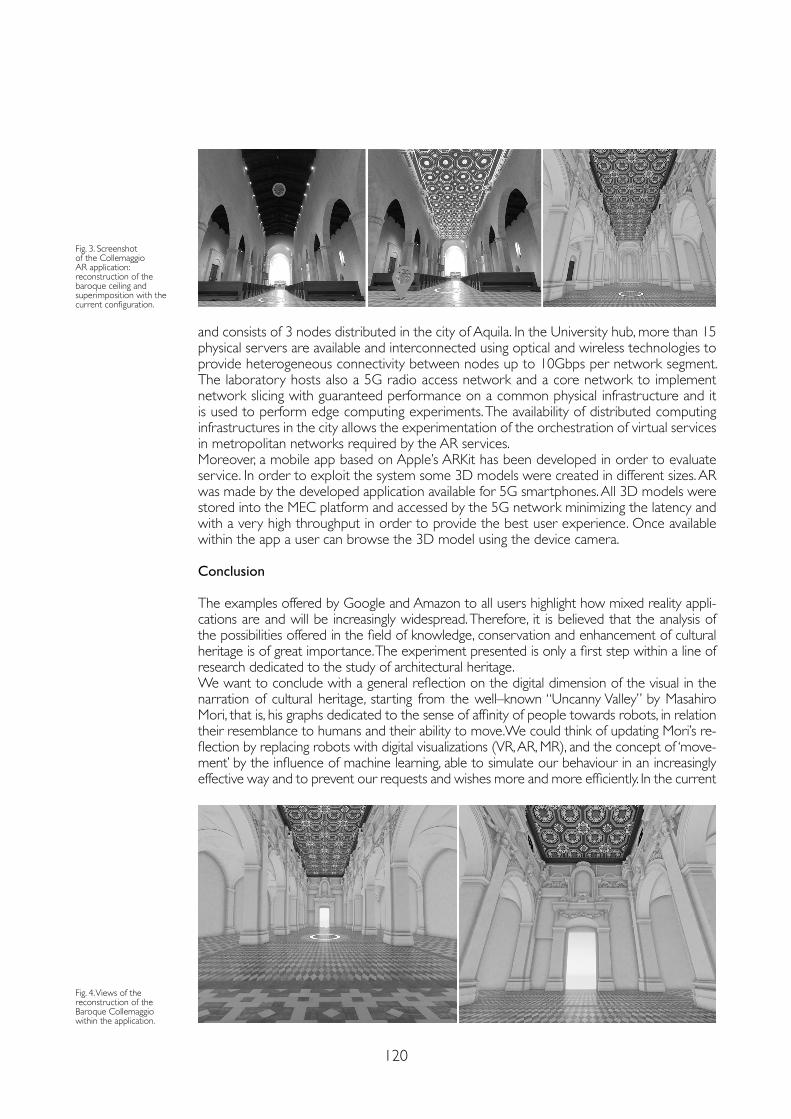
120
and consists of 3 nodes distributed in the city of Aquila. In the University hub, more than 15 physical servers are available and interconnected using optical and wireless technologies to provide heterogeneous connectivity between nodes up to 10Gbps per network segment. The laboratory hosts also a 5G radio access network and a core network to implement network slicing with guaranteed performance on a common physical infrastructure and it is used to perform edge computing experiments. The availability of distributed computing infrastructures in the city allows the experimentation of the orchestration of virtual services in metropolitan networks required by the AR services.Moreover, a mobile app based on Apple’s ARKit has been developed in order to evaluate service. In order to exploit the system some 3D models were created in different sizes. AR was made by the developed application available for 5G smartphones. All 3D models were stored into the MEC platform and accessed by the 5G network minimizing the latency and with a very high throughput in order to provide the best user experience. Once available within the app a user can browse the 3D model using the device camera.
Conclusion
The examples offered by Google and Amazon to all users highlight how mixed reality appli-cations are and will be increasingly widespread. Therefore, it is believed that the analysis of the possibilities offered in the field of knowledge, conservation and enhancement of cultural heritage is of great importance. The experiment presented is only a first step within a line of research dedicated to the study of architectural heritage. We want to conclude with a general reflection on the digital dimension of the visual in the narration of cultural heritage, starting from the well–known “Uncanny Valley” by Masahiro Mori, that is, his graphs dedicated to the sense of affinity of people towards robots, in relation their resemblance to humans and their ability to move.We could think of updating Mori’s re-flection by replacing robots with digital visualizations (VR, AR, MR), and the concept of ‘move-ment’ by the influence of machine learning, able to simulate our behaviour in an increasingly effective way and to prevent our requests and wishes more and more efficiently. In the current
Fig. 3. Screenshot of the Collemaggio AR application: reconstruction of the baroque ceiling and superimposition with the current configuration.
Fig. 4. Views of the reconstruction of the Baroque Collemaggio within the application.
121
References
Brusaporci Stefano (2017). Digital Innovations in Architectural Heritage Conservation: Emerging Research and Opportunities. Hershey (PA): IGI Global.
Brusaporci Stefano, Graziosi Fabio, Franchi Fabio, Maiezza Pamela (2019). Remediating the Historical City. Ubiquitous Augmented Reality for Cultural Heritage Enhancement. In Luigini Alessandro (ed.). Proceedings of the 1st International and Interdisciplinary Conference on Digital Environments for Education, Arts and Heritage EARTH 2018. Cham: Springer, pp. 305-313.
Brusaporci Stefano (2019). The visual bride: representing tangible heritage between digitality and real contents. In Luigini Alessandro, Panciroli Chiara (eds.). img journal 01/2019 Manifesto. vol. 01. Alghero: Publica, pp. 74-91.
Brusaporci Stefano, Graziosi Fabio, Franchi Fabio, Maiezza Pamela, Tata Alessandra (2021). Mixed Reality Experiences for the Historical Storytelling of Cultural Heritage. In Bolognesi Cecilia, Villa Daniele (eds.). From Building Information Modelling to Mixed Reality. Cham: Springer, pp. 33-46.
Ch’ng Eugene, Cai Yiyu, Thwaites Harold (Eds.) (2017). Special Issue on VR for Culture and Heritage: The Experience of Cultural Heritage with Virtual Reality: Guest Editors’ Introduction. In PRESENCE: Virtual and Augmented Reality, 26(3), pp. iii-vi.
Clini Paolo, Quattrini Ramona, Frontoni Emanuele, Pierdicca Roberto, Nespeca Romina (2017). Real/not real: pseudo–holography and augmented reality applications for cultural heritage. In Handbook of Research on Emerging Technologies for Digital Preservation and Information Modeling. Hershey (PA): IGI Global, pp. 201-227.
Coluccelli Gabriella, Loffredo Vincenzo, Monti Luca, Spada Maria Rita, Franchi Fabio, Graziosi Fabio (2018). 5G Italian MISE Trial: Synergies Among Different Actors to Create a “5G Road”. In 2018 IEEE 4th International Forum on Research and Technology for Society and Industry (RTSI). Marsiglia: Institute of Electrical and Electronics Engineers (IEEE) Publisher, pp. 1-4.
Floridi Luciano (ed.) (2015). The Onlife Manifesto. Being Human in a Hyperconnected Era. Cham: Springer.
ICOMOS (2008). Charter for the Interpretation and Presentation of Cultural Heritage Sites. http://icip.icomos.org/downloads/ICOMOS_Interpretation_Charter_ENG_04_10_08.pdf (15 January 2021).
Mori Masahiro (1970). Bukimi no tani – The uncanny valley. (K. F. MacDorman & T. Minato, Trans.). Energy, 7(4), 33-35. https://web.ics.purdue.edu/~drkelly/MoriTheUncannyValley1970.pdf (15 January 2021).
Nolaf Eslam (2019). Phygital Heritage. Communicating Built Heritage Information through the Integration of Digital Technology into Physical Reality. PhD Thesis, KU Leuven.
Pierdicca Roberto, Paolanti Marina, Frontoni Emanuele, Baraldi Lorenzo (2020). AI4AR: An AI–Based Mobile Application for the Automatic Generation of AR Contents. In De Paolis Lucio Tommaso, Bourdot Patrick (eds.). Augmented Reality, Virtual Reality, and Computer Graphics. AVR 2020. Lecture Notes in Computer Science, vol. 12242. Cham: Springer.
Rossi Daniele (2013). Smart architectural models. Spatial projection based augmented mock–up. In Addison Alonzo C., Guidi Gabriele, De Luca Livio, Pescarin Sofia (eds.). 2013 Digital Heritage International Congress, vol. 2. Marsiglia: Institute of Electrical and Electronics Engineers (IEEE) Publisher.
Schafer D. Paul (2014). The Age of Culture. Oakville (ON): Rock’s Mills Press.
Tielden Freeman (1957). Interpreting Our Heritage. Chapel Hill: University of North Carolina Press.
Notes
[1] The research has received funding from the Italian Government under Cipe resolution n.135 (Dec. 21, 2012), project INnovating City Planning through Information and Communication Technologies (INCIPICT).
[2] MEC, formerly mobile edge computing, refers to the enabling technologies that provide computing capabilities and service environment at the edge of the network [European Telecommunications Standards Institute (ETSI) White Paper].
so–called “Age of Culture” [Schafer 2014], ethical questions arise where Human Computer Interaction can prefigure new reflections and experiments aimed at the interpretation and presentation of cultural heritage. In this context, AI plays a leading role, where users are in-creasingly accustomed to the use of synthetic and cunning images in the relationship between real and digital [Brusaporci 2019].
Copyright © 2021 by FrancoAngeli s.r.l. Milano, Italy Isbn 9788835125280
AuthorsStefano Brusaporci, Dept. of Civil, Construction–Architectural and Environmental Engineering, University of L’Aquila, [email protected] Maiezza, Dept. of Civil, Construction–Architectural and Environmental Engineering, University of L’Aquila, [email protected] Alessandra Tata, Dept. of Civil, Construction–Architectural and Environmental Engineering, University of L’Aquila, [email protected] Fabio Graziosi, Dept. of Information Engineering, Computer Science and Mathematics, University of L’Aquila, [email protected] Franchi, Dept. of Information Engineering, Computer Science and Mathematics, University of L’Aquila, [email protected]

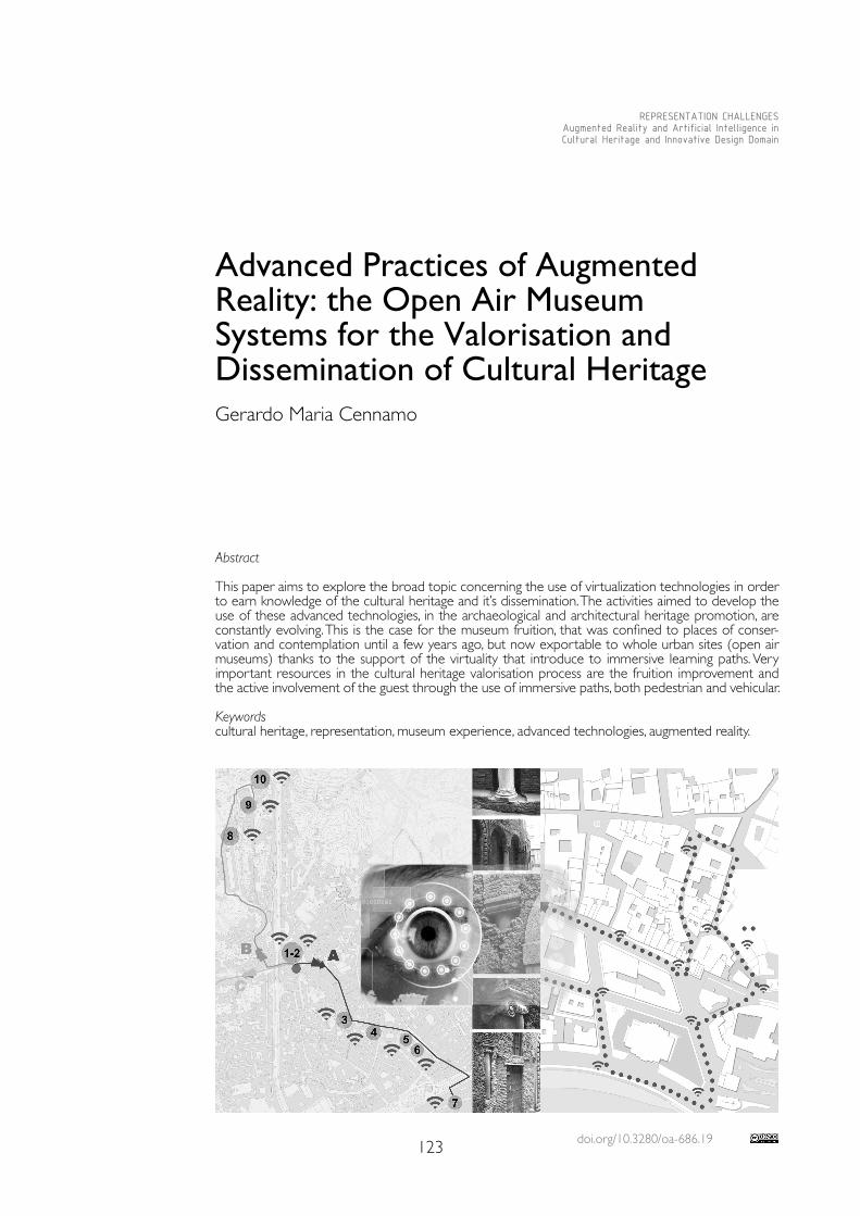
doi.org/10.3280/oa-686.19123
REPRESENTATION CHALLENGESAugmented Reality and Artificial Intelligence in Cultural Heritage and Innovative Design Domain
Abstract
This paper aims to explore the broad topic concerning the use of virtualization technologies in order to earn knowledge of the cultural heritage and it’s dissemination. The activities aimed to develop the use of these advanced technologies, in the archaeological and architectural heritage promotion, are constantly evolving. This is the case for the museum fruition, that was confined to places of conser-vation and contemplation until a few years ago, but now exportable to whole urban sites (open air museums) thanks to the support of the virtuality that introduce to immersive learning paths. Very important resources in the cultural heritage valorisation process are the fruition improvement and the active involvement of the guest through the use of immersive paths, both pedestrian and vehicular.
Keywordscultural heritage, representation, museum experience, advanced technologies, augmented reality.
Advanced Practices of Augmented Reality: the Open Air MuseumSystems for the Valorisation and Dissemination of Cultural Heritage Gerardo Maria Cennamo
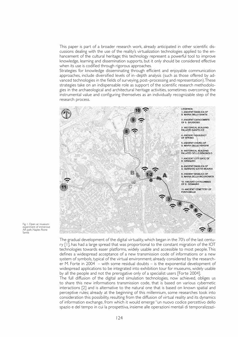
124
This paper is part of a broader research work, already anticipated in other scientific dis-cussions dealing with the use of the reality’s virtualization technologies applied to the en-hancement of the cultural heritage; this technology represent a powerful tool to improve knowledge, learning and dissemination supports, but it only should be considered effective when its use is codified through rigorous approaches. Strategies for knowledge disseminating through efficient and enjoyable communication approaches, include diversified levels of in–depth analysis (such as those offered by ad-vanced technologies in the fields of surveying, post–processing and representation). These strategies take on an indispensable role as support of the scientific research methodolo-gies in the archaeological and architectural heritage activities, sometimes overcoming the instrumental value and configuring themselves as an individually recognizable step of the research process.
Fig. 1. Open air museum: experiment of immersive AR path, Naples Rione Sanità
The gradual development of the digital virtuality, which began in the 70’s of the last centu-ry [1], has had a large spread that was proportional to the constant migration of the IOT technologies towards easer platforms, widely usable and accessible to most people. This defines a widespread acceptance of a new transmission code of informations or a new system of symbols, typical of the virtual environment; already considered by the research-er M. Forte in 2004 – with some residual doubts – is the exponential development of widespread applications to be integrated into exhibition tour for museums, widely usable by all the people and not the prerogative only of a specialist users [Forte 2004].The full diffusion of the digital and simulation technologies, now achieved, obliges us to share this new informations transmission code, that is based on various cybernetic interactions [2] and is alternative to the natural one that is based on known spatial and perceptive rules; already at the beginning of this millennium, some researches took into consideration this possibility, resulting from the diffusion of virtual reality and its dynamics of information exchange, from which it would emerge “un nuovo codice percettivo dello spazio e del tempo in cui la prospettiva, insieme alle operazioni mentali di temporalizzazi-
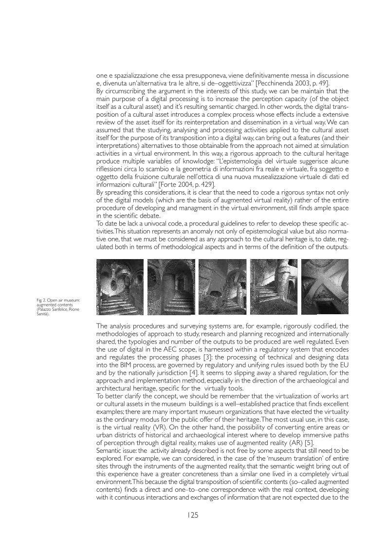
125
one e spazializzazione che essa presupponeva, viene definitivamente messa in discussione e, divenuta un’alternativa tra le altre, si de–oggettivizza” [Pecchinenda 2003, p. 49].By circumscribing the argument in the interests of this study, we can be maintain that the main purpose of a digital processing is to increase the perception capacity (of the object itself as a cultural asset) and it’s resulting semantic charged. In other words, the digital trans-position of a cultural asset introduces a complex process whose effects include a extensive review of the asset itself for its reinterpretation and dissemination in a virtual way. We can assumed that the studying, analysing and processing activities applied to the cultural asset itself for the purpose of its transposition into a digital way, can bring out a features (and their interpretations) alternatives to those obtainable from the approach not aimed at simulation activities in a virtual environment. In this way, a rigorous approach to the cultural heritage produce multiple variables of knowlodge: “L’epistemologia del virtuale suggerisce alcune riflessioni circa lo scambio e la geometria di informazioni fra reale e virtuale, fra soggetto e oggetto della fruizione culturale nell’ottica di una nuova musealizzazione virtuale di dati ed informazioni culturali” [Forte 2004, p. 429].By spreading this considerations, it is clear that the need to code a rigorous syntax not only of the digital models (which are the basis of augmented virtual reality) rather of the entire procedure of developing and managment in the virtual environment, still finds ample space in the scientific debate.To date be lack a univocal code, a procedural guidelines to refer to develop these specific ac-tivities. This situation represents an anomaly not only of epistemological value but also norma-tive one, that we must be considered as any approach to the cultural heritage is, to date, reg-ulated both in terms of methodological aspects and in terms of the definition of the outputs.
The analysis procedures and surveying systems are, for example, rigorously codified, the methodologies of approach to study, research and planning recognized and internationally shared, the typologies and number of the outputs to be produced are well regulated. Even the use of digital in the AEC scope, is harnessed within a regulatory system that encodes and regulates the processing phases [3]: the processing of technical and designing data into the BIM process, are governed by regulatory and unifying rules issued both by the EU and by the nationally jurisdiction [4]. It seems to slipping away a shared regulation, for the approach and implementation method, especially in the direction of the archaeological and architectural heritage, specific for the virtually tools.To better clarify the concept, we should be remember that the virtualization of works art or cultural assets in the museum buildings is a well–established practice that finds excellent examples; there are many important museum organizations that have elected the virtuality as the ordinary modus for the public offer of their heritage. The most usual use, in this case, is the virtual reality (VR). On the other hand, the possibility of converting entire areas or urban districts of historical and archaeological interest where to develop immersive paths of perception through digital reality, makes use of augmented reality (AR) [5].Semantic issue: the activity already described is not free by some aspects that still need to be explored. For example, we can considered, in the case of the ‘museum translation’ of entire sites through the instruments of the augmented reality, that the semantic weight bring out of this experience have a greater concreteness than a similar one lived in a completely virtual environment. This because the digital transposition of scientific contents (so–called augmented contents) finds a direct and one–to–one correspondence with the real context, developing with it continuous interactions and exchanges of information that are not expected due to the
Fig. 2. Open air museum: augmented contents (Palazzo Sanfelice, Rione Sanità).
126
multiple variables introduced by the guest himself. Instead, the many museum organizations that offer visiting through virtual reality, translating the visitor into a concluded virtual environ-ment with a programmed digital dynamics (both for the object, for the work art or for the ar-chaeological site) offer digital experience that, in proposing a completely virtual environment, impose precise conditions so reducing the uncontrolled variables.The virtual environments: we can speak about “territorial systems of cultural heritage” understood as areas with specific features. In the open–air museumization experiments, the important possibilities offered trought the simulation technologies, in terms of reality understanding with the support of the virtually reproducing, appear today as a overcome frontiers through the transposition of the visitor from an external dimension to a partic-ipatory one. This opportunity must be understood not only as the ability to interact with the digital model and as a conferment of an active role to the viewer but, rather, as the induction of a concrete participatory perception in a digital reality. We talk about a digital perceptual system in which the observer not only follows preordained paths (mental, visu-al, exploratory or perceptive) but in which he can freely exercise arbitrary choices, placing himself in an active one–to–one relationship with the virtual environment: “In RV tutte le informazioni sono interconnesse in uno spazio 3D; una ontologia della connettività implica una causalità mutuale: attore ed ambiente si modificano reciprocamente creando nuova informazione” [Forte 2004, p. 430].The user of immersive knowledge paths, supporting by augmented reality, can follow pre-ordained patterns but also can activate alternative behaviours, creating new conditions during the experience of exploration: in any case, the cybernetic relationships that are triggered during this experience are multiple and unpredictable, precisely because they include a participatory–active role of the visitor within the fruition and learning environ-ment: “l’animale umano, grazie al fatto che interpone uno schermo semiotico fra la mente e l’ambiente esterno, può […] guidare dall’interno la percezione, liberandosi dall’influsso diretto dell’ambiente esterno” [Cimatti 2000, p. 246].In this time the so–called open air museum use [6], that is enjoyed outside of the architectural envelopes and supported by new perceptive tools based on integrated digital systems, becomes a concrete opportunity in the purpose of cultural heritage dissemination and deepening.Thanks to the support of GPS systems it is possible to develop dynamic paths of per-ception of the archaeological and architectural heritage, integrated by augmented reality applications; this change allow immersive experiences of knowledge, reconstruction and stratigraphic reading not only of monuments but of entire historical sites. This approach, implemented trought an active involvement of the visitor during the immersive augmented reality paths, can be enjoyed for pedestrian both vehicular itineraries, representing a very relevant resource in terms of opportunities to valorisation the cultural heritage. Very inter-esting for the research purposes are also the replicable experiments about homogeneous territorial areas, with replicable characteristics, such as the Jewish ghettos within the main historical cities. Two researches are underway, one in Rome in the Jewish Ghetto area and the other in Naples in the Sanità district.The first sample develop an experiment with the pedestrian path. In this mode, the tech-nological support must include specific viewers for the augmented reality. These devices are nothing more than glasses equipped with high–definition transparent lenses that allow the wearer to benefit from augmented reality applications through a holographic interface with which to interact through gaze, hand gestures or voice. In order to function correctly and guarantee the recognition of the augmented contents, it is necessary to associate spatial references (target) to the context, in order to obtain a system that guarantees the correct overlap between physical environment and digital reality.The second sample experiments a vehicular path, enjoyed from inside the vehicles such as a taxi, bus, city sightseeing or other. The guests on board will install an application on their smartphone that will allow them to enjoy the augmented contents. The application will acti-vate the geo–referencing system for the tracking of the visitor’s position along the path, while a Bluetooth device will allow activation of the digital contents when the user arrives near the site or point of interest.
127
Notes
[1] The first virtual reality system is the one created in 1968 by Sutherland and Sproull, cfr. Biocca, F., Delaney, B. (1995). Immersive Virtual Reality Technology, in: Communication in the Age of Virtual Reality, Hillsdale: Lawrence Erlbaum Associates.
[2] Cfr. https://www.treccani.it/enciclopedia/cibernetica, definition by Treccani online: Cybernetics, a discipline that focus the unitary study of processes concerning ‘communication and control in animals and machines’. It can also be defined as the general study of highly organized complex systems, regardless of their nature.
[3] The acronym AEC (Architecture Engineering Construction) identifies the building sector supported by IT approaches. The reference literature is very large and finds important interests in the area of the representation.
[4] In Italy: the law about BIM is the D.M. 560/17; the regulation about BIM is the UNI 11337–7.
[5] A brief definition of augmented reality by Treccani online cfr. https://www.treccani.it/encyclopedia/ augmented–reality: virtual reality technology (AR) through which a digital contents are added to the real environment. In opposed to the concept of virtual reality (VR) which develops fully virtual environments.
[6] The reference is to conversion of full historical sites in open–air museums. On the subject cfr. Cennamo, G. (2018).
[7] Cfr. Olivetti, A., Stati Generali della Memoria, Università Telematica Internazionale UNINETTUNO, Roma, 2020.
References
Cennamo Gerardo Maria (2018). Heritage valorisation strategies through development of open–air territorial museum districts. The role of the representation’s instruments to learning through dynamic images. In Salerno, R.ossella (ed.) Rappresentazione Materiale/Immateriale, Roma: Gangemi Editore International.
Cimatti Felice (2000). La scimmia che parla. Linguaggio, autocoscienza e libertà nell’animale umano. Torino: Bollati Boringhieri.
Forte Maurizio (2004). Realtà virtuale, beni culturali e cibernetica: un approccio ecosistemico. In Archeologia e Calcolatori, 15, pp. 423-448.
Pecchinenda Gianfranco (2003). Videogiochi e cultura della simulazione. Roma–Bari: Editori Laterza.
In order to make the synchronism between the approach of the visitor and the delivery of multimedia contents reliable, the interaction system is entrusted to particular transmitters (beacon) which, positioned near the points of interest, send information managed by the application pre–installed on the guest’s devices.
Conclusion
The studies in order to codifying and to controlling the potential of the reality simulation ap-plications about the archaeological and architectural heritage, are constantly evolving, which confirming the important opportunity linked to the new frontiers of approach in this spe-cific scope. Although in a simulated way, these processes have their main objective in the description of the cultural heritage within its site of origin; in addition to the strong contribu-tion carrying out from the technologies, we must remember that the effectiveness of these systems is based on a methodologically correct approaches in the phases of investigation, analysis, surveying and processing, which are typical of the representation sciences. About the identification of precise guidelines, useful to implement the correct use of these technologies in order not to ‘succumb’ to the digital and virtuality potential but, vice versa, to direct their contents in the correct direction of a scientific approach, we must to consider the possibility of defining new syntactic codes within the mechanisms of perception and representation, as recently observed by Alberto Olivetti [7]: “Dovremmo riflettere su quanto sia cambiata la dimensione della percezione e la consapevolezza diffusa del passato, del presente e del futuro. Alludo alla dilagante rapidissima estensione dei mezzi virtuali di tipo informatico che hanno profondamente inciso su quel rapporto di spazio e tempo che forma l’endiadi entro la quale passato–presente–futuro agiscono poiché il tempo, in una dimensione virtuale, annulla le cat-egorie di spazio e tempo quali erano state elaborate solo fino a ieri”.
Copyright © 2021 by FrancoAngeli s.r.l. Milano, Italy Isbn 9788835125280
AuthorGerardo Maria Cennamo, Engineering Faculty, Università Telematica Internazionale UNINETTUNO, [email protected]

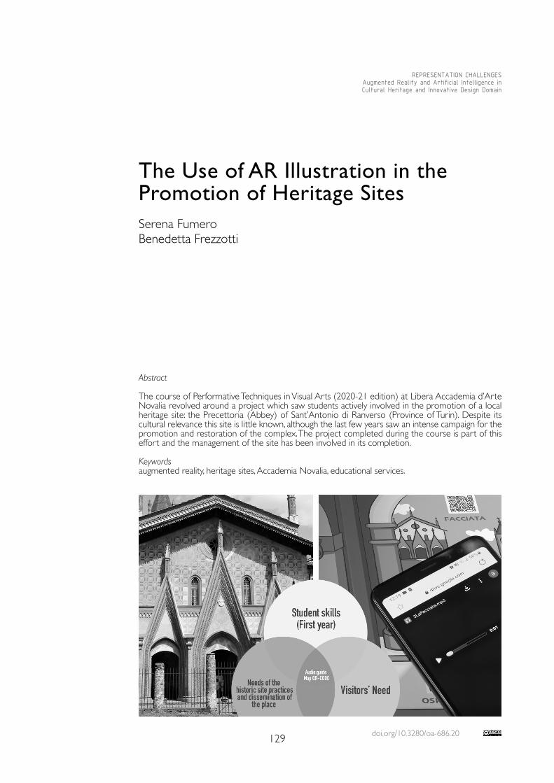
doi.org/10.3280/oa-686.20129
REPRESENTATION CHALLENGESAugmented Reality and Artificial Intelligence in Cultural Heritage and Innovative Design Domain
Abstract
The course of Performative Techniques in Visual Arts (2020-21 edition) at Libera Accademia d’Arte Novalia revolved around a project which saw students actively involved in the promotion of a local heritage site: the Precettoria (Abbey) of Sant’Antonio di Ranverso (Province of Turin). Despite its cultural relevance this site is little known, although the last few years saw an intense campaign for the promotion and restoration of the complex. The project completed during the course is part of this effort and the management of the site has been involved in its completion.
Keywordsaugmented reality, heritage sites, Accademia Novalia, educational services.
The Use of AR Illustration in the Promotion of Heritage SitesSerena FumeroBenedetta Frezzotti

130
Goals and Methodology
Precettoria of Sant’Antonio di Ranverso:Among the sites managed by the Fondazione Ordine Mauriziano [1], we decided to focus on the Precettoria of Sant’Antonio di Ranverso because this complex, located at the en-trance of the Susa Valley [2], is a prestigious site whose late–Gothic architecture and rich and wonderful frescoes bring us back in time to the age of the Duchy of Savoy, between the dusk of the Middle Ages and the beginning of the Renaissance.The social and historical relevance of the complex of Ranverso during the medieval period originated in 1188, when the Duke of Savoy offered the site to the Hospital Brothers of Saint Anthony. The members of the religious order hosted pilgrims and patients suffering from shingles (commonly referred to in Italian as fuoco di Sant’Antonio, meaning ‘Sant An-thony’s fire’) and, later, from the plague. The Precettoria was conveniently located on the Via Francigena, the pilgrim route leading to Rome and some of the foremost religious sites of Christianity. Over the centuries, the entire complex has been rebuilt several times, while the church was completed during the last three decades of the 15th century, commissioned by Jean de Montchenou, who was named Prior in 1470. Back then, the complex included a hospital (of which only the façade is surviving), the church, and the Precettoria building. Of particular importance are the frescoes painted inside the church, depicting stories from the life of Saint Anthony the Great, the life of the Virgin Mary, the Passion of Christ, and the life of Saint Blaise of Sebaste, painted by Giacomo Jaquerio and his atelier in the first quarter of the 15th century: they are a true masterpiece of the International Gothic.At the end of the 18th century, S. Antonio di Ranverso presided over a vast territory and, judging from the number of rural buildings, the surrounding area must have been considerably populated. By the time of the suppression of the Order of Saint Anthony in 1776, the territory administered by Sant’Antonio di Ranverso included almost a quarter of the area of the town of Buttigliera Alta, plus four farmsteads: all buildings and the land were assigned by the Pope Pius VI to the Ordine Mauriziano, and now belong to the Fondazione Ordine Mauriziano, a foundation who converted the site into a museum and is now safeguarding and promoting it.Despite its cultural relevance, this site is little known: this is due to the lack of touristic promotion (which started only very recently) and the location of the Precettoria, which is currently cut off from public transportation. The restoration of the church, carried on between 2015 and 2017, has marked an important step: the lighting inside the church has been entirely redesigned, and a ticket office and a bookshop were added.From the opening of the site to the public in June 2017, special efforts have been made to promote the visibility of the Precettoria, to establish educational services tailored for different visitors (from schools to families), and to use social media to reach potential visitors both in Italy and abroad. In this framework, the work carried out as part of the Performative Techniques in Visual Arts course at the Libera Accademia d’Arte Novalia [3], in collaboration with the site management, was marked by the signing of an agreement between the parties involved to grant the stu-
Fig. 1. The site, seen from the Via Francigena.
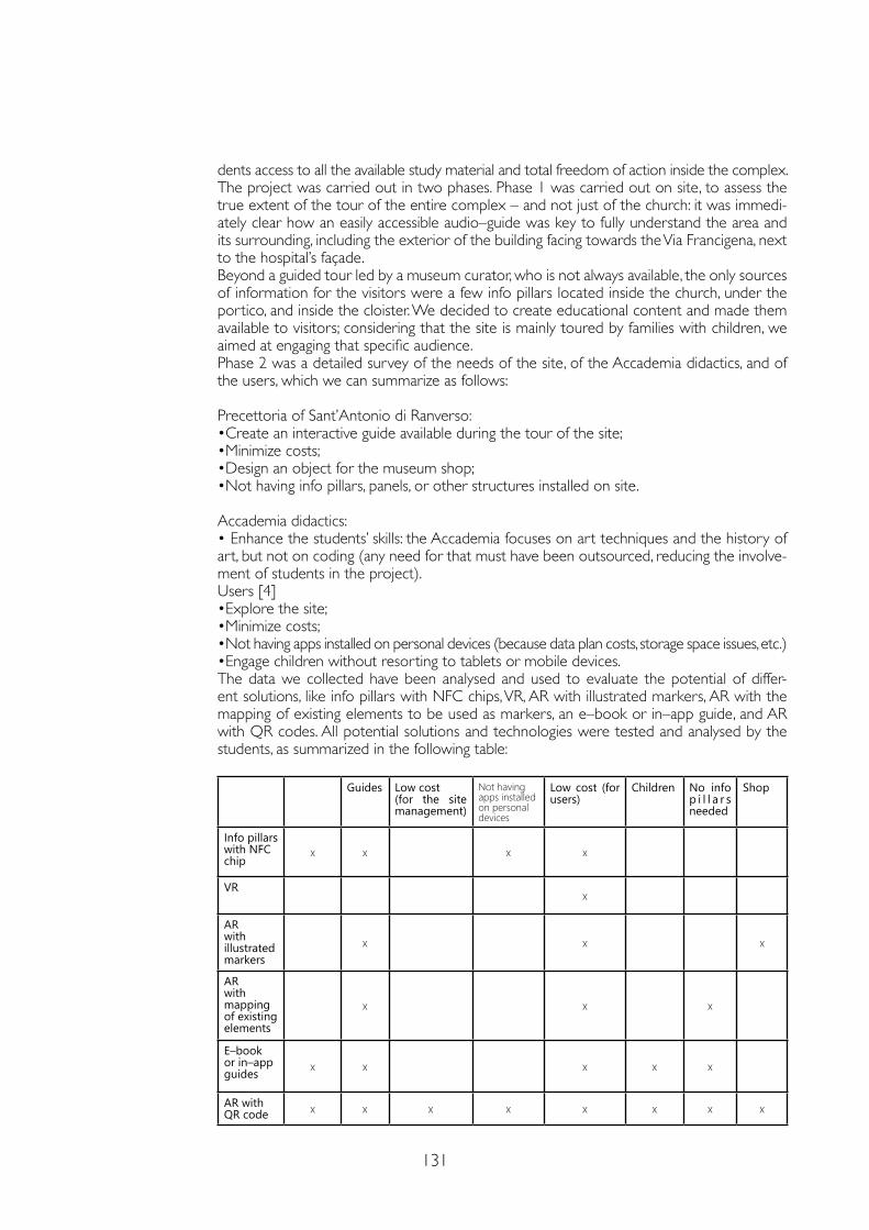
131
dents access to all the available study material and total freedom of action inside the complex.The project was carried out in two phases. Phase 1 was carried out on site, to assess the true extent of the tour of the entire complex – and not just of the church: it was immedi-ately clear how an easily accessible audio–guide was key to fully understand the area and its surrounding, including the exterior of the building facing towards the Via Francigena, next to the hospital’s façade. Beyond a guided tour led by a museum curator, who is not always available, the only sources of information for the visitors were a few info pillars located inside the church, under the portico, and inside the cloister. We decided to create educational content and made them available to visitors; considering that the site is mainly toured by families with children, we aimed at engaging that specific audience. Phase 2 was a detailed survey of the needs of the site, of the Accademia didactics, and of the users, which we can summarize as follows:
Precettoria of Sant’Antonio di Ranverso: •Create an interactive guide available during the tour of the site; •Minimize costs; •Design an object for the museum shop; •Not having info pillars, panels, or other structures installed on site.
Accademia didactics: • Enhance the students’ skills: the Accademia focuses on art techniques and the history of art, but not on coding (any need for that must have been outsourced, reducing the involve-ment of students in the project).Users [4] •Explore the site;•Minimize costs; •Not having apps installed on personal devices (because data plan costs, storage space issues, etc.) •Engage children without resorting to tablets or mobile devices.The data we collected have been analysed and used to evaluate the potential of differ-ent solutions, like info pillars with NFC chips, VR, AR with illustrated markers, AR with the mapping of existing elements to be used as markers, an e–book or in–app guide, and AR with QR codes. All potential solutions and technologies were tested and analysed by the students, as summarized in the following table:
Guides Low cost (for the site management)
Not having apps installed on personal devices
Low cost (for users)
Children No info p i l l a r s needed
Shop
Info pillars with NFC chip
x x x x
VRx
AR with illustrated markers
x x x
AR with mapping of existing elements
x x x
E–book or in–app guides x x x x x
AR with QR code x x x x x x x x
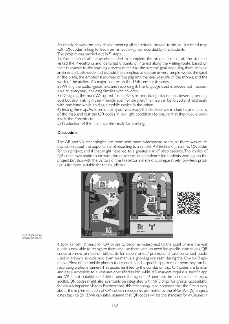
132
As clearly shown, the only choice meeting all the criteria proved to be an illustrated map with QR codes linking to files from an audio–guide recorded by the students.The project was carried out in 5 steps:1) Production of all the assets needed to complete the project. First of all, the students visited the Precettoria and identified 8 points of interest along the visiting route, based on their relevance to the learning process related to the site: the goal was using them to build an itinerary both inside and outside the complex, to explain in very simple words the spirit of the place, the emotional journey of the pilgrims, the everyday life of the monks, and the work of the atelier of a major painter on the 15th century frescoes.2) Writing the audio–guide text and recording it. The language used is precise but acces-sible to everyone, including families with children.3) Designing the map. We opted for an A4 size prioritizing illustrations, lowering printing cost but also making it user–friendly even for children. The map can be folded and held easily with one hand while holding a mobile device in the other.4) Testing the map. As soon as the layout was ready, the students were asked to print a copy of the map and test the QR codes in low light conditions to ensure that they would work inside the Precettoria.5) Production of the final map file, ready for printing.
Discussion
The AR and VR technologies are more and more widespread today, so there was much discussion about the opportunity of resorting to a simpler AR technology such as QR codes for this project, and if that might have led to a greater risk of obsolescence. The choice of QR codes was made to increase the degree of independence for students working on the project but also with the visitors of the Precettoria in mind: a comparatively low–tech prod-uct is far more suitable for their audience.
Fig. 2. The first map selected for testing.
It took almost 10 years for QR codes to become widespread to the point where the vast public is now able to recognize them and use them with no need for specific instructions. QR codes are now printed on billboards for supermarkets’ promotional sale, on school books used in primary schools, and even on menus, a growing use seen during the Covid–19 epi-demic. Most of the mobile phones today don’t need a specific app to read them: they can be read using a phone camera. This assessment led to the conclusion that QR codes are familiar and easily accessible to a vast and diversified public, while AR markers require a specific app and VR is not suitable for children under the age of 12 (and can be unpleasant for many adults). QR codes might also eventually be integrated with NFC chips for greater accessibility for visually impaired visitors. Furthermore, this technology is so common that the first survey about the implementation of QR codes in museums, promoted by the SMartArt [5] project, dates back to 2013. We can safely assume that QR codes will be the standard for museums in
133
the near future. The main innovation in this project is where the QR codes are printed: not on info pillars or panels but on an illustrated map, a physical although low–cost object made more attractive by illustrations. The map is able to draw the attention of the visitors who, when they return to their homes, are still able to maintain a dialogue with the site thanks to the audio contents, which can be accessed and listened to anytime they want.The students were considerably engaged by this project. Opting for a technology such as the QR code, so easy to use, didn’t affect the visual and creative design but only the poten-tial need for coding. The quality of the final works has been consistently high. Unfortunately the visitors’ feedback has been delayed by the measures and restrictions in place during the current Covid–19 epidemic.
Conclusions
This project has proven extremely beneficial both for the didactics and for the Precettoria. We hope that the low cost and the relative ease of content production in this format will encourage a similar approach in many other heritage sites which, similarly to Sant’Antonio di Ranverso, are maybe little known but of great historical and artistic importance: similar contents can be implemented where a visiting itinerary is missing or to promote itineraries tailored for families or visitors belonging to specific categories. Regular updates will also help form a long–lasting relationship between the site and its visitors.
Notes
[1] The site of the Precettoria belongs to F.O.M. Fondazione Ordine Mauriziano, a foundation whose aim is to protect and promote the Precettoria of Sant’Antonio di Ranverso, the Abbey of Staffarda and the Palazzina di Caccia of Stupinigi, which is a UNESCO World Heritage Site.
[2] In Buttigliera Alta (Province of Turin).
[3] The Libera Accademia d’Arte Novalia of Alba (https://novaliaarte.com/).
[4] Users’ needs have been assessed based on the information collected from visitors and by creating fictional ‘Personas’.
[5] QR–CODES in MUSEUMS, http://www.smart-art.it/qr-codes-museums/ (23 February 2021).
References
Bertea Cesare (1923). Sant’Antonio di Ranverso ed Avigliana. Torino: Stabilimento tipografico Ajani e Canale.
Devoti Chiara, Naretto Monica (2010). Ordine e Sanità. Gli ospedali mauriziani tra XVIII e XX secolo: storia e tutela. Torino: Celid.
Gritella Gianfranco (2001). Il colore del gotico. I restauri della precettoria di Sant’Antonio di Ranverso. Savigliano: L’Artistica Editrice..Griseri Andreina (1966). Jaquerio e il Realismo Gotico in Piemonte. Torino: F.lli Pozzo Editore.
Mandarano Nicolette (2019). Musei e media digitali. Roma: Carocci Editore.
Molina Alfonso, Mannino Maria (2016). Educazione per la vita e inclusione digitale. Strategie innovative per la scuola e la formazione degli adulti. Trento: Erickson.
Copyright © 2021 by FrancoAngeli s.r.l. Milano, Italy Isbn 9788835125280
AuthorsSerena Fumero, Libera Accademia d’Arte Novalia of Alba, Precettoria of Sant’Antonio di Ranverso (Educational Services)Benedetta Frezzotti, Libera Accademia d’Arte Novalia of Alba, Studio Platypus – Milan, [email protected]
Acknowledgements
Our heartfelt thanks to the Precettoria of Sant’Antonio di Ranverso and the Fondazione Ordine Mauriziano for their support, but also to the students and management of the Libera Accademia d’Arte Novalia for carrying out the project despite the Covid–19 emergency and the sudden switch to remote learning.

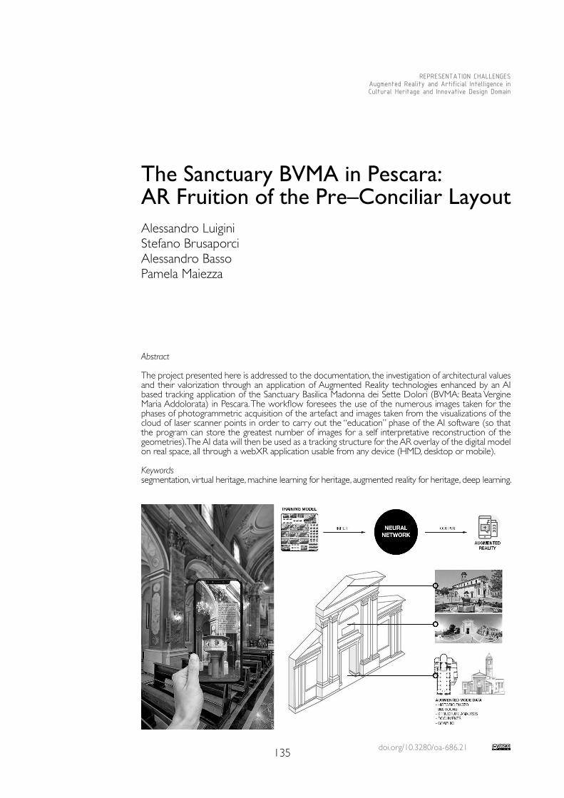
doi.org/10.3280/oa-686.21135
REPRESENTATION CHALLENGESAugmented Reality and Artificial Intelligence in Cultural Heritage and Innovative Design Domain
Abstract
The project presented here is addressed to the documentation, the investigation of architectural values and their valorization through an application of Augmented Reality technologies enhanced by an AI based tracking application of the Sanctuary Basilica Madonna dei Sette Dolori (BVMA: Beata Vergine Maria Addolorata) in Pescara. The workflow foresees the use of the numerous images taken for the phases of photogrammetric acquisition of the artefact and images taken from the visualizations of the cloud of laser scanner points in order to carry out the “education” phase of the AI software (so that the program can store the greatest number of images for a self interpretative reconstruction of the geometries). The AI data will then be used as a tracking structure for the AR overlay of the digital model on real space, all through a webXR application usable from any device (HMD, desktop or mobile).
Keywordssegmentation, virtual heritage, machine learning for heritage, augmented reality for heritage, deep learning.
The Sanctuary BVMA in Pescara: AR Fruition of the Pre–Conciliar Layout Alessandro LuiginiStefano BrusaporciAlessandro BassoPamela Maiezza
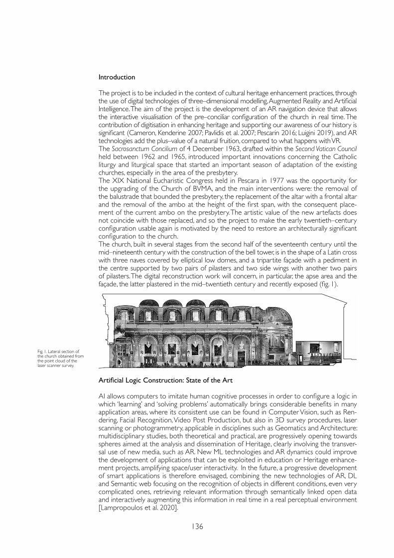
136
Introduction
The project is to be included in the context of cultural heritage enhancement practices, through the use of digital technologies of three–dimensional modelling, Augmented Reality and Artificial Intelligence. The aim of the project is the development of an AR navigation device that allows the interactive visualisation of the pre–conciliar configuration of the church in real time. The contribution of digitisation in enhancing heritage and supporting our awareness of our history is significant (Cameron, Kenderine 2007; Pavlidis et al. 2007; Pescarin 2016; Luigini 2019), and AR technologies add the plus–value of a natural fruition, compared to what happens with VR.The Sacrosanctum Concilium of 4 December 1963, drafted within the Second Vatican Council held between 1962 and 1965, introduced important innovations concerning the Catholic liturgy and liturgical space that started an important season of adaptation of the existing churches, especially in the area of the presbytery. The XIX National Eucharistic Congress held in Pescara in 1977 was the opportunity for the upgrading of the Church of BVMA, and the main interventions were: the removal of the balustrade that bounded the presbytery, the replacement of the altar with a frontal altar and the removal of the ambo at the height of the first span, with the consequent place-ment of the current ambo on the presbytery. The artistic value of the new artefacts does not coincide with those replaced, and so the project to make the early twentieth–century configuration usable again is motivated by the need to restore an architecturally significant configuration to the church. The church, built in several stages from the second half of the seventeenth century until the mid–nineteenth century with the construction of the bell tower, is in the shape of a Latin cross with three naves covered by elliptical low domes, and a tripartite façade with a pediment in the centre supported by two pairs of pilasters and two side wings with another two pairs of pilasters. The digital reconstruction work will concern, in particular, the apse area and the façade, the latter plastered in the mid–twentieth century and recently exposed (fig. 1).
Fig. 1. Lateral section of the church obtained from the point cloud of the laser scanner survey.
Artificial Logic Construction: State of the Art
AI allows computers to imitate human cognitive processes in order to configure a logic in which ‘learning’ and ‘solving problems’ automatically brings considerable benefits in many application areas, where its consistent use can be found in Computer Vision, such as Ren-dering, Facial Recognition, Video Post Production, but also in 3D survey procedures, laser scanning or photogrammetry, applicable in disciplines such as Geomatics and Architecture: multidisciplinary studies, both theoretical and practical, are progressively opening towards spheres aimed at the analysis and dissemination of Heritage, clearly involving the transver-sal use of new media, such as AR. New ML technologies and AR dynamics could improve the development of applications that can be exploited in education or Heritage enhance-ment projects, amplifying space/user interactivity. In the future, a progressive development of smart applications is therefore envisaged, combining the new technologies of AR, DL and Semantic web focusing on the recognition of objects in different conditions, even very complicated ones, retrieving relevant information through semantically linked open data and interactively augmenting this information in real time in a real perceptual environment [Lampropoulos et al. 2020].
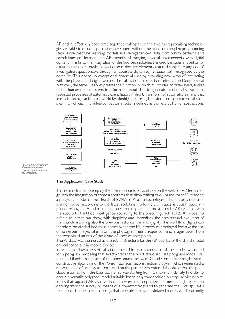
137
AR and AI effectively cooperate together, making them the two most promising technolo-gies available to mobile application developers without the need for complex programming steps, since machine learning models use self–generated data from which patterns and correlations are learned, and AR, capable of merging physical environments with digital content. Thanks to the integration of the two technologies, the credible superimposition of digital elements on physical objects also makes any element captured, subject to any kind of investigation, questionable through an accurate digital segmentation self–recognised by the computer. This opens up exceptional potential uses by providing new ways of interacting with the physical and digital worlds. The calculations in question refer to the Deep Neural Network, the term ‘Deep’ expresses the function in which multitudes of data–layers, similar to the human neural system, transform the input data to generate solutions by means of repeated processes of automatic compilation. In short, it is a form of automatic learning that learns to recognise the real world by identifying it through nested hierarchies of visual sam-ples in which each individual conceptual model is defined as the result of other abstractions.
The Application Case Study
This research aims to employ the open source tools available on the web for AR technolo-gy with the integration of some algorithms that allow editing of AI–based space3D tracking: a polygonal model of the church of BVMA in Pescara, reconfigured from a previous laser scanner survey according to the latest sculpting modelling techniques, is visually superim-posed through an App for smartphones that exploits the most popular AR systems with the support of artificial intelligence according to the preconfigured FRITZ_AI model, to offer a tour that can show, with simplicity and immediacy, the architectural evolution of the church assuming also the previous historical variants (fig. 4). The workflow (fig. 2) can therefore be divided into main phases when the ML procedure employed foresaw the use of numerous images taken from the photogrammetric acquisition and images taken from the post visualisations of the cloud of laser scanner points. The AI data was then used as a tracking structure for the AR overlay of the digital model on real space, all via mobile devices. In order to allow in AR visualization a credible correspondence of the model, we opted for a polygonal modeling that exactly traces the point cloud. An HD polygonal model was obtained thanks to the use of the open source software Cloud Compare, through the re-constructive algorithm of the Poisson Surface Reconstruction plug–in , which generated a mesh capable of credibly tracing, based on the parameters entered, the shape that the point cloud assumes from the laser scanner survey starting from its maximum density. In order to obtain a versatile polygonal model suitable for an easy transposition on popular virtual plat-forms that support AR visualization, it is necessary to optimize the mesh in high resolution deriving from the survey by means of auto–retopology and to generate the UVMap useful to support the textured mappings that replicate the hyper–detailed model, which currently
Fig. 2. Complete workflow of the search process: from document search to AR application.
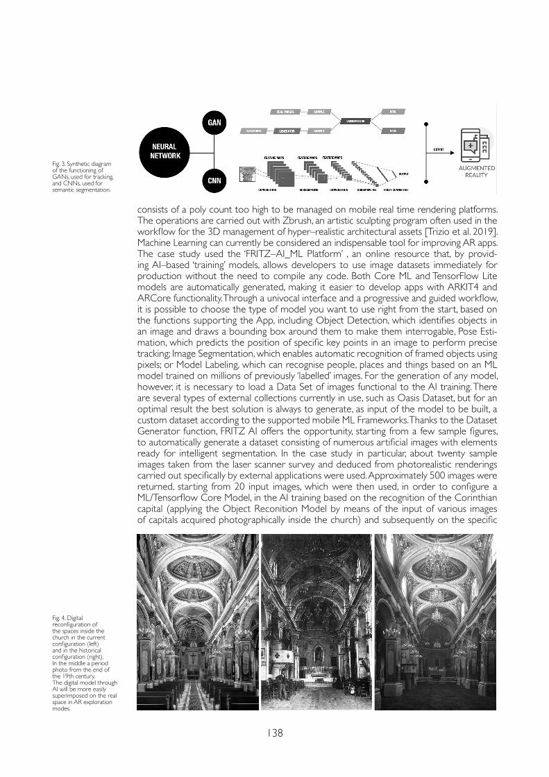
138
consists of a poly count too high to be managed on mobile real time rendering platforms. The operations are carried out with Zbrush, an artistic sculpting program often used in the workflow for the 3D management of hyper–realistic architectural assets [Trizio et al. 2019]. Machine Learning can currently be considered an indispensable tool for improving AR apps. The case study used the ‘FRITZ–AI_ML Platform’ , an online resource that, by provid-ing AI–based ‘training’ models, allows developers to use image datasets immediately for production without the need to compile any code. Both Core ML and TensorFlow Lite models are automatically generated, making it easier to develop apps with ARKIT4 and ARCore functionality. Through a univocal interface and a progressive and guided workflow, it is possible to choose the type of model you want to use right from the start, based on the functions supporting the App, including Object Detection, which identifies objects in an image and draws a bounding box around them to make them interrogable, Pose Esti-mation, which predicts the position of specific key points in an image to perform precise tracking; Image Segmentation, which enables automatic recognition of framed objects using pixels; or Model Labeling, which can recognise people, places and things based on an ML model trained on millions of previously ‘labelled’ images. For the generation of any model, however, it is necessary to load a Data Set of images functional to the AI training. There are several types of external collections currently in use, such as Oasis Dataset, but for an optimal result the best solution is always to generate, as input of the model to be built, a custom dataset according to the supported mobile ML Frameworks. Thanks to the Dataset Generator function, FRITZ AI offers the opportunity, starting from a few sample figures, to automatically generate a dataset consisting of numerous artificial images with elements ready for intelligent segmentation. In the case study in particular, about twenty sample images taken from the laser scanner survey and deduced from photorealistic renderings carried out specifically by external applications were used. Approximately 500 images were returned, starting from 20 input images, which were then used, in order to configure a ML/Tensorflow Core Model, in the AI training based on the recognition of the Corinthian capital (applying the Object Reconition Model by means of the input of various images of capitals acquired photographically inside the church) and subsequently on the specific
Fig. 4. Digital reconfiguration of the spaces inside the church in the current configuration (left) and in the historical configuration (right). In the middle a period photo from the end of the 19th century.The digital model through AI will be more easily superimposed on the real space in AR exploration modes.
Fig. 3. Synthetic diagram of the functioning of GANs, used for tracking, and CNNs, used for semantic segmentation.
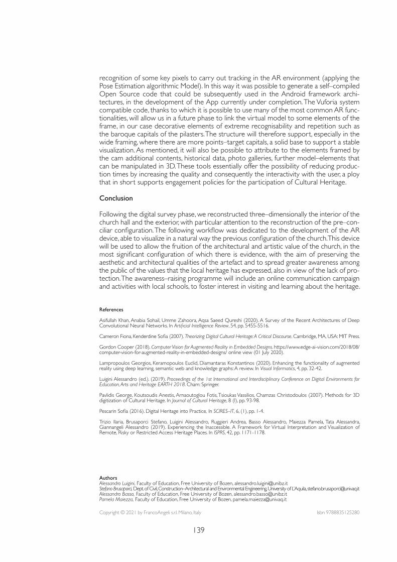
139
References
Asifullah Khan, Anabia Sohail, Umme Zahoora, Aqsa Saeed Qureshi (2020). A Survey of the Recent Architectures of Deep Convolutional Neural Networks. In Artificial Intelligence Review, 54, pp. 5455-5516.
Cameron Fiona, Kenderdine Sofia (2007). Theorizing Digital Cultural Heritage: A Critical Discourse. Cambridge, MA, USA: MIT Press.
Gordon Cooper (2018). Computer Vision for Augmented Reality in Embedded Designs. https://www.edge-ai-vision.com/2018/08/computer-vision-for-augmented-reality-in-embedded-designs/ online view (01 July 2020).
Lampropoulos Georgios, Keramopoulos Euclid, Diamantaras Konstantinos (2020). Enhancing the functionality of augmented reality using deep learning, semantic web and knowledge graphs: A review. In Visual Informatics, 4, pp. 32-42.
Luigini Alessandro (ed.). (2019). Proceedings of the 1st International and Interdisciplinary Conference on Digital Environments for Education, Arts and Heritage EARTH 2018. Cham: Springer.
Pavlidis George, Koutsoudis Anestis, Arnaoutoglou Fotis, Tsioukas Vassilios, Chamzas Christodoulos (2007). Methods for 3D digitization of Cultural Heritage. In Journal of Cultural Heritage, 8 (I), pp. 93-98.
Pescarin Sofia (2016). Digital Heritage into Practice, In SCIRES–IT, 6, (1), pp. 1-4.
Trizio Ilaria, Brusaporci Stefano, Luigini Alessandro, Ruggieri Andrea, Basso Alessandro, Maiezza Pamela, Tata Alessandra, Giannangeli Alessandro (2019). Experiencing the Inaccessible. A Framework for Virtual Interpretation and Visualization of Remote, Risky or Restricted Access Heritage Places. In ISPRS, 42, pp. 1171-1178.
Copyright © 2021 by FrancoAngeli s.r.l. Milano, Italy Isbn 9788835125280
AuthorsAlessandro Luigini, Faculty of Education, Free University of Bozen, [email protected] Brusaporci, Dept. of Civil, Construction–Architectural and Environmental Engineering, University of L’Aquila, [email protected] Basso, Faculty of Education, Free University of Bozen, [email protected] Maiezza, Faculty of Education, Free University of Bozen, [email protected]
recognition of some key pixels to carry out tracking in the AR environment (applying the Pose Estimation algorithmic Model). In this way it was possible to generate a self–compiled Open Source code that could be subsequently used in the Android framework archi-tectures, in the development of the App currently under completion. The Vuforia system compatible code, thanks to which it is possible to use many of the most common AR func-tionalities, will allow us in a future phase to link the virtual model to some elements of the frame, in our case decorative elements of extreme recognisability and repetition such as the baroque capitals of the pilasters. The structure will therefore support, especially in the wide framing, where there are more points–target capitals, a solid base to support a stable visualization. As mentioned, it will also be possible to attribute to the elements framed by the cam additional contents, historical data, photo galleries, further model–elements that can be manipulated in 3D. These tools essentially offer the possibility of reducing produc-tion times by increasing the quality and consequently the interactivity with the user, a ploy that in short supports engagement policies for the participation of Cultural Heritage.
Conclusion
Following the digital survey phase, we reconstructed three–dimensionally the interior of the church hall and the exterior, with particular attention to the reconstruction of the pre–con-ciliar configuration. The following workflow was dedicated to the development of the AR device, able to visualize in a natural way the previous configuration of the church. This device will be used to allow the fruition of the architectural and artistic value of the church, in the most significant configuration of which there is evidence, with the aim of preserving the aesthetic and architectural qualities of the artefact and to spread greater awareness among the public of the values that the local heritage has expressed, also in view of the lack of pro-tection. The awareness–raising programme will include an online communication campaign and activities with local schools, to foster interest in visiting and learning about the heritage.

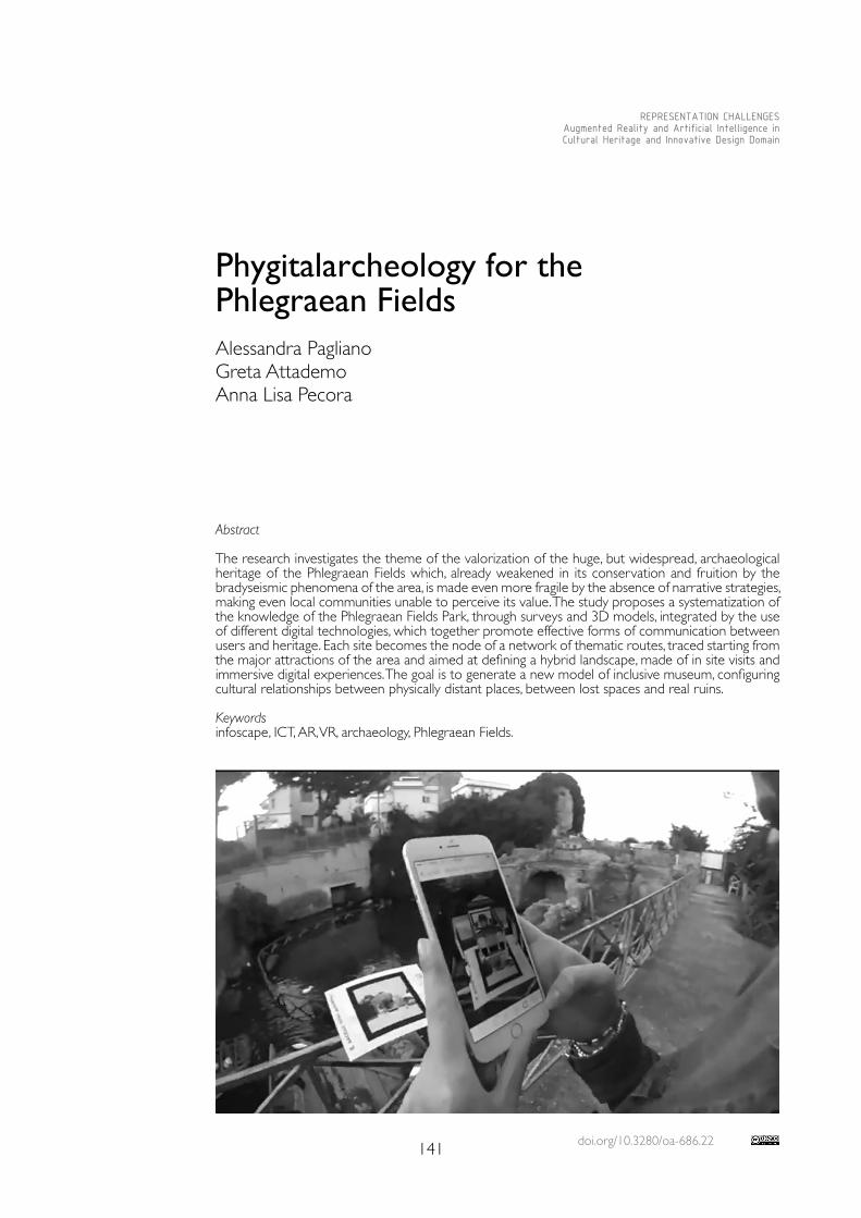
doi.org/10.3280/oa-686.22141
REPRESENTATION CHALLENGESAugmented Reality and Artificial Intelligence in Cultural Heritage and Innovative Design Domain
Abstract
The research investigates the theme of the valorization of the huge, but widespread, archaeological heritage of the Phlegraean Fields which, already weakened in its conservation and fruition by the bradyseismic phenomena of the area, is made even more fragile by the absence of narrative strategies, making even local communities unable to perceive its value. The study proposes a systematization of the knowledge of the Phlegraean Fields Park, through surveys and 3D models, integrated by the use of different digital technologies, which together promote effective forms of communication between users and heritage. Each site becomes the node of a network of thematic routes, traced starting from the major attractions of the area and aimed at defining a hybrid landscape, made of in site visits and immersive digital experiences. The goal is to generate a new model of inclusive museum, configuring cultural relationships between physically distant places, between lost spaces and real ruins.
Keywordsinfoscape, ICT, AR, VR, archaeology, Phlegraean Fields.
Phygitalarcheology for the Phlegraean FieldsAlessandra PaglianoGreta AttademoAnna Lisa Pecora
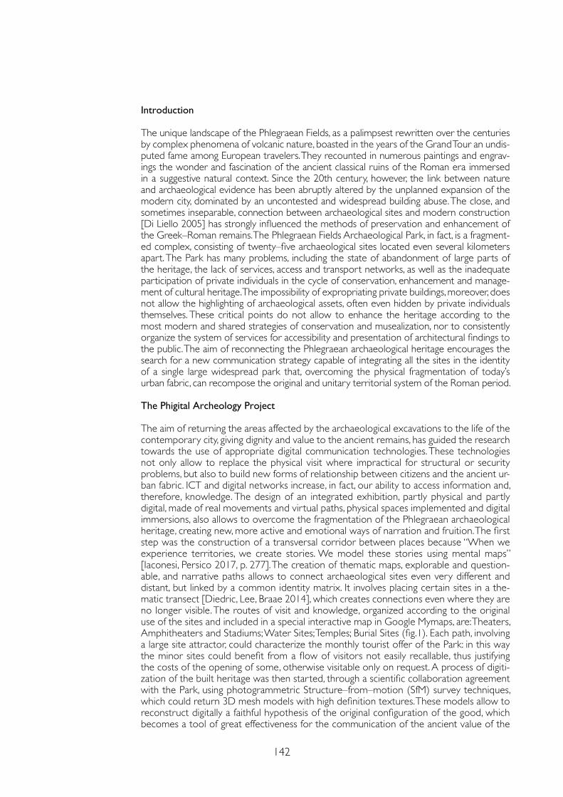
142
Introduction
The unique landscape of the Phlegraean Fields, as a palimpsest rewritten over the centuries by complex phenomena of volcanic nature, boasted in the years of the Grand Tour an undis-puted fame among European travelers. They recounted in numerous paintings and engrav-ings the wonder and fascination of the ancient classical ruins of the Roman era immersed in a suggestive natural context. Since the 20th century, however, the link between nature and archaeological evidence has been abruptly altered by the unplanned expansion of the modern city, dominated by an uncontested and widespread building abuse. The close, and sometimes inseparable, connection between archaeological sites and modern construction [Di Liello 2005] has strongly influenced the methods of preservation and enhancement of the Greek–Roman remains. The Phlegraean Fields Archaeological Park, in fact, is a fragment-ed complex, consisting of twenty–five archaeological sites located even several kilometers apart. The Park has many problems, including the state of abandonment of large parts of the heritage, the lack of services, access and transport networks, as well as the inadequate participation of private individuals in the cycle of conservation, enhancement and manage-ment of cultural heritage. The impossibility of expropriating private buildings, moreover, does not allow the highlighting of archaeological assets, often even hidden by private individuals themselves. These critical points do not allow to enhance the heritage according to the most modern and shared strategies of conservation and musealization, nor to consistently organize the system of services for accessibility and presentation of architectural findings to the public. The aim of reconnecting the Phlegraean archaeological heritage encourages the search for a new communication strategy capable of integrating all the sites in the identity of a single large widespread park that, overcoming the physical fragmentation of today’s urban fabric, can recompose the original and unitary territorial system of the Roman period.
The Phigital Archeology Project
The aim of returning the areas affected by the archaeological excavations to the life of the contemporary city, giving dignity and value to the ancient remains, has guided the research towards the use of appropriate digital communication technologies. These technologies not only allow to replace the physical visit where impractical for structural or security problems, but also to build new forms of relationship between citizens and the ancient ur-ban fabric. ICT and digital networks increase, in fact, our ability to access information and, therefore, knowledge. The design of an integrated exhibition, partly physical and partly digital, made of real movements and virtual paths, physical spaces implemented and digital immersions, also allows to overcome the fragmentation of the Phlegraean archaeological heritage, creating new, more active and emotional ways of narration and fruition. The first step was the construction of a transversal corridor between places because “When we experience territories, we create stories. We model these stories using mental maps” [Iaconesi, Persico 2017, p. 277]. The creation of thematic maps, explorable and question-able, and narrative paths allows to connect archaeological sites even very different and distant, but linked by a common identity matrix. It involves placing certain sites in a the-matic transect [Diedric, Lee, Braae 2014], which creates connections even where they are no longer visible. The routes of visit and knowledge, organized according to the original use of the sites and included in a special interactive map in Google Mymaps, are: Theaters, Amphitheaters and Stadiums; Water Sites; Temples; Burial Sites (fig.1). Each path, involving a large site attractor, could characterize the monthly tourist offer of the Park: in this way the minor sites could benefit from a flow of visitors not easily recallable, thus justifying the costs of the opening of some, otherwise visitable only on request. A process of digiti-zation of the built heritage was then started, through a scientific collaboration agreement with the Park, using photogrammetric Structure–from–motion (SfM) survey techniques, which could return 3D mesh models with high definition textures. These models allow to reconstruct digitally a faithful hypothesis of the original configuration of the good, which becomes a tool of great effectiveness for the communication of the ancient value of the
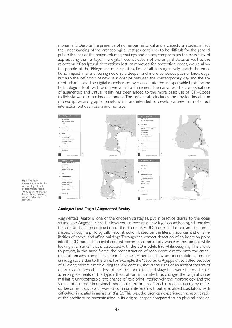
143
monument. Despite the presence of numerous historical and architectural studies, in fact, the understanding of the archaeological vestiges continues to be difficult for the general public: the loss of the major volumes, coatings and colors, compromises the possibility of appreciating the heritage. The digital reconstruction of the original state, as well as the relocation of sculptural decorations lost or removed for protection needs, would allow the people of the Phlegraean municipalities, first of all, to suggestively enrich the emo-tional impact in situ, ensuring not only a deeper and more conscious path of knowledge, but also the definition of new relationships between the contemporary city and the an-cient urban fabric. The digital models, moreover, constitute the indispensable basis for the technological tools with which we want to implement the narrative. The contextual use of augmented and virtual reality has been added to the more basic use of QR–Codes to link via web to multimedia content. The project also includes the physical installation of descriptive and graphic panels, which are intended to develop a new form of direct interaction between users and heritage.
Fig. 1. The four thematic routes for the Archaeological Park of Phlegraean Fields: Temples; Water places; Burial places; Theaters, amphitheaters and stadiums.
Analogical and Digital Augmented Reality
Augmented Reality is one of the choosen strategies, put in practice thanks to the open source app Augment since it allows you to overlay a new layer on archeological remains, the one of digital reconstruction of the structure. A 3D model of the real architecture is shaped through a philologically reconstruction, based on the literary sources and on sim-ilarities of coeval and affine buildings. Through the correct detection of an insertion point into the 3D model, the digital content becomes automatically visible in the camera while looking at a marker, that is associated with the 3D model’s link while designing. This allows to project, in the same frame, the reconstruction of monument directly onto the arche-ological remains, completing them if necessary because they are incomplete, absent or unrecognizable due to the time. For example, the “Sepolcro di Agrippina”, so called because of a wrong denomination during the XVI century, shows the ruins of an ancient theatre of Giulio–Claudia period. The loss of the top floor, cavea and stage that were the most char-acterizing elements of the typical theatral roman architecture, changes the original shape making it unrecognizable: the chance of exploring interactively the morphology and the spaces of a three dimensional model, created on an affordable reconstructing hypothe-sis, becomes a successful way to communicate even without specialized spectators, with difficulties in spatial imagination (fig. 2). This way, the user can experience the aspect ratio of the architecture reconstructed in its original shapes compared to his physical position,
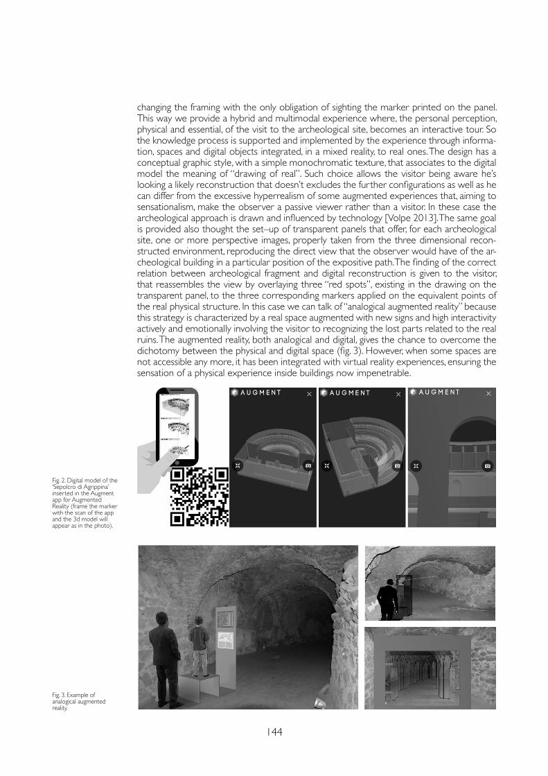
144
Fig. 3. Example of analogical augmented reality.
Fig. 2. Digital model of the ‘Sepolcro di Agrippina’ inserted in the Augment app for Augmented Reality (frame the marker with the scan of the app and the 3d model will appear as in the photo).
changing the framing with the only obligation of sighting the marker printed on the panel. This way we provide a hybrid and multimodal experience where, the personal perception, physical and essential, of the visit to the archeological site, becomes an interactive tour. So the knowledge process is supported and implemented by the experience through informa-tion, spaces and digital objects integrated, in a mixed reality, to real ones. The design has a conceptual graphic style, with a simple monochromatic texture, that associates to the digital model the meaning of “drawing of real”. Such choice allows the visitor being aware he’s looking a likely reconstruction that doesn’t excludes the further configurations as well as he can differ from the excessive hyperrealism of some augmented experiences that, aiming to sensationalism, make the observer a passive viewer rather than a visitor. In these case the archeological approach is drawn and influenced by technology [Volpe 2013]. The same goal is provided also thought the set–up of transparent panels that offer, for each archeological site, one or more perspective images, properly taken from the three dimensional recon-structed environment, reproducing the direct view that the observer would have of the ar-cheological building in a particular position of the expositive path. The finding of the correct relation between archeological fragment and digital reconstruction is given to the visitor, that reassembles the view by overlaying three “red spots”, existing in the drawing on the transparent panel, to the three corresponding markers applied on the equivalent points of the real physical structure. In this case we can talk of “analogical augmented reality” because this strategy is characterized by a real space augmented with new signs and high interactivity actively and emotionally involving the visitor to recognizing the lost parts related to the real ruins. The augmented reality, both analogical and digital, gives the chance to overcome the dichotomy between the physical and digital space (fig. 3). However, when some spaces are not accessible any more, it has been integrated with virtual reality experiences, ensuring the sensation of a physical experience inside buildings now impenetrable.
145
References
Annecchino Raimondo (2004). Bauli–Bacoli. Note storiche. Rist. In Giamminelli Raffaele (ed.). La ‘Collezione Flegrea’ di Raimondo Annecchino. Napoli: Adriano Gallina Editore.
Beloch Karl Julius (1989). Storia e topografia della Napoli antica e dei suoi dintorni. Napoli: Bibliopolis. Original: Campanien Gesuchite und Topographie des antiken Neapel un seiner Ungebung. II ed. Breslau: Morgenstern.
Catuogno Raffaele, Porfiri Francesca, Tacchi Gaia Lisa (2017). Survey for the enhancement of the archaeological sites of the Phlegraean Fields: the “Agrippina Sepulchre” in Bacoli. In IMEKO International Conference on Metrology for Archaeology and Cultural Heritage. Lecce: Curran Associates Inc., pp. 499-503.
Diedrich Lisa, Lee Gini. Braae Ellen (2014). The Transect as a Method for Mapping and Narrating Water Landscapes: Humboldt’s Open Works and Transareal Travelling. In NANO: New American Notes Online, 6, pp. 3-15.
Di Liello Salvatore (2005). Il paesaggio nei Campi Flegrei. Tra realtà e metafora. Napoli: Electa.
Gianolio Simone (ed.) (2013). Archeologia Virtuale: comunicare in digitale. Roma: Espera.
Iaconesi Salvatore, Persico Oriana (2015). Il Terzo Infoscape. Dati, informazioni e saperi nella città e nuovi paradigmi di interazione urbana. In Arcagni Simone (ed.). I media digitali e l’interazione uomo–macchina. Roma: Aracne Editore, pp. 139-168.
Iaconesi Salvatore, Persico Oriana (2017). Digital Urban Acupuncture. Human Ecosystems and the Life of Cities in the Age of Communication, Information and Knowledge. Berlino: Springer.
Maiuri Amedeo (1995). Il teatro–ninfeo detto “Sepolcro di Agrippina”. In Anthemon. Scritti in onore di C. Anti. Firenze, pp. 263–271.
McGee Carrie, Rosenberg Francesca (2014). Art Making as Multisensory Engagement. Case Studies from The Museum of Modern. In Levent Nina, Pascual–Leone Alvaro (eds.). The Multisensory Museum: Cross–Disciplinary Perspectives on Touch, Sound, Smell, Memory, and Space. Lanham (MD): Rowman & Littlefield Publishers, pp. 29-44.
Pagliano Alessandra (2015). Il teatro perduto. Conoscenza e valorizzazione dei beni archeologici sepolti nel territorio di Miseno. In Giovannini Massimo, Di Luggo Antonella, Sacchi Livio, Gambardella Carmine (eds.). Spazi e culture del mediterraneo 4. Costruzione di un atlante del patrimonio culturale del mediterraneo. Napoli: La scuola di Pitagora editrice, pp. 215-229.
Pagliano Alessandra (2017). Strategie comunicative per la valorizzazione dei beni culturali: la realtà aumentata per il Sacello degli Augustali a Miseno/ Communcative strategies for the enhancement of cultural heritage: Augmented Reality for the Sacellum of Augustales in Misenum. In Territori e frontiere della rappresentazione/ Territories and frontiers of representation. Roma: Gangemi editore International, pp. 555-564.
Volpe Giuliano (2013). Archeologia, paesaggio e società al tempo della crisi: tra conservazione e innovazione, in Archeologia pubblica al tempo della crisi. In Parello Maria Concetta, Rizzo Maria Serena (eds.). Atti delle Giornate gregoriane. VII edizione, pp. 183-191.
Conclusions
The proposed “Phygitalarcheology” project is an integrated set–up, partially physical and partially digital that allow to provide new kind of enjoyment, hybrid and multimodal, of ar-cheological sites, ensuring new spatial relations among sites physically far each other, among lost spaces and real ruins, real and digital spaces. This integrated process generates a new model of museum, more inclusive, where digital information is not referred and attached only to the single object or site, but recombine, remix and recontextualize themselves cre-ating always new physical and semantic geographies. The direct and fundamental experience of visiting the site, implemented by digital contents, becomes therefore a narrative–interac-tive path, encouraging not only the reconnection of the heritage diffused on the Phlegrean area, but even a new sense of knowledge of its value that would reconnect the citizens to their archeological heritage.
Copyright © 2021 by FrancoAngeli s.r.l. Milano, Italy Isbn 9788835125280
AuthorsAlessandra Pagliano, Dept. of Architecture, University of Naples Federico II, [email protected] Attademo, Dept. of Architecture, University of Naples Federico II, [email protected] Lisa Pecora, Dept. of Architecture, University of Naples Federico II, [email protected]

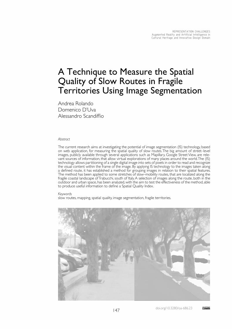
doi.org/10.3280/oa-686.23147
REPRESENTATION CHALLENGESAugmented Reality and Artificial Intelligence in Cultural Heritage and Innovative Design Domain
Abstract
The current research aims at investigating the potential of image segmentation (IS) technology, based on web application, for measuring the spatial quality of slow routes. The big amount of street–level images, publicly available through several applications such as Mapillary, Google Street View, are rele-vant sources of information, that allow virtual explorations of many places around the world. The (IS) technology allows partitioning of a single digital image into sets of pixels in order to read and recognize the visual content within the frame of the image. By applying IS technology to the images taken along a defined route, it has established a method for grouping images in relation to their spatial features. The method has been applied to some stretches of slow–mobility routes, that are localized along the fragile coastal landscape of Trabucchi, south of Italy. A selection of images along the route, both in the outdoor and urban space, has been analyzed, with the aim to test the effectiveness of the method, able to produce useful information to define a Spatial Quality Index.
Keywordsslow routes, mapping, spatial quality, image segmentation, fragile territories.
A Technique to Measure the Spatial Quality of Slow Routes in Fragile Territories Using Image SegmentationAndrea RolandoDomenico D’UvaAlessandro Scandiffio
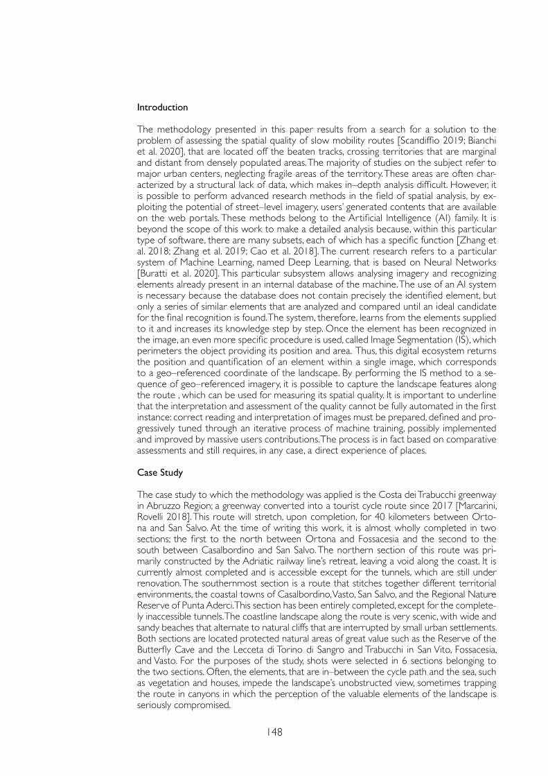
148
Introduction
The methodology presented in this paper results from a search for a solution to the problem of assessing the spatial quality of slow mobility routes [Scandiffio 2019; Bianchi et al. 2020], that are located off the beaten tracks, crossing territories that are marginal and distant from densely populated areas. The majority of studies on the subject refer to major urban centers, neglecting fragile areas of the territory. These areas are often char-acterized by a structural lack of data, which makes in–depth analysis difficult. However, it is possible to perform advanced research methods in the field of spatial analysis, by ex-ploiting the potential of street–level imagery, users’ generated contents that are available on the web portals. These methods belong to the Artificial Intelligence (AI) family. It is beyond the scope of this work to make a detailed analysis because, within this particular type of software, there are many subsets, each of which has a specific function [Zhang et al. 2018; Zhang et al. 2019; Cao et al. 2018]. The current research refers to a particular system of Machine Learning, named Deep Learning, that is based on Neural Networks [Buratti et al. 2020]. This particular subsystem allows analysing imagery and recognizing elements already present in an internal database of the machine. The use of an AI system is necessary because the database does not contain precisely the identified element, but only a series of similar elements that are analyzed and compared until an ideal candidate for the final recognition is found. The system, therefore, learns from the elements supplied to it and increases its knowledge step by step. Once the element has been recognized in the image, an even more specific procedure is used, called Image Segmentation (IS), which perimeters the object providing its position and area. Thus, this digital ecosystem returns the position and quantification of an element within a single image, which corresponds to a geo–referenced coordinate of the landscape. By performing the IS method to a se-quence of geo–referenced imagery, it is possible to capture the landscape features along the route , which can be used for measuring its spatial quality. It is important to underline that the interpretation and assessment of the quality cannot be fully automated in the first instance: correct reading and interpretation of images must be prepared, defined and pro-gressively tuned through an iterative process of machine training, possibly implemented and improved by massive users contributions. The process is in fact based on comparative assessments and still requires, in any case, a direct experience of places.
Case Study
The case study to which the methodology was applied is the Costa dei Trabucchi greenway in Abruzzo Region; a greenway converted into a tourist cycle route since 2017 [Marcarini, Rovelli 2018]. This route will stretch, upon completion, for 40 kilometers between Orto-na and San Salvo. At the time of writing this work, it is almost wholly completed in two sections; the first to the north between Ortona and Fossacesia and the second to the south between Casalbordino and San Salvo. The northern section of this route was pri-marily constructed by the Adriatic railway line’s retreat, leaving a void along the coast. It is currently almost completed and is accessible except for the tunnels, which are still under renovation. The southernmost section is a route that stitches together different territorial environments, the coastal towns of Casalbordino, Vasto, San Salvo, and the Regional Nature Reserve of Punta Aderci. This section has been entirely completed, except for the complete-ly inaccessible tunnels. The coastline landscape along the route is very scenic, with wide and sandy beaches that alternate to natural cliffs that are interrupted by small urban settlements. Both sections are located protected natural areas of great value such as the Reserve of the Butterfly Cave and the Lecceta di Torino di Sangro and Trabucchi in San Vito, Fossacesia, and Vasto. For the purposes of the study, shots were selected in 6 sections belonging to the two sections. Often, the elements, that are in–between the cycle path and the sea, such as vegetation and houses, impede the landscape’s unobstructed view, sometimes trapping the route in canyons in which the perception of the valuable elements of the landscape is seriously compromised.
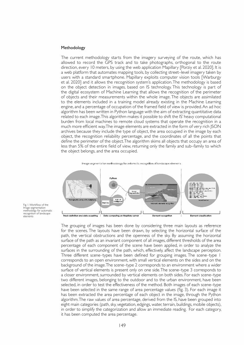
149
Methodology
The current methodology starts from the imagery surveying of the route, which has allowed to record the GPS track and to take photographs, orthogonal to the route direction, every 10 meters, by using the web application Mapillary [Porziy et al. 2020]. It is a web platform that automates mapping tools, by collecting street–level imagery taken by users with a standard smartphone. Mapillary exploits computer vision tools [Warburgy et al. 2020] and it allows the recognition system’s application. The methodology is based on the object detection in images, based on IS technology. This technology is part of the digital ecosystem of Machine Learning that allows the recognition of the perimeter of objects and their measurements within the whole image. The objects are assimilated to the elements included in a training model already existing in the Machine Learning engine, and a percentage of occupation of the framed field of view is provided. An ad hoc algorithm has been written in Python language with the aim of extracting quantitative data related to each image. This algorithm makes it possible to shift the IS’ heavy computational burden from local machines to remote cloud systems that operate the recognition in a much more efficient way. The image elements are extracted in the form of very rich JSON archives because they include the type of object, the area occupied in the image by each object, the recognition reliability percentage, and the coordinates of all the points that define the perimeter of the object. The algorithm skims all objects that occupy an area of less than 5% of the entire field of view, returning only the family and sub–family to which the object belongs, and the area occupied.
The grouping of images has been done by considering three main layouts as reference for the scenes. The layouts have been drawn, by selecting the horizontal surface of the path, the vertical obstructions and the openness of the sky. By assuming the horizontal surface of the path as an invariant component of all images, different thresholds of the area percentage of each component of the scene have been applied, in order to analyze the surfaces in the surrounding of the path, which, effectively, affect the landscape perception. Three different scene–types have been defined for grouping images. The scene–type 1 corresponds to an open environment, with small vertical elements on the sides and on the background of the image. The scene–type 2 corresponds to an environment where a wider surface of vertical elements is present only on one side. The scene–type 3 corresponds to a closer environment, surrounded by vertical elements on both sides. For each scene–type two different images, belonging to the outdoor and to the urban environment, have been selected, in order to test the effectiveness of the method. Both images of each scene–type have been selected in the same range of area percentage values (fig. 3). For each image it has been extracted the area percentage of each object in the image, through the Python algorithm. The raw values of area percentage, derived from the IS, have been grouped into eight main categories (path, sky, vegetation, edgings, water, terrain, buildings, mobile objects), in order to simplify the categorization and allow an immediate reading. For each category, it has been computed the area percentage.
Fig. 1. Workflow of the Image segmentation methodolgy for automatic recognition of landscape elements
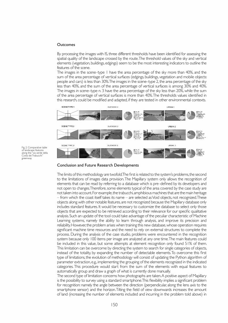
150
Conclusion and Future Research Developments
The limits of this methodology are twofold. The first is related to the system’s problems, the second to the limitations of images data provision. The Mapillary system only allows the recognition of elements that can be read by referring to a database which is pre–defined by its developers and not open to changes. Therefore, some elements typical of the area covered by the case study are not taken into account. For example, the trabucchi, amphibious machines that are the main heritage – from which the coast itself takes its name – are selected as Void objects, not recognized. These objects along with other notable features, are not recognized because the Mapillary database only includes standard features. It would be necessary to customize the database to select only those objects that are expected to be retrieved according to their relevance for our specific qualitative analysis. Such an update of the tool could take advantage of the peculiar characteristic of Machine Learning systems, namely the ability to learn through analysis, and improve its precision and reliability. However, the problem arises when training this new database, whose operation requires significant machine time resources and the need to rely on external structures to complete the process. During the analysis of the case studio, problems were encountered in the recognition system because only 100 items per image are analyzed at any one time. The main features could be included in this value, but some attempts at element recognition only found 51% of them. This limitation can be overcome by directing the system to search for single categories of objects, instead of the totality, by expanding the number of detectable elements. To overcome this first type of limitations, the evolution of methodology will consist of updating the Python algorithm of parameter extraction, e.g., implementing the grouping of the elements recognized in the indicated categories. This procedure would start from the sum of the elements with equal features to automatically group and draw a graph of what is currently done manually.The second type of limitation concerns how photographs are taken. A positive aspect of Mapillary is the possibility to survey using a standard smartphone. This flexibility implies a significant problem for recognition: namely the angle between the direction (perpendicular, along the lens axis to the smartphone sensor) and the horizon. Tilting the field of view downwards increases the amount of land (increasing the number of elements included and incurring in the problem told above) in
Fig. 2. Comparative table of landscape features along the “via verde della Costa dei Trabucchi” greenway.
Outcomes
By processing the images with IS, three different thresholds have been identified for assessing the spatial quality of the landscape crossed by the route. The threshold values of the sky and vertical elements (vegetation, buildings, edgings) seem to be the most interesting indicators to outline the features of the scene.The images in the scene–type 1 have the area percentage of the sky more than 40%, and the sum of the area percentage of vertical surfaces (edgings, buildings, vegetation and mobile objects: people and cars) is less than 30%. The images in the scene–type 2, the area percentage of the sky less than 40%, and the sum of the area percentage of vertical surfaces is among 30% and 40%. The images in scene–type n. 3 have the area percentage of the sky less than 20%, while the sum of the area percentage of vertical surfaces is more than 40%. The thresholds values identified in this research, could be modified and adapted, if they are tested in other environmental contexts.
151
the frame. Tilting it in the opposite direction increases the percentage of the sky that fills the frame. The incidence of this factor will be the subject of future research developments. A further limitation of this type is the standardization of the photos because they are taken with various instruments with different resolutions and fields of view, with intuitively different results. The differences induced by these limitations can be overcome by using standardized tools for capturing photos, implementing a camera whose inclination, position, and shock–absorber can be controlled within specific well–defined parameters. A completely different approach to this issue is relying on more reliable photo databases such as Google Street View [Zhanga et al. 2020; Anguelov et al. 2020] but with limited coverage of the slow mobility routes covered in this work. A better definition of the thresholds for each category can be found, in order to apply the method to other territorial contexts. Related to this problem is the limited portion of the space that is framed by the images. In fact, this method only allows to detect the landscape elements that are framed in the images. The application of other methods that define landscape components extracting them from GIS database could be integrated in the procedure. The best foreseen solution could aim to define the most relevant components of a landscape extracting and defining them both from GIS databases (made of geometric entities derived from visual knowledge) and from Image Segmentation procedures, that feed a similar database, but using visual recognition of the same entities. In the end this double checked definition of entities should assure the correct definition of each item. Further developments could investigate the possibility to define a set of relevant objects referred to geometric entities (points, lines, surfaces) to be considered as common database records, so to be recognized and confronted both in the image segmentation based process and in its complementar GIS based method of analysis.
Acknowledgments
This work has been carried on within the activities of the E–scapes research group (www.e–scapes.polimi.it directed by A. Rolando) and the Territorial Fragilities Program – MapFrag group (www.eccellenza.dastu.polimi.it) of the Department of Architecture and Urban Studies.
References
Anguelov Dragomir, Dulong Carole, Filip Daniel, Frueh Christian, Lafon Stéphane, Lyon Richard, Ogale Abhijit S. , Vincent Luc, Weaver Josh (2010). Google Street View: Capturing the World at Street Level. In Computer, 43(6,) pp. 32-38.
Bianchi Alessandro, D’Uva Domenico, Rolando Andrea, Scandiffio Alessandro (2020). A View from the Track: Measuring Spatial Quality of Slow Mobility Routes. Possible Integration of GIS and Machine Learning Based Methods. In Connettere Connecting. Un disegno per annodare e tessere/drawing for weaving relationships. Milano: FrancoAngeli, pp. 2973-2980.
Cao Rui, Zhu Jiasong, Tu Wei, Li Qingquan (2018). Integrating Aerial and Street View Images for Urban Land Use Classification. In Remote Sensing, 10, pp. 1-23.
Marcarini Albano, Rovelli Roberto (2018). Atlante Italiano delle ferrovie in disuso. Firenze: Istituto Geografico MIlitare.
Porziy Lorenzo , Hofingerz Markus, Ruiz Idoia, Serrat Joan, Rota Bul`oy Samuel, Kontschiedery Peter (2020). Learning Multi–Object Tracking and Segmentation from Automatic Annotations. In Computer Vision and Pattern Recognition, arXiv.
Scandiffio Alessandro (2019). Mapping spatial quality of slow routes with a GIS–based method. A comparative assessment of alternative routes. In International Archives Photogrammetry Remote Sensing Spatial Information Science, XLII–2/W15, pp.1071-1076.
Warburgy Frederik, Haubergy Søren, Lopez–Antequeraz Manuel, Gargalloz Pau, Kuangz Yubin, Civerax Javier (2020). Mapillary Street–Level Sequences: A Dataset for Lifelong Place Recognition. In Conf. on Computer Vision and Pattern Recognition (CVPR), pp. 1-10.
Zhang Fan, Zhou Bolei, Ratti Carlo (2019). Discovering place–informative scenes and objects using social media photos. In Royal Society open science, 6 (3). Zhang Fan, Zhou Bolei, Liu Liu, Liu Yu, Fung Helene H. , Lin Hui, Ratti Carlo (2018). Measuring human perceptions of a large–scale urban region using machine learning. In Landscape and Urban Planning, 180, pp. 148-160.
Zhang Fan, Zuc Jinyan, Huc Mingyuan, Zhub Di, Kangd, Yuhao, Gaod Song, Zhang Yi, Huang Zhou (2020). 101478 Uncovering inconspicuous places using social media check–ins and street view images. In Computer, Environment and Urban Systems. Amsterdam: Elsevier.
Copyright © 2021 by FrancoAngeli s.r.l. Milano, Italy Isbn 9788835125280
AuthorsAndrea Rolando, Dept.of Architecture and Urban Studies, Politecnico di Milano, [email protected] Domenico D’Uva, Dept. of Architecture and Urban Studies, Politecnico di Milano, [email protected] Scandiffio, Dept. of Architecture and Urban Studies, Politecnico di Milano, [email protected]

doi.org/10.3280/oa-686.24153
REPRESENTATION CHALLENGESAugmented Reality and Artificial Intelligence in Cultural Heritage and Innovative Design Domain
Abstract
During this past year the Laboratory for eXtended Realities (DIDA–LXR) from the DIDALABS sys-tem at the Department of Architecture at the University of Florence, has experienced a various number of activities. Most of them linked together digital modelling of no longer existing architectures and still in place Built Heritage. Others were aimed to develop an “Augmented Virtual Reality” using specific environments/locations (for example a boat) to enhance the sensations of the user during the experience. Some others were based on direct VR shooting, using advanced panoramic cameras and creating a point of view compliant with the specific impressions that the place should transmit. In the contribution proposed here the AR, VR and XR experiences from this personal research will be presented sharing the specific subjects, the evaluation of usable technologies, the strategy for shoot-ing, survey, processing and post–processing, the dissemination of ideas and the lesson learnt. Keywordsvirtual reality, augmented reality, photogrammetry, aerialphotogrammetry.
When the Real Really Means: VR and AR Experiences in Real EnvironmentsGiorgio VerdianiYlenia RicciAndrea PasqualiStéphane Giraudeau
154
Introduction
The new possibilities created by the Laboratory for eXtended Reality were immediately fol-lowed up with case studies applied to cultural heritage. We consider the possibility given by virtual environments and augmented reality a great potential for reading and study, the way to increase and facilitate the knowledge of the architectural heritage.This technological development has led us to the need to deepen the existing possibilities of recording or surveying the existing. The growth of this knowledge has allowed us to think about topics that have a key theme and to experiment with new possibilities of fruition and use of the collected data. The whole set of experiences was oriented to Mediterranean subjects connecting the eastern and western parts of the “Mare Nostrum”. In this way, the Medusa’s Heads passing from Constantinople to Istanbul, the Tetrarchs’ Statue in Venice, the Venetian Lagoon and its story, becomes the first series of fragments of a VR and AR plot around the Mediterranean Sea. The approach is to create a versatile set of multimedia elements, oriented to work in a “classic” environment like the traditional display as well as in modern solutions like the immersive visors. At the same time, while experimenting with different solutions and subjects, specific attention was given to the users’ experience, gather-ing information and suggestions from the people using the virtual/augmented environments. This was quite useful in addressing and enhancing the further developments of models and proposals. The guidelines followed in all the testings and experiments were aimed at the production of very persuasive environments enriched by fascinating and valuable contents.
From Site to Virtualization
The paper presents experiences of eXtended Reality that aim to increase the user’s senso-ry perception. This evolution is not sought by artificial technological inputs but by the real environment. Analyzing and structuring the real physical location where to place the device for the use of the digital environment we aim to add real inputs to complete the virtual ex-perience. From this, the cases presented are strongly different and distinguishable but with a common theme. The research wants to focus on the need to link the place of the fruition of the virtual environment with the digital product. This is to have a more complete prod-uct. However, do not want to take away the importance of the greatest potential of Virtual Reality, that of relating to the object of study in an environment completely parallel and independent from physical reality, releasing the digital object from the real world. The rea-soning wants to underline how eXtended Reality is not only the trivial union of AR and VR but it finds complete fulfilment in the knowledge and in the dialogue with the environment in which the experience takes place. Not only structuring and engaging with the location but also welcoming (and possibly shielding) the stimuli and features that are part of it.
Case Study One: the Theater of the World by Aldo Rossi
The first step in our journey to rediscover the Mediterranean Sea is Aldo Rossi’s Theatre of the World [Brusatin & Prandi, 1982]. This iconic temporary architecture was built between the late seventies and early eighties and it has represented the symbol of what is known as temporary installations. Created specifically for the Venice Biennale of Architecture in 1979 [Garcìa 2006] still recalls more than 30 years later, the typical charm of something that was once there and now no longer exists, if not virtually. The purpose in this research is to keep this feeling of curiosity alive and untouched and then fulfil it, thanks to the development of a virtual environment, in which it has been relocated the Theater.The process behind the virtualization began with the documentation about the architecture and it was necessary to collect information about the structure and the form of the building itself, using architectural drawings and various photographic sources. Thereafter it was possi-ble to carry out the digital modelling of the object, performed with Maxon Cinema 4D and then exported in Unreal Engine for the virtualization of the environment. The experience led to the digital rebirth of this disappeared architecture (fig.1).
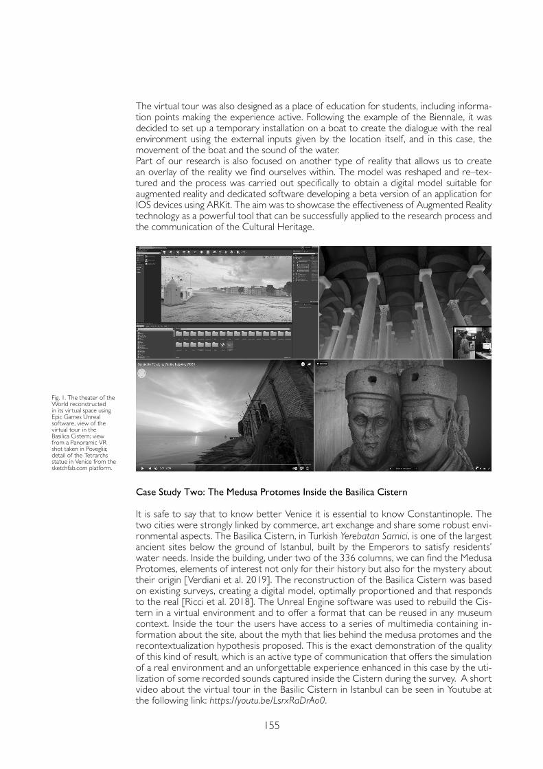
155
The virtual tour was also designed as a place of education for students, including informa-tion points making the experience active. Following the example of the Biennale, it was decided to set up a temporary installation on a boat to create the dialogue with the real environment using the external inputs given by the location itself, and in this case, the movement of the boat and the sound of the water.Part of our research is also focused on another type of reality that allows us to create an overlay of the reality we find ourselves within. The model was reshaped and re–tex-tured and the process was carried out specifically to obtain a digital model suitable for augmented reality and dedicated software developing a beta version of an application for IOS devices using ARKit. The aim was to showcase the effectiveness of Augmented Reality technology as a powerful tool that can be successfully applied to the research process and the communication of the Cultural Heritage.
Case Study Two: The Medusa Protomes Inside the Basilica Cistern
It is safe to say that to know better Venice it is essential to know Constantinople. The two cities were strongly linked by commerce, art exchange and share some robust envi-ronmental aspects. The Basilica Cistern, in Turkish Yerebatan Sarnici, is one of the largest ancient sites below the ground of Istanbul, built by the Emperors to satisfy residents’ water needs. Inside the building, under two of the 336 columns, we can find the Medusa Protomes, elements of interest not only for their history but also for the mystery about their origin [Verdiani et al. 2019]. The reconstruction of the Basilica Cistern was based on existing surveys, creating a digital model, optimally proportioned and that responds to the real [Ricci et al. 2018]. The Unreal Engine software was used to rebuild the Cis-tern in a virtual environment and to offer a format that can be reused in any museum context. Inside the tour the users have access to a series of multimedia containing in-formation about the site, about the myth that lies behind the medusa protomes and the recontextualization hypothesis proposed. This is the exact demonstration of the quality of this kind of result, which is an active type of communication that offers the simulation of a real environment and an unforgettable experience enhanced in this case by the uti-lization of some recorded sounds captured inside the Cistern during the survey. A short video about the virtual tour in the Basilic Cistern in Istanbul can be seen in Youtube at the following link: https://youtu.be/LsrxRaDrAo0.
Fig. 1. The theater of the World reconstructed in its virtual space using Epic Games Unreal software, view of the virtual tour in the Basilica Cistern; view from a Panoramic VR shot taken in Poveglia; detail of the Tetrarchs statue in Venice from the sketchfab.com platform.
156
Case Study Three: Venice the Tetrarchs Statue
The Tetrarchs statue in St. Marco Square, Venice, is a clear sample about reuse of spolia as a demonstration of continuity and tells a yet partially mysterious story of artworks moving around the Mediterranean during strong and dramatic historical events [Dorigo 2014]. Such an element, stable and solid across the centuries, but at the same time capable of a long and adventurous journey in its past [Missagia 2015], rich in referenc-es and symbols, apparently capable of hiding some intriguing stories and worth to be admired in its details [Rees 1993], was found ideal for mixing two different modern digital approaches. A VR 360 short movie, recorded in timelapse mode was taken just in front of the statue, in a quite crowded hour, in the moment when the light of the sun is moving and the shadows are going to cover the corner. This short video clip was built to enhance the perception of the place with the special relationship between the static pose of the Tetrarchs and the fluid movement of tourists and workers all around the square, with the option of having a fully dynamic 360° point of view. The shooting was operated using an Insta360 Pro II camera, capable of taking 8K resolution movies and stitching them in real–time. The video can be seen on youtube in the DIDA–LXR channel at:https://youtu.be/xqvE1HuiqJc.To satisfy the need of details and allow a complete exploration of the sculpture, pho-togrammetry was operated using a Nikon D800e. The full set of shots was then pro-cessed using Reality Capture software and producing a fully textured model of about 500 million triangles, later simplified to five million and loaded with high resolution texturing on the Sketchfab.com platform and visible at https://skfb.ly/6UZ8P. These two digital products connected each other using simple links, allow a double and quite different reading and seeing this special corner in Venice, offering a better under-standing of the context and specific details in a way otherwise impossible in place, a valid alternative to the direct visit, but also stimulation and invitation to go in place and complete the knowledge about this migrating stone.
Case Study Four: Poveglia, the Abandoned Island
On the occasion of a recent trip in Venice, it was discovered a particular tiny island located inside the Venetian Lagoon named Poveglia offering the opportunity to test and discover the potential of a new tool, the Insta360 Pro 2 camera on a very fasci-nating environment where historic elements and urban legends are mixed [Cavallo & Visentin 2020]. After having chosen the right spots from which shot and film, the data was processed and it has been created a 360 tour that gives everyone the chance to visit the island. It has proved to be a very useful tool and methodology for the dissem-ination of information about the existing heritage. A series of Panoramic VR videos can be seen in Youtube in the DIDA–LXR Channel, at: https://youtube.com/playlist?list=PLB5GHBSlDCa-u7-e1CQrAvQ1nEmpKZLKk Speaking of useful tools for surveying and photogrammetry, which in recent years have made significant advances in technology and functionality, we can not help but think of drones (UAV – Unmanned aerial vehicle), and the support they give in a survey thanks to their potential and the ability to access a point of view previously unthinkable. It is possible to recreate a 360 panorama, later navigable, using the flight application of the aircraft. The method is quite simple, taking advantage of the panoramic mode – 360, the drone, autonomously, takes a series of photos in about 40 seconds in order to develop a navigable overview through the drone’s piloting APP: FreeFlight 6. A sample of the result obtained from this procedure can be seen in the DIDA–LXR Youtube channel at: https://youtu.be/cjJz37JYDAU For the flights the drone used was a Parrot Anafi. The drone weight was reduced to 300 grams in order to perform non–critical operations also in an urban context, as required by the regulations in force at the time of the flight.
157
References
Brusatin Manlio, Prandi Alberto (eds.) (1982). Teatro del mondo / Aldo Rossi. Venezia: Cluva.
Busato Davide, Sfameni Paolo (2018). Poveglia: L’isola alle origini di Venezia. Venezia: Lunargento.
Cavallo Federica Letizia, Visentin Francesco (2020). “The world’s most haunted island” Ghost narratives and practices around Poveglia, an abandoned island in the Venetian Lagoon. In Shima Journal, 14 (1), pp. 194-211.
Dorigo Wladimiro (2004). Spolia marmorei d’oltremare a Venezia (secoli XI-XIV). In Saggi e memorie di storia dell’arte, 28, pp. 1-13.
García Carolina Beatriz (2006). Il teatro del mondo: Aldo Rossi (1979-1980). In DC Papers. Revista de crítica i teoria de l’arquitectura, 15, pp. 146-149.
Missagia Andrea (2015). Spolia Costantinopolitani. Il Gruppo dei Tetrarchi a Venezia. Esposizione seminariale “La piazza di San Marco a Venezia”, Storia dell’Arte del Veneto Medievale Sp. – Università Ca’ Foscari di Venezia, a.a. 2014/2015, Italy.
Rees Roger (1993). Images and Image: A Re–examination of Tetrarchic Iconography. In Greece & Rome, Second Series, 40 (2), pp. 181-200.
Ricci Ylenia, Verdiani Giorgio, Pasquali Andrea (2018). A Petrified Petrifying Eyesight: A Story for the Medusa’s heads from Istanbul, Turkey. In Proceedings of the 23rd International Conference on Cultural Heritage and New Technologies 2018. CHNT 23.
Verdiani Giorgio, Ricci Ylenia, Pasquali Andrea (2019). Mito, Pietra, Spolia e Storia, Frammenti di indefinito da Costantinopoli a Istanbul. In Conte Antonio, Guida Antonella (eds.), ReUso Matera Patrimonio in Divenire conoscere valorizzare abitare. Roma: Gangemi, pp. 1203-1214.
Conclusion
The present paper is composed by a sequence of studies with highly diversified contents. As stated in the initial part of the paper, the relationship with the resulting digital products has been accurately analyzed, trying to increase the virtual experience, creating a direct network between the fascination of the stories, the impression coming from the real places and the option offered by the digital solutions. The desire of experimenting and the will of building specific and effective results is at the base of a research aimed to find efficient solution for presenting parts of the Built and Cultural Heritage in the way they deserve exploiting their best characteristics, creating a specific digital version that is an enhancement or an alternative to the real but that doesn’t ask the user to settle for quality and experience, it simply provide a digital approach offering the digital version of that cultural values. The case of the Theater of the World is totally concepted as a dialogue between the location and the virtual reality, increasing the senses’ suggestion. In this sense the statue of the Tetrarchs has opposite features, creating interest in something existing as a rich evidence of interactions in the Mediterranean area, the detailed photogrammetry links the real existing with virtual perceptions of knowledge and (maybe) with a desire of completion and investigation about the mysterious and impossible to be told story of its moving from Costantinople to Venice. The other two themes provide the possibility of new points of analysis, which move away from the theme in the studio but still keep close contact with the stimulus coming from the real, such as the introduction of recorded environmental sounds, in the case of the Protomes of Medusa.This set of experiences have a value that goes far beyond describing the themes and illustrating technologies and methods. They are traces of the experiences and above all provide “a way” about sharing points, suggestions, fascinations, they try to create a specific link between the inner value of stories and places in the continuous tentative of enriching the digital contents with valu-able learning occasions. Not only in the will of “capturing” the users, but in the true belief that “Digital Heritage” is an occasion allowing an easier reading and an option for spreading the knowl-edge of Cultural Heritage, but it need a correct comprehension of these values which is the first real step in creating a constructive system based on a sort of circular flow of attraction –> explo-ration –> knowledge –> digitalization –> dissemination –> learning –> spreading –> attraction.
Copyright © 2021 by FrancoAngeli s.r.l. Milano, Italy Isbn 9788835125280
AuthorsGiorgio Verdiani, Dept. of Architecture, University of Florence, [email protected] Ricci, Dept.of Architecture, University of Florence, [email protected] Pasquali, Dept. of Architecture, University of Florence, [email protected]éphane Giraudeau, Dept. of Architecture, University of Florence, [email protected]


doi.org/10.3280/oa-686.25159
REPRESENTATION CHALLENGESAugmented Reality and Artificial Intelligence in Cultural Heritage and Innovative Design Domain
Abstract
This paper investigates the ephemeral architecture of the eighteenth century in Naples through the literary and iconographic sources found in the volume Idee per le pubbliche feste nel ritorno in Napoli de’nostri Augusti Sovrani dalla Germania […] by Gaetano Barba (1971). The goal is an unprecedented representation, modeling and fruition project, accompanied by a graphic visualization of the places to better understand the architectural and urban space in the absence of allusive images of three–di-mensionality. Subsequently, the visual construction of the contexts on an urban and architectural scale made it possible to disseminate the compositional elements of the celebrations and the internal per-ceptions to a non–specialist public. Finally, an Augmented–Reality application prototype.
Keywordsephemeral architecture, celebrations, representation, 3D modeling, augmented reality.
Drawing, Visualization and Augmented Reality of the 1791 Celebration in Naples Ornella ZerlengaVincenzo CirilloMassimiliano MasulloAniello PascaleLuigi Maffei
160
Through the synergy between the disciplines of Drawing and Technical Physics, this contribution analyzes the methods of graphic representation and the digital modeling of the eighteenth–cen-tury celebration designed (and not realized) in 1791 by the architect Gaetano Barba (1730-1806) in Naples and described in the volume entitled: Idee per le pubbliche Feste nel ritorno in Napoli de’ Nostri Augusti Sovrani dalla Germania dell’architetto Gaetano Barba, Accademico di merito di S. Luca, edito a Napoli nel 1791 da Gaetano Raimondi. The results achieved with the graphic analysis and the build of new images are intended to represent, thanks to the aid of digital representation methods, both a cultural contextualization of the methods of representation used, and the return of a three–dimensional model to be understood as a phase of a subsequent study aimed at verifying the new technologies of virtual representation at the service of cultural tourism. The goal is to make the design ‘augmented’ so that the visitor can relive the context of the 18th century Neapolitan celebrations. Therefore, it is proposed as an application case, the virtual reconstruction of the Porta di ingresso sulla strada di Toledo and its implementation in an Augmented Reality application. The application conceived for this purpose was created with the support of SENS i–Lab, a human–centered, multi–phys-ical and multi–purpose university laboratory for the creation, development, prototyping and interaction of man with products and physical and virtual systems of the Department of Archi-tecture, Industrial Design of the University of Campania Luigi Vanvitelli [1].
The Drawing of the Ephemeral: the Regulating Principle of the 1971 Celebration in Naples by Gaetano Barba
The ephemeral concept has been (and continues to be) for the city of Naples a constant cultural expression, which is poured out not only in the everyday life of the people but also, and above all, in its architecture. The design of ephemeral architectures (such as fairs, cuccagne, pyrotechnic machines) saw widespread use in Naples during the eighteenth century with the creation of installations with a considerable design value [Cirillo 2017, pp. 101-118].The theme of the ‘urban’ celebrationl reached one of its most significant moments in the eigh-teenth century with the staging of ephemeral settings that manifested the greatest affirmation of the culture and Art of that time. Their realization relied on a great variety of technical (architects and engineers), figurative and entertainment skills (musicians, painters, set designers). This synergy highlighted the taste for spectacularity, grandeur, sumptuousness and the decoration of the appa-ratuses to arouse the effect of wonder [Mancini 1997].Within this context, in August 1790 in Naples, in the place called Largo di Palazzo (the open space in front of the Royal Palace) and along Via Toledo, a cycle of festivities was celebrated in honor of the return of the kings of Naples, Ferdinando and Maria Carolina, who were in Vien-na for the wedding of their daughters Maria Teresa and Maria Luisa. To celebrate this return, a competition was held between the best architects of that time. The celebrations’ principles were banned and published in the volume entitled Nel felicissimo ritorno degli Augusti Sovrani Ferdinando IV e Maria Carolina d’Austria. Feste Pubbliche della Fedelissima Città di Napoli (1791) at Giuseppe Maria Porcelli Librajo, e Stampatore della Reale Accademia Militare. The aforementioned volume reports as winner the set designer of the San Carlo theater Domenico Chelli, but there is no iconographic documentation about his project. However, Chelli, also with small formal changes, was inspired by the project outlined by the architect Gaetano Barba published in the same year in the volume Idee per le pubbliche Feste nel ritorno in Napoli […] [Mancini 1980, p. 331].The volume Idee per le pubbliche Feste nel ritorno in Napoli […] by Gaetano Barba accompanies the reader to understanding the events not only through the reading of the short text but above all through the attached images. The images contained within the volume consists in ten engravings of the architectural elements, which set up the celebration. These representations appear ordered according to a spatial sequence which, starting from the Porta di ingresso sulla strada di Toledo and through the Sedili located along Via Toledo, leads to the rear scene of the Tempio dedicato alla Fortuna reduce, set up in Largo di Palazzo (opening figure). All the engravings show the architectural organisms represented in plan and/or elevation with full adherence to the neoclassical style [Jacazzi 1995]. The architect offers a general description of all the ele-ments of the celebration and outlines both their appearance and their functions and destinations.
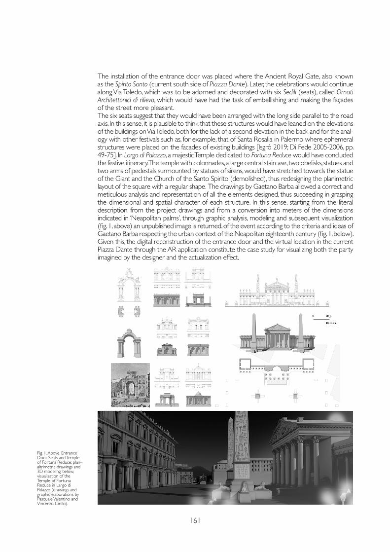
161
The installation of the entrance door was placed where the Ancient Royal Gate, also known as the Spirito Santo (current south side of Piazza Dante). Later, the celebrations would continue along Via Toledo, which was to be adorned and decorated with six Sedili (seats), called Ornati Architettonici di rilievo, which would have had the task of embellishing and making the façades of the street more pleasant. The six seats suggest that they would have been arranged with the long side parallel to the road axis. In this sense, it is plausible to think that these structures would have leaned on the elevations of the buildings on Via Toledo, both for the lack of a second elevation in the back and for the anal-ogy with other festivals such as, for example, that of Santa Rosalia in Palermo where ephemeral structures were placed on the facades of existing buildings [Isgrò 2019; Di Fede 2005-2006, pp. 49-75]. In Largo di Palazzo, a majestic Temple dedicated to Fortuna Reduce would have concluded the festive itinerary. The temple with colonnades, a large central staircase, two obelisks, statues and two arms of pedestals surmounted by statues of sirens, would have stretched towards the statue of the Giant and the Church of the Santo Spirito (demolished), thus redesigning the planimetric layout of the square with a regular shape. The drawings by Gaetano Barba allowed a correct and meticulous analysis and representation of all the elements designed, thus succeeding in grasping the dimensional and spatial character of each structure. In this sense, starting from the literal description, from the project drawings and from a conversion into meters of the dimensions indicated in ‘Neapolitan palms’, through graphic analysis, modeling and subsequent visualization (fig. 1, above) an unpublished image is returned. of the event according to the criteria and ideas of Gaetano Barba respecting the urban context of the Neapolitan eighteenth century (fig. 1, below). Given this, the digital reconstruction of the entrance door and the virtual location in the current Piazza Dante through the AR application constitute the case study for visualizing both the party imagined by the designer and the actualization effect.
Fig. 1. Above, Entrance Door, Seats and Temple of Fortuna Reduce: plan–altrimetric drawings and 3D modeling; below, visualization of the Temple of Fortuna Reduce in Largo di Palazzo (drawings and graphic elaborations by Pasquale Valentino and Vincenzo Cirillo).
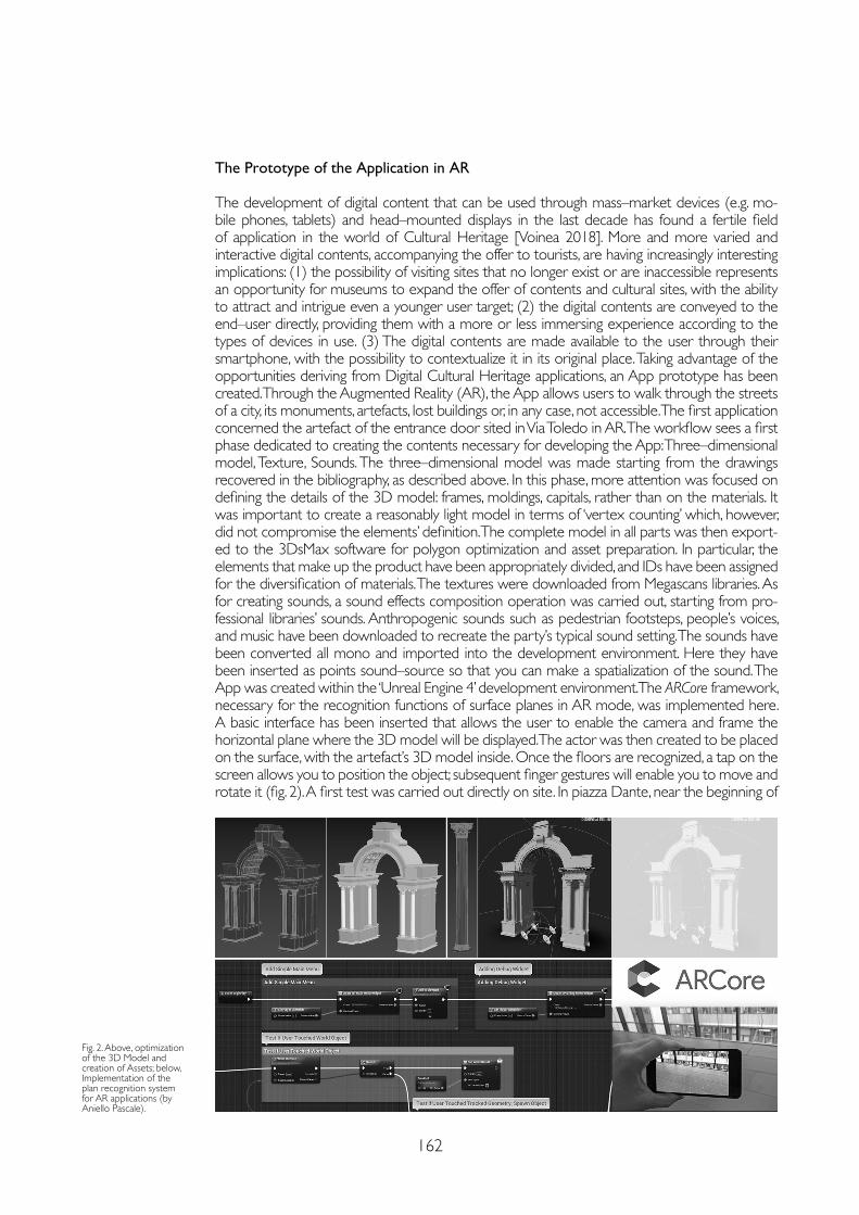
162
The Prototype of the Application in AR
The development of digital content that can be used through mass–market devices (e.g. mo-bile phones, tablets) and head–mounted displays in the last decade has found a fertile field of application in the world of Cultural Heritage [Voinea 2018]. More and more varied and interactive digital contents, accompanying the offer to tourists, are having increasingly interesting implications: (1) the possibility of visiting sites that no longer exist or are inaccessible represents an opportunity for museums to expand the offer of contents and cultural sites, with the ability to attract and intrigue even a younger user target; (2) the digital contents are conveyed to the end–user directly, providing them with a more or less immersing experience according to the types of devices in use. (3) The digital contents are made available to the user through their smartphone, with the possibility to contextualize it in its original place. Taking advantage of the opportunities deriving from Digital Cultural Heritage applications, an App prototype has been created. Through the Augmented Reality (AR), the App allows users to walk through the streets of a city, its monuments, artefacts, lost buildings or, in any case, not accessible. The first application concerned the artefact of the entrance door sited in Via Toledo in AR. The workflow sees a first phase dedicated to creating the contents necessary for developing the App: Three–dimensional model, Texture, Sounds. The three–dimensional model was made starting from the drawings recovered in the bibliography, as described above. In this phase, more attention was focused on defining the details of the 3D model: frames, moldings, capitals, rather than on the materials. It was important to create a reasonably light model in terms of ‘vertex counting’ which, however, did not compromise the elements’ definition. The complete model in all parts was then export-ed to the 3DsMax software for polygon optimization and asset preparation. In particular, the elements that make up the product have been appropriately divided, and IDs have been assigned for the diversification of materials. The textures were downloaded from Megascans libraries. As for creating sounds, a sound effects composition operation was carried out, starting from pro-fessional libraries’ sounds. Anthropogenic sounds such as pedestrian footsteps, people’s voices, and music have been downloaded to recreate the party’s typical sound setting. The sounds have been converted all mono and imported into the development environment. Here they have been inserted as points sound–source so that you can make a spatialization of the sound. The App was created within the ‘Unreal Engine 4’ development environment. The ARCore framework, necessary for the recognition functions of surface planes in AR mode, was implemented here. A basic interface has been inserted that allows the user to enable the camera and frame the horizontal plane where the 3D model will be displayed. The actor was then created to be placed on the surface, with the artefact’s 3D model inside. Once the floors are recognized, a tap on the screen allows you to position the object; subsequent finger gestures will enable you to move and rotate it (fig. 2). A first test was carried out directly on site. In piazza Dante, near the beginning of
Fig. 2. Above, optimization of the 3D Model and creation of Assets; below, Implementation of the plan recognition system for AR applications (by Aniello Pascale).
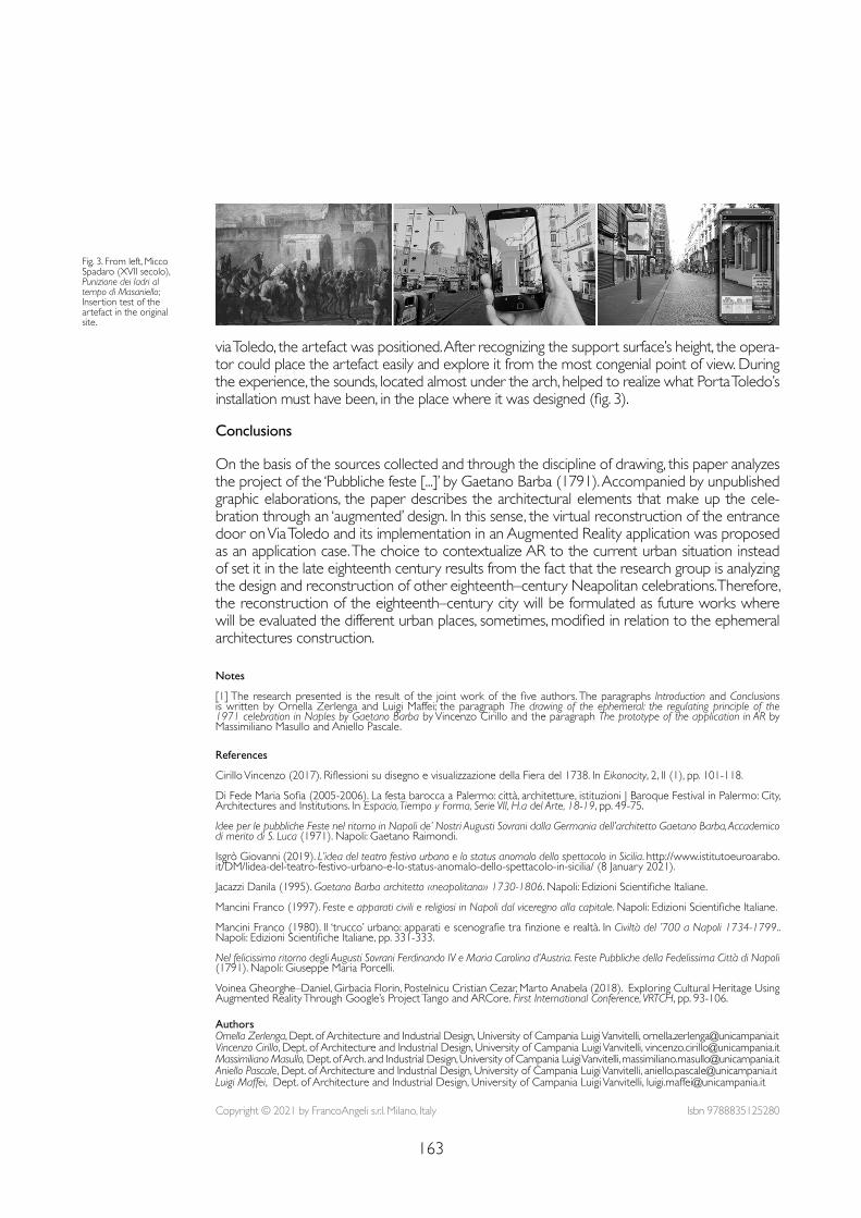
163
Notes
[1] The research presented is the result of the joint work of the five authors. The paragraphs Introduction and Conclusions is written by Ornella Zerlenga and Luigi Maffei; the paragraph The drawing of the ephemeral: the regulating principle of the 1971 celebration in Naples by Gaetano Barba by Vincenzo Cirillo and the paragraph The prototype of the application in AR by Massimiliano Masullo and Aniello Pascale.
References
Cirillo Vincenzo (2017). Riflessioni su disegno e visualizzazione della Fiera del 1738. In Eikonocity, 2, II (1), pp. 101-118.
Di Fede Maria Sofia (2005-2006). La festa barocca a Palermo: città, architetture, istituzioni | Baroque Festival in Palermo: City, Architectures and Institutions. In Espacio, Tiempo y Forma, Serie VII, H.a del Arte, 18-19, pp. 49-75.
Idee per le pubbliche Feste nel ritorno in Napoli de’ Nostri Augusti Sovrani dalla Germania dell’architetto Gaetano Barba, Accademico di merito di S. Luca (1971). Napoli: Gaetano Raimondi.
Isgrò Giovanni (2019). L’idea del teatro festivo urbano e lo status anomalo dello spettacolo in Sicilia. http://www.istitutoeuroarabo.it/DM/lidea-del-teatro-festivo-urbano-e-lo-status-anomalo-dello-spettacolo-in-sicilia/ (8 January 2021).
Jacazzi Danila (1995). Gaetano Barba architetto «neapolitano» 1730-1806. Napoli: Edizioni Scientifiche Italiane.
Mancini Franco (1997). Feste e apparati civili e religiosi in Napoli dal viceregno alla capitale. Napoli: Edizioni Scientifiche Italiane.
Mancini Franco (1980). Il ‘trucco’ urbano: apparati e scenografie tra finzione e realtà. In Civiltà del ’700 a Napoli 1734-1799.. Napoli: Edizioni Scientifiche Italiane, pp. 331-333.
Nel felicissimo ritorno degli Augusti Sovrani Ferdinando IV e Maria Carolina d’Austria. Feste Pubbliche della Fedelissima Città di Napoli (1791). Napoli: Giuseppe Maria Porcelli.
Voinea Gheorghe–Daniel, Girbacia Florin, Postelnicu Cristian Cezar, Marto Anabela (2018). Exploring Cultural Heritage Using Augmented Reality Through Google’s Project Tango and ARCore. First International Conference, VRTCH, pp. 93-106.
via Toledo, the artefact was positioned. After recognizing the support surface’s height, the opera-tor could place the artefact easily and explore it from the most congenial point of view. During the experience, the sounds, located almost under the arch, helped to realize what Porta Toledo’s installation must have been, in the place where it was designed (fig. 3).
Conclusions
On the basis of the sources collected and through the discipline of drawing, this paper analyzes the project of the ‘Pubbliche feste [...]’ by Gaetano Barba (1791). Accompanied by unpublished graphic elaborations, the paper describes the architectural elements that make up the cele-bration through an ‘augmented’ design. In this sense, the virtual reconstruction of the entrance door on Via Toledo and its implementation in an Augmented Reality application was proposed as an application case. The choice to contextualize AR to the current urban situation instead of set it in the late eighteenth century results from the fact that the research group is analyzing the design and reconstruction of other eighteenth–century Neapolitan celebrations. Therefore, the reconstruction of the eighteenth–century city will be formulated as future works where will be evaluated the different urban places, sometimes, modified in relation to the ephemeral architectures construction.
Fig. 3. From left, Micco Spadaro (XVII secolo),Punizione dei ladri al tempo di Masaniello; Insertion test of the artefact in the original site.
Copyright © 2021 by FrancoAngeli s.r.l. Milano, Italy Isbn 9788835125280
AuthorsOrnella Zerlenga, Dept. of Architecture and Industrial Design, University of Campania Luigi Vanvitelli, [email protected] Cirillo, Dept. of Architecture and Industrial Design, University of Campania Luigi Vanvitelli, [email protected] Masullo, Dept. of Arch. and Industrial Design, University of Campania Luigi Vanvitelli, [email protected] Pascale, Dept. of Architecture and Industrial Design, University of Campania Luigi Vanvitelli, [email protected] Maffei, Dept. of Architecture and Industrial Design, University of Campania Luigi Vanvitelli, [email protected]

AR&AI classification and
3D analysis

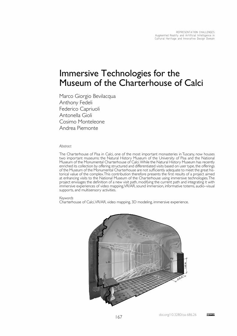
doi.org/10.3280/oa-686.26167
REPRESENTATION CHALLENGESAugmented Reality and Artificial Intelligence in Cultural Heritage and Innovative Design Domain
Abstract
The Charterhouse of Pisa in Calci, one of the most important monasteries in Tuscany, now houses two important museums: the Natural History Museum of the University of Pisa and the National Museum of the Monumental Charterhouse of Calci. While the Natural History Museum has recently enriched its collection by offering structured and differentiated visits based on user type, the offerings of the Museum of the Monumental Charterhouse are not sufficiently adequate to meet the great his-torical value of the complex. This contribution therefore presents the first results of a project aimed at enhancing visits to the National Museum of the Charterhouse using immersive technologies. The project envisages the definition of a new visit path, modifying the current path and integrating it with immersive experiences of video mapping, VR/AR, sound immersion, informative totems, audio–visual supports, and multisensory activities.
KeywordsCharterhouse of Calci, VR/AR, video mapping, 3D modeling, immersive experience.
Immersive Technologies for the Museum of the Charterhouse of CalciMarco Giorgio BevilacquaAnthony FedeliFederico CapriuoliAntonella GioliCosimo MonteleoneAndrea Piemonte
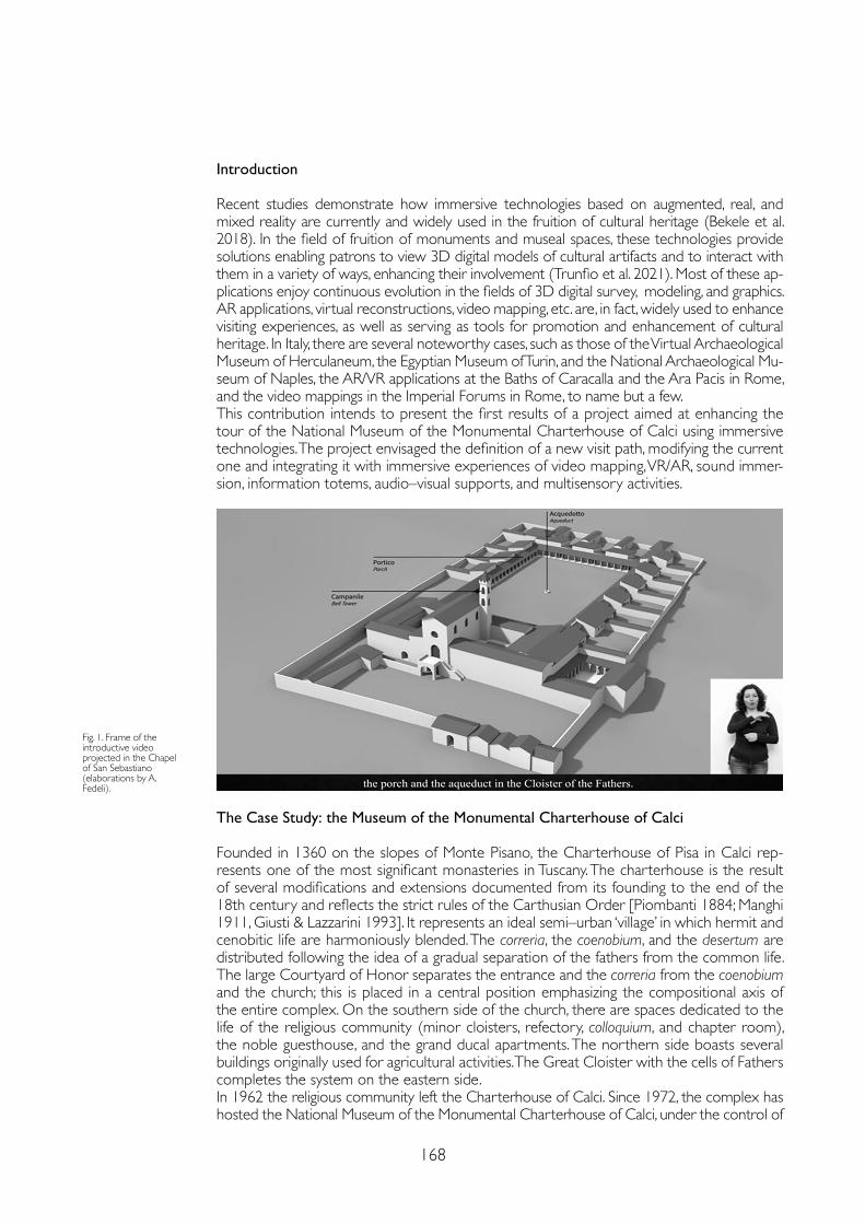
168
Introduction
Recent studies demonstrate how immersive technologies based on augmented, real, and mixed reality are currently and widely used in the fruition of cultural heritage (Bekele et al. 2018). In the field of fruition of monuments and museal spaces, these technologies provide solutions enabling patrons to view 3D digital models of cultural artifacts and to interact with them in a variety of ways, enhancing their involvement (Trunfio et al. 2021). Most of these ap-plications enjoy continuous evolution in the fields of 3D digital survey, modeling, and graphics. AR applications, virtual reconstructions, video mapping, etc. are, in fact, widely used to enhance visiting experiences, as well as serving as tools for promotion and enhancement of cultural heritage. In Italy, there are several noteworthy cases, such as those of the Virtual Archaeological Museum of Herculaneum, the Egyptian Museum of Turin, and the National Archaeological Mu-seum of Naples, the AR/VR applications at the Baths of Caracalla and the Ara Pacis in Rome, and the video mappings in the Imperial Forums in Rome, to name but a few. This contribution intends to present the first results of a project aimed at enhancing the tour of the National Museum of the Monumental Charterhouse of Calci using immersive technologies. The project envisaged the definition of a new visit path, modifying the current one and integrating it with immersive experiences of video mapping, VR/AR, sound immer-sion, information totems, audio–visual supports, and multisensory activities.
The Case Study: the Museum of the Monumental Charterhouse of Calci
Founded in 1360 on the slopes of Monte Pisano, the Charterhouse of Pisa in Calci rep-resents one of the most significant monasteries in Tuscany. The charterhouse is the result of several modifications and extensions documented from its founding to the end of the 18th century and reflects the strict rules of the Carthusian Order [Piombanti 1884; Manghi 1911, Giusti & Lazzarini 1993]. It represents an ideal semi–urban ‘village’ in which hermit and cenobitic life are harmoniously blended. The correria, the coenobium, and the desertum are distributed following the idea of a gradual separation of the fathers from the common life. The large Courtyard of Honor separates the entrance and the correria from the coenobium and the church; this is placed in a central position emphasizing the compositional axis of the entire complex. On the southern side of the church, there are spaces dedicated to the life of the religious community (minor cloisters, refectory, colloquium, and chapter room), the noble guesthouse, and the grand ducal apartments. The northern side boasts several buildings originally used for agricultural activities. The Great Cloister with the cells of Fathers completes the system on the eastern side.In 1962 the religious community left the Charterhouse of Calci. Since 1972, the complex has hosted the National Museum of the Monumental Charterhouse of Calci, under the control of
Fig. 1. Frame of the introductive video projected in the Chapel of San Sebastiano (elaborations by A. Fedeli).
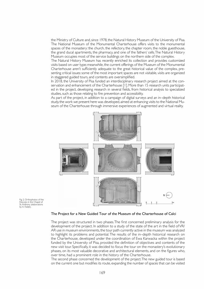
169
the Ministry of Culture and, since 1978, the Natural History Museum of the University of Pisa.The National Museum of the Monumental Charterhouse offers visits to the monumental spaces of the monastery: the church, the refectory, the chapter room, the noble guesthouse, the grand ducal apartments, the pharmacy, and one of the fathers’ cells. The Natural History Museum occupies most of the service buildings on the northern side of the complex.The Natural History Museum has recently enriched its collection and provides customized visits based on user type; meanwhile, the current offerings of the Museum of the Monumental Charterhouse aren’t sufficiently adequate to the great historical value of the complex, pre-senting critical issues: some of the most important spaces are not visitable, visits are organized in staggered guided tours, and contents are oversimplified. In 2018, the University of Pisa funded an interdisciplinary research project aimed at the con-servation and enhancement of the Charterhouse [1]. More than 15 research units participat-ed in the project, developing research in several fields, from historical analysis to specialized studies, such as those relating to fire prevention and accessibility.As part of the project, in addition to a campaign of digital surveys and an in–depth historical study, the work we present here was developed, aimed at enhancing visits to the National Mu-seum of the Charterhouse through immersive experiences of augmented and virtual reality.
Fig. 2. Orthophotos of the frescoes in the Chapel of St. Anthony (elaborations by A. Fedeli).
The Project for a New Guided Tour of the Museum of the Charterhouse of Calci
The project was structured in two phases. The first concerned preliminary analysis for the development of the project. In addition to a study of the state of the art in the field of VR/AR use in museum environments, the tour path currently active in the museum was analyzed to highlight its problems and potential. The results of the in–depth historical research on the Charterhouse, developed under the coordination of Ewa Karwacka within the project funded by the University of Pisa, provided the definition of objectives and contents of the new visit tour. Specifically, it was decided to focus the tour on the monastery’s evolutionary phases, on its most valuable decorative and architectural elements, and on the figures who, over time, had a prominent role in the history of the Charterhouse.The second phase concerned the development of the project. The new guided tour is based on the current one but modifies its route, expanding the number of spaces that can be visited
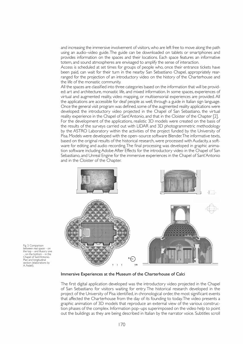
170
and increasing the immersive involvement of visitors, who are left free to move along the path using an audio–video guide. The guide can be downloaded on tablets or smartphones and provides information on the spaces and their locations. Each space features an informative totem, and sound atmospheres are envisaged to amplify the sense of interaction.Access is scheduled at set times for groups of people who, once their entrance tickets have been paid, can wait for their turn in the nearby San Sebastiano Chapel, appropriately rear-ranged for the projection of an introductory video on the history of the Charterhouse and the life of the monastic community.All the spaces are classified into three categories based on the information that will be provid-ed: art and architecture, monastic life, and mixed information. In some spaces, experiences of virtual and augmented reality, video mapping, or multisensorial experiences are provided. All the applications are accessible for deaf people as well, through a guide in Italian sign language.Once the general visit program was defined, some of the augmented reality applications were developed: the introductory video projected in the Chapel of San Sebastiano, the virtual reality experience in the Chapel of Sant’Antonio, and that in the Cloister of the Chapter [2].For the development of the applications, realistic 3D models were created on the basis of the results of the surveys carried out with LIDAR and 3D photogrammetric methodology by the ASTRO Laboratory within the activities of the project funded by the University of Pisa. Models were developed with the open–source software Blender. The informative texts, based on the original results of the historical research, were processed with Audacity, a soft-ware for editing and audio recording. The final processing was developed in graphic anima-tion software including Adobe After Effects for the introductory video in the Chapel of San Sebastiano, and Unreal Engine for the immersive experiences in the Chapel of Sant’Antonio and in the Cloister of the Chapter.
Fig. 3. Comparison between real space – on the top – and illusory one – on the bottom – in the Chapel of Sant’Antonio. Plan and longitudinal section (elaborations by A. Fedeli).
Immersive Experiences at the Museum of the Charterhouse of Calci
The first digital application developed was the introductory video projected in the Chapel of San Sebastiano for visitors waiting for entry. The historical research developed in the project of the University of Pisa identified, in chronological order, the most significant events that affected the Charterhouse from the day of its founding to today. The video presents a graphic animation of 3D models that reproduce an external view of the various construc-tion phases of the complex. Information pop–ups superimposed on the video help to point out the buildings as they are being described in Italian by the narrator voice. Subtitles scroll
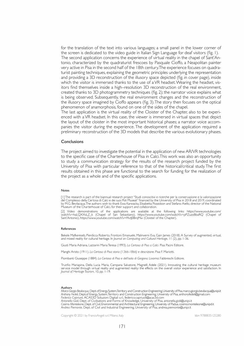
171
Notes
[1] The research is part of the biannual research project “Studi conoscitivi e ricerche per la conservazione e la valorizzazione del Complesso della Certosa di Calci e dei suoi Poli Museali” financed by the University of Pisa in 2018 and 2019, coordinated by M.G. Bevilacqua. The authors wish to thank Ewa Karwacka, Elisabetta Pozzobon and Stefano Aiello, director of the National Museum of the Charterhouse of Calci, for their support and collaboration. [2] Video demonstrations of the applications are available at the following links: https://www.youtube.com/watch?v=haLQXXsLZ_k (Chapel of San Sebastiano), https://www.youtube.com/watch?v=pPZuzoBbaRQ (Chapel of Sant’Antonio), https://www.youtube.com/watch?v=f4vtJ0BrqMw (Cloister of the Chapter).
References
Bekele Mafkereseb, Pierdicca Roberto, Frontoni Emanuele, Malinverni Eva, Gain James (2018). A Survey of augmented, virtual, and mixed reality for cultural heritage. In Journal on Computing and Cultural Heritage, 11 (2), pp. 1-36.
Giusti Maria Adriana, Lazzarini Maria Teresa (1993). La Certosa di Pisa a Calci. Pisa: Pacini Editore.
Manghi Aristo (1911). La Certosa di Pisa: storia (1366-1866) e descrizione. Pisa: F. Mariotti.
Piombanti Giuseppe (1884). La Certosa di Pisa e dell’isola di Gorgona. Livorno: Fabbreschi Editore.
Trunfio Mariapina, Della Lucia Maria, Campana Salvatore, Magnelli Adele (2021). Innovating the cultural heritage museum service model through virtual reality and augmented reality: the effects on the overall visitor experience and satisfaction. In Journal of Heritage Tourism, 10, pp. 1-19.
for the translation of the text into various languages; a small panel in the lower corner of the screen is dedicated to the video guide in Italian Sign Language for deaf visitors (fig. 1).The second application concerns the experience of virtual reality in the chapel of Sant’An-tonio, characterized by the quadraturist frescoes by Pasquale Cioffo, a Neapolitan painter very active in Pisa in the second half of the 18th century. The experience focuses on quadra-turist painting techniques, explaining the geometric principles underlying the representation and providing a 3D reconstruction of the illusory space depicted (fig. in cover page), inside which the visitor is immersed thanks to the use of a VR headset. Wearing the headset, vis-itors find themselves inside a high–resolution 3D reconstruction of the real environment, created thanks to 3D photogrammetry techniques (fig. 2); the narrator voice explains what is being observed. Subsequently, the real environment changes and the reconstruction of the illusory space imagined by Cioffo appears (fig. 3). The story then focuses on the optical phenomenon of anamorphosis, found on one of the sides of the chapel.The last application is the virtual reality of the Cloister of the Chapter, also to be experi-enced with a VR headset. In this case, the viewer is immersed in virtual spaces that depict the layout of the cloister in the most important historical phases; a narrator voice accom-panies the visitor during the experience. The development of the application required a preliminary reconstruction of the 3D models that describe the various evolutionary phases.
Conclusions
The project aimed to investigate the potential in the application of new AR/VR technologies to the specific case of the Charterhouse of Pisa in Calci. This work was also an opportunity to study a communication strategy for the results of the research project funded by the University of Pisa with particular reference to that of the historical/critical study. The first results obtained in this phase are functional to the search for funding for the realization of the project as a whole and of the specific applications.
Copyright © 2021 by FrancoAngeli s.r.l. Milano, Italy Isbn 9788835125280
AuthorsMarco Giorgio Bevilacqua, Dept. of Energy, System, Territory and Construction Engineering, University of Pisa, [email protected] Fedeli, Dept.of Energy, System, Territory and Construction Engineering, University of Pisa, [email protected] Capriuoli, ACAS3D Soluzioni Digitali s.r.l., [email protected] Gioli, Dept. of Civilisations and Forms of Knowledge, University of Pisa, [email protected] Monteleone, Dept. of Civil, Environmental and Architectural Engineering, University of Padua, [email protected] Piemonte, Dept. of Civil and Industrial Engineering, University of Pisa, [email protected]

doi.org/10.3280/oa-686.27173
REPRESENTATION CHALLENGESAugmented Reality and Artificial Intelligence in Cultural Heritage and Innovative Design Domain
Abstract
The paper shows the results of the PRIN CHROME Cultural Heritage Orienting Multimodal Experi-ences project, about the three charterhouses of Campania, with a specific focus on research activities related to the connections between representation, survey, AI and VR. The project has formalized a methodology of collection, analysis and modeling of multimodal data, useful for designing virtual agents in 3D environments, which can be applicable in museum environments. The achievement of the goal is pursued through: (i) an integrated range–based acquisition and morphometric data modeling process coherent with VR management, (ii) the use of semantic maps linked with thesauri published as LOD to solve both the theme of ambiguity and annotation uncertainty and the inter-pretability of information by an AI; (iii) the modeling of a virtual agent with the development of a mathematical model for computational control of gestures and prosody.
Keywordssemantic annotation, artificial intelligence, Unreal Engine 4, graph databases.
CHROME Project: Representation and Survey for AI DevelopmentMassimiliano CampiValeria CeraFrancesco CutugnoAntonella di LuggoDomenico IovaneAntonio Origlia
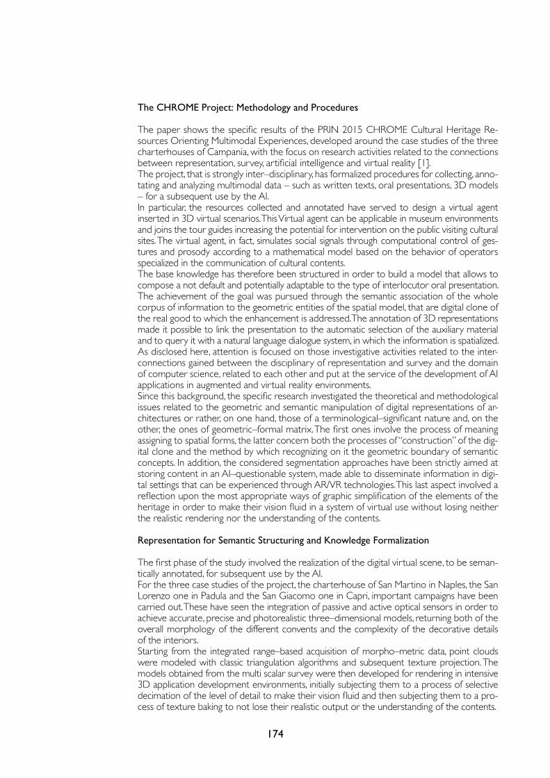
174
The CHROME Project: Methodology and Procedures
The paper shows the specific results of the PRIN 2015 CHROME Cultural Heritage Re-sources Orienting Multimodal Experiences, developed around the case studies of the three charterhouses of Campania, with the focus on research activities related to the connections between representation, survey, artificial intelligence and virtual reality [1].The project, that is strongly inter–disciplinary, has formalized procedures for collecting, anno-tating and analyzing multimodal data – such as written texts, oral presentations, 3D models – for a subsequent use by the AI.In particular, the resources collected and annotated have served to design a virtual agent inserted in 3D virtual scenarios. This Virtual agent can be applicable in museum environments and joins the tour guides increasing the potential for intervention on the public visiting cultural sites. The virtual agent, in fact, simulates social signals through computational control of ges-tures and prosody according to a mathematical model based on the behavior of operators specialized in the communication of cultural contents.The base knowledge has therefore been structured in order to build a model that allows to compose a not default and potentially adaptable to the type of interlocutor oral presentation.The achievement of the goal was pursued through the semantic association of the whole corpus of information to the geometric entities of the spatial model, that are digital clone of the real good to which the enhancement is addressed. The annotation of 3D representations made it possible to link the presentation to the automatic selection of the auxiliary material and to query it with a natural language dialogue system, in which the information is spatialized.As disclosed here, attention is focused on those investigative activities related to the inter-connections gained between the disciplinary of representation and survey and the domain of computer science, related to each other and put at the service of the development of AI applications in augmented and virtual reality environments.Since this background, the specific research investigated the theoretical and methodological issues related to the geometric and semantic manipulation of digital representations of ar-chitectures or rather, on one hand, those of a terminological–significant nature and, on the other, the ones of geometric–formal matrix. The first ones involve the process of meaning assigning to spatial forms, the latter concern both the processes of “construction” of the dig-ital clone and the method by which recognizing on it the geometric boundary of semantic concepts. In addition, the considered segmentation approaches have been strictly aimed at storing content in an AI–questionable system, made able to disseminate information in digi-tal settings that can be experienced through AR/VR technologies. This last aspect involved a reflection upon the most appropriate ways of graphic simplification of the elements of the heritage in order to make their vision fluid in a system of virtual use without losing neither the realistic rendering nor the understanding of the contents.
Representation for Semantic Structuring and Knowledge Formalization The first phase of the study involved the realization of the digital virtual scene, to be seman-tically annotated, for subsequent use by the AI.For the three case studies of the project, the charterhouse of San Martino in Naples, the San Lorenzo one in Padula and the San Giacomo one in Capri, important campaigns have been carried out. These have seen the integration of passive and active optical sensors in order to achieve accurate, precise and photorealistic three–dimensional models, returning both of the overall morphology of the different convents and the complexity of the decorative details of the interiors. Starting from the integrated range–based acquisition of morpho–metric data, point clouds were modeled with classic triangulation algorithms and subsequent texture projection. The models obtained from the multi scalar survey were then developed for rendering in intensive 3D application development environments, initially subjecting them to a process of selective decimation of the level of detail to make their vision fluid and then subjecting them to a pro-cess of texture baking to not lose their realistic output or the understanding of the contents.
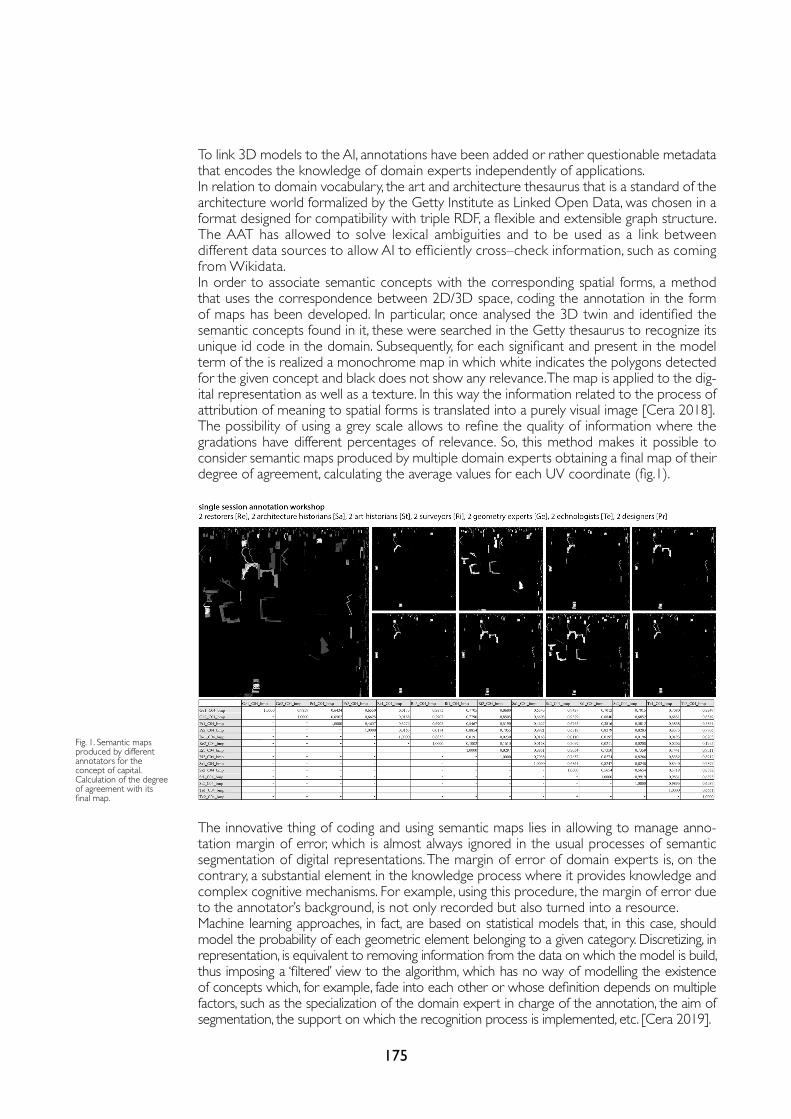
175
To link 3D models to the AI, annotations have been added or rather questionable metadata that encodes the knowledge of domain experts independently of applications.In relation to domain vocabulary, the art and architecture thesaurus that is a standard of the architecture world formalized by the Getty Institute as Linked Open Data, was chosen in a format designed for compatibility with triple RDF, a flexible and extensible graph structure.The AAT has allowed to solve lexical ambiguities and to be used as a link between different data sources to allow AI to efficiently cross–check information, such as coming from Wikidata.In order to associate semantic concepts with the corresponding spatial forms, a method that uses the correspondence between 2D/3D space, coding the annotation in the form of maps has been developed. In particular, once analysed the 3D twin and identified the semantic concepts found in it, these were searched in the Getty thesaurus to recognize its unique id code in the domain. Subsequently, for each significant and present in the model term of the is realized a monochrome map in which white indicates the polygons detected for the given concept and black does not show any relevance. The map is applied to the dig-ital representation as well as a texture. In this way the information related to the process of attribution of meaning to spatial forms is translated into a purely visual image [Cera 2018].The possibility of using a grey scale allows to refine the quality of information where the gradations have different percentages of relevance. So, this method makes it possible to consider semantic maps produced by multiple domain experts obtaining a final map of their degree of agreement, calculating the average values for each UV coordinate (fig.1).
Fig. 1. Semantic maps produced by different annotators for the concept of capital. Calculation of the degree of agreement with its final map.
The innovative thing of coding and using semantic maps lies in allowing to manage anno-tation margin of error, which is almost always ignored in the usual processes of semantic segmentation of digital representations. The margin of error of domain experts is, on the contrary, a substantial element in the knowledge process where it provides knowledge and complex cognitive mechanisms. For example, using this procedure, the margin of error due to the annotator’s background, is not only recorded but also turned into a resource. Machine learning approaches, in fact, are based on statistical models that, in this case, should model the probability of each geometric element belonging to a given category. Discretizing, in representation, is equivalent to removing information from the data on which the model is build, thus imposing a ‘filtered’ view to the algorithm, which has no way of modelling the existence of concepts which, for example, fade into each other or whose definition depends on multiple factors, such as the specialization of the domain expert in charge of the annotation, the aim of segmentation, the support on which the recognition process is implemented, etc. [Cera 2019].
176
From Survey to Development of Artificial Intelligence
The semantic maps gathered with AAT codes, make the information contained in the map cross–referenced with that contained in the other resources annotated such as in the texts, in the AAT itself and in other LODs.To make access to information fast and efficient for interactive applications that use real–time 3D material, knowledge has been depicted within a graph database [Webber 2012], which drastically reduces latency due to querying online resources, for example in RDF format. This allows to quickly cross–check information from different sources and compare it to adequately support the application.Within a set of reference texts, the same concepts, described in geometry by semantic maps have been identified and annotated. In this way, you can associate, with the text that describes a resource, the geometry to which it refers independently of the application, making the material highly reusable for different purposes. One of the possible applications achievable with the type of annotated material is the de-velopment of conversational virtual agents placed in an environment about which they have sufficient knowledge to interact with them. To study the behavior that these agents should take, a corpus [Origlia 2018] of 12 hours of audiovisual material was collected to document the behavior of art historians who illustrate the environments of the charterhouse di San Martino to small groups of visitors.A linguistic and psychological annotation system has been created to cross–check the various levels of communication through which an experienced human transmits cultural content. In the laboratory, motion capture data was collected to map human movements to 3D avatars. The logic of managing the gestures of the virtual agent has been defined as follows: at each frame, the system calculates the position to be assumed on the basis of a series of animations that are combined according to a series of parameters. As far as the gestures of the arms are concerned, there is a dedicated state machine which places the agent in a ‘neutral’ position. When an externally produced signal arrives, which corresponds to the start of an audio containing a synthetic voice, the agent switches to ‘talking’ mode. During speaking mode, an external system may require highlighting concepts with varying degrees of ‘strength’ or pointing in a certain direction. Since the location of the virtual agent is known, the only information you need to control its gestures is the location of the target.Using the centroid of the mass of points labeled with a certain concept, for example “al-tare maggiore” imagining that the virtual agent is placed in the church of San Martino, it is possible to calculate the angle between the virtual agent and the concept that you want to point, thus providing the animation control system with the missing information to produce coherent dectic gestures. The processing pipeline that allows an AI to interact is made of several modules.First of all, a specially trained neural network transcribes audio containing a user’s voice. From this transcription, an ‘intent’ is extracted, that is the abstract intention of the speaker and any parameters that detail the request. Based on intent and parameters, a graph data-base query is produced to extract the content needed to fulfill a request. The sentence to be synthesized is then passed to a second neural network that synthesizes the audio and produces the accompanying information, such as the phonetic annotation of the audio file, to allow the control of lipsync, and the indication of the temporal position of the expressed concepts, to control the gestures of the deictics. Based on this information, an interaction management engine delivers the presentation in real time.
Results
The research developed as part of the CHROME project provided an opportunity to investigate the increasingly structured interconnections between the field of representation and survey and the themes of information technology. In particular, the paper analysed the role that the specification of architectural survey and the forms of drawing play in the development of AI applications tested in the dissemination of cultural contents related to some architectural
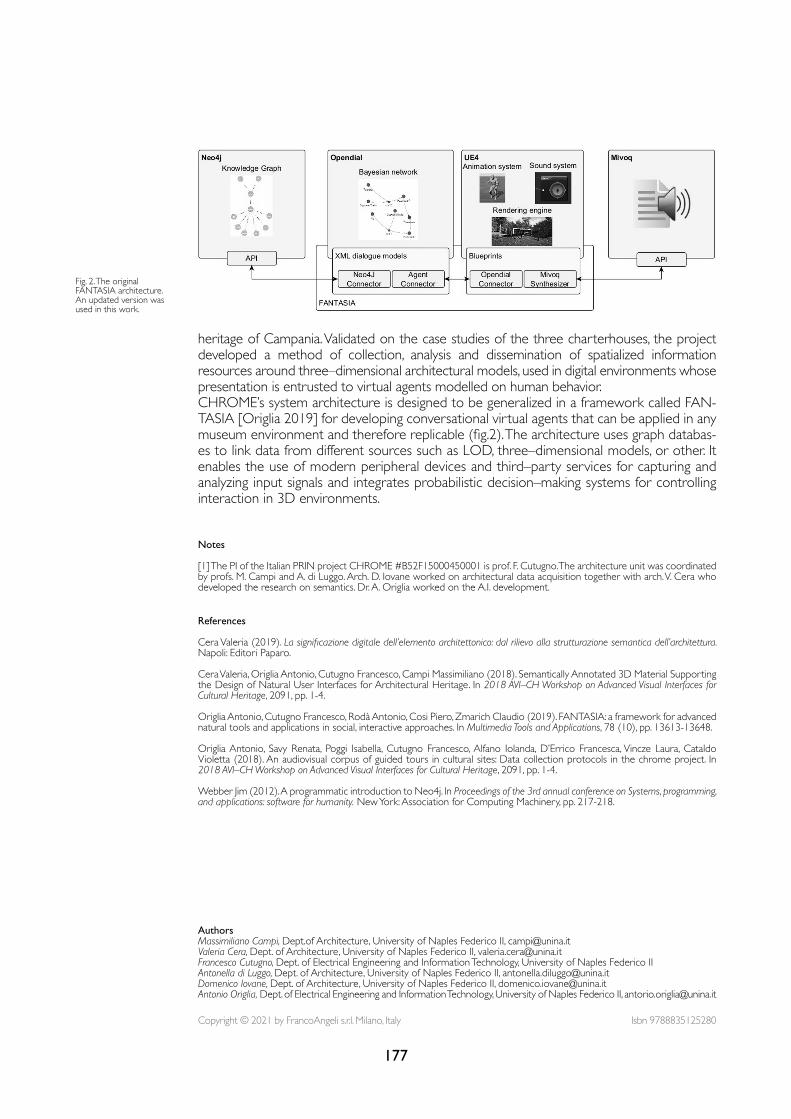
177
Fig. 2. The original FANTASIA architecture. An updated version was used in this work.
heritage of Campania. Validated on the case studies of the three charterhouses, the project developed a method of collection, analysis and dissemination of spatialized information resources around three–dimensional architectural models, used in digital environments whose presentation is entrusted to virtual agents modelled on human behavior.CHROME’s system architecture is designed to be generalized in a framework called FAN-TASIA [Origlia 2019] for developing conversational virtual agents that can be applied in any museum environment and therefore replicable (fig.2). The architecture uses graph databas-es to link data from different sources such as LOD, three–dimensional models, or other. It enables the use of modern peripheral devices and third–party services for capturing and analyzing input signals and integrates probabilistic decision–making systems for controlling interaction in 3D environments.
Notes
[1] The PI of the Italian PRIN project CHROME #B52F15000450001 is prof. F. Cutugno. The architecture unit was coordinated by profs. M. Campi and A. di Luggo. Arch. D. Iovane worked on architectural data acquisition together with arch. V. Cera who developed the research on semantics. Dr. A. Origlia worked on the A.I. development.
References
Cera Valeria (2019). La significazione digitale dell’elemento architettonico: dal rilievo alla strutturazione semantica dell’architettura. Napoli: Editori Paparo.
Cera Valeria, Origlia Antonio, Cutugno Francesco, Campi Massimiliano (2018). Semantically Annotated 3D Material Supporting the Design of Natural User Interfaces for Architectural Heritage. In 2018 AVI–CH Workshop on Advanced Visual Interfaces for Cultural Heritage, 2091, pp. 1-4.
Origlia Antonio, Cutugno Francesco, Rodà Antonio, Cosi Piero, Zmarich Claudio (2019). FANTASIA: a framework for advanced natural tools and applications in social, interactive approaches. In Multimedia Tools and Applications, 78 (10), pp. 13613-13648.
Origlia Antonio, Savy Renata, Poggi Isabella, Cutugno Francesco, Alfano Iolanda, D’Errico Francesca, Vincze Laura, Cataldo Violetta (2018). An audiovisual corpus of guided tours in cultural sites: Data collection protocols in the chrome project. In 2018 AVI–CH Workshop on Advanced Visual Interfaces for Cultural Heritage, 2091, pp. 1-4.
Webber Jim (2012). A programmatic introduction to Neo4j. In Proceedings of the 3rd annual conference on Systems, programming, and applications: software for humanity. New York: Association for Computing Machinery, pp. 217-218.
Copyright © 2021 by FrancoAngeli s.r.l. Milano, Italy Isbn 9788835125280
AuthorsMassimiliano Campi, Dept.of Architecture, University of Naples Federico II, [email protected] Cera, Dept. of Architecture, University of Naples Federico II, [email protected] Cutugno, Dept. of Electrical Engineering and Information Technology, University of Naples Federico II Antonella di Luggo, Dept. of Architecture, University of Naples Federico II, [email protected] Iovane, Dept. of Architecture, University of Naples Federico II, [email protected] Origlia, Dept. of Electrical Engineering and Information Technology, University of Naples Federico II, [email protected]

doi.org/10.3280/oa-686.28179
REPRESENTATION CHALLENGESAugmented Reality and Artificial Intelligence in Cultural Heritage and Innovative Design Domain
Abstract
Starting from a multi–scalar and multi–dimensional survey, most interdisciplinary researches, based on representation, are becoming a tool for dialogue between the new trends of Artificial Intelligence (AI) and the most compelling needs of our CH. The approach here proposed stems from the desire to understand how much of the skills useful in architecture analysing and modelling can be made available to the “machine”, with the goal to accelerate cognitive or management processes. Some HBIM models, as an existing digital heritage, were used to obtain the semantic intelligence. From this specialised intelligence comes a cyclical path which, through AI, transforms this knowledge into new forms of collective intelligence, at the service of the heritage. The paper presents a research that brings very promising results for the segmentation of point clouds and the facilitation of ScanToHBIM approaches, made possible by the large amount of data acquired on the Ducal Palace of Urbino.
Keywordssemantic segmentation, AI, intelligent models, HBIM, collective intelligence.
Deep Learning for Point Clouds Classification in the Ducal Palace at UrbinoPaolo CliniRoberto PierdiccaRamona Quattrini Emanuele FrontoniRomina Nespeca
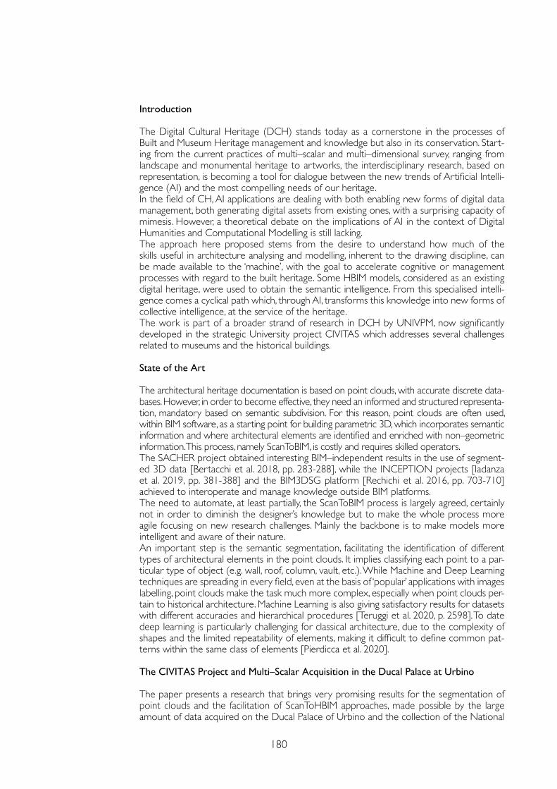
180
Introduction
The Digital Cultural Heritage (DCH) stands today as a cornerstone in the processes of Built and Museum Heritage management and knowledge but also in its conservation. Start-ing from the current practices of multi–scalar and multi–dimensional survey, ranging from landscape and monumental heritage to artworks, the interdisciplinary research, based on representation, is becoming a tool for dialogue between the new trends of Artificial Intelli-gence (AI) and the most compelling needs of our heritage. In the field of CH, AI applications are dealing with both enabling new forms of digital data management, both generating digital assets from existing ones, with a surprising capacity of mimesis. However, a theoretical debate on the implications of AI in the context of Digital Humanities and Computational Modelling is still lacking.The approach here proposed stems from the desire to understand how much of the skills useful in architecture analysing and modelling, inherent to the drawing discipline, can be made available to the ‘machine’, with the goal to accelerate cognitive or management processes with regard to the built heritage. Some HBIM models, considered as an existing digital heritage, were used to obtain the semantic intelligence. From this specialised intelli-gence comes a cyclical path which, through AI, transforms this knowledge into new forms of collective intelligence, at the service of the heritage.The work is part of a broader strand of research in DCH by UNIVPM, now significantly developed in the strategic University project CIVITAS which addresses several challenges related to museums and the historical buildings.
State of the Art
The architectural heritage documentation is based on point clouds, with accurate discrete data-bases. However, in order to become effective, they need an informed and structured representa-tion, mandatory based on semantic subdivision. For this reason, point clouds are often used, within BIM software, as a starting point for building parametric 3D, which incorporates semantic information and where architectural elements are identified and enriched with non–geometric information. This process, namely ScanToBIM, is costly and requires skilled operators.The SACHER project obtained interesting BIM–independent results in the use of segment-ed 3D data [Bertacchi et al. 2018, pp. 283-288], while the INCEPTION projects [Iadanza et al. 2019, pp. 381-388] and the BIM3DSG platform [Rechichi et al. 2016, pp. 703-710] achieved to interoperate and manage knowledge outside BIM platforms. The need to automate, at least partially, the ScanToBIM process is largely agreed, certainly not in order to diminish the designer’s knowledge but to make the whole process more agile focusing on new research challenges. Mainly the backbone is to make models more intelligent and aware of their nature.An important step is the semantic segmentation, facilitating the identification of different types of architectural elements in the point clouds. It implies classifying each point to a par-ticular type of object (e.g. wall, roof, column, vault, etc.). While Machine and Deep Learning techniques are spreading in every field, even at the basis of ‘popular’ applications with images labelling, point clouds make the task much more complex, especially when point clouds per-tain to historical architecture. Machine Learning is also giving satisfactory results for datasets with different accuracies and hierarchical procedures [Teruggi et al. 2020, p. 2598]. To date deep learning is particularly challenging for classical architecture, due to the complexity of shapes and the limited repeatability of elements, making it difficult to define common pat-terns within the same class of elements [Pierdicca et al. 2020].
The CIVITAS Project and Multi–Scalar Acquisition in the Ducal Palace at Urbino
The paper presents a research that brings very promising results for the segmentation of point clouds and the facilitation of ScanToHBIM approaches, made possible by the large amount of data acquired on the Ducal Palace of Urbino and the collection of the National
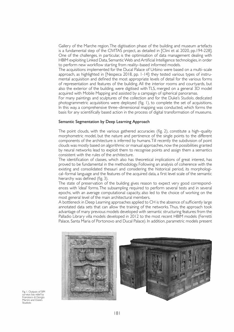
181
Gallery of the Marche region. The digitisation phase of the building and museum artefacts is a fundamental step of the CIVITAS project, as detailed in [Clini et al. 2020, pp.194-228]. One of the challenges, in particular, is the optimisation of data management dealing with HBIM exploiting Linked Data, Semantic Web and Artificial Intelligence technologies, in order to perform new workflow starting from reality–based informed models. The acquisitions implemented for the Ducal Palace of Urbino were based on a multi–scale approach, as highlighted in [Nespeca 2018, pp. 1-14]: they tested various types of instru-mental acquisition and defined the most appropriate levels of detail for the various forms of representation and features of the building. All the interior rooms and courtyards, but also the exterior of the building, were digitised with TLS, merged on a general 3D model acquired with Mobile Mapping and assisted by a campaign of spherical panoramas. For many paintings and sculptures of the collection and for the Duke’s Studiolo, dedicated photogrammetric acquisitions were deployed (fig. 1), to complete the set of acquisitions. In this way, a comprehensive three–dimensional mapping was conducted, which forms the basis for any scientifically based action in the process of digital transformation of museums.
Semantic Segmentation by Deep Learning Approach
The point clouds, with the various gathered accuracies (fig. 2), constitute a high–quality morphometric model, but the nature and pertinence of the single points to the different components of the architecture is inferred by humans. Till recently the subdivision of point clouds was mostly based on algorithmic or manual approaches, now the possibilities granted by neural networks lead to exploit them to recognise points and assign them a semantics consistent with the rules of the architecture. The identification of classes, which also has theoretical implications of great interest, has proved to be fundamental in the methodology. Following an analysis of coherence with the existing and consolidated thesauri and considering the historical period, its morphologi-cal–formal language and the features of the acquired data, a first level scale of the semantic hierarchy was defined (fig. 3).The state of preservation of the building gives reason to expect very good correspond-ences with ‘ideal’ forms. The subsampling required to perform several tests and in several epochs, with an average computational capacity, also led to the choice of working on the most general level of the main architectural members.A bottleneck in Deep Learning approaches applied to CH is the absence of sufficiently large annotated data sets that can allow the training of the networks. Thus, the approach took advantage of many previous models developed with semantic structuring features: from the Palladio Library villa models developed in 2012 to the most recent HBIM models (Ferretti Palace, Santa Maria of Portonovo and Ducal Palace). In addition, parametric models present
Fig. 1. Outputs of SfM surveys: bas relief by Francesco di Giorgio Martini and Duke’s Studiolo
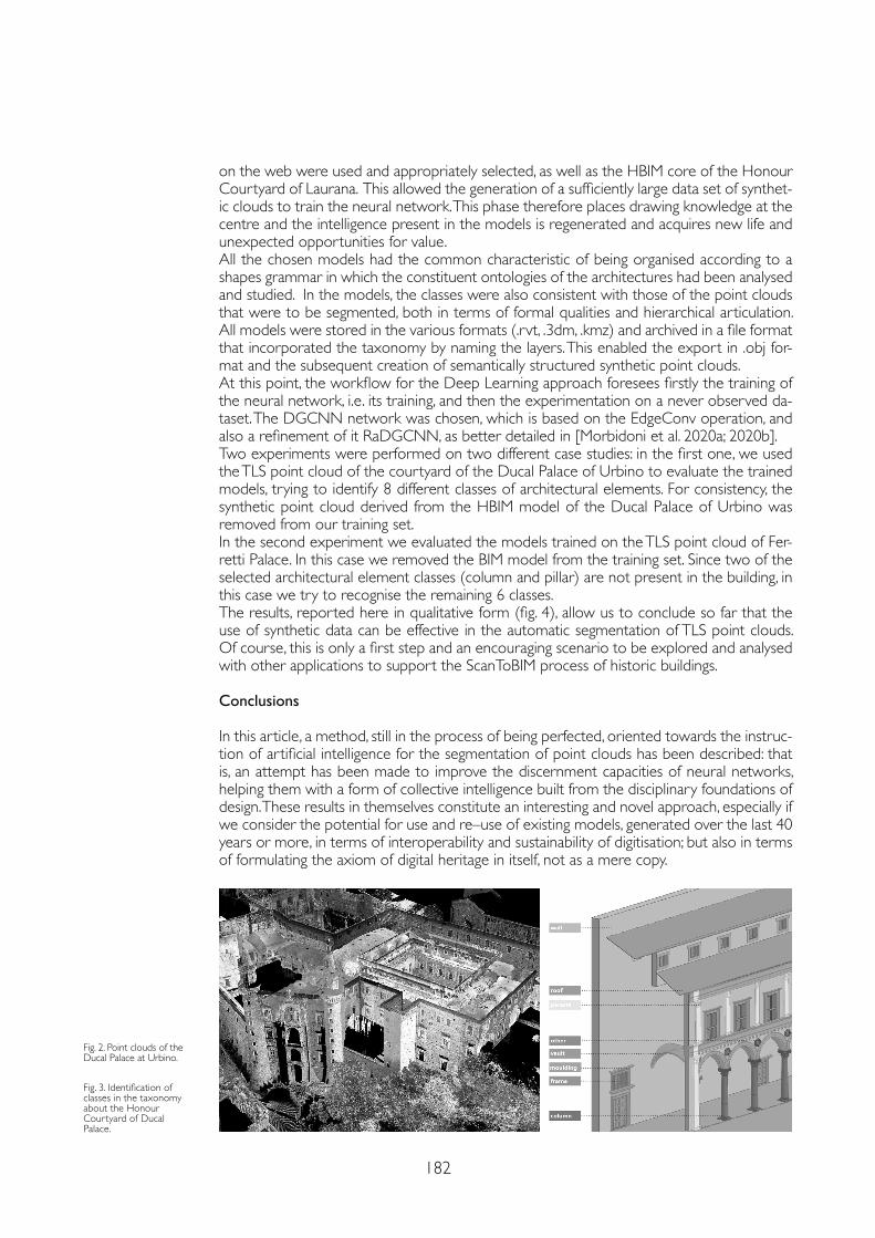
182
on the web were used and appropriately selected, as well as the HBIM core of the Honour Courtyard of Laurana. This allowed the generation of a sufficiently large data set of synthet-ic clouds to train the neural network. This phase therefore places drawing knowledge at the centre and the intelligence present in the models is regenerated and acquires new life and unexpected opportunities for value.All the chosen models had the common characteristic of being organised according to a shapes grammar in which the constituent ontologies of the architectures had been analysed and studied. In the models, the classes were also consistent with those of the point clouds that were to be segmented, both in terms of formal qualities and hierarchical articulation. All models were stored in the various formats (.rvt, .3dm, .kmz) and archived in a file format that incorporated the taxonomy by naming the layers. This enabled the export in .obj for-mat and the subsequent creation of semantically structured synthetic point clouds.At this point, the workflow for the Deep Learning approach foresees firstly the training of the neural network, i.e. its training, and then the experimentation on a never observed da-taset. The DGCNN network was chosen, which is based on the EdgeConv operation, and also a refinement of it RaDGCNN, as better detailed in [Morbidoni et al. 2020a; 2020b].Two experiments were performed on two different case studies: in the first one, we used the TLS point cloud of the courtyard of the Ducal Palace of Urbino to evaluate the trained models, trying to identify 8 different classes of architectural elements. For consistency, the synthetic point cloud derived from the HBIM model of the Ducal Palace of Urbino was removed from our training set.In the second experiment we evaluated the models trained on the TLS point cloud of Fer-retti Palace. In this case we removed the BIM model from the training set. Since two of the selected architectural element classes (column and pillar) are not present in the building, in this case we try to recognise the remaining 6 classes.The results, reported here in qualitative form (fig. 4), allow us to conclude so far that the use of synthetic data can be effective in the automatic segmentation of TLS point clouds. Of course, this is only a first step and an encouraging scenario to be explored and analysed with other applications to support the ScanToBIM process of historic buildings. Conclusions
In this article, a method, still in the process of being perfected, oriented towards the instruc-tion of artificial intelligence for the segmentation of point clouds has been described: that is, an attempt has been made to improve the discernment capacities of neural networks, helping them with a form of collective intelligence built from the disciplinary foundations of design. These results in themselves constitute an interesting and novel approach, especially if we consider the potential for use and re–use of existing models, generated over the last 40 years or more, in terms of interoperability and sustainability of digitisation; but also in terms of formulating the axiom of digital heritage in itself, not as a mere copy.
Fig. 2. Point clouds of the Ducal Palace at Urbino.
Fig. 3. Identification of classes in the taxonomy about the Honour Courtyard of Ducal Palace.
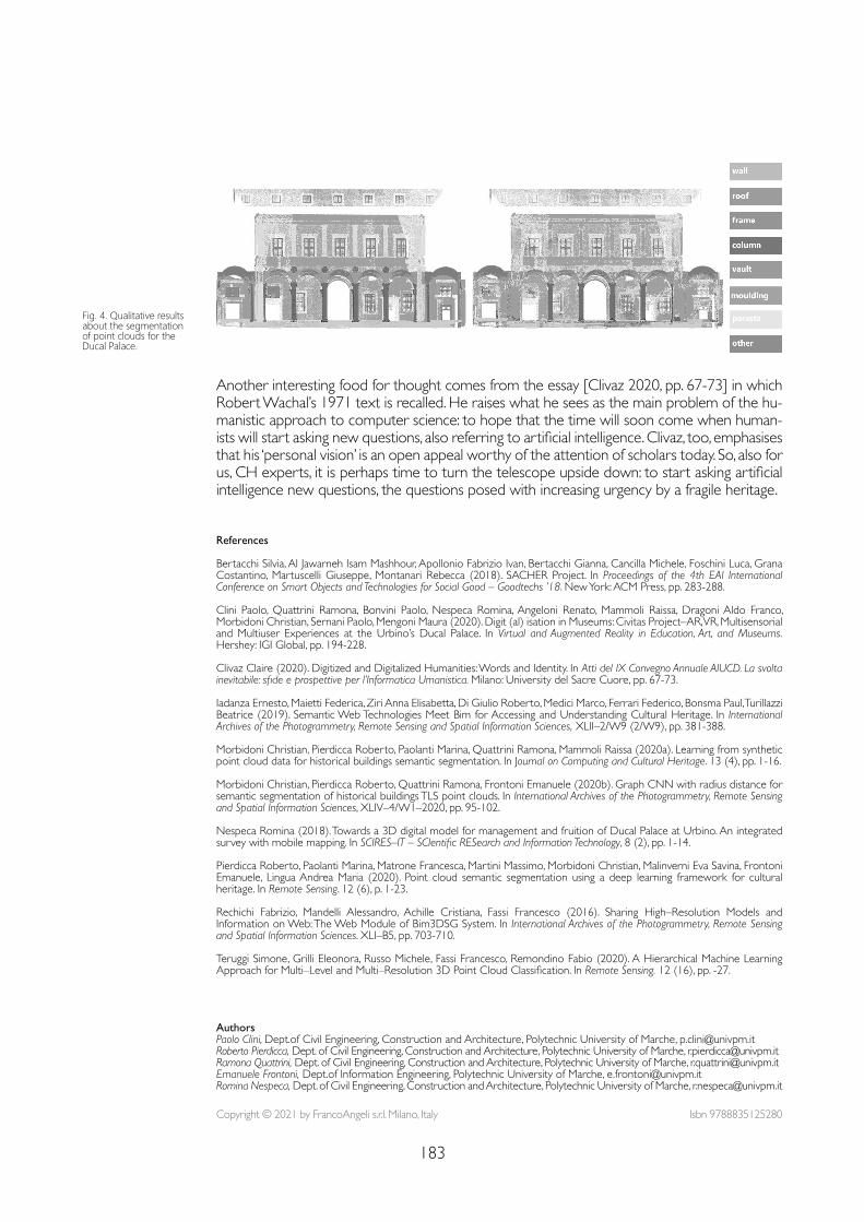
183
Another interesting food for thought comes from the essay [Clivaz 2020, pp. 67-73] in which Robert Wachal’s 1971 text is recalled. He raises what he sees as the main problem of the hu-manistic approach to computer science: to hope that the time will soon come when human-ists will start asking new questions, also referring to artificial intelligence. Clivaz, too, emphasises that his ‘personal vision’ is an open appeal worthy of the attention of scholars today. So, also for us, CH experts, it is perhaps time to turn the telescope upside down: to start asking artificial intelligence new questions, the questions posed with increasing urgency by a fragile heritage.
Fig. 4. Qualitative results about the segmentation of point clouds for the Ducal Palace.
References
Bertacchi Silvia, Al Jawarneh Isam Mashhour, Apollonio Fabrizio Ivan, Bertacchi Gianna, Cancilla Michele, Foschini Luca, Grana Costantino, Martuscelli Giuseppe, Montanari Rebecca (2018). SACHER Project. In Proceedings of the 4th EAI International Conference on Smart Objects and Technologies for Social Good – Goodtechs ’18. New York: ACM Press, pp. 283-288.
Clini Paolo, Quattrini Ramona, Bonvini Paolo, Nespeca Romina, Angeloni Renato, Mammoli Raissa, Dragoni Aldo Franco, Morbidoni Christian, Sernani Paolo, Mengoni Maura (2020). Digit (al) isation in Museums: Civitas Project–AR, VR, Multisensorial and Multiuser Experiences at the Urbino’s Ducal Palace. In Virtual and Augmented Reality in Education, Art, and Museums. Hershey: IGI Global, pp. 194-228.
Clivaz Claire (2020). Digitized and Digitalized Humanities: Words and Identity. In Atti del IX Convegno Annuale AIUCD. La svolta inevitabile: sfide e prospettive per l’Informatica Umanistica. Milano: University del Sacre Cuore, pp. 67-73.
Iadanza Ernesto, Maietti Federica, Ziri Anna Elisabetta, Di Giulio Roberto, Medici Marco, Ferrari Federico, Bonsma Paul, Turillazzi Beatrice (2019). Semantic Web Technologies Meet Bim for Accessing and Understanding Cultural Heritage. In International Archives of the Photogrammetry, Remote Sensing and Spatial Information Sciences, XLII–2/W9 (2/W9), pp. 381-388.
Morbidoni Christian, Pierdicca Roberto, Paolanti Marina, Quattrini Ramona, Mammoli Raissa (2020a). Learning from synthetic point cloud data for historical buildings semantic segmentation. In Journal on Computing and Cultural Heritage. 13 (4), pp. 1-16.
Morbidoni Christian, Pierdicca Roberto, Quattrini Ramona, Frontoni Emanuele (2020b). Graph CNN with radius distance for semantic segmentation of historical buildings TLS point clouds. In International Archives of the Photogrammetry, Remote Sensing and Spatial Information Sciences, XLIV–4/W1–2020, pp. 95-102.
Nespeca Romina (2018). Towards a 3D digital model for management and fruition of Ducal Palace at Urbino. An integrated survey with mobile mapping. In SCIRES–IT – SCIentific RESearch and Information Technology, 8 (2), pp. 1-14.
Pierdicca Roberto, Paolanti Marina, Matrone Francesca, Martini Massimo, Morbidoni Christian, Malinverni Eva Savina, Frontoni Emanuele, Lingua Andrea Maria (2020). Point cloud semantic segmentation using a deep learning framework for cultural heritage. In Remote Sensing. 12 (6), p. 1-23.
Rechichi Fabrizio, Mandelli Alessandro, Achille Cristiana, Fassi Francesco (2016). Sharing High–Resolution Models and Information on Web: The Web Module of Bim3DSG System. In International Archives of the Photogrammetry, Remote Sensing and Spatial Information Sciences. XLI–B5, pp. 703-710.
Teruggi Simone, Grilli Eleonora, Russo Michele, Fassi Francesco, Remondino Fabio (2020). A Hierarchical Machine Learning Approach for Multi–Level and Multi–Resolution 3D Point Cloud Classification. In Remote Sensing. 12 (16), pp. -27.
Copyright © 2021 by FrancoAngeli s.r.l. Milano, Italy Isbn 9788835125280
AuthorsPaolo Clini, Dept.of Civil Engineering, Construction and Architecture, Polytechnic University of Marche, [email protected] Roberto Pierdicca, Dept. of Civil Engineering, Construction and Architecture, Polytechnic University of Marche, [email protected] Quattrini, Dept. of Civil Engineering, Construction and Architecture, Polytechnic University of Marche, [email protected] Emanuele Frontoni, Dept.of Information Engineering, Polytechnic University of Marche, [email protected] Nespeca, Dept. of Civil Engineering, Construction and Architecture, Polytechnic University of Marche, [email protected]

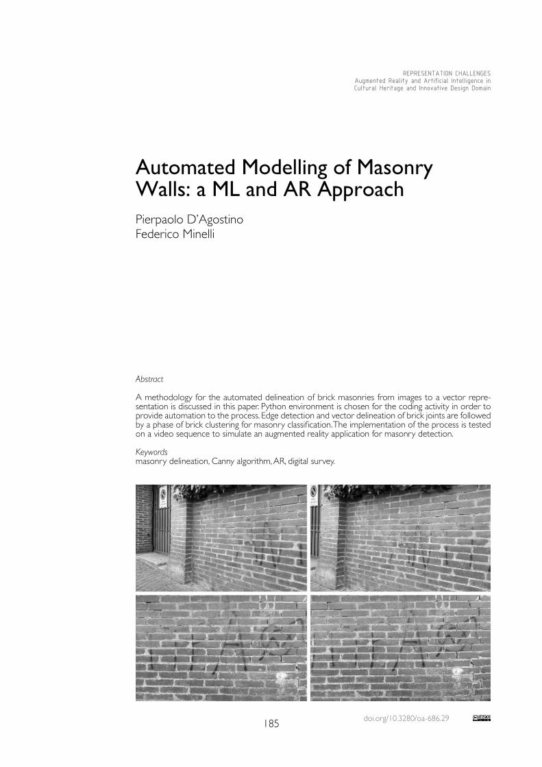
doi.org/10.3280/oa-686.29185
REPRESENTATION CHALLENGESAugmented Reality and Artificial Intelligence in Cultural Heritage and Innovative Design Domain
Abstract
A methodology for the automated delineation of brick masonries from images to a vector repre-sentation is discussed in this paper. Python environment is chosen for the coding activity in order to provide automation to the process. Edge detection and vector delineation of brick joints are followed by a phase of brick clustering for masonry classification. The implementation of the process is tested on a video sequence to simulate an augmented reality application for masonry detection.
Keywordsmasonry delineation, Canny algorithm, AR, digital survey.
Automated Modelling of Masonry Walls: a ML and AR ApproachPierpaolo D’AgostinoFederico Minelli
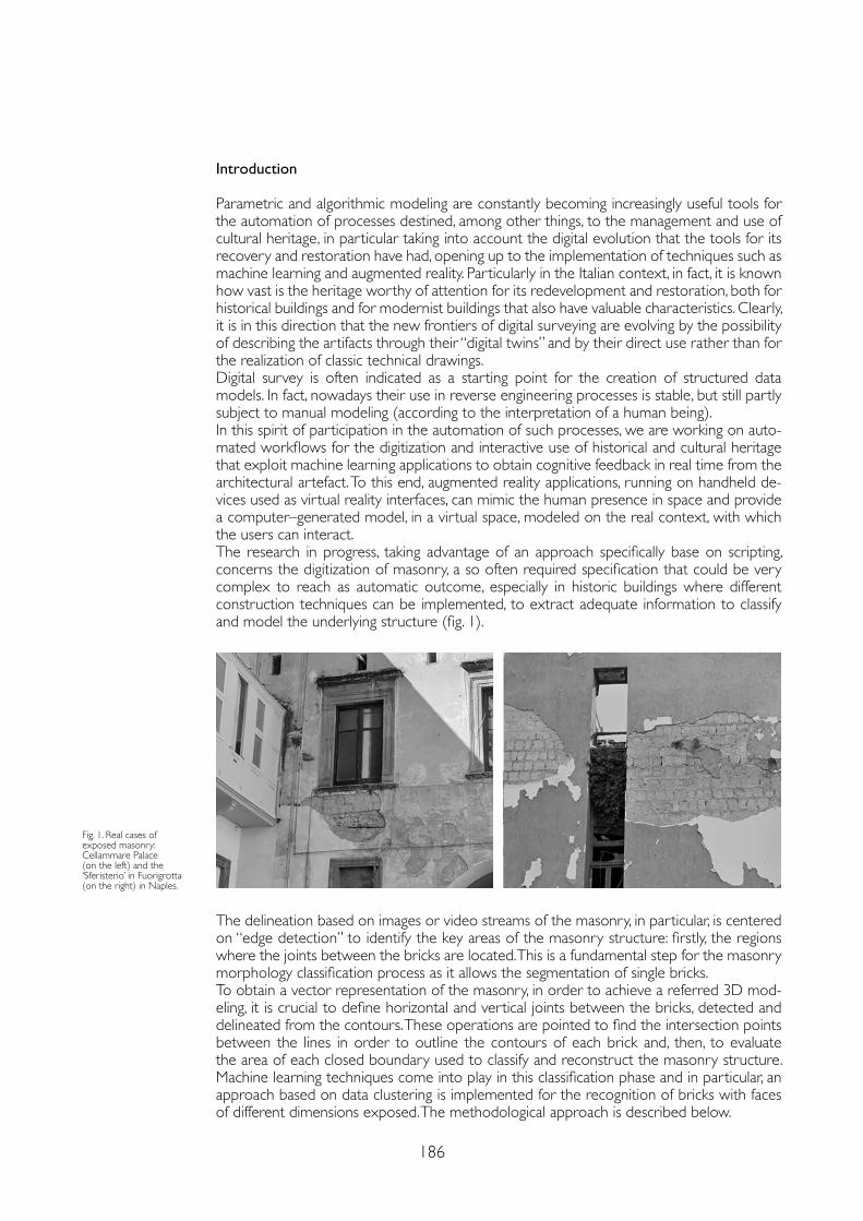
186
Introduction
Parametric and algorithmic modeling are constantly becoming increasingly useful tools for the automation of processes destined, among other things, to the management and use of cultural heritage, in particular taking into account the digital evolution that the tools for its recovery and restoration have had, opening up to the implementation of techniques such as machine learning and augmented reality. Particularly in the Italian context, in fact, it is known how vast is the heritage worthy of attention for its redevelopment and restoration, both for historical buildings and for modernist buildings that also have valuable characteristics. Clearly, it is in this direction that the new frontiers of digital surveying are evolving by the possibility of describing the artifacts through their “digital twins” and by their direct use rather than for the realization of classic technical drawings. Digital survey is often indicated as a starting point for the creation of structured data models. In fact, nowadays their use in reverse engineering processes is stable, but still partly subject to manual modeling (according to the interpretation of a human being). In this spirit of participation in the automation of such processes, we are working on auto-mated workflows for the digitization and interactive use of historical and cultural heritage that exploit machine learning applications to obtain cognitive feedback in real time from the architectural artefact. To this end, augmented reality applications, running on handheld de-vices used as virtual reality interfaces, can mimic the human presence in space and provide a computer–generated model, in a virtual space, modeled on the real context, with which the users can interact.The research in progress, taking advantage of an approach specifically base on scripting, concerns the digitization of masonry, a so often required specification that could be very complex to reach as automatic outcome, especially in historic buildings where different construction techniques can be implemented, to extract adequate information to classify and model the underlying structure (fig. 1).
Fig. 1. Real cases of exposed masonry: Cellammare Palace (on the left) and the ‘Sferisterio’ in Fuorigrotta (on the right) in Naples.
The delineation based on images or video streams of the masonry, in particular, is centered on “edge detection” to identify the key areas of the masonry structure: firstly, the regions where the joints between the bricks are located. This is a fundamental step for the masonry morphology classification process as it allows the segmentation of single bricks.To obtain a vector representation of the masonry, in order to achieve a referred 3D mod-eling, it is crucial to define horizontal and vertical joints between the bricks, detected and delineated from the contours. These operations are pointed to find the intersection points between the lines in order to outline the contours of each brick and, then, to evaluate the area of each closed boundary used to classify and reconstruct the masonry structure. Machine learning techniques come into play in this classification phase and in particular, an approach based on data clustering is implemented for the recognition of bricks with faces of different dimensions exposed. The methodological approach is described below.
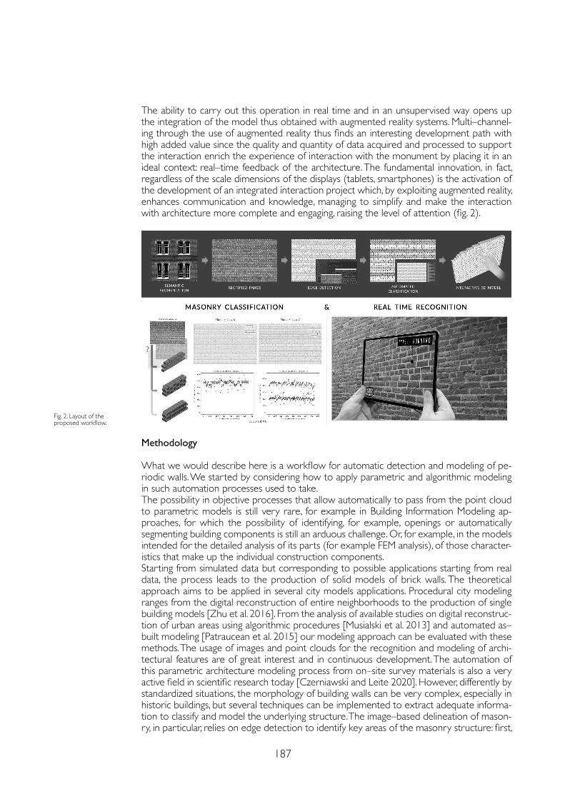
187
The ability to carry out this operation in real time and in an unsupervised way opens up the integration of the model thus obtained with augmented reality systems. Multi–channel-ing through the use of augmented reality thus finds an interesting development path with high added value since the quality and quantity of data acquired and processed to support the interaction enrich the experience of interaction with the monument by placing it in an ideal context: real–time feedback of the architecture. The fundamental innovation, in fact, regardless of the scale dimensions of the displays (tablets, smartphones) is the activation of the development of an integrated interaction project which, by exploiting augmented reality, enhances communication and knowledge, managing to simplify and make the interaction with architecture more complete and engaging, raising the level of attention (fig. 2).
Methodology
What we would describe here is a workflow for automatic detection and modeling of pe-riodic walls. We started by considering how to apply parametric and algorithmic modeling in such automation processes used to take.The possibility in objective processes that allow automatically to pass from the point cloud to parametric models is still very rare, for example in Building Information Modeling ap-proaches, for which the possibility of identifying, for example, openings or automatically segmenting building components is still an arduous challenge. Or, for example, in the models intended for the detailed analysis of its parts (for example FEM analysis), of those character-istics that make up the individual construction components.Starting from simulated data but corresponding to possible applications starting from real data, the process leads to the production of solid models of brick walls. The theoretical approach aims to be applied in several city models applications. Procedural city modeling ranges from the digital reconstruction of entire neighborhoods to the production of single building models [Zhu et al. 2016]. From the analysis of available studies on digital reconstruc-tion of urban areas using algorithmic procedures [Musialski et al. 2013] and automated as–built modeling [Patraucean et al. 2015] our modeling approach can be evaluated with these methods. The usage of images and point clouds for the recognition and modeling of archi-tectural features are of great interest and in continuous development. The automation of this parametric architecture modeling process from on–site survey materials is also a very active field in scientific research today [Czerniawski and Leite 2020]. However, differently by standardized situations, the morphology of building walls can be very complex, especially in historic buildings, but several techniques can be implemented to extract adequate informa-tion to classify and model the underlying structure. The image–based delineation of mason-ry, in particular, relies on edge detection to identify key areas of the masonry structure: first,
Fig. 2. Layout of the proposed workflow.
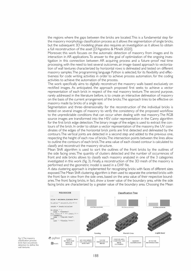
188
the regions where the gaps between the bricks are located. This is a fundamental step for the masonry morphology classification process as it allows the segmentation of single bricks, but the subsequent 3D modeling phase also requires an investigation as it allows to obtain a full reconstruction of the asset [D’Agostino & Minelli 2020].Moreover, this work focuses on the automatic detection of masonry from images and its interaction in AR applications. To answer to the goal of optimization of the ongoing inves-tigation in this connection between AR acquiring process and a future–proof real time processing, with the need to test several outcomes, an image–based approach to vectoriza-tion of wall textures characterized by horizontal rows is delineated and tested on different masonry samples. The programming language Python is selected, for its flexibility and effec-tiveness for code writing activities in order to achieve process automation, for the coding activities to achieve the automation of the process.The work specifically aims to digitally reconstruct the masonry walls based exclusively on rectified images. As anticipated, the approach proposed first seeks to achieve a vector representation of each brick in respect of the real masonry texture. The second purpose, rarely addressed in the literature before, is to create an interactive delineation of masonry on the basis of the current arrangement of the bricks. The approach tries to be effective on masonry made by bricks of a single size. Segmentation and three–dimensionality for the reconstruction of the individual bricks is tested on several images of masonry to verify the consistency of the proposed workflow to the unpredictable conditions that can occur when dealing with real masonry. The RGB source images are transformed into the HSV color representation in the Canny algorithm for the first brick edge detection. The binary image of the edges is used to extract the con-tours of the brick. In order to obtain a vector representation of the masonry, the UV coor-dinates of the edges of the horizontal brick joints are first detected and delineated by the contours. The vertical joints are detected in a second step and added to the previous one, respecting the height of each row of bricks. The intersection points between the lines allow to outline the contours of each brick. The area value of each closed contour is calculated to classify and reconstruct the masonry structure. Mean Shift algorithm is used to sort the outlines of the front bricks by the outlines of the side facing ones. The quantity of clusters detected and the number of occurrences of front and side bricks allows to classify each masonry analyzed in one of the 3 categories investigated in this work (fig. 3). Finally, a reconstruction of the 3D mesh of the masonry is performed and the geometric model is saved in a DXF file.A data clustering approach is implemented for recognizing bricks with faces of different sizes exposed. The Mean Shift clustering algorithm is then used to separate the oriented bricks with the front face in view from the side ones, based on the area value of their respective bound-aries. The front facing bricks, in fact, show a lower value of the boundary area, while the side facing bricks are characterized by a greater value of the boundary area. Choosing the Mean
Fig. 3. The masonry classification process: brick face occurences detection to define the wall textures.
189
Shift clustering algorithm relies on its ability to directly estimate the number of clusters from the dataset. In fact, other clustering algorithms require the user to manually specify the cluster number file to search for in the dataset. The masonry investigated in this study, however, range from types in which a single cluster of bricks is found to types in which two clusters occur.Deepening the possibility to join AR visual acquisition with the described workflow, we propose that the vectorization of walls’ joints could pass for their identification directly on visual flows. So, the approach studied for raster images is applied to video sequences in order to allow a real time detection and vectorization of the masonry. An augmented reality application is therefore simulated on a video stream, acquired in real circumstances (fig. in cover page). An effective delineation of horizontal rows is obtained with robust outcomes on several frames of the video stream. This opens to the complete vectorization of the masonry in real time, that will be addressed in future studies.
Conclusions
Multi–channeling through the use of augmented reality thus finds an interesting develop-ment path with high added value because the quality and quantity of data designed to sup-port the interaction enrich the experience by placing it in an ideal context: when needed and to whom really need.The fundamental issue, in fact, is not so many the scale dimensions of the displays (mega–screen, tablet, installation, smartphone) that make the difference, as the development of an integrated communication project which, by exploiting augmented reality, enhances com-munication by managing to simplify and make the interaction more complete and engaging, raising the level of attention.Segmentation and three–dimensionality applied in wall digitation is tested on a video of the masonry to verify the consistency of the proposed workflow to the unpredictable condi-tions that can occur when dealing with real masonry.The results obtained in the study can be applied in architecture surveys and fruition application to establish a direct connection between the captured image and the reconstructed geometry. Practical applications of this procedure can also be found in the automated BIM modeling process for 3D reconstruction of buildings from survey material and in the automated FEM modeling of masonry structures, as it can provide a detailed model of masonry morphology.Future work should consist of further experimentation on different and more complex ma-sonry structures to obtain results of wider applicability. The masonry classification, already attained with images, should be also tested on video sequences.
References
Czerniawski Thomas, Leite Fernanda (2020). Automated digital modeling of existing buildings: A review of visual object recognition methods. In Automation in Construction. Elsevier, 113, pp. 103-131.
D’Agostino Pierpaolo, Minelli Federico (2020). Automated image–based detection and vectorization of coursed masonry for parametric modeling of building envelope. In Marchiafava Veronica, Picollo Marcello (eds). Colour and Colorimetry Multidisciplinary Contributions. Milano: Gruppo del Colore – Associazione Italiana Colore, pp. 43-50.
Musialski Przemyslaw, Wonka Peter, Aliaga Daniel G., Wimmer Michael, Van Gool Luc, Purgathofer Werner (2013). A survey of urban reconstruction. In Computer Graphics Forum, 32 (6), pp. 146-177.
Patraucean Viorica, Armeni Iro, Nahangi Mohammad, Yeung Jamie, Brilakis Ioannis, Haas Carl (2015). State of research in automatic as–built modelling. In Advanced Engineering Informatics, 29 (2), pp. 162-171.
Zhu Wenhua, Wang Dexian, Eynard Benoit, Bricogne Matthieu, Remy Sebastien (2016). Procedural approach for 3D modeling of city buildings. In IFIP Advances in Information and Communication Technology, 467, pp. 137-148.
Copyright © 2021 by FrancoAngeli s.r.l. Milano, Italy Isbn 9788835125280
AuthorsPierpaolo D’Agostino, Dept. of Civil, Building and Environmental Engineering, University of Naples Federico II, [email protected] Minelli, Dept. of Industrial Engineering, University of Naples Federico II, [email protected]

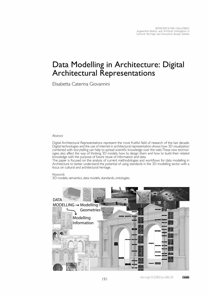
doi.org/10.3280/oa-686.30191
REPRESENTATION CHALLENGESAugmented Reality and Artificial Intelligence in Cultural Heritage and Innovative Design Domain
Abstract
Digital Architectural Representations represent the most fruitful field of research of the last decade. Digital technologies and the use of internet in architectural representation shows how 3D visualization combined with storytelling can help to spread scientific knowledge over the web. These new technol-ogies also affect the way of thinking 3D models, how to design them and how to build their related knowledge with the purpose of future reuse of information and data.The paper is focused on the analysis of current methodologies and workflows for data modelling in Architecture to better understand the potential of using standards in the 3D modelling sector with a focus on cultural and architectural heritage.
Keywords3D models, semantics, data models, standards, ontologies.
Data Modelling in Architecture: Digital Architectural Representations Elisabetta Caterina Giovannini
DATAMODELLING Modelling
Geometries
ModellingInformation
192
The Complexity of Digital Architectural Representations
Since the ‘90s of the last century, with the advent of computers, information technologies and computer–aided design (CAD) systems have seen the beginning of the use of digital models in archaeology and architecture [Boccon–Gibod, Golvin 1990; Frischer 2006; Reilly 1991]. The use of these three–dimensional models, which I like to define as digital representations of architecture, poses nowadays, unlike in the past, some questions about the meaning and the scientific value [Borra 2004; Borghini, Carlani 2011; Dell’Unto et al. 2013] that they assume for diverse target audiences.In the field of architectural heritage and more specifically in the field of virtual reconstructions, starting from historical documentation, it seems evident that alongside geometric modelling, the presence of diverse data and documents prefigure the need for the definition on an informative model that should assist the geometric modelling and that should make explicit the series of processes related to the critical interpretation of data and information available [McCurdy 2010; Apollonio, Giovannini 2015; Brunke 2017]. Different interpretative and cognitive processes can be considered similar to algorithms “a procedure used to return a solution to a question through a set of well–defined instructions” [Tedeschi, Andreani 2014]. The difference from the mathematical algorithm definition is that, in this case, the set of instructions are generally not stated and that the interpretative algorithm can generate several outputs (diverse hypothetical reconstructions) starting from the same series of input (knowledge available).A Three–dimensional model became then, a digital architectural representation of the n digital representations that can be generated by human processes of interpretation. Analyzing the type of input of the three–dimensional reconstruction process, we can see how these interpretative processes are linked to the qualitative and quantitative values of the available documentation. This type of data and information support both geometric and informative modelling, considered as two indivisible and inter–related components of the same process. An example of that is the common practice of using the semantic architectural structure to digitally create the parts of a 3D model according to logics proper of the architectural field and to use digital architectural elements as reference objects to connect additional information [De Luca 2013; Giovannini 2017; Quattrini, Battini, Mammoli 2018]. A digital architectural representation can be, then, considered as a visual and graphical expression of an interpretative activity and a constitutive element of knowledge production. This assumption is valid not only for 3D models but also for all human objects of production that can be manuscripts, sketches, drawings, maquettes, etc. These pre–existing data can then be used for information modelling and three–dimensional modelling enriching diverse Levels of Knowledge (LoK).
Knowledge Representation in Architecture
Applications of Artificial Intelligence (AI) to Cultural Heritage (CH) have been developed with a varying fortune to produce innovative tools for documenting, managing, and visiting cultural heritage. From the representation of cultural history, digital semantic archives, tools to support visitor’s interpretation, augmented reality and robotics, the application of AI has been applied to the whole humanistic area. In the Architectural Heritage field, AI is commonly used for storytelling, restoration analysis and 3D model classification. AI is also used to develop ontologies [1] to allow computers to perform automated reasoning about data and information all over the world. Software Engineering, on the other hand, started to use conceptual modelling as a representation of a system to describe concepts. Tools for designing and creation of online visualization of data, according to the rules that govern the web in the past, and more recently the semantic–web cannot avoid the use of Information modelling to manage and structure data and information. In the case of digital architectural representations, the text analysis and the source where architecture is represented in a bi–dimensional way are enriched by three–dimensional information derived from the digital acquisition or three–dimensional modelling. The recent need
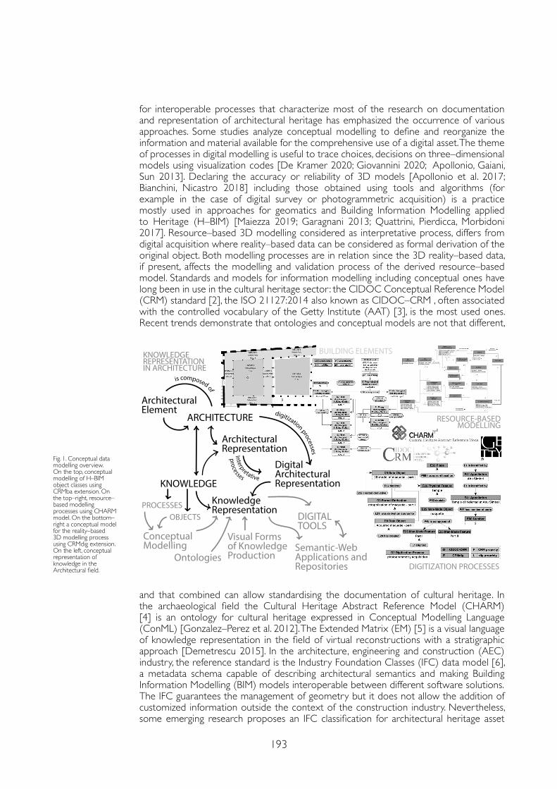
193
for interoperable processes that characterize most of the research on documentation and representation of architectural heritage has emphasized the occurrence of various approaches. Some studies analyze conceptual modelling to define and reorganize the information and material available for the comprehensive use of a digital asset. The theme of processes in digital modelling is useful to trace choices, decisions on three–dimensional models using visualization codes [De Kramer 2020; Giovannini 2020; Apollonio, Gaiani, Sun 2013]. Declaring the accuracy or reliability of 3D models [Apollonio et al. 2017; Bianchini, Nicastro 2018] including those obtained using tools and algorithms (for example in the case of digital survey or photogrammetric acquisition) is a practice mostly used in approaches for geomatics and Building Information Modelling applied to Heritage (H–BIM) [Maiezza 2019; Garagnani 2013; Quattrini, Pierdicca, Morbidoni 2017]. Resource–based 3D modelling considered as interpretative process, differs from digital acquisition where reality–based data can be considered as formal derivation of the original object. Both modelling processes are in relation since the 3D reality–based data, if present, affects the modelling and validation process of the derived resource–based model. Standards and models for information modelling including conceptual ones have long been in use in the cultural heritage sector : the CIDOC Conceptual Reference Model (CRM) standard [2], the ISO 21127:2014 also known as CIDOC–CRM , often associated with the controlled vocabulary of the Getty Institute (AAT) [3], is the most used ones. Recent trends demonstrate that ontologies and conceptual models are not that different,
Fig. 1. Conceptual data modelling overview. On the top, conceptual modelling of H–BIM object classes using CRMba extension. On the top–right, resource–based modelling processes using CHARM model. On the bottom–right a conceptual model for the reality–based 3D modelling process using CRMdig extension. On the left, conceptual representation of knowledge in the Architectural field.
and that combined can allow standardising the documentation of cultural heritage. In the archaeological field the Cultural Heritage Abstract Reference Model (CHARM) [4] is an ontology for cultural heritage expressed in Conceptual Modelling Language (ConML) [Gonzalez–Perez et al. 2012]. The Extended Matrix (EM) [5] is a visual language of knowledge representation in the field of virtual reconstructions with a stratigraphic approach [Demetrescu 2015]. In the architecture, engineering and construction (AEC) industry, the reference standard is the Industry Foundation Classes (IFC) data model [6], a metadata schema capable of describing architectural semantics and making Building Information Modelling (BIM) models interoperable between different software solutions.The IFC guarantees the management of geometry but it does not allow the addition of customized information outside the context of the construction industry. Nevertheless, some emerging research proposes an IFC classification for architectural heritage asset
ARCHITECTURE
ArchitecturalElement
ArchitecturalRepresentation
DigitalArchitecturalRepresentationKNOWLEDGE
KnowledgeRepresentation
Interpretative
digitization processes
is composed of
processes
ConceptualModelling
Ontologies
Visual Formsof Knowledge Production
DIGITALTOOLS
Semantic-WebApplications andRepositories
PROCESSESOBJECTS
BUILDING ELEMENTS
DIGITIZATION PROCESSES
RESOURCE-BASEDMODELLING
KNOWLEDGEREPRESENTATIONIN ARCHITECTURE
194
[Diara, Rinaudo 2020] or an architectural heritage semantic 3D documentation for the reusability of 3D city models [Noardo 2018]. To establish a dialogue between the architectural field and the cultural heritage assets a recent study proposes a conceptual model based on the CIDOC–CRM standard to describe a building in its parts, as encoded by a BIM software using the CIDOC–CRMba extension [7], developed to describe built archaeology [Parisi, Lo Turco, Giovannini 2019]. With that model, it was possible to describe the morphological elements that characterize a building but it fails in describing the link between the geometric parts and their spatial coordinates. The conclusion was partially acceptable if we think that the CIDOC–CRM was born to describe assets about museum collections and not about architecture.
Conclusions
Considering the diverse research conducted, the possibility of creating conceptual models capable of managing three–dimensional data and descriptive metadata on the documentation of architectural heritage is still missing. The CRM–dig [8], a CIDOC–CRM extension, is a model capable to manage the complexity of the reality–based data acquisition, but it does not clarify and explain the relationships between the source used, the data extracted from it and its use for geometrical modelling. The IFC, on the other hand, can be used to describe geometric information of BIM or H–BIM models. The challenge is to create an efficient data model that allows semantic traceability of data. A novel semantic organization of data is necessary for the development, of platforms, analysis tools and algorithms able to manage structured data, make queries for different purposes in complementary disciplinary domains emphasising their combined potential. There is a need for a common conceptual model that reflects the complexity of the three–dimensional modelling process. Conceptual modelling should focus on the representation of architecture in all its forms (drawings, surveys, digital models) and should represent both digital and physical properties. A conceptual reference model for the digital representation of architecture (fig. 1) should first identify the architectural evidence, built, or only represented ones, the parts of which it can be composed and how these can be digitally represented. The knowledge about an architectural asset is also composed of a set of resources that also need to be digitized and that contribute to the creation of the “architectural” digital asset. Then the relationship between digitized resources and three–dimensional modelling can take place by mapping diverse interpretative and modelling processes creating different levels of knowledge. The knowledge produced, can then be used by digital tools able to read the conceptual grammar of the asset: an information system in which three–dimensional models and historical documentation is collected and organized. To reuse data, data models are necessary and even if they do not follow standards, they must at least be stated because this is how computational technologies and machine can see the human world.
Notes
[1] Ontology is the theory and the Information Model is the application. Information modelling is here intended as “a representation of concepts, relationships, constraints, rules, and operations to specify data semantics for a chosen domain of discourse. The advantage of using an information model is that it can provide sharable, stable, and organized structure of information requirements for the domain context.” [Lee 1999]
[2] The CIDOC Conceptual Reference Model (CRM). http://www.cidoc-crm.org/ (March 2021)
[3] Art & Architecture Thesaurus (AAT) – Getty Research Institute. https://www.getty.edu/research/tools/vocabularies/aat/ (March 2021)
[4] Cultural Heritage Abstract Reference Model (CHARM) – INCIPIT, CSIC. www.charminfo.org (March 2021)
[5] The Extended Matrix formal language for virtual reconstruction processes. http://osiris.itabc.cnr.it/extendedmatrix/ (March 2021)
[6] Industry Foundation Classes. https://www.buildingsmart.org/standards/bsi-standards/industry-foundation-classes/ (March 2021)
[7] An extension of CIDOC CRM to support buildings archaeology documentation. http://www.cidoc-crm.org/crmba/ (March 2021)
[8] An extension of CIDOC CRM to encode “provenance” of digitization products. http://www.cidoc-crm.org/crmdig/ (March 2021)
195
Copyright © 2021 by FrancoAngeli s.r.l. Milano, Italy Isbn 9788835125280
AuthorElisabetta Caterina Giovannini, Dept. of Architecture and Design, Politecnico di Torino, [email protected]
References
Apollonio Fabrizio I., Fallavollita Federico, Giovannini Elisabetta C., Foschi Riccardo, Corso Salvatore (2017). The Reconstruction of Drawn Architecture. In Studies in Digital Heritage, 1, 2017, pp. 380-395.
Apollonio Fabrizio I., Gaiani Marco, Sun Zheng (2013). Characterization of Uncertainty and Approximation in Digital Reconstruction of Ch Artifacts. In Proceeding of Le Vie dei Mercanti XI Forum Internazionale di Studi, pp. 860-869.
Apollonio Fabrizio I., Giovannini Elisabetta C. (2015). A Paradata Documentation Methodology for the Uncertainty Visualization in Digital Reconstruction of Ch Artifacts. In SCIRES–IT–SCIentific RESearch and Information Technology, 5 (1), pp. 1-24.
Bianchini Carlo, Nicastro Saverio (2018). The definition of the Level of Reliability: a contribution to the transparency of Heritage–BIM processes. In Dn–Building Information Modeling, Data & Semantics, 2, pp. 45-49.
Boccon–Gibod Par H., Golvin Jean–Claude (1990). Le Grand Temple d’Amon Rê a Karnak Reconstruit Par l’ordinateur. In Les Dossiers d’Archeologie, 153, pp. 8-19.
Borghini Stefano, Carlani Raffaele (2011). Virtual rebuilding of ancient architecture as a researching and communication tool for Cultural Heritage: aesthetic research and source management. In DISEGNARECON, 4 (8), pp. 71-79.
Borra Davide (2004). Sulla Verità Del Modello 3D. Un Metodo per Comunicare La Validità Dell’anastilosi Virtuale.” In EArcom04 Tecnologie per Comunicare l’architettura. Proceeding of the eArcom 4, pp. 132-137.
Brunke Luca (2017). Uncertainty in Archaeological 3D Reconstructions. Master Thesis, University of Leiden.
Dell’Unto Nicolò, Leander Anne–Marie, Dellepiane Matteo, Callieri Marco, Ferdani Daniele, Lindgren Stefan (2013). Digital reconstruction and visualization in Archaeology: case–study drawn from the work of the Swedish Pompeii Project. In Proceedings of the DigitalHeritage, 1, pp. 621-628.
Demetrescu Emanuel (2015). Archaeological Stratigraphy as a Formal Language for Virtual Reconstruction. Theory and Practice. In Journal of Archaeological Science, 57, pp. 42-55.
Diara Filippo, Fulvio Rinaudo (2020). IFC classification for FOSS HBIM: Open Issues and a schema proposal for Cultural Heritage assets. In Applied Sciences, 10 (23), pp.1-23.
Frischer Bernard (2006). New directions for cultural Virtual Reality: a global strategy for archiving, serving and exhibiting 3D computers models of Cultural Heritage sites. In Proceedings of the Virtual Retrospect 2005, pp. 168-175.
Garagnani Simone (2013). Building Information Modeling and real world knowledge: a methodological approach to accurate semantic documentation for the Built Environment. In Proceedings of the DigitalHeritage, 1, pp.489-496.
Giovannini Elisabetta C. (2020). Workflow for an evidence–based Virtual Reconstruction: the marbles of the Ciborium of the Early Medieval Monte Sorbo Church. In ISPRS Archives, 43, pp. 1395-1402.
Giovannini Elisabetta C. (2017). VRIM Workflow: semantic H–BIM objects using parametric geometries. In Empler Tommaso (ed.). 3D MODELING &BIM. Progettazione, Design, Proposte per La Ricostruzione. Roma: DEI Tipografia del Genio Civile, pp. 212-229.
Gonzalez–Perez Cesar, Martín–Rodilla Patricia, Parcero–Oubiña Cesar, Fábrega–Álvarez Pastor, Güimil–Fariña Alejandro (2012). Extending an abstract reference model for transdisciplinary work in Cultural Heritage. In Dodero Juan Manuel, Palomo–Duarte Manuel, Karampiperis Pythagoras (eds.). Metadata and Semantics Research. Berlin, Heidelberg: Springer, pp. 190-201.
De Luca Livio (2013). 3D Modeling and Semantic Enrichment in Cultural Heritage. In Dieter Fritsch (ed.). Photogrammetric Week. Berlin: Wichmann Verlag, pp. 323-333.
De Kramer Marleen (2020). Relict–Interpolated–Extrapolated–Speculative: an approach to degrees of Accuracy in Virtual Heritage Reconstruction. In Fotis Liarokapis, Athanasios Voulodimos, Nikolaos Doulamis, Anastasios Doulamis (eds.). Visual Computing for Cultural Heritage. Cham: Springer International Publishing, pp. 409-422.
Lee Y. Tina (1999). Information Modeling: from design to implementation. In Proceedings of the Second World Manufacturing Congress, pp. 315-321.
Maiezza Pamela (2019). As–built reliability in architectural HBIM modeling. In ISPRS Archives, 42, pp. 461-466.
McCurdy Leah (2010). Visualising Architecture: The Experience of Creating Virtual Reconstructions. Master Thesis, University of York.
Noardo Francesca (2018). Architectural Heritage Semantic 3D Documentation in Multi–Scale Standard Maps. In Journal of Cultural Heritage, 32, pp. 156-165.
Parisi Piergiorgio, Lo Turco Massimiliano, Giovannini Elisabetta C. (2019). The value of knowledge through H–BIM models: historic documentation with a sematic approach. In ISPRS Archives, 42, pp. 581-588.
Quattrini Ramona, Battini Carlo, Mammoli Raissa (2018). HBIM to VR. Semantic Awareness and Data Enrichment Interoperbility for Parametric Libraries of Historical Architecture. In ISPRS Archives, 42 (2), pp. 937-943
Quattrini, Ramona, Roberto Pierdicca, and Christian Morbidoni (2017). Knowledge–Based data enrichment for HBIM: exploring high–quality Models Using the Semantic–Web. In Journal of Cultural Heritage, 28, pp. 129-139.
Reilly Paul (1991). Towards a Virtual Archaeology. In Proceeding of the CAA90. Computer Applications and Quantitative Methods in Archaeology 1990, pp. 132-139.
Tedeschi Arturo (2014). AAD, Algorithms–Aided Design: Parametric Strategies Using Grasshopper. Brienza: Le Penseur Publisher.

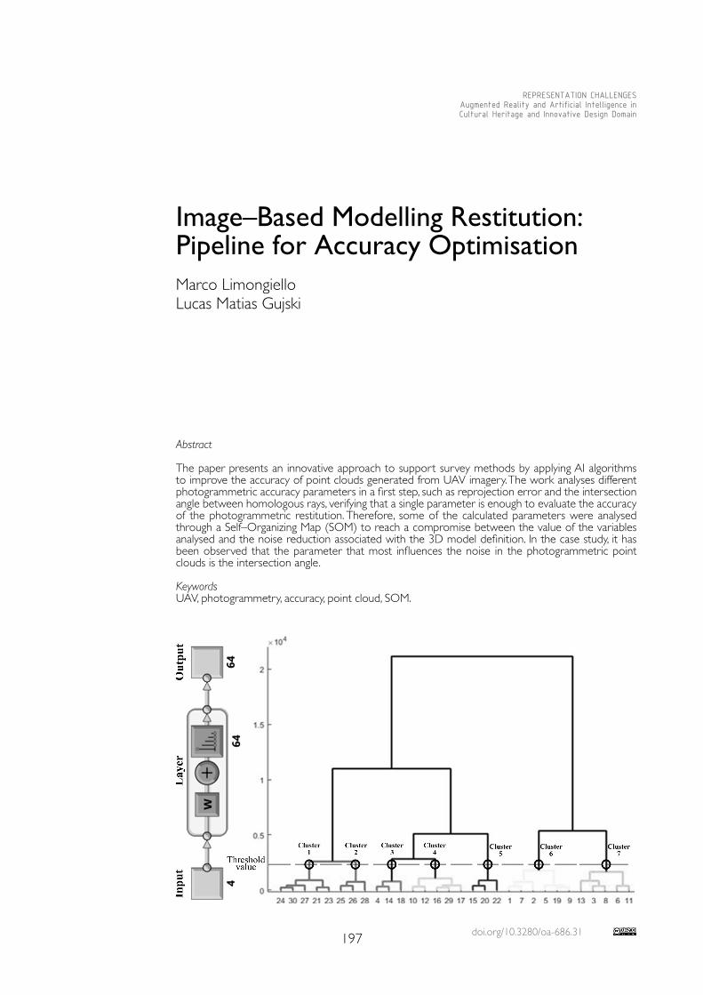
doi.org/10.3280/oa-686.31197
REPRESENTATION CHALLENGESAugmented Reality and Artificial Intelligence in Cultural Heritage and Innovative Design Domain
Abstract
The paper presents an innovative approach to support survey methods by applying AI algorithms to improve the accuracy of point clouds generated from UAV imagery. The work analyses different photogrammetric accuracy parameters in a first step, such as reprojection error and the intersection angle between homologous rays, verifying that a single parameter is enough to evaluate the accuracy of the photogrammetric restitution. Therefore, some of the calculated parameters were analysed through a Self–Organizing Map (SOM) to reach a compromise between the value of the variables analysed and the noise reduction associated with the 3D model definition. In the case study, it has been observed that the parameter that most influences the noise in the photogrammetric point clouds is the intersection angle.
KeywordsUAV, photogrammetry, accuracy, point cloud, SOM.
Image–Based Modelling Restitution: Pipeline for Accuracy Optimisation Marco LimongielloLucas Matias Gujski
198
Introduction
During the past ten years, the application of photogrammetry in digital 3D recording has grown greatly. In fact, due to the development of the Computer Vision technology and the Structure of Motion (SfM) algorithms, the processing time of the mostly automatised pho-togrammetric workflow has accelerated exponentially, solving what was once a well–known weakness [Falkingham 2012, pp. 1-15]. In addition, thanks to their technological develop-ment, the Unmanned Aerial Vehicles (UAV) have become easier to pilot and more reliable, a fact that indirectly promotes the growth of the photogrammetric applications, especially at a medium and large scale. Due to the acquisition speed and the transportability of the vehicle, the technology is indeed very versatile, allowing these instruments to be used in different applications [Fernández–Hernandez 2014, pp. 128-145].A topic debated in the scientific world is the evaluation of the accuracy of point clouds, partic-ularly of the Tie points (TP), generated by processing either UAV or terrestrial, also known as Close Range images. A low accuracy of the model may, in fact, invalidate the high resolution of the data, thereby vitiating the graphic scale and derived products (i.e., plan, section, elevation). Especially in the Cultural Heritage sector, the accuracy of the metric system must be evaluated too, in order to avoid ‘incorrect’ documentation from the metric perspective.A sparse point cloud just composed of TPs is the first stage to obtain a complete 3D model; however, it is obvious that there are lower quality TPs. It is therefore appropriate to delete them to not affect the results of the subsequent steps. Most photogrammetric software offers the possibility to filter the TPs only based on an estimation of the Reprojection Error (RE) parameter associated with each TP [Barba 2019, pp. 1-19].In this work we propose an algorithm and a clustering method based on the Self–Organiz-ing Maps (SOM), a type of neural network trained using unsupervised learning to produce a representation (usually a two–dimensional map) of the input data space.SOM was needed to select the groups of points with similar characteristics that produce more noise, so to obtain a TP cloud containing just the points with greater accuracy. The sub-division of the TP cloud into different clusters made possible its discretization into different accuracy classes, which can be activated or not according to the level of detail to be pursued.
Case Study and Data Acquisition
The case study considered to develop this work is the Norman–Swabian Castle of Vibo Valentia, surveyed using a UAV in 2017. Currently, the castle hosts the Archaeological Museum ‘Vito Capialbi’ and the provincial offices of the Department of Cultural Heritage.The UAV system used for this application is a DJI Inspire with a net weight of the sensor of about 3 kg. The installed Zenmuse X3 camera has a sensor of 1/2.3”, with a resolution of 12 megapixel (4096x2160 pixels, 6.17 x 4.55 mm, Pixel Size of 1.56 Micron), a focal length of 4 mm and a Field of View – FOV 94°. The images were acquired through two different modalities: firstly, 106 nadir images were acquired with an automatic double–grid flight plan at a relative altitude of 25 m from the castle’s inner forecourt, taking into account an overlap and a sidelap of 80% and 60% respectively. Subsequently, in manual mode, 950 oblique images with different inclinations (30°–60°) were acquired, with the main objective to reconstruct the external and internal facades of the castle. The GSD, from the calcu-lated data available, has been estimated on average considering also the oblique images at 1.3 cm/px, while considering only the nadiral images the GSD is about 1 cm/px. To support the photogrammetric project, 10 Ground Control Points (GCPs) were measured to georeference and assess the accuracy of the generated 3D model and orthophotos. The GCPs were materialized on the ground, using photogrammetric targets (30 × 30 cm) and topographic nails. The GNSS survey refers to the Italian geodetic and cartographic system UTM/ETRF00 and was used the technique network Real Time Kinematic (nRTK). The instrumentation used to measure each target consists of an antenna with a built–in receiver of the Geomax Zenith 25. The accuracy obtained in planimetry is, on average, subcentimetric, while it is around 2.5 cm in altimetry.
199
Developed Methodology and Quality Features
In order to generate a 3D model of the surveyed area, the Agisoft Metashape software was used. The following parameters have been set to process the point cloud: in the ‘Align Photos’ stage, accuracy = High (original image), while the calculation of Keypoints and TPs have been programmed as unlimited. The professional version of Agisoft Metashape uses Python 3 as scripting engine and has therefore better interfaces for the purposes of ex-tracting the very inherent reconstruction accuracy parameters that we wanted to export.The following quality features were examined in detail.• Reprojection Error : the geometric error, corresponding to the image distance between the projected point and the measured point [James 2017, pp. 51-66], is defined as Repro-jection Error (RE). It is used to measure how accurately an estimated 3D point recreates the true projection of the point. The frequency distribution of the REs that better fit the data was analysed using Matlab (i.e. the Statistics toolbox). The distribution was used to exclude the external values, that are considered outliers at a selected experimental threshold. The algorithm implemented in the Python environment has been used to remove the 3D point above the threshold of the statistical significance coefficient (α).
• Angle between homologous points and Average distance: by estimating the angle be-tween the two projection lines (called the ‘intersection angle’), the Base/Height ratio (one of the parameters that have the greatest impact on the accuracy of the photogram-metric project [Kraus 2007]) is analysed. The photogrammetry software used does not give the value of this angle in the output, so we implemented a Python algorithm. The intersection angle calculation was executed using all the image pairs that contain the i–th TP; once the intersection angle for each pair had been calculated, it was possible to finally determine the average intersection angle between the n images that contain the point, removing the extreme values. Using the number of images and distances already calcu-lated, the average distance between the i–th TP and the n images, was calculated. Finally, with each Tie Point extracted, the proposed method associates the average distance and the average angle value obtained. The whole process is implemented in Python.
• Image redundancy: this parameter is the number of photogrammetric shots implement-ed within the SfM process, for the reconstruction of the i–th TP in 3D space. With the same other parameters of photogrammetric accuracy, it is assumed that as the image redundancy increases, the metric quality of the TP point cloud improves.
• SOM – Self–organizing map [Kohonen 2001]: is an artificial neural network machine learning technique [Teruggi 2020, pp. 1-27] usually used for visualization and analysis of high–dimensional data. Moreover, SOM is used for data clustering. Self–organizing maps can be combined with dimensionality reduction methods as multi–dimensional scaling [Kurasova 2011, pp. 115-134]. The number of clusters to be brought into the accuracy analysis is extracted from the graphical representation of the dendrogram. A dendrogram (in first page) is a diagram representing a tree that shows the hierarchical relationship between object and used to visualise the similarity in the clustering process. In clustering techniques, the dendrogram is used to provide a graphic representation.
Analysis of Individual Accuracy Parameters
A very noisy standard portion, 50 cm wide, containing vertical walls and the inner yard, was analysed for the purpose of the study. The first parameter considered is RE. The Weibull distribution is the one best–fitting the interpolated data, therefore it was chosen to estimate the characteristic factors of the distribution. The distribution study was used to determine the threshold values, in order to remove the points with associated RE values above the estimated threshold values, more specifically those above the 99, 95, 90 percentiles.It is possible to observe (fig. 1) how the filtering of the point cloud by analysing the RE and the statistical approach does not generate a good degree of filtering for the section under consid-eration; in fact, the procedure removes some spots mostly scattered, but it does not lead to great advantages in noise reduction. However, most of the isolated points were not filtered out.
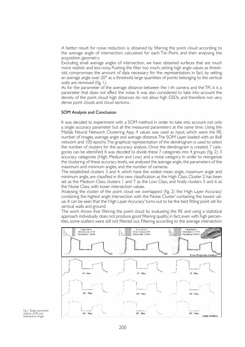
200
A better result for noise reduction is obtained by filtering the point cloud according to the average angle of intersection, calculated for each Tie–Point, and then analysing the acquisition geometry.Excluding small average angles of intersection, we have obtained surfaces that are much more realistic and less noisy. Pushing the filter too much, setting high angle values as thresh-old, compromises the amount of data necessary for the representation; in fact, by setting an average angle over 20° as a threshold, large quantities of points belonging to the vertical walls are removed (fig. 1).As for the parameter of the average distance between the i–th camera and the TPi, it is a parameter that does not affect the noise. It was also considered to take into account the density of the point cloud: high distances do not allow high GSDs, and therefore not very dense point clouds and cloud sections.
SOM Analysis and Conclusion
It was decided to experiment with a SOM method in order to take into account not only a single accuracy parameter but all the measured parameters at the same time. Using the Matlab Neural Network Clustering App, 4 values was used as input, which were the RE, number of images, average angle and average distance. The SOM Layer loaded with an 8x8 network and 100 epochs. The graphical representation of the dendrogram is used to select the number of clusters for the accuracy analysis. Once the dendrogram is created, 7 cate-gories can be identified. It was decided to divide these 7 categories into 4 groups (fig. 2): 3 accuracy categories (High, Medium and Low) and a noise category. In order to reorganize the clustering of these accuracy levels, we analysed the average angle, the parameters of the maximum and minimum angles, and the number of cameras.The established clusters 3 and 4, which have the widest mean angle, maximum angle and minimum angle, are classified in this new classification as the High Class. Cluster 2 has been set as the Medium Class, clusters 1 and 7 as the Low Class, and finally clusters 5 and 6 as the Noise Class, with lower intersection values.Analysing the cluster of the point cloud we overlapped (fig. 2) the ‘High Layer Accuracy’ containing the highest angle intersection with the ‘Noise Cluster’ containing the lowest val-ue. It can be seen that the ‘High Layer Accuracy’ turns out to be the best fitting point set for vertical walls and ground.The work shows that filtering the point cloud by evaluating the RE and using a statistical approach individually does not produce good filtering quality; in fact, even with high percen-tiles, some outliers were still not filtered out. Filtering according to the average intersection
Fig. 1. Single parameter analysis of RE and intersection Angle.
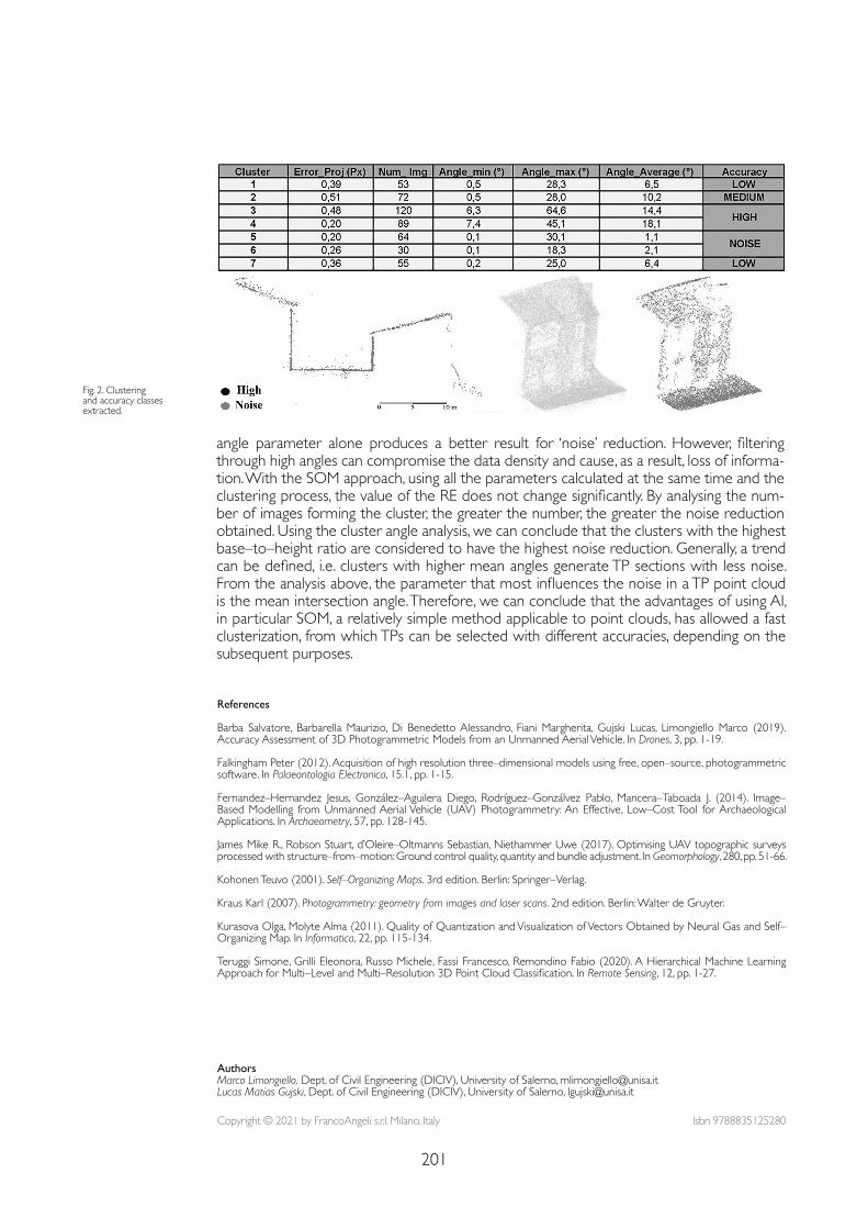
201
angle parameter alone produces a better result for ‘noise’ reduction. However, filtering through high angles can compromise the data density and cause, as a result, loss of informa-tion. With the SOM approach, using all the parameters calculated at the same time and the clustering process, the value of the RE does not change significantly. By analysing the num-ber of images forming the cluster, the greater the number, the greater the noise reduction obtained. Using the cluster angle analysis, we can conclude that the clusters with the highest base–to–height ratio are considered to have the highest noise reduction. Generally, a trend can be defined, i.e. clusters with higher mean angles generate TP sections with less noise. From the analysis above, the parameter that most influences the noise in a TP point cloud is the mean intersection angle. Therefore, we can conclude that the advantages of using AI, in particular SOM, a relatively simple method applicable to point clouds, has allowed a fast clusterization, from which TPs can be selected with different accuracies, depending on the subsequent purposes.
References
Barba Salvatore, Barbarella Maurizio, Di Benedetto Alessandro, Fiani Margherita, Gujski Lucas, Limongiello Marco (2019).Accuracy Assessment of 3D Photogrammetric Models from an Unmanned Aerial Vehicle. In Drones, 3, pp. 1-19.
Falkingham Peter (2012). Acquisition of high resolution three–dimensional models using free, open–source, photogrammetric software. In Palaeontologia Electronica, 15.1, pp. 1-15.
Fernandez–Hernandez Jesus, González–Aguilera Diego, Rodríguez–Gonzálvez Pablo, Mancera–Taboada J. (2014). Image–Based Modelling from Unmanned Aerial Vehicle (UAV) Photogrammetry: An Effective, Low–Cost Tool for Archaeological Applications. In Archaeometry, 57, pp. 128-145.
James Mike R., Robson Stuart, d’Oleire–Oltmanns Sebastian, Niethammer Uwe (2017). Optimising UAV topographic surveys processed with structure–from–motion: Ground control quality, quantity and bundle adjustment. In Geomorphology, 280, pp. 51-66.
Kohonen Teuvo (2001). Self–Organizing Maps. 3rd edition. Berlin: Springer–Verlag.
Kraus Karl (2007). Photogrammetry: geometry from images and laser scans. 2nd edition. Berlin: Walter de Gruyter.
Kurasova Olga, Molyte Alma (2011). Quality of Quantization and Visualization of Vectors Obtained by Neural Gas and Self–Organizing Map. In Informatica, 22, pp. 115-134.
Teruggi Simone, Grilli Eleonora, Russo Michele, Fassi Francesco, Remondino Fabio (2020). A Hierarchical Machine Learning Approach for Multi–Level and Multi–Resolution 3D Point Cloud Classification. In Remote Sensing, 12, pp. 1-27.
Fig. 2. Clustering and accuracy classes extracted.
Copyright © 2021 by FrancoAngeli s.r.l. Milano, Italy Isbn 9788835125280
AuthorsMarco Limongiello, Dept. of Civil Engineering (DICIV), University of Salerno, [email protected] Matias Gujski, Dept. of Civil Engineering (DICIV), University of Salerno, [email protected]

doi.org/10.3280/oa-686.32203
REPRESENTATION CHALLENGESAugmented Reality and Artificial Intelligence in Cultural Heritage and Innovative Design Domain
Abstract
The paper results from preliminary research experiences focused on the use of Artificial Intelligence as a tool for processing the large amount of data that can be obtained from digitisation processes ap-plied to the Architectural Heritage. The new interpretative scenarios will be outlined starting, on one hand, from a series of consolidated experiences in the field of three–dimensional survey, modelling and semantic enrichment, and, on the other, from the use of Augmented Reality tools for the fruition of the Heritage itself.The research aims to further investigate the great potential of processing point cloud models using Artificial Intelligence, to extrapolate, from the digitized data, information levels that go beyond shapes, offering better integration within the Building Information Modeling environment.
Keywordscultural heritage, point cloud, artificial intelligence, H–BIM, data management.
From AI to H–BIM: New Interpretative Scenarios in Data ProcessingFederica MaiettiMarco MediciErnesto Iadanza
204
Research Scenario
Today’s increasingly fast digital surveying tools boost the speed of scanning, but also the amount of data captured. This trend is leading to the development of research avenues in which Artificial Intelligence (AI) is aimed at the segmentation and discretization of data, mainly, but not only, for the recognition of shapes (object detection) and structures [Grilli, Menna, Remondino 2017]. This procedure is triggering a debate, still unresolved, that in-volves the interpretative aspects of the uniqueness that characterises Cultural Heritage, while the need to trace specific directions emerges more and more.The research therefore aims to further investigate the great potential of processing point cloud models using AI towards data integration in Building Information Modeling (BIM) en-vironment applied to Heritage.The definition of a methodology able to automatically recognise specific characteristics from 3D point clouds can lead to the definition of new data sets, aimed at documentation, conservation and restoration, which can enrich BIM models, also thanks to a now necessary inclusion of advanced features in the Industry Foundation Classes (IFC) standard through new and shared Property Sets. The integration of advanced surveying techniques, Machine Learning (ML) and Deep Learn-ing (DL) in new standards for Heritage information modelling (H–BIM) can have a great impact on the process of documentation, representation, analysis and interpretation of Her-itage [Bienvenido–Huertas et al. 2019], creating new representation levels and application scenarios in Heritage management, conservation and restoration. This research scenario is strongly connected to an additional data management level, related to the application of Augmented Reality tools aimed at ‘onsite’ data exploitation. A series of experiments were carried out in order to create semantically enriched digital models in BIM environment within an open standard web platform [1]. Data access to the platform via Augmented Reality applications allows Heritage fruition, analysis, monitoring and assessment of Heritage buildings also for conservative purposes. In this direction, the research includes the use of semi–automatically processed data, related to the state of conservation and technical assessment for asset management, maintenance and decision–making purposes by using mobile devices.
Digital Data Processing for Heritage Conservation The need to document Cultural Heritage – characterized by uniqueness and complexity – has led to an increasingly widespread use of 3D surveying technologies. These technologies are able to produce very accurate models in a very short time. While, during the on–site survey, the advantages of speed and metric accuracy are evident, the processing of these data can be very time–consuming and complex. Today, the trend is to produce even fast-er and more robotic instruments (mobile devices) [Gallozzi, Senatore, Strollo 2019] that make it possible to scan (especially indoor environments) in a single shot. This produces an increase in scanning speed, but also a further increase in the amount of surveyed data. This course is leading to the development of a whole Artificial Intelligence line of research aimed at segmenting and discretizing data.A further layer to be added to this framework is related to digital data representation and management. BIM is considered today the latest frontier of three–dimensional architectural representation, design and management of digital data, where interoperability [Osello et. al. 2015] is one of the central attributes. BIM software applications are growing rapidly and they are also becoming increasingly essential in conservation and restoration applications [Chiabrando, Lo Turco, Rinaudo 2017], thanks to their ability to integrate different informa-tion and features in relation to the model geometric shapes [Apollonio, Gaiani, Sun 2017]. However, the IFC, the interoperable standard for BIM, currently lacks in providing a solution for managing the preservation of the Architectural Heritage. Moreover, unlike geometric characteristics [Murtiyoso, Grussenmeyer 2019], an automatic process does not uniquely determine surface features. They become consistent and significant only if critically inter-
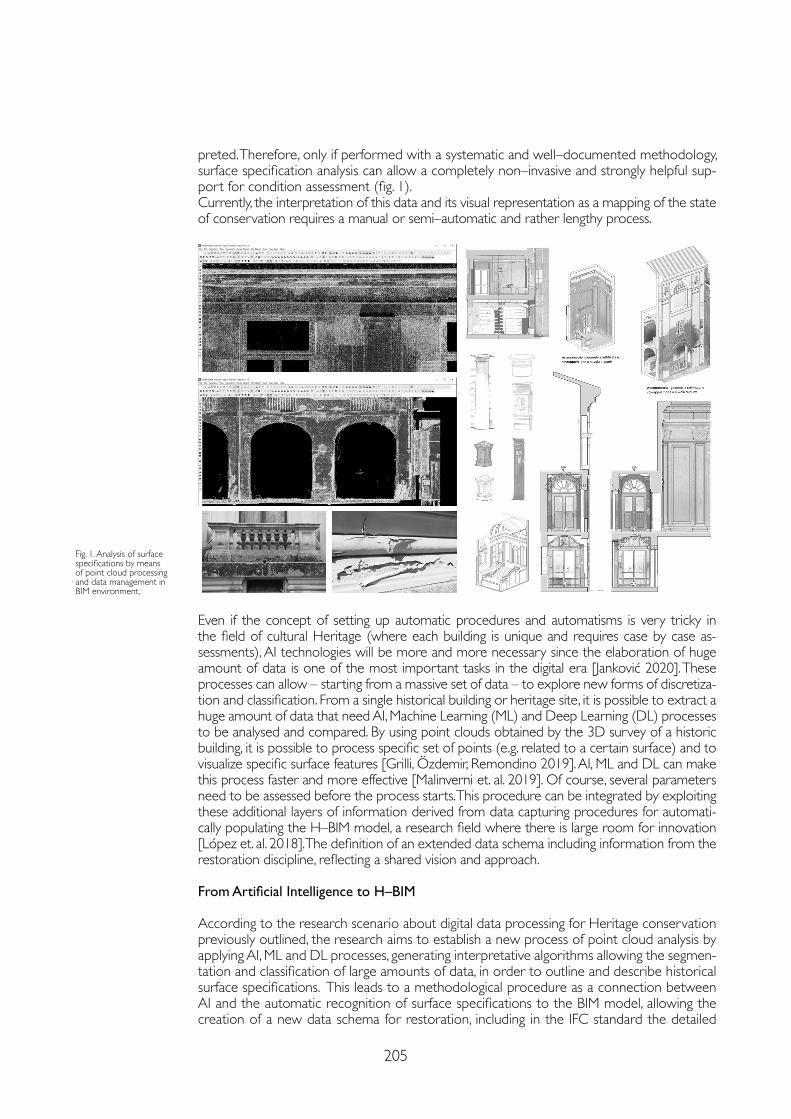
205
preted. Therefore, only if performed with a systematic and well–documented methodology, surface specification analysis can allow a completely non–invasive and strongly helpful sup-port for condition assessment (fig. 1).Currently, the interpretation of this data and its visual representation as a mapping of the state of conservation requires a manual or semi–automatic and rather lengthy process.
Fig. 1. Analysis of surface specifications by means of point cloud processing and data management in BIM environment.
Even if the concept of setting up automatic procedures and automatisms is very tricky in the field of cultural Heritage (where each building is unique and requires case by case as-sessments), AI technologies will be more and more necessary since the elaboration of huge amount of data is one of the most important tasks in the digital era [Janković 2020]. These processes can allow – starting from a massive set of data – to explore new forms of discretiza-tion and classification. From a single historical building or heritage site, it is possible to extract a huge amount of data that need AI, Machine Learning (ML) and Deep Learning (DL) processes to be analysed and compared. By using point clouds obtained by the 3D survey of a historic building, it is possible to process specific set of points (e.g. related to a certain surface) and to visualize specific surface features [Grilli, Özdemir, Remondino 2019]. AI, ML and DL can make this process faster and more effective [Malinverni et. al. 2019]. Of course, several parameters need to be assessed before the process starts. This procedure can be integrated by exploiting these additional layers of information derived from data capturing procedures for automati-cally populating the H–BIM model, a research field where there is large room for innovation [López et. al. 2018]. The definition of an extended data schema including information from the restoration discipline, reflecting a shared vision and approach.
From Artificial Intelligence to H–BIM
According to the research scenario about digital data processing for Heritage conservation previously outlined, the research aims to establish a new process of point cloud analysis by applying AI, ML and DL processes, generating interpretative algorithms allowing the segmen-tation and classification of large amounts of data, in order to outline and describe historical surface specifications. This leads to a methodological procedure as a connection between AI and the automatic recognition of surface specifications to the BIM model, allowing the creation of a new data schema for restoration, including in the IFC standard the detailed
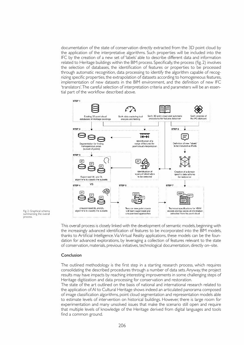
206
documentation of the state of conservation directly extracted from the 3D point cloud by the application of the interpretative algorithms. Such properties will be included into the IFC by the creation of a new set of ‘labels’ able to describe different data and information related to Heritage buildings within the BIM process. Specifically, the process (fig. 2) involves the selection of databases, the identification of features or properties to be processed through automatic recognition, data processing to identify the algorithm capable of recog-nizing specific properties, the extrapolation of datasets according to homogeneous features, implementation of new datasets in the BIM environment, and the definition of new IFC ‘translators’. The careful selection of interpretation criteria and parameters will be an essen-tial part of the workflow described above.
Fig. 2. Graphical schema summarizing the overall process.
This overall process is closely linked with the development of semantic models, beginning with the increasingly advanced identification of features to be incorporated into the BIM models, thanks to Artificial Intelligence. Via Virtual Reality applications, these models can be the foun-dation for advanced explorations, by leveraging a collection of features relevant to the state of conservation, materials, previous initiatives, technological documentation, directly on–site.
Conclusion
The outlined methodology is the first step in a starting research process, which requires consolidating the described procedures through a number of data sets. Anyway, the project results may have impacts by reaching interesting improvements in some challenging steps of Heritage digitization and data processing for conservation and restoration.The state of the art outlined on the basis of national and international research related to the application of AI to Cultural Heritage shows indeed an articulated panorama composed of image classification algorithms, point cloud segmentation and representation models able to estimate levels of intervention on historical buildings. However, there is large room for experimentation and many unsolved issues that make the scenario still open and require that multiple levels of knowledge of the Heritage derived from digital languages and tools find a common ground.
207
Notes
[1] These experimentations have been developed under the Horizon 2020 project “INCEPTION – Inclusive Cultural Heritage through 3D semantic modeling”, funded by the European Commission in 2015 and concluded in 2019 (GA 665220). The project, leaded by the Department of Architecture of the University of Ferrara, focused on semantic modelling of Cultural Heritage buildings using BIM to be managed through the INCEPTION web based platform for advanced deployment and valorisation of enriched 3D models, towards a better knowledge sharing and enhancement of European Heritage.
References
Apollonio Fabrizio Ivan, Gaiani Marco, Sun Zheng (2017). A reality integrated BIM for architectural Heritage conservation. In Ippolito Alfonso (ed.). In Handbook of research on emerging technologies for architectural and archaeological Heritage. Hershey, PA: IGI Global, pp. 31-65.
Bienvenido–Huertas David, Nieto–Julián Juan Enrique, Moyano Juan José, Macías–Bernal Juan Manuel, Castro José (2019). Implementing Artificial Intelligence in H–BIM Using the J48 Algorithm to Manage Historic Buildings. In International Journal of Architectural Heritage, pp. 1148-1160.
Chiabrando Filiberto, Lo Turco Massimiliano, Rinaudo Fulvio (2017). Modeling the decay in an HBIM starting from 3D point clouds. A followed approach for cultural Heritage knowledge. In International Archives of the Photogrammetry, Remote Sensing and Spatial Information Sciences, XLII–2/W5, pp. 605-612.
Gallozzi Arturo, Senatore Luca J., Strollo, Rodolfo M. (2019). An overview on Robotic Applications for Cultural Heritage and Built Cultural Heritage. In SCIRES–IT–SCIentific RESearch and Information Technology, 9 (2), pp. 47-56.
Grilli Eleonora, Menna, Fabio, Remondino Fabio (2017). A review of point clouds segmentation and classification algorithms. In The International Archives of Photogrammetry, Remote Sensing and Spatial Information Sciences, XLII–2/W3, pp. 339-344.
Grilli Eleonora, Özdemir Emre, Remondino Fabio (2019). Application of Machine and Deep Learning Strategies for the Classification of Heritage Point Clouds. In International Archives of the Photogrammetry, Remote Sensing and Spatial Information Sciences, XLII–4/W18, pp. 447-454.
Janković Radmila (2020). Machine Learning Models for Cultural Heritage Image Classification: Comparison Based on Attribute Selection. In Information, 11 (1), 12, pp. 1-13.
López J. Facundo, Lerones Pedro M., Llamas José, Gómez–García–Bermejo Jaime, Zalama Eduardo (2018). A review of Heritage building information modeling (H–BIM). In Multimodal Technologies and Interaction, 2 (2), 21, pp. 1-29.
Malinverni Eva S., Pierdicca Roberto, Paolanti Marina, Martini Massimo, Morbidoni Christian, Matrone Francesca, Lingua Andrea (2019). Deep Learning for Semantic Segmentation of 3D Point Cloud. In International Archives of the Photogrammetry, Remote Sensing and Spatial Information Sciences, XLII–2/W15, pp. 735-742.
Murtiyoso Arnadi, Grussenmeyer Pierre (2019). Automatic Heritage Building Point Cloud Segmentation and Classification Using Geometrical Rules. In International Archives of the Photogrammetry, Remote Sensing and Spatial Information Sciences, XLII–2/W15, pp. 821-827.
Osello Anna, Acquaviva Andrea, Dalmasso Daniele, Erba David, Del Giudice Matteo, Macii Enrico, Patti Edoardo (2015). BIM and Interoperability for Cultural Heritage through ICT. In Brusaporci Stefano (ed.). Handbook of Research on Emerging Digital Tools for Architectural Surveying, Modeling, and Representation. Hershey, PA: IGI Global, pp. 274-291.
At European level, several projects and initiatives are developing the use of BIM for regen-eration, but there is still room for progress in the field of application to cultural Heritage. Through the described methodology, geometries and shapes can be integrated with differ-ent information regarding materials, state of conservation, historical documentation, previ-ous restoration works, etc.AI can lead to the development of new, increasingly targeted segmentation algorithms, also to trigger new uses and re–uses of digitised Heritage.Future research scenarios foresee an integration of Computer Vision and Augmented Re-ality in the process, for ‘onsite’ applications, exploiting the data extrapolated through the described procedure, for the enhancement and management of Cultural Heritage, for mon-itoring or architectural restoration project.
Copyright © 2021 by FrancoAngeli s.r.l. Milano, Italy Isbn 9788835125280
AuthorsFederica Maietti, Dept. of Architecture, University of Ferrara, INCEPTION Spin–off, [email protected] Medici, Dept. of Architecture, University of Ferrara, INCEPTION Spin–off, [email protected] Iadanza, Dept. of Architecture, University of Ferrara, INCEPTION Spin–off, [email protected]

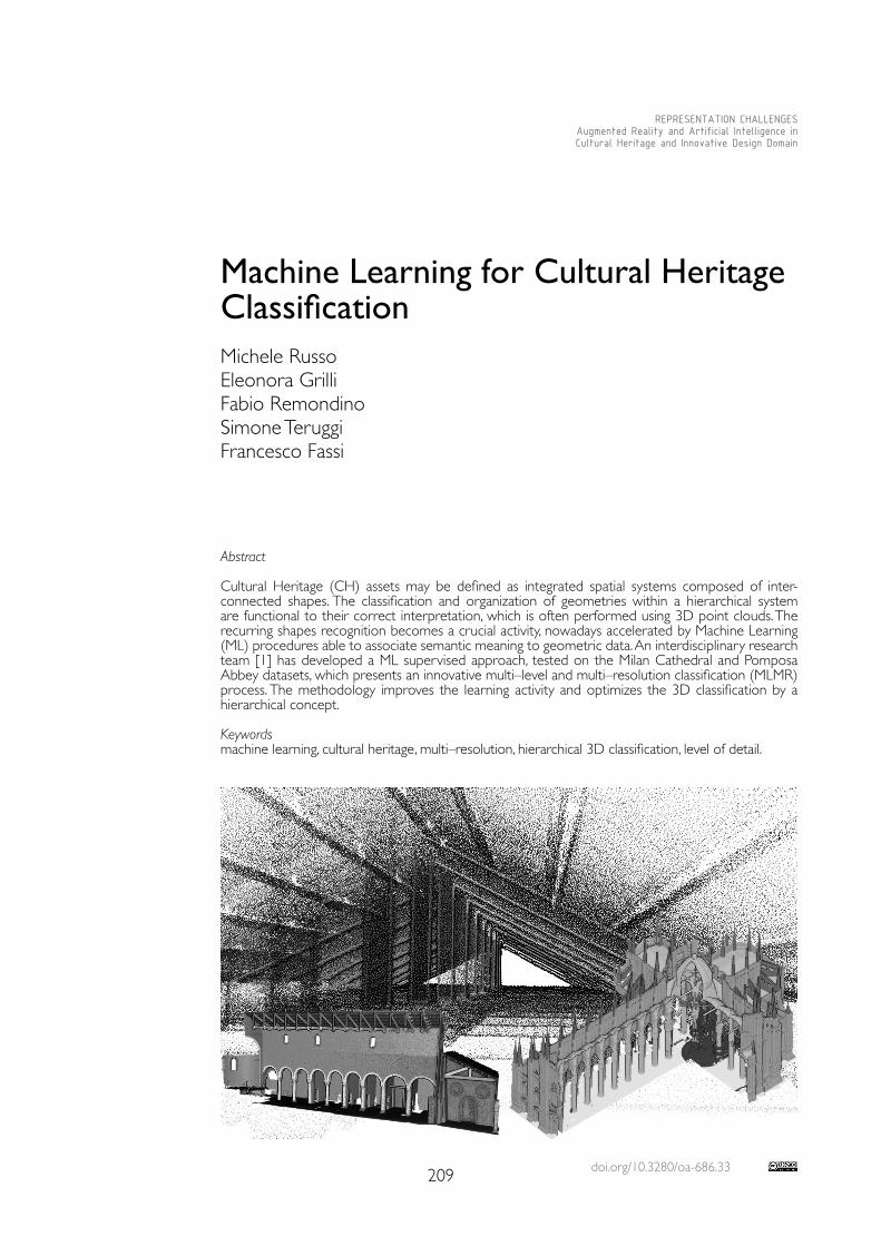
doi.org/10.3280/oa-686.33209
REPRESENTATION CHALLENGESAugmented Reality and Artificial Intelligence in Cultural Heritage and Innovative Design Domain
Abstract
Cultural Heritage (CH) assets may be defined as integrated spatial systems composed of inter-connected shapes. The classification and organization of geometries within a hierarchical system are functional to their correct interpretation, which is often performed using 3D point clouds. The recurring shapes recognition becomes a crucial activity, nowadays accelerated by Machine Learning (ML) procedures able to associate semantic meaning to geometric data. An interdisciplinary research team [1] has developed a ML supervised approach, tested on the Milan Cathedral and Pomposa Abbey datasets, which presents an innovative multi–level and multi–resolution classification (MLMR) process. The methodology improves the learning activity and optimizes the 3D classification by a hierarchical concept. Keywordsmachine learning, cultural heritage, multi–resolution, hierarchical 3D classification, level of detail.
Machine Learning for Cultural Heritage ClassificationMichele RussoEleonora GrilliFabio RemondinoSimone Teruggi Francesco Fassi
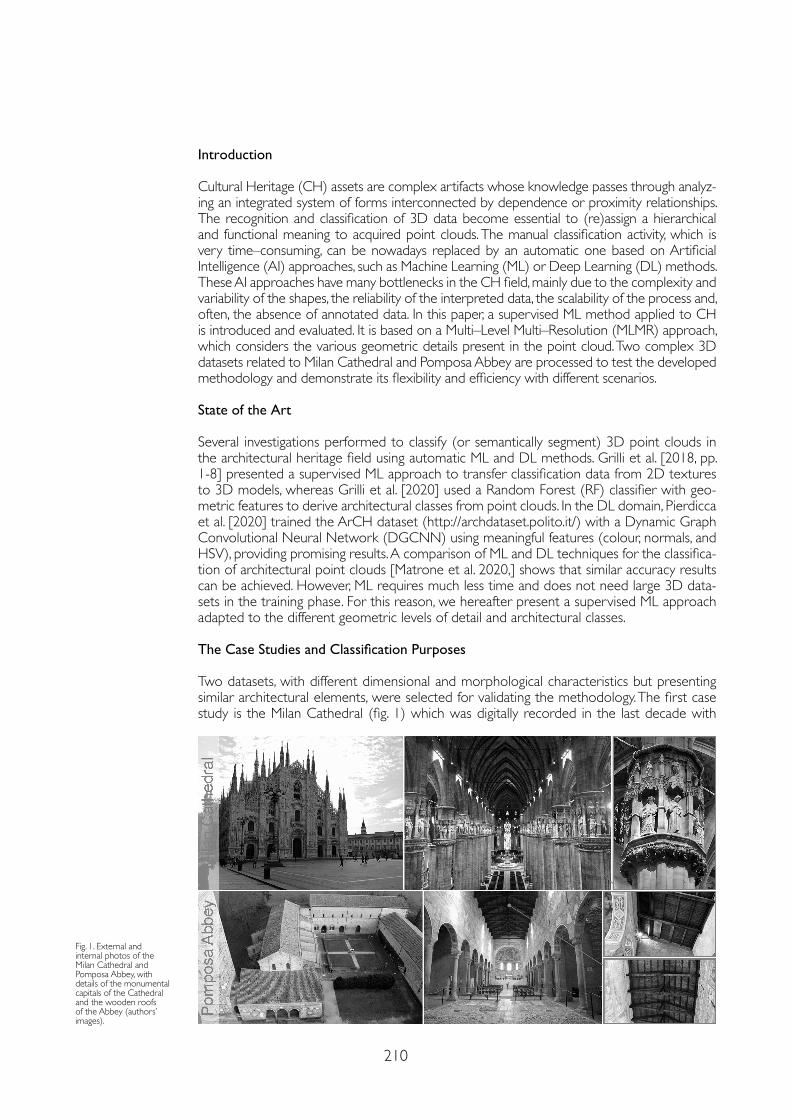
210
Introduction
Cultural Heritage (CH) assets are complex artifacts whose knowledge passes through analyz-ing an integrated system of forms interconnected by dependence or proximity relationships. The recognition and classification of 3D data become essential to (re)assign a hierarchical and functional meaning to acquired point clouds. The manual classification activity, which is very time–consuming, can be nowadays replaced by an automatic one based on Artificial Intelligence (AI) approaches, such as Machine Learning (ML) or Deep Learning (DL) methods. These AI approaches have many bottlenecks in the CH field, mainly due to the complexity and variability of the shapes, the reliability of the interpreted data, the scalability of the process and, often, the absence of annotated data. In this paper, a supervised ML method applied to CH is introduced and evaluated. It is based on a Multi–Level Multi–Resolution (MLMR) approach, which considers the various geometric details present in the point cloud. Two complex 3D datasets related to Milan Cathedral and Pomposa Abbey are processed to test the developed methodology and demonstrate its flexibility and efficiency with different scenarios.
State of the Art
Several investigations performed to classify (or semantically segment) 3D point clouds in the architectural heritage field using automatic ML and DL methods. Grilli et al. [2018, pp. 1-8] presented a supervised ML approach to transfer classification data from 2D textures to 3D models, whereas Grilli et al. [2020] used a Random Forest (RF) classifier with geo-metric features to derive architectural classes from point clouds. In the DL domain, Pierdicca et al. [2020] trained the ArCH dataset (http://archdataset.polito.it/) with a Dynamic Graph Convolutional Neural Network (DGCNN) using meaningful features (colour, normals, and HSV), providing promising results. A comparison of ML and DL techniques for the classifica-tion of architectural point clouds [Matrone et al. 2020,] shows that similar accuracy results can be achieved. However, ML requires much less time and does not need large 3D data-sets in the training phase. For this reason, we hereafter present a supervised ML approach adapted to the different geometric levels of detail and architectural classes.
The Case Studies and Classification Purposes
Two datasets, with different dimensional and morphological characteristics but presenting similar architectural elements, were selected for validating the methodology. The first case study is the Milan Cathedral (fig. 1) which was digitally recorded in the last decade with
Fig. 1. External and internal photos of the Milan Cathedral and Pomposa Abbey, with details of the monumental capitals of the Cathedral and the wooden roofs of the Abbey (authors’ images).

211
Fig. 2. A view on the point clouds of the two datasets: The Milan Cathedral (left) and the Pomposa Abbey (right).
several integrated acquisition campaigns to generate parametric models [Fassi et al. 2011, pp. 462-487], and define a complete 3D point cloud (fig. 2) at a uniform average resolu-tion of 5 mm [Achille et al. 2020, pp. 331-341]. The classified point cloud may facilitate the 3D data exploration, allowing the integration between archival sources and surveyed data on a web–based BIM–type platform, which can be consulted in situ or remotely. This data organization can also allow multi–scale planning and implementation of conservation and management projects and the quick extraction of 2D representations already classified. The second case study is the Pomposa Abbey (fig. 1) surveyed in 2014 to generate a complete 3D dataset (fig. 2) at a uniform average resolution of 2 cm [Russo et al. 2014, pp. 305-312]. In this scenario, the 3D classification activity can foster access to the system’s knowledge, supporting its graphic restitution and the monitoring activities at different scales. Besides, it can facilitate the “quantification” of the building, collecting helpful information for planning a conservation intervention and evaluating the transformations over time.
The Methodological Workflow
The high level of complexity of the case studies highlights two different bottlenecks: on the one hand, the processing of massive datasets cannot be simplified unless losing the level of detail useful in the element recognition. On the other hand, the high number of semantic classes raises the management complexity and reduces their identification accuracy [Teruggi et al. 2020]. An iterative methodology [Grilli et al. 2020] has been developed to overcome these bottlenecks, classifying 3D data in multiple steps according to their information levels (fig. 3). The proposed hierarchical structure is referred to the data density, the morphological and compositional complexity, and the classification purpose. At each level of detail (LOD), the workflow foresees two working steps:1) The selection of ‘covariance features’ [Blomey et al. 2014] extracted within specific spheri-cal radii, for the automatic recognition of local geometric characteristics of 3D datum.2) A small manual annotation to train a Random Forest algorithm [Breiman 2001, pp. 5-32], associating each portion identified by the features to architectural meanings.The training dataset’s selection evaluates the presence of the elements to be classifiied.
Fig. 3. Schema of the MLMR iterative process.
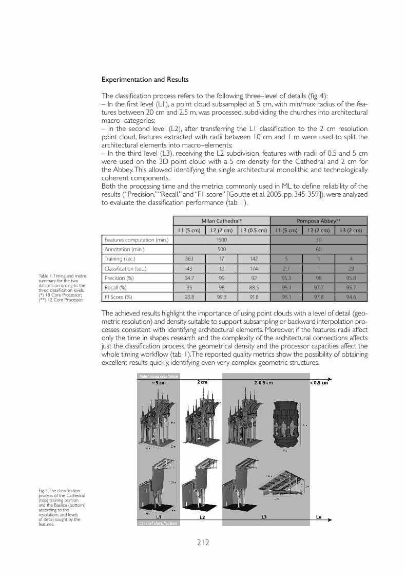
212
Experimentation and Results
The classification process refers to the following three–level of details (fig. 4):– In the first level (L1), a point cloud subsampled at 5 cm, with min/max radius of the fea-tures between 20 cm and 2.5 m, was processed, subdividing the churches into architectural macro–categories;– In the second level (L2), after transferring the L1 classification to the 2 cm resolution point cloud, features extracted with radii between 10 cm and 1 m were used to split the architectural elements into macro–elements;– In the third level (L3), receiving the L2 subdivision, features with radii of 0.5 and 5 cm were used on the 3D point cloud with a 5 cm density for the Cathedral and 2 cm for the Abbey. This allowed identifying the single architectural monolithic and technologically coherent components.Both the processing time and the metrics commonly used in ML to define reliability of the results (“Precision,” “Recall,” and “F1 score” [Goutte et al. 2005, pp. 345-359]), were analyzed to evaluate the classification performance (tab. 1).
Milan Cathedral* Pomposa Abbey**L1 (5 cm) L2 (2 cm) L3 (0.5 cm) L1 (5 cm) L2 (2 cm) L3 (2 cm)
Features computation (min.) 1500 30Annotation (min.) 500 60Training (sec.) 363 17 142 5 1 4
Classification (sec.) 43 12 174 2.7 1 29Precision (%) 94.7 99 92 95.3 98 95.8Recall (%) 95 98 88.5 95.1 97.7 95.7F1 Score (%) 93.8 99.3 91.8 95.1 97.8 94.6
The achieved results highlight the importance of using point clouds with a level of detail (geo-metric resolution) and density suitable to support subsampling or backward interpolation pro-cesses consistent with identifying architectural elements. Moreover, if the features radii affect only the time in shapes research and the complexity of the architectural connections affects just the classification process, the geometrical density and the processor capacities affect the whole timing workflow (tab. 1). The reported quality metrics show the possibility of obtaining excellent results quickly, identifying even very complex geometric structures.
Fig. 4. The classification process of the Cathedral (top) training portion and the Basilica (bottom) according to the resolutions and levels of detail sought by the features.
Table 1. Timing and metric summary for the two datasets according to the three classification levels. (*) 18 Core Processor; (**) 12 Core Processor.
213
Notes
[1] The presented research is the result of the joint work of five authors. M.R. took care of the Introduction and Conclusions, E.G. prepared the State of the art, the methodological workflow and run the case studies, S.T. supported the methodological workflow and experiments, F.F. and F.R. supervised the work and reviewed the paper. All authors shared the analysis of experiments and results.
References
Achille Cristiana, Fassi Francesco, Mandelli Alessandro et al. (2020). From a Traditional to a Digital Site: 2008-2019. The History of Milan Cathedral Surveys. In Digital Transformation of the Design, Construction and Management Processes of the Built Environment. Cham: Springer, pp. 331-341.
Blomley Rosmarie, Weinmann Martin, Leitloff Jens et al. (2014). Shape distribution features for point cloud analysis–a geometric histogram approach on multiple scales. In ISPRS Ann. Photogramm. Remote Sens. Spatial Inf. Sci., 2 (3), pp. 9-16.
Breiman Leo (2001). Random forests. In Machine learning, 45 (1), pp. 5-32.
Fassi Francesco, Achille Cristiana, Fregonese Luigi (2011). Surveying and modelling the main spire of Milan Cathedral using multiple data sources. In The Photogrammetric Record, 26 (136), pp. 462-487.
Goutte Cyril, Gaussier Eric (2005). March. A probabilistic interpretation of precision recall and F–score, with implication for evaluation. In European conference on information retrieval. Berlin: Springer, pp. 345-359.
Grilli Eleonora, Dininno Domenica, Marsicano Lucia et al. (2018). Supervised segmentation of 3D cultural heritage. In 3rd Digital Heritage International Congress (DigitalHERITAGE). USA: IEEE, pp. 1-8.
Grilli Eleonora, Remondino Fabio (2020). Machine Learning Generalisation across Different 3D Architectural Heritage. In ISPRS International Journal of Geo–Information, 9 (6), 379, pp. 1-19.
Matrone Francesca, Grilli Eleonora, Martini Massimo et al. (2020). Comparing Machine and Deep Learning Methods for Large 3D Heritage Semantic Segmentation. In ISPRS International Journal of Geo–Information, 9 (9), 535, pp. 1-22.
Pierdicca Roberto, Paolanti Marina, Matrone Fracesca et al. (2020). Point Cloud Semantic Segmentation Using a Deep Learning Framework for Cultural Heritage. In Remote Sensing, 12 (6), 1005, pp. 1-23.
Russo Michele, Manferdini Anna Maria (2014). Integration of image and range–based techniques for surveying complex architectures. In ISPRS Ann. Photogramm. Remote Sens. Spatial Inf. Sci., 2 (5), pp. 305-312.
Teruggi Simone, Grilli Eleonora, Russo Michele (2020). A Hierarchical Machine Learning Approach for Multi–Level and Multi–Resolution 3D Point Cloud Classification. In Remote Sensing, 12 (16), 2598, pp. 1-27.
Conclusions and Future Research
In this paper, a new iterative strategy for supervised automatic ML classification of 3D point clouds of complex Cultural Heritage is presented. Few annotated 3D data were necessary and very detailed semantic segmentation results could be achieved. The cognitive contribu-tion in the supervision phase is crucial in the correct definition of classes and the choice of training and validation sets. These steps are also critical to adapt the general process to the specific case study and different purposes.In the future, the relationship between classification levels, cloud resolution, and feature search radii will be more investigated, defining a general multi–scenario approach. Besides, the introduction of photogrammetry into the process as a tool to acquire an additional level of detail may be of particular interest. Scan–to–BIM and reality–based modelling from classified data may be specific topics to analyses, supporting the point cloud seg–mentation purposes. A final goal concerns the creation of a classification framework that is more user–friendly for non–experts in the field, broadening its application to different disciplinary areas.
Copyright © 2021 by FrancoAngeli s.r.l. Milano, Italy Isbn 9788835125280
AuthorsMichele Russo, Dept of History, Representation and Restoration of Architecture, Sapienza University of Rome, [email protected] Grilli, 3D Optical Metrology (3DOM) unit, Bruno Kessler Foundation (FBK), [email protected] Remondino, 3D Optical Metrology (3DOM) unit, Bruno Kessler Foundation (FBK), [email protected] Teruggi, 3DSurveyGroup – ABCLab – Politecnico di Milano, [email protected] Fassi, 3DSurveyGroup – ABCLab – Politecnico di Milano, [email protected]

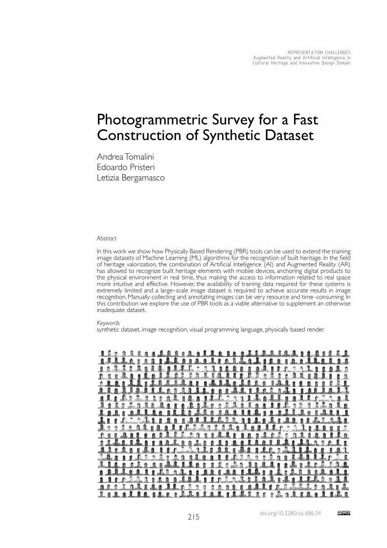
doi.org/10.3280/oa-686.34215
REPRESENTATION CHALLENGESAugmented Reality and Artificial Intelligence in Cultural Heritage and Innovative Design Domain
Abstract
In this work we show how Physically Based Rendering (PBR) tools can be used to extend the training image datasets of Machine Learning (ML) algorithms for the recognition of built heritage. In the field of heritage valorization, the combination of Artificial Intelligence (AI) and Augmented Reality (AR) has allowed to recognize built heritage elements with mobile devices, anchoring digital products to the physical environment in real time, thus making the access to information related to real space more intuitive and effective. However, the availability of training data required for these systems is extremely limited and a large–scale image dataset is required to achieve accurate results in image recognition. Manually collecting and annotating images can be very resource and time–consuming. In this contribution we explore the use of PBR tools as a viable alternative to supplement an otherwise inadequate dataset.
Keywordssynthetic dataset, image recognition, visual programming language, physically based render.
Photogrammetric Survey for a Fast Construction of Synthetic DatasetAndrea TomaliniEdoardo PristeriLetizia Bergamasco
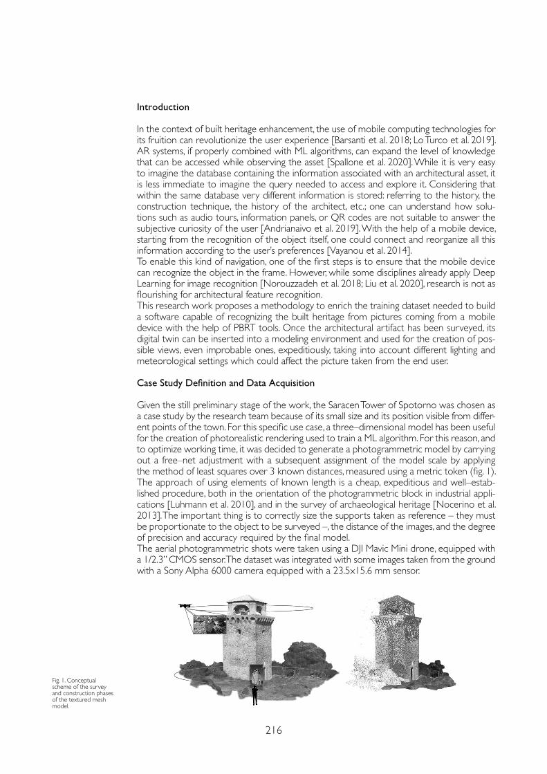
216
Introduction
In the context of built heritage enhancement, the use of mobile computing technologies for its fruition can revolutionize the user experience [Barsanti et al. 2018; Lo Turco et al. 2019]. AR systems, if properly combined with ML algorithms, can expand the level of knowledge that can be accessed while observing the asset [Spallone et al. 2020]. While it is very easy to imagine the database containing the information associated with an architectural asset, it is less immediate to imagine the query needed to access and explore it. Considering that within the same database very different information is stored: referring to the history, the construction technique, the history of the architect, etc.; one can understand how solu-tions such as audio tours, information panels, or QR codes are not suitable to answer the subjective curiosity of the user [Andrianaivo et al. 2019]. With the help of a mobile device, starting from the recognition of the object itself, one could connect and reorganize all this information according to the user’s preferences [Vayanou et al. 2014]. To enable this kind of navigation, one of the first steps is to ensure that the mobile device can recognize the object in the frame. However, while some disciplines already apply Deep Learning for image recognition [Norouzzadeh et al. 2018; Liu et al. 2020], research is not as flourishing for architectural feature recognition.This research work proposes a methodology to enrich the training dataset needed to build a software capable of recognizing the built heritage from pictures coming from a mobile device with the help of PBRT tools. Once the architectural artifact has been surveyed, its digital twin can be inserted into a modeling environment and used for the creation of pos-sible views, even improbable ones, expeditiously, taking into account different lighting and meteorological settings which could affect the picture taken from the end user.
Case Study Definition and Data Acquisition
Given the still preliminary stage of the work, the Saracen Tower of Spotorno was chosen as a case study by the research team because of its small size and its position visible from differ-ent points of the town. For this specific use case, a three–dimensional model has been useful for the creation of photorealistic rendering used to train a ML algorithm. For this reason, and to optimize working time, it was decided to generate a photogrammetric model by carrying out a free–net adjustment with a subsequent assignment of the model scale by applying the method of least squares over 3 known distances, measured using a metric token (fig. 1).The approach of using elements of known length is a cheap, expeditious and well–estab-lished procedure, both in the orientation of the photogrammetric block in industrial appli-cations [Luhmann et al. 2010], and in the survey of archaeological heritage [Nocerino et al. 2013]. The important thing is to correctly size the supports taken as reference – they must be proportionate to the object to be surveyed –, the distance of the images, and the degree of precision and accuracy required by the final model.The aerial photogrammetric shots were taken using a DJI Mavic Mini drone, equipped with a 1/2.3” CMOS sensor. The dataset was integrated with some images taken from the ground with a Sony Alpha 6000 camera equipped with a 23.5x15.6 mm sensor.
Fig. 1. Conceptual scheme of the survey and construction phases of the textured mesh model.
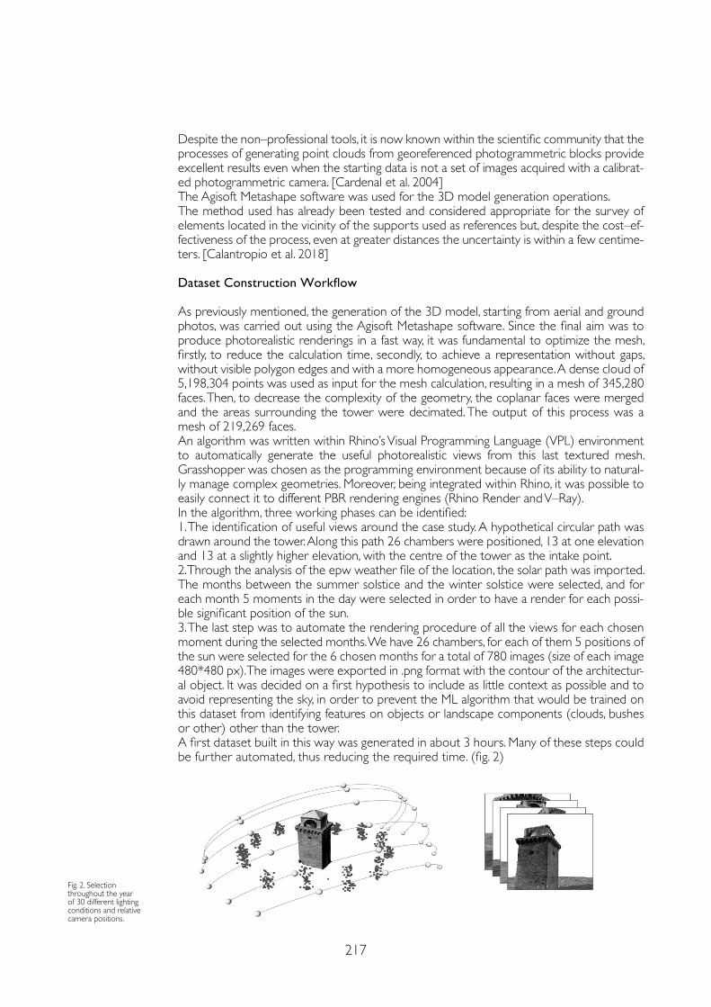
217
Despite the non–professional tools, it is now known within the scientific community that the processes of generating point clouds from georeferenced photogrammetric blocks provide excellent results even when the starting data is not a set of images acquired with a calibrat-ed photogrammetric camera. [Cardenal et al. 2004]The Agisoft Metashape software was used for the 3D model generation operations. The method used has already been tested and considered appropriate for the survey of elements located in the vicinity of the supports used as references but, despite the cost–ef-fectiveness of the process, even at greater distances the uncertainty is within a few centime-ters. [Calantropio et al. 2018]
Dataset Construction Workflow
As previously mentioned, the generation of the 3D model, starting from aerial and ground photos, was carried out using the Agisoft Metashape software. Since the final aim was to produce photorealistic renderings in a fast way, it was fundamental to optimize the mesh, firstly, to reduce the calculation time, secondly, to achieve a representation without gaps, without visible polygon edges and with a more homogeneous appearance. A dense cloud of 5,198,304 points was used as input for the mesh calculation, resulting in a mesh of 345,280 faces. Then, to decrease the complexity of the geometry, the coplanar faces were merged and the areas surrounding the tower were decimated. The output of this process was a mesh of 219,269 faces. An algorithm was written within Rhino’s Visual Programming Language (VPL) environment to automatically generate the useful photorealistic views from this last textured mesh. Grasshopper was chosen as the programming environment because of its ability to natural-ly manage complex geometries. Moreover, being integrated within Rhino, it was possible to easily connect it to different PBR rendering engines (Rhino Render and V–Ray).In the algorithm, three working phases can be identified:1. The identification of useful views around the case study. A hypothetical circular path was drawn around the tower. Along this path 26 chambers were positioned, 13 at one elevation and 13 at a slightly higher elevation, with the centre of the tower as the intake point.2. Through the analysis of the epw weather file of the location, the solar path was imported. The months between the summer solstice and the winter solstice were selected, and for each month 5 moments in the day were selected in order to have a render for each possi-ble significant position of the sun.3. The last step was to automate the rendering procedure of all the views for each chosen moment during the selected months. We have 26 chambers, for each of them 5 positions of the sun were selected for the 6 chosen months for a total of 780 images (size of each image 480*480 px). The images were exported in .png format with the contour of the architectur-al object. It was decided on a first hypothesis to include as little context as possible and to avoid representing the sky, in order to prevent the ML algorithm that would be trained on this dataset from identifying features on objects or landscape components (clouds, bushes or other) other than the tower.A first dataset built in this way was generated in about 3 hours. Many of these steps could be further automated, thus reducing the required time. (fig. 2)
Fig. 2. Selection throughout the year of 30 different lighting conditions and relative camera positions.
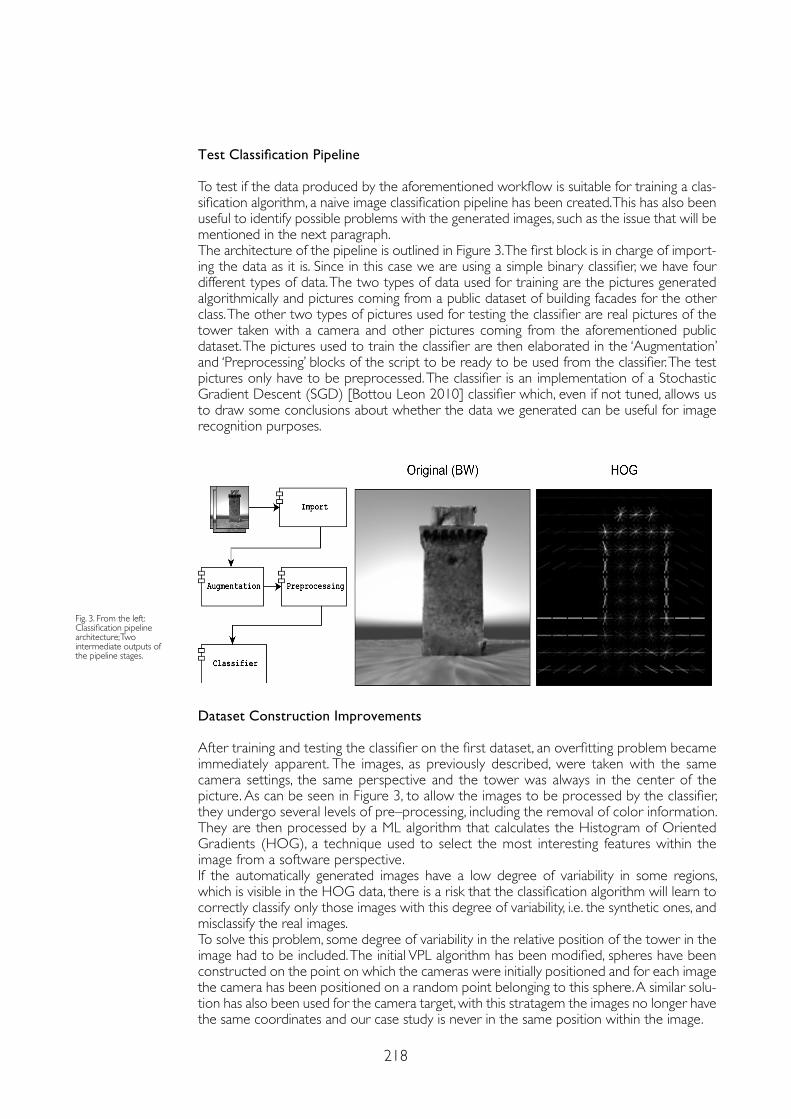
218
Test Classification Pipeline
To test if the data produced by the aforementioned workflow is suitable for training a clas-sification algorithm, a naive image classification pipeline has been created. This has also been useful to identify possible problems with the generated images, such as the issue that will be mentioned in the next paragraph.The architecture of the pipeline is outlined in Figure 3. The first block is in charge of import-ing the data as it is. Since in this case we are using a simple binary classifier, we have four different types of data. The two types of data used for training are the pictures generated algorithmically and pictures coming from a public dataset of building facades for the other class. The other two types of pictures used for testing the classifier are real pictures of the tower taken with a camera and other pictures coming from the aforementioned public dataset. The pictures used to train the classifier are then elaborated in the ‘Augmentation’ and ‘Preprocessing’ blocks of the script to be ready to be used from the classifier. The test pictures only have to be preprocessed. The classifier is an implementation of a Stochastic Gradient Descent (SGD) [Bottou Leon 2010] classifier which, even if not tuned, allows us to draw some conclusions about whether the data we generated can be useful for image recognition purposes.
Fig. 3. From the left:Classification pipeline architecture; Two intermediate outputs of the pipeline stages.
Dataset Construction Improvements
After training and testing the classifier on the first dataset, an overfitting problem became immediately apparent. The images, as previously described, were taken with the same camera settings, the same perspective and the tower was always in the center of the picture. As can be seen in Figure 3, to allow the images to be processed by the classifier, they undergo several levels of pre–processing, including the removal of color information. They are then processed by a ML algorithm that calculates the Histogram of Oriented Gradients (HOG), a technique used to select the most interesting features within the image from a software perspective.If the automatically generated images have a low degree of variability in some regions, which is visible in the HOG data, there is a risk that the classification algorithm will learn to correctly classify only those images with this degree of variability, i.e. the synthetic ones, and misclassify the real images.To solve this problem, some degree of variability in the relative position of the tower in the image had to be included. The initial VPL algorithm has been modified, spheres have been constructed on the point on which the cameras were initially positioned and for each image the camera has been positioned on a random point belonging to this sphere. A similar solu-tion has also been used for the camera target, with this stratagem the images no longer have the same coordinates and our case study is never in the same position within the image.
219
References
Andrianaivo Louis N., D’Autilia Roberto, Palma, Valerio (2019). Architecture recognition by means of convolutional neural networks. In International Archives of the Photogrammetry, Remote Sensing & Spatial Information Sciences, 42 (2/W15), pp. 77-84.
Barsanti Sara Gonizzi, Malatesta Saverio Giulio, Lella Francesco, Fanini Bruno, Sala Francesco, Dodero Eloisa, Petacco Laura (2018). The Winckelmann300 project: dissemination of culture with virtual reality at the Capitoline Museum in Rome. In International Archives of the Photogrammetry, Remote Sensing & Spatial Information Sciences, 42 (2), pp.371-378.
Bottou Leon (2010). Stochastic Gradient Descent. https://leon.bottou.org/projects/sgd (16th February 2021).
Calantropio Alessio, Chiabrando Filiberto, Spanò Antonia (2018). Impiego di tecniche di fotogrammetria digitale speditiva a supporto delle opere provvisionali negli interventi tecnici in emergenza sismica. In Bollettino SIFET, 3, pp. 22-31.
Cardenal Escarcena E.J., Mata Emilio, Castro P., Delgado Jorge, Hernandez M. A., Perez Jose Luis, Ramos M., Torres Manuel (2004). Evaluation of a digital non metric camera (Canon D30) for the photogrammetric recording of historical buildings. In International Archives of Photogrammetry, Remote Sensing and Spatial Information Sciences, 35 (B5), pp. 564-569.
Liu Li, Ouyang Wanli, Wang Xiaogang, Fieguth Paul, Chen Jie, Liu Xinwang, & Pietikäinen Matti (2020). Deep learning for generic object detection: A survey. In International journal of computer vision, 128 (2), pp. 261-318.
Lo Turco Massimiliano, Piumatti Paolo, Calvano Michele, Giovannini Elisabetta Caterina, Mafrici Noemi, Tomalini Andrea, Fanini Bruno (2019). Interactive Digital Environments for Cultural Heritage and Museums. Building a digital ecosystem to display hidden collections. In Disegnarecon, 12 (23), pp. 7.1-7.11.
Luhmann Thomas (2010). Close range photogrammetry for industrial applications. In ISPRS journal of photogrammetry and remote sensing, 65 (6), pp. 558-569.
Nocerino Erica, Menna Fabio, Remondino Fabio, Saleri Renato (2013). Accuracy and block deformation analysis in automatic UAV and terrestrial photogrammetry–Lesson learnt. In ISPRS Annals of the Photogrammetry, Remote Sensing and Spatial Information Sciences, 2 (5–W1), pp. 203-208.
Norouzzadeh Mohammad Sadegh, Nguyen Anh, Kosmala Margaret, Swanson Alexandra, Palmer Meredith S., Packer Craig, Clune Jeff (2018). Automatically identifying, counting, and describing wild animals in camera–trap images with deep learning. In Proceedings of the National Academy of Sciences, 115 (25), pp. 5716-5725.
Spallone Roberta, Palma Valerio (2020). Intelligenza artificiale e realtà aumentata per la condivisione del patrimonio culturale. In Bollettino SIFET, 2, pp. 1-8.
Vayanou Maria, Karvounis Manos, Katifori Akrivi, Kyriakidi Marialena, Roussou Maria, & Ioannidis Yoannidis (2014). The CHESS Project: Adaptive Personalized Storytelling Experiences in Museums. In UMAP Workshops, p. 232-235.
Conclusions
Even though it has not been tuned, the classifier scored a ̴ 70% of accuracy in distinguishing images of the tower from images of other buildings.The benefits of the presented approach versus a more traditional ground survey are clear. In a comparable time we can obtain much more data about the case study allowing to achieve promising results in image recognition with ML algorithms.With the tested classification algorithm, the background of the rendered 3D object plays an important role as it is processed along with the subject during the pre–processing phase and the resulting information is used during the training of the SGD classifier. The output of the render should in fact have in the background different images which are similar to the true background of the real building, thus adding ‘noise’ behind the subject and reducing the risk of ‘overfitting’ the classification model, which would decrease its accuracy.Including the surrounding scenery into the rendering therefore means providing a more complete context to the subject of the survey. This can be achieved by taking some addi-tional pictures with the drone or by using inexpensive hardware to collect spherical images.This information can be augmented using a 3D rendering engine to include night or dusk settings as well. Moreover this technique also provides the operator a mesh with is useful in the mentioned AR applications.
Copyright © 2021 by FrancoAngeli s.r.l. Milano, Italy Isbn 9788835125280
AuthorsAndrea Tomalini, Dept. of Architecture and Design, Politecnico di Torino, [email protected] Edoardo Pristeri, LINKS Foundation, Leading Innovation & Knowledge for Society, [email protected] Bergamasco, LINKS Foundation, Leading Innovation & Knowledge for Society, [email protected]


AR&AI urban enhancement

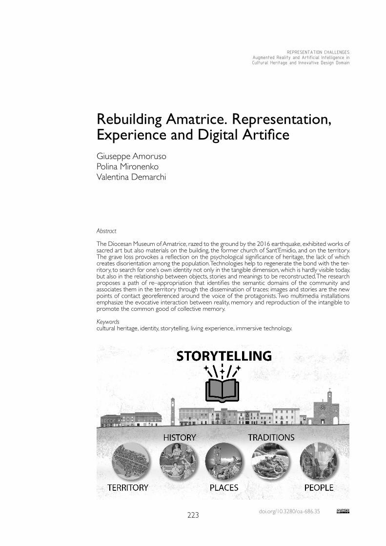
doi.org/10.3280/oa-686.35223
REPRESENTATION CHALLENGESAugmented Reality and Artificial Intelligence in Cultural Heritage and Innovative Design Domain
Abstract
The Diocesan Museum of Amatrice, razed to the ground by the 2016 earthquake, exhibited works of sacred art but also materials on the building, the former church of Sant’Emidio, and on the territory. The grave loss provokes a reflection on the psychological significance of heritage, the lack of which creates disorientation among the population. Technologies help to regenerate the bond with the ter-ritory, to search for one’s own identity not only in the tangible dimension, which is hardly visible today, but also in the relationship between objects, stories and meanings to be reconstructed. The research proposes a path of re–appropriation that identifies the semantic domains of the community and associates them in the territory through the dissemination of traces: images and stories are the new points of contact georeferenced around the voice of the protagonists. Two multimedia installations emphasize the evocative interaction between reality, memory and reproduction of the intangible to promote the common good of collective memory.
Keywordscultural heritage, identity, storytelling, living experience, immersive technology.
Rebuilding Amatrice. Representation, Experience and Digital ArtificeGiuseppe AmorusoPolina MironenkoValentina Demarchi
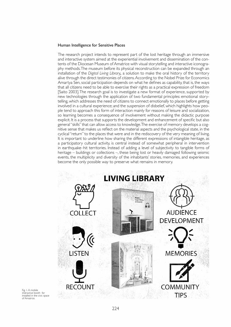
224
Human Intelligence for Sensitive Places
The research project intends to represent part of the lost heritage through an immersive and interactive system aimed at the experiential involvement and dissemination of the con-tents of the Diocesan Museum of Amatrice with visual storytelling and interactive iconogra-phy methods. The museum before its physical reconstruction can be expanded through an installation of the Digital Living Library, a solution to make the oral history of the territory alive through the direct testimonies of citizens. According to the Nobel Prize for Economics Amartya Sen, social participation depends on what he defines as capability, that is, the ways that all citizens need to be able to exercise their rights as a practical expression of freedom [Saito 2003]. The research goal is to investigate a new format of experience, supported by new technologies through the application of two fundamental principles: emotional story-telling, which addresses the need of citizens to connect emotionally to places before getting involved in a cultural experience; and the suspension of disbelief, which highlights how peo-ple tend to approach this form of interaction mainly for reasons of leisure and socialization, so learning becomes a consequence of involvement without making the didactic purpose explicit. It is a process that supports the development and enhancement of specific but also general “skills” that can allow access to knowledge. The exercise of memory develops a cog-nitive sense that makes us reflect on the material aspects and the psychological state, in the cyclical “return” to the places that were and in the rediscovery of the very meaning of living. It is important to underline how sharing the different expressions of intangible heritage, as a participatory cultural activity, is central instead of somewhat peripheral in intervention in earthquake–hit territories. Instead of adding a level of subjectivity to tangible forms of heritage – buildings or collections –, these being lost or heavily damaged following seismic events, the multiplicity and diversity of the inhabitants’ stories, memories, and experiences become the only possible way to preserve what remains in memory.
Fig. 1. A mobile interactive booth for installed in the civic space of Amatrice.
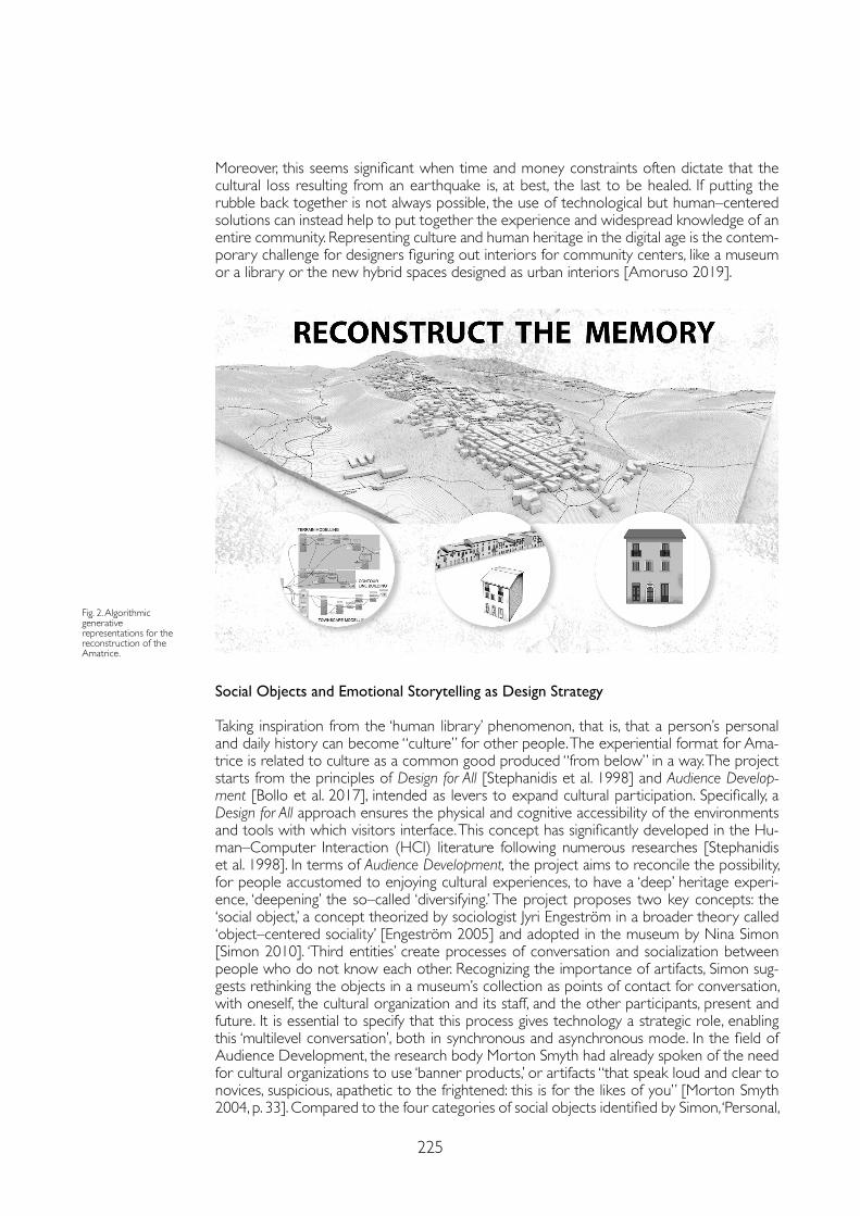
225
Moreover, this seems significant when time and money constraints often dictate that the cultural loss resulting from an earthquake is, at best, the last to be healed. If putting the rubble back together is not always possible, the use of technological but human–centered solutions can instead help to put together the experience and widespread knowledge of an entire community. Representing culture and human heritage in the digital age is the contem-porary challenge for designers figuring out interiors for community centers, like a museum or a library or the new hybrid spaces designed as urban interiors [Amoruso 2019].
Social Objects and Emotional Storytelling as Design Strategy
Taking inspiration from the ‘human library’ phenomenon, that is, that a person’s personal and daily history can become “culture” for other people. The experiential format for Ama-trice is related to culture as a common good produced “from below” in a way. The project starts from the principles of Design for All [Stephanidis et al. 1998] and Audience Develop-ment [Bollo et al. 2017], intended as levers to expand cultural participation. Specifically, a Design for All approach ensures the physical and cognitive accessibility of the environments and tools with which visitors interface. This concept has significantly developed in the Hu-man–Computer Interaction (HCI) literature following numerous researches [Stephanidis et al. 1998]. In terms of Audience Development, the project aims to reconcile the possibility, for people accustomed to enjoying cultural experiences, to have a ‘deep’ heritage experi-ence, ‘deepening’ the so–called ‘diversifying.’ The project proposes two key concepts: the ‘social object,’ a concept theorized by sociologist Jyri Engeström in a broader theory called ‘object–centered sociality’ [Engeström 2005] and adopted in the museum by Nina Simon [Simon 2010]. ‘Third entities’ create processes of conversation and socialization between people who do not know each other. Recognizing the importance of artifacts, Simon sug-gests rethinking the objects in a museum’s collection as points of contact for conversation, with oneself, the cultural organization and its staff, and the other participants, present and future. It is essential to specify that this process gives technology a strategic role, enabling this ‘multilevel conversation’, both in synchronous and asynchronous mode. In the field of Audience Development, the research body Morton Smyth had already spoken of the need for cultural organizations to use ‘banner products,’ or artifacts “that speak loud and clear to novices, suspicious, apathetic to the frightened: this is for the likes of you” [Morton Smyth 2004, p. 33]. Compared to the four categories of social objects identified by Simon, ‘Personal,
Fig. 2. Algorithmic generative representations for the reconstruction of the Amatrice.
226
Active, Provocative, Relational’, the storyteller–booth falls within that of ‘relational’ objects, so defined because they explicitly refer to interpersonal use. As an emblem of a relational social object, Simon indicates the telephone whose use presupposes the presence of an interlocutor ‘on the other side’, despite its invisibility. The phone connects us, despite the distance. It allows us to listen and, at the same time, allows the exchange of the voice. In short, it places us in a dialogic state of openness to others. The second design principle is ‘suspension of disbelief,’ introduced by Samuel Taylor Coleridge in 1817. Typical of theatrical performances but increasingly adopted in the exhibition/museum environment (typically through immersive installations). The audience experiences the state of suspension of disbe-lief through extreme care and coherence of the contextual/scenic elements of the narrated world. Once this state is in the air, the viewer/visitor lives the experience represented as actual. This form of total absorption brings learning to an irrational level: the viewer lives the experience and only consequently finds himself having learned things. This dynamic is also the basis of gamification, which applies the technique of suspending disbelief in making the user act in the role of a character.
Technology–Driven Installations for Memory as Commons
In the case of Amatrice, the triggering of the suspension of disbelief is fundamental. A mobile interactive booth and an immersive space were presented to the Amatrice administration and the World Monument Fund and received positive feedback. Monuments Fund (WMF) is a private non–profit organization founded in New York in 1965, created to preserve historical architectural artifacts and sites of historical and cultural significance worldwide through fieldwork, promotion, and training funds of local experts. The WMF has turned its attention to the Cola Filotesio Museum not only because it represents the cultural wealth of Amatrice but also about the history and identity bond that the population has maintained and maintains with the city and its territory.Among the social objects outlined by Simon, the project chooses relational ones, that is, which explicitly refer to an interpersonal use. The immersive installation enables suspension of disbe-lief that is the imaginative condition in which the individual arises to escape reality and ‘enter’ the fiction. This concept, central to the performing arts, also asserts itself in the exhibition/museum context, typically through immersive installations. In a society of continuous learning, it is essential to translate knowledge into accessibility. Furthermore, possibility between real and virtual nature, physical and digital, through information systems accessible locally: multime-dia stations dedicated to the exploration of digital collections, touch walls to form immersive environments placed in the museum rooms to strengthen the communication of the rooms. The installation of an immersive space with three interactive walls of 6 square meters, each with e–REAL technology by Logosnet, is planned according to public communication and civic participation strategy. The user interfaces, with touch modes, but possibly expandable with eye–tracking and gesture systems, stimulate multisensory perceptions through the simulation of participatory scenarios inspired by the territory and the museum’s collections. The interac-tive walls enhance the museum experience by making masterpieces of art accessible engag-ingly and interactively. The system integrates the visualization of the works with infographics. It allows exploring a cultural microcosm with the touch of hands and the fusion of real and virtu-al worlds. People are visiting a 3D scenario where they can interact with natural gestures and experience the world from different points of view at the same time. The dynamic contents to be explored in an immersive way are usually developed within a virtual Unity environment, a graphics engine that allows 2.5–3D views without glasses or wearable devices. C #, alterna-tively Javascript and Python, are the programming languages used to develop the components of the scenarios. A further objective is developing a mobile interactive booth intended to col-lect direct testimonies from citizens on the heritage of Amatrice, life stories, memories of the city to be georeferenced. The booth allows the recording of vocal contributions, according to a series of topics, issues, and keywords divided into thematic sections: territory, history, places, traditions, people. Inside the mobile interactive booth, among the features provided, there is an interactive electronic whiteboard called e–Wall (writing, drawing, and painting, manipula-
227
References
Amoruso Giuseppe (2019). Drawing as an experience. Knowledge, simulation and participation. Experiential Design for Heritage and Environmental Representation. In DISEGNARECON, 12 (23), pp. 1-10.
Bollo Alessandro, Carnelli Luisella, Macarena Cuenca, Cristina Da Milano (2017). Study on audience development. How to place audiences at the centre of cultural organisations. https://op.europa.eu/s/oAYm (10 June 2021).
Engeström Jury (2005). Why some social network services work and others don’t – Or: the case for object–centered sociality. http://www.zengestrom.com/blog/2005/04/why-some-social-network-services-work-and-others-dont-or-the-case-for-object-centered-sociality.html (10 June 2021).
Manovich Lev (2002). The Language of New Media. Boston: Mit Press.
Morton Smyth (2004). Not for the likes of you: How to Reach a Broader Audience. https://www.culturehive.co.uk/wp-content/uploads/2013/04/Not-for-the-Likes-of-You.pdf (10 June 2021).
Saito Madoka (2003). Amartya Sen’s capability approach to education: A critical exploration. In Journal of philosophy of education, 37 (1), pp. 17-33.
Simon Nina (2010). The participatory museum. Santa Cruz: Museum 2.0.
Stephanidis Costantine, Akoumianakis Demosthenes, Sfyrakis Michael, Paramythis Alexandros (1998). Universal accessibility in HCI: Process–oriented design guidelines and tool requirements. In Proceedings of the 4th ERCIM Workshop on User Interfaces for all, p. 19-21.
tion of images and virtual objects). The system includes a voice recognition system that allows voice commands for the functioning of the e–REAL system, for example, through the use of “formulas” to make digital objects appear.
Conclusions
Therefore, the research project proposes a new idea of a temporary and experiential museum as a cultural garrison and for the transmission of memory and spatiality that digitally expands into the immaterial dimension of informal accessibility and discovery. Technologies are changing the relationship between users and the environment of use of cultural content in museums, libraries, and learning places. The environments are transformed considering their virtual extension and allowing a range of customization linked to content selection. To these, Manovich also adds the interactive cultural experience, the possibility of enjoying cultural experiences and products by visitors, textual, voice, and visual communication, and participation in a sort of information that regenerates ‘ecologically’ knowledge and its dissemination. Rebuilding Amatrice is a complex ar-tifice with an uncertain outcome. In respect of the cultural heritage, it finds its form through the values of living and the experience of those places that only its community knows.
Copyright © 2021 by FrancoAngeli s.r.l. Milano, Italy Isbn 9788835125280
AuthorsGiuseppe Amoruso, Dept. of Design, Politecnico di Milano, [email protected] Mironenko, Dept. of Design, Politecnico di Milano, [email protected] Demarchi, Dept. of Design, Politecnico di Milano, [email protected]
Acknowledgements
Giuseppe Amoruso edited the paragraph Human intelligence for sensitive places, Polina Mironenko edited illustrations and the para-graph Technology–driven installations for memory as commons and Valentina Demarchi edited the paragraph Social objects and emotional storytelling as design strategy

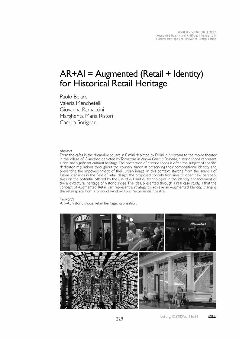
doi.org/10.3280/oa-686.36229
REPRESENTATION CHALLENGESAugmented Reality and Artificial Intelligence in Cultural Heritage and Innovative Design Domain
AbstractFrom the cafés in the dreamlike square in Rimini depicted by Fellini in Amarcord to the movie theater in the village of Giancaldo depicted by Tornatore in Nuovo Cinema Paradiso, historic shops represent a rich and significant cultural heritage. The protection of historic shops is often the subject of specific dedicated regulations throughout the country, aimed at preserving their compositional identity and preventing the impoverishment of their urban image. In this context, starting from the analysis of future scenarios in the field of retail design, the proposed contribution aims to open new perspec-tives on the potential offered by the use of AR and AI technologies in the identity enhancement of the architectural heritage of historic shops. The idea, presented through a real case study, is that the concept of Augmented Retail can represent a strategy to achieve an Augmented Identity, changing the retail space from a ‘product window’ to an ‘experiential theatre’.
KeywordsAR–AI, historic shops, retail, heritage, valorisation.
AR+AI = Augmented (Retail + Identity) for Historical Retail Heritage Paolo BelardiValeria MenchetelliGiovanna RamacciniMargherita Maria RistoriCamilla Sorignani
230
The Shop as an Identity Value
Historic shops represent a cultural heritage with a strong identity value, and this can be seen in the many artistic and cultural expressions in which the image of Italy is portrayed through that of its historic places: interiors, shop windows, overlooking squares and open spaces, urban views, etc., which give vividness with intense colours to the glittering image of the ‘Belpaese’. In this regard, the dreamlike narration of the city of Rimini by Federico Fellini in Amarcord is emblematic, as is the story of the movie theater proposed by Giuseppe Tornatore in Nuovo Cinema Paradiso. The life of the community is marked by the interior and exterior spaces, by the scenery of the square (characterised by the iconographic apparatus of neon signs) and the shops. The identity traits of the shops mark the succession of times and tastes: “it is the shop which best indicates the level of industrial and economic development of a country, and which also best reflects the state of its culture and art” (Sabatou 1938/1984, p. 6, translation by the authors). At the same time, the shop represents the constitutive element of the urban landscape; as Guido Canella affirms, “the ‘living pictures’ of the shops facing and lined up on the street are breaks of a hoped–for city landscape, where […] objective, symbolic, unifying, deforming intentions, corresponding to an aesthetic feeling, enter each time” [Canella 1984, p. 2, translation by the authors] The historic shop substantiates the very image of the country, determining its perception from the outside and becoming fully part of the collective memory: “If Italy loses its shops, we lose Italy as we know it” [Petrini 2020, translation by the authors]. In the regulatory background, the Codice dei Beni Culturali e del Paesaggio (D.L. n. 42 of 22 January 2004) is not specific about this type of property and generically includes it among the “immovable and movable property of artistic, historical […] and particularly important interest”. The first explicit reference to “historical traditional premises” was made in D.L. 91/2013: it is often the individual regions that enact specific provisions for the protection and enhancement of these assets in the form of regional laws. In recent years there have been many initiatives aimed at raising awareness of the issue and comparing experiences at national level. Many contributions confirm the attention paid by the scientific community to commercial establishments; these are almost always census activities, generally based on the architectural survey and cataloguing of historic shops and aimed at enhancing them in various ways (dedicated tourist circuits, restoration work, protection actions, also in terms of safeguarding their use, etc.).In this context it is possible to list some significant examples: starting with the cataloguing of Turin’s historic shops, begun in 1985 [Tagliasacchi 1985], then systematised [Ronchetta 2001] and extended to the entire Piedmont region [Ronchetta 2008]. The cataloguing work, shared publicly through the MuseoTorino portal, makes it possible to consult documentation sheets and digitised materials on the individual businesses recorded, also by locating them on a map.Other examples are represented by the survey and cataloguing of historic shops in Lucca [Pellegrini 2001], aimed at documenting the technical expertise of the artisans and promot-ing restoration and enhancement actions, the cataloguing of commercial activities in Tuscany [Preite 2007], the census of historic premises in Friuli Venezia Giulia [Regione Autonoma Friuli Venezia Giulia 2010], by the proposal for a Multimedia Information System of the com-mercial activities in Bologna [Bartolomei 2013], by the census of historical premises in the Marche [Regione Marche 2014], which led to a dedicated guide, and finally by the census and photographic guide of the historical places of commerce and catering in the Veneto, from which the app Veneto su misura was produced.Among these initiatives is the activity of the research team of the Department of Civil and Envi-ronmental Engineering of the University of Perugia. With regard to the case study of the historic centre of Spoleto, in the context of the initiative Consulto su Spoleto (2017), starting from the analysis and highlighting of the critical points of the Building and Town Planning Regulations, the aim is both to draw up a census and typological analysis of the commercial activities present along the streets of the historic centre, and to identify a series of criteria to guide planning choices, also through the promotion of city branding actions. The question as to which instruments today al-low for the protection and, above all, the enhancement of historic commercial activities has not yet found an unequivocal answer; in fact, the debate, at times polemical [Adinolfi 2016], on the opportunity of fluid reallocation of protected commercial spaces to new brands, even related to product categories very distant from the original destination, is still open. A controversial case in
231
this regard is the Santa Maria Novella railway station in Florence, a protected work by Giovanni Michelucci, where the relocation of commercial activities has meant that a brand of underwear has found a home in the former offices of a bank and a supermarket has moved into the space originally dedicated to worship. Although this stratification may create an interesting ambiguity in some respects (in this case, the overlapping of signs does not seem to be a reason for disorien-tation, but rather highlights the vitality of a place able to update and renew itself over time), the problematic knot of the ephemeral margin between protection and reuse remains open.
The Shop as an Experiential Theatre
In light of these considerations on the identity character of the historical shop, with the aim of its enhancement in contemporary terms, it seems necessary to question the meaning it currently assumes. In other words, it is necessary to acquire a new awareness of the concept of ‘shop’, a concept that has undergone deep changes over time and is constantly evolving. In this context, it assumes nodal importance to investigate the opportunity offered by the use of New Technologies, with specific reference to AR and AI, also as an evolved strategy for the protection of the material characteristics of places, given the current conception of the physi-cal retail space [van Escha et al. 2019]. Increasingly, the shop is not only a material place to buy products, but it becomes the ‘emotional centre’ through which communication between the brand and its target audience takes place [Taylor, Zavoleas 2018]. With the spread of e–com-merce, in fact, it is possible to buy anywhere and with just a few clicks: the relationship between buyer and product is mediated by a device and, in this sense, requires that the customer’s involvement takes place at other levels and through different channels. The physical shop, on the other hand, has to offer a different experience to e–commerce, possibly personalised and user–centred, capable of including those elements of memorability and engagement that determine both diversification from computerised purchasing and an effective support to it. For example, in today’s advertising policy, the flagship store represents an investment whose profit is estimated in terms of advertising rather than on–site sales to the consumer. The store becomes almost an advertising space, similar to that available in publishing, television or other media. The objective underlying this dynamic is the evolution of the consumer’s role into that of ‘consumer–actor’, as the user, having identified with the brand and recognised its values, becomes its ambassador and testimonial. The physical shop, both through the architecture of the place, the design of the interiors and of the retail space, and through communication ac-tions and an increasingly advanced use of technology, becomes the scene of a user experience aimed at the progressive discovery of the brand through strategies of engagement, customi-zation and strengthening of the community [Riewoldt 2002, Marchetti 2009]. The objective of engagement is to involve the user in an immersive experience, whose location par excel-lence is the physical shop: dedicated entrance, shop window and room/corner are the nodal points of the connection and emotional exchange between user and brand. An emblematic example, which embodies this branding strategy through AR applications, is represented by the Nike flagship store in NY, where there is a ‘Running Trial Zone’ that allows visitors to test the most suitable shoes for jogging and competitive running on a treadmill facing a wall/screen that simulates the immersion of the runner in Central Park. The aim of customisation is to offer the user a personalised and customisable experience; the shop respects and satisfies the diversified needs of a multiplicity of customers, proposing distinct paths according to the type of user. There are numerous examples of this strategy: from the Fragrance Lab (multi–sensory interactive areas for personalised fragrance exploration and product customisation) in one of Selfridge’s London locations to the Hunter pop–up (an interactive and immersive greenhouse designed as a test room to simulate the use of clothing) installed in NY Central Terminal. Finally, the aim of the community is to use the physical location of the shop to build user involvement within a 24/7 connected community through events, gamification, contacts and sharing. The architecture and scenery of the store become a source of wonder and an object of sharing; digital communication makes the spread of the brand, its values and therefore, its products viral through the users themselves. In this sense, the example of the Samsung 837 store NY is emblematic: a multifunctional store, which incorporates, in addition to its usual function as a
232
shop, those of a theatre, cafeteria, museum, games room and, last but not least, a multimedia tunnel for an immersive experience, whose external transmission is entirely entrusted to the sharing of selfies by users/ambassadors on their social profiles [Galasso n.d.].
The Shop From Identity Value to Experiential Theatre
The proposed reflection intends to focus on the potential offered by the use of the described strategies in historical commercial contexts, where the brand can adopt an approach that allows it to take further advantage in commercial terms of the acquisition of the identity and historical–ar-tistic value of the location. From this point of view, the ‘bottega’ becomes an ideal field, in which the combination of tradition and technological innovation can generate innovative commercial meth-ods capable of implementing a mutual and synergic enhancement between brand and physical shop. There are numerous examples of this: just think of the case of the recovery and redevelop-ment of the former Agip station in Piazzale Accursio in Milan, originally designed by Mario Bacioc-chi on commission from Enrico Mattei and converted in 2017, by Michele De Lucchi, into ‘Garage Italia’, a shop that welcomes the new destination by reinforcing its identity connotation. Then there is the case of the ‘Starbucks Reserve Roastery Milano’, where the brand adapts its image by de-clining and lowering it into the cultural background in which it is inserted. How can an American coffee be competitive with espresso, a product deeply rooted in the daily life of the ‘Belpaese’, whose violation seems almost sacrilegious? The strategy adopted by the international brand in Italy, the home of coffee, is ‘to be Italian’: first of all, by choosing the historic location of Palazzo Broggi (built in 1901 in Piazza Cordusio, the heart of Milan’s financial district, and formerly the headquar-ters of the Stock Exchange and the Italian Post Office from 1998 to 2011), then by adopting the style of a former coffee roasting and establishing a partnership with the Princi pastry shop, a local excellence, and finally by offering immersive experiences ranging from the inhalation of fragrances to the consultation of content on demand through AR. Another significant case is represented by ‘Galeria Melissa’ in New York, where the immersive experience allows continuous changes of setting and entertains customers through interactive facades and user profiling through AR and AI. In this case, the importance of the shop window in the operations of ‘augmented reuse’ clearly emerges: from a simple place of display, it becomes a screen, a portal, an intelligent interface be-tween the brand and the user. The formula AR+AI=Augmented (Retail+Identity) appears in this scenario to be the synthesis of a specific approach, which consists in using AR and AI technologies as a tool to reach a concept of ‘augmented historical shop’ in its identity connotation. Moreover, with the added value represented by the possibility of implementing a variety of scenarios and installations without materially altering the existing morphology, a particularly virtuous potential in the redevelopment or conversion of historic commercial spaces. In this sense, AR and AI are a vehicle for “a mobilisation that looks to the future and not to the past, which sees the shop as a paradigm of a multifunctionality that only the tools of the contemporary world can offer and of which young people are the main and privileged interpreters” [Petrini 2020].
A Case Study: Barbieria Lolli in Perugia
This is the context for the design proposal to transform Barbieria Lolli (a historic commercial activ-ity on Perugia’s acropolis owned by the University of Perugia) into an augmented university store. The interior walls, among the few surviving frescoes in the city, are the first work of the Perugian painter Napoleone Verga (Perugia 1833 – Nice 1916) [I luoghi dell’Università 2008; Boco, Ponti 2006], who painted them “in the style of the XIV century” [De Gubernatis 1889, p. 542]. The need to preserve the painted surfaces by avoiding contact and the small size of the shop (which has a single opening on Via Mazzini, a side street of Corso Vannucci, the city’s main street) make it an ideal opportunity to intervene with AR tools, assigning an interactive filtering role to the shop window. The idea is to transform this precious historical and artistic asset into an experiential theatre able to convey the renewed identity of the University of Perugia. In line with the relationship between tradition and innovation, which is one of the core values on which the University of Perugia’s com-munication is based, a transparent LED wall will be inserted in the space occupied by the fixed glass surface along the street. Without losing the relationship of continuity between inside and outside,
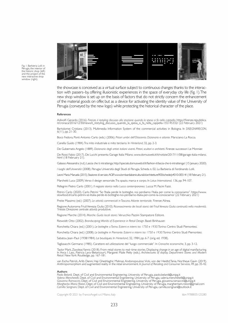
233
References
Adinolfi Gerardo (2016). Firenze, il restyling discusso alla stazione: quando la spesa si fa nella cappella. https://firenze.repubblica.it/cronaca/2016/12/30/news/il_restyling_discusso_quando_la_spesa_si_fa_nella_cappella-155145332/ (22 February 2021)
Bartolomei Cristiana (2013). Multimedia Information System of the commercial activities in Bologna. In DISEGNARECON, 6(11), pp. 21-30.
Boco Fedora, Ponti Antonio Carlo (eds.) (2006). Pittori umbri dell’Ottocento. Dizionario e atlante. Marsciano: La Rocca.
Canella Guido (1984). Tra mito industriale e mito terziario. In Hinterland, 32, pp. 2-3.
De Gubernatis Angelo (1889). Dizionario degli artisti italiani viventi. Pittori, scultori e architetti. Firenze: successori Le Monnier.
De Rossi Fabio (2017). De Lucchi presenta Garage Italia Milano. www.domusweb.it/it/notizie/2017/11/08/garage-italia-milano.html (18 February 21).
Galasso Alessandra (n.d.). Lascia che ti intrattenga. http://specials.domusweb.it/it/fashion-it/lascia-che-ti-intrattenga/ (15 January 2020).
I luoghi dell’Università (2008). Perugia: Università degli Studi di Perugia. Scheda n. 02. La Barbieria di Ferdinando Lolli.
Leoni Maria Manuela (2015). Stazione di servizio AGIP. www.lombardiabeniculturali.it/architetture900/schede/p4010-00514/ (18 February 21).
Marchetti Luca (2009). Verso il design sensoriale. Tra spazio, marca e corpo. In Lotus International, 136, pp. 94-107.
Pellegrini Pietro Carlo (2001). Il negozio storico nella Lucca contemporanea. Lucca: M. Pacini Fazzi.
Petrini Carlo (2020). Carlo Petrini: “Se l’Italia perde le botteghe, noi perdiamo l’Italia per come la conosciamo”. https://www.slowfood.it/carlo-petrini-se-litalia-perde-le-botteghe-noi-perdiamo-litalia-per-come-la-conosciamo/ (22 February 2021)
Preite Massimo (ed.) (2007). Le attività commerciali in Toscana. Atlante territoriale. Firenze: Alinea.
Regione Autonoma Friuli Venezia Giulia (2010). Riconoscimento dei locali storici del Friuli Venezia Giulia: continuità nella modernità. Trieste: Direzione centrale attività produttive.
Regione Marche (2014). Marche. Guida locali storici. Verucchio: Pazzini Stampatore Editore.
Riewoldt Otto (2002). Brandscaping: Worlds of Experience in Retail Design. Basel: Birkhauser.
Ronchetta Chiara (ed.) (2001). Le botteghe a Torino. Esterni e interni tra 1750 e 1930. Torino: Centro Studi Piemontesi.
Ronchetta Chiara (ed.) (2008). Le botteghe in Piemonte. Esterni e interni tra 1750 e 1930. Torino: Centro Studi Piemontesi.
Sabatou Jean–Paul (1938/1984). Le boutiques. In Hinterland, 32, 1984, pp. 6-7 (orig. ed. 1938).
Tagliasacchi Germano (1985). Carattere ed utilizzazione del “luogo commerciale”. In Cronache economiche, 3, pp. 3-12.
Taylor Mark, Zavoleas Yannis (2018). From retail stores to real–time stories. Displaying change in an age of digital manifacturing. In Anca I. Lasc, Patricia Lara–Betancourt, Margaret Maile Petty (eds.). Architectures of display. Department Stores and Modern Retail. New York: Routledge, pp. 167-181.
van Escha Patrick, Arlib Denni, Haji Gheshlaghic Mahnaz, Andonopoulosc Vicki, von der Heidtd Tania, Northeye Gavin (2019). Anthropomorphism and augmented reality in the retail environment. In Journal of Retailing and Consumer Services, 49, pp. 35-42.
the showcase is conceived as a virtual surface subject to continuous changes thanks to the interac-tion with passers–by, offering illusionistic experiences in the space of everyday city life (fig. 1). The new shop window is set up on the basis of factors that do not strictly concern the enhancement of the material goods on offer, but as a device for activating the identity value of the University of Perugia (conveyed by the new logo) while protecting the historical character of the place.
Fig. 1. Barbieria Lolli in Perugia, the interior of the historic shop (left) and the project of the new interactive shop window (right).
Copyright © 2021 by FrancoAngeli s.r.l. Milano, Italy Isbn 9788835125280
AuthorsPaolo Belardi, Dept. of Civil and Environmental Engineering, University of Perugia, [email protected] Valeria Menchetelli, Dept. of Civil and Environmental Engineering, University of Perugia, [email protected] Ramaccini, Dept. of Civil and Environmental Engineering, University of Perugia, [email protected] Maria Ristori, Dept. of Civil and Environmental Engineering, University of Perugia, [email protected] Sorignani, Dept. of Civil and Environmental Engineering, University of Perugia, [email protected]

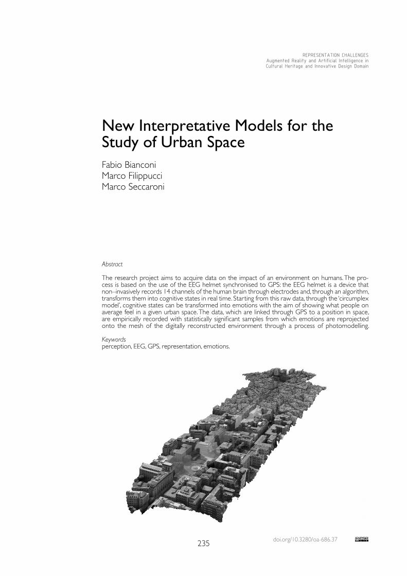
doi.org/10.3280/oa-686.37235
REPRESENTATION CHALLENGESAugmented Reality and Artificial Intelligence in Cultural Heritage and Innovative Design Domain
Abstract
The research project aims to acquire data on the impact of an environment on humans. The pro-cess is based on the use of the EEG helmet synchronised to GPS: the EEG helmet is a device that non–invasively records 14 channels of the human brain through electrodes and, through an algorithm, transforms them into cognitive states in real time. Starting from this raw data, through the ‘circumplex model’, cognitive states can be transformed into emotions with the aim of showing what people on average feel in a given urban space. The data, which are linked through GPS to a position in space, are empirically recorded with statistically significant samples from which emotions are reprojected onto the mesh of the digitally reconstructed environment through a process of photomodelling.
Keywordsperception, EEG, GPS, representation, emotions.
New Interpretative Models for the Study of Urban SpaceFabio BianconiMarco FilippucciMarco Seccaroni
236
Introduction
If the theme of landscape is of great topicality, it is perhaps because, in its ethereal form, it represents the best contemporary utopia that is content to classify and circumscribe the problem of the relationship between man and the world around him, with the value of images, but without seeking solutions: by amplifying the distance between reality and its ideal model, there is often the risk of hiding the cultural and instrumental deficiency in the interpretation and representation of current phenomena and the strong current impediments in the construction of contemporary landscapes. This concept does not cor-respond with the concept of place, territory, environment, panorama [Bianconi & Filip-pucci 2019], but as the European Convention formalises, “Landscape” means an area, as perceived by people, whose character is the result of the action and interaction of natural and/or human factors. The idea of landscape is therefore a cultural process, closely linked to perception [Arnheim 1986], to vision [Kepes, Rossi Chiaia 1990] and to those elements that structure the processes of identity construction.Man, immersed in the built environment, is very often unaware of the influences it ex-erts on him. Generally, people gravitate towards spaces that may not be psychological-ly stimulating, but through habit tend to prefer a usual and known, albeit imperfect, pat-tern, rather than other configurations that would bring greater benefits from the point of view of psychophysical well–being and therefore identity. Even though most of our ex-periences in our surroundings do not take place consciously. In general, however, there is no such thing as a ‘neutral’ environment in an urban context: from the point of view of health, the man–made environment necessarily brings benefits or discomfort, contributing in the latter case to the onset of psychophysical illnesses. The built environment either helps or hurts [Goldhagen 2017], but design cannot be directly aimed at the health of citizens [Millennium Ecosystem Assessment 2005] and their well–being [Bechtel, Church-man 2002] if there is no methodology to analyse and evaluate the effects of solutions, then considering the social dimension of the individual’s life [Schram–Bijkerk et al. 2018].
Research Themes The research aims to study the survey of landscape qualities [Bianconi, Filippucci 2018]. The innovative aspects that characterize the research can be identified in the digital path developed aimed at the construction of interpretative tools of the relationship between the environment and its impacts, represented on the space. The analysis of people’s behaviour in public space is developed using advanced digital tools and biosensors such as the EEG helmet. This makes it possible to define analytical and scientific data on feelings, by interpreting them it is possible to interpret the essential elements that influence well–being through the emotional state. The neuro–headset data makes it possible to understand which part of the cerebral cortex is affected by certain signals when immersed in an environment, thus providing interpre-table data that is also useful for hypothesising solutions in compromised urban contexts. The EEG helmet is a device that non–invasively records 14 channels of the human brain through electrodes and, through an algorithm, transforms them into cognitive states in real time [Kim et al. 2018]. This is functional for behaviour analysis [Aspinall et al. 2015; Chynal et al. 2016; Tachi 2012; Yadava et al. 2017]: in fact, the raw data collected on brain impulses are interpreted by algorithms and transformed into six cognitive states (valence, arousal, stress, meditation, focus, engagement) [Badcock et al. 2015; Kotowski et al. 2018]. In the developed pathway, the combined use of the data is achieved through the circomplex model (fig. 4) [Posner et al. 2008] that allows emotions to be calculated using only the cogni-tive states of valence and arousal [Yik et al. 2011]. With the valence value as the first polar co-ordinate and the arousal value as the second polar coordinate, it is possible to obtain a point within the circumplex model that represents the emotion of the observer. These points are associated with a unique colour vector for each combination, transcribed in RGB colour space. In addition to the EEG data, the geographical position is acquired in real time at a regular interval of one second; thanks to the timestamp, it was possible to synchronize the GPS and EEG data.
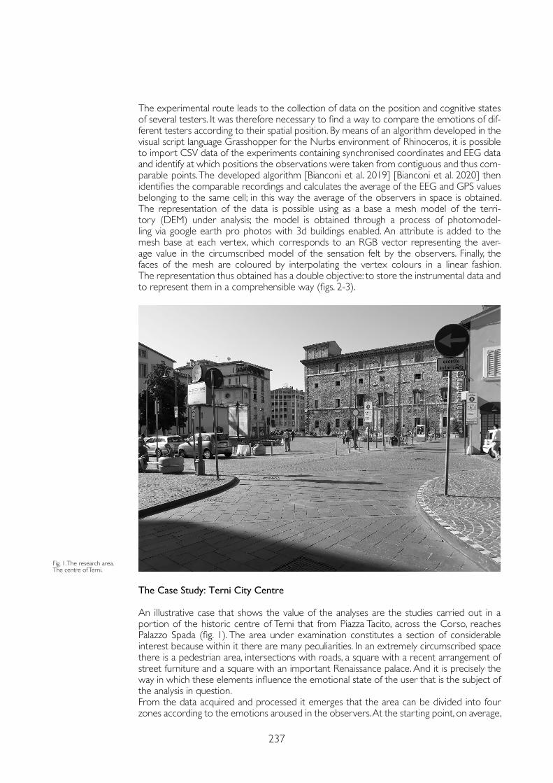
237
The experimental route leads to the collection of data on the position and cognitive states of several testers. It was therefore necessary to find a way to compare the emotions of dif-ferent testers according to their spatial position. By means of an algorithm developed in the visual script language Grasshopper for the Nurbs environment of Rhinoceros, it is possible to import CSV data of the experiments containing synchronised coordinates and EEG data and identify at which positions the observations were taken from contiguous and thus com-parable points. The developed algorithm [Bianconi et al. 2019] [Bianconi et al. 2020] then identifies the comparable recordings and calculates the average of the EEG and GPS values belonging to the same cell; in this way the average of the observers in space is obtained. The representation of the data is possible using as a base a mesh model of the terri-tory (DEM) under analysis; the model is obtained through a process of photomodel-ling via google earth pro photos with 3d buildings enabled. An attribute is added to the mesh base at each vertex, which corresponds to an RGB vector representing the aver-age value in the circumscribed model of the sensation felt by the observers. Finally, the faces of the mesh are coloured by interpolating the vertex colours in a linear fashion. The representation thus obtained has a double objective: to store the instrumental data and to represent them in a comprehensible way (figs. 2-3).
The Case Study: Terni City Centre
An illustrative case that shows the value of the analyses are the studies carried out in a portion of the historic centre of Terni that from Piazza Tacito, across the Corso, reaches Palazzo Spada (fig. 1). The area under examination constitutes a section of considerable interest because within it there are many peculiarities. In an extremely circumscribed space there is a pedestrian area, intersections with roads, a square with a recent arrangement of street furniture and a square with an important Renaissance palace. And it is precisely the way in which these elements influence the emotional state of the user that is the subject of the analysis in question.From the data acquired and processed it emerges that the area can be divided into four zones according to the emotions aroused in the observers. At the starting point, on average,
Fig. 1. The research area. The centre of Terni.
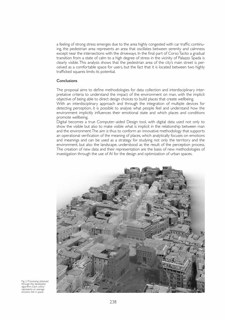
238
a feeling of strong stress emerges due to the area highly congested with car traffic; continu-ing, the pedestrian area represents an area that oscillates between serenity and calmness except near the intersections with the driveways. In the final part of Corso Tacito a gradual transition from a state of calm to a high degree of stress in the vicinity of Palazzo Spada is clearly visible. This analysis shows that the pedestrian area of the city’s main street is per-ceived as a comfortable space for users, but the fact that it is located between two highly trafficked squares limits its potential.
Conclusions
The proposal aims to define methodologies for data collection and interdisciplinary inter-pretative criteria to understand the impact of the environment on man, with the implicit objective of being able to direct design choices to build places that create wellbeing.With an interdisciplinary approach and through the integration of multiple devices for detecting perception, it is possible to analyse what people feel and understand how the environment implicitly influences their emotional state and which places and conditions promote wellbeing. Digital becomes a true Computer–aided Design tool, with digital data used not only to show the visible but also to make visible what is implicit in the relationship between man and the environment. The aim is thus to conform an innovative methodology that supports an operational verification of the meaning of places, which analytically focuses on emotions and meanings and can be used as a strategy for studying not only the territory and the environment, but also the landscape, understood as the result of the perception process. The creation of new data and their representation are the basis of new methodologies of investigation through the use of AI for the design and optimization of urban spaces.
Fig. 2. Processing obtained through the developed algorithm. Each colour represents an average emotion felt in space.
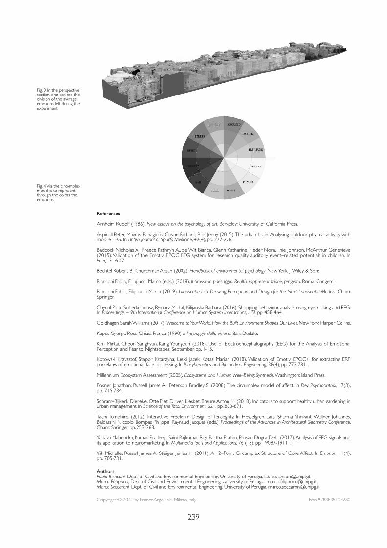
239
References
Arnheim Rudolf (1986). New essays on the psychology of art. Berkeley: University of California Press.
Aspinall Peter, Mavros Panagiotis, Coyne Richard, Roe Jenny (2015). The urban brain: Analysing outdoor physical activity with mobile EEG. In British Journal of Sports Medicine, 49(4), pp. 272-276.
Badcock Nicholas A., Preece Kathryn A., de Wit Bianca, Glenn Katharine, Fieder Nora, Thie Johnson, McArthur Genevieve (2015). Validation of the Emotiv EPOC EEG system for research quality auditory event–related potentials in children. In PeerJ, 3, e907.
Bechtel Robert B., Churchman Arzah (2002). Handbook of environmental psychology. New York: J. Wiley & Sons.
Bianconi Fabio, Filippucci Marco (eds.) (2018). Il prossimo paesaggio. Realtà, rappresentazione, progetto. Roma: Gangemi.
Bianconi Fabio, Filippucci Marco (2019). Landscape Lab. Drawing, Perception and Design for the Next Landscape Models. Cham: Springer.
Chynal Piotr, Sobecki Janusz, Rymarz Michal, Kilijanska Barbara (2016). Shopping behaviour analysis using eyetracking and EEG. In Proceedings – 9th International Conference on Human System Interactions, HSI, pp. 458-464.
Goldhagen Sarah Williams (2017). Welcome to Your World. How the Built Environment Shapes Our Lives. New York: Harper Collins.
Kepes György, Rossi Chiaia Franca (1990). Il linguaggio della visione. Bari: Dedalo.
Kim Mintai, Cheon Sanghyun, Kang Youngeun (2018). Use of Electroencephalography (EEG) for the Analysis of Emotional Perception and Fear to Nightscapes. September, pp. 1-15.
Kotowski Krzysztof, Stapor Katarzyna, Leski Jacek, Kotas Marian (2018). Validation of Emotiv EPOC+ for extracting ERP correlates of emotional face processing. In Biocybernetics and Biomedical Engineering, 38(4), pp. 773-781.
Millennium Ecosystem Assessment (2005). Ecosystems and Human Well–Being: Synthesis. Washington: Island Press.
Posner Jonathan, Russell James A., Peterson Bradley S. (2008). The circumplex model of affect. In Dev Psychopathol, 17(3), pp. 715-734.
Schram–Bijkerk Dieneke, Otte Piet, Dirven Liesbet, Breure Anton M. (2018). Indicators to support healthy urban gardening in urban management. In Science of the Total Environment, 621, pp. 863-871.
Tachi Tomohiro (2012). Interactive Freeform Design of Tensegrity. In Hesselgren Lars, Sharma Shrikant, Wallner Johannes, Baldassini Niccolo, Bompas Philippe, Raynaud Jacques (eds.). Proceedings of the Advances in Architectural Geometry Conference. Cham: Springer, pp. 259-268.
Yadava Mahendra, Kumar Pradeep, Saini Rajkumar, Roy Partha Pratim, Prosad Dogra Debi (2017). Analysis of EEG signals and its application to neuromarketing. In Multimedia Tools and Applications, 76 (18), pp. 19087-19111.
Yik Michelle, Russell James A., Steiger James H. (2011). A 12–Point Circumplex Structure of Core Affect. In Emotion, 11(4), pp. 705-731.
Fig. 3. In the perspective section, one can see the division of the average emotions felt during the experiment.
Fig. 4. Via the circomplex model is to represent through the colors the emotions.
Copyright © 2021 by FrancoAngeli s.r.l. Milano, Italy Isbn 9788835125280
AuthorsFabio Bianconi, Dept. of Civil and Environmental Engineering, University of Perugia, [email protected] Filippucci, Dept.of Civil and Environmental Engineering, University of Perugia, [email protected], Marco Seccaroni, Dept. of Civil and Environmental Engineering, University of Perugia, [email protected]

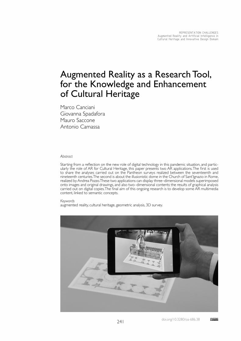
doi.org/10.3280/oa-686.38241
REPRESENTATION CHALLENGESAugmented Reality and Artificial Intelligence in Cultural Heritage and Innovative Design Domain
Abstract
Starting from a reflection on the new role of digital technology in this pandemic situation, and partic-ularly the role of AR for Cultural Heritage, this paper presents two AR applications. The first is used to share the analyses carried out on the Pantheon surveys realized between the seventeenth and nineteenth centuries. The second is about the illusionistic dome in the Church of Sant’Ignazio in Rome, realized by Andrea Pozzo. These two applications can display three–dimensional models superimposed onto images and original drawings, and also two–dimensional contents: the results of graphical analysis carried out on digital copies. The final aim of this ongoing research is to develop some AR multimedia content, linked to semantic concepts.
Keywordsaugmented reality, cultural heritage, geometric analysis, 3D survey.
Augmented Reality as a Research Tool, for the Knowledge and Enhancement of Cultural HeritageMarco CancianiGiovanna SpadaforaMauro SacconeAntonio Camassa
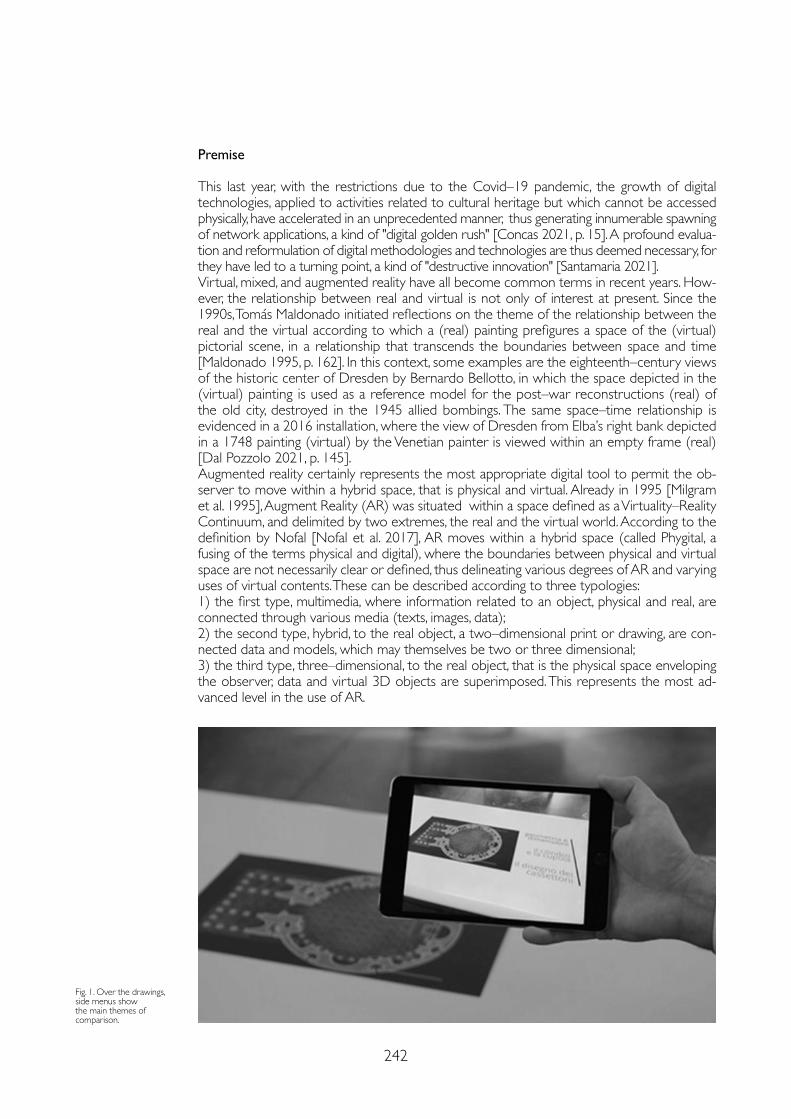
242
Premise
This last year, with the restrictions due to the Covid–19 pandemic, the growth of digital technologies, applied to activities related to cultural heritage but which cannot be accessed physically, have accelerated in an unprecedented manner, thus generating innumerable spawning of network applications, a kind of "digital golden rush" [Concas 2021, p. 15]. A profound evalua-tion and reformulation of digital methodologies and technologies are thus deemed necessary, for they have led to a turning point, a kind of "destructive innovation" [Santamaria 2021].Virtual, mixed, and augmented reality have all become common terms in recent years. How-ever, the relationship between real and virtual is not only of interest at present. Since the 1990s, Tomás Maldonado initiated reflections on the theme of the relationship between the real and the virtual according to which a (real) painting prefigures a space of the (virtual) pictorial scene, in a relationship that transcends the boundaries between space and time [Maldonado 1995, p. 162]. In this context, some examples are the eighteenth–century views of the historic center of Dresden by Bernardo Bellotto, in which the space depicted in the (virtual) painting is used as a reference model for the post–war reconstructions (real) of the old city, destroyed in the 1945 allied bombings. The same space–time relationship is evidenced in a 2016 installation, where the view of Dresden from Elba’s right bank depicted in a 1748 painting (virtual) by the Venetian painter is viewed within an empty frame (real) [Dal Pozzolo 2021, p. 145].Augmented reality certainly represents the most appropriate digital tool to permit the ob-server to move within a hybrid space, that is physical and virtual. Already in 1995 [Milgram et al. 1995], Augment Reality (AR) was situated within a space defined as a Virtuality–Reality Continuum, and delimited by two extremes, the real and the virtual world. According to the definition by Nofal [Nofal et al. 2017], AR moves within a hybrid space (called Phygital, a fusing of the terms physical and digital), where the boundaries between physical and virtual space are not necessarily clear or defined, thus delineating various degrees of AR and varying uses of virtual contents. These can be described according to three typologies: 1) the first type, multimedia, where information related to an object, physical and real, are connected through various media (texts, images, data);2) the second type, hybrid, to the real object, a two–dimensional print or drawing, are con-nected data and models, which may themselves be two or three dimensional;3) the third type, three–dimensional, to the real object, that is the physical space enveloping the observer, data and virtual 3D objects are superimposed. This represents the most ad-vanced level in the use of AR.
Fig. 1. Over the drawings, side menus show the main themes of comparison.
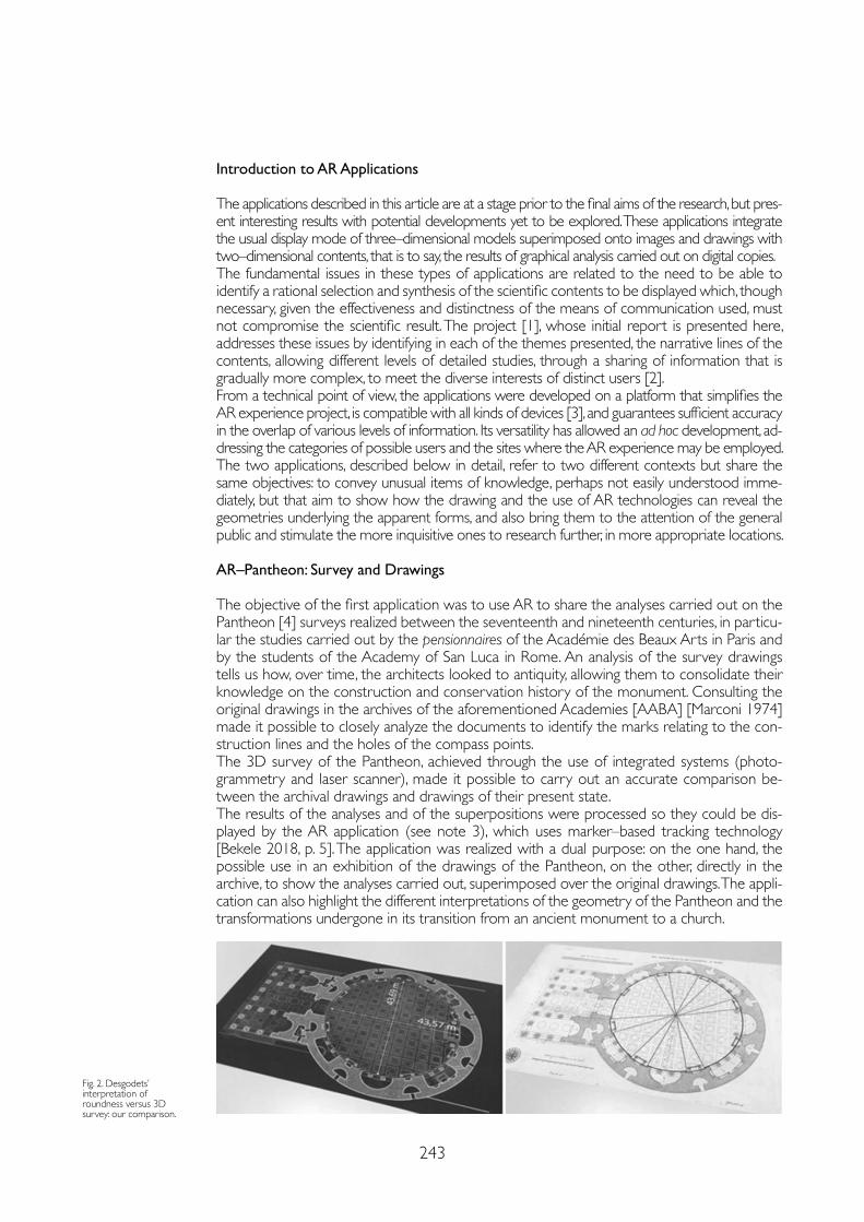
243
Introduction to AR Applications
The applications described in this article are at a stage prior to the final aims of the research, but pres-ent interesting results with potential developments yet to be explored. These applications integrate the usual display mode of three–dimensional models superimposed onto images and drawings with two–dimensional contents, that is to say, the results of graphical analysis carried out on digital copies.The fundamental issues in these types of applications are related to the need to be able to identify a rational selection and synthesis of the scientific contents to be displayed which, though necessary, given the effectiveness and distinctness of the means of communication used, must not compromise the scientific result. The project [1], whose initial report is presented here, addresses these issues by identifying in each of the themes presented, the narrative lines of the contents, allowing different levels of detailed studies, through a sharing of information that is gradually more complex, to meet the diverse interests of distinct users [2].From a technical point of view, the applications were developed on a platform that simplifies the AR experience project, is compatible with all kinds of devices [3], and guarantees sufficient accuracy in the overlap of various levels of information. Its versatility has allowed an ad hoc development, ad-dressing the categories of possible users and the sites where the AR experience may be employed.The two applications, described below in detail, refer to two different contexts but share the same objectives: to convey unusual items of knowledge, perhaps not easily understood imme-diately, but that aim to show how the drawing and the use of AR technologies can reveal the geometries underlying the apparent forms, and also bring them to the attention of the general public and stimulate the more inquisitive ones to research further, in more appropriate locations.
AR–Pantheon: Survey and Drawings
The objective of the first application was to use AR to share the analyses carried out on the Pantheon [4] surveys realized between the seventeenth and nineteenth centuries, in particu-lar the studies carried out by the pensionnaires of the Académie des Beaux Arts in Paris and by the students of the Academy of San Luca in Rome. An analysis of the survey drawings tells us how, over time, the architects looked to antiquity, allowing them to consolidate their knowledge on the construction and conservation history of the monument. Consulting the original drawings in the archives of the aforementioned Academies [AABA] [Marconi 1974] made it possible to closely analyze the documents to identify the marks relating to the con-struction lines and the holes of the compass points.The 3D survey of the Pantheon, achieved through the use of integrated systems (photo-grammetry and laser scanner), made it possible to carry out an accurate comparison be-tween the archival drawings and drawings of their present state.The results of the analyses and of the superpositions were processed so they could be dis-played by the AR application (see note 3), which uses marker–based tracking technology [Bekele 2018, p. 5]. The application was realized with a dual purpose: on the one hand, the possible use in an exhibition of the drawings of the Pantheon, on the other, directly in the archive, to show the analyses carried out, superimposed over the original drawings. The appli-cation can also highlight the different interpretations of the geometry of the Pantheon and the transformations undergone in its transition from an ancient monument to a church.
Fig. 2. Desgodets’ interpretation of roundness versus 3D survey: our comparison.
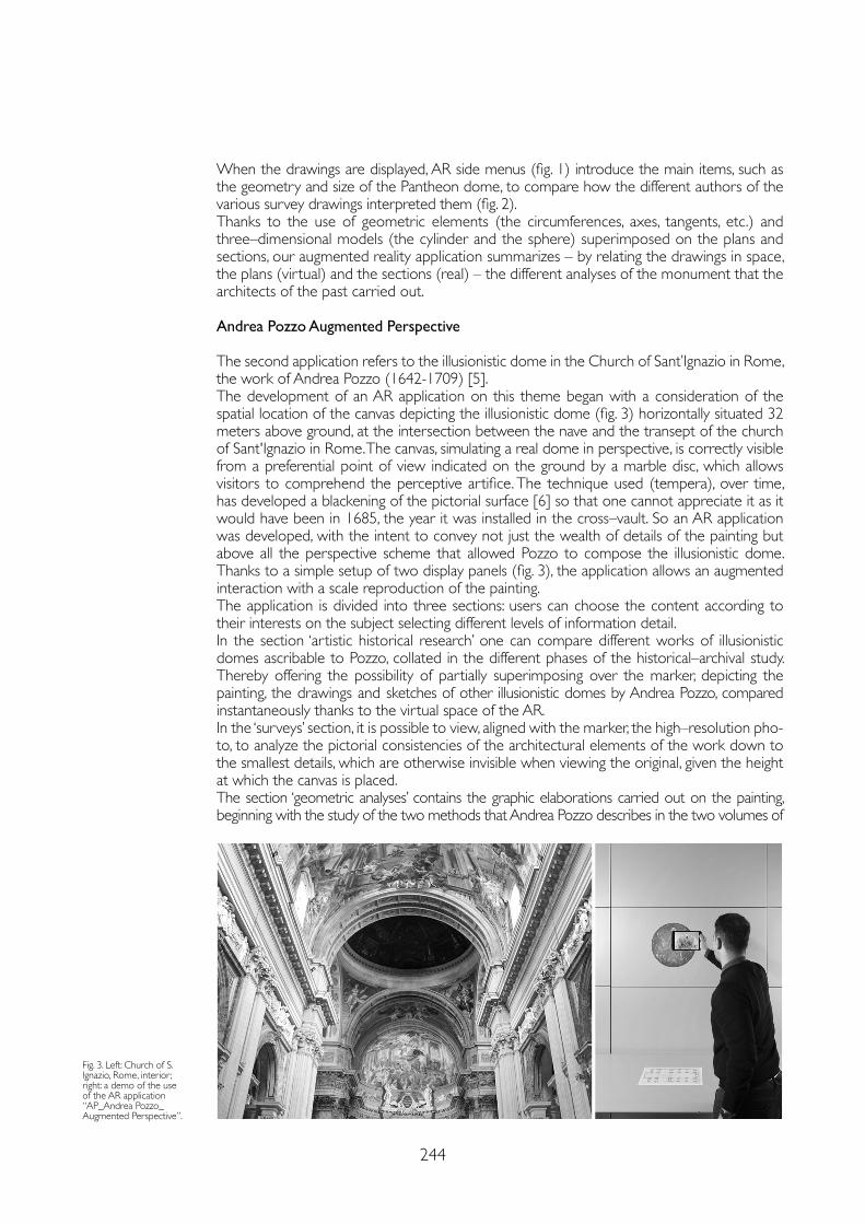
244
When the drawings are displayed, AR side menus (fig. 1) introduce the main items, such as the geometry and size of the Pantheon dome, to compare how the different authors of the various survey drawings interpreted them (fig. 2).Thanks to the use of geometric elements (the circumferences, axes, tangents, etc.) and three–dimensional models (the cylinder and the sphere) superimposed on the plans and sections, our augmented reality application summarizes – by relating the drawings in space, the plans (virtual) and the sections (real) – the different analyses of the monument that the architects of the past carried out.
Andrea Pozzo Augmented Perspective
The second application refers to the illusionistic dome in the Church of Sant’Ignazio in Rome, the work of Andrea Pozzo (1642-1709) [5].The development of an AR application on this theme began with a consideration of the spatial location of the canvas depicting the illusionistic dome (fig. 3) horizontally situated 32 meters above ground, at the intersection between the nave and the transept of the church of Sant'Ignazio in Rome. The canvas, simulating a real dome in perspective, is correctly visible from a preferential point of view indicated on the ground by a marble disc, which allows visitors to comprehend the perceptive artifice. The technique used (tempera), over time, has developed a blackening of the pictorial surface [6] so that one cannot appreciate it as it would have been in 1685, the year it was installed in the cross–vault. So an AR application was developed, with the intent to convey not just the wealth of details of the painting but above all the perspective scheme that allowed Pozzo to compose the illusionistic dome. Thanks to a simple setup of two display panels (fig. 3), the application allows an augmented interaction with a scale reproduction of the painting. The application is divided into three sections: users can choose the content according to their interests on the subject selecting different levels of information detail.In the section ‘artistic historical research’ one can compare different works of illusionistic domes ascribable to Pozzo, collated in the different phases of the historical–archival study. Thereby offering the possibility of partially superimposing over the marker, depicting the painting, the drawings and sketches of other illusionistic domes by Andrea Pozzo, compared instantaneously thanks to the virtual space of the AR. In the ‘surveys’ section, it is possible to view, aligned with the marker, the high–resolution pho-to, to analyze the pictorial consistencies of the architectural elements of the work down to the smallest details, which are otherwise invisible when viewing the original, given the height at which the canvas is placed.The section ‘geometric analyses’ contains the graphic elaborations carried out on the painting, beginning with the study of the two methods that Andrea Pozzo describes in the two volumes of
Fig. 3. Left: Church of S. Ignazio, Rome, interior; right: a demo of the use of the AR application “AP_Andrea Pozzo_Augmented Perspective”.
245
Notes
[1] Working on the project is the research team of the Department of Architecture (Roma Tre) consisting of M. Canciani, G. Spadafora, M. Saccone, A. Camassa, in collaboration with the ENEA research team coordinated by M. Mongelli.
[2] It is understood that the level of detail proposed in the project is consistent with the methods designed for these two particular AR applications.
[3] The commercial application used is blippAR®.
[4] Selected were some of the results of the doctoral research: Disegnare il Pantheon. La pratica del rilievo nell’insegnamento accademico del XIX secolo e nel disegno digitale contemporaneo presented by Mauro Saccone in the XIX cycle of Architectural Doctorate: innovation and heritage (tutor Marco Canciani).
[5] The application presented here draws on some results of the doctoral research, currently being completed, “congiugnere il finto col vero” – Geometria e architettura nella finta cupola di Andrea Pozzo a Roma, presented by Antonio Camassa, XXXIII cycle of the Architectural Doctorate: innovation and heritage (tutor Giovanna Spadafora).
[6] As the early 18th century, the illusionistic dome was not visible, as reported in [Montalto 1962].
References
Bekele Mafkereseb K., Pierdicca Roberto, Frontoni Emanuele, Malinverni Eva S., Gain James (2018). A survey of augmented, virtual, and mixed reality for cultural heritage. In Journal on Computing and Cultural Heritage (JOCCH), 11.2 , pp.1-36.
Canciani Marco, Saccone Mauro (2011). The use of 3D models in integrated survey: the church of St. Thomas of Villanova in Castel Gandolfo. In International Archives of Photogrammetry, Remote Sensing and Spatial Information Sciences vol. 38.5/W16, pp. 591-597.
Canciani Marco Saccone Mauro, Spadafora Giovanna, Gallia Arturo, Masetti Carla (2020). Modelli 3D e dati GIS: una loro integrazione per lo studio e la valorizzazione dei beni culturali. In ARCHEOMATICA, XII (2), pp.18-23.
Chevalley Giovanni (1924). Elementi di tecnica dell’architettura: materiali da costruzioni e grosse strutture. Torino: Pasta.
Concas Andrea (2020). L’arte post Coronavirus. Ripartire con il digitale: le strategie per i professionisti dell’arte. Segrate: ed. Piemme. Dal Pozzolo Luca (2021). Il patrimonio culturale tra memoria, lockdown e futuro. Milano: Editrice Bibliografica.
Maldonado Tomás (1995). Reale e virtuale. Milano: Feltrinelli.
Marconi Paolo (1974). I disegni di architettura dell’Archivio storico dell’Accademia di San Luca. Voll. I e II. Roma: De Luca Editori.
Milgram Paul, Takemura Haruo, Utsumi Akira, Kishino Fumio (1995). Augmented Reality: A class of displays on the reality–virtuality continuum. In Proceedings of SPIE 2351, Telemanipulator and Telepresence Technologies, pp. 282-292.
Montalto Lina (1962). La storia della finta cupola di S. Ignazio. In Capitolium, 6, pp. 393-404.
Nofal Eslam, Reffat M. Rabee,Van de Moere Andrew (2017). Phygital heritage: An approach for heritage communication. In Beck Dennis. et al., Immersive Learning Research Network Conference. Berlin: Springer, pp. 220-229.
Santamaria, Martina (2021). Il digitale come disruptive innovation nell’ecosistema culturale: un nuovo paradigma in reazione all’emergenza COVID–19, Tesi (con Marco Romano) nel Master in Editoria, Giornalismo e Management culturale, La Sapienza Università di Roma.
his treatise Perspectiva pictorum et architectorum (Vol. I 1693, Vol. II 1700). Several layers gradually are superimposed over the marker, evidencing the perspective restitution operations carried out to retrace the architectural section from the perspective drawing.With the application, one can visualize a section of the model of the church and relate it to the plan (fig. in front page). The aim of the model is twofold, to represent the church with the virtual reconstruction of the dome designed by Pozzo and at the same time show the perspective meth-od underlying the same restitution by retracing, in reverse, Andrea Pozzo's modus expeditissimus.
Conclusions
These two case studies show how we have used AR to share the analyses carried out on drawings and canvas. In the future, this kind of application should integrate databases orga-nized according to semantic structures [Canciani 2020], which can connect related research fields. Our aim is to develop on–site AR applications, using markerless tracking, to introduce 3D models as well as two–dimensional contents surrounding the users.
Copyright © 2021 by FrancoAngeli s.r.l. Milano, Italy Isbn 9788835125280
AuthorsMarco Canciani, Dept. of Architecture, Università Roma Tre, [email protected] Giovanna Spadafora, Dept. of Architecture, Università Roma Tre, [email protected] Saccone, Dept. of Architecture, Università Roma Tre, [email protected] Camassa, Dept. of Architecture, Università Roma Tre, [email protected]

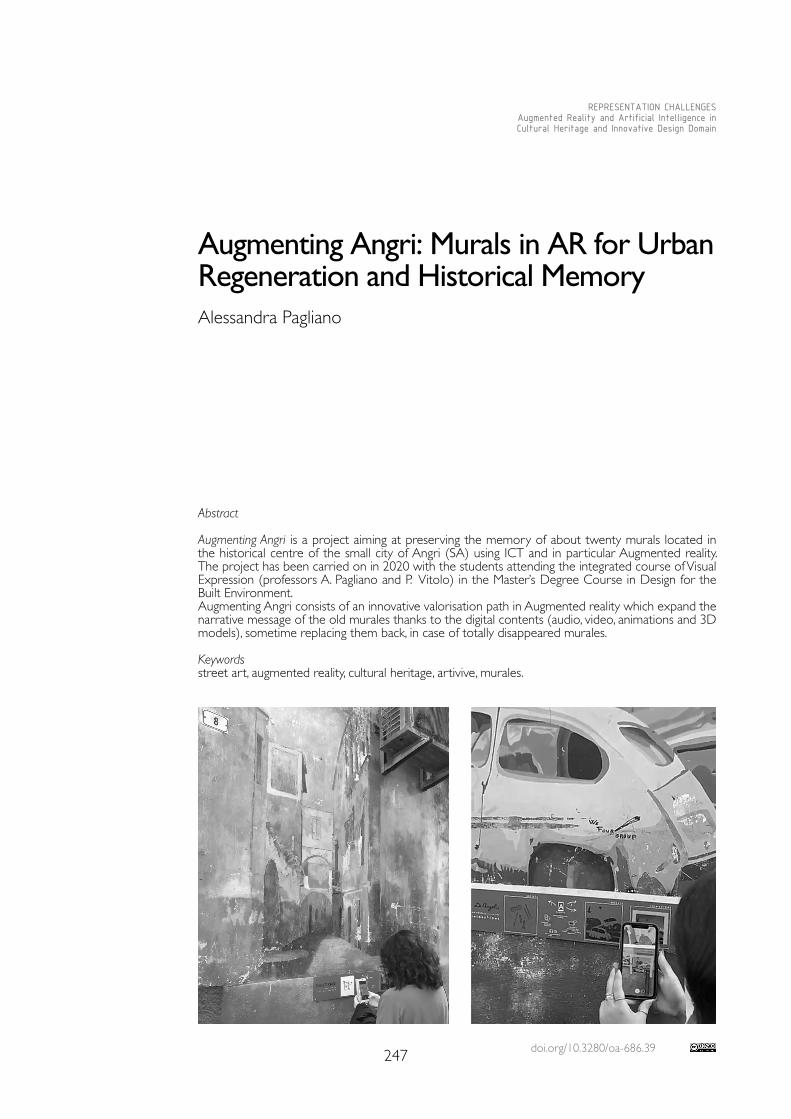
doi.org/10.3280/oa-686.39247
REPRESENTATION CHALLENGESAugmented Reality and Artificial Intelligence in Cultural Heritage and Innovative Design Domain
Abstract
Augmenting Angri is a project aiming at preserving the memory of about twenty murals located in the historical centre of the small city of Angri (SA) using ICT and in particular Augmented reality. The project has been carried on in 2020 with the students attending the integrated course of Visual Expression (professors A. Pagliano and P. Vitolo) in the Master’s Degree Course in Design for the Built Environment. Augmenting Angri consists of an innovative valorisation path in Augmented reality which expand the narrative message of the old murales thanks to the digital contents (audio, video, animations and 3D models), sometime replacing them back, in case of totally disappeared murales.
Keywordsstreet art, augmented reality, cultural heritage, artivive, murales.
Augmenting Angri: Murals in AR for Urban Regeneration and Historical MemoryAlessandra Pagliano
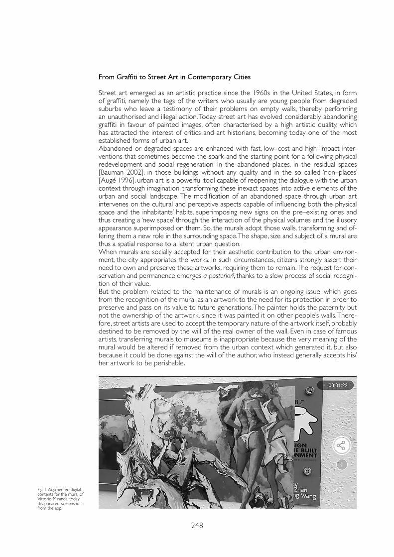
248
From Graffiti to Street Art in Contemporary Cities
Street art emerged as an artistic practice since the 1960s in the United States, in form of graffiti, namely the tags of the writers who usually are young people from degraded suburbs who leave a testimony of their problems on empty walls, thereby performing an unauthorised and illegal action. Today, street art has evolved considerably, abandoning graffiti in favour of painted images, often characterised by a high artistic quality, which has attracted the interest of critics and art historians, becoming today one of the most established forms of urban art. Abandoned or degraded spaces are enhanced with fast, low–cost and high–impact inter-ventions that sometimes become the spark and the starting point for a following physical redevelopment and social regeneration. In the abandoned places, in the residual spaces [Bauman 2002], in those buildings without any quality and in the so called ‘non–places’ [Augé 1996], urban art is a powerful tool capable of reopening the dialogue with the urban context through imagination, transforming these inexact spaces into active elements of the urban and social landscape. The modification of an abandoned space through urban art intervenes on the cultural and perceptive aspects capable of influencing both the physical space and the inhabitants’ habits, superimposing new signs on the pre–existing ones and thus creating a ‘new space’ through the interaction of the physical volumes and the illusory appearance superimposed on them. So, the murals adopt those walls, transforming and of-fering them a new role in the surrounding space. The shape, size and subject of a mural are thus a spatial response to a latent urban question. When murals are socially accepted for their aesthetic contribution to the urban environ-ment, the city appropriates the works. In such circumstances, citizens strongly assert their need to own and preserve these artworks, requiring them to remain. The request for con-servation and permanence emerges a posteriori, thanks to a slow process of social recogni-tion of their value. But the problem related to the maintenance of murals is an ongoing issue, which goes from the recognition of the mural as an artwork to the need for its protection in order to preserve and pass on its value to future generations. The painter holds the paternity but not the ownership of the artwork, since it was painted it on other people’s walls. There-fore, street artists are used to accept the temporary nature of the artwork itself, probably destined to be removed by the will of the real owner of the wall. Even in case of famous artists, transferring murals to museums is inappropriate because the very meaning of the mural would be altered if removed from the urban context which generated it, but also because it could be done against the will of the author, who instead generally accepts his/her artwork to be perishable.
Fig. 1. Augmented digital contents for the mural of Vittorio Miranda, today disappeared, screenshot from the app.
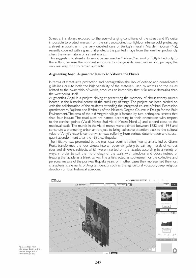
249
Street art is always exposed to the ever–changing conditions of the street and It’s quite impossible to protect murals from the rain, snow, direct sunlight, or intense cold; protecting a street artwork, as in the very debated case of Banksy’s mural in Via dei Tribunali (Na), recently covered with a glass that protects the painted image from the weather, profoundly alters the inner nature of a street mural. This suggests that street art cannot be assumed as “finished” artwork, strictly linked only to the author, because the constant exposure to change is its inner nature and, perhaps, the only real way for it to remain authentic.
Augmenting Angri: Augmented Reality to Valorize the Murals
In terms of street art’s protection and heritagization, the lack of defined and consolidated guidelines, due to both the high variability of the materials used by artists and the issues related to the ownership of works, produces an immobility that is far more damaging than the weathering itself.Augmenting Angri is a project aiming at preserving the memory of about twenty murals located in the historical centre of the small city of Angri. The project has been carried on with the collaboration of the students attending the integrated course of Visual Expression (professors A. Pagliano and P. Vitolo) of the Master’s Degree Course in Design for the Built Environment. The area of the old Angevin village is formed by two orthogonal streets that shap four insulae. The road axes are named according to their orientation with respect to the cardinal points (Via di Mezzo Sud, Via di Mezzo Nord ...) and extend close to the medieval castle. The murals in the Vie di mezzo were painted between 1982 and 1983 and constitute a pioneering urban art project, to bring collective attention back to the cultural value of Angri’s historic centre, which was suffering from serious deterioration and subse-quent abandonment after the 1980 earthquake. The initiative was promoted by the municipal administration. Twenty artists, led by Gianni Rossi, transformed the four streets into an open–air gallery, by painting murals of various sizes and different subjects, which were inserted on the facades according to a variety of ways, in order to suit the morphology of the walls, with windows and doors instead of treating the facade as a blank canvas. The artists acted as spokesmen for the collective and personal malaise of the post–earthquake years, or in other cases they represented the most characteristic elements of Angrian identity, such as the agricultural vocation, deep religious devotion or local historical episodes.
Fig. 2. Giving a new interactive depth to the painted image in the Ativive bridge app.
250
Severely degraded, very little remains today of the original murals, but a good photo-graphic documentation and the potential of digital technology have enabled us to re–propose each mural in the original locations, bringing them to life by means of short animations. In some cases, they totally disappeared, completely erased by the renovation of the building facades: in fact, some owners took over the buildings when the mural was at an advanced stage of deterioration and they were unable to perceive original artistic value and the role that the mural had for the collective memory. They simply identified them as signs of decay and removed them.In our Augmenting Angri project, since it was not possible to carry out a pictorial resto-ration of the still remaining painted images, and since we also did not consider appropriate to remake (re–paint) those which completely disappeared a long time ago, the request of those places was immediately intended in a need to preserve the memory of that fruitful interaction between the beauty of the murals, their social message and the urban regen-eration that they activated in that concentrated urban context. We designed an exhibition path supported by small printed panels, directly affixed to the façades and containing some markers activating augmented reality contents; in this way it was possible to bring the disappeared murals back to their original location. All the remaining murals, in most cases only partially visible, were reproduced in their original state, also enriching each artwork with additional narrative contents. Augmented reality digital contents, superimposed to the physical reality, create a surprising relationship among three different spatial dimensions: the perspective space represented in the mural, the digital space of the augmented content and the real one of the urban environment that is physically experienced by the public. Thus, each observer becomes an active subject of his/her own individual knowledge process according to a dynamic cognitive path. New digital technologies are in fact restructuring the relationship between experience and knowledge. In spite of the need to re–propose in those places the painted images that have now disappeared, the digitisation of the murals was not intended as a reproduction, a digital copy, even if faithful and accurate, but as the generation of a new mixed asset (both digital and Physical) that provides further knowledge. Ben Hicks defines this new digital asset as ‘digital twin’, remarking the differences with a simply digital prototype or model “as an appropriately synchronized body of useful infor-mation (structure, function, and behaviour) of a physical entity in virtual space, with flows of information that enable convergence between the physical and virtual states” [Hicks 2019]. According to the previous definition, digital twins in not a mere copy of the real object but a new object with data, functions, and features of the real one but added by the communi-cation capabilities of the digital world. The reconfiguration of the cognitive process, typical of digital technologies and in particular of augmented reality, takes place only when the digital contents are experienced and lived, i.e. ‘activated’, by an observer. In fact, the designed semantic link is enabled and implemented only through individual interaction and experi-ence with the designed knowledge contents. Today, the ability of cultural heritage to arouse emotions, establish links and stimulate curiosity can become effective if we take into account that contemporary users have completely changed: they are both ‘digital immigrants’ and ‘digital natives’ with different expectations, pre–existing knowledge, historical/cultural back-grounds and interpretative strategies. The students of the Design for the Built Environment course were encouraged to address their project to this new audience, uncovering the evocative power of each mural to develop and enhance its storytelling. The narrative aspect is, in fact, a good binder to combine emotions with information. Murals’ painted scenes are the representation of a single moment, which remains eternally frozen and which the artist subtracted from a long–envisioned sequence of gestures and positions, by painting a crys-tallised motion. Each image has been analysed for its ability to suspend time with a hinted gesture, a gust of wind, a fleeting glance, a facial expression that become permanent. In this way the time is allowed again to flow before and after that suspended portrayed moment. The brief animations, designed to give life to the static painted scene, are slight variations of the portrayed configuration, as a simple temporal expansion of that moment. Augmented reality allowed us to integrate or change the state of each mural without compromising the physical state. The link between AR and murals’ visual and pictorial aspects required a deep
251
disciplinary study in terms of representation as a possible product of new ways of looking at reality, new perceptions and therefore new ways of interacting with perceived space.Furthermore, the images of the Angrian village murals were also interpretated according to the category of the painted three–dimensional spatiality that regulates the reciprocal po-sitions and distances between objects, background, architecture and the human characters acting there. The perspective space has been made interactively explorable again, beyond the point of view chosen by the artist, thanks to augmented reality, which allows the viewer to enter the space portrayed in the pictorial image thanks to the three dimensions restored to the mural in the virtual space. Each mural has been provided with a thin horizontal band, containing three printed images designed to be “markers” for digital content activation. By scanning one by one each marker with the open–source app Artivive, different digital con-tent appear on observer’s smart device: a short video clips narrating artist’s life and poetry, an animated storytelling of the painted image and a three–dimensional model drawn ac-cording to parallel planes which, like a theatrical scenography, gives the perspective image a virtual three–dimensionality and an explorable spatial depth. Augmenting Angri won funding from the Open Call Street Art 2020, funded by the Embas-sy and Consulate General of the Kingdom of the Netherlands. It was inaugurated in Angri on 11 October 2020 in the presence of the artists, university students, local authorities and the community.
References
Augè Marc (1996). Nonluoghi. Introduzione a una antropologia della surmodernità. Milano: Elèuthera.
Cristallini Elisabetta, Mania Patrizia, Petrilli Raffaella (eds.). (2017). Arte sui muri della città. Street art e urban art: questioni aperte. Roma: Round Robin Ed.
Hicks Ben (2019). Industry 4.0 and Digital Twins, Key Lessons FromNASA. Aug. 5. https://www.thefuturefactory.com/blog/24 (15th February 2021).
Pagliano Alessandra (2019). Artistic experiments of urban acupuncture/Esperimenti artictici di agopuntura urbana. In TRIA – Territori della ricerca su insediamenti e ambiente, 23 (2), pp. 17-28.
Rasheed Adil, San Omer, Kvamsdal Trond (2020). Digital Twin: Values, Challenges and Enablers From a Modeling Perspective. In IEEE Access, 8, pp. 21980- 22012.
Santabárbara Carlota (2018). Street art conservation: beyond surfaces’ restoration. In OPUS, Quaderno di storia architettura restauro disegno, 2. Roma: Gangemi editore International, pp. 147-162.
Simões Daniela V. (2013). On graffiti and street art in Lisbon: towards Another Brick in the Wall. In Borriello Luca, Ruggiero, Christian (eds.), Inopinatum. The Unexpected Impertinence of Urban Creativity. Salerno: Arti Grafiche Boccia, pp. 63-78.
Simondon Gilbert (2014). Sulla tecno–estetica. Milano: Mimesis.
Zurlo Francesco, Arquilla Venanzio, Carella Gianluca, Tamburello Maria Cristina (2018). Designing acculturated phygital experiences. In Zhang Linghao, Lam Yanyan, Xiao Dongjuan, Gong Miaosen, Shi Di (eds.). Cumulus Conference Proceedings. Wuxi: Wuxi Huguang Elegant Print Co.
Copyright © 2021 by FrancoAngeli s.r.l. Milano, Italy Isbn 9788835125280
AuthorAlessandra Pagliano, Dept. of Architecture, University of Naples Federico II, [email protected]

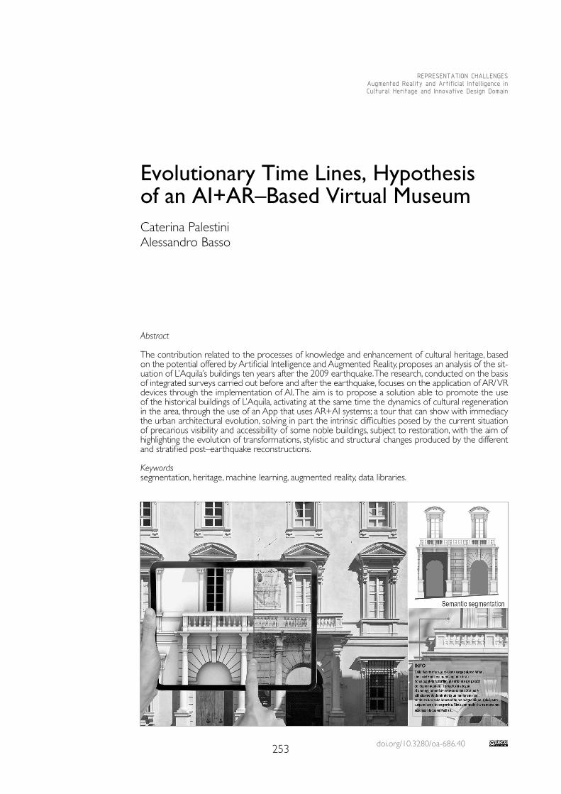
doi.org/10.3280/oa-686.40253
REPRESENTATION CHALLENGESAugmented Reality and Artificial Intelligence in Cultural Heritage and Innovative Design Domain
Abstract
The contribution related to the processes of knowledge and enhancement of cultural heritage, based on the potential offered by Artificial Intelligence and Augmented Reality, proposes an analysis of the sit-uation of L’Aquila’s buildings ten years after the 2009 earthquake. The research, conducted on the basis of integrated surveys carried out before and after the earthquake, focuses on the application of AR/ VR devices through the implementation of AI. The aim is to propose a solution able to promote the use of the historical buildings of L’Aquila, activating at the same time the dynamics of cultural regeneration in the area, through the use of an App that uses AR+AI systems; a tour that can show with immediacy the urban architectural evolution, solving in part the intrinsic difficulties posed by the current situation of precarious visibility and accessibility of some noble buildings, subject to restoration, with the aim of highlighting the evolution of transformations, stylistic and structural changes produced by the different and stratified post–earthquake reconstructions.
Keywordssegmentation, heritage, machine learning, augmented reality, data libraries.
Evolutionary Time Lines, Hypothesis of an AI+AR–Based Virtual MuseumCaterina PalestiniAlessandro Basso
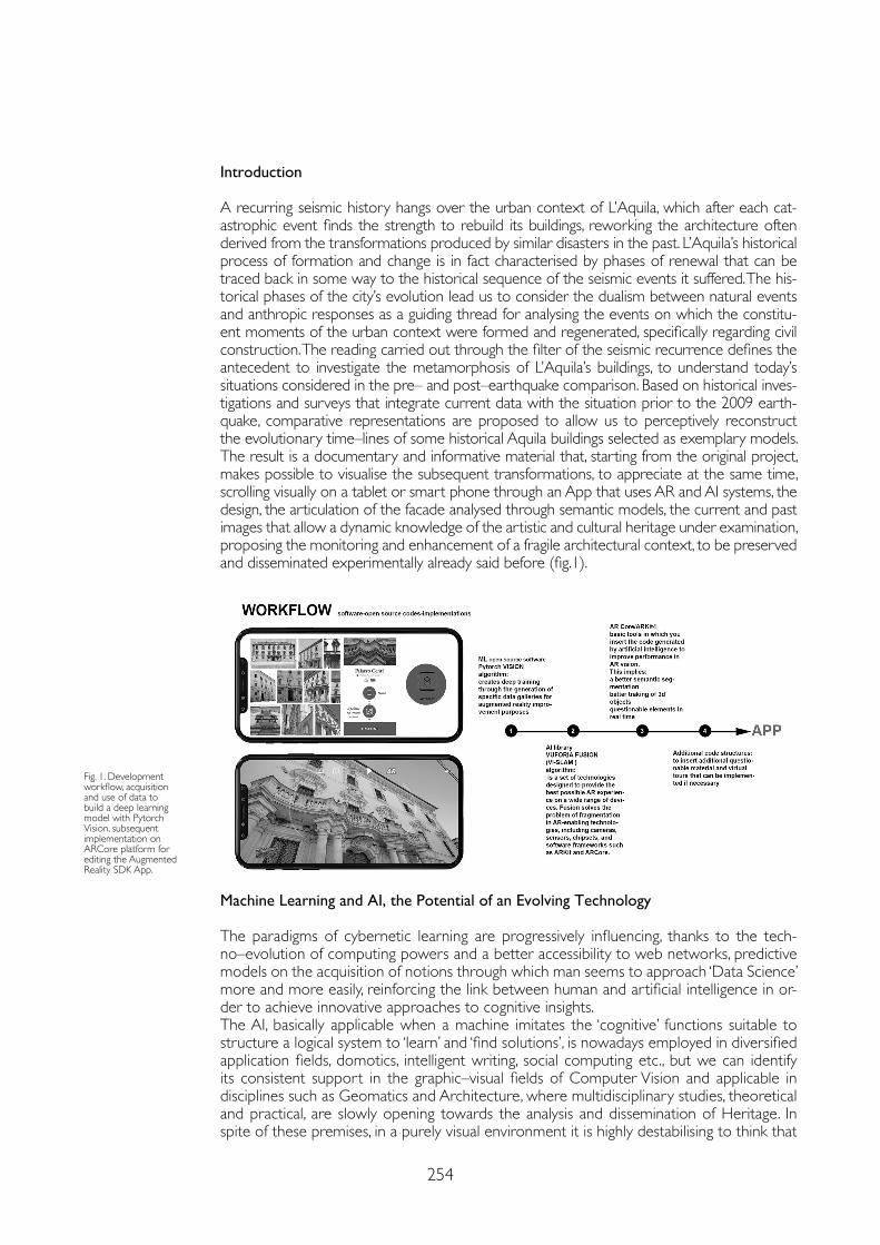
254
Introduction
A recurring seismic history hangs over the urban context of L’Aquila, which after each cat-astrophic event finds the strength to rebuild its buildings, reworking the architecture often derived from the transformations produced by similar disasters in the past. L’Aquila’s historical process of formation and change is in fact characterised by phases of renewal that can be traced back in some way to the historical sequence of the seismic events it suffered. The his-torical phases of the city’s evolution lead us to consider the dualism between natural events and anthropic responses as a guiding thread for analysing the events on which the constitu-ent moments of the urban context were formed and regenerated, specifically regarding civil construction. The reading carried out through the filter of the seismic recurrence defines the antecedent to investigate the metamorphosis of L’Aquila’s buildings, to understand today’s situations considered in the pre– and post–earthquake comparison. Based on historical inves-tigations and surveys that integrate current data with the situation prior to the 2009 earth-quake, comparative representations are proposed to allow us to perceptively reconstruct the evolutionary time–lines of some historical Aquila buildings selected as exemplary models. The result is a documentary and informative material that, starting from the original project, makes possible to visualise the subsequent transformations, to appreciate at the same time, scrolling visually on a tablet or smart phone through an App that uses AR and AI systems, the design, the articulation of the facade analysed through semantic models, the current and past images that allow a dynamic knowledge of the artistic and cultural heritage under examination, proposing the monitoring and enhancement of a fragile architectural context, to be preserved and disseminated experimentally already said before (fig.1).
Fig. 1. Development workflow, acquisition and use of data to build a deep learning model with Pytorch Vision, subsequent implementation on ARCore platform for editing the Augmented Reality SDK App.
Machine Learning and AI, the Potential of an Evolving Technology
The paradigms of cybernetic learning are progressively influencing, thanks to the tech-no–evolution of computing powers and a better accessibility to web networks, predictive models on the acquisition of notions through which man seems to approach ‘Data Science’ more and more easily, reinforcing the link between human and artificial intelligence in or-der to achieve innovative approaches to cognitive insights.The AI, basically applicable when a machine imitates the ‘cognitive’ functions suitable to structure a logical system to ‘learn’ and ‘find solutions’, is nowadays employed in diversified application fields, domotics, intelligent writing, social computing etc., but we can identify its consistent support in the graphic–visual fields of Computer Vision and applicable in disciplines such as Geomatics and Architecture, where multidisciplinary studies, theoretical and practical, are slowly opening towards the analysis and dissemination of Heritage. In spite of these premises, in a purely visual environment it is highly destabilising to think that
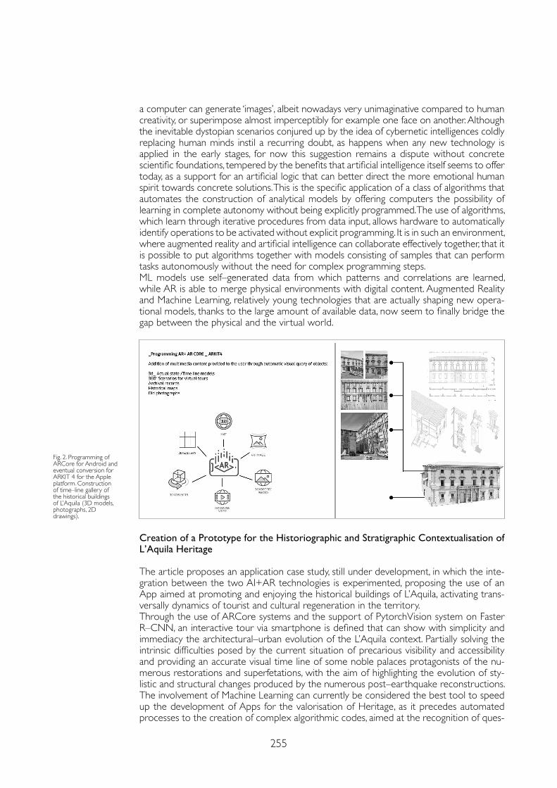
255
a computer can generate ‘images’, albeit nowadays very unimaginative compared to human creativity, or superimpose almost imperceptibly for example one face on another. Although the inevitable dystopian scenarios conjured up by the idea of cybernetic intelligences coldly replacing human minds instil a recurring doubt, as happens when any new technology is applied in the early stages, for now this suggestion remains a dispute without concrete scientific foundations, tempered by the benefits that artificial intelligence itself seems to offer today, as a support for an artificial logic that can better direct the more emotional human spirit towards concrete solutions. This is the specific application of a class of algorithms that automates the construction of analytical models by offering computers the possibility of learning in complete autonomy without being explicitly programmed. The use of algorithms, which learn through iterative procedures from data input, allows hardware to automatically identify operations to be activated without explicit programming. It is in such an environment, where augmented reality and artificial intelligence can collaborate effectively together, that it is possible to put algorithms together with models consisting of samples that can perform tasks autonomously without the need for complex programming steps. ML models use self–generated data from which patterns and correlations are learned, while AR is able to merge physical environments with digital content. Augmented Reality and Machine Learning, relatively young technologies that are actually shaping new opera-tional models, thanks to the large amount of available data, now seem to finally bridge the gap between the physical and the virtual world.
Creation of a Prototype for the Historiographic and Stratigraphic Contextualisation of L’Aquila Heritage
The article proposes an application case study, still under development, in which the inte-gration between the two AI+AR technologies is experimented, proposing the use of an App aimed at promoting and enjoying the historical buildings of L’Aquila, activating trans-versally dynamics of tourist and cultural regeneration in the territory.Through the use of ARCore systems and the support of PytorchVision system on Faster R–CNN, an interactive tour via smartphone is defined that can show with simplicity and immediacy the architectural–urban evolution of the L’Aquila context. Partially solving the intrinsic difficulties posed by the current situation of precarious visibility and accessibility and providing an accurate visual time line of some noble palaces protagonists of the nu-merous restorations and superfetations, with the aim of highlighting the evolution of sty-listic and structural changes produced by the numerous post–earthquake reconstructions.The involvement of Machine Learning can currently be considered the best tool to speed up the development of Apps for the valorisation of Heritage, as it precedes automated processes to the creation of complex algorithmic codes, aimed at the recognition of ques-
Fig. 2. Programming of ARCore for Android and eventual conversion for ARKIT 4 for the Apple platform. Construction of time–line gallery of the historical buildings of L’Aquila (3D models, photographs, 2D drawings).
256
tionable assets and functional to an easier loading in 3D space of explorable digital con-tents. The results of recent technological research have greatly increased the possibilities and relevance of virtual museology, visibly elevating it from the uses for real museums for which it was once intended. With the introduction of augmented reality, a navigable virtual reproduction is proposed in existing environments through the use of an app for smart-phones or tablets, configuring a new concept of diffuse virtual museum, which focuses mainly on the easier usability of a wider and heterogeneous public, together with a better enhancement and promotion of cultural capital that is in part precluded (fig.2). A virtual experience including three–dimensional reconstructions and interactive insights makes available to the visitor assets that are not accessible or no longer exist, such as works that have been lost or remodelled over time. Moreover, the non–place in which the virtual museum is set up allows the materials of interest to escape from their spatial–tem-poral constraints, offering a time–line that provides a view of the conditions of the buildings in the various periods of interest, and to be accompanied by multidisciplinary in–depth analyses and thematic–bibliographical links that can integrate the superficial reading, re-sponding in a proactive and coherent manner to the needs of the users concerned. In the case study, these possibilities prove to be particularly valuable in relation to the virtual ‘AR’ use of buildings affected by disasters or subject to heavy renovation, which are therefore destined to leave no trace of their changes as they do not have a comprehensive, easily accessible and constantly updated digital dossier. In general, visitors who interface with the virtual experience have a better chance of consulting the works, operating in total freedom of observation and enlargement of the selected material, they are free to choose the level of detail and duration of the consultation, and can follow a suggested thematic path or create their own. AR thus constitutes a digital enrichment of physical reality through the superimposition of the former on the latter, providing the user with additional informa-tion relating to the surrounding environment. Unlike pure virtual reality, augmented reality uses devices that do not mask physical reality, so as to enable enhanced interaction with it through virtual technologies.This technology also makes use of more or less sophisticated tools necessary to create a correlation with physical reality, which generally consist of common portable devices such as smartphones and tablets. AR tools do not require total isolation from the surrounding environment, but their use presupposes the user’s visual contact with them. This relation-ship is established thanks to a basic principle of augmented reality, namely that of overlay: the camera integrated in the device frames a given object, the processing system recognis-es it and activates a new level of communication that overlaps and integrates perfectly with reality, increasing the amount of detailed data in relation to that object. Applying the use of Artificial Intelligence to the editing dynamics of an AR system, the development processes can take several hours of calculation and powerful hardware; despite the time consumed, the results obtained simplify the work of configuring the SDK for mobile devices. For the case study, which is still in the development phase, Pytorch Vision was chosen, an open source resource that, by providing ‘training’ models based on Artificial Intelligence, allows developers to immediately use image datasets for production, without the need to com-pile additional complex code to process quality models through a progressive workflow. Both Core ML and TensorFlow Lite models are then automatically generated through pre–compilation, making the subsequent development of apps with ARCore functionality for the Android system more stable, Google technology that allows mobile devices to detect the framed environment, recognise it, and provide interactive AR information. These tools basically offer the possibility to reduce the production time by increasing the quality and consequently the interactivity with the user, amplifying his interest in artefacts related to the enhancement of Cultural Heritage.The mobile app encompasses in a single instance the diffuse virtual museum experience with wide compatibility at the level of devices and operating systems, always relating in a coherent and recognisable way to the user. The multimedia content consists of galleries of images documenting the historical evolution of the buildings and their changes in time, organised thematically or chronologically, through interactive timelines, in order to adapt to

257
References
Abdel–Hamid Ossama, Abdel–Rahman Mohamed, Jiang Hui, Penn Gerald (2012). Applying convolutional neural networks concepts to hybrid NN–HMM model for speech recognition. In ICASSP, IEEE international conference on acoustics speech and signal processing. Piscataway, USA: IEEE Publisher, pp. 4277-4280.
Cooper Gordon, Jacobs Marco, Dipert Brian (2018). Computer Vision for Augmented Reality in Embedded Designs. https://www.edge-ai-vision.com/2018/08/computer-vision-for-augmented-reality-in-embedded-designs/ (1 July 2020).
Hu Han, Lin Steve (2019). Getting a better visual: Reppoints detect objects with greater accuracy through flexible and adaptive object modeling. https://www.microsoft.com/en-us/research/blog/getting-a-better-visual-reppoints-detect-objects-with-greater-accuracy-through-flexible-and-adaptive-object-modeling/ (10 November 2020).
Khan Asifullah, Sohail Anabia, Zahoora Umme, Qureshi Aqsa Saeed (2020). A Survey of the Recent Architectures of Deep Convolutional Neural Networks. In Artificial Intelligence Review, 53, pp. 5455-5516.
Lampropoulos Georgios, Keramopoulos Euclid, Diamantaras Konstantinos (2020). Enhancing the functionality of augmented reality using deep learning, semantic web and knowledge graphs: A review. In Visual Informatics, 4 (1), pp. 32-42.
Wang Jingdong, Sun Ke, Cheng Tianheng, Jiang Borui, Deng Chaorui, Zhao Yang, Liu Dong, Mu Yadong, Tan Mingkui, Wang Xinggang, Liu Wenyu, Xiao Bin (2020). Deep High–Resolution Representation Learning for Visual Recognition. In IEEE Transactions on Pattern Analysis and Machine Intelligence, pp.1-16.
the needs of the user. These can be supplemented by videos or audio clips that guide the reading of the buildings according to the segmentation inherited from Machine Learning models. The section devoted to digital reproductions also contains technical drawings and 3D models of the buildings, arranged in a space that can be framed in perfect superim-position with the real buildings, which unfortunately are partly inaccessible and covered by scaffolding for safety purposes, useful for a more careful examination of their original globality or for a closer look at the architectural decorations and structural elements that are difficult to observe from street level.
Conclusions
The contribution outlines in an experimental way a methodological workflow developed to monitor and enhance the knowledge and the transformations suffered by the architectural heritage of the buildings of L’Aquila, inextricably linked to the seismicity of the places, to the typical fragility and resilience of the context. The resulting surveys, historical investigations and analytical comparisons have defined the basis for the organisation of the knowledge that, in the integration of AI+AR technologies, has found the formula for optimising and using the data for dissemination purposes in possible new heritage promotion projects.
Copyright © 2021 by FrancoAngeli s.r.l. Milano, Italy Isbn 9788835125280
AuthorsCaterina Palestini, Dept. of Architecture, D’Annunzio University of Chieti–Pescara, [email protected] Basso, Dept. of Education, Free University of Bozen–Bolzano, [email protected]

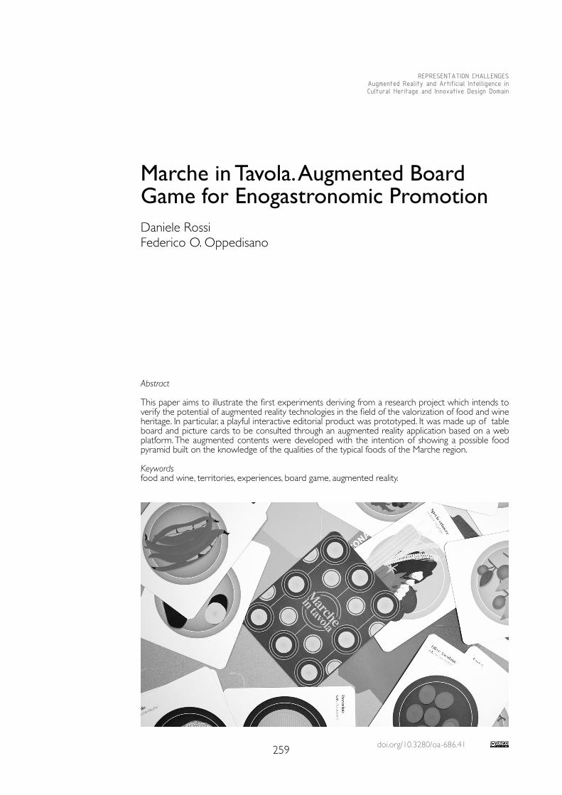
doi.org/10.3280/oa-686.41259
REPRESENTATION CHALLENGESAugmented Reality and Artificial Intelligence in Cultural Heritage and Innovative Design Domain
Abstract
This paper aims to illustrate the first experiments deriving from a research project which intends to verify the potential of augmented reality technologies in the field of the valorization of food and wine heritage. In particular, a playful interactive editorial product was prototyped. It was made up of table board and picture cards to be consulted through an augmented reality application based on a web platform. The augmented contents were developed with the intention of showing a possible food pyramid built on the knowledge of the qualities of the typical foods of the Marche region.
Keywordsfood and wine, territories, experiences, board game, augmented reality.
Marche in Tavola. Augmented Board Game for Enogastronomic Promotion Daniele RossiFederico O. Oppedisano
260
Food as Cultural Heritage
Food and wine heritage represents a fundamental driver that not only enriches tourist offer but also stimulates the economic, social and cultural development of a territory. For this reason, gastronomic tourism requires new strategic, economic and promotional models that encompass different but deeply interrelated areas [Garibaldi 2017].It is no longer limited exclusively to the purchase of local products or the eating of typical dishes, but the activities also expand to participation in dedicated events or visits to farms, wineries, dairies, etc. A plurality of experiences in which the involvement of senses is qual-ifying, through which enjoying the cultural heritage of the place in an active and involving way, enriching the value of sharing. Food and wine therefore become a means for the recovery of collective memory and for the characterization of identity.According to the Rapporto Sull’innovazione Tecnologica nel Turismo Enogastronomico [Garib-aldi 2020], 62% of Italian tourists would use an application or a website which would lead to the discovery of the typical food and wine of the place, and 52% would like to visit production places which use multimedia technologies to enrich the visiting experience. The author of the Report reiterates that the use of technologically advanced tools and systems such as VR, AR, holograms or multimedia tables facilitate the relationship with the tourist, before, during and after the experience, stimulating a more immersive, engaging and personalized tourist experience.The research project Food and Wine Heritage in the Marche Region: Digital Storytell-ing Through Virtual and Augmented Reality [1], conducted by a multidisciplinary team composed of designers, architects, nutrition biologists and computer scientists from the University of Camerino, has set itself the goal of enhancing the Marche region through the use of digital tools and systems that exploit the potential of virtual and augmented reality.The project focuses on new narrative modes, in order to provide insights into the culture of food, and to tell and spread the variety of typical products of the Marche and the ter-ritories to which they are linked.The reconstructions of the historical events of Marche’s cuisine and its food traditions re-veal interesting relationships between popular and aristocratic, lay and conventual culture, but also between oral tradition and written codifications [Bellesi, Franca & Lucchetti 2010]. These researches gather a vast documentation that testifies how the territory of Marche already between the IX and III centuries B.C. at the time of the Piceni and then in the Roman age, was known for its cultivations and agricultural products, among which wheat, fruits, wine and olives. A great part of this heritage has been handed down through local traditions and in the diffused organic productions, today known in the world for the ex-cellence in wine production or for the primates in the oil and beekeeping fields and for the high quality of restaurants. However, enogastronomy in Marche represents not only an economic vector, but also an important socio–cultural factor, intimately connected to a complex set of material goods, made of architectural, artistic, environmental and landscape heritage, and immate-rial goods represented by culture, identity of places, ways of living and traditions, as well as human resources and entrepreneurial skills [Simonelli & Zurlo 2004].
Research Objectives
The project, therefore, is based on the conviction that through visual design and the use of AR and VR digital technologies, it is possible to achieve the definition of innovative forms of storytelling capable of enhancing the local food and wine heritage and con-tributing, at the same time, to the revitalization of the cultural richness of the stories, traditions, know–how, beauty, widespread quality and the “genius loci” of the Marche region. In this sense, design constitutes the strategic lever through which to preserve the social and economic–productive characteristics of the territory, in order to avoid creating “synthetic” visit experiences, which can generally transform places into mere tourist attractions.
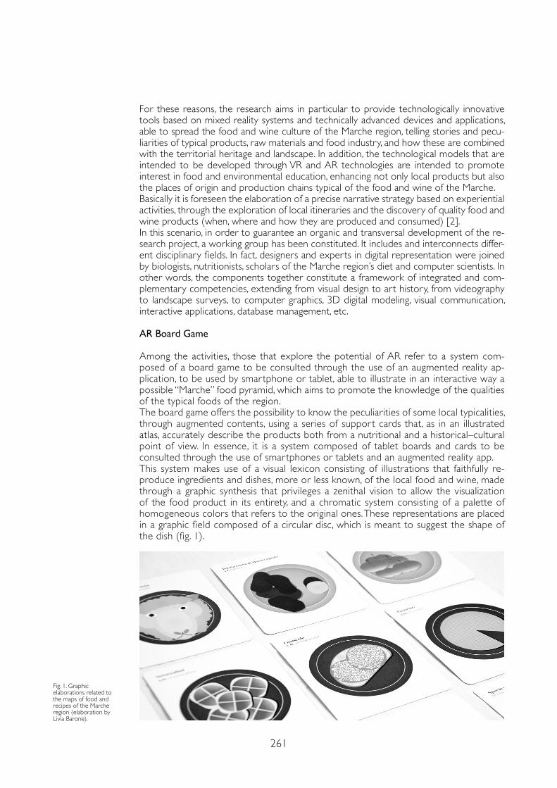
261
For these reasons, the research aims in particular to provide technologically innovative tools based on mixed reality systems and technically advanced devices and applications, able to spread the food and wine culture of the Marche region, telling stories and pecu-liarities of typical products, raw materials and food industry, and how these are combined with the territorial heritage and landscape. In addition, the technological models that are intended to be developed through VR and AR technologies are intended to promote interest in food and environmental education, enhancing not only local products but also the places of origin and production chains typical of the food and wine of the Marche. Basically it is foreseen the elaboration of a precise narrative strategy based on experiential activities, through the exploration of local itineraries and the discovery of quality food and wine products (when, where and how they are produced and consumed) [2].In this scenario, in order to guarantee an organic and transversal development of the re-search project, a working group has been constituted. It includes and interconnects differ-ent disciplinary fields. In fact, designers and experts in digital representation were joined by biologists, nutritionists, scholars of the Marche region’s diet and computer scientists. In other words, the components together constitute a framework of integrated and com-plementary competencies, extending from visual design to art history, from videography to landscape surveys, to computer graphics, 3D digital modeling, visual communication, interactive applications, database management, etc.
AR Board Game
Among the activities, those that explore the potential of AR refer to a system com-posed of a board game to be consulted through the use of an augmented reality ap-plication, to be used by smartphone or tablet, able to illustrate in an interactive way a possible “Marche” food pyramid, which aims to promote the knowledge of the qualities of the typical foods of the region.The board game offers the possibility to know the peculiarities of some local typicalities, through augmented contents, using a series of support cards that, as in an illustrated atlas, accurately describe the products both from a nutritional and a historical–cultural point of view. In essence, it is a system composed of tablet boards and cards to be consulted through the use of smartphones or tablets and an augmented reality app.This system makes use of a visual lexicon consisting of illustrations that faithfully re-produce ingredients and dishes, more or less known, of the local food and wine, made through a graphic synthesis that privileges a zenithal vision to allow the visualization of the food product in its entirety, and a chromatic system consisting of a palette of homogeneous colors that refers to the original ones. These representations are placed in a graphic field composed of a circular disc, which is meant to suggest the shape of the dish (fig. 1).
Fig. 1. Graphic elaborations related to the maps of food and recipes of the Marche region (elaboration by Livia Barone).
Mazzo di carte
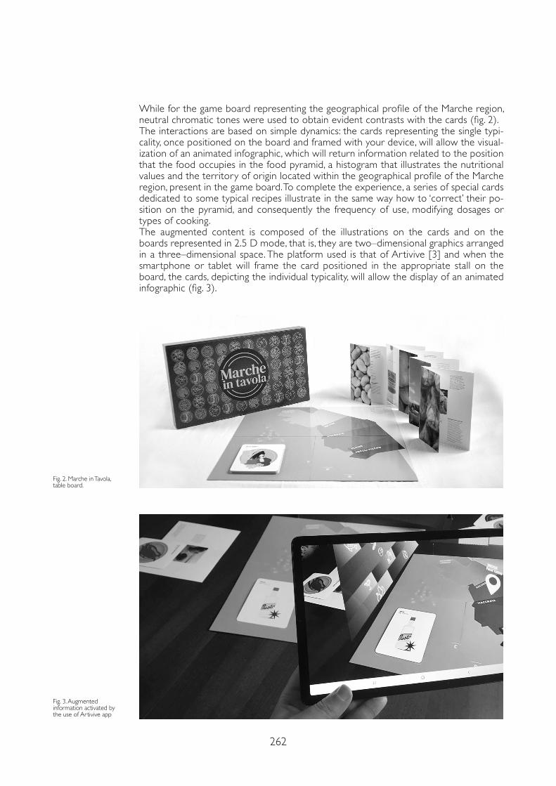
262
While for the game board representing the geographical profile of the Marche region, neutral chromatic tones were used to obtain evident contrasts with the cards (fig. 2).The interactions are based on simple dynamics: the cards representing the single typi-cality, once positioned on the board and framed with your device, will allow the visual-ization of an animated infographic, which will return information related to the position that the food occupies in the food pyramid, a histogram that illustrates the nutritional values and the territory of origin located within the geographical profile of the Marche region, present in the game board. To complete the experience, a series of special cards dedicated to some typical recipes illustrate in the same way how to ‘correct’ their po-sition on the pyramid, and consequently the frequency of use, modifying dosages or types of cooking.The augmented content is composed of the illustrations on the cards and on the boards represented in 2.5 D mode, that is, they are two–dimensional graphics arranged in a three–dimensional space. The platform used is that of Artivive [3] and when the smartphone or tablet will frame the card positioned in the appropriate stall on the board, the cards, depicting the individual typicality, will allow the display of an animated infographic (fig. 3).
Fig. 2. Marche in Tavola, table board.
Fig. 3. Augmented information activated by the use of Artivive app
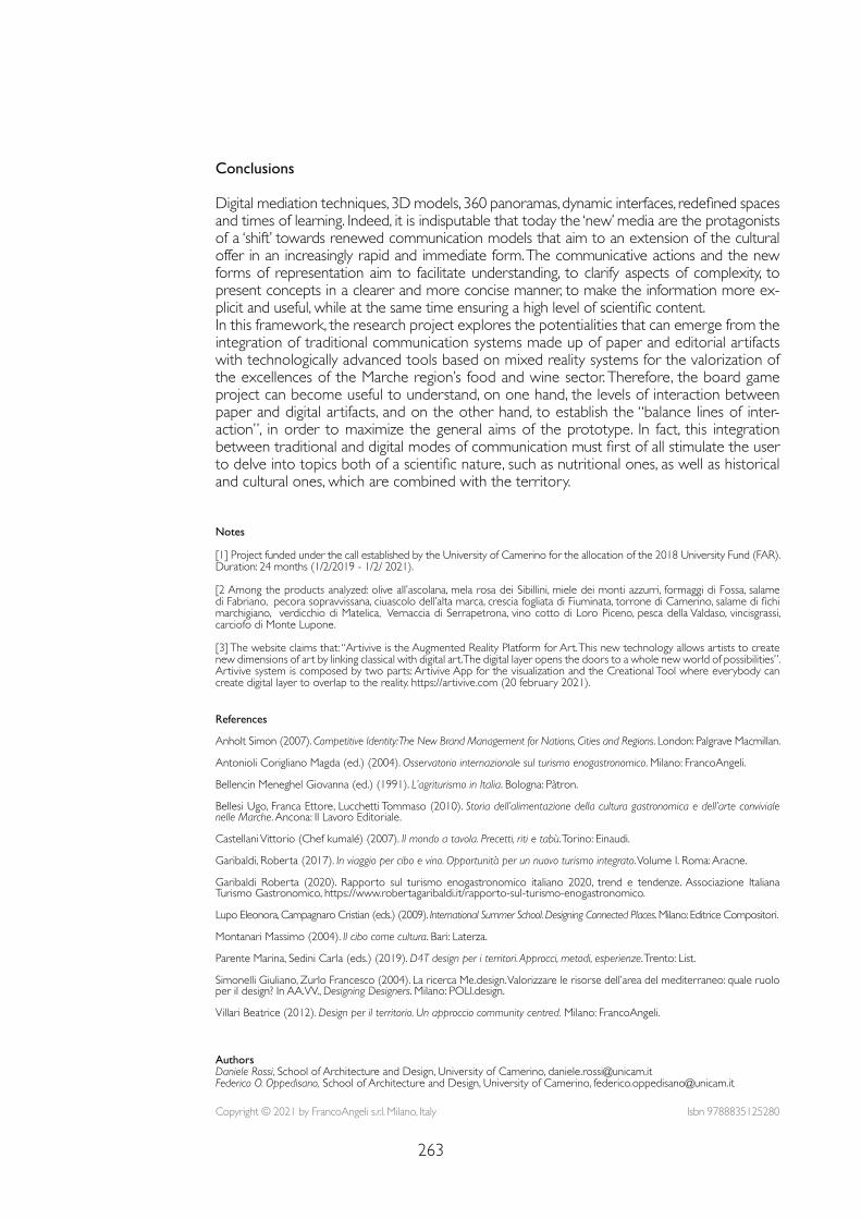
263
Notes
[1] Project funded under the call established by the University of Camerino for the allocation of the 2018 University Fund (FAR). Duration: 24 months (1/2/2019 - 1/2/ 2021).
[2 Among the products analyzed: olive all’ascolana, mela rosa dei Sibillini, miele dei monti azzurri, formaggi di Fossa, salame di Fabriano, pecora sopravvissana, ciuascolo dell’alta marca, crescia fogliata di Fiuminata, torrone di Camerino, salame di fichi marchigiano, verdicchio di Matelica, Vernaccia di Serrapetrona, vino cotto di Loro Piceno, pesca della Valdaso, vincisgrassi, carciofo di Monte Lupone.
[3] The website claims that: “Artivive is the Augmented Reality Platform for Art. This new technology allows artists to create new dimensions of art by linking classical with digital art. The digital layer opens the doors to a whole new world of possibilities”. Artivive system is composed by two parts: Artivive App for the visualization and the Creational Tool where everybody can create digital layer to overlap to the reality. https://artivive.com (20 february 2021).
References
Anholt Simon (2007). Competitive Identity: The New Brand Management for Nations, Cities and Regions. London: Palgrave Macmillan.
Antonioli Corigliano Magda (ed.) (2004). Osservatorio internazionale sul turismo enogastronomico. Milano: FrancoAngeli.
Bellencin Meneghel Giovanna (ed.) (1991). L’agriturismo in Italia. Bologna: Pàtron.
Bellesi Ugo, Franca Ettore, Lucchetti Tommaso (2010). Storia dell’alimentazione della cultura gastronomica e dell’arte conviviale nelle Marche. Ancona: Il Lavoro Editoriale.
Castellani Vittorio (Chef kumalé) (2007). Il mondo a tavola. Precetti, riti e tabù. Torino: Einaudi.
Garibaldi, Roberta (2017). In viaggio per cibo e vino. Opportunità per un nuovo turismo integrato. Volume I. Roma: Aracne.
Garibaldi Roberta (2020). Rapporto sul turismo enogastronomico italiano 2020, trend e tendenze. Associazione Italiana Turismo Gastronomico, https://www.robertagaribaldi.it/rapporto-sul-turismo-enogastronomico.
Lupo Eleonora, Campagnaro Cristian (eds.) (2009). International Summer School. Designing Connected Places. Milano: Editrice Compositori.
Montanari Massimo (2004). Il cibo come cultura. Bari: Laterza.
Parente Marina, Sedini Carla (eds.) (2019). D4T design per i territori. Approcci, metodi, esperienze. Trento: List.
Simonelli Giuliano, Zurlo Francesco (2004). La ricerca Me.design. Valorizzare le risorse dell’area del mediterraneo: quale ruolo per il design? In AA.VV., Designing Designers. Milano: POLI.design.
Villari Beatrice (2012). Design per il territorio. Un approccio community centred. Milano: FrancoAngeli.
Conclusions
Digital mediation techniques, 3D models, 360 panoramas, dynamic interfaces, redefined spaces and times of learning. Indeed, it is indisputable that today the ‘new’ media are the protagonists of a ‘shift’ towards renewed communication models that aim to an extension of the cultural offer in an increasingly rapid and immediate form. The communicative actions and the new forms of representation aim to facilitate understanding, to clarify aspects of complexity, to present concepts in a clearer and more concise manner, to make the information more ex-plicit and useful, while at the same time ensuring a high level of scientific content.In this framework, the research project explores the potentialities that can emerge from the integration of traditional communication systems made up of paper and editorial artifacts with technologically advanced tools based on mixed reality systems for the valorization of the excellences of the Marche region’s food and wine sector. Therefore, the board game project can become useful to understand, on one hand, the levels of interaction between paper and digital artifacts, and on the other hand, to establish the “balance lines of inter-action”, in order to maximize the general aims of the prototype. In fact, this integration between traditional and digital modes of communication must first of all stimulate the user to delve into topics both of a scientific nature, such as nutritional ones, as well as historical and cultural ones, which are combined with the territory.
Copyright © 2021 by FrancoAngeli s.r.l. Milano, Italy Isbn 9788835125280
AuthorsDaniele Rossi, School of Architecture and Design, University of Camerino, [email protected] O. Oppedisano, School of Architecture and Design, University of Camerino, [email protected]

AR&AI museum heritage

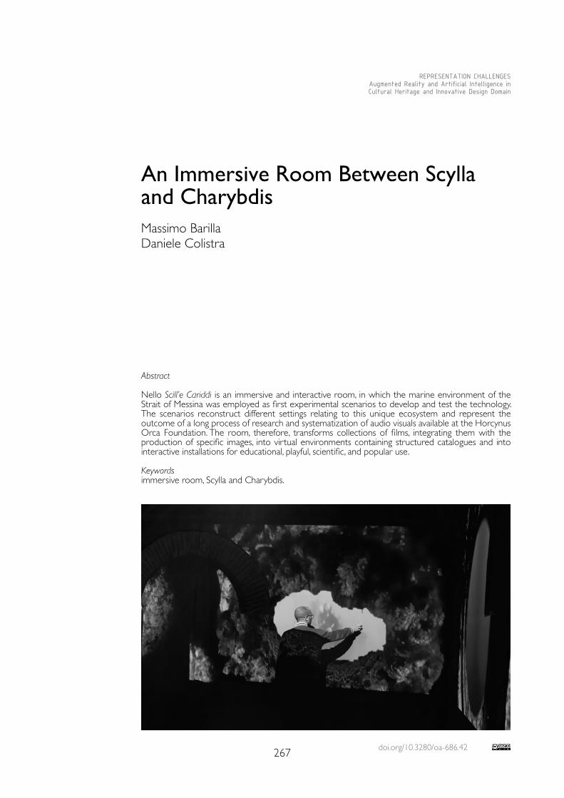
doi.org/10.3280/oa-686.42267
REPRESENTATION CHALLENGESAugmented Reality and Artificial Intelligence in Cultural Heritage and Innovative Design Domain
Abstract
Nello Scill’e Cariddi is an immersive and interactive room, in which the marine environment of the Strait of Messina was employed as first experimental scenarios to develop and test the technology. The scenarios reconstruct different settings relating to this unique ecosystem and represent the outcome of a long process of research and systematization of audio visuals available at the Horcynus Orca Foundation. The room, therefore, transforms collections of films, integrating them with the production of specific images, into virtual environments containing structured catalogues and into interactive installations for educational, playful, scientific, and popular use.
Keywordsimmersive room, Scylla and Charybdis.
An Immersive Room Between Scylla and CharybdisMassimo BarillaDaniele Colistra
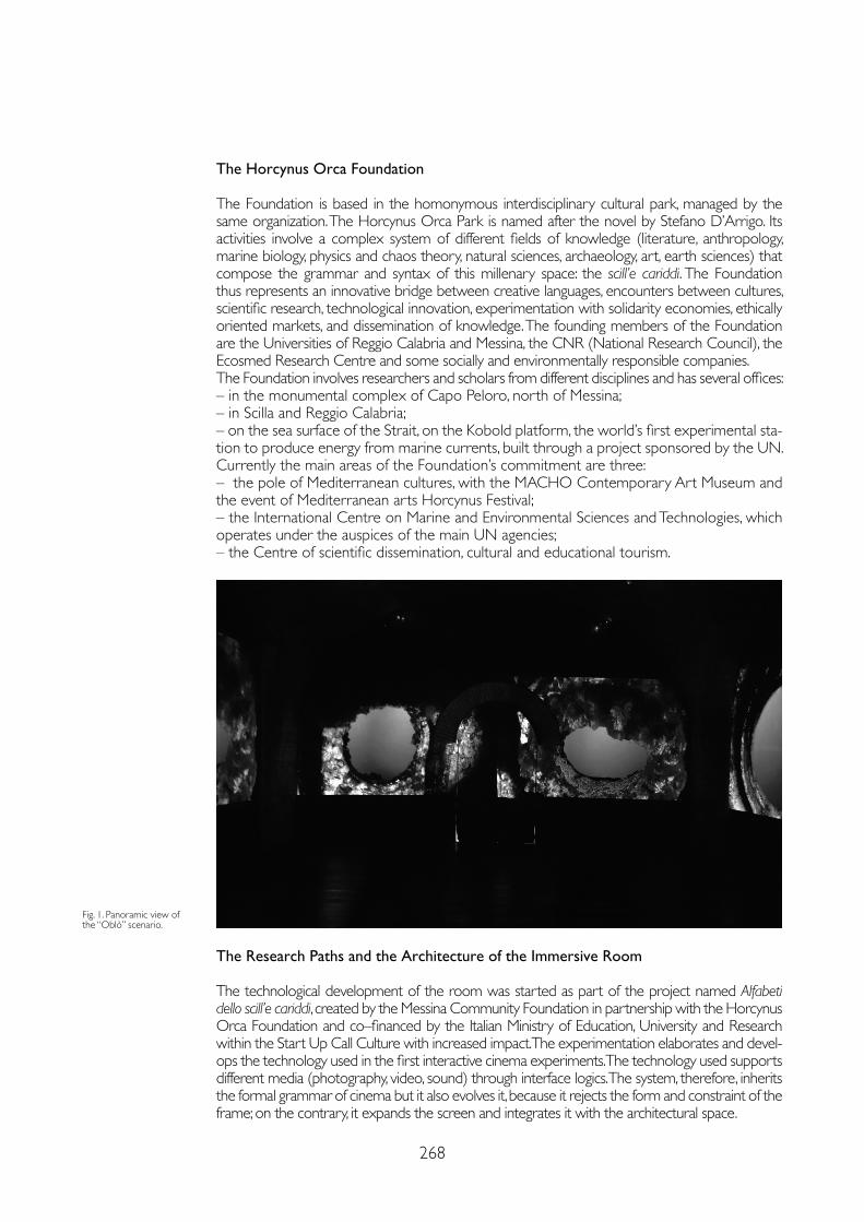
268
The Horcynus Orca Foundation
The Foundation is based in the homonymous interdisciplinary cultural park, managed by the same organization. The Horcynus Orca Park is named after the novel by Stefano D’Arrigo. Its activities involve a complex system of different fields of knowledge (literature, anthropology, marine biology, physics and chaos theory, natural sciences, archaeology, art, earth sciences) that compose the grammar and syntax of this millenary space: the scill’e cariddi. The Foundation thus represents an innovative bridge between creative languages, encounters between cultures, scientific research, technological innovation, experimentation with solidarity economies, ethically oriented markets, and dissemination of knowledge. The founding members of the Foundation are the Universities of Reggio Calabria and Messina, the CNR (National Research Council), the Ecosmed Research Centre and some socially and environmentally responsible companies.The Foundation involves researchers and scholars from different disciplines and has several offices:– in the monumental complex of Capo Peloro, north of Messina;– in Scilla and Reggio Calabria;– on the sea surface of the Strait, on the Kobold platform, the world’s first experimental sta-tion to produce energy from marine currents, built through a project sponsored by the UN.Currently the main areas of the Foundation’s commitment are three:– the pole of Mediterranean cultures, with the MACHO Contemporary Art Museum and the event of Mediterranean arts Horcynus Festival; – the International Centre on Marine and Environmental Sciences and Technologies, which operates under the auspices of the main UN agencies; – the Centre of scientific dissemination, cultural and educational tourism.
Fig. 1. Panoramic view of the “Oblò” scenario.
The Research Paths and the Architecture of the Immersive Room
The technological development of the room was started as part of the project named Alfabeti dello scill’e cariddi, created by the Messina Community Foundation in partnership with the Horcynus Orca Foundation and co–financed by the Italian Ministry of Education, University and Research within the Start Up Call Culture with increased impact. The experimentation elaborates and devel-ops the technology used in the first interactive cinema experiments. The technology used supports different media (photography, video, sound) through interface logics. The system, therefore, inherits the formal grammar of cinema but it also evolves it, because it rejects the form and constraint of the frame; on the contrary, it expands the screen and integrates it with the architectural space.
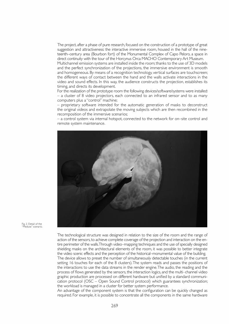
269
The project, after a phase of pure research, focused on the construction of a prototype of great suggestion and attractiveness: the interactive immersive room, housed in the hall of the nine-teenth–century area (Bourbon fort) of the Monumental Complex of Capo Peloro, a space in direct continuity with the tour of the Horcynus Orca MACHO Contemporary Art Museum.Multichannel emission systems are installed inside the room; thanks to the use of 3D models and the perfect synchronization of the projections, the immersive environment is smooth and homogeneous. By means of a recognition technology, vertical surfaces are touchscreen; the different ways of contact between the hand and the walls activate interactions in the video and sound effects. In this way, the audience constructs the projection, establishes its timing, and directs its development.For the realization of the prototype room the following devices/software/systems were installed:– a cluster of 8 video projectors, each connected to an infrared sensor and to as many computers plus a “control” machine; – proprietary software intended for the automatic generation of masks to deconstruct the original videos and extrapolate the moving subjects which are then recombined in the recomposition of the immersive scenarios;– a control system via internal hotspot, connected to the network for on–site control and remote system maintenance.
The technological structure was designed in relation to the size of the room and the range of action of the sensors, to achieve complete coverage of the projection and interaction on the en-tire perimeter of the walls. Through video–mapping techniques and the use of specially designed shielding masks on the architectural elements of the room, it was possible to better integrate the video scenic effects and the perception of the historical–monumental value of the building.The device allows to preset the number of simultaneously detectable touches (in the current setting 16 touches for each of the 8 clusters). The system reads and passes the positions of the interactions to use the data streams in the render engine. The audio, the reading and the process of flows generated by the sensors, the interaction logics, and the multi–channel video graphic production are processed on different hardware but unified by a standard communi-cation protocol (OSC – Open Sound Control protocol) which guarantees synchronization; the workload is managed in a cluster for better system performance.An advantage of the component system is that the configuration can be quickly changed as required. For example, it is possible to concentrate all the components in the same hardware
Fig. 2. Detail of the “Meduse” scenario.
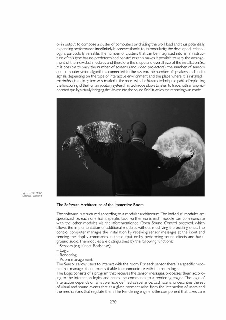
270
or, in output, to compose a cluster of computers by dividing the workload and thus potentially expanding performance indefinitely. Moreover, thanks to its modularity, the developed technol-ogy is particularly versatile. The number of clusters that can be integrated into an infrastruc-ture of this type has no predetermined constraints; this makes it possible to vary the arrange-ment of the individual modules and therefore the shape and overall size of the installation. So, it is possible to vary the number of screens (and video projectors), the number of sensors and computer vision algorithms connected to the system, the number of speakers and audio signals, depending on the type of interactive environment and the place where it is installed.An Ambisonic audio system was installed in the room with the binaural technique capable of replicating the functioning of the human auditory system. This technique allows to listen to tracks with an unprec-edented quality, virtually bringing the viewer into the sound field in which the recording was made.
The Software Architecture of the Immersive Room
The software is structured according to a modular architecture. The individual modules are specialized, i.e. each one has a specific task. Furthermore, each module can communicate with the other modules via the aforementioned Open Sound Control protocol, which allows the implementation of additional modules without modifying the existing ones. The control computer manages the installation by receiving sensor messages at the input and sending the display commands at the output or by performing sound effects and back-ground audio. The modules are distinguished by the following functions:– Sensors (e.g. Kinect, Realsense);– Logic;– Rendering;– Room management.The Sensors allow users to interact with the room. For each sensor there is a specific mod-ule that manages it and makes it able to communicate with the room logic.The Logic consists of a program that receives the sensor messages, processes them accord-ing to the interaction logics and sends the commands to a rendering engine. The logic of interaction depends on what we have defined as scenarios. Each scenario describes the set of visual and sound events that at a given moment arise from the interaction of users and the mechanisms that regulate them. The Rendering engine is the component that takes care
Fig. 3. Detail of the “Meduse” scenario.
271
References
Bettettini Giovanni (1996). L’audiovisivo: dal cinema ai nuovi media. Milano: Bompiani.
Cirifino Fabio, Rosa Paolo, Roveda Stefano, Sangiorgi Leonardo (2007). Studio Azzurro. Videoambienti, ambienti sensibili. Milano: Feltrinelli.
De Gaetano Domenico (1995). Mutazioni elettroniche. Le immagini di Studio Azzurro. Torino: Lindau.
Fagone Vittorio (2007). L’immagine video. Arti visuali e nuovi media elettronici. Milano: Feltrinelli.
Lischi Sandra (2005). Il linguaggio del video. Roma: Carocci.
Madesani Angela (2005). Le icone fluttuanti. Storia del cinema d’artista e della videoarte in Italia. Milano: Mondadori.
of visualizing the contents and effects of user interactions. Basically, he is a mere executor of the commands given by the control computer. The overall Management of the room is carried out by a module called “manager”, whose task is to switch the entire room on and off, and to start and stop individual programs when necessary. Manager also provides a web interface for changing scenarios and switching the entire room on and off.The only module that controls the status of the room and the active scenario at a given time is the one that manages the logic. The sensor modules and the rendering module have no knowledge of the room status but are limited to executing commands (rendering module) or sending information regarding user interaction (sensor modules) to the room logic.
The Prototype and Research Developments
The first prototype contains several immersive scenarios of the marine environment of the Strait; they are the result of a path based on research, organization, metadata, and optimiza-tion of archive resources. One of these scenarios reproduces from the inside the walls of a wreck with portholes of various shapes within which it is possible to reproduce films from a collection relating to underwater ar-chaeological sites in Sicily, made available by the Superintendence of the Sea of the Sicilian Region. Other scenarios allow the public to discover the environments and marine species of the sea surface and the abysses of the Strait; thanks to the interaction, each touch makes sea creatures appear alive and in motion, selecting them randomly from a database. Nello Scill’e Cariddi is a prototype dedicated to underwater scenarios, but the project makes it possible to stage, at low cost, settings relating to different themes: figurative art, virtual sce-nography for performing arts, archaeology; scientific dissemination projects, sensory itiner-aries for disabled people and, more generally, educational paths. The Horcynus Orca Foun-dation has already created additional collections of interactive immersive environments and therefore the archive is constantly being implemented.The first interactive art installations have already been created, including Ultrathinking by the Iraqi artist of Kadir Fadel and La Habana Sobre Ruedas by the Cuban collective composed of Claudia Hechavarria Segura, Juan Alberto Matamoros Nues, Elvys Ariel Urra Moreno; a first experimentation of ensemble music in which it is possible to activate with infinite combinations up to 32 instruments of a virtual orchestra curated by Luigi Polimeni; the first experiments of interactive virtual scenography through the collaboration with Mana Chuma Teatro. Some virtual scenarios on matter and the cosmos are at an advanced design stage, in collaboration with the National Institute of Nuclear Physics; titles suitable for children with particular types of autism spectrum disorder, in collaboration with the CNR–IRIB (Institute for Research and Biomedical Innovation) of Messina; a historical–archival project for the reconstruction and investigation of the scene of the Portella della Ginestra massacre.
Copyright © 2021 by FrancoAngeli s.r.l. Milano, Italy Isbn 9788835125280
AuthorsMassimo Barilla, Horcynus Orca Foundation, Messina, [email protected] Colistra, Dept. of Architecture and Territory, University of Reggio Calabria, [email protected]

doi.org/10.3280/oa-686.43273
REPRESENTATION CHALLENGESAugmented Reality and Artificial Intelligence in Cultural Heritage and Innovative Design Domain
Abstract
In the digital age, museums have seen a significant expansion of the spaces and tools for disseminat-ing knowledge. Gallerie dell’Accademia had commissioned a permanent and multimedia video that summarized the results of the interdisciplinary research developed within Visualizing Venice – S. Maria della Carità, S. Agnese, and the Gesuati, three insulae make one – that told about the history of the urban and architectural transformations of the insula. Since it is not a totally immersive installation, some years later Gallerie asked to make some changes to the previous animation to allow a greater interactivity between user and observed data. In order to keep the visitor’s attention threshold high and active, different sections of short duration have been introduced, which can be interrogated and activated by sensors, while a Sound Shower system facilitates the understanding of the multimedia story through the listening of a narrator’s voice.
Keywords virtual reality, digital model, database, interaction, immersivity.
New Cultural Interfaces on the Gallerie dell’Accademia in VeniceFrancesco BorellaIsabella FrisoLudovica GaleazzoCosimo MonteleoneElena Svalduz
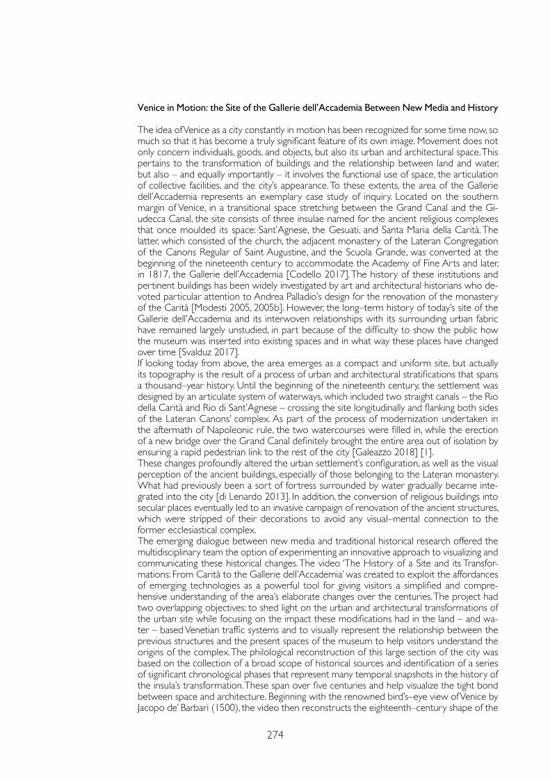
274
Venice in Motion: the Site of the Gallerie dell’Accademia Between New Media and History
The idea of Venice as a city constantly in motion has been recognized for some time now, so much so that it has become a truly significant feature of its own image. Movement does not only concern individuals, goods, and objects, but also its urban and architectural space. This pertains to the transformation of buildings and the relationship between land and water, but also – and equally importantly – it involves the functional use of space, the articulation of collective facilities, and the city’s appearance. To these extents, the area of the Gallerie dell’Accademia represents an exemplary case study of inquiry. Located on the southern margin of Venice, in a transitional space stretching between the Grand Canal and the Gi-udecca Canal, the site consists of three insulae named for the ancient religious complexes that once moulded its space: Sant’Agnese, the Gesuati, and Santa Maria della Carità. The latter, which consisted of the church, the adjacent monastery of the Lateran Congregation of the Canons Regular of Saint Augustine, and the Scuola Grande, was converted at the beginning of the nineteenth century to accommodate the Academy of Fine Arts and later, in 1817, the Gallerie dell’Accademia [Codello 2017]. The history of these institutions and pertinent buildings has been widely investigated by art and architectural historians who de-voted particular attention to Andrea Palladio’s design for the renovation of the monastery of the Carità [Modesti 2005, 2005b]. However, the long–term history of today’s site of the Gallerie dell’Accademia and its interwoven relationships with its surrounding urban fabric have remained largely unstudied, in part because of the difficulty to show the public how the museum was inserted into existing spaces and in what way these places have changed over time [Svalduz 2017].If looking today from above, the area emerges as a compact and uniform site, but actually its topography is the result of a process of urban and architectural stratifications that spans a thousand–year history. Until the beginning of the nineteenth century, the settlement was designed by an articulate system of waterways, which included two straight canals – the Rio della Carità and Rio di Sant’Agnese – crossing the site longitudinally and flanking both sides of the Lateran Canons’ complex. As part of the process of modernization undertaken in the aftermath of Napoleonic rule, the two watercourses were filled in, while the erection of a new bridge over the Grand Canal definitely brought the entire area out of isolation by ensuring a rapid pedestrian link to the rest of the city [Galeazzo 2018] [1].These changes profoundly altered the urban settlement’s configuration, as well as the visual perception of the ancient buildings, especially of those belonging to the Lateran monastery. What had previously been a sort of fortress surrounded by water gradually became inte-grated into the city [di Lenardo 2013]. In addition, the conversion of religious buildings into secular places eventually led to an invasive campaign of renovation of the ancient structures, which were stripped of their decorations to avoid any visual–mental connection to the former ecclesiastical complex.The emerging dialogue between new media and traditional historical research offered the multidisciplinary team the option of experimenting an innovative approach to visualizing and communicating these historical changes. The video ‘The History of a Site and its Transfor-mations: From Carità to the Gallerie dell’Accademia’ was created to exploit the affordances of emerging technologies as a powerful tool for giving visitors a simplified and compre-hensive understanding of the area’s elaborate changes over the centuries. The project had two overlapping objectives: to shed light on the urban and architectural transformations of the urban site while focusing on the impact these modifications had in the land – and wa-ter – based Venetian traffic systems and to visually represent the relationship between the previous structures and the present spaces of the museum to help visitors understand the origins of the complex. The philological reconstruction of this large section of the city was based on the collection of a broad scope of historical sources and identification of a series of significant chronological phases that represent many temporal snapshots in the history of the insula’s transformation. These span over five centuries and help visualize the tight bond between space and architecture. Beginning with the renowned bird’s–eye view of Venice by Jacopo de’ Barbari (1500), the video then reconstructs the eighteenth–century shape of the
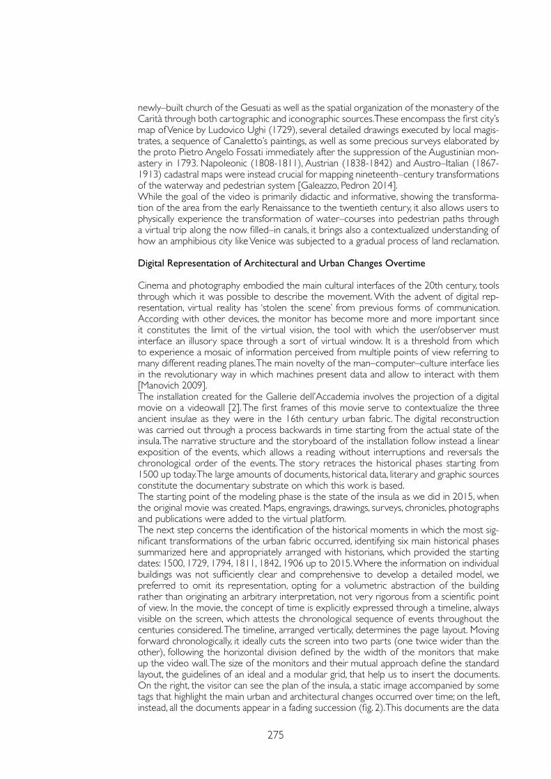
275
newly–built church of the Gesuati as well as the spatial organization of the monastery of the Carità through both cartographic and iconographic sources. These encompass the first city’s map of Venice by Ludovico Ughi (1729), several detailed drawings executed by local magis-trates, a sequence of Canaletto’s paintings, as well as some precious surveys elaborated by the proto Pietro Angelo Fossati immediately after the suppression of the Augustinian mon-astery in 1793. Napoleonic (1808-1811), Austrian (1838-1842) and Austro–Italian (1867-1913) cadastral maps were instead crucial for mapping nineteenth–century transformations of the waterway and pedestrian system [Galeazzo, Pedron 2014].While the goal of the video is primarily didactic and informative, showing the transforma-tion of the area from the early Renaissance to the twentieth century, it also allows users to physically experience the transformation of water–courses into pedestrian paths through a virtual trip along the now filled–in canals, it brings also a contextualized understanding of how an amphibious city like Venice was subjected to a gradual process of land reclamation.
Digital Representation of Architectural and Urban Changes Overtime
Cinema and photography embodied the main cultural interfaces of the 20th century, tools through which it was possible to describe the movement. With the advent of digital rep-resentation, virtual reality has ‘stolen the scene’ from previous forms of communication. According with other devices, the monitor has become more and more important since it constitutes the limit of the virtual vision, the tool with which the user/observer must interface an illusory space through a sort of virtual window. It is a threshold from which to experience a mosaic of information perceived from multiple points of view referring to many different reading planes. The main novelty of the man–computer–culture interface lies in the revolutionary way in which machines present data and allow to interact with them [Manovich 2009]. The installation created for the Gallerie dell’Accademia involves the projection of a digital movie on a videowall [2]. The first frames of this movie serve to contextualize the three ancient insulae as they were in the 16th century urban fabric. The digital reconstruction was carried out through a process backwards in time starting from the actual state of the insula. The narrative structure and the storyboard of the installation follow instead a linear exposition of the events, which allows a reading without interruptions and reversals the chronological order of the events. The story retraces the historical phases starting from 1500 up today. The large amounts of documents, historical data, literary and graphic sources constitute the documentary substrate on which this work is based. The starting point of the modeling phase is the state of the insula as we did in 2015, when the original movie was created. Maps, engravings, drawings, surveys, chronicles, photographs and publications were added to the virtual platform.The next step concerns the identification of the historical moments in which the most sig-nificant transformations of the urban fabric occurred, identifying six main historical phases summarized here and appropriately arranged with historians, which provided the starting dates: 1500, 1729, 1794, 1811, 1842, 1906 up to 2015. Where the information on individual buildings was not sufficiently clear and comprehensive to develop a detailed model, we preferred to omit its representation, opting for a volumetric abstraction of the building rather than originating an arbitrary interpretation, not very rigorous from a scientific point of view. In the movie, the concept of time is explicitly expressed through a timeline, always visible on the screen, which attests the chronological sequence of events throughout the centuries considered. The timeline, arranged vertically, determines the page layout. Moving forward chronologically, it ideally cuts the screen into two parts (one twice wider than the other), following the horizontal division defined by the width of the monitors that make up the video wall. The size of the monitors and their mutual approach define the standard layout, the guidelines of an ideal and a modular grid, that help us to insert the documents. On the right, the visitor can see the plan of the insula, a static image accompanied by some tags that highlight the main urban and architectural changes occurred over time; on the left, instead, all the documents appear in a fading succession (fig. 2). This documents are the data
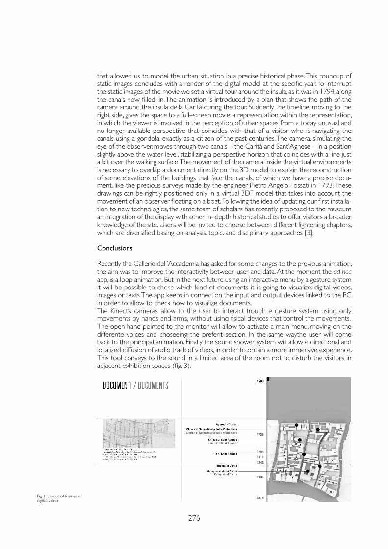
276
that allowed us to model the urban situation in a precise historical phase. This roundup of static images concludes with a render of the digital model at the specific year. To interrupt the static images of the movie we set a virtual tour around the insula, as it was in 1794, along the canals now filled–in. The animation is introduced by a plan that shows the path of the camera around the insula della Carità during the tour. Suddenly the timeline, moving to the right side, gives the space to a full–screen movie: a representation within the representation, in which the viewer is involved in the perception of urban spaces from a today unusual and no longer available perspective that coincides with that of a visitor who is navigating the canals using a gondola, exactly as a citizen of the past centuries. The camera, simulating the eye of the observer, moves through two canals – the Carità and Sant’Agnese – in a position slightly above the water level, stabilizing a perspective horizon that coincides with a line just a bit over the walking surface. The movement of the camera inside the virtual environments is necessary to overlap a document directly on the 3D model to explain the reconstruction of some elevations of the buildings that face the canals, of which we have a precise docu-ment, like the precious surveys made by the engineer Pietro Angelo Fossati in 1793. These drawings can be rightly positioned only in a virtual 3DF model that takes into account the movement of an observer floating on a boat. Following the idea of updating our first installa-tion to new technologies, the same team of scholars has recently proposed to the museum an integration of the display with other in–depth historical studies to offer visitors a broader knowledge of the site. Users will be invited to choose between different lightening chapters, which are diversified basing on analysis, topic, and disciplinary approaches [3].
Conclusions
Recently the Gallerie dell’Accademia has asked for some changes to the previous animation, the aim was to improve the interactivity between user and data. At the moment the ad hoc app, is a loop animation. But in the next future using an interactive menu by a gesture system it will be possible to chose which kind of documents it is going to visualize: digital videos, images or texts. The app keeps in connection the input and output devices linked to the PC in order to allow to check how to visualize documents. The Kinect’s cameras allow to the user to interact trough e gesture system using only movements by hands and arms, without using fisical devices that control the movements.The open hand pointed to the monitor will allow to activate a main menu, moving on the differente voices and choseeing the preferit section. In the same waythe user will come back to the principal animation. Finally the sound shower system will allow e directional and localized diffusion of audio track of videos, in order to obtain a more immersive experience. This tool conveys to the sound in a limited area of the room not to disturb the visitors in adjacent exhibition spaces (fig. 3).
Fig. 1. Layout of frames of digital video.
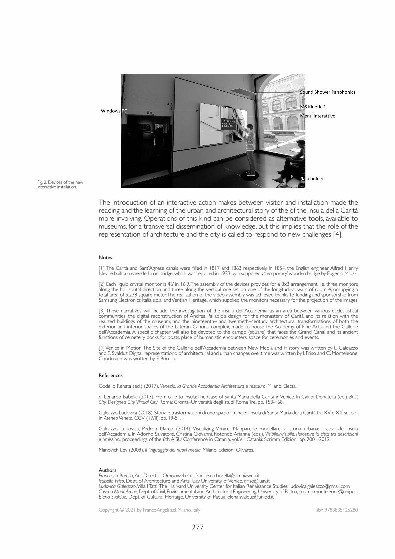
277
Fig. 2. Devices of the new interactive installation.
Notes
[1] The Carità and Sant’Agnese canals were filled in 1817 and 1863 respectively. In 1854, the English engineer Alfred Henry Neville built a suspended iron bridge, which was replaced in 1933 by a supposedly ‘temporary’ wooden bridge by Eugenio Miozzi.
[2] Each liquid crystal monitor is 46’ in 16:9. The assembly of the devices provides for a 3x3 arrangement, i.e. three monitors along the horizontal direction and three along the vertical one set on one of the longitudinal walls of room 4, occupying a total area of 5.238 square meter. The realization of the video assembly was achieved thanks to funding and sponsorship from Samsung Electronics Italia s.p.a. and Ventian Heritage, which supplied the monitors necessary for the projection of the images.
[3] These narratives will include: the investigation of the insula dell’Accademia as an area between various ecclesiastical communities; the digital reconstruction of Andrea Palladio’s design for the monastery of Carità and its relation with the realized buildings of the museum; and the nineteenth– and twentieth–century architectural transformations of both the exterior and interior spaces of the Lateran Canons’ complex, made to house the Academy of Fine Arts and the Gallerie dell’Accademia. A specific chapter will also be devoted to the campo (square) that faces the Grand Canal and its ancient functions of cemetery, docks for boats, place of humanistic encounters, space for ceremonies and events.
[4] Venice in Motion: The Site of the Gallerie dell’Accademia between New Media and History was written by L. Galeazzo and E. Svalduz; Digital representationo of architectural and urban changes overtime was written by I. Friso and C. Monteleone; Conclusion was written by F. Borella.
References
Codello Renata (ed.) (2017). Venezia: la Grande Accademia. Architettura e restauro. Milano: Electa.
di Lenardo Isabella (2013). From calle to insula: The Case of Santa Maria della Carità in Venice. In Calabi Donatella (ed.). Built City, Designed City, Virtual City. Roma: Croma–Università degli studi Roma Tre, pp. 153-168.
Galeazzo Ludovica (2018). Storia e trasformazioni di uno spazio liminale: l’insula di Santa Maria della Carità tra XV e XX secolo. In Ateneo Veneto, CCV (17/II), pp. 19-51.
Galeazzo Ludovica, Pedron Marco (2014). Visualizing Venice. Mappare e modellare la storia urbana: il caso dell’insula dell’Accademia. In Adorno Salvatore, Cristina Giovanni, Rotondo Arianna (eds.). VisibileInvisibile. Percepire la città tra descrizioni e omissioni, proceedings of the 6th AISU Conference in Catania, vol. VII. Catania: Scrimm Edizioni, pp. 2001-2012.
Manovich Lev (2009). Il linguaggio dei nuovi media. Milano: Edizioni Olivares.
The introduction of an interactive action makes between visitor and installation made the reading and the learning of the urban and architectural story of the of the insula della Carità more involving. Operations of this kind can be considered as alternative tools, available to museums, for a transversal dissemination of knowledge, but this implies that the role of the representation of architecture and the city is called to respond to new challenges [4].
Copyright © 2021 by FrancoAngeli s.r.l. Milano, Italy Isbn 9788835125280
AuthorsFrancesco Borella, Art Director Omniaweb s.r.l, [email protected] Friso, Dept. of Architecture and Arts, Iuav University of Venice, [email protected] Galeazzo, Villa I Tatti, The Harvard University Center for Italian Renaissance Studies, [email protected] Monteleone, Dept. of Civil, Environmental and Architectural Engineering, University of Padua, [email protected] Svalduz, Dept. of Cultural Heritage, University of Padua, [email protected]

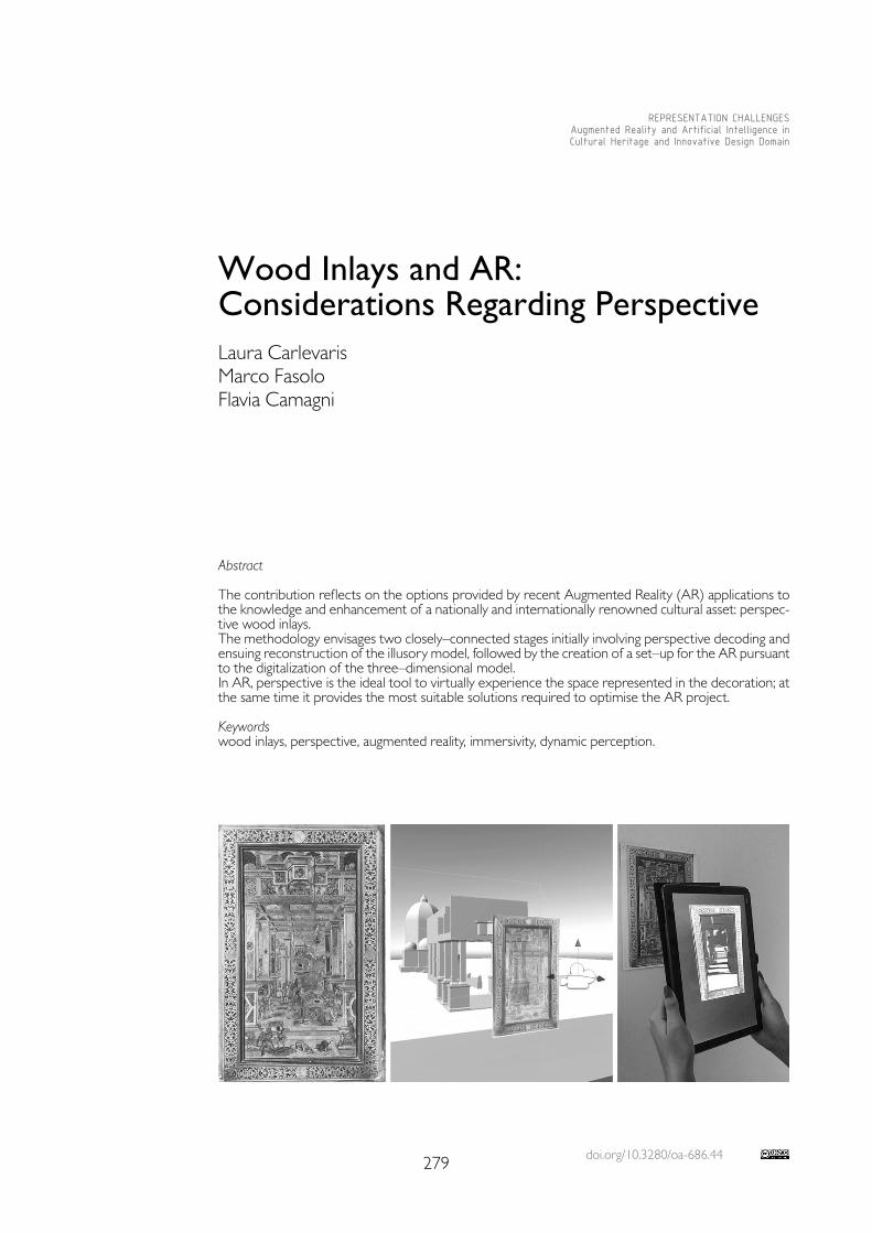
doi.org/10.3280/oa-686.44279
REPRESENTATION CHALLENGESAugmented Reality and Artificial Intelligence in Cultural Heritage and Innovative Design Domain
Abstract
The contribution reflects on the options provided by recent Augmented Reality (AR) applications to the knowledge and enhancement of a nationally and internationally renowned cultural asset: perspec-tive wood inlays.The methodology envisages two closely–connected stages initially involving perspective decoding and ensuing reconstruction of the illusory model, followed by the creation of a set–up for the AR pursuant to the digitalization of the three–dimensional model.In AR, perspective is the ideal tool to virtually experience the space represented in the decoration; at the same time it provides the most suitable solutions required to optimise the AR project.
Keywordswood inlays, perspective, augmented reality, immersivity, dynamic perception.
Wood Inlays and AR: Considerations Regarding PerspectiveLaura CarlevarisMarco FasoloFlavia Camagni
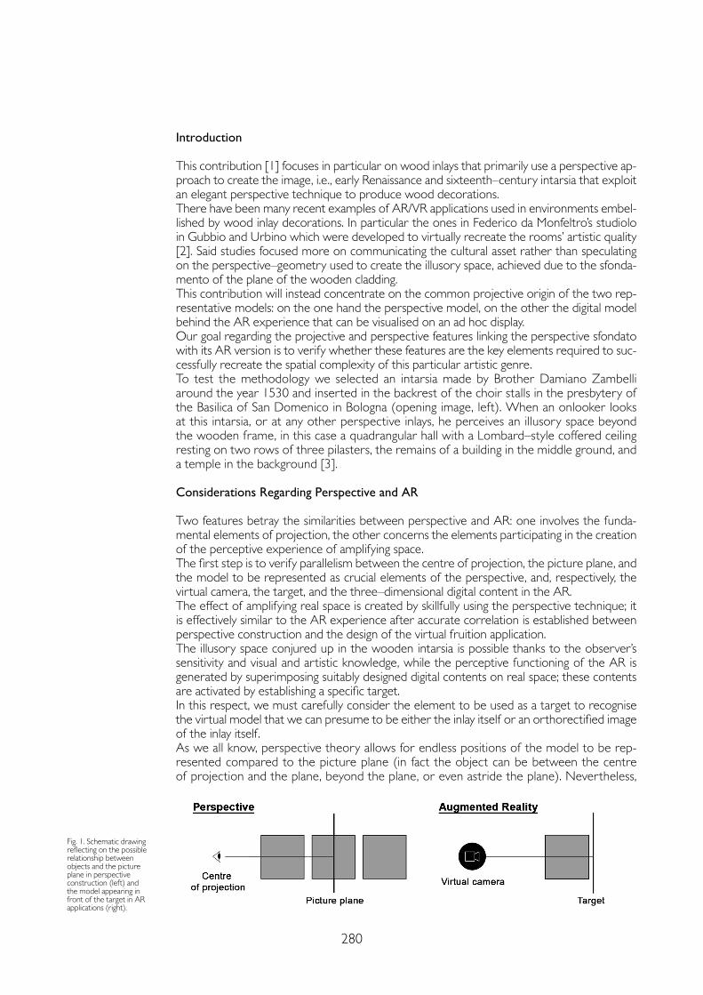
280
Introduction
This contribution [1] focuses in particular on wood inlays that primarily use a perspective ap-proach to create the image, i.e., early Renaissance and sixteenth–century intarsia that exploit an elegant perspective technique to produce wood decorations.There have been many recent examples of AR/VR applications used in environments embel-lished by wood inlay decorations. In particular the ones in Federico da Monfeltro’s studiolo in Gubbio and Urbino which were developed to virtually recreate the rooms’ artistic quality [2]. Said studies focused more on communicating the cultural asset rather than speculating on the perspective–geometry used to create the illusory space, achieved due to the sfonda-mento of the plane of the wooden cladding.This contribution will instead concentrate on the common projective origin of the two rep-resentative models: on the one hand the perspective model, on the other the digital model behind the AR experience that can be visualised on an ad hoc display.Our goal regarding the projective and perspective features linking the perspective sfondato with its AR version is to verify whether these features are the key elements required to suc-cessfully recreate the spatial complexity of this particular artistic genre.To test the methodology we selected an intarsia made by Brother Damiano Zambelli around the year 1530 and inserted in the backrest of the choir stalls in the presbytery of the Basilica of San Domenico in Bologna (opening image, left). When an onlooker looks at this intarsia, or at any other perspective inlays, he perceives an illusory space beyond the wooden frame, in this case a quadrangular hall with a Lombard–style coffered ceiling resting on two rows of three pilasters, the remains of a building in the middle ground, and a temple in the background [3].
Considerations Regarding Perspective and AR
Two features betray the similarities between perspective and AR: one involves the funda-mental elements of projection, the other concerns the elements participating in the creation of the perceptive experience of amplifying space.The first step is to verify parallelism between the centre of projection, the picture plane, and the model to be represented as crucial elements of the perspective, and, respectively, the virtual camera, the target, and the three–dimensional digital content in the AR.The effect of amplifying real space is created by skillfully using the perspective technique; it is effectively similar to the AR experience after accurate correlation is established between perspective construction and the design of the virtual fruition application. The illusory space conjured up in the wooden intarsia is possible thanks to the observer’s sensitivity and visual and artistic knowledge, while the perceptive functioning of the AR is generated by superimposing suitably designed digital contents on real space; these contents are activated by establishing a specific target.In this respect, we must carefully consider the element to be used as a target to recognise the virtual model that we can presume to be either the inlay itself or an orthorectified image of the inlay itself.As we all know, perspective theory allows for endless positions of the model to be rep-resented compared to the picture plane (in fact the object can be between the centre of projection and the plane, beyond the plane, or even astride the plane). Nevertheless,
Fig. 1. Schematic drawing reflecting on the possible relationship between objects and the picture plane in perspective construction (left) and the model appearing in front of the target in AR applications (right).
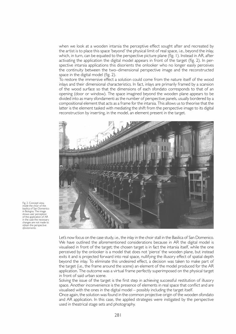
281
when we look at a wooden intarsia the perceptive effect sought after and recreated by the artist is to place this space ‘beyond’ the physical limit of real space, i.e., beyond the inlay, which, in turn, can be equated to the perspective picture plane (fig. 1). Instead in AR, after activating the application the digital model appears in front of the target (fig. 2). In per-spective intarsia applications this disorients the onlooker who no longer easily perceives the continuity between the two–dimensional perspective image and the reconstructed space in the digital model (fig. 2).To restore the immersive effect a solution could come from the nature itself of the wood inlays and their dimensional characteristics. In fact, inlays are primarily framed by a scansion of the wood surface so that the dimensions of each sfondato corresponds to that of an opening (door or window). The space imagined beyond the wooden plane appears to be divided into as many sfondamenti as the number of perspective panels, usually bordered by a compositional element that acts as a frame for the intarsia. This allows us to theorise that the latter is the element tasked with mediating the shift from the perspective image to its digital reconstruction by inserting, in the model, an element present in the target.
Let’s now focus on the case study, i.e., the inlay in the choir stall in the Basilica of San Domenico.We have outlined the aforementioned considerations because in AR the digital model is visualised in front of the target; the chosen target is in fact the intarsia itself, while the one perceived by the onlooker is a model that does not ‘pierce’ the wooden plane, but instead exits it and is projected forward into real space, nullifying the illusory effect of spatial depth beyond the inlay. To eliminate this undesired effect, a decision was taken to make part of the target (i.e., the frame around the scene) an element of the model produced for the AR application. The outcome was a virtual frame perfectly superimposed on the physical target in front of said urban scene.Solving the issue of the target is the first step in achieving successful restitution of illusory space. Another inconvenience is the presence of elements in real space that conflict and are visualised with the ones in the digital model – possibly including the target itself. Once again, the solution was found in the common projective origin of the wooden sfondato and AR application. In this case, the applied strategies were instigated by the perspective used in theatrical stage sets and photography.
Fig. 2. Concept view, inside the choir of the basilica of San Domenico in Bologna. The image shows user perception of the application of AR in the case the necessary changes are not made to obtain the perspective sfondamento.
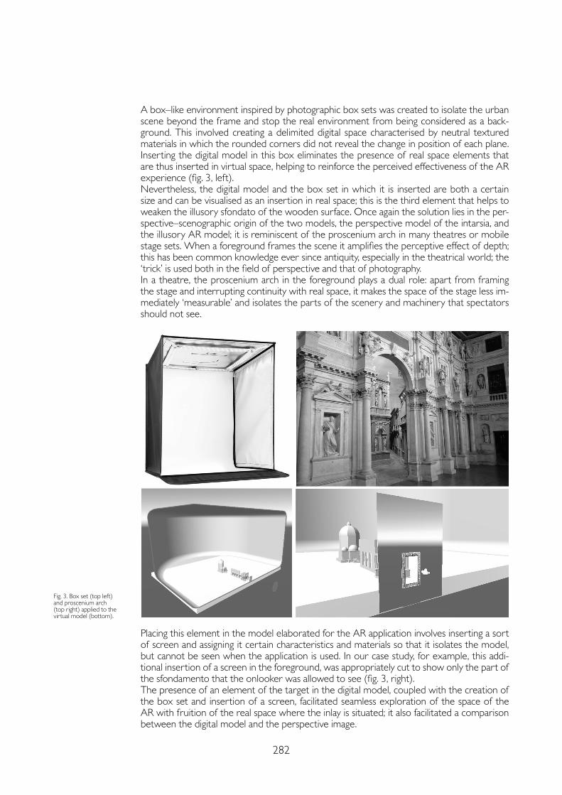
282
A box–like environment inspired by photographic box sets was created to isolate the urban scene beyond the frame and stop the real environment from being considered as a back-ground. This involved creating a delimited digital space characterised by neutral textured materials in which the rounded corners did not reveal the change in position of each plane. Inserting the digital model in this box eliminates the presence of real space elements that are thus inserted in virtual space, helping to reinforce the perceived effectiveness of the AR experience (fig. 3, left).Nevertheless, the digital model and the box set in which it is inserted are both a certain size and can be visualised as an insertion in real space; this is the third element that helps to weaken the illusory sfondato of the wooden surface. Once again the solution lies in the per-spective–scenographic origin of the two models, the perspective model of the intarsia, and the illusory AR model; it is reminiscent of the proscenium arch in many theatres or mobile stage sets. When a foreground frames the scene it amplifies the perceptive effect of depth; this has been common knowledge ever since antiquity, especially in the theatrical world; the ‘trick’ is used both in the field of perspective and that of photography.In a theatre, the proscenium arch in the foreground plays a dual role: apart from framing the stage and interrupting continuity with real space, it makes the space of the stage less im-mediately ‘measurable’ and isolates the parts of the scenery and machinery that spectators should not see.
Placing this element in the model elaborated for the AR application involves inserting a sort of screen and assigning it certain characteristics and materials so that it isolates the model, but cannot be seen when the application is used. In our case study, for example, this addi-tional insertion of a screen in the foreground, was appropriately cut to show only the part of the sfondamento that the onlooker was allowed to see (fig. 3, right).The presence of an element of the target in the digital model, coupled with the creation of the box set and insertion of a screen, facilitated seamless exploration of the space of the AR with fruition of the real space where the inlay is situated; it also facilitated a comparison between the digital model and the perspective image.
Fig. 3. Box set (top left) and proscenium arch (top right) applied to the virtual model (bottom).
283
Conclusions
The use of AR in perspective applications and, in particular, in wood inlays, raises several questions; a suitable solution lies in the realisation that the two systems share a projective origin. Bearing this in mind, and focusing on the world of theatrical stage sets and photo-graphic technique – two technical–artistic mediums with the same roots and same scientific evolution – provides us with important knowledge and helps solving some of these issues. Obviously this contribution ignores other aspects that are nevertheless crucial and should be considered in a much broader study.In fact, it will be necessary to tackle the question of the implementation of materials, lights and texture in the model for the AR application; these elements can be identified by analys-ing the inlays themselves, but will have to be correctly managed.Another aspect not tackled here, although inevitable, is the relationship between the posi-tion of the observer of the perspective (presumed to be stationary in the environment) and the kinetic nature of AR exploration.Nevertheless, once again, in the case of perspective inlays, AR proves to be the right tool to enrich the experience of all those who wish to enjoy cultural heritage thanks to an approach which, by increasing perceptive options, also includes scientific contents – all too often rele-gated to the back burner.
Notes
[1] Although all the authors participated in the whole research, the study of the wooden intarsia, their perspective construction and specific case study was performed by M. Fasolo; the part regarding the relationships between perspective and AR was performed by L. Carlevaris; in–depth operational studies and the creation of the models and contents of the AR application were performed by F. Camagni. The conclusions are part of the joint research project.
[2] Regarding the studiolo in Urbino, see: Roberto Mantovani, <https://www.youtube.com/watch?v=kShbXHYI7G0> (consulted on 11th February 2021); the project Lo studiolo di Gubbio: tour virtuale e ipotesi ricostruttive di un microcosmo umanistico; Paolo Clini, Lo Studiolo di Federico da Montefeltro. Fruizione del Cultural Heritage attraverso nuove tecnologie di realtà immersiva: <https://www.facebook.com/watch/?v=690533685114053> (consulted on 11th February 2021). Regarding the decorations in the studiolo in Gubbio, currently housed in the Metropolitan Museum in New York, <https://www.youtube.com/watch?v=8MTgRlEuHBg> (consulted on 11th February 2021).
[3] Cfr. Alce 2002.
References
Alce Venturino (2002). Il coro intarsiato di San Domenico in Bologna. Bologna: ESD.
Bertocci Stefano, Farneti Fauzia (eds.) (2020). L’architettura dipinta: storia, conservazione e rappresentazione digitale. Firenze: Didapress.
Bianchini Carlo, Fasolo Marco, Camagni Flavia (2020). Dimensioni, scale e rappresentazioni: un’eterna ghirlanda brillante. Dal 3D al 2D e ritorno. In Paesaggio Urbano, 2, pp. 149-157.
Bixio Antonio, Radogna Veronica (2019). La Certosa di Padula “officina” di ricerca: le Tarsie dei cori lignei della chiesa di San Lorenzo. In Belardi Paolo (ed.). Riflessioni. L’arte del disegno/il disegno dell’arte. Roma: Gangemi Editore, pp. 385-394.
Fasolo Marco, Camagni Flavia (2020). Imagination and Image in Renaissance Wooden Inlays. In Cicalò Enrico (ed.). Image and Imagination. Cham: Springer Nature, pp. 759-772.
Friso Isabella, Bernardello Rachele Angela, Piccinin Giulia, Dalla Longa Mirka, Giordano Andrea, De Rosa, Agostino, Monteleone Cosimo, Faresin Emanuela (2020). L’architettura dipinta della Scoletta del Carmine a Padova. In Bertocci Stefano, Farneti Fauzia (eds.), L’architettura dipinta: storia, conservazione e rappresentazione digitale. Firenze: Didapress, pp. 218-227.
Luigini Alessandro, Panciroli Chiara (eds.) (2018). Ambienti digitali per l’educazione all’arte e al patrimonio. Milano: FrancoAngeli.
Mantovani Roberto, Serafini Francesco (2008). Lo studiolo virtuale di Urbino. In Emmer Michele (ed.). Matematica e cultura 2008. Milano: Springer.
Rossi Michela, Russo Michele (2020). Dipinti di legno. Le tarsie prospettiche del coro di Santa Maria della Scala in San Fedele a Milano. In Bertocci Stefano, Farneti Fauzia (eds.), L’architettura dipinta: storia, conservazione e rappresentazione digitale. Firenze: Didapress, pp. 35-46.
Valenti Graziano M. (ed.) (2014, 2016). Prospettive architettoniche. Conservazione digitale, divulgazione e studio. Voll. I, II. Roma: Sapienza Università Editrice.
Copyright © 2021 by FrancoAngeli s.r.l. Milano, Italy Isbn 9788835125280
AuthorsLaura Carlevaris, Dept. of History, Representation and Restoration of Architecture, Sapienza University of Rome, [email protected] Marco Fasolo, Dept. of History, Representation and Restoration of Architecture, Sapienza University of Rome, [email protected] Camagni, Dept. of History, Representation and Restoration of Architecture, Sapienza University of Rome, [email protected]

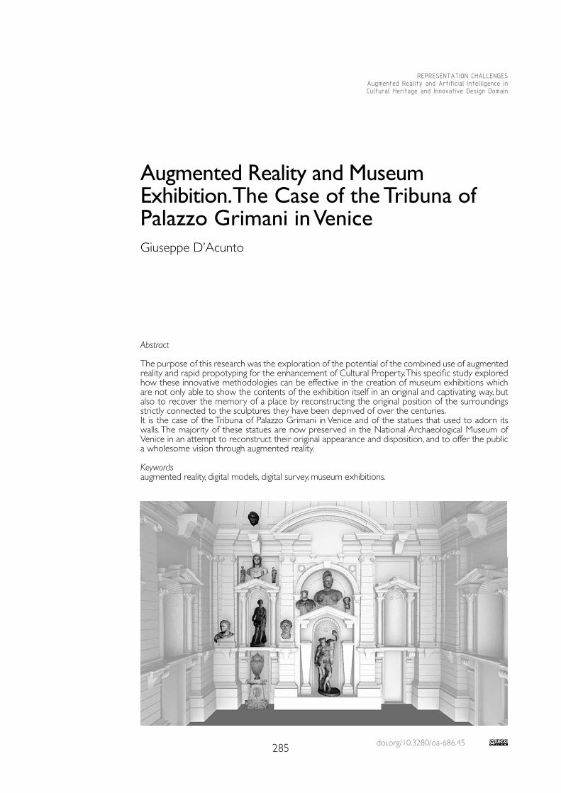
doi.org/10.3280/oa-686.45285
REPRESENTATION CHALLENGESAugmented Reality and Artificial Intelligence in Cultural Heritage and Innovative Design Domain
Abstract
The purpose of this research was the exploration of the potential of the combined use of augmented reality and rapid propotyping for the enhancement of Cultural Property. This specific study explored how these innovative methodologies can be effective in the creation of museum exhibitions which are not only able to show the contents of the exhibition itself in an original and captivating way, but also to recover the memory of a place by reconstructing the original position of the surroundings strictly connected to the sculptures they have been deprived of over the centuries.It is the case of the Tribuna of Palazzo Grimani in Venice and of the statues that used to adorn its walls. The majority of these statues are now preserved in the National Archaeological Museum of Venice in an attempt to reconstruct their original appearance and disposition, and to offer the public a wholesome vision through augmented reality.
Keywordsaugmented reality, digital models, digital survey, museum exhibitions.
Augmented Reality and Museum Exhibition. The Case of the Tribuna of Palazzo Grimani in Venice Giuseppe D’Acunto
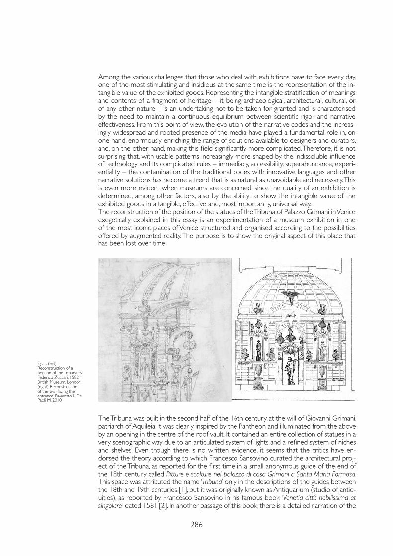
286
Among the various challenges that those who deal with exhibitions have to face every day, one of the most stimulating and insidious at the same time is the representation of the in-tangible value of the exhibited goods. Representing the intangible stratification of meanings and contents of a fragment of heritage – it being archaeological, architectural, cultural, or of any other nature – is an undertaking not to be taken for granted and is characterised by the need to maintain a continuous equilibrium between scientific rigor and narrative effectiveness. From this point of view, the evolution of the narrative codes and the increas-ingly widespread and rooted presence of the media have played a fundamental role in, on one hand, enormously enriching the range of solutions available to designers and curators, and, on the other hand, making this field significantly more complicated. Therefore, it is not surprising that, with usable patterns increasingly more shaped by the indissoluble influence of technology and its complicated rules – immediacy, accessibility, superabundance, experi-entiality – the contamination of the traditional codes with innovative languages and other narrative solutions has become a trend that is as natural as unavoidable and necessary. This is even more evident when museums are concerned, since the quality of an exhibition is determined, among other factors, also by the ability to show the intangible value of the exhibited goods in a tangible, effective and, most importantly, universal way.The reconstruction of the position of the statues of the Tribuna of Palazzo Grimani in Venice exegetically explained in this essay is an experimentation of a museum exhibition in one of the most iconic places of Venice structured and organised according to the possibilities offered by augmented reality. The purpose is to show the original aspect of this place that has been lost over time.
Fig. 1. (left) Reconstruction of a portion of the Tribuna by Federico Zuccari, 1582. British Museum, London.(right) Reconstruction of the wall facing the entrance. Favaretto I., De Paoli M. 2010.
The Tribuna was built in the second half of the 16th century at the will of Giovanni Grimani, patriarch of Aquileia. It was clearly inspired by the Pantheon and illuminated from the above by an opening in the centre of the roof vault. It contained an entire collection of statues in a very scenographic way due to an articulated system of lights and a refined system of niches and shelves. Even though there is no written evidence, it seems that the critics have en-dorsed the theory according to which Francesco Sansovino curated the architectural proj-ect of the Tribuna, as reported for the first time in a small anonymous guide of the end of the 18th century called Pitture e scolture nel palazzo di casa Grimani a Santa Maria Formosa.This space was attributed the name ‘Tribuna’ only in the descriptions of the guides between the 18th and 19th centuries [1], but it was originally known as Antiquarium (studio of antiq-uities), as reported by Francesco Sansovino in his famous book ‘Venetia città nobilissima et singolare’ dated 1581 [2]. In another passage of this book, there is a detailed narration of the
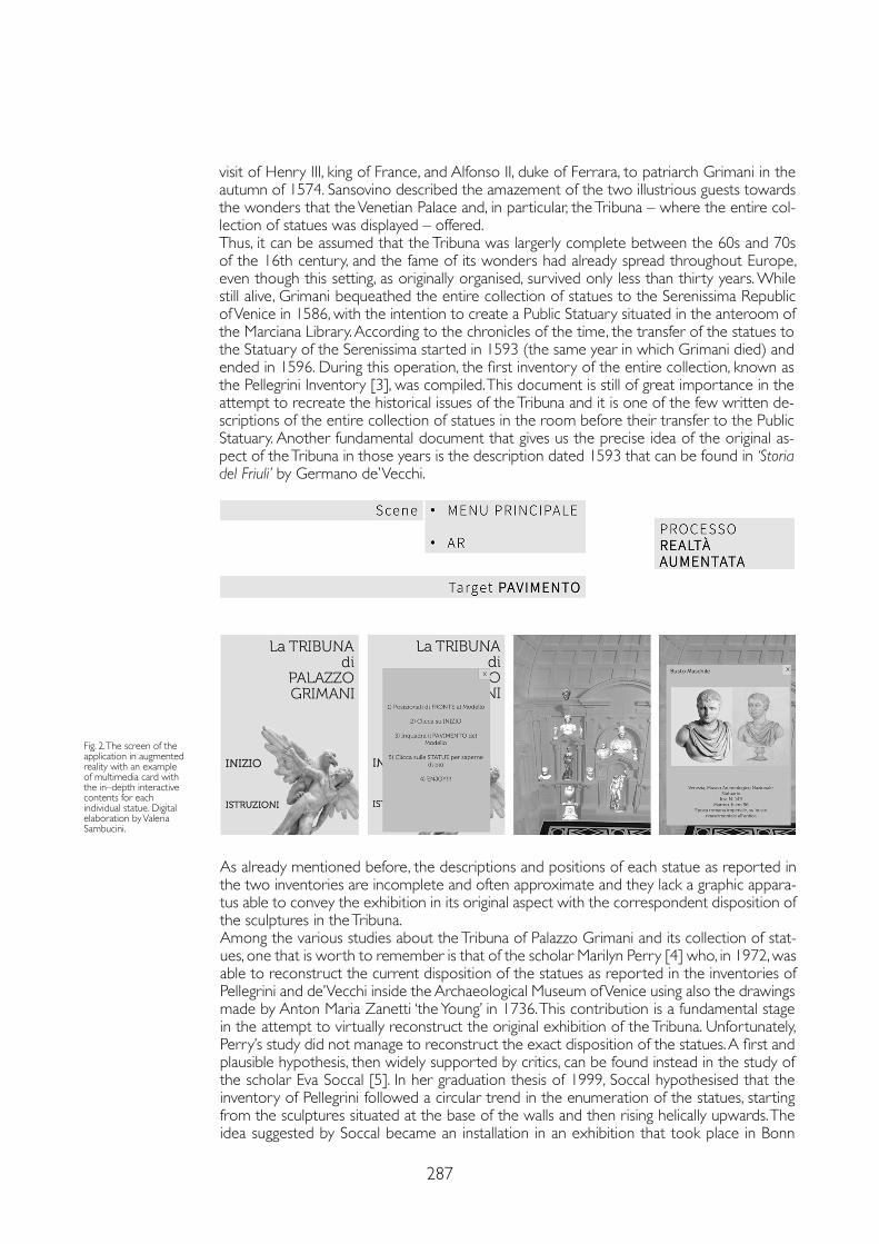
287
visit of Henry III, king of France, and Alfonso II, duke of Ferrara, to patriarch Grimani in the autumn of 1574. Sansovino described the amazement of the two illustrious guests towards the wonders that the Venetian Palace and, in particular, the Tribuna – where the entire col-lection of statues was displayed – offered.Thus, it can be assumed that the Tribuna was largerly complete between the 60s and 70s of the 16th century, and the fame of its wonders had already spread throughout Europe, even though this setting, as originally organised, survived only less than thirty years. While still alive, Grimani bequeathed the entire collection of statues to the Serenissima Republic of Venice in 1586, with the intention to create a Public Statuary situated in the anteroom of the Marciana Library. According to the chronicles of the time, the transfer of the statues to the Statuary of the Serenissima started in 1593 (the same year in which Grimani died) and ended in 1596. During this operation, the first inventory of the entire collection, known as the Pellegrini Inventory [3], was compiled. This document is still of great importance in the attempt to recreate the historical issues of the Tribuna and it is one of the few written de-scriptions of the entire collection of statues in the room before their transfer to the Public Statuary. Another fundamental document that gives us the precise idea of the original as-pect of the Tribuna in those years is the description dated 1593 that can be found in ‘Storia del Friuli’ by Germano de’ Vecchi.
As already mentioned before, the descriptions and positions of each statue as reported in the two inventories are incomplete and often approximate and they lack a graphic appara-tus able to convey the exhibition in its original aspect with the correspondent disposition of the sculptures in the Tribuna.Among the various studies about the Tribuna of Palazzo Grimani and its collection of stat-ues, one that is worth to remember is that of the scholar Marilyn Perry [4] who, in 1972, was able to reconstruct the current disposition of the statues as reported in the inventories of Pellegrini and de’ Vecchi inside the Archaeological Museum of Venice using also the drawings made by Anton Maria Zanetti ‘the Young’ in 1736. This contribution is a fundamental stage in the attempt to virtually reconstruct the original exhibition of the Tribuna. Unfortunately, Perry’s study did not manage to reconstruct the exact disposition of the statues. A first and plausible hypothesis, then widely supported by critics, can be found instead in the study of the scholar Eva Soccal [5]. In her graduation thesis of 1999, Soccal hypothesised that the inventory of Pellegrini followed a circular trend in the enumeration of the statues, starting from the sculptures situated at the base of the walls and then rising helically upwards. The idea suggested by Soccal became an installation in an exhibition that took place in Bonn
Fig. 2. The screen of the application in augmented reality with an example of multimedia card with the in–depth interactive contents for each individual statue. Digital elaboration by Valeria Sambucini.
288
in 2002 and that was dedicated to collectors and Venetian art. The images of the walls of the Tribuna were printed in a 1:1 scale and used as background for some of the original sculptures lent by the Archaeological Museum of Venice. Drawings by Zanetti were instead used as background for the sculptures that were supposedly originally placed in niches and on upper shelves. It is probably superfluous to point out that this research [6], mainly focused on the digital reconstruction of the Tribuna, had to rely upon reconstructions made by art historians and archaeologists who have received great credit from the scientific community. Apart from the already mentioned Soccal’s study, the other most important research is ‘La Tribuna ritrovata. Uno schizzo inedito di Federico Zuccari con l’Antiquario dell’illustrissimo Patriar-ca Grimani’ by Irene Favaretto and Marcella de Paoli. The work of the two Venetian scholars has been inspired by the finding of a drawing that apparently has nothing to do with the Tribuna of Palazzo Grimani. This drawing by Federico Zuccari is a reproduction of ‘The Feast in the House of Simon the Pharisee’ made by Paolo Veronese in 1573 [7] and is preserved in the Department of Prints and Drawings of the British Museum in London. On the back of this drawing there is a freehand sketch made by the author himself which represents an im-age, although partial, of the Tribuna of Palazzo Grimani when it was full of Greek and Roman statues. The sketch represents the right half of the wall facing the entrance of the Tribuna. Although the drawing is incomplete, Favaretto and de Paoli have tried to reconstruct, even though only on paper, the entire room, hypothesising its organisation in the 80s of the 16th century with the repositioning of about 100 statues. (fig. 1)Discussing the specifics of the digital reconstruction, after an intense study of the sources with the collaboration of art historians and archaeologists, the first operation carried out was a laser scan survey of the space of the Tribuna and the creation of a physical 3D model. Moreover, once the statues were positioned in their current location, some of them were surveyed using digital photogrammetry, in particular the Hora d’Autunno, which is nowadays preserved in the antitribune hall of Palazzo Grimani. They survey and modelling of all the statues was a long and complex work that involved only a few cases in this first phase, trying to build and explore a methodology that was then completed thanks to the collaboration with the Directorate of Cultural Activities and Sport of the Veneto Region, which lent the models of the missing statues. The data regarding the room and the statue obtained through the photogrammetrical survey were then processed through the software Agisoft Photoscan. The elaboration of the room was meant to obtain a three–dimensional model suitable to be then remodelled with a software of digital drawing in order to obtain a printable model. The elaboration of the statues was instead meant to obtain a texturised model that could be used to create the content of the application in augmented reality. The modelling made with the software Rhinoceros created a simplification of the digital clone of the room in terms of geometry and decorative details that are believed to be dated after 1582 – the reference year of the hypothetical reconstruction. In particular, the floral decorations at the centre of the ceiling coffers of the vault, the plaster masks placed above the round arches of the main niches and the plaster survey that adorned the mirrors above the arches were removed. In addition, the entrance on the left wall and the window on the right wall were removed for the same reasons and they were replaced with niches.To enable the view inside the room in the printed physical model, only one half of the room was printed – that is, the one resulting from the division of the room itself by means of a plane perpendicular to the floor and passing through the vertical axis of the left and the right walls. The half that was printed is the one that contains the wall facing the entrance of the Tribuna. The model was subsequently divided into independently printable sections that were then united among themselves with hooks (between the walls, and between the walls and the sections of the vault) made ad hoc or with a glue (between the sections of the vault, and these and the skylight). After the printing phase, an application in augmented reality was created using the Unity and Vuforia software. In particular, Unity is a software that enables to create a large number of applications such as apps for mobile devices, while Vuforia is a kit for the development of applications in augmented reality for mobile devices. The struc-ture of the application includes a simple main menu that introduces the augmented reality
289
Notes
[1] Cf.: Moschini 1815.
[2] Sansovino 1581, pp. 138-139.
[3] Cf.: Inventario Pellegrini, 16 november 1593 (asv, Procuratori de Supra, b. 68, proc. 151, fasc. 3, I, cc. 33-42).
[4] Perry 1972, pp. 75-253.
[5] Soccal E. 1999-2000, La Tribuna di Palazzo Grimani. Ipotesi di ricostruzione di una raccolta d’antichità nella Venezia del XVI secolo, graduation thesis, University of Padua, supervisor Graduate I. Favaretto; Soccal 2002, pp. 447-455.
[6] Part of this work has been developed in the thesis Nuove Tecnologie per un Exhibit Museale Innovativo, Graduate Valeria Sambucini, for the II–level Master’s degree MI–Heritage Sistemi Interattivi e Digitali per la Restituzione e Valorizzazione del patrimonio Culturale of the Iuav University of Venice, scientific manager Prof. Giuseppe D’Acunto.
[7] For Federico Zuccari, see: Acidini Luchinat 1998 e Acidini Luchinat 2001, pp. 235-240.
References
Acidini Luchinat Cristina (1998). Taddeo e Federico Zuccari Fratelli Pittori del Cinquecento. Milano–Roma: Jandi–Sapi.
Acidini Luchinat Cristina (2001). Federico Zuccari e Venezia. In Piantoni Mario, De Rossi Laura (eds.). Per l’arte da Venezia all’Europa. Studi in onore di Giuseppe Maria Pilo. Venezia: Edizioni della Laguna, pp. 235-240.
Favaretto Irene, De Paoli Marcella (2010). La Tribuna ritrovata. Uno schizzo inedito di Federico Zuccari con l’«Antiquario dell’Ill. Patriarca Grimani». In Eidola International Journal of Classic Art History, 7, pp. 97-135.
Gallo Roberto (1952). Le donazioni alla Serenissima di Domenico e Giovanni Grimani. In Archivio Veneto, lXXXII, pp. 34-77.
Moschini Giannantonio (1815). Guida per la Città di Venezia. Venezia: Alvisopoli.
Perry Marylin (1972). The Statuario Publico of the Venetian Republic. In Saggi e Memorie di Storia dell’Arte, 8, pp. 75-253.
Sansovino Francesco (1581). Venetia città nobilissima et singolare. In Venetia, pp. 138-139.
Soccal Elena (2002). Sculture antiche a Venezia nel Cinquecento: Palazzo Grimani e il suo museo. La Tribuna nel XVI secolo. Proposte per una lettura del programma iconografico. In Colpo Isabella, Favaretto Irene, Ghedini Francesca (eds.). Iconografia 2001. Studi sull’immagine, Atti del Convegno di Studi. Roma: Quasar edizioni, pp. 447-455.
scene and explains to the users how to use it through the ‘instructions’ command. That same application contains the interactive view of the original position of fourteen statues inside the Tribuna, that is, those relating to two thirds of the wall facing the entrance of the room. (fig. 2)The software Rhinoceros was initially used for the creation of the scene with the digital models of the statues to equalise the scale of the mesh models of the statues and that of the model of the room. Then, the models of the statues were virtually situated inside the Tribuna. Finally, the whole complex of the statues was exported in .obj format and import-ed into Unity to create the scene. Therefore, by framing the model of the Tribuna with a normal mobile device and thanks to some targets situated in the different support points of the statues, the image of the Tribuna with its statues appears. The next step consists of experimenting this application in the physical space of the Tribuna, considering the excellent functioning of the same on the scale model. The application designed in augmented reality offers interactive in–depth contents too: each statue has a multimedia card, consisting of a panel containing its real image, its representation made by Zanetti in his catalogue of 1736, and a small text with its name, its current location, and some other information. This panel can be activated for each statue by clicking on the statue itself.
Copyright © 2021 by FrancoAngeli s.r.l. Milano, Italy Isbn 9788835125280
AuthorGiuseppe D’Acunto, Dept. of Architecture and Arts, Iuav University of Venice, [email protected]


doi.org/10.3280/oa-686.46291
REPRESENTATION CHALLENGESAugmented Reality and Artificial Intelligence in Cultural Heritage and Innovative Design Domain
Abstract
This work gives the first results of a research project funded by the Sicily region, aimed at the creation of virtual reality (VR), augmented reality (AR) models, in the context of some country of the terri-tory of Sicily with UNESCO listed monuments. This project sees the collaboration between some universities on the island and some partners who produce software and automated robotics systems and AI. Below are the first results of the workflow produced for the creation of 3D models of one of the three rock churches of the necropolis of Pantalica: an Unesco site. It also describes the pro-cess underway to get to the creation of VR and AR models to be used with three different levels of immersive reality: normal commercial viewers, different types of Oculus viewers, or in special virtual rooms Cave Automatic Virtual Environment (CAVE), already existing or created within the project.
Keywords3D survey, digital survey, SFM, photogrammetry, VR/AR.
The Rock Church of San Micidiario of the Pantalica Site and 3DLAB VR/AR–ProjectGiuseppe Di Gregorio
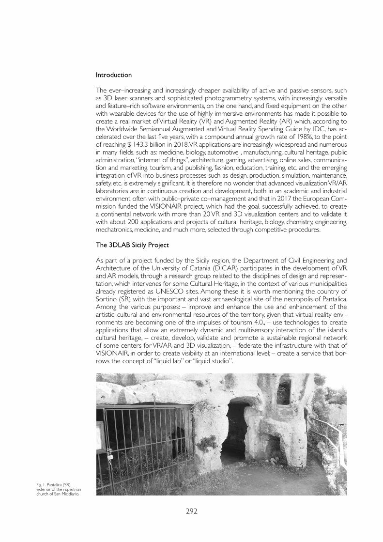
292
Introduction
The ever–increasing and increasingly cheaper availability of active and passive sensors, such as 3D laser scanners and sophisticated photogrammetry systems, with increasingly versatile and feature–rich software environments, on the one hand, and fixed equipment on the other with wearable devices for the use of highly immersive environments has made it possible to create a real market of Virtual Reality (VR) and Augmented Reality (AR) which, according to the Worldwide Semiannual Augmented and Virtual Reality Spending Guide by IDC, has ac-celerated over the last five years, with a compound annual growth rate of 198%, to the point of reaching $ 143.3 billion in 2018. VR applications are increasingly widespread and numerous in many fields, such as: medicine, biology, automotive , manufacturing, cultural heritage, public administration, “internet of things”, architecture, gaming, advertising, online sales, communica-tion and marketing, tourism, and publishing, fashion, education, training, etc. and the emerging integration of VR into business processes such as design, production, simulation, maintenance, safety, etc. is extremely significant. It is therefore no wonder that advanced visualization VR/AR laboratories are in continuous creation and development, both in an academic and industrial environment, often with public–private co–management and that in 2017 the European Com-mission funded the VISIONAIR project, which had the goal, successfully achieved, to create a continental network with more than 20 VR and 3D visualization centers and to validate it with about 200 applications and projects of cultural heritage, biology, chemistry, engineering, mechatronics, medicine, and much more, selected through competitive procedures.
The 3DLAB Sicily Project
As part of a project funded by the Sicily region, the Department of Civil Engineering and Architecture of the University of Catania (DICAR) participates in the development of VR and AR models, through a research group related to the disciplines of design and represen-tation, which intervenes for some Cultural Heritage, in the context of various municipalities already registered as UNESCO sites. Among these it is worth mentioning the country of Sortino (SR) with the important and vast archaeological site of the necropolis of Pantalica. Among the various purposes: – improve and enhance the use and enhancement of the artistic, cultural and environmental resources of the territory, given that virtual reality envi-ronments are becoming one of the impulses of tourism 4.0., – use technologies to create applications that allow an extremely dynamic and multisensory interaction of the island’s cultural heritage, – create, develop, validate and promote a sustainable regional network of some centers for VR/AR and 3D visualization, – federate the infrastructure with that of VISIONAIR, in order to create visibility at an international level; – create a service that bor-rows the concept of “liquid lab” or “liquid studio”.
Fig. 1. Pantalica (SR), exterior of the rupestrian church of San Micidiario.
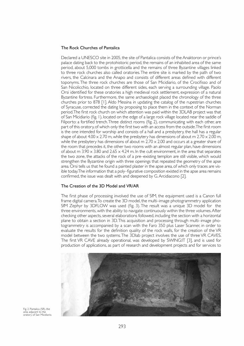
293
The Rock Churches of Pantalica
Declared a UNESCO site in 2005, the site of Pantalica consists of the Anaktoron or prince’s palace dating back to the protohistoric period, the remains of an inhabited area of the same period, about 5,000 tombs in grotticella and the remains of three Byzantine villages linked to three rock churches also called oratories. The entire site is marked by the path of two rivers, the Calcinara and the Anapo and consists of different areas defined with different toponyms. The three rock churches are those of San Micidiario, of the Crocifisso and of San Nicolicchio, located on three different sides, each serving a surrounding village. Paolo Orsi identified for these oratories a high medieval rock settlement, expression of a natural Byzantine fortress. Furthermore, the same archaeologist placed the chronology of the three churches prior to 878 [1]. Aldo Messina in updating the catalog of the rupestrian churches of Syracuse, corrected the dating by proposing to place them in the context of the Norman period. The first rock church on which attention was paid within the 3DLAB project was that of San Micidiario (fig. 1), located on the edge of a large rock village located near the saddle of Filiporto: a fortified trench. Three distinct rooms (fig. 2), communicating with each other, are part of this oratory, of which only the first two with an access from the outside. The first room is the one intended for worship and consists of a hall and a presbytery, the hall has a regular shape of about 4.00 x 2.70 m, while the presbytery has dimensions of about m 2.70 x 2.00 m, while the presbytery has dimensions of about m 2.70 x 2.00 and occurs at a greater share of the room that precedes it, the other two rooms with an almost regular plan, have dimensions of about m 3.90 x 3.80 and 2.65 x 4.24 m. In the cult environment, in the area that separates the two zone, the attacks of the rock of a pre–existing templon are still visible, which would strengthen the Byzantine origin with three openings that repeated the geometry of the apse area. Orsi tells us that he found a painted plaster in the apse area, of which only traces are vis-ible today. The information that a poly–figurative composition existed in the apse area remains confirmed, the issue was dealt with and deepened by G. Arcidiacono [2]. The Creation of the 3D Model and VR/AR
The first phase of processing involved the use of SfM, the equipment used is a Canon full frame digital camera. To create the 3D model, the multi–image photogrammetry application SfM Zephyr by 3DFLOW was used (fig. 3). The result was a unique 3D model for the three environments, with the ability to navigate continuously within the three volumes. After checking other aspects, several elaborations followed, including the section with a horizontal plane to obtain a section in 3D. This acquisition and processing through multi–image pho-togrammetry is accompanied by a scan with the Faro 350 plus Laser Scanner, in order to evaluate the results for the definition quality of the rock walls, for the creation of the VR model between the two systems. The 3Dlab project involves the use of three VR CAVES. The first VR CAVE already operational, was developed by SWING:IT [3], and is used for production of applications, as part of research and development projects and for services to
Fig. 2. Pantalica (SR), the area adjacent to the oratory of San Micidiario.
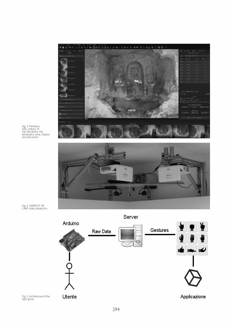
294
Fig. 3. Pantalica (SR), oratory of San Micidiario, the presbytery zone, Zephyr reconstruction.
Fig. 4. SWING:IT VR CAVE video projectors.
Fig. 5. Architecture of the light glove.
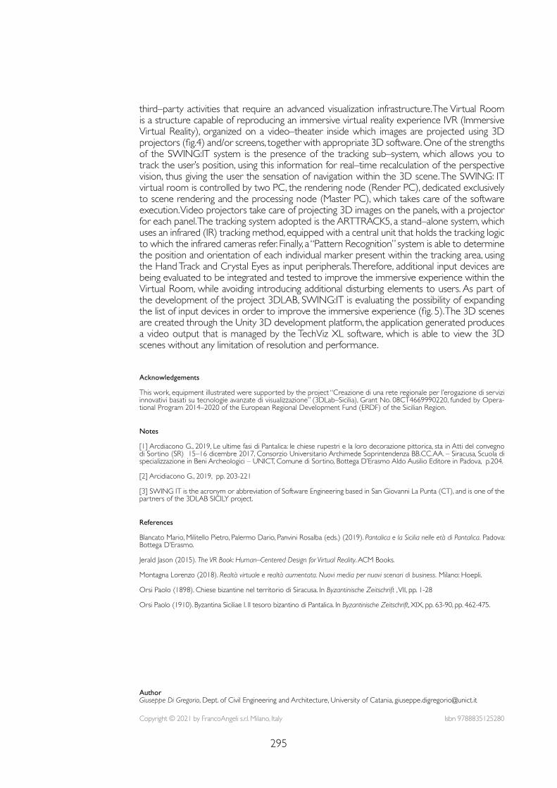
295
third–party activities that require an advanced visualization infrastructure.The Virtual Room is a structure capable of reproducing an immersive virtual reality experience IVR (Immersive Virtual Reality), organized on a video–theater inside which images are projected using 3D projectors (fig.4) and/or screens, together with appropriate 3D software. One of the strengths of the SWING:IT system is the presence of the tracking sub–system, which allows you to track the user’s position, using this information for real–time recalculation of the perspective vision, thus giving the user the sensation of navigation within the 3D scene. The SWING: IT virtual room is controlled by two PC, the rendering node (Render PC), dedicated exclusively to scene rendering and the processing node (Master PC), which takes care of the software execution. Video projectors take care of projecting 3D images on the panels, with a projector for each panel. The tracking system adopted is the ARTTRACK5, a stand–alone system, which uses an infrared (IR) tracking method, equipped with a central unit that holds the tracking logic to which the infrared cameras refer. Finally, a “Pattern Recognition” system is able to determine the position and orientation of each individual marker present within the tracking area, using the Hand Track and Crystal Eyes as input peripherals. Therefore, additional input devices are being evaluated to be integrated and tested to improve the immersive experience within the Virtual Room, while avoiding introducing additional disturbing elements to users. As part of the development of the project 3DLAB, SWING:IT is evaluating the possibility of expanding the list of input devices in order to improve the immersive experience (fig. 5). The 3D scenes are created through the Unity 3D development platform, the application generated produces a video output that is managed by the TechViz XL software, which is able to view the 3D scenes without any limitation of resolution and performance.
Notes
[1] Arcdiacono G., 2019, Le ultime fasi di Pantalica: le chiese rupestri e la loro decorazione pittorica, sta in Atti del convegno di Sortino (SR) 15–16 dicembre 2017, Consorzio Universitario Archimede Soprintendenza BB.CC.AA. – Siracusa, Scuola di specializzazione in Beni Archeologici – UNICT, Comune di Sortino, Bottega D’Erasmo Aldo Ausilio Editore in Padova, p.204.
[2] Arcidiacono G., 2019, pp. 203-221
[3] SWING IT is the acronym or abbreviation of Software Engineering based in San Giovanni La Punta (CT), and is one of the partners of the 3DLAB SICILY project.
Acknowledgements This work, equipment illustrated were supported by the project “Creazione di una rete regionale per l’erogazione di servizi innovativi basati su tecnologie avanzate di visualizzazione” (3DLab–Sicilia), Grant No. 08CT4669990220, funded by Opera-tional Program 2014–2020 of the European Regional Development Fund (ERDF) of the Sicilian Region.
References
Blancato Mario, Militello Pietro, Palermo Dario, Panvini Rosalba (eds.) (2019). Pantalica e la Sicilia nelle età di Pantalica. Padova: Bottega D’Erasmo.
Jerald Jason (2015). The VR Book: Human–Centered Design for Virtual Reality. ACM Books.
Montagna Lorenzo (2018). Realtà virtuale e realtà aumentata. Nuovi media per nuovi scenari di business. Milano: Hoepli.
Orsi Paolo (1898). Chiese bizantine nel territorio di Siracusa. In Byzantinische Zeitschrift , VII, pp. 1-28
Orsi Paolo (1910). Byzantina Siciliae I. Il tesoro bizantino di Pantalica. In Byzantinische Zeitschrift, XIX, pp. 63-90, pp. 462-475.
Copyright © 2021 by FrancoAngeli s.r.l. Milano, Italy Isbn 9788835125280
AuthorGiuseppe Di Gregorio, Dept. of Civil Engineering and Architecture, University of Catania, [email protected]

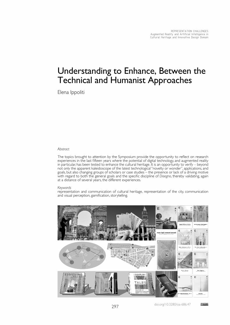
doi.org/10.3280/oa-686.47297
REPRESENTATION CHALLENGESAugmented Reality and Artificial Intelligence in Cultural Heritage and Innovative Design Domain
Abstract
The topics brought to attention by the Symposium provide the opportunity to reflect on research experiences in the last fifteen years where the potential of digital technology, and augmented reality in particular, has been tested to enhance the cultural heritage. It is an opportunity to verify – beyond not only the apparent kaleidoscope of the latest technological “novelty or wonder”, applications, and goals, but also changing groups of scholars or case studies – the presence or lack of a driving motive with regard to both the general goals and the specific discipline of Disegno, thereby validating, again at a distance of several years, the different experiences.
Keywordsrepresentation and communication of cultural heritage, representation of the city, communication and visual perception, gamification, storytelling.
Understanding to Enhance, Between the Technical and Humanist Approaches Elena Ippoliti
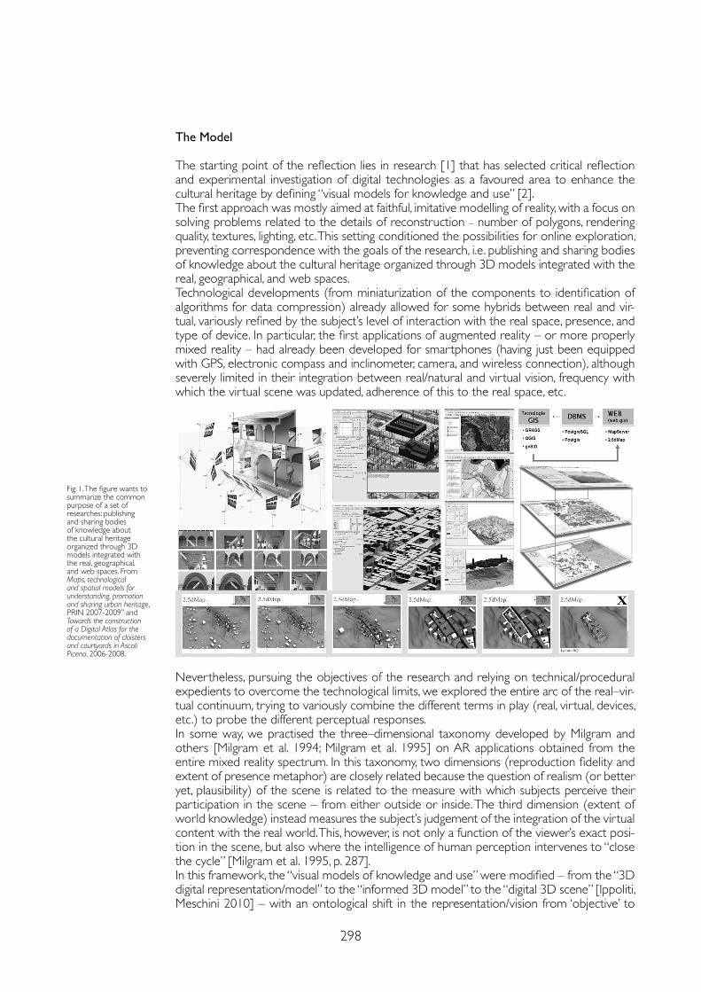
298
The Model
The starting point of the reflection lies in research [1] that has selected critical reflection and experimental investigation of digital technologies as a favoured area to enhance the cultural heritage by defining “visual models for knowledge and use” [2].The first approach was mostly aimed at faithful, imitative modelling of reality, with a focus on solving problems related to the details of reconstruction – number of polygons, rendering quality, textures, lighting, etc. This setting conditioned the possibilities for online exploration, preventing correspondence with the goals of the research, i.e. publishing and sharing bodies of knowledge about the cultural heritage organized through 3D models integrated with the real, geographical, and web spaces.Technological developments (from miniaturization of the components to identification of algorithms for data compression) already allowed for some hybrids between real and vir-tual, variously refined by the subject’s level of interaction with the real space, presence, and type of device. In particular, the first applications of augmented reality – or more properly mixed reality – had already been developed for smartphones (having just been equipped with GPS, electronic compass and inclinometer, camera, and wireless connection), although severely limited in their integration between real/natural and virtual vision, frequency with which the virtual scene was updated, adherence of this to the real space, etc.
Nevertheless, pursuing the objectives of the research and relying on technical/procedural expedients to overcome the technological limits, we explored the entire arc of the real–vir-tual continuum, trying to variously combine the different terms in play (real, virtual, devices, etc.) to probe the different perceptual responses.In some way, we practised the three–dimensional taxonomy developed by Milgram and others [Milgram et al. 1994; Milgram et al. 1995] on AR applications obtained from the entire mixed reality spectrum. In this taxonomy, two dimensions (reproduction fidelity and extent of presence metaphor) are closely related because the question of realism (or better yet, plausibility) of the scene is related to the measure with which subjects perceive their participation in the scene – from either outside or inside. The third dimension (extent of world knowledge) instead measures the subject’s judgement of the integration of the virtual content with the real world. This, however, is not only a function of the viewer’s exact posi-tion in the scene, but also where the intelligence of human perception intervenes to “close the cycle” [Milgram et al. 1995, p. 287].In this framework, the “visual models of knowledge and use” were modified – from the “3D digital representation/model” to the “informed 3D model” to the “digital 3D scene” [Ippoliti, Meschini 2010] – with an ontological shift in the representation/vision from ‘objective’ to
Fig. 1. The figure wants to summarize the common purpose of a set of researches: publishing and sharing bodies of knowledge about the cultural heritage organized through 3D models integrated with the real, geographical, and web spaces. From Maps, technological and spatial models for understanding, promotion and sharing urban heritage, PRIN 2007-2009” and Towards the construction of a Digital Atlas for the documentation of cloisters and courtyards in Ascoli Piceno, 2006-2008.
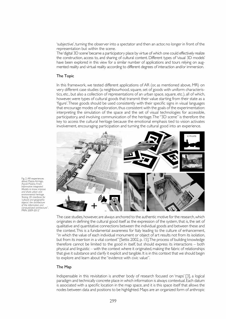
299
‘subjective’, turning the observer into a spectator and then an actor, no longer in front of the representation but within the scene. The ‘digital 3D scene’ became a participatory place by virtue of which one could effectively realize the construction, access to, and sharing of cultural content. Different types of ‘visual 3D models’ have been explored in this view for a similar number of applications and tours relying on aug-mented reality and virtual reality according to different degrees of interaction and/or immersion.
The Topic
In this framework, we tested different applications of AR (or, as mentioned above, MR) on very different case studies (a neighbourhood, square, set of goods with uniform characteris-tics, etc., but also a collection of representations of an urban space, square, etc.), all of which, however, were types of cultural goods that transmit their value starting from their state as a ‘figure’. These goods should be used consistently with their specific signs in visual languages that encourage modes of exploration, thus consistent with the goals of the experimentation: interpreting the simulation of the space and the set of visual technologies for accessible, participatory, and involving communication of the heritage. The “3D scene” is therefore the key to access the cultural heritage because the emotional emphasis tied to vision activates involvement, encouraging participation and turning the cultural good into an experience.
The case studies, however, are always anchored to the authentic motive for the research, which originates in defining the cultural good itself as the expression of the system, that is, the set of qualitative and quantitative connections between the individual goods and between these and the context. This is a fundamental awareness for Italy leading to the culture of enhancement, “in which the value of each individual monument or object of art results not from its isolation, but from its insertion in a vital context” [Settis 2002, p. 15]. The process of building knowledge therefore cannot be limited to the good in itself, but should express its interactions – both physical and linguistic – with the context where it originated, making the fabric of relationships that give it substance and clarify it explicit and tangible. It is in this context that we should begin to explore and learn about the “evidence with civic value”.
The Map
Indispensable in this revisitation is another body of research focused on ‘maps’ [3], a logical paradigm and technically concrete place in which information is always contextual. Each datum is associated with a specific location in the map space, and it is this space itself that allows the nodes between data and positions to be highlighted. Maps are an organized form of anthropic
Fig. 2. AR experiences about Piazza Arringo, Ascoli Piceno. From Informative integrated Models to know, improve and share urban and environmental heritage. Testing 3D interfaces for ‘cultural and geographic objects’: the architecture of the information and computerized architecture”, PRIN 2009-2012”
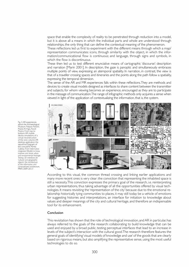
300
space that enable the complexity of reality to be penetrated through reduction into a model, but it is above all a means in which the individual parts and whole are understood through relationships, the only thing that can define the contextual meaning of the phenomenon. These reflections led us first to experiment with the different means through which a map/representation communicates: icons, through similarity with the object, in which the infor-mation/communicational flow is continuous; and language, through signs and symbols, in which the flow is discontinuous. These then led us to test different enunciative means of cartographic ‘discourse’: description and narration [Marin 2001]. In description, the gaze is panoptic and simultaneously embraces multiple points of view, expressing an atemporal spatiality. In narration, in contrast, the view is that of a traveller crossing spaces and itineraries and the points along the path follow a spatiality, expressing the temporal dimension. The sense of the AR and MR experiences falls within these reflections. They are methods and devices to create visual models designed as interfaces to share content between the transmitter and subjects, for whom viewing becomes an experience, encouraged as they are to participate in the message of communication. The range of infographic methods only acquires a sense when viewed in light of the application of contextualizing the information, that is, the system.
According to this visual, the common thread crossing and linking earlier applications and many more recent ones is very clear : the conviction that representing the inhabited space is still a necessity. This conviction expresses the primary goal of the research, i.e. reinterpreting urban representations, thus taking advantage of all the opportunities offered by visual tech-nologies. It means revisiting the ‘representation of the city’ because due to the emotional re-lationship historically tying communities to places, it may still today be a vehicle of emotions for suggesting histories and interpretations, an interface for initiation to knowledge about values and deeper meanings of the city and cultural heritage, and therefore an indispensable tool for its enhancement.
Conclusion
This revisitation has shown that the role of technological innovation, and AR in particular, has always referred to the goals of the research: collaborating to build knowledge that can be used and enjoyed by a broad public, testing perceptual interfaces that lead to an increase in levels of the subject’s interaction with the cultural good. The research therefore features the general goals of identifying ‘visual models of knowledge and use’ of the goods that are clearly based on rigorous means, but also amplifying the representative sense, using the most useful technologies to do so.
Fig. 3. AR experiences about the Archaeological Museum, Palazzo Panichi, Piazza Arringo, Ascoli Piceno. From top to bottom: AR mobile device: simulations of a virtual reconstruction of the ionic column; AR desktop application: the sepulchral Epigraph of the concubine Pontia Callista. From Informative integrated Models to know, improve and share urban and environmental heritage. Testing 3D interfaces for ‘cultural and geographic objects’: the architecture of the information and computerized architecture, PRIN 2009-2012”.
301
Notes
[1] For reasons of space, the research referred to in this article cannot be detailed. See, however, the notes, references, and figures. Many researchers have participated in different experiments, including Francesco Cervellini, Alessandra Meschini, Daniele Rossi, Mariateresa Cusanno, Annika Moscati, Jonathan Sileoni, and Danilo Spinozzi at the University of Camerino, and Andrea Casale and Michele Calvano, Cristian Farinella, Lorena Greco and Stefano Volante at the Sapienza University of Rome.
[2] Among these research projects, the primary ones include Maps, technological and spatial models for understanding, promotion and sharing urban heritage, PRIN 2007-2009, coordinator Mario Centofanti, University of Camerino research unit leader Elena Ippoliti; University of Camerino project Towards the construction of a Digital Atlas for the documentation of cloisters and courtyards in Ascoli Piceno, 2006-2008, principal investigator Elena Ippoliti.
[3] The primary research includes Informative integrated Models to know, improve and share urban and environmental heritage. Testing 3D interfaces for ‘cultural and geographic objects’: the architecture of the information and computerized architecture, PRIN 2009-2012, coordinator Mario Centofanti, Sapienza University of Rome research unit leader Elena Ippoliti.
[4] These research projects include the Sapienza University of Rome project Between museums and cities: ‘cultural heritage at play’ between edutainment and gamification. The role of representation between a technical and humanistic approach, 2020-2021, principal investigator Elena Ippoliti; Usage/knowledge systems in museum communication, 2018-2019, principal investigator Andrea Casale; Representations of cities and cultural identity. New guides between digital technologies and visual itineraries for the enhancement of the city’s cultural heritage and tourism, principal investigator Elena Ippoliti.
References
Cervellini Francesco, Ippoliti Elena (eds.) (2005). L’impronta digitale. In Spazio Ricerca, III (6).
Goethe Johann Wolfgang von (2011). Le affinità elettive. Milano: Feltrinelli.
Ippoliti Elena, Meschini Alessandra (2010). Dal “modello 3D” alla “scena 3D”. Prospettive e opportunità per la valorizzazione del patrimonio culturale architettonico e urbano. In DISEGNARECON, 3 (6), pp. 77-91.
Marin Louis (2001). La mappa della città e il suo ritratto. Proposte di ricerca. In Corrain Lucia (ed.). Della rappresentazione. Roma: Meltemi, pp. 74-94.
Milgram Paul, Kishino Fumio (1994). A taxonomy of mixed reality visual displays. In IEICE Transaction on Information and Systems, 77 (12), pp. 1321-1329.
Milgram Paul, Takemura Haruo, Utsumi Akira, Kishino Fumio (1995). Augmented reality: A class of displays on the reality–virtuality continuum. In SPIE Vol. 2351, Telemanipulator and Telepresence Technologies, pp. 282-292.
Settis Salvatore. (2002). Italia S.p.A. L’assalto al patrimonio culturale. Torino: Einaudi.
More in general, different research projects have used AR (recently integrated with the techniques of storytelling, gamification, and storydoing) [4] to transform knowledge about the cultural good into an act of enhancement, and therefore the “visual models of knowl-edge and use” into an ‘experience’ not only of the individual object, but of the whole, that is, the system of relationships. This general goal is the starting point for designing paths of historically and culturally consistent meaning to explore “evidence with civic value”.The applications of and motivations for the experiences are all framed within a single hori-zon that interprets the specific discipline of Disegno in which the role of informational da-tum is continuously exchanged with the role of the image, which not only represents it, but embodies it in its essence [Cervellini, Ippoliti 2005, p. 75]. By virtue of its spatial/topological connotation, the image renders information by giving it a form at the intersection of three themed objects: the model (iconic), map (also a type of model), and topic (in the enunciative meaning still a model). This common thread – very long, invisible, and indestructible – “can be disentangled without undoing everything” and in which “even the smallest fragment can be recognized” because it pertains to the system [Goethe 2011, p. 187].
Copyright © 2021 by FrancoAngeli s.r.l. Milano, Italy Isbn 9788835125280
AuthorElena Ippoliti, Dept. of History, Representation, Restoration of Architecture, Sapienza University of Rome, [email protected]

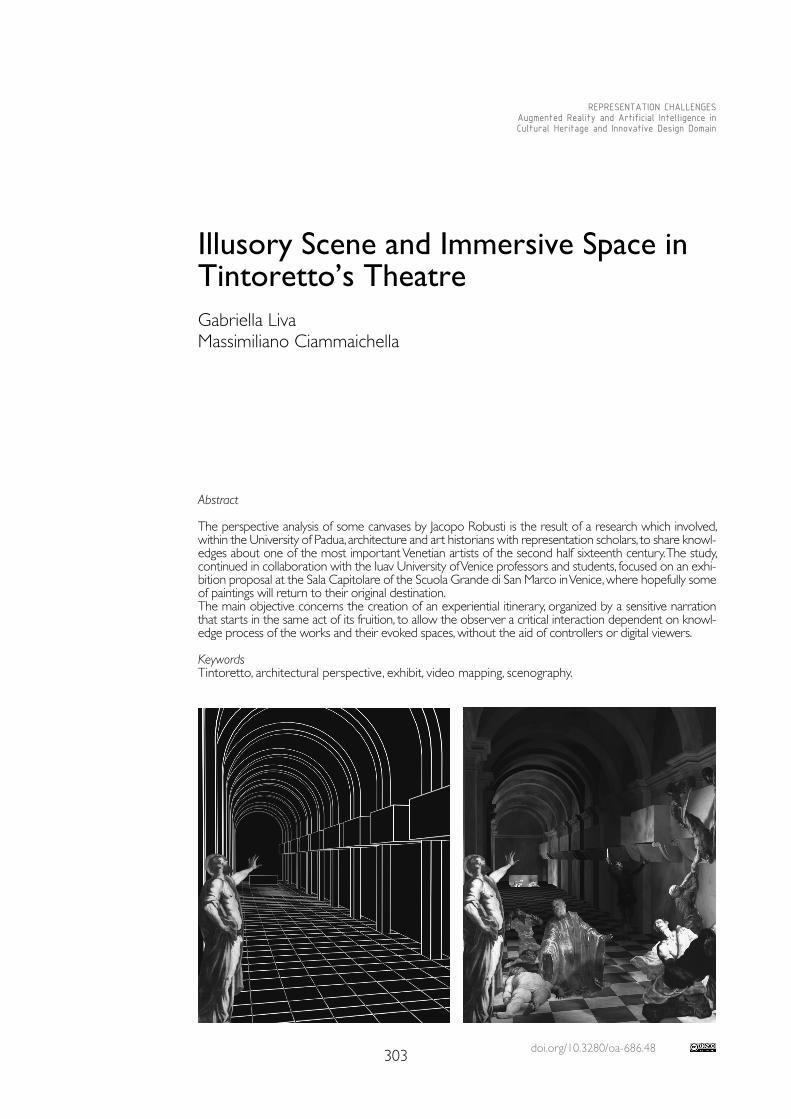
doi.org/10.3280/oa-686.48303
REPRESENTATION CHALLENGESAugmented Reality and Artificial Intelligence in Cultural Heritage and Innovative Design Domain
Abstract
The perspective analysis of some canvases by Jacopo Robusti is the result of a research which involved, within the University of Padua, architecture and art historians with representation scholars, to share knowl-edges about one of the most important Venetian artists of the second half sixteenth century. The study, continued in collaboration with the Iuav University of Venice professors and students, focused on an exhi-bition proposal at the Sala Capitolare of the Scuola Grande di San Marco in Venice, where hopefully some of paintings will return to their original destination.The main objective concerns the creation of an experiential itinerary, organized by a sensitive narration that starts in the same act of its fruition, to allow the observer a critical interaction dependent on knowl-edge process of the works and their evoked spaces, without the aid of controllers or digital viewers.
KeywordsTintoretto, architectural perspective, exhibit, video mapping, scenography.
Illusory Scene and Immersive Space in Tintoretto’s TheatreGabriella LivaMassimiliano Ciammaichella
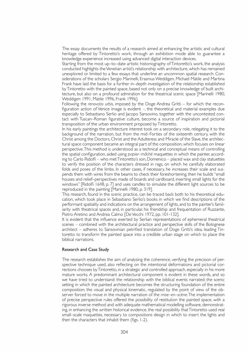
304
The essay documents the results of a research aimed at enhancing the artistic and cultural heritage offered by Tintoretto’s work, through an exhibition mode able to guarantee a knowledge experience increased using advanced digital interaction devices.Starting from the most up–to–date artistic historiography of Tintoretto’s work, the analysis conducted highlights the Venetian artist’s relationship with architecture, which has remained unexplored or limited to a few essays that underline an uncommon spatial research. Con-siderations of the scholars Sergio Marinelli, Erasmus Weddigen, Michael Matile and Martina Frank have laid the basis for a further in–depth investigation of the relationship established by Tintoretto with the painted space, based not only on a precise knowledge of built archi-tecture, but also on a profound admiration for the theatrical scenic space [Marinelli 1980, Weddigen 1991, Matile 1996, Frank 1996].Following the renovatio urbis, imposed by the Doge Andrea Gritti – for which the recon-figuration action of Venice image is evident –, the theoretical and material examples due especially to Sebastiano Serlio and Jacopo Sansovino, together with the uncontested con-tact with Tuscan–Roman figurative culture, become a source of inspiration and pictorial transposition of the urban environment proposed by Tintoretto.In his early paintings the architecture interest took on a secondary role, relegating it to the background of the narration, but from the mid–Forties of the sixteenth century, with the Christ among the Doctors, Christ and the Adulteress and Miracle of the Slave, the architec-tural space component became an integral part of the composition, which focuses on linear perspective. This method is understood as a technical and conceptual means of controlling the spatial configuration, aided using papier–mâché maquettes in which the painter, accord-ing to Carlo Ridolfi – who met Tintoretto’s son, Domenico – placed wax and clay statuettes to verify the position of the characters dressed in rags, on which he carefully elaborated folds and poses of the limbs. In other cases, if necessary, he increases their scale and sus-pends them with wires from the beams to check their foreshortening, then he builds “small houses and relief–perspectives made of boards and cardboard, inserting small lights for the windows” [Ridolfi 1648, p. 7] and uses candles to simulate the different light sources to be reproduced in the painting [Marinelli 1980, p. 319].This research, found in the scenic practice, can be traced back both to his theoretical edu-cation, which took place in Sebastiano Serlio’s books in which we find descriptions of the performant spatiality and indications on the arrangement of lights, and to the painter’s famil-iarity with theatrical spaces and, in particular, his friendship and frequentation of Ruzzante, Pietro Aretino and Andrea Calmo [De Vecchi 1972, pp. 101-132].It is evident that the influence exerted by Serlian representations of ephemeral theatrical scenes – combined with the architectural practice and perspective skills of the Bolognese architect – adheres to Sansovinian petrified translation of Doge Gritti’s idea, leading Tin-toretto to transform the painted space into a credible urban stage on which to place the biblical narrations.
Research and Case Study
The research establishes the aim of analysing the coherence, verifying the precision of per-spective technique used, also reflecting on the intentional deformations and pictorial cor-rections chooses by Tintoretto, in a strategic and controlled approach, especially in his more mature works. A predominant architectural component is evident in these words, and so we have tried to understand: the relationship with the biblical events narrated; the scenic setting in which the painted architecture becomes the structuring foundation of the entire composition; the visual and physical kinematic, regulated by the point of view of the ob-server forced to move in the multiple narration of the mise–en–scène. The implementation of precise perspective rules offered the possibility of restitution the painted space, with a rigorous inverse method and with adequate mathematical modelling software, demonstrat-ing, in enhancing the written historical evidence, the real possibility that Tintoretto used real small–scale maquettes, necessary to compositions design in which to insert the lights and then the characters that inhabit them (figs. 1-2).
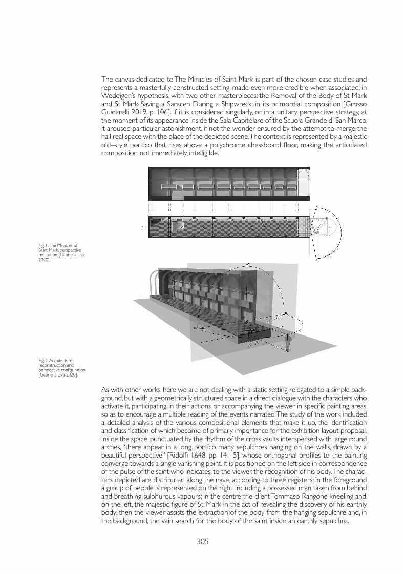
305
The canvas dedicated to The Miracles of Saint Mark is part of the chosen case studies and represents a masterfully constructed setting, made even more credible when associated, in Weddigen’s hypothesis, with two other masterpieces: the Removal of the Body of St Mark and St Mark Saving a Saracen During a Shipwreck, in its primordial composition [Grosso Guidarelli 2019, p. 106]. If it is considered singularly, or in a unitary perspective strategy, at the moment of its appearance inside the Sala Capitolare of the Scuola Grande di San Marco, it aroused particular astonishment, if not the wonder ensured by the attempt to merge the hall real space with the place of the depicted scene. The context is represented by a majestic old–style portico that rises above a polychrome chessboard floor, making the articulated composition not immediately intelligible.
As with other works, here we are not dealing with a static setting relegated to a simple back-ground, but with a geometrically structured space in a direct dialogue with the characters who activate it, participating in their actions or accompanying the viewer in specific painting areas, so as to encourage a multiple reading of the events narrated. The study of the work included a detailed analysis of the various compositional elements that make it up, the identification and classification of which become of primary importance for the exhibition layout proposal.Inside the space, punctuated by the rhythm of the cross vaults interspersed with large round arches, “there appear in a long portico many sepulchres hanging on the walls, drawn by a beautiful perspective” [Ridolfi 1648, pp. 14-15], whose orthogonal profiles to the painting converge towards a single vanishing point. It is positioned on the left side in correspondence of the pulse of the saint who indicates, to the viewer, the recognition of his body. The charac-ters depicted are distributed along the nave, according to three registers: in the foreground a group of people is represented on the right, including a possessed man taken from behind and breathing sulphurous vapours; in the centre the client Tommaso Rangone kneeling and, on the left, the majestic figure of St. Mark in the act of revealing the discovery of his earthly body; then the viewer assists the extraction of the body from the hanging sepulchre and, in the background, the vain search for the body of the saint inside an earthly sepulchre.
Fig. 1. The Miracles of Saint Mark, perspective restitution [Gabriella Liva 2020].
Fig. 2. Architecture reconstruction and perspective configuration [Gabriella Liva 2020].
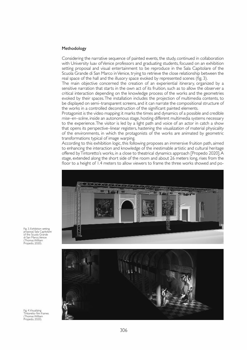
306
Methodology
Considering the narrative sequence of painted events, the study, continued in collaboration with University Iuav of Venice professors and graduating students, focused on an exhibition setting proposal and visual entertainment to be reproduce in the Sala Capitolare of the Scuola Grande di San Marco in Venice, trying to retrieve the close relationship between the real space of the hall and the illusory space evoked by represented scenes (fig. 3).The main objective concerned the creation of an experiential itinerary, organized by a sensitive narration that starts in the own act of its fruition, such as to allow the observer a critical interaction depending on the knowledge process of the works and the geometries evoked by their spaces. The installation includes the projection of multimedia contents, to be displayed on semi–transparent screens, and it can narrate the compositional structure of the works in a controlled deconstruction of the significant painted elements. Protagonist is the video mapping: it marks the times and dynamics of a possible and credible mise–en–scène, inside an autonomous stage, hosting different multimedia systems necessary to the experience. The visitor is led by a light path and voice of an actor in catch a show that opens its perspective–linear registers, hastening the visualization of material physicality of the environments, in which the protagonists of the works are animated by geometric transformations typical of image warping. According to this exhibition logic, this following proposes an immersive fruition path, aimed to enhancing the interaction and knowledge of the inestimable artistic and cultural heritage offered by Tintoretto’s works, in a close to theatrical dynamics approach [Propedo 2020]. A stage, extended along the short side of the room and about 26 meters long, rises from the floor to a height of 1.4 meters to allow viewers to frame the three works showed and po-
Fig. 3. Exhibition setting proposal, Sala Capitolare of the Scuola Grande di San Marco, Venice (Thomas William Propedo, 2020).
Fig. 4. Visualizing Tintoretto film frames (Thomas William Propedo, 2020).
307
References
De Vecchi Pierluigi (1972). Invenzioni sceniche e iconografia del miracolo nella pittura di Jacopo Tintoretto. In L’Arte, 17, pp. 101-132.
Frank Martina (1996). Architetture nelle opere di Jacopo Tintoretto. In Rossi Paola, Puppi Lionello (eds.). Jacopo Tintoretto nel quarto centenario della morte. Padova: Il Poligrafo, pp. 235-239.
Grosso Marsel, Guidarelli Gianmario (2019). Tintoretto and Architecture. Venezia: Marsilio.
Marinelli Sergio (1980). La costruzione dello spazio nelle opere di Jacopo Tintoretto. In Dalai Emiliani Marisa (ed.). La prospettiva rinascimentale. Codificazioni e trasgressioni. Firenze: Centro Di, pp. 319-330.
Matile Michael (1996). Quadri laterali, ovvero conseguenze di una collocazione ingrata. Sui dipinti di storie sacre nell’opera di Jacopo Tintoretto. In Venezia Cinquecento, 6 (12), pp. 151-206.
Propedo Thomas William (2020). Visualizing Tintoretto. Venezia: Università Iuav di Venezia, Tesi di laurea magistrale in Design del prodotto e della comunicazione visiva, relatore: Massimiliano Ciammaichella, correlatrice: Gabriella Liva.
Ridolfi Carlo (1648). Delle Meraviglie dell’Arte, overo delle vite degli illustri pittori veneti e dello stato. Descritte dal Cavalier Carlo Ridolfi. Parte seconda. Al molto Illustre Signor Bortolo Dafino. Venezia: Gio. Battista Sgava.
Settis Salvatore (2017). Tintoretto torni a San Marco. In Il Sole 24 Ore, 23 aprile, p. 37.
Weddigen Erasmus (1991). Il secondo Pergolo di San Marco e la Loggetta del Sansovino: preliminari al Miracolo dello schiavo di Jacopo Tintoretto. In Venezia Cinquecento, 1 (1), pp. 101-129.
sitioned in their original location, so as to enjoy them from their correct points of view. But this happens only at the conclusion of a specific narrative experience that anticipates the digital act of knowledge, mediated by a filter on which animated sequences are projected. It is possible to enter in the dark room guided by the cone of light emitted by a spotlight that invites the viewers group to place themselves in the correct positions, each equipped with people counter sensors that have the purpose of monitoring the access flow and activating the video projections on motorized semi–transparent screens, placed parallel and at a very short distance from the canvases.
Conclusions
The experience is combined by the voice of an actor, involved in three performing acts aimed at the decomposition and reconstruction of the peculiar characteristics of the works: the first one recalls the historical context and the significant steps that determined its realization, the second one describes the scene and the character roles involved in it, the third one analyses the pictorial, perspective and light techniques used by the artist (fig. 4).The scene space questions the value of virtual and augmented reality devices, commonly un-derstood as interaction filters with real artefacts, to enhance the learning act about the works which, in this case, are only revealed in all their tangible originality at the end of the experience.The expectation activated by the entertainment, planned within an multimedia guided scene, is confronted with the astonishment of the direct works observation, inviting to re-flect on their skiagraphy knowledge, just when the lights turn on and every filter disappears to reveal and paying tribute to the inestimable originality of Tintoretto’s tangible works. Even if the place appointed to host them, “the same for which they were created and which de-clares their unitary conception, preserved from generation to generation, and so to speak from brush to brush, therefore has become over time less important than the processes of musealisation and decontextualization of works of art” [Settis 2017, p. 37].
Copyright © 2021 by FrancoAngeli s.r.l. Milano, Italy Isbn 9788835125280
AuthorsGabriella Liva, Dept. of Architecture and Arts, Iuav University of Venice, [email protected] Ciammaichella, Dept. of Architecture and Arts, Iuav University of Venice, [email protected]

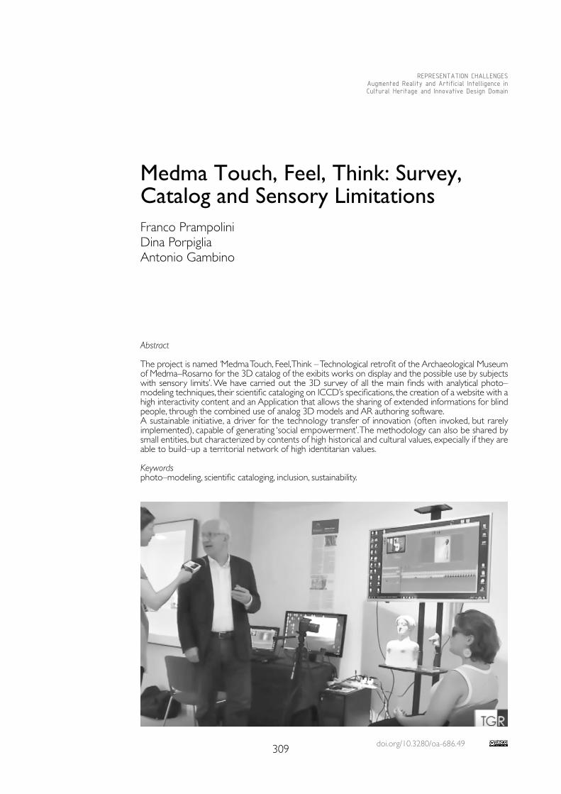
doi.org/10.3280/oa-686.49309
REPRESENTATION CHALLENGESAugmented Reality and Artificial Intelligence in Cultural Heritage and Innovative Design Domain
Abstract
The project is named ‘Medma Touch, Feel, Think – Technological retrofit of the Archaeological Museum of Medma–Rosarno for the 3D catalog of the exibits works on display and the possible use by subjects with sensory limits’. We have carried out the 3D survey of all the main finds with analytical photo–modeling techniques, their scientific cataloging on ICCD’s specifications, the creation of a website with a high interactivity content and an Application that allows the sharing of extended informations for blind people, through the combined use of analog 3D models and AR authoring software.A sustainable initiative, a driver for the technology transfer of innovation (often invoked, but rarely implemented), capable of generating ‘social empowerment’. The methodology can also be shared by small entities, but characterized by contents of high historical and cultural values, expecially if they are able to build–up a territorial network of high identitarian values.
Keywordsphoto–modeling, scientific cataloging, inclusion, sustainability.
Medma Touch, Feel, Think: Survey, Catalog and Sensory LimitationsFranco PrampoliniDina PorpigliaAntonio Gambino
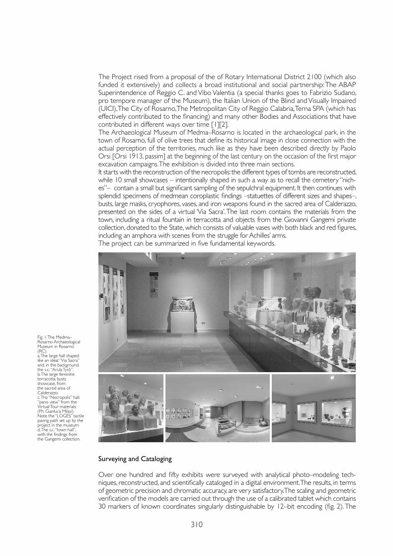
310
The Project rised from a proposal of the of Rotary International District 2100 (which also funded it extensively) and collects a broad institutional and social partnership: The ABAP Superintendence of Reggio C. and Vibo Valentia (a special thanks goes to Fabrizio Sudano, pro tempore manager of the Museum), the Italian Union of the Blind and Visually Impaired (UICI), The City of Rosarno, The Metropolitan City of Reggio Calabria, Terna SPA (which has effectively contributed to the financing) and many other Bodies and Associations that have contributed in different ways over time [1][2].The Archaeological Museum of Medma–Rosarno is located in the archaeological park, in the town of Rosarno, full of olive trees that define its historical image in close connection with the actual perception of the territories, much like as they have been described directly by Paolo Orsi [Orsi 1913, passim] at the beginning of the last century on the occasion of the first major excavation campaigns. The exhibition is divided into three main sections.It starts with the reconstruction of the necropolis: the different types of tombs are reconstructed, while 10 small showcases – intentionally shaped in such a way as to recall the cemetery “nich-es”– contain a small but significant sampling of the sepulchral equipment. It then continues with splendid specimens of medmean coroplastic findings –statuettes of different sizes and shapes–, busts, large masks, cryophores, vases, and iron weapons found in the sacred area of Calderazzo, presented on the sides of a virtual ‘Via Sacra’. The last room contains the materials from the town, including a ritual fountain in terracotta and objects from the Giovanni Gangemi private collection, donated to the State, which consists of valuable vases with both black and red figures, including an amphora with scenes from the struggle for Achilles’ arms.The project can be summarized in five fundamental keywords.
Fig. 1. The Medma–Rosarno Archaeological Museum in Rosarno (RC). a. The large hall shaped like an ideal “Via Sacra” and, in the background, the s.c. “Arula Tyrò”.b. The large feminine terracotta busts showcase, from the sacred area of Calderazzo.c. The “Necropolis” hall: “pano view” from the Virtual Tour materials. (Ph. Gianluca Milasi). Note the “LOGES” tactile paving path set up by the project in the museum. d. The s.c. “town hall”, with the findings from the Gangemi collection.
Surveying and Cataloging
Over one hundred and fifty exhibits were surveyed with analytical photo–modeling tech-niques, reconstructed, and scientifically cataloged in a digital environment. The results, in terms of geometric precision and chromatic accuracy, are very satisfactory. The scaling and geometric verification of the models are carried out through the use of a calibrated tablet which contains 30 markers of known coordinates singularly distinguishable by 12–bit encoding (fig. 2). The
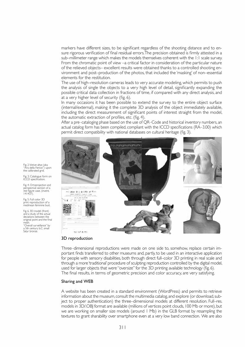
311
markers have different sizes, to be significant regardless of the shooting distance and to en-sure rigorous verification of final residual errors. The precision obtained is firmly attested in a sub–millimeter range which makes the models themselves coherent with the 1:1 scale survey.From the chromatic point of view –a critical factor in consideration of the particular nature of the relieved objects– excellent results were obtained thanks to a controlled shooting en-vironment and post–production of the photos, that included the ‘masking’ of non–essential elements for the restitution.The use of high–resolution cameras leads to very accurate modeling, which permits to push the analysis of single the objects to a very high level of detail, significantly expanding the possible critical data collection in fractions of time, if compared with any direct analysis, and at a very higher level of security (fig. 6).In many occasions it has been possible to extend the survey to the entire object surface (internal/external), making it the complete 3D analysis of the object immediately available, including the direct measurement of significant points of interest straight from the model, the automatic extraction of profiles, etc. (fig. 4).After a pre–cataloging phase based on the use of QR–Code and historical inventory numbers, an actual catalog form has been compiled, compliant with the ICCD specifications (RA–3.00) which permit direct compatibility with national databases on cultural heritage (fig. 3).
3D reproduction
Three–dimensional reproductions were made on one side to, somehow, replace certain im-portant finds transferred to other museums and, partly, to be used in an interactive application for people with sensory disabilities, both through direct full–color 3D printing in real scale and through a more ‘traditional’ procedure of sculpting reproduction controlled by the digital model, used for larger objects that were “oversize” for the 3D printing available technology (fig. 6).The final results, in terms of geometric precision and color accuracy, are very satisfying.
Sharing and WEB
A website has been created in a standard environment (WordPress) and permits to retrieve information about the museum, consult the multimedia catalog, and explore (or download, sub-ject to proper authentication) the three–dimensional models at different resolution. Full–res. models in 3D/.OBJ format are available (millions of vertices point clouds, 100 Mb or more), but we are working on smaller size models (around 1 Mb) in the GLB format by resampling the textures to grant sharability over smartphone even at a very low band connection. We are also
Fig. 2. Votive altar, (aka “Ara della Fenice”) upon the calibrated grid.
Fig. 3. Catalogue form on ICCD specification.
Fig. 4. Ortoprojection and perspective section of a red figure vase. (invent. 141437).
Fig. 5. Full color 3D print reproduction of a medmean feminine bust.
Fig. 6. 3D model (front) and a study of the actual deviations between the original point and the final mesh.“Overall surveillance” by a 5th century b.C. small Satyr bronze.
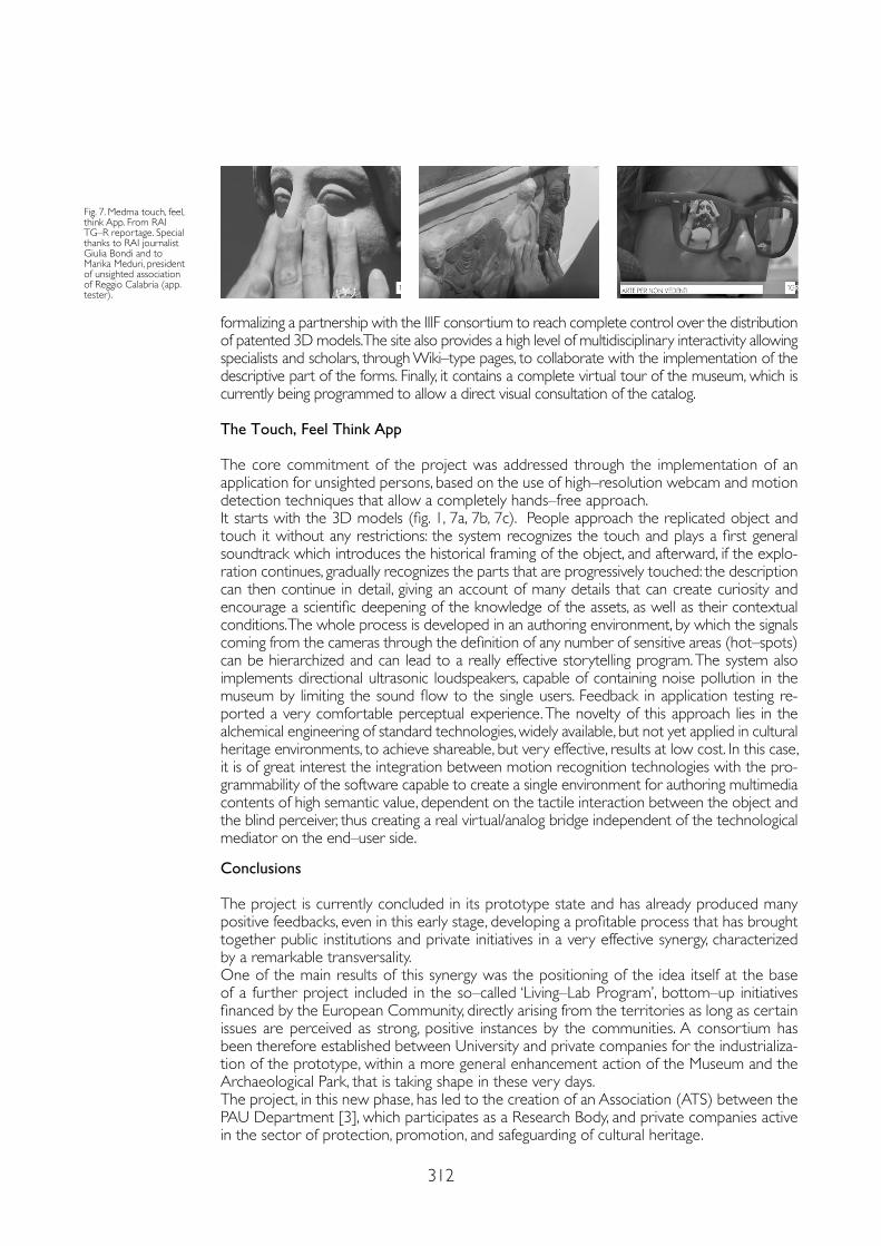
312
formalizing a partnership with the IIIF consortium to reach complete control over the distribution of patented 3D models. The site also provides a high level of multidisciplinary interactivity allowing specialists and scholars, through Wiki–type pages, to collaborate with the implementation of the descriptive part of the forms. Finally, it contains a complete virtual tour of the museum, which is currently being programmed to allow a direct visual consultation of the catalog.
The Touch, Feel Think App
The core commitment of the project was addressed through the implementation of an application for unsighted persons, based on the use of high–resolution webcam and motion detection techniques that allow a completely hands–free approach.It starts with the 3D models (fig. 1, 7a, 7b, 7c). People approach the replicated object and touch it without any restrictions: the system recognizes the touch and plays a first general soundtrack which introduces the historical framing of the object, and afterward, if the explo-ration continues, gradually recognizes the parts that are progressively touched: the description can then continue in detail, giving an account of many details that can create curiosity and encourage a scientific deepening of the knowledge of the assets, as well as their contextual conditions. The whole process is developed in an authoring environment, by which the signals coming from the cameras through the definition of any number of sensitive areas (hot–spots) can be hierarchized and can lead to a really effective storytelling program. The system also implements directional ultrasonic loudspeakers, capable of containing noise pollution in the museum by limiting the sound flow to the single users. Feedback in application testing re-ported a very comfortable perceptual experience. The novelty of this approach lies in the alchemical engineering of standard technologies, widely available, but not yet applied in cultural heritage environments, to achieve shareable, but very effective, results at low cost. In this case, it is of great interest the integration between motion recognition technologies with the pro-grammability of the software capable to create a single environment for authoring multimedia contents of high semantic value, dependent on the tactile interaction between the object and the blind perceiver, thus creating a real virtual/analog bridge independent of the technological mediator on the end–user side.
Conclusions
The project is currently concluded in its prototype state and has already produced many positive feedbacks, even in this early stage, developing a profitable process that has brought together public institutions and private initiatives in a very effective synergy, characterized by a remarkable transversality.One of the main results of this synergy was the positioning of the idea itself at the base of a further project included in the so–called ‘Living–Lab Program’, bottom–up initiatives financed by the European Community, directly arising from the territories as long as certain issues are perceived as strong, positive instances by the communities. A consortium has been therefore established between University and private companies for the industrializa-tion of the prototype, within a more general enhancement action of the Museum and the Archaeological Park, that is taking shape in these very days.The project, in this new phase, has led to the creation of an Association (ATS) between the PAU Department [3], which participates as a Research Body, and private companies active in the sector of protection, promotion, and safeguarding of cultural heritage.
Fig. 7. Medma touch, feel, think App. From RAI TG–R reportage. Special thanks to RAI journalist Giulia Bondi and to Marika Meduri, president of unsighted association of Reggio Calabria (app. tester).
313
Notes
[1] Rotary International – Disctrict IT–2100: D.G. 2014-2015 prof. Giancarlo Spezie; D.G. 2017-2018 dott. Luciano Lucania. Rotary and Rotaract Club Reggio Calabria and Nicotera–Medma. Special thanks to: arch. Salvatore Patamia, MiBACT; arch. Pietro Vicentini (Terna); ing Giusesppe Fedele (UICI Reggio Calabria); Prof. Giuseppe Lacquaniti (Historian and Journalist).
[2] The Project has bee carried out by a group of young resources selected by public evidence from the Rotaract area and the Mediterranean University: Angela Balestrieri, Gabriele Candela, Barbara Cusato, Giuseppe Cutrupi, Roberta De Clario, Fabio Panella, Danila Punturiero, Verdiana Quattrocchi and Peppe Sorrenti. The operational coordination has been performed by Technical Tutors with consolidated experience: Antonio Gambino, Marilù Laface, Andrea Manti, and Roberto Prampolini for the web content.
[3] The ‘EcoMedma’ consortium consists of Ecolandia SCARL (Leading Company, Pres. Prof. Antonio Perna), The PAU Department of the Mediterranean University of Reggio Calabria (Research body, Dir. prof. Tommaso Manfredi), CADI SRL (Dir. ing. Piero Milasi).
References
Kimiko Ryokai (ed.) (2019). Augmented Reality for Visually Impaired People (AR for VIPs). University of California, Berkeley, School of Information, MIMS Capstone Project Report.
Lacquaniti Giuseppe (2014). MEDMA Colonia di Locri Epizefiri. Tropea: Romano.
Lending Mari (2018). Plaster Monuments: Architecture and the Power of Reproduction. Priceton: Princeton University Press. 7
Manduchi Roberto, Kurniawan Sri (eds.) (2017). Assistive Technology for Blindness and Low Vision. Boca Raton (USA): CRC Press.
Minto Simone, Remondino Fabio (2014). Online access and sharing of reality–based 3d models. In SCIRES–IT : SCIentific RESearch and Information Technology, 4 (2), pp. 17-28.
Orsi Paolo (1913). Rosarno Medma. Esplorazione di un grande deposito di terrecotte ieratiche. In Notizie e Scavi di Antichità, suppl., pp. 55-144.
Paoletti Maurizio, Settis Salvatore (eds.) (1981). Medma e il suo territorio. Materiali per una carta archeologica. Bari: De Donato.
Sudano Fabrizio (2019). Per un’archeologia dei culti nelle colonie locresi: gli spazi sacri di Calderazzo a Medma e del Còfino a Hipponion alla luce delle recenti scoperte. In ASNP, 5, 11/2, pp. 36-50.
In the future, we plan to integrate into the system motion sensors with capacitive proximity devices (NFC, etc.), also through the field testing of new sensors based on the very high trans-duction capacity derived from the use of Graphene materials in the surface treatment of analog 3D printed models, aimed at maintaining the hands–free approach that was greatly appreciated in the testing phase in a non–immersive environment.Beyond the specific contents of this projects, and of the new ones, we strive to combine inno-vation, scientific rigorous approach, and enhancement of cultural heritage through an ‘inclusive attitude’, where the word ‘inclusion’ is purified of any declination linked to the idea of the ‘due by law’, or, even worse, to the one of ‘charitable intervention’. Cultural inclusion, and generalized fruition capabilities, on the contrary, must be intended, as they are indeed, directly connected to the economic strengthening of initiatives and territories and a powerful drive for development.This approach presents itself immediately as highly sustainable, not just being self–financed, but, thanks to the strong idea of transparent (and inclusive) commonality of all the project revenues, it can directly function as a medium for the transfer of technological innovation (often invoked, but rarely actually implemented) and generates a condition that we like to call ‘social empowerment’.The entire procedure becomes immediately shareable and the methodology can also be at disposal of “limited size” cultural institutions, such as small museums, or even private collection, which are, on the other side, often bearers of the highest historical and cultural values, partic-ularly if, together with their hosting communities, they would reach to build some territorial networks of high local identity values.
Copyright © 2021 by FrancoAngeli s.r.l. Milano, Italy Isbn 9788835125280
AuthorsFranco Prampolini, Dept. PAU – SuMMA Lab, Mediterranea University of Reggio Calabria, [email protected] Porpiglia, Operational manager of the project, [email protected] Gambino, Dept. PAU – SuMMA Lab, Mediterranea University of Reggio Calabria, [email protected]

doi.org/10.3280/oa-686.50315
REPRESENTATION CHALLENGESAugmented Reality and Artificial Intelligence in Cultural Heritage and Innovative Design Domain
Abstract
Facial recognition technologies, already used nowadays in many applications, i.e. to support security systems in sensitive buildings, could in a short time achieve widespread use also in others sectors including culture institutions like museums or art galleries. The state of the art in the field of facial recognition allows discriminating factors not only related to the essential somatic characteristics of a person to recognize, with an ever–greater degree of precision, the emotional reactions that may occur on person’s face.The article intends to describe the research’s EmoDeM experimentation in the museum environment in order to provide a tool capable of interpreting the reaction of a user in front of an artwork and propose a responsive information content coherent what is manifested through facial expressions.
Keywordsdigital heritage, museum education, machine learning, image classification, emotion detection.
The Emotion Detection Tools in the Museum Education EmoDeM Project Paola PumaGiuseppe Nicastro
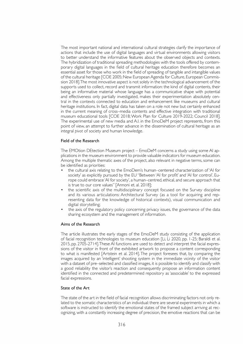
316
The most important national and international cultural strategies clarify the importance of actions that include the use of digital languages and virtual environments allowing visitors to better understand the informative features about the observed objects and contexts. The hybridization of traditional spreading methodologies with the tools offered by contem-porary digital languages in the field of cultural heritage education therefore becomes an essential asset for those who work in the field of spreading of tangible and intangible values of the cultural heritage [COE 2005; New European Agenda for Culture, European Commis-sion 2018]. The most innovative aspect is not solely in the technological advancement of the supports used to collect, record and transmit information: the kind of digital contents, their being an informative material whose language has a communicative shape with potential and effectiveness only partially investigated, makes their experimentation absolutely cen-tral in the contexts connected to education and enhancement like museums and cultural heritage institutions. In fact, digital data has taken on a role not new but certainly enhanced in the current meaning of cross–media contents and effective integration with traditional museum educational tools [COE 2018; Work Plan for Culture 2019-2022; Council 2018]. The experimental use of new media and A.I. in the EmoDeM project represents, from this point of view, an attempt to further advance in the dissemination of cultural heritage as an integral pivot of society and human knowledge.
Field of the Research
The EMOtion DEtection Museum project – EmoDeM concerns a study using some AI ap-plications in the museum environment to provide valuable indicators for museum education.Among the multiple thematic axes of the project, also relevant in negative terms, some can be identified as priorities:• the cultural axis relating to the EmoDem’s human–centered characterization of ‘AI for
society’ as explicitly pursued by the EU “Between ‘AI for profit’ and ‘AI for control’, Eu-rope could embrace ‘AI for society’, a human–centred, ethical, and secure approach that is true to our core values” [Annoni et. al. 2018];
• the scientific axis of the multidisciplinary concept focused on the Survey discipline and its various articulations: Architectural Survey (as a tool for acquiring and rep-resenting data for the knowledge of historical contexts), visual communication and digital storytelling;
• the axis of the regulatory policy concerning privacy issues, the governance of the data sharing ecosystem and the management of information.
Aims of the Research
The article illustrates the early stages of the EmoDeM study consisting of the application of facial recognition technologies to museum education [Li, Li 2020, pp. 1-25; Baraldi et al. 2015, pp. 2705-2714]. These AI functions are used to detect and interpret the facial expres-sions of the visitor in front of the exhibited artwork to propose a content corresponding to what is manifested [Artstein et al. 2014]. The project foresees that, by comparing the images acquired by an ‘intelligent’ shooting system in the immediate vicinity of the visitor with a dataset of pre–selected and classified images, it is possible to identify and classify with a good reliability the visitor’s reaction and consequently propose an information content identified in the connected and predetermined repository as ‘associable’ to the expressed facial expressions.
State of the Art
The state of the art in the field of facial recognition allows discriminating factors not only re-lated to the somatic characteristics of an individual: there are several experiments in which a software is instructed to identify the emotional states of the framed subject arriving at rec-ognizing, with a constantly increasing degree of precision, the emotive reactions that can be
317
manifested on the face of an individual (amazement, curiosity, attention, etc.) [Sharma 2019, pp. 834-837]. Facial recognition solutions that use Machine Learning programming are built on a sw models based on the analysis of large information datasets, called Training Datasets, and on the identification of recurring patterns inside it [1] the machine can therefore em-ploy what it has learned from the analysis of the datasets to making autonomous predictions and choices without explicit programming instructions [2] [Alpaydin 2020]. Research and experimentation in the field of machine learning have been demonstrating that the simula-tion performances of the human processes are currently very unstable as the detection is not always correct and reliable and yet the phases referring the identification of the compo-nents of a specific problem, the comparison, the definition of a result, the refinement of the degree of reliability are in very rapid evolution [Alpaydin 2020]. This suggests that software of facial recognition currently used to support the security systems could soon also be used in different scenarios like museum education [Duguleană et al. 2020, pp. 1-17].
Methodology
The methodology used in EmoDeM integrates a workflow of operations divided into three macro–phases: 1) acquisition of facial expressions; 2) image analysis and emotion detection; 3) response of the software through the matching of coherent contents. The first phase of the process has been the data acquisition using a video camera placed near an artwork, used to ac-quire the visitor’s facial expressions [Fyffe et al. 2016; Legendre et al. 2018, pp. 1-2]. The captured image has been subsequently processed therefore starting the emotion detection sequences. This phase certainly represents the most relevant and innovative part of the application as uses specific Machine Learning solutions responsible to evaluate the facial expressions detected and the visible visitor’s reactions. The purpose of a machine learning program is to provide a comput-er with an algorithm consisting of a series of elements that can be compared in order to establish general criteria to learn from and to rely on in subsequent queries. For this purpose, it’s essential to develop datasets consisting of many specific data including the significant characteristics to be correctly interpreted from the software during the preliminary training phases. Therefore to enhance the sw detection, in addition to the images directly acquired from the authors during the test, EmoDeM will employ specific datasets expressly designed for emotion detection appli-cations, i.e. CK+ [3] [Lee, Kang 2020, pp. 15-27]. In its complete configuration the last output of EmoDeM is the proposal of relevant contents coherent to facial expression.
First Results
The technical solutions used in the EmoDeM study have been inspired from the results obtained in a previous research on the documentation and spreading project about the abbey of Badia a Passignano [Nicastro 2020]. At the end of that experience, an enhancement project was drawn up whose AI images detection functions have been later integrated into the EmoDeM study: in the first research an application was developed to provide information for the visitors of Badia a Passignano [4]. For intrinsic reasons, the architectural components are, however, characterized by visual patterns that are much more easily typified than those characterizing a totally inhomo-geneous and variable set such as people’s facial expressions; this constitutes the major limitation of the test, illustrated below also in the failure aspects. At present, the experimentation phase relating to detection in a simulated environment was held, the purpose of which was to verify the degree of confidence of the software in the correct classification of the apparent reactions shown by the faces of people photographed in front of a pictorial work. For this purpose, a set was set up in which 6 participants were invited to observe three different reproductions of pic-torial works. A smart workstation was used to capture the images of facial expressions, catalog and analyze them with the Google Cloud Vision API software. Once the acquisition phase was completed, the subjects involved were asked to fill in a questionnaire in order to explicitly indi-cate the reactions felt during the test, then comparing the answers with the answers provided by the software. The analysis of the acquired data reported that the matching on 18 answers (6 participants examined on three works) between classification operated by sw and by question-

318
naires resulted in: 9/18 occurrences of ‘too low match’, 5/18 occurrences of correct outcome, 4/18 occurrences of incorrect recognition. The phases relating to the training of the platform are therefore already partially underway, and the first application test of EmoDem is expected to be carried out in a short time in a museum environment. The on–site installation will allow the feasibility check to evaluate the efficiency of the concept, and to expand the dataset of images collected in different contexts than laboratory experimentation, and test the activation of the response by proposing coherent contents.
Conclusions
Although the research is in its initial stages, the tests carried out in the laboratory have highlighted the first technical critical issues, especially about the images to be used in the sampling phases of the faces. In fact, the most significant advantage of pre–compiled dataset consists of using images suitably prepared to be used during the training phases of the soft-ware; on the other side, the images acquired in a controlled research environment present a certain degree of theatricality in the emotions expressed and a lesser naturalness.In the museum workfield phase, in order to improve the responses of the application, a second training dataset will have to be compiled with an expanded number of images with greater expressive naturalness. The major general problems we have encountered so far using AI tools are of two types. The first one is clearly represented by the skills, especially in computer programming languages, necessary to profitably conduct research and exper-imentation using AI applications; however, it should be noted that the issues relating to AI and machine learning systems are nowadays at the centre of public debate, and explains why in recent years the available tools and documentation have multiplied and its possible operate with these tools with an appropriate level of awareness in a multidisciplinary team. The second threat is represented by the regulatory policy and visitors privacy’s protec-tion issues, which must be defined with law criteria to allow the activation of information support only for consenting visitors. In the feasibility analysis of the project, the use of AR solutions could appear as a more effective choice than the efforts required to use an im-age recognition algorithm. The advantage in this last case is related to the fact that unlike the AR targets solutions, in which the references to the information contents are defined in the design phase and remain so once defined, in this mode the information is provided contextually to the reactions of the observer without there being a preordained sequence. EmoDeM tries to shift attention from the ever–increasing production of information arti-facts to the adoption of technological solutions that can assist museum curators in propos-ing as much as possible inclusive and customized informations. The technological advance-ment in the field of AI therefore gives us the possibility of operating in the space between the physical object and the related digital contents, with respect to which the concept of EmoDem has been set up, designed precisely with the function of interface between the user and the digital information contents.
The editorial and scientific responsibility of the chapters is recognized to: Paola Puma for Introduction, Design of the research, Aims of the research, Conclusions; Giuseppe Nicastro for State of the art, Methodology, Expected results; both the authors Paola Puma and Gi-useppe Nicastro for the figure and References.
Notes
[1] These images must be suitably prepared to be used in a Machine Learning workflow: in a first phase, the content of each single image will be divided into cells, according to a SxS grid, containing a defined number of pixels. Subsequently, the contents of any cell will be examined to identify classes of pixels with similar characteristics in areas defined by appropriate tags. The datasets thus prepared will therefore be used in the software training phases, or when further images, not belonging to the datasets used, will be analyzed to identify and classify their content.
[2] Using Machine learning solutions and computer networks in the analysis of large datasets represent practices becoming increasingly widespread. Companies like Google or Amazon offer today increasingly affordable solutions for those who intend to approach these technologies: if until a few years ago, developing an experiment in the field of machine learning implied to access to computer networks available only to specialists and researchers, today Cloud Computing has simplified the access to these resources.

319
References
Alpaydin Ethem (2020). Introduction to Machine Learning. Cambridge: MIT Press.
Annoni Alessandro et al. (2018). Artificial Intelligence: A European perspective. Publications Office of the European Union. https://ec.europa.eu/jrc/en/facts4eufuture/artificial-intelligence-european-perspective
Artstein Ron, Traum David, Alexander Oleg, Leuski Anton, Jones Andrew, Georgila Kallirroi, Debevec Paul, Swartout William, Maio Heather, Smith Stephen (2014). Time–offset interaction with a Holocaust survivor. In Proceedings of the 19th international conference on Intelligent User Interfaces (IUI ‘14). New York: Association for Computing Machinery, pp. 163-168.
Baraldi Lorenzo, Paci Francesco, Serra Giuseppe, Benini Luca, Cucchiara Rita (2015). Gesture Recognition Using Wearable Vision Sensors to Enhance Visitors’ Museum Experiences. In IEEE Sensors Journal, vol. 15 (5), pp. 2705-2714.
Council conclusions on the Work Plan for Culture 2019-2022 (2018). In Official Journal of the European Union 460, 21.12.2018, pp. 12-25. https://eur-lex.europa.eu/legal-content/EN/TXT/PDF/?uri=CELEX:52018XG1221%2801%29
Council of Europe Framework (2005). Convention on the Value of Cultural Heritage for Society, Faro 2005. https://www.coe.int/en/web/conventions/full-list/-/conventions/rms/0900001680083746
Duguleană Mihai, Briciu Victor–Alexandru, Duduman Ionuț–Alexandru, Machidon Octavian Mihai (2020). A Virtual Assistant for Natural Interactions in Museums. In Sustainability, Vol. 12/17, pp. 1-17.
European Commission (2018). Commission staff working document A New European Agenda for Culture. https://ec.europa.eu/culture/document/new-european-agenda-culture-swd2018-267-final
Fyffe Graham, Graham Paul, Tunwattanapong Borom, Ghosh Abhijeet, Debevec Paul (2016). Near Instant Capture of High Resolution Facial Geometry and Reflectance. In ACM SIGGRAPH 2015 Talks (SIGGRAPH ‘15), 32 (1). New York: Association for Computing Machinery.
Lee Hyun–Soon., Kang, Bo–Yeong (2020). Continuous motion estimation of facial expression on Jaffe and CK+ dataset for human–robot interaction. In Intelligent Service Robotics, vol. 13, pp. 15-27.
Legendre Chloe, Bladin Kalle, Kishore Bipin, Ren Xinglei, Yu Xueming, Debevec, Paul (2018). Efficient Multispectral Facial Capture With Monochrome Cameras. In ACM SIGGRAPH 2018 Posters (SIGGRAPH ‘18). New York: Association for Computing Machinery, pp. 1-2.
Li Hongfei, Li Quing (2020). End–to–End Training for Compound Expression Recognition. In Sensors Vol. 20, pp. 1-25.
Melinte Daniel Octavian, Vladareanu Luige (2020). Facial Expressions Recognition for Human–Robot Interaction Using Deep Convolutional Neural Networks with Rectified Adam Optimizer. In Sensors, Vol. 20 (8), pp. 1-21.
Nicastro Giuseppe (2020). Badia a Passignano, un monastero fortificato in Val di Pesa. Rilievo digitale integrato per la valorizzazione delle strutture architettoniche e del patrimonio artistico. PhD Thesis, University of Florence. Tutor: Prof. Paola Puma.
Puma Paola (2018). Multidisciplinary experiences of virtual heritage for the documentation of architecture and archaeology within the DigitCH Group – Digital Cultural Heritage Group. In Ioannides, Fink, Brumana, Patias, Doulamis, Martins, Wallace (eds.), Digital Heritage Progress in Cultural Heritage: Documentation, Preservation, and Protection, Proceedings. Cham: Springer International Publishing, pp. 242-252.
Puma Paola (2019). The digital image as complex environmental interface: a scenario additional reading. In IMG Journal, 1, pp. 268-277. Bologna: Alma DL Journals, pp. 1-10.
Sharma Akshdeep (2019). Emotion Detection and Feedback Generation: Survey. In International Journal for Research in Applied Science & Engineering Technology (IJRASET), 7 (I), pp. 834-837.
Suguna Ramadass, Devi Shyamala M., Kushwaha Akash, Gupta Puja (2019). An Efficient Real time Product Recommendation using Facial Sentiment Analysis. In 2019 IEEE International Conference on Electrical, Computer and Communication Technologies (ICECCT), pp. 1-6.
[3] Among these, one of the most used is CK + [Lee, Kang 2020, pp. 15-27], an archive of images acquired in a laboratory environment and catalogued in frame sequences with which it’s possible to investigate different types of faces during the gradual transition from a neutral emotional state to one of the seven emotions available (anger, disgust, sadness, happiness, amazement, contempt and fear).
[4] The Passignano abbey, located in Italy between Florence and Siena, has been documented by digital survey that used the integration of data acquisition methodologies to document the consistencies and architectural features of the complex for the purposes of knowledge and cultural enhancement. In this case, the operational scenario included the LS survey, the topographic survey, and terrestrial and aerial SFM. At the end of the research, an enhancement project was drawn up and application was developed to provide information support for visitors. BAPP application uses the Badia a Passignano complex and its works of art figures acquired during the survey campaign to train the image recognition software. By this procedure Bapp makes it possible to frame with the camera of your device any portion of the complex located along a defined visit path to access contents consistent with the object framed by the camera attaining the output deriving from the machine learning processing.
Copyright © 2021 by FrancoAngeli s.r.l. Milano, Italy Isbn 9788835125280
AuthorsPaola Puma, Dept. of Architecture, University of Florence, [email protected] Nicastro, Dept. of Architecture, University of Florence, [email protected]

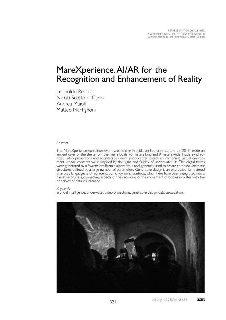
doi.org/10.3280/oa-686.51321
REPRESENTATION CHALLENGESAugmented Reality and Artificial Intelligence in Cultural Heritage and Innovative Design Domain
Abstract
The MareXperience exhibition event was held in Procida on February 22 and 23, 2019, inside an ancient cave for the shelter of fishermen’s boats, 45 meters long and 8 meters wide. Inside, synchro-nized video projections and soundscapes were produced to create an immersive virtual environ-ment, whose contents were inspired by the signs and fluidity of underwater life. The digital forms were generated by a Swarm Intelligence algorithm, a tool generally used to create complex kinematic structures defined by a large number of parameters. Generative design is an expressive form aimed at artistic languages and representation of dynamic contexts, which here have been integrated into a narrative process, connecting aspects of the recording of the movement of bodies in water with the principles of data visualization.
Keywordsartificial intelligence, underwater, video projections, generative design, data visualization.
MareXperience. AI/AR for the Recognition and Enhancement of Reality
Leopoldo RepolaNicola Scotto di CarloAndrea MaioliMatteo Martignoni
322
Theoretical Principles
The digital has extended the ordinary scenarios of research on the languages of the repre-sentation of reality, opening it to the complex nature of events, including it in the dynamic mechanisms of the permutation of forms to describe the variable nature of contexts; it has extended the boundaries of drawing, crossing the limits of the languages of representation and finding itself close to the matrices of thought, to its operating mechanisms before words, the text, stop their sense. The extensive fields of artificial intelligence, which now support innumerable actions and choices we make on a routine basis, are becoming more and more widespread, but solutions and tools often show the total absence of the critical processes that should support the evaluation phases, marginalised by improper technicalities in the service of the logic of profit. Yet the virtual was based in thought before taking shape as the result of technology, and in thought it defined the extensive space of the configurations of the real, of the possible, which underlie the variable nature of augmented reality. From philosophy, from Leibniz, from Deleuze and others, those coexisting paths were traced which lead to Turing and Gödel, to the principles and machines that have made possible the current state of technological research.The concept of the virtual, as defined by Gilles Deleuze, extends the real by opening it up to dynamics of variation, the actualization of which imposes an increase in dimensions and a consistent alteration of temporal sequences [Deleuze 1997; Levy 1997]. This structure requires a complex place to give shape to the images of thought, a virtual space must be traced that includes matrices of relationships between values, meanings, expectations and emotions, as well as rooting it in the perceptive structures of reality, to facilitate the intro-jections of messages [Repola 2008].
The Project
The project tested a methodology for recording bodies in motion, transferring kinemat-ic parameters into a digital simulation environment, modulating trajectories according to tension fields consistent with the compositional patterns of a virtual space overlapping the cave [Repola 2018, pp. 781-788]. The project started from research activities carried out at the Department of Humanities of the University Suor Orsola Benincasa and the Sebastiano Tusa Civic Museum of Procida, aimed at developing systems and procedures for the three–dimensional survey of seabed and submerged cultural heritage. Real numerical models offer new opportunities of spatial data management for the analysis of places and the simulation of possible scenarios and complex events. Three–dimensional data, moreover, are well adapted to be used in parametric modeling procedures for the development of immersive museums, where scenarios can change according to the needs related to the data representation.The MareXperience project aimed at verifying a series of interrelation schemes between different digitization procedures of real contexts and solutions for data visualization in an aug-mented space, given by the overlapping of a segment of underwater life and an ancient cave for the shelter of fishermen’s boats on the Silurenza beach on the island of Procida (fig. 1).In the weeks preceding the event, several underwater video recording sessions were carried out in the Pizzaco and Solchiaro areas to record the movements of schools of fish. Subse-quently, the acquired videos were processed in order to provide the numerical parameters necessary to generate the digital animation that composed the artistic performance. In addi-tion, underwater soundscapes were recorded at different depths through the use of a hydro-phone. The sound of the sea and its life became the track on which the three–dimensional digital sound integrated with the animations was processed. The latter allowed to place, in a virtual way, sound sources in the space increasing the perceptive levels of the visitors.The immersive environment [Dede 2009], inside the cave, was realised thanks to a tech-nological system built to project on the long vertical surfaces of the cave the digital video and audio processing produced in the previous phases. In particular, this system consists of a media server, specially assembled for the event, which separated and distributed, in syn-
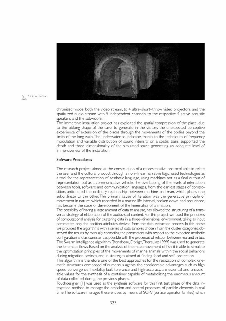
323
chronized mode, both the video stream, to 4 ultra–short–throw video projectors, and the spatialized audio stream with 5 independent channels, to the respective 4 active acoustic speakers and the subwoofer.The immersive installation project has exploited the spatial compression of the place, due to the oblong shape of the cave, to generate in the visitors the unexpected perceptive experience of extension of the places through the movements of the bodies beyond the limits of the long walls. The underwater soundscape, thanks to the techniques of frequency modulation and variable distribution of sound intensity on a spatial basis, supported the depth and three–dimensionality of the simulated space generating an adequate level of immersiveness of the installation.
Software Procedures
The research project, aimed at the construction of a representative protocol able to relate the user and the cultural product through a non–linear narrative logic, used technologies as a tool for the representation of aesthetic language, using machines not as a final output of representation but as a communicative vehicle. The overlapping of the levels of interaction between tools, software and communication languages, from the earliest stages of compo-sition, anticipated the ordinary relationship between machine and man, which places one subordinate to the other. The primary cause of iteration was the generative principle of movement in nature, which recorded in a marine life interval, broken down and sequenced, has become the code of development of the kinematics of animation.The possibility of having a large amount of data to analyze, has allowed the structuring of a trans-versal strategy of elaboration of the audiovisual content. For this project we used the principles of computational analysis for clustering data in a three–dimensional environment, taking as input parameters only the position attributes derived from the data extraction process. In this phase we provided the algorithms with a series of data samples chosen from the cluster categories, ob-served the results by manually correcting the parameters with respect to the expected aesthetic configuration and as consistent as possible with the processes of relation between real and virtual.The Swarm Intelligence algorithm [Bonabeau, Dorigo, Theraulaz 1999] was used to generate the kinematic flows. Based on the analysis of the mass movement of fish, it is able to simulate the optimization principles of the movements of marine animals within the social behaviors during migration periods, and in strategies aimed at finding food and self–protection.This algorithm is therefore one of the best approaches for the realization of complex kine-matic structures composed of numerous agents, the considerable advantages such as high speed convergence, flexibility, fault tolerance and high accuracy, are essential and unavoid-able values for the synthesis of a container capable of metabolizing the enormous amount of data collected during the previous phases.Touchdesigner [1] was used as the synthesis software for this first test phase of the data in-tegration method to manage the emission and control processes of particle elements in real time. The software manages these entities by means of ‘SOPs’ (surface operator families) which
Fig. 1. Point cloud of the cave.
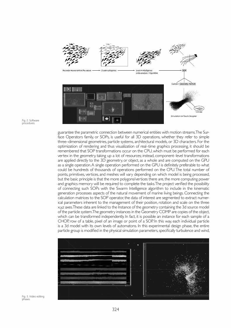
324
guarantee the parametric connection between numerical entities with motion streams. The Sur-face Operators family, or SOPs, is useful for all 3D operations, whether they refer to simple three–dimensional geometries, particle systems, architectural models, or 3D characters. For the optimization of rendering and thus visualization of real–time graphics processing, it should be remembered that SOP transformations occur on the CPU, which must be performed for each vertex in the geometry, taking up a lot of resources; instead, component–level transformations are applied directly to the 3D geometry, or object, as a whole and are computed on the GPU as a single operation. A single operation performed on the GPU is definitely preferable to what could be hundreds of thousands of operations performed on the CPU. The total number of points, primitives, vertices, and meshes will vary depending on which model is being processed, but the basic principle is that the more polygons/vertices there are, the more computing power and graphics memory will be required to complete the tasks. The project verified the possibility of connecting such SOPs with the Swarm Intelligence algorithm to include in the kinematic generation processes aspects of the natural movement of marine living beings. Connecting the calculation matrices to the SOP operator, the data of interest are segmented to extract numer-ical parameters inherent to the management of their position, rotation and scale on the three x,y,z axes. These data are linked to the Instance of the geometry containing the 3d source model of the particle system. The geometry instances in the Geometry COMP are copies of the object, which can be transformed independently. In fact, it is possible an instance for each sample of a CHOP, row of a table, pixel of an image or point of a SOP. In this way, each individual particle is a 3d model with its own levels of automatons. In this experimental design phase, the entire particle group is modified in the physical simulation parameters, specifically turbulence and wind,
Fig. 3. Video editing phases.
Fig. 2. Software procedures.
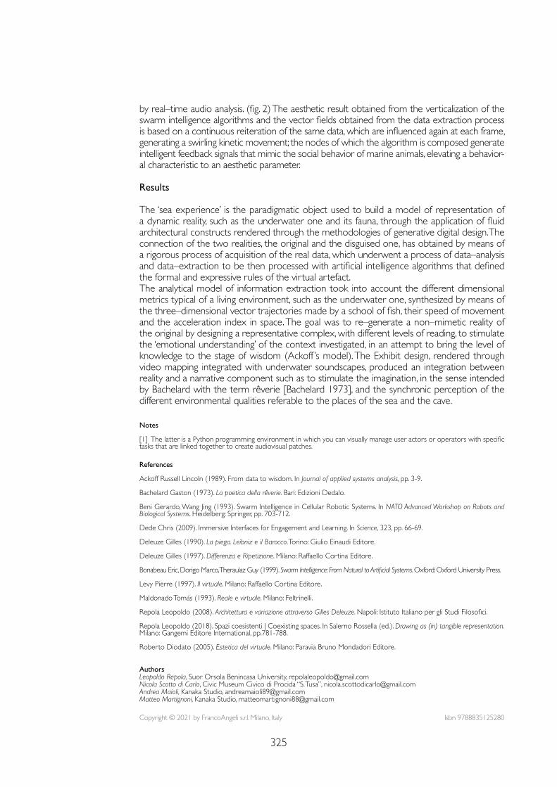
325
Notes
[1] The latter is a Python programming environment in which you can visually manage user actors or operators with specific tasks that are linked together to create audiovisual patches.
References
Ackoff Russell Lincoln (1989). From data to wisdom. In Journal of applied systems analysis, pp. 3-9.
Bachelard Gaston (1973). La poetica della rêverie. Bari: Edizioni Dedalo.
Beni Gerardo, Wang Jing (1993). Swarm Intelligence in Cellular Robotic Systems. In NATO Advanced Workshop on Robots and Biological Systems. Heidelberg: Springer, pp. 703-712.
Dede Chris (2009). Immersive Interfaces for Engagement and Learning. In Science, 323, pp. 66-69.
Deleuze Gilles (1990). La piega. Leibniz e il Barocco. Torino: Giulio Einaudi Editore.
Deleuze Gilles (1997). Differenza e Ripetizione. Milano: Raffaello Cortina Editore.
Bonabeau Eric, Dorigo Marco, Theraulaz Guy (1999). Swarm Intelligence: From Natural to Artificial Systems. Oxford: Oxford University Press.
Levy Pierre (1997). Il virtuale. Milano: Raffaello Cortina Editore.
Maldonado Tomás (1993). Reale e virtuale. Milano: Feltrinelli.
Repola Leopoldo (2008). Architettura e variazione attraverso Gilles Deleuze. Napoli: Istituto Italiano per gli Studi Filosofici.
Repola Leopoldo (2018). Spazi coesistenti | Coexisting spaces. In Salerno Rossella (ed.). Drawing as (in) tangible representation. Milano: Gangemi Editore International, pp.781-788.
Roberto Diodato (2005). Estetica del virtuale. Milano: Paravia Bruno Mondadori Editore.
by real–time audio analysis. (fig. 2) The aesthetic result obtained from the verticalization of the swarm intelligence algorithms and the vector fields obtained from the data extraction process is based on a continuous reiteration of the same data, which are influenced again at each frame, generating a swirling kinetic movement; the nodes of which the algorithm is composed generate intelligent feedback signals that mimic the social behavior of marine animals, elevating a behavior-al characteristic to an aesthetic parameter.
Results
The ‘sea experience’ is the paradigmatic object used to build a model of representation of a dynamic reality, such as the underwater one and its fauna, through the application of fluid architectural constructs rendered through the methodologies of generative digital design. The connection of the two realities, the original and the disguised one, has obtained by means of a rigorous process of acquisition of the real data, which underwent a process of data–analysis and data–extraction to be then processed with artificial intelligence algorithms that defined the formal and expressive rules of the virtual artefact.The analytical model of information extraction took into account the different dimensional metrics typical of a living environment, such as the underwater one, synthesized by means of the three–dimensional vector trajectories made by a school of fish, their speed of movement and the acceleration index in space. The goal was to re–generate a non–mimetic reality of the original by designing a representative complex, with different levels of reading, to stimulate the ‘emotional understanding’ of the context investigated, in an attempt to bring the level of knowledge to the stage of wisdom (Ackoff ’s model). The Exhibit design, rendered through video mapping integrated with underwater soundscapes, produced an integration between reality and a narrative component such as to stimulate the imagination, in the sense intended by Bachelard with the term rêverie [Bachelard 1973], and the synchronic perception of the different environmental qualities referable to the places of the sea and the cave.
Copyright © 2021 by FrancoAngeli s.r.l. Milano, Italy Isbn 9788835125280
AuthorsLeopoldo Repola, Suor Orsola Benincasa University, [email protected] Scotto di Carlo, Civic Museum Civico di Procida “S. Tusa”, [email protected] Maioli, Kanaka Studio, [email protected] Martignoni, Kanaka Studio, [email protected]

AR&AI building information modeling
and monitoring

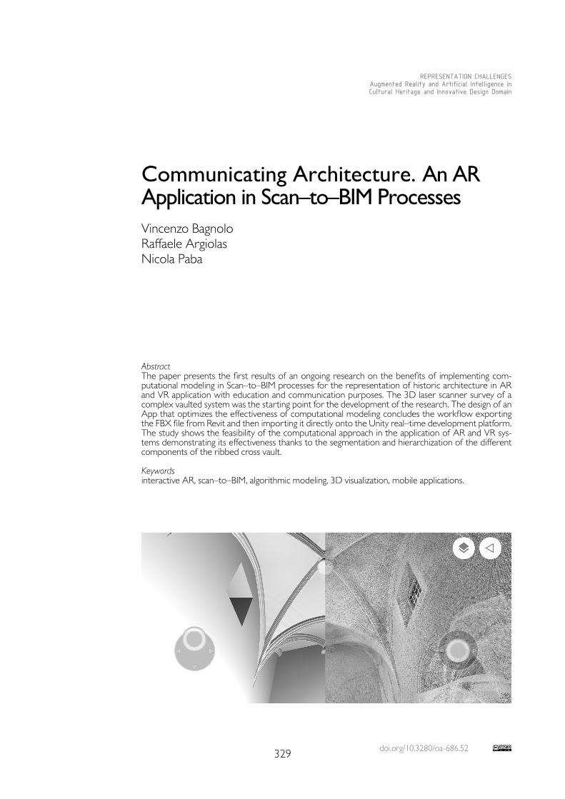
doi.org/10.3280/oa-686.52329
REPRESENTATION CHALLENGESAugmented Reality and Artificial Intelligence in Cultural Heritage and Innovative Design Domain
AbstractThe paper presents the first results of an ongoing research on the benefits of implementing com-putational modeling in Scan–to–BIM processes for the representation of historic architecture in AR and VR application with education and communication purposes. The 3D laser scanner survey of a complex vaulted system was the starting point for the development of the research. The design of an App that optimizes the effectiveness of computational modeling concludes the workflow exporting the FBX file from Revit and then importing it directly onto the Unity real–time development platform. The study shows the feasibility of the computational approach in the application of AR and VR sys-tems demonstrating its effectiveness thanks to the segmentation and hierarchization of the different components of the ribbed cross vault.
Keywordsinteractive AR, scan–to–BIM, algorithmic modeling, 3D visualization, mobile applications.
Communicating Architecture. An AR Application in Scan–to–BIM ProcessesVincenzo BagnoloRaffaele ArgiolasNicola Paba
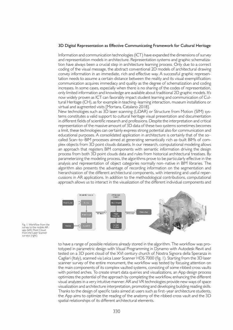
330
3D Digital Representation as Effective Communicating Framework for Cultural Heritage
Information and communication technologies (ICT) have expanded the dimensions of survey and representation models in architecture. Representation systems and graphic schematiza-tion have always been a crucial step in architecture learning process. Only due to a correct coding of the visual message, the abstract conventional 2D models of architectural drawing convey information in an immediate, rich and effective way. A successful graphic represen-tation needs to assume a certain distance between the reality and its visual exemplification: communication acquires immediacy and quality as the degree of schematization and coding increases. In some cases, especially when there is no sharing of the codes of representation, only limited information and knowledge are available about traditional 2D graphic models. It’s now widely proven as ICT can favorably impact student learning and communication of Cul-tural Heritage (CH), as for example in teaching–learning interaction, museum installations or virtual and augmented visits [Mortara, Catalano 2018].New technologies such as 3D laser scanning (LiDAR) or Structure from Motion (SfM) sys-tems constitutes a valid support to cultural heritage visual presentation and documentation in different fields of scientific research and professions. Despite the interpretation and critical representation of the massive amount of 3D data of these two systems sometimes becomes a limit, these technologies can certainly express strong potential also for communication and educational purposes. A consolidated application in architecture is certainly that of the so–called Scan–to–BIM processes aimed at generating semantically rich as–built BIMs of com-plex objects from 3D point clouds datasets. In our research, computational modeling allows an approach that registers BIM components with semantic information driving the design process from both 3D point clouds data and rules from historical architectural treatises. By parameterizing the modeling process, the algorithms prove to be particularly effective in the analysis and representation of object categories normally non–native in BIM libraries. The algorithm also presents the advantage of recording information on the segmentation and hierarchization of the different architectural components, with interesting and useful reper-cussions in AR applications. In addition to the methodological contributions, computational approach allows us to interact in the visualization of the different individual components and
Fig. 1. Workflow from the survey to the mobile AR app (left); Point Cloud from the Laser Scanner surveys (right).
to have a range of possible relations already stored in the algorithm. The workflow was pro-totyped in parametric design with Visual Programming in Dynamo with Autodesk Revit and tested on a 3D point cloud of the XVI century church of Nostra Signora della Speranza in Cagliari (Italy), scanned via Leica Laser Scanner HDS 7000 (fig. 1). Starting from the 3D laser scanner survey of the entire monument, the workflow was tested by focusing attention on the main components of its complex vaulted systems, consisting of some ribbed cross vaults with pointed arches. To create smart data queries and visualizations, an App design process optimizes the potential of the approach by completing the workflow, enhancing the different visual analyzes in a very intuitive manner. AR and VR technologies provide new ways of space visualization and architecture interpretation, promoting and developing building reading skills. Thanks to the design of specific tasks aimed at users such as first–year architecture students, the App aims to optimize the reading of the anatomy of the ribbed cross vault and the 3D spatial relationships of its different architectural elements.
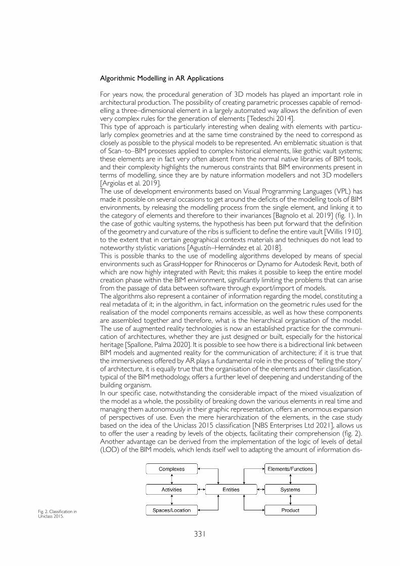
331
Algorithmic Modelling in AR Applications
For years now, the procedural generation of 3D models has played an important role in architectural production. The possibility of creating parametric processes capable of remod-elling a three–dimensional element in a largely automated way allows the definition of even very complex rules for the generation of elements [Tedeschi 2014].This type of approach is particularly interesting when dealing with elements with particu-larly complex geometries and at the same time constrained by the need to correspond as closely as possible to the physical models to be represented. An emblematic situation is that of Scan–to–BIM processes applied to complex historical elements, like gothic vault systems; these elements are in fact very often absent from the normal native libraries of BIM tools, and their complexity highlights the numerous constraints that BIM environments present in terms of modelling, since they are by nature information modellers and not 3D modellers [Argiolas et al. 2019].The use of development environments based on Visual Programming Languages (VPL) has made it possible on several occasions to get around the deficits of the modelling tools of BIM environments, by releasing the modelling process from the single element, and linking it to the category of elements and therefore to their invariances [Bagnolo et al. 2019] (fig. 1). In the case of gothic vaulting systems, the hypothesis has been put forward that the definition of the geometry and curvature of the ribs is sufficient to define the entire vault [Willis 1910], to the extent that in certain geographical contexts materials and techniques do not lead to noteworthy stylistic variations [Agustín–Hernández et al. 2018].This is possible thanks to the use of modelling algorithms developed by means of special environments such as GrassHopper for Rhinoceros or Dynamo for Autodesk Revit, both of which are now highly integrated with Revit; this makes it possible to keep the entire model creation phase within the BIM environment, significantly limiting the problems that can arise from the passage of data between software through export/import of models.The algorithms also represent a container of information regarding the model, constituting a real metadata of it; in the algorithm, in fact, information on the geometric rules used for the realisation of the model components remains accessible, as well as how these components are assembled together and therefore, what is the hierarchical organisation of the model. The use of augmented reality technologies is now an established practice for the communi-cation of architectures, whether they are just designed or built, especially for the historical heritage [Spallone, Palma 2020]. It is possible to see how there is a bidirectional link between BIM models and augmented reality for the communication of architecture; if it is true that the immersiveness offered by AR plays a fundamental role in the process of ‘telling the story’ of architecture, it is equally true that the organisation of the elements and their classification, typical of the BIM methodology, offers a further level of deepening and understanding of the building organism.In our specific case, notwithstanding the considerable impact of the mixed visualization of the model as a whole, the possibility of breaking down the various elements in real time and managing them autonomously in their graphic representation, offers an enormous expansion of perspectives of use. Even the mere hierarchization of the elements, in the case study based on the idea of the Uniclass 2015 classification [NBS Enterprises Ltd 2021], allows us to offer the user a reading by levels of the objects, facilitating their comprehension (fig. 2). Another advantage can be derived from the implementation of the logic of levels of detail (LOD) of the BIM models, which lends itself well to adapting the amount of information dis-
Fig. 2. Classification in Uniclass 2015.
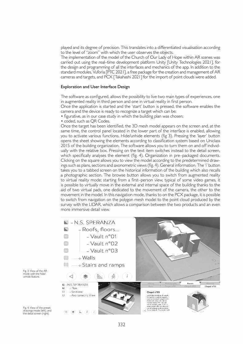
332
played and its degree of precision. This translates into a differentiated visualisation according to the level of “zoom” with which the user observes the objects.The implementation of the model of the Church of Our Lady of Hope within AR scenes was carried out using the real–time development platform Unity [Unity Technologies 2021], for the design and programming of all the interfaces and mechanics of the app. In addition to the standard modules, Vuforia [PTC 2021], a free package for the creation and management of AR cameras and targets, and PCX [Takahashi 2021] for the import of point clouds were added.
Exploration and User Interface Design
The software as configured, allows the possibility to live two main types of experiences, one in augmented reality in third person and one in virtual reality in first person.Once the application is started and the ‘start’ button is pressed, the software enables the camera and the device is ready to recognize a target which can be:• figurative, as in our case study in which the building plan was chosen;• coded, such as QR Codes.Once the target has been identified, the 3D mesh model appears on the screen and, at the same time, the control panel located in the lower part of the interface is enabled, allowing you to activate various functions. Hide/unhide elements (fig 3). Pressing the ‘layer’ button opens the sheet showing the elements according to classification system based on Uniclass 2015 of the building organization. The software allows you to turn them on and off individ-ually with the relative box. Pressing on the text item switches instead to the detail screen, which specifically analyses the element (fig. 4). Organization in pre–packaged documents. Clicking on the square allows you to view the model according to the predetermined draw-ings such as plans, sections and axonometric views (fig. 4). General information. The ‘i’ button takes you to a tabbed screen on the historical information of the building which also recalls a photographic section. The browse button allows you to switch from augmented reality to virtual reality mode; starting from a first–person view, typical of some video games, it is possible to virtually move in the external and internal space of the building thanks to the aid of two virtual pads, one dedicated to the movement of the camera, the other to the movement in the model. In this navigation mode, thanks to on the PCX package, it is possible to switch from navigation on the polygon mesh model to the point cloud produced by the survey with the LIDAR, which allows a comparison between the two products and an even more immersive detail view.
Fig. 3. View of the AR mode with the hide/unhide feature.
Fig. 4. View of the preset drawings mode (left), and the detail screen (right).
333
Conclusions
Representing the meaning embodied in complex works of architecture like vaulted systems, this approach allows a novel way to interact with the history and the theory of architecture. The combination of AR technology with the use of touch screen technology of mobile devic-es makes the manipulation and visualization of semantically–enriched 3D models very simple and intuitive. Interaction can take place either through QR codes or printed images like architectural plan. Improving 3D scene synthesis systems, the app allows a range of semantic queries into 3D model datasets. Strictly depending on the characteristics of the specific cate-gory of architectural components, the features included in the app prove to be very effective in the communication and representation of architecture. The research plans to continue by implementing in the 3D model all the constructive elements of the different parts of the church as well as sacred art and sacred furnishings of historical and cultural interest.
References
Agustín–Hernández Luis, Fernández–Morales Angélica, Mir Miguel Sancho (2018). San Félix de Torralba de Ribota; Geometric Characterization of Fortified Churches. In diségno, 2, pp. 67-76.
Argiolas Raffaele, Cazzani Antonio, Reccia Emanuele, Bagnolo Vincenzo (2019). From Lidar Data Towards Hbim for Structural Evaluation. In International Archives of the Photogrammetry, Remote Sensing and Spatial Information Sciences, XLII–2/W15, pp. 125-132.
Bagnolo Vincenzo, Argiolas Raffaele, Cuccu Alessandro (2019). Digital Survey and Algorithmic Modeling in Hbim. Towards a Library of Complex Construction Elements. In International Archives of the Photogrammetry, Remote Sensing and Spatial Information Sciences, XLII–4/W12, pp. 25-31.
Mortara Michele, Catalano Chiara Eva (2018). 3D virtual environments as effective learning contexts for cultural heritage. In Italian Journal of Educational Technology, 26 (2), pp. 5-21.
NBS Enterprises Ltd (2021). NBS – Uniclass 2015. https://www.thenbs.com/our-tools/uniclass-2015.
PTC (2021). Vuforia Developer Portal. https://developer.vuforia.com/.
Spallone Roberta, Palma Valerio (2020). Intelligenza artificiale e realtà aumentata per la condivisione del patrimonio culturale. In Bollettino SIFET, 2, pp. 19-26.
Takahashi Keijiro (2021). keijiro/Pcx: Point cloud importer & renderer for Unity. https://github.com/keijiro/Pcx.
Tedeschi Arturo (2014). AAD, Algorithms–aided design: parametric strategies using Grasshopper. Brienza: Le Penseur.
Unity Technologies (2021). Unity Real–Time Development Platform | 3D, 2D VR & AR Engine. https://unity.com/.
Acknowledgements
Although the study was jointly performed by the authors, most of the paragraph 3D digital representation as effective com-municating framework for Cultural Heritage was written by Vincenzo Bagnolo; most of the paragraph Algorithmic model-ling in AR applications was written by Raffaele Argiolas; most of the paragraph Exploration and User Interface Design was written by Nicola Paba; the Conclusions were jointly written by all the authors. The 3D laser scanning was carried out at LabMAST, DICAAR, University of Cagliari. LIDAR point clouds product by Sergio Demontis and Valentina Pintus. Research project funded by Fondazione di Sardegna – year 2019. Surveying, modeling, monitoring and rehabilitation of mason-ry vaults and domes (RMMR). CUP: F72F20000320007.
Copyright © 2021 by FrancoAngeli s.r.l. Milano, Italy Isbn 9788835125280
AuthorsVincenzo Bagnolo, Dept. of Environmental Civil Engineering and Architecture, University of Cagliari, [email protected] Raffaele Argiolas, Dept. of Environmental Civil Engineering and Architecture, University of Cagliari, [email protected] Paba, Dept. of Environmental Civil Engineering and Architecture, University of Cagliari, [email protected]

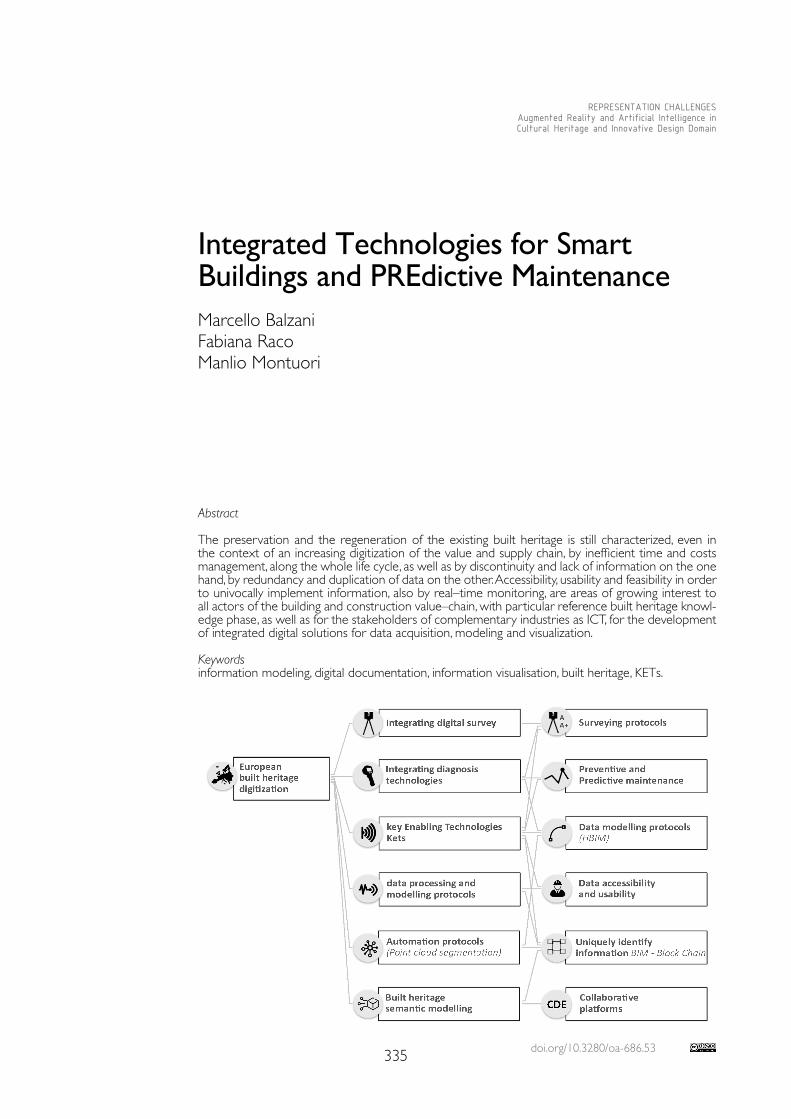
doi.org/10.3280/oa-686.53335
REPRESENTATION CHALLENGESAugmented Reality and Artificial Intelligence in Cultural Heritage and Innovative Design Domain
Abstract
The preservation and the regeneration of the existing built heritage is still characterized, even in the context of an increasing digitization of the value and supply chain, by inefficient time and costs management, along the whole life cycle, as well as by discontinuity and lack of information on the one hand, by redundancy and duplication of data on the other. Accessibility, usability and feasibility in order to univocally implement information, also by real–time monitoring, are areas of growing interest to all actors of the building and construction value–chain, with particular reference built heritage knowl-edge phase, as well as for the stakeholders of complementary industries as ICT, for the development of integrated digital solutions for data acquisition, modeling and visualization.
Keywordsinformation modeling, digital documentation, information visualisation, built heritage, KETs.
Integrated Technologies for Smart Buildings and PREdictive MaintenanceMarcello BalzaniFabiana RacoManlio Montuori
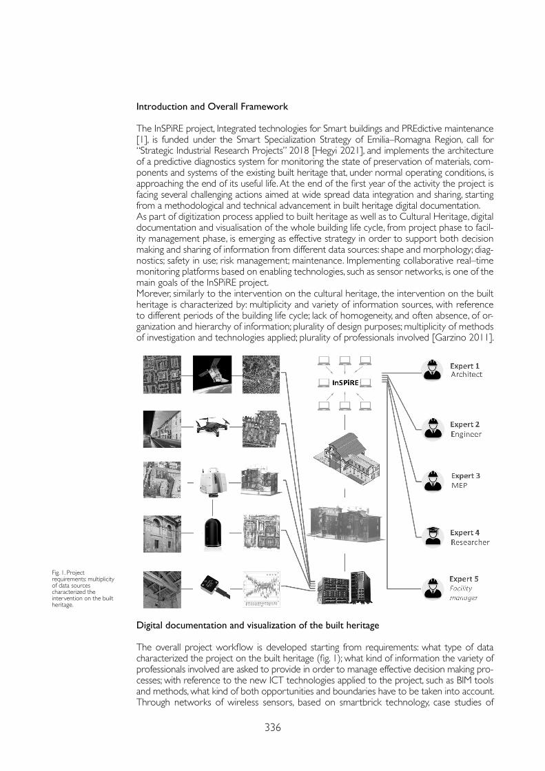
336
Introduction and Overall Framework
The InSPiRE project, Integrated technologies for Smart buildings and PREdictive maintenance [1], is funded under the Smart Specialization Strategy of Emilia–Romagna Region, call for “Strategic Industrial Research Projects” 2018 [Hegyi 2021], and implements the architecture of a predictive diagnostics system for monitoring the state of preservation of materials, com-ponents and systems of the existing built heritage that, under normal operating conditions, is approaching the end of its useful life. At the end of the first year of the activity the project is facing several challenging actions aimed at wide spread data integration and sharing, starting from a methodological and technical advancement in built heritage digital documentation. As part of digitization process applied to built heritage as well as to Cultural Heritage, digital documentation and visualisation of the whole building life cycle, from project phase to facil-ity management phase, is emerging as effective strategy in order to support both decision making and sharing of information from different data sources: shape and morphology; diag-nostics; safety in use; risk management; maintenance. Implementing collaborative real–time monitoring platforms based on enabling technologies, such as sensor networks, is one of the main goals of the InSPiRE project.Morever, similarly to the intervention on the cultural heritage, the intervention on the built heritage is characterized by: multiplicity and variety of information sources, with reference to different periods of the building life cycle; lack of homogeneity, and often absence, of or-ganization and hierarchy of information; plurality of design purposes; multiplicity of methods of investigation and technologies applied; plurality of professionals involved [Garzino 2011].
Fig. 1. Project requirements: multiplicity of data sources characterized the intervention on the built heritage.
Digital documentation and visualization of the built heritage
The overall project workflow is developed starting from requirements: what type of data characterized the project on the built heritage (fig. 1); what kind of information the variety of professionals involved are asked to provide in order to manage effective decision making pro-cesses; with reference to the new ICT technologies applied to the project, such as BIM tools and methods, what kind of both opportunities and boundaries have to be taken into account.Through networks of wireless sensors, based on smartbrick technology, case studies of
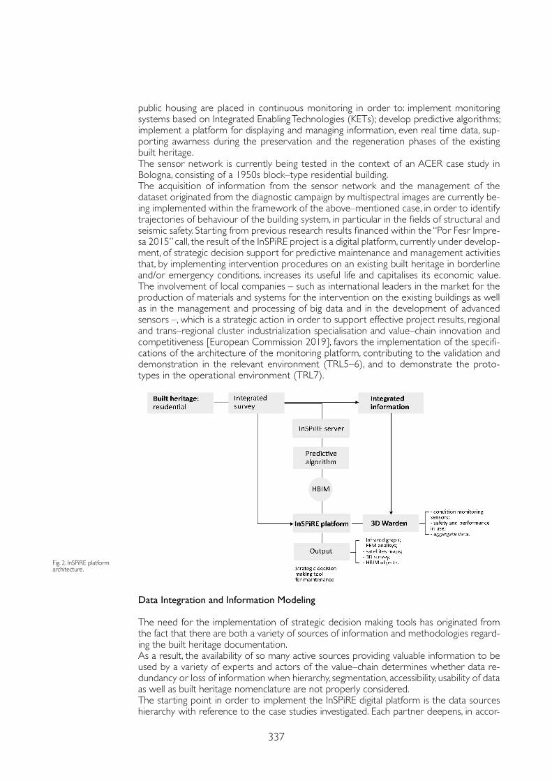
337
public housing are placed in continuous monitoring in order to: implement monitoring systems based on Integrated Enabling Technologies (KETs); develop predictive algorithms; implement a platform for displaying and managing information, even real time data, sup-porting awarness during the preservation and the regeneration phases of the existing built heritage. The sensor network is currently being tested in the context of an ACER case study in Bologna, consisting of a 1950s block–type residential building. The acquisition of information from the sensor network and the management of the dataset originated from the diagnostic campaign by multispectral images are currently be-ing implemented within the framework of the above–mentioned case, in order to identify trajectories of behaviour of the building system, in particular in the fields of structural and seismic safety. Starting from previous research results financed within the “Por Fesr Impre-sa 2015” call, the result of the InSPiRE project is a digital platform, currently under develop-ment, of strategic decision support for predictive maintenance and management activities that, by implementing intervention procedures on an existing built heritage in borderline and/or emergency conditions, increases its useful life and capitalises its economic value. The involvement of local companies – such as international leaders in the market for the production of materials and systems for the intervention on the existing buildings as well as in the management and processing of big data and in the development of advanced sensors –, which is a strategic action in order to support effective project results, regional and trans–regional cluster industrialization specialisation and value–chain innovation and competitiveness [European Commission 2019], favors the implementation of the specifi-cations of the architecture of the monitoring platform, contributing to the validation and demonstration in the relevant environment (TRL5–6), and to demonstrate the proto-types in the operational environment (TRL7).
Data Integration and Information Modeling
The need for the implementation of strategic decision making tools has originated from the fact that there are both a variety of sources of information and methodologies regard-ing the built heritage documentation. As a result, the availability of so many active sources providing valuable information to be used by a variety of experts and actors of the value–chain determines whether data re-dundancy or loss of information when hierarchy, segmentation, accessibility, usability of data as well as built heritage nomenclature are not properly considered. The starting point in order to implement the InSPiRE digital platform is the data sources hierarchy with reference to the case studies investigated. Each partner deepens, in accor-
Fig. 2. InSPiRE platform architecture.

338
dance with the project objectives, specific skills and pilot tests, a number of different types of source data such as: historical data sets related to the interventions of ordinary and extraordinary maintenance; satellite data for the analysis of the territorial scale; data from continuous monitoring for the analysis of the structural behavior of the building; data from integrated diagnostic campaigns for the evaluation of the energy behavior of the building; data from direct diagnostics for the analysis of mechanical and physical–chemical charac-teristics of materials in place. Subsequently, the data modeling phase and definiton of information hierarchy allow to define; trajectories of behavior, for those phenomena that allow an approach to the eval-uation also of predictive type; criteria for the subsequent visualization, accessibility and usability of information, with reference to different categories of experts identified as end users of the project results [European Union 2018].
Toward Applications and Digital Protocols for Built Heritage Management
So far, InSPiRE project aims at defining a data integration protocol for built heritage man-agement. From one point of view, the system responds to the request for timely anticipa-tion of the degradation and damage phenomena, by leading the maintenance actions in an adaptive way, with respect to the phenomenology of the degradation cause. Subsequently, the project makes use of the technological skills of industrial ecosystem of the regional ter-ritory, whose development can potential benefit from the collaboration during the entire life cycle of the project. Definitely, the development of the different components of the monitoring architecture requires that platform integrates and cooperates with expertise in the field of: restoration of both cultural heritage and built heritage; construction science; digital technologies applied to the survey and diagnostics phases; computer science; chem-ical and mechanical characterization of the building materials; integrated technologies for building preservation, retrofit and maintenance. The intersectorality and interdisciplinary nature of the project involve strategic sectors and disciplines that respond to the drivers of innovation identified by European Smart Specialization Strategy for the construction industry. The development of technologies for predictive diagnostics applied to facility management is a cross–sectoral challenge to the regional Clust–ER ecosystem, such as Emilia–Romagna industrial and research network, and to the European strategic objectives, relying on enabling technologies (such as new smart materials or the pervasiveness of the Internet of Things technologies) framed, specifically for the Emilia–Romagna Region, in the Clust–ER “Build”, “Create”, and “GreenTech”.According to the InSPiRE workflow the data integration protocol definition process start-ed studying what and how surveying data to be included in InSPiRE digital platform, as well as analysing how information to be modeled in order to achieve both interoperability and accessibility. Definitely, data visualization is closely related to methodology of archiving and retriving digital information in order to make definition of common topology effective. The platform thus implemented will undergo a testing process by different target end users: professionals; managers of complex real estate assets; maintainers; facility managers.
Conclusions
Developing integrated digital tools for the management and visualization of information related to the intervention on the built heritage responds to the dual need, expressed by European policies and beyond, to: supporting the adoption of data–driven tools to make decision–making processes more effective, less expensive and more sustainable; promote the industrialization of the supply chain. Consequently, the objectives that the project pursues are closely related to the diffusion of H–BIM protocols for the existing heritage [Hung–Ming 2015]. In this sense, the results of InSPiRE are implemented by both objectives and results of other projects Por Fesr fund-ed, such as the eBIM project: existing Building Information Modeling for the management of the intervention on existing heritage. The definition and implementation of semantic
339
Notes
[1] The project “InSpiRE – Integrated technologies for Smart buildings an PREdictive maintenence” involves five partners, including national universities and research centers, such as: Laboratorio TekneHub, Tecnopolo of the University of Ferrara (Lead partner); CIRI EC, Interdepartmental Center for Industrial Research Building and Construction, University of Bologna; CRICT, Interdepartmental Center for Research and for Services in the Construction and Territory Sector of the University of Modena; CNR Istec, Institute of Science and Technology of Ceramic Materials; Flaminia Center for Innovation. Moreover, seven companies are part of the partnership, from the regional territory and beyond, with reference to: production of materials and components for the chain of intervention on the built environment; ICT products; enabling technologies; diagnostic services for the built heritage.
[2] The project “eBIM: existing Building Information Modeling for the management of the intervention on the built heritage”, which has received funding from Por Fesr 2014-2020, involves five partners, including national universities and research centers, such as: CIDEA, Interdepartmental Center for Energy and Environment, University of Parma (Lead partner); Laboratorio TekneHub, Tecnopolo of the University of Ferrara (Lead partner); CIRI EC, Interdepartmental Center for Industrial Research Building and Construction, University of Bologna; Centro Ceramico; Certimac. Moreover, ten companies are part of the partnership, from the regional territory and beyond, with reference to: architectural and engineering firm; production of materials and components for the chain of intervention on the built environment; ICT solutions.
References
European Union (2018). Cultural heritage: Digitisation, online Accessibility and Digital preservation. https://digital-strategy.ec.europa.eu/en/library/european-commission-report-cultural-heritage-digitisation-online-accessibility-and-digital (January 2021).
European Commission (2019). Supporting digitalisation of the construction sector and SMEsIncluding Building Information Modelling. https://ec.europa.eu/docsroom/documents/38281 (April 2020).
Garzino Giorgio, Spallone Roberta, Lo Turco Massimiliano (2011). Strategie digitali per modelli conoscitivi/Digital strategies for knowledge based models. Garzino Giorgio (ed.). Disegno (E) In_Formazione. Rimini: Maggioli, pp. 70-111.
Hegyi Fatime Barbara, Prota Francesco (2021). Assessing Smart Specialisation: Monitoring and Evaluation Systems. https://s3platform.jrc.ec.europa.eu/knowledge-repository?p_p_id=s3ppublications_WAR_s3pcontentsportlet_ INSTANCE_UKfpjUK1JBKt&p_p_lifecycle=0&p_p_state=normal&p_p_mode=view&p_p_col_id=column-1&p_p_col_ count=1 (March, 2021).
Hung–Ming Cheng, Yang Wun–Bin, Yen Y–N (2015). BIM applied in historical building documentation and Refurbishing. In The International Archives of Photogrammetry, Remote Sensing and Spatial Information Sciences. L–5/W7, pp. 85-90.
Lo Turco Massimiliano, Caputo Federico, Fusaro Gabriele (2016). From Integrated Survey to the Parametric Modeling of Degradations. A Feasible Workflow. In Ioannides Marinos, Fink Eleanor, Moropoulou Antonia, Hagedorn–Saupe Monika, Fresa Antonella, Rajcic Gunnar LiestølVlatka, Grussenmeyer Pierre (eds.). Digital Heritage. Progress in Cultural Heritage: Documentation, Preservation, and Protection. Cyprus: Springer, pp. 579-589.
Pauwels Pieter, Di Mascio Danilo, De Meyer Ronald, Bod Rens (2013). Integrating building information modelling and semantic web technologies for the management of built heritage information. In Digital Heritage International Congress (Digital Heritage). Marseille: IEEE, pp. 481-488.
ontologies in order to organize the knowledge around the complexity of the intervention on the existing heritage cannot be separated so much from the definition of a common lexicon as from the correlation to the purposes of the intervention, rather than to the categories and typologies of the built heritage [Pauwel 2013].
Copyright © 2021 by FrancoAngeli s.r.l. Milano, Italy Isbn 9788835125280
AuthorsMarcello Balzani, Dept. of Architecture, University of Ferrara, [email protected] Raco, Dept. of Architecture, University of Ferrara, [email protected] Montuori, Dept. of Architecture, University of Ferrara, [email protected]

doi.org/10.3280/oa-686.54341
REPRESENTATION CHALLENGESAugmented Reality and Artificial Intelligence in Cultural Heritage and Innovative Design Domain
Abstract
Extended reality (XR), Artificial Intelligence (AI) and Building Information Modeling (BIM) for the digitization of cultural heritage are proving remarkably successful in different fields of application. The convergence of innovative methods, latest–generation technologies, and software applications for the representation, storage, transmission of tangible and intangible values of architecture, turn out to be increasingly decisive both in supporting the project’s needs of the professionals involved in the valorisation and management of the built cultural heritage and in enhancing the transmission of computer–generated perceptual information for all types of users (expert and non–expert). For those reasons, this article presents research focused on the development of an open–source cloud–based BIM platform and XR projects capable of sharing a knowledge process based on new levels of interactivity and digital creativity.
Keywordsextended reality (XR), artificial intelligence (AI), cloud–based BIM platform, interactivity.
Extended Reality (XR) and Cloud–Based BIM Platform Development Fabrizio Banfi
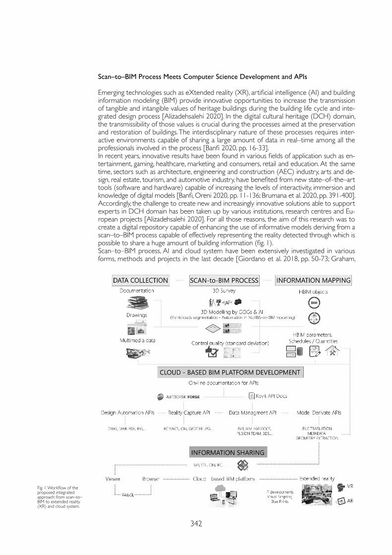
342
Fig. 1. Workflow of the proposed integrated approach: from scan–to–BIM to extended reality (XR) and cloud system.
Scan–to–BIM Process Meets Computer Science Development and APIs
Emerging technologies such as eXtended reality (XR), artificial intelligence (AI) and building information modeling (BIM) provide innovative opportunities to increase the transmission of tangible and intangible values of heritage buildings during the building life cycle and inte-grated design process [Alizadehsalehi 2020]. In the digital cultural heritage (DCH) domain, the transmissibility of those values is crucial during the processes aimed at the preservation and restoration of buildings. The interdisciplinary nature of these processes requires inter-active environments capable of sharing a large amount of data in real–time among all the professionals involved in the process [Banfi 2020, pp. 16-33]. In recent years, innovative results have been found in various fields of application such as en-tertainment, gaming, healthcare, marketing and consumers, retail and education. At the same time, sectors such as architecture, engineering and construction (AEC) industry, arts and de-sign, real estate, tourism, and automotive industry, have benefited from new state–of–the–art tools (software and hardware) capable of increasing the levels of interactivity, immersion and knowledge of digital models [Banfi, Oreni 2020, pp. 11-136; Brumana et al. 2020, pp. 391-400]. Accordingly, the challenge to create new and increasingly innovative solutions able to support experts in DCH domain has been taken up by various institutions, research centres and Eu-ropean projects [Alizadehsalehi 2020]. For all those reasons, the aim of this research was to create a digital repository capable of enhancing the use of informative models deriving from a scan–to–BIM process capable of effectively representing the reality detected through which is possible to share a huge amount of building information (fig. 1).Scan–to–BIM process, AI and cloud system have been extensively investigated in various forms, methods and projects in the last decade [Giordano et al. 2018, pp. 50-73; Graham,
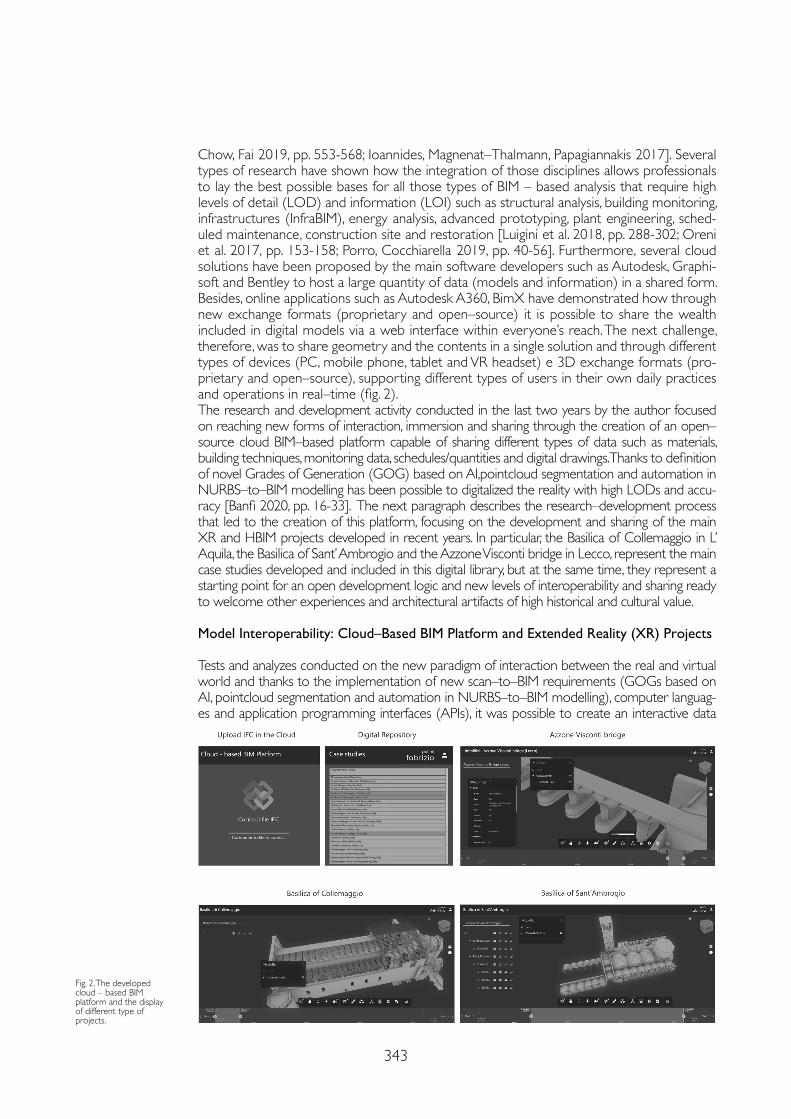
343
Chow, Fai 2019, pp. 553-568; Ioannides, Magnenat–Thalmann, Papagiannakis 2017]. Several types of research have shown how the integration of those disciplines allows professionals to lay the best possible bases for all those types of BIM – based analysis that require high levels of detail (LOD) and information (LOI) such as structural analysis, building monitoring, infrastructures (InfraBIM), energy analysis, advanced prototyping, plant engineering, sched-uled maintenance, construction site and restoration [Luigini et al. 2018, pp. 288-302; Oreni et al. 2017, pp. 153-158; Porro, Cocchiarella 2019, pp. 40-56]. Furthermore, several cloud solutions have been proposed by the main software developers such as Autodesk, Graphi-soft and Bentley to host a large quantity of data (models and information) in a shared form. Besides, online applications such as Autodesk A360, BimX have demonstrated how through new exchange formats (proprietary and open–source) it is possible to share the wealth included in digital models via a web interface within everyone’s reach. The next challenge, therefore, was to share geometry and the contents in a single solution and through different types of devices (PC, mobile phone, tablet and VR headset) e 3D exchange formats (pro-prietary and open–source), supporting different types of users in their own daily practices and operations in real–time (fig. 2).The research and development activity conducted in the last two years by the author focused on reaching new forms of interaction, immersion and sharing through the creation of an open–source cloud BIM–based platform capable of sharing different types of data such as materials, building techniques, monitoring data, schedules/quantities and digital drawings. Thanks to definition of novel Grades of Generation (GOG) based on AI,pointcloud segmentation and automation in NURBS–to–BIM modelling has been possible to digitalized the reality with high LODs and accu-racy [Banfi 2020, pp. 16-33]. The next paragraph describes the research–development process that led to the creation of this platform, focusing on the development and sharing of the main XR and HBIM projects developed in recent years. In particular, the Basilica of Collemaggio in L’ Aquila, the Basilica of Sant’ Ambrogio and the Azzone Visconti bridge in Lecco, represent the main case studies developed and included in this digital library, but at the same time, they represent a starting point for an open development logic and new levels of interoperability and sharing ready to welcome other experiences and architectural artifacts of high historical and cultural value.
Model Interoperability: Cloud–Based BIM Platform and Extended Reality (XR) Projects
Tests and analyzes conducted on the new paradigm of interaction between the real and virtual world and thanks to the implementation of new scan–to–BIM requirements (GOGs based on AI, pointcloud segmentation and automation in NURBS–to–BIM modelling), computer languag-es and application programming interfaces (APIs), it was possible to create an interactive data
Fig. 2. The developed cloud – based BIM platform and the display of different type of projects.
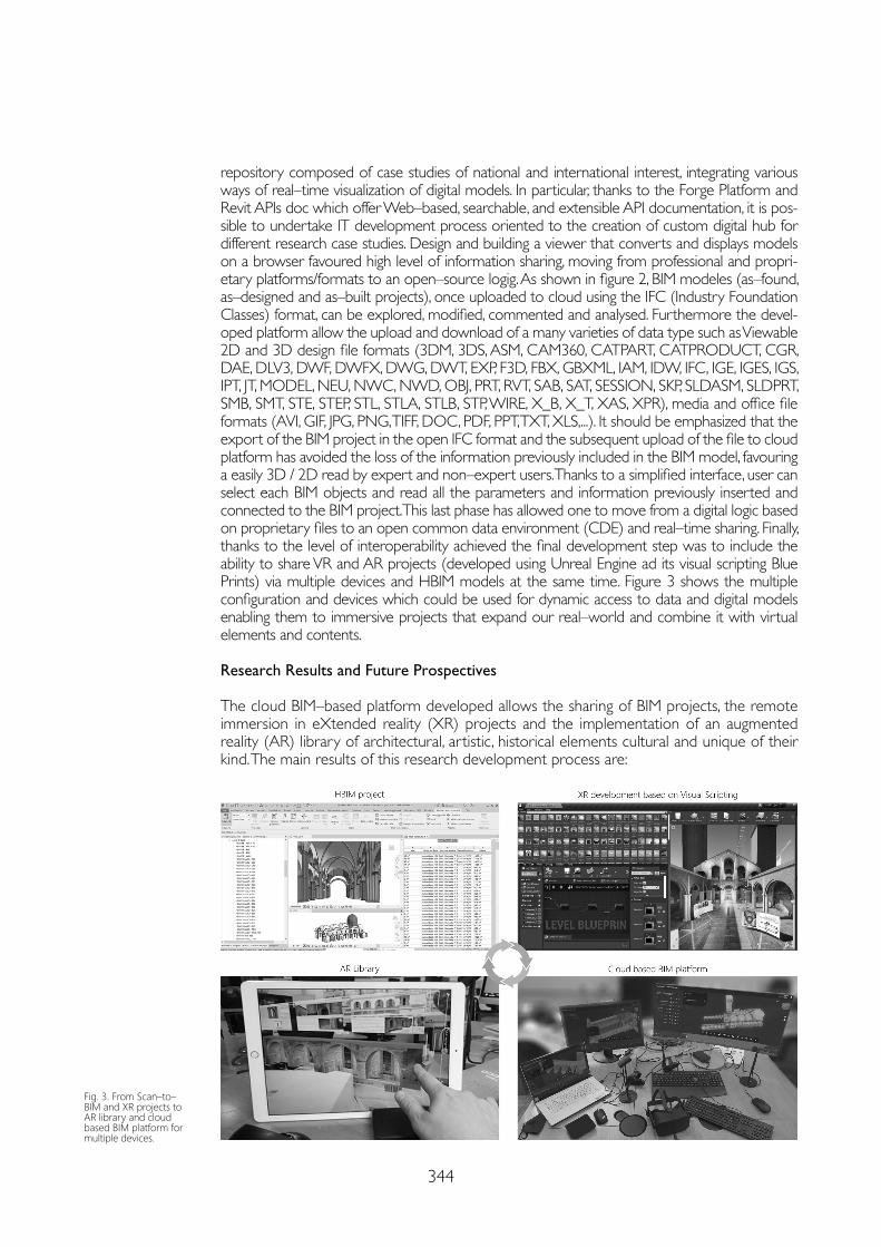
344
repository composed of case studies of national and international interest, integrating various ways of real–time visualization of digital models. In particular, thanks to the Forge Platform and Revit APIs doc which offer Web–based, searchable, and extensible API documentation, it is pos-sible to undertake IT development process oriented to the creation of custom digital hub for different research case studies. Design and building a viewer that converts and displays models on a browser favoured high level of information sharing, moving from professional and propri-etary platforms/formats to an open–source logig. As shown in figure 2, BIM modeles (as–found, as–designed and as–built projects), once uploaded to cloud using the IFC (Industry Foundation Classes) format, can be explored, modified, commented and analysed. Furthermore the devel-oped platform allow the upload and download of a many varieties of data type such as Viewable 2D and 3D design file formats (3DM, 3DS, ASM, CAM360, CATPART, CATPRODUCT, CGR, DAE, DLV3, DWF, DWFX, DWG, DWT, EXP, F3D, FBX, GBXML, IAM, IDW, IFC, IGE, IGES, IGS, IPT, JT, MODEL, NEU, NWC, NWD, OBJ, PRT, RVT, SAB, SAT, SESSION, SKP, SLDASM, SLDPRT, SMB, SMT, STE, STEP, STL, STLA, STLB, STP, WIRE, X_B, X_T, XAS, XPR), media and office file formats (AVI, GIF, JPG, PNG, TIFF, DOC, PDF, PPT, TXT, XLS,...). It should be emphasized that the export of the BIM project in the open IFC format and the subsequent upload of the file to cloud platform has avoided the loss of the information previously included in the BIM model, favouring a easily 3D / 2D read by expert and non–expert users. Thanks to a simplified interface, user can select each BIM objects and read all the parameters and information previously inserted and connected to the BIM project. This last phase has allowed one to move from a digital logic based on proprietary files to an open common data environment (CDE) and real–time sharing. Finally, thanks to the level of interoperability achieved the final development step was to include the ability to share VR and AR projects (developed using Unreal Engine ad its visual scripting Blue Prints) via multiple devices and HBIM models at the same time. Figure 3 shows the multiple configuration and devices which could be used for dynamic access to data and digital models enabling them to immersive projects that expand our real–world and combine it with virtual elements and contents.
Research Results and Future Prospectives
The cloud BIM–based platform developed allows the sharing of BIM projects, the remote immersion in eXtended reality (XR) projects and the implementation of an augmented reality (AR) library of architectural, artistic, historical elements cultural and unique of their kind. The main results of this research development process are:
Fig. 3. From Scan–to–BIM and XR projects to AR library and cloud based BIM platform for multiple devices.
345
Acknoldgements
Research leading to this results is partially funded by Regione Lombardia– Bando “Smart Living: integrazione fra produzione servizi e tecnologia nella filiera costruzionilegno–arredo–casa” approvato con d.d.u.o. n.11672 dell’15 novembre 2016 nell’ambito del progetto “HOMeBIM liveAPP: Sviluppo di una Live APP multi–utente della realtà virtuale abitativa 4D per il miglioramento di comfort–efficienza–costi, da una piattaforma cloud che controlla nel tempo il flusso BIM–sensori – ID 379270”.
References
A.A. V.V. (2017). In Ioannides Marinos, Magnenat–Thalmann Nadia, Papagiannakis George (eds.). Mixed Reality and Gamification for Cultural Heritage. Cham: Springer.
Alizadehsalehi Sepehr, Hadavi Ahmad, Huang Joseph Chuenhuei (2020). From BIM to extended reality in AEC industry. In Automation in Construction, 116, 103254.
Banfi Fabrizio (2020). HBIM, 3D drawing and virtual reality for archaeological sites and ancient ruins. In Virtual Archaeology Review, 11(23), pp. 16-33.
Banfi Fabrizio, Oreni Daniela (2020). Virtual Reality (VR), Augmented Reality (AR), and Historic Building Information Modeling (HBIM) for Built Heritage Enhancement: From Geometric Primitives to the Storytelling of a Complex Building. In Impact of Industry 4.0 on Architecture and Cultural Heritage. Hershey: IGI Global, pp. 111-136.
Brumana Raffaella, Oreni Daniela, Barazzetti Luigi, Cuca Branka, Previtali Mattia, Banfi Fabrizio (2020). Survey and Scan to BIM Model for the Knowledge of Built Heritage and the Management of Conservation Activities. In Digital Transformation of the Design, Construction and Management Processes of the Built Environment. Cham: Springer, pp. 391-400.
Giordano Andrea, Bernardello Rachele, Borin Paolo, Friso Isabella, Monteleone Cosimo, Panarotto (2018). Rappresentazione/Representation – Le opportunità fornite dai nuovi strumenti digitali – The opportunities of the new digital tools. In Paesaggio Urbano, 4, pp. 50-73.
Graham Katie, Chow Lara, Fai Stephen (2019). From BIM to VR: defining a level of detail to guide virtual reality narratives. In Journal of Information Technology in Construction, 24, pp. 553-568.
Luigini Alessandro, Massari Giovanna A., Vattano Starlight, Pellegatta Cristina, Luce Fabio (2018). Visual Culture and Cultural Heritage: ViC–CH a Synthesis Between Digital Representation and Heritage Experience. In International and Interdisciplinary Conference on Digital Environments for Education, Arts and Heritage. Cham: Springer, pp. 288-302.
Oreni Daniela, Brumana Raffaella, Della Torre Stefano, Banfi Fabrizio (2017). Disegno e modellazione parametrica per la conservazione di un edificio monumentale danneggiato da un evento sismico. Dal rilievo al cantiere. In ANANKE Speciale Geores, pp. 153-158.
Porro Simone, Cocchiarella Luigi (2019). Use of a Game Engine Artificial Intelligence to Represent People Flows in Architectural Spaces via Geometry and Graphics. In KoG, 23 (23), pp. 40-56.
Wong Johnny, Wang Xiangyu, Li Heng, Chan Greg, Li Haijiang (2014). A review of cloud–based BIM technology in the construction sector. In Journal of information technology in construction, 19, pp. 281-291.
• creation of a cloud platform capable of hosting and sharing scan–to–BIM projects char-acterized by the use of a large quantity of data such as point clouds coming from laser scanning and digital photogrammetry (primary data sources) and historical reports, digital drawings, multimedia files (secondary data sources);
• greater coordination and collaboration, efficient workflows, user friendly 3D visualiza-tions and better project results
• making VR projects more accessible by sharing executable files for the installation of dedicated apps for each project developed;
• implementation and sharing of AR objects,• improvement of the levels of interoperability of digital models through the use of ex-
change formats (proprietary and open–source).• diversified modes of use through smart glasses, VR headsets, PCs, mobile phones and tablets.Future developments are oriented to increase the level of interactivity of the cloud platform thanks to the connection of data coming from monitoring. The final goal will be to integrate digital models and real–time data into one digital solution, helping to increase the awareness and intangible values of our built heritage.
Copyright © 2021 by FrancoAngeli s.r.l. Milano, Italy Isbn 9788835125280
AuthorFabrizio Banfi, Dept. of Architecture, Built Environment and Construction Engineering, Politecnico di Milano, [email protected]

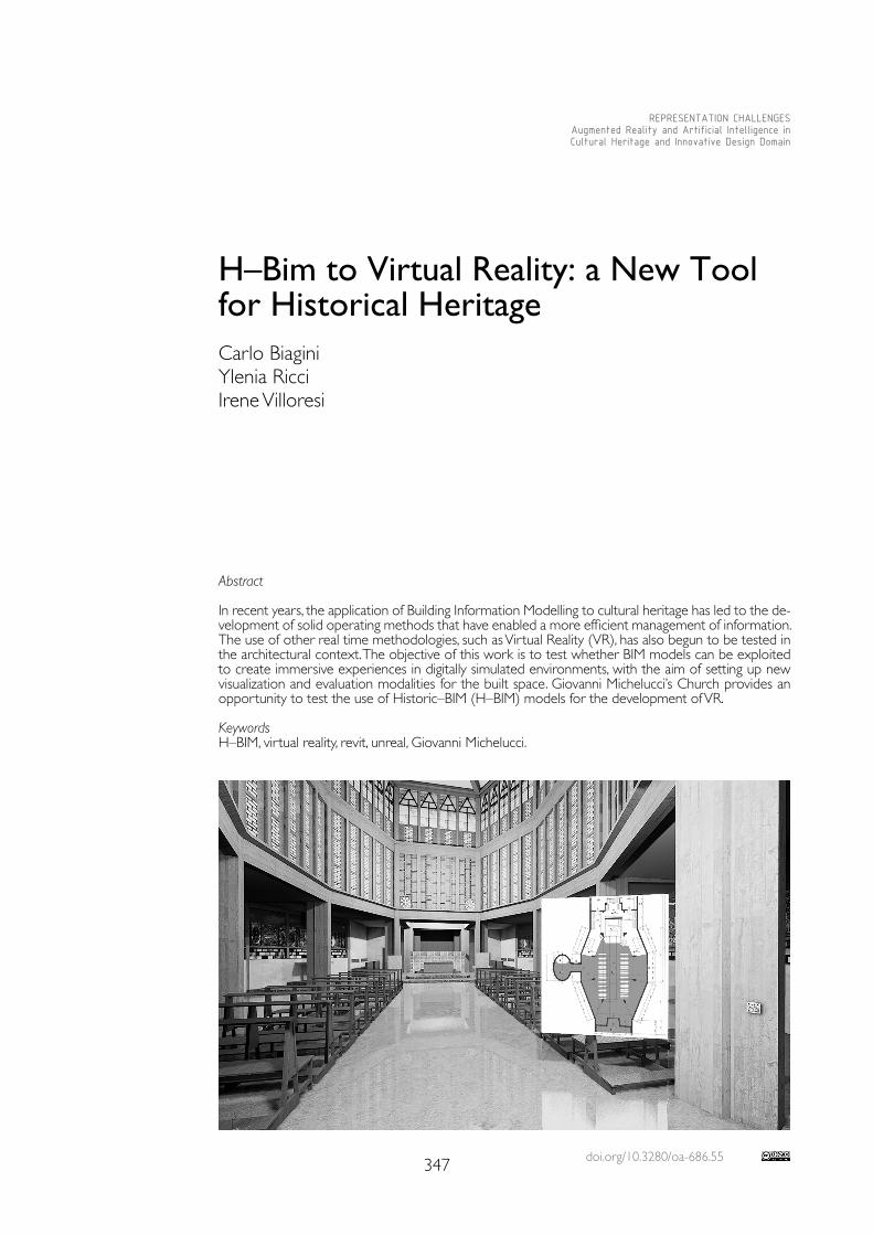
doi.org/10.3280/oa-686.55347
REPRESENTATION CHALLENGESAugmented Reality and Artificial Intelligence in Cultural Heritage and Innovative Design Domain
Abstract
In recent years, the application of Building Information Modelling to cultural heritage has led to the de-velopment of solid operating methods that have enabled a more efficient management of information. The use of other real time methodologies, such as Virtual Reality (VR), has also begun to be tested in the architectural context. The objective of this work is to test whether BIM models can be exploited to create immersive experiences in digitally simulated environments, with the aim of setting up new visualization and evaluation modalities for the built space. Giovanni Michelucci’s Church provides an opportunity to test the use of Historic–BIM (H–BIM) models for the development of VR. KeywordsH–BIM, virtual reality, revit, unreal, Giovanni Michelucci.
H–Bim to Virtual Reality: a New Tool for Historical Heritage Carlo BiaginiYlenia RicciIrene Villoresi
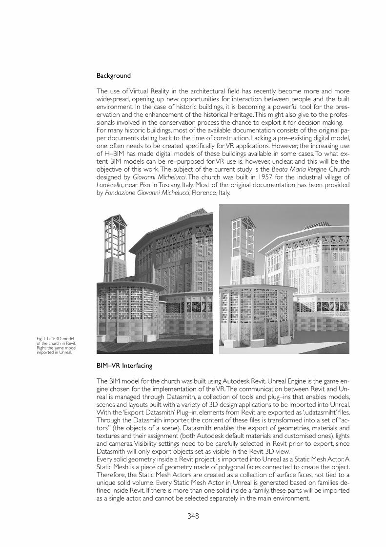
348
Background
The use of Virtual Reality in the architectural field has recently become more and more widespread, opening up new opportunities for interaction between people and the built environment. In the case of historic buildings, it is becoming a powerful tool for the pres-ervation and the enhancement of the historical heritage. This might also give to the profes-sionals involved in the conservation process the chance to exploit it for decision making.For many historic buildings, most of the available documentation consists of the original pa-per documents dating back to the time of construction. Lacking a pre–existing digital model, one often needs to be created specifically for VR applications. However, the increasing use of H–BIM has made digital models of these buildings available in some cases. To what ex-tent BIM models can be re–purposed for VR use is, however, unclear, and this will be the objective of this work. The subject of the current study is the Beata Maria Vergine Church designed by Giovanni Michelucci. The church was built in 1957 for the industrial village of Larderello, near Pisa in Tuscany, Italy. Most of the original documentation has been provided by Fondazione Giovanni Michelucci, Florence, Italy.
Fig. 1. Left: 3D model of the church in Revit. Right: the same model imported in Unreal.
BIM–VR Interfacing
The BIM model for the church was built using Autodesk Revit. Unreal Engine is the game en-gine chosen for the implementation of the VR. The communication between Revit and Un-real is managed through Datasmith, a collection of tools and plug–ins that enables models, scenes and layouts built with a variety of 3D design applications to be imported into Unreal. With the ‘Export Datasmith’ Plug–in, elements from Revit are exported as ‘.udatasmiht’ files. Through the Datasmith importer, the content of these files is transformed into a set of “ac-tors” (the objects of a scene). Datasmith enables the export of geometries, materials and textures and their assignment (both Autodesk default materials and customised ones), lights and cameras. Visibility settings need to be carefully selected in Revit prior to export, since Datasmith will only export objects set as visible in the Revit 3D view. Every solid geometry inside a Revit project is imported into Unreal as a Static Mesh Actor. A Static Mesh is a piece of geometry made of polygonal faces connected to create the object. Therefore, the Static Mesh Actors are created as a collection of surface faces, not tied to a unique solid volume. Every Static Mesh Actor in Unreal is generated based on families de-fined inside Revit. If there is more than one solid inside a family, these parts will be imported as a single actor, and cannot be selected separately in the main environment.
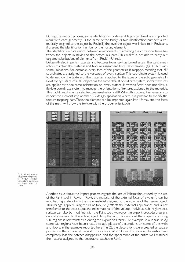
349
During the import process, some identification codes and tags from Revit are imported along with each geometry: 1) the name of the family; 2) two identification numbers auto-matically assigned to the object by Revit; 3) the level the object was linked to in Revit, and, if present, the identification number of the hosting element.The identification data match between environments, maintaining the correspondence be-tween the objects in Revit and the actors in Unreal. This makes it possible to carry out targeted substitutions of elements from Revit in Unreal. Datasmith also imports materials and textures from Revit as Unreal assets. The static mesh actors maintain the material and texture assignment from Revit families (fig. 1), but with some limitations. For example, every face of the geometries is mapped, meaning that 2D coordinates are assigned to the vertexes of every surface. This coordinate system is used to define how the texture of the materials is applied to the faces of the solid geometry. In Revit every surface of a 3D object has the same default coordinate system, so that textures are applied with the same orientation on every surface. However, Revit does not allow a flexible coordinate system to manage the orientation of textures assigned to the materials. This might result in unrealistic texture visualisation in VR. When this occurs, it is necessary to import the element into another 3D design application where it is possible to modify the texture mapping data. Then, the element can be imported again into Unreal, and the faces of the mesh will show the texture with the proper orientation.
Another issue about the import process regards the loss of information caused by the use of the Paint tool in Revit. In Revit, the material of the external faces of a volume can be modified separately from the main material assigned to the volume of that same object. This change, applied using the Paint tool, only affects the external appearance and is not transferred to the data about the main material of the volume. Individual sub–regions of a surface can also be modified with the Paint tool. However, the export procedure assigns only one material to the entire object. Also, the information about the shapes of existing sub–regions is not transferred during the export to Unreal. For example, in our case study, some sub–regions have been created to add pieces of decorations on some of the walls and floors. In the example reported here (fig. 2), the decorations were created as square patches on the surface of the wall. Once imported in Unreal, this surface information was completely lost: the patches disappeared, and the appearance of the entire wall matched the material assigned to the decorative patches in Revit.
Fig. 2. Left: wall material assignment using Paint tool in Revit. Right: same wall material assignment after import process in Unreal.
350
Management of the VR Model
As previously mentioned, information about materials and textures is maintained during the transfer process. However, the final result in Unreal is rather rough and incomplete, probably due to the different encoding of material properties between the two applications. In Revit, materials are managed through a pane where the appearance properties are listed together with their assigned values. This list is fixed based on the class of the material and it is not possible to add or delete them. Properties can only be changed by modifying the values of their parameters. In Unreal, materials are one of the most critical and complex aspects to handle, because of the wide variety of options for material characterisation managed through a network of visual scripting nodes (called Material Expressions). Every node contains a piece of code that is responsible for one aspect of the physical behaviour of the material. Different nodes are connected to achieve optimal visual results, especially when it comes to the interaction of surfaces with light. However, in Revit, some material properties are either not modelled or managed in back-ground without being explicitly reported in the data for the material. Instead, Unreal needs specific handling of these properties to achieve optimal visualisation. Nevertheless, during the import process, the Material Expressions are automatically populated with nodes, many of which are not necessary for the specific material or contain incorrect values. Therefore, these Revit–derived material structures might be very difficult to interpret and handle in the Material Editor. In our specific case, we often resorted to re–programming the network of nodes entirely, retaining only the properties relevant for the visual restitution in VR.
Addition and Display of Informative Resources
One of the most important features of BIM models is that all kind of information can be included directly inside the project. Unfortunately, this information is not exported in Unreal and cannot be automatically recalled in VR. In this case study, we tested the use of info–points as a method to include some pieces of information manually for real time visualisation of the resources. This was limited to a small portion of the information, but the same methodology can be extended to the rest of the data. The info–points are specific spots inside the scene where it is possible to bring up multimedia panels presenting the information. These panels consist of screens, realized with a blank plane rectangular actor, showing manually inserted media content, both in the form of videos and images. These panels are normally hidden and can be made visible through QR codes linked to them. These QR codes mark the location of the info–points and can be activated by the user with the controllers by proximity. When the QR code is activated, the panel pops up displaying its content. The info–points were placed in meaningful locations inside the scene, next to points of interest, for which they provide information when queried. For example, a panel describing a stained–glass window was located just below this object. The user could visualise this additional material while standing in front of the window in the VR environment. However, when it comes to generic information, such as blueprints, this methodology showed some limitations, because the panels could only be recalled at the specific locations where the info–point had been placed. Therefore, optimal solutions will need to be devel-oped for this kind of data.
Conclusions
Using BIM models as a base for building VR is possible and it is effective in the transfer of 3D geometries. However, the communication between the two applications used in this study is still not optimised for seamless transfer of data. Of notice, these are two stan-dard applications used in their respective fields. It is therefore expected that the challenges described in this work will be faced by other users and designers interested in BIM–VR
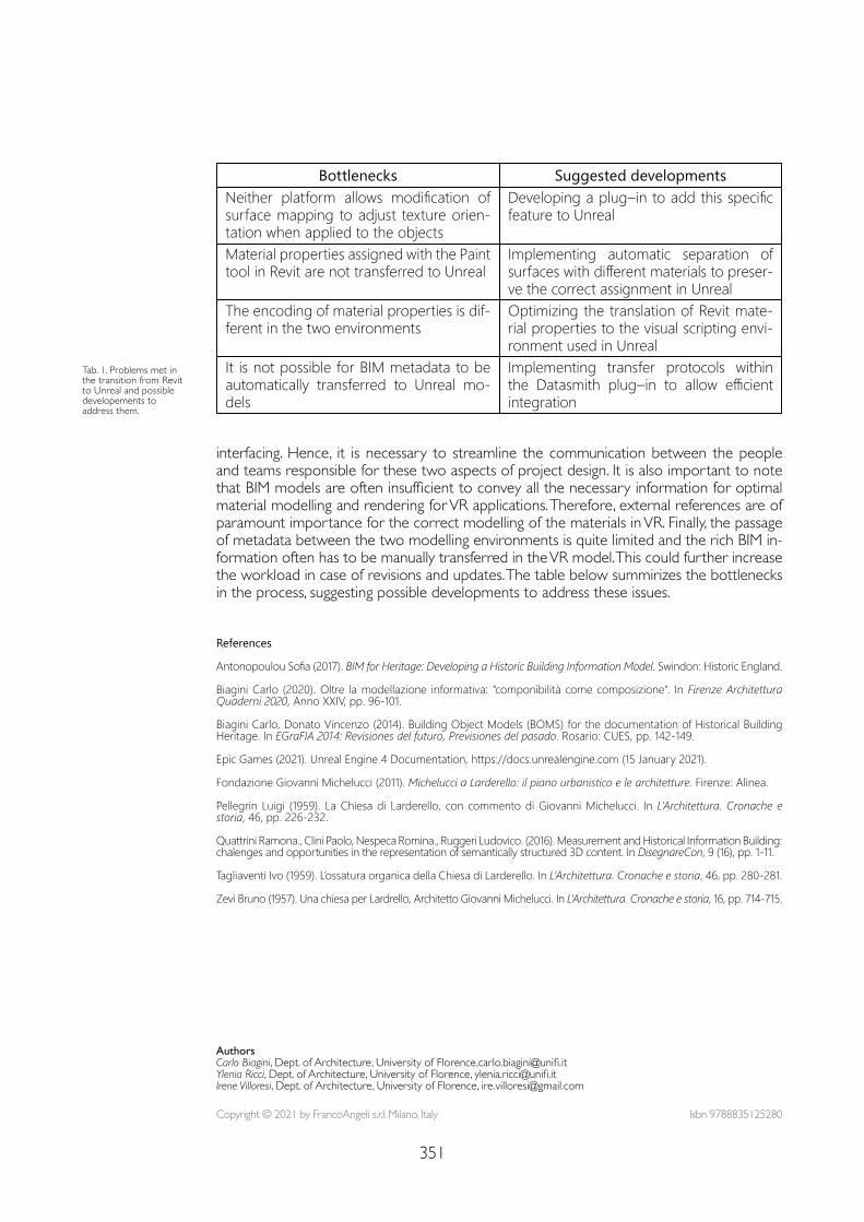
351
interfacing. Hence, it is necessary to streamline the communication between the people and teams responsible for these two aspects of project design. It is also important to note that BIM models are often insufficient to convey all the necessary information for optimal material modelling and rendering for VR applications. Therefore, external references are of paramount importance for the correct modelling of the materials in VR. Finally, the passage of metadata between the two modelling environments is quite limited and the rich BIM in-formation often has to be manually transferred in the VR model. This could further increase the workload in case of revisions and updates. The table below summirizes the bottlenecks in the process, suggesting possible developments to address these issues.
Bottlenecks Suggested developmentsNeither platform allows modification of surface mapping to adjust texture orien-tation when applied to the objects
Developing a plug–in to add this specific feature to Unreal
Material properties assigned with the Paint tool in Revit are not transferred to Unreal
Implementing automatic separation of surfaces with different materials to preser-ve the correct assignment in Unreal
The encoding of material properties is dif-ferent in the two environments
Optimizing the translation of Revit mate-rial properties to the visual scripting envi-ronment used in Unreal
It is not possible for BIM metadata to be automatically transferred to Unreal mo-dels
Implementing transfer protocols within the Datasmith plug–in to allow efficient integration
Tab. 1. Problems met in the transition from Revit to Unreal and possible developements to address them.
References
Antonopoulou Sofia (2017). BIM for Heritage: Developing a Historic Building Information Model. Swindon: Historic England.
Biagini Carlo (2020). Oltre la modellazione informativa: “componibilità come composizione”. In Firenze Architettura Quaderni 2020, Anno XXIV, pp. 96-101.
Biagini Carlo, Donato Vincenzo (2014). Building Object Models (BOMS) for the documentation of Historical Building Heritage. In EGraFIA 2014: Revisiones del futuro, Previsiones del pasado. Rosario: CUES, pp. 142-149.
Epic Games (2021). Unreal Engine 4 Documentation, https://docs.unrealengine.com (15 January 2021).
Fondazione Giovanni Michelucci (2011). Michelucci a Larderello: il piano urbanistico e le architetture. Firenze: Alinea.
Pellegrin Luigi (1959). La Chiesa di Larderello, con commento di Giovanni Michelucci. In L’Architettura. Cronache e storia, 46, pp. 226-232.
Quattrini Ramona., Clini Paolo, Nespeca Romina., Ruggeri Ludovico. (2016). Measurement and Historical Information Building: chalenges and opportunities in the representation of semantically structured 3D content. In DisegnareCon, 9 (16), pp. 1-11.
Tagliaventi Ivo (1959). L’ossatura organica della Chiesa di Larderello. In L’Architettura. Cronache e storia, 46, pp. 280-281.
Zevi Bruno (1957). Una chiesa per Lardrello, Architetto Giovanni Michelucci. In L’Architettura. Cronache e storia, 16, pp. 714-715.
Copyright © 2021 by FrancoAngeli s.r.l. Milano, Italy Isbn 9788835125280
AuthorsCarlo Biagini, Dept. of Architecture, University of Florence,[email protected] Ricci, Dept. of Architecture, University of Florence, [email protected] Villoresi, Dept. of Architecture, University of Florence, [email protected]

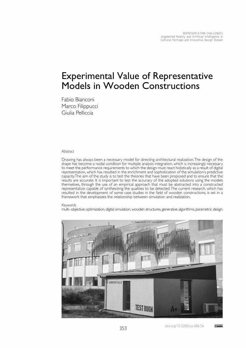
doi.org/10.3280/oa-686.56353
REPRESENTATION CHALLENGESAugmented Reality and Artificial Intelligence in Cultural Heritage and Innovative Design Domain
Abstract
Drawing has always been a necessary model for directing architectural realization. The design of the shape has become a nodal condition for multiple analysis integration, which is increasingly necessary to meet the performance requirements to which the design must react holistically as a result of digital representation, which has resulted in the enrichment and sophistication of the simulation’s predictive capacity. The aim of the study is to test the theories that have been proposed and to ensure that the results are accurate. It is important to test the accuracy of the adopted solutions using the models themselves, through the use of an empirical approach that must be abstracted into a constructed representation capable of synthesizing the qualities to be detected. The current research, which has resulted in the development of some case studies in the field of wooden constructions, is set in a framework that emphasizes the relationship between simulation and realization.
Keywordsmulti–objective optimization, digital simulation, wooden structures, generative algorithms, parametric design.
Experimental Value of Representative Models in Wooden ConstructionsFabio BianconiMarco FilippucciGiulia Pelliccia
354
Introduction
The importance of representation as a model–building site is focused on the digitization process and the convergence of the different aspects of the form into digital computational tools. Models gather and analyze data and information through interconnected and interdis-ciplinary routes in order to turn them into knowledge. Due to its transdisciplinary nature, representation becomes the language of knowledge incorporation, introducing its own field of experimental and heuristic intervention, with paths that must be validated.The research, which was formed as part of a collaboration between the Department of Civil and Environmental Engineering and Abitare+, a local creative wood construction start–up, provided an opportunity to put in place a direction that aimed to achieve these objectives of innovation and knowledge transfer. Simultaneously, joint competencies have been de-veloped to kick–start product and service innovation processes. The analysis of generative models aimed at multi–optimizing the form, energy efficiency, structure, and cost of wooden houses leads to the integration with BIM models. To encourage this practice, an Ames room has been developed with a high media impact to highlight the proposed creative approach. The study then moved on to multi–optimization of wooden structural walls from this first direction. Simultaneously, a study of a new ‘breathing house’ model was conducted, applying responsive solutions to indoor hygrometric changes. To check the validity of such solutions, a test room was built as an abstract representation of a wooden house reduced to the size of a paradigmatic room.Generative modeling, BIM, and software solutions unique to the various disciplines involved are useful tools to integrate architectural, representative, positive, resources, and communi-cation aspects. Once ready for the industrialization process, the models, which in this case are materialized in a physical form (the model of the model), must be tested.
The Research Path
The analysis of generative models [Bianconi, Filippucci, Buffi 2017; Filippucci 2012] is fol-lowed by a proposal for an integrated mass customization–based design and production process [Duarte 2005; Paoletti 2017], which is aimed primarily at wood construction tech-nicians and specialists but also useful as a dissemination tool for students and researchers. The study looks into the possibility of using generative models and evolutionary principles to inform the design and customization process. The first case study [Bianconi, Filippucci 2019] aims to provide individualized housing designs to central Italy.These square–plan houses, designed as modular solutions that can be transported and as-sembled easily following a simple manufacturing process, can be combined to build custom multi–family homes and villages that conform to both the environment and their inhabitants. The generative process specifies a variety of design options, all of which depend on genetic algorithms to adapt and optimize the architectural model. The design concept is focused on the analysis of local codes and X–Lam and Platform–Frame building systems with the goal of reducing waste and optimizing the construction process. With the study’s goal in mind, energy consumption, thermal, and visual comfort, as well as price, were evaluated with the construction company and through iterative processes. The results of this first study, which began with the selection of solutions available to the company, have prompted a closer examination of each element that makes up the envelope.The realization of the Ames room is exemplary in this regard [Ames, Ittelson 1952]. It is an application of perceptual theories [Arnheim 1965; Gibson 2018] that reviews digital al-gorithms to concretize an architectural expedient based on image culture [Pinotti, Somaini Elcograf 2016] and that has led to a model that synthesizes the research’s multiple questions [Bianconi, Filippucci 2020].The focus of the investigation then shifted to improving the energy efficiency of wooden structures that had previously been customized to meet the location’s specific require-ments. The aim in this case is to use generative design tools to optimize the preliminary cost and efficiency of wood walls for X–Lam and Platform–Frame structures, with the goal
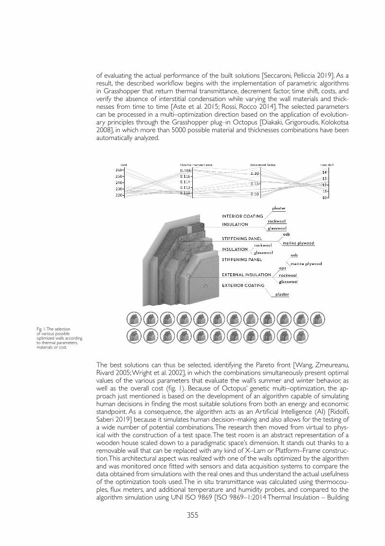
355
of evaluating the actual performance of the built solutions [Seccaroni, Pelliccia 2019]. As a result, the described workflow begins with the implementation of parametric algorithms in Grasshopper that return thermal transmittance, decrement factor, time shift, costs, and verify the absence of interstitial condensation while varying the wall materials and thick-nesses from time to time [Aste et al. 2015; Rossi, Rocco 2014]. The selected parameters can be processed in a multi–optimization direction based on the application of evolution-ary principles through the Grasshopper plug–in Octopus [Diakaki, Grigoroudis, Kolokotsa 2008], in which more than 5000 possible material and thicknesses combinations have been automatically analyzed.
The best solutions can thus be selected, identifying the Pareto front [Wang, Zmeureanu, Rivard 2005; Wright et al. 2002], in which the combinations simultaneously present optimal values of the various parameters that evaluate the wall’s summer and winter behavior, as well as the overall cost (fig. 1). Because of Octopus’ genetic multi–optimization, the ap-proach just mentioned is based on the development of an algorithm capable of simulating human decisions in finding the most suitable solutions from both an energy and economic standpoint. As a consequence, the algorithm acts as an Artificial Intelligence (AI) [Ridolfi, Saberi 2019] because it simulates human decision–making and also allows for the testing of a wide number of potential combinations. The research then moved from virtual to phys-ical with the construction of a test space. The test room is an abstract representation of a wooden house scaled down to a paradigmatic space’s dimension. It stands out thanks to a removable wall that can be replaced with any kind of X–Lam or Platform–Frame construc-tion. This architectural aspect was realized with one of the walls optimized by the algorithm and was monitored once fitted with sensors and data acquisition systems to compare the data obtained from simulations with the real ones and thus understand the actual usefulness of the optimization tools used. The in situ transmittance was calculated using thermocou-ples, flux meters, and additional temperature and humidity probes, and compared to the algorithm simulation using UNI ISO 9869 [ISO 9869–1:2014 Thermal Insulation – Building
Fig. 1. The selection of various possible optimized walls according to thermal parameters, materials or cost.
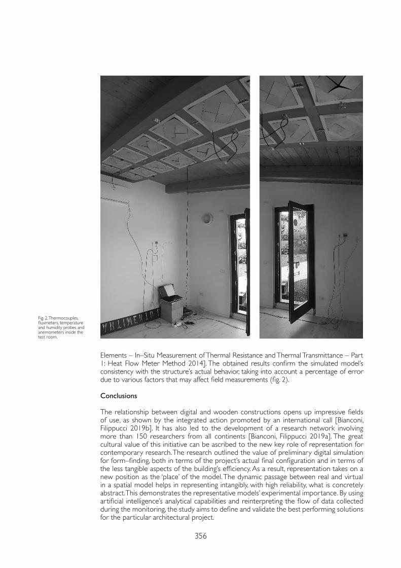
356
Elements – In–Situ Measurement of Thermal Resistance and Thermal Transmittance – Part 1: Heat Flow Meter Method 2014]. The obtained results confirm the simulated model’s consistency with the structure’s actual behavior, taking into account a percentage of error due to various factors that may affect field measurements (fig. 2).
Conclusions
The relationship between digital and wooden constructions opens up impressive fields of use, as shown by the integrated action promoted by an international call [Bianconi, Filippucci 2019b]. It has also led to the development of a research network involving more than 150 researchers from all continents [Bianconi, Filippucci 2019a]. The great cultural value of this initiative can be ascribed to the new key role of representation for contemporary research. The research outlined the value of preliminary digital simulation for form–finding, both in terms of the project’s actual final configuration and in terms of the less tangible aspects of the building’s efficiency. As a result, representation takes on a new position as the ‘place’ of the model. The dynamic passage between real and virtual in a spatial model helps in representing intangibly, with high reliability, what is concretely abstract. This demonstrates the representative models’ experimental importance. By using artificial intelligence’s analytical capabilities and reinterpreting the flow of data collected during the monitoring, the study aims to define and validate the best performing solutions for the particular architectural project.
Fig. 2. Thermocouples, fluxmeters, temperature and humidity probes and anemometers inside the test room.
357
References
Ames Adelbert, Ittelson William H. (1952). The Ames Demonstrations in Perception. New York: Hafner Publishing.
Arnheim Rudolf (1965). Art and visual perception: A psychology of the creative eye. Los Angeles: University of California Press.
Aste Niccolò, Leonforte Fabrizio, Manfren Massimiliano, Mazzon Manlio (2015). Thermal inertia and energy efficiency – Parametric simulation assessment on a calibrated case study. In Applied Energy, 145, pp. 111-123.
Bianconi Fabio, Filippucci Marco (eds.) (2019a). Digital Wood Design. Innovative Techniques of Representation in Architectural Design, 24.
Bianconi Fabio, Filippucci Marco (2019b). Digital Wood Design. Tecniche innovative di rappresentazione nella progettazione architettonica. In Bertocci Stefano, Conte Antonio (eds.) Il Simposio UID di internazionalizzazione della ricerca. Patrimoni culturali, Architettura, Paesaggio e Design tra ricerca e sperimentazione didattica. Firenze: Didapress, pp. 326-329.
Bianconi Fabio, Filippucci Marco (2020). Disegnare la Camera di Ames. Le questioni architettoniche, le lezioni del classico, le sperimentazioni digitali. In Disegnare. Idee Immagini, 60, pp. 50-61.
Bianconi Fabio, Filippucci Marco, Buffi Alessandro (2017). Disegno, modello, natura. Il form–finding dopo 100 anni di “Crescita e forma.” In 3D MODELING & BIM. Roma: DEI, pp. 398-413.
Bianconi Fabio, Filippucci Marco, Buffi Alessandro (2019). Automated design and modeling for mass–customized housing. A web–based design space catalog for timber structures. In Automation in Construction, 103.
Diakaki Christina, Grigoroudis Evangelos, Kolokotsa Dionyssia (2008). Towards a multi–objective optimization approach for improving energy efficiency in buildings. In Energy and Buildings, 40 (9), pp. 1747-1754.
Duarte José P. (2005). A discursive grammar for customizing mass housing: the case of Siza’s houses at Malagueira. In Automation in Construction, 14 (2), pp. 265-275.
Filippucci Marco (2012). Rappresentazione al quadrato. Il disegno generativo per il rinnovamento della geometria descrittiva. In Carlevalis Laura, De Carlo Laura, Migliari Roberto (eds.), Attualità della Geometria Descrittiva Seminario nazionale sul rinnovamento della Geometria descrittiva. Roma: Gangemi.
Gibson James J. (2018). The Ecological Approach to Visual Perception. London: Psychology Press, 2018. https://doi.org/10.2307/j.ctt1xp3nmm.20.
ISO 9869–1:2014 (2014). Thermal insulation – Building elements – In–situ measurement of thermal resistance and thermal transmittance – Part 1: Heat flow meter method.
Paoletti Ingrid (2017). Mass customization in the era of industry 4.0: Towards immaterial building technology. In Informed Architecture: Computational Strategies in Architectural Design. Cham, Switzerland AG; Springer International Publishing, pp. 77-87.
Pinotti Andrea., Somaini Antonio, Elcograf Cles (2016). Cultura visuale: immagini sguardi media dispositivi. Segrate: Einaudi.
Ridolfi Giuseppe, Saberi Arman (2019). Intelligenze Computazionali nel Progetto post–Ambientale Computational Intelligences in the post–Environmental Design RIDOLFI. In International Journal of Architecture, Art and Design, 5, pp. 31-40.
Rossi Monica, Rocco Valeria Marta (2014). External walls design: The role of periodic thermal transmittance and internal areal heat capacity. In Energy and Buildings, 68, pp. 732-740.
Seccaroni Marco, Pelliccia Giulia (2019). Customizable social wooden pavilions: A workflow for the energy, emergy and perception optimization in perugia’s parks. In Bianconi Fabio, Filippucci Marco (eds.). Digital Wood Design. Innovative Techniques of Representation in Architectural Design, 24, pp. 1045-1062.
Wang Weimin, Zmeureanu Radu, Rivard Hugues (2005). Applying multi–objective genetic algorithms in green building design optimization. In Building and Environment, 40 (11), pp. 1512-1525.
Wright Jonathan A., Loosemore Heather A., Farmani Raziyeh (2002). Optimization of building thermal design and control by multi–criterion genetic algorithm. In Energy and Buildings, 34 (9), pp. 959-972.
Copyright © 2021 by FrancoAngeli s.r.l. Milano, Italy Isbn 9788835125280
AuthorsFabio Bianconi, Dept.of Civil and Environmental Engineering, University of Perugia, [email protected] Filippucci, Dept. of Civil and Environmental Engineering, University of Perugia, [email protected] Pelliccia, Dept. of Civil and Environmental Engineering, University of Perugia, [email protected]

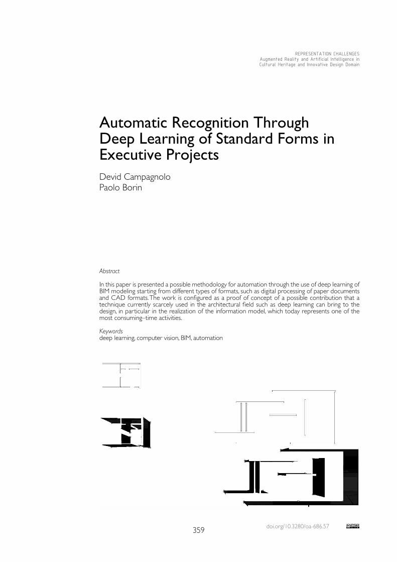
doi.org/10.3280/oa-686.57359
REPRESENTATION CHALLENGESAugmented Reality and Artificial Intelligence in Cultural Heritage and Innovative Design Domain
Abstract
In this paper is presented a possible methodology for automation through the use of deep learning of BIM modeling starting from different types of formats, such as digital processing of paper documents and CAD formats. The work is configured as a proof of concept of a possible contribution that a technique currently scarcely used in the architectural field such as deep learning can bring to the design, in particular in the realization of the information model, which today represents one of the most consuming–time activities.
Keywordsdeep learning, computer vision, BIM, automation
Automatic Recognition Through Deep Learning of Standard Forms in Executive ProjectsDevid CampagnoloPaolo Borin
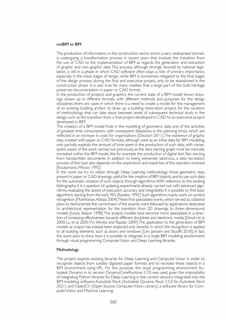
360
notBIM to BIM
The production of information, in the construction sector and in a very widespread domain, is undergoing a transformation process in recent years that involves the transition from the use of CAD to the implementation of BIM as regards the generation and extraction of graphic and non–graphic data. This process, although strongly favored by national legis-lation, is still in a phase in which CAD software often plays a role of primary importance, especially in the initial stages of design, while BIM is sometimes relegated to the final stages of the design process, during the final and executive project, only to be abandoned in the construction phase. It is also true for many realities that a large part of the built heritage preserves documentation in paper or CAD format.In the production of projects and graphics, the current state of a BIM model shows draw-ings drawn up in different formats, with different methods and purposes for the design disciplines: there are cases in which there is a need to create a model for the management of an existing building artifact, to draw up a building restoration project, for the variation of methodology that can take place between levels of subsequent technical study in the design, such as the transition from a final project developed in CAD to an executive project developed in BIM.The creation of a BIM model finds in the modeling of geometric data one of the activities of greatest time consumption, with consequent dilatations in the planning times, which are reflected in an increase in costs for organizations [Deutsch 2011]. The existence of graphic data created with paper or CAD formats, although used as an initial data for BIM modeling, only partially exploits the amount of time spent in the production of such data, with conse-quent waste of the work carried out previously, as the data starting graph must be manually recreated within the BIM model, like for example the production of digital text files starting from handwritten documents. In addition to being extremely laborious, a data recreation process of this type also depends on the experience and expertise of the operator involved [Koutamanis, Mitossi 1992].In this work we try to obtain through Deep Learning methodology those geometric data, present in paper or CAD drawings, useful for the creation of BIM objects, and to use such data for the automatic creation of such objects through algorithms. With reference to the existing bibliography, it is a question of updating experiments already carried out with advanced algo-rithms, evaluating the speed of execution, accuracy and integrability. It is possible to find basic algorithms starting from the early 90’s [Kaneko 1992]. Such algorithms mainly work on symbol recognition [Mokhtarian, Abbasi 2004]. These first specialized works, which served as cadastral plans to demonstrate the correctness of the awards, were followed by applications dedicated to architectural representation for the transition from 2D drawings to three–dimensional models [Lewis, Séquin 1998]. The analysis models have become more specialized, in a direc-tion of increasing effectiveness towards different disciplines and electronic media [Dosch et al. 2000; Lu et al. 2005; Yin, Wonka and Razdan 2009]. The application to the generation of BIM models as output has instead been explored only recently in which the recognition is applied to all building elements, such as doors and windows [Lim, Janssen and Stouffs 2018]. In fact, this work aims to show how it is possible to integrate, in a single BIM modeling environment, through visual programming, Computer Vision and Deep Learning libraries.
Methodology
The project exploits existing libraries for Deep Learning and Computer Vision in order to recognize objects from suitably digitized paper formats and to recreate these objects in a BIM environment using VPL. For this purpose, the visual programming environment Au-todesk Dynamo in its version DynamoCoreRuntime 2.7.0 was used, given the impossibility of integrating Python libraries for Deep Learning in the current versions integrated into the BIM modeling software Autodesk Revit (Autodesk Dynamo Revit 2.5.0 for Autodesk Revit 2021), and OpenCV (Open Source Computer Vision Library), a software library for Com-puter Vision and Machine Learning.
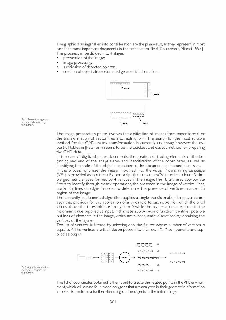
361
The graphic drawings taken into consideration are the plan views, as they represent in most cases the most important documents in the architectural field [Koutamanis, Mitossi 1993].The process can be divided into 4 stages:• preparation of the image;• image processing;• subdivision of detected objects:• creation of objects from extracted geometric information.
Fig. 1. Element recognition scheme. Elaboration by the authors.
The image preparation phase involves the digitization of images from paper format or the transformation of vector files into matrix form. The search for the most suitable method for the CAD–matrix transformation is currently underway, however the ex-port of tables in JPEG form seems to be the quickest and easiest method for preparing the CAD data.In the case of digitized paper documents, the creation of tracing elements of the be-ginning and end of the analysis area and identification of the coordinates, as well as identifying the scale of the objects contained in the document, is deemed necessary.In the processing phase, the image imported into the Visual Programming Language (VPL) is provided as input to a Python script that uses openCV in order to identify sim-ple geometric shapes formed by 4 vertices in the image. The library uses appropriate filters to identify, through matrix operations, the presence in the image of vertical lines, horizontal lines or edges in order to determine the presence of vertices in a certain region of the image.The currently implemented algorithm applies a single transformation to grayscale im-ages that provides for the application of a threshold to each pixel, for which the pixel values above the threshold are brought to 0 while the higher values are taken to the maximum value supplied as input, in this case 255. A second function identifies possible outlines of elements in the image, which are subsequently discretized by obtaining the vertices of the figure.The list of vertices is filtered by selecting only the figures whose number of vertices is equal to 4. The vertices are then decomposed into their own X–Y components and sup-plied as output.
Fig. 2. Algorithm operation diagram. Elaboration by the authors.
The list of coordinates obtained is then used to create the related points in the VPL environ-ment, which will create four–sided polygons that are analyzed in their geometric information in order to perform a further skimming on the objects in the initial image.
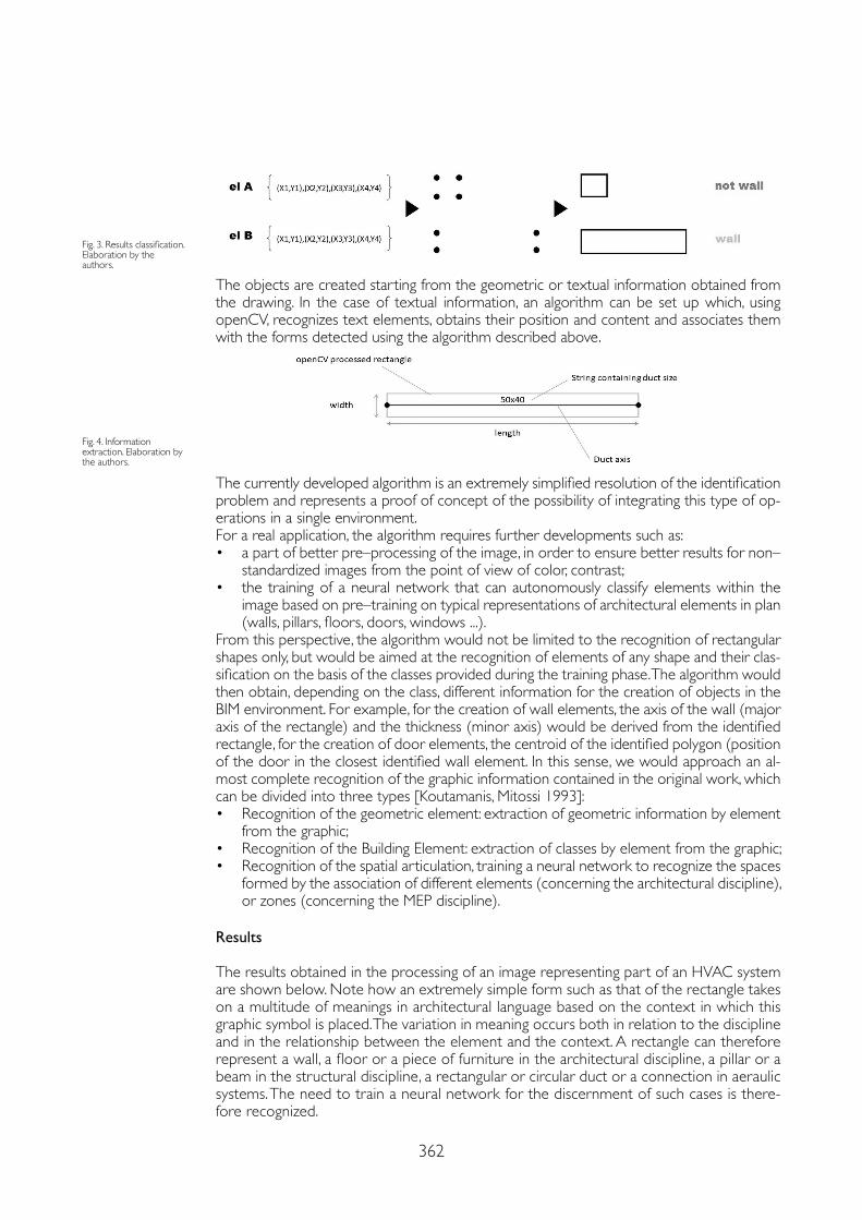
362
Fig. 3. Results classification.Elaboration by the authors.
Fig. 4. Information extraction. Elaboration by the authors.
The objects are created starting from the geometric or textual information obtained from the drawing. In the case of textual information, an algorithm can be set up which, using openCV, recognizes text elements, obtains their position and content and associates them with the forms detected using the algorithm described above.
The currently developed algorithm is an extremely simplified resolution of the identification problem and represents a proof of concept of the possibility of integrating this type of op-erations in a single environment.For a real application, the algorithm requires further developments such as:• a part of better pre–processing of the image, in order to ensure better results for non–
standardized images from the point of view of color, contrast;• the training of a neural network that can autonomously classify elements within the
image based on pre–training on typical representations of architectural elements in plan (walls, pillars, floors, doors, windows ...).
From this perspective, the algorithm would not be limited to the recognition of rectangular shapes only, but would be aimed at the recognition of elements of any shape and their clas-sification on the basis of the classes provided during the training phase. The algorithm would then obtain, depending on the class, different information for the creation of objects in the BIM environment. For example, for the creation of wall elements, the axis of the wall (major axis of the rectangle) and the thickness (minor axis) would be derived from the identified rectangle, for the creation of door elements, the centroid of the identified polygon (position of the door in the closest identified wall element. In this sense, we would approach an al-most complete recognition of the graphic information contained in the original work, which can be divided into three types [Koutamanis, Mitossi 1993]:• Recognition of the geometric element: extraction of geometric information by element
from the graphic;• Recognition of the Building Element: extraction of classes by element from the graphic;• Recognition of the spatial articulation, training a neural network to recognize the spaces
formed by the association of different elements (concerning the architectural discipline), or zones (concerning the MEP discipline).
Results
The results obtained in the processing of an image representing part of an HVAC system are shown below. Note how an extremely simple form such as that of the rectangle takes on a multitude of meanings in architectural language based on the context in which this graphic symbol is placed. The variation in meaning occurs both in relation to the discipline and in the relationship between the element and the context. A rectangle can therefore represent a wall, a floor or a piece of furniture in the architectural discipline, a pillar or a beam in the structural discipline, a rectangular or circular duct or a connection in aeraulic systems. The need to train a neural network for the discernment of such cases is there-fore recognized.
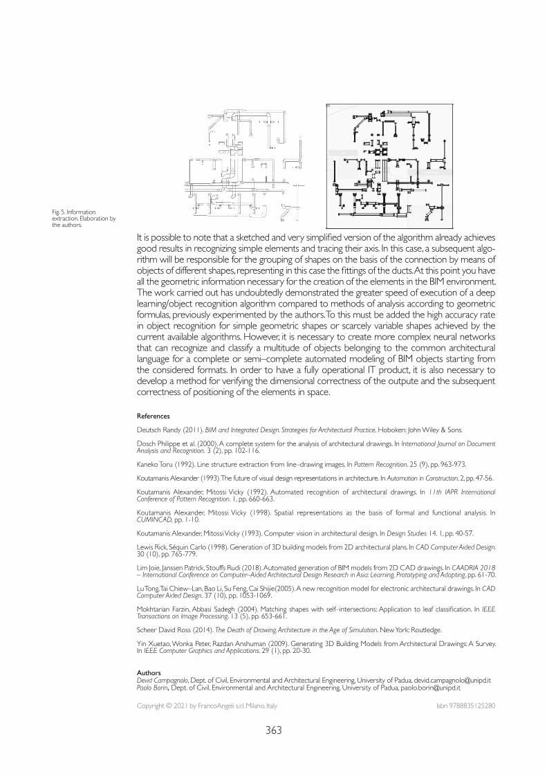
363
Fig. 5. Information extraction. Elaboration by the authors.
It is possible to note that a sketched and very simplified version of the algorithm already achieves good results in recognizing simple elements and tracing their axis. In this case, a subsequent algo-rithm will be responsible for the grouping of shapes on the basis of the connection by means of objects of different shapes, representing in this case the fittings of the ducts. At this point you have all the geometric information necessary for the creation of the elements in the BIM environment.The work carried out has undoubtedly demonstrated the greater speed of execution of a deep learning/object recognition algorithm compared to methods of analysis according to geometric formulas, previously experimented by the authors. To this must be added the high accuracy rate in object recognition for simple geometric shapes or scarcely variable shapes achieved by the current available algorithms. However, it is necessary to create more complex neural networks that can recognize and classify a multitude of objects belonging to the common architectural language for a complete or semi–complete automated modeling of BIM objects starting from the considered formats. In order to have a fully operational IT product, it is also necessary to develop a method for verifying the dimensional correctness of the outpute and the subsequent correctness of positioning of the elements in space.
References
Deutsch Randy (2011). BIM and Integrated Design. Strategies for Architectural Practice. Hoboken: John Wiley & Sons.
Dosch Philippe et al. (2000). A complete system for the analysis of architectural drawings. In International Journal on Document Analysis and Recognition. 3 (2), pp. 102-116.
Kaneko Toru (1992). Line structure extraction from line–drawing images. In Pattern Recognition. 25 (9), pp. 963-973.
Koutamanis Alexander (1993). The future of visual design representations in architecture. In Automation in Construction, 2, pp. 47-56.
Koutamanis Alexander, Mitossi Vicky (1992). Automated recognition of architectural drawings. In 11th IAPR International Conference of Pattern Recognition. 1, pp. 660-663.
Koutamanis Alexander, Mitossi Vicky (1998). Spatial representations as the basis of formal and functional analysis. In CUMINCAD, pp. 1-10.
Koutamanis Alexander, Mitossi Vicky (1993). Computer vision in architectural design. In Design Studies 14. 1, pp. 40-57.
Lewis Rick, Séquin Carlo (1998). Generation of 3D building models from 2D architectural plans. In CAD Computer Aided Design. 30 (10), pp. 765-779.
Lim Joie, Janssen Patrick, Stouffs Rudi (2018). Automated generation of BIM models from 2D CAD drawings. In CAADRIA 2018 – International Conference on Computer–Aided Architectural Design Research in Asia: Learning, Prototyping and Adapting, pp. 61-70.
Lu Tong, Tai Chiew–Lan, Bao Li, Su Feng, Cai Shijie(2005). A new recognition model for electronic architectural drawings. In CAD Computer Aided Design. 37 (10), pp. 1053-1069.
Mokhtarian Farzin, Abbasi Sadegh (2004). Matching shapes with self–intersections: Application to leaf classification. In IEEE Transactions on Image Processing. 13 (5), pp. 653-661.
Scheer David Ross (2014). The Death of Drawing. Architecture in the Age of Simulation. New York: Routledge.
Yin Xuetao, Wonka Peter, Razdan Anshuman (2009). Generating 3D Building Models from Architectural Drawings: A Survey. In IEEE Computer Graphics and Applications. 29 (1), pp. 20-30.
Copyright © 2021 by FrancoAngeli s.r.l. Milano, Italy Isbn 9788835125280
AuthorsDevid Campagnolo, Dept. of Civil, Environmental and Architectural Engineering, University of Padua, [email protected] Borin, Dept. of Civil, Environmental and Architectural Engineering, University of Padua, [email protected]

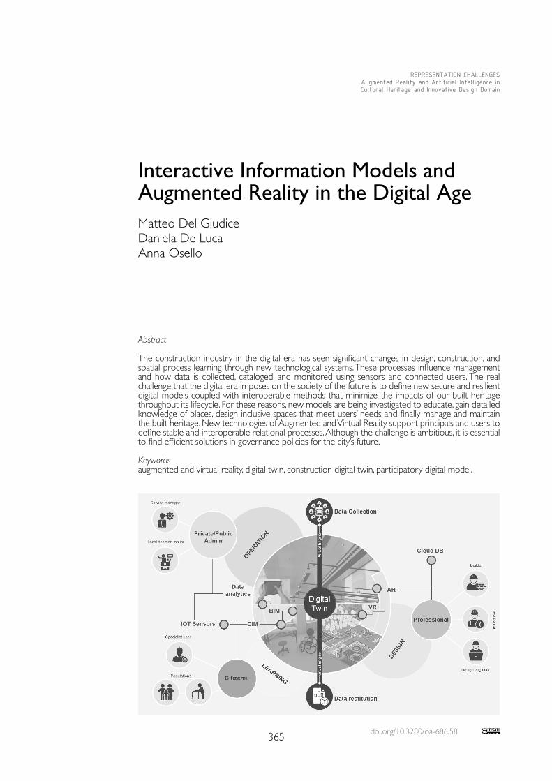
doi.org/10.3280/oa-686.58365
REPRESENTATION CHALLENGESAugmented Reality and Artificial Intelligence in Cultural Heritage and Innovative Design Domain
Abstract
The construction industry in the digital era has seen significant changes in design, construction, and spatial process learning through new technological systems. These processes influence management and how data is collected, cataloged, and monitored using sensors and connected users. The real challenge that the digital era imposes on the society of the future is to define new secure and resilient digital models coupled with interoperable methods that minimize the impacts of our built heritage throughout its lifecycle. For these reasons, new models are being investigated to educate, gain detailed knowledge of places, design inclusive spaces that meet users’ needs and finally manage and maintain the built heritage. New technologies of Augmented and Virtual Reality support principals and users to define stable and interoperable relational processes. Although the challenge is ambitious, it is essential to find efficient solutions in governance policies for the city’s future.
Keywordsaugmented and virtual reality, digital twin, construction digital twin, participatory digital model.
Interactive Information Models and Augmented Reality in the Digital Age Matteo Del Giudice Daniela De LucaAnna Osello
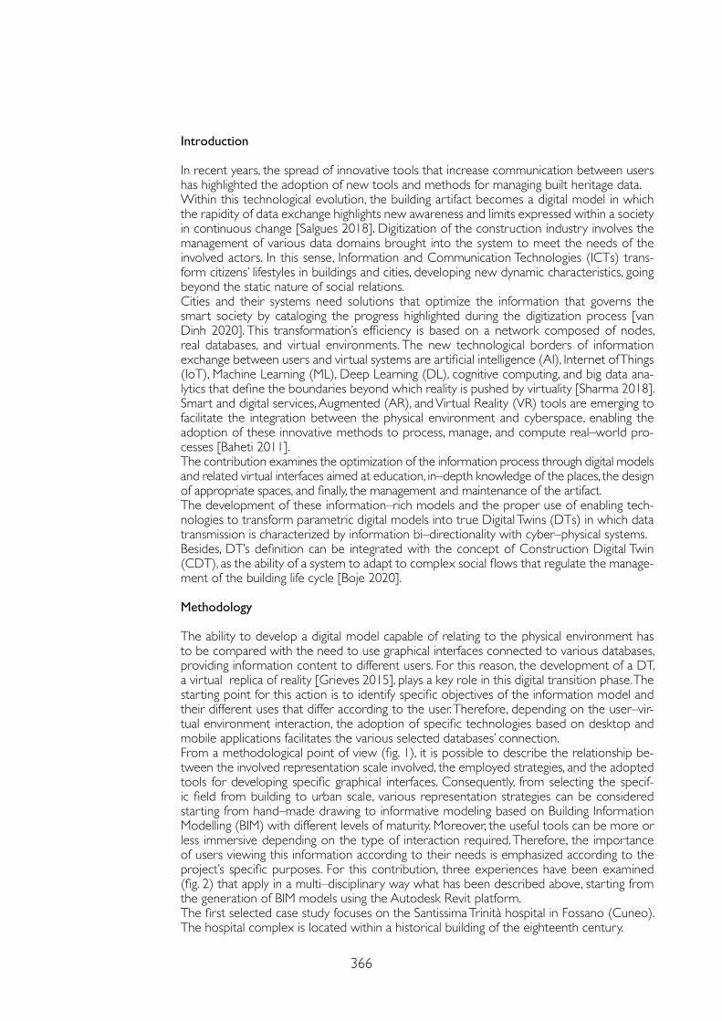
366
Introduction
In recent years, the spread of innovative tools that increase communication between users has highlighted the adoption of new tools and methods for managing built heritage data.Within this technological evolution, the building artifact becomes a digital model in which the rapidity of data exchange highlights new awareness and limits expressed within a society in continuous change [Salgues 2018]. Digitization of the construction industry involves the management of various data domains brought into the system to meet the needs of the involved actors. In this sense, Information and Communication Technologies (ICTs) trans-form citizens’ lifestyles in buildings and cities, developing new dynamic characteristics, going beyond the static nature of social relations.Cities and their systems need solutions that optimize the information that governs the smart society by cataloging the progress highlighted during the digitization process [van Dinh 2020]. This transformation’s efficiency is based on a network composed of nodes, real databases, and virtual environments. The new technological borders of information exchange between users and virtual systems are artificial intelligence (AI), Internet of Things (IoT), Machine Learning (ML), Deep Learning (DL), cognitive computing, and big data ana-lytics that define the boundaries beyond which reality is pushed by virtuality [Sharma 2018]. Smart and digital services, Augmented (AR), and Virtual Reality (VR) tools are emerging to facilitate the integration between the physical environment and cyberspace, enabling the adoption of these innovative methods to process, manage, and compute real–world pro-cesses [Baheti 2011].The contribution examines the optimization of the information process through digital models and related virtual interfaces aimed at education, in–depth knowledge of the places, the design of appropriate spaces, and finally, the management and maintenance of the artifact.The development of these information–rich models and the proper use of enabling tech-nologies to transform parametric digital models into true Digital Twins (DTs) in which data transmission is characterized by information bi–directionality with cyber–physical systems.Besides, DT’s definition can be integrated with the concept of Construction Digital Twin (CDT), as the ability of a system to adapt to complex social flows that regulate the manage-ment of the building life cycle [Boje 2020].
Methodology The ability to develop a digital model capable of relating to the physical environment has to be compared with the need to use graphical interfaces connected to various databases, providing information content to different users. For this reason, the development of a DT, a virtual replica of reality [Grieves 2015], plays a key role in this digital transition phase. The starting point for this action is to identify specific objectives of the information model and their different uses that differ according to the user. Therefore, depending on the user–vir-tual environment interaction, the adoption of specific technologies based on desktop and mobile applications facilitates the various selected databases’ connection.From a methodological point of view (fig. 1), it is possible to describe the relationship be-tween the involved representation scale involved, the employed strategies, and the adopted tools for developing specific graphical interfaces. Consequently, from selecting the specif-ic field from building to urban scale, various representation strategies can be considered starting from hand–made drawing to informative modeling based on Building Information Modelling (BIM) with different levels of maturity. Moreover, the useful tools can be more or less immersive depending on the type of interaction required. Therefore, the importance of users viewing this information according to their needs is emphasized according to the project’s specific purposes. For this contribution, three experiences have been examined (fig. 2) that apply in a multi–disciplinary way what has been described above, starting from the generation of BIM models using the Autodesk Revit platform.The first selected case study focuses on the Santissima Trinità hospital in Fossano (Cuneo). The hospital complex is located within a historical building of the eighteenth century.
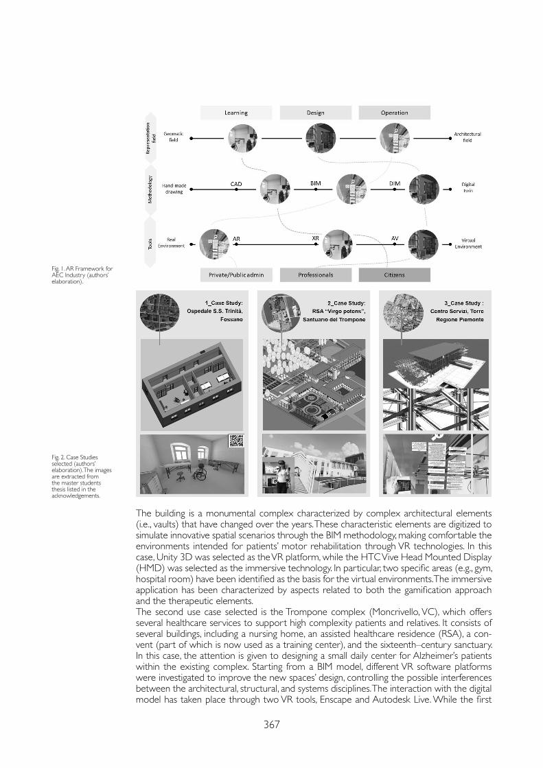
367
The building is a monumental complex characterized by complex architectural elements (i.e., vaults) that have changed over the years. These characteristic elements are digitized to simulate innovative spatial scenarios through the BIM methodology, making comfortable the environments intended for patients’ motor rehabilitation through VR technologies. In this case, Unity 3D was selected as the VR platform, while the HTC Vive Head Mounted Display (HMD) was selected as the immersive technology. In particular, two specific areas (e.g., gym, hospital room) have been identified as the basis for the virtual environments. The immersive application has been characterized by aspects related to both the gamification approach and the therapeutic elements. The second use case selected is the Trompone complex (Moncrivello, VC), which offers several healthcare services to support high complexity patients and relatives. It consists of several buildings, including a nursing home, an assisted healthcare residence (RSA), a con-vent (part of which is now used as a training center), and the sixteenth–century sanctuary. In this case, the attention is given to designing a small daily center for Alzheimer’s patients within the existing complex. Starting from a BIM model, different VR software platforms were investigated to improve the new spaces’ design, controlling the possible interferences between the architectural, structural, and systems disciplines. The interaction with the digital model has taken place through two VR tools, Enscape and Autodesk Live. While the first
Fig. 1. AR Framework for AEC Industry (authors’ elaboration).
Fig. 2. Case Studies selected (authors’ elaboration). The images are extracted from the master students thesis listed in the acknowledgements.
368
allows you to navigate within the space even before the projects are done, implementing changes in real–time through HMD devices, the second enables to query the model’s com-ponents by displaying its alphanumeric properties. The third case study is the service center of the single headquarters of the Piedmont Region (Turin). It is a five–story above–ground building with a lobby and a nursery on the ground floor. The information management for the operational step of the equipments, has been studied through the development of an AR application for mobile devices, based on the Unity 3D plat-form integrated with Apple ARKit. In this way, the specialized technician can visualize information useful for the localization and maintenance of plant visible and hidden components by storing and updating data exploiting the links with external databases. The tested methodology acquires various aspects according to the field in which it is applied: as an example, in the construction phase, the operator can verify the reliability of the model by comparing it with the shop drawings.
Results
The different use cases selected for this paper highlighted how the digital evolution imposes different virtual models but also across the growing needs of the interactive user.In this sense, the connection of the three use cases defines the right procedure for opti-mal human–building interaction, overcoming interconnected systems’ limitations. The results obtained from these experiences allow describing the first image of DT aimed at both the collection and the enrichment of data required for a participatory DT. This definition imple-ments the digital twin features based on physical objects, virtual models, and connections by including user interaction as the fourth main component for its implementation. A digital model was obtained as a real Construction and participatory DT from the analysis of the real environments (fig. 3). The next step will be implementing AI and ML techniques by using standard and open–source data exchange formats to increase its level of maturity. Unfortunately, to date, many obstacles do not allow for the best integration of different systems and different data sources with real user needs. The applications developed are considered a prototype useful to raise some thoughts about developing a DT.In the first case, the user interacts with the virtual environment by composing a virtual puzzle and using motion sensors and immersive HMD devices. The advantage the select-ed technology consists on medical progress monitoring during rehabilitation, learning and memorizing shapes, colors, and positions. Currently, data automation is the real critical issue, which is fixed through web protocols. The second use case highlights the potential of par-ticipatory design with BIM through VR platforms to support decision–making.The most critical issue found concerns the loss of data due to proprietary viewers who have some limitations in returning answers in real–time. The following aspects are evident through the immersive experience: i) understanding of space and relationship with pre–ex-istence; ii) reconstruction of paths and memorization of objects and settings; iii) developing a sensory environment oriented to Alzheimer’s patients. The AR application developed with the third case study also highlighted the potentialities of overlaying digital content in the real environment. Currently the model georeferencing with the reality is one of the major crit-icalities that, in this case, has been solved by inserting a fixed positioning point. About data updating, further developments are required according to the challenge of data–sharing.
Conclusions
The AEC industry is facing a transition phase in which new technologies highlight the current gaps that traditional systems can no longer fill. Using ICTs and Augmented and Virtual Reality systems as tools for participatory design, learning and operations lead to a new vision of work-ing and thinking about the built environment. In this way, the construction industry is educated better to meet human beings’ needs and an intelligent city. Through the experience offered by the proposed use cases, the paper evaluates strenghts and weaknesses of the relation be-tween virtual and physical environments world, considering different degrees of immersion. Although the interaction between the digital and physical worlds is not yet optimal, artificial
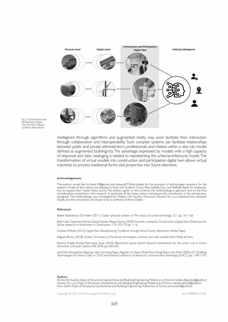
369
Fig. 3. Construction and Participatory Digital Twin for AEC Industry (authors’ elaboration).
intelligence through algorithms and augmented reality may soon facilitate their interaction through collaboration and interoperability. Such complex systems can facilitate relationships between public and private administrators, professionals, and citizens within a new city model defined as augmented building/city. The advantage expressed by models with a high capacity of response and data cataloging is related to representing the urban/architectural model. The transformation of virtual models into construction and participation digital twin allows virtual machines to process traditional forms and properties into future elements.
References
Baheti Radhakisan, Gill Helen (2011). Cyber–physical systems. In The impact of control technology, 12.1, pp. 161-166.
Boje Calin, Guerriero Annie, Kubicki Sylvain, Rezgui Yacine (2020). Towards a semantic Construction Digital Twin: Directions for future research. In Automation in Construction, 114, 103179, pp. 1-16.
Grieves Michael (2015). Digital Twin: Manufacturing Excellence through Virtual Factory Replication. White Paper.
Salgues Bruno (2018). Society 5.0: industry of the future, technologies, methods and tools. London: John Wiley & Sons.
Sharma Pradip Kumar, Park Jong Hyuk (2018). Blockchain based hybrid network architecture for the smart city. In Future Generation Computer Systems, 86, 2018, pp. 650-655.
Van Dinh Dzung, Yoon Byeong–Nam, Le Hung Ngoc, Nguyen Uy Quoc, Phan Khoa Dang, Pham Lam Dinh (2020). ICT Enabling Technologies for Smart Cities. In 2020 International Conference on Advanced Communication Technology (ICACT), pp. 1180-1192.
Acknowledgements
The authors would like to thank VR@polito and drawingTOthefuturelab for the provision of technologies necessary for the research. Finally, all the authors are pleased to thank the students Chiara Riba, Isabella Dusi, and Raffaele Basile for authoriza-tion to expose their master thesis works. The authors agree on the contents, the methodological approach and on the final considerations presented in this research. In particular, all the three authors introduced the contribution in the introduction paragraph. The methodology was investigated by Matteo Del Giudice. Moreover, Daniela De Luca explained the obtained results, and the conclusions are meant to be a synthesis of Anna Osello.
Copyright © 2021 by FrancoAngeli s.r.l. Milano, Italy Isbn 9788835125280
AuthorsMatteo Del Giudice, Dept. of Structural, Geotechnical and Building Engineering, Politecnico di Torino, [email protected] De Luca, Dept. of Structural, Geotechnical and Building Engineering, Politecnico di Torino, [email protected] Osello, Dept. of Structural, Geotechnical and Building Engineering, Politecnico di Torino, [email protected]

doi.org/10.3280/oa-686.59371
REPRESENTATION CHALLENGESAugmented Reality and Artificial Intelligence in Cultural Heritage and Innovative Design Domain
Abstract
This research aims to deal with the theme of the survey applied to the BIM methodology in cultural heritage; in particular on those buildings that, although from different periods and construction tech-nologies, require energy requalification. The study focuses on two cases in Umbria: Borgo Lizori, a characteristic historical settlement located along the Assisi–Spoleto olive grove, and the Palazzetto dello Sport in Bastia Umbra, a post–modern building designed by arch. Leoncilli Massi.
Keywordscultural heritage, energy efficiency, BIM.
Survey and BIM for Energy Upgrading. Two Case Study Marco FilippucciFabio BianconiMichela Meschini
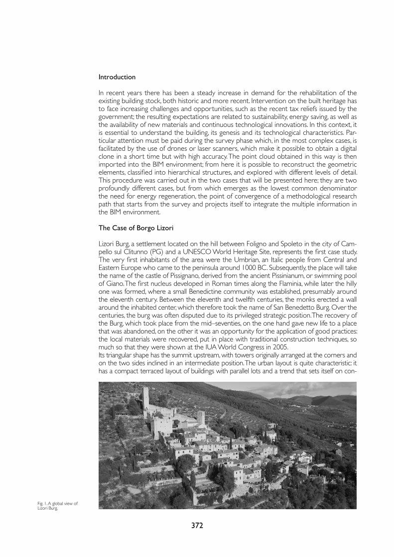
372
Introduction
In recent years there has been a steady increase in demand for the rehabilitation of the existing building stock, both historic and more recent. Intervention on the built heritage has to face increasing challenges and opportunities, such as the recent tax reliefs issued by the government; the resulting expectations are related to sustainability, energy saving, as well as the availability of new materials and continuous technological innovations. In this context, it is essential to understand the building, its genesis and its technological characteristics. Par-ticular attention must be paid during the survey phase which, in the most complex cases, is facilitated by the use of drones or laser scanners, which make it possible to obtain a digital clone in a short time but with high accuracy. The point cloud obtained in this way is then imported into the BIM environment; from here it is possible to reconstruct the geometric elements, classified into hierarchical structures, and explored with different levels of detail. This procedure was carried out in the two cases that will be presented here; they are two profoundly different cases, but from which emerges as the lowest common denominator the need for energy regeneration, the point of convergence of a methodological research path that starts from the survey and projects itself to integrate the multiple information in the BIM environment.
The Case of Borgo Lizori
Lizori Burg, a settlement located on the hill between Foligno and Spoleto in the city of Cam-pello sul Clitunno (PG) and a UNESCO World Heritage Site, represents the first case study. The very first inhabitants of the area were the Umbrian, an Italic people from Central and Eastern Europe who came to the peninsula around 1000 BC. Subsequently, the place will take the name of the castle of Pissignano, derived from the ancient Pissinianum, or swimming pool of Giano. The first nucleus developed in Roman times along the Flaminia, while later the hilly one was formed, where a small Benedictine community was established, presumably around the eleventh century. Between the eleventh and twelfth centuries, the monks erected a wall around the inhabited center, which therefore took the name of San Benedetto Burg. Over the centuries, the burg was often disputed due to its privileged strategic position. The recovery of the Burg, which took place from the mid–seventies, on the one hand gave new life to a place that was abandoned, on the other it was an opportunity for the application of good practices: the local materials were recovered, put in place with traditional construction techniques, so much so that they were shown at the IUA World Congress in 2005.Its triangular shape has the summit upstream, with towers originally arranged at the corners and on the two sides inclined in an intermediate position. The urban layout is quite characteristic: it has a compact terraced layout of buildings with parallel lots and a trend that sets itself on con-
Fig. 1. A global view of Lizori Burg.
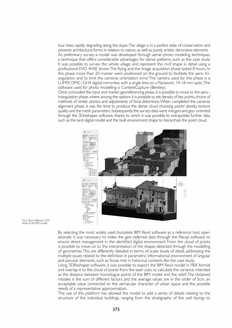
373
By selecting the most widely used Autodesk BIM Revit software as a reference tool, oper-ationally it was necessary to index the geo–referred data through the Recap software to ensure direct management in the identified digital environment. From the cloud of points is possible to move on to the interpretation of the shapes detected through the modelling of geometries. This are differently detailed in terms of scalar levels of detail, addressing the multiple issues related to the definition in parametric informational environment of singular and peculiar elements, such as those met in historical contexts like the case study.Using 3DReshaper software, it was possible to export the BIM Revit model in FBX format and overlap it to the cloud of points from the laser scan, to calculate the variance, intended as the distance between homologue points of the BIM model and the relief. The obtained mistake is the sum of different factors and the average values are in the order of 5cm, an acceptable value connected to the vernacular character of urban space and the possible needs of a representative approximation.The use of this platform has allowed the model to add a series of details relating to the structure of the individual buildings, ranging from the stratigraphy of the wall facings to
Fig. 2. Revit, different LOD levels of the BIM model.
tour lines, rapidly degrading along the slope. The village is in a perfect state of conservation and presents architectural forms in relation to nature, as well as purely artistic decorative elements.As preliminary survey, a model was developed through aerial–photo modeling techniques, a technique that offers considerable advantages for dense patterns, such as the case study. It was possible to survey the whole village, and represent the roof shape in detail using a professional EVO 4HSE drone. The flying and the image acquisition phase lasted 8 hours. In this phase more than 20 marker were positioned on the ground to facilitate the aero–tri-angulation and to limit the cameras orientation error. The camera used for this phase is a LUMIX DMC–GH4 digital mirrorless with a single lens, on a Panasonic 14-18 mm optic. The software used for photo modelling is ContextCapture (Bentley).Once concluded the input and marker georeferencing phase, it is possible to move to the aero–triangulation phase, where among the options it is possible to set: density of key points, choice of methods of similar photos and adjustments of focal distortions. When completed the cameras alignment phase, it was the time to produce the dense cloud choosing points’ density, texture quality and the mesh parameters. Subsequently, the survey data were merged and geo–oriented through the 3Dreshaper software, thanks to which it was possible to extrapolate further data such as the land digital model and the built environment shape to hierarchize the point cloud.
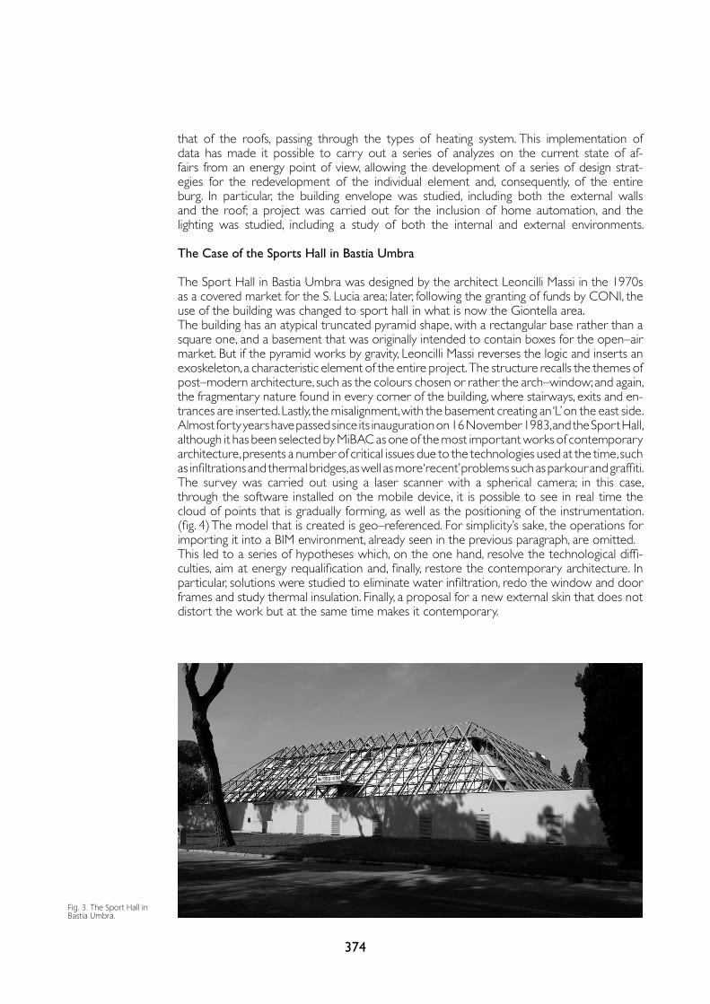
374
that of the roofs, passing through the types of heating system. This implementation of data has made it possible to carry out a series of analyzes on the current state of af-fairs from an energy point of view, allowing the development of a series of design strat-egies for the redevelopment of the individual element and, consequently, of the entire burg. In particular, the building envelope was studied, including both the external walls and the roof; a project was carried out for the inclusion of home automation, and the lighting was studied, including a study of both the internal and external environments.
The Case of the Sports Hall in Bastia Umbra
The Sport Hall in Bastia Umbra was designed by the architect Leoncilli Massi in the 1970s as a covered market for the S. Lucia area; later, following the granting of funds by CONI, the use of the building was changed to sport hall in what is now the Giontella area.The building has an atypical truncated pyramid shape, with a rectangular base rather than a square one, and a basement that was originally intended to contain boxes for the open–air market. But if the pyramid works by gravity, Leoncilli Massi reverses the logic and inserts an exoskeleton, a characteristic element of the entire project. The structure recalls the themes of post–modern architecture, such as the colours chosen or rather the arch–window; and again, the fragmentary nature found in every corner of the building, where stairways, exits and en-trances are inserted. Lastly, the misalignment, with the basement creating an ‘L’ on the east side. Almost forty years have passed since its inauguration on 16 November 1983, and the Sport Hall, although it has been selected by MiBAC as one of the most important works of contemporary architecture, presents a number of critical issues due to the technologies used at the time, such as infiltrations and thermal bridges, as well as more ‘recent’ problems such as parkour and graffiti. The survey was carried out using a laser scanner with a spherical camera; in this case, through the software installed on the mobile device, it is possible to see in real time the cloud of points that is gradually forming, as well as the positioning of the instrumentation. (fig. 4) The model that is created is geo–referenced. For simplicity’s sake, the operations for importing it into a BIM environment, already seen in the previous paragraph, are omitted. This led to a series of hypotheses which, on the one hand, resolve the technological diffi-culties, aim at energy requalification and, finally, restore the contemporary architecture. In particular, solutions were studied to eliminate water infiltration, redo the window and door frames and study thermal insulation. Finally, a proposal for a new external skin that does not distort the work but at the same time makes it contemporary.
Fig. 3. The Sport Hall in Bastia Umbra.
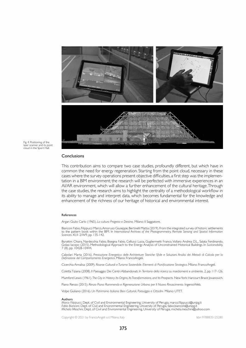
375
References
Argan Giulio Carlo (1965). La cultura Progetto e Destino. Milano: Il Saggiatore.
Bianconi Fabio, Filippucci Marco, Amoruso Giuseppe, Bertinelli Mattia (2019). From the integrated survey of historic settlements to the pattern book within the BIM. In International Archives of the Photogrammetry, Remote Sensing and Spatial Information Sciences XLII–2/W9, pp. 135-142.
Burattini Chiara, Nardecchia Fabio, Bisegna Fabio, Cellucci Lucia, Gugliermetti Franco, Vollaro Andrea D.L., Salata Ferdinando, Golasi Iacopo (2015). Methodological Approach to the Energy Analysis of Unconstrained Historical Buildings. In Sustainability, 7 (8), pp. 10428-10444.
Calzolari Marta (2016). Prestazione Energetica delle Architetture Storiche: Sfide e Soluzioni. Analisi dei Metodi di Calcolo per la Definizione del Comportamento Energetico. Milano: FrancoAngeli.
Cicerchia Annalisa (2009). Risorse Culturali e Turismo Sostenibile. Elementi di Pianificazione Strategica. Milano: FrancoAngeli. Coletta Tiziana (2008). Il Paesaggio Dei Centri Abbandonati. In Territorio della ricerca su insediamenti e ambiente, 2, pp. 117-126.
Mumford Lewis (1961). The City in History: Its Origins, Its Transformations, and Its Prospects. New York: Harcourt Brace Jovanovich.
Piano Renzo (2015). Renzo Piano: Rammendo e Rigenerazione Urbana per Il Nuovo Rinascimento. IngenioWeb.
Volpe Giuliano (2016). Un Patrimonio Italiano: Beni Culturali, Paesaggio e Cittadini. Milano: UTET.
Fig. 4. Positioning of the laser scanner and its point cloud in the Sport Hall.
Conclusions
This contribution aims to compare two case studies, profoundly different, but which have in common the need for energy regeneration. Starting from the point cloud, necessary in these cases where the survey operations present objective difficulties, a first step was the implemen-tation in a BIM environment; the research will be perfected with immersive experiences in an AI/AR environment, which will allow a further enhancement of the cultural heritage. Through the case studies, the research aims to highlight the centrality of a methodological workflow in its ability to manage and interpret data, which becomes fundamental for the knowledge and enhancement of the richness of our heritage of historical and environmental interest.
Copyright © 2021 by FrancoAngeli s.r.l. Milano, Italy Isbn 9788835125280
AuthorsMarco Filippucci, Dept. of Civil and Environmental Engineering, University of Perugia, [email protected] Fabio Bianconi, Dept. of Civil and Environmental Engineering, University of Perugia, [email protected] Meschini, Dept. of Civil and Environmental Engineering, University of Perugia, [email protected]

doi.org/10.3280/oa-686.60377
REPRESENTATION CHALLENGESAugmented Reality and Artificial Intelligence in Cultural Heritage and Innovative Design Domain
Abstract
Masonry railway bridges represent a historical built heritage to be preserved. This contribution pro-poses a new methodological approach for health assessment of masonry railway bridges based on the definition of image–based and AI–driven survey protocols useful for the creation of semi–automated H–BIM models. To do this, a heuristic approach is required with the integrated combination of tech-niques and methodologies belonging to different fields. As case studies the masonry bridges of the sicilian Circumetnea railway are chosen.
Keywordsrailway masonry arch bridge, digital survey, archival research, artificial intelligence, GANs.
A Proposal for Masonry Bridge Health Assessment Using AI and SemanticsRaissa Garozzo
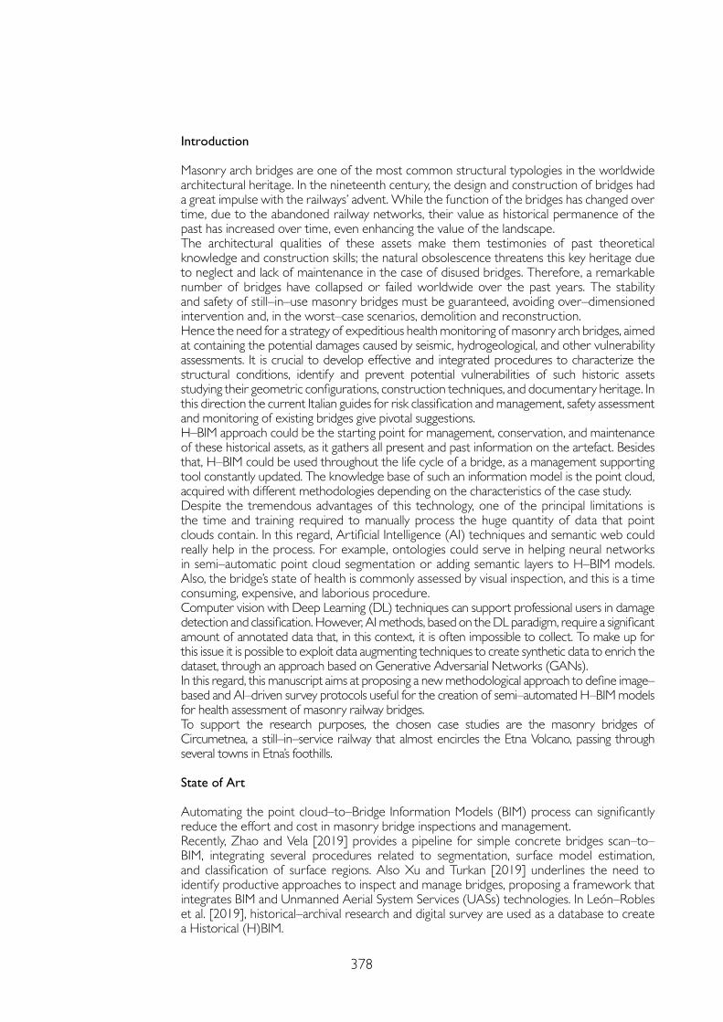
378
Introduction
Masonry arch bridges are one of the most common structural typologies in the worldwide architectural heritage. In the nineteenth century, the design and construction of bridges had a great impulse with the railways’ advent. While the function of the bridges has changed over time, due to the abandoned railway networks, their value as historical permanence of the past has increased over time, even enhancing the value of the landscape. The architectural qualities of these assets make them testimonies of past theoretical knowledge and construction skills; the natural obsolescence threatens this key heritage due to neglect and lack of maintenance in the case of disused bridges. Therefore, a remarkable number of bridges have collapsed or failed worldwide over the past years. The stability and safety of still–in–use masonry bridges must be guaranteed, avoiding over–dimensioned intervention and, in the worst–case scenarios, demolition and reconstruction. Hence the need for a strategy of expeditious health monitoring of masonry arch bridges, aimed at containing the potential damages caused by seismic, hydrogeological, and other vulnerability assessments. It is crucial to develop effective and integrated procedures to characterize the structural conditions, identify and prevent potential vulnerabilities of such historic assets studying their geometric configurations, construction techniques, and documentary heritage. In this direction the current Italian guides for risk classification and management, safety assessment and monitoring of existing bridges give pivotal suggestions. H–BIM approach could be the starting point for management, conservation, and maintenance of these historical assets, as it gathers all present and past information on the artefact. Besides that, H–BIM could be used throughout the life cycle of a bridge, as a management supporting tool constantly updated. The knowledge base of such an information model is the point cloud, acquired with different methodologies depending on the characteristics of the case study. Despite the tremendous advantages of this technology, one of the principal limitations is the time and training required to manually process the huge quantity of data that point clouds contain. In this regard, Artificial Intelligence (AI) techniques and semantic web could really help in the process. For example, ontologies could serve in helping neural networks in semi–automatic point cloud segmentation or adding semantic layers to H–BIM models. Also, the bridge’s state of health is commonly assessed by visual inspection, and this is a time consuming, expensive, and laborious procedure. Computer vision with Deep Learning (DL) techniques can support professional users in damage detection and classification. However, AI methods, based on the DL paradigm, require a significant amount of annotated data that, in this context, it is often impossible to collect. To make up for this issue it is possible to exploit data augmenting techniques to create synthetic data to enrich the dataset, through an approach based on Generative Adversarial Networks (GANs). In this regard, this manuscript aims at proposing a new methodological approach to define image–based and AI–driven survey protocols useful for the creation of semi–automated H–BIM models for health assessment of masonry railway bridges. To support the research purposes, the chosen case studies are the masonry bridges of Circumetnea, a still–in–service railway that almost encircles the Etna Volcano, passing through several towns in Etna’s foothills.
State of Art
Automating the point cloud–to–Bridge Information Models (BIM) process can significantly reduce the effort and cost in masonry bridge inspections and management. Recently, Zhao and Vela [2019] provides a pipeline for simple concrete bridges scan–to–BIM, integrating several procedures related to segmentation, surface model estimation, and classification of surface regions. Also Xu and Turkan [2019] underlines the need to identify productive approaches to inspect and manage bridges, proposing a framework that integrates BIM and Unmanned Aerial System Services (UASs) technologies. In León–Robles et al. [2019], historical–archival research and digital survey are used as a database to create a Historical (H)BIM.
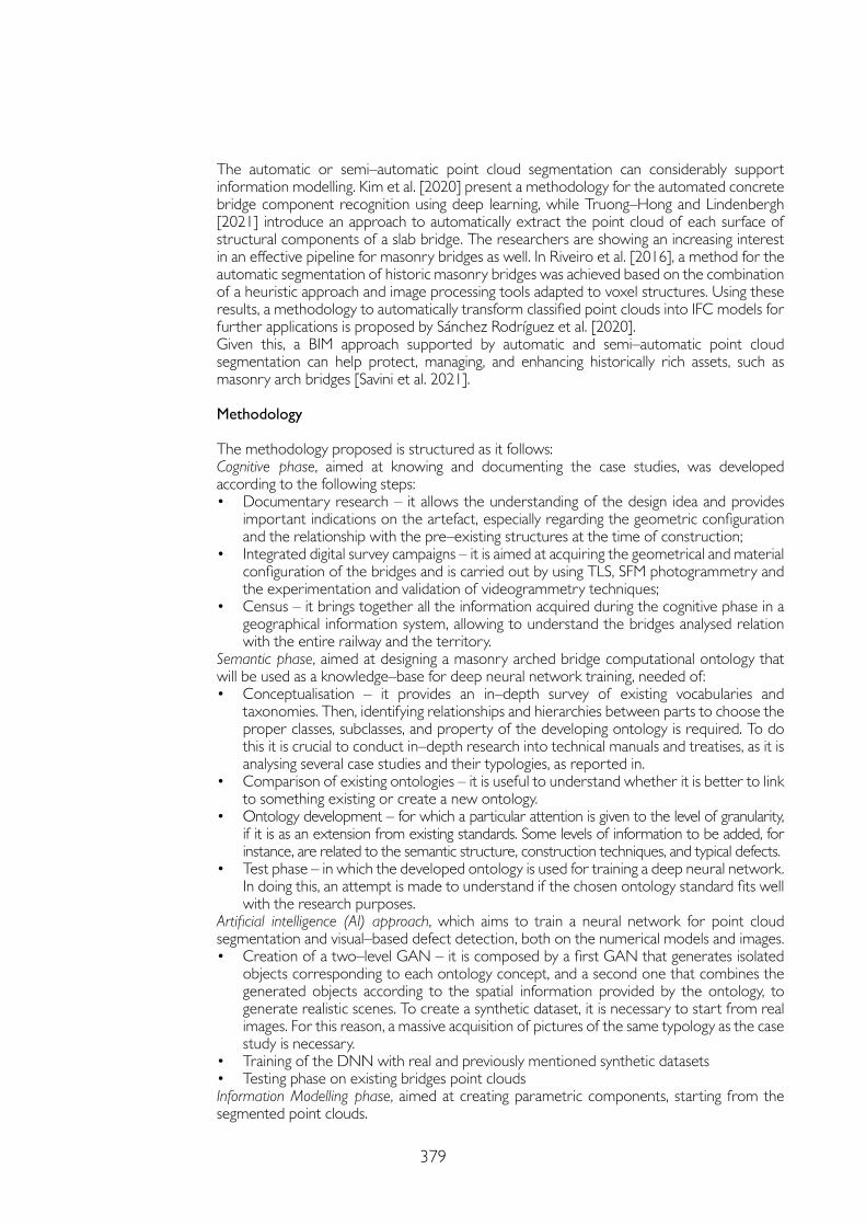
379
The automatic or semi–automatic point cloud segmentation can considerably support information modelling. Kim et al. [2020] present a methodology for the automated concrete bridge component recognition using deep learning, while Truong–Hong and Lindenbergh [2021] introduce an approach to automatically extract the point cloud of each surface of structural components of a slab bridge. The researchers are showing an increasing interest in an effective pipeline for masonry bridges as well. In Riveiro et al. [2016], a method for the automatic segmentation of historic masonry bridges was achieved based on the combination of a heuristic approach and image processing tools adapted to voxel structures. Using these results, a methodology to automatically transform classified point clouds into IFC models for further applications is proposed by Sánchez Rodríguez et al. [2020].Given this, a BIM approach supported by automatic and semi–automatic point cloud segmentation can help protect, managing, and enhancing historically rich assets, such as masonry arch bridges [Savini et al. 2021].
Methodology
The methodology proposed is structured as it follows:Cognitive phase, aimed at knowing and documenting the case studies, was developed according to the following steps:• Documentary research – it allows the understanding of the design idea and provides
important indications on the artefact, especially regarding the geometric configuration and the relationship with the pre–existing structures at the time of construction;
• Integrated digital survey campaigns – it is aimed at acquiring the geometrical and material configuration of the bridges and is carried out by using TLS, SFM photogrammetry and the experimentation and validation of videogrammetry techniques;
• Census – it brings together all the information acquired during the cognitive phase in a geographical information system, allowing to understand the bridges analysed relation with the entire railway and the territory.
Semantic phase, aimed at designing a masonry arched bridge computational ontology that will be used as a knowledge–base for deep neural network training, needed of:• Conceptualisation – it provides an in–depth survey of existing vocabularies and
taxonomies. Then, identifying relationships and hierarchies between parts to choose the proper classes, subclasses, and property of the developing ontology is required. To do this it is crucial to conduct in–depth research into technical manuals and treatises, as it is analysing several case studies and their typologies, as reported in.
• Comparison of existing ontologies – it is useful to understand whether it is better to link to something existing or create a new ontology.
• Ontology development – for which a particular attention is given to the level of granularity, if it is as an extension from existing standards. Some levels of information to be added, for instance, are related to the semantic structure, construction techniques, and typical defects.
• Test phase – in which the developed ontology is used for training a deep neural network. In doing this, an attempt is made to understand if the chosen ontology standard fits well with the research purposes.
Artificial intelligence (AI) approach, which aims to train a neural network for point cloud segmentation and visual–based defect detection, both on the numerical models and images. • Creation of a two–level GAN – it is composed by a first GAN that generates isolated
objects corresponding to each ontology concept, and a second one that combines the generated objects according to the spatial information provided by the ontology, to generate realistic scenes. To create a synthetic dataset, it is necessary to start from real images. For this reason, a massive acquisition of pictures of the same typology as the case study is necessary.
• Training of the DNN with real and previously mentioned synthetic datasets• Testing phase on existing bridges point cloudsInformation Modelling phase, aimed at creating parametric components, starting from the segmented point clouds.
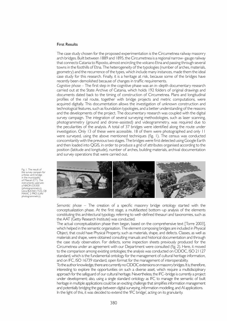
380
First Results
The case study chosen for the proposed experimentation is the Circumetnea railway masonry arch bridges. Built between 1889 and 1895, the Circumetnea is a regional narrow–gauge railway that connects Catania to Riposto, almost encircling the volcano Etna and passing through several towns in the foothills of Etna. The heterogeneity of the typologies (number of arches, materials, geometry) and the recurrence of the types, which include many instances, made them the ideal case study for this research. Finally, it is a heritage at risk, because some of the bridges have recently been demolished because of changes in traffic requirements.Cognitive phase – The first step in the cognitive phase was an in–depth documentary research carried out at the State Archive of Catania, which holds 192 folders of original drawings and documents dated back to the timing of construction of Circumetnea. Plans and longitudinal profiles of the rail route, together with bridge projects and metric computations, were acquired digitally. This documentation allows the investigation of unknown construction and technological features, such as foundation typologies, and a better understanding of the reasons and the developments of the project. The documentary research was coupled with the digital survey campaign. The integration of several surveying methodologies, such as laser scanning, photogrammetry (ground and drone–assisted) and videogrammetry, was required due to the peculiarities of the analysis. A total of 37 bridges were identified along the route under investigation. Only 13 of these were accessible. 18 of them were photographed and only 11 were surveyed, using the above mentioned techniques (fig. 1). The census was conducted concomitantly with the previous two stages. The bridges were first detected using Google Earth and then loaded into QGIS, in order to produce a grid of attributes organised according to the position (latitude and longitude), number of arches, building materials, archival documentation and survey operations that were carried out.
Fig. 1. The result of the survey campain for a three–arch bridge in the municipality of Mascali (CT). The instruments used are: a NIKON D5300 (photogrammetry), Leica BLK360 (TLS), DJI MAVIC 2 PRO (UAV photogrammetry).
Semantic phase – The creation of a specific masonry bridge ontology started with the conceptualization phase. At the first stage, a multifaceted bottom–up analysis of the elements constituting this architectural typology, referring to well–defined thesauri and taxonomies, such as the AAT (Getty Research Institute) was conducted. The actual conceptualization phase then began, based on the comprehensive text [Torre 2003], which helped in the semantic organisation. The element composing bridges are included in Physical Object, that could have Physical Property, such as materials, shape, and defects. Classes, as well as materials and shape, were obtained consulting manuals and historical documentation and through the case study observation. For defects, some inspection sheets previously produced for the Circumetnea under an agreement with our Department were consulted (fig. 2). Here, it moved to the comparison among existing ontologies; the analysis was conducted on CIDOC, ISO 21127 standard, which is the fundamental ontology for the management of cultural heritage information, and on IFC, ISO 16739 standard, open format for the management of interoperability. To the author knowledge, there are currently no CIDOC extensions on masonry bridges. It is, therefore, interesting to explore the opportunities on such a diverse asset, which require a multidisciplinary approach for the safeguard of our cultural heritage. Nevertheless, the IFC–bridge is currently a project under development; also, using a single standard ontology as IFC to manage the semantic of built heritage in multiple applications could be an exciting challenge that simplifies information management and potentially bridging the gap between digital surveying, information modelling, and AI applications. In the light of this, it was decided to extend the ‘IFC bridge’, acting on its granularity.
381
References
Kim Hyunjun, Yoon Jinyoung, Sim Sung–Han (2020). Automated bridge component recognition from point clouds using deep learning. In Structural Control and Health Monitoring, 27 (9), pp. 1-13. León–Robles Carlos A., Reinoso–Gordo Juan F., González–Quiñones Juan J. (2019). Heritage Building Information Modeling (H–BIM) Applied to a Stone Bridge. In ISPRS International Journal of Geo–Information, 8 (3), 121, pp. 1-14.
Riveiro Belen, DeJong Matthew J., Conde Borja (2016). Automated processing of large point clouds for structural health monitoring of masonry arch bridges. In Automation in Construction, 72, pp. 258-268.
Sánchez Rodríguez Ana, Esserb Sebastian, Abualdenienb Jimmy, Borrmannb Andre, Riveiro Belén (2020). From point cloud to IFC: A masonry arch bridge case study. In Ungureanu Lucian Constantin, Hartmann Timo (eds.). 27th International workshop on intelligent computing in engineering. Berlin: Universitätsverlag der TU Berlin.
Torre Camilla (2003). Ponti in muratura: dizionario storico–tecnologico. Firenze: Alinea.
Truong–Hong Linh, Lindenbergh Roderik (2021). Extracting Bridge Components from a Laser Scanning Point Cloud. In Toledo Santos Eduardo, Scheer Sergio (eds.). Proceedings of the 18th International Conference on Computing in Civil and Building Engineering. Cham: Springer International Publishing, pp. 721-739.
Xu Yiye, Turkan Yelda (2019). Bridge Inspection Using Bridge Information Modeling (BrIM) and Unmanned Aerial System (UAS). In Mutis Ivan, Hartmann, Timo (eds.). Advances in Informatics and Computing in Civil and Construction Engineering. Cham: Springer International Publishing, pp. 617-624.
Zhao Yi–Pu, Vela Patricio A. (2019). Scan2BrIM: IFC Model Generation of Concrete Bridges from Point Clouds. In Computing in Civil Engineering 2019. ASCE International Conference on Computing in Civil Engineering, Atlanta: American Society of Civil Engineers, pp. 455-463.
Fig. 2. The conceptualization schema (on the left); the detail of the defects developed part (on the right).
AI approach – At this early stage of the research, the necessary material for the creation of the synthetic dataset was acquired. A masonry arch bridge dataset was collected by the web, consisting of 10.446 images of 3.000 masonry arch bridges. These data were built using a web scraping technique on Structurae.net, an international database and gallery of structures. Data collection was a key point in the training process, as a poorly built dataset could lead to bad performances or prevent the GAN model from learning. After images were scraped it took several days of manual data cleaning, erasing bad quality images, to obtain the final dataset used for the training. Images of aqueducts, drawings and plans, images with altered colouring, images that did not represent significant elements of bridges (such as statues and, more generally, decorative elements) were removed from the dataset. The images left after cleaning operations is a total of 7434 images.
Conclusions and Future Development
The results obtained at this stage of the research are encouraging, the conceptual formalization of the ontology added a new layer of knowledge to this valuable heritage. The experimentation will continue focusing on the integration of the ontology and, consequently, on the creation of the synthetic dataset and the segmentation of the point clouds. With regard to parametric modelling, an in–depth investigation will be carried out to identify a good pipeline to maintain a strong model fit with parameterisation of its components.
Copyright © 2021 by FrancoAngeli s.r.l. Milano, Italy Isbn 9788835125280
AuthorRaissa Garozzo, Dept. of Civil Engineering and Architecture, University of Catania, [email protected]

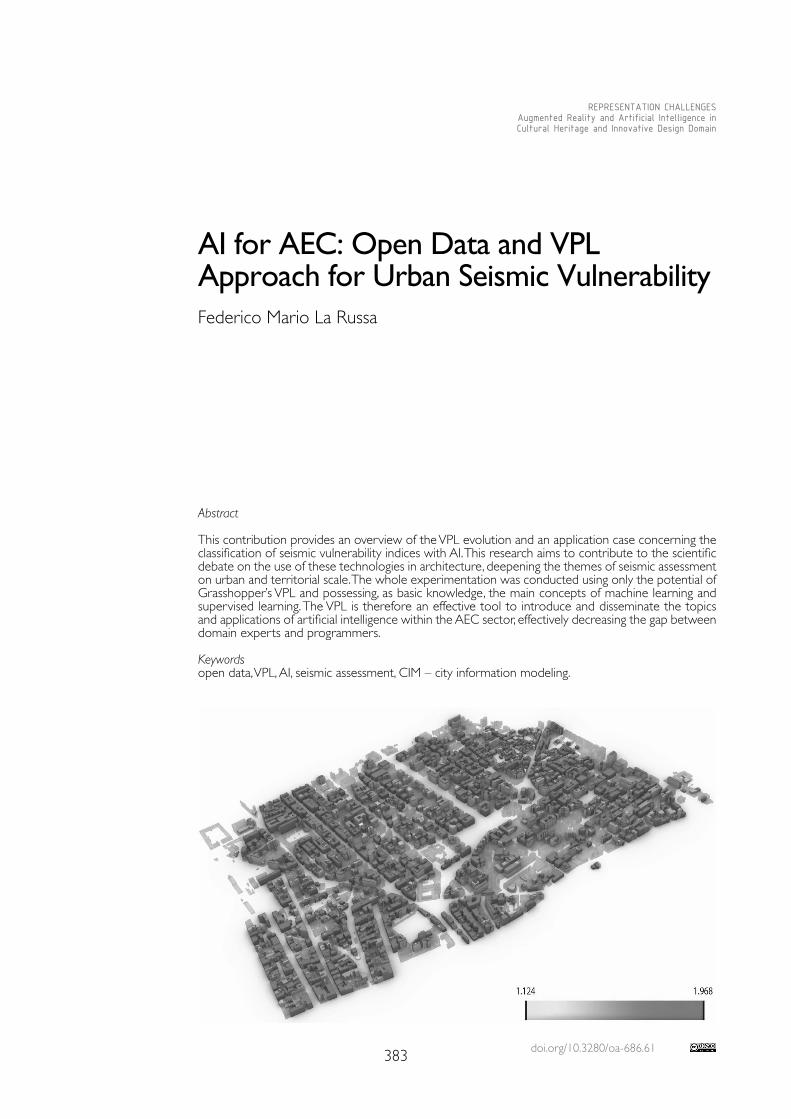
doi.org/10.3280/oa-686.61383
REPRESENTATION CHALLENGESAugmented Reality and Artificial Intelligence in Cultural Heritage and Innovative Design Domain
Abstract
This contribution provides an overview of the VPL evolution and an application case concerning the classification of seismic vulnerability indices with AI. This research aims to contribute to the scientific debate on the use of these technologies in architecture, deepening the themes of seismic assessment on urban and territorial scale. The whole experimentation was conducted using only the potential of Grasshopper’s VPL and possessing, as basic knowledge, the main concepts of machine learning and supervised learning. The VPL is therefore an effective tool to introduce and disseminate the topics and applications of artificial intelligence within the AEC sector, effectively decreasing the gap between domain experts and programmers.
Keywordsopen data, VPL, AI, seismic assessment, CIM – city information modeling.
AI for AEC: Open Data and VPL Approach for Urban Seismic VulnerabilityFederico Mario La Russa
384
Introduction
Over the past few decades, the human–machine relationship has progressed significantly due to the evolution and deployment of increasingly advanced technologies. Among all of them, Artificial Intelligence (AI) has become prevalent in several application fields, including Archi-tecture and Construction (AEC) industry. One of the main objectives in the AEC sector is to develop semi–automated solutions and workflows that can minimize repetitive and time–consuming activities, thus allowing professionals to focus on more valuable and relevant tasks.In this direction, progress had already been made through the widespread adoption of Building Information Modeling (architectural scale) and City Information Modeling (urban and territorial scale). These digital ecosystems usually do not natively possess tools and/or interfaces that allow professionals to apply AI to their models. Thus there are few applica-tions in the field and mainly developed in the academic world where it is easier (for a gener-ic domain expert) to develop computational skills and interface with other programmers. The gap between ‘designer’ and ‘programmer’ has been reduced with the introduction of Vi-sual Program Languages (VPLs) within modeling software to develop computational codes. Their ease of use lies in their visual nature and in a vocabulary of ‘components’ where the main grammatical rule consists in the relationship between input and output. The research aims to investigate what role Artificial Intelligence can play in the urban survey and City Information Modeling for the mapping of seismic vulnerability. For this purpose, the following research questions have been defined:• Is it possible through a VPL to determine the relationship that links characteristics of
building units with their corresponding seismic vulnerability?• What are the limitations and potential in using a VPL like Grasshopper (GH) for Artifi-
cial Intelligence applications?
VPL Evolution and Impact in AEC Industry: History and Reflections
In the 1980s, there was a great diffusion of personal computers, but the average user did not have programming knowledge and this limited the impact of these technologies in different sectors. Pro-grammers tried to improve the user interface but not always the efforts in this direction were successful. This condition led to researches aimed at using graphics to facilitate programming skills, leading to the birth of Visual Programming (VP) [Halbert 1984]. By eliminating syntax, the graphical method focused on workflow, making visual programming an efficient tool even for skilled program-mers. The friendliness of this method was also demonstrated by cognitive psychology, as the human brain can process visual information using two hemispheres instead of one as in other cognitive processes [Myers 1986]. In accordance with Brad Myers, VPL can be defined as a “system that allows the user to specify a program in a two (or more) dimensional fashion. Conventional textual languages are not considered two dimensional since the compiler or interpreter processes it as a long, one–dimensional stream” [Myers 1986]. The first VPLs for geometry modeling purposes can be found in the late 80’s: Prismis (nowadays known as Houdini) and ConMan [Haeberli 1988]. In the 2000s there was a new success of parametric design with a subsequent spread of program-ming tools (ex. GH, Dynamo, Marionette) for design purposes. The applications went far beyond that, as the new VPLs allowed the management of entire workflows (and data). VPLs for architecture began to be recognised as programming languages capable of facilitating operations that designers, engineers and architects used to carry out manually [Rutten 2012]. Together with the BIM revolution, these topics started to be included in the training of young architects [Boeykens et al. 2009].Compared to traditional programming, visual programming has a very favourable learning curve in the short term. However, for more complex processes, VPLs are limited because they cannot keep up with traditional programming in the long term [Zwierzycki 2017]. Thanks to the community behind VPLs such as GH, it is possible to use a series of plug–ins that increase the potential of VPLs compared to their default setup. However, there is still a gap in the long term, even if it is smaller than the previous one. In recent years, there has been an increasing amount of applications in AEC regarding the use of artificial intelligence. A variety of plug–ins have been created that allow the transition to these new practices
385
within VPLs by reducing the knowledge required to apply them. These plug–ins enable the user to use Machine Learning and Deep Learning tools, enabling increasingly complex data processing practices. Applications range from design to optimisation in production process-es. Although in some applications there is no need for textual programming implementa-tions, VPL shows limitations in the long term.
Urban Seismic Risk Assessment: the Italian Methods
In relation to seismic vulnerability assessment at the urban scale, three majors schools of thought have been identified that aim to combine expeditious surveying with accuracy in assessment. These methods differ mainly in the type of data required and the accuracy of the analysis. In particular, there is an inversely proportional relationship between analysis extension and accuracy assessment (the more accurate the assessment, the closer to the architectural scale). Statistical evaluations focus on the determination of vulnerability with reference to different main characteristics of the buildings in order to analyse their distribu-tion over the territory. Other analyses follow a mechanistic procedure where the structural behaviour is studied by simulating seismic actions on the building unit. As regards holistic analysis, it generally begins with an investigation of the urban growth of the fabric in which the building under analysis is located, then it recognises the construction components, maps the decays and analyses instabilities [Corradi et al. 2014; Caliò et al. 2018].
Methods and Workflow
Starting from existing studies on seismic vulnerability, the objective is to classify, through Artificial Intelligence mechanisms, the vulnerability of single building units using a few pa-rameters easily obtainable from qualitative visual surveys. This approach is based on the assumption that each building unit is a living organism with its own genetic code made by all its parameters. In literature we find similar approaches at the architectural scale of BIM models [Tono 2018]. Therefore, it is essential to use programming tools that allow sufficient data granularity for their treatment from the territorial to the architectural scale and the use of Artificial Intelligence tools. The use of VPL based on CAD environment allows to easily interrogate the geometries obtained from the initial data, as well as to visualize the results of the analyses through thematic three–dimensional maps. In the specific case of seismic vulnerability at urban scale, the use of VPL as modelling and analysis tool facilitates the AEC sector professionals in the design phase thanks to the available plug–ins.The research presents a workflow, developed with only the tools of visual programming (GH), to train a neural network using a dataset of seismic evaluations at the urban scale (statistical method). This approach belongs to supervised learning methods. In particular, a simple valida-tion will be performed by means of a linear regression with several variables that identifies the relationship between indices and vulnerability values thus allowing the prediction of vulnera-bility in other urban blocks. The workflow can be summarised as follows:• Downloading and importing the initial dataset;• Data processing according to the Simple Validation scheme;• Neural network training using the ‘Dodo’ plug–in;• Model validation (coefficient of determination R2);• Representation of the obtained predictions.
Case Study: the Historical Center of Palermo
To validate the proposed methodology, a dataset with the necessary characteristics was identified. The dataset comes from an open data work developed by the PalermoHub map-pers community [1]. In this work, a seismic vulnerability analysis based on statistical methods was made for more than 1500 building units in two areas of the historical centre of Palermo. The whole dataset was created exclusively on open data available online from different institutions such as ISTAT and the Municipality of Palermo [Vitrano 2017].
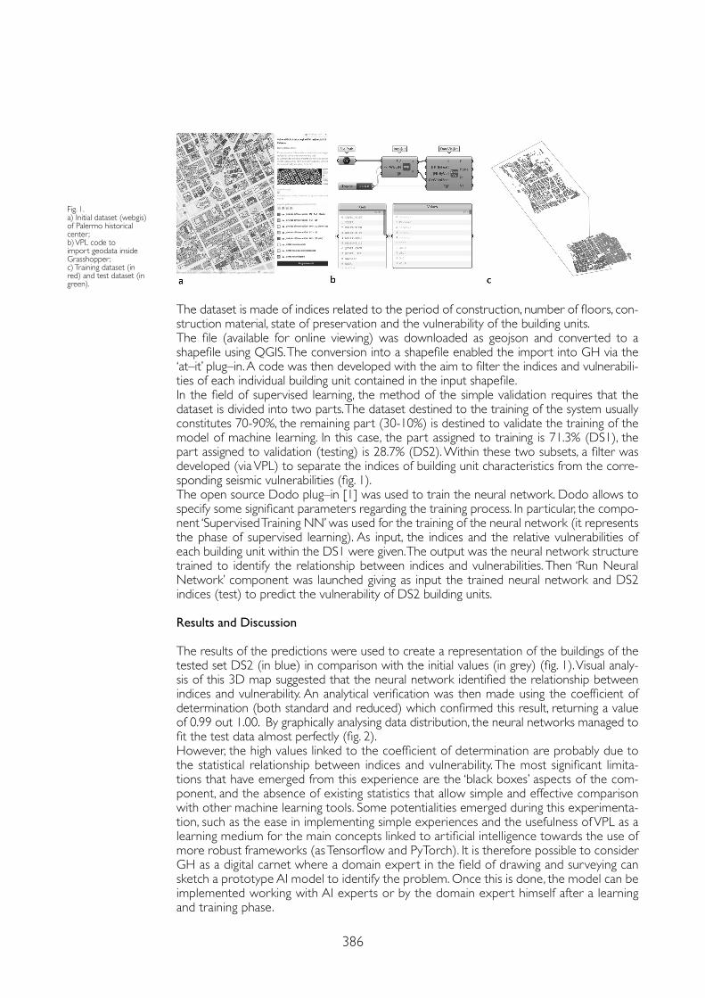
386
The dataset is made of indices related to the period of construction, number of floors, con-struction material, state of preservation and the vulnerability of the building units.The file (available for online viewing) was downloaded as geojson and converted to a shapefile using QGIS. The conversion into a shapefile enabled the import into GH via the ‘at–it’ plug–in. A code was then developed with the aim to filter the indices and vulnerabili-ties of each individual building unit contained in the input shapefile.In the field of supervised learning, the method of the simple validation requires that the dataset is divided into two parts. The dataset destined to the training of the system usually constitutes 70-90%, the remaining part (30-10%) is destined to validate the training of the model of machine learning. In this case, the part assigned to training is 71.3% (DS1), the part assigned to validation (testing) is 28.7% (DS2). Within these two subsets, a filter was developed (via VPL) to separate the indices of building unit characteristics from the corre-sponding seismic vulnerabilities (fig. 1). The open source Dodo plug–in [1] was used to train the neural network. Dodo allows to specify some significant parameters regarding the training process. In particular, the compo-nent ‘Supervised Training NN’ was used for the training of the neural network (it represents the phase of supervised learning). As input, the indices and the relative vulnerabilities of each building unit within the DS1 were given. The output was the neural network structure trained to identify the relationship between indices and vulnerabilities. Then ‘Run Neural Network’ component was launched giving as input the trained neural network and DS2 indices (test) to predict the vulnerability of DS2 building units.
Results and Discussion
The results of the predictions were used to create a representation of the buildings of the tested set DS2 (in blue) in comparison with the initial values (in grey) (fig. 1). Visual analy-sis of this 3D map suggested that the neural network identified the relationship between indices and vulnerability. An analytical verification was then made using the coefficient of determination (both standard and reduced) which confirmed this result, returning a value of 0.99 out 1.00. By graphically analysing data distribution, the neural networks managed to fit the test data almost perfectly (fig. 2).However, the high values linked to the coefficient of determination are probably due to the statistical relationship between indices and vulnerability. The most significant limita-tions that have emerged from this experience are the ‘black boxes’ aspects of the com-ponent, and the absence of existing statistics that allow simple and effective comparison with other machine learning tools. Some potentialities emerged during this experimenta-tion, such as the ease in implementing simple experiences and the usefulness of VPL as a learning medium for the main concepts linked to artificial intelligence towards the use of more robust frameworks (as Tensorflow and PyTorch). It is therefore possible to consider GH as a digital carnet where a domain expert in the field of drawing and surveying can sketch a prototype AI model to identify the problem. Once this is done, the model can be implemented working with AI experts or by the domain expert himself after a learning and training phase.
Fig. 1.a) Initial dataset (webgis) of Palermo historical center;b) VPL code to import geodata inside Grasshopper;c) Training dataset (in red) and test dataset (in green).

387
References
Boeykens Stefan, Neuckermans Herman (2013). Visual Programming in Architecture: Should Architects Be Trained as Programmers? In Tidafi Temy, Dorta Tomas (eds.). Joining Languages Cultures and Visions: CAADFutures 2009,
Caliò Ivo, Caponnetto Rossella, Ciatto Chiara, La Rosa Daniele (2018). A simplified methodology to assess seismic risk at district and building level. In Margani Giuseppe, Rodonò Gianluca, Sapienza Vincenzo (eds.). Seismic and energy renovation for sustainable cities. Gorizia: Edicom Edizioni.
Corradi Juri, De Fausti Fabrizio, Salvucci Gianluigi, Vitale Valerio (2014). Popolazione e vulnerabilità sismica. In Giornate della ricerca in ISTAT – 10-11 novembre 2014. Roma: Istat.
Haeberli Paul (1988). ConMan: a visual programming language for interactive graphics. In SIGGRAPH Comput. Graph., 22 (4), pp. 103-111.
Halbert Daniel Conrad (1984). Programming by Example. PhD Thesis. Computer Science Division, Dept. of EE&CS, University of California, Berkeley.
Myers Brad Allan (1986). Visual programming, programming by example, and program visualization: a taxonomy. In SIGCHI Bull., 17 (4), pp. 59-66.
Rutten David (2012). Programming, Conflicting Perspectives. I Eat Bugs for Breakfast. http://ieatbugsforbreakfast.wordpress.com/2012/04/01/programming-conflicting-perspectives/ (15th February 2021).
Tono Alberto (2018). BIMHOX: The Evolutionary In–formation Genes, AU Las Vegas 2018. https://www.autodesk.com/autodesk-university/class/BIMHOX-Evolutionary-Information-Genes-2018 (15th February 2021).
Vitrano Giovan Battista (2017). Mappa 3D – Vulnerabilità sismica degli edifici residenziali di Palermo. https://coseerobe.gbvitrano.it/mappa-3d-vulnerabilita-sismica-degli-edifici-residenziali-di-palermo.html (15th February 2021).
Zwierzycki Mateusz (2017). Why do Architects Code? TWF Conference 2017. https://www.youtube.com/watch?v=_4SBpq31L0M&t=1s&ab_channel=TheWayForwardCommunity (15th February 2021).
Conclusions
There are still some open questions that constitute the next steps of the research. In partic-ular, how to link the information produced in urban surveys to the classification of building types, how to predict the internal distribution pattern of building units using spatial syntax analysis (since it is not possible in many cases to access the interior spaces). Furthermore, from an economic point of view it is possible to envision a model that can support the prediction of the cost of seismic retrofit and/or demolition interventions.
Fig. 2.a) Training of the neural network with Dodo components; b) VPL code to display prediction results;Comparison of predicted (in blue) (c) vulnerability values and actual ones (in grey) (d).
Notes
[1] http://palermohub.opendatasicilia.it/ (15th February 2021).
[2] Dodo is a plug–in for Grasshopper developed by Lorenzo Greco. It is available on the online portal ‘Food4Rhino’ since 23/11/2015. Last version: 23/02/2019. Link: https://www.food4rhino.com/app/dodo (15th February 2021).
d
Copyright © 2021 by FrancoAngeli s.r.l. Milano, Italy Isbn 9788835125280
AuthorFederico Mario La Russa, Dept. of Civil Engineering and Architecture, University of Catania, [email protected]

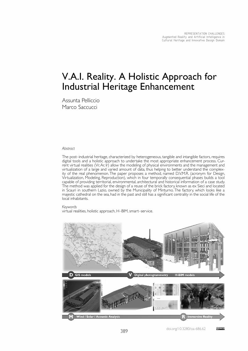
doi.org/10.3280/oa-686.62389
REPRESENTATION CHALLENGESAugmented Reality and Artificial Intelligence in Cultural Heritage and Innovative Design Domain
Abstract
The post–industrial heritage, characterized by heterogeneous, tangible and intangible factors, requires digital tools and a holistic approach to undertake the most appropriate enhancement process. Cur-rent virtual realities (Vr, Ar, Ir) allow the modeling of physical environments and the management and virtualization of a large and varied amount of data, thus helping to better understand the complex-ity of the real phenomenon. The paper proposes a method, named D.V.M.R. (acronym for Design, Virtualization, Modeling, Reproduction), which in four temporally consequential phases builds a tool capable of providing territorial, environmental, architectural and historical information of a case study. The method was applied for the design of a reuse of the brick factory, known as ex Sieci and located in Scauri in southern Lazio, owned by the Municipality of Minturno. The factory, which looks like a majestic cathedral on the sea, had in the past and still has a significant centrality in the social life of the local inhabitants.
Keywordsvirtual realities, holistic approach, H–BIM, smart–service.
V.A.I. Reality. A Holistic Approach for Industrial Heritage Enhancement Assunta PelliccioMarco Saccucci
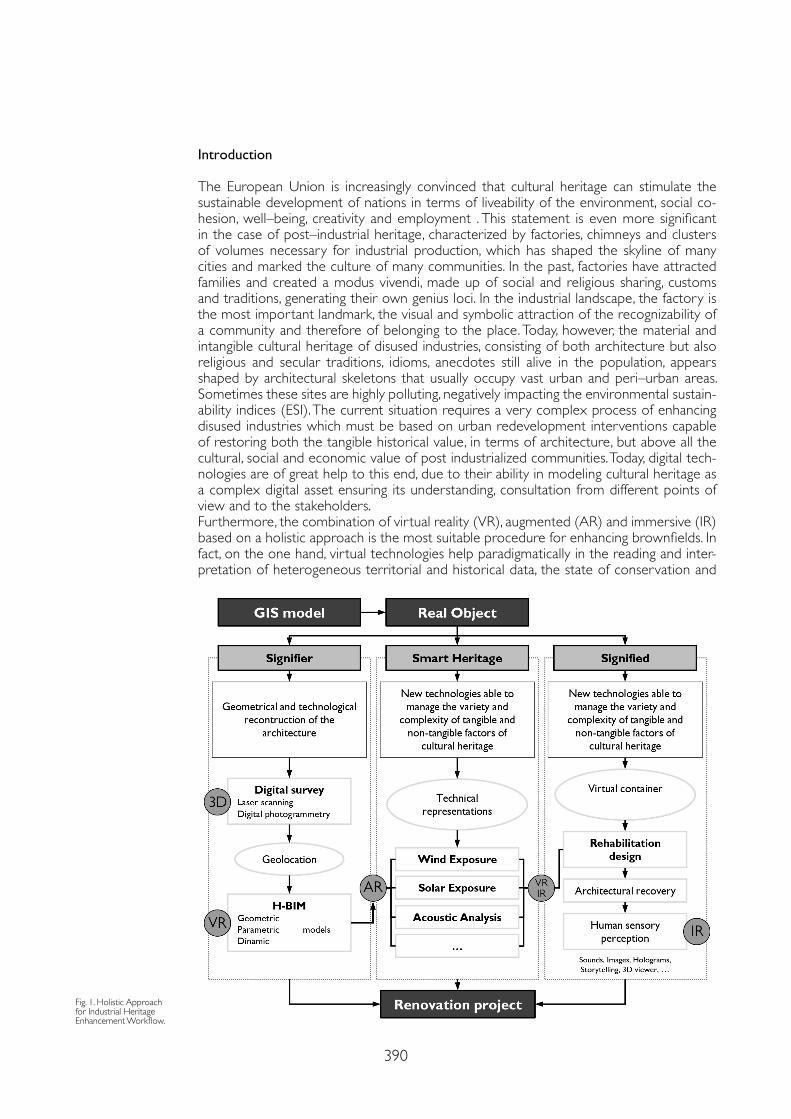
390
Introduction
The European Union is increasingly convinced that cultural heritage can stimulate the sustainable development of nations in terms of liveability of the environment, social co-hesion, well–being, creativity and employment . This statement is even more significant in the case of post–industrial heritage, characterized by factories, chimneys and clusters of volumes necessary for industrial production, which has shaped the skyline of many cities and marked the culture of many communities. In the past, factories have attracted families and created a modus vivendi, made up of social and religious sharing, customs and traditions, generating their own genius loci. In the industrial landscape, the factory is the most important landmark, the visual and symbolic attraction of the recognizability of a community and therefore of belonging to the place. Today, however, the material and intangible cultural heritage of disused industries, consisting of both architecture but also religious and secular traditions, idioms, anecdotes still alive in the population, appears shaped by architectural skeletons that usually occupy vast urban and peri–urban areas. Sometimes these sites are highly polluting, negatively impacting the environmental sustain-ability indices (ESI). The current situation requires a very complex process of enhancing disused industries which must be based on urban redevelopment interventions capable of restoring both the tangible historical value, in terms of architecture, but above all the cultural, social and economic value of post industrialized communities. Today, digital tech-nologies are of great help to this end, due to their ability in modeling cultural heritage as a complex digital asset ensuring its understanding, consultation from different points of view and to the stakeholders.Furthermore, the combination of virtual reality (VR), augmented (AR) and immersive (IR) based on a holistic approach is the most suitable procedure for enhancing brownfields. In fact, on the one hand, virtual technologies help paradigmatically in the reading and inter-pretation of heterogeneous territorial and historical data, the state of conservation and
Fig. 1. Holistic Approach for Industrial Heritage Enhancement Workflow.
391
usability of the material and immaterial value of the asset. On the other hand, the holistic approach allows to have a complete overview of the phenomenon. This paper applies the new graphic language, based on the use of the informative, interactive and immersive digital model, defined as an ‘smart model’, combined with a holistic approach in the acqui-sition and management of heterogeneous data with the aim of defining the best practice in the enhancement of abandoned industrial places. To this end, the brick factory, called ex Sieci and located on the seafront of Scauri (southern Latium), was chosen as a case study.
D.V.M.R. Method: the Holistic Approach in VR–AR–IR Modelling of Cultural Heritage
Since their origins, factories have developed their own inherently holistic graphic language. The design of the factories, in fact, required the representation of both the ‘architecture of space’, in terms of the permanence of man and his needs, and the ‘architectural space’, responsible for housing the machines and their functional systems. Today as yesterday, the reuse of abandoned industrial sites, which sometimes cover several hectares of urban sur-face, need a new graphic language capable of visualizing, or rather virtualizing, the dimen-sionality and multiplicity of sites markers such as the territorial, historical and architectural factors. Nowadays virtual modeling, understood as VR, AR, IR, can dynamically and interac-tively manage large and heterogeneous datasets that are the informative, parametric and interactive structure of smart models. Such a complex data structure, ranging from spatial data to the smallest technological detail of the factory, must obviously also deal with the management of the relationship between each component and the functional sum of all the parts, thus following a holistic approach. In this perspective, the method proposed in the paper is able to virtualize the real object (referent) and the complex dataset associated with it, according to a holistic approach (fig. 1). The method has four temporally consequential steps, described below:1. The Design (D) of a geographical information model, GIS, which returns the environmen-tal and territorial context of the site under study as well as the consistency of the phenom-enon of abandoned industrial sites (polluting/non–polluting, recovered/abandoned, public/private, etc.).2. The Virtualization (V) (signifier) of the real object (referent), obtained thanks to 3D digital surveys (laser scanning and digital photogrammetry). The point clouds exported thanks to geolocation in parametric software (H–BIM), become the semantic structures of the infor-mative models. In fact numerical, material, technological and historical data are associated with each graphic object, according to the most appropriate ontological model.3. The Modelling (M) of intangible environmental phenomena (smart service). Thanks to IFC technology, the H–BIM model can be exported to other software capable of simulating for example the wind and solar exposure or acoustic analysis. 4. The Reproduction (R) of the intangible cultural value of the site (signified). H–BIM is a fun-damental support for the immersive reality model because it is the box in which complete sensory experiences materialize through the reproduction of sounds, holograms, etc., thus helping people to be more aware of the cultural value of the site. IR also plays a key role in the decision–making process related to a post–industrial site rehabilitation project. The D.V.M.R. uses GIS and BIM as VR models as they produce realistic 3D models within which it is possible to virtually navigate thus aiding the analysis of the entire real phenome-non. Furthermore, in DVMR, the VR models (GIS and BIM) become physical prototypes to be used in software for simulation and calculation of immaterial environmental phenomena, which for this reason can be defined as Augmented Reality (AR). This type of simulation is particularly important for analyzing and evaluating degradation phenomena on the facades of historic buildings and the design of functionality, through new and more suitable desti-nations in use. Similarly, in DVMR the VR models (H–BIM), are the box within which the immersive reality (IR), which ranges from entertainment, education, promotion and acces-sibility for people with disabilities, helps the perception of the intangible value of the asset. The D.V.M.R described above was applied in the enhancement process of an important abandoned industrial site in southern Lazio.
392
Case Study: Abandoned Brick Factory in Scauri
The brick factory, called ex Seci, located in Scauri in southern Lazio, was born on a small pre–existing industrial settlement, as a branch of the Albizi furnace in Remole di Pontessieve (Florence) located on the Sieci stream from which it takes its name. The factory is part of a very delicate landscape both for its natural features and the numerous archaeological and historical evidence present in the area. The main elements are the coast called ‘Riviera di Ulisse’, the archaeological area of the ancient Roman town called Minturnae, the Via Appia and the mouth of the river Liri (Garigliano) on the border between Lazio and Campania Felix. The plant covered an area of 5 hectares with about 50,000 cubic meters of buildings and was connected to the sea by a destroyed wooden walkway, which facilitated the loading and unloading of products, marketed by sea. The main body of the factory, one of the few remaining, is spread over three floors above ground and rests on a base defined by a series of round arches. The building has a clear neoclassical style characterized by empty/solid rhythmic sequences, further marked by a series of pilasters which define regular modules and shape all the facades. Each floor has, between the piasters, three openings (windows) separated from each other by masonry completely covered in brick. On the ground floor there are two Hoffman ovens, still well preserved, which almost entirely occupy the longi-tudinal layout of the factory. In the external space, some further smaller volumes complete the area together with the chimney still in fair condition today. The construction system is in load–bearing masonry and the building is entirely made of bricks to enhance the product for which the factory was born. Over the centuries, due to the bombings of the Second World War and the reduction in production, many volumes have been destroyed. Currently, in the eyes of ordinary people, the factory looks like a ‘cathedral on the sea’. The centrality of the factory in the social life of Scauri is preserved by the locals who still today occupy the square in front with a weekly market, thus guaranteeing, albeit weak, a ‘form of life’. The factory is currently owned by the Municipality of Minturno.
Application. Scan to BIM, Smart Cultural Heritage Services and Visitor Experience
The reuse project of the brick factory has required the application of the DVMR.In the first phase, the Design (D) of the geographic information system through QGis was fundamental to analyze and understand the territorial context of the site. The GIS, in accor-dance with the ontological structure of the ISO/TC211 standards, collected data on three different territorial levels: a) the landscape, with the indication of the vulnerability and con-sistency of the industrial sites already existing in the territory (in terms of pollution, dimen-sion, renovation, disuse, etc.); b) urban planning, with particular attention to the regulatory but also socio–economic aspects; c) area of the case study, getting of general, dimensional, technological, historical data, etc.Scan to BIM: Virtual Reality (VR) for the definition of a geometric/parametric model: The Vir-tualization (V), in the second phase, performs the procedure known as SCAN to BIM. The size and internal spatial distribution of the plant suggested the use of a digital photogram-metric survey from a drone (returned with the DroneBase X1000 Mapper con fotocamera Sony Alpha ILCE –6000 16mmf/7.1, by double swipe flight plan at a height of 40 m from the ground) to reproduce the external volume and a laser scan survey (returned with Leika BLK 360 by the scans alignment of a specially designed grid) for the interior. Thanks to the laser scanner survey, the superfetations, the structural consistency and the state of decay of the finishes and structural parts were analyzed. Furthermore, through georeferencing, point clouds can be imported into an H–BIM system and the virtual reality model has been built according to the ontological structure of the UNI–11337–2017 standards (LOD, LOG and LOI). The virtual model of the factory ‘Ex Sieci’ is characterized by Lod 400/AS BUILT.Smart heritage services for environmental analysis: Modeling (M) of natural phenomena in vir-tual environments, in the third phase, is an example of AR technologies. The HBIM parametric model exported, thanks to IFC technology, in a computational fluid dynamics software allows a multi–criteria analysis capable of evaluating the effects of wind on the facades of buildings. The
393
References
Boton Conrad (2018). Supporting constructability analysis meetings with Immersive Virtual Reality–based collaborative BIM 4D simulation. In Automation in Construction, 96, pp. 1-15.
Delgado Juan Manuel Davila, Oyedele Lukumon, Demian Peter, Beach Thomas (2020). A research agenda for augmented and virtual reality in architecture, engineering and construction. In Advanced Engineering Informatics, 45, 101122.
Getuli Vito, Capone Pietro, Bruttini Alessandro, Isaac Shabtai (2020). BIM–based immersive Virtual Reality for construction workspace planning: A safety–oriented approach. In Automation in Construction, 114, 103160.
Imbimbo Maura, Modoni Giuseppe, Pelliccio Assunta, Saccucci Marco (2019, November). Vulnerability of Buildings: From Heritage Building Information Modelling (HBIM) to Seismic Analysis. In International Conference on Critical Thinking in Sustainable Rehabilitation and Risk Management of the Built Environment. Cham: Springer, pp. 311-329.
Pelliccio Assunta (2020). I luoghi delle industrie dismesse. GIS & HBIM per la loro valorizzazione/The places of brownfields. GIS & HBIM for their enhancement. Benevento: Edizioni Efesto.
Pelliccio Assunta, Saccucci Marco, Grande Ernesto (2017). HT_BIM: Parametric modelling for the assessment of risk in historic centers. In DISEGNARECON, 10 (18), pp. 5-11.
Saccucci Marco, Pelliccio Assunta (2018, October). Integrated BIM–GIS system for the enhancement of urban heritage. In 2018 Metrology for Archaeology and Cultural Heritage (MetroArchaeo). Piscataway: IEEE, pp. 222-226.
Wang Jun, Wang Xiangyu, Shou Wenchi, Xu Bo (2014). Integrating BIM and augmented reality for interactive architectural visualisation. In Construction Innovation, 14 (4), pp. 453-476.
model can be imported, in fact, into a virtual wind tunnel, where the average wind direction and intensity are taken from the Annals, and the wind impact on the facades can be virtualized with sized voxels. In addition, taking advantage by geolocation, H–BIM performs energy anal-yses and shows the impact of solar radiation on the facades of buildings during the day. The visualization with false–colour of sunlight on the building walls highlights the surfaces with the greatest exposure to the sun, providing a significant indication in energy efficiency measures. Similarly, it is possible to virtualize in H–BIM the execution of different acoustic analysis scenar-ios, which are of great help in a re–functionalization process. Environmental analysis through Augmented Reality is a very helpful smart heritage service.Immersive reality (IR) for the intangible cultural heritage: The last phase involves the use of H–BIM in the enhancing immaterial value of the place. The design of the ri–function of Hoff-mann ovens, very complicated to manage, has combined the IR in two different approaches. One gate of the oven, with interactive screens, holograms and sounds, which recall the sea-scape in which the factory is located, aims to attract the interest of children to the natural landscape that surrounds the factory; the second gate, narrating the historical events that characterized the factory and the surrounding area during the Second World War, intended to attract the interest of adults.
Conclusion
The post–industrial heritage, which has marked the cultural and social life of many commu-nities, today requires an impressive process of enhancement that must analyze all the differ-ent factors that come into play with a holistic approach. To this end, it is important to define a method that, on the basis of the potential of new technologies, is able to virtualise both the material and immaterial aspects. The method proposed with the abbreviation DVMR was conceived for this purpose and tested on a real case study, the brick factory located in Scauri. This first application, which required the acquisition and processing of many data, both territorial and historical–artistic, will be implemented with additional technologies, 3D viewers, with the aim of improving the sensitive perception in the enhancement of the intangible cultural value of the site.
Copyright © 2021 by FrancoAngeli s.r.l. Milano, Italy Isbn 9788835125280
AuthorsAssunta Pelliccio, Dept. of Literature and Philosophy, University of Cassino and Southern Lazio, [email protected] Saccucci, Dept. of Literature and Philosophy, University of Cassino and Southern Lazio, [email protected]

AR&AI education and
shape representation

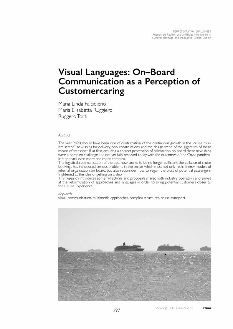
doi.org/10.3280/oa-686.63397
REPRESENTATION CHALLENGESAugmented Reality and Artificial Intelligence in Cultural Heritage and Innovative Design Domain
Abstract
The year 2020 should have been one of confirmation of the continuous growth in the “cruise tour-ism sector”: new ships for delivery, new constructions, and the design trend of the gigantism of these means of transport. If, at first, ensuring a correct perception of orientation on board these new ships were a complex challenge and not yet fully resolved, today with the outcomes of the Covid pandem-ic it appears even more and more complex.The logistical communication of the past now seems to be no longer sufficient: the collapse of cruise bookings has introduced serious problems in the sector which must not only rethink new models of internal organization on board, but also reconsider how to regain the trust of potential passengers, frightened at the idea of getting on a ship.This research introduces some reflections and proposals shared with industry operators and aimed at the reformulation of approaches and languages in order to bring potential customers closer to the Cruise Experience.
Keywordsvisual communication, multimedia approaches, complex structures, cruise transport.
Visual Languages: On–Board Communication as a Perception of CustomercaringMaria Linda FalcidienoMaria Elisabetta RuggieroRuggero Torti
398
May 2020: harbour cities change their perceptive profiles, transforming the usual view of the harbours of large cruise ships into a visual void, replaced by the silhouettes of the giants of navigation at anchor outside the port, as if they were ghosts in memory of a remote era. Venice is experiencing a return to the past, the waters of the lagoon become clear again and the perspective of the Grand Canal is finally free from the closures caused by the transits of “oversized” ships, to which this wonderful town resigned itself.The pandemic makes evident the disproportions and overruns of the limit, the sizes of the cruise giants now appear in all their excesses, as does the crowd pouring into the collective spaces, that cause a real inevitable gathering; some cases of infections on board accelerate a process of disruption of the system, visualized and amplified by the media, which transmit images of health emergencies.September 2020: Summer gives the illusion of an end to the pandemic and a conse-quent possible recovery of the cruise sector, which timidly reappears with advertising campaigns all aimed at reassuring potential users, through alignment with the restrictive anti–Covid measures.Even if it has been a false hope and the resumption of the spread of the virus has blocked at the beginning the revival of the economic induced by sea travel, however the story has highlighted the substantial obsolescence of the communication systems that on board wel-come and support passengers: panels and paper brochures, voice information and electron-ic touch screen devices, that is the combination of screen and digitizer, in order to allow the user to interact through the simple and immediate use of their fingers.If for the analog component the potential and limits relating to application areas and refer-ence targets are now clear and consolidated, the reasoning for touch screen instruments, until recently considered a definitely positive model of effectiveness, efficiency and balance of the cost–benefits ratio is different.What intervened, on the contrary, to undermine this certainty? Simply the awareness of the health risk that occurs whenever several people touch the same surfaces with their bare hands: Sars–Cov–2 virus, in fact, can be also transmitted through the contamination of unwashed and / or disinfected hands.Here, therefore, that the search for alternative forms of communication develops from a hygienic–sanitary emergency situation and the occasion of the crisis in the cruise sector represents an opportunity to experiment and mutate the techniques already in use in other cultural and geographical areas; not only but, it also represents an opportunity to update the contents, starting from the concept of customer–caring.It could be said that the new frontier is given by the awareness that it is not a problem of solving a specific question that is different from time to time and not systematizable, but of undertaking a path to assure and protect the well–being understood in a global sense of those who use the cruise travel system; this proactive attitude translates into the formu-lation of a methodology of general value, which aims to draw up guidelines in compliance with certain assumptions, which are essentially the following ones:• To convey a sense of attention to the passenger at 360°;• Not to limit to signal attention to the Covid emergency;• To promote the full knowledge of the medium;• To promote a full knowledge of all its functional values;• To incorporate hygiene behaviours into good practices on board;• To avoid conflict with mandatory signs.Above all, of course, it is mandatory to make the promoter recognizable, or to personalize the communication system, from time to time adapting it to the identifying characters of the specific shipping company. (MLF)The design approach will necessarily have to combine – as mentioned – analog media with multimedia and assisted technologies; in particular, QR codes will be used, now consolidat-ed in their wide–range use, and on–board communication will be then integrated through technologies based on Projected Augmented Reality, on an infrared light system detected through the integrated combination between hardware / software, as well as on holograph-ic representation (fig. 1).
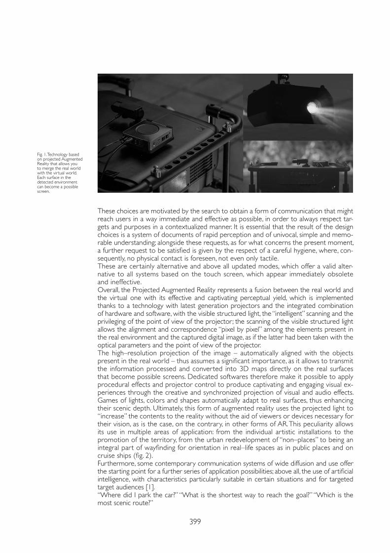
399
These choices are motivated by the search to obtain a form of communication that might reach users in a way immediate and effective as possible, in order to always respect tar-gets and purposes in a contextualized manner. It is essential that the result of the design choices is a system of documents of rapid perception and of univocal, simple and memo-rable understanding; alongside these requests, as for what concerns the present moment, a further request to be satisfied is given by the respect of a careful hygiene, where, con-sequently, no physical contact is foreseen, not even only tactile.These are certainly alternative and above all updated modes, which offer a valid alter-native to all systems based on the touch screen, which appear immediately obsolete and ineffective.Overall, the Projected Augmented Reality represents a fusion between the real world and the virtual one with its effective and captivating perceptual yield, which is implemented thanks to a technology with latest generation projectors and the integrated combination of hardware and software, with the visible structured light, the “intelligent” scanning and the privileging of the point of view of the projector; the scanning of the visible structured light allows the alignment and correspondence “pixel by pixel” among the elements present in the real environment and the captured digital image, as if the latter had been taken with the optical parameters and the point of view of the projector.The high–resolution projection of the image – automatically aligned with the objects present in the real world – thus assumes a significant importance, as it allows to transmit the information processed and converted into 3D maps directly on the real surfaces that become possible screens. Dedicated softwares therefore make it possible to apply procedural effects and projector control to produce captivating and engaging visual ex-periences through the creative and synchronized projection of visual and audio effects. Games of lights, colors and shapes automatically adapt to real surfaces, thus enhancing their scenic depth. Ultimately, this form of augmented reality uses the projected light to “increase” the contents to the reality without the aid of viewers or devices necessary for their vision, as is the case, on the contrary, in other forms of AR. This peculiarity allows its use in multiple areas of application: from the individual artistic installations to the promotion of the territory, from the urban redevelopment of “non–places” to being an integral part of wayfinding for orientation in real–life spaces as in public places and on cruise ships (fig. 2).Furthermore, some contemporary communication systems of wide diffusion and use offer the starting point for a further series of application possibilities; above all, the use of artificial intelligence, with characteristics particularly suitable in certain situations and for targeted target audiences [1].“Where did I park the car?” “What is the shortest way to reach the goal?” “Which is the most scenic route?”
Fig. 1. Technology based on projected Augmented Reality that allows you to merge the real world with the virtual world. Each surface in the detected environment can become a possible screen.
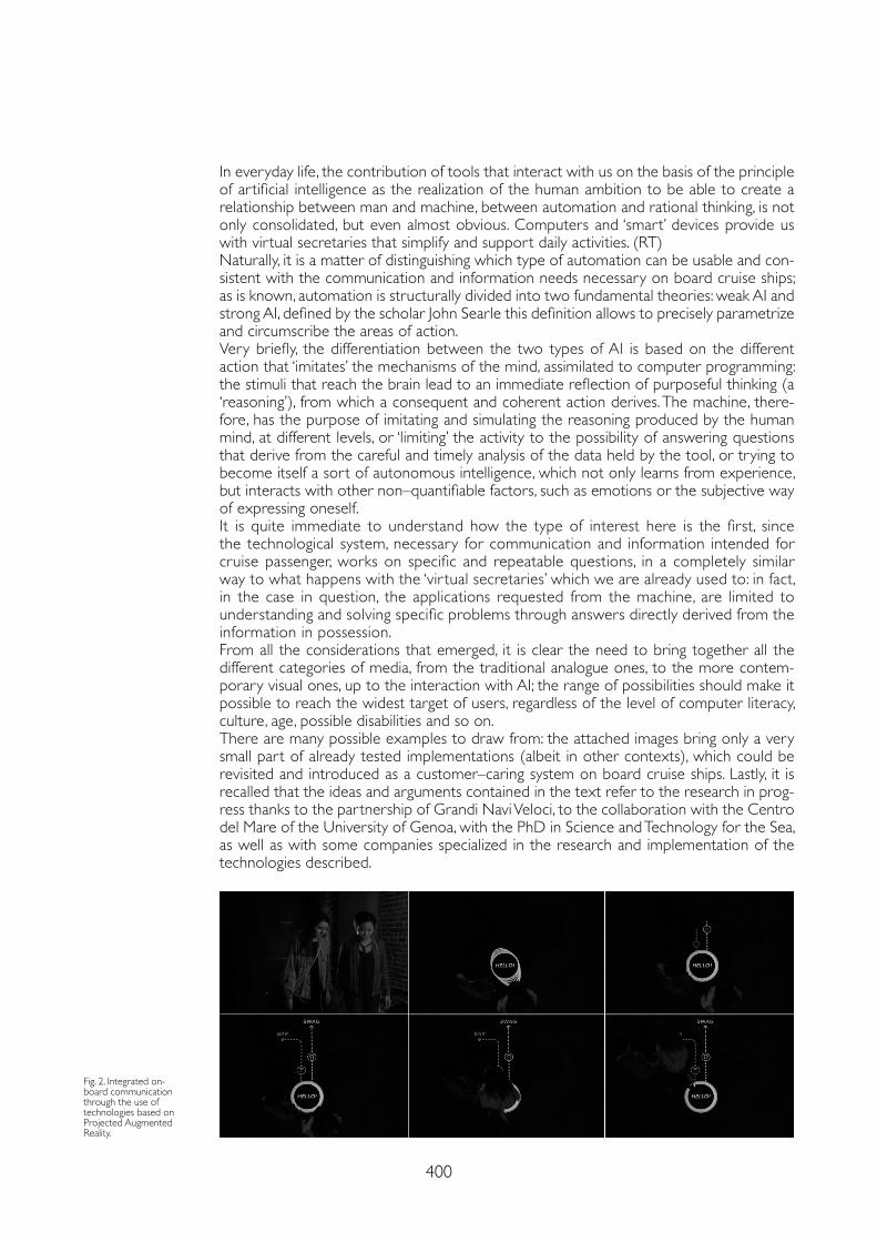
400
In everyday life, the contribution of tools that interact with us on the basis of the principle of artificial intelligence as the realization of the human ambition to be able to create a relationship between man and machine, between automation and rational thinking, is not only consolidated, but even almost obvious. Computers and ‘smart’ devices provide us with virtual secretaries that simplify and support daily activities. (RT)Naturally, it is a matter of distinguishing which type of automation can be usable and con-sistent with the communication and information needs necessary on board cruise ships; as is known, automation is structurally divided into two fundamental theories: weak AI and strong AI, defined by the scholar John Searle this definition allows to precisely parametrize and circumscribe the areas of action.Very briefly, the differentiation between the two types of AI is based on the different action that ‘imitates’ the mechanisms of the mind, assimilated to computer programming: the stimuli that reach the brain lead to an immediate reflection of purposeful thinking (a ‘reasoning’), from which a consequent and coherent action derives. The machine, there-fore, has the purpose of imitating and simulating the reasoning produced by the human mind, at different levels, or ‘limiting’ the activity to the possibility of answering questions that derive from the careful and timely analysis of the data held by the tool, or trying to become itself a sort of autonomous intelligence, which not only learns from experience, but interacts with other non–quantifiable factors, such as emotions or the subjective way of expressing oneself.It is quite immediate to understand how the type of interest here is the first, since the technological system, necessary for communication and information intended for cruise passenger, works on specific and repeatable questions, in a completely similar way to what happens with the ‘vir tual secretaries’ which we are already used to: in fact, in the case in question, the applications requested from the machine, are limited to understanding and solving specific problems through answers directly derived from the information in possession.From all the considerations that emerged, it is clear the need to bring together all the different categories of media, from the traditional analogue ones, to the more contem-porary visual ones, up to the interaction with AI; the range of possibilities should make it possible to reach the widest target of users, regardless of the level of computer literacy, culture, age, possible disabilities and so on.There are many possible examples to draw from: the attached images bring only a very small part of already tested implementations (albeit in other contexts), which could be revisited and introduced as a customer–caring system on board cruise ships. Lastly, it is recalled that the ideas and arguments contained in the text refer to the research in prog-ress thanks to the partnership of Grandi Navi Veloci, to the collaboration with the Centro del Mare of the University of Genoa, with the PhD in Science and Technology for the Sea, as well as with some companies specialized in the research and implementation of the technologies described.
Fig. 2. Integrated on-board communication through the use of technologies based on Projected Augmented Reality.
401
References
Apollonio Fabrizio Ivan (2012). Architettura in 3D. Modelli digitali per i sistemi cognitivi. Milano: Bruno Mondadori.
Brusaporci Stefano (2018). Advanced Mixed Heritage: A Visual Turn Through Digitality and Reality of Architecture. In International journal of computational methods in heritage science, 2, pp. 40-60.
Buda Davide (2020). Intelligenza Artificiale Forte e Debole: uno sguardo al futuro. https://www.thedifferentgroup. com/2020/02/29/intelligenza-artificiale-forte-e-debole/ (29 February 2020)
Calvano Michele, Wahbeh Wissam (2014). Disegnare la Memoria. L’immagine della città attraverso la rappresentazione integrata – Drawing the Memory.The image of the city through the integrated representation. In DisegnareCon, 7 (13), pp. 1-12.
Di Luggo Antonella, Zerlenga Ornella, Pascariello Maria Ines (2016). Rappresentazione e comunicazione del paesaggio tra tradizione e innovazione. In Capano Francesca, Pascariello Maria Ines, Visone Massimo (eds.). Delli Aspetti de Paesi–Vecchi e nuovi Media per l’Immagine del Paesaggio, II. Napoli: Cirice.
Falcidieno Maria Linda (2009). Comunicazione e rappresentazione. Firenze: Alinea.
Falcidieno Maria Linda (2006). Parola disegno segno. Comunicare per immagini. Segno, significato, metodo. Firenze: Alinea.
Intelligenza artificiale forte e debole. https://www.intelligenzaartificiale.it/intelligenza-artificiale-forte-e-debole/. (20 February 2020)
Ippoliti Elena, Meschini Alessandra, Moscati Annika, Rossi Daniele, De Luca Livio (2012). Shedding light on the city: Discovering, Appreciating and sharing Cultural Heritage using 3D Visual Technology. In Proceedings of 18th International Conference on Virtual System and Multimedia – VSMM, pp. 141-148.
Leung Linda (2008). Digital Experience Design. Ideas, Industries, interactions. Chicago: Intellect Book – The University of Chicago Press.
Luigini Alessandro, Panciroli Chiara (2018). Ambienti digitali per l’educazione all’arte e al patrimonio. Milano: FrancoAngeli.
Ramella Francesco, Rostan Michele, (2018). La terza missione degli accademici italiani: un quadro d’insieme. In Perulli Angela, Ramella Francesco, Rostan Michele, Semenza Renata (eds.). La terza missione degli accademici italiani. Bologna: Editrice Il Mulino, pp.175-206.
Russo Michele, Guidi Gabriele (2011). Reality–based and reconstructive models: digital media for cultural heritage valorization. In SCIRES–IT, 2, pp. 71-86.
Shedroff Nathan (2001). Experience Design 1. Thousand Oaks: New Riders Publishing.
Torti Ruggero (2019). BEING POSITIVE, 02 Smart & Slow Travel – New Responsive Landscapes. Milano: FrancoAngeli.
Notes
[1] In particular, a part of the study presented here is part of the project entitled: welcome on board: integrated habitat communication in cruise ships, funded by University Research Funds – University of Genoa 2019, responsible R. Torti.
[2] The research presented is the result of the joint work of the three authors; the individual contributions can be traced back to the authors by the presence of the initials at the bottom.
Specifically, the collaboration with Grandi Navi Veloci led to the awareness of a necessary segmentation of the communication offered on board; if, in fact, the age group of the most widespread cruise target is undoubtedly literate and active from the use of devices and IT tools point of view, on the other hand it is also true that a communication based on an almost dialogic use of the “machine” could even cover also the less skilled users especially with multimedia. This, therefore, is the new challenge: the use of AI at levels of immediate understanding of information, to support each passenger with a virtual assistant in a tar-geted manner [2] (ER).
Copyright © 2021 by FrancoAngeli s.r.l. Milano, Italy Isbn 9788835125280
AuthorsMaria Linda Falcidieno, Dept. Architecture and Design, University of Genova, [email protected] Elisabetta Ruggiero, Dept. Architecture and Design, University of Genova, [email protected] Torti, Dept. Architecture and Design, University of Genova, [email protected]

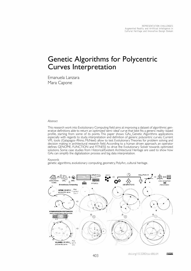
doi.org/10.3280/oa-686.64403
REPRESENTATION CHALLENGESAugmented Reality and Artificial Intelligence in Cultural Heritage and Innovative Design Domain
Abstract
This research work into Evolutionary Computing field aims at improving a dataset of algorithmic gen-erative definitions able to return an optimized ‘semi–ideal’ curve that best fits a generic reality–based profile, starting from some of its points. This paper shows GAs_Genetic Algorithms applications especially with regards to study, interpretation and definition of generic polycentric curves. Current VPL tools (Galapagos–Rhino, McNeel) allow to test Evolutionary Theories for problem solving and decision making in architectural research field. According to a human driven approach, an operator defines GENOME, FUNCTION and FITNESS to drive the Evolutionary Solver towards optimized solutions. Some case studies from Historical/Existent Architectural Heritage are used to show how GAs can simplify the digitalization process and big data interpretation.
Keywordsgenetic algorithms, evolutionary computing, geometry, PolyArc, cultural heritage.
Genetic Algorithms for Polycentric Curves Interpretation Emanuela LanzaraMara Capone
404
Introduction
This research work into EC_Evolutionary Computing field aims at developing a dataset of algorithmic generative definitions (VPL), to return optimized ‘semi–ideal’ curves that best fit reality–based profiles (generic polycentric curves from point cloud segments). This paper especially shows testing of GAs [Holland 1992] for vaulted systems study. EC is a subfield of AI aimed at iterative, continuous and combinatorial search for optimized solutions. In architectural and engineering fields, it is possible to distinguish applications about opti-mization of architectural–urban design [Buffi et al. 2020; Canestrino et al. 2020, Palma et al. 2020], analytical–structural applications [Grillanda et al. 2017, Khan 2015], manufacturing complex elements–systems [Zaremba 2016; Coutinho 2010; Limonge et al. 2010], analyti-cal–geometric applications to rebuild and compare shapes [Bianconi et al. 2018] and, more specifically, about ovals interpretation [Santagati et al. 2018]. Moreover, similar approaches are managed with different tools to optimize the curves and surfaces interpretation that describe historical architectural elements, according to stylistic features of cultural heritages and geographical contexts [Samper et al. 2020; Lan-zara et al. 2019]. These approaches are also potentially aimed at supporting AI processes [Sim 2020]. This VPL algorithmic definition allows to construct all kind of profile starting from reality–based elements: the only input parameter is the points number. It is the main advantage of the process.
Methodology and Tools
Digitizalization of existent architectural elements is a process to provide a system of 3D models and related information (parameters/geometric variables, construction techniques, materials). About Historic Heritage, these properties can be extrapolated through a direct analysis of architectural elements (survey) or from specific treatises and historical manuals rules. The parameterization of pointed arches and polycentric curves (vertical sections), used to generate the revolution pointed domes, is one of tested approaches [Capone et al. 2019a]. Digital translation of geometric–mathematical rules simplifies the parameterization (geometric genesis) of complex architectural systems and allows to model variable and adaptable configurations [Capone et al. 2019b]. Another approach is based on VPL models built on reality–based profiles used as “input parameters”, to compose the wireframe of the architectural element, providing a ‘semi–ideal’ model closer to the real element. Then, differ-ent approaches and tools (VPL/C++) were compared to identify ideal curves and surfaces that best fit point clouds segments [Lanzara et al. 2019].We have applied these approaches to define generic polycentric curves, open or closed, from reality–based profiles using GAs. This contribute shows applications about closed sym-metrical polycentric curves and open polycentric curves that could be domes profiles. Ovoidal domes can be generate as revolution surfaces or they can be shaped from curves network. The axes dimensions are not sufficient as input parameters to model these shapes. In fact, it is not uniquely possible to identify and to draw the specific oval that best describes a reality–based profile according to the lengths of its axes only. Starting from the same pair of axes, it is possible to generate infinite ovals and one ellipse [Dotto 2002, p. 14].Current VPL generative–algorithmic tools (Galapagos–Gh component, Octopus–Gh plug–in, Rhino, McNeel) allow to test Evolutionary Theory (Darwin 1859) to support problem solving and decision making processes. According to a human driven approach, the param-eters identification to define GENOME, FUNCTION and FITNESS allows to drive the Evolutionary Solver towards an optimized solution. GAs calculates the optimal position of the end–points (GENE POOL) of a PolyArc (VPL component aimed at built a sequence of tangential continuous circular segments) along a reality–based profile to extrapolate a ‘semi–ideal’ polycentric curve. A direct comparison between the ‘semi–ideal’ curves (GA) and the ideal curves (rules) allows to establish which type of ideal profile best fits and decodes the reference curve. The number of points can
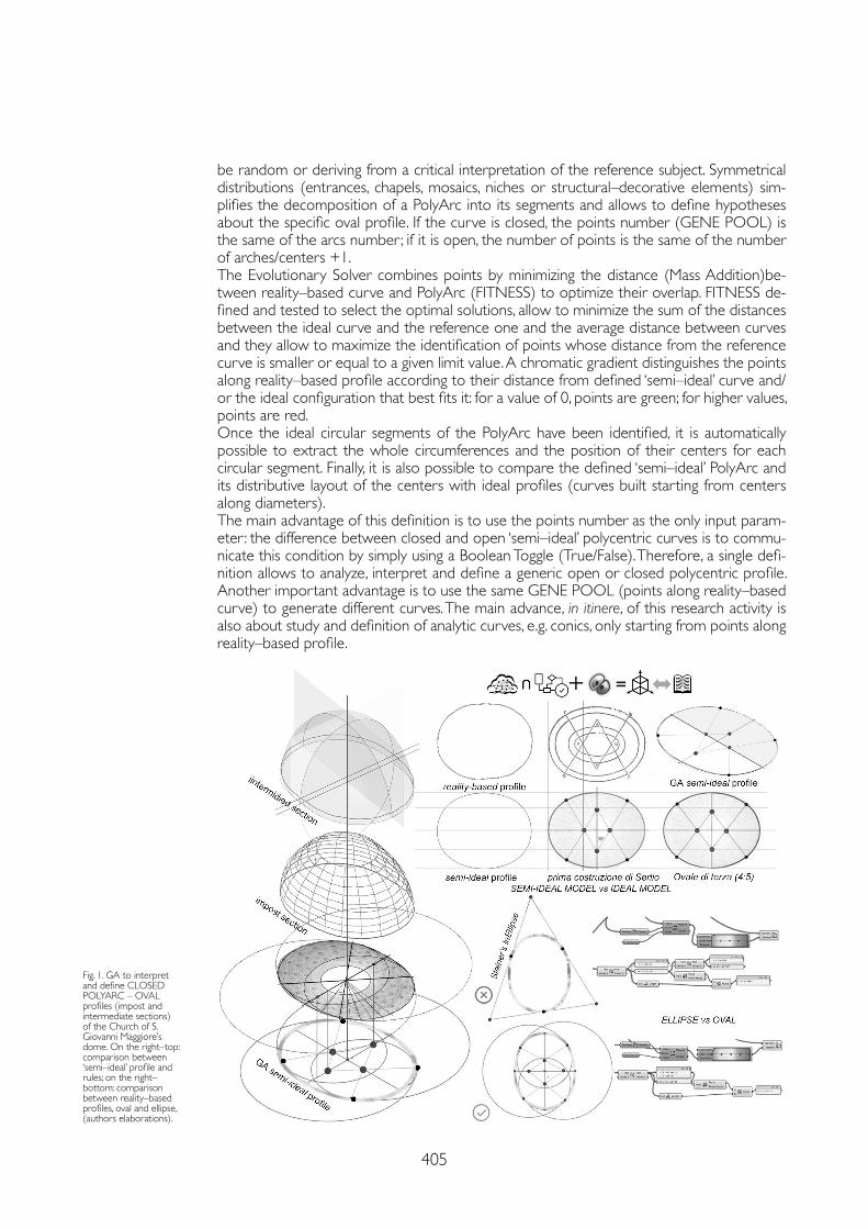
405
be random or deriving from a critical interpretation of the reference subject. Symmetrical distributions (entrances, chapels, mosaics, niches or structural–decorative elements) sim-plifies the decomposition of a PolyArc into its segments and allows to define hypotheses about the specific oval profile. If the curve is closed, the points number (GENE POOL) is the same of the arcs number; if it is open, the number of points is the same of the number of arches/centers +1. The Evolutionary Solver combines points by minimizing the distance (Mass Addition)be-tween reality–based curve and PolyArc (FITNESS) to optimize their overlap. FITNESS de-fined and tested to select the optimal solutions, allow to minimize the sum of the distances between the ideal curve and the reference one and the average distance between curves and they allow to maximize the identification of points whose distance from the reference curve is smaller or equal to a given limit value. A chromatic gradient distinguishes the points along reality–based profile according to their distance from defined ‘semi–ideal’ curve and/or the ideal configuration that best fits it: for a value of 0, points are green; for higher values, points are red.Once the ideal circular segments of the PolyArc have been identified, it is automatically possible to extract the whole circumferences and the position of their centers for each circular segment. Finally, it is also possible to compare the defined ‘semi–ideal’ PolyArc and its distributive layout of the centers with ideal profiles (curves built starting from centers along diameters). The main advantage of this definition is to use the points number as the only input param-eter : the difference between closed and open ‘semi–ideal’ polycentric curves is to commu-nicate this condition by simply using a Boolean Toggle (True/False). Therefore, a single defi-nition allows to analyze, interpret and define a generic open or closed polycentric profile. Another important advantage is to use the same GENE POOL (points along reality–based curve) to generate different curves. The main advance, in itinere, of this research activity is also about study and definition of analytic curves, e.g. conics, only starting from points along reality–based profile.
Fig. 1. GA to interpret and define CLOSED POLYARC – OVAL profiles (impost and intermediate sections) of the Church of S. Giovanni Maggiore’s dome. On the right–top: comparison between ‘semi–ideal’ profile and rules; on the right–bottom: comparison between reality–based profiles, oval and ellipse,(authors elaborations).
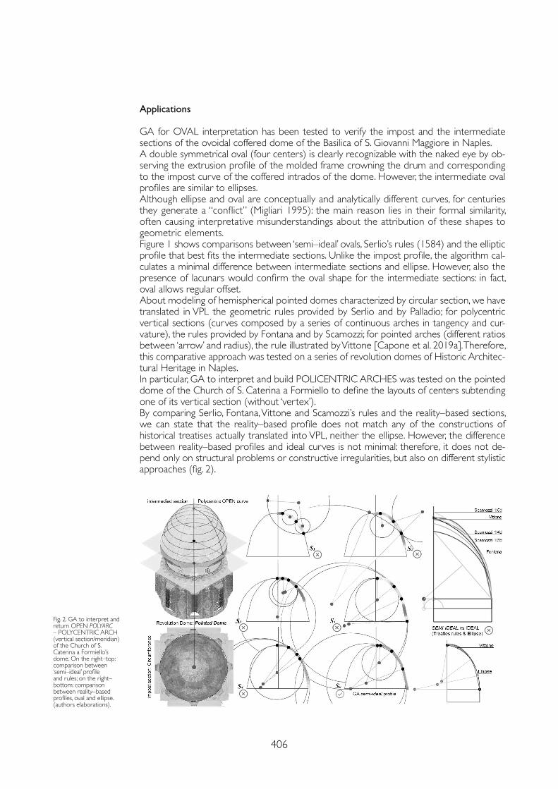
406
Applications
GA for OVAL interpretation has been tested to verify the impost and the intermediate sections of the ovoidal coffered dome of the Basilica of S. Giovanni Maggiore in Naples. A double symmetrical oval (four centers) is clearly recognizable with the naked eye by ob-serving the extrusion profile of the molded frame crowning the drum and corresponding to the impost curve of the coffered intrados of the dome. However, the intermediate oval profiles are similar to ellipses. Although ellipse and oval are conceptually and analytically different curves, for centuries they generate a “conflict” (Migliari 1995): the main reason lies in their formal similarity, often causing interpretative misunderstandings about the attribution of these shapes to geometric elements. Figure 1 shows comparisons between ‘semi–ideal’ ovals, Serlio’s rules (1584) and the elliptic profile that best fits the intermediate sections. Unlike the impost profile, the algorithm cal-culates a minimal difference between intermediate sections and ellipse. However, also the presence of lacunars would confirm the oval shape for the intermediate sections: in fact, oval allows regular offset. About modeling of hemispherical pointed domes characterized by circular section, we have translated in VPL the geometric rules provided by Serlio and by Palladio; for polycentric vertical sections (curves composed by a series of continuous arches in tangency and cur-vature), the rules provided by Fontana and by Scamozzi; for pointed arches (different ratios between ‘arrow’ and radius), the rule illustrated by Vittone [Capone et al. 2019a]. Therefore, this comparative approach was tested on a series of revolution domes of Historic Architec-tural Heritage in Naples. In particular, GA to interpret and build POLICENTRIC ARCHES was tested on the pointed dome of the Church of S. Caterina a Formiello to define the layouts of centers subtending one of its vertical section (without ‘vertex’). By comparing Serlio, Fontana, Vittone and Scamozzi’s rules and the reality–based sections, we can state that the reality–based profile does not match any of the constructions of historical treatises actually translated into VPL, neither the ellipse. However, the difference between reality–based profiles and ideal curves is not minimal: therefore, it does not de-pend only on structural problems or constructive irregularities, but also on different stylistic approaches (fig. 2).
Fig. 2. GA to interpret and return OPEN POLYARC – POLYCENTRIC ARCH (vertical section/meridian) of the Church of S. Caterina a Formiello’s dome. On the right–top: comparison between ‘semi–ideal’ profile and rules; on the right–bottom: comparison between reality–based profiles, oval and ellipse.(authors elaborations).
407
References
Bianconi Fabio, Filippucci Marco, Meconi Magi Federica (2018). Parametrical Vitruvius. Generative modeling of the architectural orders. In SCIRES – SCIentific RESearch and Information Technology, 8 (2), pp. 29-48.
Buffi Alessandro, Bianconi Fabio, Filippucci Marco (2020). Optimization and Evolution in Architectural Morphogenesis: Evolutionary Principles Applied to Mass Housing. In Mehdi Khosrow–Pour (ed.). Research Anthology on Multi–Industry Uses of Genetic Programming and Algorithms. Hershey: IGI Global, pp. 997-1016.
Canestrino Giuseppe, Laura Greco, Spada Francesco, Lucente Roberta (2020). Generating architectural plan with evolutionary multiobjective optimization algorithms: a benchmark case with an existent construction system. In Escobar Natalia Builes, Torreblanca–Díaz David A. (eds.). SIGraDi 2020. Transformative Design. XXIV International Conference of the Iberoamerican Society of Digital Graphics, pp. 149-156.
Capone Mara, Lanzara Emanuela (2019.a). Scan–to–Bim vs 3D Ideal Model. HBIM: Parametric tools to study Domes Geometry. In International Archives of Photogrammetry, Remote Sensing and Spatial Information Sciences, vol. XLII–2/W9, pp. 219-226.
Capone Mara, Lanzara Emanuela (2019.b). 3D data interpretation using treatises geometric rules to built coffered domes. In International Archives of Photogrammetry, Remote Sensing and Spatial Information Sciences, Vol. XLII–2/W15, pp. 231-238.
Darwin Charles (1859). On the Origin of Species by Means of Natural Selection. London: John Murray.
Dotto Edoardo (2002). Il Disegno degli ovali armonici. Catania: Le Nove Muse Editrice.
Gatti Nicola, (12 marzo 2020). Matematica e Tech. Algoritmi, facciamo chiarezza sui diversi tipi. Network Digital 360. agendadigitale.eu/cultura-digitale/algoritmi-quale-tipo-per-quale-problema-facciamo-chiarezza/ [04 March 2021].
Grillanda Nicola, Manconi Fabio, Stochino Fabio, Cazzani Antonio, Bondi Francesco, Chiozzi Andrea, Tralli Antonio (2017). On the analysis of the stellar vault of Santa Maria del Monte in Cagliari. In Proceedings of the International Conference of Computational Methods in Sciences and Engineering (ICCMSE–2017). AIP Publishing.
Holland James (1992). Adaptation in Natural and Aritificial Systems: An Introductory Analysis with Applications to Biology, Control and Artificial Intelligence. Cambridge, MA, United States: MIT Press.
Khan Azhar (2015). compdesignstudio.com. Polyline Curve to Arcs–Optimization using Galapagos. youtube.com/watch?v=03VTBaZk5j0 [23 February 2021]
Lanzara Emanuela, Samper Albert e Herrera Blas (2019). Point Cloud Segmentation and Filtering to verify the geometric genesis of simple and composed vaults. In International Archives of the Photogrammetry, Remote Sensing and Spatial Information Sciences, vol. XLII–2/W15, pp. 645-652.
Lemonge Alfonso C. C., Barbosa, Helio J. C., da Fonseca Leonardo G. and Coutinho, Alvaro L. G. A. (2010). A genetic algorithm for topology optimization of dome structures. In Proceedings of 2nd International Conference on Engineering Optimization, pp. 1-15.
Migliari Riccardo, 1995. Ellissi e ovali, epilogo di un conflitto. In Palladio 16, 1995. riccardo.migliari.it/pdf_saggi/1995_ellissi_ovali_lr.pdf [23 February 2021].
Palma Valerio, Accorsi Federico, Casasso Alessandro, Bianco Carlo, Cutrì Sarah, Robiglio Matteo, Tosco Tiziana (2020). AdRem: An Integrated Approach for Adaptive Remediation. In Sustainability 2021, 13, 28. p. 1-15.
Samper Albert, Herrera Blas, González Genaro. (2020). Geometrical review of the dome in Palau Güell. Revisión de la tipología geométrica de la cúpula del Palau Güell. In Informes de la Construcción, 72 (558).
Santagati Cettina, La Russa Federico Mario, Galizia Mariateresa, Magnano di San Lio Eugenio (2018). Towards a generic parametric algorithm for the geometric investigation of Baroque Oval plans: an application on Sicilian cases. In Williams Kim, Bevilacqua Marco Giorgio (eds). Nexus 2018. Architecture and Mathematics. Torino: KWB, pp. 245-250.
Sim Victor (2020). Using Genetic Algorithms to Train Neural Networks. In Towards Data Science. towardsdatascience.com/using-genetic-algorithms-to-train-neural-networks-b5ffe0d51321 (12 February 2021).
Conclusions and Future Works
The main progress (in itinere) of this study is to test GAs to interpret and define analytical curves (e.g. conics) and generic profiles characterizing also modern and contemporary ar-chitecture. In addition, other future advances can be about deepening the accuracy of the models, improving current VPL definitions and testing other types of algorithms [Gatti 2020]. The semi–automatic interpretation of complex elements simplifies their parameterization ac-cording to interoperable logics (VPL/BIM–HBIM). Furthermore, this approach is also aimed to test geometric–speculative approaches and to inspire studies with different goals.
Copyright © 2021 by FrancoAngeli s.r.l. Milano, Italy Isbn 9788835125280
AuthorsEmanuela Lanzara, Dept. of Structure for Engineering and Architecture, University Federico II of Naples, [email protected] Capone, Dept. of Architecture, University Federico II of Naples, [email protected]

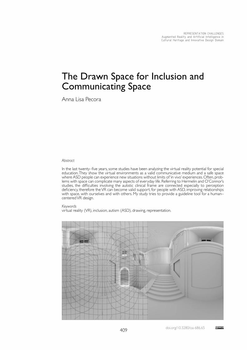
doi.org/10.3280/oa-686.65409
REPRESENTATION CHALLENGESAugmented Reality and Artificial Intelligence in Cultural Heritage and Innovative Design Domain
Abstract
In the last twenty–five years, some studies have been analyzing the virtual reality potential for special education. They show the virtual environments as a valid communicative medium and a safe space where ASD people can experience new situations without limits of ‘in vivo’ experiences. Often, prob-lems with space can complicate many aspects of everyday life. Referring to Hermelin and O’Connor’s studies, the difficulties involving the autistic clinical frame are connected especially to perception deficiency, therefore the VR can become valid support, for people with ASD, improving relationships with space, with ourselves and with others. My study tries to provide a guideline tool for a human–centered VR design.
Keywordsvirtual reality (VR), inclusion, autism (ASD), drawing, representation.
The Drawn Space for Inclusion and Communicating SpaceAnna Lisa Pecora
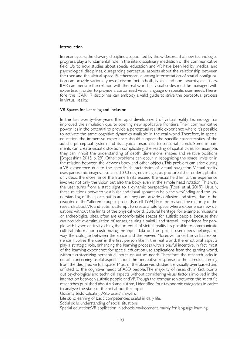
410
Introduction
In recent years, the drawing disciplines, supported by the widespread of new technologies progress, play a fundamental role in the interdisciplinary mediation of the communicative field. Up to now, studies about special education and VR have been led by medical and psychological disciplines, disregarding perceptual aspects about the relationship between the user and the virtual space. Furthermore, a wrong interpretation of spatial configura-tion can provide various types of discomfort in both, typical and non–neurotypical users. If VR can mediate the relation with the real world, its visual codes must be managed with expertise, in order to provide a customized visual language on specific user needs. There-fore, the ICAR 17 disciplines can embody a valid guide to drive the perceptual process in virtual reality.
VR Spaces for Learning and Inclusion
In the last twenty–five years, the rapid development of virtual reality technology has improved the simulation quality, opening new applicative frontiers. Their communicative power lies in the potential to provide a perceptual realistic experience where it’s possible to activate the same cognitive dynamics available in the real world. Therefore, in special education, the immersive experience should support the specific characteristics of the autistic perceptual system and its atypical responses to sensorial stimuli. Some impair-ments can create visual distortion complicating the reading of spatial clues; for example, they can inhibit the understanding of depth, dimensions, shapes and relative positions [Bogdashina 2015, p. 29]. Other problems can occur in recognizing the space limits or in the relation between the viewer’s body and other objects. This problem can arise during a VR experience due to the specific characteristics of virtual navigation. Virtual reality uses panoramic images, also called 360 degrees images, as: photorealistic renders, photos or videos; therefore, since the frame limits exceed the visual field limits, the experience involves not only the vision but also the body, even in the simple head rotation. This way, the user turns from a static sight to a dynamic perspective [Rossi et al. 2019]. Usually, these relations between vestibular and visual apparatus help the wayfinding and the un-derstanding of the space, but in autism, they can provide confusion and stress due to the disorder of the “afferent couple” phase [Russell 1994]. For this reason, the majority of the research about VR and autism, attempt to create a safe space where experience new sit-uations without the limits of the physical world. Cultural heritage, for example, museums or archeological sites, often are uncomfortable spaces for autistic people, because they can provide overstimulation of senses, causing a painful and stressful experience for peo-ple with hypersensitivity. Using the potential of virtual reality, it’s possible to communicate cultural information customizing the input data on the specific user needs helping, this way, the dialogue between the space and the viewer. Moreover, since the virtual expe-rience involves the user in the first person like in the real world, the emotional aspects play a strategic role, enhancing the learning process with a playful incentive. In fact, most of the learning experience for special education use applications from the gaming world, without customizing perceptual inputs on autism needs. Therefore, the research lacks in details concerning useful aspects about the perceptive response to the stimulus coming from the designed virtual space. Most of the observed studies are visually overloaded and unfitted to the cognitive needs of ASD people. The majority of research, in fact, points out psychological and technical aspects without considering visual factors involved in the interaction between autistic people and VR. Trough the comparison between the scientific researches published about VR and autism, I identified four taxonomic categories in order to analyze the state of the art about this topic:Usability tests: valuating ASD users’ answers.Life skills: learning of basic competencies useful in daily life.Social skills: understanding of social situations.Special education: VR application in schools environment, mainly for language learning.
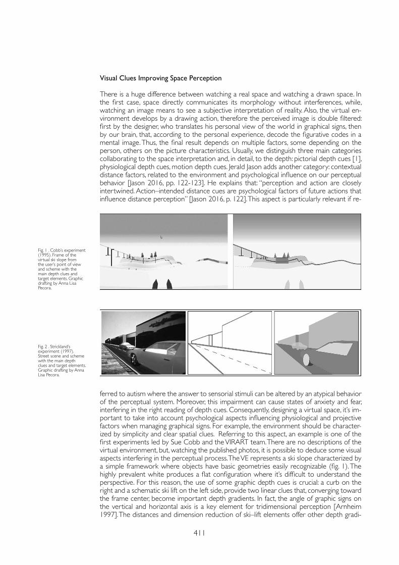
411
Visual Clues Improving Space Perception
There is a huge difference between watching a real space and watching a drawn space. In the first case, space directly communicates its morphology without interferences, while, watching an image means to see a subjective interpretation of reality. Also, the virtual en-vironment develops by a drawing action, therefore the perceived image is double filtered: first by the designer, who translates his personal view of the world in graphical signs, then by our brain, that, according to the personal experience, decode the figurative codes in a mental image. Thus, the final result depends on multiple factors, some depending on the person, others on the picture characteristics. Usually, we distinguish three main categories collaborating to the space interpretation and, in detail, to the depth: pictorial depth cues [1], physiological depth cues, motion depth cues. Jerald Jason adds another category: contextual distance factors, related to the environment and psychological influence on our perceptual behavior [Jason 2016, pp. 122-123]. He explains that: “perception and action are closely intertwined. Action–intended distance cues are psychological factors of future actions that influence distance perception” [Jason 2016, p. 122]. This aspect is particularly relevant if re-
ferred to autism where the answer to sensorial stimuli can be altered by an atypical behavior of the perceptual system. Moreover, this impairment can cause states of anxiety and fear, interfering in the right reading of depth cues. Consequently, designing a virtual space, it’s im-portant to take into account psychological aspects influencing physiological and projective factors when managing graphical signs. For example, the environment should be character-ized by simplicity and clear spatial clues. Referring to this aspect, an example is one of the first experiments led by Sue Cobb and the VIRART team. There are no descriptions of the virtual environment, but, watching the published photos, it is possible to deduce some visual aspects interfering in the perceptual process. The VE represents a ski slope characterized by a simple framework where objects have basic geometries easily recognizable (fig. 1). The highly prevalent white produces a flat configuration where it’s difficult to understand the perspective. For this reason, the use of some graphic depth cues is crucial: a curb on the right and a schematic ski lift on the left side, provide two linear clues that, converging toward the frame center, become important depth gradients. In fact, the angle of graphic signs on the vertical and horizontal axis is a key element for tridimensional perception [Arnheim 1997]. The distances and dimension reduction of ski–lift elements offer other depth gradi-
Fig. 1 . Cobb’s experiment (1995). Frame of the virtual ski slope from the user’s point of view and scheme with the main depth clues and target elements. Graphic drafting by Anna Lisa Pecora.
Fig. 2 . Strickland’s experiment (1997). Street scene and scheme with the main depth clues and target elements. Graphic drafting by Anna Lisa Pecora.
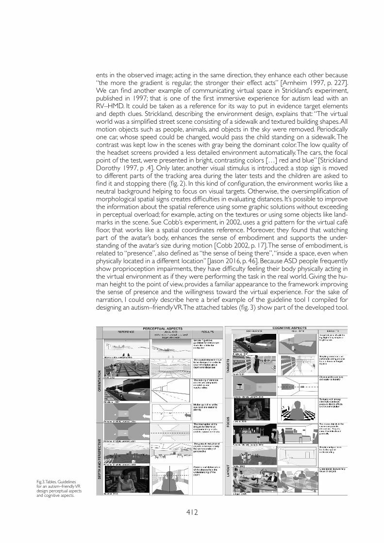
412
ents in the observed image; acting in the same direction, they enhance each other because “the more the gradient is regular, the stronger their effect acts” [Arnheim 1997, p. 227]. We can find another example of communicating virtual space in Strickland’s experiment, published in 1997; that is one of the first immersive experience for autism lead with an RV–HMD. It could be taken as a reference for its way to put in evidence target elements and depth clues. Strickland, describing the environment design, explains that: “The virtual world was a simplified street scene consisting of a sidewalk and textured building shapes. All motion objects such as people, animals, and objects in the sky were removed. Periodically one car, whose speed could be changed, would pass the child standing on a sidewalk. The contrast was kept low in the scenes with gray being the dominant color. The low quality of the headset screens provided a less detailed environment automatically. The cars, the focal point of the test, were presented in bright, contrasting colors […] red and blue” [Strickland Dorothy 1997, p .4]. Only later, another visual stimulus is introduced: a stop sign is moved to different parts of the tracking area during the later tests and the children are asked to find it and stopping there (fig. 2). In this kind of configuration, the environment works like a neutral background helping to focus on visual targets. Otherwise, the oversimplification of morphological spatial signs creates difficulties in evaluating distances. It’s possible to improve the information about the spatial reference using some graphic solutions without exceeding in perceptual overload; for example, acting on the textures or using some objects like land-marks in the scene. Sue Cobb’s experiment, in 2002, uses a grid pattern for the virtual cafè floor, that works like a spatial coordinates reference. Moreover, they found that watching part of the avatar’s body, enhances the sense of embodiment and supports the under-standing of the avatar’s size during motion [Cobb 2002, p. 17]. The sense of embodiment, is related to “presence”, also defined as “the sense of being there”, “inside a space, even when physically located in a different location” [Jason 2016, p. 46]. Because ASD people frequently show proprioception impairments, they have difficulty feeling their body physically acting in the virtual environment as if they were performing the task in the real world. Giving the hu-man height to the point of view, provides a familiar appearance to the framework improving the sense of presence and the willingness toward the virtual experience. For the sake of narration, I could only describe here a brief example of the guideline tool I compiled for designing an autism–friendly VR. The attached tables (fig. 3) show part of the developed tool.
Fig.3. Tables. Guidelines for an autism–friendly VR design: perceptual aspects and cognitive aspects.
413
Notes
[1] So called referring to human optical system, elaborating images by projection on the retinal surface.
References
Arnheim Rudolf (1997). Arte e percezione visiva. Milano: Feltrinelli. Trad. of Gillo Dorfles. Orig. ed. (1954) Art and Visual Perception: A Psychology of the Creative Eye. By the Regens of the University of California.
Bogdashina Olga (2015). Le percezioni sensoriali nell’autismo e nella sindrome di Asperger. Vignate (MI): Uovonero, Trad. of Luca Brivio. Orig. ed. (2003), Sensory Perceptual Issues in Autism and Asperger Syndrome. Different sensory Experiences – Different Perceptual World. London: Jessica Kingsley Publishers Ltd.
Cobb Sue Valerie Gray, Beardon Luke, Eastgate Richard, Kerr Steven J. (2002). Applied Virtual Environments to support learning of Social Interaction Skills in users with Asperger’s Syndrome. In Digital Creativity, 1 (13), pp. 11-22.
Jason Jerald (2016). The RV Book: Human centered design for Virtual Reality. New York: ACM Books.
Katz David (1992). La psicologia della forma. Torino: Bollati Boringhieri.
Marcolli Attilio (1971). Teoria del Campo 1. Firenze: Sansoni.
Robertson Caroline E., Kravitz Dwight J., Freyberg Jan, Cohen–Simon Baron, Baker Chris (2013). Tunnel Vision: Sharper Gradient of Spatial Attention in Autism. In The Journal of Neuroscience, 17, pp. 6776-6781.
Rossi Daniele, Olivieri Alessandro (2019). First Person Shot: la prospettiva dinamica interattiva negli ambienti virtuali immersivi. In Riflessioni. L’arte del Disegno / Il Disegno dell’Arte. Convegno UID 2019. Roma: Gangemi editore International, pp. 977-984.
Russell James (1994). Agency and early mental development. In Bermudez José Luis, Eilan Naomi, Marcel Anthony (eds.). The body and the self. Massachusetts, London: The MIT Press Cambridge.
Sheppard Elizabeth, Ropar Danielle, Mitchell Peter (2009). Perceiving the impossible: How individuals with autism copy paradoxical figures. In Autism, 13 (4), pp.435-452.
Simmons David R., Robertson Ashley E., McKay Lawrie S., Toal Erin, McAleer Phil, Pollick Frank E. (2009). Vision in autism spectrum disorders. In Vision Research, 49, pp 2705-2739.
Strickland Dorothy (1997). Virtual Reality for the Treatment of Autism, Virtual Reality in Neuro–Psycho–Physiology. Amsterdam: Ios Press.
Conclusions
The physical space holds the complex theoretical and morphological relations between different elements as colors, lights, textures and patterns. So, only through the right graphic choices, their figurative configuration can be deeply understood. Setting the detail level, the chromatic and luminous qualities, the quantity and the value of graphic signs in the VE, be-come essential features to define the sense of immersion and presence and, therefore, the communicative power driven by perceptual inputs. As Olga Bogdashina asserts, “filtering of an infinite amount of information is necessary to make the processing of information effective and conscious” [Olga 2015, p. 110]. For this reason, the graphic design for an “autism–friendly” VR has to provide essential information about the environment to reduce sensorial weight avoiding distraction. In fact, the repre-sentation path allows the process of “synthesis, communication and explicitation” of the space, necessary for decoding and subsequent learning its cultural contents. The relationship with environment can influence human abilities to the point of providing knowledge for non–neurotypical people as well as for anybody else. A right interpretation of spatial codes through drawing disciplines can provide a human–centered design of a virtual environment where architectural space becomes the medium for communication and inclusion. In future studies, the guidelines introduced in the present paper will be used to produce a prototype to test them with the user reference.
Copyright © 2021 by FrancoAngeli s.r.l. Milano, Italy Isbn 9788835125280
AuthorAnna Lisa Pecora, Dept. of Architecture, University of Naples Federico II, [email protected]

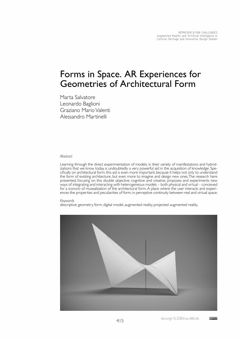
doi.org/10.3280/oa-686.66415
REPRESENTATION CHALLENGESAugmented Reality and Artificial Intelligence in Cultural Heritage and Innovative Design Domain
Abstract
Learning through the direct experimentation of models, in their variety of manifestations and hybrid-izations that we know today, is undoubtedly a very powerful aid in the acquisition of knowledge. Spe-cifically on architectural form, this aid is even more important, because it helps not only to understand the form of existing architecture, but even more to imagine and design new ones. The research here presented, focusing on this double objective, cognitive and creative, proposes and experiments new ways of integrating and interacting with heterogeneous models – both physical and virtual – conceived for a scenario of musealization of the architectural form. A place where the user interacts and experi-ences the properties and peculiarities of form, in perceptive continuity between real and virtual space.
Keywordsdescriptive geometry, form, digital model, augmented reality, projected augmented reality.
Forms in Space. AR Experiences for Geometries of Architectural Form Marta Salvatore Leonardo BaglioniGraziano Mario ValentiAlessandro Martinelli
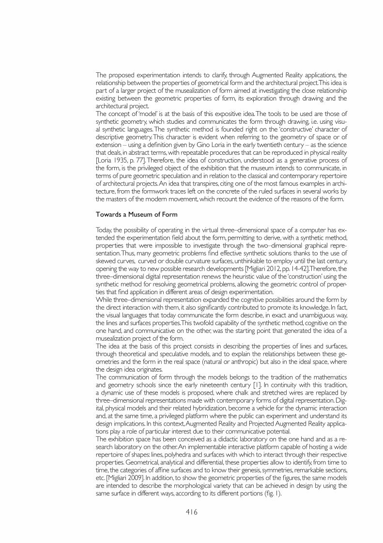
416
The proposed experimentation intends to clarify, through Augmented Reality applications, the relationship between the properties of geometrical form and the architectural project. This idea is part of a larger project of the musealization of form aimed at investigating the close relationship existing between the geometric properties of form, its exploration through drawing and the architectural project.The concept of ‘model’ is at the basis of this expositive idea. The tools to be used are those of synthetic geometry, which studies and communicates the form through drawing, i.e. using visu-al synthetic languages. The synthetic method is founded right on the ‘constructive’ character of descriptive geometry. This character is evident when referring to the geometry of space or of extension – using a definition given by Gino Loria in the early twentieth century – as the science that deals, in abstract terms, with repeatable procedures that can be reproduced in physical reality [Loria 1935, p. 77]. Therefore, the idea of construction, understood as a generative process of the form, is the privileged object of the exhibition that the museum intends to communicate, in terms of pure geometric speculation and in relation to the classical and contemporary repertoire of architectural projects. An idea that transpires, citing one of the most famous examples in archi-tecture, from the formwork traces left on the concrete of the ruled surfaces in several works by the masters of the modern movement, which recount the evidence of the reasons of the form.
Towards a Museum of Form
Today, the possibility of operating in the virtual three–dimensional space of a computer has ex-tended the experimentation field about the form, permitting to derive, with a synthetic method, properties that were impossible to investigate through the two–dimensional graphical repre-sentation. Thus, many geometric problems find effective synthetic solutions thanks to the use of skewed curves, curved or double curvature surfaces, unthinkable to employ until the last century, opening the way to new possible research developments [Migliari 2012, pp. 14-42]. Therefore, the three–dimensional digital representation renews the heuristic value of the ‘construction’ using the synthetic method for resolving geometrical problems, allowing the geometric control of proper-ties that find application in different areas of design experimentation.While three–dimensional representation expanded the cognitive possibilities around the form by the direct interaction with them, it also significantly contributed to promote its knowledge. In fact, the visual languages that today communicate the form describe, in exact and unambiguous way, the lines and surfaces properties. This twofold capability of the synthetic method, cognitive on the one hand, and communicative on the other, was the starting point that generated the idea of a musealization project of the form.The idea at the basis of this project consists in describing the properties of lines and surfaces, through theoretical and speculative models, and to explain the relationships between these ge-ometries and the form in the real space (natural or anthropic) but also in the ideal space, where the design idea originates.The communication of form through the models belongs to the tradition of the mathematics and geometry schools since the early nineteenth century [1]. In continuity with this tradition, a dynamic use of these models is proposed, where chalk and stretched wires are replaced by three–dimensional representations made with contemporary forms of digital representation. Dig-ital, physical models and their related hybridization, become a vehicle for the dynamic interaction and, at the same time, a privileged platform where the public can experiment and understand its design implications. In this context, Augmented Reality and Projected Augmented Reality applica-tions play a role of particular interest due to their communicative potential.The exhibition space has been conceived as a didactic laboratory on the one hand and as a re-search laboratory on the other. An implementable interactive platform capable of hosting a wide repertoire of shapes: lines, polyhedra and surfaces with which to interact through their respective properties. Geometrical, analytical and differential, these properties allow to identify, from time to time, the categories of affine surfaces and to know their genesis, symmetries, remarkable sections, etc. [Migliari 2009]. In addition, to show the geometric properties of the figures, the same models are intended to describe the morphological variety that can be achieved in design by using the same surface in different ways, according to its different portions (fig. 1).
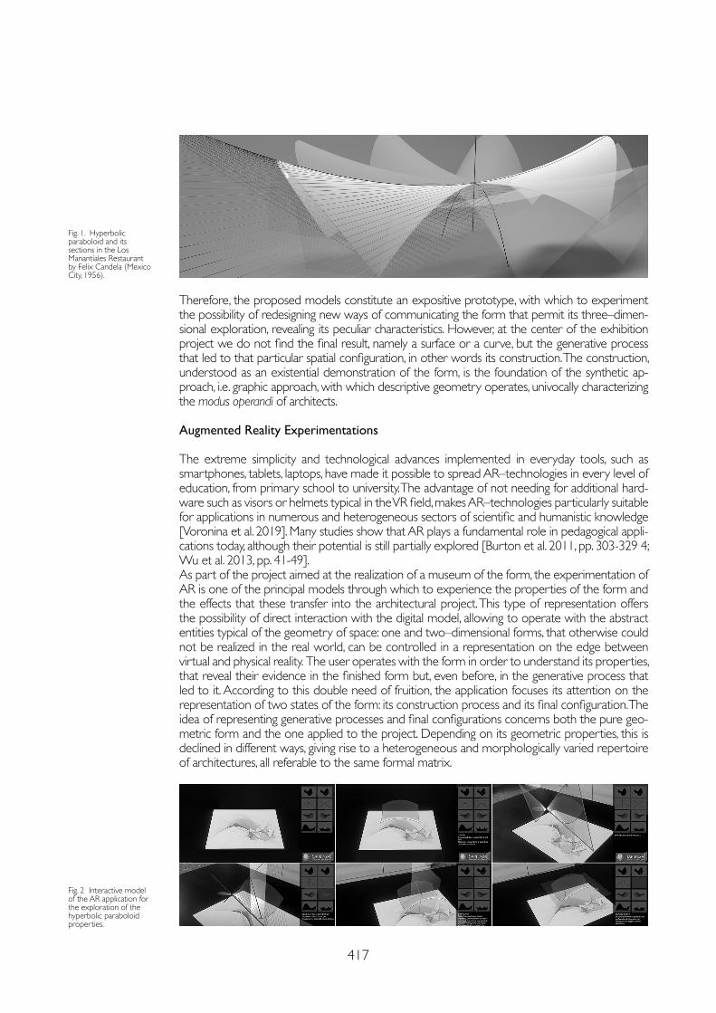
417
Therefore, the proposed models constitute an expositive prototype, with which to experiment the possibility of redesigning new ways of communicating the form that permit its three–dimen-sional exploration, revealing its peculiar characteristics. However, at the center of the exhibition project we do not find the final result, namely a surface or a curve, but the generative process that led to that particular spatial configuration, in other words its construction. The construction, understood as an existential demonstration of the form, is the foundation of the synthetic ap-proach, i.e. graphic approach, with which descriptive geometry operates, univocally characterizing the modus operandi of architects.
Augmented Reality Experimentations
The extreme simplicity and technological advances implemented in everyday tools, such as smartphones, tablets, laptops, have made it possible to spread AR–technologies in every level of education, from primary school to university. The advantage of not needing for additional hard-ware such as visors or helmets typical in the VR field, makes AR–technologies particularly suitable for applications in numerous and heterogeneous sectors of scientific and humanistic knowledge [Voronina et al. 2019]. Many studies show that AR plays a fundamental role in pedagogical appli-cations today, although their potential is still partially explored [Burton et al. 2011, pp. 303-329 4; Wu et al. 2013, pp. 41-49]. As part of the project aimed at the realization of a museum of the form, the experimentation of AR is one of the principal models through which to experience the properties of the form and the effects that these transfer into the architectural project. This type of representation offers the possibility of direct interaction with the digital model, allowing to operate with the abstract entities typical of the geometry of space: one and two–dimensional forms, that otherwise could not be realized in the real world, can be controlled in a representation on the edge between virtual and physical reality. The user operates with the form in order to understand its properties, that reveal their evidence in the finished form but, even before, in the generative process that led to it. According to this double need of fruition, the application focuses its attention on the representation of two states of the form: its construction process and its final configuration. The idea of representing generative processes and final configurations concerns both the pure geo-metric form and the one applied to the project. Depending on its geometric properties, this is declined in different ways, giving rise to a heterogeneous and morphologically varied repertoire of architectures, all referable to the same formal matrix.
Fig. 1. Hyperbolic paraboloid and its sections in the Los Manantiales Restaurant by Felix Candela (Mexico City, 1956).
Fig. 2 Interactive model of the AR application for the exploration of the hyperbolic paraboloid properties.
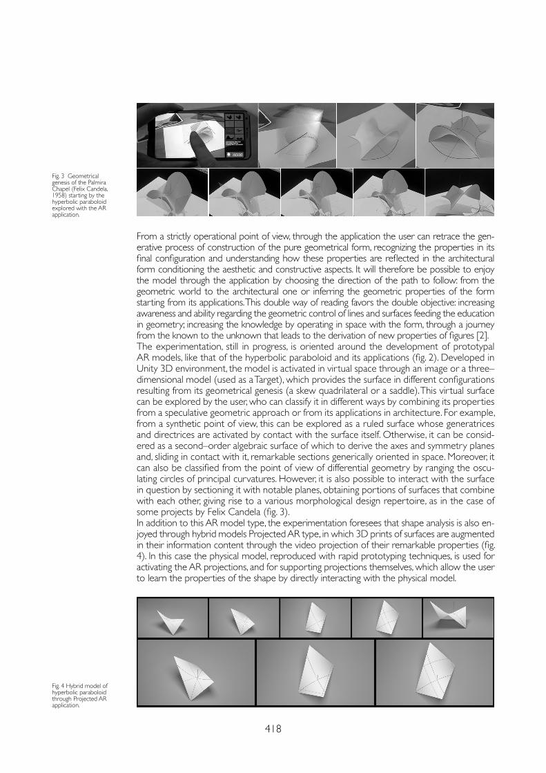
418
From a strictly operational point of view, through the application the user can retrace the gen-erative process of construction of the pure geometrical form, recognizing the properties in its final configuration and understanding how these properties are reflected in the architectural form conditioning the aesthetic and constructive aspects. It will therefore be possible to enjoy the model through the application by choosing the direction of the path to follow: from the geometric world to the architectural one or inferring the geometric properties of the form starting from its applications. This double way of reading favors the double objective: increasing awareness and ability regarding the geometric control of lines and surfaces feeding the education in geometry; increasing the knowledge by operating in space with the form, through a journey from the known to the unknown that leads to the derivation of new properties of figures [2].The experimentation, still in progress, is oriented around the development of prototypal AR models, like that of the hyperbolic paraboloid and its applications (fig. 2). Developed in Unity 3D environment, the model is activated in virtual space through an image or a three–dimensional model (used as a Target), which provides the surface in different configurations resulting from its geometrical genesis (a skew quadrilateral or a saddle). This virtual surface can be explored by the user, who can classify it in different ways by combining its properties from a speculative geometric approach or from its applications in architecture. For example, from a synthetic point of view, this can be explored as a ruled surface whose generatrices and directrices are activated by contact with the surface itself. Otherwise, it can be consid-ered as a second–order algebraic surface of which to derive the axes and symmetry planes and, sliding in contact with it, remarkable sections generically oriented in space. Moreover, it can also be classified from the point of view of differential geometry by ranging the oscu-lating circles of principal curvatures. However, it is also possible to interact with the surface in question by sectioning it with notable planes, obtaining portions of surfaces that combine with each other, giving rise to a various morphological design repertoire, as in the case of some projects by Felix Candela (fig. 3).In addition to this AR model type, the experimentation foresees that shape analysis is also en-joyed through hybrid models Projected AR type, in which 3D prints of surfaces are augmented in their information content through the video projection of their remarkable properties (fig. 4). In this case the physical model, reproduced with rapid prototyping techniques, is used for activating the AR projections, and for supporting projections themselves, which allow the user to learn the properties of the shape by directly interacting with the physical model.
Fig. 3 Geometrical genesis of the Palmira Chapel (Felix Candela, 1958) starting by the hyperbolic paraboloid explored with the AR application.
Fig. 4 Hybrid model of hyperbolic paraboloid through Projected AR application.
419
Conclusions
Representation has always had a central role in the genesis of the architectural project. The graphical exercise has always been an immediate expression of design thinking and a tool for the progressive elaboration of an idea that is nourished and grows through the repetition of its own representation, in a virtuous circle that accompanies the entire design process. Exploration of the form through drawing, namely by its construction, leads to increas-ing knowledge by passing from the known to the unknown, researching new properties of shape to derive. In this regard, the heuristic value of representation reveals its maximum ex-pressive potential. Thus, the three–dimensional representation and its exploration constitutes a flywheel for research into architectural form, revealing its geometrical motivations in virtual space. The proposed experimental models, developed through AR and Projected AR experi-ences, describe the construction of form and show its properties, illustrating the potential of aggregation deriving from them. Potentialities that generate a wide and heterogeneous mor-phological repertoire of which several architectural projects are the expression.
Notes
[1] The project is inspired by the collections of mathematical models made in Europe between the second half of the nineteenth century and the early twentieth century. These exhibitions were aimed at “showing remarkable properties concerning the research topic investigated and showing some results that were progressively achieved in different fields of ‘pure’ and ‘applied’ mathematics: Descriptive and Projective Geometry, Analytical Geometry, Algebraic Geometry” [Palladino 2008, p. 31].
[2] The didactic purposes also include the implementation of learning tasks to verify understanding [Kaufmann 2003, pp. 339-345].
[3] The idea of knowledge as a passage from the known to the unknown is a founding principle of descriptive geometry. It was introduced by Monge in the first pages of his Géométrie Descriptive, where he illustrated its objectives and principles; today, in the field of digital representation, it still appears highly relevant [Monge 1798, p. 2].
References
Burton Erin Peters, Frazier Wendi, Annetta Leonard, Lamb Richard, Cheng Rebecca, Chmiel Margaret (2011). Modeling Augmented Reality Games with Preservice Elementary and Secondary Science Teachers. In Journal of Technology and Teacher Education, 19 (3), pp. 303-329.
Kaufmann Hannes, Schmalstieg Dieter (2003). Mathematics and geometry education with collaborative augmented reality. In Computers & Graphics, 27, pp. 339-345.
Loria Gino (1935). Metodi matematici. Milano: Hoepli.
Migliari Riccardo (2009). Geometria descrittiva. Vol. II. Novara: CittàStudi Edizioni.
Migliari Riccardo (2012). La geometria descrittiva nel quadro storico della sua evoluzione dalle origini alla rappresentazione digitale. In Carlevaris Laura, De Carlo Laura, Migliari Riccardo (ed.). Attualità della geometria descrittiva. Roma: Gangemi, pp. 15-42.
Monge Gaspard (1798). Géométrie descriptive. Paris: Baudouin.
Palladino Nicola, Palladino Franco (2008). I modelli matematici costruiti per l’insegnamento delle matematiche superiori pure e applicate. In Ratio Mathematica, 19, pp. 31-88.
Voronina V. Marianna, Tretyakova Zlata, Krivonozhkina Ekaterina G., Buslaev Stanislav I., Sidorenko Grigory G. (2019). Augmented Reality in Teaching Descriptive Geometry, Engineering and Computer Graphics – Systematic Review and Results of the Russian Teachers’ Experience. In EURASIA Journal of Mathematics, Science and Technology Education, 15 (12), pp. 2-17.
Wu Hsin–Kai, Lee Silvia Wen–Yu, Chang Hsin–Yi, Liang Jyh–Chong (2013). Current status, opportunities and challenges of augmented reality in education. In Computers & Education, 62, pp. 41-49.
Copyright © 2021 by FrancoAngeli s.r.l. Milano, Italy Isbn 9788835125280
AuthorsMarta Salvatore, Dept. of History, Representation and Restoration of Architecture, Sapienza University of Rome, [email protected] Baglioni, Dept. of History, Representation and Restoration of Architecture, Sapienza University of Rome, [email protected] Mario Valenti, Dept. of History, Representation and Restoration of Architecture, Sapienza University of Rome, [email protected] Martinelli, Dept. of History, Representation and Restoration of Architecture, Sapienza University of Rome, [email protected]

doi.org/10.3280/oa-686.67421
REPRESENTATION CHALLENGESAugmented Reality and Artificial Intelligence in Cultural Heritage and Innovative Design Domain
Abstract
The class of Digital Representation Techniques is an optional class for architecture and engineering students at the Politecnico di Torino. For the second year, the program of the class, focused on the the-oretical and applicative panorama of technologies for digital drawing, integrates an introduction to the most recent developments in augmented reality (AR) and artificial intelligence (AI), two technological fields that are deeply influencing the interpretation of physical assets through digital models. The class requires students to produce different deliverables, including a research essay, graphic representation documents (plates or brochures), a video proving animation and editing skills, and a prototype AR ap-plication. The proposed contribution presents methods, objectives, and some of the results of the class, highlighting the interaction between the different digital representation techniques and deepening the critical aspects related to the introduction of new AR and AI technologies.
Keywordsaugmented reality, artificial intelligence, didactics, representation, design.
AR&AI in the Didactics of the Representation Disciplines Roberta SpalloneValerio Palma
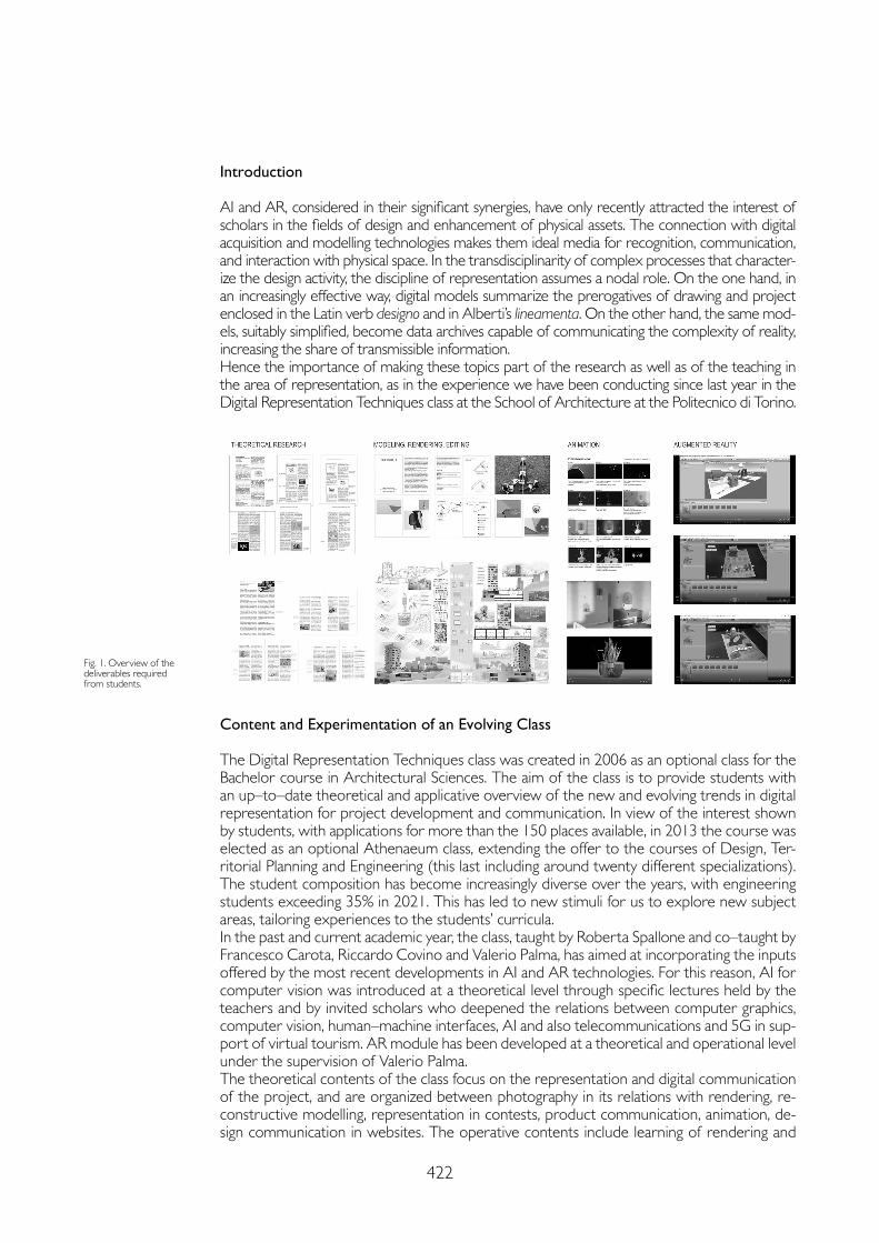
422
Introduction
AI and AR, considered in their significant synergies, have only recently attracted the interest of scholars in the fields of design and enhancement of physical assets. The connection with digital acquisition and modelling technologies makes them ideal media for recognition, communication, and interaction with physical space. In the transdisciplinarity of complex processes that character-ize the design activity, the discipline of representation assumes a nodal role. On the one hand, in an increasingly effective way, digital models summarize the prerogatives of drawing and project enclosed in the Latin verb designo and in Alberti’s lineamenta. On the other hand, the same mod-els, suitably simplified, become data archives capable of communicating the complexity of reality, increasing the share of transmissible information.Hence the importance of making these topics part of the research as well as of the teaching in the area of representation, as in the experience we have been conducting since last year in the Digital Representation Techniques class at the School of Architecture at the Politecnico di Torino.
Fig. 1. Overview of the deliverables required from students.
Content and Experimentation of an Evolving Class
The Digital Representation Techniques class was created in 2006 as an optional class for the Bachelor course in Architectural Sciences. The aim of the class is to provide students with an up–to–date theoretical and applicative overview of the new and evolving trends in digital representation for project development and communication. In view of the interest shown by students, with applications for more than the 150 places available, in 2013 the course was elected as an optional Athenaeum class, extending the offer to the courses of Design, Ter-ritorial Planning and Engineering (this last including around twenty different specializations). The student composition has become increasingly diverse over the years, with engineering students exceeding 35% in 2021. This has led to new stimuli for us to explore new subject areas, tailoring experiences to the students’ curricula.In the past and current academic year, the class, taught by Roberta Spallone and co–taught by Francesco Carota, Riccardo Covino and Valerio Palma, has aimed at incorporating the inputs offered by the most recent developments in AI and AR technologies. For this reason, AI for computer vision was introduced at a theoretical level through specific lectures held by the teachers and by invited scholars who deepened the relations between computer graphics, computer vision, human–machine interfaces, AI and also telecommunications and 5G in sup-port of virtual tourism. AR module has been developed at a theoretical and operational level under the supervision of Valerio Palma.The theoretical contents of the class focus on the representation and digital communication of the project, and are organized between photography in its relations with rendering, re-constructive modelling, representation in contests, product communication, animation, de-sign communication in websites. The operative contents include learning of rendering and
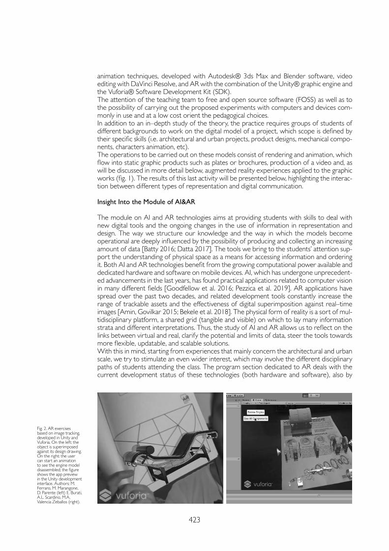
423
animation techniques, developed with Autodesk® 3ds Max and Blender software, video editing with DaVinci Resolve, and AR with the combination of the Unity® graphic engine and the Vuforia® Software Development Kit (SDK).The attention of the teaching team to free and open source software (FOSS) as well as to the possibility of carrying out the proposed experiments with computers and devices com-monly in use and at a low cost orient the pedagogical choices.In addition to an in–depth study of the theory, the practice requires groups of students of different backgrounds to work on the digital model of a project, which scope is defined by their specific skills (i.e. architectural and urban projects, product designs, mechanical compo-nents, characters animation, etc).The operations to be carried out on these models consist of rendering and animation, which flow into static graphic products such as plates or brochures, production of a video and, as will be discussed in more detail below, augmented reality experiences applied to the graphic works (fig. 1). The results of this last activity will be presented below, highlighting the interac-tion between different types of representation and digital communication.
Insight Into the Module of AI&AR
The module on AI and AR technologies aims at providing students with skills to deal with new digital tools and the ongoing changes in the use of information in representation and design. The way we structure our knowledge and the way in which the models become operational are deeply influenced by the possibility of producing and collecting an increasing amount of data [Batty 2016; Datta 2017]. The tools we bring to the students’ attention sup-port the understanding of physical space as a means for accessing information and ordering it. Both AI and AR technologies benefit from the growing computational power available and dedicated hardware and software on mobile devices. AI, which has undergone unprecedent-ed advancements in the last years, has found practical applications related to computer vision in many different fields [Goodfellow et al. 2016; Pezzica et al. 2019]. AR applications have spread over the past two decades, and related development tools constantly increase the range of trackable assets and the effectiveness of digital superimposition against real–time images [Amin, Govilkar 2015; Bekele et al. 2018]. The physical form of reality is a sort of mul-tidisciplinary platform, a shared grid (tangible and visible) on which to lay many information strata and different interpretations. Thus, the study of AI and AR allows us to reflect on the links between virtual and real, clarify the potential and limits of data, steer the tools towards more flexible, updatable, and scalable solutions.With this in mind, starting from experiences that mainly concern the architectural and urban scale, we try to stimulate an even wider interest, which may involve the different disciplinary paths of students attending the class. The program section dedicated to AR deals with the current development status of these technologies (both hardware and software), also by
Fig. 2. AR exercises based on image tracking, developed in Unity and Vuforia. On the left: the object is superimposed against its design drawing. On the right: the user can start an animation to see the engine model disassembled; the figure shows the app preview in the Unity development interface. Authors: M. Ferraro, M. Marangone, D. Parente (left) E. Burati, A.L. Scardino, M.A. Valencia Zeballos (right).

424
presenting the research experiences conducted at the Politecnico by the teachers. Besides, we try to clarify both the potential of the technology and the critical aspects (e.g., limits in in-teroperability). The theoretical part of the module deals with the most popular AR, AI tools for image recognition (in particular, AR image tracking functions and DL algorithms) and integrates insights into the role of fifth–generation cellular networks (5G) in future scenarios of transmission of information. The aim is to emphasize that technological advances do not only constitute quantitative leaps in data gathering but also require the transformation of the methods and models to organize digital information.
Objectives and Examples of the Students’ Work
In the operational phase of the course (consisting of exercises) we provide the tools for building a simple AR application based on image recognition. We adopt the Unity video game development engine and the Vuforia AR kit, which are software with a short learning curve, requiring little previous experience with coding, and allowing free use for development. However, a broader landscape of competing products and development options is present-ed. Other practical indications are aimed at stimulating in–depth studies and experiments with particular AR or user interface functions, such as interactive elements, animations, oth-er possibilities related to the integration of scripts and non–flat AR markers. Beyond the technical requirements of the deliverables, students are expected to conduct the exercises reflecting on two fundamental and connected aspects.1. The first aspect is the link between real space and digital information (such as 3D mod-
els, graphic interface elements, databases). We expect students not to consider the real object just as the target for AR activation but as an object that can be studied through its digital model with the help of AR.
2. The second aspect that we ask to explore is the innovativeness of the developed applica-tion. In fact, in the case of digital representation, attention must be paid not to replicate uses of the model already available through other widespread technologies, such as vir-tual reality or simple on–screen navigation.
Fig. 3. AR exercise based on image tracking, developed in Unity and Vuforia. The target image is printed on a mobile card to simulate an arm prosthesis. When the user reaches the virtual ball, the prosthetic hand grabs it. Authors: G. Brero, A. Porcelli, M. Pettiti.
Fig. 4. AR exercise based on image tracking, developed in Unity and Vuforia. The students presented a videogame in which the AR target image has to be reassembled before to se the 3D layer. Then, the user is challenged to search the correct viewpoint to find an hidden message. Authors: F. Rampolla, V. Mencarelli, D. Fiabane, M. Bosco.
425
Therefore, we aim at continuity with the theoretical part, and we intend to highlight through practice the distinction between the excitement for novelty and more significant and long–lasting transformations enabled by technology.Among the first year’s results of this operational phase, several deliverables show good re-ception of the offered stimuli (the level of complexity depends on the students’ choice to deepen AR or other topics in the program).Some exercises emphasize the relationship between target image and model, letting the two parts complement each other, e.g., by using a printed drawing to show the constructive geometries of a design object while the AR model, correctly scaled, shows the rendering (fig. 2, left). In other exercises with the simple image target system, students proposed interactive solutions, employing buttons and animations (fig. 2, right).There are also more elaborate works. A team of computer and biomedical engineering students worked on a robotic prosthetic arm project (started in another class). They produced an application prototype that features a wearable target to simulate the use of the prosthesis. The exercise also included the interaction with other virtual objects, e.g., for activating an animation of the arm (fig. 3). Another team of cinema and media engineering students has instead created a gaming appli-cation that features the interaction between a website and the mobile device, proposing an enigma in which AR is used to change the point of view on a three–dimensional object (fig. 4).
Conclusion
It is difficult to speak of conclusions for a class that is constantly evolving. Rather, by recording the success of the new topics in terms of interest and results, new transdisciplinary perspectives can be outlined, opening up the possibility of developing master’s theses and doctoral courses, as is starting to happen. In fact, a thesis in Design and Visual Communication has just been discussed. It combined the disciplines of Representation and Information Processing Systems in the realization of AR and VR experiences for the enhancement of the heritage of the Museum of Oriental Art (MAO) in Turin, and two more on the same topics are being prepared [1].
References
Amin Dhiraj, Govilkar Sharvari (2015). Comparative Study of Augmented Reality SDK’s. In International Journal on Computational Science & Applications, 5(1), pp. 11-26.
Batty, Michael (2016). Editorial: Big Data, Cities and Herodotus. In Built Environment, 42(3), pp. 317-320.
Bekele Mafkereseb Kassahun, Pierdicca, Roberto, Frontoni, Emanuele, Malinverni, Eva Savina, Gain, James (2018). A Survey of Augmented, Virtual, and Mixed Reality for Cultural Heritage. In Journal on Computing and Cultural Heritage, 11(2), pp. 1-36.
Datta Shoumen Palit Austin (2017). Emergence of Digital Twins – Is this the march of reason? In Journal of Innovation Management, 5(3), pp. 14-33.
Goodfellow Ian, Bengio Yoshua, Courville Aaron (2016). Deep Learning. Cambridge: MIT Press.
Pezzica Camilla, Schroeter Julien, Prizeman Oriel, Jones Christopher, Rosin, Paul (2019). Between Images and Built Form: Automating the Recognition of Standardised Building Components Using Deep Learning. In ISPRS Annals of Photogrammetry, Remote Sensing and Spatial Information Sciences, IV–2/W6, pp. 123-132.
Notes
[1] This paper, the result of a teaching activity shared by the two authors, was written by: R. Spallone (Introduction, Content and experi-mentation of an evolving class, Conclusion) V. Palma (Insight into the module of AI&AR, Objectives and examples of the students’ work).
Copyright © 2021 by FrancoAngeli s.r.l. Milano, Italy Isbn 9788835125280
AuthorsRoberta Spallone, Dept. of Architecture and Design, Politecnico di Torino, [email protected] Valerio Palma, Dept. of Architecture and Design, Politecnico di Torino, [email protected]

doi.org/10.3280/oa-686.68427
REPRESENTATION CHALLENGESAugmented Reality and Artificial Intelligence in Cultural Heritage and Innovative Design Domain
Abstract
This paper aims to test algorithms for 3D reconstruction from a single image specifically for building envelopes. This research shows the current limitations of these approaches when applied to classes outside of the initial distribution. We tested solutions with differentiable rendering, implicit functions, and other end–to–end geometric deep learning approaches. We recognize the importance of gener-ating a 3D reconstruction from a single image for many different industries, not only for Architecture, Engineering, and Construction (AEC) industry but also for robotics, autonomous driving, gaming, virtual and augmented reality, drone delivery, 3D authoring, improving 2D recognition and many others. Henceforth, engineers and computer scientists could benefit, not only from having the 3D representations but also from the Building Information Model (BIM) at their disposal. With further development of these algorithms it could be possible to access specific properties such as thermal, physical, maintenance, cost, and other parameters embedded in the class.
Keywordsgeometric deep learning, monocular 3D reconstruction, building envelope, architecture.
Limitations and Review of Geometric Deep Learning Algorithms for Monocular 3D Reconstruction in ArchitectureAlberto TonoMeher Shashwat NigamStasya FedorovaAmirhossein AhmadniaCecilia Bolognesi
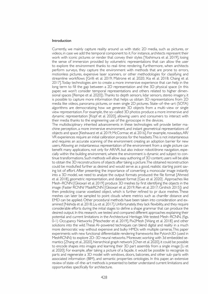
428
Introduction
Currently, we mainly capture reality around us with static 2D media, such as pictures, or videos, in case we add the temporal component to it. For instance, architects represent their work with iconic pictures or render that convey their styles [Yoshimura et al. 2019], losing the sense of immersion provided by volumetric representations that can allow the user to explore the environment thanks to real–time rendering. Furthermore, when architects perform surveys, they capture the environment with methods that are prone to errors, motionless pictures, expensive laser scanners, or other methodologies for classifying and streamline workflows [Grilli et al. 2019; Matrone et al. 2020; Xia et al. 2018; Chang et al. 2017]. Today technologies aim to create a more immersive experience that can help in the long term to fill the gap between a 2D representation and the 3D physical space (in this paper, we won’t consider temporal representations and others related to higher dimen-sional spaces [Rempe et al. 2020]). Thanks to depth sensors, lidar sensors, stereo imagery, it is possible to capture more information that helps us obtain 3D representations from 2D media like videos, panorama pictures, or even single 2D pictures. State–of–the–art (SOTA) algorithms are democratizing how we generate 3D objects from a multi–view or single view representation. For example, the so–called 3D photos produce a more immersive and dynamic representation [Kopf et al. 2020], allowing users and consumers to interact with their media thanks to the engineering use of the gyroscope in the devices.The multidisciplinary inherited advancements in these technologies will provide better ma-chine perception, a more immersive environment, and instant geometrical representations of objects and space [Keshavarzi et al. 2019; McCormac et al. 2016]. For example, nowadays, AR/VR experiences require an initial calibration process for the headsets. This is not instantaneous and requires an accurate scanning of the environment creating an adoption barrier for new users. Allowing an instantaneous representation of the environment from a single picture can benefit many applications, not only for AR/VR, but also indoor robot/drone navigation, espe-cially within the building environment, where the environment is dynamic and subject to con-tinue transformations. Such methods will allow easy authoring of 3D content, users will be able to obtain the 3D reconstructions of objects after taking a picture. The obtained reconstruction could be modiufied further as desired and would serve as a good, realistic starting point sav-ing lot of effort. After presenting the importance of converting a monocular image instantly into a 3D model, we need to analyze the output formats produced: the file format [Ahmed et al. 2018], geometric representation, and dataset format [Gao et al. 2020] . Approaches like Mesh–RCNN [Gkioxari et al. 2019] produce 3D meshes by first identifying the objects in the image (Faster RCNN/ MaskRCNN [Gkioxari et al. 2019; Ren et al. 2017; Girshick 2015]) and then predicting coarse voxelized object, which is further refined to pr duce meshes. These meshes can later be sampled to point clouds where metrics such as chamfer distance and EMD can be applied. Other procedural methods have been taken into consideration and ex-amined [Nishida et al. 2018; Liu et al. 2017]. Unfortunately, they lack flexibility, and they require considerable efforts during the initial stages to define a shape grammar that can produce the desired output. In this research, we tested and compared different approaches explaining their potential and current limitations in the Architectural Heritage. We tested: Mesh–RCNN, (figs. 0-1) Occupancy Networks [Mescheder et al. 2019], Pix2Mesh [Wang et al. 2018] and other solutions into the wild. These AI–powered techniques can blend digital and reality in a much more democratic way without expensive and bulky HMDs with multiple cameras. This paper experiments with new functional differentiable rendering frameworks like Pytorch3D (used in MeshRCNN) to explore 2D–3D neural networks. Moreover, working with 3d embedded se-mantics [Zhang et al., 2020], hierarchical graph network [Chen et al. 2020], it could be possible to encode shapes into images and learning their 3D part assembly from a single image [Li et al. 2020]. For example, after taking a picture of a façade, it would be possible to recognize its parts and regenerate a 3D model with windows, doors, balconies, and other sub–parts with associated information (BIM), and semantic properties ontologies. In this paper, an extensive review of state–of–the–art methods is presented to better understand current limitations and opportunities specifically for architecture.
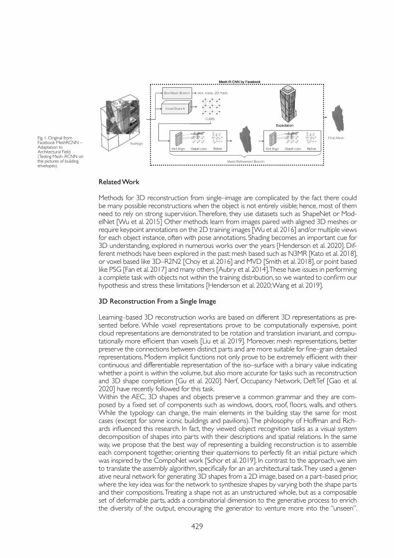
429
Related Work
Methods for 3D reconstruction from single–image are complicated by the fact there could be many possible reconstructions when the object is not entirely visible; hence, most of them need to rely on strong supervision. Therefore, they use datasets such as ShapeNet or Mod-elNet [Wu et al. 2015] Other methods learn from images paired with aligned 3D meshes or require keypoint annotations on the 2D training images [Wu et al. 2016] and/or multiple views for each object instance, often with pose annotations. Shading becomes an important cue for 3D understanding, explored in numerous works over the years [Henderson et al. 2020]. Dif-ferent methods have been explored in the past: mesh based such as N3MR [Kato et al. 2018], or voxel based like 3D–R2N2 [Choy et al. 2016] and MVD [Smith et al. 2018], or point based like PSG [Fan et al. 2017] and many others [Aubry et al. 2014]. These have issues in performing a complete task with objects not within the training distribution, so we wanted to confirm our hypothesis and stress these limitations [Henderson et al. 2020; Wang et al. 2019].
3D Reconstruction From a Single Image
Learning–based 3D reconstruction works are based on different 3D representations as pre-sented before. While voxel representations prove to be computationally expensive, point cloud representations are demonstrated to be rotation and translation invariant, and compu-tationally more efficient than voxels [Liu et al. 2019]. Moreover, mesh representations, better preserve the connections between distinct parts and are more suitable for fine–grain detailed representations. Modern implicit functions not only prove to be extremely efficient with their continuous and differentiable representation of the iso–surface with a binary value indicating whether a point is within the volume, but also more accurate for tasks such as reconstruction and 3D shape completion [Gu et al. 2020]. Nerf, Occupancy Network, DeftTef [Gao et al. 2020] have recently followed for this task.Within the AEC, 3D shapes and objects preserve a common grammar and they are com-posed by a fixed set of components such as windows, doors, roof, floors, walls, and others. While the typology can change, the main elements in the building stay the same for most cases (except for some iconic buildings and pavilions). The philosophy of Hoffman and Rich-ards influenced this research. In fact, they viewed object recognition tasks as a visual system decomposition of shapes into parts with their descriptions and spatial relations. In the same way, we propose that the best way of representing a building reconstruction is to assemble each component together, orienting their quaternions to perfectly fit an initial picture which was inspired by the CompoNet work [Schor et al. 2019]. In contrast to the approach, we aim to translate the assembly algorithm, specifically for an an architectural task. They used a gener-ative neural network for generating 3D shapes from a 2D image, based on a part–based prior, where the key idea was for the network to synthesize shapes by varying both the shape parts and their compositions. Treating a shape not as an unstructured whole, but as a composable set of deformable parts, adds a combinatorial dimension to the generative process to enrich the diversity of the output, encouraging the generator to venture more into the “unseen”.
Fig. 1. Original from Facebook MeshRCNN – Adaptation to Architectural Field.(Testing Mesh–RCNN on the pictures of building envelopes).
430
They generated a plethora of shapes compared with baseline generative models using their custom metrics. The assembly–based synthesis was inspired by 3D shape assembly research that generates new shapes from a combination of various parts [Huang et al. 2020; Li et al. 2019] from a single image.
Conclusion
We saw that projects such as Mesh–RCNN lack the ability to perform well with unseen classes. This limitation of generalizing to unseen classes make these approaches challeng-ing to adopt. Furthermore, the training of these algorithms required multi–GPU training(8 GPUs V100, for Mesh–RCNN) that not all the researchers can access. The current lack of a common balanced dataset (with intra and inter–class variance), or pre–trained models that generalize well to unseen data, are missing in the research community, and with this research we hope to stress the importance of the creation of such datasets and models. Another limitation is embedded in the metrics used to evaluate the performance of these algorithms: chamfer distance, EMD (earth moving distance), mAP and others offer good quantitative results distant from a recognizable representation that follows qualitative results. Finally, the creation of such dataset could provide new research on 3D shape explorations for archi-tects using Generative Adversarial Network in 3D like ShapeGAN and 3DGAN [Kleine-berg et al. 2020; Freeman et al. 2016].
References
Ahmed Eman, Saint Alexandre, Shabayek Abd El Rahman, Cherenkova Kseniya, Das Rig, Gusev Gleb, Aouada Djamila, Ottersten Bjorn (2018). A survey on deep learning advances on different 3D data representations. In arXiv, 1 (1), pp. 1-35.
Aubry Mathieu, Maturana Daniel, Efros Alexei A., Russell Bryan C., Sivic Josef (2014). Seeing 3D chairs: Exemplar part–based 2D–3D alignment using a large dataset of CAD models. In Proc. IEEE Comput. Soc. Conf. Comput. Vis. Pattern Recognit., pp. 3762-3769.
Chang Angel, Dai Angela, Funkhouser Thomas, Halber Maciej, Nießner Matthias, Savva Manolis, Song Shuran, Zeng Andy, Zhang Yinda (2018). Matterport3D: Learning from RGB–D data in indoor environments. In Proc. – 2017 Int. Conf. 3D Vision,3DV 2017, pp. 667-676.
Chen Jintai, Lei Biwen, Song Qingyu, Ying Haochao, Chen Danny Z. , Wu Jian (2020). A Hierarchical Graph Network for 3D Object Detection on Point Clouds. In Proc. IEEE Comput. Soc. Conf. Comput. Vis. Pattern Recognit., pp. 389-398.
Choy Christopher B., Xu Danfei, Gwak JunYoung, Chen Kevin, Savarese Silvio (2016). 3D–R2N2: A unified approach for single and multi–view 3D object reconstruction. In Lect. Notes Comput. Sci. (including Subser. Lect. Notes Artif. Intell. Lect. Notes Bioinformatics), vol. 9912 LNCS, pp. 628-644.
Fan Haoqiang, Su Hao, Guibas Leonidas J. (2017). A point set generation network for 3D object reconstruction from a single image. In Proc. – 30th IEEE Conf. Comput. Vis. Pattern Recognition, CVPR 2017, pp. 2463-2471.
Gao Jun, Chen Wenzheng, Xiang Tommy, Jacobson Alec, McGuire Morgan, Fidler Sanja (2020). Learning deformable tetrahedral meshes for 3D reconstruction. In arXiv, NeurIPS, pp. 1-12.
Girshick Ross (2015). Fast R–CNN. In Proc. IEEE Int. Conf. Comput. Vis., ICCV, pp. 1440-1448.
Gkioxari Georgia, Malik Jitendra, Johnson Justin (2019) Mesh R–CNN. In Proc. IEEE Int. Conf. Comput. Vis., pp. 9784-9794.
Grilli Eleonora, Remondino Fabio (2019). Classification of 3D digital heritage. In Remote Sensing, 11(7), pp. 1-23.
Gu Jiayuan, Ma Wei–Chiu, Manivasagam Sivabalan, Zeng Wenyuan, Wang Zihao, Xiong Yuwen, Su Hao, Urtasun Raquel (2020). Weakly–Supervised 3D Shape Completion in the Wild. In Lect. Notes Comput. Sci. (including Subser. Lect. Notes Artif. Intell. Lect. Notes Bioinformatics), 12350 LNCS, pp. 283-299.
Henderson Paul, Ferrari Vittorio (2020). Learning Single–Image 3D Reconstruction by Generative Modelling of Shape, Pose and Shading. In Int. J. Comput. Vis., 128 (4), pp. 835-854.
Huang Jialei, Zhan Guanqi, Fan Qingnan, Mo Kaichun, Shao Lin, Chen Baoquan, Guibas Leonidas, Dong Hao (2020). Generative 3D Part Assembly via Dynamic Graph Learning. In arXiv, NeurIPS, pp. 1-19.
Acknowledgment
We would like to thank Andrea Giordano, UniPd, Reaach–Id conference for the opportunity to publish our work. Georgia Gkioxari, Kaichun Mo, Silvio Savarese, Martin Fischer, Andrea Tagliasacchi, Nicolas Chaulet, Lamberto Ballan, Dmitry Kudinov, Mohammed Keshavari, Andrean Zani, Ignacio Garcia Dorado for valuable discussions. We would also like to thank the Com-putational Design Institute.
431
Kato Hiroharu, Ushiku Yoshitaka, Harada Tatsuya (2018). Neural 3D Mesh Renderer. In Proc. IEEE Comput. Soc. Conf. Comput. Vis. Pattern Recognit., pp. 3907-3916.
Keshavarzi Mohammad, Wu Michael, Chin Michael N., Chin Robert N., Yang Allen Y. (2018). Affordance analysis of virtual and augmented reality mediated communication. In arXiv, pp. 1-15.
Kleineberg Marian, Fey Matthias, Weichert Frank (2020). Adversarial generation of continuous implicit shape representations.In arXiv, pp. 1-6.
Kopf Johannes et al. (2020). One Shot 3D Photography, In ACM Trans. Graph., 39 (4), 76, pp. 1-13 .
Li Jun, Niu Chengjie, Xu Kai (2019). Learning Part Generation and Assembly for Structure–aware Shape Synthesis. In AAAI Technical Track: Vision, 34 (07), pp. 1-8.
Li Yichen, Mo Kaichun, Shao Lin, Sung Minhyuk, Guibas Leonidas (2020). Learning 3D Part Assembly from a Single Image. In Lecture Notes in Computer Science, 12351, pp. 1-25.
Liu Hantang, Zhang Jialiang, Zhu Jianke, Hoi Steven C. H. (2017). Deepfacade: A deep learning approach to facade parsing. In IJCAI Int. Jt. Conf. Artif. Intell., 0, pp. 2301-2307.
Liu Zhijian, Tang Haotian, Lin Yujun, Han Song (2019). Point–voxel CNN for efficient 3D deep learning. In Adv. Neural Inf. Process. Syst., vol. 32, no. NeurIPS, pp. 1-11.
Matrone Francesca, Grilli Eleonora, Martini Massimo, Paolanti Marina, Pierdicca Roberto, Remondino Fabio (2020). Comparing machine and deep learning methods for large 3D heritage semantic segmentation. In ISPRS Int. J. Geo–Information, 9 (9), pp. 1-22.
McCormac John, Handa Ankur, Leutenegger Stefan, Davison Andrew J. (2016). SceneNet RGB–D: 5M Photorealistic Images of Synthetic Indoor Trajectories with Ground Truth. In arXiv, pp. 1-11.
Mescheder Lars, Oechsle Michael, Niemeyer Michael, Nowozin Sebastian, Geiger Andreas (2019). Occupancy networks: Learning 3D reconstruction in function space. In Proc. IEEE Comput. Soc. Conf. Comput. Vis. Pattern Recognit., pp. 4455-4465.
Nishida Gen, Bousseau Adrien, Aliaga Daniel G. (2018). Procedural modeling of a building from a single image. In Comput. Graph. Forum, 37 (2), pp. 415-429.
Rempe Davis, Birdal Tolga, Zhao Yongheng, Gojcic Zan, Sridhar Srinath, Guibas Leonidas J. (2020). CaSPR: Learning canonical spatiotemporal point cloud representations. In arXiv, NeurIPS, pp. 1-28.
Ren Shaoqing, He Kaiming, Girshick Ross, Sun Jian (2017). Faster R–CNN: Towards Real–Time Object Detection with Region Proposal Networks. In IEEE Trans. Pattern Anal. Mach. Intell., 39 (6), pp. 1137-1149.
Schor Nadav, Katzir Oren, Zhang Hao, Cohen–Or Daniel (2019). CompoNet: Learning to generate the unseen by part synthesis and composition. In Proc. IEEE Int. Conf. Comput. Vis., pp. 8758-8767.
Smith Edward, Fujimoto Scott, Meger David (2018). Multi–view silhouette and depth decomposition for high resolution 3D object representation. In Adv. Neural Inf. Process. Syst., NeurIPS, pp. 6478-6488.
Xu Qiangeng, Wang Weiyue, Ceylan Duygu, Mech Radomir, Neumann Ulrich (2019). DISN: Deep implicit surface network for high–quality singleview 3d reconstruction. In arXiv, CD, pp. 1-11.
Wang Nanyang, Zhang Yinda, Li Zhuwen, Fu Yanwei, Liu Wei, Jiang Yu–Gang (2018). Pixel2Mesh – Generating Meshes from Single RGB Images. In Eccv, p. 1-16.
Wu Jiajun et al. (2016). Single image 3D interpreter network. In Lect. Notes Comput. Sci. (including Subser. Lect. Notes Artif. Intell. Lect. Notes Bioinformatics), 9910 LNCS, pp. 365-382.
Wu Jiajun, Zhang Chengkai, Xue Tianfan, Tenenbaum Joshua B., Freeman William T. (2016). Learning a Probabilistic Latent Space of Object Shapes via 3D Generative–Adversarial Modeling. In 30th Conference on Neural Information Processing Systems, pp. 1-9.
Wu Zhirong et al. (2015). 3D ShapeNets: A deep representation for volumetric shapes. In Proc. IEEE Comput. Soc. Conf. Comput. Vis. Pattern Recognit., pp. 1912-1920.
Xia Fei, Zamir Amir R., He Zhiyang, Sax Alexander, Malik Jitendra, Savarese Silvio (2018). Gibson Env: Real–World Perception for Embodied Agents. In Proc. IEEE Comput. Soc. Conf. Comput. Vis. Pattern Recognit., pp. 9068-9079.
Yoshimura Yuji, Cai Bill, Wang Zhoutong, Ratti Carlo (2019). Deep learning architect: Classification for architectural design through the eye of artificial intelligence. In Lect. Notes Geoinf. Cartogr., pp. 249-265.
Zhang Dongsu, Chun Junha, Cha Sang Kyun, Kim Young Min (2020). Spatial Semantic Embedding Network: Fast 3D Instance Segmentation with Deep Metric Learning. In arXiv, pp. 1-8.
Copyright © 2021 by FrancoAngeli s.r.l. Milano, Italy Isbn 9788835125280
AuthorsAlberto Tono, CDI, Computational Design Institude, San Francisco, United States, [email protected] Meher Shashwat Nigam, IIIT, International Institute of Information Technology, Hyderabad, India, [email protected] Fedorova, Dept. of Architecture, Built environment and Construction engineering, Politecnico di Milano, [email protected] Ahmadnia, Dept. of Architecture, Built environment and Construction engineering, Politecnico di Milano, [email protected] Bolognesi, Dept. of Architecture, Built environment and Construction engineering, Politecnico di Milano, [email protected]
