chapter 5: mobility - planning and development services of kenton
TRANSCRIPT
Linden Gateway Small Area Study Chapter 5: Mobility
49City of Covington & NKAPC
The transportation network in the study area is primarily set due to:1) The dense development and limited availability for new right-of-way; and 2) The major roadway reconstruction efforts currently underway.
As identified in the Interim Report, Main Street has been realigned to provide direct access for 12th St./Martin Luther King, Jr. Blvd. to the St. Elizabeth Medical Center Covington site on the west side of the study area. In addition, the Kentucky Transportation Cabinet is currently in the process of reconstructing 12th St./Martin Luther King, Jr. Blvd. which will restrict the existing access points at Lee Street, Fisk Street and Banklick Street. The 15th Street Bridge over the railroad, which connects Russell Street with Madison Avenue, has recently been closed by the city due to structural concerns. Therefore, the primary concentration of the recommendations of this study are to reconfigure the existing street system to improve mobility for the residents and users of the study area while complementing the changes in traffic patterns brought about by the above projects.
Three tiers of recommendations are provided to address the transportation elements of this plan. Short-term improvements1. are low-cost improvements such as changes in traffic control and traffic patterns that can be implemented immediately. While low cost, these measures represent changes that are needed to improve mobility and complement the various projects in the area. Areas that require further study2. may provide low cost solutions, but require additional study outside the scope of this effort. These recommendations primarily concentrate on modifications to existing traffic signals that require detailed traffic analysis for further evaluation. Long-term improvements3. have the ability to significantly improve safety and mobility, but require extensive capital improvements and impacts to adjacent properties. These improvements should be considered when it is within the budgetary constraints of the city and/or when further redevelopment in the area occurs that would make them feasible.
The reduction in the number of signalized and full/unrestricted access points along 12th St./Martin Luther King, Jr. Blvd. will redistribute traffic entering and exiting the study area to the north. The redesigned Main Street will serve as the primary entrance to the St. Elizabeth Medical Center Covington, and existing properties to the west of Linden Grove Cemetery. The entrances at Holman Avenue and Russell Street will serve as the primary ingress and egress points to 12th Street for the residential and industrial properties east of Linden Grove Cemetery as well as residential areas to the south. Traffic volumes on Lee Street, Banklick Street, and Fisk Street are expected to be reduced due to the restricted access imposed by the 12th St./Martin Luther King, Jr. Blvd. project. These improvements will polarize traffic to the east and west ends of the study area, concentrating them at Main Street and Russell Street. As a result, east-west connectivity is a major concern within the study area. East-west connectivity was also the most frequent concern noted through comments gathered in the public involvement process.
Linden Gateway Small Area Study City of Covington & NKAPC50
City of Covington & NKAPC
Due to the access restrictions placed on Lee Street and Holman Avenue, the volume of traffic using these streets is expected to be reduced. Currently, these streets have the priority in entering the study area with no stop control at their intersections with Watkins Street. However, due to the need for improved east-west connectivity and redevelopment proposed for Watkins Street, a change in priority of these streets is necessary. The following improvements are recommended along Watkins Street:
Remove stop control on Watkins Street at Lee •StreetInstall Stop Control on Lee Street at Watkins •Street.
East-west connectivity at the south end of the study area is equally as poor as the north near West 12th Street/Martin Luther King, Jr. Blvd. Only three streets provide a connection between Russell Street and Euclid Avenue/Jefferson Avenue. These are West 16th Street, West 17th Street and West 18th Street. The connection provided by West 17th Street is only a one-way operation (westbound) between Russell Street and Holman Avenue. A total of 12 stop controlled intersections are present on these three streets. Therefore, east-west priority in the southern end of the corridor is minimal.
The following improvements are recommended to improve east-west connectivity in the southern portion of the study area:
Remove stop control on West 16• th Street at Banklick Street.Remove stop control on West 16• th Street at Woodburn Avenue. Remove stop control on West 17• th Street at Banklick Street.Remove stop control on West 18• th Street at Banklick Street.
One-way streets are frequently used in the study area; however, there is not a consistent pattern of one-way streets. Streets often are converted to one-way operation at the next block for no apparent reason and couplets are not provided when one-way
SHORT TERM IMPROVEMENTS
The primary recommendation of the short-term improvements is to modify traffic control measures. Modification of traffic control measures can take several forms, including installation, relocation or removal of stop signs and installation of pavement markings such as centerline striping and/or parking striping. These improvements can be used to increase or decrease the importance of a street within the study area or to provide priority to one direction of travel over the other. In addition, these improvements have minimal cost and can be accomplished within the existing right of way and curb lines. The following sections identify recommended short-term improvements.
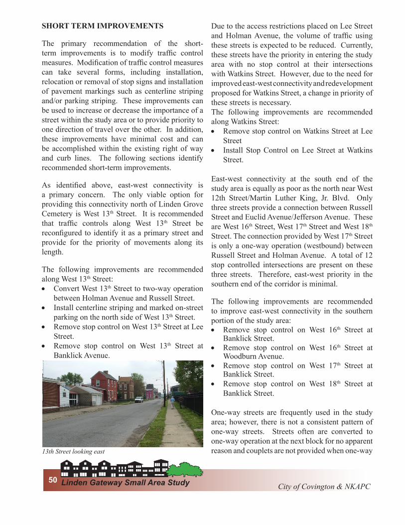
As identified above, east-west connectivity is a primary concern. The only viable option for providing this connectivity north of Linden Grove Cemetery is West 13th Street. It is recommended that traffic controls along West 13th Street be reconfigured to identify it as a primary street and provide for the priority of movements along its length.
The following improvements are recommended along West 13th Street:
Convert West 13• th Street to two-way operation between Holman Avenue and Russell Street.Install centerline striping and marked on-street •parking on the north side of West 13th Street.Remove stop control on West 13• th Street at Lee Street.Remove stop control on West 13• th Street at Banklick Avenue.
13th Street looking east

City of Covington & NKAPCCity of Covington & NKAPC Chapter 5: Mobility51
streets are used. These inconsistencies can make the street system confusing and hard to navigate. All streets that utilize one-way operation maintain adequate width to provide two-way operation, with the exception of West 17th Street between Holman Avenue and Russell Street, which is only 17-feet wide.
The following improvements are recommended to improve the one-way street system.
Convert West 13• th Street to two-way operation between Holman Avenue and Russell Street.Convert West 14• th Street to two-way operation between Holman Avenue and Russell Street.Convert Banklick Street to two-way operation •between West 12th St./Martin Luther King, Jr. Blvd. and West 14th Street. Convert Woodburn Avenue to two-way •operation between Linden Avenue and West 16th Street.Convert St. Clair Street to two-way operation •between Linden Avenue and West 16th Street.
The conversion of Woodburn Avenue and St. Clair Street would primarily impact only the local residents of those streets, and therefore these recommendations should be discussed and approved by the residents. However, recommendations for West 13th Street, West 14th Street, and Banklick Street are critical to ensuring improved mobility throughout the study area and to support planned redevelopment. These measures were originally placed as a crime prevention measure in 1998. Therefore, it is recommended that removal of
the one-way street system should be evaluated for increases in crime and/or delayed until a scale of redevelopment has occurred in the area capable of deterring criminal activity. However, these are critical improvements that are strongly recommended.
Another critical component of the short term plan is to modify existing non-auto modes of travel to benefit the changes in the area. Currently, the No. 5 TANK bus route serves the area along Holman Avenue to West 12th St./Martin Luther King, Jr. Blvd. The No. 5 route has the second highest TANK ridership with over 153,000 riders in 2007. The St. Elizabeth Medical Center Covington is expected to generate approximately 250 jobs which could be well served by this route. The No. 1 route, which has the highest ridership, enters the study area on Main Street north of West 12th St./Martin Luther King, Jr. Blvd. and exits on West 12th St./Martin Luther King, Jr. Blvd. With minor modifications, the existing transit service can well accommodate the existing and future demands within the study area.
The following improvements are recommended to improve transit service in the area:
Re-route the No. 5 route from Holman Avenue •to West13th Street to Main Street to serve the St. Elizabeth Medical Center Covington. A bus stop should be provided as close as practical to the medical center to encourage ridership. Provide pedestrian connections along Main •Street to the St. Elizabeth Medical Center to West 12th St./Martin Luther King, Jr. Blvd. to provide a connection to the nearest stop on the No. 1 route. Provide bus shelters and benches at high •activity areas within the study area. Potential locations include West 19th Street, Southside Baptist Church and/or the Goodwill Village.
The study area also contains a portion of the city-wide bike loop identified in the Covington Strategic transportation plan. This section of the bike loop
Woodburn Street south of Linden Street
Linden Gateway Small Area Study City of Covington & NKAPC52
City of Covington & NKAPC
utilizes Holman Avenue from West 19th Street north to West 12th St./Martin Luther King, Jr. Blvd. No infrastructure improvements are identified in this portion of the plan; however, signing and marking should be provided consistent with the rest of the city-wide loop. In addition, special provisions may be required at public and private facilities to accommodate cyclists.
The following improvements are recommended to accommodate the city-wide bike loop:
Provide signing and pavement markings •consistent with the city-wide bike loop. Provide bike racks at all public facilities •and points of interest. This may include at a minimum the Linden Gateway Cemetery and other locations, such as commercial areas where bicyclists might want to stop to purchase goods or to sightsee.
AREAS REQUIRING FURTHER STUDY
Traffic volumes in the study area are not significantly high in the context of urban development. A total of ten traffic signals are currently present to serve these needs. Observation of the signal operation indicates that traffic signal warrants, which establish minimum traffic volumes for signals, may not be met at all signals in the study area. The 12th St./Martin Luther King, Jr. Blvd. plan will remove the signal at Lee Street. However, the West 19th Street corridor currently contains 5 signals, which provide poor progression along West 19th Street. In addition, the traffic signal at the intersection of Holman Avenue and West 15th Street may be unnecessary due to the recent closure of the 15th Street Bridge, which may have significantly reduced the amount of westbound traffic along West 15th Street.
The following improvements are recommended for further study:
Conduct a comprehensive signal warrant •analysis of all traffic signals within the study area. Conduct a feasibility study to determine the •
potential to coordinate traffic signals along West 19th Street. Conduct a traffic engineering study of the •signals along West 12th St./Martin Luther King, Jr. Blvd. to determine the appropriate cycle length and offsets capable of providing acceptable levels of service and minimal traffic speeds to accommodate the pedestrian friendly goals of the corridor redevelopment plan.
LONG TERM IMPROVEMENTS
The remaining recommendations are expected to have significant associated costs. Due to monetary constraints these recommendations should be considered in light of the needs of the entire city to determine if the projects are worthy of the associated funds.
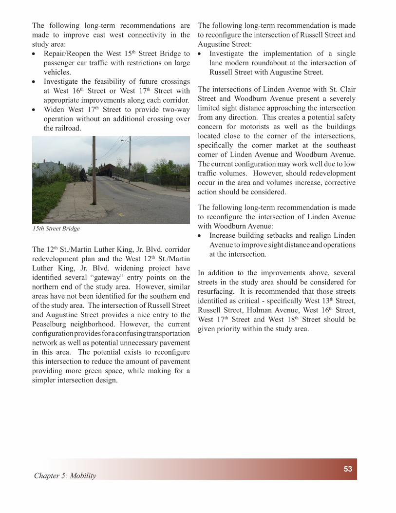
As noted above the primary concern within the study area is the lack of east-west connectivity. The closure of the West 15th Street Bridge restricts access to the area, with the only access to the east or west being at West 12th St./Martin Luther King, Jr. Blvd. and West 19th Street. This can make accessing the central part of the study area difficult from points within the city. While there exist the possibility of repairing and reopening the West 15th Street Bridge, this alternative may become too costly due to additional improvements needed at the railroad. In this case it may be worthwhile to consider additional alternatives such as a crossing at West 16th or West 17th Streets. These streets provide a connection across the whole of the study area to Jefferson Avenue as opposed to the terminus of West 15th Street at Holman Avenue. The West 17th Street location may be preferred due to the wide crossing at West 16th Street due to the existing railroad spur. However, West 17th Street also provides complications as this street is one of the narrowest in the area with a total width of 17 feet. A connection at this location would certainly require widening of West 17th to provide for two-way street operation.
City of Covington & NKAPCCity of Covington & NKAPC Chapter 5: Mobility53
The following long-term recommendations are made to improve east west connectivity in the study area:
Repair/Reopen the West 15• th Street Bridge to passenger car traffic with restrictions on large vehicles. Investigate the feasibility of future crossings •at West 16th Street or West 17th Street with appropriate improvements along each corridor. Widen West 17• th Street to provide two-way operation without an additional crossing over the railroad.
The 12th St./Martin Luther King, Jr. Blvd. corridor redevelopment plan and the West 12th St./Martin Luther King, Jr. Blvd. widening project have identified several “gateway” entry points on the northern end of the study area. However, similar areas have not been identified for the southern end of the study area. The intersection of Russell Street and Augustine Street provides a nice entry to the Peaselburg neighborhood. However, the current configuration provides for a confusing transportation network as well as potential unnecessary pavement in this area. The potential exists to reconfigure this intersection to reduce the amount of pavement providing more green space, while making for a simpler intersection design.
The following long-term recommendation is made to reconfigure the intersection of Russell Street and Augustine Street:
Investigate the implementation of a single •lane modern roundabout at the intersection of Russell Street with Augustine Street.
The intersections of Linden Avenue with St. Clair Street and Woodburn Avenue present a severely limited sight distance approaching the intersection from any direction. This creates a potential safety concern for motorists as well as the buildings located close to the corner of the intersections, specifically the corner market at the southeast corner of Linden Avenue and Woodburn Avenue. The current configuration may work well due to low traffic volumes. However, should redevelopment occur in the area and volumes increase, corrective action should be considered.
The following long-term recommendation is made to reconfigure the intersection of Linden Avenue with Woodburn Avenue:
Increase building setbacks and realign Linden •Avenue to improve sight distance and operations at the intersection.
In addition to the improvements above, several streets in the study area should be considered for resurfacing. It is recommended that those streets identified as critical - specifically West 13th Street, Russell Street, Holman Avenue, West 16th Street, West 17th Street and West 18th Street should be given priority within the study area.
15th Street Bridge

Linden Gateway Small Area Study City of Covington & NKAPC54

Lin
de
nG
rov
eL
ind
en
Gro
ve
Ce
me
tary
Ce
me
tary
St.
Eli
za
be
thS
t.E
liz
ab
eth
Me
dic
al
Ce
nte
rM
ed
ica
lC
en
ter
Co
vin
gto
nC
ov
ing
ton
Ba
va
ria
nB
av
ari
an
Bre
we
ryB
rew
ery
75
71
Madison Ave
Scott St
WPi
keSt
W11
thSt
W12
thSt
/Mar
tinLu
ther
Kin
gJr
.Blv
d.
E11
thSt
Russell St
Main St
E12
thSt
/mar
tinLu
ther
Kin
gJr
Blv
d
Holman St
Banklick St
Russell St
W19
thSt
Lee St
EuclidAve
Jefferson Ave
W13
thSt
W18
thSt
Monroe St
W15
thSt
Wat
kins
St Mai
nSt
Woodburn Ave
Wood St
Lind
enA
ve
May St
W21
stSt
High
land
Ave
Hawt
horn
eSt
Ber
rySt
Bus
hSt
W20
thSt
Kavanaugh St
St Clair St
Edgecli
ffRd
Howell St
Fisk St
Fry
St
York St
Augustine St
E13
thSt
Jackson St
Neave St
Lind
enG
rove
Cem
W11
thSt
Lehm
erSt
Bullock Ave
Boo
neSt
Philadelphia St
W17
thSt
Jillians Way
Orc
hard
St
SLindenSt
Goe
ttaPl
Plea
sant
St
Mar
tinSt
Lawn Ave
Hermes Ave
Hind
eSt
FranklinSt
Shal
erSt
Trev
orSt
E15
thSt
W12
thSt
ByrdAly
Chesapeake St
W16
thSt
Anns
Ln
W14
thSt
WR
obbi
nsSt
Locust St
Hewson St
WPikeSt
Prag
ueSt
Donaldson Ave
Mon
tere
ySt
Old
Lexi
ngto
nR
d
E11
thSt
Chap
man
Ct
Keen
eSt
Willow Run
Morton St
Michael Partin Ct
E16
thSt
Kellogg St
High
land
Pike
Bracken Ct
Madison Ave
Main St
Russell St
W14
thSt
W11
thSt
Main St
W11
thSt
May St
Chesapeake St
W18
thSt
W16
thSt
W13
thSt
Watkins St
W17
thSt
Augustine St
Neave St
Russell St
W15
thSt
W17
thSt
W14
thSt
Lin
den
Gat
eway
Smal
lAre
aSt
udy
050
01,
000
250
Feet
Ma
p 5
.1 T
ran
spo
rta
tio
n S
yste
ms
Stud
yAr
ea
TAN
KBu
sS
tops
TAN
KR
oute
s
Rec
omm
ende
d A
rea
for F
urth
er S
tudy
Exi
stin
g D
irect
iona
l Sto
p
Rec
omm
ende
d D
irect
iona
l Sto
p
4-w
ay
Sign
al
