ark engineering services inc. - southport indiana
TRANSCRIPT
ARK ENGINEERING SERVICES INC.
7750 Madison Avenue Indianapolis, Indiana 46227
Tel: 317.787.3700 Fax: 317.787.4700 www.ark-esi.com
February 24, 2014 Mr. Gregory Schiffli Indy Southport Development, LLC 2211 E. Southport Road Indianapolis, Indiana 46227
RE: Phase I – Environmental Site Assessment 2110 E. Southport Road Indianapolis, Indiana 46227
Dear Mr. Schiffli:
Ark Engineering Services Inc. (Ark) is pleased to provide Indy Southport Development, LLC, and its Successors and Assigns with this Phase I – Environmental Site Assessment (ESA) for the property located at the above referenced address (Subject Property). This ESA was performed in general conformance with the scope and limitations of the American Standard for Testing and Materials (ASTM) Standard for Environmental Site Assessments: Phase I Environmental Process, designation E 1527-13 and with the "All Appropriate Inquiry (AAI) Rule with respect to the range of contaminants within the scope of the Comprehensive Environmental Response, Compensation, and Liability Act (CERCLA) (42 U.S.C. §9601) to determine if any Recognized Environmental Conditions (RECs), historical REC (HRECs), and/or controlled RECs (CRECs) exist at the Subject Property or surrounding area. There are no intended or unintended third party beneficiaries to this report, except as expressly stated herein. Ark is an independent contractor, not an employee of either the issuer or the borrower, and its compensation was not based on the findings or recommendations made in the report or on the closing of any business transaction. If you have any questions or comments regarding this report, please feel free to contact me at 317.787.3700 extension 207 or [email protected]. Sincerely, ARK ENGINEERING SERVICES INC.,
Michael B. Cooper, L.P.G. Wesley K. Paul, P.E. Senior Project Manager Principal Engineer
TABLE OF CONTENTS Page
1.0 SUMMARY 1 2.0 INTRODUCTION 2 3.0 USER PROVIDED INFORMATION 9 4.0 RECORDS REVIEW 11 5.0 SITE RECONNAISSANCE 27
6.0 INTERVIEWS 32
7.0 EVALUATION 33 7.1 Findings and Opinions 33 7.2 Conclusions and Recommendations 33 7.3 Additional Investigation 34 7.4 Data Gaps and Deletions 34 7.5 References 34 7.6 Statement and Signatures 35
8.0 NON-SCOPE SERVICES 37
TABLES Table 1: RCRA-CESQG Findings 12 Table 2: LUST Findings 13 Table 3: UST Findings 14 Table 4: AUL Findings 15 Table 5: VRP Findings 15 Table 6: Brownfield Findings 16 Table 7: RCRA-Non Generator/NLR Findings 16 Table 8: Indiana Drycleaners Findings 17 Table 9: Indiana Spills Findings 18 Table 10: Historical Auto Station Findings 18 Table 11: Historical Cleaner Findings 19 Table 12: Summary of Title Information 23 Table 13: Sanborn Fire Insurance Map Information 23
APPENDICES Appendix A: Figures Appendix B: Property Information and Deed Appendix C: Owner and Client Questionnaires Appendix D: Radius Map with Geocheck Appendix E: Unconsolidated and Bedrock Aquifer Maps Appendix F: Certified Sanborn Map Report Appendix G: City Directory Image Report Appendix H: Historical Aerial Photographs Appendix I: Previous Environmental Reports Appendix J: Photographic Portfolio Appendix K: Correspondence from Interviews with Local Government Agencies Appendix L: Résumés of Environmental Professionals
Phase I – Environmental Site Assessment Ark Engineering Services Inc. 2110 E. Southport Road, Indianapolis, Indiana Project Number 1121.001
1
1.0 SUMMARY
Ark Engineering Services Inc. (Ark) performed a Phase I - Environmental Site
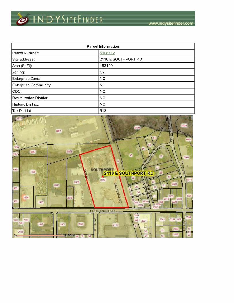
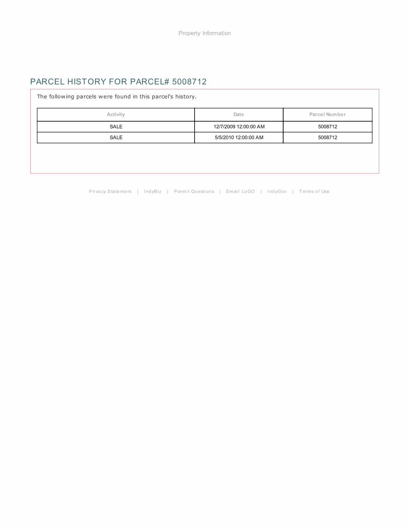
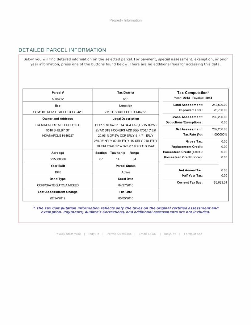
Assessment (ESA) of one (1) parcel of land (5008712; 49-15-07-107-001.000-513) at the
request of Indy Southport Development, LLC (Client). This ESA was performed in
general conformance with the scope and limitations of the ASTM Standard for
Environmental Site Assessments: Phase I Environmental Process, designation E 1527-13
and with the AAI Rule with respect to the range of contaminants within the scope of the
CERCLA (42 U.S.C. §9601).
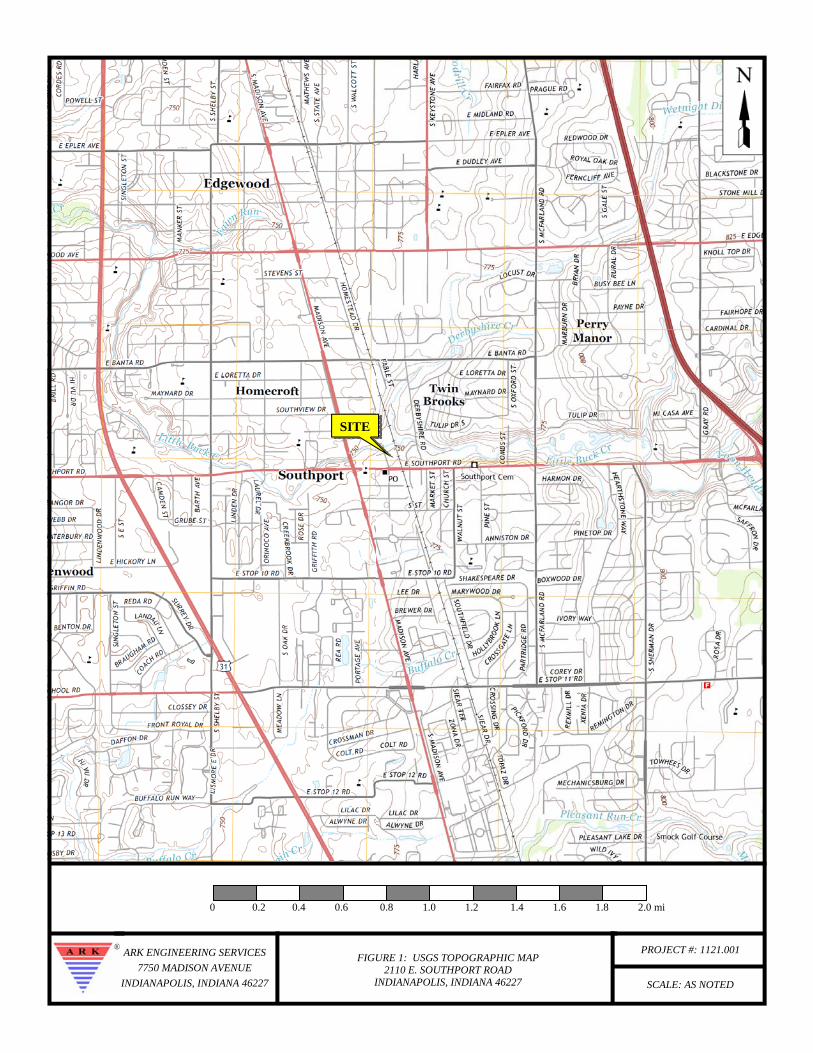
The Subject Property is located at 2110 E. Southport Road at the northeast corner of
Southport Road and 2nd Street, Marion County in an area of residential/commercial
development and consists of one (1) parcel encompassing an area of approximately 3.25
acres. The Subject Property was developed prior to 1915 and has historically been
utilized as a lumberyard. Currently, one (1) structure with an approximate footprint of
seven thousand (7,000) square feet is located on the east central portion of the Subject
Property.
This ESA consisted of a review of available records, a visual survey of the Subject
Property and surrounding area, and interviews. Based on this assessment, the following
RECs were identified for the Subject Property.
• Three (3) underground storage tanks (USTs) were previously utilized at the
Subject Property. The USTs were removed in late 1994 and early 1995.
Laboratory analytical results indicated releases from two (2) of the USTs.
• Two (2) spills have been reported at the Subject Property. One (1) documented a
spill of one thousand (1,000) gallons of diesel fuel in 2005 that impacted a creek.
The second documented a spill of fuel oil affecting an area of 50 ft2 and is likely
related to the UST closure event based on the date of the report (1995).
Phase I – Environmental Site Assessment Ark Engineering Services Inc. 2110 E. Southport Road, Indianapolis, Indiana Project Number 1121.001
2
2.0 INTRODUCTION
Location and Legal Description
The Subject Property is located at 2110 E. Southport Road at the northeast corner of
Southport Road and 2nd Street, in Perry Township, Marion County, Indiana 46227. More
specifically, the Subject Property is located in the southeast quarter of the southeast
quarter of Section 7, Township 14 North, Range 4 East of the Beech Grove Quadrangle.
A United States Geological Survey (USGS) Topographic Map of the Subject Property is
provided as Figure 1. All figures referenced in this report are provided as Appendix A.
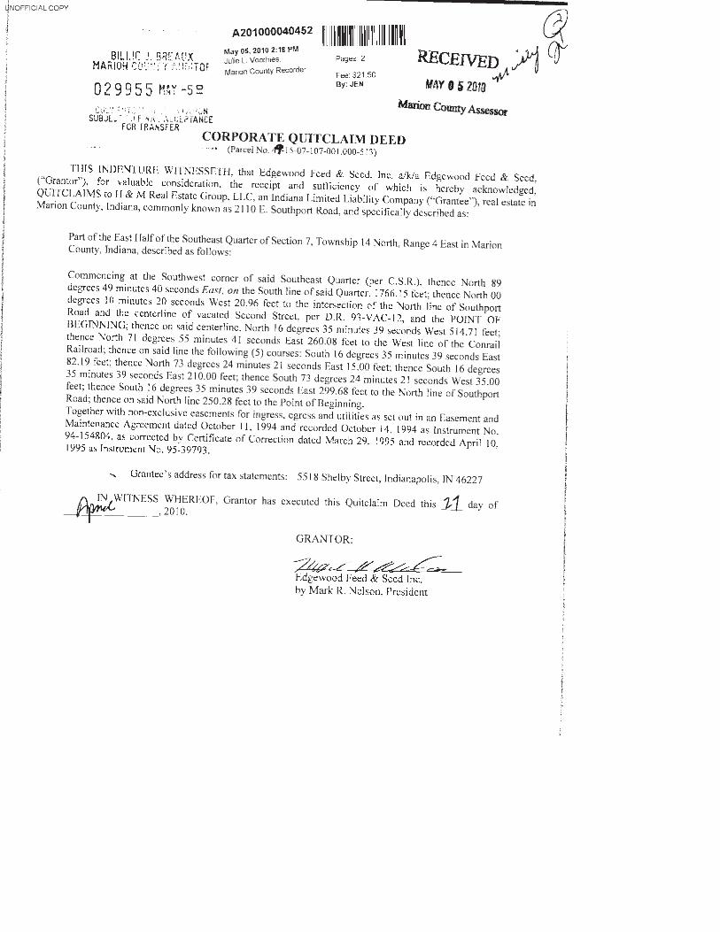
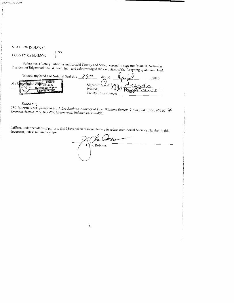
The Legal Description for the Subject Property is included on the Corporate Quitclaim
Deed. Public records and the Deed are provided as Appendix B.
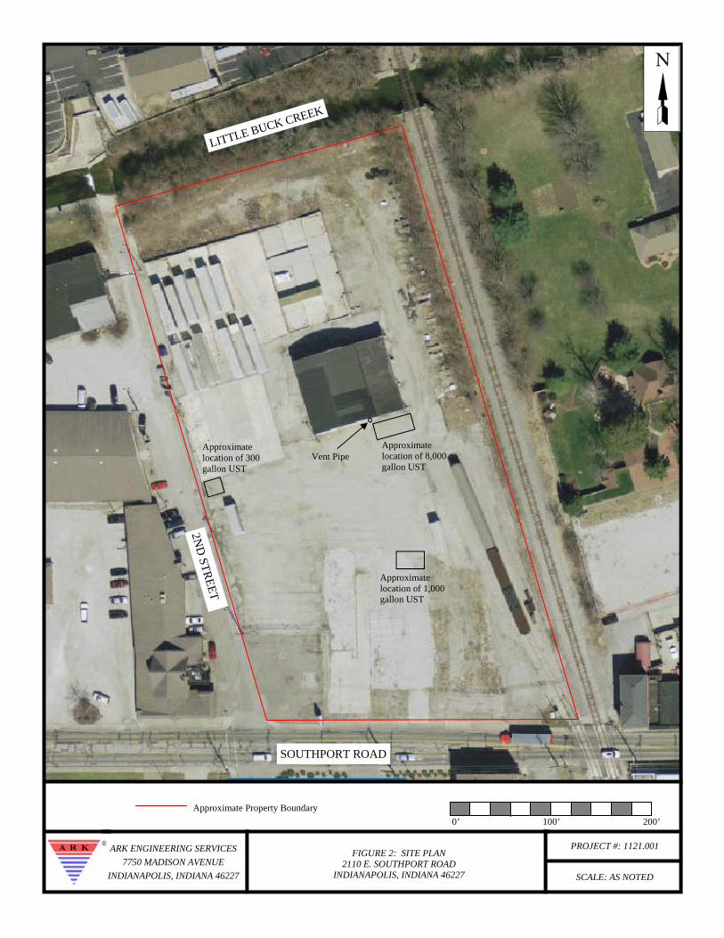
Site and Vicinity General Characteristics
The Subject Property is located within the city limit of Southport, Indiana and consists of
one (1) irregular shaped parcel encompassing approximately 3.25 acres. The majority of
the Subject Property is fenced and covered with asphalt with some grass covered areas
along the north and northeast portions of the property. Areas of former buildings are
surfaced with concrete. A railroad spur is located on the eastern edge of the southern half
of the property. Thick vegetation is present along the northern property boundary near
Little Buck Creek. The areas immediately surrounding the Subject Property consist
primarily of commercial development with some residential homes immediately to the
east on the east side of the Louisville and Indiana Railroad Company Railway. A Site
Plan is included as Figure 2.
Purpose and Scope
The purpose of this ESA was to identify RECs, HRECs, and/or CRECs and certain
conditions outside the scope of ASTM Practice E 1527-13 in connection with the Subject
Property at the time of the Site Reconnaissance. This ESA is intended to permit the
“User” to satisfy one (1) of the requirements to qualify for the innocent landowner,
contiguous property owner, or bona fide prospective purchaser limitations on CERCLA
Phase I – Environmental Site Assessment Ark Engineering Services Inc. 2110 E. Southport Road, Indianapolis, Indiana Project Number 1121.001
3
liability (herein referred to as landowner liability protections or LLPs): that is, the
practices that constitute “all appropriate inquiry into the previous ownership and uses of
the Subject Property consistent with good commercial or customary practice” as defined
in 42 U.S.C. §9601(35)(B). Any significant scope-of-work additions, deletions, or
deviations to ASTM Practice E 1527-13 are noted below or in the corresponding sections
of this report. The scope-of-work for this assessment included an evaluation of the
following:
• Physical characteristics of the Subject Property through a review of referenced
sources for topographic, geologic, and hydrologic data.
• History of the Subject Property through a review of referenced sources such as
land deeds and title information, fire insurance maps, city directories, aerial
photographs, topographic maps, prior reports, and interviews.
• Current conditions of the Subject Property, including observations and
interviews regarding the following: the presence or absence of hazardous
substances or petroleum products; generation, treatment, storage, or disposal of
hazardous, regulated, or biomedical waste; equipment that utilizes oils which
potentially contain polychlorinated biphenyls (PCBs); and storage tanks
(aboveground and underground).
• Usage of surrounding area properties and the likelihood for releases of
hazardous substances and petroleum products (if known and/or suspected) to
migrate through groundwater and/or manmade migratory pathways onto the
Subject Property.
• Information in referenced environmental agency databases and local
environmental records, within specified minimum search distances.
Phase I – Environmental Site Assessment Ark Engineering Services Inc. 2110 E. Southport Road, Indianapolis, Indiana Project Number 1121.001
4
• Past ownership through a review of available prior reports and local municipal
file review.
• The scope-of-work also included consideration of the following potential
environmental conditions that are outside the scope of ASTM Practice E 1527-
13: asbestos-containing materials (ACM), lead-based paint (LBP), lead in
drinking water, and radon.
Assumptions, Limitations, and Exceptions
Ark has performed this Phase I ESA in conformance with the scope and limitations of
ASTM Standard E 1527-13, Standard Practice for Environmental Site Assessments:
Phase I Environmental Site Assessment Process and with the AAI Rule. This report was
prepared with no exceptions or deletions from ASTM Standard E 1527-13.
In defining a standard of good commercial and customary practice for conducting an
environmental site assessment of a parcel of property, the goal of the processes
established by this practice is to identify recognized environmental conditions, historic
recognized environmental conditions, and/or controlled environmental conditions.
A REC is defined as the presence or likely presence of any hazardous substances or
petroleum products in, on, or at a property: (1) due to any release to the environment; (2)
under conditions indicative of a release to the environment; or (3) under conditions that
pose a material threat of a future release to the environment. The term includes
hazardous substances or petroleum products even under conditions in compliance with
laws. The term is not intended to include de minimis conditions that generally do not
present a threat to human health or the environment and that generally would not be the
subject of an enforcement action if brought to the attention of appropriate governmental
agencies. Conditions determined to be de minimis are not RECs.
A HREC is defined as a past release of any hazardous substances or petroleum products
that has occurred in connection with the property and has been addressed to the
Phase I – Environmental Site Assessment Ark Engineering Services Inc. 2110 E. Southport Road, Indianapolis, Indiana Project Number 1121.001
5
satisfaction of the applicable regulatory authority or meeting unrestricted use criteria
established by a regulatory authority, without subjecting the property to any required
controls (for example, property use restrictions, activity and use limitations, institutional
controls, or engineering controls).
A CREC is defined as a REC resulting from a past release of hazardous substances or
petroleum products that has been addressed to the satisfaction of the applicable regulatory
authority (for example, as evidenced by the issuance of a no further action letter or
equivalent, or meeting risk-based criteria established by regulatory authority), with
hazardous substances or petroleum products allowed to remain in place subject to the
implementation of required controls (for example, property use restrictions, activity and
use limitations, institutional controls, or engineering controls).
The information reported was obtained through sources deemed reasonably ascertainable,
as defined in ASTM Standard E 1527-13; a visual survey of areas readily observable,
easily accessible or made accessible by the Subject Property contact and interviews with
owners, agents, occupants, or other appropriate persons involved with the Subject
Property. Municipal information was obtained through review of reasonably
ascertainable standard government record sources and interviews with the authorities
having jurisdiction over the Subject Property. Findings, conclusions, and
recommendations included in the report are based on our visual observations in the field,
the municipal information reasonably obtained, information provided by the Client,
and/or a review of readily available and supplied documents and drawings. Ark relies
completely on the information, whether written, graphic, or verbal, provided by the
Subject Property contact or as shown on any documents reviewed or received from the
Subject Property contact, owner or agent, or municipal source, and assumes that
information to be true and correct. Although there may have been some degree of
overlap in the information provided by these various sources, Ark did not attempt to
independently verify the accuracy or completeness of all information reviewed or
received during the course of these environmental services.
Phase I – Environmental Site Assessment Ark Engineering Services Inc. 2110 E. Southport Road, Indianapolis, Indiana Project Number 1121.001
6
The observations in this report are valid on the date of the investigation. Where access to
portions of the Subject Property or to structures on the Subject Property was unavailable
or limited, Ark renders no opinion as to the presence of hazardous substances or
petroleum products in that portion of the Subject Property or structure. Inaccessible
portions of the Subject Property are described below. In addition, Ark renders no opinion
as to the presence of, or indirect evidence relating to, hazardous substances or petroleum
products where direct observation of the interior walls, floor, or ceiling of a structure was
obstructed by objects or coverings on or over these surfaces.
It is acknowledged that Ark’s judgments shall not be based on scientific or technical tests
or procedures beyond the scope of the services or beyond the time and budgetary
constraints imposed by the Client. It is acknowledged further that Ark’s conclusions
shall not rest on pure science but on such considerations as economic feasibility and
available alternatives. Client also acknowledges that, because geologic and soil
formations are inherently random, variable, and indeterminate in nature, the services and
opinions provided under this Agreement with respect to such services are not guaranteed
to be a representation of actual conditions on the Subject Property, which are also subject
to change with time as a result of natural or man-made processes, including water
permeation. In performing the services, Ark shall use that degree of care and skill
ordinarily exercised by environmental consultants or engineers performing similar
services in the same or similar locality. The standard of care shall be determined solely
at the time the services are rendered and not according to standards utilized at a later date.
The services shall be rendered without any other warranty, expressed or implied,
including, without limitation, the warranty of merchantability and the warranty of fitness
for a particular purpose. The Client and Ark agree that to the fullest extent permitted by
law, Ark shall not be liable to the Client for any special, indirect, or consequential
damages whatsoever, whether caused by Ark’s negligence, errors, omissions, strict
liability, breach of contract, breach of warranty or other cause or causes whatsoever.
The ASTM Standard E 1527-13 does not encompass analytical testing to evaluate ACM,
radon, LBP, drinking water quality, indoor air and soil vapor quality, stored chemicals,
Phase I – Environmental Site Assessment Ark Engineering Services Inc. 2110 E. Southport Road, Indianapolis, Indiana Project Number 1121.001
7
debris, fill materials, surface water, and subsurface samples (soil and groundwater)
studies as part of a Phase I ESA.
If a thorough and regulatory-compliant study is warranted based on the findings of this
Phase I ESA, Ark will recommend the appropriate further investigation. In certain cases,
quantitative laboratory testing is performed as part of the assessment and analyses have
been conducted by an outside laboratory. Ark relies upon the data provided by the
outside laboratory, and has not conducted an independent evaluation of the reliability of
this data.
The assessment was conducted in a manner consistent with the level of care and skill
ordinarily exercised by members of the profession, and in accordance with generally
accepted practices of other consultants currently practicing in the same locality under
similar conditions. No other representation, expressed or implied, and no warranty or
guarantee is included or intended. The report speaks only as of its date, in the absence of
a specific written update of the report, signed and delivered by Ark.
Special Terms and Conditions
The conclusions and findings set forth in this report are strictly limited in time and scope
to the date of the evaluations. The conclusions presented in the report are based solely on
the services described therein, and not on scientific tasks or procedures beyond the scope
of agreed-upon services or the time and budgeting restraints imposed by the Client. No
subsurface exploratory drilling or sampling was done under the scope of this work.
Unless specifically stated otherwise in the report, no chemical analyses have been
performed during the course of this ESA. Some of the information provided in this report
is based upon personal interviews, and research of available documents, records, and
maps held by the appropriate government and private agencies. This is subject to the
limitations of historical documentation, availability, and accuracy of pertinent records
and the personal recollections of those persons contacted.
Phase I – Environmental Site Assessment Ark Engineering Services Inc. 2110 E. Southport Road, Indianapolis, Indiana Project Number 1121.001
8
User Reliance
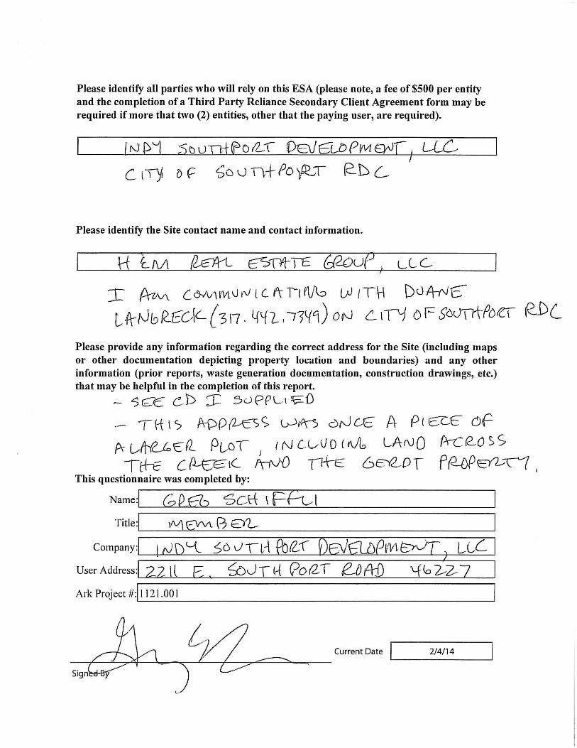
This Report is for the use and benefit of, and may be relied upon by, Indy Southport
Development, LLC; City of Southport RDC; City of Southport; and any of their
respective assigns, affiliates, agents and advisors; any initial and subsequent holders from
time to time of any debt and/or securities backed in whole or in part, directly or
indirectly, by assets covered by this Report; any initial and subsequent holders of any
participation or beneficial interest in any such debt and/or securities; any trustee, servicer
or other agent acting on behalf of holders of such debt and/or securities; any rating
agencies providing ratings to any such securities; and any institutional providers from
time to time of any liquidity facility or credit support for the financing of any such debt
and/or securities; and their respective successors and assigns. In addition, this Report
and/or a reference to this Report may be included or quoted in any offering circular,
registration statement, prospectus or sales brochure (in either electronic or hard copy
format) in connection with a securitization, syndication or similar transaction involving
such debt and/or such securities.
Phase I – Environmental Site Assessment Ark Engineering Services Inc. 2110 E. Southport Road, Indianapolis, Indiana Project Number 1121.001
9
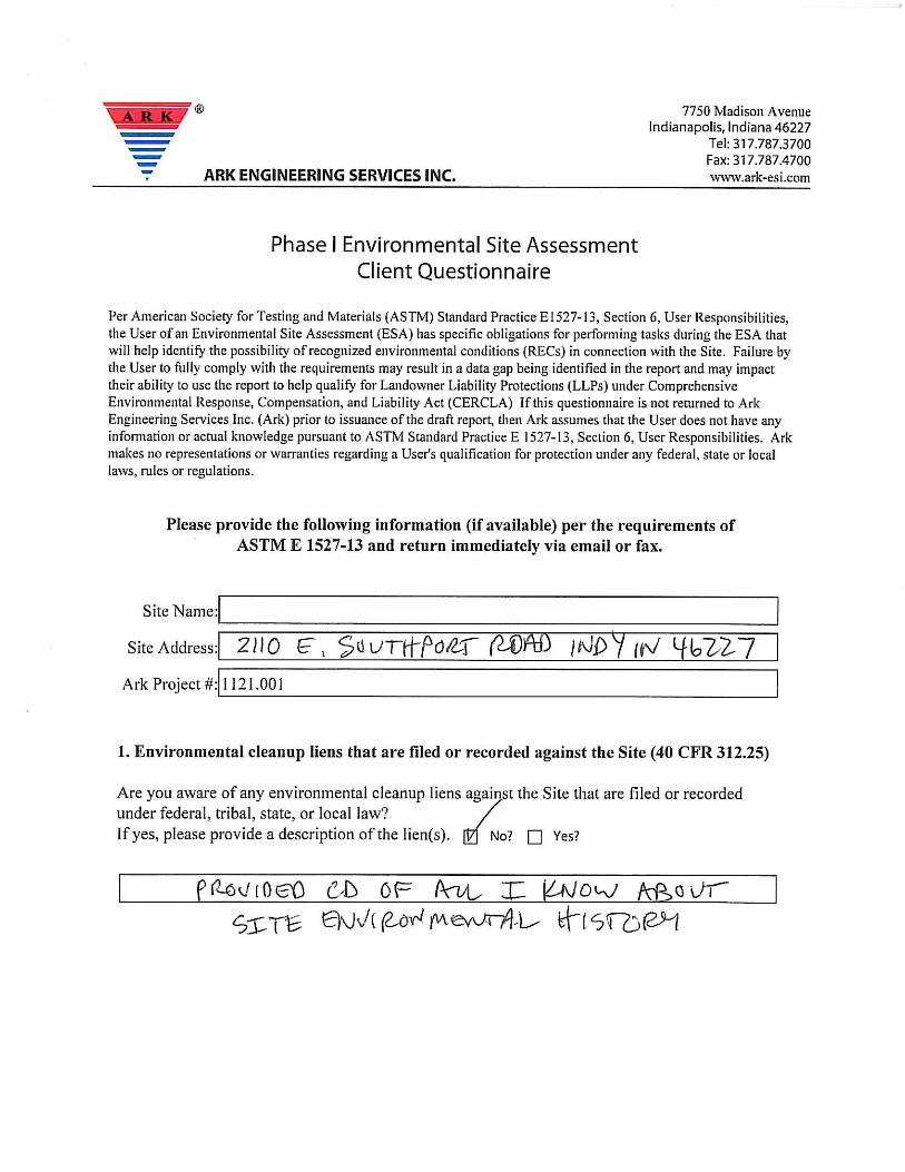
3.0 USER PROVIDED INFORMATION
Per ASTM Standard Practice E 1527-13, the User of an ESA has specific obligations for
performing tasks during the ESA that will identify the possibilities of RECs in connection
with the Subject Property. Questionnaires designed to determine and identify known
environmental issues associated with the Subject Property have been completed by the
Client and property Owner. The questionnaires are summarized in the following
sections, and the completed questionnaires are provided in Appendix C.
Title Records
Title Records were not provided to Ark by the Owner/Client.
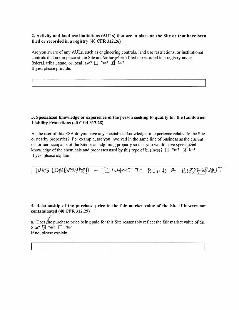
Environmental Liens or Activity and Use Limitations
The Client/Owner were not aware of information related to known environmental liens or
activity and use limitations (AUL) potentially affecting the Subject Property.
Specialized Knowledge
No specialized knowledge was provided to Ark.
Commonly Known Information
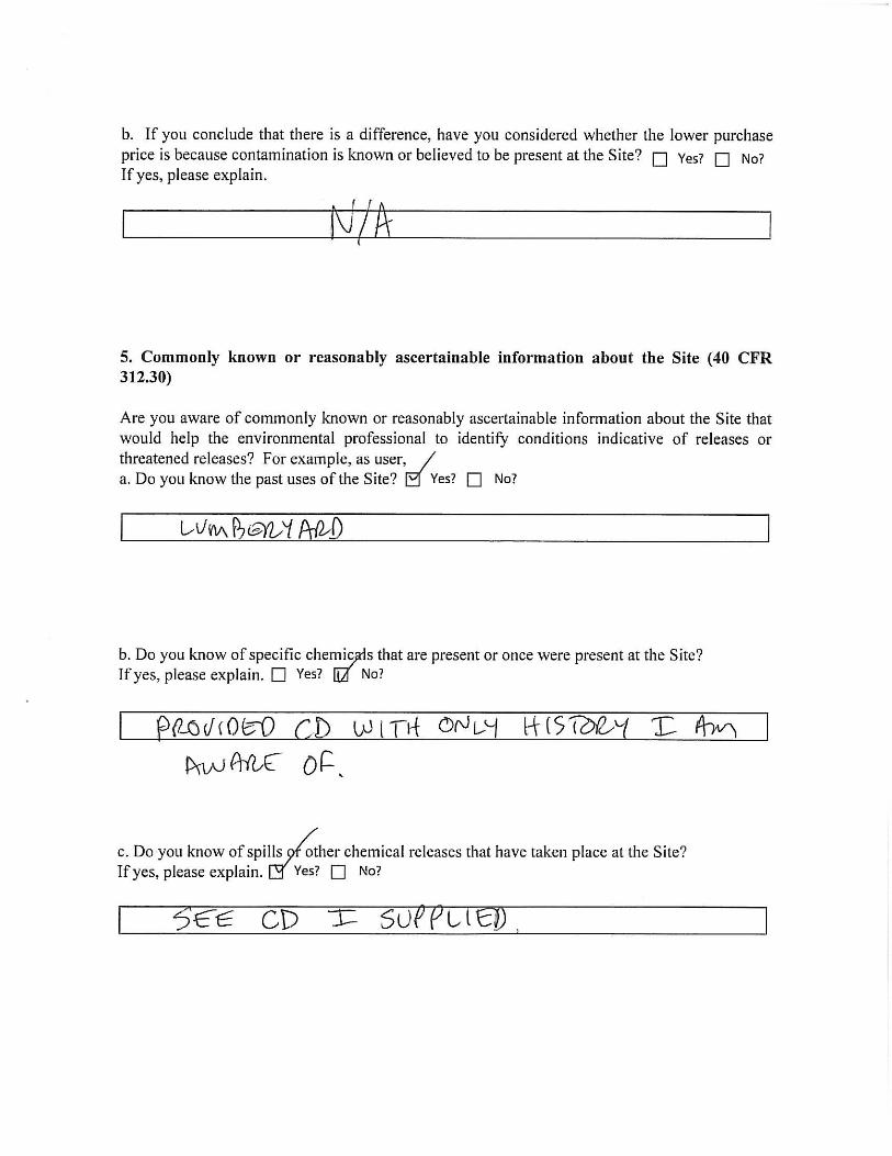
The Client indicated that the Subject Property was previous used as a lumberyard and
provided a compact disc with records from IDEM’s Virtual File Cabinet.
Valuation Reduction for Environmental Issues
No information was provided that would indicate a reduction in valuation due to
environmental issues.
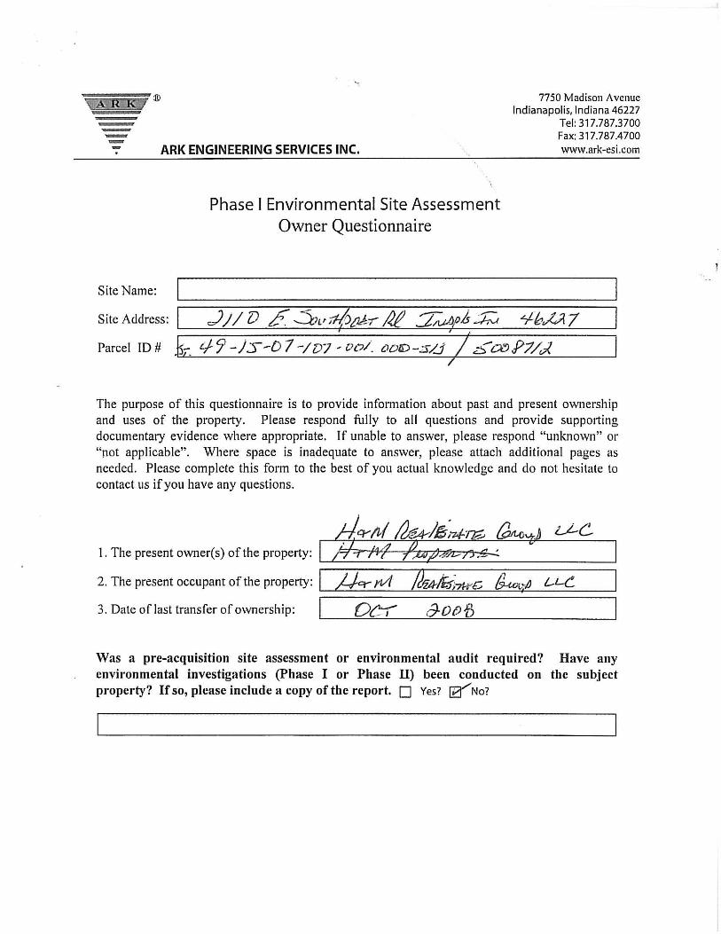
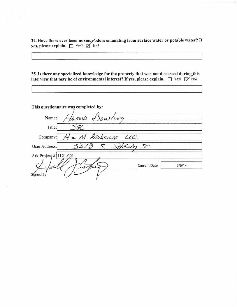
Owner, Property Manager, and Occupant Information
The Subject Property is owned and occupied by H&M Real Estate Group, LLC with the
official mailing address of 5518 South Shelby Street, Indianapolis, Indiana 46227. The
primary Site contact is Mr. Harold Bowling.
Phase I – Environmental Site Assessment Ark Engineering Services Inc. 2110 E. Southport Road, Indianapolis, Indiana Project Number 1121.001
10
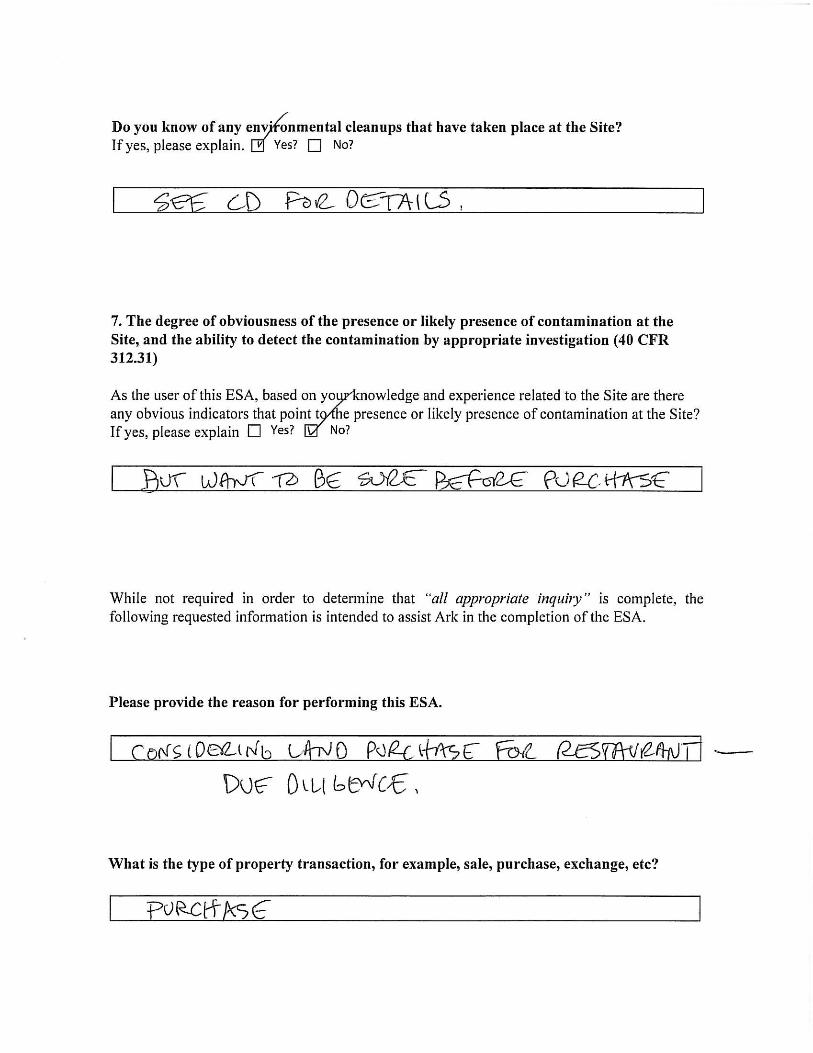
Reason for Performing Phase I Environmental Site Assessment
This Phase I ESA has been performed for Ark’s Client to determine if there are any
RECs, HRECs, or CRECs as defined in ASTM E 1527-13 in connection with the Subject
Property as of the date of the reconnaissance and the date of this report as part of a
potential real estate transaction.
Phase I – Environmental Site Assessment Ark Engineering Services Inc. 2110 E. Southport Road, Indianapolis, Indiana Project Number 1121.001
11
4.0 RECORDS REVIEW
Standard Environmental Record Sources
The purpose of the regulatory file review is to obtain and review records that will aid in
identifying RECs in connection with the Subject Property. This extended review helps
assess the likelihood that any problems that may exist at the Subject Property may have
arisen because of migrating hazardous substances or petroleum products. The ASTM
Standard Practice E 1527-13 database search was performed for Ark by EDR and is
focused on database listings located within the ASTM-standard search distances specified
in EDR’s report. The EDR Radius Map with Geocheck Report is provided in Appendix
D.
Environmental Database Listings
Files maintained by the U.S. EPA and IDEM were reviewed to determine the regulatory
history of the Subject Property and surrounding area. A computerized database search
obtained from EDR was reviewed regarding solid and hazardous waste management,
emergency response, chemical spills, USTs, and Leaking USTs (LUST), to determine, at
a minimum, if the Site or neighboring facilities: (1) are under investigation for violation
of any environmental laws, regulations or standards; (2) are listed on any environmental
databases, including CERCLA, Resource Conservation and Recovery Act (RCRA), UST
notification lists, disposal sites, etc., and (3) if the Sites have been the subject of any
reported violations or complaints.
The Subject Property was listed in the databases searched by EDR four (4) times. The
Subject Property was listed two (2) times in the Indiana spills database, once in the
Indiana UST database, and once in the Facility Index System (FINDS) database. Outside
of the target property, there were multiple facilities located within the respective ASTM
radius of the Subject Property as identified from the regulatory file review search. Ark
located and evaluated each facility to determine if the facility was a concern to the
Subject Property. The factors considered in evaluating a facility’s potential impact to the
Subject Property include the facility’s distance from the Subject Property, the facility’s
Phase I – Environmental Site Assessment Ark Engineering Services Inc. 2110 E. Southport Road, Indianapolis, Indiana Project Number 1121.001
12
operational activities, the historical use of the facility, facility’s elevation relative to the
Subject Property, and location based on the presumed groundwater flow direction.
RCRA-CESQG Facilities
The database includes selective information on sites that generate, transport, store, treat,
and/or dispose of hazardous waste as defined by the RCRA. Conditionally exempt small
quantity generators (CESQGs) generate less than one hundred (100) kilograms (kg) of
hazardous waste, or less than one (1) kg of acutely hazardous waste per month. A review
of the RCRA-CESQG list, as provided by EDR, has revealed that there is one (1) RCRA-
CESQG site within approximately one quarter (0.25) mile of the Subject Property. No
violations were found for the facility, and it does not indicate a REC for the Subject
Property. The location and distance of the facility from the Subject Property is listed in
Table 1.
Table 1: RCRA-CESQG Findings within ¼ Mile of the Subject Property
2110 E. Southport Road Indianapolis, Indiana 46227
Site Address Distance/ Direction
Waste Generated Violations
40 Minute Cleaners 7017 S. Madison Avenue 860 feet WSW Spent Solvent No
LUST Facilities
A review of the LUST list, as provided by EDR, has revealed that there are three (3)
LUST facilities within approximately one half (0.5) mile of the Subject Property. The
facilities were evaluated to determine if the LUST facility presents environmental
concerns to the Subject Property. Based on review of each facility, it does not appear
contaminants from these facilities have migrated to the Subject Property, and it does not
indicate a REC for the Subject Property. The location, identification number, priority of
the LUST site, affected area, status, and distance the facility is from the Subject Property
is provided in Table 2.
Phase I – Environmental Site Assessment Ark Engineering Services Inc. 2110 E. Southport Road, Indianapolis, Indiana Project Number 1121.001
13
Table 2: LUST Findings within ½ Mile of the Subject Property 2110 E. Southport Road
Indianapolis, Indiana 46227
Site Detailed Description
Amoco SS 10070 7002 S. Madison Avenue Indianapolis, Indiana 46227
Location relative to Site: 895 feet West/Southwest Facility Identification #: 1093 LUST #: 200304501 Priority: Low Affected Area: Soil and Groundwater Closure Status: NFA-Conditional Closure
Speedway Unit 5182 7211 S. Madison Avenue Indianapolis, Indiana 46227
Location relative to Site: 1,043 feet Southwest Facility Identification #: 651 LUST #: 199411520 Priority: Medium Affected Area: Soil and Groundwater Closure Status: NFA-Unconditional Closure
Landrigan’s Service 6711 S. Madison Avenue Indianapolis, Indiana 46227
Location relative to Site: 1,699 feet Northwest Facility Identification #: 5292 LUST #: 198911118/199304503 Priority: Low Affected Area: Soil Closure Status: NFA-Unconditional Closure
NFA = No Further Action
UST Facilities
A review of the UST list, as provided by EDR, has revealed that there are eight (8)
registered UST site within approximately one quarter (0.25) mile of the Subject Property,
including the Subject Property. The facilities were evaluated to determine if the UST
facility presents environmental concerns to the Subject Property. The presence of a UST
on the Subject Property is a REC. The USTs are detailed in other sections of this report.
The location, distance, direction, elevation relative to the Subject Property, number of
tanks, and status of the UST is listed in Table 3.
Phase I – Environmental Site Assessment Ark Engineering Services Inc. 2110 E. Southport Road, Indianapolis, Indiana Project Number 1121.001
14
Table 3: UST Findings within ¼ Mile of the Subject Property 2110 E. Southport Road
Indianapolis, Indiana 46227
Site Address Distance/ Direction Elevation Status
Davidson Industries Inc. 2110 E. Southport Road Subject Property Equal 1D-POS*
Gerdt Furniture 2028 E. Southport Road 242 feet SW Lower 1G-POS
Borden Inc/ Beatrice Foods 25 S. Main Street 269 feet SE Higher 1G-POS
Southside Ready Mix Concrete 167 Van Dyke Street 437 feet SSE Higher 2D-POS
1G-POS
Beck Muffler Service 7101 Madison Avenue 892 feet SW Lower 2G-POS
Little Champ Oil #06 6959 Madison Avenue 894 feet West Lower 3G-POS
Amoco SS 10070 7002 Madison Avenue 895 feet WSW Lower 3G-POS
Speedway Unit 5182 7211 Madison Avenue 1,058 feet SW Lower
5G-POS 1K-POS
1WO-POS 2G-CIU 1K-CIU 1D-CIU
*Additional USTs are detailed in other sections of this report. POS = Permanently out of service. CIU – Currently in use. G = Gasoline; D = Diesel; K = Kerosene; WO = Waste oil.
AUL Facilities
Activity and use limitations (AUL) are typically used in conjunction with risk-based
decision making principles in Federal, state, tribal, and local remediation programs, or
where residual chemicals of concern remain following an evaluation of risk or following
the implementation of a remedial action. A review of the AUL list, as provided by EDR,
has revealed that there are three (3) AUL sites within approximately one half (0.5) mile
of the Subject Property. Each site has an environmental restrictive covenant (ERC)
restricting land use. These facilities do not indicate a REC for the Subject Property. The
location and distance of the facilities from the Subject Property is listed in Table 4.
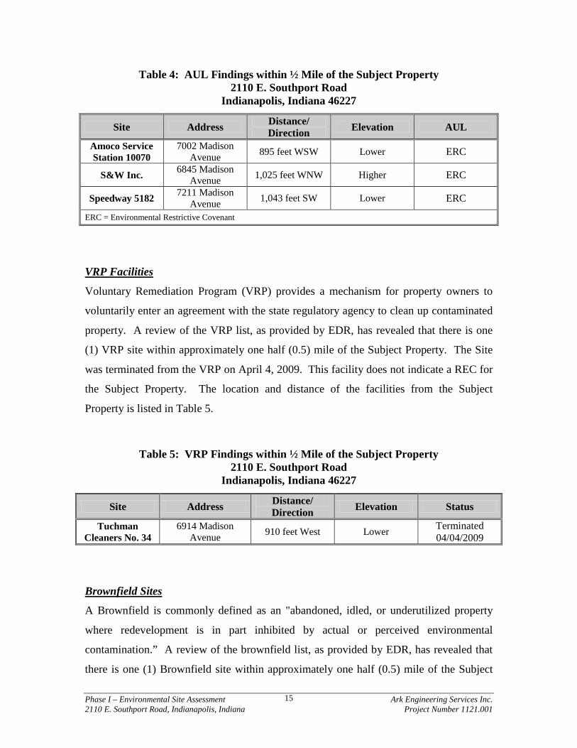
Phase I – Environmental Site Assessment Ark Engineering Services Inc. 2110 E. Southport Road, Indianapolis, Indiana Project Number 1121.001
15
Table 4: AUL Findings within ½ Mile of the Subject Property 2110 E. Southport Road
Indianapolis, Indiana 46227
Site Address Distance/ Direction Elevation AUL
Amoco Service Station 10070
7002 Madison Avenue 895 feet WSW Lower ERC
S&W Inc. 6845 Madison Avenue 1,025 feet WNW Higher ERC
Speedway 5182 7211 Madison Avenue 1,043 feet SW Lower ERC
ERC = Environmental Restrictive Covenant
VRP Facilities
Voluntary Remediation Program (VRP) provides a mechanism for property owners to
voluntarily enter an agreement with the state regulatory agency to clean up contaminated
property. A review of the VRP list, as provided by EDR, has revealed that there is one
(1) VRP site within approximately one half (0.5) mile of the Subject Property. The Site
was terminated from the VRP on April 4, 2009. This facility does not indicate a REC for
the Subject Property. The location and distance of the facilities from the Subject
Property is listed in Table 5.
Table 5: VRP Findings within ½ Mile of the Subject Property 2110 E. Southport Road
Indianapolis, Indiana 46227
Site Address Distance/ Direction Elevation Status
Tuchman Cleaners No. 34
6914 Madison Avenue 910 feet West Lower Terminated
04/04/2009
Brownfield Sites
A Brownfield is commonly defined as an "abandoned, idled, or underutilized property
where redevelopment is in part inhibited by actual or perceived environmental
contamination.” A review of the brownfield list, as provided by EDR, has revealed that
there is one (1) Brownfield site within approximately one half (0.5) mile of the Subject
Phase I – Environmental Site Assessment Ark Engineering Services Inc. 2110 E. Southport Road, Indianapolis, Indiana Project Number 1121.001
16
Property. This facility does not indicate a REC for the Subject Property. The location,
distance, direction, and elevation relative to the Subject Property are listed in Table 6.
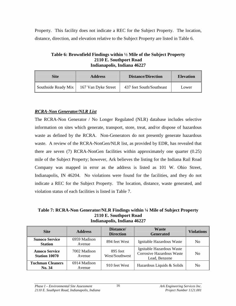
Table 6: Brownfield Findings within ½ Mile of the Subject Property 2110 E. Southport Road
Indianapolis, Indiana 46227
Site Address Distance/Direction Elevation
Southside Ready Mix 167 Van Dyke Street 437 feet South/Southeast Lower
RCRA-Non Generator/NLR List
The RCRA-Non Generator / No Longer Regulated (NLR) database includes selective
information on sites which generate, transport, store, treat, and/or dispose of hazardous
waste as defined by the RCRA. Non-Generators do not presently generate hazardous
waste. A review of the RCRA-NonGen/NLR list, as provided by EDR, has revealed that
there are seven (7) RCRA-NonGen facilities within approximately one quarter (0.25)
mile of the Subject Property; however, Ark believes the listing for the Indiana Rail Road
Company was mapped in error as the address is listed as 101 W. Ohio Street,
Indianapolis, IN 46204. No violations were found for the facilities, and they do not
indicate a REC for the Subject Property. The location, distance, waste generated, and
violation status of each facilities is listed in Table 7.
Table 7: RCRA-Non Generator/NLR Findings within ¼ Mile of Subject Property 2110 E. Southport Road
Indianapolis, Indiana 46227
Site Address Distance/ Direction
Waste Generated Violations
Sunoco Service Station
6959 Madison Avenue 894 feet West Ignitable Hazardous Waste No
Amoco Service Station 10070
7002 Madison Avenue
895 feet West/Southwest
Ignitable Hazardous Waste Corrosive Hazardous Waste
Lead, Benzene No
Tuchman Cleaners No. 34
6914 Madison Avenue 910 feet West Hazardous Liquids & Solids No
Phase I – Environmental Site Assessment Ark Engineering Services Inc. 2110 E. Southport Road, Indianapolis, Indiana Project Number 1121.001
17
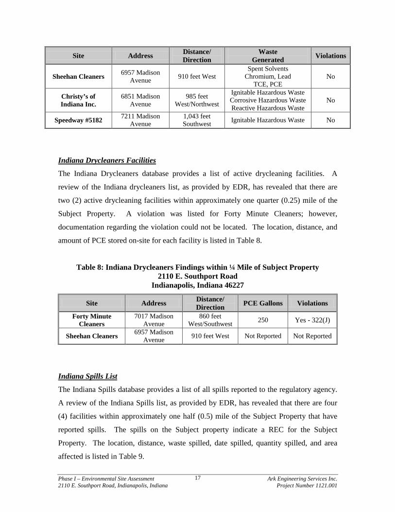
Site Address Distance/ Direction
Waste Generated Violations
Sheehan Cleaners 6957 Madison Avenue 910 feet West
Spent Solvents Chromium, Lead
TCE, PCE No
Christy’s of Indiana Inc.
6851 Madison Avenue
985 feet West/Northwest
Ignitable Hazardous Waste Corrosive Hazardous Waste Reactive Hazardous Waste
No
Speedway #5182 7211 Madison Avenue
1,043 feet Southwest Ignitable Hazardous Waste No
Indiana Drycleaners Facilities
The Indiana Drycleaners database provides a list of active drycleaning facilities. A
review of the Indiana drycleaners list, as provided by EDR, has revealed that there are
two (2) active drycleaning facilities within approximately one quarter (0.25) mile of the
Subject Property. A violation was listed for Forty Minute Cleaners; however,
documentation regarding the violation could not be located. The location, distance, and
amount of PCE stored on-site for each facility is listed in Table 8.
Table 8: Indiana Drycleaners Findings within ¼ Mile of Subject Property 2110 E. Southport Road
Indianapolis, Indiana 46227
Site Address Distance/ Direction PCE Gallons Violations
Forty Minute Cleaners
7017 Madison Avenue
860 feet West/Southwest 250 Yes - 322(J)
Sheehan Cleaners 6957 Madison Avenue 910 feet West Not Reported Not Reported
Indiana Spills List
The Indiana Spills database provides a list of all spills reported to the regulatory agency.
A review of the Indiana Spills list, as provided by EDR, has revealed that there are four
(4) facilities within approximately one half (0.5) mile of the Subject Property that have
reported spills. The spills on the Subject property indicate a REC for the Subject
Property. The location, distance, waste spilled, date spilled, quantity spilled, and area
affected is listed in Table 9.
Phase I – Environmental Site Assessment Ark Engineering Services Inc. 2110 E. Southport Road, Indianapolis, Indiana Project Number 1121.001
18
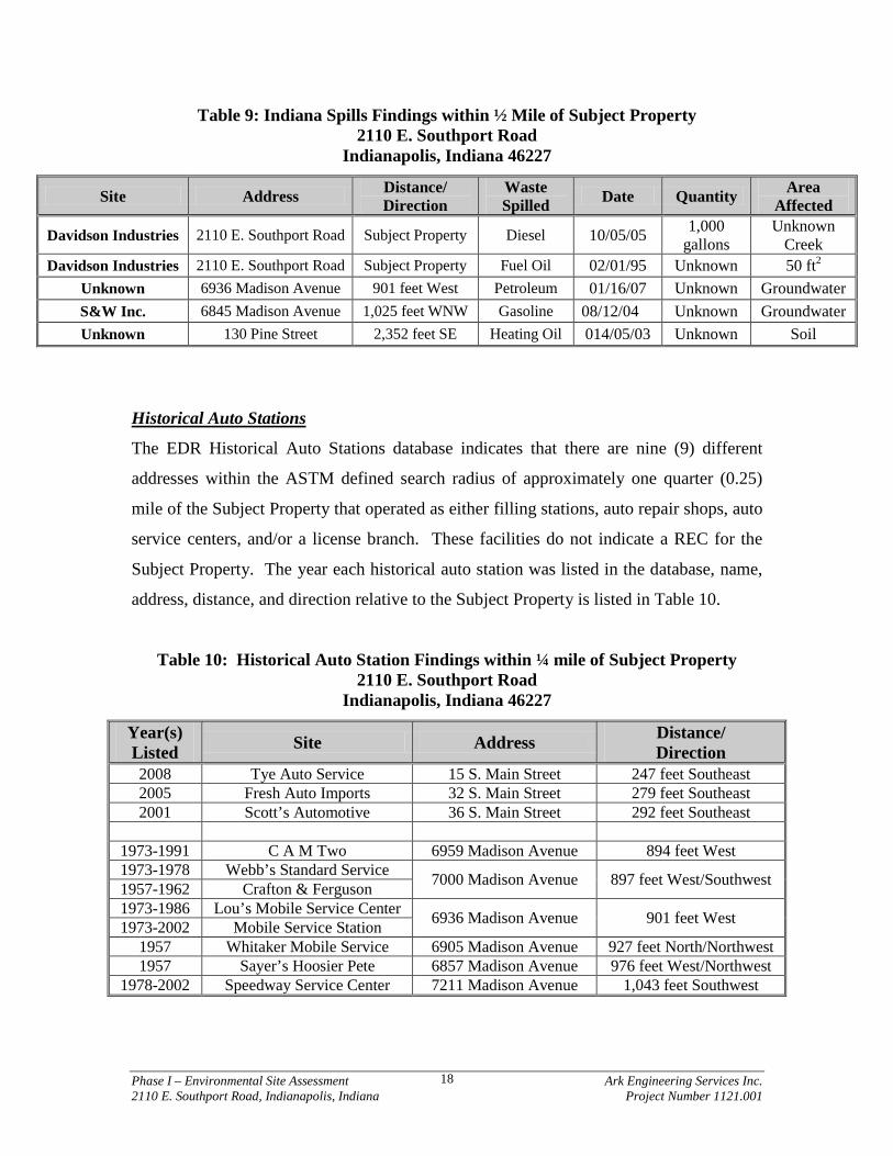
Table 9: Indiana Spills Findings within ½ Mile of Subject Property 2110 E. Southport Road
Indianapolis, Indiana 46227
Site Address Distance/ Direction
Waste Spilled Date Quantity Area
Affected
Davidson Industries 2110 E. Southport Road Subject Property Diesel 10/05/05 1,000 gallons
Unknown Creek
Davidson Industries 2110 E. Southport Road Subject Property Fuel Oil 02/01/95 Unknown 50 ft2
Unknown 6936 Madison Avenue 901 feet West Petroleum 01/16/07 Unknown Groundwater S&W Inc. 6845 Madison Avenue 1,025 feet WNW Gasoline 08/12/04 Unknown Groundwater Unknown 130 Pine Street 2,352 feet SE Heating Oil 014/05/03 Unknown Soil
Historical Auto Stations
The EDR Historical Auto Stations database indicates that there are nine (9) different
addresses within the ASTM defined search radius of approximately one quarter (0.25)
mile of the Subject Property that operated as either filling stations, auto repair shops, auto
service centers, and/or a license branch. These facilities do not indicate a REC for the
Subject Property. The year each historical auto station was listed in the database, name,
address, distance, and direction relative to the Subject Property is listed in Table 10.
Table 10: Historical Auto Station Findings within ¼ mile of Subject Property 2110 E. Southport Road
Indianapolis, Indiana 46227
Year(s) Listed Site Address Distance/
Direction 2008 Tye Auto Service 15 S. Main Street 247 feet Southeast 2005 Fresh Auto Imports 32 S. Main Street 279 feet Southeast 2001 Scott’s Automotive 36 S. Main Street 292 feet Southeast
1973-1991 C A M Two 6959 Madison Avenue 894 feet West 1973-1978 Webb’s Standard Service 7000 Madison Avenue 897 feet West/Southwest 1957-1962 Crafton & Ferguson 1973-1986 Lou’s Mobile Service Center 6936 Madison Avenue 901 feet West 1973-2002 Mobile Service Station
1957 Whitaker Mobile Service 6905 Madison Avenue 927 feet North/Northwest 1957 Sayer’s Hoosier Pete 6857 Madison Avenue 976 feet West/Northwest
1978-2002 Speedway Service Center 7211 Madison Avenue 1,043 feet Southwest
Phase I – Environmental Site Assessment Ark Engineering Services Inc. 2110 E. Southport Road, Indianapolis, Indiana Project Number 1121.001
19
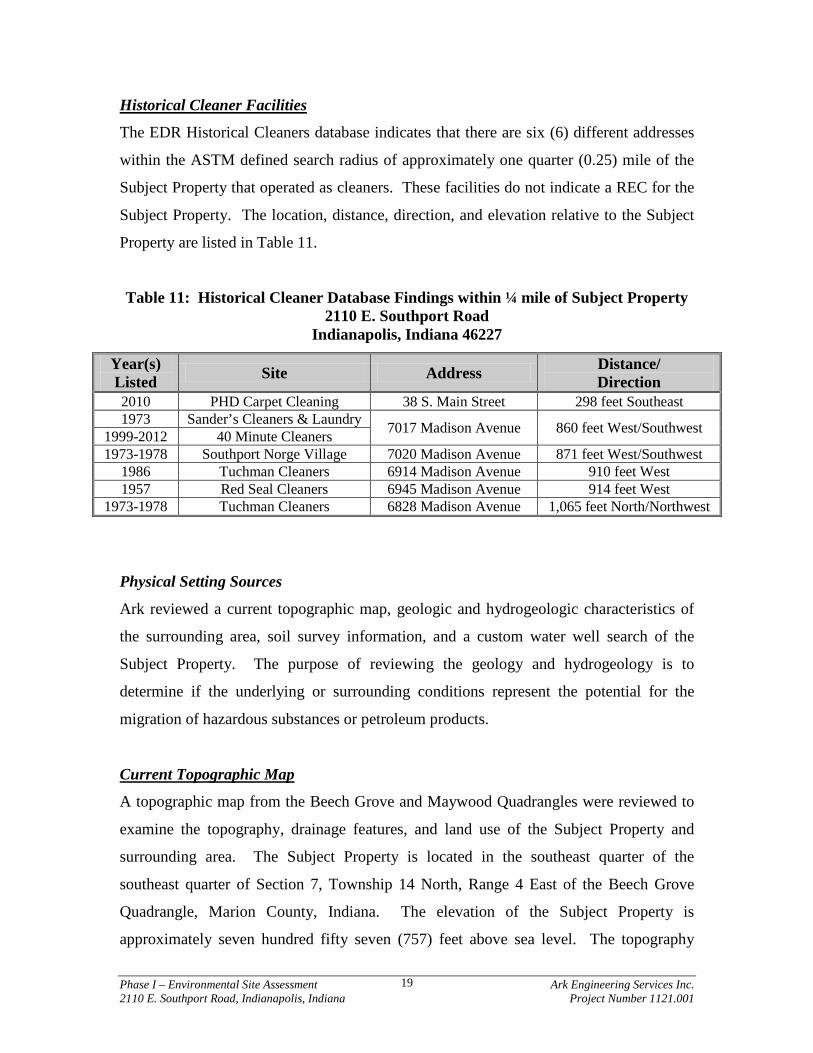
Historical Cleaner Facilities
The EDR Historical Cleaners database indicates that there are six (6) different addresses
within the ASTM defined search radius of approximately one quarter (0.25) mile of the
Subject Property that operated as cleaners. These facilities do not indicate a REC for the
Subject Property. The location, distance, direction, and elevation relative to the Subject
Property are listed in Table 11.
Table 11: Historical Cleaner Database Findings within ¼ mile of Subject Property 2110 E. Southport Road
Indianapolis, Indiana 46227
Year(s) Listed Site Address Distance/
Direction 2010 PHD Carpet Cleaning 38 S. Main Street 298 feet Southeast 1973 Sander’s Cleaners & Laundry 7017 Madison Avenue 860 feet West/Southwest 1999-2012 40 Minute Cleaners
1973-1978 Southport Norge Village 7020 Madison Avenue 871 feet West/Southwest 1986 Tuchman Cleaners 6914 Madison Avenue 910 feet West 1957 Red Seal Cleaners 6945 Madison Avenue 914 feet West
1973-1978 Tuchman Cleaners 6828 Madison Avenue 1,065 feet North/Northwest
Physical Setting Sources
Ark reviewed a current topographic map, geologic and hydrogeologic characteristics of
the surrounding area, soil survey information, and a custom water well search of the
Subject Property. The purpose of reviewing the geology and hydrogeology is to
determine if the underlying or surrounding conditions represent the potential for the
migration of hazardous substances or petroleum products.
Current Topographic Map
A topographic map from the Beech Grove and Maywood Quadrangles were reviewed to
examine the topography, drainage features, and land use of the Subject Property and
surrounding area. The Subject Property is located in the southeast quarter of the
southeast quarter of Section 7, Township 14 North, Range 4 East of the Beech Grove
Quadrangle, Marion County, Indiana. The elevation of the Subject Property is
approximately seven hundred fifty seven (757) feet above sea level. The topography
Phase I – Environmental Site Assessment Ark Engineering Services Inc. 2110 E. Southport Road, Indianapolis, Indiana Project Number 1121.001
20
within a one (1) mile radius of the Subject Property generally slopes from east to west
and towards Little Buck Creek in the north/south direction.
Regional Geologic Information
The area of the Subject Property is covered by thick ground moraine, which is composed
of loamy tills interbedded with thin, discontinuous to continuous layers of stratified sand
and gravel. Melt-water deposits within the Subject Property area include strongly sloping
outwash terraces, and nearly level depressed areas. Deposits were subsequently altered
by the action of wind and water. Windblown sand dunes are present in some areas, and
depressed areas typically contain accumulated organic materials (Fenelon 1994).
Unconsolidated sediment thickness is reportedly in the order of approximately one
hundred fifty (150) to two hundred (200) feet thick in the area of the Subject Property.
Glacial deposits rest on Devonian and Mississippian Shale composed of the New Albany
Shale.
The Subject Property is located in the Tipton Till Plain, formed by glaciers during the
Pleistocene epoch. The till plain surface is nearly flat to gently undulating, poorly
drained, and featureless. Surface relief is generally ten (10) feet per one thousand (1,000)
feet.
Regional Hydrologic Information
The unconsolidated aquifer beneath the Subject Property is the New Castle / Tipton Till
Aquifer System. This aquifer system is up to three hundred five (305) feet thick and
consists primarily of glacial till with intertill sand and gravel layers. This aquifer system
is capable of meeting the needs of most domestic and some high capacity users in Marion
County. Individual sand and gravel units are commonly five (5) to fifteen (15) feet thick
with wells depths ranging from twenty-five (25) to three hundred (300) feet below
ground surface (bgs). Domestic well yields are typically ten (10) to fifty (50) gallons per
minute (gpm) and static water levels range from flowing to one hundred eighty-five (185)
feet bgs. There are seventeen (17) registered significant groundwater withdrawal
Phase I – Environmental Site Assessment Ark Engineering Services Inc. 2110 E. Southport Road, Indianapolis, Indiana Project Number 1121.001
21
facilities (38 wells) using the New Castle / Tipton Till Aquifer System. These facilities
are used for public water supply, irrigation, and industrial and energy production. The
reported high-capacity yields for wells range from seventy (7) to four hundred thirty
(430) gpm. The system has low susceptibility to surface contamination because intertill
sand and gravel units are commonly overlain by thick glacial till (IDNR 2011). A map of
the unconsolidated aquifer system is included in Appendix E.
The bedrock aquifer beneath the Subject Property is the Devonian and Mississippian –
New Albany Shale Aquifer System. The New Albany Shale is often described as an
aquitard, and yields of wells completed in it are typically quite limited. Therefore, most
wells either produce from the overlying unconsolidated deposits or penetrate through the
shale in favor of the underlying Silurian and Devonian Carbonates. The depths of the
relatively few wells reported in the New Albany Shale Aquifer System range from
approximately thirty (3) to four hundred fifteen (415) feet bgs. Domestic water well
yields are typically less than five (5) gpm with many dry holes having been reported in
this system. There are no registered significant groundwater withdrawal facilities using
the system. The permeability of the shale materials is considered low; therefore, the New
Albany Shale Aquifer System is considered to have low susceptibility to contamination.
(IDNR 2011). A map of the bedrock aquifer system is included in Appendix E.
Little Buck Creek borders the Subject Property to the north and flows towards the west
where it confluences with the White River approximately six (6) miles west of the
Subject Property. Hydrogeologic features such as a river or stream generally influence
regional groundwater flow direction. Surface and/or bedrock topography may also
influence regional groundwater flow direction. It should be noted that local geologic
features might cause local flow direction to differ from the regional flow direction.
Based on the topography in the area of the Subject Property, groundwater flow is likely to
be towards the north; however, a hydrogeologic investigation consisting of the
installation of a minimum of three (3) groundwater monitoring wells across the Subject
Property would be necessary to determine the actual groundwater flow direction.
Phase I – Environmental Site Assessment Ark Engineering Services Inc. 2110 E. Southport Road, Indianapolis, Indiana Project Number 1121.001
22
Water Well Search
The purpose of identifying water well records in the vicinity of the Subject Property is to
locate possible receptors for any known or suspected subsurface contaminant which
originated at the Subject Property. The database search provided by EDR includes a
search of federal and state water well databases. According to EDR’s report, there are no
Federal USGS wells or public water supply systems located within a one (1) mile radius
of the Subject Property. Seventy-seven (77) water wells were located within a one (1)
mile radius of the Subject Property according to EDR’s search of the State of Indiana
database well information; however, additional private water wells may exist that were
not found in the State database. Details of the water well search are included in
Appendix D.
Soil Survey of Marion County
According to the United States Department of Agriculture (USDA) Soil Conservation
Service, (Soil survey of Marion County) near surface soil beneath the northern two thirds
(⅔) of the Subject Property consists of Crosby Silt Loam and near surface soil beneath
the northern one third (⅓) of the Subject Property consists of Genesee Silt Loam. Silt
Loam is generally describes as a mixture of silt, sand, and clay. The proportions vary
from 50% to 80% silt, 20% to 50% sand, and 0% to 27% clay. A map of the soil survey
is included in Appendix E.
Historical Use Information on the Subject Property and Adjoining Properties
The purpose of acquiring past and current ownership records is to obtain information
regarding possible past uses of the Subject Property, which may have had an impact on
the property. Records providing ownership information include land title records,
Sanborn Fire Insurance Maps, historical aerial photographs, and city directories.
Land Title Records
Ark reviewed title and deed information available on-line and received from the Client.
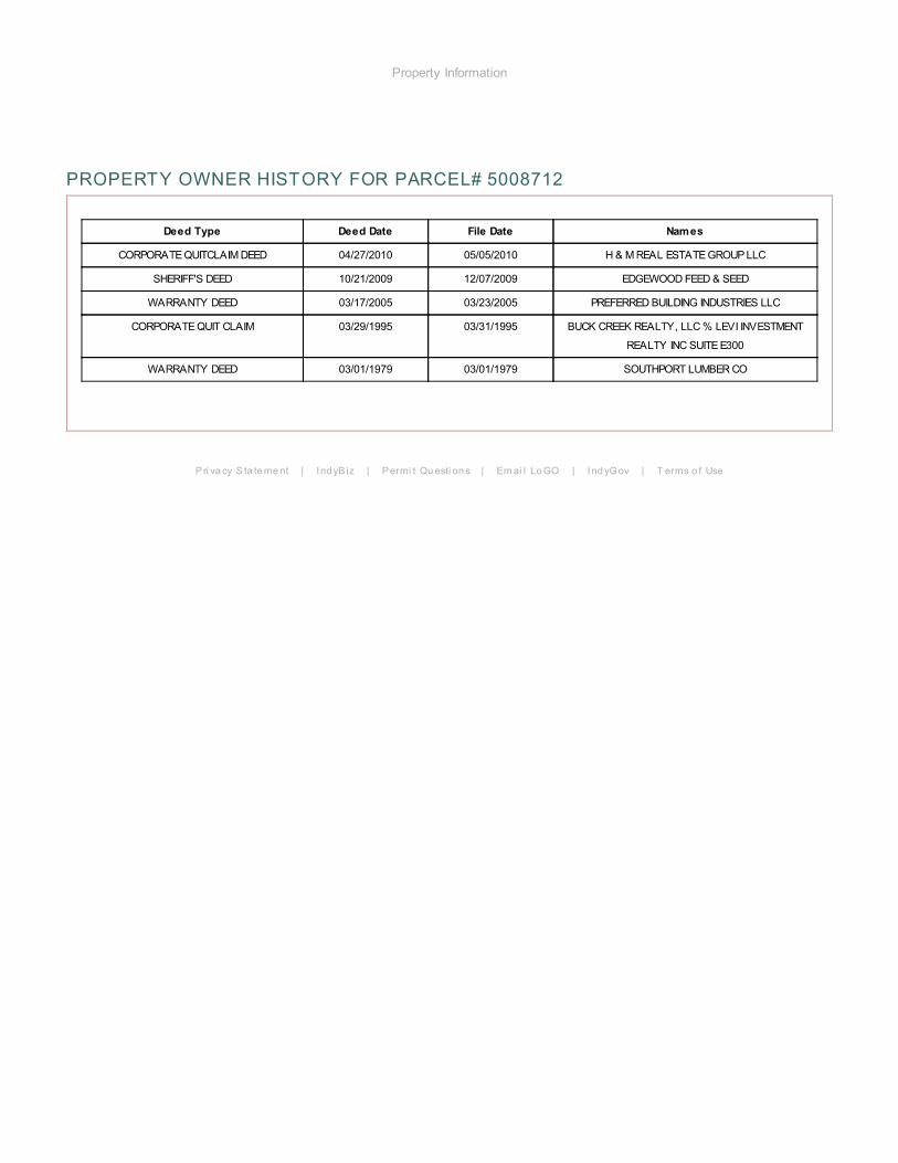
Based on the available records, H&M Real Estate Group LLC is listed as the current
Phase I – Environmental Site Assessment Ark Engineering Services Inc. 2110 E. Southport Road, Indianapolis, Indiana Project Number 1121.001
23
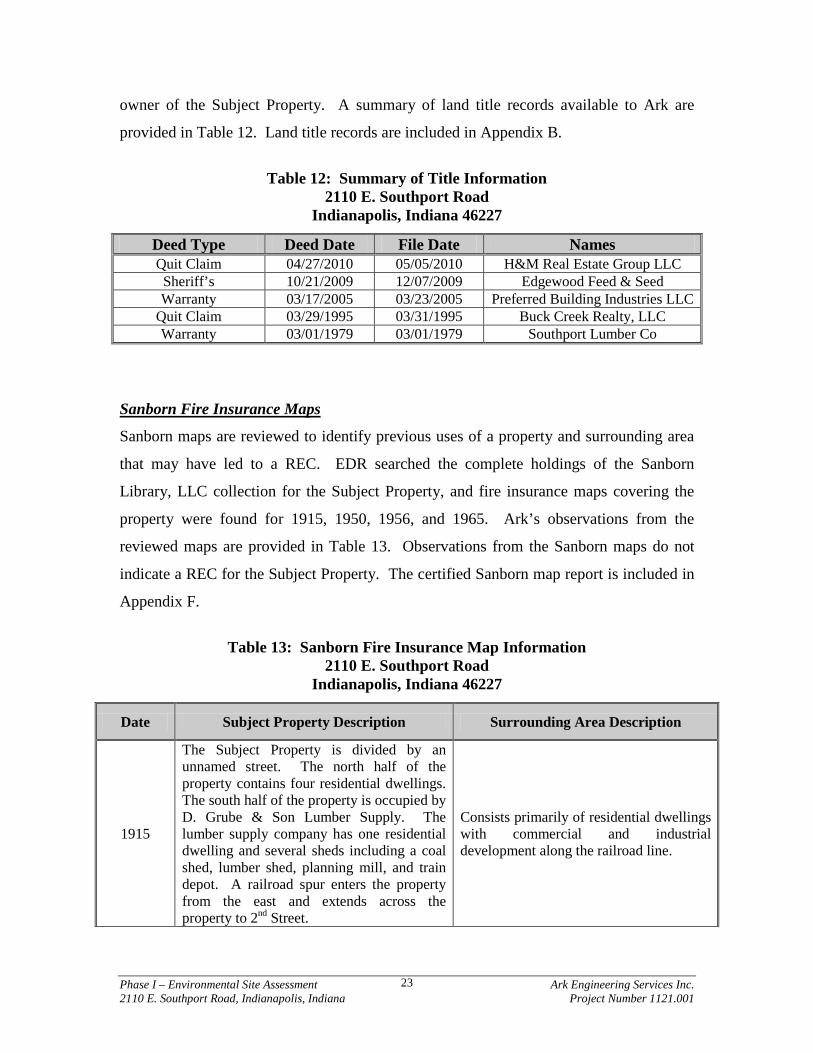
owner of the Subject Property. A summary of land title records available to Ark are
provided in Table 12. Land title records are included in Appendix B.
Table 12: Summary of Title Information
2110 E. Southport Road Indianapolis, Indiana 46227
Deed Type Deed Date File Date Names Quit Claim 04/27/2010 05/05/2010 H&M Real Estate Group LLC Sheriff’s 10/21/2009 12/07/2009 Edgewood Feed & Seed Warranty 03/17/2005 03/23/2005 Preferred Building Industries LLC
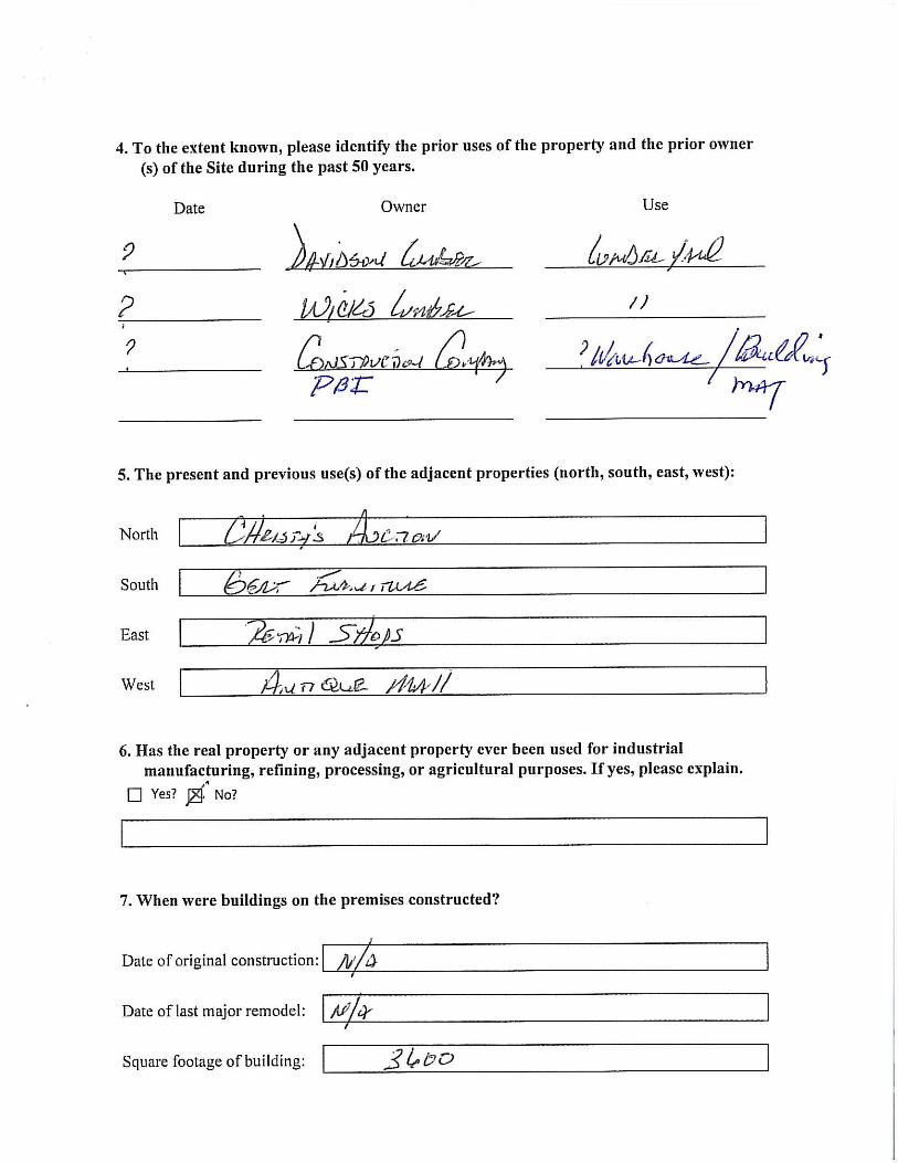
Quit Claim 03/29/1995 03/31/1995 Buck Creek Realty, LLC Warranty 03/01/1979 03/01/1979 Southport Lumber Co
Sanborn Fire Insurance Maps
Sanborn maps are reviewed to identify previous uses of a property and surrounding area
that may have led to a REC. EDR searched the complete holdings of the Sanborn
Library, LLC collection for the Subject Property, and fire insurance maps covering the
property were found for 1915, 1950, 1956, and 1965. Ark’s observations from the
reviewed maps are provided in Table 13. Observations from the Sanborn maps do not
indicate a REC for the Subject Property. The certified Sanborn map report is included in
Appendix F.
Table 13: Sanborn Fire Insurance Map Information
2110 E. Southport Road Indianapolis, Indiana 46227
Date Subject Property Description Surrounding Area Description
1915
The Subject Property is divided by an unnamed street. The north half of the property contains four residential dwellings. The south half of the property is occupied by D. Grube & Son Lumber Supply. The lumber supply company has one residential dwelling and several sheds including a coal shed, lumber shed, planning mill, and train depot. A railroad spur enters the property from the east and extends across the property to 2nd Street.
Consists primarily of residential dwellings with commercial and industrial development along the railroad line.
Phase I – Environmental Site Assessment Ark Engineering Services Inc. 2110 E. Southport Road, Indianapolis, Indiana Project Number 1121.001
24
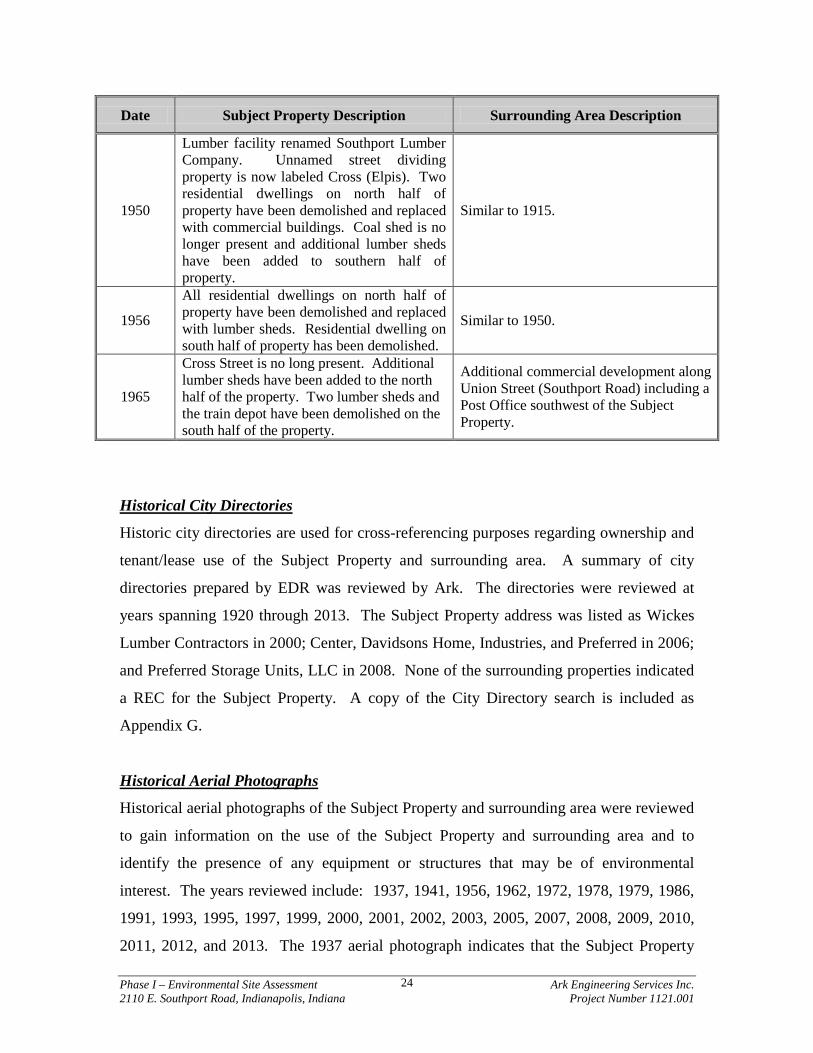
Date Subject Property Description Surrounding Area Description
1950
Lumber facility renamed Southport Lumber Company. Unnamed street dividing property is now labeled Cross (Elpis). Two residential dwellings on north half of property have been demolished and replaced with commercial buildings. Coal shed is no longer present and additional lumber sheds have been added to southern half of property.
Similar to 1915.
1956
All residential dwellings on north half of property have been demolished and replaced with lumber sheds. Residential dwelling on south half of property has been demolished.
Similar to 1950.
1965
Cross Street is no long present. Additional lumber sheds have been added to the north half of the property. Two lumber sheds and the train depot have been demolished on the south half of the property.
Additional commercial development along Union Street (Southport Road) including a Post Office southwest of the Subject Property.
Historical City Directories
Historic city directories are used for cross-referencing purposes regarding ownership and
tenant/lease use of the Subject Property and surrounding area. A summary of city
directories prepared by EDR was reviewed by Ark. The directories were reviewed at
years spanning 1920 through 2013. The Subject Property address was listed as Wickes
Lumber Contractors in 2000; Center, Davidsons Home, Industries, and Preferred in 2006;
and Preferred Storage Units, LLC in 2008. None of the surrounding properties indicated
a REC for the Subject Property. A copy of the City Directory search is included as
Appendix G.
Historical Aerial Photographs
Historical aerial photographs of the Subject Property and surrounding area were reviewed
to gain information on the use of the Subject Property and surrounding area and to
identify the presence of any equipment or structures that may be of environmental
interest. The years reviewed include: 1937, 1941, 1956, 1962, 1972, 1978, 1979, 1986,
1991, 1993, 1995, 1997, 1999, 2000, 2001, 2002, 2003, 2005, 2007, 2008, 2009, 2010,
2011, 2012, and 2013. The 1937 aerial photograph indicates that the Subject Property
Phase I – Environmental Site Assessment Ark Engineering Services Inc. 2110 E. Southport Road, Indianapolis, Indiana Project Number 1121.001
25
has been developed. The lumber yard is visible on the southern half of the property and
residential dwellings are visible on the northern half of the property. The 1956
photograph indicates the entire Subject Property is commercial development (lumber
yard). There was very little change at the Subject Property between 1962 and 2009. In
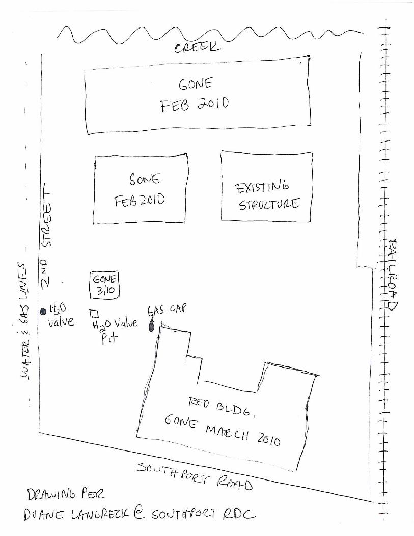
2010, demolition of on-site buildings was started. The 2011 photograph shows the
Subject Property as seen today with one (1) building present on the east central portion of
the property. Visual observations from aerial photographs of the Subject Property and
surrounding properties do not indicate a REC. The historical aerial photographs are
included in Appendix H.
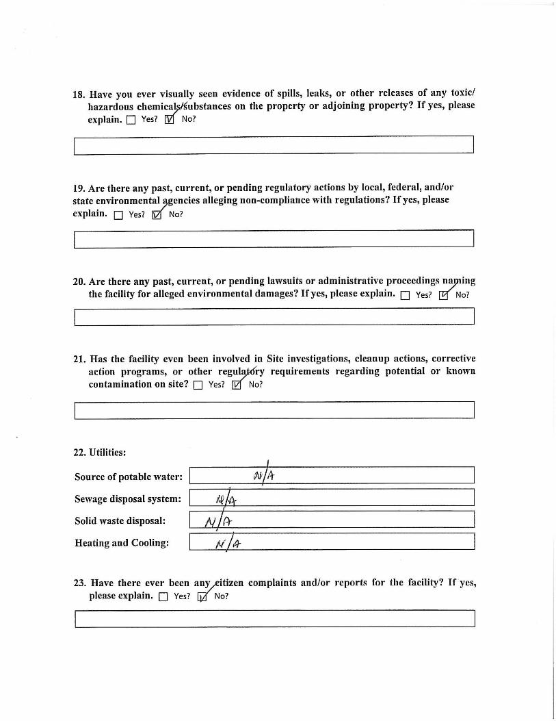
Environmental Liens and Activity and Use Limitations
Ark personnel conducted an Environmental Liens and/or Activity and Use Limitations
(AULs) search for the Subject Property. Based on the results of the search, no
Environmental Liens or AULs were found for the Subject Property.
Previous Environmental Reports
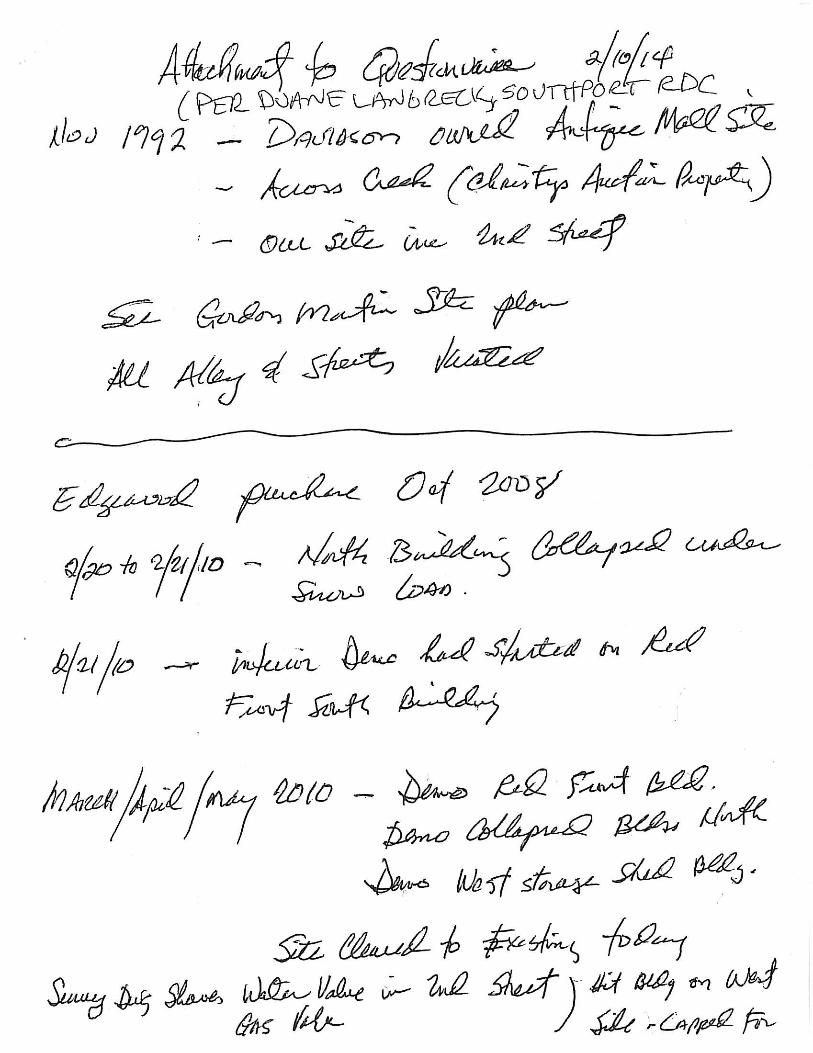
Previous environmental reports were located by Ark on IDEM’s virtual file cabinet. The
reports include a Sampling Inspection of Davidson Industries, Inc., three (3) UST Closure
documents, and a Notification of Demolition. Relevant information from the previous
reports are summarized below.
Sampling Inspection of Davidson Industries, Inc., IDEM, February 17, 1988
On July 10, 1987 soil samples were collected in response to a February 23, 1987
complaint investigation concerning alleged dumping of paint wastes by the site occupant.
The site occupant identified an area on-site where waste from their staining operations
had been deposited on the ground and three (3) soil samples were collected for laboratory
analysis. The soil samples were collected along the railroad on the north side of Little
Buck Creek, which is not located on the Subject Property. Based on the results of the
investigation, no volatile organic compounds (VOCs) were detected in the soil samples.
Phase I – Environmental Site Assessment Ark Engineering Services Inc. 2110 E. Southport Road, Indianapolis, Indiana Project Number 1121.001
26
UST Closure Reports, Commercial Sewer Cleaning Company
Various reports were found documenting the closure of three (3) USTs at the Subject
Property. UST closure was completed by Commercial Sewer Cleaning Co., Inc. in
December of 1994 through February of 1995. One (1) eight thousand (8,000) gallon
diesel tank, one (1) one thousand (1,000) gallon heating oil tank, and one (1) three
hundred (300) gallon heating oil tank were removed via excavation. Six (6) soil samples
were collected in the vicinity of the eight thousand (8,000) gallon UST. Samples were
submitted for analysis of Total Petroleum Hydrocarbons (TPH) gasoline and diesel range
organics (GRO & DRO). Results indicated the presence of TPH-DRO in two (2) soil
samples (north sidewall and east end fill) indicating a release. One (1) soil sample was
collected in the vicinity of the one thousand (1,000) gallon UST and submitted for
analysis of TPH-GRO and TPH-DRO. Results indicated the absence of hydrocarbons.
One (1) soil sample was collected in the vicinity of the three hundred (300) gallon UST
and submitted for analysis of TPH-GRO and TPH-DRO. Results indicated elevated
concentrations of hydrocarbons indicating a release. The report states that ten (10) cubic
yards of contaminated soil was over excavated and the area was re-sampled. The sample
collected following over excavation indicated the absence of hydrocarbons.
Notification of Demolition, Royalty Excavating
On March 4, 2010, a notification of demolition was submitted to IDEM by Royalty
Excavating. The document identifies that the lumber warehouse and office building will
be demolished with heavy equipment.
Phase I – Environmental Site Assessment Ark Engineering Services Inc. 2110 E. Southport Road, Indianapolis, Indiana Project Number 1121.001
27
5.0 SITE RECONNAISSANCE
On February 20, 2014, Mike Cooper of Ark conducted a Site reconnaissance of the
Subject Property. Weather conditions were mostly cloudy and windy with a temperature
of ~50ºF. The purpose of this inspection was to gather information regarding the
environmental conditions at the Subject Property as well as the surrounding area. The
reconnaissance included an examination of the Subject Property and surrounding area. A
photographic portfolio from the Site reconnaissance is presented in Appendix J.
Methodology and Limiting Conditions
The Site reconnaissance consisted of visual and/or physical observations of the Subject
Property, adjoining properties as viewed from the Subject Property boundaries, and the
surrounding area based on visual observations made from adjacent public thoroughfares.
The majority of the Subject Property was accessible during the Site reconnaissance;
however, snow cover across the entire property and surrounding properties prevented a
complete examination of ground surfaces.
General Site Setting
The Subject Property is located at 2110 E. Southport Road at the northeast corner of
Southport Road and 2nd Street, in Perry Township, Marion County, Indiana 46227. The
area immediately surrounding the Subject Property predominantly consists of commercial
development with some residential development east of the Subject Property on the east
side of the railroad. The Subject Property is bordered by Little Buck Creek to the north,
the Louisville and Indiana Railroad Company Railway to the east, Southport Road to the
south, and 2nd Street to the west. The Subject Property consists of one (1) parcel that
encompasses an area of approximately 3.25 acres. Topography on the Subject Property
generally slopes from south to north towards Little Buck Creek.
Exterior Observations
A majority of the Subject Property is paved with asphalt with some grassy areas located
in the north and northeast portions of the property. A six (6) foot tall chain link fence is
Phase I – Environmental Site Assessment Ark Engineering Services Inc. 2110 E. Southport Road, Indianapolis, Indiana Project Number 1121.001
28
present around the perimeter of the property. One (1) structure measuring approximately
eighty (80) feet by ninety (90) feet is located on the east central portion of the property
and is constructed with wood timbers covered in sheet metal. Various concrete building
footers were observed on the northern half of the Subject Property. The Subject Property
is accessed from Southport Road through a gate at the southwest corner of the property.
The on-site structure is serviced with overhead electricity extending from utility poles
along 2nd Street to the southwest corner of the structure.
Pits, Ponds, or Lagoons
No pits, ponds, or lagoons that would indicate a REC were observed on the Subject
Property.
Stressed Vegetation
No stressed vegetation that would indicate a REC was observed on the Subject Property;
however, snow cover limited visual observations.
Stained Soil or Pavement
No stained soil or pavement that would indicate a REC was observed on the Subject
Property; however, snow cover limited visual observations.
Waste Water
The Subject Property currently does not generate waste water. There are no known
discharge permits held by this Site.
Wells
The area in the vicinity of the Subject Property is serviced with water from the City of
Indianapolis. No drinking water wells or groundwater monitoring wells were observed at
the Subject Property.
Phase I – Environmental Site Assessment Ark Engineering Services Inc. 2110 E. Southport Road, Indianapolis, Indiana Project Number 1121.001
29
Solid Waste
Large quantities of solid waste were not observed at the Site; however, minor
accumulation of liter was observed along the property boundaries. Small soil piles were
observed near the northeast portion of the property. No staining or odor was associated
with the soil.
Septic Systems
Depressions in the ground that would indicate a septic system were not observed during
the Site reconnaissance, and the presence of a septic system have not been indicated
during Site interviews.
Interior Observations
The majority of the interior of the building was open space with a small area enclosed in
the northwest portion of the building. The enclosed area contained a vehicle and two (2)
pieces of excavation equipment. Additional items stored in the building included a trailer
and landscaping supplies.
Heating/Cooling
Not Applicable.
Drains and Sumps
No drains or sumps that would indicate a REC were observed on the Subject Property.
Stains or Corrosion
No stains or corrosion that would indicate a REC were observed.
Mold and Mildew
No mold or mildew was observed on the Subject Property.
Phase I – Environmental Site Assessment Ark Engineering Services Inc. 2110 E. Southport Road, Indianapolis, Indiana Project Number 1121.001
30
General Property Observations
Hazardous Substances and Petroleum Products
No hazardous substances or petroleum products were observed on the Subject Property.
Storage Tanks
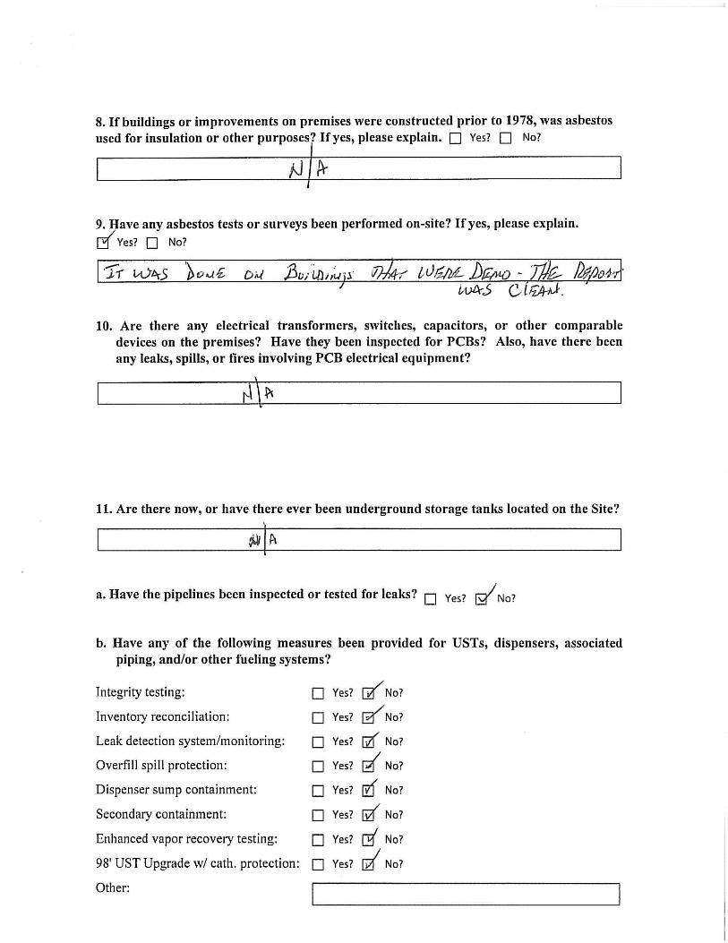
Underground Storage Tanks (USTs)
Three (3) USTs have been removed from the subject property. One (1) vent pipe was
visible on the southeast corner of the on-site building. Pavement cuts were observed on
the southeast corner of the on-site building and near the west central portion of the
Subject Property which may indicate the former locations of two (2) of the USTs.
Aboveground Storage Tanks (ASTs)
No ASTs were observed on the Subject Property
Drums
No drums were observed on the Subject Property.
Pools of Liquid
No pools of liquid that would indicate a REC were observed on the Subject Property.
Odor
No unusual odor that would indicate an REC was observed on the Subject Property.
Polychlorinated Biphenyls (PCBs)
Polychlorinated biphenyls (PCBs) are a chemical component of many dielectric fluids,
heat transfer fluids, hydraulic fluids, lubricating oils, paints, or coatings manufactured
prior to July 2, 1979. Equipment that may potentially contain PCBs includes electrical
equipment such as transformers or capacitors or hydraulically operated equipment, such
as elevators, compaction equipment, or manufacturing equipment. Several electrical
transformers were observed along the western boundary of the Subject Property. The
Phase I – Environmental Site Assessment Ark Engineering Services Inc. 2110 E. Southport Road, Indianapolis, Indiana Project Number 1121.001
31
transformers each displayed a blue “PCB free” label, appeared in good condition, and
showed no evidence of leakage or staining.
Phase I – Environmental Site Assessment Ark Engineering Services Inc. 2110 E. Southport Road, Indianapolis, Indiana Project Number 1121.001
32
6.0 INTERVIEWS
Interview with Site Owner, Manager, and Occupants
Per ASTM Standard Practice E 1527-13, interviews with current and previous owners
must be conducted. The previous owner of the Subject Property was unable to be
contacted and was not interviewed. Several attempts were made to reach Davison
Industries; however, each number listed for Davidson Lumber Company – a Division of
Davison Industries, Inc. had been disconnected. Additionally, attempts were made to
contact Preferred Building Industries LLC; however, the listed phone numbers had been
disconnected. H&M Real Estate is the current owner of the Subject Property. Mr.
Harold Bowling (Owner) completed an Owner Questionnaire for the Subject Property.
The Client, Mr. Greg Schiffli (Indy Southport Development, LLC), completed a Client
Questionnaire for the Subject Property. Responses to the questionnaires and interviews
are incorporated into this report. The completed questionnaires are provided in Appendix
C.
Interviews with Local Government Officials
On February 18, 2014, Ark sent a written request to the Marion County Health
Department (MCHD) requesting all available environmental records for the Subject
Property. No records that would indicate a REC were found. On February 18, 2014, Ark
contacted the Indianapolis Fire Department, Division of Fire Prevention to determine if
records of any health or environmental issues associated with the Subject Property were
available and requested all fire reports for the Site. IFD returned the request on February
18, 2014 and indicated that no records of hazmat or environmental runs have been made
to the Subject Property. Documentation related to the interviews is included as Appendix
K.
Phase I – Environmental Site Assessment Ark Engineering Services Inc. 2110 E. Southport Road, Indianapolis, Indiana Project Number 1121.001
33
7.0 EVALUATION
Ark performed a Phase I ESA of the property located at 2110 E. Southport Road,
Indianapolis, Indiana 46227 at the request of Indy Southport Development, LLC. This
ESA was performed in general conformance with the scope and limitations of the ASTM
Standard for Environmental Site Assessments: Phase I Environmental Process,
designation E 1527-13 and with the AAI Rule with respect to the range of contaminants
within the scope of the CERCLA (42 U.S.C. §9601).
7.1 Findings and Opinions
This assessment has revealed no evidence of recognized environmental conditions in
connection with the Subject Property except for the following:
• Three (3) USTs were previously utilized at the Subject Property. The USTs were
removed in late 1994 and early 1995. Laboratory analytical results indicated
releases from two (2) of the USTs.
• Two (2) spills have been reported at the Subject Property. One (1) documented a
spill of one thousand (1,000) gallons of diesel fuel in 2005 that impacted a creek.
The second documented a spill of fuel oil affecting an area of 50 ft2 and is likely
related to the UST closure event based on the date of the report (1995).
7.2 Conclusions and Recommendations
Based on this Phase I ESA, Ark has the following environmental recommendations for
the Subject Property:
• Conduct a Phase II ESA to evaluate the potential for adverse environmental
impact resulting from the RECs. Soil borings should be completed in the vicinity
of each former UST and along the northern property boundary to investigate the
spill of one thousand (1,000) gallons of diesel fuel. Soil and groundwater samples
should be collected from each boring location and submitted for laboratory
Phase I – Environmental Site Assessment Ark Engineering Services Inc. 2110 E. Southport Road, Indianapolis, Indiana Project Number 1121.001
34
analysis of volatile organic compounds (VOCs), polycyclic aromatic
hydrocarbons (PAHs), and total lead.
7.3 Additional Services
No additional services were performed in conjunction with this Phase I Environmental
Site Assessment.
7.4 Data Gaps and Deletions
The following deviations/data gaps were identified during the Site reconnaissance and
records review:
• Several aerial photographs for the Subject Property were of poor quality;
• Not all previous owners of the Subject Property could be contacted for an
interview;
• Owner history for the Subject Property was only obtained dating back to 1979;
and
• Snow covered the ground around the Subject Property at the time of the Site
Reconnaissance; therefore, visibility of the ground surface was limited; and
The data gaps noted above do not substantially weaken the Site assessment or opinions
and conclusions derived thereof.
7.5 References
ASTM Designation E 1527-13 Standard Practice for Environmental Site Assessments: Phase I Environmental Site Assessment Process. Fenelon, Joseph M., Bobay, Keith E., and others, Hydrogeologic Atlas of Aquifers in Indiana, 1994. Environmental Data Resources, Inc., The EDR Radius Map Report with GeoCheck®; Inquiry Number 3848966.2s, dated February 6, 2014.
Phase I – Environmental Site Assessment Ark Engineering Services Inc. 2110 E. Southport Road, Indianapolis, Indiana Project Number 1121.001
35
Environmental Data Resources, Inc., Certified Sanborn Map Report; Inquiry Number 3848966.3, dated February 7, 2014. Environmental Data Resources, Inc., The EDR-City Directory Image Report; Inquiry Number 3848966.5, dated February 6, 2014. IDEM, Regulatory Record Files. Indianapolis Fire Department. Marion County Health Department. Imagery ©2013 TerraMetrics, Map data ©2013 Google. http://www.in.gov/dnr/. http://maps.indiana.edu/. http://maps.indy.gov/MapIndy/. http://http://websoilsurvey.nrcs.usda.gov.
7.6 Statement and Signatures
We declare that, to the best of our professional knowledge and belief, we meet the
definition of Environmental Professional as defined in §312.10 of 40 CFR 312. We have
the specific qualifications based on education, training, and experience to assess a
property of the nature, history, and setting of the Subject Property. We have developed
and performed the all appropriate inquiries in conformance with the standards and
practices set forth in 40 CFR Part 312.
Résumés describing the qualifications of all personnel involved with this Phase I ESA are
included as Appendix L. Our professional services have been performed, our findings
obtained, and our conclusions prepared in accordance with customary principles and
practices in the fields of environmental science and engineering. This warranty is in lieu
of all other warranties either expressed or implied. This company is not responsible for
the independent conclusions, opinions, or recommendations made by others.
Phase I – Environmental Site Assessment Ark Engineering Services Inc. 2110 E. Southport Road, Indianapolis, Indiana Project Number 1121.001
36
The work performed in conjunction with this assessment resulted from available
information at the dates and locations given in the records searched in addition to visible
and accessible evidence on the Site. Consequently, this report does not warrant or
guarantee that any and all problems that may exist at the Subject Property were disclosed,
nor does it warrant against operations or conditions present of a type or at a location not
investigated, nor against future operations or conditions.
__________________ February 24, 2014 Michael B. Cooper, L.P.G. Date Senior Project Manager
__________________ February 24, 2014 Wesley K. Paul, P.E. Date Principal Engineer
Phase I – Environmental Site Assessment Ark Engineering Services Inc. 2110 E. Southport Road, Indianapolis, Indiana Project Number 1121.001
37
8.0 NON-SCOPE SERVICES
Radon Survey
Radon is a radioactive gas derived from the natural decay of uranium that is found in
nearly all soils. It typically moves up through the ground to the air above and into
buildings through the foundation. Radon can be trapped in a building, where it can build
up. Any building may have a radon problem including new and old buildings, well-
sealed and drafty buildings, and buildings with or without basements. The U.S. EPA
Radon Zone analysis for Indiana is included in the EDR report. According to the Federal
Area Radon Information for Zip Code 46227, the average radon concentration in the sites
tested (6 total), is 3.450 pico curies per liter (pCi/l) for first floor living areas and 3.617
pCi/l for basements. Radon concentrations below 4.0 pCi/l are considered safe for
exposure.
Asbestos Containing Materials
In the past asbestos has been used in a wide variety of building construction materials due
to its insulating and fire retardant attributes. ACMs are generally classified as friable and
non-friable. Friable materials are those which can be crumbled, pulverized, or reduced to
powder by hand pressure, or by normal use or maintenance can be expected to emit
asbestos fibers into the air. Non-friable ACM is a potential concern if it is damaged by
maintenance work, demolition, or other activities, at which time it may be considered
friable. In 1975, the U.S. EPA began a ban to prohibit the use of ACMs. Materials that
have the potential to contain asbestos include, but are not limited to the following:
Adhesives, mastics, caulking, ductwork connectors, floor backing and drywall tape,
insulations, cement, mortar, plaster, paints, heating ducts, electric boards, furnaces,
sheetrock and wallboard, floor tiles, and acoustical panels. Based on the scope of this
assessment, Ark personnel did not complete an asbestos survey. The Owner indicated an
asbestos survey was completed on buildings there were demolished in 2010, and results
indicated the absence of ACM.
Phase I – Environmental Site Assessment Ark Engineering Services Inc. 2110 E. Southport Road, Indianapolis, Indiana Project Number 1121.001
38
Lead-Based Paint (LBP)
Use of lead in household paint was banned by the U.S. EPA effective January 1, 1978.
The EPA and the U.S. Department of Housing and Urban Development (HUD) consider
lead-based paint (LBP) as containing a lead concentration equal to or greater than 1.0
milligram per square centimeter (mg/cm2) or 0.5% lead by weight, as defined in Title X
of the 1992 Housing and Community Development Act. There is the potential that lead
based paint may have been used on the interior and/or exterior of the on-site buildings.
Harmful exposures to lead can be created when lead-based paint is improperly removed
from surfaces by dry scraping, sanding, or open-flame burning. Based on the scope of
this assessment, Ark personnel did not complete an LBP survey.
Lead in Drinking Water
Lead has historically been used in pipes, solder, and brass fixtures used in water
distribution systems and building plumbing systems. In 1986, EPA banned the use of
lead at concentrations exceeding 0.2% lead in solder and 8% lead in other plumbing
materials. Lead in drinking water results primarily from corrosion of lead containing
materials in service lines or from corrosion of lead containing materials in building
plumbing systems such as lead solder, brass, bronze, and other lead containing alloys.
The EPA Action Level for lead in public drinking water supplies is 0.015 parts per
million (ppm) or 0.015 milligrams per liter (mg/L). Based on the scope of this
assessment, Ark personnel did not test drinking water for the presence of lead.

APPENDIX A:
FIGURES
PROJECT #: 1121.001
SCALE: AS NOTED
FIGURE 1: USGS TOPOGRAPHIC MAP
2110 E. SOUTHPORT ROAD INDIANAPOLIS, INDIANA 46227
ARK ENGINEERING SERVICES
7750 MADISON AVENUE
INDIANAPOLIS, INDIANA 46227
0 0.2 0.4 0.6 0.8 1.0 1.2 1.4 1.6 1.8 2.0 mi
SITE
PROJECT #: 1121.001
SCALE: AS NOTED
FIGURE 2: SITE PLAN
2110 E. SOUTHPORT ROAD INDIANAPOLIS, INDIANA 46227
ARK ENGINEERING SERVICES
7750 MADISON AVENUE
INDIANAPOLIS, INDIANA 46227
SOUTHPORT ROAD
Approximate Property Boundary 0’ 100’ 200’
LITTLE BUCK CREEK
2ND
STREET
Approximate location of 300 gallon UST
Approximate location of 8,000 gallon UST
Approximate location of 1,000 gallon UST
Vent Pipe

APPENDIX B:
PROPERTY INFORMATION AND DEED


APPENDIX C:
OWNER AND CLIENT QUESTIONNAIRES

APPENDIX D:
RADIUS MAP WITH GEOCHECK

FORM-LBD-GIL
®kcehCoeG htiw tropeR ™paM suidaR RDE ehT
6 Armstrong Road, 4th floorShelton, CT 06484Toll Free: 800.352.0050www.edrnet.com
Indy Southport Development, LLC2110 E. Southport RoadIndianapolis, IN 46227
Inquiry Number: 3848966.2sFebruary 06, 2014
SECTION PAGE
Executive Summary ES1
Overview Map 2
Detail Map 3
Map Findings Summary 4
Map Findings 7
Orphan Summary 63
Government Records Searched/Data Currency Tracking GR-1
GEOCHECK ADDENDUM
Physical Setting Source Addendum A-1
Physical Setting Source Summary A-2
Physical Setting Source Map A-9
Physical Setting Source Map Findings A-10
Physical Setting Source Records Searched A-6
TC3848966.2s Page 1
Thank you for your business.Please contact EDR at 1-800-352-0050
with any questions or comments.
Disclaimer - Copyright and Trademark Notice
This Report contains certain information obtained from a variety of public and other sources reasonably available to Environmental DataResources, Inc. It cannot be concluded from this Report that coverage information for the target and surrounding properties does not exist fromother sources. NO WARRANTY EXPRESSED OR IMPLIED, IS MADE WHATSOEVER IN CONNECTION WITH THIS REPORT. ENVIRONMENTALDATA RESOURCES, INC. SPECIFICALLY DISCLAIMS THE MAKING OF ANY SUCH WARRANTIES, INCLUDING WITHOUT LIMITATION,MERCHANTABILITY OR FITNESS FOR A PARTICULAR USE OR PURPOSE. ALL RISK IS ASSUMED BY THE USER. IN NO EVENT SHALLENVIRONMENTAL DATA RESOURCES, INC. BE LIABLE TO ANYONE, WHETHER ARISING OUT OF ERRORS OR OMISSIONS, NEGLIGENCE,ACCIDENT OR ANY OTHER CAUSE, FOR ANY LOSS OF DAMAGE, INCLUDING, WITHOUT LIMITATION, SPECIAL, INCIDENTAL,CONSEQUENTIAL, OR EXEMPLARY DAMAGES. ANY LIABILITY ON THE PART OF ENVIRONMENTAL DATA RESOURCES, INC. IS STRICTLYLIMITED TO A REFUND OF THE AMOUNT PAID FOR THIS REPORT. Purchaser accepts this Report "AS IS". Any analyses, estimates, ratings,environmental risk levels or risk codes provided in this Report are provided for illustrative purposes only, and are not intended to provide, norshould they be interpreted as providing any facts regarding, or prediction or forecast of, any environmental risk for any property. Only a Phase IEnvironmental Site Assessment performed by an environmental professional can provide information regarding the environmental risk for anyproperty. Additionally, the information provided in this Report is not to be construed as legal advice.
Copyright 2014 by Environmental Data Resources, Inc. All rights reserved. Reproduction in any media or format, in wholeor in part, of any report or map of Environmental Data Resources, Inc., or its affiliates, is prohibited without prior written permission.
EDR and its logos (including Sanborn and Sanborn Map) are trademarks of Environmental Data Resources, Inc. or its affiliates. All othertrademarks used herein are the property of their respective owners.
TABLE OF CONTENTS
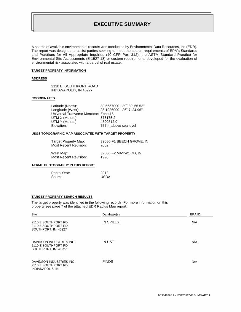
EXECUTIVE SUMMARY
TC3848966.2s EXECUTIVE SUMMARY 1
A search of available environmental records was conducted by Environmental Data Resources, Inc (EDR).The report was designed to assist parties seeking to meet the search requirements of EPA’s Standardsand Practices for All Appropriate Inquiries (40 CFR Part 312), the ASTM Standard Practice forEnvironmental Site Assessments (E 1527-13) or custom requirements developed for the evaluation ofenvironmental risk associated with a parcel of real estate.
TARGET PROPERTY INFORMATION
ADDRESS
2110 E. SOUTHPORT ROADINDIANAPOLIS, IN 46227
COORDINATES
39.6657000 - 39˚ 39’ 56.52’’Latitude (North): 86.1236000 - 86˚ 7’ 24.96’’Longitude (West): Zone 16Universal Tranverse Mercator: 575175.2UTM X (Meters): 4390812.0UTM Y (Meters): 757 ft. above sea levelElevation:
USGS TOPOGRAPHIC MAP ASSOCIATED WITH TARGET PROPERTY
39086-F1 BEECH GROVE, INTarget Property Map:2002Most Recent Revision:
39086-F2 MAYWOOD, INWest Map:1998Most Recent Revision:
AERIAL PHOTOGRAPHY IN THIS REPORT
2012Photo Year:USDASource:
TARGET PROPERTY SEARCH RESULTS
The target property was identified in the following records. For more information on thisproperty see page 7 of the attached EDR Radius Map report:
EPA IDDatabase(s)Site
2110 E SOUTHPORT RD2110 E SOUTHPORT RDSOUTHPORT, IN 46227
N/AIN SPILLS
DAVIDSON INDUSTRIES INC2110 E SOUTHPORT RDSOUTHPORT, IN 46227
N/AIN UST
DAVIDSON INDUSTRIES INC2110 E SOUTHPORT RDINDIANAPOLIS, IN
N/AFINDS
EXECUTIVE SUMMARY
TC3848966.2s EXECUTIVE SUMMARY 2
2110 E SOUTHPORT ROAD2110 E SOUTHPORT ROADINDIANAPOLIS, IN 46227
N/AIN SPILLS
DATABASES WITH NO MAPPED SITES
No mapped sites were found in EDR’s search of available ("reasonably ascertainable ") governmentrecords either on the target property or within the search radius around the target property for thefollowing databases:
STANDARD ENVIRONMENTAL RECORDS
Federal NPL site list
NPL National Priority ListProposed NPL Proposed National Priority List SitesNPL LIENS Federal Superfund Liens
Federal Delisted NPL site list
Delisted NPL National Priority List Deletions
Federal CERCLIS list
CERCLIS Comprehensive Environmental Response, Compensation, and Liability Information SystemFEDERAL FACILITY Federal Facility Site Information listing
Federal CERCLIS NFRAP site List
CERC-NFRAP CERCLIS No Further Remedial Action Planned
Federal RCRA CORRACTS facilities list
CORRACTS Corrective Action Report
Federal RCRA non-CORRACTS TSD facilities list
RCRA-TSDF RCRA - Treatment, Storage and Disposal
Federal RCRA generators list
RCRA-LQG RCRA - Large Quantity GeneratorsRCRA-SQG RCRA - Small Quantity Generators
Federal institutional controls / engineering controls registries
US ENG CONTROLS Engineering Controls Sites ListUS INST CONTROL Sites with Institutional ControlsLUCIS Land Use Control Information System
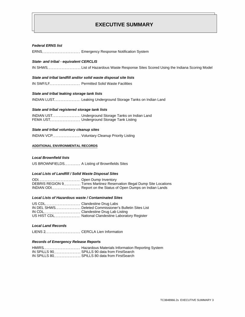
EXECUTIVE SUMMARY
TC3848966.2s EXECUTIVE SUMMARY 3
Federal ERNS list
ERNS Emergency Response Notification System
State- and tribal - equivalent CERCLIS
IN SHWS List of Hazardous Waste Response Sites Scored Using the Indiana Scoring Model
State and tribal landfill and/or solid waste disposal site lists
IN SWF/LF Permitted Solid Waste Facilities
State and tribal leaking storage tank lists
INDIAN LUST Leaking Underground Storage Tanks on Indian Land
State and tribal registered storage tank lists
INDIAN UST Underground Storage Tanks on Indian LandFEMA UST Underground Storage Tank Listing
State and tribal voluntary cleanup sites
INDIAN VCP Voluntary Cleanup Priority Listing
ADDITIONAL ENVIRONMENTAL RECORDS
Local Brownfield lists
US BROWNFIELDS A Listing of Brownfields Sites
Local Lists of Landfill / Solid Waste Disposal Sites
ODI Open Dump InventoryDEBRIS REGION 9 Torres Martinez Reservation Illegal Dump Site LocationsINDIAN ODI Report on the Status of Open Dumps on Indian Lands
Local Lists of Hazardous waste / Contaminated Sites
US CDL Clandestine Drug LabsIN DEL SHWS Deleted Commissioner’s Bulletin Sites ListIN CDL Clandestine Drug Lab ListingUS HIST CDL National Clandestine Laboratory Register
Local Land Records
LIENS 2 CERCLA Lien Information
Records of Emergency Release Reports
HMIRS Hazardous Materials Information Reporting SystemIN SPILLS 90 SPILLS 90 data from FirstSearchIN SPILLS 80 SPILLS 80 data from FirstSearch
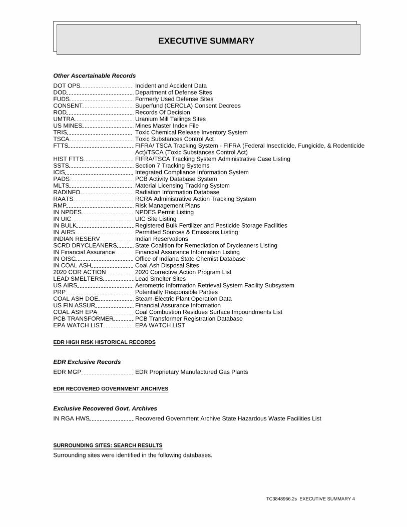
EXECUTIVE SUMMARY
TC3848966.2s EXECUTIVE SUMMARY 4
Other Ascertainable Records
DOT OPS Incident and Accident DataDOD Department of Defense SitesFUDS Formerly Used Defense SitesCONSENT Superfund (CERCLA) Consent DecreesROD Records Of DecisionUMTRA Uranium Mill Tailings SitesUS MINES Mines Master Index FileTRIS Toxic Chemical Release Inventory SystemTSCA Toxic Substances Control ActFTTS FIFRA/ TSCA Tracking System - FIFRA (Federal Insecticide, Fungicide, & Rodenticide Act)/TSCA (Toxic Substances Control Act)HIST FTTS FIFRA/TSCA Tracking System Administrative Case ListingSSTS Section 7 Tracking SystemsICIS Integrated Compliance Information SystemPADS PCB Activity Database SystemMLTS Material Licensing Tracking SystemRADINFO Radiation Information DatabaseRAATS RCRA Administrative Action Tracking SystemRMP Risk Management PlansIN NPDES NPDES Permit ListingIN UIC UIC Site ListingIN BULK Registered Bulk Fertilizer and Pesticide Storage FacilitiesIN AIRS Permitted Sources & Emissions ListingINDIAN RESERV Indian ReservationsSCRD DRYCLEANERS State Coalition for Remediation of Drycleaners ListingIN Financial Assurance Financial Assurance Information ListingIN OISC Office of Indiana State Chemist DatabaseIN COAL ASH Coal Ash Disposal Sites2020 COR ACTION 2020 Corrective Action Program ListLEAD SMELTERS Lead Smelter SitesUS AIRS Aerometric Information Retrieval System Facility SubsystemPRP Potentially Responsible PartiesCOAL ASH DOE Steam-Electric Plant Operation DataUS FIN ASSUR Financial Assurance InformationCOAL ASH EPA Coal Combustion Residues Surface Impoundments ListPCB TRANSFORMER PCB Transformer Registration DatabaseEPA WATCH LIST EPA WATCH LIST
EDR HIGH RISK HISTORICAL RECORDS
EDR Exclusive Records
EDR MGP EDR Proprietary Manufactured Gas Plants
EDR RECOVERED GOVERNMENT ARCHIVES
Exclusive Recovered Govt. Archives
IN RGA HWS Recovered Government Archive State Hazardous Waste Facilities List
SURROUNDING SITES: SEARCH RESULTS
Surrounding sites were identified in the following databases.
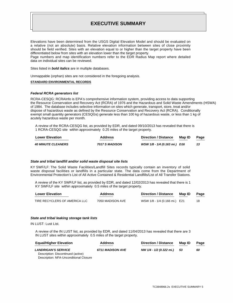
EXECUTIVE SUMMARY
TC3848966.2s EXECUTIVE SUMMARY 5
Elevations have been determined from the USGS Digital Elevation Model and should be evaluated ona relative (not an absolute) basis. Relative elevation information between sites of close proximityshould be field verified. Sites with an elevation equal to or higher than the target property have beendifferentiated below from sites with an elevation lower than the target property.Page numbers and map identification numbers refer to the EDR Radius Map report where detaileddata on individual sites can be reviewed.
Sites listed in bold italics are in multiple databases.
Unmappable (orphan) sites are not considered in the foregoing analysis.
STANDARD ENVIRONMENTAL RECORDS
Federal RCRA generators list
RCRA-CESQG: RCRAInfo is EPA’s comprehensive information system, providing access to data supportingthe Resource Conservation and Recovery Act (RCRA) of 1976 and the Hazardous and Solid Waste Amendments (HSWA)of 1984. The database includes selective information on sites which generate, transport, store, treat and/ordispose of hazardous waste as defined by the Resource Conservation and Recovery Act (RCRA). Conditionallyexempt small quantity generators (CESQGs) generate less than 100 kg of hazardous waste, or less than 1 kg ofacutely hazardous waste per month.
A review of the RCRA-CESQG list, as provided by EDR, and dated 09/10/2013 has revealed that there is 1 RCRA-CESQG site within approximately 0.25 miles of the target property.
PageMap IDDirection / Distance Address Lower Elevation ____________________ ________ ___________________ _____ _____
40 MINUTE CLEANERS 7017 S MADISON WSW 1/8 - 1/4 (0.163 mi.) D16 13
State and tribal landfill and/or solid waste disposal site lists
KY SWF/LF: The Solid Waste Facilities/Landfill Sites records typically contain an inventory of solidwaste disposal facilities or landfills in a particular state. The data come from the Department ofEnvironmental Protection’s List of All Active Contained & Residential Landfills/List of All Transfer Stations.
A review of the KY SWF/LF list, as provided by EDR, and dated 12/02/2013 has revealed that there is 1 KY SWF/LF site within approximately 0.5 miles of the target property.
PageMap IDDirection / Distance Address Lower Elevation ____________________ ________ ___________________ _____ _____
TIRE RECYCLERS OF AMERICA LLC 7050 MADISON AVE WSW 1/8 - 1/4 (0.166 mi.) E21 18
State and tribal leaking storage tank lists
IN LUST: Lust List.
A review of the IN LUST list, as provided by EDR, and dated 11/04/2013 has revealed that there are 3 IN LUST sites within approximately 0.5 miles of the target property.
PageMap IDDirection / Distance Address Equal/Higher Elevation ____________________ ________ ___________________ _____ _____
LANDRIGAN’S SERVICE 6711 MADISON AVE NW 1/4 - 1/2 (0.322 mi.) 53 60Description: Discontinued (active)Description: NFA-Unconditional Closure
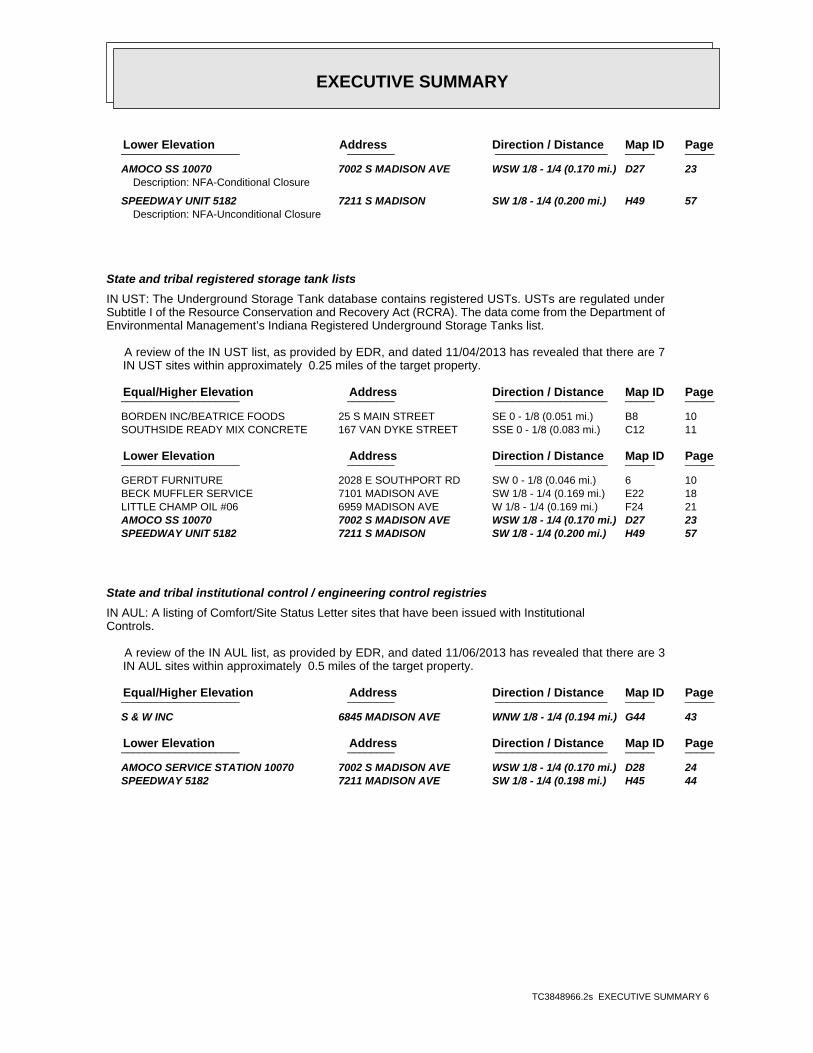
EXECUTIVE SUMMARY
TC3848966.2s EXECUTIVE SUMMARY 6
PageMap IDDirection / Distance Address Lower Elevation ____________________ ________ ___________________ _____ _____
AMOCO SS 10070 7002 S MADISON AVE WSW 1/8 - 1/4 (0.170 mi.) D27 23Description: NFA-Conditional Closure
SPEEDWAY UNIT 5182 7211 S MADISON SW 1/8 - 1/4 (0.200 mi.) H49 57Description: NFA-Unconditional Closure
State and tribal registered storage tank lists
IN UST: The Underground Storage Tank database contains registered USTs. USTs are regulated underSubtitle I of the Resource Conservation and Recovery Act (RCRA). The data come from the Department ofEnvironmental Management’s Indiana Registered Underground Storage Tanks list.
A review of the IN UST list, as provided by EDR, and dated 11/04/2013 has revealed that there are 7 IN UST sites within approximately 0.25 miles of the target property.
PageMap IDDirection / Distance Address Equal/Higher Elevation ____________________ ________ ___________________ _____ _____
BORDEN INC/BEATRICE FOODS 25 S MAIN STREET SE 0 - 1/8 (0.051 mi.) B8 10 SOUTHSIDE READY MIX CONCRETE 167 VAN DYKE STREET SSE 0 - 1/8 (0.083 mi.) C12 11
PageMap IDDirection / Distance Address Lower Elevation ____________________ ________ ___________________ _____ _____
GERDT FURNITURE 2028 E SOUTHPORT RD SW 0 - 1/8 (0.046 mi.) 6 10 BECK MUFFLER SERVICE 7101 MADISON AVE SW 1/8 - 1/4 (0.169 mi.) E22 18 LITTLE CHAMP OIL #06 6959 MADISON AVE W 1/8 - 1/4 (0.169 mi.) F24 21 AMOCO SS 10070 7002 S MADISON AVE WSW 1/8 - 1/4 (0.170 mi.) D27 23 SPEEDWAY UNIT 5182 7211 S MADISON SW 1/8 - 1/4 (0.200 mi.) H49 57
State and tribal institutional control / engineering control registries
IN AUL: A listing of Comfort/Site Status Letter sites that have been issued with InstitutionalControls.
A review of the IN AUL list, as provided by EDR, and dated 11/06/2013 has revealed that there are 3 IN AUL sites within approximately 0.5 miles of the target property.
PageMap IDDirection / Distance Address Equal/Higher Elevation ____________________ ________ ___________________ _____ _____
S & W INC 6845 MADISON AVE WNW 1/8 - 1/4 (0.194 mi.) G44 43
PageMap IDDirection / Distance Address Lower Elevation ____________________ ________ ___________________ _____ _____
AMOCO SERVICE STATION 10070 7002 S MADISON AVE WSW 1/8 - 1/4 (0.170 mi.) D28 24 SPEEDWAY 5182 7211 MADISON AVE SW 1/8 - 1/4 (0.198 mi.) H45 44
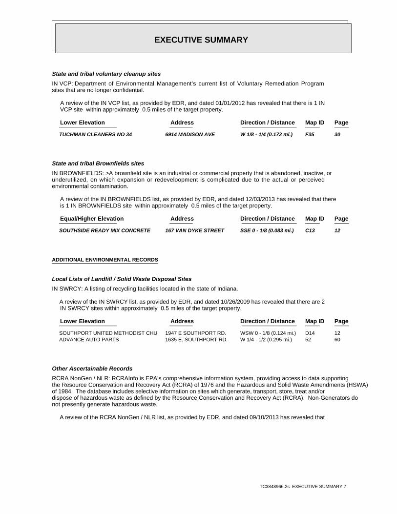
EXECUTIVE SUMMARY
TC3848966.2s EXECUTIVE SUMMARY 7
State and tribal voluntary cleanup sites
IN VCP: Department of Environmental Management’s current list of Voluntary Remediation Programsites that are no longer confidential.
A review of the IN VCP list, as provided by EDR, and dated 01/01/2012 has revealed that there is 1 IN VCP site within approximately 0.5 miles of the target property.
PageMap IDDirection / Distance Address Lower Elevation ____________________ ________ ___________________ _____ _____
TUCHMAN CLEANERS NO 34 6914 MADISON AVE W 1/8 - 1/4 (0.172 mi.) F35 30
State and tribal Brownfields sites
IN BROWNFIELDS: >A brownfield site is an industrial or commercial property that is abandoned, inactive, orunderutilized, on which expansion or redeveloopment is complicated due to the actual or perceivedenvironmental contamination.
A review of the IN BROWNFIELDS list, as provided by EDR, and dated 12/03/2013 has revealed that there is 1 IN BROWNFIELDS site within approximately 0.5 miles of the target property.
PageMap IDDirection / Distance Address Equal/Higher Elevation ____________________ ________ ___________________ _____ _____
SOUTHSIDE READY MIX CONCRETE 167 VAN DYKE STREET SSE 0 - 1/8 (0.083 mi.) C13 12
ADDITIONAL ENVIRONMENTAL RECORDS
Local Lists of Landfill / Solid Waste Disposal Sites
IN SWRCY: A listing of recycling facilities located in the state of Indiana.
A review of the IN SWRCY list, as provided by EDR, and dated 10/26/2009 has revealed that there are 2 IN SWRCY sites within approximately 0.5 miles of the target property.
PageMap IDDirection / Distance Address Lower Elevation ____________________ ________ ___________________ _____ _____
SOUTHPORT UNITED METHODIST CHU 1947 E SOUTHPORT RD. WSW 0 - 1/8 (0.124 mi.) D14 12 ADVANCE AUTO PARTS 1635 E. SOUTHPORT RD. W 1/4 - 1/2 (0.295 mi.) 52 60
Other Ascertainable Records
RCRA NonGen / NLR: RCRAInfo is EPA’s comprehensive information system, providing access to data supportingthe Resource Conservation and Recovery Act (RCRA) of 1976 and the Hazardous and Solid Waste Amendments (HSWA)of 1984. The database includes selective information on sites which generate, transport, store, treat and/ordispose of hazardous waste as defined by the Resource Conservation and Recovery Act (RCRA). Non-Generators donot presently generate hazardous waste.
A review of the RCRA NonGen / NLR list, as provided by EDR, and dated 09/10/2013 has revealed that
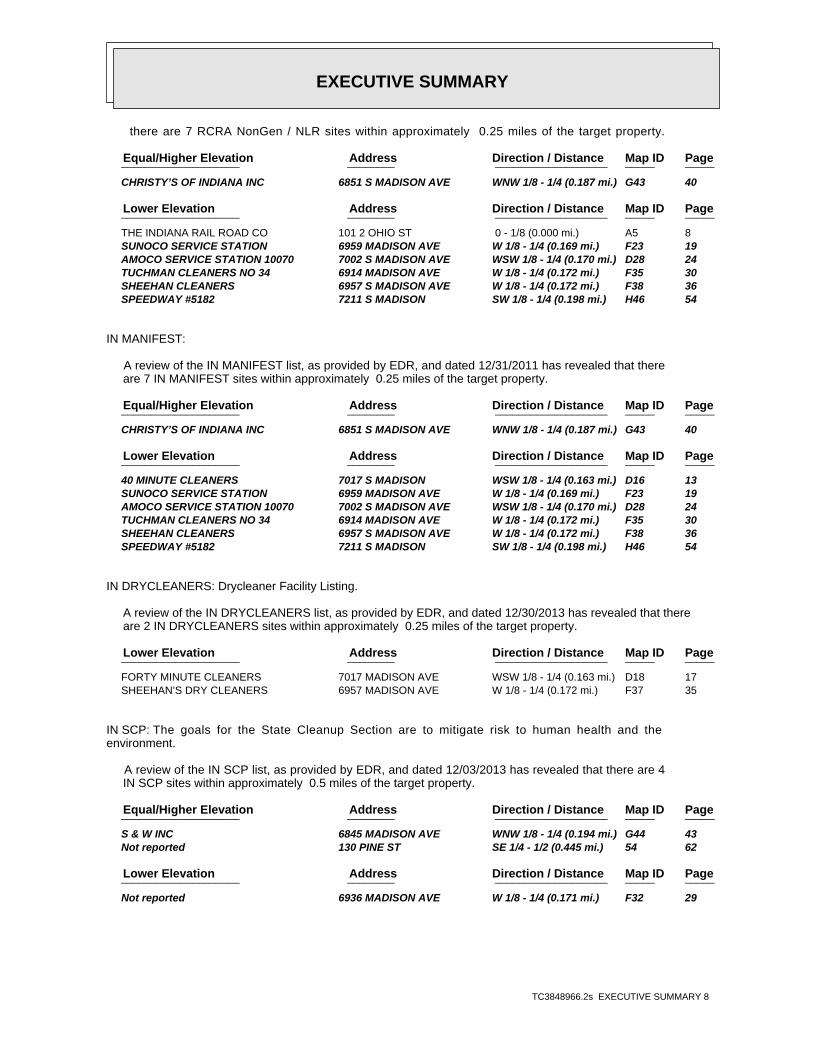
EXECUTIVE SUMMARY
TC3848966.2s EXECUTIVE SUMMARY 8
there are 7 RCRA NonGen / NLR sites within approximately 0.25 miles of the target property.
PageMap IDDirection / Distance Address Equal/Higher Elevation ____________________ ________ ___________________ _____ _____
CHRISTY’S OF INDIANA INC 6851 S MADISON AVE WNW 1/8 - 1/4 (0.187 mi.) G43 40
PageMap IDDirection / Distance Address Lower Elevation ____________________ ________ ___________________ _____ _____
THE INDIANA RAIL ROAD CO 101 2 OHIO ST 0 - 1/8 (0.000 mi.) A5 8 SUNOCO SERVICE STATION 6959 MADISON AVE W 1/8 - 1/4 (0.169 mi.) F23 19 AMOCO SERVICE STATION 10070 7002 S MADISON AVE WSW 1/8 - 1/4 (0.170 mi.) D28 24 TUCHMAN CLEANERS NO 34 6914 MADISON AVE W 1/8 - 1/4 (0.172 mi.) F35 30 SHEEHAN CLEANERS 6957 S MADISON AVE W 1/8 - 1/4 (0.172 mi.) F38 36 SPEEDWAY #5182 7211 S MADISON SW 1/8 - 1/4 (0.198 mi.) H46 54
IN MANIFEST:
A review of the IN MANIFEST list, as provided by EDR, and dated 12/31/2011 has revealed that there are 7 IN MANIFEST sites within approximately 0.25 miles of the target property.
PageMap IDDirection / Distance Address Equal/Higher Elevation ____________________ ________ ___________________ _____ _____
CHRISTY’S OF INDIANA INC 6851 S MADISON AVE WNW 1/8 - 1/4 (0.187 mi.) G43 40
PageMap IDDirection / Distance Address Lower Elevation ____________________ ________ ___________________ _____ _____
40 MINUTE CLEANERS 7017 S MADISON WSW 1/8 - 1/4 (0.163 mi.) D16 13 SUNOCO SERVICE STATION 6959 MADISON AVE W 1/8 - 1/4 (0.169 mi.) F23 19 AMOCO SERVICE STATION 10070 7002 S MADISON AVE WSW 1/8 - 1/4 (0.170 mi.) D28 24 TUCHMAN CLEANERS NO 34 6914 MADISON AVE W 1/8 - 1/4 (0.172 mi.) F35 30 SHEEHAN CLEANERS 6957 S MADISON AVE W 1/8 - 1/4 (0.172 mi.) F38 36 SPEEDWAY #5182 7211 S MADISON SW 1/8 - 1/4 (0.198 mi.) H46 54
IN DRYCLEANERS: Drycleaner Facility Listing.
A review of the IN DRYCLEANERS list, as provided by EDR, and dated 12/30/2013 has revealed that there are 2 IN DRYCLEANERS sites within approximately 0.25 miles of the target property.
PageMap IDDirection / Distance Address Lower Elevation ____________________ ________ ___________________ _____ _____
FORTY MINUTE CLEANERS 7017 MADISON AVE WSW 1/8 - 1/4 (0.163 mi.) D18 17 SHEEHAN’S DRY CLEANERS 6957 MADISON AVE W 1/8 - 1/4 (0.172 mi.) F37 35
IN SCP: The goals for the State Cleanup Section are to mitigate risk to human health and theenvironment.
A review of the IN SCP list, as provided by EDR, and dated 12/03/2013 has revealed that there are 4 IN SCP sites within approximately 0.5 miles of the target property.
PageMap IDDirection / Distance Address Equal/Higher Elevation ____________________ ________ ___________________ _____ _____
S & W INC 6845 MADISON AVE WNW 1/8 - 1/4 (0.194 mi.) G44 43 Not reported 130 PINE ST SE 1/4 - 1/2 (0.445 mi.) 54 62
PageMap IDDirection / Distance Address Lower Elevation ____________________ ________ ___________________ _____ _____
Not reported 6936 MADISON AVE W 1/8 - 1/4 (0.171 mi.) F32 29
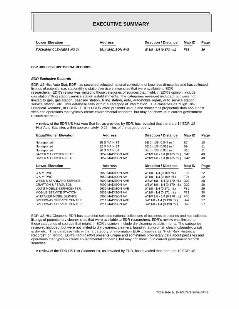
EXECUTIVE SUMMARY
TC3848966.2s EXECUTIVE SUMMARY 9
PageMap IDDirection / Distance Address Lower Elevation ____________________ ________ ___________________ _____ _____
TUCHMAN CLEANERS NO 34 6914 MADISON AVE W 1/8 - 1/4 (0.172 mi.) F35 30
EDR HIGH RISK HISTORICAL RECORDS
EDR Exclusive Records
EDR US Hist Auto Stat: EDR has searched selected national collections of business directories and has collectedlistings of potential gas station/filling station/service station sites that were available to EDRresearchers. EDR’s review was limited to those categories of sources that might, in EDR’s opinion, includegas station/filling station/service station establishments. The categories reviewed included, but were notlimited to gas, gas station, gasoline station, filling station, auto, automobile repair, auto service station,service station, etc. This database falls within a category of information EDR classifies as "High RiskHistorical Records", or HRHR. EDR’s HRHR effort presents unique and sometimes proprietary data about pastsites and operations that typically create environmental concerns, but may not show up in current governmentrecords searches.
A review of the EDR US Hist Auto Stat list, as provided by EDR, has revealed that there are 14 EDR US Hist Auto Stat sites within approximately 0.25 miles of the target property.
PageMap IDDirection / Distance Address Equal/Higher Elevation ____________________ ________ ___________________ _____ _____
Not reported 15 S MAIN ST SE 0 - 1/8 (0.047 mi.) B7 10 Not reported 32 S MAIN ST SE 0 - 1/8 (0.053 mi.) B9 11 Not reported 36 S MAIN ST SE 0 - 1/8 (0.055 mi.) B10 11 SAYER S HOOSIER PETE 6857 MADISON AVE WNW 1/8 - 1/4 (0.185 mi.) G41 40 SAYER S HOOSIER PETE 6857 MADISON AV WNW 1/8 - 1/4 (0.185 mi.) G42 40
PageMap IDDirection / Distance Address Lower Elevation ____________________ ________ ___________________ _____ _____
C A M TWO 6959 MADISON AVE W 1/8 - 1/4 (0.169 mi.) F25 22 C A M TWO 6959 MADISON AV W 1/8 - 1/4 (0.169 mi.) F26 22 WEBB S STANDARD SERVICE 7000 MADISON AVE WSW 1/8 - 1/4 (0.170 mi.) D29 28 CRAFTON & FERGUSON 7000 MADISON AV WSW 1/8 - 1/4 (0.170 mi.) D30 28 LOU S MOBILE SERVICENTER 6936 MADISON AVE W 1/8 - 1/4 (0.171 mi.) F31 29 MOBILE SERVICE STATION 6936 MADISON AV W 1/8 - 1/4 (0.171 mi.) F33 30 WHITAKER MOBIL SERVICE 6905 MADISON AV WNW 1/8 - 1/4 (0.176 mi.) F40 40 SPEEDWAY SERVICE CENTER 7211 MADISON AVE SW 1/8 - 1/4 (0.198 mi.) H47 57 SPEEDWAY SERVICE CENTER 7211 MADISON AV SW 1/8 - 1/4 (0.198 mi.) H48 57
EDR US Hist Cleaners: EDR has searched selected national collections of business directories and has collectedlistings of potential dry cleaner sites that were available to EDR researchers. EDR’s review was limited tothose categories of sources that might, in EDR’s opinion, include dry cleaning establishments. The categoriesreviewed included, but were not limited to dry cleaners, cleaners, laundry, laundromat, cleaning/laundry, wash& dry etc. This database falls within a category of information EDR classifies as "High Risk HistoricalRecords", or HRHR. EDR’s HRHR effort presents unique and sometimes proprietary data about past sites andoperations that typically create environmental concerns, but may not show up in current government recordssearches.
A review of the EDR US Hist Cleaners list, as provided by EDR, has revealed that there are 10 EDR US
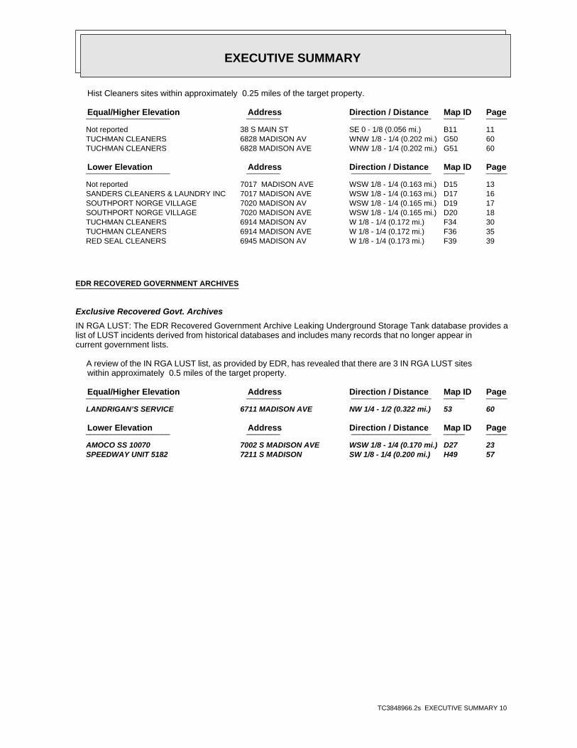
EXECUTIVE SUMMARY
TC3848966.2s EXECUTIVE SUMMARY 10
Hist Cleaners sites within approximately 0.25 miles of the target property.
PageMap IDDirection / Distance Address Equal/Higher Elevation ____________________ ________ ___________________ _____ _____
Not reported 38 S MAIN ST SE 0 - 1/8 (0.056 mi.) B11 11 TUCHMAN CLEANERS 6828 MADISON AV WNW 1/8 - 1/4 (0.202 mi.) G50 60 TUCHMAN CLEANERS 6828 MADISON AVE WNW 1/8 - 1/4 (0.202 mi.) G51 60
PageMap IDDirection / Distance Address Lower Elevation ____________________ ________ ___________________ _____ _____
Not reported 7017 MADISON AVE WSW 1/8 - 1/4 (0.163 mi.) D15 13 SANDERS CLEANERS & LAUNDRY INC 7017 MADISON AVE WSW 1/8 - 1/4 (0.163 mi.) D17 16 SOUTHPORT NORGE VILLAGE 7020 MADISON AV WSW 1/8 - 1/4 (0.165 mi.) D19 17 SOUTHPORT NORGE VILLAGE 7020 MADISON AVE WSW 1/8 - 1/4 (0.165 mi.) D20 18 TUCHMAN CLEANERS 6914 MADISON AV W 1/8 - 1/4 (0.172 mi.) F34 30 TUCHMAN CLEANERS 6914 MADISON AVE W 1/8 - 1/4 (0.172 mi.) F36 35 RED SEAL CLEANERS 6945 MADISON AV W 1/8 - 1/4 (0.173 mi.) F39 39
EDR RECOVERED GOVERNMENT ARCHIVES
Exclusive Recovered Govt. Archives
IN RGA LUST: The EDR Recovered Government Archive Leaking Underground Storage Tank database provides alist of LUST incidents derived from historical databases and includes many records that no longer appear incurrent government lists.
A review of the IN RGA LUST list, as provided by EDR, has revealed that there are 3 IN RGA LUST sites within approximately 0.5 miles of the target property.
PageMap IDDirection / Distance Address Equal/Higher Elevation ____________________ ________ ___________________ _____ _____
LANDRIGAN’S SERVICE 6711 MADISON AVE NW 1/4 - 1/2 (0.322 mi.) 53 60
PageMap IDDirection / Distance Address Lower Elevation ____________________ ________ ___________________ _____ _____
AMOCO SS 10070 7002 S MADISON AVE WSW 1/8 - 1/4 (0.170 mi.) D27 23 SPEEDWAY UNIT 5182 7211 S MADISON SW 1/8 - 1/4 (0.200 mi.) H49 57
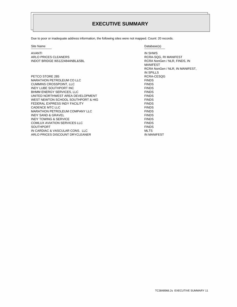
EXECUTIVE SUMMARY
TC3848966.2s EXECUTIVE SUMMARY 11
Due to poor or inadequate address information, the following sites were not mapped. Count: 20 records.
Site Name Database(s)____________ ____________
AVANTI IN SHWSARLO PRICES CLEANERS RCRA-SQG, RI MANIFESTINDOT BRIDGE I651224844NBL&SBL RCRA NonGen / NLR, FINDS, IN
MANIFEST RCRA NonGen / NLR, IN MANIFEST, IN SPILLS
PETCO STORE 285 RCRA-CESQGMARATHON PETROLEUM CO LLC FINDSCUMMINS CROSSPOINT, LLC FINDSINDY LUBE SOUTHPORT INC FINDSBHMM ENERGY SERVICES, LLC FINDSUNITED NORTHWEST AREA DEVELOPMENT FINDSWEST NEWTON SCHOOL SOUTHPORT & HIG FINDSFEDERAL EXPRESS INDY FACILITY FINDSCADENCE MTC LLC FINDSMARATHON PETROLEUM COMPANY LLC FINDSINDY SAND & GRAVEL FINDSINDY TOWING & SERVICE FINDSCOMLUX AVIATION SERVICES LLC FINDSSOUTHPORT FINDSIN CARDIAC & VASCULAR CONS. LLC MLTSARLO PRICES DISCOUNT DRYCLEANER IN MANIFEST
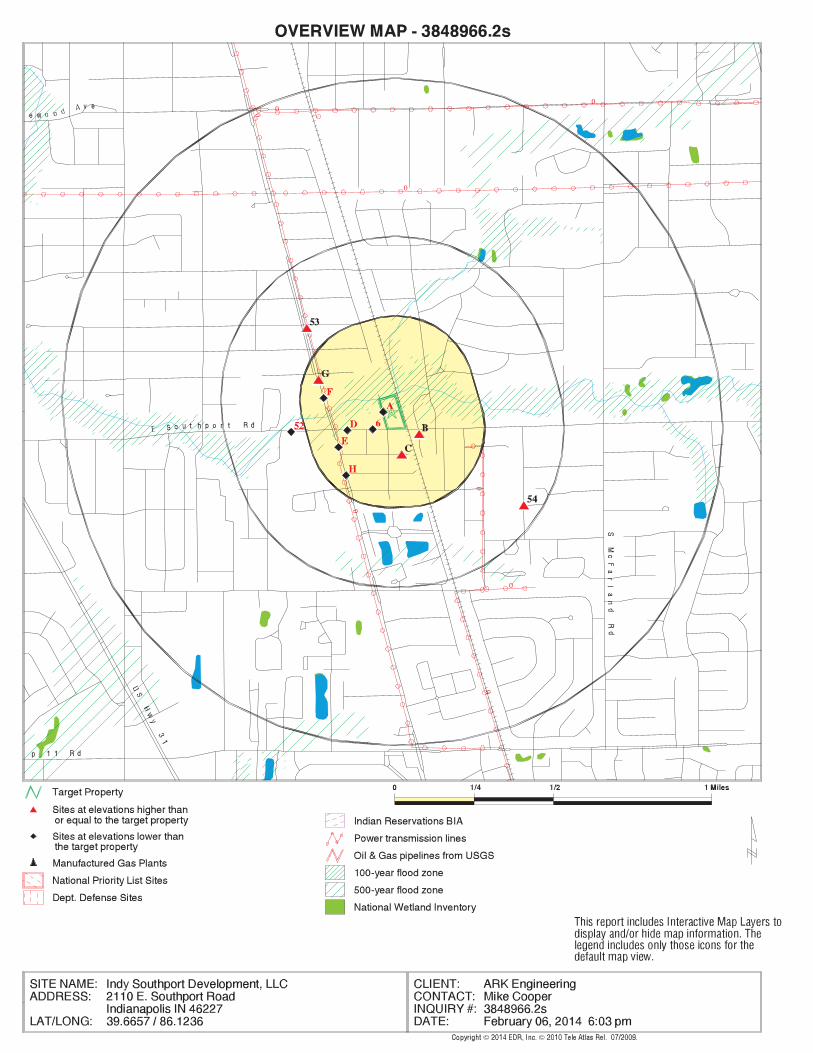
EDR Inc.EDR Inc.EDR Inc.EDR Inc.EDR Inc.EDR Inc.EDR Inc.EDR Inc.EDR Inc.EDR Inc.EDR Inc.EDR Inc.EDR Inc.EDR Inc.EDR Inc.EDR Inc.EDR Inc.EDR Inc.EDR Inc.EDR Inc.EDR Inc.EDR Inc.EDR Inc.EDR Inc.EDR Inc.EDR Inc.EDR Inc.EDR Inc.EDR Inc.EDR Inc.EDR Inc.EDR Inc.EDR Inc.EDR Inc.EDR Inc.EDR Inc.EDR Inc.EDR Inc.EDR Inc.EDR Inc.
0
0
0
0
0
0 00
7 6 076
0
7 6 0
7 6 0
76
07
60
76
0
7 6 0
7 6 0
80
0
760
7 6 0
7 6 0
76
0
800
80
0
80 0
8
80
0
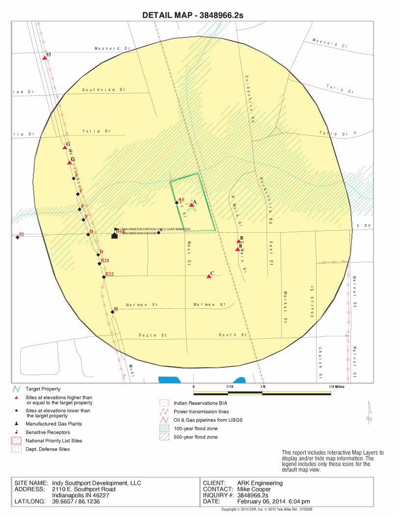
EDR Inc.EDR Inc.EDR Inc.EDR Inc.EDR Inc.EDR Inc.EDR Inc.EDR Inc.EDR Inc.EDR Inc.EDR Inc.EDR Inc.EDR Inc.EDR Inc.EDR Inc.EDR Inc.EDR Inc.EDR Inc.EDR Inc.EDR Inc.EDR Inc.EDR Inc.EDR Inc.EDR Inc.EDR Inc.EDR Inc.EDR Inc.EDR Inc.EDR Inc.EDR Inc.EDR Inc.EDR Inc.EDR Inc.EDR Inc.EDR Inc.EDR Inc.EDR Inc.EDR Inc.EDR Inc.EDR Inc.
0
0
760
760
7
60
760
76
0
760
760
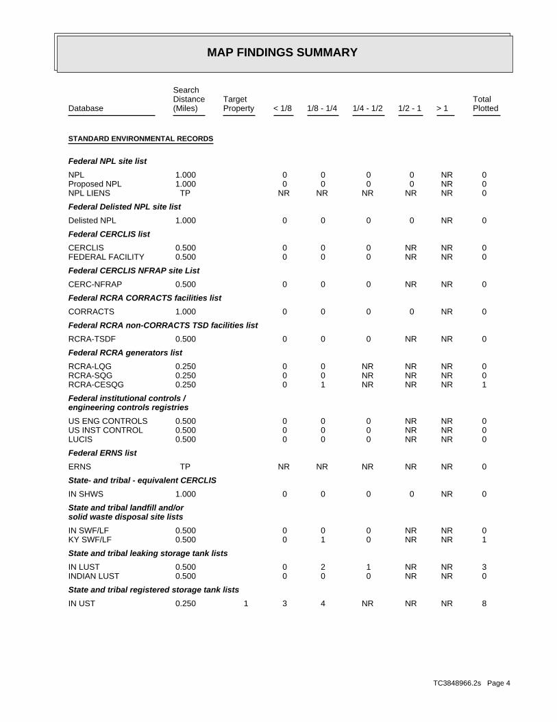
MAP FINDINGS SUMMARY
SearchTargetDistance Total
Database Property(Miles) < 1/8 1/8 - 1/4 1/4 - 1/2 1/2 - 1 > 1 Plotted
STANDARD ENVIRONMENTAL RECORDS
Federal NPL site list
0 NR 0 0 0 0 1.000NPL 0 NR 0 0 0 0 1.000Proposed NPL 0 NR NR NR NR NR TPNPL LIENS
Federal Delisted NPL site list
0 NR 0 0 0 0 1.000Delisted NPL
Federal CERCLIS list
0 NR NR 0 0 0 0.500CERCLIS 0 NR NR 0 0 0 0.500FEDERAL FACILITY
Federal CERCLIS NFRAP site List
0 NR NR 0 0 0 0.500CERC-NFRAP
Federal RCRA CORRACTS facilities list
0 NR 0 0 0 0 1.000CORRACTS
Federal RCRA non-CORRACTS TSD facilities list
0 NR NR 0 0 0 0.500RCRA-TSDF
Federal RCRA generators list
0 NR NR NR 0 0 0.250RCRA-LQG 0 NR NR NR 0 0 0.250RCRA-SQG 1 NR NR NR 1 0 0.250RCRA-CESQG
Federal institutional controls /engineering controls registries
0 NR NR 0 0 0 0.500US ENG CONTROLS 0 NR NR 0 0 0 0.500US INST CONTROL 0 NR NR 0 0 0 0.500LUCIS
Federal ERNS list
0 NR NR NR NR NR TPERNS
State- and tribal - equivalent CERCLIS
0 NR 0 0 0 0 1.000IN SHWS
State and tribal landfill and/orsolid waste disposal site lists
0 NR NR 0 0 0 0.500IN SWF/LF 1 NR NR 0 1 0 0.500KY SWF/LF
State and tribal leaking storage tank lists
3 NR NR 1 2 0 0.500IN LUST 0 NR NR 0 0 0 0.500INDIAN LUST
State and tribal registered storage tank lists
8 NR NR NR 4 3 0.250 1IN UST
TC3848966.2s Page 4
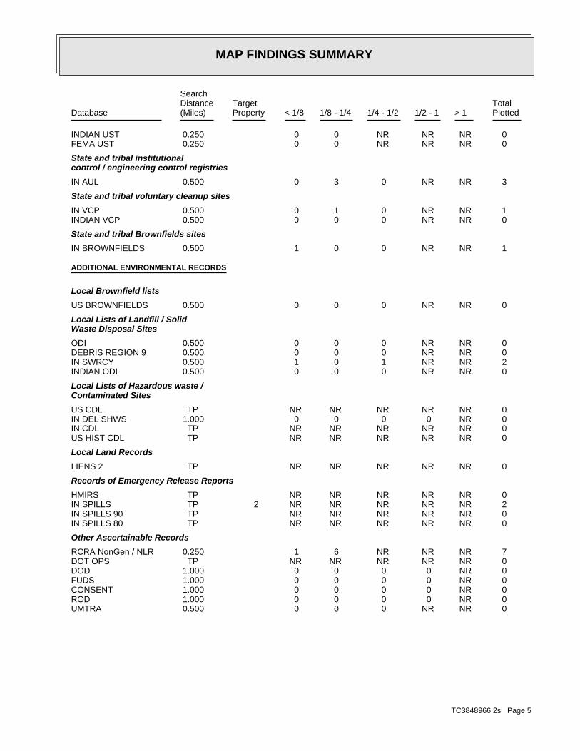
MAP FINDINGS SUMMARY
SearchTargetDistance Total
Database Property(Miles) < 1/8 1/8 - 1/4 1/4 - 1/2 1/2 - 1 > 1 Plotted
0 NR NR NR 0 0 0.250INDIAN UST 0 NR NR NR 0 0 0.250FEMA UST
State and tribal institutionalcontrol / engineering control registries
3 NR NR 0 3 0 0.500IN AUL
State and tribal voluntary cleanup sites
1 NR NR 0 1 0 0.500IN VCP 0 NR NR 0 0 0 0.500INDIAN VCP
State and tribal Brownfields sites
1 NR NR 0 0 1 0.500IN BROWNFIELDS
ADDITIONAL ENVIRONMENTAL RECORDS
Local Brownfield lists
0 NR NR 0 0 0 0.500US BROWNFIELDS
Local Lists of Landfill / SolidWaste Disposal Sites
0 NR NR 0 0 0 0.500ODI 0 NR NR 0 0 0 0.500DEBRIS REGION 9 2 NR NR 1 0 1 0.500IN SWRCY 0 NR NR 0 0 0 0.500INDIAN ODI
Local Lists of Hazardous waste /Contaminated Sites
0 NR NR NR NR NR TPUS CDL 0 NR 0 0 0 0 1.000IN DEL SHWS 0 NR NR NR NR NR TPIN CDL 0 NR NR NR NR NR TPUS HIST CDL
Local Land Records
0 NR NR NR NR NR TPLIENS 2
Records of Emergency Release Reports
0 NR NR NR NR NR TPHMIRS 2 NR NR NR NR NR TP 2IN SPILLS 0 NR NR NR NR NR TPIN SPILLS 90 0 NR NR NR NR NR TPIN SPILLS 80
Other Ascertainable Records
7 NR NR NR 6 1 0.250RCRA NonGen / NLR 0 NR NR NR NR NR TPDOT OPS 0 NR 0 0 0 0 1.000DOD 0 NR 0 0 0 0 1.000FUDS 0 NR 0 0 0 0 1.000CONSENT 0 NR 0 0 0 0 1.000ROD 0 NR NR 0 0 0 0.500UMTRA
TC3848966.2s Page 5
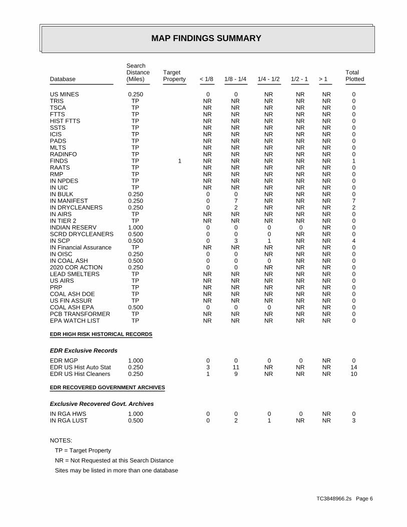
MAP FINDINGS SUMMARY
SearchTargetDistance Total
Database Property(Miles) < 1/8 1/8 - 1/4 1/4 - 1/2 1/2 - 1 > 1 Plotted
0 NR NR NR 0 0 0.250US MINES 0 NR NR NR NR NR TPTRIS 0 NR NR NR NR NR TPTSCA 0 NR NR NR NR NR TPFTTS 0 NR NR NR NR NR TPHIST FTTS 0 NR NR NR NR NR TPSSTS 0 NR NR NR NR NR TPICIS 0 NR NR NR NR NR TPPADS 0 NR NR NR NR NR TPMLTS 0 NR NR NR NR NR TPRADINFO 1 NR NR NR NR NR TP 1FINDS 0 NR NR NR NR NR TPRAATS 0 NR NR NR NR NR TPRMP 0 NR NR NR NR NR TPIN NPDES 0 NR NR NR NR NR TPIN UIC 0 NR NR NR 0 0 0.250IN BULK 7 NR NR NR 7 0 0.250IN MANIFEST 2 NR NR NR 2 0 0.250IN DRYCLEANERS 0 NR NR NR NR NR TPIN AIRS 0 NR NR NR NR NR TPIN TIER 2 0 NR 0 0 0 0 1.000INDIAN RESERV 0 NR NR 0 0 0 0.500SCRD DRYCLEANERS 4 NR NR 1 3 0 0.500IN SCP 0 NR NR NR NR NR TPIN Financial Assurance 0 NR NR NR 0 0 0.250IN OISC 0 NR NR 0 0 0 0.500IN COAL ASH 0 NR NR NR 0 0 0.2502020 COR ACTION 0 NR NR NR NR NR TPLEAD SMELTERS 0 NR NR NR NR NR TPUS AIRS 0 NR NR NR NR NR TPPRP 0 NR NR NR NR NR TPCOAL ASH DOE 0 NR NR NR NR NR TPUS FIN ASSUR 0 NR NR 0 0 0 0.500COAL ASH EPA 0 NR NR NR NR NR TPPCB TRANSFORMER 0 NR NR NR NR NR TPEPA WATCH LIST
EDR HIGH RISK HISTORICAL RECORDS
EDR Exclusive Records
0 NR 0 0 0 0 1.000EDR MGP 14 NR NR NR 11 3 0.250EDR US Hist Auto Stat 10 NR NR NR 9 1 0.250EDR US Hist Cleaners
EDR RECOVERED GOVERNMENT ARCHIVES
Exclusive Recovered Govt. Archives
0 NR 0 0 0 0 1.000IN RGA HWS 3 NR NR 1 2 0 0.500IN RGA LUST
NOTES:
TP = Target Property
NR = Not Requested at this Search Distance
Sites may be listed in more than one database
TC3848966.2s Page 6
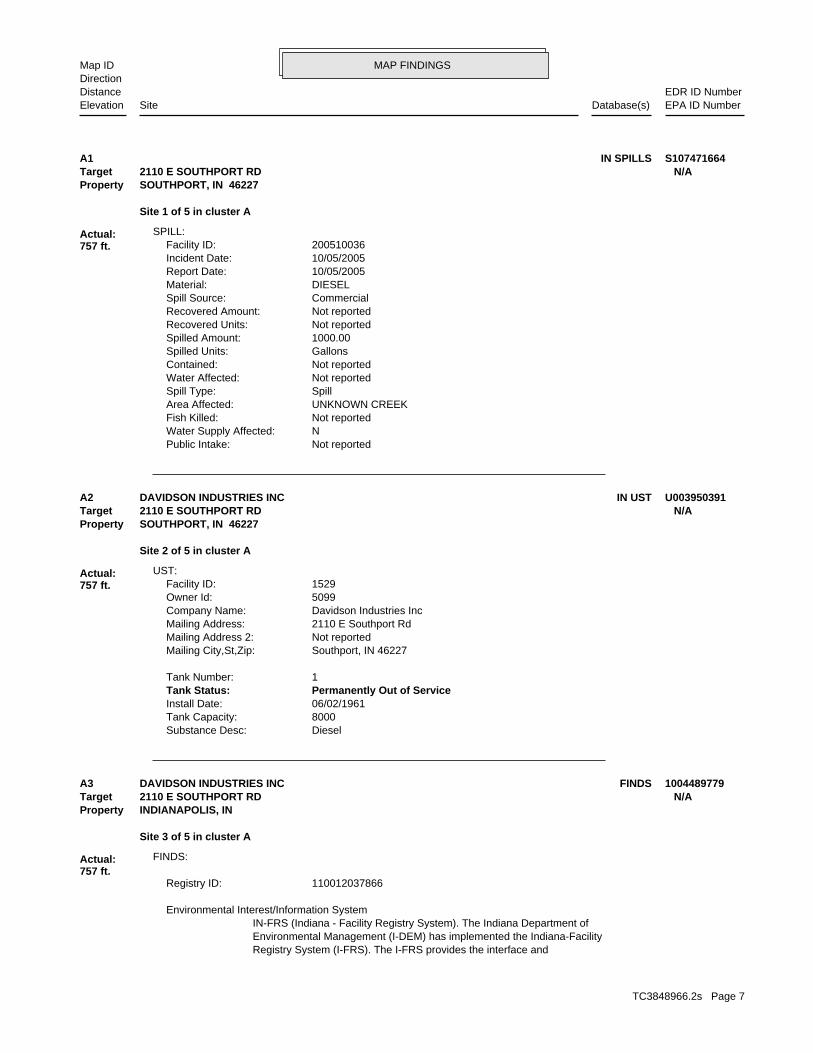
MAP FINDINGSMap IDDirection
EDR ID NumberDistanceEPA ID NumberDatabase(s)SiteElevation
Not reportedPublic Intake: NWater Supply Affected: Not reportedFish Killed: UNKNOWN CREEKArea Affected: SpillSpill Type: Not reportedWater Affected: Not reportedContained: GallonsSpilled Units: 1000.00Spilled Amount: Not reportedRecovered Units: Not reportedRecovered Amount: CommercialSpill Source: DIESELMaterial: 10/05/2005Report Date: 10/05/2005Incident Date: 200510036Facility ID:
SPILL:
Site 1 of 5 in cluster A
Actual:757 ft.
Property SOUTHPORT, IN 46227Target 2110 E SOUTHPORT RD N/AA1 IN SPILLS S107471664
DieselSubstance Desc: 8000Tank Capacity: 06/02/1961Install Date: Permanently Out of ServiceTank Status: 1Tank Number:
Southport, IN 46227Mailing City,St,Zip: Not reportedMailing Address 2: 2110 E Southport RdMailing Address: Davidson Industries IncCompany Name: 5099Owner Id: 1529Facility ID:
UST:
Site 2 of 5 in cluster A
Actual:757 ft.
Property SOUTHPORT, IN 46227Target 2110 E SOUTHPORT RD N/AA2 IN USTDAVIDSON INDUSTRIES INC U003950391
Registry System (I-FRS). The I-FRS provides the interface andEnvironmental Management (I-DEM) has implemented the Indiana-FacilityIN-FRS (Indiana - Facility Registry System). The Indiana Department of Environmental Interest/Information System
110012037866Registry ID:
FINDS:
Site 3 of 5 in cluster A
Actual:757 ft.
Property INDIANAPOLIS, IN Target 2110 E SOUTHPORT RD N/AA3 FINDSDAVIDSON INDUSTRIES INC 1004489779
TC3848966.2s Page 7
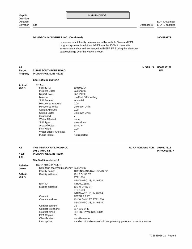
MAP FINDINGSMap IDDirection
EDR ID NumberDistanceEPA ID NumberDatabase(s)SiteElevation
data exchange over the Network Node.environmental data and exchange it with EPA FRS using the electronicprogram systems. In addition, I-FRS enables IDEM to reconcileprocesses to link facility data monitored by multiple State and EPA
DAVIDSON INDUSTRIES INC (Continued) 1004489779
Not reportedPublic Intake: NWater Supply Affected: 0.00Fish Killed: 50 Sq FtArea Affected: HazardousSpill Type: NoneWater Affected: YContained: Unknown UnitsSpilled Units: 0.00Spilled Amount: Unknown UnitsRecovered Units: 0.00Recovered Amount: IndustrialSpill Source: Ust/Fuel Oil/non-RegMaterial: 02/16/1995Report Date: 02/01/1995Incident Date: 199502114Facility ID:
SPILL:
Site 4 of 5 in cluster A
Actual:757 ft.
Property INDIANAPOLIS, IN 46227Target 2110 E SOUTHPORT ROAD N/AA4 IN SPILLS U003093132
Handler: Non-Generators do not presently generate hazardous wasteDescription: Non-GeneratorClassification: 05EPA Region: [email protected] email: 317-616-3443Contact telephone: USContact country: INDIANAPOLIS, IN 46204 101 W OHIO ST STE 1600Contact address: PETER J RAYContact: INDIANAPOLIS, IN 46204 STE 1600 101 W OHIO STMailing address: INR000118877EPA ID: INDIANAPOLIS, IN 46204 STE 1600 101 2 OHIO STFacility address: THE INDIANA RAIL ROAD COFacility name: 02/05/2007Date form received by agency:
RCRA NonGen / NLR:
Site 5 of 5 in cluster A1 ft.
Relative:Lower
Actual:753 ft.
< 1/8 INDIANAPOLIS, IN 46204101 2 OHIO ST INR000118877
A5 RCRA NonGen / NLRTHE INDIANA RAIL ROAD CO 1010317812
TC3848966.2s Page 8
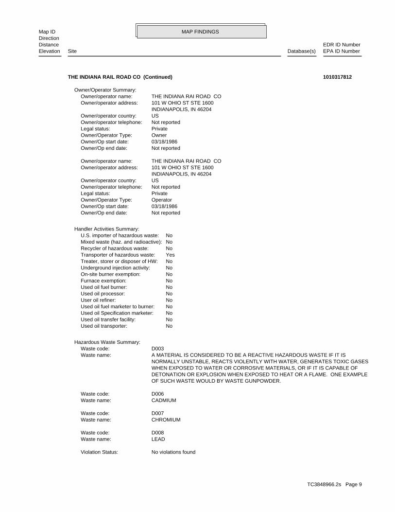
MAP FINDINGSMap IDDirection
EDR ID NumberDistanceEPA ID NumberDatabase(s)SiteElevation
No violations foundViolation Status:
LEADWaste name: D008Waste code:
CHROMIUMWaste name: D007Waste code:
CADMIUMWaste name: D006Waste code:
OF SUCH WASTE WOULD BY WASTE GUNPOWDER. DETONATION OR EXPLOSION WHEN EXPOSED TO HEAT OR A FLAME. ONE EXAMPLE WHEN EXPOSED TO WATER OR CORROSIVE MATERIALS, OR IF IT IS CAPABLE OF NORMALLY UNSTABLE, REACTS VIOLENTLY WITH WATER, GENERATES TOXIC GASES A MATERIAL IS CONSIDERED TO BE A REACTIVE HAZARDOUS WASTE IF IT ISWaste name: D003Waste code:
Hazardous Waste Summary:
NoUsed oil transporter: NoUsed oil transfer facility: NoUsed oil Specification marketer: NoUsed oil fuel marketer to burner: NoUser oil refiner: NoUsed oil processor: NoUsed oil fuel burner: NoFurnace exemption: NoOn-site burner exemption: NoUnderground injection activity: NoTreater, storer or disposer of HW: YesTransporter of hazardous waste: NoRecycler of hazardous waste: NoMixed waste (haz. and radioactive): NoU.S. importer of hazardous waste:
Handler Activities Summary:
Not reportedOwner/Op end date: 03/18/1986Owner/Op start date: OperatorOwner/Operator Type: PrivateLegal status: Not reportedOwner/operator telephone: USOwner/operator country: INDIANAPOLIS, IN 46204 101 W OHIO ST STE 1600Owner/operator address: THE INDIANA RAI ROAD COOwner/operator name:
Not reportedOwner/Op end date: 03/18/1986Owner/Op start date: OwnerOwner/Operator Type: PrivateLegal status: Not reportedOwner/operator telephone: USOwner/operator country: INDIANAPOLIS, IN 46204 101 W OHIO ST STE 1600Owner/operator address: THE INDIANA RAI ROAD COOwner/operator name:
Owner/Operator Summary:
THE INDIANA RAIL ROAD CO (Continued) 1010317812
TC3848966.2s Page 9
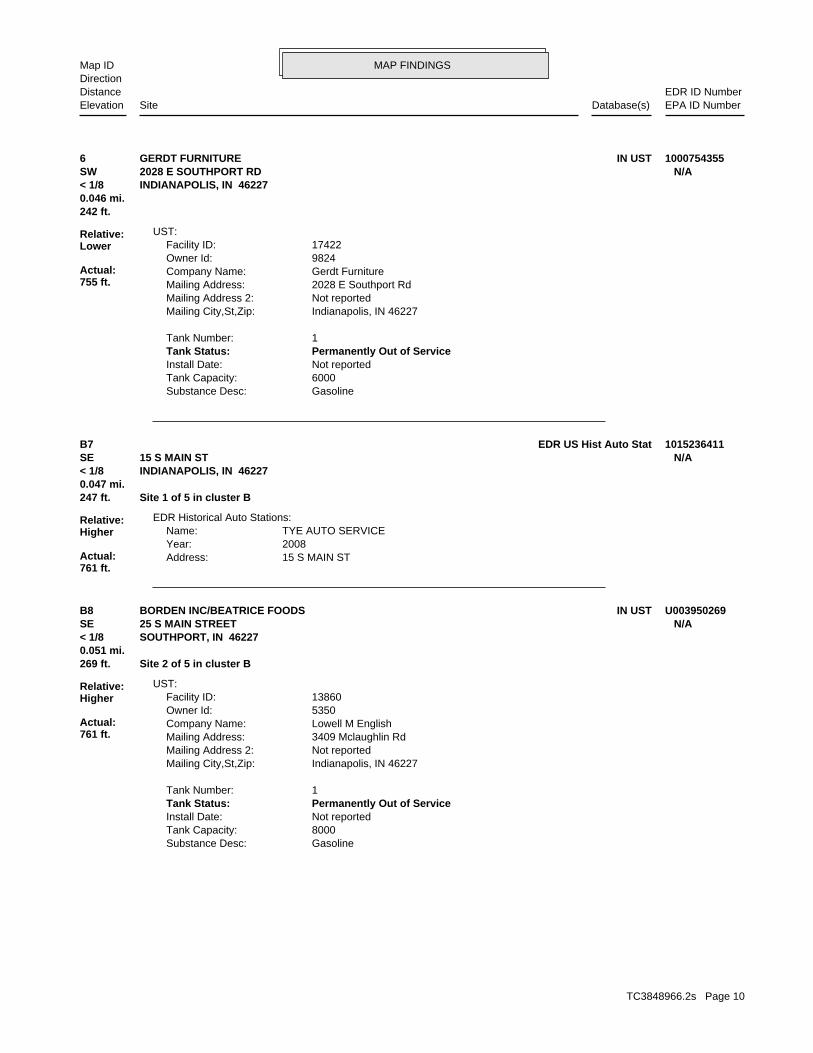
MAP FINDINGSMap IDDirection
EDR ID NumberDistanceEPA ID NumberDatabase(s)SiteElevation
GasolineSubstance Desc: 6000Tank Capacity: Not reportedInstall Date: Permanently Out of ServiceTank Status: 1Tank Number:
Indianapolis, IN 46227Mailing City,St,Zip: Not reportedMailing Address 2: 2028 E Southport RdMailing Address: Gerdt FurnitureCompany Name: 9824Owner Id: 17422Facility ID:
UST:
242 ft.0.046 mi.
Relative:Lower
Actual:755 ft.
< 1/8 INDIANAPOLIS, IN 46227SW 2028 E SOUTHPORT RD N/A6 IN USTGERDT FURNITURE 1000754355
15 S MAIN STAddress: 2008Year: TYE AUTO SERVICEName:
EDR Historical Auto Stations:
247 ft. Site 1 of 5 in cluster B0.047 mi.
Relative:Higher
Actual:761 ft.
< 1/8 INDIANAPOLIS, IN 46227SE 15 S MAIN ST N/AB7 EDR US Hist Auto Stat 1015236411
GasolineSubstance Desc: 8000Tank Capacity: Not reportedInstall Date: Permanently Out of ServiceTank Status: 1Tank Number:
Indianapolis, IN 46227Mailing City,St,Zip: Not reportedMailing Address 2: 3409 Mclaughlin RdMailing Address: Lowell M EnglishCompany Name: 5350Owner Id: 13860Facility ID:
UST:
269 ft. Site 2 of 5 in cluster B0.051 mi.
Relative:Higher
Actual:761 ft.
< 1/8 SOUTHPORT, IN 46227SE 25 S MAIN STREET N/AB8 IN USTBORDEN INC/BEATRICE FOODS U003950269
TC3848966.2s Page 10
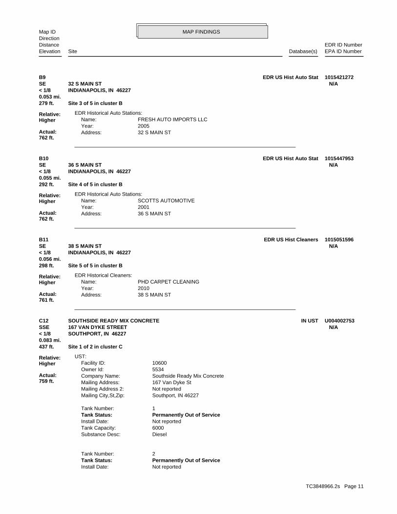
MAP FINDINGSMap IDDirection
EDR ID NumberDistanceEPA ID NumberDatabase(s)SiteElevation
32 S MAIN STAddress: 2005Year: FRESH AUTO IMPORTS LLCName:
EDR Historical Auto Stations:
279 ft. Site 3 of 5 in cluster B0.053 mi.
Relative:Higher
Actual:762 ft.
< 1/8 INDIANAPOLIS, IN 46227SE 32 S MAIN ST N/AB9 EDR US Hist Auto Stat 1015421272
36 S MAIN STAddress: 2001Year: SCOTTS AUTOMOTIVEName:
EDR Historical Auto Stations:
292 ft. Site 4 of 5 in cluster B0.055 mi.
Relative:Higher
Actual:762 ft.
< 1/8 INDIANAPOLIS, IN 46227SE 36 S MAIN ST N/AB10 EDR US Hist Auto Stat 1015447953
38 S MAIN STAddress: 2010Year: PHD CARPET CLEANINGName:
EDR Historical Cleaners:
298 ft. Site 5 of 5 in cluster B0.056 mi.
Relative:Higher
Actual:761 ft.
< 1/8 INDIANAPOLIS, IN 46227SE 38 S MAIN ST N/AB11 EDR US Hist Cleaners 1015051596
Not reportedInstall Date: Permanently Out of ServiceTank Status: 2Tank Number:
DieselSubstance Desc: 6000Tank Capacity: Not reportedInstall Date: Permanently Out of ServiceTank Status: 1Tank Number:
Southport, IN 46227Mailing City,St,Zip: Not reportedMailing Address 2: 167 Van Dyke StMailing Address: Southside Ready Mix ConcreteCompany Name: 5534Owner Id: 10600Facility ID:
UST:
437 ft. Site 1 of 2 in cluster C0.083 mi.
Relative:Higher
Actual:759 ft.
< 1/8 SOUTHPORT, IN 46227SSE 167 VAN DYKE STREET N/AC12 IN USTSOUTHSIDE READY MIX CONCRETE U004002753
TC3848966.2s Page 11
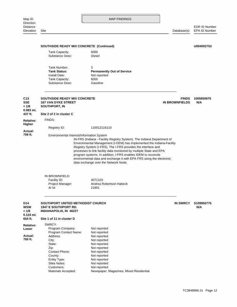
MAP FINDINGSMap IDDirection
EDR ID NumberDistanceEPA ID NumberDatabase(s)SiteElevation
GasolineSubstance Desc: 6000Tank Capacity: Not reportedInstall Date: Permanently Out of ServiceTank Status: 3Tank Number:
DieselSubstance Desc: 6000Tank Capacity:
SOUTHSIDE READY MIX CONCRETE (Continued) U004002753
21801AI Id: Andrea Robertson-HabeckProject Manager: 4071103Facility ID:
IN BROWNFIELD:
data exchange over the Network Node.environmental data and exchange it with EPA FRS using the electronicprogram systems. In addition, I-FRS enables IDEM to reconcileprocesses to link facility data monitored by multiple State and EPARegistry System (I-FRS). The I-FRS provides the interface andEnvironmental Management (I-DEM) has implemented the Indiana-FacilityIN-FRS (Indiana - Facility Registry System). The Indiana Department of Environmental Interest/Information System
110012116110Registry ID:
FINDS:
437 ft. Site 2 of 2 in cluster C0.083 mi.
Relative:Higher
Actual:759 ft.
< 1/8 SOUTHPORT, IN SSE IN BROWNFIELDS167 VAN DYKE STREET N/AC13 FINDSSOUTHSIDE READY MIX CONCRETE 1005650675
Newspaper, Magazines, Mixed ResidentialMaterials Accepted: Not reportedCustomers: Not reportedSites Notes: Not reportedEntity Type: Not reportedCounty: Not reportedContact Phone: Not reportedZip: Not reportedState: Not reportedCity: Not reportedAddress: Not reportedProgram Contact Name: Not reportedProgram Company:
SWRCY:
654 ft. Site 1 of 11 in cluster D0.124 mi.
Relative:Lower
Actual:750 ft.
< 1/8 INDIANAPOLIS, IN 46227WSW 1947 E SOUTHPORT RD. N/AD14 IN SWRCYSOUTHPORT UNITED METHODIST CHURCH S109950775
TC3848966.2s Page 12
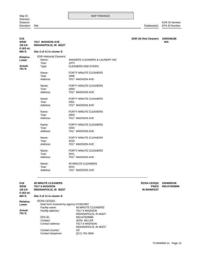
MAP FINDINGSMap IDDirection
EDR ID NumberDistanceEPA ID NumberDatabase(s)SiteElevation
7017 MADISON AVEAddress: 2012Year: 40 MINUTE CLEANERSName:
7017 MADISON AVEAddress: 2011Year: FORTY MINUTE CLEANERSName:
7017 MADISON AVEAddress: 2010Year: FORTY MINUTE CLEANERSName:
7017 MADISON AVEAddress: 2004Year: FORTY MINUTE CLEANERSName:
7017 MADISON AVEAddress: 2003Year: FORTY MINUTE CLEANERSName:
7017 MADISON AVEAddress: 2001Year: FORTY MINUTE CLEANERSName:
7017 MADISON AVEAddress: 2000Year: FORTY MINUTE CLEANERSName:
7017 MADISON AVEAddress: 1999Year: FORTY MINUTE CLEANERSName:
CLEANERS AND DYERSType: 1973Year: SANDERS CLEANERS & LAUNDRY INCName:
EDR Historical Cleaners:
860 ft. Site 2 of 11 in cluster D0.163 mi.
Relative:Lower
Actual:751 ft.
1/8-1/4 INDIANAPOLIS, IN 46227WSW 7017 MADISON AVE N/AD15 EDR US Hist Cleaners 1009348186
(317) 782-3859Contact telephone: USContact country: INDIANAPOLIS, IN 46227 7017 S MADISONContact address: JEAN MILLERContact: IND147928899EPA ID: INDIANAPOLIS, IN 46227 7017 S MADISONFacility address: 40 MINUTE CLEANERSFacility name: 07/26/1997Date form received by agency:
RCRA-CESQG:
860 ft. Site 3 of 11 in cluster D0.163 mi.
Relative:Lower
Actual:751 ft.
1/8-1/4 IN MANIFESTINDIANAPOLIS, IN 46227WSW FINDS7017 S MADISON IND147928899D16 RCRA-CESQG40 MINUTE CLEANERS 1004699106
TC3848966.2s Page 13
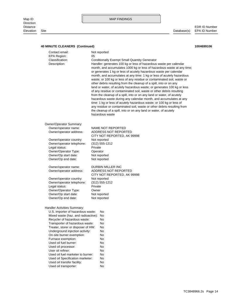
MAP FINDINGSMap IDDirection
EDR ID NumberDistanceEPA ID NumberDatabase(s)SiteElevation
NoUsed oil transporter: NoUsed oil transfer facility: NoUsed oil Specification marketer: NoUsed oil fuel marketer to burner: NoUser oil refiner: NoUsed oil processor: NoUsed oil fuel burner: NoFurnace exemption: NoOn-site burner exemption: NoUnderground injection activity: NoTreater, storer or disposer of HW: NoTransporter of hazardous waste: NoRecycler of hazardous waste: NoMixed waste (haz. and radioactive): NoU.S. importer of hazardous waste:
Handler Activities Summary:
Not reportedOwner/Op end date: Not reportedOwner/Op start date: OwnerOwner/Operator Type: PrivateLegal status: (312) 555-1212Owner/operator telephone: Not reportedOwner/operator country: CITY NOT REPORTED, AK 99998 ADDRESS NOT REPORTEDOwner/operator address: DURBIN MILLER INCOwner/operator name:
Not reportedOwner/Op end date: Not reportedOwner/Op start date: OperatorOwner/Operator Type: PrivateLegal status: (312) 555-1212Owner/operator telephone: Not reportedOwner/operator country: CITY NOT REPORTED, AK 99998 ADDRESS NOT REPORTEDOwner/operator address: NAME NOT REPORTEDOwner/operator name:
Owner/Operator Summary:
hazardous waste the cleanup of a spill, into or on any land or water, of acutely any residue or contaminated soil, waste or other debris resulting from time: 1 kg or less of acutely hazardous waste; or 100 kg or less of hazardous waste during any calendar month, and accumulates at any from the cleanup of a spill, into or on any land or water, of acutely of any residue or contaminated soil, waste or other debris resulting land or water, of acutely hazardous waste; or generates 100 kg or less other debris resulting from the cleanup of a spill, into or on any waste; or 100 kg or less of any residue or contaminated soil, waste or month, and accumulates at any time: 1 kg or less of acutely hazardous or generates 1 kg or less of acutely hazardous waste per calendar month, and accumulates 1000 kg or less of hazardous waste at any time; Handler: generates 100 kg or less of hazardous waste per calendarDescription: Conditionally Exempt Small Quantity GeneratorClassification: 05EPA Region: Not reportedContact email:
40 MINUTE CLEANERS (Continued) 1004699106
TC3848966.2s Page 14
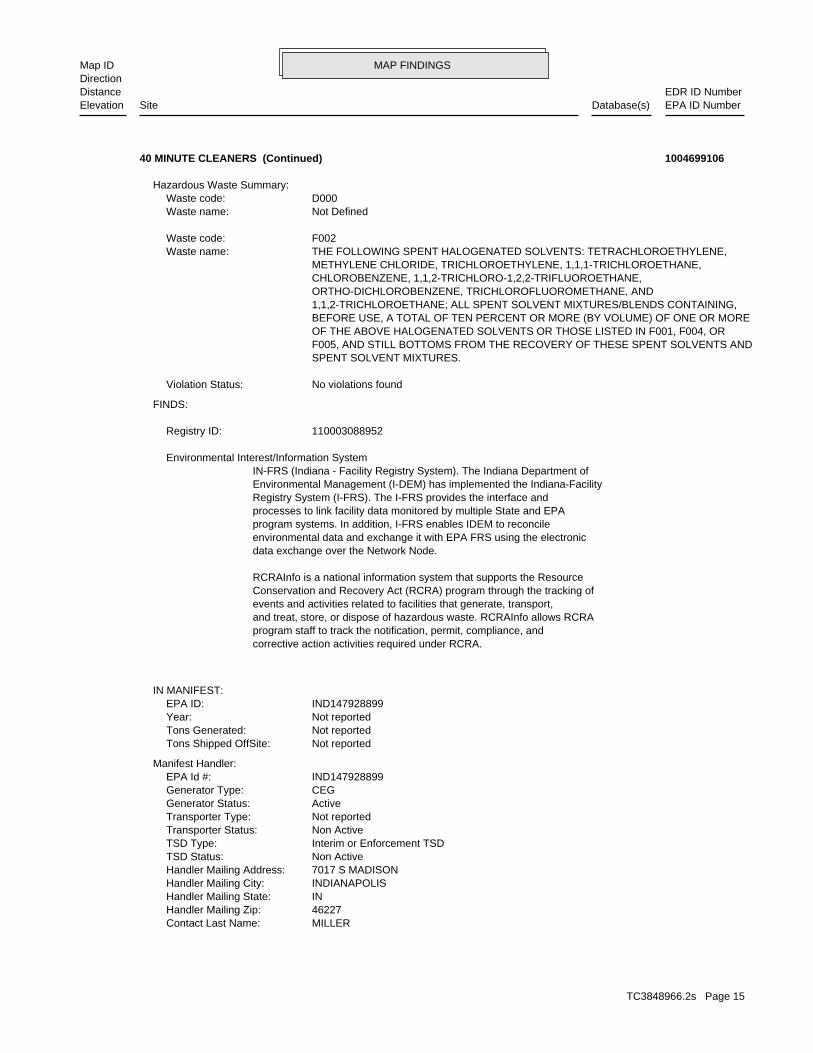
MAP FINDINGSMap IDDirection
EDR ID NumberDistanceEPA ID NumberDatabase(s)SiteElevation
MILLERContact Last Name: 46227Handler Mailing Zip: INHandler Mailing State: INDIANAPOLISHandler Mailing City: 7017 S MADISONHandler Mailing Address: Non ActiveTSD Status: Interim or Enforcement TSDTSD Type: Non ActiveTransporter Status: Not reportedTransporter Type: ActiveGenerator Status: CEGGenerator Type: IND147928899EPA Id #:
Manifest Handler:
Not reportedTons Shipped OffSite: Not reportedTons Generated: Not reportedYear: IND147928899EPA ID:
IN MANIFEST:
corrective action activities required under RCRA.program staff to track the notification, permit, compliance, andand treat, store, or dispose of hazardous waste. RCRAInfo allows RCRAevents and activities related to facilities that generate, transport,Conservation and Recovery Act (RCRA) program through the tracking ofRCRAInfo is a national information system that supports the Resource
data exchange over the Network Node.environmental data and exchange it with EPA FRS using the electronicprogram systems. In addition, I-FRS enables IDEM to reconcileprocesses to link facility data monitored by multiple State and EPARegistry System (I-FRS). The I-FRS provides the interface andEnvironmental Management (I-DEM) has implemented the Indiana-FacilityIN-FRS (Indiana - Facility Registry System). The Indiana Department of Environmental Interest/Information System
110003088952Registry ID:
FINDS:
No violations foundViolation Status:
SPENT SOLVENT MIXTURES. F005, AND STILL BOTTOMS FROM THE RECOVERY OF THESE SPENT SOLVENTS AND OF THE ABOVE HALOGENATED SOLVENTS OR THOSE LISTED IN F001, F004, OR BEFORE USE, A TOTAL OF TEN PERCENT OR MORE (BY VOLUME) OF ONE OR MORE 1,1,2-TRICHLOROETHANE; ALL SPENT SOLVENT MIXTURES/BLENDS CONTAINING, ORTHO-DICHLOROBENZENE, TRICHLOROFLUOROMETHANE, AND CHLOROBENZENE, 1,1,2-TRICHLORO-1,2,2-TRIFLUOROETHANE, METHYLENE CHLORIDE, TRICHLOROETHYLENE, 1,1,1-TRICHLOROETHANE, THE FOLLOWING SPENT HALOGENATED SOLVENTS: TETRACHLOROETHYLENE,Waste name: F002Waste code:
Not DefinedWaste name: D000Waste code:
Hazardous Waste Summary:
40 MINUTE CLEANERS (Continued) 1004699106
TC3848966.2s Page 15
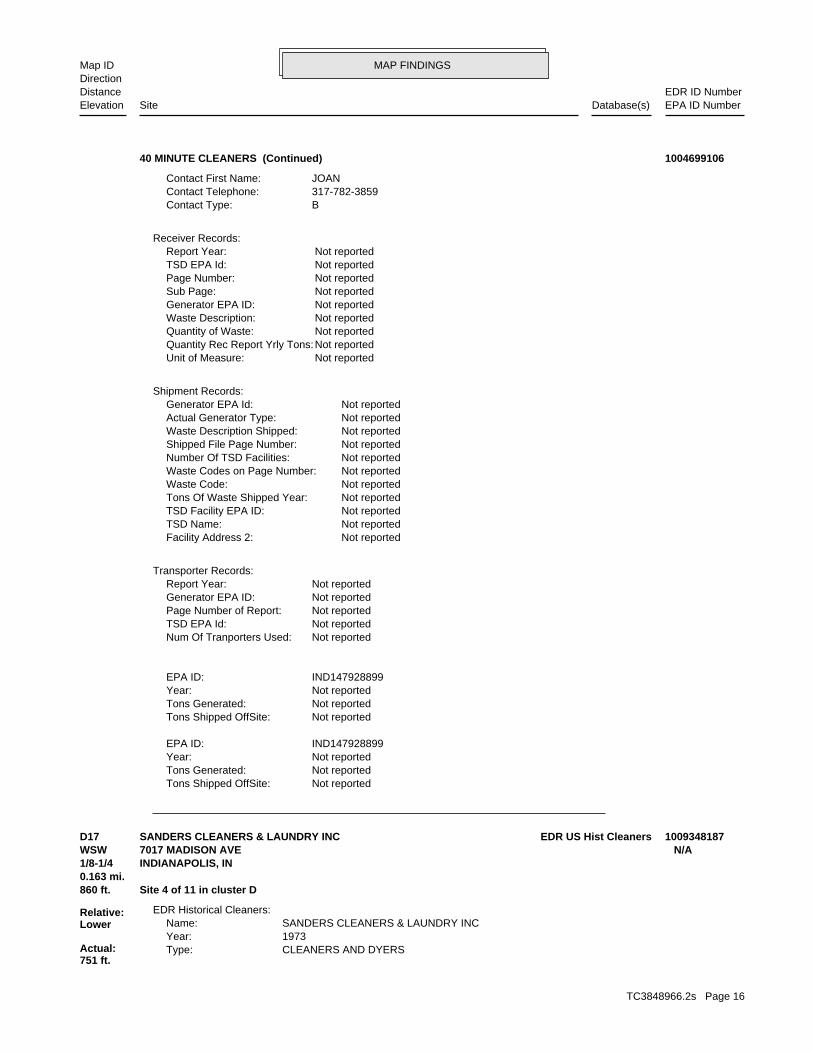
MAP FINDINGSMap IDDirection
EDR ID NumberDistanceEPA ID NumberDatabase(s)SiteElevation
Not reportedTons Shipped OffSite: Not reportedTons Generated: Not reportedYear: IND147928899EPA ID:
Not reportedTons Shipped OffSite: Not reportedTons Generated: Not reportedYear: IND147928899EPA ID:
Not reportedNum Of Tranporters Used: Not reportedTSD EPA Id: Not reportedPage Number of Report: Not reportedGenerator EPA ID: Not reportedReport Year:
Transporter Records:
Not reportedFacility Address 2: Not reportedTSD Name: Not reportedTSD Facility EPA ID: Not reportedTons Of Waste Shipped Year: Not reportedWaste Code: Not reportedWaste Codes on Page Number: Not reportedNumber Of TSD Facilities: Not reportedShipped File Page Number: Not reportedWaste Description Shipped: Not reportedActual Generator Type: Not reportedGenerator EPA Id:
Shipment Records:
Not reportedUnit of Measure: Not reportedQuantity Rec Report Yrly Tons: Not reportedQuantity of Waste: Not reportedWaste Description: Not reportedGenerator EPA ID: Not reportedSub Page: Not reportedPage Number: Not reportedTSD EPA Id: Not reportedReport Year:
Receiver Records:
BContact Type: 317-782-3859Contact Telephone: JOANContact First Name:
40 MINUTE CLEANERS (Continued) 1004699106
CLEANERS AND DYERSType: 1973Year: SANDERS CLEANERS & LAUNDRY INCName:
EDR Historical Cleaners:
860 ft. Site 4 of 11 in cluster D0.163 mi.
Relative:Lower
Actual:751 ft.
1/8-1/4 INDIANAPOLIS, IN WSW 7017 MADISON AVE N/AD17 EDR US Hist CleanersSANDERS CLEANERS & LAUNDRY INC 1009348187
TC3848966.2s Page 16

MAP FINDINGSMap IDDirection
EDR ID NumberDistanceEPA ID NumberDatabase(s)SiteElevation
Not reportedPO Notes: 1/8/01Date Response: 2000-9083-A(NV)(AO) 5/31/00Cause: Not reportedStatus: 12/22/00Mailed Date: DTRInspector: 5/18/98; 2/7/00; 11/16/00Inspection Date: VL/ISCmpl Action: 4Five Star: 1-LNA/DRC 1-LEA/DRCClass/Mach: 07/22/96Cntrl Received Date: 02/09/94Prev Received Date: 02/09/94Int Received Date: YesOther: NoRMEN Closed: Not reportedEstimated Perc Gallons: 250Perc Gallons: 322(J)Violation: Not reportedComment: 5203Zip4: 46227Zip Code: INState: INDIANAPOLISCity: 7017 MADISON AVEAddress: Not reportedContact Phone: JOAN MILLERContact Name: 317/782-3859Facility Telephone: Not reportedAlias Name: IN0502985Facility ID:
IN Dryclean:
860 ft. Site 5 of 11 in cluster D0.163 mi.
Relative:Lower
Actual:751 ft.
1/8-1/4 INDIANAPOLIS, IN 46227WSW 7017 MADISON AVE N/AD18 IN DRYCLEANERSFORTY MINUTE CLEANERS S108161919
LAUNDRIES SELF SERVEType: 1978Year: SOUTHPORT NORGE VILLAGEName:
LAUNDRIES SELF SERVEType: 1973Year: SOUTHPORT NORGE VILLAGEName:
EDR Historical Cleaners:
871 ft. Site 6 of 11 in cluster D0.165 mi.
Relative:Lower
Actual:751 ft.
1/8-1/4 INDIANAPOLIS, IN WSW 7020 MADISON AV N/AD19 EDR US Hist CleanersSOUTHPORT NORGE VILLAGE 1009348214
TC3848966.2s Page 17
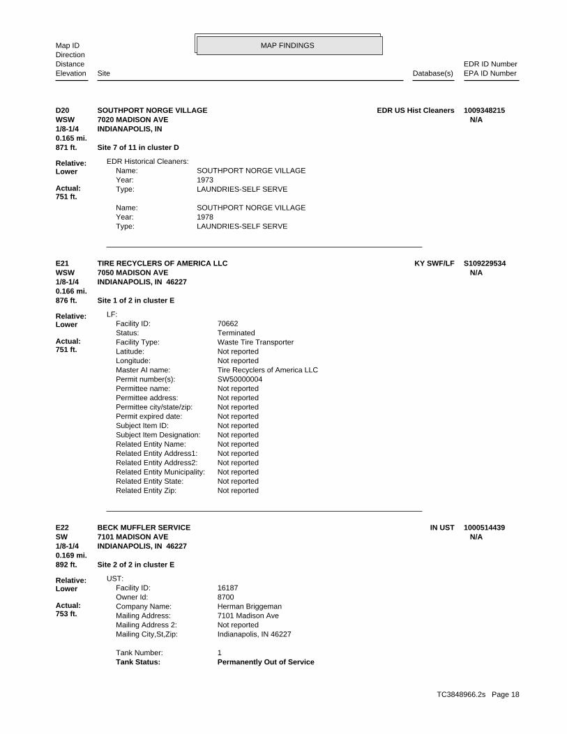
MAP FINDINGSMap IDDirection
EDR ID NumberDistanceEPA ID NumberDatabase(s)SiteElevation
LAUNDRIES-SELF SERVEType: 1978Year: SOUTHPORT NORGE VILLAGEName:
LAUNDRIES-SELF SERVEType: 1973Year: SOUTHPORT NORGE VILLAGEName:
EDR Historical Cleaners:
871 ft. Site 7 of 11 in cluster D0.165 mi.
Relative:Lower
Actual:751 ft.
1/8-1/4 INDIANAPOLIS, IN WSW 7020 MADISON AVE N/AD20 EDR US Hist CleanersSOUTHPORT NORGE VILLAGE 1009348215
Not reportedRelated Entity Zip: Not reportedRelated Entity State: Not reportedRelated Entity Municipality: Not reportedRelated Entity Address2: Not reportedRelated Entity Address1: Not reportedRelated Entity Name: Not reportedSubject Item Designation: Not reportedSubject Item ID: Not reportedPermit expired date: Not reportedPermittee city/state/zip: Not reportedPermittee address: Not reportedPermittee name: SW50000004Permit number(s): Tire Recyclers of America LLCMaster AI name: Not reportedLongitude: Not reportedLatitude: Waste Tire TransporterFacility Type: TerminatedStatus: 70662Facility ID:
LF:
876 ft. Site 1 of 2 in cluster E0.166 mi.
Relative:Lower
Actual:751 ft.
1/8-1/4 INDIANAPOLIS, IN 46227WSW 7050 MADISON AVE N/AE21 KY SWF/LFTIRE RECYCLERS OF AMERICA LLC S109229534
Permanently Out of ServiceTank Status: 1Tank Number:
Indianapolis, IN 46227Mailing City,St,Zip: Not reportedMailing Address 2: 7101 Madison AveMailing Address: Herman BriggemanCompany Name: 8700Owner Id: 16187Facility ID:
UST:
892 ft. Site 2 of 2 in cluster E0.169 mi.
Relative:Lower
Actual:753 ft.
1/8-1/4 INDIANAPOLIS, IN 46227SW 7101 MADISON AVE N/AE22 IN USTBECK MUFFLER SERVICE 1000514439
TC3848966.2s Page 18
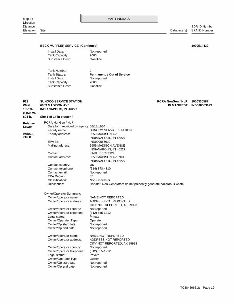
MAP FINDINGSMap IDDirection
EDR ID NumberDistanceEPA ID NumberDatabase(s)SiteElevation
GasolineSubstance Desc: 2000Tank Capacity: Not reportedInstall Date: Permanently Out of ServiceTank Status: 2Tank Number:
GasolineSubstance Desc: 2000Tank Capacity: Not reportedInstall Date:
BECK MUFFLER SERVICE (Continued) 1000514439
Not reportedOwner/Op end date: Not reportedOwner/Op start date: OwnerOwner/Operator Type: PrivateLegal status: (312) 555-1212Owner/operator telephone: Not reportedOwner/operator country: CITY NOT REPORTED, AK 99998 ADDRESS NOT REPORTEDOwner/operator address: NAME NOT REPORTEDOwner/operator name:
Not reportedOwner/Op end date: Not reportedOwner/Op start date: OperatorOwner/Operator Type: PrivateLegal status: (312) 555-1212Owner/operator telephone: Not reportedOwner/operator country: CITY NOT REPORTED, AK 99998 ADDRESS NOT REPORTEDOwner/operator address: NAME NOT REPORTEDOwner/operator name:
Owner/Operator Summary:
Handler: Non-Generators do not presently generate hazardous wasteDescription: Non-GeneratorClassification: 05EPA Region: Not reportedContact email: (314) 878-4810Contact telephone: USContact country: INDIANAPOLIS, IN 46227 6959 MADISON AVENUEContact address: KARL BECKERSContact: INDIANAPOLIS, IN 46227 6959 MADISON AVENUEMailing address: IND000683029EPA ID: INDIANAPOLIS, IN 46227 6959 MADISON AVEFacility address: SUNOCO SERVICE STATIONFacility name: 08/18/1980Date form received by agency:
RCRA NonGen / NLR:
894 ft. Site 1 of 14 in cluster F0.169 mi.
Relative:Lower
Actual:745 ft.
1/8-1/4 INDIANAPOLIS, IN 46227West IN MANIFEST6959 MADISON AVE IND000683029F23 RCRA NonGen / NLRSUNOCO SERVICE STATION 1000330587
TC3848966.2s Page 19
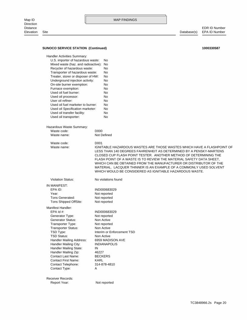
MAP FINDINGSMap IDDirection
EDR ID NumberDistanceEPA ID NumberDatabase(s)SiteElevation
Not reportedReport Year:Receiver Records:
AContact Type: 314-878-4810Contact Telephone: KARLContact First Name: BECKERSContact Last Name: 46227Handler Mailing Zip: INHandler Mailing State: INDIANAPOLISHandler Mailing City: 6959 MADISON AVEHandler Mailing Address: Non ActiveTSD Status: Interim or Enforcement TSDTSD Type: Non ActiveTransporter Status: Not reportedTransporter Type: Non ActiveGenerator Status: Not reportedGenerator Type: IND000683029EPA Id #:
Manifest Handler:
Not reportedTons Shipped OffSite: Not reportedTons Generated: Not reportedYear: IND000683029EPA ID:
IN MANIFEST:
No violations foundViolation Status:
WHICH WOULD BE CONSIDERED AS IGNITABLE HAZARDOUS WASTE. MATERIAL. LACQUER THINNER IS AN EXAMPLE OF A COMMONLY USED SOLVENT WHICH CAN BE OBTAINED FROM THE MANUFACTURER OR DISTRIBUTOR OF THE FLASH POINT OF A WASTE IS TO REVIEW THE MATERIAL SAFETY DATA SHEET, CLOSED CUP FLASH POINT TESTER. ANOTHER METHOD OF DETERMINING THE LESS THAN 140 DEGREES FAHRENHEIT AS DETERMINED BY A PENSKY-MARTENS IGNITABLE HAZARDOUS WASTES ARE THOSE WASTES WHICH HAVE A FLASHPOINT OFWaste name: D001Waste code:
Not DefinedWaste name: D000Waste code:
Hazardous Waste Summary:
NoUsed oil transporter: NoUsed oil transfer facility: NoUsed oil Specification marketer: NoUsed oil fuel marketer to burner: NoUser oil refiner: NoUsed oil processor: NoUsed oil fuel burner: NoFurnace exemption: NoOn-site burner exemption: NoUnderground injection activity: NoTreater, storer or disposer of HW: NoTransporter of hazardous waste: NoRecycler of hazardous waste: NoMixed waste (haz. and radioactive): NoU.S. importer of hazardous waste:
Handler Activities Summary:
SUNOCO SERVICE STATION (Continued) 1000330587
TC3848966.2s Page 20
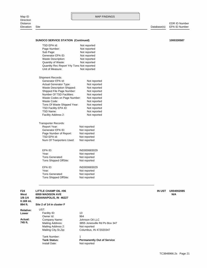
MAP FINDINGSMap IDDirection
EDR ID NumberDistanceEPA ID NumberDatabase(s)SiteElevation
Not reportedTons Shipped OffSite: Not reportedTons Generated: Not reportedYear: IND000683029EPA ID:
Not reportedTons Shipped OffSite: Not reportedTons Generated: Not reportedYear: IND000683029EPA ID:
Not reportedNum Of Tranporters Used: Not reportedTSD EPA Id: Not reportedPage Number of Report: Not reportedGenerator EPA ID: Not reportedReport Year:
Transporter Records:
Not reportedFacility Address 2: Not reportedTSD Name: Not reportedTSD Facility EPA ID: Not reportedTons Of Waste Shipped Year: Not reportedWaste Code: Not reportedWaste Codes on Page Number: Not reportedNumber Of TSD Facilities: Not reportedShipped File Page Number: Not reportedWaste Description Shipped: Not reportedActual Generator Type: Not reportedGenerator EPA Id:
Shipment Records:
Not reportedUnit of Measure: Not reportedQuantity Rec Report Yrly Tons: Not reportedQuantity of Waste: Not reportedWaste Description: Not reportedGenerator EPA ID: Not reportedSub Page: Not reportedPage Number: Not reportedTSD EPA Id:
SUNOCO SERVICE STATION (Continued) 1000330587
Not reportedInstall Date: Permanently Out of ServiceTank Status: 1Tank Number:
Columbus, IN 472020347Mailing City,St,Zip: Not reportedMailing Address 2: 3855 Jonesville Rd Po Box 347Mailing Address: Johnson Oil LLCCompany Name: 964Owner Id: 13Facility ID:
UST:
894 ft. Site 2 of 14 in cluster F0.169 mi.
Relative:Lower
Actual:745 ft.
1/8-1/4 INDIANAPOLIS, IN 46227West 6959 MADISON AVE N/AF24 IN USTLITTLE CHAMP OIL #06 U004002085
TC3848966.2s Page 21
MAP FINDINGSMap IDDirection
EDR ID NumberDistanceEPA ID NumberDatabase(s)SiteElevation
GasolineSubstance Desc: 6000Tank Capacity: Not reportedInstall Date: Permanently Out of ServiceTank Status: 3Tank Number:
GasolineSubstance Desc: 8000Tank Capacity: Not reportedInstall Date: Permanently Out of ServiceTank Status: 2Tank Number:
GasolineSubstance Desc: 10000Tank Capacity:
LITTLE CHAMP OIL #06 (Continued) U004002085
GASOLINE STATIONSType: 1991Year: LITTLE CHAMPName:
GASOLINE STATIONSType: 1986Year: C A M TWOName:
GASOLINE STATIONSType: 1978Year: KNOX S SUNOCOName:
GASOLINE STATIONSType: 1973Year: JOHNSON D & B INCName:
EDR Historical Auto Stations:
894 ft. Site 3 of 14 in cluster F0.169 mi.
Relative:Lower
Actual:745 ft.
1/8-1/4 INDIANAPOLIS, IN West 6959 MADISON AVE N/AF25 EDR US Hist Auto StatC A M TWO 1009380663
C A M TWOName:
GASOLINE STATIONSType: 1978Year: KNOX S SUNOCOName:
GASOLINE STATIONSType: 1973Year: JOHNSON D & B INCName:
EDR Historical Auto Stations:
894 ft. Site 4 of 14 in cluster F0.169 mi.
Relative:Lower
Actual:745 ft.
1/8-1/4 INDIANAPOLIS, IN West 6959 MADISON AV N/AF26 EDR US Hist Auto StatC A M TWO 1009380662
TC3848966.2s Page 22
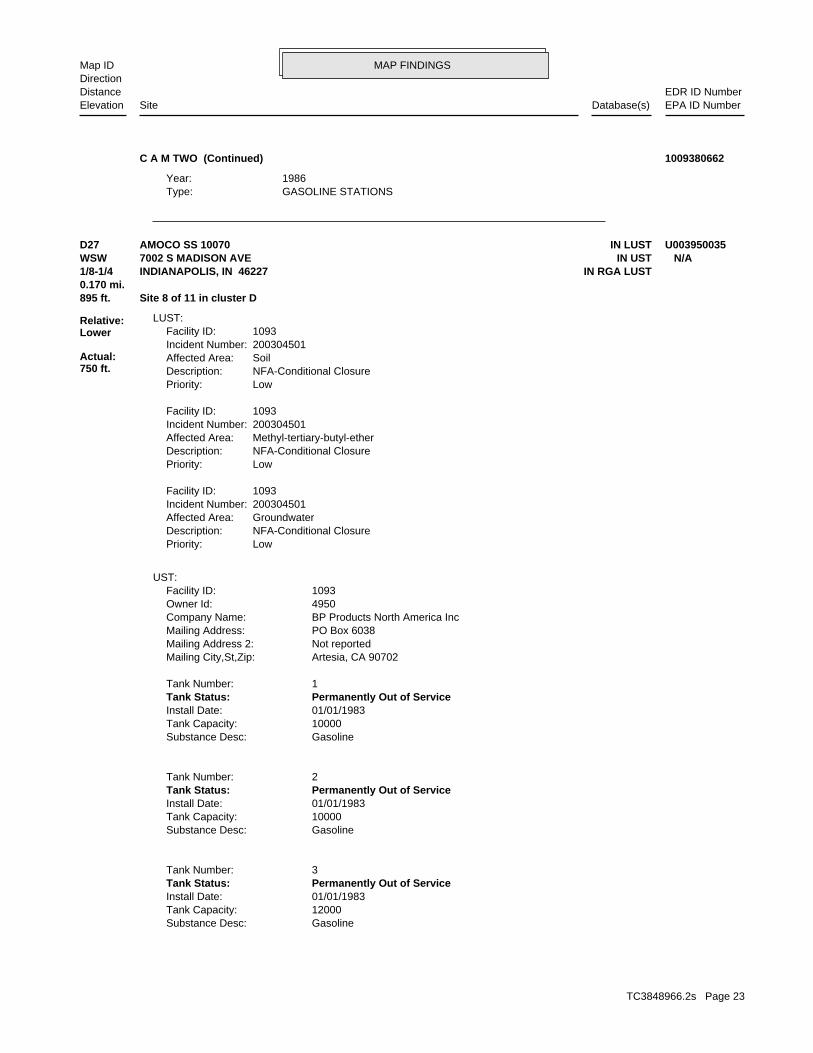
MAP FINDINGSMap IDDirection
EDR ID NumberDistanceEPA ID NumberDatabase(s)SiteElevation
GASOLINE STATIONSType: 1986Year:
C A M TWO (Continued) 1009380662
GasolineSubstance Desc: 12000Tank Capacity: 01/01/1983Install Date: Permanently Out of ServiceTank Status: 3Tank Number:
GasolineSubstance Desc: 10000Tank Capacity: 01/01/1983Install Date: Permanently Out of ServiceTank Status: 2Tank Number:
GasolineSubstance Desc: 10000Tank Capacity: 01/01/1983Install Date: Permanently Out of ServiceTank Status: 1Tank Number:
Artesia, CA 90702Mailing City,St,Zip: Not reportedMailing Address 2: PO Box 6038Mailing Address: BP Products North America IncCompany Name: 4950Owner Id: 1093Facility ID:
UST:
LowPriority:NFA-Conditional ClosureDescription:GroundwaterAffected Area:200304501Incident Number:1093Facility ID:
LowPriority:NFA-Conditional ClosureDescription:Methyl-tertiary-butyl-etherAffected Area:200304501Incident Number:1093Facility ID:
LowPriority:NFA-Conditional ClosureDescription:SoilAffected Area:200304501Incident Number:1093Facility ID:
LUST:
895 ft. Site 8 of 11 in cluster D0.170 mi.
Relative:Lower
Actual:750 ft.
1/8-1/4 IN RGA LUSTINDIANAPOLIS, IN 46227WSW IN UST7002 S MADISON AVE N/AD27 IN LUSTAMOCO SS 10070 U003950035
TC3848966.2s Page 23
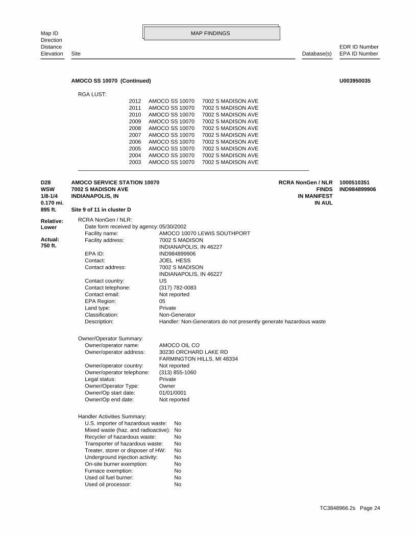
MAP FINDINGSMap IDDirection
EDR ID NumberDistanceEPA ID NumberDatabase(s)SiteElevation
2003 AMOCO SS 10070 7002 S MADISON AVE2004 AMOCO SS 10070 7002 S MADISON AVE2005 AMOCO SS 10070 7002 S MADISON AVE2006 AMOCO SS 10070 7002 S MADISON AVE2007 AMOCO SS 10070 7002 S MADISON AVE2008 AMOCO SS 10070 7002 S MADISON AVE2009 AMOCO SS 10070 7002 S MADISON AVE2010 AMOCO SS 10070 7002 S MADISON AVE2011 AMOCO SS 10070 7002 S MADISON AVE2012 AMOCO SS 10070 7002 S MADISON AVE
RGA LUST:
AMOCO SS 10070 (Continued) U003950035
NoUsed oil processor: NoUsed oil fuel burner: NoFurnace exemption: NoOn-site burner exemption: NoUnderground injection activity: NoTreater, storer or disposer of HW: NoTransporter of hazardous waste: NoRecycler of hazardous waste: NoMixed waste (haz. and radioactive): NoU.S. importer of hazardous waste:
Handler Activities Summary:
Not reportedOwner/Op end date: 01/01/0001Owner/Op start date: OwnerOwner/Operator Type: PrivateLegal status: (313) 855-1060Owner/operator telephone: Not reportedOwner/operator country: FARMINGTON HILLS, MI 48334 30230 ORCHARD LAKE RDOwner/operator address: AMOCO OIL COOwner/operator name:
Owner/Operator Summary:
Handler: Non-Generators do not presently generate hazardous wasteDescription: Non-GeneratorClassification: PrivateLand type: 05EPA Region: Not reportedContact email: (317) 782-0083Contact telephone: USContact country: INDIANAPOLIS, IN 46227 7002 S MADISONContact address: JOEL HESSContact: IND984899906EPA ID: INDIANAPOLIS, IN 46227 7002 S MADISONFacility address: AMOCO 10070 LEWIS SOUTHPORTFacility name: 05/30/2002Date form received by agency:
RCRA NonGen / NLR:
895 ft. Site 9 of 11 in cluster D0.170 mi. IN AUL
Relative:Lower
Actual:750 ft.
1/8-1/4 IN MANIFESTINDIANAPOLIS, IN WSW FINDS7002 S MADISON AVE IND984899906D28 RCRA NonGen / NLRAMOCO SERVICE STATION 10070 1000510351
TC3848966.2s Page 24
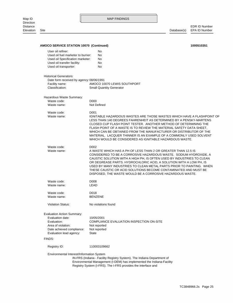
MAP FINDINGSMap IDDirection
EDR ID NumberDistanceEPA ID NumberDatabase(s)SiteElevation
Registry System (I-FRS). The I-FRS provides the interface andEnvironmental Management (I-DEM) has implemented the Indiana-FacilityIN-FRS (Indiana - Facility Registry System). The Indiana Department of Environmental Interest/Information System
110003109662Registry ID:
FINDS:
StateEvaluation lead agency: Not reportedDate achieved compliance: Not reportedArea of violation: COMPLIANCE EVALUATION INSPECTION ON-SITEEvaluation: 10/05/2001Evaluation date:
Evaluation Action Summary:
No violations foundViolation Status:
BENZENEWaste name: D018Waste code:
LEADWaste name: D008Waste code:
DISPOSED, THE WASTE WOULD BE A CORROSIVE HAZARDOUS WASTE. THESE CAUSTIC OR ACID SOLUTIONS BECOME CONTAMINATED AND MUST BE USED BY MANY INDUSTRIES TO CLEAN METAL PARTS PRIOR TO PAINTING. WHEN OR DEGREASE PARTS. HYDROCHLORIC ACID, A SOLUTION WITH A LOW PH, IS CAUSTIC SOLUTION WITH A HIGH PH, IS OFTEN USED BY INDUSTRIES TO CLEAN CONSIDERED TO BE A CORROSIVE HAZARDOUS WASTE. SODIUM HYDROXIDE, A A WASTE WHICH HAS A PH OF LESS THAN 2 OR GREATER THAN 12.5 ISWaste name: D002Waste code:
WHICH WOULD BE CONSIDERED AS IGNITABLE HAZARDOUS WASTE. MATERIAL. LACQUER THINNER IS AN EXAMPLE OF A COMMONLY USED SOLVENT WHICH CAN BE OBTAINED FROM THE MANUFACTURER OR DISTRIBUTOR OF THE FLASH POINT OF A WASTE IS TO REVIEW THE MATERIAL SAFETY DATA SHEET, CLOSED CUP FLASH POINT TESTER. ANOTHER METHOD OF DETERMINING THE LESS THAN 140 DEGREES FAHRENHEIT AS DETERMINED BY A PENSKY-MARTENS IGNITABLE HAZARDOUS WASTES ARE THOSE WASTES WHICH HAVE A FLASHPOINT OFWaste name: D001Waste code:
Not DefinedWaste name: D000Waste code:
Hazardous Waste Summary:
Small Quantity GeneratorClassification: AMOCO 10070 LEWIS SOUTHPORTFacility name: 08/06/1991Date form received by agency:
Historical Generators:
NoUsed oil transporter: NoUsed oil transfer facility: NoUsed oil Specification marketer: NoUsed oil fuel marketer to burner: NoUser oil refiner:
AMOCO SERVICE STATION 10070 (Continued) 1000510351
TC3848966.2s Page 25
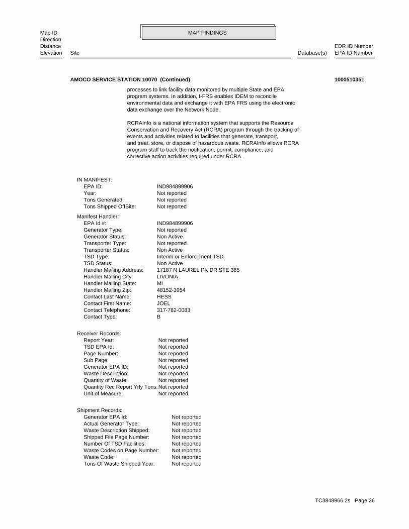
MAP FINDINGSMap IDDirection
EDR ID NumberDistanceEPA ID NumberDatabase(s)SiteElevation
Not reportedTons Of Waste Shipped Year: Not reportedWaste Code: Not reportedWaste Codes on Page Number: Not reportedNumber Of TSD Facilities: Not reportedShipped File Page Number: Not reportedWaste Description Shipped: Not reportedActual Generator Type: Not reportedGenerator EPA Id:
Shipment Records:
Not reportedUnit of Measure: Not reportedQuantity Rec Report Yrly Tons: Not reportedQuantity of Waste: Not reportedWaste Description: Not reportedGenerator EPA ID: Not reportedSub Page: Not reportedPage Number: Not reportedTSD EPA Id: Not reportedReport Year:
Receiver Records:
BContact Type: 317-782-0083Contact Telephone: JOELContact First Name: HESSContact Last Name: 48152-3954Handler Mailing Zip: MIHandler Mailing State: LIVONIAHandler Mailing City: 17187 N LAUREL PK DR STE 365Handler Mailing Address: Non ActiveTSD Status: Interim or Enforcement TSDTSD Type: Non ActiveTransporter Status: Not reportedTransporter Type: Non ActiveGenerator Status: Not reportedGenerator Type: IND984899906EPA Id #:
Manifest Handler:
Not reportedTons Shipped OffSite: Not reportedTons Generated: Not reportedYear: IND984899906EPA ID:
IN MANIFEST:
corrective action activities required under RCRA.program staff to track the notification, permit, compliance, andand treat, store, or dispose of hazardous waste. RCRAInfo allows RCRAevents and activities related to facilities that generate, transport,Conservation and Recovery Act (RCRA) program through the tracking ofRCRAInfo is a national information system that supports the Resource
data exchange over the Network Node.environmental data and exchange it with EPA FRS using the electronicprogram systems. In addition, I-FRS enables IDEM to reconcileprocesses to link facility data monitored by multiple State and EPA
AMOCO SERVICE STATION 10070 (Continued) 1000510351
TC3848966.2s Page 26
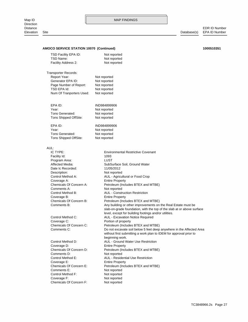
MAP FINDINGSMap IDDirection
EDR ID NumberDistanceEPA ID NumberDatabase(s)SiteElevation
Not reportedChemicals Of Concern F: Not reportedCoverage F: Not reportedControl Method F: Not reportedComments E: Petroleum (Includes BTEX and MTBE)Chemicals Of Concern E: Entire PropertyCoverage E: AUL - Residential Use RestrictionControl Method E: Not reportedComments D: Petroleum (Includes BTEX and MTBE)Chemicals Of Concern D: Entire PropertyCoverage D: AUL - Ground Water Use RestrictionControl Method D: beginning work. without first submitting a work plan to IDEM for approval prior to Do not excavate soil below 5 feet deep anywhere in the Affected AreaComments C: Petroleum (Includes BTEX and MTBE)Chemicals Of Concern C: Portion of propertyCoverage C: AUL - Excavation Notice RequiredControl Method C: level, except for building footings and/or utilities. slab-on-grade foundation, with the top of the slab at or above surface Any building or other improvements on the Real Estate must beComments B: Petroleum (Includes BTEX and MTBE)Chemicals Of Concern B: Entire PropertyCoverage B: AUL - Construction RestrictionControl Method B: Not reportedComments A: Petroleum (Includes BTEX and MTBE)Chemicals Of Concern A: Entire PropertyCoverage A: AUL - Agricultural or Food CropControl Method A: Not reportedDescription: 11/05/2012Date Ic Recorded: SubSurface Soil, Ground WaterAffected Media: LUSTProgram Area: 1093Facility Id: Environmental Restrictive CovenantIC TYPE:
AUL:
Not reportedTons Shipped OffSite: Not reportedTons Generated: Not reportedYear: IND984899906EPA ID:
Not reportedTons Shipped OffSite: Not reportedTons Generated: Not reportedYear: IND984899906EPA ID:
Not reportedNum Of Tranporters Used: Not reportedTSD EPA Id: Not reportedPage Number of Report: Not reportedGenerator EPA ID: Not reportedReport Year:
Transporter Records:
Not reportedFacility Address 2: Not reportedTSD Name: Not reportedTSD Facility EPA ID:
AMOCO SERVICE STATION 10070 (Continued) 1000510351
TC3848966.2s Page 27
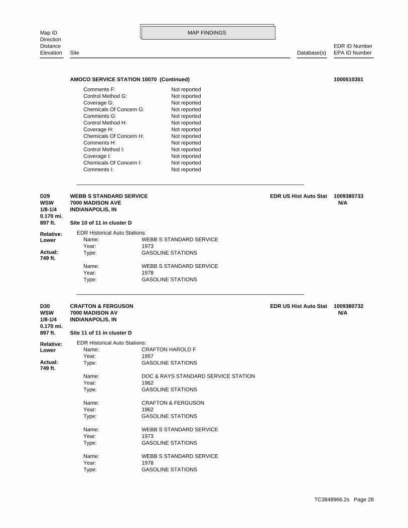
MAP FINDINGSMap IDDirection
EDR ID NumberDistanceEPA ID NumberDatabase(s)SiteElevation
Not reportedComments I: Not reportedChemicals Of Concern I: Not reportedCoverage I: Not reportedControl Method I: Not reportedComments H: Not reportedChemicals Of Concern H: Not reportedCoverage H: Not reportedControl Method H: Not reportedComments G: Not reportedChemicals Of Concern G: Not reportedCoverage G: Not reportedControl Method G: Not reportedComments F:
AMOCO SERVICE STATION 10070 (Continued) 1000510351
GASOLINE STATIONSType: 1978Year: WEBB S STANDARD SERVICEName:
GASOLINE STATIONSType: 1973Year: WEBB S STANDARD SERVICEName:
EDR Historical Auto Stations:
897 ft. Site 10 of 11 in cluster D0.170 mi.
Relative:Lower
Actual:749 ft.
1/8-1/4 INDIANAPOLIS, IN WSW 7000 MADISON AVE N/AD29 EDR US Hist Auto StatWEBB S STANDARD SERVICE 1009380733
GASOLINE STATIONSType: 1978Year: WEBB S STANDARD SERVICEName:
GASOLINE STATIONSType: 1973Year: WEBB S STANDARD SERVICEName:
GASOLINE STATIONSType: 1962Year: CRAFTON & FERGUSONName:
GASOLINE STATIONSType: 1962Year: DOC & RAYS STANDARD SERVICE STATIONName:
GASOLINE STATIONSType: 1957Year: CRAFTON HAROLD FName:
EDR Historical Auto Stations:
897 ft. Site 11 of 11 in cluster D0.170 mi.
Relative:Lower
Actual:749 ft.
1/8-1/4 INDIANAPOLIS, IN WSW 7000 MADISON AV N/AD30 EDR US Hist Auto StatCRAFTON & FERGUSON 1009380732
TC3848966.2s Page 28
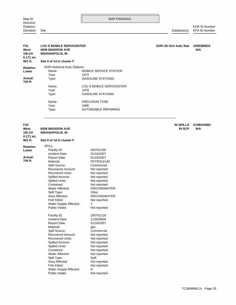
MAP FINDINGSMap IDDirection
EDR ID NumberDistanceEPA ID NumberDatabase(s)SiteElevation
AUTOMOBILE REPAIRINGType: 1986Year: PRECISION TUNEName:
GASOLINE STATIONSType: 1978Year: LOU S MOBILE SERVICENTERName:
GASOLINE STATIONSType: 1973Year: MOBILE SERVICE STATIONName:
EDR Historical Auto Stations:
901 ft. Site 5 of 14 in cluster F0.171 mi.
Relative:Lower
Actual:744 ft.
1/8-1/4 INDIANAPOLIS, IN West 6936 MADISON AVE N/AF31 EDR US Hist Auto StatLOU S MOBILE SERVICENTER 1009380633
Not reportedPublic Intake: NWater Supply Affected: Not reportedFish Killed: Not reportedArea Affected: SpillSpill Type: Not reportedWater Affected: Not reportedContained: Not reportedSpilled Units: Not reportedSpilled Amount: Not reportedRecovered Units: Not reportedRecovered Amount: CommercialSpill Source: gasMaterial: 01/16/2007Report Date: 11/05/0600Incident Date: 200701119Facility ID:
Not reportedPublic Intake: YWater Supply Affected: Not reportedFish Killed: GROUNDWATERArea Affected: OtherSpill Type: GROUNDWATERWater Affected: Not reportedContained: Not reportedSpilled Units: Not reportedSpilled Amount: Not reportedRecovered Units: Not reportedRecovered Amount: CommercialSpill Source: PETROLEUMMaterial: 01/16/2007Report Date: 01/16/2007Incident Date: 200701220Facility ID:
SPILL:
901 ft. Site 6 of 14 in cluster F0.171 mi.
Relative:Lower
Actual:744 ft.
1/8-1/4 INDIANAPOLIS, IN West IN SCP6936 MADISON AVE N/AF32 IN SPILLS S108415084
TC3848966.2s Page 29
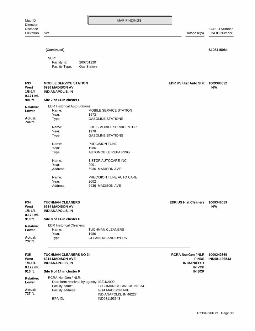
MAP FINDINGSMap IDDirection
EDR ID NumberDistanceEPA ID NumberDatabase(s)SiteElevation
Gas StationFacility Type:200701220Facility Id:
SCP:
(Continued) S108415084
6936 MADISON AVEAddress: 2002Year: PRECISION TUNE AUTO CAREName:
6936 MADISON AVEAddress: 2001Year: 1 STOP AUTOCARE INCName:
AUTOMOBILE REPAIRINGType: 1986Year: PRECISION TUNEName:
GASOLINE STATIONSType: 1978Year: LOU S MOBILE SERVICENTERName:
GASOLINE STATIONSType: 1973Year: MOBILE SERVICE STATIONName:
EDR Historical Auto Stations:
901 ft. Site 7 of 14 in cluster F0.171 mi.
Relative:Lower
Actual:744 ft.
1/8-1/4 INDIANAPOLIS, IN West 6936 MADISON AV N/AF33 EDR US Hist Auto StatMOBILE SERVICE STATION 1009380632
CLEANERS AND DYERSType: 1986Year: TUCHMAN CLEANERSName:
EDR Historical Cleaners:
910 ft. Site 8 of 14 in cluster F0.172 mi.
Relative:Lower
Actual:737 ft.
1/8-1/4 INDIANAPOLIS, IN West 6914 MADISON AV N/AF34 EDR US Hist CleanersTUCHMAN CLEANERS 1009348059
IND981193543EPA ID: INDIANAPOLIS, IN 46227 6914 MADISON AVEFacility address: TUCHMAN CLEANERS NO 34Facility name: 03/04/2009Date form received by agency:
RCRA NonGen / NLR:
910 ft. IN SCPSite 9 of 14 in cluster F0.172 mi. IN VCP
Relative:Lower
Actual:737 ft.
1/8-1/4 IN MANIFESTINDIANAPOLIS, IN West FINDS6914 MADISON AVE IND981193543F35 RCRA NonGen / NLRTUCHMAN CLEANERS NO 34 1000242669
TC3848966.2s Page 30
MAP FINDINGSMap IDDirection
EDR ID NumberDistanceEPA ID NumberDatabase(s)SiteElevation
NoUser oil refiner: NoUsed oil processor: NoUsed oil fuel burner: NoFurnace exemption: NoOn-site burner exemption: NoUnderground injection activity: NoTreater, storer or disposer of HW: NoTransporter of hazardous waste: NoRecycler of hazardous waste: NoMixed waste (haz. and radioactive): NoU.S. importer of hazardous waste:
Handler Activities Summary:
Not reportedOwner/Op end date: 02/10/2004Owner/Op start date: OwnerOwner/Operator Type: PrivateLegal status: 816-651-3491Owner/operator telephone: USOwner/operator country: SEABROOK, TX 77586 4821 NASA PKWY 5SWOwner/operator address: KEVIN LYNGOwner/operator name:
02/10/2004Owner/Op end date: 01/01/1111Owner/Op start date: OwnerOwner/Operator Type: PrivateLegal status: (312) 555-1212Owner/operator telephone: USOwner/operator country: CITY NOT REPORTED, AK 99998 ADDRESS NOT REPORTEDOwner/operator address: JOHNSON GROUP INCOwner/operator name:
Not reportedOwner/Op end date: Not reportedOwner/Op start date: OperatorOwner/Operator Type: PrivateLegal status: (312) 555-1212Owner/operator telephone: Not reportedOwner/operator country: CITY NOT REPORTED, AK 99998 ADDRESS NOT REPORTEDOwner/operator address: NAME NOT REPORTEDOwner/operator name:
Owner/Operator Summary:
Handler: Non-Generators do not presently generate hazardous wasteDescription: Non-GeneratorClassification: PrivateLand type: 05EPA Region: Not reportedContact email: 816-651-3491Contact telephone: USContact country: SEABROOK, TX 77586 4821 NASA PKWY 5SWContact address: KEVIN LYNGContact: SEABROOK, TX 77586 4821 NASA PKWY 5SWMailing address:
TUCHMAN CLEANERS NO 34 (Continued) 1000242669
TC3848966.2s Page 31
MAP FINDINGSMap IDDirection
EDR ID NumberDistanceEPA ID NumberDatabase(s)SiteElevation
Not reportedTons Shipped OffSite: Not reportedTons Generated: Not reportedYear: IND981193543EPA ID:
IN MANIFEST:
HAZARDOUS WASTE BIENNIAL REPORTER
corrective action activities required under RCRA.program staff to track the notification, permit, compliance, andand treat, store, or dispose of hazardous waste. RCRAInfo allows RCRAevents and activities related to facilities that generate, transport,Conservation and Recovery Act (RCRA) program through the tracking ofRCRAInfo is a national information system that supports the Resource
data exchange over the Network Node.environmental data and exchange it with EPA FRS using the electronicprogram systems. In addition, I-FRS enables IDEM to reconcileprocesses to link facility data monitored by multiple State and EPARegistry System (I-FRS). The I-FRS provides the interface andEnvironmental Management (I-DEM) has implemented the Indiana-FacilityIN-FRS (Indiana - Facility Registry System). The Indiana Department of Environmental Interest/Information System
110003091920Registry ID:
FINDS:
StateEvaluation lead agency: Not reportedDate achieved compliance: Not reportedArea of violation: COMPLIANCE EVALUATION INSPECTION ON-SITEEvaluation: 03/16/2009Evaluation date:
Evaluation Action Summary:
No violations foundViolation Status:
Not a generator, verifiedClassification: TUCHMAN CLEANERS NO 34Facility name: 09/22/1998Date form received by agency:
Small Quantity GeneratorClassification: TUCHMAN CLEANERS NO 34Facility name: 01/17/2008Date form received by agency:
Small Quantity GeneratorClassification: TUCHMAN CLEANERS NO 34Facility name: 02/13/2008Date form received by agency:
Historical Generators:
NoUsed oil transporter: NoUsed oil transfer facility: NoUsed oil Specification marketer: NoUsed oil fuel marketer to burner:
TUCHMAN CLEANERS NO 34 (Continued) 1000242669
TC3848966.2s Page 32
MAP FINDINGSMap IDDirection
EDR ID NumberDistanceEPA ID NumberDatabase(s)SiteElevation
Not reportedContact Address2: 4401 N KEYSTONEContact Address: 317-545-4321Phone: JANES N DUNNContact Name: Biennial reportReport Type: IND981193543EPA Id:
Submitted Records:
Not reportedNum Of Tranporters Used: Not reportedTSD EPA Id: Not reportedPage Number of Report: Not reportedGenerator EPA ID: Not reportedReport Year:
Transporter Records:
Not reportedFacility Address 2: Not reportedTSD Name: Not reportedTSD Facility EPA ID: Not reportedTons Of Waste Shipped Year: Not reportedWaste Code: Not reportedWaste Codes on Page Number: Not reportedNumber Of TSD Facilities: Not reportedShipped File Page Number: Not reportedWaste Description Shipped: Not reportedActual Generator Type: Not reportedGenerator EPA Id:
Shipment Records:
Not reportedUnit of Measure: Not reportedQuantity Rec Report Yrly Tons: Not reportedQuantity of Waste: Not reportedWaste Description: Not reportedGenerator EPA ID: Not reportedSub Page: Not reportedPage Number: Not reportedTSD EPA Id: Not reportedReport Year:
Receiver Records:
BContact Type: 317/545-4321Contact Telephone: JANES NContact First Name: DUNNContact Last Name: 46205Handler Mailing Zip: INHandler Mailing State: INDIANAPOLISHandler Mailing City: 4401 N KEYSTONE AVEHandler Mailing Address: Non ActiveTSD Status: Interim or Enforcement TSDTSD Type: Non ActiveTransporter Status: Not reportedTransporter Type: Non ActiveGenerator Status: Not reportedGenerator Type: IND981193543EPA Id #:
Manifest Handler:
TUCHMAN CLEANERS NO 34 (Continued) 1000242669
TC3848966.2s Page 33
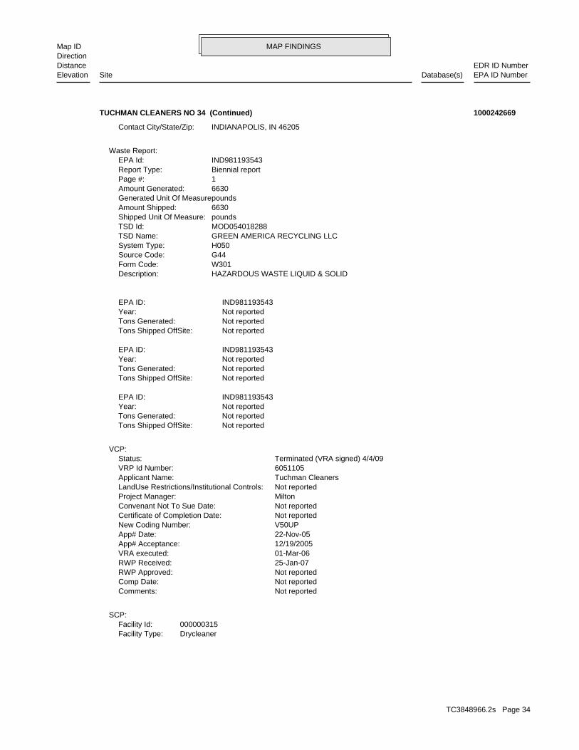
MAP FINDINGSMap IDDirection
EDR ID NumberDistanceEPA ID NumberDatabase(s)SiteElevation
DrycleanerFacility Type:000000315Facility Id:
SCP:
Not reportedComments: Not reportedComp Date: Not reportedRWP Approved: 25-Jan-07RWP Received: 01-Mar-06VRA executed: 12/19/2005App# Acceptance: 22-Nov-05App# Date: V50UPNew Coding Number: Not reportedCertificate of Completion Date: Not reportedConvenant Not To Sue Date: MiltonProject Manager: Not reportedLandUse Restrictions/Institutional Controls: Tuchman CleanersApplicant Name: 6051105VRP Id Number: Terminated (VRA signed) 4/4/09Status:
VCP:
Not reportedTons Shipped OffSite: Not reportedTons Generated: Not reportedYear: IND981193543EPA ID:
Not reportedTons Shipped OffSite: Not reportedTons Generated: Not reportedYear: IND981193543EPA ID:
Not reportedTons Shipped OffSite: Not reportedTons Generated: Not reportedYear: IND981193543EPA ID:
HAZARDOUS WASTE LIQUID & SOLIDDescription: W301Form Code: G44Source Code: H050System Type: GREEN AMERICA RECYCLING LLCTSD Name: MOD054018288TSD Id: poundsShipped Unit Of Measure: 6630Amount Shipped: poundsGenerated Unit Of Measure: 6630Amount Generated: 1Page #: Biennial reportReport Type: IND981193543EPA Id:
Waste Report:
INDIANAPOLIS, IN 46205Contact City/State/Zip:
TUCHMAN CLEANERS NO 34 (Continued) 1000242669
TC3848966.2s Page 34
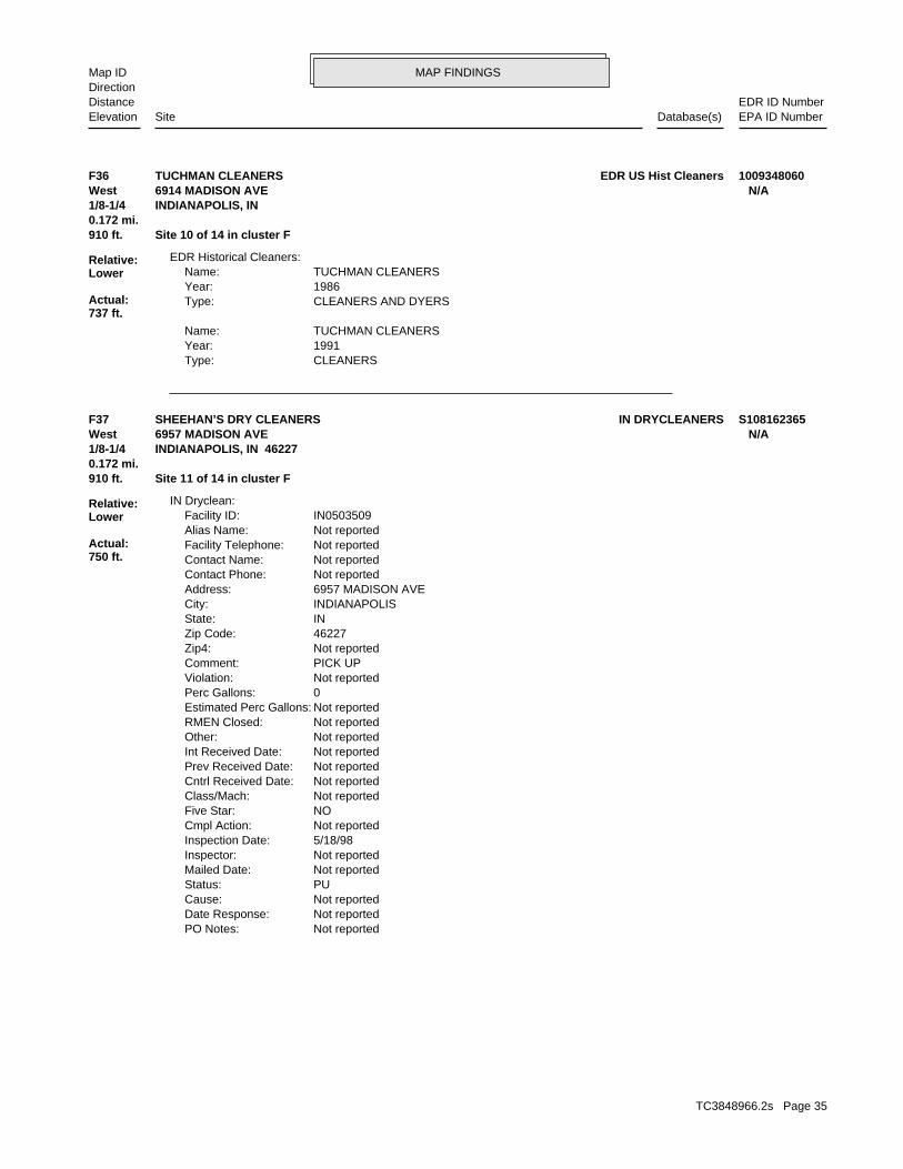
MAP FINDINGSMap IDDirection
EDR ID NumberDistanceEPA ID NumberDatabase(s)SiteElevation
CLEANERSType: 1991Year: TUCHMAN CLEANERSName:
CLEANERS AND DYERSType: 1986Year: TUCHMAN CLEANERSName:
EDR Historical Cleaners:
910 ft. Site 10 of 14 in cluster F0.172 mi.
Relative:Lower
Actual:737 ft.
1/8-1/4 INDIANAPOLIS, IN West 6914 MADISON AVE N/AF36 EDR US Hist CleanersTUCHMAN CLEANERS 1009348060
Not reportedPO Notes: Not reportedDate Response: Not reportedCause: PUStatus: Not reportedMailed Date: Not reportedInspector: 5/18/98Inspection Date: Not reportedCmpl Action: NOFive Star: Not reportedClass/Mach: Not reportedCntrl Received Date: Not reportedPrev Received Date: Not reportedInt Received Date: Not reportedOther: Not reportedRMEN Closed: Not reportedEstimated Perc Gallons: 0Perc Gallons: Not reportedViolation: PICK UPComment: Not reportedZip4: 46227Zip Code: INState: INDIANAPOLISCity: 6957 MADISON AVEAddress: Not reportedContact Phone: Not reportedContact Name: Not reportedFacility Telephone: Not reportedAlias Name: IN0503509Facility ID:
IN Dryclean:
910 ft. Site 11 of 14 in cluster F0.172 mi.
Relative:Lower
Actual:750 ft.
1/8-1/4 INDIANAPOLIS, IN 46227West 6957 MADISON AVE N/AF37 IN DRYCLEANERSSHEEHAN’S DRY CLEANERS S108162365
TC3848966.2s Page 35
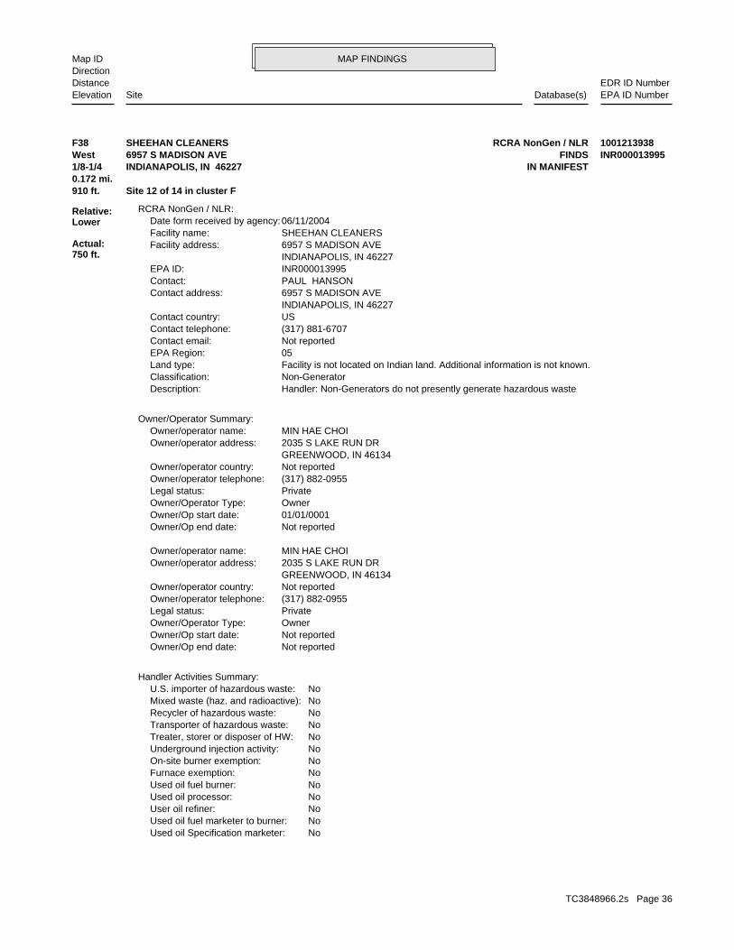
MAP FINDINGSMap IDDirection
EDR ID NumberDistanceEPA ID NumberDatabase(s)SiteElevation
NoUsed oil Specification marketer: NoUsed oil fuel marketer to burner: NoUser oil refiner: NoUsed oil processor: NoUsed oil fuel burner: NoFurnace exemption: NoOn-site burner exemption: NoUnderground injection activity: NoTreater, storer or disposer of HW: NoTransporter of hazardous waste: NoRecycler of hazardous waste: NoMixed waste (haz. and radioactive): NoU.S. importer of hazardous waste:
Handler Activities Summary:
Not reportedOwner/Op end date: Not reportedOwner/Op start date: OwnerOwner/Operator Type: PrivateLegal status: (317) 882-0955Owner/operator telephone: Not reportedOwner/operator country: GREENWOOD, IN 46134 2035 S LAKE RUN DROwner/operator address: MIN HAE CHOIOwner/operator name:
Not reportedOwner/Op end date: 01/01/0001Owner/Op start date: OwnerOwner/Operator Type: PrivateLegal status: (317) 882-0955Owner/operator telephone: Not reportedOwner/operator country: GREENWOOD, IN 46134 2035 S LAKE RUN DROwner/operator address: MIN HAE CHOIOwner/operator name:
Owner/Operator Summary:
Handler: Non-Generators do not presently generate hazardous wasteDescription: Non-GeneratorClassification: Facility is not located on Indian land. Additional information is not known.Land type: 05EPA Region: Not reportedContact email: (317) 881-6707Contact telephone: USContact country: INDIANAPOLIS, IN 46227 6957 S MADISON AVEContact address: PAUL HANSONContact: INR000013995EPA ID: INDIANAPOLIS, IN 46227 6957 S MADISON AVEFacility address: SHEEHAN CLEANERSFacility name: 06/11/2004Date form received by agency:
RCRA NonGen / NLR:
910 ft. Site 12 of 14 in cluster F0.172 mi.
Relative:Lower
Actual:750 ft.
1/8-1/4 IN MANIFESTINDIANAPOLIS, IN 46227West FINDS6957 S MADISON AVE INR000013995F38 RCRA NonGen / NLRSHEEHAN CLEANERS 1001213938
TC3848966.2s Page 36
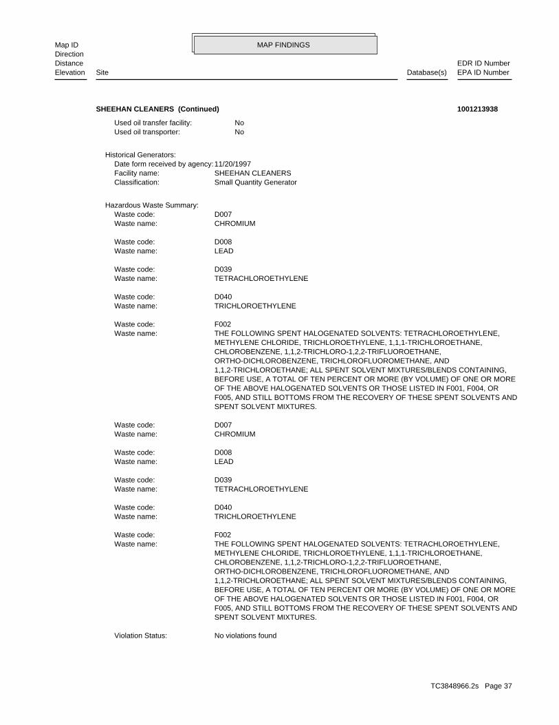
MAP FINDINGSMap IDDirection
EDR ID NumberDistanceEPA ID NumberDatabase(s)SiteElevation
No violations foundViolation Status:
SPENT SOLVENT MIXTURES. F005, AND STILL BOTTOMS FROM THE RECOVERY OF THESE SPENT SOLVENTS AND OF THE ABOVE HALOGENATED SOLVENTS OR THOSE LISTED IN F001, F004, OR BEFORE USE, A TOTAL OF TEN PERCENT OR MORE (BY VOLUME) OF ONE OR MORE 1,1,2-TRICHLOROETHANE; ALL SPENT SOLVENT MIXTURES/BLENDS CONTAINING, ORTHO-DICHLOROBENZENE, TRICHLOROFLUOROMETHANE, AND CHLOROBENZENE, 1,1,2-TRICHLORO-1,2,2-TRIFLUOROETHANE, METHYLENE CHLORIDE, TRICHLOROETHYLENE, 1,1,1-TRICHLOROETHANE, THE FOLLOWING SPENT HALOGENATED SOLVENTS: TETRACHLOROETHYLENE,Waste name: F002Waste code:
TRICHLOROETHYLENEWaste name: D040Waste code:
TETRACHLOROETHYLENEWaste name: D039Waste code:
LEADWaste name: D008Waste code:
CHROMIUMWaste name: D007Waste code:
Hazardous Waste Summary:
Small Quantity GeneratorClassification: SHEEHAN CLEANERSFacility name: 11/20/1997Date form received by agency:
Historical Generators:
NoUsed oil transporter: NoUsed oil transfer facility:
SHEEHAN CLEANERS (Continued) 1001213938
TC3848966.2s Page 37
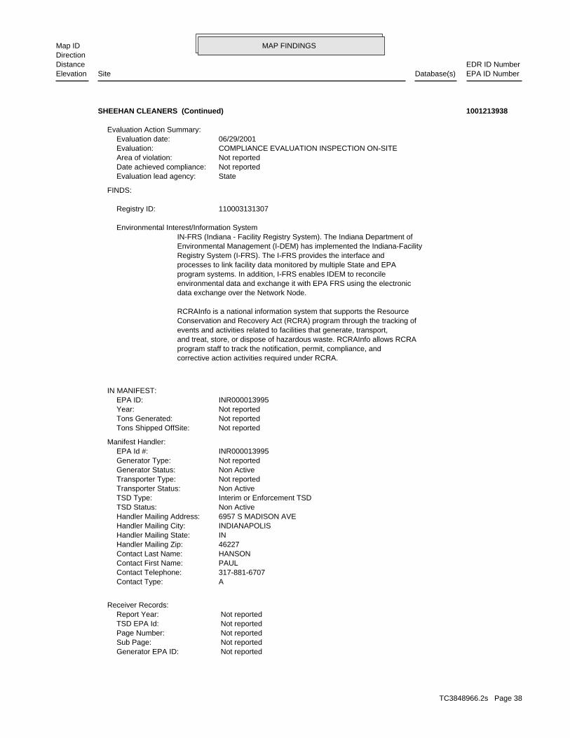
MAP FINDINGSMap IDDirection
EDR ID NumberDistanceEPA ID NumberDatabase(s)SiteElevation
Not reportedGenerator EPA ID: Not reportedSub Page: Not reportedPage Number: Not reportedTSD EPA Id: Not reportedReport Year:
Receiver Records:
AContact Type: 317-881-6707Contact Telephone: PAULContact First Name: HANSONContact Last Name: 46227Handler Mailing Zip: INHandler Mailing State: INDIANAPOLISHandler Mailing City: 6957 S MADISON AVEHandler Mailing Address: Non ActiveTSD Status: Interim or Enforcement TSDTSD Type: Non ActiveTransporter Status: Not reportedTransporter Type: Non ActiveGenerator Status: Not reportedGenerator Type: INR000013995EPA Id #:
Manifest Handler:
Not reportedTons Shipped OffSite: Not reportedTons Generated: Not reportedYear: INR000013995EPA ID:
IN MANIFEST:
corrective action activities required under RCRA.program staff to track the notification, permit, compliance, andand treat, store, or dispose of hazardous waste. RCRAInfo allows RCRAevents and activities related to facilities that generate, transport,Conservation and Recovery Act (RCRA) program through the tracking ofRCRAInfo is a national information system that supports the Resource
data exchange over the Network Node.environmental data and exchange it with EPA FRS using the electronicprogram systems. In addition, I-FRS enables IDEM to reconcileprocesses to link facility data monitored by multiple State and EPARegistry System (I-FRS). The I-FRS provides the interface andEnvironmental Management (I-DEM) has implemented the Indiana-FacilityIN-FRS (Indiana - Facility Registry System). The Indiana Department of Environmental Interest/Information System
110003131307Registry ID:
FINDS:
StateEvaluation lead agency: Not reportedDate achieved compliance: Not reportedArea of violation: COMPLIANCE EVALUATION INSPECTION ON-SITEEvaluation: 06/29/2001Evaluation date:
Evaluation Action Summary:
SHEEHAN CLEANERS (Continued) 1001213938
TC3848966.2s Page 38
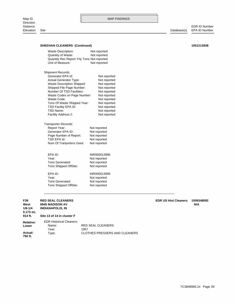
MAP FINDINGSMap IDDirection
EDR ID NumberDistanceEPA ID NumberDatabase(s)SiteElevation
Not reportedTons Shipped OffSite: Not reportedTons Generated: Not reportedYear: INR000013995EPA ID:
Not reportedTons Shipped OffSite: Not reportedTons Generated: Not reportedYear: INR000013995EPA ID:
Not reportedNum Of Tranporters Used: Not reportedTSD EPA Id: Not reportedPage Number of Report: Not reportedGenerator EPA ID: Not reportedReport Year:
Transporter Records:
Not reportedFacility Address 2: Not reportedTSD Name: Not reportedTSD Facility EPA ID: Not reportedTons Of Waste Shipped Year: Not reportedWaste Code: Not reportedWaste Codes on Page Number: Not reportedNumber Of TSD Facilities: Not reportedShipped File Page Number: Not reportedWaste Description Shipped: Not reportedActual Generator Type: Not reportedGenerator EPA Id:
Shipment Records:
Not reportedUnit of Measure: Not reportedQuantity Rec Report Yrly Tons: Not reportedQuantity of Waste: Not reportedWaste Description:
SHEEHAN CLEANERS (Continued) 1001213938
CLOTHES PRESSERS AND CLEANERSType: 1957Year: RED SEAL CLEANERSName:
EDR Historical Cleaners:
914 ft. Site 13 of 14 in cluster F0.173 mi.
Relative:Lower
Actual:750 ft.
1/8-1/4 INDIANAPOLIS, IN West 6945 MADISON AV N/AF39 EDR US Hist CleanersRED SEAL CLEANERS 1009348092
TC3848966.2s Page 39
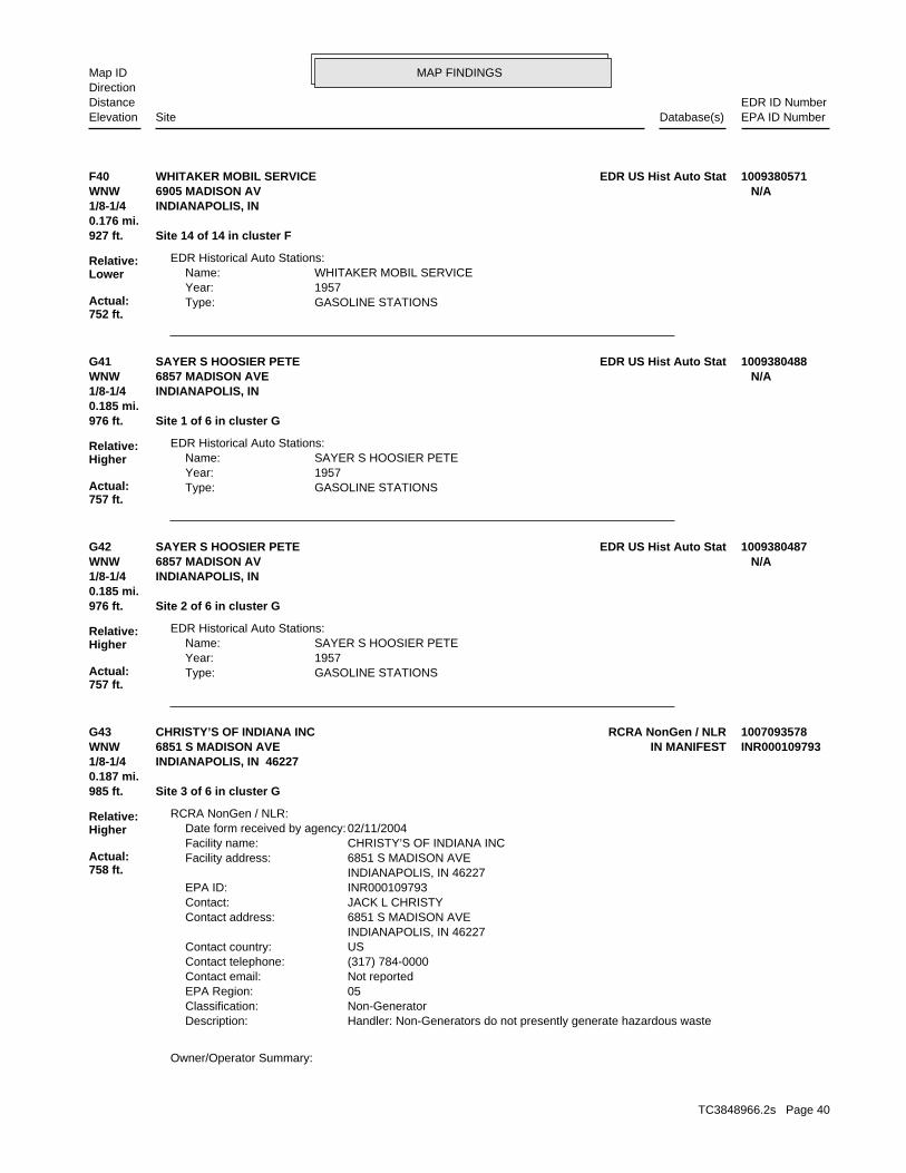
MAP FINDINGSMap IDDirection
EDR ID NumberDistanceEPA ID NumberDatabase(s)SiteElevation
GASOLINE STATIONSType: 1957Year: WHITAKER MOBIL SERVICEName:
EDR Historical Auto Stations:
927 ft. Site 14 of 14 in cluster F0.176 mi.
Relative:Lower
Actual:752 ft.
1/8-1/4 INDIANAPOLIS, IN WNW 6905 MADISON AV N/AF40 EDR US Hist Auto StatWHITAKER MOBIL SERVICE 1009380571
GASOLINE STATIONSType: 1957Year: SAYER S HOOSIER PETEName:
EDR Historical Auto Stations:
976 ft. Site 1 of 6 in cluster G0.185 mi.
Relative:Higher
Actual:757 ft.
1/8-1/4 INDIANAPOLIS, IN WNW 6857 MADISON AVE N/AG41 EDR US Hist Auto StatSAYER S HOOSIER PETE 1009380488
GASOLINE STATIONSType: 1957Year: SAYER S HOOSIER PETEName:
EDR Historical Auto Stations:
976 ft. Site 2 of 6 in cluster G0.185 mi.
Relative:Higher
Actual:757 ft.
1/8-1/4 INDIANAPOLIS, IN WNW 6857 MADISON AV N/AG42 EDR US Hist Auto StatSAYER S HOOSIER PETE 1009380487
Owner/Operator Summary:
Handler: Non-Generators do not presently generate hazardous wasteDescription: Non-GeneratorClassification: 05EPA Region: Not reportedContact email: (317) 784-0000Contact telephone: USContact country: INDIANAPOLIS, IN 46227 6851 S MADISON AVEContact address: JACK L CHRISTYContact: INR000109793EPA ID: INDIANAPOLIS, IN 46227 6851 S MADISON AVEFacility address: CHRISTY’S OF INDIANA INCFacility name: 02/11/2004Date form received by agency:
RCRA NonGen / NLR:
985 ft. Site 3 of 6 in cluster G0.187 mi.
Relative:Higher
Actual:758 ft.
1/8-1/4 INDIANAPOLIS, IN 46227WNW IN MANIFEST6851 S MADISON AVE INR000109793G43 RCRA NonGen / NLRCHRISTY’S OF INDIANA INC 1007093578
TC3848966.2s Page 40
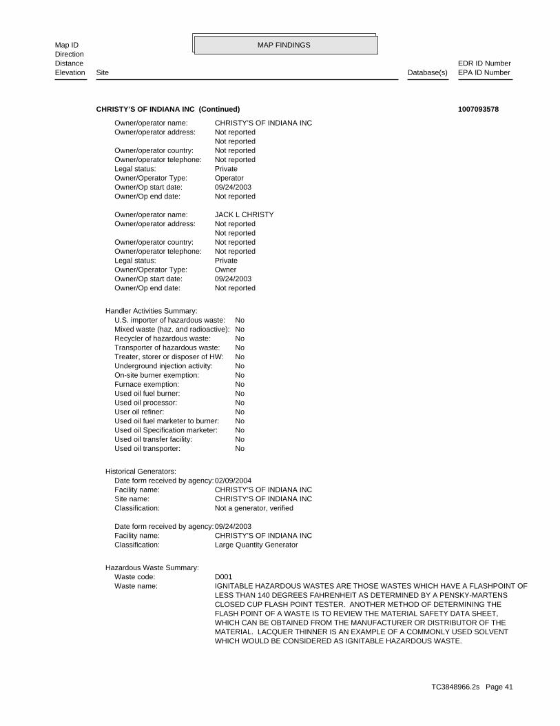
MAP FINDINGSMap IDDirection
EDR ID NumberDistanceEPA ID NumberDatabase(s)SiteElevation
WHICH WOULD BE CONSIDERED AS IGNITABLE HAZARDOUS WASTE. MATERIAL. LACQUER THINNER IS AN EXAMPLE OF A COMMONLY USED SOLVENT WHICH CAN BE OBTAINED FROM THE MANUFACTURER OR DISTRIBUTOR OF THE FLASH POINT OF A WASTE IS TO REVIEW THE MATERIAL SAFETY DATA SHEET, CLOSED CUP FLASH POINT TESTER. ANOTHER METHOD OF DETERMINING THE LESS THAN 140 DEGREES FAHRENHEIT AS DETERMINED BY A PENSKY-MARTENS IGNITABLE HAZARDOUS WASTES ARE THOSE WASTES WHICH HAVE A FLASHPOINT OFWaste name: D001Waste code:
Hazardous Waste Summary:
Large Quantity GeneratorClassification: CHRISTY’S OF INDIANA INCFacility name: 09/24/2003Date form received by agency:
Not a generator, verifiedClassification: CHRISTY‘S OF INDIANA INCSite name: CHRISTY’S OF INDIANA INCFacility name: 02/09/2004Date form received by agency:
Historical Generators:
NoUsed oil transporter: NoUsed oil transfer facility: NoUsed oil Specification marketer: NoUsed oil fuel marketer to burner: NoUser oil refiner: NoUsed oil processor: NoUsed oil fuel burner: NoFurnace exemption: NoOn-site burner exemption: NoUnderground injection activity: NoTreater, storer or disposer of HW: NoTransporter of hazardous waste: NoRecycler of hazardous waste: NoMixed waste (haz. and radioactive): NoU.S. importer of hazardous waste:
Handler Activities Summary:
Not reportedOwner/Op end date: 09/24/2003Owner/Op start date: OwnerOwner/Operator Type: PrivateLegal status: Not reportedOwner/operator telephone: Not reportedOwner/operator country: Not reported Not reportedOwner/operator address: JACK L CHRISTYOwner/operator name:
Not reportedOwner/Op end date: 09/24/2003Owner/Op start date: OperatorOwner/Operator Type: PrivateLegal status: Not reportedOwner/operator telephone: Not reportedOwner/operator country: Not reported Not reportedOwner/operator address: CHRISTY’S OF INDIANA INCOwner/operator name:
CHRISTY’S OF INDIANA INC (Continued) 1007093578
TC3848966.2s Page 41
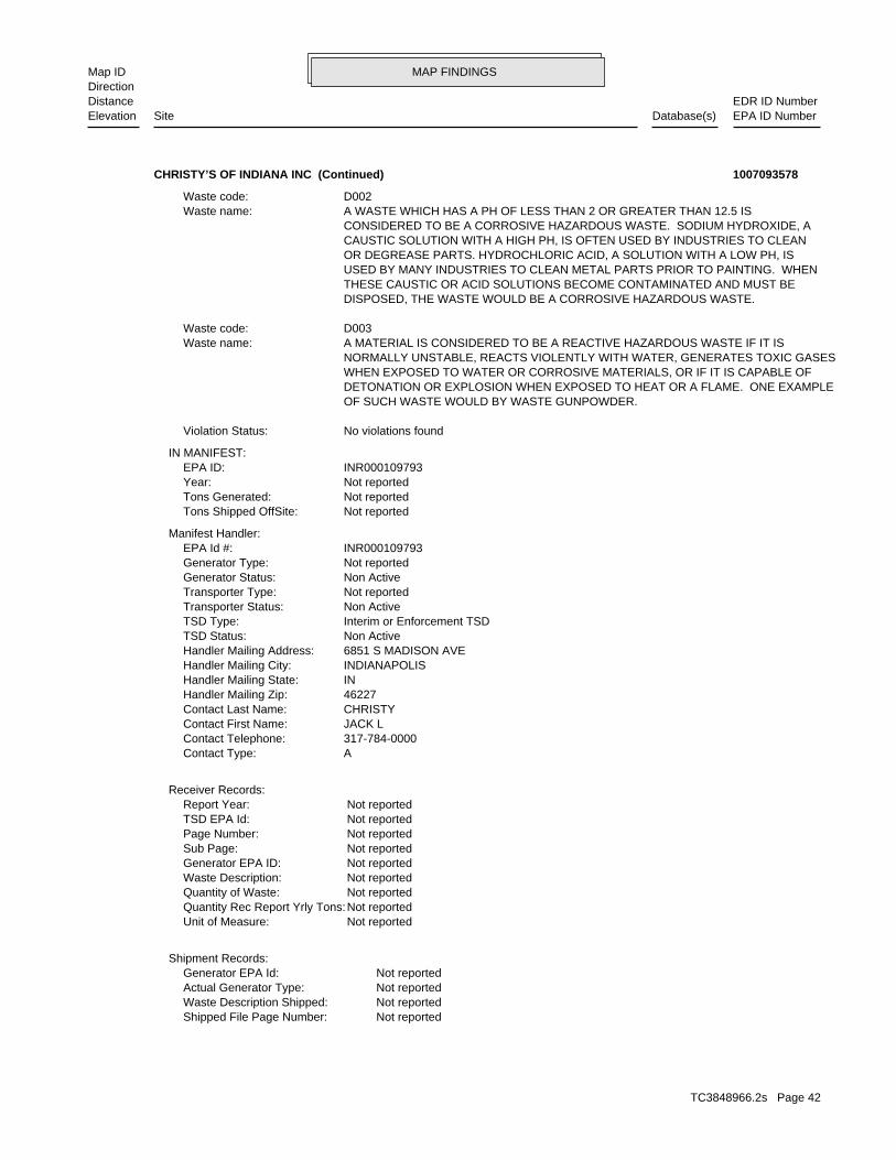
MAP FINDINGSMap IDDirection
EDR ID NumberDistanceEPA ID NumberDatabase(s)SiteElevation
Not reportedShipped File Page Number: Not reportedWaste Description Shipped: Not reportedActual Generator Type: Not reportedGenerator EPA Id:
Shipment Records:
Not reportedUnit of Measure: Not reportedQuantity Rec Report Yrly Tons: Not reportedQuantity of Waste: Not reportedWaste Description: Not reportedGenerator EPA ID: Not reportedSub Page: Not reportedPage Number: Not reportedTSD EPA Id: Not reportedReport Year:
Receiver Records:
AContact Type: 317-784-0000Contact Telephone: JACK LContact First Name: CHRISTYContact Last Name: 46227Handler Mailing Zip: INHandler Mailing State: INDIANAPOLISHandler Mailing City: 6851 S MADISON AVEHandler Mailing Address: Non ActiveTSD Status: Interim or Enforcement TSDTSD Type: Non ActiveTransporter Status: Not reportedTransporter Type: Non ActiveGenerator Status: Not reportedGenerator Type: INR000109793EPA Id #:
Manifest Handler:
Not reportedTons Shipped OffSite: Not reportedTons Generated: Not reportedYear: INR000109793EPA ID:
IN MANIFEST:
No violations foundViolation Status:
OF SUCH WASTE WOULD BY WASTE GUNPOWDER. DETONATION OR EXPLOSION WHEN EXPOSED TO HEAT OR A FLAME. ONE EXAMPLE WHEN EXPOSED TO WATER OR CORROSIVE MATERIALS, OR IF IT IS CAPABLE OF NORMALLY UNSTABLE, REACTS VIOLENTLY WITH WATER, GENERATES TOXIC GASES A MATERIAL IS CONSIDERED TO BE A REACTIVE HAZARDOUS WASTE IF IT ISWaste name: D003Waste code:
DISPOSED, THE WASTE WOULD BE A CORROSIVE HAZARDOUS WASTE. THESE CAUSTIC OR ACID SOLUTIONS BECOME CONTAMINATED AND MUST BE USED BY MANY INDUSTRIES TO CLEAN METAL PARTS PRIOR TO PAINTING. WHEN OR DEGREASE PARTS. HYDROCHLORIC ACID, A SOLUTION WITH A LOW PH, IS CAUSTIC SOLUTION WITH A HIGH PH, IS OFTEN USED BY INDUSTRIES TO CLEAN CONSIDERED TO BE A CORROSIVE HAZARDOUS WASTE. SODIUM HYDROXIDE, A A WASTE WHICH HAS A PH OF LESS THAN 2 OR GREATER THAN 12.5 ISWaste name: D002Waste code:
CHRISTY’S OF INDIANA INC (Continued) 1007093578
TC3848966.2s Page 42
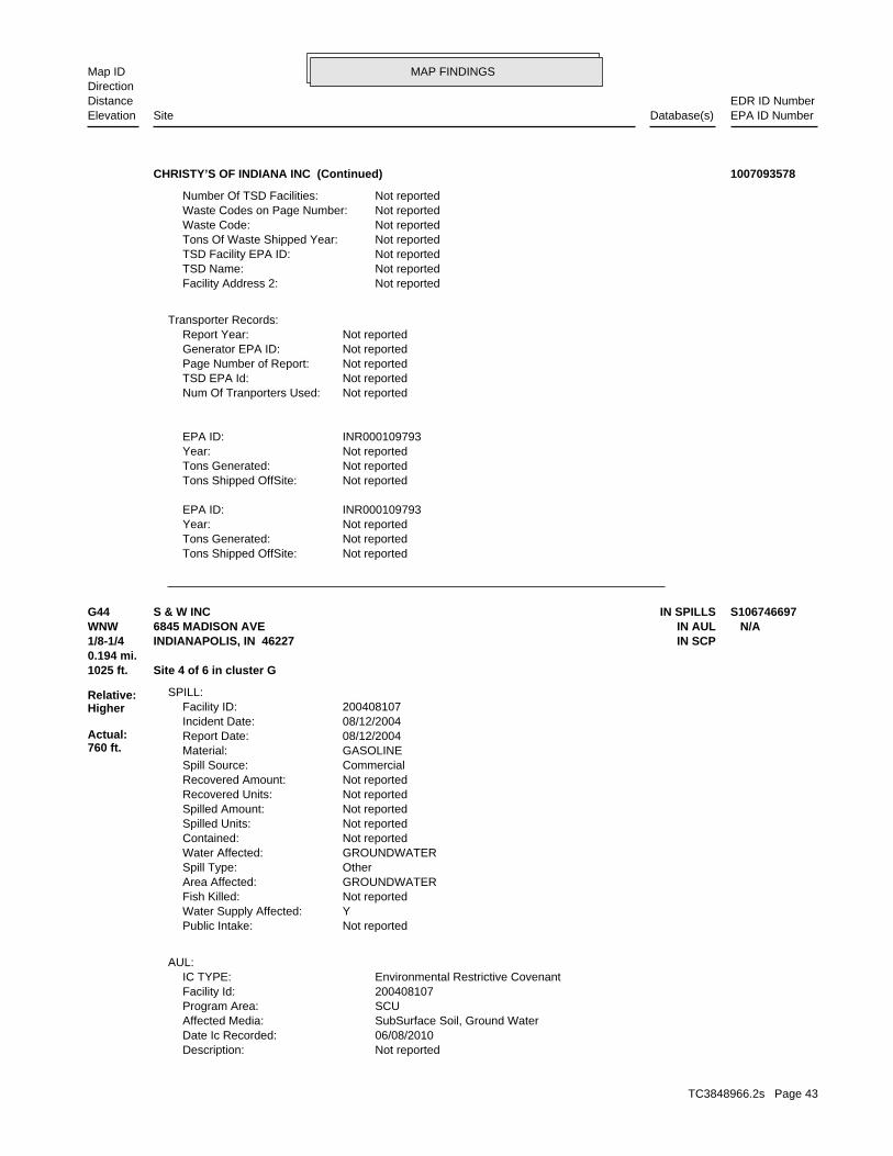
MAP FINDINGSMap IDDirection
EDR ID NumberDistanceEPA ID NumberDatabase(s)SiteElevation
Not reportedTons Shipped OffSite: Not reportedTons Generated: Not reportedYear: INR000109793EPA ID:
Not reportedTons Shipped OffSite: Not reportedTons Generated: Not reportedYear: INR000109793EPA ID:
Not reportedNum Of Tranporters Used: Not reportedTSD EPA Id: Not reportedPage Number of Report: Not reportedGenerator EPA ID: Not reportedReport Year:
Transporter Records:
Not reportedFacility Address 2: Not reportedTSD Name: Not reportedTSD Facility EPA ID: Not reportedTons Of Waste Shipped Year: Not reportedWaste Code: Not reportedWaste Codes on Page Number: Not reportedNumber Of TSD Facilities:
CHRISTY’S OF INDIANA INC (Continued) 1007093578
Not reportedDescription: 06/08/2010Date Ic Recorded: SubSurface Soil, Ground WaterAffected Media: SCUProgram Area: 200408107Facility Id: Environmental Restrictive CovenantIC TYPE:
AUL:
Not reportedPublic Intake: YWater Supply Affected: Not reportedFish Killed: GROUNDWATERArea Affected: OtherSpill Type: GROUNDWATERWater Affected: Not reportedContained: Not reportedSpilled Units: Not reportedSpilled Amount: Not reportedRecovered Units: Not reportedRecovered Amount: CommercialSpill Source: GASOLINEMaterial: 08/12/2004Report Date: 08/12/2004Incident Date: 200408107Facility ID:
SPILL:
1025 ft. Site 4 of 6 in cluster G0.194 mi.
Relative:Higher
Actual:760 ft.
1/8-1/4 IN SCPINDIANAPOLIS, IN 46227WNW IN AUL6845 MADISON AVE N/AG44 IN SPILLSS & W INC S106746697
TC3848966.2s Page 43
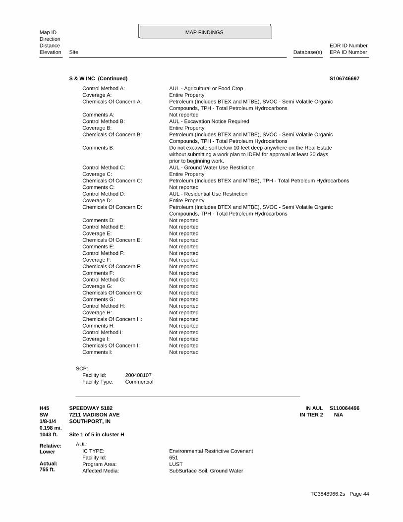
MAP FINDINGSMap IDDirection
EDR ID NumberDistanceEPA ID NumberDatabase(s)SiteElevation
CommercialFacility Type:200408107Facility Id:
SCP:
Not reportedComments I: Not reportedChemicals Of Concern I: Not reportedCoverage I: Not reportedControl Method I: Not reportedComments H: Not reportedChemicals Of Concern H: Not reportedCoverage H: Not reportedControl Method H: Not reportedComments G: Not reportedChemicals Of Concern G: Not reportedCoverage G: Not reportedControl Method G: Not reportedComments F: Not reportedChemicals Of Concern F: Not reportedCoverage F: Not reportedControl Method F: Not reportedComments E: Not reportedChemicals Of Concern E: Not reportedCoverage E: Not reportedControl Method E: Not reportedComments D: Compounds, TPH - Total Petroleum Hydrocarbons Petroleum (Includes BTEX and MTBE), SVOC - Semi Volatile OrganicChemicals Of Concern D: Entire PropertyCoverage D: AUL - Residential Use RestrictionControl Method D: Not reportedComments C: Petroleum (Includes BTEX and MTBE), TPH - Total Petroleum HydrocarbonsChemicals Of Concern C: Entire PropertyCoverage C: AUL - Ground Water Use RestrictionControl Method C: prior to beginning work. without submitting a work plan to IDEM for approval at least 30 days Do not excavate soil below 10 feet deep anywhere on the Real EstateComments B: Compounds, TPH - Total Petroleum Hydrocarbons Petroleum (Includes BTEX and MTBE), SVOC - Semi Volatile OrganicChemicals Of Concern B: Entire PropertyCoverage B: AUL - Excavation Notice RequiredControl Method B: Not reportedComments A: Compounds, TPH - Total Petroleum Hydrocarbons Petroleum (Includes BTEX and MTBE), SVOC - Semi Volatile OrganicChemicals Of Concern A: Entire PropertyCoverage A: AUL - Agricultural or Food CropControl Method A:
S & W INC (Continued) S106746697
SubSurface Soil, Ground WaterAffected Media: LUSTProgram Area: 651Facility Id: Environmental Restrictive CovenantIC TYPE:
AUL:
1043 ft. Site 1 of 5 in cluster H0.198 mi.
Relative:Lower
Actual:755 ft.
1/8-1/4 SOUTHPORT, IN SW IN TIER 27211 MADISON AVE N/AH45 IN AULSPEEDWAY 5182 S110064496
TC3848966.2s Page 44
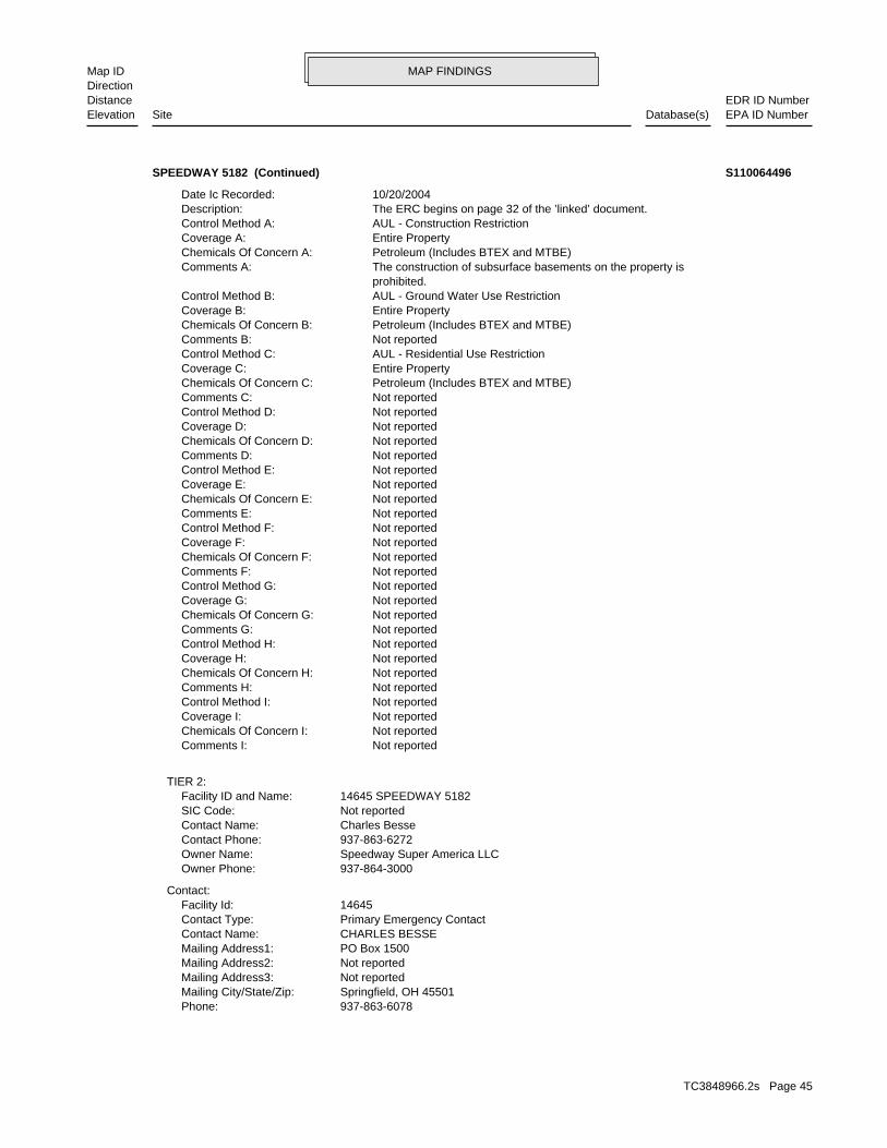
MAP FINDINGSMap IDDirection
EDR ID NumberDistanceEPA ID NumberDatabase(s)SiteElevation
937-863-6078Phone: Springfield, OH 45501Mailing City/State/Zip: Not reportedMailing Address3: Not reportedMailing Address2: PO Box 1500Mailing Address1: CHARLES BESSEContact Name: Primary Emergency ContactContact Type: 14645Facility Id:
Contact:
937-864-3000Owner Phone: Speedway Super America LLCOwner Name: 937-863-6272Contact Phone: Charles BesseContact Name: Not reportedSIC Code: 14645 SPEEDWAY 5182Facility ID and Name:
TIER 2:
Not reportedComments I: Not reportedChemicals Of Concern I: Not reportedCoverage I: Not reportedControl Method I: Not reportedComments H: Not reportedChemicals Of Concern H: Not reportedCoverage H: Not reportedControl Method H: Not reportedComments G: Not reportedChemicals Of Concern G: Not reportedCoverage G: Not reportedControl Method G: Not reportedComments F: Not reportedChemicals Of Concern F: Not reportedCoverage F: Not reportedControl Method F: Not reportedComments E: Not reportedChemicals Of Concern E: Not reportedCoverage E: Not reportedControl Method E: Not reportedComments D: Not reportedChemicals Of Concern D: Not reportedCoverage D: Not reportedControl Method D: Not reportedComments C: Petroleum (Includes BTEX and MTBE)Chemicals Of Concern C: Entire PropertyCoverage C: AUL - Residential Use RestrictionControl Method C: Not reportedComments B: Petroleum (Includes BTEX and MTBE)Chemicals Of Concern B: Entire PropertyCoverage B: AUL - Ground Water Use RestrictionControl Method B: prohibited. The construction of subsurface basements on the property isComments A: Petroleum (Includes BTEX and MTBE)Chemicals Of Concern A: Entire PropertyCoverage A: AUL - Construction RestrictionControl Method A: The ERC begins on page 32 of the ’linked’ document.Description: 10/20/2004Date Ic Recorded:
SPEEDWAY 5182 (Continued) S110064496
TC3848966.2s Page 45
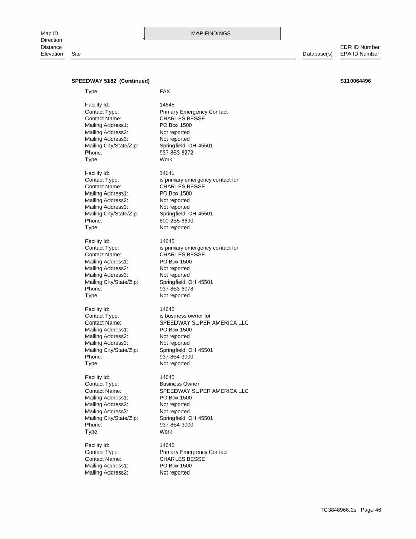
MAP FINDINGSMap IDDirection
EDR ID NumberDistanceEPA ID NumberDatabase(s)SiteElevation
Not reportedMailing Address2: PO Box 1500Mailing Address1: CHARLES BESSEContact Name: Primary Emergency ContactContact Type: 14645Facility Id:
WorkType: 937-864-3000Phone: Springfield, OH 45501Mailing City/State/Zip: Not reportedMailing Address3: Not reportedMailing Address2: PO Box 1500Mailing Address1: SPEEDWAY SUPER AMERICA LLCContact Name: Business OwnerContact Type: 14645Facility Id:
Not reportedType: 937-864-3000Phone: Springfield, OH 45501Mailing City/State/Zip: Not reportedMailing Address3: Not reportedMailing Address2: PO Box 1500Mailing Address1: SPEEDWAY SUPER AMERICA LLCContact Name: is business owner forContact Type: 14645Facility Id:
Not reportedType: 937-863-6078Phone: Springfield, OH 45501Mailing City/State/Zip: Not reportedMailing Address3: Not reportedMailing Address2: PO Box 1500Mailing Address1: CHARLES BESSEContact Name: is primary emergency contact forContact Type: 14645Facility Id:
Not reportedType: 800-255-6690Phone: Springfield, OH 45501Mailing City/State/Zip: Not reportedMailing Address3: Not reportedMailing Address2: PO Box 1500Mailing Address1: CHARLES BESSEContact Name: is primary emergency contact forContact Type: 14645Facility Id:
WorkType: 937-863-6272Phone: Springfield, OH 45501Mailing City/State/Zip: Not reportedMailing Address3: Not reportedMailing Address2: PO Box 1500Mailing Address1: CHARLES BESSEContact Name: Primary Emergency ContactContact Type: 14645Facility Id:
FAXType:
SPEEDWAY 5182 (Continued) S110064496
TC3848966.2s Page 46
MAP FINDINGSMap IDDirection
EDR ID NumberDistanceEPA ID NumberDatabase(s)SiteElevation
Not reportedMailing Address2: PO Box 1500Mailing Address1: CHARLES BESSEContact Name: is primary emergency contact forContact Type: 14645Facility Id:
WorkType: 937-863-6272Phone: Springfield, OH 45501Mailing City/State/Zip: Not reportedMailing Address3: Not reportedMailing Address2: PO Box 1500Mailing Address1: CHARLES BESSEContact Name: Primary Emergency ContactContact Type: 14645Facility Id:
FAXType: 937-863-6078Phone: Springfield, OH 45501Mailing City/State/Zip: Not reportedMailing Address3: Not reportedMailing Address2: PO Box 1500Mailing Address1: CHARLES BESSEContact Name: Primary Emergency ContactContact Type: 14645Facility Id:
Contact:
Not reportedOwner Phone: Not reportedOwner Name: Not reportedContact Phone: Not reportedContact Name: Not reportedSIC Code: 14645 SPEEDWAY 5182Facility ID and Name:
04 Storage Loc: Storage Loc2: Storage Loc3: Storage Loc4 Max Daily Amt:Storage Info: tank 11Location Description: Max Daily Amt: 04 Quantity: 365 Container Type: Below-Ground TankMore Chemical Info: CAS Num:8008206 Chemical Id: Submission Code:Chemical Info: KeroseneChemical Name:
Chemical Inventory:
Not reportedType: 937-863-6272Phone: Springfield, OH 45501Mailing City/State/Zip: Not reportedMailing Address3: Not reportedMailing Address2: PO Box 1500Mailing Address1: CHARLES BESSEContact Name: is primary emergency contact forContact Type: 14645Facility Id:
24-hourType: 800-255-6690Phone: Springfield, OH 45501Mailing City/State/Zip: Not reportedMailing Address3:
SPEEDWAY 5182 (Continued) S110064496
TC3848966.2s Page 47
MAP FINDINGSMap IDDirection
EDR ID NumberDistanceEPA ID NumberDatabase(s)SiteElevation
Not reportedType: 937-863-6272Phone: Springfield, OH 45501Mailing City/State/Zip: Not reportedMailing Address3: Not reportedMailing Address2: PO Box 1500Mailing Address1: CHARLES BESSEContact Name: is primary emergency contact forContact Type: 14645Facility Id:
24-hourType: 800-255-6690Phone: Springfield, OH 45501Mailing City/State/Zip: Not reportedMailing Address3: Not reportedMailing Address2: PO Box 1500Mailing Address1: CHARLES BESSEContact Name: Primary Emergency ContactContact Type: 14645Facility Id:
WorkType: 937-864-3000Phone: Springfield, OH 45501Mailing City/State/Zip: Not reportedMailing Address3: Not reportedMailing Address2: PO Box 1500Mailing Address1: SPEEDWAY SUPER AMERICA LLCContact Name: Business OwnerContact Type: 14645Facility Id:
Not reportedType: 937-864-3000Phone: Springfield, OH 45501Mailing City/State/Zip: Not reportedMailing Address3: Not reportedMailing Address2: PO Box 1500Mailing Address1: SPEEDWAY SUPER AMERICA LLCContact Name: is business owner forContact Type: 14645Facility Id:
Not reportedType: 937-863-6078Phone: Springfield, OH 45501Mailing City/State/Zip: Not reportedMailing Address3: Not reportedMailing Address2: PO Box 1500Mailing Address1: CHARLES BESSEContact Name: is primary emergency contact forContact Type: 14645Facility Id:
Not reportedType: 800-255-6690Phone: Springfield, OH 45501Mailing City/State/Zip: Not reportedMailing Address3:
SPEEDWAY 5182 (Continued) S110064496
TC3848966.2s Page 48
MAP FINDINGSMap IDDirection
EDR ID NumberDistanceEPA ID NumberDatabase(s)SiteElevation
Not reportedType: 937-863-6078Phone: Springfield, OH 45501Mailing City/State/Zip: Not reportedMailing Address3: Not reportedMailing Address2: PO Box 1500Mailing Address1: CHARLES BESSEContact Name: is primary emergency contact forContact Type: 14645Facility Id:
Not reportedType: 800-255-6690Phone: Springfield, OH 45501Mailing City/State/Zip: Not reportedMailing Address3: Not reportedMailing Address2: PO Box 1500Mailing Address1: CHARLES BESSEContact Name: is primary emergency contact forContact Type: 14645Facility Id:
WorkType: 937-863-6272Phone: Springfield, OH 45501Mailing City/State/Zip: Not reportedMailing Address3: Not reportedMailing Address2: PO Box 1500Mailing Address1: CHARLES BESSEContact Name: Primary Emergency ContactContact Type: 14645Facility Id:
FAXType: 937-863-6078Phone: Springfield, OH 45501Mailing City/State/Zip: Not reportedMailing Address3: Not reportedMailing Address2: PO Box 1500Mailing Address1: CHARLES BESSEContact Name: Primary Emergency ContactContact Type: 14645Facility Id:
Contact:
Not reportedOwner Phone: Not reportedOwner Name: Not reportedContact Phone: Not reportedContact Name: Not reportedSIC Code: 14645 SPEEDWAY 5182Facility ID and Name:
10000 - 99999 Storage Loc: Storage Loc2: Storage Loc3: Storage Loc4 Max Daily Amt:Storage Info: tank 11Location Description: Below-Ground Tank Max Daily Amt: 10000 - 99999 Quantity: 365 Container Type: B -More Chemical Info: CAS Num:8008206 Chemical Id: Submission Code:Chemical Info: KeroseneChemical Name:
Chemical Inventory:
SPEEDWAY 5182 (Continued) S110064496
TC3848966.2s Page 49
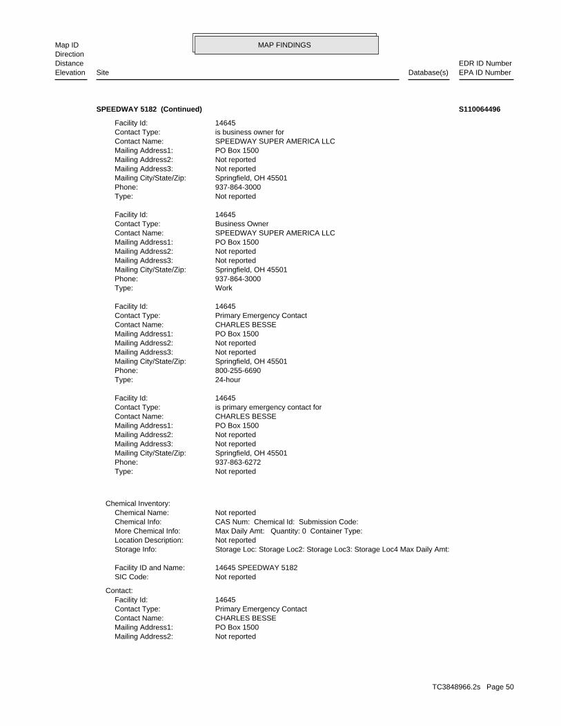
MAP FINDINGSMap IDDirection
EDR ID NumberDistanceEPA ID NumberDatabase(s)SiteElevation
Not reportedMailing Address2: PO Box 1500Mailing Address1: CHARLES BESSEContact Name: Primary Emergency ContactContact Type: 14645Facility Id:
Contact:
Not reportedSIC Code: 14645 SPEEDWAY 5182Facility ID and Name:
Storage Loc: Storage Loc2: Storage Loc3: Storage Loc4 Max Daily Amt:Storage Info: Not reportedLocation Description: Max Daily Amt: Quantity: 0 Container Type:More Chemical Info: CAS Num: Chemical Id: Submission Code:Chemical Info: Not reportedChemical Name:
Chemical Inventory:
Not reportedType: 937-863-6272Phone: Springfield, OH 45501Mailing City/State/Zip: Not reportedMailing Address3: Not reportedMailing Address2: PO Box 1500Mailing Address1: CHARLES BESSEContact Name: is primary emergency contact forContact Type: 14645Facility Id:
24-hourType: 800-255-6690Phone: Springfield, OH 45501Mailing City/State/Zip: Not reportedMailing Address3: Not reportedMailing Address2: PO Box 1500Mailing Address1: CHARLES BESSEContact Name: Primary Emergency ContactContact Type: 14645Facility Id:
WorkType: 937-864-3000Phone: Springfield, OH 45501Mailing City/State/Zip: Not reportedMailing Address3: Not reportedMailing Address2: PO Box 1500Mailing Address1: SPEEDWAY SUPER AMERICA LLCContact Name: Business OwnerContact Type: 14645Facility Id:
Not reportedType: 937-864-3000Phone: Springfield, OH 45501Mailing City/State/Zip: Not reportedMailing Address3: Not reportedMailing Address2: PO Box 1500Mailing Address1: SPEEDWAY SUPER AMERICA LLCContact Name: is business owner forContact Type: 14645Facility Id:
SPEEDWAY 5182 (Continued) S110064496
TC3848966.2s Page 50
MAP FINDINGSMap IDDirection
EDR ID NumberDistanceEPA ID NumberDatabase(s)SiteElevation
Primary Emergency ContactContact Type: 14645Facility Id:
WorkType: 937-864-3000Phone: Springfield, OH 45501Mailing City/State/Zip: Not reportedMailing Address3: Not reportedMailing Address2: PO Box 1500Mailing Address1: SPEEDWAY SUPER AMERICA LLCContact Name: Business OwnerContact Type: 14645Facility Id:
Not reportedType: 937-864-3000Phone: Springfield, OH 45501Mailing City/State/Zip: Not reportedMailing Address3: Not reportedMailing Address2: PO Box 1500Mailing Address1: SPEEDWAY SUPER AMERICA LLCContact Name: is business owner forContact Type: 14645Facility Id:
Not reportedType: 937-863-6078Phone: Springfield, OH 45501Mailing City/State/Zip: Not reportedMailing Address3: Not reportedMailing Address2: PO Box 1500Mailing Address1: CHARLES BESSEContact Name: is primary emergency contact forContact Type: 14645Facility Id:
Not reportedType: 800-255-6690Phone: Springfield, OH 45501Mailing City/State/Zip: Not reportedMailing Address3: Not reportedMailing Address2: PO Box 1500Mailing Address1: CHARLES BESSEContact Name: is primary emergency contact forContact Type: 14645Facility Id:
WorkType: 937-863-6272Phone: Springfield, OH 45501Mailing City/State/Zip: Not reportedMailing Address3: Not reportedMailing Address2: PO Box 1500Mailing Address1: CHARLES BESSEContact Name: Primary Emergency ContactContact Type: 14645Facility Id:
FAXType: 937-863-6078Phone: Springfield, OH 45501Mailing City/State/Zip: Not reportedMailing Address3:
SPEEDWAY 5182 (Continued) S110064496
TC3848966.2s Page 51

MAP FINDINGSMap IDDirection
EDR ID NumberDistanceEPA ID NumberDatabase(s)SiteElevation
is primary emergency contact forContact Type: 14645Facility Id:
WorkType: 937-863-6272Phone: Springfield, OH 45501Mailing City/State/Zip: Not reportedMailing Address3: Not reportedMailing Address2: PO Box 1500Mailing Address1: CHARLES BESSEContact Name: Primary Emergency ContactContact Type: 14645Facility Id:
FAXType: 937-863-6078Phone: Springfield, OH 45501Mailing City/State/Zip: Not reportedMailing Address3: Not reportedMailing Address2: PO Box 1500Mailing Address1: CHARLES BESSEContact Name: Primary Emergency ContactContact Type: 14645Facility Id:
Contact:
937-864-3000Owner Phone: Speedway Super America LLCOwner Name: 937-863-6272Contact Phone: Charles BesseContact Name: 5541SIC Code: 14645 SPEEDWAY 5182Facility ID and Name:
10000-99999 Storage Loc: Storage Loc2: Storage Loc3: Storage Loc4 Max Daily Amt:Storage Info: tank 11Location Description: Max Daily Amt: 10000-99999 Quantity: 365 Container Type: B - Below-More Chemical Info: CAS Num:8008206 Chemical Id: Submission Code:Chemical Info: KeroseneChemical Name:
Chemical Inventory:
Not reportedType: 937-863-6272Phone: Springfield, OH 45501Mailing City/State/Zip: Not reportedMailing Address3: Not reportedMailing Address2: PO Box 1500Mailing Address1: CHARLES BESSEContact Name: is primary emergency contact forContact Type: 14645Facility Id:
24-hourType: 800-255-6690Phone: Springfield, OH 45501Mailing City/State/Zip: Not reportedMailing Address3: Not reportedMailing Address2: PO Box 1500Mailing Address1: CHARLES BESSEContact Name:
SPEEDWAY 5182 (Continued) S110064496
TC3848966.2s Page 52
MAP FINDINGSMap IDDirection
EDR ID NumberDistanceEPA ID NumberDatabase(s)SiteElevation
Not reportedType: 937-863-6272Phone: Springfield, OH 45501Mailing City/State/Zip: Not reportedMailing Address3: Not reportedMailing Address2: PO Box 1500Mailing Address1: CHARLES BESSEContact Name: is primary emergency contact forContact Type: 14645Facility Id:
24-hourType: 800-255-6690Phone: Springfield, OH 45501Mailing City/State/Zip: Not reportedMailing Address3: Not reportedMailing Address2: PO Box 1500Mailing Address1: CHARLES BESSEContact Name: Primary Emergency ContactContact Type: 14645Facility Id:
WorkType: 937-864-3000Phone: Springfield, OH 45501Mailing City/State/Zip: Not reportedMailing Address3: Not reportedMailing Address2: PO Box 1500Mailing Address1: SPEEDWAY SUPER AMERICA LLCContact Name: Business OwnerContact Type: 14645Facility Id:
Not reportedType: 937-864-3000Phone: Springfield, OH 45501Mailing City/State/Zip: Not reportedMailing Address3: Not reportedMailing Address2: PO Box 1500Mailing Address1: SPEEDWAY SUPER AMERICA LLCContact Name: is business owner forContact Type: 14645Facility Id:
Not reportedType: 937-863-6078Phone: Springfield, OH 45501Mailing City/State/Zip: Not reportedMailing Address3: Not reportedMailing Address2: PO Box 1500Mailing Address1: CHARLES BESSEContact Name: is primary emergency contact forContact Type: 14645Facility Id:
Not reportedType: 800-255-6690Phone: Springfield, OH 45501Mailing City/State/Zip: Not reportedMailing Address3: Not reportedMailing Address2: PO Box 1500Mailing Address1: CHARLES BESSEContact Name:
SPEEDWAY 5182 (Continued) S110064496
TC3848966.2s Page 53
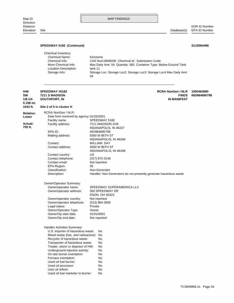
MAP FINDINGSMap IDDirection
EDR ID NumberDistanceEPA ID NumberDatabase(s)SiteElevation
04 Storage Loc: Storage Loc2: Storage Loc3: Storage Loc4 Max Daily Amt:Storage Info: tank 11Location Description: Max Daily Amt: 04 Quantity: 365 Container Type: Below-Ground TankMore Chemical Info: CAS Num:8008206 Chemical Id: Submission Code:Chemical Info: KeroseneChemical Name:
Chemical Inventory:
SPEEDWAY 5182 (Continued) S110064496
NoUsed oil fuel marketer to burner: NoUser oil refiner: NoUsed oil processor: NoUsed oil fuel burner: NoFurnace exemption: NoOn-site burner exemption: NoUnderground injection activity: NoTreater, storer or disposer of HW: NoTransporter of hazardous waste: NoRecycler of hazardous waste: NoMixed waste (haz. and radioactive): NoU.S. importer of hazardous waste:
Handler Activities Summary:
Not reportedOwner/Op end date: 01/01/0001Owner/Op start date: OwnerOwner/Operator Type: PrivateLegal status: (513) 864-3000Owner/operator telephone: Not reportedOwner/operator country: ENON, OH 45323 500 SPEEDWAY DROwner/operator address: SPEEDWAY SUPERAMERICA LLCOwner/operator name:
Owner/Operator Summary:
Handler: Non-Generators do not presently generate hazardous wasteDescription: Non-GeneratorClassification: 05EPA Region: Not reportedContact email: (317) 872-3146Contact telephone: USContact country: INDIANAPOLIS, IN 46268 5000 W 86TH STContact address: WILLIAM DAYContact: INDIANAPOLIS, IN 46268 5000 W 86TH STMailing address: IND984890798EPA ID: INDANAPOLIS, IN 46227 7211 MADISON AVEFacility address: SPEEDWAY 5182Facility name: 01/22/2001Date form received by agency:
RCRA NonGen / NLR:
1043 ft. Site 2 of 5 in cluster H0.198 mi.
Relative:Lower
Actual:755 ft.
1/8-1/4 IN MANIFESTSOUTHPORT, IN SW FINDS7211 S MADISON IND984890798H46 RCRA NonGen / NLRSPEEDWAY #5182 1000464680
TC3848966.2s Page 54
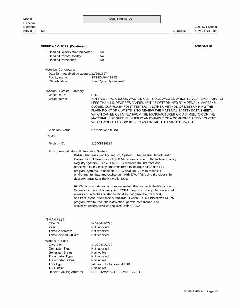
MAP FINDINGSMap IDDirection
EDR ID NumberDistanceEPA ID NumberDatabase(s)SiteElevation
SPEEDWAY SUPERAMERICA LLCHandler Mailing Address: Non ActiveTSD Status: Interim or Enforcement TSDTSD Type: Non ActiveTransporter Status: Not reportedTransporter Type: Non ActiveGenerator Status: Not reportedGenerator Type: IND984890798EPA Id #:
Manifest Handler:
Not reportedTons Shipped OffSite: Not reportedTons Generated: Not reportedYear: IND984890798EPA ID:
IN MANIFEST:
corrective action activities required under RCRA.program staff to track the notification, permit, compliance, andand treat, store, or dispose of hazardous waste. RCRAInfo allows RCRAevents and activities related to facilities that generate, transport,Conservation and Recovery Act (RCRA) program through the tracking ofRCRAInfo is a national information system that supports the Resource
data exchange over the Network Node.environmental data and exchange it with EPA FRS using the electronicprogram systems. In addition, I-FRS enables IDEM to reconcileprocesses to link facility data monitored by multiple State and EPARegistry System (I-FRS). The I-FRS provides the interface andEnvironmental Management (I-DEM) has implemented the Indiana-FacilityIN-FRS (Indiana - Facility Registry System). The Indiana Department of Environmental Interest/Information System
110008334114Registry ID:
FINDS:
No violations foundViolation Status:
WHICH WOULD BE CONSIDERED AS IGNITABLE HAZARDOUS WASTE. MATERIAL. LACQUER THINNER IS AN EXAMPLE OF A COMMONLY USED SOLVENT WHICH CAN BE OBTAINED FROM THE MANUFACTURER OR DISTRIBUTOR OF THE FLASH POINT OF A WASTE IS TO REVIEW THE MATERIAL SAFETY DATA SHEET, CLOSED CUP FLASH POINT TESTER. ANOTHER METHOD OF DETERMINING THE LESS THAN 140 DEGREES FAHRENHEIT AS DETERMINED BY A PENSKY-MARTENS IGNITABLE HAZARDOUS WASTES ARE THOSE WASTES WHICH HAVE A FLASHPOINT OFWaste name: D001Waste code:
Hazardous Waste Summary:
Small Quantity GeneratorClassification: SPEEDWAY 5182Facility name: 12/29/1997Date form received by agency:
Historical Generators:
NoUsed oil transporter: NoUsed oil transfer facility: NoUsed oil Specification marketer:
SPEEDWAY #5182 (Continued) 1000464680
TC3848966.2s Page 55
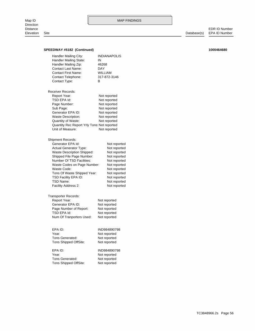
MAP FINDINGSMap IDDirection
EDR ID NumberDistanceEPA ID NumberDatabase(s)SiteElevation
Not reportedTons Shipped OffSite: Not reportedTons Generated: Not reportedYear: IND984890798EPA ID:
Not reportedTons Shipped OffSite: Not reportedTons Generated: Not reportedYear: IND984890798EPA ID:
Not reportedNum Of Tranporters Used: Not reportedTSD EPA Id: Not reportedPage Number of Report: Not reportedGenerator EPA ID: Not reportedReport Year:
Transporter Records:
Not reportedFacility Address 2: Not reportedTSD Name: Not reportedTSD Facility EPA ID: Not reportedTons Of Waste Shipped Year: Not reportedWaste Code: Not reportedWaste Codes on Page Number: Not reportedNumber Of TSD Facilities: Not reportedShipped File Page Number: Not reportedWaste Description Shipped: Not reportedActual Generator Type: Not reportedGenerator EPA Id:
Shipment Records:
Not reportedUnit of Measure: Not reportedQuantity Rec Report Yrly Tons: Not reportedQuantity of Waste: Not reportedWaste Description: Not reportedGenerator EPA ID: Not reportedSub Page: Not reportedPage Number: Not reportedTSD EPA Id: Not reportedReport Year:
Receiver Records:
BContact Type: 317-872-3146Contact Telephone: WILLIAMContact First Name: DAYContact Last Name: 46268Handler Mailing Zip: INHandler Mailing State: INDIANAPOLISHandler Mailing City:
SPEEDWAY #5182 (Continued) 1000464680
TC3848966.2s Page 56
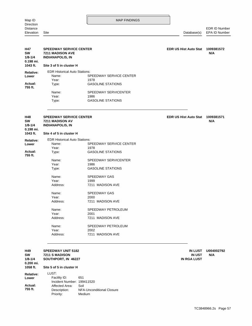
MAP FINDINGSMap IDDirection
EDR ID NumberDistanceEPA ID NumberDatabase(s)SiteElevation
GASOLINE STATIONSType: 1986Year: SPEEDWAY SERVICENTERName:
GASOLINE STATIONSType: 1978Year: SPEEDWAY SERVICE CENTERName:
EDR Historical Auto Stations:
1043 ft. Site 3 of 5 in cluster H0.198 mi.
Relative:Lower
Actual:755 ft.
1/8-1/4 INDIANAPOLIS, IN SW 7211 MADISON AVE N/AH47 EDR US Hist Auto StatSPEEDWAY SERVICE CENTER 1009381572
7211 MADISON AVEAddress: 2002Year: SPEEDWAY PETROLEUMName:
7211 MADISON AVEAddress: 2001Year: SPEEDWAY PETROLEUMName:
7211 MADISON AVEAddress: 2000Year: SPEEDWAY GASName:
7211 MADISON AVEAddress: 1999Year: SPEEDWAY GASName:
GASOLINE STATIONSType: 1986Year: SPEEDWAY SERVICENTERName:
GASOLINE STATIONSType: 1978Year: SPEEDWAY SERVICE CENTERName:
EDR Historical Auto Stations:
1043 ft. Site 4 of 5 in cluster H0.198 mi.
Relative:Lower
Actual:755 ft.
1/8-1/4 INDIANAPOLIS, IN SW 7211 MADISON AV N/AH48 EDR US Hist Auto StatSPEEDWAY SERVICE CENTER 1009381571
MediumPriority:NFA-Unconditional ClosureDescription:SoilAffected Area:199411520Incident Number:651Facility ID:
LUST:
1058 ft. Site 5 of 5 in cluster H0.200 mi.
Relative:Lower
Actual:755 ft.
1/8-1/4 IN RGA LUSTSOUTHPORT, IN 46227SW IN UST7211 S MADISON N/AH49 IN LUSTSPEEDWAY UNIT 5182 U004002792
TC3848966.2s Page 57
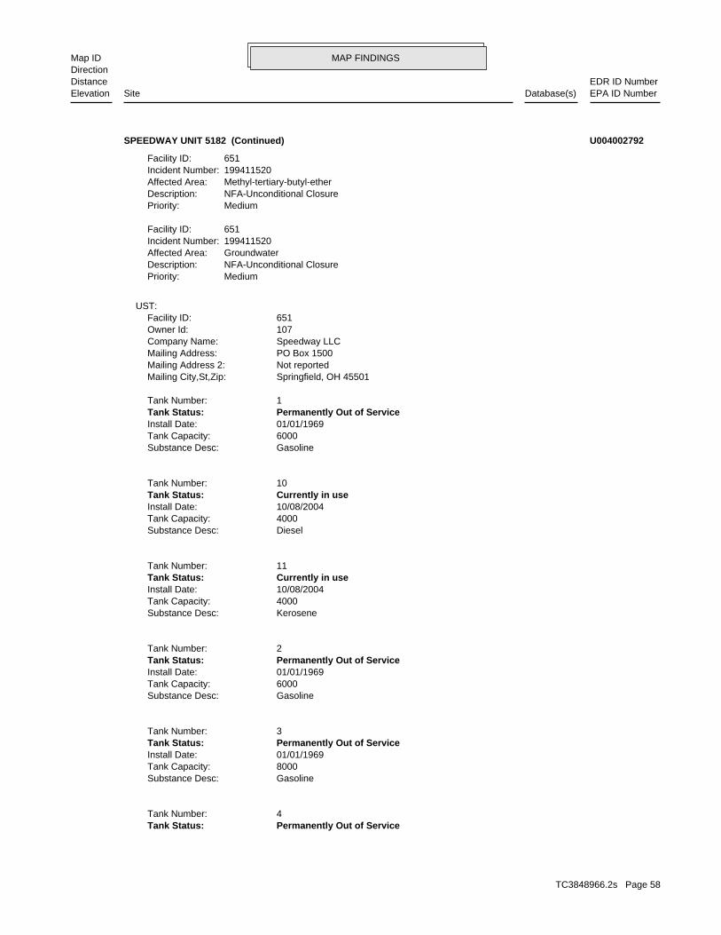
MAP FINDINGSMap IDDirection
EDR ID NumberDistanceEPA ID NumberDatabase(s)SiteElevation
Permanently Out of ServiceTank Status: 4Tank Number:
GasolineSubstance Desc: 8000Tank Capacity: 01/01/1969Install Date: Permanently Out of ServiceTank Status: 3Tank Number:
GasolineSubstance Desc: 6000Tank Capacity: 01/01/1969Install Date: Permanently Out of ServiceTank Status: 2Tank Number:
KeroseneSubstance Desc: 4000Tank Capacity: 10/08/2004Install Date: Currently in useTank Status: 11Tank Number:
DieselSubstance Desc: 4000Tank Capacity: 10/08/2004Install Date: Currently in useTank Status: 10Tank Number:
GasolineSubstance Desc: 6000Tank Capacity: 01/01/1969Install Date: Permanently Out of ServiceTank Status: 1Tank Number:
Springfield, OH 45501Mailing City,St,Zip: Not reportedMailing Address 2: PO Box 1500Mailing Address: Speedway LLCCompany Name: 107Owner Id: 651Facility ID:
UST:
MediumPriority:NFA-Unconditional ClosureDescription:GroundwaterAffected Area:199411520Incident Number:651Facility ID:
MediumPriority:NFA-Unconditional ClosureDescription:Methyl-tertiary-butyl-etherAffected Area:199411520Incident Number:651Facility ID:
SPEEDWAY UNIT 5182 (Continued) U004002792
TC3848966.2s Page 58
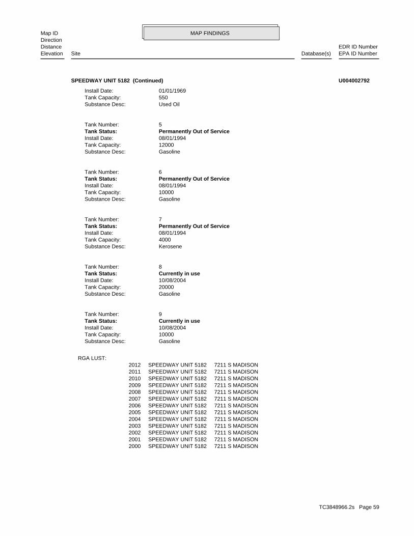
MAP FINDINGSMap IDDirection
EDR ID NumberDistanceEPA ID NumberDatabase(s)SiteElevation
2000 SPEEDWAY UNIT 5182 7211 S MADISON2001 SPEEDWAY UNIT 5182 7211 S MADISON2002 SPEEDWAY UNIT 5182 7211 S MADISON2003 SPEEDWAY UNIT 5182 7211 S MADISON2004 SPEEDWAY UNIT 5182 7211 S MADISON2005 SPEEDWAY UNIT 5182 7211 S MADISON2006 SPEEDWAY UNIT 5182 7211 S MADISON2007 SPEEDWAY UNIT 5182 7211 S MADISON2008 SPEEDWAY UNIT 5182 7211 S MADISON2009 SPEEDWAY UNIT 5182 7211 S MADISON2010 SPEEDWAY UNIT 5182 7211 S MADISON2011 SPEEDWAY UNIT 5182 7211 S MADISON2012 SPEEDWAY UNIT 5182 7211 S MADISON
RGA LUST:
GasolineSubstance Desc: 10000Tank Capacity: 10/08/2004Install Date: Currently in useTank Status: 9Tank Number:
GasolineSubstance Desc: 20000Tank Capacity: 10/08/2004Install Date: Currently in useTank Status: 8Tank Number:
KeroseneSubstance Desc: 4000Tank Capacity: 08/01/1994Install Date: Permanently Out of ServiceTank Status: 7Tank Number:
GasolineSubstance Desc: 10000Tank Capacity: 08/01/1994Install Date: Permanently Out of ServiceTank Status: 6Tank Number:
GasolineSubstance Desc: 12000Tank Capacity: 08/01/1994Install Date: Permanently Out of ServiceTank Status: 5Tank Number:
Used OilSubstance Desc: 550Tank Capacity: 01/01/1969Install Date:
SPEEDWAY UNIT 5182 (Continued) U004002792
TC3848966.2s Page 59
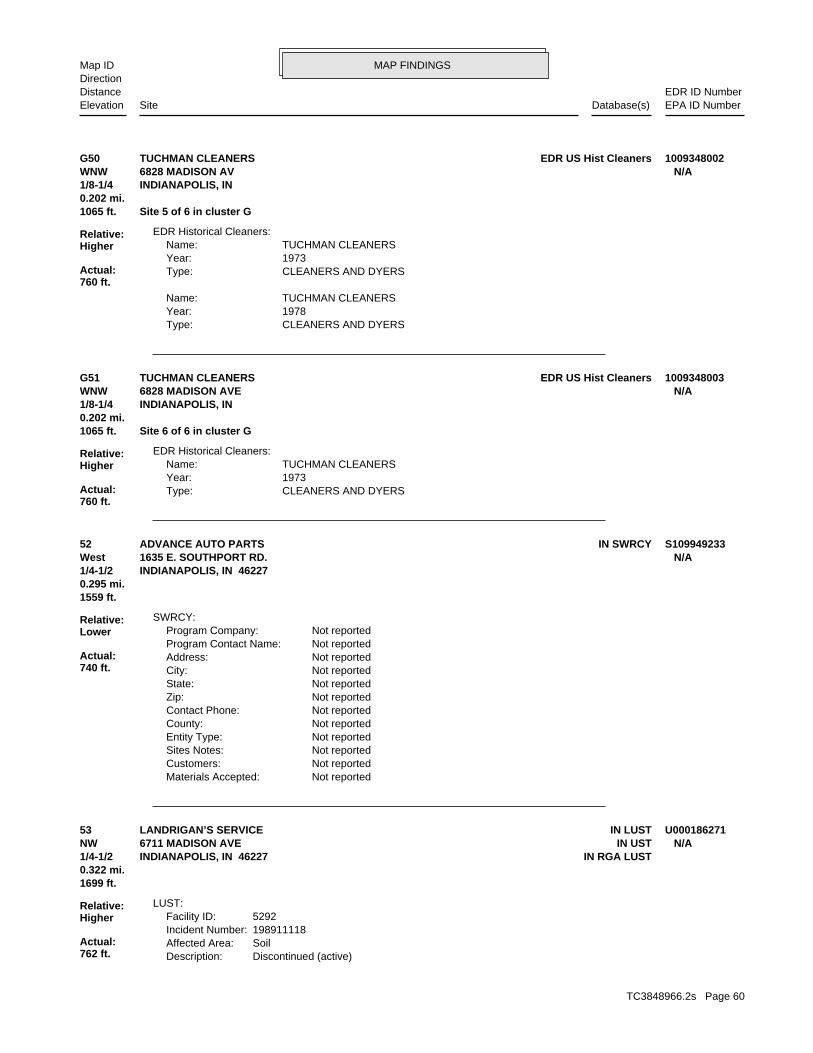
MAP FINDINGSMap IDDirection
EDR ID NumberDistanceEPA ID NumberDatabase(s)SiteElevation
CLEANERS AND DYERSType: 1978Year: TUCHMAN CLEANERSName:
CLEANERS AND DYERSType: 1973Year: TUCHMAN CLEANERSName:
EDR Historical Cleaners:
1065 ft. Site 5 of 6 in cluster G0.202 mi.
Relative:Higher
Actual:760 ft.
1/8-1/4 INDIANAPOLIS, IN WNW 6828 MADISON AV N/AG50 EDR US Hist CleanersTUCHMAN CLEANERS 1009348002
CLEANERS AND DYERSType: 1973Year: TUCHMAN CLEANERSName:
EDR Historical Cleaners:
1065 ft. Site 6 of 6 in cluster G0.202 mi.
Relative:Higher
Actual:760 ft.
1/8-1/4 INDIANAPOLIS, IN WNW 6828 MADISON AVE N/AG51 EDR US Hist CleanersTUCHMAN CLEANERS 1009348003
Not reportedMaterials Accepted: Not reportedCustomers: Not reportedSites Notes: Not reportedEntity Type: Not reportedCounty: Not reportedContact Phone: Not reportedZip: Not reportedState: Not reportedCity: Not reportedAddress: Not reportedProgram Contact Name: Not reportedProgram Company:
SWRCY:
1559 ft.0.295 mi.
Relative:Lower
Actual:740 ft.
1/4-1/2 INDIANAPOLIS, IN 46227West 1635 E. SOUTHPORT RD. N/A52 IN SWRCYADVANCE AUTO PARTS S109949233
Discontinued (active)Description:SoilAffected Area:198911118Incident Number:5292Facility ID:
LUST:
1699 ft.0.322 mi.
Relative:Higher
Actual:762 ft.
1/4-1/2 IN RGA LUSTINDIANAPOLIS, IN 46227NW IN UST6711 MADISON AVE N/A53 IN LUSTLANDRIGAN’S SERVICE U000186271
TC3848966.2s Page 60
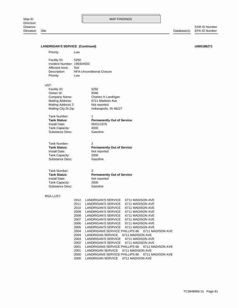
MAP FINDINGSMap IDDirection
EDR ID NumberDistanceEPA ID NumberDatabase(s)SiteElevation
2000 LANDRIGAN SERVICE 6711 MADISON AVE2000 LANDRIGANS SERVICE PHILLIPS 66 6711 MADISON AVE2001 LANDRIGAN SERVICE 6711 MADISON AVE2001 LANDRIGANS SERVICE PHILLIPS 66 6711 MADISON AVE2002 LANDRIGAN’S SERVICE 6711 MADISON AVE2003 LANDRIGAN’S SERVICE 6711 MADISON AVE2004 LANDRIGAN SERVICE 6711 MADISON AVE2004 LANDRIGANS SERVICE PHILLIPS 66 6711 MADISON AVE2005 LANDRIGAN’S SERVICE 6711 MADISON AVE2006 LANDRIGAN’S SERVICE 6711 MADISON AVE2007 LANDRIGAN’S SERVICE 6711 MADISON AVE2008 LANDRIGAN’S SERVICE 6711 MADISON AVE2009 LANDRIGAN’S SERVICE 6711 MADISON AVE2010 LANDRIGAN’S SERVICE 6711 MADISON AVE2011 LANDRIGAN’S SERVICE 6711 MADISON AVE2012 LANDRIGAN’S SERVICE 6711 MADISON AVE
RGA LUST:
GasolineSubstance Desc: 2000Tank Capacity: Not reportedInstall Date: Permanently Out of ServiceTank Status: 3Tank Number:
GasolineSubstance Desc: 2000Tank Capacity: Not reportedInstall Date: Permanently Out of ServiceTank Status: 2Tank Number:
GasolineSubstance Desc: 4000Tank Capacity: 05/01/1976Install Date: Permanently Out of ServiceTank Status: 1Tank Number:
Indianapolis, IN 46227Mailing City,St,Zip: Not reportedMailing Address 2: 6711 Madison AveMailing Address: Charles H LandriganCompany Name: 5046Owner Id: 5292Facility ID:
UST:
LowPriority:NFA-Unconditional ClosureDescription:SoilAffected Area:199304503Incident Number:5292Facility ID:
LowPriority:
LANDRIGAN’S SERVICE (Continued) U000186271
TC3848966.2s Page 61
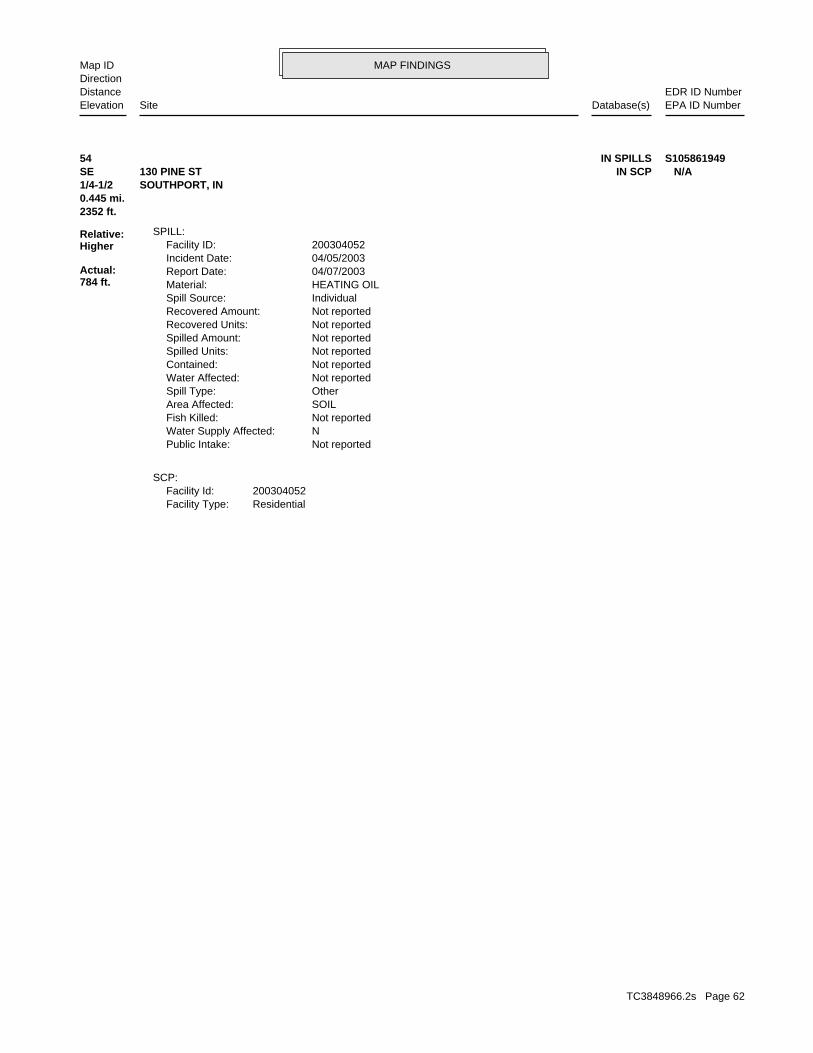
MAP FINDINGSMap IDDirection
EDR ID NumberDistanceEPA ID NumberDatabase(s)SiteElevation
ResidentialFacility Type:200304052Facility Id:
SCP:
Not reportedPublic Intake: NWater Supply Affected: Not reportedFish Killed: SOILArea Affected: OtherSpill Type: Not reportedWater Affected: Not reportedContained: Not reportedSpilled Units: Not reportedSpilled Amount: Not reportedRecovered Units: Not reportedRecovered Amount: IndividualSpill Source: HEATING OILMaterial: 04/07/2003Report Date: 04/05/2003Incident Date: 200304052Facility ID:
SPILL:
2352 ft.0.445 mi.
Relative:Higher
Actual:784 ft.
1/4-1/2 SOUTHPORT, IN SE IN SCP130 PINE ST N/A54 IN SPILLS S105861949
TC3848966.2s Page 62
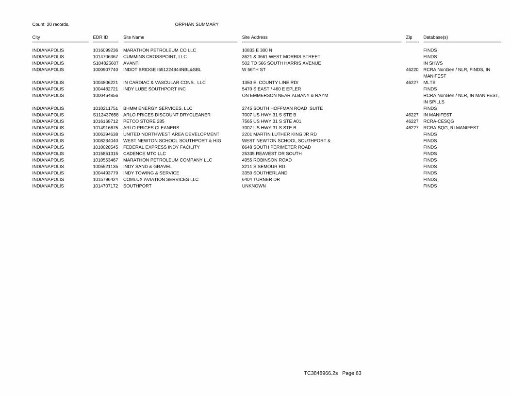
ORPHAN SUMMARY
City EDR ID Site Name Site Address Zip Database(s)
Count: 20 records.
INDIANAPOLIS 1016099236 MARATHON PETROLEUM CO LLC 10833 E 300 N FINDSINDIANAPOLIS 1014706367 CUMMINS CROSSPOINT, LLC 3621 & 3661 WEST MORRIS STREET FINDSINDIANAPOLIS S104825607 AVANTI 502 TO 566 SOUTH HARRIS AVENUE IN SHWSINDIANAPOLIS 1000907740 INDOT BRIDGE I651224844NBL&SBL W 56TH ST 46220 RCRA NonGen / NLR, FINDS, IN
MANIFESTINDIANAPOLIS 1004806221 IN CARDIAC & VASCULAR CONS. LLC 1350 E. COUNTY LINE RD/ 46227 MLTSINDIANAPOLIS 1004482721 INDY LUBE SOUTHPORT INC 5470 S EAST / 460 E EPLER FINDSINDIANAPOLIS 1000464856 ON EMMERSON NEAR ALBANY & RAYM RCRA NonGen / NLR, IN MANIFEST,
IN SPILLSINDIANAPOLIS 1010211751 BHMM ENERGY SERVICES, LLC 2745 SOUTH HOFFMAN ROAD SUITE FINDSINDIANAPOLIS S112437658 ARLO PRICES DISCOUNT DRYCLEANER 7007 US HWY 31 S STE B 46227 IN MANIFESTINDIANAPOLIS 1016168712 PETCO STORE 285 7565 US HWY 31 S STE A01 46227 RCRA-CESQGINDIANAPOLIS 1014916675 ARLO PRICES CLEANERS 7007 US HWY 31 S STE B 46227 RCRA-SQG, RI MANIFESTINDIANAPOLIS 1006394638 UNITED NORTHWEST AREA DEVELOPMENT 2201 MARTIN LUTHER KING JR RD FINDSINDIANAPOLIS 1008234040 WEST NEWTON SCHOOL SOUTHPORT & HIG WEST NEWTON SCHOOL SOUTHPORT & FINDSINDIANAPOLIS 1010028545 FEDERAL EXPRESS INDY FACILITY 8648 SOUTH PERIMETER ROAD FINDSINDIANAPOLIS 1015851315 CADENCE MTC LLC 25335 REAVEST DR SOUTH FINDSINDIANAPOLIS 1010553467 MARATHON PETROLEUM COMPANY LLC 4955 ROBINSON ROAD FINDSINDIANAPOLIS 1005521135 INDY SAND & GRAVEL 3211 S SEMOUR RD FINDSINDIANAPOLIS 1004493779 INDY TOWING & SERVICE 3350 SOUTHERLAND FINDSINDIANAPOLIS 1015796424 COMLUX AVIATION SERVICES LLC 6404 TURNER DR FINDSINDIANAPOLIS 1014707172 SOUTHPORT UNKNOWN FINDS
TC3848966.2s Page 63
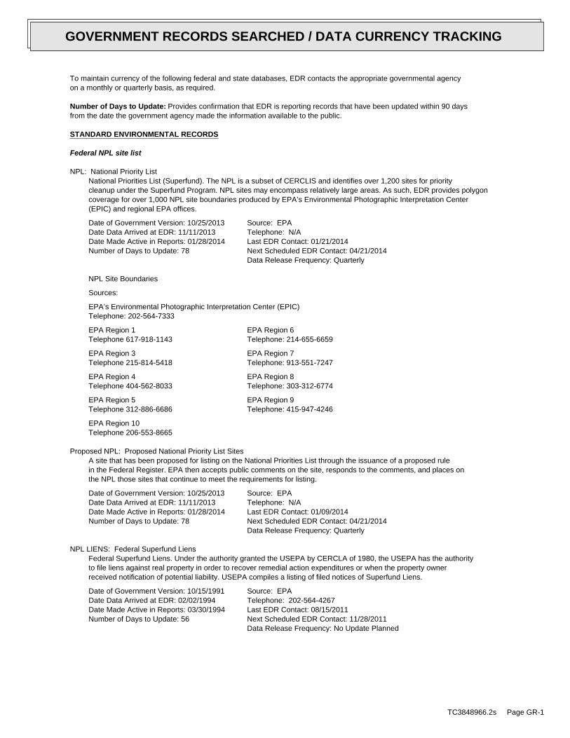
To maintain currency of the following federal and state databases, EDR contacts the appropriate governmental agencyon a monthly or quarterly basis, as required.
Number of Days to Update: Provides confirmation that EDR is reporting records that have been updated within 90 daysfrom the date the government agency made the information available to the public.
STANDARD ENVIRONMENTAL RECORDS
Federal NPL site list
NPL: National Priority ListNational Priorities List (Superfund). The NPL is a subset of CERCLIS and identifies over 1,200 sites for prioritycleanup under the Superfund Program. NPL sites may encompass relatively large areas. As such, EDR provides polygoncoverage for over 1,000 NPL site boundaries produced by EPA’s Environmental Photographic Interpretation Center(EPIC) and regional EPA offices.
Date of Government Version: 10/25/2013Date Data Arrived at EDR: 11/11/2013Date Made Active in Reports: 01/28/2014Number of Days to Update: 78
Source: EPATelephone: N/ALast EDR Contact: 01/21/2014Next Scheduled EDR Contact: 04/21/2014Data Release Frequency: Quarterly
NPL Site Boundaries
Sources:
EPA’s Environmental Photographic Interpretation Center (EPIC)Telephone: 202-564-7333
EPA Region 1 EPA Region 6Telephone 617-918-1143 Telephone: 214-655-6659
EPA Region 3 EPA Region 7Telephone 215-814-5418 Telephone: 913-551-7247
EPA Region 4 EPA Region 8Telephone 404-562-8033 Telephone: 303-312-6774
EPA Region 5 EPA Region 9Telephone 312-886-6686 Telephone: 415-947-4246
EPA Region 10Telephone 206-553-8665
Proposed NPL: Proposed National Priority List SitesA site that has been proposed for listing on the National Priorities List through the issuance of a proposed rulein the Federal Register. EPA then accepts public comments on the site, responds to the comments, and places onthe NPL those sites that continue to meet the requirements for listing.
Date of Government Version: 10/25/2013Date Data Arrived at EDR: 11/11/2013Date Made Active in Reports: 01/28/2014Number of Days to Update: 78
Source: EPATelephone: N/ALast EDR Contact: 01/09/2014Next Scheduled EDR Contact: 04/21/2014Data Release Frequency: Quarterly
NPL LIENS: Federal Superfund LiensFederal Superfund Liens. Under the authority granted the USEPA by CERCLA of 1980, the USEPA has the authorityto file liens against real property in order to recover remedial action expenditures or when the property ownerreceived notification of potential liability. USEPA compiles a listing of filed notices of Superfund Liens.
Date of Government Version: 10/15/1991Date Data Arrived at EDR: 02/02/1994Date Made Active in Reports: 03/30/1994Number of Days to Update: 56
Source: EPATelephone: 202-564-4267Last EDR Contact: 08/15/2011Next Scheduled EDR Contact: 11/28/2011Data Release Frequency: No Update Planned
TC3848966.2s Page GR-1
GOVERNMENT RECORDS SEARCHED / DATA CURRENCY TRACKING
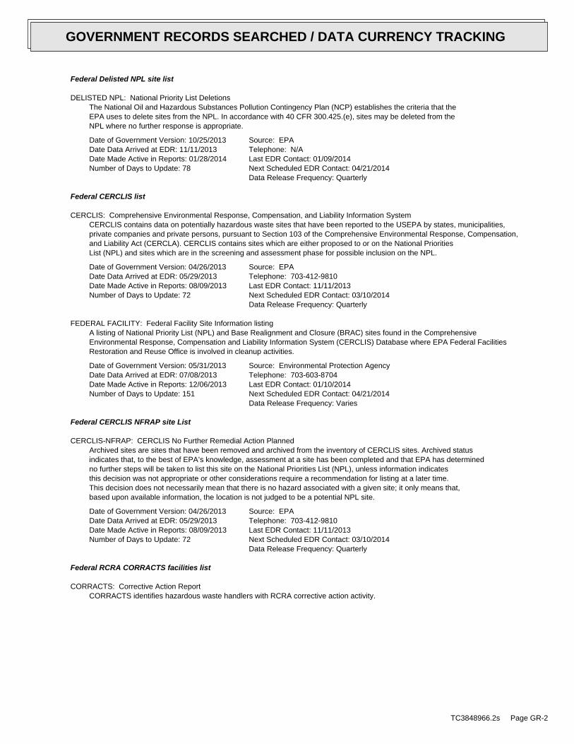
Federal Delisted NPL site list
DELISTED NPL: National Priority List DeletionsThe National Oil and Hazardous Substances Pollution Contingency Plan (NCP) establishes the criteria that theEPA uses to delete sites from the NPL. In accordance with 40 CFR 300.425.(e), sites may be deleted from theNPL where no further response is appropriate.
Date of Government Version: 10/25/2013Date Data Arrived at EDR: 11/11/2013Date Made Active in Reports: 01/28/2014Number of Days to Update: 78
Source: EPATelephone: N/ALast EDR Contact: 01/09/2014Next Scheduled EDR Contact: 04/21/2014Data Release Frequency: Quarterly
Federal CERCLIS list
CERCLIS: Comprehensive Environmental Response, Compensation, and Liability Information SystemCERCLIS contains data on potentially hazardous waste sites that have been reported to the USEPA by states, municipalities,private companies and private persons, pursuant to Section 103 of the Comprehensive Environmental Response, Compensation,and Liability Act (CERCLA). CERCLIS contains sites which are either proposed to or on the National PrioritiesList (NPL) and sites which are in the screening and assessment phase for possible inclusion on the NPL.
Date of Government Version: 04/26/2013Date Data Arrived at EDR: 05/29/2013Date Made Active in Reports: 08/09/2013Number of Days to Update: 72
Source: EPATelephone: 703-412-9810Last EDR Contact: 11/11/2013Next Scheduled EDR Contact: 03/10/2014Data Release Frequency: Quarterly
FEDERAL FACILITY: Federal Facility Site Information listingA listing of National Priority List (NPL) and Base Realignment and Closure (BRAC) sites found in the ComprehensiveEnvironmental Response, Compensation and Liability Information System (CERCLIS) Database where EPA Federal FacilitiesRestoration and Reuse Office is involved in cleanup activities.
Date of Government Version: 05/31/2013Date Data Arrived at EDR: 07/08/2013Date Made Active in Reports: 12/06/2013Number of Days to Update: 151
Source: Environmental Protection AgencyTelephone: 703-603-8704Last EDR Contact: 01/10/2014Next Scheduled EDR Contact: 04/21/2014Data Release Frequency: Varies
Federal CERCLIS NFRAP site List
CERCLIS-NFRAP: CERCLIS No Further Remedial Action PlannedArchived sites are sites that have been removed and archived from the inventory of CERCLIS sites. Archived statusindicates that, to the best of EPA’s knowledge, assessment at a site has been completed and that EPA has determinedno further steps will be taken to list this site on the National Priorities List (NPL), unless information indicatesthis decision was not appropriate or other considerations require a recommendation for listing at a later time.This decision does not necessarily mean that there is no hazard associated with a given site; it only means that,based upon available information, the location is not judged to be a potential NPL site.
Date of Government Version: 04/26/2013Date Data Arrived at EDR: 05/29/2013Date Made Active in Reports: 08/09/2013Number of Days to Update: 72
Source: EPATelephone: 703-412-9810Last EDR Contact: 11/11/2013Next Scheduled EDR Contact: 03/10/2014Data Release Frequency: Quarterly
Federal RCRA CORRACTS facilities list
CORRACTS: Corrective Action ReportCORRACTS identifies hazardous waste handlers with RCRA corrective action activity.
TC3848966.2s Page GR-2
GOVERNMENT RECORDS SEARCHED / DATA CURRENCY TRACKING
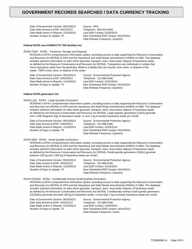
Date of Government Version: 09/10/2013Date Data Arrived at EDR: 10/02/2013Date Made Active in Reports: 12/16/2013Number of Days to Update: 75
Source: EPATelephone: 800-424-9346Last EDR Contact: 01/02/2014Next Scheduled EDR Contact: 04/14/2014Data Release Frequency: Quarterly
Federal RCRA non-CORRACTS TSD facilities list
RCRA-TSDF: RCRA - Treatment, Storage and DisposalRCRAInfo is EPA’s comprehensive information system, providing access to data supporting the Resource Conservationand Recovery Act (RCRA) of 1976 and the Hazardous and Solid Waste Amendments (HSWA) of 1984. The databaseincludes selective information on sites which generate, transport, store, treat and/or dispose of hazardous wasteas defined by the Resource Conservation and Recovery Act (RCRA). Transporters are individuals or entities thatmove hazardous waste from the generator offsite to a facility that can recycle, treat, store, or dispose of thewaste. TSDFs treat, store, or dispose of the waste.
Date of Government Version: 09/10/2013Date Data Arrived at EDR: 10/02/2013Date Made Active in Reports: 12/16/2013Number of Days to Update: 75
Source: Environmental Protection AgencyTelephone: 312-886-6186Last EDR Contact: 01/02/2014Next Scheduled EDR Contact: 04/14/2014Data Release Frequency: Quarterly
Federal RCRA generators list
RCRA-LQG: RCRA - Large Quantity GeneratorsRCRAInfo is EPA’s comprehensive information system, providing access to data supporting the Resource Conservationand Recovery Act (RCRA) of 1976 and the Hazardous and Solid Waste Amendments (HSWA) of 1984. The databaseincludes selective information on sites which generate, transport, store, treat and/or dispose of hazardous wasteas defined by the Resource Conservation and Recovery Act (RCRA). Large quantity generators (LQGs) generateover 1,000 kilograms (kg) of hazardous waste, or over 1 kg of acutely hazardous waste per month.
Date of Government Version: 09/10/2013Date Data Arrived at EDR: 10/02/2013Date Made Active in Reports: 12/16/2013Number of Days to Update: 75
Source: Environmental Protection AgencyTelephone: 312-886-6186Last EDR Contact: 01/02/2014Next Scheduled EDR Contact: 04/14/2014Data Release Frequency: Quarterly
RCRA-SQG: RCRA - Small Quantity GeneratorsRCRAInfo is EPA’s comprehensive information system, providing access to data supporting the Resource Conservationand Recovery Act (RCRA) of 1976 and the Hazardous and Solid Waste Amendments (HSWA) of 1984. The databaseincludes selective information on sites which generate, transport, store, treat and/or dispose of hazardous wasteas defined by the Resource Conservation and Recovery Act (RCRA). Small quantity generators (SQGs) generatebetween 100 kg and 1,000 kg of hazardous waste per month.
Date of Government Version: 09/10/2013Date Data Arrived at EDR: 10/02/2013Date Made Active in Reports: 12/16/2013Number of Days to Update: 75
Source: Environmental Protection AgencyTelephone: 312-886-6186Last EDR Contact: 01/02/2014Next Scheduled EDR Contact: 04/14/2014Data Release Frequency: Quarterly
RCRA-CESQG: RCRA - Conditionally Exempt Small Quantity GeneratorsRCRAInfo is EPA’s comprehensive information system, providing access to data supporting the Resource Conservationand Recovery Act (RCRA) of 1976 and the Hazardous and Solid Waste Amendments (HSWA) of 1984. The databaseincludes selective information on sites which generate, transport, store, treat and/or dispose of hazardous wasteas defined by the Resource Conservation and Recovery Act (RCRA). Conditionally exempt small quantity generators(CESQGs) generate less than 100 kg of hazardous waste, or less than 1 kg of acutely hazardous waste per month.
Date of Government Version: 09/10/2013Date Data Arrived at EDR: 10/02/2013Date Made Active in Reports: 12/16/2013Number of Days to Update: 75
Source: Environmental Protection AgencyTelephone: 312-886-6186Last EDR Contact: 01/02/2014Next Scheduled EDR Contact: 04/14/2014Data Release Frequency: Varies
TC3848966.2s Page GR-3
GOVERNMENT RECORDS SEARCHED / DATA CURRENCY TRACKING
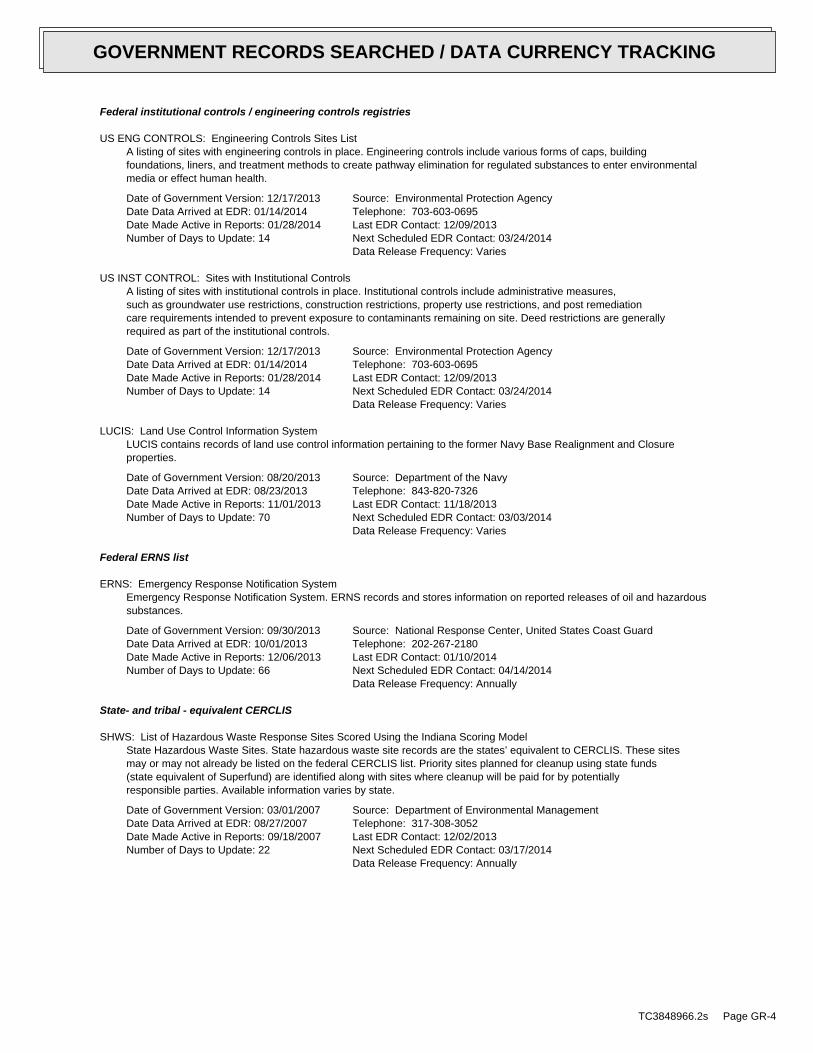
Federal institutional controls / engineering controls registries
US ENG CONTROLS: Engineering Controls Sites ListA listing of sites with engineering controls in place. Engineering controls include various forms of caps, buildingfoundations, liners, and treatment methods to create pathway elimination for regulated substances to enter environmentalmedia or effect human health.
Date of Government Version: 12/17/2013Date Data Arrived at EDR: 01/14/2014Date Made Active in Reports: 01/28/2014Number of Days to Update: 14
Source: Environmental Protection AgencyTelephone: 703-603-0695Last EDR Contact: 12/09/2013Next Scheduled EDR Contact: 03/24/2014Data Release Frequency: Varies
US INST CONTROL: Sites with Institutional ControlsA listing of sites with institutional controls in place. Institutional controls include administrative measures,such as groundwater use restrictions, construction restrictions, property use restrictions, and post remediationcare requirements intended to prevent exposure to contaminants remaining on site. Deed restrictions are generallyrequired as part of the institutional controls.
Date of Government Version: 12/17/2013Date Data Arrived at EDR: 01/14/2014Date Made Active in Reports: 01/28/2014Number of Days to Update: 14
Source: Environmental Protection AgencyTelephone: 703-603-0695Last EDR Contact: 12/09/2013Next Scheduled EDR Contact: 03/24/2014Data Release Frequency: Varies
LUCIS: Land Use Control Information SystemLUCIS contains records of land use control information pertaining to the former Navy Base Realignment and Closureproperties.
Date of Government Version: 08/20/2013Date Data Arrived at EDR: 08/23/2013Date Made Active in Reports: 11/01/2013Number of Days to Update: 70
Source: Department of the NavyTelephone: 843-820-7326Last EDR Contact: 11/18/2013Next Scheduled EDR Contact: 03/03/2014Data Release Frequency: Varies
Federal ERNS list
ERNS: Emergency Response Notification SystemEmergency Response Notification System. ERNS records and stores information on reported releases of oil and hazardoussubstances.
Date of Government Version: 09/30/2013Date Data Arrived at EDR: 10/01/2013Date Made Active in Reports: 12/06/2013Number of Days to Update: 66
Source: National Response Center, United States Coast GuardTelephone: 202-267-2180Last EDR Contact: 01/10/2014Next Scheduled EDR Contact: 04/14/2014Data Release Frequency: Annually
State- and tribal - equivalent CERCLIS
SHWS: List of Hazardous Waste Response Sites Scored Using the Indiana Scoring ModelState Hazardous Waste Sites. State hazardous waste site records are the states’ equivalent to CERCLIS. These sitesmay or may not already be listed on the federal CERCLIS list. Priority sites planned for cleanup using state funds(state equivalent of Superfund) are identified along with sites where cleanup will be paid for by potentiallyresponsible parties. Available information varies by state.
Date of Government Version: 03/01/2007Date Data Arrived at EDR: 08/27/2007Date Made Active in Reports: 09/18/2007Number of Days to Update: 22
Source: Department of Environmental ManagementTelephone: 317-308-3052Last EDR Contact: 12/02/2013Next Scheduled EDR Contact: 03/17/2014Data Release Frequency: Annually
TC3848966.2s Page GR-4
GOVERNMENT RECORDS SEARCHED / DATA CURRENCY TRACKING
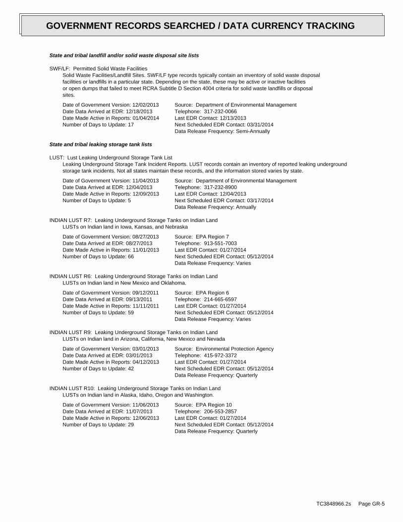
State and tribal landfill and/or solid waste disposal site lists
SWF/LF: Permitted Solid Waste FacilitiesSolid Waste Facilities/Landfill Sites. SWF/LF type records typically contain an inventory of solid waste disposalfacilities or landfills in a particular state. Depending on the state, these may be active or inactive facilitiesor open dumps that failed to meet RCRA Subtitle D Section 4004 criteria for solid waste landfills or disposalsites.
Date of Government Version: 12/02/2013Date Data Arrived at EDR: 12/18/2013Date Made Active in Reports: 01/04/2014Number of Days to Update: 17
Source: Department of Environmental ManagementTelephone: 317-232-0066Last EDR Contact: 12/13/2013Next Scheduled EDR Contact: 03/31/2014Data Release Frequency: Semi-Annually
State and tribal leaking storage tank lists
LUST: Lust Leaking Underground Storage Tank ListLeaking Underground Storage Tank Incident Reports. LUST records contain an inventory of reported leaking undergroundstorage tank incidents. Not all states maintain these records, and the information stored varies by state.
Date of Government Version: 11/04/2013Date Data Arrived at EDR: 12/04/2013Date Made Active in Reports: 12/09/2013Number of Days to Update: 5
Source: Department of Environmental ManagementTelephone: 317-232-8900Last EDR Contact: 12/04/2013Next Scheduled EDR Contact: 03/17/2014Data Release Frequency: Annually
INDIAN LUST R7: Leaking Underground Storage Tanks on Indian LandLUSTs on Indian land in Iowa, Kansas, and Nebraska
Date of Government Version: 08/27/2013Date Data Arrived at EDR: 08/27/2013Date Made Active in Reports: 11/01/2013Number of Days to Update: 66
Source: EPA Region 7Telephone: 913-551-7003Last EDR Contact: 01/27/2014Next Scheduled EDR Contact: 05/12/2014Data Release Frequency: Varies
INDIAN LUST R6: Leaking Underground Storage Tanks on Indian LandLUSTs on Indian land in New Mexico and Oklahoma.
Date of Government Version: 09/12/2011Date Data Arrived at EDR: 09/13/2011Date Made Active in Reports: 11/11/2011Number of Days to Update: 59
Source: EPA Region 6Telephone: 214-665-6597Last EDR Contact: 01/27/2014Next Scheduled EDR Contact: 05/12/2014Data Release Frequency: Varies
INDIAN LUST R9: Leaking Underground Storage Tanks on Indian LandLUSTs on Indian land in Arizona, California, New Mexico and Nevada
Date of Government Version: 03/01/2013Date Data Arrived at EDR: 03/01/2013Date Made Active in Reports: 04/12/2013Number of Days to Update: 42
Source: Environmental Protection AgencyTelephone: 415-972-3372Last EDR Contact: 01/27/2014Next Scheduled EDR Contact: 05/12/2014Data Release Frequency: Quarterly
INDIAN LUST R10: Leaking Underground Storage Tanks on Indian LandLUSTs on Indian land in Alaska, Idaho, Oregon and Washington.
Date of Government Version: 11/06/2013Date Data Arrived at EDR: 11/07/2013Date Made Active in Reports: 12/06/2013Number of Days to Update: 29
Source: EPA Region 10Telephone: 206-553-2857Last EDR Contact: 01/27/2014Next Scheduled EDR Contact: 05/12/2014Data Release Frequency: Quarterly
TC3848966.2s Page GR-5
GOVERNMENT RECORDS SEARCHED / DATA CURRENCY TRACKING
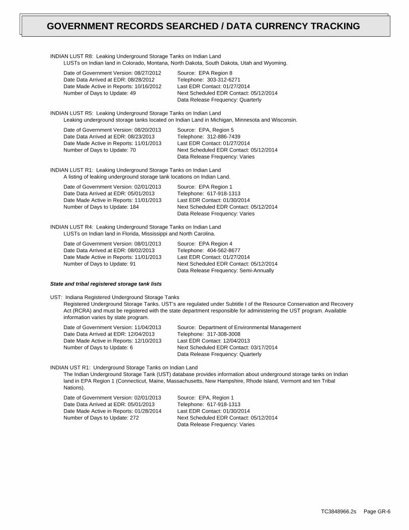
INDIAN LUST R8: Leaking Underground Storage Tanks on Indian LandLUSTs on Indian land in Colorado, Montana, North Dakota, South Dakota, Utah and Wyoming.
Date of Government Version: 08/27/2012Date Data Arrived at EDR: 08/28/2012Date Made Active in Reports: 10/16/2012Number of Days to Update: 49
Source: EPA Region 8Telephone: 303-312-6271Last EDR Contact: 01/27/2014Next Scheduled EDR Contact: 05/12/2014Data Release Frequency: Quarterly
INDIAN LUST R5: Leaking Underground Storage Tanks on Indian LandLeaking underground storage tanks located on Indian Land in Michigan, Minnesota and Wisconsin.
Date of Government Version: 08/20/2013Date Data Arrived at EDR: 08/23/2013Date Made Active in Reports: 11/01/2013Number of Days to Update: 70
Source: EPA, Region 5Telephone: 312-886-7439Last EDR Contact: 01/27/2014Next Scheduled EDR Contact: 05/12/2014Data Release Frequency: Varies
INDIAN LUST R1: Leaking Underground Storage Tanks on Indian LandA listing of leaking underground storage tank locations on Indian Land.
Date of Government Version: 02/01/2013Date Data Arrived at EDR: 05/01/2013Date Made Active in Reports: 11/01/2013Number of Days to Update: 184
Source: EPA Region 1Telephone: 617-918-1313Last EDR Contact: 01/30/2014Next Scheduled EDR Contact: 05/12/2014Data Release Frequency: Varies
INDIAN LUST R4: Leaking Underground Storage Tanks on Indian LandLUSTs on Indian land in Florida, Mississippi and North Carolina.
Date of Government Version: 08/01/2013Date Data Arrived at EDR: 08/02/2013Date Made Active in Reports: 11/01/2013Number of Days to Update: 91
Source: EPA Region 4Telephone: 404-562-8677Last EDR Contact: 01/27/2014Next Scheduled EDR Contact: 05/12/2014Data Release Frequency: Semi-Annually
State and tribal registered storage tank lists
UST: Indiana Registered Underground Storage TanksRegistered Underground Storage Tanks. UST’s are regulated under Subtitle I of the Resource Conservation and RecoveryAct (RCRA) and must be registered with the state department responsible for administering the UST program. Availableinformation varies by state program.
Date of Government Version: 11/04/2013Date Data Arrived at EDR: 12/04/2013Date Made Active in Reports: 12/10/2013Number of Days to Update: 6
Source: Department of Environmental ManagementTelephone: 317-308-3008Last EDR Contact: 12/04/2013Next Scheduled EDR Contact: 03/17/2014Data Release Frequency: Quarterly
INDIAN UST R1: Underground Storage Tanks on Indian LandThe Indian Underground Storage Tank (UST) database provides information about underground storage tanks on Indianland in EPA Region 1 (Connecticut, Maine, Massachusetts, New Hampshire, Rhode Island, Vermont and ten TribalNations).
Date of Government Version: 02/01/2013Date Data Arrived at EDR: 05/01/2013Date Made Active in Reports: 01/28/2014Number of Days to Update: 272
Source: EPA, Region 1Telephone: 617-918-1313Last EDR Contact: 01/30/2014Next Scheduled EDR Contact: 05/12/2014Data Release Frequency: Varies
TC3848966.2s Page GR-6
GOVERNMENT RECORDS SEARCHED / DATA CURRENCY TRACKING
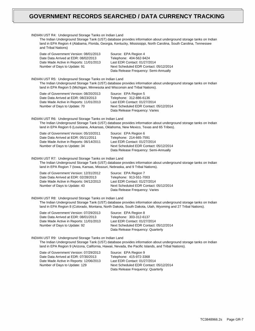
INDIAN UST R4: Underground Storage Tanks on Indian LandThe Indian Underground Storage Tank (UST) database provides information about underground storage tanks on Indianland in EPA Region 4 (Alabama, Florida, Georgia, Kentucky, Mississippi, North Carolina, South Carolina, Tennesseeand Tribal Nations)
Date of Government Version: 08/01/2013Date Data Arrived at EDR: 08/02/2013Date Made Active in Reports: 11/01/2013Number of Days to Update: 91
Source: EPA Region 4Telephone: 404-562-9424Last EDR Contact: 01/27/2014Next Scheduled EDR Contact: 05/12/2014Data Release Frequency: Semi-Annually
INDIAN UST R5: Underground Storage Tanks on Indian LandThe Indian Underground Storage Tank (UST) database provides information about underground storage tanks on Indianland in EPA Region 5 (Michigan, Minnesota and Wisconsin and Tribal Nations).
Date of Government Version: 08/20/2013Date Data Arrived at EDR: 08/23/2013Date Made Active in Reports: 11/01/2013Number of Days to Update: 70
Source: EPA Region 5Telephone: 312-886-6136Last EDR Contact: 01/27/2014Next Scheduled EDR Contact: 05/12/2014Data Release Frequency: Varies
INDIAN UST R6: Underground Storage Tanks on Indian LandThe Indian Underground Storage Tank (UST) database provides information about underground storage tanks on Indianland in EPA Region 6 (Louisiana, Arkansas, Oklahoma, New Mexico, Texas and 65 Tribes).
Date of Government Version: 05/10/2011Date Data Arrived at EDR: 05/11/2011Date Made Active in Reports: 06/14/2011Number of Days to Update: 34
Source: EPA Region 6Telephone: 214-665-7591Last EDR Contact: 01/27/2014Next Scheduled EDR Contact: 05/12/2014Data Release Frequency: Semi-Annually
INDIAN UST R7: Underground Storage Tanks on Indian LandThe Indian Underground Storage Tank (UST) database provides information about underground storage tanks on Indianland in EPA Region 7 (Iowa, Kansas, Missouri, Nebraska, and 9 Tribal Nations).
Date of Government Version: 12/31/2012Date Data Arrived at EDR: 02/28/2013Date Made Active in Reports: 04/12/2013Number of Days to Update: 43
Source: EPA Region 7Telephone: 913-551-7003Last EDR Contact: 01/27/2014Next Scheduled EDR Contact: 05/12/2014Data Release Frequency: Varies
INDIAN UST R8: Underground Storage Tanks on Indian LandThe Indian Underground Storage Tank (UST) database provides information about underground storage tanks on Indianland in EPA Region 8 (Colorado, Montana, North Dakota, South Dakota, Utah, Wyoming and 27 Tribal Nations).
Date of Government Version: 07/29/2013Date Data Arrived at EDR: 08/01/2013Date Made Active in Reports: 11/01/2013Number of Days to Update: 92
Source: EPA Region 8Telephone: 303-312-6137Last EDR Contact: 01/27/2014Next Scheduled EDR Contact: 05/12/2014Data Release Frequency: Quarterly
INDIAN UST R9: Underground Storage Tanks on Indian LandThe Indian Underground Storage Tank (UST) database provides information about underground storage tanks on Indianland in EPA Region 9 (Arizona, California, Hawaii, Nevada, the Pacific Islands, and Tribal Nations).
Date of Government Version: 07/29/2013Date Data Arrived at EDR: 07/30/2013Date Made Active in Reports: 12/06/2013Number of Days to Update: 129
Source: EPA Region 9Telephone: 415-972-3368Last EDR Contact: 01/27/2014Next Scheduled EDR Contact: 05/12/2014Data Release Frequency: Quarterly
TC3848966.2s Page GR-7
GOVERNMENT RECORDS SEARCHED / DATA CURRENCY TRACKING
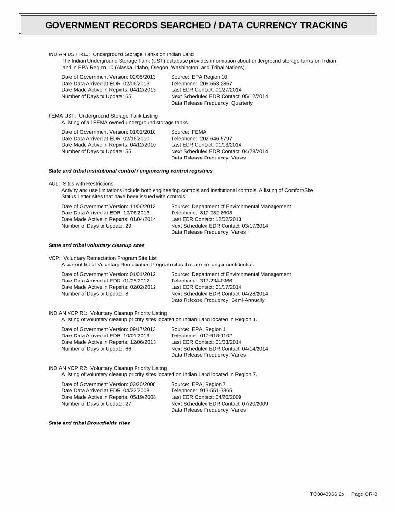
INDIAN UST R10: Underground Storage Tanks on Indian LandThe Indian Underground Storage Tank (UST) database provides information about underground storage tanks on Indianland in EPA Region 10 (Alaska, Idaho, Oregon, Washington, and Tribal Nations).
Date of Government Version: 02/05/2013Date Data Arrived at EDR: 02/06/2013Date Made Active in Reports: 04/12/2013Number of Days to Update: 65
Source: EPA Region 10Telephone: 206-553-2857Last EDR Contact: 01/27/2014Next Scheduled EDR Contact: 05/12/2014Data Release Frequency: Quarterly
FEMA UST: Underground Storage Tank ListingA listing of all FEMA owned underground storage tanks.
Date of Government Version: 01/01/2010Date Data Arrived at EDR: 02/16/2010Date Made Active in Reports: 04/12/2010Number of Days to Update: 55
Source: FEMATelephone: 202-646-5797Last EDR Contact: 01/13/2014Next Scheduled EDR Contact: 04/28/2014Data Release Frequency: Varies
State and tribal institutional control / engineering control registries
AUL: Sites with RestrictionsActivity and use limitations include both engineering controls and institutional controls. A listing of Comfort/SiteStatus Letter sites that have been issued with controls.
Date of Government Version: 11/06/2013Date Data Arrived at EDR: 12/06/2013Date Made Active in Reports: 01/04/2014Number of Days to Update: 29
Source: Department of Environmental ManagementTelephone: 317-232-8603Last EDR Contact: 12/02/2013Next Scheduled EDR Contact: 03/17/2014Data Release Frequency: Varies
State and tribal voluntary cleanup sites
VCP: Voluntary Remediation Program Site ListA current list of Voluntary Remediation Program sites that are no longer confidential.
Date of Government Version: 01/01/2012Date Data Arrived at EDR: 01/25/2012Date Made Active in Reports: 02/02/2012Number of Days to Update: 8
Source: Department of Environmental ManagementTelephone: 317-234-0966Last EDR Contact: 01/17/2014Next Scheduled EDR Contact: 04/28/2014Data Release Frequency: Semi-Annually
INDIAN VCP R1: Voluntary Cleanup Priority ListingA listing of voluntary cleanup priority sites located on Indian Land located in Region 1.
Date of Government Version: 09/17/2013Date Data Arrived at EDR: 10/01/2013Date Made Active in Reports: 12/06/2013Number of Days to Update: 66
Source: EPA, Region 1Telephone: 617-918-1102Last EDR Contact: 01/03/2014Next Scheduled EDR Contact: 04/14/2014Data Release Frequency: Varies
INDIAN VCP R7: Voluntary Cleanup Priority LisitngA listing of voluntary cleanup priority sites located on Indian Land located in Region 7.
Date of Government Version: 03/20/2008Date Data Arrived at EDR: 04/22/2008Date Made Active in Reports: 05/19/2008Number of Days to Update: 27
Source: EPA, Region 7Telephone: 913-551-7365Last EDR Contact: 04/20/2009Next Scheduled EDR Contact: 07/20/2009Data Release Frequency: Varies
State and tribal Brownfields sites
TC3848966.2s Page GR-8
GOVERNMENT RECORDS SEARCHED / DATA CURRENCY TRACKING

BROWNFIELDS: Brownfields Site ListA brownfield site is an industrial or commercial property that is abandoned, inactive, or underutilized, on whichexpansion or redeveloopment is complicated due to the actual or perceived environmental contamination.
Date of Government Version: 12/03/2013Date Data Arrived at EDR: 12/04/2013Date Made Active in Reports: 12/09/2013Number of Days to Update: 5
Source: Department of Environmental ManagementTelephone: 317-233-2570Last EDR Contact: 12/02/2013Next Scheduled EDR Contact: 03/17/2014Data Release Frequency: Semi-Annually
ADDITIONAL ENVIRONMENTAL RECORDS
Local Brownfield lists
US BROWNFIELDS: A Listing of Brownfields SitesBrownfields are real property, the expansion, redevelopment, or reuse of which may be complicated by the presenceor potential presence of a hazardous substance, pollutant, or contaminant. Cleaning up and reinvesting in theseproperties takes development pressures off of undeveloped, open land, and both improves and protects the environment.Assessment, Cleanup and Redevelopment Exchange System (ACRES) stores information reported by EPA Brownfieldsgrant recipients on brownfields properties assessed or cleaned up with grant funding as well as information onTargeted Brownfields Assessments performed by EPA Regions. A listing of ACRES Brownfield sites is obtained fromCleanups in My Community. Cleanups in My Community provides information on Brownfields properties for which informationis reported back to EPA, as well as areas served by Brownfields grant programs.
Date of Government Version: 09/24/2013Date Data Arrived at EDR: 09/24/2013Date Made Active in Reports: 12/06/2013Number of Days to Update: 73
Source: Environmental Protection AgencyTelephone: 202-566-2777Last EDR Contact: 12/24/2013Next Scheduled EDR Contact: 04/07/2014Data Release Frequency: Semi-Annually
Local Lists of Landfill / Solid Waste Disposal Sites
DEBRIS REGION 9: Torres Martinez Reservation Illegal Dump Site LocationsA listing of illegal dump sites location on the Torres Martinez Indian Reservation located in eastern RiversideCounty and northern Imperial County, California.
Date of Government Version: 01/12/2009Date Data Arrived at EDR: 05/07/2009Date Made Active in Reports: 09/21/2009Number of Days to Update: 137
Source: EPA, Region 9Telephone: 415-947-4219Last EDR Contact: 01/27/2014Next Scheduled EDR Contact: 05/12/2014Data Release Frequency: No Update Planned
ODI: Open Dump InventoryAn open dump is defined as a disposal facility that does not comply with one or more of the Part 257 or Part 258Subtitle D Criteria.
Date of Government Version: 06/30/1985Date Data Arrived at EDR: 08/09/2004Date Made Active in Reports: 09/17/2004Number of Days to Update: 39
Source: Environmental Protection AgencyTelephone: 800-424-9346Last EDR Contact: 06/09/2004Next Scheduled EDR Contact: N/AData Release Frequency: No Update Planned
SWRCY: Recycling FacilitiesA listing of recycling facilities located in the state of Indiana.
Date of Government Version: 10/26/2009Date Data Arrived at EDR: 11/02/2009Date Made Active in Reports: 11/11/2009Number of Days to Update: 9
Source: Department of Environmental ManagementTelephone: 317-234-4050Last EDR Contact: 01/20/2014Next Scheduled EDR Contact: 05/05/2014Data Release Frequency: Varies
TC3848966.2s Page GR-9
GOVERNMENT RECORDS SEARCHED / DATA CURRENCY TRACKING
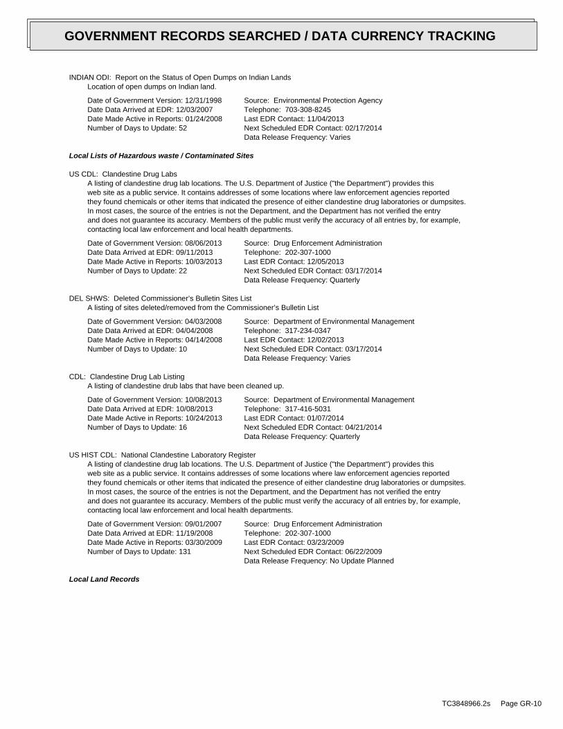
INDIAN ODI: Report on the Status of Open Dumps on Indian LandsLocation of open dumps on Indian land.
Date of Government Version: 12/31/1998Date Data Arrived at EDR: 12/03/2007Date Made Active in Reports: 01/24/2008Number of Days to Update: 52
Source: Environmental Protection AgencyTelephone: 703-308-8245Last EDR Contact: 11/04/2013Next Scheduled EDR Contact: 02/17/2014Data Release Frequency: Varies
Local Lists of Hazardous waste / Contaminated Sites
US CDL: Clandestine Drug LabsA listing of clandestine drug lab locations. The U.S. Department of Justice ("the Department") provides thisweb site as a public service. It contains addresses of some locations where law enforcement agencies reportedthey found chemicals or other items that indicated the presence of either clandestine drug laboratories or dumpsites.In most cases, the source of the entries is not the Department, and the Department has not verified the entryand does not guarantee its accuracy. Members of the public must verify the accuracy of all entries by, for example,contacting local law enforcement and local health departments.
Date of Government Version: 08/06/2013Date Data Arrived at EDR: 09/11/2013Date Made Active in Reports: 10/03/2013Number of Days to Update: 22
Source: Drug Enforcement AdministrationTelephone: 202-307-1000Last EDR Contact: 12/05/2013Next Scheduled EDR Contact: 03/17/2014Data Release Frequency: Quarterly
DEL SHWS: Deleted Commissioner’s Bulletin Sites ListA listing of sites deleted/removed from the Commissioner’s Bulletin List
Date of Government Version: 04/03/2008Date Data Arrived at EDR: 04/04/2008Date Made Active in Reports: 04/14/2008Number of Days to Update: 10
Source: Department of Environmental ManagementTelephone: 317-234-0347Last EDR Contact: 12/02/2013Next Scheduled EDR Contact: 03/17/2014Data Release Frequency: Varies
CDL: Clandestine Drug Lab ListingA listing of clandestine drub labs that have been cleaned up.
Date of Government Version: 10/08/2013Date Data Arrived at EDR: 10/08/2013Date Made Active in Reports: 10/24/2013Number of Days to Update: 16
Source: Department of Environmental ManagementTelephone: 317-416-5031Last EDR Contact: 01/07/2014Next Scheduled EDR Contact: 04/21/2014Data Release Frequency: Quarterly
US HIST CDL: National Clandestine Laboratory RegisterA listing of clandestine drug lab locations. The U.S. Department of Justice ("the Department") provides thisweb site as a public service. It contains addresses of some locations where law enforcement agencies reportedthey found chemicals or other items that indicated the presence of either clandestine drug laboratories or dumpsites.In most cases, the source of the entries is not the Department, and the Department has not verified the entryand does not guarantee its accuracy. Members of the public must verify the accuracy of all entries by, for example,contacting local law enforcement and local health departments.
Date of Government Version: 09/01/2007Date Data Arrived at EDR: 11/19/2008Date Made Active in Reports: 03/30/2009Number of Days to Update: 131
Source: Drug Enforcement AdministrationTelephone: 202-307-1000Last EDR Contact: 03/23/2009Next Scheduled EDR Contact: 06/22/2009Data Release Frequency: No Update Planned
Local Land Records
TC3848966.2s Page GR-10
GOVERNMENT RECORDS SEARCHED / DATA CURRENCY TRACKING
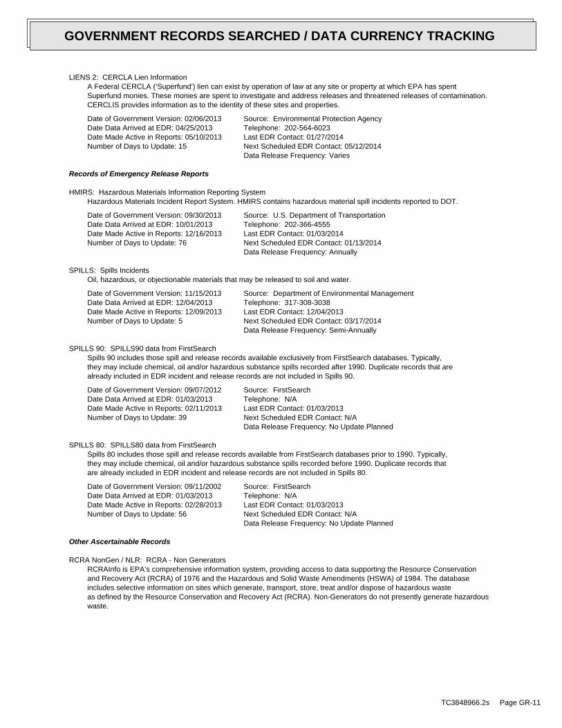
LIENS 2: CERCLA Lien InformationA Federal CERCLA (’Superfund’) lien can exist by operation of law at any site or property at which EPA has spentSuperfund monies. These monies are spent to investigate and address releases and threatened releases of contamination.CERCLIS provides information as to the identity of these sites and properties.
Date of Government Version: 02/06/2013Date Data Arrived at EDR: 04/25/2013Date Made Active in Reports: 05/10/2013Number of Days to Update: 15
Source: Environmental Protection AgencyTelephone: 202-564-6023Last EDR Contact: 01/27/2014Next Scheduled EDR Contact: 05/12/2014Data Release Frequency: Varies
Records of Emergency Release Reports
HMIRS: Hazardous Materials Information Reporting SystemHazardous Materials Incident Report System. HMIRS contains hazardous material spill incidents reported to DOT.
Date of Government Version: 09/30/2013Date Data Arrived at EDR: 10/01/2013Date Made Active in Reports: 12/16/2013Number of Days to Update: 76
Source: U.S. Department of TransportationTelephone: 202-366-4555Last EDR Contact: 01/03/2014Next Scheduled EDR Contact: 01/13/2014Data Release Frequency: Annually
SPILLS: Spills IncidentsOil, hazardous, or objectionable materials that may be released to soil and water.
Date of Government Version: 11/15/2013Date Data Arrived at EDR: 12/04/2013Date Made Active in Reports: 12/09/2013Number of Days to Update: 5
Source: Department of Environmental ManagementTelephone: 317-308-3038Last EDR Contact: 12/04/2013Next Scheduled EDR Contact: 03/17/2014Data Release Frequency: Semi-Annually
SPILLS 90: SPILLS90 data from FirstSearchSpills 90 includes those spill and release records available exclusively from FirstSearch databases. Typically,they may include chemical, oil and/or hazardous substance spills recorded after 1990. Duplicate records that arealready included in EDR incident and release records are not included in Spills 90.
Date of Government Version: 09/07/2012Date Data Arrived at EDR: 01/03/2013Date Made Active in Reports: 02/11/2013Number of Days to Update: 39
Source: FirstSearchTelephone: N/ALast EDR Contact: 01/03/2013Next Scheduled EDR Contact: N/AData Release Frequency: No Update Planned
SPILLS 80: SPILLS80 data from FirstSearchSpills 80 includes those spill and release records available from FirstSearch databases prior to 1990. Typically,they may include chemical, oil and/or hazardous substance spills recorded before 1990. Duplicate records thatare already included in EDR incident and release records are not included in Spills 80.
Date of Government Version: 09/11/2002Date Data Arrived at EDR: 01/03/2013Date Made Active in Reports: 02/28/2013Number of Days to Update: 56
Source: FirstSearchTelephone: N/ALast EDR Contact: 01/03/2013Next Scheduled EDR Contact: N/AData Release Frequency: No Update Planned
Other Ascertainable Records
RCRA NonGen / NLR: RCRA - Non GeneratorsRCRAInfo is EPA’s comprehensive information system, providing access to data supporting the Resource Conservationand Recovery Act (RCRA) of 1976 and the Hazardous and Solid Waste Amendments (HSWA) of 1984. The databaseincludes selective information on sites which generate, transport, store, treat and/or dispose of hazardous wasteas defined by the Resource Conservation and Recovery Act (RCRA). Non-Generators do not presently generate hazardouswaste.
TC3848966.2s Page GR-11
GOVERNMENT RECORDS SEARCHED / DATA CURRENCY TRACKING
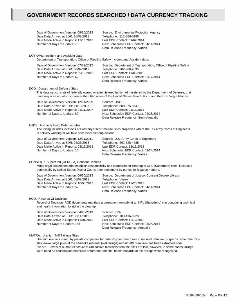
Date of Government Version: 09/10/2013Date Data Arrived at EDR: 10/02/2013Date Made Active in Reports: 12/16/2013Number of Days to Update: 75
Source: Environmental Protection AgencyTelephone: 312-886-6186Last EDR Contact: 01/02/2014Next Scheduled EDR Contact: 04/14/2014Data Release Frequency: Varies
DOT OPS: Incident and Accident DataDepartment of Transporation, Office of Pipeline Safety Incident and Accident data.
Date of Government Version: 07/31/2012Date Data Arrived at EDR: 08/07/2012Date Made Active in Reports: 09/18/2012Number of Days to Update: 42
Source: Department of Transporation, Office of Pipeline SafetyTelephone: 202-366-4595Last EDR Contact: 11/06/2013Next Scheduled EDR Contact: 02/17/2014Data Release Frequency: Varies
DOD: Department of Defense SitesThis data set consists of federally owned or administered lands, administered by the Department of Defense, thathave any area equal to or greater than 640 acres of the United States, Puerto Rico, and the U.S. Virgin Islands.
Date of Government Version: 12/31/2005Date Data Arrived at EDR: 11/10/2006Date Made Active in Reports: 01/11/2007Number of Days to Update: 62
Source: USGSTelephone: 888-275-8747Last EDR Contact: 01/15/2014Next Scheduled EDR Contact: 04/28/2014Data Release Frequency: Semi-Annually
FUDS: Formerly Used Defense SitesThe listing includes locations of Formerly Used Defense Sites properties where the US Army Corps of Engineersis actively working or will take necessary cleanup actions.
Date of Government Version: 12/31/2011Date Data Arrived at EDR: 02/26/2013Date Made Active in Reports: 03/13/2013Number of Days to Update: 15
Source: U.S. Army Corps of EngineersTelephone: 202-528-4285Last EDR Contact: 12/13/2013Next Scheduled EDR Contact: 03/24/2014Data Release Frequency: Varies
CONSENT: Superfund (CERCLA) Consent DecreesMajor legal settlements that establish responsibility and standards for cleanup at NPL (Superfund) sites. Releasedperiodically by United States District Courts after settlement by parties to litigation matters.
Date of Government Version: 06/30/2013Date Data Arrived at EDR: 08/07/2013Date Made Active in Reports: 10/03/2013Number of Days to Update: 57
Source: Department of Justice, Consent Decree LibraryTelephone: VariesLast EDR Contact: 12/26/2013Next Scheduled EDR Contact: 04/14/2014Data Release Frequency: Varies
ROD: Records Of DecisionRecord of Decision. ROD documents mandate a permanent remedy at an NPL (Superfund) site containing technicaland health information to aid in the cleanup.
Date of Government Version: 04/26/2013Date Data Arrived at EDR: 06/11/2013Date Made Active in Reports: 11/01/2013Number of Days to Update: 143
Source: EPATelephone: 703-416-0223Last EDR Contact: 12/12/2013Next Scheduled EDR Contact: 03/24/2014Data Release Frequency: Annually
UMTRA: Uranium Mill Tailings SitesUranium ore was mined by private companies for federal government use in national defense programs. When the millsshut down, large piles of the sand-like material (mill tailings) remain after uranium has been extracted fromthe ore. Levels of human exposure to radioactive materials from the piles are low; however, in some cases tailingswere used as construction materials before the potential health hazards of the tailings were recognized.
TC3848966.2s Page GR-12
GOVERNMENT RECORDS SEARCHED / DATA CURRENCY TRACKING
Date of Government Version: 09/14/2010Date Data Arrived at EDR: 10/07/2011Date Made Active in Reports: 03/01/2012Number of Days to Update: 146
Source: Department of EnergyTelephone: 505-845-0011Last EDR Contact: 11/26/2013Next Scheduled EDR Contact: 03/10/2014Data Release Frequency: Varies
US MINES: Mines Master Index FileContains all mine identification numbers issued for mines active or opened since 1971. The data also includesviolation information.
Date of Government Version: 08/01/2013Date Data Arrived at EDR: 09/05/2013Date Made Active in Reports: 10/03/2013Number of Days to Update: 28
Source: Department of Labor, Mine Safety and Health AdministrationTelephone: 303-231-5959Last EDR Contact: 12/06/2013Next Scheduled EDR Contact: 03/17/2014Data Release Frequency: Semi-Annually
TRIS: Toxic Chemical Release Inventory SystemToxic Release Inventory System. TRIS identifies facilities which release toxic chemicals to the air, water andland in reportable quantities under SARA Title III Section 313.
Date of Government Version: 12/31/2011Date Data Arrived at EDR: 07/31/2013Date Made Active in Reports: 09/13/2013Number of Days to Update: 44
Source: EPATelephone: 202-566-0250Last EDR Contact: 11/27/2013Next Scheduled EDR Contact: 03/10/2014Data Release Frequency: Annually
TSCA: Toxic Substances Control ActToxic Substances Control Act. TSCA identifies manufacturers and importers of chemical substances included on theTSCA Chemical Substance Inventory list. It includes data on the production volume of these substances by plantsite.
Date of Government Version: 12/31/2006Date Data Arrived at EDR: 09/29/2010Date Made Active in Reports: 12/02/2010Number of Days to Update: 64
Source: EPATelephone: 202-260-5521Last EDR Contact: 12/26/2013Next Scheduled EDR Contact: 04/07/2014Data Release Frequency: Every 4 Years
FTTS: FIFRA/ TSCA Tracking System - FIFRA (Federal Insecticide, Fungicide, & Rodenticide Act)/TSCA (Toxic Substances Control Act)FTTS tracks administrative cases and pesticide enforcement actions and compliance activities related to FIFRA,TSCA and EPCRA (Emergency Planning and Community Right-to-Know Act). To maintain currency, EDR contacts theAgency on a quarterly basis.
Date of Government Version: 04/09/2009Date Data Arrived at EDR: 04/16/2009Date Made Active in Reports: 05/11/2009Number of Days to Update: 25
Source: EPA/Office of Prevention, Pesticides and Toxic SubstancesTelephone: 202-566-1667Last EDR Contact: 11/21/2013Next Scheduled EDR Contact: 03/10/2014Data Release Frequency: Quarterly
FTTS INSP: FIFRA/ TSCA Tracking System - FIFRA (Federal Insecticide, Fungicide, & Rodenticide Act)/TSCA (Toxic Substances Control Act)A listing of FIFRA/TSCA Tracking System (FTTS) inspections and enforcements.
Date of Government Version: 04/09/2009Date Data Arrived at EDR: 04/16/2009Date Made Active in Reports: 05/11/2009Number of Days to Update: 25
Source: EPATelephone: 202-566-1667Last EDR Contact: 11/21/2014Next Scheduled EDR Contact: 03/10/2014Data Release Frequency: Quarterly
HIST FTTS: FIFRA/TSCA Tracking System Administrative Case ListingA complete administrative case listing from the FIFRA/TSCA Tracking System (FTTS) for all ten EPA regions. Theinformation was obtained from the National Compliance Database (NCDB). NCDB supports the implementation of FIFRA(Federal Insecticide, Fungicide, and Rodenticide Act) and TSCA (Toxic Substances Control Act). Some EPA regionsare now closing out records. Because of that, and the fact that some EPA regions are not providing EPA Headquarterswith updated records, it was decided to create a HIST FTTS database. It included records that may not be includedin the newer FTTS database updates. This database is no longer updated.
TC3848966.2s Page GR-13
GOVERNMENT RECORDS SEARCHED / DATA CURRENCY TRACKING
Date of Government Version: 10/19/2006Date Data Arrived at EDR: 03/01/2007Date Made Active in Reports: 04/10/2007Number of Days to Update: 40
Source: Environmental Protection AgencyTelephone: 202-564-2501Last EDR Contact: 12/17/2007Next Scheduled EDR Contact: 03/17/2008Data Release Frequency: No Update Planned
HIST FTTS INSP: FIFRA/TSCA Tracking System Inspection & Enforcement Case ListingA complete inspection and enforcement case listing from the FIFRA/TSCA Tracking System (FTTS) for all ten EPAregions. The information was obtained from the National Compliance Database (NCDB). NCDB supports the implementationof FIFRA (Federal Insecticide, Fungicide, and Rodenticide Act) and TSCA (Toxic Substances Control Act). SomeEPA regions are now closing out records. Because of that, and the fact that some EPA regions are not providingEPA Headquarters with updated records, it was decided to create a HIST FTTS database. It included records thatmay not be included in the newer FTTS database updates. This database is no longer updated.
Date of Government Version: 10/19/2006Date Data Arrived at EDR: 03/01/2007Date Made Active in Reports: 04/10/2007Number of Days to Update: 40
Source: Environmental Protection AgencyTelephone: 202-564-2501Last EDR Contact: 12/17/2008Next Scheduled EDR Contact: 03/17/2008Data Release Frequency: No Update Planned
SSTS: Section 7 Tracking SystemsSection 7 of the Federal Insecticide, Fungicide and Rodenticide Act, as amended (92 Stat. 829) requires allregistered pesticide-producing establishments to submit a report to the Environmental Protection Agency by March1st each year. Each establishment must report the types and amounts of pesticides, active ingredients and devicesbeing produced, and those having been produced and sold or distributed in the past year.
Date of Government Version: 12/31/2009Date Data Arrived at EDR: 12/10/2010Date Made Active in Reports: 02/25/2011Number of Days to Update: 77
Source: EPATelephone: 202-564-4203Last EDR Contact: 01/28/2014Next Scheduled EDR Contact: 05/12/2014Data Release Frequency: Annually
ICIS: Integrated Compliance Information SystemThe Integrated Compliance Information System (ICIS) supports the information needs of the national enforcementand compliance program as well as the unique needs of the National Pollutant Discharge Elimination System (NPDES)program.
Date of Government Version: 07/20/2011Date Data Arrived at EDR: 11/10/2011Date Made Active in Reports: 01/10/2012Number of Days to Update: 61
Source: Environmental Protection AgencyTelephone: 202-564-5088Last EDR Contact: 10/09/2014Next Scheduled EDR Contact: 04/28/2014Data Release Frequency: Quarterly
PADS: PCB Activity Database SystemPCB Activity Database. PADS Identifies generators, transporters, commercial storers and/or brokers and disposersof PCB’s who are required to notify the EPA of such activities.
Date of Government Version: 06/01/2013Date Data Arrived at EDR: 07/17/2013Date Made Active in Reports: 11/01/2013Number of Days to Update: 107
Source: EPATelephone: 202-566-0500Last EDR Contact: 01/28/2014Next Scheduled EDR Contact: 04/28/2014Data Release Frequency: Annually
MLTS: Material Licensing Tracking SystemMLTS is maintained by the Nuclear Regulatory Commission and contains a list of approximately 8,100 sites whichpossess or use radioactive materials and which are subject to NRC licensing requirements. To maintain currency,EDR contacts the Agency on a quarterly basis.
Date of Government Version: 07/22/2013Date Data Arrived at EDR: 08/02/2013Date Made Active in Reports: 11/01/2013Number of Days to Update: 91
Source: Nuclear Regulatory CommissionTelephone: 301-415-7169Last EDR Contact: 12/09/2013Next Scheduled EDR Contact: 03/24/2014Data Release Frequency: Quarterly
TC3848966.2s Page GR-14
GOVERNMENT RECORDS SEARCHED / DATA CURRENCY TRACKING
RADINFO: Radiation Information DatabaseThe Radiation Information Database (RADINFO) contains information about facilities that are regulated by U.S.Environmental Protection Agency (EPA) regulations for radiation and radioactivity.
Date of Government Version: 09/30/2013Date Data Arrived at EDR: 10/09/2013Date Made Active in Reports: 11/01/2013Number of Days to Update: 23
Source: Environmental Protection AgencyTelephone: 202-343-9775Last EDR Contact: 01/10/2014Next Scheduled EDR Contact: 04/21/2014Data Release Frequency: Quarterly
FINDS: Facility Index System/Facility Registry SystemFacility Index System. FINDS contains both facility information and ’pointers’ to other sources that contain moredetail. EDR includes the following FINDS databases in this report: PCS (Permit Compliance System), AIRS (AerometricInformation Retrieval System), DOCKET (Enforcement Docket used to manage and track information on civil judicialenforcement cases for all environmental statutes), FURS (Federal Underground Injection Control), C-DOCKET (CriminalDocket System used to track criminal enforcement actions for all environmental statutes), FFIS (Federal FacilitiesInformation System), STATE (State Environmental Laws and Statutes), and PADS (PCB Activity Data System).
Date of Government Version: 03/08/2013Date Data Arrived at EDR: 03/21/2013Date Made Active in Reports: 07/10/2013Number of Days to Update: 111
Source: EPATelephone: (312) 353-2000Last EDR Contact: 12/10/2013Next Scheduled EDR Contact: 03/24/2014Data Release Frequency: Quarterly
RAATS: RCRA Administrative Action Tracking SystemRCRA Administration Action Tracking System. RAATS contains records based on enforcement actions issued under RCRApertaining to major violators and includes administrative and civil actions brought by the EPA. For administrationactions after September 30, 1995, data entry in the RAATS database was discontinued. EPA will retain a copy ofthe database for historical records. It was necessary to terminate RAATS because a decrease in agency resourcesmade it impossible to continue to update the information contained in the database.
Date of Government Version: 04/17/1995Date Data Arrived at EDR: 07/03/1995Date Made Active in Reports: 08/07/1995Number of Days to Update: 35
Source: EPATelephone: 202-564-4104Last EDR Contact: 06/02/2008Next Scheduled EDR Contact: 09/01/2008Data Release Frequency: No Update Planned
RMP: Risk Management PlansWhen Congress passed the Clean Air Act Amendments of 1990, it required EPA to publish regulations and guidancefor chemical accident prevention at facilities using extremely hazardous substances. The Risk Management ProgramRule (RMP Rule) was written to implement Section 112(r) of these amendments. The rule, which built upon existingindustry codes and standards, requires companies of all sizes that use certain flammable and toxic substancesto develop a Risk Management Program, which includes a(n): Hazard assessment that details the potential effectsof an accidental release, an accident history of the last five years, and an evaluation of worst-case and alternativeaccidental releases; Prevention program that includes safety precautions and maintenance, monitoring, and employeetraining measures; and Emergency response program that spells out emergency health care, employee training measuresand procedures for informing the public and response agencies (e.g the fire department) should an accident occur.
Date of Government Version: 05/08/2012Date Data Arrived at EDR: 05/25/2012Date Made Active in Reports: 07/10/2012Number of Days to Update: 46
Source: Environmental Protection AgencyTelephone: 202-564-8600Last EDR Contact: 01/27/2014Next Scheduled EDR Contact: 05/12/2014Data Release Frequency: Varies
BRS: Biennial Reporting SystemThe Biennial Reporting System is a national system administered by the EPA that collects data on the generationand management of hazardous waste. BRS captures detailed data from two groups: Large Quantity Generators (LQG)and Treatment, Storage, and Disposal Facilities.
TC3848966.2s Page GR-15
GOVERNMENT RECORDS SEARCHED / DATA CURRENCY TRACKING

Date of Government Version: 12/31/2011Date Data Arrived at EDR: 02/26/2013Date Made Active in Reports: 04/19/2013Number of Days to Update: 52
Source: EPA/NTISTelephone: 800-424-9346Last EDR Contact: 11/25/2013Next Scheduled EDR Contact: 03/10/2014Data Release Frequency: Biennially
NPDES: NPDES Permit ListingA listing of active NPDES Permit Section facility locations.
Date of Government Version: 01/13/2014Date Data Arrived at EDR: 01/14/2014Date Made Active in Reports: 01/20/2014Number of Days to Update: 6
Source: Department of Environmental ManagementTelephone: 317-233-0676Last EDR Contact: 01/13/2014Next Scheduled EDR Contact: 04/28/2014Data Release Frequency: Varies
UIC: UIC Site ListingA listing of class II well locations
Date of Government Version: 12/09/2013Date Data Arrived at EDR: 12/11/2013Date Made Active in Reports: 01/04/2014Number of Days to Update: 24
Source: Department of Natural ResourcesTelephone: 317-232-0045Last EDR Contact: 12/02/2013Next Scheduled EDR Contact: 03/17/2014Data Release Frequency: Varies
BULK: Registered Bulk Fertilizer and Pesticide Storage FacilitiesA listing of registered dry or liquid bulk fertilizer and pesticide storage facilities.
Date of Government Version: 04/01/2013Date Data Arrived at EDR: 04/09/2013Date Made Active in Reports: 04/30/2013Number of Days to Update: 21
Source: Office of Indiana State ChemistTelephone: 765-494-0579Last EDR Contact: 01/03/2014Next Scheduled EDR Contact: 04/21/2014Data Release Frequency: Varies
IN MANIFEST: Manifest DataManifest is a document that lists and tracks hazardous waste from the generator through transporters to a tsdfacility.
Date of Government Version: 12/31/2011Date Data Arrived at EDR: 10/10/2013Date Made Active in Reports: 10/24/2013Number of Days to Update: 14
Source: Department of Environmental ManagementTelephone: 317-233-4624Last EDR Contact: 01/03/2014Next Scheduled EDR Contact: 04/21/2014Data Release Frequency: Annually
DRYCLEANERS: Drycleaner Facility ListingA list of drycleaners involved in the Indiana 5-Star Environmental Recognition Program. It is a voluntary programthat ranks participating drycleaners on a scale of one to five stars. The program recognizes those drycleanerswilling to do more for the environment and worker safety than the rules require. These drycleaners are going aboveand beyond the rules to protect the environment, their employees and their neighbors and customers.
Date of Government Version: 12/30/2013Date Data Arrived at EDR: 12/31/2013Date Made Active in Reports: 01/04/2014Number of Days to Update: 4
Source: Department of Environmental ManagementTelephone: 800-988-7901Last EDR Contact: 12/13/2013Next Scheduled EDR Contact: 03/31/2014Data Release Frequency: Varies
AIRS: Permitted Sources & Emissions ListingCurrent permitted sources and emissions inventory information.
Date of Government Version: 12/31/2012Date Data Arrived at EDR: 07/08/2013Date Made Active in Reports: 08/29/2013Number of Days to Update: 52
Source: Department of Environmental ManagementTelephone: 317-233-0185Last EDR Contact: 01/03/2014Next Scheduled EDR Contact: 04/21/2014Data Release Frequency: Varies
TC3848966.2s Page GR-16
GOVERNMENT RECORDS SEARCHED / DATA CURRENCY TRACKING
TIER 2: Tier 2 Facility ListingA listing of facilities which store or manufacture hazardous materials that submit a chemical inventory report.
Date of Government Version: 12/31/2012Date Data Arrived at EDR: 09/05/2013Date Made Active in Reports: 12/11/2013Number of Days to Update: 97
Source: Department of Environmental ManagementTelephone: 317-233-0066Last EDR Contact: 12/02/2013Next Scheduled EDR Contact: 03/17/2014Data Release Frequency: Varies
INDIAN RESERV: Indian ReservationsThis map layer portrays Indian administered lands of the United States that have any area equal to or greaterthan 640 acres.
Date of Government Version: 12/31/2005Date Data Arrived at EDR: 12/08/2006Date Made Active in Reports: 01/11/2007Number of Days to Update: 34
Source: USGSTelephone: 202-208-3710Last EDR Contact: 01/15/2014Next Scheduled EDR Contact: 04/28/2014Data Release Frequency: Semi-Annually
SCRD DRYCLEANERS: State Coalition for Remediation of Drycleaners ListingThe State Coalition for Remediation of Drycleaners was established in 1998, with support from the U.S. EPA Officeof Superfund Remediation and Technology Innovation. It is comprised of representatives of states with establisheddrycleaner remediation programs. Currently the member states are Alabama, Connecticut, Florida, Illinois, Kansas,Minnesota, Missouri, North Carolina, Oregon, South Carolina, Tennessee, Texas, and Wisconsin.
Date of Government Version: 03/07/2011Date Data Arrived at EDR: 03/09/2011Date Made Active in Reports: 05/02/2011Number of Days to Update: 54
Source: Environmental Protection AgencyTelephone: 615-532-8599Last EDR Contact: 01/20/2014Next Scheduled EDR Contact: 05/05/2014Data Release Frequency: Varies
Financial Assurance 2: Financial Assurance Information ListingFinancial assurance information for solid waste facilities. Financial assurance is intended to ensure that resourcesare available to pay for the cost of closure, post-closure care, and corrective measures if the owner or operatorof a regulated facility is unable or unwilling to pay.
Date of Government Version: 10/21/2013Date Data Arrived at EDR: 10/22/2013Date Made Active in Reports: 11/08/2013Number of Days to Update: 17
Source: Department of Environmental ManagementTelephone: 317-233-1052Last EDR Contact: 01/03/2014Next Scheduled EDR Contact: 04/21/2014Data Release Frequency: Varies
2020 COR ACTION: 2020 Corrective Action Program ListThe EPA has set ambitious goals for the RCRA Corrective Action program by creating the 2020 Corrective ActionUniverse. This RCRA cleanup baseline includes facilities expected to need corrective action. The 2020 universecontains a wide variety of sites. Some properties are heavily contaminated while others were contaminated buthave since been cleaned up. Still others have not been fully investigated yet, and may require little or no remediation.Inclusion in the 2020 Universe does not necessarily imply failure on the part of a facility to meet its RCRA obligations.
Date of Government Version: 11/11/2011Date Data Arrived at EDR: 05/18/2012Date Made Active in Reports: 05/25/2012Number of Days to Update: 7
Source: Environmental Protection AgencyTelephone: 703-308-4044Last EDR Contact: 11/15/2013Next Scheduled EDR Contact: 02/24/2014Data Release Frequency: Varies
LEAD SMELTER 1: Lead Smelter SitesA listing of former lead smelter site locations.
Date of Government Version: 01/29/2013Date Data Arrived at EDR: 02/14/2013Date Made Active in Reports: 02/27/2013Number of Days to Update: 13
Source: Environmental Protection AgencyTelephone: 703-603-8787Last EDR Contact: 01/03/2014Next Scheduled EDR Contact: 04/21/2014Data Release Frequency: Varies
TC3848966.2s Page GR-17
GOVERNMENT RECORDS SEARCHED / DATA CURRENCY TRACKING
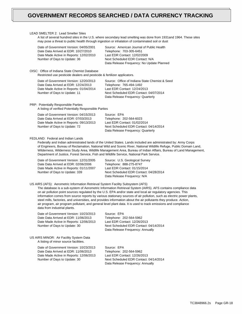
LEAD SMELTER 2: Lead Smelter SitesA list of several hundred sites in the U.S. where secondary lead smelting was done from 1931and 1964. These sitesmay pose a threat to public health through ingestion or inhalation of contaminated soil or dust
Date of Government Version: 04/05/2001Date Data Arrived at EDR: 10/27/2010Date Made Active in Reports: 12/02/2010Number of Days to Update: 36
Source: American Journal of Public HealthTelephone: 703-305-6451Last EDR Contact: 12/02/2009Next Scheduled EDR Contact: N/AData Release Frequency: No Update Planned
OISC: Office of Indiana State Chemist DatabaseRestricted use pesticide dealers and pesticide & fertilizer applicators.
Date of Government Version: 12/20/2013Date Data Arrived at EDR: 12/24/2013Date Made Active in Reports: 01/04/2014Number of Days to Update: 11
Source: Office of Indiana State Chemist & SeedTelephone: 765-494-1492Last EDR Contact: 12/24/2013Next Scheduled EDR Contact: 04/07/2014Data Release Frequency: Quarterly
PRP: Potentially Responsible PartiesA listing of verified Potentially Responsible Parties
Date of Government Version: 04/15/2013Date Data Arrived at EDR: 07/03/2013Date Made Active in Reports: 09/13/2013Number of Days to Update: 72
Source: EPATelephone: 202-564-6023Last EDR Contact: 01/02/2014Next Scheduled EDR Contact: 04/14/2014Data Release Frequency: Quarterly
FEDLAND: Federal and Indian LandsFederally and Indian administrated lands of the United States. Lands included are administrated by: Army Corpsof Engineers, Bureau of Reclamation, National Wild and Scenic River, National Wildlife Refuge, Public Domain Land,Wilderness, Wilderness Study Area, Wildlife Management Area, Bureau of Indian Affairs, Bureau of Land Management,Department of Justice, Forest Service, Fish and Wildlife Service, National Park Service.
Date of Government Version: 12/31/2005Date Data Arrived at EDR: 02/06/2006Date Made Active in Reports: 01/11/2007Number of Days to Update: 339
Source: U.S. Geological SurveyTelephone: 888-275-8747Last EDR Contact: 01/15/2014Next Scheduled EDR Contact: 04/28/2014Data Release Frequency: N/A
US AIRS (AFS): Aerometric Information Retrieval System Facility Subsystem (AFS)The database is a sub-system of Aerometric Information Retrieval System (AIRS). AFS contains compliance dataon air pollution point sources regulated by the U.S. EPA and/or state and local air regulatory agencies. Thisinformation comes from source reports by various stationary sources of air pollution, such as electric power plants,steel mills, factories, and universities, and provides information about the air pollutants they produce. Action,air program, air program pollutant, and general level plant data. It is used to track emissions and compliancedata from industrial plants.
Date of Government Version: 10/23/2013Date Data Arrived at EDR: 11/06/2013Date Made Active in Reports: 12/06/2013Number of Days to Update: 30
Source: EPATelephone: 202-564-5962Last EDR Contact: 12/26/2013Next Scheduled EDR Contact: 04/14/2014Data Release Frequency: Annually
US AIRS MINOR: Air Facility System DataA listing of minor source facilities.
Date of Government Version: 10/23/2013Date Data Arrived at EDR: 11/06/2013Date Made Active in Reports: 12/06/2013Number of Days to Update: 30
Source: EPATelephone: 202-564-5962Last EDR Contact: 12/26/2013Next Scheduled EDR Contact: 04/14/2014Data Release Frequency: Annually
TC3848966.2s Page GR-18
GOVERNMENT RECORDS SEARCHED / DATA CURRENCY TRACKING
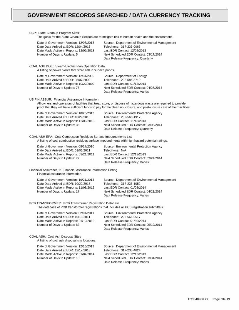
SCP: State Cleanup Program SitesThe goals for the State Cleanup Section are to mitigate risk to human health and the environment.
Date of Government Version: 12/03/2013Date Data Arrived at EDR: 12/04/2013Date Made Active in Reports: 12/09/2013Number of Days to Update: 5
Source: Department of Environmental ManagementTelephone: 317-233-0068Last EDR Contact: 12/02/2013Next Scheduled EDR Contact: 03/17/2014Data Release Frequency: Quarterly
COAL ASH DOE: Sleam-Electric Plan Operation DataA listing of power plants that store ash in surface ponds.
Date of Government Version: 12/31/2005Date Data Arrived at EDR: 08/07/2009Date Made Active in Reports: 10/22/2009Number of Days to Update: 76
Source: Department of EnergyTelephone: 202-586-8719Last EDR Contact: 01/13/2014Next Scheduled EDR Contact: 04/28/2014Data Release Frequency: Varies
US FIN ASSUR: Financial Assurance InformationAll owners and operators of facilities that treat, store, or dispose of hazardous waste are required to provideproof that they will have sufficient funds to pay for the clean up, closure, and post-closure care of their facilities.
Date of Government Version: 10/28/2013Date Data Arrived at EDR: 10/29/2013Date Made Active in Reports: 12/06/2013Number of Days to Update: 38
Source: Environmental Protection AgencyTelephone: 202-566-1917Last EDR Contact: 11/18/2013Next Scheduled EDR Contact: 03/03/2014Data Release Frequency: Quarterly
COAL ASH EPA: Coal Combustion Residues Surface Impoundments ListA listing of coal combustion residues surface impoundments with high hazard potential ratings.
Date of Government Version: 08/17/2010Date Data Arrived at EDR: 01/03/2011Date Made Active in Reports: 03/21/2011Number of Days to Update: 77
Source: Environmental Protection AgencyTelephone: N/ALast EDR Contact: 12/13/2013Next Scheduled EDR Contact: 03/24/2014Data Release Frequency: Varies
Financial Assurance 1: Financial Assurance Information ListingFinancial assurance information.
Date of Government Version: 10/21/2013Date Data Arrived at EDR: 10/22/2013Date Made Active in Reports: 11/08/2013Number of Days to Update: 17
Source: Department of Environmental ManagementTelephone: 317-233-1052Last EDR Contact: 01/03/2014Next Scheduled EDR Contact: 04/21/2014Data Release Frequency: Varies
PCB TRANSFORMER: PCB Transformer Registration DatabaseThe database of PCB transformer registrations that includes all PCB registration submittals.
Date of Government Version: 02/01/2011Date Data Arrived at EDR: 10/19/2011Date Made Active in Reports: 01/10/2012Number of Days to Update: 83
Source: Environmental Protection AgencyTelephone: 202-566-0517Last EDR Contact: 01/30/2014Next Scheduled EDR Contact: 05/12/2014Data Release Frequency: Varies
COAL ASH: Coal Ash Disposal SitesA listing of coal ash disposal site locations.
Date of Government Version: 12/16/2013Date Data Arrived at EDR: 12/17/2013Date Made Active in Reports: 01/04/2014Number of Days to Update: 18
Source: Department of Environmental ManagementTelephone: 317-233-4624Last EDR Contact: 12/13/2013Next Scheduled EDR Contact: 03/31/2014Data Release Frequency: Varies
TC3848966.2s Page GR-19
GOVERNMENT RECORDS SEARCHED / DATA CURRENCY TRACKING
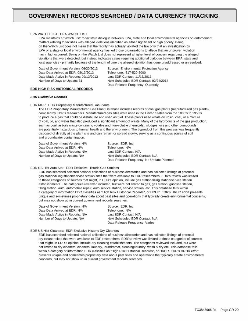
EPA WATCH LIST: EPA WATCH LISTEPA maintains a "Watch List" to facilitate dialogue between EPA, state and local environmental agencies on enforcementmatters relating to facilities with alleged violations identified as either significant or high priority. Beingon the Watch List does not mean that the facility has actually violated the law only that an investigation byEPA or a state or local environmental agency has led those organizations to allege that an unproven violationhas in fact occurred. Being on the Watch List does not represent a higher level of concern regarding the allegedviolations that were detected, but instead indicates cases requiring additional dialogue between EPA, state andlocal agencies - primarily because of the length of time the alleged violation has gone unaddressed or unresolved.
Date of Government Version: 06/30/2013Date Data Arrived at EDR: 08/13/2013Date Made Active in Reports: 09/13/2013Number of Days to Update: 31
Source: Environmental Protection AgencyTelephone: 617-520-3000Last EDR Contact: 11/15/2013Next Scheduled EDR Contact: 02/24/2014Data Release Frequency: Quarterly
EDR HIGH RISK HISTORICAL RECORDS
EDR Exclusive Records
EDR MGP: EDR Proprietary Manufactured Gas PlantsThe EDR Proprietary Manufactured Gas Plant Database includes records of coal gas plants (manufactured gas plants)compiled by EDR’s researchers. Manufactured gas sites were used in the United States from the 1800’s to 1950’sto produce a gas that could be distributed and used as fuel. These plants used whale oil, rosin, coal, or a mixtureof coal, oil, and water that also produced a significant amount of waste. Many of the byproducts of the gas production,such as coal tar (oily waste containing volatile and non-volatile chemicals), sludges, oils and other compoundsare potentially hazardous to human health and the environment. The byproduct from this process was frequentlydisposed of directly at the plant site and can remain or spread slowly, serving as a continuous source of soiland groundwater contamination.
Date of Government Version: N/ADate Data Arrived at EDR: N/ADate Made Active in Reports: N/ANumber of Days to Update: N/A
Source: EDR, Inc.Telephone: N/ALast EDR Contact: N/ANext Scheduled EDR Contact: N/AData Release Frequency: No Update Planned
EDR US Hist Auto Stat: EDR Exclusive Historic Gas StationsEDR has searched selected national collections of business directories and has collected listings of potentialgas station/filling station/service station sites that were available to EDR researchers. EDR’s review was limitedto those categories of sources that might, in EDR’s opinion, include gas station/filling station/service stationestablishments. The categories reviewed included, but were not limited to gas, gas station, gasoline station,filling station, auto, automobile repair, auto service station, service station, etc. This database falls withina category of information EDR classifies as "High Risk Historical Records", or HRHR. EDR’s HRHR effort presentsunique and sometimes proprietary data about past sites and operations that typically create environmental concerns,but may not show up in current government records searches.
Date of Government Version: N/ADate Data Arrived at EDR: N/ADate Made Active in Reports: N/ANumber of Days to Update: N/A
Source: EDR, Inc.Telephone: N/ALast EDR Contact: N/ANext Scheduled EDR Contact: N/AData Release Frequency: Varies
EDR US Hist Cleaners: EDR Exclusive Historic Dry CleanersEDR has searched selected national collections of business directories and has collected listings of potentialdry cleaner sites that were available to EDR researchers. EDR’s review was limited to those categories of sourcesthat might, in EDR’s opinion, include dry cleaning establishments. The categories reviewed included, but werenot limited to dry cleaners, cleaners, laundry, laundromat, cleaning/laundry, wash & dry etc. This database fallswithin a category of information EDR classifies as "High Risk Historical Records", or HRHR. EDR’s HRHR effortpresents unique and sometimes proprietary data about past sites and operations that typically create environmentalconcerns, but may not show up in current government records searches.
TC3848966.2s Page GR-20
GOVERNMENT RECORDS SEARCHED / DATA CURRENCY TRACKING
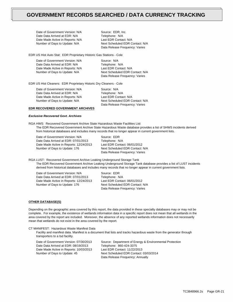
Date of Government Version: N/ADate Data Arrived at EDR: N/ADate Made Active in Reports: N/ANumber of Days to Update: N/A
Source: EDR, Inc.Telephone: N/ALast EDR Contact: N/ANext Scheduled EDR Contact: N/AData Release Frequency: Varies
EDR US Hist Auto Stat: EDR Proprietary Historic Gas Stations - Cole
Date of Government Version: N/ADate Data Arrived at EDR: N/ADate Made Active in Reports: N/ANumber of Days to Update: N/A
Source: N/ATelephone: N/ALast EDR Contact: N/ANext Scheduled EDR Contact: N/AData Release Frequency: Varies
EDR US Hist Cleaners: EDR Proprietary Historic Dry Cleaners - Cole
Date of Government Version: N/ADate Data Arrived at EDR: N/ADate Made Active in Reports: N/ANumber of Days to Update: N/A
Source: N/ATelephone: N/ALast EDR Contact: N/ANext Scheduled EDR Contact: N/AData Release Frequency: Varies
EDR RECOVERED GOVERNMENT ARCHIVES
Exclusive Recovered Govt. Archives
RGA HWS: Recovered Government Archive State Hazardous Waste Facilities ListThe EDR Recovered Government Archive State Hazardous Waste database provides a list of SHWS incidents derivedfrom historical databases and includes many records that no longer appear in current government lists.
Date of Government Version: N/ADate Data Arrived at EDR: 07/01/2013Date Made Active in Reports: 12/24/2013Number of Days to Update: 176
Source: EDRTelephone: N/ALast EDR Contact: 06/01/2012Next Scheduled EDR Contact: N/AData Release Frequency: Varies
RGA LUST: Recovered Government Archive Leaking Underground Storage TankThe EDR Recovered Government Archive Leaking Underground Storage Tank database provides a list of LUST incidentsderived from historical databases and includes many records that no longer appear in current government lists.
Date of Government Version: N/ADate Data Arrived at EDR: 07/01/2013Date Made Active in Reports: 12/24/2013Number of Days to Update: 176
Source: EDRTelephone: N/ALast EDR Contact: 06/01/2012Next Scheduled EDR Contact: N/AData Release Frequency: Varies
OTHER DATABASE(S)
Depending on the geographic area covered by this report, the data provided in these specialty databases may or may not becomplete. For example, the existence of wetlands information data in a specific report does not mean that all wetlands in thearea covered by the report are included. Moreover, the absence of any reported wetlands information does not necessarilymean that wetlands do not exist in the area covered by the report.
CT MANIFEST: Hazardous Waste Manifest DataFacility and manifest data. Manifest is a document that lists and tracks hazardous waste from the generator throughtransporters to a tsd facility.
Date of Government Version: 07/30/2013Date Data Arrived at EDR: 08/19/2013Date Made Active in Reports: 10/03/2013Number of Days to Update: 45
Source: Department of Energy & Environmental ProtectionTelephone: 860-424-3375Last EDR Contact: 11/22/2013Next Scheduled EDR Contact: 03/03/2014Data Release Frequency: Annually
TC3848966.2s Page GR-21
GOVERNMENT RECORDS SEARCHED / DATA CURRENCY TRACKING
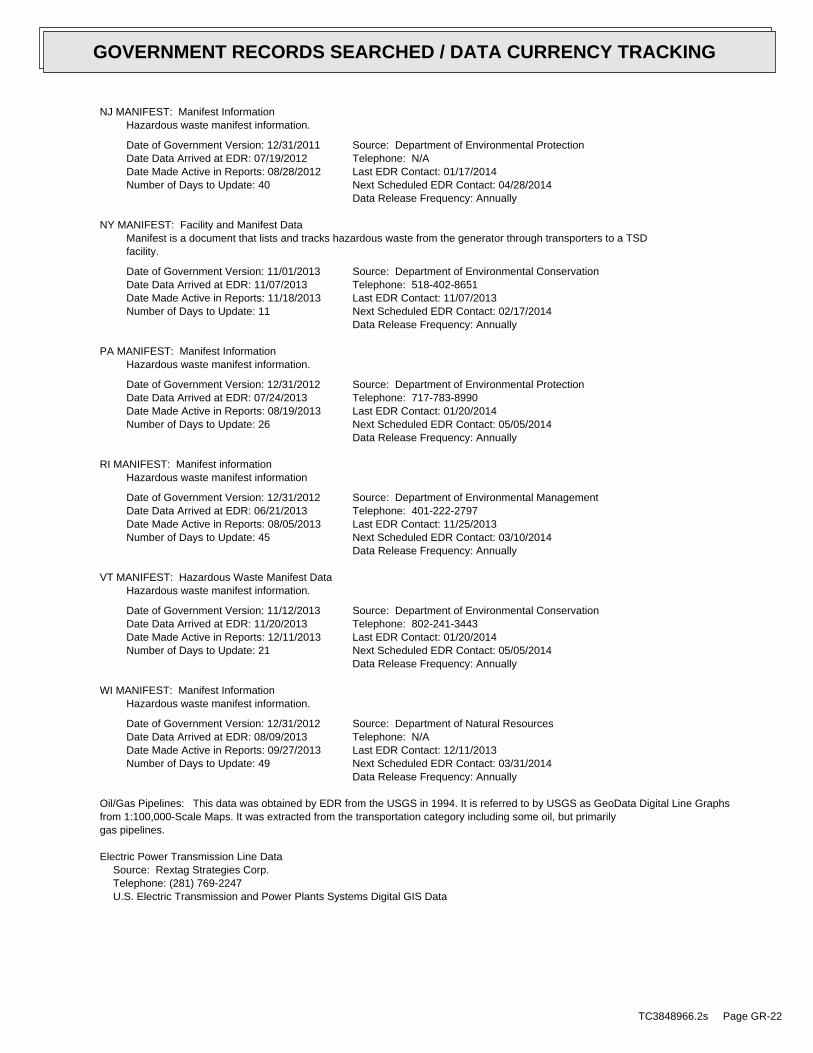
NJ MANIFEST: Manifest InformationHazardous waste manifest information.
Date of Government Version: 12/31/2011Date Data Arrived at EDR: 07/19/2012Date Made Active in Reports: 08/28/2012Number of Days to Update: 40
Source: Department of Environmental ProtectionTelephone: N/ALast EDR Contact: 01/17/2014Next Scheduled EDR Contact: 04/28/2014Data Release Frequency: Annually
NY MANIFEST: Facility and Manifest DataManifest is a document that lists and tracks hazardous waste from the generator through transporters to a TSDfacility.
Date of Government Version: 11/01/2013Date Data Arrived at EDR: 11/07/2013Date Made Active in Reports: 11/18/2013Number of Days to Update: 11
Source: Department of Environmental ConservationTelephone: 518-402-8651Last EDR Contact: 11/07/2013Next Scheduled EDR Contact: 02/17/2014Data Release Frequency: Annually
PA MANIFEST: Manifest InformationHazardous waste manifest information.
Date of Government Version: 12/31/2012Date Data Arrived at EDR: 07/24/2013Date Made Active in Reports: 08/19/2013Number of Days to Update: 26
Source: Department of Environmental ProtectionTelephone: 717-783-8990Last EDR Contact: 01/20/2014Next Scheduled EDR Contact: 05/05/2014Data Release Frequency: Annually
RI MANIFEST: Manifest informationHazardous waste manifest information
Date of Government Version: 12/31/2012Date Data Arrived at EDR: 06/21/2013Date Made Active in Reports: 08/05/2013Number of Days to Update: 45
Source: Department of Environmental ManagementTelephone: 401-222-2797Last EDR Contact: 11/25/2013Next Scheduled EDR Contact: 03/10/2014Data Release Frequency: Annually
VT MANIFEST: Hazardous Waste Manifest DataHazardous waste manifest information.
Date of Government Version: 11/12/2013Date Data Arrived at EDR: 11/20/2013Date Made Active in Reports: 12/11/2013Number of Days to Update: 21
Source: Department of Environmental ConservationTelephone: 802-241-3443Last EDR Contact: 01/20/2014Next Scheduled EDR Contact: 05/05/2014Data Release Frequency: Annually
WI MANIFEST: Manifest InformationHazardous waste manifest information.
Date of Government Version: 12/31/2012Date Data Arrived at EDR: 08/09/2013Date Made Active in Reports: 09/27/2013Number of Days to Update: 49
Source: Department of Natural ResourcesTelephone: N/ALast EDR Contact: 12/11/2013Next Scheduled EDR Contact: 03/31/2014Data Release Frequency: Annually
Oil/Gas Pipelines: This data was obtained by EDR from the USGS in 1994. It is referred to by USGS as GeoData Digital Line Graphsfrom 1:100,000-Scale Maps. It was extracted from the transportation category including some oil, but primarilygas pipelines.
Electric Power Transmission Line DataSource: Rextag Strategies Corp.Telephone: (281) 769-2247U.S. Electric Transmission and Power Plants Systems Digital GIS Data
TC3848966.2s Page GR-22
GOVERNMENT RECORDS SEARCHED / DATA CURRENCY TRACKING
Sensitive Receptors: There are individuals deemed sensitive receptors due to their fragile immune systems and special sensitivityto environmental discharges. These sensitive receptors typically include the elderly, the sick, and children. While the location of allsensitive receptors cannot be determined, EDR indicates those buildings and facilities - schools, daycares, hospitals, medical centers,and nursing homes - where individuals who are sensitive receptors are likely to be located.
AHA Hospitals:Source: American Hospital Association, Inc.Telephone: 312-280-5991The database includes a listing of hospitals based on the American Hospital Association’s annual survey of hospitals.
Medical Centers: Provider of Services ListingSource: Centers for Medicare & Medicaid ServicesTelephone: 410-786-3000A listing of hospitals with Medicare provider number, produced by Centers of Medicare & Medicaid Services,a federal agency within the U.S. Department of Health and Human Services.
Nursing HomesSource: National Institutes of HealthTelephone: 301-594-6248Information on Medicare and Medicaid certified nursing homes in the United States.
Public SchoolsSource: National Center for Education StatisticsTelephone: 202-502-7300The National Center for Education Statistics’ primary database on elementaryand secondary public education in the United States. It is a comprehensive, annual, national statisticaldatabase of all public elementary and secondary schools and school districts, which contains data that arecomparable across all states.
Private SchoolsSource: National Center for Education StatisticsTelephone: 202-502-7300The National Center for Education Statistics’ primary database on private school locations in the United States.
Daycare Centers: Child Care ListingSource: Family & Social Services AdministrationTelephone: 317-232-4740
Flood Zone Data: This data, available in select counties across the country, was obtained by EDR in 2003 & 2011 from the FederalEmergency Management Agency (FEMA). Data depicts 100-year and 500-year flood zones as defined by FEMA.
NWI: National Wetlands Inventory. This data, available in select counties across the country, was obtained by EDRin 2002, 2005 and 2010 from the U.S. Fish and Wildlife Service.
Scanned Digital USGS 7.5’ Topographic Map (DRG)Source: United States Geologic SurveyA digital raster graphic (DRG) is a scanned image of a U.S. Geological Survey topographic map. The map imagesare made by scanning published paper maps on high-resolution scanners. The raster imageis georeferenced and fit to the Universal Transverse Mercator (UTM) projection.
STREET AND ADDRESS INFORMATION
© 2010 Tele Atlas North America, Inc. All rights reserved. This material is proprietary and the subject of copyright protectionand other intellectual property rights owned by or licensed to Tele Atlas North America, Inc. The use of this material is subjectto the terms of a license agreement. You will be held liable for any unauthorized copying or disclosure of this material.
TC3848966.2s Page GR-23
GOVERNMENT RECORDS SEARCHED / DATA CURRENCY TRACKING
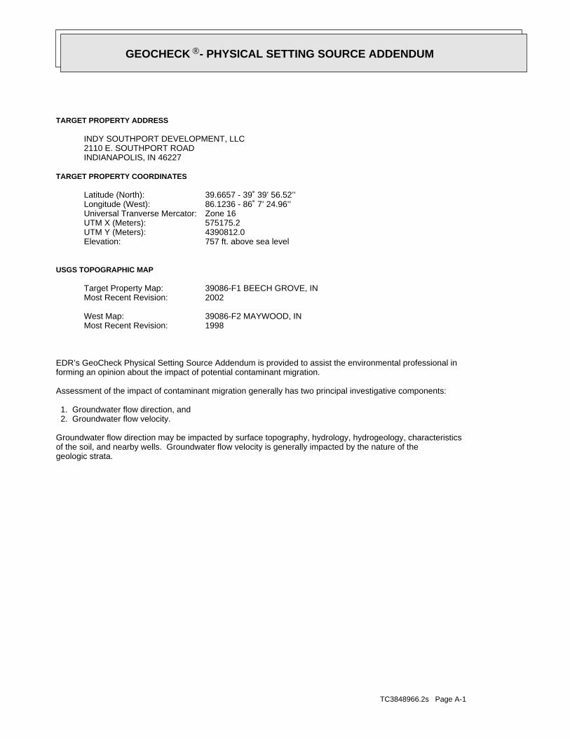
TC3848966.2s Page A-1
geologic strata.of the soil, and nearby wells. Groundwater flow velocity is generally impacted by the nature of theGroundwater flow direction may be impacted by surface topography, hydrology, hydrogeology, characteristics
2. Groundwater flow velocity. 1. Groundwater flow direction, and
Assessment of the impact of contaminant migration generally has two principal investigative components:
forming an opinion about the impact of potential contaminant migration.EDR’s GeoCheck Physical Setting Source Addendum is provided to assist the environmental professional in
1998Most Recent Revision:39086-F2 MAYWOOD, INWest Map:
2002Most Recent Revision:39086-F1 BEECH GROVE, INTarget Property Map:
USGS TOPOGRAPHIC MAP
757 ft. above sea levelElevation:4390812.0UTM Y (Meters): 575175.2UTM X (Meters): Zone 16Universal Tranverse Mercator: 86.1236 - 86˚ 7’ 24.96’’Longitude (West): 39.6657 - 39˚ 39’ 56.52’’Latitude (North):
TARGET PROPERTY COORDINATES
INDIANAPOLIS, IN 462272110 E. SOUTHPORT ROADINDY SOUTHPORT DEVELOPMENT, LLC
TARGET PROPERTY ADDRESS
®GEOCHECK - PHYSICAL SETTING SOURCE ADDENDUM®
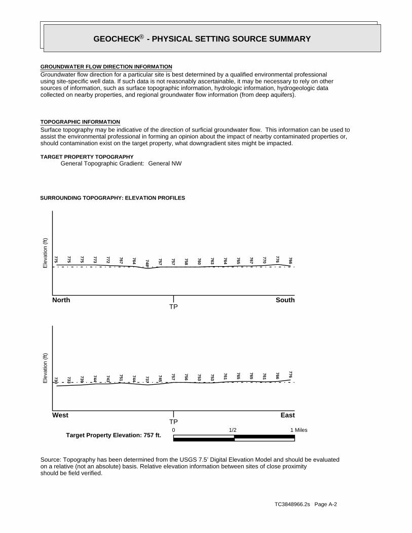
TC3848966.2s Page A-2
should be field verified.on a relative (not an absolute) basis. Relative elevation information between sites of close proximitySource: Topography has been determined from the USGS 7.5’ Digital Elevation Model and should be evaluated
SURROUNDING TOPOGRAPHY: ELEVATION PROFILES
Ele
vatio
n (f
t)E
leva
tion
(ft)
TP
TP0 1/2 1 Miles
✩Target Property Elevation: 757 ft.
North South
West East
766
776
770
767
765
764
763
760
758
757
757
748
764
767
772
773
775
775
775730
733
739
744
743
751
744
737
745
757
756
753
753
761
765
765
761
766
776
General NWGeneral Topographic Gradient:TARGET PROPERTY TOPOGRAPHY
should contamination exist on the target property, what downgradient sites might be impacted.assist the environmental professional in forming an opinion about the impact of nearby contaminated properties or,Surface topography may be indicative of the direction of surficial groundwater flow. This information can be used toTOPOGRAPHIC INFORMATION
collected on nearby properties, and regional groundwater flow information (from deep aquifers).sources of information, such as surface topographic information, hydrologic information, hydrogeologic datausing site-specific well data. If such data is not reasonably ascertainable, it may be necessary to rely on otherGroundwater flow direction for a particular site is best determined by a qualified environmental professionalGROUNDWATER FLOW DIRECTION INFORMATION
®GEOCHECK - PHYSICAL SETTING SOURCE SUMMARY®
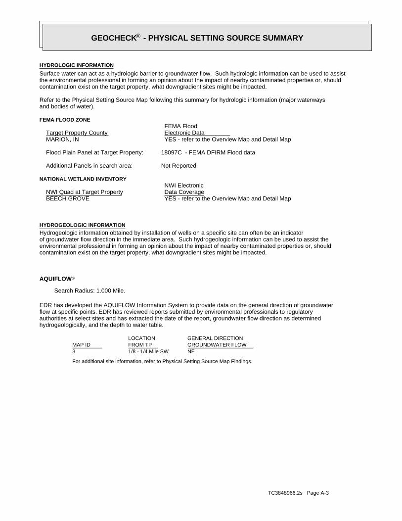
TC3848966.2s Page A-3
For additional site information, refer to Physical Setting Source Map Findings.
NE1/8 - 1/4 Mile SW3
GENERAL DIRECTIONLOCATIONGROUNDWATER FLOWFROM TPMAP ID
hydrogeologically, and the depth to water table.authorities at select sites and has extracted the date of the report, groundwater flow direction as determinedflow at specific points. EDR has reviewed reports submitted by environmental professionals to regulatoryEDR has developed the AQUIFLOW Information System to provide data on the general direction of groundwater
AQUIFLOW®
Search Radius: 1.000 Mile.
contamination exist on the target property, what downgradient sites might be impacted.environmental professional in forming an opinion about the impact of nearby contaminated properties or, shouldof groundwater flow direction in the immediate area. Such hydrogeologic information can be used to assist theHydrogeologic information obtained by installation of wells on a specific site can often be an indicatorHYDROGEOLOGIC INFORMATION
YES - refer to the Overview Map and Detail MapBEECH GROVE
NATIONAL WETLAND INVENTORYNWI ElectronicData CoverageNWI Quad at Target Property
Not ReportedAdditional Panels in search area:
18097C - FEMA DFIRM Flood dataFlood Plain Panel at Target Property:
YES - refer to the Overview Map and Detail MapMARION, IN
FEMA FLOOD ZONEFEMA FloodElectronic DataTarget Property County
and bodies of water).Refer to the Physical Setting Source Map following this summary for hydrologic information (major waterways
contamination exist on the target property, what downgradient sites might be impacted.the environmental professional in forming an opinion about the impact of nearby contaminated properties or, shouldSurface water can act as a hydrologic barrier to groundwater flow. Such hydrologic information can be used to assistHYDROLOGIC INFORMATION
®GEOCHECK - PHYSICAL SETTING SOURCE SUMMARY®
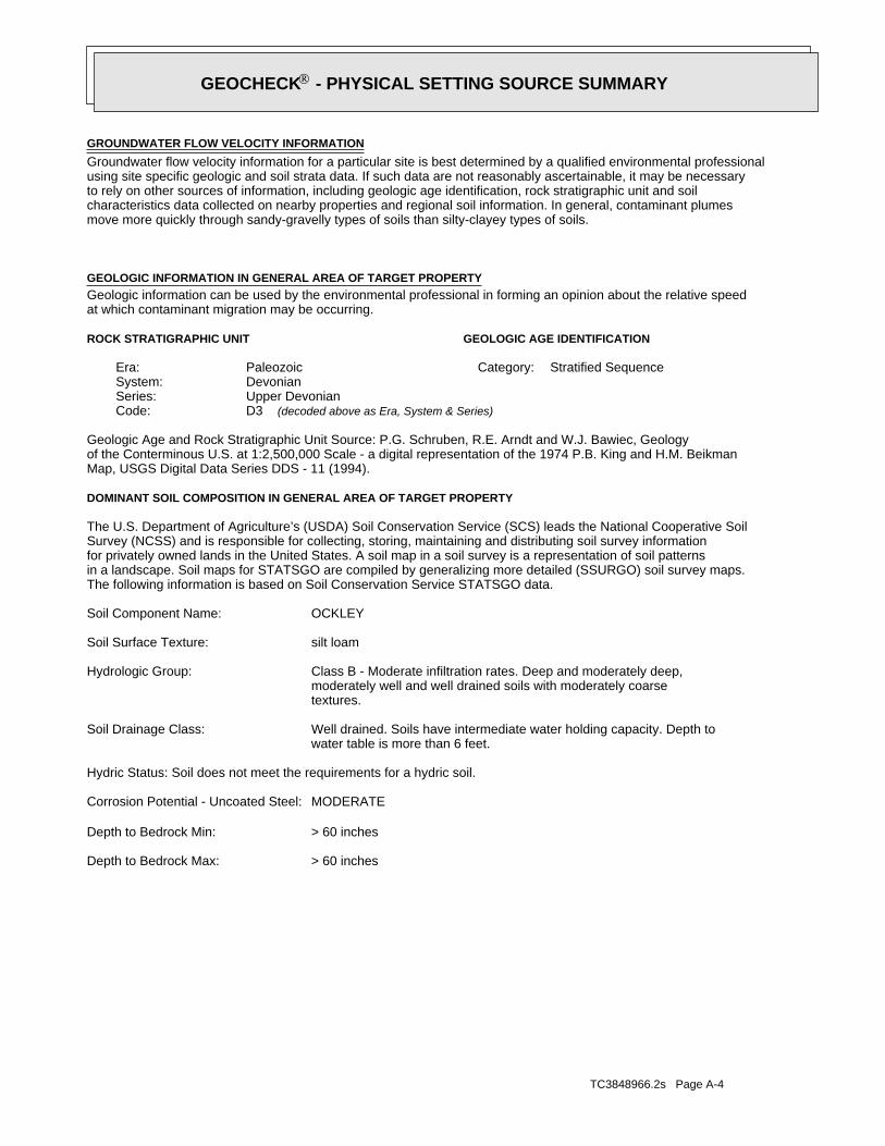
TC3848966.2s Page A-4
> 60 inchesDepth to Bedrock Max:
> 60 inchesDepth to Bedrock Min:
MODERATECorrosion Potential - Uncoated Steel:
Hydric Status: Soil does not meet the requirements for a hydric soil.
water table is more than 6 feet.Well drained. Soils have intermediate water holding capacity. Depth toSoil Drainage Class:
textures.moderately well and well drained soils with moderately coarseClass B - Moderate infiltration rates. Deep and moderately deep,Hydrologic Group:
silt loamSoil Surface Texture:
OCKLEY Soil Component Name:
The following information is based on Soil Conservation Service STATSGO data.in a landscape. Soil maps for STATSGO are compiled by generalizing more detailed (SSURGO) soil survey maps.for privately owned lands in the United States. A soil map in a soil survey is a representation of soil patternsSurvey (NCSS) and is responsible for collecting, storing, maintaining and distributing soil survey informationThe U.S. Department of Agriculture’s (USDA) Soil Conservation Service (SCS) leads the National Cooperative Soil
DOMINANT SOIL COMPOSITION IN GENERAL AREA OF TARGET PROPERTY
Map, USGS Digital Data Series DDS - 11 (1994).of the Conterminous U.S. at 1:2,500,000 Scale - a digital representation of the 1974 P.B. King and H.M. BeikmanGeologic Age and Rock Stratigraphic Unit Source: P.G. Schruben, R.E. Arndt and W.J. Bawiec, Geology
ROCK STRATIGRAPHIC UNIT GEOLOGIC AGE IDENTIFICATION
Stratified SequenceCategory:PaleozoicEra:DevonianSystem:Upper DevonianSeries:D3Code: (decoded above as Era, System & Series)
at which contaminant migration may be occurring.Geologic information can be used by the environmental professional in forming an opinion about the relative speedGEOLOGIC INFORMATION IN GENERAL AREA OF TARGET PROPERTY
move more quickly through sandy-gravelly types of soils than silty-clayey types of soils.characteristics data collected on nearby properties and regional soil information. In general, contaminant plumesto rely on other sources of information, including geologic age identification, rock stratigraphic unit and soilusing site specific geologic and soil strata data. If such data are not reasonably ascertainable, it may be necessaryGroundwater flow velocity information for a particular site is best determined by a qualified environmental professionalGROUNDWATER FLOW VELOCITY INFORMATION
®GEOCHECK - PHYSICAL SETTING SOURCE SUMMARY®
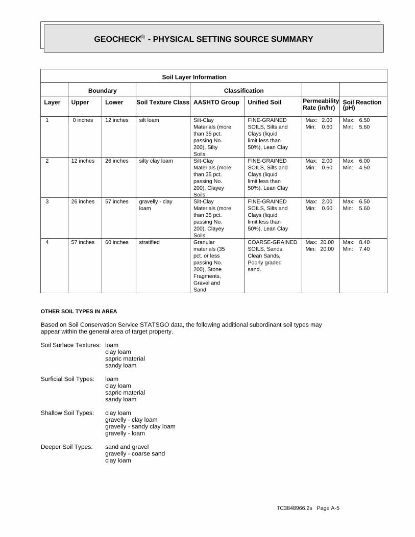
TC3848966.2s Page A-5
clay loamgravelly - coarse sandsand and gravelDeeper Soil Types:
gravelly - loamgravelly - sandy clay loamgravelly - clay loamclay loamShallow Soil Types:
sandy loamsapric materialclay loamloamSurficial Soil Types:
sandy loamsapric materialclay loamloamSoil Surface Textures:
appear within the general area of target property.Based on Soil Conservation Service STATSGO data, the following additional subordinant soil types may
OTHER SOIL TYPES IN AREA
Min: 7.40Max: 8.40
Min: 20.00Max: 20.00
sand.Poorly gradedClean Sands,SOILS, Sands,COARSE-GRAINED
Sand.Gravel andFragments,200), Stonepassing No.pct. or lessmaterials (35Granularstratified60 inches57 inches 4
Min: 5.60Max: 6.50
Min: 0.60Max: 2.00
50%), Lean Claylimit less thanClays (liquidSOILS, Silts andFINE-GRAINED
Soils.200), Clayeypassing No.than 35 pct.Materials (moreSilt-Clay
loamgravelly - clay57 inches26 inches 3
Min: 4.50Max: 6.00
Min: 0.60Max: 2.00
50%), Lean Claylimit less thanClays (liquidSOILS, Silts andFINE-GRAINED
Soils.200), Clayeypassing No.than 35 pct.Materials (moreSilt-Claysilty clay loam26 inches12 inches 2
Min: 5.60Max: 6.50
Min: 0.60Max: 2.00
50%), Lean Claylimit less thanClays (liquidSOILS, Silts andFINE-GRAINED
Soils.200), Siltypassing No.than 35 pct.Materials (moreSilt-Claysilt loam12 inches 0 inches 1
Soil Layer Information
Boundary Classification
PermeabilityRate (in/hr)
Layer Upper Lower Soil Texture Class AASHTO Group Unified Soil Soil Reaction(pH)
®GEOCHECK - PHYSICAL SETTING SOURCE SUMMARY®
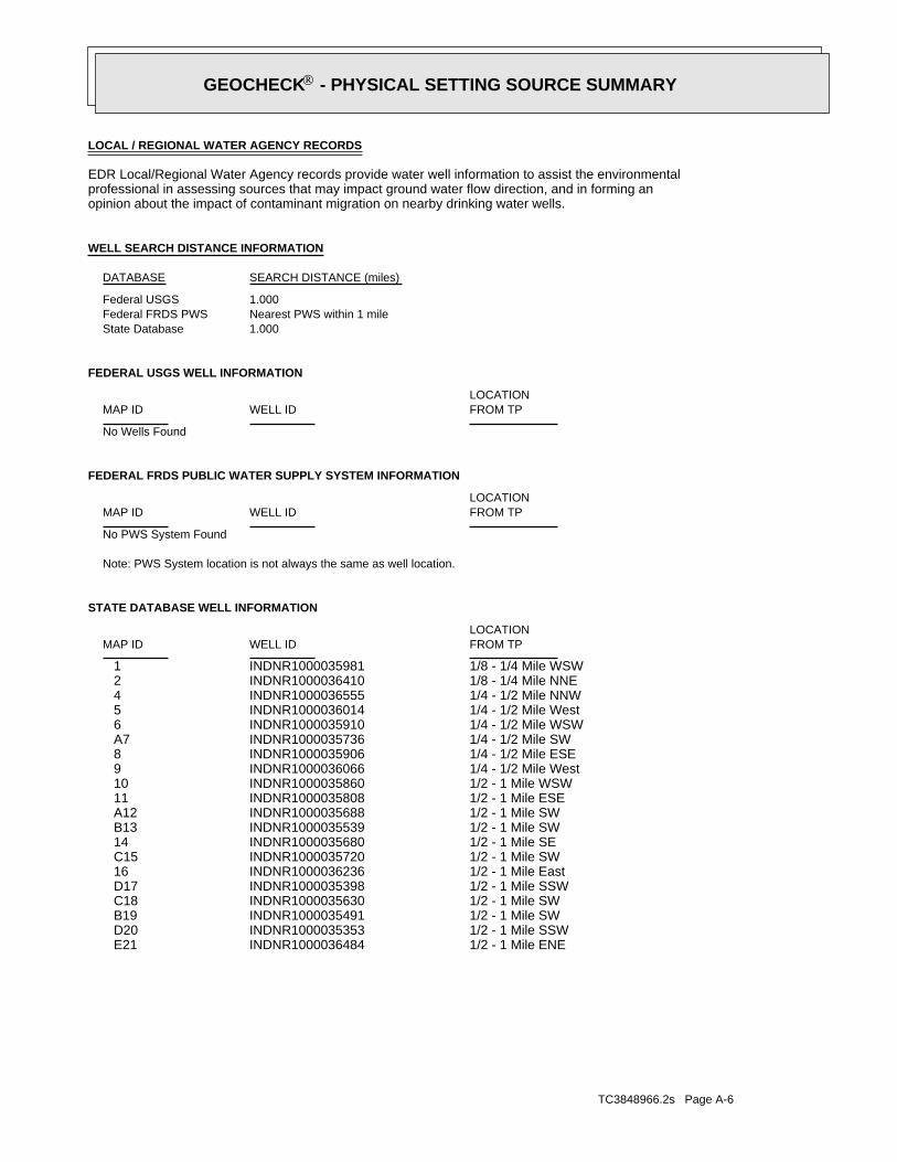
TC3848966.2s Page A-6
1/2 - 1 Mile ENEINDNR1000036484 E211/2 - 1 Mile SSWINDNR1000035353 D201/2 - 1 Mile SWINDNR1000035491 B191/2 - 1 Mile SWINDNR1000035630 C181/2 - 1 Mile SSWINDNR1000035398 D171/2 - 1 Mile EastINDNR1000036236 161/2 - 1 Mile SWINDNR1000035720 C151/2 - 1 Mile SEINDNR1000035680 141/2 - 1 Mile SWINDNR1000035539 B131/2 - 1 Mile SWINDNR1000035688 A121/2 - 1 Mile ESEINDNR1000035808 111/2 - 1 Mile WSWINDNR1000035860 101/4 - 1/2 Mile WestINDNR1000036066 91/4 - 1/2 Mile ESEINDNR1000035906 81/4 - 1/2 Mile SWINDNR1000035736 A71/4 - 1/2 Mile WSWINDNR1000035910 61/4 - 1/2 Mile WestINDNR1000036014 51/4 - 1/2 Mile NNWINDNR1000036555 41/8 - 1/4 Mile NNEINDNR1000036410 21/8 - 1/4 Mile WSWINDNR1000035981 1
STATE DATABASE WELL INFORMATION
LOCATIONFROM TPWELL IDMAP ID
Note: PWS System location is not always the same as well location.
No PWS System Found
FEDERAL FRDS PUBLIC WATER SUPPLY SYSTEM INFORMATION
LOCATIONFROM TPWELL IDMAP ID
No Wells Found
FEDERAL USGS WELL INFORMATION
LOCATIONFROM TPWELL IDMAP ID
1.000State DatabaseNearest PWS within 1 mileFederal FRDS PWS1.000Federal USGS
WELL SEARCH DISTANCE INFORMATION
SEARCH DISTANCE (miles)DATABASE
opinion about the impact of contaminant migration on nearby drinking water wells.professional in assessing sources that may impact ground water flow direction, and in forming anEDR Local/Regional Water Agency records provide water well information to assist the environmental
LOCAL / REGIONAL WATER AGENCY RECORDS
®GEOCHECK - PHYSICAL SETTING SOURCE SUMMARY®
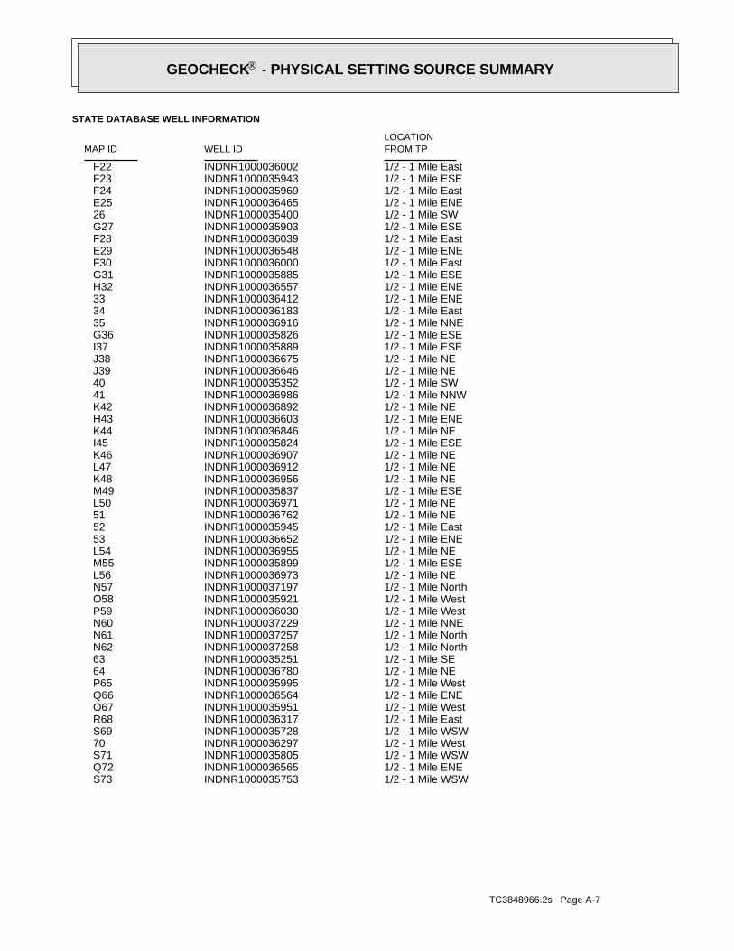
TC3848966.2s Page A-7
1/2 - 1 Mile WSWINDNR1000035753 S731/2 - 1 Mile ENEINDNR1000036565 Q721/2 - 1 Mile WSWINDNR1000035805 S711/2 - 1 Mile WestINDNR1000036297 701/2 - 1 Mile WSWINDNR1000035728 S691/2 - 1 Mile EastINDNR1000036317 R681/2 - 1 Mile WestINDNR1000035951 O671/2 - 1 Mile ENEINDNR1000036564 Q661/2 - 1 Mile WestINDNR1000035995 P651/2 - 1 Mile NEINDNR1000036780 641/2 - 1 Mile SEINDNR1000035251 631/2 - 1 Mile NorthINDNR1000037258 N621/2 - 1 Mile NorthINDNR1000037257 N611/2 - 1 Mile NNEINDNR1000037229 N601/2 - 1 Mile WestINDNR1000036030 P591/2 - 1 Mile WestINDNR1000035921 O581/2 - 1 Mile NorthINDNR1000037197 N571/2 - 1 Mile NEINDNR1000036973 L561/2 - 1 Mile ESEINDNR1000035899 M551/2 - 1 Mile NEINDNR1000036955 L541/2 - 1 Mile ENEINDNR1000036652 531/2 - 1 Mile EastINDNR1000035945 521/2 - 1 Mile NEINDNR1000036762 511/2 - 1 Mile NEINDNR1000036971 L501/2 - 1 Mile ESEINDNR1000035837 M491/2 - 1 Mile NEINDNR1000036956 K481/2 - 1 Mile NEINDNR1000036912 L471/2 - 1 Mile NEINDNR1000036907 K461/2 - 1 Mile ESEINDNR1000035824 I451/2 - 1 Mile NEINDNR1000036846 K441/2 - 1 Mile ENEINDNR1000036603 H431/2 - 1 Mile NEINDNR1000036892 K421/2 - 1 Mile NNWINDNR1000036986 411/2 - 1 Mile SWINDNR1000035352 401/2 - 1 Mile NEINDNR1000036646 J391/2 - 1 Mile NEINDNR1000036675 J381/2 - 1 Mile ESEINDNR1000035889 I371/2 - 1 Mile ESEINDNR1000035826 G361/2 - 1 Mile NNEINDNR1000036916 351/2 - 1 Mile EastINDNR1000036183 341/2 - 1 Mile ENEINDNR1000036412 331/2 - 1 Mile ENEINDNR1000036557 H321/2 - 1 Mile ESEINDNR1000035885 G311/2 - 1 Mile EastINDNR1000036000 F301/2 - 1 Mile ENEINDNR1000036548 E291/2 - 1 Mile EastINDNR1000036039 F281/2 - 1 Mile ESEINDNR1000035903 G271/2 - 1 Mile SWINDNR1000035400 261/2 - 1 Mile ENEINDNR1000036465 E251/2 - 1 Mile EastINDNR1000035969 F241/2 - 1 Mile ESEINDNR1000035943 F231/2 - 1 Mile EastINDNR1000036002 F22
STATE DATABASE WELL INFORMATION
LOCATIONFROM TPWELL IDMAP ID
®GEOCHECK - PHYSICAL SETTING SOURCE SUMMARY®
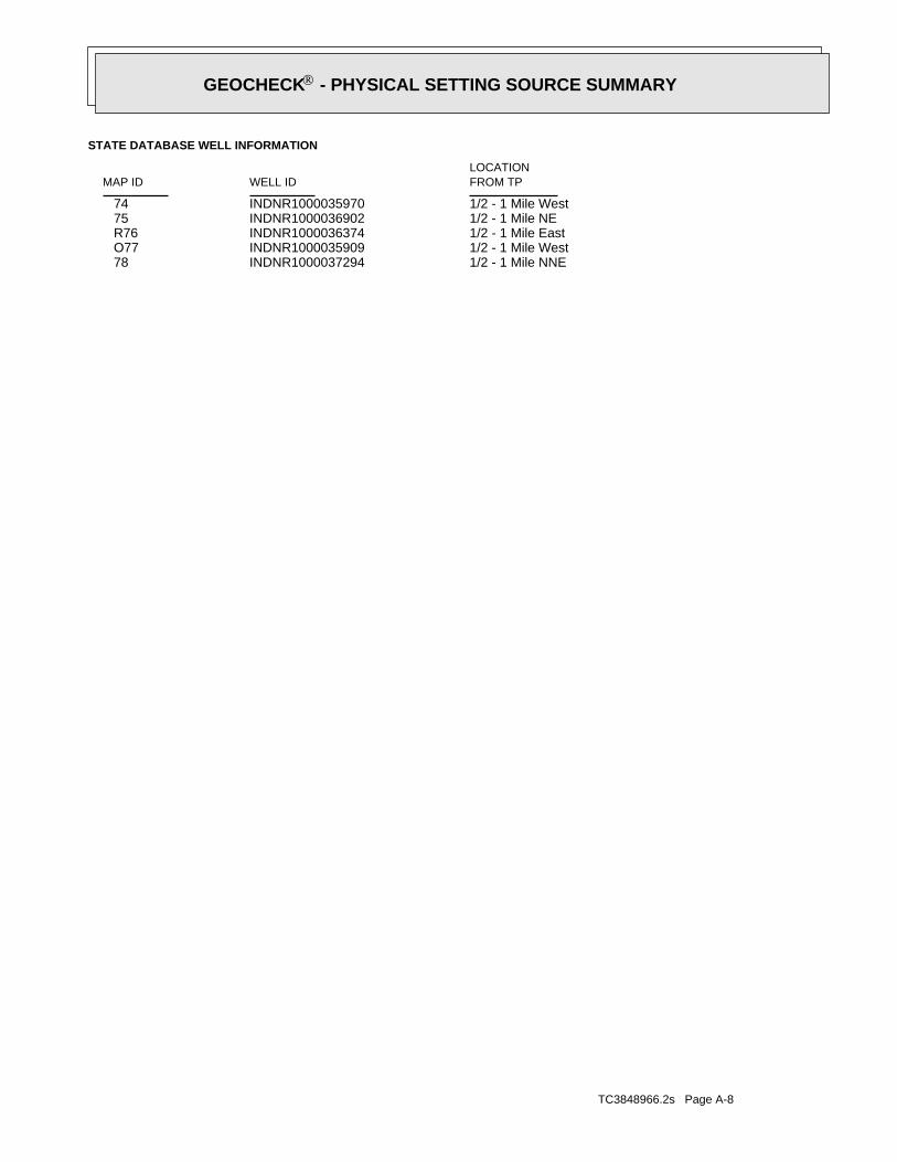
TC3848966.2s Page A-8
1/2 - 1 Mile NNEINDNR1000037294 781/2 - 1 Mile WestINDNR1000035909 O771/2 - 1 Mile EastINDNR1000036374 R761/2 - 1 Mile NEINDNR1000036902 751/2 - 1 Mile WestINDNR1000035970 74
STATE DATABASE WELL INFORMATION
LOCATIONFROM TPWELL IDMAP ID
®GEOCHECK - PHYSICAL SETTING SOURCE SUMMARY®
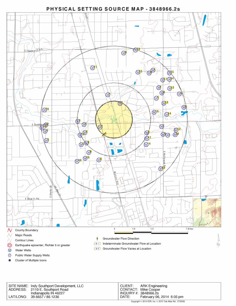
EDR Inc.EDR Inc.EDR Inc.EDR Inc.EDR Inc.EDR Inc.EDR Inc.EDR Inc.EDR Inc.EDR Inc.EDR Inc.EDR Inc.EDR Inc.EDR Inc.EDR Inc.EDR Inc.EDR Inc.EDR Inc.EDR Inc.EDR Inc.EDR Inc.EDR Inc.EDR Inc.EDR Inc.EDR Inc.EDR Inc.EDR Inc.EDR Inc.EDR Inc.EDR Inc.EDR Inc.EDR Inc.EDR Inc.EDR Inc.EDR Inc.EDR Inc.EDR Inc.EDR Inc.EDR Inc.EDR Inc.
76
0
7 6 0
76
0
76
0
76
0
76
0
7 6 0
76
0
7 60
760
72 0
72
0
76
0
7 6 0
7 6 07 6 0
80
0
7 6 0
7 6 0
7 6 0
76
0
800
8 0 0
80
0
8
0 0
80
0
80
0
8 0 0
80
0
8
0 0IN
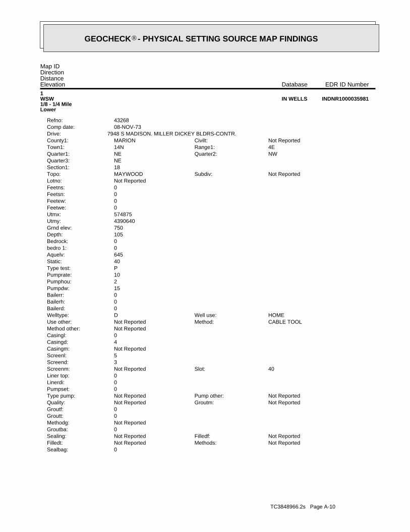
TC3848966.2s Page A-10
0Sealbag:Not ReportedMethods:Not ReportedFilledt:Not ReportedFilledf:Not ReportedSealing:
0Groutba:Not ReportedMethodg:0Groutt:0Groutf:
Not ReportedGroutm:Not ReportedQuality:Not ReportedPump other:Not ReportedType pump:
0Pumpset:0Linerdi:0Liner top:
40Slot:Not ReportedScreenm:3Screend:5Screenl:Not ReportedCasingm:4Casingd:0Casingl:Not ReportedMethod other:
CABLE TOOLMethod:Not ReportedUse other:HOMEWell use:DWelltype:
0Bailerd:0Bailerh:0Bailerr:15Pumpdw:2Pumphou:10Pumprate:PType test:40Static:645Aquelv:0bedro 1:0Bedrock:105Depth:750Grnd elev:4390640Utmy:574875Utmx:0Feetwe:0Feetew:0Feetsn:0Feetns:Not ReportedLotno:
Not ReportedSubdiv:MAYWOODTopo:18Section1:NEQuarter3:
NWQuarter2:NEQuarter1:4ERange1:14NTown1:Not ReportedCivilt:MARIONCounty1:
7948 S MADISON. MILLER DICKEY BLDRS-CONTR.Drive:08-NOV-73Comp date:43268Refno:
1WSW1/8 - 1/4 MileLower
INDNR1000035981IN WELLS
Map IDDirectionDistanceElevation EDR ID NumberDatabase
®GEOCHECK - PHYSICAL SETTING SOURCE MAP FINDINGS®
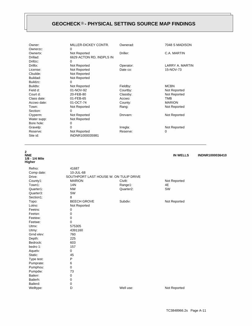
TC3848966.2s Page A-11
Not ReportedWell use:DWelltype:0Bailerd:0Bailerh:0Bailerr:73Pumpdw:0Pumphou:6Pumprate:PType test:45Static:0Aquelv:157bedro 1:603Bedrock:225Depth:760Grnd elev:4391160Utmy:575305Utmx:0Feetwe:0Feetew:0Feetsn:0Feetns:Not ReportedLotno:
Not ReportedSubdiv:BEECH GROVETopo:8Section1:SWQuarter3:
SWQuarter2:NWQuarter1:4ERange1:14NTown1:Not ReportedCivilt:MARIONCounty1:
SOUTHPORT LAST HOUSE W. ON TULIP DRIVEDrive:10-JUL-68Comp date:41687Refno:
2NNE1/8 - 1/4 MileHigher
INDNR1000036410IN WELLS
INDNR1000035981Site id:0Reserve:Not ReportedReserve:Not ReportedIrregla:0Gravelp:
0Bore hole:Not ReportedWater supp:
Not ReportedDnrvarn:Not ReportedCtyperm:0Section:
Not ReportedRang:Not ReportedTown:MARIONCounty:01-OCT-74Accwo date:TMBAccwo:01-FEB-65Class date:Not ReportedClassby:20-FEB-80Court d:Not ReportedCourtby:01-NOV-92Field d:MCBNFieldby:Not ReportedBuildtx:
0Buildzc:Not ReportedBuildad:Not ReportedCbuilde:
15-NOV-73Date co:Not ReportedLicense:LARRY A. MARTINOperator:Not ReportedDrilltx:
0Drillzc:6629 ACTON RD, INDPLS INDrillad:
C.A. MARTINDriller:Not ReportedOwnertx:0Ownerzc:
7048 S MADISONOwnerad:MILLER-DICKEY CONTR.Owner:
®GEOCHECK - PHYSICAL SETTING SOURCE MAP FINDINGS®
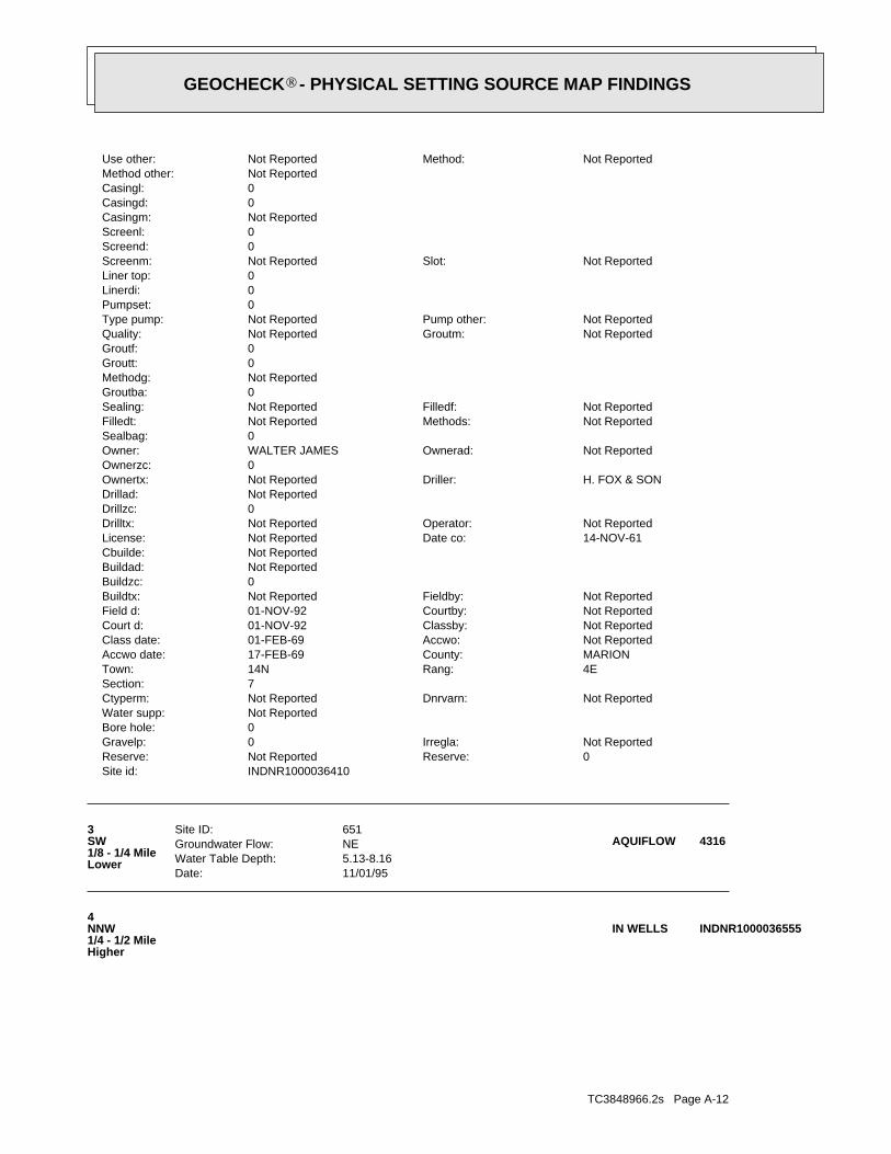
TC3848966.2s Page A-12
4NNW1/4 - 1/2 MileHigher
INDNR1000036555IN WELLS
Date: 11/01/95Water Table Depth: 5.13-8.16Groundwater Flow: NESite ID: 6513
SW1/8 - 1/4 MileLower
4316AQUIFLOW
INDNR1000036410Site id:0Reserve:Not ReportedReserve:Not ReportedIrregla:0Gravelp:
0Bore hole:Not ReportedWater supp:
Not ReportedDnrvarn:Not ReportedCtyperm:7Section:
4ERang:14NTown:MARIONCounty:17-FEB-69Accwo date:Not ReportedAccwo:01-FEB-69Class date:Not ReportedClassby:01-NOV-92Court d:Not ReportedCourtby:01-NOV-92Field d:Not ReportedFieldby:Not ReportedBuildtx:
0Buildzc:Not ReportedBuildad:Not ReportedCbuilde:
14-NOV-61Date co:Not ReportedLicense:Not ReportedOperator:Not ReportedDrilltx:
0Drillzc:Not ReportedDrillad:
H. FOX & SONDriller:Not ReportedOwnertx:0Ownerzc:
Not ReportedOwnerad:WALTER JAMESOwner:0Sealbag:
Not ReportedMethods:Not ReportedFilledt:Not ReportedFilledf:Not ReportedSealing:
0Groutba:Not ReportedMethodg:0Groutt:0Groutf:
Not ReportedGroutm:Not ReportedQuality:Not ReportedPump other:Not ReportedType pump:
0Pumpset:0Linerdi:0Liner top:
Not ReportedSlot:Not ReportedScreenm:0Screend:0Screenl:Not ReportedCasingm:0Casingd:0Casingl:Not ReportedMethod other:
Not ReportedMethod:Not ReportedUse other:
®GEOCHECK - PHYSICAL SETTING SOURCE MAP FINDINGS®
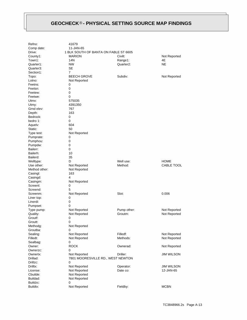
TC3848966.2s Page A-13
MCBNFieldby:Not ReportedBuildtx:0Buildzc:Not ReportedBuildad:Not ReportedCbuilde:
12-JAN-65Date co:Not ReportedLicense:JIM WILSONOperator:Not ReportedDrilltx:
0Drillzc:7801 MOORESVILLE RD., WEST NEWTONDrillad:
JIM WILSONDriller:Not ReportedOwnertx:0Ownerzc:
Not ReportedOwnerad:ROCKOwner:0Sealbag:
Not ReportedMethods:Not ReportedFilledt:Not ReportedFilledf:Not ReportedSealing:
0Groutba:Not ReportedMethodg:0Groutt:0Groutf:
Not ReportedGroutm:Not ReportedQuality:Not ReportedPump other:Not ReportedType pump:
0Pumpset:0Linerdi:0Liner top:
0.006Slot:Not ReportedScreenm:5Screend:0Screenl:Not ReportedCasingm:4Casingd:163Casingl:Not ReportedMethod other:
CABLE TOOLMethod:Not ReportedUse other:HOMEWell use:DWelltype:
35Bailerd:10Bailerh:0Bailerr:0Pumpdw:0Pumphou:0Pumprate:Not ReportedType test:50Static:604Aquelv:0bedro 1:0Bedrock:163Depth:767Grnd elev:4391350Utmy:575035Utmx:0Feetwe:0Feetew:0Feetsn:0Feetns:Not ReportedLotno:
Not ReportedSubdiv:BEECH GROVETopo:7Section1:SEQuarter3:
NEQuarter2:NWQuarter1:4ERange1:14NTown1:Not ReportedCivilt:MARIONCounty1:
1 BLK SOUTH OF BANTA ON FABLE ST 6605Drive:11-JAN-65Comp date:41679Refno:
®GEOCHECK - PHYSICAL SETTING SOURCE MAP FINDINGS®
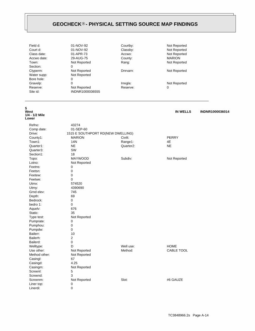
TC3848966.2s Page A-14
0Linerdi:0Liner top:
#6 GAUZESlot:Not ReportedScreenm:3Screend:5Screenl:Not ReportedCasingm:4.25Casingd:67Casingl:Not ReportedMethod other:
CABLE TOOLMethod:Not ReportedUse other:HOMEWell use:DWelltype:
0Bailerd:2Bailerh:10Bailerr:0Pumpdw:0Pumphou:0Pumprate:Not ReportedType test:35Static:676Aquelv:0bedro 1:0Bedrock:69Depth:745Grnd elev:4390690Utmy:574520Utmx:0Feetwe:0Feetew:0Feetsn:0Feetns:Not ReportedLotno:
Not ReportedSubdiv:MAYWOODTopo:18Section1:SWQuarter3:
NEQuarter2:NEQuarter1:4ERange1:14NTown1:PERRYCivilt:MARIONCounty1:
1515 E SOUTHPORT RD(NEW DWELLING)Drive:01-SEP-60Comp date:43274Refno:
5West1/4 - 1/2 MileLower
INDNR1000036014IN WELLS
INDNR1000036555Site id:0Reserve:Not ReportedReserve:Not ReportedIrregla:0Gravelp:
0Bore hole:Not ReportedWater supp:
Not ReportedDnrvarn:Not ReportedCtyperm:0Section:
Not ReportedRang:Not ReportedTown:MARIONCounty:29-AUG-75Accwo date:Not ReportedAccwo:01-APR-73Class date:Not ReportedClassby:01-NOV-92Court d:Not ReportedCourtby:01-NOV-92Field d:
®GEOCHECK - PHYSICAL SETTING SOURCE MAP FINDINGS®
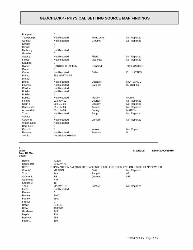
TC3848966.2s Page A-15
190bedro 1:555Bedrock:210Depth:745Grnd elev:4390515Utmy:574540Utmx:0Feetwe:2500Feetew:1000Feetsn:0Feetns:Not ReportedLotno:
Not ReportedSubdiv:MAYWOODTopo:18Section1:NWQuarter3:
NEQuarter2:SEQuarter1:4ERange1:14NTown1:Not ReportedCivilt:MARIONCounty1:
S ON MADISON AVE(431) TO DEAD END.HOUSE 2ND FROM END ON E SIDE. CLAPP OWNER.Drive:01-MAY-71Comp date:43278Refno:
6WSW1/4 - 1/2 MileLower
INDNR1000035910IN WELLS
INDNR1000036014Site id:0Reserve:Not ReportedReserve:Not ReportedIrregla:0Gravelp:
0Bore hole:Not ReportedWater supp:
Not ReportedDnrvarn:Not ReportedCtyperm:0Section:
Not ReportedRang:Not ReportedTown:MARIONCounty:01-JUN-64Accwo date:Not ReportedAccwo:01-JUN-64Class date:Not ReportedClassby:20-FEB-80Court d:Not ReportedCourtby:01-NOV-92Field d:MCBNFieldby:Not ReportedBuildtx:
0Buildzc:Not ReportedBuildad:Not ReportedCbuilde:
05-OCT-60Date co:Not ReportedLicense:ROY SANGEOperator:Not ReportedDrilltx:
0Drillzc:752 MARTIN STDrillad:
D.L. HATTENDriller:Not ReportedOwnertx:0Ownerzc:
7110 MADISONOwnerad:HAROLD CRAFTONOwner:0Sealbag:
Not ReportedMethods:Not ReportedFilledt:Not ReportedFilledf:Not ReportedSealing:
0Groutba:Not ReportedMethodg:0Groutt:0Groutf:
Not ReportedGroutm:Not ReportedQuality:Not ReportedPump other:Not ReportedType pump:
0Pumpset:
®GEOCHECK - PHYSICAL SETTING SOURCE MAP FINDINGS®
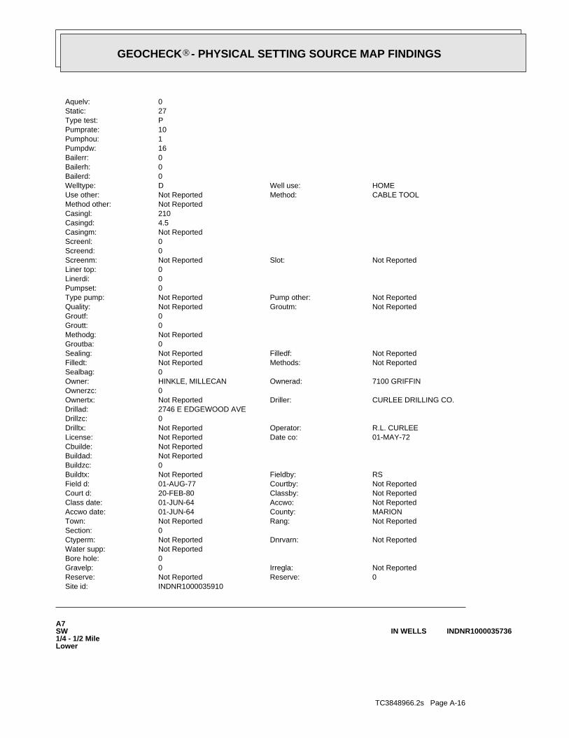
TC3848966.2s Page A-16
A7SW1/4 - 1/2 MileLower
INDNR1000035736IN WELLS
INDNR1000035910Site id:0Reserve:Not ReportedReserve:Not ReportedIrregla:0Gravelp:
0Bore hole:Not ReportedWater supp:
Not ReportedDnrvarn:Not ReportedCtyperm:0Section:
Not ReportedRang:Not ReportedTown:MARIONCounty:01-JUN-64Accwo date:Not ReportedAccwo:01-JUN-64Class date:Not ReportedClassby:20-FEB-80Court d:Not ReportedCourtby:01-AUG-77Field d:RSFieldby:Not ReportedBuildtx:
0Buildzc:Not ReportedBuildad:Not ReportedCbuilde:
01-MAY-72Date co:Not ReportedLicense:R.L. CURLEEOperator:Not ReportedDrilltx:
0Drillzc:2746 E EDGEWOOD AVEDrillad:
CURLEE DRILLING CO.Driller:Not ReportedOwnertx:0Ownerzc:
7100 GRIFFINOwnerad:HINKLE, MILLECANOwner:0Sealbag:
Not ReportedMethods:Not ReportedFilledt:Not ReportedFilledf:Not ReportedSealing:
0Groutba:Not ReportedMethodg:0Groutt:0Groutf:
Not ReportedGroutm:Not ReportedQuality:Not ReportedPump other:Not ReportedType pump:
0Pumpset:0Linerdi:0Liner top:
Not ReportedSlot:Not ReportedScreenm:0Screend:0Screenl:Not ReportedCasingm:4.5Casingd:210Casingl:Not ReportedMethod other:
CABLE TOOLMethod:Not ReportedUse other:HOMEWell use:DWelltype:
0Bailerd:0Bailerh:0Bailerr:16Pumpdw:1Pumphou:10Pumprate:PType test:27Static:0Aquelv:
®GEOCHECK - PHYSICAL SETTING SOURCE MAP FINDINGS®
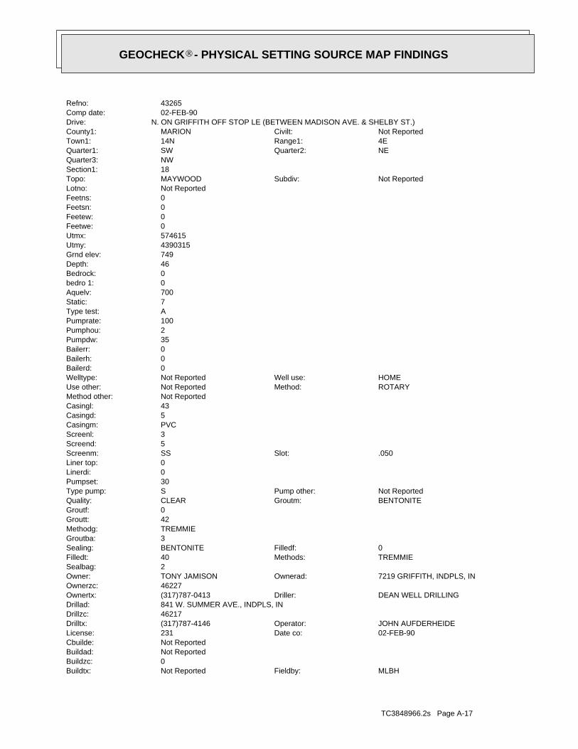
TC3848966.2s Page A-17
MLBHFieldby:Not ReportedBuildtx:0Buildzc:Not ReportedBuildad:Not ReportedCbuilde:
02-FEB-90Date co:231License:JOHN AUFDERHEIDEOperator:(317)787-4146Drilltx:
46217Drillzc:841 W. SUMMER AVE., INDPLS, INDrillad:
DEAN WELL DRILLINGDriller:(317)787-0413Ownertx:46227Ownerzc:
7219 GRIFFITH, INDPLS, INOwnerad:TONY JAMISONOwner:2Sealbag:
TREMMIEMethods:40Filledt:0Filledf:BENTONITESealing:
3Groutba:TREMMIEMethodg:42Groutt:0Groutf:
BENTONITEGroutm:CLEARQuality:Not ReportedPump other:SType pump:
30Pumpset:0Linerdi:0Liner top:
.050Slot:SSScreenm:5Screend:3Screenl:PVCCasingm:5Casingd:43Casingl:Not ReportedMethod other:
ROTARYMethod:Not ReportedUse other:HOMEWell use:Not ReportedWelltype:
0Bailerd:0Bailerh:0Bailerr:35Pumpdw:2Pumphou:100Pumprate:AType test:7Static:700Aquelv:0bedro 1:0Bedrock:46Depth:749Grnd elev:4390315Utmy:574615Utmx:0Feetwe:0Feetew:0Feetsn:0Feetns:Not ReportedLotno:
Not ReportedSubdiv:MAYWOODTopo:18Section1:NWQuarter3:
NEQuarter2:SWQuarter1:4ERange1:14NTown1:Not ReportedCivilt:MARIONCounty1:
N. ON GRIFFITH OFF STOP LE (BETWEEN MADISON AVE. & SHELBY ST.)Drive:02-FEB-90Comp date:43265Refno:
®GEOCHECK - PHYSICAL SETTING SOURCE MAP FINDINGS®

TC3848966.2s Page A-18
4Linerdi:0Liner top:
Not ReportedSlot:Not ReportedScreenm:3Screend:4.5Screenl:Not ReportedCasingm:4Casingd:0Casingl:Not ReportedMethod other:
CABLE TOOLMethod:Not ReportedUse other:HOMEWell use:DWelltype:
0Bailerd:0Bailerh:0Bailerr:50Pumpdw:1.5Pumphou:8Pumprate:Not ReportedType test:0Static:693Aquelv:0bedro 1:0Bedrock:87Depth:780Grnd elev:4390525Utmy:575900Utmx:0Feetwe:0Feetew:0Feetsn:0Feetns:Not ReportedLotno:
Not ReportedSubdiv:BEECH GROVETopo:17Section1:NWQuarter3:
NEQuarter2:SWQuarter1:4ERange1:14NTown1:Not ReportedCivilt:MARIONCounty1:
AVE 787-7550SOUTHPORT MC LAUGHLIN ST. 11969 PH. DIR. LISTS A CARL A. TAYLOR AT 343 MC LAUGHLINDrive:
16-NOV-87Comp date:43256Refno:
8ESE1/4 - 1/2 MileHigher
INDNR1000035906IN WELLS
INDNR1000035736Site id:0Reserve:Not ReportedReserve:Not ReportedIrregla:0Gravelp:
0Bore hole:Not ReportedWater supp:
Not ReportedDnrvarn:Not ReportedCtyperm:0Section:
Not ReportedRang:PERRTown:MARIONCounty:15-NOV-76Accwo date:Not ReportedAccwo:01-NOV-92Class date:Not ReportedClassby:20-FEB-80Court d:Not ReportedCourtby:01-NOV-92Field d:
®GEOCHECK - PHYSICAL SETTING SOURCE MAP FINDINGS®
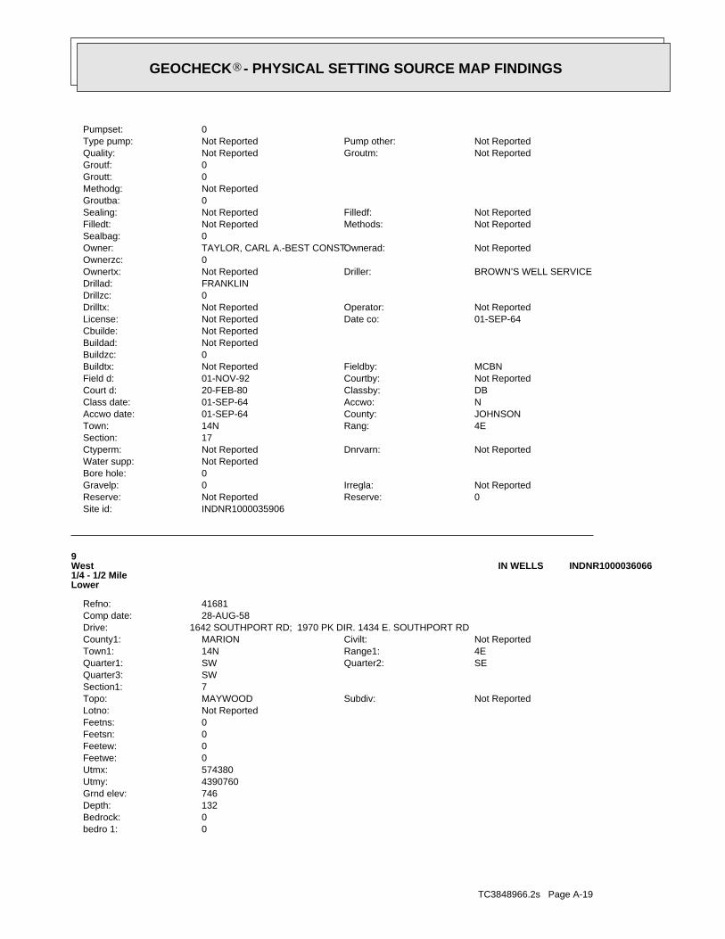
TC3848966.2s Page A-19
0bedro 1:0Bedrock:132Depth:746Grnd elev:4390760Utmy:574380Utmx:0Feetwe:0Feetew:0Feetsn:0Feetns:Not ReportedLotno:
Not ReportedSubdiv:MAYWOODTopo:7Section1:SWQuarter3:
SEQuarter2:SWQuarter1:4ERange1:14NTown1:Not ReportedCivilt:MARIONCounty1:
1642 SOUTHPORT RD; 1970 PK DIR. 1434 E. SOUTHPORT RDDrive:28-AUG-58Comp date:41681Refno:
9West1/4 - 1/2 MileLower
INDNR1000036066IN WELLS
INDNR1000035906Site id:0Reserve:Not ReportedReserve:Not ReportedIrregla:0Gravelp:
0Bore hole:Not ReportedWater supp:
Not ReportedDnrvarn:Not ReportedCtyperm:17Section:
4ERang:14NTown:JOHNSONCounty:01-SEP-64Accwo date:NAccwo:01-SEP-64Class date:DBClassby:20-FEB-80Court d:Not ReportedCourtby:01-NOV-92Field d:MCBNFieldby:Not ReportedBuildtx:
0Buildzc:Not ReportedBuildad:Not ReportedCbuilde:
01-SEP-64Date co:Not ReportedLicense:Not ReportedOperator:Not ReportedDrilltx:
0Drillzc:FRANKLINDrillad:
BROWN’S WELL SERVICEDriller:Not ReportedOwnertx:0Ownerzc:
Not ReportedOwnerad:TAYLOR, CARL A.-BEST CONST.Owner:0Sealbag:
Not ReportedMethods:Not ReportedFilledt:Not ReportedFilledf:Not ReportedSealing:
0Groutba:Not ReportedMethodg:0Groutt:0Groutf:
Not ReportedGroutm:Not ReportedQuality:Not ReportedPump other:Not ReportedType pump:
0Pumpset:
®GEOCHECK - PHYSICAL SETTING SOURCE MAP FINDINGS®
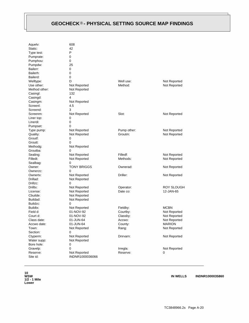
TC3848966.2s Page A-20
10WSW1/2 - 1 MileLower
INDNR1000035860IN WELLS
INDNR1000036066Site id:0Reserve:Not ReportedReserve:Not ReportedIrregla:0Gravelp:
0Bore hole:Not ReportedWater supp:
Not ReportedDnrvarn:Not ReportedCtyperm:0Section:
Not ReportedRang:Not ReportedTown:MARIONCounty:01-JUN-64Accwo date:Not ReportedAccwo:01-JUN-64Class date:Not ReportedClassby:01-NOV-92Court d:Not ReportedCourtby:01-NOV-92Field d:MCBNFieldby:Not ReportedBuildtx:
0Buildzc:Not ReportedBuildad:Not ReportedCbuilde:
12-JAN-65Date co:Not ReportedLicense:ROY SLOUGHOperator:Not ReportedDrilltx:
0Drillzc:Not ReportedDrillad:
Not ReportedDriller:Not ReportedOwnertx:0Ownerzc:
Not ReportedOwnerad:TONY BRIGGSOwner:0Sealbag:
Not ReportedMethods:Not ReportedFilledt:Not ReportedFilledf:Not ReportedSealing:
0Groutba:Not ReportedMethodg:0Groutt:0Groutf:
Not ReportedGroutm:Not ReportedQuality:Not ReportedPump other:Not ReportedType pump:
0Pumpset:0Linerdi:0Liner top:
Not ReportedSlot:Not ReportedScreenm:3Screend:4.5Screenl:Not ReportedCasingm:4Casingd:132Casingl:Not ReportedMethod other:
Not ReportedMethod:Not ReportedUse other:Not ReportedWell use:DWelltype:
0Bailerd:0Bailerh:0Bailerr:25Pumpdw:0Pumphou:0Pumprate:PType test:42Static:608Aquelv:
®GEOCHECK - PHYSICAL SETTING SOURCE MAP FINDINGS®
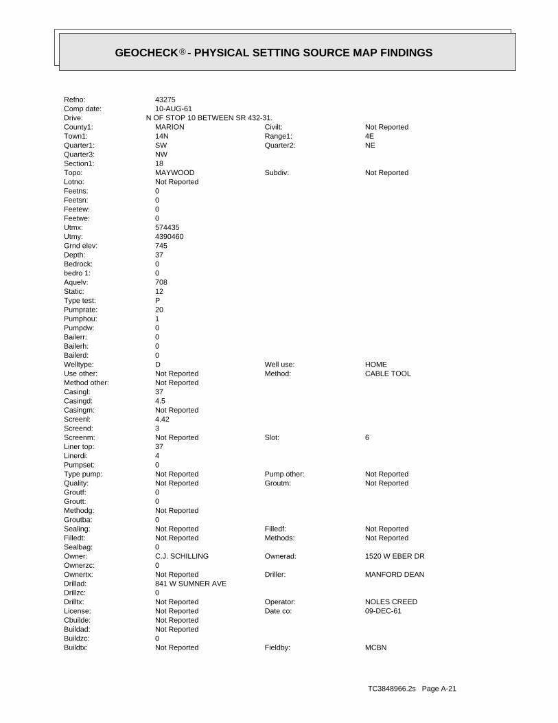
TC3848966.2s Page A-21
MCBNFieldby:Not ReportedBuildtx:0Buildzc:Not ReportedBuildad:Not ReportedCbuilde:
09-DEC-61Date co:Not ReportedLicense:NOLES CREEDOperator:Not ReportedDrilltx:
0Drillzc:841 W SUMNER AVEDrillad:
MANFORD DEANDriller:Not ReportedOwnertx:0Ownerzc:
1520 W EBER DROwnerad:C.J. SCHILLINGOwner:0Sealbag:
Not ReportedMethods:Not ReportedFilledt:Not ReportedFilledf:Not ReportedSealing:
0Groutba:Not ReportedMethodg:0Groutt:0Groutf:
Not ReportedGroutm:Not ReportedQuality:Not ReportedPump other:Not ReportedType pump:
0Pumpset:4Linerdi:37Liner top:
6Slot:Not ReportedScreenm:3Screend:4.42Screenl:Not ReportedCasingm:4.5Casingd:37Casingl:Not ReportedMethod other:
CABLE TOOLMethod:Not ReportedUse other:HOMEWell use:DWelltype:
0Bailerd:0Bailerh:0Bailerr:0Pumpdw:1Pumphou:20Pumprate:PType test:12Static:708Aquelv:0bedro 1:0Bedrock:37Depth:745Grnd elev:4390460Utmy:574435Utmx:0Feetwe:0Feetew:0Feetsn:0Feetns:Not ReportedLotno:
Not ReportedSubdiv:MAYWOODTopo:18Section1:NWQuarter3:
NEQuarter2:SWQuarter1:4ERange1:14NTown1:Not ReportedCivilt:MARIONCounty1:
N OF STOP 10 BETWEEN SR 432-31.Drive:10-AUG-61Comp date:43275Refno:
®GEOCHECK - PHYSICAL SETTING SOURCE MAP FINDINGS®

TC3848966.2s Page A-22
0Linerdi:0Liner top:
Not ReportedSlot:Not ReportedScreenm:0Screend:0Screenl:Not ReportedCasingm:4Casingd:0Casingl:Not ReportedMethod other:
CABLE TOOLMethod:Not ReportedUse other:Not ReportedWell use:Not ReportedWelltype:
0Bailerd:0Bailerh:0Bailerr:60Pumpdw:4Pumphou:8Pumprate:Not ReportedType test:75Static:0Aquelv:156bedro 1:629Bedrock:341Depth:785Grnd elev:4390400Utmy:575900Utmx:0Feetwe:1500Feetew:1100Feetsn:0Feetns:Not ReportedLotno:
Not ReportedSubdiv:BEECH GROVETopo:17Section1:NWQuarter3:
NEQuarter2:SWQuarter1:4ERange1:14NTown1:Not ReportedCivilt:MARIONCounty1:
TOWN OF SOUTHPORT INDIANADrive:01-SEP-59Comp date:43259Refno:
11ESE1/2 - 1 MileHigher
INDNR1000035808IN WELLS
INDNR1000035860Site id:0Reserve:Not ReportedReserve:Not ReportedIrregla:0Gravelp:
0Bore hole:Not ReportedWater supp:
Not ReportedDnrvarn:Not ReportedCtyperm:0Section:
Not ReportedRang:Not ReportedTown:MARIONCounty:01-JUN-64Accwo date:Not ReportedAccwo:01-JUN-64Class date:Not ReportedClassby:20-FEB-80Court d:Not ReportedCourtby:01-NOV-92Field d:
®GEOCHECK - PHYSICAL SETTING SOURCE MAP FINDINGS®
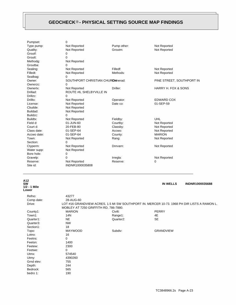
TC3848966.2s Page A-23
190bedro 1:565Bedrock:244Depth:755Grnd elev:4390260Utmy:574540Utmx:0Feetwe:2300Feetew:1400Feetsn:0Feetns:16Lotno:
GRANDVIEWSubdiv:MAYWOODTopo:18Section1:NWQuarter3:
SEQuarter2:NEQuarter1:4ERange1:14NTown1:PERRYCivilt:MARIONCounty1:
MOBLEY AT 7250 GRIFFITH RD, 786-7880.LOT #16 GRANDVIEW ACRES, 1.5 MI SW SOUTHPORT IN. MERCER 10-73. 1968 PH DIR LISTS A RAMON L.Drive:
28-AUG-60Comp date:43277Refno:
A12SW1/2 - 1 MileLower
INDNR1000035688IN WELLS
INDNR1000035808Site id:0Reserve:Not ReportedReserve:Not ReportedIrregla:0Gravelp:
0Bore hole:Not ReportedWater supp:
Not ReportedDnrvarn:Not ReportedCtyperm:0Section:
Not ReportedRang:Not ReportedTown:MARIONCounty:01-SEP-64Accwo date:Not ReportedAccwo:01-SEP-64Class date:Not ReportedClassby:20-FEB-80Court d:Not ReportedCourtby:01-JUN-60Field d:UHLFieldby:Not ReportedBuildtx:
0Buildzc:Not ReportedBuildad:Not ReportedCbuilde:
01-SEP-59Date co:Not ReportedLicense:EDWARD COXOperator:Not ReportedDrilltx:
0Drillzc:ROUTE #6, SHELBYVILLE INDrillad:
HARRY H. FOX & SONSDriller:Not ReportedOwnertx:0Ownerzc:
PINE STREET, SOUTHPORT INOwnerad:SOUTHPORT CHRISTIAN CHURCHOwner:0Sealbag:
Not ReportedMethods:Not ReportedFilledt:Not ReportedFilledf:Not ReportedSealing:
0Groutba:Not ReportedMethodg:0Groutt:0Groutf:
Not ReportedGroutm:Not ReportedQuality:Not ReportedPump other:Not ReportedType pump:
0Pumpset:
®GEOCHECK - PHYSICAL SETTING SOURCE MAP FINDINGS®

TC3848966.2s Page A-24
B13SW1/2 - 1 MileHigher
INDNR1000035539IN WELLS
INDNR1000035688Site id:0Reserve:Not ReportedReserve:Not ReportedIrregla:0Gravelp:
0Bore hole:Not ReportedWater supp:
Not ReportedDnrvarn:Not ReportedCtyperm:0Section:
Not ReportedRang:Not ReportedTown:MARIONCounty:01-JUN-64Accwo date:Not ReportedAccwo:01-JUN-64Class date:Not ReportedClassby:20-FEB-80Court d:Not ReportedCourtby:01-OCT-73Field d:UFieldby:Not ReportedBuildtx:
0Buildzc:Not ReportedBuildad:Not ReportedCbuilde:
17-AUG-58Date co:Not ReportedLicense:J.R. CHAMBERLAINOperator:Not ReportedDrilltx:
0Drillzc:752 MARTIN ST, INDPLS 27 INDrillad:
D.L. HATTENDriller:Not ReportedOwnertx:0Ownerzc:
5871 S VILLA LNOwnerad:RAMON L. MOBLEYOwner:0Sealbag:
Not ReportedMethods:Not ReportedFilledt:Not ReportedFilledf:Not ReportedSealing:
0Groutba:Not ReportedMethodg:0Groutt:0Groutf:
Not ReportedGroutm:Not ReportedQuality:Not ReportedPump other:Not ReportedType pump:
0Pumpset:0Linerdi:0Liner top:
Not ReportedSlot:Not ReportedScreenm:0Screend:0Screenl:Not ReportedCasingm:4.25Casingd:0Casingl:Not ReportedMethod other:
CABLE TOOLMethod:Not ReportedUse other:HOMEWell use:DWelltype:
105Bailerd:4Bailerh:300Bailerr:0Pumpdw:0Pumphou:0Pumprate:Not ReportedType test:45Static:0Aquelv:
®GEOCHECK - PHYSICAL SETTING SOURCE MAP FINDINGS®
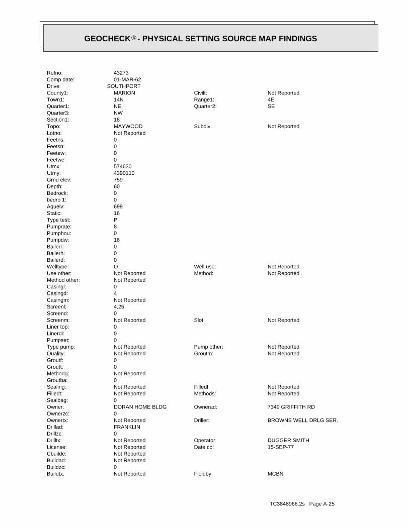
TC3848966.2s Page A-25
MCBNFieldby:Not ReportedBuildtx:0Buildzc:Not ReportedBuildad:Not ReportedCbuilde:
15-SEP-77Date co:Not ReportedLicense:DUGGER SMITHOperator:Not ReportedDrilltx:
0Drillzc:FRANKLINDrillad:
BROWNS WELL DRLG SER.Driller:Not ReportedOwnertx:0Ownerzc:
7349 GRIFFITH RDOwnerad:DORAN HOME BLDGOwner:0Sealbag:
Not ReportedMethods:Not ReportedFilledt:Not ReportedFilledf:Not ReportedSealing:
0Groutba:Not ReportedMethodg:0Groutt:0Groutf:
Not ReportedGroutm:Not ReportedQuality:Not ReportedPump other:Not ReportedType pump:
0Pumpset:0Linerdi:0Liner top:
Not ReportedSlot:Not ReportedScreenm:0Screend:4.25Screenl:Not ReportedCasingm:4Casingd:0Casingl:Not ReportedMethod other:
Not ReportedMethod:Not ReportedUse other:Not ReportedWell use:OWelltype:
0Bailerd:0Bailerh:0Bailerr:16Pumpdw:0Pumphou:8Pumprate:PType test:16Static:699Aquelv:0bedro 1:0Bedrock:60Depth:759Grnd elev:4390110Utmy:574630Utmx:0Feetwe:0Feetew:0Feetsn:0Feetns:Not ReportedLotno:
Not ReportedSubdiv:MAYWOODTopo:18Section1:NWQuarter3:
SEQuarter2:NEQuarter1:4ERange1:14NTown1:Not ReportedCivilt:MARIONCounty1:
SOUTHPORTDrive:01-MAR-62Comp date:43273Refno:
®GEOCHECK - PHYSICAL SETTING SOURCE MAP FINDINGS®
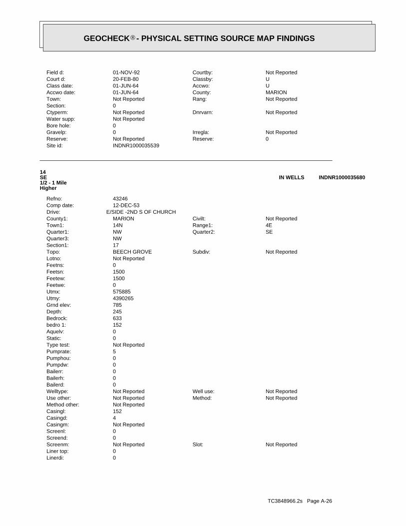
TC3848966.2s Page A-26
0Linerdi:0Liner top:
Not ReportedSlot:Not ReportedScreenm:0Screend:0Screenl:Not ReportedCasingm:4Casingd:152Casingl:Not ReportedMethod other:
Not ReportedMethod:Not ReportedUse other:Not ReportedWell use:Not ReportedWelltype:
0Bailerd:0Bailerh:0Bailerr:0Pumpdw:0Pumphou:5Pumprate:Not ReportedType test:0Static:0Aquelv:152bedro 1:633Bedrock:245Depth:785Grnd elev:4390265Utmy:575885Utmx:0Feetwe:1500Feetew:1500Feetsn:0Feetns:Not ReportedLotno:
Not ReportedSubdiv:BEECH GROVETopo:17Section1:NWQuarter3:
SEQuarter2:NWQuarter1:4ERange1:14NTown1:Not ReportedCivilt:MARIONCounty1:
E/SIDE -2ND S OF CHURCHDrive:12-DEC-53Comp date:43246Refno:
14SE1/2 - 1 MileHigher
INDNR1000035680IN WELLS
INDNR1000035539Site id:0Reserve:Not ReportedReserve:Not ReportedIrregla:0Gravelp:
0Bore hole:Not ReportedWater supp:
Not ReportedDnrvarn:Not ReportedCtyperm:0Section:
Not ReportedRang:Not ReportedTown:MARIONCounty:01-JUN-64Accwo date:UAccwo:01-JUN-64Class date:UClassby:20-FEB-80Court d:Not ReportedCourtby:01-NOV-92Field d:
®GEOCHECK - PHYSICAL SETTING SOURCE MAP FINDINGS®
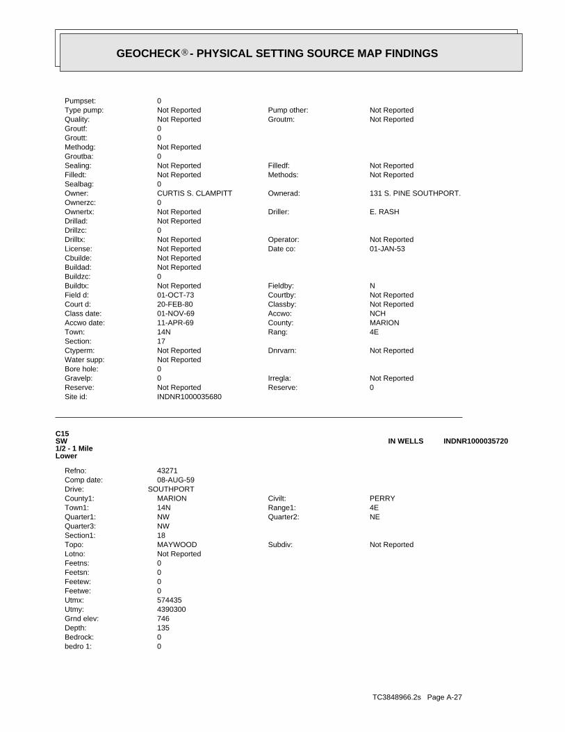
TC3848966.2s Page A-27
0bedro 1:0Bedrock:135Depth:746Grnd elev:4390300Utmy:574435Utmx:0Feetwe:0Feetew:0Feetsn:0Feetns:Not ReportedLotno:
Not ReportedSubdiv:MAYWOODTopo:18Section1:NWQuarter3:
NEQuarter2:NWQuarter1:4ERange1:14NTown1:PERRYCivilt:MARIONCounty1:
SOUTHPORTDrive:08-AUG-59Comp date:43271Refno:
C15SW1/2 - 1 MileLower
INDNR1000035720IN WELLS
INDNR1000035680Site id:0Reserve:Not ReportedReserve:Not ReportedIrregla:0Gravelp:
0Bore hole:Not ReportedWater supp:
Not ReportedDnrvarn:Not ReportedCtyperm:17Section:
4ERang:14NTown:MARIONCounty:11-APR-69Accwo date:NCHAccwo:01-NOV-69Class date:Not ReportedClassby:20-FEB-80Court d:Not ReportedCourtby:01-OCT-73Field d:NFieldby:Not ReportedBuildtx:
0Buildzc:Not ReportedBuildad:Not ReportedCbuilde:
01-JAN-53Date co:Not ReportedLicense:Not ReportedOperator:Not ReportedDrilltx:
0Drillzc:Not ReportedDrillad:
E. RASHDriller:Not ReportedOwnertx:0Ownerzc:
131 S. PINE SOUTHPORT.Ownerad:CURTIS S. CLAMPITTOwner:0Sealbag:
Not ReportedMethods:Not ReportedFilledt:Not ReportedFilledf:Not ReportedSealing:
0Groutba:Not ReportedMethodg:0Groutt:0Groutf:
Not ReportedGroutm:Not ReportedQuality:Not ReportedPump other:Not ReportedType pump:
0Pumpset:
®GEOCHECK - PHYSICAL SETTING SOURCE MAP FINDINGS®

TC3848966.2s Page A-28
16East1/2 - 1 MileHigher
INDNR1000036236IN WELLS
INDNR1000035720Site id:0Reserve:Not ReportedReserve:Not ReportedIrregla:0Gravelp:
0Bore hole:Not ReportedWater supp:
Not ReportedDnrvarn:Not ReportedCtyperm:0Section:
Not ReportedRang:Not ReportedTown:MARIONCounty:01-OCT-74Accwo date:Not ReportedAccwo:01-FEB-65Class date:Not ReportedClassby:20-FEB-80Court d:Not ReportedCourtby:01-NOV-92Field d:MCBHFieldby:Not ReportedBuildtx:
0Buildzc:Not ReportedBuildad:Not ReportedCbuilde:
08-AUG-59Date co:Not ReportedLicense:ED SHERLOCKOperator:Not ReportedDrilltx:
0Drillzc:ROUTE 4, BOX 52Drillad:
ALDriller:Not ReportedOwnertx:0Ownerzc:
1455 E. SOUTHPORT RD.Ownerad:GEORGIA HARLANOwner:0Sealbag:
Not ReportedMethods:Not ReportedFilledt:Not ReportedFilledf:Not ReportedSealing:
0Groutba:Not ReportedMethodg:0Groutt:0Groutf:
Not ReportedGroutm:Not ReportedQuality:Not ReportedPump other:Not ReportedType pump:
0Pumpset:0Linerdi:0Liner top:
3Slot:Not ReportedScreenm:3.5Screend:4.5Screenl:Not ReportedCasingm:4Casingd:133Casingl:Not ReportedMethod other:
CABLE TOOLMethod:Not ReportedUse other:HOMEWell use:DWelltype:
0Bailerd:0Bailerh:0Bailerr:2Pumpdw:1Pumphou:10Pumprate:Not ReportedType test:48Static:611Aquelv:
®GEOCHECK - PHYSICAL SETTING SOURCE MAP FINDINGS®
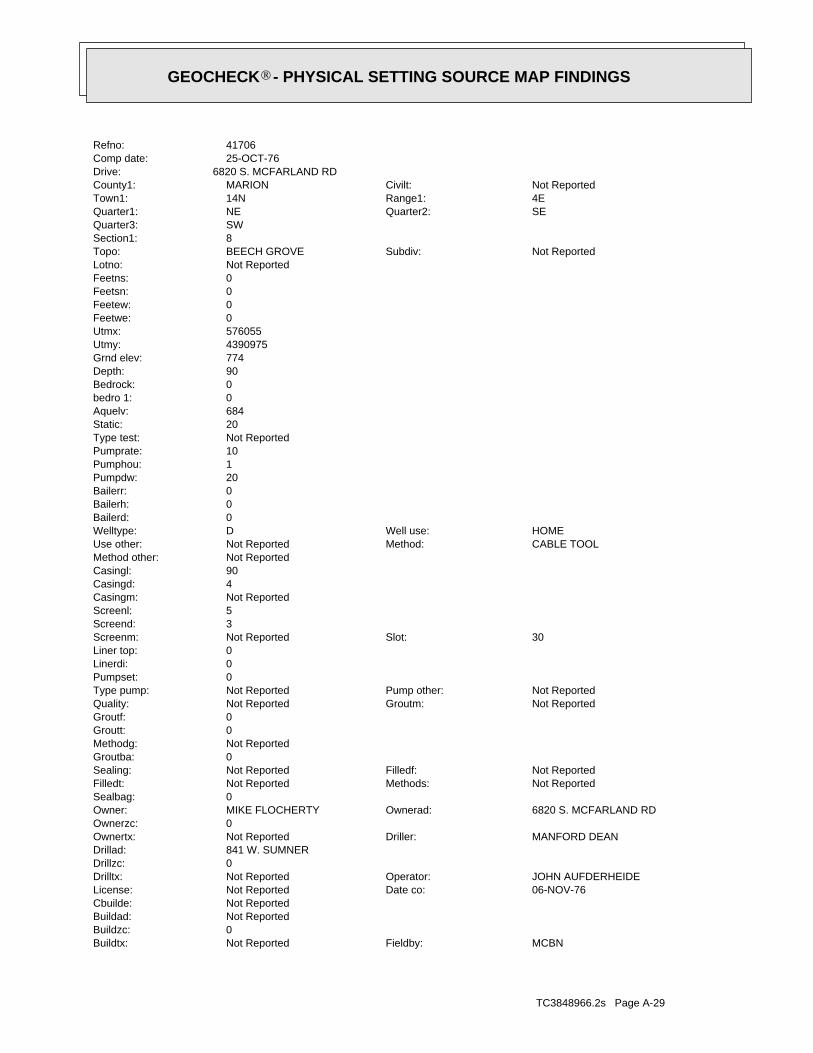
TC3848966.2s Page A-29
MCBNFieldby:Not ReportedBuildtx:0Buildzc:Not ReportedBuildad:Not ReportedCbuilde:
06-NOV-76Date co:Not ReportedLicense:JOHN AUFDERHEIDEOperator:Not ReportedDrilltx:
0Drillzc:841 W. SUMNERDrillad:
MANFORD DEANDriller:Not ReportedOwnertx:0Ownerzc:
6820 S. MCFARLAND RDOwnerad:MIKE FLOCHERTYOwner:0Sealbag:
Not ReportedMethods:Not ReportedFilledt:Not ReportedFilledf:Not ReportedSealing:
0Groutba:Not ReportedMethodg:0Groutt:0Groutf:
Not ReportedGroutm:Not ReportedQuality:Not ReportedPump other:Not ReportedType pump:
0Pumpset:0Linerdi:0Liner top:
30Slot:Not ReportedScreenm:3Screend:5Screenl:Not ReportedCasingm:4Casingd:90Casingl:Not ReportedMethod other:
CABLE TOOLMethod:Not ReportedUse other:HOMEWell use:DWelltype:
0Bailerd:0Bailerh:0Bailerr:20Pumpdw:1Pumphou:10Pumprate:Not ReportedType test:20Static:684Aquelv:0bedro 1:0Bedrock:90Depth:774Grnd elev:4390975Utmy:576055Utmx:0Feetwe:0Feetew:0Feetsn:0Feetns:Not ReportedLotno:
Not ReportedSubdiv:BEECH GROVETopo:8Section1:SWQuarter3:
SEQuarter2:NEQuarter1:4ERange1:14NTown1:Not ReportedCivilt:MARIONCounty1:
6820 S. MCFARLAND RDDrive:25-OCT-76Comp date:41706Refno:
®GEOCHECK - PHYSICAL SETTING SOURCE MAP FINDINGS®
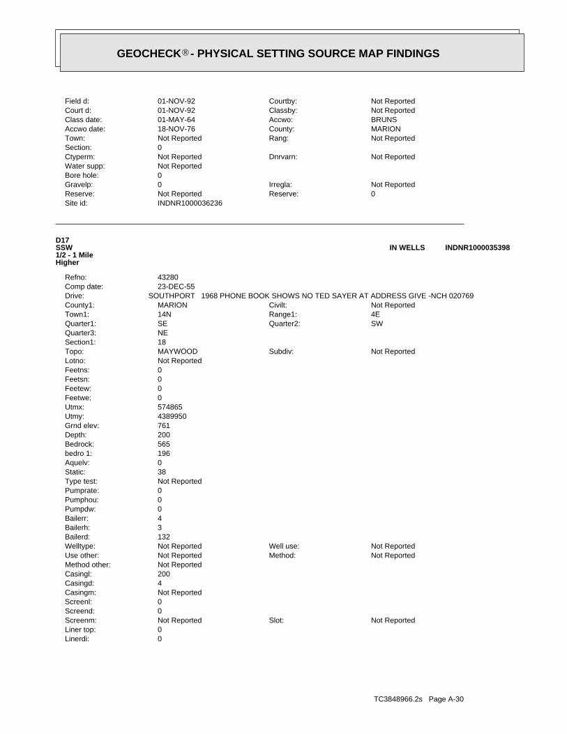
TC3848966.2s Page A-30
0Linerdi:0Liner top:
Not ReportedSlot:Not ReportedScreenm:0Screend:0Screenl:Not ReportedCasingm:4Casingd:200Casingl:Not ReportedMethod other:
Not ReportedMethod:Not ReportedUse other:Not ReportedWell use:Not ReportedWelltype:
132Bailerd:3Bailerh:4Bailerr:0Pumpdw:0Pumphou:0Pumprate:Not ReportedType test:38Static:0Aquelv:196bedro 1:565Bedrock:200Depth:761Grnd elev:4389950Utmy:574865Utmx:0Feetwe:0Feetew:0Feetsn:0Feetns:Not ReportedLotno:
Not ReportedSubdiv:MAYWOODTopo:18Section1:NEQuarter3:
SWQuarter2:SEQuarter1:4ERange1:14NTown1:Not ReportedCivilt:MARIONCounty1:
SOUTHPORT 1968 PHONE BOOK SHOWS NO TED SAYER AT ADDRESS GIVE -NCH 020769Drive:23-DEC-55Comp date:43280Refno:
D17SSW1/2 - 1 MileHigher
INDNR1000035398IN WELLS
INDNR1000036236Site id:0Reserve:Not ReportedReserve:Not ReportedIrregla:0Gravelp:
0Bore hole:Not ReportedWater supp:
Not ReportedDnrvarn:Not ReportedCtyperm:0Section:
Not ReportedRang:Not ReportedTown:MARIONCounty:18-NOV-76Accwo date:BRUNSAccwo:01-MAY-64Class date:Not ReportedClassby:01-NOV-92Court d:Not ReportedCourtby:01-NOV-92Field d:
®GEOCHECK - PHYSICAL SETTING SOURCE MAP FINDINGS®
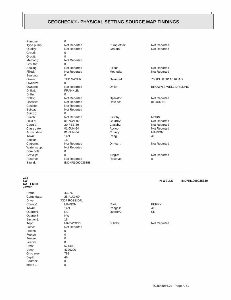
TC3848966.2s Page A-31
0bedro 1:0Bedrock:46Depth:755Grnd elev:4390200Utmy:574490Utmx:0Feetwe:0Feetew:0Feetsn:0Feetns:Not ReportedLotno:
Not ReportedSubdiv:MAYWOODTopo:18Section1:NWQuarter3:
SEQuarter2:NEQuarter1:4ERange1:14NTown1:PERRYCivilt:MARIONCounty1:
7307 ROSE DR.Drive:28-AUG-60Comp date:43276Refno:
C18SW1/2 - 1 MileLower
INDNR1000035630IN WELLS
INDNR1000035398Site id:0Reserve:Not ReportedReserve:Not ReportedIrregla:0Gravelp:
0Bore hole:Not ReportedWater supp:
Not ReportedDnrvarn:Not ReportedCtyperm:18Section:
4ERang:14NTown:MARIONCounty:01-JUN-64Accwo date:Not ReportedAccwo:01-JUN-64Class date:Not ReportedClassby:20-FEB-80Court d:Not ReportedCourtby:01-NOV-92Field d:MCBNFieldby:Not ReportedBuildtx:
0Buildzc:Not ReportedBuildad:Not ReportedCbuilde:
01-JUN-61Date co:Not ReportedLicense:Not ReportedOperator:Not ReportedDrilltx:
0Drillzc:FRANKLINDrillad:
BROWN’S WELL DRILLINGDriller:Not ReportedOwnertx:0Ownerzc:
7500S STOP 10 ROADOwnerad:TED SAYEROwner:0Sealbag:
Not ReportedMethods:Not ReportedFilledt:Not ReportedFilledf:Not ReportedSealing:
0Groutba:Not ReportedMethodg:0Groutt:0Groutf:
Not ReportedGroutm:Not ReportedQuality:Not ReportedPump other:Not ReportedType pump:
0Pumpset:
®GEOCHECK - PHYSICAL SETTING SOURCE MAP FINDINGS®

TC3848966.2s Page A-32
B19SW1/2 - 1 MileHigher
INDNR1000035491IN WELLS
INDNR1000035630Site id:0Reserve:Not ReportedReserve:Not ReportedIrregla:0Gravelp:
0Bore hole:Not ReportedWater supp:
Not ReportedDnrvarn:Not ReportedCtyperm:0Section:
Not ReportedRang:Not ReportedTown:MARIONCounty:01-JUN-64Accwo date:Not ReportedAccwo:01-JUN-64Class date:Not ReportedClassby:20-FEB-80Court d:Not ReportedCourtby:01-NOV-92Field d:MCBNFieldby:Not ReportedBuildtx:
0Buildzc:Not ReportedBuildad:Not ReportedCbuilde:
22-JUL-60Date co:Not ReportedLicense:A.C. BOWENOperator:Not ReportedDrilltx:
0Drillzc:Not ReportedDrillad:
HARLAN MILLER WELL & PUMP CODriller:Not ReportedOwnertx:0Ownerzc:
7307 ROSE DR.Ownerad:E. DOOLEYOwner:0Sealbag:
Not ReportedMethods:Not ReportedFilledt:Not ReportedFilledf:Not ReportedSealing:
0Groutba:Not ReportedMethodg:0Groutt:0Groutf:
Not ReportedGroutm:Not ReportedQuality:Not ReportedPump other:Not ReportedType pump:
0Pumpset:0Linerdi:0Liner top:
Not ReportedSlot:Not ReportedScreenm:0Screend:0Screenl:Not ReportedCasingm:4Casingd:42Casingl:Not ReportedMethod other:
CABLE TOOLMethod:Not ReportedUse other:HOMEWell use:DWelltype:
3Bailerd:1Bailerh:10Bailerr:0Pumpdw:0Pumphou:0Pumprate:Not ReportedType test:15Static:709Aquelv:
®GEOCHECK - PHYSICAL SETTING SOURCE MAP FINDINGS®
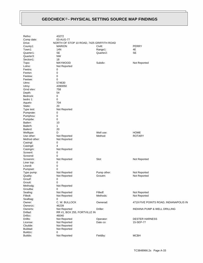
TC3848966.2s Page A-33
MCBHFieldby:Not ReportedBuildtx:0Buildzc:Not ReportedBuildad:Not ReportedCbuilde:
15-SEP-77Date co:Not ReportedLicense:DESTER HARNESSOperator:Not ReportedDrilltx:
46040Drillzc:RR #1, BOX 255, FORTVILLE INDrillad:
INDIANA PUMP & WELL DRILLINGDriller:Not ReportedOwnertx:46239Ownerzc:
4719 FIVE POINTS ROAD, INDIANAPOLIS INOwnerad:C. W. BULLOCKOwner:0Sealbag:
Not ReportedMethods:Not ReportedFilledt:Not ReportedFilledf:Not ReportedSealing:
0Groutba:Not ReportedMethodg:0Groutt:0Groutf:
Not ReportedGroutm:Not ReportedQuality:Not ReportedPump other:Not ReportedType pump:
0Pumpset:0Linerdi:0Liner top:
Not ReportedSlot:Not ReportedScreenm:0Screend:0Screenl:Not ReportedCasingm:4Casingd:0Casingl:Not ReportedMethod other:
ROTARYMethod:Not ReportedUse other:HOMEWell use:DWelltype:
20Bailerd:1Bailerh:10Bailerr:0Pumpdw:0Pumphou:0Pumprate:Not ReportedType test:20Static:704Aquelv:0bedro 1:0Bedrock:54Depth:758Grnd elev:4390050Utmy:574630Utmx:0Feetwe:0Feetew:0Feetsn:0Feetns:Not ReportedLotno:
Not ReportedSubdiv:MAYWOODTopo:18Section1:NWQuarter3:
SEQuarter2:SEQuarter1:4ERange1:14NTown1:PERRYCivilt:MARIONCounty1:
NORTH OF STOP 10 ROAD, 7425 GRIFFITH ROADDrive:03-AUG-77Comp date:43272Refno:
®GEOCHECK - PHYSICAL SETTING SOURCE MAP FINDINGS®
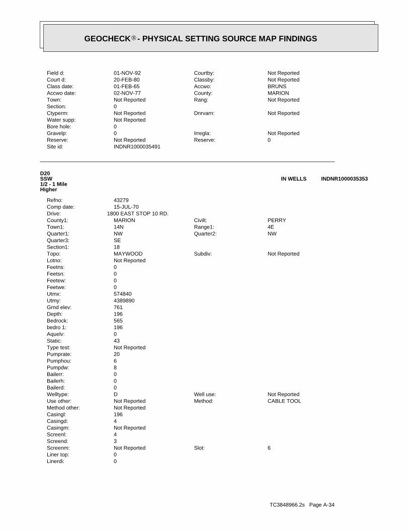
TC3848966.2s Page A-34
0Linerdi:0Liner top:
6Slot:Not ReportedScreenm:3Screend:4Screenl:Not ReportedCasingm:4Casingd:196Casingl:Not ReportedMethod other:
CABLE TOOLMethod:Not ReportedUse other:Not ReportedWell use:DWelltype:
0Bailerd:0Bailerh:0Bailerr:8Pumpdw:6Pumphou:20Pumprate:Not ReportedType test:43Static:0Aquelv:196bedro 1:565Bedrock:196Depth:761Grnd elev:4389890Utmy:574840Utmx:0Feetwe:0Feetew:0Feetsn:0Feetns:Not ReportedLotno:
Not ReportedSubdiv:MAYWOODTopo:18Section1:SEQuarter3:
NWQuarter2:NWQuarter1:4ERange1:14NTown1:PERRYCivilt:MARIONCounty1:
1800 EAST STOP 10 RD.Drive:15-JUL-70Comp date:43279Refno:
D20SSW1/2 - 1 MileHigher
INDNR1000035353IN WELLS
INDNR1000035491Site id:0Reserve:Not ReportedReserve:Not ReportedIrregla:0Gravelp:
0Bore hole:Not ReportedWater supp:
Not ReportedDnrvarn:Not ReportedCtyperm:0Section:
Not ReportedRang:Not ReportedTown:MARIONCounty:02-NOV-77Accwo date:BRUNSAccwo:01-FEB-65Class date:Not ReportedClassby:20-FEB-80Court d:Not ReportedCourtby:01-NOV-92Field d:
®GEOCHECK - PHYSICAL SETTING SOURCE MAP FINDINGS®
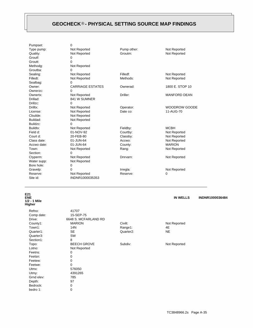
TC3848966.2s Page A-35
0bedro 1:0Bedrock:97Depth:785Grnd elev:4391265Utmy:576050Utmx:0Feetwe:0Feetew:0Feetsn:0Feetns:Not ReportedLotno:
Not ReportedSubdiv:BEECH GROVETopo:8Section1:SWQuarter3:
NEQuarter2:SEQuarter1:4ERange1:14NTown1:Not ReportedCivilt:MARIONCounty1:
6648 S. MCFARLAND RDDrive:15-SEP-75Comp date:41707Refno:
E21ENE1/2 - 1 MileHigher
INDNR1000036484IN WELLS
INDNR1000035353Site id:0Reserve:Not ReportedReserve:Not ReportedIrregla:0Gravelp:
0Bore hole:Not ReportedWater supp:
Not ReportedDnrvarn:Not ReportedCtyperm:0Section:
Not ReportedRang:Not ReportedTown:MARIONCounty:01-JUN-64Accwo date:Not ReportedAccwo:01-JUN-64Class date:Not ReportedClassby:20-FEB-80Court d:Not ReportedCourtby:01-NOV-92Field d:MCBHFieldby:Not ReportedBuildtx:
0Buildzc:Not ReportedBuildad:Not ReportedCbuilde:
11-AUG-70Date co:Not ReportedLicense:WOODROW GOODEOperator:Not ReportedDrilltx:
0Drillzc:841 W SUMNERDrillad:
MANFORD DEANDriller:Not ReportedOwnertx:0Ownerzc:
1800 E. STOP 10Ownerad:CARRIAGE ESTATESOwner:0Sealbag:
Not ReportedMethods:Not ReportedFilledt:Not ReportedFilledf:Not ReportedSealing:
0Groutba:Not ReportedMethodg:0Groutt:0Groutf:
Not ReportedGroutm:Not ReportedQuality:Not ReportedPump other:Not ReportedType pump:
0Pumpset:
®GEOCHECK - PHYSICAL SETTING SOURCE MAP FINDINGS®
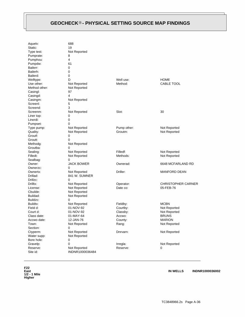
TC3848966.2s Page A-36
F22East1/2 - 1 MileHigher
INDNR1000036002IN WELLS
INDNR1000036484Site id:0Reserve:Not ReportedReserve:Not ReportedIrregla:0Gravelp:
0Bore hole:Not ReportedWater supp:
Not ReportedDnrvarn:Not ReportedCtyperm:0Section:
Not ReportedRang:Not ReportedTown:MARIONCounty:12-JAN-76Accwo date:BRUNSAccwo:01-MAY-64Class date:Not ReportedClassby:01-NOV-92Court d:Not ReportedCourtby:01-NOV-92Field d:MCBNFieldby:Not ReportedBuildtx:
0Buildzc:Not ReportedBuildad:Not ReportedCbuilde:
05-FEB-76Date co:Not ReportedLicense:CHRISTOPHER CARNEROperator:Not ReportedDrilltx:
0Drillzc:841 W. SUMNERDrillad:
MANFORD DEANDriller:Not ReportedOwnertx:0Ownerzc:
6648 MCFARLAND RDOwnerad:JACK BOWEROwner:0Sealbag:
Not ReportedMethods:Not ReportedFilledt:Not ReportedFilledf:Not ReportedSealing:
0Groutba:Not ReportedMethodg:0Groutt:0Groutf:
Not ReportedGroutm:Not ReportedQuality:Not ReportedPump other:Not ReportedType pump:
0Pumpset:0Linerdi:0Liner top:
30Slot:Not ReportedScreenm:3Screend:5Screenl:Not ReportedCasingm:4Casingd:97Casingl:Not ReportedMethod other:
CABLE TOOLMethod:Not ReportedUse other:HOMEWell use:DWelltype:
0Bailerd:0Bailerh:0Bailerr:61Pumpdw:4Pumphou:8Pumprate:Not ReportedType test:19Static:688Aquelv:
®GEOCHECK - PHYSICAL SETTING SOURCE MAP FINDINGS®
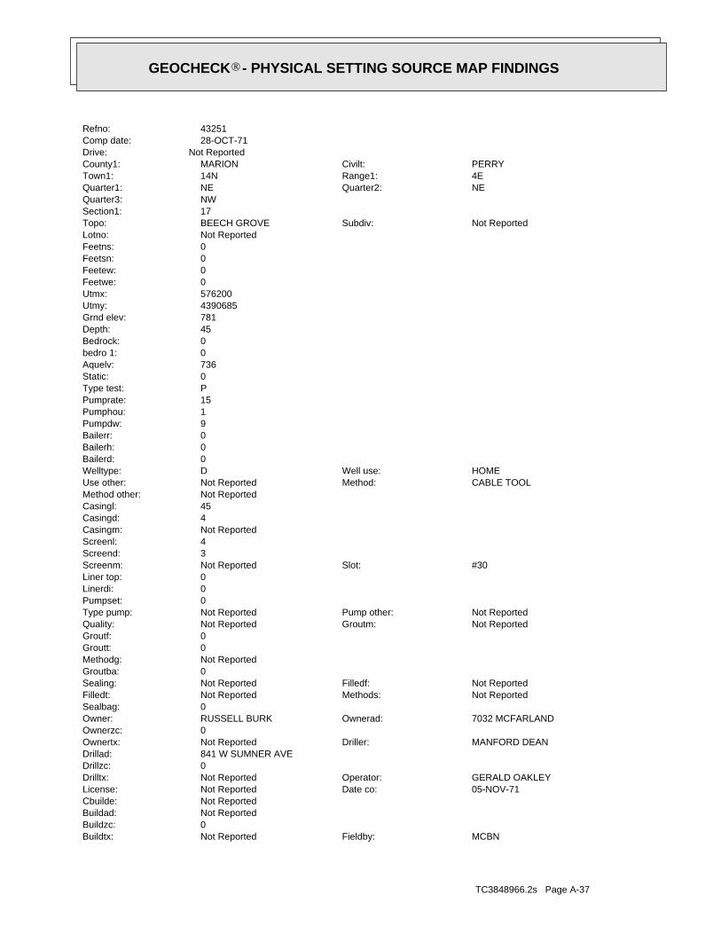
TC3848966.2s Page A-37
MCBNFieldby:Not ReportedBuildtx:0Buildzc:Not ReportedBuildad:Not ReportedCbuilde:
05-NOV-71Date co:Not ReportedLicense:GERALD OAKLEYOperator:Not ReportedDrilltx:
0Drillzc:841 W SUMNER AVEDrillad:
MANFORD DEANDriller:Not ReportedOwnertx:0Ownerzc:
7032 MCFARLANDOwnerad:RUSSELL BURKOwner:0Sealbag:
Not ReportedMethods:Not ReportedFilledt:Not ReportedFilledf:Not ReportedSealing:
0Groutba:Not ReportedMethodg:0Groutt:0Groutf:
Not ReportedGroutm:Not ReportedQuality:Not ReportedPump other:Not ReportedType pump:
0Pumpset:0Linerdi:0Liner top:
#30Slot:Not ReportedScreenm:3Screend:4Screenl:Not ReportedCasingm:4Casingd:45Casingl:Not ReportedMethod other:
CABLE TOOLMethod:Not ReportedUse other:HOMEWell use:DWelltype:
0Bailerd:0Bailerh:0Bailerr:9Pumpdw:1Pumphou:15Pumprate:PType test:0Static:736Aquelv:0bedro 1:0Bedrock:45Depth:781Grnd elev:4390685Utmy:576200Utmx:0Feetwe:0Feetew:0Feetsn:0Feetns:Not ReportedLotno:
Not ReportedSubdiv:BEECH GROVETopo:17Section1:NWQuarter3:
NEQuarter2:NEQuarter1:4ERange1:14NTown1:PERRYCivilt:MARIONCounty1:
Not ReportedDrive:28-OCT-71Comp date:43251Refno:
®GEOCHECK - PHYSICAL SETTING SOURCE MAP FINDINGS®

TC3848966.2s Page A-38
0Linerdi:0Liner top:
60Slot:Not ReportedScreenm:3Screend:5Screenl:Not ReportedCasingm:4Casingd:64Casingl:Not ReportedMethod other:
CABLE TOOLMethod:Not ReportedUse other:HOMEWell use:DWelltype:
20Bailerd:1Bailerh:10Bailerr:0Pumpdw:0Pumphou:0Pumprate:Not ReportedType test:30Static:714Aquelv:0bedro 1:0Bedrock:67Depth:781Grnd elev:4390585Utmy:576190Utmx:0Feetwe:0Feetew:0Feetsn:0Feetns:29Lotno:
HARMON HTS.Subdiv:BEECH GROVETopo:17Section1:NWQuarter3:
NEQuarter2:NEQuarter1:4ERange1:14NTown1:PERRYCivilt:MARIONCounty1:
LOT 29 HARMON HTS.Drive:23-FEB-60Comp date:43261Refno:
F23ESE1/2 - 1 MileHigher
INDNR1000035943IN WELLS
INDNR1000036002Site id:0Reserve:Not ReportedReserve:Not ReportedIrregla:0Gravelp:
0Bore hole:Not ReportedWater supp:
Not ReportedDnrvarn:Not ReportedCtyperm:0Section:
Not ReportedRang:Not ReportedTown:MARIONCounty:11-APR-69Accwo date:Not ReportedAccwo:01-MAY-74Class date:Not ReportedClassby:20-FEB-80Court d:Not ReportedCourtby:01-NOV-92Field d:
®GEOCHECK - PHYSICAL SETTING SOURCE MAP FINDINGS®
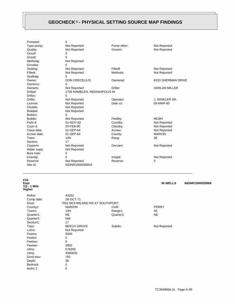
TC3848966.2s Page A-39
0bedro 1:0Bedrock:38Depth:782Grnd elev:4390635Utmy:576200Utmx:2800Feetwe:0Feetew:0Feetsn:5000Feetns:Not ReportedLotno:
Not ReportedSubdiv:BEECH GROVETopo:17Section1:NWQuarter3:
NEQuarter2:NEQuarter1:4ERange1:14NTown1:PERRYCivilt:MARIONCounty1:
7052 MCFARLAND RD AT SOUTHPORT.Drive:28-OCT-71Comp date:43252Refno:
F24East1/2 - 1 MileHigher
INDNR1000035969IN WELLS
INDNR1000035943Site id:0Reserve:Not ReportedReserve:Not ReportedIrregla:0Gravelp:
0Bore hole:Not ReportedWater supp:
Not ReportedDnrvarn:Not ReportedCtyperm:17Section:
3ERang:14NTown:MARIONCounty:01-SEP-64Accwo date:Not ReportedAccwo:01-SEP-64Class date:Not ReportedClassby:20-FEB-80Court d:Not ReportedCourtby:01-NOV-92Field d:MCBHFieldby:Not ReportedBuildtx:
0Buildzc:Not ReportedBuildad:Not ReportedCbuilde:
05-MAR-60Date co:Not ReportedLicense:J. WINKLER SR.Operator:Not ReportedDrilltx:
0Drillzc:1726 HAMBLEN, INDIANAPOLIS INDrillad:
HARLAN MILLERDriller:Not ReportedOwnertx:0Ownerzc:
6333 SHERMAN DRIVEOwnerad:DON CRECELIUSOwner:0Sealbag:
Not ReportedMethods:Not ReportedFilledt:Not ReportedFilledf:Not ReportedSealing:
0Groutba:Not ReportedMethodg:0Groutt:0Groutf:
Not ReportedGroutm:Not ReportedQuality:Not ReportedPump other:Not ReportedType pump:
0Pumpset:
®GEOCHECK - PHYSICAL SETTING SOURCE MAP FINDINGS®
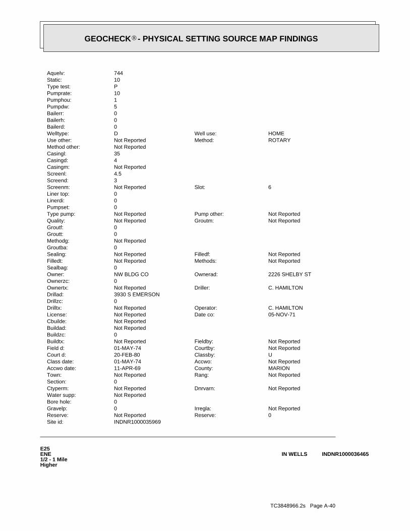
TC3848966.2s Page A-40
E25ENE1/2 - 1 MileHigher
INDNR1000036465IN WELLS
INDNR1000035969Site id:0Reserve:Not ReportedReserve:Not ReportedIrregla:0Gravelp:
0Bore hole:Not ReportedWater supp:
Not ReportedDnrvarn:Not ReportedCtyperm:0Section:
Not ReportedRang:Not ReportedTown:MARIONCounty:11-APR-69Accwo date:Not ReportedAccwo:01-MAY-74Class date:UClassby:20-FEB-80Court d:Not ReportedCourtby:01-MAY-74Field d:Not ReportedFieldby:Not ReportedBuildtx:
0Buildzc:Not ReportedBuildad:Not ReportedCbuilde:
05-NOV-71Date co:Not ReportedLicense:C. HAMILTONOperator:Not ReportedDrilltx:
0Drillzc:3930 S EMERSONDrillad:
C. HAMILTONDriller:Not ReportedOwnertx:0Ownerzc:
2226 SHELBY STOwnerad:NW BLDG COOwner:0Sealbag:
Not ReportedMethods:Not ReportedFilledt:Not ReportedFilledf:Not ReportedSealing:
0Groutba:Not ReportedMethodg:0Groutt:0Groutf:
Not ReportedGroutm:Not ReportedQuality:Not ReportedPump other:Not ReportedType pump:
0Pumpset:0Linerdi:0Liner top:
6Slot:Not ReportedScreenm:3Screend:4.5Screenl:Not ReportedCasingm:4Casingd:35Casingl:Not ReportedMethod other:
ROTARYMethod:Not ReportedUse other:HOMEWell use:DWelltype:
0Bailerd:0Bailerh:0Bailerr:5Pumpdw:1Pumphou:10Pumprate:PType test:10Static:744Aquelv:
®GEOCHECK - PHYSICAL SETTING SOURCE MAP FINDINGS®
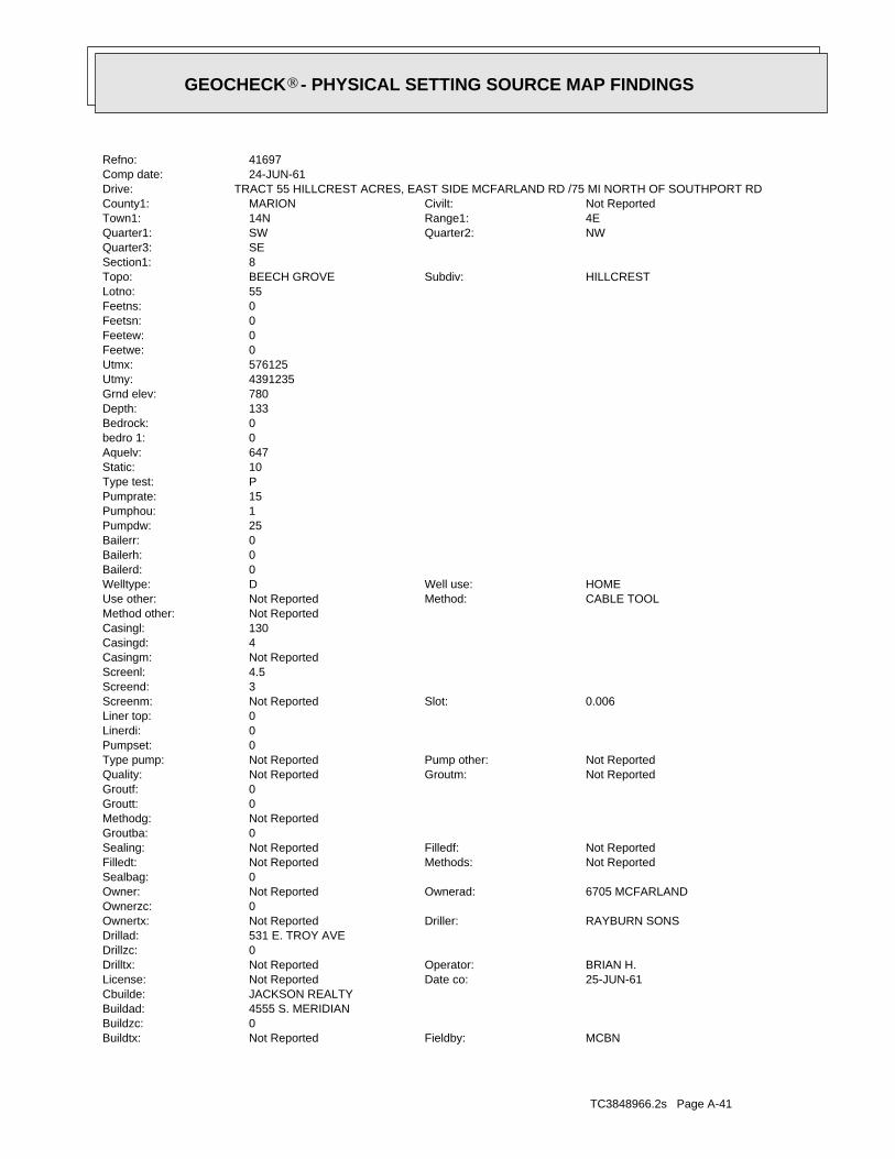
TC3848966.2s Page A-41
MCBNFieldby:Not ReportedBuildtx:0Buildzc:4555 S. MERIDIANBuildad:JACKSON REALTYCbuilde:
25-JUN-61Date co:Not ReportedLicense:BRIAN H.Operator:Not ReportedDrilltx:
0Drillzc:531 E. TROY AVEDrillad:
RAYBURN SONSDriller:Not ReportedOwnertx:0Ownerzc:
6705 MCFARLANDOwnerad:Not ReportedOwner:0Sealbag:
Not ReportedMethods:Not ReportedFilledt:Not ReportedFilledf:Not ReportedSealing:
0Groutba:Not ReportedMethodg:0Groutt:0Groutf:
Not ReportedGroutm:Not ReportedQuality:Not ReportedPump other:Not ReportedType pump:
0Pumpset:0Linerdi:0Liner top:
0.006Slot:Not ReportedScreenm:3Screend:4.5Screenl:Not ReportedCasingm:4Casingd:130Casingl:Not ReportedMethod other:
CABLE TOOLMethod:Not ReportedUse other:HOMEWell use:DWelltype:
0Bailerd:0Bailerh:0Bailerr:25Pumpdw:1Pumphou:15Pumprate:PType test:10Static:647Aquelv:0bedro 1:0Bedrock:133Depth:780Grnd elev:4391235Utmy:576125Utmx:0Feetwe:0Feetew:0Feetsn:0Feetns:55Lotno:
HILLCRESTSubdiv:BEECH GROVETopo:8Section1:SEQuarter3:
NWQuarter2:SWQuarter1:4ERange1:14NTown1:Not ReportedCivilt:MARIONCounty1:
TRACT 55 HILLCREST ACRES, EAST SIDE MCFARLAND RD /75 MI NORTH OF SOUTHPORT RDDrive:24-JUN-61Comp date:41697Refno:
®GEOCHECK - PHYSICAL SETTING SOURCE MAP FINDINGS®
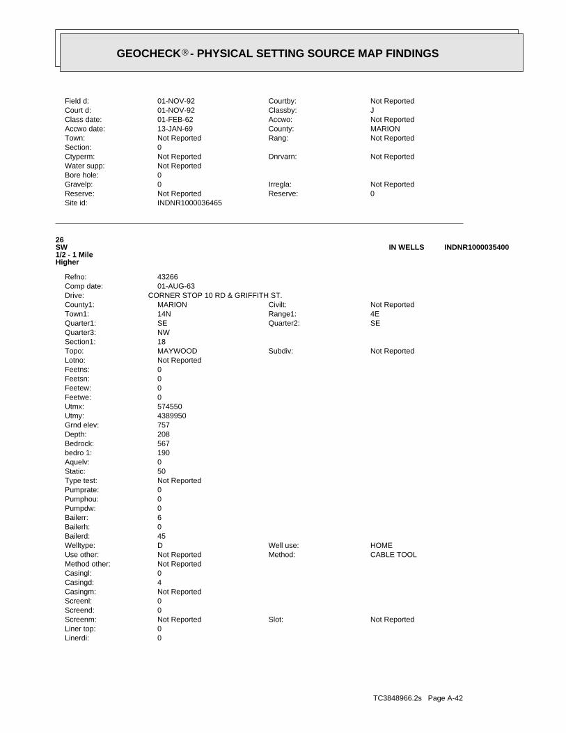
TC3848966.2s Page A-42
0Linerdi:0Liner top:
Not ReportedSlot:Not ReportedScreenm:0Screend:0Screenl:Not ReportedCasingm:4Casingd:0Casingl:Not ReportedMethod other:
CABLE TOOLMethod:Not ReportedUse other:HOMEWell use:DWelltype:
45Bailerd:0Bailerh:6Bailerr:0Pumpdw:0Pumphou:0Pumprate:Not ReportedType test:50Static:0Aquelv:190bedro 1:567Bedrock:208Depth:757Grnd elev:4389950Utmy:574550Utmx:0Feetwe:0Feetew:0Feetsn:0Feetns:Not ReportedLotno:
Not ReportedSubdiv:MAYWOODTopo:18Section1:NWQuarter3:
SEQuarter2:SEQuarter1:4ERange1:14NTown1:Not ReportedCivilt:MARIONCounty1:
CORNER STOP 10 RD & GRIFFITH ST.Drive:01-AUG-63Comp date:43266Refno:
26SW1/2 - 1 MileHigher
INDNR1000035400IN WELLS
INDNR1000036465Site id:0Reserve:Not ReportedReserve:Not ReportedIrregla:0Gravelp:
0Bore hole:Not ReportedWater supp:
Not ReportedDnrvarn:Not ReportedCtyperm:0Section:
Not ReportedRang:Not ReportedTown:MARIONCounty:13-JAN-69Accwo date:Not ReportedAccwo:01-FEB-62Class date:JClassby:01-NOV-92Court d:Not ReportedCourtby:01-NOV-92Field d:
®GEOCHECK - PHYSICAL SETTING SOURCE MAP FINDINGS®

TC3848966.2s Page A-43
0bedro 1:0Bedrock:108Depth:783Grnd elev:4390525Utmy:576200Utmx:0Feetwe:0Feetew:0Feetsn:0Feetns:Not ReportedLotno:
Not ReportedSubdiv:BEECH GROVETopo:17Section1:NWQuarter3:
NEQuarter2:SEQuarter1:4ERange1:14NTown1:Not ReportedCivilt:MARIONCounty1:
SOUTHPORT RD TO MCFARLAND RD THEN S TO MCLAUGHLIN ST THEN R TO 1ST HOUSE.Drive:25-JUL-74Comp date:43253Refno:
G27ESE1/2 - 1 MileHigher
INDNR1000035903IN WELLS
INDNR1000035400Site id:0Reserve:Not ReportedReserve:Not ReportedIrregla:0Gravelp:
0Bore hole:Not ReportedWater supp:
Not ReportedDnrvarn:Not ReportedCtyperm:0Section:
Not ReportedRang:Not ReportedTown:MARIONCounty:15-NOV-76Accwo date:Not ReportedAccwo:01-FEB-65Class date:DBClassby:20-FEB-80Court d:Not ReportedCourtby:01-NOV-92Field d:MCBNFieldby:Not ReportedBuildtx:
0Buildzc:Not ReportedBuildad:Not ReportedCbuilde:
01-FEB-65Date co:Not ReportedLicense:Not ReportedOperator:Not ReportedDrilltx:
0Drillzc:FRANKLINDrillad:
DUGGER SMITH-BROWNSDriller:Not ReportedOwnertx:0Ownerzc:
Not ReportedOwnerad:HENDRICKSOwner:0Sealbag:
Not ReportedMethods:Not ReportedFilledt:Not ReportedFilledf:Not ReportedSealing:
0Groutba:Not ReportedMethodg:0Groutt:0Groutf:
Not ReportedGroutm:Not ReportedQuality:Not ReportedPump other:Not ReportedType pump:
0Pumpset:
®GEOCHECK - PHYSICAL SETTING SOURCE MAP FINDINGS®
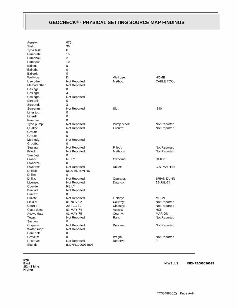
TC3848966.2s Page A-44
F28East1/2 - 1 MileHigher
INDNR1000036039IN WELLS
INDNR1000035903Site id:0Reserve:Not ReportedReserve:Not ReportedIrregla:0Gravelp:
0Bore hole:Not ReportedWater supp:
Not ReportedDnrvarn:Not ReportedCtyperm:0Section:
Not ReportedRang:Not ReportedTown:MARIONCounty:01-MAY-75Accwo date:HCKAccwo:01-MAY-74Class date:Not ReportedClassby:20-FEB-80Court d:Not ReportedCourtby:01-NOV-92Field d:MCBNFieldby:Not ReportedBuildtx:
0Buildzc:Not ReportedBuildad:REILYCbuilde:
29-JUL-74Date co:Not ReportedLicense:BRIAN DUNNOperator:Not ReportedDrilltx:
0Drillzc:6629 ACTON RDDrillad:
C.A. MARTINDriller:Not ReportedOwnertx:0Ownerzc:
REILYOwnerad:REILYOwner:0Sealbag:
Not ReportedMethods:Not ReportedFilledt:Not ReportedFilledf:Not ReportedSealing:
0Groutba:Not ReportedMethodg:0Groutt:0Groutf:
Not ReportedGroutm:Not ReportedQuality:Not ReportedPump other:Not ReportedType pump:
0Pumpset:0Linerdi:0Liner top:
.840Slot:Not ReportedScreenm:3Screend:5Screenl:Not ReportedCasingm:4Casingd:0Casingl:Not ReportedMethod other:
CABLE TOOLMethod:Not ReportedUse other:HOMEWell use:DWelltype:
0Bailerd:0Bailerh:0Bailerr:10Pumpdw:2Pumphou:15Pumprate:PType test:30Static:675Aquelv:
®GEOCHECK - PHYSICAL SETTING SOURCE MAP FINDINGS®

TC3848966.2s Page A-45
MCBNFieldby:Not ReportedBuildtx:0Buildzc:Not ReportedBuildad:Not ReportedCbuilde:
07-APR-60Date co:Not ReportedLicense:JOHN WINKLEROperator:Not ReportedDrilltx:
0Drillzc:1726 HAMBLEN, INDPLSDrillad:
HARLAN MILLERDriller:Not ReportedOwnertx:0Ownerzc:
Not ReportedOwnerad:DOU CREALIUS ( CONTR)Owner:0Sealbag:
Not ReportedMethods:Not ReportedFilledt:Not ReportedFilledf:Not ReportedSealing:
0Groutba:Not ReportedMethodg:0Groutt:0Groutf:
Not ReportedGroutm:Not ReportedQuality:Not ReportedPump other:Not ReportedType pump:
0Pumpset:0Linerdi:0Liner top:
60Slot:Not ReportedScreenm:3.5Screend:3Screenl:Not ReportedCasingm:4Casingd:0Casingl:Not ReportedMethod other:
ROTARYMethod:Not ReportedUse other:HOMEWell use:DWelltype:
0Bailerd:0Bailerh:0Bailerr:20Pumpdw:1Pumphou:10Pumprate:Not ReportedType test:30Static:708Aquelv:0bedro 1:0Bedrock:67Depth:775Grnd elev:4390740Utmy:576260Utmx:0Feetwe:0Feetew:0Feetsn:0Feetns:Not ReportedLotno:
HARMON HGSubdiv:BEECH GROVETopo:17Section1:NEQuarter3:
NWQuarter2:NWQuarter1:4ERange1:14NTown1:PERRYCivilt:MARIONCounty1:
WELL IS LOCATED IN HARMON HEIGHTS AT SE CORNER OF SOUTHPORT RD AND MCFARLAND RDDrive:23-FEB-60Comp date:43262Refno:
®GEOCHECK - PHYSICAL SETTING SOURCE MAP FINDINGS®
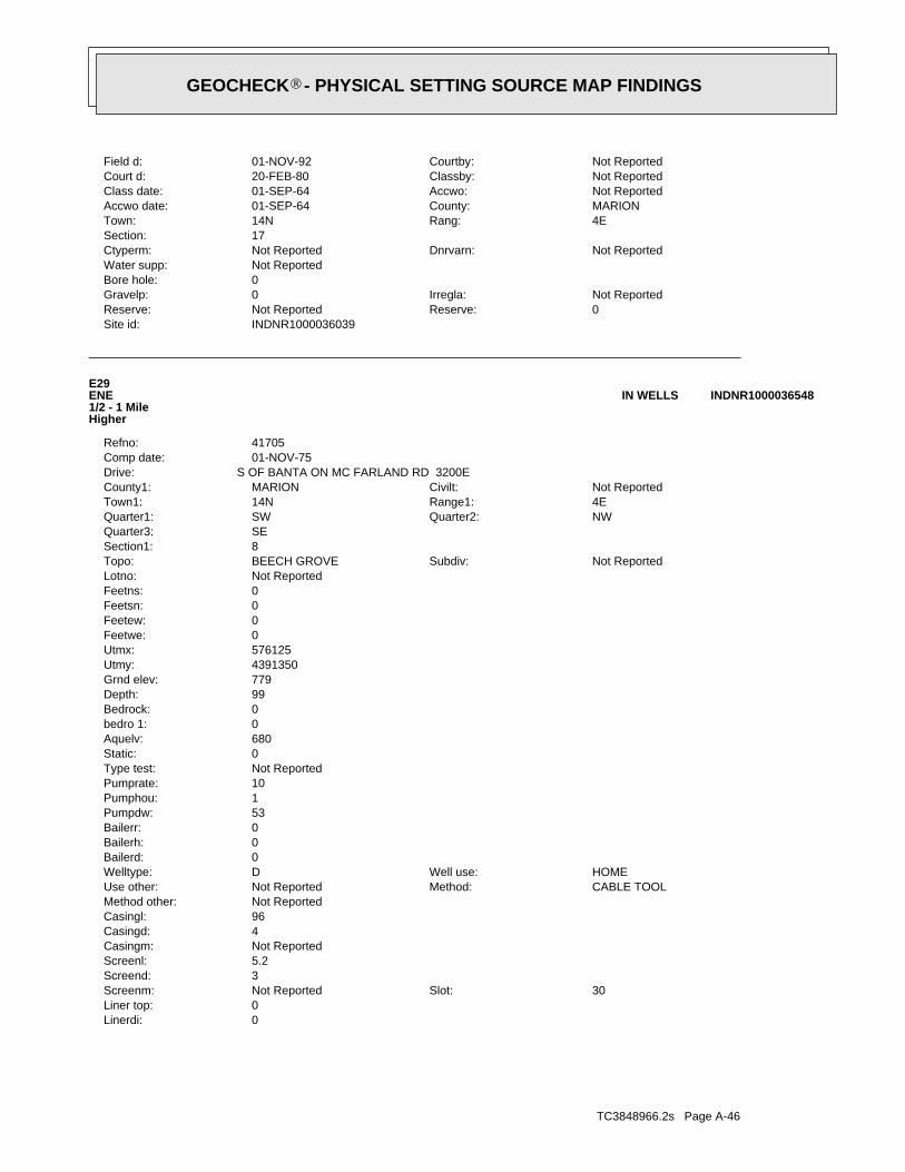
TC3848966.2s Page A-46
0Linerdi:0Liner top:
30Slot:Not ReportedScreenm:3Screend:5.2Screenl:Not ReportedCasingm:4Casingd:96Casingl:Not ReportedMethod other:
CABLE TOOLMethod:Not ReportedUse other:HOMEWell use:DWelltype:
0Bailerd:0Bailerh:0Bailerr:53Pumpdw:1Pumphou:10Pumprate:Not ReportedType test:0Static:680Aquelv:0bedro 1:0Bedrock:99Depth:779Grnd elev:4391350Utmy:576125Utmx:0Feetwe:0Feetew:0Feetsn:0Feetns:Not ReportedLotno:
Not ReportedSubdiv:BEECH GROVETopo:8Section1:SEQuarter3:
NWQuarter2:SWQuarter1:4ERange1:14NTown1:Not ReportedCivilt:MARIONCounty1:
S OF BANTA ON MC FARLAND RD 3200EDrive:01-NOV-75Comp date:41705Refno:
E29ENE1/2 - 1 MileHigher
INDNR1000036548IN WELLS
INDNR1000036039Site id:0Reserve:Not ReportedReserve:Not ReportedIrregla:0Gravelp:
0Bore hole:Not ReportedWater supp:
Not ReportedDnrvarn:Not ReportedCtyperm:17Section:
4ERang:14NTown:MARIONCounty:01-SEP-64Accwo date:Not ReportedAccwo:01-SEP-64Class date:Not ReportedClassby:20-FEB-80Court d:Not ReportedCourtby:01-NOV-92Field d:
®GEOCHECK - PHYSICAL SETTING SOURCE MAP FINDINGS®

TC3848966.2s Page A-47
0bedro 1:0Bedrock:73Depth:780Grnd elev:4390685Utmy:576265Utmx:0Feetwe:0Feetew:0Feetsn:0Feetns:Not ReportedLotno:
Not ReportedSubdiv:BEECH GROVETopo:17Section1:NEQuarter3:
NWQuarter2:NWQuarter1:4ERange1:14NTown1:PERRYCivilt:MARIONCounty1:
3205 HARMAN STREET, IN ADDITION AT SE CORNER MCFARLAND & SOUTHPORT RD.Drive:15-JUN-78Comp date:43244Refno:
F30East1/2 - 1 MileHigher
INDNR1000036000IN WELLS
INDNR1000036548Site id:0Reserve:Not ReportedReserve:Not ReportedIrregla:0Gravelp:
0Bore hole:Not ReportedWater supp:
Not ReportedDnrvarn:Not ReportedCtyperm:0Section:
Not ReportedRang:Not ReportedTown:MARIONCounty:18-NOV-76Accwo date:BRUNSAccwo:01-MAY-64Class date:Not ReportedClassby:01-NOV-92Court d:Not ReportedCourtby:01-NOV-92Field d:MCBHFieldby:Not ReportedBuildtx:
0Buildzc:Not ReportedBuildad:Not ReportedCbuilde:
04-NOV-76Date co:Not ReportedLicense:R S CURLEEOperator:Not ReportedDrilltx:
0Drillzc:2746 E EDGEWOOD AVDrillad:
CURLEE DRILLING CODriller:Not ReportedOwnertx:0Ownerzc:
6625 S MC FARLANDOwnerad:CHAS BUTLEROwner:0Sealbag:
Not ReportedMethods:Not ReportedFilledt:Not ReportedFilledf:Not ReportedSealing:
0Groutba:Not ReportedMethodg:0Groutt:0Groutf:
Not ReportedGroutm:Not ReportedQuality:Not ReportedPump other:Not ReportedType pump:
0Pumpset:
®GEOCHECK - PHYSICAL SETTING SOURCE MAP FINDINGS®
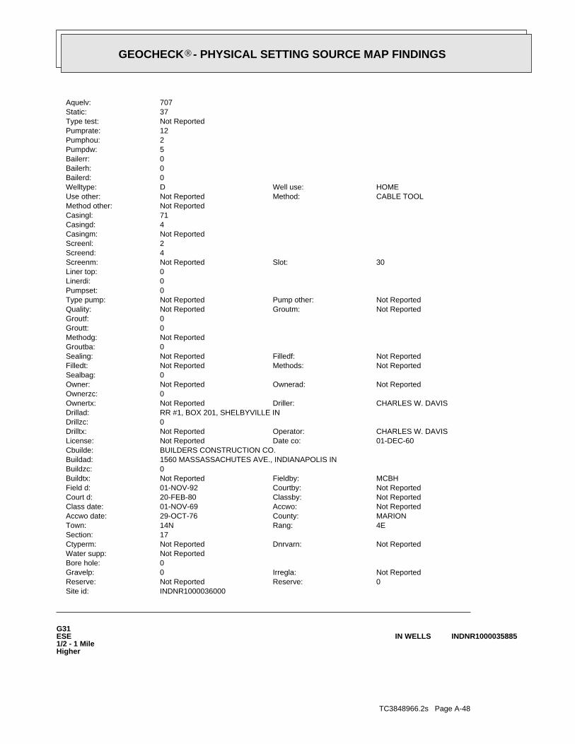
TC3848966.2s Page A-48
G31ESE1/2 - 1 MileHigher
INDNR1000035885IN WELLS
INDNR1000036000Site id:0Reserve:Not ReportedReserve:Not ReportedIrregla:0Gravelp:
0Bore hole:Not ReportedWater supp:
Not ReportedDnrvarn:Not ReportedCtyperm:17Section:
4ERang:14NTown:MARIONCounty:29-OCT-76Accwo date:Not ReportedAccwo:01-NOV-69Class date:Not ReportedClassby:20-FEB-80Court d:Not ReportedCourtby:01-NOV-92Field d:MCBHFieldby:Not ReportedBuildtx:
0Buildzc:1560 MASSASSACHUTES AVE., INDIANAPOLIS INBuildad:BUILDERS CONSTRUCTION CO.Cbuilde:
01-DEC-60Date co:Not ReportedLicense:CHARLES W. DAVISOperator:Not ReportedDrilltx:
0Drillzc:RR #1, BOX 201, SHELBYVILLE INDrillad:
CHARLES W. DAVISDriller:Not ReportedOwnertx:0Ownerzc:
Not ReportedOwnerad:Not ReportedOwner:0Sealbag:
Not ReportedMethods:Not ReportedFilledt:Not ReportedFilledf:Not ReportedSealing:
0Groutba:Not ReportedMethodg:0Groutt:0Groutf:
Not ReportedGroutm:Not ReportedQuality:Not ReportedPump other:Not ReportedType pump:
0Pumpset:0Linerdi:0Liner top:
30Slot:Not ReportedScreenm:4Screend:2Screenl:Not ReportedCasingm:4Casingd:71Casingl:Not ReportedMethod other:
CABLE TOOLMethod:Not ReportedUse other:HOMEWell use:DWelltype:
0Bailerd:0Bailerh:0Bailerr:5Pumpdw:2Pumphou:12Pumprate:Not ReportedType test:37Static:707Aquelv:
®GEOCHECK - PHYSICAL SETTING SOURCE MAP FINDINGS®
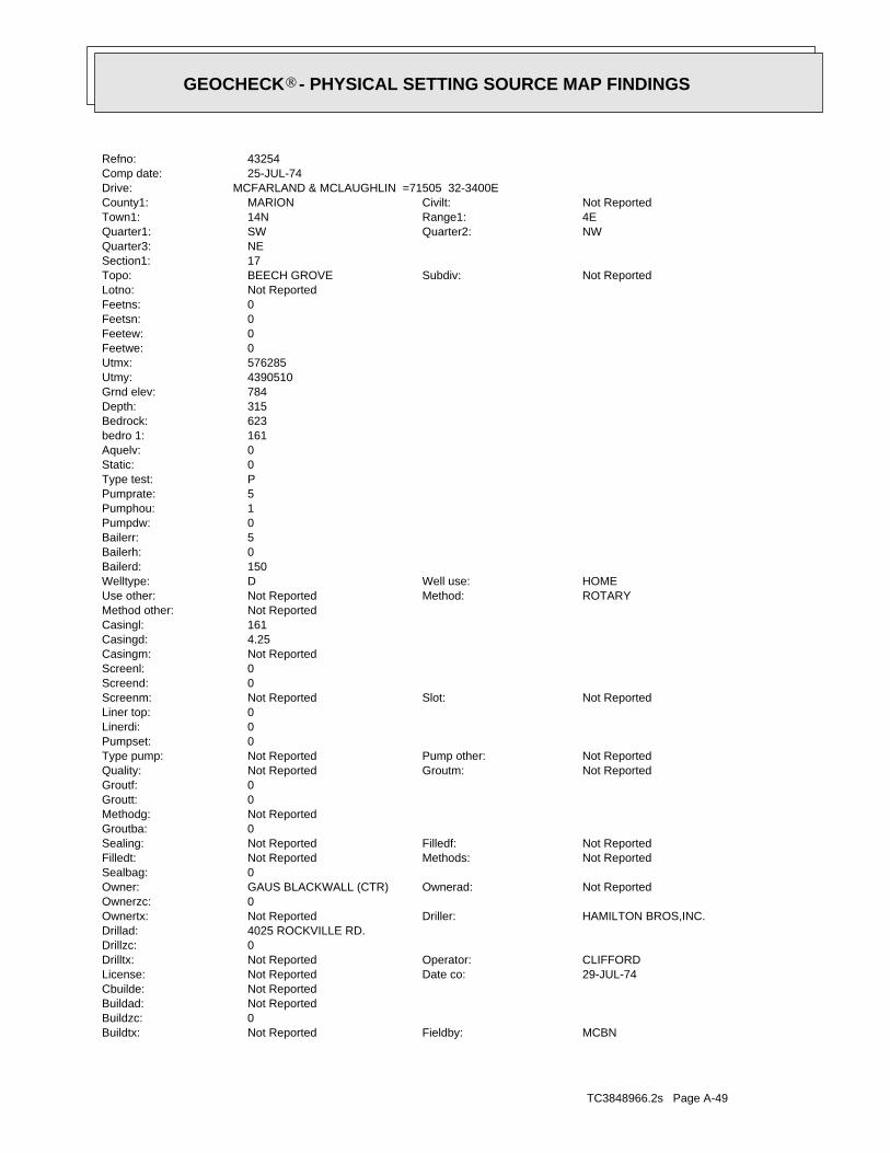
TC3848966.2s Page A-49
MCBNFieldby:Not ReportedBuildtx:0Buildzc:Not ReportedBuildad:Not ReportedCbuilde:
29-JUL-74Date co:Not ReportedLicense:CLIFFORDOperator:Not ReportedDrilltx:
0Drillzc:4025 ROCKVILLE RD.Drillad:
HAMILTON BROS,INC.Driller:Not ReportedOwnertx:0Ownerzc:
Not ReportedOwnerad:GAUS BLACKWALL (CTR)Owner:0Sealbag:
Not ReportedMethods:Not ReportedFilledt:Not ReportedFilledf:Not ReportedSealing:
0Groutba:Not ReportedMethodg:0Groutt:0Groutf:
Not ReportedGroutm:Not ReportedQuality:Not ReportedPump other:Not ReportedType pump:
0Pumpset:0Linerdi:0Liner top:
Not ReportedSlot:Not ReportedScreenm:0Screend:0Screenl:Not ReportedCasingm:4.25Casingd:161Casingl:Not ReportedMethod other:
ROTARYMethod:Not ReportedUse other:HOMEWell use:DWelltype:
150Bailerd:0Bailerh:5Bailerr:0Pumpdw:1Pumphou:5Pumprate:PType test:0Static:0Aquelv:161bedro 1:623Bedrock:315Depth:784Grnd elev:4390510Utmy:576285Utmx:0Feetwe:0Feetew:0Feetsn:0Feetns:Not ReportedLotno:
Not ReportedSubdiv:BEECH GROVETopo:17Section1:NEQuarter3:
NWQuarter2:SWQuarter1:4ERange1:14NTown1:Not ReportedCivilt:MARIONCounty1:
MCFARLAND & MCLAUGHLIN =71505 32-3400EDrive:25-JUL-74Comp date:43254Refno:
®GEOCHECK - PHYSICAL SETTING SOURCE MAP FINDINGS®

TC3848966.2s Page A-50
0Linerdi:0Liner top:
#40Slot:Not ReportedScreenm:3.75Screend:5.2Screenl:Not ReportedCasingm:0Casingd:0Casingl:Not ReportedMethod other:
CABLE TOOLMethod:Not ReportedUse other:HOMEWell use:DWelltype:
0Bailerd:0Bailerh:0Bailerr:3Pumpdw:1Pumphou:10Pumprate:Not ReportedType test:14Static:626Aquelv:0bedro 1:0Bedrock:152Depth:778Grnd elev:4391365Utmy:576180Utmx:0Feetwe:0Feetew:0Feetsn:0Feetns:Not ReportedLotno:
Not ReportedSubdiv:BEECH GROVETopo:8Section1:SEQuarter3:
NWQuarter2:SWQuarter1:4ERange1:14NTown1:PERRYCivilt:MARIONCounty1:
S OF BANTA RD ON MCFARLAND RD, LORETTA GOES EASTDrive:01-JAN-79Comp date:41689Refno:
H32ENE1/2 - 1 MileHigher
INDNR1000036557IN WELLS
INDNR1000035885Site id:0Reserve:Not ReportedReserve:Not ReportedIrregla:0Gravelp:
0Bore hole:Not ReportedWater supp:
Not ReportedDnrvarn:Not ReportedCtyperm:0Section:
Not ReportedRang:Not ReportedTown:MARIONCounty:01-MAY-75Accwo date:Not ReportedAccwo:01-MAY-64Class date:UHLClassby:20-FEB-80Court d:Not ReportedCourtby:01-NOV-92Field d:
®GEOCHECK - PHYSICAL SETTING SOURCE MAP FINDINGS®
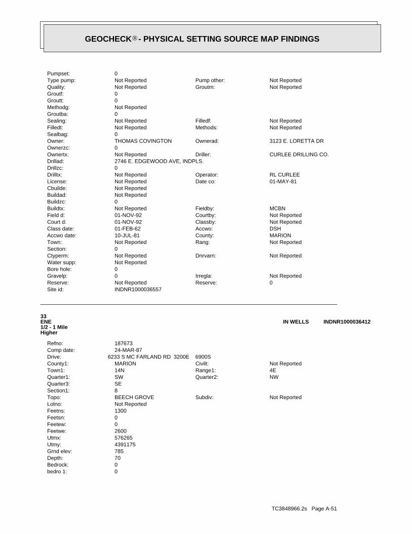
TC3848966.2s Page A-51
0bedro 1:0Bedrock:70Depth:785Grnd elev:4391175Utmy:576265Utmx:2600Feetwe:0Feetew:0Feetsn:1300Feetns:Not ReportedLotno:
Not ReportedSubdiv:BEECH GROVETopo:8Section1:SEQuarter3:
NWQuarter2:SWQuarter1:4ERange1:14NTown1:Not ReportedCivilt:MARIONCounty1:
6233 S MC FARLAND RD 3200E 6900SDrive:24-MAR-87Comp date:187673Refno:
33ENE1/2 - 1 MileHigher
INDNR1000036412IN WELLS
INDNR1000036557Site id:0Reserve:Not ReportedReserve:Not ReportedIrregla:0Gravelp:
0Bore hole:Not ReportedWater supp:
Not ReportedDnrvarn:Not ReportedCtyperm:0Section:
Not ReportedRang:Not ReportedTown:MARIONCounty:10-JUL-81Accwo date:DSHAccwo:01-FEB-62Class date:Not ReportedClassby:01-NOV-92Court d:Not ReportedCourtby:01-NOV-92Field d:MCBNFieldby:Not ReportedBuildtx:
0Buildzc:Not ReportedBuildad:Not ReportedCbuilde:
01-MAY-81Date co:Not ReportedLicense:RL CURLEEOperator:Not ReportedDrilltx:
0Drillzc:2746 E. EDGEWOOD AVE, INDPLS.Drillad:
CURLEE DRILLING CO.Driller:Not ReportedOwnertx:0Ownerzc:
3123 E. LORETTA DROwnerad:THOMAS COVINGTONOwner:0Sealbag:
Not ReportedMethods:Not ReportedFilledt:Not ReportedFilledf:Not ReportedSealing:
0Groutba:Not ReportedMethodg:0Groutt:0Groutf:
Not ReportedGroutm:Not ReportedQuality:Not ReportedPump other:Not ReportedType pump:
0Pumpset:
®GEOCHECK - PHYSICAL SETTING SOURCE MAP FINDINGS®
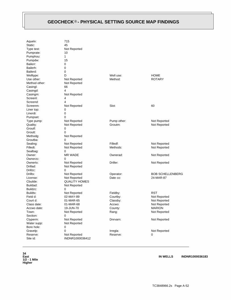
TC3848966.2s Page A-52
34East1/2 - 1 MileHigher
INDNR1000036183IN WELLS
INDNR1000036412Site id:0Reserve:Not ReportedReserve:Not ReportedIrregla:0Gravelp:
0Bore hole:Not ReportedWater supp:
Not ReportedDnrvarn:Not ReportedCtyperm:0Section:
Not ReportedRang:Not ReportedTown:MARIONCounty:19-JUN-70Accwo date:Not ReportedAccwo:01-MAR-68Class date:Not ReportedClassby:01-MAR-65Court d:Not ReportedCourtby:02-MAY-89Field d:RSTFieldby:Not ReportedBuildtx:
0Buildzc:Not ReportedBuildad:QUALITY HOMESCbuilde:
24-MAR-87Date co:Not ReportedLicense:BOB SCHELLENBERGOperator:Not ReportedDrilltx:
0Drillzc:Not ReportedDrillad:
Not ReportedDriller:Not ReportedOwnertx:0Ownerzc:
Not ReportedOwnerad:MR WADEOwner:0Sealbag:
Not ReportedMethods:Not ReportedFilledt:Not ReportedFilledf:Not ReportedSealing:
0Groutba:Not ReportedMethodg:0Groutt:0Groutf:
Not ReportedGroutm:Not ReportedQuality:Not ReportedPump other:Not ReportedType pump:
0Pumpset:0Linerdi:0Liner top:
60Slot:Not ReportedScreenm:4Screend:4Screenl:Not ReportedCasingm:4Casingd:66Casingl:Not ReportedMethod other:
ROTARYMethod:Not ReportedUse other:HOMEWell use:DWelltype:
0Bailerd:0Bailerh:0Bailerr:15Pumpdw:1Pumphou:10Pumprate:Not ReportedType test:45Static:715Aquelv:
®GEOCHECK - PHYSICAL SETTING SOURCE MAP FINDINGS®
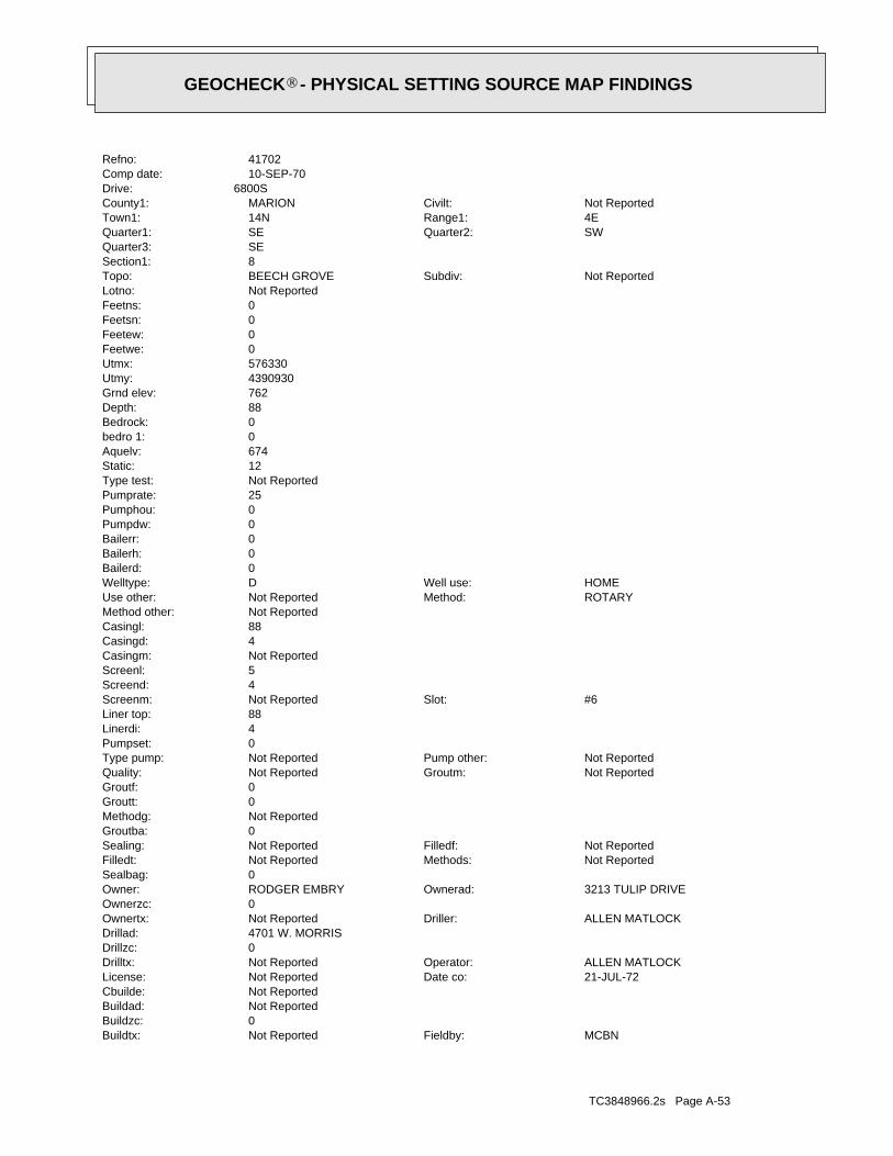
TC3848966.2s Page A-53
MCBNFieldby:Not ReportedBuildtx:0Buildzc:Not ReportedBuildad:Not ReportedCbuilde:
21-JUL-72Date co:Not ReportedLicense:ALLEN MATLOCKOperator:Not ReportedDrilltx:
0Drillzc:4701 W. MORRISDrillad:
ALLEN MATLOCKDriller:Not ReportedOwnertx:0Ownerzc:
3213 TULIP DRIVEOwnerad:RODGER EMBRYOwner:0Sealbag:
Not ReportedMethods:Not ReportedFilledt:Not ReportedFilledf:Not ReportedSealing:
0Groutba:Not ReportedMethodg:0Groutt:0Groutf:
Not ReportedGroutm:Not ReportedQuality:Not ReportedPump other:Not ReportedType pump:
0Pumpset:4Linerdi:88Liner top:
#6Slot:Not ReportedScreenm:4Screend:5Screenl:Not ReportedCasingm:4Casingd:88Casingl:Not ReportedMethod other:
ROTARYMethod:Not ReportedUse other:HOMEWell use:DWelltype:
0Bailerd:0Bailerh:0Bailerr:0Pumpdw:0Pumphou:25Pumprate:Not ReportedType test:12Static:674Aquelv:0bedro 1:0Bedrock:88Depth:762Grnd elev:4390930Utmy:576330Utmx:0Feetwe:0Feetew:0Feetsn:0Feetns:Not ReportedLotno:
Not ReportedSubdiv:BEECH GROVETopo:8Section1:SEQuarter3:
SWQuarter2:SEQuarter1:4ERange1:14NTown1:Not ReportedCivilt:MARIONCounty1:
6800SDrive:10-SEP-70Comp date:41702Refno:
®GEOCHECK - PHYSICAL SETTING SOURCE MAP FINDINGS®

TC3848966.2s Page A-54
4Linerdi:188Liner top:
Not ReportedSlot:Not ReportedScreenm:0Screend:0Screenl:Not ReportedCasingm:4.5Casingd:188Casingl:Not ReportedMethod other:
CABLE TOOLMethod:Not ReportedUse other:HOMEWell use:DWelltype:
0Bailerd:0Bailerh:0Bailerr:3Pumpdw:4Pumphou:7Pumprate:PType test:97Static:0Aquelv:188bedro 1:592Bedrock:230Depth:780Grnd elev:4391850Utmy:575690Utmx:0Feetwe:1400Feetew:1700Feetsn:0Feetns:Not ReportedLotno:
MEYERS MANORSubdiv:BEECH GROVETopo:8Section1:NWQuarter3:
SEQuarter2:NWQuarter1:4ERange1:14NTown1:Not ReportedCivilt:MARIONCounty1:
OF MCFARLAND;MEYERS MANOR ADD. NORTH OF BANTA RD, EAST OF MADISON AVE... 2805 FAIRHOPE, 4 LEVEL, 1 WESTDrive:
10-JUL-68Comp date:41688Refno:
35NNE1/2 - 1 MileHigher
INDNR1000036916IN WELLS
INDNR1000036183Site id:0Reserve:Not ReportedReserve:Not ReportedIrregla:0Gravelp:
0Bore hole:Not ReportedWater supp:
Not ReportedDnrvarn:Not ReportedCtyperm:0Section:
Not ReportedRang:Not ReportedTown:MARIONCounty:12-DEC-75Accwo date:Not ReportedAccwo:01-APR-73Class date:Not ReportedClassby:01-NOV-92Court d:Not ReportedCourtby:01-NOV-92Field d:
®GEOCHECK - PHYSICAL SETTING SOURCE MAP FINDINGS®

TC3848966.2s Page A-55
164bedro 1:619Bedrock:176Depth:783Grnd elev:4390440Utmy:576280Utmx:2600Feetwe:0Feetew:1050Feetsn:0Feetns:Not ReportedLotno:
Not ReportedSubdiv:BEECH GROVETopo:17Section1:NEQuarter3:
NWQuarter2:SWQuarter1:4ERange1:14NTown1:PERRYCivilt:MARIONCounty1:
3203 MCLAUGHLIN RDDrive:25-MAY-60Comp date:43248Refno:
G36ESE1/2 - 1 MileHigher
INDNR1000035826IN WELLS
INDNR1000036916Site id:0Reserve:Not ReportedReserve:Not ReportedIrregla:0Gravelp:
0Bore hole:Not ReportedWater supp:
Not ReportedDnrvarn:Not ReportedCtyperm:0Section:
Not ReportedRang:Not ReportedTown:MARIONCounty:17-FEB-69Accwo date:Not ReportedAccwo:01-FEB-62Class date:Not ReportedClassby:01-NOV-92Court d:Not ReportedCourtby:01-OCT-73Field d:Not ReportedFieldby:Not ReportedBuildtx:
0Buildzc:Not ReportedBuildad:Not ReportedCbuilde:
14-NOV-61Date co:Not ReportedLicense:NOLES CREEDOperator:Not ReportedDrilltx:
0Drillzc:841 W. SUMNER AVEDrillad:
MANFORD DEANDriller:Not ReportedOwnertx:0Ownerzc:
5410 S. MERIDIAN ST.Ownerad:WARREN R. GREGORYOwner:0Sealbag:
Not ReportedMethods:Not ReportedFilledt:Not ReportedFilledf:Not ReportedSealing:
0Groutba:Not ReportedMethodg:0Groutt:0Groutf:
Not ReportedGroutm:Not ReportedQuality:Not ReportedPump other:Not ReportedType pump:
0Pumpset:
®GEOCHECK - PHYSICAL SETTING SOURCE MAP FINDINGS®
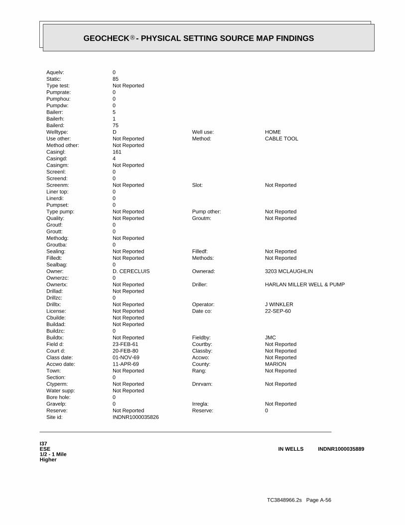
TC3848966.2s Page A-56
I37ESE1/2 - 1 MileHigher
INDNR1000035889IN WELLS
INDNR1000035826Site id:0Reserve:Not ReportedReserve:Not ReportedIrregla:0Gravelp:
0Bore hole:Not ReportedWater supp:
Not ReportedDnrvarn:Not ReportedCtyperm:0Section:
Not ReportedRang:Not ReportedTown:MARIONCounty:11-APR-69Accwo date:Not ReportedAccwo:01-NOV-69Class date:Not ReportedClassby:20-FEB-80Court d:Not ReportedCourtby:23-FEB-61Field d:JMCFieldby:Not ReportedBuildtx:
0Buildzc:Not ReportedBuildad:Not ReportedCbuilde:
22-SEP-60Date co:Not ReportedLicense:J WINKLEROperator:Not ReportedDrilltx:
0Drillzc:Not ReportedDrillad:
HARLAN MILLER WELL & PUMPDriller:Not ReportedOwnertx:0Ownerzc:
3203 MCLAUGHLINOwnerad:D. CERECLUISOwner:0Sealbag:
Not ReportedMethods:Not ReportedFilledt:Not ReportedFilledf:Not ReportedSealing:
0Groutba:Not ReportedMethodg:0Groutt:0Groutf:
Not ReportedGroutm:Not ReportedQuality:Not ReportedPump other:Not ReportedType pump:
0Pumpset:0Linerdi:0Liner top:
Not ReportedSlot:Not ReportedScreenm:0Screend:0Screenl:Not ReportedCasingm:4Casingd:161Casingl:Not ReportedMethod other:
CABLE TOOLMethod:Not ReportedUse other:HOMEWell use:DWelltype:
75Bailerd:1Bailerh:5Bailerr:0Pumpdw:0Pumphou:0Pumprate:Not ReportedType test:85Static:0Aquelv:
®GEOCHECK - PHYSICAL SETTING SOURCE MAP FINDINGS®
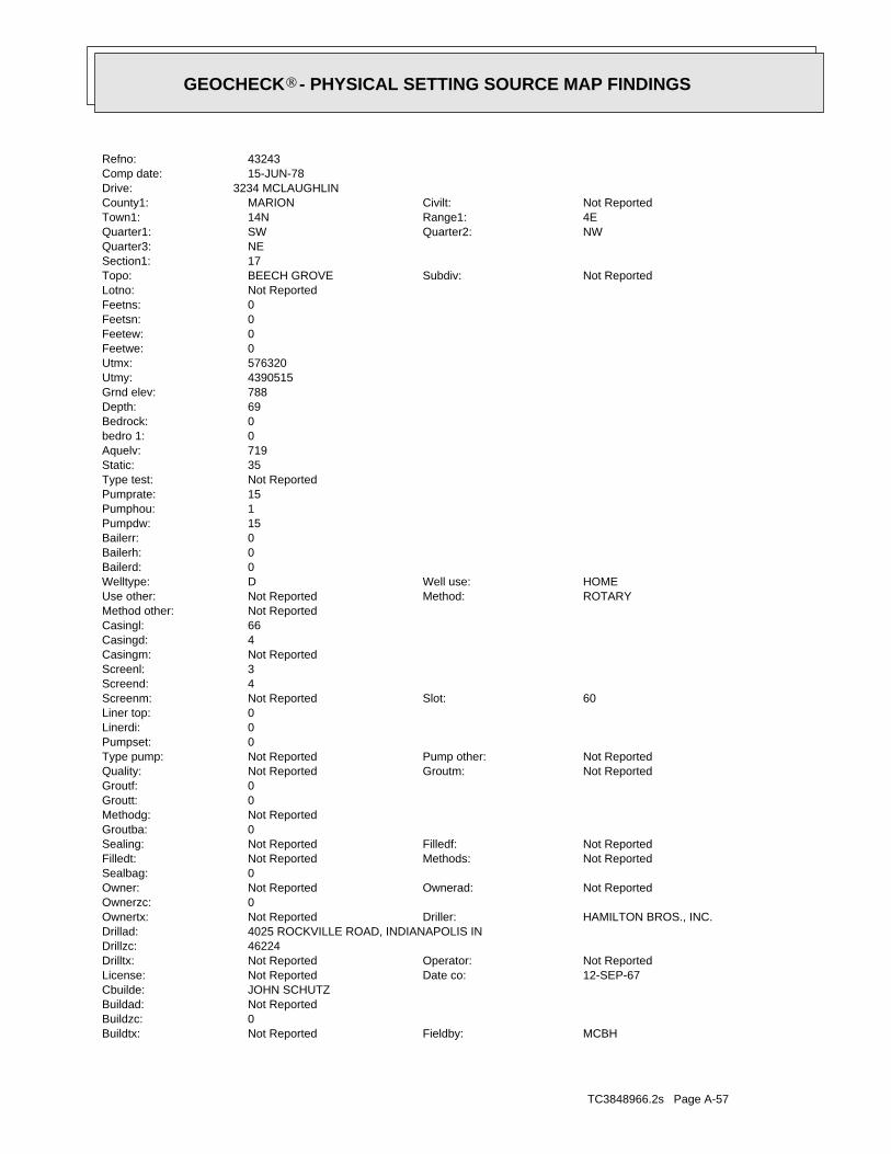
TC3848966.2s Page A-57
MCBHFieldby:Not ReportedBuildtx:0Buildzc:Not ReportedBuildad:JOHN SCHUTZCbuilde:
12-SEP-67Date co:Not ReportedLicense:Not ReportedOperator:Not ReportedDrilltx:
46224Drillzc:4025 ROCKVILLE ROAD, INDIANAPOLIS INDrillad:
HAMILTON BROS., INC.Driller:Not ReportedOwnertx:0Ownerzc:
Not ReportedOwnerad:Not ReportedOwner:0Sealbag:
Not ReportedMethods:Not ReportedFilledt:Not ReportedFilledf:Not ReportedSealing:
0Groutba:Not ReportedMethodg:0Groutt:0Groutf:
Not ReportedGroutm:Not ReportedQuality:Not ReportedPump other:Not ReportedType pump:
0Pumpset:0Linerdi:0Liner top:
60Slot:Not ReportedScreenm:4Screend:3Screenl:Not ReportedCasingm:4Casingd:66Casingl:Not ReportedMethod other:
ROTARYMethod:Not ReportedUse other:HOMEWell use:DWelltype:
0Bailerd:0Bailerh:0Bailerr:15Pumpdw:1Pumphou:15Pumprate:Not ReportedType test:35Static:719Aquelv:0bedro 1:0Bedrock:69Depth:788Grnd elev:4390515Utmy:576320Utmx:0Feetwe:0Feetew:0Feetsn:0Feetns:Not ReportedLotno:
Not ReportedSubdiv:BEECH GROVETopo:17Section1:NEQuarter3:
NWQuarter2:SWQuarter1:4ERange1:14NTown1:Not ReportedCivilt:MARIONCounty1:
3234 MCLAUGHLINDrive:15-JUN-78Comp date:43243Refno:
®GEOCHECK - PHYSICAL SETTING SOURCE MAP FINDINGS®

TC3848966.2s Page A-58
0Linerdi:0Liner top:
0.008Slot:Not ReportedScreenm:3Screend:4.5Screenl:Not ReportedCasingm:4Casingd:83Casingl:Not ReportedMethod other:
CABLE TOOLMethod:Not ReportedUse other:HOMEWell use:DWelltype:
0Bailerd:0Bailerh:0Bailerr:8Pumpdw:1Pumphou:15Pumprate:PType test:8Static:689Aquelv:0bedro 1:0Bedrock:86Depth:775Grnd elev:4391540Utmy:576125Utmx:0Feetwe:0Feetew:0Feetsn:0Feetns:Not ReportedLotno:
PERRY MANORSubdiv:BEECH GROVETopo:8Section1:SEQuarter3:
NWQuarter2:NWQuarter1:4ERange1:14NTown1:PERRYCivilt:MARIONCounty1:
MCFARLAND RD BOUNDRY OF PERRY MANORDrive:01-OCT-59Comp date:41708Refno:
J38NE1/2 - 1 MileHigher
INDNR1000036675IN WELLS
INDNR1000035889Site id:0Reserve:Not ReportedReserve:Not ReportedIrregla:0Gravelp:
0Bore hole:Not ReportedWater supp:
Not ReportedDnrvarn:Not ReportedCtyperm:0Section:
Not ReportedRang:Not ReportedTown:MARIONCounty:29-OCT-76Accwo date:Not ReportedAccwo:01-NOV-69Class date:Not ReportedClassby:20-FEB-80Court d:Not ReportedCourtby:01-NOV-92Field d:
®GEOCHECK - PHYSICAL SETTING SOURCE MAP FINDINGS®

TC3848966.2s Page A-59
0bedro 1:0Bedrock:82Depth:778Grnd elev:4391490Utmy:576175Utmx:0Feetwe:0Feetew:0Feetsn:0Feetns:Not ReportedLotno:
Not ReportedSubdiv:BEECH GROVETopo:8Section1:SEQuarter3:
NWQuarter2:NWQuarter1:4ERange1:14NTown1:Not ReportedCivilt:MARIONCounty1:
3 BLOCKS S OF EDGEWOOD AV MC FARLAND RD TURN LEFT ON LOCEH TO 3140Drive:04-AUG-73Comp date:187712Refno:
J39NE1/2 - 1 MileHigher
INDNR1000036646IN WELLS
INDNR1000036675Site id:0Reserve:Not ReportedReserve:Not ReportedIrregla:0Gravelp:
0Bore hole:Not ReportedWater supp:
Not ReportedDnrvarn:Not ReportedCtyperm:0Section:
Not ReportedRang:Not ReportedTown:MARIONCounty:12-JAN-76Accwo date:Not ReportedAccwo:01-MAY-64Class date:Not ReportedClassby:01-NOV-92Court d:Not ReportedCourtby:01-NOV-92Field d:MCBNFieldby:Not ReportedBuildtx:
0Buildzc:Not ReportedBuildad:Not ReportedCbuilde:
05-FEB-76Date co:Not ReportedLicense:C. MOOREOperator:Not ReportedDrilltx:
0Drillzc:2746 E. STOP 8 RDDrillad:
CURLEE DRILLINGDriller:Not ReportedOwnertx:0Ownerzc:
6505 MCFARLANDOwnerad:MELVIN HOLZEROwner:0Sealbag:
Not ReportedMethods:Not ReportedFilledt:Not ReportedFilledf:Not ReportedSealing:
0Groutba:Not ReportedMethodg:0Groutt:0Groutf:
Not ReportedGroutm:Not ReportedQuality:Not ReportedPump other:Not ReportedType pump:
0Pumpset:
®GEOCHECK - PHYSICAL SETTING SOURCE MAP FINDINGS®

TC3848966.2s Page A-60
40SW1/2 - 1 MileLower
INDNR1000035352IN WELLS
INDNR1000036646Site id:0Reserve:Not ReportedReserve:Not ReportedIrregla:0Gravelp:
0Bore hole:Not ReportedWater supp:
Not ReportedDnrvarn:Not ReportedCtyperm:0Section:
Not ReportedRang:Not ReportedTown:MARIONCounty:10-APR-75Accwo date:TMBAccwo:01-APR-73Class date:Not ReportedClassby:01-MAR-65Court d:Not ReportedCourtby:01-NOV-92Field d:MCBHFieldby:Not ReportedBuildtx:
0Buildzc:Not ReportedBuildad:OLD HOUSECbuilde:
16-AUG-73Date co:Not ReportedLicense:SAMEOperator:Not ReportedDrilltx:
46121Drillzc:RR3, BOX 136, FAIRLAND INDrillad:
RALPH DABNEYDriller:Not ReportedOwnertx:0Ownerzc:
3140 LURCH 8Ownerad:Not ReportedOwner:0Sealbag:
Not ReportedMethods:Not ReportedFilledt:Not ReportedFilledf:Not ReportedSealing:
0Groutba:Not ReportedMethodg:0Groutt:0Groutf:
Not ReportedGroutm:Not ReportedQuality:Not ReportedPump other:Not ReportedType pump:
0Pumpset:0Linerdi:0Liner top:
#.60Slot:Not ReportedScreenm:3Screend:5Screenl:Not ReportedCasingm:4Casingd:80Casingl:Not ReportedMethod other:
CABLE TOOLMethod:Not ReportedUse other:HOMEWell use:DWelltype:
0Bailerd:0Bailerh:0Bailerr:8Pumpdw:6Pumphou:15Pumprate:Not ReportedType test:12Static:696Aquelv:
®GEOCHECK - PHYSICAL SETTING SOURCE MAP FINDINGS®
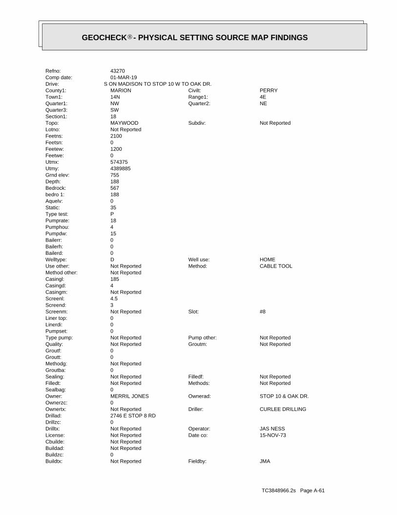
TC3848966.2s Page A-61
JMAFieldby:Not ReportedBuildtx:0Buildzc:Not ReportedBuildad:Not ReportedCbuilde:
15-NOV-73Date co:Not ReportedLicense:JAS NESSOperator:Not ReportedDrilltx:
0Drillzc:2746 E STOP 8 RDDrillad:
CURLEE DRILLINGDriller:Not ReportedOwnertx:0Ownerzc:
STOP 10 & OAK DR.Ownerad:MERRIL JONESOwner:0Sealbag:
Not ReportedMethods:Not ReportedFilledt:Not ReportedFilledf:Not ReportedSealing:
0Groutba:Not ReportedMethodg:0Groutt:0Groutf:
Not ReportedGroutm:Not ReportedQuality:Not ReportedPump other:Not ReportedType pump:
0Pumpset:0Linerdi:0Liner top:
#8Slot:Not ReportedScreenm:3Screend:4.5Screenl:Not ReportedCasingm:4Casingd:185Casingl:Not ReportedMethod other:
CABLE TOOLMethod:Not ReportedUse other:HOMEWell use:DWelltype:
0Bailerd:0Bailerh:0Bailerr:15Pumpdw:4Pumphou:18Pumprate:PType test:35Static:0Aquelv:188bedro 1:567Bedrock:188Depth:755Grnd elev:4389885Utmy:574375Utmx:0Feetwe:1200Feetew:0Feetsn:2100Feetns:Not ReportedLotno:
Not ReportedSubdiv:MAYWOODTopo:18Section1:SWQuarter3:
NEQuarter2:NWQuarter1:4ERange1:14NTown1:PERRYCivilt:MARIONCounty1:
S ON MADISON TO STOP 10 W TO OAK DR.Drive:01-MAR-19Comp date:43270Refno:
®GEOCHECK - PHYSICAL SETTING SOURCE MAP FINDINGS®
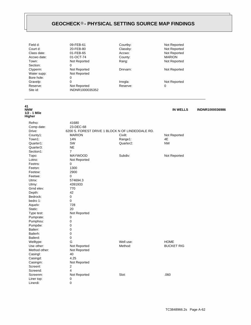
TC3848966.2s Page A-62
0Linerdi:0Liner top:
.060Slot:Not ReportedScreenm:4Screend:2Screenl:Not ReportedCasingm:4.25Casingd:40Casingl:Not ReportedMethod other:
BUCKET RIGMethod:Not ReportedUse other:HOMEWell use:GWelltype:
0Bailerd:0Bailerh:0Bailerr:0Pumpdw:0Pumphou:0Pumprate:Not ReportedType test:20Static:728Aquelv:0bedro 1:0Bedrock:42Depth:770Grnd elev:4391933Utmy:574694.3Utmx:0Feetwe:2900Feetew:1300Feetsn:0Feetns:Not ReportedLotno:
Not ReportedSubdiv:MAYWOODTopo:7Section1:NEQuarter3:
NWQuarter2:SWQuarter1:4ERange1:14NTown1:Not ReportedCivilt:MARIONCounty1:
6200 S. FOREST DRIVE 1 BLOCK N OF LINDEDDALE RD.Drive:23-DEC-68Comp date:41680Refno:
41NNW1/2 - 1 MileHigher
INDNR1000036986IN WELLS
INDNR1000035352Site id:0Reserve:Not ReportedReserve:Not ReportedIrregla:0Gravelp:
0Bore hole:Not ReportedWater supp:
Not ReportedDnrvarn:Not ReportedCtyperm:0Section:
Not ReportedRang:Not ReportedTown:MARIONCounty:01-OCT-74Accwo date:Not ReportedAccwo:01-FEB-65Class date:Not ReportedClassby:20-FEB-80Court d:Not ReportedCourtby:09-FEB-61Field d:
®GEOCHECK - PHYSICAL SETTING SOURCE MAP FINDINGS®
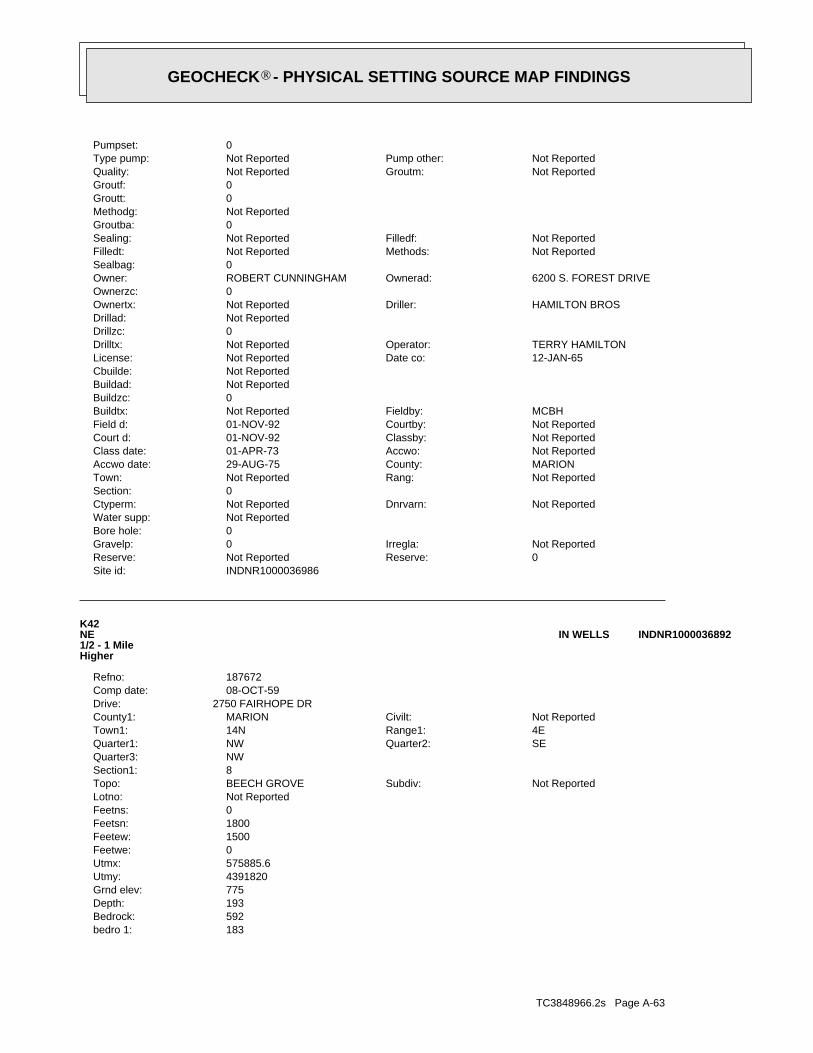
TC3848966.2s Page A-63
183bedro 1:592Bedrock:193Depth:775Grnd elev:4391820Utmy:575885.6Utmx:0Feetwe:1500Feetew:1800Feetsn:0Feetns:Not ReportedLotno:
Not ReportedSubdiv:BEECH GROVETopo:8Section1:NWQuarter3:
SEQuarter2:NWQuarter1:4ERange1:14NTown1:Not ReportedCivilt:MARIONCounty1:
2750 FAIRHOPE DRDrive:08-OCT-59Comp date:187672Refno:
K42NE1/2 - 1 MileHigher
INDNR1000036892IN WELLS
INDNR1000036986Site id:0Reserve:Not ReportedReserve:Not ReportedIrregla:0Gravelp:
0Bore hole:Not ReportedWater supp:
Not ReportedDnrvarn:Not ReportedCtyperm:0Section:
Not ReportedRang:Not ReportedTown:MARIONCounty:29-AUG-75Accwo date:Not ReportedAccwo:01-APR-73Class date:Not ReportedClassby:01-NOV-92Court d:Not ReportedCourtby:01-NOV-92Field d:MCBHFieldby:Not ReportedBuildtx:
0Buildzc:Not ReportedBuildad:Not ReportedCbuilde:
12-JAN-65Date co:Not ReportedLicense:TERRY HAMILTONOperator:Not ReportedDrilltx:
0Drillzc:Not ReportedDrillad:
HAMILTON BROSDriller:Not ReportedOwnertx:0Ownerzc:
6200 S. FOREST DRIVEOwnerad:ROBERT CUNNINGHAMOwner:0Sealbag:
Not ReportedMethods:Not ReportedFilledt:Not ReportedFilledf:Not ReportedSealing:
0Groutba:Not ReportedMethodg:0Groutt:0Groutf:
Not ReportedGroutm:Not ReportedQuality:Not ReportedPump other:Not ReportedType pump:
0Pumpset:
®GEOCHECK - PHYSICAL SETTING SOURCE MAP FINDINGS®
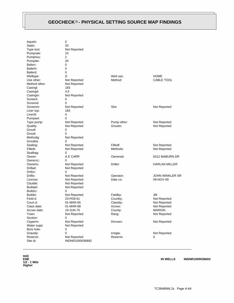
TC3848966.2s Page A-64
H43ENE1/2 - 1 MileHigher
INDNR1000036603IN WELLS
INDNR1000036892Site id:0Reserve:Not ReportedReserve:Not ReportedIrregla:0Gravelp:
0Bore hole:Not ReportedWater supp:
Not ReportedDnrvarn:Not ReportedCtyperm:0Section:
Not ReportedRang:Not ReportedTown:MARIONCounty:19-JUN-70Accwo date:Not ReportedAccwo:01-MAR-68Class date:Not ReportedClassby:01-MAR-65Court d:Not ReportedCourtby:23-FEB-61Field d:JMFieldby:Not ReportedBuildtx:
0Buildzc:Not ReportedBuildad:Not ReportedCbuilde:
09-NOV-59Date co:Not ReportedLicense:JOHN WINKLER SROperator:Not ReportedDrilltx:
0Drillzc:Not ReportedDrillad:
HARLAN MILLERDriller:Not ReportedOwnertx:0Ownerzc:
6312 MABURN DROwnerad:A E CARROwner:0Sealbag:
Not ReportedMethods:Not ReportedFilledt:Not ReportedFilledf:Not ReportedSealing:
0Groutba:Not ReportedMethodg:0Groutt:0Groutf:
Not ReportedGroutm:Not ReportedQuality:Not ReportedPump other:Not ReportedType pump:
0Pumpset:4Linerdi:183Liner top:
Not ReportedSlot:Not ReportedScreenm:0Screend:0Screenl:Not ReportedCasingm:4.5Casingd:183Casingl:Not ReportedMethod other:
CABLE TOOLMethod:Not ReportedUse other:HOMEWell use:DWelltype:
0Bailerd:0Bailerh:0Bailerr:20Pumpdw:2Pumphou:10Pumprate:Not ReportedType test:20Static:0Aquelv:
®GEOCHECK - PHYSICAL SETTING SOURCE MAP FINDINGS®
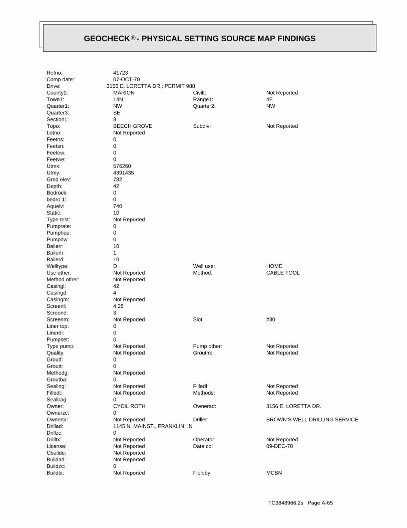
TC3848966.2s Page A-65
MCBNFieldby:Not ReportedBuildtx:0Buildzc:Not ReportedBuildad:Not ReportedCbuilde:
09-DEC-70Date co:Not ReportedLicense:Not ReportedOperator:Not ReportedDrilltx:
0Drillzc:1145 N. MAINST., FRANKLIN, INDrillad:
BROWN’S WELL DRILLING SERVICEDriller:Not ReportedOwnertx:0Ownerzc:
3156 E. LORETTA DR.Ownerad:CYCIL ROTHOwner:0Sealbag:
Not ReportedMethods:Not ReportedFilledt:Not ReportedFilledf:Not ReportedSealing:
0Groutba:Not ReportedMethodg:0Groutt:0Groutf:
Not ReportedGroutm:Not ReportedQuality:Not ReportedPump other:Not ReportedType pump:
0Pumpset:0Linerdi:0Liner top:
#30Slot:Not ReportedScreenm:3Screend:4.25Screenl:Not ReportedCasingm:4Casingd:42Casingl:Not ReportedMethod other:
CABLE TOOLMethod:Not ReportedUse other:HOMEWell use:DWelltype:
10Bailerd:1Bailerh:10Bailerr:0Pumpdw:0Pumphou:0Pumprate:Not ReportedType test:10Static:740Aquelv:0bedro 1:0Bedrock:42Depth:782Grnd elev:4391435Utmy:576260Utmx:0Feetwe:0Feetew:0Feetsn:0Feetns:Not ReportedLotno:
Not ReportedSubdiv:BEECH GROVETopo:8Section1:SEQuarter3:
NWQuarter2:NWQuarter1:4ERange1:14NTown1:Not ReportedCivilt:MARIONCounty1:
3156 E. LORETTA DR.; PERMIT 988Drive:07-OCT-70Comp date:41723Refno:
®GEOCHECK - PHYSICAL SETTING SOURCE MAP FINDINGS®
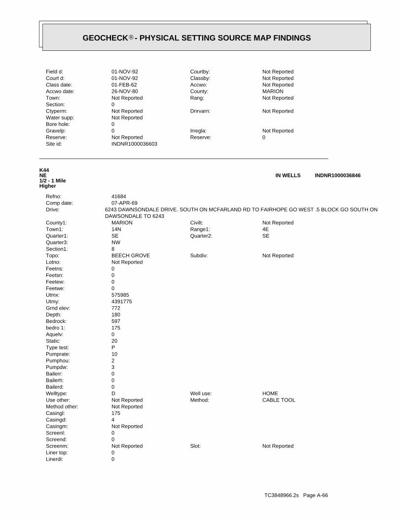
TC3848966.2s Page A-66
0Linerdi:0Liner top:
Not ReportedSlot:Not ReportedScreenm:0Screend:0Screenl:Not ReportedCasingm:4Casingd:175Casingl:Not ReportedMethod other:
CABLE TOOLMethod:Not ReportedUse other:HOMEWell use:DWelltype:
0Bailerd:0Bailerh:0Bailerr:3Pumpdw:2Pumphou:10Pumprate:PType test:20Static:0Aquelv:175bedro 1:597Bedrock:180Depth:772Grnd elev:4391775Utmy:575985Utmx:0Feetwe:0Feetew:0Feetsn:0Feetns:Not ReportedLotno:
Not ReportedSubdiv:BEECH GROVETopo:8Section1:NWQuarter3:
SEQuarter2:SEQuarter1:4ERange1:14NTown1:Not ReportedCivilt:MARIONCounty1:
DAWSONDALE TO 62436243 DAWNSONDALE DRIVE. SOUTH ON MCFARLAND RD TO FAIRHOPE GO WEST .5 BLOCK GO SOUTH ONDrive:
07-APR-69Comp date:41684Refno:
K44NE1/2 - 1 MileHigher
INDNR1000036846IN WELLS
INDNR1000036603Site id:0Reserve:Not ReportedReserve:Not ReportedIrregla:0Gravelp:
0Bore hole:Not ReportedWater supp:
Not ReportedDnrvarn:Not ReportedCtyperm:0Section:
Not ReportedRang:Not ReportedTown:MARIONCounty:26-NOV-80Accwo date:Not ReportedAccwo:01-FEB-62Class date:Not ReportedClassby:01-NOV-92Court d:Not ReportedCourtby:01-NOV-92Field d:
®GEOCHECK - PHYSICAL SETTING SOURCE MAP FINDINGS®
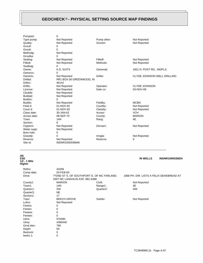
TC3848966.2s Page A-67
0bedro 1:0Bedrock:59Depth:785Grnd elev:4390440Utmy:576390Utmx:0Feetwe:0Feetew:0Feetsn:0Feetns:Not ReportedLotno:
Not ReportedSubdiv:BEECH GROVETopo:17Section1:NEQuarter3:
NWQuarter2:SWQuarter1:4ERange1:14NTown1:Not ReportedCivilt:MARIONCounty1:
3307 MC LANGHLIN AVE. 881-6488??2ND ST S. OF SOUTHPORT E. OF MC FARLAND. 1968 PH. DIR. LISTS A FELIX DEHEBREAD ATDrive:
03-FEB-60Comp date:43258Refno:
I45ESE1/2 - 1 MileHigher
INDNR1000035824IN WELLS
INDNR1000036846Site id:0Reserve:Not ReportedReserve:Not ReportedIrregla:0Gravelp:
0Bore hole:Not ReportedWater supp:
Not ReportedDnrvarn:Not ReportedCtyperm:8Section:
4ERang:14NTown:MARIONCounty:08-SEP-70Accwo date:VCHAccwo:30-JAN-62Class date:Not ReportedClassby:01-NOV-92Court d:Not ReportedCourtby:01-NOV-92Field d:MCBNFieldby:Not ReportedBuildtx:
0Buildzc:Not ReportedBuildad:Not ReportedCbuilde:
03-NOV-69Date co:Not ReportedLicense:CLYDE JOHNSONOperator:Not ReportedDrilltx:
46142Drillzc:RR1 BOX 58 GREENWOOD, INDrillad:
CLYDE JOHNSON WELL DRILLINGDriller:Not ReportedOwnertx:0Ownerzc:
1821 N. POST RD., INDPLS.Ownerad:K.D. SUITSOwner:0Sealbag:
Not ReportedMethods:Not ReportedFilledt:Not ReportedFilledf:Not ReportedSealing:
0Groutba:Not ReportedMethodg:0Groutt:0Groutf:
Not ReportedGroutm:Not ReportedQuality:Not ReportedPump other:Not ReportedType pump:
0Pumpset:
®GEOCHECK - PHYSICAL SETTING SOURCE MAP FINDINGS®
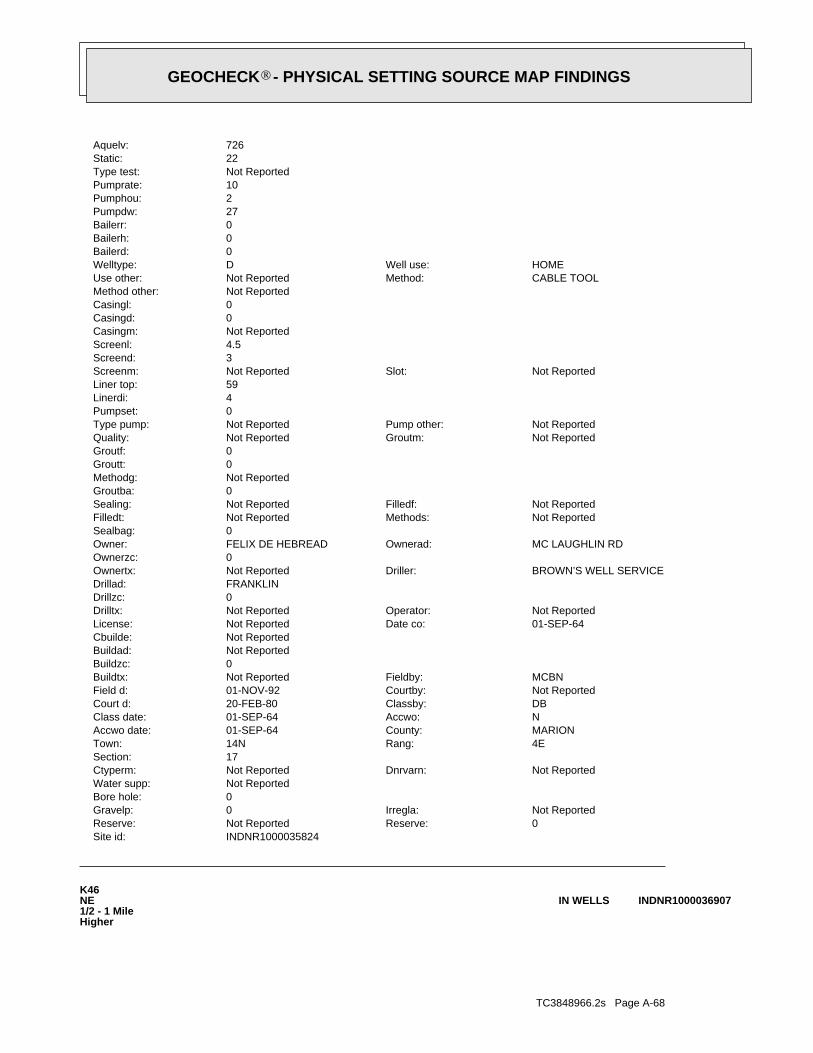
TC3848966.2s Page A-68
K46NE1/2 - 1 MileHigher
INDNR1000036907IN WELLS
INDNR1000035824Site id:0Reserve:Not ReportedReserve:Not ReportedIrregla:0Gravelp:
0Bore hole:Not ReportedWater supp:
Not ReportedDnrvarn:Not ReportedCtyperm:17Section:
4ERang:14NTown:MARIONCounty:01-SEP-64Accwo date:NAccwo:01-SEP-64Class date:DBClassby:20-FEB-80Court d:Not ReportedCourtby:01-NOV-92Field d:MCBNFieldby:Not ReportedBuildtx:
0Buildzc:Not ReportedBuildad:Not ReportedCbuilde:
01-SEP-64Date co:Not ReportedLicense:Not ReportedOperator:Not ReportedDrilltx:
0Drillzc:FRANKLINDrillad:
BROWN’S WELL SERVICEDriller:Not ReportedOwnertx:0Ownerzc:
MC LAUGHLIN RDOwnerad:FELIX DE HEBREADOwner:0Sealbag:
Not ReportedMethods:Not ReportedFilledt:Not ReportedFilledf:Not ReportedSealing:
0Groutba:Not ReportedMethodg:0Groutt:0Groutf:
Not ReportedGroutm:Not ReportedQuality:Not ReportedPump other:Not ReportedType pump:
0Pumpset:4Linerdi:59Liner top:
Not ReportedSlot:Not ReportedScreenm:3Screend:4.5Screenl:Not ReportedCasingm:0Casingd:0Casingl:Not ReportedMethod other:
CABLE TOOLMethod:Not ReportedUse other:HOMEWell use:DWelltype:
0Bailerd:0Bailerh:0Bailerr:27Pumpdw:2Pumphou:10Pumprate:Not ReportedType test:22Static:726Aquelv:
®GEOCHECK - PHYSICAL SETTING SOURCE MAP FINDINGS®
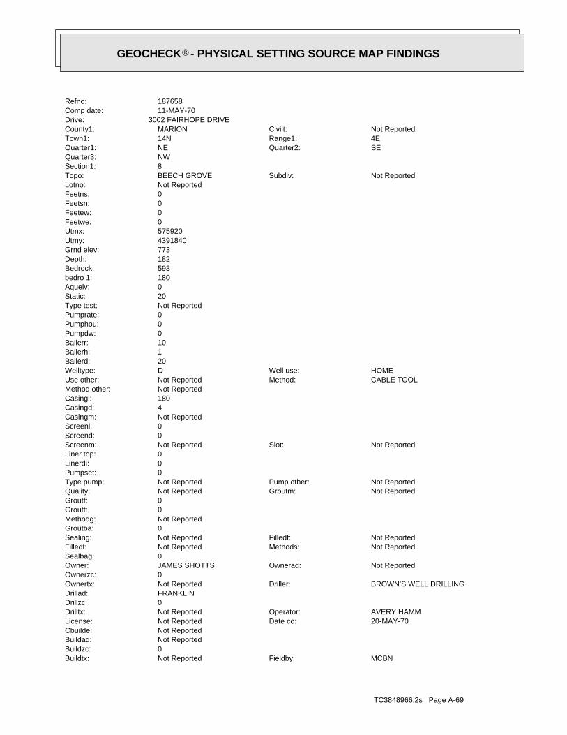
TC3848966.2s Page A-69
MCBNFieldby:Not ReportedBuildtx:0Buildzc:Not ReportedBuildad:Not ReportedCbuilde:
20-MAY-70Date co:Not ReportedLicense:AVERY HAMMOperator:Not ReportedDrilltx:
0Drillzc:FRANKLINDrillad:
BROWN’S WELL DRILLINGDriller:Not ReportedOwnertx:0Ownerzc:
Not ReportedOwnerad:JAMES SHOTTSOwner:0Sealbag:
Not ReportedMethods:Not ReportedFilledt:Not ReportedFilledf:Not ReportedSealing:
0Groutba:Not ReportedMethodg:0Groutt:0Groutf:
Not ReportedGroutm:Not ReportedQuality:Not ReportedPump other:Not ReportedType pump:
0Pumpset:0Linerdi:0Liner top:
Not ReportedSlot:Not ReportedScreenm:0Screend:0Screenl:Not ReportedCasingm:4Casingd:180Casingl:Not ReportedMethod other:
CABLE TOOLMethod:Not ReportedUse other:HOMEWell use:DWelltype:
20Bailerd:1Bailerh:10Bailerr:0Pumpdw:0Pumphou:0Pumprate:Not ReportedType test:20Static:0Aquelv:180bedro 1:593Bedrock:182Depth:773Grnd elev:4391840Utmy:575920Utmx:0Feetwe:0Feetew:0Feetsn:0Feetns:Not ReportedLotno:
Not ReportedSubdiv:BEECH GROVETopo:8Section1:NWQuarter3:
SEQuarter2:NEQuarter1:4ERange1:14NTown1:Not ReportedCivilt:MARIONCounty1:
3002 FAIRHOPE DRIVEDrive:11-MAY-70Comp date:187658Refno:
®GEOCHECK - PHYSICAL SETTING SOURCE MAP FINDINGS®

TC3848966.2s Page A-70
4Linerdi:142Liner top:
6Slot:Not ReportedScreenm:3Screend:5Screenl:Not ReportedCasingm:4.5Casingd:142Casingl:Not ReportedMethod other:
CABLE TOOLMethod:Not ReportedUse other:HOMEWell use:DWelltype:
0Bailerd:0Bailerh:0Bailerr:25Pumpdw:2Pumphou:10Pumprate:Not ReportedType test:75Static:628Aquelv:0bedro 1:0Bedrock:144Depth:772Grnd elev:4391850Utmy:576010Utmx:0Feetwe:0Feetew:0Feetsn:0Feetns:Not ReportedLotno:
Not ReportedSubdiv:BEECH GROVETopo:8Section1:NWQuarter3:
SEQuarter2:NEQuarter1:4ERange1:14NTown1:Not ReportedCivilt:MARIONCounty1:
LOCATION OF WELL 3009 FAIRHOPE DR.Drive:02-JUL-68Comp date:41694Refno:
L47NE1/2 - 1 MileHigher
INDNR1000036912IN WELLS
INDNR1000036907Site id:0Reserve:Not ReportedReserve:Not ReportedIrregla:0Gravelp:
0Bore hole:Not ReportedWater supp:
Not ReportedDnrvarn:Not ReportedCtyperm:0Section:
Not ReportedRang:Not ReportedTown:MARIONCounty:19-JUN-70Accwo date:VCHAccwo:01-FEB-65Class date:Not ReportedClassby:01-MAR-65Court d:Not ReportedCourtby:01-NOV-92Field d:
®GEOCHECK - PHYSICAL SETTING SOURCE MAP FINDINGS®

TC3848966.2s Page A-71
0bedro 1:0Bedrock:89Depth:778Grnd elev:4391900Utmy:575960Utmx:0Feetwe:0Feetew:0Feetsn:0Feetns:Not ReportedLotno:
Not ReportedSubdiv:BEECH GROVETopo:8Section1:NWQuarter3:
SEQuarter2:NEQuarter1:4ERange1:14NTown1:Not ReportedCivilt:MARIONCounty1:
FAIRHOPE ST.Drive:20-JUL-62Comp date:41704Refno:
K48NE1/2 - 1 MileHigher
INDNR1000036956IN WELLS
INDNR1000036912Site id:0Reserve:Not ReportedReserve:Not ReportedIrregla:0Gravelp:
0Bore hole:Not ReportedWater supp:
Not ReportedDnrvarn:Not ReportedCtyperm:0Section:
Not ReportedRang:Not ReportedTown:MARIONCounty:13-JAN-69Accwo date:VCHAccwo:01-AUG-68Class date:Not ReportedClassby:01-NOV-92Court d:Not ReportedCourtby:01-NOV-92Field d:MCBNFieldby:Not ReportedBuildtx:
0Buildzc:Not ReportedBuildad:Not ReportedCbuilde:
02-JUL-68Date co:Not ReportedLicense:AL STROUPEOperator:Not ReportedDrilltx:
0Drillzc:5410 E. MINNESOTA, INDPLS.Drillad:
WOLFE WELL DRILLINGDriller:Not ReportedOwnertx:0Ownerzc:
112 ROSELAND, GREENWOODOwnerad:JAMES BERKHOLTZOwner:0Sealbag:
Not ReportedMethods:Not ReportedFilledt:Not ReportedFilledf:Not ReportedSealing:
0Groutba:Not ReportedMethodg:0Groutt:0Groutf:
Not ReportedGroutm:Not ReportedQuality:Not ReportedPump other:Not ReportedType pump:
0Pumpset:
®GEOCHECK - PHYSICAL SETTING SOURCE MAP FINDINGS®

TC3848966.2s Page A-72
M49ESE1/2 - 1 MileHigher
INDNR1000035837IN WELLS
INDNR1000036956Site id:0Reserve:Not ReportedReserve:Not ReportedIrregla:0Gravelp:
0Bore hole:Not ReportedWater supp:
Not ReportedDnrvarn:Not ReportedCtyperm:0Section:
Not ReportedRang:Not ReportedTown:MARIONCounty:01-MAY-64Accwo date:Not ReportedAccwo:01-MAY-64Class date:Not ReportedClassby:01-NOV-92Court d:Not ReportedCourtby:01-NOV-92Field d:MCBNFieldby:Not ReportedBuildtx:
0Buildzc:Not ReportedBuildad:Not ReportedCbuilde:
06-AUG-62Date co:Not ReportedLicense:WHEELEROperator:Not ReportedDrilltx:
0Drillzc:4025 ROCKVILLE RDDrillad:
HAMILTON BROS. INC.Driller:Not ReportedOwnertx:0Ownerzc:
3022 FAIRHOPE DROwnerad:FRANK ROBBEOwner:0Sealbag:
Not ReportedMethods:Not ReportedFilledt:Not ReportedFilledf:Not ReportedSealing:
0Groutba:Not ReportedMethodg:0Groutt:0Groutf:
Not ReportedGroutm:Not ReportedQuality:Not ReportedPump other:Not ReportedType pump:
0Pumpset:0Linerdi:0Liner top:
Not ReportedSlot:Not ReportedScreenm:0Screend:0Screenl:Not ReportedCasingm:0Casingd:0Casingl:Not ReportedMethod other:
ROTARYMethod:Not ReportedUse other:HOMEWell use:DWelltype:
40Bailerd:1Bailerh:10Bailerr:0Pumpdw:0Pumphou:0Pumprate:Not ReportedType test:0Static:689Aquelv:
®GEOCHECK - PHYSICAL SETTING SOURCE MAP FINDINGS®
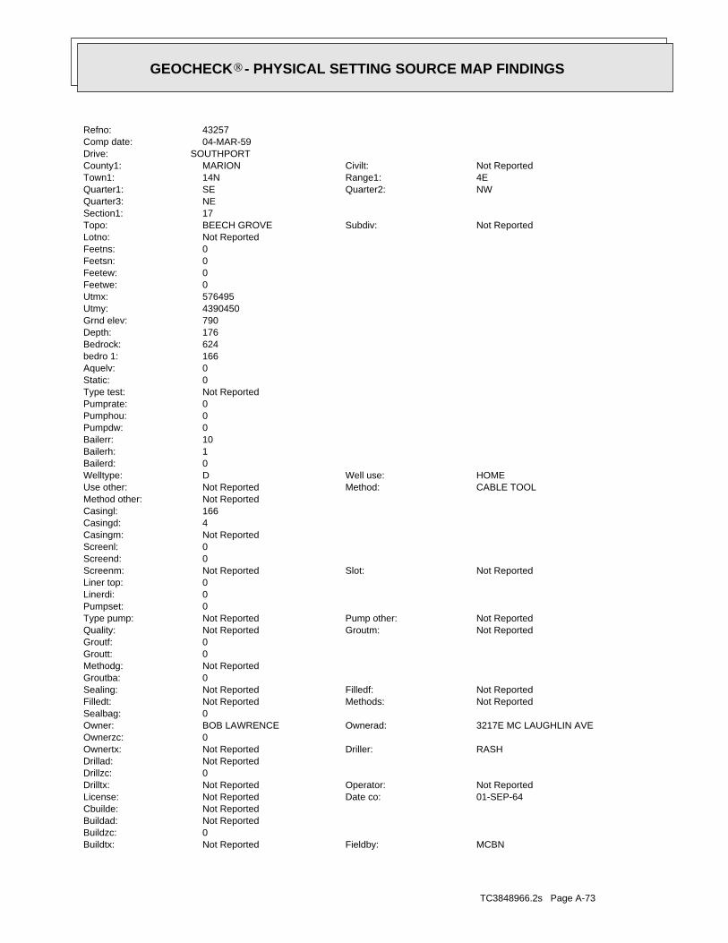
TC3848966.2s Page A-73
MCBNFieldby:Not ReportedBuildtx:0Buildzc:Not ReportedBuildad:Not ReportedCbuilde:
01-SEP-64Date co:Not ReportedLicense:Not ReportedOperator:Not ReportedDrilltx:
0Drillzc:Not ReportedDrillad:
RASHDriller:Not ReportedOwnertx:0Ownerzc:
3217E MC LAUGHLIN AVEOwnerad:BOB LAWRENCEOwner:0Sealbag:
Not ReportedMethods:Not ReportedFilledt:Not ReportedFilledf:Not ReportedSealing:
0Groutba:Not ReportedMethodg:0Groutt:0Groutf:
Not ReportedGroutm:Not ReportedQuality:Not ReportedPump other:Not ReportedType pump:
0Pumpset:0Linerdi:0Liner top:
Not ReportedSlot:Not ReportedScreenm:0Screend:0Screenl:Not ReportedCasingm:4Casingd:166Casingl:Not ReportedMethod other:
CABLE TOOLMethod:Not ReportedUse other:HOMEWell use:DWelltype:
0Bailerd:1Bailerh:10Bailerr:0Pumpdw:0Pumphou:0Pumprate:Not ReportedType test:0Static:0Aquelv:166bedro 1:624Bedrock:176Depth:790Grnd elev:4390450Utmy:576495Utmx:0Feetwe:0Feetew:0Feetsn:0Feetns:Not ReportedLotno:
Not ReportedSubdiv:BEECH GROVETopo:17Section1:NEQuarter3:
NWQuarter2:SEQuarter1:4ERange1:14NTown1:Not ReportedCivilt:MARIONCounty1:
SOUTHPORTDrive:04-MAR-59Comp date:43257Refno:
®GEOCHECK - PHYSICAL SETTING SOURCE MAP FINDINGS®

TC3848966.2s Page A-74
0Linerdi:0Liner top:
Not ReportedSlot:Not ReportedScreenm:0Screend:0Screenl:Not ReportedCasingm:4.25Casingd:0Casingl:Not ReportedMethod other:
ROTARYMethod:Not ReportedUse other:HOMEWell use:DWelltype:
0Bailerd:1Bailerh:5Bailerr:0Pumpdw:0Pumphou:0Pumprate:Not ReportedType test:0Static:0Aquelv:171bedro 1:610Bedrock:240Depth:780Grnd elev:4391922Utmy:575976.2Utmx:0Feetwe:1800Feetew:1500Feetsn:0Feetns:Not ReportedLotno:
Not ReportedSubdiv:BEECH GROVETopo:8Section1:NWQuarter3:
SEQuarter2:NWQuarter1:4ERange1:14NTown1:Not ReportedCivilt:MARIONCounty1:
2926 FAIRHOPE DR.Drive:26-OCT-87Comp date:187677Refno:
L50NE1/2 - 1 MileHigher
INDNR1000036971IN WELLS
INDNR1000035837Site id:0Reserve:Not ReportedReserve:Not ReportedIrregla:0Gravelp:
0Bore hole:Not ReportedWater supp:
Not ReportedDnrvarn:Not ReportedCtyperm:0Section:
Not ReportedRang:Not ReportedTown:MARIONCounty:07-FEB-69Accwo date:NCHAccwo:01-SEP-64Class date:Not ReportedClassby:20-FEB-80Court d:Not ReportedCourtby:01-NOV-92Field d:
®GEOCHECK - PHYSICAL SETTING SOURCE MAP FINDINGS®
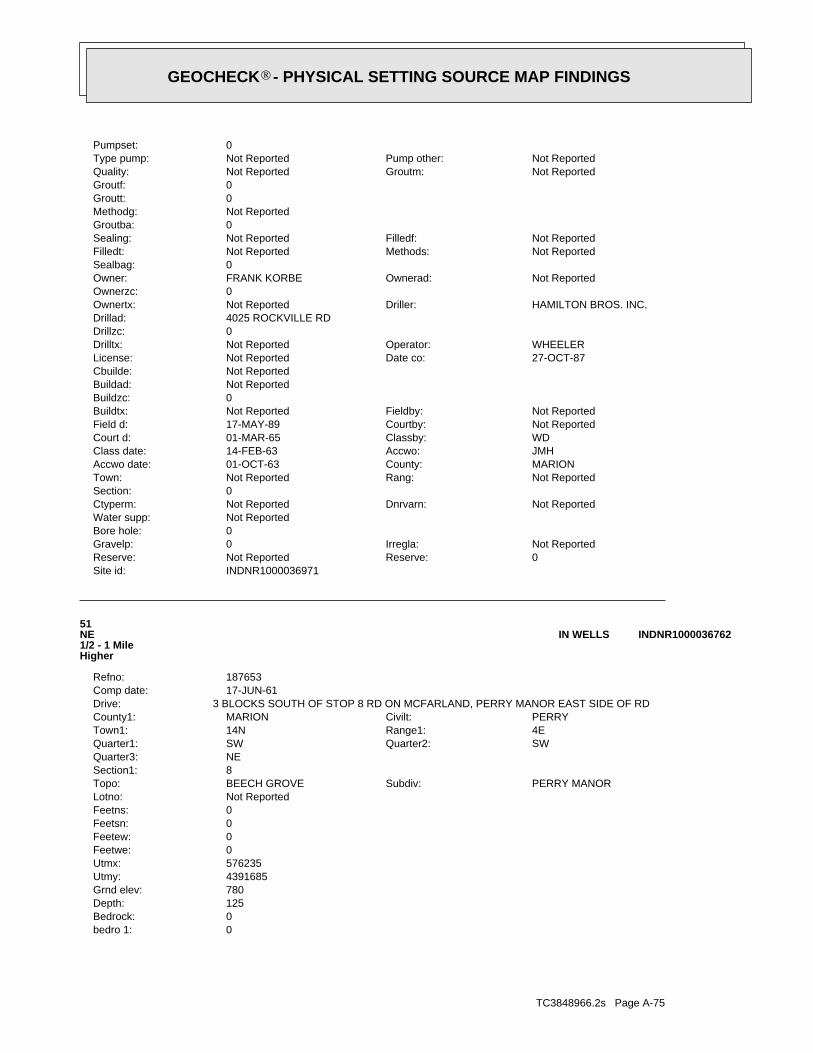
TC3848966.2s Page A-75
0bedro 1:0Bedrock:125Depth:780Grnd elev:4391685Utmy:576235Utmx:0Feetwe:0Feetew:0Feetsn:0Feetns:Not ReportedLotno:
PERRY MANORSubdiv:BEECH GROVETopo:8Section1:NEQuarter3:
SWQuarter2:SWQuarter1:4ERange1:14NTown1:PERRYCivilt:MARIONCounty1:
3 BLOCKS SOUTH OF STOP 8 RD ON MCFARLAND, PERRY MANOR EAST SIDE OF RDDrive:17-JUN-61Comp date:187653Refno:
51NE1/2 - 1 MileHigher
INDNR1000036762IN WELLS
INDNR1000036971Site id:0Reserve:Not ReportedReserve:Not ReportedIrregla:0Gravelp:
0Bore hole:Not ReportedWater supp:
Not ReportedDnrvarn:Not ReportedCtyperm:0Section:
Not ReportedRang:Not ReportedTown:MARIONCounty:01-OCT-63Accwo date:JMHAccwo:14-FEB-63Class date:WDClassby:01-MAR-65Court d:Not ReportedCourtby:17-MAY-89Field d:Not ReportedFieldby:Not ReportedBuildtx:
0Buildzc:Not ReportedBuildad:Not ReportedCbuilde:
27-OCT-87Date co:Not ReportedLicense:WHEELEROperator:Not ReportedDrilltx:
0Drillzc:4025 ROCKVILLE RDDrillad:
HAMILTON BROS. INC.Driller:Not ReportedOwnertx:0Ownerzc:
Not ReportedOwnerad:FRANK KORBEOwner:0Sealbag:
Not ReportedMethods:Not ReportedFilledt:Not ReportedFilledf:Not ReportedSealing:
0Groutba:Not ReportedMethodg:0Groutt:0Groutf:
Not ReportedGroutm:Not ReportedQuality:Not ReportedPump other:Not ReportedType pump:
0Pumpset:
®GEOCHECK - PHYSICAL SETTING SOURCE MAP FINDINGS®

TC3848966.2s Page A-76
52East1/2 - 1 MileHigher
INDNR1000035945IN WELLS
INDNR1000036762Site id:0Reserve:Not ReportedReserve:Not ReportedIrregla:0Gravelp:
0Bore hole:Not ReportedWater supp:
Not ReportedDnrvarn:Not ReportedCtyperm:0Section:
Not ReportedRang:Not ReportedTown:MARIONCounty:22-JAN-76Accwo date:Not ReportedAccwo:01-FEB-65Class date:JMHClassby:01-MAR-65Court d:Not ReportedCourtby:01-NOV-92Field d:MCBNFieldby:Not ReportedBuildtx:
0Buildzc:MCFARLANDBuildad:PHIL JONESCbuilde:
03-APR-75Date co:Not ReportedLicense:DON BRANNOperator:Not ReportedDrilltx:
0Drillzc:2746 E. STOP 8 RDDrillad:
CURLEE DRILLING CO.Driller:Not ReportedOwnertx:0Ownerzc:
Not ReportedOwnerad:Not ReportedOwner:0Sealbag:
Not ReportedMethods:Not ReportedFilledt:Not ReportedFilledf:Not ReportedSealing:
0Groutba:Not ReportedMethodg:0Groutt:0Groutf:
Not ReportedGroutm:Not ReportedQuality:Not ReportedPump other:Not ReportedType pump:
0Pumpset:0Linerdi:0Liner top:
#8Slot:Not ReportedScreenm:3Screend:4.5Screenl:Not ReportedCasingm:4Casingd:122Casingl:Not ReportedMethod other:
CABLE TOOLMethod:Not ReportedUse other:HOMEWell use:DWelltype:
0Bailerd:0Bailerh:0Bailerr:20Pumpdw:2Pumphou:10Pumprate:Not ReportedType test:10Static:655Aquelv:
®GEOCHECK - PHYSICAL SETTING SOURCE MAP FINDINGS®
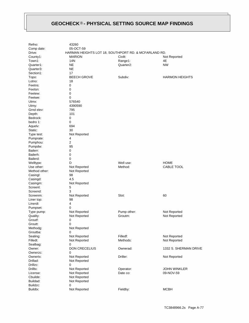
TC3848966.2s Page A-77
MCBHFieldby:Not ReportedBuildtx:0Buildzc:Not ReportedBuildad:Not ReportedCbuilde:
09-NOV-59Date co:Not ReportedLicense:JOHN WINKLEROperator:Not ReportedDrilltx:
0Drillzc:Not ReportedDrillad:
Not ReportedDriller:Not ReportedOwnertx:0Ownerzc:
1332 S. SHERMAN DRIVEOwnerad:DON CRECELIUSOwner:0Sealbag:
Not ReportedMethods:Not ReportedFilledt:Not ReportedFilledf:Not ReportedSealing:
0Groutba:Not ReportedMethodg:0Groutt:0Groutf:
Not ReportedGroutm:Not ReportedQuality:Not ReportedPump other:Not ReportedType pump:
0Pumpset:4Linerdi:98Liner top:
60Slot:Not ReportedScreenm:3Screend:5Screenl:Not ReportedCasingm:4.5Casingd:98Casingl:Not ReportedMethod other:
CABLE TOOLMethod:Not ReportedUse other:HOMEWell use:DWelltype:
0Bailerd:0Bailerh:0Bailerr:95Pumpdw:2Pumphou:4Pumprate:Not ReportedType test:30Static:694Aquelv:0bedro 1:0Bedrock:101Depth:795Grnd elev:4390590Utmy:576540Utmx:0Feetwe:0Feetew:0Feetsn:0Feetns:18Lotno:
HARMON HEIGHTSSubdiv:BEECH GROVETopo:17Section1:NEQuarter3:
NWQuarter2:NEQuarter1:4ERange1:14NTown1:Not ReportedCivilt:MARIONCounty1:
HARMAN HEIGHTS LOT 18, SOUTHPORT RD. & MCFARLAND RD.Drive:05-OCT-59Comp date:43260Refno:
®GEOCHECK - PHYSICAL SETTING SOURCE MAP FINDINGS®
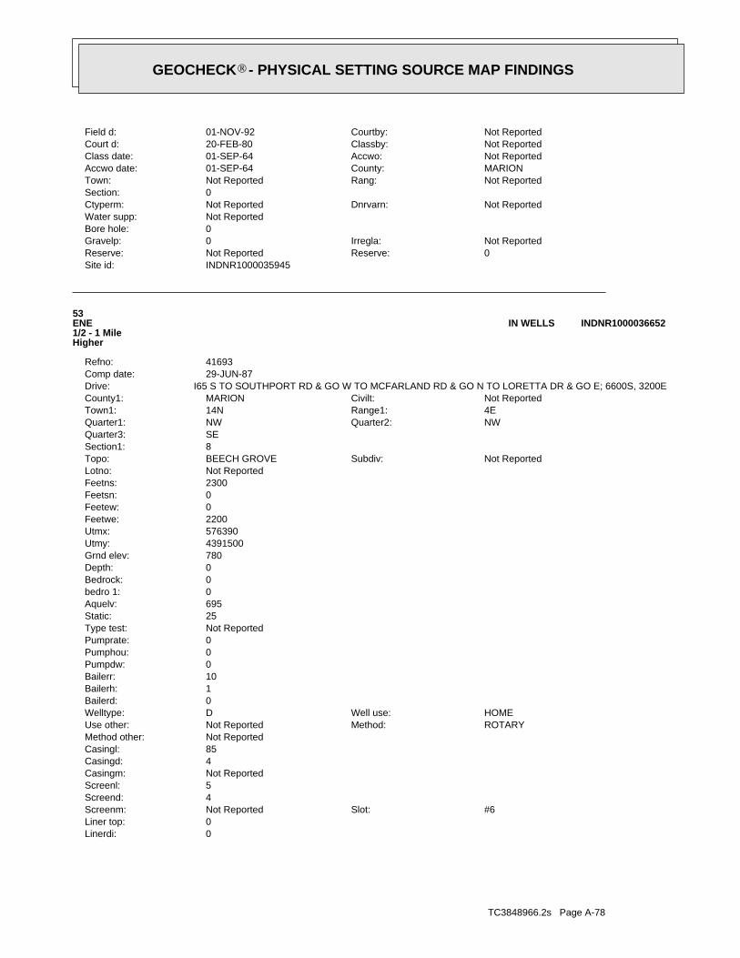
TC3848966.2s Page A-78
0Linerdi:0Liner top:
#6Slot:Not ReportedScreenm:4Screend:5Screenl:Not ReportedCasingm:4Casingd:85Casingl:Not ReportedMethod other:
ROTARYMethod:Not ReportedUse other:HOMEWell use:DWelltype:
0Bailerd:1Bailerh:10Bailerr:0Pumpdw:0Pumphou:0Pumprate:Not ReportedType test:25Static:695Aquelv:0bedro 1:0Bedrock:0Depth:780Grnd elev:4391500Utmy:576390Utmx:2200Feetwe:0Feetew:0Feetsn:2300Feetns:Not ReportedLotno:
Not ReportedSubdiv:BEECH GROVETopo:8Section1:SEQuarter3:
NWQuarter2:NWQuarter1:4ERange1:14NTown1:Not ReportedCivilt:MARIONCounty1:
I65 S TO SOUTHPORT RD & GO W TO MCFARLAND RD & GO N TO LORETTA DR & GO E; 6600S, 3200EDrive:29-JUN-87Comp date:41693Refno:
53ENE1/2 - 1 MileHigher
INDNR1000036652IN WELLS
INDNR1000035945Site id:0Reserve:Not ReportedReserve:Not ReportedIrregla:0Gravelp:
0Bore hole:Not ReportedWater supp:
Not ReportedDnrvarn:Not ReportedCtyperm:0Section:
Not ReportedRang:Not ReportedTown:MARIONCounty:01-SEP-64Accwo date:Not ReportedAccwo:01-SEP-64Class date:Not ReportedClassby:20-FEB-80Court d:Not ReportedCourtby:01-NOV-92Field d:
®GEOCHECK - PHYSICAL SETTING SOURCE MAP FINDINGS®
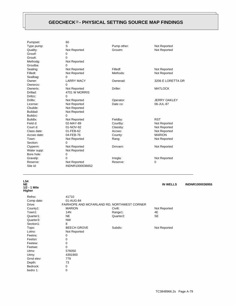
TC3848966.2s Page A-79
0bedro 1:0Bedrock:73Depth:779Grnd elev:4391900Utmy:576050Utmx:0Feetwe:0Feetew:0Feetsn:0Feetns:Not ReportedLotno:
Not ReportedSubdiv:BEECH GROVETopo:8Section1:NWQuarter3:
SEQuarter2:NEQuarter1:4ERange1:14NTown1:Not ReportedCivilt:MARIONCounty1:
FAIRHOPE AND MCFARLAND RD, NORTHWEST CORNERDrive:01-AUG-84Comp date:41710Refno:
L54NE1/2 - 1 MileHigher
INDNR1000036955IN WELLS
INDNR1000036652Site id:0Reserve:Not ReportedReserve:Not ReportedIrregla:0Gravelp:
0Bore hole:Not ReportedWater supp:
Not ReportedDnrvarn:Not ReportedCtyperm:0Section:
Not ReportedRang:Not ReportedTown:MARIONCounty:04-FEB-76Accwo date:Not ReportedAccwo:01-FEB-62Class date:Not ReportedClassby:01-NOV-92Court d:Not ReportedCourtby:02-MAY-89Field d:RSTFieldby:Not ReportedBuildtx:
0Buildzc:Not ReportedBuildad:Not ReportedCbuilde:
06-JUL-87Date co:Not ReportedLicense:JERRY OAKLEYOperator:Not ReportedDrilltx:
0Drillzc:4701 W MORRISDrillad:
MATLOCKDriller:Not ReportedOwnertx:0Ownerzc:
3206 E LORETTA DROwnerad:LARRY MACYOwner:0Sealbag:
Not ReportedMethods:Not ReportedFilledt:Not ReportedFilledf:Not ReportedSealing:
0Groutba:Not ReportedMethodg:0Groutt:0Groutf:
Not ReportedGroutm:Not ReportedQuality:Not ReportedPump other:SType pump:
60Pumpset:
®GEOCHECK - PHYSICAL SETTING SOURCE MAP FINDINGS®
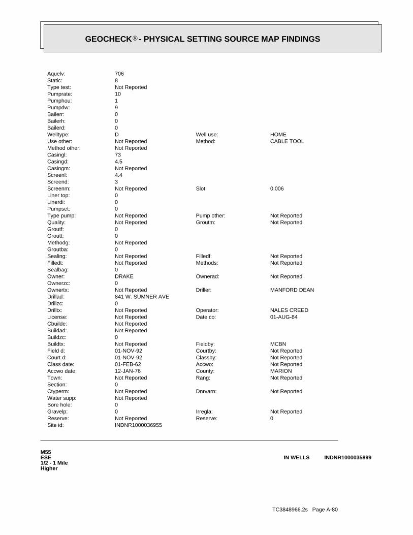
TC3848966.2s Page A-80
M55ESE1/2 - 1 MileHigher
INDNR1000035899IN WELLS
INDNR1000036955Site id:0Reserve:Not ReportedReserve:Not ReportedIrregla:0Gravelp:
0Bore hole:Not ReportedWater supp:
Not ReportedDnrvarn:Not ReportedCtyperm:0Section:
Not ReportedRang:Not ReportedTown:MARIONCounty:12-JAN-76Accwo date:Not ReportedAccwo:01-FEB-62Class date:Not ReportedClassby:01-NOV-92Court d:Not ReportedCourtby:01-NOV-92Field d:MCBNFieldby:Not ReportedBuildtx:
0Buildzc:Not ReportedBuildad:Not ReportedCbuilde:
01-AUG-84Date co:Not ReportedLicense:NALES CREEDOperator:Not ReportedDrilltx:
0Drillzc:841 W. SUMNER AVEDrillad:
MANFORD DEANDriller:Not ReportedOwnertx:0Ownerzc:
Not ReportedOwnerad:DRAKEOwner:0Sealbag:
Not ReportedMethods:Not ReportedFilledt:Not ReportedFilledf:Not ReportedSealing:
0Groutba:Not ReportedMethodg:0Groutt:0Groutf:
Not ReportedGroutm:Not ReportedQuality:Not ReportedPump other:Not ReportedType pump:
0Pumpset:0Linerdi:0Liner top:
0.006Slot:Not ReportedScreenm:3Screend:4.4Screenl:Not ReportedCasingm:4.5Casingd:73Casingl:Not ReportedMethod other:
CABLE TOOLMethod:Not ReportedUse other:HOMEWell use:DWelltype:
0Bailerd:0Bailerh:0Bailerr:9Pumpdw:1Pumphou:10Pumprate:Not ReportedType test:8Static:706Aquelv:
®GEOCHECK - PHYSICAL SETTING SOURCE MAP FINDINGS®
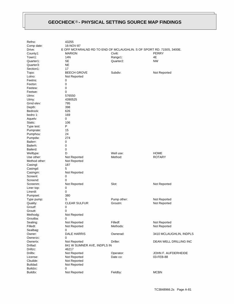
TC3848966.2s Page A-81
MCBNFieldby:Not ReportedBuildtx:0Buildzc:Not ReportedBuildad:Not ReportedCbuilde:
03-FEB-88Date co:Not ReportedLicense:JOHN F. AUFDERHEIDEOperator:Not ReportedDrilltx:
46217Drillzc:841 W SUMNER AVE, INDPLS INDrillad:
DEAN WELL DRILLING INCDriller:Not ReportedOwnertx:0Ownerzc:
3410 MCLAUGHLIN, INDPLSOwnerad:DALE HARRISOwner:0Sealbag:
Not ReportedMethods:Not ReportedFilledt:Not ReportedFilledf:Not ReportedSealing:
0Groutba:Not ReportedMethodg:0Groutt:0Groutf:
Not ReportedGroutm:CLEAR SULFURQuality:Not ReportedPump other:SType pump:
380Pumpset:0Linerdi:0Liner top:
Not ReportedSlot:Not ReportedScreenm:0Screend:0Screenl:Not ReportedCasingm:5Casingd:187Casingl:Not ReportedMethod other:
ROTARYMethod:Not ReportedUse other:HOMEWell use:DWelltype:
0Bailerd:0Bailerh:0Bailerr:274Pumpdw:24Pumphou:15Pumprate:PType test:106Static:0Aquelv:169bedro 1:626Bedrock:398Depth:795Grnd elev:4390525Utmy:576550Utmx:0Feetwe:0Feetew:0Feetsn:0Feetns:Not ReportedLotno:
Not ReportedSubdiv:BEECH GROVETopo:17Section1:NEQuarter3:
NWQuarter2:SEQuarter1:4ERange1:14NTown1:PERRYCivilt:MARIONCounty1:
E OFF MCFARALND RD TO END OF MCLAUGHLIN. S OF SPORT RD. 7150S, 3400E.Drive:16-NOV-87Comp date:43255Refno:
®GEOCHECK - PHYSICAL SETTING SOURCE MAP FINDINGS®
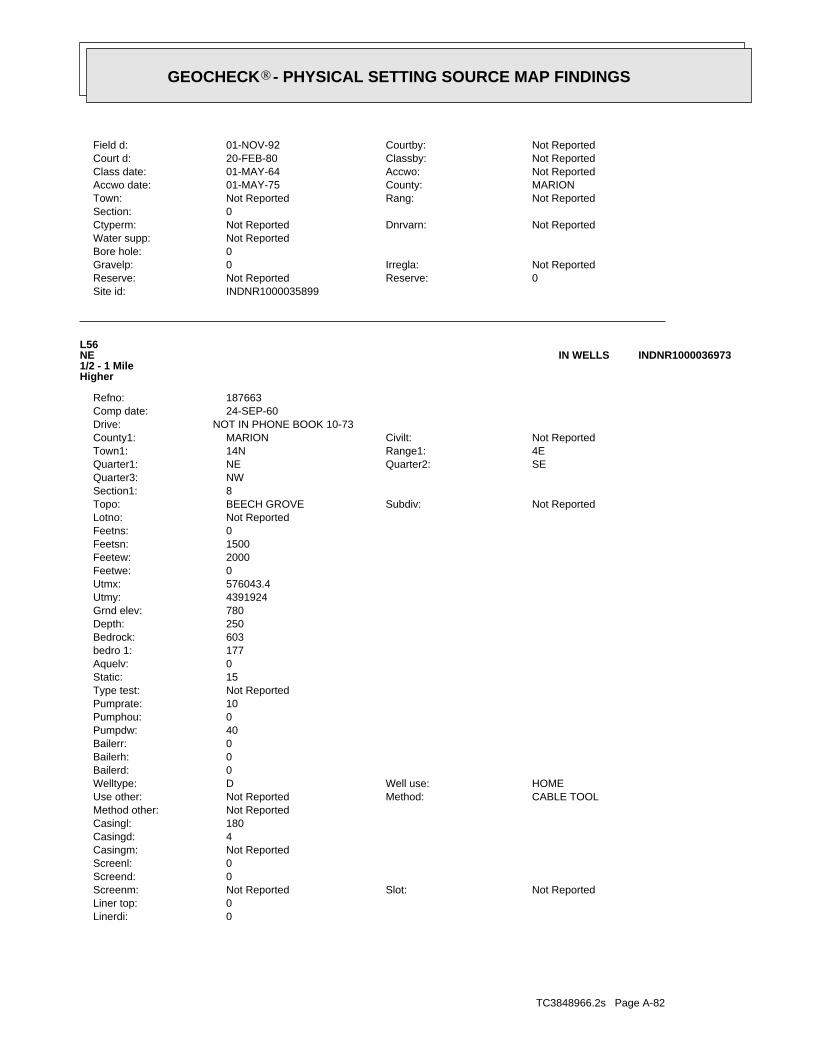
TC3848966.2s Page A-82
0Linerdi:0Liner top:
Not ReportedSlot:Not ReportedScreenm:0Screend:0Screenl:Not ReportedCasingm:4Casingd:180Casingl:Not ReportedMethod other:
CABLE TOOLMethod:Not ReportedUse other:HOMEWell use:DWelltype:
0Bailerd:0Bailerh:0Bailerr:40Pumpdw:0Pumphou:10Pumprate:Not ReportedType test:15Static:0Aquelv:177bedro 1:603Bedrock:250Depth:780Grnd elev:4391924Utmy:576043.4Utmx:0Feetwe:2000Feetew:1500Feetsn:0Feetns:Not ReportedLotno:
Not ReportedSubdiv:BEECH GROVETopo:8Section1:NWQuarter3:
SEQuarter2:NEQuarter1:4ERange1:14NTown1:Not ReportedCivilt:MARIONCounty1:
NOT IN PHONE BOOK 10-73Drive:24-SEP-60Comp date:187663Refno:
L56NE1/2 - 1 MileHigher
INDNR1000036973IN WELLS
INDNR1000035899Site id:0Reserve:Not ReportedReserve:Not ReportedIrregla:0Gravelp:
0Bore hole:Not ReportedWater supp:
Not ReportedDnrvarn:Not ReportedCtyperm:0Section:
Not ReportedRang:Not ReportedTown:MARIONCounty:01-MAY-75Accwo date:Not ReportedAccwo:01-MAY-64Class date:Not ReportedClassby:20-FEB-80Court d:Not ReportedCourtby:01-NOV-92Field d:
®GEOCHECK - PHYSICAL SETTING SOURCE MAP FINDINGS®
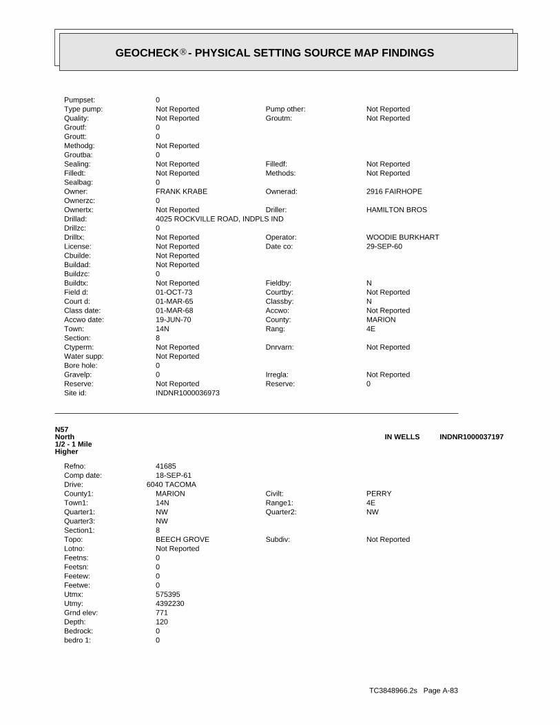
TC3848966.2s Page A-83
0bedro 1:0Bedrock:120Depth:771Grnd elev:4392230Utmy:575395Utmx:0Feetwe:0Feetew:0Feetsn:0Feetns:Not ReportedLotno:
Not ReportedSubdiv:BEECH GROVETopo:8Section1:NWQuarter3:
NWQuarter2:NWQuarter1:4ERange1:14NTown1:PERRYCivilt:MARIONCounty1:
6040 TACOMADrive:18-SEP-61Comp date:41685Refno:
N57North1/2 - 1 MileHigher
INDNR1000037197IN WELLS
INDNR1000036973Site id:0Reserve:Not ReportedReserve:Not ReportedIrregla:0Gravelp:
0Bore hole:Not ReportedWater supp:
Not ReportedDnrvarn:Not ReportedCtyperm:8Section:
4ERang:14NTown:MARIONCounty:19-JUN-70Accwo date:Not ReportedAccwo:01-MAR-68Class date:NClassby:01-MAR-65Court d:Not ReportedCourtby:01-OCT-73Field d:NFieldby:Not ReportedBuildtx:
0Buildzc:Not ReportedBuildad:Not ReportedCbuilde:
29-SEP-60Date co:Not ReportedLicense:WOODIE BURKHARTOperator:Not ReportedDrilltx:
0Drillzc:4025 ROCKVILLE ROAD, INDPLS INDDrillad:
HAMILTON BROSDriller:Not ReportedOwnertx:0Ownerzc:
2916 FAIRHOPEOwnerad:FRANK KRABEOwner:0Sealbag:
Not ReportedMethods:Not ReportedFilledt:Not ReportedFilledf:Not ReportedSealing:
0Groutba:Not ReportedMethodg:0Groutt:0Groutf:
Not ReportedGroutm:Not ReportedQuality:Not ReportedPump other:Not ReportedType pump:
0Pumpset:
®GEOCHECK - PHYSICAL SETTING SOURCE MAP FINDINGS®
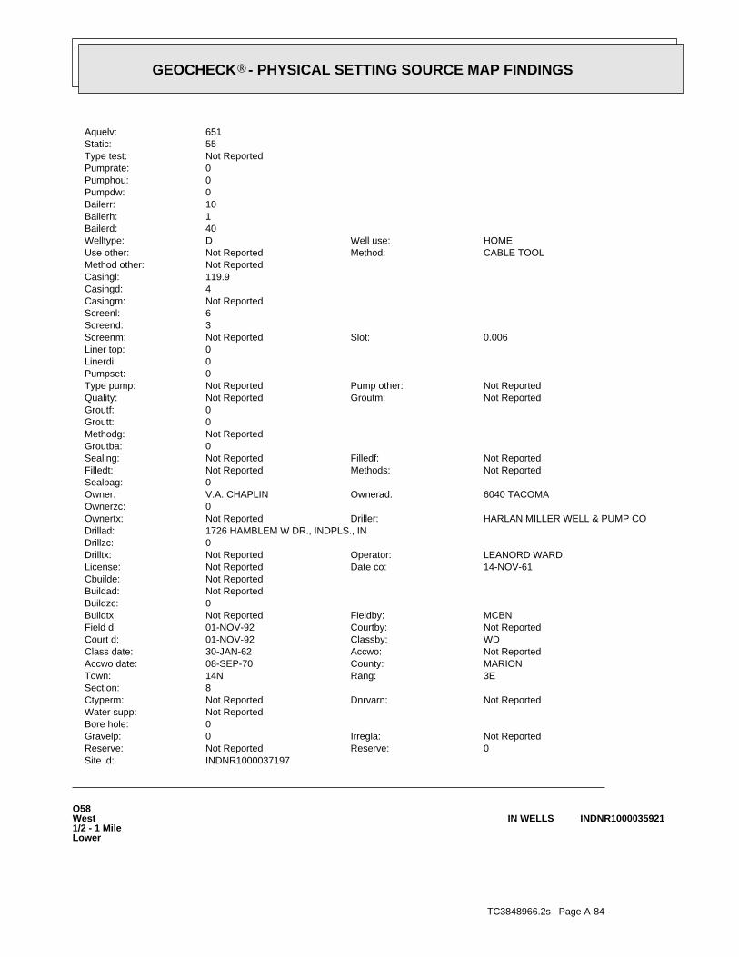
TC3848966.2s Page A-84
O58West1/2 - 1 MileLower
INDNR1000035921IN WELLS
INDNR1000037197Site id:0Reserve:Not ReportedReserve:Not ReportedIrregla:0Gravelp:
0Bore hole:Not ReportedWater supp:
Not ReportedDnrvarn:Not ReportedCtyperm:8Section:
3ERang:14NTown:MARIONCounty:08-SEP-70Accwo date:Not ReportedAccwo:30-JAN-62Class date:WDClassby:01-NOV-92Court d:Not ReportedCourtby:01-NOV-92Field d:MCBNFieldby:Not ReportedBuildtx:
0Buildzc:Not ReportedBuildad:Not ReportedCbuilde:
14-NOV-61Date co:Not ReportedLicense:LEANORD WARDOperator:Not ReportedDrilltx:
0Drillzc:1726 HAMBLEM W DR., INDPLS., INDrillad:
HARLAN MILLER WELL & PUMP CODriller:Not ReportedOwnertx:0Ownerzc:
6040 TACOMAOwnerad:V.A. CHAPLINOwner:0Sealbag:
Not ReportedMethods:Not ReportedFilledt:Not ReportedFilledf:Not ReportedSealing:
0Groutba:Not ReportedMethodg:0Groutt:0Groutf:
Not ReportedGroutm:Not ReportedQuality:Not ReportedPump other:Not ReportedType pump:
0Pumpset:0Linerdi:0Liner top:
0.006Slot:Not ReportedScreenm:3Screend:6Screenl:Not ReportedCasingm:4Casingd:119.9Casingl:Not ReportedMethod other:
CABLE TOOLMethod:Not ReportedUse other:HOMEWell use:DWelltype:
40Bailerd:1Bailerh:10Bailerr:0Pumpdw:0Pumphou:0Pumprate:Not ReportedType test:55Static:651Aquelv:
®GEOCHECK - PHYSICAL SETTING SOURCE MAP FINDINGS®
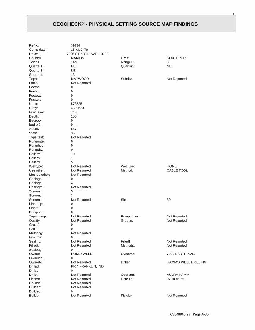
TC3848966.2s Page A-85
Not ReportedFieldby:Not ReportedBuildtx:0Buildzc:Not ReportedBuildad:Not ReportedCbuilde:
07-NOV-79Date co:Not ReportedLicense:AULRY HAMMOperator:Not ReportedDrilltx:
0Drillzc:RR 4 FRANKLIN, IND.Drillad:
HAMM’S WELL DRILLINGDriller:Not ReportedOwnertx:0Ownerzc:
7025 BARTH AVE.Ownerad:HONEYWELLOwner:0Sealbag:
Not ReportedMethods:Not ReportedFilledt:Not ReportedFilledf:Not ReportedSealing:
0Groutba:Not ReportedMethodg:0Groutt:0Groutf:
Not ReportedGroutm:Not ReportedQuality:Not ReportedPump other:Not ReportedType pump:
0Pumpset:0Linerdi:0Liner top:
30Slot:Not ReportedScreenm:3Screend:5Screenl:Not ReportedCasingm:4Casingd:0Casingl:Not ReportedMethod other:
CABLE TOOLMethod:Not ReportedUse other:HOMEWell use:Not ReportedWelltype:
5Bailerd:1Bailerh:10Bailerr:0Pumpdw:0Pumphou:0Pumprate:Not ReportedType test:35Static:637Aquelv:0bedro 1:0Bedrock:106Depth:743Grnd elev:4390520Utmy:573725Utmx:0Feetwe:0Feetew:0Feetsn:0Feetns:Not ReportedLotno:
Not ReportedSubdiv:MAYWOODTopo:13Section1:NEQuarter3:
NEQuarter2:NEQuarter1:3ERange1:14NTown1:SOUTHPORTCivilt:MARIONCounty1:
7025 S BARTH AVE. 1000EDrive:16-AUG-79Comp date:39734Refno:
®GEOCHECK - PHYSICAL SETTING SOURCE MAP FINDINGS®

TC3848966.2s Page A-86
0Linerdi:0Liner top:
#6Slot:Not ReportedScreenm:5Screend:5Screenl:Not ReportedCasingm:5Casingd:93Casingl:Not ReportedMethod other:
ROTARYMethod:Not ReportedUse other:HOMEWell use:DWelltype:
0Bailerd:1Bailerh:30Bailerr:0Pumpdw:0Pumphou:0Pumprate:Not ReportedType test:30Static:647Aquelv:0bedro 1:0Bedrock:0Depth:740Grnd elev:4390700Utmy:573700Utmx:0Feetwe:0Feetew:0Feetsn:0Feetns:Not ReportedLotno:
Not ReportedSubdiv:MAYWOODTopo:12Section1:SEQuarter3:
SEQuarter2:SEQuarter1:3ERange1:14NTown1:Not ReportedCivilt:MARIONCounty1:
2ND HOSUE WEST OF SHELBYDrive:16-SEP-85Comp date:39674Refno:
P59West1/2 - 1 MileLower
INDNR1000036030IN WELLS
INDNR1000035921Site id:0Reserve:Not ReportedReserve:Not ReportedIrregla:0Gravelp:
0Bore hole:Not ReportedWater supp:
Not ReportedDnrvarn:Not ReportedCtyperm:0Section:
Not ReportedRang:Not ReportedTown:MARIONCounty:28-DEC-74Accwo date:BRUNSAccwo:01-FEB-74Class date:Not ReportedClassby:01-DEC-69Court d:Not ReportedCourtby:26-MAY-60Field d:
®GEOCHECK - PHYSICAL SETTING SOURCE MAP FINDINGS®
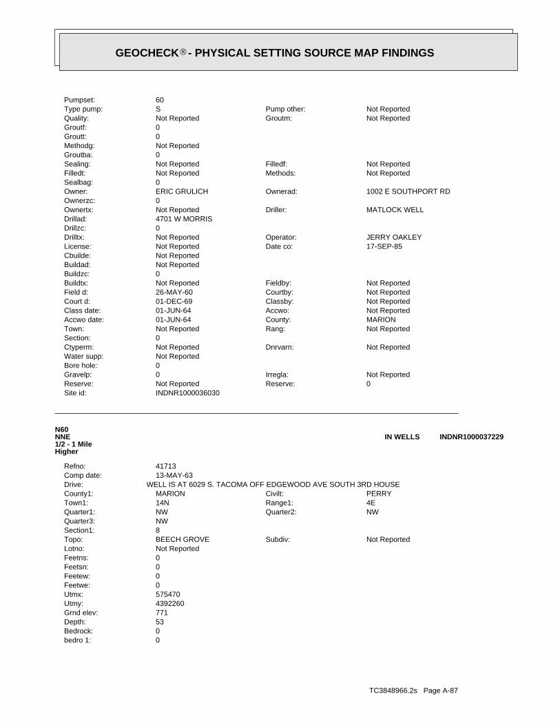
TC3848966.2s Page A-87
0bedro 1:0Bedrock:53Depth:771Grnd elev:4392260Utmy:575470Utmx:0Feetwe:0Feetew:0Feetsn:0Feetns:Not ReportedLotno:
Not ReportedSubdiv:BEECH GROVETopo:8Section1:NWQuarter3:
NWQuarter2:NWQuarter1:4ERange1:14NTown1:PERRYCivilt:MARIONCounty1:
WELL IS AT 6029 S. TACOMA OFF EDGEWOOD AVE SOUTH 3RD HOUSEDrive:13-MAY-63Comp date:41713Refno:
N60NNE1/2 - 1 MileHigher
INDNR1000037229IN WELLS
INDNR1000036030Site id:0Reserve:Not ReportedReserve:Not ReportedIrregla:0Gravelp:
0Bore hole:Not ReportedWater supp:
Not ReportedDnrvarn:Not ReportedCtyperm:0Section:
Not ReportedRang:Not ReportedTown:MARIONCounty:01-JUN-64Accwo date:Not ReportedAccwo:01-JUN-64Class date:Not ReportedClassby:01-DEC-69Court d:Not ReportedCourtby:26-MAY-60Field d:Not ReportedFieldby:Not ReportedBuildtx:
0Buildzc:Not ReportedBuildad:Not ReportedCbuilde:
17-SEP-85Date co:Not ReportedLicense:JERRY OAKLEYOperator:Not ReportedDrilltx:
0Drillzc:4701 W MORRISDrillad:
MATLOCK WELLDriller:Not ReportedOwnertx:0Ownerzc:
1002 E SOUTHPORT RDOwnerad:ERIC GRULICHOwner:0Sealbag:
Not ReportedMethods:Not ReportedFilledt:Not ReportedFilledf:Not ReportedSealing:
0Groutba:Not ReportedMethodg:0Groutt:0Groutf:
Not ReportedGroutm:Not ReportedQuality:Not ReportedPump other:SType pump:
60Pumpset:
®GEOCHECK - PHYSICAL SETTING SOURCE MAP FINDINGS®
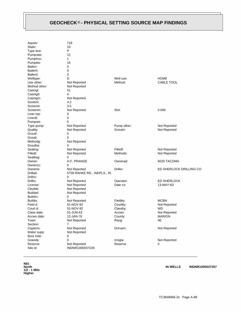
TC3848966.2s Page A-88
N61North1/2 - 1 MileHigher
INDNR1000037257IN WELLS
INDNR1000037229Site id:0Reserve:Not ReportedReserve:Not ReportedIrregla:0Gravelp:
0Bore hole:Not ReportedWater supp:
Not ReportedDnrvarn:Not ReportedCtyperm:7Section:
4ERang:Not ReportedTown:MARIONCounty:12-JAN-76Accwo date:Not ReportedAccwo:01-JUN-63Class date:WDClassby:01-NOV-92Court d:Not ReportedCourtby:01-NOV-92Field d:MCBNFieldby:Not ReportedBuildtx:
0Buildzc:Not ReportedBuildad:Not ReportedCbuilde:
13-MAY-63Date co:Not ReportedLicense:ED SHERLOCKOperator:Not ReportedDrilltx:
0Drillzc:5709 RAHKE RD., INDPLS., INDrillad:
ED SHERLOCK DRILLING CODriller:Not ReportedOwnertx:0Ownerzc:
6029 TACOMAOwnerad:H.F. PRANGEOwner:0Sealbag:
Not ReportedMethods:Not ReportedFilledt:Not ReportedFilledf:Not ReportedSealing:
0Groutba:Not ReportedMethodg:0Groutt:0Groutf:
Not ReportedGroutm:Not ReportedQuality:Not ReportedPump other:Not ReportedType pump:
0Pumpset:0Linerdi:0Liner top:
0.006Slot:Not ReportedScreenm:3.5Screend:4.2Screenl:Not ReportedCasingm:4Casingd:51Casingl:Not ReportedMethod other:
CABLE TOOLMethod:Not ReportedUse other:HOMEWell use:DWelltype:
0Bailerd:0Bailerh:0Bailerr:15Pumpdw:1Pumphou:12Pumprate:PType test:10Static:718Aquelv:
®GEOCHECK - PHYSICAL SETTING SOURCE MAP FINDINGS®
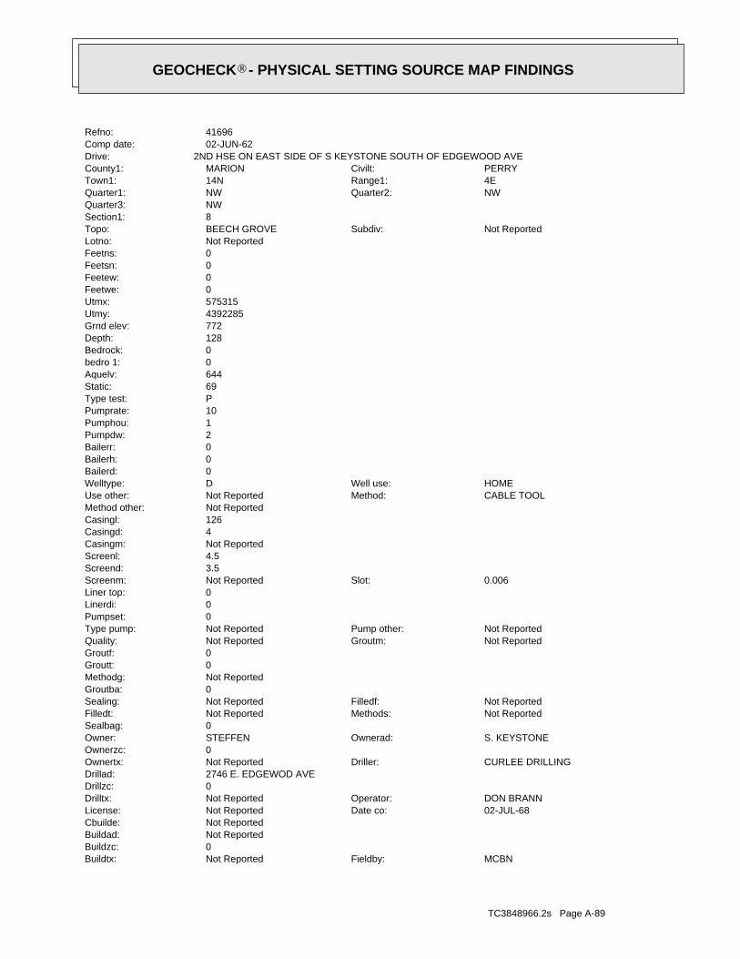
TC3848966.2s Page A-89
MCBNFieldby:Not ReportedBuildtx:0Buildzc:Not ReportedBuildad:Not ReportedCbuilde:
02-JUL-68Date co:Not ReportedLicense:DON BRANNOperator:Not ReportedDrilltx:
0Drillzc:2746 E. EDGEWOD AVEDrillad:
CURLEE DRILLINGDriller:Not ReportedOwnertx:0Ownerzc:
S. KEYSTONEOwnerad:STEFFENOwner:0Sealbag:
Not ReportedMethods:Not ReportedFilledt:Not ReportedFilledf:Not ReportedSealing:
0Groutba:Not ReportedMethodg:0Groutt:0Groutf:
Not ReportedGroutm:Not ReportedQuality:Not ReportedPump other:Not ReportedType pump:
0Pumpset:0Linerdi:0Liner top:
0.006Slot:Not ReportedScreenm:3.5Screend:4.5Screenl:Not ReportedCasingm:4Casingd:126Casingl:Not ReportedMethod other:
CABLE TOOLMethod:Not ReportedUse other:HOMEWell use:DWelltype:
0Bailerd:0Bailerh:0Bailerr:2Pumpdw:1Pumphou:10Pumprate:PType test:69Static:644Aquelv:0bedro 1:0Bedrock:128Depth:772Grnd elev:4392285Utmy:575315Utmx:0Feetwe:0Feetew:0Feetsn:0Feetns:Not ReportedLotno:
Not ReportedSubdiv:BEECH GROVETopo:8Section1:NWQuarter3:
NWQuarter2:NWQuarter1:4ERange1:14NTown1:PERRYCivilt:MARIONCounty1:
2ND HSE ON EAST SIDE OF S KEYSTONE SOUTH OF EDGEWOOD AVEDrive:02-JUN-62Comp date:41696Refno:
®GEOCHECK - PHYSICAL SETTING SOURCE MAP FINDINGS®
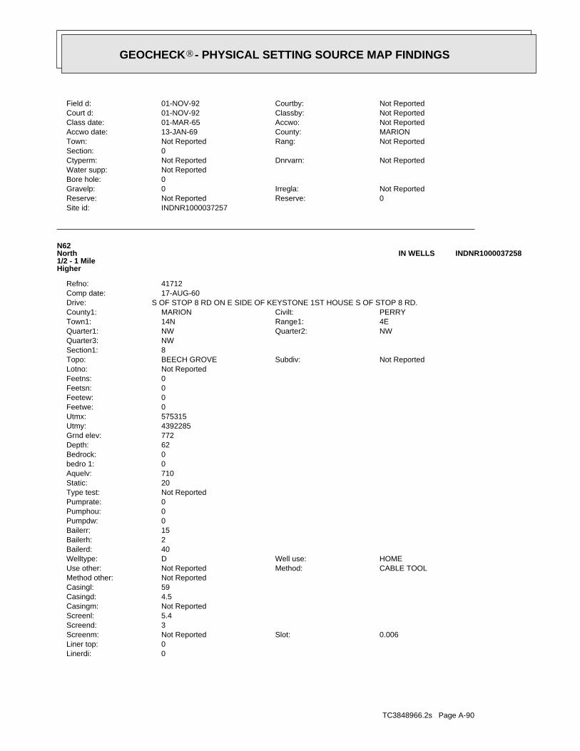
TC3848966.2s Page A-90
0Linerdi:0Liner top:
0.006Slot:Not ReportedScreenm:3Screend:5.4Screenl:Not ReportedCasingm:4.5Casingd:59Casingl:Not ReportedMethod other:
CABLE TOOLMethod:Not ReportedUse other:HOMEWell use:DWelltype:
40Bailerd:2Bailerh:15Bailerr:0Pumpdw:0Pumphou:0Pumprate:Not ReportedType test:20Static:710Aquelv:0bedro 1:0Bedrock:62Depth:772Grnd elev:4392285Utmy:575315Utmx:0Feetwe:0Feetew:0Feetsn:0Feetns:Not ReportedLotno:
Not ReportedSubdiv:BEECH GROVETopo:8Section1:NWQuarter3:
NWQuarter2:NWQuarter1:4ERange1:14NTown1:PERRYCivilt:MARIONCounty1:
S OF STOP 8 RD ON E SIDE OF KEYSTONE 1ST HOUSE S OF STOP 8 RD.Drive:17-AUG-60Comp date:41712Refno:
N62North1/2 - 1 MileHigher
INDNR1000037258IN WELLS
INDNR1000037257Site id:0Reserve:Not ReportedReserve:Not ReportedIrregla:0Gravelp:
0Bore hole:Not ReportedWater supp:
Not ReportedDnrvarn:Not ReportedCtyperm:0Section:
Not ReportedRang:Not ReportedTown:MARIONCounty:13-JAN-69Accwo date:Not ReportedAccwo:01-MAR-65Class date:Not ReportedClassby:01-NOV-92Court d:Not ReportedCourtby:01-NOV-92Field d:
®GEOCHECK - PHYSICAL SETTING SOURCE MAP FINDINGS®
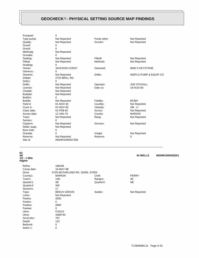
TC3848966.2s Page A-91
0bedro 1:0Bedrock:122Depth:787Grnd elev:4389740Utmy:576210Utmx:0Feetwe:2800Feetew:0Feetsn:2000Feetns:Not ReportedLotno:
Not ReportedSubdiv:BEECH GROVETopo:17Section1:SWQuarter3:
NEQuarter2:SEQuarter1:4ERange1:14NTown1:PERRYCivilt:MARIONCounty1:
6720 MCFARLAND RD. 3200E, 6700SDrive:16-MAY-88Comp date:188196Refno:
63SE1/2 - 1 MileHigher
INDNR1000035251IN WELLS
INDNR1000037258Site id:0Reserve:Not ReportedReserve:Not ReportedIrregla:0Gravelp:
0Bore hole:Not ReportedWater supp:
Not ReportedDnrvarn:Not ReportedCtyperm:0Section:
Not ReportedRang:Not ReportedTown:MARIONCounty:12-JAN-76Accwo date:Not ReportedAccwo:01-FEB-62Class date:OB - UClassby:01-NOV-92Court d:Not ReportedCourtby:01-NOV-92Field d:MCBHFieldby:Not ReportedBuildtx:
0Buildzc:Not ReportedBuildad:Not ReportedCbuilde:
19-AUG-60Date co:Not ReportedLicense:JOE STOVALLOperator:Not ReportedDrilltx:
0Drillzc:2720 BRILL RDDrillad:
INDPLS PUMP & EQUIP CODriller:Not ReportedOwnertx:0Ownerzc:
6000 S KEYSTONEOwnerad:JACKSON CONSTOwner:0Sealbag:
Not ReportedMethods:Not ReportedFilledt:Not ReportedFilledf:Not ReportedSealing:
0Groutba:Not ReportedMethodg:0Groutt:0Groutf:
Not ReportedGroutm:Not ReportedQuality:Not ReportedPump other:Not ReportedType pump:
0Pumpset:
®GEOCHECK - PHYSICAL SETTING SOURCE MAP FINDINGS®

TC3848966.2s Page A-92
64NE1/2 - 1 MileHigher
INDNR1000036780IN WELLS
INDNR1000035251Site id:0Reserve:Not ReportedReserve:Not ReportedIrregla:0Gravelp:
0Bore hole:Not ReportedWater supp:
Not ReportedDnrvarn:Not ReportedCtyperm:0Section:
Not ReportedRang:Not ReportedTown:MARIONCounty:24-FEB-77Accwo date:Not ReportedAccwo:01-APR-64Class date:Not ReportedClassby:01-AUG-66Court d:Not ReportedCourtby:19-MAY-89Field d:TMHFieldby:Not ReportedBuildtx:
0Buildzc:Not ReportedBuildad:Not ReportedCbuilde:
14-JUN-88Date co:Not ReportedLicense:ED SHERLOCKOperator:Not ReportedDrilltx:
46217Drillzc:5719 RAHKERD, INDPLSDrillad:
ED SHERLOCKDriller:Not ReportedOwnertx:0Ownerzc:
6720 MCFARLAND RD, INDPLS INOwnerad:KEITH W. IRWINOwner:0Sealbag:
Not ReportedMethods:Not ReportedFilledt:Not ReportedFilledf:Not ReportedSealing:
0Groutba:Not ReportedMethodg:0Groutt:0Groutf:
Not ReportedGroutm:CLEARQuality:Not ReportedPump other:SType pump:
100Pumpset:0Linerdi:0Liner top:
40Slot:Not ReportedScreenm:3.5Screend:5Screenl:Not ReportedCasingm:4Casingd:119Casingl:Not ReportedMethod other:
CABLE TOOLMethod:Not ReportedUse other:HOMEWell use:DWelltype:
18Bailerd:2Bailerh:10Bailerr:0Pumpdw:0Pumphou:0Pumprate:Not ReportedType test:60Static:665Aquelv:
®GEOCHECK - PHYSICAL SETTING SOURCE MAP FINDINGS®
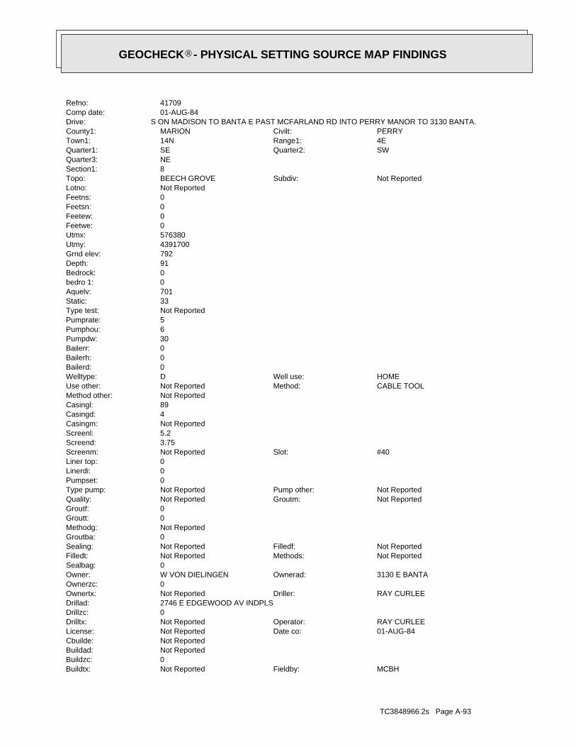
TC3848966.2s Page A-93
MCBHFieldby:Not ReportedBuildtx:0Buildzc:Not ReportedBuildad:Not ReportedCbuilde:
01-AUG-84Date co:Not ReportedLicense:RAY CURLEEOperator:Not ReportedDrilltx:
0Drillzc:2746 E EDGEWOOD AV INDPLSDrillad:
RAY CURLEEDriller:Not ReportedOwnertx:0Ownerzc:
3130 E BANTAOwnerad:W VON DIELINGENOwner:0Sealbag:
Not ReportedMethods:Not ReportedFilledt:Not ReportedFilledf:Not ReportedSealing:
0Groutba:Not ReportedMethodg:0Groutt:0Groutf:
Not ReportedGroutm:Not ReportedQuality:Not ReportedPump other:Not ReportedType pump:
0Pumpset:0Linerdi:0Liner top:
#40Slot:Not ReportedScreenm:3.75Screend:5.2Screenl:Not ReportedCasingm:4Casingd:89Casingl:Not ReportedMethod other:
CABLE TOOLMethod:Not ReportedUse other:HOMEWell use:DWelltype:
0Bailerd:0Bailerh:0Bailerr:30Pumpdw:6Pumphou:5Pumprate:Not ReportedType test:33Static:701Aquelv:0bedro 1:0Bedrock:91Depth:792Grnd elev:4391700Utmy:576380Utmx:0Feetwe:0Feetew:0Feetsn:0Feetns:Not ReportedLotno:
Not ReportedSubdiv:BEECH GROVETopo:8Section1:NEQuarter3:
SWQuarter2:SEQuarter1:4ERange1:14NTown1:PERRYCivilt:MARIONCounty1:
S ON MADISON TO BANTA E PAST MCFARLAND RD INTO PERRY MANOR TO 3130 BANTA.Drive:01-AUG-84Comp date:41709Refno:
®GEOCHECK - PHYSICAL SETTING SOURCE MAP FINDINGS®

TC3848966.2s Page A-94
0Linerdi:0Liner top:
NO 6Slot:Not ReportedScreenm:3.5Screend:4.3Screenl:Not ReportedCasingm:4Casingd:115Casingl:Not ReportedMethod other:
CABLE TOOLMethod:Not ReportedUse other:HOMEWell use:DWelltype:
0Bailerd:0Bailerh:0Bailerr:20Pumpdw:3Pumphou:20Pumprate:Not ReportedType test:40Static:625Aquelv:0bedro 1:0Bedrock:118Depth:743Grnd elev:4390650Utmy:573665Utmx:0Feetwe:0Feetew:0Feetsn:0Feetns:Not ReportedLotno:
Not ReportedSubdiv:MAYWOODTopo:13Section1:NEQuarter3:
NEQuarter2:NEQuarter1:3ERange1:14NTown1:PERRYCivilt:MARIONCounty1:
WELL 913 E. SOUTHPORT RD.Drive:01-SEP-67Comp date:39766Refno:
P65West1/2 - 1 MileLower
INDNR1000035995IN WELLS
INDNR1000036780Site id:0Reserve:Not ReportedReserve:Not ReportedIrregla:0Gravelp:
0Bore hole:Not ReportedWater supp:
Not ReportedDnrvarn:Not ReportedCtyperm:0Section:
Not ReportedRang:Not ReportedTown:MARIONCounty:12-JAN-76Accwo date:TCHAccwo:01-MAY-64Class date:Not ReportedClassby:01-NOV-92Court d:Not ReportedCourtby:01-NOV-92Field d:
®GEOCHECK - PHYSICAL SETTING SOURCE MAP FINDINGS®
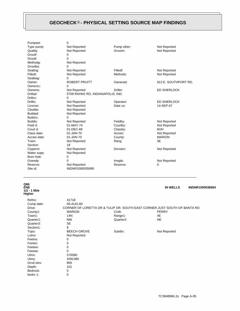
TC3848966.2s Page A-95
0bedro 1:0Bedrock:101Depth:805Grnd elev:4391380Utmy:576580Utmx:0Feetwe:0Feetew:0Feetsn:0Feetns:Not ReportedLotno:
Not ReportedSubdiv:BEECH GROVETopo:8Section1:SEQuarter3:
NEQuarter2:NWQuarter1:4ERange1:14NTown1:PERRYCivilt:MARIONCounty1:
CORNER OF LORETTA DR & TULIP DR. SOUTH EAST CORNER.JUST SOUTH OF BANTA RDDrive:05-AUG-60Comp date:41718Refno:
Q66ENE1/2 - 1 MileHigher
INDNR1000036564IN WELLS
INDNR1000035995Site id:0Reserve:Not ReportedReserve:Not ReportedIrregla:0Gravelp:
0Bore hole:Not ReportedWater supp:
Not ReportedDnrvarn:Not ReportedCtyperm:18Section:
3ERang:Not ReportedTown:MARIONCounty:01-JAN-70Accwo date:Not ReportedAccwo:01-JAN-70Class date:MJHClassby:01-DEC-69Court d:Not ReportedCourtby:01-MAY-74Field d:Not ReportedFieldby:Not ReportedBuildtx:
0Buildzc:Not ReportedBuildad:Not ReportedCbuilde:
14-SEP-67Date co:Not ReportedLicense:ED SHERLOCKOperator:Not ReportedDrilltx:
0Drillzc:5709 RAHKE RD, INDIANAPOLIS, IND.Drillad:
ED SHERLOCKDriller:Not ReportedOwnertx:0Ownerzc:
913 E. SOUTHPORT RD.Ownerad:ROBERT PRUITTOwner:0Sealbag:
Not ReportedMethods:Not ReportedFilledt:Not ReportedFilledf:Not ReportedSealing:
0Groutba:Not ReportedMethodg:0Groutt:0Groutf:
Not ReportedGroutm:Not ReportedQuality:Not ReportedPump other:Not ReportedType pump:
0Pumpset:
®GEOCHECK - PHYSICAL SETTING SOURCE MAP FINDINGS®
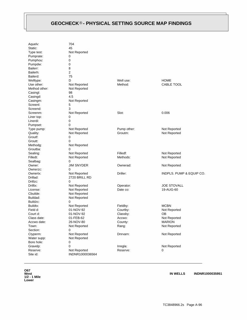
TC3848966.2s Page A-96
O67West1/2 - 1 MileLower
INDNR1000035951IN WELLS
INDNR1000036564Site id:0Reserve:Not ReportedReserve:Not ReportedIrregla:0Gravelp:
0Bore hole:Not ReportedWater supp:
Not ReportedDnrvarn:Not ReportedCtyperm:0Section:
Not ReportedRang:Not ReportedTown:MARIONCounty:26-NOV-80Accwo date:Not ReportedAccwo:01-FEB-62Class date:OBClassby:01-NOV-92Court d:Not ReportedCourtby:01-NOV-92Field d:MCBNFieldby:Not ReportedBuildtx:
0Buildzc:Not ReportedBuildad:Not ReportedCbuilde:
19-AUG-60Date co:Not ReportedLicense:JOE STOVALLOperator:Not ReportedDrilltx:
0Drillzc:2720 BRILL RDDrillad:
INDPLS. PUMP & EQUIP CO.Driller:Not ReportedOwnertx:0Ownerzc:
Not ReportedOwnerad:JIM SNYDEROwner:0Sealbag:
Not ReportedMethods:Not ReportedFilledt:Not ReportedFilledf:Not ReportedSealing:
0Groutba:Not ReportedMethodg:0Groutt:0Groutf:
Not ReportedGroutm:Not ReportedQuality:Not ReportedPump other:Not ReportedType pump:
0Pumpset:0Linerdi:0Liner top:
0.006Slot:Not ReportedScreenm:3Screend:5Screenl:Not ReportedCasingm:4.5Casingd:98Casingl:Not ReportedMethod other:
CABLE TOOLMethod:Not ReportedUse other:HOMEWell use:DWelltype:
75Bailerd:2Bailerh:8Bailerr:0Pumpdw:0Pumphou:0Pumprate:Not ReportedType test:45Static:704Aquelv:
®GEOCHECK - PHYSICAL SETTING SOURCE MAP FINDINGS®
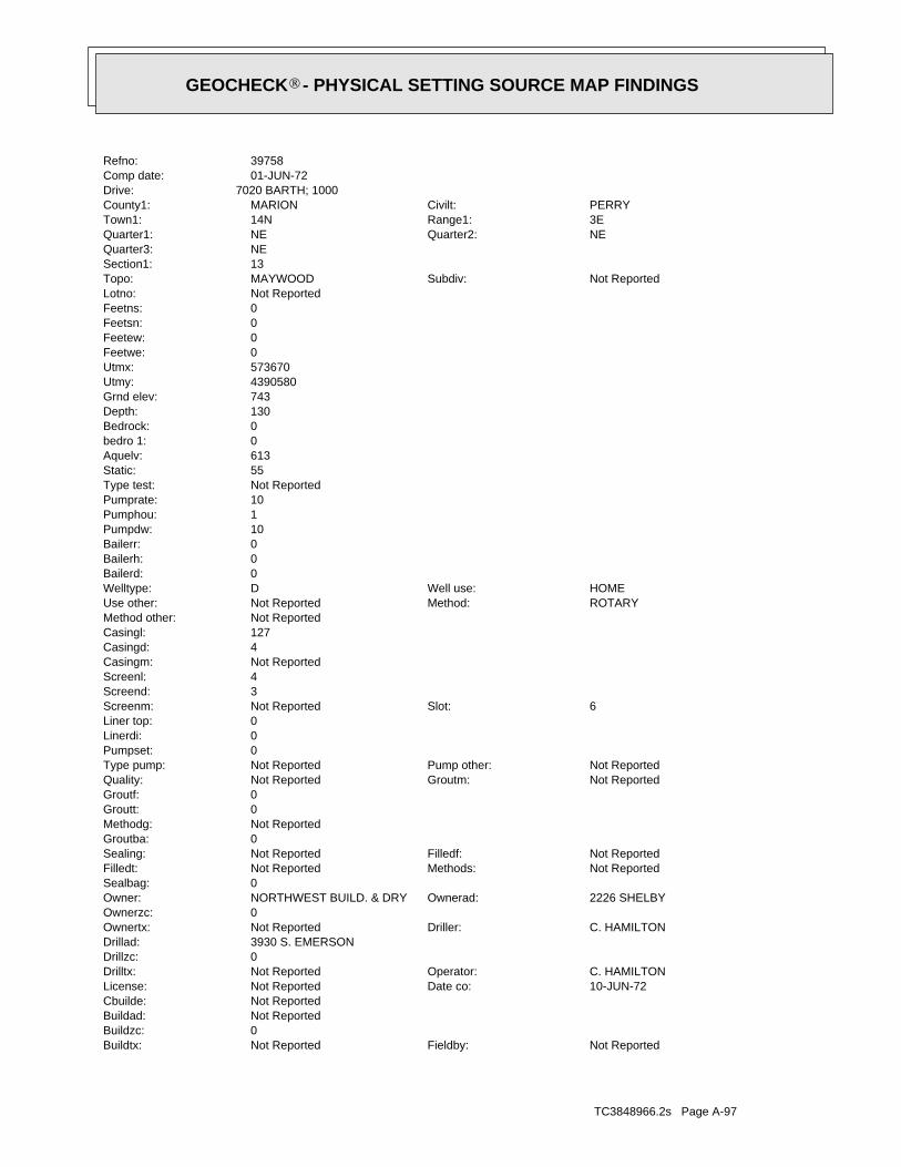
TC3848966.2s Page A-97
Not ReportedFieldby:Not ReportedBuildtx:0Buildzc:Not ReportedBuildad:Not ReportedCbuilde:
10-JUN-72Date co:Not ReportedLicense:C. HAMILTONOperator:Not ReportedDrilltx:
0Drillzc:3930 S. EMERSONDrillad:
C. HAMILTONDriller:Not ReportedOwnertx:0Ownerzc:
2226 SHELBYOwnerad:NORTHWEST BUILD. & DRYOwner:0Sealbag:
Not ReportedMethods:Not ReportedFilledt:Not ReportedFilledf:Not ReportedSealing:
0Groutba:Not ReportedMethodg:0Groutt:0Groutf:
Not ReportedGroutm:Not ReportedQuality:Not ReportedPump other:Not ReportedType pump:
0Pumpset:0Linerdi:0Liner top:
6Slot:Not ReportedScreenm:3Screend:4Screenl:Not ReportedCasingm:4Casingd:127Casingl:Not ReportedMethod other:
ROTARYMethod:Not ReportedUse other:HOMEWell use:DWelltype:
0Bailerd:0Bailerh:0Bailerr:10Pumpdw:1Pumphou:10Pumprate:Not ReportedType test:55Static:613Aquelv:0bedro 1:0Bedrock:130Depth:743Grnd elev:4390580Utmy:573670Utmx:0Feetwe:0Feetew:0Feetsn:0Feetns:Not ReportedLotno:
Not ReportedSubdiv:MAYWOODTopo:13Section1:NEQuarter3:
NEQuarter2:NEQuarter1:3ERange1:14NTown1:PERRYCivilt:MARIONCounty1:
7020 BARTH; 1000Drive:01-JUN-72Comp date:39758Refno:
®GEOCHECK - PHYSICAL SETTING SOURCE MAP FINDINGS®
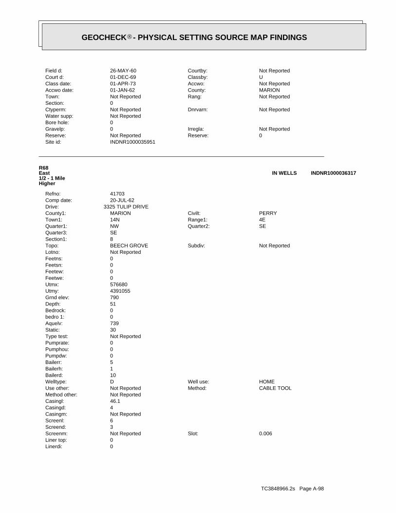
TC3848966.2s Page A-98
0Linerdi:0Liner top:
0.006Slot:Not ReportedScreenm:3Screend:6Screenl:Not ReportedCasingm:4Casingd:46.1Casingl:Not ReportedMethod other:
CABLE TOOLMethod:Not ReportedUse other:HOMEWell use:DWelltype:
10Bailerd:1Bailerh:5Bailerr:0Pumpdw:0Pumphou:0Pumprate:Not ReportedType test:30Static:739Aquelv:0bedro 1:0Bedrock:51Depth:790Grnd elev:4391055Utmy:576680Utmx:0Feetwe:0Feetew:0Feetsn:0Feetns:Not ReportedLotno:
Not ReportedSubdiv:BEECH GROVETopo:8Section1:SEQuarter3:
SEQuarter2:NWQuarter1:4ERange1:14NTown1:PERRYCivilt:MARIONCounty1:
3325 TULIP DRIVEDrive:20-JUL-62Comp date:41703Refno:
R68East1/2 - 1 MileHigher
INDNR1000036317IN WELLS
INDNR1000035951Site id:0Reserve:Not ReportedReserve:Not ReportedIrregla:0Gravelp:
0Bore hole:Not ReportedWater supp:
Not ReportedDnrvarn:Not ReportedCtyperm:0Section:
Not ReportedRang:Not ReportedTown:MARIONCounty:01-JAN-62Accwo date:Not ReportedAccwo:01-APR-73Class date:UClassby:01-DEC-69Court d:Not ReportedCourtby:26-MAY-60Field d:
®GEOCHECK - PHYSICAL SETTING SOURCE MAP FINDINGS®
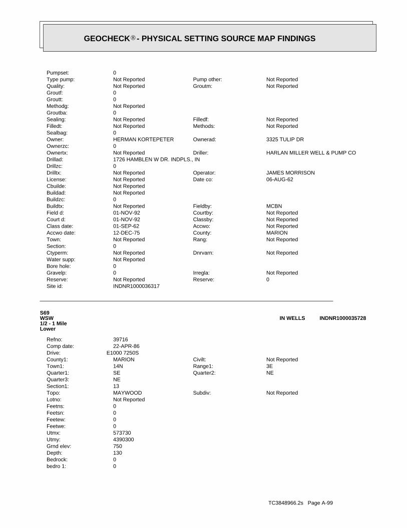
TC3848966.2s Page A-99
0bedro 1:0Bedrock:130Depth:750Grnd elev:4390300Utmy:573730Utmx:0Feetwe:0Feetew:0Feetsn:0Feetns:Not ReportedLotno:
Not ReportedSubdiv:MAYWOODTopo:13Section1:NEQuarter3:
NEQuarter2:SEQuarter1:3ERange1:14NTown1:Not ReportedCivilt:MARIONCounty1:
E1000 7250SDrive:22-APR-86Comp date:39716Refno:
S69WSW1/2 - 1 MileLower
INDNR1000035728IN WELLS
INDNR1000036317Site id:0Reserve:Not ReportedReserve:Not ReportedIrregla:0Gravelp:
0Bore hole:Not ReportedWater supp:
Not ReportedDnrvarn:Not ReportedCtyperm:0Section:
Not ReportedRang:Not ReportedTown:MARIONCounty:12-DEC-75Accwo date:Not ReportedAccwo:01-SEP-62Class date:Not ReportedClassby:01-NOV-92Court d:Not ReportedCourtby:01-NOV-92Field d:MCBNFieldby:Not ReportedBuildtx:
0Buildzc:Not ReportedBuildad:Not ReportedCbuilde:
06-AUG-62Date co:Not ReportedLicense:JAMES MORRISONOperator:Not ReportedDrilltx:
0Drillzc:1726 HAMBLEN W DR. INDPLS., INDrillad:
HARLAN MILLER WELL & PUMP CODriller:Not ReportedOwnertx:0Ownerzc:
3325 TULIP DROwnerad:HERMAN KORTEPETEROwner:0Sealbag:
Not ReportedMethods:Not ReportedFilledt:Not ReportedFilledf:Not ReportedSealing:
0Groutba:Not ReportedMethodg:0Groutt:0Groutf:
Not ReportedGroutm:Not ReportedQuality:Not ReportedPump other:Not ReportedType pump:
0Pumpset:
®GEOCHECK - PHYSICAL SETTING SOURCE MAP FINDINGS®
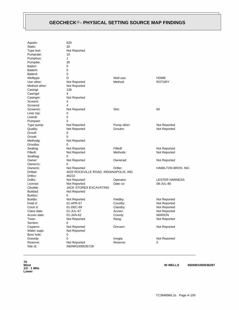
TC3848966.2s Page A-100
70West1/2 - 1 MileLower
INDNR1000036297IN WELLS
INDNR1000035728Site id:0Reserve:Not ReportedReserve:Not ReportedIrregla:0Gravelp:
0Bore hole:Not ReportedWater supp:
Not ReportedDnrvarn:Not ReportedCtyperm:0Section:
Not ReportedRang:Not ReportedTown:MARIONCounty:01-JAN-62Accwo date:Not ReportedAccwo:01-JUL-67Class date:Not ReportedClassby:01-DEC-69Court d:Not ReportedCourtby:01-APR-67Field d:Not ReportedFieldby:Not ReportedBuildtx:
0Buildzc:Not ReportedBuildad:JACK STORES EXCAVATINGCbuilde:
08-JUL-85Date co:Not ReportedLicense:LESTER HARNESSOperator:Not ReportedDrilltx:
46222Drillzc:4025 ROCKVILLE ROAD, INDIANAPOLIS, IND.Drillad:
HAMILTON BROS. INC.Driller:Not ReportedOwnertx:0Ownerzc:
Not ReportedOwnerad:Not ReportedOwner:0Sealbag:
Not ReportedMethods:Not ReportedFilledt:Not ReportedFilledf:Not ReportedSealing:
0Groutba:Not ReportedMethodg:0Groutt:0Groutf:
Not ReportedGroutm:Not ReportedQuality:Not ReportedPump other:Not ReportedType pump:
0Pumpset:0Linerdi:0Liner top:
60Slot:Not ReportedScreenm:4Screend:4Screenl:Not ReportedCasingm:4Casingd:126Casingl:Not ReportedMethod other:
ROTARYMethod:Not ReportedUse other:HOMEWell use:DWelltype:
0Bailerd:0Bailerh:0Bailerr:30Pumpdw:1Pumphou:10Pumprate:Not ReportedType test:30Static:620Aquelv:
®GEOCHECK - PHYSICAL SETTING SOURCE MAP FINDINGS®
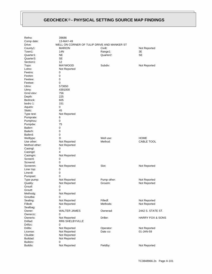
TC3848966.2s Page A-101
Not ReportedFieldby:Not ReportedBuildtx:0Buildzc:Not ReportedBuildad:Not ReportedCbuilde:
01-JAN-59Date co:Not ReportedLicense:Not ReportedOperator:Not ReportedDrilltx:
0Drillzc:RR6 SHELBYVILLEDrillad:
HARRY FOX & SONSDriller:Not ReportedOwnertx:0Ownerzc:
2442 S. STATE ST.Ownerad:WALTER JAMESOwner:0Sealbag:
Not ReportedMethods:Not ReportedFilledt:Not ReportedFilledf:Not ReportedSealing:
0Groutba:Not ReportedMethodg:0Groutt:0Groutf:
Not ReportedGroutm:Not ReportedQuality:Not ReportedPump other:Not ReportedType pump:
0Pumpset:0Linerdi:0Liner top:
Not ReportedSlot:Not ReportedScreenm:0Screend:0Screenl:Not ReportedCasingm:4Casingd:0Casingl:Not ReportedMethod other:
CABLE TOOLMethod:Not ReportedUse other:HOMEWell use:DWelltype:
0Bailerd:0Bailerh:0Bailerr:75Pumpdw:0Pumphou:6Pumprate:Not ReportedType test:45Static:0Aquelv:151bedro 1:605Bedrock:225Depth:756Grnd elev:4391000Utmy:573650Utmx:0Feetwe:0Feetew:0Feetsn:0Feetns:Not ReportedLotno:
Not ReportedSubdiv:MAYWOODTopo:12Section1:SEQuarter3:
SEQuarter2:NEQuarter1:3ERange1:14NTown1:Not ReportedCivilt:MARIONCounty1:
WELL ON CORNER OF TULIP DRIVE AND MANKER STDrive:13-MAY-49Comp date:39686Refno:
®GEOCHECK - PHYSICAL SETTING SOURCE MAP FINDINGS®
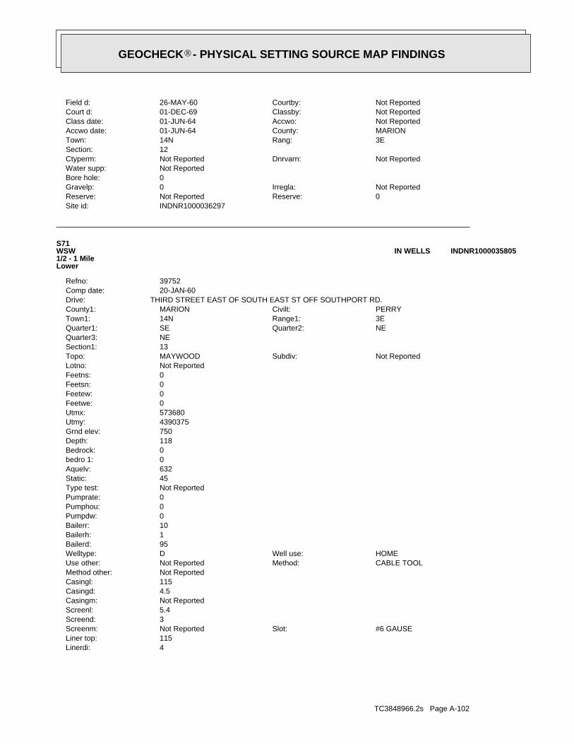
TC3848966.2s Page A-102
4Linerdi:115Liner top:
#6 GAUSESlot:Not ReportedScreenm:3Screend:5.4Screenl:Not ReportedCasingm:4.5Casingd:115Casingl:Not ReportedMethod other:
CABLE TOOLMethod:Not ReportedUse other:HOMEWell use:DWelltype:
95Bailerd:1Bailerh:10Bailerr:0Pumpdw:0Pumphou:0Pumprate:Not ReportedType test:45Static:632Aquelv:0bedro 1:0Bedrock:118Depth:750Grnd elev:4390375Utmy:573680Utmx:0Feetwe:0Feetew:0Feetsn:0Feetns:Not ReportedLotno:
Not ReportedSubdiv:MAYWOODTopo:13Section1:NEQuarter3:
NEQuarter2:SEQuarter1:3ERange1:14NTown1:PERRYCivilt:MARIONCounty1:
THIRD STREET EAST OF SOUTH EAST ST OFF SOUTHPORT RD.Drive:20-JAN-60Comp date:39752Refno:
S71WSW1/2 - 1 MileLower
INDNR1000035805IN WELLS
INDNR1000036297Site id:0Reserve:Not ReportedReserve:Not ReportedIrregla:0Gravelp:
0Bore hole:Not ReportedWater supp:
Not ReportedDnrvarn:Not ReportedCtyperm:12Section:
3ERang:14NTown:MARIONCounty:01-JUN-64Accwo date:Not ReportedAccwo:01-JUN-64Class date:Not ReportedClassby:01-DEC-69Court d:Not ReportedCourtby:26-MAY-60Field d:
®GEOCHECK - PHYSICAL SETTING SOURCE MAP FINDINGS®
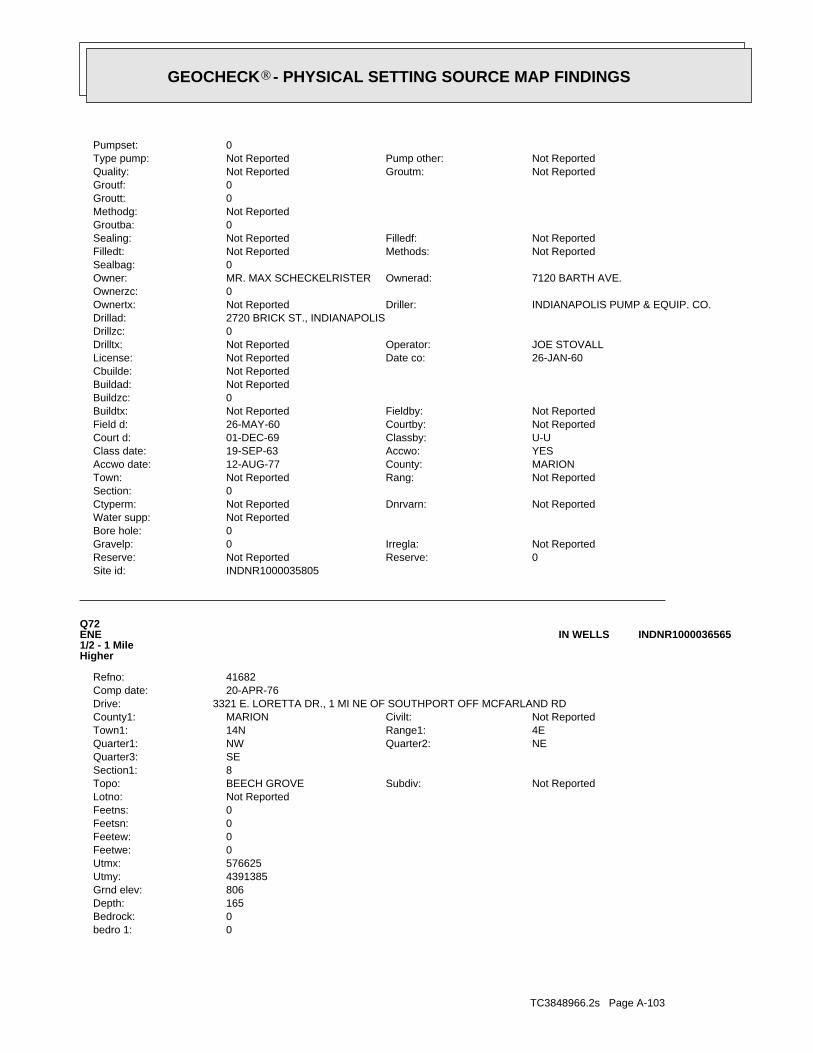
TC3848966.2s Page A-103
0bedro 1:0Bedrock:165Depth:806Grnd elev:4391385Utmy:576625Utmx:0Feetwe:0Feetew:0Feetsn:0Feetns:Not ReportedLotno:
Not ReportedSubdiv:BEECH GROVETopo:8Section1:SEQuarter3:
NEQuarter2:NWQuarter1:4ERange1:14NTown1:Not ReportedCivilt:MARIONCounty1:
3321 E. LORETTA DR., 1 MI NE OF SOUTHPORT OFF MCFARLAND RDDrive:20-APR-76Comp date:41682Refno:
Q72ENE1/2 - 1 MileHigher
INDNR1000036565IN WELLS
INDNR1000035805Site id:0Reserve:Not ReportedReserve:Not ReportedIrregla:0Gravelp:
0Bore hole:Not ReportedWater supp:
Not ReportedDnrvarn:Not ReportedCtyperm:0Section:
Not ReportedRang:Not ReportedTown:MARIONCounty:12-AUG-77Accwo date:YESAccwo:19-SEP-63Class date:U-UClassby:01-DEC-69Court d:Not ReportedCourtby:26-MAY-60Field d:Not ReportedFieldby:Not ReportedBuildtx:
0Buildzc:Not ReportedBuildad:Not ReportedCbuilde:
26-JAN-60Date co:Not ReportedLicense:JOE STOVALLOperator:Not ReportedDrilltx:
0Drillzc:2720 BRICK ST., INDIANAPOLISDrillad:
INDIANAPOLIS PUMP & EQUIP. CO.Driller:Not ReportedOwnertx:0Ownerzc:
7120 BARTH AVE.Ownerad:MR. MAX SCHECKELRISTEROwner:0Sealbag:
Not ReportedMethods:Not ReportedFilledt:Not ReportedFilledf:Not ReportedSealing:
0Groutba:Not ReportedMethodg:0Groutt:0Groutf:
Not ReportedGroutm:Not ReportedQuality:Not ReportedPump other:Not ReportedType pump:
0Pumpset:
®GEOCHECK - PHYSICAL SETTING SOURCE MAP FINDINGS®
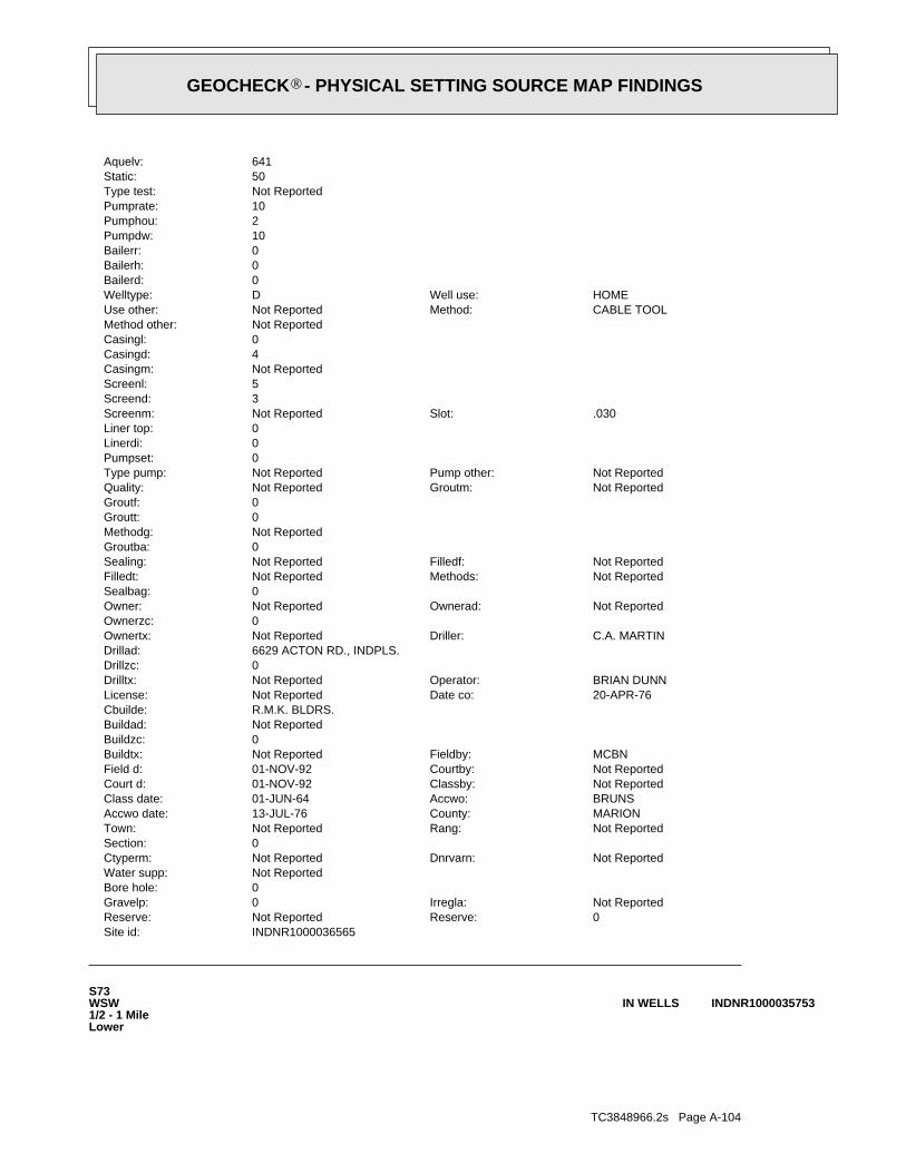
TC3848966.2s Page A-104
S73WSW1/2 - 1 MileLower
INDNR1000035753IN WELLS
INDNR1000036565Site id:0Reserve:Not ReportedReserve:Not ReportedIrregla:0Gravelp:
0Bore hole:Not ReportedWater supp:
Not ReportedDnrvarn:Not ReportedCtyperm:0Section:
Not ReportedRang:Not ReportedTown:MARIONCounty:13-JUL-76Accwo date:BRUNSAccwo:01-JUN-64Class date:Not ReportedClassby:01-NOV-92Court d:Not ReportedCourtby:01-NOV-92Field d:MCBNFieldby:Not ReportedBuildtx:
0Buildzc:Not ReportedBuildad:R.M.K. BLDRS.Cbuilde:
20-APR-76Date co:Not ReportedLicense:BRIAN DUNNOperator:Not ReportedDrilltx:
0Drillzc:6629 ACTON RD., INDPLS.Drillad:
C.A. MARTINDriller:Not ReportedOwnertx:0Ownerzc:
Not ReportedOwnerad:Not ReportedOwner:0Sealbag:
Not ReportedMethods:Not ReportedFilledt:Not ReportedFilledf:Not ReportedSealing:
0Groutba:Not ReportedMethodg:0Groutt:0Groutf:
Not ReportedGroutm:Not ReportedQuality:Not ReportedPump other:Not ReportedType pump:
0Pumpset:0Linerdi:0Liner top:
.030Slot:Not ReportedScreenm:3Screend:5Screenl:Not ReportedCasingm:4Casingd:0Casingl:Not ReportedMethod other:
CABLE TOOLMethod:Not ReportedUse other:HOMEWell use:DWelltype:
0Bailerd:0Bailerh:0Bailerr:10Pumpdw:2Pumphou:10Pumprate:Not ReportedType test:50Static:641Aquelv:
®GEOCHECK - PHYSICAL SETTING SOURCE MAP FINDINGS®

TC3848966.2s Page A-105
Not ReportedFieldby:Not ReportedBuildtx:0Buildzc:Not ReportedBuildad:A.H.Cbuilde:
04-JUN-82Date co:Not ReportedLicense:JERRY OAKLEYOperator:Not ReportedDrilltx:
0Drillzc:4701 W. MORRISDrillad:
MATLOCKDriller:Not ReportedOwnertx:0Ownerzc:
7135 BARTH AVE.Ownerad:JOHNNY CORBINOwner:0Sealbag:
Not ReportedMethods:Not ReportedFilledt:Not ReportedFilledf:Not ReportedSealing:
0Groutba:Not ReportedMethodg:0Groutt:0Groutf:
Not ReportedGroutm:Not ReportedQuality:Not ReportedPump other:Not ReportedType pump:
0Pumpset:0Linerdi:0Liner top:
Not ReportedSlot:Not ReportedScreenm:4Screend:5Screenl:Not ReportedCasingm:0Casingd:0Casingl:Not ReportedMethod other:
ROTARYMethod:Not ReportedUse other:HOMEWell use:DWelltype:
0Bailerd:0Bailerh:0Bailerr:0Pumpdw:0Pumphou:10Pumprate:Not ReportedType test:55Static:0Aquelv:152bedro 1:598Bedrock:155Depth:750Grnd elev:4390325Utmy:573675Utmx:0Feetwe:0Feetew:0Feetsn:0Feetns:Not ReportedLotno:
Not ReportedSubdiv:MAYWOODTopo:13Section1:NEQuarter3:
NEQuarter2:SEQuarter1:3ERange1:14NTown1:Not ReportedCivilt:MARIONCounty1:
Not ReportedDrive:01-JUN-82Comp date:39747Refno:
®GEOCHECK - PHYSICAL SETTING SOURCE MAP FINDINGS®

TC3848966.2s Page A-106
0Linerdi:0Liner top:
#80Slot:Not ReportedScreenm:4Screend:2Screenl:Not ReportedCasingm:4Casingd:135Casingl:Not ReportedMethod other:
CABLE TOOLMethod:Not ReportedUse other:HOMEWell use:DWelltype:
0Bailerd:0Bailerh:0Bailerr:2Pumpdw:2Pumphou:12Pumprate:Not ReportedType test:38Static:608Aquelv:0bedro 1:0Bedrock:137Depth:745Grnd elev:4390610Utmy:573600Utmx:0Feetwe:0Feetew:0Feetsn:0Feetns:Not ReportedLotno:
Not ReportedSubdiv:MAYWOODTopo:13Section1:NEQuarter3:
NEQuarter2:NWQuarter1:3ERange1:14NTown1:PERRYCivilt:MARIONCounty1:
7015 HANKER RDDrive:01-AUG-60Comp date:39763Refno:
74West1/2 - 1 MileLower
INDNR1000035970IN WELLS
INDNR1000035753Site id:0Reserve:Not ReportedReserve:Not ReportedIrregla:0Gravelp:
0Bore hole:Not ReportedWater supp:
Not ReportedDnrvarn:Not ReportedCtyperm:0Section:
Not ReportedRang:Not ReportedTown:MARIONCounty:15-JUN-82Accwo date:DSHAccwo:01-MAR-65Class date:Not ReportedClassby:01-DEC-69Court d:Not ReportedCourtby:26-MAY-60Field d:
®GEOCHECK - PHYSICAL SETTING SOURCE MAP FINDINGS®
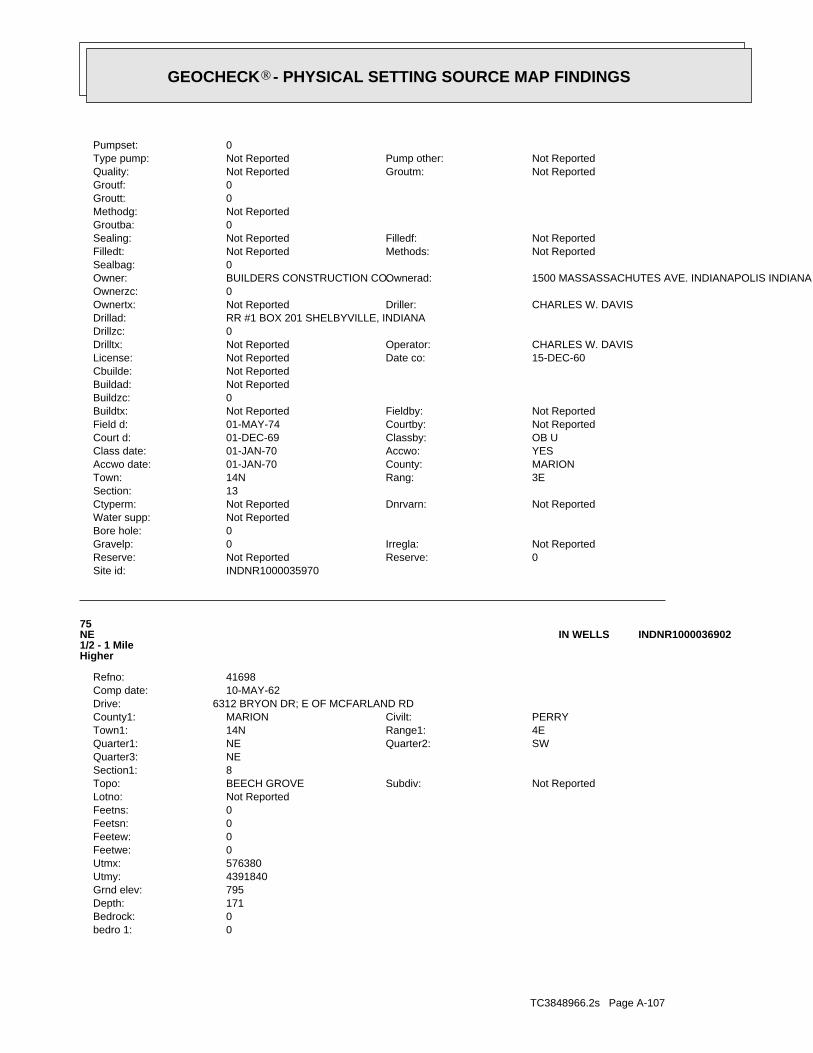
TC3848966.2s Page A-107
0bedro 1:0Bedrock:171Depth:795Grnd elev:4391840Utmy:576380Utmx:0Feetwe:0Feetew:0Feetsn:0Feetns:Not ReportedLotno:
Not ReportedSubdiv:BEECH GROVETopo:8Section1:NEQuarter3:
SWQuarter2:NEQuarter1:4ERange1:14NTown1:PERRYCivilt:MARIONCounty1:
6312 BRYON DR; E OF MCFARLAND RDDrive:10-MAY-62Comp date:41698Refno:
75NE1/2 - 1 MileHigher
INDNR1000036902IN WELLS
INDNR1000035970Site id:0Reserve:Not ReportedReserve:Not ReportedIrregla:0Gravelp:
0Bore hole:Not ReportedWater supp:
Not ReportedDnrvarn:Not ReportedCtyperm:13Section:
3ERang:14NTown:MARIONCounty:01-JAN-70Accwo date:YESAccwo:01-JAN-70Class date:OB UClassby:01-DEC-69Court d:Not ReportedCourtby:01-MAY-74Field d:Not ReportedFieldby:Not ReportedBuildtx:
0Buildzc:Not ReportedBuildad:Not ReportedCbuilde:
15-DEC-60Date co:Not ReportedLicense:CHARLES W. DAVISOperator:Not ReportedDrilltx:
0Drillzc:RR #1 BOX 201 SHELBYVILLE, INDIANADrillad:
CHARLES W. DAVISDriller:Not ReportedOwnertx:0Ownerzc:
1500 MASSASSACHUTES AVE. INDIANAPOLIS INDIANAOwnerad:BUILDERS CONSTRUCTION CO.Owner:0Sealbag:
Not ReportedMethods:Not ReportedFilledt:Not ReportedFilledf:Not ReportedSealing:
0Groutba:Not ReportedMethodg:0Groutt:0Groutf:
Not ReportedGroutm:Not ReportedQuality:Not ReportedPump other:Not ReportedType pump:
0Pumpset:
®GEOCHECK - PHYSICAL SETTING SOURCE MAP FINDINGS®
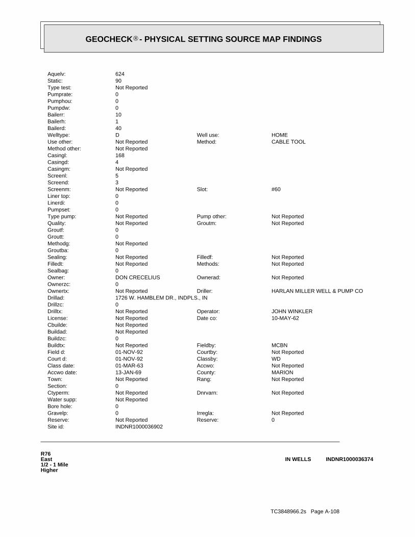
TC3848966.2s Page A-108
R76East1/2 - 1 MileHigher
INDNR1000036374IN WELLS
INDNR1000036902Site id:0Reserve:Not ReportedReserve:Not ReportedIrregla:0Gravelp:
0Bore hole:Not ReportedWater supp:
Not ReportedDnrvarn:Not ReportedCtyperm:0Section:
Not ReportedRang:Not ReportedTown:MARIONCounty:13-JAN-69Accwo date:Not ReportedAccwo:01-MAR-63Class date:WDClassby:01-NOV-92Court d:Not ReportedCourtby:01-NOV-92Field d:MCBNFieldby:Not ReportedBuildtx:
0Buildzc:Not ReportedBuildad:Not ReportedCbuilde:
10-MAY-62Date co:Not ReportedLicense:JOHN WINKLEROperator:Not ReportedDrilltx:
0Drillzc:1726 W. HAMBLEM DR., INDPLS., INDrillad:
HARLAN MILLER WELL & PUMP CODriller:Not ReportedOwnertx:0Ownerzc:
Not ReportedOwnerad:DON CRECELIUSOwner:0Sealbag:
Not ReportedMethods:Not ReportedFilledt:Not ReportedFilledf:Not ReportedSealing:
0Groutba:Not ReportedMethodg:0Groutt:0Groutf:
Not ReportedGroutm:Not ReportedQuality:Not ReportedPump other:Not ReportedType pump:
0Pumpset:0Linerdi:0Liner top:
#60Slot:Not ReportedScreenm:3Screend:5Screenl:Not ReportedCasingm:4Casingd:168Casingl:Not ReportedMethod other:
CABLE TOOLMethod:Not ReportedUse other:HOMEWell use:DWelltype:
40Bailerd:1Bailerh:10Bailerr:0Pumpdw:0Pumphou:0Pumprate:Not ReportedType test:90Static:624Aquelv:
®GEOCHECK - PHYSICAL SETTING SOURCE MAP FINDINGS®
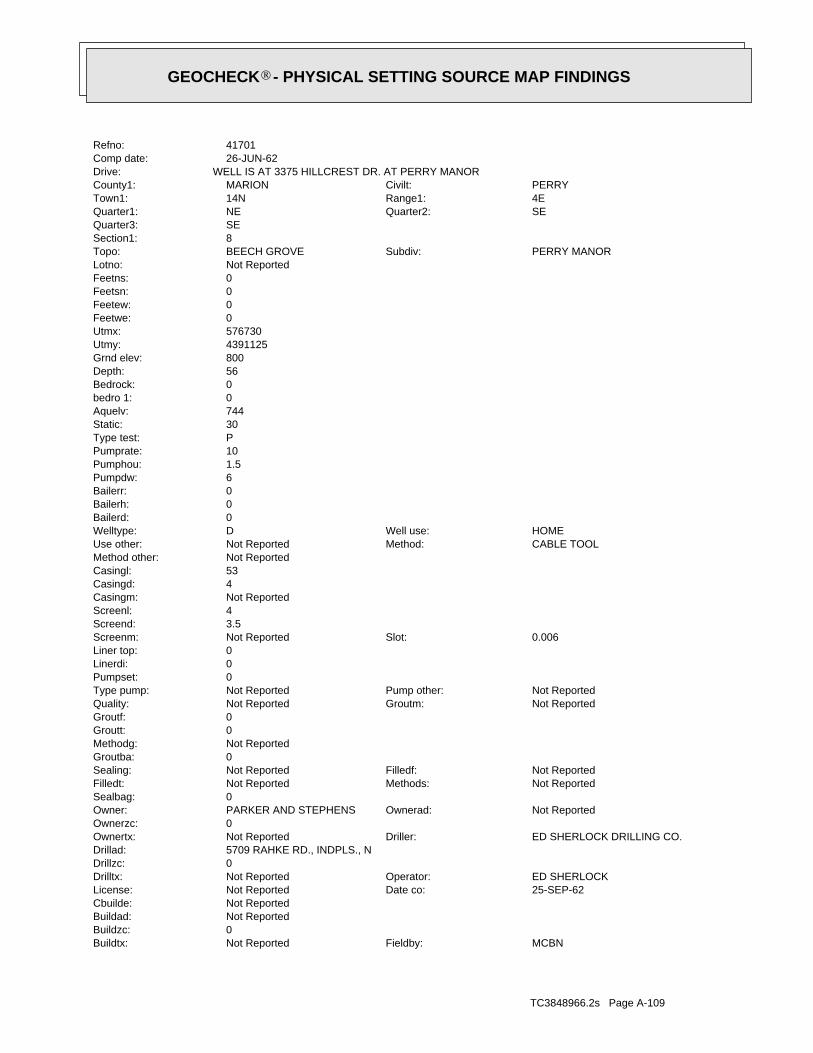
TC3848966.2s Page A-109
MCBNFieldby:Not ReportedBuildtx:0Buildzc:Not ReportedBuildad:Not ReportedCbuilde:
25-SEP-62Date co:Not ReportedLicense:ED SHERLOCKOperator:Not ReportedDrilltx:
0Drillzc:5709 RAHKE RD., INDPLS., NDrillad:
ED SHERLOCK DRILLING CO.Driller:Not ReportedOwnertx:0Ownerzc:
Not ReportedOwnerad:PARKER AND STEPHENSOwner:0Sealbag:
Not ReportedMethods:Not ReportedFilledt:Not ReportedFilledf:Not ReportedSealing:
0Groutba:Not ReportedMethodg:0Groutt:0Groutf:
Not ReportedGroutm:Not ReportedQuality:Not ReportedPump other:Not ReportedType pump:
0Pumpset:0Linerdi:0Liner top:
0.006Slot:Not ReportedScreenm:3.5Screend:4Screenl:Not ReportedCasingm:4Casingd:53Casingl:Not ReportedMethod other:
CABLE TOOLMethod:Not ReportedUse other:HOMEWell use:DWelltype:
0Bailerd:0Bailerh:0Bailerr:6Pumpdw:1.5Pumphou:10Pumprate:PType test:30Static:744Aquelv:0bedro 1:0Bedrock:56Depth:800Grnd elev:4391125Utmy:576730Utmx:0Feetwe:0Feetew:0Feetsn:0Feetns:Not ReportedLotno:
PERRY MANORSubdiv:BEECH GROVETopo:8Section1:SEQuarter3:
SEQuarter2:NEQuarter1:4ERange1:14NTown1:PERRYCivilt:MARIONCounty1:
WELL IS AT 3375 HILLCREST DR. AT PERRY MANORDrive:26-JUN-62Comp date:41701Refno:
®GEOCHECK - PHYSICAL SETTING SOURCE MAP FINDINGS®

TC3848966.2s Page A-110
4Linerdi:115Liner top:
6Slot:Not ReportedScreenm:3Screend:4.4Screenl:Not ReportedCasingm:4.5Casingd:115Casingl:Not ReportedMethod other:
CABLE TOOLMethod:Not ReportedUse other:HOMEWell use:DWelltype:
0Bailerd:0Bailerh:0Bailerr:6Pumpdw:2.5Pumphou:10Pumprate:Not ReportedType test:46Static:632Aquelv:0bedro 1:0Bedrock:115Depth:747Grnd elev:4390505Utmy:573610Utmx:0Feetwe:0Feetew:0Feetsn:0Feetns:Not ReportedLotno:
Not ReportedSubdiv:MAYWOODTopo:13Section1:NEQuarter3:
NEQuarter2:NWQuarter1:3ERange1:14NTown1:Not ReportedCivilt:MARIONCounty1:
Not ReportedDrive:19-AUG-60Comp date:39789Refno:
O77West1/2 - 1 MileLower
INDNR1000035909IN WELLS
INDNR1000036374Site id:0Reserve:Not ReportedReserve:Not ReportedIrregla:0Gravelp:
0Bore hole:Not ReportedWater supp:
Not ReportedDnrvarn:Not ReportedCtyperm:8Section:
4ERang:Not ReportedTown:MARIONCounty:12-DEC-75Accwo date:Not ReportedAccwo:01-JUN-64Class date:WDClassby:01-NOV-92Court d:Not ReportedCourtby:01-NOV-92Field d:
®GEOCHECK - PHYSICAL SETTING SOURCE MAP FINDINGS®

TC3848966.2s Page A-111
0bedro 1:0Bedrock:30Depth:780Grnd elev:4392335Utmy:575635Utmx:0Feetwe:0Feetew:0Feetsn:0Feetns:Not ReportedLotno:
Not ReportedSubdiv:BEECH GROVETopo:8Section1:NWQuarter3:
NWQuarter2:NEQuarter1:4ERange1:14NTown1:Not ReportedCivilt:MARIONCounty1:
LOT OR RANGE #106. 1/4 MI E OF MC FARLAND RD ON S SIDE OF STOP 8 RDDrive:17-JUN-61Comp date:41716Refno:
78NNE1/2 - 1 MileHigher
INDNR1000037294IN WELLS
INDNR1000035909Site id:0Reserve:Not ReportedReserve:Not ReportedIrregla:0Gravelp:
0Bore hole:Not ReportedWater supp:
Not ReportedDnrvarn:Not ReportedCtyperm:0Section:
Not ReportedRang:Not ReportedTown:MARIONCounty:01-JAN-62Accwo date:UAccwo:01-MAR-68Class date:OB/UClassby:01-DEC-69Court d:Not ReportedCourtby:17-JUL-61Field d:Not ReportedFieldby:Not ReportedBuildtx:
0Buildzc:Not ReportedBuildad:Not ReportedCbuilde:
06-DEC-60Date co:Not ReportedLicense:NOLES CREEDOperator:Not ReportedDrilltx:
0Drillzc:841 W. SUMNER AVE.Drillad:
MANFORD DEANDriller:Not ReportedOwnertx:0Ownerzc:
2033 MANHER ST.,Ownerad:WARREN GREGORYOwner:0Sealbag:
Not ReportedMethods:Not ReportedFilledt:Not ReportedFilledf:Not ReportedSealing:
0Groutba:Not ReportedMethodg:0Groutt:0Groutf:
Not ReportedGroutm:Not ReportedQuality:Not ReportedPump other:Not ReportedType pump:
0Pumpset:
®GEOCHECK - PHYSICAL SETTING SOURCE MAP FINDINGS®
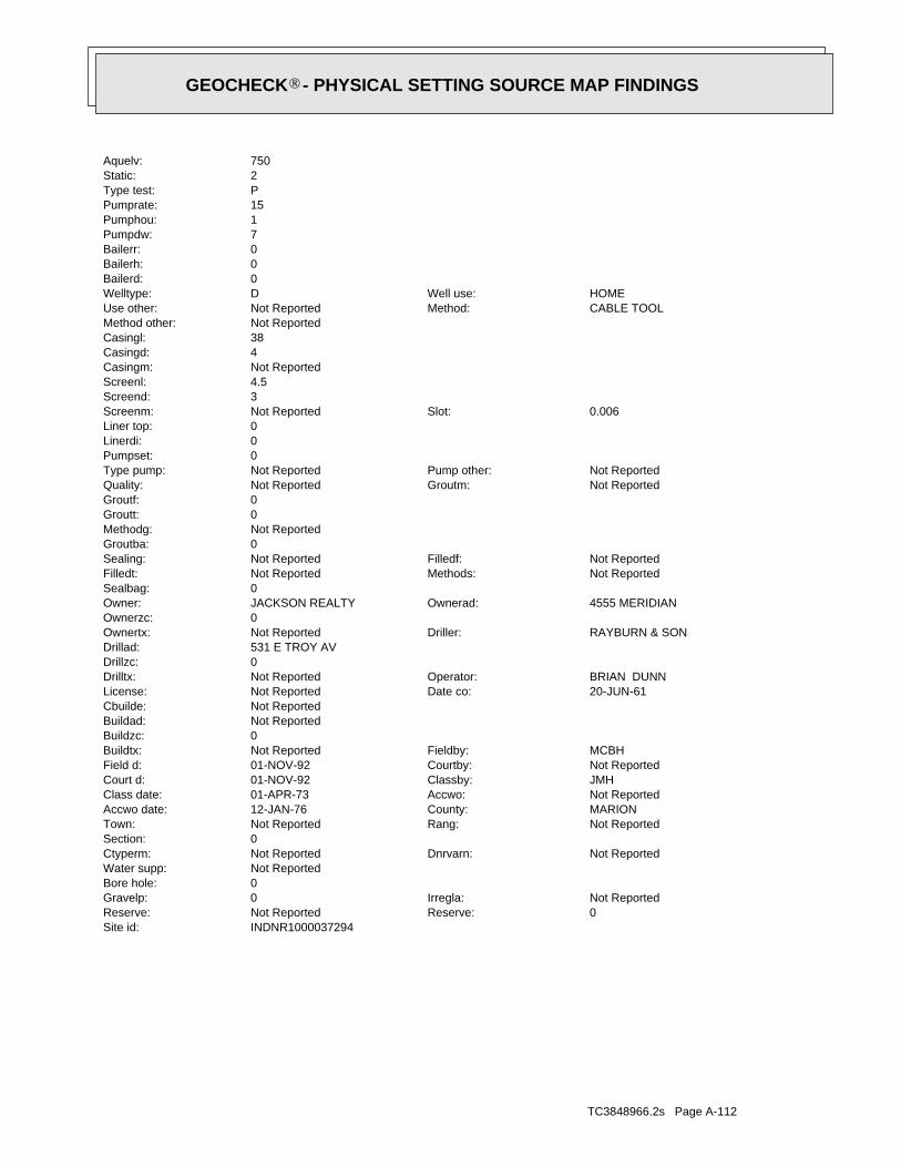
TC3848966.2s Page A-112
INDNR1000037294Site id:0Reserve:Not ReportedReserve:Not ReportedIrregla:0Gravelp:
0Bore hole:Not ReportedWater supp:
Not ReportedDnrvarn:Not ReportedCtyperm:0Section:
Not ReportedRang:Not ReportedTown:MARIONCounty:12-JAN-76Accwo date:Not ReportedAccwo:01-APR-73Class date:JMHClassby:01-NOV-92Court d:Not ReportedCourtby:01-NOV-92Field d:MCBHFieldby:Not ReportedBuildtx:
0Buildzc:Not ReportedBuildad:Not ReportedCbuilde:
20-JUN-61Date co:Not ReportedLicense:BRIAN DUNNOperator:Not ReportedDrilltx:
0Drillzc:531 E TROY AVDrillad:
RAYBURN & SONDriller:Not ReportedOwnertx:0Ownerzc:
4555 MERIDIANOwnerad:JACKSON REALTYOwner:0Sealbag:
Not ReportedMethods:Not ReportedFilledt:Not ReportedFilledf:Not ReportedSealing:
0Groutba:Not ReportedMethodg:0Groutt:0Groutf:
Not ReportedGroutm:Not ReportedQuality:Not ReportedPump other:Not ReportedType pump:
0Pumpset:0Linerdi:0Liner top:
0.006Slot:Not ReportedScreenm:3Screend:4.5Screenl:Not ReportedCasingm:4Casingd:38Casingl:Not ReportedMethod other:
CABLE TOOLMethod:Not ReportedUse other:HOMEWell use:DWelltype:
0Bailerd:0Bailerh:0Bailerr:7Pumpdw:1Pumphou:15Pumprate:PType test:2Static:750Aquelv:
®GEOCHECK - PHYSICAL SETTING SOURCE MAP FINDINGS®
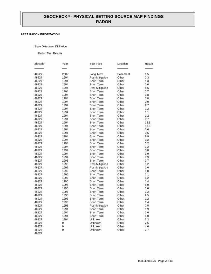
TC3848966.2s Page A-113
462272.7OtherUnknown0462274.6OtherUnknown0462272.5OtherUnknown0462273.2OtherUnknown1994462274.0OtherShort Term1994462272.0OtherShort Term1994462271.9OtherShort Term1994462270.5OtherPost-Mitigation1996462271.4OtherShort Term1996462271.2OtherShort Term1996462272.5OtherShort Term1996462271.2OtherShort Term1996462271.0OtherShort Term1996462278.0OtherShort Term1996462271.4OtherShort Term1996462271.2OtherShort Term1996462271.1OtherShort Term1996462271.0OtherShort Term1996462271.0OtherPost-Mitigation1996462273.2OtherPost-Mitigation1996462273.7OtherShort Term1995462279.9OtherShort Term1994462279.9OtherShort Term1994462270.8OtherShort Term1994462273.2OtherShort Term1994462273.2OtherShort Term1994462279.2OtherShort Term1994462278.9OtherShort Term1994462270.5OtherShort Term1994462272.6OtherShort Term19944622713.6OtherShort Term19944622713.1OtherShort Term1994462279.7OtherShort Term1994462271.2OtherShort Term1994462271.1OtherShort Term1994462271.2OtherShort Term1994462272.7OtherShort Term1994462272.0OtherShort Term1994462271.8OtherShort Term1994462271.8OtherShort Term1994462270.7OtherShort Term1994462274.6OtherPost-Mitigation1994462270.6OtherShort Term1994462271.3OtherShort Term1994462270.3OtherPost-Mitigation1994462276.5BasementLong Term200246227
_____________________________ResultLocationTest TypeYearZipcode
Radon Test Results
State Database: IN Radon
AREA RADON INFORMATION
®GEOCHECK - PHYSICAL SETTING SOURCE MAP FINDINGSRADON
®
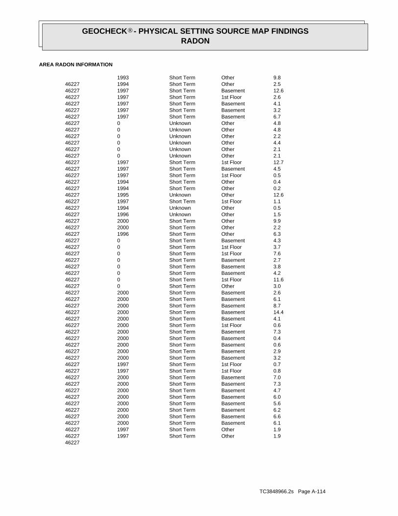
TC3848966.2s Page A-114
462271.9OtherShort Term1997462271.9OtherShort Term1997462276.1BasementShort Term2000462276.6BasementShort Term2000462276.2BasementShort Term2000462275.6BasementShort Term2000462276.0BasementShort Term2000462274.7BasementShort Term2000462277.3BasementShort Term2000462277.0BasementShort Term2000462270.81st FloorShort Term1997462270.71st FloorShort Term1997462273.2BasementShort Term2000462272.9BasementShort Term2000462270.6BasementShort Term2000462270.4BasementShort Term2000462277.3BasementShort Term2000462270.61st FloorShort Term2000462274.1BasementShort Term20004622714.4BasementShort Term2000462278.7BasementShort Term2000462276.1BasementShort Term2000462272.6BasementShort Term2000462273.0OtherShort Term04622711.61st FloorShort Term0462274.2BasementShort Term0462273.8BasementShort Term0462272.7BasementShort Term0462277.61st FloorShort Term0462273.71st FloorShort Term0462274.3BasementShort Term0462276.3OtherShort Term1996462272.2OtherShort Term2000462279.9OtherShort Term2000462271.5OtherUnknown1996462270.5OtherUnknown1994462271.11st FloorShort Term19974622712.6OtherUnknown1995462270.2OtherShort Term1994462270.4OtherShort Term1994462270.51st FloorShort Term1997462274.5BasementShort Term19974622712.71st FloorShort Term1997462272.1OtherUnknown0462272.1OtherUnknown0462274.4OtherUnknown0462272.2OtherUnknown0462274.8OtherUnknown0462274.8OtherUnknown0462276.7BasementShort Term1997462273.2BasementShort Term1997462274.1BasementShort Term1997462272.61st FloorShort Term19974622712.6BasementShort Term1997462272.5OtherShort Term1994462279.8OtherShort Term1993
AREA RADON INFORMATION
®GEOCHECK - PHYSICAL SETTING SOURCE MAP FINDINGSRADON
®
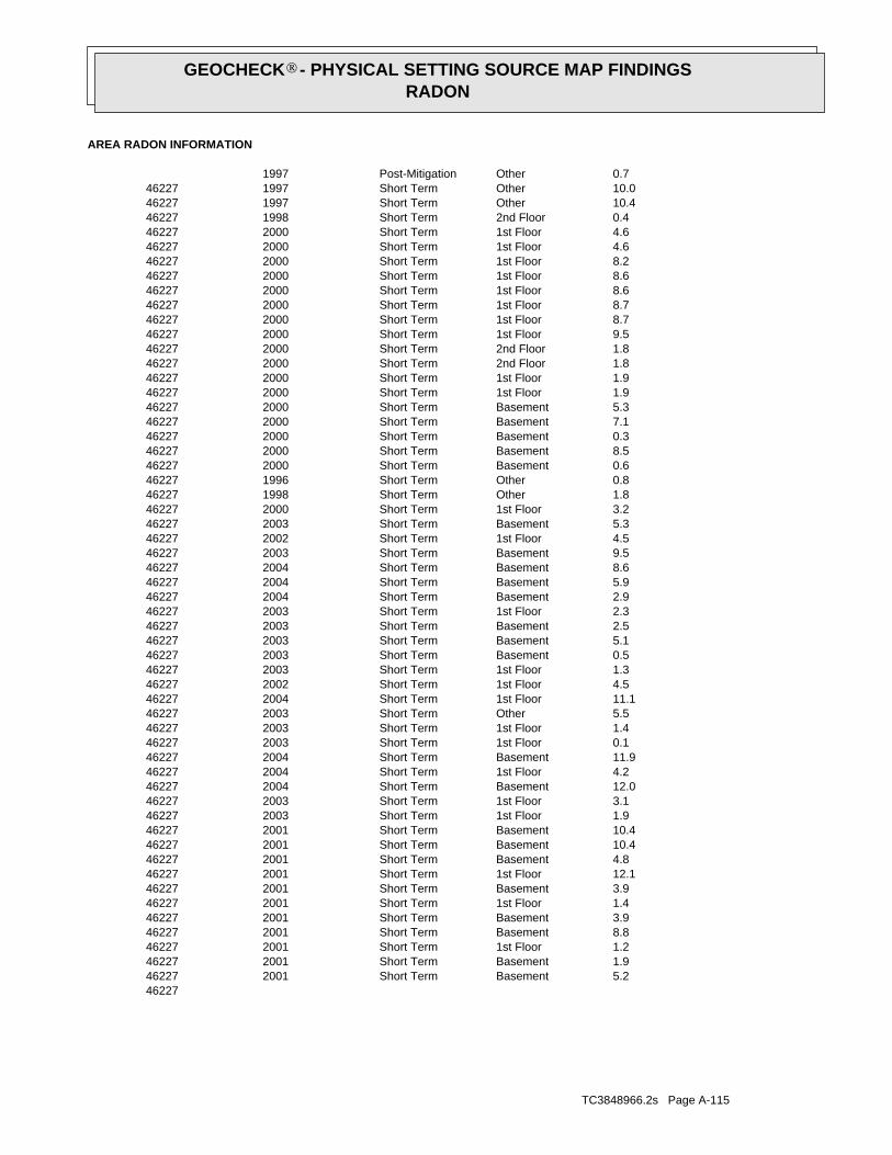
TC3848966.2s Page A-115
462275.2BasementShort Term2001462271.9BasementShort Term2001462271.21st FloorShort Term2001462278.8BasementShort Term2001462273.9BasementShort Term2001462271.41st FloorShort Term2001462273.9BasementShort Term20014622712.11st FloorShort Term2001462274.8BasementShort Term20014622710.4BasementShort Term20014622710.4BasementShort Term2001462271.91st FloorShort Term2003462273.11st FloorShort Term20034622712.0BasementShort Term2004462274.21st FloorShort Term20044622711.9BasementShort Term2004462270.11st FloorShort Term2003462271.41st FloorShort Term2003462275.5OtherShort Term20034622711.11st FloorShort Term2004462274.51st FloorShort Term2002462271.31st FloorShort Term2003462270.5BasementShort Term2003462275.1BasementShort Term2003462272.5BasementShort Term2003462272.31st FloorShort Term2003462272.9BasementShort Term2004462275.9BasementShort Term2004462278.6BasementShort Term2004462279.5BasementShort Term2003462274.51st FloorShort Term2002462275.3BasementShort Term2003462273.21st FloorShort Term2000462271.8OtherShort Term1998462270.8OtherShort Term1996462270.6BasementShort Term2000462278.5BasementShort Term2000462270.3BasementShort Term2000462277.1BasementShort Term2000462275.3BasementShort Term2000462271.91st FloorShort Term2000462271.91st FloorShort Term2000462271.82nd FloorShort Term2000462271.82nd FloorShort Term2000462279.51st FloorShort Term2000462278.71st FloorShort Term2000462278.71st FloorShort Term2000462278.61st FloorShort Term2000462278.61st FloorShort Term2000462278.21st FloorShort Term2000462274.61st FloorShort Term2000462274.61st FloorShort Term2000462270.42nd FloorShort Term19984622710.4OtherShort Term19974622710.0OtherShort Term1997462270.7OtherPost-Mitigation1997
AREA RADON INFORMATION
®GEOCHECK - PHYSICAL SETTING SOURCE MAP FINDINGSRADON
®
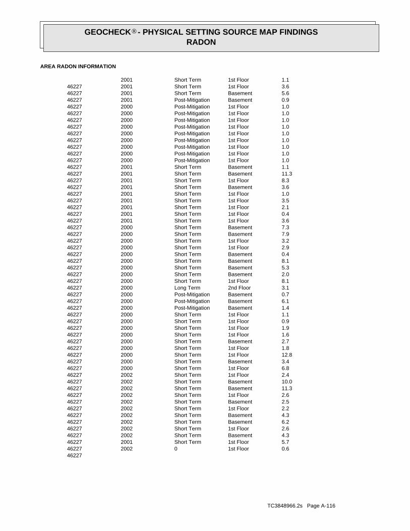
TC3848966.2s Page A-116
462270.61st Floor02002462275.71st FloorShort Term2001462274.3BasementShort Term2002462272.61st FloorShort Term2002462276.2BasementShort Term2002462274.3BasementShort Term2002462272.21st FloorShort Term2002462272.5BasementShort Term2002462272.61st FloorShort Term20024622711.3BasementShort Term20024622710.0BasementShort Term2002462272.41st FloorShort Term2002462276.81st FloorShort Term2000462273.4BasementShort Term20004622712.81st FloorShort Term2000462271.81st FloorShort Term2000462272.7BasementShort Term2000462271.61st FloorShort Term2000462271.91st FloorShort Term2000462270.91st FloorShort Term2000462271.11st FloorShort Term2000462271.4BasementPost-Mitigation2000462276.1BasementPost-Mitigation2000462270.7BasementPost-Mitigation2000462273.12nd FloorLong Term2000462278.11st FloorShort Term2000462272.0BasementShort Term2000462275.3BasementShort Term2000462278.1BasementShort Term2000462270.4BasementShort Term2000462272.91st FloorShort Term2000462273.21st FloorShort Term2000462277.9BasementShort Term2000462277.3BasementShort Term2000462273.61st FloorShort Term2001462270.41st FloorShort Term2001462272.11st FloorShort Term2001462273.51st FloorShort Term2001462271.01st FloorShort Term2001462273.6BasementShort Term2001462278.31st FloorShort Term20014622711.3BasementShort Term2001462271.1BasementShort Term2001462271.01st FloorPost-Mitigation2000462271.01st FloorPost-Mitigation2000462271.01st FloorPost-Mitigation2000462271.01st FloorPost-Mitigation2000462271.01st FloorPost-Mitigation2000462271.01st FloorPost-Mitigation2000462271.01st FloorPost-Mitigation2000462271.01st FloorPost-Mitigation2000462271.01st FloorPost-Mitigation2000462270.9BasementPost-Mitigation2001462275.6BasementShort Term2001462273.61st FloorShort Term2001462271.11st FloorShort Term2001
AREA RADON INFORMATION
®GEOCHECK - PHYSICAL SETTING SOURCE MAP FINDINGSRADON
®

TC3848966.2s Page A-117
462275.2BasementShort Term2003462271.6OtherShort Term1996462275.3BasementShort Term2000462279.51st FloorShort Term2000462278.21st FloorShort Term2000462270.41st FloorShort Term1998462275.7BasementShort Term2000462275.3BasementShort Term2000462278.0BasementShort Term1997462277.9BasementShort Term2000462275.2BasementShort Term20004622711.61st FloorShort Term0462273.71st FloorShort Term0462272.61st FloorShort Term1997462272.6BasementShort Term1997462273.0BasementShort Term1997462272.6OtherShort Term1994462272.9OtherShort Term1996462277.9OtherShort Term1996462273.7OtherShort Term1995462270.5OtherShort Term1994462279.5OtherShort Term1994462272.5OtherShort Term1994462274.6OtherShort Term1994462277.11st FloorShort Term2000462271.0OtherUnknown1995462274.7OtherUnknown0462270.51st FloorLong Term1999462278.6OtherLong Term1994462271.8OtherPost-Mitigation2000462270.5OtherShort Term1997462277.8OtherShort Term2000462272.2OtherUnknown2000462274.7OtherUnknown0462270.8OtherPost-Mitigation1996462272.7OtherShort Term1994462271.1OtherShort Term1994462270.5OtherShort Term1994462271.01st FloorPost-Mitigation2000462271.01st FloorPost-Mitigation2000462271.01st FloorPost-Mitigation2000462271.01st FloorPost-Mitigation2000462274.1OtherPost-Mitigation1994462272.3OtherPost-Mitigation1994462272.7BasementShort Term2001462270.81st FloorShort Term2002462273.50Long Term2001462274.3BasementShort Term20024622710.8BasementShort Term2002462272.6BDRShort Term2002462275.31st FloorShort Term2000462270.31st FloorShort Term2000462270.61st FloorShort Term2000462278.51st FloorShort Term2000462273.71st Floor02002462271.11st Floor02002
AREA RADON INFORMATION
®GEOCHECK - PHYSICAL SETTING SOURCE MAP FINDINGSRADON
®
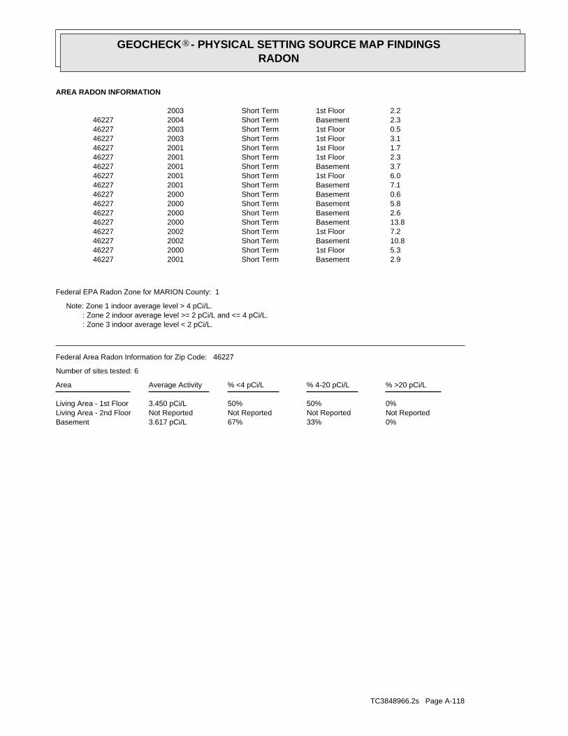
TC3848966.2s Page A-118
0%33%67%3.617 pCi/LBasementNot ReportedNot ReportedNot ReportedNot ReportedLiving Area - 2nd Floor0%50%50%3.450 pCi/LLiving Area - 1st Floor
% >20 pCi/L% 4-20 pCi/L% <4 pCi/LAverage ActivityArea
Number of sites tested: 6
Federal Area Radon Information for Zip Code: 46227
: Zone 3 indoor average level < 2 pCi/L. : Zone 2 indoor average level >= 2 pCi/L and <= 4 pCi/L. Note: Zone 1 indoor average level > 4 pCi/L.
Federal EPA Radon Zone for MARION County: 1
2.9BasementShort Term2001462275.31st FloorShort Term20004622710.8BasementShort Term2002462277.21st FloorShort Term20024622713.8BasementShort Term2000462272.6BasementShort Term2000462275.8BasementShort Term2000462270.6BasementShort Term2000462277.1BasementShort Term2001462276.01st FloorShort Term2001462273.7BasementShort Term2001462272.31st FloorShort Term2001462271.71st FloorShort Term2001462273.11st FloorShort Term2003462270.51st FloorShort Term2003462272.3BasementShort Term2004462272.21st FloorShort Term2003
AREA RADON INFORMATION
®GEOCHECK - PHYSICAL SETTING SOURCE MAP FINDINGSRADON
®
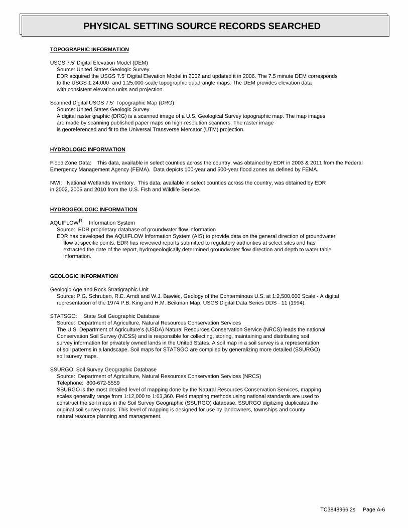
TOPOGRAPHIC INFORMATION
USGS 7.5’ Digital Elevation Model (DEM)Source: United States Geologic SurveyEDR acquired the USGS 7.5’ Digital Elevation Model in 2002 and updated it in 2006. The 7.5 minute DEM correspondsto the USGS 1:24,000- and 1:25,000-scale topographic quadrangle maps. The DEM provides elevation datawith consistent elevation units and projection.
Scanned Digital USGS 7.5’ Topographic Map (DRG)Source: United States Geologic SurveyA digital raster graphic (DRG) is a scanned image of a U.S. Geological Survey topographic map. The map imagesare made by scanning published paper maps on high-resolution scanners. The raster imageis georeferenced and fit to the Universal Transverse Mercator (UTM) projection.
HYDROLOGIC INFORMATION
Flood Zone Data: This data, available in select counties across the country, was obtained by EDR in 2003 & 2011 from the FederalEmergency Management Agency (FEMA). Data depicts 100-year and 500-year flood zones as defined by FEMA.
NWI: National Wetlands Inventory. This data, available in select counties across the country, was obtained by EDRin 2002, 2005 and 2010 from the U.S. Fish and Wildlife Service.
HYDROGEOLOGIC INFORMATION
AQUIFLOW Information SystemR
Source: EDR proprietary database of groundwater flow informationEDR has developed the AQUIFLOW Information System (AIS) to provide data on the general direction of groundwater
flow at specific points. EDR has reviewed reports submitted to regulatory authorities at select sites and hasextracted the date of the report, hydrogeologically determined groundwater flow direction and depth to water tableinformation.
GEOLOGIC INFORMATION
Geologic Age and Rock Stratigraphic UnitSource: P.G. Schruben, R.E. Arndt and W.J. Bawiec, Geology of the Conterminous U.S. at 1:2,500,000 Scale - A digitalrepresentation of the 1974 P.B. King and H.M. Beikman Map, USGS Digital Data Series DDS - 11 (1994).
STATSGO: State Soil Geographic DatabaseSource: Department of Agriculture, Natural Resources Conservation ServicesThe U.S. Department of Agriculture’s (USDA) Natural Resources Conservation Service (NRCS) leads the nationalConservation Soil Survey (NCSS) and is responsible for collecting, storing, maintaining and distributing soilsurvey information for privately owned lands in the United States. A soil map in a soil survey is a representationof soil patterns in a landscape. Soil maps for STATSGO are compiled by generalizing more detailed (SSURGO)soil survey maps.
SSURGO: Soil Survey Geographic DatabaseSource: Department of Agriculture, Natural Resources Conservation Services (NRCS)Telephone: 800-672-5559SSURGO is the most detailed level of mapping done by the Natural Resources Conservation Services, mappingscales generally range from 1:12,000 to 1:63,360. Field mapping methods using national standards are used toconstruct the soil maps in the Soil Survey Geographic (SSURGO) database. SSURGO digitizing duplicates theoriginal soil survey maps. This level of mapping is designed for use by landowners, townships and countynatural resource planning and management.
TC3848966.2s Page A-6
PHYSICAL SETTING SOURCE RECORDS SEARCHED
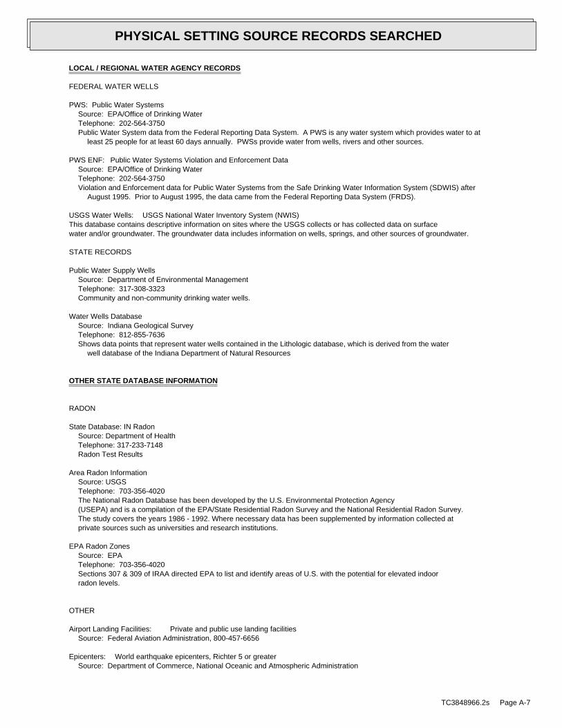
LOCAL / REGIONAL WATER AGENCY RECORDS
FEDERAL WATER WELLS
PWS: Public Water SystemsSource: EPA/Office of Drinking WaterTelephone: 202-564-3750Public Water System data from the Federal Reporting Data System. A PWS is any water system which provides water to at
least 25 people for at least 60 days annually. PWSs provide water from wells, rivers and other sources.
PWS ENF: Public Water Systems Violation and Enforcement DataSource: EPA/Office of Drinking WaterTelephone: 202-564-3750Violation and Enforcement data for Public Water Systems from the Safe Drinking Water Information System (SDWIS) after
August 1995. Prior to August 1995, the data came from the Federal Reporting Data System (FRDS).
USGS Water Wells: USGS National Water Inventory System (NWIS)This database contains descriptive information on sites where the USGS collects or has collected data on surfacewater and/or groundwater. The groundwater data includes information on wells, springs, and other sources of groundwater.
STATE RECORDS
Public Water Supply WellsSource: Department of Environmental ManagementTelephone: 317-308-3323Community and non-community drinking water wells.
Water Wells DatabaseSource: Indiana Geological SurveyTelephone: 812-855-7636Shows data points that represent water wells contained in the Lithologic database, which is derived from the water
well database of the Indiana Department of Natural Resources
OTHER STATE DATABASE INFORMATION
RADON
State Database: IN RadonSource: Department of HealthTelephone: 317-233-7148Radon Test Results
Area Radon InformationSource: USGSTelephone: 703-356-4020The National Radon Database has been developed by the U.S. Environmental Protection Agency(USEPA) and is a compilation of the EPA/State Residential Radon Survey and the National Residential Radon Survey.The study covers the years 1986 - 1992. Where necessary data has been supplemented by information collected atprivate sources such as universities and research institutions.
EPA Radon ZonesSource: EPATelephone: 703-356-4020Sections 307 & 309 of IRAA directed EPA to list and identify areas of U.S. with the potential for elevated indoorradon levels.
OTHER
Airport Landing Facilities: Private and public use landing facilitiesSource: Federal Aviation Administration, 800-457-6656
Epicenters: World earthquake epicenters, Richter 5 or greaterSource: Department of Commerce, National Oceanic and Atmospheric Administration
TC3848966.2s Page A-7
PHYSICAL SETTING SOURCE RECORDS SEARCHED

STREET AND ADDRESS INFORMATION
© 2010 Tele Atlas North America, Inc. All rights reserved. This material is proprietary and the subject of copyright protectionand other intellectual property rights owned by or licensed to Tele Atlas North America, Inc. The use of this material is subjectto the terms of a license agreement. You will be held liable for any unauthorized copying or disclosure of this material.
TC3848966.2s Page A-8
PHYSICAL SETTING SOURCE RECORDS SEARCHED

APPENDIX E:
UNCONSOLIDATED AND BEDROCK AQUIFER MAPS
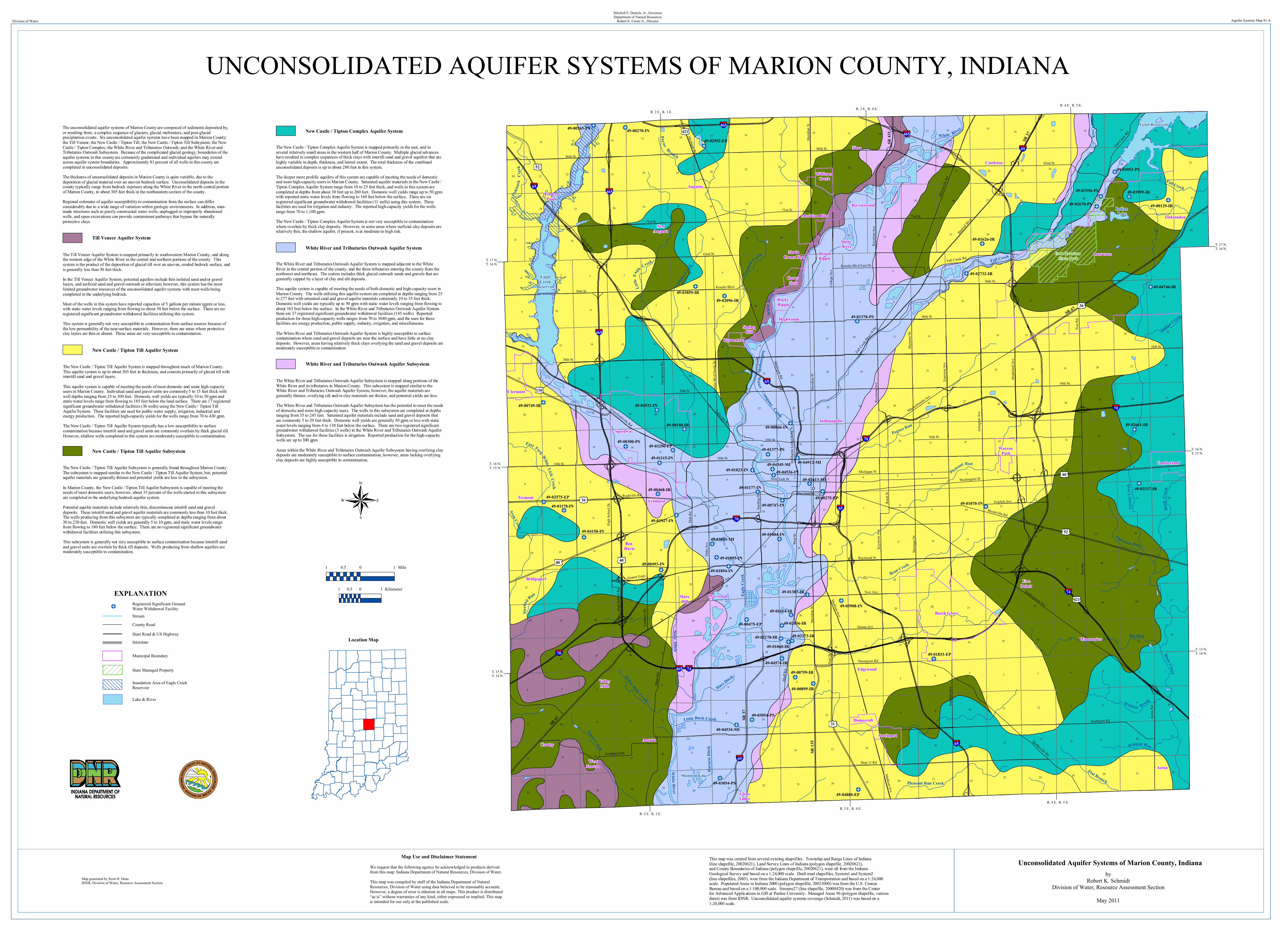
65
40
69
74
70
70
65
70
465
465
465
Highwoods
Nora
Ravenswood
BroadRipple
ShoreAcres
Castleton
Lawrence
Oaklandon
Wanamaker
FivePoints
Edgewood
GlensValley
Antrim
WestNewton
Camby
ValleyMills
Acton
Mars Hill
Maywood
Bridgeport
Ben Davis
LynhurstTremont
TradersPoint
NewAugusta
Augusta
Whit
e Rive
r
White River
R. 4 E. R. 5 E. R. 3 E. R. 4 E. R. 2 E. R. 3 E.
R. 4 E. R. 5 E. R. 3 E. R. 4 E.
R. 2 E. R. 3 E.
T. 17 N.T. 16 N.
T. 16 N.T. 15 N.
T. 15 N.T. 14 N.
T. 17 N.T. 16 N.
T. 16 N.T. 15 N.
T. 15 N.T. 14 N.
465
52
65
Indianapolis Wa ter Company Canal
36
State Ditch
49-00129-IR
East Fork White Lick Creek
30th St
86th St
56th St
Post R
d
Bluff
Rd
Mann
Rd
Sherm
an D
r
Raymond St
Lafayette Rd
16th St
62nd St
Southport Rd
Washington St
Shelbyville Rd
Southeastern Ave
71st St
Binford B
lvd
Alliso
nville
Rd
Rural
St
Troy Ave
Acton
Rd
Tibbs
Ave
Madison Ave
82nd St
Holt R
d
Colle
ge Av
e
10th St
Kessl
er Bl
vd N
orth D
r
Hanna Ave
Merid
ian St
73rd St
Thompson Rd
46th St
Georg
etown
Rd
Rockville Rd
Michigan Rd
Fall Creek Rd
New York St
Keyst
one A
ve
Brookville Rd
English Ave
Shad
eland
Ave
Maryland St
Lynh
urst D
rHigh
Scho
ol Rd
Kessler Blvd
Fall C
reek P
kwy N
Dr
Michigan St
Dr M
artin
Luthe
r King
St
East
St
High
Scho
ol Dr
Massachusetts A
ve
Keyst
one A
ve
Crawfordsville Rd
Kessler Blvd East Dr
Airport Expy
38th St
Emers
on Av
e
Fall Creek
Rd
Lafayette Rd
Keyst
one A
ve
Merid
ian St
Southport Rd
Merid
ian St
10th St
Post R
d
Madison Ave
Emers
on Av
e
86th St
Kentucky Ave
30th St
56th St
71st St
Hardi
ng St
West S
t
38th St
Sherm
an D
r
Arlin
gton A
ve
16th St
Stop 11 Rd
Michigan Rd
Indianapolis
Speedway
Beech Grove
Meridian Hills
Clermont
Southport
Cumberland
Crows Nest
Warren Park
Rocky Ripple
Williams Creek
Homecroft
Wynnedale
Spring Hill
North Crows Nest
65
74
70
465
40
SR 37
36
SR 67
52
SR 67
SR 37
421
69
SR 13
5
136
SR 43
1
31
421
40
Fort Harrison State Park
Geist Reservoir
Eagle Creek
Reservoir
Indian Lake
Shannon Lake
White River
Fall Creek
Eagle
Cree
k
Buck Creek
Pleasant Run
Little Buck Creek
Little
Eagl
e Creek
Pogues Run
Crooke
d Creek
Big Run
Grass
y Cree
k
Bean Creek
Mud Creek
Indian Creek
Goose Creek
Guion C
reek
Sterli
ng Run
Flat Branch
Wildcat Brook
Wildcat Run
Pleasant Run Creek
Fishb
ack
Cree
k
Payne Branch
Hare Ditch
Opossum Run
Dollar Hide Creek
Buck
Cree
k
Harn
ess D
itch
Avon Creek
Fall Creek
41
521
9
3
8
9
7
8
3
9
8
9
8
8
9
9 9
3
4
9
8
9
8
9
3
9
1
9
45
3
2
8
4
45
1
2 1
8
7
7
235
243
2 5
5
4
1
23
1
6
1
4
4
6
245
5
4 3
3
36
7
2
6
7
1
7
6
7
5 34
7
6
6
7
6
6
11
11
11
11
11
11
1111
12
13
1211
15
15
24
13
23
16
20
17
16
24
23
10
29
22
17
35
14
13
33
1714
36
17 16
21
23
34
14
25
20
36
28
14
23
2828
32
15
17
25
29
22
21
12
24
15
21
24
24
27
23
28
16
23
36
24
29
10
27
36
31
28
16
14
26
16
34
3231
21
19
25
22
10
20
32
22
20
24
33
15
21
17
22
28
24
20
10
10
21
24
36
20
2927
17
23
27
16
14
10
25
12
34
32
20
23
15
15
33
34
20
14
15
23
33
17
27
16
20
14
29
27
13
30
28
26
12
15
13
21
17
10
27
32
34
21
16
13
16
33
33
28
14
21
14
29
10
24
3635
22
15
10
13
21
16
25
10
19
26
34
35
16
22
16
36
34
34
16
12
13
36
33
35
24
27
12
15
26
34
29
26
17
20
22
26
25
21
22
16
22
30
33
22 23
35
19
32
33
10
15
27
31
22
20
24
35
12
21
15
22
25
22
29
25
25
31
18
15
35
22
18
15
27
21
10
36
27
16
28
17
33
26
12
22
34
35
34
31
23
34
15
32
18
29
28
13
32
28
17
13
2627
21
21
33
13
30
20
19
18
19
33
18
21
13
19
14
30
30
28
18
32
35
23
31
26
14
30
19
31
18
18
30
19
18
19
30
19
18
19
31
30
19
18
18
31
17
20
32
29
49-04912-MI
49-04880-EP
49-04746-IR
49-04574-IR
49-04536-IN
49-04534-MI
49-04532-IN
49-04345-MI
49-04150-IN49-03983-MI
49-03908-IN
49-03859-IR
49-03599-IR49-03396-PS
49-03337-IR
49-03296-EP
49-03054-PS
49-03054-PS
49-03053-PS
49-02992-EP
49-02732-IR
49-02670-PS
49-02661-IR
49-02613-MI
49-02575-EP
49-02173-IR49-02170-IR
49-02096-IR
49-02056-IR
49-01927-IN
49-01895-IN
49-01894-IN
49-01870-IN
49-01833-EP
49-01626-IR
49-01614-IR
49-01387-IR
49-01378-PS
49-01377-PS
49-01178-IN
49-01177-IN
49-01115-IN
49-01060-IR
49-01023-IN
49-01004-IN
49-00899-IR
49-00866-IN
49-00759-IR
49-00749-IR
49-00747-IN
49-00493-IN
49-00475-EP
49-00468-IR
49-00365-PS
49-00300-PS
49-00275-EP
49-00270-IN
49-00180-IR
Map generated by Scott H. DeanIDNR, Division of Water, Resource Assessment Section
UNCONSOLIDATED AQUIFER SYSTEMS OF MARION COUNTY, INDIANADivision of Water Aquifer Systems Map 81-A
Map Use and Disclaimer StatementWe request that the following agency be acknowledged in products derived from this map: Indiana Department of Natural Resources, Division of Water.This map was compiled by staff of the Indiana Department of Natural Resources, Division of Water using data believed to be reasonably accurate. However, a degree of error is inherent in all maps. This product is distributed “as is” without warranties of any kind, either expressed or implied. This map is intended for use only at the published scale.
Mitchell E. Daniels, Jr., GovernorDepartment of Natural Resources
Robert E. Carter Jr., Director
This map was created from several existing shapefiles. Township and Range Lines of Indiana (line shapefile, 20020621), Land Survey Lines of Indiana (polygon shapefile, 20020621), and County Boundaries of Indiana (polygon shapefile, 20020621), were all from the Indiana Geological Survey and based on a 1:24,000 scale. Draft road shapefiles, System1 and System2 (line shapefiles, 2003), were from the Indiana Department of Transportation and based on a 1:24,000 scale. Populated Areas in Indiana 2000 (polygon shapefile, 20021000) was from the U.S. Census Bureau and based on a 1:100,000 scale. Streams27 (line shapefile, 20000420) was from the Center for Advanced Applications in GIS at Purdue University. Managed Areas 96 (polygon shapefile, various dates) was from IDNR. Unconsolidated aquifer systems coverage (Schmidt, 2011) was based on a 1:24,000 scale.
The unconsolidated aquifer systems of Marion County are composed of sediments deposited by, or resulting from, a complex sequence of glaciers, glacial meltwaters, and post-glacial precipitation events. Six unconsolidated aquifer systems have been mapped in Marion County: the Till Veneer; the New Castle / Tipton Till; the New Castle / Tipton Till Subsystem; the New Castle / Tipton Complex; the White River and Tributaries Outwash; and the White River and Tributaries Outwash Subsystem. Because of the complicated glacial geology, boundaries of the aquifer systems in this county are commonly gradational and individual aquifers may extend across aquifer system boundaries. Approximately 81 percent of all wells in this county are completed in unconsolidated deposits. The thickness of unconsolidated deposits in Marion County is quite variable, due to the deposition of glacial material over an uneven bedrock surface. Unconsolidated deposits in the county typically range from bedrock exposure along the White River in the north-central portion of Marion County, to about 305 feet thick in the northeastern section of the county. Regional estimates of aquifer susceptibility to contamination from the surface can differ considerably due to a wide range of variation within geologic environments. In addition, man-made structures such as poorly constructed water wells, unplugged or improperly abandoned wells, and open excavations can provide contaminant pathways that bypass the naturally protective clays.
The Till Veneer Aquifer System is mapped primarily in southwestern Marion County, and along the western edge of the White River in the central and northern portions of the county. This system is the product of the deposition of glacial till over an uneven, eroded bedrock surface, and is generally less than 50 feet thick. In the Till Veneer Aquifer System, potential aquifers include thin isolated sand and/or gravel layers, and surficial sand and gravel outwash or alluvium; however, this system has the most limited groundwater resources of the unconsolidated aquifer systems with most wells being completed in the underlying bedrock. Most of the wells in this system have reported capacities of 5 gallons per minute (gpm) or less, with static water levels ranging from flowing to about 50 feet below the surface. There are no registered significant groundwater withdrawal facilities utilizing this system. This system is generally not very susceptible to contamination from surface sources because of the low permeability of the near-surface materials. However, there are areas where protective clay layers are thin or absent. These areas are very susceptible to contamination.
The New Castle / Tipton Till Aquifer System is mapped throughout much of Marion County. This aquifer system is up to about 305 feet in thickness, and consists primarily of glacial till with intertill sand and gravel layers. This aquifer system is capable of meeting the needs of most domestic and some high-capacity users in Marion County. Individual sand and gravel units are commonly 5 to 15 feet thick with well depths ranging from 25 to 300 feet. Domestic well yields are typically 10 to 50 gpm and static water levels range from flowing to 185 feet below the land surface. There are 17 registered significant groundwater withdrawal facilities (38 wells) using the New Castle / Tipton Till Aquifer System. These facilities are used for public water supply, irrigation, industrial and energy production. The reported high-capacity yields for the wells range from 70 to 430 gpm. The New Castle / Tipton Till Aquifer System typically has a low susceptibility to surface contamination because intertill sand and gravel units are commonly overlain by thick glacial till. However, shallow wells completed in this system are moderately susceptible to contamination.
The New Castle / Tipton Till Aquifer Subsystem is generally found throughout Marion County. The subsystem is mapped similar to the New Castle / Tipton Till Aquifer System, but, potential aquifer materials are generally thinner and potential yields are less in the subsystem. In Marion County, the New Castle / Tipton Till Aquifer Subsystem is capable of meeting the needs of most domestic users; however, about 35 percent of the wells started in this subsystem are completed in the underlying bedrock aquifer system. Potential aquifer materials include relatively thin, discontinuous intertill sand and gravel deposits. These intertill sand and gravel aquifer materials are commonly less than 10 feet thick. The wells producing from this subsystem are typically completed at depths ranging from about 30 to 230 feet. Domestic well yields are generally 5 to 10 gpm, and static water levels range from flowing to 180 feet below the surface. There are no registered significant groundwater withdrawal facilities utilizing this subsystem. This subsystem is generally not very susceptible to surface contamination because intertill sand and gravel units are overlain by thick till deposits. Wells producing from shallow aquifers are moderately susceptible to contamination.
The New Castle / Tipton Complex Aquifer System is mapped primarily in the east, and in several relatively small areas in the western half of Marion County. Multiple glacial advances have resulted in complex sequences of thick clays with intertill sand and gravel aquifers that are highly variable in depth, thickness, and lateral extent. The total thickness of the combined unconsolidated deposits is up to about 280 feet in this system. The deeper more prolific aquifers of this system are capable of meeting the needs of domestic and most high-capacity users in Marion County. Saturated aquifer materials in the New Castle / Tipton Complex Aquifer System range from 10 to 25 feet thick, and wells in this system are completed at depths from about 30 feet up to 260 feet. Domestic well yields range up to 50 gpm with reported static water levels from flowing to 160 feet below the surface. There are six registered significant groundwater withdrawal facilities (11 wells) using this system. These facilities are used for irrigation and industry. The reported high-capacity yields for the wells range from 70 to 1,100 gpm. The New Castle / Tipton Complex Aquifer System is not very susceptible to contamination where overlain by thick clay deposits. However, in some areas where surficial clay deposits are relatively thin, the shallow aquifer, if present, is at moderate to high risk.
The White River and Tributaries Outwash Aquifer System is mapped adjacent to the White River in the central portion of the county, and the three tributaries entering the county from the northwest and northeast. The system includes thick glacial outwash sands and gravels that are generally capped by a layer of clay and silt deposits. This aquifer system is capable of meeting the needs of both domestic and high-capacity users in Marion County. The wells utilizing this aquifer system are completed at depths ranging from 25 to 277 feet with saturated sand and gravel aquifer materials commonly 10 to 35 feet thick. Domestic well yields are typically up to 50 gpm with static water levels ranging from flowing to about 165 feet below the surface. In the White River and Tributaries Outwash Aquifer System there are 37 registered significant groundwater withdrawal facilities (145 wells). Reported production for these high-capacity wells ranges from 70 to 3040 gpm, and the uses for these facilities are energy production, public supply, industry, irrigation, and miscellaneous. The White River and Tributaries Outwash Aquifer System is highly susceptible to surface contamination where sand and gravel deposits are near the surface and have little or no clay deposits. However, areas having relatively thick clays overlying the sand and gravel deposits are moderately susceptible to contamination.
Till Veneer Aquifer System
New Castle / Tipton Till Aquifer System
New Castle / Tipton Till Aquifer Subsystem
New Castle / Tipton Complex Aquifer System
White River and Tributaries Outwash Aquifer System
The White River and Tributaries Outwash Aquifer Subsystem is mapped along portions of the White River and its tributaries in Marion County. This subsystem is mapped similar to the White River and Tributaries Outwash Aquifer System, however, the aquifer materials are generally thinner, overlying silt and/or clay materials are thicker, and potential yields are less. The White River and Tributaries Outwash Aquifer Subsystem has the potential to meet the needs of domestic and some high-capacity users. The wells in this subsystem are completed at depths ranging from 35 to 245 feet. Saturated aquifer materials include sand and gravel deposits that are commonly 5 to 20 feet thick. Domestic well yields are generally 50 gpm or less with static water levels ranging from 4 to 138 feet below the surface. There are two registered significant groundwater withdrawal facilities (3 wells) in the White River and Tributaries Outwash Aquifer Subsystem. The use for these facilities is irrigation. Reported production for the high-capacity wells are up to 300 gpm. Areas within the White River and Tributaries Outwash Aquifer Subsystem having overlying clay deposits are moderately susceptible to surface contamination; however, areas lacking overlying clay deposits are highly susceptible to contamination.
White River and Tributaries Outwash Aquifer Subsystem
Location Map
1 0 10.5 Mile
1 0 10.5 Kilometer
Unconsolidated Aquifer Systems of Marion County, Indianaby
Robert K. SchmidtDivision of Water, Resource Assessment Section
May 2011
State Managed Property
Registered Significant Ground-Water Withdrawal Facility
EXPLANATION
Lake & River
Municipal Boundary
State Road & US HighwayCounty RoadStream
Interstate
Inundation Area of Eagle Creek Reservoir
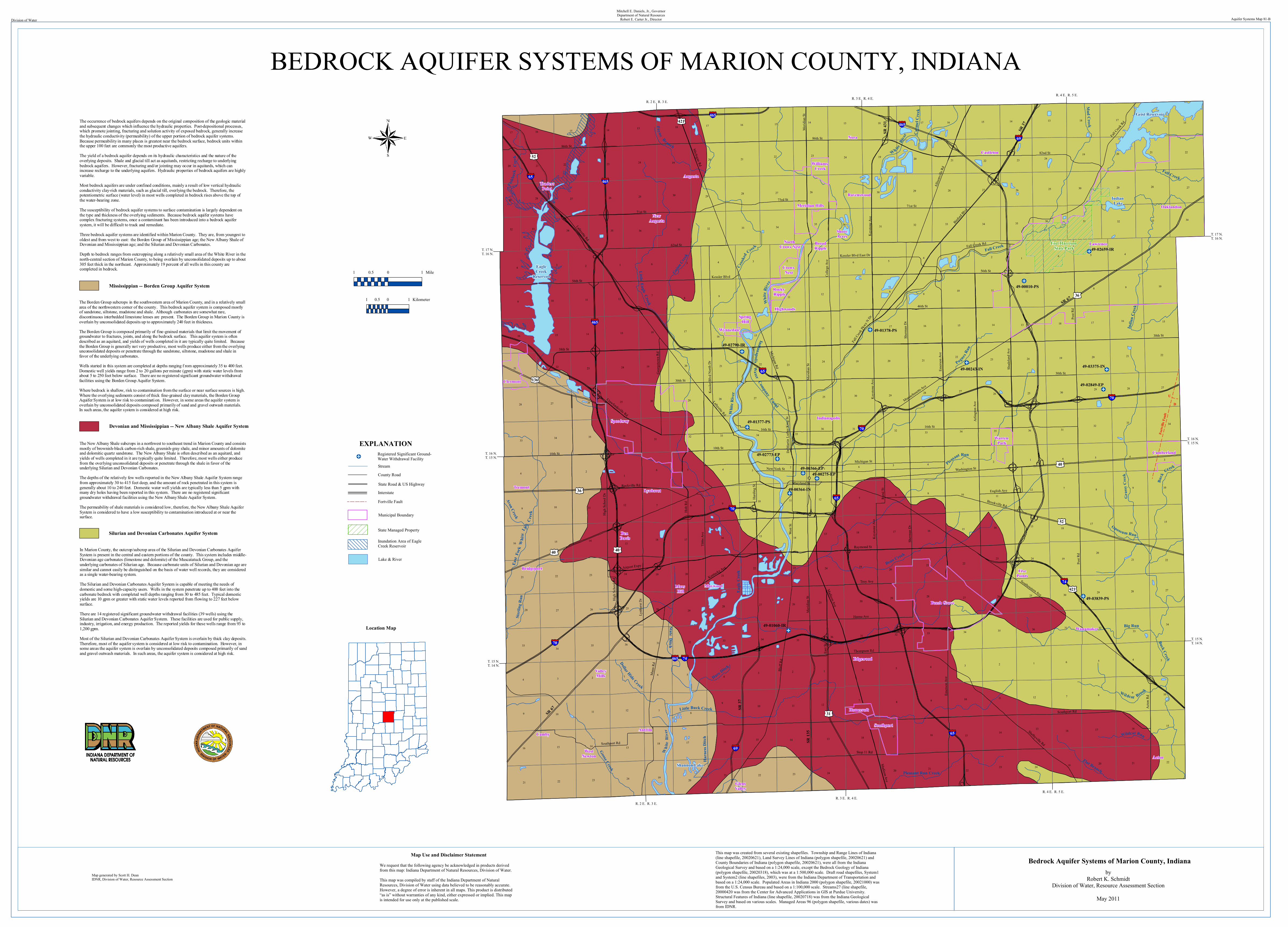
65
40
69
74
70
70
65
70
465
465
465
Highwoods
Nora
Ravenswood
BroadRipple
ShoreAcres
Castleton
Lawrence
Oaklandon
Wanamaker
FivePoints
Edgewood
GlensValley
Antrim
WestNewton
Camby
ValleyMills
Acton
Mars Hill
Maywood
Bridgeport
Ben Davis
LynhurstTremont
TradersPoint
NewAugusta
Augusta
Whit
e Rive
r
Wh ite R
iver
R. 4 E. R. 5 E. R. 3 E. R. 4 E. R. 2 E. R. 3 E.
R. 4 E. R. 5 E. R. 3 E. R. 4 E.
R. 2 E. R. 3 E.
T. 17 N.T. 16 N.
T. 16 N.T. 15 N.
T. 15 N.T. 14 N.
T. 17 N.T. 16 N.
T. 16 N.T. 15 N.
T. 15 N.T. 14 N.
Fortv
ille Fa
ult
U D
421
52
465
65
Carm
el Cr
eek
Indianapolis Wa ter Company Canal
Whit
e Rive
r
Little Eagle Creek
36
Pleasant Run
State Ditch
Wildcat Brook
East
Fork
Whi
te Li
ck C
reek
30th St
86th St
56th St
Post R
d
Bluff
Rd
Mann
Rd
Sherm
an D
r
Raymond St
Lafayette Rd
16th St
62nd St
Southport Rd
Washington St
Shelbyville Rd
Southeastern Ave
71st St
Binford B
lvd
Alliso
nville
Rd
Rural
St
Troy Ave
Acton
Rd
Tibbs
Ave
Madison Ave
82nd St
Holt R
d
Colle
ge Av
e
10th St
Kessl
er Bl
vd N
orth D
r
Hanna Ave
Merid
ian St
73rd St
Thompson Rd
46th St
Georg
etown
Rd
Rockville Rd
Michigan Rd
Fall Creek Rd
New York St
Keyst
one A
ve
Brookville Rd
English Ave
Shad
eland
Ave
Maryland St
Lynh
urst D
rHigh
Scho
ol Rd
Kessler Blvd
Fall C
reek P
kwy N
Dr
Michigan St
Dr M
artin
Luthe
r King
St
East
St
High
Scho
ol Dr
Massachusetts A
ve
Keyst
one A
ve
Crawfordsville Rd
Kessler Blvd East Dr
Airport Expy
38th St
Emers
on Av
e
Fall Creek
Rd
Lafayette Rd
Keyst
one A
ve
Merid
ian St
Southport Rd
Merid
ian St
10th St
Post R
d
Madison Ave
Emers
on Av
e
86th St
Kentucky Ave
30th St
56th St
71st St
Hardi
ng St
West S
t
38th St
Sherm
an D
r
Arlin
gton A
ve
16th St
Stop 11 Rd
Michigan Rd
IndianapolisSpeedway
Beech Grove
Meridian Hills
Clermont
Southport
Cumberland
Crows Nest
Warren Park
Rocky Ripple
Williams Creek
Homecroft
Wynnedale
Spring Hill
North Crows Nest
65
74
70
465
40
SR 37
36
SR 67
52
SR 67
SR 37
421
69
SR 13
5
136
SR 43
1
31
40
Fort Harrison State Park
Geist Reservoir
Eagle Creek
Reservoir
Indian Lake
Shannon Lake
Whi
te R
iver
Fall Creek
Eagle
Cree
k
Buck Creek
Little Buck Creek
Pogues Ru
n
Crooked
Creek
Big Run
Grass
y Cree
k
Bean Creek
Mud Creek
India
n Cree
k
Goose CreekGuio
n Cree
k
Sterli
ng R
un
Flat Branch
Wildcat Run
Pleasant Run Creek
Fishb
ack
Cree
k
Payne Branch
Hare Ditch
Opossum Run
Dollar Hide Creek
Buck
Creek
Harn
ess D
itch
Avon Creek
Fall Creek
41
521
9
3
8
9
7
8
3
9
8
9
8
8
9
9 9
3
4
9
8
9
8
9
3
9
1
9
45
3
2
8
4
45
1
2 1
8
7
7
235
243
2 5
5
4
1
23
1
6
1
4
4
6
245
5
4 3
3
36
7
2
6
7
1
7
6
7
5 34
7
6
6
7
6
6
11
11
11
11
11
11
1111
12
13
1211
15
15
24
13
23
16
20
17
16
24
23
10
29
22
17
35
14
13
33
1714
36
17 16
21
23
34
14
25
20
36
28
14
23
2828
32
15
17
25
29
22
21
12
24
15
21
24
24
27
23
28
16
23
36
24
29
10
27
36
31
28
16
14
26
16
34
3231
21
19
25
22
10
20
32
22
20
24
33
15
21
17
22
28
24
20
10
10
21
24
36
20
2927
17
23
27
16
14
10
25
12
34
32
20
23
15
15
33
34
20
14
15
23
33
17
27
16
20
14
29
27
13
30
28
26
12
15
13
21
17
10
27
32
34
21
16
13
16
33
33
28
14
21
14
29
10
24
3635
22
15
10
13
21
16
25
10
19
26
34
35
16
22
16
36
34
34
16
12
13
36
33
35
24
27
12
15
26
34
29
26
17
20
22
26
25
21
22
16
22
30
33
22 23
35
19
32
33
10
15
27
31
22
20
24
35
12
21
15
22
25
22
29
25
25
31
18
15
35
22
18
15
27
21
10
36
27
16
28
17
33
26
12
22
34
35
34
31
23
34
15
32
18
29
28
13
32
28
17
13
2627
21
21
33
13
30
20
19
18
19
33
18
21
13
19
14
30
30
28
18
32
35
23
31
26
14
30
19
31
18
18
30
19
18
19
30
19
18
19
31
30
19
18
18
31
17
20
32
29
49-03839-PS
49-03375-IN
49-02849-EP
49-02790-IR
49-02773-EP
49-02659-IR
49-01378-PS
49-01377-PS
49-01060-IR
49-00366-EP
49-00364-IN
49-00275-EP
49-00243-IN
49-00010-PS
Map generated by Scott H. DeanIDNR, Division of Water, Resource Assessment Section
BEDROCK AQUIFER SYSTEMS OF MARION COUNTY, INDIANADivision of Water Aquifer Systems Map 81-B
Map Use and Disclaimer StatementWe request that the following agency be acknowledged in products derived from this map: Indiana Department of Natural Resources, Division of Water.This map was compiled by staff of the Indiana Department of Natural Resources, Division of Water using data believed to be reasonably accurate. However, a degree of error is inherent in all maps. This product is distributed “as is” without warranties of any kind, either expressed or implied. This map is intended for use only at the published scale.
Mitchell E. Daniels, Jr., GovernorDepartment of Natural Resources
Robert E. Carter Jr., Director
This map was created from several existing shapefiles. Township and Range Lines of Indiana (line shapefile, 20020621), Land Survey Lines of Indiana (polygon shapefile, 20020621) and County Boundaries of Indiana (polygon shapefile, 20020621), were all from the Indiana Geological Survey and based on a 1:24,000 scale, except the Bedrock Geology of Indiana (polygon shapefile, 20020318), which was at a 1:500,000 scale. Draft road shapefiles, System1 and System2 (line shapefiles, 2003), were from the Indiana Department of Transportation and based on a 1:24,000 scale. Populated Areas in Indiana 2000 (polygon shapefile, 20021000) was from the U.S. Census Bureau and based on a 1:100,000 scale. Streams27 (line shapefile, 20000420 was from the Center for Advanced Applications in GIS at Purdue University. Structural Features of Indiana (line shapefile, 20020718) was from the Indiana Geological Survey and based on various scales. Managed Areas 96 (polygon shapefile, various dates) was from IDNR.
The occurrence of bedrock aquifers depends on the original composition of the geologic material and subsequent changes which influence the hydraulic properties. Post-depositional processes, which promote jointing, fracturing and solution activity of exposed bedrock, generally increase the hydraulic conductivity (permeability) of the upper portion of bedrock aquifer systems. Because permeability in many places is greatest near the bedrock surface, bedrock units within the upper 100 feet are commonly the most productive aquifers. The yield of a bedrock aquifer depends on its hydraulic characteristics and the nature of the overlying deposits. Shale and glacial till act as aquitards, restricting recharge to underlying bedrock aquifers. However, fracturing and/or jointing may occur in aquitards, which can increase recharge to the underlying aquifers. Hydraulic properties of bedrock aquifers are highly variable. Most bedrock aquifers are under confined conditions, mainly a result of low vertical hydraulic conductivity clay-rich materials, such as glacial till, overlying the bedrock. Therefore, the potentiometric surface (water level) in most wells completed in bedrock rises above the top of the water-bearing zone. The susceptibility of bedrock aquifer systems to surface contamination is largely dependent on the type and thickness of the overlying sediments. Because bedrock aquifer systems have complex fracturing systems, once a contaminant has been introduced into a bedrock aquifer system, it will be difficult to track and remediate. Three bedrock aquifer systems are identified within Marion County. They are, from youngest to oldest and from west to east: the Borden Group of Mississippian age; the New Albany Shale of Devonian and Mississippian age; and the Silurian and Devonian Carbonates. Depth to bedrock ranges from outcropping along a relatively small area of the White River in the north-central section of Marion County, to being overlain by unconsolidated deposits up to about 305 feet thick in the northeast. Approximately 19 percent of all wells in this county are completed in bedrock.
The Borden Group subcrops in the southwestern area of Marion County, and in a relatively small area of the northwestern corner of the county. This bedrock aquifer system is composed mostly of sandstone, siltstone, mudstone and shale. Although carbonates are somewhat rare, discontinuous interbedded limestone lenses are present. The Borden Group in Marion County is overlain by unconsolidated deposits up to approximately 240 feet in thickness. The Borden Group is composed primarily of fine-grained materials that limit the movement of groundwater to fractures, joints, and along the bedrock surface. This aquifer system is often described as an aquitard, and yields of wells completed in it are typically quite limited. Because the Borden Group is generally not very productive, most wells produce either from the overlying unconsolidated deposits or penetrate through the sandstone, siltstone, mudstone and shale in favor of the underlying carbonates. Wells started in this system are completed at depths ranging f rom approximately 35 to 400 feet. Domestic well yields range from 2 to 20 gallons per minute (gpm) with static water levels from about 5 to 250 feet below surface. There are no registered significant groundwater withdrawal facilities using the Borden Group Aquifer System. Where bedrock is shallow, risk to contamination from the surface or near surface sources is high. Where the overlying sediments consist of thick fine-grained clay materials, the Borden Group Aquifer System is at low risk to contaminati on. However, in some areas the aquifer system is overlain by unconsolidated deposits composed primarily of sand and gravel outwash materials. In such areas, the aquifer system is considered at high risk.
Location Map
The New Albany Shale subcrops in a northwest to southeast trend in Marion County and consists mostly of brownish-black carbon-rich shale, greenish-gray shale, and minor amounts of dolomite and dolomitic quartz sandstone. The New Albany Shale is often described as an aquitard, and yields of wells completed in it are typically quite limited. Therefore, most wells either produce from the overlying unconsolidated deposits or penetrate through the shale in favor of the underlying Silurian and Devonian Carbonates. The depths of the relatively few wells reported in the New Albany Shale Aquifer System range from approximately 30 to 415 feet deep, and the amount of rock penetrated in this system is generally about 10 to 240 feet. Domestic water well yields are typically less than 5 gpm with many dry holes having been reported in this system. There are no registered significant groundwater withdrawal facilities using the New Albany Shale Aquifer System. The permeability of shale materials is considered low, therefore, the New Albany Shale Aquifer System is considered to have a low susceptibility to contamination introduced at or near the surface.
In Marion County, the outcrop/subcrop area of the Silurian and Devonian Carbonates Aquifer System is present in the central and eastern portions of the county. This system includes middle-Devonian age carbonates (limestone and dolomite) of the Muscatatuck Group, and the underlying carbonates of Silurian age. Because carbonate units of Silurian and Devonian age are similar and cannot easily be distinguished on the basis of water well records, they are considered as a single water-bearing system. The Silurian and Devonian Carbonates Aquifer System is capable of meeting the needs of domestic and some high-capacity users. Wells in the system penetrate up to 400 feet into the carbonate bedrock with completed well depths ranging from 30 to 485 feet. Typical domestic yields are 10 gpm or greater with static water levels reported from flowing to 227 feet below surface. There are 14 registered significant groundwater withdrawal facilities (39 wells) using the Silurian and Devonian Carbonates Aquifer System. These facilities are used for public supply, industry, irrigation, and energy production. The reported yields for these wells range from 93 to 1,200 gpm. Most of the Silurian and Devonian Carbonates Aquifer System is overlain by thick clay deposits. Therefore, most of the aquifer system is considered at low risk to contamination. However, in some areas the aquifer system is overlain by unconsolidated deposits composed primarily of sand and gravel outwash materials. In such areas, the aquifer system is considered at high risk.
Mississippian -- Borden Group Aquifer System
Devonian and Mississippian -- New Albany Shale Aquifer System
Silurian and Devonian Carbonates Aquifer System
1 0 10.5 Mile
1 0 10.5 Kilometer
Bedrock Aquifer Systems of Marion County, Indianaby
Robert K. SchmidtDivision of Water, Resource Assessment Section
May 2011
State Managed Property
Registered Significant Ground-Water Withdrawal Facility
EXPLANATION
Lake & River
Municipal Boundary
State Road & US HighwayCounty RoadStream
Interstate
Inundation Area of EagleCreek Reservoir
Fortville Fault
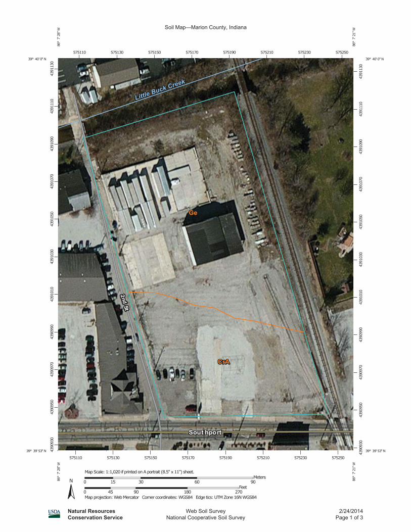
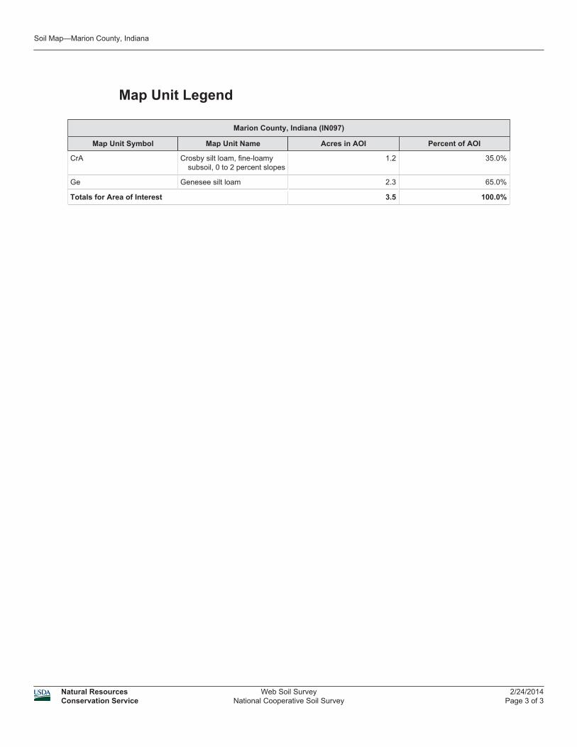
APPENDIX F:
CERTIFIED SANBORN MAP REPORT

Certified Sanborn® Map Report
Indy Southport Development, LLC
2110 E. Southport Road
Indianapolis, IN 46227
Inquiry Number: 3848966.3
February 07, 2014
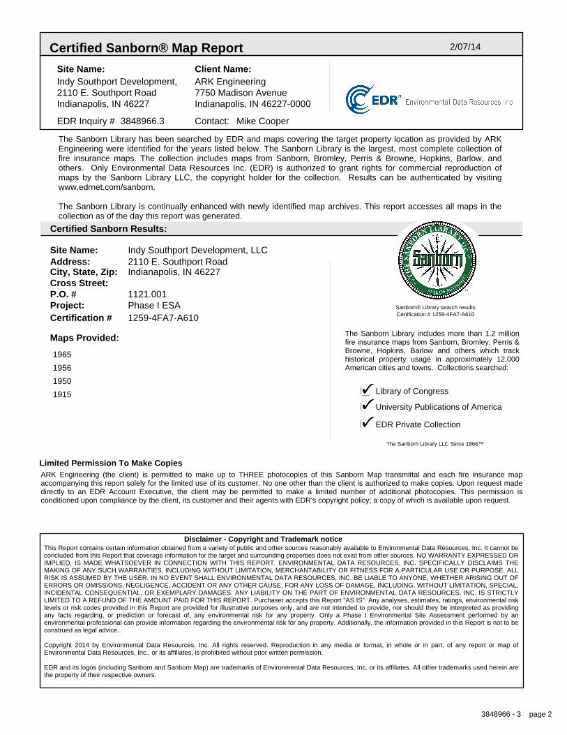
Certified Sanborn® Map Report 2/07/14
Site Name:Indy Southport Development,2110 E. Southport RoadIndianapolis, IN 46227
Client Name:ARK Engineering7750 Madison AvenueIndianapolis, IN 46227-0000
Contact: Mike CooperEDR Inquiry # 3848966.3
The Sanborn Library has been searched by EDR and maps covering the target property location as provided by ARKEngineering were identified for the years listed below. The Sanborn Library is the largest, most complete collection offire insurance maps. The collection includes maps from Sanborn, Bromley, Perris & Browne, Hopkins, Barlow, andothers. Only Environmental Data Resources Inc. (EDR) is authorized to grant rights for commercial reproduction ofmaps by the Sanborn Library LLC, the copyright holder for the collection. Results can be authenticated by visitingwww.edrnet.com/sanborn.
The Sanborn Library is continually enhanced with newly identified map archives. This report accesses all maps in thecollection as of the day this report was generated.
Certified Sanborn Results:
Site Name: Indy Southport Development, LLCAddress: 2110 E. Southport RoadCity, State, Zip: Indianapolis, IN 46227Cross Street:P.O. # 1121.001Project: Phase I ESACertification # 1259-4FA7-A610
Library of Congress
University Publications of America
EDR Private Collection
The Sanborn Library LLC Since 1866™
The Sanborn Library includes more than 1.2 millionfire insurance maps from Sanborn, Bromley, Perris &Browne, Hopkins, Barlow and others which trackhistorical property usage in approximately 12,000American cities and towns. Collections searched:
Sanborn® Library search resultsCertification # 1259-4FA7-A610
Maps Provided:
1965
1956
1950
1915
Limited Permission To Make CopiesARK Engineering (the client) is permitted to make up to THREE photocopies of this Sanborn Map transmittal and each fire insurance mapaccompanying this report solely for the limited use of its customer. No one other than the client is authorized to make copies. Upon request madedirectly to an EDR Account Executive, the client may be permitted to make a limited number of additional photocopies. This permission isconditioned upon compliance by the client, its customer and their agents with EDR's copyright policy; a copy of which is available upon request.
Disclaimer - Copyright and Trademark noticeThis Report contains certain information obtained from a variety of public and other sources reasonably available to Environmental Data Resources, Inc. It cannot beconcluded from this Report that coverage information for the target and surrounding properties does not exist from other sources. NO WARRANTY EXPRESSED ORIMPLIED, IS MADE WHATSOEVER IN CONNECTION WITH THIS REPORT. ENVIRONMENTAL DATA RESOURCES, INC. SPECIFICALLY DISCLAIMS THEMAKING OF ANY SUCH WARRANTIES, INCLUDING WITHOUT LIMITATION, MERCHANTABILITY OR FITNESS FOR A PARTICULAR USE OR PURPOSE. ALLRISK IS ASSUMED BY THE USER. IN NO EVENT SHALL ENVIRONMENTAL DATA RESOURCES, INC. BE LIABLE TO ANYONE, WHETHER ARISING OUT OFERRORS OR OMISSIONS, NEGLIGENCE, ACCIDENT OR ANY OTHER CAUSE, FOR ANY LOSS OF DAMAGE, INCLUDING, WITHOUT LIMITATION, SPECIAL,INCIDENTAL CONSEQUENTIAL, OR EXEMPLARY DAMAGES. ANY LIABILITY ON THE PART OF ENVIRONMENTAL DATA RESOURCES, INC. IS STRICTLYLIMITED TO A REFUND OF THE AMOUNT PAID FOR THIS REPORT. Purchaser accepts this Report "AS IS". Any analyses, estimates, ratings, environmental risklevels or risk codes provided in this Report are provided for illustrative purposes only, and are not intended to provide, nor should they be interpreted as providingany facts regarding, or prediction or forecast of, any environmental risk for any property. Only a Phase I Environmental Site Assessment performed by anenvironmental professional can provide information regarding the environmental risk for any property. Additionally, the information provided in this Report is not to beconstrued as legal advice.
Copyright 2014 by Environmental Data Resources, Inc. All rights reserved. Reproduction in any media or format, in whole or in part, of any report or map ofEnvironmental Data Resources, Inc., or its affiliates, is prohibited without prior written permission.
EDR and its logos (including Sanborn and Sanborn Map) are trademarks of Environmental Data Resources, Inc. or its affiliates. All other trademarks used herein arethe property of their respective owners.
3848966 - 3 page 2
Sanborn Sheet Thumbnails
This Certified Sanborn Map Report is based upon the following SanbornFire Insurance map sheets.
1965 Source Sheets
Volume 3A, Sheet 358a Volume 3A, Sheet 359a
1956 Source Sheets
Volume 3A, Sheet 358a Volume 3A, Sheet 359a
1950 Source Sheets
Volume 3A, Sheet 304
1915 Source Sheets
Volume 3, Sheet 304
3848966 - 3 page 3
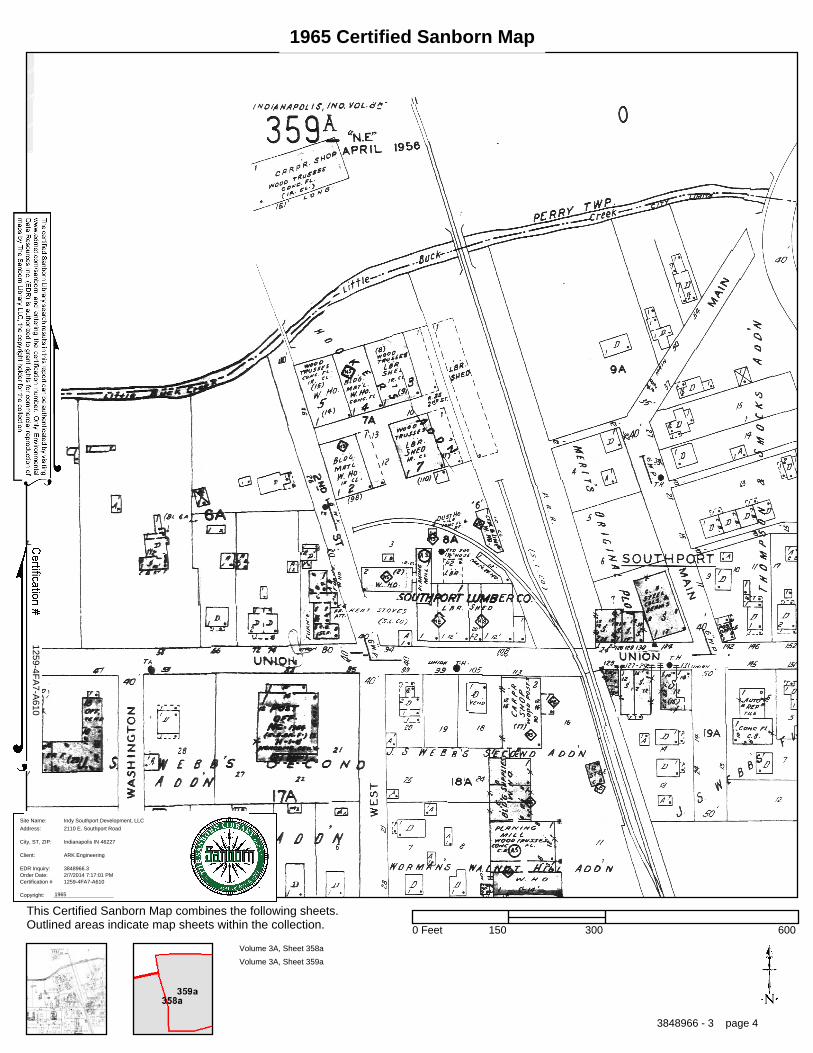
1965 Certified Sanborn Map
1259-4FA
7-A610
Order Date:EDR Inquiry:
Client:
Site Name:
Address:
City, ST, ZIP:
Certification #
Copyright: 1965
2/7/2014 7:17:01 PM3848966.3
ARK Engineering
Indy Southport Development, LLC
2110 E. Southport Road
Indianapolis IN 46227
1259-4FA7-A610
This Certified Sanborn Map combines the following sheets.Outlined areas indicate map sheets within the collection.
Volume 3A, Sheet 358a
Volume 3A, Sheet 359a
0 Feet 150 300 600
3848966 - 3 page 4
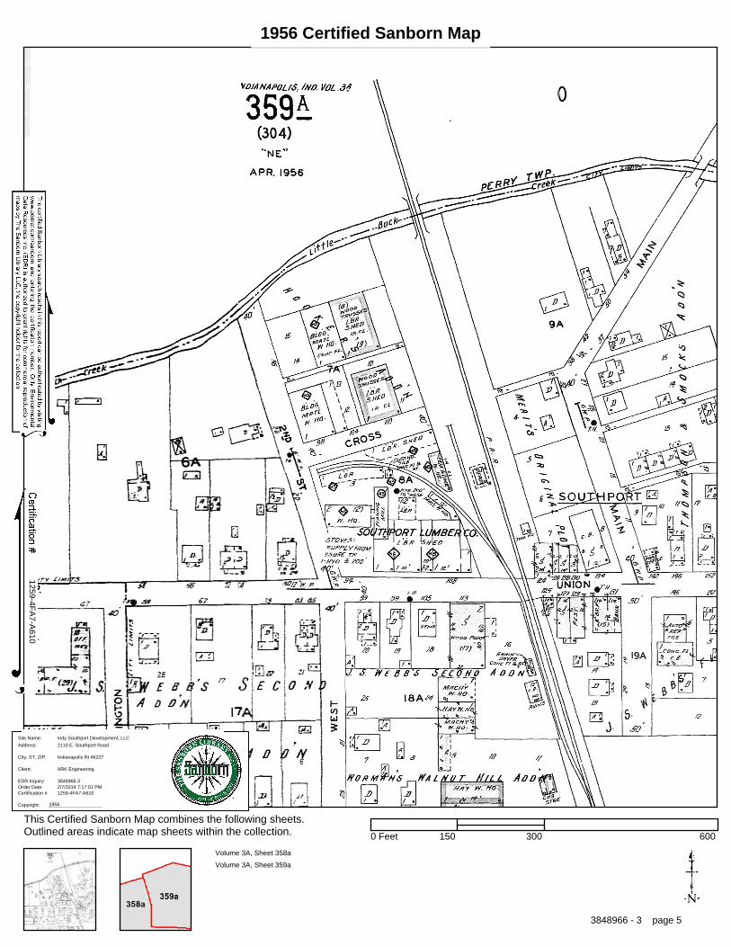
1956 Certified Sanborn Map
1259-4FA
7-A610
Order Date:EDR Inquiry:
Client:
Site Name:
Address:
City, ST, ZIP:
Certification #
Copyright: 1956
2/7/2014 7:17:01 PM3848966.3
ARK Engineering
Indy Southport Development, LLC
2110 E. Southport Road
Indianapolis IN 46227
1259-4FA7-A610
This Certified Sanborn Map combines the following sheets.Outlined areas indicate map sheets within the collection.
Volume 3A, Sheet 358a
Volume 3A, Sheet 359a
0 Feet 150 300 600
3848966 - 3 page 5
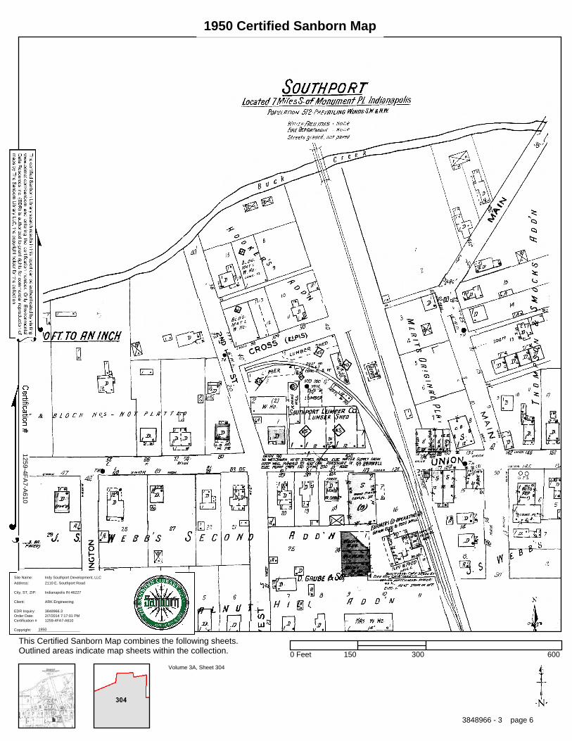
1950 Certified Sanborn Map
1259-4FA
7-A610
Order Date:EDR Inquiry:
Client:
Site Name:
Address:
City, ST, ZIP:
Certification #
Copyright: 1950
2/7/2014 7:17:01 PM3848966.3
ARK Engineering
Indy Southport Development, LLC
2110 E. Southport Road
Indianapolis IN 46227
1259-4FA7-A610
This Certified Sanborn Map combines the following sheets.Outlined areas indicate map sheets within the collection.
Volume 3A, Sheet 304
0 Feet 150 300 600
3848966 - 3 page 6
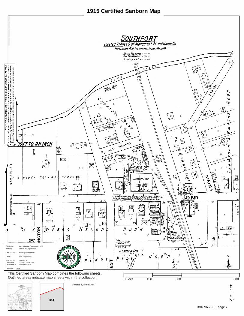
1915 Certified Sanborn Map
1259-4FA
7-A610
Order Date:EDR Inquiry:
Client:
Site Name:
Address:
City, ST, ZIP:
Certification #
Copyright: 1915
2/7/2014 7:17:01 PM3848966.3
ARK Engineering
Indy Southport Development, LLC
2110 E. Southport Road
Indianapolis IN 46227
1259-4FA7-A610
This Certified Sanborn Map combines the following sheets.Outlined areas indicate map sheets within the collection.
Volume 3, Sheet 304
0 Feet 150 300 600
3848966 - 3 page 7
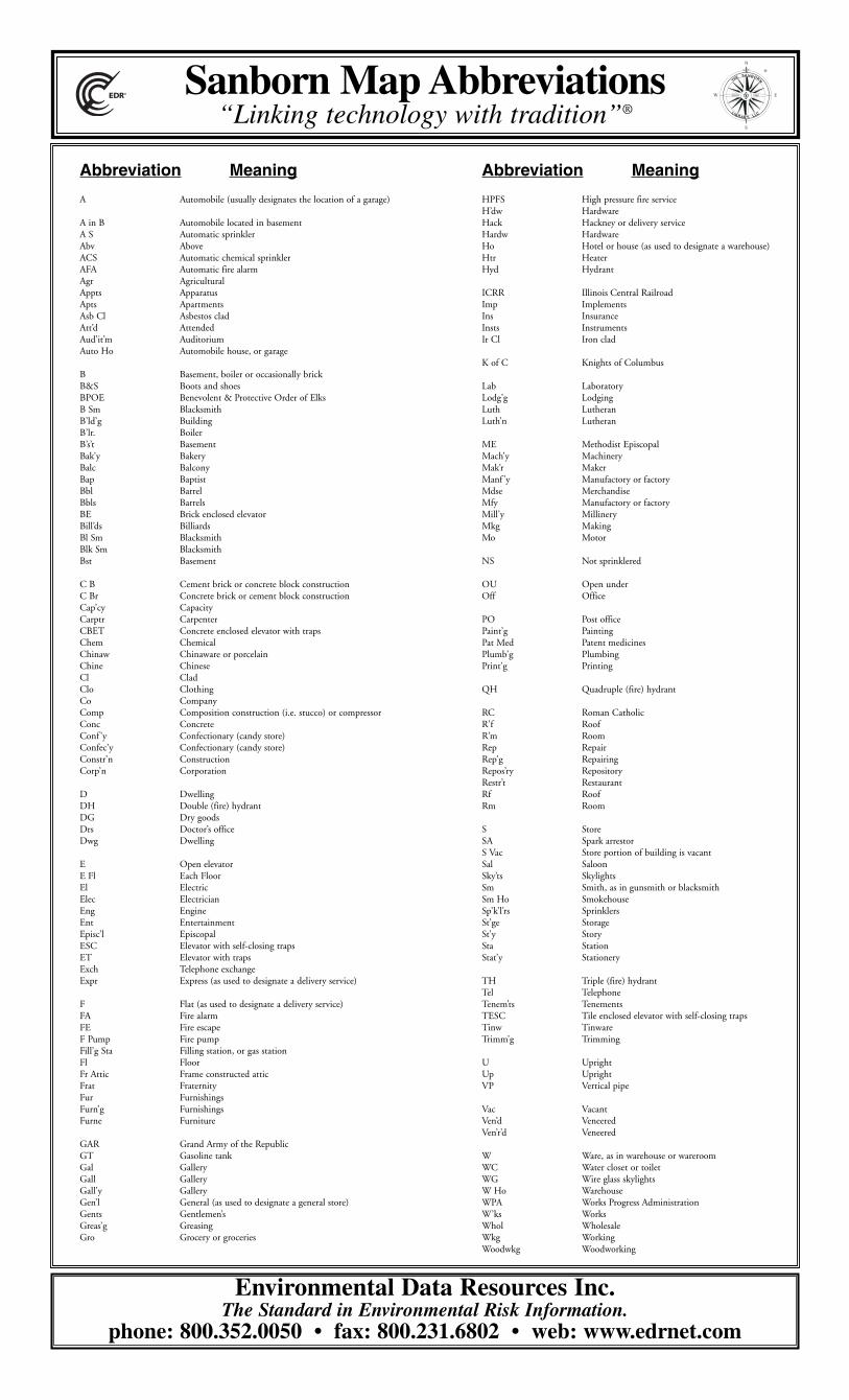
Abbreviation Meaning
A Automobile (usually designates the location of a garage)
A in B Automobile located in basementA S Automatic sprinklerAbv AboveACS Automatic chemical sprinklerAFA Automatic fire alarmAgr AgriculturalAppts ApparatusApts ApartmentsAsb Cl Asbestos cladAtt’d AttendedAud’it’m AuditoriumAuto Ho Automobile house, or garage
B Basement, boiler or occasionally brickB&S Boots and shoesBPOE Benevolent & Protective Order of ElksB Sm BlacksmithB’ld’g BuildingB’lr. BoilerB’s’t BasementBak’y BakeryBalc BalconyBap BaptistBbl BarrelBbls BarrelsBE Brick enclosed elevatorBill’ds BilliardsBl Sm BlacksmithBlk Sm BlacksmithBst Basement
C B Cement brick or concrete block constructionC Br Concrete brick or cement block constructionCap’cy CapacityCarptr CarpenterCBET Concrete enclosed elevator with trapsChem ChemicalChinaw Chinaware or porcelainChine ChineseCl CladClo ClothingCo CompanyComp Composition construction (i.e. stucco) or compressorConc ConcreteConf ’y Confectionary (candy store)Confec’y Confectionary (candy store)Constr’n ConstructionCorp’n Corporation
D DwellingDH Double (fire) hydrantDG Dry goodsDrs Doctor’s officeDwg Dwelling
E Open elevatorE Fl Each FloorEl ElectricElec ElectricianEng EngineEnt EntertainmentEpisc’l EpiscopalESC Elevator with self-closing trapsET Elevator with trapsExch Telephone exchangeExpr Express (as used to designate a delivery service)
F Flat (as used to designate a delivery service)FA Fire alarmFE Fire escapeF Pump Fire pumpFill’g Sta Filling station, or gas stationFl FloorFr Attic Frame constructed atticFrat FraternityFur FurnishingsFurn’g FurnishingsFurne Furniture
GAR Grand Army of the RepublicGT Gasoline tankGal GalleryGall GalleryGall’y GalleryGen’l General (as used to designate a general store)Gents Gentlemen’sGreas’g GreasingGro Grocery or groceries
Abbreviation Meaning
HPFS High pressure fire serviceH’dw HardwareHack Hackney or delivery serviceHardw HardwareHo Hotel or house (as used to designate a warehouse)Htr HeaterHyd Hydrant
ICRR Illinois Central RailroadImp ImplementsIns InsuranceInsts InstrumentsIr Cl Iron clad
K of C Knights of Columbus
Lab LaboratoryLodg’g LodgingLuth LutheranLuth’n Lutheran
ME Methodist EpiscopalMach’y MachineryMak’r MakerManf ’y Manufactory or factoryMdse MerchandiseMfy Manufactory or factoryMill’y MillineryMkg MakingMo Motor
NS Not sprinklered
OU Open underOff Office
PO Post officePaint’g PaintingPat Med Patent medicinesPlumb’g PlumbingPrint’g Printing
QH Quadruple (fire) hydrant
RC Roman CatholicR’f RoofR’m RoomRep RepairRep’g RepairingRepos’ry RepositoryRestr’t RestaurantRf RoofRm Room
S StoreSA Spark arrestorS Vac Store portion of building is vacantSal SaloonSky’ts SkylightsSm Smith, as in gunsmith or blacksmithSm Ho SmokehouseSp’k’l’rs SprinklersSt’ge StorageSt’y StorySta StationStat’y Stationery
TH Triple (fire) hydrantTel TelephoneTenem’ts TenementsTESC Tile enclosed elevator with self-closing trapsTinw TinwareTrimm’g Trimming
U UprightUp UprightVP Vertical pipe
Vac VacantVen’d VeneeredVen’r’d Veneered
W Ware, as in warehouse or wareroomWC Water closet or toiletWG Wire glass skylightsW Ho WarehouseWPA Works Progress AdministrationW’ks WorksWhol WholesaleWkg WorkingWoodwkg Woodworking
Sanborn Map Abbreviations“Linking technology with tradition”®
Environmental Data Resources Inc.The Standard in Environmental Risk Information.
phone: 800.352.0050 • fax: 800.231.6802 • web: www.edrnet.com
®
FRAMING
CODE STRUCTURAL UNITA. Reinforced Concrete Frame.B. Reinforced Concrete Joists, Columns, Beams,
Trusses, Arches, Masonry Piers.C. Protected Steel Frame.D. Individually Protected Steel Joists, Columns,
Beams, Trusses, Arches.E. Indirectly Protected Steel Frame.F. Indirectly Protected Steel Joists, Columns,
Beams, Trusses, Arches.G. Unprotected Steel Frame.H. Unprotected Steel Joists, Columns, Beams,
Trusses, Arches. O. Masonry Bearing Walls.
ROOF
CODE STRUCTURAL UNITa. Reinforced Concrete.
Reinforced Concrete with Masonry Units.Reinforced Gypsum Concrete. Pre-cast Concrete or Gypsum Slabs or Planks.
b. Concrete or Gypsum on Metal Lath, Incombustible Form Boards, Paper-backedWire Fabric, Steel Deck, and Cellular, Ribbed or Corrugated Steel Units.
c. Incombustible Composition Boards with or without Insulation.Masonry or Metal Tiles.
d. Steel Deck, Corrugated Metal or Asbestos Protected Metal with or without Insulation.
TILE 1stBRICK 1st
PYROBAR 1st
ADOBE
(C.BR.)
(C.B.)
(CONC.)
(TILE)
(VEN’D)
BRICK 1ST
FRAME, BRICK LINED
F = FLAT S = STORE
D = DWELLING
A in B =AUTO. IN BSMT
LOFT
(ASB.CL.)
BRICK IST
NON COMBUSTIBLEROOF COVERING OF
METAL, SLATE, TILE ORASBESTOS SHINGLES ❍
SKYLIGHT LIGHTINGTOP STORY ONLY
SKYLIGHT LIGHTINGTHREE STORIES
WIRED GLASSSKYLIGHT
NUMBER OF STORIES
DOTS REPRESENT OPENINGS,STEMS INDICATE STORIES,COUNTING FROM LEFT TORIGHT, LOOKING TOWARD
BUILDING
SHINGLE ROOF
TWO STORIESAND BSMT COM-POSITION ROOF
HEIGHT OF BUILD-ING IN FEET FROM
GROUND TOROOF LINE 57
’
8 12 16 16
1 2
1 6
1 6
2 0
48
4
X
2B
•
3.
W.G.
Fire proof construction(OR FIRE RESISTIVE CONST’N)
Concrete, lime, cinder or cement brick
Hollow concrete or cement block const’n
Fire wall 6 inches above roof
Fire wall 12 inches above roof
Fire wall 18 inches above roof
Fire wall 36 inches above roof
Concrete or reinforced concrete const’n
Tile building
Brick building with frame cornice
Brick building with stone front
Brick building with frame side(DIVIDED BY FRAME PARTITION)
Brick veneered building
Brick and frame building
Frame building, brick lined
Frame building, metal clad
Frame building
Iron building
Tenant building occupied by various manufac-turing or occupancies
Frame building covered with asbestos
Brick building with brick or metal cornice
Adobe building
Stone building
Mixed construction of C.B.and brick with one wall ofsolid brick.
Mixed construction of C.B.and brick with one wall facedwith 4” brick.
Mixed construction of C.B.and brick throughout.
W.T. WATER TANK
Blocknumber.
V.P. Vertical pipe or stand pipe.
Automatic fire alarm.
Independent electricplant.
Automatic sprinklers.
Automtc. chemical sprinklers.
Automatic sprinklers in part ofbuilding only.(NOTE UNDER SYMBOL INDICATESPROTECTED PORTION OF BUILDING)
Not sprinklered.
Outside vertical pipe on fire escape.
Fire alarm box.
Single hydrant.
Double hydrant.
Triple hydrant.
Quadruple hydrant of the “High Pressure FireService.”
Fire alarm box of the “High Pressure FireService”
Water pipes of the “High Pressure FireService”
Water pipes and hydrants of the “HighPressure Fire Service” as shown on key map.
5
AFA
IEP
4
68 12
2345 ALL
(C.B.)
(C.B. & BR.)
Figures 8,12,16 indicate thickness of wall in inches
Wall without opening and size in inches
Wall with openings on floors as designated
Opening with single iron or tin clad door
Opening with double iron or tin clad doors
Opening with standard fire doors
Openings with wired glass doors
Drive or passage way
Stable
Auto. (House or private garage)
Solid brick with interior walls of C.B. or C.B. and brick mixed
A.
C.B. & BR. CONST’N
C.B. & BR. CONST’N
C.B. & BR. CONST’N
8
(BR. FACED)
MANSARD ROOF
• • • • •
•••••••••
Water pipes and size in inches.
Water pipes of private supply
House numbers shown nearest tobuildings are official or actuallyup on buildings.
Old house numbers shown fur-thest from buildings.
Open elevator.
Frame enclosed elevator.
Frame enclosed elevator with traps.
Frame enclosed elevator with self closing traps.
Concrete block enclosed elevator with traps.
Tile enclosed elevator with self closing traps.
Brick enclosed elevator with wired glass door.
Iron chimney
Iron chimney(WITH SPARKARRESTOR)
Brck. chmny.
Ground ele-vation
Verticalsteam boiler
Gasoline tank
Open under
Siamese firedept.connection
Single firedept. connec-tion.
Reference to adjoining page.
Fire engine house, as shown on key map.
Fire pump.
Under page number refers to corresponding page of previous edition.
Width of street(BETWEEN BLOCK LINES, NOT CURB LINES.)
10 T
O 2
2•
CU
RB
LIN
E
BLOCK LINE50’
AS
FA
ACS
()
1ST ONLY
A S
NS
F.E.
E
FE
ET
ESC
CBET
TESC
BE
IR. CH.
IR. CH.S.A.
U.P. B.
G.T.
(O.U.)
15
+
(36)
D.H.
T.H.
Q.H.
H.P.F.S.
H.P.F.S.
20”W.Pipe (H.P.F.S.)
+ + 12” + +
FA
6” W.PIPE
6” W.PIPE (PRIVATE)
2Do 41
656
A fire-resistive building built in 1962 with concrete walls andreinforced concrete frame, floorsand roof.
A fire-resistive building built in1962 with metal panel walls, indi-rectly protected steel frame, con-crete floors and roof on metallath, noncombustible ceilings.
A noncombustible building builtin 1962 with concrete block walls;unprotected steel columns andbeams; concrete floors on metallath and steel deck roof.
FP-1962(conc.)A-1-a
FPX-1962(METAL PANELS)
E-2-bNONCOMB CEIL’G
NC-1962(C.B.)H-2-d
FLOORS
CODE STRUCTURAL UNIT1. Reinforced Concrete.
Reinforced Concrete with Masonry Units. Pre-cast Concrete or Gypsum Slabs or Planks.
2. Concrete on Metal Lath,Incombustible Form Boards,Paper-backed Wire Fabric, Steel Deck, and Cellular, Ribbed or Corrugated Steel Units.
3. Open Steel Deck or Grating.
LAND USE CODE APPLICABLE TO CHANGES DIAGRAMMED AFTER 5/69
RESIDENTIAL
RESIDENTIAL-TRANSIENT
COMMERCIAL
WAREHOUSE
NUMERICAL PREFIX INDICATES THE NUMBER OF ESTABLISHMENTS IN EACH CATEGORY
© 2005 by Environmental Data Resources Inc. All rights reserved.
Sanborn Maps® are protected by copyright laws.Unauthorized reproduction is strictly prohibited.
RRTCW
MPUT
MANUFACTURING
PUBLIC OR INSTITUTIONAL
UTILITY
TRANSPORTATION
The coding for framing, floor and roof structural units as shown aboveis used in describing the construction of fire-resistive buildings. In addi-tion, reports for fire-resistive buildings will show the date built and wallconstruction when other than brick.
FP buildings have masonry floors and roof; concrete and/or directly orindirectly protected steel framing; and clay brick, stone or poured con-crete walls.
FPX buildings are FP buildings with inferior walls such as concreteblock, cement brick, metal or glass panels, etc.
NC buildings have unprotected steel framing and fire-resistive but non-masonry floors and roof.
EDR Inc.
800.352.0050www.edrnet.com
Window opening in first story.
Window openings in second and third stories.
Window openings in second, fourth stories.
Windows with wiredglass.
Windows with iron or tin clad shutters.
Window openings tenth to twenty-second stories
Sanborn Map Legend“Linking technology with tradition”®
®
24
CODING OF STRUCTURAL UNITS FOR FIREPROOF AND NON-COMBUSTIBLE BUILDINGS
Fire wall 48 inches above roof
APPENDIX G:
CITY DIRECTORY IMAGE REPORT

Indy Southport Development, LLC
2110 E. Southport RoadIndianapolis, IN 46227
Inquiry Number: 3848966.5February 06, 2014
The EDR-City Directory Abstract
440 Wheelers Farms RoadMilford, CT 06461800.352.0050www.edrnet.comEnvironmental Data Resources IncEnvironmental Data Resources IncEnvironmental Data Resources IncEnvironmental Data Resources Inc
TABLE OF CONTENTS
SECTION
Executive Summary
Findings
City Directory Images
Thank you for your business. Please contact EDR at 1-800-352-0050
with any questions or comments.
Disclaimer - Copyright and Trademark Notice
This Report contains certain information obtained from a variety of public and other sources reasonably available to Environmental Data Resources, Inc. It cannot be concluded from this Report that coverage information for the target and surrounding properties does not exist from other sources. NO WARRANTY EXPRESSED OR IMPLIED, IS MADE WHATSOEVER IN CONNECTION WITH THIS REPORT. ENVIRONMENTAL DATA RESOURCES, INC. SPECIFICALLY DISCLAIMS THE MAKING OF ANY SUCH WARRANTIES, INCLUDING WITHOUT LIMITATION, MERCHANTABILITY OR FITNESS FOR A PARTICULAR USE OR PURPOSE. ALL RISK IS ASSUMED BY THE USER. IN NO EVENT SHALL ENVIRONMENTAL DATA RESOURCES, INC. BE LIABLE TO ANYONE, WHETHER ARISING OUT OF ERRORS OR OMISSIONS, NEGLIGENCE, ACCIDENT OR ANY OTHER CAUSE, FOR ANY LOSS OR DAMAGE, INCLUDING, WITHOUT LIMITATION, SPECIAL, INCIDENTAL, CONSEQUENTIAL, OR EXEMPLARY DAMAGES. ANY LIABILITY ON THE PART OF ENVIRONMENTAL DATA RESOURCES, INC. IS STRICTLY LIMITED TO A REFUND OF THE AMOUNT PAID FOR THIS REPORT. Purchaser accepts this Report "AS IS". Any analyses, estimates, ratings, environmental risk levels or risk codes provided in this Report are provided for illustrative purposes only, and are not intended to provide, nor should they be interpreted as providing any facts regarding, or prediction orforecast of, any environmental risk for any property. Only a Phase I Environmental Site Assessment performed by an environmental professional can provide information regarding the environmental risk for any property. Additionally, the information provided in this Report is not to be construed as legal advice.
Copyright 2013 by Environmental Data Resources, Inc. All rights reserved. Reproduction in any media or format, in whole or in part, of any report or map of Environmental Data Resources, Inc. or its affiliates is prohibited without prior written permission.
EDR and its logos (including Sanborn and Sanborn Map) are trademarks of Environmental Data Resources, Inc. or its affiliates. All other trademarks used herein are the property of their respective owners.
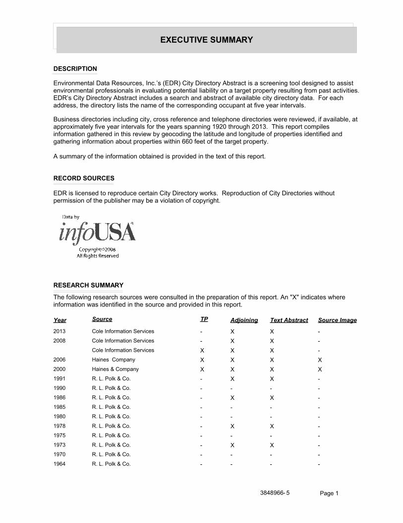
EXECUTIVE SUMMARY
DESCRIPTION
Environmental Data Resources, Inc.’s (EDR) City Directory Abstract is a screening tool designed to assist environmental professionals in evaluating potential liability on a target property resulting from past activities. EDR’s City Directory Abstract includes a search and abstract of available city directory data. For each address, the directory lists the name of the corresponding occupant at five year intervals.
Business directories including city, cross reference and telephone directories were reviewed, if available, at approximately five year intervals for the years spanning 1920 through 2013. This report compiles information gathered in this review by geocoding the latitude and longitude of properties identified and gathering information about properties within 660 feet of the target property.
A summary of the information obtained is provided in the text of this report.
RECORD SOURCES
EDR is licensed to reproduce certain City Directory works. Reproduction of City Directories without permission of the publisher may be a violation of copyright.
RESEARCH SUMMARY
The following research sources were consulted in the preparation of this report. An "X" indicates where information was identified in the source and provided in this report.
Source TPYear Adjoining Text Abstract Source Image
2013 Cole Information Services - X X -
2008 Cole Information Services - X X -
Cole Information Services X X X -
2006 Haines Company X X X X
2000 Haines & Company X X X X
1991 R. L. Polk & Co. - X X -
1990 R. L. Polk & Co. - - - -
1986 R. L. Polk & Co. - X X -
1985 R. L. Polk & Co. - - - -
1980 R. L. Polk & Co. - - - -
1978 R. L. Polk & Co. - X X -
1975 R. L. Polk & Co. - - - -
1973 R. L. Polk & Co. - X X -
1970 R. L. Polk & Co. - - - -
1964 R. L. Polk & Co. - - - -
3848966- 5 Page 1
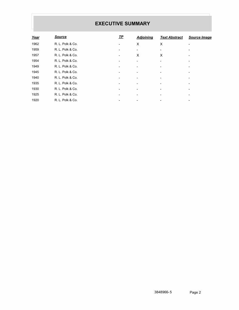
EXECUTIVE SUMMARY
Source TPYear Adjoining Text Abstract Source Image
1962 R. L. Polk & Co. - X X -
1959 R. L. Polk & Co. - - - -
1957 R. L. Polk & Co. - X X -
1954 R. L. Polk & Co. - - - -
1949 R. L. Polk & Co. - - - -
1945 R. L. Polk & Co. - - - -
1940 R. L. Polk & Co. - - - -
1935 R. L. Polk & Co. - - - -
1930 R. L. Polk & Co. - - - -
1925 R. L. Polk & Co. - - - -
1920 R. L. Polk & Co. - - - -
3848966- 5 Page 2
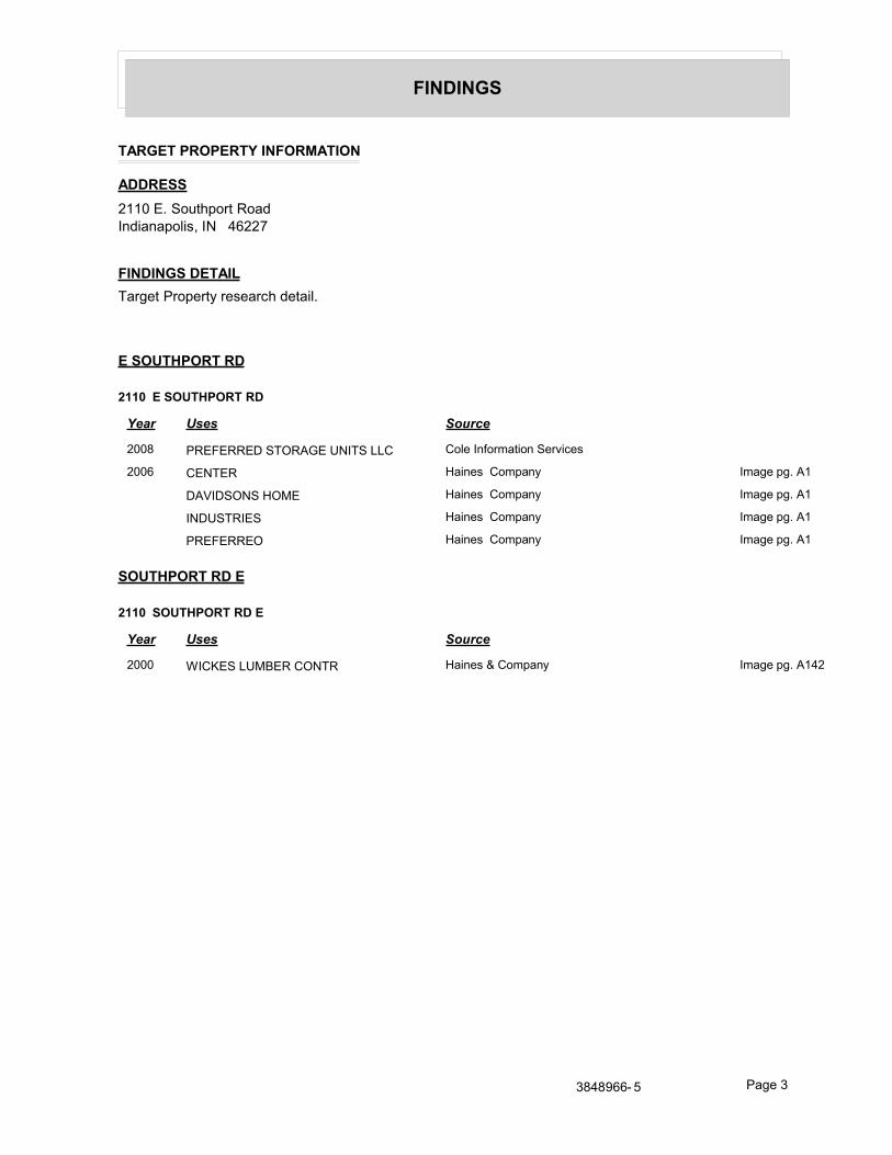
FINDINGS
TARGET PROPERTY INFORMATION
ADDRESS
2110 E. Southport RoadIndianapolis, IN 46227
FINDINGS DETAIL
Target Property research detail.
E SOUTHPORT RD
2110 E SOUTHPORT RD
Year Uses Source
2008 PREFERRED STORAGE UNITS LLC Cole Information Services
2006 CENTER Haines Company Image pg. A1
DAVIDSONS HOME Haines Company Image pg. A1
INDUSTRIES Haines Company Image pg. A1
PREFERREO Haines Company Image pg. A1
SOUTHPORT RD E
2110 SOUTHPORT RD E
Year Uses Source
2000 WICKES LUMBER CONTR Haines & Company Image pg. A142
3848966- 5 Page 3
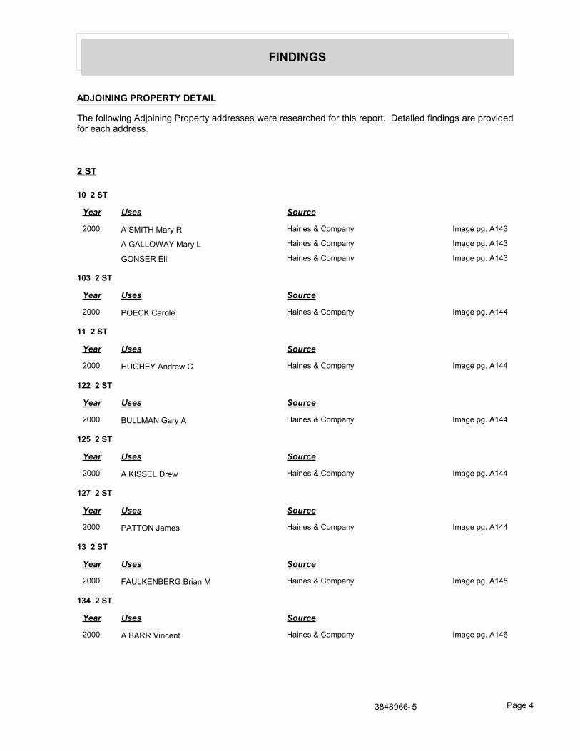
FINDINGS
ADJOINING PROPERTY DETAIL
The following Adjoining Property addresses were researched for this report. Detailed findings are provided for each address.
2 ST
10 2 ST
Year Uses Source
2000 A SMITH Mary R Haines & Company Image pg. A143
A GALLOWAY Mary L Haines & Company Image pg. A143
GONSER Eli Haines & Company Image pg. A143
103 2 ST
Year Uses Source
2000 POECK Carole Haines & Company Image pg. A144
11 2 ST
Year Uses Source
2000 HUGHEY Andrew C Haines & Company Image pg. A144
122 2 ST
Year Uses Source
2000 BULLMAN Gary A Haines & Company Image pg. A144
125 2 ST
Year Uses Source
2000 A KISSEL Drew Haines & Company Image pg. A144
127 2 ST
Year Uses Source
2000 PATTON James Haines & Company Image pg. A144
13 2 ST
Year Uses Source
2000 FAULKENBERG Brian M Haines & Company Image pg. A145
134 2 ST
Year Uses Source
2000 A BARR Vincent Haines & Company Image pg. A146
3848966- 5 Page 4
Year Uses Source
FINDINGS
139 2 ST
Year Uses Source
2000 FIVE STAR CONTRCTNG Haines & Company Image pg. A146
14 2 ST
Year Uses Source
2000 ROBBINS Eugene Haines & Company Image pg. A147
142 2 ST
Year Uses Source
2000 BROWN Katherine Haines & Company Image pg. A148
143 2 ST
Year Uses Source
2000 WARMAN Gene Haines & Company Image pg. A148
145 2 ST
Year Uses Source
2000 A PAUSZEK J Haines & Company Image pg. A148
SETSER Chad Haines & Company Image pg. A148
146 2 ST
Year Uses Source
2000 J BURDINE Diana Haines & Company Image pg. A148
E ETTER Tammy Haines & Company Image pg. A148
E ETTER Jeff Haines & Company Image pg. A148
M SUMMITY Robert Haines & Company Image pg. A148
15 2 ST
Year Uses Source
2000 A GORDON George L Haines & Company Image pg. A149
COX Norman L Haines & Company Image pg. A149
A GORDON George L Haines & Company Image pg. A149
151 2 ST
Year Uses Source
2000 GARRETT John Mark Haines & Company Image pg. A150
154 2 ST
Year Uses Source
2000 V MOORE Jerry Haines & Company Image pg. A150
NO COOK Rex M Haines & Company Image pg. A150
3848966- 5 Page 5
Year Uses Source
FINDINGS
155 2 ST
Year Uses Source
2000 BARNES Charley Haines & Company Image pg. A150
BARNES Carma Haines & Company Image pg. A150
157 2 ST
Year Uses Source
2000 HENSLEY Donald Haines & Company Image pg. A150
159 2 ST
Year Uses Source
2000 SWARTZ Marshall J Haines & Company Image pg. A150
16 2 ST
Year Uses Source
2000 WUERTLEY Norman Haines & Company Image pg. A151
17 2 ST
Year Uses Source
2000 HENDERSON Joe C Haines & Company Image pg. A151
172 2 ST
Year Uses Source
2000 WALDEN Bobby L Rev Haines & Company Image pg. A152
173 2 ST
Year Uses Source
2000 E CONER Robert Haines & Company Image pg. A152
176 2 ST
Year Uses Source
2000 VANDIVIER Donald Haines & Company Image pg. A152
18 2 ST
Year Uses Source
2000 A COOPER Becky J Haines & Company Image pg. A154
HUGHETT Wilmer Haines & Company Image pg. A153
184 2 ST
Year Uses Source
2000 WILDMAN John B Haines & Company Image pg. A154
3848966- 5 Page 6
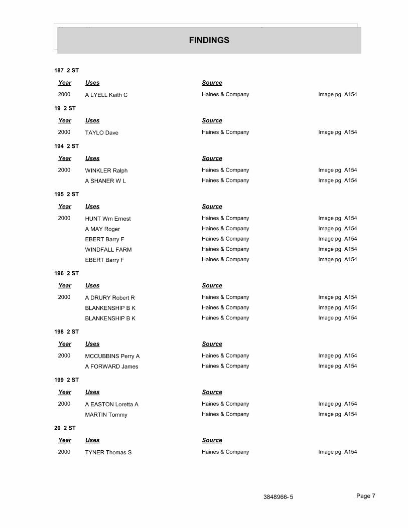
Year Uses Source
FINDINGS
187 2 ST
Year Uses Source
2000 A LYELL Keith C Haines & Company Image pg. A154
19 2 ST
Year Uses Source
2000 TAYLO Dave Haines & Company Image pg. A154
194 2 ST
Year Uses Source
2000 WINKLER Ralph Haines & Company Image pg. A154
A SHANER W L Haines & Company Image pg. A154
195 2 ST
Year Uses Source
2000 HUNT Wm Ernest Haines & Company Image pg. A154
A MAY Roger Haines & Company Image pg. A154
EBERT Barry F Haines & Company Image pg. A154
WINDFALL FARM Haines & Company Image pg. A154
EBERT Barry F Haines & Company Image pg. A154
196 2 ST
Year Uses Source
2000 A DRURY Robert R Haines & Company Image pg. A154
BLANKENSHIP B K Haines & Company Image pg. A154
BLANKENSHIP B K Haines & Company Image pg. A154
198 2 ST
Year Uses Source
2000 MCCUBBINS Perry A Haines & Company Image pg. A154
A FORWARD James Haines & Company Image pg. A154
199 2 ST
Year Uses Source
2000 A EASTON Loretta A Haines & Company Image pg. A154
MARTIN Tommy Haines & Company Image pg. A154
20 2 ST
Year Uses Source
2000 TYNER Thomas S Haines & Company Image pg. A154
3848966- 5 Page 7
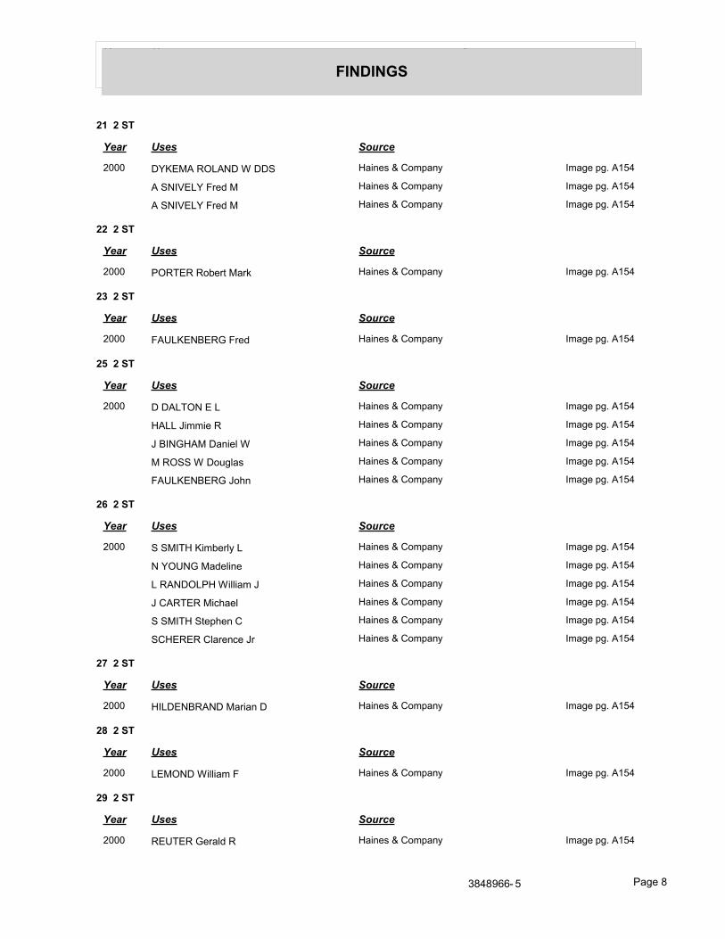
Year Uses Source
FINDINGS
21 2 ST
Year Uses Source
2000 DYKEMA ROLAND W DDS Haines & Company Image pg. A154
A SNIVELY Fred M Haines & Company Image pg. A154
A SNIVELY Fred M Haines & Company Image pg. A154
22 2 ST
Year Uses Source
2000 PORTER Robert Mark Haines & Company Image pg. A154
23 2 ST
Year Uses Source
2000 FAULKENBERG Fred Haines & Company Image pg. A154
25 2 ST
Year Uses Source
2000 D DALTON E L Haines & Company Image pg. A154
HALL Jimmie R Haines & Company Image pg. A154
J BINGHAM Daniel W Haines & Company Image pg. A154
M ROSS W Douglas Haines & Company Image pg. A154
FAULKENBERG John Haines & Company Image pg. A154
26 2 ST
Year Uses Source
2000 S SMITH Kimberly L Haines & Company Image pg. A154
N YOUNG Madeline Haines & Company Image pg. A154
L RANDOLPH William J Haines & Company Image pg. A154
J CARTER Michael Haines & Company Image pg. A154
S SMITH Stephen C Haines & Company Image pg. A154
SCHERER Clarence Jr Haines & Company Image pg. A154
27 2 ST
Year Uses Source
2000 HILDENBRAND Marian D Haines & Company Image pg. A154
28 2 ST
Year Uses Source
2000 LEMOND William F Haines & Company Image pg. A154
29 2 ST
Year Uses Source
2000 REUTER Gerald R Haines & Company Image pg. A154
3848966- 5 Page 8
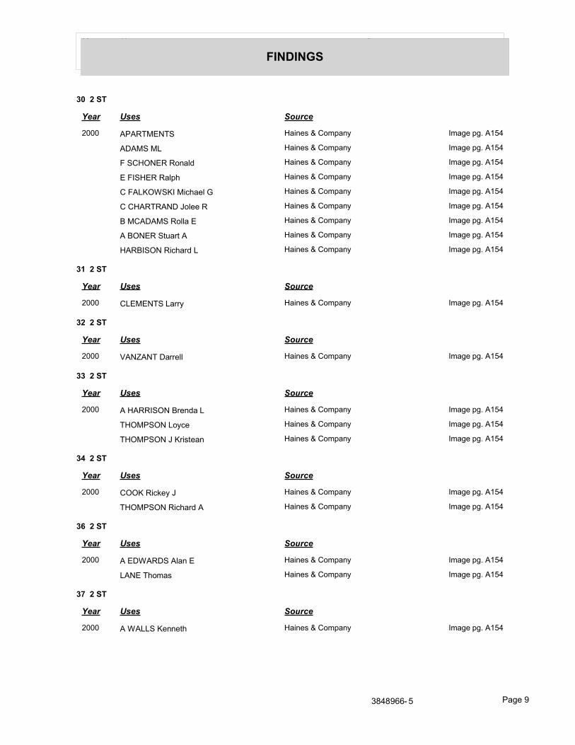
Year Uses Source
FINDINGS
30 2 ST
Year Uses Source
2000 APARTMENTS Haines & Company Image pg. A154
ADAMS ML Haines & Company Image pg. A154
F SCHONER Ronald Haines & Company Image pg. A154
E FISHER Ralph Haines & Company Image pg. A154
C FALKOWSKI Michael G Haines & Company Image pg. A154
C CHARTRAND Jolee R Haines & Company Image pg. A154
B MCADAMS Rolla E Haines & Company Image pg. A154
A BONER Stuart A Haines & Company Image pg. A154
HARBISON Richard L Haines & Company Image pg. A154
31 2 ST
Year Uses Source
2000 CLEMENTS Larry Haines & Company Image pg. A154
32 2 ST
Year Uses Source
2000 VANZANT Darrell Haines & Company Image pg. A154
33 2 ST
Year Uses Source
2000 A HARRISON Brenda L Haines & Company Image pg. A154
THOMPSON Loyce Haines & Company Image pg. A154
THOMPSON J Kristean Haines & Company Image pg. A154
34 2 ST
Year Uses Source
2000 COOK Rickey J Haines & Company Image pg. A154
THOMPSON Richard A Haines & Company Image pg. A154
36 2 ST
Year Uses Source
2000 A EDWARDS Alan E Haines & Company Image pg. A154
LANE Thomas Haines & Company Image pg. A154
37 2 ST
Year Uses Source
2000 A WALLS Kenneth Haines & Company Image pg. A154
3848966- 5 Page 9
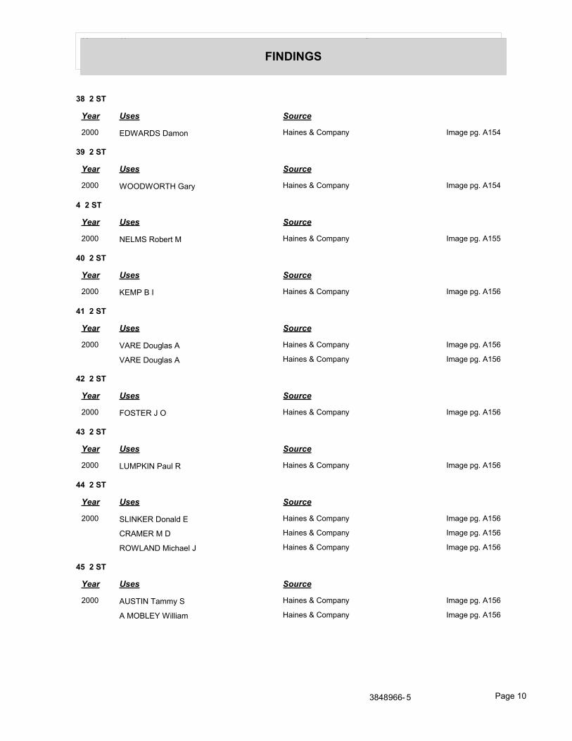
Year Uses Source
FINDINGS
38 2 ST
Year Uses Source
2000 EDWARDS Damon Haines & Company Image pg. A154
39 2 ST
Year Uses Source
2000 WOODWORTH Gary Haines & Company Image pg. A154
4 2 ST
Year Uses Source
2000 NELMS Robert M Haines & Company Image pg. A155
40 2 ST
Year Uses Source
2000 KEMP B I Haines & Company Image pg. A156
41 2 ST
Year Uses Source
2000 VARE Douglas A Haines & Company Image pg. A156
VARE Douglas A Haines & Company Image pg. A156
42 2 ST
Year Uses Source
2000 FOSTER J O Haines & Company Image pg. A156
43 2 ST
Year Uses Source
2000 LUMPKIN Paul R Haines & Company Image pg. A156
44 2 ST
Year Uses Source
2000 SLINKER Donald E Haines & Company Image pg. A156
CRAMER M D Haines & Company Image pg. A156
ROWLAND Michael J Haines & Company Image pg. A156
45 2 ST
Year Uses Source
2000 AUSTIN Tammy S Haines & Company Image pg. A156
A MOBLEY William Haines & Company Image pg. A156
3848966- 5 Page 10
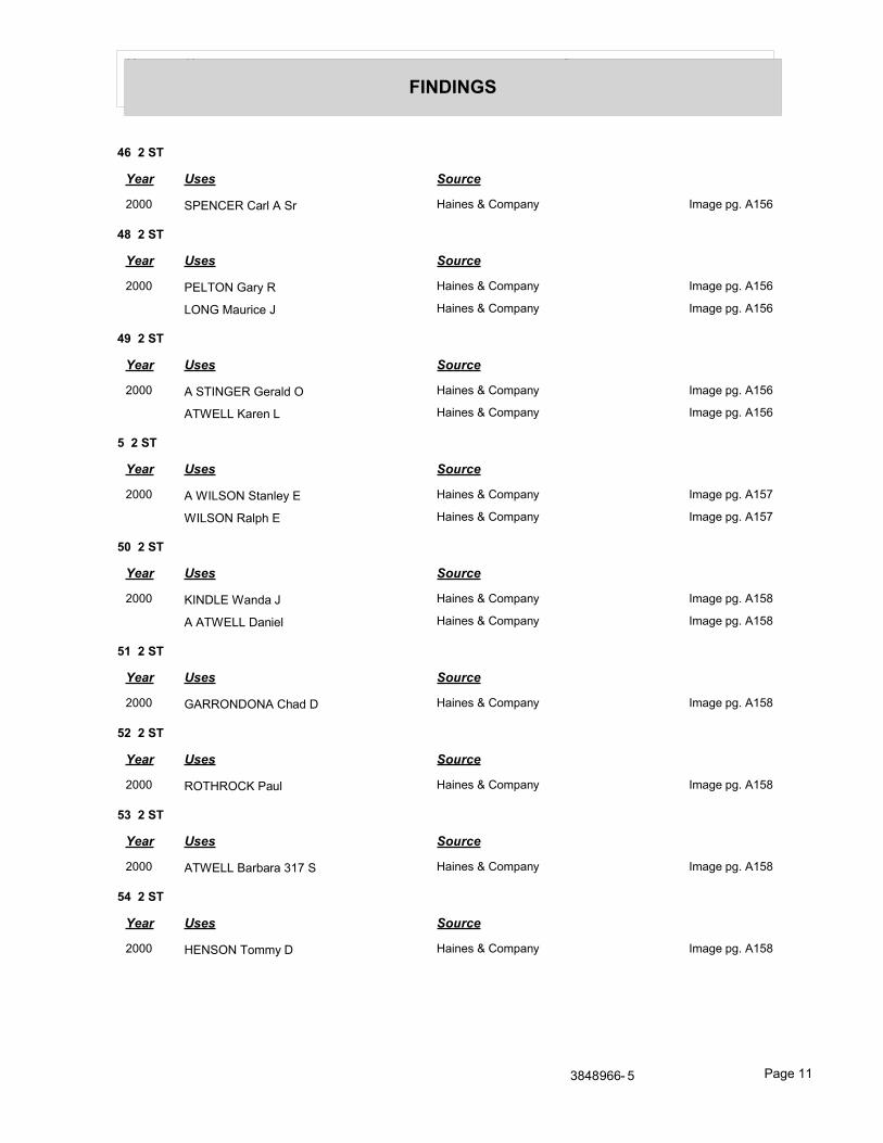
Year Uses Source
FINDINGS
46 2 ST
Year Uses Source
2000 SPENCER Carl A Sr Haines & Company Image pg. A156
48 2 ST
Year Uses Source
2000 PELTON Gary R Haines & Company Image pg. A156
LONG Maurice J Haines & Company Image pg. A156
49 2 ST
Year Uses Source
2000 A STINGER Gerald O Haines & Company Image pg. A156
ATWELL Karen L Haines & Company Image pg. A156
5 2 ST
Year Uses Source
2000 A WILSON Stanley E Haines & Company Image pg. A157
WILSON Ralph E Haines & Company Image pg. A157
50 2 ST
Year Uses Source
2000 KINDLE Wanda J Haines & Company Image pg. A158
A ATWELL Daniel Haines & Company Image pg. A158
51 2 ST
Year Uses Source
2000 GARRONDONA Chad D Haines & Company Image pg. A158
52 2 ST
Year Uses Source
2000 ROTHROCK Paul Haines & Company Image pg. A158
53 2 ST
Year Uses Source
2000 ATWELL Barbara 317 S Haines & Company Image pg. A158
54 2 ST
Year Uses Source
2000 HENSON Tommy D Haines & Company Image pg. A158
3848966- 5 Page 11
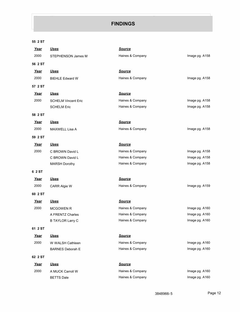
Year Uses Source
FINDINGS
55 2 ST
Year Uses Source
2000 STEPHENSON James M Haines & Company Image pg. A158
56 2 ST
Year Uses Source
2000 BIEHLE Edward W Haines & Company Image pg. A158
57 2 ST
Year Uses Source
2000 SCHELM Vincent Eric Haines & Company Image pg. A158
SCHELM Eric Haines & Company Image pg. A158
58 2 ST
Year Uses Source
2000 MAXWELL Lisa A Haines & Company Image pg. A158
59 2 ST
Year Uses Source
2000 C BROWN David L Haines & Company Image pg. A158
C BROWN David L Haines & Company Image pg. A158
MARSH Dorothy Haines & Company Image pg. A158
6 2 ST
Year Uses Source
2000 CARR Algie W Haines & Company Image pg. A159
60 2 ST
Year Uses Source
2000 MCGOWEN R Haines & Company Image pg. A160
A FRENTZ Charles Haines & Company Image pg. A160
B TAYLOR Larry C Haines & Company Image pg. A160
61 2 ST
Year Uses Source
2000 W WALSH Cathleen Haines & Company Image pg. A160
BARNES Deborah E Haines & Company Image pg. A160
62 2 ST
Year Uses Source
2000 A MUCK Carroll W Haines & Company Image pg. A160
BETTS Dale Haines & Company Image pg. A160
3848966- 5 Page 12

Year Uses Source
FINDINGS
63 2 ST
Year Uses Source
2000 K SLEVIN Robert Haines & Company Image pg. A160
65 2 ST
Year Uses Source
2000 W VANDIVIER James R Haines & Company Image pg. A160
72 2 ST
Year Uses Source
2000 ESTEB David Haines & Company Image pg. A160
73 2 ST
Year Uses Source
2000 WRIGHT Ernie Haines & Company Image pg. A160
B DICKEN Paul Haines & Company Image pg. A160
8 2 ST
Year Uses Source
2000 B GALLOWAY Delbert F Jr Haines & Company Image pg. A161
F DURHAM Steven C Haines & Company Image pg. A161
C ROEMER William H Haines & Company Image pg. A161
G MATIAS Ronald G Haines & Company Image pg. A161
89 2 ST
Year Uses Source
2000 CANARY William O Haines & Company Image pg. A162
9 2 ST
Year Uses Source
2000 A COLVIN David G Haines & Company Image pg. A163
GONSER Robert E Haines & Company Image pg. A163
94 2 ST
Year Uses Source
2000 C MEADOR Aubrey Haines & Company Image pg. A164
96 2 ST
Year Uses Source
2000 GARRETT Joe Haines & Company Image pg. A164
3848966- 5 Page 13
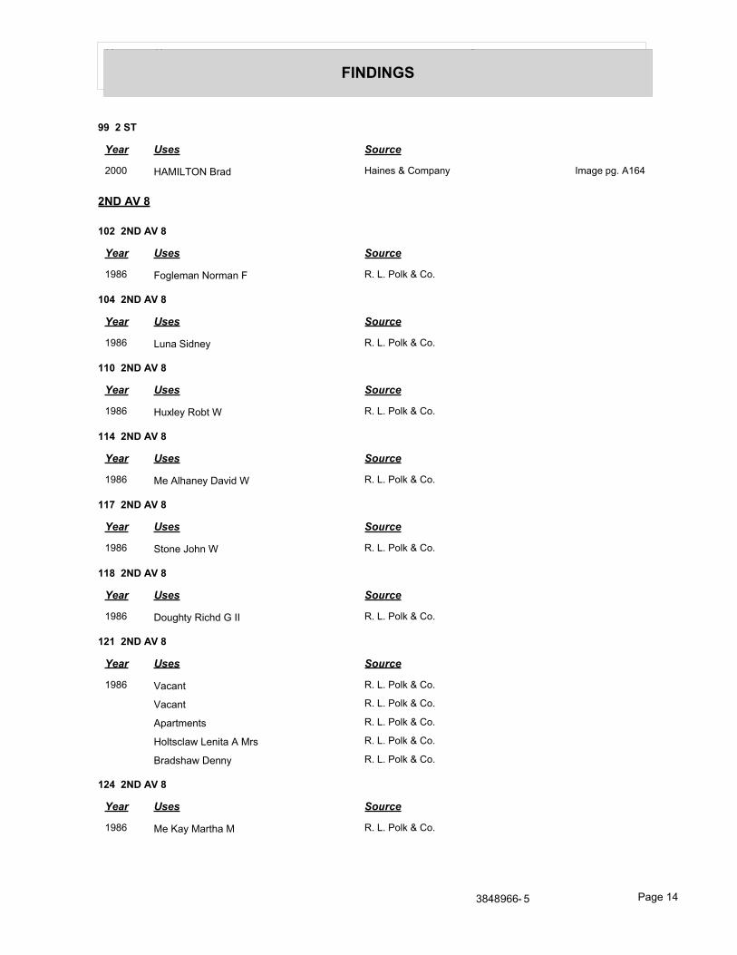
Year Uses Source
FINDINGS
99 2 ST
Year Uses Source
2000 HAMILTON Brad Haines & Company Image pg. A164
2ND AV 8
102 2ND AV 8
Year Uses Source
1986 Fogleman Norman F R. L. Polk & Co.
104 2ND AV 8
Year Uses Source
1986 Luna Sidney R. L. Polk & Co.
110 2ND AV 8
Year Uses Source
1986 Huxley Robt W R. L. Polk & Co.
114 2ND AV 8
Year Uses Source
1986 Me Alhaney David W R. L. Polk & Co.
117 2ND AV 8
Year Uses Source
1986 Stone John W R. L. Polk & Co.
118 2ND AV 8
Year Uses Source
1986 Doughty Richd G II R. L. Polk & Co.
121 2ND AV 8
Year Uses Source
1986 Vacant R. L. Polk & Co.
Vacant R. L. Polk & Co.
Apartments R. L. Polk & Co.
Holtsclaw Lenita A Mrs R. L. Polk & Co.
Bradshaw Denny R. L. Polk & Co.
124 2ND AV 8
Year Uses Source
1986 Me Kay Martha M R. L. Polk & Co.
3848966- 5 Page 14
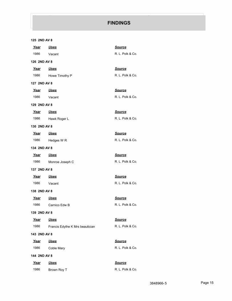
Year Uses Source
FINDINGS
125 2ND AV 8
Year Uses Source
1986 Vacant R. L. Polk & Co.
126 2ND AV 8
Year Uses Source
1986 Howe Timothy P R. L. Polk & Co.
127 2ND AV 8
Year Uses Source
1986 Vacant R. L. Polk & Co.
129 2ND AV 8
Year Uses Source
1986 Hawk Roger L R. L. Polk & Co.
130 2ND AV 8
Year Uses Source
1986 Hedges W R R. L. Polk & Co.
134 2ND AV 8
Year Uses Source
1986 Monroe Joseph C R. L. Polk & Co.
137 2ND AV 8
Year Uses Source
1986 Vacant R. L. Polk & Co.
138 2ND AV 8
Year Uses Source
1986 Carnico Edw B R. L. Polk & Co.
139 2ND AV 8
Year Uses Source
1986 Francis Edythe K Mrs beautician R. L. Polk & Co.
143 2ND AV 8
Year Uses Source
1986 Coble Mary R. L. Polk & Co.
144 2ND AV 8
Year Uses Source
1986 Brown Roy T R. L. Polk & Co.
3848966- 5 Page 15
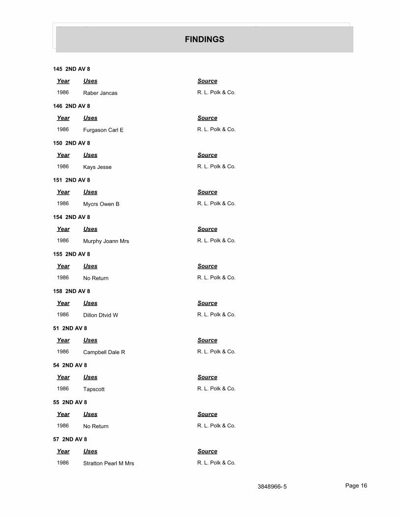
Year Uses Source
FINDINGS
145 2ND AV 8
Year Uses Source
1986 Raber Jancas R. L. Polk & Co.
146 2ND AV 8
Year Uses Source
1986 Furgason Carl E R. L. Polk & Co.
150 2ND AV 8
Year Uses Source
1986 Kays Jesse R. L. Polk & Co.
151 2ND AV 8
Year Uses Source
1986 Mycrs Owen B R. L. Polk & Co.
154 2ND AV 8
Year Uses Source
1986 Murphy Joann Mrs R. L. Polk & Co.
155 2ND AV 8
Year Uses Source
1986 No Return R. L. Polk & Co.
158 2ND AV 8
Year Uses Source
1986 Dillon Dtvid W R. L. Polk & Co.
51 2ND AV 8
Year Uses Source
1986 Campbell Dale R R. L. Polk & Co.
54 2ND AV 8
Year Uses Source
1986 Tapscott R. L. Polk & Co.
55 2ND AV 8
Year Uses Source
1986 No Return R. L. Polk & Co.
57 2ND AV 8
Year Uses Source
1986 Stratton Pearl M Mrs R. L. Polk & Co.
3848966- 5 Page 16
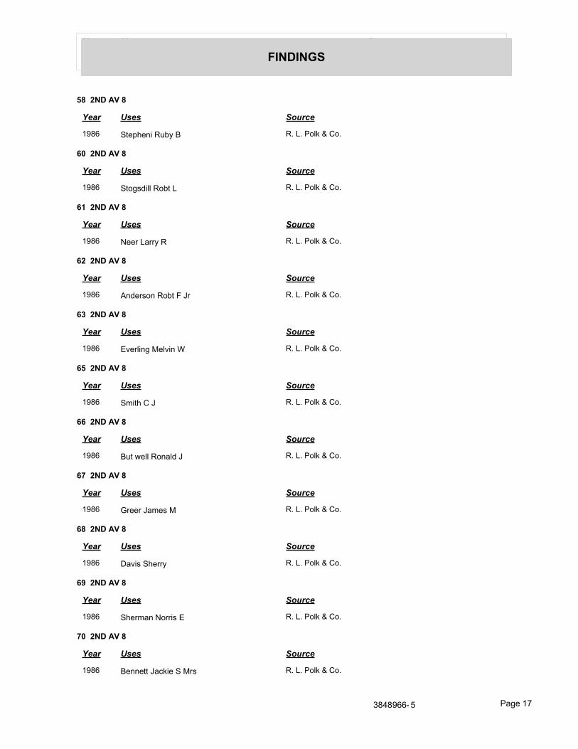
Year Uses Source
FINDINGS
58 2ND AV 8
Year Uses Source
1986 Stepheni Ruby B R. L. Polk & Co.
60 2ND AV 8
Year Uses Source
1986 Stogsdill Robt L R. L. Polk & Co.
61 2ND AV 8
Year Uses Source
1986 Neer Larry R R. L. Polk & Co.
62 2ND AV 8
Year Uses Source
1986 Anderson Robt F Jr R. L. Polk & Co.
63 2ND AV 8
Year Uses Source
1986 Everling Melvin W R. L. Polk & Co.
65 2ND AV 8
Year Uses Source
1986 Smith C J R. L. Polk & Co.
66 2ND AV 8
Year Uses Source
1986 But well Ronald J R. L. Polk & Co.
67 2ND AV 8
Year Uses Source
1986 Greer James M R. L. Polk & Co.
68 2ND AV 8
Year Uses Source
1986 Davis Sherry R. L. Polk & Co.
69 2ND AV 8
Year Uses Source
1986 Sherman Norris E R. L. Polk & Co.
70 2ND AV 8
Year Uses Source
1986 Bennett Jackie S Mrs R. L. Polk & Co.
3848966- 5 Page 17
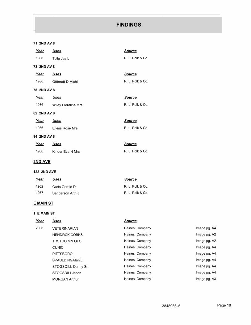
Year Uses Source
FINDINGS
71 2ND AV 8
Year Uses Source
1986 Tolle Jas L R. L. Polk & Co.
73 2ND AV 8
Year Uses Source
1986 Gtttnrett D Michl R. L. Polk & Co.
78 2ND AV 8
Year Uses Source
1986 Wiley Lorraiine Mrs R. L. Polk & Co.
82 2ND AV 8
Year Uses Source
1986 Elkins Rose Mrs R. L. Polk & Co.
94 2ND AV 8
Year Uses Source
1986 Kinder Eva N Mrs R. L. Polk & Co.
2ND AVE
122 2ND AVE
Year Uses Source
1962 Curts Gerald D R. L. Polk & Co.
1957 Sanderson Arth J R. L. Polk & Co.
E MAIN ST
1 E MAIN ST
Year Uses Source
2006 VETERINARIAN Haines Company Image pg. A4
HENDRCK COBK& Haines Company Image pg. A2
TRSTCO MN OFC Haines Company Image pg. A2
CUNIC Haines Company Image pg. A4
PITTSBORO Haines Company Image pg. A4
SPAULDINGAIan L Haines Company Image pg. A4
STOGSOILL Danny Sr Haines Company Image pg. A4
STOGSDILLJason Haines Company Image pg. A4
MORGAN Arthur Haines Company Image pg. A3
3848966- 5 Page 18
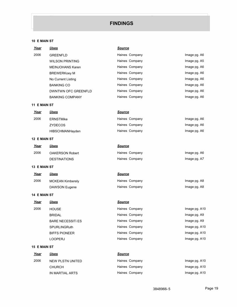
Year Uses Source
FINDINGS
10 E MAIN ST
Year Uses Source
2006 GREENFLD Haines Company Image pg. A6
WILSON PRINTING Haines Company Image pg. A5
MEINJOHANS Karen Haines Company Image pg. A6
BREWERKoey M Haines Company Image pg. A6
No Current Listing Haines Company Image pg. A6
BANKING CO Haines Company Image pg. A6
DWNTWN OFC GREENFLD Haines Company Image pg. A6
BANKING COMPANY Haines Company Image pg. A6
11 E MAIN ST
Year Uses Source
2006 ERNSTMike Haines Company Image pg. A6
ZYDECOS Haines Company Image pg. A6
HIBSCHMANHayden Haines Company Image pg. A6
12 E MAIN ST
Year Uses Source
2006 OAKERSON Robert Haines Company Image pg. A6
DESTINATIONS Haines Company Image pg. A7
13 E MAIN ST
Year Uses Source
2006 MCKEAN Kimberely Haines Company Image pg. A8
DAWSON Eugene Haines Company Image pg. A8
14 E MAIN ST
Year Uses Source
2006 HOUSE Haines Company Image pg. A10
BRIDAL Haines Company Image pg. A9
BARE NECESSITi ES Haines Company Image pg. A9
SPURLINGRuth Haines Company Image pg. A10
BIFFS PIONEER Haines Company Image pg. A10
LOOPERJ Haines Company Image pg. A10
15 E MAIN ST
Year Uses Source
2006 NEW PLSTN UNITED Haines Company Image pg. A10
CHURCH Haines Company Image pg. A10
IN MARTIAL ARTS Haines Company Image pg. A10
3848966- 5 Page 19
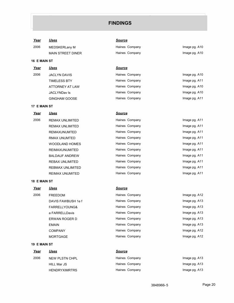
Year Uses Source
FINDINGS
Year Uses Source
2006 MEDSKERLany M Haines Company Image pg. A10
MAIN STREET DINER Haines Company Image pg. A10
16 E MAIN ST
Year Uses Source
2006 JACLYN DAVIS Haines Company Image pg. A10
TIMELESS BTY Haines Company Image pg. A11
ATTORNEY AT LAW Haines Company Image pg. A10
JACLYNDav Is Haines Company Image pg. A10
GINGHAM GOOSE Haines Company Image pg. A11
17 E MAIN ST
Year Uses Source
2006 REMAX UNLIMITED Haines Company Image pg. A11
REMAX UNLIMITED Haines Company Image pg. A11
REMAXUNUMTED Haines Company Image pg. A11
RMAX UNUMTED Haines Company Image pg. A11
WOODLAND HOMES Haines Company Image pg. A11
REIMAXUNUMITED Haines Company Image pg. A11
BALDAUF ANDREW Haines Company Image pg. A11
REBAX UNLIMITED Haines Company Image pg. A11
REBMAX UNLIMITED Haines Company Image pg. A11
REIMAX UNUMITED Haines Company Image pg. A11
18 E MAIN ST
Year Uses Source
2006 FREEDOM Haines Company Image pg. A12
DAVIS FAWBUSH 1e f Haines Company Image pg. A13
FARRELLYOUNG& Haines Company Image pg. A13
a FARRELLDavis Haines Company Image pg. A13
ERWAN ROGER D Haines Company Image pg. A13
EMAIN Haines Company Image pg. A13
COMPANY Haines Company Image pg. A12
MORTGAGE Haines Company Image pg. A12
19 E MAIN ST
Year Uses Source
2006 NEW PLSTN CHPL Haines Company Image pg. A13
HILL Mar JS Haines Company Image pg. A13
HENDRYXIMRTRS Haines Company Image pg. A13
3848966- 5 Page 20
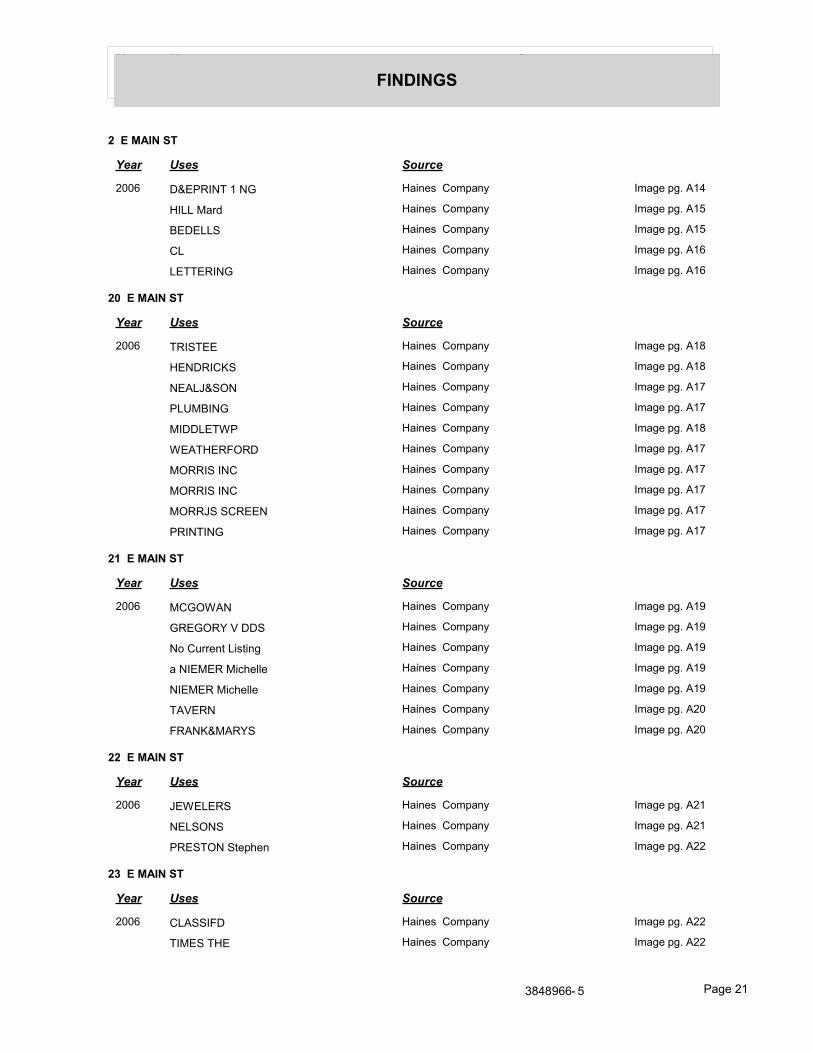
Year Uses Source
FINDINGS
2 E MAIN ST
Year Uses Source
2006 D&EPRINT 1 NG Haines Company Image pg. A14
HILL Mard Haines Company Image pg. A15
BEDELLS Haines Company Image pg. A15
CL Haines Company Image pg. A16
LETTERING Haines Company Image pg. A16
20 E MAIN ST
Year Uses Source
2006 TRISTEE Haines Company Image pg. A18
HENDRICKS Haines Company Image pg. A18
NEALJ&SON Haines Company Image pg. A17
PLUMBING Haines Company Image pg. A17
MIDDLETWP Haines Company Image pg. A18
WEATHERFORD Haines Company Image pg. A17
MORRIS INC Haines Company Image pg. A17
MORRIS INC Haines Company Image pg. A17
MORRJS SCREEN Haines Company Image pg. A17
PRINTING Haines Company Image pg. A17
21 E MAIN ST
Year Uses Source
2006 MCGOWAN Haines Company Image pg. A19
GREGORY V DDS Haines Company Image pg. A19
No Current Listing Haines Company Image pg. A19
a NIEMER Michelle Haines Company Image pg. A19
NIEMER Michelle Haines Company Image pg. A19
TAVERN Haines Company Image pg. A20
FRANK&MARYS Haines Company Image pg. A20
22 E MAIN ST
Year Uses Source
2006 JEWELERS Haines Company Image pg. A21
NELSONS Haines Company Image pg. A21
PRESTON Stephen Haines Company Image pg. A22
23 E MAIN ST
Year Uses Source
2006 CLASSIFD Haines Company Image pg. A22
TIMES THE Haines Company Image pg. A22
3848966- 5 Page 21
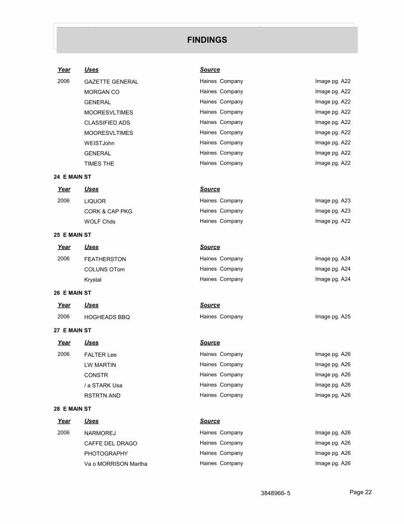
Year Uses Source
FINDINGS
Year Uses Source
2006 GAZETTE GENERAL Haines Company Image pg. A22
MORGAN CO Haines Company Image pg. A22
GENERAL Haines Company Image pg. A22
MOORESVLTIMES Haines Company Image pg. A22
CLASSIFIED ADS Haines Company Image pg. A22
MOORESVLTIMES Haines Company Image pg. A22
WEISTJohn Haines Company Image pg. A22
GENERAL Haines Company Image pg. A22
TIMES THE Haines Company Image pg. A22
24 E MAIN ST
Year Uses Source
2006 LIQUOR Haines Company Image pg. A23
CORK & CAP PKG Haines Company Image pg. A23
WOLF Chds Haines Company Image pg. A22
25 E MAIN ST
Year Uses Source
2006 FEATHERSTON Haines Company Image pg. A24
COLUNS OTom Haines Company Image pg. A24
Krystal Haines Company Image pg. A24
26 E MAIN ST
Year Uses Source
2006 HOGHEADS BBQ Haines Company Image pg. A25
27 E MAIN ST
Year Uses Source
2006 FALTER Lee Haines Company Image pg. A26
LW MARTIN Haines Company Image pg. A26
CONSTR Haines Company Image pg. A26
/ a STARK Usa Haines Company Image pg. A26
RSTRTN AND Haines Company Image pg. A26
28 E MAIN ST
Year Uses Source
2006 NARMOREJ Haines Company Image pg. A26
CAFFE DEL DRAGO Haines Company Image pg. A26
PHOTOGRAPHY Haines Company Image pg. A26
Va o MORRISON Martha Haines Company Image pg. A26
3848966- 5 Page 22
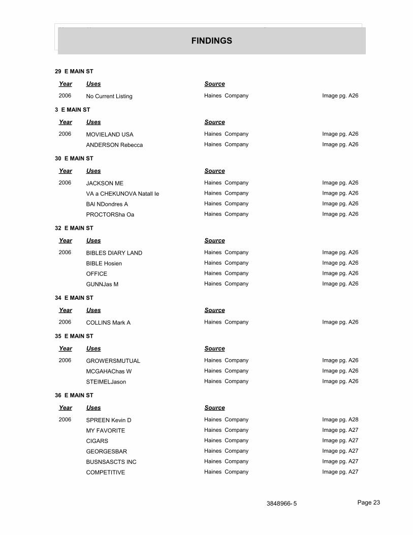
Year Uses Source
FINDINGS
29 E MAIN ST
Year Uses Source
2006 No Current Listing Haines Company Image pg. A26
3 E MAIN ST
Year Uses Source
2006 MOVIELAND USA Haines Company Image pg. A26
ANDERSON Rebecca Haines Company Image pg. A26
30 E MAIN ST
Year Uses Source
2006 JACKSON ME Haines Company Image pg. A26
VA a CHEKUNOVA Natall Ie Haines Company Image pg. A26
BAl NDondres A Haines Company Image pg. A26
PROCTORSha Oa Haines Company Image pg. A26
32 E MAIN ST
Year Uses Source
2006 BIBLES DIARY LAND Haines Company Image pg. A26
BIBLE Hosien Haines Company Image pg. A26
OFFICE Haines Company Image pg. A26
GUNNJas M Haines Company Image pg. A26
34 E MAIN ST
Year Uses Source
2006 COLLINS Mark A Haines Company Image pg. A26
35 E MAIN ST
Year Uses Source
2006 GROWERSMUTUAL Haines Company Image pg. A26
MCGAHAChas W Haines Company Image pg. A26
STEIMELJason Haines Company Image pg. A26
36 E MAIN ST
Year Uses Source
2006 SPREEN Kevin D Haines Company Image pg. A28
MY FAVORITE Haines Company Image pg. A27
CIGARS Haines Company Image pg. A27
GEORGESBAR Haines Company Image pg. A27
BUSNSASCTS INC Haines Company Image pg. A27
COMPETITIVE Haines Company Image pg. A27
3848966- 5 Page 23
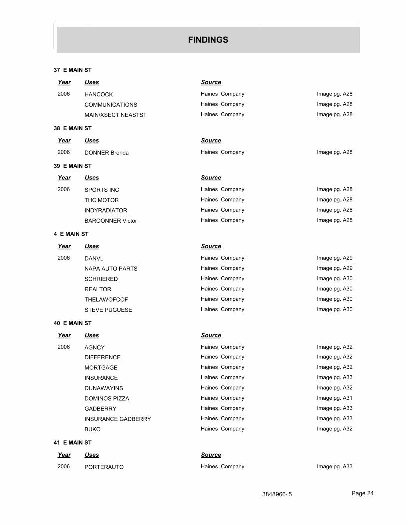
Year Uses Source
FINDINGS
37 E MAIN ST
Year Uses Source
2006 HANCOCK Haines Company Image pg. A28
COMMUNICATIONS Haines Company Image pg. A28
MAIN/XSECT NEASTST Haines Company Image pg. A28
38 E MAIN ST
Year Uses Source
2006 DONNER Brenda Haines Company Image pg. A28
39 E MAIN ST
Year Uses Source
2006 SPORTS INC Haines Company Image pg. A28
THC MOTOR Haines Company Image pg. A28
INDYRADIATOR Haines Company Image pg. A28
BAROONNER Victor Haines Company Image pg. A28
4 E MAIN ST
Year Uses Source
2006 DANVL Haines Company Image pg. A29
NAPA AUTO PARTS Haines Company Image pg. A29
SCHRIERED Haines Company Image pg. A30
REALTOR Haines Company Image pg. A30
THELAWOFCOF Haines Company Image pg. A30
STEVE PUGUESE Haines Company Image pg. A30
40 E MAIN ST
Year Uses Source
2006 AGNCY Haines Company Image pg. A32
DIFFERENCE Haines Company Image pg. A32
MORTGAGE Haines Company Image pg. A32
INSURANCE Haines Company Image pg. A33
DUNAWAYINS Haines Company Image pg. A32
DOMINOS PIZZA Haines Company Image pg. A31
GADBERRY Haines Company Image pg. A33
INSURANCE GADBERRY Haines Company Image pg. A33
BUKO Haines Company Image pg. A32
41 E MAIN ST
Year Uses Source
2006 PORTERAUTO Haines Company Image pg. A33
3848966- 5 Page 24
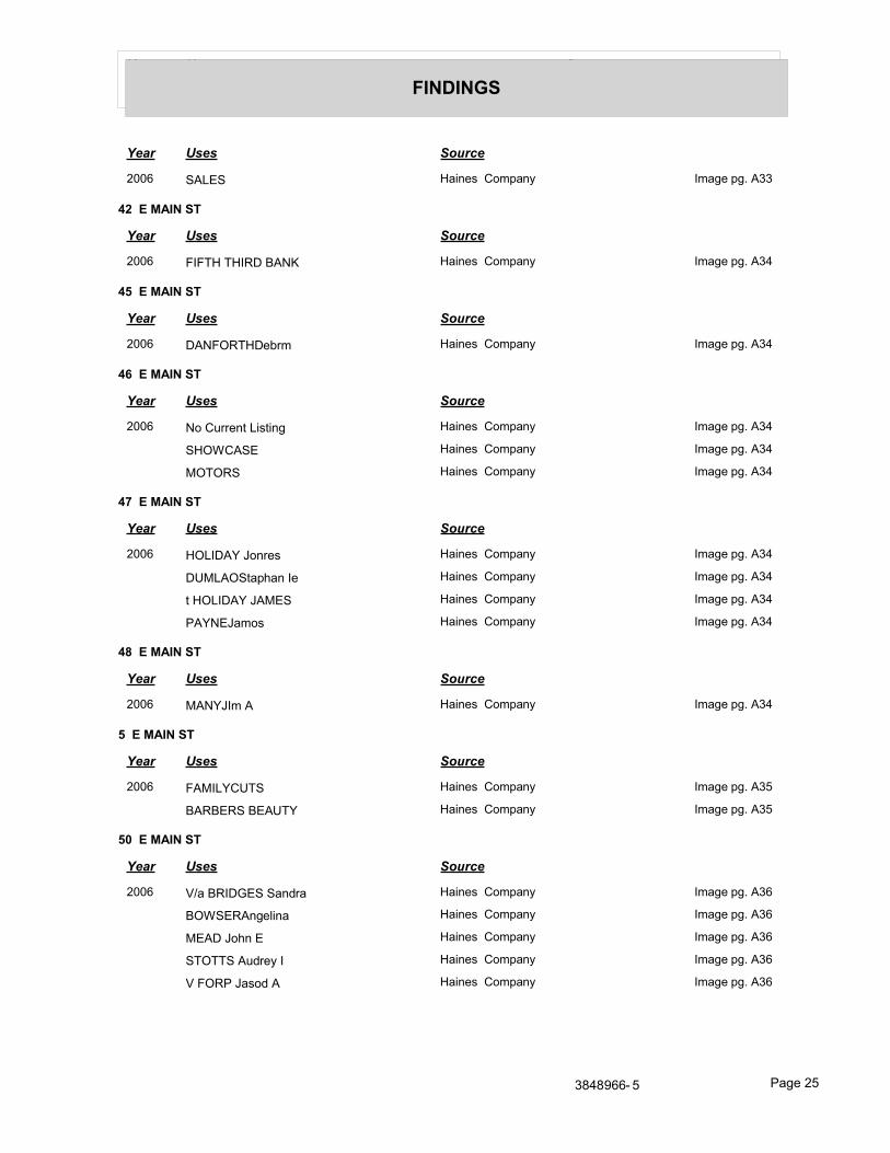
Year Uses Source
FINDINGS
Year Uses Source
2006 SALES Haines Company Image pg. A33
42 E MAIN ST
Year Uses Source
2006 FIFTH THIRD BANK Haines Company Image pg. A34
45 E MAIN ST
Year Uses Source
2006 DANFORTHDebrm Haines Company Image pg. A34
46 E MAIN ST
Year Uses Source
2006 No Current Listing Haines Company Image pg. A34
SHOWCASE Haines Company Image pg. A34
MOTORS Haines Company Image pg. A34
47 E MAIN ST
Year Uses Source
2006 HOLIDAY Jonres Haines Company Image pg. A34
DUMLAOStaphan Ie Haines Company Image pg. A34
t HOLIDAY JAMES Haines Company Image pg. A34
PAYNEJamos Haines Company Image pg. A34
48 E MAIN ST
Year Uses Source
2006 MANYJIm A Haines Company Image pg. A34
5 E MAIN ST
Year Uses Source
2006 FAMILYCUTS Haines Company Image pg. A35
BARBERS BEAUTY Haines Company Image pg. A35
50 E MAIN ST
Year Uses Source
2006 V/a BRIDGES Sandra Haines Company Image pg. A36
BOWSERAngelina Haines Company Image pg. A36
MEAD John E Haines Company Image pg. A36
STOTTS Audrey I Haines Company Image pg. A36
V FORP Jasod A Haines Company Image pg. A36
3848966- 5 Page 25
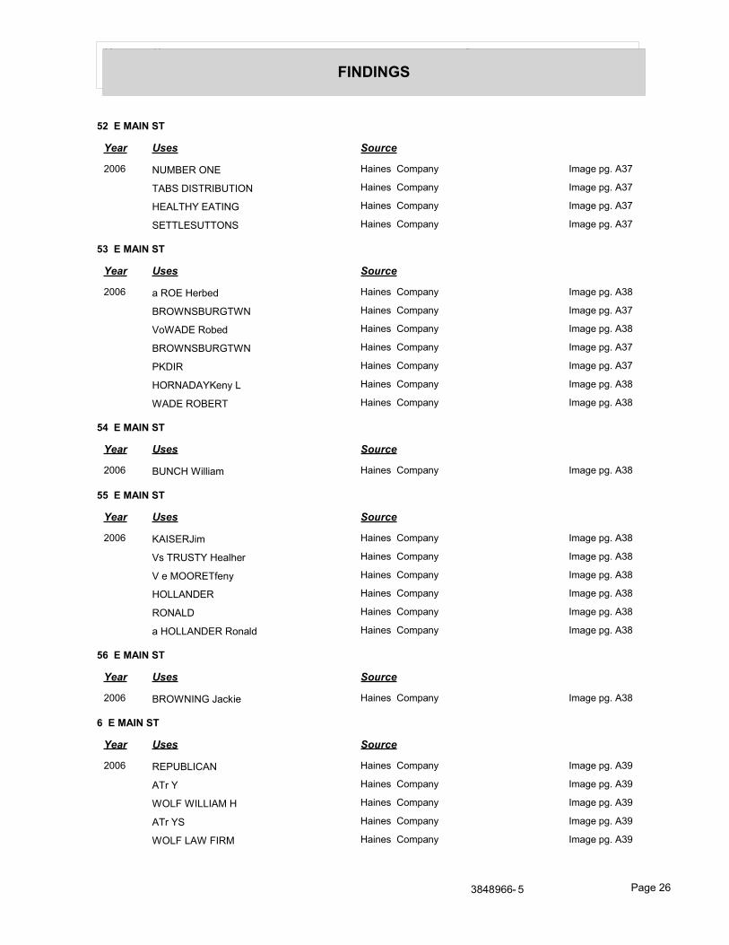
Year Uses Source
FINDINGS
52 E MAIN ST
Year Uses Source
2006 NUMBER ONE Haines Company Image pg. A37
TABS DISTRIBUTION Haines Company Image pg. A37
HEALTHY EATING Haines Company Image pg. A37
SETTLESUTTONS Haines Company Image pg. A37
53 E MAIN ST
Year Uses Source
2006 a ROE Herbed Haines Company Image pg. A38
BROWNSBURGTWN Haines Company Image pg. A37
VoWADE Robed Haines Company Image pg. A38
BROWNSBURGTWN Haines Company Image pg. A37
PKDIR Haines Company Image pg. A37
HORNADAYKeny L Haines Company Image pg. A38
WADE ROBERT Haines Company Image pg. A38
54 E MAIN ST
Year Uses Source
2006 BUNCH William Haines Company Image pg. A38
55 E MAIN ST
Year Uses Source
2006 KAISERJim Haines Company Image pg. A38
Vs TRUSTY Healher Haines Company Image pg. A38
V e MOORETfeny Haines Company Image pg. A38
HOLLANDER Haines Company Image pg. A38
RONALD Haines Company Image pg. A38
a HOLLANDER Ronald Haines Company Image pg. A38
56 E MAIN ST
Year Uses Source
2006 BROWNING Jackie Haines Company Image pg. A38
6 E MAIN ST
Year Uses Source
2006 REPUBLICAN Haines Company Image pg. A39
ATr Y Haines Company Image pg. A39
WOLF WILLIAM H Haines Company Image pg. A39
ATr YS Haines Company Image pg. A39
WOLF LAW FIRM Haines Company Image pg. A39
3848966- 5 Page 26
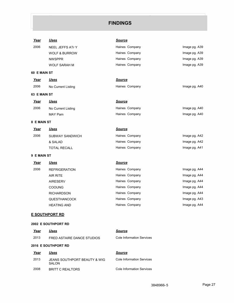
Year Uses Source
FINDINGS
Year Uses Source
2006 NEEL JEFFS ATr Y Haines Company Image pg. A39
WOLF & BURROW Haines Company Image pg. A39
NWSPPR Haines Company Image pg. A39
WOLF SARAH M Haines Company Image pg. A39
60 E MAIN ST
Year Uses Source
2006 No Current Listing Haines Company Image pg. A40
63 E MAIN ST
Year Uses Source
2006 No Current Listing Haines Company Image pg. A40
MAY Pam Haines Company Image pg. A40
8 E MAIN ST
Year Uses Source
2006 SUBWAY SANDWICH Haines Company Image pg. A42
& SALAD Haines Company Image pg. A42
TOTAL RECALL Haines Company Image pg. A41
9 E MAIN ST
Year Uses Source
2006 REFRIGERATION Haines Company Image pg. A44
AIR RITE Haines Company Image pg. A44
AIRESERV Haines Company Image pg. A44
COOUNG Haines Company Image pg. A44
RICHARDSON Haines Company Image pg. A44
QUESTHANCOCK Haines Company Image pg. A43
HEATING AND Haines Company Image pg. A44
E SOUTHPORT RD
2002 E SOUTHPORT RD
Year Uses Source
2013 FRED ASTAIRE DANCE STUDIOS Cole Information Services
2016 E SOUTHPORT RD
Year Uses Source
2013 JEANS SOUTHPORT BEAUTY & WIG SALON
Cole Information Services
2008 BRITT C REALTORS Cole Information Services
3848966- 5 Page 27
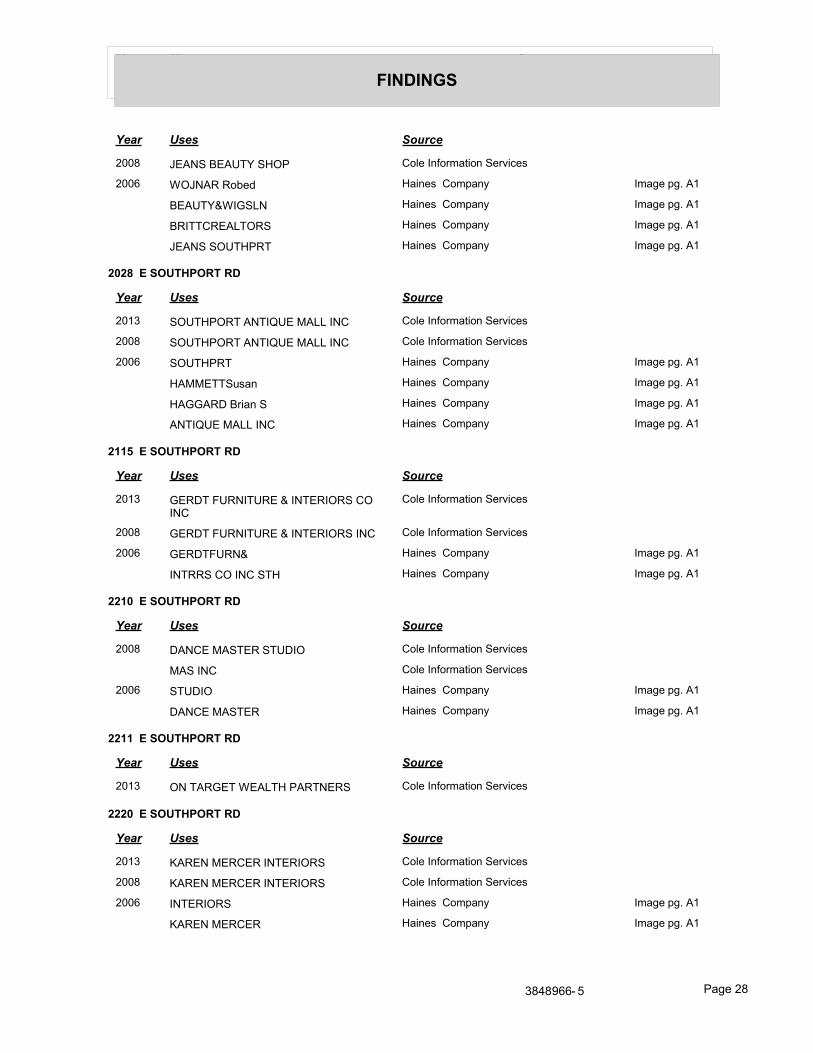
Year Uses Source
FINDINGS
Year Uses Source
2008 JEANS BEAUTY SHOP Cole Information Services
2006 WOJNAR Robed Haines Company Image pg. A1
BEAUTY&WIGSLN Haines Company Image pg. A1
BRITTCREALTORS Haines Company Image pg. A1
JEANS SOUTHPRT Haines Company Image pg. A1
2028 E SOUTHPORT RD
Year Uses Source
2013 SOUTHPORT ANTIQUE MALL INC Cole Information Services
2008 SOUTHPORT ANTIQUE MALL INC Cole Information Services
2006 SOUTHPRT Haines Company Image pg. A1
HAMMETTSusan Haines Company Image pg. A1
HAGGARD Brian S Haines Company Image pg. A1
ANTIQUE MALL INC Haines Company Image pg. A1
2115 E SOUTHPORT RD
Year Uses Source
2013 GERDT FURNITURE & INTERIORS CO INC
Cole Information Services
2008 GERDT FURNITURE & INTERIORS INC Cole Information Services
2006 GERDTFURN& Haines Company Image pg. A1
INTRRS CO INC STH Haines Company Image pg. A1
2210 E SOUTHPORT RD
Year Uses Source
2008 DANCE MASTER STUDIO Cole Information Services
MAS INC Cole Information Services
2006 STUDIO Haines Company Image pg. A1
DANCE MASTER Haines Company Image pg. A1
2211 E SOUTHPORT RD
Year Uses Source
2013 ON TARGET WEALTH PARTNERS Cole Information Services
2220 E SOUTHPORT RD
Year Uses Source
2013 KAREN MERCER INTERIORS Cole Information Services
2008 KAREN MERCER INTERIORS Cole Information Services
2006 INTERIORS Haines Company Image pg. A1
KAREN MERCER Haines Company Image pg. A1
3848966- 5 Page 28
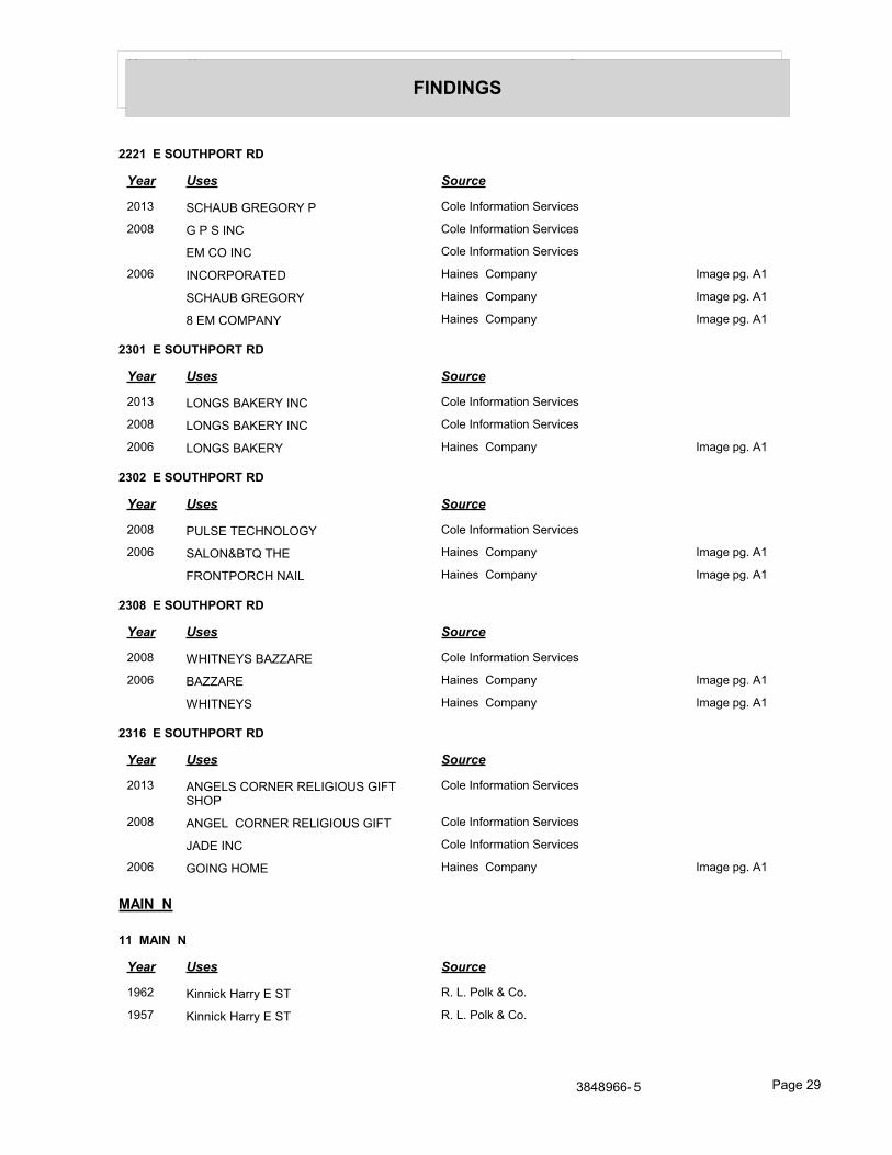
Year Uses Source
FINDINGS
2221 E SOUTHPORT RD
Year Uses Source
2013 SCHAUB GREGORY P Cole Information Services
2008 G P S INC Cole Information Services
EM CO INC Cole Information Services
2006 INCORPORATED Haines Company Image pg. A1
SCHAUB GREGORY Haines Company Image pg. A1
8 EM COMPANY Haines Company Image pg. A1
2301 E SOUTHPORT RD
Year Uses Source
2013 LONGS BAKERY INC Cole Information Services
2008 LONGS BAKERY INC Cole Information Services
2006 LONGS BAKERY Haines Company Image pg. A1
2302 E SOUTHPORT RD
Year Uses Source
2008 PULSE TECHNOLOGY Cole Information Services
2006 SALON&BTQ THE Haines Company Image pg. A1
FRONTPORCH NAIL Haines Company Image pg. A1
2308 E SOUTHPORT RD
Year Uses Source
2008 WHITNEYS BAZZARE Cole Information Services
2006 BAZZARE Haines Company Image pg. A1
WHITNEYS Haines Company Image pg. A1
2316 E SOUTHPORT RD
Year Uses Source
2013 ANGELS CORNER RELIGIOUS GIFT SHOP
Cole Information Services
2008 ANGEL CORNER RELIGIOUS GIFT Cole Information Services
JADE INC Cole Information Services
2006 GOING HOME Haines Company Image pg. A1
MAIN N
11 MAIN N
Year Uses Source
1962 Kinnick Harry E ST R. L. Polk & Co.
1957 Kinnick Harry E ST R. L. Polk & Co.
3848966- 5 Page 29
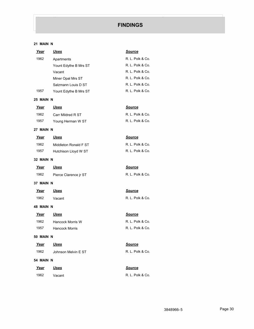
Year Uses Source
FINDINGS
21 MAIN N
Year Uses Source
1962 Apartments R. L. Polk & Co.
Yount Edythe B Mrs ST R. L. Polk & Co.
Vacant R. L. Polk & Co.
Miner Opal Mrs ST R. L. Polk & Co.
Salzmann Louis D ST R. L. Polk & Co.
1957 Yount Edythe B Mrs ST R. L. Polk & Co.
25 MAIN N
Year Uses Source
1962 Carr Mildred R ST R. L. Polk & Co.
1957 Young Herman W ST R. L. Polk & Co.
27 MAIN N
Year Uses Source
1962 Middleton Ronald F ST R. L. Polk & Co.
1957 Hutchison Lloyd W ST R. L. Polk & Co.
32 MAIN N
Year Uses Source
1962 Pierce Clarence jr ST R. L. Polk & Co.
37 MAIN N
Year Uses Source
1962 Vacant R. L. Polk & Co.
48 MAIN N
Year Uses Source
1962 Hancock Morris W R. L. Polk & Co.
1957 Hancock Morris R. L. Polk & Co.
50 MAIN N
Year Uses Source
1962 Johnson Melvin E ST R. L. Polk & Co.
54 MAIN N
Year Uses Source
1962 Vacant R. L. Polk & Co.
3848966- 5 Page 30
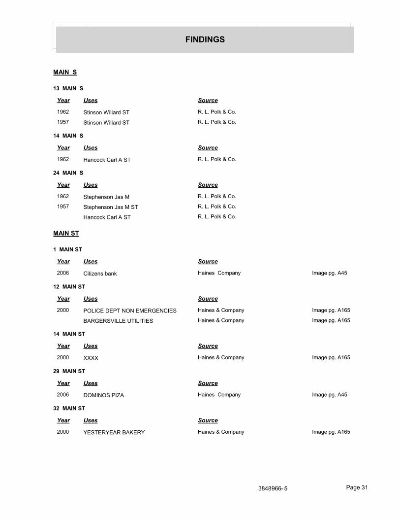
Year Uses Source
FINDINGS
MAIN S
13 MAIN S
Year Uses Source
1962 Stinson Willard ST R. L. Polk & Co.
1957 Stinson Willard ST R. L. Polk & Co.
14 MAIN S
Year Uses Source
1962 Hancock Carl A ST R. L. Polk & Co.
24 MAIN S
Year Uses Source
1962 Stephenson Jas M R. L. Polk & Co.
1957 Stephenson Jas M ST R. L. Polk & Co.
Hancock Carl A ST R. L. Polk & Co.
MAIN ST
1 MAIN ST
Year Uses Source
2006 Citizens bank Haines Company Image pg. A45
12 MAIN ST
Year Uses Source
2000 POLICE DEPT NON EMERGENCIES Haines & Company Image pg. A165
BARGERSVILLE UTILITIES Haines & Company Image pg. A165
14 MAIN ST
Year Uses Source
2000 XXXX Haines & Company Image pg. A165
29 MAIN ST
Year Uses Source
2006 DOMINOS PIZA Haines Company Image pg. A45
32 MAIN ST
Year Uses Source
2000 YESTERYEAR BAKERY Haines & Company Image pg. A165
3848966- 5 Page 31
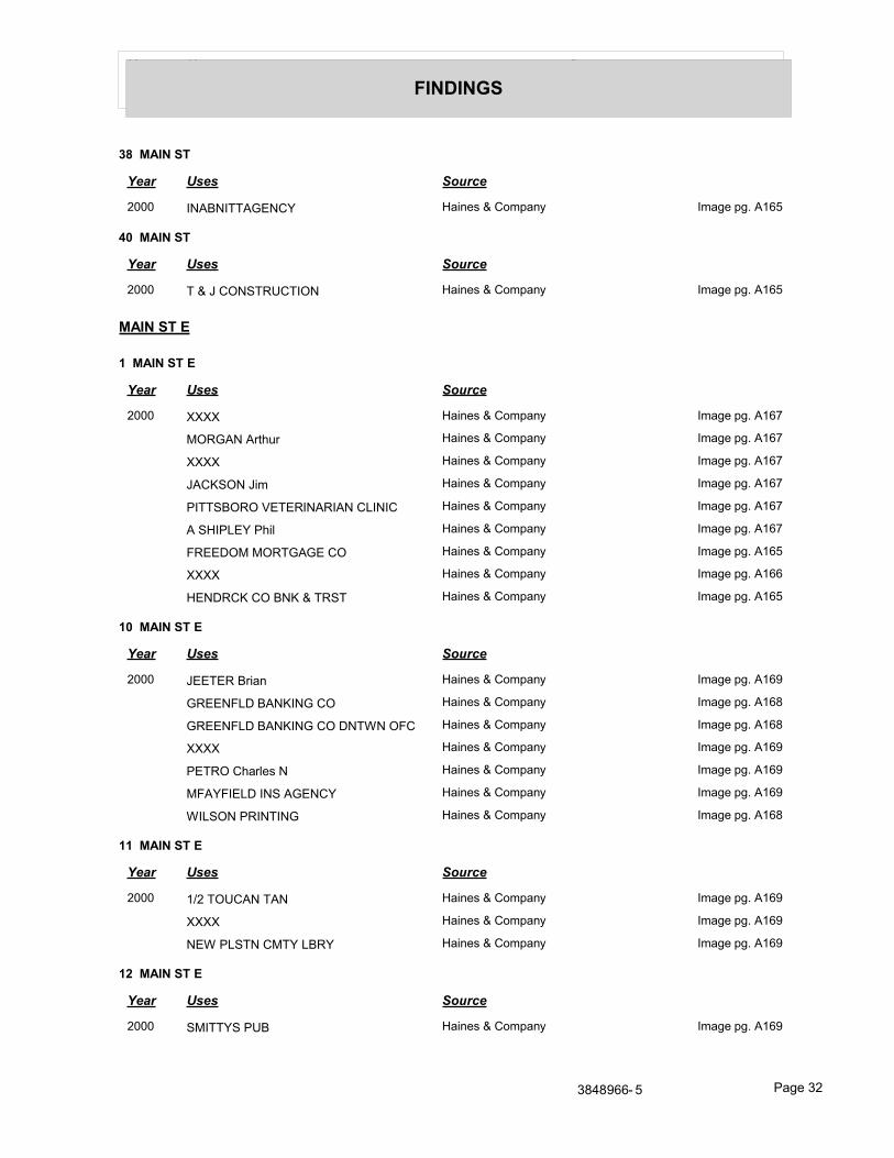
Year Uses Source
FINDINGS
38 MAIN ST
Year Uses Source
2000 INABNITTAGENCY Haines & Company Image pg. A165
40 MAIN ST
Year Uses Source
2000 T & J CONSTRUCTION Haines & Company Image pg. A165
MAIN ST E
1 MAIN ST E
Year Uses Source
2000 XXXX Haines & Company Image pg. A167
MORGAN Arthur Haines & Company Image pg. A167
XXXX Haines & Company Image pg. A167
JACKSON Jim Haines & Company Image pg. A167
PITTSBORO VETERINARIAN CLINIC Haines & Company Image pg. A167
A SHIPLEY Phil Haines & Company Image pg. A167
FREEDOM MORTGAGE CO Haines & Company Image pg. A165
XXXX Haines & Company Image pg. A166
HENDRCK CO BNK & TRST Haines & Company Image pg. A165
10 MAIN ST E
Year Uses Source
2000 JEETER Brian Haines & Company Image pg. A169
GREENFLD BANKING CO Haines & Company Image pg. A168
GREENFLD BANKING CO DNTWN OFC Haines & Company Image pg. A168
XXXX Haines & Company Image pg. A169
PETRO Charles N Haines & Company Image pg. A169
MFAYFIELD INS AGENCY Haines & Company Image pg. A169
WILSON PRINTING Haines & Company Image pg. A168
11 MAIN ST E
Year Uses Source
2000 1/2 TOUCAN TAN Haines & Company Image pg. A169
XXXX Haines & Company Image pg. A169
NEW PLSTN CMTY LBRY Haines & Company Image pg. A169
12 MAIN ST E
Year Uses Source
2000 SMITTYS PUB Haines & Company Image pg. A169
3848966- 5 Page 32
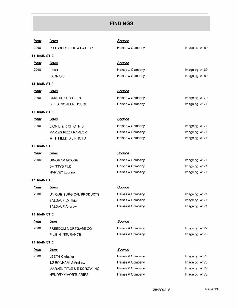
Year Uses Source
FINDINGS
Year Uses Source
2000 PITTSBORO PUB & EATERY Haines & Company Image pg. A169
13 MAIN ST E
Year Uses Source
2000 XXXX Haines & Company Image pg. A169
FARRIS S Haines & Company Image pg. A169
14 MAIN ST E
Year Uses Source
2000 BARE NECESSITIES Haines & Company Image pg. A170
BIFFS PIONEER HOUSE Haines & Company Image pg. A171
15 MAIN ST E
Year Uses Source
2000 ZION E & R CH CHRIST Haines & Company Image pg. A171
MARIES PIZZA PARLOR Haines & Company Image pg. A171
WHITFIELD D L PHOTO Haines & Company Image pg. A171
16 MAIN ST E
Year Uses Source
2000 GINGHAM GOOSE Haines & Company Image pg. A171
SMITTYS PUB Haines & Company Image pg. A171
HARVEY Leanne Haines & Company Image pg. A171
17 MAIN ST E
Year Uses Source
2000 UNIQUE SURGICAL PRODUCTS Haines & Company Image pg. A171
BALDAUF Cynthia Haines & Company Image pg. A171
BALDAUF Andrew Haines & Company Image pg. A171
18 MAIN ST E
Year Uses Source
2000 FREEDOM MORTGAGE CO Haines & Company Image pg. A172
P L B H INSURANCE Haines & Company Image pg. A173
19 MAIN ST E
Year Uses Source
2000 LEETH Christina Haines & Company Image pg. A173
1/2 BONHAM M Andrew Haines & Company Image pg. A173
MARVEL TITLE & E SCROW INC Haines & Company Image pg. A173
HENDRYX MORTUARIES Haines & Company Image pg. A173
3848966- 5 Page 33
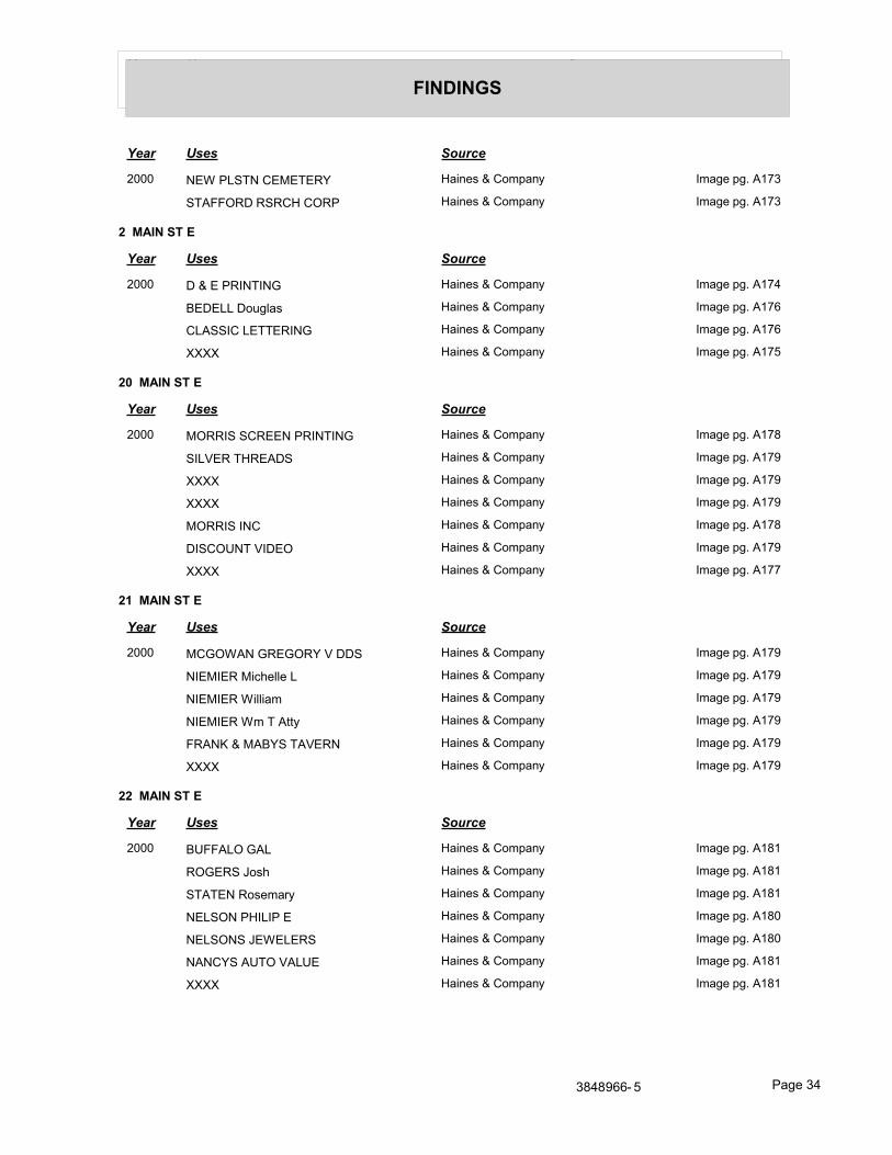
Year Uses Source
FINDINGS
Year Uses Source
2000 NEW PLSTN CEMETERY Haines & Company Image pg. A173
STAFFORD RSRCH CORP Haines & Company Image pg. A173
2 MAIN ST E
Year Uses Source
2000 D & E PRINTING Haines & Company Image pg. A174
BEDELL Douglas Haines & Company Image pg. A176
CLASSIC LETTERING Haines & Company Image pg. A176
XXXX Haines & Company Image pg. A175
20 MAIN ST E
Year Uses Source
2000 MORRIS SCREEN PRINTING Haines & Company Image pg. A178
SILVER THREADS Haines & Company Image pg. A179
XXXX Haines & Company Image pg. A179
XXXX Haines & Company Image pg. A179
MORRIS INC Haines & Company Image pg. A178
DISCOUNT VIDEO Haines & Company Image pg. A179
XXXX Haines & Company Image pg. A177
21 MAIN ST E
Year Uses Source
2000 MCGOWAN GREGORY V DDS Haines & Company Image pg. A179
NIEMIER Michelle L Haines & Company Image pg. A179
NIEMIER William Haines & Company Image pg. A179
NIEMIER Wm T Atty Haines & Company Image pg. A179
FRANK & MABYS TAVERN Haines & Company Image pg. A179
XXXX Haines & Company Image pg. A179
22 MAIN ST E
Year Uses Source
2000 BUFFALO GAL Haines & Company Image pg. A181
ROGERS Josh Haines & Company Image pg. A181
STATEN Rosemary Haines & Company Image pg. A181
NELSON PHILIP E Haines & Company Image pg. A180
NELSONS JEWELERS Haines & Company Image pg. A180
NANCYS AUTO VALUE Haines & Company Image pg. A181
XXXX Haines & Company Image pg. A181
3848966- 5 Page 34
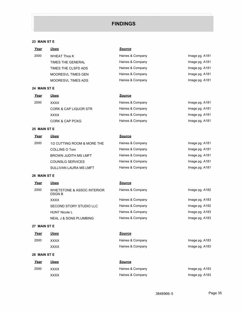
Year Uses Source
FINDINGS
23 MAIN ST E
Year Uses Source
2000 WHEAT Thos K Haines & Company Image pg. A181
TIMES THE GENERAL Haines & Company Image pg. A181
TIMES THE CLSFD ADS Haines & Company Image pg. A181
MOORESVL TIMES GEN Haines & Company Image pg. A181
MOORESVL TIMES ADS Haines & Company Image pg. A181
24 MAIN ST E
Year Uses Source
2000 XXXX Haines & Company Image pg. A181
CORK & CAP LIQUOR STR Haines & Company Image pg. A181
XXXX Haines & Company Image pg. A181
CORK & CAP PCKG Haines & Company Image pg. A181
25 MAIN ST E
Year Uses Source
2000 1/2 CUTTING ROOM & MORE THE Haines & Company Image pg. A181
COLLINS O Tom Haines & Company Image pg. A181
BROWN JUDITH MS LMFT Haines & Company Image pg. A181
COUNSLG SERVICES Haines & Company Image pg. A181
SULLIVAN LAURA MS LMFT Haines & Company Image pg. A181
26 MAIN ST E
Year Uses Source
2000 WHETSTONE & ASSOC INTERIOR DSGN B
Haines & Company Image pg. A182
XXXX Haines & Company Image pg. A183
SECOND STORY STUDIO LLC Haines & Company Image pg. A182
HUNT Nicole L Haines & Company Image pg. A183
NEAL J & SONS PLUMBING Haines & Company Image pg. A183
27 MAIN ST E
Year Uses Source
2000 XXXX Haines & Company Image pg. A183
XXXX Haines & Company Image pg. A183
28 MAIN ST E
Year Uses Source
2000 XXXX Haines & Company Image pg. A183
XXXX Haines & Company Image pg. A183
3848966- 5 Page 35
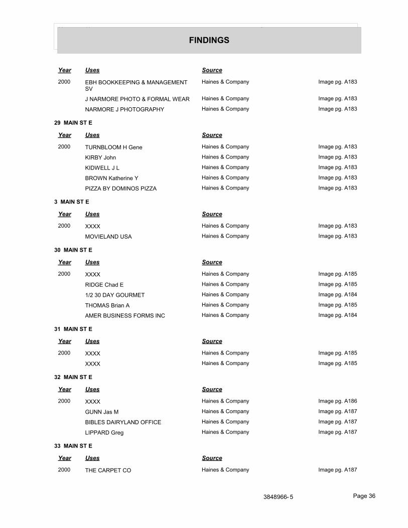
Year Uses Source
FINDINGS
Year Uses Source
2000 EBH BOOKKEEPING & MANAGEMENT SV
Haines & Company Image pg. A183
J NARMORE PHOTO & FORMAL WEAR Haines & Company Image pg. A183
NARMORE J PHOTOGRAPHY Haines & Company Image pg. A183
29 MAIN ST E
Year Uses Source
2000 TURNBLOOM H Gene Haines & Company Image pg. A183
KIRBY John Haines & Company Image pg. A183
KIDWELL J L Haines & Company Image pg. A183
BROWN Katherine Y Haines & Company Image pg. A183
PIZZA BY DOMINOS PIZZA Haines & Company Image pg. A183
3 MAIN ST E
Year Uses Source
2000 XXXX Haines & Company Image pg. A183
MOVIELAND USA Haines & Company Image pg. A183
30 MAIN ST E
Year Uses Source
2000 XXXX Haines & Company Image pg. A185
RIDGE Chad E Haines & Company Image pg. A185
1/2 30 DAY GOURMET Haines & Company Image pg. A184
THOMAS Brian A Haines & Company Image pg. A185
AMER BUSINESS FORMS INC Haines & Company Image pg. A184
31 MAIN ST E
Year Uses Source
2000 XXXX Haines & Company Image pg. A185
XXXX Haines & Company Image pg. A185
32 MAIN ST E
Year Uses Source
2000 XXXX Haines & Company Image pg. A186
GUNN Jas M Haines & Company Image pg. A187
BIBLES DAIRYLAND OFFICE Haines & Company Image pg. A187
LIPPARD Greg Haines & Company Image pg. A187
33 MAIN ST E
Year Uses Source
2000 THE CARPET CO Haines & Company Image pg. A187
3848966- 5 Page 36
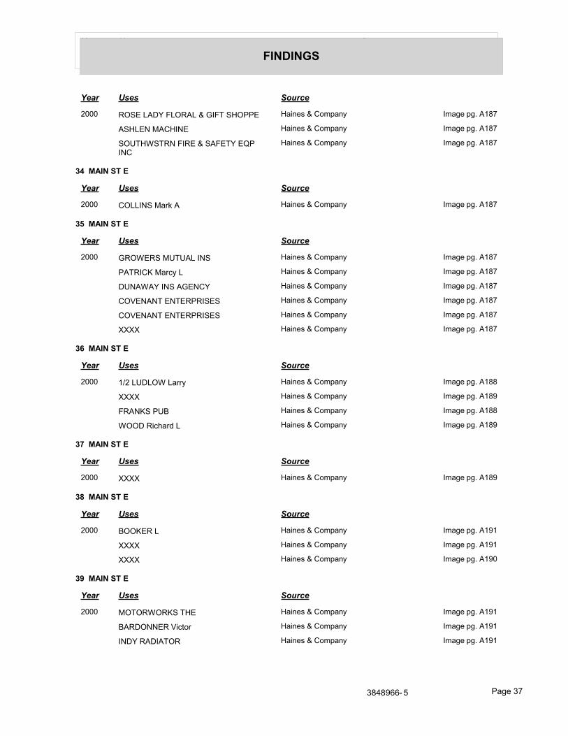
Year Uses Source
FINDINGS
Year Uses Source
2000 ROSE LADY FLORAL & GIFT SHOPPE Haines & Company Image pg. A187
ASHLEN MACHINE Haines & Company Image pg. A187
SOUTHWSTRN FIRE & SAFETY EQP INC
Haines & Company Image pg. A187
34 MAIN ST E
Year Uses Source
2000 COLLINS Mark A Haines & Company Image pg. A187
35 MAIN ST E
Year Uses Source
2000 GROWERS MUTUAL INS Haines & Company Image pg. A187
PATRICK Marcy L Haines & Company Image pg. A187
DUNAWAY INS AGENCY Haines & Company Image pg. A187
COVENANT ENTERPRISES Haines & Company Image pg. A187
COVENANT ENTERPRISES Haines & Company Image pg. A187
XXXX Haines & Company Image pg. A187
36 MAIN ST E
Year Uses Source
2000 1/2 LUDLOW Larry Haines & Company Image pg. A188
XXXX Haines & Company Image pg. A189
FRANKS PUB Haines & Company Image pg. A188
WOOD Richard L Haines & Company Image pg. A189
37 MAIN ST E
Year Uses Source
2000 XXXX Haines & Company Image pg. A189
38 MAIN ST E
Year Uses Source
2000 BOOKER L Haines & Company Image pg. A191
XXXX Haines & Company Image pg. A191
XXXX Haines & Company Image pg. A190
39 MAIN ST E
Year Uses Source
2000 MOTORWORKS THE Haines & Company Image pg. A191
BARDONNER Victor Haines & Company Image pg. A191
INDY RADIATOR Haines & Company Image pg. A191
3848966- 5 Page 37
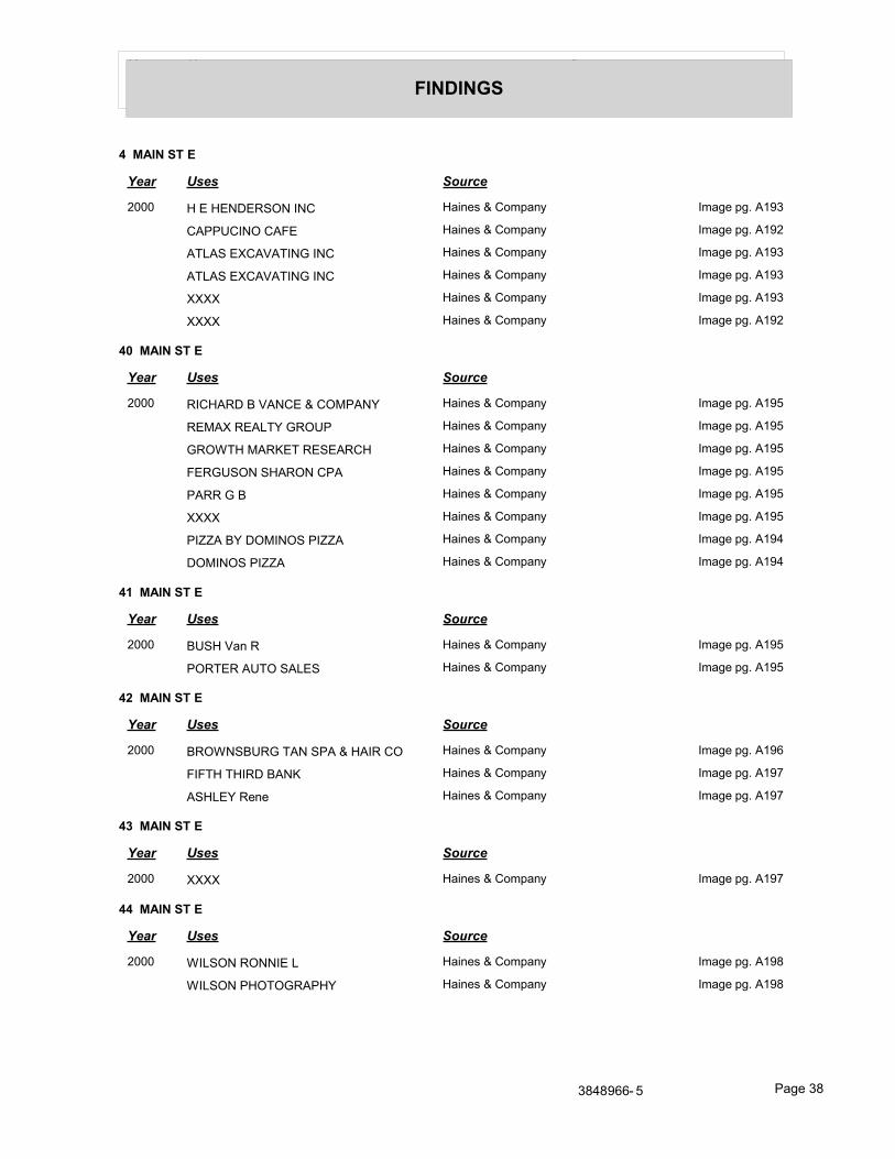
Year Uses Source
FINDINGS
4 MAIN ST E
Year Uses Source
2000 H E HENDERSON INC Haines & Company Image pg. A193
CAPPUCINO CAFE Haines & Company Image pg. A192
ATLAS EXCAVATING INC Haines & Company Image pg. A193
ATLAS EXCAVATING INC Haines & Company Image pg. A193
XXXX Haines & Company Image pg. A193
XXXX Haines & Company Image pg. A192
40 MAIN ST E
Year Uses Source
2000 RICHARD B VANCE & COMPANY Haines & Company Image pg. A195
REMAX REALTY GROUP Haines & Company Image pg. A195
GROWTH MARKET RESEARCH Haines & Company Image pg. A195
FERGUSON SHARON CPA Haines & Company Image pg. A195
PARR G B Haines & Company Image pg. A195
XXXX Haines & Company Image pg. A195
PIZZA BY DOMINOS PIZZA Haines & Company Image pg. A194
DOMINOS PIZZA Haines & Company Image pg. A194
41 MAIN ST E
Year Uses Source
2000 BUSH Van R Haines & Company Image pg. A195
PORTER AUTO SALES Haines & Company Image pg. A195
42 MAIN ST E
Year Uses Source
2000 BROWNSBURG TAN SPA & HAIR CO Haines & Company Image pg. A196
FIFTH THIRD BANK Haines & Company Image pg. A197
ASHLEY Rene Haines & Company Image pg. A197
43 MAIN ST E
Year Uses Source
2000 XXXX Haines & Company Image pg. A197
44 MAIN ST E
Year Uses Source
2000 WILSON RONNIE L Haines & Company Image pg. A198
WILSON PHOTOGRAPHY Haines & Company Image pg. A198
3848966- 5 Page 38
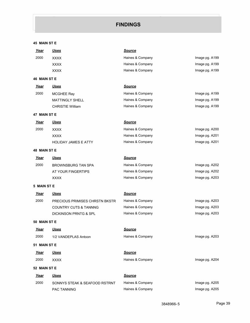
Year Uses Source
FINDINGS
45 MAIN ST E
Year Uses Source
2000 XXXX Haines & Company Image pg. A199
XXXX Haines & Company Image pg. A199
XXXX Haines & Company Image pg. A199
46 MAIN ST E
Year Uses Source
2000 MCGHEE Ray Haines & Company Image pg. A199
MATTINGLY SHELL Haines & Company Image pg. A199
CHRISTIE William Haines & Company Image pg. A199
47 MAIN ST E
Year Uses Source
2000 XXXX Haines & Company Image pg. A200
XXXX Haines & Company Image pg. A201
HOLIDAY JAMES E ATTY Haines & Company Image pg. A201
48 MAIN ST E
Year Uses Source
2000 BROWNSBURG TAN SPA Haines & Company Image pg. A202
AT YOUR FINGERTIPS Haines & Company Image pg. A202
XXXX Haines & Company Image pg. A203
5 MAIN ST E
Year Uses Source
2000 PRECIOUS PRIMISES CHRSTN BKSTR Haines & Company Image pg. A203
COUNTRY CUTS & TANNNG Haines & Company Image pg. A203
DICKINSON PRNTG & SPL Haines & Company Image pg. A203
50 MAIN ST E
Year Uses Source
2000 1/2 VANDEPLAS Antoon Haines & Company Image pg. A203
51 MAIN ST E
Year Uses Source
2000 XXXX Haines & Company Image pg. A204
52 MAIN ST E
Year Uses Source
2000 SONNYS STEAK & SEAFOOD RSTRNT Haines & Company Image pg. A205
PAC TANNING Haines & Company Image pg. A205
3848966- 5 Page 39
Year Uses Source
FINDINGS
Year Uses Source
2000 BROWNSBURG PCKG LQR Haines & Company Image pg. A204
53 MAIN ST E
Year Uses Source
2000 ROE Herbert D Haines & Company Image pg. A207
XXXX Haines & Company Image pg. A206
1/2 WADE Robert Haines & Company Image pg. A207
54 MAIN ST E
Year Uses Source
2000 HAYES Donald Haines & Company Image pg. A207
55 MAIN ST E
Year Uses Source
2000 BROWNSBURG FIRE ADMINISTRATIVE Haines & Company Image pg. A208
BROWNSBURG CTY FIRE ADMIN Haines & Company Image pg. A208
1/2 HUFFER Michael D Haines & Company Image pg. A209
BROWNSBURG TOWN FIRE ADMIN Haines & Company Image pg. A208
BROWNSBURG CTY FIRE ADMIN Haines & Company Image pg. A208
BROWNSBURG TOWN FIRE ADMIN Haines & Company Image pg. A208
PARKES Traci M Haines & Company Image pg. A209
56 MAIN ST E
Year Uses Source
2000 XXXX Haines & Company Image pg. A210
BROWNING Jackie Haines & Company Image pg. A211
57 MAIN ST E
Year Uses Source
2000 XXXX Haines & Company Image pg. A212
6 MAIN ST E
Year Uses Source
2000 NEEL JEFF S ATTY Haines & Company Image pg. A212
WOLF SARAH M Haines & Company Image pg. A212
WOLF WM H ATTY Haines & Company Image pg. A212
WOLF & BURROW ATTYS Haines & Company Image pg. A212
REPUBLICAN NWSPPR Haines & Company Image pg. A212
3848966- 5 Page 40
Year Uses Source
FINDINGS
60 MAIN ST E
Year Uses Source
2000 XXXX Haines & Company Image pg. A213
63 MAIN ST E
Year Uses Source
2000 RICKETTS Scott Haines & Company Image pg. A213
HENRY Bobby Haines & Company Image pg. A213
XXXX Haines & Company Image pg. A213
7 MAIN ST E
Year Uses Source
2000 XXXX Haines & Company Image pg. A214
8 MAIN ST E
Year Uses Source
2000 TOTAL RECALL ANTQ Haines & Company Image pg. A214
MAGIC PRINT INC Haines & Company Image pg. A215
9 MAIN ST E
Year Uses Source
2000 HANCOCK CO AUDITOR Haines & Company Image pg. A216
XXXX Haines & Company Image pg. A217
MAIN ST N
1 MAIN ST N
Year Uses Source
2000 BROOKLYN MASON C Haines & Company Image pg. A218
10 MAIN ST N
Year Uses Source
2000 BROOKLYN VOL FIRE ADMIN Haines & Company Image pg. A218
FIRE BROOKLYN Haines & Company Image pg. A218
11 MAIN ST N
Year Uses Source
2000 RITTENBERRY Christopher J Haines & Company Image pg. A219
MARSHALL Brian Haines & Company Image pg. A218
1991 No Return R. L. Polk & Co.
3848966- 5 Page 41
Year Uses Source
FINDINGS
12 MAIN ST N
Year Uses Source
2000 XXXX Haines & Company Image pg. A220
13 MAIN ST N
Year Uses Source
2000 DAVIS T S Haines & Company Image pg. A220
XXXX Haines & Company Image pg. A220
15 MAIN ST N
Year Uses Source
2000 BERRYMAN Donald R Haines & Company Image pg. A220
2 MAIN ST N
Year Uses Source
2000 COILS BARBER SHOP Haines & Company Image pg. A221
XXXX Haines & Company Image pg. A220
20 MAIN ST N
Year Uses Source
2000 XXXX Haines & Company Image pg. A222
21 MAIN ST N
Year Uses Source
2000 SHINE DON F Haines & Company Image pg. A222
SHINE Wm Haines & Company Image pg. A222
DEBAUN T Haines & Company Image pg. A222
SHINE Don F Haines & Company Image pg. A222
DON SHINE REALTY CO Haines & Company Image pg. A222
CLAPPER M Haines & Company Image pg. A222
1991 Apartments R. L. Polk & Co.
Shine Donald F R. L. Polk & Co.
Turner Robt K R. L. Polk & Co.
Clapper M R. L. Polk & Co.
Shine Wm C R. L. Polk & Co.
23 MAIN ST N
Year Uses Source
2000 WINTEREGG JON B Haines & Company Image pg. A222
LANGDON SHAW ASSOC INC Haines & Company Image pg. A222
XXXX Haines & Company Image pg. A222
3848966- 5 Page 42
Year Uses Source
FINDINGS
Year Uses Source
2000 ACCELERATED REPORTING AGENCY Haines & Company Image pg. A222
25 MAIN ST N
Year Uses Source
2000 KELLAMS G R & ASSOCTS Haines & Company Image pg. A222
SMITH Norman R Haines & Company Image pg. A222
1991 Drews Earl C R. L. Polk & Co.
27 MAIN ST N
Year Uses Source
2000 BILBREY J W Haines & Company Image pg. A222
BILBREY Todd Haines & Company Image pg. A222
1991 Bilbrey Jos W R. L. Polk & Co.
28 MAIN ST N
Year Uses Source
2000 XXXX Haines & Company Image pg. A222
XXXX Haines & Company Image pg. A222
32 MAIN ST N
Year Uses Source
2000 XXXX Haines & Company Image pg. A222
1991 Tillman Ursula R. L. Polk & Co.
33 MAIN ST N
Year Uses Source
2000 LINCARE AREA OFFICE Haines & Company Image pg. A222
37 MAIN ST N
Year Uses Source
2000 THOMAN Robin M DDS Haines & Company Image pg. A222
THROCKMORTON M DDS Haines & Company Image pg. A222
1991 Thoman Robin M R. L. Polk & Co.
4 MAIN ST N
Year Uses Source
2000 BROOKLYN TOWN Haines & Company Image pg. A222
43 MAIN ST N
Year Uses Source
2000 XXXX Haines & Company Image pg. A222
3848966- 5 Page 43
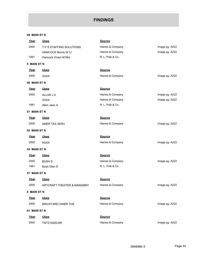
Year Uses Source
FINDINGS
48 MAIN ST N
Year Uses Source
2000 T P S STAFFING SOLUTIONS Haines & Company Image pg. A222
HANCOCK Morris W Lt Haines & Company Image pg. A222
1991 Hancock Vivien M Mrs R. L. Polk & Co.
5 MAIN ST N
Year Uses Source
2000 XXXX Haines & Company Image pg. A222
50 MAIN ST N
Year Uses Source
2000 ALLAN J A Haines & Company Image pg. A222
XXXX Haines & Company Image pg. A222
1991 Allen Jean A R. L. Polk & Co.
51 MAIN ST N
Year Uses Source
2000 AMER TAX SERV Haines & Company Image pg. A222
52 MAIN ST N
Year Uses Source
2000 XXXX Haines & Company Image pg. A222
54 MAIN ST N
Year Uses Source
2000 BUSH S Haines & Company Image pg. A222
1991 Bush Glen D R. L. Polk & Co.
57 MAIN ST N
Year Uses Source
2000 ARTCRAFT THEATER & MANGMNT Haines & Company Image pg. A222
6 MAIN ST N
Year Uses Source
2000 BRICKYARD DINER THE Haines & Company Image pg. A222
61 MAIN ST N
Year Uses Source
2000 TNTS NASCAR Haines & Company Image pg. A222
3848966- 5 Page 44
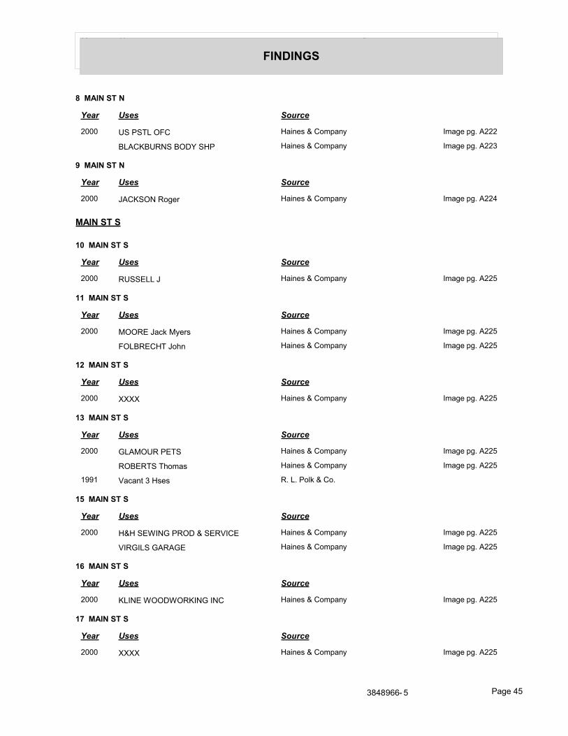
Year Uses Source
FINDINGS
8 MAIN ST N
Year Uses Source
2000 US PSTL OFC Haines & Company Image pg. A222
BLACKBURNS BODY SHP Haines & Company Image pg. A223
9 MAIN ST N
Year Uses Source
2000 JACKSON Roger Haines & Company Image pg. A224
MAIN ST S
10 MAIN ST S
Year Uses Source
2000 RUSSELL J Haines & Company Image pg. A225
11 MAIN ST S
Year Uses Source
2000 MOORE Jack Myers Haines & Company Image pg. A225
FOLBRECHT John Haines & Company Image pg. A225
12 MAIN ST S
Year Uses Source
2000 XXXX Haines & Company Image pg. A225
13 MAIN ST S
Year Uses Source
2000 GLAMOUR PETS Haines & Company Image pg. A225
ROBERTS Thomas Haines & Company Image pg. A225
1991 Vacant 3 Hses R. L. Polk & Co.
15 MAIN ST S
Year Uses Source
2000 H&H SEWING PROD & SERVICE Haines & Company Image pg. A225
VIRGILS GARAGE Haines & Company Image pg. A225
16 MAIN ST S
Year Uses Source
2000 KLINE WOODWORKING INC Haines & Company Image pg. A225
17 MAIN ST S
Year Uses Source
2000 XXXX Haines & Company Image pg. A225
3848966- 5 Page 45
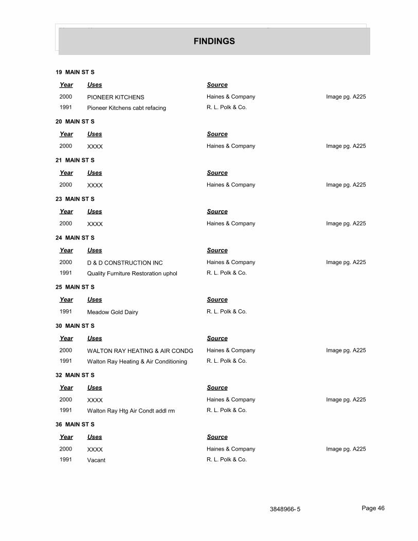
Year Uses Source
FINDINGS
19 MAIN ST S
Year Uses Source
2000 PIONEER KITCHENS Haines & Company Image pg. A225
1991 Pioneer Kitchens cabt refacing R. L. Polk & Co.
20 MAIN ST S
Year Uses Source
2000 XXXX Haines & Company Image pg. A225
21 MAIN ST S
Year Uses Source
2000 XXXX Haines & Company Image pg. A225
23 MAIN ST S
Year Uses Source
2000 XXXX Haines & Company Image pg. A225
24 MAIN ST S
Year Uses Source
2000 D & D CONSTRUCTION INC Haines & Company Image pg. A225
1991 Quality Furniture Restoration uphol R. L. Polk & Co.
25 MAIN ST S
Year Uses Source
1991 Meadow Gold Dairy R. L. Polk & Co.
30 MAIN ST S
Year Uses Source
2000 WALTON RAY HEATING & AIR CONDG Haines & Company Image pg. A225
1991 Walton Ray Heating & Air Conditioning R. L. Polk & Co.
32 MAIN ST S
Year Uses Source
2000 XXXX Haines & Company Image pg. A225
1991 Walton Ray Htg Air Condt addl rm R. L. Polk & Co.
36 MAIN ST S
Year Uses Source
2000 XXXX Haines & Company Image pg. A225
1991 Vacant R. L. Polk & Co.
3848966- 5 Page 46
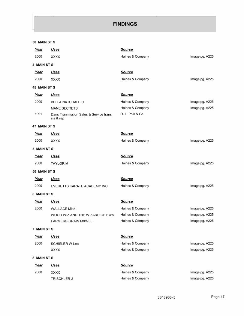
Year Uses Source
FINDINGS
38 MAIN ST S
Year Uses Source
2000 XXXX Haines & Company Image pg. A225
4 MAIN ST S
Year Uses Source
2000 XXXX Haines & Company Image pg. A225
45 MAIN ST S
Year Uses Source
2000 BELLA NATURALE U Haines & Company Image pg. A225
MANE SECRETS Haines & Company Image pg. A225
1991 Dans Tranmission Sales & Service trans sls & rep
R. L. Polk & Co.
47 MAIN ST S
Year Uses Source
2000 XXXX Haines & Company Image pg. A225
5 MAIN ST S
Year Uses Source
2000 TAYLOR M Haines & Company Image pg. A225
50 MAIN ST S
Year Uses Source
2000 EVERETTS KARATE ACADEMY INC Haines & Company Image pg. A225
6 MAIN ST S
Year Uses Source
2000 WALLACE Mike Haines & Company Image pg. A225
WOOD WIZ AND THE WIZARD OF SWS Haines & Company Image pg. A225
FARMERS GRAIN MXWLL Haines & Company Image pg. A225
7 MAIN ST S
Year Uses Source
2000 SCHISLER W Lee Haines & Company Image pg. A225
XXXX Haines & Company Image pg. A225
8 MAIN ST S
Year Uses Source
2000 XXXX Haines & Company Image pg. A225
TRISCHLER J Haines & Company Image pg. A225
3848966- 5 Page 47
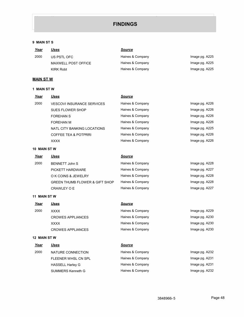
Year Uses Source
FINDINGS
9 MAIN ST S
Year Uses Source
2000 US PSTL OFC Haines & Company Image pg. A225
MAXWELL POST OFFICE Haines & Company Image pg. A225
KIRK Robt Haines & Company Image pg. A225
MAIN ST W
1 MAIN ST W
Year Uses Source
2000 VESCOVI INSURANCE SERVICES Haines & Company Image pg. A226
SUES FLOWER SHOP Haines & Company Image pg. A226
FOREHAN S Haines & Company Image pg. A226
FOREHAN M Haines & Company Image pg. A226
NATL CITY BANKING LOCATIONS Haines & Company Image pg. A225
COFFEE TEA & POTPRRI Haines & Company Image pg. A226
XXXX Haines & Company Image pg. A226
10 MAIN ST W
Year Uses Source
2000 BENNETT John S Haines & Company Image pg. A228
PICKETT HARDWARE Haines & Company Image pg. A227
O K COINS & JEWELRY Haines & Company Image pg. A228
GREEN THUMB FLOWER & GIFT SHOP Haines & Company Image pg. A228
CRAWLEY O E Haines & Company Image pg. A227
11 MAIN ST W
Year Uses Source
2000 XXXX Haines & Company Image pg. A229
CROWES APPLIANCES Haines & Company Image pg. A230
XXXX Haines & Company Image pg. A230
CROWES APPLIANCES Haines & Company Image pg. A230
12 MAIN ST W
Year Uses Source
2000 NATURE CONNECTION Haines & Company Image pg. A232
FLEENER WHSL CN SPL Haines & Company Image pg. A231
HASSELL Harley G Haines & Company Image pg. A231
SUMMERS Kenneth G Haines & Company Image pg. A232
3848966- 5 Page 48
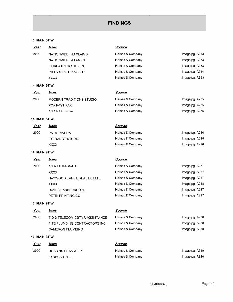
Year Uses Source
FINDINGS
13 MAIN ST W
Year Uses Source
2000 NATIONWDE INS CLAIMS Haines & Company Image pg. A233
NATIONWDE INS AGENT Haines & Company Image pg. A233
KIRKPATRICK STEVEN Haines & Company Image pg. A233
PITTSBORO PIZZA SHP Haines & Company Image pg. A234
XXXX Haines & Company Image pg. A233
14 MAIN ST W
Year Uses Source
2000 MODERN TRADITIONS STUDIO Haines & Company Image pg. A235
PCA FAST FAX Haines & Company Image pg. A235
1/2 CRAFT Emie Haines & Company Image pg. A235
15 MAIN ST W
Year Uses Source
2000 PATS TAVERN Haines & Company Image pg. A236
IDF DANCE STUDIO Haines & Company Image pg. A235
XXXX Haines & Company Image pg. A236
16 MAIN ST W
Year Uses Source
2000 1/2 RATLIFF Kelli L Haines & Company Image pg. A237
XXXX Haines & Company Image pg. A237
HAYWOOD EARL L REAL ESTATE Haines & Company Image pg. A237
XXXX Haines & Company Image pg. A238
DAVES BARBERSHOPS Haines & Company Image pg. A237
PETRI PRINTING CO Haines & Company Image pg. A237
17 MAIN ST W
Year Uses Source
2000 T D S TELECOM CSTMR ASSISTANCE Haines & Company Image pg. A238
FITE PLUMBING CONTRACTORS INC Haines & Company Image pg. A238
CAMERON PLUMBING Haines & Company Image pg. A238
19 MAIN ST W
Year Uses Source
2000 DOBBINS DEAN ATTY Haines & Company Image pg. A239
ZYDECO GRILL Haines & Company Image pg. A240
3848966- 5 Page 49
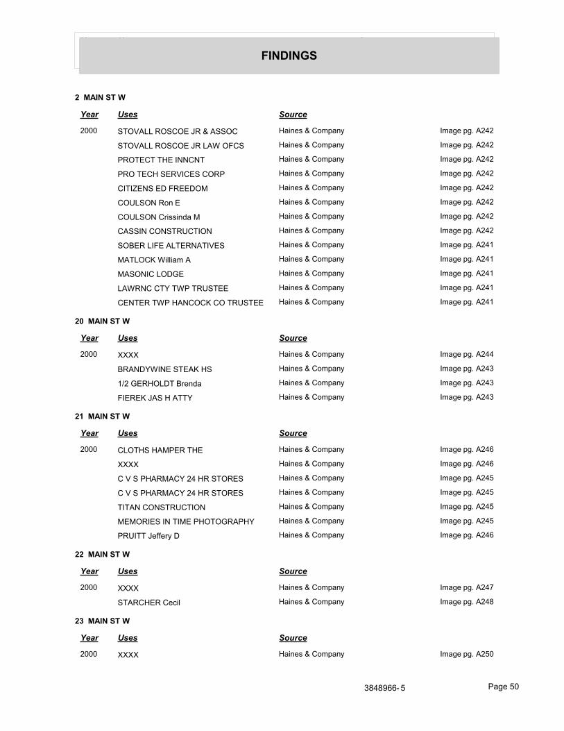
Year Uses Source
FINDINGS
2 MAIN ST W
Year Uses Source
2000 STOVALL ROSCOE JR & ASSOC Haines & Company Image pg. A242
STOVALL ROSCOE JR LAW OFCS Haines & Company Image pg. A242
PROTECT THE INNCNT Haines & Company Image pg. A242
PRO TECH SERVICES CORP Haines & Company Image pg. A242
CITIZENS ED FREEDOM Haines & Company Image pg. A242
COULSON Ron E Haines & Company Image pg. A242
COULSON Crissinda M Haines & Company Image pg. A242
CASSIN CONSTRUCTION Haines & Company Image pg. A242
SOBER LIFE ALTERNATIVES Haines & Company Image pg. A241
MATLOCK William A Haines & Company Image pg. A241
MASONIC LODGE Haines & Company Image pg. A241
LAWRNC CTY TWP TRUSTEE Haines & Company Image pg. A241
CENTER TWP HANCOCK CO TRUSTEE Haines & Company Image pg. A241
20 MAIN ST W
Year Uses Source
2000 XXXX Haines & Company Image pg. A244
BRANDYWINE STEAK HS Haines & Company Image pg. A243
1/2 GERHOLDT Brenda Haines & Company Image pg. A243
FIEREK JAS H ATTY Haines & Company Image pg. A243
21 MAIN ST W
Year Uses Source
2000 CLOTHS HAMPER THE Haines & Company Image pg. A246
XXXX Haines & Company Image pg. A246
C V S PHARMACY 24 HR STORES Haines & Company Image pg. A245
C V S PHARMACY 24 HR STORES Haines & Company Image pg. A245
TITAN CONSTRUCTION Haines & Company Image pg. A245
MEMORIES IN TIME PHOTOGRAPHY Haines & Company Image pg. A245
PRUITT Jeffery D Haines & Company Image pg. A246
22 MAIN ST W
Year Uses Source
2000 XXXX Haines & Company Image pg. A247
STARCHER Cecil Haines & Company Image pg. A248
23 MAIN ST W
Year Uses Source
2000 XXXX Haines & Company Image pg. A250
3848966- 5 Page 50
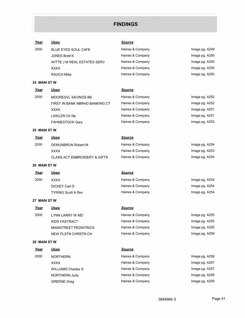
Year Uses Source
FINDINGS
Year Uses Source
2000 BLUE EYED SOUL CAFE Haines & Company Image pg. A249
JONES Brett K Haines & Company Image pg. A250
WITTE J M REAL ESTATES SERV Haines & Company Image pg. A250
XXXX Haines & Company Image pg. A250
RAUCH Mike Haines & Company Image pg. A250
24 MAIN ST W
Year Uses Source
2000 MOORESVL SAVINGS BK Haines & Company Image pg. A252
FIRST IN BANK NBRHD BANKING CT Haines & Company Image pg. A252
XXXX Haines & Company Image pg. A251
LAWLER Ch Ns Haines & Company Image pg. A251
FAHNESTOCK Gary Haines & Company Image pg. A252
25 MAIN ST W
Year Uses Source
2000 DEMUNBRUN Robert M Haines & Company Image pg. A254
XXXX Haines & Company Image pg. A253
CLASS ACT EMBROIDERY & GIFTS Haines & Company Image pg. A254
26 MAIN ST W
Year Uses Source
2000 XXXX Haines & Company Image pg. A254
DICKEY Carl D Haines & Company Image pg. A254
TYRING Scott A Rev Haines & Company Image pg. A254
27 MAIN ST W
Year Uses Source
2000 LYNN LARRY W MD Haines & Company Image pg. A255
KIDS FASTRACT Haines & Company Image pg. A255
MAINSTREET PEDIATRICS Haines & Company Image pg. A255
NEW PLSTN CHRSTN CH Haines & Company Image pg. A256
28 MAIN ST W
Year Uses Source
2000 NORTHERN Haines & Company Image pg. A258
XXXX Haines & Company Image pg. A257
WILLIAMS Charles S Haines & Company Image pg. A257
NORTHERN Judy Haines & Company Image pg. A258
GREENE Greg Haines & Company Image pg. A258
3848966- 5 Page 51
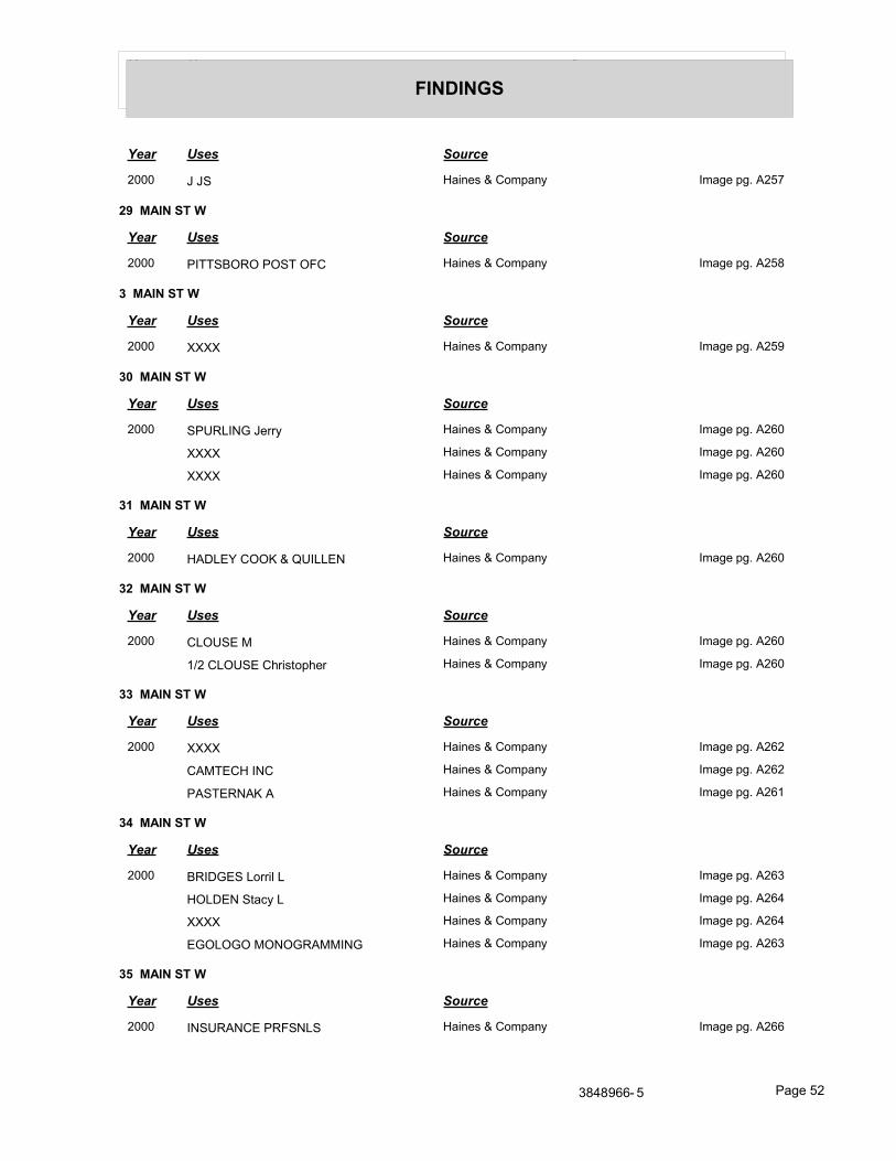
Year Uses Source
FINDINGS
Year Uses Source
2000 J JS Haines & Company Image pg. A257
29 MAIN ST W
Year Uses Source
2000 PITTSBORO POST OFC Haines & Company Image pg. A258
3 MAIN ST W
Year Uses Source
2000 XXXX Haines & Company Image pg. A259
30 MAIN ST W
Year Uses Source
2000 SPURLING Jerry Haines & Company Image pg. A260
XXXX Haines & Company Image pg. A260
XXXX Haines & Company Image pg. A260
31 MAIN ST W
Year Uses Source
2000 HADLEY COOK & QUILLEN Haines & Company Image pg. A260
32 MAIN ST W
Year Uses Source
2000 CLOUSE M Haines & Company Image pg. A260
1/2 CLOUSE Christopher Haines & Company Image pg. A260
33 MAIN ST W
Year Uses Source
2000 XXXX Haines & Company Image pg. A262
CAMTECH INC Haines & Company Image pg. A262
PASTERNAK A Haines & Company Image pg. A261
34 MAIN ST W
Year Uses Source
2000 BRIDGES Lorril L Haines & Company Image pg. A263
HOLDEN Stacy L Haines & Company Image pg. A264
XXXX Haines & Company Image pg. A264
EGOLOGO MONOGRAMMING Haines & Company Image pg. A263
35 MAIN ST W
Year Uses Source
2000 INSURANCE PRFSNLS Haines & Company Image pg. A266
3848966- 5 Page 52
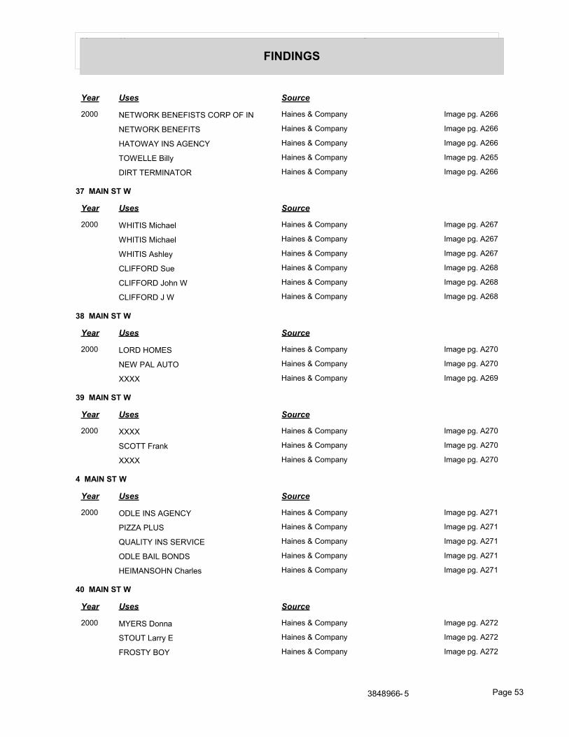
Year Uses Source
FINDINGS
Year Uses Source
2000 NETWORK BENEFISTS CORP OF IN Haines & Company Image pg. A266
NETWORK BENEFITS Haines & Company Image pg. A266
HATOWAY INS AGENCY Haines & Company Image pg. A266
TOWELLE Billy Haines & Company Image pg. A265
DIRT TERMINATOR Haines & Company Image pg. A266
37 MAIN ST W
Year Uses Source
2000 WHITIS Michael Haines & Company Image pg. A267
WHITIS Michael Haines & Company Image pg. A267
WHITIS Ashley Haines & Company Image pg. A267
CLIFFORD Sue Haines & Company Image pg. A268
CLIFFORD John W Haines & Company Image pg. A268
CLIFFORD J W Haines & Company Image pg. A268
38 MAIN ST W
Year Uses Source
2000 LORD HOMES Haines & Company Image pg. A270
NEW PAL AUTO Haines & Company Image pg. A270
XXXX Haines & Company Image pg. A269
39 MAIN ST W
Year Uses Source
2000 XXXX Haines & Company Image pg. A270
SCOTT Frank Haines & Company Image pg. A270
XXXX Haines & Company Image pg. A270
4 MAIN ST W
Year Uses Source
2000 ODLE INS AGENCY Haines & Company Image pg. A271
PIZZA PLUS Haines & Company Image pg. A271
QUALITY INS SERVICE Haines & Company Image pg. A271
ODLE BAIL BONDS Haines & Company Image pg. A271
HEIMANSOHN Charles Haines & Company Image pg. A271
40 MAIN ST W
Year Uses Source
2000 MYERS Donna Haines & Company Image pg. A272
STOUT Larry E Haines & Company Image pg. A272
FROSTY BOY Haines & Company Image pg. A272
3848966- 5 Page 53
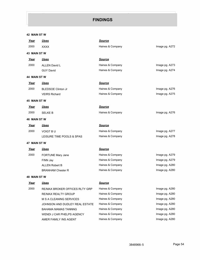
Year Uses Source
FINDINGS
42 MAIN ST W
Year Uses Source
2000 XXXX Haines & Company Image pg. A272
43 MAIN ST W
Year Uses Source
2000 ALLEN David L Haines & Company Image pg. A273
GUY David Haines & Company Image pg. A274
44 MAIN ST W
Year Uses Source
2000 BLEDSOE Clinton Jr Haines & Company Image pg. A276
VEIRS Richard Haines & Company Image pg. A275
45 MAIN ST W
Year Uses Source
2000 SELKE B Haines & Company Image pg. A276
46 MAIN ST W
Year Uses Source
2000 VOIGT B U Haines & Company Image pg. A277
LEISURE TIME POOLS & SPAS Haines & Company Image pg. A278
47 MAIN ST W
Year Uses Source
2000 FORTUNE Mary Jane Haines & Company Image pg. A279
FINN Jay Haines & Company Image pg. A279
ALLEN Robert B Haines & Company Image pg. A280
BRANHAM Chester R Haines & Company Image pg. A280
48 MAIN ST W
Year Uses Source
2000 RE/MAX BROKER OFFICES RLTY GRP Haines & Company Image pg. A280
RE/MAX REALTY GROUP Haines & Company Image pg. A280
M S A CLEANING SERVICES Haines & Company Image pg. A280
JOHNSON AND DUDLEY REAL ESTATE Haines & Company Image pg. A280
BAHAMA MAMAS TANNNG Haines & Company Image pg. A280
WENDI J CAR PHELPS AGENCY Haines & Company Image pg. A280
AMER FAMILY INS AGENT Haines & Company Image pg. A280
3848966- 5 Page 54
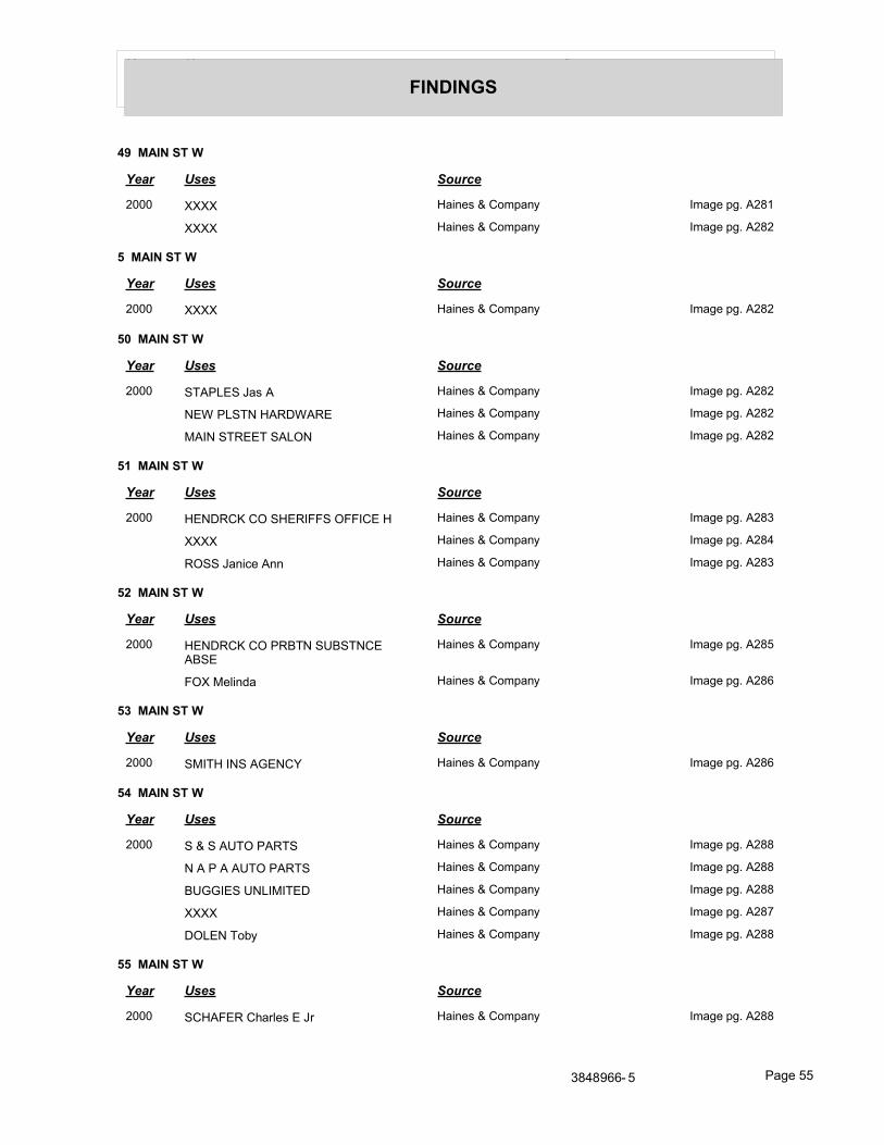
Year Uses Source
FINDINGS
49 MAIN ST W
Year Uses Source
2000 XXXX Haines & Company Image pg. A281
XXXX Haines & Company Image pg. A282
5 MAIN ST W
Year Uses Source
2000 XXXX Haines & Company Image pg. A282
50 MAIN ST W
Year Uses Source
2000 STAPLES Jas A Haines & Company Image pg. A282
NEW PLSTN HARDWARE Haines & Company Image pg. A282
MAIN STREET SALON Haines & Company Image pg. A282
51 MAIN ST W
Year Uses Source
2000 HENDRCK CO SHERIFFS OFFICE H Haines & Company Image pg. A283
XXXX Haines & Company Image pg. A284
ROSS Janice Ann Haines & Company Image pg. A283
52 MAIN ST W
Year Uses Source
2000 HENDRCK CO PRBTN SUBSTNCE ABSE
Haines & Company Image pg. A285
FOX Melinda Haines & Company Image pg. A286
53 MAIN ST W
Year Uses Source
2000 SMITH INS AGENCY Haines & Company Image pg. A286
54 MAIN ST W
Year Uses Source
2000 S & S AUTO PARTS Haines & Company Image pg. A288
N A P A AUTO PARTS Haines & Company Image pg. A288
BUGGIES UNLIMITED Haines & Company Image pg. A288
XXXX Haines & Company Image pg. A287
DOLEN Toby Haines & Company Image pg. A288
55 MAIN ST W
Year Uses Source
2000 SCHAFER Charles E Jr Haines & Company Image pg. A288
3848966- 5 Page 55
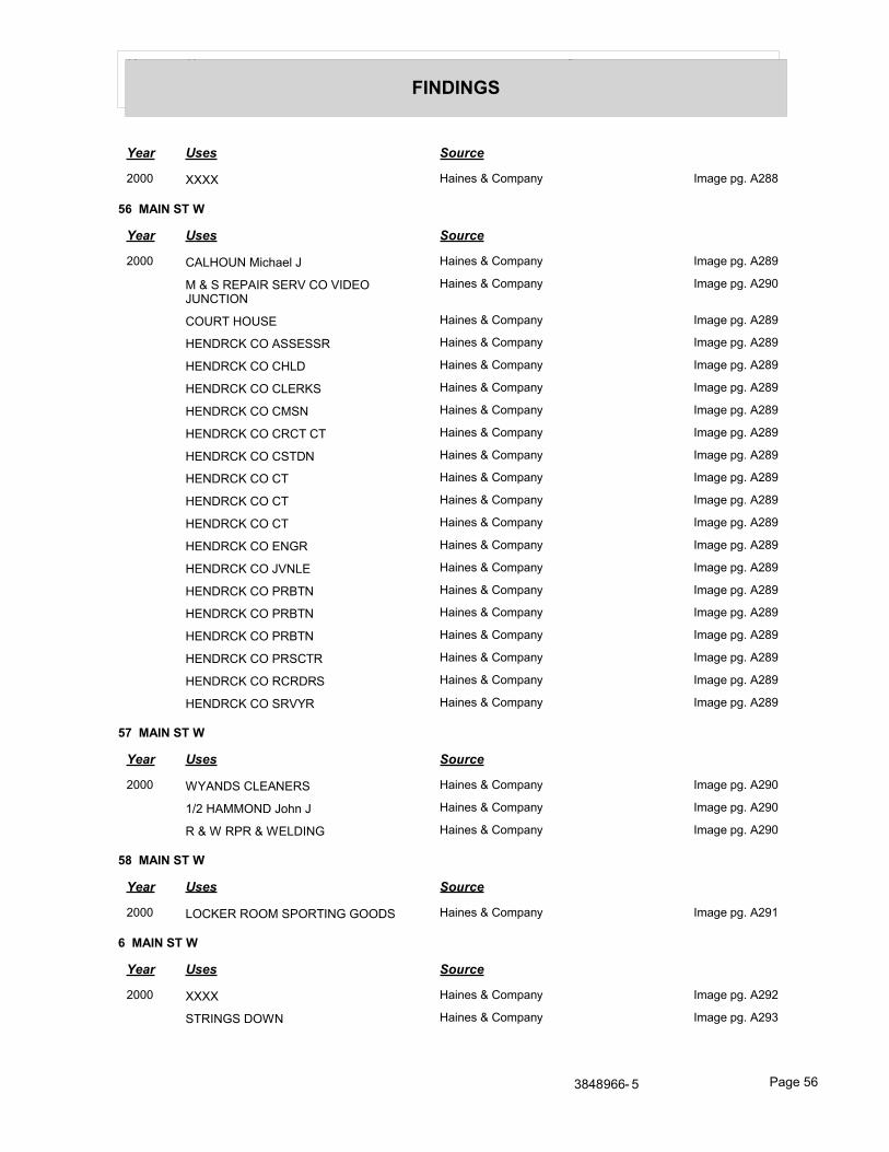
Year Uses Source
FINDINGS
Year Uses Source
2000 XXXX Haines & Company Image pg. A288
56 MAIN ST W
Year Uses Source
2000 CALHOUN Michael J Haines & Company Image pg. A289
M & S REPAIR SERV CO VIDEO JUNCTION
Haines & Company Image pg. A290
COURT HOUSE Haines & Company Image pg. A289
HENDRCK CO ASSESSR Haines & Company Image pg. A289
HENDRCK CO CHLD Haines & Company Image pg. A289
HENDRCK CO CLERKS Haines & Company Image pg. A289
HENDRCK CO CMSN Haines & Company Image pg. A289
HENDRCK CO CRCT CT Haines & Company Image pg. A289
HENDRCK CO CSTDN Haines & Company Image pg. A289
HENDRCK CO CT Haines & Company Image pg. A289
HENDRCK CO CT Haines & Company Image pg. A289
HENDRCK CO CT Haines & Company Image pg. A289
HENDRCK CO ENGR Haines & Company Image pg. A289
HENDRCK CO JVNLE Haines & Company Image pg. A289
HENDRCK CO PRBTN Haines & Company Image pg. A289
HENDRCK CO PRBTN Haines & Company Image pg. A289
HENDRCK CO PRBTN Haines & Company Image pg. A289
HENDRCK CO PRSCTR Haines & Company Image pg. A289
HENDRCK CO RCRDRS Haines & Company Image pg. A289
HENDRCK CO SRVYR Haines & Company Image pg. A289
57 MAIN ST W
Year Uses Source
2000 WYANDS CLEANERS Haines & Company Image pg. A290
1/2 HAMMOND John J Haines & Company Image pg. A290
R & W RPR & WELDING Haines & Company Image pg. A290
58 MAIN ST W
Year Uses Source
2000 LOCKER ROOM SPORTING GOODS Haines & Company Image pg. A291
6 MAIN ST W
Year Uses Source
2000 XXXX Haines & Company Image pg. A292
STRINGS DOWN Haines & Company Image pg. A293
3848966- 5 Page 56
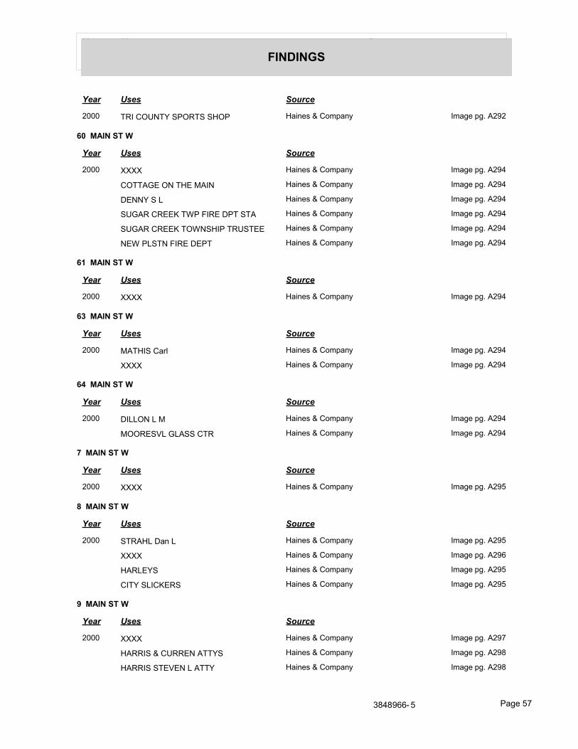
Year Uses Source
FINDINGS
Year Uses Source
2000 TRI COUNTY SPORTS SHOP Haines & Company Image pg. A292
60 MAIN ST W
Year Uses Source
2000 XXXX Haines & Company Image pg. A294
COTTAGE ON THE MAIN Haines & Company Image pg. A294
DENNY S L Haines & Company Image pg. A294
SUGAR CREEK TWP FIRE DPT STA Haines & Company Image pg. A294
SUGAR CREEK TOWNSHIP TRUSTEE Haines & Company Image pg. A294
NEW PLSTN FIRE DEPT Haines & Company Image pg. A294
61 MAIN ST W
Year Uses Source
2000 XXXX Haines & Company Image pg. A294
63 MAIN ST W
Year Uses Source
2000 MATHIS Carl Haines & Company Image pg. A294
XXXX Haines & Company Image pg. A294
64 MAIN ST W
Year Uses Source
2000 DILLON L M Haines & Company Image pg. A294
MOORESVL GLASS CTR Haines & Company Image pg. A294
7 MAIN ST W
Year Uses Source
2000 XXXX Haines & Company Image pg. A295
8 MAIN ST W
Year Uses Source
2000 STRAHL Dan L Haines & Company Image pg. A295
XXXX Haines & Company Image pg. A296
HARLEYS Haines & Company Image pg. A295
CITY SLICKERS Haines & Company Image pg. A295
9 MAIN ST W
Year Uses Source
2000 XXXX Haines & Company Image pg. A297
HARRIS & CURREN ATTYS Haines & Company Image pg. A298
HARRIS STEVEN L ATTY Haines & Company Image pg. A298
3848966- 5 Page 57
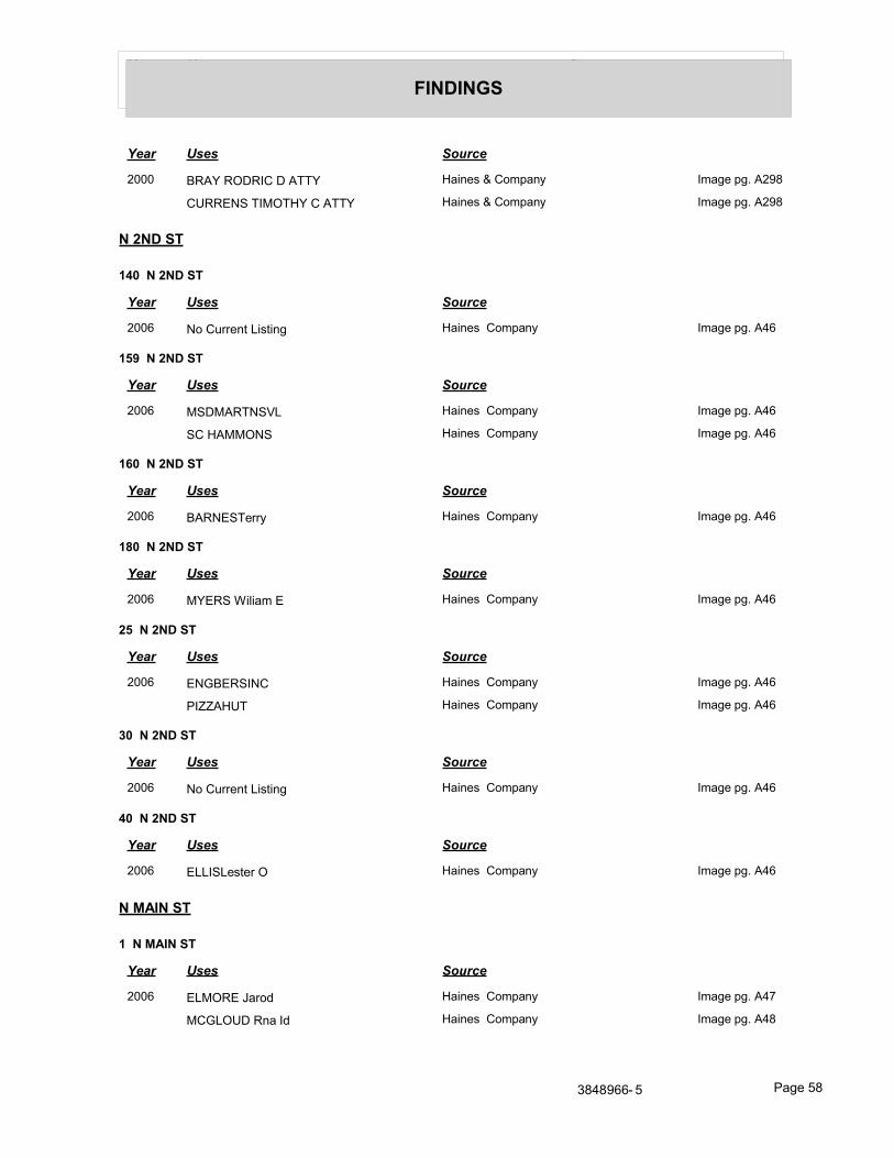
Year Uses Source
FINDINGS
Year Uses Source
2000 BRAY RODRIC D ATTY Haines & Company Image pg. A298
CURRENS TIMOTHY C ATTY Haines & Company Image pg. A298
N 2ND ST
140 N 2ND ST
Year Uses Source
2006 No Current Listing Haines Company Image pg. A46
159 N 2ND ST
Year Uses Source
2006 MSDMARTNSVL Haines Company Image pg. A46
SC HAMMONS Haines Company Image pg. A46
160 N 2ND ST
Year Uses Source
2006 BARNESTerry Haines Company Image pg. A46
180 N 2ND ST
Year Uses Source
2006 MYERS Wiliam E Haines Company Image pg. A46
25 N 2ND ST
Year Uses Source
2006 ENGBERSINC Haines Company Image pg. A46
PIZZAHUT Haines Company Image pg. A46
30 N 2ND ST
Year Uses Source
2006 No Current Listing Haines Company Image pg. A46
40 N 2ND ST
Year Uses Source
2006 ELLISLester O Haines Company Image pg. A46
N MAIN ST
1 N MAIN ST
Year Uses Source
2006 ELMORE Jarod Haines Company Image pg. A47
MCGLOUD Rna Id Haines Company Image pg. A48
3848966- 5 Page 58
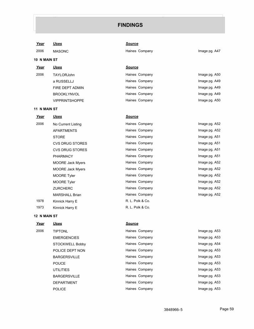
Year Uses Source
FINDINGS
Year Uses Source
2006 MASONC Haines Company Image pg. A47
10 N MAIN ST
Year Uses Source
2006 TAYLORJohn Haines Company Image pg. A50
a RUSSELLJ Haines Company Image pg. A49
FIRE DEPT ADMIN Haines Company Image pg. A49
BROOKLYNVOL Haines Company Image pg. A49
VIPPRINTSHOPPE Haines Company Image pg. A50
11 N MAIN ST
Year Uses Source
2006 No Current Listing Haines Company Image pg. A52
APARTMENTS Haines Company Image pg. A52
STORE Haines Company Image pg. A51
CVS DRUG STORES Haines Company Image pg. A51
CVS DRUG STORES Haines Company Image pg. A51
PHARMACY Haines Company Image pg. A51
MOORE Jack Myers Haines Company Image pg. A52
MOORE Jack Myers Haines Company Image pg. A52
MOORE Tyler Haines Company Image pg. A52
MOORE Tyler Haines Company Image pg. A52
ZURCHERC Haines Company Image pg. A52
MARSHALL Brian Haines Company Image pg. A52
1978 Kinnick Harry E R. L. Polk & Co.
1973 Kinnick Harry E R. L. Polk & Co.
12 N MAIN ST
Year Uses Source
2006 TIPTONL Haines Company Image pg. A53
EMERGENCIES Haines Company Image pg. A53
STOCKWELL Bobby Haines Company Image pg. A54
POLICE DEPT NON Haines Company Image pg. A53
BARGERSVILLE Haines Company Image pg. A53
POUCE Haines Company Image pg. A53
UTILITIES Haines Company Image pg. A53
BARGERSVILLE Haines Company Image pg. A53
DEPARTMENT Haines Company Image pg. A53
POLICE Haines Company Image pg. A53
3848966- 5 Page 59
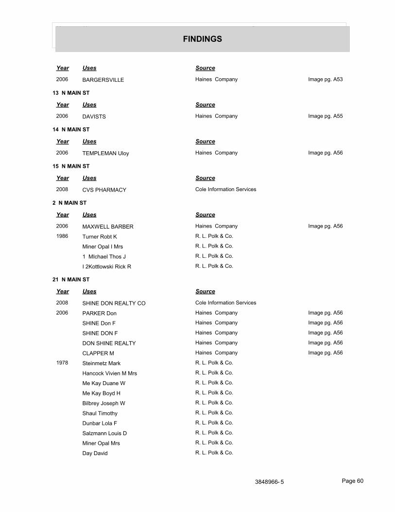
Year Uses Source
FINDINGS
Year Uses Source
2006 BARGERSVILLE Haines Company Image pg. A53
13 N MAIN ST
Year Uses Source
2006 DAVISTS Haines Company Image pg. A55
14 N MAIN ST
Year Uses Source
2006 TEMPLEMAN Uloy Haines Company Image pg. A56
15 N MAIN ST
Year Uses Source
2008 CVS PHARMACY Cole Information Services
2 N MAIN ST
Year Uses Source
2006 MAXWELL BARBER Haines Company Image pg. A56
1986 Turner Robt K R. L. Polk & Co.
Miner Opal I Mrs R. L. Polk & Co.
1 MIchael Thos J R. L. Polk & Co.
I 2Kottlowski Rick R R. L. Polk & Co.
21 N MAIN ST
Year Uses Source
2008 SHINE DON REALTY CO Cole Information Services
2006 PARKER Don Haines Company Image pg. A56
SHINE Don F Haines Company Image pg. A56
SHINE DON F Haines Company Image pg. A56
DON SHINE REALTY Haines Company Image pg. A56
CLAPPER M Haines Company Image pg. A56
1978 Steinmetz Mark R. L. Polk & Co.
Hancock Vivien M Mrs R. L. Polk & Co.
Me Kay Duane W R. L. Polk & Co.
Me Kay Boyd H R. L. Polk & Co.
Bilbrey Joseph W R. L. Polk & Co.
Shaul Timothy R. L. Polk & Co.
Dunbar Lola F R. L. Polk & Co.
Salzmann Louis D R. L. Polk & Co.
Miner Opal Mrs R. L. Polk & Co.
Day David R. L. Polk & Co.
3848966- 5 Page 60
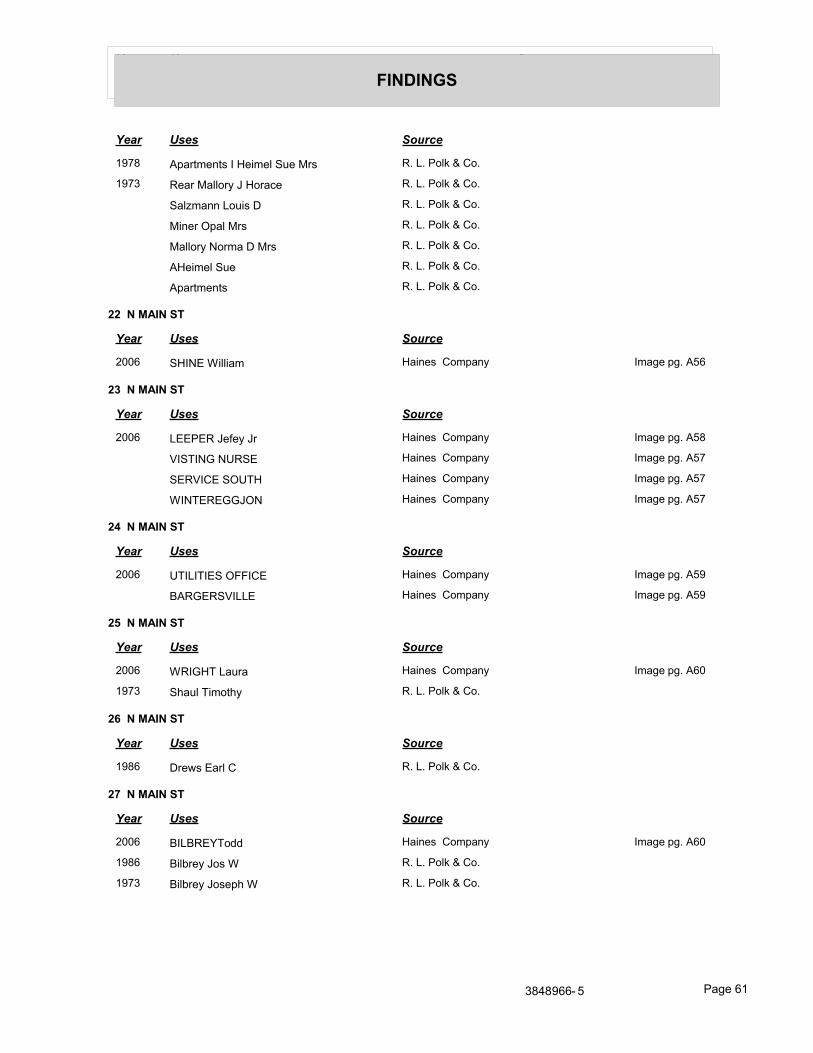
Year Uses Source
FINDINGS
Year Uses Source
1978 Apartments I Heimel Sue Mrs R. L. Polk & Co.
1973 Rear Mallory J Horace R. L. Polk & Co.
Salzmann Louis D R. L. Polk & Co.
Miner Opal Mrs R. L. Polk & Co.
Mallory Norma D Mrs R. L. Polk & Co.
AHeimel Sue R. L. Polk & Co.
Apartments R. L. Polk & Co.
22 N MAIN ST
Year Uses Source
2006 SHINE William Haines Company Image pg. A56
23 N MAIN ST
Year Uses Source
2006 LEEPER Jefey Jr Haines Company Image pg. A58
VISTING NURSE Haines Company Image pg. A57
SERVICE SOUTH Haines Company Image pg. A57
WINTEREGGJON Haines Company Image pg. A57
24 N MAIN ST
Year Uses Source
2006 UTILITIES OFFICE Haines Company Image pg. A59
BARGERSVILLE Haines Company Image pg. A59
25 N MAIN ST
Year Uses Source
2006 WRIGHT Laura Haines Company Image pg. A60
1973 Shaul Timothy R. L. Polk & Co.
26 N MAIN ST
Year Uses Source
1986 Drews Earl C R. L. Polk & Co.
27 N MAIN ST
Year Uses Source
2006 BILBREYTodd Haines Company Image pg. A60
1986 Bilbrey Jos W R. L. Polk & Co.
1973 Bilbrey Joseph W R. L. Polk & Co.
3848966- 5 Page 61
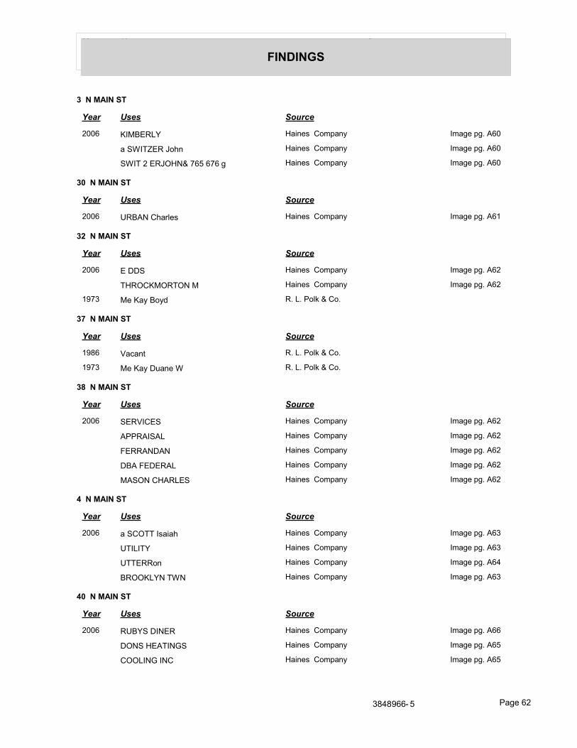
Year Uses Source
FINDINGS
3 N MAIN ST
Year Uses Source
2006 KIMBERLY Haines Company Image pg. A60
a SWITZER John Haines Company Image pg. A60
SWIT 2 ERJOHN& 765 676 g Haines Company Image pg. A60
30 N MAIN ST
Year Uses Source
2006 URBAN Charles Haines Company Image pg. A61
32 N MAIN ST
Year Uses Source
2006 E DDS Haines Company Image pg. A62
THROCKMORTON M Haines Company Image pg. A62
1973 Me Kay Boyd R. L. Polk & Co.
37 N MAIN ST
Year Uses Source
1986 Vacant R. L. Polk & Co.
1973 Me Kay Duane W R. L. Polk & Co.
38 N MAIN ST
Year Uses Source
2006 SERVICES Haines Company Image pg. A62
APPRAISAL Haines Company Image pg. A62
FERRANDAN Haines Company Image pg. A62
DBA FEDERAL Haines Company Image pg. A62
MASON CHARLES Haines Company Image pg. A62
4 N MAIN ST
Year Uses Source
2006 a SCOTT Isaiah Haines Company Image pg. A63
UTILITY Haines Company Image pg. A63
UTTERRon Haines Company Image pg. A64
BROOKLYN TWN Haines Company Image pg. A63
40 N MAIN ST
Year Uses Source
2006 RUBYS DINER Haines Company Image pg. A66
DONS HEATINGS Haines Company Image pg. A65
COOLING INC Haines Company Image pg. A65
3848966- 5 Page 62

Year Uses Source
FINDINGS
43 N MAIN ST
Year Uses Source
2006 SPLIT ENDZ HAIR Haines Company Image pg. A67
STUDIO Haines Company Image pg. A67
46 N MAIN ST
Year Uses Source
2006 EXPRESSO COFFEE Haines Company Image pg. A68
BAR INC MORGAN CO PAWN Haines Company Image pg. A68
48 N MAIN ST
Year Uses Source
2006 HANCOCKJohn Haines Company Image pg. A68
HANCOCK MORRIS Haines Company Image pg. A68
1986 Hancock Vivian M Mrs R. L. Polk & Co.
SO Allen Jean R. L. Polk & Co.
1973 Hancock Morris W R. L. Polk & Co.
49 N MAIN ST
Year Uses Source
2006 STORAGE Haines Company Image pg. A69
HEARTLAND Haines Company Image pg. A69
5 N MAIN ST
Year Uses Source
2006 SEVERE Lame Jr Haines Company Image pg. A70
TAYLOR M Haines Company Image pg. A69
50 N MAIN ST
Year Uses Source
2006 CRAFTS Haines Company Image pg. A70
MADE BY HAND Haines Company Image pg. A70
ALLAN J A Haines Company Image pg. A70
1973 Steinmetz Mark R. L. Polk & Co.
51 N MAIN ST
Year Uses Source
2006 HERITAGE INC Haines Company Image pg. A71
FRANKLIN Haines Company Image pg. A71
ART CRAFT Haines Company Image pg. A71
THEATRE Haines Company Image pg. A71
3848966- 5 Page 63
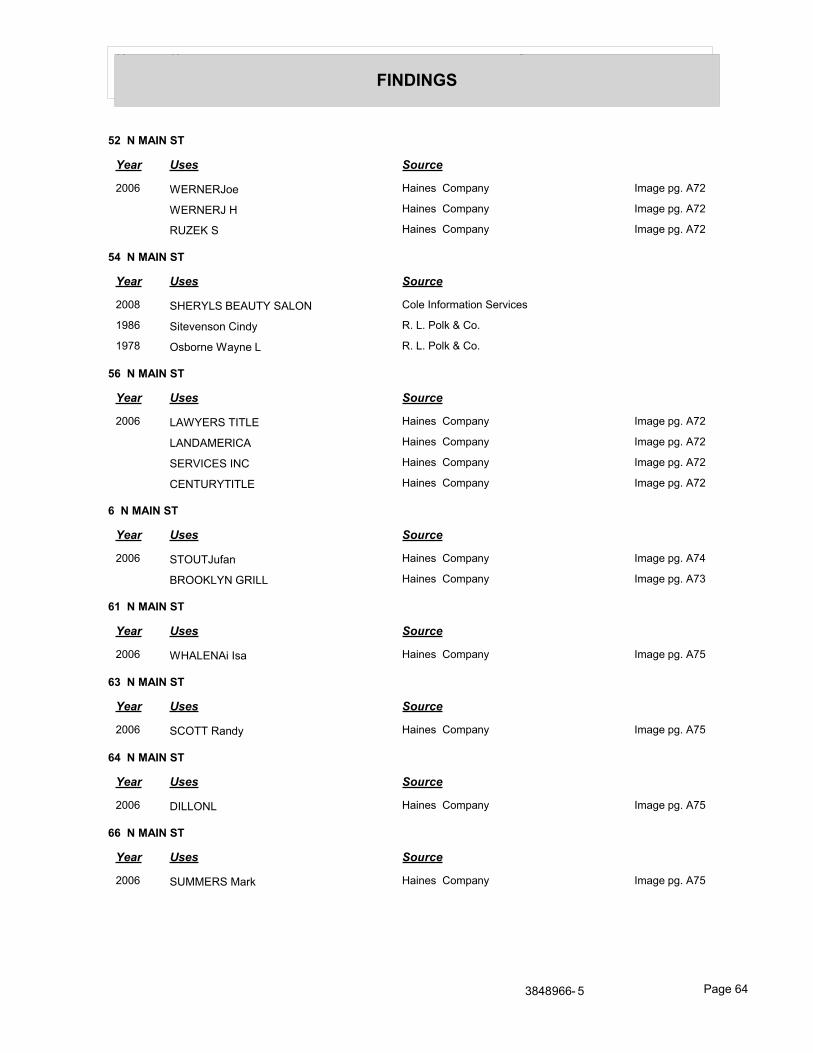
Year Uses Source
FINDINGS
52 N MAIN ST
Year Uses Source
2006 WERNERJoe Haines Company Image pg. A72
WERNERJ H Haines Company Image pg. A72
RUZEK S Haines Company Image pg. A72
54 N MAIN ST
Year Uses Source
2008 SHERYLS BEAUTY SALON Cole Information Services
1986 Sitevenson Cindy R. L. Polk & Co.
1978 Osborne Wayne L R. L. Polk & Co.
56 N MAIN ST
Year Uses Source
2006 LAWYERS TITLE Haines Company Image pg. A72
LANDAMERICA Haines Company Image pg. A72
SERVICES INC Haines Company Image pg. A72
CENTURYTITLE Haines Company Image pg. A72
6 N MAIN ST
Year Uses Source
2006 STOUTJufan Haines Company Image pg. A74
BROOKLYN GRILL Haines Company Image pg. A73
61 N MAIN ST
Year Uses Source
2006 WHALENAi Isa Haines Company Image pg. A75
63 N MAIN ST
Year Uses Source
2006 SCOTT Randy Haines Company Image pg. A75
64 N MAIN ST
Year Uses Source
2006 DILLONL Haines Company Image pg. A75
66 N MAIN ST
Year Uses Source
2006 SUMMERS Mark Haines Company Image pg. A75
3848966- 5 Page 64
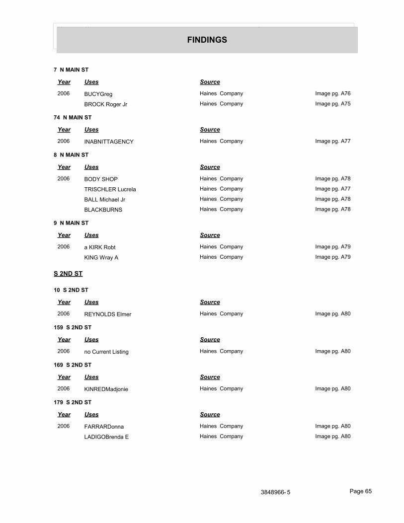
Year Uses Source
FINDINGS
7 N MAIN ST
Year Uses Source
2006 BUCYGreg Haines Company Image pg. A76
BROCK Roger Jr Haines Company Image pg. A75
74 N MAIN ST
Year Uses Source
2006 INABNITTAGENCY Haines Company Image pg. A77
8 N MAIN ST
Year Uses Source
2006 BODY SHOP Haines Company Image pg. A78
TRISCHLER Lucrela Haines Company Image pg. A77
BALL Michael Jr Haines Company Image pg. A78
BLACKBURNS Haines Company Image pg. A78
9 N MAIN ST
Year Uses Source
2006 a KIRK Robt Haines Company Image pg. A79
KING Wray A Haines Company Image pg. A79
S 2ND ST
10 S 2ND ST
Year Uses Source
2006 REYNOLDS Elmer Haines Company Image pg. A80
159 S 2ND ST
Year Uses Source
2006 no Current Listing Haines Company Image pg. A80
169 S 2ND ST
Year Uses Source
2006 KINREDMadjonie Haines Company Image pg. A80
179 S 2ND ST
Year Uses Source
2006 FARRARDonna Haines Company Image pg. A80
LADIGOBrenda E Haines Company Image pg. A80
3848966- 5 Page 65
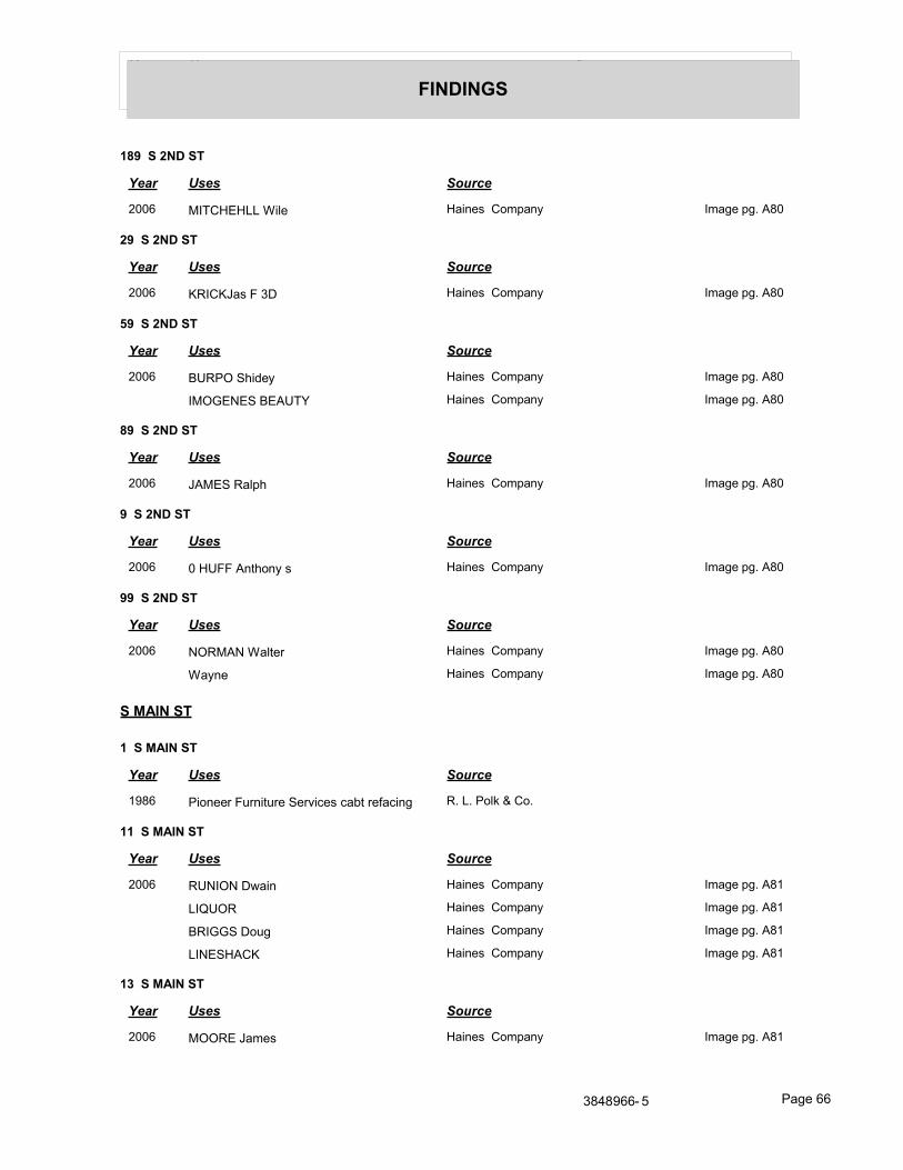
Year Uses Source
FINDINGS
189 S 2ND ST
Year Uses Source
2006 MITCHEHLL Wile Haines Company Image pg. A80
29 S 2ND ST
Year Uses Source
2006 KRICKJas F 3D Haines Company Image pg. A80
59 S 2ND ST
Year Uses Source
2006 BURPO Shidey Haines Company Image pg. A80
IMOGENES BEAUTY Haines Company Image pg. A80
89 S 2ND ST
Year Uses Source
2006 JAMES Ralph Haines Company Image pg. A80
9 S 2ND ST
Year Uses Source
2006 0 HUFF Anthony s Haines Company Image pg. A80
99 S 2ND ST
Year Uses Source
2006 NORMAN Walter Haines Company Image pg. A80
Wayne Haines Company Image pg. A80
S MAIN ST
1 S MAIN ST
Year Uses Source
1986 Pioneer Furniture Services cabt refacing R. L. Polk & Co.
11 S MAIN ST
Year Uses Source
2006 RUNION Dwain Haines Company Image pg. A81
LIQUOR Haines Company Image pg. A81
BRIGGS Doug Haines Company Image pg. A81
LINESHACK Haines Company Image pg. A81
13 S MAIN ST
Year Uses Source
2006 MOORE James Haines Company Image pg. A81
3848966- 5 Page 66
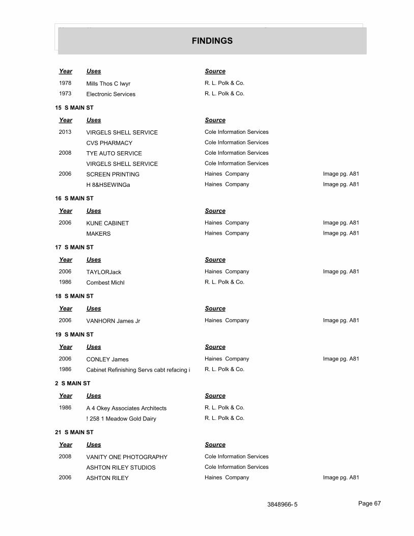
Year Uses Source
FINDINGS
Year Uses Source
1978 Mills Thos C Iwyr R. L. Polk & Co.
1973 Electronic Services R. L. Polk & Co.
15 S MAIN ST
Year Uses Source
2013 VIRGELS SHELL SERVICE Cole Information Services
CVS PHARMACY Cole Information Services
2008 TYE AUTO SERVICE Cole Information Services
VIRGELS SHELL SERVICE Cole Information Services
2006 SCREEN PRINTING Haines Company Image pg. A81
H 8&HSEWINGa Haines Company Image pg. A81
16 S MAIN ST
Year Uses Source
2006 KUNE CABINET Haines Company Image pg. A81
MAKERS Haines Company Image pg. A81
17 S MAIN ST
Year Uses Source
2006 TAYLORJack Haines Company Image pg. A81
1986 Combest Michl R. L. Polk & Co.
18 S MAIN ST
Year Uses Source
2006 VANHORN James Jr Haines Company Image pg. A81
19 S MAIN ST
Year Uses Source
2006 CONLEY James Haines Company Image pg. A81
1986 Cabinet Refinishing Servs cabt refacing i R. L. Polk & Co.
2 S MAIN ST
Year Uses Source
1986 A 4 Okey Associates Architects R. L. Polk & Co.
! 258 1 Meadow Gold Dairy R. L. Polk & Co.
21 S MAIN ST
Year Uses Source
2008 VANITY ONE PHOTOGRAPHY Cole Information Services
ASHTON RILEY STUDIOS Cole Information Services
2006 ASHTON RILEY Haines Company Image pg. A81
3848966- 5 Page 67
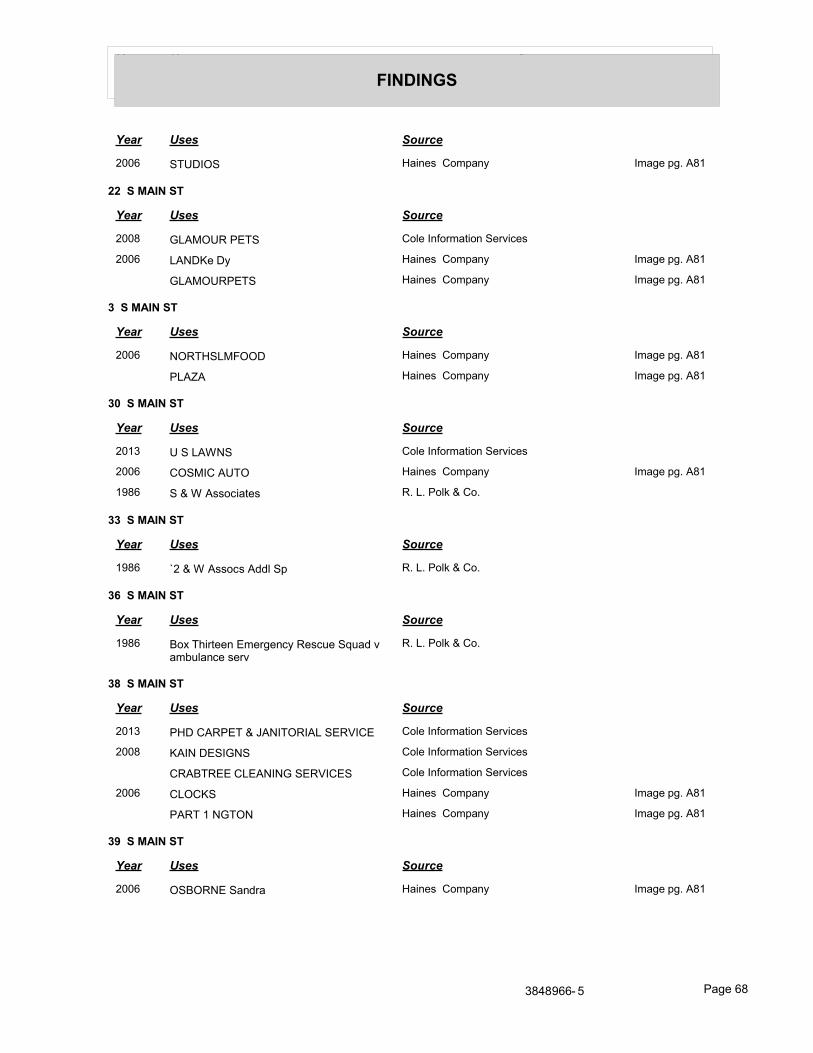
Year Uses Source
FINDINGS
Year Uses Source
2006 STUDIOS Haines Company Image pg. A81
22 S MAIN ST
Year Uses Source
2008 GLAMOUR PETS Cole Information Services
2006 LANDKe Dy Haines Company Image pg. A81
GLAMOURPETS Haines Company Image pg. A81
3 S MAIN ST
Year Uses Source
2006 NORTHSLMFOOD Haines Company Image pg. A81
PLAZA Haines Company Image pg. A81
30 S MAIN ST
Year Uses Source
2013 U S LAWNS Cole Information Services
2006 COSMIC AUTO Haines Company Image pg. A81
1986 S & W Associates R. L. Polk & Co.
33 S MAIN ST
Year Uses Source
1986 `2 & W Assocs Addl Sp R. L. Polk & Co.
36 S MAIN ST
Year Uses Source
1986 Box Thirteen Emergency Rescue Squad v ambulance serv
R. L. Polk & Co.
38 S MAIN ST
Year Uses Source
2013 PHD CARPET & JANITORIAL SERVICE Cole Information Services
2008 KAIN DESIGNS Cole Information Services
CRABTREE CLEANING SERVICES Cole Information Services
2006 CLOCKS Haines Company Image pg. A81
PART 1 NGTON Haines Company Image pg. A81
39 S MAIN ST
Year Uses Source
2006 OSBORNE Sandra Haines Company Image pg. A81
3848966- 5 Page 68
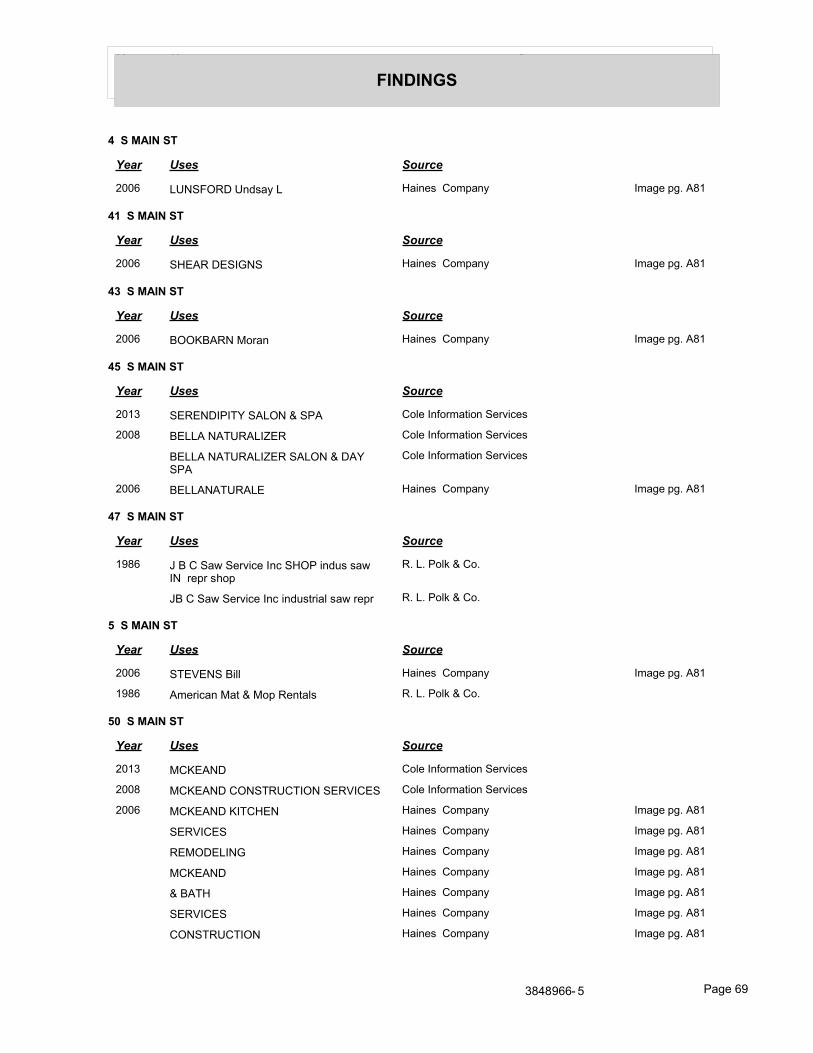
Year Uses Source
FINDINGS
4 S MAIN ST
Year Uses Source
2006 LUNSFORD Undsay L Haines Company Image pg. A81
41 S MAIN ST
Year Uses Source
2006 SHEAR DESIGNS Haines Company Image pg. A81
43 S MAIN ST
Year Uses Source
2006 BOOKBARN Moran Haines Company Image pg. A81
45 S MAIN ST
Year Uses Source
2013 SERENDIPITY SALON & SPA Cole Information Services
2008 BELLA NATURALIZER Cole Information Services
BELLA NATURALIZER SALON & DAY SPA
Cole Information Services
2006 BELLANATURALE Haines Company Image pg. A81
47 S MAIN ST
Year Uses Source
1986 J B C Saw Service Inc SHOP indus saw IN repr shop
R. L. Polk & Co.
JB C Saw Service Inc industrial saw repr R. L. Polk & Co.
5 S MAIN ST
Year Uses Source
2006 STEVENS Bill Haines Company Image pg. A81
1986 American Mat & Mop Rentals R. L. Polk & Co.
50 S MAIN ST
Year Uses Source
2013 MCKEAND Cole Information Services
2008 MCKEAND CONSTRUCTION SERVICES Cole Information Services
2006 MCKEAND KITCHEN Haines Company Image pg. A81
SERVICES Haines Company Image pg. A81
REMODELING Haines Company Image pg. A81
MCKEAND Haines Company Image pg. A81
& BATH Haines Company Image pg. A81
SERVICES Haines Company Image pg. A81
CONSTRUCTION Haines Company Image pg. A81
3848966- 5 Page 69
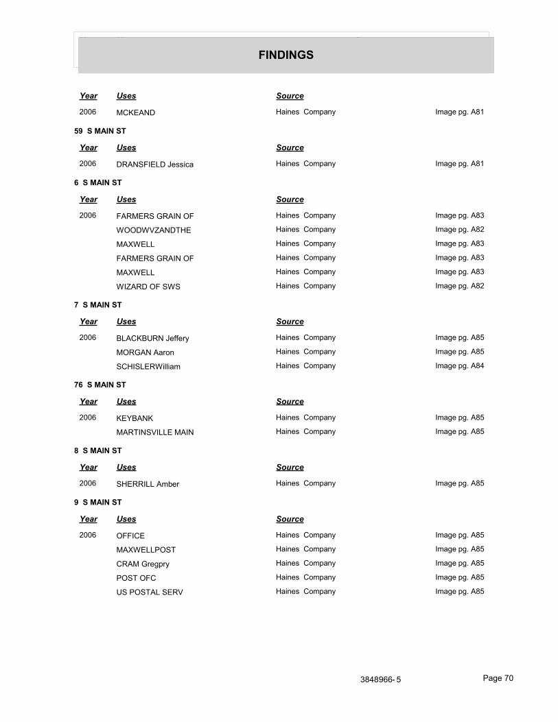
Year Uses Source
FINDINGS
Year Uses Source
2006 MCKEAND Haines Company Image pg. A81
59 S MAIN ST
Year Uses Source
2006 DRANSFIELD Jessica Haines Company Image pg. A81
6 S MAIN ST
Year Uses Source
2006 FARMERS GRAIN OF Haines Company Image pg. A83
WOODWVZANDTHE Haines Company Image pg. A82
MAXWELL Haines Company Image pg. A83
FARMERS GRAIN OF Haines Company Image pg. A83
MAXWELL Haines Company Image pg. A83
WIZARD OF SWS Haines Company Image pg. A82
7 S MAIN ST
Year Uses Source
2006 BLACKBURN Jeffery Haines Company Image pg. A85
MORGAN Aaron Haines Company Image pg. A85
SCHISLERWilliam Haines Company Image pg. A84
76 S MAIN ST
Year Uses Source
2006 KEYBANK Haines Company Image pg. A85
MARTINSVILLE MAIN Haines Company Image pg. A85
8 S MAIN ST
Year Uses Source
2006 SHERRILL Amber Haines Company Image pg. A85
9 S MAIN ST
Year Uses Source
2006 OFFICE Haines Company Image pg. A85
MAXWELLPOST Haines Company Image pg. A85
CRAM Gregpry Haines Company Image pg. A85
POST OFC Haines Company Image pg. A85
US POSTAL SERV Haines Company Image pg. A85
3848966- 5 Page 70
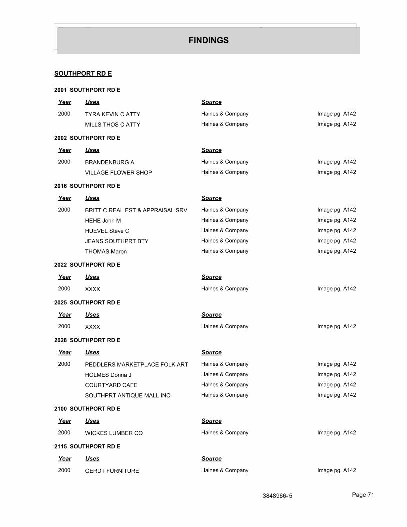
Year Uses Source
FINDINGS
SOUTHPORT RD E
2001 SOUTHPORT RD E
Year Uses Source
2000 TYRA KEVIN C ATTY Haines & Company Image pg. A142
MILLS THOS C ATTY Haines & Company Image pg. A142
2002 SOUTHPORT RD E
Year Uses Source
2000 BRANDENBURG A Haines & Company Image pg. A142
VILLAGE FLOWER SHOP Haines & Company Image pg. A142
2016 SOUTHPORT RD E
Year Uses Source
2000 BRITT C REAL EST & APPRAISAL SRV Haines & Company Image pg. A142
HEHE John M Haines & Company Image pg. A142
HUEVEL Steve C Haines & Company Image pg. A142
JEANS SOUTHPRT BTY Haines & Company Image pg. A142
THOMAS Maron Haines & Company Image pg. A142
2022 SOUTHPORT RD E
Year Uses Source
2000 XXXX Haines & Company Image pg. A142
2025 SOUTHPORT RD E
Year Uses Source
2000 XXXX Haines & Company Image pg. A142
2028 SOUTHPORT RD E
Year Uses Source
2000 PEDDLERS MARKETPLACE FOLK ART Haines & Company Image pg. A142
HOLMES Donna J Haines & Company Image pg. A142
COURTYARD CAFE Haines & Company Image pg. A142
SOUTHPRT ANTIQUE MALL INC Haines & Company Image pg. A142
2100 SOUTHPORT RD E
Year Uses Source
2000 WICKES LUMBER CO Haines & Company Image pg. A142
2115 SOUTHPORT RD E
Year Uses Source
2000 GERDT FURNITURE Haines & Company Image pg. A142
3848966- 5 Page 71
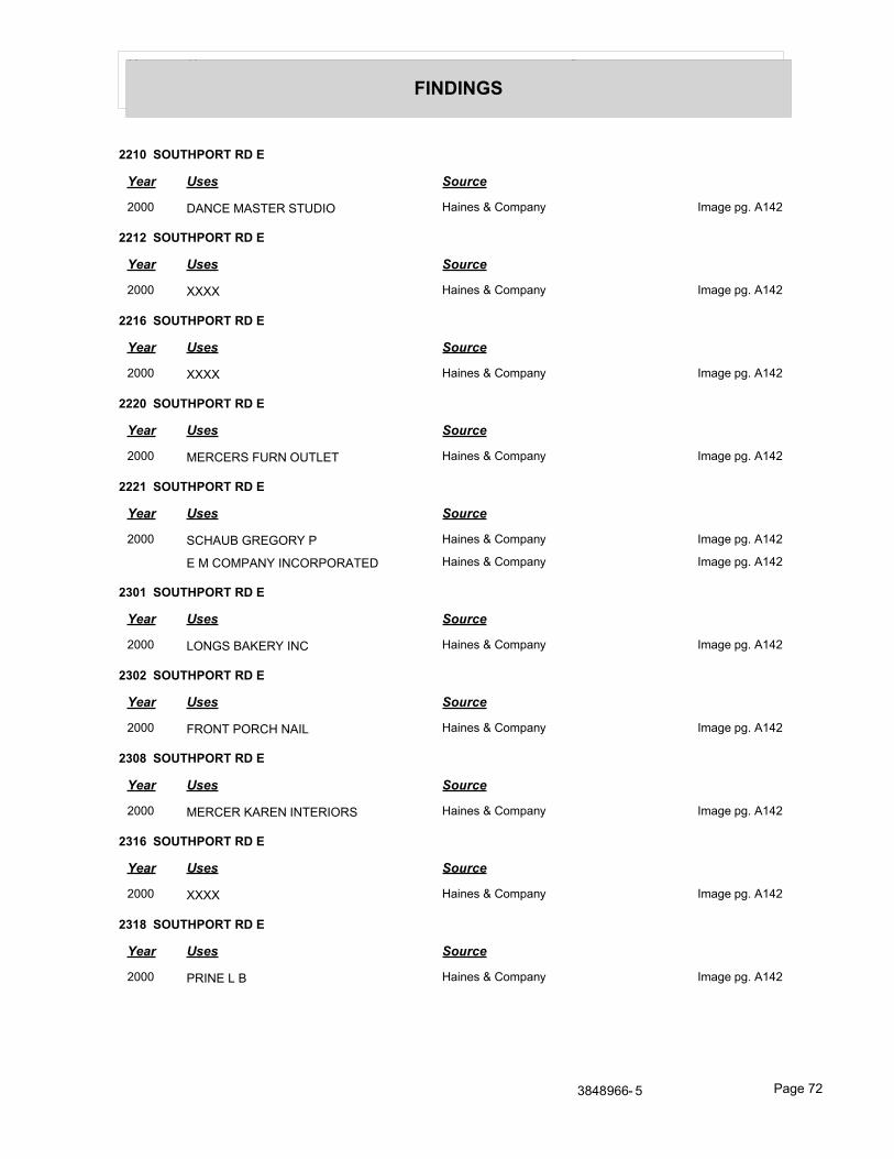
Year Uses Source
FINDINGS
2210 SOUTHPORT RD E
Year Uses Source
2000 DANCE MASTER STUDIO Haines & Company Image pg. A142
2212 SOUTHPORT RD E
Year Uses Source
2000 XXXX Haines & Company Image pg. A142
2216 SOUTHPORT RD E
Year Uses Source
2000 XXXX Haines & Company Image pg. A142
2220 SOUTHPORT RD E
Year Uses Source
2000 MERCERS FURN OUTLET Haines & Company Image pg. A142
2221 SOUTHPORT RD E
Year Uses Source
2000 SCHAUB GREGORY P Haines & Company Image pg. A142
E M COMPANY INCORPORATED Haines & Company Image pg. A142
2301 SOUTHPORT RD E
Year Uses Source
2000 LONGS BAKERY INC Haines & Company Image pg. A142
2302 SOUTHPORT RD E
Year Uses Source
2000 FRONT PORCH NAIL Haines & Company Image pg. A142
2308 SOUTHPORT RD E
Year Uses Source
2000 MERCER KAREN INTERIORS Haines & Company Image pg. A142
2316 SOUTHPORT RD E
Year Uses Source
2000 XXXX Haines & Company Image pg. A142
2318 SOUTHPORT RD E
Year Uses Source
2000 PRINE L B Haines & Company Image pg. A142
3848966- 5 Page 72
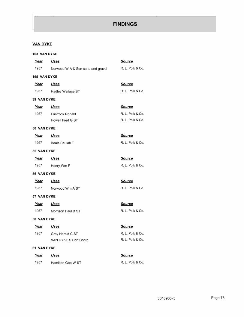
Year Uses Source
FINDINGS
VAN DYKE
163 VAN DYKE
Year Uses Source
1957 Norwood W A & Son sand and gravel R. L. Polk & Co.
165 VAN DYKE
Year Uses Source
1957 Hadley Wallace ST R. L. Polk & Co.
39 VAN DYKE
Year Uses Source
1957 Frinfrock Ronald R. L. Polk & Co.
Howell Fred G ST R. L. Polk & Co.
50 VAN DYKE
Year Uses Source
1957 Beals Beulah T R. L. Polk & Co.
55 VAN DYKE
Year Uses Source
1957 Henry Wm F R. L. Polk & Co.
56 VAN DYKE
Year Uses Source
1957 Norwood Wm A ST R. L. Polk & Co.
57 VAN DYKE
Year Uses Source
1957 Morrison Paul B ST R. L. Polk & Co.
58 VAN DYKE
Year Uses Source
1957 Gray Harold C ST R. L. Polk & Co.
VAN DYKE S Port Contd R. L. Polk & Co.
61 VAN DYKE
Year Uses Source
1957 Hamilton Geo W ST R. L. Polk & Co.
3848966- 5 Page 73
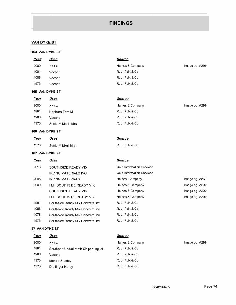
Year Uses Source
FINDINGS
VAN DYKE ST
163 VAN DYKE ST
Year Uses Source
2000 XXXX Haines & Company Image pg. A299
1991 Vacant R. L. Polk & Co.
1986 Vacant R. L. Polk & Co.
1973 Vacant R. L. Polk & Co.
165 VAN DYKE ST
Year Uses Source
2000 XXXX Haines & Company Image pg. A299
1991 Hepburn Tom M R. L. Polk & Co.
1986 Vacant R. L. Polk & Co.
1973 Settle M Marie Mrs R. L. Polk & Co.
166 VAN DYKE ST
Year Uses Source
1978 Settio M MAri Mrs R. L. Polk & Co.
167 VAN DYKE ST
Year Uses Source
2013 SOUTHSIDE READY MIX Cole Information Services
IRVING MATERIALS INC Cole Information Services
2006 IRVING MATERIALS Haines Company Image pg. A86
2000 I M I SOUTHSIDE READY MIX Haines & Company Image pg. A299
SOUTHSIDE READY MIX Haines & Company Image pg. A299
I M I SOUTHSIDE READY MIX Haines & Company Image pg. A299
1991 Southside Ready Mix Concrete Inc R. L. Polk & Co.
1986 Southaide Ready Mix Concrete Inc R. L. Polk & Co.
1978 Southaide Ready Mix Concreto Inc R. L. Polk & Co.
1973 Southside Ready Mix Concrete Inc R. L. Polk & Co.
37 VAN DYKE ST
Year Uses Source
2000 XXXX Haines & Company Image pg. A299
1991 Southport United Meth Ch parking lot R. L. Polk & Co.
1986 Vacant R. L. Polk & Co.
1978 Mercer Stanley R. L. Polk & Co.
1973 Drullinger Hardy R. L. Polk & Co.
3848966- 5 Page 74
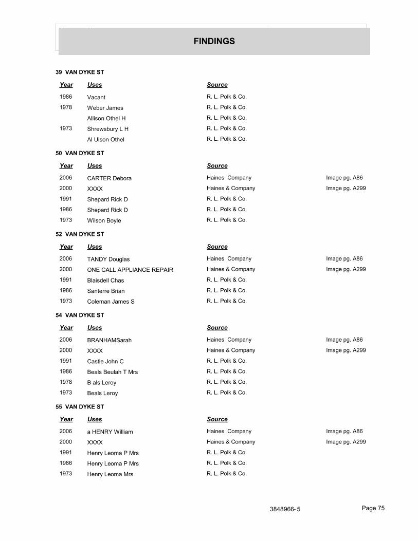
Year Uses Source
FINDINGS
39 VAN DYKE ST
Year Uses Source
1986 Vacant R. L. Polk & Co.
1978 Weber James R. L. Polk & Co.
Allison Othel H R. L. Polk & Co.
1973 Shrewsbury L H R. L. Polk & Co.
Al Uison Othel R. L. Polk & Co.
50 VAN DYKE ST
Year Uses Source
2006 CARTER Debora Haines Company Image pg. A86
2000 XXXX Haines & Company Image pg. A299
1991 Shepard Rick D R. L. Polk & Co.
1986 Shepard Rick D R. L. Polk & Co.
1973 Wilson Boyle R. L. Polk & Co.
52 VAN DYKE ST
Year Uses Source
2006 TANDY Douglas Haines Company Image pg. A86
2000 ONE CALL APPLIANCE REPAIR Haines & Company Image pg. A299
1991 Blaisdell Chas R. L. Polk & Co.
1986 Santerre Brian R. L. Polk & Co.
1973 Coleman James S R. L. Polk & Co.
54 VAN DYKE ST
Year Uses Source
2006 BRANHAMSarah Haines Company Image pg. A86
2000 XXXX Haines & Company Image pg. A299
1991 Castle John C R. L. Polk & Co.
1986 Beals Beulah T Mrs R. L. Polk & Co.
1978 B als Leroy R. L. Polk & Co.
1973 Beals Leroy R. L. Polk & Co.
55 VAN DYKE ST
Year Uses Source
2006 a HENRY William Haines Company Image pg. A86
2000 XXXX Haines & Company Image pg. A299
1991 Henry Leoma P Mrs R. L. Polk & Co.
1986 Henry Leoma P Mrs R. L. Polk & Co.
1973 Henry Leoma Mrs R. L. Polk & Co.
3848966- 5 Page 75
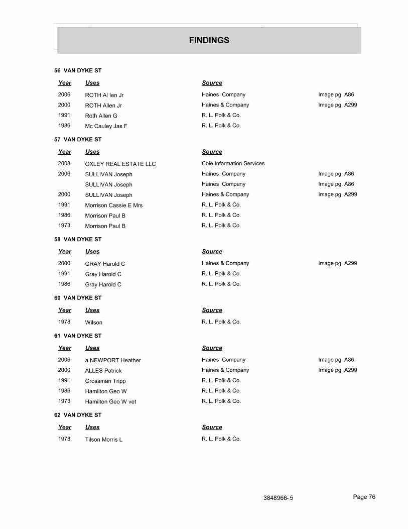
Year Uses Source
FINDINGS
56 VAN DYKE ST
Year Uses Source
2006 ROTH Al Ien Jr Haines Company Image pg. A86
2000 ROTH Allen Jr Haines & Company Image pg. A299
1991 Roth Allen G R. L. Polk & Co.
1986 Mc Cauley Jas F R. L. Polk & Co.
57 VAN DYKE ST
Year Uses Source
2008 OXLEY REAL ESTATE LLC Cole Information Services
2006 SULLIVAN Joseph Haines Company Image pg. A86
SULLIVAN Joseph Haines Company Image pg. A86
2000 SULLIVAN Joseph Haines & Company Image pg. A299
1991 Morrison Cassie E Mrs R. L. Polk & Co.
1986 Morrison Paul B R. L. Polk & Co.
1973 Morrison Paul B R. L. Polk & Co.
58 VAN DYKE ST
Year Uses Source
2000 GRAY Harold C Haines & Company Image pg. A299
1991 Gray Harold C R. L. Polk & Co.
1986 Gray Harold C R. L. Polk & Co.
60 VAN DYKE ST
Year Uses Source
1978 Wilson R. L. Polk & Co.
61 VAN DYKE ST
Year Uses Source
2006 a NEWPORT Heather Haines Company Image pg. A86
2000 ALLES Patrick Haines & Company Image pg. A299
1991 Grossman Tripp R. L. Polk & Co.
1986 Hamilton Geo W R. L. Polk & Co.
1973 Hamilton Geo W vet R. L. Polk & Co.
62 VAN DYKE ST
Year Uses Source
1978 Tilson Morris L R. L. Polk & Co.
3848966- 5 Page 76
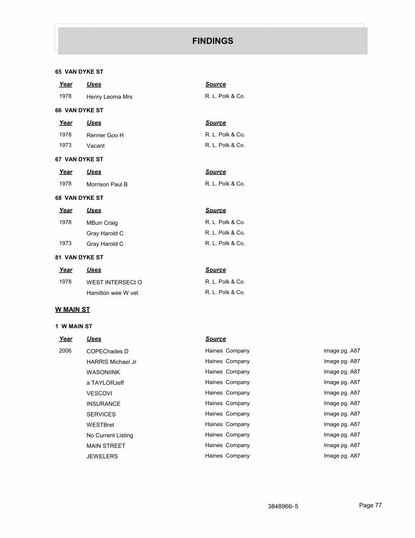
Year Uses Source
FINDINGS
65 VAN DYKE ST
Year Uses Source
1978 Henry Leoma Mrs R. L. Polk & Co.
66 VAN DYKE ST
Year Uses Source
1978 Renner Goo H R. L. Polk & Co.
1973 Vacant R. L. Polk & Co.
67 VAN DYKE ST
Year Uses Source
1978 Morrison Paul B R. L. Polk & Co.
68 VAN DYKE ST
Year Uses Source
1978 MBurr Craig R. L. Polk & Co.
Gray Harold C R. L. Polk & Co.
1973 Gray Harold C R. L. Polk & Co.
81 VAN DYKE ST
Year Uses Source
1978 WEST INTERSECt O R. L. Polk & Co.
Hamilton wee W vet R. L. Polk & Co.
W MAIN ST
1 W MAIN ST
Year Uses Source
2006 COPEChades D Haines Company Image pg. A87
HARRIS Michael Jr Haines Company Image pg. A87
WASONIINK Haines Company Image pg. A87
a TAYLORJeff Haines Company Image pg. A87
VESCOVI Haines Company Image pg. A87
INSURANCE Haines Company Image pg. A87
SERVICES Haines Company Image pg. A87
WESTBret Haines Company Image pg. A87
No Current Listing Haines Company Image pg. A87
MAIN STREET Haines Company Image pg. A87
JEWELERS Haines Company Image pg. A87
3848966- 5 Page 77
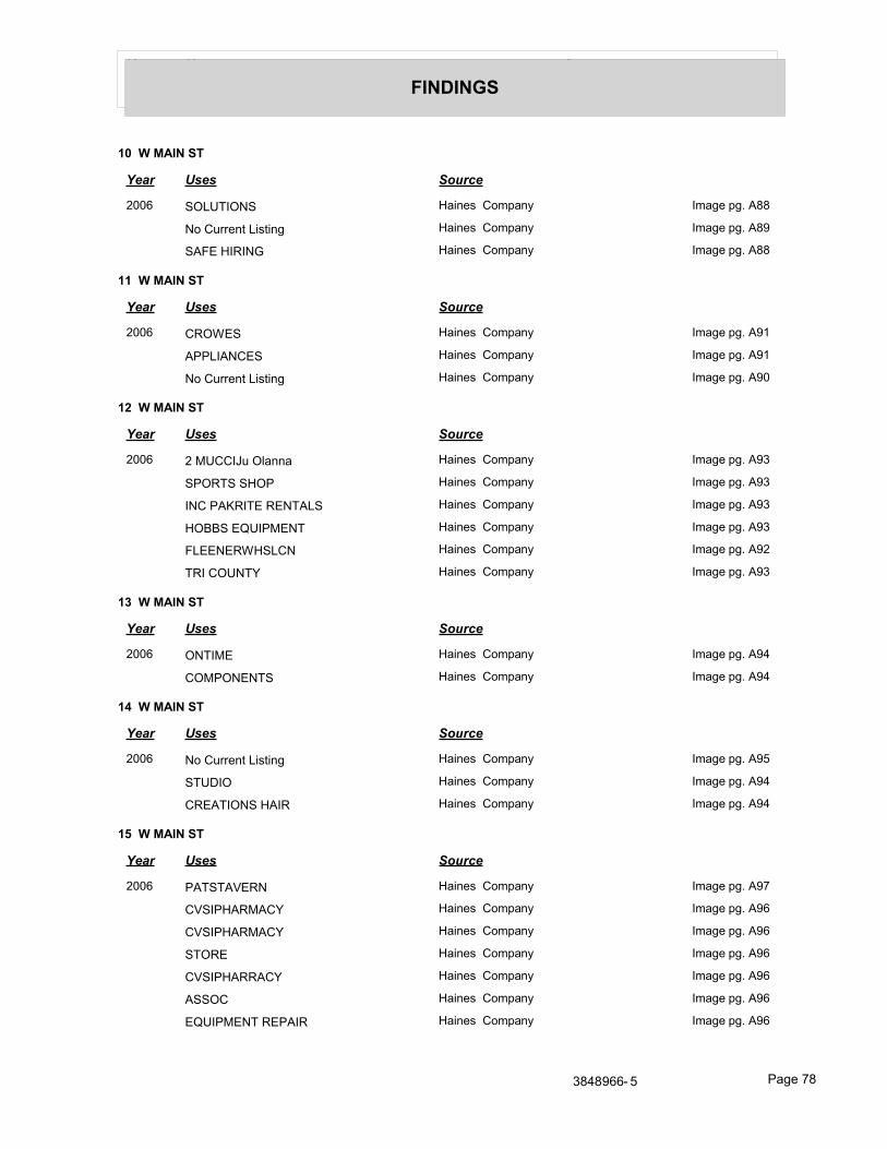
Year Uses Source
FINDINGS
10 W MAIN ST
Year Uses Source
2006 SOLUTIONS Haines Company Image pg. A88
No Current Listing Haines Company Image pg. A89
SAFE HIRING Haines Company Image pg. A88
11 W MAIN ST
Year Uses Source
2006 CROWES Haines Company Image pg. A91
APPLIANCES Haines Company Image pg. A91
No Current Listing Haines Company Image pg. A90
12 W MAIN ST
Year Uses Source
2006 2 MUCCIJu Olanna Haines Company Image pg. A93
SPORTS SHOP Haines Company Image pg. A93
INC PAKRITE RENTALS Haines Company Image pg. A93
HOBBS EQUIPMENT Haines Company Image pg. A93
FLEENERWHSLCN Haines Company Image pg. A92
TRI COUNTY Haines Company Image pg. A93
13 W MAIN ST
Year Uses Source
2006 ONTIME Haines Company Image pg. A94
COMPONENTS Haines Company Image pg. A94
14 W MAIN ST
Year Uses Source
2006 No Current Listing Haines Company Image pg. A95
STUDIO Haines Company Image pg. A94
CREATIONS HAIR Haines Company Image pg. A94
15 W MAIN ST
Year Uses Source
2006 PATSTAVERN Haines Company Image pg. A97
CVSIPHARMACY Haines Company Image pg. A96
CVSIPHARMACY Haines Company Image pg. A96
STORE Haines Company Image pg. A96
CVSIPHARRACY Haines Company Image pg. A96
ASSOC Haines Company Image pg. A96
EQUIPMENT REPAIR Haines Company Image pg. A96
3848966- 5 Page 78
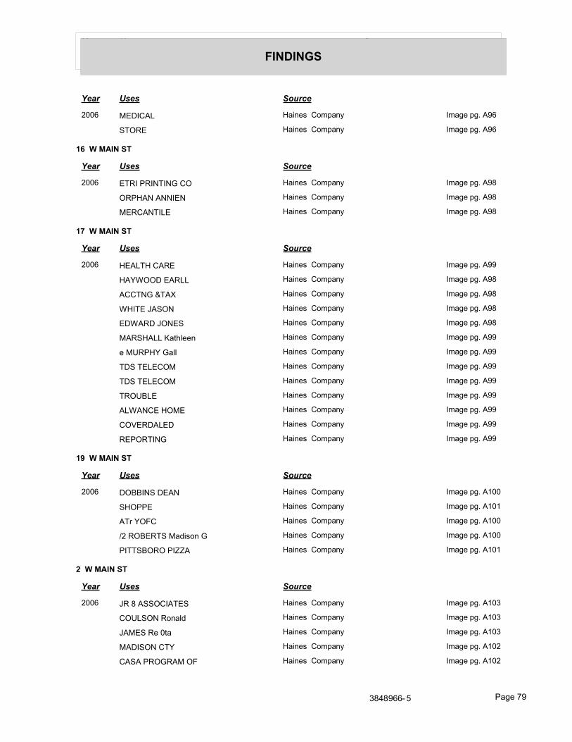
Year Uses Source
FINDINGS
Year Uses Source
2006 MEDICAL Haines Company Image pg. A96
STORE Haines Company Image pg. A96
16 W MAIN ST
Year Uses Source
2006 ETRI PRINTING CO Haines Company Image pg. A98
ORPHAN ANNIEN Haines Company Image pg. A98
MERCANTILE Haines Company Image pg. A98
17 W MAIN ST
Year Uses Source
2006 HEALTH CARE Haines Company Image pg. A99
HAYWOOD EARLL Haines Company Image pg. A98
ACCTNG &TAX Haines Company Image pg. A98
WHITE JASON Haines Company Image pg. A98
EDWARD JONES Haines Company Image pg. A98
MARSHALL Kathleen Haines Company Image pg. A99
e MURPHY Gall Haines Company Image pg. A99
TDS TELECOM Haines Company Image pg. A99
TDS TELECOM Haines Company Image pg. A99
TROUBLE Haines Company Image pg. A99
ALWANCE HOME Haines Company Image pg. A99
COVERDALED Haines Company Image pg. A99
REPORTING Haines Company Image pg. A99
19 W MAIN ST
Year Uses Source
2006 DOBBINS DEAN Haines Company Image pg. A100
SHOPPE Haines Company Image pg. A101
ATr YOFC Haines Company Image pg. A100
/2 ROBERTS Madison G Haines Company Image pg. A100
PITTSBORO PIZZA Haines Company Image pg. A101
2 W MAIN ST
Year Uses Source
2006 JR 8 ASSOCIATES Haines Company Image pg. A103
COULSON Ronald Haines Company Image pg. A103
JAMES Re 0ta Haines Company Image pg. A103
MADISON CTY Haines Company Image pg. A102
CASA PROGRAM OF Haines Company Image pg. A102
3848966- 5 Page 79
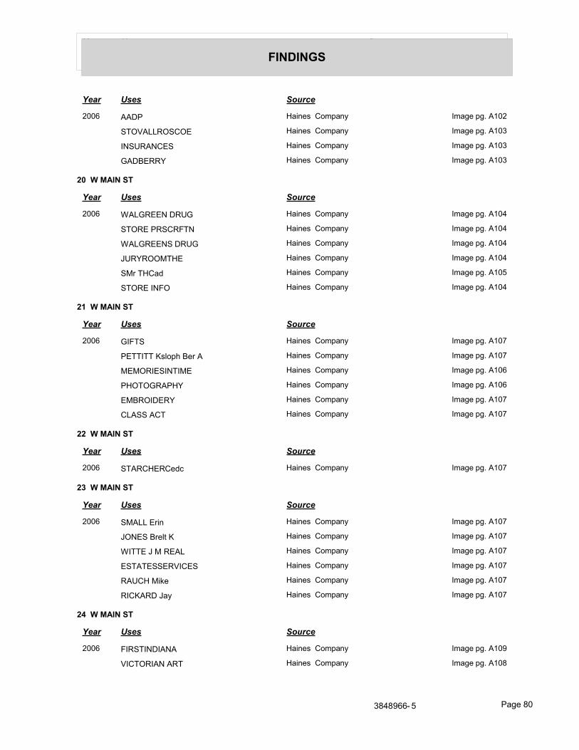
Year Uses Source
FINDINGS
Year Uses Source
2006 AADP Haines Company Image pg. A102
STOVALLROSCOE Haines Company Image pg. A103
INSURANCES Haines Company Image pg. A103
GADBERRY Haines Company Image pg. A103
20 W MAIN ST
Year Uses Source
2006 WALGREEN DRUG Haines Company Image pg. A104
STORE PRSCRFTN Haines Company Image pg. A104
WALGREENS DRUG Haines Company Image pg. A104
JURYROOMTHE Haines Company Image pg. A104
SMr THCad Haines Company Image pg. A105
STORE INFO Haines Company Image pg. A104
21 W MAIN ST
Year Uses Source
2006 GIFTS Haines Company Image pg. A107
PETTITT Ksloph Ber A Haines Company Image pg. A107
MEMORIESINTIME Haines Company Image pg. A106
PHOTOGRAPHY Haines Company Image pg. A106
EMBROIDERY Haines Company Image pg. A107
CLASS ACT Haines Company Image pg. A107
22 W MAIN ST
Year Uses Source
2006 STARCHERCedc Haines Company Image pg. A107
23 W MAIN ST
Year Uses Source
2006 SMALL Erin Haines Company Image pg. A107
JONES Brelt K Haines Company Image pg. A107
WITTE J M REAL Haines Company Image pg. A107
ESTATESSERVICES Haines Company Image pg. A107
RAUCH Mike Haines Company Image pg. A107
RICKARD Jay Haines Company Image pg. A107
24 W MAIN ST
Year Uses Source
2006 FIRSTINDIANA Haines Company Image pg. A109
VICTORIAN ART Haines Company Image pg. A108
3848966- 5 Page 80
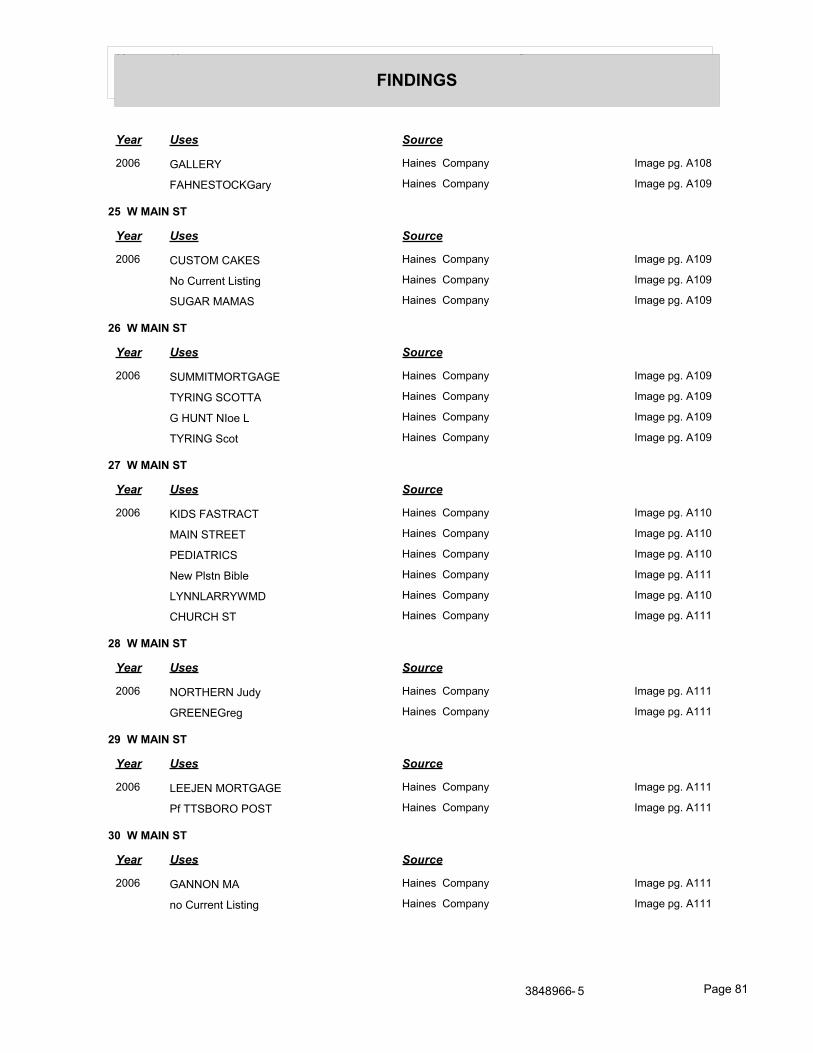
Year Uses Source
FINDINGS
Year Uses Source
2006 GALLERY Haines Company Image pg. A108
FAHNESTOCKGary Haines Company Image pg. A109
25 W MAIN ST
Year Uses Source
2006 CUSTOM CAKES Haines Company Image pg. A109
No Current Listing Haines Company Image pg. A109
SUGAR MAMAS Haines Company Image pg. A109
26 W MAIN ST
Year Uses Source
2006 SUMMITMORTGAGE Haines Company Image pg. A109
TYRING SCOTTA Haines Company Image pg. A109
G HUNT NIoe L Haines Company Image pg. A109
TYRING Scot Haines Company Image pg. A109
27 W MAIN ST
Year Uses Source
2006 KIDS FASTRACT Haines Company Image pg. A110
MAIN STREET Haines Company Image pg. A110
PEDIATRICS Haines Company Image pg. A110
New Plstn Bible Haines Company Image pg. A111
LYNNLARRYWMD Haines Company Image pg. A110
CHURCH ST Haines Company Image pg. A111
28 W MAIN ST
Year Uses Source
2006 NORTHERN Judy Haines Company Image pg. A111
GREENEGreg Haines Company Image pg. A111
29 W MAIN ST
Year Uses Source
2006 LEEJEN MORTGAGE Haines Company Image pg. A111
Pf TTSBORO POST Haines Company Image pg. A111
30 W MAIN ST
Year Uses Source
2006 GANNON MA Haines Company Image pg. A111
no Current Listing Haines Company Image pg. A111
3848966- 5 Page 81
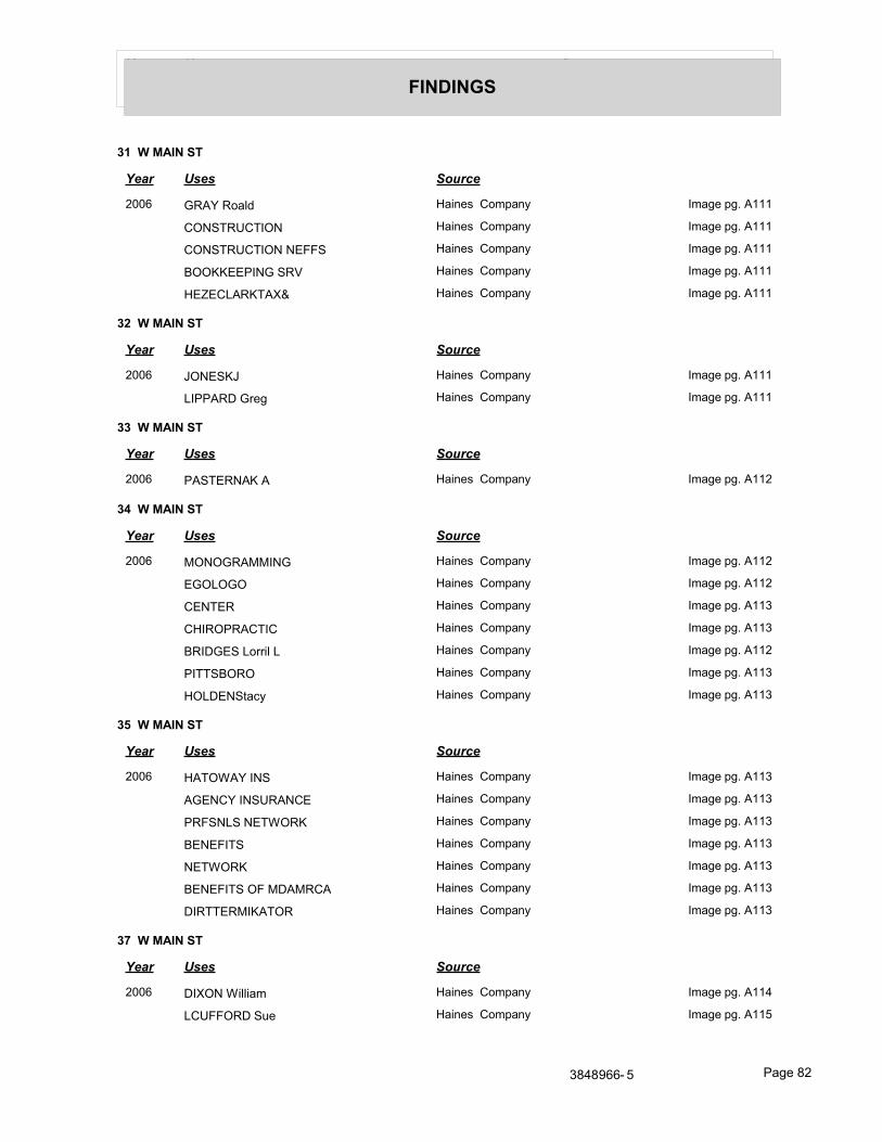
Year Uses Source
FINDINGS
31 W MAIN ST
Year Uses Source
2006 GRAY Roald Haines Company Image pg. A111
CONSTRUCTION Haines Company Image pg. A111
CONSTRUCTION NEFFS Haines Company Image pg. A111
BOOKKEEPING SRV Haines Company Image pg. A111
HEZECLARKTAX& Haines Company Image pg. A111
32 W MAIN ST
Year Uses Source
2006 JONESKJ Haines Company Image pg. A111
LIPPARD Greg Haines Company Image pg. A111
33 W MAIN ST
Year Uses Source
2006 PASTERNAK A Haines Company Image pg. A112
34 W MAIN ST
Year Uses Source
2006 MONOGRAMMING Haines Company Image pg. A112
EGOLOGO Haines Company Image pg. A112
CENTER Haines Company Image pg. A113
CHIROPRACTIC Haines Company Image pg. A113
BRIDGES Lorril L Haines Company Image pg. A112
PITTSBORO Haines Company Image pg. A113
HOLDENStacy Haines Company Image pg. A113
35 W MAIN ST
Year Uses Source
2006 HATOWAY INS Haines Company Image pg. A113
AGENCY INSURANCE Haines Company Image pg. A113
PRFSNLS NETWORK Haines Company Image pg. A113
BENEFITS Haines Company Image pg. A113
NETWORK Haines Company Image pg. A113
BENEFITS OF MDAMRCA Haines Company Image pg. A113
DIRTTERMIKATOR Haines Company Image pg. A113
37 W MAIN ST
Year Uses Source
2006 DIXON William Haines Company Image pg. A114
LCUFFORD Sue Haines Company Image pg. A115
3848966- 5 Page 82
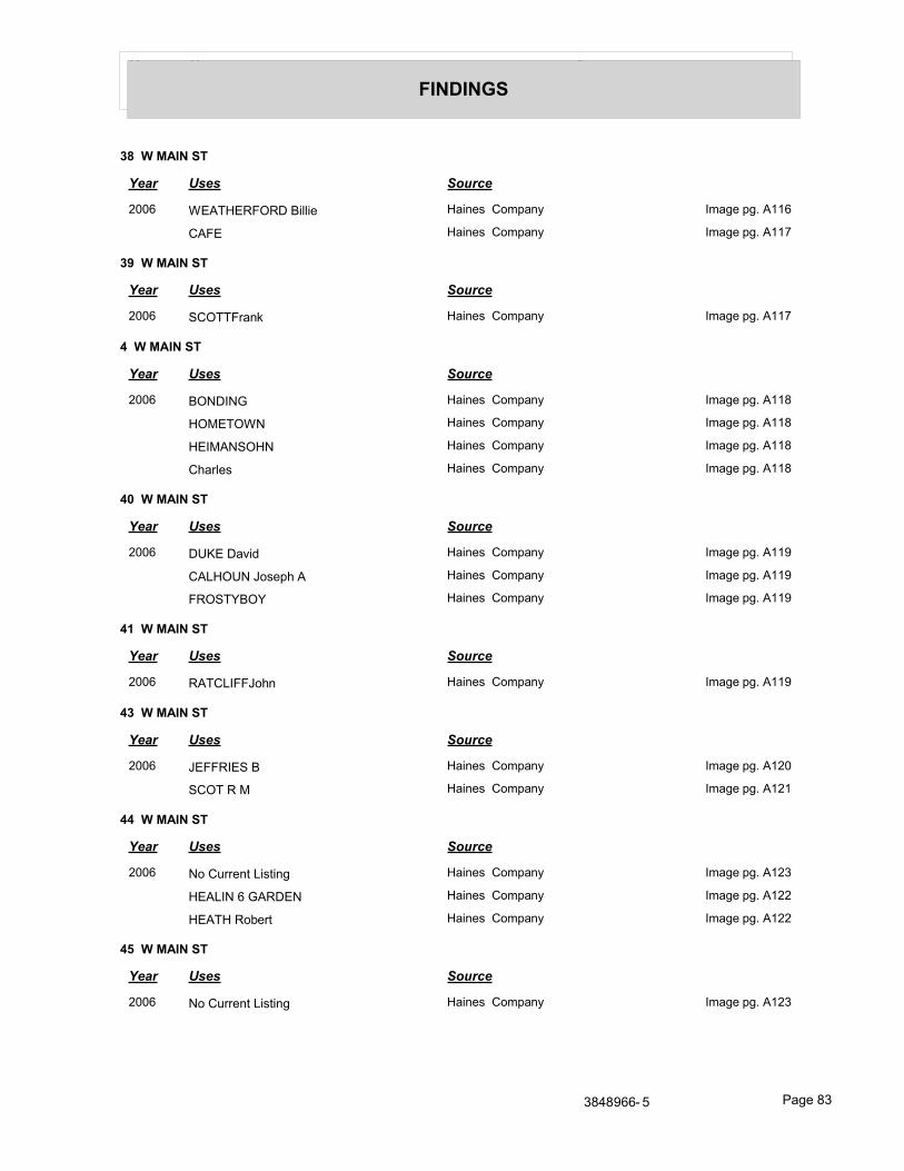
Year Uses Source
FINDINGS
38 W MAIN ST
Year Uses Source
2006 WEATHERFORD Billie Haines Company Image pg. A116
CAFE Haines Company Image pg. A117
39 W MAIN ST
Year Uses Source
2006 SCOTTFrank Haines Company Image pg. A117
4 W MAIN ST
Year Uses Source
2006 BONDING Haines Company Image pg. A118
HOMETOWN Haines Company Image pg. A118
HEIMANSOHN Haines Company Image pg. A118
Charles Haines Company Image pg. A118
40 W MAIN ST
Year Uses Source
2006 DUKE David Haines Company Image pg. A119
CALHOUN Joseph A Haines Company Image pg. A119
FROSTYBOY Haines Company Image pg. A119
41 W MAIN ST
Year Uses Source
2006 RATCLIFFJohn Haines Company Image pg. A119
43 W MAIN ST
Year Uses Source
2006 JEFFRIES B Haines Company Image pg. A120
SCOT R M Haines Company Image pg. A121
44 W MAIN ST
Year Uses Source
2006 No Current Listing Haines Company Image pg. A123
HEALIN 6 GARDEN Haines Company Image pg. A122
HEATH Robert Haines Company Image pg. A122
45 W MAIN ST
Year Uses Source
2006 No Current Listing Haines Company Image pg. A123
3848966- 5 Page 83
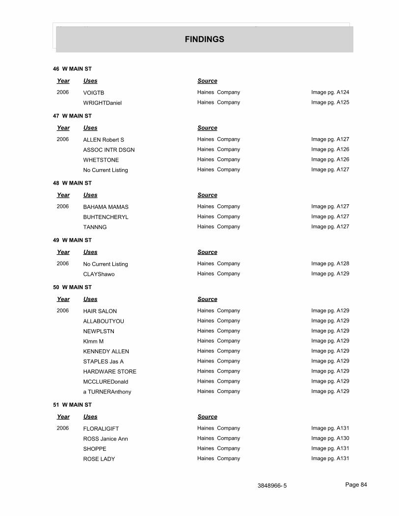
Year Uses Source
FINDINGS
46 W MAIN ST
Year Uses Source
2006 VOIGTB Haines Company Image pg. A124
WRIGHTDaniel Haines Company Image pg. A125
47 W MAIN ST
Year Uses Source
2006 ALLEN Robert S Haines Company Image pg. A127
ASSOC INTR DSGN Haines Company Image pg. A126
WHETSTONE Haines Company Image pg. A126
No Current Listing Haines Company Image pg. A127
48 W MAIN ST
Year Uses Source
2006 BAHAMA MAMAS Haines Company Image pg. A127
BUHTENCHERYL Haines Company Image pg. A127
TANNNG Haines Company Image pg. A127
49 W MAIN ST
Year Uses Source
2006 No Current Listing Haines Company Image pg. A128
CLAYShawo Haines Company Image pg. A129
50 W MAIN ST
Year Uses Source
2006 HAIR SALON Haines Company Image pg. A129
ALLABOUTYOU Haines Company Image pg. A129
NEWPLSTN Haines Company Image pg. A129
Klmm M Haines Company Image pg. A129
KENNEDY ALLEN Haines Company Image pg. A129
STAPLES Jas A Haines Company Image pg. A129
HARDWARE STORE Haines Company Image pg. A129
MCCLUREDonald Haines Company Image pg. A129
a TURNERAnthony Haines Company Image pg. A129
51 W MAIN ST
Year Uses Source
2006 FLORALIGIFT Haines Company Image pg. A131
ROSS Janice Ann Haines Company Image pg. A130
SHOPPE Haines Company Image pg. A131
ROSE LADY Haines Company Image pg. A131
3848966- 5 Page 84
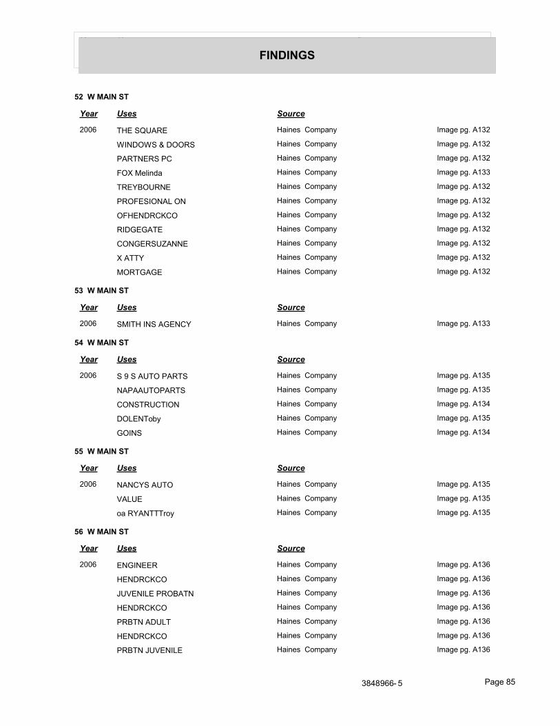
Year Uses Source
FINDINGS
52 W MAIN ST
Year Uses Source
2006 THE SQUARE Haines Company Image pg. A132
WINDOWS & DOORS Haines Company Image pg. A132
PARTNERS PC Haines Company Image pg. A132
FOX Melinda Haines Company Image pg. A133
TREYBOURNE Haines Company Image pg. A132
PROFESIONAL ON Haines Company Image pg. A132
OFHENDRCKCO Haines Company Image pg. A132
RIDGEGATE Haines Company Image pg. A132
CONGERSUZANNE Haines Company Image pg. A132
X ATTY Haines Company Image pg. A132
MORTGAGE Haines Company Image pg. A132
53 W MAIN ST
Year Uses Source
2006 SMITH INS AGENCY Haines Company Image pg. A133
54 W MAIN ST
Year Uses Source
2006 S 9 S AUTO PARTS Haines Company Image pg. A135
NAPAAUTOPARTS Haines Company Image pg. A135
CONSTRUCTION Haines Company Image pg. A134
DOLENToby Haines Company Image pg. A135
GOINS Haines Company Image pg. A134
55 W MAIN ST
Year Uses Source
2006 NANCYS AUTO Haines Company Image pg. A135
VALUE Haines Company Image pg. A135
oa RYANTTTroy Haines Company Image pg. A135
56 W MAIN ST
Year Uses Source
2006 ENGINEER Haines Company Image pg. A136
HENDRCKCO Haines Company Image pg. A136
JUVENILE PROBATN Haines Company Image pg. A136
HENDRCKCO Haines Company Image pg. A136
PRBTN ADULT Haines Company Image pg. A136
HENDRCKCO Haines Company Image pg. A136
PRBTN JUVENILE Haines Company Image pg. A136
3848966- 5 Page 85
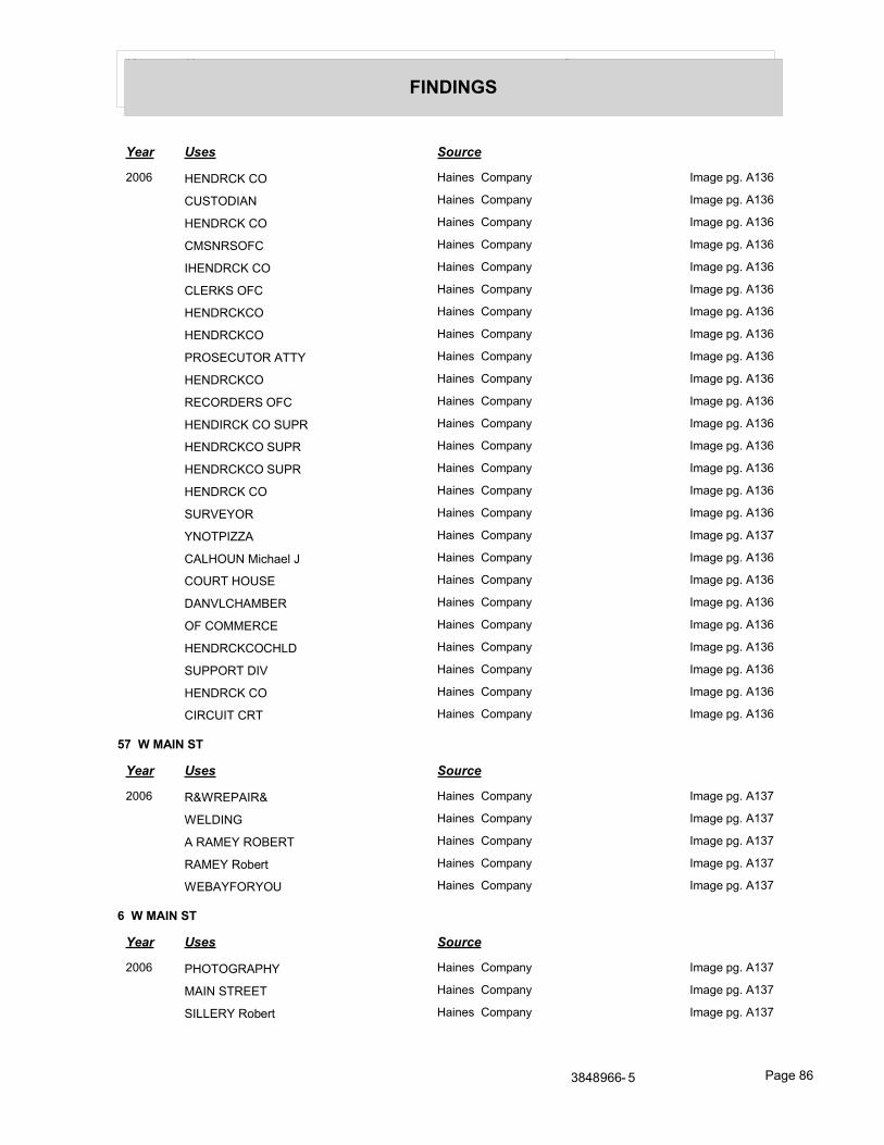
Year Uses Source
FINDINGS
Year Uses Source
2006 HENDRCK CO Haines Company Image pg. A136
CUSTODIAN Haines Company Image pg. A136
HENDRCK CO Haines Company Image pg. A136
CMSNRSOFC Haines Company Image pg. A136
IHENDRCK CO Haines Company Image pg. A136
CLERKS OFC Haines Company Image pg. A136
HENDRCKCO Haines Company Image pg. A136
HENDRCKCO Haines Company Image pg. A136
PROSECUTOR ATTY Haines Company Image pg. A136
HENDRCKCO Haines Company Image pg. A136
RECORDERS OFC Haines Company Image pg. A136
HENDIRCK CO SUPR Haines Company Image pg. A136
HENDRCKCO SUPR Haines Company Image pg. A136
HENDRCKCO SUPR Haines Company Image pg. A136
HENDRCK CO Haines Company Image pg. A136
SURVEYOR Haines Company Image pg. A136
YNOTPIZZA Haines Company Image pg. A137
CALHOUN Michael J Haines Company Image pg. A136
COURT HOUSE Haines Company Image pg. A136
DANVLCHAMBER Haines Company Image pg. A136
OF COMMERCE Haines Company Image pg. A136
HENDRCKCOCHLD Haines Company Image pg. A136
SUPPORT DIV Haines Company Image pg. A136
HENDRCK CO Haines Company Image pg. A136
CIRCUIT CRT Haines Company Image pg. A136
57 W MAIN ST
Year Uses Source
2006 R&WREPAIR& Haines Company Image pg. A137
WELDING Haines Company Image pg. A137
A RAMEY ROBERT Haines Company Image pg. A137
RAMEY Robert Haines Company Image pg. A137
WEBAYFORYOU Haines Company Image pg. A137
6 W MAIN ST
Year Uses Source
2006 PHOTOGRAPHY Haines Company Image pg. A137
MAIN STREET Haines Company Image pg. A137
SILLERY Robert Haines Company Image pg. A137
3848966- 5 Page 86
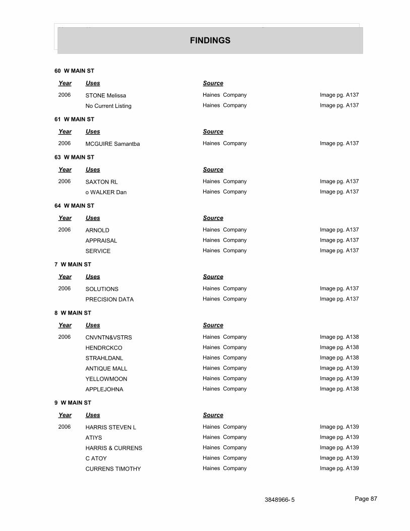
Year Uses Source
FINDINGS
60 W MAIN ST
Year Uses Source
2006 STONE Melissa Haines Company Image pg. A137
No Current Listing Haines Company Image pg. A137
61 W MAIN ST
Year Uses Source
2006 MCGUIRE Samantba Haines Company Image pg. A137
63 W MAIN ST
Year Uses Source
2006 SAXTON RL Haines Company Image pg. A137
o WALKER Dan Haines Company Image pg. A137
64 W MAIN ST
Year Uses Source
2006 ARNOLD Haines Company Image pg. A137
APPRAISAL Haines Company Image pg. A137
SERVICE Haines Company Image pg. A137
7 W MAIN ST
Year Uses Source
2006 SOLUTIONS Haines Company Image pg. A137
PRECISION DATA Haines Company Image pg. A137
8 W MAIN ST
Year Uses Source
2006 CNVNTN&VSTRS Haines Company Image pg. A138
HENDRCKCO Haines Company Image pg. A138
STRAHLDANL Haines Company Image pg. A138
ANTIQUE MALL Haines Company Image pg. A139
YELLOWMOON Haines Company Image pg. A139
APPLEJOHNA Haines Company Image pg. A138
9 W MAIN ST
Year Uses Source
2006 HARRIS STEVEN L Haines Company Image pg. A139
ATIYS Haines Company Image pg. A139
HARRIS & CURRENS Haines Company Image pg. A139
C ATOY Haines Company Image pg. A139
CURRENS TIMOTHY Haines Company Image pg. A139
3848966- 5 Page 87
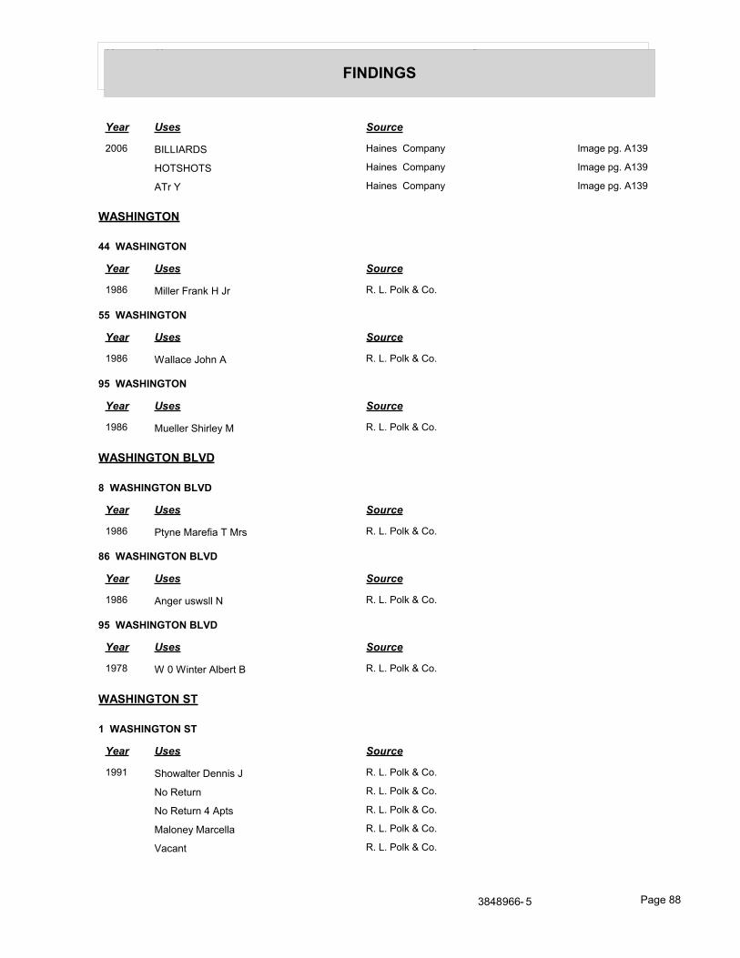
Year Uses Source
FINDINGS
Year Uses Source
2006 BILLIARDS Haines Company Image pg. A139
HOTSHOTS Haines Company Image pg. A139
ATr Y Haines Company Image pg. A139
WASHINGTON
44 WASHINGTON
Year Uses Source
1986 Miller Frank H Jr R. L. Polk & Co.
55 WASHINGTON
Year Uses Source
1986 Wallace John A R. L. Polk & Co.
95 WASHINGTON
Year Uses Source
1986 Mueller Shirley M R. L. Polk & Co.
WASHINGTON BLVD
8 WASHINGTON BLVD
Year Uses Source
1986 Ptyne Marefia T Mrs R. L. Polk & Co.
86 WASHINGTON BLVD
Year Uses Source
1986 Anger uswsll N R. L. Polk & Co.
95 WASHINGTON BLVD
Year Uses Source
1978 W 0 Winter Albert B R. L. Polk & Co.
WASHINGTON ST
1 WASHINGTON ST
Year Uses Source
1991 Showalter Dennis J R. L. Polk & Co.
No Return R. L. Polk & Co.
No Return 4 Apts R. L. Polk & Co.
Maloney Marcella R. L. Polk & Co.
Vacant R. L. Polk & Co.
3848966- 5 Page 88
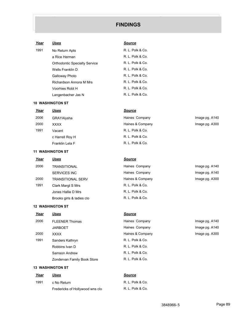
Year Uses Source
FINDINGS
Year Uses Source
1991 No Return Apts R. L. Polk & Co.
a Rice Herman R. L. Polk & Co.
Orthodontic Specialty Service R. L. Polk & Co.
Wells Franklin D R. L. Polk & Co.
Galloway Photo R. L. Polk & Co.
Richardson Annora M Mrs R. L. Polk & Co.
Voorhies Robt H R. L. Polk & Co.
Langenbacher Jas N R. L. Polk & Co.
10 WASHINGTON ST
Year Uses Source
2006 GRAYAlysha Haines Company Image pg. A140
2000 XXXX Haines & Company Image pg. A300
1991 Vacant R. L. Polk & Co.
c Harrell Roy H R. L. Polk & Co.
Franklin Lela F R. L. Polk & Co.
11 WASHINGTON ST
Year Uses Source
2006 TRANSITIONAL Haines Company Image pg. A140
SERVICES INC Haines Company Image pg. A140
2000 TRANSITIONAL SERV Haines & Company Image pg. A300
1991 Clark Margt S Mrs R. L. Polk & Co.
Jones Hallie D Mrs R. L. Polk & Co.
Brooks girls & ladies clo R. L. Polk & Co.
12 WASHINGTON ST
Year Uses Source
2006 FLEENER Thomas Haines Company Image pg. A140
JARBOET Haines Company Image pg. A140
2000 XXXX Haines & Company Image pg. A300
1991 Sanders Kathryn R. L. Polk & Co.
Robbins Ivan D R. L. Polk & Co.
Samson Andrew R. L. Polk & Co.
Zondervan Family Book Store R. L. Polk & Co.
13 WASHINGTON ST
Year Uses Source
1991 c No Return R. L. Polk & Co.
Fredericks of Hollywood wns clo R. L. Polk & Co.
3848966- 5 Page 89
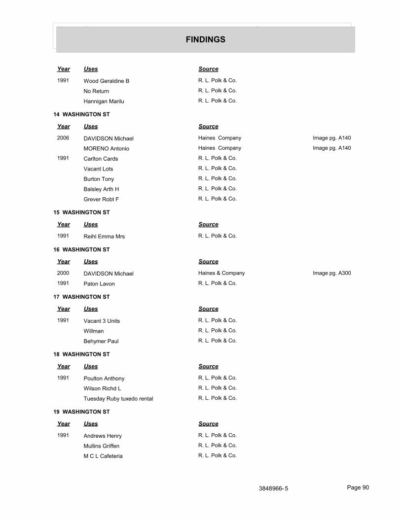
Year Uses Source
FINDINGS
Year Uses Source
1991 Wood Geraldine B R. L. Polk & Co.
No Return R. L. Polk & Co.
Hannigan Marilu R. L. Polk & Co.
14 WASHINGTON ST
Year Uses Source
2006 DAVIDSON Michael Haines Company Image pg. A140
MORENO Antonio Haines Company Image pg. A140
1991 Carlton Cards R. L. Polk & Co.
Vacant Lots R. L. Polk & Co.
Burton Tony R. L. Polk & Co.
Balsley Arth H R. L. Polk & Co.
Grever Robt F R. L. Polk & Co.
15 WASHINGTON ST
Year Uses Source
1991 Reihl Emma Mrs R. L. Polk & Co.
16 WASHINGTON ST
Year Uses Source
2000 DAVIDSON Michael Haines & Company Image pg. A300
1991 Paton Lavon R. L. Polk & Co.
17 WASHINGTON ST
Year Uses Source
1991 Vacant 3 Units R. L. Polk & Co.
Willman R. L. Polk & Co.
Behymer Paul R. L. Polk & Co.
18 WASHINGTON ST
Year Uses Source
1991 Poulton Anthony R. L. Polk & Co.
Wilson Richd L R. L. Polk & Co.
Tuesday Ruby tuxedo rental R. L. Polk & Co.
19 WASHINGTON ST
Year Uses Source
1991 Andrews Henry R. L. Polk & Co.
Mullins Griffen R. L. Polk & Co.
M C L Cafeteria R. L. Polk & Co.
3848966- 5 Page 90
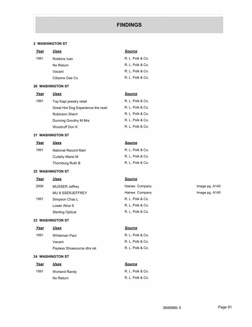
Year Uses Source
FINDINGS
2 WASHINGTON ST
Year Uses Source
1991 Robbins Ivan R. L. Polk & Co.
No Return R. L. Polk & Co.
Vacant R. L. Polk & Co.
Citizens Gas Co R. L. Polk & Co.
20 WASHINGTON ST
Year Uses Source
1991 Top Kapi jewelry retail R. L. Polk & Co.
Great Hot Dog Experience the restr R. L. Polk & Co.
Robinson Sherri R. L. Polk & Co.
Dunning Dorothy M Mrs R. L. Polk & Co.
Woodruff Don K R. L. Polk & Co.
21 WASHINGTON ST
Year Uses Source
1991 National Record Mart R. L. Polk & Co.
Cudahy Marie M R. L. Polk & Co.
Thornburg Ruth B R. L. Polk & Co.
22 WASHINGTON ST
Year Uses Source
2006 MUSSER Jeffrey Haines Company Image pg. A140
MU 8 SSERJEFFREY Haines Company Image pg. A140
1991 Simpson Chas L R. L. Polk & Co.
Lower Alice S R. L. Polk & Co.
Sterling Optical R. L. Polk & Co.
23 WASHINGTON ST
Year Uses Source
1991 Whiteman Paul R. L. Polk & Co.
Vacant R. L. Polk & Co.
Payless Shoesource dlrs ret R. L. Polk & Co.
24 WASHINGTON ST
Year Uses Source
1991 Worland Randy R. L. Polk & Co.
No Return R. L. Polk & Co.
3848966- 5 Page 91
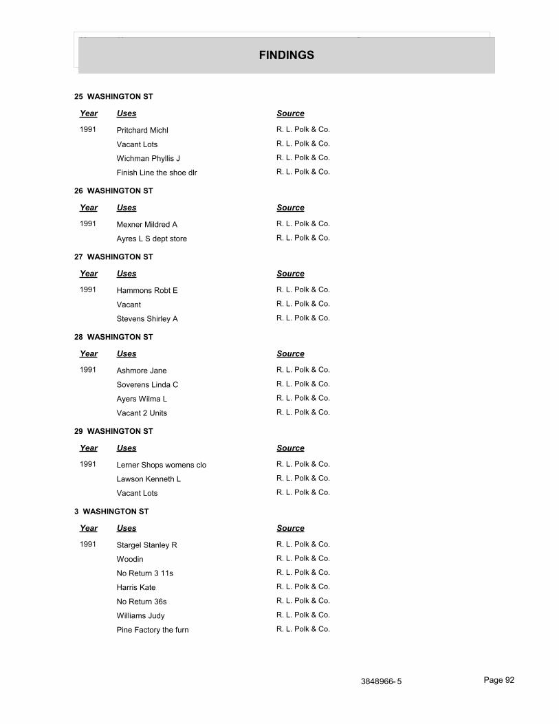
Year Uses Source
FINDINGS
25 WASHINGTON ST
Year Uses Source
1991 Pritchard Michl R. L. Polk & Co.
Vacant Lots R. L. Polk & Co.
Wichman Phyllis J R. L. Polk & Co.
Finish Line the shoe dlr R. L. Polk & Co.
26 WASHINGTON ST
Year Uses Source
1991 Mexner Mildred A R. L. Polk & Co.
Ayres L S dept store R. L. Polk & Co.
27 WASHINGTON ST
Year Uses Source
1991 Hammons Robt E R. L. Polk & Co.
Vacant R. L. Polk & Co.
Stevens Shirley A R. L. Polk & Co.
28 WASHINGTON ST
Year Uses Source
1991 Ashmore Jane R. L. Polk & Co.
Soverens Linda C R. L. Polk & Co.
Ayers Wilma L R. L. Polk & Co.
Vacant 2 Units R. L. Polk & Co.
29 WASHINGTON ST
Year Uses Source
1991 Lerner Shops womens clo R. L. Polk & Co.
Lawson Kenneth L R. L. Polk & Co.
Vacant Lots R. L. Polk & Co.
3 WASHINGTON ST
Year Uses Source
1991 Stargel Stanley R R. L. Polk & Co.
Woodin R. L. Polk & Co.
No Return 3 11s R. L. Polk & Co.
Harris Kate R. L. Polk & Co.
No Return 36s R. L. Polk & Co.
Williams Judy R. L. Polk & Co.
Pine Factory the furn R. L. Polk & Co.
3848966- 5 Page 92
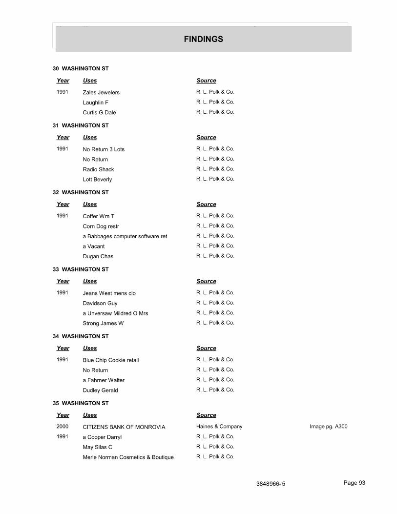
Year Uses Source
FINDINGS
30 WASHINGTON ST
Year Uses Source
1991 Zales Jewelers R. L. Polk & Co.
Laughlin F R. L. Polk & Co.
Curtis G Dale R. L. Polk & Co.
31 WASHINGTON ST
Year Uses Source
1991 No Return 3 Lots R. L. Polk & Co.
No Return R. L. Polk & Co.
Radio Shack R. L. Polk & Co.
Lott Beverly R. L. Polk & Co.
32 WASHINGTON ST
Year Uses Source
1991 Coffer Wm T R. L. Polk & Co.
Corn Dog restr R. L. Polk & Co.
a Babbages computer software ret R. L. Polk & Co.
a Vacant R. L. Polk & Co.
Dugan Chas R. L. Polk & Co.
33 WASHINGTON ST
Year Uses Source
1991 Jeans West mens clo R. L. Polk & Co.
Davidson Guy R. L. Polk & Co.
a Unversaw Mildred O Mrs R. L. Polk & Co.
Strong James W R. L. Polk & Co.
34 WASHINGTON ST
Year Uses Source
1991 Blue Chip Cookie retail R. L. Polk & Co.
No Return R. L. Polk & Co.
a Fahrner Walter R. L. Polk & Co.
Dudley Gerald R. L. Polk & Co.
35 WASHINGTON ST
Year Uses Source
2000 CITIZENS BANK OF MONROVIA Haines & Company Image pg. A300
1991 a Cooper Darryl R. L. Polk & Co.
May Silas C R. L. Polk & Co.
Merle Norman Cosmetics & Boutique R. L. Polk & Co.
3848966- 5 Page 93
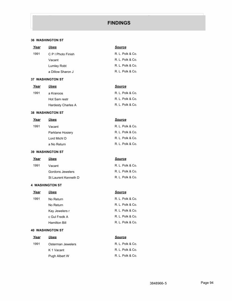
Year Uses Source
FINDINGS
36 WASHINGTON ST
Year Uses Source
1991 C P I Photo Finish R. L. Polk & Co.
Vacant R. L. Polk & Co.
Lumley Robt R. L. Polk & Co.
a Dillow Sharon J R. L. Polk & Co.
37 WASHINGTON ST
Year Uses Source
1991 a Kranoos R. L. Polk & Co.
Hot Sam restr R. L. Polk & Co.
Hardesty Charles A R. L. Polk & Co.
38 WASHINGTON ST
Year Uses Source
1991 Vacant R. L. Polk & Co.
Parklane Hosiery R. L. Polk & Co.
Lord Michl D R. L. Polk & Co.
a No Return R. L. Polk & Co.
39 WASHINGTON ST
Year Uses Source
1991 Vacant R. L. Polk & Co.
Gordons Jewelers R. L. Polk & Co.
St Laurent Kenneth D R. L. Polk & Co.
4 WASHINGTON ST
Year Uses Source
1991 No Return R. L. Polk & Co.
No Return R. L. Polk & Co.
Kay Jewelers r R. L. Polk & Co.
c Gul Fredk A R. L. Polk & Co.
Hamilton Bill R. L. Polk & Co.
40 WASHINGTON ST
Year Uses Source
1991 Osterman Jewelers R. L. Polk & Co.
K 1 Vacant R. L. Polk & Co.
Pugh Albert W R. L. Polk & Co.
3848966- 5 Page 94
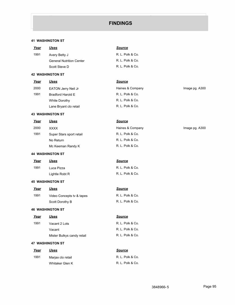
Year Uses Source
FINDINGS
41 WASHINGTON ST
Year Uses Source
1991 Avery Betty J R. L. Polk & Co.
General Nutrition Center R. L. Polk & Co.
Scott Steve D R. L. Polk & Co.
42 WASHINGTON ST
Year Uses Source
2000 EATON Jerry Neil Jr Haines & Company Image pg. A300
1991 Bradford Harold E R. L. Polk & Co.
White Dorothy R. L. Polk & Co.
Lane Bryant clo retail R. L. Polk & Co.
43 WASHINGTON ST
Year Uses Source
2000 XXXX Haines & Company Image pg. A300
1991 Super Stars sport retail R. L. Polk & Co.
No Return R. L. Polk & Co.
Mc Keeman Randy K R. L. Polk & Co.
44 WASHINGTON ST
Year Uses Source
1991 Luca Pizza R. L. Polk & Co.
Lightle Robt R R. L. Polk & Co.
45 WASHINGTON ST
Year Uses Source
1991 Video Concepts tv & tapes R. L. Polk & Co.
Scott Dorothy B R. L. Polk & Co.
46 WASHINGTON ST
Year Uses Source
1991 Vacant 2 Lots R. L. Polk & Co.
Vacant R. L. Polk & Co.
Mister Bulkys candy retail R. L. Polk & Co.
47 WASHINGTON ST
Year Uses Source
1991 Marjax clo retail R. L. Polk & Co.
Whitaker Glen K R. L. Polk & Co.
3848966- 5 Page 95
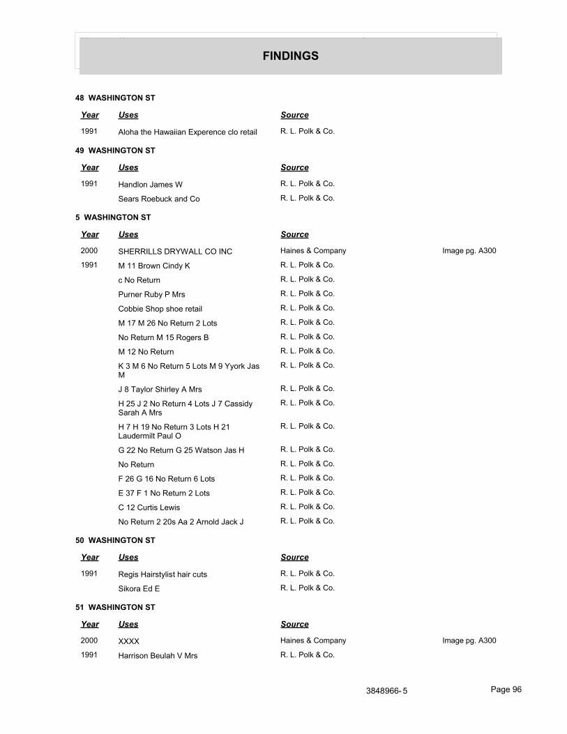
Year Uses Source
FINDINGS
48 WASHINGTON ST
Year Uses Source
1991 Aloha the Hawaiian Experence clo retail R. L. Polk & Co.
49 WASHINGTON ST
Year Uses Source
1991 Handlon James W R. L. Polk & Co.
Sears Roebuck and Co R. L. Polk & Co.
5 WASHINGTON ST
Year Uses Source
2000 SHERRILLS DRYWALL CO INC Haines & Company Image pg. A300
1991 M 11 Brown Cindy K R. L. Polk & Co.
c No Return R. L. Polk & Co.
Purner Ruby P Mrs R. L. Polk & Co.
Cobbie Shop shoe retail R. L. Polk & Co.
M 17 M 26 No Return 2 Lots R. L. Polk & Co.
No Return M 15 Rogers B R. L. Polk & Co.
M 12 No Return R. L. Polk & Co.
K 3 M 6 No Return 5 Lots M 9 Yyork Jas M
R. L. Polk & Co.
J 8 Taylor Shirley A Mrs R. L. Polk & Co.
H 25 J 2 No Return 4 Lots J 7 Cassidy Sarah A Mrs
R. L. Polk & Co.
H 7 H 19 No Return 3 Lots H 21 Laudermilt Paul O
R. L. Polk & Co.
G 22 No Return G 25 Watson Jas H R. L. Polk & Co.
No Return R. L. Polk & Co.
F 26 G 16 No Return 6 Lots R. L. Polk & Co.
E 37 F 1 No Return 2 Lots R. L. Polk & Co.
C 12 Curtis Lewis R. L. Polk & Co.
No Return 2 20s Aa 2 Arnold Jack J R. L. Polk & Co.
50 WASHINGTON ST
Year Uses Source
1991 Regis Hairstylist hair cuts R. L. Polk & Co.
Sikora Ed E R. L. Polk & Co.
51 WASHINGTON ST
Year Uses Source
2000 XXXX Haines & Company Image pg. A300
1991 Harrison Beulah V Mrs R. L. Polk & Co.
3848966- 5 Page 96
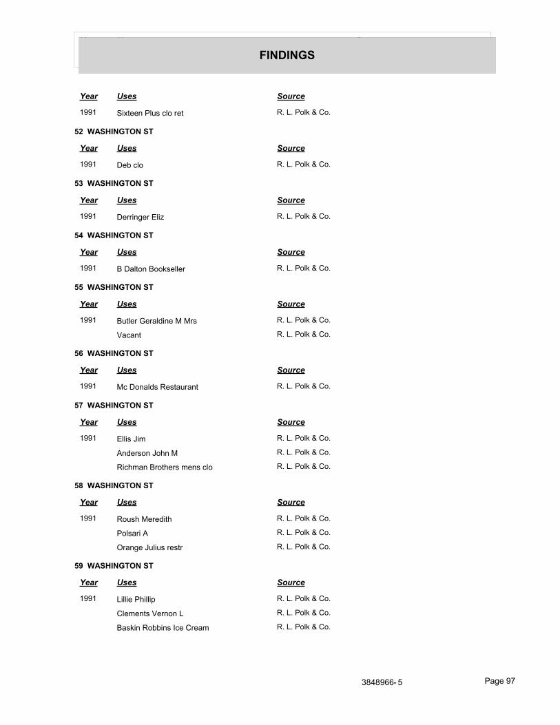
Year Uses Source
FINDINGS
Year Uses Source
1991 Sixteen Plus clo ret R. L. Polk & Co.
52 WASHINGTON ST
Year Uses Source
1991 Deb clo R. L. Polk & Co.
53 WASHINGTON ST
Year Uses Source
1991 Derringer Eliz R. L. Polk & Co.
54 WASHINGTON ST
Year Uses Source
1991 B Dalton Bookseller R. L. Polk & Co.
55 WASHINGTON ST
Year Uses Source
1991 Butler Geraldine M Mrs R. L. Polk & Co.
Vacant R. L. Polk & Co.
56 WASHINGTON ST
Year Uses Source
1991 Mc Donalds Restaurant R. L. Polk & Co.
57 WASHINGTON ST
Year Uses Source
1991 Ellis Jim R. L. Polk & Co.
Anderson John M R. L. Polk & Co.
Richman Brothers mens clo R. L. Polk & Co.
58 WASHINGTON ST
Year Uses Source
1991 Roush Meredith R. L. Polk & Co.
Polsari A R. L. Polk & Co.
Orange Julius restr R. L. Polk & Co.
59 WASHINGTON ST
Year Uses Source
1991 Lillie Phillip R. L. Polk & Co.
Clements Vernon L R. L. Polk & Co.
Baskin Robbins Ice Cream R. L. Polk & Co.
3848966- 5 Page 97
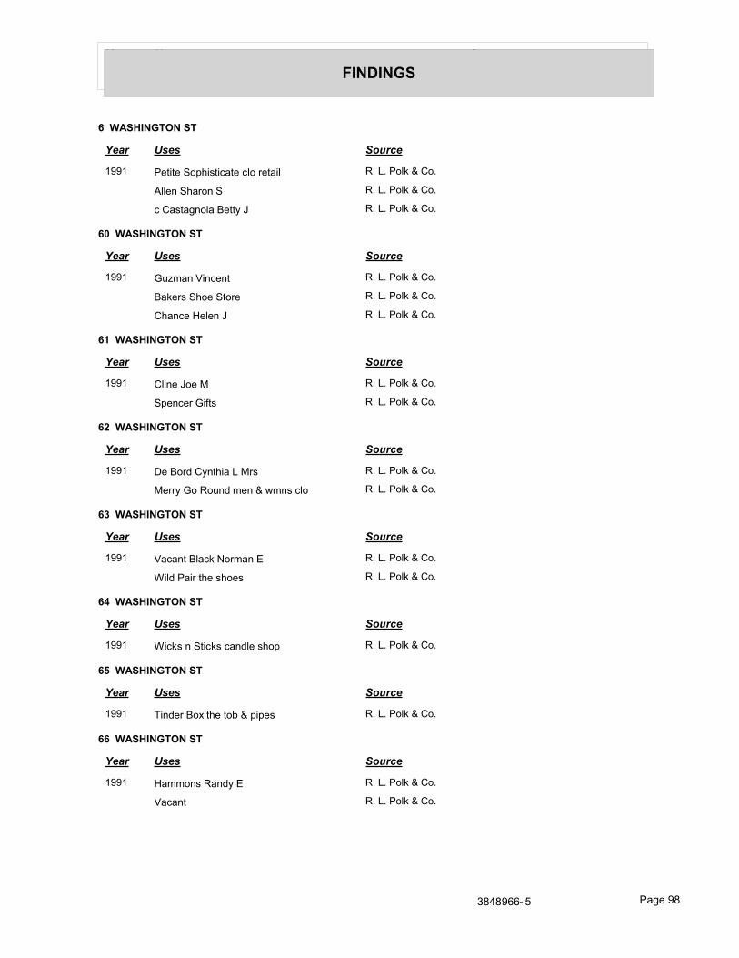
Year Uses Source
FINDINGS
6 WASHINGTON ST
Year Uses Source
1991 Petite Sophisticate clo retail R. L. Polk & Co.
Allen Sharon S R. L. Polk & Co.
c Castagnola Betty J R. L. Polk & Co.
60 WASHINGTON ST
Year Uses Source
1991 Guzman Vincent R. L. Polk & Co.
Bakers Shoe Store R. L. Polk & Co.
Chance Helen J R. L. Polk & Co.
61 WASHINGTON ST
Year Uses Source
1991 Cline Joe M R. L. Polk & Co.
Spencer Gifts R. L. Polk & Co.
62 WASHINGTON ST
Year Uses Source
1991 De Bord Cynthia L Mrs R. L. Polk & Co.
Merry Go Round men & wmns clo R. L. Polk & Co.
63 WASHINGTON ST
Year Uses Source
1991 Vacant Black Norman E R. L. Polk & Co.
Wild Pair the shoes R. L. Polk & Co.
64 WASHINGTON ST
Year Uses Source
1991 Wicks n Sticks candle shop R. L. Polk & Co.
65 WASHINGTON ST
Year Uses Source
1991 Tinder Box the tob & pipes R. L. Polk & Co.
66 WASHINGTON ST
Year Uses Source
1991 Hammons Randy E R. L. Polk & Co.
Vacant R. L. Polk & Co.
3848966- 5 Page 98
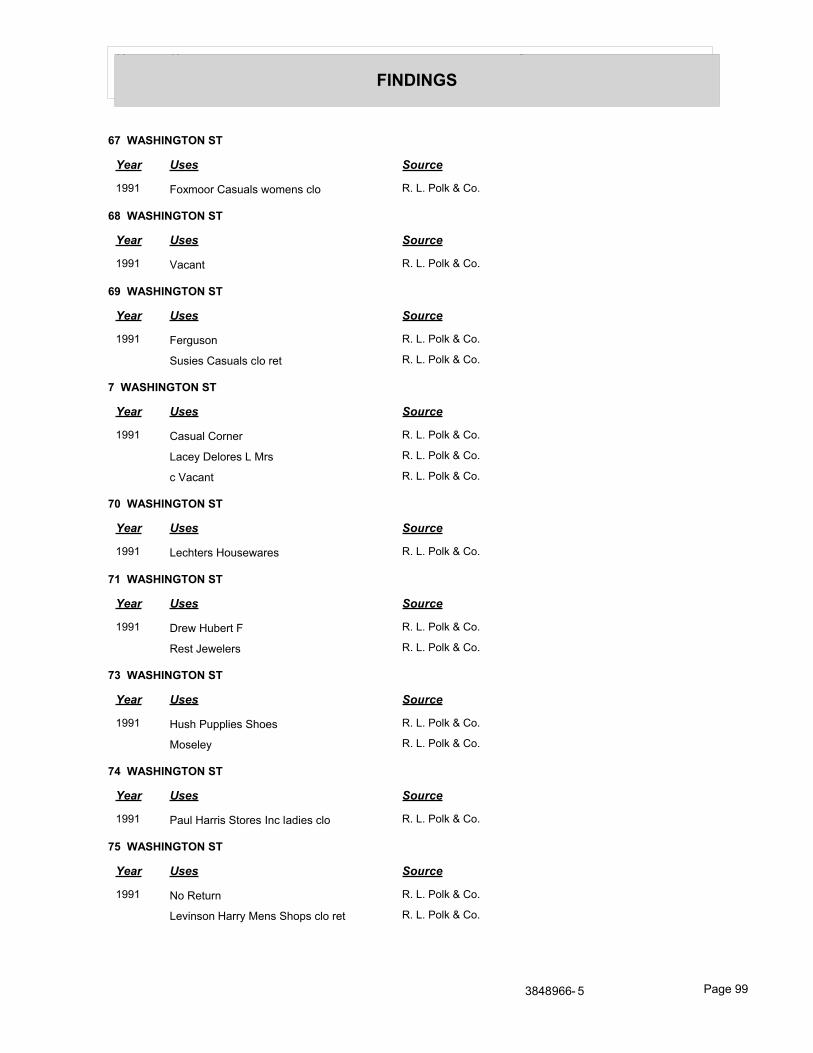
Year Uses Source
FINDINGS
67 WASHINGTON ST
Year Uses Source
1991 Foxmoor Casuals womens clo R. L. Polk & Co.
68 WASHINGTON ST
Year Uses Source
1991 Vacant R. L. Polk & Co.
69 WASHINGTON ST
Year Uses Source
1991 Ferguson R. L. Polk & Co.
Susies Casuals clo ret R. L. Polk & Co.
7 WASHINGTON ST
Year Uses Source
1991 Casual Corner R. L. Polk & Co.
Lacey Delores L Mrs R. L. Polk & Co.
c Vacant R. L. Polk & Co.
70 WASHINGTON ST
Year Uses Source
1991 Lechters Housewares R. L. Polk & Co.
71 WASHINGTON ST
Year Uses Source
1991 Drew Hubert F R. L. Polk & Co.
Rest Jewelers R. L. Polk & Co.
73 WASHINGTON ST
Year Uses Source
1991 Hush Pupplies Shoes R. L. Polk & Co.
Moseley R. L. Polk & Co.
74 WASHINGTON ST
Year Uses Source
1991 Paul Harris Stores Inc ladies clo R. L. Polk & Co.
75 WASHINGTON ST
Year Uses Source
1991 No Return R. L. Polk & Co.
Levinson Harry Mens Shops clo ret R. L. Polk & Co.
3848966- 5 Page 99
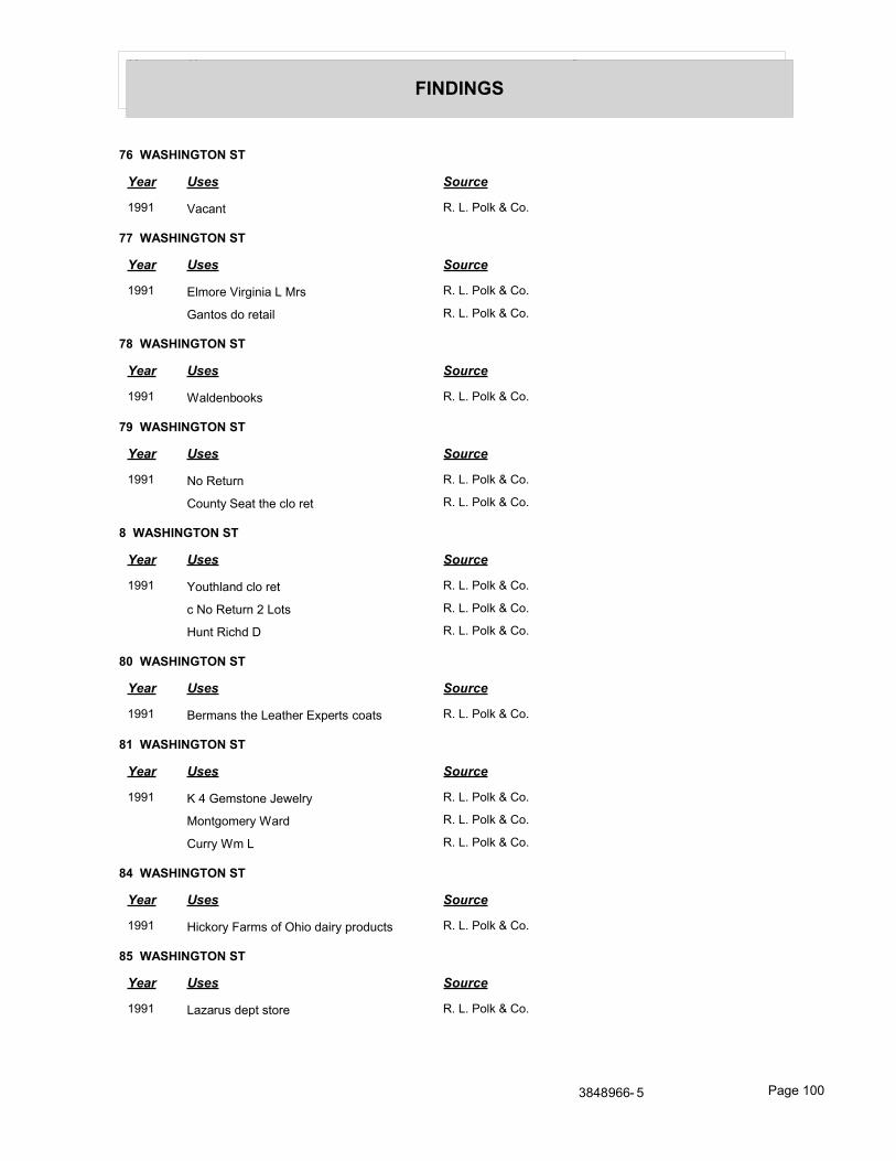
Year Uses Source
FINDINGS
76 WASHINGTON ST
Year Uses Source
1991 Vacant R. L. Polk & Co.
77 WASHINGTON ST
Year Uses Source
1991 Elmore Virginia L Mrs R. L. Polk & Co.
Gantos do retail R. L. Polk & Co.
78 WASHINGTON ST
Year Uses Source
1991 Waldenbooks R. L. Polk & Co.
79 WASHINGTON ST
Year Uses Source
1991 No Return R. L. Polk & Co.
County Seat the clo ret R. L. Polk & Co.
8 WASHINGTON ST
Year Uses Source
1991 Youthland clo ret R. L. Polk & Co.
c No Return 2 Lots R. L. Polk & Co.
Hunt Richd D R. L. Polk & Co.
80 WASHINGTON ST
Year Uses Source
1991 Bermans the Leather Experts coats R. L. Polk & Co.
81 WASHINGTON ST
Year Uses Source
1991 K 4 Gemstone Jewelry R. L. Polk & Co.
Montgomery Ward R. L. Polk & Co.
Curry Wm L R. L. Polk & Co.
84 WASHINGTON ST
Year Uses Source
1991 Hickory Farms of Ohio dairy products R. L. Polk & Co.
85 WASHINGTON ST
Year Uses Source
1991 Lazarus dept store R. L. Polk & Co.
3848966- 5 Page 100
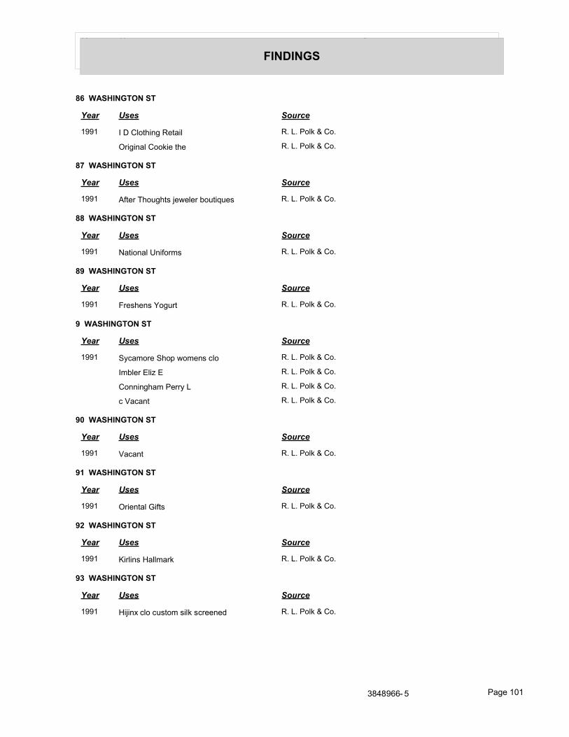
Year Uses Source
FINDINGS
86 WASHINGTON ST
Year Uses Source
1991 I D Clothing Retail R. L. Polk & Co.
Original Cookie the R. L. Polk & Co.
87 WASHINGTON ST
Year Uses Source
1991 After Thoughts jeweler boutiques R. L. Polk & Co.
88 WASHINGTON ST
Year Uses Source
1991 National Uniforms R. L. Polk & Co.
89 WASHINGTON ST
Year Uses Source
1991 Freshens Yogurt R. L. Polk & Co.
9 WASHINGTON ST
Year Uses Source
1991 Sycamore Shop womens clo R. L. Polk & Co.
Imbler Eliz E R. L. Polk & Co.
Conningham Perry L R. L. Polk & Co.
c Vacant R. L. Polk & Co.
90 WASHINGTON ST
Year Uses Source
1991 Vacant R. L. Polk & Co.
91 WASHINGTON ST
Year Uses Source
1991 Oriental Gifts R. L. Polk & Co.
92 WASHINGTON ST
Year Uses Source
1991 Kirlins Hallmark R. L. Polk & Co.
93 WASHINGTON ST
Year Uses Source
1991 Hijinx clo custom silk screened R. L. Polk & Co.
3848966- 5 Page 101
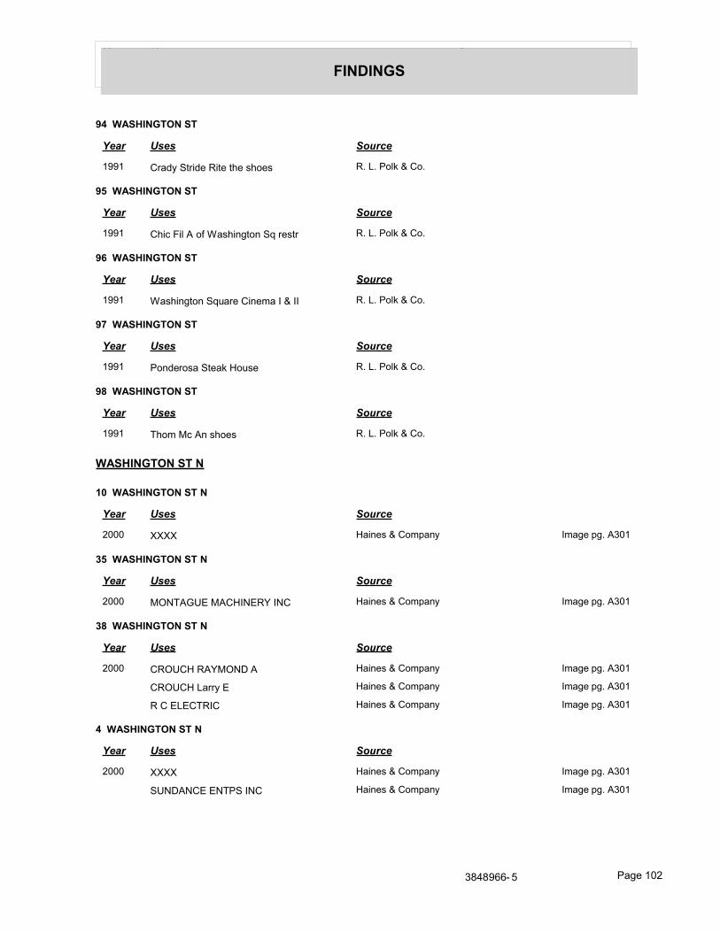
Year Uses Source
FINDINGS
94 WASHINGTON ST
Year Uses Source
1991 Crady Stride Rite the shoes R. L. Polk & Co.
95 WASHINGTON ST
Year Uses Source
1991 Chic Fil A of Washington Sq restr R. L. Polk & Co.
96 WASHINGTON ST
Year Uses Source
1991 Washington Square Cinema I & II R. L. Polk & Co.
97 WASHINGTON ST
Year Uses Source
1991 Ponderosa Steak House R. L. Polk & Co.
98 WASHINGTON ST
Year Uses Source
1991 Thom Mc An shoes R. L. Polk & Co.
WASHINGTON ST N
10 WASHINGTON ST N
Year Uses Source
2000 XXXX Haines & Company Image pg. A301
35 WASHINGTON ST N
Year Uses Source
2000 MONTAGUE MACHINERY INC Haines & Company Image pg. A301
38 WASHINGTON ST N
Year Uses Source
2000 CROUCH RAYMOND A Haines & Company Image pg. A301
CROUCH Larry E Haines & Company Image pg. A301
R C ELECTRIC Haines & Company Image pg. A301
4 WASHINGTON ST N
Year Uses Source
2000 XXXX Haines & Company Image pg. A301
SUNDANCE ENTPS INC Haines & Company Image pg. A301
3848966- 5 Page 102
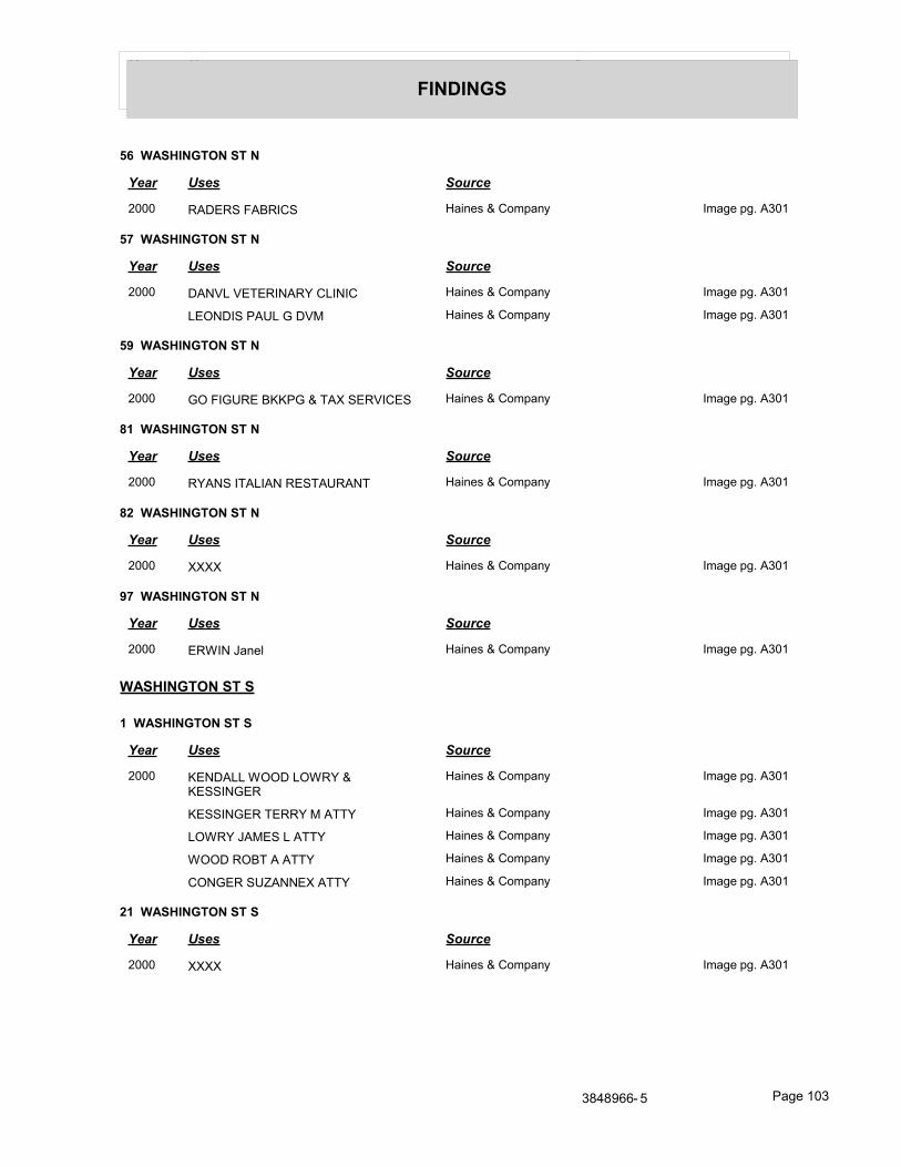
Year Uses Source
FINDINGS
56 WASHINGTON ST N
Year Uses Source
2000 RADERS FABRICS Haines & Company Image pg. A301
57 WASHINGTON ST N
Year Uses Source
2000 DANVL VETERINARY CLINIC Haines & Company Image pg. A301
LEONDIS PAUL G DVM Haines & Company Image pg. A301
59 WASHINGTON ST N
Year Uses Source
2000 GO FIGURE BKKPG & TAX SERVICES Haines & Company Image pg. A301
81 WASHINGTON ST N
Year Uses Source
2000 RYANS ITALIAN RESTAURANT Haines & Company Image pg. A301
82 WASHINGTON ST N
Year Uses Source
2000 XXXX Haines & Company Image pg. A301
97 WASHINGTON ST N
Year Uses Source
2000 ERWIN Janel Haines & Company Image pg. A301
WASHINGTON ST S
1 WASHINGTON ST S
Year Uses Source
2000 KENDALL WOOD LOWRY & KESSINGER
Haines & Company Image pg. A301
KESSINGER TERRY M ATTY Haines & Company Image pg. A301
LOWRY JAMES L ATTY Haines & Company Image pg. A301
WOOD ROBT A ATTY Haines & Company Image pg. A301
CONGER SUZANNEX ATTY Haines & Company Image pg. A301
21 WASHINGTON ST S
Year Uses Source
2000 XXXX Haines & Company Image pg. A301
3848966- 5 Page 103
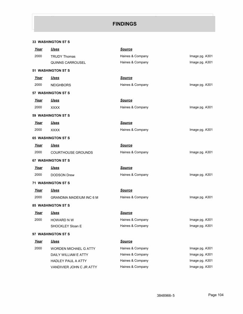
Year Uses Source
FINDINGS
33 WASHINGTON ST S
Year Uses Source
2000 TRUDY Thomas Haines & Company Image pg. A301
QUINNS CARROUSEL Haines & Company Image pg. A301
51 WASHINGTON ST S
Year Uses Source
2000 NEIGHBORS Haines & Company Image pg. A301
57 WASHINGTON ST S
Year Uses Source
2000 XXXX Haines & Company Image pg. A301
59 WASHINGTON ST S
Year Uses Source
2000 XXXX Haines & Company Image pg. A301
65 WASHINGTON ST S
Year Uses Source
2000 COURTHOUSE GROUNDS Haines & Company Image pg. A301
67 WASHINGTON ST S
Year Uses Source
2000 DODSON Drew Haines & Company Image pg. A301
71 WASHINGTON ST S
Year Uses Source
2000 GRANDMA MADEIUM INC 6 M Haines & Company Image pg. A301
85 WASHINGTON ST S
Year Uses Source
2000 HOWARD N W Haines & Company Image pg. A301
SHOCKLEY Sloan E Haines & Company Image pg. A301
97 WASHINGTON ST S
Year Uses Source
2000 WORDEN MICHAEL G ATTY Haines & Company Image pg. A301
DAILY WILLIAM E ATTY Haines & Company Image pg. A301
HADLEY PAUL A ATTY Haines & Company Image pg. A301
VANDIVIER JOHN C JR ATTY Haines & Company Image pg. A301
3848966- 5 Page 104
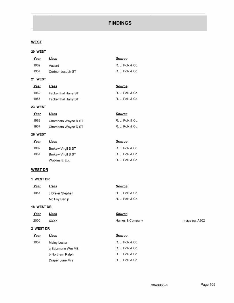
Year Uses Source
FINDINGS
WEST
20 WEST
Year Uses Source
1962 Vacant R. L. Polk & Co.
1957 Cortner Joseph ST R. L. Polk & Co.
21 WEST
Year Uses Source
1962 Fackenthal Harry ST R. L. Polk & Co.
1957 Fackenthal Harry ST R. L. Polk & Co.
23 WEST
Year Uses Source
1962 Chambers Wayne R ST R. L. Polk & Co.
1957 Chambers Wayne D ST R. L. Polk & Co.
26 WEST
Year Uses Source
1962 Brokaw Virgil S ST R. L. Polk & Co.
1957 Brokaw Virgil S ST R. L. Polk & Co.
Watkins E Eug R. L. Polk & Co.
WEST DR
1 WEST DR
Year Uses Source
1957 c Dreier Stephen R. L. Polk & Co.
Mc Foy Ben jr R. L. Polk & Co.
18 WEST DR
Year Uses Source
2000 XXXX Haines & Company Image pg. A302
2 WEST DR
Year Uses Source
1957 Maley Lester R. L. Polk & Co.
a Salzmann Wm ME R. L. Polk & Co.
b Northern Ralph R. L. Polk & Co.
Draper June Mrs R. L. Polk & Co.
3848966- 5 Page 105
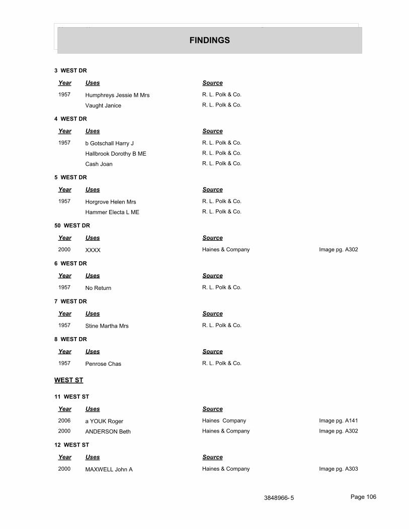
Year Uses Source
FINDINGS
3 WEST DR
Year Uses Source
1957 Humphreys Jessie M Mrs R. L. Polk & Co.
Vaught Janice R. L. Polk & Co.
4 WEST DR
Year Uses Source
1957 b Gotschall Harry J R. L. Polk & Co.
Hallbrook Dorothy B ME R. L. Polk & Co.
Cash Joan R. L. Polk & Co.
5 WEST DR
Year Uses Source
1957 Horgrove Helen Mrs R. L. Polk & Co.
Hammer Electa L ME R. L. Polk & Co.
50 WEST DR
Year Uses Source
2000 XXXX Haines & Company Image pg. A302
6 WEST DR
Year Uses Source
1957 No Return R. L. Polk & Co.
7 WEST DR
Year Uses Source
1957 Stine Martha Mrs R. L. Polk & Co.
8 WEST DR
Year Uses Source
1957 Penrose Chas R. L. Polk & Co.
WEST ST
11 WEST ST
Year Uses Source
2006 a YOUK Roger Haines Company Image pg. A141
2000 ANDERSON Beth Haines & Company Image pg. A302
12 WEST ST
Year Uses Source
2000 MAXWELL John A Haines & Company Image pg. A303
3848966- 5 Page 106
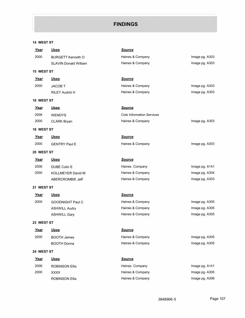
Year Uses Source
FINDINGS
14 WEST ST
Year Uses Source
2000 BURGETT Kenneth O Haines & Company Image pg. A303
SLAVIN Donald William Haines & Company Image pg. A303
15 WEST ST
Year Uses Source
2000 JACOB T Haines & Company Image pg. A303
RILEY Audrid H Haines & Company Image pg. A303
16 WEST ST
Year Uses Source
2008 WENDYS Cole Information Services
2000 CLARK Bryan Haines & Company Image pg. A303
18 WEST ST
Year Uses Source
2000 GENTRY Paul E Haines & Company Image pg. A303
20 WEST ST
Year Uses Source
2006 DUBE Colin E Haines Company Image pg. A141
2000 KOLLMEYER David M Haines & Company Image pg. A304
ABERCROMBIE Jeff Haines & Company Image pg. A303
21 WEST ST
Year Uses Source
2000 GOODNIGHT Paul C Haines & Company Image pg. A305
ASHWILL Audry Haines & Company Image pg. A305
ASHWILL Gary Haines & Company Image pg. A305
23 WEST ST
Year Uses Source
2000 BOOTH James Haines & Company Image pg. A305
BOOTH Donna Haines & Company Image pg. A305
24 WEST ST
Year Uses Source
2006 ROBINSON Ellis Haines Company Image pg. A141
2000 XXXX Haines & Company Image pg. A305
ROBINSON Ellis Haines & Company Image pg. A306
3848966- 5 Page 107
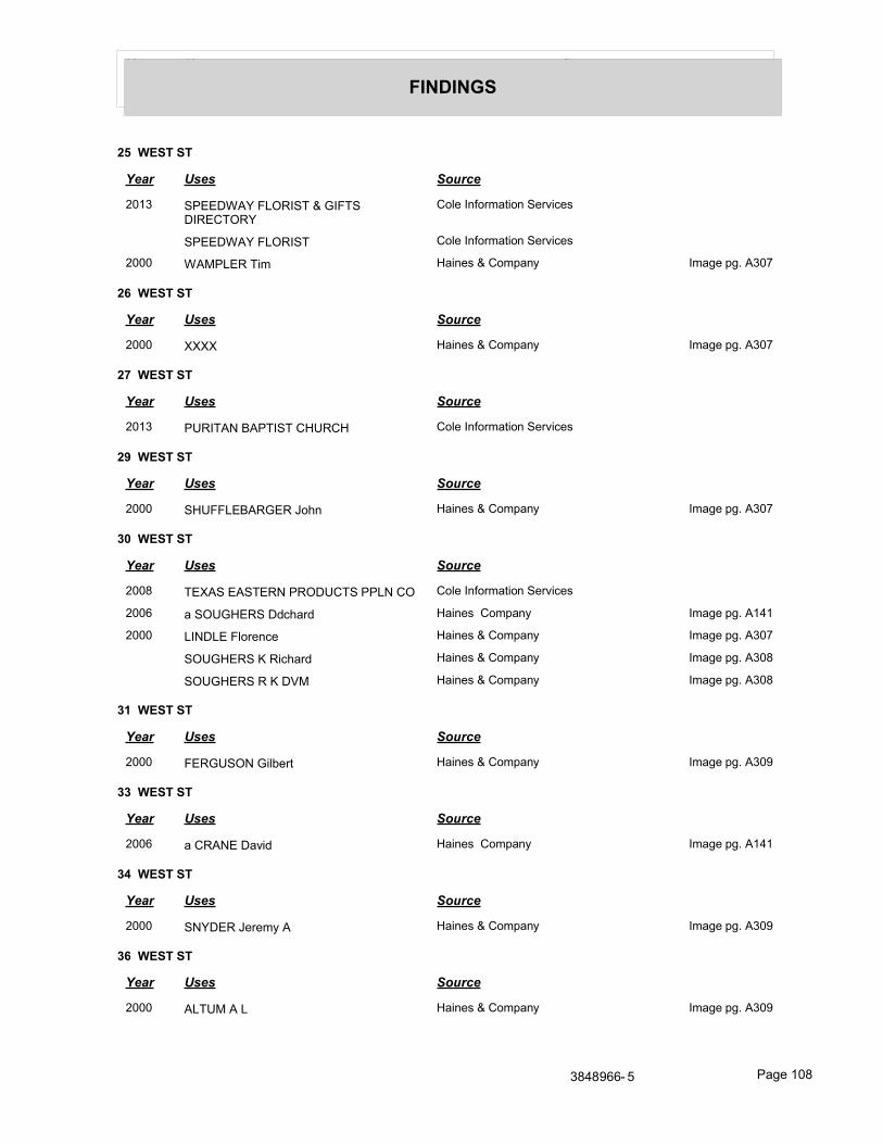
Year Uses Source
FINDINGS
25 WEST ST
Year Uses Source
2013 SPEEDWAY FLORIST & GIFTS DIRECTORY
Cole Information Services
SPEEDWAY FLORIST Cole Information Services
2000 WAMPLER Tim Haines & Company Image pg. A307
26 WEST ST
Year Uses Source
2000 XXXX Haines & Company Image pg. A307
27 WEST ST
Year Uses Source
2013 PURITAN BAPTIST CHURCH Cole Information Services
29 WEST ST
Year Uses Source
2000 SHUFFLEBARGER John Haines & Company Image pg. A307
30 WEST ST
Year Uses Source
2008 TEXAS EASTERN PRODUCTS PPLN CO Cole Information Services
2006 a SOUGHERS Ddchard Haines Company Image pg. A141
2000 LINDLE Florence Haines & Company Image pg. A307
SOUGHERS K Richard Haines & Company Image pg. A308
SOUGHERS R K DVM Haines & Company Image pg. A308
31 WEST ST
Year Uses Source
2000 FERGUSON Gilbert Haines & Company Image pg. A309
33 WEST ST
Year Uses Source
2006 a CRANE David Haines Company Image pg. A141
34 WEST ST
Year Uses Source
2000 SNYDER Jeremy A Haines & Company Image pg. A309
36 WEST ST
Year Uses Source
2000 ALTUM A L Haines & Company Image pg. A309
3848966- 5 Page 108
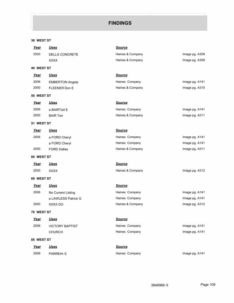
Year Uses Source
FINDINGS
38 WEST ST
Year Uses Source
2000 DELLS CONCRETE Haines & Company Image pg. A309
XXXX Haines & Company Image pg. A309
49 WEST ST
Year Uses Source
2006 EMBERTON Angela Haines Company Image pg. A141
2000 FLEENER Don E Haines & Company Image pg. A310
50 WEST ST
Year Uses Source
2006 a BAIRTed E Haines Company Image pg. A141
2000 BAIR Teri Haines & Company Image pg. A311
51 WEST ST
Year Uses Source
2006 a FORD Cheryl Haines Company Image pg. A141
a FORD Cheryl Haines Company Image pg. A141
2000 FORD Dallas Haines & Company Image pg. A311
60 WEST ST
Year Uses Source
2000 XXXX Haines & Company Image pg. A312
69 WEST ST
Year Uses Source
2006 No Current Listing Haines Company Image pg. A141
a LAWLESS Patrick G Haines Company Image pg. A141
2000 XXXX DO Haines & Company Image pg. A312
70 WEST ST
Year Uses Source
2006 VICTORY BAPTIST Haines Company Image pg. A141
CHURCH Haines Company Image pg. A141
85 WEST ST
Year Uses Source
2006 PARREHr S Haines Company Image pg. A141
3848966- 5 Page 109

Year Uses Source
FINDINGS
86 WEST ST
Year Uses Source
2006 OFC&SERV Haines Company Image pg. A141
5221 BLDG EXEC Haines Company Image pg. A141
3848966- 5 Page 110
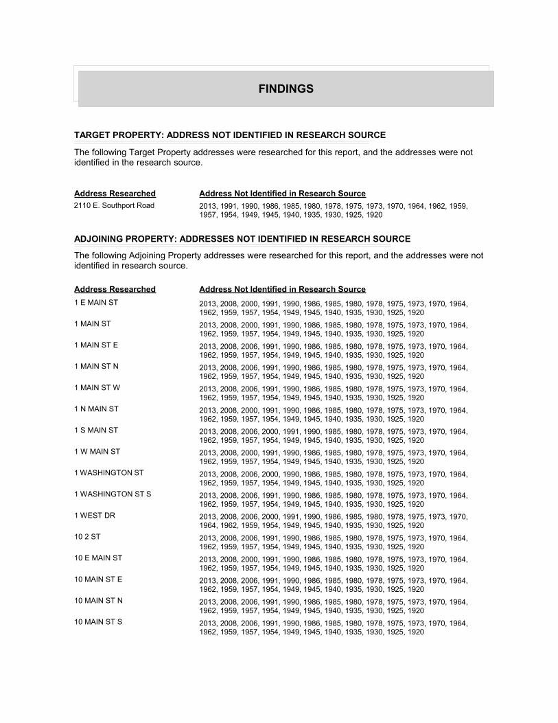
FINDINGS
TARGET PROPERTY: ADDRESS NOT IDENTIFIED IN RESEARCH SOURCE
The following Target Property addresses were researched for this report, and the addresses were not identified in the research source.
Address Researched Address Not Identified in Research Source
2110 E. Southport Road 2013, 1991, 1990, 1986, 1985, 1980, 1978, 1975, 1973, 1970, 1964, 1962, 1959, 1957, 1954, 1949, 1945, 1940, 1935, 1930, 1925, 1920
ADJOINING PROPERTY: ADDRESSES NOT IDENTIFIED IN RESEARCH SOURCE
The following Adjoining Property addresses were researched for this report, and the addresses were not identified in research source.
Address Researched Address Not Identified in Research Source
1 E MAIN ST 2013, 2008, 2000, 1991, 1990, 1986, 1985, 1980, 1978, 1975, 1973, 1970, 1964, 1962, 1959, 1957, 1954, 1949, 1945, 1940, 1935, 1930, 1925, 1920
1 MAIN ST 2013, 2008, 2000, 1991, 1990, 1986, 1985, 1980, 1978, 1975, 1973, 1970, 1964, 1962, 1959, 1957, 1954, 1949, 1945, 1940, 1935, 1930, 1925, 1920
1 MAIN ST E 2013, 2008, 2006, 1991, 1990, 1986, 1985, 1980, 1978, 1975, 1973, 1970, 1964, 1962, 1959, 1957, 1954, 1949, 1945, 1940, 1935, 1930, 1925, 1920
1 MAIN ST N 2013, 2008, 2006, 1991, 1990, 1986, 1985, 1980, 1978, 1975, 1973, 1970, 1964, 1962, 1959, 1957, 1954, 1949, 1945, 1940, 1935, 1930, 1925, 1920
1 MAIN ST W 2013, 2008, 2006, 1991, 1990, 1986, 1985, 1980, 1978, 1975, 1973, 1970, 1964, 1962, 1959, 1957, 1954, 1949, 1945, 1940, 1935, 1930, 1925, 1920
1 N MAIN ST 2013, 2008, 2000, 1991, 1990, 1986, 1985, 1980, 1978, 1975, 1973, 1970, 1964, 1962, 1959, 1957, 1954, 1949, 1945, 1940, 1935, 1930, 1925, 1920
1 S MAIN ST 2013, 2008, 2006, 2000, 1991, 1990, 1985, 1980, 1978, 1975, 1973, 1970, 1964, 1962, 1959, 1957, 1954, 1949, 1945, 1940, 1935, 1930, 1925, 1920
1 W MAIN ST 2013, 2008, 2000, 1991, 1990, 1986, 1985, 1980, 1978, 1975, 1973, 1970, 1964, 1962, 1959, 1957, 1954, 1949, 1945, 1940, 1935, 1930, 1925, 1920
1 WASHINGTON ST 2013, 2008, 2006, 2000, 1990, 1986, 1985, 1980, 1978, 1975, 1973, 1970, 1964, 1962, 1959, 1957, 1954, 1949, 1945, 1940, 1935, 1930, 1925, 1920
1 WASHINGTON ST S 2013, 2008, 2006, 1991, 1990, 1986, 1985, 1980, 1978, 1975, 1973, 1970, 1964, 1962, 1959, 1957, 1954, 1949, 1945, 1940, 1935, 1930, 1925, 1920
1 WEST DR 2013, 2008, 2006, 2000, 1991, 1990, 1986, 1985, 1980, 1978, 1975, 1973, 1970, 1964, 1962, 1959, 1954, 1949, 1945, 1940, 1935, 1930, 1925, 1920
10 2 ST 2013, 2008, 2006, 1991, 1990, 1986, 1985, 1980, 1978, 1975, 1973, 1970, 1964, 1962, 1959, 1957, 1954, 1949, 1945, 1940, 1935, 1930, 1925, 1920
10 E MAIN ST 2013, 2008, 2000, 1991, 1990, 1986, 1985, 1980, 1978, 1975, 1973, 1970, 1964, 1962, 1959, 1957, 1954, 1949, 1945, 1940, 1935, 1930, 1925, 1920
10 MAIN ST E 2013, 2008, 2006, 1991, 1990, 1986, 1985, 1980, 1978, 1975, 1973, 1970, 1964, 1962, 1959, 1957, 1954, 1949, 1945, 1940, 1935, 1930, 1925, 1920
10 MAIN ST N 2013, 2008, 2006, 1991, 1990, 1986, 1985, 1980, 1978, 1975, 1973, 1970, 1964, 1962, 1959, 1957, 1954, 1949, 1945, 1940, 1935, 1930, 1925, 1920
10 MAIN ST S 2013, 2008, 2006, 1991, 1990, 1986, 1985, 1980, 1978, 1975, 1973, 1970, 1964, 1962, 1959, 1957, 1954, 1949, 1945, 1940, 1935, 1930, 1925, 1920
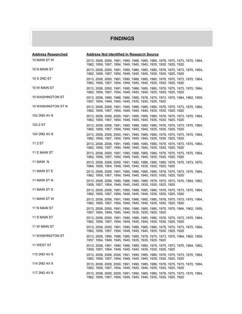
FINDINGS
Address Researched Address Not Identified in Research Source
10 MAIN ST W 2013, 2008, 2006, 1991, 1990, 1986, 1985, 1980, 1978, 1975, 1973, 1970, 1964, 1962, 1959, 1957, 1954, 1949, 1945, 1940, 1935, 1930, 1925, 1920
10 N MAIN ST 2013, 2008, 2000, 1991, 1990, 1986, 1985, 1980, 1978, 1975, 1973, 1970, 1964, 1962, 1959, 1957, 1954, 1949, 1945, 1940, 1935, 1930, 1925, 1920
10 S 2ND ST 2013, 2008, 2000, 1991, 1990, 1986, 1985, 1980, 1978, 1975, 1973, 1970, 1964, 1962, 1959, 1957, 1954, 1949, 1945, 1940, 1935, 1930, 1925, 1920
10 W MAIN ST 2013, 2008, 2000, 1991, 1990, 1986, 1985, 1980, 1978, 1975, 1973, 1970, 1964, 1962, 1959, 1957, 1954, 1949, 1945, 1940, 1935, 1930, 1925, 1920
10 WASHINGTON ST 2013, 2008, 1990, 1986, 1985, 1980, 1978, 1975, 1973, 1970, 1964, 1962, 1959, 1957, 1954, 1949, 1945, 1940, 1935, 1930, 1925, 1920
10 WASHINGTON ST N 2013, 2008, 2006, 1991, 1990, 1986, 1985, 1980, 1978, 1975, 1973, 1970, 1964, 1962, 1959, 1957, 1954, 1949, 1945, 1940, 1935, 1930, 1925, 1920
102 2ND AV 8 2013, 2008, 2006, 2000, 1991, 1990, 1985, 1980, 1978, 1975, 1973, 1970, 1964, 1962, 1959, 1957, 1954, 1949, 1945, 1940, 1935, 1930, 1925, 1920
103 2 ST 2013, 2008, 2006, 1991, 1990, 1986, 1985, 1980, 1978, 1975, 1973, 1970, 1964, 1962, 1959, 1957, 1954, 1949, 1945, 1940, 1935, 1930, 1925, 1920
104 2ND AV 8 2013, 2008, 2006, 2000, 1991, 1990, 1985, 1980, 1978, 1975, 1973, 1970, 1964, 1962, 1959, 1957, 1954, 1949, 1945, 1940, 1935, 1930, 1925, 1920
11 2 ST 2013, 2008, 2006, 1991, 1990, 1986, 1985, 1980, 1978, 1975, 1973, 1970, 1964, 1962, 1959, 1957, 1954, 1949, 1945, 1940, 1935, 1930, 1925, 1920
11 E MAIN ST 2013, 2008, 2000, 1991, 1990, 1986, 1985, 1980, 1978, 1975, 1973, 1970, 1964, 1962, 1959, 1957, 1954, 1949, 1945, 1940, 1935, 1930, 1925, 1920
11 MAIN N 2013, 2008, 2006, 2000, 1991, 1990, 1986, 1985, 1980, 1978, 1975, 1973, 1970, 1964, 1959, 1954, 1949, 1945, 1940, 1935, 1930, 1925, 1920
11 MAIN ST E 2013, 2008, 2006, 1991, 1990, 1986, 1985, 1980, 1978, 1975, 1973, 1970, 1964, 1962, 1959, 1957, 1954, 1949, 1945, 1940, 1935, 1930, 1925, 1920
11 MAIN ST N 2013, 2008, 2006, 1990, 1986, 1985, 1980, 1978, 1975, 1973, 1970, 1964, 1962, 1959, 1957, 1954, 1949, 1945, 1940, 1935, 1930, 1925, 1920
11 MAIN ST S 2013, 2008, 2006, 1991, 1990, 1986, 1985, 1980, 1978, 1975, 1973, 1970, 1964, 1962, 1959, 1957, 1954, 1949, 1945, 1940, 1935, 1930, 1925, 1920
11 MAIN ST W 2013, 2008, 2006, 1991, 1990, 1986, 1985, 1980, 1978, 1975, 1973, 1970, 1964, 1962, 1959, 1957, 1954, 1949, 1945, 1940, 1935, 1930, 1925, 1920
11 N MAIN ST 2013, 2008, 2000, 1991, 1990, 1986, 1985, 1980, 1975, 1970, 1964, 1962, 1959, 1957, 1954, 1949, 1945, 1940, 1935, 1930, 1925, 1920
11 S MAIN ST 2013, 2008, 2000, 1991, 1990, 1986, 1985, 1980, 1978, 1975, 1973, 1970, 1964, 1962, 1959, 1957, 1954, 1949, 1945, 1940, 1935, 1930, 1925, 1920
11 W MAIN ST 2013, 2008, 2000, 1991, 1990, 1986, 1985, 1980, 1978, 1975, 1973, 1970, 1964, 1962, 1959, 1957, 1954, 1949, 1945, 1940, 1935, 1930, 1925, 1920
11 WASHINGTON ST 2013, 2008, 1990, 1986, 1985, 1980, 1978, 1975, 1973, 1970, 1964, 1962, 1959, 1957, 1954, 1949, 1945, 1940, 1935, 1930, 1925, 1920
11 WEST ST 2013, 2008, 1991, 1990, 1986, 1985, 1980, 1978, 1975, 1973, 1970, 1964, 1962, 1959, 1957, 1954, 1949, 1945, 1940, 1935, 1930, 1925, 1920
110 2ND AV 8 2013, 2008, 2006, 2000, 1991, 1990, 1985, 1980, 1978, 1975, 1973, 1970, 1964, 1962, 1959, 1957, 1954, 1949, 1945, 1940, 1935, 1930, 1925, 1920
114 2ND AV 8 2013, 2008, 2006, 2000, 1991, 1990, 1985, 1980, 1978, 1975, 1973, 1970, 1964, 1962, 1959, 1957, 1954, 1949, 1945, 1940, 1935, 1930, 1925, 1920
117 2ND AV 8 2013, 2008, 2006, 2000, 1991, 1990, 1985, 1980, 1978, 1975, 1973, 1970, 1964, 1962, 1959, 1957, 1954, 1949, 1945, 1940, 1935, 1930, 1925, 1920
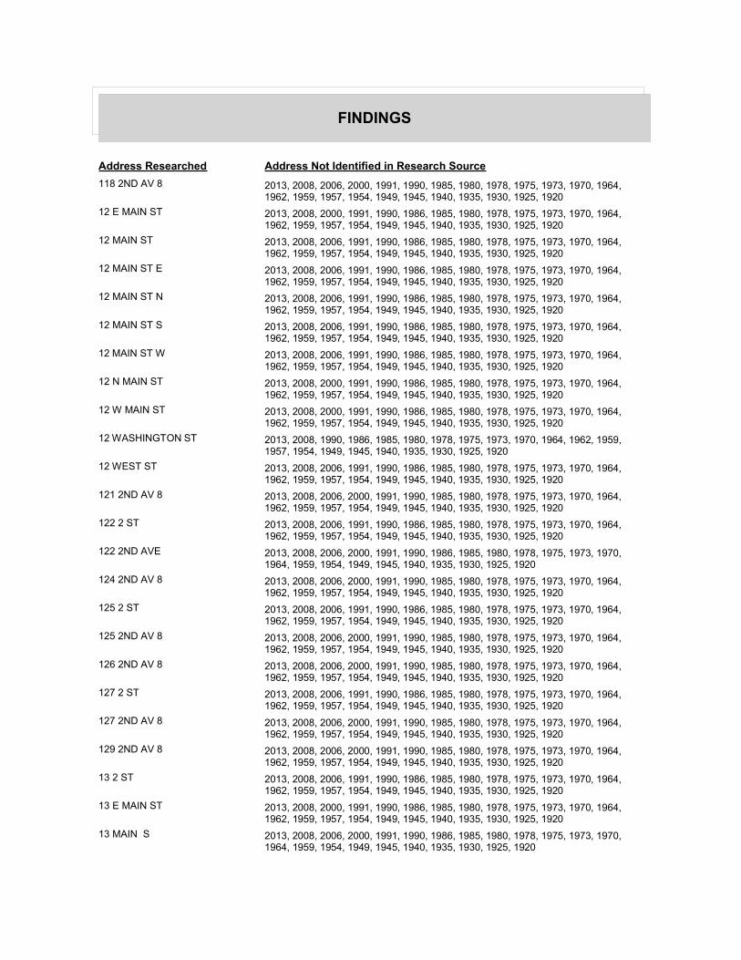
FINDINGS
Address Researched Address Not Identified in Research Source
118 2ND AV 8 2013, 2008, 2006, 2000, 1991, 1990, 1985, 1980, 1978, 1975, 1973, 1970, 1964, 1962, 1959, 1957, 1954, 1949, 1945, 1940, 1935, 1930, 1925, 1920
12 E MAIN ST 2013, 2008, 2000, 1991, 1990, 1986, 1985, 1980, 1978, 1975, 1973, 1970, 1964, 1962, 1959, 1957, 1954, 1949, 1945, 1940, 1935, 1930, 1925, 1920
12 MAIN ST 2013, 2008, 2006, 1991, 1990, 1986, 1985, 1980, 1978, 1975, 1973, 1970, 1964, 1962, 1959, 1957, 1954, 1949, 1945, 1940, 1935, 1930, 1925, 1920
12 MAIN ST E 2013, 2008, 2006, 1991, 1990, 1986, 1985, 1980, 1978, 1975, 1973, 1970, 1964, 1962, 1959, 1957, 1954, 1949, 1945, 1940, 1935, 1930, 1925, 1920
12 MAIN ST N 2013, 2008, 2006, 1991, 1990, 1986, 1985, 1980, 1978, 1975, 1973, 1970, 1964, 1962, 1959, 1957, 1954, 1949, 1945, 1940, 1935, 1930, 1925, 1920
12 MAIN ST S 2013, 2008, 2006, 1991, 1990, 1986, 1985, 1980, 1978, 1975, 1973, 1970, 1964, 1962, 1959, 1957, 1954, 1949, 1945, 1940, 1935, 1930, 1925, 1920
12 MAIN ST W 2013, 2008, 2006, 1991, 1990, 1986, 1985, 1980, 1978, 1975, 1973, 1970, 1964, 1962, 1959, 1957, 1954, 1949, 1945, 1940, 1935, 1930, 1925, 1920
12 N MAIN ST 2013, 2008, 2000, 1991, 1990, 1986, 1985, 1980, 1978, 1975, 1973, 1970, 1964, 1962, 1959, 1957, 1954, 1949, 1945, 1940, 1935, 1930, 1925, 1920
12 W MAIN ST 2013, 2008, 2000, 1991, 1990, 1986, 1985, 1980, 1978, 1975, 1973, 1970, 1964, 1962, 1959, 1957, 1954, 1949, 1945, 1940, 1935, 1930, 1925, 1920
12 WASHINGTON ST 2013, 2008, 1990, 1986, 1985, 1980, 1978, 1975, 1973, 1970, 1964, 1962, 1959, 1957, 1954, 1949, 1945, 1940, 1935, 1930, 1925, 1920
12 WEST ST 2013, 2008, 2006, 1991, 1990, 1986, 1985, 1980, 1978, 1975, 1973, 1970, 1964, 1962, 1959, 1957, 1954, 1949, 1945, 1940, 1935, 1930, 1925, 1920
121 2ND AV 8 2013, 2008, 2006, 2000, 1991, 1990, 1985, 1980, 1978, 1975, 1973, 1970, 1964, 1962, 1959, 1957, 1954, 1949, 1945, 1940, 1935, 1930, 1925, 1920
122 2 ST 2013, 2008, 2006, 1991, 1990, 1986, 1985, 1980, 1978, 1975, 1973, 1970, 1964, 1962, 1959, 1957, 1954, 1949, 1945, 1940, 1935, 1930, 1925, 1920
122 2ND AVE 2013, 2008, 2006, 2000, 1991, 1990, 1986, 1985, 1980, 1978, 1975, 1973, 1970, 1964, 1959, 1954, 1949, 1945, 1940, 1935, 1930, 1925, 1920
124 2ND AV 8 2013, 2008, 2006, 2000, 1991, 1990, 1985, 1980, 1978, 1975, 1973, 1970, 1964, 1962, 1959, 1957, 1954, 1949, 1945, 1940, 1935, 1930, 1925, 1920
125 2 ST 2013, 2008, 2006, 1991, 1990, 1986, 1985, 1980, 1978, 1975, 1973, 1970, 1964, 1962, 1959, 1957, 1954, 1949, 1945, 1940, 1935, 1930, 1925, 1920
125 2ND AV 8 2013, 2008, 2006, 2000, 1991, 1990, 1985, 1980, 1978, 1975, 1973, 1970, 1964, 1962, 1959, 1957, 1954, 1949, 1945, 1940, 1935, 1930, 1925, 1920
126 2ND AV 8 2013, 2008, 2006, 2000, 1991, 1990, 1985, 1980, 1978, 1975, 1973, 1970, 1964, 1962, 1959, 1957, 1954, 1949, 1945, 1940, 1935, 1930, 1925, 1920
127 2 ST 2013, 2008, 2006, 1991, 1990, 1986, 1985, 1980, 1978, 1975, 1973, 1970, 1964, 1962, 1959, 1957, 1954, 1949, 1945, 1940, 1935, 1930, 1925, 1920
127 2ND AV 8 2013, 2008, 2006, 2000, 1991, 1990, 1985, 1980, 1978, 1975, 1973, 1970, 1964, 1962, 1959, 1957, 1954, 1949, 1945, 1940, 1935, 1930, 1925, 1920
129 2ND AV 8 2013, 2008, 2006, 2000, 1991, 1990, 1985, 1980, 1978, 1975, 1973, 1970, 1964, 1962, 1959, 1957, 1954, 1949, 1945, 1940, 1935, 1930, 1925, 1920
13 2 ST 2013, 2008, 2006, 1991, 1990, 1986, 1985, 1980, 1978, 1975, 1973, 1970, 1964, 1962, 1959, 1957, 1954, 1949, 1945, 1940, 1935, 1930, 1925, 1920
13 E MAIN ST 2013, 2008, 2000, 1991, 1990, 1986, 1985, 1980, 1978, 1975, 1973, 1970, 1964, 1962, 1959, 1957, 1954, 1949, 1945, 1940, 1935, 1930, 1925, 1920
13 MAIN S 2013, 2008, 2006, 2000, 1991, 1990, 1986, 1985, 1980, 1978, 1975, 1973, 1970, 1964, 1959, 1954, 1949, 1945, 1940, 1935, 1930, 1925, 1920
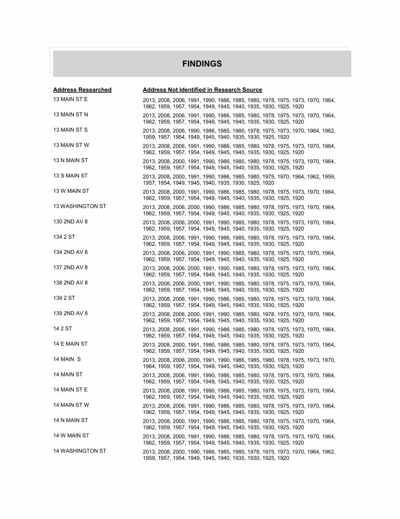
FINDINGS
Address Researched Address Not Identified in Research Source
13 MAIN ST E 2013, 2008, 2006, 1991, 1990, 1986, 1985, 1980, 1978, 1975, 1973, 1970, 1964, 1962, 1959, 1957, 1954, 1949, 1945, 1940, 1935, 1930, 1925, 1920
13 MAIN ST N 2013, 2008, 2006, 1991, 1990, 1986, 1985, 1980, 1978, 1975, 1973, 1970, 1964, 1962, 1959, 1957, 1954, 1949, 1945, 1940, 1935, 1930, 1925, 1920
13 MAIN ST S 2013, 2008, 2006, 1990, 1986, 1985, 1980, 1978, 1975, 1973, 1970, 1964, 1962, 1959, 1957, 1954, 1949, 1945, 1940, 1935, 1930, 1925, 1920
13 MAIN ST W 2013, 2008, 2006, 1991, 1990, 1986, 1985, 1980, 1978, 1975, 1973, 1970, 1964, 1962, 1959, 1957, 1954, 1949, 1945, 1940, 1935, 1930, 1925, 1920
13 N MAIN ST 2013, 2008, 2000, 1991, 1990, 1986, 1985, 1980, 1978, 1975, 1973, 1970, 1964, 1962, 1959, 1957, 1954, 1949, 1945, 1940, 1935, 1930, 1925, 1920
13 S MAIN ST 2013, 2008, 2000, 1991, 1990, 1986, 1985, 1980, 1975, 1970, 1964, 1962, 1959, 1957, 1954, 1949, 1945, 1940, 1935, 1930, 1925, 1920
13 W MAIN ST 2013, 2008, 2000, 1991, 1990, 1986, 1985, 1980, 1978, 1975, 1973, 1970, 1964, 1962, 1959, 1957, 1954, 1949, 1945, 1940, 1935, 1930, 1925, 1920
13 WASHINGTON ST 2013, 2008, 2006, 2000, 1990, 1986, 1985, 1980, 1978, 1975, 1973, 1970, 1964, 1962, 1959, 1957, 1954, 1949, 1945, 1940, 1935, 1930, 1925, 1920
130 2ND AV 8 2013, 2008, 2006, 2000, 1991, 1990, 1985, 1980, 1978, 1975, 1973, 1970, 1964, 1962, 1959, 1957, 1954, 1949, 1945, 1940, 1935, 1930, 1925, 1920
134 2 ST 2013, 2008, 2006, 1991, 1990, 1986, 1985, 1980, 1978, 1975, 1973, 1970, 1964, 1962, 1959, 1957, 1954, 1949, 1945, 1940, 1935, 1930, 1925, 1920
134 2ND AV 8 2013, 2008, 2006, 2000, 1991, 1990, 1985, 1980, 1978, 1975, 1973, 1970, 1964, 1962, 1959, 1957, 1954, 1949, 1945, 1940, 1935, 1930, 1925, 1920
137 2ND AV 8 2013, 2008, 2006, 2000, 1991, 1990, 1985, 1980, 1978, 1975, 1973, 1970, 1964, 1962, 1959, 1957, 1954, 1949, 1945, 1940, 1935, 1930, 1925, 1920
138 2ND AV 8 2013, 2008, 2006, 2000, 1991, 1990, 1985, 1980, 1978, 1975, 1973, 1970, 1964, 1962, 1959, 1957, 1954, 1949, 1945, 1940, 1935, 1930, 1925, 1920
139 2 ST 2013, 2008, 2006, 1991, 1990, 1986, 1985, 1980, 1978, 1975, 1973, 1970, 1964, 1962, 1959, 1957, 1954, 1949, 1945, 1940, 1935, 1930, 1925, 1920
139 2ND AV 8 2013, 2008, 2006, 2000, 1991, 1990, 1985, 1980, 1978, 1975, 1973, 1970, 1964, 1962, 1959, 1957, 1954, 1949, 1945, 1940, 1935, 1930, 1925, 1920
14 2 ST 2013, 2008, 2006, 1991, 1990, 1986, 1985, 1980, 1978, 1975, 1973, 1970, 1964, 1962, 1959, 1957, 1954, 1949, 1945, 1940, 1935, 1930, 1925, 1920
14 E MAIN ST 2013, 2008, 2000, 1991, 1990, 1986, 1985, 1980, 1978, 1975, 1973, 1970, 1964, 1962, 1959, 1957, 1954, 1949, 1945, 1940, 1935, 1930, 1925, 1920
14 MAIN S 2013, 2008, 2006, 2000, 1991, 1990, 1986, 1985, 1980, 1978, 1975, 1973, 1970, 1964, 1959, 1957, 1954, 1949, 1945, 1940, 1935, 1930, 1925, 1920
14 MAIN ST 2013, 2008, 2006, 1991, 1990, 1986, 1985, 1980, 1978, 1975, 1973, 1970, 1964, 1962, 1959, 1957, 1954, 1949, 1945, 1940, 1935, 1930, 1925, 1920
14 MAIN ST E 2013, 2008, 2006, 1991, 1990, 1986, 1985, 1980, 1978, 1975, 1973, 1970, 1964, 1962, 1959, 1957, 1954, 1949, 1945, 1940, 1935, 1930, 1925, 1920
14 MAIN ST W 2013, 2008, 2006, 1991, 1990, 1986, 1985, 1980, 1978, 1975, 1973, 1970, 1964, 1962, 1959, 1957, 1954, 1949, 1945, 1940, 1935, 1930, 1925, 1920
14 N MAIN ST 2013, 2008, 2000, 1991, 1990, 1986, 1985, 1980, 1978, 1975, 1973, 1970, 1964, 1962, 1959, 1957, 1954, 1949, 1945, 1940, 1935, 1930, 1925, 1920
14 W MAIN ST 2013, 2008, 2000, 1991, 1990, 1986, 1985, 1980, 1978, 1975, 1973, 1970, 1964, 1962, 1959, 1957, 1954, 1949, 1945, 1940, 1935, 1930, 1925, 1920
14 WASHINGTON ST 2013, 2008, 2000, 1990, 1986, 1985, 1980, 1978, 1975, 1973, 1970, 1964, 1962, 1959, 1957, 1954, 1949, 1945, 1940, 1935, 1930, 1925, 1920
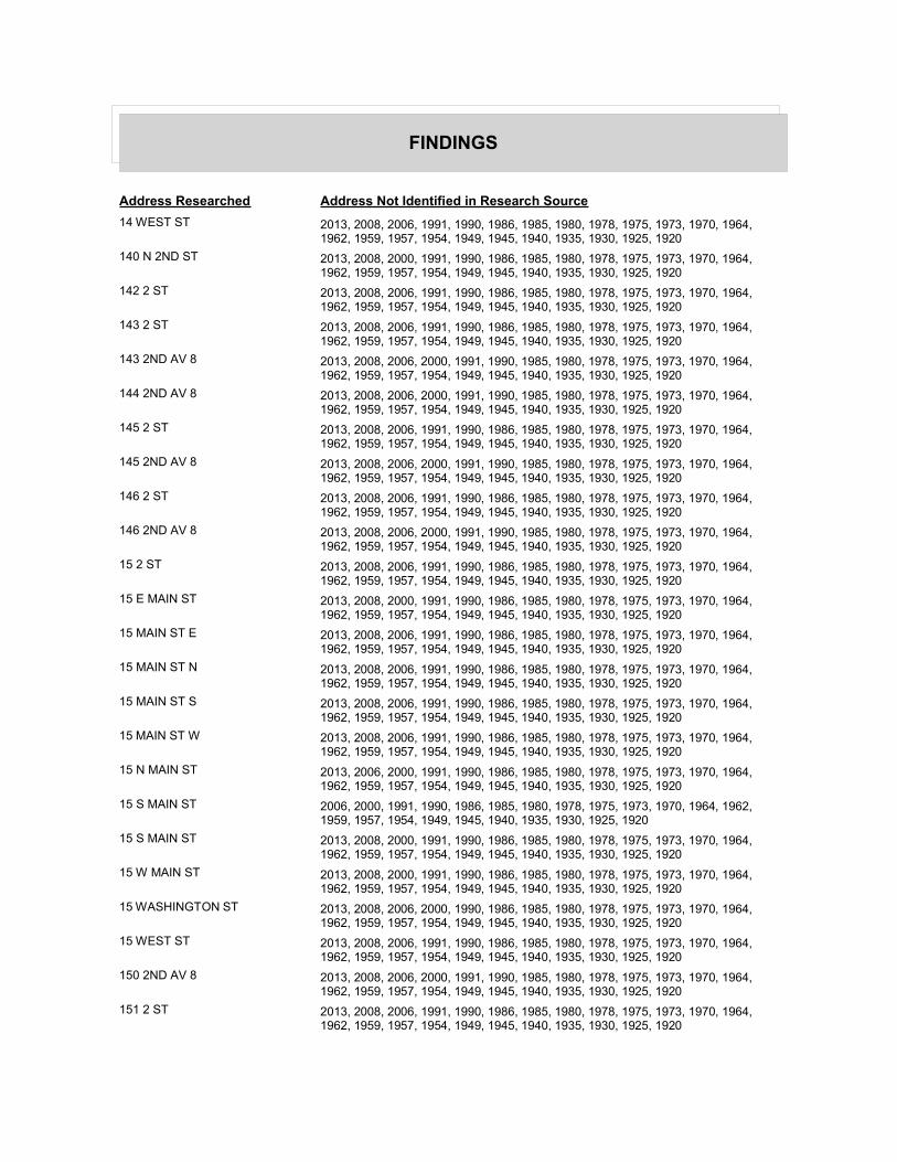
FINDINGS
Address Researched Address Not Identified in Research Source
14 WEST ST 2013, 2008, 2006, 1991, 1990, 1986, 1985, 1980, 1978, 1975, 1973, 1970, 1964, 1962, 1959, 1957, 1954, 1949, 1945, 1940, 1935, 1930, 1925, 1920
140 N 2ND ST 2013, 2008, 2000, 1991, 1990, 1986, 1985, 1980, 1978, 1975, 1973, 1970, 1964, 1962, 1959, 1957, 1954, 1949, 1945, 1940, 1935, 1930, 1925, 1920
142 2 ST 2013, 2008, 2006, 1991, 1990, 1986, 1985, 1980, 1978, 1975, 1973, 1970, 1964, 1962, 1959, 1957, 1954, 1949, 1945, 1940, 1935, 1930, 1925, 1920
143 2 ST 2013, 2008, 2006, 1991, 1990, 1986, 1985, 1980, 1978, 1975, 1973, 1970, 1964, 1962, 1959, 1957, 1954, 1949, 1945, 1940, 1935, 1930, 1925, 1920
143 2ND AV 8 2013, 2008, 2006, 2000, 1991, 1990, 1985, 1980, 1978, 1975, 1973, 1970, 1964, 1962, 1959, 1957, 1954, 1949, 1945, 1940, 1935, 1930, 1925, 1920
144 2ND AV 8 2013, 2008, 2006, 2000, 1991, 1990, 1985, 1980, 1978, 1975, 1973, 1970, 1964, 1962, 1959, 1957, 1954, 1949, 1945, 1940, 1935, 1930, 1925, 1920
145 2 ST 2013, 2008, 2006, 1991, 1990, 1986, 1985, 1980, 1978, 1975, 1973, 1970, 1964, 1962, 1959, 1957, 1954, 1949, 1945, 1940, 1935, 1930, 1925, 1920
145 2ND AV 8 2013, 2008, 2006, 2000, 1991, 1990, 1985, 1980, 1978, 1975, 1973, 1970, 1964, 1962, 1959, 1957, 1954, 1949, 1945, 1940, 1935, 1930, 1925, 1920
146 2 ST 2013, 2008, 2006, 1991, 1990, 1986, 1985, 1980, 1978, 1975, 1973, 1970, 1964, 1962, 1959, 1957, 1954, 1949, 1945, 1940, 1935, 1930, 1925, 1920
146 2ND AV 8 2013, 2008, 2006, 2000, 1991, 1990, 1985, 1980, 1978, 1975, 1973, 1970, 1964, 1962, 1959, 1957, 1954, 1949, 1945, 1940, 1935, 1930, 1925, 1920
15 2 ST 2013, 2008, 2006, 1991, 1990, 1986, 1985, 1980, 1978, 1975, 1973, 1970, 1964, 1962, 1959, 1957, 1954, 1949, 1945, 1940, 1935, 1930, 1925, 1920
15 E MAIN ST 2013, 2008, 2000, 1991, 1990, 1986, 1985, 1980, 1978, 1975, 1973, 1970, 1964, 1962, 1959, 1957, 1954, 1949, 1945, 1940, 1935, 1930, 1925, 1920
15 MAIN ST E 2013, 2008, 2006, 1991, 1990, 1986, 1985, 1980, 1978, 1975, 1973, 1970, 1964, 1962, 1959, 1957, 1954, 1949, 1945, 1940, 1935, 1930, 1925, 1920
15 MAIN ST N 2013, 2008, 2006, 1991, 1990, 1986, 1985, 1980, 1978, 1975, 1973, 1970, 1964, 1962, 1959, 1957, 1954, 1949, 1945, 1940, 1935, 1930, 1925, 1920
15 MAIN ST S 2013, 2008, 2006, 1991, 1990, 1986, 1985, 1980, 1978, 1975, 1973, 1970, 1964, 1962, 1959, 1957, 1954, 1949, 1945, 1940, 1935, 1930, 1925, 1920
15 MAIN ST W 2013, 2008, 2006, 1991, 1990, 1986, 1985, 1980, 1978, 1975, 1973, 1970, 1964, 1962, 1959, 1957, 1954, 1949, 1945, 1940, 1935, 1930, 1925, 1920
15 N MAIN ST 2013, 2006, 2000, 1991, 1990, 1986, 1985, 1980, 1978, 1975, 1973, 1970, 1964, 1962, 1959, 1957, 1954, 1949, 1945, 1940, 1935, 1930, 1925, 1920
15 S MAIN ST 2006, 2000, 1991, 1990, 1986, 1985, 1980, 1978, 1975, 1973, 1970, 1964, 1962, 1959, 1957, 1954, 1949, 1945, 1940, 1935, 1930, 1925, 1920
15 S MAIN ST 2013, 2008, 2000, 1991, 1990, 1986, 1985, 1980, 1978, 1975, 1973, 1970, 1964, 1962, 1959, 1957, 1954, 1949, 1945, 1940, 1935, 1930, 1925, 1920
15 W MAIN ST 2013, 2008, 2000, 1991, 1990, 1986, 1985, 1980, 1978, 1975, 1973, 1970, 1964, 1962, 1959, 1957, 1954, 1949, 1945, 1940, 1935, 1930, 1925, 1920
15 WASHINGTON ST 2013, 2008, 2006, 2000, 1990, 1986, 1985, 1980, 1978, 1975, 1973, 1970, 1964, 1962, 1959, 1957, 1954, 1949, 1945, 1940, 1935, 1930, 1925, 1920
15 WEST ST 2013, 2008, 2006, 1991, 1990, 1986, 1985, 1980, 1978, 1975, 1973, 1970, 1964, 1962, 1959, 1957, 1954, 1949, 1945, 1940, 1935, 1930, 1925, 1920
150 2ND AV 8 2013, 2008, 2006, 2000, 1991, 1990, 1985, 1980, 1978, 1975, 1973, 1970, 1964, 1962, 1959, 1957, 1954, 1949, 1945, 1940, 1935, 1930, 1925, 1920
151 2 ST 2013, 2008, 2006, 1991, 1990, 1986, 1985, 1980, 1978, 1975, 1973, 1970, 1964, 1962, 1959, 1957, 1954, 1949, 1945, 1940, 1935, 1930, 1925, 1920

FINDINGS
Address Researched Address Not Identified in Research Source
151 2ND AV 8 2013, 2008, 2006, 2000, 1991, 1990, 1985, 1980, 1978, 1975, 1973, 1970, 1964, 1962, 1959, 1957, 1954, 1949, 1945, 1940, 1935, 1930, 1925, 1920
154 2 ST 2013, 2008, 2006, 1991, 1990, 1986, 1985, 1980, 1978, 1975, 1973, 1970, 1964, 1962, 1959, 1957, 1954, 1949, 1945, 1940, 1935, 1930, 1925, 1920
154 2ND AV 8 2013, 2008, 2006, 2000, 1991, 1990, 1985, 1980, 1978, 1975, 1973, 1970, 1964, 1962, 1959, 1957, 1954, 1949, 1945, 1940, 1935, 1930, 1925, 1920
155 2 ST 2013, 2008, 2006, 1991, 1990, 1986, 1985, 1980, 1978, 1975, 1973, 1970, 1964, 1962, 1959, 1957, 1954, 1949, 1945, 1940, 1935, 1930, 1925, 1920
155 2ND AV 8 2013, 2008, 2006, 2000, 1991, 1990, 1985, 1980, 1978, 1975, 1973, 1970, 1964, 1962, 1959, 1957, 1954, 1949, 1945, 1940, 1935, 1930, 1925, 1920
157 2 ST 2013, 2008, 2006, 1991, 1990, 1986, 1985, 1980, 1978, 1975, 1973, 1970, 1964, 1962, 1959, 1957, 1954, 1949, 1945, 1940, 1935, 1930, 1925, 1920
158 2ND AV 8 2013, 2008, 2006, 2000, 1991, 1990, 1985, 1980, 1978, 1975, 1973, 1970, 1964, 1962, 1959, 1957, 1954, 1949, 1945, 1940, 1935, 1930, 1925, 1920
159 2 ST 2013, 2008, 2006, 1991, 1990, 1986, 1985, 1980, 1978, 1975, 1973, 1970, 1964, 1962, 1959, 1957, 1954, 1949, 1945, 1940, 1935, 1930, 1925, 1920
159 N 2ND ST 2013, 2008, 2000, 1991, 1990, 1986, 1985, 1980, 1978, 1975, 1973, 1970, 1964, 1962, 1959, 1957, 1954, 1949, 1945, 1940, 1935, 1930, 1925, 1920
159 S 2ND ST 2013, 2008, 2000, 1991, 1990, 1986, 1985, 1980, 1978, 1975, 1973, 1970, 1964, 1962, 1959, 1957, 1954, 1949, 1945, 1940, 1935, 1930, 1925, 1920
16 2 ST 2013, 2008, 2006, 1991, 1990, 1986, 1985, 1980, 1978, 1975, 1973, 1970, 1964, 1962, 1959, 1957, 1954, 1949, 1945, 1940, 1935, 1930, 1925, 1920
16 E MAIN ST 2013, 2008, 2000, 1991, 1990, 1986, 1985, 1980, 1978, 1975, 1973, 1970, 1964, 1962, 1959, 1957, 1954, 1949, 1945, 1940, 1935, 1930, 1925, 1920
16 MAIN ST E 2013, 2008, 2006, 1991, 1990, 1986, 1985, 1980, 1978, 1975, 1973, 1970, 1964, 1962, 1959, 1957, 1954, 1949, 1945, 1940, 1935, 1930, 1925, 1920
16 MAIN ST S 2013, 2008, 2006, 1991, 1990, 1986, 1985, 1980, 1978, 1975, 1973, 1970, 1964, 1962, 1959, 1957, 1954, 1949, 1945, 1940, 1935, 1930, 1925, 1920
16 MAIN ST W 2013, 2008, 2006, 1991, 1990, 1986, 1985, 1980, 1978, 1975, 1973, 1970, 1964, 1962, 1959, 1957, 1954, 1949, 1945, 1940, 1935, 1930, 1925, 1920
16 S MAIN ST 2013, 2008, 2000, 1991, 1990, 1986, 1985, 1980, 1978, 1975, 1973, 1970, 1964, 1962, 1959, 1957, 1954, 1949, 1945, 1940, 1935, 1930, 1925, 1920
16 W MAIN ST 2013, 2008, 2000, 1991, 1990, 1986, 1985, 1980, 1978, 1975, 1973, 1970, 1964, 1962, 1959, 1957, 1954, 1949, 1945, 1940, 1935, 1930, 1925, 1920
16 WASHINGTON ST 2013, 2008, 2006, 1990, 1986, 1985, 1980, 1978, 1975, 1973, 1970, 1964, 1962, 1959, 1957, 1954, 1949, 1945, 1940, 1935, 1930, 1925, 1920
16 WEST ST 2013, 2008, 2006, 1991, 1990, 1986, 1985, 1980, 1978, 1975, 1973, 1970, 1964, 1962, 1959, 1957, 1954, 1949, 1945, 1940, 1935, 1930, 1925, 1920
16 WEST ST 2013, 2006, 2000, 1991, 1990, 1986, 1985, 1980, 1978, 1975, 1973, 1970, 1964, 1962, 1959, 1957, 1954, 1949, 1945, 1940, 1935, 1930, 1925, 1920
160 N 2ND ST 2013, 2008, 2000, 1991, 1990, 1986, 1985, 1980, 1978, 1975, 1973, 1970, 1964, 1962, 1959, 1957, 1954, 1949, 1945, 1940, 1935, 1930, 1925, 1920
163 VAN DYKE 2013, 2008, 2006, 2000, 1991, 1990, 1986, 1985, 1980, 1978, 1975, 1973, 1970, 1964, 1962, 1959, 1954, 1949, 1945, 1940, 1935, 1930, 1925, 1920
163 VAN DYKE ST 2013, 2008, 2006, 1990, 1985, 1980, 1978, 1975, 1970, 1964, 1962, 1959, 1957, 1954, 1949, 1945, 1940, 1935, 1930, 1925, 1920
165 VAN DYKE 2013, 2008, 2006, 2000, 1991, 1990, 1986, 1985, 1980, 1978, 1975, 1973, 1970, 1964, 1962, 1959, 1954, 1949, 1945, 1940, 1935, 1930, 1925, 1920
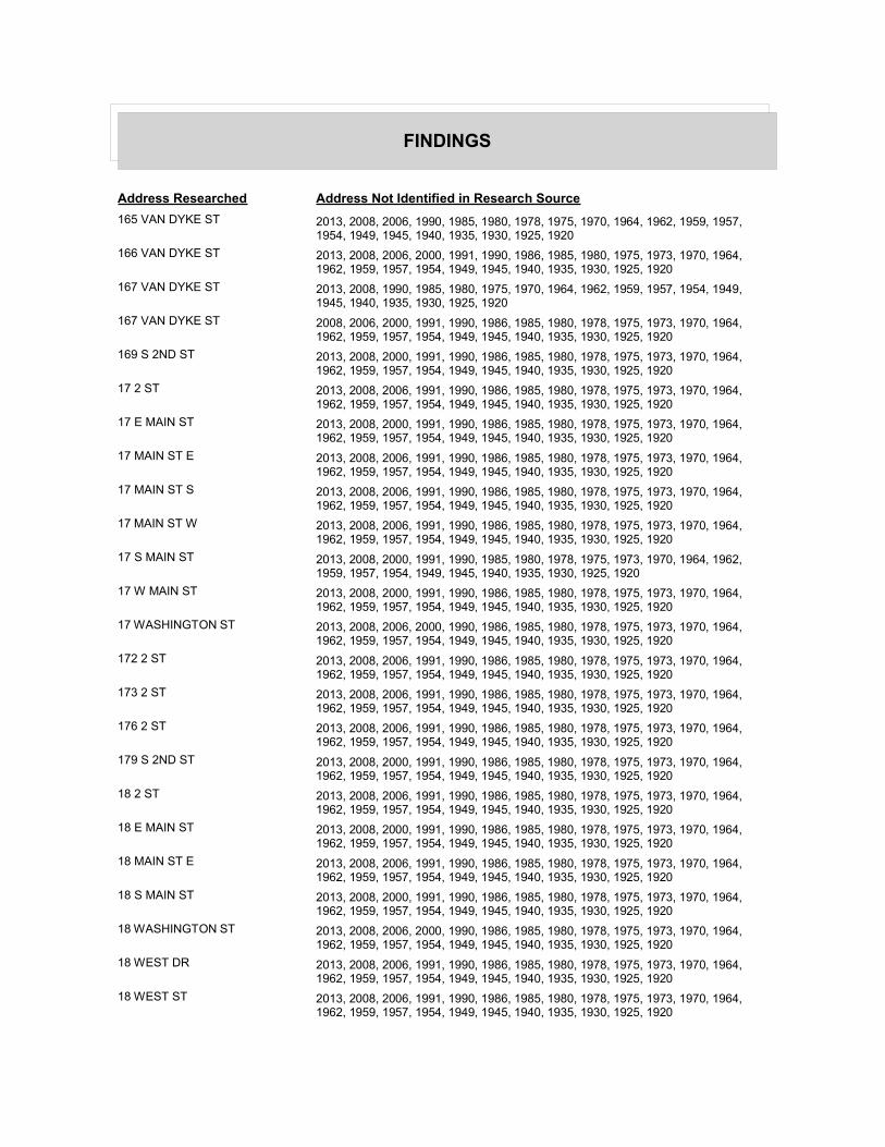
FINDINGS
Address Researched Address Not Identified in Research Source
165 VAN DYKE ST 2013, 2008, 2006, 1990, 1985, 1980, 1978, 1975, 1970, 1964, 1962, 1959, 1957, 1954, 1949, 1945, 1940, 1935, 1930, 1925, 1920
166 VAN DYKE ST 2013, 2008, 2006, 2000, 1991, 1990, 1986, 1985, 1980, 1975, 1973, 1970, 1964, 1962, 1959, 1957, 1954, 1949, 1945, 1940, 1935, 1930, 1925, 1920
167 VAN DYKE ST 2013, 2008, 1990, 1985, 1980, 1975, 1970, 1964, 1962, 1959, 1957, 1954, 1949, 1945, 1940, 1935, 1930, 1925, 1920
167 VAN DYKE ST 2008, 2006, 2000, 1991, 1990, 1986, 1985, 1980, 1978, 1975, 1973, 1970, 1964, 1962, 1959, 1957, 1954, 1949, 1945, 1940, 1935, 1930, 1925, 1920
169 S 2ND ST 2013, 2008, 2000, 1991, 1990, 1986, 1985, 1980, 1978, 1975, 1973, 1970, 1964, 1962, 1959, 1957, 1954, 1949, 1945, 1940, 1935, 1930, 1925, 1920
17 2 ST 2013, 2008, 2006, 1991, 1990, 1986, 1985, 1980, 1978, 1975, 1973, 1970, 1964, 1962, 1959, 1957, 1954, 1949, 1945, 1940, 1935, 1930, 1925, 1920
17 E MAIN ST 2013, 2008, 2000, 1991, 1990, 1986, 1985, 1980, 1978, 1975, 1973, 1970, 1964, 1962, 1959, 1957, 1954, 1949, 1945, 1940, 1935, 1930, 1925, 1920
17 MAIN ST E 2013, 2008, 2006, 1991, 1990, 1986, 1985, 1980, 1978, 1975, 1973, 1970, 1964, 1962, 1959, 1957, 1954, 1949, 1945, 1940, 1935, 1930, 1925, 1920
17 MAIN ST S 2013, 2008, 2006, 1991, 1990, 1986, 1985, 1980, 1978, 1975, 1973, 1970, 1964, 1962, 1959, 1957, 1954, 1949, 1945, 1940, 1935, 1930, 1925, 1920
17 MAIN ST W 2013, 2008, 2006, 1991, 1990, 1986, 1985, 1980, 1978, 1975, 1973, 1970, 1964, 1962, 1959, 1957, 1954, 1949, 1945, 1940, 1935, 1930, 1925, 1920
17 S MAIN ST 2013, 2008, 2000, 1991, 1990, 1985, 1980, 1978, 1975, 1973, 1970, 1964, 1962, 1959, 1957, 1954, 1949, 1945, 1940, 1935, 1930, 1925, 1920
17 W MAIN ST 2013, 2008, 2000, 1991, 1990, 1986, 1985, 1980, 1978, 1975, 1973, 1970, 1964, 1962, 1959, 1957, 1954, 1949, 1945, 1940, 1935, 1930, 1925, 1920
17 WASHINGTON ST 2013, 2008, 2006, 2000, 1990, 1986, 1985, 1980, 1978, 1975, 1973, 1970, 1964, 1962, 1959, 1957, 1954, 1949, 1945, 1940, 1935, 1930, 1925, 1920
172 2 ST 2013, 2008, 2006, 1991, 1990, 1986, 1985, 1980, 1978, 1975, 1973, 1970, 1964, 1962, 1959, 1957, 1954, 1949, 1945, 1940, 1935, 1930, 1925, 1920
173 2 ST 2013, 2008, 2006, 1991, 1990, 1986, 1985, 1980, 1978, 1975, 1973, 1970, 1964, 1962, 1959, 1957, 1954, 1949, 1945, 1940, 1935, 1930, 1925, 1920
176 2 ST 2013, 2008, 2006, 1991, 1990, 1986, 1985, 1980, 1978, 1975, 1973, 1970, 1964, 1962, 1959, 1957, 1954, 1949, 1945, 1940, 1935, 1930, 1925, 1920
179 S 2ND ST 2013, 2008, 2000, 1991, 1990, 1986, 1985, 1980, 1978, 1975, 1973, 1970, 1964, 1962, 1959, 1957, 1954, 1949, 1945, 1940, 1935, 1930, 1925, 1920
18 2 ST 2013, 2008, 2006, 1991, 1990, 1986, 1985, 1980, 1978, 1975, 1973, 1970, 1964, 1962, 1959, 1957, 1954, 1949, 1945, 1940, 1935, 1930, 1925, 1920
18 E MAIN ST 2013, 2008, 2000, 1991, 1990, 1986, 1985, 1980, 1978, 1975, 1973, 1970, 1964, 1962, 1959, 1957, 1954, 1949, 1945, 1940, 1935, 1930, 1925, 1920
18 MAIN ST E 2013, 2008, 2006, 1991, 1990, 1986, 1985, 1980, 1978, 1975, 1973, 1970, 1964, 1962, 1959, 1957, 1954, 1949, 1945, 1940, 1935, 1930, 1925, 1920
18 S MAIN ST 2013, 2008, 2000, 1991, 1990, 1986, 1985, 1980, 1978, 1975, 1973, 1970, 1964, 1962, 1959, 1957, 1954, 1949, 1945, 1940, 1935, 1930, 1925, 1920
18 WASHINGTON ST 2013, 2008, 2006, 2000, 1990, 1986, 1985, 1980, 1978, 1975, 1973, 1970, 1964, 1962, 1959, 1957, 1954, 1949, 1945, 1940, 1935, 1930, 1925, 1920
18 WEST DR 2013, 2008, 2006, 1991, 1990, 1986, 1985, 1980, 1978, 1975, 1973, 1970, 1964, 1962, 1959, 1957, 1954, 1949, 1945, 1940, 1935, 1930, 1925, 1920
18 WEST ST 2013, 2008, 2006, 1991, 1990, 1986, 1985, 1980, 1978, 1975, 1973, 1970, 1964, 1962, 1959, 1957, 1954, 1949, 1945, 1940, 1935, 1930, 1925, 1920

FINDINGS
Address Researched Address Not Identified in Research Source
180 N 2ND ST 2013, 2008, 2000, 1991, 1990, 1986, 1985, 1980, 1978, 1975, 1973, 1970, 1964, 1962, 1959, 1957, 1954, 1949, 1945, 1940, 1935, 1930, 1925, 1920
184 2 ST 2013, 2008, 2006, 1991, 1990, 1986, 1985, 1980, 1978, 1975, 1973, 1970, 1964, 1962, 1959, 1957, 1954, 1949, 1945, 1940, 1935, 1930, 1925, 1920
187 2 ST 2013, 2008, 2006, 1991, 1990, 1986, 1985, 1980, 1978, 1975, 1973, 1970, 1964, 1962, 1959, 1957, 1954, 1949, 1945, 1940, 1935, 1930, 1925, 1920
189 S 2ND ST 2013, 2008, 2000, 1991, 1990, 1986, 1985, 1980, 1978, 1975, 1973, 1970, 1964, 1962, 1959, 1957, 1954, 1949, 1945, 1940, 1935, 1930, 1925, 1920
19 2 ST 2013, 2008, 2006, 1991, 1990, 1986, 1985, 1980, 1978, 1975, 1973, 1970, 1964, 1962, 1959, 1957, 1954, 1949, 1945, 1940, 1935, 1930, 1925, 1920
19 E MAIN ST 2013, 2008, 2000, 1991, 1990, 1986, 1985, 1980, 1978, 1975, 1973, 1970, 1964, 1962, 1959, 1957, 1954, 1949, 1945, 1940, 1935, 1930, 1925, 1920
19 MAIN ST E 2013, 2008, 2006, 1991, 1990, 1986, 1985, 1980, 1978, 1975, 1973, 1970, 1964, 1962, 1959, 1957, 1954, 1949, 1945, 1940, 1935, 1930, 1925, 1920
19 MAIN ST S 2013, 2008, 2006, 1990, 1986, 1985, 1980, 1978, 1975, 1973, 1970, 1964, 1962, 1959, 1957, 1954, 1949, 1945, 1940, 1935, 1930, 1925, 1920
19 MAIN ST W 2013, 2008, 2006, 1991, 1990, 1986, 1985, 1980, 1978, 1975, 1973, 1970, 1964, 1962, 1959, 1957, 1954, 1949, 1945, 1940, 1935, 1930, 1925, 1920
19 S MAIN ST 2013, 2008, 2000, 1991, 1990, 1985, 1980, 1978, 1975, 1973, 1970, 1964, 1962, 1959, 1957, 1954, 1949, 1945, 1940, 1935, 1930, 1925, 1920
19 W MAIN ST 2013, 2008, 2000, 1991, 1990, 1986, 1985, 1980, 1978, 1975, 1973, 1970, 1964, 1962, 1959, 1957, 1954, 1949, 1945, 1940, 1935, 1930, 1925, 1920
19 WASHINGTON ST 2013, 2008, 2006, 2000, 1990, 1986, 1985, 1980, 1978, 1975, 1973, 1970, 1964, 1962, 1959, 1957, 1954, 1949, 1945, 1940, 1935, 1930, 1925, 1920
194 2 ST 2013, 2008, 2006, 1991, 1990, 1986, 1985, 1980, 1978, 1975, 1973, 1970, 1964, 1962, 1959, 1957, 1954, 1949, 1945, 1940, 1935, 1930, 1925, 1920
195 2 ST 2013, 2008, 2006, 1991, 1990, 1986, 1985, 1980, 1978, 1975, 1973, 1970, 1964, 1962, 1959, 1957, 1954, 1949, 1945, 1940, 1935, 1930, 1925, 1920
196 2 ST 2013, 2008, 2006, 1991, 1990, 1986, 1985, 1980, 1978, 1975, 1973, 1970, 1964, 1962, 1959, 1957, 1954, 1949, 1945, 1940, 1935, 1930, 1925, 1920
198 2 ST 2013, 2008, 2006, 1991, 1990, 1986, 1985, 1980, 1978, 1975, 1973, 1970, 1964, 1962, 1959, 1957, 1954, 1949, 1945, 1940, 1935, 1930, 1925, 1920
199 2 ST 2013, 2008, 2006, 1991, 1990, 1986, 1985, 1980, 1978, 1975, 1973, 1970, 1964, 1962, 1959, 1957, 1954, 1949, 1945, 1940, 1935, 1930, 1925, 1920
2 E MAIN ST 2013, 2008, 2000, 1991, 1990, 1986, 1985, 1980, 1978, 1975, 1973, 1970, 1964, 1962, 1959, 1957, 1954, 1949, 1945, 1940, 1935, 1930, 1925, 1920
2 MAIN ST E 2013, 2008, 2006, 1991, 1990, 1986, 1985, 1980, 1978, 1975, 1973, 1970, 1964, 1962, 1959, 1957, 1954, 1949, 1945, 1940, 1935, 1930, 1925, 1920
2 MAIN ST N 2013, 2008, 2006, 1991, 1990, 1986, 1985, 1980, 1978, 1975, 1973, 1970, 1964, 1962, 1959, 1957, 1954, 1949, 1945, 1940, 1935, 1930, 1925, 1920
2 MAIN ST W 2013, 2008, 2006, 1991, 1990, 1986, 1985, 1980, 1978, 1975, 1973, 1970, 1964, 1962, 1959, 1957, 1954, 1949, 1945, 1940, 1935, 1930, 1925, 1920
2 N MAIN ST 2013, 2008, 2000, 1991, 1990, 1985, 1980, 1978, 1975, 1973, 1970, 1964, 1962, 1959, 1957, 1954, 1949, 1945, 1940, 1935, 1930, 1925, 1920
2 S MAIN ST 2013, 2008, 2006, 2000, 1991, 1990, 1985, 1980, 1978, 1975, 1973, 1970, 1964, 1962, 1959, 1957, 1954, 1949, 1945, 1940, 1935, 1930, 1925, 1920
2 W MAIN ST 2013, 2008, 2000, 1991, 1990, 1986, 1985, 1980, 1978, 1975, 1973, 1970, 1964, 1962, 1959, 1957, 1954, 1949, 1945, 1940, 1935, 1930, 1925, 1920
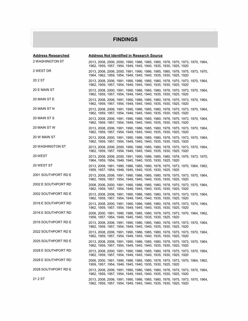
FINDINGS
Address Researched Address Not Identified in Research Source
2 WASHINGTON ST 2013, 2008, 2006, 2000, 1990, 1986, 1985, 1980, 1978, 1975, 1973, 1970, 1964, 1962, 1959, 1957, 1954, 1949, 1945, 1940, 1935, 1930, 1925, 1920
2 WEST DR 2013, 2008, 2006, 2000, 1991, 1990, 1986, 1985, 1980, 1978, 1975, 1973, 1970, 1964, 1962, 1959, 1954, 1949, 1945, 1940, 1935, 1930, 1925, 1920
20 2 ST 2013, 2008, 2006, 1991, 1990, 1986, 1985, 1980, 1978, 1975, 1973, 1970, 1964, 1962, 1959, 1957, 1954, 1949, 1945, 1940, 1935, 1930, 1925, 1920
20 E MAIN ST 2013, 2008, 2000, 1991, 1990, 1986, 1985, 1980, 1978, 1975, 1973, 1970, 1964, 1962, 1959, 1957, 1954, 1949, 1945, 1940, 1935, 1930, 1925, 1920
20 MAIN ST E 2013, 2008, 2006, 1991, 1990, 1986, 1985, 1980, 1978, 1975, 1973, 1970, 1964, 1962, 1959, 1957, 1954, 1949, 1945, 1940, 1935, 1930, 1925, 1920
20 MAIN ST N 2013, 2008, 2006, 1991, 1990, 1986, 1985, 1980, 1978, 1975, 1973, 1970, 1964, 1962, 1959, 1957, 1954, 1949, 1945, 1940, 1935, 1930, 1925, 1920
20 MAIN ST S 2013, 2008, 2006, 1991, 1990, 1986, 1985, 1980, 1978, 1975, 1973, 1970, 1964, 1962, 1959, 1957, 1954, 1949, 1945, 1940, 1935, 1930, 1925, 1920
20 MAIN ST W 2013, 2008, 2006, 1991, 1990, 1986, 1985, 1980, 1978, 1975, 1973, 1970, 1964, 1962, 1959, 1957, 1954, 1949, 1945, 1940, 1935, 1930, 1925, 1920
20 W MAIN ST 2013, 2008, 2000, 1991, 1990, 1986, 1985, 1980, 1978, 1975, 1973, 1970, 1964, 1962, 1959, 1957, 1954, 1949, 1945, 1940, 1935, 1930, 1925, 1920
20 WASHINGTON ST 2013, 2008, 2006, 2000, 1990, 1986, 1985, 1980, 1978, 1975, 1973, 1970, 1964, 1962, 1959, 1957, 1954, 1949, 1945, 1940, 1935, 1930, 1925, 1920
20 WEST 2013, 2008, 2006, 2000, 1991, 1990, 1986, 1985, 1980, 1978, 1975, 1973, 1970, 1964, 1959, 1954, 1949, 1945, 1940, 1935, 1930, 1925, 1920
20 WEST ST 2013, 2008, 1991, 1990, 1986, 1985, 1980, 1978, 1975, 1973, 1970, 1964, 1962, 1959, 1957, 1954, 1949, 1945, 1940, 1935, 1930, 1925, 1920
2001 SOUTHPORT RD E 2013, 2008, 2006, 1991, 1990, 1986, 1985, 1980, 1978, 1975, 1973, 1970, 1964, 1962, 1959, 1957, 1954, 1949, 1945, 1940, 1935, 1930, 1925, 1920
2002 E SOUTHPORT RD 2008, 2006, 2000, 1991, 1990, 1986, 1985, 1980, 1978, 1975, 1973, 1970, 1964, 1962, 1959, 1957, 1954, 1949, 1945, 1940, 1935, 1930, 1925, 1920
2002 SOUTHPORT RD E 2013, 2008, 2006, 1991, 1990, 1986, 1985, 1980, 1978, 1975, 1973, 1970, 1964, 1962, 1959, 1957, 1954, 1949, 1945, 1940, 1935, 1930, 1925, 1920
2016 E SOUTHPORT RD 2013, 2008, 2000, 1991, 1990, 1986, 1985, 1980, 1978, 1975, 1973, 1970, 1964, 1962, 1959, 1957, 1954, 1949, 1945, 1940, 1935, 1930, 1925, 1920
2016 E SOUTHPORT RD 2006, 2000, 1991, 1990, 1986, 1985, 1980, 1978, 1975, 1973, 1970, 1964, 1962, 1959, 1957, 1954, 1949, 1945, 1940, 1935, 1930, 1925, 1920
2016 SOUTHPORT RD E 2013, 2008, 2006, 1991, 1990, 1986, 1985, 1980, 1978, 1975, 1973, 1970, 1964, 1962, 1959, 1957, 1954, 1949, 1945, 1940, 1935, 1930, 1925, 1920
2022 SOUTHPORT RD E 2013, 2008, 2006, 1991, 1990, 1986, 1985, 1980, 1978, 1975, 1973, 1970, 1964, 1962, 1959, 1957, 1954, 1949, 1945, 1940, 1935, 1930, 1925, 1920
2025 SOUTHPORT RD E 2013, 2008, 2006, 1991, 1990, 1986, 1985, 1980, 1978, 1975, 1973, 1970, 1964, 1962, 1959, 1957, 1954, 1949, 1945, 1940, 1935, 1930, 1925, 1920
2028 E SOUTHPORT RD 2013, 2008, 2000, 1991, 1990, 1986, 1985, 1980, 1978, 1975, 1973, 1970, 1964, 1962, 1959, 1957, 1954, 1949, 1945, 1940, 1935, 1930, 1925, 1920
2028 E SOUTHPORT RD 2006, 2000, 1991, 1990, 1986, 1985, 1980, 1978, 1975, 1973, 1970, 1964, 1962, 1959, 1957, 1954, 1949, 1945, 1940, 1935, 1930, 1925, 1920
2028 SOUTHPORT RD E 2013, 2008, 2006, 1991, 1990, 1986, 1985, 1980, 1978, 1975, 1973, 1970, 1964, 1962, 1959, 1957, 1954, 1949, 1945, 1940, 1935, 1930, 1925, 1920
21 2 ST 2013, 2008, 2006, 1991, 1990, 1986, 1985, 1980, 1978, 1975, 1973, 1970, 1964, 1962, 1959, 1957, 1954, 1949, 1945, 1940, 1935, 1930, 1925, 1920
FINDINGS
Address Researched Address Not Identified in Research Source
21 E MAIN ST 2013, 2008, 2000, 1991, 1990, 1986, 1985, 1980, 1978, 1975, 1973, 1970, 1964, 1962, 1959, 1957, 1954, 1949, 1945, 1940, 1935, 1930, 1925, 1920
21 MAIN N 2013, 2008, 2006, 2000, 1991, 1990, 1986, 1985, 1980, 1978, 1975, 1973, 1970, 1964, 1959, 1954, 1949, 1945, 1940, 1935, 1930, 1925, 1920
21 MAIN ST E 2013, 2008, 2006, 1991, 1990, 1986, 1985, 1980, 1978, 1975, 1973, 1970, 1964, 1962, 1959, 1957, 1954, 1949, 1945, 1940, 1935, 1930, 1925, 1920
21 MAIN ST N 2013, 2008, 2006, 1990, 1986, 1985, 1980, 1978, 1975, 1973, 1970, 1964, 1962, 1959, 1957, 1954, 1949, 1945, 1940, 1935, 1930, 1925, 1920
21 MAIN ST S 2013, 2008, 2006, 1991, 1990, 1986, 1985, 1980, 1978, 1975, 1973, 1970, 1964, 1962, 1959, 1957, 1954, 1949, 1945, 1940, 1935, 1930, 1925, 1920
21 MAIN ST W 2013, 2008, 2006, 1991, 1990, 1986, 1985, 1980, 1978, 1975, 1973, 1970, 1964, 1962, 1959, 1957, 1954, 1949, 1945, 1940, 1935, 1930, 1925, 1920
21 N MAIN ST 2013, 2008, 2000, 1991, 1990, 1986, 1985, 1980, 1975, 1970, 1964, 1962, 1959, 1957, 1954, 1949, 1945, 1940, 1935, 1930, 1925, 1920
21 N MAIN ST 2013, 2006, 2000, 1991, 1990, 1986, 1985, 1980, 1978, 1975, 1973, 1970, 1964, 1962, 1959, 1957, 1954, 1949, 1945, 1940, 1935, 1930, 1925, 1920
21 S MAIN ST 2013, 2006, 2000, 1991, 1990, 1986, 1985, 1980, 1978, 1975, 1973, 1970, 1964, 1962, 1959, 1957, 1954, 1949, 1945, 1940, 1935, 1930, 1925, 1920
21 S MAIN ST 2013, 2008, 2000, 1991, 1990, 1986, 1985, 1980, 1978, 1975, 1973, 1970, 1964, 1962, 1959, 1957, 1954, 1949, 1945, 1940, 1935, 1930, 1925, 1920
21 W MAIN ST 2013, 2008, 2000, 1991, 1990, 1986, 1985, 1980, 1978, 1975, 1973, 1970, 1964, 1962, 1959, 1957, 1954, 1949, 1945, 1940, 1935, 1930, 1925, 1920
21 WASHINGTON ST 2013, 2008, 2006, 2000, 1990, 1986, 1985, 1980, 1978, 1975, 1973, 1970, 1964, 1962, 1959, 1957, 1954, 1949, 1945, 1940, 1935, 1930, 1925, 1920
21 WASHINGTON ST S 2013, 2008, 2006, 1991, 1990, 1986, 1985, 1980, 1978, 1975, 1973, 1970, 1964, 1962, 1959, 1957, 1954, 1949, 1945, 1940, 1935, 1930, 1925, 1920
21 WEST 2013, 2008, 2006, 2000, 1991, 1990, 1986, 1985, 1980, 1978, 1975, 1973, 1970, 1964, 1959, 1954, 1949, 1945, 1940, 1935, 1930, 1925, 1920
21 WEST ST 2013, 2008, 2006, 1991, 1990, 1986, 1985, 1980, 1978, 1975, 1973, 1970, 1964, 1962, 1959, 1957, 1954, 1949, 1945, 1940, 1935, 1930, 1925, 1920
2100 SOUTHPORT RD E 2013, 2008, 2006, 1991, 1990, 1986, 1985, 1980, 1978, 1975, 1973, 1970, 1964, 1962, 1959, 1957, 1954, 1949, 1945, 1940, 1935, 1930, 1925, 1920
2115 E SOUTHPORT RD 2013, 2008, 2000, 1991, 1990, 1986, 1985, 1980, 1978, 1975, 1973, 1970, 1964, 1962, 1959, 1957, 1954, 1949, 1945, 1940, 1935, 1930, 1925, 1920
2115 E SOUTHPORT RD 2006, 2000, 1991, 1990, 1986, 1985, 1980, 1978, 1975, 1973, 1970, 1964, 1962, 1959, 1957, 1954, 1949, 1945, 1940, 1935, 1930, 1925, 1920
2115 SOUTHPORT RD E 2013, 2008, 2006, 1991, 1990, 1986, 1985, 1980, 1978, 1975, 1973, 1970, 1964, 1962, 1959, 1957, 1954, 1949, 1945, 1940, 1935, 1930, 1925, 1920
22 2 ST 2013, 2008, 2006, 1991, 1990, 1986, 1985, 1980, 1978, 1975, 1973, 1970, 1964, 1962, 1959, 1957, 1954, 1949, 1945, 1940, 1935, 1930, 1925, 1920
22 E MAIN ST 2013, 2008, 2000, 1991, 1990, 1986, 1985, 1980, 1978, 1975, 1973, 1970, 1964, 1962, 1959, 1957, 1954, 1949, 1945, 1940, 1935, 1930, 1925, 1920
22 MAIN ST E 2013, 2008, 2006, 1991, 1990, 1986, 1985, 1980, 1978, 1975, 1973, 1970, 1964, 1962, 1959, 1957, 1954, 1949, 1945, 1940, 1935, 1930, 1925, 1920
22 MAIN ST W 2013, 2008, 2006, 1991, 1990, 1986, 1985, 1980, 1978, 1975, 1973, 1970, 1964, 1962, 1959, 1957, 1954, 1949, 1945, 1940, 1935, 1930, 1925, 1920
22 N MAIN ST 2013, 2008, 2000, 1991, 1990, 1986, 1985, 1980, 1978, 1975, 1973, 1970, 1964, 1962, 1959, 1957, 1954, 1949, 1945, 1940, 1935, 1930, 1925, 1920

FINDINGS
Address Researched Address Not Identified in Research Source
22 S MAIN ST 2013, 2008, 2000, 1991, 1990, 1986, 1985, 1980, 1978, 1975, 1973, 1970, 1964, 1962, 1959, 1957, 1954, 1949, 1945, 1940, 1935, 1930, 1925, 1920
22 S MAIN ST 2013, 2006, 2000, 1991, 1990, 1986, 1985, 1980, 1978, 1975, 1973, 1970, 1964, 1962, 1959, 1957, 1954, 1949, 1945, 1940, 1935, 1930, 1925, 1920
22 W MAIN ST 2013, 2008, 2000, 1991, 1990, 1986, 1985, 1980, 1978, 1975, 1973, 1970, 1964, 1962, 1959, 1957, 1954, 1949, 1945, 1940, 1935, 1930, 1925, 1920
22 WASHINGTON ST 2013, 2008, 2000, 1990, 1986, 1985, 1980, 1978, 1975, 1973, 1970, 1964, 1962, 1959, 1957, 1954, 1949, 1945, 1940, 1935, 1930, 1925, 1920
2210 E SOUTHPORT RD 2013, 2008, 2000, 1991, 1990, 1986, 1985, 1980, 1978, 1975, 1973, 1970, 1964, 1962, 1959, 1957, 1954, 1949, 1945, 1940, 1935, 1930, 1925, 1920
2210 E SOUTHPORT RD 2013, 2006, 2000, 1991, 1990, 1986, 1985, 1980, 1978, 1975, 1973, 1970, 1964, 1962, 1959, 1957, 1954, 1949, 1945, 1940, 1935, 1930, 1925, 1920
2210 SOUTHPORT RD E 2013, 2008, 2006, 1991, 1990, 1986, 1985, 1980, 1978, 1975, 1973, 1970, 1964, 1962, 1959, 1957, 1954, 1949, 1945, 1940, 1935, 1930, 1925, 1920
2211 E SOUTHPORT RD 2008, 2006, 2000, 1991, 1990, 1986, 1985, 1980, 1978, 1975, 1973, 1970, 1964, 1962, 1959, 1957, 1954, 1949, 1945, 1940, 1935, 1930, 1925, 1920
2212 SOUTHPORT RD E 2013, 2008, 2006, 1991, 1990, 1986, 1985, 1980, 1978, 1975, 1973, 1970, 1964, 1962, 1959, 1957, 1954, 1949, 1945, 1940, 1935, 1930, 1925, 1920
2216 SOUTHPORT RD E 2013, 2008, 2006, 1991, 1990, 1986, 1985, 1980, 1978, 1975, 1973, 1970, 1964, 1962, 1959, 1957, 1954, 1949, 1945, 1940, 1935, 1930, 1925, 1920
2220 E SOUTHPORT RD 2013, 2008, 2000, 1991, 1990, 1986, 1985, 1980, 1978, 1975, 1973, 1970, 1964, 1962, 1959, 1957, 1954, 1949, 1945, 1940, 1935, 1930, 1925, 1920
2220 E SOUTHPORT RD 2006, 2000, 1991, 1990, 1986, 1985, 1980, 1978, 1975, 1973, 1970, 1964, 1962, 1959, 1957, 1954, 1949, 1945, 1940, 1935, 1930, 1925, 1920
2220 SOUTHPORT RD E 2013, 2008, 2006, 1991, 1990, 1986, 1985, 1980, 1978, 1975, 1973, 1970, 1964, 1962, 1959, 1957, 1954, 1949, 1945, 1940, 1935, 1930, 1925, 1920
2221 E SOUTHPORT RD 2013, 2008, 2000, 1991, 1990, 1986, 1985, 1980, 1978, 1975, 1973, 1970, 1964, 1962, 1959, 1957, 1954, 1949, 1945, 1940, 1935, 1930, 1925, 1920
2221 E SOUTHPORT RD 2006, 2000, 1991, 1990, 1986, 1985, 1980, 1978, 1975, 1973, 1970, 1964, 1962, 1959, 1957, 1954, 1949, 1945, 1940, 1935, 1930, 1925, 1920
2221 SOUTHPORT RD E 2013, 2008, 2006, 1991, 1990, 1986, 1985, 1980, 1978, 1975, 1973, 1970, 1964, 1962, 1959, 1957, 1954, 1949, 1945, 1940, 1935, 1930, 1925, 1920
23 2 ST 2013, 2008, 2006, 1991, 1990, 1986, 1985, 1980, 1978, 1975, 1973, 1970, 1964, 1962, 1959, 1957, 1954, 1949, 1945, 1940, 1935, 1930, 1925, 1920
23 E MAIN ST 2013, 2008, 2000, 1991, 1990, 1986, 1985, 1980, 1978, 1975, 1973, 1970, 1964, 1962, 1959, 1957, 1954, 1949, 1945, 1940, 1935, 1930, 1925, 1920
23 MAIN ST E 2013, 2008, 2006, 1991, 1990, 1986, 1985, 1980, 1978, 1975, 1973, 1970, 1964, 1962, 1959, 1957, 1954, 1949, 1945, 1940, 1935, 1930, 1925, 1920
23 MAIN ST N 2013, 2008, 2006, 1991, 1990, 1986, 1985, 1980, 1978, 1975, 1973, 1970, 1964, 1962, 1959, 1957, 1954, 1949, 1945, 1940, 1935, 1930, 1925, 1920
23 MAIN ST S 2013, 2008, 2006, 1991, 1990, 1986, 1985, 1980, 1978, 1975, 1973, 1970, 1964, 1962, 1959, 1957, 1954, 1949, 1945, 1940, 1935, 1930, 1925, 1920
23 MAIN ST W 2013, 2008, 2006, 1991, 1990, 1986, 1985, 1980, 1978, 1975, 1973, 1970, 1964, 1962, 1959, 1957, 1954, 1949, 1945, 1940, 1935, 1930, 1925, 1920
23 N MAIN ST 2013, 2008, 2000, 1991, 1990, 1986, 1985, 1980, 1978, 1975, 1973, 1970, 1964, 1962, 1959, 1957, 1954, 1949, 1945, 1940, 1935, 1930, 1925, 1920
23 W MAIN ST 2013, 2008, 2000, 1991, 1990, 1986, 1985, 1980, 1978, 1975, 1973, 1970, 1964, 1962, 1959, 1957, 1954, 1949, 1945, 1940, 1935, 1930, 1925, 1920
FINDINGS
Address Researched Address Not Identified in Research Source
23 WASHINGTON ST 2013, 2008, 2006, 2000, 1990, 1986, 1985, 1980, 1978, 1975, 1973, 1970, 1964, 1962, 1959, 1957, 1954, 1949, 1945, 1940, 1935, 1930, 1925, 1920
23 WEST 2013, 2008, 2006, 2000, 1991, 1990, 1986, 1985, 1980, 1978, 1975, 1973, 1970, 1964, 1959, 1954, 1949, 1945, 1940, 1935, 1930, 1925, 1920
23 WEST ST 2013, 2008, 2006, 1991, 1990, 1986, 1985, 1980, 1978, 1975, 1973, 1970, 1964, 1962, 1959, 1957, 1954, 1949, 1945, 1940, 1935, 1930, 1925, 1920
2301 E SOUTHPORT RD 2013, 2008, 2000, 1991, 1990, 1986, 1985, 1980, 1978, 1975, 1973, 1970, 1964, 1962, 1959, 1957, 1954, 1949, 1945, 1940, 1935, 1930, 1925, 1920
2301 E SOUTHPORT RD 2006, 2000, 1991, 1990, 1986, 1985, 1980, 1978, 1975, 1973, 1970, 1964, 1962, 1959, 1957, 1954, 1949, 1945, 1940, 1935, 1930, 1925, 1920
2301 SOUTHPORT RD E 2013, 2008, 2006, 1991, 1990, 1986, 1985, 1980, 1978, 1975, 1973, 1970, 1964, 1962, 1959, 1957, 1954, 1949, 1945, 1940, 1935, 1930, 1925, 1920
2302 E SOUTHPORT RD 2013, 2008, 2000, 1991, 1990, 1986, 1985, 1980, 1978, 1975, 1973, 1970, 1964, 1962, 1959, 1957, 1954, 1949, 1945, 1940, 1935, 1930, 1925, 1920
2302 E SOUTHPORT RD 2013, 2006, 2000, 1991, 1990, 1986, 1985, 1980, 1978, 1975, 1973, 1970, 1964, 1962, 1959, 1957, 1954, 1949, 1945, 1940, 1935, 1930, 1925, 1920
2302 SOUTHPORT RD E 2013, 2008, 2006, 1991, 1990, 1986, 1985, 1980, 1978, 1975, 1973, 1970, 1964, 1962, 1959, 1957, 1954, 1949, 1945, 1940, 1935, 1930, 1925, 1920
2308 E SOUTHPORT RD 2013, 2008, 2000, 1991, 1990, 1986, 1985, 1980, 1978, 1975, 1973, 1970, 1964, 1962, 1959, 1957, 1954, 1949, 1945, 1940, 1935, 1930, 1925, 1920
2308 E SOUTHPORT RD 2013, 2006, 2000, 1991, 1990, 1986, 1985, 1980, 1978, 1975, 1973, 1970, 1964, 1962, 1959, 1957, 1954, 1949, 1945, 1940, 1935, 1930, 1925, 1920
2308 SOUTHPORT RD E 2013, 2008, 2006, 1991, 1990, 1986, 1985, 1980, 1978, 1975, 1973, 1970, 1964, 1962, 1959, 1957, 1954, 1949, 1945, 1940, 1935, 1930, 1925, 1920
2316 E SOUTHPORT RD 2013, 2008, 2000, 1991, 1990, 1986, 1985, 1980, 1978, 1975, 1973, 1970, 1964, 1962, 1959, 1957, 1954, 1949, 1945, 1940, 1935, 1930, 1925, 1920
2316 E SOUTHPORT RD 2006, 2000, 1991, 1990, 1986, 1985, 1980, 1978, 1975, 1973, 1970, 1964, 1962, 1959, 1957, 1954, 1949, 1945, 1940, 1935, 1930, 1925, 1920
2316 SOUTHPORT RD E 2013, 2008, 2006, 1991, 1990, 1986, 1985, 1980, 1978, 1975, 1973, 1970, 1964, 1962, 1959, 1957, 1954, 1949, 1945, 1940, 1935, 1930, 1925, 1920
2318 SOUTHPORT RD E 2013, 2008, 2006, 1991, 1990, 1986, 1985, 1980, 1978, 1975, 1973, 1970, 1964, 1962, 1959, 1957, 1954, 1949, 1945, 1940, 1935, 1930, 1925, 1920
24 E MAIN ST 2013, 2008, 2000, 1991, 1990, 1986, 1985, 1980, 1978, 1975, 1973, 1970, 1964, 1962, 1959, 1957, 1954, 1949, 1945, 1940, 1935, 1930, 1925, 1920
24 MAIN S 2013, 2008, 2006, 2000, 1991, 1990, 1986, 1985, 1980, 1978, 1975, 1973, 1970, 1964, 1959, 1954, 1949, 1945, 1940, 1935, 1930, 1925, 1920
24 MAIN ST E 2013, 2008, 2006, 1991, 1990, 1986, 1985, 1980, 1978, 1975, 1973, 1970, 1964, 1962, 1959, 1957, 1954, 1949, 1945, 1940, 1935, 1930, 1925, 1920
24 MAIN ST S 2013, 2008, 2006, 1990, 1986, 1985, 1980, 1978, 1975, 1973, 1970, 1964, 1962, 1959, 1957, 1954, 1949, 1945, 1940, 1935, 1930, 1925, 1920
24 MAIN ST W 2013, 2008, 2006, 1991, 1990, 1986, 1985, 1980, 1978, 1975, 1973, 1970, 1964, 1962, 1959, 1957, 1954, 1949, 1945, 1940, 1935, 1930, 1925, 1920
24 N MAIN ST 2013, 2008, 2000, 1991, 1990, 1986, 1985, 1980, 1978, 1975, 1973, 1970, 1964, 1962, 1959, 1957, 1954, 1949, 1945, 1940, 1935, 1930, 1925, 1920
24 W MAIN ST 2013, 2008, 2000, 1991, 1990, 1986, 1985, 1980, 1978, 1975, 1973, 1970, 1964, 1962, 1959, 1957, 1954, 1949, 1945, 1940, 1935, 1930, 1925, 1920
24 WASHINGTON ST 2013, 2008, 2006, 2000, 1990, 1986, 1985, 1980, 1978, 1975, 1973, 1970, 1964, 1962, 1959, 1957, 1954, 1949, 1945, 1940, 1935, 1930, 1925, 1920
FINDINGS
Address Researched Address Not Identified in Research Source
24 WEST ST 2013, 2008, 1991, 1990, 1986, 1985, 1980, 1978, 1975, 1973, 1970, 1964, 1962, 1959, 1957, 1954, 1949, 1945, 1940, 1935, 1930, 1925, 1920
25 2 ST 2013, 2008, 2006, 1991, 1990, 1986, 1985, 1980, 1978, 1975, 1973, 1970, 1964, 1962, 1959, 1957, 1954, 1949, 1945, 1940, 1935, 1930, 1925, 1920
25 E MAIN ST 2013, 2008, 2000, 1991, 1990, 1986, 1985, 1980, 1978, 1975, 1973, 1970, 1964, 1962, 1959, 1957, 1954, 1949, 1945, 1940, 1935, 1930, 1925, 1920
25 MAIN N 2013, 2008, 2006, 2000, 1991, 1990, 1986, 1985, 1980, 1978, 1975, 1973, 1970, 1964, 1959, 1954, 1949, 1945, 1940, 1935, 1930, 1925, 1920
25 MAIN ST E 2013, 2008, 2006, 1991, 1990, 1986, 1985, 1980, 1978, 1975, 1973, 1970, 1964, 1962, 1959, 1957, 1954, 1949, 1945, 1940, 1935, 1930, 1925, 1920
25 MAIN ST N 2013, 2008, 2006, 1990, 1986, 1985, 1980, 1978, 1975, 1973, 1970, 1964, 1962, 1959, 1957, 1954, 1949, 1945, 1940, 1935, 1930, 1925, 1920
25 MAIN ST S 2013, 2008, 2006, 2000, 1990, 1986, 1985, 1980, 1978, 1975, 1973, 1970, 1964, 1962, 1959, 1957, 1954, 1949, 1945, 1940, 1935, 1930, 1925, 1920
25 MAIN ST W 2013, 2008, 2006, 1991, 1990, 1986, 1985, 1980, 1978, 1975, 1973, 1970, 1964, 1962, 1959, 1957, 1954, 1949, 1945, 1940, 1935, 1930, 1925, 1920
25 N 2ND ST 2013, 2008, 2000, 1991, 1990, 1986, 1985, 1980, 1978, 1975, 1973, 1970, 1964, 1962, 1959, 1957, 1954, 1949, 1945, 1940, 1935, 1930, 1925, 1920
25 N MAIN ST 2013, 2008, 2000, 1991, 1990, 1986, 1985, 1980, 1978, 1975, 1970, 1964, 1962, 1959, 1957, 1954, 1949, 1945, 1940, 1935, 1930, 1925, 1920
25 W MAIN ST 2013, 2008, 2000, 1991, 1990, 1986, 1985, 1980, 1978, 1975, 1973, 1970, 1964, 1962, 1959, 1957, 1954, 1949, 1945, 1940, 1935, 1930, 1925, 1920
25 WASHINGTON ST 2013, 2008, 2006, 2000, 1990, 1986, 1985, 1980, 1978, 1975, 1973, 1970, 1964, 1962, 1959, 1957, 1954, 1949, 1945, 1940, 1935, 1930, 1925, 1920
25 WEST ST 2013, 2008, 2006, 1991, 1990, 1986, 1985, 1980, 1978, 1975, 1973, 1970, 1964, 1962, 1959, 1957, 1954, 1949, 1945, 1940, 1935, 1930, 1925, 1920
25 WEST ST 2008, 2006, 2000, 1991, 1990, 1986, 1985, 1980, 1978, 1975, 1973, 1970, 1964, 1962, 1959, 1957, 1954, 1949, 1945, 1940, 1935, 1930, 1925, 1920
26 2 ST 2013, 2008, 2006, 1991, 1990, 1986, 1985, 1980, 1978, 1975, 1973, 1970, 1964, 1962, 1959, 1957, 1954, 1949, 1945, 1940, 1935, 1930, 1925, 1920
26 E MAIN ST 2013, 2008, 2000, 1991, 1990, 1986, 1985, 1980, 1978, 1975, 1973, 1970, 1964, 1962, 1959, 1957, 1954, 1949, 1945, 1940, 1935, 1930, 1925, 1920
26 MAIN ST E 2013, 2008, 2006, 1991, 1990, 1986, 1985, 1980, 1978, 1975, 1973, 1970, 1964, 1962, 1959, 1957, 1954, 1949, 1945, 1940, 1935, 1930, 1925, 1920
26 MAIN ST W 2013, 2008, 2006, 1991, 1990, 1986, 1985, 1980, 1978, 1975, 1973, 1970, 1964, 1962, 1959, 1957, 1954, 1949, 1945, 1940, 1935, 1930, 1925, 1920
26 N MAIN ST 2013, 2008, 2006, 2000, 1991, 1990, 1985, 1980, 1978, 1975, 1973, 1970, 1964, 1962, 1959, 1957, 1954, 1949, 1945, 1940, 1935, 1930, 1925, 1920
26 W MAIN ST 2013, 2008, 2000, 1991, 1990, 1986, 1985, 1980, 1978, 1975, 1973, 1970, 1964, 1962, 1959, 1957, 1954, 1949, 1945, 1940, 1935, 1930, 1925, 1920
26 WASHINGTON ST 2013, 2008, 2006, 2000, 1990, 1986, 1985, 1980, 1978, 1975, 1973, 1970, 1964, 1962, 1959, 1957, 1954, 1949, 1945, 1940, 1935, 1930, 1925, 1920
26 WEST 2013, 2008, 2006, 2000, 1991, 1990, 1986, 1985, 1980, 1978, 1975, 1973, 1970, 1964, 1959, 1954, 1949, 1945, 1940, 1935, 1930, 1925, 1920
26 WEST ST 2013, 2008, 2006, 1991, 1990, 1986, 1985, 1980, 1978, 1975, 1973, 1970, 1964, 1962, 1959, 1957, 1954, 1949, 1945, 1940, 1935, 1930, 1925, 1920
27 2 ST 2013, 2008, 2006, 1991, 1990, 1986, 1985, 1980, 1978, 1975, 1973, 1970, 1964, 1962, 1959, 1957, 1954, 1949, 1945, 1940, 1935, 1930, 1925, 1920
FINDINGS
Address Researched Address Not Identified in Research Source
27 E MAIN ST 2013, 2008, 2000, 1991, 1990, 1986, 1985, 1980, 1978, 1975, 1973, 1970, 1964, 1962, 1959, 1957, 1954, 1949, 1945, 1940, 1935, 1930, 1925, 1920
27 MAIN N 2013, 2008, 2006, 2000, 1991, 1990, 1986, 1985, 1980, 1978, 1975, 1973, 1970, 1964, 1959, 1954, 1949, 1945, 1940, 1935, 1930, 1925, 1920
27 MAIN ST E 2013, 2008, 2006, 1991, 1990, 1986, 1985, 1980, 1978, 1975, 1973, 1970, 1964, 1962, 1959, 1957, 1954, 1949, 1945, 1940, 1935, 1930, 1925, 1920
27 MAIN ST N 2013, 2008, 2006, 1990, 1986, 1985, 1980, 1978, 1975, 1973, 1970, 1964, 1962, 1959, 1957, 1954, 1949, 1945, 1940, 1935, 1930, 1925, 1920
27 MAIN ST W 2013, 2008, 2006, 1991, 1990, 1986, 1985, 1980, 1978, 1975, 1973, 1970, 1964, 1962, 1959, 1957, 1954, 1949, 1945, 1940, 1935, 1930, 1925, 1920
27 N MAIN ST 2013, 2008, 2000, 1991, 1990, 1985, 1980, 1978, 1975, 1970, 1964, 1962, 1959, 1957, 1954, 1949, 1945, 1940, 1935, 1930, 1925, 1920
27 W MAIN ST 2013, 2008, 2000, 1991, 1990, 1986, 1985, 1980, 1978, 1975, 1973, 1970, 1964, 1962, 1959, 1957, 1954, 1949, 1945, 1940, 1935, 1930, 1925, 1920
27 WASHINGTON ST 2013, 2008, 2006, 2000, 1990, 1986, 1985, 1980, 1978, 1975, 1973, 1970, 1964, 1962, 1959, 1957, 1954, 1949, 1945, 1940, 1935, 1930, 1925, 1920
27 WEST ST 2008, 2006, 2000, 1991, 1990, 1986, 1985, 1980, 1978, 1975, 1973, 1970, 1964, 1962, 1959, 1957, 1954, 1949, 1945, 1940, 1935, 1930, 1925, 1920
28 2 ST 2013, 2008, 2006, 1991, 1990, 1986, 1985, 1980, 1978, 1975, 1973, 1970, 1964, 1962, 1959, 1957, 1954, 1949, 1945, 1940, 1935, 1930, 1925, 1920
28 E MAIN ST 2013, 2008, 2000, 1991, 1990, 1986, 1985, 1980, 1978, 1975, 1973, 1970, 1964, 1962, 1959, 1957, 1954, 1949, 1945, 1940, 1935, 1930, 1925, 1920
28 MAIN ST E 2013, 2008, 2006, 1991, 1990, 1986, 1985, 1980, 1978, 1975, 1973, 1970, 1964, 1962, 1959, 1957, 1954, 1949, 1945, 1940, 1935, 1930, 1925, 1920
28 MAIN ST N 2013, 2008, 2006, 1991, 1990, 1986, 1985, 1980, 1978, 1975, 1973, 1970, 1964, 1962, 1959, 1957, 1954, 1949, 1945, 1940, 1935, 1930, 1925, 1920
28 MAIN ST W 2013, 2008, 2006, 1991, 1990, 1986, 1985, 1980, 1978, 1975, 1973, 1970, 1964, 1962, 1959, 1957, 1954, 1949, 1945, 1940, 1935, 1930, 1925, 1920
28 W MAIN ST 2013, 2008, 2000, 1991, 1990, 1986, 1985, 1980, 1978, 1975, 1973, 1970, 1964, 1962, 1959, 1957, 1954, 1949, 1945, 1940, 1935, 1930, 1925, 1920
28 WASHINGTON ST 2013, 2008, 2006, 2000, 1990, 1986, 1985, 1980, 1978, 1975, 1973, 1970, 1964, 1962, 1959, 1957, 1954, 1949, 1945, 1940, 1935, 1930, 1925, 1920
29 2 ST 2013, 2008, 2006, 1991, 1990, 1986, 1985, 1980, 1978, 1975, 1973, 1970, 1964, 1962, 1959, 1957, 1954, 1949, 1945, 1940, 1935, 1930, 1925, 1920
29 E MAIN ST 2013, 2008, 2000, 1991, 1990, 1986, 1985, 1980, 1978, 1975, 1973, 1970, 1964, 1962, 1959, 1957, 1954, 1949, 1945, 1940, 1935, 1930, 1925, 1920
29 MAIN ST 2013, 2008, 2000, 1991, 1990, 1986, 1985, 1980, 1978, 1975, 1973, 1970, 1964, 1962, 1959, 1957, 1954, 1949, 1945, 1940, 1935, 1930, 1925, 1920
29 MAIN ST E 2013, 2008, 2006, 1991, 1990, 1986, 1985, 1980, 1978, 1975, 1973, 1970, 1964, 1962, 1959, 1957, 1954, 1949, 1945, 1940, 1935, 1930, 1925, 1920
29 MAIN ST W 2013, 2008, 2006, 1991, 1990, 1986, 1985, 1980, 1978, 1975, 1973, 1970, 1964, 1962, 1959, 1957, 1954, 1949, 1945, 1940, 1935, 1930, 1925, 1920
29 S 2ND ST 2013, 2008, 2000, 1991, 1990, 1986, 1985, 1980, 1978, 1975, 1973, 1970, 1964, 1962, 1959, 1957, 1954, 1949, 1945, 1940, 1935, 1930, 1925, 1920
29 W MAIN ST 2013, 2008, 2000, 1991, 1990, 1986, 1985, 1980, 1978, 1975, 1973, 1970, 1964, 1962, 1959, 1957, 1954, 1949, 1945, 1940, 1935, 1930, 1925, 1920
29 WASHINGTON ST 2013, 2008, 2006, 2000, 1990, 1986, 1985, 1980, 1978, 1975, 1973, 1970, 1964, 1962, 1959, 1957, 1954, 1949, 1945, 1940, 1935, 1930, 1925, 1920

FINDINGS
Address Researched Address Not Identified in Research Source
29 WEST ST 2013, 2008, 2006, 1991, 1990, 1986, 1985, 1980, 1978, 1975, 1973, 1970, 1964, 1962, 1959, 1957, 1954, 1949, 1945, 1940, 1935, 1930, 1925, 1920
3 E MAIN ST 2013, 2008, 2000, 1991, 1990, 1986, 1985, 1980, 1978, 1975, 1973, 1970, 1964, 1962, 1959, 1957, 1954, 1949, 1945, 1940, 1935, 1930, 1925, 1920
3 MAIN ST E 2013, 2008, 2006, 1991, 1990, 1986, 1985, 1980, 1978, 1975, 1973, 1970, 1964, 1962, 1959, 1957, 1954, 1949, 1945, 1940, 1935, 1930, 1925, 1920
3 MAIN ST W 2013, 2008, 2006, 1991, 1990, 1986, 1985, 1980, 1978, 1975, 1973, 1970, 1964, 1962, 1959, 1957, 1954, 1949, 1945, 1940, 1935, 1930, 1925, 1920
3 N MAIN ST 2013, 2008, 2000, 1991, 1990, 1986, 1985, 1980, 1978, 1975, 1973, 1970, 1964, 1962, 1959, 1957, 1954, 1949, 1945, 1940, 1935, 1930, 1925, 1920
3 S MAIN ST 2013, 2008, 2000, 1991, 1990, 1986, 1985, 1980, 1978, 1975, 1973, 1970, 1964, 1962, 1959, 1957, 1954, 1949, 1945, 1940, 1935, 1930, 1925, 1920
3 WASHINGTON ST 2013, 2008, 2006, 2000, 1990, 1986, 1985, 1980, 1978, 1975, 1973, 1970, 1964, 1962, 1959, 1957, 1954, 1949, 1945, 1940, 1935, 1930, 1925, 1920
3 WEST DR 2013, 2008, 2006, 2000, 1991, 1990, 1986, 1985, 1980, 1978, 1975, 1973, 1970, 1964, 1962, 1959, 1954, 1949, 1945, 1940, 1935, 1930, 1925, 1920
30 2 ST 2013, 2008, 2006, 1991, 1990, 1986, 1985, 1980, 1978, 1975, 1973, 1970, 1964, 1962, 1959, 1957, 1954, 1949, 1945, 1940, 1935, 1930, 1925, 1920
30 E MAIN ST 2013, 2008, 2000, 1991, 1990, 1986, 1985, 1980, 1978, 1975, 1973, 1970, 1964, 1962, 1959, 1957, 1954, 1949, 1945, 1940, 1935, 1930, 1925, 1920
30 MAIN ST E 2013, 2008, 2006, 1991, 1990, 1986, 1985, 1980, 1978, 1975, 1973, 1970, 1964, 1962, 1959, 1957, 1954, 1949, 1945, 1940, 1935, 1930, 1925, 1920
30 MAIN ST S 2013, 2008, 2006, 1990, 1986, 1985, 1980, 1978, 1975, 1973, 1970, 1964, 1962, 1959, 1957, 1954, 1949, 1945, 1940, 1935, 1930, 1925, 1920
30 MAIN ST W 2013, 2008, 2006, 1991, 1990, 1986, 1985, 1980, 1978, 1975, 1973, 1970, 1964, 1962, 1959, 1957, 1954, 1949, 1945, 1940, 1935, 1930, 1925, 1920
30 N 2ND ST 2013, 2008, 2000, 1991, 1990, 1986, 1985, 1980, 1978, 1975, 1973, 1970, 1964, 1962, 1959, 1957, 1954, 1949, 1945, 1940, 1935, 1930, 1925, 1920
30 N MAIN ST 2013, 2008, 2000, 1991, 1990, 1986, 1985, 1980, 1978, 1975, 1973, 1970, 1964, 1962, 1959, 1957, 1954, 1949, 1945, 1940, 1935, 1930, 1925, 1920
30 S MAIN ST 2013, 2008, 2000, 1991, 1990, 1985, 1980, 1978, 1975, 1973, 1970, 1964, 1962, 1959, 1957, 1954, 1949, 1945, 1940, 1935, 1930, 1925, 1920
30 S MAIN ST 2008, 2006, 2000, 1991, 1990, 1986, 1985, 1980, 1978, 1975, 1973, 1970, 1964, 1962, 1959, 1957, 1954, 1949, 1945, 1940, 1935, 1930, 1925, 1920
30 W MAIN ST 2013, 2008, 2000, 1991, 1990, 1986, 1985, 1980, 1978, 1975, 1973, 1970, 1964, 1962, 1959, 1957, 1954, 1949, 1945, 1940, 1935, 1930, 1925, 1920
30 WASHINGTON ST 2013, 2008, 2006, 2000, 1990, 1986, 1985, 1980, 1978, 1975, 1973, 1970, 1964, 1962, 1959, 1957, 1954, 1949, 1945, 1940, 1935, 1930, 1925, 1920
30 WEST ST 2013, 2008, 1991, 1990, 1986, 1985, 1980, 1978, 1975, 1973, 1970, 1964, 1962, 1959, 1957, 1954, 1949, 1945, 1940, 1935, 1930, 1925, 1920
30 WEST ST 2013, 2006, 2000, 1991, 1990, 1986, 1985, 1980, 1978, 1975, 1973, 1970, 1964, 1962, 1959, 1957, 1954, 1949, 1945, 1940, 1935, 1930, 1925, 1920
31 2 ST 2013, 2008, 2006, 1991, 1990, 1986, 1985, 1980, 1978, 1975, 1973, 1970, 1964, 1962, 1959, 1957, 1954, 1949, 1945, 1940, 1935, 1930, 1925, 1920
31 MAIN ST E 2013, 2008, 2006, 1991, 1990, 1986, 1985, 1980, 1978, 1975, 1973, 1970, 1964, 1962, 1959, 1957, 1954, 1949, 1945, 1940, 1935, 1930, 1925, 1920
31 MAIN ST W 2013, 2008, 2006, 1991, 1990, 1986, 1985, 1980, 1978, 1975, 1973, 1970, 1964, 1962, 1959, 1957, 1954, 1949, 1945, 1940, 1935, 1930, 1925, 1920
FINDINGS
Address Researched Address Not Identified in Research Source
31 W MAIN ST 2013, 2008, 2000, 1991, 1990, 1986, 1985, 1980, 1978, 1975, 1973, 1970, 1964, 1962, 1959, 1957, 1954, 1949, 1945, 1940, 1935, 1930, 1925, 1920
31 WASHINGTON ST 2013, 2008, 2006, 2000, 1990, 1986, 1985, 1980, 1978, 1975, 1973, 1970, 1964, 1962, 1959, 1957, 1954, 1949, 1945, 1940, 1935, 1930, 1925, 1920
31 WEST ST 2013, 2008, 2006, 1991, 1990, 1986, 1985, 1980, 1978, 1975, 1973, 1970, 1964, 1962, 1959, 1957, 1954, 1949, 1945, 1940, 1935, 1930, 1925, 1920
32 2 ST 2013, 2008, 2006, 1991, 1990, 1986, 1985, 1980, 1978, 1975, 1973, 1970, 1964, 1962, 1959, 1957, 1954, 1949, 1945, 1940, 1935, 1930, 1925, 1920
32 E MAIN ST 2013, 2008, 2000, 1991, 1990, 1986, 1985, 1980, 1978, 1975, 1973, 1970, 1964, 1962, 1959, 1957, 1954, 1949, 1945, 1940, 1935, 1930, 1925, 1920
32 MAIN N 2013, 2008, 2006, 2000, 1991, 1990, 1986, 1985, 1980, 1978, 1975, 1973, 1970, 1964, 1959, 1957, 1954, 1949, 1945, 1940, 1935, 1930, 1925, 1920
32 MAIN ST 2013, 2008, 2006, 1991, 1990, 1986, 1985, 1980, 1978, 1975, 1973, 1970, 1964, 1962, 1959, 1957, 1954, 1949, 1945, 1940, 1935, 1930, 1925, 1920
32 MAIN ST E 2013, 2008, 2006, 1991, 1990, 1986, 1985, 1980, 1978, 1975, 1973, 1970, 1964, 1962, 1959, 1957, 1954, 1949, 1945, 1940, 1935, 1930, 1925, 1920
32 MAIN ST N 2013, 2008, 2006, 1990, 1986, 1985, 1980, 1978, 1975, 1973, 1970, 1964, 1962, 1959, 1957, 1954, 1949, 1945, 1940, 1935, 1930, 1925, 1920
32 MAIN ST S 2013, 2008, 2006, 1990, 1986, 1985, 1980, 1978, 1975, 1973, 1970, 1964, 1962, 1959, 1957, 1954, 1949, 1945, 1940, 1935, 1930, 1925, 1920
32 MAIN ST W 2013, 2008, 2006, 1991, 1990, 1986, 1985, 1980, 1978, 1975, 1973, 1970, 1964, 1962, 1959, 1957, 1954, 1949, 1945, 1940, 1935, 1930, 1925, 1920
32 N MAIN ST 2013, 2008, 2000, 1991, 1990, 1986, 1985, 1980, 1978, 1975, 1970, 1964, 1962, 1959, 1957, 1954, 1949, 1945, 1940, 1935, 1930, 1925, 1920
32 W MAIN ST 2013, 2008, 2000, 1991, 1990, 1986, 1985, 1980, 1978, 1975, 1973, 1970, 1964, 1962, 1959, 1957, 1954, 1949, 1945, 1940, 1935, 1930, 1925, 1920
32 WASHINGTON ST 2013, 2008, 2006, 2000, 1990, 1986, 1985, 1980, 1978, 1975, 1973, 1970, 1964, 1962, 1959, 1957, 1954, 1949, 1945, 1940, 1935, 1930, 1925, 1920
33 2 ST 2013, 2008, 2006, 1991, 1990, 1986, 1985, 1980, 1978, 1975, 1973, 1970, 1964, 1962, 1959, 1957, 1954, 1949, 1945, 1940, 1935, 1930, 1925, 1920
33 MAIN ST E 2013, 2008, 2006, 1991, 1990, 1986, 1985, 1980, 1978, 1975, 1973, 1970, 1964, 1962, 1959, 1957, 1954, 1949, 1945, 1940, 1935, 1930, 1925, 1920
33 MAIN ST N 2013, 2008, 2006, 1991, 1990, 1986, 1985, 1980, 1978, 1975, 1973, 1970, 1964, 1962, 1959, 1957, 1954, 1949, 1945, 1940, 1935, 1930, 1925, 1920
33 MAIN ST W 2013, 2008, 2006, 1991, 1990, 1986, 1985, 1980, 1978, 1975, 1973, 1970, 1964, 1962, 1959, 1957, 1954, 1949, 1945, 1940, 1935, 1930, 1925, 1920
33 S MAIN ST 2013, 2008, 2006, 2000, 1991, 1990, 1985, 1980, 1978, 1975, 1973, 1970, 1964, 1962, 1959, 1957, 1954, 1949, 1945, 1940, 1935, 1930, 1925, 1920
33 W MAIN ST 2013, 2008, 2000, 1991, 1990, 1986, 1985, 1980, 1978, 1975, 1973, 1970, 1964, 1962, 1959, 1957, 1954, 1949, 1945, 1940, 1935, 1930, 1925, 1920
33 WASHINGTON ST 2013, 2008, 2006, 2000, 1990, 1986, 1985, 1980, 1978, 1975, 1973, 1970, 1964, 1962, 1959, 1957, 1954, 1949, 1945, 1940, 1935, 1930, 1925, 1920
33 WASHINGTON ST S 2013, 2008, 2006, 1991, 1990, 1986, 1985, 1980, 1978, 1975, 1973, 1970, 1964, 1962, 1959, 1957, 1954, 1949, 1945, 1940, 1935, 1930, 1925, 1920
33 WEST ST 2013, 2008, 2000, 1991, 1990, 1986, 1985, 1980, 1978, 1975, 1973, 1970, 1964, 1962, 1959, 1957, 1954, 1949, 1945, 1940, 1935, 1930, 1925, 1920
34 2 ST 2013, 2008, 2006, 1991, 1990, 1986, 1985, 1980, 1978, 1975, 1973, 1970, 1964, 1962, 1959, 1957, 1954, 1949, 1945, 1940, 1935, 1930, 1925, 1920

FINDINGS
Address Researched Address Not Identified in Research Source
34 E MAIN ST 2013, 2008, 2000, 1991, 1990, 1986, 1985, 1980, 1978, 1975, 1973, 1970, 1964, 1962, 1959, 1957, 1954, 1949, 1945, 1940, 1935, 1930, 1925, 1920
34 MAIN ST E 2013, 2008, 2006, 1991, 1990, 1986, 1985, 1980, 1978, 1975, 1973, 1970, 1964, 1962, 1959, 1957, 1954, 1949, 1945, 1940, 1935, 1930, 1925, 1920
34 MAIN ST W 2013, 2008, 2006, 1991, 1990, 1986, 1985, 1980, 1978, 1975, 1973, 1970, 1964, 1962, 1959, 1957, 1954, 1949, 1945, 1940, 1935, 1930, 1925, 1920
34 W MAIN ST 2013, 2008, 2000, 1991, 1990, 1986, 1985, 1980, 1978, 1975, 1973, 1970, 1964, 1962, 1959, 1957, 1954, 1949, 1945, 1940, 1935, 1930, 1925, 1920
34 WASHINGTON ST 2013, 2008, 2006, 2000, 1990, 1986, 1985, 1980, 1978, 1975, 1973, 1970, 1964, 1962, 1959, 1957, 1954, 1949, 1945, 1940, 1935, 1930, 1925, 1920
34 WEST ST 2013, 2008, 2006, 1991, 1990, 1986, 1985, 1980, 1978, 1975, 1973, 1970, 1964, 1962, 1959, 1957, 1954, 1949, 1945, 1940, 1935, 1930, 1925, 1920
35 E MAIN ST 2013, 2008, 2000, 1991, 1990, 1986, 1985, 1980, 1978, 1975, 1973, 1970, 1964, 1962, 1959, 1957, 1954, 1949, 1945, 1940, 1935, 1930, 1925, 1920
35 MAIN ST E 2013, 2008, 2006, 1991, 1990, 1986, 1985, 1980, 1978, 1975, 1973, 1970, 1964, 1962, 1959, 1957, 1954, 1949, 1945, 1940, 1935, 1930, 1925, 1920
35 MAIN ST W 2013, 2008, 2006, 1991, 1990, 1986, 1985, 1980, 1978, 1975, 1973, 1970, 1964, 1962, 1959, 1957, 1954, 1949, 1945, 1940, 1935, 1930, 1925, 1920
35 W MAIN ST 2013, 2008, 2000, 1991, 1990, 1986, 1985, 1980, 1978, 1975, 1973, 1970, 1964, 1962, 1959, 1957, 1954, 1949, 1945, 1940, 1935, 1930, 1925, 1920
35 WASHINGTON ST 2013, 2008, 2006, 1990, 1986, 1985, 1980, 1978, 1975, 1973, 1970, 1964, 1962, 1959, 1957, 1954, 1949, 1945, 1940, 1935, 1930, 1925, 1920
35 WASHINGTON ST N 2013, 2008, 2006, 1991, 1990, 1986, 1985, 1980, 1978, 1975, 1973, 1970, 1964, 1962, 1959, 1957, 1954, 1949, 1945, 1940, 1935, 1930, 1925, 1920
36 2 ST 2013, 2008, 2006, 1991, 1990, 1986, 1985, 1980, 1978, 1975, 1973, 1970, 1964, 1962, 1959, 1957, 1954, 1949, 1945, 1940, 1935, 1930, 1925, 1920
36 E MAIN ST 2013, 2008, 2000, 1991, 1990, 1986, 1985, 1980, 1978, 1975, 1973, 1970, 1964, 1962, 1959, 1957, 1954, 1949, 1945, 1940, 1935, 1930, 1925, 1920
36 MAIN ST E 2013, 2008, 2006, 1991, 1990, 1986, 1985, 1980, 1978, 1975, 1973, 1970, 1964, 1962, 1959, 1957, 1954, 1949, 1945, 1940, 1935, 1930, 1925, 1920
36 MAIN ST S 2013, 2008, 2006, 1990, 1986, 1985, 1980, 1978, 1975, 1973, 1970, 1964, 1962, 1959, 1957, 1954, 1949, 1945, 1940, 1935, 1930, 1925, 1920
36 S MAIN ST 2013, 2008, 2006, 2000, 1991, 1990, 1985, 1980, 1978, 1975, 1973, 1970, 1964, 1962, 1959, 1957, 1954, 1949, 1945, 1940, 1935, 1930, 1925, 1920
36 WASHINGTON ST 2013, 2008, 2006, 2000, 1990, 1986, 1985, 1980, 1978, 1975, 1973, 1970, 1964, 1962, 1959, 1957, 1954, 1949, 1945, 1940, 1935, 1930, 1925, 1920
36 WEST ST 2013, 2008, 2006, 1991, 1990, 1986, 1985, 1980, 1978, 1975, 1973, 1970, 1964, 1962, 1959, 1957, 1954, 1949, 1945, 1940, 1935, 1930, 1925, 1920
37 2 ST 2013, 2008, 2006, 1991, 1990, 1986, 1985, 1980, 1978, 1975, 1973, 1970, 1964, 1962, 1959, 1957, 1954, 1949, 1945, 1940, 1935, 1930, 1925, 1920
37 E MAIN ST 2013, 2008, 2000, 1991, 1990, 1986, 1985, 1980, 1978, 1975, 1973, 1970, 1964, 1962, 1959, 1957, 1954, 1949, 1945, 1940, 1935, 1930, 1925, 1920
37 MAIN N 2013, 2008, 2006, 2000, 1991, 1990, 1986, 1985, 1980, 1978, 1975, 1973, 1970, 1964, 1959, 1957, 1954, 1949, 1945, 1940, 1935, 1930, 1925, 1920
37 MAIN ST E 2013, 2008, 2006, 1991, 1990, 1986, 1985, 1980, 1978, 1975, 1973, 1970, 1964, 1962, 1959, 1957, 1954, 1949, 1945, 1940, 1935, 1930, 1925, 1920
37 MAIN ST N 2013, 2008, 2006, 1990, 1986, 1985, 1980, 1978, 1975, 1973, 1970, 1964, 1962, 1959, 1957, 1954, 1949, 1945, 1940, 1935, 1930, 1925, 1920

FINDINGS
Address Researched Address Not Identified in Research Source
37 MAIN ST W 2013, 2008, 2006, 1991, 1990, 1986, 1985, 1980, 1978, 1975, 1973, 1970, 1964, 1962, 1959, 1957, 1954, 1949, 1945, 1940, 1935, 1930, 1925, 1920
37 N MAIN ST 2013, 2008, 2006, 2000, 1991, 1990, 1985, 1980, 1978, 1975, 1970, 1964, 1962, 1959, 1957, 1954, 1949, 1945, 1940, 1935, 1930, 1925, 1920
37 VAN DYKE ST 2013, 2008, 2006, 1990, 1985, 1980, 1975, 1970, 1964, 1962, 1959, 1957, 1954, 1949, 1945, 1940, 1935, 1930, 1925, 1920
37 W MAIN ST 2013, 2008, 2000, 1991, 1990, 1986, 1985, 1980, 1978, 1975, 1973, 1970, 1964, 1962, 1959, 1957, 1954, 1949, 1945, 1940, 1935, 1930, 1925, 1920
37 WASHINGTON ST 2013, 2008, 2006, 2000, 1990, 1986, 1985, 1980, 1978, 1975, 1973, 1970, 1964, 1962, 1959, 1957, 1954, 1949, 1945, 1940, 1935, 1930, 1925, 1920
38 2 ST 2013, 2008, 2006, 1991, 1990, 1986, 1985, 1980, 1978, 1975, 1973, 1970, 1964, 1962, 1959, 1957, 1954, 1949, 1945, 1940, 1935, 1930, 1925, 1920
38 E MAIN ST 2013, 2008, 2000, 1991, 1990, 1986, 1985, 1980, 1978, 1975, 1973, 1970, 1964, 1962, 1959, 1957, 1954, 1949, 1945, 1940, 1935, 1930, 1925, 1920
38 MAIN ST 2013, 2008, 2006, 1991, 1990, 1986, 1985, 1980, 1978, 1975, 1973, 1970, 1964, 1962, 1959, 1957, 1954, 1949, 1945, 1940, 1935, 1930, 1925, 1920
38 MAIN ST E 2013, 2008, 2006, 1991, 1990, 1986, 1985, 1980, 1978, 1975, 1973, 1970, 1964, 1962, 1959, 1957, 1954, 1949, 1945, 1940, 1935, 1930, 1925, 1920
38 MAIN ST S 2013, 2008, 2006, 1991, 1990, 1986, 1985, 1980, 1978, 1975, 1973, 1970, 1964, 1962, 1959, 1957, 1954, 1949, 1945, 1940, 1935, 1930, 1925, 1920
38 MAIN ST W 2013, 2008, 2006, 1991, 1990, 1986, 1985, 1980, 1978, 1975, 1973, 1970, 1964, 1962, 1959, 1957, 1954, 1949, 1945, 1940, 1935, 1930, 1925, 1920
38 N MAIN ST 2013, 2008, 2000, 1991, 1990, 1986, 1985, 1980, 1978, 1975, 1973, 1970, 1964, 1962, 1959, 1957, 1954, 1949, 1945, 1940, 1935, 1930, 1925, 1920
38 S MAIN ST 2013, 2008, 2000, 1991, 1990, 1986, 1985, 1980, 1978, 1975, 1973, 1970, 1964, 1962, 1959, 1957, 1954, 1949, 1945, 1940, 1935, 1930, 1925, 1920
38 S MAIN ST 2006, 2000, 1991, 1990, 1986, 1985, 1980, 1978, 1975, 1973, 1970, 1964, 1962, 1959, 1957, 1954, 1949, 1945, 1940, 1935, 1930, 1925, 1920
38 W MAIN ST 2013, 2008, 2000, 1991, 1990, 1986, 1985, 1980, 1978, 1975, 1973, 1970, 1964, 1962, 1959, 1957, 1954, 1949, 1945, 1940, 1935, 1930, 1925, 1920
38 WASHINGTON ST 2013, 2008, 2006, 2000, 1990, 1986, 1985, 1980, 1978, 1975, 1973, 1970, 1964, 1962, 1959, 1957, 1954, 1949, 1945, 1940, 1935, 1930, 1925, 1920
38 WASHINGTON ST N 2013, 2008, 2006, 1991, 1990, 1986, 1985, 1980, 1978, 1975, 1973, 1970, 1964, 1962, 1959, 1957, 1954, 1949, 1945, 1940, 1935, 1930, 1925, 1920
38 WEST ST 2013, 2008, 2006, 1991, 1990, 1986, 1985, 1980, 1978, 1975, 1973, 1970, 1964, 1962, 1959, 1957, 1954, 1949, 1945, 1940, 1935, 1930, 1925, 1920
39 2 ST 2013, 2008, 2006, 1991, 1990, 1986, 1985, 1980, 1978, 1975, 1973, 1970, 1964, 1962, 1959, 1957, 1954, 1949, 1945, 1940, 1935, 1930, 1925, 1920
39 E MAIN ST 2013, 2008, 2000, 1991, 1990, 1986, 1985, 1980, 1978, 1975, 1973, 1970, 1964, 1962, 1959, 1957, 1954, 1949, 1945, 1940, 1935, 1930, 1925, 1920
39 MAIN ST E 2013, 2008, 2006, 1991, 1990, 1986, 1985, 1980, 1978, 1975, 1973, 1970, 1964, 1962, 1959, 1957, 1954, 1949, 1945, 1940, 1935, 1930, 1925, 1920
39 MAIN ST W 2013, 2008, 2006, 1991, 1990, 1986, 1985, 1980, 1978, 1975, 1973, 1970, 1964, 1962, 1959, 1957, 1954, 1949, 1945, 1940, 1935, 1930, 1925, 1920
39 S MAIN ST 2013, 2008, 2000, 1991, 1990, 1986, 1985, 1980, 1978, 1975, 1973, 1970, 1964, 1962, 1959, 1957, 1954, 1949, 1945, 1940, 1935, 1930, 1925, 1920
39 VAN DYKE 2013, 2008, 2006, 2000, 1991, 1990, 1986, 1985, 1980, 1978, 1975, 1973, 1970, 1964, 1962, 1959, 1954, 1949, 1945, 1940, 1935, 1930, 1925, 1920

FINDINGS
Address Researched Address Not Identified in Research Source
39 VAN DYKE ST 2013, 2008, 2006, 2000, 1991, 1990, 1985, 1980, 1975, 1970, 1964, 1962, 1959, 1957, 1954, 1949, 1945, 1940, 1935, 1930, 1925, 1920
39 W MAIN ST 2013, 2008, 2000, 1991, 1990, 1986, 1985, 1980, 1978, 1975, 1973, 1970, 1964, 1962, 1959, 1957, 1954, 1949, 1945, 1940, 1935, 1930, 1925, 1920
39 WASHINGTON ST 2013, 2008, 2006, 2000, 1990, 1986, 1985, 1980, 1978, 1975, 1973, 1970, 1964, 1962, 1959, 1957, 1954, 1949, 1945, 1940, 1935, 1930, 1925, 1920
4 2 ST 2013, 2008, 2006, 1991, 1990, 1986, 1985, 1980, 1978, 1975, 1973, 1970, 1964, 1962, 1959, 1957, 1954, 1949, 1945, 1940, 1935, 1930, 1925, 1920
4 E MAIN ST 2013, 2008, 2000, 1991, 1990, 1986, 1985, 1980, 1978, 1975, 1973, 1970, 1964, 1962, 1959, 1957, 1954, 1949, 1945, 1940, 1935, 1930, 1925, 1920
4 MAIN ST E 2013, 2008, 2006, 1991, 1990, 1986, 1985, 1980, 1978, 1975, 1973, 1970, 1964, 1962, 1959, 1957, 1954, 1949, 1945, 1940, 1935, 1930, 1925, 1920
4 MAIN ST N 2013, 2008, 2006, 1991, 1990, 1986, 1985, 1980, 1978, 1975, 1973, 1970, 1964, 1962, 1959, 1957, 1954, 1949, 1945, 1940, 1935, 1930, 1925, 1920
4 MAIN ST S 2013, 2008, 2006, 1991, 1990, 1986, 1985, 1980, 1978, 1975, 1973, 1970, 1964, 1962, 1959, 1957, 1954, 1949, 1945, 1940, 1935, 1930, 1925, 1920
4 MAIN ST W 2013, 2008, 2006, 1991, 1990, 1986, 1985, 1980, 1978, 1975, 1973, 1970, 1964, 1962, 1959, 1957, 1954, 1949, 1945, 1940, 1935, 1930, 1925, 1920
4 N MAIN ST 2013, 2008, 2000, 1991, 1990, 1986, 1985, 1980, 1978, 1975, 1973, 1970, 1964, 1962, 1959, 1957, 1954, 1949, 1945, 1940, 1935, 1930, 1925, 1920
4 S MAIN ST 2013, 2008, 2000, 1991, 1990, 1986, 1985, 1980, 1978, 1975, 1973, 1970, 1964, 1962, 1959, 1957, 1954, 1949, 1945, 1940, 1935, 1930, 1925, 1920
4 W MAIN ST 2013, 2008, 2000, 1991, 1990, 1986, 1985, 1980, 1978, 1975, 1973, 1970, 1964, 1962, 1959, 1957, 1954, 1949, 1945, 1940, 1935, 1930, 1925, 1920
4 WASHINGTON ST 2013, 2008, 2006, 2000, 1990, 1986, 1985, 1980, 1978, 1975, 1973, 1970, 1964, 1962, 1959, 1957, 1954, 1949, 1945, 1940, 1935, 1930, 1925, 1920
4 WASHINGTON ST N 2013, 2008, 2006, 1991, 1990, 1986, 1985, 1980, 1978, 1975, 1973, 1970, 1964, 1962, 1959, 1957, 1954, 1949, 1945, 1940, 1935, 1930, 1925, 1920
4 WEST DR 2013, 2008, 2006, 2000, 1991, 1990, 1986, 1985, 1980, 1978, 1975, 1973, 1970, 1964, 1962, 1959, 1954, 1949, 1945, 1940, 1935, 1930, 1925, 1920
40 2 ST 2013, 2008, 2006, 1991, 1990, 1986, 1985, 1980, 1978, 1975, 1973, 1970, 1964, 1962, 1959, 1957, 1954, 1949, 1945, 1940, 1935, 1930, 1925, 1920
40 E MAIN ST 2013, 2008, 2000, 1991, 1990, 1986, 1985, 1980, 1978, 1975, 1973, 1970, 1964, 1962, 1959, 1957, 1954, 1949, 1945, 1940, 1935, 1930, 1925, 1920
40 MAIN ST 2013, 2008, 2006, 1991, 1990, 1986, 1985, 1980, 1978, 1975, 1973, 1970, 1964, 1962, 1959, 1957, 1954, 1949, 1945, 1940, 1935, 1930, 1925, 1920
40 MAIN ST E 2013, 2008, 2006, 1991, 1990, 1986, 1985, 1980, 1978, 1975, 1973, 1970, 1964, 1962, 1959, 1957, 1954, 1949, 1945, 1940, 1935, 1930, 1925, 1920
40 MAIN ST W 2013, 2008, 2006, 1991, 1990, 1986, 1985, 1980, 1978, 1975, 1973, 1970, 1964, 1962, 1959, 1957, 1954, 1949, 1945, 1940, 1935, 1930, 1925, 1920
40 N 2ND ST 2013, 2008, 2000, 1991, 1990, 1986, 1985, 1980, 1978, 1975, 1973, 1970, 1964, 1962, 1959, 1957, 1954, 1949, 1945, 1940, 1935, 1930, 1925, 1920
40 N MAIN ST 2013, 2008, 2000, 1991, 1990, 1986, 1985, 1980, 1978, 1975, 1973, 1970, 1964, 1962, 1959, 1957, 1954, 1949, 1945, 1940, 1935, 1930, 1925, 1920
40 W MAIN ST 2013, 2008, 2000, 1991, 1990, 1986, 1985, 1980, 1978, 1975, 1973, 1970, 1964, 1962, 1959, 1957, 1954, 1949, 1945, 1940, 1935, 1930, 1925, 1920
40 WASHINGTON ST 2013, 2008, 2006, 2000, 1990, 1986, 1985, 1980, 1978, 1975, 1973, 1970, 1964, 1962, 1959, 1957, 1954, 1949, 1945, 1940, 1935, 1930, 1925, 1920
FINDINGS
Address Researched Address Not Identified in Research Source
41 2 ST 2013, 2008, 2006, 1991, 1990, 1986, 1985, 1980, 1978, 1975, 1973, 1970, 1964, 1962, 1959, 1957, 1954, 1949, 1945, 1940, 1935, 1930, 1925, 1920
41 E MAIN ST 2013, 2008, 2000, 1991, 1990, 1986, 1985, 1980, 1978, 1975, 1973, 1970, 1964, 1962, 1959, 1957, 1954, 1949, 1945, 1940, 1935, 1930, 1925, 1920
41 MAIN ST E 2013, 2008, 2006, 1991, 1990, 1986, 1985, 1980, 1978, 1975, 1973, 1970, 1964, 1962, 1959, 1957, 1954, 1949, 1945, 1940, 1935, 1930, 1925, 1920
41 S MAIN ST 2013, 2008, 2000, 1991, 1990, 1986, 1985, 1980, 1978, 1975, 1973, 1970, 1964, 1962, 1959, 1957, 1954, 1949, 1945, 1940, 1935, 1930, 1925, 1920
41 W MAIN ST 2013, 2008, 2000, 1991, 1990, 1986, 1985, 1980, 1978, 1975, 1973, 1970, 1964, 1962, 1959, 1957, 1954, 1949, 1945, 1940, 1935, 1930, 1925, 1920
41 WASHINGTON ST 2013, 2008, 2006, 2000, 1990, 1986, 1985, 1980, 1978, 1975, 1973, 1970, 1964, 1962, 1959, 1957, 1954, 1949, 1945, 1940, 1935, 1930, 1925, 1920
42 2 ST 2013, 2008, 2006, 1991, 1990, 1986, 1985, 1980, 1978, 1975, 1973, 1970, 1964, 1962, 1959, 1957, 1954, 1949, 1945, 1940, 1935, 1930, 1925, 1920
42 E MAIN ST 2013, 2008, 2000, 1991, 1990, 1986, 1985, 1980, 1978, 1975, 1973, 1970, 1964, 1962, 1959, 1957, 1954, 1949, 1945, 1940, 1935, 1930, 1925, 1920
42 MAIN ST E 2013, 2008, 2006, 1991, 1990, 1986, 1985, 1980, 1978, 1975, 1973, 1970, 1964, 1962, 1959, 1957, 1954, 1949, 1945, 1940, 1935, 1930, 1925, 1920
42 MAIN ST W 2013, 2008, 2006, 1991, 1990, 1986, 1985, 1980, 1978, 1975, 1973, 1970, 1964, 1962, 1959, 1957, 1954, 1949, 1945, 1940, 1935, 1930, 1925, 1920
42 WASHINGTON ST 2013, 2008, 2006, 1990, 1986, 1985, 1980, 1978, 1975, 1973, 1970, 1964, 1962, 1959, 1957, 1954, 1949, 1945, 1940, 1935, 1930, 1925, 1920
43 2 ST 2013, 2008, 2006, 1991, 1990, 1986, 1985, 1980, 1978, 1975, 1973, 1970, 1964, 1962, 1959, 1957, 1954, 1949, 1945, 1940, 1935, 1930, 1925, 1920
43 MAIN ST E 2013, 2008, 2006, 1991, 1990, 1986, 1985, 1980, 1978, 1975, 1973, 1970, 1964, 1962, 1959, 1957, 1954, 1949, 1945, 1940, 1935, 1930, 1925, 1920
43 MAIN ST N 2013, 2008, 2006, 1991, 1990, 1986, 1985, 1980, 1978, 1975, 1973, 1970, 1964, 1962, 1959, 1957, 1954, 1949, 1945, 1940, 1935, 1930, 1925, 1920
43 MAIN ST W 2013, 2008, 2006, 1991, 1990, 1986, 1985, 1980, 1978, 1975, 1973, 1970, 1964, 1962, 1959, 1957, 1954, 1949, 1945, 1940, 1935, 1930, 1925, 1920
43 N MAIN ST 2013, 2008, 2000, 1991, 1990, 1986, 1985, 1980, 1978, 1975, 1973, 1970, 1964, 1962, 1959, 1957, 1954, 1949, 1945, 1940, 1935, 1930, 1925, 1920
43 S MAIN ST 2013, 2008, 2000, 1991, 1990, 1986, 1985, 1980, 1978, 1975, 1973, 1970, 1964, 1962, 1959, 1957, 1954, 1949, 1945, 1940, 1935, 1930, 1925, 1920
43 W MAIN ST 2013, 2008, 2000, 1991, 1990, 1986, 1985, 1980, 1978, 1975, 1973, 1970, 1964, 1962, 1959, 1957, 1954, 1949, 1945, 1940, 1935, 1930, 1925, 1920
43 WASHINGTON ST 2013, 2008, 2006, 1990, 1986, 1985, 1980, 1978, 1975, 1973, 1970, 1964, 1962, 1959, 1957, 1954, 1949, 1945, 1940, 1935, 1930, 1925, 1920
44 2 ST 2013, 2008, 2006, 1991, 1990, 1986, 1985, 1980, 1978, 1975, 1973, 1970, 1964, 1962, 1959, 1957, 1954, 1949, 1945, 1940, 1935, 1930, 1925, 1920
44 MAIN ST E 2013, 2008, 2006, 1991, 1990, 1986, 1985, 1980, 1978, 1975, 1973, 1970, 1964, 1962, 1959, 1957, 1954, 1949, 1945, 1940, 1935, 1930, 1925, 1920
44 MAIN ST W 2013, 2008, 2006, 1991, 1990, 1986, 1985, 1980, 1978, 1975, 1973, 1970, 1964, 1962, 1959, 1957, 1954, 1949, 1945, 1940, 1935, 1930, 1925, 1920
44 W MAIN ST 2013, 2008, 2000, 1991, 1990, 1986, 1985, 1980, 1978, 1975, 1973, 1970, 1964, 1962, 1959, 1957, 1954, 1949, 1945, 1940, 1935, 1930, 1925, 1920
44 WASHINGTON 2013, 2008, 2006, 2000, 1991, 1990, 1985, 1980, 1978, 1975, 1973, 1970, 1964, 1962, 1959, 1957, 1954, 1949, 1945, 1940, 1935, 1930, 1925, 1920

FINDINGS
Address Researched Address Not Identified in Research Source
44 WASHINGTON ST 2013, 2008, 2006, 2000, 1990, 1986, 1985, 1980, 1978, 1975, 1973, 1970, 1964, 1962, 1959, 1957, 1954, 1949, 1945, 1940, 1935, 1930, 1925, 1920
45 2 ST 2013, 2008, 2006, 1991, 1990, 1986, 1985, 1980, 1978, 1975, 1973, 1970, 1964, 1962, 1959, 1957, 1954, 1949, 1945, 1940, 1935, 1930, 1925, 1920
45 E MAIN ST 2013, 2008, 2000, 1991, 1990, 1986, 1985, 1980, 1978, 1975, 1973, 1970, 1964, 1962, 1959, 1957, 1954, 1949, 1945, 1940, 1935, 1930, 1925, 1920
45 MAIN ST E 2013, 2008, 2006, 1991, 1990, 1986, 1985, 1980, 1978, 1975, 1973, 1970, 1964, 1962, 1959, 1957, 1954, 1949, 1945, 1940, 1935, 1930, 1925, 1920
45 MAIN ST S 2013, 2008, 2006, 1990, 1986, 1985, 1980, 1978, 1975, 1973, 1970, 1964, 1962, 1959, 1957, 1954, 1949, 1945, 1940, 1935, 1930, 1925, 1920
45 MAIN ST W 2013, 2008, 2006, 1991, 1990, 1986, 1985, 1980, 1978, 1975, 1973, 1970, 1964, 1962, 1959, 1957, 1954, 1949, 1945, 1940, 1935, 1930, 1925, 1920
45 S MAIN ST 2013, 2008, 2000, 1991, 1990, 1986, 1985, 1980, 1978, 1975, 1973, 1970, 1964, 1962, 1959, 1957, 1954, 1949, 1945, 1940, 1935, 1930, 1925, 1920
45 S MAIN ST 2006, 2000, 1991, 1990, 1986, 1985, 1980, 1978, 1975, 1973, 1970, 1964, 1962, 1959, 1957, 1954, 1949, 1945, 1940, 1935, 1930, 1925, 1920
45 W MAIN ST 2013, 2008, 2000, 1991, 1990, 1986, 1985, 1980, 1978, 1975, 1973, 1970, 1964, 1962, 1959, 1957, 1954, 1949, 1945, 1940, 1935, 1930, 1925, 1920
45 WASHINGTON ST 2013, 2008, 2006, 2000, 1990, 1986, 1985, 1980, 1978, 1975, 1973, 1970, 1964, 1962, 1959, 1957, 1954, 1949, 1945, 1940, 1935, 1930, 1925, 1920
46 2 ST 2013, 2008, 2006, 1991, 1990, 1986, 1985, 1980, 1978, 1975, 1973, 1970, 1964, 1962, 1959, 1957, 1954, 1949, 1945, 1940, 1935, 1930, 1925, 1920
46 E MAIN ST 2013, 2008, 2000, 1991, 1990, 1986, 1985, 1980, 1978, 1975, 1973, 1970, 1964, 1962, 1959, 1957, 1954, 1949, 1945, 1940, 1935, 1930, 1925, 1920
46 MAIN ST E 2013, 2008, 2006, 1991, 1990, 1986, 1985, 1980, 1978, 1975, 1973, 1970, 1964, 1962, 1959, 1957, 1954, 1949, 1945, 1940, 1935, 1930, 1925, 1920
46 MAIN ST W 2013, 2008, 2006, 1991, 1990, 1986, 1985, 1980, 1978, 1975, 1973, 1970, 1964, 1962, 1959, 1957, 1954, 1949, 1945, 1940, 1935, 1930, 1925, 1920
46 N MAIN ST 2013, 2008, 2000, 1991, 1990, 1986, 1985, 1980, 1978, 1975, 1973, 1970, 1964, 1962, 1959, 1957, 1954, 1949, 1945, 1940, 1935, 1930, 1925, 1920
46 W MAIN ST 2013, 2008, 2000, 1991, 1990, 1986, 1985, 1980, 1978, 1975, 1973, 1970, 1964, 1962, 1959, 1957, 1954, 1949, 1945, 1940, 1935, 1930, 1925, 1920
46 WASHINGTON ST 2013, 2008, 2006, 2000, 1990, 1986, 1985, 1980, 1978, 1975, 1973, 1970, 1964, 1962, 1959, 1957, 1954, 1949, 1945, 1940, 1935, 1930, 1925, 1920
47 E MAIN ST 2013, 2008, 2000, 1991, 1990, 1986, 1985, 1980, 1978, 1975, 1973, 1970, 1964, 1962, 1959, 1957, 1954, 1949, 1945, 1940, 1935, 1930, 1925, 1920
47 MAIN ST E 2013, 2008, 2006, 1991, 1990, 1986, 1985, 1980, 1978, 1975, 1973, 1970, 1964, 1962, 1959, 1957, 1954, 1949, 1945, 1940, 1935, 1930, 1925, 1920
47 MAIN ST S 2013, 2008, 2006, 1991, 1990, 1986, 1985, 1980, 1978, 1975, 1973, 1970, 1964, 1962, 1959, 1957, 1954, 1949, 1945, 1940, 1935, 1930, 1925, 1920
47 MAIN ST W 2013, 2008, 2006, 1991, 1990, 1986, 1985, 1980, 1978, 1975, 1973, 1970, 1964, 1962, 1959, 1957, 1954, 1949, 1945, 1940, 1935, 1930, 1925, 1920
47 S MAIN ST 2013, 2008, 2006, 2000, 1991, 1990, 1985, 1980, 1978, 1975, 1973, 1970, 1964, 1962, 1959, 1957, 1954, 1949, 1945, 1940, 1935, 1930, 1925, 1920
47 W MAIN ST 2013, 2008, 2000, 1991, 1990, 1986, 1985, 1980, 1978, 1975, 1973, 1970, 1964, 1962, 1959, 1957, 1954, 1949, 1945, 1940, 1935, 1930, 1925, 1920
47 WASHINGTON ST 2013, 2008, 2006, 2000, 1990, 1986, 1985, 1980, 1978, 1975, 1973, 1970, 1964, 1962, 1959, 1957, 1954, 1949, 1945, 1940, 1935, 1930, 1925, 1920

FINDINGS
Address Researched Address Not Identified in Research Source
48 2 ST 2013, 2008, 2006, 1991, 1990, 1986, 1985, 1980, 1978, 1975, 1973, 1970, 1964, 1962, 1959, 1957, 1954, 1949, 1945, 1940, 1935, 1930, 1925, 1920
48 E MAIN ST 2013, 2008, 2000, 1991, 1990, 1986, 1985, 1980, 1978, 1975, 1973, 1970, 1964, 1962, 1959, 1957, 1954, 1949, 1945, 1940, 1935, 1930, 1925, 1920
48 MAIN N 2013, 2008, 2006, 2000, 1991, 1990, 1986, 1985, 1980, 1978, 1975, 1973, 1970, 1964, 1959, 1954, 1949, 1945, 1940, 1935, 1930, 1925, 1920
48 MAIN ST E 2013, 2008, 2006, 1991, 1990, 1986, 1985, 1980, 1978, 1975, 1973, 1970, 1964, 1962, 1959, 1957, 1954, 1949, 1945, 1940, 1935, 1930, 1925, 1920
48 MAIN ST N 2013, 2008, 2006, 1990, 1986, 1985, 1980, 1978, 1975, 1973, 1970, 1964, 1962, 1959, 1957, 1954, 1949, 1945, 1940, 1935, 1930, 1925, 1920
48 MAIN ST W 2013, 2008, 2006, 1991, 1990, 1986, 1985, 1980, 1978, 1975, 1973, 1970, 1964, 1962, 1959, 1957, 1954, 1949, 1945, 1940, 1935, 1930, 1925, 1920
48 N MAIN ST 2013, 2008, 2000, 1991, 1990, 1985, 1980, 1978, 1975, 1970, 1964, 1962, 1959, 1957, 1954, 1949, 1945, 1940, 1935, 1930, 1925, 1920
48 W MAIN ST 2013, 2008, 2000, 1991, 1990, 1986, 1985, 1980, 1978, 1975, 1973, 1970, 1964, 1962, 1959, 1957, 1954, 1949, 1945, 1940, 1935, 1930, 1925, 1920
48 WASHINGTON ST 2013, 2008, 2006, 2000, 1990, 1986, 1985, 1980, 1978, 1975, 1973, 1970, 1964, 1962, 1959, 1957, 1954, 1949, 1945, 1940, 1935, 1930, 1925, 1920
49 2 ST 2013, 2008, 2006, 1991, 1990, 1986, 1985, 1980, 1978, 1975, 1973, 1970, 1964, 1962, 1959, 1957, 1954, 1949, 1945, 1940, 1935, 1930, 1925, 1920
49 MAIN ST W 2013, 2008, 2006, 1991, 1990, 1986, 1985, 1980, 1978, 1975, 1973, 1970, 1964, 1962, 1959, 1957, 1954, 1949, 1945, 1940, 1935, 1930, 1925, 1920
49 N MAIN ST 2013, 2008, 2000, 1991, 1990, 1986, 1985, 1980, 1978, 1975, 1973, 1970, 1964, 1962, 1959, 1957, 1954, 1949, 1945, 1940, 1935, 1930, 1925, 1920
49 W MAIN ST 2013, 2008, 2000, 1991, 1990, 1986, 1985, 1980, 1978, 1975, 1973, 1970, 1964, 1962, 1959, 1957, 1954, 1949, 1945, 1940, 1935, 1930, 1925, 1920
49 WASHINGTON ST 2013, 2008, 2006, 2000, 1990, 1986, 1985, 1980, 1978, 1975, 1973, 1970, 1964, 1962, 1959, 1957, 1954, 1949, 1945, 1940, 1935, 1930, 1925, 1920
49 WEST ST 2013, 2008, 1991, 1990, 1986, 1985, 1980, 1978, 1975, 1973, 1970, 1964, 1962, 1959, 1957, 1954, 1949, 1945, 1940, 1935, 1930, 1925, 1920
5 2 ST 2013, 2008, 2006, 1991, 1990, 1986, 1985, 1980, 1978, 1975, 1973, 1970, 1964, 1962, 1959, 1957, 1954, 1949, 1945, 1940, 1935, 1930, 1925, 1920
5 E MAIN ST 2013, 2008, 2000, 1991, 1990, 1986, 1985, 1980, 1978, 1975, 1973, 1970, 1964, 1962, 1959, 1957, 1954, 1949, 1945, 1940, 1935, 1930, 1925, 1920
5 MAIN ST E 2013, 2008, 2006, 1991, 1990, 1986, 1985, 1980, 1978, 1975, 1973, 1970, 1964, 1962, 1959, 1957, 1954, 1949, 1945, 1940, 1935, 1930, 1925, 1920
5 MAIN ST N 2013, 2008, 2006, 1991, 1990, 1986, 1985, 1980, 1978, 1975, 1973, 1970, 1964, 1962, 1959, 1957, 1954, 1949, 1945, 1940, 1935, 1930, 1925, 1920
5 MAIN ST S 2013, 2008, 2006, 1991, 1990, 1986, 1985, 1980, 1978, 1975, 1973, 1970, 1964, 1962, 1959, 1957, 1954, 1949, 1945, 1940, 1935, 1930, 1925, 1920
5 MAIN ST W 2013, 2008, 2006, 1991, 1990, 1986, 1985, 1980, 1978, 1975, 1973, 1970, 1964, 1962, 1959, 1957, 1954, 1949, 1945, 1940, 1935, 1930, 1925, 1920
5 N MAIN ST 2013, 2008, 2000, 1991, 1990, 1986, 1985, 1980, 1978, 1975, 1973, 1970, 1964, 1962, 1959, 1957, 1954, 1949, 1945, 1940, 1935, 1930, 1925, 1920
5 S MAIN ST 2013, 2008, 2000, 1991, 1990, 1985, 1980, 1978, 1975, 1973, 1970, 1964, 1962, 1959, 1957, 1954, 1949, 1945, 1940, 1935, 1930, 1925, 1920
5 WASHINGTON ST 2013, 2008, 2006, 1990, 1986, 1985, 1980, 1978, 1975, 1973, 1970, 1964, 1962, 1959, 1957, 1954, 1949, 1945, 1940, 1935, 1930, 1925, 1920
FINDINGS
Address Researched Address Not Identified in Research Source
5 WEST DR 2013, 2008, 2006, 2000, 1991, 1990, 1986, 1985, 1980, 1978, 1975, 1973, 1970, 1964, 1962, 1959, 1954, 1949, 1945, 1940, 1935, 1930, 1925, 1920
50 2 ST 2013, 2008, 2006, 1991, 1990, 1986, 1985, 1980, 1978, 1975, 1973, 1970, 1964, 1962, 1959, 1957, 1954, 1949, 1945, 1940, 1935, 1930, 1925, 1920
50 E MAIN ST 2013, 2008, 2000, 1991, 1990, 1986, 1985, 1980, 1978, 1975, 1973, 1970, 1964, 1962, 1959, 1957, 1954, 1949, 1945, 1940, 1935, 1930, 1925, 1920
50 MAIN N 2013, 2008, 2006, 2000, 1991, 1990, 1986, 1985, 1980, 1978, 1975, 1973, 1970, 1964, 1959, 1957, 1954, 1949, 1945, 1940, 1935, 1930, 1925, 1920
50 MAIN ST E 2013, 2008, 2006, 1991, 1990, 1986, 1985, 1980, 1978, 1975, 1973, 1970, 1964, 1962, 1959, 1957, 1954, 1949, 1945, 1940, 1935, 1930, 1925, 1920
50 MAIN ST N 2013, 2008, 2006, 1990, 1986, 1985, 1980, 1978, 1975, 1973, 1970, 1964, 1962, 1959, 1957, 1954, 1949, 1945, 1940, 1935, 1930, 1925, 1920
50 MAIN ST S 2013, 2008, 2006, 1991, 1990, 1986, 1985, 1980, 1978, 1975, 1973, 1970, 1964, 1962, 1959, 1957, 1954, 1949, 1945, 1940, 1935, 1930, 1925, 1920
50 MAIN ST W 2013, 2008, 2006, 1991, 1990, 1986, 1985, 1980, 1978, 1975, 1973, 1970, 1964, 1962, 1959, 1957, 1954, 1949, 1945, 1940, 1935, 1930, 1925, 1920
50 N MAIN ST 2013, 2008, 2000, 1991, 1990, 1986, 1985, 1980, 1978, 1975, 1970, 1964, 1962, 1959, 1957, 1954, 1949, 1945, 1940, 1935, 1930, 1925, 1920
50 S MAIN ST 2013, 2008, 2000, 1991, 1990, 1986, 1985, 1980, 1978, 1975, 1973, 1970, 1964, 1962, 1959, 1957, 1954, 1949, 1945, 1940, 1935, 1930, 1925, 1920
50 S MAIN ST 2006, 2000, 1991, 1990, 1986, 1985, 1980, 1978, 1975, 1973, 1970, 1964, 1962, 1959, 1957, 1954, 1949, 1945, 1940, 1935, 1930, 1925, 1920
50 VAN DYKE 2013, 2008, 2006, 2000, 1991, 1990, 1986, 1985, 1980, 1978, 1975, 1973, 1970, 1964, 1962, 1959, 1954, 1949, 1945, 1940, 1935, 1930, 1925, 1920
50 VAN DYKE ST 2013, 2008, 1990, 1985, 1980, 1978, 1975, 1970, 1964, 1962, 1959, 1957, 1954, 1949, 1945, 1940, 1935, 1930, 1925, 1920
50 W MAIN ST 2013, 2008, 2000, 1991, 1990, 1986, 1985, 1980, 1978, 1975, 1973, 1970, 1964, 1962, 1959, 1957, 1954, 1949, 1945, 1940, 1935, 1930, 1925, 1920
50 WASHINGTON ST 2013, 2008, 2006, 2000, 1990, 1986, 1985, 1980, 1978, 1975, 1973, 1970, 1964, 1962, 1959, 1957, 1954, 1949, 1945, 1940, 1935, 1930, 1925, 1920
50 WEST DR 2013, 2008, 2006, 1991, 1990, 1986, 1985, 1980, 1978, 1975, 1973, 1970, 1964, 1962, 1959, 1957, 1954, 1949, 1945, 1940, 1935, 1930, 1925, 1920
50 WEST ST 2013, 2008, 1991, 1990, 1986, 1985, 1980, 1978, 1975, 1973, 1970, 1964, 1962, 1959, 1957, 1954, 1949, 1945, 1940, 1935, 1930, 1925, 1920
51 2 ST 2013, 2008, 2006, 1991, 1990, 1986, 1985, 1980, 1978, 1975, 1973, 1970, 1964, 1962, 1959, 1957, 1954, 1949, 1945, 1940, 1935, 1930, 1925, 1920
51 2ND AV 8 2013, 2008, 2006, 2000, 1991, 1990, 1985, 1980, 1978, 1975, 1973, 1970, 1964, 1962, 1959, 1957, 1954, 1949, 1945, 1940, 1935, 1930, 1925, 1920
51 MAIN ST E 2013, 2008, 2006, 1991, 1990, 1986, 1985, 1980, 1978, 1975, 1973, 1970, 1964, 1962, 1959, 1957, 1954, 1949, 1945, 1940, 1935, 1930, 1925, 1920
51 MAIN ST N 2013, 2008, 2006, 1991, 1990, 1986, 1985, 1980, 1978, 1975, 1973, 1970, 1964, 1962, 1959, 1957, 1954, 1949, 1945, 1940, 1935, 1930, 1925, 1920
51 MAIN ST W 2013, 2008, 2006, 1991, 1990, 1986, 1985, 1980, 1978, 1975, 1973, 1970, 1964, 1962, 1959, 1957, 1954, 1949, 1945, 1940, 1935, 1930, 1925, 1920
51 N MAIN ST 2013, 2008, 2000, 1991, 1990, 1986, 1985, 1980, 1978, 1975, 1973, 1970, 1964, 1962, 1959, 1957, 1954, 1949, 1945, 1940, 1935, 1930, 1925, 1920
51 W MAIN ST 2013, 2008, 2000, 1991, 1990, 1986, 1985, 1980, 1978, 1975, 1973, 1970, 1964, 1962, 1959, 1957, 1954, 1949, 1945, 1940, 1935, 1930, 1925, 1920
FINDINGS
Address Researched Address Not Identified in Research Source
51 WASHINGTON ST 2013, 2008, 2006, 1990, 1986, 1985, 1980, 1978, 1975, 1973, 1970, 1964, 1962, 1959, 1957, 1954, 1949, 1945, 1940, 1935, 1930, 1925, 1920
51 WASHINGTON ST S 2013, 2008, 2006, 1991, 1990, 1986, 1985, 1980, 1978, 1975, 1973, 1970, 1964, 1962, 1959, 1957, 1954, 1949, 1945, 1940, 1935, 1930, 1925, 1920
51 WEST ST 2013, 2008, 1991, 1990, 1986, 1985, 1980, 1978, 1975, 1973, 1970, 1964, 1962, 1959, 1957, 1954, 1949, 1945, 1940, 1935, 1930, 1925, 1920
52 2 ST 2013, 2008, 2006, 1991, 1990, 1986, 1985, 1980, 1978, 1975, 1973, 1970, 1964, 1962, 1959, 1957, 1954, 1949, 1945, 1940, 1935, 1930, 1925, 1920
52 E MAIN ST 2013, 2008, 2000, 1991, 1990, 1986, 1985, 1980, 1978, 1975, 1973, 1970, 1964, 1962, 1959, 1957, 1954, 1949, 1945, 1940, 1935, 1930, 1925, 1920
52 MAIN ST E 2013, 2008, 2006, 1991, 1990, 1986, 1985, 1980, 1978, 1975, 1973, 1970, 1964, 1962, 1959, 1957, 1954, 1949, 1945, 1940, 1935, 1930, 1925, 1920
52 MAIN ST N 2013, 2008, 2006, 1991, 1990, 1986, 1985, 1980, 1978, 1975, 1973, 1970, 1964, 1962, 1959, 1957, 1954, 1949, 1945, 1940, 1935, 1930, 1925, 1920
52 MAIN ST W 2013, 2008, 2006, 1991, 1990, 1986, 1985, 1980, 1978, 1975, 1973, 1970, 1964, 1962, 1959, 1957, 1954, 1949, 1945, 1940, 1935, 1930, 1925, 1920
52 N MAIN ST 2013, 2008, 2000, 1991, 1990, 1986, 1985, 1980, 1978, 1975, 1973, 1970, 1964, 1962, 1959, 1957, 1954, 1949, 1945, 1940, 1935, 1930, 1925, 1920
52 VAN DYKE ST 2013, 2008, 1990, 1985, 1980, 1978, 1975, 1970, 1964, 1962, 1959, 1957, 1954, 1949, 1945, 1940, 1935, 1930, 1925, 1920
52 W MAIN ST 2013, 2008, 2000, 1991, 1990, 1986, 1985, 1980, 1978, 1975, 1973, 1970, 1964, 1962, 1959, 1957, 1954, 1949, 1945, 1940, 1935, 1930, 1925, 1920
52 WASHINGTON ST 2013, 2008, 2006, 2000, 1990, 1986, 1985, 1980, 1978, 1975, 1973, 1970, 1964, 1962, 1959, 1957, 1954, 1949, 1945, 1940, 1935, 1930, 1925, 1920
53 2 ST 2013, 2008, 2006, 1991, 1990, 1986, 1985, 1980, 1978, 1975, 1973, 1970, 1964, 1962, 1959, 1957, 1954, 1949, 1945, 1940, 1935, 1930, 1925, 1920
53 E MAIN ST 2013, 2008, 2000, 1991, 1990, 1986, 1985, 1980, 1978, 1975, 1973, 1970, 1964, 1962, 1959, 1957, 1954, 1949, 1945, 1940, 1935, 1930, 1925, 1920
53 MAIN ST E 2013, 2008, 2006, 1991, 1990, 1986, 1985, 1980, 1978, 1975, 1973, 1970, 1964, 1962, 1959, 1957, 1954, 1949, 1945, 1940, 1935, 1930, 1925, 1920
53 MAIN ST W 2013, 2008, 2006, 1991, 1990, 1986, 1985, 1980, 1978, 1975, 1973, 1970, 1964, 1962, 1959, 1957, 1954, 1949, 1945, 1940, 1935, 1930, 1925, 1920
53 W MAIN ST 2013, 2008, 2000, 1991, 1990, 1986, 1985, 1980, 1978, 1975, 1973, 1970, 1964, 1962, 1959, 1957, 1954, 1949, 1945, 1940, 1935, 1930, 1925, 1920
53 WASHINGTON ST 2013, 2008, 2006, 2000, 1990, 1986, 1985, 1980, 1978, 1975, 1973, 1970, 1964, 1962, 1959, 1957, 1954, 1949, 1945, 1940, 1935, 1930, 1925, 1920
54 2 ST 2013, 2008, 2006, 1991, 1990, 1986, 1985, 1980, 1978, 1975, 1973, 1970, 1964, 1962, 1959, 1957, 1954, 1949, 1945, 1940, 1935, 1930, 1925, 1920
54 2ND AV 8 2013, 2008, 2006, 2000, 1991, 1990, 1985, 1980, 1978, 1975, 1973, 1970, 1964, 1962, 1959, 1957, 1954, 1949, 1945, 1940, 1935, 1930, 1925, 1920
54 E MAIN ST 2013, 2008, 2000, 1991, 1990, 1986, 1985, 1980, 1978, 1975, 1973, 1970, 1964, 1962, 1959, 1957, 1954, 1949, 1945, 1940, 1935, 1930, 1925, 1920
54 MAIN N 2013, 2008, 2006, 2000, 1991, 1990, 1986, 1985, 1980, 1978, 1975, 1973, 1970, 1964, 1959, 1957, 1954, 1949, 1945, 1940, 1935, 1930, 1925, 1920
54 MAIN ST E 2013, 2008, 2006, 1991, 1990, 1986, 1985, 1980, 1978, 1975, 1973, 1970, 1964, 1962, 1959, 1957, 1954, 1949, 1945, 1940, 1935, 1930, 1925, 1920
54 MAIN ST N 2013, 2008, 2006, 1990, 1986, 1985, 1980, 1978, 1975, 1973, 1970, 1964, 1962, 1959, 1957, 1954, 1949, 1945, 1940, 1935, 1930, 1925, 1920
FINDINGS
Address Researched Address Not Identified in Research Source
54 MAIN ST W 2013, 2008, 2006, 1991, 1990, 1986, 1985, 1980, 1978, 1975, 1973, 1970, 1964, 1962, 1959, 1957, 1954, 1949, 1945, 1940, 1935, 1930, 1925, 1920
54 N MAIN ST 2013, 2008, 2006, 2000, 1991, 1990, 1985, 1980, 1975, 1973, 1970, 1964, 1962, 1959, 1957, 1954, 1949, 1945, 1940, 1935, 1930, 1925, 1920
54 N MAIN ST 2013, 2006, 2000, 1991, 1990, 1986, 1985, 1980, 1978, 1975, 1973, 1970, 1964, 1962, 1959, 1957, 1954, 1949, 1945, 1940, 1935, 1930, 1925, 1920
54 VAN DYKE ST 2013, 2008, 1990, 1985, 1980, 1975, 1970, 1964, 1962, 1959, 1957, 1954, 1949, 1945, 1940, 1935, 1930, 1925, 1920
54 W MAIN ST 2013, 2008, 2000, 1991, 1990, 1986, 1985, 1980, 1978, 1975, 1973, 1970, 1964, 1962, 1959, 1957, 1954, 1949, 1945, 1940, 1935, 1930, 1925, 1920
54 WASHINGTON ST 2013, 2008, 2006, 2000, 1990, 1986, 1985, 1980, 1978, 1975, 1973, 1970, 1964, 1962, 1959, 1957, 1954, 1949, 1945, 1940, 1935, 1930, 1925, 1920
55 2 ST 2013, 2008, 2006, 1991, 1990, 1986, 1985, 1980, 1978, 1975, 1973, 1970, 1964, 1962, 1959, 1957, 1954, 1949, 1945, 1940, 1935, 1930, 1925, 1920
55 2ND AV 8 2013, 2008, 2006, 2000, 1991, 1990, 1985, 1980, 1978, 1975, 1973, 1970, 1964, 1962, 1959, 1957, 1954, 1949, 1945, 1940, 1935, 1930, 1925, 1920
55 E MAIN ST 2013, 2008, 2000, 1991, 1990, 1986, 1985, 1980, 1978, 1975, 1973, 1970, 1964, 1962, 1959, 1957, 1954, 1949, 1945, 1940, 1935, 1930, 1925, 1920
55 MAIN ST E 2013, 2008, 2006, 1991, 1990, 1986, 1985, 1980, 1978, 1975, 1973, 1970, 1964, 1962, 1959, 1957, 1954, 1949, 1945, 1940, 1935, 1930, 1925, 1920
55 MAIN ST W 2013, 2008, 2006, 1991, 1990, 1986, 1985, 1980, 1978, 1975, 1973, 1970, 1964, 1962, 1959, 1957, 1954, 1949, 1945, 1940, 1935, 1930, 1925, 1920
55 VAN DYKE 2013, 2008, 2006, 2000, 1991, 1990, 1986, 1985, 1980, 1978, 1975, 1973, 1970, 1964, 1962, 1959, 1954, 1949, 1945, 1940, 1935, 1930, 1925, 1920
55 VAN DYKE ST 2013, 2008, 1990, 1985, 1980, 1978, 1975, 1970, 1964, 1962, 1959, 1957, 1954, 1949, 1945, 1940, 1935, 1930, 1925, 1920
55 W MAIN ST 2013, 2008, 2000, 1991, 1990, 1986, 1985, 1980, 1978, 1975, 1973, 1970, 1964, 1962, 1959, 1957, 1954, 1949, 1945, 1940, 1935, 1930, 1925, 1920
55 WASHINGTON 2013, 2008, 2006, 2000, 1991, 1990, 1985, 1980, 1978, 1975, 1973, 1970, 1964, 1962, 1959, 1957, 1954, 1949, 1945, 1940, 1935, 1930, 1925, 1920
55 WASHINGTON ST 2013, 2008, 2006, 2000, 1990, 1986, 1985, 1980, 1978, 1975, 1973, 1970, 1964, 1962, 1959, 1957, 1954, 1949, 1945, 1940, 1935, 1930, 1925, 1920
56 2 ST 2013, 2008, 2006, 1991, 1990, 1986, 1985, 1980, 1978, 1975, 1973, 1970, 1964, 1962, 1959, 1957, 1954, 1949, 1945, 1940, 1935, 1930, 1925, 1920
56 E MAIN ST 2013, 2008, 2000, 1991, 1990, 1986, 1985, 1980, 1978, 1975, 1973, 1970, 1964, 1962, 1959, 1957, 1954, 1949, 1945, 1940, 1935, 1930, 1925, 1920
56 MAIN ST E 2013, 2008, 2006, 1991, 1990, 1986, 1985, 1980, 1978, 1975, 1973, 1970, 1964, 1962, 1959, 1957, 1954, 1949, 1945, 1940, 1935, 1930, 1925, 1920
56 MAIN ST W 2013, 2008, 2006, 1991, 1990, 1986, 1985, 1980, 1978, 1975, 1973, 1970, 1964, 1962, 1959, 1957, 1954, 1949, 1945, 1940, 1935, 1930, 1925, 1920
56 N MAIN ST 2013, 2008, 2000, 1991, 1990, 1986, 1985, 1980, 1978, 1975, 1973, 1970, 1964, 1962, 1959, 1957, 1954, 1949, 1945, 1940, 1935, 1930, 1925, 1920
56 VAN DYKE 2013, 2008, 2006, 2000, 1991, 1990, 1986, 1985, 1980, 1978, 1975, 1973, 1970, 1964, 1962, 1959, 1954, 1949, 1945, 1940, 1935, 1930, 1925, 1920
56 VAN DYKE ST 2013, 2008, 1990, 1985, 1980, 1978, 1975, 1973, 1970, 1964, 1962, 1959, 1957, 1954, 1949, 1945, 1940, 1935, 1930, 1925, 1920
56 W MAIN ST 2013, 2008, 2000, 1991, 1990, 1986, 1985, 1980, 1978, 1975, 1973, 1970, 1964, 1962, 1959, 1957, 1954, 1949, 1945, 1940, 1935, 1930, 1925, 1920
FINDINGS
Address Researched Address Not Identified in Research Source
56 WASHINGTON ST 2013, 2008, 2006, 2000, 1990, 1986, 1985, 1980, 1978, 1975, 1973, 1970, 1964, 1962, 1959, 1957, 1954, 1949, 1945, 1940, 1935, 1930, 1925, 1920
56 WASHINGTON ST N 2013, 2008, 2006, 1991, 1990, 1986, 1985, 1980, 1978, 1975, 1973, 1970, 1964, 1962, 1959, 1957, 1954, 1949, 1945, 1940, 1935, 1930, 1925, 1920
57 2 ST 2013, 2008, 2006, 1991, 1990, 1986, 1985, 1980, 1978, 1975, 1973, 1970, 1964, 1962, 1959, 1957, 1954, 1949, 1945, 1940, 1935, 1930, 1925, 1920
57 2ND AV 8 2013, 2008, 2006, 2000, 1991, 1990, 1985, 1980, 1978, 1975, 1973, 1970, 1964, 1962, 1959, 1957, 1954, 1949, 1945, 1940, 1935, 1930, 1925, 1920
57 MAIN ST E 2013, 2008, 2006, 1991, 1990, 1986, 1985, 1980, 1978, 1975, 1973, 1970, 1964, 1962, 1959, 1957, 1954, 1949, 1945, 1940, 1935, 1930, 1925, 1920
57 MAIN ST N 2013, 2008, 2006, 1991, 1990, 1986, 1985, 1980, 1978, 1975, 1973, 1970, 1964, 1962, 1959, 1957, 1954, 1949, 1945, 1940, 1935, 1930, 1925, 1920
57 MAIN ST W 2013, 2008, 2006, 1991, 1990, 1986, 1985, 1980, 1978, 1975, 1973, 1970, 1964, 1962, 1959, 1957, 1954, 1949, 1945, 1940, 1935, 1930, 1925, 1920
57 VAN DYKE 2013, 2008, 2006, 2000, 1991, 1990, 1986, 1985, 1980, 1978, 1975, 1973, 1970, 1964, 1962, 1959, 1954, 1949, 1945, 1940, 1935, 1930, 1925, 1920
57 VAN DYKE ST 2013, 2008, 1990, 1985, 1980, 1978, 1975, 1970, 1964, 1962, 1959, 1957, 1954, 1949, 1945, 1940, 1935, 1930, 1925, 1920
57 VAN DYKE ST 2013, 2006, 2000, 1991, 1990, 1986, 1985, 1980, 1978, 1975, 1973, 1970, 1964, 1962, 1959, 1957, 1954, 1949, 1945, 1940, 1935, 1930, 1925, 1920
57 W MAIN ST 2013, 2008, 2000, 1991, 1990, 1986, 1985, 1980, 1978, 1975, 1973, 1970, 1964, 1962, 1959, 1957, 1954, 1949, 1945, 1940, 1935, 1930, 1925, 1920
57 WASHINGTON ST 2013, 2008, 2006, 2000, 1990, 1986, 1985, 1980, 1978, 1975, 1973, 1970, 1964, 1962, 1959, 1957, 1954, 1949, 1945, 1940, 1935, 1930, 1925, 1920
57 WASHINGTON ST N 2013, 2008, 2006, 1991, 1990, 1986, 1985, 1980, 1978, 1975, 1973, 1970, 1964, 1962, 1959, 1957, 1954, 1949, 1945, 1940, 1935, 1930, 1925, 1920
57 WASHINGTON ST S 2013, 2008, 2006, 1991, 1990, 1986, 1985, 1980, 1978, 1975, 1973, 1970, 1964, 1962, 1959, 1957, 1954, 1949, 1945, 1940, 1935, 1930, 1925, 1920
58 2 ST 2013, 2008, 2006, 1991, 1990, 1986, 1985, 1980, 1978, 1975, 1973, 1970, 1964, 1962, 1959, 1957, 1954, 1949, 1945, 1940, 1935, 1930, 1925, 1920
58 2ND AV 8 2013, 2008, 2006, 2000, 1991, 1990, 1985, 1980, 1978, 1975, 1973, 1970, 1964, 1962, 1959, 1957, 1954, 1949, 1945, 1940, 1935, 1930, 1925, 1920
58 MAIN ST W 2013, 2008, 2006, 1991, 1990, 1986, 1985, 1980, 1978, 1975, 1973, 1970, 1964, 1962, 1959, 1957, 1954, 1949, 1945, 1940, 1935, 1930, 1925, 1920
58 VAN DYKE 2013, 2008, 2006, 2000, 1991, 1990, 1986, 1985, 1980, 1978, 1975, 1973, 1970, 1964, 1962, 1959, 1954, 1949, 1945, 1940, 1935, 1930, 1925, 1920
58 VAN DYKE ST 2013, 2008, 2006, 1990, 1985, 1980, 1978, 1975, 1973, 1970, 1964, 1962, 1959, 1957, 1954, 1949, 1945, 1940, 1935, 1930, 1925, 1920
58 WASHINGTON ST 2013, 2008, 2006, 2000, 1990, 1986, 1985, 1980, 1978, 1975, 1973, 1970, 1964, 1962, 1959, 1957, 1954, 1949, 1945, 1940, 1935, 1930, 1925, 1920
59 2 ST 2013, 2008, 2006, 1991, 1990, 1986, 1985, 1980, 1978, 1975, 1973, 1970, 1964, 1962, 1959, 1957, 1954, 1949, 1945, 1940, 1935, 1930, 1925, 1920
59 S 2ND ST 2013, 2008, 2000, 1991, 1990, 1986, 1985, 1980, 1978, 1975, 1973, 1970, 1964, 1962, 1959, 1957, 1954, 1949, 1945, 1940, 1935, 1930, 1925, 1920
59 S MAIN ST 2013, 2008, 2000, 1991, 1990, 1986, 1985, 1980, 1978, 1975, 1973, 1970, 1964, 1962, 1959, 1957, 1954, 1949, 1945, 1940, 1935, 1930, 1925, 1920
59 WASHINGTON ST 2013, 2008, 2006, 2000, 1990, 1986, 1985, 1980, 1978, 1975, 1973, 1970, 1964, 1962, 1959, 1957, 1954, 1949, 1945, 1940, 1935, 1930, 1925, 1920

FINDINGS
Address Researched Address Not Identified in Research Source
59 WASHINGTON ST N 2013, 2008, 2006, 1991, 1990, 1986, 1985, 1980, 1978, 1975, 1973, 1970, 1964, 1962, 1959, 1957, 1954, 1949, 1945, 1940, 1935, 1930, 1925, 1920
59 WASHINGTON ST S 2013, 2008, 2006, 1991, 1990, 1986, 1985, 1980, 1978, 1975, 1973, 1970, 1964, 1962, 1959, 1957, 1954, 1949, 1945, 1940, 1935, 1930, 1925, 1920
6 2 ST 2013, 2008, 2006, 1991, 1990, 1986, 1985, 1980, 1978, 1975, 1973, 1970, 1964, 1962, 1959, 1957, 1954, 1949, 1945, 1940, 1935, 1930, 1925, 1920
6 E MAIN ST 2013, 2008, 2000, 1991, 1990, 1986, 1985, 1980, 1978, 1975, 1973, 1970, 1964, 1962, 1959, 1957, 1954, 1949, 1945, 1940, 1935, 1930, 1925, 1920
6 MAIN ST E 2013, 2008, 2006, 1991, 1990, 1986, 1985, 1980, 1978, 1975, 1973, 1970, 1964, 1962, 1959, 1957, 1954, 1949, 1945, 1940, 1935, 1930, 1925, 1920
6 MAIN ST N 2013, 2008, 2006, 1991, 1990, 1986, 1985, 1980, 1978, 1975, 1973, 1970, 1964, 1962, 1959, 1957, 1954, 1949, 1945, 1940, 1935, 1930, 1925, 1920
6 MAIN ST S 2013, 2008, 2006, 1991, 1990, 1986, 1985, 1980, 1978, 1975, 1973, 1970, 1964, 1962, 1959, 1957, 1954, 1949, 1945, 1940, 1935, 1930, 1925, 1920
6 MAIN ST W 2013, 2008, 2006, 1991, 1990, 1986, 1985, 1980, 1978, 1975, 1973, 1970, 1964, 1962, 1959, 1957, 1954, 1949, 1945, 1940, 1935, 1930, 1925, 1920
6 N MAIN ST 2013, 2008, 2000, 1991, 1990, 1986, 1985, 1980, 1978, 1975, 1973, 1970, 1964, 1962, 1959, 1957, 1954, 1949, 1945, 1940, 1935, 1930, 1925, 1920
6 S MAIN ST 2013, 2008, 2000, 1991, 1990, 1986, 1985, 1980, 1978, 1975, 1973, 1970, 1964, 1962, 1959, 1957, 1954, 1949, 1945, 1940, 1935, 1930, 1925, 1920
6 W MAIN ST 2013, 2008, 2000, 1991, 1990, 1986, 1985, 1980, 1978, 1975, 1973, 1970, 1964, 1962, 1959, 1957, 1954, 1949, 1945, 1940, 1935, 1930, 1925, 1920
6 WASHINGTON ST 2013, 2008, 2006, 2000, 1990, 1986, 1985, 1980, 1978, 1975, 1973, 1970, 1964, 1962, 1959, 1957, 1954, 1949, 1945, 1940, 1935, 1930, 1925, 1920
6 WEST DR 2013, 2008, 2006, 2000, 1991, 1990, 1986, 1985, 1980, 1978, 1975, 1973, 1970, 1964, 1962, 1959, 1954, 1949, 1945, 1940, 1935, 1930, 1925, 1920
60 2 ST 2013, 2008, 2006, 1991, 1990, 1986, 1985, 1980, 1978, 1975, 1973, 1970, 1964, 1962, 1959, 1957, 1954, 1949, 1945, 1940, 1935, 1930, 1925, 1920
60 2ND AV 8 2013, 2008, 2006, 2000, 1991, 1990, 1985, 1980, 1978, 1975, 1973, 1970, 1964, 1962, 1959, 1957, 1954, 1949, 1945, 1940, 1935, 1930, 1925, 1920
60 E MAIN ST 2013, 2008, 2000, 1991, 1990, 1986, 1985, 1980, 1978, 1975, 1973, 1970, 1964, 1962, 1959, 1957, 1954, 1949, 1945, 1940, 1935, 1930, 1925, 1920
60 MAIN ST E 2013, 2008, 2006, 1991, 1990, 1986, 1985, 1980, 1978, 1975, 1973, 1970, 1964, 1962, 1959, 1957, 1954, 1949, 1945, 1940, 1935, 1930, 1925, 1920
60 MAIN ST W 2013, 2008, 2006, 1991, 1990, 1986, 1985, 1980, 1978, 1975, 1973, 1970, 1964, 1962, 1959, 1957, 1954, 1949, 1945, 1940, 1935, 1930, 1925, 1920
60 VAN DYKE ST 2013, 2008, 2006, 2000, 1991, 1990, 1986, 1985, 1980, 1975, 1973, 1970, 1964, 1962, 1959, 1957, 1954, 1949, 1945, 1940, 1935, 1930, 1925, 1920
60 W MAIN ST 2013, 2008, 2000, 1991, 1990, 1986, 1985, 1980, 1978, 1975, 1973, 1970, 1964, 1962, 1959, 1957, 1954, 1949, 1945, 1940, 1935, 1930, 1925, 1920
60 WASHINGTON ST 2013, 2008, 2006, 2000, 1990, 1986, 1985, 1980, 1978, 1975, 1973, 1970, 1964, 1962, 1959, 1957, 1954, 1949, 1945, 1940, 1935, 1930, 1925, 1920
60 WEST ST 2013, 2008, 2006, 1991, 1990, 1986, 1985, 1980, 1978, 1975, 1973, 1970, 1964, 1962, 1959, 1957, 1954, 1949, 1945, 1940, 1935, 1930, 1925, 1920
61 2 ST 2013, 2008, 2006, 1991, 1990, 1986, 1985, 1980, 1978, 1975, 1973, 1970, 1964, 1962, 1959, 1957, 1954, 1949, 1945, 1940, 1935, 1930, 1925, 1920
61 2ND AV 8 2013, 2008, 2006, 2000, 1991, 1990, 1985, 1980, 1978, 1975, 1973, 1970, 1964, 1962, 1959, 1957, 1954, 1949, 1945, 1940, 1935, 1930, 1925, 1920
FINDINGS
Address Researched Address Not Identified in Research Source
61 MAIN ST N 2013, 2008, 2006, 1991, 1990, 1986, 1985, 1980, 1978, 1975, 1973, 1970, 1964, 1962, 1959, 1957, 1954, 1949, 1945, 1940, 1935, 1930, 1925, 1920
61 MAIN ST W 2013, 2008, 2006, 1991, 1990, 1986, 1985, 1980, 1978, 1975, 1973, 1970, 1964, 1962, 1959, 1957, 1954, 1949, 1945, 1940, 1935, 1930, 1925, 1920
61 N MAIN ST 2013, 2008, 2000, 1991, 1990, 1986, 1985, 1980, 1978, 1975, 1973, 1970, 1964, 1962, 1959, 1957, 1954, 1949, 1945, 1940, 1935, 1930, 1925, 1920
61 VAN DYKE 2013, 2008, 2006, 2000, 1991, 1990, 1986, 1985, 1980, 1978, 1975, 1973, 1970, 1964, 1962, 1959, 1954, 1949, 1945, 1940, 1935, 1930, 1925, 1920
61 VAN DYKE ST 2013, 2008, 1990, 1985, 1980, 1978, 1975, 1970, 1964, 1962, 1959, 1957, 1954, 1949, 1945, 1940, 1935, 1930, 1925, 1920
61 W MAIN ST 2013, 2008, 2000, 1991, 1990, 1986, 1985, 1980, 1978, 1975, 1973, 1970, 1964, 1962, 1959, 1957, 1954, 1949, 1945, 1940, 1935, 1930, 1925, 1920
61 WASHINGTON ST 2013, 2008, 2006, 2000, 1990, 1986, 1985, 1980, 1978, 1975, 1973, 1970, 1964, 1962, 1959, 1957, 1954, 1949, 1945, 1940, 1935, 1930, 1925, 1920
62 2 ST 2013, 2008, 2006, 1991, 1990, 1986, 1985, 1980, 1978, 1975, 1973, 1970, 1964, 1962, 1959, 1957, 1954, 1949, 1945, 1940, 1935, 1930, 1925, 1920
62 2ND AV 8 2013, 2008, 2006, 2000, 1991, 1990, 1985, 1980, 1978, 1975, 1973, 1970, 1964, 1962, 1959, 1957, 1954, 1949, 1945, 1940, 1935, 1930, 1925, 1920
62 VAN DYKE ST 2013, 2008, 2006, 2000, 1991, 1990, 1986, 1985, 1980, 1975, 1973, 1970, 1964, 1962, 1959, 1957, 1954, 1949, 1945, 1940, 1935, 1930, 1925, 1920
62 WASHINGTON ST 2013, 2008, 2006, 2000, 1990, 1986, 1985, 1980, 1978, 1975, 1973, 1970, 1964, 1962, 1959, 1957, 1954, 1949, 1945, 1940, 1935, 1930, 1925, 1920
63 2 ST 2013, 2008, 2006, 1991, 1990, 1986, 1985, 1980, 1978, 1975, 1973, 1970, 1964, 1962, 1959, 1957, 1954, 1949, 1945, 1940, 1935, 1930, 1925, 1920
63 2ND AV 8 2013, 2008, 2006, 2000, 1991, 1990, 1985, 1980, 1978, 1975, 1973, 1970, 1964, 1962, 1959, 1957, 1954, 1949, 1945, 1940, 1935, 1930, 1925, 1920
63 E MAIN ST 2013, 2008, 2000, 1991, 1990, 1986, 1985, 1980, 1978, 1975, 1973, 1970, 1964, 1962, 1959, 1957, 1954, 1949, 1945, 1940, 1935, 1930, 1925, 1920
63 MAIN ST E 2013, 2008, 2006, 1991, 1990, 1986, 1985, 1980, 1978, 1975, 1973, 1970, 1964, 1962, 1959, 1957, 1954, 1949, 1945, 1940, 1935, 1930, 1925, 1920
63 MAIN ST W 2013, 2008, 2006, 1991, 1990, 1986, 1985, 1980, 1978, 1975, 1973, 1970, 1964, 1962, 1959, 1957, 1954, 1949, 1945, 1940, 1935, 1930, 1925, 1920
63 N MAIN ST 2013, 2008, 2000, 1991, 1990, 1986, 1985, 1980, 1978, 1975, 1973, 1970, 1964, 1962, 1959, 1957, 1954, 1949, 1945, 1940, 1935, 1930, 1925, 1920
63 W MAIN ST 2013, 2008, 2000, 1991, 1990, 1986, 1985, 1980, 1978, 1975, 1973, 1970, 1964, 1962, 1959, 1957, 1954, 1949, 1945, 1940, 1935, 1930, 1925, 1920
63 WASHINGTON ST 2013, 2008, 2006, 2000, 1990, 1986, 1985, 1980, 1978, 1975, 1973, 1970, 1964, 1962, 1959, 1957, 1954, 1949, 1945, 1940, 1935, 1930, 1925, 1920
64 MAIN ST W 2013, 2008, 2006, 1991, 1990, 1986, 1985, 1980, 1978, 1975, 1973, 1970, 1964, 1962, 1959, 1957, 1954, 1949, 1945, 1940, 1935, 1930, 1925, 1920
64 N MAIN ST 2013, 2008, 2000, 1991, 1990, 1986, 1985, 1980, 1978, 1975, 1973, 1970, 1964, 1962, 1959, 1957, 1954, 1949, 1945, 1940, 1935, 1930, 1925, 1920
64 W MAIN ST 2013, 2008, 2000, 1991, 1990, 1986, 1985, 1980, 1978, 1975, 1973, 1970, 1964, 1962, 1959, 1957, 1954, 1949, 1945, 1940, 1935, 1930, 1925, 1920
64 WASHINGTON ST 2013, 2008, 2006, 2000, 1990, 1986, 1985, 1980, 1978, 1975, 1973, 1970, 1964, 1962, 1959, 1957, 1954, 1949, 1945, 1940, 1935, 1930, 1925, 1920
65 2 ST 2013, 2008, 2006, 1991, 1990, 1986, 1985, 1980, 1978, 1975, 1973, 1970, 1964, 1962, 1959, 1957, 1954, 1949, 1945, 1940, 1935, 1930, 1925, 1920

FINDINGS
Address Researched Address Not Identified in Research Source
65 2ND AV 8 2013, 2008, 2006, 2000, 1991, 1990, 1985, 1980, 1978, 1975, 1973, 1970, 1964, 1962, 1959, 1957, 1954, 1949, 1945, 1940, 1935, 1930, 1925, 1920
65 VAN DYKE ST 2013, 2008, 2006, 2000, 1991, 1990, 1986, 1985, 1980, 1975, 1973, 1970, 1964, 1962, 1959, 1957, 1954, 1949, 1945, 1940, 1935, 1930, 1925, 1920
65 WASHINGTON ST 2013, 2008, 2006, 2000, 1990, 1986, 1985, 1980, 1978, 1975, 1973, 1970, 1964, 1962, 1959, 1957, 1954, 1949, 1945, 1940, 1935, 1930, 1925, 1920
65 WASHINGTON ST S 2013, 2008, 2006, 1991, 1990, 1986, 1985, 1980, 1978, 1975, 1973, 1970, 1964, 1962, 1959, 1957, 1954, 1949, 1945, 1940, 1935, 1930, 1925, 1920
66 2ND AV 8 2013, 2008, 2006, 2000, 1991, 1990, 1985, 1980, 1978, 1975, 1973, 1970, 1964, 1962, 1959, 1957, 1954, 1949, 1945, 1940, 1935, 1930, 1925, 1920
66 N MAIN ST 2013, 2008, 2000, 1991, 1990, 1986, 1985, 1980, 1978, 1975, 1973, 1970, 1964, 1962, 1959, 1957, 1954, 1949, 1945, 1940, 1935, 1930, 1925, 1920
66 VAN DYKE ST 2013, 2008, 2006, 2000, 1991, 1990, 1986, 1985, 1980, 1975, 1970, 1964, 1962, 1959, 1957, 1954, 1949, 1945, 1940, 1935, 1930, 1925, 1920
66 WASHINGTON ST 2013, 2008, 2006, 2000, 1990, 1986, 1985, 1980, 1978, 1975, 1973, 1970, 1964, 1962, 1959, 1957, 1954, 1949, 1945, 1940, 1935, 1930, 1925, 1920
67 2ND AV 8 2013, 2008, 2006, 2000, 1991, 1990, 1985, 1980, 1978, 1975, 1973, 1970, 1964, 1962, 1959, 1957, 1954, 1949, 1945, 1940, 1935, 1930, 1925, 1920
67 VAN DYKE ST 2013, 2008, 2006, 2000, 1991, 1990, 1986, 1985, 1980, 1975, 1973, 1970, 1964, 1962, 1959, 1957, 1954, 1949, 1945, 1940, 1935, 1930, 1925, 1920
67 WASHINGTON ST 2013, 2008, 2006, 2000, 1990, 1986, 1985, 1980, 1978, 1975, 1973, 1970, 1964, 1962, 1959, 1957, 1954, 1949, 1945, 1940, 1935, 1930, 1925, 1920
67 WASHINGTON ST S 2013, 2008, 2006, 1991, 1990, 1986, 1985, 1980, 1978, 1975, 1973, 1970, 1964, 1962, 1959, 1957, 1954, 1949, 1945, 1940, 1935, 1930, 1925, 1920
68 2ND AV 8 2013, 2008, 2006, 2000, 1991, 1990, 1985, 1980, 1978, 1975, 1973, 1970, 1964, 1962, 1959, 1957, 1954, 1949, 1945, 1940, 1935, 1930, 1925, 1920
68 VAN DYKE ST 2013, 2008, 2006, 2000, 1991, 1990, 1986, 1985, 1980, 1975, 1970, 1964, 1962, 1959, 1957, 1954, 1949, 1945, 1940, 1935, 1930, 1925, 1920
68 WASHINGTON ST 2013, 2008, 2006, 2000, 1990, 1986, 1985, 1980, 1978, 1975, 1973, 1970, 1964, 1962, 1959, 1957, 1954, 1949, 1945, 1940, 1935, 1930, 1925, 1920
69 2ND AV 8 2013, 2008, 2006, 2000, 1991, 1990, 1985, 1980, 1978, 1975, 1973, 1970, 1964, 1962, 1959, 1957, 1954, 1949, 1945, 1940, 1935, 1930, 1925, 1920
69 WASHINGTON ST 2013, 2008, 2006, 2000, 1990, 1986, 1985, 1980, 1978, 1975, 1973, 1970, 1964, 1962, 1959, 1957, 1954, 1949, 1945, 1940, 1935, 1930, 1925, 1920
69 WEST ST 2013, 2008, 1991, 1990, 1986, 1985, 1980, 1978, 1975, 1973, 1970, 1964, 1962, 1959, 1957, 1954, 1949, 1945, 1940, 1935, 1930, 1925, 1920
7 MAIN ST E 2013, 2008, 2006, 1991, 1990, 1986, 1985, 1980, 1978, 1975, 1973, 1970, 1964, 1962, 1959, 1957, 1954, 1949, 1945, 1940, 1935, 1930, 1925, 1920
7 MAIN ST S 2013, 2008, 2006, 1991, 1990, 1986, 1985, 1980, 1978, 1975, 1973, 1970, 1964, 1962, 1959, 1957, 1954, 1949, 1945, 1940, 1935, 1930, 1925, 1920
7 MAIN ST W 2013, 2008, 2006, 1991, 1990, 1986, 1985, 1980, 1978, 1975, 1973, 1970, 1964, 1962, 1959, 1957, 1954, 1949, 1945, 1940, 1935, 1930, 1925, 1920
7 N MAIN ST 2013, 2008, 2000, 1991, 1990, 1986, 1985, 1980, 1978, 1975, 1973, 1970, 1964, 1962, 1959, 1957, 1954, 1949, 1945, 1940, 1935, 1930, 1925, 1920
7 S MAIN ST 2013, 2008, 2000, 1991, 1990, 1986, 1985, 1980, 1978, 1975, 1973, 1970, 1964, 1962, 1959, 1957, 1954, 1949, 1945, 1940, 1935, 1930, 1925, 1920
7 W MAIN ST 2013, 2008, 2000, 1991, 1990, 1986, 1985, 1980, 1978, 1975, 1973, 1970, 1964, 1962, 1959, 1957, 1954, 1949, 1945, 1940, 1935, 1930, 1925, 1920
FINDINGS
Address Researched Address Not Identified in Research Source
7 WASHINGTON ST 2013, 2008, 2006, 2000, 1990, 1986, 1985, 1980, 1978, 1975, 1973, 1970, 1964, 1962, 1959, 1957, 1954, 1949, 1945, 1940, 1935, 1930, 1925, 1920
7 WEST DR 2013, 2008, 2006, 2000, 1991, 1990, 1986, 1985, 1980, 1978, 1975, 1973, 1970, 1964, 1962, 1959, 1954, 1949, 1945, 1940, 1935, 1930, 1925, 1920
70 2ND AV 8 2013, 2008, 2006, 2000, 1991, 1990, 1985, 1980, 1978, 1975, 1973, 1970, 1964, 1962, 1959, 1957, 1954, 1949, 1945, 1940, 1935, 1930, 1925, 1920
70 WASHINGTON ST 2013, 2008, 2006, 2000, 1990, 1986, 1985, 1980, 1978, 1975, 1973, 1970, 1964, 1962, 1959, 1957, 1954, 1949, 1945, 1940, 1935, 1930, 1925, 1920
70 WEST ST 2013, 2008, 2000, 1991, 1990, 1986, 1985, 1980, 1978, 1975, 1973, 1970, 1964, 1962, 1959, 1957, 1954, 1949, 1945, 1940, 1935, 1930, 1925, 1920
71 2ND AV 8 2013, 2008, 2006, 2000, 1991, 1990, 1985, 1980, 1978, 1975, 1973, 1970, 1964, 1962, 1959, 1957, 1954, 1949, 1945, 1940, 1935, 1930, 1925, 1920
71 WASHINGTON ST 2013, 2008, 2006, 2000, 1990, 1986, 1985, 1980, 1978, 1975, 1973, 1970, 1964, 1962, 1959, 1957, 1954, 1949, 1945, 1940, 1935, 1930, 1925, 1920
71 WASHINGTON ST S 2013, 2008, 2006, 1991, 1990, 1986, 1985, 1980, 1978, 1975, 1973, 1970, 1964, 1962, 1959, 1957, 1954, 1949, 1945, 1940, 1935, 1930, 1925, 1920
72 2 ST 2013, 2008, 2006, 1991, 1990, 1986, 1985, 1980, 1978, 1975, 1973, 1970, 1964, 1962, 1959, 1957, 1954, 1949, 1945, 1940, 1935, 1930, 1925, 1920
73 2 ST 2013, 2008, 2006, 1991, 1990, 1986, 1985, 1980, 1978, 1975, 1973, 1970, 1964, 1962, 1959, 1957, 1954, 1949, 1945, 1940, 1935, 1930, 1925, 1920
73 2ND AV 8 2013, 2008, 2006, 2000, 1991, 1990, 1985, 1980, 1978, 1975, 1973, 1970, 1964, 1962, 1959, 1957, 1954, 1949, 1945, 1940, 1935, 1930, 1925, 1920
73 WASHINGTON ST 2013, 2008, 2006, 2000, 1990, 1986, 1985, 1980, 1978, 1975, 1973, 1970, 1964, 1962, 1959, 1957, 1954, 1949, 1945, 1940, 1935, 1930, 1925, 1920
74 N MAIN ST 2013, 2008, 2000, 1991, 1990, 1986, 1985, 1980, 1978, 1975, 1973, 1970, 1964, 1962, 1959, 1957, 1954, 1949, 1945, 1940, 1935, 1930, 1925, 1920
74 WASHINGTON ST 2013, 2008, 2006, 2000, 1990, 1986, 1985, 1980, 1978, 1975, 1973, 1970, 1964, 1962, 1959, 1957, 1954, 1949, 1945, 1940, 1935, 1930, 1925, 1920
75 WASHINGTON ST 2013, 2008, 2006, 2000, 1990, 1986, 1985, 1980, 1978, 1975, 1973, 1970, 1964, 1962, 1959, 1957, 1954, 1949, 1945, 1940, 1935, 1930, 1925, 1920
76 S MAIN ST 2013, 2008, 2000, 1991, 1990, 1986, 1985, 1980, 1978, 1975, 1973, 1970, 1964, 1962, 1959, 1957, 1954, 1949, 1945, 1940, 1935, 1930, 1925, 1920
76 WASHINGTON ST 2013, 2008, 2006, 2000, 1990, 1986, 1985, 1980, 1978, 1975, 1973, 1970, 1964, 1962, 1959, 1957, 1954, 1949, 1945, 1940, 1935, 1930, 1925, 1920
77 WASHINGTON ST 2013, 2008, 2006, 2000, 1990, 1986, 1985, 1980, 1978, 1975, 1973, 1970, 1964, 1962, 1959, 1957, 1954, 1949, 1945, 1940, 1935, 1930, 1925, 1920
78 2ND AV 8 2013, 2008, 2006, 2000, 1991, 1990, 1985, 1980, 1978, 1975, 1973, 1970, 1964, 1962, 1959, 1957, 1954, 1949, 1945, 1940, 1935, 1930, 1925, 1920
78 WASHINGTON ST 2013, 2008, 2006, 2000, 1990, 1986, 1985, 1980, 1978, 1975, 1973, 1970, 1964, 1962, 1959, 1957, 1954, 1949, 1945, 1940, 1935, 1930, 1925, 1920
79 WASHINGTON ST 2013, 2008, 2006, 2000, 1990, 1986, 1985, 1980, 1978, 1975, 1973, 1970, 1964, 1962, 1959, 1957, 1954, 1949, 1945, 1940, 1935, 1930, 1925, 1920
8 2 ST 2013, 2008, 2006, 1991, 1990, 1986, 1985, 1980, 1978, 1975, 1973, 1970, 1964, 1962, 1959, 1957, 1954, 1949, 1945, 1940, 1935, 1930, 1925, 1920
8 E MAIN ST 2013, 2008, 2000, 1991, 1990, 1986, 1985, 1980, 1978, 1975, 1973, 1970, 1964, 1962, 1959, 1957, 1954, 1949, 1945, 1940, 1935, 1930, 1925, 1920
8 MAIN ST E 2013, 2008, 2006, 1991, 1990, 1986, 1985, 1980, 1978, 1975, 1973, 1970, 1964, 1962, 1959, 1957, 1954, 1949, 1945, 1940, 1935, 1930, 1925, 1920
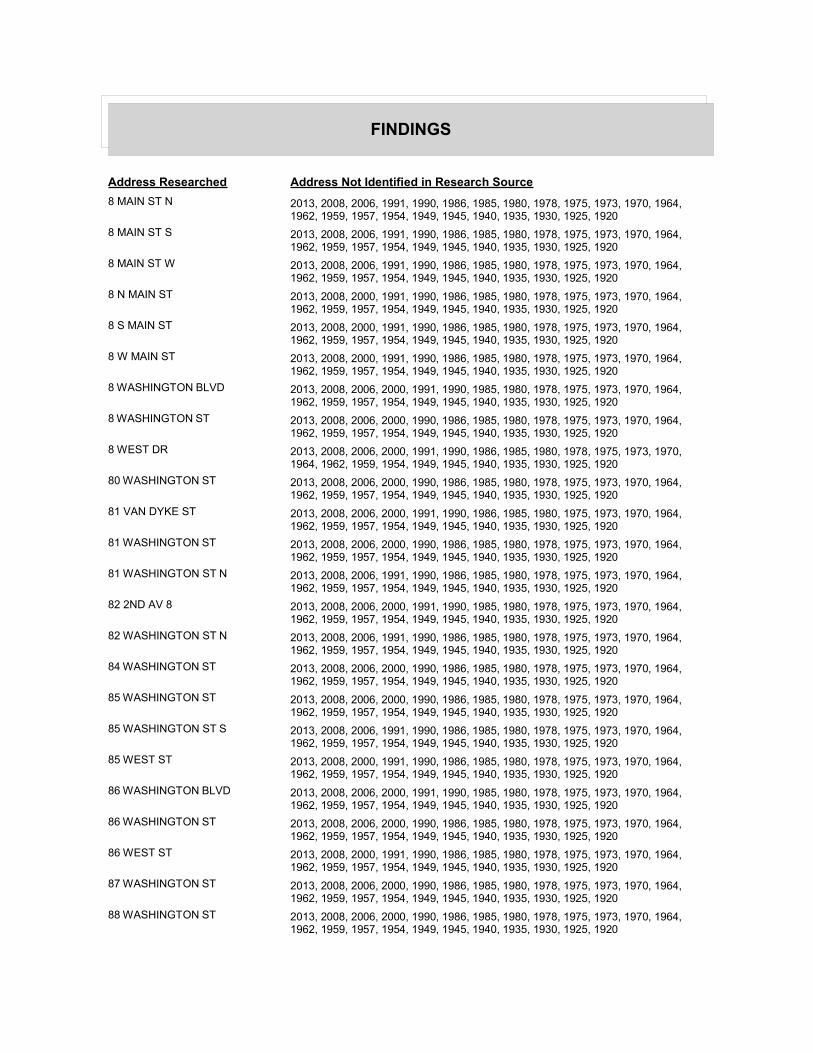
FINDINGS
Address Researched Address Not Identified in Research Source
8 MAIN ST N 2013, 2008, 2006, 1991, 1990, 1986, 1985, 1980, 1978, 1975, 1973, 1970, 1964, 1962, 1959, 1957, 1954, 1949, 1945, 1940, 1935, 1930, 1925, 1920
8 MAIN ST S 2013, 2008, 2006, 1991, 1990, 1986, 1985, 1980, 1978, 1975, 1973, 1970, 1964, 1962, 1959, 1957, 1954, 1949, 1945, 1940, 1935, 1930, 1925, 1920
8 MAIN ST W 2013, 2008, 2006, 1991, 1990, 1986, 1985, 1980, 1978, 1975, 1973, 1970, 1964, 1962, 1959, 1957, 1954, 1949, 1945, 1940, 1935, 1930, 1925, 1920
8 N MAIN ST 2013, 2008, 2000, 1991, 1990, 1986, 1985, 1980, 1978, 1975, 1973, 1970, 1964, 1962, 1959, 1957, 1954, 1949, 1945, 1940, 1935, 1930, 1925, 1920
8 S MAIN ST 2013, 2008, 2000, 1991, 1990, 1986, 1985, 1980, 1978, 1975, 1973, 1970, 1964, 1962, 1959, 1957, 1954, 1949, 1945, 1940, 1935, 1930, 1925, 1920
8 W MAIN ST 2013, 2008, 2000, 1991, 1990, 1986, 1985, 1980, 1978, 1975, 1973, 1970, 1964, 1962, 1959, 1957, 1954, 1949, 1945, 1940, 1935, 1930, 1925, 1920
8 WASHINGTON BLVD 2013, 2008, 2006, 2000, 1991, 1990, 1985, 1980, 1978, 1975, 1973, 1970, 1964, 1962, 1959, 1957, 1954, 1949, 1945, 1940, 1935, 1930, 1925, 1920
8 WASHINGTON ST 2013, 2008, 2006, 2000, 1990, 1986, 1985, 1980, 1978, 1975, 1973, 1970, 1964, 1962, 1959, 1957, 1954, 1949, 1945, 1940, 1935, 1930, 1925, 1920
8 WEST DR 2013, 2008, 2006, 2000, 1991, 1990, 1986, 1985, 1980, 1978, 1975, 1973, 1970, 1964, 1962, 1959, 1954, 1949, 1945, 1940, 1935, 1930, 1925, 1920
80 WASHINGTON ST 2013, 2008, 2006, 2000, 1990, 1986, 1985, 1980, 1978, 1975, 1973, 1970, 1964, 1962, 1959, 1957, 1954, 1949, 1945, 1940, 1935, 1930, 1925, 1920
81 VAN DYKE ST 2013, 2008, 2006, 2000, 1991, 1990, 1986, 1985, 1980, 1975, 1973, 1970, 1964, 1962, 1959, 1957, 1954, 1949, 1945, 1940, 1935, 1930, 1925, 1920
81 WASHINGTON ST 2013, 2008, 2006, 2000, 1990, 1986, 1985, 1980, 1978, 1975, 1973, 1970, 1964, 1962, 1959, 1957, 1954, 1949, 1945, 1940, 1935, 1930, 1925, 1920
81 WASHINGTON ST N 2013, 2008, 2006, 1991, 1990, 1986, 1985, 1980, 1978, 1975, 1973, 1970, 1964, 1962, 1959, 1957, 1954, 1949, 1945, 1940, 1935, 1930, 1925, 1920
82 2ND AV 8 2013, 2008, 2006, 2000, 1991, 1990, 1985, 1980, 1978, 1975, 1973, 1970, 1964, 1962, 1959, 1957, 1954, 1949, 1945, 1940, 1935, 1930, 1925, 1920
82 WASHINGTON ST N 2013, 2008, 2006, 1991, 1990, 1986, 1985, 1980, 1978, 1975, 1973, 1970, 1964, 1962, 1959, 1957, 1954, 1949, 1945, 1940, 1935, 1930, 1925, 1920
84 WASHINGTON ST 2013, 2008, 2006, 2000, 1990, 1986, 1985, 1980, 1978, 1975, 1973, 1970, 1964, 1962, 1959, 1957, 1954, 1949, 1945, 1940, 1935, 1930, 1925, 1920
85 WASHINGTON ST 2013, 2008, 2006, 2000, 1990, 1986, 1985, 1980, 1978, 1975, 1973, 1970, 1964, 1962, 1959, 1957, 1954, 1949, 1945, 1940, 1935, 1930, 1925, 1920
85 WASHINGTON ST S 2013, 2008, 2006, 1991, 1990, 1986, 1985, 1980, 1978, 1975, 1973, 1970, 1964, 1962, 1959, 1957, 1954, 1949, 1945, 1940, 1935, 1930, 1925, 1920
85 WEST ST 2013, 2008, 2000, 1991, 1990, 1986, 1985, 1980, 1978, 1975, 1973, 1970, 1964, 1962, 1959, 1957, 1954, 1949, 1945, 1940, 1935, 1930, 1925, 1920
86 WASHINGTON BLVD 2013, 2008, 2006, 2000, 1991, 1990, 1985, 1980, 1978, 1975, 1973, 1970, 1964, 1962, 1959, 1957, 1954, 1949, 1945, 1940, 1935, 1930, 1925, 1920
86 WASHINGTON ST 2013, 2008, 2006, 2000, 1990, 1986, 1985, 1980, 1978, 1975, 1973, 1970, 1964, 1962, 1959, 1957, 1954, 1949, 1945, 1940, 1935, 1930, 1925, 1920
86 WEST ST 2013, 2008, 2000, 1991, 1990, 1986, 1985, 1980, 1978, 1975, 1973, 1970, 1964, 1962, 1959, 1957, 1954, 1949, 1945, 1940, 1935, 1930, 1925, 1920
87 WASHINGTON ST 2013, 2008, 2006, 2000, 1990, 1986, 1985, 1980, 1978, 1975, 1973, 1970, 1964, 1962, 1959, 1957, 1954, 1949, 1945, 1940, 1935, 1930, 1925, 1920
88 WASHINGTON ST 2013, 2008, 2006, 2000, 1990, 1986, 1985, 1980, 1978, 1975, 1973, 1970, 1964, 1962, 1959, 1957, 1954, 1949, 1945, 1940, 1935, 1930, 1925, 1920
FINDINGS
Address Researched Address Not Identified in Research Source
89 2 ST 2013, 2008, 2006, 1991, 1990, 1986, 1985, 1980, 1978, 1975, 1973, 1970, 1964, 1962, 1959, 1957, 1954, 1949, 1945, 1940, 1935, 1930, 1925, 1920
89 S 2ND ST 2013, 2008, 2000, 1991, 1990, 1986, 1985, 1980, 1978, 1975, 1973, 1970, 1964, 1962, 1959, 1957, 1954, 1949, 1945, 1940, 1935, 1930, 1925, 1920
89 WASHINGTON ST 2013, 2008, 2006, 2000, 1990, 1986, 1985, 1980, 1978, 1975, 1973, 1970, 1964, 1962, 1959, 1957, 1954, 1949, 1945, 1940, 1935, 1930, 1925, 1920
9 2 ST 2013, 2008, 2006, 1991, 1990, 1986, 1985, 1980, 1978, 1975, 1973, 1970, 1964, 1962, 1959, 1957, 1954, 1949, 1945, 1940, 1935, 1930, 1925, 1920
9 E MAIN ST 2013, 2008, 2000, 1991, 1990, 1986, 1985, 1980, 1978, 1975, 1973, 1970, 1964, 1962, 1959, 1957, 1954, 1949, 1945, 1940, 1935, 1930, 1925, 1920
9 MAIN ST E 2013, 2008, 2006, 1991, 1990, 1986, 1985, 1980, 1978, 1975, 1973, 1970, 1964, 1962, 1959, 1957, 1954, 1949, 1945, 1940, 1935, 1930, 1925, 1920
9 MAIN ST N 2013, 2008, 2006, 1991, 1990, 1986, 1985, 1980, 1978, 1975, 1973, 1970, 1964, 1962, 1959, 1957, 1954, 1949, 1945, 1940, 1935, 1930, 1925, 1920
9 MAIN ST S 2013, 2008, 2006, 1991, 1990, 1986, 1985, 1980, 1978, 1975, 1973, 1970, 1964, 1962, 1959, 1957, 1954, 1949, 1945, 1940, 1935, 1930, 1925, 1920
9 MAIN ST W 2013, 2008, 2006, 1991, 1990, 1986, 1985, 1980, 1978, 1975, 1973, 1970, 1964, 1962, 1959, 1957, 1954, 1949, 1945, 1940, 1935, 1930, 1925, 1920
9 N MAIN ST 2013, 2008, 2000, 1991, 1990, 1986, 1985, 1980, 1978, 1975, 1973, 1970, 1964, 1962, 1959, 1957, 1954, 1949, 1945, 1940, 1935, 1930, 1925, 1920
9 S 2ND ST 2013, 2008, 2000, 1991, 1990, 1986, 1985, 1980, 1978, 1975, 1973, 1970, 1964, 1962, 1959, 1957, 1954, 1949, 1945, 1940, 1935, 1930, 1925, 1920
9 S MAIN ST 2013, 2008, 2000, 1991, 1990, 1986, 1985, 1980, 1978, 1975, 1973, 1970, 1964, 1962, 1959, 1957, 1954, 1949, 1945, 1940, 1935, 1930, 1925, 1920
9 W MAIN ST 2013, 2008, 2000, 1991, 1990, 1986, 1985, 1980, 1978, 1975, 1973, 1970, 1964, 1962, 1959, 1957, 1954, 1949, 1945, 1940, 1935, 1930, 1925, 1920
9 WASHINGTON ST 2013, 2008, 2006, 2000, 1990, 1986, 1985, 1980, 1978, 1975, 1973, 1970, 1964, 1962, 1959, 1957, 1954, 1949, 1945, 1940, 1935, 1930, 1925, 1920
90 WASHINGTON ST 2013, 2008, 2006, 2000, 1990, 1986, 1985, 1980, 1978, 1975, 1973, 1970, 1964, 1962, 1959, 1957, 1954, 1949, 1945, 1940, 1935, 1930, 1925, 1920
91 WASHINGTON ST 2013, 2008, 2006, 2000, 1990, 1986, 1985, 1980, 1978, 1975, 1973, 1970, 1964, 1962, 1959, 1957, 1954, 1949, 1945, 1940, 1935, 1930, 1925, 1920
92 WASHINGTON ST 2013, 2008, 2006, 2000, 1990, 1986, 1985, 1980, 1978, 1975, 1973, 1970, 1964, 1962, 1959, 1957, 1954, 1949, 1945, 1940, 1935, 1930, 1925, 1920
93 WASHINGTON ST 2013, 2008, 2006, 2000, 1990, 1986, 1985, 1980, 1978, 1975, 1973, 1970, 1964, 1962, 1959, 1957, 1954, 1949, 1945, 1940, 1935, 1930, 1925, 1920
94 2 ST 2013, 2008, 2006, 1991, 1990, 1986, 1985, 1980, 1978, 1975, 1973, 1970, 1964, 1962, 1959, 1957, 1954, 1949, 1945, 1940, 1935, 1930, 1925, 1920
94 2ND AV 8 2013, 2008, 2006, 2000, 1991, 1990, 1985, 1980, 1978, 1975, 1973, 1970, 1964, 1962, 1959, 1957, 1954, 1949, 1945, 1940, 1935, 1930, 1925, 1920
94 WASHINGTON ST 2013, 2008, 2006, 2000, 1990, 1986, 1985, 1980, 1978, 1975, 1973, 1970, 1964, 1962, 1959, 1957, 1954, 1949, 1945, 1940, 1935, 1930, 1925, 1920
95 WASHINGTON 2013, 2008, 2006, 2000, 1991, 1990, 1985, 1980, 1978, 1975, 1973, 1970, 1964, 1962, 1959, 1957, 1954, 1949, 1945, 1940, 1935, 1930, 1925, 1920
95 WASHINGTON BLVD 2013, 2008, 2006, 2000, 1991, 1990, 1986, 1985, 1980, 1975, 1973, 1970, 1964, 1962, 1959, 1957, 1954, 1949, 1945, 1940, 1935, 1930, 1925, 1920
95 WASHINGTON ST 2013, 2008, 2006, 2000, 1990, 1986, 1985, 1980, 1978, 1975, 1973, 1970, 1964, 1962, 1959, 1957, 1954, 1949, 1945, 1940, 1935, 1930, 1925, 1920
FINDINGS
Address Researched Address Not Identified in Research Source
96 2 ST 2013, 2008, 2006, 1991, 1990, 1986, 1985, 1980, 1978, 1975, 1973, 1970, 1964, 1962, 1959, 1957, 1954, 1949, 1945, 1940, 1935, 1930, 1925, 1920
96 WASHINGTON ST 2013, 2008, 2006, 2000, 1990, 1986, 1985, 1980, 1978, 1975, 1973, 1970, 1964, 1962, 1959, 1957, 1954, 1949, 1945, 1940, 1935, 1930, 1925, 1920
97 WASHINGTON ST 2013, 2008, 2006, 2000, 1990, 1986, 1985, 1980, 1978, 1975, 1973, 1970, 1964, 1962, 1959, 1957, 1954, 1949, 1945, 1940, 1935, 1930, 1925, 1920
97 WASHINGTON ST N 2013, 2008, 2006, 1991, 1990, 1986, 1985, 1980, 1978, 1975, 1973, 1970, 1964, 1962, 1959, 1957, 1954, 1949, 1945, 1940, 1935, 1930, 1925, 1920
97 WASHINGTON ST S 2013, 2008, 2006, 1991, 1990, 1986, 1985, 1980, 1978, 1975, 1973, 1970, 1964, 1962, 1959, 1957, 1954, 1949, 1945, 1940, 1935, 1930, 1925, 1920
98 WASHINGTON ST 2013, 2008, 2006, 2000, 1990, 1986, 1985, 1980, 1978, 1975, 1973, 1970, 1964, 1962, 1959, 1957, 1954, 1949, 1945, 1940, 1935, 1930, 1925, 1920
99 2 ST 2013, 2008, 2006, 1991, 1990, 1986, 1985, 1980, 1978, 1975, 1973, 1970, 1964, 1962, 1959, 1957, 1954, 1949, 1945, 1940, 1935, 1930, 1925, 1920
99 S 2ND ST 2013, 2008, 2000, 1991, 1990, 1986, 1985, 1980, 1978, 1975, 1973, 1970, 1964, 1962, 1959, 1957, 1954, 1949, 1945, 1940, 1935, 1930, 1925, 1920
APPENDIX H:
HISTORICAL AERIAL PHOTOGRAPHS
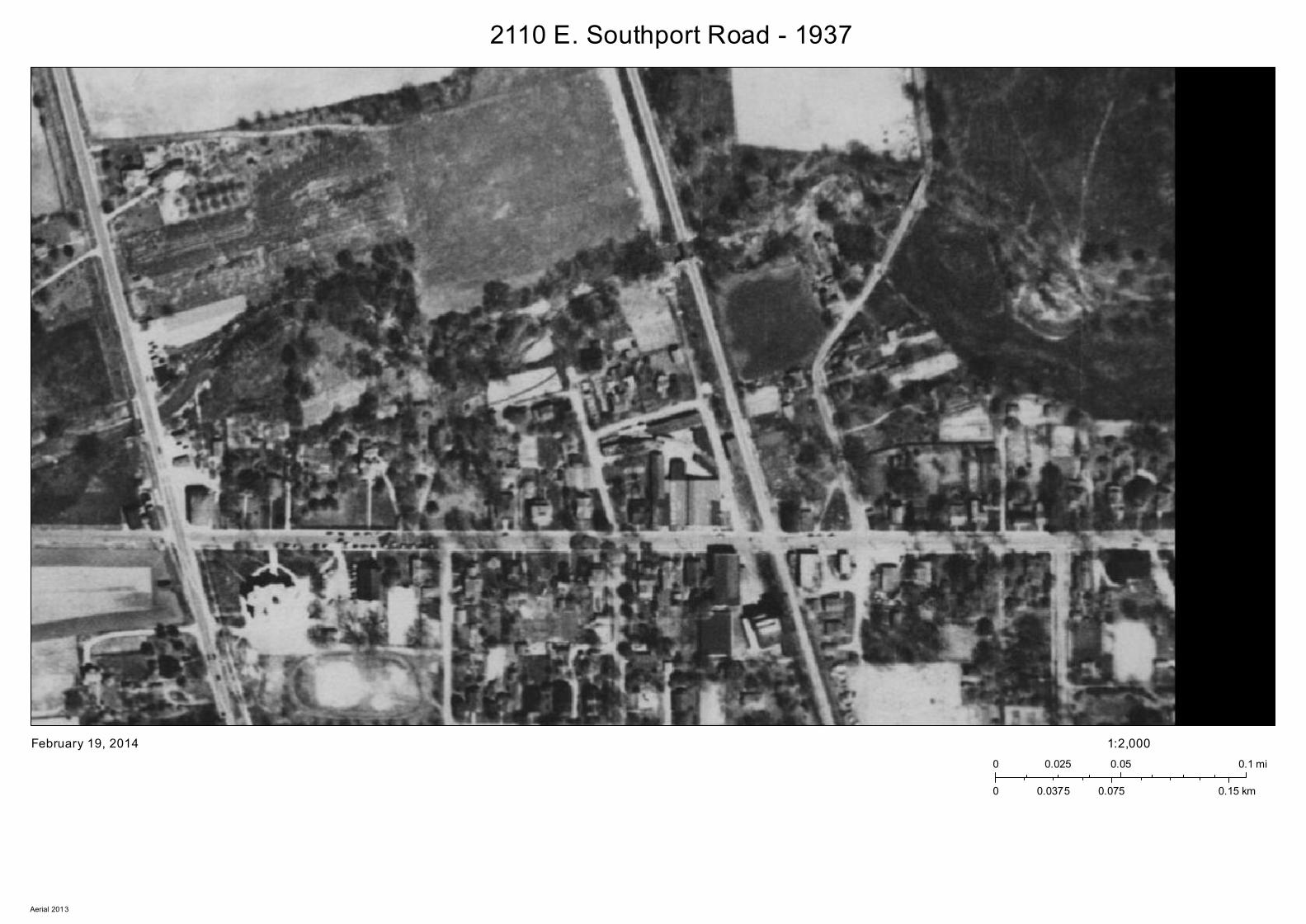
2110 E. Southport Road - 1937
February 19, 20140 0.05 0.10.025 mi
0 0.075 0.150.0375 km
1:2,000
Aerial 2013

2110 E. Southport Road - 1941
February 19, 20140 0.05 0.10.025 mi
0 0.075 0.150.0375 km
1:2,000
Aerial 2013
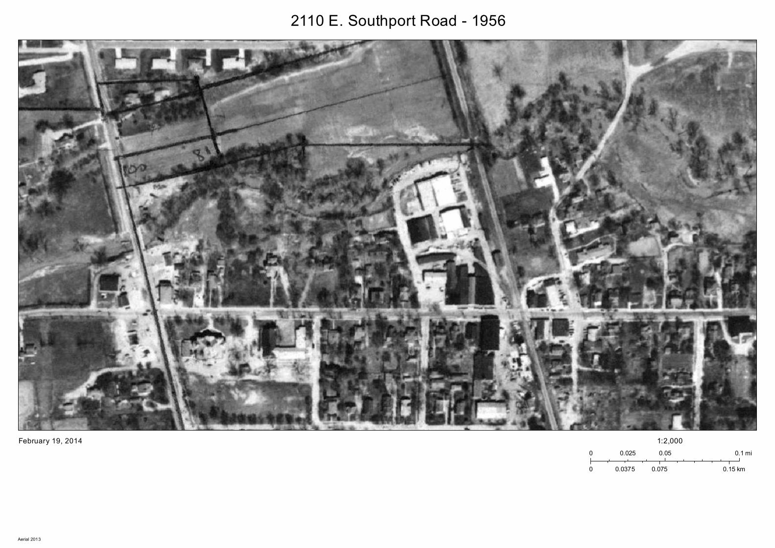
2110 E. Southport Road - 1956
February 19, 20140 0.05 0.10.025 mi
0 0.075 0.150.0375 km
1:2,000
Aerial 2013
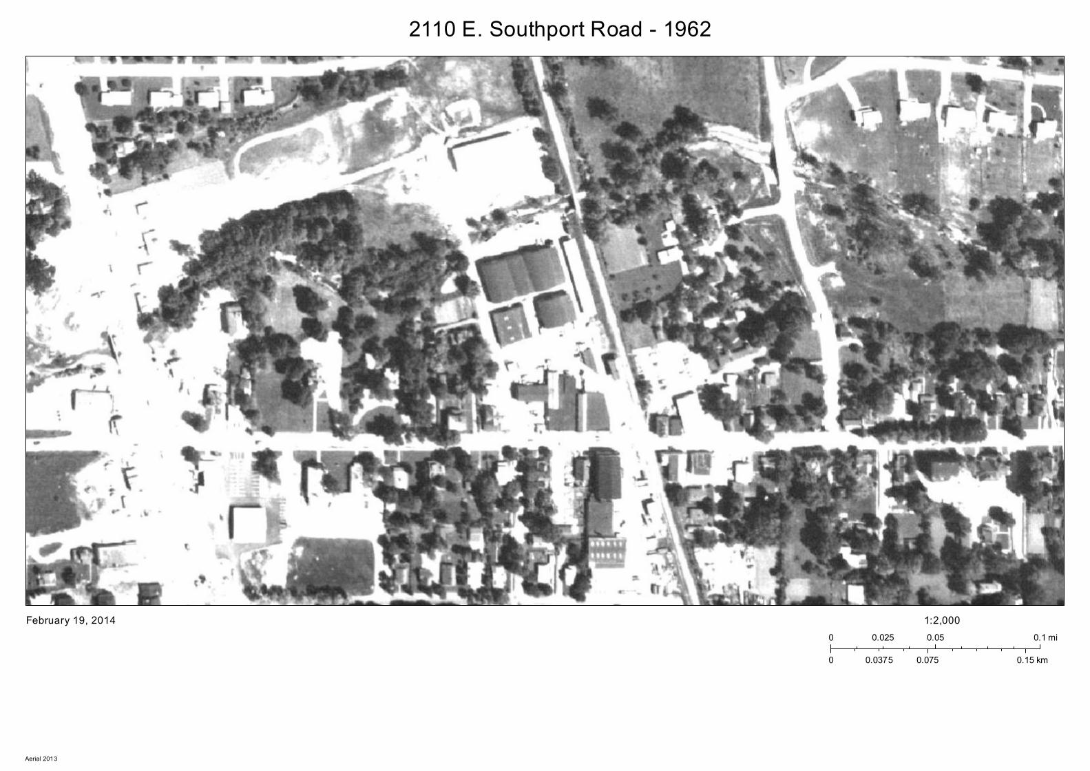
2110 E. Southport Road - 1962
February 19, 20140 0.05 0.10.025 mi
0 0.075 0.150.0375 km
1:2,000
Aerial 2013
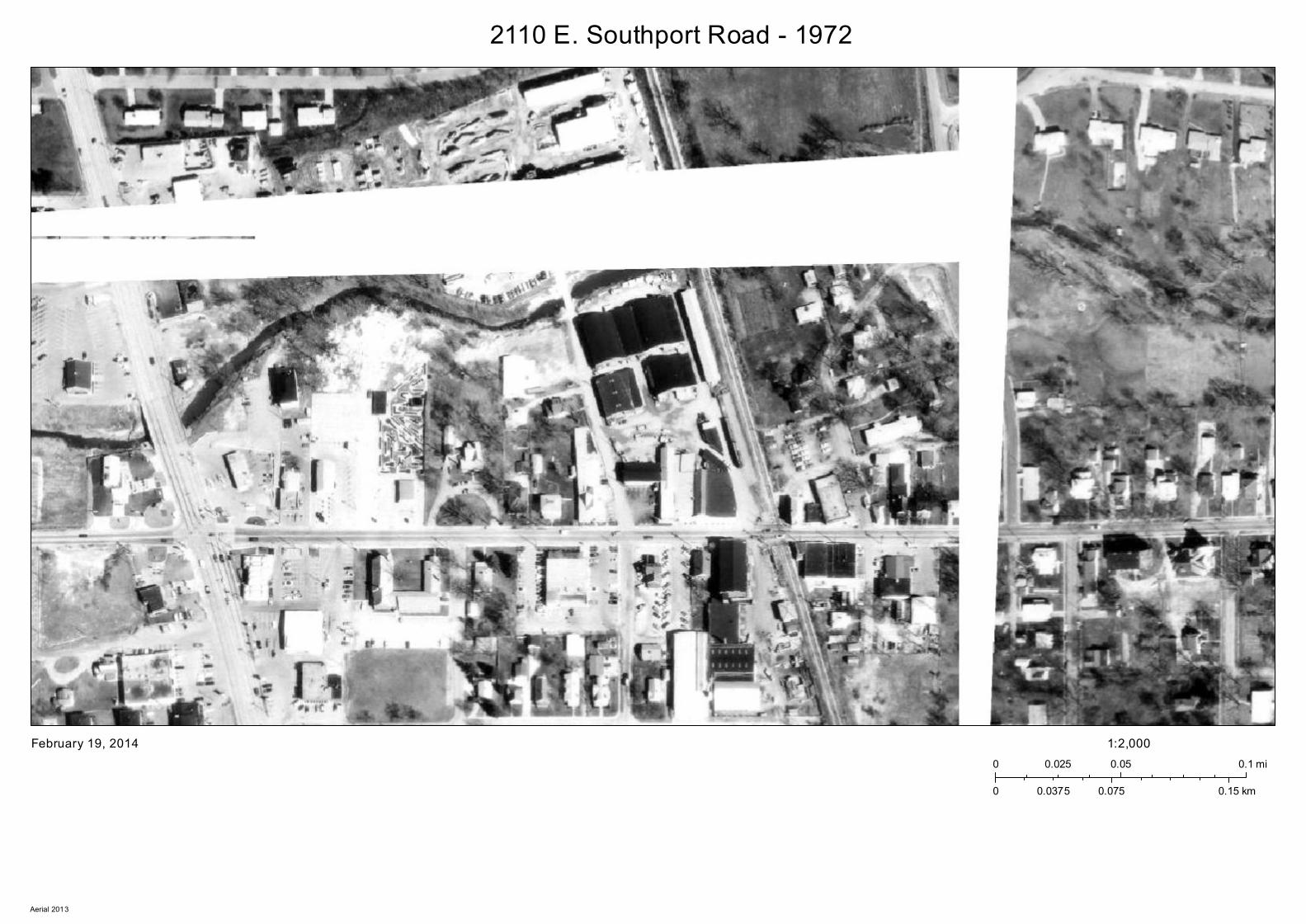
2110 E. Southport Road - 1972
February 19, 20140 0.05 0.10.025 mi
0 0.075 0.150.0375 km
1:2,000
Aerial 2013
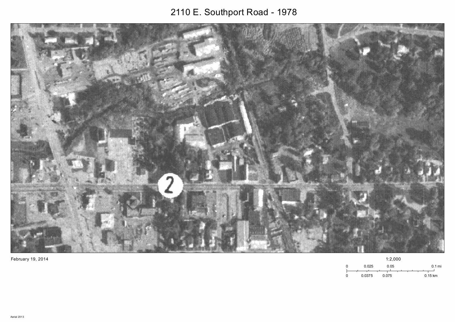
2110 E. Southport Road - 1978
February 19, 20140 0.05 0.10.025 mi
0 0.075 0.150.0375 km
1:2,000
Aerial 2013
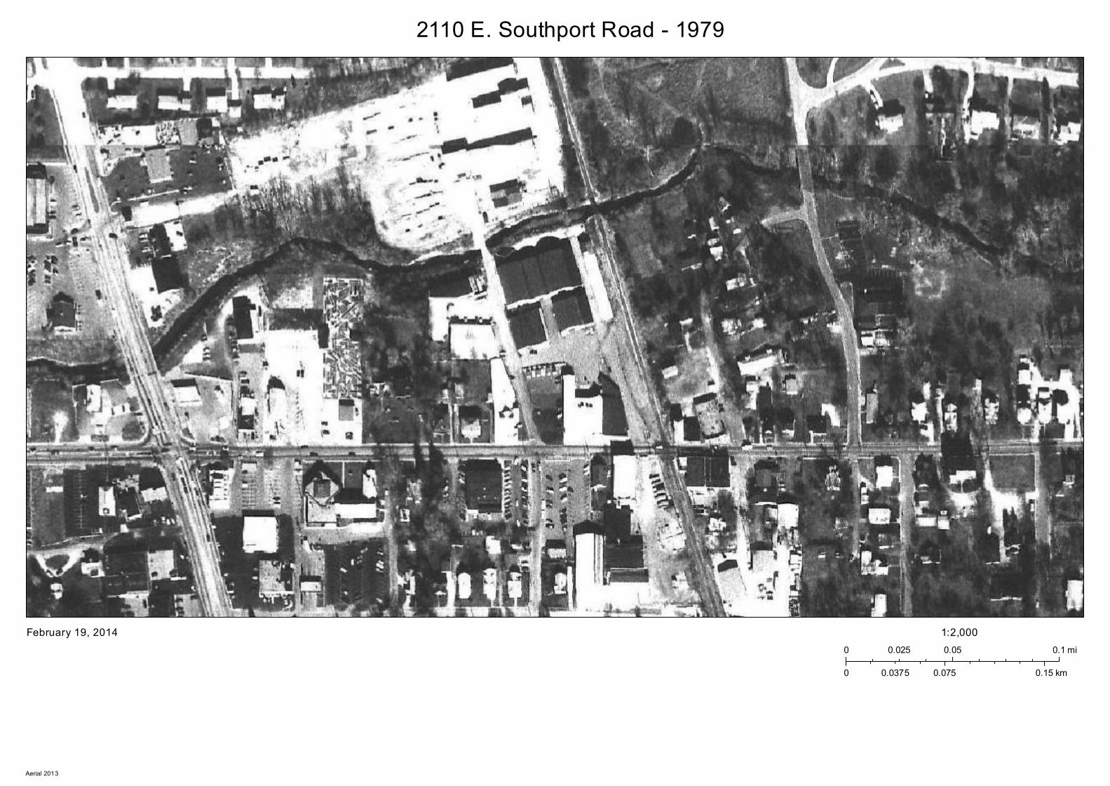
2110 E. Southport Road - 1979
February 19, 20140 0.05 0.10.025 mi
0 0.075 0.150.0375 km
1:2,000
Aerial 2013
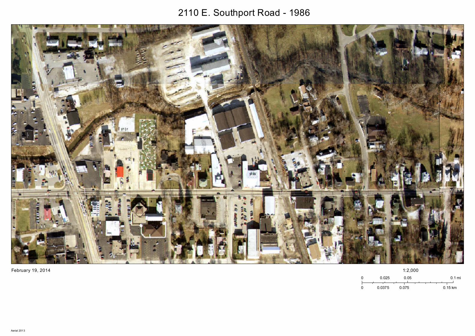
2110 E. Southport Road - 1986
February 19, 20140 0.05 0.10.025 mi
0 0.075 0.150.0375 km
1:2,000
Aerial 2013
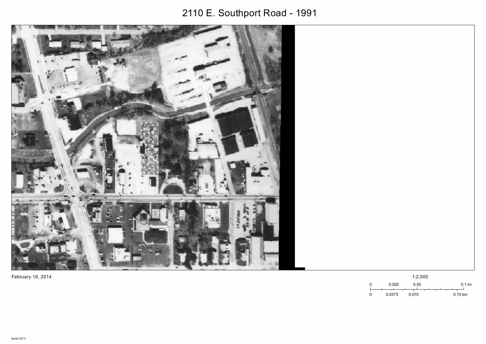
2110 E. Southport Road - 1991
February 19, 20140 0.05 0.10.025 mi
0 0.075 0.150.0375 km
1:2,000
Aerial 2013
2110 E. Southport Road - 1993
February 19, 20140 0.05 0.10.025 mi
0 0.075 0.150.0375 km
1:2,000
Aerial 2013
2110 E. Southport Road - 1995
February 19, 20140 0.05 0.10.025 mi
0 0.075 0.150.0375 km
1:2,000
Aerial 2013
2110 E. Southport Road - 1997
February 19, 20140 0.05 0.10.025 mi
0 0.075 0.150.0375 km
1:2,000
Aerial 2013
2110 E. Southport Road - 1999
February 19, 20140 0.05 0.10.025 mi
0 0.075 0.150.0375 km
1:2,000
Aerial 2013
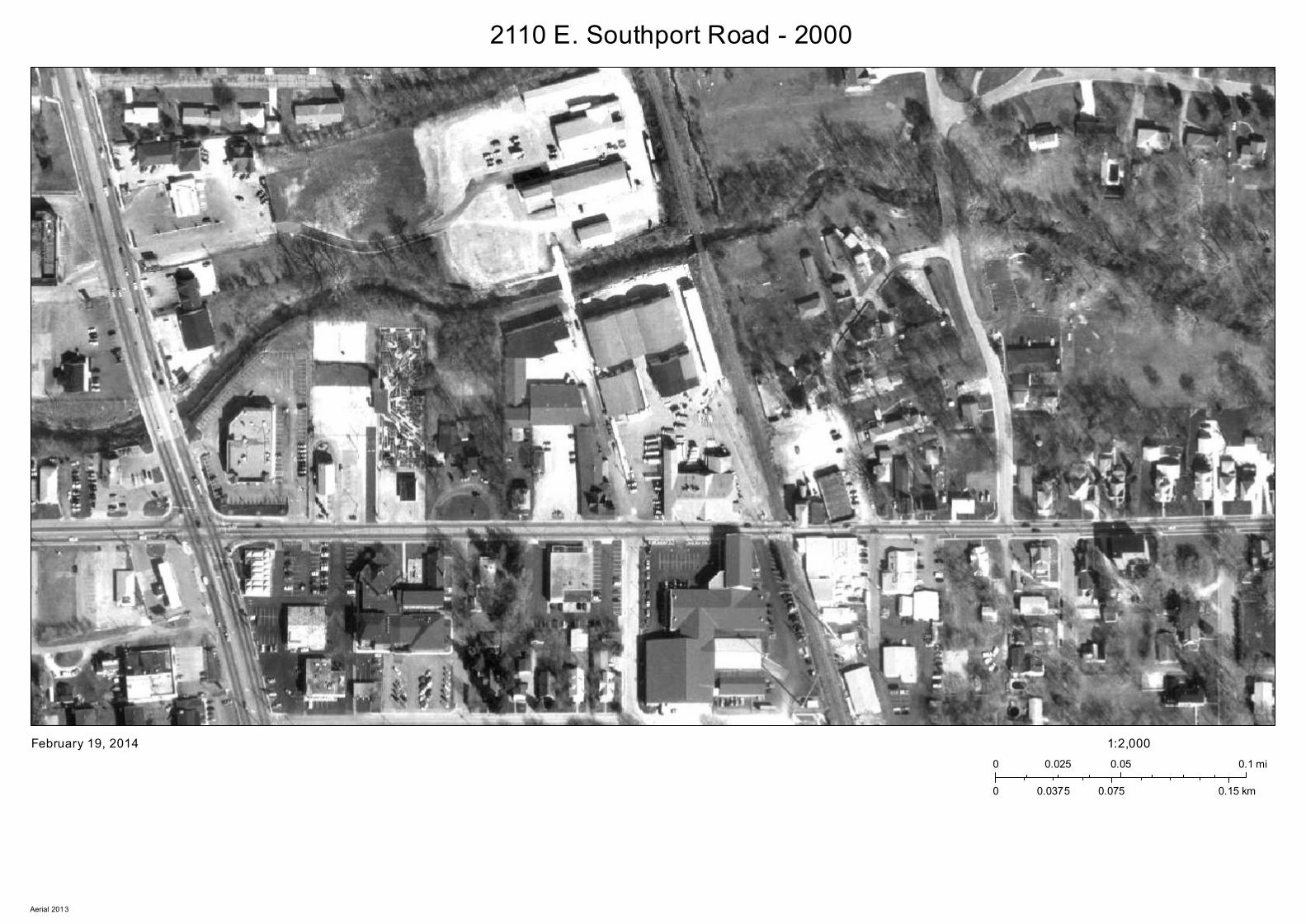
2110 E. Southport Road - 2000
February 19, 20140 0.05 0.10.025 mi
0 0.075 0.150.0375 km
1:2,000
Aerial 2013
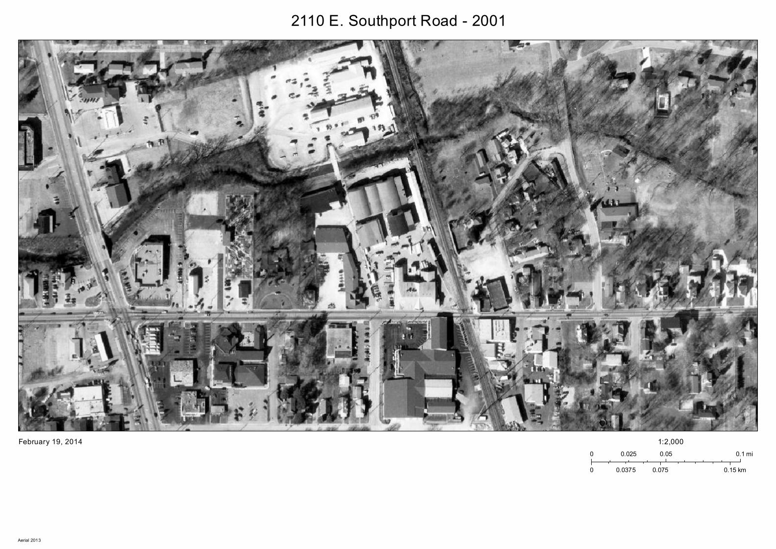
2110 E. Southport Road - 2001
February 19, 20140 0.05 0.10.025 mi
0 0.075 0.150.0375 km
1:2,000
Aerial 2013
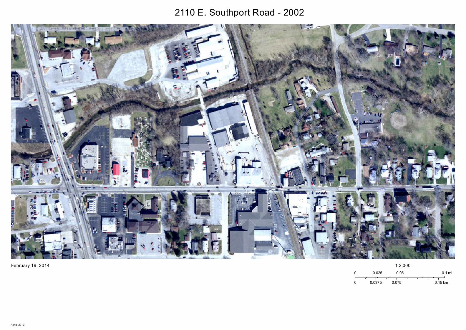
2110 E. Southport Road - 2002
February 19, 20140 0.05 0.10.025 mi
0 0.075 0.150.0375 km
1:2,000
Aerial 2013
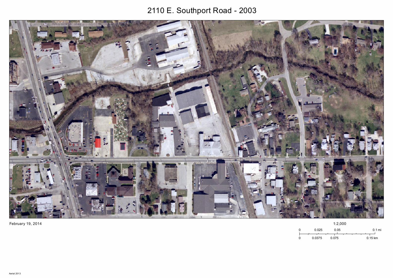
2110 E. Southport Road - 2003
February 19, 20140 0.05 0.10.025 mi
0 0.075 0.150.0375 km
1:2,000
Aerial 2013
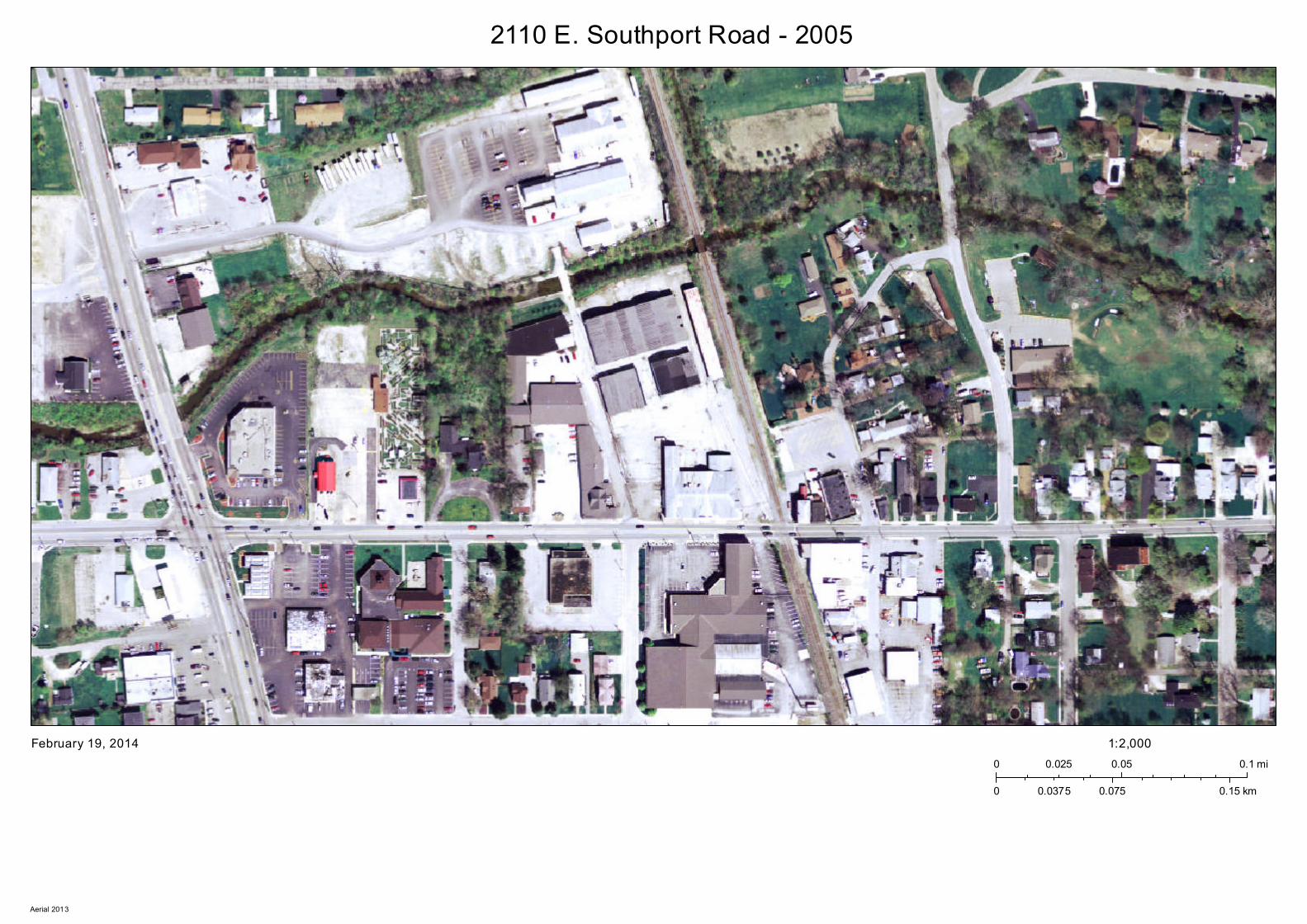
2110 E. Southport Road - 2005
February 19, 20140 0.05 0.10.025 mi
0 0.075 0.150.0375 km
1:2,000
Aerial 2013
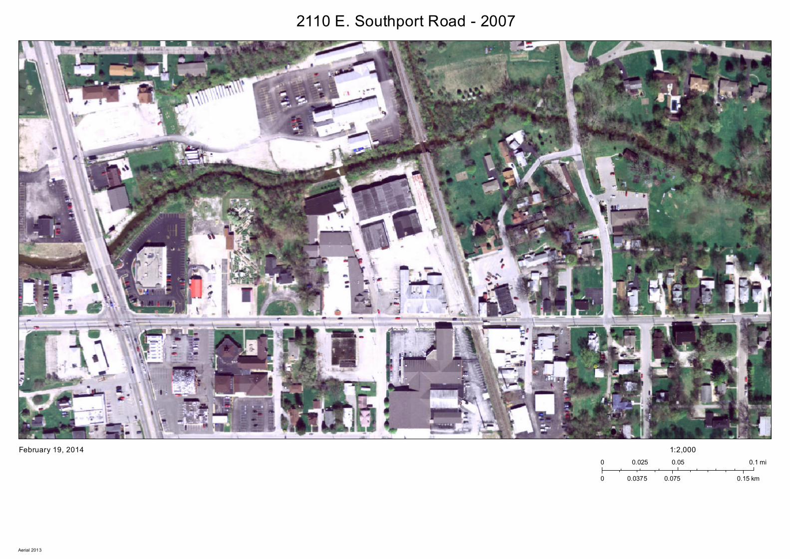
2110 E. Southport Road - 2007
February 19, 20140 0.05 0.10.025 mi
0 0.075 0.150.0375 km
1:2,000
Aerial 2013
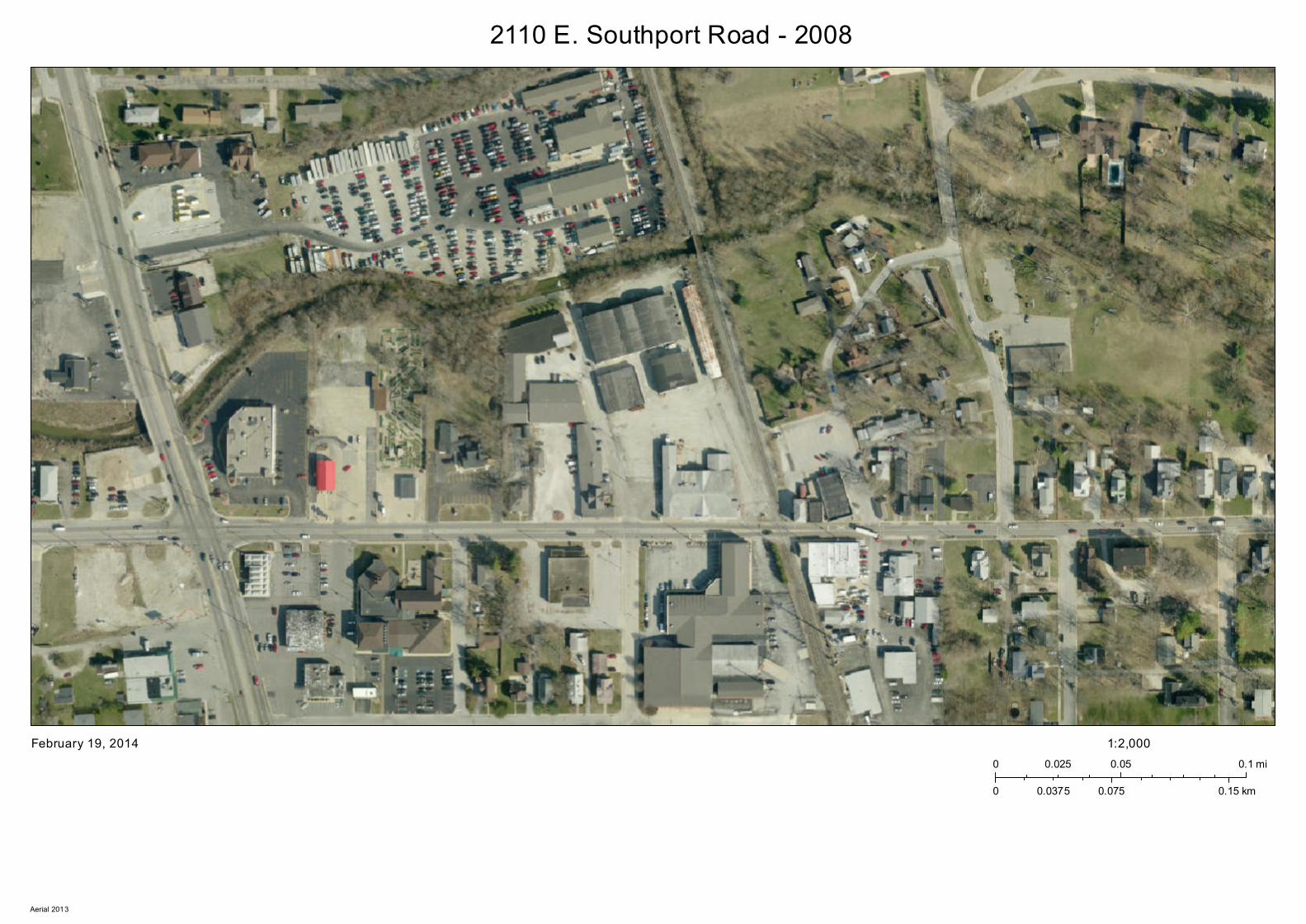
2110 E. Southport Road - 2008
February 19, 20140 0.05 0.10.025 mi
0 0.075 0.150.0375 km
1:2,000
Aerial 2013
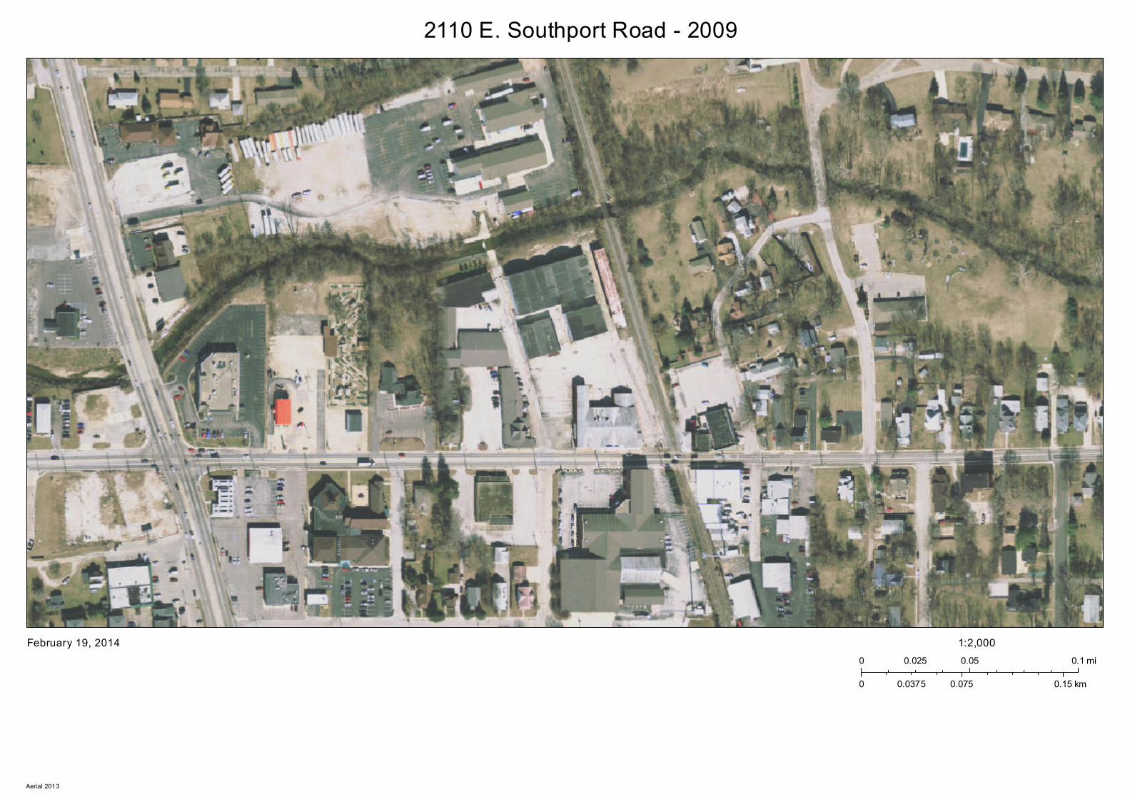
2110 E. Southport Road - 2009
February 19, 20140 0.05 0.10.025 mi
0 0.075 0.150.0375 km
1:2,000
Aerial 2013
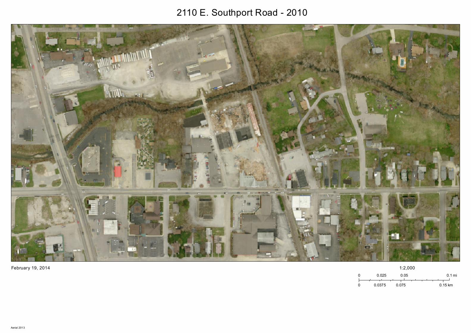
2110 E. Southport Road - 2010
February 19, 20140 0.05 0.10.025 mi
0 0.075 0.150.0375 km
1:2,000
Aerial 2013
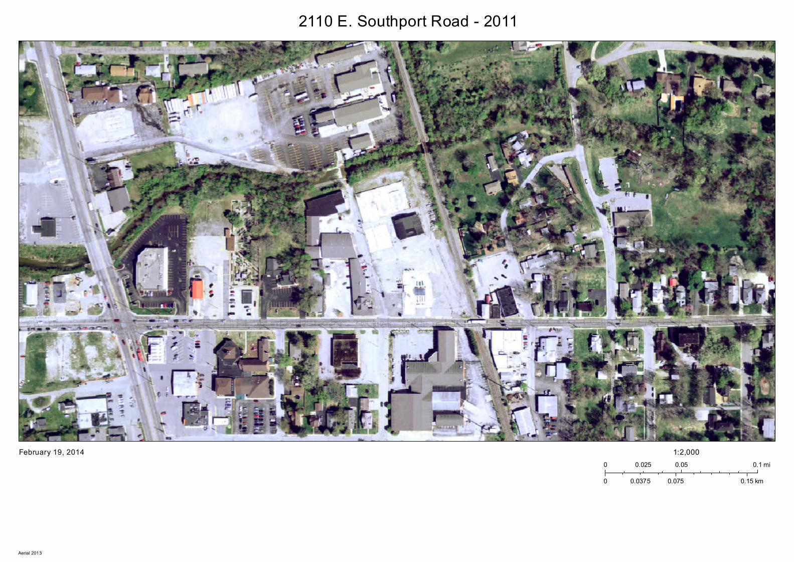
2110 E. Southport Road - 2011
February 19, 20140 0.05 0.10.025 mi
0 0.075 0.150.0375 km
1:2,000
Aerial 2013

2110 E. Southport Road - 2012
February 19, 20140 0.05 0.10.025 mi
0 0.075 0.150.0375 km
1:2,000
Aerial 2013
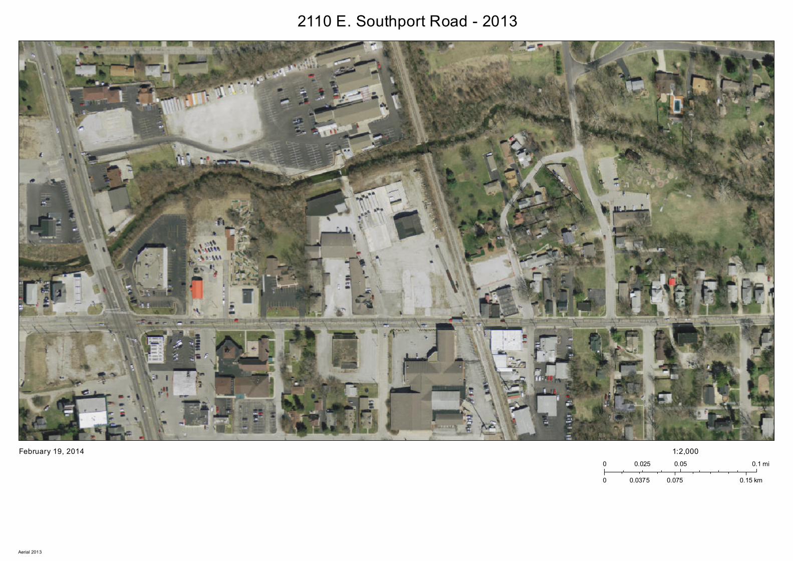
2110 E. Southport Road - 2013
February 19, 20140 0.05 0.10.025 mi
0 0.075 0.150.0375 km
1:2,000
Aerial 2013

APPENDIX I:
PREVIOUS ENVIRONMENTAL REPORTS
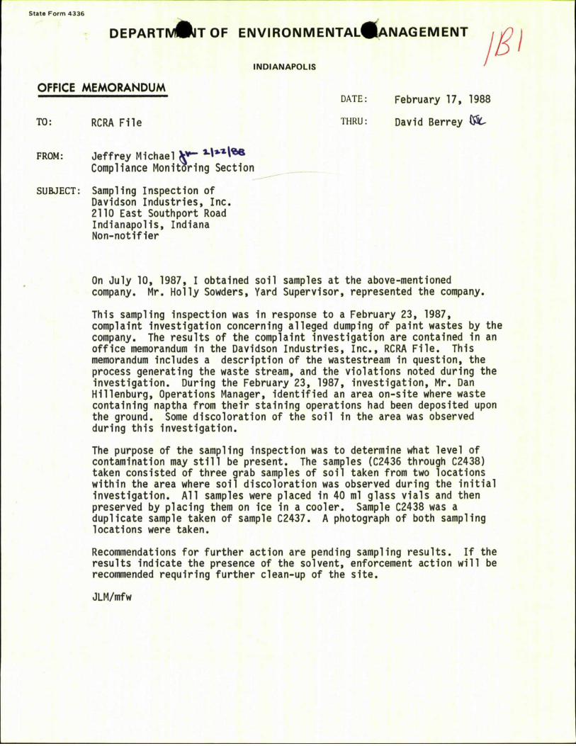
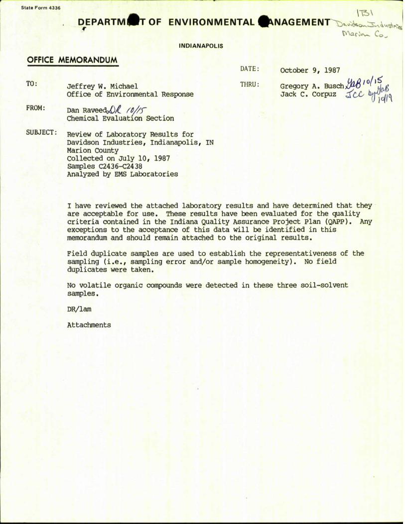
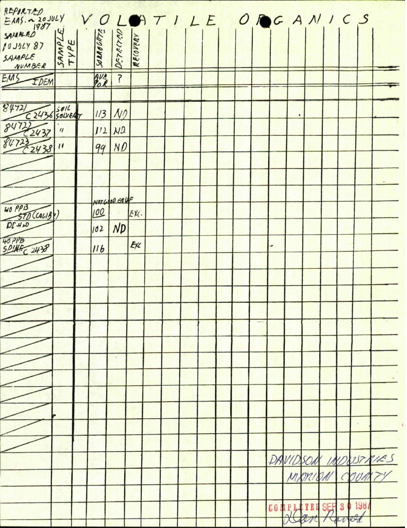
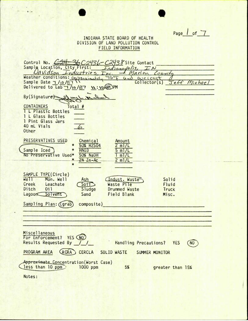
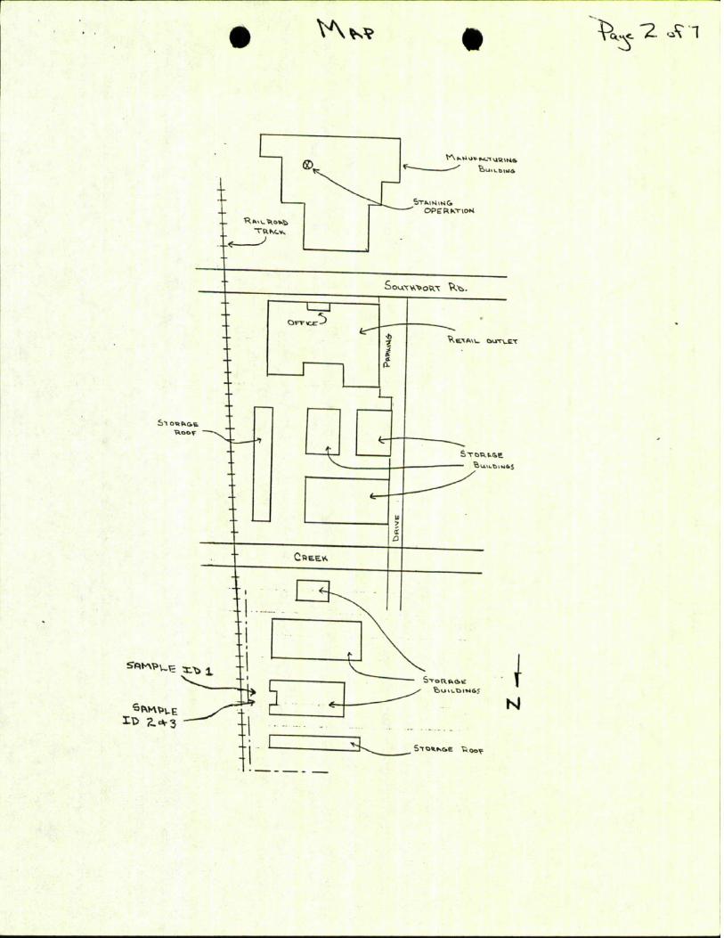
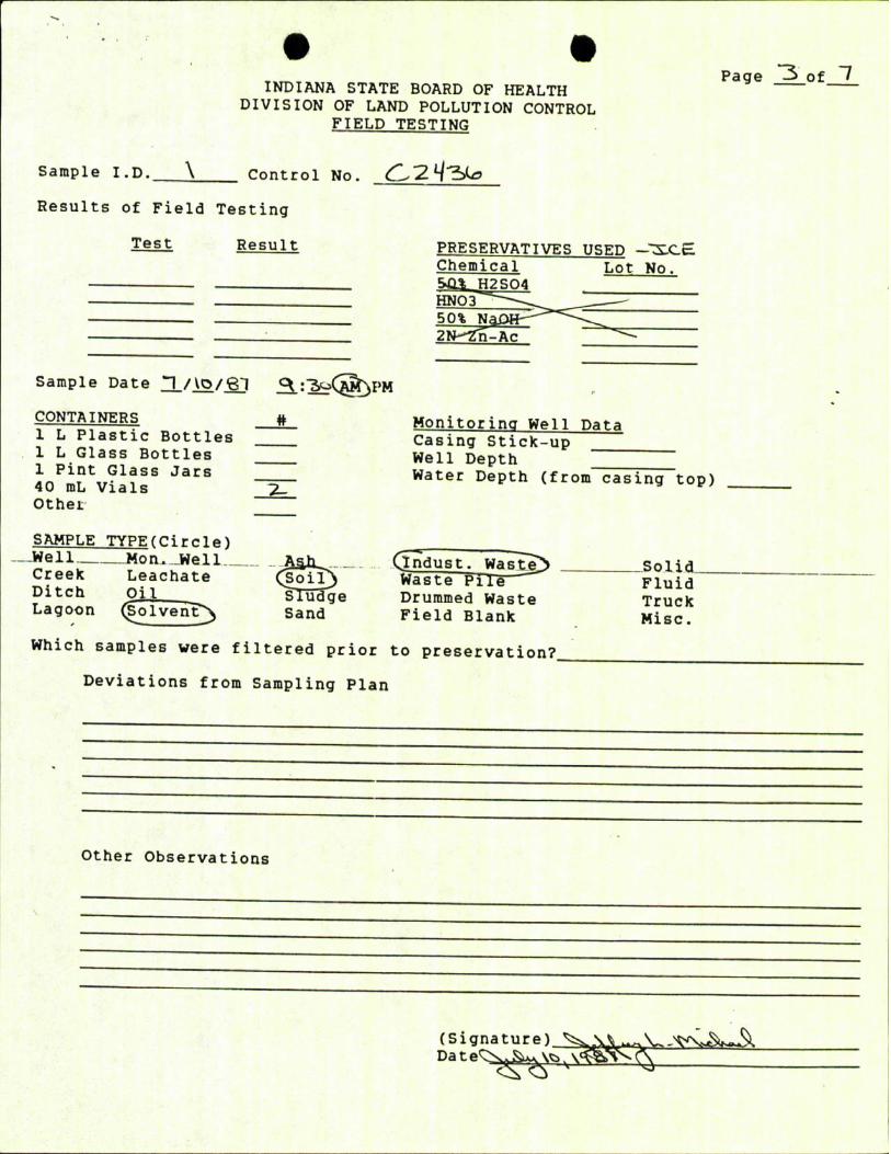
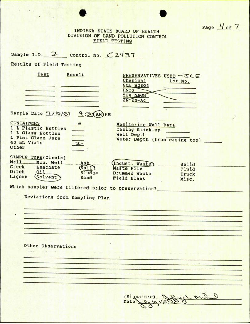
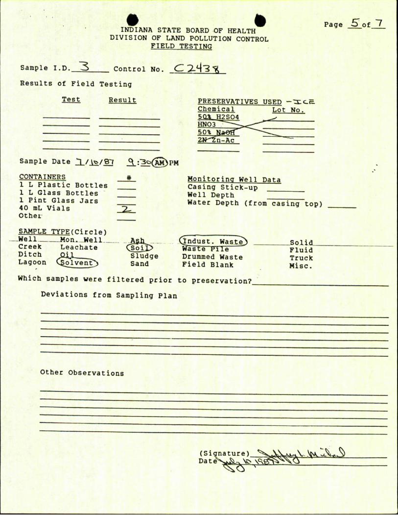
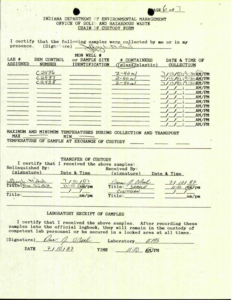
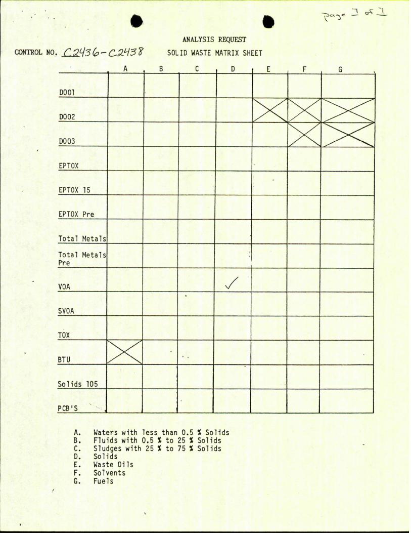
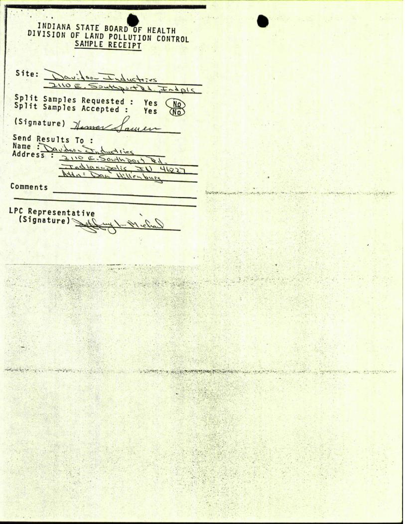
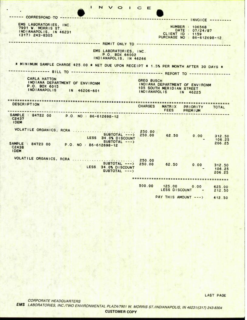
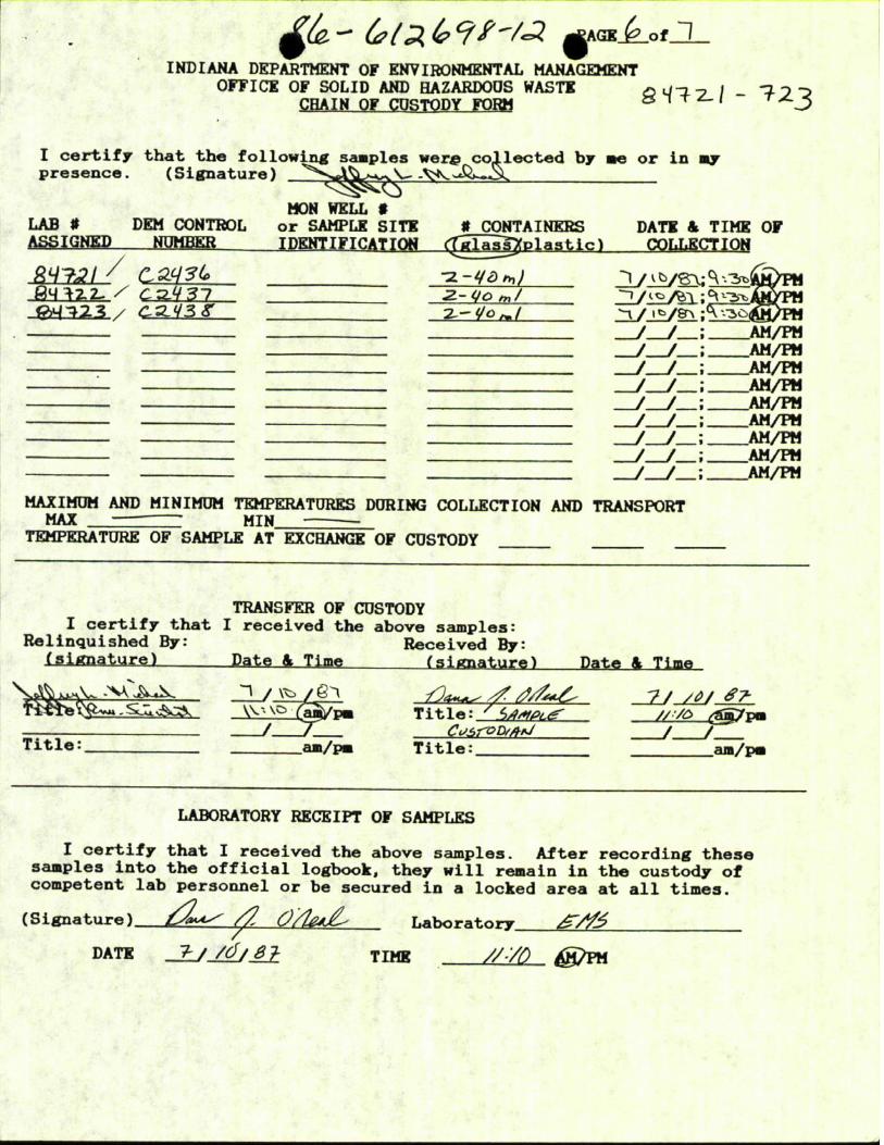
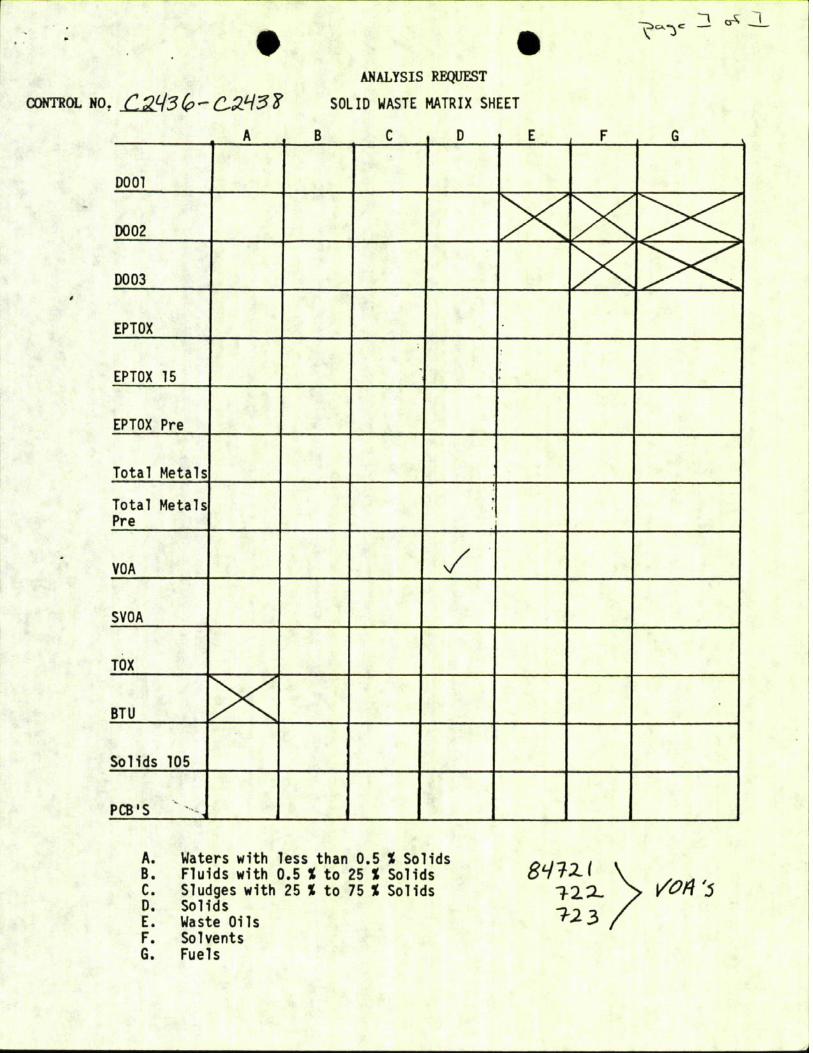
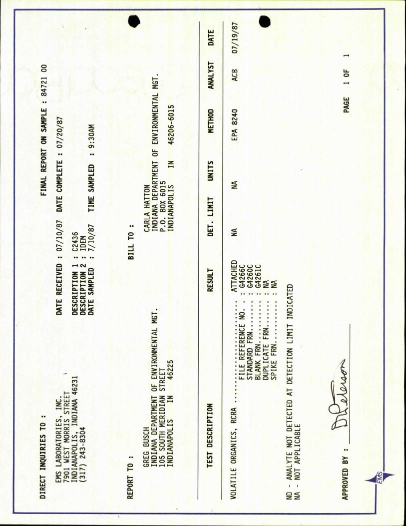

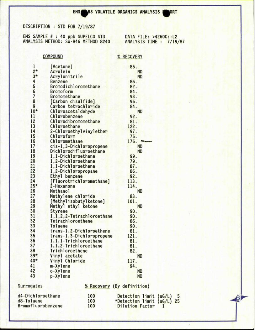
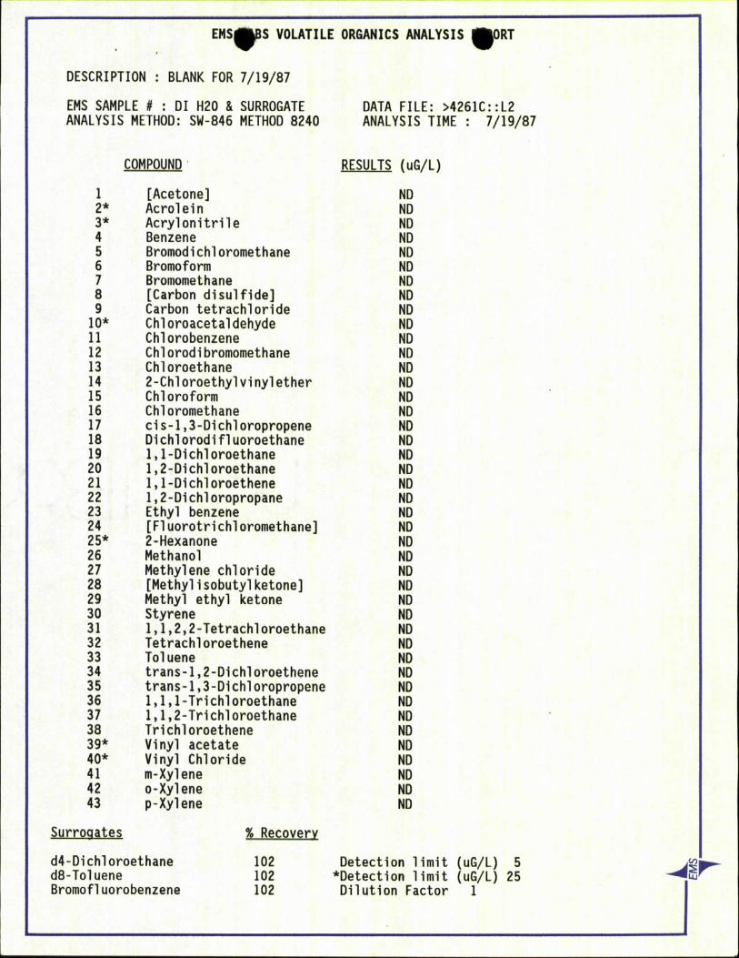
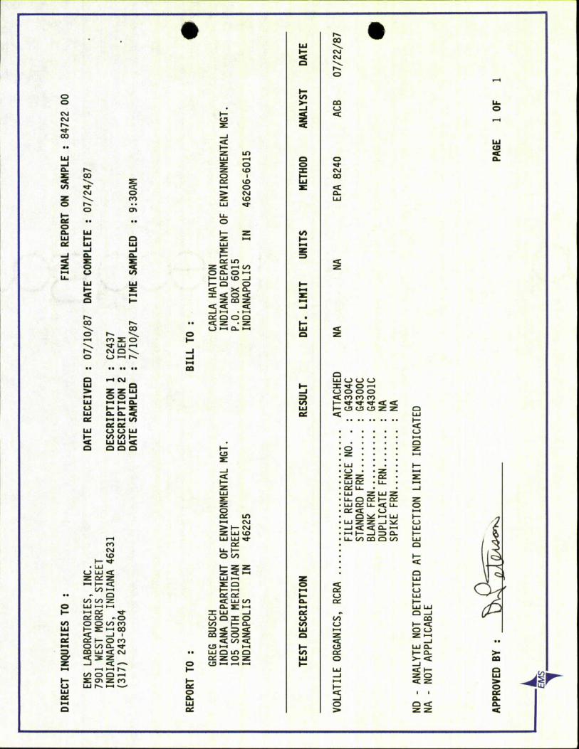
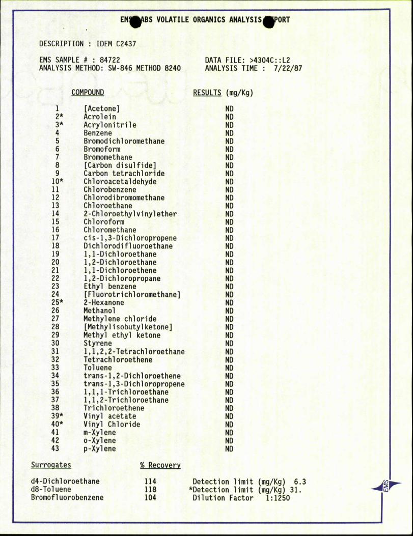
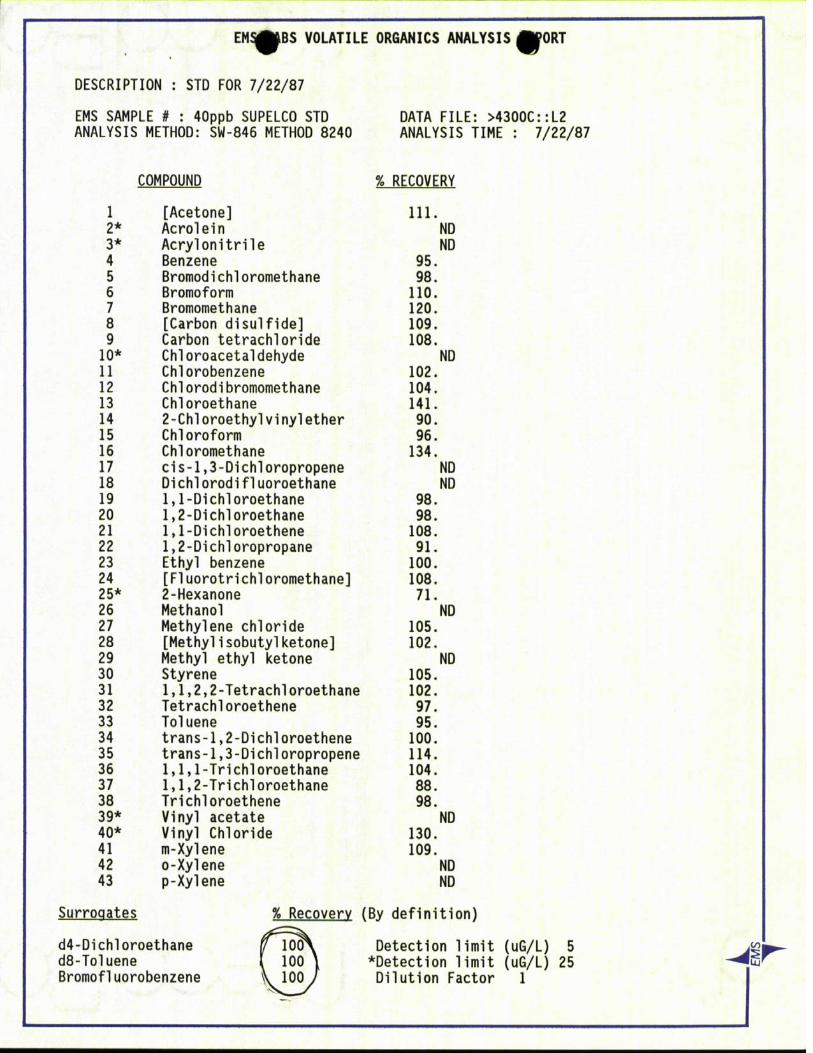
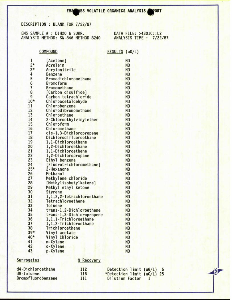
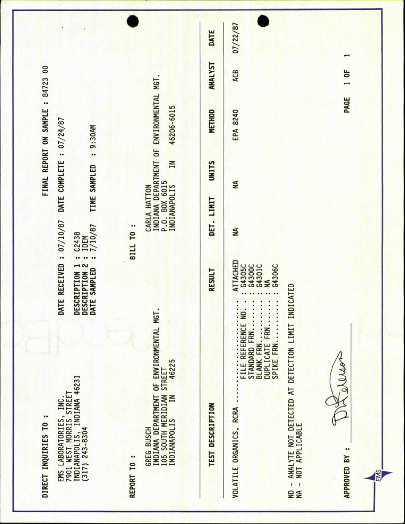
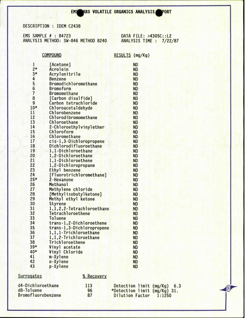
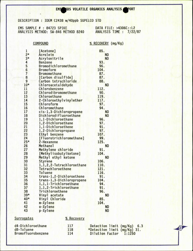
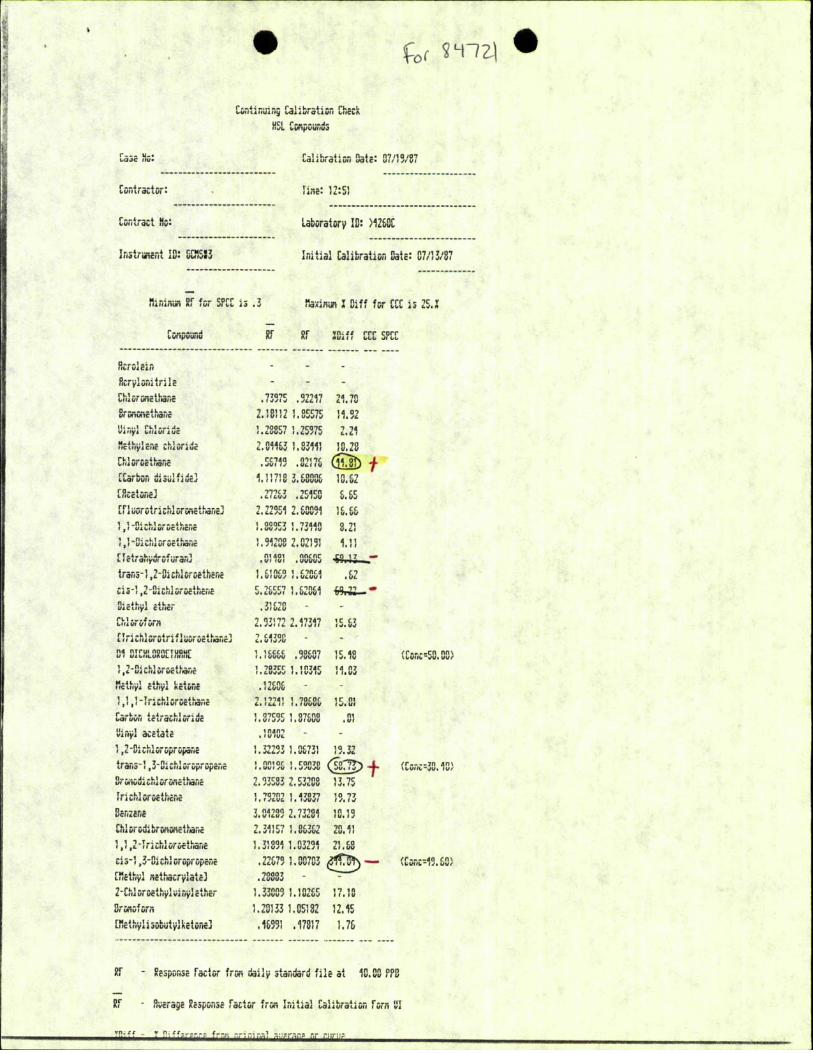
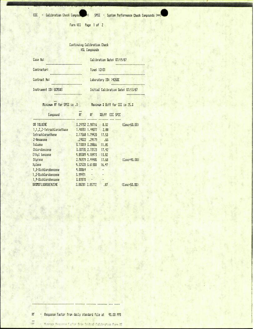
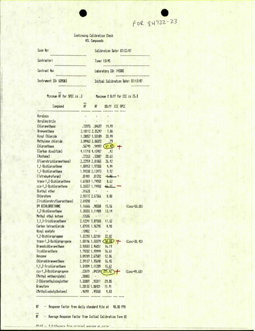
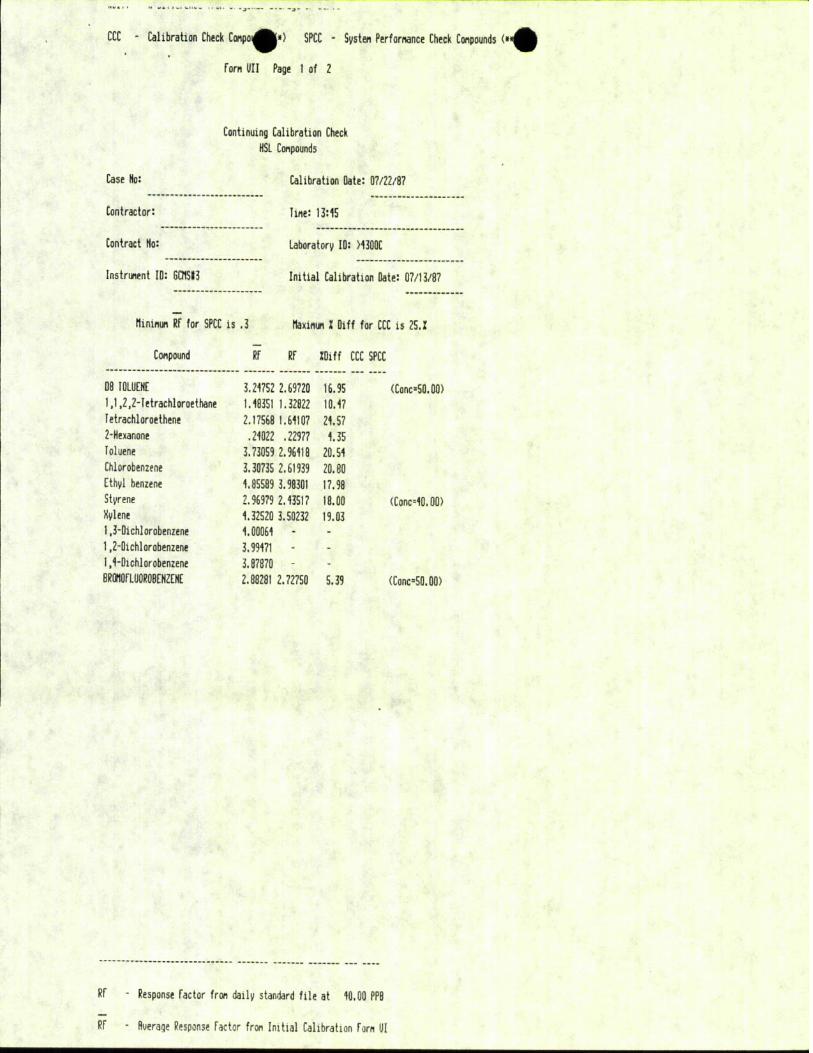
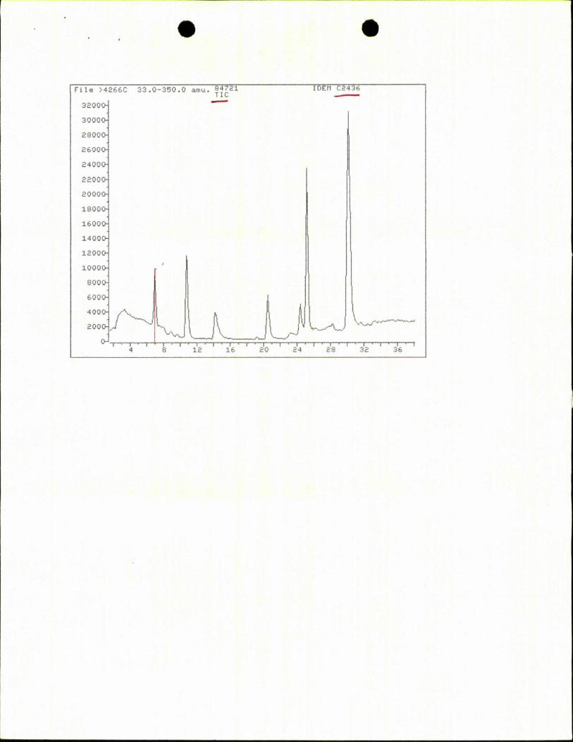
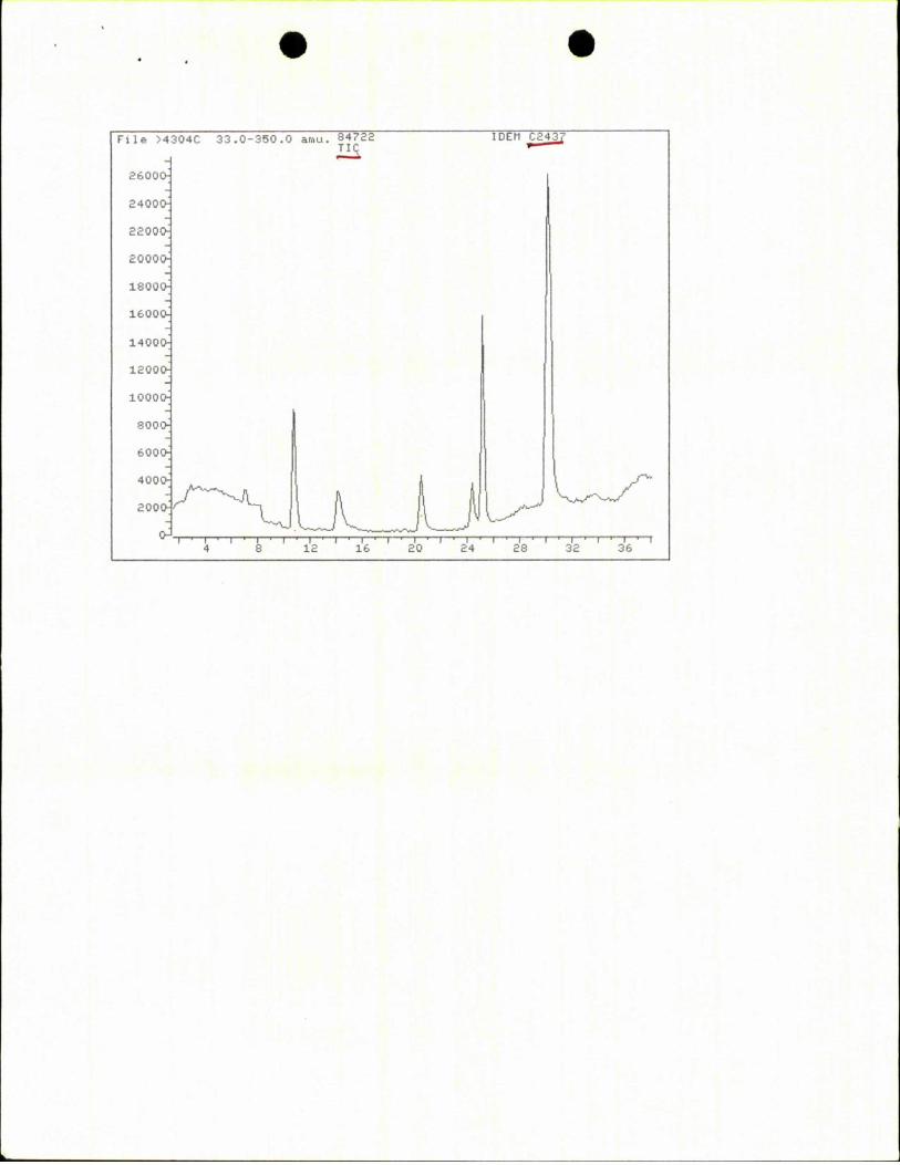
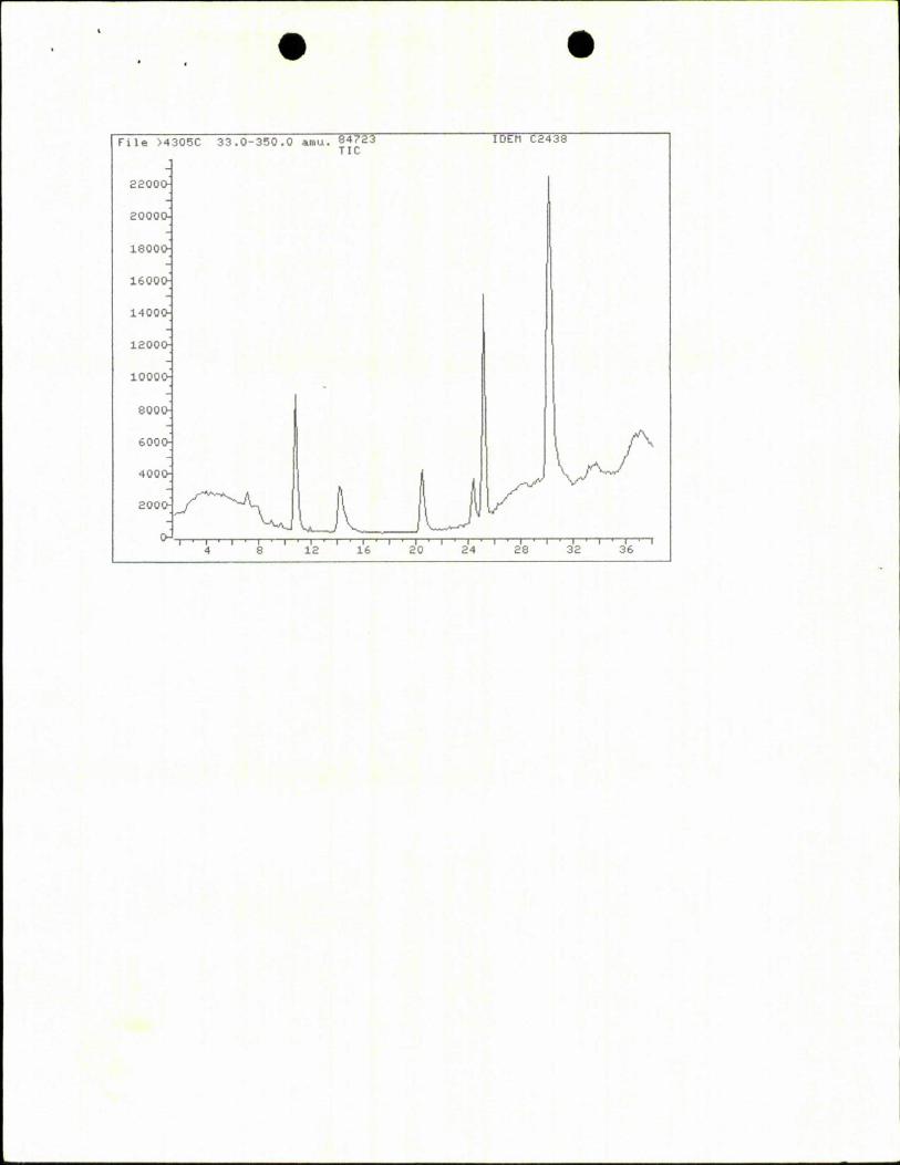
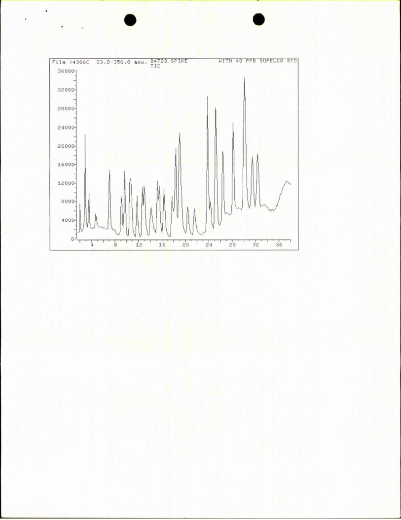
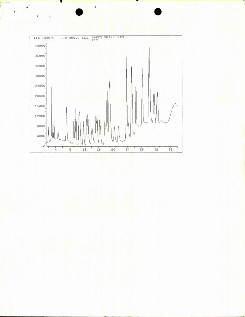
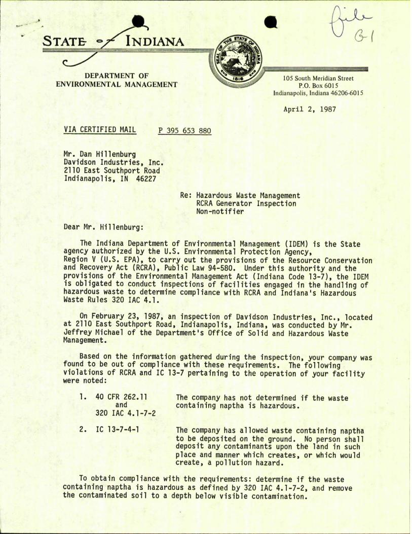
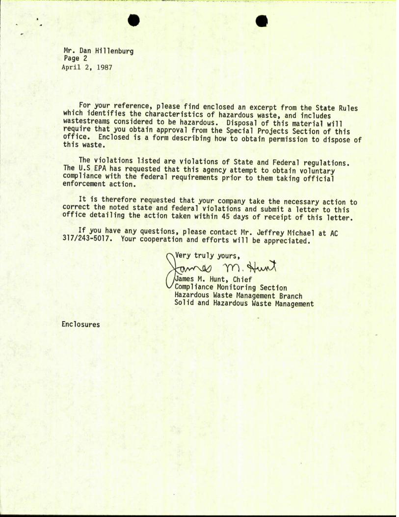
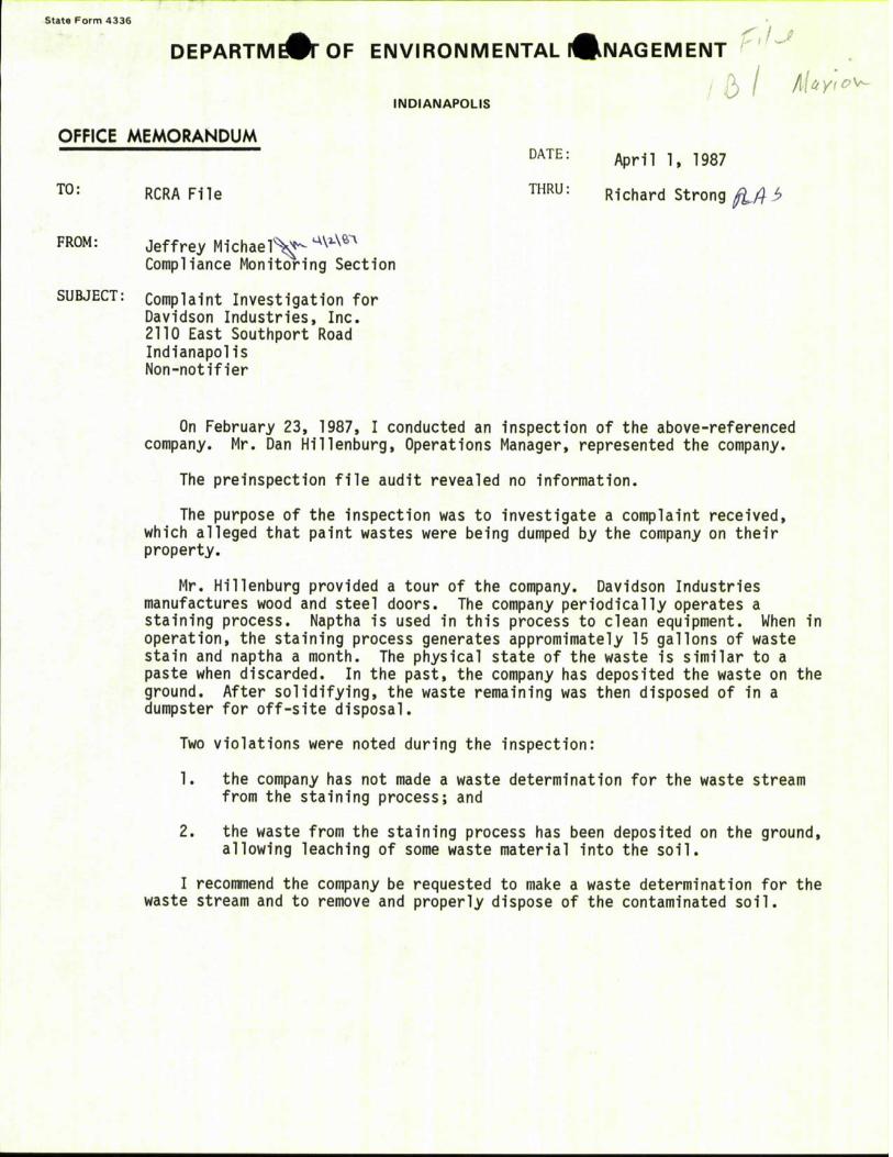
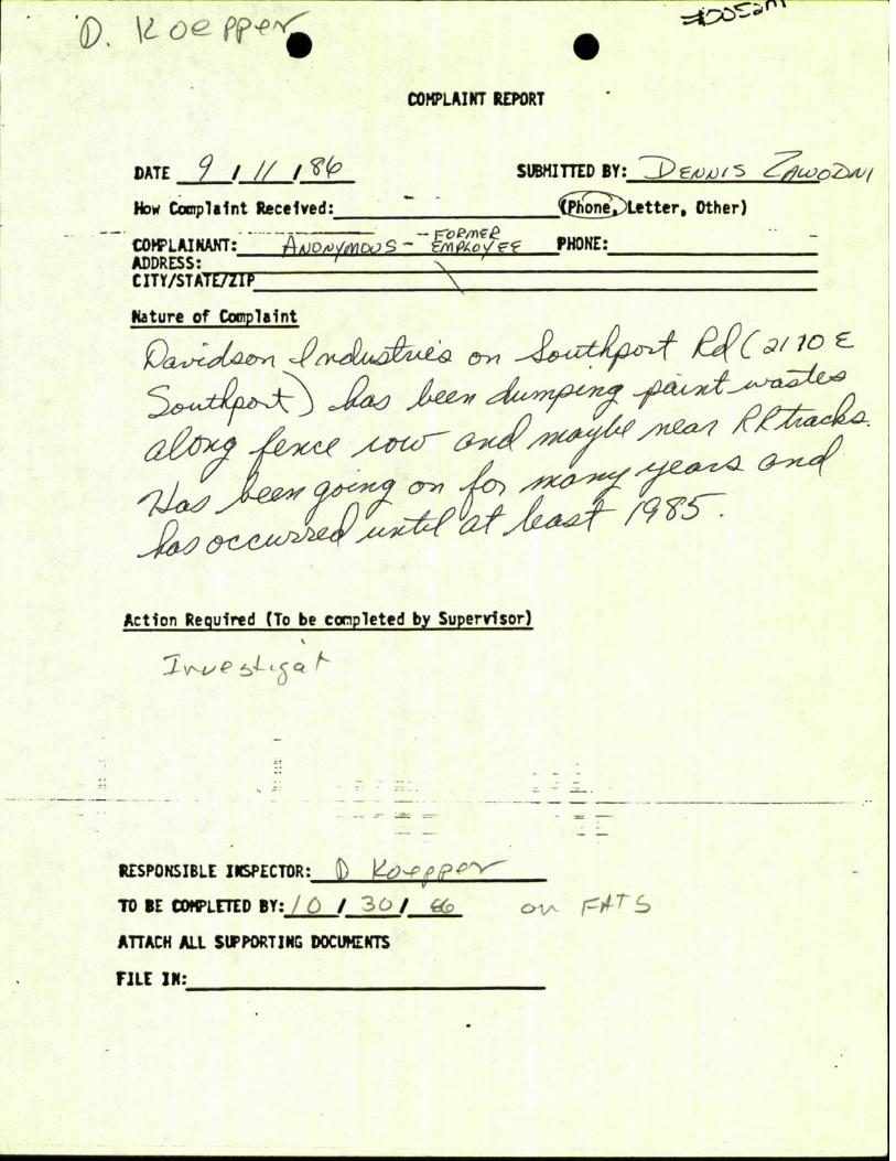
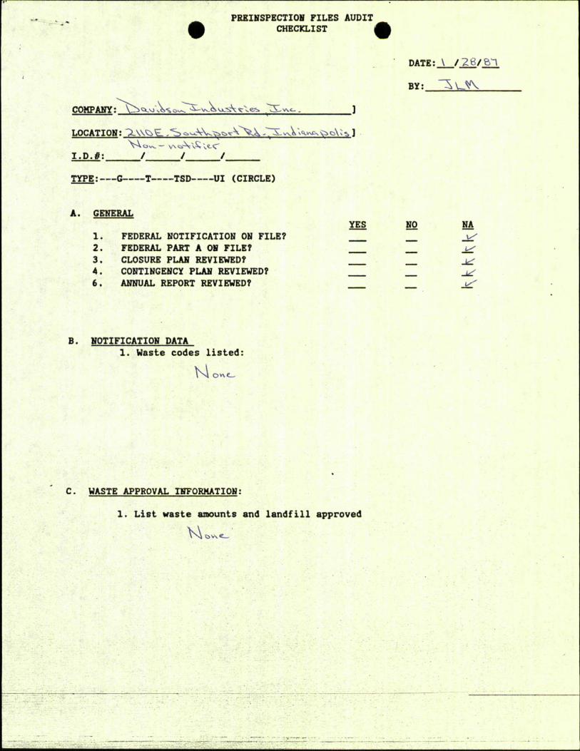
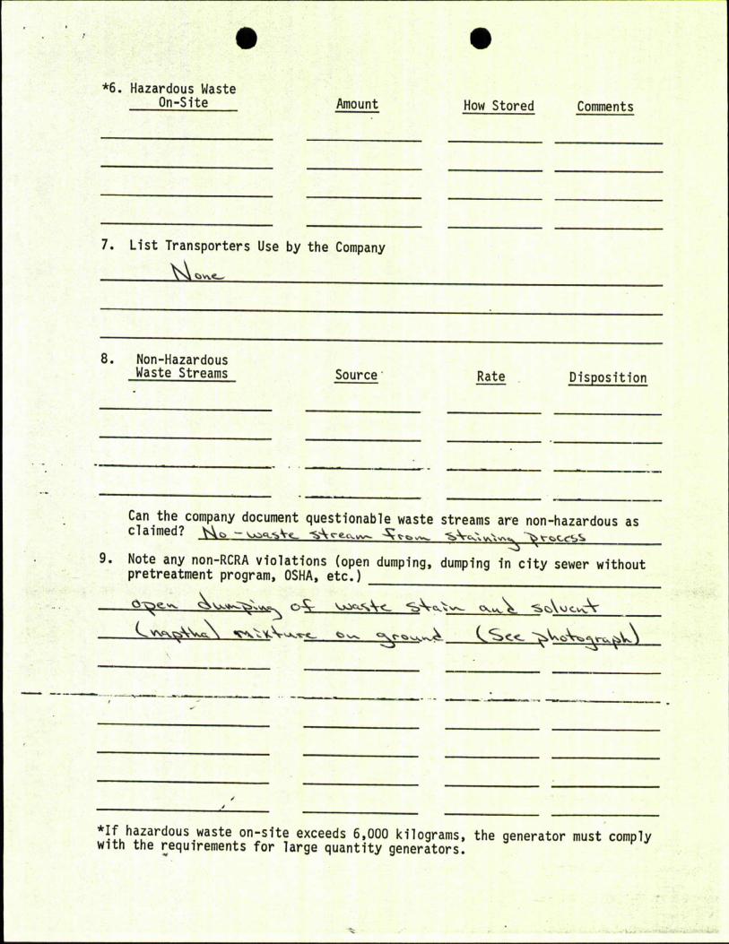
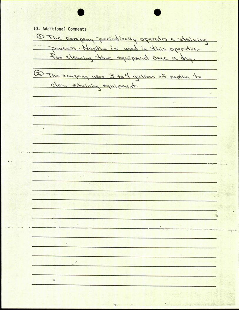
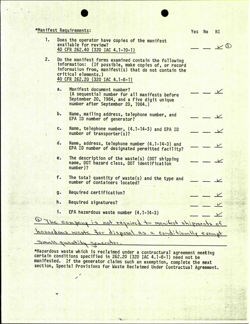
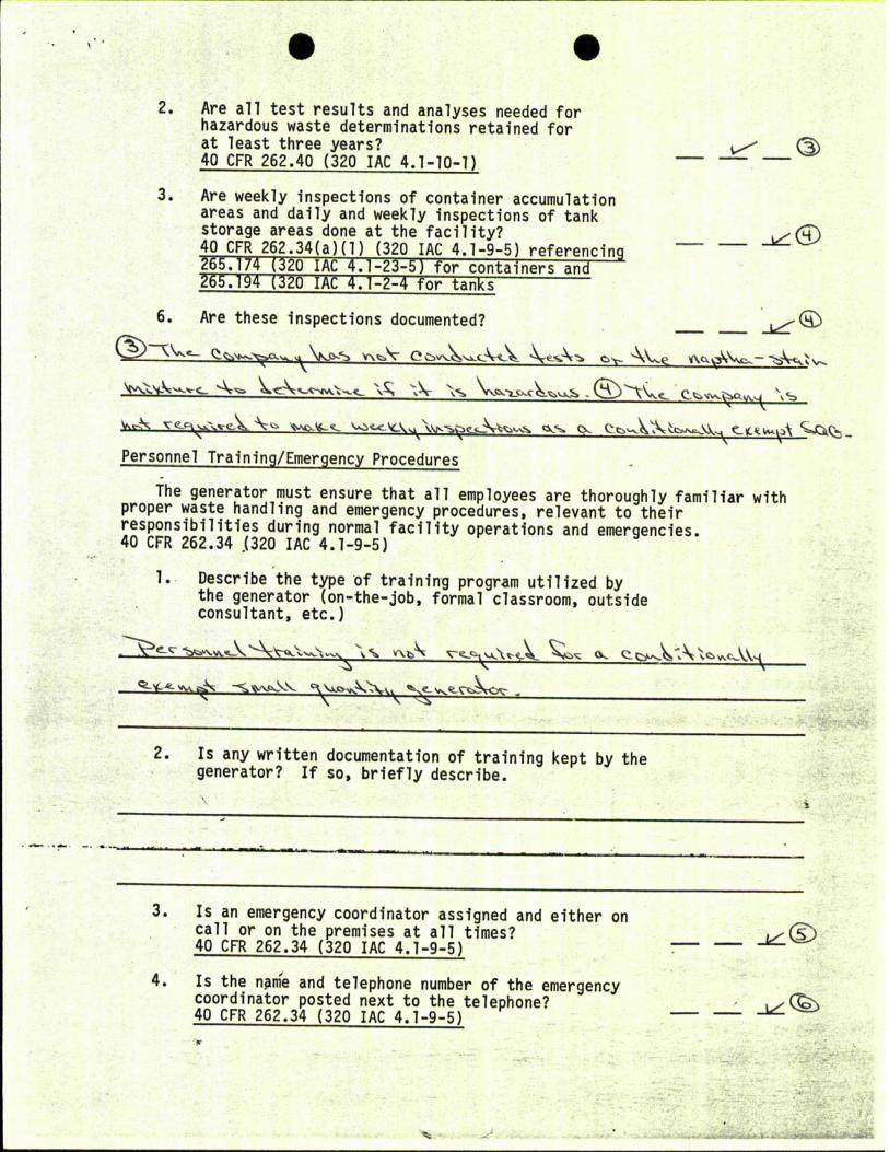
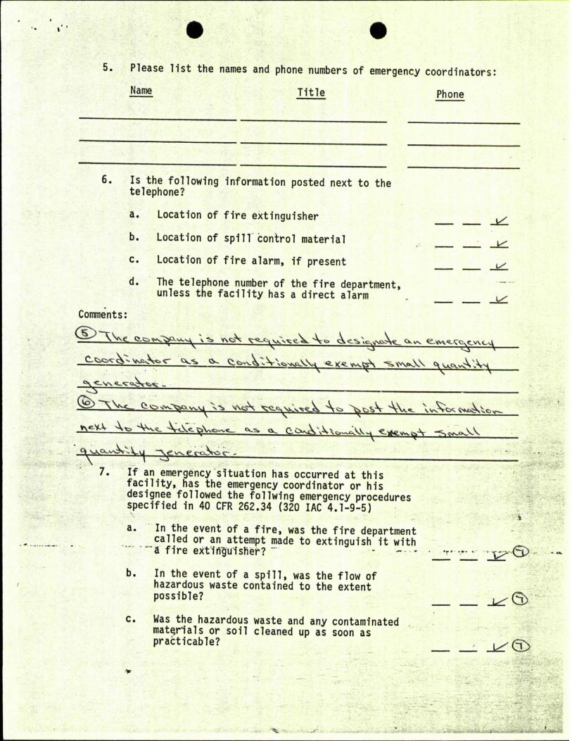
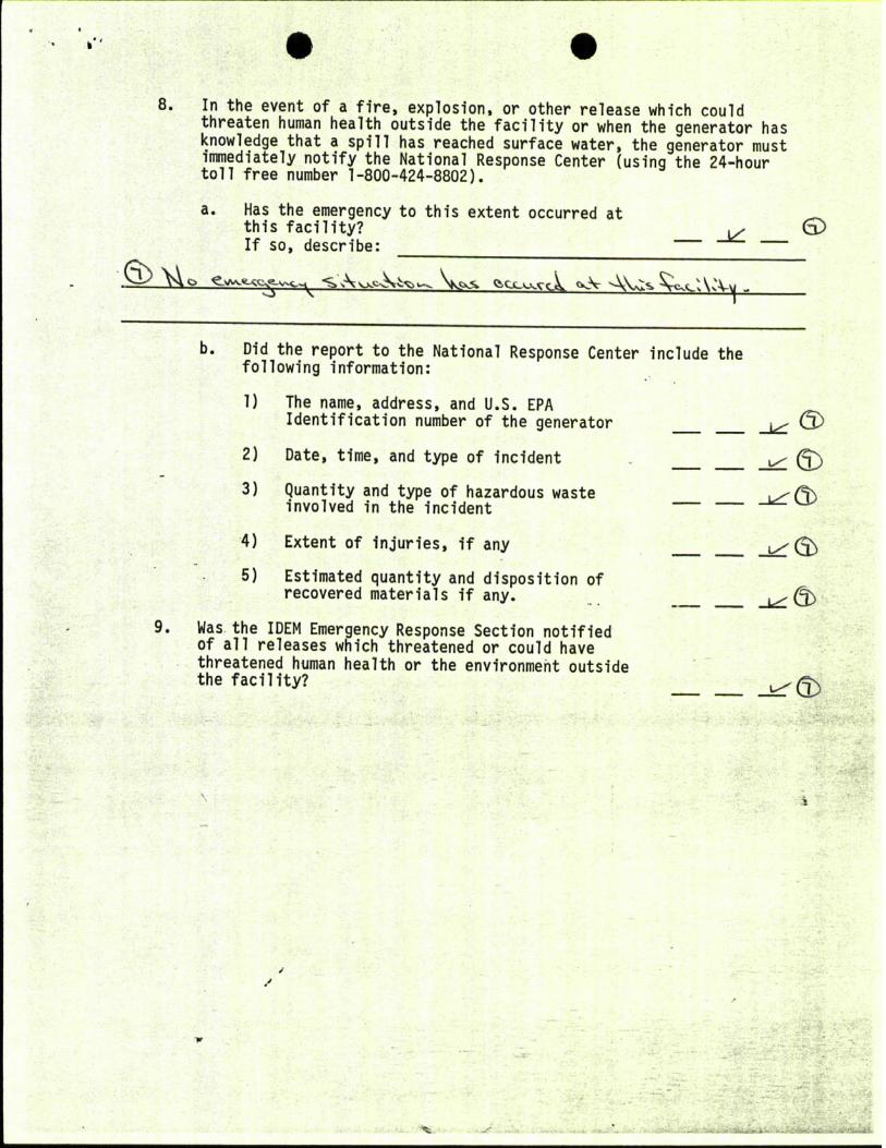
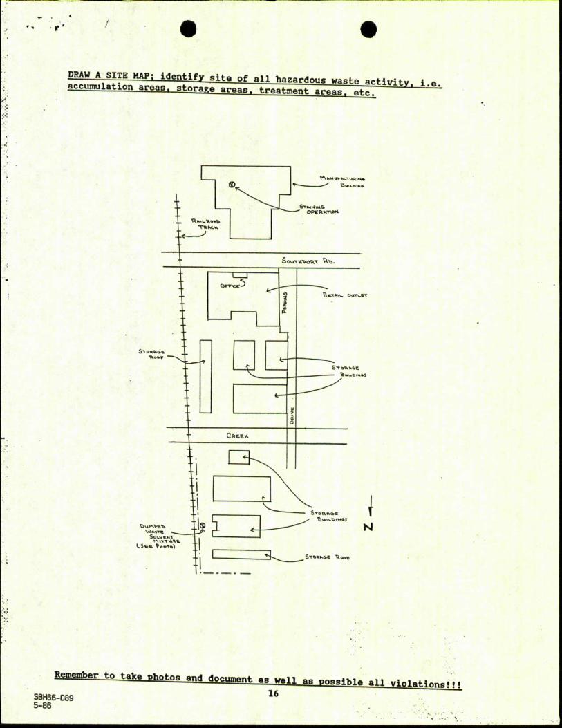
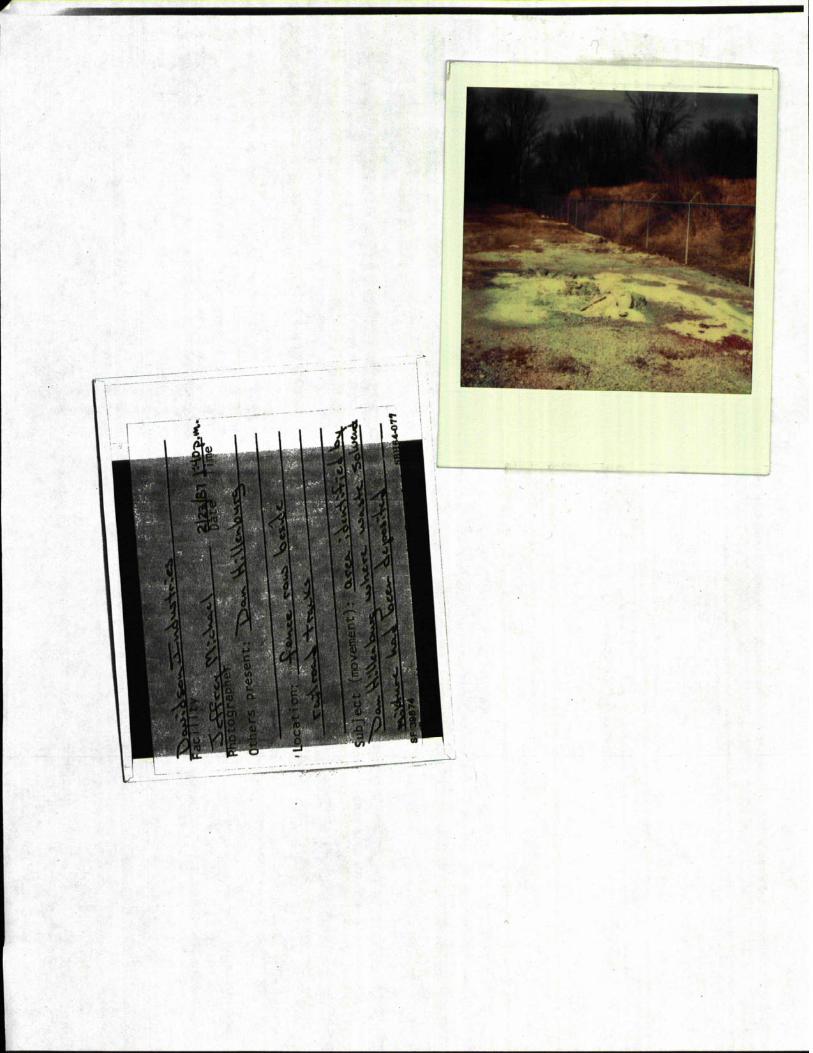

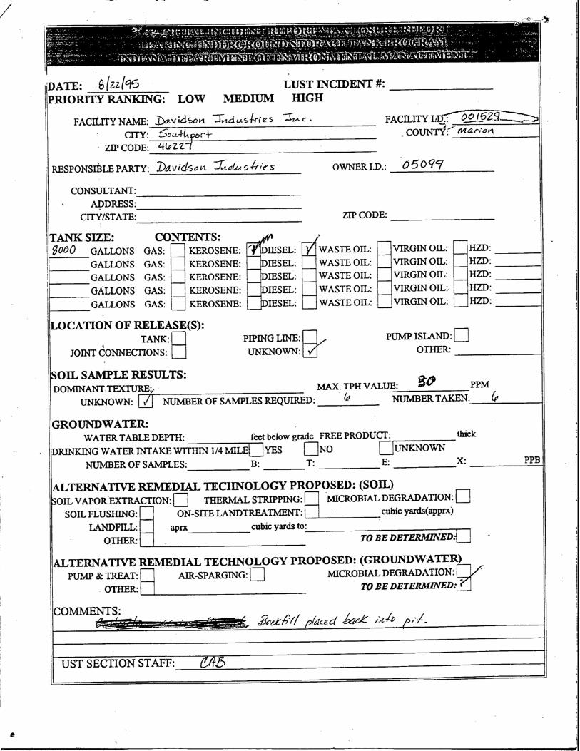
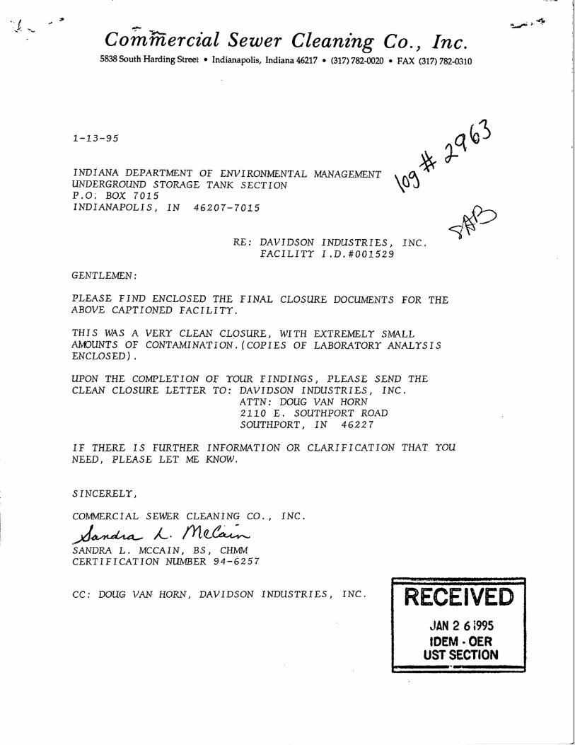
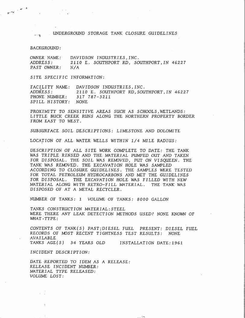
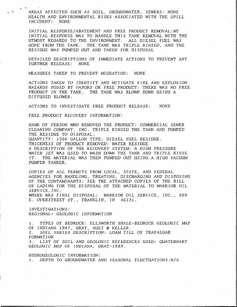
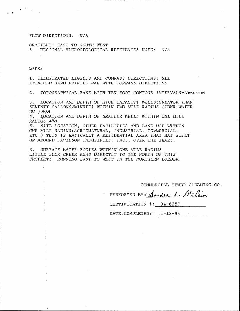
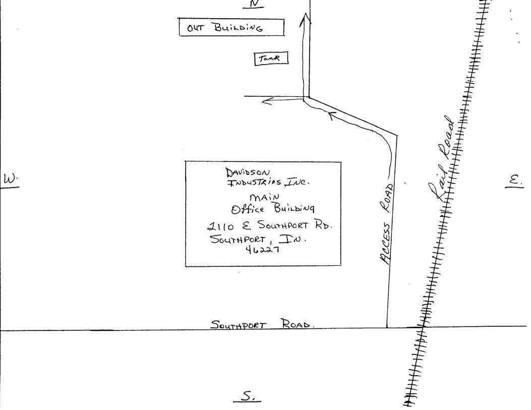
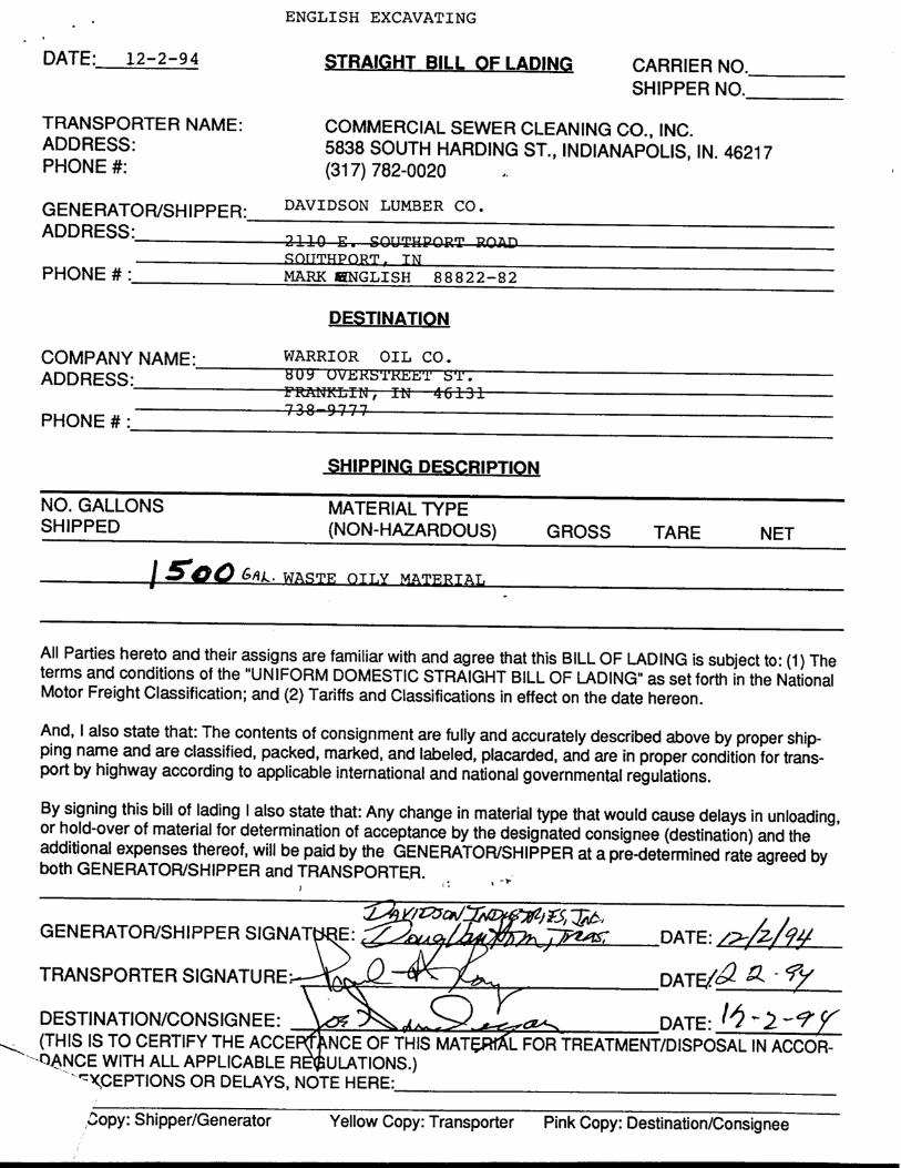
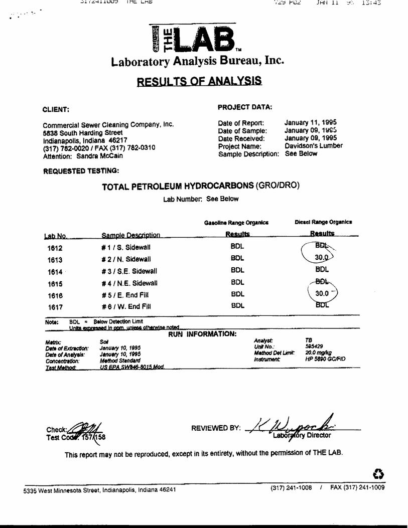
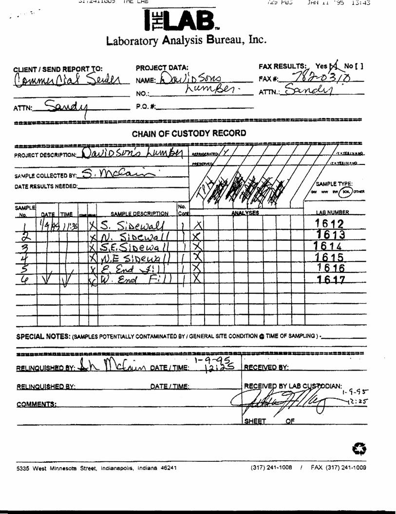
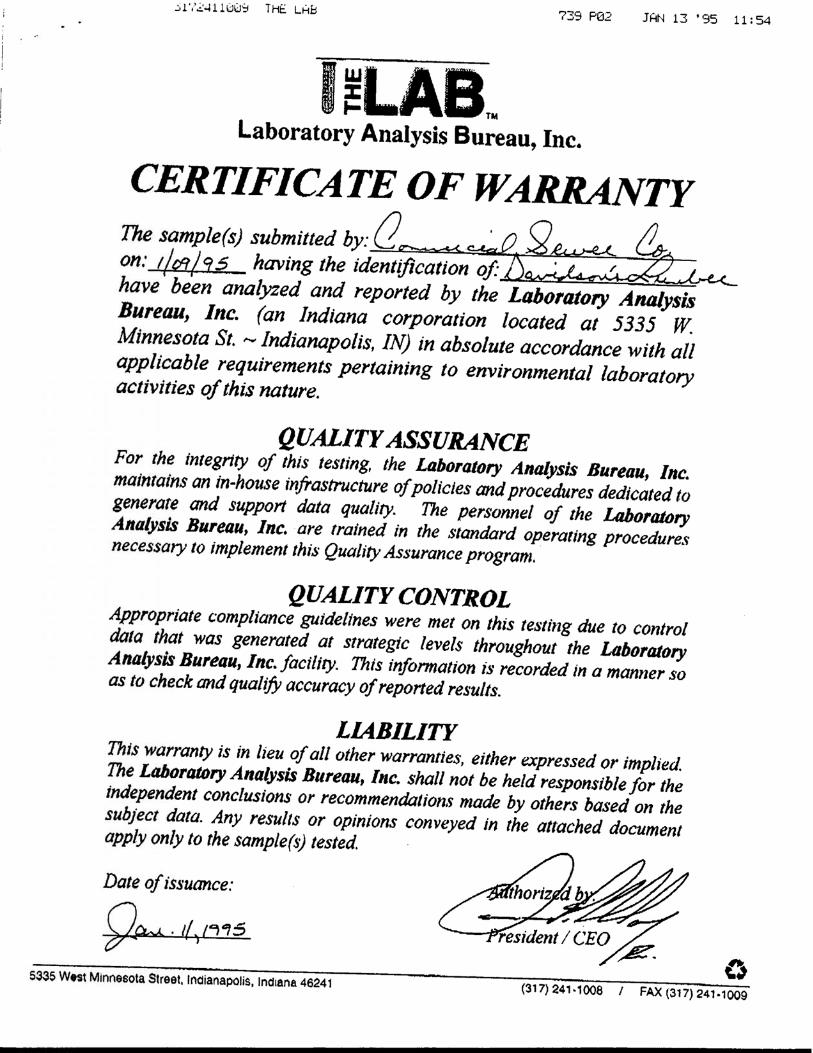
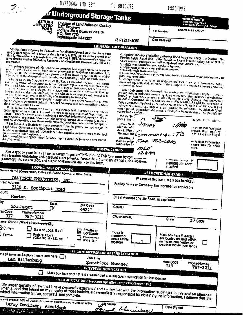
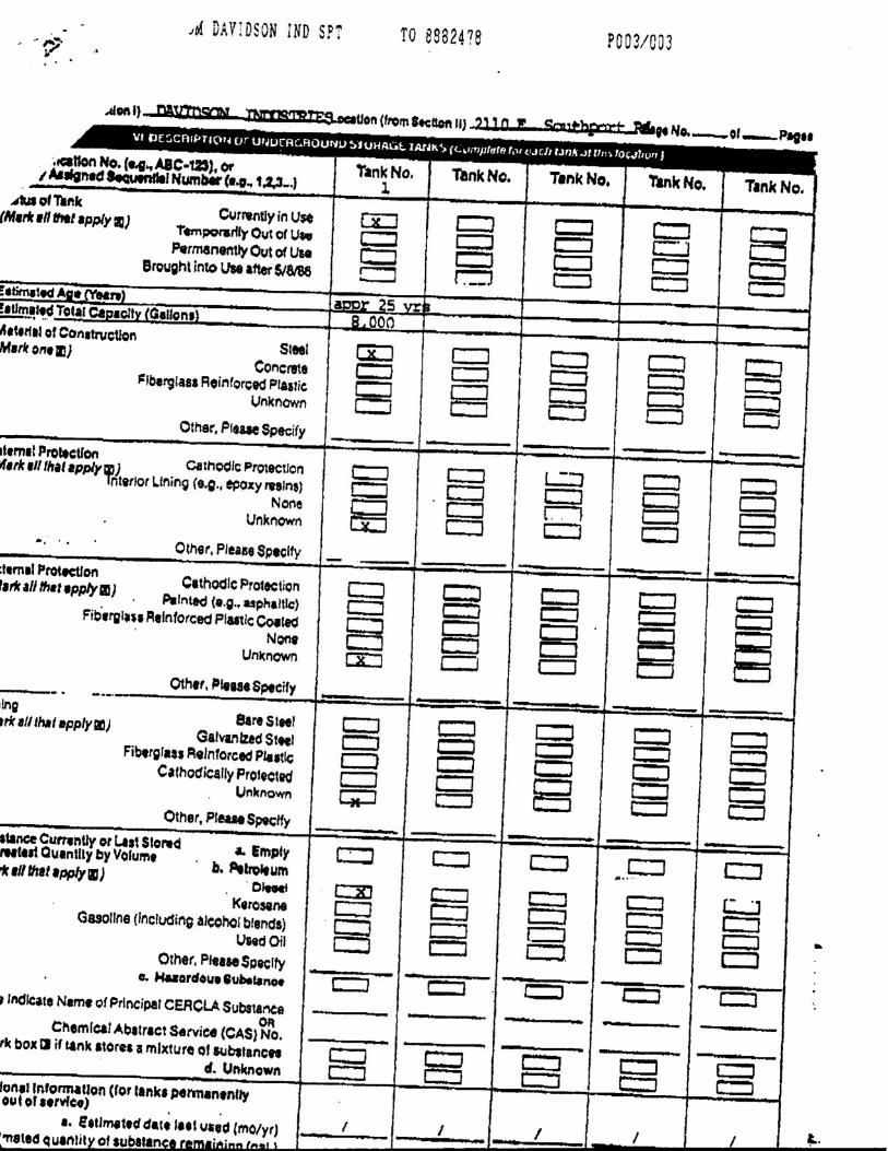
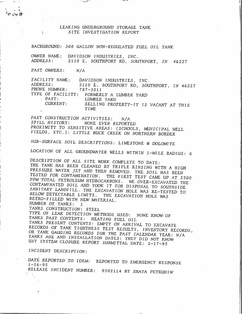
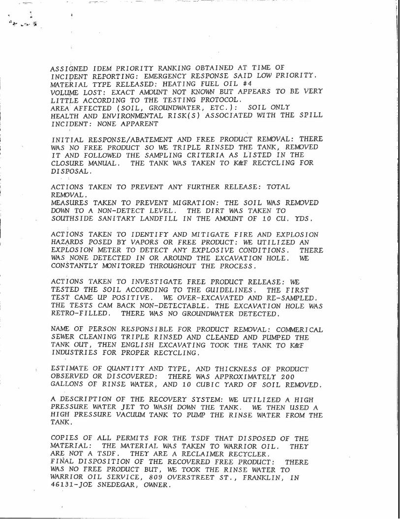
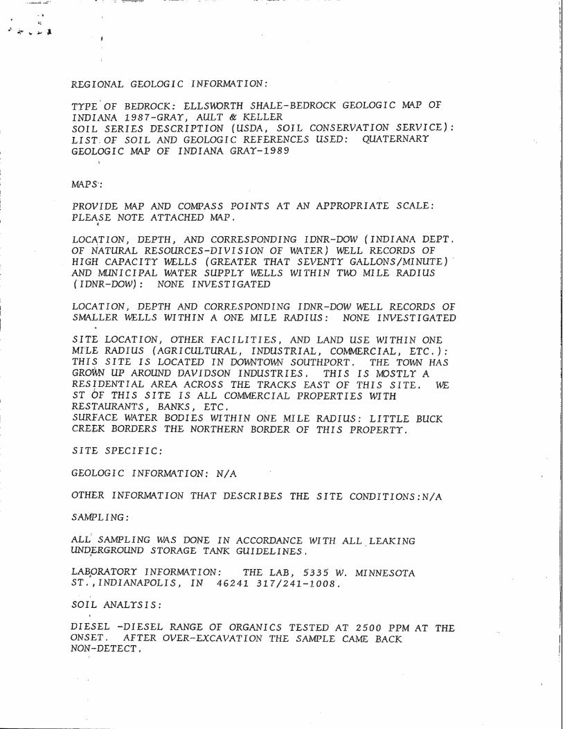

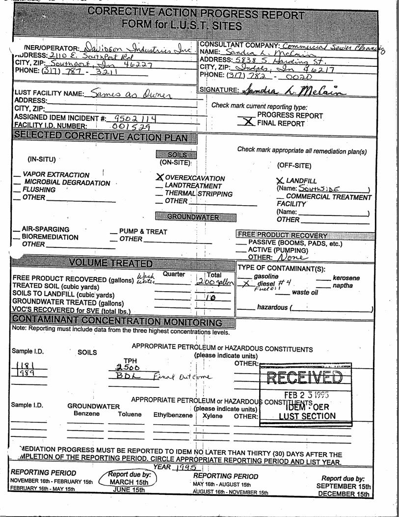
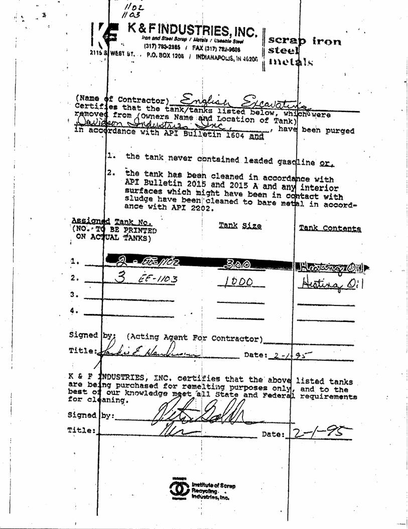
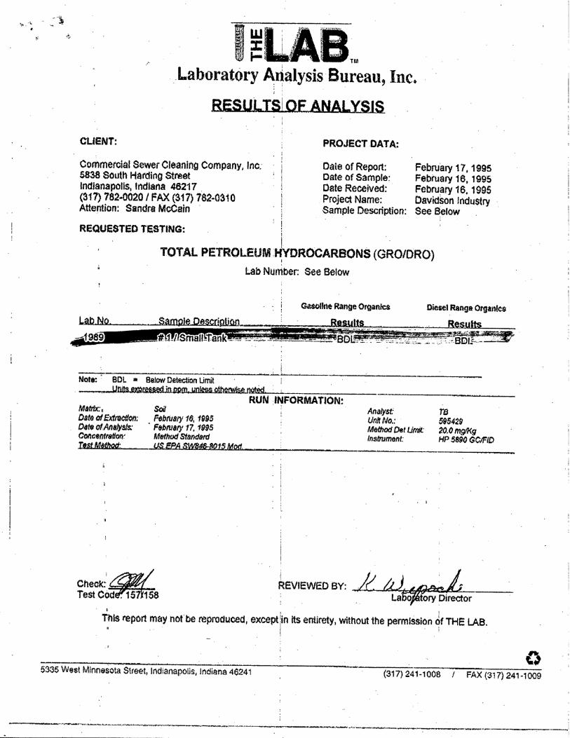
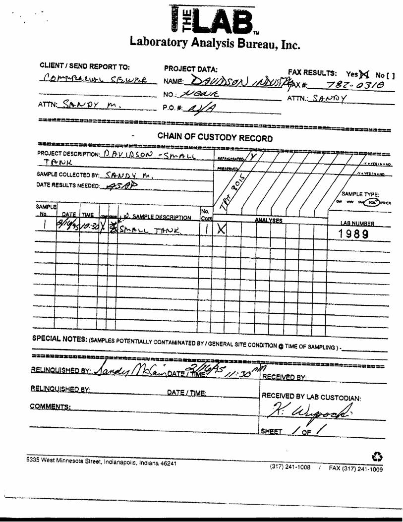
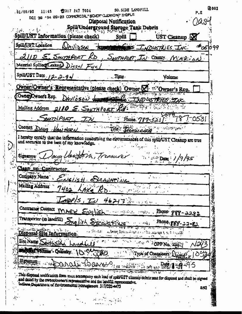
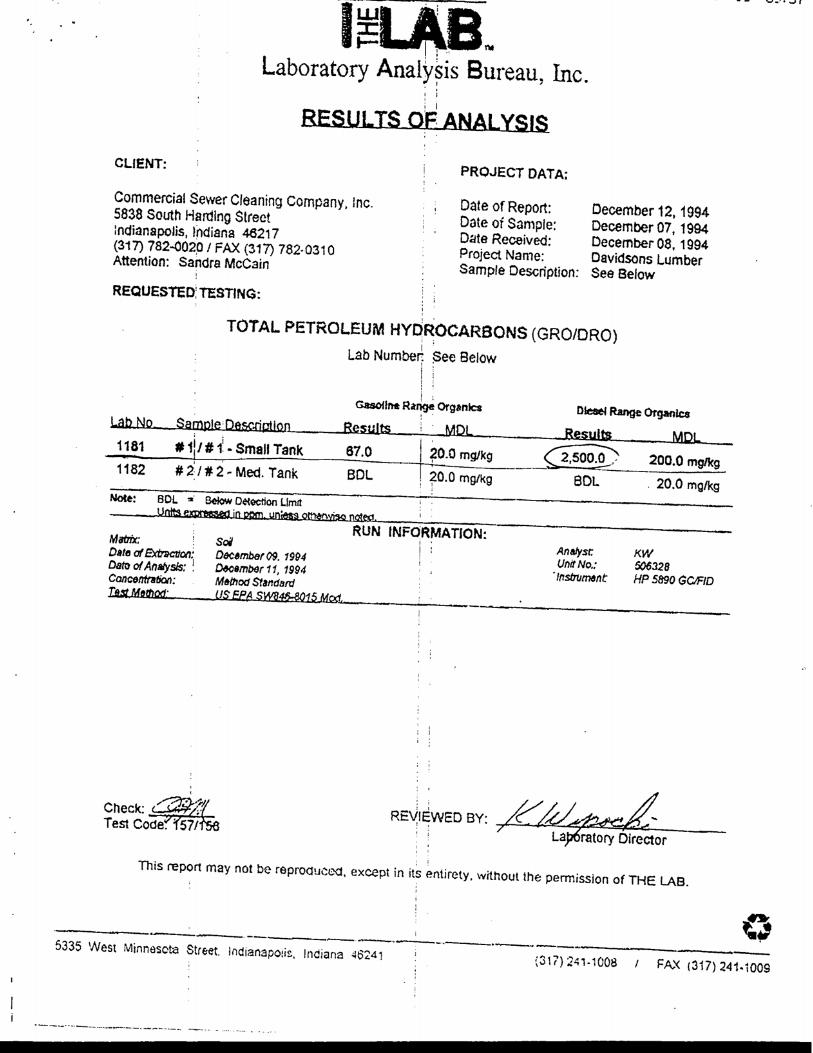
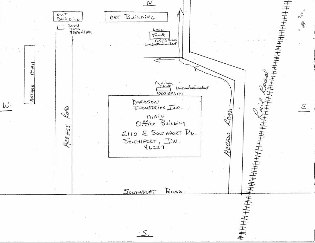
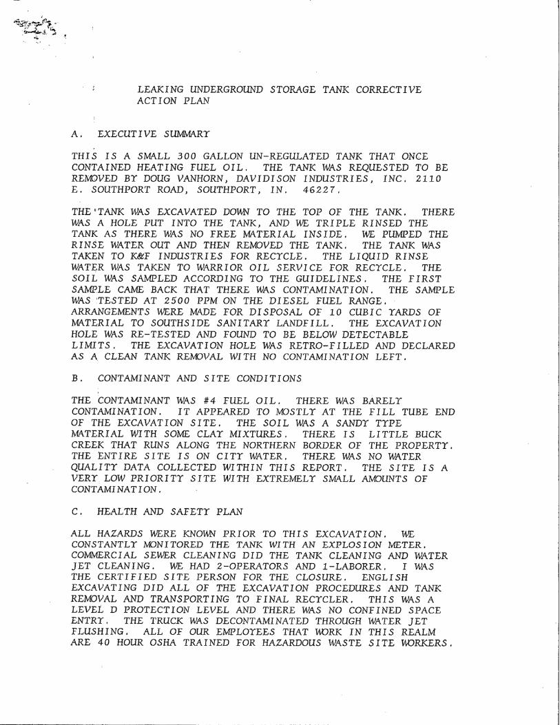
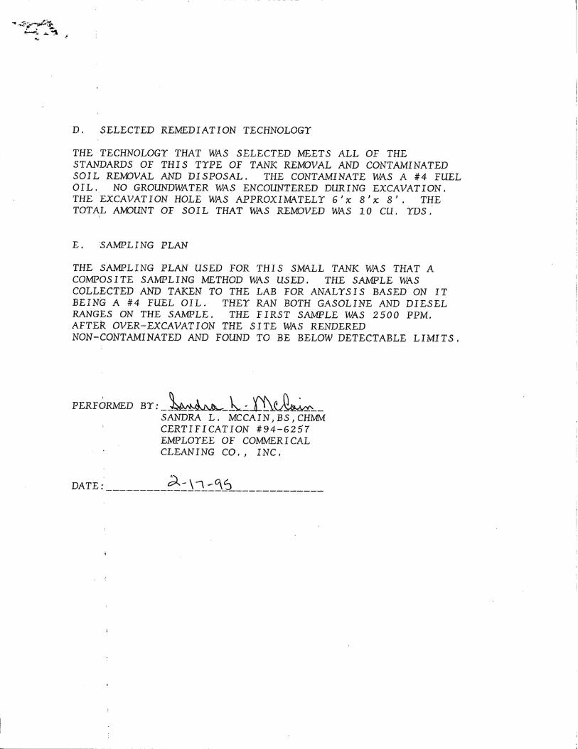

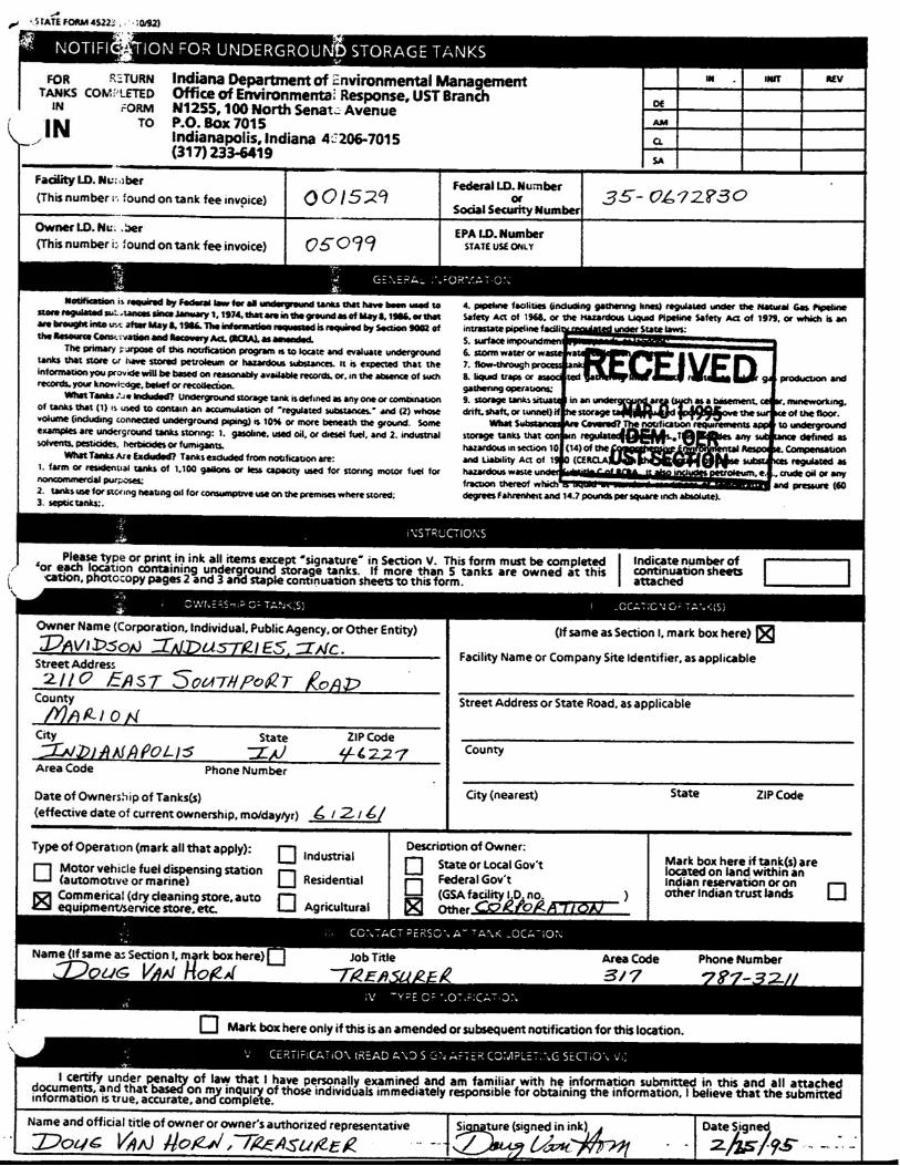
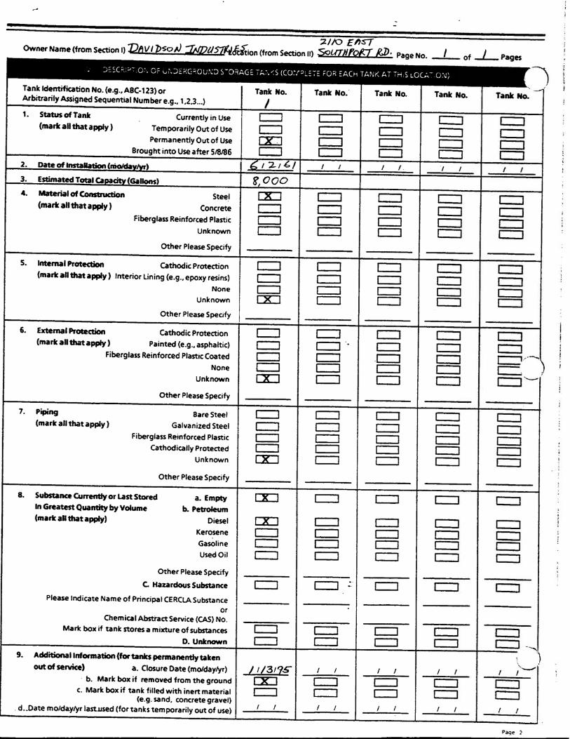
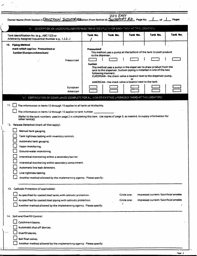
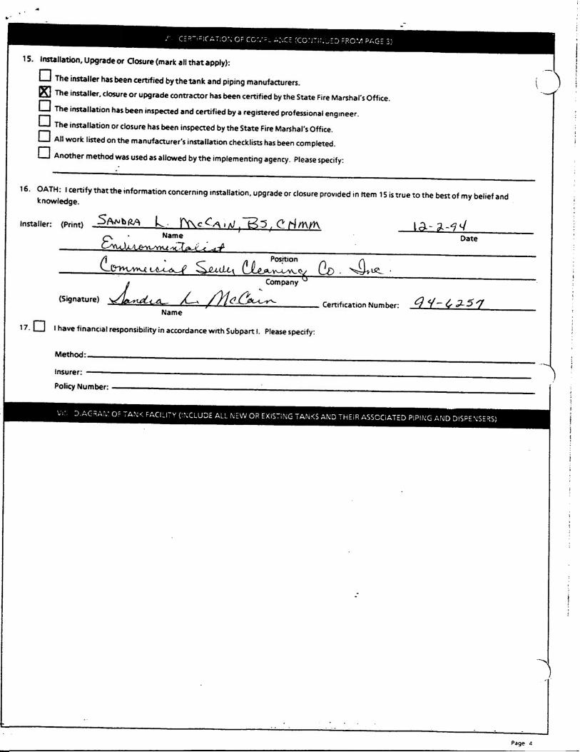

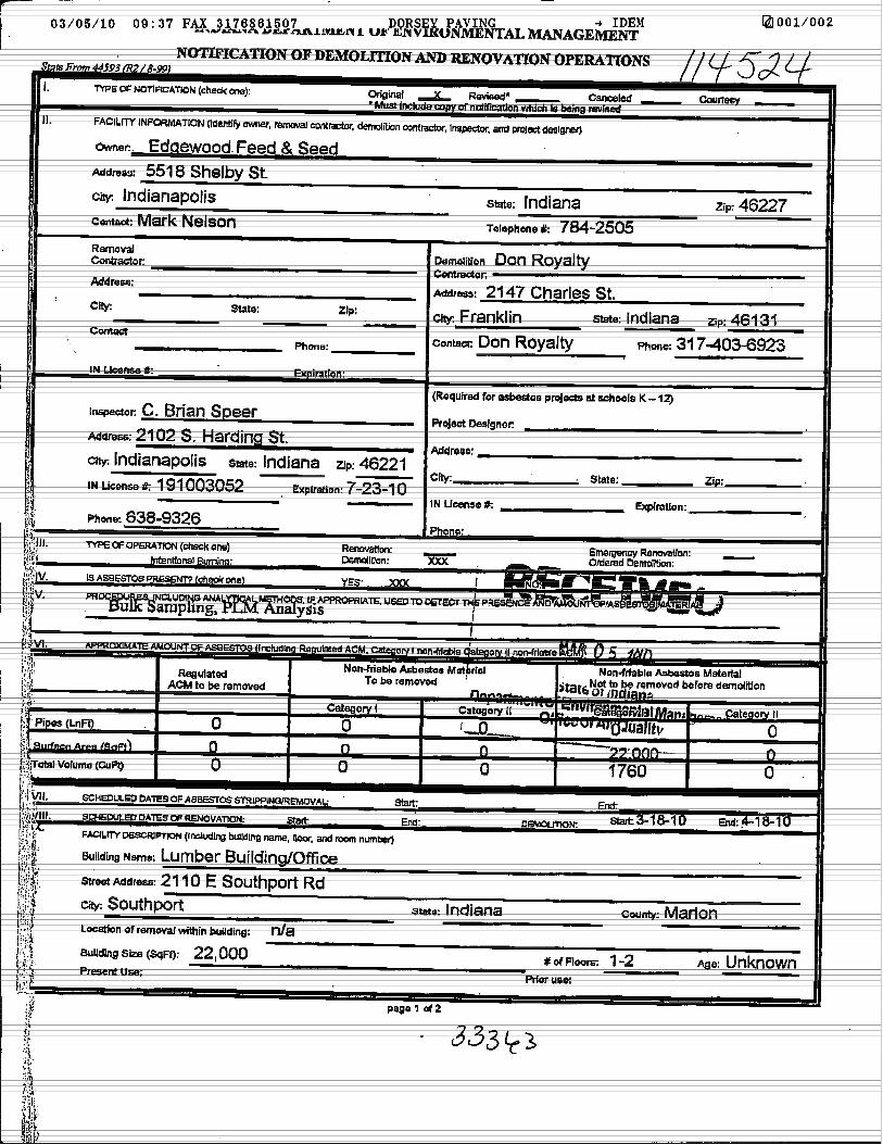
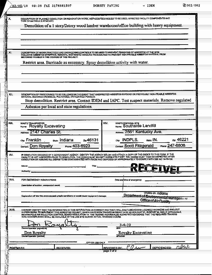

APPENDIX J:
PHOTOGRAPHIC PORTFOLIO
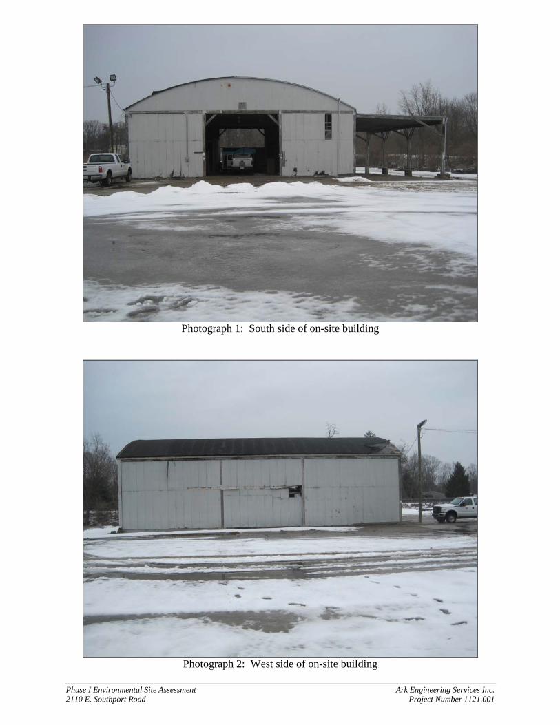
Phase I Environmental Site Assessment Ark Engineering Services Inc. 2110 E. Southport Road Project Number 1121.001
Photograph 1: South side of on-site building
Photograph 2: West side of on-site building
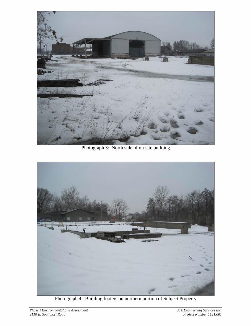
Phase I Environmental Site Assessment Ark Engineering Services Inc. 2110 E. Southport Road Project Number 1121.001
Photograph 3: North side of on-site building
Photograph 4: Building footers on northern portion of Subject Property
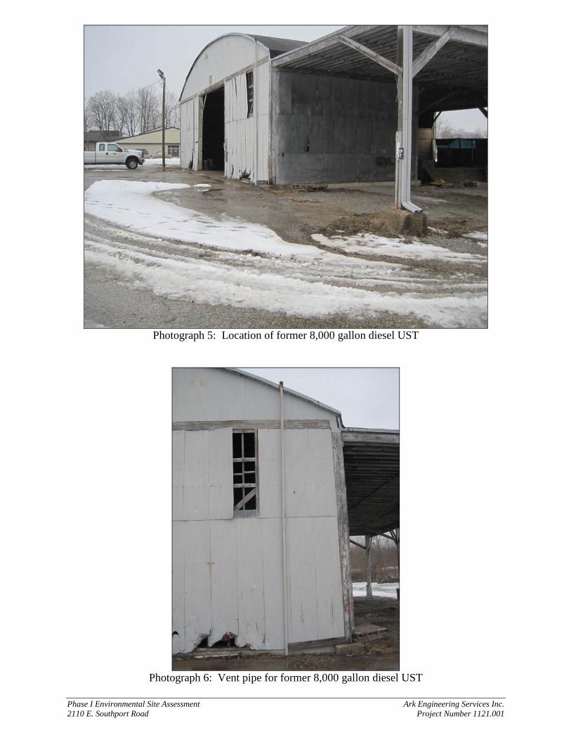
Phase I Environmental Site Assessment Ark Engineering Services Inc. 2110 E. Southport Road Project Number 1121.001
Photograph 5: Location of former 8,000 gallon diesel UST
Photograph 6: Vent pipe for former 8,000 gallon diesel UST
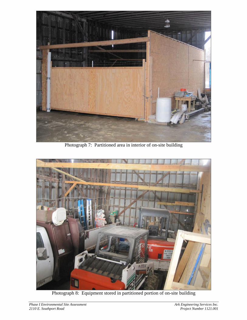
Phase I Environmental Site Assessment Ark Engineering Services Inc. 2110 E. Southport Road Project Number 1121.001
Photograph 7: Partitioned area in interior of on-site building
Photograph 8: Equipment stored in partitioned portion of on-site building
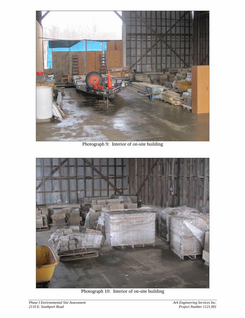
Phase I Environmental Site Assessment Ark Engineering Services Inc. 2110 E. Southport Road Project Number 1121.001
Photograph 9: Interior of on-site building
Photograph 10: Interior of on-site building
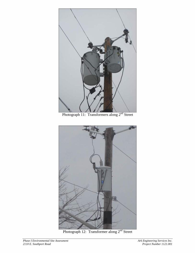
Phase I Environmental Site Assessment Ark Engineering Services Inc. 2110 E. Southport Road Project Number 1121.001
Photograph 11: Transformers along 2nd Street
Photograph 12: Transformer along 2nd Street
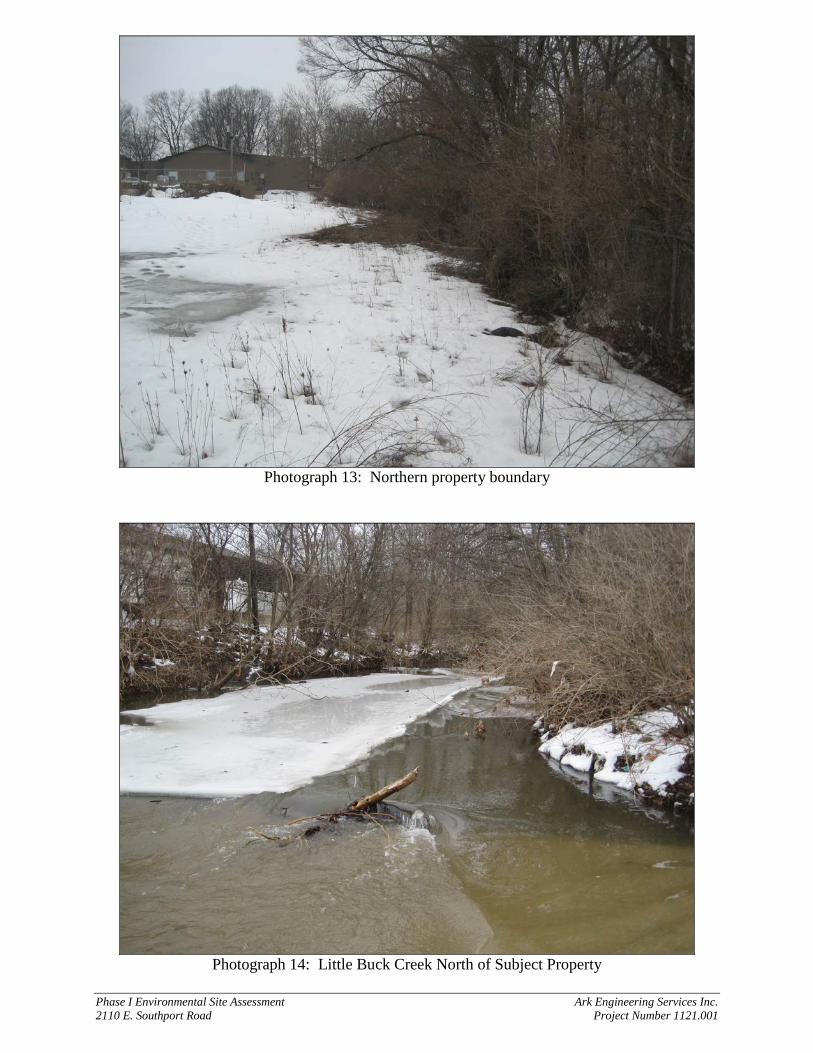
Phase I Environmental Site Assessment Ark Engineering Services Inc. 2110 E. Southport Road Project Number 1121.001
Photograph 13: Northern property boundary
Photograph 14: Little Buck Creek North of Subject Property
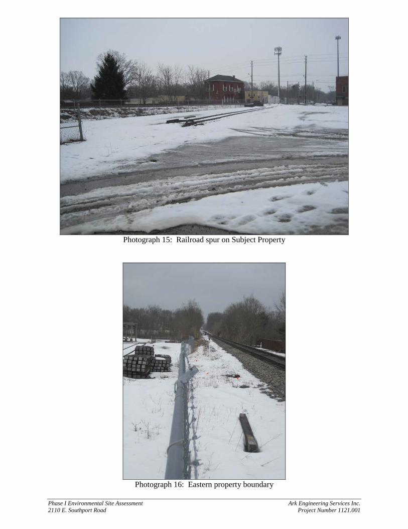
Phase I Environmental Site Assessment Ark Engineering Services Inc. 2110 E. Southport Road Project Number 1121.001
Photograph 15: Railroad spur on Subject Property
Photograph 16: Eastern property boundary
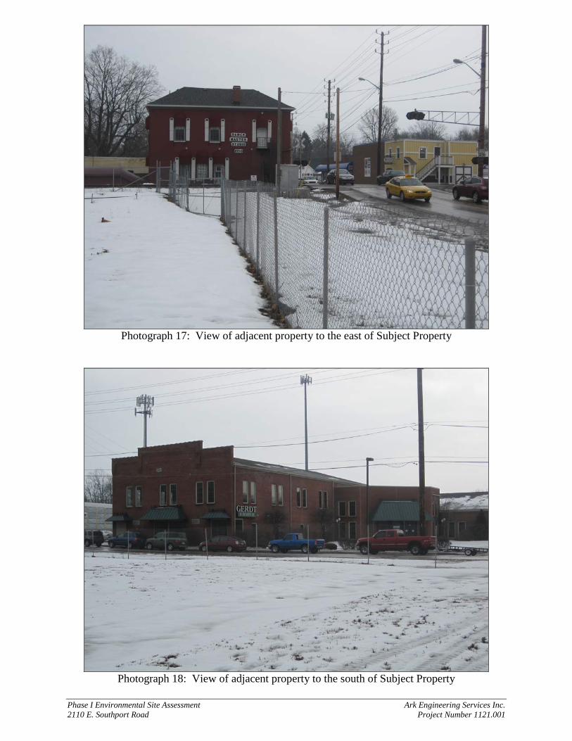
Phase I Environmental Site Assessment Ark Engineering Services Inc. 2110 E. Southport Road Project Number 1121.001
Photograph 17: View of adjacent property to the east of Subject Property
Photograph 18: View of adjacent property to the south of Subject Property
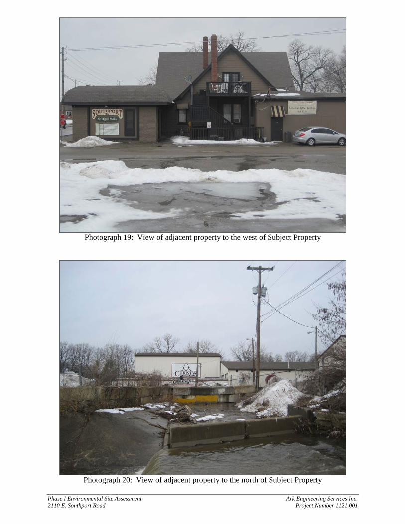
Phase I Environmental Site Assessment Ark Engineering Services Inc. 2110 E. Southport Road Project Number 1121.001
Photograph 19: View of adjacent property to the west of Subject Property
Photograph 20: View of adjacent property to the north of Subject Property
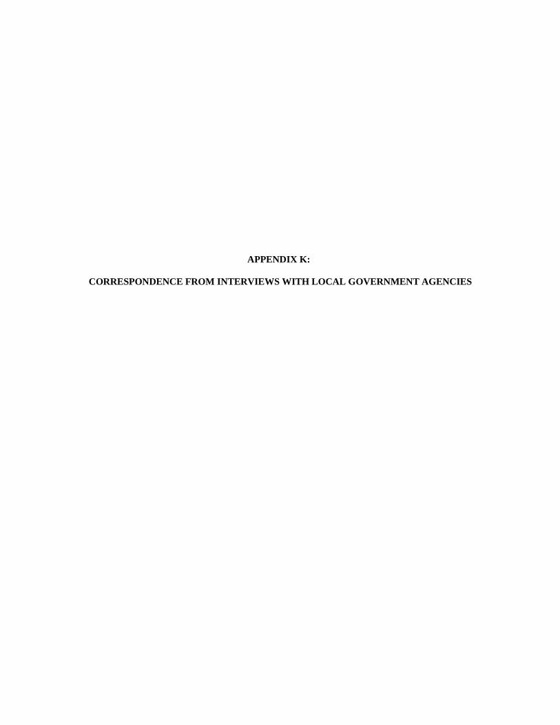
APPENDIX K:
CORRESPONDENCE FROM INTERVIEWS WITH LOCAL GOVERNMENT AGENCIES
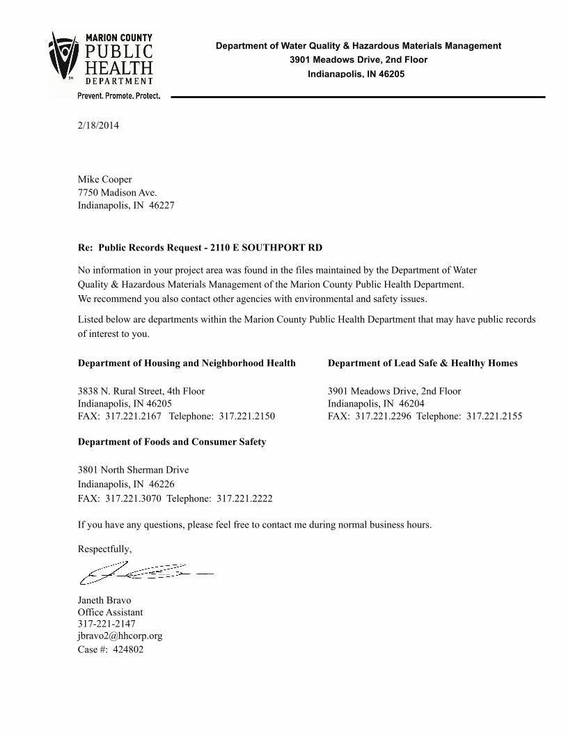
Indianapolis, IN 46205
Department of Water Quality & Hazardous Materials Management
3901 Meadows Drive, 2nd Floor
2/18/2014
Mike Cooper
Indianapolis, IN 462277750 Madison Ave.
Re: Public Records Request - 2110 E SOUTHPORT RD
No information in your project area was found in the files maintained by the Department of Water
Quality & Hazardous Materials Management of the Marion County Public Health Department.
We recommend you also contact other agencies with environmental and safety issues.
Listed below are departments within the Marion County Public Health Department that may have public records
of interest to you.
Department of Housing and Neighborhood Health Department of Lead Safe & Healthy Homes
3838 N. Rural Street, 4th Floor 3901 Meadows Drive, 2nd FloorIndianapolis, IN 46205 Indianapolis, IN 46204FAX: 317.221.2167 Telephone: 317.221.2150 FAX: 317.221.2296 Telephone: 317.221.2155
Department of Foods and Consumer Safety
3801 North Sherman Drive
Indianapolis, IN 46226
FAX: 317.221.3070 Telephone: 317.221.2222
If you have any questions, please feel free to contact me during normal business hours.
Respectfully,
Janeth BravoOffice Assistant317-221-2147
Case #: 424802
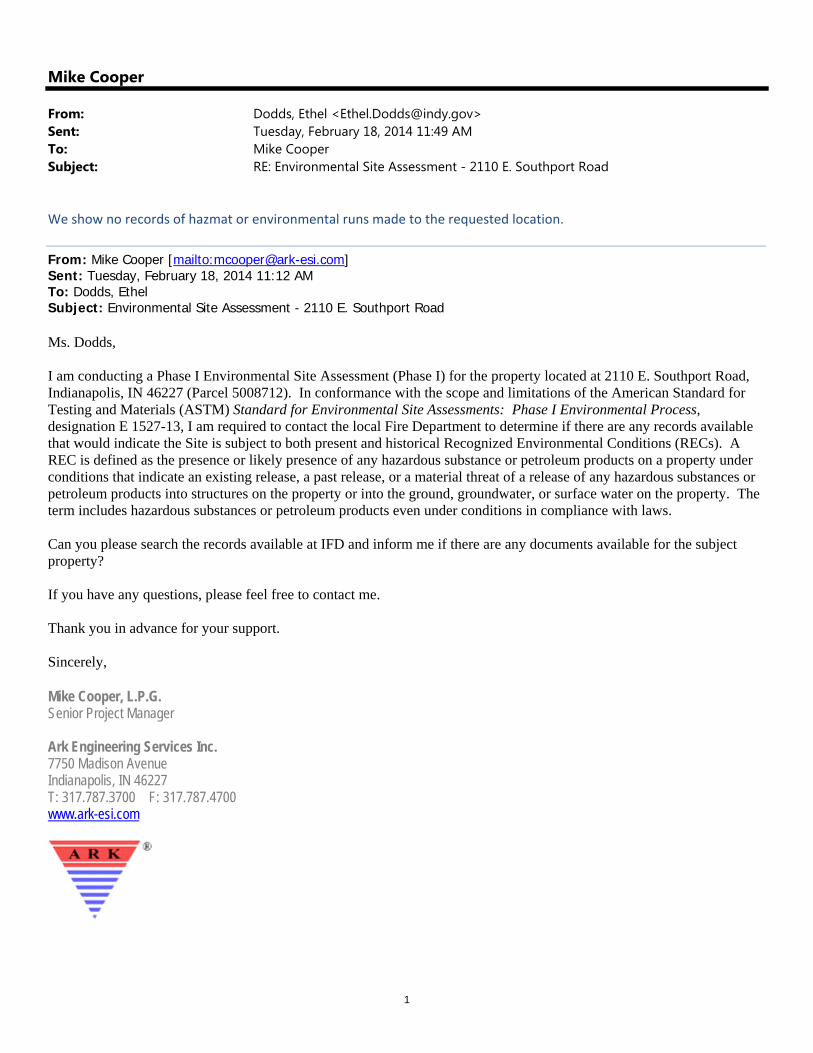
1
Mike Cooper
From: Dodds, Ethel <[email protected]>Sent: Tuesday, February 18, 2014 11:49 AMTo: Mike CooperSubject: RE: Environmental Site Assessment - 2110 E. Southport Road
We show no records of hazmat or environmental runs made to the requested location.
From: Mike Cooper [mailto:[email protected]] Sent: Tuesday, February 18, 2014 11:12 AM To: Dodds, Ethel Subject: Environmental Site Assessment - 2110 E. Southport Road Ms. Dodds, I am conducting a Phase I Environmental Site Assessment (Phase I) for the property located at 2110 E. Southport Road, Indianapolis, IN 46227 (Parcel 5008712). In conformance with the scope and limitations of the American Standard for Testing and Materials (ASTM) Standard for Environmental Site Assessments: Phase I Environmental Process, designation E 1527-13, I am required to contact the local Fire Department to determine if there are any records available that would indicate the Site is subject to both present and historical Recognized Environmental Conditions (RECs). A REC is defined as the presence or likely presence of any hazardous substance or petroleum products on a property under conditions that indicate an existing release, a past release, or a material threat of a release of any hazardous substances or petroleum products into structures on the property or into the ground, groundwater, or surface water on the property. The term includes hazardous substances or petroleum products even under conditions in compliance with laws. Can you please search the records available at IFD and inform me if there are any documents available for the subject property? If you have any questions, please feel free to contact me. Thank you in advance for your support. Sincerely, Mike Cooper, L.P.G. Senior Project Manager Ark Engineering Services Inc. 7750 Madison Avenue Indianapolis, IN 46227 T: 317.787.3700 F: 317.787.4700 www.ark-esi.com
APPENDIX L:
RÉSUMÉS OF ENVIRONMENTAL PROFESSIONALS
Ark Engineering Services Inc. • 7750 Madison Avenue, Indianapolis, IN 46227 • 317.787.3700 www.ark-esi.com
Michael B. Cooper, L.P.G. Geologist
Education: B.S. in Geological Sciences, Indiana University, Bloomington, IN, 2003 Professional Licenses: Licensed Professional Geologist: Indiana #2297 Indiana Water Well Driller #2252 Credentials: 40 Hour training for Hazardous Waste Site Operations per CFR 1910.120 (2003) 8 Hour Refresher per CFR 1910.120 (2003-present) OSHA Confined Space Safety per 29 CFR 1910.146 (2009) Professional Affiliations: National Ground Water Association (NGWA) Indiana Geologists Association
Expertise: Mr. Michael B. Cooper is a Licensed Professional Geologist with over 10 years of experience in subsurface investigations, groundwater flow analysis, aquifer characterization, soil analysis, vapor intrusion, pilot studies, remediation, underground storage tank management, and environmental regulatory compliance. Responsibilities & Experience: Mr. Cooper is the Senior Project Manager for numerous soil and groundwater investigation and remediation projects at environmentally impaired industrial project sites for various clients in the State of Indiana. Project management experiences include proposal preparation, technical document preparation/review, project scheduling, coordination with subcontractors, permit preparation, remediation system design/installation, and client relations. Remedial technologies utilized during these projects include dual phase extraction, multi-phase extraction, total fluid recovery, pump and treat, liquid phase recovery and separation, air sparging, soil vapor extraction, bioventing, ORC® injection, carbon absorption, and excavation. Technical Document Preparation and Review Preparation and review of technical documents for submission to the Indiana Department of Environmental Management including ISC, FSI, Groundwater Monitoring, Discharge Monitoring, Vapor Intrusion, Vacuum Enhanced Fluid Recovery, Free Product Recovery, Pump Test, Pilot Test, Slug Test, CAP, CAP Implementation, and
10 Years of Experience
Key Qualifications: • Licensed Professional Geologist with experience as Senior Project Manager for remediation
sites in Indiana. Experience includes conducting subsurface investigations, groundwater flow analysis, aquifer characterization, soil analysis, vapor intrusion, pilot studies, remediation, UST management, detailed mapping, and environmental regulatory compliance.
• Experience preparing and reviewing technical documents including Initial Site Characterization (ISC), Further Site Investigation (FSI), Groundwater Monitoring, Discharge Monitoring, Vapor Intrusion, Vacuum Enhanced Fluid Recovery, Free Product Recovery, Pump Test, Pilot Test, Slug Test, Corrective Action Plan (CAP), CAP Implementation, and Corrective Action Progress Reports (CAPR) for contaminated sites in Indiana.

Michael B. Cooper Geologist
Ark Engineering Services Inc. • 7750 Madison Avenue, Indianapolis, IN 46227 • 317.787.3700 www.ark-esi.com
CAPRs for contaminated sites in Indiana. Other experiences include the preparation of potentiometric surface maps, geologic cross sections, and isopleth maps.
UST/LUST Management As project manager, Mr. Cooper has managed several subsurface investigations for sites impacted by leaking underground storage tanks throughout the State of Indiana. Duties include coordination with implementing agency and responsible party, site access and permitting, coordination with subcontractors, UST removal, data collection and evaluation, documentation, oversight of site characterization and contaminant plume delineation, preparation of corrective action plans, and remediation design and implementation. Additional duties include advising clients on environmental regulatory issues, compliance requirements, and preparation of operation and maintenance manuals for clients with underground storage tanks. Subsurface Investigations Mr. Cooper has experience managing and conducting subsurface soil and groundwater investigations at sites impacted with jet fuel, gasoline, kerosene, diesel fuel, waste oil, TCE, and PCE. Investigations include right of entry permits, collection of soil and groundwater samples for laboratory analysis, description and classification of subsurface soil according to the Unified Soil Classification System (USCS), preparation of soil boring logs, preliminary assessment using advanced electronic field screening equipment, and the installation of permanent and temporary monitoring wells to determine the direction of groundwater flow and assess groundwater conditions. Mr. Cooper has also been responsible for the abandonment of boreholes and monitoring wells in accordance with 312 IAC 13-10-2. Hydrogeologic Modeling Utilization of professional data-loggers for pump tests, slug tests, and precise water level measurements. Data extraction from professional data-loggers using Win-Situ instrument control software. Analyzing data using AQTESOLV for Windows to study aquifer characteristics including hydraulic conductivity, specific yield, transmissivity, intrinsic permeability, effective porosity, and pumping rate versus drawdown levels. Vapor Intrusion Investigations Mr. Cooper has managed multiple vapor intrusion investigations and possesses extensive knowledge of vapor intrusion regulations. Experience includes collection of vapor samples utilizing various low-flow vacuum pumps, Tedlar bags, and Summa canisters from soil gas monitoring points, monitoring wells, exhaust stacks, sub-slab sampling points, crawl spaces, basements, utility conduits, ambient air, and residential homes. Various modeling and analysis was completed with each study to identify potential vapor migration pathways and potential health hazards based on exposure duration. Mapping and Surveying Utilization of Trimble handheld GeoXH GPS and associated GPS Pathfinder Office software to map specific site details, building structures, monitoring wells, and utilities
Michael B. Cooper Geologist
Ark Engineering Services Inc. • 7750 Madison Avenue, Indianapolis, IN 46227 • 317.787.3700 www.ark-esi.com
with sub foot horizontal and vertical accuracy. Use of survey equipment to determine well casing elevation to 0.005 foot accuracy. Pilot Test Studies Coordinated and conducted numerous pilot studies using various remedial technologies to evaluate the feasibility of the selected technology prior to implementation. Experience includes evaluating variable rate aquifer step tests, thirty-hour aquifer pumping tests, soil vapor extraction tests, dual-phase extraction tests, multi-phase extraction tests, in-situ respiratory testing, and geochemical analysis for monitored natural attenuation. Experience includes determination and characterization of saturated and unsaturated soil formations, vacuum zone of influence, hydraulic zone of influence, capture zone analysis, optimum extraction rates for soil and groundwater, optimum vacuum levels at extraction points, and design calculations for individual remediation equipment type and size. Remediation System Design and Implementation Involved with the design and implementation of multiple remediation systems in the state of Indiana. Project tasks include design calculations for various remediation equipment, preparation of technical equipment bid specifications, air permitting, discharge permitting, right of entry and right of way permitting, remedial system construction, and coordination of remedial system delivery and start-up activities. Mr. Cooper is also managing the operation and maintenance (O&M) of several remedial systems including total fluid extraction systems, dual-phase extraction systems, multi-phase extraction systems, bioventing systems, sparge and vent systems, and soil vapor extraction systems. O&M management tasks include supervision of remediation activities, oversight of waste characterization, transportation, and disposal; coordinating with implementing agencies regarding effluent air and water limitations; and projecting and tracking remediation milestones and budgets. Selected Project Experience: Managed investigation and remediation activities at a retail fueling station located in a residential area deemed high priority emergency response by IDEM. Soil and groundwater were impacted by gasoline and diesel fuel along with TCE from a neighboring property. Free product was encountered in seventeen out of thirty-three monitoring wells up to one and one half feet thick. The project involved various phases of investigatory activities including dissolved, adsorbed, and free phase delineation, ROE access agreements, ROW permitting, and vapor intrusion air sampling. Additionally, extensive hydrogeologic characteristic tests and pilot studies were conducted leading to the remediation system design, air permitting, NPDES permitting, and remedial action implementation. A corrective action plan (CAP) was prepared and submitted within weeks of free product delineation and approved within three days by IDEM. As requested by IDEM, the system design, construction and installation was completed within eight weeks of CAP approval. The site is currently undergoing active remediation via dual phase extraction, and free product is no longer present on or off-site.
Michael B. Cooper Geologist
Ark Engineering Services Inc. • 7750 Madison Avenue, Indianapolis, IN 46227 • 317.787.3700 www.ark-esi.com
Supervised activities at LUST site with soil and groundwater contamination on neighboring properties. Conducted remedial investigation and feasibility study during the development of a corrective action plan. The studies included the collection of soil and groundwater samples and laboratory analysis to determine if bioremediation was suitable for the site. Based on the results, the injection of an oxygen releasing compound (ORC®) was proposed to enhance bioremediation. The CAP was approved by the regulatory agency and implemented on time and under budget. Managed an emergency response petroleum release at a retail fueling station in which the hydrocarbon plume was rapidly migrating through utility conduits. Mobile vacuum enhanced recovery was utilized immediately to recover free product present within the utility backfill. The project included immediate ROE access agreements to conduct multiple vapor intrusion investigations including sub-slab, crawl space, indoor air, and ambient air sampling at neighboring residential homes. A detailed geophysical survey was conducted to identify preferred migration pathways and the presence of abandoned USTs. Proper in-place closure was performed for six abandoned USTs encountered at the Site. A CAP approved by IDEM was implemented to remove the heavily impacted source material near the Site and along preferential pathways. A total of 3,073 tons of petroleum impacted soil was removed and properly disposed. Provided oversight and management of remedial investigation and corrective action related to a Jet A fuel release impacting soil and groundwater of neighboring tenants and a storm water swale. A CAP was prepared, submitted, approved, and implemented within ten weeks as request by IDEM and the client. Remedial action included the design and installation of a multi-phase extraction (MPE) system consisting of an oil cooled high vacuum pump, liquid/air separator, oil/water separator, air stripper, activated carbon, and organo clay filtration media. Necessary discharge permits were obtained from the local regulatory agency for the discharge of treated groundwater. Remediation is on going with no free product present on or off-site and minimal concentrations of VOCs present in monitoring wells. Mr. Cooper continues to manage remedial action operation and maintenance and long-term management at this facility. Managed a Jet A fuel release located within a secured area of the Indianapolis International Airport. The release was deemed a medium priority site per State standards. Site characterization included field tests to determine the suitability of a biovent remediation system. Oxygen and carbon dioxide measurements were collected and analyzed using EPA approved BIOVENT software. Following the calculation of the degradation and oxygen utilization rates, a biovent system in combination with monitored natural attenuation was selected as the appropriate remedial approach. A CAP was prepared, submitted, approved by the regulatory agency, and implemented within the timeframe set forth by the implementing agency. The biovent system consisted of a high capacity blower feeding eight sparge/vent points. The system was installed with minimal disruption to site fueling operations and no down time as required by the client.
Michael B. Cooper Geologist
Ark Engineering Services Inc. • 7750 Madison Avenue, Indianapolis, IN 46227 • 317.787.3700 www.ark-esi.com
Training: • United States Environmental Protection Agency Underground Storage Tank
Inspector Compliance Training, 2005.
• UST Management and Compliance Assistance Seminar, Indianapolis, IN, 2005. • UST Leak Remediation Seminar for Consultants and Contractors, Indianapolis, IN,
2005 and 2007.
• Isotopic and Hydrogeologic Characterization of Fractured Rock, NWGA, San Francisco, California, 2007.
• Vapor Intrusion Regulations, Monitoring, Management, and Mitigation Training,
Ohio EPA, January 2009.
• Trimble GeoXH Handheld GPS Field Training, Seiler Instrument and Manufacturing Company, Inc., October 2009.
• Trimble GPS Pathfinder Office Training, Seiler Instrument and Manufacturing
Company, Inc., October 2009.
Ark Engineering Services Inc. • 7750 Madison Avenue, Indianapolis, IN 46227 • 317.787.3700 www.ark-esi.com
Wesley K. Paul, P.E. Engineer
Education: B.S. in Civil Engineering, JNTU College of Engineering, Anantapur, India, 1987 M.S. in Environmental Engineering, Youngstown State University, Youngstown, Ohio, 1993 Professional Licenses: Licensed Professional Engineer in the State of Wisconsin #32531, Texas #99860, and overseas. Reciprocity for other states can be obtained. Certified Underground Storage Tank Professional (CP), State of Michigan Credentials: 40 Hour training for Hazardous Waste Site Operations per CFR 1910.120 (1993) 8 Hour Refresher per CFR 1910.120 (1994-2012) ASTM Risk Based Corrective Action for Petroleum Release Sites
Expertise: Mr. Wesley K. Paul is an Environmental Engineer with 25 years of experience with background and experience in underground storage tank management and remediation system design, RCRA investigation, water quality studies, environmental auditing and regulatory compliance, NPDES storm water pollution and permitting, solid and hazardous waste management, statistical analysis for groundwater monitoring in landfills, water resources engineering, computer modeling, corrosion engineering, civil construction management and infrastructure design, surface and subsurface utilities and support structures design. Mr. Paul has experience and good understanding of flow through porous media, subsurface migration, flow path tracking, and subsurface soil characteristics. He has performed numerous drilling operations and analyzed soil and groundwater qualities at various locations throughout the State of Indiana. Responsibilities: Mr. Paul is presently directly responsible for the day to day operations at Ark Engineering Services Inc. for various environmental projects. Duties include supervising remedial investigations, remediation system design, and installation for large-scale projects. Work includes conducting remedial investigation and feasibility studies (RI/FS) for soil and groundwater contaminated sites and managing budgets and subcontractors. He is also responsible for preparing proposals, bid specifications for subcontractors and equipment vendors, schedule projects, and provide guidance and technical review.
25 Years of Experience
Key Qualifications: • Licensed Professional Engineer with extensive experience as Senior Engineer and Project
Manager working on environmental projects for commercial and government clientele in numerous states including UST management, remediation, RCRA, CERCLA, Environmental Management, and Environmental Compliance.
• Areas of expertise include flow through porous media, subsurface migration, flow path tracking, subsurface soil characteristics, water resources engineering, and corrosion engineering.
• As President of Ark, Mr. Paul has experience supervising remedial investigations, remediation system designs and installation of remedial systems, preparing proposals, and scheduling projects. Also, he provides expert guidance and technical support to the staff.
Wesley K. Paul, P.E. Engineer
Ark Engineering Services Inc. • 7750 Madison Avenue, Indianapolis, IN 46227 • 317.787.3700 www.ark-esi.com
Experience: Experience and knowledge in the Indiana Department of Environmental Management (IDEM) programs in Leaking Underground Storage Tank (LUST), Voluntary Remediation Program (VRP) and Risk-Integrated System of Closure (RISC), Illinois Environmental Protection Agency-Tiered approach to corrective action (TACO) programs, Michigan, Department of Environmental Quality (DEQ) & MUSTFA programs, and Wisconsin Department of Natural Resources-Bureau of Remediation and Land Redevelopment programs. Experience includes providing technical assistance during the evaluation of different remedial alternatives during feasibility studies. Experience includes performing process-engineering calculations, including estimating air emissions and mass balance calculations. Environmental project experience in Indiana, Missouri, Kansas, California, North Carolina, Ohio, Pennsylvania, Wisconsin, Kentucky, Illinois, and Michigan. Experiences include performing environmental investigation, remediation through closure at sites contaminated with TCE, Jet A fuel, diesel fuel, gasoline, organic and inorganic compounds, and heavy metals. Experience includes preparation of Quality Assurance Project Planning (QAPP), Community Relations Plan (CRP), Health and Safety Plan (HSP), and Sampling Plans. Additional experiences include performing statistical analysis of groundwater data for sanitary landfills and assist in landfill closure certification; groundwater and contaminant modeling; geochemical evaluations; risk assessments; design and installation of monitoring well systems; groundwater sampling techniques; field and laboratory permeability testing of soils and rock; water and waste analytical chemical testing interpretation; regulatory compliance; delineation, recovery, and containment of hydrocarbon and hazardous constituents in the subsurface; and evaluation and design of innovative cleanup technologies for sites impacted by contaminants. Project manager experiences include proposal preparation, report review, project management and project scheduling, interoffice consulting, and client relations. Lead Engineer and Senior Project Manager in providing corporate environmental services to Bank One, Indianapolis International Airport, Four Star Transport, Cummins Engines Company, McHale Cook & Welch LLC, ACE Rent-A-Car (Midwest), the Earthgrains Company, Sara Lee Corporation, and B & R Oil Company Inc. Performed project management activities including providing environmental services such as subsurface investigation, permit preparation, and remediation system design for AMOCO, United, Speedway, Bonded, EMRO, Clark Oil in the States of Indiana, Michigan, and Wisconsin. Experience in Remediation System Design and Sizing: Conducted remediation system evaluation including performing design calculations for treatment equipment sizing and selection including performing capture zone analysis, radius of influence studies, and groundwater modeling. Experience also includes
Wesley K. Paul, P.E. Engineer
Ark Engineering Services Inc. • 7750 Madison Avenue, Indianapolis, IN 46227 • 317.787.3700 www.ark-esi.com
installation and operation of remediation systems such as soil vapor extraction, biovent, pump and treat, high vacuum extraction, DPE and MPE systems, bio-remediation, ORC application, air sparging, active biovent and natural attenuation. Other remediation experience includes excavation, risk based target treatment, and oil recovery systems such as skimmers Experience in Waste Processing and Minimization: As a prime engineer, Mr. Paul provided research and consulting services to control high concentrations of contaminants in effluent from industrial discharges. Projects involved water source identification using nuclear methods of isotope tracking, review of mining activities, geologic and hydrologic assessments, and evaluation of current and historic groundwater data. UST Related Investigations As a senior consulting engineer, Mr. Paul conducted several subsurface investigations for sites impacted by leaking underground storage tanks throughout the Midwest. Duties included data collecting, evaluating, and documentation and preparation of corrective action plans for hydrocarbon contaminated sites. Knowledge and experience in geological and hydrogeological evaluations, groundwater modeling, fate and transport analysis, plume containment, and product recovery. Experienced in performing initial site characterization, contaminant plume delineation, remediation and closure for several special waste and hazardous waste sites. Additional duties included advising clients on environmental regulatory issues and compliance requirements. Solid Waste Management Provided consulting engineering services in solid waste management including preparing State mandated 20-year solid waste management plans for counties in Indiana. Provided liaison and consulting services between Solid Waste Boards and the Department of Environmental Management in Indiana. Presented innovative methods for waste minimization and cost saving recycling programs, including researching for grants and public funds for such programs. Prepared sampling and analysis plans for Subtitle D sanitary landfills. Experience includes performing statistical analysis for groundwater contaminants in sanitary landfills. Supervised the design, permitting, and closure monitoring of sanitary landfills. Provided remedial options and services for landfills impacted by hazardous wastes. Waste Load Allocation Studies Performed waste load allocation studies for the Mahoning River remediation project. Project included analysis of total Maximum Daily Loads (TMDLs) of trace heavy metals in the Ohio valley. Calculating the partition coefficients using field data and computer generated models. Provided final review for Salt Creek TMDL project for the Indiana Department of Environmental Management. The work included reviewing and providing guidance on computer model documents submitted by WHPA, Inc. and making technical recommendations.

Wesley K. Paul, P.E. Engineer
Ark Engineering Services Inc. • 7750 Madison Avenue, Indianapolis, IN 46227 • 317.787.3700 www.ark-esi.com
Regulatory Experience Conducted environmental assessments and audits including preparing Storm Water Pollution Prevention Plan (SWP3) and Spill Prevention Contingency Plans (SPCP) for commercial and industrial facilities in Indiana, Ohio, Illinois, Kentucky, Pennsylvania, and Michigan. Provided liaison services between the industrial clients and regulatory agencies. Risk Assessment Conducted risk assessment and ecological studies for former LTV steel plant. Work included collecting and evaluating soil and water samples, bench scale for leaching procedures of heavy metals, fate and transport of inorganic contaminants, impact of heavy metal contamination on fish and wild life, bio-toxicity and EP toxicity of carcinogens, determination of partition coefficient by MICHRIV model, and remedial response. Study also included the effect of leaching from surface soil to river water adjoining the property. The project was publicly funded and administered by Ohio EPA grants. Conducted risk assessment study in Karst formation for Georgia Pacific Corporation, Kansas. Work included contaminant source identification, dissolution of gypsum, groundwater mixing, isotope tracking, leaching of calcium chloride and sulfate into the Big Blue River, collection and evaluation of core rocks and water samples to test for leachability. The study also included migration of contaminants and assessment of threat to drinking water supply. Conducted toxicological studies on uptake, fate and transport mechanisms of ethanol in a human system. Work included epidemiological data review, toxicity level calculation of ethanol on different subjects ranging in age, weight, gender, etc. The study was performed as graduate student at Youngstown State University. Water Quality Performed water quality study for Adams County public drinking supply facility. Study was conducted along the creeks and rivers of Ohio valley. Performed water source identification using WATEQF 4 model and stiff diagrams using PLOTCHEM for geochemical speciation and representation of groundwater samples collected from the wellhead protection zones. Investigated the causes of wellhead failure in high yield public water supply system due to corrosion. Identified causes and provided remedial recommendations. Project included stray current survey, groundwater quality evaluation utilizing geochemical analysis computer model, electrochemical analysis, and microbial contribution to corrosion. Project was public funded with a budget of 500,000 dollars. Provided design and technical feasibility studies for relocation of well fields including water main line design. Collected river water and surface soil samples to analyze the effect of steel plant operations along the banks of the Ohio River. Performed water quality modeling using MICHRIV for determining the fate and transport of heavy metals in moving water.
Wesley K. Paul, P.E. Engineer
Ark Engineering Services Inc. • 7750 Madison Avenue, Indianapolis, IN 46227 • 317.787.3700 www.ark-esi.com
Corrosion Engineering Mr. Paul designed a cathodic protection system for a one million gallon AST associated with a hydrant system for the Indianapolis International Airport. The job included the preparation of bid specification and documentation, supervision of the installation, and review of submittals. He has performed research studies in a real time setting in biological corrosion caused by microbes. Other Relevant Experience Mr. Paul was a licensed engineer by the Town Planning Authority, performing several government-supervised constructions. The work involved the structural design of reinforced concrete structures and civil construction of several multistory infrastructures for commercial and residential use. Prepared civil construction plans, estimated the cost of the project and provided specifications complying with the local and state building codes including preparing and obtaining construction permits, interacting with local regulatory agencies and other engineers through all phases of the erection of buildings to ensure the health and safety of field personnel. Responsibile for selecting the materials and components that were used in the construction. During this period Mr. Paul managed 175 laborers, field engineers, technicians, and subcontractors. The total budget for these projects were equivalent to over 3 million US dollars. While with the Department of Public Works, he was responsible for preparing structural designs for large water treatment facilities and several public owned infrastructures. Designed overhead drinking water storage tanks of 50 million gallons capacity for the City of Pondicherry. Prepared designs, bid specifications, and cost estimates for government owned projects. Responsibilities also included designing large water supply distribution pipelines for rural areas supplying water for a population of five hundred thousand people. The work involved population survey, land survey, and water pipeline network design calculations. Supervised and managed contractors and subcontractors including working with other engineers on these projects. During his tenure he introduced several innovative construction procedures to save costs and efficient management of time. As an officer in public service his duties included evaluating design solutions pertinent to efficiency and technical feasibility while upholding the public health, safety and welfare. Additionally, he maintained time and material logs while strictly adhering to government audit rules and procedures. Mr. Paul coordinated and consulted with several Chief and Superintending Engineers who oversaw the civil improvement projects. Funding for some of these projects were provided by World Bank Organization. Awards: Graduate Fellowship, Youngstown State University, Youngstown, Ohio. Research Grant, Youngstown State University, Youngstown, Ohio Post Higher Secondary Merit Scholarship Award for undergraduate education.
Wesley K. Paul, P.E. Engineer
Ark Engineering Services Inc. • 7750 Madison Avenue, Indianapolis, IN 46227 • 317.787.3700 www.ark-esi.com
Presentations: Dissolution and Migration of Sulfate and Calcium Chloride in Karst formation, Kansas Department of Health and Environment, Kansas, 1994 Flow Path Tracking of Contaminants using Isotopes, Kansas Department of Health and Environment, Kansas, 1994 Corrosion in drinking water supply well heads by Sulfate Reducing Bacteria, Ohio EPA, 1995 Fate and Transport of Heavy Metals in the Mahoning River, Youngstown State University, Ohio, 1993 Leaching and Partition Coefficients of Heavy Metals in soil and groundwater, Youngstown State University, Ohio, 1992 Professional Affliations: • Nation Association of Corrosion Engineers (NACE 1999) • Professional Engineer
Training:
• UST Leak Remediation Seminar for Consultants and Contractors, Indianapolis, IN, 2005
• Vapor Intrusion Regulations, Monitoring, Management, and Mitigation Training,
Ohio EPA, January 2009.