app k_archaeological resources_master
TRANSCRIPT
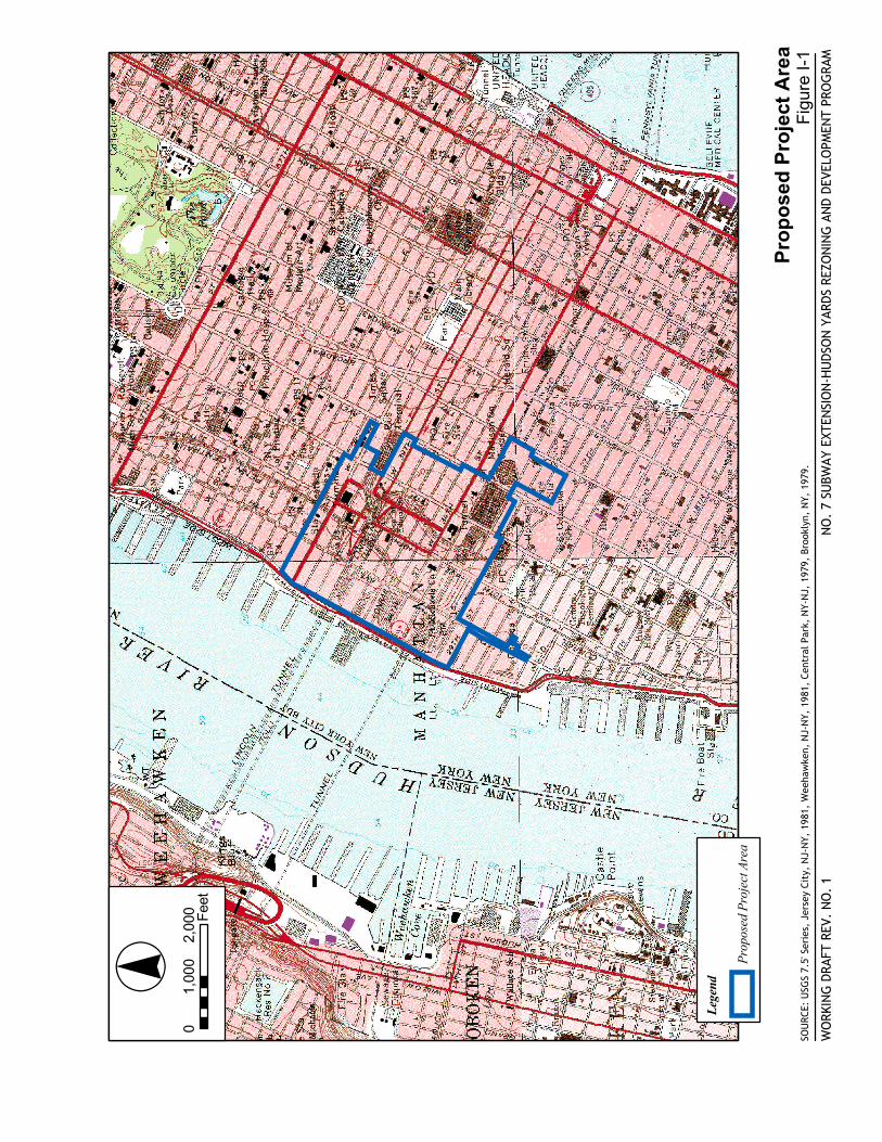
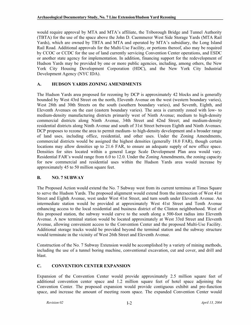
SOU
RCE:
USG
S 7.
5' S
erie
s, J
erse
y Ci
ty,
NJ-
NY,
198
1, W
eeha
wke
n, N
J-N
Y, 1
981,
Cen
tral
Par
k, N
Y-N
J, 1
979,
Bro
okly
n, N
Y, 1
979.
Pro
po
sed
Pro
ject
Are
a
NO
. 7
SUBW
AY E
XTEN
SIO
N-H
UDS
ON
YAR
DS R
EZO
NIN
G A
ND
DEVE
LOPM
ENT
PRO
GRA
M
Fig
ure
I-1
WO
RKIN
G D
RAFT
REV
. N
O.
1
·°«0
1,00
02,
000 Fe
et
Lege
nd
Prop
osed
Pro
ject
Are
a
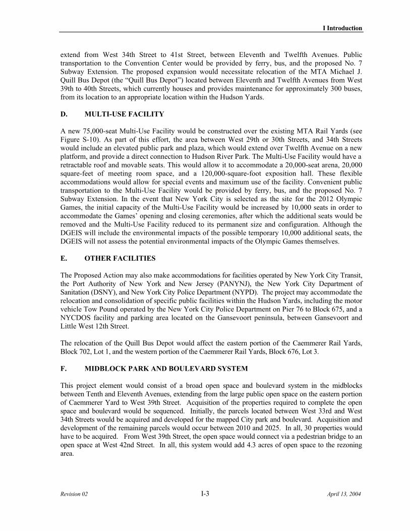
SOU
RCE:
New
Yor
k Ci
ty D
epar
tmen
t of
Cit
y Pl
anni
ng
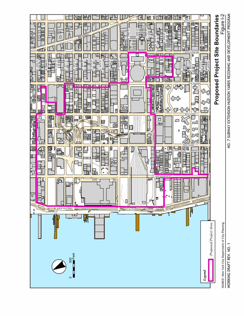
Pro
po
sed
Pro
ject
Sit
e B
ou
nd
arie
s
NO
. 7
SUBW
AY E
XTEN
SIO
N-H
UDS
ON
YAR
DS R
EZO
NIN
G A
ND
DEVE
LOPM
ENT
PRO
GRA
M
Fig
ure
I-2
WO
RKIN
G D
RAFT
REV
. N
O.
1
·°«0
500 F
eet
Lege
nd
Prop
osed
Pro
ject
Are
a
W. 4
3RD
ST.
W. 4
2ND
ST.
W. 4
1ST
ST.
W. 4
0TH
ST.
W. 3
9TH
ST.
W. 3
8TH
ST.
W. 3
7TH
ST.
W. 3
6TH
ST.
W. 3
5TH
ST.
W. 3
4TH
ST.
W. 3
3RD
ST.
W. 3
2ND
ST.
W. 3
1ST
ST.
W. 3
0TH
ST.
W. 2
9TH
ST.
W. 2
8ST
ST.
W. 2
7TH
ST.
W. 2
6TH
ST.
W. 2
5TH
ST.
SEVENTH AVE
EIGHTH AVE
NINTH AVE
TENTH AVE
ELEVENTH AVE
TWELFTH AVE ROUTE 9A
BROADWAY
W. 2
4TH
ST.
SIXTH AVE
WO
RKIN
G D
RAFT
NO
.2
NO
.7 S
UBW
AY E
XTEN
SIO
N-H
UDS
ON
YAR
DS R
EZO
NIN
G A
ND
DEVE
LOPM
ENT
PRO
GRA
M
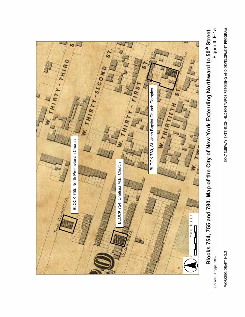
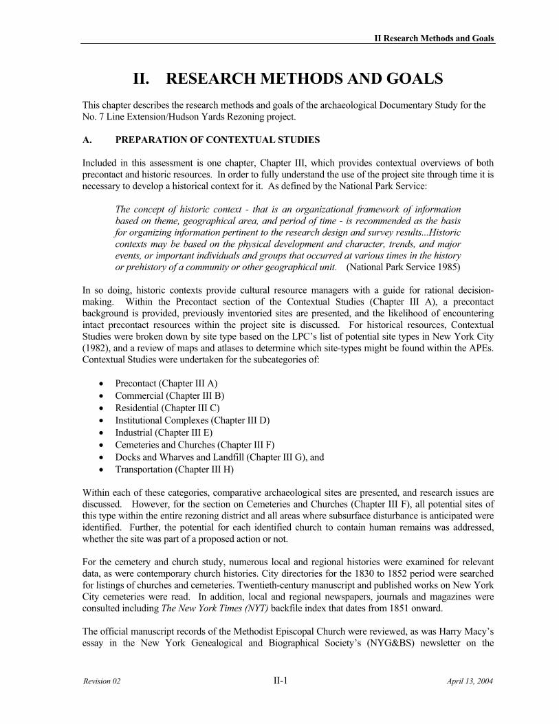
Blo
cks
754,
755
an
d 7
80. M
ap o
f th
e C
ity
of
New
Yo
rk E
xten
din
g N
ort
hw
ard
to
50th
Str
eet.
S
ourc
e:
Drip
ps, 1
852.
Fig
ure
III F
-1a
BLO
CK
755
, Nor
th P
resb
yter
ian
Chu
rch
BLO
CK
754
, Che
lsea
M.E
. Chu
rch
BLO
CK
780
, St.
John
Bap
tist C
hurc
h C
ompl
ex
0
20
0 F
ee
t
WO
RKIN
G D
RAFT
NO
.2
NO
.7 S
UBW
AY E
XTEN
SIO
N-H
UDS
ON
YAR
DS R
EZO
NIN
G A
ND
DEVE
LOPM
ENT
PRO
GRA
M
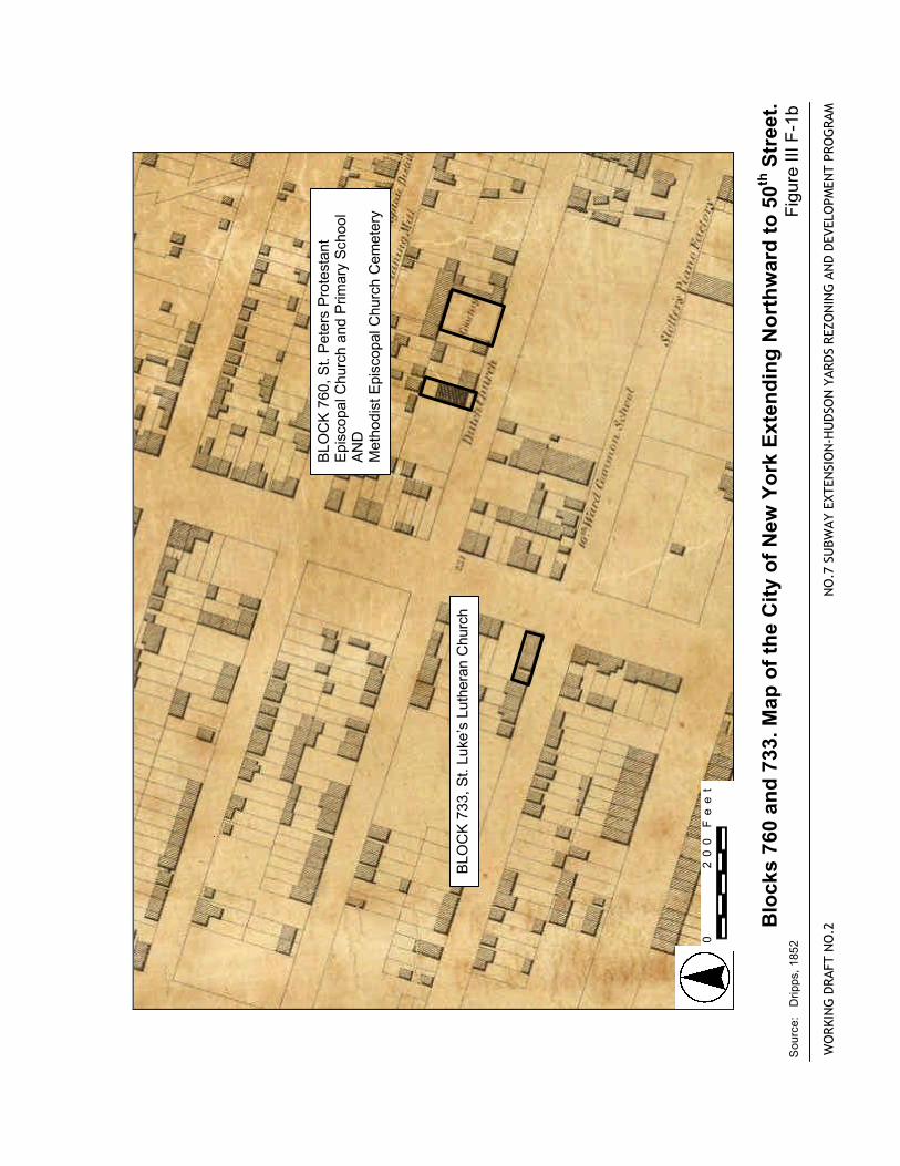
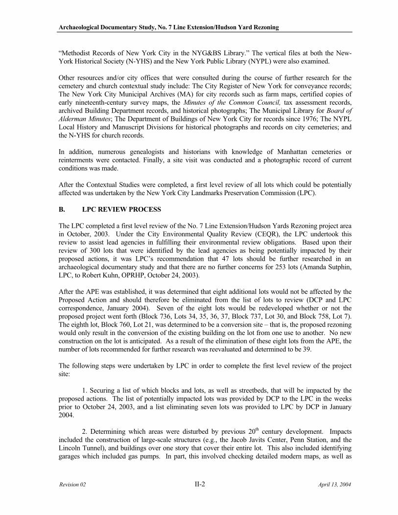
Blo
cks
760
and
733
. Map
of
the
Cit
y o
f N
ew Y
ork
Ext
end
ing
No
rth
war
d t
o 5
0th S
tree
t.
Sou
rce:
D
ripps
, 185
2
Fig
ure
III F
-1b
BLO
CK
760
, St.
Pet
ers
Pro
test
ant
Epi
scop
al C
hurc
h an
d P
rimar
y S
choo
l A
ND
M
etho
dist
Epi
scop
al C
hurc
h C
emet
ery
BLO
CK
733
, St.
Luke
’s L
uthe
ran
Chu
rch
0
20
0 F
ee
t
WO
RKIN
G D
RAFT
NO
.1
NO
.7 S
UBW
AY E
XTEN
SIO
N-H
UDS
ON
YAR
DS R
EZO
NIN
G A
ND
DEVE
LOPM
ENT
PRO
GRA
M
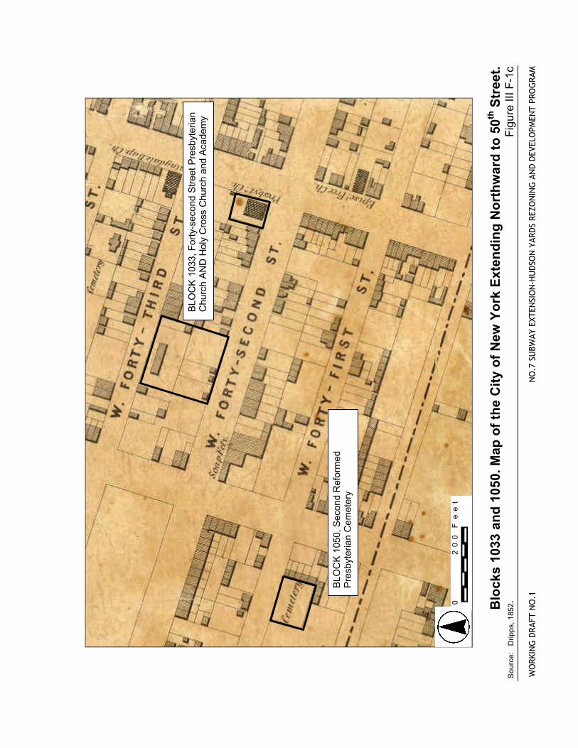
Blo
cks
1033
an
d 1
050.
Map
of
the
Cit
y o
f N
ew Y
ork
Ext
end
ing
No
rth
war
d t
o 5
0th S
tree
t.
Sou
rce:
D
ripps
, 185
2.
Fig
ure
III F
-1c
BLO
CK
103
3, F
orty
-sec
ond
Stre
et P
resb
yter
ian
Chu
rch
AN
D H
oly
Cro
ss C
hurc
h an
d A
cade
my
BLO
CK
105
0, S
econ
d R
efor
med
P
resb
yter
ian
Cem
eter
y
0
20
0 F
ee
t
0 200 Feet
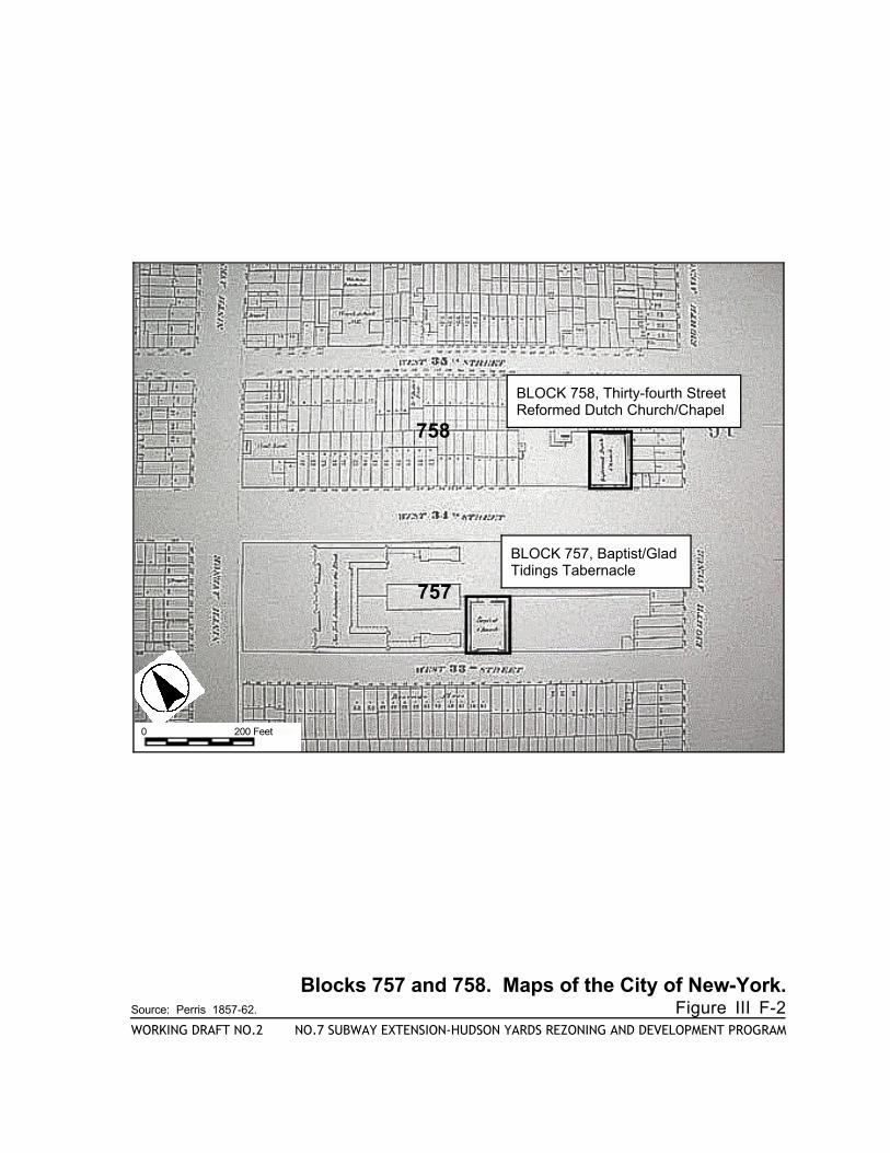
758
757
Blocks 757 and 758. Maps of the City of New-York.Source: Perris 1857-62. Figure III F-2WORKING DRAFT NO.2 NO.7 SUBWAY EXTENSION-HUDSON YARDS REZONING AND DEVELOPMENT PROGRAM
BLOCK 758, Thirty-fourth Street Reformed Dutch Church/Chapel
BLOCK 757, Baptist/Glad Tidings Tabernacle
WEST 36th STREET
WEST 35th STREET
WEST 34th STREET
WEST 33rd STREET
WEST 32nd STREET
WEST 31st STREET
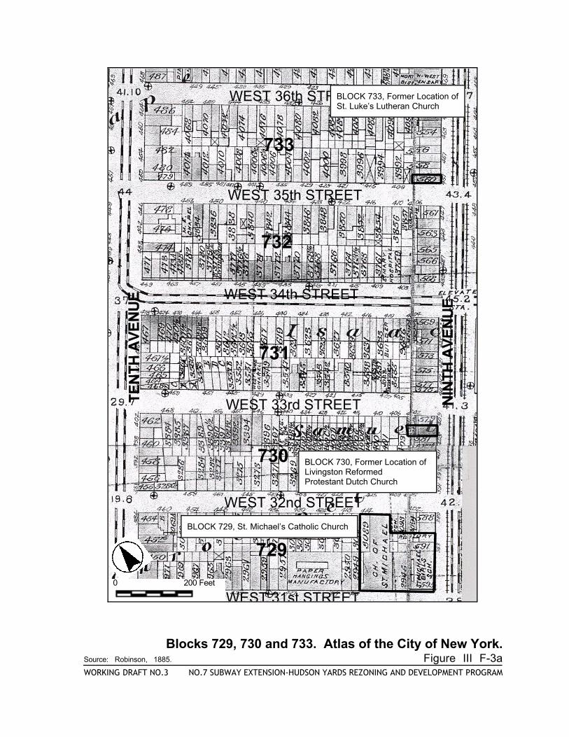
729
730
731
732
733
0 200 Feet
BLOCK 729, St. Michael’s Catholic Church
BLOCK 730, Former Location ofLivingston Reformed Protestant Dutch Church
BLOCK 733, Former Location of St. Luke’s Lutheran Church
Blocks 729, 730 and 733. Atlas of the City of New York.Source: Robinson, 1885. Figure III F-3aWORKING DRAFT NO.3 NO.7 SUBWAY EXTENSION-HUDSON YARDS REZONING AND DEVELOPMENT PROGRAM
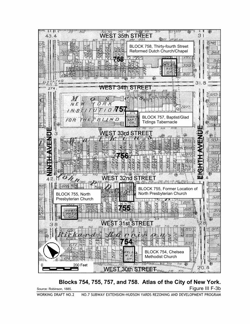
Blocks 754, 755, 757, and 758. Atlas of the City of New York.Source: Robinson, 1885. Figure III F-3bWORKING DRAFT NO.2 NO.7 SUBWAY EXTENSION-HUDSON YARDS REZONING AND DEVELOPMENT PROGRAM
BLOCK 758, Thirty-fourth Street Reformed Dutch Church/Chapel
BLOCK 757, Baptist/Glad Tidings Tabernacle
BLOCK 755, Former Location of North Presbyterian ChurchBLOCK 755, North
Presbyterian Church
BLOCK 754, ChelseaMethodist Church
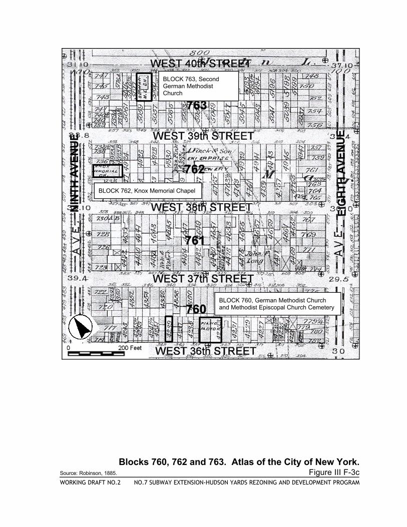
BLOCK 760, German Methodist Churchand Methodist Episcopal Church Cemetery
BLOCK 763, SecondGerman MethodistChurch
BLOCK 762, Knox Memorial Chapel
Blocks 760, 762 and 763. Atlas of the City of New York.Source: Robinson, 1885. Figure III F-3cWORKING DRAFT NO.2 NO.7 SUBWAY EXTENSION-HUDSON YARDS REZONING AND DEVELOPMENT PROGRAM
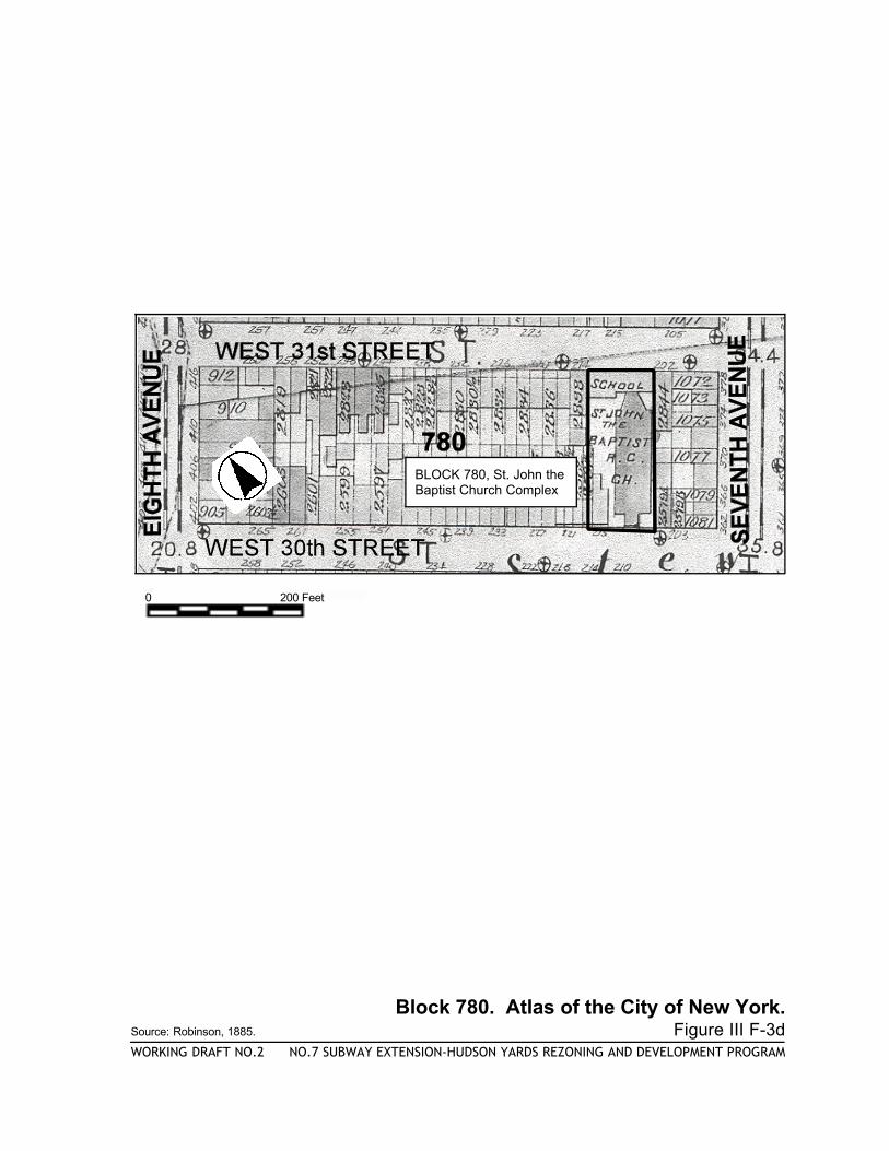
BLOCK 780, St. John theBaptist Church Complex
0 200 Feet
Block 780. Atlas of the City of New York.Source: Robinson, 1885. Figure III F-3dWORKING DRAFT NO.2 NO.7 SUBWAY EXTENSION-HUDSON YARDS REZONING AND DEVELOPMENT PROGRAM
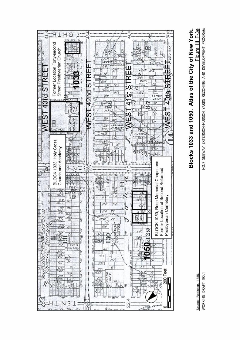
Blo
cks
1033
and
105
0. A
tlas
of th
e C
ity o
f New
Yor
k.S
ourc
e:
Rob
inso
n,
1885
.
F
igur
e III
F-3
eW
ORK
ING
DRA
FT N
O.1
NO
.7 S
UBW
AY E
XTEN
SIO
N-H
UD
SON
YAR
DS
REZO
NIN
G A
ND
DEV
ELO
PMEN
T PR
OG
RAM
BLO
CK
103
3, H
oly
Cro
ss
Chu
rch
and
Aca
dem
yF
orm
er L
ocat
ion
For
ty-s
econ
d S
treet
Pre
sbyt
eria
n C
hurc
h
BLO
CK
105
0, R
ose
Mem
oria
l Cha
pel a
ndF
orm
er L
ocat
ion
of S
econ
d R
efor
med
Pre
sbyt
eria
n C
emet
ery
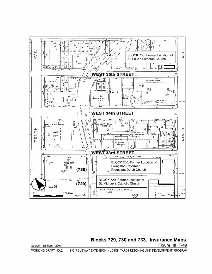
BLOCK 729, Former Location of St. Michael’s Catholic Church
BLOCK 730, Former Location ofLivingston Reformed Protestant Dutch Church
BLOCK 733, Former Location of St. Luke’s Lutheran Church
Blocks 729, 730 and 733. Insurance Maps.Source: Sanborn, 2001. Figure III F-4aWORKING DRAFT NO.2 NO.7 SUBWAY EXTENSION-HUDSON YARDS REZONING AND DEVELOPMENT PROGRAM
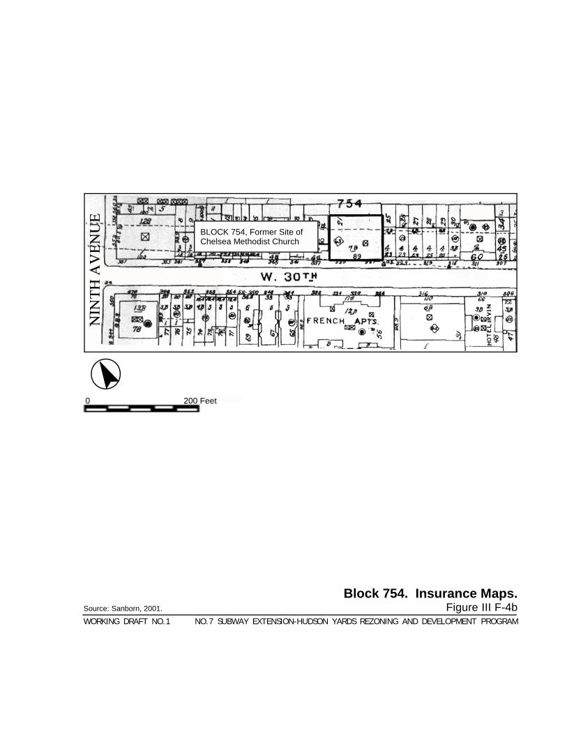
Block 754. Insurance Maps.Source: Sanborn, 2001. Figure III F-4bWORKING DRAFT NO.1 NO.7 SUBWAY EXTENSION-HUDSON YARDS REZONING AND DEVELOPMENT PROGRAM
BLOCK 754, Former Site ofChelsea Methodist Church
0 200 Feet
0 200 Feet
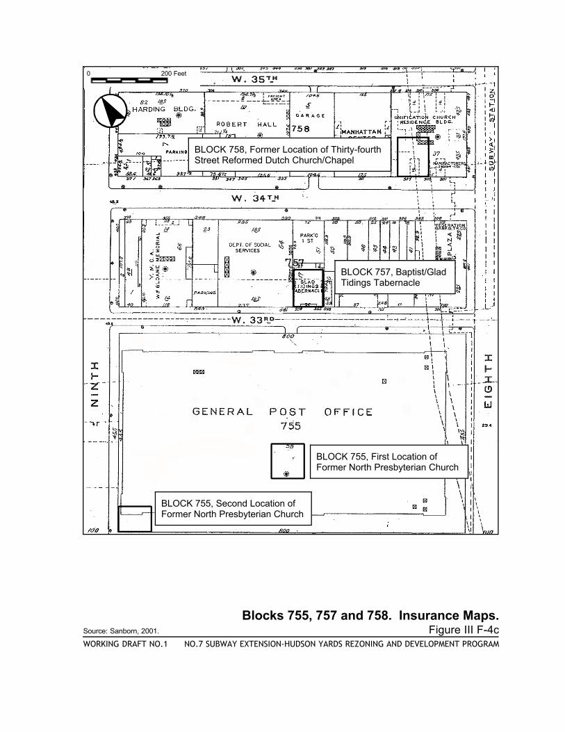
Blocks 755, 757 and 758. Insurance Maps.Source: Sanborn, 2001. Figure III F-4cWORKING DRAFT NO.1 NO.7 SUBWAY EXTENSION-HUDSON YARDS REZONING AND DEVELOPMENT PROGRAM
BLOCK 757, Baptist/Glad Tidings Tabernacle
BLOCK 755, First Location ofFormer North Presbyterian Church
BLOCK 758, Former Location of Thirty-fourthStreet Reformed Dutch Church/Chapel
BLOCK 755, Second Location ofFormer North Presbyterian Church
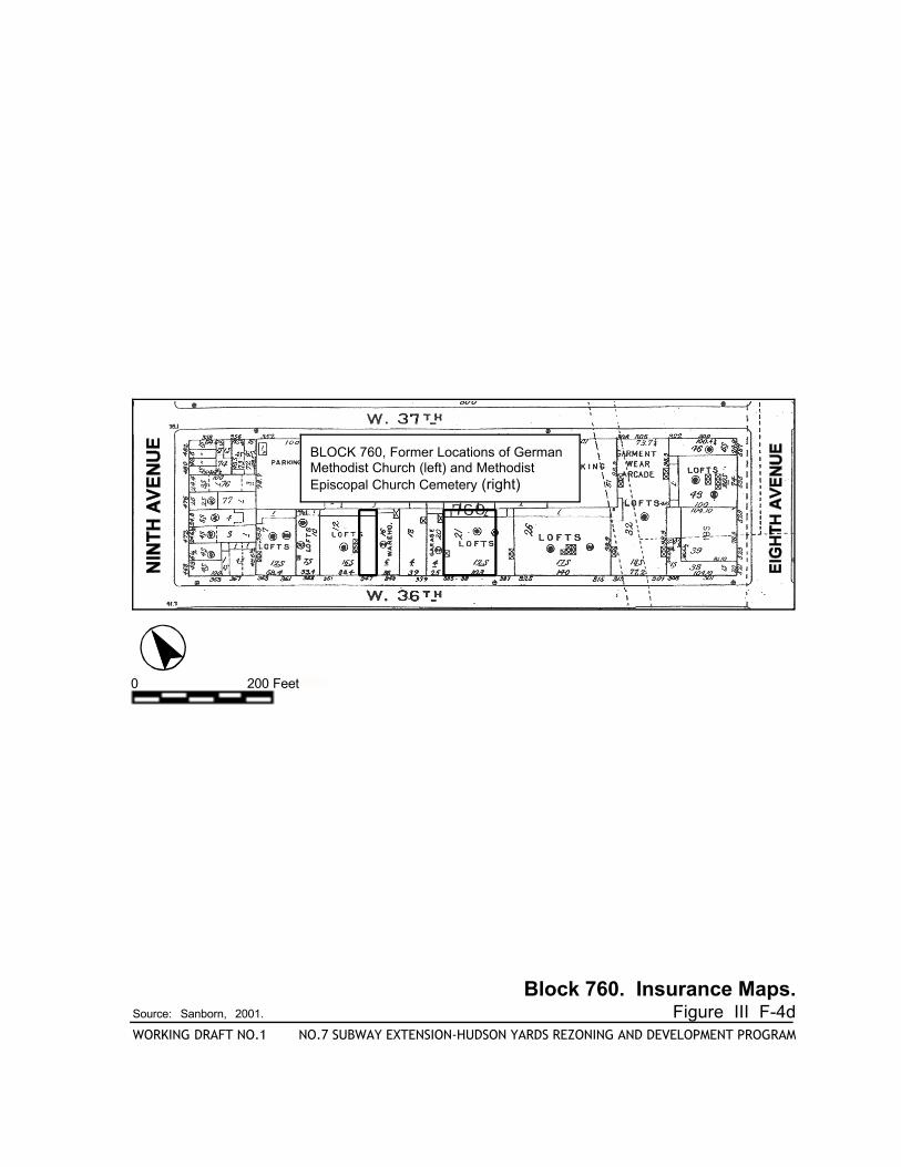
BLOCK 760, Former Locations of GermanMethodist Church (left) and MethodistEpiscopal Church Cemetery (right)
0 200 Feet
Block 760. Insurance Maps.Source: Sanborn, 2001. Figure III F-4dWORKING DRAFT NO.1 NO.7 SUBWAY EXTENSION-HUDSON YARDS REZONING AND DEVELOPMENT PROGRAM
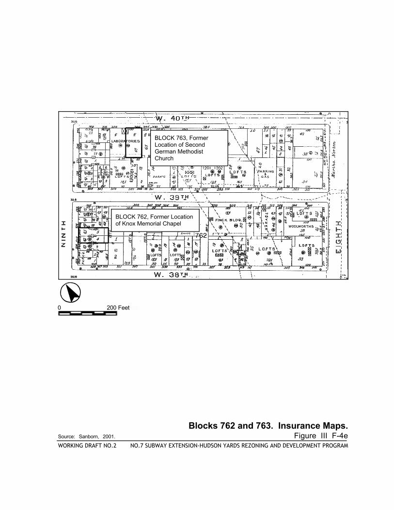
BLOCK 763, FormerLocation of SecondGerman MethodistChurch
BLOCK 762, Former Location of Knox Memorial Chapel
Blocks 762 and 763. Insurance Maps.Source: Sanborn, 2001. Figure III F-4eWORKING DRAFT NO.2 NO.7 SUBWAY EXTENSION-HUDSON YARDS REZONING AND DEVELOPMENT PROGRAM
0 200 Feet
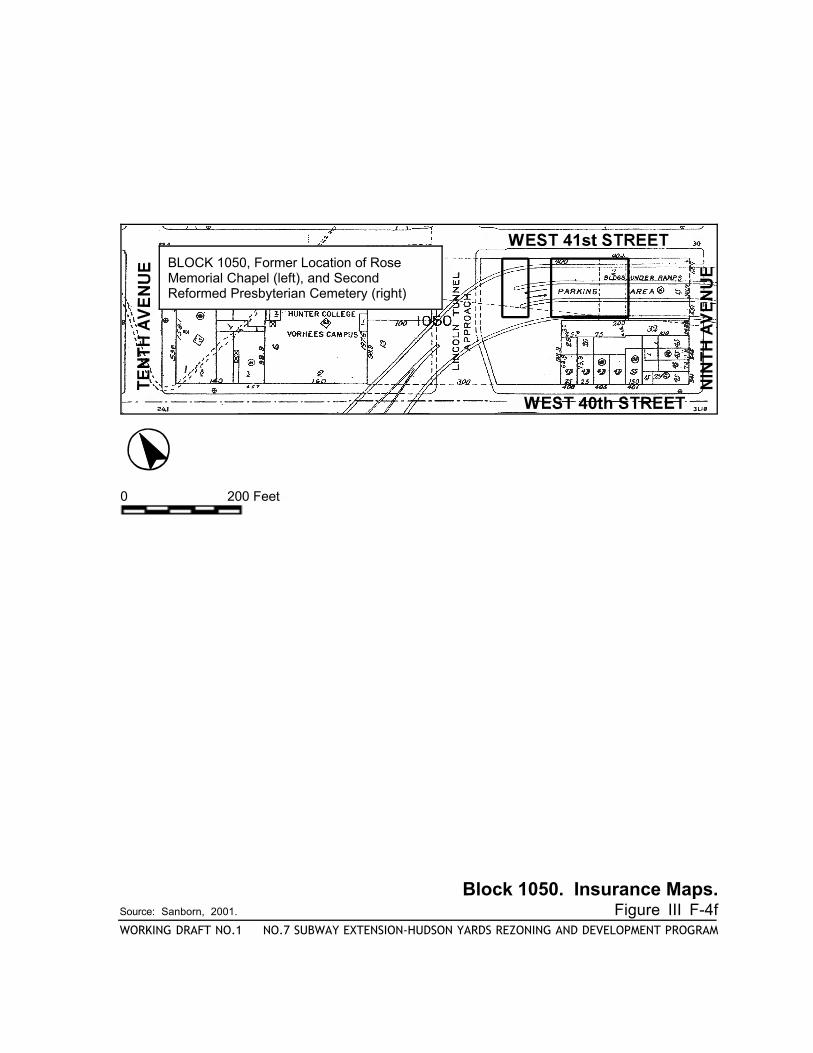
Block 1050. Insurance Maps.Source: Sanborn, 2001. Figure III F-4fWORKING DRAFT NO.1 NO.7 SUBWAY EXTENSION-HUDSON YARDS REZONING AND DEVELOPMENT PROGRAM
BLOCK 1050, Former Location of RoseMemorial Chapel (left), and SecondReformed Presbyterian Cemetery (right)
0 200 Feet
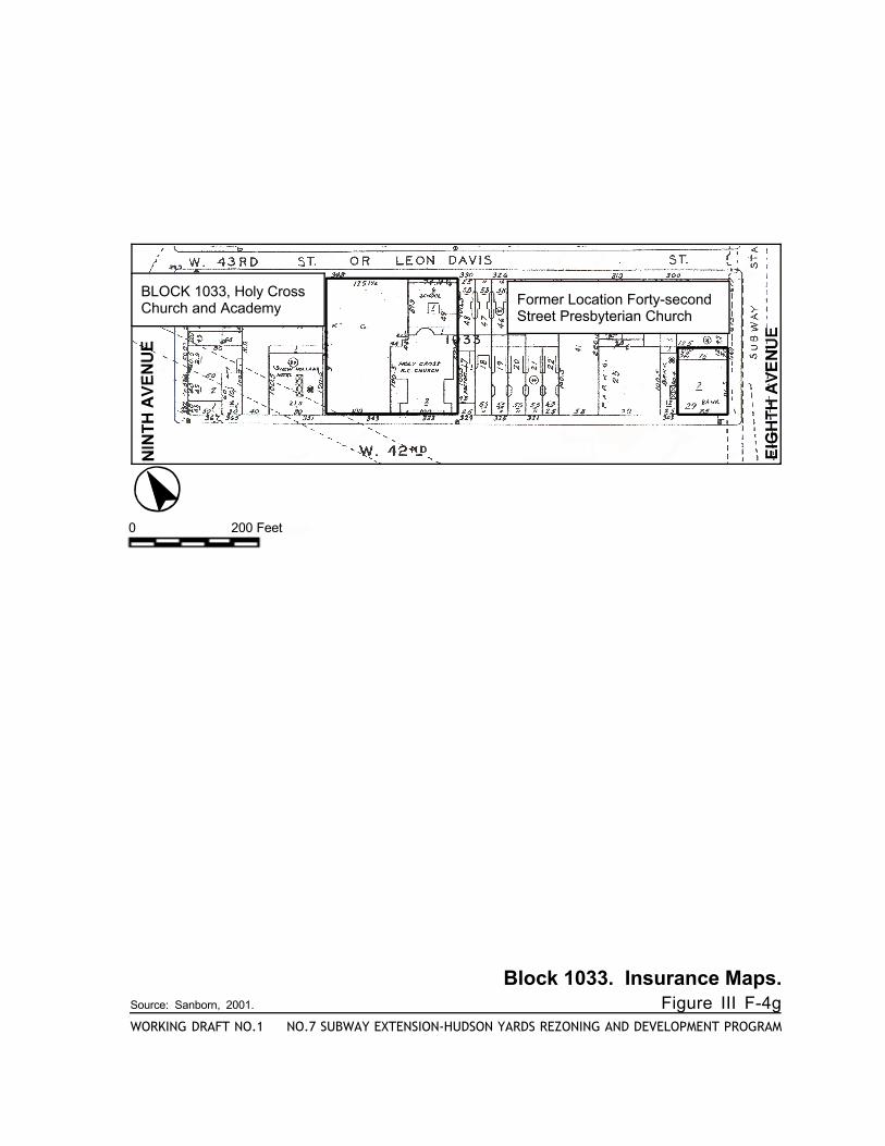
Block 1033. Insurance Maps.Source: Sanborn, 2001. Figure III F-4gWORKING DRAFT NO.1 NO.7 SUBWAY EXTENSION-HUDSON YARDS REZONING AND DEVELOPMENT PROGRAM
BLOCK 1033, Holy Cross Church and Academy Former Location Forty-second
Street Presbyterian Church
0 200 Feet
(732
(70629
22
58
35thSTREET
34thSTREET
33thSTREET
TENTHAVENUE
ELEVENTHAVENUE
BLOCK706,Lot29
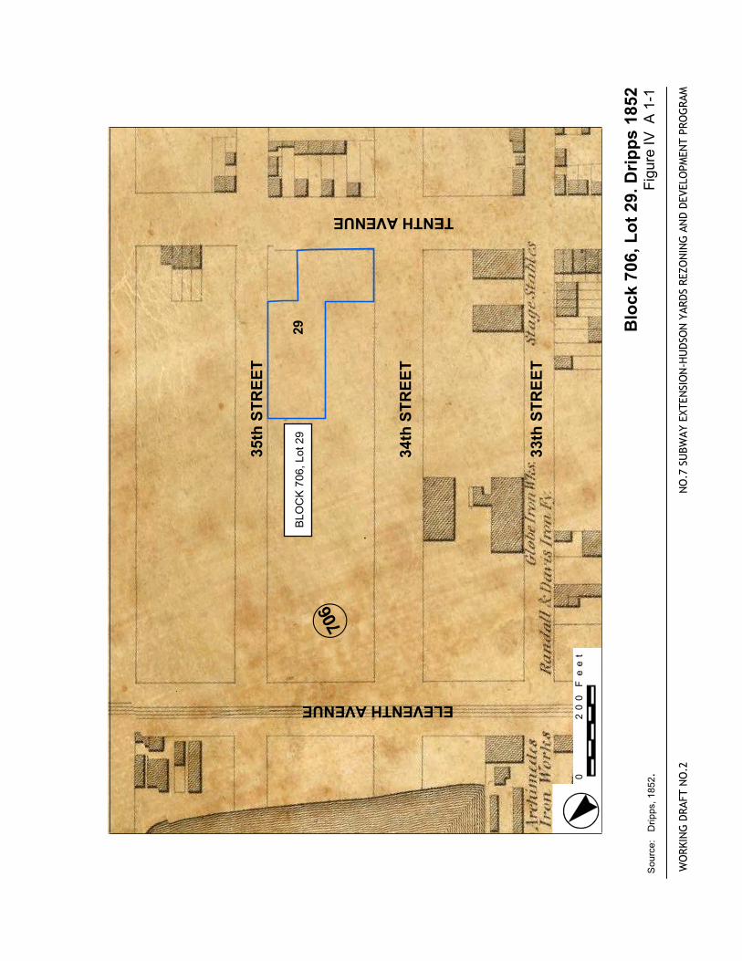
Block
706,Lot29.Dripps1852
Figu
reIV
A 1
-1
WORKINGDRAFTNO.2
NO.7
SUBWAYEXTENSION-HUDSONYARDSREZONINGANDDEVELOPMENTPROGRAM
Source:Dripps,1852.
.
0200Feet
36th
STR
EET
35th
STR
EET
34th
STR
EET
BLO
CK
706
, Lot
29
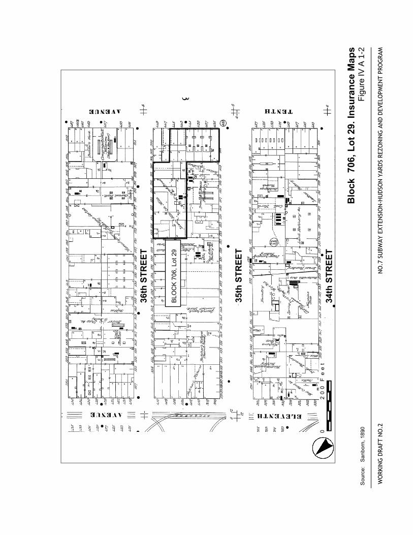
Blo
ck 7
06, L
ot 2
9. In
sura
nce
Map
s Fi
gure
IV A
1-2
WO
RKIN
G D
RAFT
NO
.2
NO
.7 S
UBW
AY E
XTEN
SIO
N-H
UD
SON
YAR
DS
REZO
NIN
G A
ND
DEV
ELO
PMEN
T PR
OG
RAM
Sou
rce:
S
anbo
rn, 1
890.
.
0
20
0 F
ee
t
WEST35thSTREET
WEST36thSTREET
WEST34thSTREET
TENTHAVENUE
WEST33rdSTREET
BLOCK706,Lot29
WORKINGDRAFTNO.2
NO.7
SUBWAYEXTENSION-HUDSONYARDSREZONINGANDDEVELOPMENTPROGRAM
Block
706,Lot29.InsuranceMaps
Source:Sanborn,2001..
FigureIVA
1-3
.
0200Feet
(731
(732
(707
(705
31
22
58
6059
42
36thSTREET
37thSTREET
35thSTREET
34thSTREET
BLOCK707,Lot31 Block
707,Lot31.Dripps1852
FigureIV
A 2
-1
WORKINGDRAFTNO.2
NO.7
SUBWAYEXTENSION-HUDSONYARDSREZONINGANDDEVELOPMENTPROGRAM
Source:Dripps,1852.
.
0200Feet
35thSTREET
34thSTREET
33rdSTREET
BLOCK707,Lot31
Block
707,Lot31.InsuranceMaps
FigureIV
A 2
-2
WORKINGDRAFTNO.2
NO.7
SUBWAYEXTENSION-HUDSONYARDSREZONINGANDDEVELOPMENTPROGRAM
Source:Sanborn,1890.
.
0200Feet
WEST35thSTREET
WEST36thSTREET
WEST34thSTREET
TENTHAVENUE
WEST33rdSTREET
BLOCK707,Lot31
WORKINGDRAFTNO.2
NO.7
SUBWAYEXTENSION-HUDSONYARDSREZONINGANDDEVELOPMENTPROGRAM
Block
707,Lot31.InsuranceMaps
Source:Sanborn,2001..
FigureIVA
2-3
.
0200Feet
(707
(
(709
29
31
25
58
70
8
6059
39thSTREET
38thSTREET
40thSTREET
37thSTREET
TENTHAVENUE
ELEVENTHAVENUE
BLOCK709,Lot25
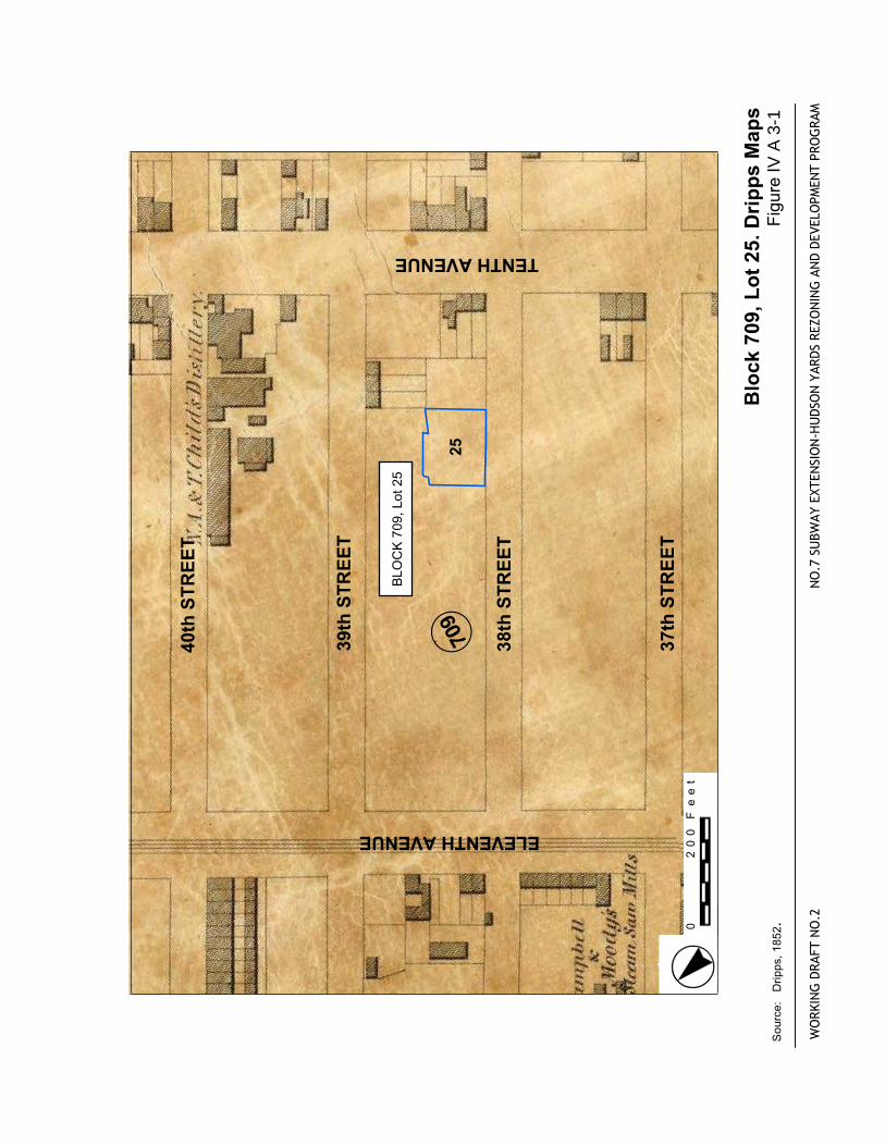
Block
709,Lot25.DrippsMaps
FigureIV
A 3
-1
WORKINGDRAFTNO.2
NO.7
SUBWAYEXTENSION-HUDSONYARDSREZONINGANDDEVELOPMENTPROGRAM
Source:Dripps,1852.
.
0200Feet
39thSTREET
38thSTREET
37thSTREET
BLOCK709,Lot25
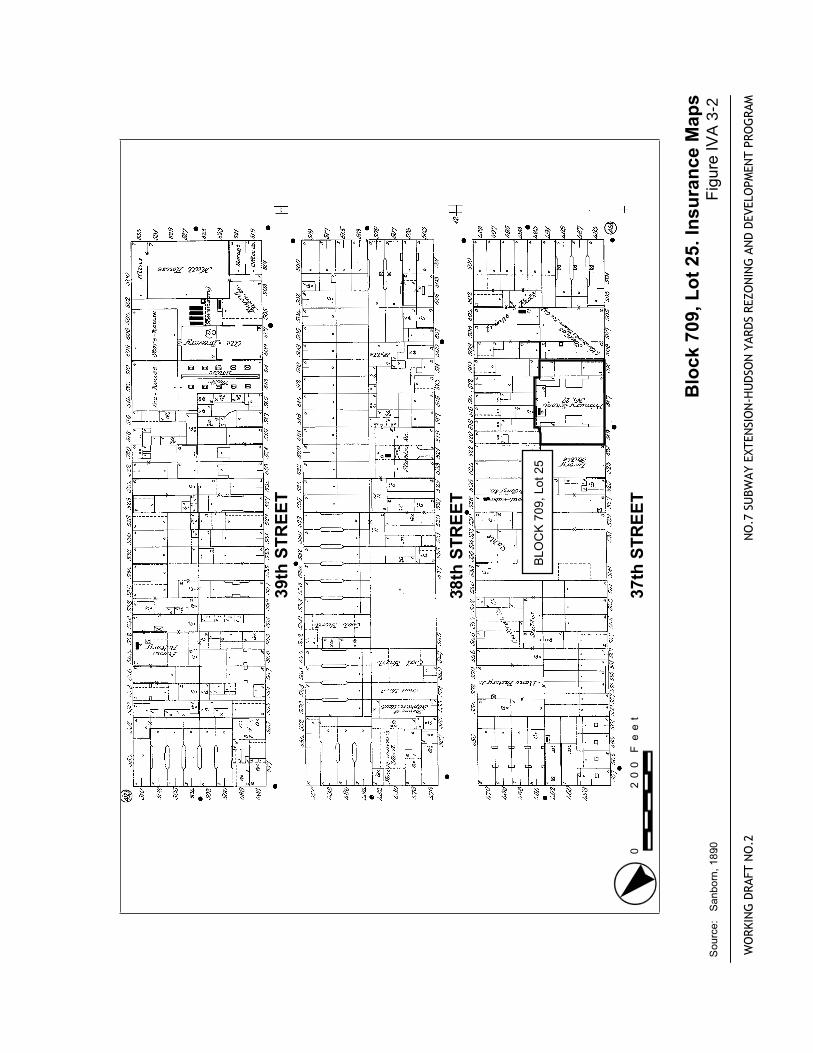
Block
709,Lot25.InsuranceMaps
FigureIV
A 3
-2
WORKINGDRAFTNO.2
NO.7
SUBWAYEXTENSION-HUDSONYARDSREZONINGANDDEVELOPMENTPROGRAM
Source:Sanborn,1890.
.
0200Feet
WEST38thSTREET
WEST39thSTREET
WEST40thSTREET
WEST37thSTREET
TENTHAVENUE
ELEVENTHAVENUE
BLOCK709,Lot25
WORKINGDRAFTNO.2
NO.7
SUBWAYEXTENSION-HUDSONYARDSREZONINGANDDEVELOPMENTPROGRAM
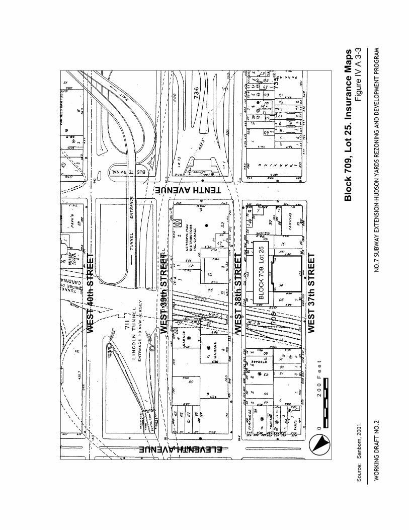
Block
709,Lot25.InsuranceMaps
Source:Sanborn,2001..
FigureIV
A 3
-3
0200Feet
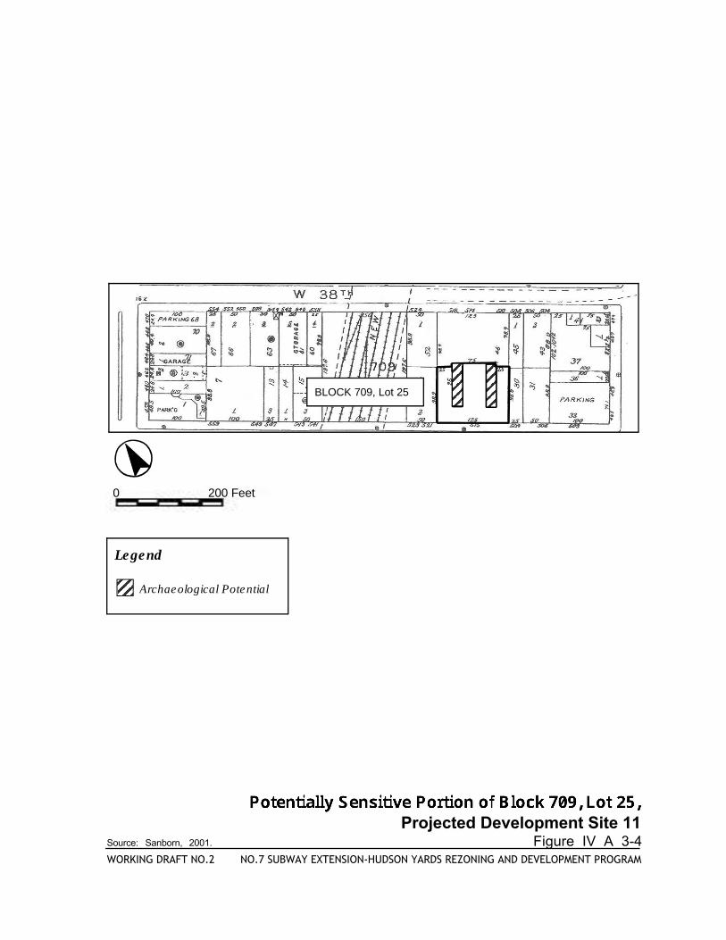
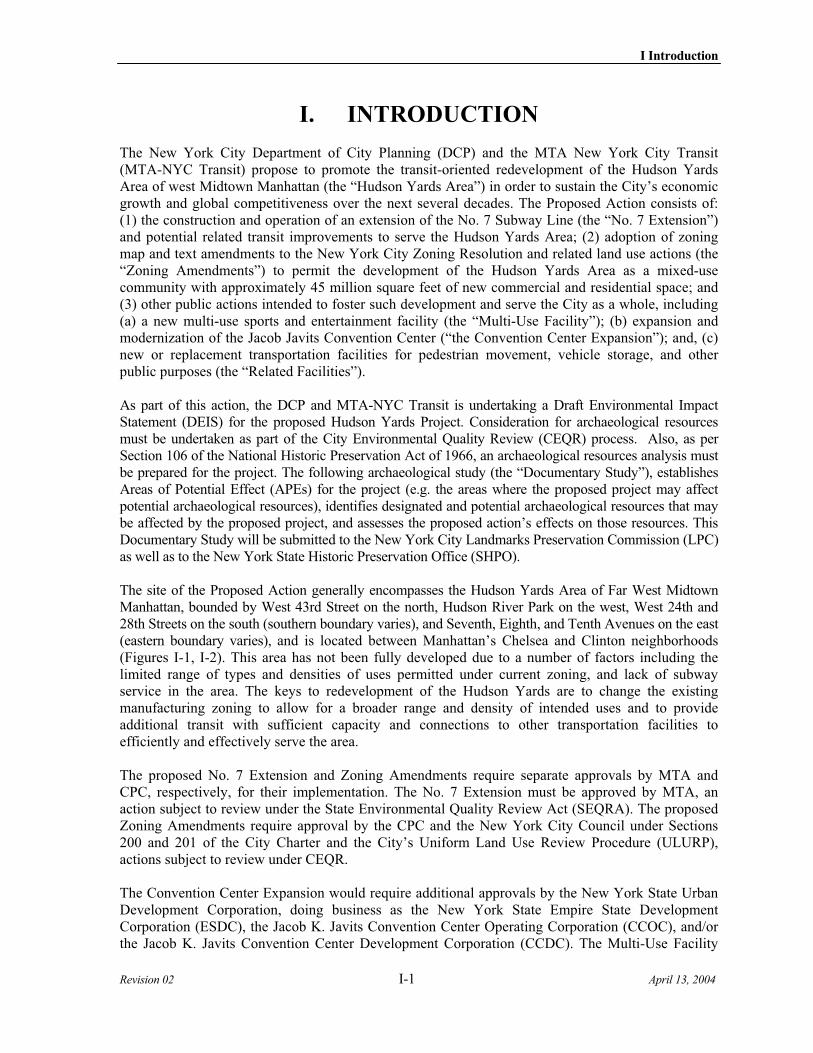
Projected Development Site 11Source: Sanborn, 2001. Figure IV A 3-4WORKING DRAFT NO.2 NO.7 SUBWAY EXTENSION-HUDSON YARDS REZONING AND DEVELOPMENT PROGRAM
Legend
Archaeological Potential
BLOCK 709, Lot 25
0 200 Feet
(707
(
(709
29
31
58
70
8
6059
68
39thSTREET
38thSTREET
40thSTREET
37thSTREET
TENTHAVENUE
ELEVENTHAVENUE
BLOCK709,Lot68
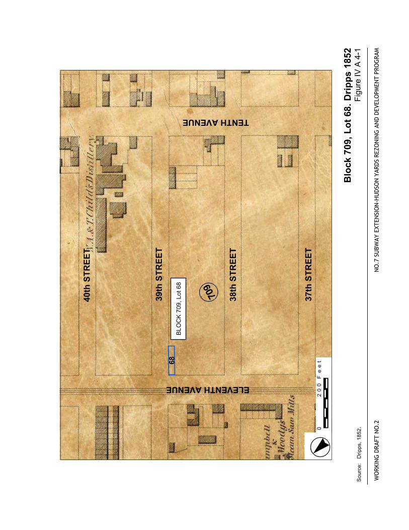
Block
709,Lot68.Dripps1852
FigureIVA4-1
WORKINGDRAFTNO.2
NO.7
SUBWAYEXTENSION-HUDSONYARDSREZONINGANDDEVELOPMENTPROGRAM
Source:Dripps,1852.
.
0200Feet
39thSTREET
38thSTREET
37thSTREET
BLOCK709,Lot68
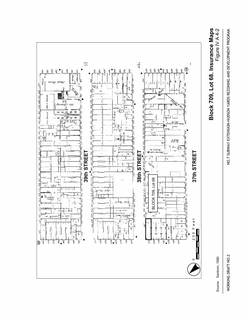
Block
709,Lot68.InsuranceMaps
FigureIVA4-2
WORKINGDRAFTNO.2
NO.7
SUBWAYEXTENSION-HUDSONYARDSREZONINGANDDEVELOPMENTPROGRAM
Source:Sanborn,1890.
.
0200Feet
WEST38thSTREET
WEST39thSTREET
WEST40thSTREET
WEST37thSTREET
TENTHAVENUE
ELEVENTHAVENUE
BLOCK709,Lot68
WORKINGDRAFTNO.2
NO.7
SUBWAYEXTENSION-HUDSONYARDSREZONINGANDDEVELOPMENTPROGRAM
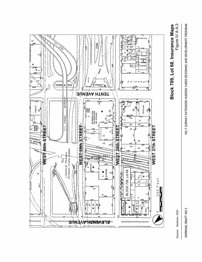
Block
709,Lot68.InsuranceMaps
Source:Sanborn,2001..
FigureIVA4-3
0200Feet
(707
(
(7101
29
31
58
70
8
6059
39thSTREET
38thSTREET
40thSTREET
37thSTREET
TENTHAVENUE
ELEVENTHAVENUEBLOCK710,Lot1
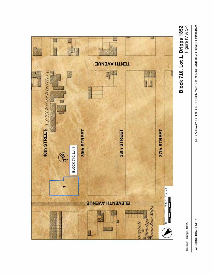
Block
710,Lot
1.Dripps1852
FigureIVA5-1
WORKINGDRAFTNO.2
NO.7
SUBWAYEXTENSION-HUDSONYARDSREZONINGANDDEVELOPMENTPROGRAM
Source:Dripps,1852.
.
0200Feet
39thSTREET
38thSTREET
37thSTREET
BLOCK710,Lot1
Block
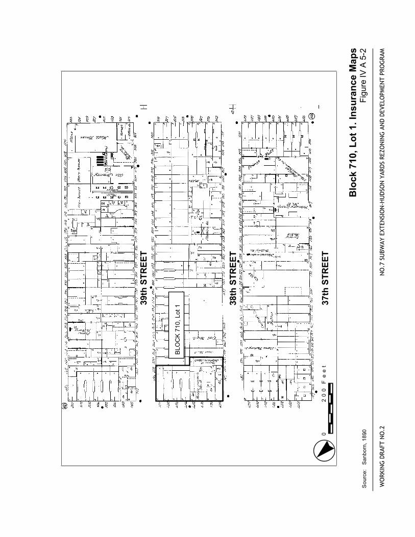
710,Lot1.InsuranceMaps
FigureIVA5-2
WORKINGDRAFTNO.2
NO.7
SUBWAYEXTENSION-HUDSONYARDSREZONINGANDDEVELOPMENTPROGRAM
Source:Sanborn,1890.
.
0200Feet
WEST38thSTREET
WEST39thSTREET
WEST40thSTREET
WEST37thSTREET
TENTHAVENUE
ELEVENTHAVENUE
BLOCK710,Lot1
WORKINGDRAFTNO.2
NO.7
SUBWAYEXTENSION-HUDSONYARDSREZONINGANDDEVELOPMENTPROGRAM
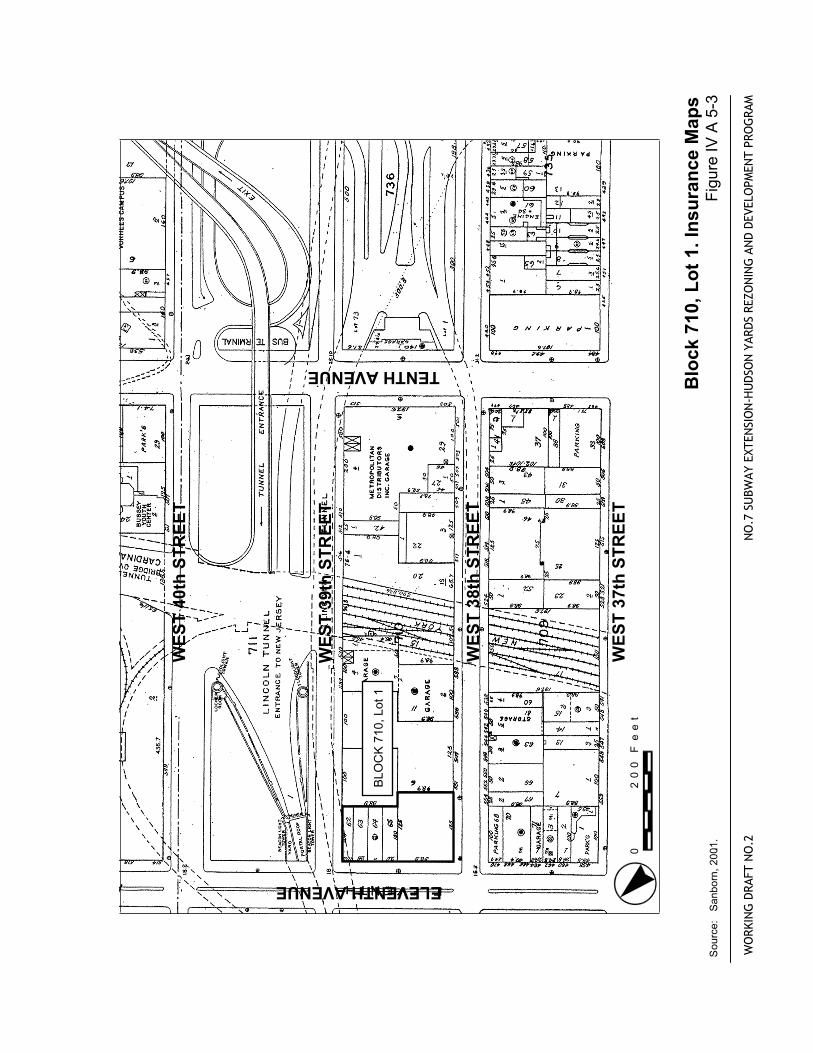
Block
710,Lot1.InsuranceMaps
Source:Sanborn,2001..
FigureIVA5-3
0200Feet
(72834
31stSTREET
32ndSTREET
30thSTREET
NINTHAVENUE
TENTHAVENUE
39thSTREET
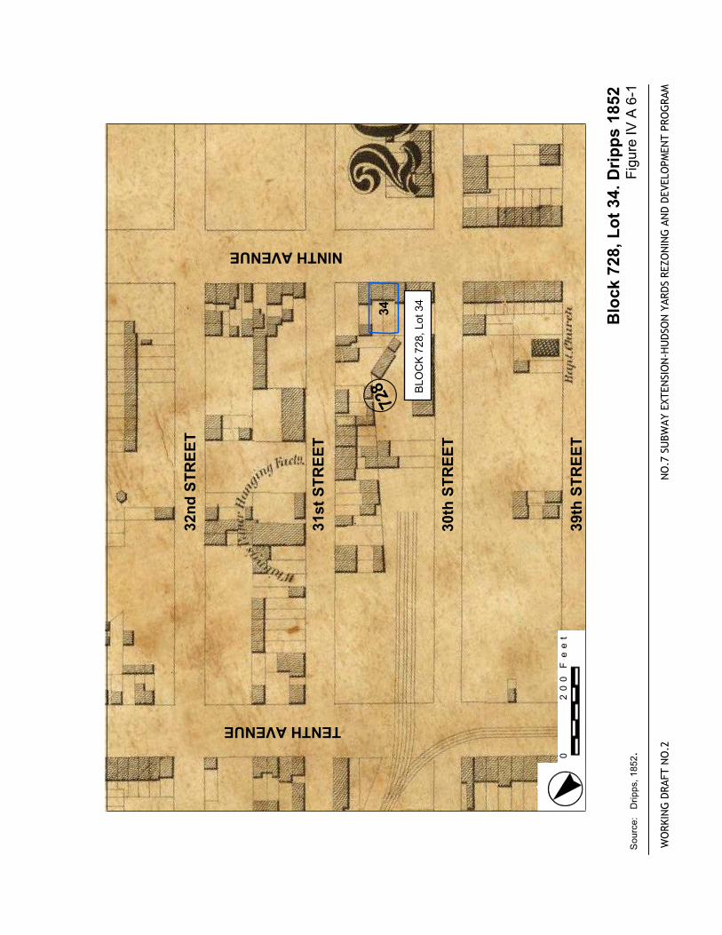
BLOCK728,Lot34
Block
728,Lot34.Dripps1852
FigureIVA6-1
WORKINGDRAFTNO.2
NO.7
SUBWAYEXTENSION-HUDSONYARDSREZONINGANDDEVELOPMENTPROGRAM
Source:Dripps,1852.
.
0200Feet
West31thSTREET
West30thSTREET
West29thSTREET
BLOCK728,Lot34
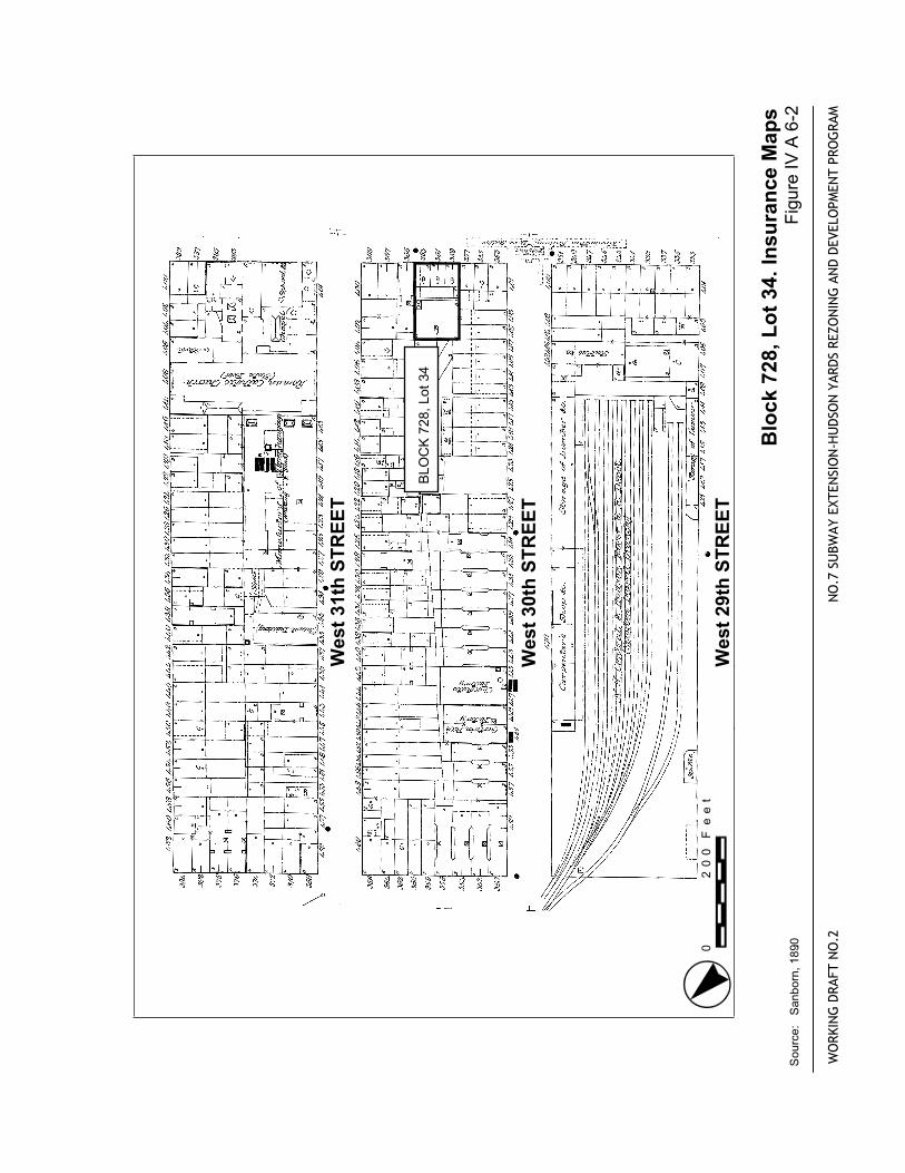
Block
728,Lot34.InsuranceMaps
FigureIVA6-2
WORKINGDRAFTNO.2
NO.7
SUBWAYEXTENSION-HUDSONYARDSREZONINGANDDEVELOPMENTPROGRAM
Source:Sanborn,1890.0
200Feet
WEST29rdSTREET
WEST30thSTREET
WEST31stSTREET
WEST28thSTREET
NINTHAVENUE
TENTHAVENUE
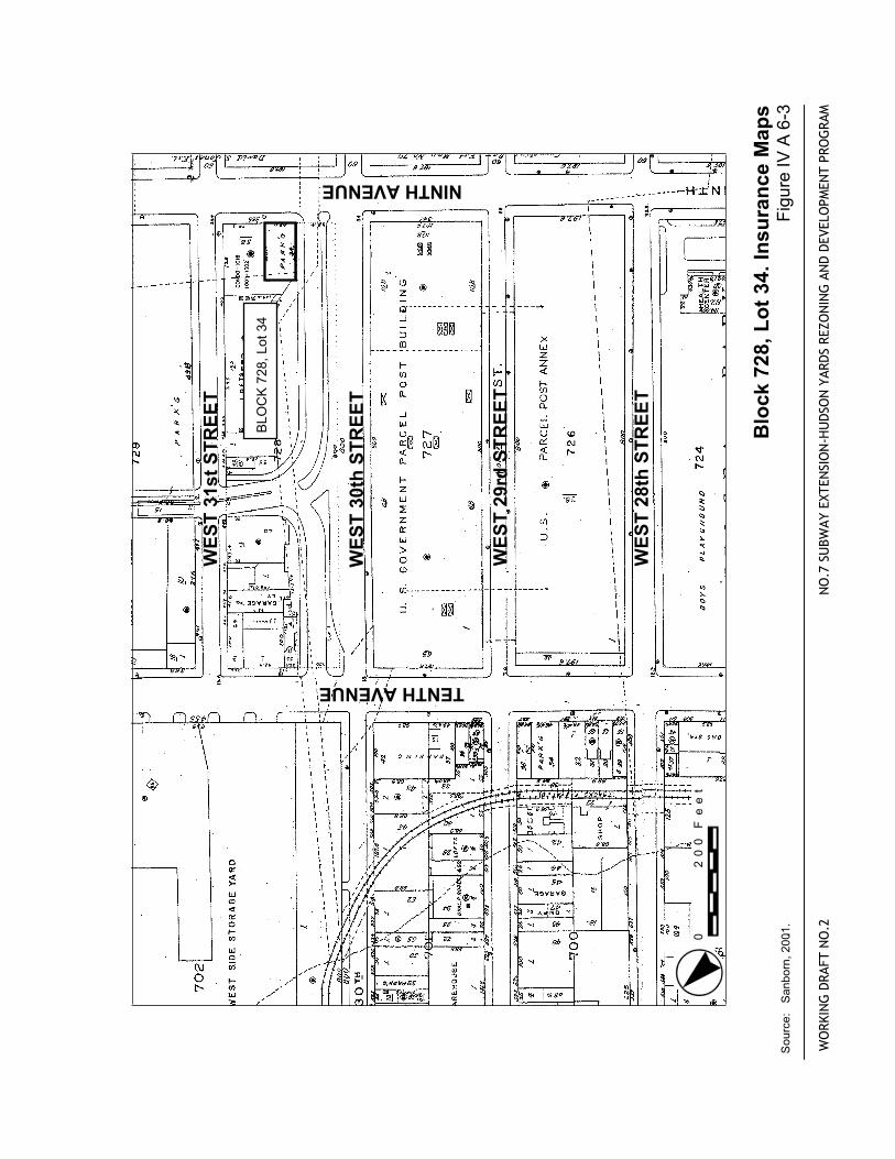
BLOCK728,Lot34
WORKINGDRAFTNO.2
NO.7
SUBWAYEXTENSION-HUDSONYARDSREZONINGANDDEVELOPMENTPROGRAM
Block
728,Lot34.InsuranceMaps
Source:Sanborn,2001..
FigureIVA6-3
0200Feet
(731
29
21
22
35thSTREET
34thSTREET
33rdSTREET
NINTHAVENUE
TENTHAVENUE
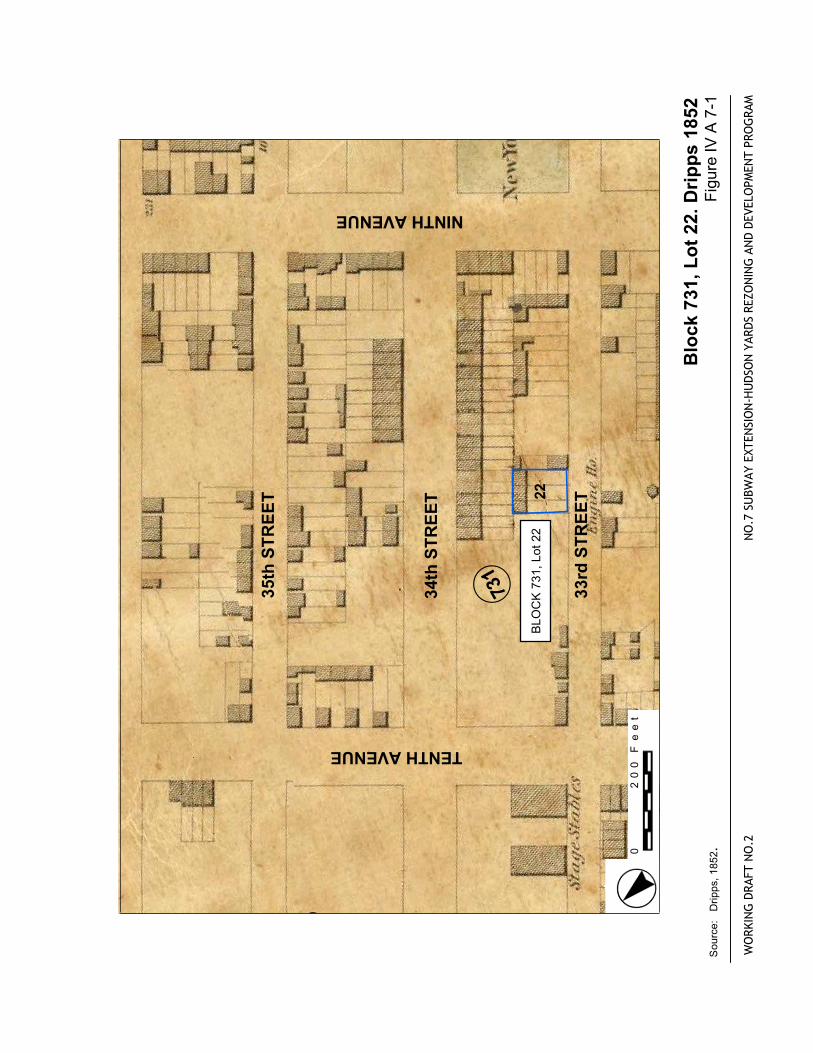
BLOCK731,Lot22
Block
731,Lot22.Dripps1852
FigureIVA7-1
WORKINGDRAFTNO.2
NO.7
SUBWAYEXTENSION-HUDSONYARDSREZONINGANDDEVELOPMENTPROGRAM
Source:Dripps,1852.
.
0200Feet
West35thSTREET
West34thSTREET
West33thSTREET
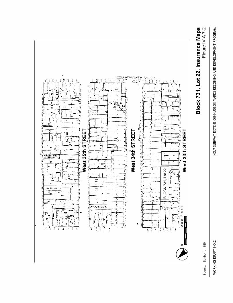
BLOCK731,Lot22
Block
731,Lot22.InsuranceMaps
FigureIVA7-2
WORKINGDRAFTNO.2
NO.7
SUBWAYEXTENSION-HUDSONYARDSREZONINGANDDEVELOPMENTPROGRAM
Source:Sanborn,1890.0
200Feet
WEST35thSTREET
WEST36thSTREET
WEST34thSTREET
TENTHAVENUE
NINTHAVENUE
WEST33rdSTREET
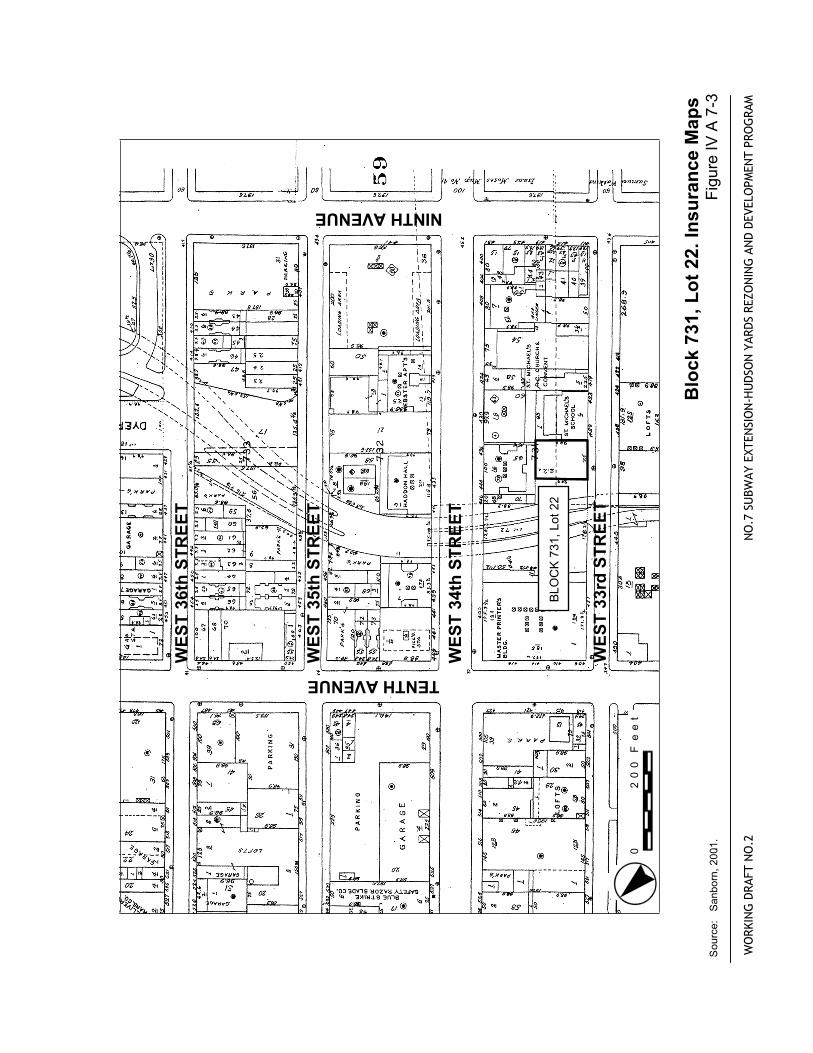
BLOCK731,Lot22
WORKINGDRAFTNO.2
NO.7
SUBWAYEXTENSION-HUDSONYARDSREZONINGANDDEVELOPMENTPROGRAM
Block
731,Lot22.InsuranceMaps
Source:Sanborn,2001..
FigureIVA7-3
.
0200Feet
(732
29
21
50
70
35thSTREET
34thSTREET
33rdSTREET
NINTHAVENUE
TENTHAVENUE
BLOCK732,Lots70,and50
Block
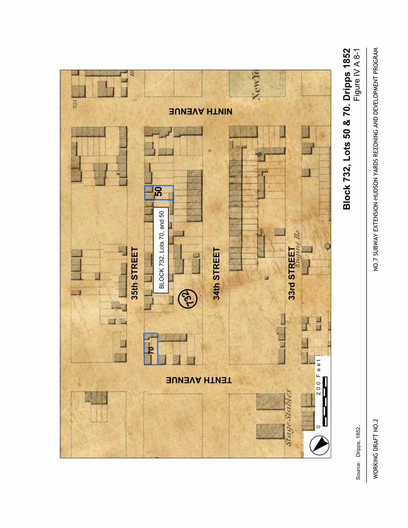
732,Lo
ts 50&70.Dripps1852
FigureIVA8-1
WORKINGDRAFTNO.2
NO.7
SUBWAYEXTENSION-HUDSONYARDSREZONINGANDDEVELOPMENTPROGRAM
Source:Dripps,1852.
.
0200Feet
West36thSTREET
West35thSTREET
West34thSTREET
BLOCK732,Lots50,and70
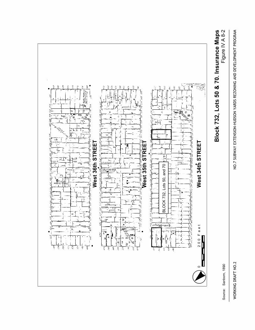
Block
732,Lo
ts 50&70.InsuranceMaps
FigureIVA8-2
WORKINGDRAFTNO.2
NO.7
SUBWAYEXTENSION-HUDSONYARDSREZONINGANDDEVELOPMENTPROGRAM
Source:Sanborn,1890.0
200Feet
WEST35thSTREET
WEST36thSTREET
WEST34thSTREET
TENTHAVENUE
NINTHAVENUE
WEST33rdSTREET
BLOCK732,Lots50and70
WORKINGDRAFTNO.2
NO.7
SUBWAYEXTENSION-HUDSONYARDSREZONINGANDDEVELOPMENTPROGRAM
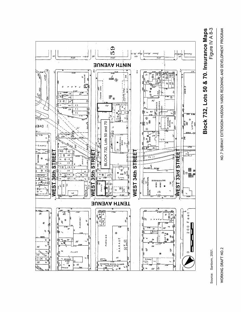
Block
732,Lo
ts 50&70.InsuranceMaps
Source:Sanborn,2001..
FigureIVA8-3
0200Feet
(733
29
31
30
9
21
47
25
58
824
28
23
35thSTREET
34thSTREET
33rdSTREET
NINTHAVENUE
TENTHAVENUE
BLOCK732,Lots8,9,23-25,28,30,31,47,and58
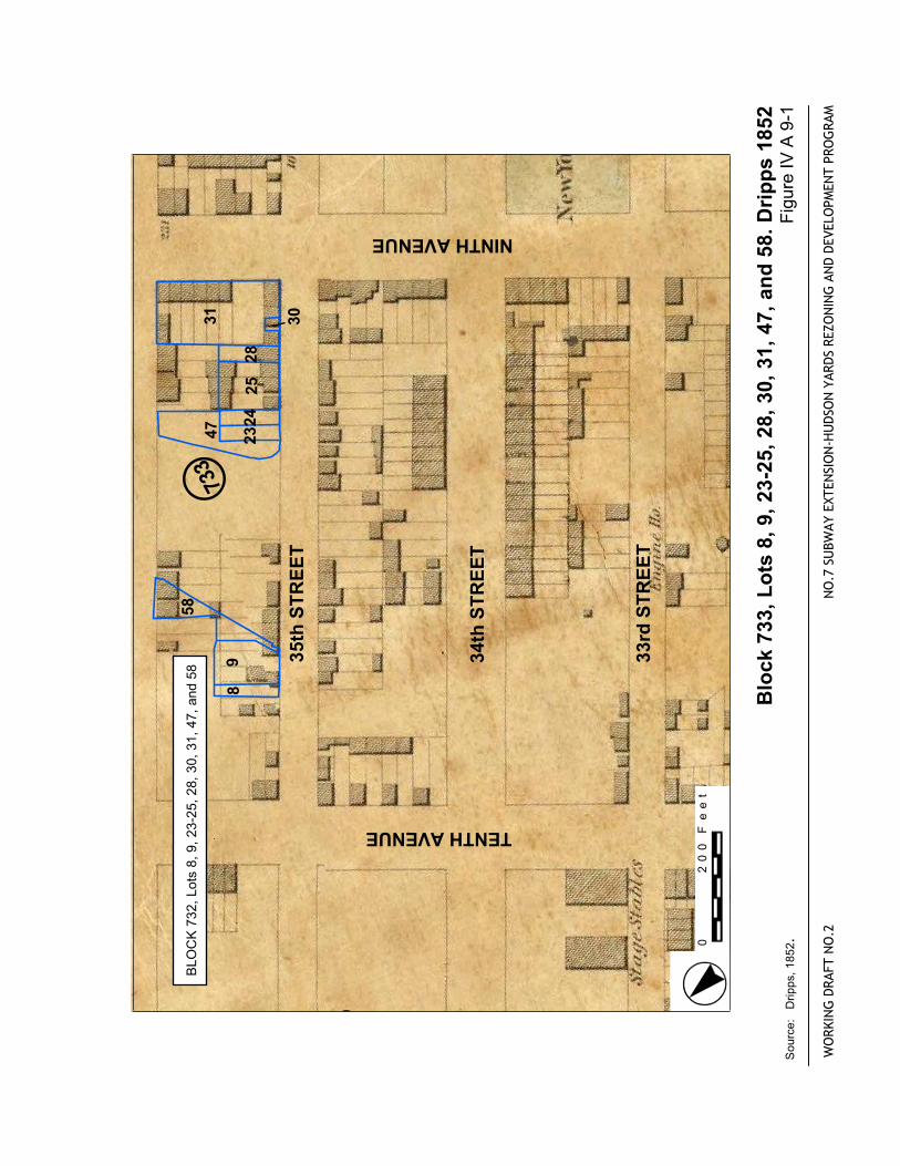
Block
733,Lo
ts 8,9,23-25,28,30,31,47,and58.Dripps1852
FigureIVA9-1
WORKINGDRAFTNO.2
NO.7
SUBWAYEXTENSION-HUDSONYARDSREZONINGANDDEVELOPMENTPROGRAM
Source:Dripps,1852.
.
0200Feet
West36thSTREET
West35thSTREET
West34thSTREET
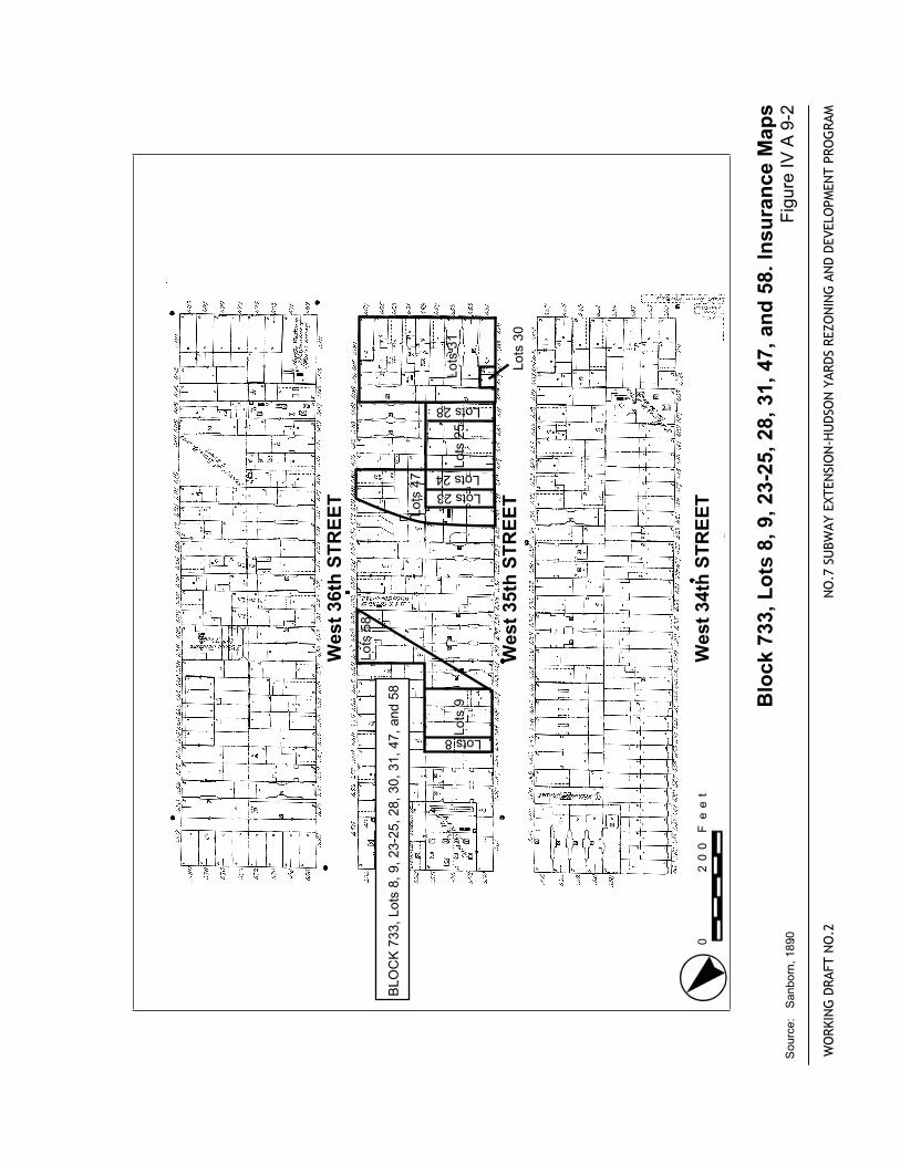
BLOCK733,Lots8,9,23-25,28,30,31,47,and58
Lots58
Lots9
Lots25
Lots31
Lots30
Lots47
Lots8
Lots23
Lots24
Lots28Block
733,Lo
ts 8,9,23-25,28,31,47,and58.InsuranceMaps
FigureIVA9-2
WORKINGDRAFTNO.2
NO.7
SUBWAYEXTENSION-HUDSONYARDSREZONINGANDDEVELOPMENTPROGRAM
Source:Sanborn,1890.0
200Feet
WES
T 35
th S
TREE
T
WES
T 36
th S
TREE
T
WES
T 34
th S
TREE
T
TENTH AVENUE
NINTH AVENUE
WES
T 33
rd S
TREE
T
BLO
CK
733
, Lot
s 8,
9, 2
3-25
, 28,
30,
31,
47
and
58
31 30
4758
925
28
24
8
23
WO
RKIN
G D
RAFT
NO
.2
NO
.7 S
UBW
AY E
XTEN
SIO
N-H
UD
SON
YAR
DS
REZO
NIN
G A
ND
DEV
ELO
PMEN
T PR
OG
RAM
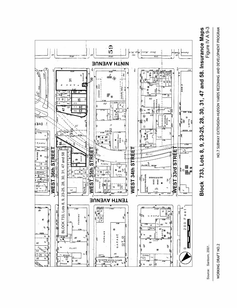
Blo
ck 7
33, L
ots
8, 9
, 23-
25, 2
8, 3
0, 3
1, 4
7 an
d 58
. Ins
uran
ce M
aps
Sou
rce:
S
anbo
rn, 2
001..
Fi
gure
IV A
9-3
0
20
0 F
ee
t
SOU
RCE:
Dri
pps
1852
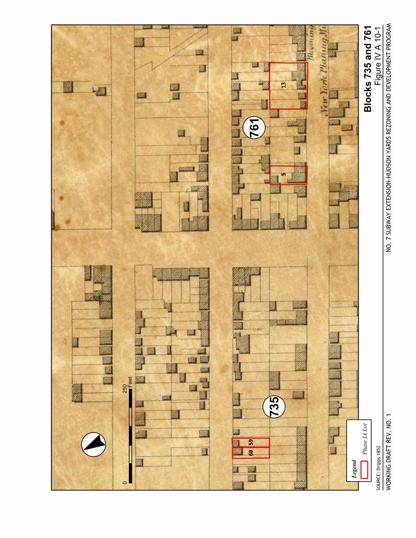
Blo
cks
735
and
761
NO
. 7
SUBW
AY E
XTEN
SIO
N-H
UDS
ON
YAR
DS R
EZO
NIN
G A
ND
DEVE
LOPM
ENT
PRO
GRA
M
Fig
ure
IV A
10-
1W
ORK
ING
DRA
FT R
EV.
NO
. 1
·°«0
250 Fee
t
Lege
nd
Pha
se IA
Lot
! «735! «761
SOURCE: Perris 1857
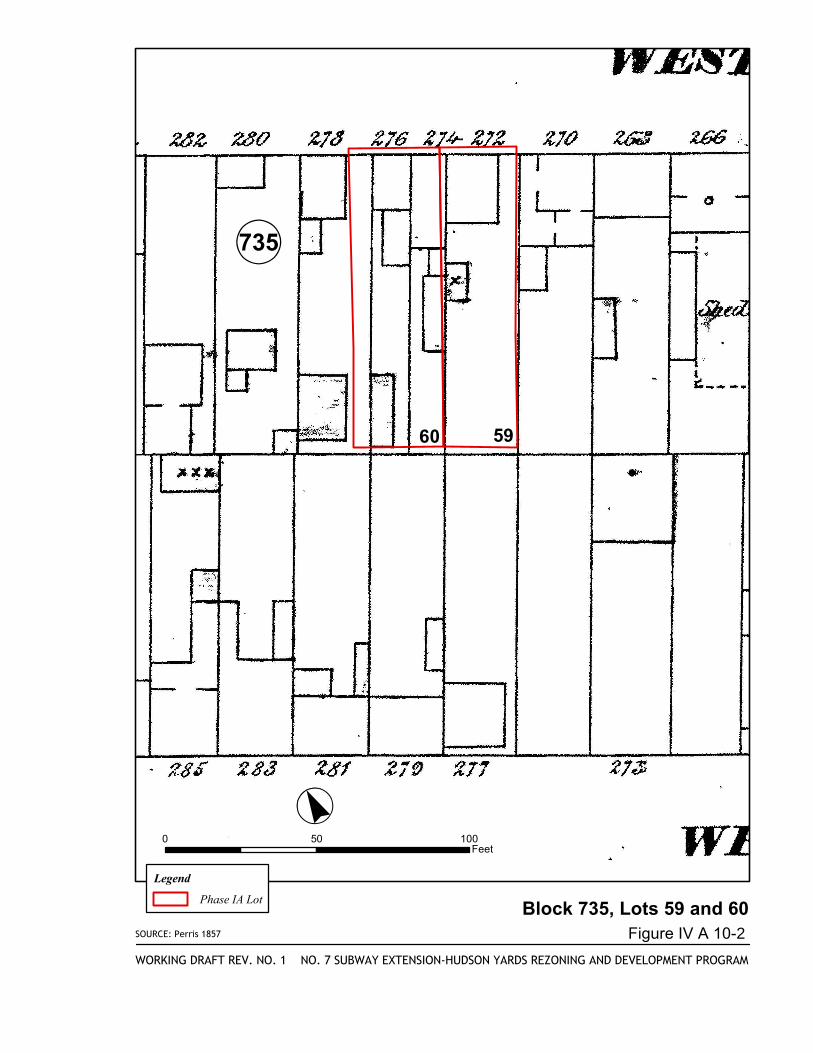
Block 735, Lots 59 and 60
NO. 7 SUBWAY EXTENSION-HUDSON YARDS REZONING AND DEVELOPMENT PROGRAM
Figure IV A 10-2
WORKING DRAFT REV. NO. 1
·°«0 50 100
Feet
Legend
Phase IA Lot
!«735
60 59
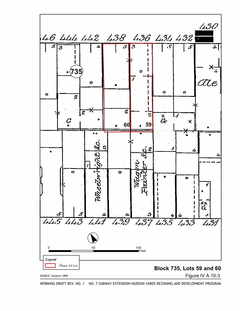
SOURCE: Sanborn 1890
Block 735, Lots 59 and 60
NO. 7 SUBWAY EXTENSION-HUDSON YARDS REZONING AND DEVELOPMENT PROGRAM
Figure IV A 10-3
WORKING DRAFT REV. NO. 1
·°«0 50 100
Feet
Legend
Phase IA Lot
!«735
60 59

SOURCE: Sanborn 1911
Block 735, Lots 59 and 60
NO. 7 SUBWAY EXTENSION-HUDSON YARDS REZONING AND DEVELOPMENT PROGRAM
Figure IV A 10-4
WORKING DRAFT REV. NO. 1
·°«0 50 100
Feet
Legend
Phase IA Lot
!«735
60 59
(760
735
51
47
25
50
6058
59
24
28
23
38thSTREET
EIGHTHAVENUE
NINTHAVENUE
36thSTREET
35thSTREET
BLOCK760,Lots21,51,and58-60
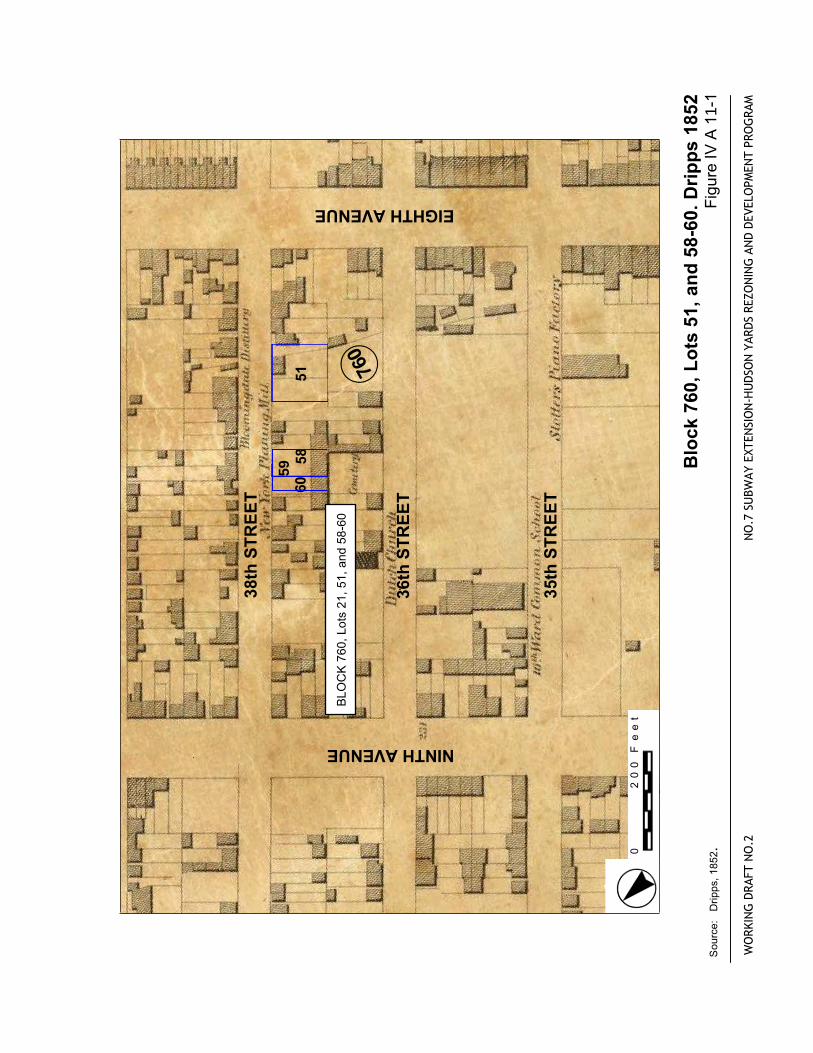
Block
760,Lo
ts 51,and58-60.Dripps1852
FigureIVA1
1-1
WORKINGDRAFTNO.2
NO.7
SUBWAYEXTENSION-HUDSONYARDSREZONINGANDDEVELOPMENTPROGRAM
Source:Dripps,1852.
.
0200Feet
36thSTREET
35thSTREET
34thSTREET
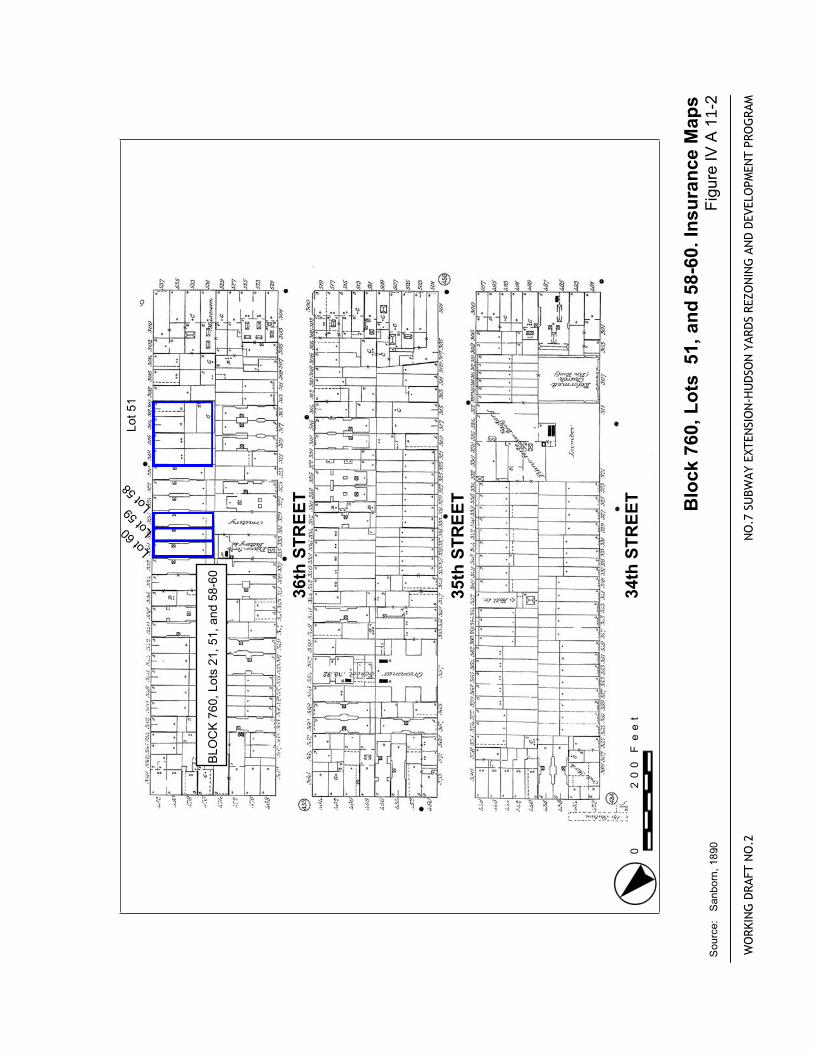
BLOCK760,Lots21,51,and58-60
Lot51
Lot5
8
Lot5
9
Lot6
0
Block
760,Lo
ts 51,and58-60.InsuranceMaps
FigureIVA1
1-2
WORKINGDRAFTNO.2
NO.7
SUBWAYEXTENSION-HUDSONYARDSREZONINGANDDEVELOPMENTPROGRAM
Source:Sanborn,1890.0
200Feet
WEST35thSTREET
WEST36thSTREET
WEST34thSTREET
EIGHTHAVENUE
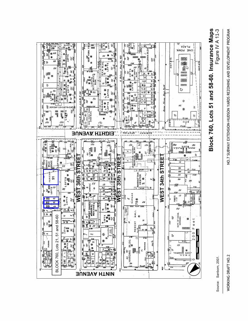
NINTHAVENUEBLOCK760,Lots21,51and58-60
47
51
58
5960
WORKINGDRAFTNO.2
NO.7
SUBWAYEXTENSION-HUDSONYARDSREZONINGANDDEVELOPMENTPROGRAM
Block
760,Lo
ts 51and58-60.InsuranceMaps
Source:Sanborn,2001..
FigureIVA1
1-3
0200Feet
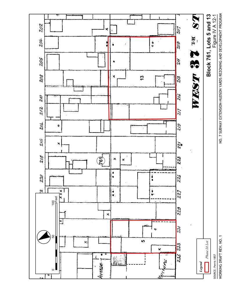
135
SOU
RCE:
Per
ris
1857
Blo
ck 7
61, L
ots
5 a
nd
13
NO
. 7
SUBW
AY E
XTEN
SIO
N-H
UDS
ON
YAR
DS R
EZO
NIN
G A
ND
DEVE
LOPM
ENT
PRO
GRA
M
Fig
ure
IV A
12-
1W
ORK
ING
DRA
FT R
EV.
NO
. 1
Lege
nd
Pha
se IA
Lot
! «761
·°«0
5010
0 Fee
t
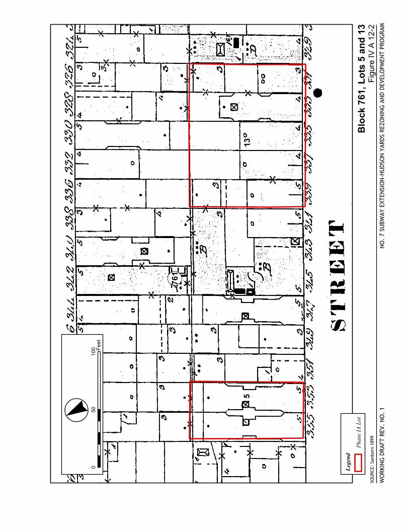
135
SOU
RCE:
San
born
189
9
Blo
ck 7
61, L
ots
5 a
nd
13
NO
. 7
SUBW
AY E
XTEN
SIO
N-H
UDS
ON
YAR
DS R
EZO
NIN
G A
ND
DEVE
LOPM
ENT
PRO
GRA
M
Fig
ure
IV A
12-
2W
ORK
ING
DRA
FT R
EV.
NO
. 1
Lege
nd
Pha
se IA
Lot
! «761
·°«0
5010
0 Fee
t
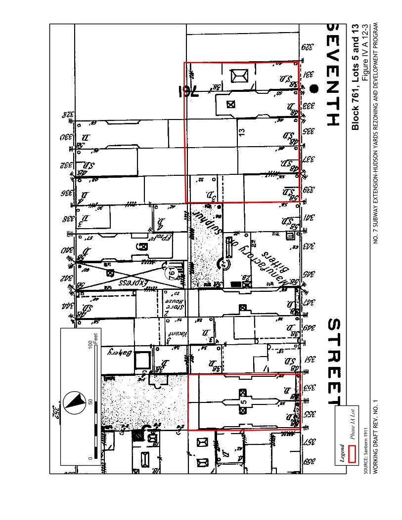
135
SOU
RCE:
San
born
191
1
Blo
ck 7
61, L
ots
5 a
nd
13
NO
. 7
SUBW
AY E
XTEN
SIO
N-H
UDS
ON
YAR
DS R
EZO
NIN
G A
ND
DEVE
LOPM
ENT
PRO
GRA
M
Fig
ure
IV A
12-
3W
ORK
ING
DRA
FT R
EV.
NO
. 1
Lege
nd
Pha
se IA
Lot
! «761
·°«0
5010
0 Fee
t
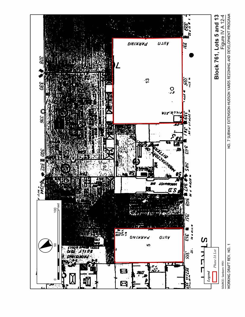
135
SOU
RCE:
San
born
195
1
Blo
ck 7
61, L
ots
5 a
nd
13
NO
. 7
SUBW
AY E
XTEN
SIO
N-H
UDS
ON
YAR
DS R
EZO
NIN
G A
ND
DEVE
LOPM
ENT
PRO
GRA
M
Fig
ure
IV A
12-
4W
ORK
ING
DRA
FT R
EV.
NO
. 1
Lege
nd
Pha
se IA
Lot
! «761
·°«0
5010
0 Fee
t
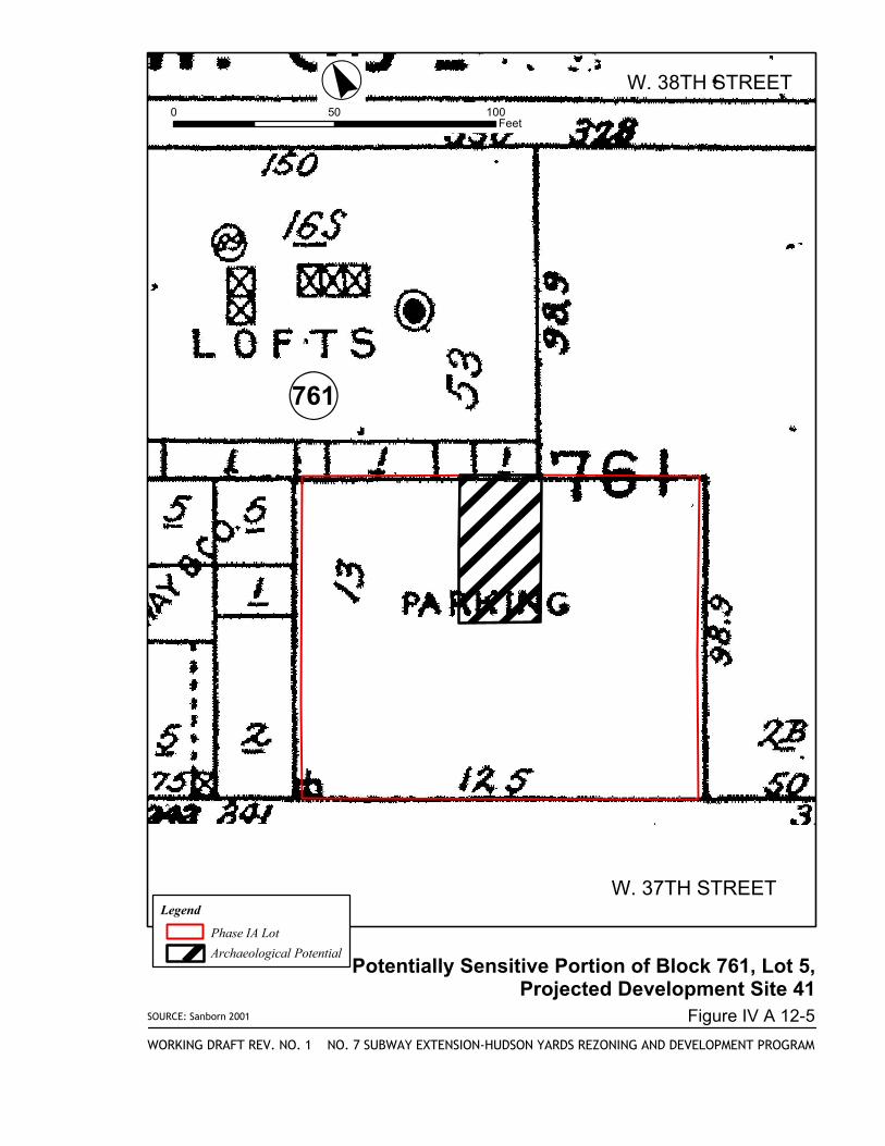
SOURCE: Sanborn 2001
Potentially Sensitive Portion of Block 761, Lot 5,Projected Development Site 41
NO. 7 SUBWAY EXTENSION-HUDSON YARDS REZONING AND DEVELOPMENT PROGRAM
Figure IV A 12-5
WORKING DRAFT REV. NO. 1
·°«0 50 100
Feet
Legend
Phase IA Lot
Archaeological Potential
!«761
W. 37TH STREET
W. 38TH STREET
16
828
3029
31
27
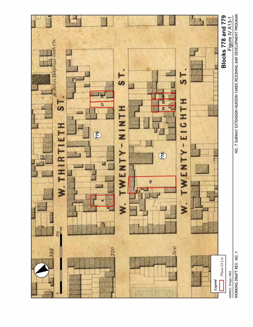
SOU
RCE:
Dri
pps
1852
Blo
cks
778
and
779
NO
. 7
SUBW
AY E
XTEN
SIO
N-H
UDS
ON
YAR
DS R
EZO
NIN
G A
ND
DEVE
LOPM
ENT
PRO
GRA
M
Fig
ure
IV A
13-1
WO
RKIN
G D
RAFT
REV
. N
O.
1
·°«0
250 Fee
t
Lege
nd
Pha
se IA
Lot
! «779
! «778
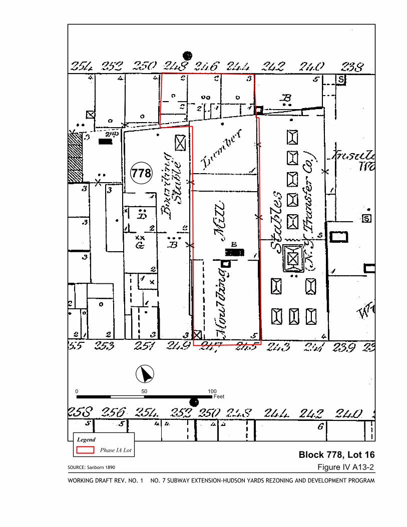
SOURCE: Sanborn 1890
Block 778, Lot 16
NO. 7 SUBWAY EXTENSION-HUDSON YARDS REZONING AND DEVELOPMENT PROGRAM
Figure IV A13-2
WORKING DRAFT REV. NO. 1
·°«0 50 100
Feet
Legend
Phase IA Lot
!«778
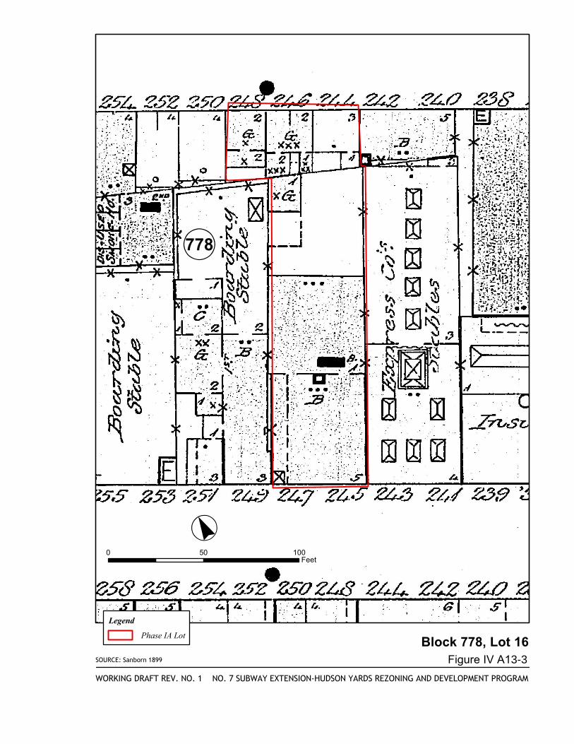
SOURCE: Sanborn 1899
Block 778, Lot 16
NO. 7 SUBWAY EXTENSION-HUDSON YARDS REZONING AND DEVELOPMENT PROGRAM
Figure IV A13-3
WORKING DRAFT REV. NO. 1
·°«0 50 100
Feet
Legend
Phase IA Lot
!«778
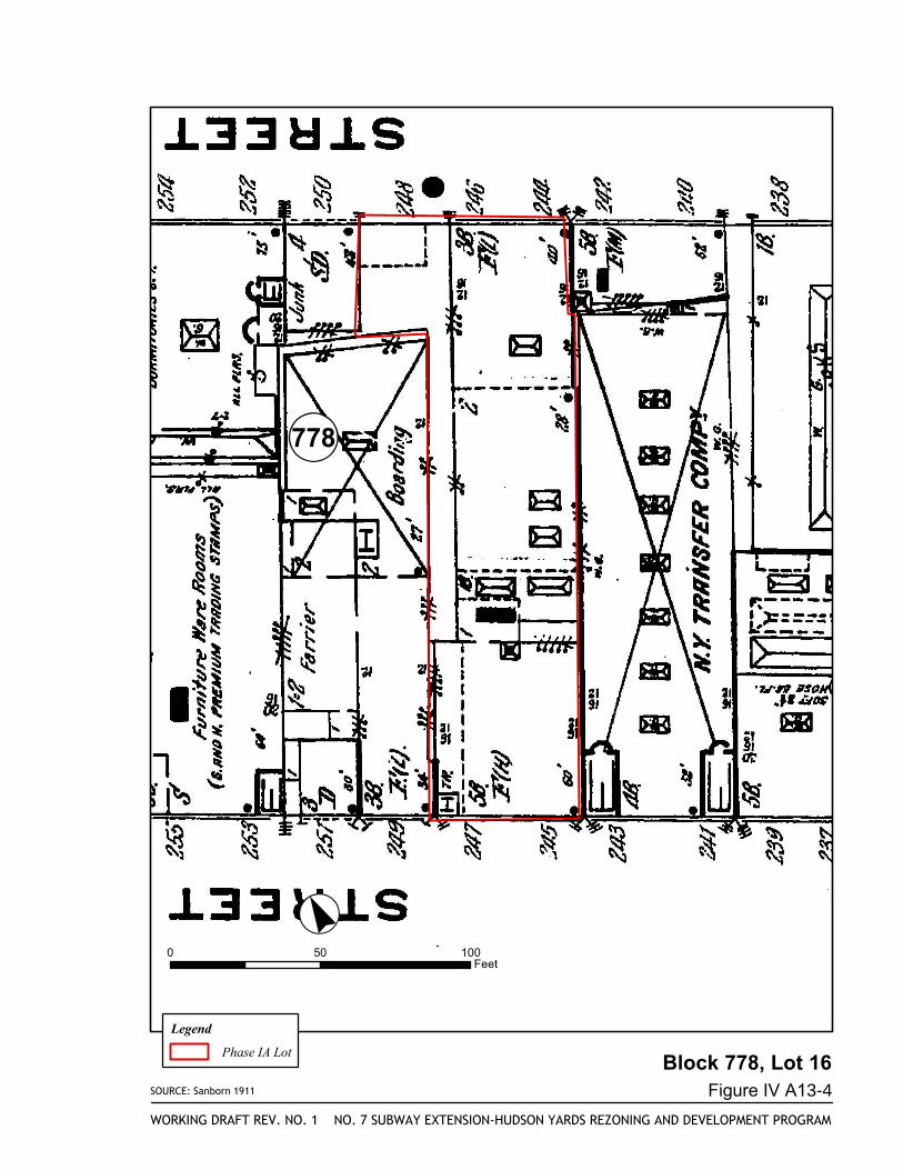
SOURCE: Sanborn 1911
Block 778, Lot 16
NO. 7 SUBWAY EXTENSION-HUDSON YARDS REZONING AND DEVELOPMENT PROGRAM
Figure IV A13-4
WORKING DRAFT REV. NO. 1
·°«0 50 100
Feet
Legend
Phase IA Lot
!«778
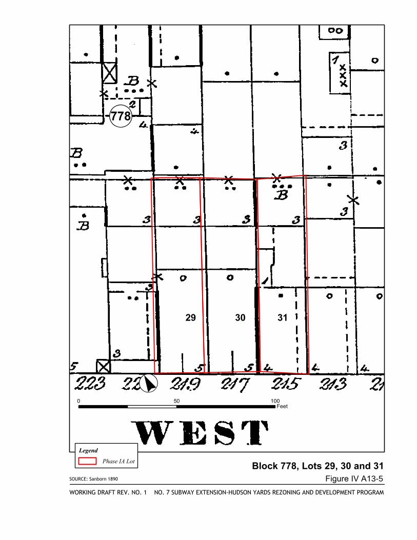
SOURCE: Sanborn 1890
Block 778, Lots 29, 30 and 31
NO. 7 SUBWAY EXTENSION-HUDSON YARDS REZONING AND DEVELOPMENT PROGRAM
Figure IV A13-5
WORKING DRAFT REV. NO. 1
·°«0 50 100
Feet
Legend
Phase IA Lot
!«778
29 30 31
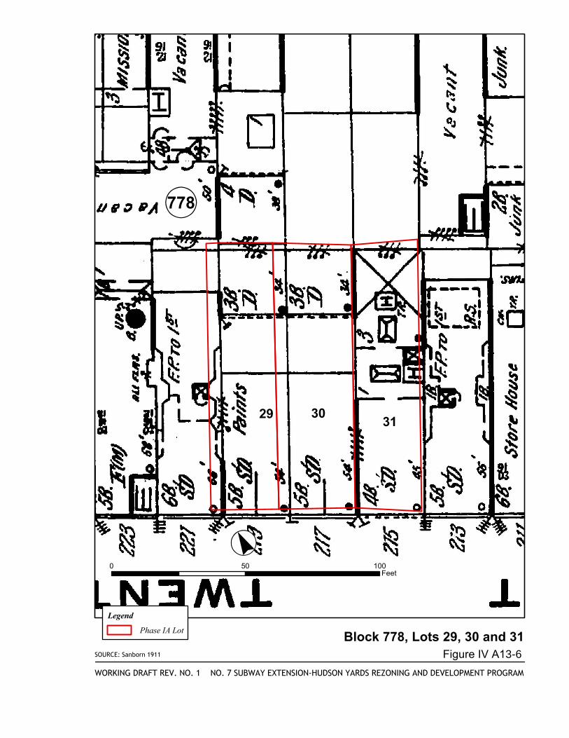
SOURCE: Sanborn 1911
Block 778, Lots 29, 30 and 31
NO. 7 SUBWAY EXTENSION-HUDSON YARDS REZONING AND DEVELOPMENT PROGRAM
Figure IV A13-6
WORKING DRAFT REV. NO. 1
·°«0 50 100
Feet
Legend
Phase IA Lot
!«778
29 3031
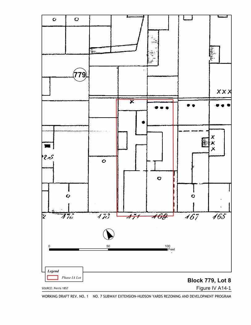
SOURCE: Perris 1857
Block 779, Lot 8
NO. 7 SUBWAY EXTENSION-HUDSON YARDS REZONING AND DEVELOPMENT PROGRAM
Figure IV A14-1
WORKING DRAFT REV. NO. 1
·°«0 50 100
Feet
Legend
Phase IA Lot
!«779
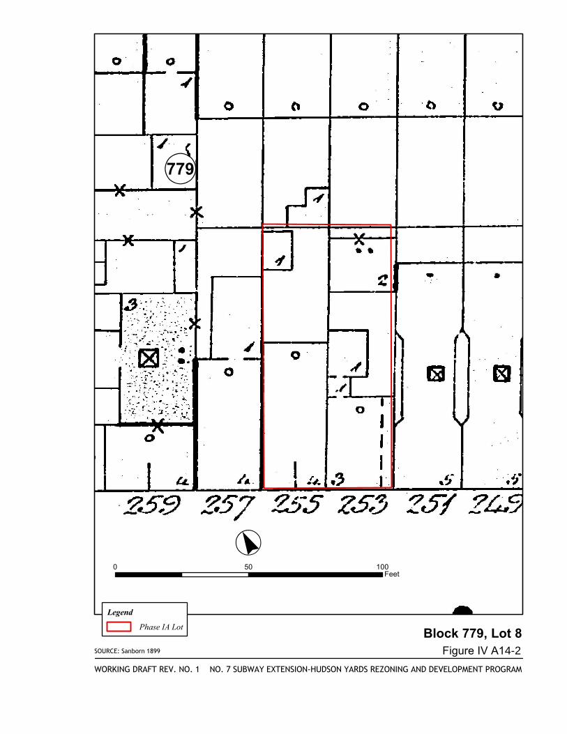
SOURCE: Sanborn 1899
Block 779, Lot 8
NO. 7 SUBWAY EXTENSION-HUDSON YARDS REZONING AND DEVELOPMENT PROGRAM
Figure IV A14-2
WORKING DRAFT REV. NO. 1
·°«0 50 100
Feet
Legend
Phase IA Lot
!«779
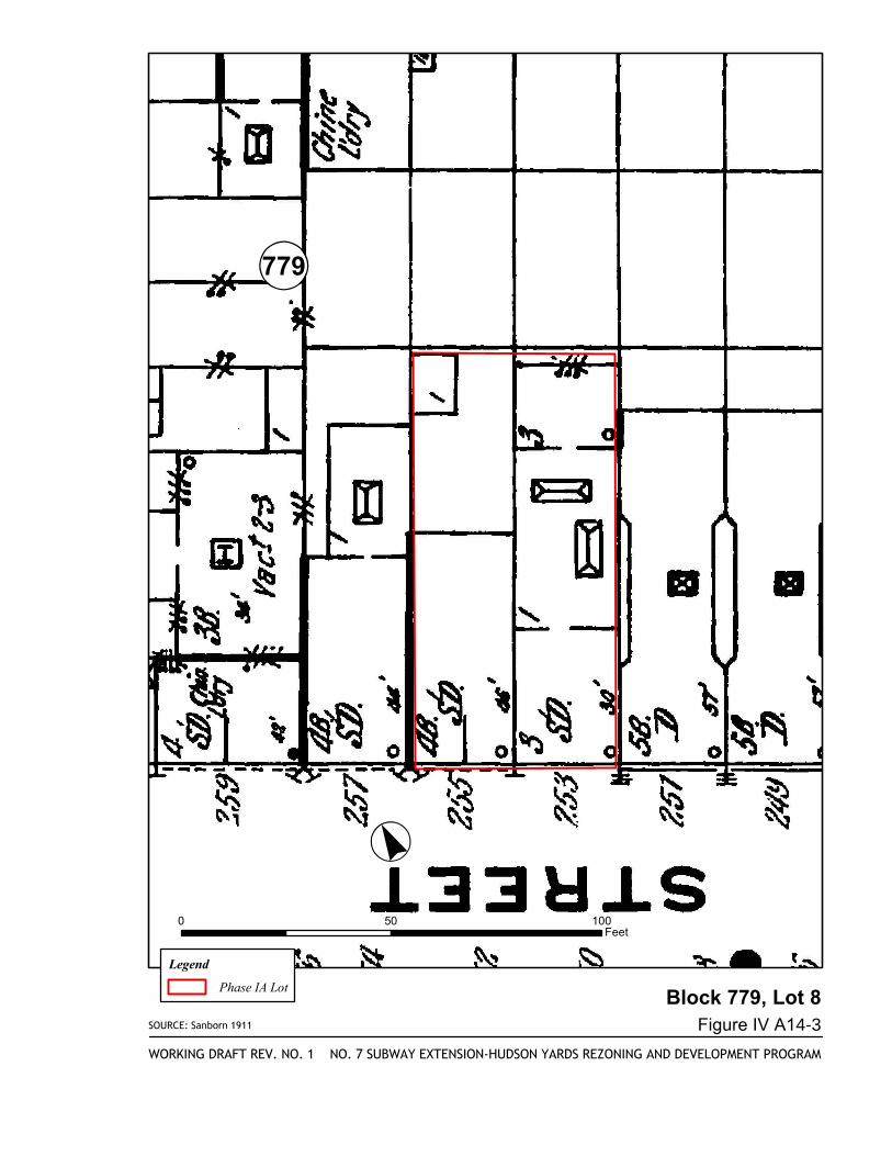
SOURCE: Sanborn 1911
Block 779, Lot 8
NO. 7 SUBWAY EXTENSION-HUDSON YARDS REZONING AND DEVELOPMENT PROGRAM
Figure IV A14-3
WORKING DRAFT REV. NO. 1
·°«0 50 100
Feet
Legend
Phase IA Lot
!«779
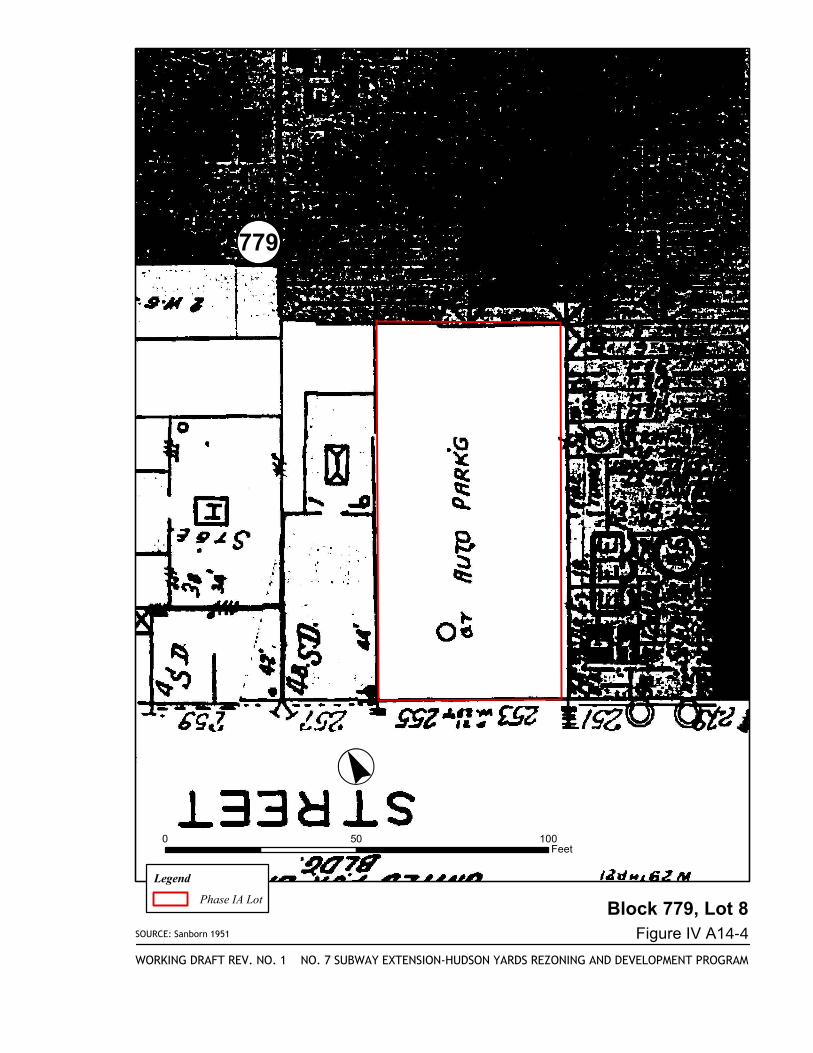
SOURCE: Sanborn 1951
Block 779, Lot 8
NO. 7 SUBWAY EXTENSION-HUDSON YARDS REZONING AND DEVELOPMENT PROGRAM
Figure IV A14-4
WORKING DRAFT REV. NO. 1
·°«0 50 100
Feet
Legend
Phase IA Lot
!«779
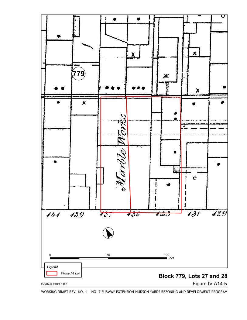
SOURCE: Perris 1857
Block 779, Lots 27 and 28
NO. 7 SUBWAY EXTENSION-HUDSON YARDS REZONING AND DEVELOPMENT PROGRAM
Figure IV A14-5
WORKING DRAFT REV. NO. 1
·°«0 50 100
Feet
Legend
Phase IA Lot
!«779
SOURCE: Sanborn 1890
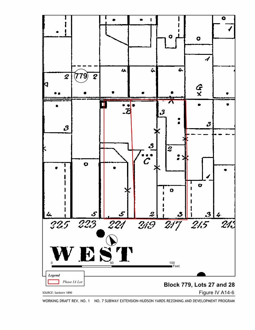
Block 779, Lots 27 and 28
NO. 7 SUBWAY EXTENSION-HUDSON YARDS REZONING AND DEVELOPMENT PROGRAM
Figure IV A14-6
WORKING DRAFT REV. NO. 1
·°«0 50 100
Feet
Legend
Phase IA Lot
!«779
SOURCE: Sanborn 1911
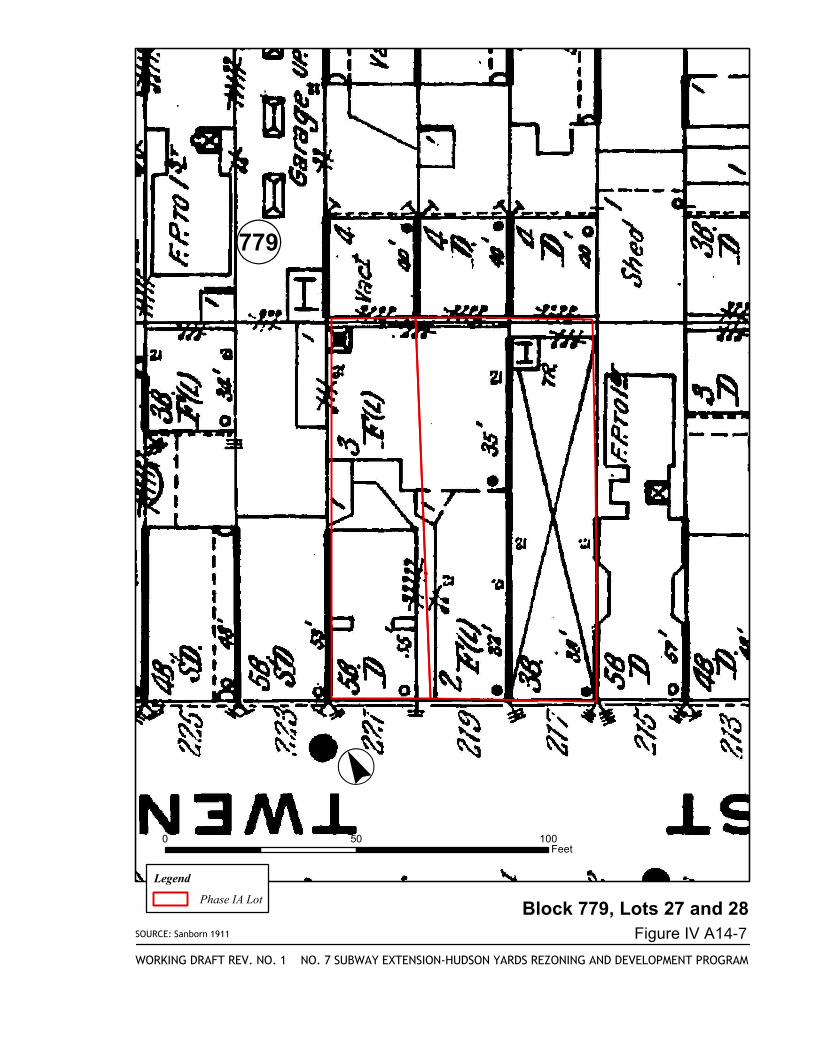
Block 779, Lots 27 and 28
NO. 7 SUBWAY EXTENSION-HUDSON YARDS REZONING AND DEVELOPMENT PROGRAM
Figure IV A14-7
WORKING DRAFT REV. NO. 1
·°«0 50 100
Feet
Legend
Phase IA Lot
!«779
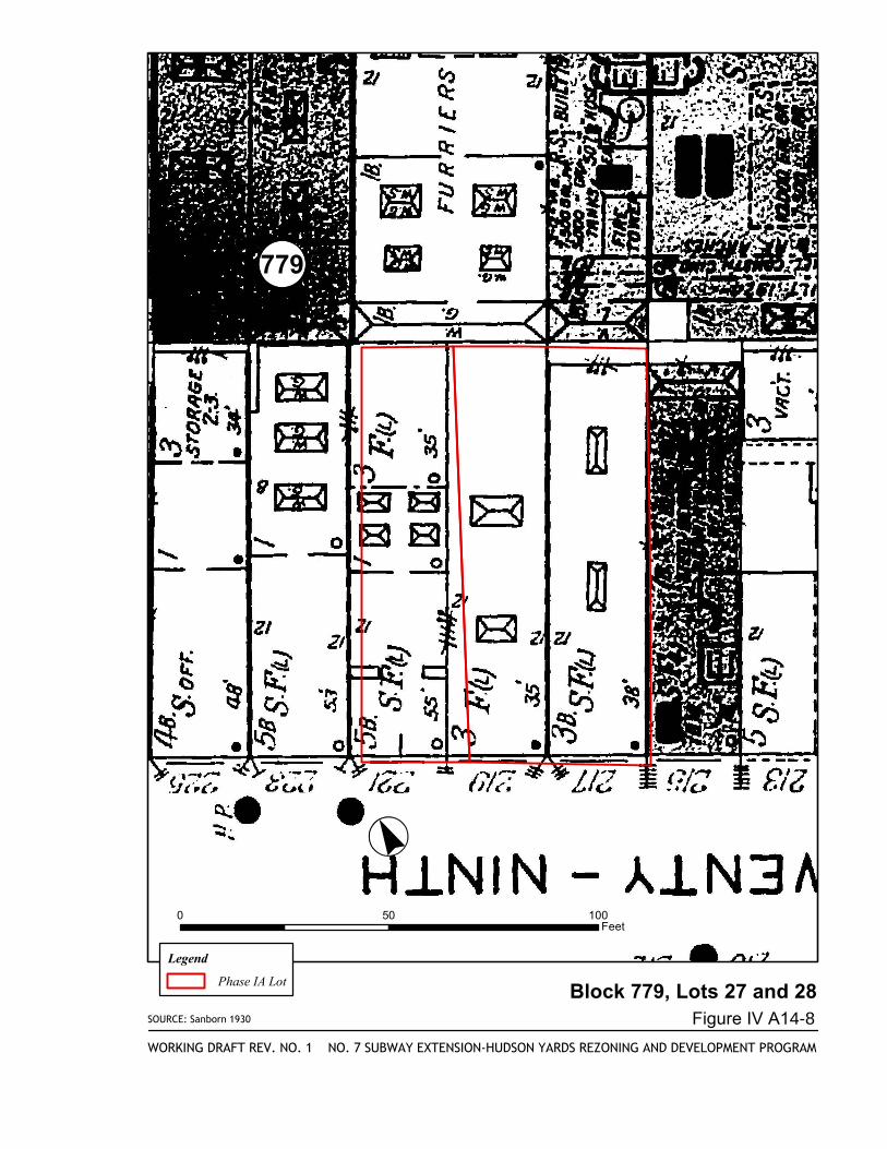
SOURCE: Sanborn 1930
Block 779, Lots 27 and 28
NO. 7 SUBWAY EXTENSION-HUDSON YARDS REZONING AND DEVELOPMENT PROGRAM
Figure IV A14-8
WORKING DRAFT REV. NO. 1
·°«0 50 100
Feet
Legend
Phase IA Lot
!«779
(1050
(763(737
(1033
13
25
47
EIGHTHAVENUE
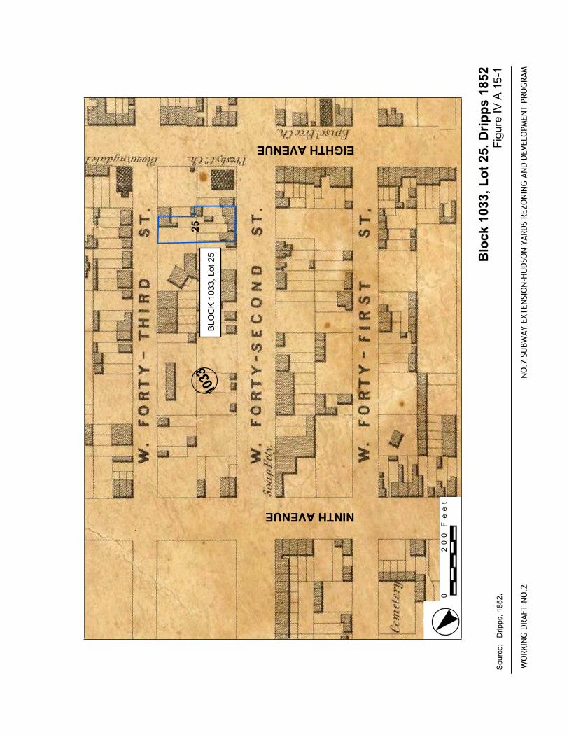
NINTHAVENUEBLOCK1033,Lot25 Block
1033,Lot25.Dripps1852
FigureIVA1
5-1
WORKINGDRAFTNO.2
NO.7
SUBWAYEXTENSION-HUDSONYARDSREZONINGANDDEVELOPMENTPROGRAM
Source:Dripps,1852.
.
0200Feet
44thSTREET
43rdSTREET
42ndSTREET
BLOCK1033,Lot25
Block
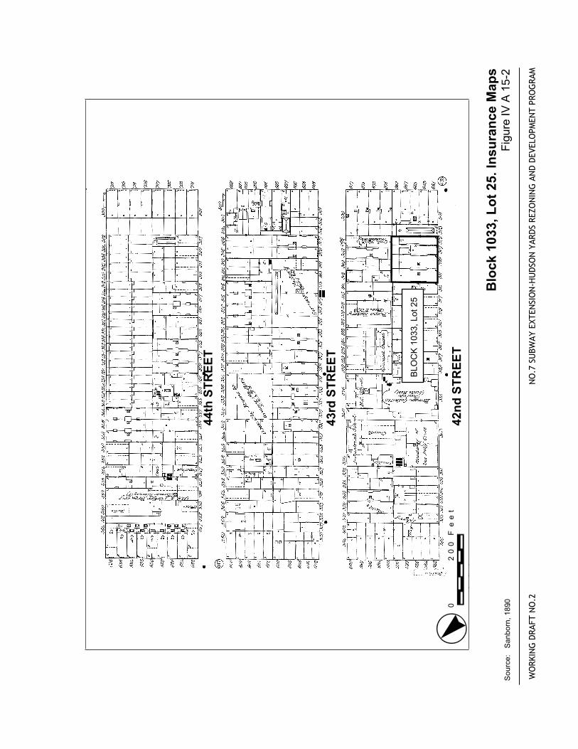
1033,Lot25.InsuranceMaps
FigureIVA1
5-2
WORKINGDRAFTNO.2
NO.7
SUBWAYEXTENSION-HUDSONYARDSREZONINGANDDEVELOPMENTPROGRAM
Source:Sanborn,1890.0
200Feet
WEST43rdSTREET
WEST44thSTREET
WEST45thSTREET
WEST42ndSTREET
TENTHAVENUE
ELEVENTHAVENUE
BLOCK1033,Lot25
WORKINGDRAFTNO.2
NO.7
SUBWAYEXTENSION-HUDSONYARDSREZONINGANDDEVELOPMENTPROGRAM
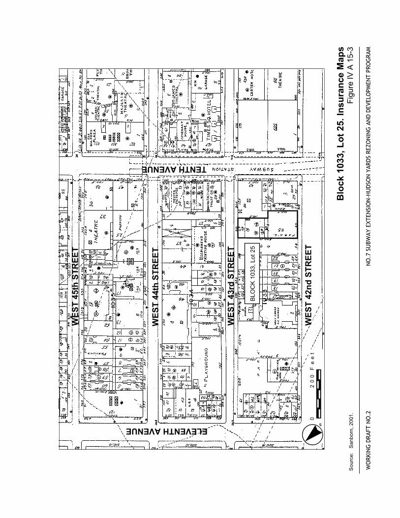
Block
1033,Lot25.InsuranceMaps
Source:Sanborn,2001..
FigureIVA1
5-3
0200Feet
(732
(70522
58
42
35thSTREET
34thSTREET
33thSTREET
TENTHAVENUE
ELEVENTHAVENUE
BLOCK705,Lot42
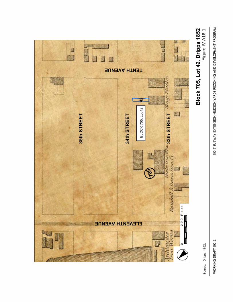
Block
705,Lot42.Dripps1852
FigureIVA
16-1
WORKINGDRAFTNO.2
NO.7
SUBWAYEXTENSION-HUDSONYARDSREZONINGANDDEVELOPMENTPROGRAM
Source:Dripps,1852.
.
0200Feet
36th
STR
EET
35th
STR
EET
34th
STR
EET
BLO
CK
705
, Lot
42
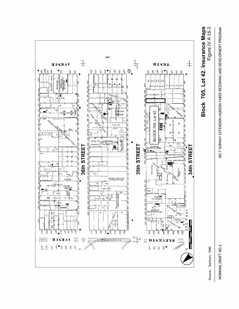
Blo
ck 7
05, L
ot 4
2. In
sura
nce
Map
s Fi
gure
IV A
16-
2
WO
RKIN
G D
RAFT
NO
.2
NO
.7 S
UBW
AY E
XTEN
SIO
N-H
UD
SON
YAR
DS
REZO
NIN
G A
ND
DEV
ELO
PMEN
T PR
OG
RAM
Sou
rce:
S
anbo
rn, 1
890.
.
0
20
0 F
ee
t
WEST35thSTREET
WEST36thSTREET
WEST34thSTREET
TENTHAVENUE
WEST33rdSTREET
BLOCK705,Lot42
WORKINGDRAFTNO.2
NO.7
SUBWAYEXTENSION-HUDSONYARDSREZONINGANDDEVELOPMENTPROGRAM
Block
705,Lot42.InsuranceMaps
Source:Sanborn,2001.
FigureIVA1
6-3
.
0200Feet
(6971
60
26thSTREET
25thSTREET
BLOCK697,Lots1,and60
Block
697,Lo
ts 1&
60.Dripps1852
FigureIVB1-1
WORKINGDRAFTNO.2
NO.7
SUBWAYEXTENSION-HUDSONYARDSREZONINGANDDEVELOPMENTPROGRAM
Source:Dripps,1852.
.
0200Feet
39thSTREET
38thSTREET
37thSTREET
BLOCK697,Lots1and60
Block
697,Lo
ts 1&
60.InsuranceMaps
FigureIVB1-2
WORKINGDRAFTNO.2
NO.7
SUBWAYEXTENSION-HUDSONYARDSREZONINGANDDEVELOPMENTPROGRAM
Source:Sanborn,1890.
.
0200Feet

WEST25thSTREET
WEST24thSTREET
WEST23rdSTREET
BLOCK697,Lots1and60
WORKINGDRAFTNO.2
NO.7
SUBWAYEXTENSION-HUDSONYARDSREZONINGANDDEVELOPMENTPROGRAM
Block
697,Lo
ts 1&60.InsuranceMaps
Source:Sanborn,2001..
FigureIVB1-3
.
0200Feet
(1050
(763(737 (735
(736
(761
(1033
13
13
5
47
40thSTREET
39thSTREET
BLOCK763,Lot47 Block
763,Lot47.Dripps1852
FigureIVB2-1
WORKINGDRAFTNO.2
NO.7
SUBWAYEXTENSION-HUDSONYARDSREZONINGANDDEVELOPMENTPROGRAM
Source:Dripps,1852.
.
0200Feet
40thSTREET
39thSTREET
38thSTREET
BLOCK763,Lot47
Block
763,Lot47.InsuranceMaps
FigureIVB2-2
WORKINGDRAFTNO.2
NO.7
SUBWAYEXTENSION-HUDSONYARDSREZONINGANDDEVELOPMENTPROGRAM
Source:Sanborn,1890.0
200Feet
WEST43rdSTREET
WEST40thSTREET
WEST41stSTREET
NINTHAVENUE
TENTHAVENUE
BLOCK763,Lot47
WORKINGDRAFTNO.2
NO.7
SUBWAYEXTENSION-HUDSONYARDSREZONINGANDDEVELOPMENTPROGRAM
Block
763,Lot47.InsuranceMaps
Source:Sanborn,2001..
FigureIVB2-3
0200Feet
K-1
Appendix K Archaeological Resources
A. ARCHAEOLOGICAL RESOURCES – AGENCY CORRESPONDENCE
The attached correspondence is from the New York City Landmarks Preservation Commission (LPC) and the New York State Office of Parks, Recreation, and Historic Preservation (SHPO), the tworegulatory agencies overseeing the archaeological analysis of the proposed Hudson Yards Action.These include:
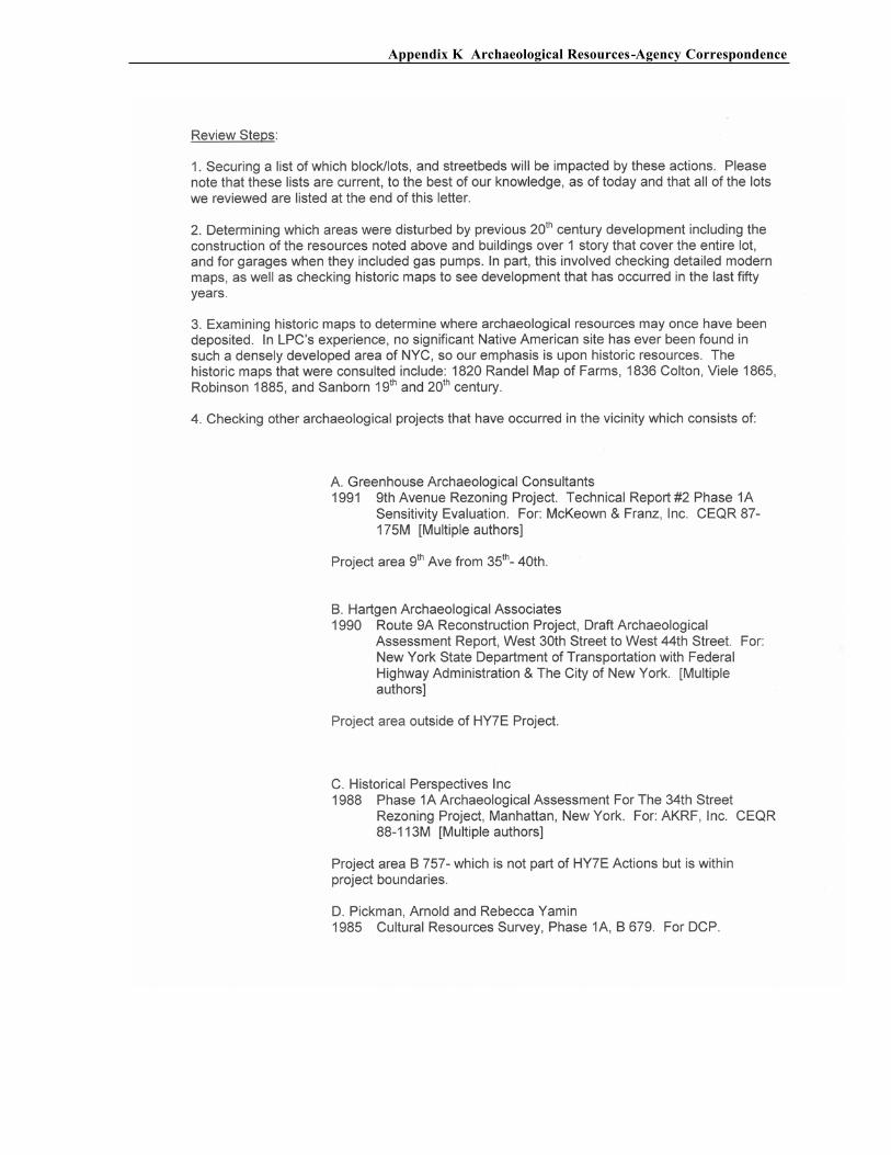
• LPC Letter 10/24/03 to SHPO regarding first level review and establishing archaeological APE, together with table of lots which require no further review
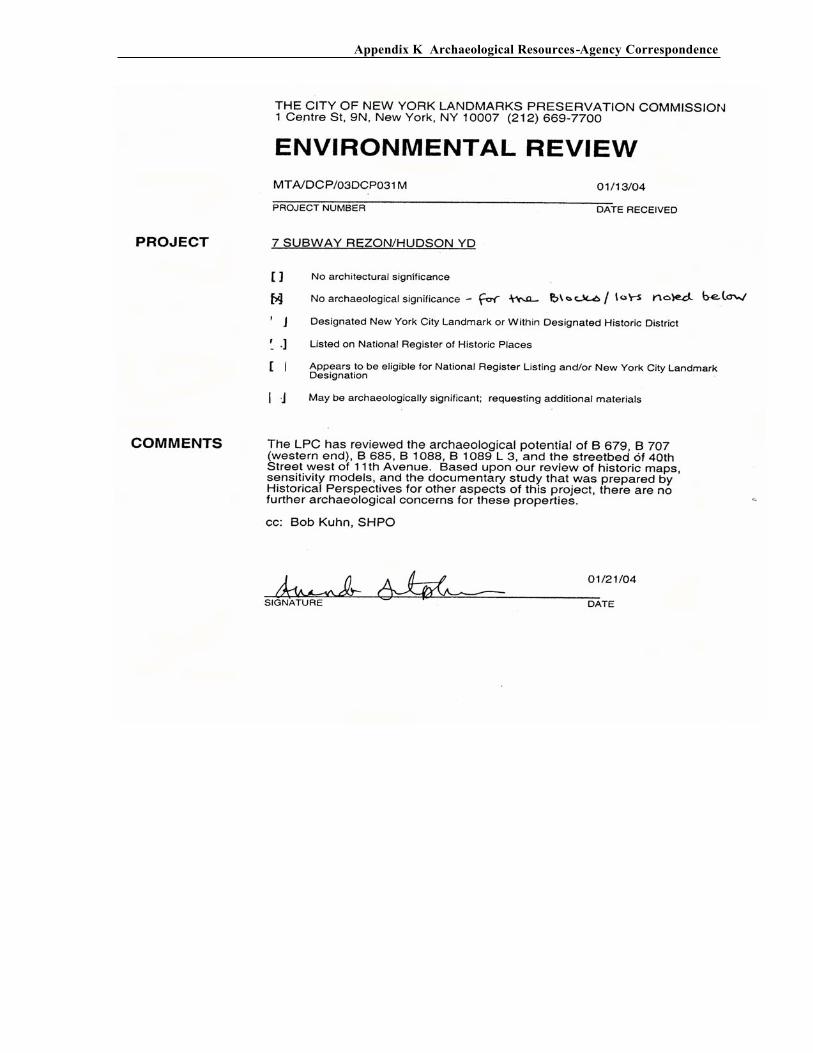
• LPC Environmental Review 1/13/04 regarding Jacob Javits Center Expansion
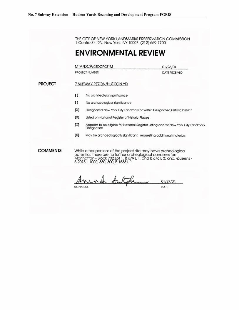
• LPC Environmental Review 1/26/04 regarding Quill, Multi-Use Facility, and Corona Yards
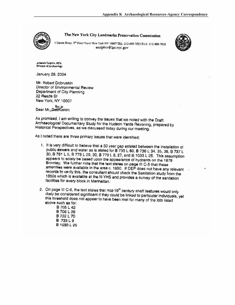
• LPC Letter 1/29/04 to Mr. R. Dobruskin, DCP regarding issues noted with Draft Archaeological Documentary Study
• SHPO Letter 1/26/04 regarding acceptance and approval of Documentary Study
B. ARCHAEOLOGICAL DOCUMENTARY STUDY
An Archaeological Documentary Study has been prepared as part of the archaeological assessment and to provide supporting documentation for Chapter 10. Section 106 of the National Historic Preservation Act of 1966, requires that an archaeological resources analysis must be prepared for the project. This document establishes Areas of Potential Effect (APEs) for the project (e.g. the areas where the proposed project may affect potential archaeological resources), identifies designated and potential archaeological resources that may be affected by the proposed project, and assesses the proposed action’s effects on those resources. This Documentary Study has been submitted to the New LPC as well as to the SHPO for review.
1. Archeological Resources -
Agency Correspondence
No. 7 Subway Extension—Hudson Yards Rezoning and Development Program FGEIS
Appendix K Archaeological Resources-Agency Correspondence
No. 7 Subway Extension—Hudson Yards Rezoning and Development Program FGEIS
Appendix K Archaeological Resources-Agency Correspondence
No. 7 Subway Extension—Hudson Yards Rezoning and Development Program FGEIS
Appendix K Archaeological Resources-Agency Correspondence
No. 7 Subway Extension—Hudson Yards Rezoning and Development Program FGEIS
Appendix K Archaeological Resources-Agency Correspondence
No. 7 Subway Extension—Hudson Yards Rezoning and Development Program FGEIS
Appendix K Archaeological Resources-Agency Correspondence
2. Archeological
Documentary Study

Archaeological Documentary Study
No. 7 Line Extension/ Hudson Yards Rezoning
New York, New York
April 13, 2004
Revision Number 0.2 CIN Number 1830
For:
Submitted by: In association with:
Historical Perspectives, Inc. andThe Louis Berger Group, Inc.
No. 7 Subway Line Extension - Hudson Yards Rezoning and Development Program CM-1189R / C26501

CM1189R April 13, 2004 Rev. 02 i
TABLE OF CONTENTS
EXECUTIVE SUMMARY
I. INTRODUCTION ........................................................................................ I-1
A. HUDSON YARDS ZONING AMENDMENTS.......................... I-2
B. NO. 7 SUBWAY EXPANSION.................................................... I-2
C. CONVENTION CENTER EXPANSION .................................... I-2
D. MULTI-USE FACILITY ............................................................... I-3
E. OTHER FACILITIES..................................................................... I-3
F. MIDBLOCK PARK AND BOULEVARD SYSTEM................. I-3
II. RESEARCH METHODS AND GOALS...................................................II-1
A. PREPARATION OF CONTEXTUAL STUDIES ......................II-1
B. LPC REVIEW PROCESS.............................................................II-1
1. Sites Eliminated from Further Study...............................II-4
2. Sites Considered for Further Study .................................II-5
C. DOCUMENTARY STUDIES RESEARCH EFFORT...............II-5
III. CONTEXTUAL STUDIES ...................................................................... III-1
A. PRECONTACT ....................................................................... III A-1
B. COMMERCIAL .......................................................................III B-1
C. RESIDENTIAL.........................................................................III C-1
D. INSTITUTIONAL COMPLEXES ......................................... III D-1
E. INDUSTRIAL...........................................................................III E-1
F. CEMETERIES/CHURCHES................................................... III F-1
G. DOCKS AND WHARVES AND LANDFILL ..................... III G-1
H. TRANSPORTATION ............................................................. III H-1
IV. INDIVIDUAL DOCUMENTARY STUDIES ........................................ IV-1
Revision 02 April 13, 2004 ii
A. REZONING ............................................................................. IV A-1
1. Block 706, Lot 29....................................................... IV A-1 2. Block 707, Lot 31....................................................... IV A-3 3. Block 709, Lot 25....................................................... IV A-5 4. Block 709, Lot 68....................................................... IV A-7 5. Block 710, Lot 1......................................................... IV A-8 6. Block 728, Lot 34..................................................... IV A-11 7. Block 731, Lot 22..................................................... IV A-12 8. Block 732, Lot 50 and 70......................................... IV A-14 9. Block 733, Lots 8, 9, 23-25, 28, 30, 31, 47, and 58........................................................................ IV A-17 10. Block 735, Lots 59 and 60....................................... IV A-35 11. Block 760, Lots 51, and 58-60 ................................ IV A-39 12. Block 761, Lots 5 and 13 ......................................... IV A-41 13. Block 778, Lots 16, 29, 30, and 31.......................... IV A-46 14. Block 779, Lots 8, 27 and 28................................... IV A-54 15. Block 1033, Lot 25................................................... IV A-58 16. Block 705, Lot 42..................................................... IV A-65
B. NO. 7 SUBWAY ..................................................................... IV B-1
1. Block 697, Lots 1 and 60 ........................................... IV B-2 2. Block 763, Lot 47....................................................... IV B-5
C. CONVENTION CENTER EXPANSION ............................ IV C-1
D. MULTI-USE FACILITY ....................................................... IV C-1
E. OTHER FACILITIES.............................................................. IV C-1
F. MIDBLOCK PARK AND BOULEVARD SYSTEM.......... IV C-1
V. CONCLUSIONS AND RECOMMENDATIONS
A. REZONING .................................................................................. V-1
B. NO. 7 SUBWAY .......................................................................... V-2
C. CONVENTION CENTER EXPANSION .................................. V-2
D. MULTI-USE FACILITY ............................................................. V-2
E. OTHER FACILITIES................................................................... V-3
F. MIDBLOCK PARK AND BOULEVARD SYSTEM............... V-3
VI. REFERENCES
CM1189R April 13, 2004 Rev. 02 iii
LIST OF FIGURES
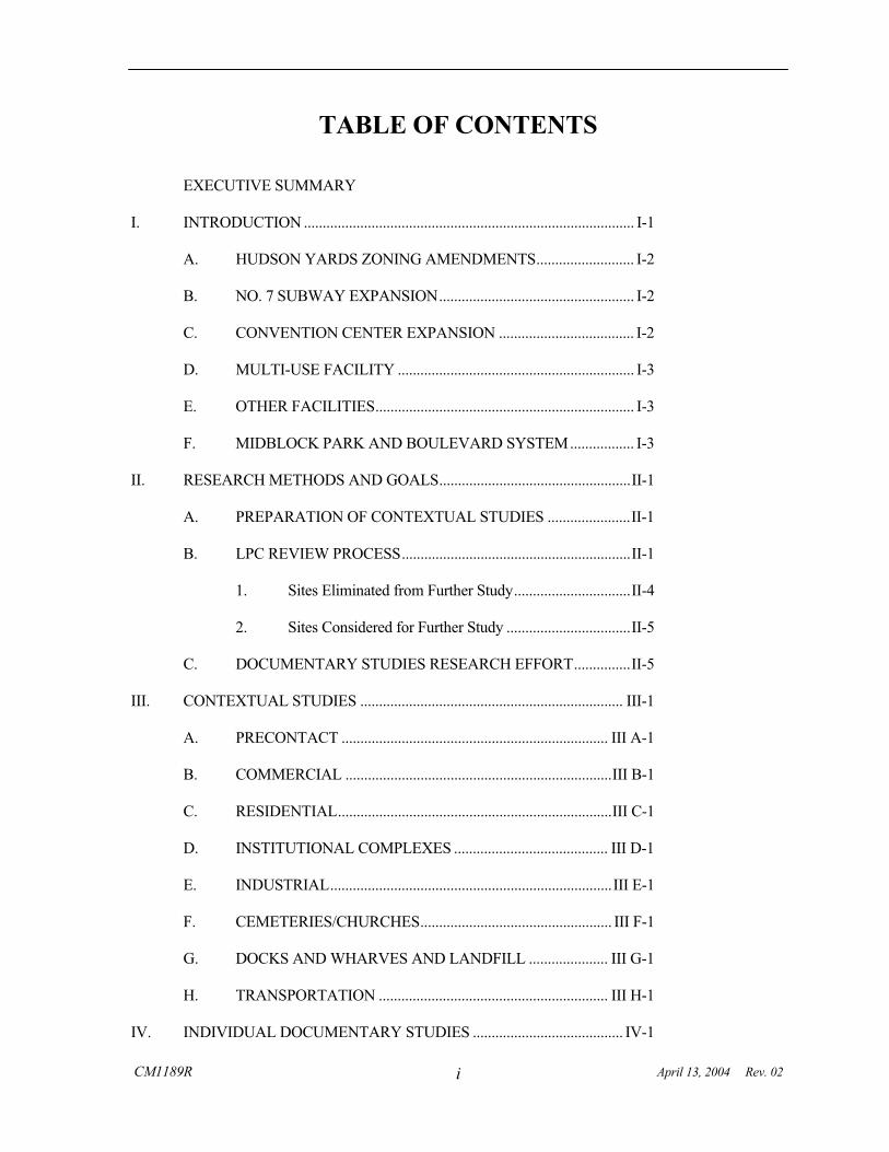
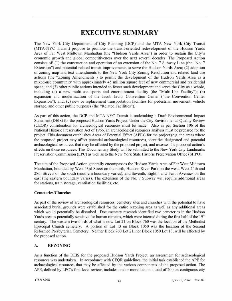
I-1 Proposed Project Area. USGS 7.5’ Series, Jersey City, NJ-NY, 1981, Weehawken, NJ-NY, 1981, Central Park, NY-NJ, 1979, Brooklyn, NY, 1979
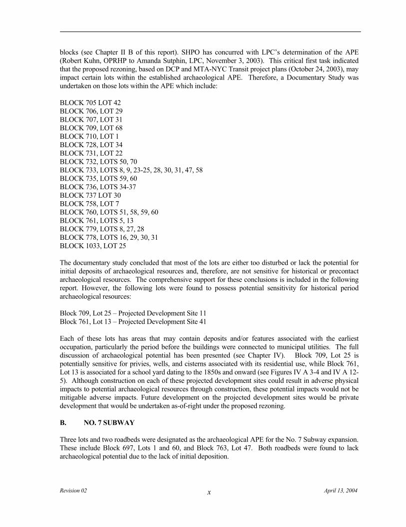
I-2 Proposed Project Site Boundaries. New York City Department of City Planning
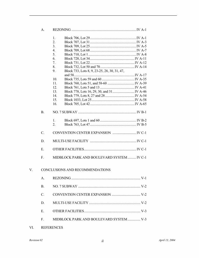
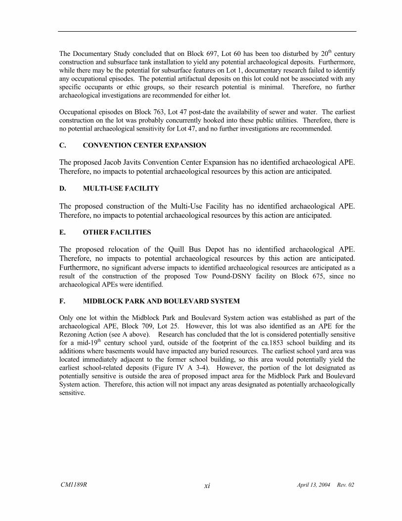
III F-1a Blocks 754, 755 and 780. Map of the City of New York Extending Northward to 50th Street. Dripps, 1852
III F-1b Blocks 760 and 733. Map of the City of New York Extending Northward to 50th Street. Dripps, 1852
III F-1c Blocks 1033 and 1050. Map of the City of New York Extending Northward to 50th Street. Dripps, 1852
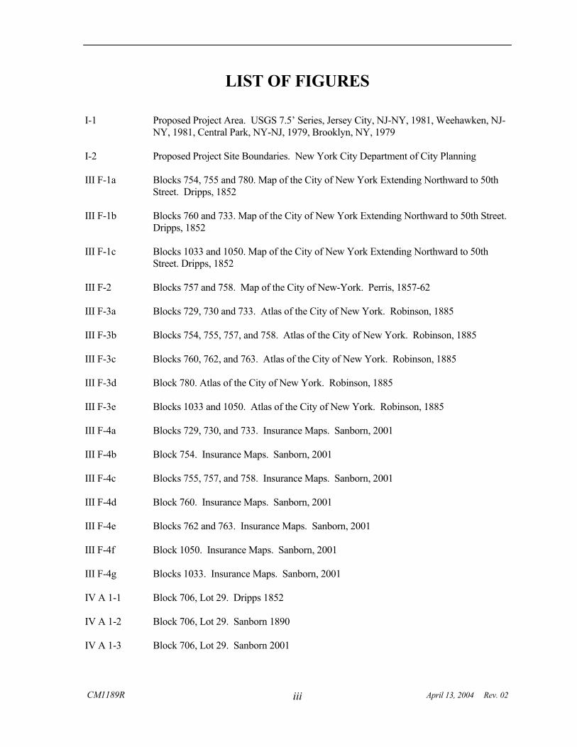
III F-2 Blocks 757 and 758. Map of the City of New-York. Perris, 1857-62
III F-3a Blocks 729, 730 and 733. Atlas of the City of New York. Robinson, 1885
III F-3b Blocks 754, 755, 757, and 758. Atlas of the City of New York. Robinson, 1885
III F-3c Blocks 760, 762, and 763. Atlas of the City of New York. Robinson, 1885
III F-3d Block 780. Atlas of the City of New York. Robinson, 1885
III F-3e Blocks 1033 and 1050. Atlas of the City of New York. Robinson, 1885
III F-4a Blocks 729, 730, and 733. Insurance Maps. Sanborn, 2001
III F-4b Block 754. Insurance Maps. Sanborn, 2001
III F-4c Blocks 755, 757, and 758. Insurance Maps. Sanborn, 2001
III F-4d Block 760. Insurance Maps. Sanborn, 2001
III F-4e Blocks 762 and 763. Insurance Maps. Sanborn, 2001
III F-4f Block 1050. Insurance Maps. Sanborn, 2001
III F-4g Blocks 1033. Insurance Maps. Sanborn, 2001
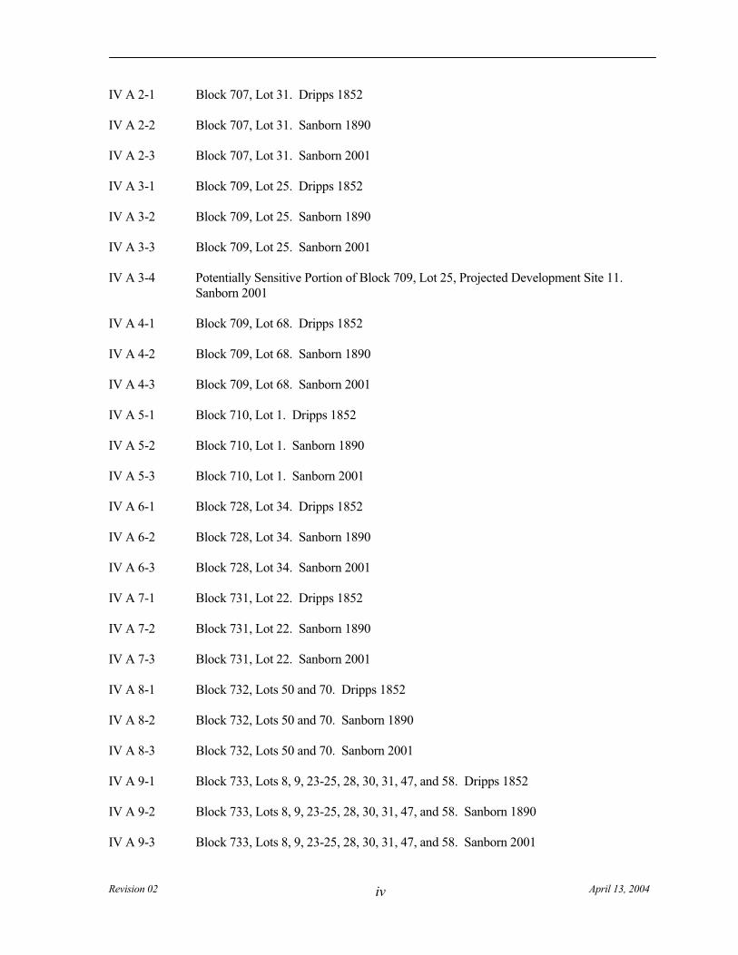
IV A 1-1 Block 706, Lot 29. Dripps 1852
IV A 1-2 Block 706, Lot 29. Sanborn 1890
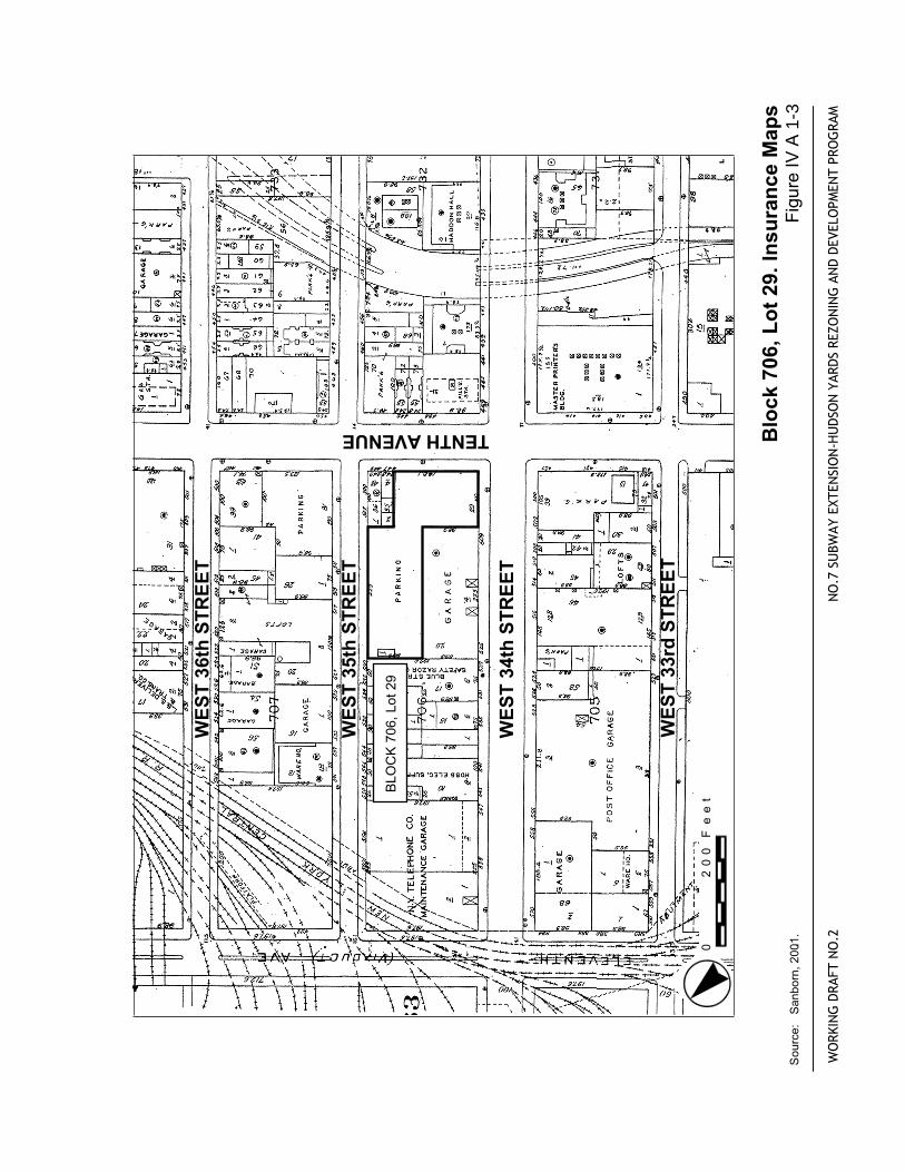
IV A 1-3 Block 706, Lot 29. Sanborn 2001
Revision 02 April 13, 2004 iv
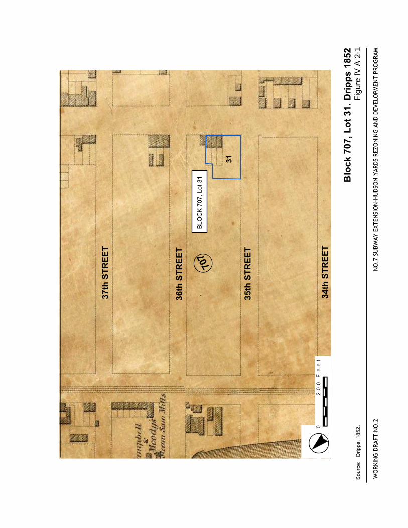
IV A 2-1 Block 707, Lot 31. Dripps 1852
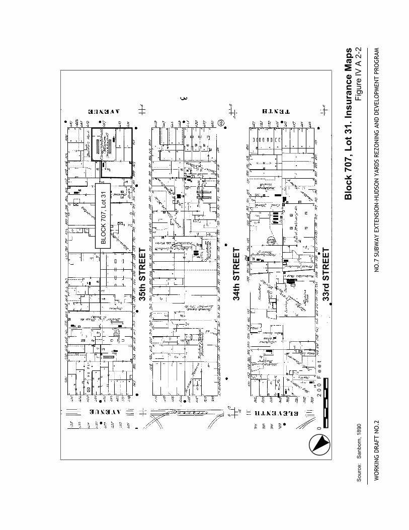
IV A 2-2 Block 707, Lot 31. Sanborn 1890
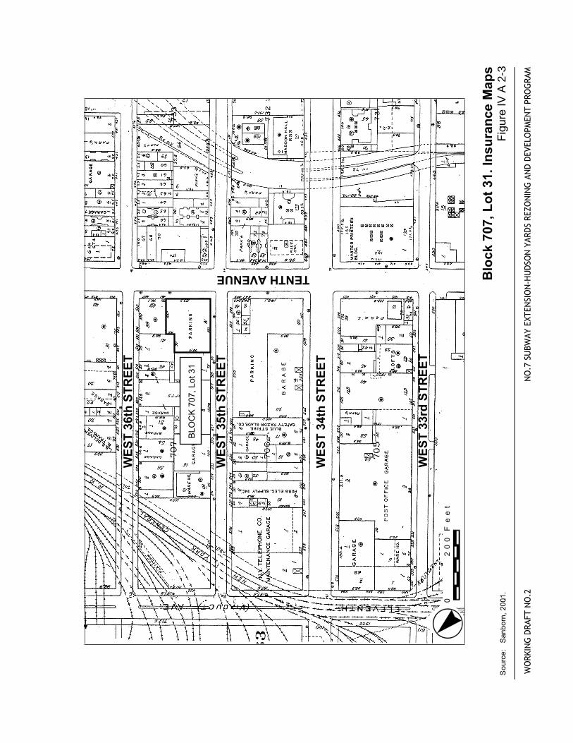
IV A 2-3 Block 707, Lot 31. Sanborn 2001
IV A 3-1 Block 709, Lot 25. Dripps 1852
IV A 3-2 Block 709, Lot 25. Sanborn 1890
IV A 3-3 Block 709, Lot 25. Sanborn 2001
IV A 3-4 Potentially Sensitive Portion of Block 709, Lot 25, Projected Development Site 11. Sanborn 2001
IV A 4-1 Block 709, Lot 68. Dripps 1852
IV A 4-2 Block 709, Lot 68. Sanborn 1890
IV A 4-3 Block 709, Lot 68. Sanborn 2001
IV A 5-1 Block 710, Lot 1. Dripps 1852
IV A 5-2 Block 710, Lot 1. Sanborn 1890
IV A 5-3 Block 710, Lot 1. Sanborn 2001
IV A 6-1 Block 728, Lot 34. Dripps 1852
IV A 6-2 Block 728, Lot 34. Sanborn 1890
IV A 6-3 Block 728, Lot 34. Sanborn 2001
IV A 7-1 Block 731, Lot 22. Dripps 1852
IV A 7-2 Block 731, Lot 22. Sanborn 1890
IV A 7-3 Block 731, Lot 22. Sanborn 2001
IV A 8-1 Block 732, Lots 50 and 70. Dripps 1852
IV A 8-2 Block 732, Lots 50 and 70. Sanborn 1890
IV A 8-3 Block 732, Lots 50 and 70. Sanborn 2001
IV A 9-1 Block 733, Lots 8, 9, 23-25, 28, 30, 31, 47, and 58. Dripps 1852
IV A 9-2 Block 733, Lots 8, 9, 23-25, 28, 30, 31, 47, and 58. Sanborn 1890
IV A 9-3 Block 733, Lots 8, 9, 23-25, 28, 30, 31, 47, and 58. Sanborn 2001
CM1189R April 13, 2004 Rev. 02 v
IV A 10-1 Blocks 735 and 761. Dripps 1852
IV A 10-2 Block 735, Lots 59 and 60. Perris 1857
IV A 10-3 Block 735, Lots 59 and 60. Sanborn 1890
IV A 10-4 Block 735, Lots 59 and 60. Sanborn 1911
IV A 11-1 Block 760, Lots 51, and 58-60. Dripps 1852
IV A 11-2 Block 760, Lots 51, and 58-60. Sanborn 1890
IV A 11-3 Block 760, Lots 51, and 58-60. Sanborn 2001
IV A 12-1 Block 761, Lots 5 and 13. Perris 1857
IV A 12-2 Block 761, Lot 5 and 13. Sanborn 1899
IV A 12-3 Block 761, Lots 5 and 13. Sanborn 1911
IV A 12-4 Block 761, Lots 5 and 13. Sanborn 1951
IV A 12-5 Potentially Sensitive Portion of Block 761, Lot 13, Projected Development Site 41. Sanborn 2001
IV A 13-1 Blocks 778 and 779. Dripps 1852
IV A 13-2 Block 778, Lot 16. Sanborn 1890
IV A 13-3 Block 778, Lot 16. Sanborn 1899
IV A 13-4 Block 778, Lot 16. Sanborn 1911
IV A 13-5 Block 778, Lots 29, 30 and 31. Sanborn 1890
IV A 13-6 Block 778, Lots 29, 30 and 31. Sanborn 1911
IV A 14-1 Block 779, Lot 8. Perris 1857
IV A 14-2 Block 779, Lot 8. Sanborn 1899
IV A 14-3 Block 779, Lot 8. Sanborn 1911
IV A 14-4 Block 779, Lot 8. Sanborn 1951
IV A 14-5 Block 779, Lots 27 and 28. Perris 1857
IV A 14-6 Block 779, Lots 27 and 28. Sanborn 1890
Revision 02 April 13, 2004 vi
IV A 14-7 Block 779, Lots 27 and 28. Sanborn 1911
IV A 14-8 Block 779, Lots 27 and 28. Sanborn 1930
IV A 15-1 Block 1033, Lot 25. Dripps 1852
IV A 15-2 Block 1033, Lot 25. Sanborn 1890
IV A 15-3 Block 1033, Lot 25. Sanborn 2001
IV A 16-1 Block 705, Lot 42. Dripps 1852
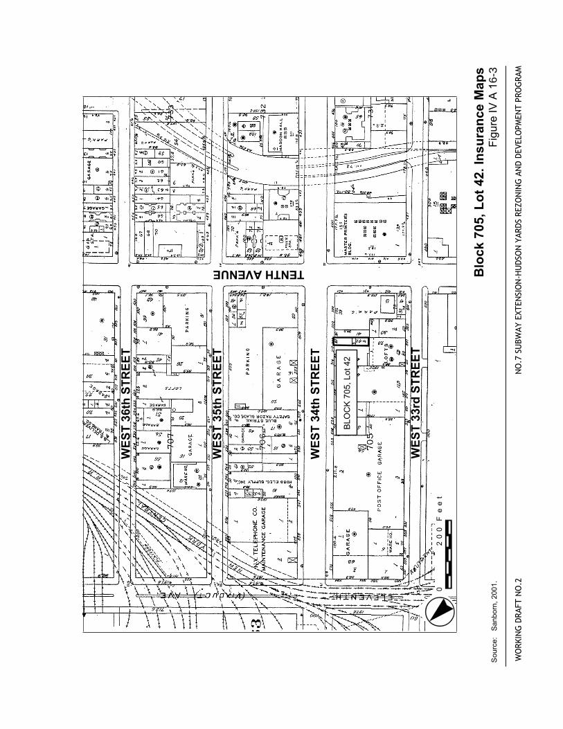
IV A 16-2 Block 705, Lot 42. Sanborn 1890
IV A 16-3 Block 705, Lot 42. Sanborn 2001
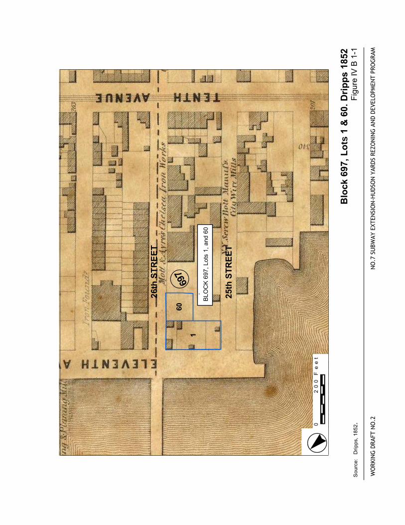
IV B 1-1 Block 697, Lots 1 and 60. Dripps 1852
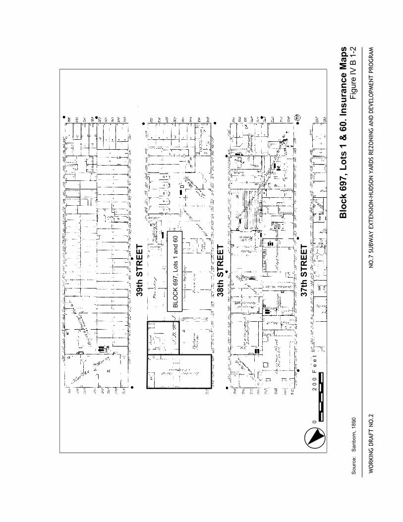
IV B 1-2 Block 697, Lots 1 and 60. Sanborn 1890
IV B 1-3 Block 697, Lots 1 and 60. Sanborn 2001.
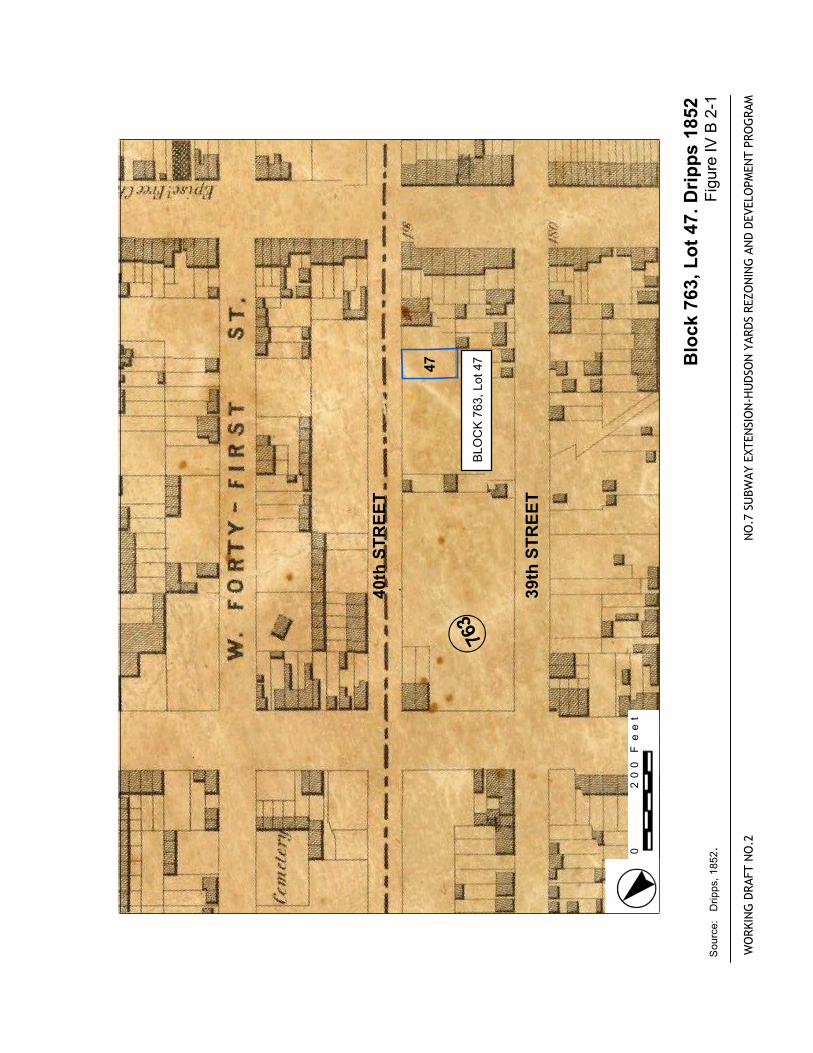
IV B 2-1 Block 763, Lot 47. Dripps 1852
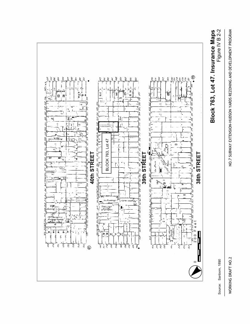
IV B 2-2 Block 763, Lot 47. Sanborn 1890
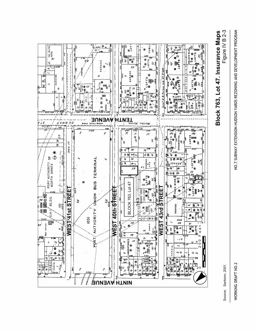
IV B 2-3 Block 763, Lot 47. Sanborn 2001
CM1189R April 13, 2004 Rev. 02 vii
PHOTOGRAPHS
III F-1 Block 760, Lot 21, 331-335 West 36th Street, Methodist Episcopal Church Cemetery (also known as “White’s Yard”), 1842-1913.
III F-2 Block 760, Lot 21, 331-335 West 36th Street, Methodist Episcopal Church Cemetery (also known as “White’s Yard”), 1842-1913.
III F-3 Block 1050, Lot 13, 404-416 West 41st Street, Second Reformed Presbyterian Cemetery, 1833-1858
III F-4 Block 1050, Lot 13, 404-416 West 41st Street, Second Reformed Presbyterian Cemetery, 1833-1858
IV A 1-1 Block 706, Lot 29
IV A 1-2 Block 706, Lot 29
IV A 2-1 Block 707, Lot 31
IV A 3-1 Block 709, Lot 25
IV A 4-1 Block 709, Lot 68
IV A 5-1 Block 710, Lot 1
IV A 6-1 Block 728, Lot 34
IV A 7-1 Block 731, Lot 22
IV A 8-1 Block 732, Lot 50
IV A 8-2 Block 732, Lot 70
IV A 9-1 Block 733, Lots 8-9, 58
IV A 9-2 Block 733, Lots 23, 24, 25, 28, 30, 31, 47
IV A 10-1 Block 735, Lots 59 & 60
IV A 11-1 Block 760, Lot 51
IV A 11-2 Block 760, Lots 58-60
IV A 12-1 Block 761, Lot 5
IV A 12-2 Block 761, Lot 13
IV A 13-1 Block 778, Lot 16
Revision 02 April 13, 2004 viii
IV A 13-2 Block 778, Lots 29 and 30
IV A 13-3 Block 778, Lot 31
IV A 14-1 Block 779, Lot 8
IV A 14-2 Block 779, Lots 27 & 28
IV A 15-1 Block 1033, Lot 25
IV A 16-1 Block 705, Lot 42
IV B 1-1 Block 697, Lot 1
IV B 1-2 Block 697, Lot 60
IV B 2-1 Block 763, Lot 47
CM1189R April 13, 2004 Rev. 02 ix
EXECUTIVE SUMMARY
The New York City Department of City Planning (DCP) and the MTA New York City Transit (MTA-NYC Transit) propose to promote the transit-oriented redevelopment of the Hudson Yards Area of Far West Midtown Manhattan (the “Hudson Yards Area”) in order to sustain the City’s economic growth and global competitiveness over the next several decades. The Proposed Action consists of: (1) the construction and operation of an extension of the No. 7 Subway Line (the “No. 7 Extension”) and potential related transit improvements to serve the Hudson Yards Area; (2) adoption of zoning map and text amendments to the New York City Zoning Resolution and related land use actions (the “Zoning Amendments”) to permit the development of the Hudson Yards Area as a mixed-use community with approximately 45 million square feet of new commercial and residential space; and (3) other public actions intended to foster such development and serve the City as a whole, including (a) a new multi-use sports and entertainment facility (the “Multi-Use Facility”); (b) expansion and modernization of the Jacob Javits Convention Center (“the Convention Center Expansion”); and, (c) new or replacement transportation facilities for pedestrian movement, vehicle storage, and other public purposes (the “Related Facilities”).
As part of this action, the DCP and MTA-NYC Transit is undertaking a Draft Environmental Impact Statement (DEIS) for the proposed Hudson Yards Project. Under the City Environmental Quality Review (CEQR) consideration for archaeological resources must be made. Also as per Section 106 of the National Historic Preservation Act of 1966, an archaeological resources analysis must be prepared for the project. This document establishes Areas of Potential Effect (APEs) for the project (e.g. the areas where the proposed project may affect potential archaeological resources), identifies designated and potential archaeological resources that may be affected by the proposed project, and assesses the proposed action’s effects on those resources. This Documentary Study will be submitted to the New York City Landmarks Preservation Commission (LPC) as well as to the New York State Historic Preservation Office (SHPO).
The site of the Proposed Action generally encompasses the Hudson Yards Area of Far West Midtown Manhattan, bounded by West 43rd Street on the north, Hudson River Park on the west, West 24th and 28th Streets on the south (southern boundary varies), and Seventh, Eighth, and Tenth Avenues on the east (the eastern boundary varies). The extension of the No. 7 Subway will require additional areas for stations, train storage, ventilation facilities, etc.
Cemeteries/Churches
As part of the review of archaeological resources, cemetery sites and churches with the potential to have associated burial grounds were established for the entire rezoning area as well as any additional areas which would potentially be disturbed. Documentary research identified two cemeteries in the Hudson Yards area as potentially sensitive for human remains, which were interred during the first half of the 19th
century. The western two-thirds of what is now Lot 21 on Block 760 was the location of the Methodist Episcopal Church cemetery. A portion of Lot 13 on Block 1050 was the location of the Second Reformed Presbyterian Cemetery. Neither Block 760 Lot 21, nor Block 1050 Lot 13, will be affected by the proposed action.
A. REZONING
As a function of the DEIS for the proposed Hudson Yards Project, an assessment for archaeological resources was undertaken. In accordance with CEQR guidelines, the initial task established the APE for archaeological resources that may be affected by the various components of the proposed action. The APE, defined by LPC’s first-level review, includes one or more lots on a total of 20 non-contiguous city
Revision 02 April 13, 2004 x
blocks (see Chapter II B of this report). SHPO has concurred with LPC’s determination of the APE (Robert Kuhn, OPRHP to Amanda Sutphin, LPC, November 3, 2003). This critical first task indicated that the proposed rezoning, based on DCP and MTA-NYC Transit project plans (October 24, 2003), may impact certain lots within the established archaeological APE. Therefore, a Documentary Study was undertaken on those lots within the APE which include:
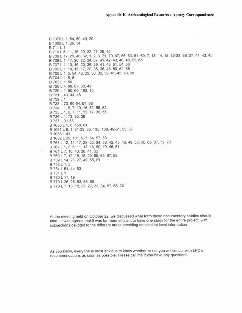
BLOCK 705 LOT 42 BLOCK 706, LOT 29 BLOCK 707, LOT 31 BLOCK 709, LOT 68 BLOCK 710, LOT 1 BLOCK 728, LOT 34 BLOCK 731, LOT 22 BLOCK 732, LOTS 50, 70 BLOCK 733, LOTS 8, 9, 23-25, 28, 30, 31, 47, 58 BLOCK 735, LOTS 59, 60 BLOCK 736, LOTS 34-37 BLOCK 737 LOT 30 BLOCK 758, LOT 7 BLOCK 760, LOTS 51, 58, 59, 60 BLOCK 761, LOTS 5, 13 BLOCK 779, LOTS 8, 27, 28 BLOCK 778, LOTS 16, 29, 30, 31 BLOCK 1033, LOT 25
The documentary study concluded that most of the lots are either too disturbed or lack the potential for initial deposits of archaeological resources and, therefore, are not sensitive for historical or precontact archaeological resources. The comprehensive support for these conclusions is included in the following report. However, the following lots were found to possess potential sensitivity for historical period archaeological resources:
Block 709, Lot 25 – Projected Development Site 11 Block 761, Lot 13 – Projected Development Site 41
Each of these lots has areas that may contain deposits and/or features associated with the earliest occupation, particularly the period before the buildings were connected to municipal utilities. The full discussion of archaeological potential has been presented (see Chapter IV). Block 709, Lot 25 is potentially sensitive for privies, wells, and cisterns associated with its residential use, while Block 761, Lot 13 is associated for a school yard dating to the 1850s and onward (see Figures IV A 3-4 and IV A 12-5). Although construction on each of these projected development sites could result in adverse physical impacts to potential archaeological resources through construction, these potential impacts would not be mitigable adverse impacts. Future development on the projected development sites would be private development that would be undertaken as-of-right under the proposed rezoning.
B. NO. 7 SUBWAY
Three lots and two roadbeds were designated as the archaeological APE for the No. 7 Subway expansion. These include Block 697, Lots 1 and 60, and Block 763, Lot 47. Both roadbeds were found to lack archaeological potential due to the lack of initial deposition.
CM1189R April 13, 2004 Rev. 02 xi
The Documentary Study concluded that on Block 697, Lot 60 has been too disturbed by 20th century construction and subsurface tank installation to yield any potential archaeological deposits. Furthermore, while there may be the potential for subsurface features on Lot 1, documentary research failed to identify any occupational episodes. The potential artifactual deposits on this lot could not be associated with any specific occupants or ethic groups, so their research potential is minimal. Therefore, no further archaeological investigations are recommended for either lot.
Occupational episodes on Block 763, Lot 47 post-date the availability of sewer and water. The earliest construction on the lot was probably concurrently hooked into these public utilities. Therefore, there is no potential archaeological sensitivity for Lot 47, and no further investigations are recommended.
C. CONVENTION CENTER EXPANSION
The proposed Jacob Javits Convention Center Expansion has no identified archaeological APE. Therefore, no impacts to potential archaeological resources by this action are anticipated.
D. MULTI-USE FACILITY
The proposed construction of the Multi-Use Facility has no identified archaeological APE. Therefore, no impacts to potential archaeological resources by this action are anticipated.
E. OTHER FACILITIES
The proposed relocation of the Quill Bus Depot has no identified archaeological APE. Therefore, no impacts to potential archaeological resources by this action are anticipated. Furthermore, no significant adverse impacts to identified archaeological resources are anticipated as a
result of the construction of the proposed Tow Pound-DSNY facility on Block 675, since no archaeological APEs were identified.
F. MIDBLOCK PARK AND BOULEVARD SYSTEM
Only one lot within the Midblock Park and Boulevard System action was established as part of the archaeological APE, Block 709, Lot 25. However, this lot was also identified as an APE for the Rezoning Action (see A above). Research has concluded that the lot is considered potentially sensitive for a mid-19th century school yard, outside of the footprint of the ca.1853 school building and its additions where basements would have impacted any buried resources. The earliest school yard area was located immediately adjacent to the former school building, so this area would potentially yield the earliest school-related deposits (Figure IV A 3-4). However, the portion of the lot designated as potentially sensitive is outside the area of proposed impact area for the Midblock Park and Boulevard System action. Therefore, this action will not impact any areas designated as potentially archaeologically sensitive.

I Introduction
Revision 02 I-1 April 13, 2004
I. INTRODUCTION
The New York City Department of City Planning (DCP) and the MTA New York City Transit (MTA-NYC Transit) propose to promote the transit-oriented redevelopment of the Hudson Yards Area of west Midtown Manhattan (the “Hudson Yards Area”) in order to sustain the City’s economic growth and global competitiveness over the next several decades. The Proposed Action consists of: (1) the construction and operation of an extension of the No. 7 Subway Line (the “No. 7 Extension”) and potential related transit improvements to serve the Hudson Yards Area; (2) adoption of zoning map and text amendments to the New York City Zoning Resolution and related land use actions (the “Zoning Amendments”) to permit the development of the Hudson Yards Area as a mixed-use community with approximately 45 million square feet of new commercial and residential space; and (3) other public actions intended to foster such development and serve the City as a whole, including (a) a new multi-use sports and entertainment facility (the “Multi-Use Facility”); (b) expansion and modernization of the Jacob Javits Convention Center (“the Convention Center Expansion”); and, (c) new or replacement transportation facilities for pedestrian movement, vehicle storage, and other public purposes (the “Related Facilities”).
As part of this action, the DCP and MTA-NYC Transit is undertaking a Draft Environmental Impact Statement (DEIS) for the proposed Hudson Yards Project. Consideration for archaeological resources must be undertaken as part of the City Environmental Quality Review (CEQR) process. Also, as per Section 106 of the National Historic Preservation Act of 1966, an archaeological resources analysis must be prepared for the project. The following archaeological study (the “Documentary Study”), establishes Areas of Potential Effect (APEs) for the project (e.g. the areas where the proposed project may affect potential archaeological resources), identifies designated and potential archaeological resources that may be affected by the proposed project, and assesses the proposed action’s effects on those resources. This Documentary Study will be submitted to the New York City Landmarks Preservation Commission (LPC) as well as to the New York State Historic Preservation Office (SHPO).
The site of the Proposed Action generally encompasses the Hudson Yards Area of Far West Midtown Manhattan, bounded by West 43rd Street on the north, Hudson River Park on the west, West 24th and 28th Streets on the south (southern boundary varies), and Seventh, Eighth, and Tenth Avenues on the east (eastern boundary varies), and is located between Manhattan’s Chelsea and Clinton neighborhoods (Figures I-1, I-2). This area has not been fully developed due to a number of factors including the limited range of types and densities of uses permitted under current zoning, and lack of subway service in the area. The keys to redevelopment of the Hudson Yards are to change the existing manufacturing zoning to allow for a broader range and density of intended uses and to provide additional transit with sufficient capacity and connections to other transportation facilities to efficiently and effectively serve the area.
The proposed No. 7 Extension and Zoning Amendments require separate approvals by MTA and CPC, respectively, for their implementation. The No. 7 Extension must be approved by MTA, an action subject to review under the State Environmental Quality Review Act (SEQRA). The proposed Zoning Amendments require approval by the CPC and the New York City Council under Sections 200 and 201 of the City Charter and the City’s Uniform Land Use Review Procedure (ULURP), actions subject to review under CEQR.
The Convention Center Expansion would require additional approvals by the New York State Urban Development Corporation, doing business as the New York State Empire State Development Corporation (ESDC), the Jacob K. Javits Convention Center Operating Corporation (CCOC), and/or the Jacob K. Javits Convention Center Development Corporation (CCDC). The Multi-Use Facility
Archaeological Documentary Study, No. 7 Line Extension/Hudson Yard Rezoning
Revision 02 April 13, 2004 I-2
would require approval by MTA and MTA’s affiliate, the Triborough Bridge and Tunnel Authority (TBTA) for the use of the space above the John D. Caemmerer West Side Storage Yards (MTA Rail Yards), which are owned by TBTA and MTA and operated by MTA’s subsidiary, the Long Island Rail Road. Additional approvals for the Multi-Use Facility, or portions thereof, also may be required by CCOC or CCDC for the use of land currently servicing Convention Center operations, and ESDC or another state agency for implementation. In addition, financing support for the redevelopment of Hudson Yards may be provided by one or more public agencies, including, among others, the New York City Housing Development Corporation (HDC), and the New York City Industrial Development Agency (NYC IDA).
A. HUDSON YARDS ZONING AMENDMENTS
The Hudson Yards area proposed for rezoning by DCP is approximately 42 blocks and is generally bounded by West 43rd Street on the north, Eleventh Avenue on the west (western boundary varies), West 28th and 30th Streets on the south (southern boundary varies), and Seventh, Eighth, and Eleventh Avenues on the east (eastern boundary varies). The area is currently zoned with low- to medium-density manufacturing districts primarily west of Ninth Avenue; medium to high-density commercial districts along Ninth Avenue, 34th Street and 42nd Street; and medium-density residential districts along Ninth Avenue and south of 31st Street between Eighth and Ninth Avenues. DCP proposes to rezone the area to permit medium- to high-density development and a broader range of land uses, including office, residential, and other uses. Under the Zoning Amendments, commercial districts would be assigned the highest densities (generally 18.0 FAR), though certain locations may allow densities up to 21.6 FAR, to ensure an adequate supply of new office space. Densities for sites located within a general Large Scale Development Plan area would vary. Residential FAR’s would range from 6.0 to 12.0. Under the Zoning Amendments, the zoning capacity for new commercial and residential uses within the Hudson Yards area would increase by approximately 45 to 50 million square feet.
B. NO. 7 SUBWAY
The Proposed Action would extend the No. 7 Subway west from its current terminus at Times Square to serve the Hudson Yards. The proposed alignment would extend from the intersection of West 41st Street and Eighth Avenue, west under West 41st Street, and turn south under Eleventh Avenue. An intermediate station would be provided at approximately West 41st Street and Tenth Avenue enhancing access to the local residential and business district of the Clinton neighborhood. West of this proposed station, the subway would curve to the south along a 500-foot radius into Eleventh Avenue. A new terminal station would be located approximately at West 33rd Street and Eleventh Avenue, allowing convenient access to the Convention Center and the proposed Multi-Use Facility. Additional storage tracks would be provided beyond the terminal station and the subway structure would terminate in the vicinity of West 26th Street and Eleventh Avenue.
Construction of the No. 7 Subway Extension would be accomplished by a variety of mining methods, including the use of a tunnel boring machine, conventional excavation, cut and cover, and drill and blast.
C. CONVENTION CENTER EXPANSION
Expansion of the Convention Center would provide approximately 2.5 million square feet of additional convention center space and 1.2 million square feet of hotel space adjoining the Convention Center. The proposed expansion would provide contiguous exhibit and pre-function space, and increase the amount of meeting room space. The expanded Convention Center would
I Introduction
Revision 02 I-3 April 13, 2004
extend from West 34th Street to 41st Street, between Eleventh and Twelfth Avenues. Public transportation to the Convention Center would be provided by ferry, bus, and the proposed No. 7 Subway Extension. The proposed expansion would necessitate relocation of the MTA Michael J. Quill Bus Depot (the “Quill Bus Depot”) located between Eleventh and Twelfth Avenues from West 39th to 40th Streets, which currently houses and provides maintenance for approximately 300 buses, from its location to an appropriate location within the Hudson Yards.
D. MULTI-USE FACILITY
A new 75,000-seat Multi-Use Facility would be constructed over the existing MTA Rail Yards (see Figure S-10). As part of this effort, the area between West 29th or 30th Streets, and 34th Streets would include an elevated public park and plaza, which would extend over Twelfth Avenue on a new platform, and provide a direct connection to Hudson River Park. The Multi-Use Facility would have a retractable roof and movable seats. This would allow it to accommodate a 20,000-seat arena, 20,000 square-feet of meeting room space, and a 120,000-square-foot exposition hall. These flexible accommodations would allow for special events and maximum use of the facility. Convenient public transportation to the Multi-Use Facility would be provided by ferry, bus, and the proposed No. 7 Subway Extension. In the event that New York City is selected as the site for the 2012 Olympic Games, the initial capacity of the Multi-Use Facility would be increased by 10,000 seats in order to accommodate the Games’ opening and closing ceremonies, after which the additional seats would be removed and the Multi-Use Facility reduced to its permanent size and configuration. Although the DGEIS will include the environmental impacts of the possible temporary 10,000 additional seats, the DGEIS will not assess the potential environmental impacts of the Olympic Games themselves.
E. OTHER FACILITIES
The Proposed Action may also make accommodations for facilities operated by New York City Transit, the Port Authority of New York and New Jersey (PANYNJ), the New York City Department of Sanitation (DSNY), and New York City Police Department (NYPD). The project may accommodate the relocation and consolidation of specific public facilities within the Hudson Yards, including the motor vehicle Tow Pound operated by the New York City Police Department on Pier 76 to Block 675, and a NYCDOS facility and parking area located on the Gansevoort peninsula, between Gansevoort and Little West 12th Street.
The relocation of the Quill Bus Depot would affect the eastern portion of the Caemmerer Rail Yards, Block 702, Lot 1, and the western portion of the Caemmerer Rail Yards, Block 676, Lot 3.
F. MIDBLOCK PARK AND BOULEVARD SYSTEM
This project element would consist of a broad open space and boulevard system in the midblocks between Tenth and Eleventh Avenues, extending from the large public open space on the eastern portion of Caemmerer Yard to West 39th Street. Acquisition of the properties required to complete the open space and boulevard would be sequenced. Initially, the parcels located between West 33rd and West 34th Streets would be acquired and developed for the mapped City park and boulevard. Acquisition and development of the remaining parcels would occur between 2010 and 2025. In all, 30 properties would have to be acquired. From West 39th Street, the open space would connect via a pedestrian bridge to an open space at West 42nd Street. In all, this system would add 4.3 acres of open space to the rezoning area.

II Research Methods and Goals
Revision 02 II-1 April 13, 2004
II. RESEARCH METHODS AND GOALS
This chapter describes the research methods and goals of the archaeological Documentary Study for the No. 7 Line Extension/Hudson Yards Rezoning project.
A. PREPARATION OF CONTEXTUAL STUDIES
Included in this assessment is one chapter, Chapter III, which provides contextual overviews of both precontact and historic resources. In order to fully understand the use of the project site through time it is necessary to develop a historical context for it. As defined by the National Park Service:
The concept of historic context - that is an organizational framework of information
based on theme, geographical area, and period of time - is recommended as the basis
for organizing information pertinent to the research design and survey results...Historic
contexts may be based on the physical development and character, trends, and major
events, or important individuals and groups that occurred at various times in the history
or prehistory of a community or other geographical unit. (National Park Service 1985)
In so doing, historic contexts provide cultural resource managers with a guide for rational decision-making. Within the Precontact section of the Contextual Studies (Chapter III A), a precontact background is provided, previously inventoried sites are presented, and the likelihood of encountering intact precontact resources within the project site is discussed. For historical resources, Contextual Studies were broken down by site type based on the LPC’s list of potential site types in New York City (1982), and a review of maps and atlases to determine which site-types might be found within the APEs. Contextual Studies were undertaken for the subcategories of:
Precontact (Chapter III A)
Commercial (Chapter III B)
Residential (Chapter III C)
Institutional Complexes (Chapter III D)
Industrial (Chapter III E)
Cemeteries and Churches (Chapter III F)
Docks and Wharves and Landfill (Chapter III G), and
Transportation (Chapter III H)
Within each of these categories, comparative archaeological sites are presented, and research issues are discussed. However, for the section on Cemeteries and Churches (Chapter III F), all potential sites of this type within the entire rezoning district and all areas where subsurface disturbance is anticipated were identified. Further, the potential for each identified church to contain human remains was addressed, whether the site was part of a proposed action or not.
For the cemetery and church study, numerous local and regional histories were examined for relevant data, as were contemporary church histories. City directories for the 1830 to 1852 period were searched for listings of churches and cemeteries. Twentieth-century manuscript and published works on New York City cemeteries were read. In addition, local and regional newspapers, journals and magazines were consulted including The New York Times (NYT) backfile index that dates from 1851 onward.
The official manuscript records of the Methodist Episcopal Church were reviewed, as was Harry Macy’s essay in the New York Genealogical and Biographical Society’s (NYG&BS) newsletter on the
Archaeological Documentary Study, No. 7 Line Extension/Hudson Yard Rezoning
Revision 02 II-2 April 13, 2004
“Methodist Records of New York City in the NYG&BS Library.” The vertical files at both the New-York Historical Society (N-YHS) and the New York Public Library (NYPL) were also examined.
Other resources and/or city offices that were consulted during the course of further research for the cemetery and church contextual study include: The City Register of New York for conveyance records; The New York City Municipal Archives (MA) for city records such as farm maps, certified copies of early nineteenth-century survey maps, the Minutes of the Common Council, tax assessment records, archived Building Department records, and historical photographs; The Municipal Library for Board of
Alderman Minutes; The Department of Buildings of New York City for records since 1976; The NYPL Local History and Manuscript Divisions for historical photographs and records on city cemeteries; and the N-YHS for church records.
In addition, numerous genealogists and historians with knowledge of Manhattan cemeteries or reinterments were contacted. Finally, a site visit was conducted and a photographic record of current conditions was made.
After the Contextual Studies were completed, a first level review of all lots which could be potentially affected was undertaken by the New York City Landmarks Preservation Commission (LPC).
B. LPC REVIEW PROCESS
The LPC completed a first level review of the No. 7 Line Extension/Hudson Yards Rezoning project area in October, 2003. Under the City Environmental Quality Review (CEQR), the LPC undertook this review to assist lead agencies in fulfilling their environmental review obligations. Based upon their review of 300 lots that were identified by the lead agencies as being potentially impacted by their proposed actions, it was LPC’s recommendation that 47 lots should be further researched in an archaeological documentary study and that there are no further concerns for 253 lots (Amanda Sutphin, LPC, to Robert Kuhn, OPRHP, October 24, 2003).
After the APE was established, it was determined that eight additional lots would not be affected by the Proposed Action and should therefore be eliminated from the list of lots to review (DCP and LPC correspondence, January 2004). Seven of the eight lots would be redeveloped whether or not the proposed project went forth (Block 736, Lots 34, 35, 36, 37, Block 737, Lot 30, and Block 758, Lot 7). The eighth lot, Block 760, Lot 21, was determined to be a conversion site – that is, the proposed rezoning would only result in the conversion of the existing building on the lot from one use to another. No new construction on the lot is anticipated. As a result of the elimination of these eight lots from the APE, the number of lots recommended for further research was reevaluated and determined to be 39.
The following steps were undertaken by LPC in order to complete the first level review of the project site:
1. Securing a list of which blocks and lots, as well as streetbeds, that will be impacted by the proposed actions. The list of potentially impacted lots was provided by DCP to the LPC in the weeks prior to October 24, 2003, and a list eliminating seven lots was provided to LPC by DCP in January 2004.
2. Determining which areas were disturbed by previous 20th century development. Impacts included the construction of large-scale structures (e.g., the Jacob Javits Center, Penn Station, and the Lincoln Tunnel), and buildings over one story that cover their entire lot. This also included identifying garages which included gas pumps. In part, this involved checking detailed modern maps, as well as
II Research Methods and Goals
Revision 02 II-3 April 13, 2004
checking historic maps to see development that has occurred in the last fifty years which may have impacted potential resources.
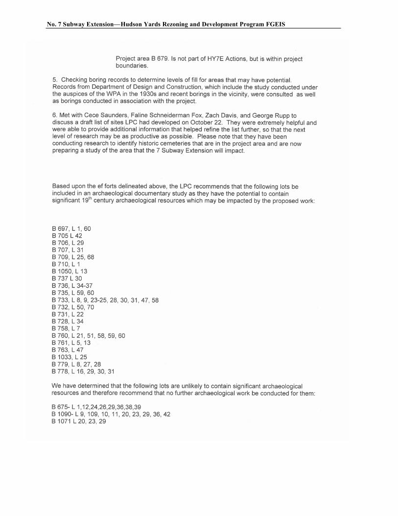
3. Examining historic maps to determine where archaeological resources may once have been deposited. In LPC’s experience, it was noted that no significant Native American site has ever been found in such a densely developed area of NYC, so their emphasis was upon historic resources. The historic maps that were consulted include: 1820 Randel Map of Farms, 1836 Colton, Viele 1865, Robinson 1885, and Sanborn Insurance maps from the late 19th through the entire 20th century.
4. Reviewing other archaeological projects that have occurred in the vicinity which consists of:
Greenhouse Archaeological Consultants Ninth Avenue Rezoning Project. Technical Report #2 Phase 1A Sensitivity Evaluation. For: McKeown & Franz, Inc. CEQR 87-175M. [Multiple authors]
This included the project area on Ninth Avenue from West 35th to West 40th Street.
Hartgen Archaeological Associates 1990 Route 9A Reconstruction Project, Draft Archaeological Assessment Report, West 30th
Street to West 44th Street. For: New York State Department of Transportation with Federal Highway Administration & the City of New York. [Multiple authors]
This covered the Route 9A corridor outside of, but directly adjacent to, the current project area.
Historical Perspectives Inc 1988 Phase 1A Archaeological Assessment For The 34th Street Rezoning Project, Manhattan,
New York. For: AKRF, Inc. CEQR 88-113M. [Multiple authors]
This covered Block 757- which is not part of the current project’s actions but is within project boundaries.
Pickman, Arnold and Rebecca Yamin 1985 Cultural Resources Survey, Phase 1A, Block 679. For Department of City Planning.
This covered Block 679 - which is not part of the current project’s actions but is within project boundaries.
5. Reviewing boring records to determine levels of fill for areas that may have archaeological potential. Records from the Department of Design and Construction, which include the study conducted under the auspices of the WPA in the 1930s and recent borings in the vicinity, were consulted as well as borings conducted in association with the project.
6. Meeting with Cece Saunders (RPA), Faline Schneiderman-Fox (RPA), Zachary Davis (RPA), and George Rupp to discuss a draft list of sites LPC had developed on October 22. The project consultants were able to provide additional evidence of disturbances that helped refine the list further.
Based upon the first level review undertaken by LPC, and the revised list of lots that may be affected by the Proposed Action, it was determined that numerous lots could be eliminated from further study due to either a lack of initial deposition or documented subsurface disturbance, while other lots required further study. A letter to this effect was submitted by LPC to the New York State Office of Parks, Recreation
Archaeological Documentary Study, No. 7 Line Extension/Hudson Yard Rezoning
Revision 02 II-4 April 13, 2004
and Historic Preservation (OPRHP), which concurred with the findings (Robert Kuhn, OPRHP to Amanda Sutphin, LPC, November 3, 2003).
1. Sites Eliminated from Further Study
In October, 2003 it was determined that no further archaeological consideration was warranted for the following lots:
BLOCK 675, LOTS 1, 12, 24, 26, 29, 36, 38, 39 BLOCK 702, LOTS 1, 50 BLOCK 704, LOTS 1, 5, 6 BLOCK 705, LOTS 1, 5, 54, 46, 29, 30, 32, 39, 41, 45, 53, 68 BLOCK 706, LOTS 1, 10, 15, 17, 20, 35, 36, 48, 50, 52, 55 BLOCK 707, LOTS 1, 13, 16, 20, 26, 39, 41, 45, 51, 54, 56 BLOCK 708, LOTS 1, 17, 20, 22, 24, 37, 41, 42, 43, 46, 48, 62, 65 BLOCK 709, LOTS 1-3, 7, 13-15, 17, 23, 30-33, 36, 37, 41, 43, 45, 46, 52, 60, 61, 63, 66, 67, 71, 70 BLOCK 710, LOTS 6, 11, 15, 20, 22, 27, 29, 42 BLOCK 711, LOT 1 BLOCK 728, LOTS 4, 69, 67, 60, 42 BLOCK 729, LOTS 1, 50, 60, 163, 15 BLOCK 731, LOTS 43, 44, 48 BLOCK 732, LOT 1 BLOCK 733, LOTS 70, 60-64, 67, 68 BLOCK 734, LOTS 1, 5, 7, 10, 16, 52, 55, 62 BLOCK 735, LOTS 1, 6, 7, 11, 13, 17, 30, 55 BLOCK 736, LOTS 1, 73, 30, 38 BLOCK 737, LOTS 31-33 BLOCK 754, LOTS 51, 44, 63 BLOCK 758, LOTS 1, 5 BLOCK 759, LOTS 14, 26, 27, 49, 55, 61 BLOCK 760, LOTS 7, 12, 16, 18, 20, 55, 63, 67, 68 BLOCK 761, LOTS 7, 10, 43, 28, 41, 62 BLOCK 762, LOTS 1, 2, 6, 11, 13, 16, 60, 19, 46, 61 BLOCK 763, LOTS 12, 14, 17, 28, 32, 34, 38, 42, 45, 46, 49, 56, 60, 65, 67, 72, 73 BLOCK 778, LOTS 7, 13, 18, 25, 27, 33, 34, 57, 66, 70 BLOCK 779, LOTS 25, 26, 53, 55, 56 BLOCK 780, LOTS 17, 19 BLOCK 781, LOT 1 BLOCK 1032, LOTS 29, 101, 5, 7, 54, 57, 58 BLOCK 1033, LOT 41 BLOCK 1050, LOTS 1, 6, 158, 61 BLOCK 1051, LOTS 8, 1, 31-33, 35, 135, 138, 49-51, 53, 57 BLOCK 1069, LOTS 1, 29, 34 BLOCK 1070, LOTS 1, 54, 50, 49, 20 BLOCK 1071, LOTS 20, 23, 29 BLOCK 1090, LOTS 9-11, 20, 23, 29, 36, 42, 109
Following discussions with DCP and project archaeologists in January 2004, it was also determined that the following eight lots would not be affected by the Proposed Action and, therefore, did not require further study:
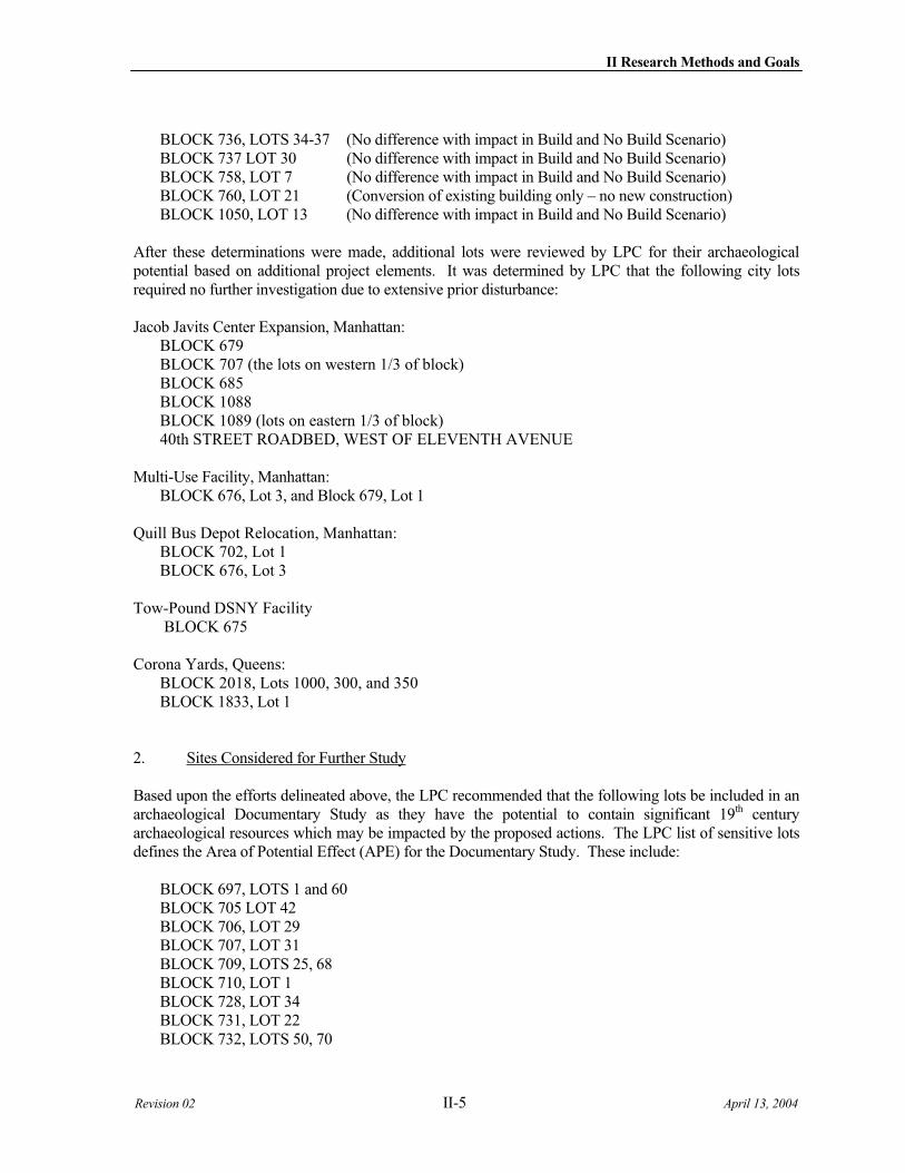
II Research Methods and Goals
Revision 02 II-5 April 13, 2004
BLOCK 736, LOTS 34-37 (No difference with impact in Build and No Build Scenario) BLOCK 737 LOT 30 (No difference with impact in Build and No Build Scenario) BLOCK 758, LOT 7 (No difference with impact in Build and No Build Scenario) BLOCK 760, LOT 21 (Conversion of existing building only – no new construction) BLOCK 1050, LOT 13 (No difference with impact in Build and No Build Scenario)
After these determinations were made, additional lots were reviewed by LPC for their archaeological potential based on additional project elements. It was determined by LPC that the following city lots required no further investigation due to extensive prior disturbance:
Jacob Javits Center Expansion, Manhattan: BLOCK 679 BLOCK 707 (the lots on western 1/3 of block) BLOCK 685 BLOCK 1088BLOCK 1089 (lots on eastern 1/3 of block) 40th STREET ROADBED, WEST OF ELEVENTH AVENUE
Multi-Use Facility, Manhattan: BLOCK 676, Lot 3, and Block 679, Lot 1
Quill Bus Depot Relocation, Manhattan: BLOCK 702, Lot 1 BLOCK 676, Lot 3
Tow-Pound DSNY Facility BLOCK 675
Corona Yards, Queens: BLOCK 2018, Lots 1000, 300, and 350 BLOCK 1833, Lot 1
2. Sites Considered for Further Study
Based upon the efforts delineated above, the LPC recommended that the following lots be included in an archaeological Documentary Study as they have the potential to contain significant 19th century archaeological resources which may be impacted by the proposed actions. The LPC list of sensitive lots defines the Area of Potential Effect (APE) for the Documentary Study. These include:
BLOCK 697, LOTS 1 and 60 BLOCK 705 LOT 42 BLOCK 706, LOT 29 BLOCK 707, LOT 31 BLOCK 709, LOTS 25, 68 BLOCK 710, LOT 1 BLOCK 728, LOT 34 BLOCK 731, LOT 22 BLOCK 732, LOTS 50, 70
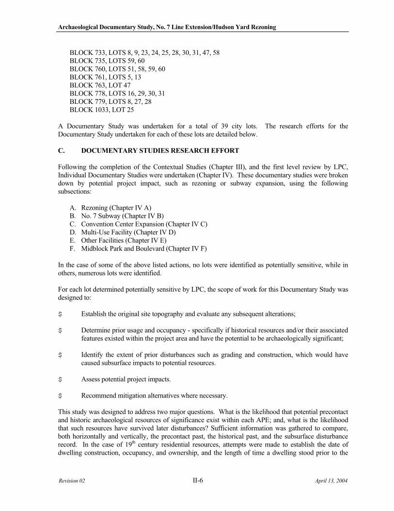
Archaeological Documentary Study, No. 7 Line Extension/Hudson Yard Rezoning
Revision 02 II-6 April 13, 2004
BLOCK 733, LOTS 8, 9, 23, 24, 25, 28, 30, 31, 47, 58 BLOCK 735, LOTS 59, 60 BLOCK 760, LOTS 51, 58, 59, 60 BLOCK 761, LOTS 5, 13 BLOCK 763, LOT 47 BLOCK 778, LOTS 16, 29, 30, 31 BLOCK 779, LOTS 8, 27, 28 BLOCK 1033, LOT 25
A Documentary Study was undertaken for a total of 39 city lots. The research efforts for the Documentary Study undertaken for each of these lots are detailed below.
C. DOCUMENTARY STUDIES RESEARCH EFFORT
Following the completion of the Contextual Studies (Chapter III), and the first level review by LPC, Individual Documentary Studies were undertaken (Chapter IV). These documentary studies were broken down by potential project impact, such as rezoning or subway expansion, using the following subsections:
A. Rezoning (Chapter IV A) B. No. 7 Subway (Chapter IV B) C. Convention Center Expansion (Chapter IV C) D. Multi-Use Facility (Chapter IV D) E. Other Facilities (Chapter IV E) F. Midblock Park and Boulevard (Chapter IV F)
In the case of some of the above listed actions, no lots were identified as potentially sensitive, while in others, numerous lots were identified.
For each lot determined potentially sensitive by LPC, the scope of work for this Documentary Study was designed to:
$ Establish the original site topography and evaluate any subsequent alterations;
$ Determine prior usage and occupancy - specifically if historical resources and/or their associated features existed within the project area and have the potential to be archaeologically significant;
$ Identify the extent of prior disturbances such as grading and construction, which would have caused subsurface impacts to potential resources.
$ Assess potential project impacts.
$ Recommend mitigation alternatives where necessary.
This study was designed to address two major questions. What is the likelihood that potential precontact and historic archaeological resources of significance exist within each APE; and, what is the likelihood that such resources have survived later disturbances? Sufficient information was gathered to compare, both horizontally and vertically, the precontact past, the historical past, and the subsurface disturbance record. In the case of 19th century residential resources, attempts were made to establish the date of dwelling construction, occupancy, and ownership, and the length of time a dwelling stood prior to the
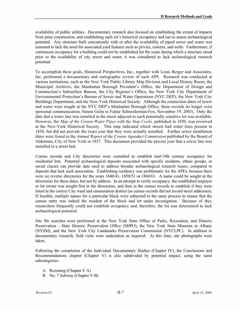
II Research Methods and Goals
Revision 02 II-7 April 13, 2004
availability of public utilities. Documentary research also focused on establishing the extent of impacts from prior construction, and establishing each lot’s historical occupancy and use to assess archaeological potential. Any structure built concurrently with or after the availability of piped sewer and water was assumed to lack the need for associated yard features such as privies, cisterns, and wells. Furthermore, if continuous occupancy for a building could not be established for the years during which a structure stood prior to the availability of city sewer and water, it was considered to lack archaeological research potential.
To accomplish these goals, Historical Perspectives, Inc., together with Louis Berger and Associates, Inc, performed a documentary and cartographic review of each APE. Research was conducted at various institutions, such as the New York Public Library Map Division and Local History Room, the Municipal Archives, the Manhattan Borough President’s Office, the Department of Design and Construction’s Subsurface Bureau, the City Register’s Office, the New York City Department of Environmental Protection’s Bureau of Sewer and Water Operations (NYC DEP), the New York City Buildings Department, and the New-York Historical Society. Although the connection dates of sewer and water were sought at the NYC DEP’s Manhattan Borough Office, these records no longer exist (personal communication, Simon Gelin to Faline Schneiderman-Fox, November 19, 2003). Only the date that a water line was installed in the street adjacent to each potentially sensitive lot was available. However, the Map of the Croton Water Pipes with the Stop Cocks, published in 1850, was reviewed at the New-York Historical Society. This map indicated which streets had water lines present in 1850, but did not provide the exact year that they were actually installed. Further sewer installation dates were found in the Annual Report of the Croton Aqueduct Commission published by the Board of Alderman, City of New York in 1857. This document provided the precise year that a sewer line was installed in a street bed.
Census records and City directories were consulted to establish mid-19th century occupancy for residential lots. Potential archaeological deposits associated with specific residents, ethnic groups, or social classes can provide data used to address broader archaeological research issues, compared to deposits that lack such association. Establishing residency was problematic for the APEs, because there were no reverse directories for the years 1840/41, 1850/51 or 1860/61. A name could be sought in the directories for these dates, but not by address. In an attempt to verify occupancy, the established taxpayer or lot owner was sought first in the directories, and then in the census records to establish if they were listed in the correct City ward and enumeration district (as census records did not record street addresses). If feasible, multiple names for a particular block were subjected to the same process to ensure that the census entry was indeed the resident of the block and lot under investigation. Because of this, researchers frequently could not establish occupancy and, therefore, the lot was determined to lack archaeological potential.
Site file searches were performed at the New York State Office of Parks, Recreation, and Historic Preservation - State Historic Preservation Office (SHPO), the New York State Museum in Albany (NYSM), and the New York City Landmarks Preservation Commission (NYCLPC). In addition to documentary research, field visits were undertaken as required. At this time, site photographs were taken.
Following the completion of the Individual Documentary Studies (Chapter IV), the Conclusions and Recommendations chapter (Chapter V) is also subdivided by potential impact, using the same subcategories:
A. Rezoning (Chapter V A) B. No. 7 Subway (Chapter V B)
Archaeological Documentary Study, No. 7 Line Extension/Hudson Yard Rezoning
Revision 02 II-8 April 13, 2004
C. Convention Center Expansion (Chapter V C) D. Multi-Use Facility (Chapter V D) E. Other Facilities (Chapter V E) F. Boulevard (Chapter V F)
The potential effects of proposed actions for each resource identified as potentially significant is addressed, and recommendations for further archaeological work, if indicated, are made. If indicated, further phases of assessment (e.g., field testing), and specific mitigation measures (e.g., avoidance or data recovery) would be recommended.
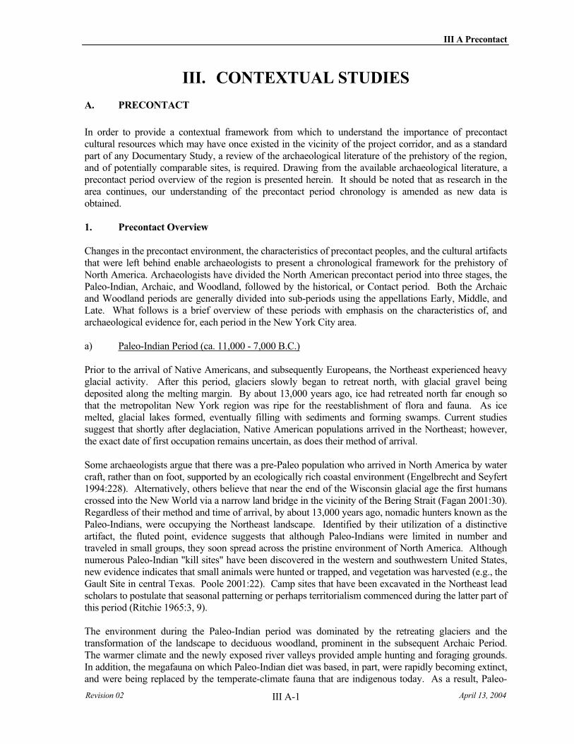
III A Precontact
Revision 02 April 13, 2004 III A-1
III. CONTEXTUAL STUDIES
A. PRECONTACT
In order to provide a contextual framework from which to understand the importance of precontact cultural resources which may have once existed in the vicinity of the project corridor, and as a standard part of any Documentary Study, a review of the archaeological literature of the prehistory of the region, and of potentially comparable sites, is required. Drawing from the available archaeological literature, a precontact period overview of the region is presented herein. It should be noted that as research in the area continues, our understanding of the precontact period chronology is amended as new data is obtained.
1. Precontact Overview
Changes in the precontact environment, the characteristics of precontact peoples, and the cultural artifacts that were left behind enable archaeologists to present a chronological framework for the prehistory of North America. Archaeologists have divided the North American precontact period into three stages, the Paleo-Indian, Archaic, and Woodland, followed by the historical, or Contact period. Both the Archaic and Woodland periods are generally divided into sub-periods using the appellations Early, Middle, and Late. What follows is a brief overview of these periods with emphasis on the characteristics of, and archaeological evidence for, each period in the New York City area.
a) Paleo-Indian Period (ca. 11,000 - 7,000 B.C.)
Prior to the arrival of Native Americans, and subsequently Europeans, the Northeast experienced heavy glacial activity. After this period, glaciers slowly began to retreat north, with glacial gravel being deposited along the melting margin. By about 13,000 years ago, ice had retreated north far enough so that the metropolitan New York region was ripe for the reestablishment of flora and fauna. As ice melted, glacial lakes formed, eventually filling with sediments and forming swamps. Current studies suggest that shortly after deglaciation, Native American populations arrived in the Northeast; however, the exact date of first occupation remains uncertain, as does their method of arrival.
Some archaeologists argue that there was a pre-Paleo population who arrived in North America by water craft, rather than on foot, supported by an ecologically rich coastal environment (Engelbrecht and Seyfert 1994:228). Alternatively, others believe that near the end of the Wisconsin glacial age the first humans crossed into the New World via a narrow land bridge in the vicinity of the Bering Strait (Fagan 2001:30). Regardless of their method and time of arrival, by about 13,000 years ago, nomadic hunters known as the Paleo-Indians, were occupying the Northeast landscape. Identified by their utilization of a distinctive artifact, the fluted point, evidence suggests that although Paleo-Indians were limited in number and traveled in small groups, they soon spread across the pristine environment of North America. Although numerous Paleo-Indian "kill sites" have been discovered in the western and southwestern United States, new evidence indicates that small animals were hunted or trapped, and vegetation was harvested (e.g., the Gault Site in central Texas. Poole 2001:22). Camp sites that have been excavated in the Northeast lead scholars to postulate that seasonal patterning or perhaps territorialism commenced during the latter part of this period (Ritchie 1965:3, 9).
The environment during the Paleo-Indian period was dominated by the retreating glaciers and the transformation of the landscape to deciduous woodland, prominent in the subsequent Archaic Period. The warmer climate and the newly exposed river valleys provided ample hunting and foraging grounds. In addition, the megafauna on which Paleo-Indian diet was based, in part, were rapidly becoming extinct, and were being replaced by the temperate-climate fauna that are indigenous today. As a result, Paleo-
Archaeological Documentary Study, No. 7 Line Extension/Hudson Yard Rezoning
Revision 02 III A-2 April 13, 2004
Indian sites, and later precontact sites, have typically been found on well-elevated terraces and hills near a fresh water source. However, as research continues on the issue of drowned shorelines and inundated precontact sites, it is becoming more evident that the number of Paleo-Indian sites previously encountered “represent only a very small portion of the settlement networks which extended across surfaces within the Harbor Region [of New York] that have since been inundated by rising sea levels” (Thieme 2000:3).
Along with the fluted point, scrapers and borers were part of the Paleo-Indian's "tool kit." These tools were used to hunt and butcher mastodon, elk, caribou, bison, and other smaller mammals. A variety of these animals, dated to this time period, have been excavated in New York State, particularly in the vicinity of former glacial lakes and moraines (Ritchie 1965: 9-16).
Although Paleo-Indians were dispersed across the North American continent, no human skeletal material or artifacts such as animal hides or wood objects have been recovered in the Northeast. Perhaps due to the transitory nature of these people, coupled with the naturally acidic soils, not much remains of their culture other than lithic material. In New York State a few camp sites have been examined (for a detailed discussion on Paleo-Indian, Archaic, and Woodland sites in New York see Ritchie 1980). The closest recorded Paleo-Indian site to the project area is Port Mobil, a small camp site, recovered in Staten Island (Ritchie 1980:1, 3, 7).
b) Archaic Period (7,000 - 1,000 B.C.)
The transition from the Paleo-Indian period to the Archaic was marked by the availability of a larger variety of plants and small-game as the post-glacial Archaic peoples exploited the now dominant deciduous woodland environment. The decreased population of big-game animals led to the hunting of smaller game including the white-tailed deer, moose, wild turkey, and rabbit. In addition, Archaic peoples began to exploit the marine environment. Although not as mobile as the Paleo-Indians, archaeological evidence indicates that early Archaic peoples continued to travel seasonally. Their group movements, however, were within well-defined territorial boundaries and the camp sites that have been recovered indicate that they were repeatedly occupied over time.
Data regarding the Archaic period indicates that the quantity of recorded archaeological sites is much larger then those dating to the Paleo-Indian Period, thus suggesting a significant increase in the population of native peoples. The Archaic period is also characterized by an overall shift in the environment, an expansion of the lithic tool kit, and the exploitation of defined territorial boundaries.
By the Early Archaic the environment in the Northeast had developed into a deciduous woodland forest. A gradual warming trend allowed new resources to establish themselves in the river valley. The Archaic people’s subsistence was "based on hunting, fishing and gathering of wild vegetables" (Ritchie 1994:31). They hunted smaller game animals (deer, rabbit, beaver, and wild turkey) and gathered a variety of wild plants, as well as exploited the marine environment (fish and shellfish gathering). Artifacts attesting to the expanded subsistence economy include fishing implements and the mortar and pestle.
During this period, the expanding exploitable resource base may have initiated the significant increase in population. The Archaic hunters also began exploiting a well-defined territory, often reoccupying favored sites. Because of the repeated occupation of these Archaic sites as well as the seasonal rounds made within specific territories, archaeologists have been able to recognize several identifiable cultural traditions in New York State (Ritchie 1994). The change in the number of sites recovered also indicates that Archaic peoples had a greater impact upon the landscape. Typical with all precontact period sites, river valleys and coastal areas were the preferred locale for primary camp sites. This environment supported the game, plants, and marine resources desired by Archaic peoples.
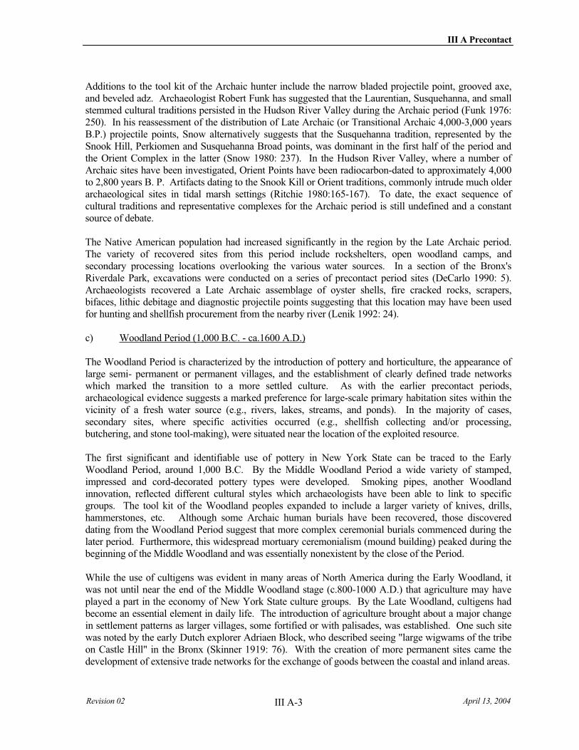
III A Precontact
Revision 02 April 13, 2004 III A-3
Additions to the tool kit of the Archaic hunter include the narrow bladed projectile point, grooved axe, and beveled adz. Archaeologist Robert Funk has suggested that the Laurentian, Susquehanna, and small stemmed cultural traditions persisted in the Hudson River Valley during the Archaic period (Funk 1976: 250). In his reassessment of the distribution of Late Archaic (or Transitional Archaic 4,000-3,000 years B.P.) projectile points, Snow alternatively suggests that the Susquehanna tradition, represented by the Snook Hill, Perkiomen and Susquehanna Broad points, was dominant in the first half of the period and the Orient Complex in the latter (Snow 1980: 237). In the Hudson River Valley, where a number of Archaic sites have been investigated, Orient Points have been radiocarbon-dated to approximately 4,000 to 2,800 years B. P. Artifacts dating to the Snook Kill or Orient traditions, commonly intrude much older archaeological sites in tidal marsh settings (Ritchie 1980:165-167). To date, the exact sequence of cultural traditions and representative complexes for the Archaic period is still undefined and a constant source of debate.
The Native American population had increased significantly in the region by the Late Archaic period. The variety of recovered sites from this period include rockshelters, open woodland camps, and secondary processing locations overlooking the various water sources. In a section of the Bronx's Riverdale Park, excavations were conducted on a series of precontact period sites (DeCarlo 1990: 5). Archaeologists recovered a Late Archaic assemblage of oyster shells, fire cracked rocks, scrapers, bifaces, lithic debitage and diagnostic projectile points suggesting that this location may have been used for hunting and shellfish procurement from the nearby river (Lenik 1992: 24).
c) Woodland Period (1,000 B.C. - ca.1600 A.D.)
The Woodland Period is characterized by the introduction of pottery and horticulture, the appearance of large semi- permanent or permanent villages, and the establishment of clearly defined trade networks which marked the transition to a more settled culture. As with the earlier precontact periods, archaeological evidence suggests a marked preference for large-scale primary habitation sites within the vicinity of a fresh water source (e.g., rivers, lakes, streams, and ponds). In the majority of cases, secondary sites, where specific activities occurred (e.g., shellfish collecting and/or processing, butchering, and stone tool-making), were situated near the location of the exploited resource.
The first significant and identifiable use of pottery in New York State can be traced to the Early Woodland Period, around 1,000 B.C. By the Middle Woodland Period a wide variety of stamped, impressed and cord-decorated pottery types were developed. Smoking pipes, another Woodland innovation, reflected different cultural styles which archaeologists have been able to link to specific groups. The tool kit of the Woodland peoples expanded to include a larger variety of knives, drills, hammerstones, etc. Although some Archaic human burials have been recovered, those discovered dating from the Woodland Period suggest that more complex ceremonial burials commenced during the later period. Furthermore, this widespread mortuary ceremonialism (mound building) peaked during the beginning of the Middle Woodland and was essentially nonexistent by the close of the Period.
While the use of cultigens was evident in many areas of North America during the Early Woodland, it was not until near the end of the Middle Woodland stage (c.800-1000 A.D.) that agriculture may have played a part in the economy of New York State culture groups. By the Late Woodland, cultigens had become an essential element in daily life. The introduction of agriculture brought about a major change in settlement patterns as larger villages, some fortified or with palisades, was established. One such site was noted by the early Dutch explorer Adriaen Block, who described seeing "large wigwams of the tribe on Castle Hill" in the Bronx (Skinner 1919: 76). With the creation of more permanent sites came the development of extensive trade networks for the exchange of goods between the coastal and inland areas.

Archaeological Documentary Study, No. 7 Line Extension/Hudson Yard Rezoning
Revision 02 III A-4 April 13, 2004
Late Woodland Stage sites of the East River Tradition in Manhattan and other parts of southern New York have been noted on the "second rise of ground above high water level on tidal inlets," and situated on "tidal streams or coves" and "well-drained sites" (Ritchie 1980:269). Carlyle S. Smith who studied and analyzed the distribution of precontact ceramics in coastal New York, stated that "village sites are found on the margins of bays and tidal streams" (Smith 1950:130). Early twentieth century archaeologist Reginald P. Bolton writes that "the indispensable elements in the selection of native dwelling places," were an accessible spring, and shelter from prevailing winter winds, which on Manhattan Island was found on "the eastern side of hills, or a southern exposure" (Bolton 1922:46,62,64).
d) Contact Period (A.D. 1600-A.D. 1800)
Much of what is known about the Contact Period has been acquired from the documentary record. Using legal documents and early ethnohistorical accounts, archaeologists have been able to learn much about the Native groups that were present upon contact with Europeans. One example is the journal of Robert Juet who traveled with Henry Hudson on his 1609 voyage. Juet provided a description of the native population encountered and the exchange of "Indian Wheate" (maize) and tobacco for beads and knives (Van Zandt 1981: 10-11).
In Native American Place Names in New York City (1981), Robert Steven Grumet categorized data from historical documents and the work of previous scholars in an attempt to synthesize and verify known information on Native American sites, pathways and culture groups. Grumet notes that the 1610 Velasco map used the name Manahata as the designation for the native inhabitants of both banks of the lower Hudson River (1981: 24). The Manhattan Indians were identified on Dutch seventeenth-century maps but not on many other documents. In addition, no individual Manhattan Indian was referred to by name in the documentary record.
Isaak de Rasieres reported ca.1628, that the island was "inhabited by the old Manhatesen; they are about 200 to 300 strong, women and men, under different chiefs." The Wiechquaesgeck have been identified as the denizens of northern Manhattan, as well as parts of the Bronx and Westchester County. However, there is little data available to identify the "Manhatesen" who dwelt to the south, in Lower Manhattan. Tradition, rather than firm evidence, has identified them as Canarsee Indians, while another, also discredited line of reasoning, suggested that they were Rechgawawancks. However, there is no seventeenth century documentary evidence to support this, nor even the idea that Manhattan was divided north/south between different maximal groups. It is likely that the Manhattan Indians were a sub-group of the Wiechquaesgeck, with whom they eventually combined (Grumet 1981:24-26; Bolton 1972:127).
The Manhattan and their Wiechquaesgeck relatives had few furs to trade with the Dutch. As a result, there was little motivation on either side for good relations, and the residents of New Amsterdam probably considered the local Indians an annoyance. In addition, the sometimes cruel and often dishonest practices of European traders led to Wiechquaesgeck retaliation, which took the form of several murders between 1640 and 1642, leading to various raids and counter raids between Dutch and Indians (Grumet 1981:60-61; Kammen 1975:45-46).
The Dutch practice of trading firearms to the upriver Mahican and Mohawk, while denying guns to the Indians of the lower Hudson, left the Native community vulnerable to attack. When a large force of Mahican or Mohawk attacked the Wiechquaesgeck and Tappan in 1643, the surviving Indians fled to the Dutch in New Jersey and Corlaer's Hook on Manhattan for protection. Governor Kieft and his advisors seized this chance to revenge themselves, and sent a force to attack the refugee camp at Pavonia (now Jersey City), massacring 80 Tappan, while another force killed another 40 Wiechquaesgeck on Manhattan. Eventually every lower Hudson native group joined in war against the Dutch, with disastrous results for European settlers. "Governor Kieft's War" ended when the Manhattan and Wiechquaesgeck
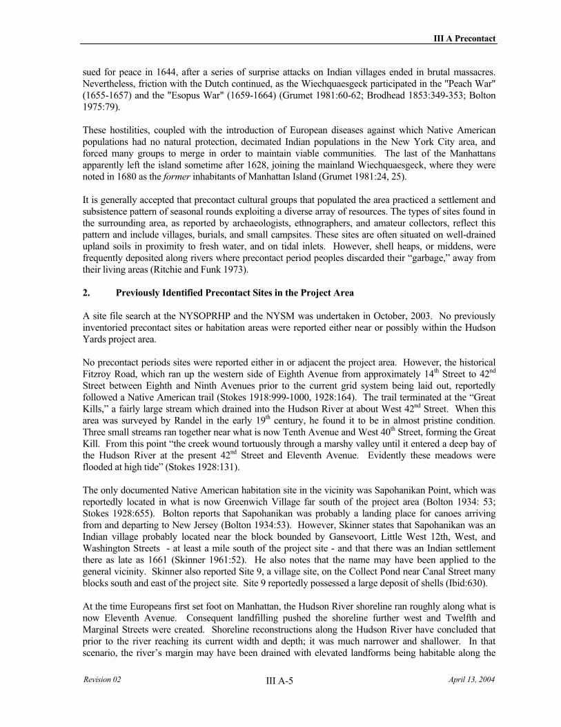
III A Precontact
Revision 02 April 13, 2004 III A-5
sued for peace in 1644, after a series of surprise attacks on Indian villages ended in brutal massacres. Nevertheless, friction with the Dutch continued, as the Wiechquaesgeck participated in the "Peach War" (1655-1657) and the "Esopus War" (1659-1664) (Grumet 1981:60-62; Brodhead 1853:349-353; Bolton 1975:79).
These hostilities, coupled with the introduction of European diseases against which Native American populations had no natural protection, decimated Indian populations in the New York City area, and forced many groups to merge in order to maintain viable communities. The last of the Manhattans apparently left the island sometime after 1628, joining the mainland Wiechquaesgeck, where they were noted in 1680 as the former inhabitants of Manhattan Island (Grumet 1981:24, 25).
It is generally accepted that precontact cultural groups that populated the area practiced a settlement and subsistence pattern of seasonal rounds exploiting a diverse array of resources. The types of sites found in the surrounding area, as reported by archaeologists, ethnographers, and amateur collectors, reflect this pattern and include villages, burials, and small campsites. These sites are often situated on well-drained upland soils in proximity to fresh water, and on tidal inlets. However, shell heaps, or middens, were frequently deposited along rivers where precontact period peoples discarded their “garbage,” away from their living areas (Ritchie and Funk 1973).
2. Previously Identified Precontact Sites in the Project Area
A site file search at the NYSOPRHP and the NYSM was undertaken in October, 2003. No previously inventoried precontact sites or habitation areas were reported either near or possibly within the Hudson Yards project area.
No precontact periods sites were reported either in or adjacent the project area. However, the historical Fitzroy Road, which ran up the western side of Eighth Avenue from approximately 14th Street to 42nd
Street between Eighth and Ninth Avenues prior to the current grid system being laid out, reportedly followed a Native American trail (Stokes 1918:999-1000, 1928:164). The trail terminated at the “Great Kills,” a fairly large stream which drained into the Hudson River at about West 42nd Street. When this area was surveyed by Randel in the early 19th century, he found it to be in almost pristine condition. Three small streams ran together near what is now Tenth Avenue and West 40th Street, forming the Great Kill. From this point “the creek wound tortuously through a marshy valley until it entered a deep bay of the Hudson River at the present 42nd Street and Eleventh Avenue. Evidently these meadows were flooded at high tide” (Stokes 1928:131).
The only documented Native American habitation site in the vicinity was Sapohanikan Point, which was reportedly located in what is now Greenwich Village far south of the project area (Bolton 1934: 53; Stokes 1928:655). Bolton reports that Sapohanikan was probably a landing place for canoes arriving from and departing to New Jersey (Bolton 1934:53). However, Skinner states that Sapohanikan was an Indian village probably located near the block bounded by Gansevoort, Little West 12th, West, and Washington Streets - at least a mile south of the project site - and that there was an Indian settlement there as late as 1661 (Skinner 1961:52). He also notes that the name may have been applied to the general vicinity. Skinner also reported Site 9, a village site, on the Collect Pond near Canal Street many blocks south and east of the project site. Site 9 reportedly possessed a large deposit of shells (Ibid:630).
At the time Europeans first set foot on Manhattan, the Hudson River shoreline ran roughly along what is now Eleventh Avenue. Consequent landfilling pushed the shoreline further west and Twelfth and Marginal Streets were created. Shoreline reconstructions along the Hudson River have concluded that prior to the river reaching its current width and depth; it was much narrower and shallower. In that scenario, the river’s margin may have been drained with elevated landforms being habitable along the
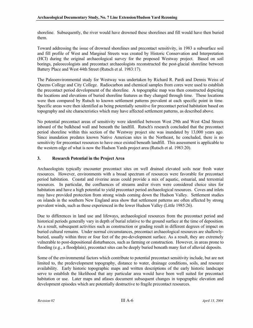
Archaeological Documentary Study, No. 7 Line Extension/Hudson Yard Rezoning
Revision 02 III A-6 April 13, 2004
shoreline. Subsequently, the river would have drowned these shorelines and fill would have then buried them.
Toward addressing the issue of drowned shorelines and precontact sensitivity, in 1983 a subsurface soil and fill profile of West and Marginal Streets was created by Historic Conservation and Interpretation (HCI) during the original archaeological survey for the proposed Westway project. Based on soil borings, paleoecologists and precontact archaeologists reconstructed the post-glacial shoreline between Battery Place and West 44th Street (Rutsch et al. 1983:17).
The Paleoenvironmental study for Westway was undertaken by Richard R. Pardi and Dennis Weiss of Queens College and City College. Radiocarbon and chemical samples from cores were used to establish the precontact period development of the shoreline. A topographic map was then constructed depicting the locations and elevations of buried shoreline features as they changed through time. These locations were then compared by Rutsch to known settlement patterns prevalent at each specific point in time. Specific areas were then identified as being potentially sensitive for precontact period habitation based on topography and site characteristics which may have affected settlement patterns, as described above.
No potential precontact areas of sensitivity were identified between West 29th and West 42nd Streets inboard of the bulkhead wall and beneath the landfill. Rutsch's research concluded that the precontact period shoreline within this section of the Westway project site was inundated by 13,000 years ago. Since inundation predates known Native American sites in the Northeast, he concluded, there is no sensitivity for precontact resources to have once existed beneath landfill. This assessment is applicable to the western edge of what is now the Hudson Yards project area (Rutsch et al. 1983:20).
3. Research Potential in the Project Area
Archaeologists typically encounter precontact sites on well drained elevated soils near fresh water resources. However, environments with a broad spectrum of resources were favorable for precontact period habitation. Coastal and riverine areas could provide a mix of aquatic, estuarial, and terrestrial resources. In particular, the confluences of streams and/or rivers were considered choice sites for habitation and have a high potential to yield precontact period archaeological resources. Coves and inlets may have provided protection from strong winds coming down the Hudson Valley. Settlement studies on islands in the southern New England area show that settlement patterns are often affected by strong prevalent winds, such as those experienced in the lower Hudson Valley (Little 1985:26).
Due to differences in land use and lifeways, archaeological resources from the precontact period and historical periods generally vary in depth of burial relative to the ground surface at the time of deposition. As a result, subsequent activities such as construction or grading result in different degrees of impact on buried cultural remains. Under normal circumstances, precontact archaeological resources are shallowly-buried, usually within three or four feet of the pre-development surface. As a result, they are extremely vulnerable to post-depositional disturbances, such as farming or construction. However, in areas prone to flooding (e.g., a floodplain), precontact sites can be deeply buried beneath many feet of alluvial deposits.
Some of the environmental factors which contribute to potential precontact sensitivity include, but are not limited to, the predevelopment topography, distance to water, drainage conditions, soils, and resource availability. Early historic topographic maps and written descriptions of the early historic landscape serve to establish the likelihood that any particular area would have been well suited for precontact habitation or use. Later maps and atlases document subsequent changes in topographic elevation and development episodes which are potentially destructive to fragile precontact resources.
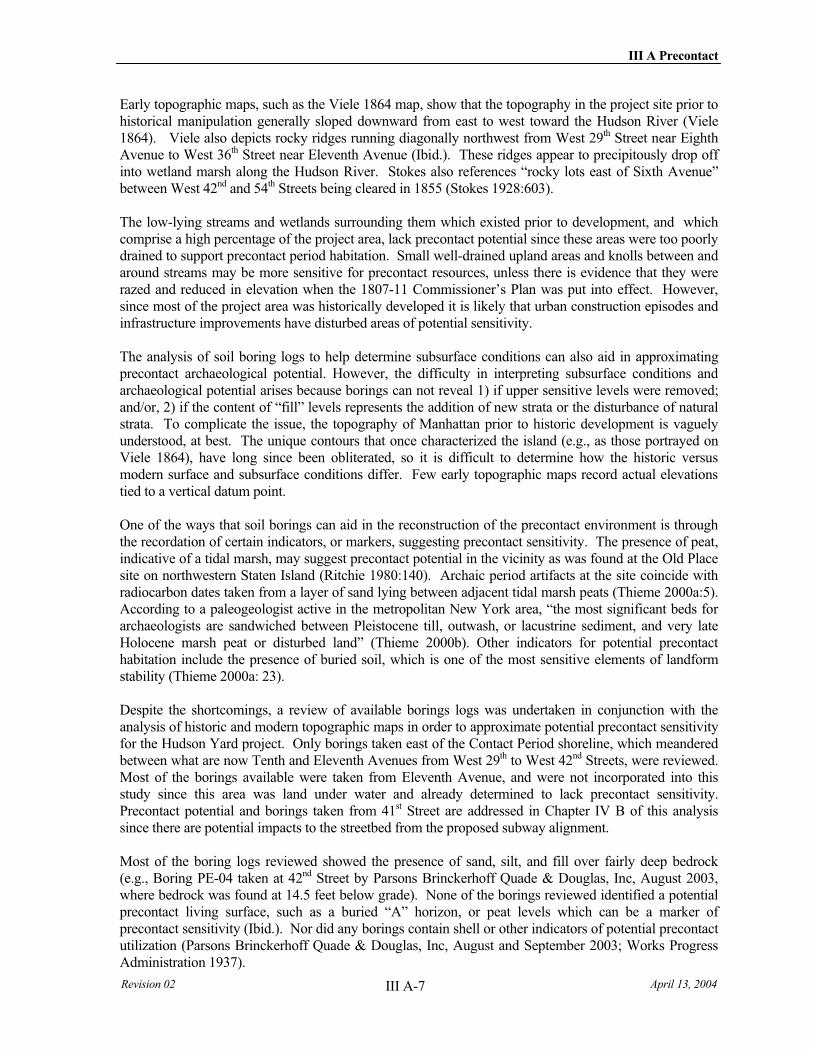
III A Precontact
Revision 02 April 13, 2004 III A-7
Early topographic maps, such as the Viele 1864 map, show that the topography in the project site prior to historical manipulation generally sloped downward from east to west toward the Hudson River (Viele 1864). Viele also depicts rocky ridges running diagonally northwest from West 29th Street near Eighth Avenue to West 36th Street near Eleventh Avenue (Ibid.). These ridges appear to precipitously drop off into wetland marsh along the Hudson River. Stokes also references “rocky lots east of Sixth Avenue” between West 42nd and 54th Streets being cleared in 1855 (Stokes 1928:603).
The low-lying streams and wetlands surrounding them which existed prior to development, and which comprise a high percentage of the project area, lack precontact potential since these areas were too poorly drained to support precontact period habitation. Small well-drained upland areas and knolls between and around streams may be more sensitive for precontact resources, unless there is evidence that they were razed and reduced in elevation when the 1807-11 Commissioner’s Plan was put into effect. However, since most of the project area was historically developed it is likely that urban construction episodes and infrastructure improvements have disturbed areas of potential sensitivity.
The analysis of soil boring logs to help determine subsurface conditions can also aid in approximating precontact archaeological potential. However, the difficulty in interpreting subsurface conditions and archaeological potential arises because borings can not reveal 1) if upper sensitive levels were removed; and/or, 2) if the content of “fill” levels represents the addition of new strata or the disturbance of natural strata. To complicate the issue, the topography of Manhattan prior to historic development is vaguely understood, at best. The unique contours that once characterized the island (e.g., as those portrayed on Viele 1864), have long since been obliterated, so it is difficult to determine how the historic versus modern surface and subsurface conditions differ. Few early topographic maps record actual elevations tied to a vertical datum point.
One of the ways that soil borings can aid in the reconstruction of the precontact environment is through the recordation of certain indicators, or markers, suggesting precontact sensitivity. The presence of peat, indicative of a tidal marsh, may suggest precontact potential in the vicinity as was found at the Old Place site on northwestern Staten Island (Ritchie 1980:140). Archaic period artifacts at the site coincide with radiocarbon dates taken from a layer of sand lying between adjacent tidal marsh peats (Thieme 2000a:5). According to a paleogeologist active in the metropolitan New York area, “the most significant beds for archaeologists are sandwiched between Pleistocene till, outwash, or lacustrine sediment, and very late Holocene marsh peat or disturbed land” (Thieme 2000b). Other indicators for potential precontact habitation include the presence of buried soil, which is one of the most sensitive elements of landform stability (Thieme 2000a: 23).
Despite the shortcomings, a review of available borings logs was undertaken in conjunction with the analysis of historic and modern topographic maps in order to approximate potential precontact sensitivity for the Hudson Yard project. Only borings taken east of the Contact Period shoreline, which meandered between what are now Tenth and Eleventh Avenues from West 29th to West 42nd Streets, were reviewed. Most of the borings available were taken from Eleventh Avenue, and were not incorporated into this study since this area was land under water and already determined to lack precontact sensitivity. Precontact potential and borings taken from 41st Street are addressed in Chapter IV B of this analysis since there are potential impacts to the streetbed from the proposed subway alignment.
Most of the boring logs reviewed showed the presence of sand, silt, and fill over fairly deep bedrock (e.g., Boring PE-04 taken at 42nd Street by Parsons Brinckerhoff Quade & Douglas, Inc, August 2003, where bedrock was found at 14.5 feet below grade). None of the borings reviewed identified a potential precontact living surface, such as a buried “A” horizon, or peat levels which can be a marker of precontact sensitivity (Ibid.). Nor did any borings contain shell or other indicators of potential precontact utilization (Parsons Brinckerhoff Quade & Douglas, Inc, August and September 2003; Works Progress Administration 1937).
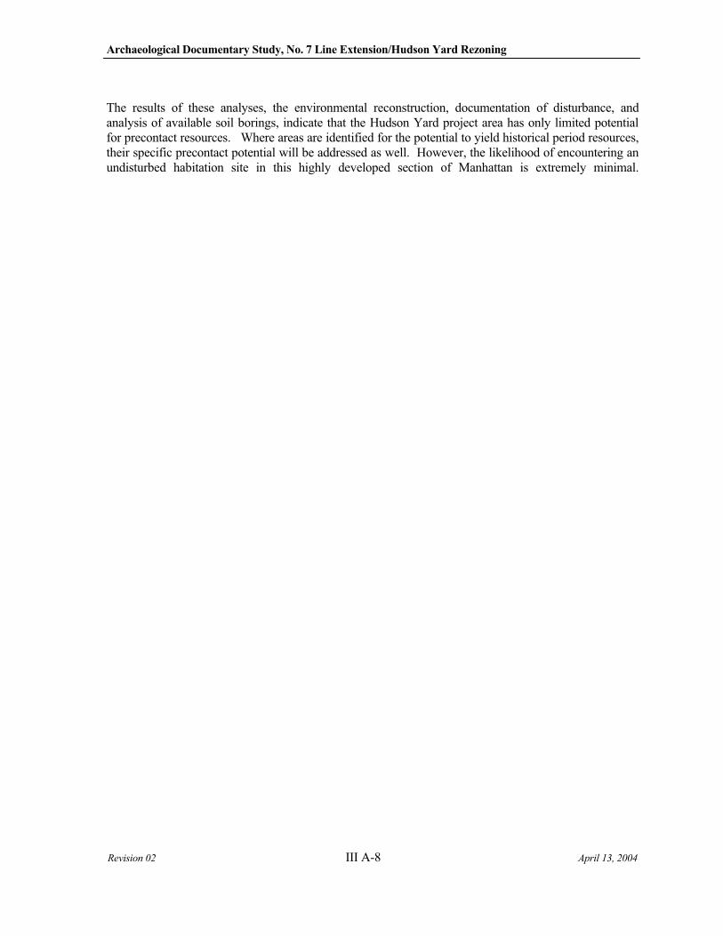
Archaeological Documentary Study, No. 7 Line Extension/Hudson Yard Rezoning
Revision 02 III A-8 April 13, 2004
The results of these analyses, the environmental reconstruction, documentation of disturbance, and analysis of available soil borings, indicate that the Hudson Yard project area has only limited potential for precontact resources. Where areas are identified for the potential to yield historical period resources, their specific precontact potential will be addressed as well. However, the likelihood of encountering an undisturbed habitation site in this highly developed section of Manhattan is extremely minimal.
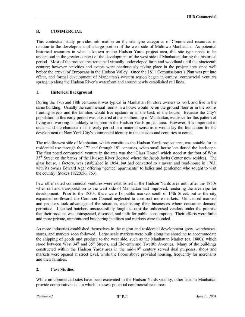
III B Commercial
Revision 02 April 13, 2004 III B-1
B. COMMERCIAL
This contextual study provides information on the site type categories of Commercial resources in relation to the development of a large portion of the west side of Midtown Manhattan. As potential historical resources in what is known as the Hudson Yards project area, this site type needs to be understood in the greater context of the development of the west side of Manhattan during the historical period. Most of the project area remained virtually undeveloped farm and woodland until the nineteenth century; however activities and events were continuously taking place in the project area since well before the arrival of Europeans in the Hudson Valley. Once the 1811 Commissioner’s Plan was put into effect, and formal development of Manhattan's western region began in earnest, commercial ventures sprang up along the Hudson River’s waterfront and around newly established rail lines.
1. Historical Background
During the 17th and 18th centuries it was typical in Manhattan for store owners to work and live in the same building. Usually the commercial rooms in a house would be on the ground floor or in the rooms fronting streets and the families would live upstairs or in the back of the house. Because the City's population in this early period was clustered at the southern tip of Manhattan, evidence for this pattern of living and working is unlikely to be seen in the Hudson Yards project area. However, it is important to understand the character of this early period in a material sense as it would lay the foundation for the development of New York City's commercial identity in the decades and centuries to come.
The middle-west side of Manhattan, which constitutes the Hudson Yards project area, was notable for its residential use through the 17th and through 19th centuries, when small house lots dotted the landscape. The first noted commercial venture in the area was the “Glass House” which stood at the foot of West 35th Street on the banks of the Hudson River (located where the Jacob Javits Center now resides). The glass house, a factory, was established in 1854, but had converted to a tavern and road-house in 1763, with its owner Edward Agar offering “genteel apartments” to ladies and gentlemen who sought to visit the country (Stokes 1922:656, 763).
Few other noted commercial ventures were established in the Hudson Yards area until after the 1850s when rail and transportation to the west side of Manhattan had improved, rendering the area ripe for development. Prior to the 1830s, there were 13 public markets south of 14th Street, but as the city expanded northward, the Common Council neglected to construct more markets. Unlicensed markets and peddlers took advantage of the situation, establishing their businesses where consumer demand permitted. Licensed butchers unsuccessfully fought to oust the unlicensed vendors under the premise that their produce was uninspected, diseased, and unfit for public consumption. Their efforts were futile and more private, unmonitored butchering facilities and markets were founded.
As more industries established themselves in the region and residential development grew, warehouses, stores, and markets soon followed. Large scale markets were built along the shoreline to accommodate the shipping of goods and produce to the west side, such as the Manhattan Market (ca. 1880s) which stood between West 34th and 35th Streets, and Eleventh and Twelfth Avenues. Many of the buildings constructed within the Hudson Yards area in the mid-19th century served dual purposes; shops and markets were opened at street level, while the floors above provided housing, frequently for merchants and their families.
2. Case Studies
While no commercial sites have been excavated in the Hudson Yards vicinity, other sites in Manhattan provide comparative data in which to assess potential commercial resources.
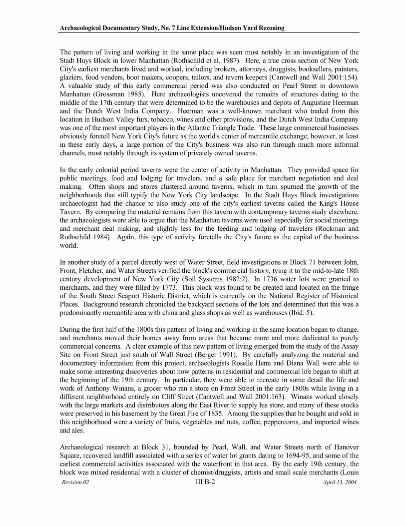
Archaeological Documentary Study, No. 7 Line Extension/Hudson Yard Rezoning
Revision 02 III B-2 April 13, 2004
The pattern of living and working in the same place was seen most notably in an investigation of the Stadt Huys Block in lower Manhattan (Rothschild et al. 1987). Here, a true cross section of New York City's earliest merchants lived and worked, including brokers, attorneys, druggists, booksellers, painters, glaziers, food venders, boot makers, coopers, tailors, and tavern keepers (Cantwell and Wall 2001:154). A valuable study of this early commercial period was also conducted on Pearl Street in downtown Manhattan (Grossman 1985). Here archaeologists uncovered the remains of structures dating to the middle of the 17th century that were determined to be the warehouses and depots of Augustine Heerman and the Dutch West India Company. Heerman was a well-known merchant who traded from this location in Hudson Valley furs, tobacco, wines and other provisions, and the Dutch West India Company was one of the most important players in the Atlantic Triangle Trade. These large commercial businesses obviously foretell New York City's future as the world's center of mercantile exchange; however, at least in these early days, a large portion of the City's business was also run through much more informal channels, most notably through its system of privately owned taverns.
In the early colonial period taverns were the center of activity in Manhattan. They provided space for public meetings, food and lodging for travelers, and a safe place for merchant negotiation and deal making. Often shops and stores clustered around taverns, which in turn spurned the growth of the neighborhoods that still typify the New York City landscape. In the Stadt Huys Block investigations archaeologist had the chance to also study one of the city's earliest taverns called the King's House Tavern. By comparing the material remains from this tavern with contemporary taverns study elsewhere, the archaeologists were able to argue that the Manhattan taverns were used especially for social meetings and merchant deal making, and slightly less for the feeding and lodging of travelers (Rockman and Rothschild 1984). Again, this type of activity foretells the City's future as the capital of the business world.
In another study of a parcel directly west of Water Street, field investigations at Block 71 between John, Front, Fletcher, and Water Streets verified the block's commercial history, tying it to the mid-to-late 18th century development of New York City (Soil Systems 1982:2). In 1736 water lots were granted to merchants, and they were filled by 1773. This block was found to be created land located on the fringe of the South Street Seaport Historic District, which is currently on the National Register of Historical Places. Background research chronicled the backyard sections of the lots and determined that this was a predominantly mercantile area with china and glass shops as well as warehouses (Ibid: 5).
During the first half of the 1800s this pattern of living and working in the same location began to change, and merchants moved their homes away from areas that became more and more dedicated to purely commercial concerns. A clear example of this new pattern of living emerged from the study of the Assay Site on Front Street just south of Wall Street (Berger 1991). By carefully analyzing the material and documentary information from this project, archaeologists Roselle Henn and Diana Wall were able to make some interesting discoveries about how patterns in residential and commercial life began to shift at the beginning of the 19th century. In particular, they were able to recreate in some detail the life and work of Anthony Winans, a grocer who ran a store on Front Street in the early 1800s while living in a different neighborhood entirely on Cliff Street (Cantwell and Wall 2001:163). Winans worked closely with the large markets and distributors along the East River to supply his store, and many of these stocks were preserved in his basement by the Great Fire of 1835. Among the supplies that he bought and sold in this neighborhood were a variety of fruits, vegetables and nuts, coffee, peppercorns, and imported wines and ales.
Archaeological research at Block 31, bounded by Pearl, Wall, and Water Streets north of Hanover Square, recovered landfill associated with a series of water lot grants dating to 1694-95, and some of the earliest commercial activities associated with the waterfront in that area. By the early 19th century, the block was mixed residential with a cluster of chemist/druggists, artists and small scale merchants (Louis
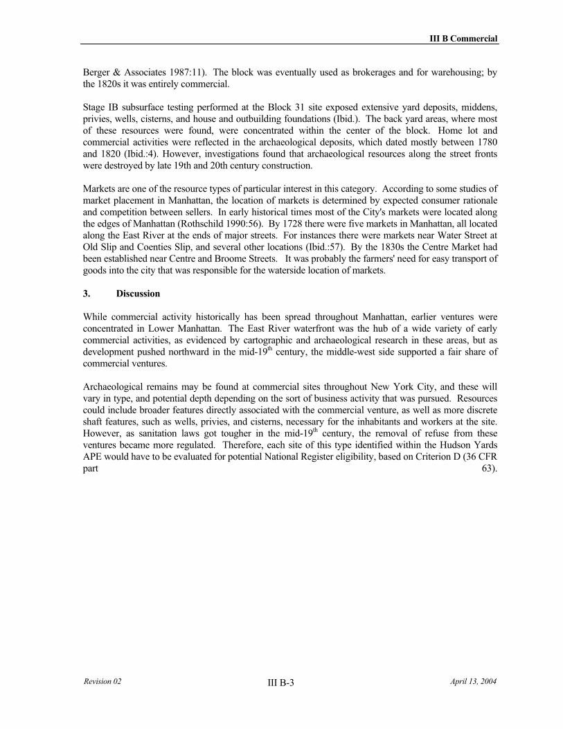
III B Commercial
Revision 02 April 13, 2004 III B-3
Berger & Associates 1987:11). The block was eventually used as brokerages and for warehousing; by the 1820s it was entirely commercial.
Stage IB subsurface testing performed at the Block 31 site exposed extensive yard deposits, middens, privies, wells, cisterns, and house and outbuilding foundations (Ibid.). The back yard areas, where most of these resources were found, were concentrated within the center of the block. Home lot and commercial activities were reflected in the archaeological deposits, which dated mostly between 1780 and 1820 (Ibid.:4). However, investigations found that archaeological resources along the street fronts were destroyed by late 19th and 20th century construction.
Markets are one of the resource types of particular interest in this category. According to some studies of market placement in Manhattan, the location of markets is determined by expected consumer rationale and competition between sellers. In early historical times most of the City's markets were located along the edges of Manhattan (Rothschild 1990:56). By 1728 there were five markets in Manhattan, all located along the East River at the ends of major streets. For instances there were markets near Water Street at Old Slip and Coenties Slip, and several other locations (Ibid.:57). By the 1830s the Centre Market had been established near Centre and Broome Streets. It was probably the farmers' need for easy transport of goods into the city that was responsible for the waterside location of markets.
3. Discussion
While commercial activity historically has been spread throughout Manhattan, earlier ventures were concentrated in Lower Manhattan. The East River waterfront was the hub of a wide variety of early commercial activities, as evidenced by cartographic and archaeological research in these areas, but as development pushed northward in the mid-19th century, the middle-west side supported a fair share of commercial ventures.
Archaeological remains may be found at commercial sites throughout New York City, and these will vary in type, and potential depth depending on the sort of business activity that was pursued. Resources could include broader features directly associated with the commercial venture, as well as more discrete shaft features, such as wells, privies, and cisterns, necessary for the inhabitants and workers at the site. However, as sanitation laws got tougher in the mid-19th century, the removal of refuse from these ventures became more regulated. Therefore, each site of this type identified within the Hudson Yards APE would have to be evaluated for potential National Register eligibility, based on Criterion D (36 CFR part 63).

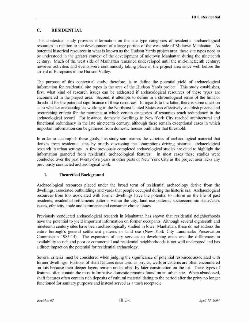
III C Residential
Revision 02 III C-1 April 13, 2004
C. RESIDENTIAL
This contextual study provides information on the site type categories of residential archaeological resources in relation to the development of a large portion of the west side of Midtown Manhattan. As potential historical resources in what is known as the Hudson Yards project area, these site types need to be understood in the greater context of the development of midtown Manhattan during the nineteenth century. Much of the west side of Manhattan remained undeveloped until the mid-nineteenth century; however activities and events were continuously taking place in the project area since well before the arrival of Europeans in the Hudson Valley.
The purpose of this contextual study, therefore, is to define the potential yield of archaeological information for residential site types in the area of the Hudson Yards project. This study establishes, first, what kind of research issues can be addressed if archaeological resources of these types are encountered in the project area. Second, it attempts to define in a chronological sense of the limit or threshold for the potential significance of these resources. In regards to the latter, there is some question as to whether archaeologists working in the Northeast United States can effectively establish precise and overarching criteria for the moments at which certain categories of resources reach redundancy in the archaeological record. For instance, domestic dwellings in New York City reached architectural and functional redundancy in the late nineteenth century, although there remain exceptional cases in which important information can be gathered from domestic houses built after that threshold.
In order to accomplish these goals, this study summarizes the varieties of archaeological material that derives from residential sites by briefly discussing the assumptions driving historical archaeological research in urban settings. A few previously completed archaeological studies are cited to highlight the information garnered from residential archaeological features. In most cases these studies were conducted over the past twenty-five years in other parts of New York City as the project area lacks any previously conducted archaeological work.
1. Theoretical Background
Archaeological resources placed under the broad term of residential archaeology derive from the dwellings, associated outbuildings and yards that people occupied during the historic era. Archaeological resources from lots associated with former dwellings have the potential to inform on the life of past residents, residential settlements patterns within the city, land use patterns, socioeconomic status/class issues, ethnicity, trade and commerce and consumer choice issues.
Previously conducted archaeological research in Manhattan has shown that residential neighborhoods have the potential to yield important information on former occupants. Although several eighteenth and nineteenth century sites have been archaeologically studied in lower Manhattan, these do not address the entire borough's general settlement patterns or land use (New York City Landmarks Preservation Commission 1983:14). The expansion of city services to developing areas and the differences in availability to rich and poor or commercial and residential neighborhoods is not well understood and has a direct impact on the potential for residential archaeology.
Several criteria must be considered when judging the significance of potential resources associated with former dwellings. Portions of shaft features once used as privies, wells or cisterns are often encountered on lots because their deeper layers remain undisturbed by later construction on the lot. These types of features often contain the most informative domestic remains found on an urban site. When abandoned, shaft features often contain rich deposits of cultural material dating to the period after the privy no longer functioned for sanitary purposes and instead served as a trash receptacle.
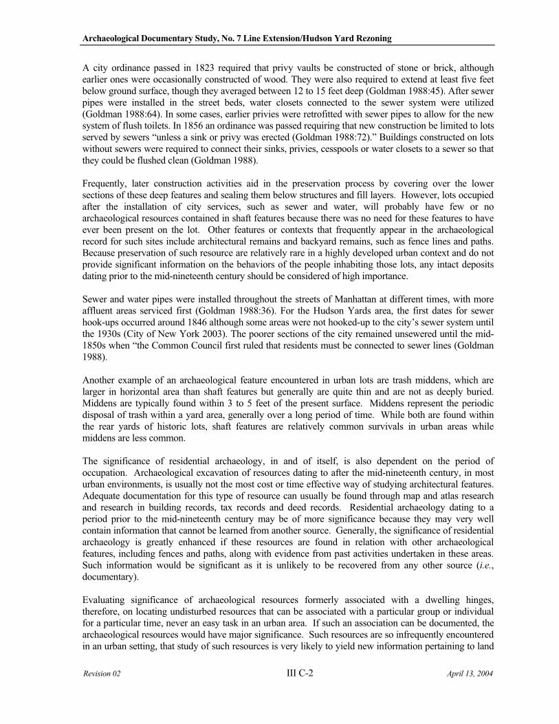
Archaeological Documentary Study, No. 7 Line Extension/Hudson Yard Rezoning
Revision 02 III C-2 April 13, 2004
A city ordinance passed in 1823 required that privy vaults be constructed of stone or brick, although earlier ones were occasionally constructed of wood. They were also required to extend at least five feet below ground surface, though they averaged between 12 to 15 feet deep (Goldman 1988:45). After sewer pipes were installed in the street beds, water closets connected to the sewer system were utilized (Goldman 1988:64). In some cases, earlier privies were retrofitted with sewer pipes to allow for the new system of flush toilets. In 1856 an ordinance was passed requiring that new construction be limited to lots served by sewers “unless a sink or privy was erected (Goldman 1988:72).” Buildings constructed on lots without sewers were required to connect their sinks, privies, cesspools or water closets to a sewer so that they could be flushed clean (Goldman 1988).
Frequently, later construction activities aid in the preservation process by covering over the lower sections of these deep features and sealing them below structures and fill layers. However, lots occupied after the installation of city services, such as sewer and water, will probably have few or no archaeological resources contained in shaft features because there was no need for these features to have ever been present on the lot. Other features or contexts that frequently appear in the archaeological record for such sites include architectural remains and backyard remains, such as fence lines and paths. Because preservation of such resource are relatively rare in a highly developed urban context and do not provide significant information on the behaviors of the people inhabiting those lots, any intact deposits dating prior to the mid-nineteenth century should be considered of high importance.
Sewer and water pipes were installed throughout the streets of Manhattan at different times, with more affluent areas serviced first (Goldman 1988:36). For the Hudson Yards area, the first dates for sewer hook-ups occurred around 1846 although some areas were not hooked-up to the city’s sewer system until the 1930s (City of New York 2003). The poorer sections of the city remained unsewered until the mid-1850s when “the Common Council first ruled that residents must be connected to sewer lines (Goldman 1988).
Another example of an archaeological feature encountered in urban lots are trash middens, which are larger in horizontal area than shaft features but generally are quite thin and are not as deeply buried. Middens are typically found within 3 to 5 feet of the present surface. Middens represent the periodic disposal of trash within a yard area, generally over a long period of time. While both are found within the rear yards of historic lots, shaft features are relatively common survivals in urban areas while middens are less common.
The significance of residential archaeology, in and of itself, is also dependent on the period of occupation. Archaeological excavation of resources dating to after the mid-nineteenth century, in most urban environments, is usually not the most cost or time effective way of studying architectural features. Adequate documentation for this type of resource can usually be found through map and atlas research and research in building records, tax records and deed records. Residential archaeology dating to a period prior to the mid-nineteenth century may be of more significance because they may very well contain information that cannot be learned from another source. Generally, the significance of residential archaeology is greatly enhanced if these resources are found in relation with other archaeological features, including fences and paths, along with evidence from past activities undertaken in these areas. Such information would be significant as it is unlikely to be recovered from any other source (i.e.,documentary).
Evaluating significance of archaeological resources formerly associated with a dwelling hinges, therefore, on locating undisturbed resources that can be associated with a particular group or individual for a particular time, never an easy task in an urban area. If such an association can be documented, the archaeological resources would have major significance. Such resources are so infrequently encountered in an urban setting, that study of such resources is very likely to yield new information pertaining to land
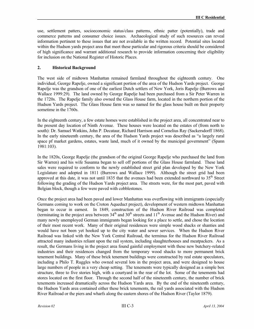
III C Residential
Revision 02 III C-3 April 13, 2004
use, settlement patters, socioeconomic status/class patterns, ethnic patter (potentially), trade and commerce patterns and consumer choice issues. Archaeological study of such resources can reveal information pertinent to these issues that are not available in the written record. Potential sites located within the Hudson yards project area that meet these particular and rigorous criteria should be considered of high significance and warrant additional research to provide information concerning their eligibility for inclusion on the National Register of Historic Places.
2. Historical Background
The west side of midtown Manhattan remained farmland throughout the eighteenth century. One individual, George Rapelje, owned a significant portion of the area of the Hudson Yards project. George Rapelje was the grandson of one of the earliest Dutch settlers of New York, Joris Rapelje (Burrows and Wallace 1999:29). The land owned by George Rapelje had been purchased from a Sir Peter Warren in the 1720s. The Rapelje family also owned the Glass House farm, located in the northern portion of the Hudson Yards project. The Glass House farm was so named for the glass house built on their property sometime in the 1760s.
In the eighteenth century, a few estate homes were established in the project area, all concentrated near to the present day location of Ninth Avenue. These houses were located on the estates of (from north to south): Dr. Samuel Watkins, John P. Decataur, Richard Harrison and Cornelius Ray (Sackersdorff 1868). In the early nineteenth century, the area of the Hudson Yards project was described as “a largely rural space pf market gardens, estates, waste land, much of it owned by the municipal government” (Spann 1981:103).
In the 1820s, George Rapelje (the grandson of the original George Rapelje who purchased the land from Sir Warren) and his wife Susanna began to sell off portions of the Glass House farmland. These land sales were required to conform to the newly established street grid plan developed by the New York Legislature and adopted in 1811 (Burrows and Wallace 1999). Although the street grid had been approved at this date, it was not until 1835 that the avenues had been extended northward to 35th Street following the grading of the Hudson Yards project area. The streets were, for the most part, paved with Belgian block, though a few were paved with cobblestones.
Once the project area had been paved and lower Manhattan was overflowing with immigrants (especially Germans coming to work on the Croton Aqueduct project), development of western midtown Manhattan began to occur in earnest. In 1849, construction of the Hudson River Railroad was completed (terminating in the project area between 34th and 30th streets and 11th Avenue and the Hudson River) and many newly unemployed German immigrants began looking for a place to settle, and chose the location of their most recent work. Many of their original residences were simple wood shacks or shanties and would have not been yet hooked up to the city water and sewer services. When the Hudson River Railroad was linked with the New York Central Railroad, the terminus for the Hudson River Railroad attracted many industries reliant upon the rail system, including slaughterhouses and meatpackers. As a result, the Germans living in the project area found gainful employment with these new butchery-related industries and their residences changed from the temporary wood shacks to more permanent brick tenement buildings. Many of these brick tenement buildings were constructed by real estate speculators, including a Philo T. Ruggles who owned several lots in the project area, and were designed to house large numbers of people in a very cheap setting. The tenements were typically designed as a simple box structure, three to five stories high, with a courtyard in the rear of the lot. Some of the tenements had stores located on the first floor. Through the second half of the nineteenth century, the number of brick tenements increased dramatically across the Hudson Yards area. By the end of the nineteenth century, the Hudson Yards area contained either these brick tenements, the rail yards associated with the Hudson River Railroad or the piers and wharfs along the eastern shores of the Hudson River (Taylor 1879).
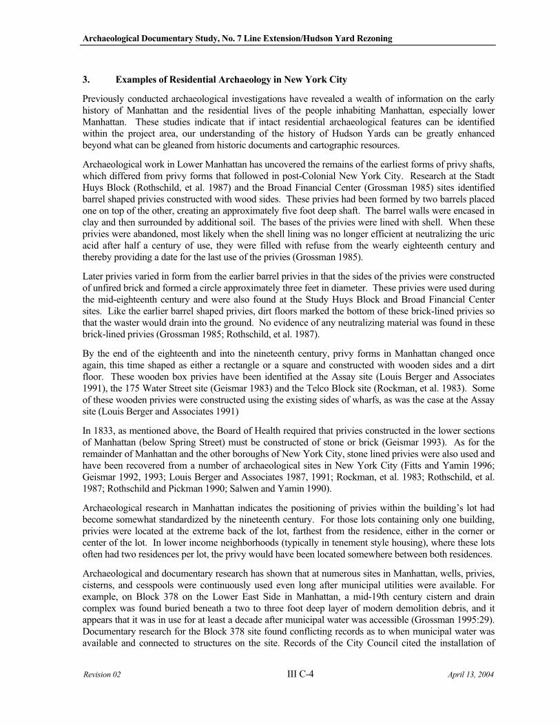
Archaeological Documentary Study, No. 7 Line Extension/Hudson Yard Rezoning
Revision 02 III C-4 April 13, 2004
3. Examples of Residential Archaeology in New York City
Previously conducted archaeological investigations have revealed a wealth of information on the early history of Manhattan and the residential lives of the people inhabiting Manhattan, especially lower Manhattan. These studies indicate that if intact residential archaeological features can be identified within the project area, our understanding of the history of Hudson Yards can be greatly enhanced beyond what can be gleaned from historic documents and cartographic resources.
Archaeological work in Lower Manhattan has uncovered the remains of the earliest forms of privy shafts, which differed from privy forms that followed in post-Colonial New York City. Research at the Stadt Huys Block (Rothschild, et al. 1987) and the Broad Financial Center (Grossman 1985) sites identified barrel shaped privies constructed with wood sides. These privies had been formed by two barrels placed one on top of the other, creating an approximately five foot deep shaft. The barrel walls were encased in clay and then surrounded by additional soil. The bases of the privies were lined with shell. When these privies were abandoned, most likely when the shell lining was no longer efficient at neutralizing the uric acid after half a century of use, they were filled with refuse from the wearly eighteenth century and thereby providing a date for the last use of the privies (Grossman 1985).
Later privies varied in form from the earlier barrel privies in that the sides of the privies were constructed of unfired brick and formed a circle approximately three feet in diameter. These privies were used during the mid-eighteenth century and were also found at the Study Huys Block and Broad Financial Center sites. Like the earlier barrel shaped privies, dirt floors marked the bottom of these brick-lined privies so that the waster would drain into the ground. No evidence of any neutralizing material was found in these brick-lined privies (Grossman 1985; Rothschild, et al. 1987).
By the end of the eighteenth and into the nineteenth century, privy forms in Manhattan changed once again, this time shaped as either a rectangle or a square and constructed with wooden sides and a dirt floor. These wooden box privies have been identified at the Assay site (Louis Berger and Associates 1991), the 175 Water Street site (Geismar 1983) and the Telco Block site (Rockman, et al. 1983). Some of these wooden privies were constructed using the existing sides of wharfs, as was the case at the Assay site (Louis Berger and Associates 1991)
In 1833, as mentioned above, the Board of Health required that privies constructed in the lower sections of Manhattan (below Spring Street) must be constructed of stone or brick (Geismar 1993). As for the remainder of Manhattan and the other boroughs of New York City, stone lined privies were also used and have been recovered from a number of archaeological sites in New York City (Fitts and Yamin 1996; Geismar 1992, 1993; Louis Berger and Associates 1987, 1991; Rockman, et al. 1983; Rothschild, et al. 1987; Rothschild and Pickman 1990; Salwen and Yamin 1990).
Archaeological research in Manhattan indicates the positioning of privies within the building’s lot had become somewhat standardized by the nineteenth century. For those lots containing only one building, privies were located at the extreme back of the lot, farthest from the residence, either in the corner or center of the lot. In lower income neighborhoods (typically in tenement style housing), where these lots often had two residences per lot, the privy would have been located somewhere between both residences.
Archaeological and documentary research has shown that at numerous sites in Manhattan, wells, privies, cisterns, and cesspools were continuously used even long after municipal utilities were available. For example, on Block 378 on the Lower East Side in Manhattan, a mid-19th century cistern and drain complex was found buried beneath a two to three foot deep layer of modern demolition debris, and it appears that it was in use for at least a decade after municipal water was accessible (Grossman 1995:29). Documentary research for the Block 378 site found conflicting records as to when municipal water was available and connected to structures on the site. Records of the City Council cited the installation of
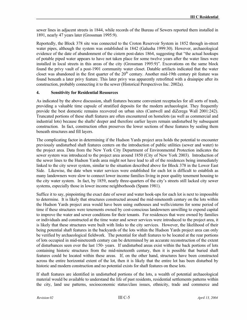
III C Residential
Revision 02 III C-5 April 13, 2004
sewer lines in adjacent streets in 1844, while records of the Bureau of Sewers reported them installed in 1891, nearly 47 years later (Grossman 1995:9).
Reportedly, the Block 378 site was connected to the Croton Reservoir System in 1852 through in-street water pipes, although the system was established in 1842 (Galusha 1999:30). However, archaeological evidence of the date of abandonment of the cistern post-dates 1864, suggesting that “the actual hookups of potable piped water appears to have not taken place for some twelve years after the water lines were installed in local streets in this areas of the city (Grossman 1995:9)”. Excavations on the same block found the privy vault of a post-1901 community water closet. Datable artifacts indicated that the water closet was abandoned in the first quarter of the 20th century. Another mid-19th century pit feature was found beneath a later privy feature. This later privy was apparently retrofitted with a drainpipe after its construction, probably connecting it to the sewer (Historical Perspectives Inc. 2002a).
4. Sensitivity for Residential Resources
As indicated by the above discussion, shaft features became convenient receptacles for all sorts of trash, providing a valuable time capsule of stratified deposits for the modern archaeologist. They frequently provide the best domestic remains recovered on urban sites (Cantwell and diZerega Wall 2001:242). Truncated portions of these shaft features are often encountered on homelots (as well as commercial and industrial lots) because the shafts' deeper and therefore earlier layers remain undisturbed by subsequent construction. In fact, construction often preserves the lower sections of these features by sealing them beneath structures and fill layers.
The complicating factor in determining if the Hudson Yards project area holds the potential to encounter previously undisturbed shaft features centers on the introduction of public utilities (sewer and water) to the project area. Data from the New York City Department of Environmental Protection indicates the sewer system was introduced to the project area around 1850 (City of New York 2003). Introduction of the sewer lines to the Hudson Yards area might not have lead to all of the residences being immediately linked to the city sewer system, similar to the situation described above for Block 378 in the Lower East Side. Likewise, the date when water services were established for each lot is difficult to establish as many landowners were slow to connect lower income families living in poor quality tenement housing to the city water system. In fact, by 1859, nearly three-quarters of the city’s streets still lacked city sewer systems, especially those in lower income neighborhoods (Spann 1981).
Suffice it to say, pinpointing the exact date of sewer and water hook-ups for each lot is next to impossible to determine. It is likely that structures constructed around the mid-nineteenth century on the lots within the Hudson Yards project area would have been using outhouses and wells/cisterns for some period of time if these structures were tenements owned by cost-conscious landowners unwilling to expend capital to improve the water and sewer conditions for their tenants. For residences that were owned by families or individuals and constructed at the time water and sewer services were introduced to the project area, it is likely that these structures were built with links to the city services. However, the likelihood of their being potential shaft features in the backyards of the lots within the Hudson Yards project area can only be verified by archaeological fieldwork. The potential for shaft features to be located at the rear portions of lots occupied in mid-nineteenth century can be determined by an accurate reconstruction of the extent of disturbances seen over the last 150- years. If undisturbed areas exist within the back portions of lots containing historic structures from the mid-nineteenth century, then it is possible that buried shaft features could be located within these areas. If, on the other hand, structures have been constructed across the entire horizontal extent of the lot, then it is likely that the entire lot has been disturbed by historic and modern construction and no potential exists for shaft features on these lots.
If shaft features are identified in undisturbed portions of the lots, a wealth of potential archaeological material would be available to understand the life of past residents, residential settlements patterns within the city, land use patterns, socioeconomic status/class issues, ethnicity, trade and commerce and
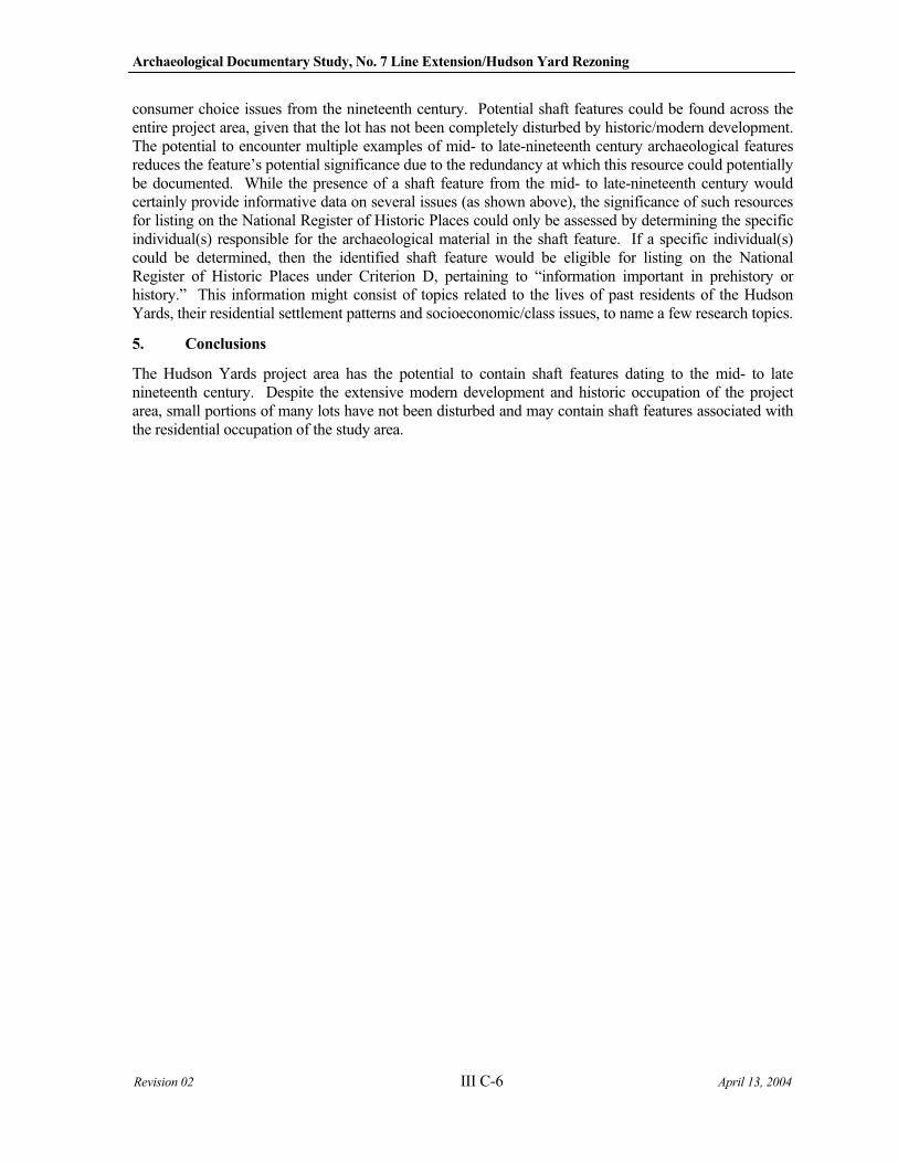
Archaeological Documentary Study, No. 7 Line Extension/Hudson Yard Rezoning
Revision 02 III C-6 April 13, 2004
consumer choice issues from the nineteenth century. Potential shaft features could be found across the entire project area, given that the lot has not been completely disturbed by historic/modern development. The potential to encounter multiple examples of mid- to late-nineteenth century archaeological features reduces the feature’s potential significance due to the redundancy at which this resource could potentially be documented. While the presence of a shaft feature from the mid- to late-nineteenth century would certainly provide informative data on several issues (as shown above), the significance of such resources for listing on the National Register of Historic Places could only be assessed by determining the specific individual(s) responsible for the archaeological material in the shaft feature. If a specific individual(s) could be determined, then the identified shaft feature would be eligible for listing on the National Register of Historic Places under Criterion D, pertaining to “information important in prehistory or history.” This information might consist of topics related to the lives of past residents of the Hudson Yards, their residential settlement patterns and socioeconomic/class issues, to name a few research topics.
5. Conclusions
The Hudson Yards project area has the potential to contain shaft features dating to the mid- to late nineteenth century. Despite the extensive modern development and historic occupation of the project area, small portions of many lots have not been disturbed and may contain shaft features associated with the residential occupation of the study area.
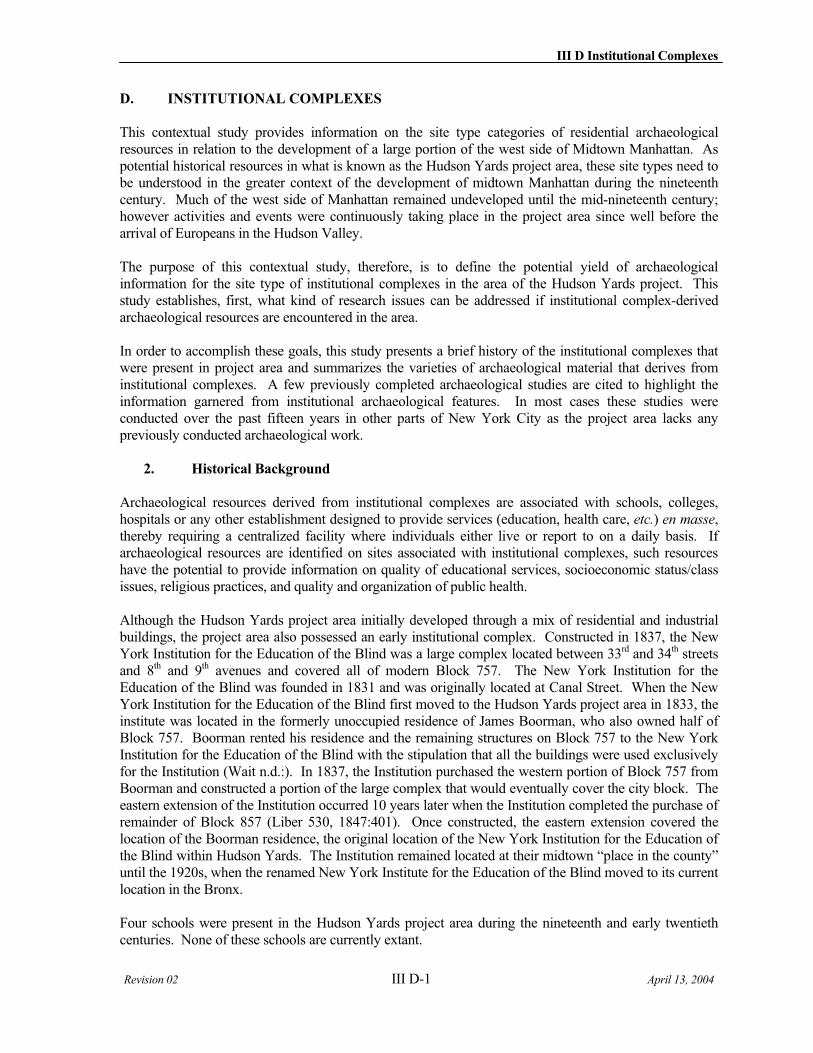
III D Institutional Complexes
Revision 02 III D-1 April 13, 2004
D. INSTITUTIONAL COMPLEXES
This contextual study provides information on the site type categories of residential archaeological resources in relation to the development of a large portion of the west side of Midtown Manhattan. As potential historical resources in what is known as the Hudson Yards project area, these site types need to be understood in the greater context of the development of midtown Manhattan during the nineteenth century. Much of the west side of Manhattan remained undeveloped until the mid-nineteenth century; however activities and events were continuously taking place in the project area since well before the arrival of Europeans in the Hudson Valley.
The purpose of this contextual study, therefore, is to define the potential yield of archaeological information for the site type of institutional complexes in the area of the Hudson Yards project. This study establishes, first, what kind of research issues can be addressed if institutional complex-derived archaeological resources are encountered in the area.
In order to accomplish these goals, this study presents a brief history of the institutional complexes that were present in project area and summarizes the varieties of archaeological material that derives from institutional complexes. A few previously completed archaeological studies are cited to highlight the information garnered from institutional archaeological features. In most cases these studies were conducted over the past fifteen years in other parts of New York City as the project area lacks any previously conducted archaeological work.
2. Historical Background
Archaeological resources derived from institutional complexes are associated with schools, colleges, hospitals or any other establishment designed to provide services (education, health care, etc.) en masse,thereby requiring a centralized facility where individuals either live or report to on a daily basis. If archaeological resources are identified on sites associated with institutional complexes, such resources have the potential to provide information on quality of educational services, socioeconomic status/class issues, religious practices, and quality and organization of public health.
Although the Hudson Yards project area initially developed through a mix of residential and industrial buildings, the project area also possessed an early institutional complex. Constructed in 1837, the New York Institution for the Education of the Blind was a large complex located between 33rd and 34th streets and 8th and 9th avenues and covered all of modern Block 757. The New York Institution for the Education of the Blind was founded in 1831 and was originally located at Canal Street. When the New York Institution for the Education of the Blind first moved to the Hudson Yards project area in 1833, the institute was located in the formerly unoccupied residence of James Boorman, who also owned half of Block 757. Boorman rented his residence and the remaining structures on Block 757 to the New York Institution for the Education of the Blind with the stipulation that all the buildings were used exclusively for the Institution (Wait n.d.:). In 1837, the Institution purchased the western portion of Block 757 from Boorman and constructed a portion of the large complex that would eventually cover the city block. The eastern extension of the Institution occurred 10 years later when the Institution completed the purchase of remainder of Block 857 (Liber 530, 1847:401). Once constructed, the eastern extension covered the location of the Boorman residence, the original location of the New York Institution for the Education of the Blind within Hudson Yards. The Institution remained located at their midtown “place in the county” until the 1920s, when the renamed New York Institute for the Education of the Blind moved to its current location in the Bronx.
Four schools were present in the Hudson Yards project area during the nineteenth and early twentieth centuries. None of these schools are currently extant.
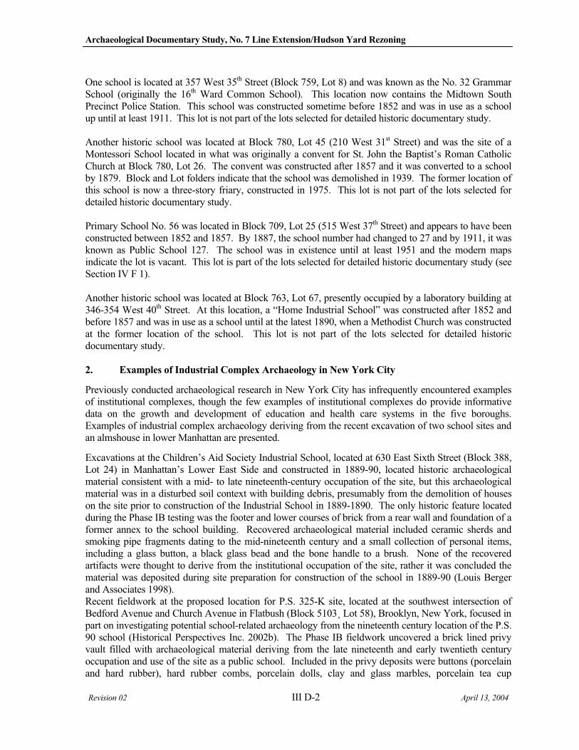
Archaeological Documentary Study, No. 7 Line Extension/Hudson Yard Rezoning
Revision 02 III D-2 April 13, 2004
One school is located at 357 West 35th Street (Block 759, Lot 8) and was known as the No. 32 Grammar School (originally the 16th Ward Common School). This location now contains the Midtown South Precinct Police Station. This school was constructed sometime before 1852 and was in use as a school up until at least 1911. This lot is not part of the lots selected for detailed historic documentary study.
Another historic school was located at Block 780, Lot 45 (210 West 31st Street) and was the site of a Montessori School located in what was originally a convent for St. John the Baptist’s Roman Catholic Church at Block 780, Lot 26. The convent was constructed after 1857 and it was converted to a school by 1879. Block and Lot folders indicate that the school was demolished in 1939. The former location of this school is now a three-story friary, constructed in 1975. This lot is not part of the lots selected for detailed historic documentary study.
Primary School No. 56 was located in Block 709, Lot 25 (515 West 37th Street) and appears to have been constructed between 1852 and 1857. By 1887, the school number had changed to 27 and by 1911, it was known as Public School 127. The school was in existence until at least 1951 and the modern maps indicate the lot is vacant. This lot is part of the lots selected for detailed historic documentary study (see Section IV F 1).
Another historic school was located at Block 763, Lot 67, presently occupied by a laboratory building at 346-354 West 40th Street. At this location, a “Home Industrial School” was constructed after 1852 and before 1857 and was in use as a school until at the latest 1890, when a Methodist Church was constructed at the former location of the school. This lot is not part of the lots selected for detailed historic documentary study.
2. Examples of Industrial Complex Archaeology in New York City
Previously conducted archaeological research in New York City has infrequently encountered examples of institutional complexes, though the few examples of institutional complexes do provide informative data on the growth and development of education and health care systems in the five boroughs. Examples of industrial complex archaeology deriving from the recent excavation of two school sites and an almshouse in lower Manhattan are presented.
Excavations at the Children’s Aid Society Industrial School, located at 630 East Sixth Street (Block 388, Lot 24) in Manhattan’s Lower East Side and constructed in 1889-90, located historic archaeological material consistent with a mid- to late nineteenth-century occupation of the site, but this archaeological material was in a disturbed soil context with building debris, presumably from the demolition of houses on the site prior to construction of the Industrial School in 1889-1890. The only historic feature located during the Phase IB testing was the footer and lower courses of brick from a rear wall and foundation of a former annex to the school building. Recovered archaeological material included ceramic sherds and smoking pipe fragments dating to the mid-nineteenth century and a small collection of personal items, including a glass button, a black glass bead and the bone handle to a brush. None of the recovered artifacts were thought to derive from the institutional occupation of the site, rather it was concluded the material was deposited during site preparation for construction of the school in 1889-90 (Louis Berger and Associates 1998). Recent fieldwork at the proposed location for P.S. 325-K site, located at the southwest intersection of Bedford Avenue and Church Avenue in Flatbush (Block 5103¸ Lot 58), Brooklyn, New York, focused in part on investigating potential school-related archaeology from the nineteenth century location of the P.S. 90 school (Historical Perspectives Inc. 2002b). The Phase IB fieldwork uncovered a brick lined privy vault filled with archaeological material deriving from the late nineteenth and early twentieth century occupation and use of the site as a public school. Included in the privy deposits were buttons (porcelain and hard rubber), hard rubber combs, porcelain dolls, clay and glass marbles, porcelain tea cup
III D Institutional Complexes
Revision 02 III D-3 April 13, 2004
fragments, leather from shoes and/or belts, eyeglass lenses, smoking pipes fragments, whiteware sherds, numerous slate pencils and writing slates and several pharmaceutical, perfume and ink bottles. The total artifact assemblage from the nineteenth/twentieth century privy is representative of an educational facility, given the large quantities of writing implements and children’s toys. Such artifacts contrast with those typically found in residential privy sites, which would contain greater quantities of domestic material (architectural debris and serving vessels, for example). The excavations at the P.S. 325-K site present informative data on the children attending the historic P.S. 90 School in Flatbush at end of the nineteenth century.
Archaeological excavations completed at Erasmus Hall in Flatbush, New York, demonstrated...
The presence of well-preserved and extensive sub-surface archaeological remains on
the site. Preliminary review [of artifacts] indicates that they include materials from all
phases of the school’s history. (Bankoff and Winter 1987:17)
Other archaeological investigations conducted in the last 15 years have identified the archaeology associated with the poor and homeless population of Manhattan during the eighteenth century. Work between the present location of City Hall and the Tweed Courthouse in City Hall Park uncovered archaeological deposits associated with New York City’s original almshouse (Baugher 2001; Baugher and Lenik 1997; Grossman 1991; Spencer-Wood 2001). The almshouse was constructed in the early 1730s at the then northern edge of the city and was designed to house the homeless of Manhattan. The almshouse was in use up until approximately the end of the eighteenth century, when the city constructed a new almshouse on Roosevelt Island (then called Blackwell’s Island). Within the archaeological deposits, a brownstone foundation and cellar hole from an eighteenth century building were uncovered, along with various artifacts interpreted to be associated with the almshouse’s kitchen. Included in these artifacts were numerous bone button blanks and backs. The bone blanks were essentially flat bone fragments, often ribs or shoulder blades from cows, which were then cored to make a flat bone disk, or the bone button back. These backs would have then been transformed into finished buttons by piercing a hole through their center and then covering the button in cloth (Baugher and Lenik 1997:18). Although the production of buttons was not a task known from the historic record, the archaeological evidence from the almshouse suggests that the almshouse residents may have been required to produce buttons in exchange for their stay at the institution. The archaeology of the New York City almshouse exemplifies the potential information that the archaeological record can provide regarding those portions of the population that were not typically represented in the historic record (Cantwell and diZerega Wall 2001).
3. Research Potential for Institutional Complexes
Although the number of previously identified archaeological sites pertaining to industrial complexes is not as abundant as other archaeological site types, the potential information from such deposits has the potential to expand our knowledge of portions of the urban population that might not have been recorded in historic documents. In fact, the archaeology of the poor and homeless will most likely provide the most detailed information on this class of society, though the information would most likely paint a picture of the entire class rather than focusing on a particular individual as family and individual histories of the poor were never recorded like the histories of Manhattan’s upper class and business-oriented families. Similarly, the history of schools and other public facilities, such as hospitals and mental institutions, and the people that worked there, lived there and died there, can also be reconstructed through the archaeology of institutional complexes (Berghoffen 2001; Jacoby 2003).
Contemporary archaeologists researching school sites utilize the data collected to address a variety of issues that were comprehensively reviewed in the most recent submission to your office. Furthermore, few – if any – public school sites have been investigated in Manhattan, making any site of this type relatively unique.
Archaeological Documentary Study, No. 7 Line Extension/Hudson Yard Rezoning
Revision 02 III D-4 April 13, 2004
In 2000, April Beisaw and James Gibb published an extensive review of schoolhouse archaeology in the Northeastern United States (Gibb and Beisaw 2000). Their review of the then current archaeological data on schoolhouses concluded that few sites of this type had been thoroughly investigated (Ibid: 108, 113). Their overview of schoolhouse sites in the Northeast included only three urban schools and/or institutions: the Boston African Meeting House, the Chesapeake City Public School, and the Patapsco Female Institution (Ibid.:119). Although there has been a movement to develop a research paradigm for the investigation of schools and institutions, few urban schools have been archaeologically investigated.
According to Rotman’s 2001 research on school yard archaeology:
The primary conclusion of Beisaw and Gibb’s research is that architecturally-related
debris is the best source of data for understanding and interpreting the use of a school
lot. Architectural objects, they argue, provide evidence of lighting, heating, furnishings,
sanitary facilities, modifications and repairs to the structure, and so on. More
importantly, however, these details “represent community attitudes towards public
education and larger social issues, the length and seasons of the school year, length of
the school day, separation of the sexes (Pena 1992), sanitation and public health, and abstract learning versus manual training.” (Gibb and Beisaw 2001:14)
Gibb and Beisaw (2001) noted that the analysis of non-architectural debris from schoolhouse sites has sometimes been disappointing. Often, there is limited material evidence of students educational or recreational activities “beyond a few slate pencils and writing slate fragments, and the odd marble or two” (Gibb and Beisaw 2001:15). Therefore, the authors suggested that:
Archaeological investigations should not abandon the search for domestic artifacts and
the behavioral patterns that those objects represent, but greater attention must be drawn
to the architecture of the schoolhouses and associated structures such as fuel storage
sheds and coal bins, privies, fences, wells, and other special use buildings (e.g.,
dormitories, chapels, and gymnasia). (Gibb and Beisaw 2001:15)
Although Rotman does not entirely disagree with Gibb and Beisaw, she points out the greater utility in the domestic artifacts from schoolhouses – despite their dearth – for telling a more comprehensive story of the site’s past use, not just its history as an educational institution. Domestic artifacts in schoolyards are deposited in a manner that is different from that which is observed at residential homelots. Cultural materials result from its regular use for educational purposes as well as for special events. Analyzing assemblages from these sites must include a discussion of the events and circumstances that may have brought the objects to the site as well as led to their deposition. Rotman argues that there can be a tremendous amount of information in what at first glance appears to be a dearth of domestic artifacts (Rotman 2001:20).
Schools sites have the potential to yield data regarding social attitudes towards education; the availability and provision of resources to school children in a low-economic neighborhood; retention of ethnicity by children in this blended urban setting; and, social attitudes towards public and private space. Urban schoolyards have the potential to address a vast number of research issues including their role as social institutions, how they reflect a community’s attitudes toward state involvement in education, neighborhood social and economic conditions and how this is reflected in the public sphere, as well as the availability of supplies and educational resources.
4. Sensitivity for Institutional Complex Archaeology
III D Institutional Complexes
Revision 02 III D-5 April 13, 2004
The Hudson Yards project area contains a few locations where institutional complexes were located in the past, but only one study lot subjected to a detailed historic documentary analysis contained an institutional complex. Block 709, Lot 25 contained a public school from the mid-nineteenth century up until the middle of the twentieth century. This school, originally called Primary School No. 56 and then changed to PS 27 and then PS 127, would have created potential archaeological deposits from the mid-nineteenth century that can provide informative socioeconomic data on the young children attending this school during the period when midtown Manhattan began its emergence from the countryside to a bustling business center. Anticipated archaeological deposits from the schoolyard could include trash filled privies, similar to that previously discovered at the P.S. 325-K site in Flatbush, Brooklyn, or deposits of accidentally discarded play items in the school yard (including marbles, toys, or other small items easily lost when at play during recess period). None of the other lots subjected to detailed historic documentary research possess the potential for institutional complex archaeology.
While the potential presence of institutional complex archaeology from the mid- to late-nineteenth century would provide informative data on the socioeconomic status/class of school children attending schools in midtown Manhattan, the significance of such resources for listing on the National Register of Historic Places could only be assessed after the presence or absence of the potential archaeological material can be ascertained. Previous research on the archaeology of schoolyards has been sparse within New York City. Therefore, any potential school yards would need to be evaluated to determine if data could potentially yield information pertinent to the history of the Midtown area, and meet National Register eligibility under Criterion D (36 CFR part 63).

III E Industrial
Revision 02 III E-1 April 13, 2004
E. INDUSTRIAL
This contextual study provides information on the site type category of ‘Industrial’ in relation to the development of a large portion of the west side of Midtown Manhattan. As potential historical resources in what is known as the Hudson Yards project area, industrial sites need to be understood in the greater context of the development of the west side of Manhattan during the historical period. In a formal sense, much of the west side of Manhattan remained undeveloped until the 19th century; however, activities and events took place on a continual basis in the project area since well before the arrival of Europeans in the Hudson Valley. Once formal development did begin in the area around Manhattan's western shoreline, the creation of specific industries can be clearly tied to New York City's rise to commercial dominance in the historical era.
The purpose of this contextual study, therefore, is to define the potential yield of archaeological information for the category of Industrial Sites in the area of the Hudson Yards project. This study establishes, first, what kind of research issues can be addressed if, in fact, industrial resources are encountered in the project area. Second, it attempts to define in a chronological sense the limit or threshold for the potential significance of industrial resources in the area. In regards to the latter, there is some question as to whether Historical Archaeologist working in the Northeast United States can effectively establish precise and overarching criteria for the moments at which certain categories of resources reach redundancy in the archaeological record.
In order to accomplish these goals, this study then provides summaries of a number of case studies from the archaeological literature. These prior studies are reviewed because they exemplify how archaeologists can gather valuable insights and information from the site type category being discussed in this report. In most cases these studies were conducted in the recent past in diverse Northeastern American urban settings, for instance in other parts of New York City or the Tri-State Region, Philadelphia, Boston, Baltimore and Washington, DC. Before considering these case studies in any detail it is helpful to understand the concepts and ideas that inform the discipline Industrial Archaeology, which is a field of study that has gained importance and popularity in the last decade.
1. Industrial Archaeology
Industrial Archaeology is the field of study that is concerned with the investigation, survey, recording, and preservation of industrial resources. As a discipline it seeks to assess the significance of these resources and to place them within the greater contexts of social and technological histories. Industrial Archaeology generally focuses on the time period of the Industrial Revolution that took place especially in the United State and United Kingdom. There is also a strong connection between Industrial Archaeology and the study of earlier technologies, for instance in the area of the origins of metallurgy.
Starting in the 1940s Industrial Archaeology emerged as a distinct discipline in the United Kingdom, where historians, preservationists, archaeologists, and engineers became concerned that many of the monuments of Britain's industrial heritage were disappearing. In the 1960s the field of study had spread into continental Europe and the United States, and a number of professional journals and associations took root. In the specific case of New York City, Industrial Archaeologists have used archaeology, history and even ethnography to explore the rapid and profound social changes that accompanied the industrialization of the region in the later 19th and early 20th centuries.
Methodologically, the simplest technique in Industrial Archaeology is the resource survey, which can provide a preliminary review of an area or site that provides information used to determine a resource's significance. Working with the historiography of colonial and later historical periods it is possible to
Archaeological Documentary Study, No. 7 Line Extension/Hudson Yard Rezoning
Revision 02 III E-2 April 13, 2004
identify the analytical categories and topics (e.g., race, class, colonialism) that have structured classical accounts of the industrialization of places like New York City. Subsequently, this type of survey work is crucial in developing preservation plans for neighborhoods and communities. More involved methodologies in Industrial Archaeology include employing basic archaeological techniques, such as excavation and artifact analysis, to assess the specific relevance of actual historical sites and resources. Hypothetically, these resources may be as old as 17th-century bloomery forges, or as new as an abandoned mid-20th-century steel mill.
2. Historical Background
To assess the importance and integrity of an archaeological resource that might be discovered in any given region, archaeologists look at what is known about a particular place through time in order to understand what the cultural, economic and sociopolitical forces were that shaped the history of the area. In short, this means establishing the 'historical context' of the general region. With reference to this clearly defined historical context, the potential significance of any given resource can be fully assessed.
As defined by the National Park Service, "historic contexts provide a framework for the identification, evaluation, designation, and treatment of cultural resources associated with particular themes, areas, and time periods. Historic context-based planning permits recognition of individual properties as parts of larger systems. Historic contexts also help managers and others evaluate properties within their proper levels of significance. As such, they provide both a systematized basis for comparison and a comprehensive frame of reference. In so doing, historic contexts provide cultural resource managers with a guide for “rational decision-making” (Grumet 1990:18).
Turning, then, to the question of the role played by industry in the historical context of New York City and the surrounding region, it is clear that much of life and business from the earliest moment of European settlement in the area was focused on manufacturing, the historical precursor to modern industry. The greatest concentration of these activities during the early colonial period took place within the initial settlement in Lower Manhattan, far from the rural areas around what is now Hudson Yards. The downtown area remained the center of manufacturing life until the mid-19th century, when the intensity of urban sprawl northward through Manhattan spurred the development of alternative sectors of production.
The later part of the 19th century was a boom time for New York City and its population, which grew with the great influx of European immigration. Trade remained the prime mover in the city’s economy; however, different forms of enterprise and commerce started to grow as well. As more and more national companies centralized their authority in the city, New York became the central force in American industry. Businessmen at this time took full advantage of both the cheap labor coming off the boats from Europe and the city’s lax oversight of industry. It was during this so-called ‘Gilded Age’ that the city's population more than doubled between 1850 and 1880 (from 500,000 to over 1.1 million), resulting in a tenement culture in many of the poorer city neighborhoods. This ever-expanding metropolis absorbed a second wave of European immigrants between 1900 and 1930, when the population swelled again from roughly three to seven million. During this period in Manhattan, horse-drawn trolleys disappeared as a major network of underground subways and elevated trains (els) expanded north across the urban grid.
This move north of Manhattan’s urban sprawl directly impacted the Hudson Yards study area in profound ways. Along the waterfront new landfill techniques and advances in ship design prompted developers to take advantage of the deeper and faster flowing Hudson River to the west. Recent Irish and German immigrants who could not afford better housing downtown constructed scores of shanties in the Hudson Yards area. Streets were littered and the poorly made gutters beside them trapped solid waste
III E Industrial
Revision 02 III E-3 April 13, 2004
instead of permitting its discharge. Although sewer lines were situated "ten to fifteen feet below the open surface," not every dwelling was properly connected to these lines (Citizens Association of New York 1865:296). Private privies were often left to overflow into yards and streets.
The area lying further east within the project site was also impacted by the rapid northerly spread of Manhattan's urban landscape. This inland area was part of the longer tract of land called "Bloomingdale," which was the "fertile, rolling fields, for the most part free of crags or clumps of underbrush" that extended through much of the west side of Manhattan (Works Progress Administration 1939:146). After initial European settlement in Manhattan, the Bloomingdale lands were productively farmed for nearly two centuries, providing necessary produce to the growing urban center on southern Manhattan.
The early 20th century development of "Bloomingdale" around the Hudson Yards project area was slow compared to other parts of Manhattan. The area remained characterized by poor industrial conditions and undesirable living conditions for laborers (New York City Department of Docks and Ferries 1913:3). Little private development occurred on cross streets due to the restricted movement and development of upland properties. Twelfth Avenue was stagnant, not profiting from the vast volume of waterfront commerce. The railroad track on the surface of Eleventh Avenue made crossings hazardous to pedestrians and prevented residential development in the vicinity (Stern et al. 1987:427). Additionally, the presence of New York Central Railroad's West 30th Street yard, between West 30th and 37th Streets and Eleventh and Twelfth Avenues, dominated the character of the community (Works Progress Administration 1939:156). In response to hazardous street surface conditions, the 1906 Saxe Law was passed. The law eliminated railroads from grade level and prompted the creation of the West Side Improvement Plan. The plan, implemented between 1910 and 1920, resulted in the removal and subsequent elevation of tracks on Eleventh Avenue south of West 59th Street (Buttenwieser 1987:159).
In the subsequent decades ease of access to the study area enticed speculators to construct more densely clustered, cheaply made tenements on inexpensive land north of West 30th Street (Works Progress Administration 1939:147). Immigrant laborers found refuge in the tenements, working nearby for little pay in any one of the noxious industries that had been also been pushed out of the city's more affluent neighborhoods, and into the relatively undeveloped west side of what is Midtown Manhattan. A report on sanitary conditions and the "Special Nuisances" particular to the neighborhood described the offensive nature of the nearby swill milk producers, stables, breweries, and hide and fat companies (Citizens Association of New York 1865:xcii).
Throughout the history of New York City the limits of Manhattan's industrial character have clearly shifted under the direction and construction efforts of city and commercial developers. For the most part these changes took place unsystematically behind the efforts of various individual Manhattan entrepreneurs. Studies of this process of creating ever-newer city industries contributes to our understanding the history of New York City, because it is clear that the growth and development of factories and their businesses provided work and income to the inhabitants of a growing city, which in turn attracted more and more immigration. From almost any perspective, therefore, Industrial Archaeology in New York City is an important aspect in understanding the city's explosive historical growth, especially throughout the 19th century.
3. Case Studies
This section describes a number of case studies from select categories of American Industry (e.g., Glass Production, Chemical Manufacturing, Livestock, Ironworks) in order to demonstrate how valuable information can be gleaned from studying early industrial sites and resources.
Archaeological Documentary Study, No. 7 Line Extension/Hudson Yard Rezoning
Revision 02 III E-4 April 13, 2004
a) Glass Production
Research on the topic of the common industry of glass production in North America history has shown that the development of the glass industry in the Northeast played an influential role in the availability of consumer goods to varying classes of urban and rural populations across the region, the country and even the world. The 19th century in particular was witness to numerous innovations in production techniques that drastically affected product availability, price, and ultimately demand. Historians and archaeologists know about this important history through a number of case studies that have been conducted on early physical sites of glass production. The oldest of these sites is located in Jamestown, where archeological investigations uncovered what was perhaps the first glass factory in North America. Here research unearthed an early 17th century complex that consisted of four furnaces, a well, and an on-site clay pit for making crucibles (Harrington 1952:15).
An early glass production site known as the New England Glassworks was also studied in the town of Temple, New Hampshire, where archeologists uncovered a late 18th-century glasshouse, three associated house foundations, a dump, and an outside oven or kiln. At the time it was excavated in the 1960s little was known about the variability of glass factories (Noel Hume 1964, 1976). Most of the work focused on the main glasshouse, where large samples of badly shattered crucibles and glass bottle fragments were recovered (Starbuck 1977:78). Further work in the factory dump produced even larger quantities of glass bottle fragments, crucible fragments, cullet (scraps of waste glass that can be melted and remolded), hollow ware, flatware and moil (crack-off edging), indicating that this type of resource can be analyzed for information about early glassmaking techniques (Starbuck 1986:34).
Archaeological excavations have also been performed at the New Bremen Glass Works in Maryland. This factory, which was also known as the Amelung Glass Works, was founded by John Frederick Amelung in 1788. Amelung is thought to be somewhat unique among early glass factories in that it maintained a wood-burning oven, until the facility was destroyed by fire in the late 1700s. Excavations at the site unearthed a waste heap, fritting ovens, and a production tools. From historical documents it is know that, while it was in operation, Amelung hired many immigrant glassworkers from Germany (Stohlman 1964:10). Laboratory tests of glass fragments that were found revealed that the material lacked lead, which might indicate that old glass was consistently brought in for remelting (Noel Hume 1964:312). A similar late 18th century glass factory was excavated in 1964 near Albany in Guilderland, New York, where a large melting furnace was uncovered (Huey 1980:37).
Archeological research has also been performed at glass production sites dating to the 19th century. One of these was the Boston and Sandwich Glass Company in Sandwich, Massachusetts, where "fragments of the various Heart patterns were found buried four feet beneath the surface, when the excavating was done beneath the foundation of the building which was erected in 1849" (Lee 1939:234). Researchers found that the pattern of discarded glass fragments around the site shed light on the growth of the industry, with early patterns found beneath the 1849 structure and later, more refined versions of these patterns found elsewhere. Interestingly, pieces from other producers were also recovered, and these may have been brought to the production facility as recycled waste.
Archaeologists have also worked at the Whitall-Tatum glass factory (also known as the Phoenix Glass Works), which was established in Millville, New Jersey in 1806 (Mounier 1990). This factory initially produced window glass, tableware, and bottles, but subsequently added hollowware, glass vials and bottles to its production line in an effort to cater specifically to druggists and physicians. The factory closed in the 1930s when more efficient mechanical techniques began to dominate the industry. While in operation, the company's complex consisted of a variety of primary structures as well as machine shops,
III E Industrial
Revision 02 III E-5 April 13, 2004
box factories, workers housing, and a slaughterhouse (Mounier 1990:20). Proposed development of the site necessitated archeological research that entailed excavating six exploratory trenches. One of these trenches revealed multiple fill deposits consisting of sand, ash, rubble, and coal to a depth of 12.5' (Ibid.:24). The preliminary documentary and archeological research determined that the site is potentially eligible for National Register nomination, and further subsurface research has the potential to address numerous research concerns.
In 1962 archaeologists began studying the Glastonbury Glass Factory site in Glastonbury, Connecticut, which was established in 1816 by a group of local entrepreneurs with little experience in the glass industry (Wilson 1963). Documentary research was unable to establish the origins of its first workmen, although its glass blowers used the same techniques documented at two nearby factories in the Hartford area. The Glastonbury Glass Factory site was excavated for the mitigation of potential impacts, and recovered numerous shards from melting pots used in glass production as well as many glass fragments (Wilson 1963:118). An excavated trash pit was found to have been used for general refuse, with cultural material extending to 75 inches below the surface (Ibid.:128). Sherds and slag had been scattered about the yard by the leveling of refuse from the factory after it had gone out of business. Excavations also discovered a nearby stream bed, "the marshy nature of which was a natural invitation to dumping during the period of factory operation" (Ibid.:131). This area proved to be rich in potshards, slag rubble glass, and glass-glazed stones and bricks. Although excavations never located the factory foundation or furnace, the glass fragments recovered were bountiful enough to address research questions regarding technology, dates, and types of wares produced.
In upstate New York, the Ellenville Glass Works, which operated between 1837 and 1894, was excavated in the early 1980s by Dumont Archaeological Surveys. The factory, known for its demijohns, represents an example of mechanical adaptation to diminished fuel resources. In 1859 the company switched from wood to coal fuel, which required an increased draft in the furnaces. This was accomplished by a turbine supplied with water carried underground from a nearby creek (Dumont 1980a:22). Archeological excavations uncovered subsurface air ducts for the furnaces, foundation walls, numerous glass flasks, and fragments of bottles and canes (Dumont 1980b:109). The site represents one of the few controlled excavations of a mid-to-late 19th-century glasshouse.
In Jersey City, New Jersey, comparable studies were successfully completed in an urban center at a small portion of the 19th century Dummer Glass Works. Research conducted at the site determined that although two later industrial complexes had been built over the glassworks, one corner of the structure's foundation remained undisturbed. This small area was excavated to reveal the foundation of a possible annealing furnace, and a three foot by thirty foot bay. Research concluded that the Dummer factory apparently introduced European products and processes, taking advantage of the lack of European goods available in the states following the War of 1812.
The best comparative case study to consider in relation to the development of the Hudson Yards is the Bloomingdale Flint Glass Works, which lies within the City itself, just north of the project area. The Bloomingdale Flint Glass Works, which was established in 1820 and closed its operation in 1840, was best known for its cut flint glass and decorative wares. The glassworks was constructed on a plot of land in the vicinity of West 47th Street and the Hudson River. The factory itself was completed by 1821 and housing for workers by 1823 just to the east near Eleventh Avenue.
The Bloomingdale Flint Glass Works was founded by the Fisher brothers, together with John L. Gilliland, and so was also known as ‘Fishers' Factory.’ John Fisher was previously employed by the New England Glass Company, where he created a cut-glass urn intended for President Monroe
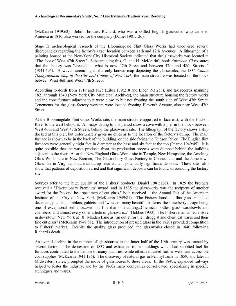
Archaeological Documentary Study, No. 7 Line Extension/Hudson Yard Rezoning
Revision 02 III E-6 April 13, 2004
(McKearin 1949:62). John’s brother, Richard, who was a skilled English glasscutter who came to America in 1810, also worked for the company (Daniel 1981:126).
Stage Ia archaeological research of the Bloomingdale Flint Glass Works had uncovered several discrepancies regarding the factory's exact location between 11th and 12th Avenues. A lithograph of a painting housed at the New-York City Historical Society indicated that the glassworks was located at "The foot of West 47th Street." Substantiating this, G. and H. McKearin's book American Glass states that the factory was "erected...at what is now 47th Street and between 47th and 48th Streets..." (1941:595). However, according to the only known map depicting the glassworks, the 1836 Colton
Topographical Map of the City and County of New York, the main structure was located on the block between West 46th and West 47th Streets.
According to deeds from 1819 and 1825 (Liber 179:218 and Liber 193:258), and tax records spanning 1821 through 1840 (New York City Municipal Archives), the main structure housing the factory works and the cone furnace adjacent to it were close to but not fronting the south side of West 47th Street. Tenements for the glass factory workers were located fronting Eleventh Avenue, also near West 47th Street.
At the Bloomingdale Flint Glass Works site, the main structure appeared to face east, with the Hudson River to the west behind it. All maps dating to this period show a cove with a pier in the block between West 46th and West 47th Streets, behind the glassworks site. The lithograph of the factory shows a ship docked at this pier, but unfortunately gives no clues as to the location of the factory's dump. The main furnace is shown to be in the back of the building, on the side facing the Hudson River. The English flint furnaces were generally eight feet in diameter at the base and six feet at the top (Pearce 1949:45). It is quite possible that the waste products from the production process were dumped behind the building adjacent to the river. As at the New England Glass Works site in Temple, New Hampshire, the Amelung Glass Works site in New Bremen, The Glastonbury Glass Factory in Connecticut, and the Jamestown Glass site in Virginia, industrial dump sites contain potentially significant deposits. These sites also show that patterns of deposition varied and that significant deposits can be found surrounding the factory site.
Sources refer to the high quality of the Fishers' products (Daniel 1981:126). In 1829 the brothers received a "Discretionary Premium" award, and in 1835 the glassworks was the recipient of another award for the "second best specimen of cut glass," both received at the Annual Fair of the American Institute of the City of New York (McKearin 1949:81). The Fishers' hand-cut flint glass included decanters, pitchers, tumblers, goblets, and "wines of many beautiful patterns, the strawberry design being one of exceptional brilliance...with its fine diamond cutting...Chemical bottles, glass washbowls and chambers, and almost every other article of glassware..." (Hobbes 1933). The Fishers maintained a store in downtown New York at 101 Maiden Lane as "an outlet for their druggist and chemical wares and their fine cut glass" (McKearin 1949:81). The introduction of pressed glass in the 1820s provided competition to Fishers’ market. Despite the quality glass produced, the glassworks closed in 1840 following Richard's death.
An overall decline in the number of glasshouses in the latter half of the 19th century was caused by several factors. The depression of 1837 and exhausted timber holdings which had supplied fuel for furnaces contributed to the demise of many factories, while others relocated further west near accessible coal supplies (McKearin 1941:136). The discovery of natural gas in Pennsylvania in 1859, and later in Midwestern states, prompted the move of glasshouses to these areas. In the 1840s, expanded railways helped to foster the industry, and by the 1860s many companies consolidated, specializing in specific techniques and wares.
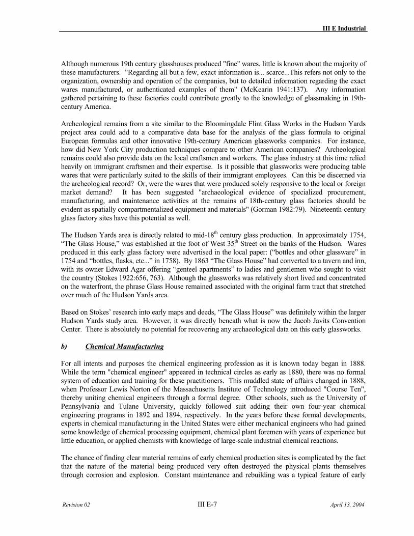
III E Industrial
Revision 02 III E-7 April 13, 2004
Although numerous 19th century glasshouses produced "fine" wares, little is known about the majority of these manufacturers. "Regarding all but a few, exact information is... scarce...This refers not only to the organization, ownership and operation of the companies, but to detailed information regarding the exact wares manufactured, or authenticated examples of them" (McKearin 1941:137). Any information gathered pertaining to these factories could contribute greatly to the knowledge of glassmaking in 19th-century America.
Archeological remains from a site similar to the Bloomingdale Flint Glass Works in the Hudson Yards project area could add to a comparative data base for the analysis of the glass formula to original European formulas and other innovative 19th-century American glassworks companies. For instance, how did New York City production techniques compare to other American companies? Archeological remains could also provide data on the local craftsmen and workers. The glass industry at this time relied heavily on immigrant craftsmen and their expertise. Is it possible that glassworks were producing table wares that were particularly suited to the skills of their immigrant employees. Can this be discerned via the archeological record? Or, were the wares that were produced solely responsive to the local or foreign market demand? It has been suggested "archaeological evidence of specialized procurement, manufacturing, and maintenance activities at the remains of 18th-century glass factories should be evident as spatially compartmentalized equipment and materials" (Gorman 1982:79). Nineteenth-century glass factory sites have this potential as well.
The Hudson Yards area is directly related to mid-18th century glass production. In approximately 1754, “The Glass House,” was established at the foot of West 35th Street on the banks of the Hudson. Wares produced in this early glass factory were advertised in the local paper: (“bottles and other glassware” in 1754 and “bottles, flasks, etc...” in 1758). By 1863 “The Glass House” had converted to a tavern and inn, with its owner Edward Agar offering “genteel apartments” to ladies and gentlemen who sought to visit the country (Stokes 1922:656, 763). Although the glassworks was relatively short lived and concentrated on the waterfront, the phrase Glass House remained associated with the original farm tract that stretched over much of the Hudson Yards area.
Based on Stokes’ research into early maps and deeds, “The Glass House” was definitely within the larger Hudson Yards study area. However, it was directly beneath what is now the Jacob Javits Convention Center. There is absolutely no potential for recovering any archaeological data on this early glassworks.
b) Chemical Manufacturing
For all intents and purposes the chemical engineering profession as it is known today began in 1888. While the term "chemical engineer" appeared in technical circles as early as 1880, there was no formal system of education and training for these practitioners. This muddled state of affairs changed in 1888, when Professor Lewis Norton of the Massachusetts Institute of Technology introduced "Course Ten", thereby uniting chemical engineers through a formal degree. Other schools, such as the University of Pennsylvania and Tulane University, quickly followed suit adding their own four-year chemical engineering programs in 1892 and 1894, respectively. In the years before these formal developments, experts in chemical manufacturing in the United States were either mechanical engineers who had gained some knowledge of chemical processing equipment, chemical plant foremen with years of experience but little education, or applied chemists with knowledge of large-scale industrial chemical reactions.
The chance of finding clear material remains of early chemical production sites is complicated by the fact that the nature of the material being produced very often destroyed the physical plants themselves through corrosion and explosion. Constant maintenance and rebuilding was a typical feature of early
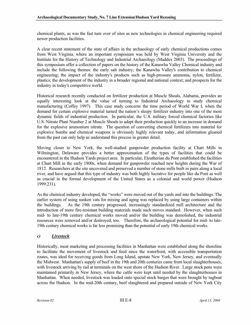
Archaeological Documentary Study, No. 7 Line Extension/Hudson Yard Rezoning
Revision 02 III E-8 April 13, 2004
chemical plants, as was the fast turn over of sites as new technologies in chemical engineering required newer production facilities.
A clear recent statement of the state of affairs in the archaeology of early chemical productions comes from West Virginia, where an important symposium was held by West Virginia University and the Institute for the History of Technology and Industrial Archaeology (Maddex 2003). The proceedings of this symposium offer a collection of papers on the history of the Kanawha Valley Chemical industry and include the following themes: the early salt industry; the Kanawha Valley's contribution to chemical engineering; the impact of the industry's products such as high-pressure ammonia, nylon, fertilizer, plastics; the development of the industry in a broader regional and national context; and prospects for the industry in today's competitive world.
Historical research recently conducted on fertilizer production at Muscle Shoals, Alabama, provides an equally interesting look at the value of turning to Industrial Archaeology to study chemical manufacturing (Coffey 1997). This case study concerns the time period of World War I, when the demand for certain explosive material turned the nation’s sleepy fertilizer industry into one of the most dynamic fields of industrial production. In particular, the U.S. military forced chemical factories like U.S. Nitrate Plant Number 2 at Muscle Shoals to adapt their production quickly to an increase in demand for the explosive ammonium nitrate. The question of converting chemical fertilizers into material for explosive bombs and chemical weapons is obviously highly relevant today, and information gleaned from the past can only help us understand this process in greater detail.
Moving closer to New York, the well-studied gunpowder production facility at Chart Mills in Wilmington, Delaware provides a better approximation of the types of facilities that could be encountered in the Hudson Yards project area. In particular, Eleutherian du Pont established the facilities at Chart Mill in the early 1800s, when demand for gunpowder reached new heights during the War of 1812. Researchers at the site uncovered and preserved a number of stone mills built in pairs along a local river, and have argued that this type of industry was both highly lucrative for people like du Pont as well as crucial in the formal development of the United States as a colonial and world power (Hudson 1999:231).
As the chemical industry developed, the “works” were moved out of the yards and into the buildings. The earlier system of using sunken vats for mixing and aging was replaced by using large containers within the buildings. As the 19th century progressed, increasingly standardized mill architecture and the introduction of more fire-resistant building materials made such moves standard. However, when such mid- to late-19th century chemical works moved and/or the building was demolished, the industrial resources were removed and/or destroyed, too. Therefore, the archaeological potential for mid- to late-19th century chemical works is far less promising than the potential of early 19th chemical works.
c) Livestock
Historically, meat marketing and processing facilities in Manhattan were established along the shoreline to facilitate the movement of livestock and feed since the waterfront, with accessible transportation routes, was ideal for receiving goods from Long Island, upstate New York, New Jersey, and eventually the Midwest. Manhattan's supply of beef in the 19th and 20th centuries came from local slaughterhouses, with livestock arriving by rail at terminals on the west shore of the Hudson River. Large stock pens were maintained primarily in New Jersey, where the cattle were kept until needed by the slaughterhouses in Manhattan. When needed, livestock was loaded onto special stock barges that were brought by tugboat across the Hudson. In the mid-20th century, beef slaughtered and prepared outside of New York City
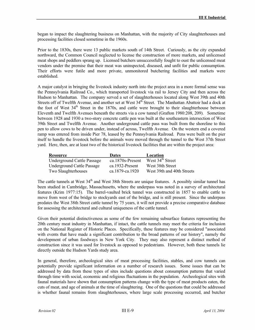
III E Industrial
Revision 02 III E-9 April 13, 2004
began to impact the slaughtering business on Manhattan, with the majority of City slaughterhouses and processing facilities closed sometime in the 1960s.
Prior to the 1830s, there were 13 public markets south of 14th Street. Curiously, as the city expanded northward, the Common Council neglected to license the construction of more markets, and unlicensed meat shops and peddlers sprang up. Licensed butchers unsuccessfully fought to oust the unlicensed meat vendors under the premise that their meat was uninspected, diseased, and unfit for public consumption. Their efforts were futile and more private, unmonitored butchering facilities and markets were established.
A major catalyst in bringing the livestock industry north into the project area in a more formal sense was the Pennsylvania Railroad Co., which transported livestock via rail to Jersey City and then across the Hudson to Manhattan. The company served a set of slaughterhouses located along West 39th and 40th Streets off of Twelfth Avenue, and another set at West 34th Street. The Manhattan Abattoir had a dock at the foot of West 34th Street in the 1870s, and cattle were brought to their slaughterhouse between Eleventh and Twelfth Avenues beneath the streets via a cow tunnel (Grafton 1980:208, 209). Sometime between 1928 and 1930 a two-story concrete cattle pen was built at the southeastern intersection of West 39th Street and Twelfth Avenue. Another underground cattle pass was built from the shoreline to this pen to allow cows to be driven under, instead of across, Twelfth Avenue. On the western end a covered ramp was entered from inside Pier 78, leased by the Pennsylvania Railroad. Pens were built on the pier itself to handle the livestock before the animals were moved through the tunnel to the West 37th Street yard. Here, then, are at least two of the historical livestock facilities that are within the project area:
Resource Dates Location
Underground Cattle Passage ca.1870s-Present West 34th Street Underground Cattle Passage ca.1932-Present West 38th Street Two Slaughterhouses ca.1879-ca.1920 West 39th and 40th Streets
The cattle tunnels at West 34th and West 38th Streets are unique features. A possibly similar tunnel has been studied in Cambridge, Massachusetts, where the underpass was noted in a survey of architectural features (Krim 1977:15). The barrel-vaulted brick tunnel was constructed in 1857 to enable cattle to move from west of the bridge to stockyards east of the bridge, and is still present. Since the underpass predates the West 38th Street cattle tunnel by 75 years, it will not provide a precise comparative database for assessing the architectural and cultural uniqueness of the cattle tunnel.
Given their potential distinctiveness as some of the few remaining subsurface features representing the 20th century meat industry in Manhattan, if intact, the cattle tunnels may meet the criteria for inclusion on the National Register of Historic Places. Specifically, these features may be considered "associated with events that have made a significant contribution to the broad patterns of our history", namely the development of urban foodways in New York City. They may also represent a distinct method of construction since it was used for livestock as opposed to pedestrians. However, both these tunnels lie directly outside the Hudson Yards study area.
In general, therefore, archeological sites of meat processing facilities, stables, and cow tunnels can potentially provide significant information on a number of research issues. Some issues that can be addressed by data from these types of sites include questions about consumption patterns that varied through time with social, economic and religious fluctuations in the population. Archeological sites with faunal materials have shown that consumption patterns change with the type of meat products eaten, the cuts of meat, and age of animals at the time of slaughtering. One of the questions that could be addressed is whether faunal remains from slaughterhouses, where large scale processing occurred, and butcher
Archaeological Documentary Study, No. 7 Line Extension/Hudson Yard Rezoning
Revision 02 III E-10 April 13, 2004
shops, where fine-scale processing occurred, reflect these changes or whether consumption and butchering patterns remained consistent despite outside influences. In addition, one could compare faunal remains from slaughterhouses and butchers to those from individual dwelling sites of both high and low income families in Manhattan.
Other issues that can be addressed are those regarding technological adaptations. Band saws, commonly used by meat processors today, were invented in 1808 but were not incorporated in to the meat industry until the 1850s, when durable steel bands became available. Prior to this, circular saws powered by steam were used (Gust 1983:344). How quickly did the metropolitan New York butchers adopt the newer saws? Were old machines easily replaced? Are the design and construction techniques of the cattle tunnel specific to this New York City site or did the Pennsylvania Railroad construct other variations of cattle passages? While these can be addressed archeologically, other research questions may be better addressed through documentary data.
However, the extent of faunal remains within any of the Hudson Yards area meat industry sites is questionable. A review of the literature and maps of the period indicate that the meat industry had become highly specialized, yielding virtually no waste products. Within the same blocks of the meat processing facilities were candle-making factories, soap factories and swill milk producers. Bones had become a commodity as fertilizer. Investigating a meat industry site in the Hudson Yards APE would, most likely, depend on accidental debris and not an extensive waster feature.
d) Ironworks
Here are two curious historical details about ironworks in New York City that illustrate how central the ironwork industry was in the history of early North America:
Excelsior Iron Works (Burnet Jackson Co.)
This ironworks was established by General John McArthur in New York City on what is now 14th Street (at the intersections of the East River, Centre and Howard Streets). General McArthur immigrated to the United States in 1849 and worked initially in Chicago as a boilermaker. He established the Excelsior Iron Works with his brother-in-law and, by 1861, was the sole owner of the company. He was active in New York State Militia's Highland Guard before he left to fight for the Union Army in the Civil War. He left the military in August of 1865, and returned to his iron business only to watch it fail in the face of international competition.
Morgan Iron Works
Ironworks like the Morgan Iron Works, which was located on the East River at the foot of 9th Street, regularly fitted early American steamships that ultimately enabled the country’s military dominance at sea as well as its dominance in oceangoing trade and commerce. For instance, the New York Herald
reported on April 28, 1851 that a new steamship named the Winfield Scott was recently completed and was currently tied up at the dock of the Morgan Iron Works. The ship’s machinery, or so it was reported, was supplied from the Morgan foundry, which was known for producing “splendid specimens of ingenuity and mechanical skill, that are almost daily emanating from their workshops”.
There is already a large body of literature on the roll played by ironworks in the historical development of the United States, and much of this includes primary archaeological research conducted at various ironwork sites in the Northeast United States. It is instructive to consider a few to illustrate the point that the study of iron working remains a central aspect of contemporary Industrial Archaeology.

III E Industrial
Revision 02 III E-11 April 13, 2004
One recent study in particular provides a clear illustration of how the archaeological study and analysis of iron working can provide meaningful insights. In this study, Robert Gordon (1995) addresses a number of important research questions simultaneously, including:
1. How metal smiths in North America over came initial difficulties in iron production as early as the 17th and 18th centuries;
2. How creative problem solving at the local level enable early iron workers to create new types of wrought iron that was compatible with newly developed mechanized production systems;
3. How this same ingenuity helped invent even newer types of metals and alloys that were product specific (i.e., used for making guns, nails, etc.).
Gordon’s study describes investigations at five sites in Connecticut as well as the analyses of their material remains. These five sites, listed from oldest to youngest, are Aaron Eliot’s Forge, Hotchkin-Snow Bloomery, Gutherie-Chittenden Forge, Mount Riga Ironworks, and Canfield & Robbins Ironworks. Methodologically, the key finding of Gordon’s study is that Industrial Archaeologist can use the wastes that are so often found around ironwork sites that lack clear structural remains.
Gordon Pollard in Upstate New York conducted a similar recent study of the early years of iron working in colonial America. Pollard and his students studied nearly 20 bloomery forges that date to 1810 at Clintonville in the AuSable Valley, where they conducted a survey and test excavations (Pollard 1998). Once again, the interesting conclusion is that America’s earliest metal smiths, who worked at the very local level, were extremely flexible and creative at solving many of the industry’s greatest challenges.
However, archaeological field investigations for 19th century ironworks in an urban context are often compromised by subsequent episodes of ground disturbance. The 1987 archaeological excavation of a 1830s iron foundry located on the West Side waterfront at Beach Street determined that large-scale construction after 1840 had totally destroyed any evidence of the original foundry buildings and associated deposits. Testing in a secondary foundry yard found that while oxidized soils “suggest a foundry function, conclusive artifactual evidence is practically nil” (Cultural Resource Group 1987:V-19). The research for this West Point Foundry did reveal that by the mid-1800s, a “foundry operation was no longer unique in New York City” or on the West Side waterfront (Ibid.:V-18). New York City’s early efforts to command the ironworks industry might have extended as far north as the Hudson Yards area.
Currently, extensive archaeological excavations are underway at the West Point foundry’s post-1840 consolidated shop up the Hudson River at Cold Spring. It is a major effort by Industrial Archaeologists of Michigan Tech University. The possibility of comparing early 19th century foundry evidence of technological experimentation with the resources from an improved and technologically advanced shop exists. If an early 19th century foundry or ironworks is identified as a possible intact resource within the APE, then such an industrial archaeology resource could be critical in both defining early industry efforts of experimentation and as a comparative resource for subsequent standards.

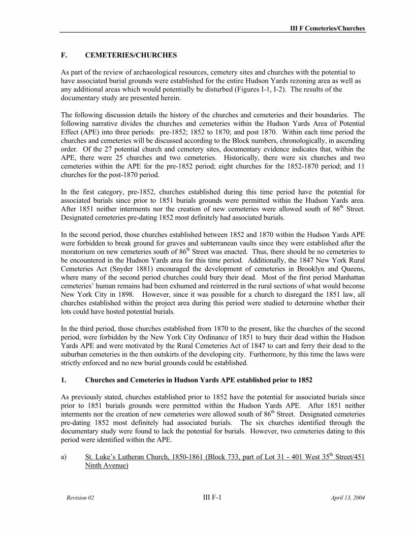
III F Cemeteries/Churches
Revision 02 III F-1 April 13, 2004
F. CEMETERIES/CHURCHES
As part of the review of archaeological resources, cemetery sites and churches with the potential to have associated burial grounds were established for the entire Hudson Yards rezoning area as well as any additional areas which would potentially be disturbed (Figures I-1, I-2). The results of the documentary study are presented herein.
The following discussion details the history of the churches and cemeteries and their boundaries. The following narrative divides the churches and cemeteries within the Hudson Yards Area of Potential Effect (APE) into three periods: pre-1852; 1852 to 1870; and post 1870. Within each time period the churches and cemeteries will be discussed according to the Block numbers, chronologically, in ascending order. Of the 27 potential church and cemetery sites, documentary evidence indicates that, within the APE, there were 25 churches and two cemeteries. Historically, there were six churches and two cemeteries within the APE for the pre-1852 period; eight churches for the 1852-1870 period; and 11 churches for the post-1870 period.
In the first category, pre-1852, churches established during this time period have the potential for associated burials since prior to 1851 burials grounds were permitted within the Hudson Yards area. After 1851 neither interments nor the creation of new cemeteries were allowed south of 86th Street. Designated cemeteries pre-dating 1852 most definitely had associated burials.
In the second period, those churches established between 1852 and 1870 within the Hudson Yards APE were forbidden to break ground for graves and subterranean vaults since they were established after the moratorium on new cemeteries south of 86th Street was enacted. Thus, there should be no cemeteries to be encountered in the Hudson Yards area for this time period. Additionally, the 1847 New York Rural Cemeteries Act (Snyder 1881) encouraged the development of cemeteries in Brooklyn and Queens, where many of the second period churches could bury their dead. Most of the first period Manhattan cemeteries’ human remains had been exhumed and reinterred in the rural sections of what would become New York City in 1898. However, since it was possible for a church to disregard the 1851 law, all churches established within the project area during this period were studied to determine whether their lots could have hosted potential burials.
In the third period, those churches established from 1870 to the present, like the churches of the second period, were forbidden by the New York City Ordinance of 1851 to bury their dead within the Hudson Yards APE and were motivated by the Rural Cemeteries Act of 1847 to cart and ferry their dead to the suburban cemeteries in the then outskirts of the developing city. Furthermore, by this time the laws were strictly enforced and no new burial grounds could be established.
1. Churches and Cemeteries in Hudson Yards APE established prior to 1852
As previously stated, churches established prior to 1852 have the potential for associated burials since prior to 1851 burials grounds were permitted within the Hudson Yards APE. After 1851 neither interments nor the creation of new cemeteries were allowed south of 86th Street. Designated cemeteries pre-dating 1852 most definitely had associated burials. The six churches identified through the documentary study were found to lack the potential for burials. However, two cemeteries dating to this period were identified within the APE.
a) St. Luke’s Lutheran Church, 1850-1861 (Block 733, part of Lot 31 - 401 West 35th Street/451 Ninth Avenue)
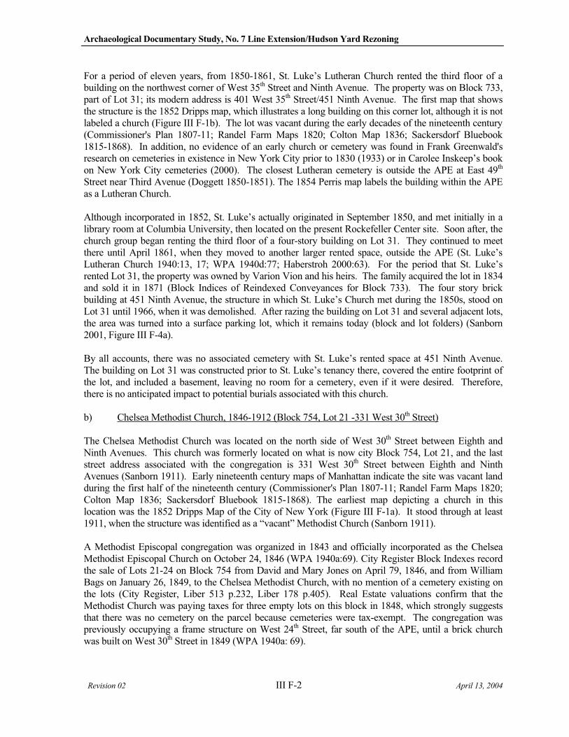
Archaeological Documentary Study, No. 7 Line Extension/Hudson Yard Rezoning
Revision 02 III F-2 April 13, 2004
For a period of eleven years, from 1850-1861, St. Luke’s Lutheran Church rented the third floor of a building on the northwest corner of West 35th Street and Ninth Avenue. The property was on Block 733, part of Lot 31; its modern address is 401 West 35th Street/451 Ninth Avenue. The first map that shows the structure is the 1852 Dripps map, which illustrates a long building on this corner lot, although it is not labeled a church (Figure III F-1b). The lot was vacant during the early decades of the nineteenth century (Commissioner's Plan 1807-11; Randel Farm Maps 1820; Colton Map 1836; Sackersdorf Bluebook 1815-1868). In addition, no evidence of an early church or cemetery was found in Frank Greenwald's research on cemeteries in existence in New York City prior to 1830 (1933) or in Carolee Inskeep’s book on New York City cemeteries (2000). The closest Lutheran cemetery is outside the APE at East 49th
Street near Third Avenue (Doggett 1850-1851). The 1854 Perris map labels the building within the APE as a Lutheran Church.
Although incorporated in 1852, St. Luke’s actually originated in September 1850, and met initially in a library room at Columbia University, then located on the present Rockefeller Center site. Soon after, the church group began renting the third floor of a four-story building on Lot 31. They continued to meet there until April 1861, when they moved to another larger rented space, outside the APE (St. Luke’s Lutheran Church 1940:13, 17; WPA 1940d:77; Haberstroh 2000:63). For the period that St. Luke’s rented Lot 31, the property was owned by Varion Vion and his heirs. The family acquired the lot in 1834 and sold it in 1871 (Block Indices of Reindexed Conveyances for Block 733). The four story brick building at 451 Ninth Avenue, the structure in which St. Luke’s Church met during the 1850s, stood on Lot 31 until 1966, when it was demolished. After razing the building on Lot 31 and several adjacent lots, the area was turned into a surface parking lot, which it remains today (block and lot folders) (Sanborn 2001, Figure III F-4a).
By all accounts, there was no associated cemetery with St. Luke’s rented space at 451 Ninth Avenue. The building on Lot 31 was constructed prior to St. Luke’s tenancy there, covered the entire footprint of the lot, and included a basement, leaving no room for a cemetery, even if it were desired. Therefore, there is no anticipated impact to potential burials associated with this church.
b) Chelsea Methodist Church, 1846-1912 (Block 754, Lot 21 -331 West 30th Street)
The Chelsea Methodist Church was located on the north side of West 30th Street between Eighth and Ninth Avenues. This church was formerly located on what is now city Block 754, Lot 21, and the last street address associated with the congregation is 331 West 30th Street between Eighth and Ninth Avenues (Sanborn 1911). Early nineteenth century maps of Manhattan indicate the site was vacant land during the first half of the nineteenth century (Commissioner's Plan 1807-11; Randel Farm Maps 1820; Colton Map 1836; Sackersdorf Bluebook 1815-1868). The earliest map depicting a church in this location was the 1852 Dripps Map of the City of New York (Figure III F-1a). It stood through at least 1911, when the structure was identified as a “vacant” Methodist Church (Sanborn 1911).
A Methodist Episcopal congregation was organized in 1843 and officially incorporated as the Chelsea Methodist Episcopal Church on October 24, 1846 (WPA 1940a:69). City Register Block Indexes record the sale of Lots 21-24 on Block 754 from David and Mary Jones on April 79, 1846, and from William Bags on January 26, 1849, to the Chelsea Methodist Church, with no mention of a cemetery existing on the lots (City Register, Liber 513 p.232, Liber 178 p.405). Real Estate valuations confirm that the Methodist Church was paying taxes for three empty lots on this block in 1848, which strongly suggests that there was no cemetery on the parcel because cemeteries were tax-exempt. The congregation was previously occupying a frame structure on West 24th Street, far south of the APE, until a brick church was built on West 30th Street in 1849 (WPA 1940a: 69).
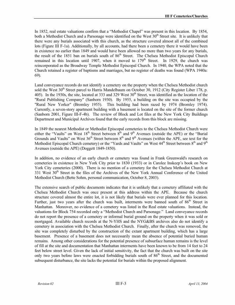
III F Cemeteries/Churches
Revision 02 III F-3 April 13, 2004
In 1852, real estate valuations confirm that a “Methodist Chapel” was present in this location. By 1854, both a Methodist Church and a Parsonage were identified on the West 30th Street site. It is unlikely that there were any burials associated with this church, as the structure covered almost all of the combined lots (Figure III F-1a). Additionally, by all accounts, had there been a cemetery there it would have been in existence no earlier than 1849 and would have been allowed no more than two years for any burials, the result of the 1851 ban on burials south of 86th Street. The Chelsea Methodist Episcopal Church remained in this location until 1907, when it moved to 179th Street. In 1929, the church was reincorporated as the Broadway Temple Methodist Episcopal Church. In 1940, the WPA noted that the Church retained a register of baptisms and marriages, but no register of deaths was found (WPA 1940a: 69).
Land conveyance records do not identify a cemetery on the property when the Chelsea Methodist church sold the West 30th Street parcel to Harris Mandelbaum on October 30, 1912 (City Register Liber 178, p. 405). In the 1930s, the site, located at 333 and 329 West 30th Street, was identified as the location of the "Rural Publishing Company" (Sanborn 1930). By 1955, a building on the site was occupied by the "Rural New Yorker" (Bromley 1955). This building had been razed by 1974 (Bromley 1974). Currently, a seven-story apartment building with a basement is located on the site of the former church (Sanborn 2001, Figure III-F-4b). The review of Block and Lot files at the New York City Buildings Department and Municipal Archives found that the early records from this block are missing.
In 1849 the nearest Methodist or Methodist Episcopal cemeteries to the Chelsea Methodist Church were either the “Vaults” on West 18th Street between 8th and 9th Avenues (outside the APE) or the “Burial Grounds and Vaults” on West 36th Street between 8th and 9th Avenues (within the APE, see text for the Methodist Episcopal Church cemetery) or the “Yards and Vaults” on West 44th Street between 8th and 9th
Avenues (outside the APE) (Doggett 1849-1850).
In addition, no evidence of an early church or cemetery was found in Frank Greenwald's research on cemeteries in existence in New York City prior to 1830 (1933) or in Carolee Inskeep’s book on New York City cemeteries (2000). There is no mention of a cemetery for the Chelsea Methodist Church at 331 West 30th Street in the files of the Archives of the New York Annual Conference of the United Methodist Church (Bette Sohm, personal communication, October 8, 2003).
The extensive search of public documents indicates that it is unlikely that a cemetery affiliated with the Chelsea Methodist Church was once present at this address within the APE. Because the church structure covered almost the entire lot, it is not likely that burials were ever planned for this location. Further, just two years after the church was built, interments were banned south of 86th Street in Manhattan. Moreover, no evidence of a cemetery was listed in the Real estate valuations. Instead, the valuations for Block 754 recorded only a “Methodist Church and Parsonage.” Land conveyance records do not report the presence of a cemetery or informal burial ground on the property when it was sold or mortgaged. Available church records at the N-YHS and the NYG&BS archives also do not identify a cemetery in association with the Chelsea Methodist Church. Finally, after the church was removed, the site was completely disturbed by the construction of the extant apartment building, which has a large basement. Presence of a basement does not necessarily mean the absence of potential buried human remains. Among other considerations for the potential presence of subsurface human remains is the level of fill at the site and documentation that Manhattan interments have been known to be from 14 feet to 24 feet below street level. Given the lack of initial sensitivity, the fact that the church was built on the site only two years before laws were enacted forbidding burials south of 86th Street, and the documented subsequent disturbance, the site lacks the potential for burials within the proposed alignment.
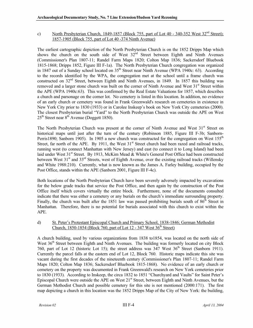
Archaeological Documentary Study, No. 7 Line Extension/Hudson Yard Rezoning
Revision 02 III F-4 April 13, 2004
c) North Presbyterian Church, 1849-1857 (Block 755, part of Lot 40 - 340-352 West 32nd Street); 1857-1905 (Block 755, part of Lot 40 -374 Ninth Avenue)
The earliest cartographic depiction of the North Presbyterian Church is on the 1852 Dripps Map which shows the church on the south side of West 32nd Street between Eighth and Ninth Avenues (Commissioner's Plan 1807-11; Randel Farm Maps 1820; Colton Map 1836; Sackersdorf Bluebook 1815-1868; Dripps 1852, Figure III F-1a). The North Presbyterian Church congregation was organized in 1847 out of a Sunday school located on 35th Street near Ninth Avenue (WPA 1940c: 63). According to the records identified by the WPA, the congregation met at the school until a frame church was constructed on 32nd Street, between Eighth and Ninth Avenues, in 1849. In 1857 this building was removed and a larger stone church was built on the corner of Ninth Avenue and West 31st Street within the APE (WPA 1940c:63). This was confirmed by the Real Estate Valuations for 1857, which describes a church and parsonage on the corner lot. No cemetery is listed in this location. In addition, no evidence of an early church or cemetery was found in Frank Greenwald's research on cemeteries in existence in New York City prior to 1830 (1933) or in Carolee Inskeep’s book on New York City cemeteries (2000). The closest Presbyterian burial “Yard” to the North Presbyterian Church was outside the APE on West 25th Street near 8th Avenue (Doggett 1850).
The North Presbyterian Church was present at the corner of Ninth Avenue and West 31st Street on historical maps until just after the turn of the century (Robinson 1885, Figure III F-3b; Sanborn-Perris1890; Sanborn 1905). In 1905 a new church was constructed for the congregation on West 155th
Street, far north of the APE. By 1911, the West 31st Street church had been razed and railroad tracks, running west (to connect Manhattan with New Jersey) and east (to connect it to Long Island) had been laid under West 31st Street. By 1913, McKim Mead & White's General Post Office had been constructed between West 31st and 33rd Streets, west of Eighth Avenue, over the existing railroad tracks (Willensky and White 1988:210). Currently, what is now known as the James A. Farley building, occupied by the Post Office, stands within the APE (Sanborn 2001, Figure III F-4c).
Both locations of the North Presbyterian Church have been severely adversely impacted by excavations for the below grade tracks that service the Post Office, and then again by the construction of the Post Office itself which covers virtually the entire block. Furthermore, none of the documents consulted indicate that there was either a cemetery or any burials on the church’s immediate surrounding property. Finally, the church was built after the 1851 law was passed prohibiting burials south of 86th Street in Manhattan. Therefore, there is no potential for burials associated with this church to exist within the APE.
d) St. Peter’s Protestant Episcopal Church and Primary School, 1838-1846; German Methodist Church, 1850-1854 (Block 760, part of Lot 12 - 347 West 36th Street)
A church building, used by various organizations from 1838 to1854, was located on the north side of West 36th Street between Eighth and Ninth Avenues. The building was formerly located on city Block 760, part of Lot 12 (historic Lot 15); the street address was 347 West 36th Street (Sanborn 1911). Currently the parcel falls at the eastern end of Lot 12, Block 760. Historic maps indicate this site was vacant during the first decades of the nineteenth century (Commissioner's Plan 1807-11; Randel Farm Maps 1820; Colton Map 1836; Sackersdorf Bluebook 1815-1868). No evidence of an early church or cemetery on the property was documented in Frank Greenwald's research on New York cemeteries prior to 1830 (1933). According to Inskeep, the circa 1832 to 1851 “Churchyard and Vaults” for Saint Peter’s Episcopal Church were outside the APE on West 21st Street, between Eighth and Ninth Avenues, but the German Methodist Church and possible cemetery for this site is not mentioned (2000:171). The first map depicting a church in this location was the 1852 Dripps Map of the City of New York: the building,

III F Cemeteries/Churches
Revision 02 III F-5 April 13, 2004
set back from West 36th Street, is labeled a “Dutch Church” (Figure III F-1b). On the 1854 Perris map, the same structure is labeled a “Methodist Church”. By issuance of the 1857-62 Perris map, the church building was gone, replaced with a new structure located flush with the West 36th Street lot boundary. This new structure that replaced the church stood through the mid-1920s. The current 16-story building (with basement) that covers 347-353 West 36th Street was constructed in 1928 (Sanborn 1980).
According to City Register conveyance records, Lot 15 was never owned by a church organization, but rather belonged to a series of individuals throughout its early history. Apparently, the building on the property was rented by different church groups during the 1830s-1850s, although no rental or lease records were found at the City Register. Real Estate valuation records, however, provided some of the details the City Register could not. The real estate valuation records indicate that the property was vacant until 1838, when a church building, attributed to “St. Peter’s Church,” first was recorded on the property. St. Peter’s Church was noted as the occupant for Lot 15 through 1846 (records for 1847 are missing). Although it is not explicitly mentioned, St. Peter’s Church was probably shorthand for the “Protestant Episcopal Church of St. Peter,” a group that had its main church at 344 West 20th Street in Chelsea beginning in 1831, and a vacant lot on West 36th Street, between 9th and 10th Avenues (on Block 734, immediately west of Block 760) from 1832-1847 (WPA 1940b:78; Liber 279:287; 493:334). St. Peter’s consecrated its current church in Chelsea in 1838, the same year it began renting the church building on Block 760. It is likely that St. Peter’s used the building on Block 760 for a school; from 1845-1846 the real estate valuation records further indicate the lot was occupied by “St. Peter’s Primary School.”
St. Peter’s Church stopped renting the building on Block 760 by 1846 or 1847; in the 1848 real estate valuation records there was no tenant listed for Lot 15, and in 1849 the property was designated a generic “church,” with no named renter. From 1850-54, real estate valuation records indicate that the church on Lot 15 was rented by the “German Methodist Church.” In 1855, the word “church” was crossed out in the real estate valuation records, and the property was shown to be occupied by a B. Dingledein. Dingledein occupied the property again in 1856, but it was now vacant, suggesting that the church building had been razed by this time. Presumably, the new building on Lot 15 was constructed in the late 1850s, as the Perris 1857-62 map shows that it was in place by this time.
It is clear that Lot 15 contained a building used variously as a church and a school from 1838-1854. From 1838-1846, the structure was rented by St. Peter’s Church. Tenancy is unclear from 1847-1850, and it is possible that the building sat unused for a part of that time.
A German Methodist Church occupied the building from 1850-54, although which German Methodist Church is unknown. The Archivist for the United Methodist Church, Bette Sohm, has no records for the German Methodist Church at 347 West 36th Street, but she does have a listing for the Second German Methodist Church at 346 West 40th Street, near 9th Avenue and within the APE (Bette Sohm, personal communication, October 8, 2003). The Second German Methodist Episcopal Church at 346 West 40th
Street, was organized in 1846, and, over a period of the next 19 years, held services at various locations within the APE, but there are no burial registers extant, much less any record of a cemetery for this church (WPA 1940a:157; Bette Sohm, Ibid.) (See the section on the Second German Methodist Church in the section on churches established between 1852 and 1870) Neither city directories from this time nor Haberstroh’s research guide to German churches in New York City (2000) mention a Methodist Church at 347 West 36th Street. Dripps’ notation of a “Dutch Church” on Lot 15 in 1852 also could not be corroborated in other sources; it is possible either that his information was in error, or that there was a brief period when a Dutch church also shared rental of the building with the German Methodist Church.
In 1849 the nearest Methodist or Methodist Episcopal cemeteries to the Second German Methodist Episcopal Church were either the “Vaults” on West 18th Street between Eighth and Ninth Avenues
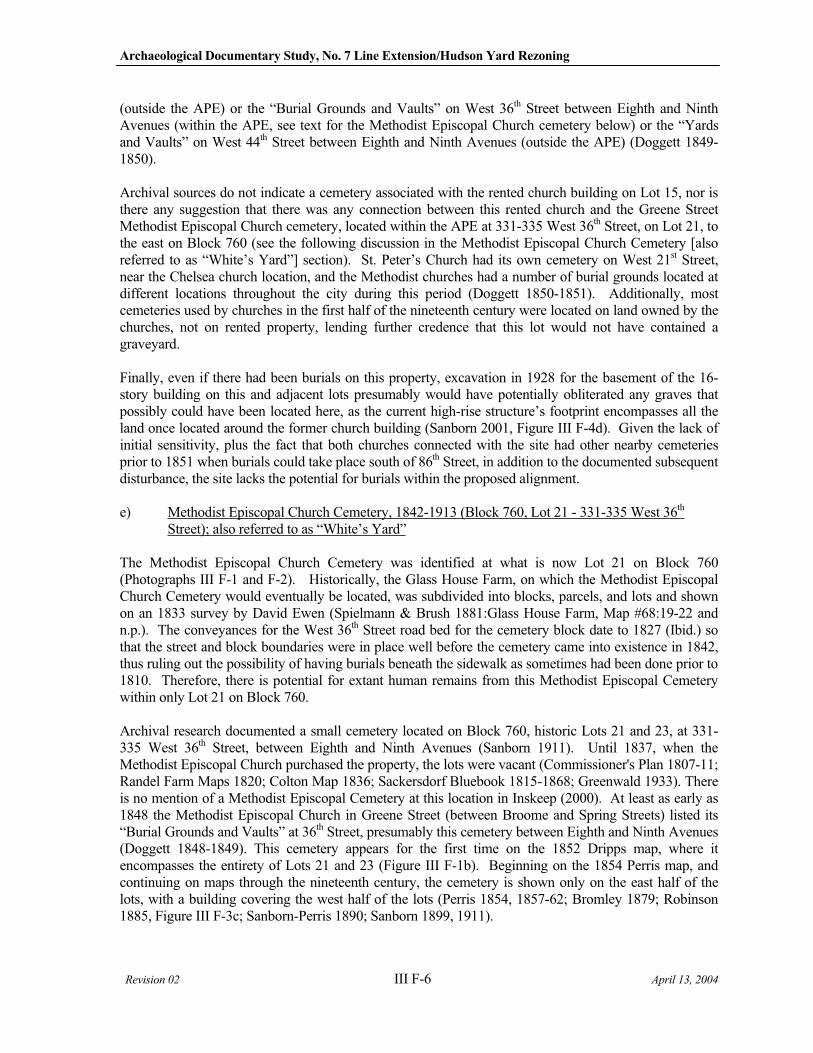
Archaeological Documentary Study, No. 7 Line Extension/Hudson Yard Rezoning
Revision 02 III F-6 April 13, 2004
(outside the APE) or the “Burial Grounds and Vaults” on West 36th Street between Eighth and Ninth Avenues (within the APE, see text for the Methodist Episcopal Church cemetery below) or the “Yards and Vaults” on West 44th Street between Eighth and Ninth Avenues (outside the APE) (Doggett 1849-1850).
Archival sources do not indicate a cemetery associated with the rented church building on Lot 15, nor is there any suggestion that there was any connection between this rented church and the Greene Street Methodist Episcopal Church cemetery, located within the APE at 331-335 West 36th Street, on Lot 21, to the east on Block 760 (see the following discussion in the Methodist Episcopal Church Cemetery [also referred to as “White’s Yard”] section). St. Peter’s Church had its own cemetery on West 21st Street, near the Chelsea church location, and the Methodist churches had a number of burial grounds located at different locations throughout the city during this period (Doggett 1850-1851). Additionally, most cemeteries used by churches in the first half of the nineteenth century were located on land owned by the churches, not on rented property, lending further credence that this lot would not have contained a graveyard.
Finally, even if there had been burials on this property, excavation in 1928 for the basement of the 16-story building on this and adjacent lots presumably would have potentially obliterated any graves that possibly could have been located here, as the current high-rise structure’s footprint encompasses all the land once located around the former church building (Sanborn 2001, Figure III F-4d). Given the lack of initial sensitivity, plus the fact that both churches connected with the site had other nearby cemeteries prior to 1851 when burials could take place south of 86th Street, in addition to the documented subsequent disturbance, the site lacks the potential for burials within the proposed alignment.
e) Methodist Episcopal Church Cemetery, 1842-1913 (Block 760, Lot 21 - 331-335 West 36th
Street); also referred to as “White’s Yard”
The Methodist Episcopal Church Cemetery was identified at what is now Lot 21 on Block 760 (Photographs III F-1 and F-2). Historically, the Glass House Farm, on which the Methodist Episcopal Church Cemetery would eventually be located, was subdivided into blocks, parcels, and lots and shown on an 1833 survey by David Ewen (Spielmann & Brush 1881:Glass House Farm, Map #68:19-22 and n.p.). The conveyances for the West 36th Street road bed for the cemetery block date to 1827 (Ibid.) so that the street and block boundaries were in place well before the cemetery came into existence in 1842, thus ruling out the possibility of having burials beneath the sidewalk as sometimes had been done prior to 1810. Therefore, there is potential for extant human remains from this Methodist Episcopal Cemetery within only Lot 21 on Block 760.
Archival research documented a small cemetery located on Block 760, historic Lots 21 and 23, at 331-335 West 36th Street, between Eighth and Ninth Avenues (Sanborn 1911). Until 1837, when the Methodist Episcopal Church purchased the property, the lots were vacant (Commissioner's Plan 1807-11; Randel Farm Maps 1820; Colton Map 1836; Sackersdorf Bluebook 1815-1868; Greenwald 1933). There is no mention of a Methodist Episcopal Cemetery at this location in Inskeep (2000). At least as early as 1848 the Methodist Episcopal Church in Greene Street (between Broome and Spring Streets) listed its “Burial Grounds and Vaults” at 36th Street, presumably this cemetery between Eighth and Ninth Avenues (Doggett 1848-1849). This cemetery appears for the first time on the 1852 Dripps map, where it encompasses the entirety of Lots 21 and 23 (Figure III F-1b). Beginning on the 1854 Perris map, and continuing on maps through the nineteenth century, the cemetery is shown only on the east half of the lots, with a building covering the west half of the lots (Perris 1854, 1857-62; Bromley 1879; Robinson 1885, Figure III F-3c; Sanborn-Perris 1890; Sanborn 1899, 1911).
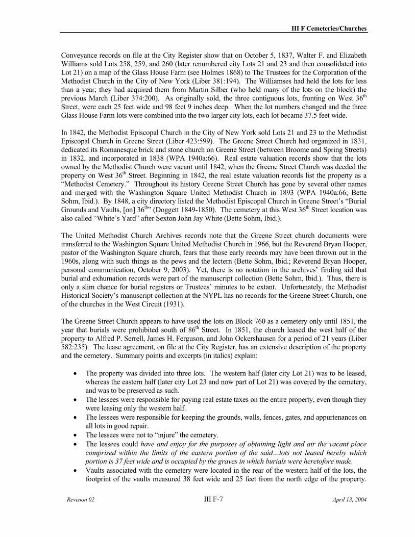
III F Cemeteries/Churches
Revision 02 III F-7 April 13, 2004
Conveyance records on file at the City Register show that on October 5, 1837, Walter F. and Elizabeth Williams sold Lots 258, 259, and 260 (later renumbered city Lots 21 and 23 and then consolidated into Lot 21) on a map of the Glass House Farm (see Holmes 1868) to The Trustees for the Corporation of the Methodist Church in the City of New York (Liber 381:194). The Williamses had held the lots for less than a year; they had acquired them from Martin Silber (who held many of the lots on the block) the previous March (Liber 374:200). As originally sold, the three contiguous lots, fronting on West 36th
Street, were each 25 feet wide and 98 feet 9 inches deep. When the lot numbers changed and the three Glass House Farm lots were combined into the two larger city lots, each lot became 37.5 feet wide.
In 1842, the Methodist Episcopal Church in the City of New York sold Lots 21 and 23 to the Methodist Episcopal Church in Greene Street (Liber 423:599). The Greene Street Church had organized in 1831, dedicated its Romanesque brick and stone church on Greene Street (between Broome and Spring Streets) in 1832, and incorporated in 1838 (WPA 1940a:66). Real estate valuation records show that the lots owned by the Methodist Church were vacant until 1842, when the Greene Street Church was deeded the property on West 36th Street. Beginning in 1842, the real estate valuation records list the property as a “Methodist Cemetery.” Throughout its history Greene Street Church has gone by several other names and merged with the Washington Square United Methodist Church in 1893 (WPA 1940a:66; Bette Sohm, Ibid.). By 1848, a city directory listed the Methodist Episcopal Church in Greene Street’s “Burial Grounds and Vaults, [on] 36th” (Doggett 1849-1850). The cemetery at this West 36th Street location was also called “White’s Yard” after Sexton John Jay White (Bette Sohm, Ibid.).
The United Methodist Church Archives records note that the Greene Street church documents were transferred to the Washington Square United Methodist Church in 1966, but the Reverend Bryan Hooper, pastor of the Washington Square church, fears that those early records may have been thrown out in the 1960s, along with such things as the pews and the lectern (Bette Sohm, Ibid.; Reverend Bryan Hooper, personal communication, October 9, 2003). Yet, there is no notation in the archives’ finding aid that burial and exhumation records were part of the manuscript collection (Bette Sohm, Ibid.). Thus, there is only a slim chance for burial registers or Trustees’ minutes to be extant. Unfortunately, the Methodist Historical Society’s manuscript collection at the NYPL has no records for the Greene Street Church, one of the churches in the West Circuit (1931).
The Greene Street Church appears to have used the lots on Block 760 as a cemetery only until 1851, the year that burials were prohibited south of 86th Street. In 1851, the church leased the west half of the property to Alfred P. Serrell, James H. Ferguson, and John Ockershausen for a period of 21 years (Liber 582:235). The lease agreement, on file at the City Register, has an extensive description of the property and the cemetery. Summary points and excerpts (in italics) explain:
The property was divided into three lots. The western half (later city Lot 21) was to be leased, whereas the eastern half (later city Lot 23 and now part of Lot 21) was covered by the cemetery, and was to be preserved as such.
The lessees were responsible for paying real estate taxes on the entire property, even though they were leasing only the western half.
The lessees were responsible for keeping the grounds, walls, fences, gates, and appurtenances on all lots in good repair.
The lessees were not to “injure” the cemetery.
The lessees could have and enjoy for the purposes of obtaining light and air the vacant place
comprised within the limits of the eastern portion of the said…lots not leased hereby which
portion is 37 feet wide and is occupied by the graves in which burials were heretofore made.
Vaults associated with the cemetery were located in the rear of the western half of the lots, the footprint of the vaults measured 38 feet wide and 25 feet from the north edge of the property.
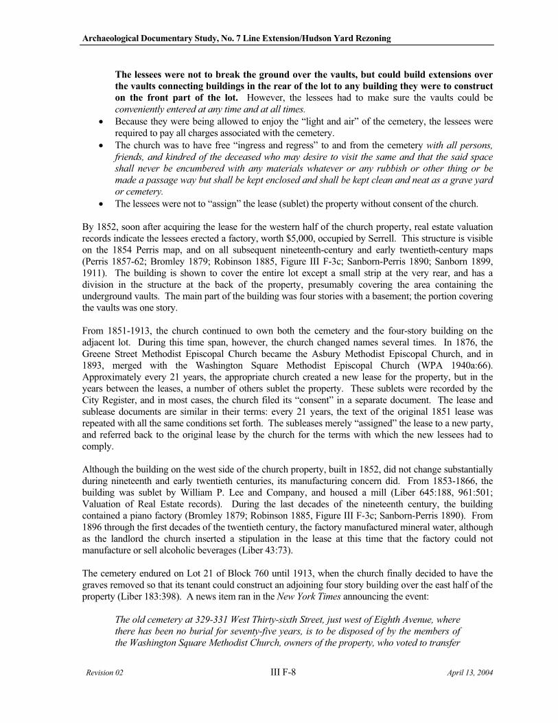
Archaeological Documentary Study, No. 7 Line Extension/Hudson Yard Rezoning
Revision 02 III F-8 April 13, 2004
The lessees were not to break the ground over the vaults, but could build extensions over
the vaults connecting buildings in the rear of the lot to any building they were to construct
on the front part of the lot. However, the lessees had to make sure the vaults could be conveniently entered at any time and at all times.
Because they were being allowed to enjoy the “light and air” of the cemetery, the lessees were required to pay all charges associated with the cemetery.
The church was to have free “ingress and regress” to and from the cemetery with all persons,
friends, and kindred of the deceased who may desire to visit the same and that the said space
shall never be encumbered with any materials whatever or any rubbish or other thing or be
made a passage way but shall be kept enclosed and shall be kept clean and neat as a grave yard
or cemetery.
The lessees were not to “assign” the lease (sublet) the property without consent of the church.
By 1852, soon after acquiring the lease for the western half of the church property, real estate valuation records indicate the lessees erected a factory, worth $5,000, occupied by Serrell. This structure is visible on the 1854 Perris map, and on all subsequent nineteenth-century and early twentieth-century maps (Perris 1857-62; Bromley 1879; Robinson 1885, Figure III F-3c; Sanborn-Perris 1890; Sanborn 1899, 1911). The building is shown to cover the entire lot except a small strip at the very rear, and has a division in the structure at the back of the property, presumably covering the area containing the underground vaults. The main part of the building was four stories with a basement; the portion covering the vaults was one story.
From 1851-1913, the church continued to own both the cemetery and the four-story building on the adjacent lot. During this time span, however, the church changed names several times. In 1876, the Greene Street Methodist Episcopal Church became the Asbury Methodist Episcopal Church, and in 1893, merged with the Washington Square Methodist Episcopal Church (WPA 1940a:66). Approximately every 21 years, the appropriate church created a new lease for the property, but in the years between the leases, a number of others sublet the property. These sublets were recorded by the City Register, and in most cases, the church filed its “consent” in a separate document. The lease and sublease documents are similar in their terms: every 21 years, the text of the original 1851 lease was repeated with all the same conditions set forth. The subleases merely “assigned” the lease to a new party, and referred back to the original lease by the church for the terms with which the new lessees had to comply.
Although the building on the west side of the church property, built in 1852, did not change substantially during nineteenth and early twentieth centuries, its manufacturing concern did. From 1853-1866, the building was sublet by William P. Lee and Company, and housed a mill (Liber 645:188, 961:501; Valuation of Real Estate records). During the last decades of the nineteenth century, the building contained a piano factory (Bromley 1879; Robinson 1885, Figure III F-3c; Sanborn-Perris 1890). From 1896 through the first decades of the twentieth century, the factory manufactured mineral water, although as the landlord the church inserted a stipulation in the lease at this time that the factory could not manufacture or sell alcoholic beverages (Liber 43:73).
The cemetery endured on Lot 21 of Block 760 until 1913, when the church finally decided to have the graves removed so that its tenant could construct an adjoining four story building over the east half of the property (Liber 183:398). A news item ran in the New York Times announcing the event:
The old cemetery at 329-331 West Thirty-sixth Street, just west of Eighth Avenue, where
there has been no burial for seventy-five years, is to be disposed of by the members of
the Washington Square Methodist Church, owners of the property, who voted to transfer
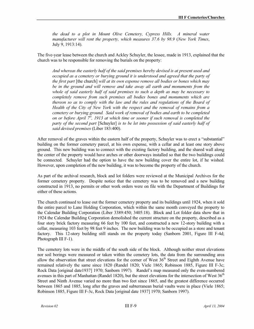
III F Cemeteries/Churches
Revision 02 III F-9 April 13, 2004
the dead to a plot in Mount Olive Cemetery, Cypress Hills. A mineral water manufacturer will rent the property, which measures 37.6 by 98.9 (New York Times,July 9, 1913:14).
The five-year lease between the church and Ackley Schuyler, the lessee, made in 1913, explained that the church was to be responsible for removing the burials on the property:
And whereas the easterly half of the said premises hereby devised is at present used and
occupied as a cemetery or burying ground it is understood and agreed that the party of
the first part [the church] will at its own expense remove all bodies or bones which may
be in the ground and will remove and take away all earth and monuments from the
whole of said easterly half of said premises to such a depth as may be necessary to
completely remove from such premises all bodies bones and monuments which are
thereon so as to comply with the law and the rules and regulations of the Board of
Health of the City of New York with the respect and the removal of remains from a
cemetery or burying ground. Said work of removal of bodies and earth to be completed
on or before April 7st, 1913 at which time or sooner if such removal is completed the party of the second part [Schuyler] is to be let into possession of said easterly half of
said devised premises (Liber 183:400).
After removal of the graves within the eastern half of the property, Schuyler was to erect a “substantial” building on the former cemetery parcel, at his own expense, with a cellar and at least one story above ground. This new building was to connect with the existing factory building, and the shared wall along the center of the property would have arches or other doorways installed so that the two buildings could be connected. Schuyler had the option to have the new building cover the entire lot, if he wished. However, upon completion of the new building, it was to become the property of the church.
As part of the archival research, block and lot folders were reviewed at the Municipal Archives for the former cemetery property. Despite notice that the cemetery was to be removed and a new building constructed in 1913, no permits or other work orders were on file with the Department of Buildings for either of these actions.
The church continued to lease out the former cemetery property and its buildings until 1924, when it sold the entire parcel to Lane Holding Corporation, which within the same month conveyed the property to the Calendar Building Corporation (Liber 3389:450; 3405:18). Block and Lot folder data show that in 1924 the Calendar Building Corporation demolished the current structure on the property, described as a four story brick factory measuring 66 feet by 100 feet, and constructed a new 12-story building with a cellar, measuring 103 feet by 98 feet 9 inches. The new building was to be occupied as a store and tenant factory. This 12-story building still stands on the property today (Sanborn 2001, Figure III F-4d; Photograph III F-1).
The cemetery lots were in the middle of the south side of the block. Although neither street elevations nor soil borings were measured or taken within the cemetery lots, the data from the surrounding area allow the observation that street elevations for the corner of West 36th Street and Eighth Avenue have remained relatively the same since 1820 (Randel 1820; Viele 1865; Robinson 1885, Figure III F-3c; Rock Data [original date1937] 1970; Sanborn 1997). Randel’s map measured only the even-numbered avenues in this part of Manhattan (Randel 1820), but the street elevations for the intersection of West 36th
Street and Ninth Avenue varied no more than two feet since 1865, and the greatest difference occurred between 1865 and 1885, long after the graves and subterranean burial vaults were in place (Viele 1865; Robinson 1885, Figure III F-3c, Rock Data [original date 1937] 1970; Sanborn 1997).
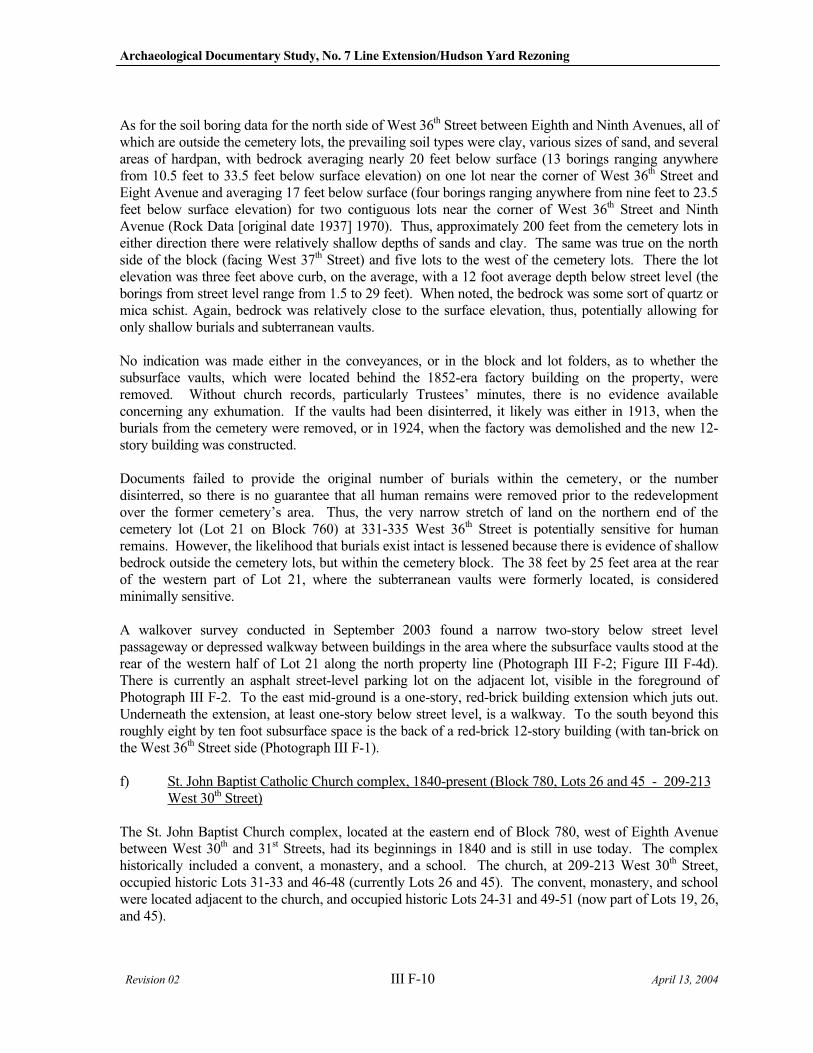
Archaeological Documentary Study, No. 7 Line Extension/Hudson Yard Rezoning
Revision 02 III F-10 April 13, 2004
As for the soil boring data for the north side of West 36th Street between Eighth and Ninth Avenues, all of which are outside the cemetery lots, the prevailing soil types were clay, various sizes of sand, and several areas of hardpan, with bedrock averaging nearly 20 feet below surface (13 borings ranging anywhere from 10.5 feet to 33.5 feet below surface elevation) on one lot near the corner of West 36th Street and Eight Avenue and averaging 17 feet below surface (four borings ranging anywhere from nine feet to 23.5 feet below surface elevation) for two contiguous lots near the corner of West 36th Street and Ninth Avenue (Rock Data [original date 1937] 1970). Thus, approximately 200 feet from the cemetery lots in either direction there were relatively shallow depths of sands and clay. The same was true on the north side of the block (facing West 37th Street) and five lots to the west of the cemetery lots. There the lot elevation was three feet above curb, on the average, with a 12 foot average depth below street level (the borings from street level range from 1.5 to 29 feet). When noted, the bedrock was some sort of quartz or mica schist. Again, bedrock was relatively close to the surface elevation, thus, potentially allowing for only shallow burials and subterranean vaults.
No indication was made either in the conveyances, or in the block and lot folders, as to whether the subsurface vaults, which were located behind the 1852-era factory building on the property, were removed. Without church records, particularly Trustees’ minutes, there is no evidence available concerning any exhumation. If the vaults had been disinterred, it likely was either in 1913, when the burials from the cemetery were removed, or in 1924, when the factory was demolished and the new 12-story building was constructed.
Documents failed to provide the original number of burials within the cemetery, or the number disinterred, so there is no guarantee that all human remains were removed prior to the redevelopment over the former cemetery’s area. Thus, the very narrow stretch of land on the northern end of the cemetery lot (Lot 21 on Block 760) at 331-335 West 36th Street is potentially sensitive for human remains. However, the likelihood that burials exist intact is lessened because there is evidence of shallow bedrock outside the cemetery lots, but within the cemetery block. The 38 feet by 25 feet area at the rear of the western part of Lot 21, where the subterranean vaults were formerly located, is considered minimally sensitive.
A walkover survey conducted in September 2003 found a narrow two-story below street level passageway or depressed walkway between buildings in the area where the subsurface vaults stood at the rear of the western half of Lot 21 along the north property line (Photograph III F-2; Figure III F-4d). There is currently an asphalt street-level parking lot on the adjacent lot, visible in the foreground of Photograph III F-2. To the east mid-ground is a one-story, red-brick building extension which juts out. Underneath the extension, at least one-story below street level, is a walkway. To the south beyond this roughly eight by ten foot subsurface space is the back of a red-brick 12-story building (with tan-brick on the West 36th Street side (Photograph III F-1).
f) St. John Baptist Catholic Church complex, 1840-present (Block 780, Lots 26 and 45 - 209-213 West 30th Street)
The St. John Baptist Church complex, located at the eastern end of Block 780, west of Eighth Avenue between West 30th and 31st Streets, had its beginnings in 1840 and is still in use today. The complex historically included a convent, a monastery, and a school. The church, at 209-213 West 30th Street, occupied historic Lots 31-33 and 46-48 (currently Lots 26 and 45). The convent, monastery, and school were located adjacent to the church, and occupied historic Lots 24-31 and 49-51 (now part of Lots 19, 26, and 45).
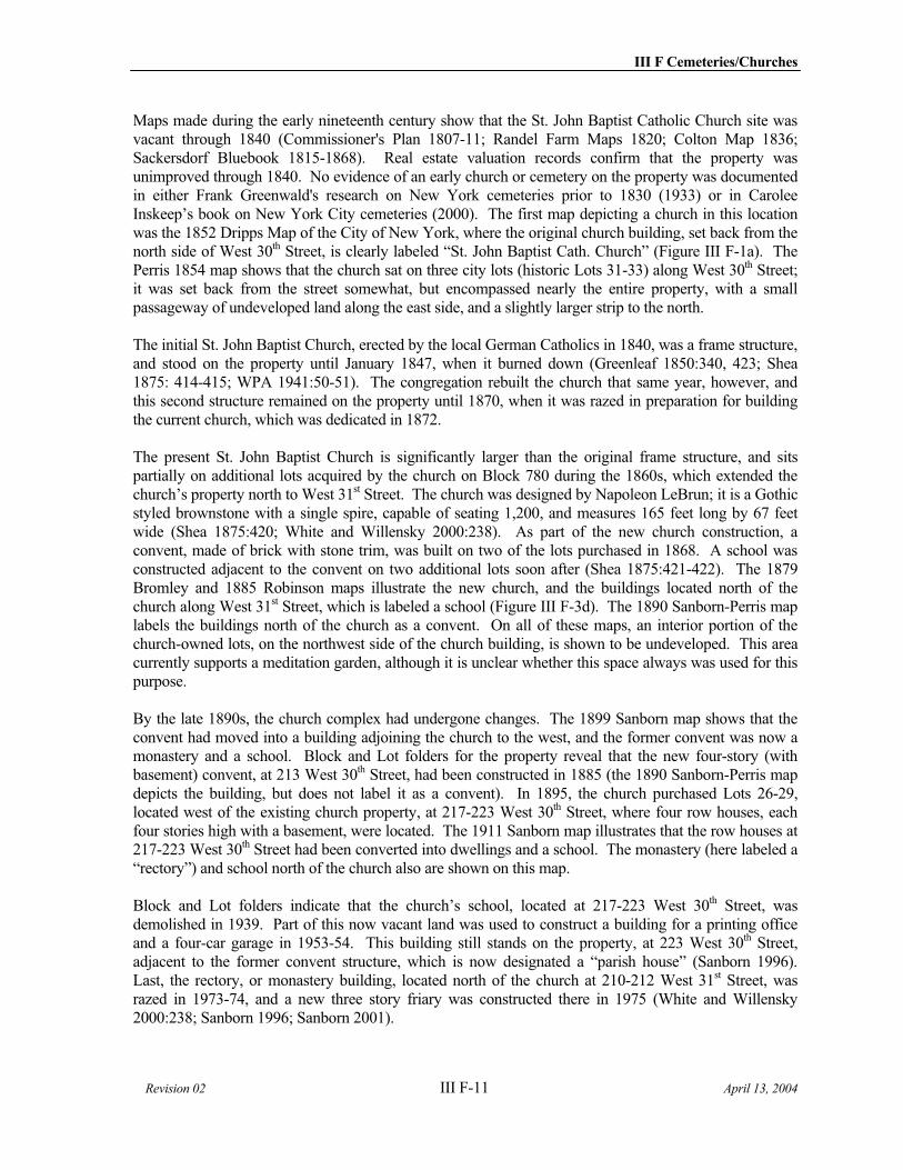
III F Cemeteries/Churches
Revision 02 III F-11 April 13, 2004
Maps made during the early nineteenth century show that the St. John Baptist Catholic Church site was vacant through 1840 (Commissioner's Plan 1807-11; Randel Farm Maps 1820; Colton Map 1836; Sackersdorf Bluebook 1815-1868). Real estate valuation records confirm that the property was unimproved through 1840. No evidence of an early church or cemetery on the property was documented in either Frank Greenwald's research on New York cemeteries prior to 1830 (1933) or in Carolee Inskeep’s book on New York City cemeteries (2000). The first map depicting a church in this location was the 1852 Dripps Map of the City of New York, where the original church building, set back from the north side of West 30th Street, is clearly labeled “St. John Baptist Cath. Church” (Figure III F-1a). The Perris 1854 map shows that the church sat on three city lots (historic Lots 31-33) along West 30th Street; it was set back from the street somewhat, but encompassed nearly the entire property, with a small passageway of undeveloped land along the east side, and a slightly larger strip to the north.
The initial St. John Baptist Church, erected by the local German Catholics in 1840, was a frame structure, and stood on the property until January 1847, when it burned down (Greenleaf 1850:340, 423; Shea 1875: 414-415; WPA 1941:50-51). The congregation rebuilt the church that same year, however, and this second structure remained on the property until 1870, when it was razed in preparation for building the current church, which was dedicated in 1872.
The present St. John Baptist Church is significantly larger than the original frame structure, and sits partially on additional lots acquired by the church on Block 780 during the 1860s, which extended the church’s property north to West 31st Street. The church was designed by Napoleon LeBrun; it is a Gothic styled brownstone with a single spire, capable of seating 1,200, and measures 165 feet long by 67 feet wide (Shea 1875:420; White and Willensky 2000:238). As part of the new church construction, a convent, made of brick with stone trim, was built on two of the lots purchased in 1868. A school was constructed adjacent to the convent on two additional lots soon after (Shea 1875:421-422). The 1879 Bromley and 1885 Robinson maps illustrate the new church, and the buildings located north of the church along West 31st Street, which is labeled a school (Figure III F-3d). The 1890 Sanborn-Perris map labels the buildings north of the church as a convent. On all of these maps, an interior portion of the church-owned lots, on the northwest side of the church building, is shown to be undeveloped. This area currently supports a meditation garden, although it is unclear whether this space always was used for this purpose.
By the late 1890s, the church complex had undergone changes. The 1899 Sanborn map shows that the convent had moved into a building adjoining the church to the west, and the former convent was now a monastery and a school. Block and Lot folders for the property reveal that the new four-story (with basement) convent, at 213 West 30th Street, had been constructed in 1885 (the 1890 Sanborn-Perris map depicts the building, but does not label it as a convent). In 1895, the church purchased Lots 26-29, located west of the existing church property, at 217-223 West 30th Street, where four row houses, each four stories high with a basement, were located. The 1911 Sanborn map illustrates that the row houses at 217-223 West 30th Street had been converted into dwellings and a school. The monastery (here labeled a “rectory”) and school north of the church also are shown on this map.
Block and Lot folders indicate that the church’s school, located at 217-223 West 30th Street, was demolished in 1939. Part of this now vacant land was used to construct a building for a printing office and a four-car garage in 1953-54. This building still stands on the property, at 223 West 30th Street, adjacent to the former convent structure, which is now designated a “parish house” (Sanborn 1996). Last, the rectory, or monastery building, located north of the church at 210-212 West 31st Street, was razed in 1973-74, and a new three story friary was constructed there in 1975 (White and Willensky 2000:238; Sanborn 1996; Sanborn 2001).
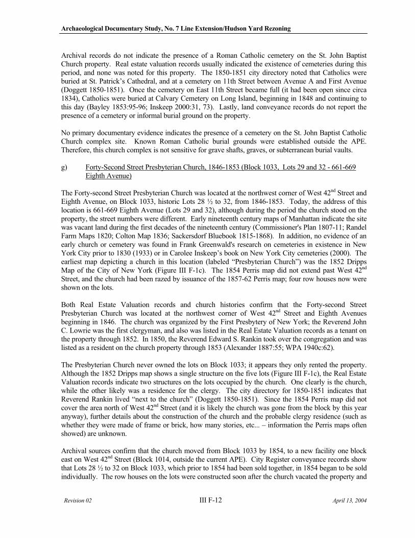
Archaeological Documentary Study, No. 7 Line Extension/Hudson Yard Rezoning
Revision 02 III F-12 April 13, 2004
Archival records do not indicate the presence of a Roman Catholic cemetery on the St. John Baptist Church property. Real estate valuation records usually indicated the existence of cemeteries during this period, and none was noted for this property. The 1850-1851 city directory noted that Catholics were buried at St. Patrick’s Cathedral, and at a cemetery on 11th Street between Avenue A and First Avenue (Doggett 1850-1851). Once the cemetery on East 11th Street became full (it had been open since circa 1834), Catholics were buried at Calvary Cemetery on Long Island, beginning in 1848 and continuing to this day (Bayley 1853:95-96; Inskeep 2000:31, 73). Lastly, land conveyance records do not report the presence of a cemetery or informal burial ground on the property.
No primary documentary evidence indicates the presence of a cemetery on the St. John Baptist Catholic Church complex site. Known Roman Catholic burial grounds were established outside the APE. Therefore, this church complex is not sensitive for grave shafts, graves, or subterranean burial vaults.
g) Forty-Second Street Presbyterian Church, 1846-1853 (Block 1033, Lots 29 and 32 - 661-669 Eighth Avenue)
The Forty-second Street Presbyterian Church was located at the northwest corner of West 42nd Street and Eighth Avenue, on Block 1033, historic Lots 28 ½ to 32, from 1846-1853. Today, the address of this location is 661-669 Eighth Avenue (Lots 29 and 32), although during the period the church stood on the property, the street numbers were different. Early nineteenth century maps of Manhattan indicate the site was vacant land during the first decades of the nineteenth century (Commissioner's Plan 1807-11; Randel Farm Maps 1820; Colton Map 1836; Sackersdorf Bluebook 1815-1868). In addition, no evidence of an early church or cemetery was found in Frank Greenwald's research on cemeteries in existence in New York City prior to 1830 (1933) or in Carolee Inskeep’s book on New York City cemeteries (2000). The earliest map depicting a church in this location (labeled “Presbyterian Church”) was the 1852 Dripps Map of the City of New York (Figure III F-1c). The 1854 Perris map did not extend past West 42nd
Street, and the church had been razed by issuance of the 1857-62 Perris map; four row houses now were shown on the lots.
Both Real Estate Valuation records and church histories confirm that the Forty-second Street Presbyterian Church was located at the northwest corner of West 42nd Street and Eighth Avenues beginning in 1846. The church was organized by the First Presbytery of New York; the Reverend John C. Lowrie was the first clergyman, and also was listed in the Real Estate Valuation records as a tenant on the property through 1852. In 1850, the Reverend Edward S. Rankin took over the congregation and was listed as a resident on the church property through 1853 (Alexander 1887:55; WPA 1940c:62).
The Presbyterian Church never owned the lots on Block 1033; it appears they only rented the property. Although the 1852 Dripps map shows a single structure on the five lots (Figure III F-1c), the Real Estate Valuation records indicate two structures on the lots occupied by the church. One clearly is the church, while the other likely was a residence for the clergy. The city directory for 1850-1851 indicates that Reverend Rankin lived “next to the church” (Doggett 1850-1851). Since the 1854 Perris map did not cover the area north of West 42nd Street (and it is likely the church was gone from the block by this year anyway), further details about the construction of the church and the probable clergy residence (such as whether they were made of frame or brick, how many stories, etc... – information the Perris maps often showed) are unknown.
Archival sources confirm that the church moved from Block 1033 by 1854, to a new facility one block east on West 42nd Street (Block 1014, outside the current APE). City Register conveyance records show that Lots 28 ½ to 32 on Block 1033, which prior to 1854 had been sold together, in 1854 began to be sold individually. The row houses on the lots were constructed soon after the church vacated the property and
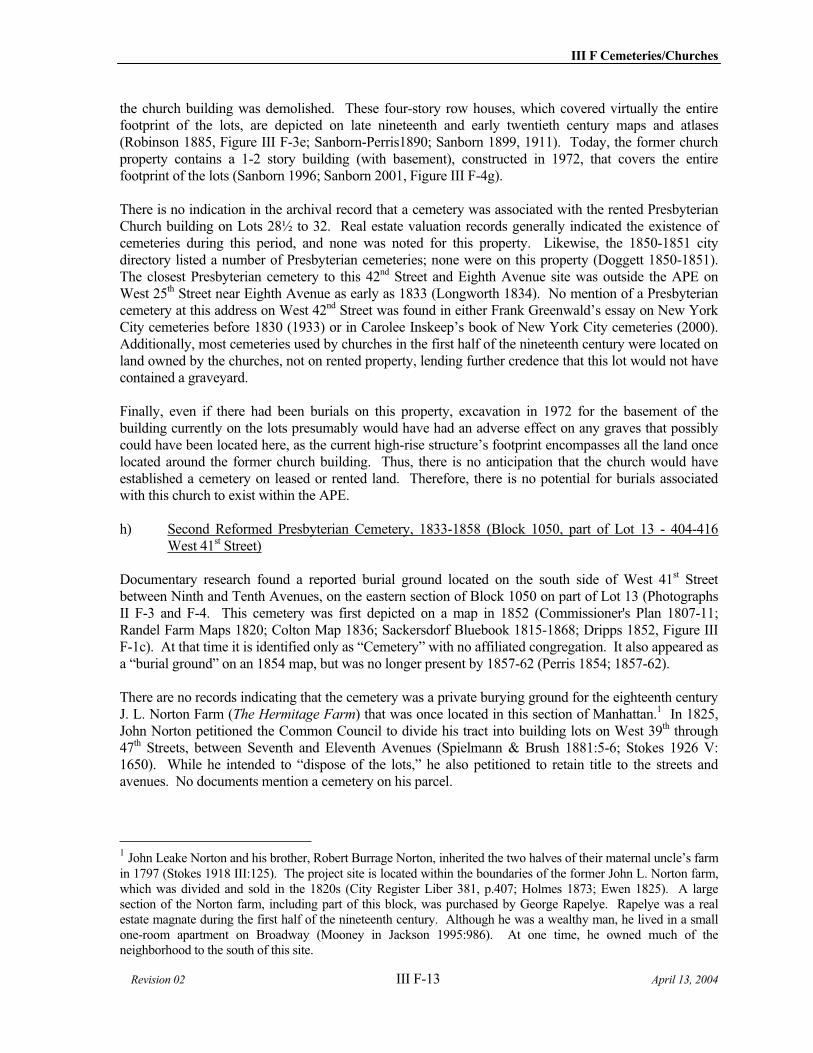
III F Cemeteries/Churches
Revision 02 III F-13 April 13, 2004
the church building was demolished. These four-story row houses, which covered virtually the entire footprint of the lots, are depicted on late nineteenth and early twentieth century maps and atlases (Robinson 1885, Figure III F-3e; Sanborn-Perris1890; Sanborn 1899, 1911). Today, the former church property contains a 1-2 story building (with basement), constructed in 1972, that covers the entire footprint of the lots (Sanborn 1996; Sanborn 2001, Figure III F-4g).
There is no indication in the archival record that a cemetery was associated with the rented Presbyterian Church building on Lots 28½ to 32. Real estate valuation records generally indicated the existence of cemeteries during this period, and none was noted for this property. Likewise, the 1850-1851 city directory listed a number of Presbyterian cemeteries; none were on this property (Doggett 1850-1851). The closest Presbyterian cemetery to this 42nd Street and Eighth Avenue site was outside the APE on West 25th Street near Eighth Avenue as early as 1833 (Longworth 1834). No mention of a Presbyterian cemetery at this address on West 42nd Street was found in either Frank Greenwald’s essay on New York City cemeteries before 1830 (1933) or in Carolee Inskeep’s book of New York City cemeteries (2000). Additionally, most cemeteries used by churches in the first half of the nineteenth century were located on land owned by the churches, not on rented property, lending further credence that this lot would not have contained a graveyard.
Finally, even if there had been burials on this property, excavation in 1972 for the basement of the building currently on the lots presumably would have had an adverse effect on any graves that possibly could have been located here, as the current high-rise structure’s footprint encompasses all the land once located around the former church building. Thus, there is no anticipation that the church would have established a cemetery on leased or rented land. Therefore, there is no potential for burials associated with this church to exist within the APE.
h) Second Reformed Presbyterian Cemetery, 1833-1858 (Block 1050, part of Lot 13 - 404-416 West 41st Street)
Documentary research found a reported burial ground located on the south side of West 41st Street between Ninth and Tenth Avenues, on the eastern section of Block 1050 on part of Lot 13 (Photographs II F-3 and F-4. This cemetery was first depicted on a map in 1852 (Commissioner's Plan 1807-11; Randel Farm Maps 1820; Colton Map 1836; Sackersdorf Bluebook 1815-1868; Dripps 1852, Figure III F-1c). At that time it is identified only as “Cemetery” with no affiliated congregation. It also appeared as a “burial ground” on an 1854 map, but was no longer present by 1857-62 (Perris 1854; 1857-62).
There are no records indicating that the cemetery was a private burying ground for the eighteenth century J. L. Norton Farm (The Hermitage Farm) that was once located in this section of Manhattan.1 In 1825, John Norton petitioned the Common Council to divide his tract into building lots on West 39th through 47th Streets, between Seventh and Eleventh Avenues (Spielmann & Brush 1881:5-6; Stokes 1926 V: 1650). While he intended to “dispose of the lots,” he also petitioned to retain title to the streets and avenues. No documents mention a cemetery on his parcel.
1John Leake Norton and his brother, Robert Burrage Norton, inherited the two halves of their maternal uncle’s farm
in 1797 (Stokes 1918 III:125). The project site is located within the boundaries of the former John L. Norton farm, which was divided and sold in the 1820s (City Register Liber 381, p.407; Holmes 1873; Ewen 1825). A large section of the Norton farm, including part of this block, was purchased by George Rapelye. Rapelye was a real estate magnate during the first half of the nineteenth century. Although he was a wealthy man, he lived in a small one-room apartment on Broadway (Mooney in Jackson 1995:986). At one time, he owned much of the neighborhood to the south of this site.
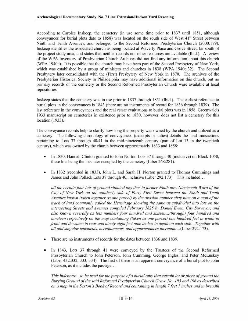
Archaeological Documentary Study, No. 7 Line Extension/Hudson Yard Rezoning
Revision 02 III F-14 April 13, 2004
According to Carolee Inskeep, the cemetery (in use some time prior to 1837 until 1851, although conveyances for burial plots date to 1858) was located on the south side of West 41st Street between Ninth and Tenth Avenues, and belonged to the Second Reformed Presbyterian Church (2000:179). Inskeep identifies the associated church as being located at Waverly Place and Grove Street, far south of the project study area, and states that neither records nor other resources are available (Ibid.). A review of the WPA Inventory of Presbyterian Church Archives did not find any information about this church (WPA 1940c). It is possible that the church may have been part of the Second Presbytery of New York, which was established by a group of ministers and churches in 1838 (WPA 1940c:32). The Second Presbytery later consolidated with the (First) Presbytery of New York in 1870. The archives of the Presbyterian Historical Society in Philadelphia may have additional information on this church, but no primary records of the cemetery or the Second Reformed Presbyterian Church were available at local repositories.
Inskeep states that the cemetery was in use prior to 1837 through 1851 (Ibid.). The earliest reference to burial plots in the conveyances is 1843 (there are no instruments of record for 1836 through 1839). The last reference in the conveyances and the real estate evaluations to burial plots was in 1858. Greenwald's 1933 manuscript on cemeteries in existence prior to 1830, however, does not list a cemetery for this location (1933).
The conveyance records help to clarify how long the property was owned by the church and utilized as a cemetery. The following chronology of conveyances (excerpts in italics) details the land transactions pertaining to Lots 37 through 40/41 in the mid-nineteenth century (part of Lot 13 in the twentieth century), which was owned by the church between approximately 1833 and 1858:
In 1830, Hannah Clinton granted to John Norton Lots 37 through 40 (inclusive) on Block 1050, these lots being the lots later occupied by the cemetery (Liber 268:281).
In 1832 (recorded in 1833), John L. and Sarah H. Norton granted to Thomas Cummings and James and John Pollack Lots 37 through 40, inclusive (Liber 292:173). This included…
all the certain four lots of ground situated together in former Ninth now Nineteenth Ward of the
City of New York on the southerly side of Forty First Street between the Ninth and Tenth
Avenues known (taken together as one parcel) by the division number sixty nine on a map of the
track of land commonly called the Hermitage showing the same as subdivided into lots on the
intersecting Streets and Avenues compiled February 1825 by Daniel Ewen, City Surveyor, and
also known severally as lots numbers four hundred and sixteen…(through) four hundred and
nineteen respectively on the map containing (taken as one parcel) one hundred feet in width in
front and the same in rear and ninety eight feet nine inches in depth on each side…Together with
all and singular tenements, hereditaments, and appurtenances thereunto…(Liber 292:173).
There are no instruments of records for the dates between 1836 and 1839.
In 1843, Lots 37 through 41 were conveyed by the Trustees of the Second Reformed Presbyterian Church to John Peterson, John Cumming, George Ingles, and Peter McLuskey (Liber 432:332, 333, 334). The first of these is an apparent conveyance of a burial plot to John Peterson, as it includes the passage…
This indenture…to be used for the purpose of a burial only that certain lot or piece of ground the
Burying Ground of the said Reformed Presbyterian Church Grave No. 195 and 196 as described
on a map in the Sexton’s Book of Record and containing in length 7 feet 7 inches and in breadth
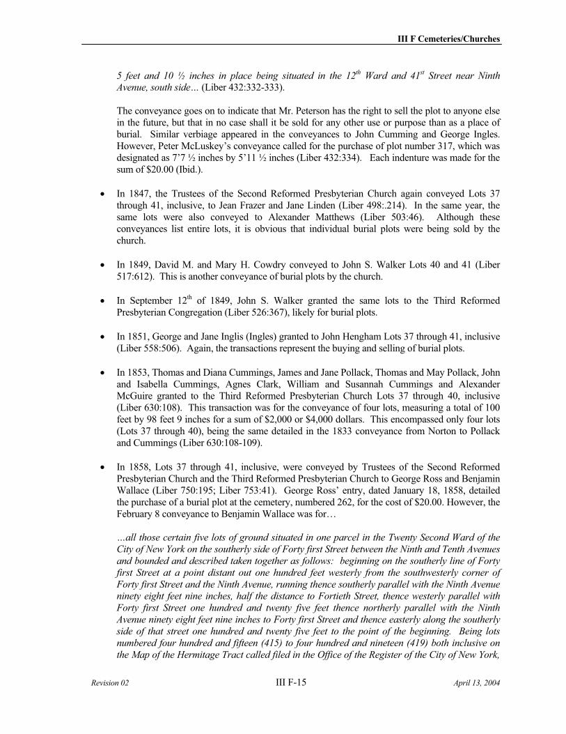
III F Cemeteries/Churches
Revision 02 III F-15 April 13, 2004
5 feet and 10 ½ inches in place being situated in the 12th Ward and 41st Street near Ninth Avenue, south side… (Liber 432:332-333).
The conveyance goes on to indicate that Mr. Peterson has the right to sell the plot to anyone else in the future, but that in no case shall it be sold for any other use or purpose than as a place of burial. Similar verbiage appeared in the conveyances to John Cumming and George Ingles. However, Peter McLuskey’s conveyance called for the purchase of plot number 317, which was designated as 7’7 ½ inches by 5’11 ½ inches (Liber 432:334). Each indenture was made for the sum of $20.00 (Ibid.).
In 1847, the Trustees of the Second Reformed Presbyterian Church again conveyed Lots 37 through 41, inclusive, to Jean Frazer and Jane Linden (Liber 498:.214). In the same year, the same lots were also conveyed to Alexander Matthews (Liber 503:46). Although these conveyances list entire lots, it is obvious that individual burial plots were being sold by the church.
In 1849, David M. and Mary H. Cowdry conveyed to John S. Walker Lots 40 and 41 (Liber 517:612). This is another conveyance of burial plots by the church.
In September 12th of 1849, John S. Walker granted the same lots to the Third Reformed Presbyterian Congregation (Liber 526:367), likely for burial plots.
In 1851, George and Jane Inglis (Ingles) granted to John Hengham Lots 37 through 41, inclusive (Liber 558:506). Again, the transactions represent the buying and selling of burial plots.
In 1853, Thomas and Diana Cummings, James and Jane Pollack, Thomas and May Pollack, John and Isabella Cummings, Agnes Clark, William and Susannah Cummings and Alexander McGuire granted to the Third Reformed Presbyterian Church Lots 37 through 40, inclusive (Liber 630:108). This transaction was for the conveyance of four lots, measuring a total of 100 feet by 98 feet 9 inches for a sum of $2,000 or $4,000 dollars. This encompassed only four lots (Lots 37 through 40), being the same detailed in the 1833 conveyance from Norton to Pollack and Cummings (Liber 630:108-109).
In 1858, Lots 37 through 41, inclusive, were conveyed by Trustees of the Second Reformed Presbyterian Church and the Third Reformed Presbyterian Church to George Ross and Benjamin Wallace (Liber 750:195; Liber 753:41). George Ross’ entry, dated January 18, 1858, detailed the purchase of a burial plot at the cemetery, numbered 262, for the cost of $20.00. However, the February 8 conveyance to Benjamin Wallace was for…
…all those certain five lots of ground situated in one parcel in the Twenty Second Ward of the
City of New York on the southerly side of Forty first Street between the Ninth and Tenth Avenues
and bounded and described taken together as follows: beginning on the southerly line of Forty
first Street at a point distant out one hundred feet westerly from the southwesterly corner of
Forty first Street and the Ninth Avenue, running thence southerly parallel with the Ninth Avenue
ninety eight feet nine inches, half the distance to Fortieth Street, thence westerly parallel with
Forty first Street one hundred and twenty five feet thence northerly parallel with the Ninth
Avenue ninety eight feet nine inches to Forty first Street and thence easterly along the southerly
side of that street one hundred and twenty five feet to the point of the beginning. Being lots
numbered four hundred and fifteen (415) to four hundred and nineteen (419) both inclusive on
the Map of the Hermitage Tract called filed in the Office of the Register of the City of New York,
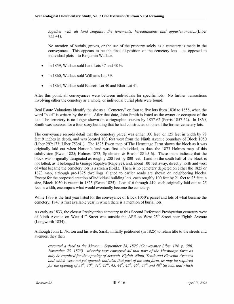
Archaeological Documentary Study, No. 7 Line Extension/Hudson Yard Rezoning
Revision 02 III F-16 April 13, 2004
together with all land singular, the tenements, hereditaments and appurtenances…(Liber 753:41).
No mention of burials, graves, or the use of the property solely as a cemetery is made in the conveyance. This appears to be the final disposition of the cemetery lots – as opposed to individual plots – to Benjamin Wallace.
In 1859, Wallace sold Lent Lots 37 and 38 ½.
In 1860, Wallace sold Williams Lot 39.
In 1864, Wallace sold Baureis Lot 40 and Blair Lot 41.
After this point, all conveyances were between individuals for specific lots. No further transactions involving either the cemetery as a whole, or individual burial plots were found.
Real Estate Valuations identify the site as a “Cemetery” on four to five lots from 1836 to 1858, when the word “sold” is written by the title. After that date, John Smith is listed as the owner or occupant of the lots. The cemetery is no longer shown on cartographic sources by 1857-62 (Perris 1857-62). In 1860, Smith was assessed for a four-story building that he had constructed on one of the former cemetery lots.
The conveyance records detail that the cemetery parcel was either 100 feet or 125 feet in width by 98 feet 9 inches in depth, and was located 100 feet west from the Ninth Avenue boundary of Block 1050 (Liber 292:173; Liber 753:41). The 1825 Ewen map of The Hermitage Farm shows the block as it was originally laid out when Norton’s land was first subdivided, as does the 1873 Holmes map of this subdivision (Ewen 1825; Holmes 1873; Spielmann & Brush 1881:5-6). These maps indicate that the block was originally designated as roughly 200 feet by 800 feet. Land on the south half of the block is not lotted, as it belonged to George Rapalya (Rapelye), and, about 100 feet away, directly north and west of what became the cemetery lots is a stream (Ibid.). There is no cemetery depicted on either the 1825 or 1873 map, although pre-1825 dwellings aligned to earlier roads are shown on neighboring blocks. Except for the proposed creation of individual building lots, each roughly 100 feet by 21 feet to 25 feet in size, Block 1050 is vacant in 1825 (Ewen 1825). Lots 416 through 419, each originally laid out as 25 feet in width, encompass what would eventually become the cemetery.
While 1833 is the first year listed for the conveyance of Block 1050’s parcel and lots of what became the cemetery, 1843 is first available year in which there is a mention of burial lots.
As early as 1833, the closest Presbyterian cemetery to this Second Reformed Presbyterian cemetery west of Ninth Avenue on West 41st Street was outside the APE on West 25th Street near Eighth Avenue (Longworth 1834).
Although John L. Norton and his wife, Sarah, initially petitioned (in 1825) to retain title to the streets and avenues, they then
executed a deed to the Mayor… September 28, 1825 (Conveyance Liber 194, p. 390,
November 23, 1825)…whereby was conveyed all that part of the Hermitage farm as
may be required for the opening of Seventh, Eighth, Ninth, Tenth and Eleventh Avenues
and which were not yet opened; and also that part of the said farm, as may be required
for the opening of 39th, 40th, 41st, 42nd, 43, 44th, 45th, 46th, 47th and 48th Streets, and which
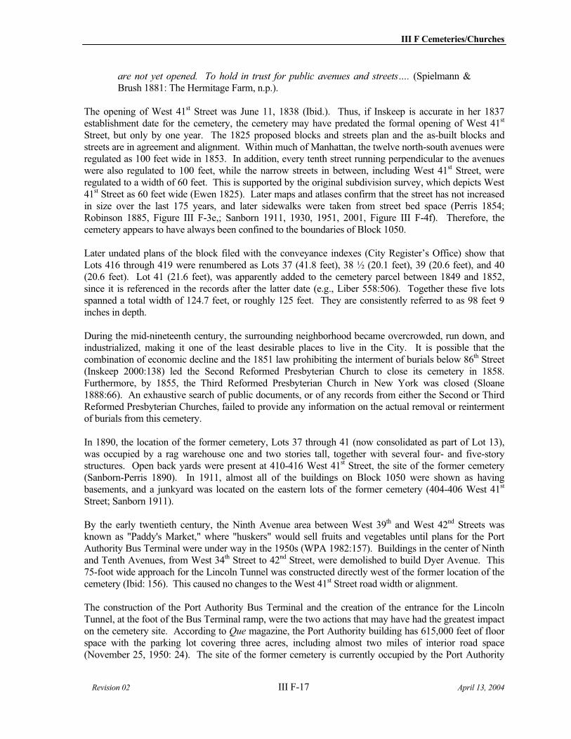
III F Cemeteries/Churches
Revision 02 III F-17 April 13, 2004
are not yet opened. To hold in trust for public avenues and streets…. (Spielmann & Brush 1881: The Hermitage Farm, n.p.).
The opening of West 41st Street was June 11, 1838 (Ibid.). Thus, if Inskeep is accurate in her 1837 establishment date for the cemetery, the cemetery may have predated the formal opening of West 41st
Street, but only by one year. The 1825 proposed blocks and streets plan and the as-built blocks and streets are in agreement and alignment. Within much of Manhattan, the twelve north-south avenues were regulated as 100 feet wide in 1853. In addition, every tenth street running perpendicular to the avenues were also regulated to 100 feet, while the narrow streets in between, including West 41st Street, were regulated to a width of 60 feet. This is supported by the original subdivision survey, which depicts West 41st Street as 60 feet wide (Ewen 1825). Later maps and atlases confirm that the street has not increased in size over the last 175 years, and later sidewalks were taken from street bed space (Perris 1854; Robinson 1885, Figure III F-3e,; Sanborn 1911, 1930, 1951, 2001, Figure III F-4f). Therefore, the cemetery appears to have always been confined to the boundaries of Block 1050.
Later undated plans of the block filed with the conveyance indexes (City Register’s Office) show that Lots 416 through 419 were renumbered as Lots 37 (41.8 feet), 38 ½ (20.1 feet), 39 (20.6 feet), and 40 (20.6 feet). Lot 41 (21.6 feet), was apparently added to the cemetery parcel between 1849 and 1852, since it is referenced in the records after the latter date (e.g., Liber 558:506). Together these five lots spanned a total width of 124.7 feet, or roughly 125 feet. They are consistently referred to as 98 feet 9 inches in depth.
During the mid-nineteenth century, the surrounding neighborhood became overcrowded, run down, and industrialized, making it one of the least desirable places to live in the City. It is possible that the combination of economic decline and the 1851 law prohibiting the interment of burials below 86th Street (Inskeep 2000:138) led the Second Reformed Presbyterian Church to close its cemetery in 1858. Furthermore, by 1855, the Third Reformed Presbyterian Church in New York was closed (Sloane 1888:66). An exhaustive search of public documents, or of any records from either the Second or Third Reformed Presbyterian Churches, failed to provide any information on the actual removal or reinterment of burials from this cemetery.
In 1890, the location of the former cemetery, Lots 37 through 41 (now consolidated as part of Lot 13), was occupied by a rag warehouse one and two stories tall, together with several four- and five-story structures. Open back yards were present at 410-416 West 41st Street, the site of the former cemetery (Sanborn-Perris 1890). In 1911, almost all of the buildings on Block 1050 were shown as having basements, and a junkyard was located on the eastern lots of the former cemetery (404-406 West 41st
Street; Sanborn 1911).
By the early twentieth century, the Ninth Avenue area between West 39th and West 42nd Streets was known as "Paddy's Market," where "huskers" would sell fruits and vegetables until plans for the Port Authority Bus Terminal were under way in the 1950s (WPA 1982:157). Buildings in the center of Ninth and Tenth Avenues, from West 34th Street to 42nd Street, were demolished to build Dyer Avenue. This 75-foot wide approach for the Lincoln Tunnel was constructed directly west of the former location of the cemetery (Ibid: 156). This caused no changes to the West 41st Street road width or alignment.
The construction of the Port Authority Bus Terminal and the creation of the entrance for the Lincoln Tunnel, at the foot of the Bus Terminal ramp, were the two actions that may have had the greatest impact on the cemetery site. According to Que magazine, the Port Authority building has 615,000 feet of floor space with the parking lot covering three acres, including almost two miles of interior road space (November 25, 1950: 24). The site of the former cemetery is currently occupied by the Port Authority

Archaeological Documentary Study, No. 7 Line Extension/Hudson Yard Rezoning
Revision 02 III F-18 April 13, 2004
Bus Terminal ramps, which actually lie suspended above it. The piers that support this structure may have been driven through potentially sensitive areas causing disturbance to discrete locations. There are also several buildings that were constructed beneath the ramps where the former cemetery existed (Sanborn 2001, Figure III F-4f; Photographs III F-3 and F-4). One of these structures houses the “Open Door” Homeless Shelter. Historical photographs of the construction of the Port Authority Bus Terminal show extensive subsurface disturbance to the terminal building’s footprint, but do not to depict any impacts to the West 41st Street roadbed or the location of the cemetery (http://www.panynj.gov/tbt/pabframe.HTM; New York Public Library Local History Room, Historic Photograph Files). A review of block and lot files at the New York City Building's Department and the Municipal Archives was also conducted, but no information on the property was available.
Since no public documents were identified detailing the removal of burials from the property prior its sale in 1858, it is unknown if bodies were left within the block in situ. While there is the potential for burials to exist within the confines of the cemetery boundaries on Block 1050, there were late-nineteenth- and twentieth-century construction episodes that potentially adversely affected the cemetery site. Furthermore, it is possible that the site of the former cemetery was also adversely impacted in discrete locations during the construction of the Port Authority Bus Terminal Ramp pylons. Nonetheless, when documents fail to provide the original number of burials within a cemetery, there is no guarantee that all human remains were removed prior to redevelopment. Even with the several episodes of post-1858 redevelopment on the cemetery site, there may be areas and pockets of undisturbed soils that may yield unexhumed human remains.
A walkover survey was undertaken in October 2003. Photograph III F-3 (top) is a view of the site facing slightly south of east toward the former cemetery site area. Photograph III F-4 faces south from the north side of West 41st Street, looking directly at the location of the former cemetery site.
2. Churches Established between 1852 and 1870
In the second period studied, those churches established between 1852 to 1870 within the Hudson Yards APE were forbidden to break ground for graves and subterranean vaults since they were established after the moratorium on new cemeteries south of 86th Street. Thus, there should be no cemeteries to be encountered in the Hudson Yards APE for this time period. Additionally, the 1847 New York Rural Cemeteries Act encouraged the development of cemeteries in Brooklyn and Queens, where many of the second period churches could bury their dead. Most of the first period Manhattan cemeteries’ human remains had been exhumed and reinterred in the rural sections of what would become New York City in 1898. Nevertheless, to ensure that there is no sensitivity for burials associated with these eight churches, intensive documentary research was conducted on each one.
a) Roman Catholic Church/St. Michael's Catholic Church, 1857-1907 (Block 729, part of Lot 50 -401-411 West 31st Street)
The earliest depiction of a church on this site was on the 1857-62 Perris Atlas, which depicts a church on the north side of West 31st Street (part of present-day Lot 50, Block 729) on the eastern half of the block between Ninth and Tenth Avenues (Commissioner's Plan 1807-11; Randel Farm Maps 1820; Colton Map 1836; Sackersdorf Bluebook 1815-1868; Dripps 1852; Perris 1857-62). Organized in 1857, St. Michael’s Roman Catholic Church was originally a frame structure (WPA 1941: 62). A larger brick and stone building was constructed later that same year. A school, associated with the church, was organized in 1866. The students were educated in the brick church even after a new church was built on West 34th
Street. Between 1885 and 1890, the brick building was enlarged to include a chapel for the school
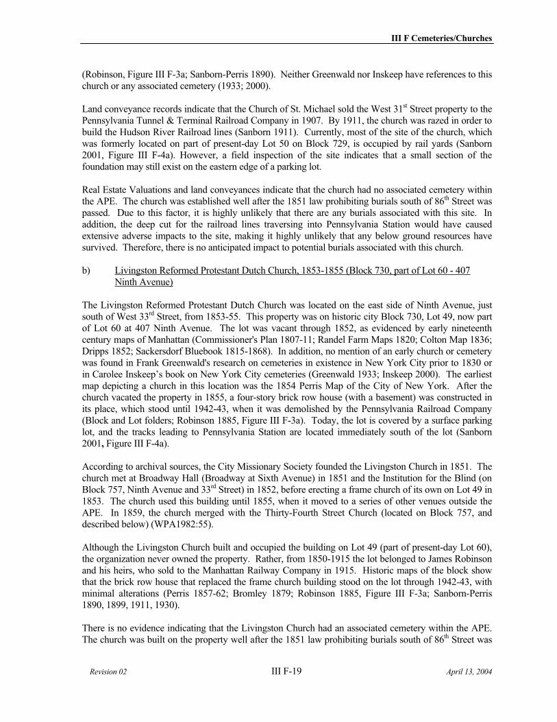
III F Cemeteries/Churches
Revision 02 III F-19 April 13, 2004
(Robinson, Figure III F-3a; Sanborn-Perris 1890). Neither Greenwald nor Inskeep have references to this church or any associated cemetery (1933; 2000).
Land conveyance records indicate that the Church of St. Michael sold the West 31st Street property to the Pennsylvania Tunnel & Terminal Railroad Company in 1907. By 1911, the church was razed in order to build the Hudson River Railroad lines (Sanborn 1911). Currently, most of the site of the church, which was formerly located on part of present-day Lot 50 on Block 729, is occupied by rail yards (Sanborn 2001, Figure III F-4a). However, a field inspection of the site indicates that a small section of the foundation may still exist on the eastern edge of a parking lot.
Real Estate Valuations and land conveyances indicate that the church had no associated cemetery within the APE. The church was established well after the 1851 law prohibiting burials south of 86th Street was passed. Due to this factor, it is highly unlikely that there are any burials associated with this site. In addition, the deep cut for the railroad lines traversing into Pennsylvania Station would have caused extensive adverse impacts to the site, making it highly unlikely that any below ground resources have survived. Therefore, there is no anticipated impact to potential burials associated with this church.
b) Livingston Reformed Protestant Dutch Church, 1853-1855 (Block 730, part of Lot 60 - 407 Ninth Avenue)
The Livingston Reformed Protestant Dutch Church was located on the east side of Ninth Avenue, just south of West 33rd Street, from 1853-55. This property was on historic city Block 730, Lot 49, now part of Lot 60 at 407 Ninth Avenue. The lot was vacant through 1852, as evidenced by early nineteenth century maps of Manhattan (Commissioner's Plan 1807-11; Randel Farm Maps 1820; Colton Map 1836; Dripps 1852; Sackersdorf Bluebook 1815-1868). In addition, no mention of an early church or cemetery was found in Frank Greenwald's research on cemeteries in existence in New York City prior to 1830 or in Carolee Inskeep’s book on New York City cemeteries (Greenwald 1933; Inskeep 2000). The earliest map depicting a church in this location was the 1854 Perris Map of the City of New York. After the church vacated the property in 1855, a four-story brick row house (with a basement) was constructed in its place, which stood until 1942-43, when it was demolished by the Pennsylvania Railroad Company (Block and Lot folders; Robinson 1885, Figure III F-3a). Today, the lot is covered by a surface parking lot, and the tracks leading to Pennsylvania Station are located immediately south of the lot (Sanborn 2001, Figure III F-4a).
According to archival sources, the City Missionary Society founded the Livingston Church in 1851. The church met at Broadway Hall (Broadway at Sixth Avenue) in 1851 and the Institution for the Blind (on Block 757, Ninth Avenue and 33rd Street) in 1852, before erecting a frame church of its own on Lot 49 in 1853. The church used this building until 1855, when it moved to a series of other venues outside the APE. In 1859, the church merged with the Thirty-Fourth Street Church (located on Block 757, and described below) (WPA1982:55).
Although the Livingston Church built and occupied the building on Lot 49 (part of present-day Lot 60), the organization never owned the property. Rather, from 1850-1915 the lot belonged to James Robinson and his heirs, who sold to the Manhattan Railway Company in 1915. Historic maps of the block show that the brick row house that replaced the frame church building stood on the lot through 1942-43, with minimal alterations (Perris 1857-62; Bromley 1879; Robinson 1885, Figure III F-3a; Sanborn-Perris 1890, 1899, 1911, 1930).
There is no evidence indicating that the Livingston Church had an associated cemetery within the APE. The church was built on the property well after the 1851 law prohibiting burials south of 86th Street was
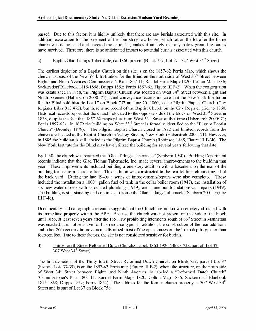
Archaeological Documentary Study, No. 7 Line Extension/Hudson Yard Rezoning
Revision 02 III F-20 April 13, 2004
passed. Due to this factor, it is highly unlikely that there are any burials associated with this site. In addition, excavation for the basement of the four-story row house, which sat on the lot after the frame church was demolished and covered the entire lot, makes it unlikely that any below ground resources have survived. Therefore, there is no anticipated impact to potential burials associated with this church.
c) Baptist/Glad Tidings Tabernacle, ca. 1860-present (Block 757, Lot 17 - 327 West 34th Street)
The earliest depiction of a Baptist Church on this site is on the 1857-62 Perris Map, which shows the church just east of the New York Institution for the Blind on the north side of West 33rd Street between Eighth and Ninth Avenues (Commissioner's Plan 1807-11; Randel Farm Maps 1820; Colton Map 1836; Sackersdorf Bluebook 1815-1868; Dripps 1852; Perris 1857-62, Figure III F-2). When the congregation was established in 1858, the Pilgrim Baptist Church was located on West 34th Street between Eight and Ninth Avenues (Haberstroh 2000: 71). Land conveyance records indicate that the New York Institution for the Blind sold historic Lot 17 on Block 757 on June 20, 1860, to the Pilgrim Baptist Church (City Register Liber 813:472), but there is no record of the Baptist Church on the City Register prior to 1860. Historical records report that the church relocated to the opposite side of the block on West 33rd Street in 1878, despite the fact that 1857-62 maps place it on West 33rd Street at that time (Haberstroh 2000: 71; Perris 1857-62). In 1879 the building on West 33rd Street is formally identified as the "Pilgrim Baptist Church" (Bromley 1879). The Pilgrim Baptist Church closed in 1882 and limited records from the church are located at the Baptist Church in Valley Stream, New York (Haberstroh 2000: 71). However, in 1885 the building is still labeled as the Pilgrim Baptist Church (Robinson 1885, Figure III F-3b). The New York Institute for the Blind may have utilized the building for several years following that date.
By 1930, the church was renamed the “Glad Tidings Tabernacle” (Sanborn 1930). Building Department records indicate that the Glad Tidings Tabernacle, Inc. made several improvements to the building that year. These improvements included building a one-story addition with a basement on the rear of the building for use as a church office. This addition was constructed to the rear lot line, eliminating all of the back yard. During the late 1940s a series of improvements/repairs were also completed. These included the installation a 1000+ gallon fuel oil tank in the cellar boiler room (1947), the installation of six new water closets with associated plumbing (1949), and numerous foundation/wall repairs (1949). The building is still standing and continues to house the Glad Tidings Tabernacle (Sanborn 2001, Figure III F-4c).
Documentary and cartographic research suggests that the Church has no known cemetery affiliated with its immediate property within the APE. Because the church was not present on this side of the block until 1858, at least seven years after the 1851 law prohibiting interments south of 86th Street in Manhattan was enacted, it is not sensitive for this resource type. In addition, the construction of the rear additions and other 20th century improvements disturbed most of the open spaces on the lot to depths greater than fourteen feet. Due to these factors, the site is not considered sensitive for burials.
d) Thirty-fourth Street Reformed Dutch Church/Chapel, 1860-1920 (Block 758, part of Lot 37, 307 West 34th Street)
The first depiction of the Thirty-fourth Street Reformed Dutch Church, on Block 758, part of Lot 37 (historic Lots 33-35), is on the 1857-62 Perris map (Figure III F-2), where the structure, on the north side of West 34th Street between Eighth and Ninth Avenues, is labeled a “Reformed Dutch Church” (Commissioner's Plan 1807-11; Randel Farm Maps 1820; Colton Map 1836; Sackersdorf Bluebook 1815-1868; Dripps 1852; Perris 1854). The address for the former church property is 307 West 34th
Street and is part of Lot 37 on Block 758.
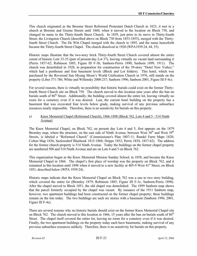
III F Cemeteries/Churches
Revision 02 III F-21 April 13, 2004
This church originated as the Broome Street Reformed Protestant Dutch Church in 1823; it met in a church at Broome and Greene Streets until 1860, when it moved to the location on Block 758, and changed its name to the Thirty-fourth Street Church. In 1859, just prior to its move to Thirty-fourth Street, the Livingston Church (described above on Block 730 from 1853-1855), merged with the Thirty-fourth Street Church. The De Witt Chapel merged with the church in 1895, and the name henceforth became the Thirty-fourth Street Chapel. The church dissolved in 1920 (WPA1939:24, 44, 55).
Historic maps illustrate that the two-story brick Thirty-fourth Street Church covered almost the entire extent of historic Lots 33-35 (part of present-day Lot 37), leaving virtually no vacant land surrounding it (Perris 1857-62; Robinson 1885, Figure III F-3b; Sanborn-Perris 1890; Sanborn 1899, 1911). The church was demolished in 1928, in preparation for construction of the 39-story “Hotel New Yorker,” which had a penthouse and four basement levels (Block and Lot folders). This hotel, which was purchased by the Reverend Sun Myung Moon’s World Unification Church in 1976, still stands on the property (Liber 371:786; White and Willensky 2000:237; Sanborn 1996; Sanborn 2001, Figure III F-4c).
For several reasons, there is virtually no possibility that historic burials could exist on the former Thirty-fourth Street Church site on Block 758. The church moved to this location nine years after the ban on burials south of 86th Street. Additionally, the building covered almost the entire lot, leaving virtually no room for a cemetery even if it was desired. Last, the current hotel building on the property has a basement that was excavated four levels below grade, making survival of any previous subsurface resources nearly impossible. Therefore, there is no sensitivity for burials on this property.
e) Knox Memorial Chapel (Reformed Church), 1866-1898 (Block 762, Lots 4 and 5 - 514 Ninth Avenue)
The Knox Memorial Chapel, on Block 762, on present day Lots 4 and 5, first appears on the 1879 Bromley map, where the structure, on the east side of Ninth Avenue, between West 38th and West 39th
Streets, is labeled a “Reformed Church” (Commissioner's Plan 1807-11; Randel Farm Maps 1820; Colton Map 1836; Sackersdorf Bluebook 1815-1868; Dripps 1852; Perris 1854, 1857-62). The address for the former church property is 514 Ninth Avenue. Today the buildings on the former chapel property are numbered 508 and 510 Ninth Avenue and are on Lots 4 and 5 on Block 762.
This organization began as the Knox Memorial Mission Sunday School, in 1858, and became the Knox Memorial Chapel in 1866. The chapel’s first place of worship was the property on Block 762, and it remained in this location until 1898 when it moved to a new facility at 405-9 West 41st Street, on Block 1051, described below (WPA 1939:24).
Historic maps indicate that the Knox Memorial Chapel on Block 762 was a one to two story building, which covered the entire lot (Bromley 1879; Robinson 1885, Figure III F-3c; Sanborn-Perris 1890). After the chapel moved to Block 1051, the old chapel was demolished. The 1899 Sanborn map shows that the parcel formerly occupied by the chapel was vacant. By issuance of the 1911 Sanborn map, however, two apartment buildings had been constructed on the former chapel property; these buildings remain on the lots today. The two buildings are each six stories with a basement (Sanborn 1996, 2001, Figure III F-4e).
There are several reasons why no historic burials should exist on the former Knox Memorial Chapel site on Block 762. The church moved to this location in 1866, 15 years after the ban on burials south of 86th
Street. The chapel itself covered the entire lot, leaving no room for a cemetery even if it was desired. Finally, the two apartment buildings on the property today each have basements, making survival of any previous subsurface resources unlikely. Therefore, there is no sensitivity for burials on this property.
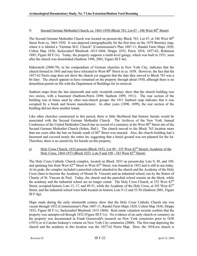
Archaeological Documentary Study, No. 7 Line Extension/Hudson Yard Rezoning
Revision 02 III F-22 April 13, 2004
f) Second German Methodist Church, ca. 1863-1930 (Block 763, Lot 67 - 346 West 40th Street)
The Second German Methodist Church was located on present-day Block 763, Lot 67, at 346 West 40th
Street from ca. 1863-1930. It was depicted cartographically for the first time on the 1879 Bromley map, where it is labeled a “German M.E. Church” (Commissioner's Plan 1807-11; Randel Farm Maps 1820; Colton Map 1836; Sackersdorf Bluebook 1815-1868; Dripps 1852; Perris 1854, 1857-62; Robinson 1885, Figure III F-3c). Today, the property supports a multi-level garage, which was built in 1931, soon after the church was demolished (Sanborn 1996, 2001, Figure III F-4e).
Haberstroh (2000:70), in his compendium of German churches in New York City, indicates that the church formed in 1843 and may have relocated to West 40th Street in ca. 1858. However, the fact that the 1857-62 Perris map does not show the church yet suggests that the date they moved to Block 763 was a bit later. The church appears to have remained on the property through about 1930, although there is no demolition permit on file with the Department of Buildings for its removal.
Sanborn maps from the late nineteenth and early twentieth century show that the church building was two stories, with a basement (Sanborn-Perris 1890; Sanborn 1899, 1911). The rear section of the building was at times used by other non-church groups: the 1911 Sanborn map indicates that it was occupied by a brush and broom manufacturer. In other years (1890, 1899), the rear section of the building did not show another tenant.
Like other churches constructed in this period, there is little likelihood that historic burials would be associated with the Second German Methodist Church. The Archives of the New York Annual Conference of the United Methodist Church has no record of a cemetery at the West 40th Street site of the Second German Methodist Church (Sohm, Ibid.). The church moved to the Block 763 location more than ten years after the ban on burials south of 86th Street was enacted. Also, the church building had a basement and covered nearly the entire lot, suggesting that a burial ground was not planned for the lot. Therefore, there is no sensitivity for burials on this property.
g) Holy Cross Church, 1852-present (Block 1033, Lot 49 - 335 West 42nd Street); Academy of the Holy Cross, 1864-1973 (Block 1033, Lots 9 and 109 - 343 West 42nd Street)
The Holy Cross Catholic Church complex, located on Block 1033 on present-day Lots 9, 49, and 109, and spanning lots from West 42nd Street to West 43rd Street, was founded in 1852 and is still in use today. At its peak, the complex included a parochial school attached to the church and the Academy of the Holy Cross (later to become the Academy of Mount St. Vincent) and an industrial school, run by the Sisters of Charity of St. Vincent de Paul. Today, the church and the parochial school remain on the block, while the academy and the industrial school are no longer extant. The Holy Cross Church, at 335 West 42nd
Street, occupied historic Lots 13, 17, and 49-51, while the Academy of the Holy Cross, at 343 West 42nd
Street, and the industrial school were both located on historic Lots 9-12 and 53-56 (Sanborn 2001, Figure III F-4g).
Maps made during the early nineteenth century show that the Holy Cross Catholic Church site was vacant through 1852 (Commissioner's Plan 1807-11; Randel Farm Maps 1820; Colton Map 1836; Dripps 1852, Figure III F-1c; Sackersdorf Bluebook 1815-1868). Real estate valuation records confirm that the property was unimproved through 1852 (Figure III F-1c). No evidence of an early church or cemetery on the property was documented in Frank Greenwald's research on New York cemeteries prior to 1830 (1933) or in Carolee Inskeep’s volume on New York City cemeteries (2000). The first map depicting the church and the academy in this location was the 1857-62 Perris Map. Here, the 1854-era church is
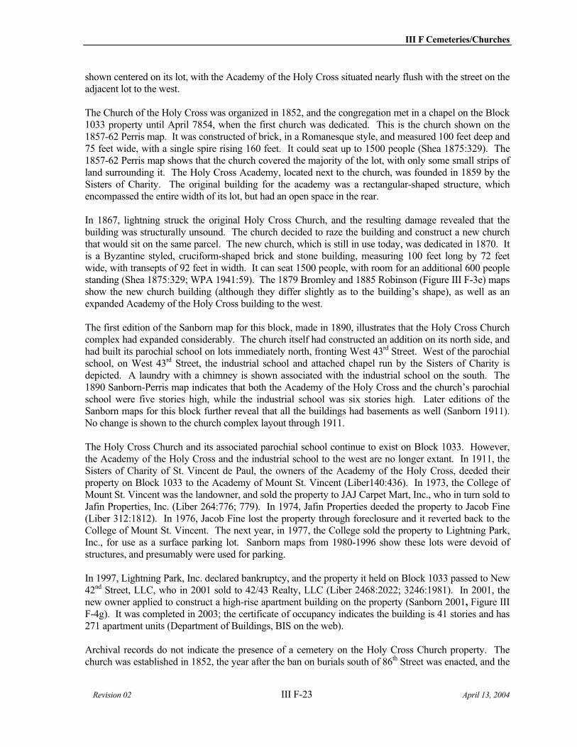
III F Cemeteries/Churches
Revision 02 III F-23 April 13, 2004
shown centered on its lot, with the Academy of the Holy Cross situated nearly flush with the street on the adjacent lot to the west.
The Church of the Holy Cross was organized in 1852, and the congregation met in a chapel on the Block 1033 property until April 7854, when the first church was dedicated. This is the church shown on the 1857-62 Perris map. It was constructed of brick, in a Romanesque style, and measured 100 feet deep and 75 feet wide, with a single spire rising 160 feet. It could seat up to 1500 people (Shea 1875:329). The 1857-62 Perris map shows that the church covered the majority of the lot, with only some small strips of land surrounding it. The Holy Cross Academy, located next to the church, was founded in 1859 by the Sisters of Charity. The original building for the academy was a rectangular-shaped structure, which encompassed the entire width of its lot, but had an open space in the rear.
In 1867, lightning struck the original Holy Cross Church, and the resulting damage revealed that the building was structurally unsound. The church decided to raze the building and construct a new church that would sit on the same parcel. The new church, which is still in use today, was dedicated in 1870. It is a Byzantine styled, cruciform-shaped brick and stone building, measuring 100 feet long by 72 feet wide, with transepts of 92 feet in width. It can seat 1500 people, with room for an additional 600 people standing (Shea 1875:329; WPA 1941:59). The 1879 Bromley and 1885 Robinson (Figure III F-3e) maps show the new church building (although they differ slightly as to the building’s shape), as well as an expanded Academy of the Holy Cross building to the west.
The first edition of the Sanborn map for this block, made in 1890, illustrates that the Holy Cross Church complex had expanded considerably. The church itself had constructed an addition on its north side, and had built its parochial school on lots immediately north, fronting West 43rd Street. West of the parochial school, on West 43rd Street, the industrial school and attached chapel run by the Sisters of Charity is depicted. A laundry with a chimney is shown associated with the industrial school on the south. The 1890 Sanborn-Perris map indicates that both the Academy of the Holy Cross and the church’s parochial school were five stories high, while the industrial school was six stories high. Later editions of the Sanborn maps for this block further reveal that all the buildings had basements as well (Sanborn 1911). No change is shown to the church complex layout through 1911.
The Holy Cross Church and its associated parochial school continue to exist on Block 1033. However, the Academy of the Holy Cross and the industrial school to the west are no longer extant. In 1911, the Sisters of Charity of St. Vincent de Paul, the owners of the Academy of the Holy Cross, deeded their property on Block 1033 to the Academy of Mount St. Vincent (Liber140:436). In 1973, the College of Mount St. Vincent was the landowner, and sold the property to JAJ Carpet Mart, Inc., who in turn sold to Jafin Properties, Inc. (Liber 264:776; 779). In 1974, Jafin Properties deeded the property to Jacob Fine (Liber 312:1812). In 1976, Jacob Fine lost the property through foreclosure and it reverted back to the College of Mount St. Vincent. The next year, in 1977, the College sold the property to Lightning Park, Inc., for use as a surface parking lot. Sanborn maps from 1980-1996 show these lots were devoid of structures, and presumably were used for parking.
In 1997, Lightning Park, Inc. declared bankruptcy, and the property it held on Block 1033 passed to New 42nd Street, LLC, who in 2001 sold to 42/43 Realty, LLC (Liber 2468:2022; 3246:1981). In 2001, the new owner applied to construct a high-rise apartment building on the property (Sanborn 2001, Figure III F-4g). It was completed in 2003; the certificate of occupancy indicates the building is 41 stories and has 271 apartment units (Department of Buildings, BIS on the web).
Archival records do not indicate the presence of a cemetery on the Holy Cross Church property. The church was established in 1852, the year after the ban on burials south of 86th Street was enacted, and the
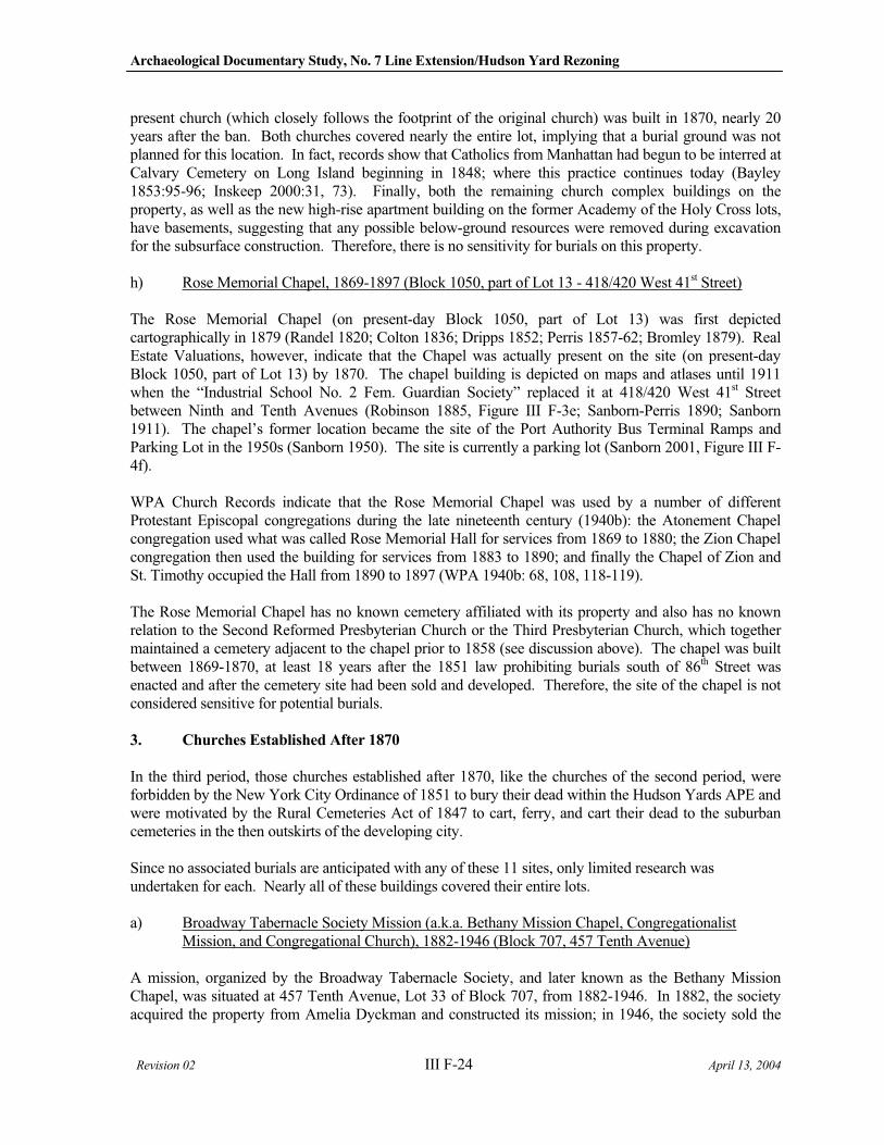
Archaeological Documentary Study, No. 7 Line Extension/Hudson Yard Rezoning
Revision 02 III F-24 April 13, 2004
present church (which closely follows the footprint of the original church) was built in 1870, nearly 20 years after the ban. Both churches covered nearly the entire lot, implying that a burial ground was not planned for this location. In fact, records show that Catholics from Manhattan had begun to be interred at Calvary Cemetery on Long Island beginning in 1848; where this practice continues today (Bayley 1853:95-96; Inskeep 2000:31, 73). Finally, both the remaining church complex buildings on the property, as well as the new high-rise apartment building on the former Academy of the Holy Cross lots, have basements, suggesting that any possible below-ground resources were removed during excavation for the subsurface construction. Therefore, there is no sensitivity for burials on this property.
h) Rose Memorial Chapel, 1869-1897 (Block 1050, part of Lot 13 - 418/420 West 41st Street)
The Rose Memorial Chapel (on present-day Block 1050, part of Lot 13) was first depicted cartographically in 1879 (Randel 1820; Colton 1836; Dripps 1852; Perris 1857-62; Bromley 1879). Real Estate Valuations, however, indicate that the Chapel was actually present on the site (on present-day Block 1050, part of Lot 13) by 1870. The chapel building is depicted on maps and atlases until 1911 when the “Industrial School No. 2 Fem. Guardian Society” replaced it at 418/420 West 41st Street between Ninth and Tenth Avenues (Robinson 1885, Figure III F-3e; Sanborn-Perris 1890; Sanborn 1911). The chapel’s former location became the site of the Port Authority Bus Terminal Ramps and Parking Lot in the 1950s (Sanborn 1950). The site is currently a parking lot (Sanborn 2001, Figure III F-4f).
WPA Church Records indicate that the Rose Memorial Chapel was used by a number of different Protestant Episcopal congregations during the late nineteenth century (1940b): the Atonement Chapel congregation used what was called Rose Memorial Hall for services from 1869 to 1880; the Zion Chapel congregation then used the building for services from 1883 to 1890; and finally the Chapel of Zion and St. Timothy occupied the Hall from 1890 to 1897 (WPA 1940b: 68, 108, 118-119).
The Rose Memorial Chapel has no known cemetery affiliated with its property and also has no known relation to the Second Reformed Presbyterian Church or the Third Presbyterian Church, which together maintained a cemetery adjacent to the chapel prior to 1858 (see discussion above). The chapel was built between 1869-1870, at least 18 years after the 1851 law prohibiting burials south of 86th Street was enacted and after the cemetery site had been sold and developed. Therefore, the site of the chapel is not considered sensitive for potential burials.
3. Churches Established After 1870
In the third period, those churches established after 1870, like the churches of the second period, were forbidden by the New York City Ordinance of 1851 to bury their dead within the Hudson Yards APE and were motivated by the Rural Cemeteries Act of 1847 to cart, ferry, and cart their dead to the suburban cemeteries in the then outskirts of the developing city.
Since no associated burials are anticipated with any of these 11 sites, only limited research was undertaken for each. Nearly all of these buildings covered their entire lots.
a) Broadway Tabernacle Society Mission (a.k.a. Bethany Mission Chapel, Congregationalist Mission, and Congregational Church), 1882-1946 (Block 707, 457 Tenth Avenue)
A mission, organized by the Broadway Tabernacle Society, and later known as the Bethany Mission Chapel, was situated at 457 Tenth Avenue, Lot 33 of Block 707, from 1882-1946. In 1882, the society acquired the property from Amelia Dyckman and constructed its mission; in 1946, the society sold the
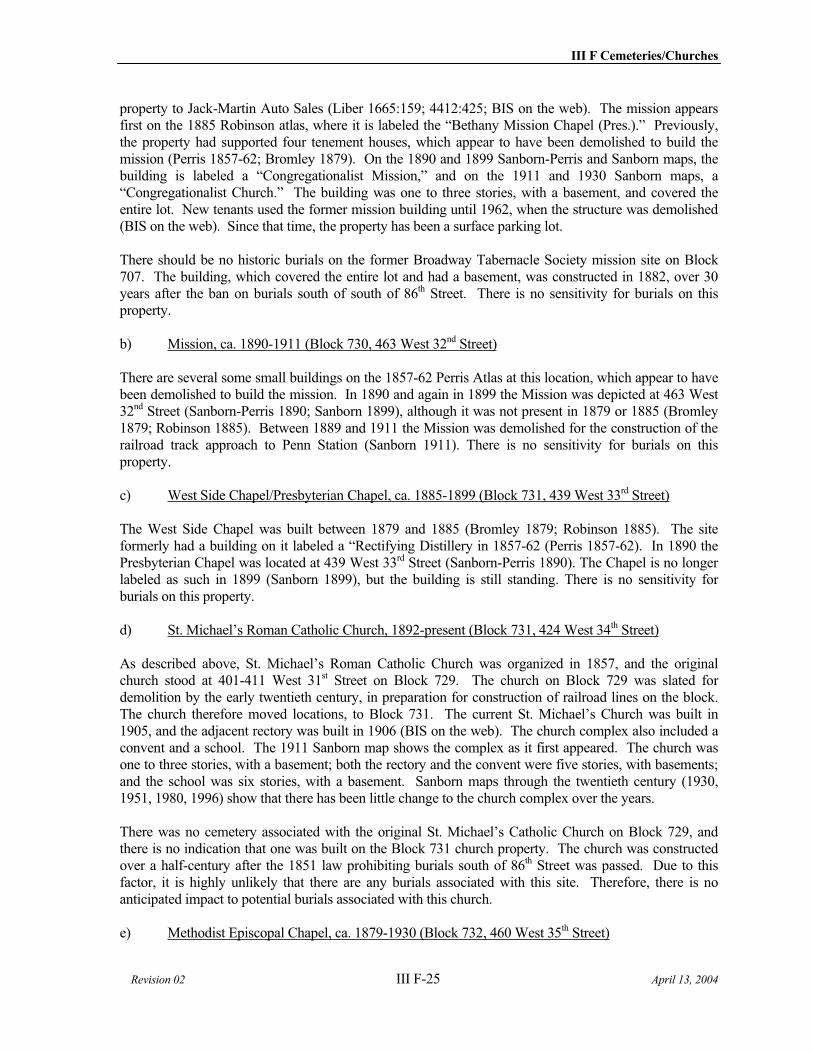
III F Cemeteries/Churches
Revision 02 III F-25 April 13, 2004
property to Jack-Martin Auto Sales (Liber 1665:159; 4412:425; BIS on the web). The mission appears first on the 1885 Robinson atlas, where it is labeled the “Bethany Mission Chapel (Pres.).” Previously, the property had supported four tenement houses, which appear to have been demolished to build the mission (Perris 1857-62; Bromley 1879). On the 1890 and 1899 Sanborn-Perris and Sanborn maps, the building is labeled a “Congregationalist Mission,” and on the 1911 and 1930 Sanborn maps, a “Congregationalist Church.” The building was one to three stories, with a basement, and covered the entire lot. New tenants used the former mission building until 1962, when the structure was demolished (BIS on the web). Since that time, the property has been a surface parking lot.
There should be no historic burials on the former Broadway Tabernacle Society mission site on Block 707. The building, which covered the entire lot and had a basement, was constructed in 1882, over 30 years after the ban on burials south of south of 86th Street. There is no sensitivity for burials on this property.
b) Mission, ca. 1890-1911 (Block 730, 463 West 32nd Street)
There are several some small buildings on the 1857-62 Perris Atlas at this location, which appear to have been demolished to build the mission. In 1890 and again in 1899 the Mission was depicted at 463 West 32nd Street (Sanborn-Perris 1890; Sanborn 1899), although it was not present in 1879 or 1885 (Bromley 1879; Robinson 1885). Between 1889 and 1911 the Mission was demolished for the construction of the railroad track approach to Penn Station (Sanborn 1911). There is no sensitivity for burials on this property.
c) West Side Chapel/Presbyterian Chapel, ca. 1885-1899 (Block 731, 439 West 33rd Street)
The West Side Chapel was built between 1879 and 1885 (Bromley 1879; Robinson 1885). The site formerly had a building on it labeled a “Rectifying Distillery in 1857-62 (Perris 1857-62). In 1890 the Presbyterian Chapel was located at 439 West 33rd Street (Sanborn-Perris 1890). The Chapel is no longer labeled as such in 1899 (Sanborn 1899), but the building is still standing. There is no sensitivity for burials on this property.
d) St. Michael’s Roman Catholic Church, 1892-present (Block 731, 424 West 34th Street)
As described above, St. Michael’s Roman Catholic Church was organized in 1857, and the original church stood at 401-411 West 31st Street on Block 729. The church on Block 729 was slated for demolition by the early twentieth century, in preparation for construction of railroad lines on the block. The church therefore moved locations, to Block 731. The current St. Michael’s Church was built in 1905, and the adjacent rectory was built in 1906 (BIS on the web). The church complex also included a convent and a school. The 1911 Sanborn map shows the complex as it first appeared. The church was one to three stories, with a basement; both the rectory and the convent were five stories, with basements; and the school was six stories, with a basement. Sanborn maps through the twentieth century (1930, 1951, 1980, 1996) show that there has been little change to the church complex over the years.
There was no cemetery associated with the original St. Michael’s Catholic Church on Block 729, and there is no indication that one was built on the Block 731 church property. The church was constructed over a half-century after the 1851 law prohibiting burials south of 86th Street was passed. Due to this factor, it is highly unlikely that there are any burials associated with this site. Therefore, there is no anticipated impact to potential burials associated with this church.
e) Methodist Episcopal Chapel, ca. 1879-1930 (Block 732, 460 West 35th Street)
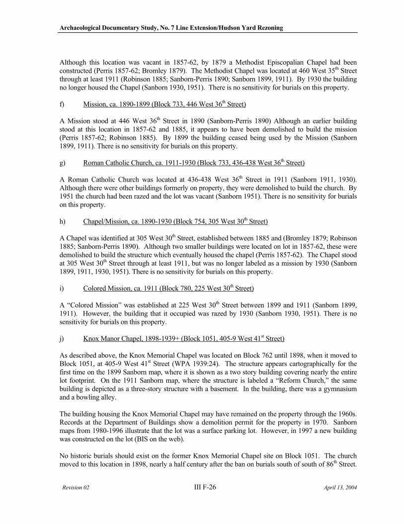
Archaeological Documentary Study, No. 7 Line Extension/Hudson Yard Rezoning
Revision 02 III F-26 April 13, 2004
Although this location was vacant in 1857-62, by 1879 a Methodist Episcopalian Chapel had been constructed (Perris 1857-62; Bromley 1879). The Methodist Chapel was located at 460 West 35th Street through at least 1911 (Robinson 1885; Sanborn-Perris 1890; Sanborn 1899, 1911). By 1930 the building no longer housed the Chapel (Sanborn 1930, 1951). There is no sensitivity for burials on this property.
f) Mission, ca. 1890-1899 (Block 733, 446 West 36th Street)
A Mission stood at 446 West 36th Street in 1890 (Sanborn-Perris 1890) Although an earlier building stood at this location in 1857-62 and 1885, it appears to have been demolished to build the mission (Perris 1857-62; Robinson 1885). By 1899 the building ceased being used by the Mission (Sanborn 1899, 1911). There is no sensitivity for burials on this property.
g) Roman Catholic Church, ca. 1911-1930 (Block 733, 436-438 West 36th Street)
A Roman Catholic Church was located at 436-438 West 36th Street in 1911 (Sanborn 1911, 1930). Although there were other buildings formerly on property, they were demolished to build the church. By 1951 the church had been razed and the lot was vacant (Sanborn 1951). There is no sensitivity for burials on this property.
h) Chapel/Mission, ca. 1890-1930 (Block 754, 305 West 30th Street)
A Chapel was identified at 305 West 30th Street, established between 1885 and (Bromley 1879; Robinson 1885; Sanborn-Perris 1890). Although two smaller buildings were located on lot in 1857-62, these were demolished to build the structure which eventually housed the chapel (Perris 1857-62). The Chapel stood at 305 West 30th Street through at least 1911, but was no longer labeled as a mission by 1930 (Sanborn 1899, 1911, 1930, 1951). There is no sensitivity for burials on this property.
i) Colored Mission, ca. 1911 (Block 780, 225 West 30th Street)
A “Colored Mission” was established at 225 West 30th Street between 1899 and 1911 (Sanborn 1899, 1911). However, the building that it occupied was razed by 1930 (Sanborn 1930, 1951). There is no sensitivity for burials on this property.
j) Knox Manor Chapel, 1898-1939+ (Block 1051, 405-9 West 41st Street)
As described above, the Knox Memorial Chapel was located on Block 762 until 1898, when it moved to Block 1051, at 405-9 West 41st Street (WPA 1939:24). The structure appears cartographically for the first time on the 1899 Sanborn map, where it is shown as a two story building covering nearly the entire lot footprint. On the 1911 Sanborn map, where the structure is labeled a “Reform Church,” the same building is depicted as a three-story structure with a basement. In the building, there was a gymnasium and a bowling alley.
The building housing the Knox Memorial Chapel may have remained on the property through the 1960s. Records at the Department of Buildings show a demolition permit for the property in 1970. Sanborn maps from 1980-1996 illustrate that the lot was a surface parking lot. However, in 1997 a new building was constructed on the lot (BIS on the web).
No historic burials should exist on the former Knox Memorial Chapel site on Block 1051. The church moved to this location in 1898, nearly a half century after the ban on burials south of south of 86th Street.
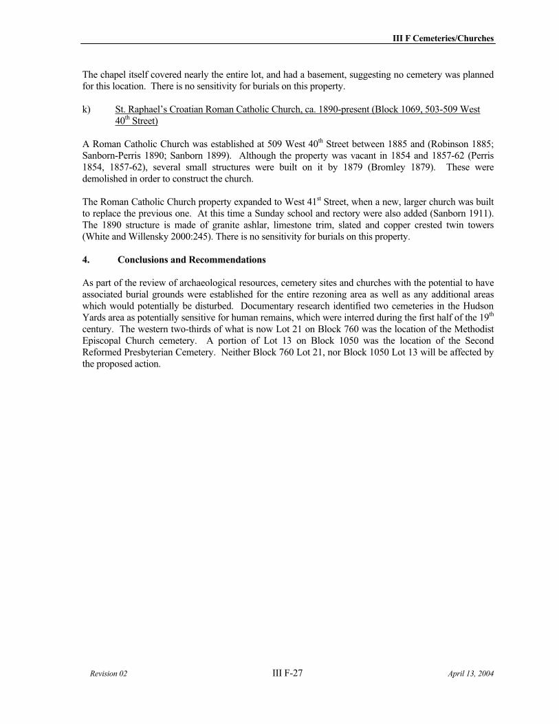
III F Cemeteries/Churches
Revision 02 III F-27 April 13, 2004
The chapel itself covered nearly the entire lot, and had a basement, suggesting no cemetery was planned for this location. There is no sensitivity for burials on this property.
k) St. Raphael’s Croatian Roman Catholic Church, ca. 1890-present (Block 1069, 503-509 West 40th Street)
A Roman Catholic Church was established at 509 West 40th Street between 1885 and (Robinson 1885; Sanborn-Perris 1890; Sanborn 1899). Although the property was vacant in 1854 and 1857-62 (Perris 1854, 1857-62), several small structures were built on it by 1879 (Bromley 1879). These were demolished in order to construct the church.
The Roman Catholic Church property expanded to West 41st Street, when a new, larger church was built to replace the previous one. At this time a Sunday school and rectory were also added (Sanborn 1911). The 1890 structure is made of granite ashlar, limestone trim, slated and copper crested twin towers (White and Willensky 2000:245). There is no sensitivity for burials on this property.
4. Conclusions and Recommendations
As part of the review of archaeological resources, cemetery sites and churches with the potential to have associated burial grounds were established for the entire rezoning area as well as any additional areas which would potentially be disturbed. Documentary research identified two cemeteries in the Hudson Yards area as potentially sensitive for human remains, which were interred during the first half of the 19th
century. The western two-thirds of what is now Lot 21 on Block 760 was the location of the Methodist Episcopal Church cemetery. A portion of Lot 13 on Block 1050 was the location of the Second Reformed Presbyterian Cemetery. Neither Block 760 Lot 21, nor Block 1050 Lot 13 will be affected by the proposed action.

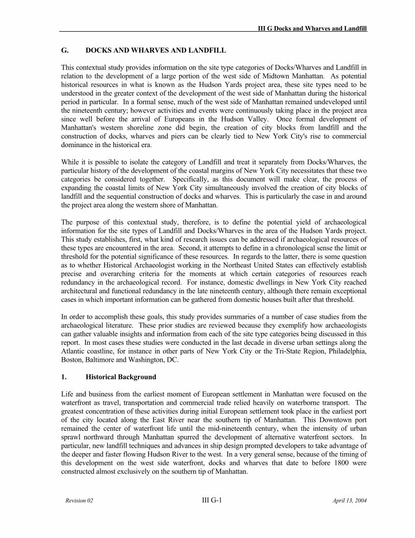
III G Docks and Wharves and Landfill
Revision 02 III G-1 April 13, 2004
G. DOCKS AND WHARVES AND LANDFILL
This contextual study provides information on the site type categories of Docks/Wharves and Landfill in relation to the development of a large portion of the west side of Midtown Manhattan. As potential historical resources in what is known as the Hudson Yards project area, these site types need to be understood in the greater context of the development of the west side of Manhattan during the historical period in particular. In a formal sense, much of the west side of Manhattan remained undeveloped until the nineteenth century; however activities and events were continuously taking place in the project area since well before the arrival of Europeans in the Hudson Valley. Once formal development of Manhattan's western shoreline zone did begin, the creation of city blocks from landfill and the construction of docks, wharves and piers can be clearly tied to New York City's rise to commercial dominance in the historical era.
While it is possible to isolate the category of Landfill and treat it separately from Docks/Wharves, the particular history of the development of the coastal margins of New York City necessitates that these two categories be considered together. Specifically, as this document will make clear, the process of expanding the coastal limits of New York City simultaneously involved the creation of city blocks of landfill and the sequential construction of docks and wharves. This is particularly the case in and around the project area along the western shore of Manhattan.
The purpose of this contextual study, therefore, is to define the potential yield of archaeological information for the site types of Landfill and Docks/Wharves in the area of the Hudson Yards project. This study establishes, first, what kind of research issues can be addressed if archaeological resources of these types are encountered in the area. Second, it attempts to define in a chronological sense the limit or threshold for the potential significance of these resources. In regards to the latter, there is some question as to whether Historical Archaeologist working in the Northeast United States can effectively establish precise and overarching criteria for the moments at which certain categories of resources reach redundancy in the archaeological record. For instance, domestic dwellings in New York City reached architectural and functional redundancy in the late nineteenth century, although there remain exceptional cases in which important information can be gathered from domestic houses built after that threshold.
In order to accomplish these goals, this study provides summaries of a number of case studies from the archaeological literature. These prior studies are reviewed because they exemplify how archaeologists can gather valuable insights and information from each of the site type categories being discussed in this report. In most cases these studies were conducted in the last decade in diverse urban settings along the Atlantic coastline, for instance in other parts of New York City or the Tri-State Region, Philadelphia, Boston, Baltimore and Washington, DC.
1. Historical Background
Life and business from the earliest moment of European settlement in Manhattan were focused on the waterfront as travel, transportation and commercial trade relied heavily on waterborne transport. The greatest concentration of these activities during initial European settlement took place in the earliest port of the city located along the East River near the southern tip of Manhattan. This Downtown port remained the center of waterfront life until the mid-nineteenth century, when the intensity of urban sprawl northward through Manhattan spurred the development of alternative waterfront sectors. In particular, new landfill techniques and advances in ship design prompted developers to take advantage of the deeper and faster flowing Hudson River to the west. In a very general sense, because of the timing of this development on the west side waterfront, docks and wharves that date to before 1800 were constructed almost exclusively on the southern tip of Manhattan.
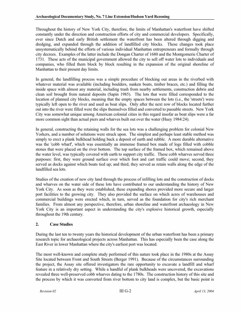
Archaeological Documentary Study, No. 7 Line Extension/Hudson Yard Rezoning
Revision 02 III G-2 April 13, 2004
Throughout the history of New York City, therefore, the limits of Manhattan's waterfront have shifted constantly under the direction and construction efforts of city and commercial developers. Specifically, ever since Dutch and early British settlement the waterfront has been altered through digging and dredging, and expanded through the addition of landfilled city blocks. These changes took place unsystematically behind the efforts of various individual Manhattan entrepreneurs and formally through city decrees. Examples of the latter include the Dongan Charter of 1680 and the Montgomerie Charter of 1731. These acts of the municipal government allowed the city to sell off water lots to individuals and companies, who filled them block by block resulting in the expansion of the original shoreline of Manhattan to their present day limits.
In general, the landfilling process was a simple procedure of blocking out areas in the riverbed with whatever material was available (including boulders, sunken boats, timber braces, etc.) and filling the inside space with almost any material, including trash from nearby settlements, construction debris and clean soil brought from natural deposits (Sapin 1985). The lots that were filled corresponded to the location of planned city blocks, meaning that the empty spaces between the lots (i.e., the 'streets') were typically left open to the river and used as boat slips. Only after the next row of blocks located further out into the river were filled were the slips themselves filled and converted to passable streets. New York City was somewhat unique among American colonial cities in this regard insofar as boat slips were a far more common sight than actual piers and wharves built out over the water (Huey 1984:24).
In general, constructing the retaining walls for the sea lots was a challenging problem for colonial New Yorkers, and a number of solutions were struck upon. The simplest and perhaps least stable method was simply to erect a plank bulkhead holding back a deposit of earth and rubble. A more durable alternative was the 'cobb wharf', which was essentially an immense framed box made of logs filled with cobble stones that were placed on the river bottom. The top surface of the framed box, which remained above the water level, was typically covered with earth to support city traffic. These cobb wharves served three purposes: first, they were ground surface over which foot and cart traffic could move; second, they served as docks against which boats tied up; and third, they served as retain walls along the edge of the landfilled sea lots.
Studies of the creation of new city land through the process of infilling lots and the construction of docks and wharves on the water side of these lots have contributed to our understanding the history of New York City. As soon as they were established, these expanding shores provided more secure and larger port facilities to the growing city. They also provided the surface on which acres of warehouses and commercial buildings were erected which, in turn, served as the foundation for city's rich merchant families. From almost any perspective, therefore, urban shoreline and waterfront archaeology in New York City is an important aspect in understanding the city's explosive historical growth, especially throughout the 19th century.
2. Case Studies
During the last ten to twenty years the historical development of the urban waterfront has been a primary research topic for archaeological projects across Manhattan. This has especially been the case along the East River in lower Manhattan where the city's earliest port was located.
The most well-known and complete study performed of this nature took place in the 1980s at the Assay Site located between Front and South Streets (Berger 1991). Because of the circumstances surrounding the project, the Assay site offered investigators the rare opportunity to excavate a landfill and wharf feature in a relatively dry setting. While a handful of plank bulkheads were uncovered, the excavations revealed three well-preserved cobb wharves dating to the 1780s. The construction history of this site and the process by which it was converted from river bottom to city land is complex, but the basic point is
III G Docks and Wharves and Landfill
Revision 02 III G-3 April 13, 2004
that project archaeologists at the Assay site were able to learn a good deal about the engineering of these early wharves and landfill projects. For instance, very large logs (ca. 1' in diameter) were used in the construction of the frame of the cobb wharf, the framed boxes that held the cobble and rubble ballast had well-built, split timber floors, and the various wooden elements were attached to each other through carefully prepared wood joinery, and not typically through the use of hard metal fasteners.
A comparable but earlier wharf from ca. 1740 known as Cruger's Wharf was discovered to have similar solid log construction with notched joints (Huey 1984; Berger 1989:V-10). The Telco Block, which was studied in 1981 (Rockman et. al. 1983), also contained some basic plank bulkheads as well as two cobb wharves dating to the mid-eighteenth century. To date, the only west side excavation that has revealed the presence of wharves is Site 1 of the Washington Street Urban Renewal Area (Berger 1989; Geismar 1987c, Kirkorian and Tidlow 1984), which is well south of the Hudson Yard project area. At this site archaeologists discovered late eighteenth and early nineteenth century cobb wharf constructions.
These studies of wharves constructed before the 19th century help illuminate which techniques were used to remake the waterfront of New York City. This is especially important because wharf building during that period was more a vernacular tradition that it was standardized, recorded practice. Recent case studies into the nature of the landfill itself that was placed behind some of these wharves are also illuminating, and are considered below.
Perhaps the most significant study conducted on the nature and meaning of New York City's landfills was conducted in the 1980s by Joan Geismar. In a series of reports and articles Geismar tackles the stubborn problem of the origins of and response to the yellow-fever epidemics that swept through the city during the summers of the late 1790s and early 1800s (Geismar 1983, 1987a, 1987b, 1987c). Geismar's first research question was to see whether the garbage used in the landfilling projects could have been a source of the mosquitoes that were carrying the yellow fever. Second, she was interested in determining whether New Yorkers combated the epidemic by changing their landfilling techniques in response to a city government regulation established in the late 1790s that required sea lots to be filled with clean, sterile sand. By comparing the contents of two landfills that were deposited at different times Geismar was able to make some interesting discoveries. The first landfill site she considered was located at 175 Water Street on the East River and was created in the mid 1700s. The second landfill site was located on the west side along the Hudson River (near Washington Street) and was created after the city regulators required that sand be used for landfills. Geismar found that, in fact, New Yorkers added less garbage to the later fill, although it wasn't entirely void of illegally dumped trash.
The archaeology of landfill also provides insight into the techniques that New Yorkers used to stabilize underground soils and landfills in order to builder heavier and taller structures throughout Manhattan. In the excavations of landfill at Seven Hanover Square archaeologists discovered that the upright walls of early structures were deliberately left in place under the landfill to support subsequent structures that were erected over the top of the landfill (Cantwell and Wall 2001:236-237). Builders at the Assay site struck on a different solution to the problem of erecting structures on shifting landfill. In this case, structures in the late 1700s were built on pilings that were driven down through the landfill (Berger 1989).
The last important aspect of landfill archaeology involves the discovery and study of well-preserved objects and buried ground surfaces under large deposits of artificial fill. The best example of this comes from the work conducted in the early 1980s at 175 Water Street, where the hull of a ship from the 1700s was discovered deliberately sunk and buried beneath a sea block of landfill (Brouwer 1980, Hartgen 1992). Once upon a time the ship, which was given the modern name ‘The Ronson,’ was likely involved in the Atlantic Ocean triangle trade, but had exhausted its usefulness and was buried beneath Manhattan.
Archaeological Documentary Study, No. 7 Line Extension/Hudson Yard Rezoning
Revision 02 III G-4 April 13, 2004
The ship, which was eventually removed and conserved, has provided historians with valuable information about boat building in early American history (Riess and Smith 1985).
Landfill archaeology also provides archaeologists with the opportunity to study original buried ground surfaces that have been preserved under layers and layers of artificial fill. At Seven Hanover Square a concerted effort was made to excavate and study the original shoreline and beach of the eastern edge of Manhattan (Rothschild and Pickman 1990). A number of artifacts were discovered in the riverbed, including a spoon with curious markings that have been interpreted as artifacts used by enslaved Africans in New York in sacred medicinal rites (Cantwell and Wall 2001:240). While this and similar interpretations are tentative, they do represent the potential importance of waterfront archaeology in Manhattan.
3. Discussion
The archaeologists analyzing wharf data recovered from the Assay site compared the wharf’s construction methods against similar features built throughout the eastern United States (Berger 1989:V,8-14). For comparative purposes they reviewed waterfront sites that dated from the seventeenth through nineteenth centuries from cities that included Portsmouth (NH), Salem and Boston (MA), New London (CT) and Alexandria (VA). Berger's analysis concluded that most of the techniques used in wharf construction appear to have been fairly standardized over a two hundred year period, which means that most wharf characteristics, such as the type of fill and the treatment of timbers and fasteners, was more or less repeated up and down the eastern seaboard (Berger 1989:V,19). The only real exception to this standardization were the joinery techniques used in binding timbers, which appear to show variation relative to the date of construction. Berger suggests that this variation might be related to the size of the wharves and the lack of excavation information, rather than to real differences in construction techniques (Berger 1989:V,24).
With few exceptions, therefore, the geographic location of the wharf did not have a positive correlation with the type of construction technique employed (Berger 1989:V-24). Instead, site specific factors would have been important in determining wharf construction, for instance the conditions of the river bottom, the financial situations of the individuals financing wharf construction, and local water conditions, such as the current and tides. Other researchers have come to similar conclusions (Norman 1987:104-105, Henn et al. 1985:12).
The Assay site analysis, therefore, has lead archaeologists to recommend that wharves "should not be used to address non-site specific research issues, given the factors which determine the configuration of the structures" (Berger 1989:V,24). It is suggested that further research should perhaps be focused on documenting the joinery techniques employed in wharf construction since this particular feature may prove more sensitive to the craftsmanship of a structure than other variables. Joinery represents one of the major engineering components of a wharf, and typically varies with the original planned use of the wharf (Berger 1989:V-25).
The mid-nineteenth century introduction of the steam driven pile driver forever transformed waterfront construction when 'open piling piers' replaced cobb wharves in lower Manhattan (Henn et al. 1985:12). There is a certain possibility that continued landfill activity in that century buried and preserved some of the earliest open piling piers (Weber 1988:1), which means documenting the changeover to steam driven piles may be possible.
Earlier piers and wharves which may be located in the Hudson Yard project area should be assessed for potential importance with two issues in mind, that is, the type of joinery techniques employed and the
III G Docks and Wharves and Landfill
Revision 02 III G-5 April 13, 2004
effects of adopting steam driven piles. Previous archaeological studies on the wharves and piers of Manhattan have focused primarily on resources dating to the eighteenth and very early nineteenth centuries. The mid-nineteenth century transition to the pile driven wharves has not been documented up to this point, leaving a potential gap in our knowledge of the history of wharf construction.
4. Sensitivity for Docks and Wharves and Landfill
A review of historical maps and atlases which depict the shoreline development of the Hudson Yards rezoning area indicates that virtually all land west of Eleventh Avenue was man-made; filled sometime between 1852 (Dripps 1852) and 1879 (Bromley 1879). The relatively late date of landfill indicates it lacks archaeological potential. The process of pushing the shoreline further west during this period was under the auspices of various city agencies, such as the Common Council on Wharves, Piers and Slips established after 1860, which worked to unify construction and filling along the shoreline (Buttenwieser 1987:61). Therefore, landfill and post-1860 fill retaining devices would not reflect specific building or depositional episodes, but rather the standardization of shoreline expansion – a subject addressed in the historical literature.
The early- to mid-nineteenth century shoreline had only a few piers along it, probably because it was not as easy to dock in the waters of the Hudson as it was to dock on the well-protected East River shoreline. One such pier was located at the foot of West 31st Street between Tenth and Eleventh Avenues on what is now Block 702 (Colton 1836). However, this location is currently occupied by subterranean tracks to Penn Station. After this block was filled in the mid- to late-nineteenth century it was developed, and then excavated for the tracks. No archaeological potential for the early pier that once jutted into the Hudson River remains.
Another pier was located at the foot of West 33rd Street, and served the Chemical Manufacturing Company which once occupied Block 704 between Tenth and Eleventh Avenues. The location of this pier was also severely disturbed by the construction of rail tracks for Penn Station. Finally, a portion of what was once the location of a lumber basin off the shoreline between West 36th and 43rd Streets (Colton 1836) falls within what is now Block 680, west of Eleventh Avenue. This area is now occupied by the Jacob Javits Convention Center. The former location of the lumber basin has been disturbed and has no integrity.
Despite the potential for mid-nineteenth century piers, wharves, docks, and landfill which could provide potential research opportunities, no such resources are anticipated within the No. 7 Expansion and Hudson Yards Rezoning area due the extensive modern development and disturbance along the shoreline.

IV A H Transportation
Revision 02 III H-1 April 13, 2004
H. TRANSPORTATION
The following discussion provides a brief history of land-based transportation systems that were once present in the Hudson Yards project area. The history and archaeological potential of each of these transportation systems are discussed below.
1. History of Transportation
a) Trolleys
Following the creation of a formal street system within the city in the early 19th century, public transportation efforts were initiated. The great network of mass-transit that exists in Manhattan today got its small beginning in 1832 when the first streetcar, drawn by a team of horses, passed along the streets of New York City. While surface railways were operating in Manhattan in the 1840s and 1850s, these were typically at-grade steam engines which proved hazardous to pedestrian and vehicular traffic and volatile to human health in general. Horse-drawn streetcars were slow to take hold, but by the 1860s were networked throughout the city. Their popularity was due, in part, to their less officious and more accessible nature. The earliest horse-drawn lines were no more than tracks in the streetbeds which guided horse-drawn cars, and were slowly replaced by a series of other streetcars - first cable-run cars, and later electrically powered cars. However, some horse-drawn lines remained in use in Manhattan through the 1920's - particularly those that served the city’s ferries.
In 1868 the first ploughed cable-cars were introduced, powered by long cables of iron and hemp that rested on pulleys which pulled them through the streets at about nine-miles per hour. A plough protruded below the car, passing through a slot between the rails which gripped the continuously-moving cable. These were expensive to operate and only lasted for a very brief period (Jackson 1995:174).
Early electric railway experiments failed because they depended on wet-cell batteries, but by the 1870s efficient direct-current generators were available and engineers quickly adopted them for streetcar systems. In 1874 Stephen Dudley Field successfully ran an electric streetcar in New York City with power from a stationary generator. At first, power was transferred to the cars by an overhead trolley wire. These types of electrified trolleys were instituted in the 1880s, but following the blizzard of 1888 were abandoned and replaced by electrified tracks (personal communication, Tom Harrington, Curator, New York City Transit Museum, April 75, 1997). The new cars connected to an electrified track laid directly in the street bed in a slot between the two main trolley tracks (Cudahy 1988:11). Only New York City and Washington, D.C., American cities with substantial snowfall, had trolleys powered this way.
The earliest horse-drawn cars ran along tracks laid directly in the city streets, the rails of which were capable of holding 35 pounds per yard - a relatively low weight. These tracks were eventually removed and replaced since they were not capable of supporting the weight of later cable and electrified cars. Ploughed cable-cars required rails capable of supporting 65 pounds per yard, and the subsequent electrified cars were even heavier (personal communication, William Wood, Connecticut Trolley Museum, April 7, 1997). Huge cast iron saddles, typically three to four feet high and yoke shaped, were buried in the streetbeds to support and stabilize trackage. Many of these were later modified or replaced by cast-cement saddles.
This popular form of electric street railways spread rapidly until the early 20th century. With the advent of buses, the costs of street-railway maintenance seemed prohibitively high, and hundreds of railway systems in New York City were abandoned during the period from 1920 to 1960 as the age of the automobile took off. As the trolley system was abandoned, saddles and tracks within the street beds of Manhattan were either removed or abandoned in situ and paved over.
Archaeological Documentary Study, No. 7 Line Extension/Hudson Yard Rezoning
Revision 02 III H-2 April 13, 2004
b) Elevated Trains
Other efforts to improve transportation in Manhattan sought to avoid the streets which were already crowded with pedestrian, wagon, coach, and rail traffic. Elevated trains (a.k.a. els) were proposed to remove speeding trains from the dangerous street level, and provide “rapid transit” between the northern and southern sections of the city.
The first elevated train in Manhattan, the Ninth Avenue El, was originally built as an overhead cable-powered railway which spanned only a portion of Greenwich Street. This was eventually replaced by a system of steam locomotives (Jackson 1995:174). The New York Elevated Train Company was officially formed in 1872, and by 1873 the Ninth Avenue El had been extended as far north as West 30th
Street. Within four years it had been extended as far north as West 61st Street, running up Ninth Avenue within the Hudson Yards project area (Scientific American, October 25, 1879).
The earliest lightweight tracks were built on a single-support that resembled modern monorails. These were replaced by double tracks, providing a northbound and southbound line, which required multiple supports. In 1879, Scientific American, which offered a continuous commentary on the downside of the els in Manhattan, stated that “As a specimen of bold, clever, and original engineering it is admirable. Its effect upon the fine avenue it overshadows is quite another matter. So, too, is its probable influence upon the region it traverses as a site for dwellings” (Ibid.). While the els were successfully serving to transport people further and further uptown (in 1878 alone over 14 million people rode the el), the neighborhoods they traversed were suffering their effects. Trains spewed soot over the streets below and were extremely noisy, while the double-tracked trestles obscured sunlight.
The construction of the els was fairly standardized. Support posts were about 57 feet in height above the massive iron shoe on which they rested. In some sections of the Ninth Avenue line, posts were raised on a tower of masonry which stood about twenty feet or more above the original level of the land (the avenue having been filled in nearly to that height). The masonry, in turn, was supported by steam-driven piles sunk to the depth of about 40 feet below grade (Scientific American, October 25, 1879).
The decline of the els in Manhattan transpired over the 20th century as more efficient subway lines were opened. Most of the overhead tracks were removed, with remnants of piers and footings left beneath the streetbeds.
c) Trains
The first train line in Manhattan was established in 1830 when the New York and Harlem Railroad ran tracks from Union Square to 23rd Street at Fourth Avenue. In 1851 the Hudson River Railroad established their line along the Hudson River from Manhattan to Rensselaer, with tracks running up Tenth Avenue as far north as West Thirtieth Street. From this point the tracks veered west, joining Eleventh Avenue at about West 32nd Street. The High Line was once the southernmost part of this major freight route. The 13-mile-long New York Central and Hudson River Railroad entered the island at Inwood and then ran alongside the Hudson River (through what later became Riverside Park) to 72nd Street. The tracks then continued south at grade on city streets to Canal Street. Because the route was at grade all the way, it disrupted traffic and was so dangerous that a rider on horseback had to ride in front of the trains with a red flag, earning it the nickname, "Death Avenue," (Jackson 2003:11). The Hudson River Rail Road Depot and train yard, complete with an Engine House and Car House, were established on the blocks between West 30th and 32nd Streets, and Tenth and Eleventh Avenues by 1852 (Dripps 1852). As the first freight line to serve the city, it had a great impact on the development of the Hudson Yards area, fueling the growth of its commercial and manufacturing sector. Steam trains
IV A H Transportation
Revision 02 III H-3 April 13, 2004
originally ran the entire length of the line, but were eventually banned south of the West 30th Street terminal (Jackson 1995:977). Cargo was carried by horse from this point south.
In 1865 the Pennsylvania Railroad was established, linking New York and Philadelphia. Extensive facilities were built along the Hudson River shoreline in 1876 to accommodate additional traffic. Concurrently, the New York City and Hudson River Railroad (NYC & HRRR) expanded their facilities onto newly created land west of Eleventh Avenue between West 30th and West 34th Streets (Robinson 1885). The extensive train yards also serviced ferries shipping to and from New Jersey across the Hudson River. Both the ferries and trains brought livestock into the city, promoting the meat-processing industry’s growth in the surrounding vicinity. Numerous industries sprang up around the yards that were related to the processing of animals such as abattoirs, soap and candle factories, and packing houses. One of the most famous of these, the Manhattan Abattoir, had a dock at the foot of West 34th Street, and cattle were brought to their slaughterhouse between Eleventh and Twelfth Avenues beneath the streets via a cow tunnel (Grafton 1980:208, 209).
In 1900, the Pennsylvania Railroad acquired the Long Island Railroad, and more elaborate facilities were needed to handle increased freight and passenger transport. Eventually the Pennsylvania Railroad had tunnels built under the Hudson and East Rivers, and in 1902 they built Pennsylvania Station between 31st
and 32nd Streets, and Seventh and Eighth Avenues. This monumental structure of architectural magnitude opened in 1910 to receive trains both to Long Island and Philadelphia, with tracks sunk about 18 feet below grade (Jackson 1995:983). Concurrent with improvements to their Manhattan facilities, the line was electrified.
The High Line, remnants of which exist in the Hudson Yards area, was conceived in the late 1920's as an alternative to at-grade rail tracks as part of an overall program of improvements to the West Side. The goal was to sink the existing rail tracks of the New York Central Line, formerly the NYC & HRRR, below grade between West 34th and 60th Streets. South of West 34th Street it was raised two stories above the ground.
Another purpose was to stimulate manufacturing in what was then the most productive
and important industrial city in the world. To achieve this end, the two-story High Line
viaduct would run through the middle of the block between 10th and 11th Avenues,
passing either over or through the structures along the way, making deliveries of raw
materials, milk and meat directly into warehouses or factories that were built to allow a
train to run through them. (Jackson 2003: 11)
Despite efforts to continually improve service and facilities, rail use declined in the 20th century as competition from alternative transportation modes grew. In the mid-1960s, Penn Station was demolished and in 1965 New York State purchased the LIRR and took over its operation under the auspices of the newly formed Metropolitan Transit Authority (MTA). The High Line was eventually abandoned, and sections were torn down.
2. Research Potential in the Project Area
This category contains three specific types of historical structures which may have archaeological components, and may fall within the Hudson Yards study area. These include trolley lines, train related resources, and els.
a) Trolley Lines
Archaeological Documentary Study, No. 7 Line Extension/Hudson Yard Rezoning
Revision 02 III H-4 April 13, 2004
Trolley lines may be present in the street beds throughout Manhattan. The earliest horse-drawn lines were no more than tracks in the streetbeds. Many of these early lines were removed and replaced with electrified tracks in the 1890s. Trolleys powered by overhead wires were instituted in the 1880s, but following the blizzard of 1888 were abandoned and replaced by electrified tracks. By 1899 Second Avenue’s line had been electrified, while most of Lower Manhattan was still serviced by horse-drawn lines (Landers 1997: map #4).
Although many of the earlier horse-drawn tracks were removed, in some places, such as Fifth Avenue, they remained in operation until buses replaced them. The remains of the later electrified tracks - which consisted of two outside tracks and a third central electrified track - are commonly found throughout Manhattan. Other associated features, such as saddles (yokes), switching boxes, or electrical duct feeder vaults, may also be found beneath the existing pavement. Since many of these lines operated through the 1940s, the earliest systems were often modified and updated with more modern equipment. Subsurface remains of these late-running systems bear evidence of these later modernizations, and little - if no - evidence of their original components.
The archaeological research potential of trolley features has come under consideration in the last ten years. Some trolley features are considered more likely to address meaningful research issues than others. According to Tom Harrington, curator at the New York City Transit Museum (NYCTM), the presence of former trolley lines alone is not reason to designate their former routes as archaeologically sensitive (personal communication April 75, 1997). Extensive documentation already exists regarding the routes, technology, and construction of Manhattan’s trolleys. Therefore, while later (post circa mid 19th century) tracks found in the streetbeds are not typically considered potentially significant, encountering a feature such as a cast-iron saddle - a support structure for the earliest electrified trolleys, original power conduits, or early (circa mid 19th century) tracks, may be considered important. If further archaeological consideration were required for other resource types that overlapped the location of potential el features, then their documentation, in situ, may be prudent. Otherwise, no further archaeological consideration is warranted for this resource type.
b) Elevated Trains
Els which once ran up Ninth Avenue date to the late 1870s. When the els were dismantled, all of their above-ground structural supports were removed and recycled. The brick and/or cement footings for structural framework were most likely removed entirely, but at the least were removed above street level. Footings from these piers, which may exist within the project area, were common throughout Manhattan given that these lines covered miles of terrain. Furthermore, as a potential resource, footings can provide only limited information about the structures they supported and their construction is well documented. Thus, no further archaeological consideration is necessitated for this resource type.
c) Trains
Train tracks and related features that still remain in the Hudson Yards project area were periodically upgraded throughout the history of their use. Tracks would be replaced periodically, and switching equipment and the like were upgraded as technological advances allowed. Therefore, these features would not yield potentially significant archaeological information. The site of the former structures associated with the ca. 1850 NYC & HRRR depot and rail yard is now occupied by Penn Station and its associated tracks. Their location was impacted when the tracks and rail yard were sunk about 18 feet below grade.
IV A H Transportation
Revision 02 III H-5 April 13, 2004
The only existing potentially important feature of the train system in the Hudson Yard study area is the High Line, which is considered an architectural resource and is being addressed in the architectural study for this project.

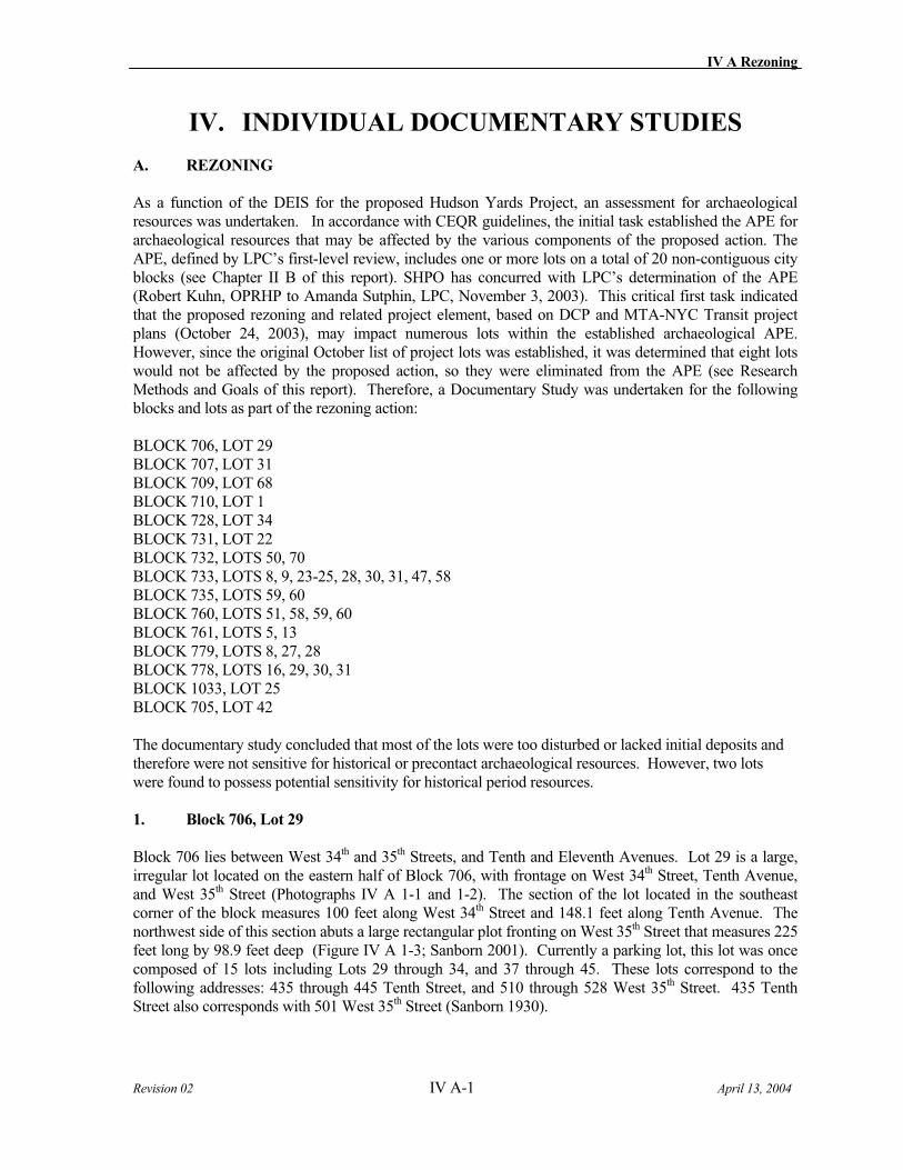
IV A Rezoning
Revision 02 IV A-1 April 13, 2004
IV. INDIVIDUAL DOCUMENTARY STUDIES
A. REZONING
As a function of the DEIS for the proposed Hudson Yards Project, an assessment for archaeological resources was undertaken. In accordance with CEQR guidelines, the initial task established the APE for archaeological resources that may be affected by the various components of the proposed action. The APE, defined by LPC’s first-level review, includes one or more lots on a total of 20 non-contiguous city blocks (see Chapter II B of this report). SHPO has concurred with LPC’s determination of the APE (Robert Kuhn, OPRHP to Amanda Sutphin, LPC, November 3, 2003). This critical first task indicated that the proposed rezoning and related project element, based on DCP and MTA-NYC Transit project plans (October 24, 2003), may impact numerous lots within the established archaeological APE. However, since the original October list of project lots was established, it was determined that eight lots would not be affected by the proposed action, so they were eliminated from the APE (see Research Methods and Goals of this report). Therefore, a Documentary Study was undertaken for the following blocks and lots as part of the rezoning action:
BLOCK 706, LOT 29 BLOCK 707, LOT 31 BLOCK 709, LOT 68 BLOCK 710, LOT 1 BLOCK 728, LOT 34 BLOCK 731, LOT 22 BLOCK 732, LOTS 50, 70 BLOCK 733, LOTS 8, 9, 23-25, 28, 30, 31, 47, 58 BLOCK 735, LOTS 59, 60 BLOCK 760, LOTS 51, 58, 59, 60 BLOCK 761, LOTS 5, 13 BLOCK 779, LOTS 8, 27, 28 BLOCK 778, LOTS 16, 29, 30, 31 BLOCK 1033, LOT 25 BLOCK 705, LOT 42
The documentary study concluded that most of the lots were too disturbed or lacked initial deposits and therefore were not sensitive for historical or precontact archaeological resources. However, two lots were found to possess potential sensitivity for historical period resources.
1. Block 706, Lot 29
Block 706 lies between West 34th and 35th Streets, and Tenth and Eleventh Avenues. Lot 29 is a large, irregular lot located on the eastern half of Block 706, with frontage on West 34th Street, Tenth Avenue, and West 35th Street (Photographs IV A 1-1 and 1-2). The section of the lot located in the southeast corner of the block measures 100 feet along West 34th Street and 148.1 feet along Tenth Avenue. The northwest side of this section abuts a large rectangular plot fronting on West 35th Street that measures 225 feet long by 98.9 feet deep (Figure IV A 1-3; Sanborn 2001). Currently a parking lot, this lot was once composed of 15 lots including Lots 29 through 34, and 37 through 45. These lots correspond to the following addresses: 435 through 445 Tenth Street, and 510 through 528 West 35th Street. 435 Tenth Street also corresponds with 501 West 35th Street (Sanborn 1930).
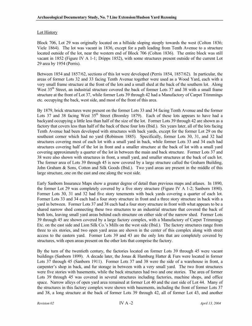
Archaeological Documentary Study, No. 7 Line Extension/Hudson Yard Rezoning
Revision 02 IV A -2 April 13, 2004
Lot History
Block 706, Lot 29 was originally located on a hillside sloping steeply towards the west (Colton 1836; Viele 1864). The lot was vacant in 1836, except for a path leading from Tenth Avenue to a structure located outside of the lot, near the western end of Block 706 (Colton 1836). The entire block was still vacant in 1852 (Figure IV A 1-1; Dripps 1852), with some structures present outside of the current Lot 29 area by 1954 (Perris).
Between 1854 and 1857/62, sections of this lot were developed (Perris 1854, 1857/62). In particular, the areas of former Lots 32 and 33 facing Tenth Avenue together were used as a Wood Yard, each with a very small frame structure at the front of the lots and a small shed at the back of the southern lot. Along West 35th Street, an industrial structure covered the back of former Lots 37 and 38 with a small frame structure at the front of Lot 37, while former Lots 39 through 42 had a Manufactory of Carpet Trimmings etc. occupying the back, west side, and most of the front of this area.
By 1879, brick structures were present on the former Lots 33 and 34 facing Tenth Avenue and the former Lots 37 and 38 facing West 35th Street (Bromley 1879). Each of these lots appears to have had a backyard occupying a little less than half of the size of the lot. Former Lots 39 through 42 are shown as a factory that covers less than half of the back of these four lots (Ibid.). Six years later, all of the lots facing Tenth Avenue had been developed with structures with back yards, except for the former Lot 29 on the southeast corner which had no yard (Robinson 1885). Specifically, former Lots 30, 31, and 32 had structures covering most of each lot with a small yard in back, while former Lots 33 and 34 each had structures covering half of the lot in front and a smaller structure at the back of lot with a small yard covering approximately a quarter of the lot in between the main and back structure. Former Lots 37 and 38 were also shown with structures in front, a small yard, and smaller structures at the back of each lot. The former area of Lots 39 through 45 is now covered by a large structure called the Graham Building, John Graham & Sons, Cotton and Silk Goods (Ibid.). Two yard areas are present in the middle of this large structure, one on the east and one along the west side.
Early Sanborn Insurance Maps show a greater degree of detail than previous maps and atlases. In 1890, the former Lot 29 was completely covered by a five story structure (Figure IV A 1-2; Sanborn 1890). Former Lots 30, 31 and 32 had five story tenements with back yards covering a quarter of each lot. Former Lots 33 and 34 each had a four story structure in front and a three story structure in back with a yard in between. Former Lots 37 and 38 each had a four story structure in front with what appears to be a shared narrow shed connecting these two structures to an industrial structure that covered the back of both lots, leaving small yard areas behind each structure on either side of the narrow shed. Former Lots 39 through 45 are shown covered by a large factory complex, with a Manufactory of Carpet Trimmings Etc. on the east side and Lion Silk Co.’s Mills on the west side (Ibid.). The factory structures range from three to six stories, and two open yard areas are shown in the center of this complex along with street access to the eastern yard. Former Lots 39 and 43 are the only lots that are completely covered by structures, with open areas present on the other lots that comprise the factory.
By the turn of the twentieth century, the factories located on former Lots 39 through 45 were vacant buildings (Sanborn 1899). A decade later, the Jonas & Hamburg Hatter & Furs were located in former Lots 37 through 45 (Sanborn 1911). Former Lots 37 and 38 were the side of a warehouse in front, a carpenter’s shop in back, and fur storage in between with a very small yard. The two front structures were five stories with basements, while the back structures had two and one stories. The area of former Lots 39 through 45 was covered in several structures including factories, machine shops, and office space. Narrow alleys of open yard area remained at former Lot 40 and the east side of Lot 44. Many of the structures in this factory complex were shown with basements, including the front of former Lots 37 and 38, a long structure at the back of former Lots 39 through 42, all of former Lot 43, and another
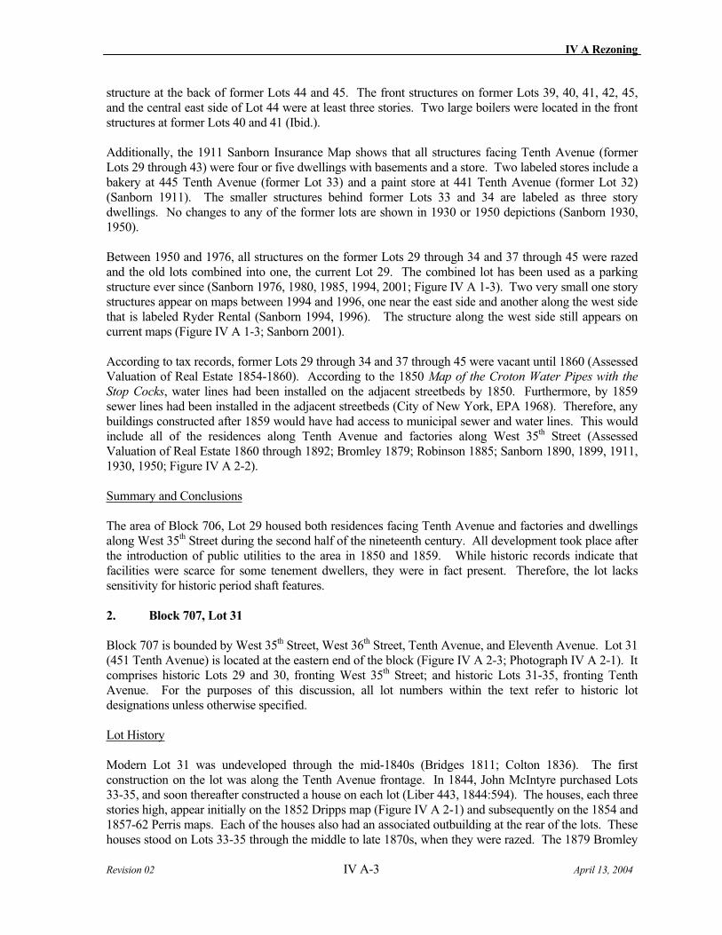
IV A Rezoning
Revision 02 IV A-3 April 13, 2004
structure at the back of former Lots 44 and 45. The front structures on former Lots 39, 40, 41, 42, 45, and the central east side of Lot 44 were at least three stories. Two large boilers were located in the front structures at former Lots 40 and 41 (Ibid.).
Additionally, the 1911 Sanborn Insurance Map shows that all structures facing Tenth Avenue (former Lots 29 through 43) were four or five dwellings with basements and a store. Two labeled stores include a bakery at 445 Tenth Avenue (former Lot 33) and a paint store at 441 Tenth Avenue (former Lot 32) (Sanborn 1911). The smaller structures behind former Lots 33 and 34 are labeled as three story dwellings. No changes to any of the former lots are shown in 1930 or 1950 depictions (Sanborn 1930, 1950).
Between 1950 and 1976, all structures on the former Lots 29 through 34 and 37 through 45 were razed and the old lots combined into one, the current Lot 29. The combined lot has been used as a parking structure ever since (Sanborn 1976, 1980, 1985, 1994, 2001; Figure IV A 1-3). Two very small one story structures appear on maps between 1994 and 1996, one near the east side and another along the west side that is labeled Ryder Rental (Sanborn 1994, 1996). The structure along the west side still appears on current maps (Figure IV A 1-3; Sanborn 2001).
According to tax records, former Lots 29 through 34 and 37 through 45 were vacant until 1860 (Assessed Valuation of Real Estate 1854-1860). According to the 1850 Map of the Croton Water Pipes with the
Stop Cocks, water lines had been installed on the adjacent streetbeds by 1850. Furthermore, by 1859 sewer lines had been installed in the adjacent streetbeds (City of New York, EPA 1968). Therefore, any buildings constructed after 1859 would have had access to municipal sewer and water lines. This would include all of the residences along Tenth Avenue and factories along West 35th Street (Assessed Valuation of Real Estate 1860 through 1892; Bromley 1879; Robinson 1885; Sanborn 1890, 1899, 1911, 1930, 1950; Figure IV A 2-2).
Summary and Conclusions
The area of Block 706, Lot 29 housed both residences facing Tenth Avenue and factories and dwellings along West 35th Street during the second half of the nineteenth century. All development took place after the introduction of public utilities to the area in 1850 and 1859. While historic records indicate that facilities were scarce for some tenement dwellers, they were in fact present. Therefore, the lot lacks sensitivity for historic period shaft features.
2. Block 707, Lot 31
Block 707 is bounded by West 35th Street, West 36th Street, Tenth Avenue, and Eleventh Avenue. Lot 31 (451 Tenth Avenue) is located at the eastern end of the block (Figure IV A 2-3; Photograph IV A 2-1). It comprises historic Lots 29 and 30, fronting West 35th Street; and historic Lots 31-35, fronting Tenth Avenue. For the purposes of this discussion, all lot numbers within the text refer to historic lot designations unless otherwise specified.
Lot History
Modern Lot 31 was undeveloped through the mid-1840s (Bridges 1811; Colton 1836). The first construction on the lot was along the Tenth Avenue frontage. In 1844, John McIntyre purchased Lots 33-35, and soon thereafter constructed a house on each lot (Liber 443, 1844:594). The houses, each three stories high, appear initially on the 1852 Dripps map (Figure IV A 2-1) and subsequently on the 1854 and 1857-62 Perris maps. Each of the houses also had an associated outbuilding at the rear of the lots. These houses stood on Lots 33-35 through the middle to late 1870s, when they were razed. The 1879 Bromley
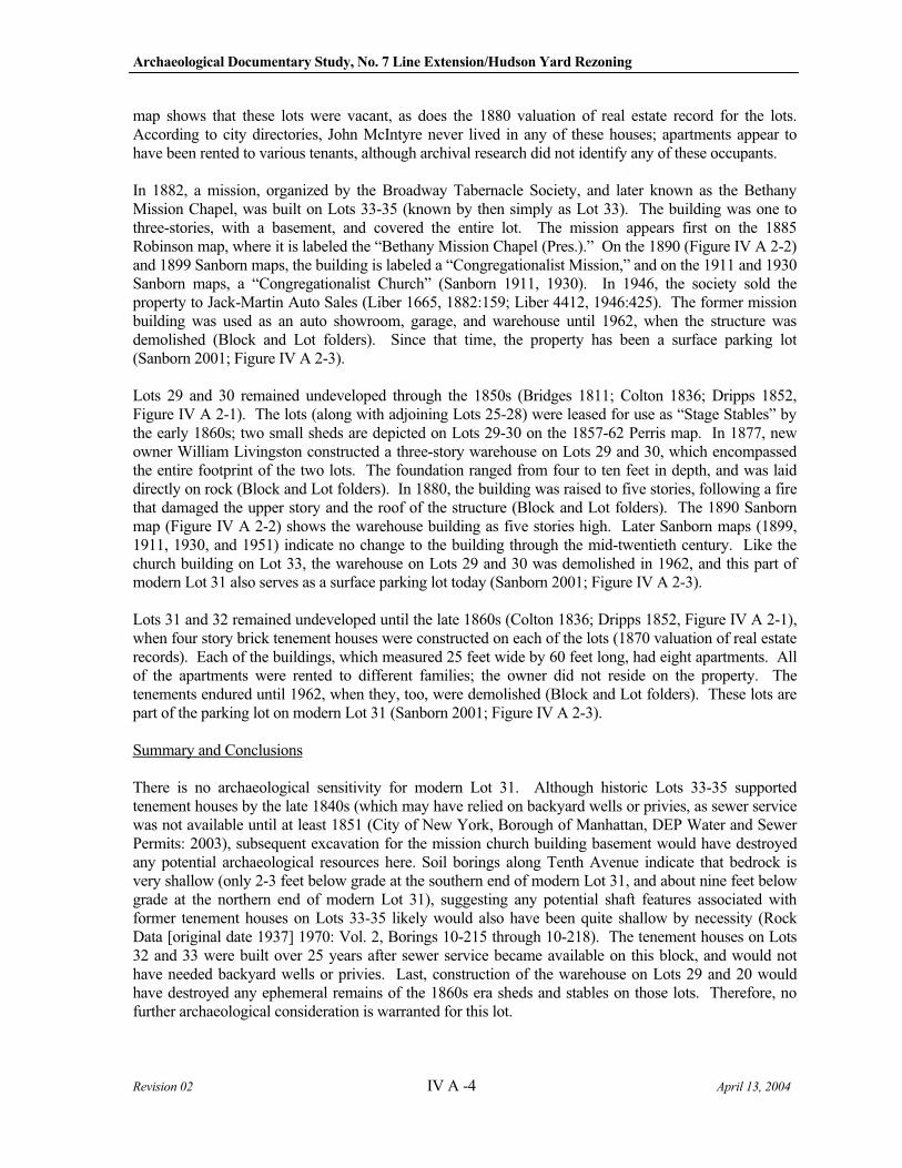
Archaeological Documentary Study, No. 7 Line Extension/Hudson Yard Rezoning
Revision 02 IV A -4 April 13, 2004
map shows that these lots were vacant, as does the 1880 valuation of real estate record for the lots. According to city directories, John McIntyre never lived in any of these houses; apartments appear to have been rented to various tenants, although archival research did not identify any of these occupants.
In 1882, a mission, organized by the Broadway Tabernacle Society, and later known as the Bethany Mission Chapel, was built on Lots 33-35 (known by then simply as Lot 33). The building was one to three-stories, with a basement, and covered the entire lot. The mission appears first on the 1885 Robinson map, where it is labeled the “Bethany Mission Chapel (Pres.).” On the 1890 (Figure IV A 2-2) and 1899 Sanborn maps, the building is labeled a “Congregationalist Mission,” and on the 1911 and 1930 Sanborn maps, a “Congregationalist Church” (Sanborn 1911, 1930). In 1946, the society sold the property to Jack-Martin Auto Sales (Liber 1665, 1882:159; Liber 4412, 1946:425). The former mission building was used as an auto showroom, garage, and warehouse until 1962, when the structure was demolished (Block and Lot folders). Since that time, the property has been a surface parking lot (Sanborn 2001; Figure IV A 2-3).
Lots 29 and 30 remained undeveloped through the 1850s (Bridges 1811; Colton 1836; Dripps 1852, Figure IV A 2-1). The lots (along with adjoining Lots 25-28) were leased for use as “Stage Stables” by the early 1860s; two small sheds are depicted on Lots 29-30 on the 1857-62 Perris map. In 1877, new owner William Livingston constructed a three-story warehouse on Lots 29 and 30, which encompassed the entire footprint of the two lots. The foundation ranged from four to ten feet in depth, and was laid directly on rock (Block and Lot folders). In 1880, the building was raised to five stories, following a fire that damaged the upper story and the roof of the structure (Block and Lot folders). The 1890 Sanborn map (Figure IV A 2-2) shows the warehouse building as five stories high. Later Sanborn maps (1899, 1911, 1930, and 1951) indicate no change to the building through the mid-twentieth century. Like the church building on Lot 33, the warehouse on Lots 29 and 30 was demolished in 1962, and this part of modern Lot 31 also serves as a surface parking lot today (Sanborn 2001; Figure IV A 2-3).
Lots 31 and 32 remained undeveloped until the late 1860s (Colton 1836; Dripps 1852, Figure IV A 2-1), when four story brick tenement houses were constructed on each of the lots (1870 valuation of real estate records). Each of the buildings, which measured 25 feet wide by 60 feet long, had eight apartments. All of the apartments were rented to different families; the owner did not reside on the property. The tenements endured until 1962, when they, too, were demolished (Block and Lot folders). These lots are part of the parking lot on modern Lot 31 (Sanborn 2001; Figure IV A 2-3).
Summary and Conclusions
There is no archaeological sensitivity for modern Lot 31. Although historic Lots 33-35 supported tenement houses by the late 1840s (which may have relied on backyard wells or privies, as sewer service was not available until at least 1851 (City of New York, Borough of Manhattan, DEP Water and Sewer Permits: 2003), subsequent excavation for the mission church building basement would have destroyed any potential archaeological resources here. Soil borings along Tenth Avenue indicate that bedrock is very shallow (only 2-3 feet below grade at the southern end of modern Lot 31, and about nine feet below grade at the northern end of modern Lot 31), suggesting any potential shaft features associated with former tenement houses on Lots 33-35 likely would also have been quite shallow by necessity (Rock Data [original date 1937] 1970: Vol. 2, Borings 10-215 through 10-218). The tenement houses on Lots 32 and 33 were built over 25 years after sewer service became available on this block, and would not have needed backyard wells or privies. Last, construction of the warehouse on Lots 29 and 20 would have destroyed any ephemeral remains of the 1860s era sheds and stables on those lots. Therefore, no further archaeological consideration is warranted for this lot.
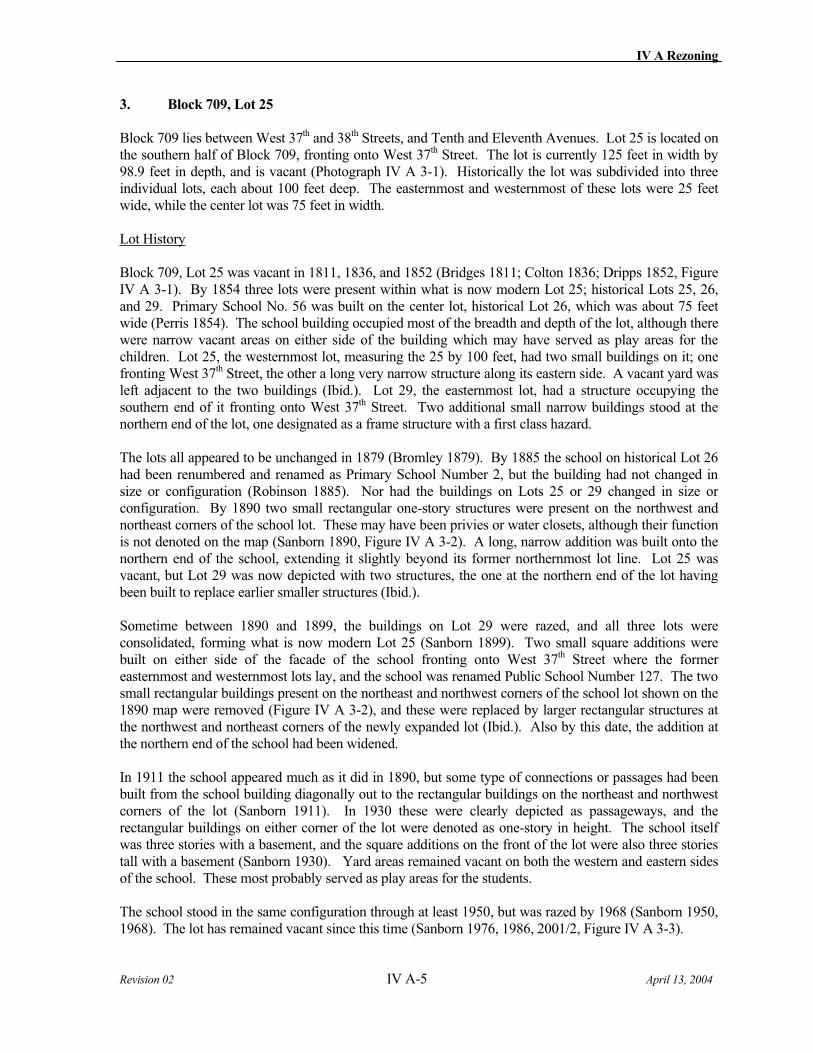
IV A Rezoning
Revision 02 IV A-5 April 13, 2004
3. Block 709, Lot 25
Block 709 lies between West 37th and 38th Streets, and Tenth and Eleventh Avenues. Lot 25 is located on the southern half of Block 709, fronting onto West 37th Street. The lot is currently 125 feet in width by 98.9 feet in depth, and is vacant (Photograph IV A 3-1). Historically the lot was subdivided into three individual lots, each about 100 feet deep. The easternmost and westernmost of these lots were 25 feet wide, while the center lot was 75 feet in width.
Lot History
Block 709, Lot 25 was vacant in 1811, 1836, and 1852 (Bridges 1811; Colton 1836; Dripps 1852, Figure IV A 3-1). By 1854 three lots were present within what is now modern Lot 25; historical Lots 25, 26, and 29. Primary School No. 56 was built on the center lot, historical Lot 26, which was about 75 feet wide (Perris 1854). The school building occupied most of the breadth and depth of the lot, although there were narrow vacant areas on either side of the building which may have served as play areas for the children. Lot 25, the westernmost lot, measuring the 25 by 100 feet, had two small buildings on it; one fronting West 37th Street, the other a long very narrow structure along its eastern side. A vacant yard was left adjacent to the two buildings (Ibid.). Lot 29, the easternmost lot, had a structure occupying the southern end of it fronting onto West 37th Street. Two additional small narrow buildings stood at the northern end of the lot, one designated as a frame structure with a first class hazard.
The lots all appeared to be unchanged in 1879 (Bromley 1879). By 1885 the school on historical Lot 26 had been renumbered and renamed as Primary School Number 2, but the building had not changed in size or configuration (Robinson 1885). Nor had the buildings on Lots 25 or 29 changed in size or configuration. By 1890 two small rectangular one-story structures were present on the northwest and northeast corners of the school lot. These may have been privies or water closets, although their function is not denoted on the map (Sanborn 1890, Figure IV A 3-2). A long, narrow addition was built onto the northern end of the school, extending it slightly beyond its former northernmost lot line. Lot 25 was vacant, but Lot 29 was now depicted with two structures, the one at the northern end of the lot having been built to replace earlier smaller structures (Ibid.).
Sometime between 1890 and 1899, the buildings on Lot 29 were razed, and all three lots were consolidated, forming what is now modern Lot 25 (Sanborn 1899). Two small square additions were built on either side of the facade of the school fronting onto West 37th Street where the former easternmost and westernmost lots lay, and the school was renamed Public School Number 127. The two small rectangular buildings present on the northeast and northwest corners of the school lot shown on the 1890 map were removed (Figure IV A 3-2), and these were replaced by larger rectangular structures at the northwest and northeast corners of the newly expanded lot (Ibid.). Also by this date, the addition at the northern end of the school had been widened.
In 1911 the school appeared much as it did in 1890, but some type of connections or passages had been built from the school building diagonally out to the rectangular buildings on the northeast and northwest corners of the lot (Sanborn 1911). In 1930 these were clearly depicted as passageways, and the rectangular buildings on either corner of the lot were denoted as one-story in height. The school itself was three stories with a basement, and the square additions on the front of the lot were also three stories tall with a basement (Sanborn 1930). Yard areas remained vacant on both the western and eastern sides of the school. These most probably served as play areas for the students.
The school stood in the same configuration through at least 1950, but was razed by 1968 (Sanborn 1950, 1968). The lot has remained vacant since this time (Sanborn 1976, 1986, 2001/2, Figure IV A 3-3).
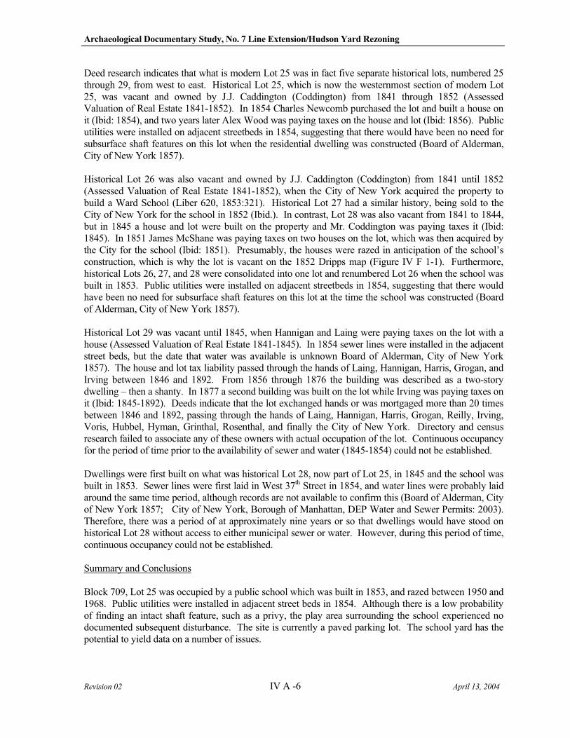
Archaeological Documentary Study, No. 7 Line Extension/Hudson Yard Rezoning
Revision 02 IV A -6 April 13, 2004
Deed research indicates that what is modern Lot 25 was in fact five separate historical lots, numbered 25 through 29, from west to east. Historical Lot 25, which is now the westernmost section of modern Lot 25, was vacant and owned by J.J. Caddington (Coddington) from 1841 through 1852 (Assessed Valuation of Real Estate 1841-1852). In 1854 Charles Newcomb purchased the lot and built a house on it (Ibid: 1854), and two years later Alex Wood was paying taxes on the house and lot (Ibid: 1856). Public utilities were installed on adjacent streetbeds in 1854, suggesting that there would have been no need for subsurface shaft features on this lot when the residential dwelling was constructed (Board of Alderman, City of New York 1857).
Historical Lot 26 was also vacant and owned by J.J. Caddington (Coddington) from 1841 until 1852 (Assessed Valuation of Real Estate 1841-1852), when the City of New York acquired the property to build a Ward School (Liber 620, 1853:321). Historical Lot 27 had a similar history, being sold to the City of New York for the school in 1852 (Ibid.). In contrast, Lot 28 was also vacant from 1841 to 1844, but in 1845 a house and lot were built on the property and Mr. Coddington was paying taxes it (Ibid: 1845). In 1851 James McShane was paying taxes on two houses on the lot, which was then acquired by the City for the school (Ibid: 1851). Presumably, the houses were razed in anticipation of the school’s construction, which is why the lot is vacant on the 1852 Dripps map (Figure IV F 1-1). Furthermore, historical Lots 26, 27, and 28 were consolidated into one lot and renumbered Lot 26 when the school was built in 1853. Public utilities were installed on adjacent streetbeds in 1854, suggesting that there would have been no need for subsurface shaft features on this lot at the time the school was constructed (Board of Alderman, City of New York 1857).
Historical Lot 29 was vacant until 1845, when Hannigan and Laing were paying taxes on the lot with a house (Assessed Valuation of Real Estate 1841-1845). In 1854 sewer lines were installed in the adjacent street beds, but the date that water was available is unknown Board of Alderman, City of New York 1857). The house and lot tax liability passed through the hands of Laing, Hannigan, Harris, Grogan, and Irving between 1846 and 1892. From 1856 through 1876 the building was described as a two-story dwelling – then a shanty. In 1877 a second building was built on the lot while Irving was paying taxes on it (Ibid: 1845-1892). Deeds indicate that the lot exchanged hands or was mortgaged more than 20 times between 1846 and 1892, passing through the hands of Laing, Hannigan, Harris, Grogan, Reilly, Irving, Voris, Hubbel, Hyman, Grinthal, Rosenthal, and finally the City of New York. Directory and census research failed to associate any of these owners with actual occupation of the lot. Continuous occupancy for the period of time prior to the availability of sewer and water (1845-1854) could not be established.
Dwellings were first built on what was historical Lot 28, now part of Lot 25, in 1845 and the school was built in 1853. Sewer lines were first laid in West 37th Street in 1854, and water lines were probably laid around the same time period, although records are not available to confirm this (Board of Alderman, City of New York 1857; City of New York, Borough of Manhattan, DEP Water and Sewer Permits: 2003). Therefore, there was a period of at approximately nine years or so that dwellings would have stood on historical Lot 28 without access to either municipal sewer or water. However, during this period of time, continuous occupancy could not be established.
Summary and Conclusions
Block 709, Lot 25 was occupied by a public school which was built in 1853, and razed between 1950 and 1968. Public utilities were installed in adjacent street beds in 1854. Although there is a low probability of finding an intact shaft feature, such as a privy, the play area surrounding the school experienced no documented subsequent disturbance. The site is currently a paved parking lot. The school yard has the potential to yield data on a number of issues.
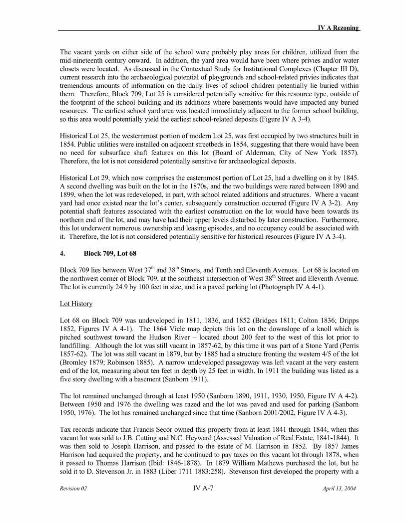
IV A Rezoning
Revision 02 IV A-7 April 13, 2004
The vacant yards on either side of the school were probably play areas for children, utilized from the mid-nineteenth century onward. In addition, the yard area would have been where privies and/or water closets were located. As discussed in the Contextual Study for Institutional Complexes (Chapter III D), current research into the archaeological potential of playgrounds and school-related privies indicates that tremendous amounts of information on the daily lives of school children potentially lie buried within them. Therefore, Block 709, Lot 25 is considered potentially sensitive for this resource type, outside of the footprint of the school building and its additions where basements would have impacted any buried resources. The earliest school yard area was located immediately adjacent to the former school building, so this area would potentially yield the earliest school-related deposits (Figure IV A 3-4).
Historical Lot 25, the westernmost portion of modern Lot 25, was first occupied by two structures built in 1854. Public utilities were installed on adjacent streetbeds in 1854, suggesting that there would have been no need for subsurface shaft features on this lot (Board of Alderman, City of New York 1857). Therefore, the lot is not considered potentially sensitive for archaeological deposits.
Historical Lot 29, which now comprises the easternmost portion of Lot 25, had a dwelling on it by 1845. A second dwelling was built on the lot in the 1870s, and the two buildings were razed between 1890 and 1899, when the lot was redeveloped, in part, with school related additions and structures. Where a vacant yard had once existed near the lot’s center, subsequently construction occurred (Figure IV A 3-2). Any potential shaft features associated with the earliest construction on the lot would have been towards its northern end of the lot, and may have had their upper levels disturbed by later construction. Furthermore, this lot underwent numerous ownership and leasing episodes, and no occupancy could be associated with it. Therefore, the lot is not considered potentially sensitive for historical resources (Figure IV A 3-4).
4. Block 709, Lot 68
Block 709 lies between West 37th and 38th Streets, and Tenth and Eleventh Avenues. Lot 68 is located on the northwest corner of Block 709, at the southeast intersection of West 38th Street and Eleventh Avenue. The lot is currently 24.9 by 100 feet in size, and is a paved parking lot (Photograph IV A 4-1).
Lot History
Lot 68 on Block 709 was undeveloped in 1811, 1836, and 1852 (Bridges 1811; Colton 1836; Dripps 1852, Figures IV A 4-1). The 1864 Viele map depicts this lot on the downslope of a knoll which is pitched southwest toward the Hudson River – located about 200 feet to the west of this lot prior to landfilling. Although the lot was still vacant in 1857-62, by this time it was part of a Stone Yard (Perris 1857-62). The lot was still vacant in 1879, but by 1885 had a structure fronting the western 4/5 of the lot (Bromley 1879; Robinson 1885). A narrow undeveloped passageway was left vacant at the very eastern end of the lot, measuring about ten feet in depth by 25 feet in width. In 1911 the building was listed as a five story dwelling with a basement (Sanborn 1911).
The lot remained unchanged through at least 1950 (Sanborn 1890, 1911, 1930, 1950, Figure IV A 4-2). Between 1950 and 1976 the dwelling was razed and the lot was paved and used for parking (Sanborn 1950, 1976). The lot has remained unchanged since that time (Sanborn 2001/2002, Figure IV A 4-3).
Tax records indicate that Francis Secor owned this property from at least 1841 through 1844, when this vacant lot was sold to J.B. Cutting and N.C. Heyward (Assessed Valuation of Real Estate, 1841-1844). It was then sold to Joseph Harrison, and passed to the estate of M. Harrison in 1852. By 1857 James Harrison had acquired the property, and he continued to pay taxes on this vacant lot through 1878, when it passed to Thomas Harrison (Ibid: 1846-1878). In 1879 William Mathews purchased the lot, but he sold it to D. Stevenson Jr. in 1883 (Liber 1711 1883:258). Stevenson first developed the property with a
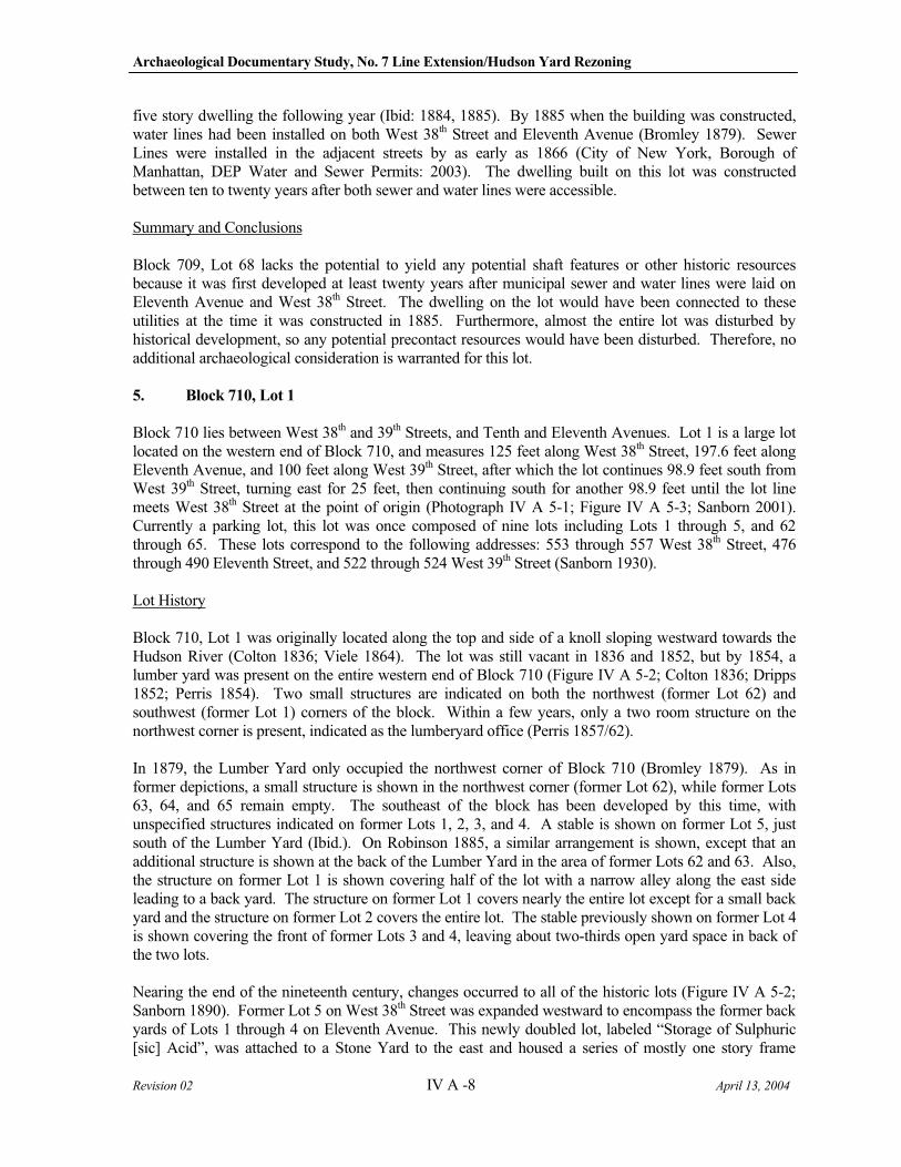
Archaeological Documentary Study, No. 7 Line Extension/Hudson Yard Rezoning
Revision 02 IV A -8 April 13, 2004
five story dwelling the following year (Ibid: 1884, 1885). By 1885 when the building was constructed, water lines had been installed on both West 38th Street and Eleventh Avenue (Bromley 1879). Sewer Lines were installed in the adjacent streets by as early as 1866 (City of New York, Borough of Manhattan, DEP Water and Sewer Permits: 2003). The dwelling built on this lot was constructed between ten to twenty years after both sewer and water lines were accessible.
Summary and Conclusions
Block 709, Lot 68 lacks the potential to yield any potential shaft features or other historic resources because it was first developed at least twenty years after municipal sewer and water lines were laid on Eleventh Avenue and West 38th Street. The dwelling on the lot would have been connected to these utilities at the time it was constructed in 1885. Furthermore, almost the entire lot was disturbed by historical development, so any potential precontact resources would have been disturbed. Therefore, no additional archaeological consideration is warranted for this lot.
5. Block 710, Lot 1
Block 710 lies between West 38th and 39th Streets, and Tenth and Eleventh Avenues. Lot 1 is a large lot located on the western end of Block 710, and measures 125 feet along West 38th Street, 197.6 feet along Eleventh Avenue, and 100 feet along West 39th Street, after which the lot continues 98.9 feet south from West 39th Street, turning east for 25 feet, then continuing south for another 98.9 feet until the lot line meets West 38th Street at the point of origin (Photograph IV A 5-1; Figure IV A 5-3; Sanborn 2001). Currently a parking lot, this lot was once composed of nine lots including Lots 1 through 5, and 62 through 65. These lots correspond to the following addresses: 553 through 557 West 38th Street, 476 through 490 Eleventh Street, and 522 through 524 West 39th Street (Sanborn 1930).
Lot History
Block 710, Lot 1 was originally located along the top and side of a knoll sloping westward towards the Hudson River (Colton 1836; Viele 1864). The lot was still vacant in 1836 and 1852, but by 1854, a lumber yard was present on the entire western end of Block 710 (Figure IV A 5-2; Colton 1836; Dripps 1852; Perris 1854). Two small structures are indicated on both the northwest (former Lot 62) and southwest (former Lot 1) corners of the block. Within a few years, only a two room structure on the northwest corner is present, indicated as the lumberyard office (Perris 1857/62).
In 1879, the Lumber Yard only occupied the northwest corner of Block 710 (Bromley 1879). As in former depictions, a small structure is shown in the northwest corner (former Lot 62), while former Lots 63, 64, and 65 remain empty. The southeast of the block has been developed by this time, with unspecified structures indicated on former Lots 1, 2, 3, and 4. A stable is shown on former Lot 5, just south of the Lumber Yard (Ibid.). On Robinson 1885, a similar arrangement is shown, except that an additional structure is shown at the back of the Lumber Yard in the area of former Lots 62 and 63. Also, the structure on former Lot 1 is shown covering half of the lot with a narrow alley along the east side leading to a back yard. The structure on former Lot 1 covers nearly the entire lot except for a small back yard and the structure on former Lot 2 covers the entire lot. The stable previously shown on former Lot 4 is shown covering the front of former Lots 3 and 4, leaving about two-thirds open yard space in back of the two lots.
Nearing the end of the nineteenth century, changes occurred to all of the historic lots (Figure IV A 5-2; Sanborn 1890). Former Lot 5 on West 38th Street was expanded westward to encompass the former back yards of Lots 1 through 4 on Eleventh Avenue. This newly doubled lot, labeled “Storage of Sulphuric [sic] Acid”, was attached to a Stone Yard to the east and housed a series of mostly one story frame
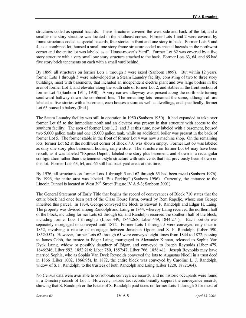
IV A Rezoning
Revision 02 IV A-9 April 13, 2004
structures coded as special hazards. These structures covered the west side and back of the lot, and a smaller one story structure was located in the southeast corner. Former Lots 1 and 2 were covered by frame structures coded as special hazards, four stories in front and one story in back. Former Lots 3 and 4, as a combined lot, housed a small one story frame structure coded as special hazards in the northwest corner and the entire lot was labeled as a “House-mover’s Yard”. Former Lot 62 was covered by a five story structure with a very small one story structure attached to the back. Former Lots 63, 64, and 65 had five story brick tenements on each with a small yard behind.
By 1899, all structures on former Lots 1 through 5 were razed (Sanborn 1899). But within 12 years, former Lots 1 through 5 were redeveloped as a Steam Laundry facility, consisting of two to three story buildings, most with basements, that included an independent electric plant and two large boilers in the area of former Lot 1, and elevator along the south side of former Lot 2, and stables in the front section of former Lot 4 (Sanborn 1911, 1930). A very narrow alleyway was present along the north side turning southward halfway down the combined lots. The remaining lots remained the same, although all are labeled as five stories with a basement, each houses a store as well as dwellings, and specifically, former Lot 63 housed a bakery (Ibid.).
The Steam Laundry facility was still in operation in 1950 (Sanborn 1950). It had expanded to take over former Lot 65 to the immediate north and an elevator was present in that structure with access to the southern facility. The area of former Lots 1, 2, and 3 at this time, now labeled with a basement, housed two 5,000 gallon tanks and one 15,000 gallon tank, while an additional boiler was present in the back of former Lot 5. The former stable in the front of former Lot 4 was now a machine shop. On the remaining lots, former Lot 62 at the northwest corner of Block 710 was shown empty. Former Lot 63 was labeled as only one story plus basement, housing only a store. The structure on former Lot 64 may have been rebuilt, as it was labeled “Express Depot”, labeled one story plus basement, and shown in a rectangular configuration rather than the tenement-style structure with side vents that had previously been shown on this lot. Former Lots 63, 64, and 65 still had back yard areas at this time.
By 1976, all structures on former Lots 1 through 5 and 62 through 65 had been razed (Sanborn 1976). By 1996, the entire area was labeled “Bus Parking” (Sanborn 1996). Currently, the entrance to the Lincoln Tunnel is located at West 39th Street (Figure IV A 5-3; Sanborn 2001).
The General Statement of Early Title that begins the record of conveyances of Block 710 states that the entire block had once been part of the Glass House Farm, owned by Rem Rapelje, whose son George inherited this parcel. In 1834, George conveyed the block to Stewart F. Randolph and Edgar H. Laing. The property was divided among Randolph and Laing in 1844, whereby Laing received the northern half of the block, including former Lots 62 through 65, and Randolph received the southern half of the block, including former Lots 1 through 5 (Liber 449, 1844:268; Liber 449, 1844:271). Each portion was separately mortgaged or conveyed until 1872. Former Lots 1 through 5 were conveyed only once in 1852, involving a release of mortgage between Jonathan Ogden and S. F. Randolph (Liber 590, 1852:552). However, former Lots 62 through 65 were conveyed eight times from 1844 to 1872, passing to James Cobb, the trustee to Edgar Laing, mortgaged to Alexander Kinnan, released to Sophia Van Dyck Laing, widow or possibly daughter of Edgar, and conveyed to Joseph Reynolds (Liber 479, 1846:246; Liber 592, 1852:216; Liber 750, 1857:47; Liber 766, 1858:41). Joseph Reynolds may have married Sophia, who as Sophia Van Dyck Reynolds conveyed the lots to Augustus Nicoll in a trust deed in 1866 (Liber 1002, 1866:95). In 1872, the entire block was conveyed by Caroline L. J. Randolph, widow of S. F. Randolph, to the trustees of both Randolph and Laing (Liber 1220, 1872:364).
No Census data were available to corroborate conveyance records, and no historic occupants were found in a Directory search of Lot 1. However, historic tax records broadly support the conveyance records, showing that S. Randolph or the Estate of S. Randolph paid taxes on former Lots 1 through 5 for most of
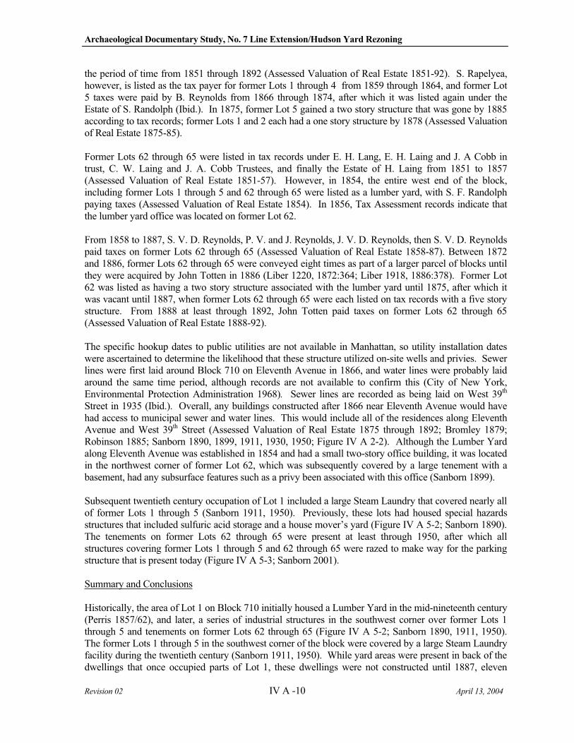
Archaeological Documentary Study, No. 7 Line Extension/Hudson Yard Rezoning
Revision 02 IV A -10 April 13, 2004
the period of time from 1851 through 1892 (Assessed Valuation of Real Estate 1851-92). S. Rapelyea, however, is listed as the tax payer for former Lots 1 through 4 from 1859 through 1864, and former Lot 5 taxes were paid by B. Reynolds from 1866 through 1874, after which it was listed again under the Estate of S. Randolph (Ibid.). In 1875, former Lot 5 gained a two story structure that was gone by 1885 according to tax records; former Lots 1 and 2 each had a one story structure by 1878 (Assessed Valuation of Real Estate 1875-85).
Former Lots 62 through 65 were listed in tax records under E. H. Lang, E. H. Laing and J. A Cobb in trust, C. W. Laing and J. A. Cobb Trustees, and finally the Estate of H. Laing from 1851 to 1857 (Assessed Valuation of Real Estate 1851-57). However, in 1854, the entire west end of the block, including former Lots 1 through 5 and 62 through 65 were listed as a lumber yard, with S. F. Randolph paying taxes (Assessed Valuation of Real Estate 1854). In 1856, Tax Assessment records indicate that the lumber yard office was located on former Lot 62.
From 1858 to 1887, S. V. D. Reynolds, P. V. and J. Reynolds, J. V. D. Reynolds, then S. V. D. Reynolds paid taxes on former Lots 62 through 65 (Assessed Valuation of Real Estate 1858-87). Between 1872 and 1886, former Lots 62 through 65 were conveyed eight times as part of a larger parcel of blocks until they were acquired by John Totten in 1886 (Liber 1220, 1872:364; Liber 1918, 1886:378). Former Lot 62 was listed as having a two story structure associated with the lumber yard until 1875, after which it was vacant until 1887, when former Lots 62 through 65 were each listed on tax records with a five story structure. From 1888 at least through 1892, John Totten paid taxes on former Lots 62 through 65 (Assessed Valuation of Real Estate 1888-92).
The specific hookup dates to public utilities are not available in Manhattan, so utility installation dates were ascertained to determine the likelihood that these structure utilized on-site wells and privies. Sewer lines were first laid around Block 710 on Eleventh Avenue in 1866, and water lines were probably laid around the same time period, although records are not available to confirm this (City of New York, Environmental Protection Administration 1968). Sewer lines are recorded as being laid on West 39th
Street in 1935 (Ibid.). Overall, any buildings constructed after 1866 near Eleventh Avenue would have had access to municipal sewer and water lines. This would include all of the residences along Eleventh Avenue and West 39th Street (Assessed Valuation of Real Estate 1875 through 1892; Bromley 1879; Robinson 1885; Sanborn 1890, 1899, 1911, 1930, 1950; Figure IV A 2-2). Although the Lumber Yard along Eleventh Avenue was established in 1854 and had a small two-story office building, it was located in the northwest corner of former Lot 62, which was subsequently covered by a large tenement with a basement, had any subsurface features such as a privy been associated with this office (Sanborn 1899).
Subsequent twentieth century occupation of Lot 1 included a large Steam Laundry that covered nearly all of former Lots 1 through 5 (Sanborn 1911, 1950). Previously, these lots had housed special hazards structures that included sulfuric acid storage and a house mover’s yard (Figure IV A 5-2; Sanborn 1890). The tenements on former Lots 62 through 65 were present at least through 1950, after which all structures covering former Lots 1 through 5 and 62 through 65 were razed to make way for the parking structure that is present today (Figure IV A 5-3; Sanborn 2001).
Summary and Conclusions
Historically, the area of Lot 1 on Block 710 initially housed a Lumber Yard in the mid-nineteenth century (Perris 1857/62), and later, a series of industrial structures in the southwest corner over former Lots 1 through 5 and tenements on former Lots 62 through 65 (Figure IV A 5-2; Sanborn 1890, 1911, 1950). The former Lots 1 through 5 in the southwest corner of the block were covered by a large Steam Laundry facility during the twentieth century (Sanborn 1911, 1950). While yard areas were present in back of the dwellings that once occupied parts of Lot 1, these dwellings were not constructed until 1887, eleven
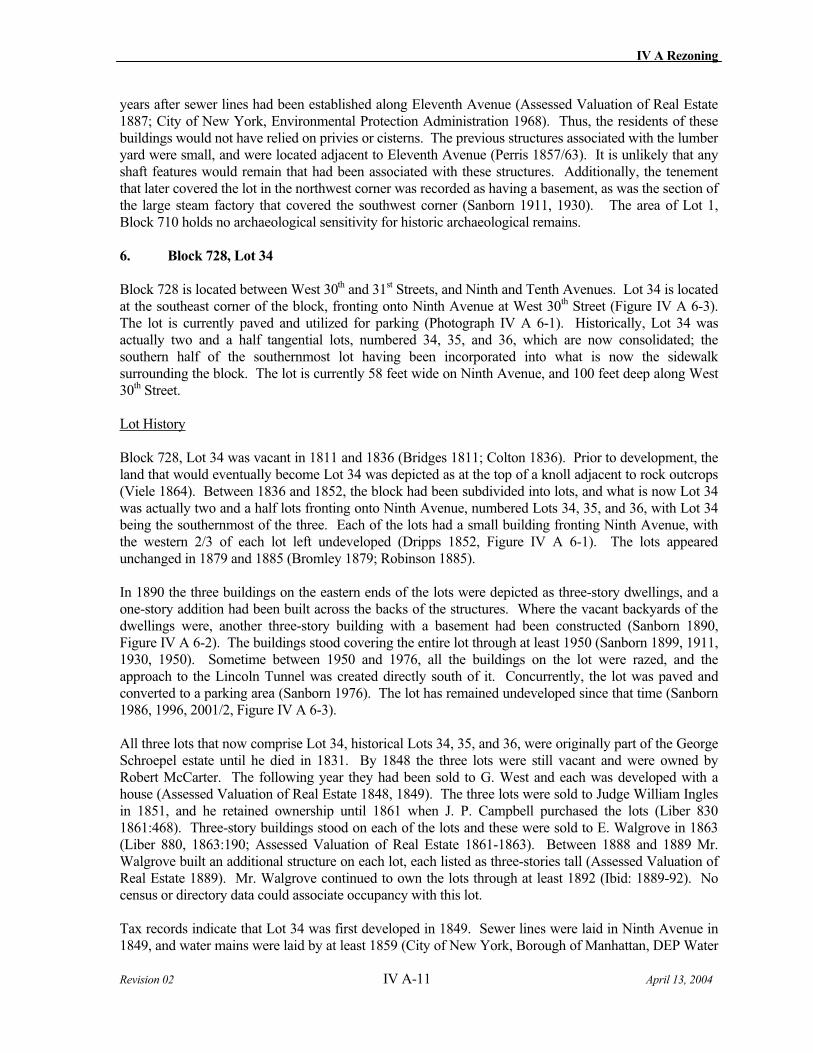
IV A Rezoning
Revision 02 IV A-11 April 13, 2004
years after sewer lines had been established along Eleventh Avenue (Assessed Valuation of Real Estate 1887; City of New York, Environmental Protection Administration 1968). Thus, the residents of these buildings would not have relied on privies or cisterns. The previous structures associated with the lumber yard were small, and were located adjacent to Eleventh Avenue (Perris 1857/63). It is unlikely that any shaft features would remain that had been associated with these structures. Additionally, the tenement that later covered the lot in the northwest corner was recorded as having a basement, as was the section of the large steam factory that covered the southwest corner (Sanborn 1911, 1930). The area of Lot 1, Block 710 holds no archaeological sensitivity for historic archaeological remains.
6. Block 728, Lot 34
Block 728 is located between West 30th and 31st Streets, and Ninth and Tenth Avenues. Lot 34 is located at the southeast corner of the block, fronting onto Ninth Avenue at West 30th Street (Figure IV A 6-3). The lot is currently paved and utilized for parking (Photograph IV A 6-1). Historically, Lot 34 was actually two and a half tangential lots, numbered 34, 35, and 36, which are now consolidated; the southern half of the southernmost lot having been incorporated into what is now the sidewalk surrounding the block. The lot is currently 58 feet wide on Ninth Avenue, and 100 feet deep along West 30th Street.
Lot History
Block 728, Lot 34 was vacant in 1811 and 1836 (Bridges 1811; Colton 1836). Prior to development, the land that would eventually become Lot 34 was depicted as at the top of a knoll adjacent to rock outcrops (Viele 1864). Between 1836 and 1852, the block had been subdivided into lots, and what is now Lot 34 was actually two and a half lots fronting onto Ninth Avenue, numbered Lots 34, 35, and 36, with Lot 34 being the southernmost of the three. Each of the lots had a small building fronting Ninth Avenue, with the western 2/3 of each lot left undeveloped (Dripps 1852, Figure IV A 6-1). The lots appeared unchanged in 1879 and 1885 (Bromley 1879; Robinson 1885).
In 1890 the three buildings on the eastern ends of the lots were depicted as three-story dwellings, and a one-story addition had been built across the backs of the structures. Where the vacant backyards of the dwellings were, another three-story building with a basement had been constructed (Sanborn 1890, Figure IV A 6-2). The buildings stood covering the entire lot through at least 1950 (Sanborn 1899, 1911, 1930, 1950). Sometime between 1950 and 1976, all the buildings on the lot were razed, and the approach to the Lincoln Tunnel was created directly south of it. Concurrently, the lot was paved and converted to a parking area (Sanborn 1976). The lot has remained undeveloped since that time (Sanborn 1986, 1996, 2001/2, Figure IV A 6-3).
All three lots that now comprise Lot 34, historical Lots 34, 35, and 36, were originally part of the George Schroepel estate until he died in 1831. By 1848 the three lots were still vacant and were owned by Robert McCarter. The following year they had been sold to G. West and each was developed with a house (Assessed Valuation of Real Estate 1848, 1849). The three lots were sold to Judge William Ingles in 1851, and he retained ownership until 1861 when J. P. Campbell purchased the lots (Liber 830 1861:468). Three-story buildings stood on each of the lots and these were sold to E. Walgrove in 1863 (Liber 880, 1863:190; Assessed Valuation of Real Estate 1861-1863). Between 1888 and 1889 Mr. Walgrove built an additional structure on each lot, each listed as three-stories tall (Assessed Valuation of Real Estate 1889). Mr. Walgrove continued to own the lots through at least 1892 (Ibid: 1889-92). No census or directory data could associate occupancy with this lot.
Tax records indicate that Lot 34 was first developed in 1849. Sewer lines were laid in Ninth Avenue in 1849, and water mains were laid by at least 1859 (City of New York, Borough of Manhattan, DEP Water
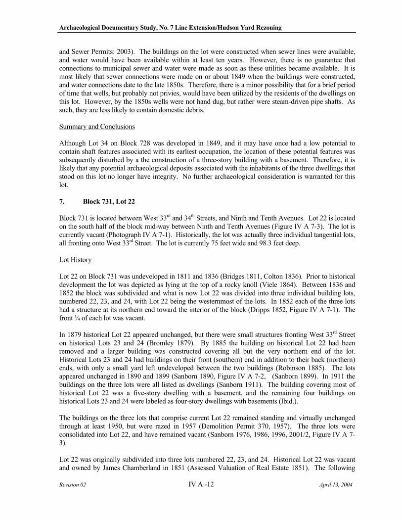
Archaeological Documentary Study, No. 7 Line Extension/Hudson Yard Rezoning
Revision 02 IV A -12 April 13, 2004
and Sewer Permits: 2003). The buildings on the lot were constructed when sewer lines were available, and water would have been available within at least ten years. However, there is no guarantee that connections to municipal sewer and water were made as soon as these utilities became available. It is most likely that sewer connections were made on or about 1849 when the buildings were constructed, and water connections date to the late 1850s. Therefore, there is a minor possibility that for a brief period of time that wells, but probably not privies, would have been utilized by the residents of the dwellings on this lot. However, by the 1850s wells were not hand dug, but rather were steam-driven pipe shafts. As such, they are less likely to contain domestic debris.
Summary and Conclusions
Although Lot 34 on Block 728 was developed in 1849, and it may have once had a low potential to contain shaft features associated with its earliest occupation, the location of these potential features was subsequently disturbed by a the construction of a three-story building with a basement. Therefore, it is likely that any potential archaeological deposits associated with the inhabitants of the three dwellings that stood on this lot no longer have integrity. No further archaeological consideration is warranted for this lot.
7. Block 731, Lot 22
Block 731 is located between West 33rd and 34th Streets, and Ninth and Tenth Avenues. Lot 22 is located on the south half of the block mid-way between Ninth and Tenth Avenues (Figure IV A 7-3). The lot is currently vacant (Photograph IV A 7-1). Historically, the lot was actually three individual tangential lots, all fronting onto West 33rd Street. The lot is currently 75 feet wide and 98.3 feet deep.
Lot History
Lot 22 on Block 731 was undeveloped in 1811 and 1836 (Bridges 1811, Colton 1836). Prior to historical development the lot was depicted as lying at the top of a rocky knoll (Viele 1864). Between 1836 and 1852 the block was subdivided and what is now Lot 22 was divided into three individual building lots, numbered 22, 23, and 24, with Lot 22 being the westernmost of the lots. In 1852 each of the three lots had a structure at its northern end toward the interior of the block (Dripps 1852, Figure IV A 7-1). The front ¾ of each lot was vacant.
In 1879 historical Lot 22 appeared unchanged, but there were small structures fronting West 33rd Street on historical Lots 23 and 24 (Bromley 1879). By 1885 the building on historical Lot 22 had been removed and a larger building was constructed covering all but the very northern end of the lot. Historical Lots 23 and 24 had buildings on their front (southern) end in addition to their back (northern) ends, with only a small yard left undeveloped between the two buildings (Robinson 1885). The lots appeared unchanged in 1890 and 1899 (Sanborn 1890, Figure IV A 7-2, (Sanborn 1899). In 1911 the buildings on the three lots were all listed as dwellings (Sanborn 1911). The building covering most of historical Lot 22 was a five-story dwelling with a basement, and the remaining four buildings on historical Lots 23 and 24 were labeled as four-story dwellings with basements (Ibid.).
The buildings on the three lots that comprise current Lot 22 remained standing and virtually unchanged through at least 1950, but were razed in 1957 (Demolition Permit 370, 1957). The three lots were consolidated into Lot 22, and have remained vacant (Sanborn 1976, 1986, 1996, 2001/2, Figure IV A 7-3).
Lot 22 was originally subdivided into three lots numbered 22, 23, and 24. Historical Lot 22 was vacant and owned by James Chamberland in 1851 (Assessed Valuation of Real Estate 1851). The following
IV A Rezoning
Revision 02 IV A-13 April 13, 2004
year H. Watcher was taxed 3,000 dollars for a house on the lot (Ibid: 1852), but by 1854 the lot was again listed as vacant – now under the ownership of E.C. Gray (Ibid: 1854). The lot remained vacant until 1860, but in 1861 the Estate of E.C. Gray was paying taxes on a four-story building on the lot, valued at 4,000 dollars (Ibid: 1855-1861). Deeds indicate that despite the fact that the Estate of E.C. Gray paid taxes on the building through the 1890s, probably as a leaser, Chamberlain retained ownership of the property and sold it to Bernhard Mayer in 1865 (Ibid.: 1862-1892; Liber 935, 1865:38). Mayer conveyed the property to Joseph Hill in 1868 (Liber 935, 1868:38), and Hill conveyed it to John Coyle in 1874 (Liber 1311, 1874:96). Coyle retained ownership of the property until 1887, when he sold it to Louis Meyer (Liber 2060, 1887:202).
Historical Lot 23 was also owned by James Chamberland in 1851, and was vacant at that time (Assessed Valuation of Real Estate 1851). In 1852 Thomas Martine was paying taxes on a shop/house on the lot, but by 1852 the lot was again listed as vacant (Ibid: 1852). E.C. Gray paid taxes on the vacant lot through 1859, when the Estate of E.C. Gray took over payment (Ibid.:1852-1859). In 1860 a four-story building, valued at 4,000 dollars, was built on the lot, with taxes still being paid by the Estate of E.C. Gray, probably as the leaser (Ibid: 1860). Like historical Lot 22, James Chamberlain owned the lot in 1847, and transferred ownership to Bernhard Mayer in 1865 (Liber 497, 1847:174, Liber 935, 1865:38). The lot then changed hands several times over the next five years, belonging to John Mayer, then Margaret Horgan (Liber 1086, 1869:402). In 1872 Horgan and Anthony Miller entered into a building agreement (Liber 1210, 1872:409), and in 1883 Miller and John Coyle entered into a party wall agreement (Liber 1743, 1883:479) on the lot. The Estate of Mr. Gray continued to pay taxes on the structure and lot through at least 1892 despite the fact that they were not listed as owners (Assessed Valuation of Real Estate: 1861-1892).
Historical Lot 24 was vacant and owned by John Collins in 1851 (Assessed Valuation of Real Estate 1851; Liber 563, 1851:218). By 1852, G. Harney, as a leaser, was paying taxes on a house/shop on the lot, and by 1854 Caleb Lindsay was paying taxes for a house on the lot (Ibid: 1852-1854). In 1856 Isabella Stewart assumed the tax liability on the property, and two houses are listed on the lot (Ibid: 1856). Stuart continued to pay taxes on two buildings, one four-stories and the other three, until 1867 when only a four-story building was listed on the lot (Ibid.:1857-1867). Despite the fact that the lot went from having two buildings to one, the appraised value increased by 500 dollars, suggesting the new building was more substantial (Ibid.). Stuart continued to pay taxes on the property through 1876 when Hugh Kelly assumed this responsibility (Ibid.: 1876-1892). In 1881 the lot was sold to Frederick Fletschinger, who then sold it to Henry Schwarzwalder in 1883 (Liber 1627, 1881:300, Liber 1732, 1883:69). Gertrude Miller acquired the property in 1884 (Liber 1816, 1884: 177), and held it through at least 1897 (Liber 52, 1897:33). Despite the fact that the lot changed ownership several times between 1879 and 1897, Hugh Kelly continued to leas it and pay taxes on it (Assessed Valuation of Real Estate 1876-1892).
Directory and census research could not associate any specific occupancy with the dwelling(s) on any of the three lots (Trow’s 1850-1851, 1861-1862, 1870-1871, 1880-1881; U.S. Census 1840, 1850, 1860, 1870).
The dwellings that stood on Lot 22 covered almost the entire APE. Where front yards were vacant in 1852, four and five-story dwellings with basements were built by 1885. Sewer lines were installed on West 33rd Street in 1849, and water lines were probably installed roughly around the same period, although records could not be found to verify this (City of New York, Borough of Manhattan, DEP Water and Sewer Permits: 2003).
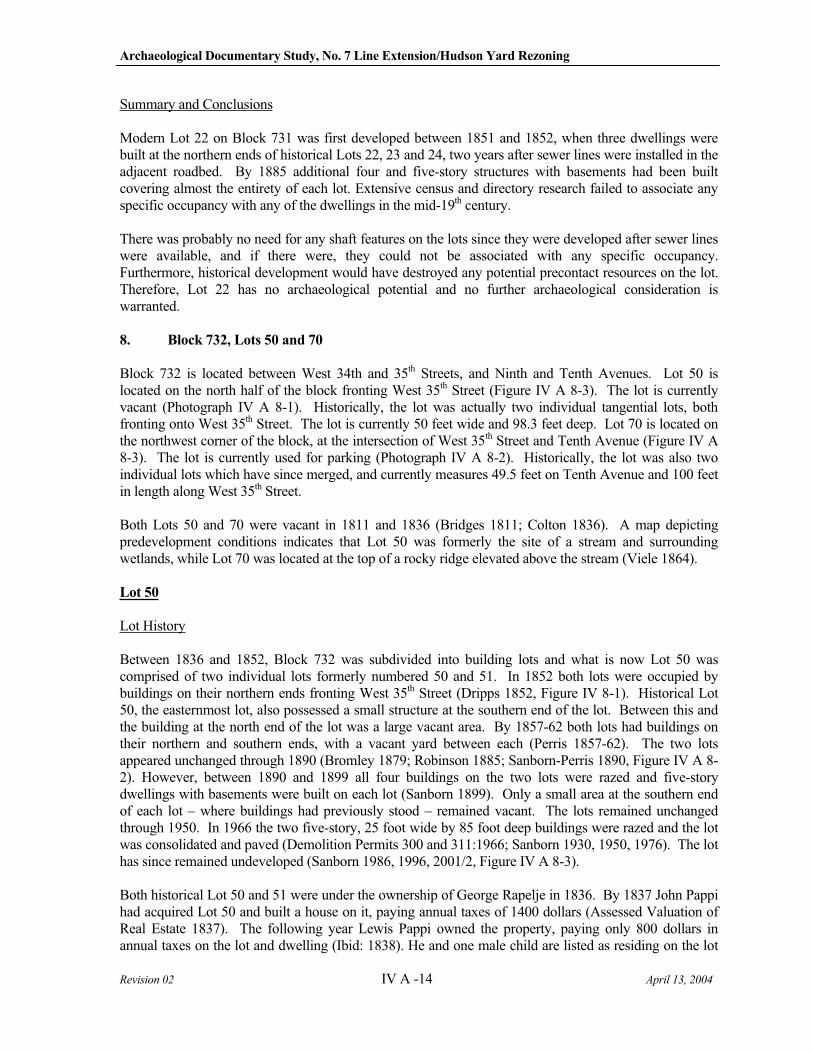
Archaeological Documentary Study, No. 7 Line Extension/Hudson Yard Rezoning
Revision 02 IV A -14 April 13, 2004
Summary and Conclusions
Modern Lot 22 on Block 731 was first developed between 1851 and 1852, when three dwellings were built at the northern ends of historical Lots 22, 23 and 24, two years after sewer lines were installed in the adjacent roadbed. By 1885 additional four and five-story structures with basements had been built covering almost the entirety of each lot. Extensive census and directory research failed to associate any specific occupancy with any of the dwellings in the mid-19th century.
There was probably no need for any shaft features on the lots since they were developed after sewer lines were available, and if there were, they could not be associated with any specific occupancy. Furthermore, historical development would have destroyed any potential precontact resources on the lot. Therefore, Lot 22 has no archaeological potential and no further archaeological consideration is warranted.
8. Block 732, Lots 50 and 70
Block 732 is located between West 34th and 35th Streets, and Ninth and Tenth Avenues. Lot 50 is located on the north half of the block fronting West 35th Street (Figure IV A 8-3). The lot is currently vacant (Photograph IV A 8-1). Historically, the lot was actually two individual tangential lots, both fronting onto West 35th Street. The lot is currently 50 feet wide and 98.3 feet deep. Lot 70 is located on the northwest corner of the block, at the intersection of West 35th Street and Tenth Avenue (Figure IV A 8-3). The lot is currently used for parking (Photograph IV A 8-2). Historically, the lot was also two individual lots which have since merged, and currently measures 49.5 feet on Tenth Avenue and 100 feet in length along West 35th Street.
Both Lots 50 and 70 were vacant in 1811 and 1836 (Bridges 1811; Colton 1836). A map depicting predevelopment conditions indicates that Lot 50 was formerly the site of a stream and surrounding wetlands, while Lot 70 was located at the top of a rocky ridge elevated above the stream (Viele 1864).
Lot 50
Lot History
Between 1836 and 1852, Block 732 was subdivided into building lots and what is now Lot 50 was comprised of two individual lots formerly numbered 50 and 51. In 1852 both lots were occupied by buildings on their northern ends fronting West 35th Street (Dripps 1852, Figure IV 8-1). Historical Lot 50, the easternmost lot, also possessed a small structure at the southern end of the lot. Between this and the building at the north end of the lot was a large vacant area. By 1857-62 both lots had buildings on their northern and southern ends, with a vacant yard between each (Perris 1857-62). The two lots appeared unchanged through 1890 (Bromley 1879; Robinson 1885; Sanborn-Perris 1890, Figure IV A 8-2). However, between 1890 and 1899 all four buildings on the two lots were razed and five-story dwellings with basements were built on each lot (Sanborn 1899). Only a small area at the southern end of each lot – where buildings had previously stood – remained vacant. The lots remained unchanged through 1950. In 1966 the two five-story, 25 foot wide by 85 foot deep buildings were razed and the lot was consolidated and paved (Demolition Permits 300 and 311:1966; Sanborn 1930, 1950, 1976). The lot has since remained undeveloped (Sanborn 1986, 1996, 2001/2, Figure IV A 8-3).
Both historical Lot 50 and 51 were under the ownership of George Rapelje in 1836. By 1837 John Pappi had acquired Lot 50 and built a house on it, paying annual taxes of 1400 dollars (Assessed Valuation of Real Estate 1837). The following year Lewis Pappi owned the property, paying only 800 dollars in annual taxes on the lot and dwelling (Ibid: 1838). He and one male child are listed as residing on the lot
IV A Rezoning
Revision 02 IV A-15 April 13, 2004
in 1840 (U.S. Census Records 1840). In 1851 the value of the property jumped considerably, going from 700 to 1,700 dollars, when a second dwelling was built on the lot (Ibid: 1851). The Pappi family – John a baker and Amanda, his wife - (a.k.a. Pappie, Pappil, Pappell, Pappelle) lived on the lot from 1840 through at least 1880 (U.S. Census Records, 1840, 1850, 1860; Trow’s Directory 1861-62, 1870-71, and 1880-81). In 1860, three additional unrelated residents, all in their twenties and two listed as bakers, resided with the Pappis (U.S. Census Records 1860). Mr. Pappi owned the property through the 1890s when it was listed as having two buildings, one three-stories tall and the other two-stories tall (Assessed Valuation of Real Estate 1890; Liber 879, 1863:639; Liber 1444, 1878:440, Liber 60, 1898:442).
Lot 51 was also owned by George Rapelje in 1836, and was sold to James Blecker in 1837 who immediately built a house on it (Assessed Valuation of Real Estate 1837). By 1838 John Schoulary (a.k.a. Scolari, Scoleri, Sculer, Sculri, Scollini) had purchased the property, and in 1840 he and his wife were living on the lot (U.S. Census Records 1840). In 1849 he put a second dwelling on the lot, which was then valued at about 1,100 dollars (Ibid: 1849). In 1856 John Scolari, a glazer, was listed as living at 252 West 35th Street - Lot 51 (Trow’s Directory, 1855-56). In 1858 the two dwellings were removed and replaced with a three-story dwelling (Assessed Valuation of Real Estate 1858), and Mr. Scolari, now a painter, is still listed as residing on the lot (U.S. Census, 1860; Trow’s Directory 1861-62). In fact in 1860 six different families (Scolari, Nitteri, Dickerson, and Beck), as well as several unrelated residents (Steel, Holland, Keius), lived on the lot. All were blue collar workers, with exception of one doctor, William Dickerson.
In 1865 Mr. Scoleri added a second dwelling to the lot, this being a two-story structure (Assessed Valuation of Real Estate 1865). His widow, Mary, resided on the lot in 1870-71 (Trow’s Directory 1870-71). Mrs. Scolari is listed as the tax payer and owner of the two dwellings through at least 1890 (Assessed Valuation of Real Estate 1866-1890; Liber 339 1835:387; Liber 60, 1898:183).
The earliest dwellings on Lot 50 were built prior to 1852. Sewer lines were installed on West 35th Street in 1853, and water lines had been installed by 1850 (City of New York, Borough of Manhattan, DEP Water and Sewer Permits: 2003; Map of the Croton Water Pipes with the Stop Cocks 1850). Shaft features, such as privies, wells, and cisterns, would not have been a necessity on the lots that were developed after, or near, the date that public utilities were available. However, residential development on Lot 50 that predated 1850 would probably have relied upon cisterns, privies, and/or wells.
Summary and Conclusions
Lot 50, formerly Lots 50 and 51, was first developed in 1837, at least 16 years before sewer and water lines were available. Historical Lot 50 was occupied by the Pappi family from 1837 through at least 1890. Historical Lot 51 was occupied by the Scolari family from about 1838 through the 1890s. Both lots had multiple dwellings that were razed and replaced by five-story buildings with basements. Only the rear 15 feet of each lot was left undisturbed by 20th century construction. However, this area had been developed with a multi-story structure in the 1850s which would have disturbed potential shaft features. Therefore, neither lot is considered potentially sensitive for historical period archaeological resources.
Lot 70
Lot History
Sometime between 1836 and 1852, Lot 70 was developed as two individual building lots, numbered 70 and 71. The northernmost lot, historical Lot 70, directly at the corner of West 35th Street and Tenth Avenue, had three buildings covering most of it by 1852 (Dripps 1852, Figure IV A 8-1). Lot 71, the
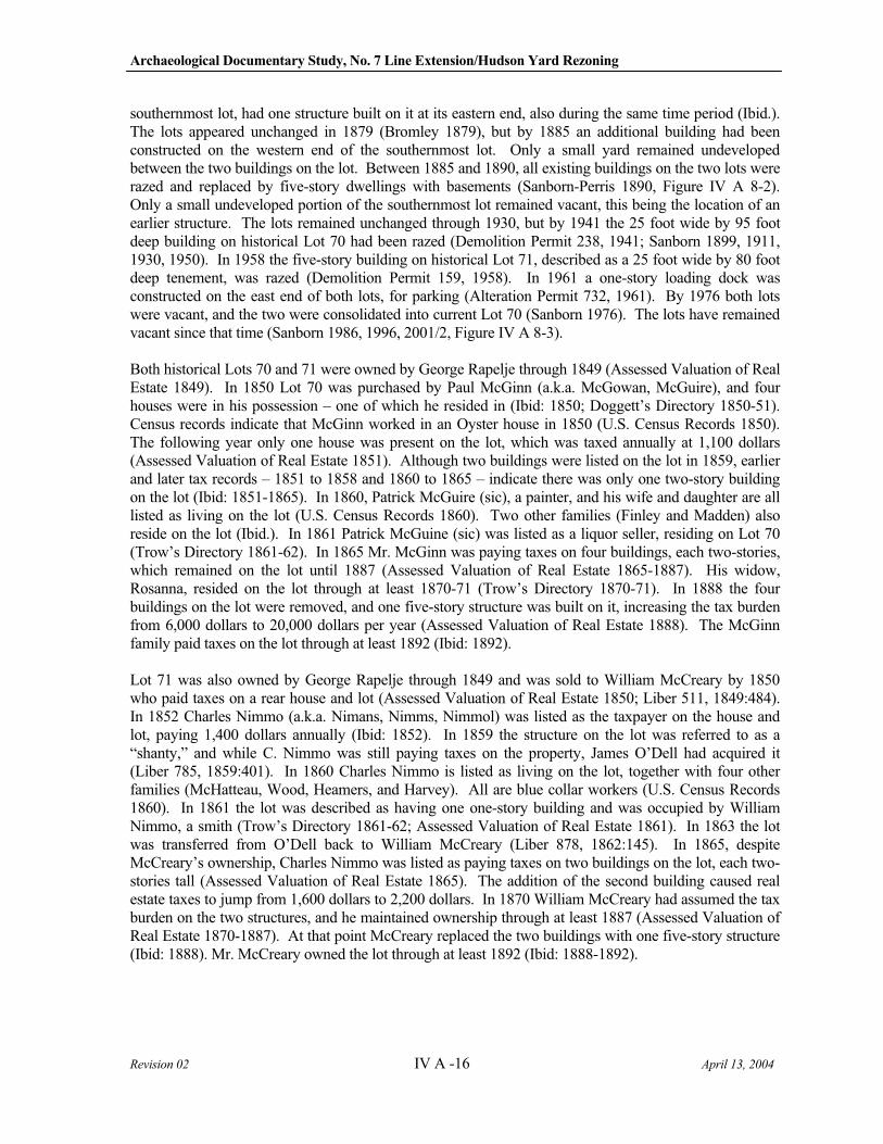
Archaeological Documentary Study, No. 7 Line Extension/Hudson Yard Rezoning
Revision 02 IV A -16 April 13, 2004
southernmost lot, had one structure built on it at its eastern end, also during the same time period (Ibid.). The lots appeared unchanged in 1879 (Bromley 1879), but by 1885 an additional building had been constructed on the western end of the southernmost lot. Only a small yard remained undeveloped between the two buildings on the lot. Between 1885 and 1890, all existing buildings on the two lots were razed and replaced by five-story dwellings with basements (Sanborn-Perris 1890, Figure IV A 8-2). Only a small undeveloped portion of the southernmost lot remained vacant, this being the location of an earlier structure. The lots remained unchanged through 1930, but by 1941 the 25 foot wide by 95 foot deep building on historical Lot 70 had been razed (Demolition Permit 238, 1941; Sanborn 1899, 1911, 1930, 1950). In 1958 the five-story building on historical Lot 71, described as a 25 foot wide by 80 foot deep tenement, was razed (Demolition Permit 159, 1958). In 1961 a one-story loading dock was constructed on the east end of both lots, for parking (Alteration Permit 732, 1961). By 1976 both lots were vacant, and the two were consolidated into current Lot 70 (Sanborn 1976). The lots have remained vacant since that time (Sanborn 1986, 1996, 2001/2, Figure IV A 8-3).
Both historical Lots 70 and 71 were owned by George Rapelje through 1849 (Assessed Valuation of Real Estate 1849). In 1850 Lot 70 was purchased by Paul McGinn (a.k.a. McGowan, McGuire), and four houses were in his possession – one of which he resided in (Ibid: 1850; Doggett’s Directory 1850-51). Census records indicate that McGinn worked in an Oyster house in 1850 (U.S. Census Records 1850). The following year only one house was present on the lot, which was taxed annually at 1,100 dollars (Assessed Valuation of Real Estate 1851). Although two buildings were listed on the lot in 1859, earlier and later tax records – 1851 to 1858 and 1860 to 1865 – indicate there was only one two-story building on the lot (Ibid: 1851-1865). In 1860, Patrick McGuire (sic), a painter, and his wife and daughter are all listed as living on the lot (U.S. Census Records 1860). Two other families (Finley and Madden) also reside on the lot (Ibid.). In 1861 Patrick McGuine (sic) was listed as a liquor seller, residing on Lot 70 (Trow’s Directory 1861-62). In 1865 Mr. McGinn was paying taxes on four buildings, each two-stories, which remained on the lot until 1887 (Assessed Valuation of Real Estate 1865-1887). His widow, Rosanna, resided on the lot through at least 1870-71 (Trow’s Directory 1870-71). In 1888 the four buildings on the lot were removed, and one five-story structure was built on it, increasing the tax burden from 6,000 dollars to 20,000 dollars per year (Assessed Valuation of Real Estate 1888). The McGinn family paid taxes on the lot through at least 1892 (Ibid: 1892).
Lot 71 was also owned by George Rapelje through 1849 and was sold to William McCreary by 1850 who paid taxes on a rear house and lot (Assessed Valuation of Real Estate 1850; Liber 511, 1849:484). In 1852 Charles Nimmo (a.k.a. Nimans, Nimms, Nimmol) was listed as the taxpayer on the house and lot, paying 1,400 dollars annually (Ibid: 1852). In 1859 the structure on the lot was referred to as a “shanty,” and while C. Nimmo was still paying taxes on the property, James O’Dell had acquired it (Liber 785, 1859:401). In 1860 Charles Nimmo is listed as living on the lot, together with four other families (McHatteau, Wood, Heamers, and Harvey). All are blue collar workers (U.S. Census Records 1860). In 1861 the lot was described as having one one-story building and was occupied by William Nimmo, a smith (Trow’s Directory 1861-62; Assessed Valuation of Real Estate 1861). In 1863 the lot was transferred from O’Dell back to William McCreary (Liber 878, 1862:145). In 1865, despite McCreary’s ownership, Charles Nimmo was listed as paying taxes on two buildings on the lot, each two-stories tall (Assessed Valuation of Real Estate 1865). The addition of the second building caused real estate taxes to jump from 1,600 dollars to 2,200 dollars. In 1870 William McCreary had assumed the tax burden on the two structures, and he maintained ownership through at least 1887 (Assessed Valuation of Real Estate 1870-1887). At that point McCreary replaced the two buildings with one five-story structure (Ibid: 1888). Mr. McCreary owned the lot through at least 1892 (Ibid: 1888-1892).
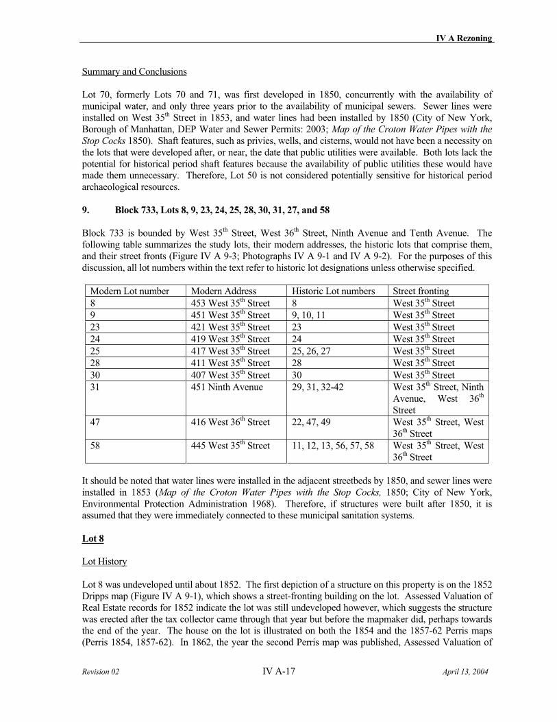
IV A Rezoning
Revision 02 IV A-17 April 13, 2004
Summary and Conclusions
Lot 70, formerly Lots 70 and 71, was first developed in 1850, concurrently with the availability of municipal water, and only three years prior to the availability of municipal sewers. Sewer lines were installed on West 35th Street in 1853, and water lines had been installed by 1850 (City of New York, Borough of Manhattan, DEP Water and Sewer Permits: 2003; Map of the Croton Water Pipes with the
Stop Cocks 1850). Shaft features, such as privies, wells, and cisterns, would not have been a necessity on the lots that were developed after, or near, the date that public utilities were available. Both lots lack the potential for historical period shaft features because the availability of public utilities these would have made them unnecessary. Therefore, Lot 50 is not considered potentially sensitive for historical period archaeological resources.
9. Block 733, Lots 8, 9, 23, 24, 25, 28, 30, 31, 27, and 58
Block 733 is bounded by West 35th Street, West 36th Street, Ninth Avenue and Tenth Avenue. The following table summarizes the study lots, their modern addresses, the historic lots that comprise them, and their street fronts (Figure IV A 9-3; Photographs IV A 9-1 and IV A 9-2). For the purposes of this discussion, all lot numbers within the text refer to historic lot designations unless otherwise specified.
Modern Lot number Modern Address Historic Lot numbers Street fronting
8 453 West 35th Street 8 West 35th Street
9 451 West 35th Street 9, 10, 11 West 35th Street
23 421 West 35th Street 23 West 35th Street
24 419 West 35th Street 24 West 35th Street
25 417 West 35th Street 25, 26, 27 West 35th Street
28 411 West 35th Street 28 West 35th Street
30 407 West 35th Street 30 West 35th Street
31 451 Ninth Avenue 29, 31, 32-42 West 35th Street, Ninth Avenue, West 36th
Street
47 416 West 36th Street 22, 47, 49 West 35th Street, West 36th Street
58 445 West 35th Street 11, 12, 13, 56, 57, 58 West 35th Street, West 36th Street
It should be noted that water lines were installed in the adjacent streetbeds by 1850, and sewer lines were installed in 1853 (Map of the Croton Water Pipes with the Stop Cocks, 1850; City of New York, Environmental Protection Administration 1968). Therefore, if structures were built after 1850, it is assumed that they were immediately connected to these municipal sanitation systems.
Lot 8
Lot History
Lot 8 was undeveloped until about 1852. The first depiction of a structure on this property is on the 1852 Dripps map (Figure IV A 9-1), which shows a street-fronting building on the lot. Assessed Valuation of Real Estate records for 1852 indicate the lot was still undeveloped however, which suggests the structure was erected after the tax collector came through that year but before the mapmaker did, perhaps towards the end of the year. The house on the lot is illustrated on both the 1854 and the 1857-62 Perris maps (Perris 1854, 1857-62). In 1862, the year the second Perris map was published, Assessed Valuation of
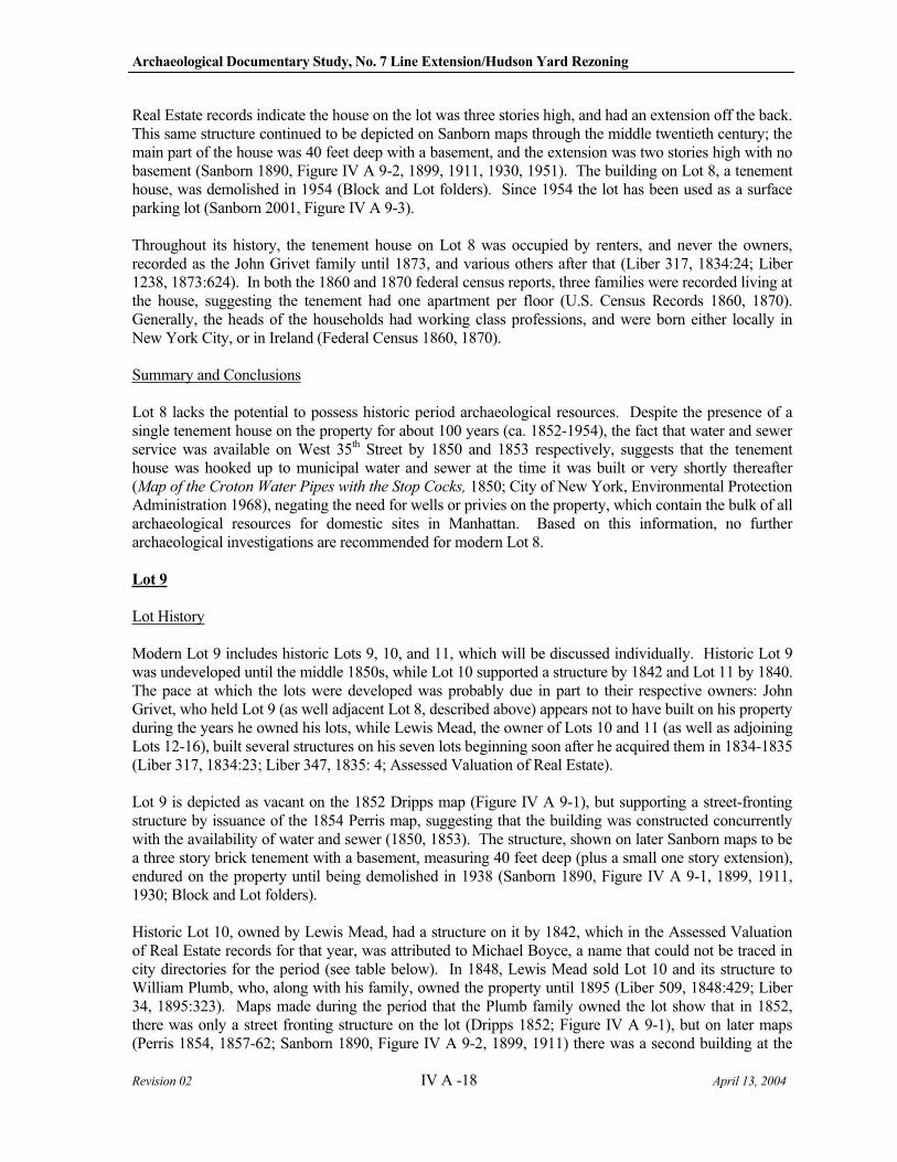
Archaeological Documentary Study, No. 7 Line Extension/Hudson Yard Rezoning
Revision 02 IV A -18 April 13, 2004
Real Estate records indicate the house on the lot was three stories high, and had an extension off the back. This same structure continued to be depicted on Sanborn maps through the middle twentieth century; the main part of the house was 40 feet deep with a basement, and the extension was two stories high with no basement (Sanborn 1890, Figure IV A 9-2, 1899, 1911, 1930, 1951). The building on Lot 8, a tenement house, was demolished in 1954 (Block and Lot folders). Since 1954 the lot has been used as a surface parking lot (Sanborn 2001, Figure IV A 9-3).
Throughout its history, the tenement house on Lot 8 was occupied by renters, and never the owners, recorded as the John Grivet family until 1873, and various others after that (Liber 317, 1834:24; Liber 1238, 1873:624). In both the 1860 and 1870 federal census reports, three families were recorded living at the house, suggesting the tenement had one apartment per floor (U.S. Census Records 1860, 1870). Generally, the heads of the households had working class professions, and were born either locally in New York City, or in Ireland (Federal Census 1860, 1870).
Summary and Conclusions
Lot 8 lacks the potential to possess historic period archaeological resources. Despite the presence of a single tenement house on the property for about 100 years (ca. 1852-1954), the fact that water and sewer service was available on West 35th Street by 1850 and 1853 respectively, suggests that the tenement house was hooked up to municipal water and sewer at the time it was built or very shortly thereafter (Map of the Croton Water Pipes with the Stop Cocks, 1850; City of New York, Environmental Protection Administration 1968), negating the need for wells or privies on the property, which contain the bulk of all archaeological resources for domestic sites in Manhattan. Based on this information, no further archaeological investigations are recommended for modern Lot 8.
Lot 9
Lot History
Modern Lot 9 includes historic Lots 9, 10, and 11, which will be discussed individually. Historic Lot 9 was undeveloped until the middle 1850s, while Lot 10 supported a structure by 1842 and Lot 11 by 1840. The pace at which the lots were developed was probably due in part to their respective owners: John Grivet, who held Lot 9 (as well adjacent Lot 8, described above) appears not to have built on his property during the years he owned his lots, while Lewis Mead, the owner of Lots 10 and 11 (as well as adjoining Lots 12-16), built several structures on his seven lots beginning soon after he acquired them in 1834-1835 (Liber 317, 1834:23; Liber 347, 1835: 4; Assessed Valuation of Real Estate).
Lot 9 is depicted as vacant on the 1852 Dripps map (Figure IV A 9-1), but supporting a street-fronting structure by issuance of the 1854 Perris map, suggesting that the building was constructed concurrently with the availability of water and sewer (1850, 1853). The structure, shown on later Sanborn maps to be a three story brick tenement with a basement, measuring 40 feet deep (plus a small one story extension), endured on the property until being demolished in 1938 (Sanborn 1890, Figure IV A 9-1, 1899, 1911, 1930; Block and Lot folders).
Historic Lot 10, owned by Lewis Mead, had a structure on it by 1842, which in the Assessed Valuation of Real Estate records for that year, was attributed to Michael Boyce, a name that could not be traced in city directories for the period (see table below). In 1848, Lewis Mead sold Lot 10 and its structure to William Plumb, who, along with his family, owned the property until 1895 (Liber 509, 1848:429; Liber 34, 1895:323). Maps made during the period that the Plumb family owned the lot show that in 1852, there was only a street fronting structure on the lot (Dripps 1852; Figure IV A 9-1), but on later maps (Perris 1854, 1857-62; Sanborn 1890, Figure IV A 9-2, 1899, 1911) there was a second building at the
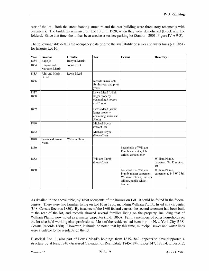
IV A Rezoning
Revision 02 IV A-19 April 13, 2004
rear of the lot. Both the street-fronting structure and the rear building were three story tenements with basements. The buildings remained on Lot 10 until 1928, when they were demolished (Block and Lot folders). Since that time, the lot has been used as a surface parking lot (Sanborn 2001; Figure IV A 9-3).
The following table details the occupancy data prior to the availability of sewer and water lines (ca. 1854) for historic Lot 10:
Year Grantor Grantee Tax Census Directory
1834 Rapelje Runyon Martin
1834 Runyon and Margaret Martin
John Grivet
1835 John and Maria Grivet
Lewis Mead
1836 records unavailable for this year and prior years
1837-1838
Lewis Mead (within larger property containing 3 houses and 7 lots)
1839 Lewis Mead (within larger property containing house and 5 lots)
1840 Michael Boyce (vacant lot)
1842 Michael Boyce (House/Lot)
1848 Lewis and Susan Mead
William Plumb
1850 households of William Plumb, carpenter; John Grivet, confectioner
1852 William Plumb (House/Lot)
William Plumb, carpenter, W. 35 n. Ave. 10
1860 households of William Plumb, master carpenter; William Hotman; Barbara Gillian, public school teacher
William Plumb, carpenter, r. 449 W. 35th
As detailed in the above table, by 1850 occupants of the houses on Lot 10 could be found in the federal census. There were two families living on Lot 10 in 1850, including William Plumb, listed as a carpenter (U.S. Census Records 1850). By issuance of the 1860 federal census, the second tenement had been built at the rear of the lot, and records showed several families living on the property, including that of William Plumb, now noted as a master carpenter (Ibid: 1860). Family members of other households on the lot also held working class professions. Most of the residents had been born in New York City (U.S. Census Records 1860). However, it should be noted that by this time, municipal sewer and water lines were available to the residents on the lot.
Historical Lot 11, also part of Lewis Mead’s holdings from 1835-1849, appears to have supported a structure by at least 1840 (Assessed Valuation of Real Estate 1845-1849; Liber 347, 1835:4; Liber 512,
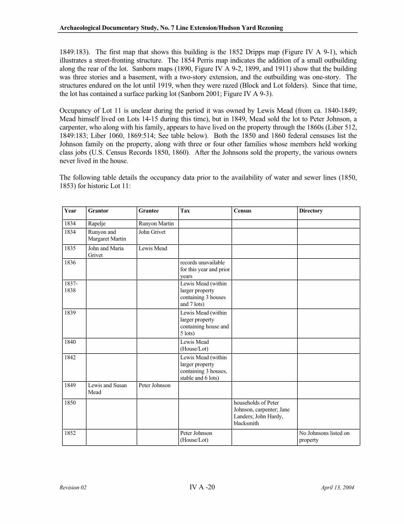
Archaeological Documentary Study, No. 7 Line Extension/Hudson Yard Rezoning
Revision 02 IV A -20 April 13, 2004
1849:183). The first map that shows this building is the 1852 Dripps map (Figure IV A 9-1), which illustrates a street-fronting structure. The 1854 Perris map indicates the addition of a small outbuilding along the rear of the lot. Sanborn maps (1890, Figure IV A 9-2, 1899, and 1911) show that the building was three stories and a basement, with a two-story extension, and the outbuilding was one-story. The structures endured on the lot until 1919, when they were razed (Block and Lot folders). Since that time, the lot has contained a surface parking lot (Sanborn 2001; Figure IV A 9-3).
Occupancy of Lot 11 is unclear during the period it was owned by Lewis Mead (from ca. 1840-1849; Mead himself lived on Lots 14-15 during this time), but in 1849, Mead sold the lot to Peter Johnson, a carpenter, who along with his family, appears to have lived on the property through the 1860s (Liber 512, 1849:183; Liber 1060, 1869:514; See table below). Both the 1850 and 1860 federal censuses list the Johnson family on the property, along with three or four other families whose members held working class jobs (U.S. Census Records 1850, 1860). After the Johnsons sold the property, the various owners never lived in the house.
The following table details the occupancy data prior to the availability of water and sewer lines (1850, 1853) for historic Lot 11:
Year Grantor Grantee Tax Census Directory
1834 Rapelje Runyon Martin
1834 Runyon and Margaret Martin
John Grivet
1835 John and Maria Grivet
Lewis Mead
1836 records unavailable for this year and prior years
1837-1838
Lewis Mead (within larger property containing 3 houses and 7 lots)
1839 Lewis Mead (within larger property containing house and 5 lots)
1840 Lewis Mead (House/Lot)
1842 Lewis Mead (within larger property containing 3 houses, stable and 6 lots)
1849 Lewis and Susan Mead
Peter Johnson
1850 households of Peter Johnson, carpenter; Jane Landers; John Hardy, blacksmith
1852 Peter Johnson (House/Lot)
No Johnsons listed on property
IV A Rezoning
Revision 02 IV A-21 April 13, 2004
Year Grantor Grantee Tax Census Directory
1860 households of Caty Johnson; Adam Smith; Samuel Linderbeck, carman; Caty Bolan
Catherine Johnson, widow of Peter, h. 447 W. 35th
Summary and Conclusions
Archaeological potential varies across the three historic lots that comprise modern Lot 9. Historic Lot 9 was not developed until ca. 1854, four years after water and one year after sewer service became available along adjacent West 35th Street (Map of the croton Water Pipes with the Stop Cocks 1850; City of New York, Environmental Protection Administration 1968), and it is presumed that the newly built tenement house was hooked up to city water and sewers as it was built, negating the need for wells, cisterns, or privies on the property.
However, historic Lots 10 and 11 were developed by 1842 and 1840, respectively, and would have relied on backyard shaft features for at least ten years before city-supplied water and sewer service was in place, and possibly longer, depending on when the buildings were plumbed. However, during the period of time that each lot was developed prior to the availability of water and sewer (1850, 1853), continued residency could not be established (see tables above). Any potential shaft features on these two lots, which would presumably have been used for a period of roughly ten years, could not be associated with specific occupants. Therefore, the research potential of historic Lots 10 and 11 is minimal, and the lots warrant no further archaeological consideration.
Lots 23 and 24
Lot History
Lots 23 and 24 share a similar developmental history, and will be addressed together. Both lots were vacant in 1852, the year the Dripps map was made (Figure IV A 9-1), but by issuance of the 1854 Perris map, appear to have been developed for the first time. This map illustrates that the lots (along with historic Lot 25, described below) contained a long east-west trending structure at the rear of the properties. In 1853, importers Cornelius Van Blankensteyn and Hirsch Heinemann purchased the vacant property, and began to construct a factory on the lots (Liber 632, 1853:109). The 1857-62 Perris map shows that similarly shaped extensions of the first building had been added onto the eastern and southern sides of the three-lot property. The now horseshoe-shaped structure is labeled “Manufactury of Ladies Dress Trimmings.” The factory buildings were three and four stories high (Assessed Valuation of Real Estate 1870).
In 1873, the executors of now deceased Hirsch Heinemann’s estate sold Lots 23-25 and the factory buildings were soon torn down (Liber 1234, 1873:621). That same year, new tenement buildings were erected on Lots 23, 24, and 25. Each structure was five stories high, with a ten foot deep basement, and measured 25 feet wide by 75 feet long. The buildings were designed to have stores on the first floors, and four apartments on each of the upper floors (Block and Lot folders; Sanborn 1890, Figure IV A 9-2). These tenement buildings remained on the lots until 1988, when they were demolished (BIS on the web). The lots currently contain a surface parking lot (Sanborn 2001; Figure IV A 9-3).
Archaeological Documentary Study, No. 7 Line Extension/Hudson Yard Rezoning
Revision 02 IV A -22 April 13, 2004
Summary and Conclusions
There is no archaeological sensitivity for Lots 23 and 24. Any potential remains associated with the factory, which was located on the lots from ca. 1854-1873, would have been destroyed during excavation for the basements associated with the tenement buildings. The area at the rear of the tenements, which was not built over, falls within the former footprint of the factory building, and not in the former factory yard area, where subsurface features might remain. Last, development on these lots post-dates the introduction of water and sewer service within West 35th Street (1850 and 1853 respectively) so the potential for recovery of any shaft features associated with either the factory or the later tenement buildings is virtually nonexistent (City of New York, Environmental Protection Administration 1968). No further archaeological investigations are recommended for these lots.
Lot 25
Lot History
Modern Lot 25 comprises historic Lots 25, 26, and 27. The early developmental history of historic Lot 25 is identical to historic Lots 23 and 24, described above. Lot 25 was the eastern third of the factory property owned by Van Blankensteyn and Heinemann from 1853-1873 (Liber 632, 1853:109; Liber 1234, 1873:621). In 1873, a five-story tenement building was constructed on the lot, identical to those built on adjacent Lots 23 and 24. The tenement on Lot 25 was demolished in 1971 (BIS on the web). Since then, Lot 25 has contained a surface parking lot (Sanborn 2001; Figure IV A 9-3).
Lot 26 was developed as early as 1837. John Santini (sometimes spelled Centine) purchased the lot in 1835 (Liber 347, 1835:8), and by at least 1837 Assessed Valuation of Real Estate documented a house on the property (records prior to 1837 are incomplete). Santini’s heirs transferred the lot to Bartholomew Ceragioli in 1839 (Liber 402, 1839:296), who owned the property until selling it in 1851 (Liber 583, 1851:191). Assessed Valuation of Real Estate records continued to document a house on the lot through the 1850s, despite several changes in ownership. The first depiction of the structure is on the 1852 Dripps map (Figure IV A 9-1), where an outbuilding is also visible at the rear of the lot; the house and outbuilding appear again on the 1854 Perris map. On the 1857-62 Perris map, however, the outbuilding is gone (Assessed Valuation of Real Estate records for 1862 indicated the lot was vacant, suggesting the map maker depicted the lot while demolition of the two buildings was only half completed). In 1870, the lot contained a stable (Assessed Valuation of Real Estate), but by 1880, new houses had been constructed on the lot: a two story street-fronting structure, and a three story outbuilding (Ibid: 1880). These buildings appear on the 1890 Sanborn map (Figure IV A 9-2). By the 1899 Sanborn map, though, the two story street-fronting building had been replaced by a five story structure. Both of the buildings on the property had basements (Sanborn 1911). The outbuilding on Lot 26 endured until 1967, when it was demolished; the street-fronting building was razed in 1971 (Block and Lot folders). Today, the lot contains a surface parking lot (Sanborn 2001; Figure IV A 9-3).
The following table details the development, occupancy and ownership of Lot 26:
Year Grantor Grantee Tax Census Directory
1834 Rapelje Runyon Martin
1834 Runyon and Margaret Martin
Varion Vion
1835 Varion and Mary Vion
Joseph Gianni
1835 Joseph Gianni John Santini
IV A Rezoning
Revision 02 IV A-23 April 13, 2004
Year Grantor Grantee Tax Census Directory
1836 records unavailable for this year and prior years
1837 Mr. Santini (house and lot)
1838 John Centine (house and lot)
1839 Santini heirs (chancery court case)
Bartholomew Ceragioli
John Centine (house and lot)
1840 John Centine (house and lot)
no residents identified
1841 Estate of John Santini (house and lot)
1842 John Pinn (house and lot)
1850 no residents identified
1851 Bartholomew and Catherine Ceragioli
Joseph Contrell
1852 Joseph and Catharine Contrell
John Redman M. Carazoli (house and lot)
1859 John and Eliza Redman
Walter Ainley
1860 Walter Ainley George Johnson
no residents identified
1862 George Johnson (vacant lot)
1866 George and Ann Johnson
Martin Keogh
1867 Martin and Mary Keogh
Sarah Heinemann
1870 George Johnson (stable)
Households of Sarah Handle; Charles Terrell, iron moulder; Martin Coffee, policeman
1877 Louis Doscher, Referee, Martin Keogh et al., Defendants
Benjamin Floyd
It appears that for the majority of its history, Lot 26 was rented; archival records reviewed for this investigation failed both to locate any owners living on the property, or the names of most of the renters
Archaeological Documentary Study, No. 7 Line Extension/Hudson Yard Rezoning
Revision 02 IV A -24 April 13, 2004
(see table above). However, based on the size of the buildings on the lot, it can be assumed that there were multiple families living on the property at any given time.
Lot 27 also was developed by 1837, and belonged initially to John Santini as well (Assessed Valuation of Real Estate 1837; Liber 347, 1835:8). Santini’s heirs sold the lot in 1839, and the lot went through several owners during the 1840s and into the 1850s, although the house continued to be listed in the Assessed Valuation of Real Estate records. In 1840, the occupant was listed as “Primary School #36,” although the following year the house was again attributed to its owner. The 1852 Dripps map (Figure IV A 9-1) shows the lot for the first time, and illustrates that there was both a street-fronting structure and an outbuilding on the property. The 1854 and 1857-62 Perris maps show the same buildings on the lot. Sanborn maps (1890, Figure IV A 9-2, 1899, 1911, 1930, 1951) show that the footprint of the buildings remained the same through the mid twentieth century, although the front building on the lot had a story added. In 1870, both buildings were three stories high; by 1880 the street fronting structure had been raised to four stories (Assessed Valuation of Real Estate 1870, 1880). Both structures on the lot were razed during the second half of the twentieth century (Sanborn 1951, 1980). Today the lot contains a surface parking lot (Sanborn 2001; Figure IV A 9-3).
The following table details the development, occupancy and ownership of Lot 27:
Year Grantor Grantee Tax Census Directory
1834 Rapelje Runyon Martin
1834 Runyon and Margaret Martin
Varion Vion
1835 Varion and Mary Vion Joseph Gianni
1835 Joseph and Mary Gianni
John Santini
1836 records unavailable for this year and prior years
1837 Mr. Santini (house and lot)
1838 John Centine (house and lot)
1839 Santini heirs (chancery court case)
Cipriano Caraccioli
John Centine (house and lot)
1840 Public Primary School
no residents identified
1841 Cipriano and Mary Caraccioli
John G. Porter Cipriano Chiozili (house and lot)
1842 John Porter (house and lot)
1843 John G. and Julia Ann Porter
Henry B. Blair
1850 no residents identified
1852 Henry B. and Martha Blair
Nancy Risley A.H. Blair (two houses and lot)
1855 Nancy and Christopher Risley
Patrick Kearney
1856 Patrick and Mary Kearney
Michael Hoffman
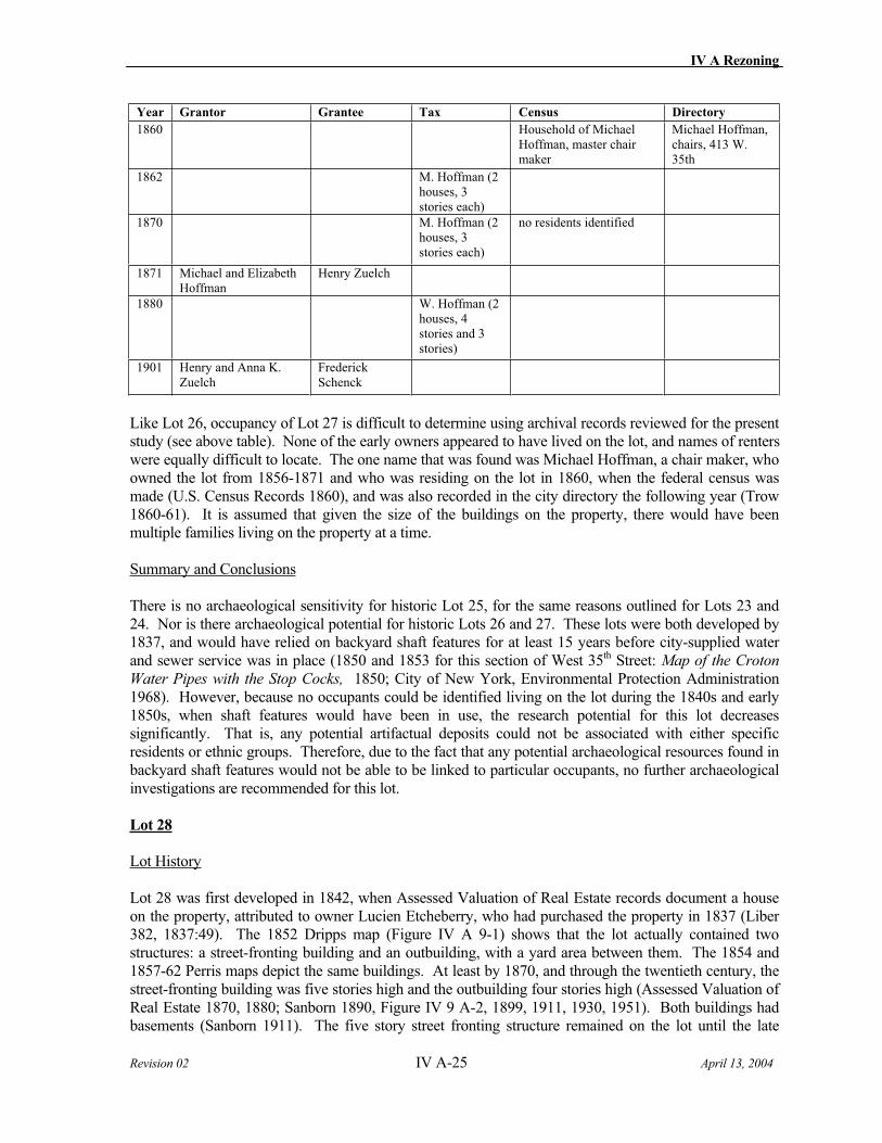
IV A Rezoning
Revision 02 IV A-25 April 13, 2004
Year Grantor Grantee Tax Census Directory
1860 Household of Michael Hoffman, master chair maker
Michael Hoffman, chairs, 413 W. 35th
1862 M. Hoffman (2 houses, 3 stories each)
1870 M. Hoffman (2 houses, 3 stories each)
no residents identified
1871 Michael and Elizabeth Hoffman
Henry Zuelch
1880 W. Hoffman (2 houses, 4 stories and 3 stories)
1901 Henry and Anna K. Zuelch
Frederick Schenck
Like Lot 26, occupancy of Lot 27 is difficult to determine using archival records reviewed for the present study (see above table). None of the early owners appeared to have lived on the lot, and names of renters were equally difficult to locate. The one name that was found was Michael Hoffman, a chair maker, who owned the lot from 1856-1871 and who was residing on the lot in 1860, when the federal census was made (U.S. Census Records 1860), and was also recorded in the city directory the following year (Trow 1860-61). It is assumed that given the size of the buildings on the property, there would have been multiple families living on the property at a time.
Summary and Conclusions
There is no archaeological sensitivity for historic Lot 25, for the same reasons outlined for Lots 23 and 24. Nor is there archaeological potential for historic Lots 26 and 27. These lots were both developed by 1837, and would have relied on backyard shaft features for at least 15 years before city-supplied water and sewer service was in place (1850 and 1853 for this section of West 35th Street: Map of the Croton
Water Pipes with the Stop Cocks, 1850; City of New York, Environmental Protection Administration 1968). However, because no occupants could be identified living on the lot during the 1840s and early 1850s, when shaft features would have been in use, the research potential for this lot decreases significantly. That is, any potential artifactual deposits could not be associated with either specific residents or ethnic groups. Therefore, due to the fact that any potential archaeological resources found in backyard shaft features would not be able to be linked to particular occupants, no further archaeological investigations are recommended for this lot.
Lot 28
Lot History
Lot 28 was first developed in 1842, when Assessed Valuation of Real Estate records document a house on the property, attributed to owner Lucien Etcheberry, who had purchased the property in 1837 (Liber 382, 1837:49). The 1852 Dripps map (Figure IV A 9-1) shows that the lot actually contained two structures: a street-fronting building and an outbuilding, with a yard area between them. The 1854 and 1857-62 Perris maps depict the same buildings. At least by 1870, and through the twentieth century, the street-fronting building was five stories high and the outbuilding four stories high (Assessed Valuation of Real Estate 1870, 1880; Sanborn 1890, Figure IV 9 A-2, 1899, 1911, 1930, 1951). Both buildings had basements (Sanborn 1911). The five story street fronting structure remained on the lot until the late
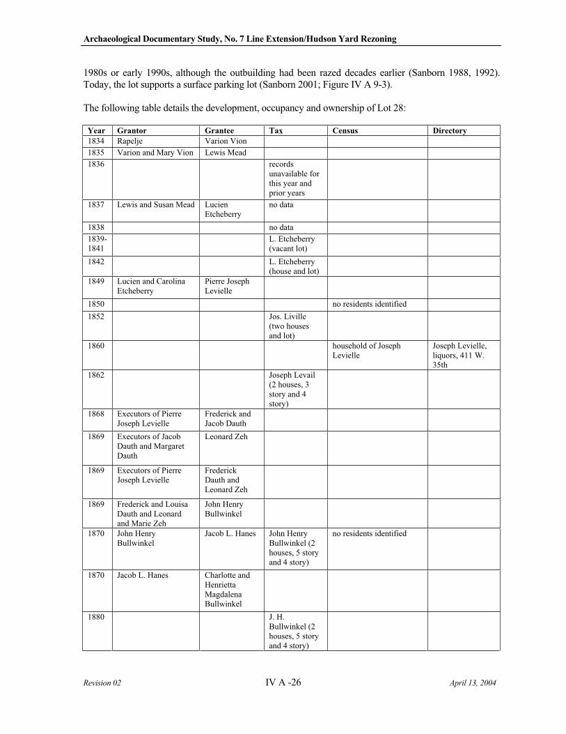
Archaeological Documentary Study, No. 7 Line Extension/Hudson Yard Rezoning
Revision 02 IV A -26 April 13, 2004
1980s or early 1990s, although the outbuilding had been razed decades earlier (Sanborn 1988, 1992). Today, the lot supports a surface parking lot (Sanborn 2001; Figure IV A 9-3).
The following table details the development, occupancy and ownership of Lot 28:
Year Grantor Grantee Tax Census Directory
1834 Rapelje Varion Vion
1835 Varion and Mary Vion Lewis Mead
1836 records unavailable for this year and prior years
1837 Lewis and Susan Mead Lucien Etcheberry
no data
1838 no data
1839-1841
L. Etcheberry (vacant lot)
1842 L. Etcheberry (house and lot)
1849 Lucien and Carolina Etcheberry
Pierre Joseph Levielle
1850 no residents identified
1852 Jos. Liville (two houses and lot)
1860 household of Joseph Levielle
Joseph Levielle, liquors, 411 W. 35th
1862 Joseph Levail (2 houses, 3 story and 4 story)
1868 Executors of Pierre Joseph Levielle
Frederick and Jacob Dauth
1869 Executors of Jacob Dauth and Margaret Dauth
Leonard Zeh
1869 Executors of Pierre Joseph Levielle
Frederick Dauth and Leonard Zeh
1869 Frederick and Louisa Dauth and Leonard and Marie Zeh
John Henry Bullwinkel
1870 John Henry Bullwinkel
Jacob L. Hanes John Henry Bullwinkel (2 houses, 5 story and 4 story)
no residents identified
1870 Jacob L. Hanes Charlotte and HenriettaMagdalena Bullwinkel
1880 J. H. Bullwinkel (2 houses, 5 story and 4 story)

IV A Rezoning
Revision 02 IV A-27 April 13, 2004
Year Grantor Grantee Tax Census Directory
1887 Charlotte, Henrietta Magdalena, and John Henry Bullwinkel
Francis McCabe
Occupancy of Lot 28 is unclear. None of the early owners appeared to have lived on the lot, and names of renters were equally difficult to locate (see table above). The one name that was found was owner (1849-1868) Joseph Levielle, a liquor dealer, who appeared to be residing on the lot in 1860, when the federal census was made (U.S. Census Records 1860), and was also recorded in the city directory the following year (Trow 1860-61). Like adjacent lots, however, it is assumed that given the size of the buildings on the property, there would have been multiple families living on the lot at a time.
Summary and Conclusions
There is no archaeological sensitivity for Lot 28. Although the lot was developed by 1841, and would have relied on backyard shaft features for about nine years before city-supplied water and sewer service was in place (1850 and 1853 for this section of West 35th Street: Man of the Croton Water Pipes with the
Stop Cocks, 1850; City of New York, Environmental Protection Administration 1968), no occupants could be identified living on the lot during the 1840s and early 1850s, when shaft features would have been in use. Because of this, the research potential for this lot decreases significantly. Therefore, due to the fact that any potential archaeological resources found in backyard shaft features would not be able to be liked to particular occupants, no further archaeological investigations are recommended for this lot.
Lots 30 and 31
Lot History
Modern Lot 31 is composed of historic Lots 29 and 31-42. Modern Lot 30 is located immediately west of historic Lot 31, and for the first decades of its history seems to have been associated with historic Lot 31. For this reason, historic Lots 29 through 42 will be addressed together. Water lines had been laid in adjacent street beds by 1850 (Map of the Croton Water Pipes with the Stop Cocks, 1850). Along Ninth Avenue, sewers were installed in 1849, along West 35th Street they were laid in 1853, and along West 36th Street they were in place in 1847 (City of New York, Environmental Protection Administration 1968).
The earliest development on modern Lots 30 and 31 was on historic Lot 31 (at the corner of West 35th
Street and Ninth Avenue), where by 1837 owner Varian Vion had constructed a structure (Liber 317, 1834:57; Assessed Valuation of Real Estate 1837 [note: records prior to 1837 are incomplete]). Through the middle 1840s, this was the only building on modern Lots 30 and 31 (Assessed Valuation of Real Estate). Vion also owned Lots 30, 32, and 33 during this period, and it is likely that these adjacent lots served as extended yard areas for the building on Lot 31 while the other lots were still undeveloped.
By 1852, the Dripps map (Figure IV A 9-1) shows that many of the other historic lots on modern Lots 30 and 31 had been developed. Street-fronting structures are depicted on historic Lots 29, 30, 31, 34, 35, 36, 37, 38, 39, 40, 41, and 42. Most of the lots had open rear yards, and a number had small outbuildings (the exceptions were Lots 30 and 31, which had buildings encompassing virtually the entire lots). The 1854 and 1857-62 Perris maps show these lots in more detail.
There appears to have been only minimal change to the buildings on the lots during the 1860s and 1870s, but considerable demolition and rebuilding in the 1880s and 1890s. Assessed Valuation of Real Estate records for the lots from 1870 and 1880, compared with Sanborn maps from 1890 (Figure IV A 9-2) and
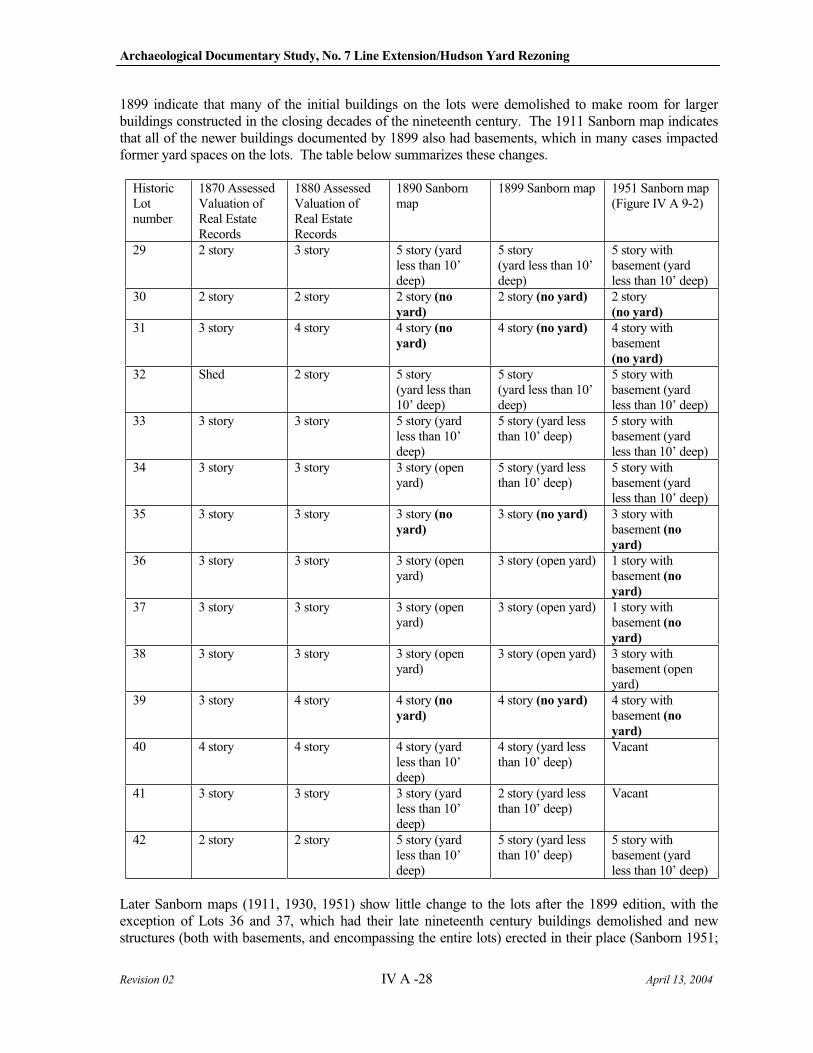
Archaeological Documentary Study, No. 7 Line Extension/Hudson Yard Rezoning
Revision 02 IV A -28 April 13, 2004
1899 indicate that many of the initial buildings on the lots were demolished to make room for larger buildings constructed in the closing decades of the nineteenth century. The 1911 Sanborn map indicates that all of the newer buildings documented by 1899 also had basements, which in many cases impacted former yard spaces on the lots. The table below summarizes these changes.
HistoricLotnumber
1870 Assessed Valuation of Real Estate Records
1880 Assessed Valuation of Real Estate Records
1890 Sanborn map
1899 Sanborn map 1951 Sanborn map (Figure IV A 9-2)
29 2 story 3 story 5 story (yard less than 10’ deep)
5 story (yard less than 10’ deep)
5 story with basement (yard less than 10’ deep)
30 2 story 2 story 2 story (no
yard)
2 story (no yard) 2 story (no yard)
31 3 story 4 story 4 story (no
yard)
4 story (no yard) 4 story with basement (no yard)
32 Shed 2 story 5 story (yard less than 10’ deep)
5 story (yard less than 10’ deep)
5 story with basement (yard less than 10’ deep)
33 3 story 3 story 5 story (yard less than 10’ deep)
5 story (yard less than 10’ deep)
5 story with basement (yard less than 10’ deep)
34 3 story 3 story 3 story (open yard)
5 story (yard less than 10’ deep)
5 story with basement (yard less than 10’ deep)
35 3 story 3 story 3 story (no
yard)
3 story (no yard) 3 story with basement (no
yard)
36 3 story 3 story 3 story (open yard)
3 story (open yard) 1 story with basement (no
yard)
37 3 story 3 story 3 story (open yard)
3 story (open yard) 1 story with basement (no
yard)
38 3 story 3 story 3 story (open yard)
3 story (open yard) 3 story with basement (open yard)
39 3 story 4 story 4 story (no
yard)
4 story (no yard) 4 story with basement (no
yard)
40 4 story 4 story 4 story (yard less than 10’ deep)
4 story (yard less than 10’ deep)
Vacant
41 3 story 3 story 3 story (yard less than 10’ deep)
2 story (yard less than 10’ deep)
Vacant
42 2 story 2 story 5 story (yard less than 10’ deep)
5 story (yard less than 10’ deep)
5 story with basement (yard less than 10’ deep)
Later Sanborn maps (1911, 1930, 1951) show little change to the lots after the 1899 edition, with the exception of Lots 36 and 37, which had their late nineteenth century buildings demolished and new structures (both with basements, and encompassing the entire lots) erected in their place (Sanborn 1951;
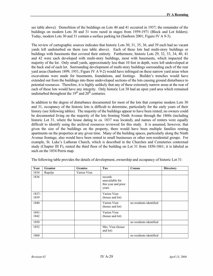
IV A Rezoning
Revision 02 IV A-29 April 13, 2004
see table above). Demolition of the buildings on Lots 40 and 41 occurred in 1937; the remainder of the buildings on modern Lots 30 and 31 were razed in stages from 1959-1971 (Block and Lot folders). Today, modern Lots 30 and 31 contain a surface parking lot (Sanborn 2001; Figure IV A 9-3).
The review of cartographic sources indicates that historic Lots 30, 31, 35, 36, and 39 each had no vacant yards left undisturbed on them (see table above). Each of these lots had multi-story buildings or buildings with basements that covered their entirety. Furthermore, historic Lots 29, 32, 33, 34, 40, 41 and 42 were each developed with multi-story buildings, most with basements, which impacted the majority of the lot. Only small yards, approximately less than 10 feet in depth, were left undeveloped at the back end of each lot. Surrounding development of multi-story buildings surrounding each of the rear yard areas (Sanborn 1899, 1951; Figure IV A 9-2) would have infringed on these narrow yard areas when excavations were made for basements, foundations, and footings. Builder’s trenches would have extended out from the buildings into these undeveloped sections of the lots causing ground disturbance to potential resources. Therefore, it is highly unlikely that any of these extremely narrow areas at the rear of each of these lots would have any integrity. Only historic Lot 38 had an open yard area which remained undisturbed throughout the 19th and 20th centuries.
In addition to the degree of disturbance documented for most of the lots that comprise modern Lots 30 and 31, occupancy of the historic lots is difficult to determine, particularly for the early years of their history (see following tables). The majority of the buildings appear to have been rented; no owners could be documented living on the majority of the lots fronting Ninth Avenue through the 1860s (including historic Lot 31, where the house dating to ca. 1837 was located), and names of renters were equally difficult to identify using the archival resources reviewed for this study. It is assumed, however, that given the size of the buildings on the property, there would have been multiple families renting apartments on the properties at any given time. Many of the building spaces, particularly along the Ninth Avenue frontage, also would have been rented to small businesses or other non-residential groups. For example, St. Luke’s Lutheran Church, which is described in the Churches and Cemeteries contextual study (Chapter III F), rented the third floor of the building on Lot 31 from 1850-1861; it is labeled as such on the 1854 Perris map.
The following table provides the details of development, ownership and occupancy of historic Lot 31:
Year Grantor Grantee Tax Census Directory
1834 Rapelje Varion Vion
1836 records unavailable for this year and prior years
1837-1839
Varion Vion (house and lot)
1840 Varion Vion (house and lot)
no residents identified
1841-1842
Varion Vion (house and lot)
1850 no residents identified
1852 Mrs. Vion (house and lot)
1860 no residents identified
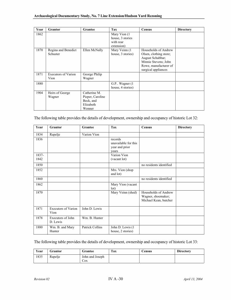
Archaeological Documentary Study, No. 7 Line Extension/Hudson Yard Rezoning
Revision 02 IV A -30 April 13, 2004
Year Grantor Grantee Tax Census Directory
1862 Mary Vion (1 house, 3 stories with rear extension)
1870 Regina and Benedict Schuster
Ellen McNally Mary Veinn (1 house, 3 stories)
Households of Andrew Olsen, clothing store; August Schabbar; Minnie Stevens; John Rowe, manufacturer of surgical appliances
1871 Executors of Varion Vion
George Philip Wagner
1880 G.P.. Wagner (1 house, 4 stories)
1904 Heirs of George Wagner
Catherine M. Pieper, Caroline Beck, and Elizabeth Wenner
The following table provides the details of development, ownership and occupancy of historic Lot 32:
Year Grantor Grantee Tax Census Directory
1834 Rapelje Varion Vion
1836 records unavailable for this year and prior years
1837-1842
Varion Vion (vacant lot)
1850 no residents identified
1852 Mrs. Vion (shop and lot)
1860 no residents identified
1862 Mary Vion (vacant lot)
1870 Mary Veinn (shed) Households of Andrew Wagner, shoemaker; Michael Kean, butcher
1871 Executors of Varion Vion
John D. Lewis
1878 Executors of John D. Lewis
Wm. B. Hunter
1880 Wm. B. and Mary Hunter
Patrick Collins John D. Lewis (1 house, 2 stories)
The following table provides the details of development, ownership and occupancy of historic Lot 33:
Year Grantor Grantee Tax Census Directory
1835 Rapelje John and Joseph Cox

IV A Rezoning
Revision 02 IV A-31 April 13, 2004
Year Grantor Grantee Tax Census Directory
1838 records unavailable for this year and prior years
1839 Joseph Cox et al. Varion Vion no data
1840-1842
Varion Vion (vacant lot)
1850 no residents identified
1852 Mrs. Dean (house and lot)
1860 no residents identified
1862 James McGowan (1 house, 3 stories)
1870 Mrs. Margaret Henry (1 story, 3 stories)
Households of Gustave Hetty, grocer; August Brandt, grocer; Michael Phalon, policeman; Bernard Donnelly, policeman; Mary McGary; John Struse, carpenter
1871 Execs. of Varion Vion
John D. Lewis
1880 Mrs. Margaret Henry (1 story, 3 stories)
As detailed above, the only lot identified with a yard area that was not subsequently disturbed was historic Lot 38. However, for the period of time that Lot 38 was developed prior to the installation of city sewer and water on Ninth Avenue (1849 and 1850 respectively), occupancy could not be established. The following table provides the details of development, ownership and occupancy of historic Lot 38:
Year Grantor Grantee Tax Census Directory
1836-1840
records unavailable for these years and prior years
1841 Joseph Meeks (vacant lot)
1842 Joseph and Sarah Meeks
John and Joseph Meeks
Joseph Meeks (vacant lot)
1846 John Meeks et al. Charles Havens
1849 Charles Havens Peter Weight
1850 no residents identified
1852 Mrs. Weight (house and lot)
Sarah Weight, widow of Peter D., 423 Ave. 9
1860 no residents identified James W. Weight, smith, h. 423 9th Ave.; Robert Weight, grocer, 465 9th Ave., h. 423 9th
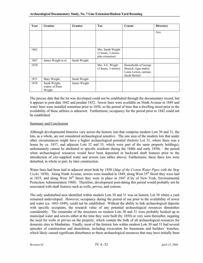
Archaeological Documentary Study, No. 7 Line Extension/Hudson Yard Rezoning
Revision 02 IV A -32 April 13, 2004
Year Grantor Grantee Tax Census Directory
Ave.
1862 Mrs. Sarah Waight (1 house, 3 stories plus extension)
1867 James Weight et al. Sarah Weight
1870 Mrs. S.E. Wright (1 house, 3 stories)
Households of George Strauch, cigar maker; Louie Lewen, carman; Jacob Heitzel
1871 Mary Weight Sarah Weight
1878 Sarah Weight, widow of Peter Weight
James Weight
The precise date that the lot was developed could not be established through the documentary record, but it appears to post-date 1842 and predate 1852. Sewer lines were available on Ninth Avenue in 1849 and water lines were installed sometime prior to 1850, so the period of time that a dwelling stood prior to the availability of these utilities is unknown. Furthermore, occupancy for the period prior to 1842 could not be established.
Summary and Conclusions
Although developmental histories vary across the historic lots that comprise modern Lots 30 and 31, the lots, as a whole, are not considered archaeological sensitive. The one area of the modern lots that under other circumstances might have a higher archaeological potential (historic Lot 31, where there was a house by ca. 1837, and adjacent Lots 32 and 33, which were part of the same property holdings), unfortunately cannot be attributed to specific residents during the 1840s and early 1850s – the period when archaeological resources would have been deposited in backyard shaft features prior to the introduction of city-supplied water and sewers (see tables above). Furthermore, these three lots were disturbed, in whole or part, by later construction.
Water lines had been laid in adjacent street beds by 1850 (Map of the Croton Water Pipes with the Stop
Cocks, 1850). Along Ninth Avenue, sewers were installed in 1849, along West 35th Street they were laid in 1853, and along West 36th Street they were in place in 1847 (City of New York, Environmental Protection Administration 1968). Therefore, development post-dating this period would probably not be associated with shaft features such as wells, privies, and cisterns.
The only undisturbed area identified within modern Lots 30 and 31 was on historic Lot 38 where a yard remained undeveloped. However, occupancy during the period of use prior to the availability of sewer and water (ca. 1843-1849), could not be established. Without the ability to link archaeological deposits with specific occupants, the research value of any potential archaeological resources diminishes considerably. The remainder of the structures on modern Lots 30 and 31 were probably hooked up to municipal water and sewers either at the time they were built (by 1850) or very soon thereafter, negating the need for wells or privies on the property, which contain the bulk of all archaeological resources for domestic sites in Manhattan. Finally, most of the historic lots within modern Lots 30 and 31 had several episodes of construction and demolition, including excavation for basements and builders’ trenches, which likely caused significant disturbance to those archaeological resources that may have initially been

IV A Rezoning
Revision 02 IV A-33 April 13, 2004
on the lots. For these reasons, no additional archaeological investigations are recommended for modern Lots 30 and 31.
Lot 47
Lot History
Modern Lot 47 comprises historic Lots 22, 47, and 49 (the original layout of the block omitted a Lot 48). Until 1895, however, historic Lots 47 and 49 were treated as if there was a Lot 48: both maps and Assessed Valuation of Real Estate Records document three lots here, not two. These lots (along with adjacent Lot 46) were always conveyed as one unit, though, which aids in documenting their developmental histories.
All of modern Lot 47 was undeveloped through ca. 1853: both the Assessed Valuation of Real Estate Records and the 1852 Dripps map (Figure IV A 9-1) indicate this area of the block was vacant. The 1854 Perris map documents the first structures on all the lots. Lot 22 supported a street-fronting structure and a shared outbuilding with adjacent Lot 21. These buildings continued to be shown on subsequent nineteenth century maps (Perris 1857-62; Sanborn 1890, Figure IV A 9-2, 1899, 1911, 1930). While the three story street-fronting structure appears to have always been a dwelling, the shared two story outbuilding on Lots 21 and 22 was frequently used as a workshop. The 1857-62 Perris map has the words “silk dyer” superimposed partially on this building and partially on the outbuilding for Lots 50 and 51, to the north. The 1911 Sanborn map labels the outbuilding on Lots 21-22 a “paint shop” and the 1930 Sanborn map shows the same building houses and iron works on the first floor and a carpenter shop on the second floor. By the 1951 Sanborn map, all the buildings on Lot 22 had been razed. Since that time, the lot has been vacant (Sanborn 2001; Figure IV A 9-3).
On the combined Lots 46-47-49 property, the 1854 Perris map shows that initial development consisted of four street-fronting structures and a long, shared outbuilding (Perris 1854). It is possible that the buildings on Lots 46-47-49 housed some sort of manufacturing concern; the 1854 and 1857-62 Perris maps indicate the eastern three street-fronting structures contained “special hazards,” a notation that was associated with the manufacture of a variety of products. However, none of the maps (including the 1890 Sanborn map, Figure IV A 9-2, which shows little change to the building layouts) identified the type of manufacturing that might have been occurring on the property; the Assessed Valuation of Real Estate records were equally uninformative: they only listed the dimensions of the buildings shown on the maps, not their purposes. Normally, factories, shops, or other manufacturing entities would be noted in these records; the fact that nothing was listed for Lots 46-47-49 may mean the buildings supported a small cottage industry rather than a large-scale business.
All of the buildings on the combined Lot 46-47-49 property were demolished by 1895, and three new tenement buildings, each five stories high, were constructed on the lots, at 414, 416, and 418 West 36th
Street. The tenements on Lots 47 and 48/49 were each 28 feet wide and 88 feet long, leaving a ten-foot space at the rear of the lots that was not developed. Each tenement had a basement (the foundation was 6.5 feet below the level of the curb) where a janitor was to live. There were four apartments on each of the other floors (Block and Lot folders). These tenements remained on the lots until being demolished in 1953, by order of the Port Authority of New York (Block and Lot folders). Since that time the lots have been vacant (Sanborn 2001; Figure IV A 9-3).
Occupancy of the historic lots that comprise modern Lot 47 is difficult to determine, as virtually none of the owners ever lived on the properties (the exception was John O’Neil, a dyer, who owned Lot 22 from 1852-1868 and was found living there in Trow’s 1860-61 City Directory), and renters could not be traced in the archival records reviewed for this study, at least in the early years of the lot histories. In 1870, the
Archaeological Documentary Study, No. 7 Line Extension/Hudson Yard Rezoning
Revision 02 IV A -34 April 13, 2004
first year that census records documented addresses, Lot 22 was home to a number of young immigrant couples and single adults, born in Ireland, England, or areas that later became Western Germany. All of them held working class professions. No residents were listed for Lots 46-47-49, further suggesting that the property contained businesses, rather than dwellings (U.S. Census Records 1870). Although census records were not searched for the years after the tenement houses were built on Lots 47 and 49, based on the descriptions of the buildings, it can be assumed that approximately 20 families lived in each tenement.
Summary and Conclusions
There is no archaeological sensitivity for modern Lot 47. Any potential remains associated with businesses located on historic Lots 47-49 from ca. 1853-1895 would have been destroyed during excavation for the basements associated with the tenement buildings. On historic Lot 22, development (in ca. 1853) was concomitant with the introduction of sewer service within West 35th Street (the main was also laid in 1853), and it is likely that the structures were tied into this system at the time they were built, negating the need for wells, cisterns, and privies in yards areas (City of New York, Environmental Protection Administration 1968). Although there appear to have been various workshops located in the outbuilding of historic Lot 22 over the years, it is unlikely that any of the activities would have left an archaeological footprint on the lot, since they appear to have been contained with the building itself. For these reasons, no further archaeological investigations are recommended for modern Lot 47.
Lot 58
Lot History
Modern Lot 58 contains portions of historic Lots 11, 12, 13, 56, 57, and 58. Specifically, the modern lot includes the southeastern (street-fronting) corner of Lot 11, parts of the middle and rear yards of Lots 12 and 13, the northwestern (street-fronting) corner of Lot 56, a northern (street-fronting) portion of Lot 57, and all but the southeastern tip of Lot 57. The odd shape of this modern lot is due to the curved trajectory of the Lincoln Tunnel approach, which borders the lot on the east. Of note, Lot 11 was previously described in the modern Lot 9 discussion (Section IV A 9 b); the reader is referred to this section for the history of this lot; the summary will not be repeated here.
All of the historic lots that comprise modern Lot 58 were developed by 1841. Lots 12 and 13 were part of Lewis Mead’s holdings; Lot 12 had a house built in 1841, and Lot 13 had a house built by 1840 (records before 1840 are unclear as to which of Mead’s seven lots supported structures) (Assessed Valuation of Real Estate 1837-1841). Lots 56 and 57 belonged to John Matson (sometimes spelled Madison), although by 1838 his holdings were attributed to the “estate” of John Matson, implying he was deceased by that time. Both Lots 56 and 57 had houses on them by 1837 (note: records before 1837 are incomplete) (Assessed Valuation of Real Estate 1836-1837). Lot 58 was owned by William Lewis, and supported a house by 1841 (Assessed Valuation of Real Estate 1840-1841).
The 1852 Dripps map (Figure IV A 9-1) depicts these structures for the first time. All of the lots that comprise modern Lot 58 are shown having street-fronting structures; none had outbuildings at this point. By issuance of the 1854 Perris map, however, all the lots are shown as having outbuildings, with open yards in the central portions of the lots. The 1857-62 Perris map and the 1885 Robinson map indicate essentially no changes to the lots.
By 1889, the buildings on Lots 12 and 13 had been demolished, and that year new five story tenement houses were constructed on each of the lots (BIS on the web). They are visible for the first time on the 1890 Sanborn map (Figure IV A 9-2). The map shows that the new tenements covered virtually the
IV A Rezoning
Revision 02 IV A-35 April 13, 2004
entire lots, with only a small strip left open at the rear of the buildings. The tenements on Lots 12 and 13 continued to appear on later Sanborn maps (1899, 1911, 1930, and 1951). In 1952 the buildings were condemned by the city to make room for construction of the Lincoln Tunnel approach, and the tenements were razed soon thereafter (Liber 4812, 1952:311). Today, the lots contain a surface parking lot (Sanborn 2001; Figure IV A 9-3).
Lots 56, 57, and 58 changed little during the closing decades of the nineteenth century (Sanborn 1890, Figure IV A 9-2, 1899). However, in 1903 the properties were sold, and the buildings on them demolished to make room for a new Roman Catholic Church (Liber 95, 1903:318; Liber 97, 1903:173, 174; Liber 98, 1903:8). The 1911 Sanborn map illustrates the church building for the first time, and reveals the structure had a basement, and covered the entire three lots. The church remained on Lots 56, 57, and 58 until being razed in 1948 (Block and Lot folders). Since then, the lots have contained a surface parking lot (Sanborn 2001; Figure IV A 9-3).
Occupancy for the historic lots that comprise modern Lot 58 was difficult to determine for the 1830s-1850s, as no owners could be found living on their properties, and renters could not be traced using the archival resources reviewed for this study (the exception was Lot 11, described in Section IV A 9 b). The 1860 Federal Census, however, revealed owners or their families in residence on Lots 12, 13, and 58. Lot 12 was owned by William Olmsted, a carpenter, from 1855-1874; he and his family appear in both the 1860 and 1870 federal censuses. Ann Armstrong owned Lot 13 from 1857-1889, and her family (husband William was a timber inspector) also was documented in both the 1860 and 1870 federal censuses. Last, William Lewis owned Lot 58 from 1840-1880, and he appeared in both the 1860-61 city directory (Trow 1860-61) and the 1870 federal census. The 1870 federal census, which indicates house numbers for the first time, reveals that the remaining lots, which were not owner occupied, housed a variety of working class families, some of whom had emigrated from England or Ireland, and others of which were born in the United States.
Summary and Conclusions
Despite the early occupation of modern Lot 58, archaeological potential is low, due to subsurface disturbances from later buildings on the historic lots. On Lots 12 and 13, excavation for the basements of the two tenement buildings (which encompassed nearly the entire lots) would have destroyed any potential archaeological resources associated with the early dwellings on the properties. On Lots 56, 57, and 58, construction of the basement for the Roman Catholic church (which also covered the entire footprint of the lots) would have accomplished the same thing. Of note, only a tiny portion of historic Lot 11 is part of modern Lot 58, and it falls within the part of that lot that would have been covered by a street-fronting structure, not within a yard area. This portion of Lot 11 therefore also has low archaeological potential. In summary, no further archaeological investigations are recommended for any of the historic lots that comprise modern Lot 58.
10. Block 735, Lots 59 and 60
Lot 59
Lot History
The land occupied by Lot 59 on the north side of West 38th Street between 9th and 10th Avenues was originally part of a farm known as the Glass House Farm owned by Rem Rapelye (Deed Book Block 735). According to his will (2 Wills, p. 68), Block 735 was transferred to his son George Rapelje upon his death, who began subdivision of the lot around 1828. The street grid forming the Block 735 boundaries of West 38th Street, West 37th Street, 9th Avenue and 10th Avenue was depicted on the 1811
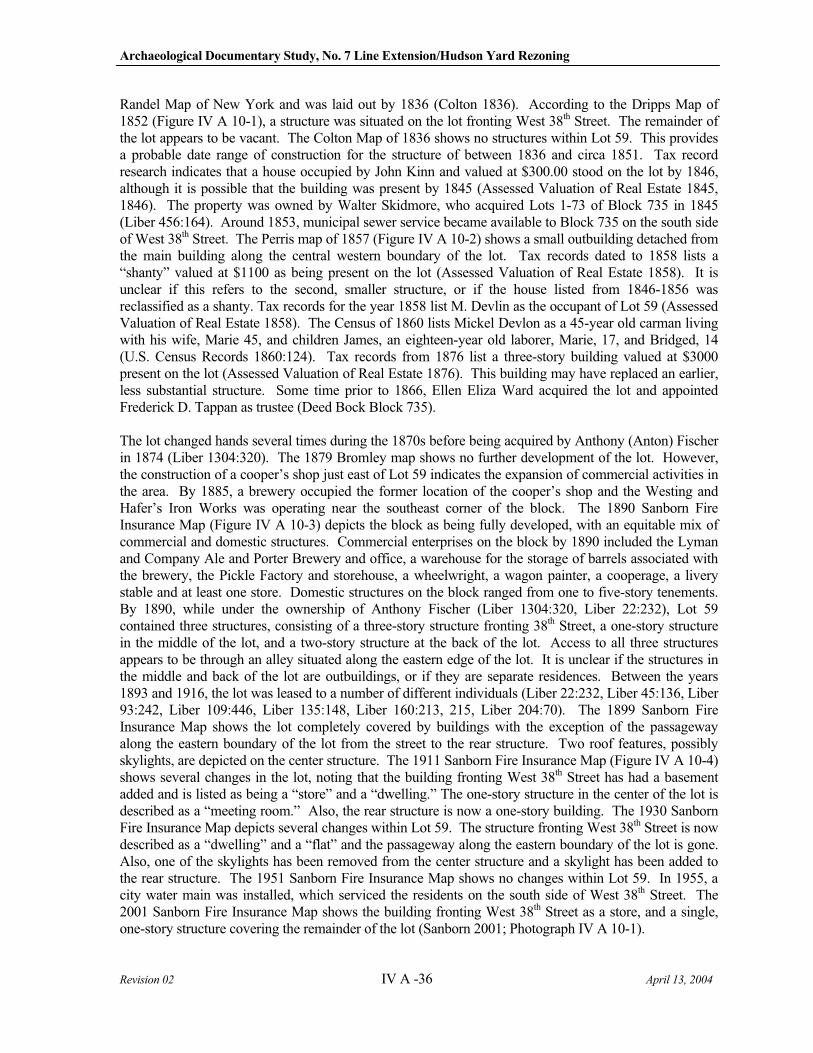
Archaeological Documentary Study, No. 7 Line Extension/Hudson Yard Rezoning
Revision 02 IV A -36 April 13, 2004
Randel Map of New York and was laid out by 1836 (Colton 1836). According to the Dripps Map of 1852 (Figure IV A 10-1), a structure was situated on the lot fronting West 38th Street. The remainder of the lot appears to be vacant. The Colton Map of 1836 shows no structures within Lot 59. This provides a probable date range of construction for the structure of between 1836 and circa 1851. Tax record research indicates that a house occupied by John Kinn and valued at $300.00 stood on the lot by 1846, although it is possible that the building was present by 1845 (Assessed Valuation of Real Estate 1845, 1846). The property was owned by Walter Skidmore, who acquired Lots 1-73 of Block 735 in 1845 (Liber 456:164). Around 1853, municipal sewer service became available to Block 735 on the south side of West 38th Street. The Perris map of 1857 (Figure IV A 10-2) shows a small outbuilding detached from the main building along the central western boundary of the lot. Tax records dated to 1858 lists a “shanty” valued at $1100 as being present on the lot (Assessed Valuation of Real Estate 1858). It is unclear if this refers to the second, smaller structure, or if the house listed from 1846-1856 was reclassified as a shanty. Tax records for the year 1858 list M. Devlin as the occupant of Lot 59 (Assessed Valuation of Real Estate 1858). The Census of 1860 lists Mickel Devlon as a 45-year old carman living with his wife, Marie 45, and children James, an eighteen-year old laborer, Marie, 17, and Bridged, 14 (U.S. Census Records 1860:124). Tax records from 1876 list a three-story building valued at $3000 present on the lot (Assessed Valuation of Real Estate 1876). This building may have replaced an earlier, less substantial structure. Some time prior to 1866, Ellen Eliza Ward acquired the lot and appointed Frederick D. Tappan as trustee (Deed Bock Block 735).
The lot changed hands several times during the 1870s before being acquired by Anthony (Anton) Fischer in 1874 (Liber 1304:320). The 1879 Bromley map shows no further development of the lot. However, the construction of a cooper’s shop just east of Lot 59 indicates the expansion of commercial activities in the area. By 1885, a brewery occupied the former location of the cooper’s shop and the Westing and Hafer’s Iron Works was operating near the southeast corner of the block. The 1890 Sanborn Fire Insurance Map (Figure IV A 10-3) depicts the block as being fully developed, with an equitable mix of commercial and domestic structures. Commercial enterprises on the block by 1890 included the Lyman and Company Ale and Porter Brewery and office, a warehouse for the storage of barrels associated with the brewery, the Pickle Factory and storehouse, a wheelwright, a wagon painter, a cooperage, a livery stable and at least one store. Domestic structures on the block ranged from one to five-story tenements. By 1890, while under the ownership of Anthony Fischer (Liber 1304:320, Liber 22:232), Lot 59 contained three structures, consisting of a three-story structure fronting 38th Street, a one-story structure in the middle of the lot, and a two-story structure at the back of the lot. Access to all three structures appears to be through an alley situated along the eastern edge of the lot. It is unclear if the structures in the middle and back of the lot are outbuildings, or if they are separate residences. Between the years 1893 and 1916, the lot was leased to a number of different individuals (Liber 22:232, Liber 45:136, Liber 93:242, Liber 109:446, Liber 135:148, Liber 160:213, 215, Liber 204:70). The 1899 Sanborn Fire Insurance Map shows the lot completely covered by buildings with the exception of the passageway along the eastern boundary of the lot from the street to the rear structure. Two roof features, possibly skylights, are depicted on the center structure. The 1911 Sanborn Fire Insurance Map (Figure IV A 10-4) shows several changes in the lot, noting that the building fronting West 38th Street has had a basement added and is listed as being a “store” and a “dwelling.” The one-story structure in the center of the lot is described as a “meeting room.” Also, the rear structure is now a one-story building. The 1930 Sanborn Fire Insurance Map depicts several changes within Lot 59. The structure fronting West 38th Street is now described as a “dwelling” and a “flat” and the passageway along the eastern boundary of the lot is gone. Also, one of the skylights has been removed from the center structure and a skylight has been added to the rear structure. The 1951 Sanborn Fire Insurance Map shows no changes within Lot 59. In 1955, a city water main was installed, which serviced the residents on the south side of West 38th Street. The 2001 Sanborn Fire Insurance Map shows the building fronting West 38th Street as a store, and a single, one-story structure covering the remainder of the lot (Sanborn 2001; Photograph IV A 10-1).
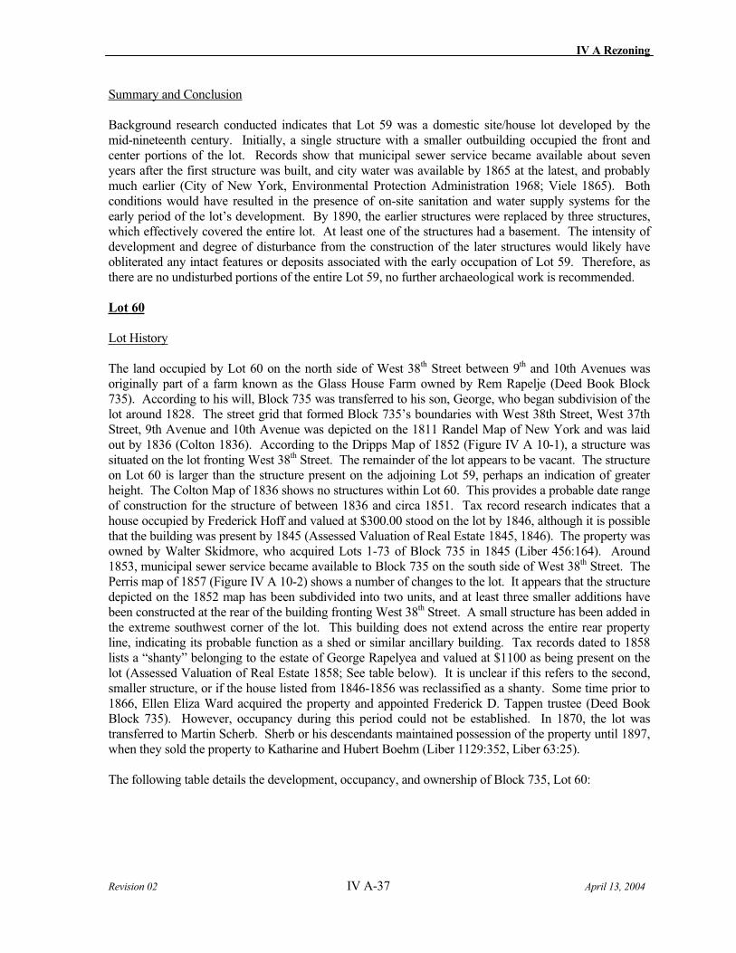
IV A Rezoning
Revision 02 IV A-37 April 13, 2004
Summary and Conclusion
Background research conducted indicates that Lot 59 was a domestic site/house lot developed by the mid-nineteenth century. Initially, a single structure with a smaller outbuilding occupied the front and center portions of the lot. Records show that municipal sewer service became available about seven years after the first structure was built, and city water was available by 1865 at the latest, and probably much earlier (City of New York, Environmental Protection Administration 1968; Viele 1865). Both conditions would have resulted in the presence of on-site sanitation and water supply systems for the early period of the lot’s development. By 1890, the earlier structures were replaced by three structures, which effectively covered the entire lot. At least one of the structures had a basement. The intensity of development and degree of disturbance from the construction of the later structures would likely have obliterated any intact features or deposits associated with the early occupation of Lot 59. Therefore, as there are no undisturbed portions of the entire Lot 59, no further archaeological work is recommended.
Lot 60
Lot History
The land occupied by Lot 60 on the north side of West 38th Street between 9th and 10th Avenues was originally part of a farm known as the Glass House Farm owned by Rem Rapelje (Deed Book Block 735). According to his will, Block 735 was transferred to his son, George, who began subdivision of the lot around 1828. The street grid that formed Block 735’s boundaries with West 38th Street, West 37th Street, 9th Avenue and 10th Avenue was depicted on the 1811 Randel Map of New York and was laid out by 1836 (Colton 1836). According to the Dripps Map of 1852 (Figure IV A 10-1), a structure was situated on the lot fronting West 38th Street. The remainder of the lot appears to be vacant. The structure on Lot 60 is larger than the structure present on the adjoining Lot 59, perhaps an indication of greater height. The Colton Map of 1836 shows no structures within Lot 60. This provides a probable date range of construction for the structure of between 1836 and circa 1851. Tax record research indicates that a house occupied by Frederick Hoff and valued at $300.00 stood on the lot by 1846, although it is possible that the building was present by 1845 (Assessed Valuation of Real Estate 1845, 1846). The property was owned by Walter Skidmore, who acquired Lots 1-73 of Block 735 in 1845 (Liber 456:164). Around 1853, municipal sewer service became available to Block 735 on the south side of West 38th Street. The Perris map of 1857 (Figure IV A 10-2) shows a number of changes to the lot. It appears that the structure depicted on the 1852 map has been subdivided into two units, and at least three smaller additions have been constructed at the rear of the building fronting West 38th Street. A small structure has been added in the extreme southwest corner of the lot. This building does not extend across the entire rear property line, indicating its probable function as a shed or similar ancillary building. Tax records dated to 1858 lists a “shanty” belonging to the estate of George Rapelyea and valued at $1100 as being present on the lot (Assessed Valuation of Real Estate 1858; See table below). It is unclear if this refers to the second, smaller structure, or if the house listed from 1846-1856 was reclassified as a shanty. Some time prior to 1866, Ellen Eliza Ward acquired the property and appointed Frederick D. Tappen trustee (Deed Book Block 735). However, occupancy during this period could not be established. In 1870, the lot was transferred to Martin Scherb. Sherb or his descendants maintained possession of the property until 1897, when they sold the property to Katharine and Hubert Boehm (Liber 1129:352, Liber 63:25).
The following table details the development, occupancy, and ownership of Block 735, Lot 60:
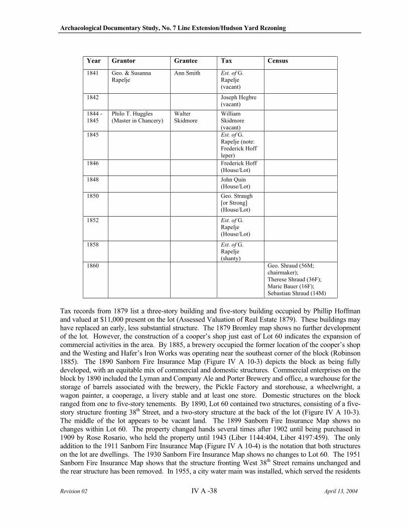
Archaeological Documentary Study, No. 7 Line Extension/Hudson Yard Rezoning
Revision 02 IV A -38 April 13, 2004
Year Grantor Grantee Tax Census
1841 Geo. & Susanna Rapelje
Ann Smith Est. of G. Rapelje(vacant)
1842 Joseph Hegbre (vacant)
1844 - 1845
Philo T. Huggles (Master in Chancery)
Walter Skidmore
William Skidmore (vacant)
1845 Est. of G. Rapelje (note: Frederick Hoff leper)
1846 Frederick Hoff (House/Lot)
1848 John Quin (House/Lot)
1850 Geo. Straugh [or Strong] (House/Lot)
1852 Est. of G. Rapelje(House/Lot)
1858 Est. of G. Rapelje(shanty)
1860 Geo. Shraud (56M; chairmaker); Therese Shraud (36F); Marie Bauer (16F); Sebastian Shraud (14M)
Tax records from 1879 list a three-story building and five-story building occupied by Phillip Hoffman and valued at $11,000 present on the lot (Assessed Valuation of Real Estate 1879). These buildings may have replaced an early, less substantial structure. The 1879 Bromley map shows no further development of the lot. However, the construction of a cooper’s shop just east of Lot 60 indicates the expansion of commercial activities in the area. By 1885, a brewery occupied the former location of the cooper’s shop and the Westing and Hafer’s Iron Works was operating near the southeast corner of the block (Robinson 1885). The 1890 Sanborn Fire Insurance Map (Figure IV A 10-3) depicts the block as being fully developed, with an equitable mix of commercial and domestic structures. Commercial enterprises on the block by 1890 included the Lyman and Company Ale and Porter Brewery and office, a warehouse for the storage of barrels associated with the brewery, the Pickle Factory and storehouse, a wheelwright, a wagon painter, a cooperage, a livery stable and at least one store. Domestic structures on the block ranged from one to five-story tenements. By 1890, Lot 60 contained two structures, consisting of a five-story structure fronting 38th Street, and a two-story structure at the back of the lot (Figure IV A 10-3). The middle of the lot appears to be vacant land. The 1899 Sanborn Fire Insurance Map shows no changes within Lot 60. The property changed hands several times after 1902 until being purchased in 1909 by Rose Rosario, who held the property until 1943 (Liber 1144:404, Liber 4197:459). The only addition to the 1911 Sanborn Fire Insurance Map (Figure IV A 10-4) is the notation that both structures on the lot are dwellings. The 1930 Sanborn Fire Insurance Map shows no changes to Lot 60. The 1951 Sanborn Fire Insurance Map shows that the structure fronting West 38th Street remains unchanged and the rear structure has been removed. In 1955, a city water main was installed, which served the residents
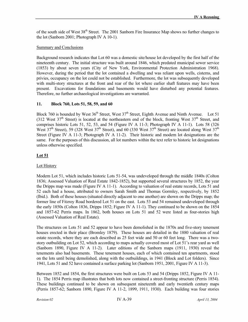
IV A Rezoning
Revision 02 IV A-39 April 13, 2004
of the south side of West 38th Street. The 2001 Sanborn Fire Insurance Map shows no further changes to the lot (Sanborn 2001; Photograph IV A 10-1).
Summary and Conclusions
Background research indicates that Lot 60 was a domestic site/house lot developed by the first half of the nineteenth century. The initial structure was built around 1846, which predated municipal sewer service (1853) by about seven years (City of New York, Environmental Protection Administration 1968). However, during the period that the lot contained a dwelling and was reliant upon wells, cisterns, and privies, occupancy on the lot could not be established. Furthermore, the lot was subsequently developed with multi-story structures at the front and rear of the lot where earlier shaft features may have been present. Excavations for foundations and basements would have disturbed any potential features. Therefore, no further archaeological investigations are warranted.
11. Block 760, Lots 51, 58, 59, and 60
Block 760 is bounded by West 36th Street, West 37th Street, Eighth Avenue and Ninth Avenue. Lot 51 (312 West 37th Street) is located at the northeastern end of the block, fronting West 37th Street, and comprises historic Lots 51, 52, 53, and 54 (Figure IV A 11-3; Photograph IV A 11-1). Lots 58 (326 West 37th Street), 59 (328 West 37th Street), and 60 (330 West 37th Street) are located along West 37th
Street (Figure IV A 11-3; Photograph IV A 11-2). Their historic and modern lot designations are the same. For the purposes of this discussion, all lot numbers within the text refer to historic lot designations unless otherwise specified.
Lot 51
Lot History
Modern Lot 51, which includes historic Lots 51-54, was undeveloped through the middle 1840s (Colton 1836; Assessed Valuation of Real Estate 1842-1852), but supported several structures by 1852, the year the Dripps map was made (Figure IV A 11-1). According to valuation of real estate records, Lots 51 and 52 each had a house, attributed to owners Sarah Smith and Thomas Gormley, respectively, by 1852 (Ibid.). Both of these houses (situated directly adjacent to one another) are shown on the Dripps map; the former line of Fitzroy Road bordered Lot 51 on the east. Lots 53 and 54 remained undeveloped through the early 1850s (Colton 1836, Dripps 1852; Figure IV A 11-1). They continued to be shown on the 1854 and 1857-62 Perris maps. In 1862, both houses on Lots 51 and 52 were listed as four-stories high (Assessed Valuation of Real Estate).
The structures on Lots 51 and 52 appear to have been demolished in the 1870s and five-story tenement houses erected in their place (Bromley 1879). These houses are detailed in the 1880 valuation of real estate records, where they are each described as 25 feet wide and 50 or 60 feet long. There was a two-story outbuilding on Lot 52, which according to maps actually covered most of Lot 51’s rear yard as well (Sanborn 1890, Figure IV A 11-2). Later editions of the Sanborn maps (1911, 1930) reveal the tenements also had basements. These tenement houses, each of which contained ten apartments, stood on the lots until being demolished, along with the outbuildings, in 1941 (Block and Lot folders). Since 1941, Lots 51 and 52 have contained a surface parking lot (Sanborn 1951, 2001, Figure IV A 11-3).
Between 1852 and 1854, the first structures were built on Lots 53 and 54 (Dripps 1852, Figure IV A 11-1). The 1854 Perris map illustrates that both lots now contained a street-fronting structure (Perris 1854). These buildings continued to be shown on subsequent nineteenth and early twentieth century maps (Perris 1857-62; Sanborn 1890, Figure IV A 11-2, 1899, 1911, 1930). Each building was four stories
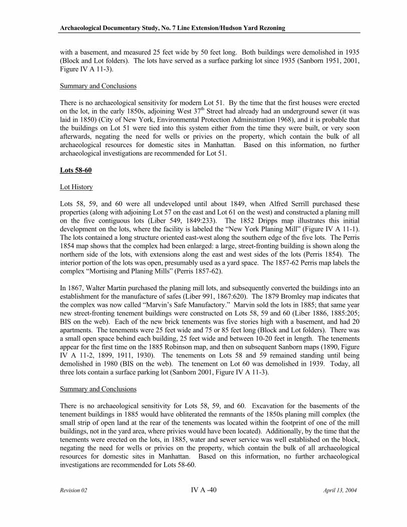
Archaeological Documentary Study, No. 7 Line Extension/Hudson Yard Rezoning
Revision 02 IV A -40 April 13, 2004
with a basement, and measured 25 feet wide by 50 feet long. Both buildings were demolished in 1935 (Block and Lot folders). The lots have served as a surface parking lot since 1935 (Sanborn 1951, 2001, Figure IV A 11-3).
Summary and Conclusions
There is no archaeological sensitivity for modern Lot 51. By the time that the first houses were erected on the lot, in the early 1850s, adjoining West 37th Street had already had an underground sewer (it was laid in 1850) (City of New York, Environmental Protection Administration 1968), and it is probable that the buildings on Lot 51 were tied into this system either from the time they were built, or very soon afterwards, negating the need for wells or privies on the property, which contain the bulk of all archaeological resources for domestic sites in Manhattan. Based on this information, no further archaeological investigations are recommended for Lot 51.
Lots 58-60
Lot History
Lots 58, 59, and 60 were all undeveloped until about 1849, when Alfred Serrill purchased these properties (along with adjoining Lot 57 on the east and Lot 61 on the west) and constructed a planing mill on the five contiguous lots (Liber 549, 1849:233). The 1852 Dripps map illustrates this initial development on the lots, where the facility is labeled the “New York Planing Mill” (Figure IV A 11-1). The lots contained a long structure oriented east-west along the southern edge of the five lots. The Perris 1854 map shows that the complex had been enlarged: a large, street-fronting building is shown along the northern side of the lots, with extensions along the east and west sides of the lots (Perris 1854). The interior portion of the lots was open, presumably used as a yard space. The 1857-62 Perris map labels the complex “Mortising and Planing Mills” (Perris 1857-62).
In 1867, Walter Martin purchased the planing mill lots, and subsequently converted the buildings into an establishment for the manufacture of safes (Liber 991, 1867:620). The 1879 Bromley map indicates that the complex was now called “Marvin’s Safe Manufactory.” Marvin sold the lots in 1885; that same year new street-fronting tenement buildings were constructed on Lots 58, 59 and 60 (Liber 1886, 1885:205; BIS on the web). Each of the new brick tenements was five stories high with a basement, and had 20 apartments. The tenements were 25 feet wide and 75 or 85 feet long (Block and Lot folders). There was a small open space behind each building, 25 feet wide and between 10-20 feet in length. The tenements appear for the first time on the 1885 Robinson map, and then on subsequent Sanborn maps (1890, Figure IV A 11-2, 1899, 1911, 1930). The tenements on Lots 58 and 59 remained standing until being demolished in 1980 (BIS on the web). The tenement on Lot 60 was demolished in 1939. Today, all three lots contain a surface parking lot (Sanborn 2001, Figure IV A 11-3).
Summary and Conclusions
There is no archaeological sensitivity for Lots 58, 59, and 60. Excavation for the basements of the tenement buildings in 1885 would have obliterated the remnants of the 1850s planing mill complex (the small strip of open land at the rear of the tenements was located within the footprint of one of the mill buildings, not in the yard area, where privies would have been located). Additionally, by the time that the tenements were erected on the lots, in 1885, water and sewer service was well established on the block, negating the need for wells or privies on the property, which contain the bulk of all archaeological resources for domestic sites in Manhattan. Based on this information, no further archaeological investigations are recommended for Lots 58-60.
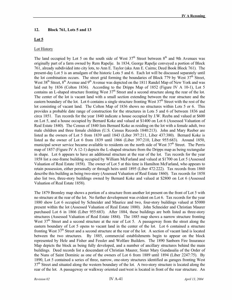
IV A Rezoning
Revision 02 IV A-41 April 13, 2004
12. Block 761, Lots 5 and 13
Lot 5
Lot History
The land occupied by Lot 5 on the south side of West 37th Street between 8th and 9th Avenues was originally part of a farm owned by Rem Rapelje. In 1834, George Rapelje conveyed a portion of Block 761, already subdivided into city lots, to Ann E. Taylor (aka Ann E. Cairns; Deed Book Block 761). The present-day Lot 5 is an amalgam of the historic Lots 5 and 6. Each lot will be discussed separately until the lot combination occurs. The street grid forming the boundaries of Block 779 by West 37th Street, West 38th Street, 8th Avenue and 9th Avenue was depicted on the 1811 Randel Map of New York and was laid out by 1836 (Colton 1836). According to the Dripps Map of 1852 (Figure IV A 10-1), Lot 5 contains an L-shaped structure fronting West 37th Street and a second structure along the rear of the lot. The center of the lot is vacant land with a small section extending between the rear structure and the eastern boundary of the lot. Lot 6 contains a single structure fronting West 37th Street with the rest of the lot consisting of vacant land. The Colton Map of 1836 shows no structures within Lots 5 or 6. This provides a probable date range of construction for the structures in Lots 5 and 6 of between 1836 and circa 1851. Tax records for the year 1840 indicate a house occupied by J.W. Reeba and valued at $600 on Lot 5, and a house occupied by Bernard Koke and valued at $1400 on Lot 6 (Assessed Valuation of Real Estate 1840). The Census of 1840 lists Bernard Koke as residing on the lot with a female adult, two male children and three female children (U.S. Census Records 1840:213). John and Mary Reeber are listed as the owners of Lot 5 from 1839 until 1843 (Liber 397:211, Liber 437:380). Bernard Koke is listed as the owner of Lot 6 from 1839 until 1866 (Liber 397:210, Liber 955:683). Around 1850, municipal sewer service became available to residents on the north side of West 37th Street. The Perris map of 1857 (Figure IV A 12-1) depicts the L-shaped structure from the Dripps map as being rectangular in shape. Lot 6 appears to have an additional structure at the rear of the lot. Tax records for the year 1858 list a one-frame building occupied by William McFarland and valued at $1700 on Lot 5 (Assessed Valuation of Real Estate 1858). The owner of Lot 5 at this time is Hamilton McFarland, who appears to retain possession, either personally or through heirs until 1895 (Liber 472:222). Tax records from 1860 describe this building as being two-story (Assessed Valuation of Real Estate 1860). Tax records for 1858 also list two, three-story buildings owned by Bernard Koke and valued at $2800 on Lot 6 (Assessed Valuation of Real Estate 1858).
The 1879 Bromley map shows a portion of a structure from another lot present on the front of Lot 5 with no structure at the rear of the lot. No further development was evident on Lot 6. Tax records for the year 1880 show Lot 6 occupied by Schneider and Maurice and two, four-story buildings valued at $5000 present within the lot (Assessed Valuation of Real Estate 1880). John Schneider and Christian Maurer purchased Lot 6 in 1866 (Liber 955:683). After 1884, these buildings are both listed as three-story structures (Assessed Valuation of Real Estate 1884). The 1885 map shows a narrow structure fronting West 37th Street and a second structure at the rear of Lot 5. A passageway from the street along the eastern boundary of Lot 5 opens to vacant land in the center of the lot. Lot 6 contained a structure fronting West 37th Street and a second structure at the rear of the lot. A section of vacant land is located between the two structures. By 1885, commercial establishments begin to appear on the block represented by Hele and Fisher and Fessler and Wolfare Builders. The 1890 Sanborn Fire Insurance Map depicts the block as being fully developed, and a number of ancillary structures behind the main buildings. Deed records list a descendant of Christian Maurer, Sister Mary Gundasalia of the Order of the Nuns of Saint Dominic as one of the owners of Lot 6 from 1889 until 1894 (Liber 2247:75). By 1890, Lot 5 contained a series of three, narrow, one-story structures identified as garages fronting West 37th Street and situated along the western boundary of the lot. A two-story structure is located along the rear of the lot. A passageway or walkway oriented east/west is located in front of the rear structure. An
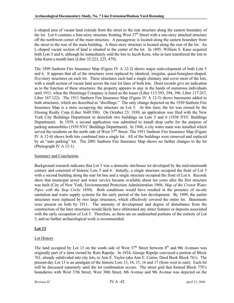
Archaeological Documentary Study, No. 7 Line Extension/Hudson Yard Rezoning
Revision 02 IV A -42 April 13, 2004
L-shaped area of vacant land extends from the street to the rear structure along the eastern boundary of the lot. Lot 6 contains a four-story structure fronting West 37th Street with a one-story attached structure off the northwest corner of the main structure. A passageway is located along the eastern boundary from the street to the rear of the main building. A three-story structure is located along the rear of the lot. An L-shaped vacant section of land is situated in the center of the lot. In 1895, William S. Kane acquired both Lots 5 and 6, although he immediately sold the lots to Jacob Korn, who in turn transferred the lots to John Karst a month later (Liber 35:223, 225, 479).
The 1899 Sanborn Fire Insurance Map (Figure IV A 12-2) shows major redevelopment of both Lots 5 and 6. It appears that all of the structures were replaced by identical, irregular, quasi-hourglass-shaped, five-story structures on each lot. These structures each had a single chimney and cover most of the lots, with a small section of vacant land across the rear lot lines of both lots. Deed records give no indication as to the function of these structures: the property appears to stay in the hands of numerous individuals until 1911, when the Hermitage Company is listed as the leaser (Liber 113:393, 394, 396, Liber 117:267, Liber 167:122). The 1911 Sanborn Fire Insurance Map (Figure IV A 12-3) shows basements added to both structures, which are described as “dwellings.” The only change depicted on the 1930 Sanborn Fire Insurance Map is a store occupying the structure on Lot 5. At this time, the lot was owned by the Elissing Realty Corp (Liber 3649:398). On October 23, 1930, an application was filed with the New York City Buildings Department to demolish two buildings on Lots 5 and 6 (1930 NYC Buildings Department). In 1939, a second application was submitted to install drop curbs for the purpose of parking automobiles (1939 NYC Buildings Department). In 1948, a city water main was installed which served the residents on the north side of West 37th Street. The 1951 Sanborn Fire Insurance Map (Figure IV A 12-4) shows both lots combined into a single lot. All of the buildings were removed and replaced by an “auto parking” lot. The 2001 Sanborn Fire Insurance Map shows no further changes to the lot (Photograph IV A 12-1).
Summary and Conclusions
Background research indicates that Lot 5 was a domestic site/house lot developed by the mid-nineteenth century and consisted of historic Lots 5 and 6. Initially, a single structure occupied the front of Lot 5 with a second building along the rear lot line and a single structure occupied the front of Lot 6. Records show that municipal sewer and water service became available about ten years after the first structure was built (City of New York, Environmental Protection Administration 1968; Map of the Croton Water
Pipes with the Stop Cocks 1850). Both conditions would have resulted in the presence of on-site sanitation and water supply systems for the early period of the lots development. By 1899, the earlier structures were replaced by two large structures, which effectively covered the entire lot. Basements were present on both by 1911. The intensity of development and degree of disturbance from the construction of the later structures would likely have obliterated any intact features or deposits associated with the early occupation of Lot 5. Therefore, as there are no undisturbed portions of the entirety of Lot 5, and no further archaeological work is recommended.
Lot 13
Lot History
The land occupied by Lot 13 on the south side of West 37th Street between 8th and 9th Avenues was originally part of a farm owned by Rem Rapelje. In 1834, George Rapelje conveyed a portion of Block 761, already subdivided into city lots, to Ann E. Taylor (aka Ann E. Cairns; Deed Book Block 761). The present-day Lot 13 is an amalgam of the historic Lots 13, 14, 15, 16 and 17 (from west to east). Each lot will be discussed separately until the lot combination occurs. The street grid that formed Block 779’s boundaries with West 37th Street, West 38th Street, 8th Avenue and 9th Avenue was depicted on the
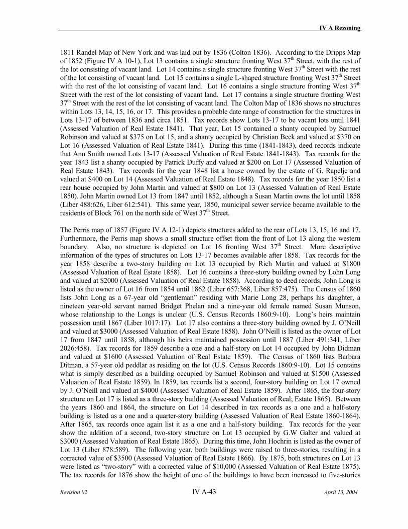
IV A Rezoning
Revision 02 IV A-43 April 13, 2004
1811 Randel Map of New York and was laid out by 1836 (Colton 1836). According to the Dripps Map of 1852 (Figure IV A 10-1), Lot 13 contains a single structure fronting West 37th Street, with the rest of the lot consisting of vacant land. Lot 14 contains a single structure fronting West 37th Street with the rest of the lot consisting of vacant land. Lot 15 contains a single L-shaped structure fronting West 37th Street with the rest of the lot consisting of vacant land. Lot 16 contains a single structure fronting West 37th
Street with the rest of the lot consisting of vacant land. Lot 17 contains a single structure fronting West 37th Street with the rest of the lot consisting of vacant land. The Colton Map of 1836 shows no structures within Lots 13, 14, 15, 16, or 17. This provides a probable date range of construction for the structures in Lots 13-17 of between 1836 and circa 1851. Tax records show Lots 13-17 to be vacant lots until 1841 (Assessed Valuation of Real Estate 1841). That year, Lot 15 contained a shanty occupied by Samuel Robinson and valued at $375 on Lot 15, and a shanty occupied by Christian Beck and valued at $370 on Lot 16 (Assessed Valuation of Real Estate 1841). During this time (1841-1843), deed records indicate that Ann Smith owned Lots 13-17 (Assessed Valuation of Real Estate 1841-1843). Tax records for the year 1843 list a shanty occupied by Patrick Duffy and valued at $200 on Lot 17 (Assessed Valuation of Real Estate 1843). Tax records for the year 1848 list a house owned by the estate of G. Rapelje and valued at $400 on Lot 14 (Assessed Valuation of Real Estate 1848). Tax records for the year 1850 list a rear house occupied by John Martin and valued at $800 on Lot 13 (Assessed Valuation of Real Estate 1850). John Martin owned Lot 13 from 1847 until 1852, although a Susan Martin owns the lot until 1858 (Liber 488:626, Liber 612:541). This same year, 1850, municipal sewer service became available to the residents of Block 761 on the north side of West 37th Street.
The Perris map of 1857 (Figure IV A 12-1) depicts structures added to the rear of Lots 13, 15, 16 and 17. Furthermore, the Perris map shows a small structure offset from the front of Lot 13 along the western boundary. Also, no structure is depicted on Lot 16 fronting West 37th Street. More descriptive information of the types of structures on Lots 13-17 becomes available after 1858. Tax records for the year 1858 describe a two-story building on Lot 13 occupied by Rich Martin and valued at $1800 (Assessed Valuation of Real Estate 1858). Lot 16 contains a three-story building owned by Lohn Long and valued at $2000 (Assessed Valuation of Real Estate 1858). According to deed records, John Long is listed as the owner of Lot 16 from 1854 until 1862 (Liber 657:368, Liber 857:475). The Census of 1860 lists John Long as a 67-year old “gentleman” residing with Marie Long 28, perhaps his daughter, a nineteen year-old servant named Bridget Phelan and a nine-year old female named Susan Munson, whose relationship to the Longs is unclear (U.S. Census Records 1860:9-10). Long’s heirs maintain possession until 1867 (Liber 1017:17). Lot 17 also contains a three-story building owned by J. O’Neill and valued at $3000 (Assessed Valuation of Real Estate 1858). John O’Neill is listed as the owner of Lot 17 from 1847 until 1858, although his heirs maintained possession until 1887 (Liber 491:341, Liber 2026:458). Tax records for 1859 describe a one and a half-story on Lot 14 occupied by John Didman and valued at $1600 (Assessed Valuation of Real Estate 1859). The Census of 1860 lists Barbara Ditman, a 57-year old peddlar as residing on the lot (U.S. Census Records 1860:9-10). Lot 15 contains what is simply described as a building occupied by Samuel Robinson and valued at $1500 (Assessed Valuation of Real Estate 1859). In 1859, tax records list a second, four-story building on Lot 17 owned by J. O’Neill and valued at $4000 (Assessed Valuation of Real Estate 1859). After 1865, the four-story structure on Lot 17 is listed as a three-story building (Assessed Valuation of Real; Estate 1865). Between the years 1860 and 1864, the structure on Lot 14 described in tax records as a one and a half-story building is listed as a one and a quarter-story building (Assessed Valuation of Real Estate 1860-1864). After 1865, tax records once again list it as a one and a half-story building. Tax records for the year show the addition of a second, two-story structure on Lot 13 occupied by G.W Galter and valued at $3000 (Assessed Valuation of Real Estate 1865). During this time, John Hochrin is listed as the owner of Lot 13 (Liber 878:589). The following year, both buildings were raised to three-stories, resulting in a corrected value of $3500 (Assessed Valuation of Real Estate 1866). By 1875, both structures on Lot 13 were listed as “two-story” with a corrected value of $10,000 (Assessed Valuation of Real Estate 1875). The tax records for 1876 show the height of one of the buildings to have been increased to five-stories
Archaeological Documentary Study, No. 7 Line Extension/Hudson Yard Rezoning
Revision 02 IV A -44 April 13, 2004
(Assessed Valuation of Real Estate 1876). According to tax records of 1876, the building on Lot 14 was now a four-story structure occupied by W. Velton and valued at $8000 (Assessed Valuation of Real Estate 1876). W. Velton acquired Lot 15 in 1870 and retained possession until 1880 (Liber 1167:49, Liber 1549:466). Tax records for the year 1876 describes Lot 15 as containing a one-story stable, occupied by Samuel Robinson with a corrected value of $8000 (Assessed Valuation of Real Estate 1876). By 1871, tax records list a single, four-story building valued at $7000 on Lot 15 (Assessed Valuation of Real Estate 1871).
The 1879 Bromley map shows further development on Lots 13, 14, 15 and 17. Lot 16 is depicted as having only a small structure offset from the street along the western boundary of the lot. By 1880, tax records list a single, four-story building occupied by G.F. Hartman with a corrected value of $10,000 (Assessed Valuation of Real Estate 1880). G.F. Hartmann acquired Lot 16 in 1870 and sold the lot to Frederick W. Schweirs in 1880 (Liber 1135:223, Liber 1568:30). The 1885 map shows a second structure added to the rear of Lots 13 and 17, and no changes to Lots 14 and 15. An odd “bottle-shaped” structure is depicted on Lot 16 fronting West 37th Street. By 1885, commercial establishments begin to appear on the block represented by Hele and Fisher and Fessler and Wolfare Builders. The 1890 Sanborn Fire Insurance Map depicts the block as being fully developed, and a number of ancillary structures behind the main buildings. By 1890, Lots 13 contained a five-story commercial structure fronting West 37th Street. A three-story structure is located at the rear of the lot. A passageway or walkway oriented east/west is located in front of the rear structure. Vacant land separates the front and rear structures of Lots 14 and 15, each containing a four-story structure fronting West 37th Street with vacant land in the remainder of the lots. Lot 16 contained an odd-shaped, four-story structure fronting West 37th Street with vacant land in the remainder of the lot. Lot 17 contained a three-story structure fronting West 37th Street, and a second three-story structure at the rear of the lot, separated by a section of vacant land. The 1899 Sanborn Fire Insurance Map no changes to Lots 13-17. Several changes to Lots 13-17 were evident on the 1911 Sanborn Fire Insurance Map (Figure IV A 12-3). A basement was added to the structure fronting West 37th Street on Lot 13. This structure was described as a store and a dwelling. The three-story structure at the rear of the lot was described as a dwelling. No further changes were made to the lot. Basements were added to the structures on Lots 14 and 15, each of which were described as a store and dwelling. A basement was also added to the structure on Lot 16, described as a dwelling. Lot 17 saw the most changes, with basements added to the front and rear structures, and a one-story structure with a skylight erected in the center of the lot. These three structures covered most of the lot, with a small strip across the rear lot line representing the only vacant land left on the lot. The structure fronting West 37th Street on Lot 17 was described as a store and dwelling. Lots 13-17 changed ownership numerous times until 1930, when it appears that they were combined into the modern Lot 13 and sold to the Bantri Realty Corporation. The 1930 Sanborn Fire Insurance Map shows no changes to any of the lots, and did not reflect the lot combination that was indicated in the deed records. In 1948, a city water main was installed which served the residents on the north side of West 37th Street. The 1951 Sanborn Fire Insurance Map (Figure IV A 12-4) shows Lots 13-17 combined into a single lot (Lot 13). All existing structures had been removed. In its place was a filling station in the extreme southwest corner of the lot fronting West 37th Street, with the remainder used for “auto parking.” The 2001 Sanborn Fire Insurance Map shows no further changes to the lot (Photograph IV A 12-2).
The specific occupancy of historic Lot 15, which was not disturbed and which was developed at least nine years prior to the documented availability of sewer and water, is presented in the table below:
Year Grantor Grantee Tax Census Directory
1835 Rapelje Mayor Alderman & Commonality of the City of New York
1838 Samuel Robertson (Lot)
IV A Rezoning
Revision 02 IV A-45 April 13, 2004
Year Grantor Grantee Tax Census Directory
1839 Estate of Rapelje (Lot)
1841 Rapelje Ann Smith Samuel Robinson (Shanty)
Samuel Robinson (somewhere in this ward)
1844 Philo Ruggles Walter Skidmore Samuel Robertson (House/Lot)
1845 Philo Ruggles Walter Skidmore
1850 Samuel Robinson (somewhere in this ward)
1858 Saul Robinson (Shanty)
1859 Samuel Robinson (1 building)
1869 Samuel Robinson - police, home 409 W. 37th
2/5/1870
John Burchell Eva Cullman Samuel Robinson (1 story building)
Samuel Robinson (48) - carpenter, Jane Robinson (48), James (24)
Although the tax records indicate that a “shanty” was originally built on this lot in 1841, by 1844, only three years later, the structure is described as a house. In 1843 the tax assessment on the lot and “shanty” was $200.00, the exact same amount assessed the following year when the dwelling is described as house. This suggests that the structure was unchanged, and its designation was simply revised. Samuel Robinson was the taxpayer on the lot from 1841 forward, and in 1840 and 1850 is listed on the U.S. Census as living somewhere in this ward. While census data do not record addresses for these years, the 1869 directory does confirm that Mr. Robinson, a policeman, resided on the lot. In all likelihood, he – and/or members of his family - resided on the lot from 1841 through at least 1869.
The fact that the original recordation of the structure on this lot as a shanty does not negate its archaeological potential, but rather suggests that indoor plumbing was neither available nor likely in such a second-rate dwelling. Mid-19th century practices were for privies to be built at the back of lots, or between dwellings if two stood on a lot – regardless of whether the dwellings were houses or shanties. Furthermore, an 1866 sanitation report for the district that encompasses this lot, details the fact that privies were frequently left overflowing into yards, were not cleaned on a regular basis, and were clogged with trash (Citizens’ Association of New York 1866:244, 261).
The data confirm that there is a strong probability that the Robinson family occupied historic Lot 15 before and after the period of time that City sewer and water were available. Data confirms that the family paid taxes on the lot from 1841 forward, and that they were definitely residing on the lot in 1869. Therefore, the rear portion of the lot is considered potentially sensitive for shaft features associated with the Robinson family.
Summary and Conclusions
Background research indicates that Lot 13, an amalgam of five historic lots that were combined domestic/commercial lots, was developed by the first half of the nineteenth century. The initial structures were built between 1841 and 1848, which predated municipal sewer and water service (1850) by between nine and two years (City of New York, Environmental Protection Administration 1968; Map of the
Archaeological Documentary Study, No. 7 Line Extension/Hudson Yard Rezoning
Revision 02 IV A -46 April 13, 2004
Croton Water Pipes with the Stop Cocks 1850). Subsequent development resulted in additional structures at the center and rear of some of the lots. In fact, all of historic Lots 16 and 17 were impacted by the later construction of multi-story structures which would have disturbed any earlier features on each of the lots. Therefore, neither historic Lot 16 nor 17 should undergo further archaeological consideration.
Historic Lots 13 and 14 were developed in 1847 and 1848, respectively, only two to three years prior to the availability of city sewer and water. Therefore, any potential shaft features on these lots would only represent an extremely short duration of use. Research potential for such features is extremely minimal. Therefore, neither of these historic lots warrants further archaeological consideration.
Historic Lot 15 was first developed in 1841, nine years prior to the documented availability of city sewer and water (1850). During this period of time, continued residency by members of the Robinson family was established. There is almost a decade of time for which the lot would have hosted shaft features, indicating that specific residents could be associated with potential deposits. Furthermore, development on the back of the lot where shaft features are usually found had no documented basements and was only one-story in height. Therefore, there is the potential for historic resources on this lot. Specifically, the very end of historic Lot 15 is potentially sensitive for shaft features dating from ca. 1841 to ca. 1850, which may be associated with the Robinson family (Figure IV A 12-5).
13. Block 778, Lots 16, 29, 30 and 31
Lot 16
Lot History
The land occupied by Lot 16 on the north side of West 29th Street and the south side of West 28th
Street between 7th and 8th Avenues was originally part of two separate tracts: the north side owned by Jacobus Van Orden and the south side owned by John Morin Scott. The Van Orden tract passed through several hands before coming into the possession of Abel T. Anderson and Isaac A. Johnson who sold the parcel as subdivided city lots in 1846. The Scott tract also passed through several hands before being foreclosed on and sold as city lots by Elbert Herring, Master in Chancery. (Deed Book Block 778). The present-day Lot 16 is an amalgam of the historic Lots 16, 17, 63, 64, and 65. Lots 16 and 17 were located on the southern side of Block 778 and an from west to east while Lots 63, 64 and 65 were on the northern side of Block 778 and ran east to west. Each lot will be discussed separately until the lot combination occurs. The street grid that formed Block 778’s boundaries with West 28th Street, West 29th Street, 7th Avenue and 8th Avenue was depicted on the 1811 Randel Map of New York and was laid out by 1836 (Colton 1836). According to the Dripps Map of 1852 (Figure IV A 13-1), Lots 63, 64, and 65 are odd-shaped, trapezoidal lots fronting West 29th Street. Lot 63 contains a single L-shaped structure that occupies most of the lot, with the remaining area consisting of vacant land. Lots 64 and 65 each contain a single structure occupying most of the lot, with the remaining area consisting of vacant land. Lots 16 and 17 appear to be part of a large lot of vacant land that had not been subdivided fronting West 28th Street. The Colton Map of 1836 shows no structures within Lots 16, 17, 63, 64, or 65. This provides a probable date range of construction for the structures of between 1836 and circa 1851.
Around 1846, municipal sewer service became available to the residents of the north side of West 28th
Street and some time in the 1840s to the south side of West 29th Street. Tax record research indicates that a house and shop occupied by Theodore Martine stood on Lots 63 and 64, and a house and shop occupied by Thomas Kramer stood on Lot 65 by 1848 (Assessed Valuation of Real Estate 1848). All were valued at $400. It is possible that these buildings were present by 1846 (Assessed Valuation of
IV A Rezoning
Revision 02 IV A-47 April 13, 2004
Real Estate 1846). Martine purchased Lots 61-74 in 1846 from Abel Anderson and Isaac Johnson and sold Lot 65 to Thomas Cramer (Liber 478:289, Liber 510:566).
Lot 16 is listed as vacant until 1854 when tax records indicate two houses occupied by Andrew J. Hammersley and valued at $3000 on the property (Assessed Valuation of Real Estate 1854). However, a year later, Lot 16 is listed as vacant land valued at $2500 (Assessed Valuation of Real Estate 1855). According to deed records, Lots 16-19 were purchased by Thomas and Lewis C. Hammersley in 1835 and came into the possession of Andrew Hammersley in 1847 (Liber 327:405, Liber 487:509). Lot 17 is listed as vacant until 1875 (Assessed Valuation of Real Estate 1875). The Perris map of 1857 shows no change to Lot 63. The structure on Lot 64 fronting West 29th Street now has a small addition along the western boundary of the lot off the southwest corner of the structure. Lot 65 shows the addition of a small, detached structure along the western boundary of the lot behind the southwest corner of the structure fronting West 29th Street. Lots 16 and 17 are still depicted as being vacant land. Tax records for 1858 describe the structures on Lots 63, 64, and 65 as two-story buildings valued at $700, $800, and $900 respectively (Assessed Valuation of Real Estate 1858). In 1860, tax records indicate that Lots 16 and 17 were acquired by the Zion Church from the estate of Andrew J. Hammersley (Assessed Valuation of Real Estate 1860). However, deed records fail to mention the Zion Church until 1870, when it transfers ownership of Lots 16 and 17 to Abram R. Welch, Jr. (Liber 1143:540). By 1866, George Schimmel had taken possession of Lot 64. An unusual note in the tax records of 1866, 1871, 1872, 1873, 1874 and 1875 suggests some use by the military of the property (Assessed Valuation of Real Estate 1866, 1871-1875). Tax records for 1872 list a single five-story building occupied by H. Hammersley and valued at $4500 (Assessed Valuation of Real Estate 1872) on Lot 16. Around 1870, or possibly earlier, a city water main was installed which served the residents on the north side of West 28th Street. By 1873, the Zion Church had regained possession of Lots 16 and 17 and the existing five-story structure (Assessed Valuation of Real Estate 1873). Tax records for 1876 show a five-story structure on Lot 17 owned by the Zion Church and valued, along with the structure on Lot 16 at $16,000 (Assessed Valuation of Real Estate 1876). The tax records for 1876 also show the structures on Lots 63, 64 and 65 replaced by four-story structures valued at $1500 each (Assessed Valuation of Real Estate 1876).
The 1879 Bromley map shows no further development of Lots 63, 64, or 65; however, Lots 16 and 17 are combined and consist of a structure or attached structures fronting West 28th Street and a stable at the rear of the lot. The approximate middle third of the lot is vacant land. By 1879, commercial establishments begin to appear on the block represented by the French Moulding Factory, The New York Carspring Works, a renovating establishment, a sash factory a wall paper factory and at least two commercial stables. The next changes to Lots 63, 64 and 65 occur in 1881. Tax records indicate that the structure on Lot 63 now contains a single three-story building occupied by Theodore Martine and valued at $1800 (Assessed Valuation of Real Estate 1881). Lot 64 now contains a two-story building occupied by George Schmidt (Schimmel?) and valued at $1800 (Assessed Valuation of Real Estate 1881). Lot 65 also contains a single, two-story building owned by Margaret Smith and valued at $1500 (Assessed Valuation of Real Estate 1881). By 1885, development within the block had increased substantially, with several commercial enterprises among the new residents including Beck and Company Paper Hangers, T.M. Stewart Carpet Cleaning, Cary and Moen Wire Manufacturers, Spauldings Provisions, Mayer’s Livery Stables, Walton (illegible) Manufacturers and Transfer Stables (Robinson 1885). The 1885 map also shows three buildings still occupying Lots 63, 64, and 65. However, the entire Lots 16 and 17 are now occupied by Ehrhard and Hillyard Mouldings.
The 1890 Sanborn Fire Insurance Map (Figure IV A 16-1b) depicts the block as being fully developed, and a number of ancillary structures behind the main buildings. A number of changes regarding the commercial configuration of the block occurred including the departure of T.M. Stewart Carpet Cleaners and Walton Manufacturers, which were replaced by the expanded Beck Paper
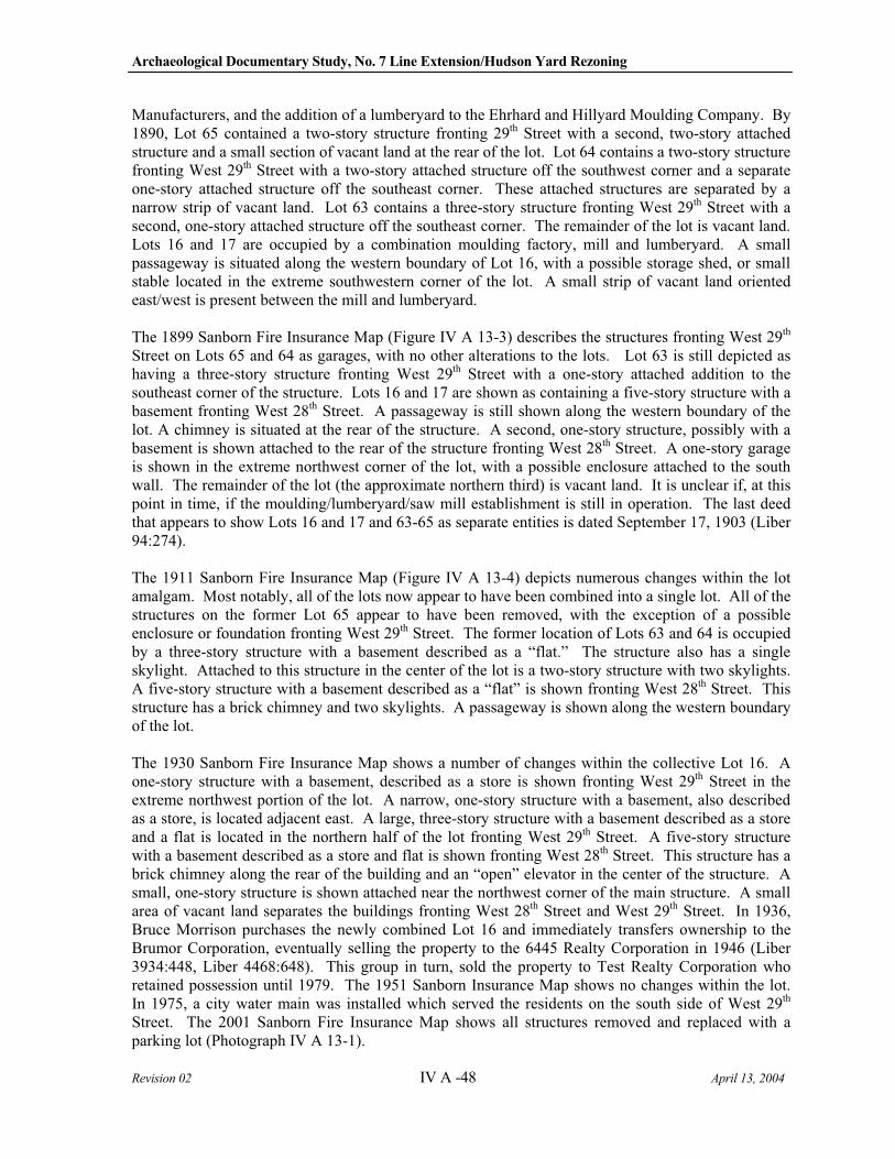
Archaeological Documentary Study, No. 7 Line Extension/Hudson Yard Rezoning
Revision 02 IV A -48 April 13, 2004
Manufacturers, and the addition of a lumberyard to the Ehrhard and Hillyard Moulding Company. By 1890, Lot 65 contained a two-story structure fronting 29th Street with a second, two-story attached structure and a small section of vacant land at the rear of the lot. Lot 64 contains a two-story structure fronting West 29th Street with a two-story attached structure off the southwest corner and a separate one-story attached structure off the southeast corner. These attached structures are separated by a narrow strip of vacant land. Lot 63 contains a three-story structure fronting West 29th Street with a second, one-story attached structure off the southeast corner. The remainder of the lot is vacant land. Lots 16 and 17 are occupied by a combination moulding factory, mill and lumberyard. A small passageway is situated along the western boundary of Lot 16, with a possible storage shed, or small stable located in the extreme southwestern corner of the lot. A small strip of vacant land oriented east/west is present between the mill and lumberyard.
The 1899 Sanborn Fire Insurance Map (Figure IV A 13-3) describes the structures fronting West 29th
Street on Lots 65 and 64 as garages, with no other alterations to the lots. Lot 63 is still depicted as having a three-story structure fronting West 29th Street with a one-story attached addition to the southeast corner of the structure. Lots 16 and 17 are shown as containing a five-story structure with a basement fronting West 28th Street. A passageway is still shown along the western boundary of the lot. A chimney is situated at the rear of the structure. A second, one-story structure, possibly with a basement is shown attached to the rear of the structure fronting West 28th Street. A one-story garage is shown in the extreme northwest corner of the lot, with a possible enclosure attached to the south wall. The remainder of the lot (the approximate northern third) is vacant land. It is unclear if, at this point in time, if the moulding/lumberyard/saw mill establishment is still in operation. The last deed that appears to show Lots 16 and 17 and 63-65 as separate entities is dated September 17, 1903 (Liber 94:274).
The 1911 Sanborn Fire Insurance Map (Figure IV A 13-4) depicts numerous changes within the lot amalgam. Most notably, all of the lots now appear to have been combined into a single lot. All of the structures on the former Lot 65 appear to have been removed, with the exception of a possible enclosure or foundation fronting West 29th Street. The former location of Lots 63 and 64 is occupied by a three-story structure with a basement described as a “flat.” The structure also has a single skylight. Attached to this structure in the center of the lot is a two-story structure with two skylights. A five-story structure with a basement described as a “flat” is shown fronting West 28th Street. This structure has a brick chimney and two skylights. A passageway is shown along the western boundary of the lot.
The 1930 Sanborn Fire Insurance Map shows a number of changes within the collective Lot 16. A one-story structure with a basement, described as a store is shown fronting West 29th Street in the extreme northwest portion of the lot. A narrow, one-story structure with a basement, also described as a store, is located adjacent east. A large, three-story structure with a basement described as a store and a flat is located in the northern half of the lot fronting West 29th Street. A five-story structure with a basement described as a store and flat is shown fronting West 28th Street. This structure has a brick chimney along the rear of the building and an “open” elevator in the center of the structure. A small, one-story structure is shown attached near the northwest corner of the main structure. A small area of vacant land separates the buildings fronting West 28th Street and West 29th Street. In 1936, Bruce Morrison purchases the newly combined Lot 16 and immediately transfers ownership to the Brumor Corporation, eventually selling the property to the 6445 Realty Corporation in 1946 (Liber 3934:448, Liber 4468:648). This group in turn, sold the property to Test Realty Corporation who retained possession until 1979. The 1951 Sanborn Insurance Map shows no changes within the lot. In 1975, a city water main was installed which served the residents on the south side of West 29th
Street. The 2001 Sanborn Fire Insurance Map shows all structures removed and replaced with a parking lot (Photograph IV A 13-1).
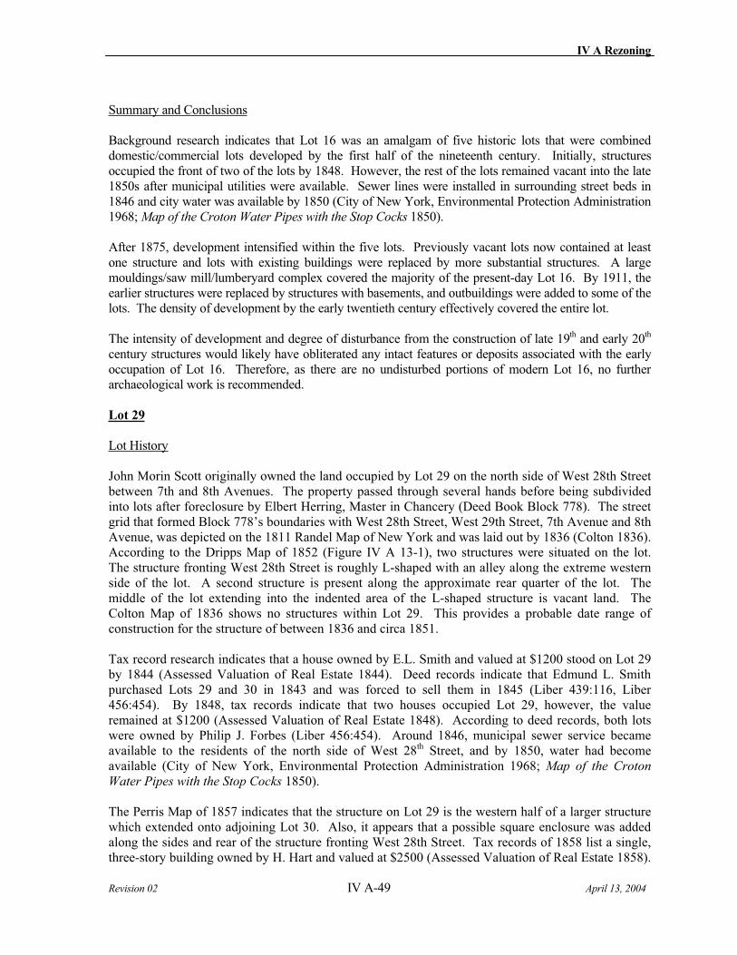
IV A Rezoning
Revision 02 IV A-49 April 13, 2004
Summary and Conclusions
Background research indicates that Lot 16 was an amalgam of five historic lots that were combined domestic/commercial lots developed by the first half of the nineteenth century. Initially, structures occupied the front of two of the lots by 1848. However, the rest of the lots remained vacant into the late 1850s after municipal utilities were available. Sewer lines were installed in surrounding street beds in 1846 and city water was available by 1850 (City of New York, Environmental Protection Administration 1968; Map of the Croton Water Pipes with the Stop Cocks 1850).
After 1875, development intensified within the five lots. Previously vacant lots now contained at least one structure and lots with existing buildings were replaced by more substantial structures. A large mouldings/saw mill/lumberyard complex covered the majority of the present-day Lot 16. By 1911, the earlier structures were replaced by structures with basements, and outbuildings were added to some of the lots. The density of development by the early twentieth century effectively covered the entire lot.
The intensity of development and degree of disturbance from the construction of late 19th and early 20th
century structures would likely have obliterated any intact features or deposits associated with the early occupation of Lot 16. Therefore, as there are no undisturbed portions of modern Lot 16, no further archaeological work is recommended.
Lot 29
Lot History
John Morin Scott originally owned the land occupied by Lot 29 on the north side of West 28th Street between 7th and 8th Avenues. The property passed through several hands before being subdivided into lots after foreclosure by Elbert Herring, Master in Chancery (Deed Book Block 778). The street grid that formed Block 778’s boundaries with West 28th Street, West 29th Street, 7th Avenue and 8th Avenue, was depicted on the 1811 Randel Map of New York and was laid out by 1836 (Colton 1836). According to the Dripps Map of 1852 (Figure IV A 13-1), two structures were situated on the lot. The structure fronting West 28th Street is roughly L-shaped with an alley along the extreme western side of the lot. A second structure is present along the approximate rear quarter of the lot. The middle of the lot extending into the indented area of the L-shaped structure is vacant land. The Colton Map of 1836 shows no structures within Lot 29. This provides a probable date range of construction for the structure of between 1836 and circa 1851.
Tax record research indicates that a house owned by E.L. Smith and valued at $1200 stood on Lot 29 by 1844 (Assessed Valuation of Real Estate 1844). Deed records indicate that Edmund L. Smith purchased Lots 29 and 30 in 1843 and was forced to sell them in 1845 (Liber 439:116, Liber 456:454). By 1848, tax records indicate that two houses occupied Lot 29, however, the value remained at $1200 (Assessed Valuation of Real Estate 1848). According to deed records, both lots were owned by Philip J. Forbes (Liber 456:454). Around 1846, municipal sewer service became available to the residents of the north side of West 28th Street, and by 1850, water had become available (City of New York, Environmental Protection Administration 1968; Map of the Croton
Water Pipes with the Stop Cocks 1850).
The Perris Map of 1857 indicates that the structure on Lot 29 is the western half of a larger structure which extended onto adjoining Lot 30. Also, it appears that a possible square enclosure was added along the sides and rear of the structure fronting West 28th Street. Tax records of 1858 list a single, three-story building owned by H. Hart and valued at $2500 (Assessed Valuation of Real Estate 1858).
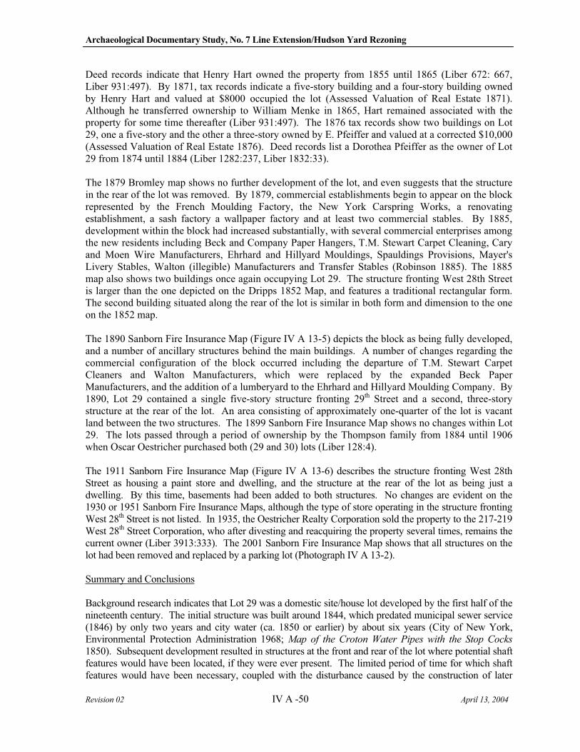
Archaeological Documentary Study, No. 7 Line Extension/Hudson Yard Rezoning
Revision 02 IV A -50 April 13, 2004
Deed records indicate that Henry Hart owned the property from 1855 until 1865 (Liber 672: 667, Liber 931:497). By 1871, tax records indicate a five-story building and a four-story building owned by Henry Hart and valued at $8000 occupied the lot (Assessed Valuation of Real Estate 1871). Although he transferred ownership to William Menke in 1865, Hart remained associated with the property for some time thereafter (Liber 931:497). The 1876 tax records show two buildings on Lot 29, one a five-story and the other a three-story owned by E. Pfeiffer and valued at a corrected $10,000 (Assessed Valuation of Real Estate 1876). Deed records list a Dorothea Pfeiffer as the owner of Lot 29 from 1874 until 1884 (Liber 1282:237, Liber 1832:33).
The 1879 Bromley map shows no further development of the lot, and even suggests that the structure in the rear of the lot was removed. By 1879, commercial establishments begin to appear on the block represented by the French Moulding Factory, the New York Carspring Works, a renovating establishment, a sash factory a wallpaper factory and at least two commercial stables. By 1885, development within the block had increased substantially, with several commercial enterprises among the new residents including Beck and Company Paper Hangers, T.M. Stewart Carpet Cleaning, Cary and Moen Wire Manufacturers, Ehrhard and Hillyard Mouldings, Spauldings Provisions, Mayer's Livery Stables, Walton (illegible) Manufacturers and Transfer Stables (Robinson 1885). The 1885 map also shows two buildings once again occupying Lot 29. The structure fronting West 28th Street is larger than the one depicted on the Dripps 1852 Map, and features a traditional rectangular form. The second building situated along the rear of the lot is similar in both form and dimension to the one on the 1852 map.
The 1890 Sanborn Fire Insurance Map (Figure IV A 13-5) depicts the block as being fully developed, and a number of ancillary structures behind the main buildings. A number of changes regarding the commercial configuration of the block occurred including the departure of T.M. Stewart Carpet Cleaners and Walton Manufacturers, which were replaced by the expanded Beck Paper Manufacturers, and the addition of a lumberyard to the Ehrhard and Hillyard Moulding Company. By 1890, Lot 29 contained a single five-story structure fronting 29th Street and a second, three-story structure at the rear of the lot. An area consisting of approximately one-quarter of the lot is vacant land between the two structures. The 1899 Sanborn Fire Insurance Map shows no changes within Lot 29. The lots passed through a period of ownership by the Thompson family from 1884 until 1906 when Oscar Oestricher purchased both (29 and 30) lots (Liber 128:4).
The 1911 Sanborn Fire Insurance Map (Figure IV A 13-6) describes the structure fronting West 28th Street as housing a paint store and dwelling, and the structure at the rear of the lot as being just a dwelling. By this time, basements had been added to both structures. No changes are evident on the 1930 or 1951 Sanborn Fire Insurance Maps, although the type of store operating in the structure fronting West 28th Street is not listed. In 1935, the Oestricher Realty Corporation sold the property to the 217-219 West 28th Street Corporation, who after divesting and reacquiring the property several times, remains the current owner (Liber 3913:333). The 2001 Sanborn Fire Insurance Map shows that all structures on the lot had been removed and replaced by a parking lot (Photograph IV A 13-2).
Summary and Conclusions
Background research indicates that Lot 29 was a domestic site/house lot developed by the first half of the nineteenth century. The initial structure was built around 1844, which predated municipal sewer service (1846) by only two years and city water (ca. 1850 or earlier) by about six years (City of New York, Environmental Protection Administration 1968; Map of the Croton Water Pipes with the Stop Cocks
1850). Subsequent development resulted in structures at the front and rear of the lot where potential shaft features would have been located, if they were ever present. The limited period of time for which shaft features would have been necessary, coupled with the disturbance caused by the construction of later
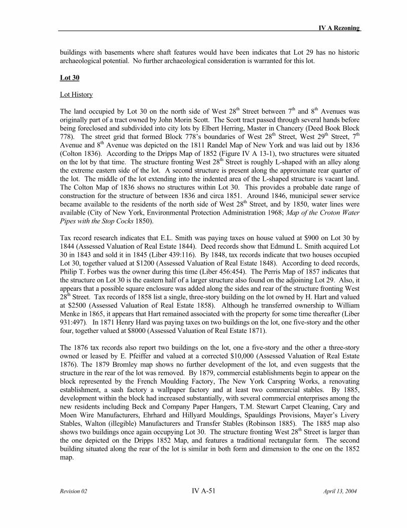
IV A Rezoning
Revision 02 IV A-51 April 13, 2004
buildings with basements where shaft features would have been indicates that Lot 29 has no historic archaeological potential. No further archaeological consideration is warranted for this lot.
Lot 30
Lot History
The land occupied by Lot 30 on the north side of West 28th Street between 7th and 8th Avenues was originally part of a tract owned by John Morin Scott. The Scott tract passed through several hands before being foreclosed and subdivided into city lots by Elbert Herring, Master in Chancery (Deed Book Block 778). The street grid that formed Block 778’s boundaries of West 28th Street, West 29th Street, 7th
Avenue and 8th Avenue was depicted on the 1811 Randel Map of New York and was laid out by 1836 (Colton 1836). According to the Dripps Map of 1852 (Figure IV A 13-1), two structures were situated on the lot by that time. The structure fronting West 28th Street is roughly L-shaped with an alley along the extreme eastern side of the lot. A second structure is present along the approximate rear quarter of the lot. The middle of the lot extending into the indented area of the L-shaped structure is vacant land. The Colton Map of 1836 shows no structures within Lot 30. This provides a probable date range of construction for the structure of between 1836 and circa 1851. Around 1846, municipal sewer service became available to the residents of the north side of West 28th Street, and by 1850, water lines were available (City of New York, Environmental Protection Administration 1968; Map of the Croton Water
Pipes with the Stop Cocks 1850).
Tax record research indicates that E.L. Smith was paying taxes on house valued at $900 on Lot 30 by 1844 (Assessed Valuation of Real Estate 1844). Deed records show that Edmund L. Smith acquired Lot 30 in 1843 and sold it in 1845 (Liber 439:116). By 1848, tax records indicate that two houses occupied Lot 30, together valued at $1200 (Assessed Valuation of Real Estate 1848). According to deed records, Philip T. Forbes was the owner during this time (Liber 456:454). The Perris Map of 1857 indicates that the structure on Lot 30 is the eastern half of a larger structure also found on the adjoining Lot 29. Also, it appears that a possible square enclosure was added along the sides and rear of the structure fronting West 28th Street. Tax records of 1858 list a single, three-story building on the lot owned by H. Hart and valued at $2500 (Assessed Valuation of Real Estate 1858). Although he transferred ownership to William Menke in 1865, it appears that Hart remained associated with the property for some time thereafter (Liber 931:497). In 1871 Henry Hard was paying taxes on two buildings on the lot, one five-story and the other four, together valued at $8000 (Assessed Valuation of Real Estate 1871).
The 1876 tax records also report two buildings on the lot, one a five-story and the other a three-story owned or leased by E. Pfeiffer and valued at a corrected $10,000 (Assessed Valuation of Real Estate 1876). The 1879 Bromley map shows no further development of the lot, and even suggests that the structure in the rear of the lot was removed. By 1879, commercial establishments begin to appear on the block represented by the French Moulding Factory, The New York Carspring Works, a renovating establishment, a sash factory a wallpaper factory and at least two commercial stables. By 1885, development within the block had increased substantially, with several commercial enterprises among the new residents including Beck and Company Paper Hangers, T.M. Stewart Carpet Cleaning, Cary and Moen Wire Manufacturers, Ehrhard and Hillyard Mouldings, Spauldings Provisions, Mayer’s Livery Stables, Walton (illegible) Manufacturers and Transfer Stables (Robinson 1885). The 1885 map also shows two buildings once again occupying Lot 30. The structure fronting West 28th Street is larger than the one depicted on the Dripps 1852 Map, and features a traditional rectangular form. The second building situated along the rear of the lot is similar in both form and dimension to the one on the 1852 map.
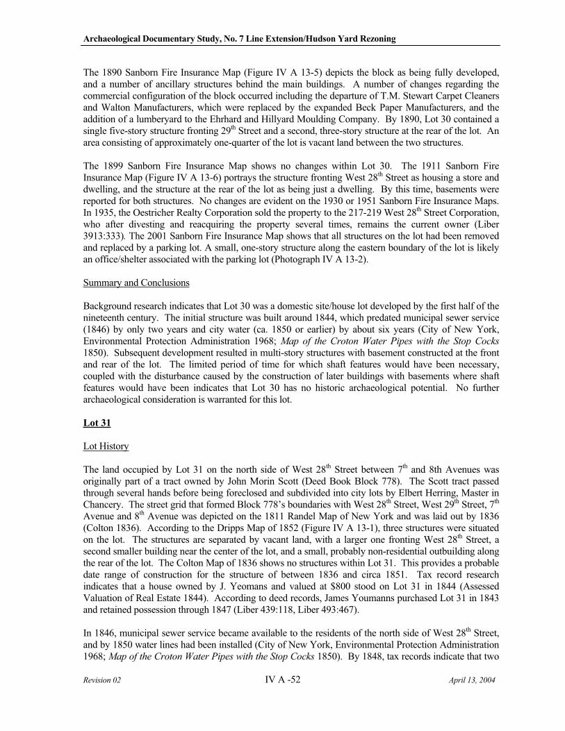
Archaeological Documentary Study, No. 7 Line Extension/Hudson Yard Rezoning
Revision 02 IV A -52 April 13, 2004
The 1890 Sanborn Fire Insurance Map (Figure IV A 13-5) depicts the block as being fully developed, and a number of ancillary structures behind the main buildings. A number of changes regarding the commercial configuration of the block occurred including the departure of T.M. Stewart Carpet Cleaners and Walton Manufacturers, which were replaced by the expanded Beck Paper Manufacturers, and the addition of a lumberyard to the Ehrhard and Hillyard Moulding Company. By 1890, Lot 30 contained a single five-story structure fronting 29th Street and a second, three-story structure at the rear of the lot. An area consisting of approximately one-quarter of the lot is vacant land between the two structures.
The 1899 Sanborn Fire Insurance Map shows no changes within Lot 30. The 1911 Sanborn Fire Insurance Map (Figure IV A 13-6) portrays the structure fronting West 28th Street as housing a store and dwelling, and the structure at the rear of the lot as being just a dwelling. By this time, basements were reported for both structures. No changes are evident on the 1930 or 1951 Sanborn Fire Insurance Maps. In 1935, the Oestricher Realty Corporation sold the property to the 217-219 West 28th Street Corporation, who after divesting and reacquiring the property several times, remains the current owner (Liber 3913:333). The 2001 Sanborn Fire Insurance Map shows that all structures on the lot had been removed and replaced by a parking lot. A small, one-story structure along the eastern boundary of the lot is likely an office/shelter associated with the parking lot (Photograph IV A 13-2).
Summary and Conclusions
Background research indicates that Lot 30 was a domestic site/house lot developed by the first half of the nineteenth century. The initial structure was built around 1844, which predated municipal sewer service (1846) by only two years and city water (ca. 1850 or earlier) by about six years (City of New York, Environmental Protection Administration 1968; Map of the Croton Water Pipes with the Stop Cocks
1850). Subsequent development resulted in multi-story structures with basement constructed at the front and rear of the lot. The limited period of time for which shaft features would have been necessary, coupled with the disturbance caused by the construction of later buildings with basements where shaft features would have been indicates that Lot 30 has no historic archaeological potential. No further archaeological consideration is warranted for this lot.
Lot 31
Lot History
The land occupied by Lot 31 on the north side of West 28th Street between 7th and 8th Avenues was originally part of a tract owned by John Morin Scott (Deed Book Block 778). The Scott tract passed through several hands before being foreclosed and subdivided into city lots by Elbert Herring, Master in Chancery. The street grid that formed Block 778’s boundaries with West 28th Street, West 29th Street, 7th
Avenue and 8th Avenue was depicted on the 1811 Randel Map of New York and was laid out by 1836 (Colton 1836). According to the Dripps Map of 1852 (Figure IV A 13-1), three structures were situated on the lot. The structures are separated by vacant land, with a larger one fronting West 28th Street, a second smaller building near the center of the lot, and a small, probably non-residential outbuilding along the rear of the lot. The Colton Map of 1836 shows no structures within Lot 31. This provides a probable date range of construction for the structure of between 1836 and circa 1851. Tax record research indicates that a house owned by J. Yeomans and valued at $800 stood on Lot 31 in 1844 (Assessed Valuation of Real Estate 1844). According to deed records, James Youmanns purchased Lot 31 in 1843 and retained possession through 1847 (Liber 439:118, Liber 493:467).
In 1846, municipal sewer service became available to the residents of the north side of West 28th Street, and by 1850 water lines had been installed (City of New York, Environmental Protection Administration 1968; Map of the Croton Water Pipes with the Stop Cocks 1850). By 1848, tax records indicate that two
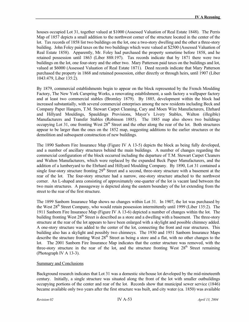
IV A Rezoning
Revision 02 IV A-53 April 13, 2004
houses occupied Lot 31, together valued at $1000 (Assessed Valuation of Real Estate 1848). The Perris Map of 1857 depicts a small addition to the northwest corner of the structure located in the center of the lot. Tax records of 1858 list two buildings on the lot, one a two-story dwelling and the other a three-story building. John Foley paid taxes on the two buildings which were valued at $2500 (Assessed Valuation of Real Estate 1858). Apparently, Mr. Foley had purchased the property sometime before 1858, and he retained possession until 1863 (Liber 888:197). Tax records indicate that by 1871 there were two buildings on the lot, one four-story and the other two. Mary Patterson paid taxes on the buildings and lot, valued at $6000 (Assessed Valuation of Real Estate 1871). Deed records indicate that Mary Patterson purchased the property in 1868 and retained possession, either directly or through heirs, until 1907 (Liber 1043:479, Liber 135:2).
By 1879, commercial establishments begin to appear on the block represented by the French Moulding Factory, The New York Carspring Works, a renovating establishment, a sash factory a wallpaper factory and at least two commercial stables (Bromley 1879). By 1885, development within the block had increased substantially, with several commercial enterprises among the new residents including Beck and Company Paper Hangers, T.M. Stewart Carpet Cleaning, Cary and Moen Wire Manufacturers, Ehrhard and Hillyard Mouldings, Spauldings Provisions, Mayer’s Livery Stables, Walton (illegible) Manufacturers and Transfer Stables (Robinson 1885). The 1885 map also shows two buildings occupying Lot 31, one fronting West 28th Street and the other along the rear of the lot. Both structures appear to be larger than the ones on the 1852 map, suggesting additions to the earlier structures or the demolition and subsequent construction of new buildings.
The 1890 Sanborn Fire Insurance Map (Figure IV A 13-5) depicts the block as being fully developed, and a number of ancillary structures behind the main buildings. A number of changes regarding the commercial configuration of the block occurred including the departure of T.M. Stewart Carpet Cleaners and Walton Manufacturers, which were replaced by the expanded Beck Paper Manufacturers, and the addition of a lumberyard to the Ehrhard and Hillyard Moulding Company. By 1890, Lot 31 contained a single four-story structure fronting 29th Street and a second, three-story structure with a basement at the rear of the lot. The four-story structure had a narrow, one-story structure attached to the northwest corner. An L-shaped area consisting of approximately one-quarter of the lot is vacant land between the two main structures. A passageway is depicted along the eastern boundary of the lot extending from the street to the rear of the first structure.
The 1899 Sanborn Insurance Map shows no changes within Lot 31. In 1907, the lot was purchased by the West 28th Street Company, who would retain possession intermittently until 1999 (Liber 135:2). The 1911 Sanborn Fire Insurance Map (Figure IV A 13-6) depicted a number of changes within the lot. The building fronting West 28th Street is described as a store and a dwelling with a basement. The three-story structure at the rear of the lot appears to have been enlarged with a skylight and possible chimney added. A one-story structure was added to the center of the lot, connecting the front and rear structures. This building also has a skylight and possibly two chimneys. The 1930 and 1951 Sanborn Insurance Maps describe the structure fronting West 28th Street as being a store and a flat, with no other changes to the lot. The 2001 Sanborn Fire Insurance Map indicates that the center structure was removed, with the three-story structure in the rear of the lot, and the structure fronting West 28th Street remaining (Photograph IV A 13-3).
Summary and Conclusions
Background research indicates that Lot 31 was a domestic site/house lot developed by the mid-nineteenth century. Initially, a single structure was situated along the front of the lot with smaller outbuildings occupying portions of the center and rear of the lot. Records show that municipal sewer service (1846) became available only two years after the first structure was built, and city water (ca. 1850) was available
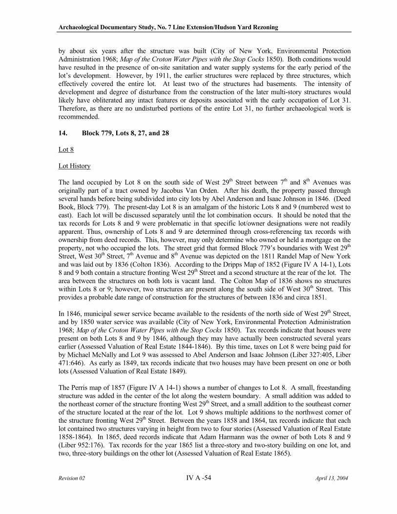
Archaeological Documentary Study, No. 7 Line Extension/Hudson Yard Rezoning
Revision 02 IV A -54 April 13, 2004
by about six years after the structure was built (City of New York, Environmental Protection Administration 1968; Map of the Croton Water Pipes with the Stop Cocks 1850). Both conditions would have resulted in the presence of on-site sanitation and water supply systems for the early period of the lot’s development. However, by 1911, the earlier structures were replaced by three structures, which effectively covered the entire lot. At least two of the structures had basements. The intensity of development and degree of disturbance from the construction of the later multi-story structures would likely have obliterated any intact features or deposits associated with the early occupation of Lot 31. Therefore, as there are no undisturbed portions of the entire Lot 31, no further archaeological work is recommended.
14. Block 779, Lots 8, 27, and 28
Lot 8
Lot History
The land occupied by Lot 8 on the south side of West 29th Street between 7th and 8th Avenues was originally part of a tract owned by Jacobus Van Orden. After his death, the property passed through several hands before being subdivided into city lots by Abel Anderson and Isaac Johnson in 1846. (Deed Book, Block 779). The present-day Lot 8 is an amalgam of the historic Lots 8 and 9 (numbered west to east). Each lot will be discussed separately until the lot combination occurs. It should be noted that the tax records for Lots 8 and 9 were problematic in that specific lot/owner designations were not readily apparent. Thus, ownership of Lots 8 and 9 are determined through cross-referencing tax records with ownership from deed records. This, however, may only determine who owned or held a mortgage on the property, not who occupied the lots. The street grid that formed Block 779’s boundaries with West 29th
Street, West 30th Street, 7th Avenue and 8th Avenue was depicted on the 1811 Randel Map of New York and was laid out by 1836 (Colton 1836). According to the Dripps Map of 1852 (Figure IV A 14-1), Lots 8 and 9 both contain a structure fronting West 29th Street and a second structure at the rear of the lot. The area between the structures on both lots is vacant land. The Colton Map of 1836 shows no structures within Lots 8 or 9; however, two structures are present along the south side of West 30th Street. This provides a probable date range of construction for the structures of between 1836 and circa 1851.
In 1846, municipal sewer service became available to the residents of the north side of West 29th Street, and by 1850 water service was available (City of New York, Environmental Protection Administration 1968; Map of the Croton Water Pipes with the Stop Cocks 1850). Tax records indicate that houses were present on both Lots 8 and 9 by 1846, although they may have actually been constructed several years earlier (Assessed Valuation of Real Estate 1844-1846). By this time, taxes on Lot 8 were being paid for by Michael McNally and Lot 9 was assessed to Abel Anderson and Isaac Johnson (Liber 327:405, Liber 471:646). As early as 1849, tax records indicate that two houses may have been present on one or both lots (Assessed Valuation of Real Estate 1849).
The Perris map of 1857 (Figure IV A 14-1) shows a number of changes to Lot 8. A small, freestanding structure was added in the center of the lot along the western boundary. A small addition was added to the northeast corner of the structure fronting West 29th Street, and a small addition to the southeast corner of the structure located at the rear of the lot. Lot 9 shows multiple additions to the northwest corner of the structure fronting West 29th Street. Between the years 1858 and 1864, tax records indicate that each lot contained two structures varying in height from two to four stories (Assessed Valuation of Real Estate 1858-1864). In 1865, deed records indicate that Adam Harmann was the owner of both Lots 8 and 9 (Liber 952:176). Tax records for the year 1865 list a three-story and two-story building on one lot, and two, three-story buildings on the other lot (Assessed Valuation of Real Estate 1865).
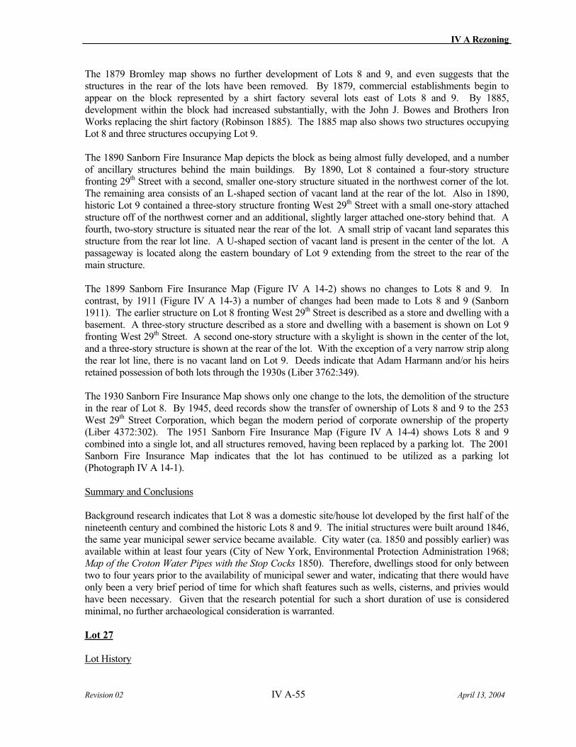
IV A Rezoning
Revision 02 IV A-55 April 13, 2004
The 1879 Bromley map shows no further development of Lots 8 and 9, and even suggests that the structures in the rear of the lots have been removed. By 1879, commercial establishments begin to appear on the block represented by a shirt factory several lots east of Lots 8 and 9. By 1885, development within the block had increased substantially, with the John J. Bowes and Brothers Iron Works replacing the shirt factory (Robinson 1885). The 1885 map also shows two structures occupying Lot 8 and three structures occupying Lot 9.
The 1890 Sanborn Fire Insurance Map depicts the block as being almost fully developed, and a number of ancillary structures behind the main buildings. By 1890, Lot 8 contained a four-story structure fronting 29th Street with a second, smaller one-story structure situated in the northwest corner of the lot. The remaining area consists of an L-shaped section of vacant land at the rear of the lot. Also in 1890, historic Lot 9 contained a three-story structure fronting West 29th Street with a small one-story attached structure off of the northwest corner and an additional, slightly larger attached one-story behind that. A fourth, two-story structure is situated near the rear of the lot. A small strip of vacant land separates this structure from the rear lot line. A U-shaped section of vacant land is present in the center of the lot. A passageway is located along the eastern boundary of Lot 9 extending from the street to the rear of the main structure.
The 1899 Sanborn Fire Insurance Map (Figure IV A 14-2) shows no changes to Lots 8 and 9. In contrast, by 1911 (Figure IV A 14-3) a number of changes had been made to Lots 8 and 9 (Sanborn 1911). The earlier structure on Lot 8 fronting West 29th Street is described as a store and dwelling with a basement. A three-story structure described as a store and dwelling with a basement is shown on Lot 9 fronting West 29th Street. A second one-story structure with a skylight is shown in the center of the lot, and a three-story structure is shown at the rear of the lot. With the exception of a very narrow strip along the rear lot line, there is no vacant land on Lot 9. Deeds indicate that Adam Harmann and/or his heirs retained possession of both lots through the 1930s (Liber 3762:349).
The 1930 Sanborn Fire Insurance Map shows only one change to the lots, the demolition of the structure in the rear of Lot 8. By 1945, deed records show the transfer of ownership of Lots 8 and 9 to the 253 West 29th Street Corporation, which began the modern period of corporate ownership of the property (Liber 4372:302). The 1951 Sanborn Fire Insurance Map (Figure IV A 14-4) shows Lots 8 and 9 combined into a single lot, and all structures removed, having been replaced by a parking lot. The 2001 Sanborn Fire Insurance Map indicates that the lot has continued to be utilized as a parking lot (Photograph IV A 14-1).
Summary and Conclusions
Background research indicates that Lot 8 was a domestic site/house lot developed by the first half of the nineteenth century and combined the historic Lots 8 and 9. The initial structures were built around 1846, the same year municipal sewer service became available. City water (ca. 1850 and possibly earlier) was available within at least four years (City of New York, Environmental Protection Administration 1968; Map of the Croton Water Pipes with the Stop Cocks 1850). Therefore, dwellings stood for only between two to four years prior to the availability of municipal sewer and water, indicating that there would have only been a very brief period of time for which shaft features such as wells, cisterns, and privies would have been necessary. Given that the research potential for such a short duration of use is considered minimal, no further archaeological consideration is warranted.
Lot 27
Lot History
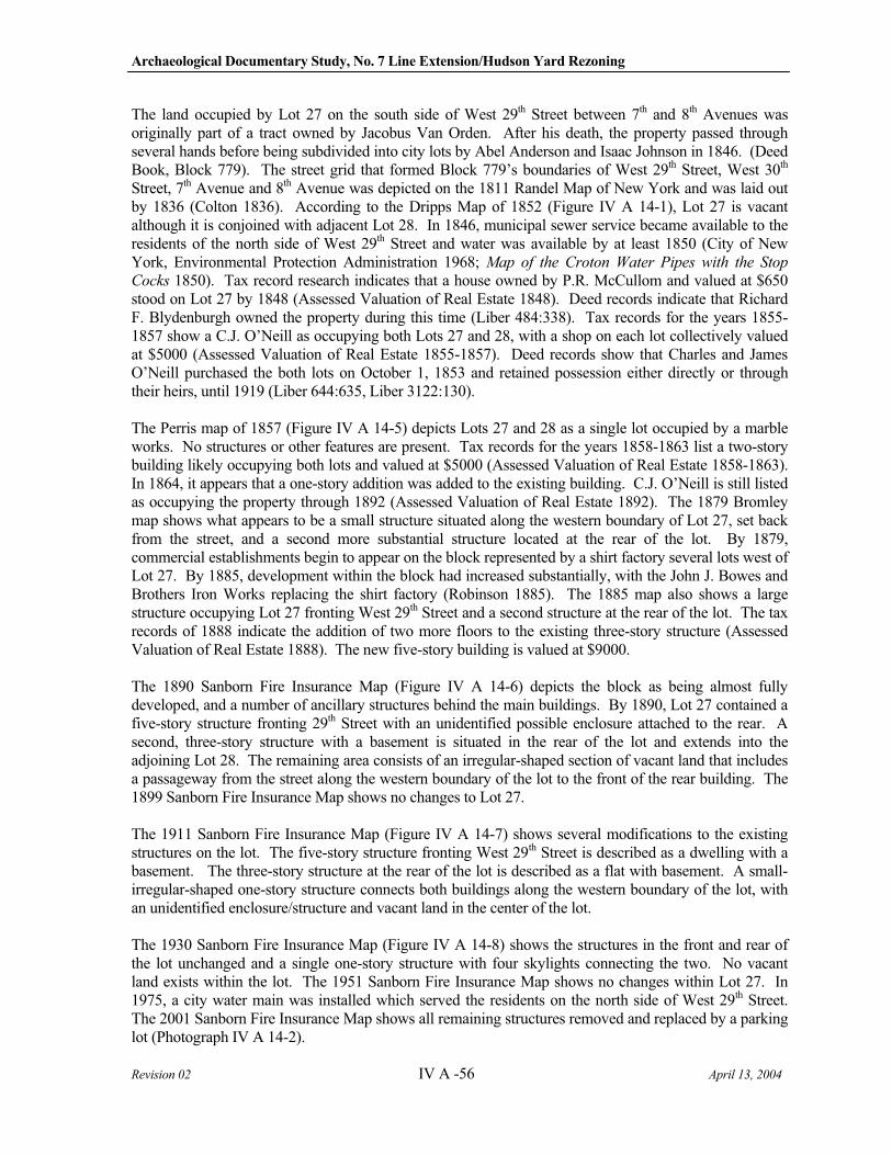
Archaeological Documentary Study, No. 7 Line Extension/Hudson Yard Rezoning
Revision 02 IV A -56 April 13, 2004
The land occupied by Lot 27 on the south side of West 29th Street between 7th and 8th Avenues was originally part of a tract owned by Jacobus Van Orden. After his death, the property passed through several hands before being subdivided into city lots by Abel Anderson and Isaac Johnson in 1846. (Deed Book, Block 779). The street grid that formed Block 779’s boundaries of West 29th Street, West 30th
Street, 7th Avenue and 8th Avenue was depicted on the 1811 Randel Map of New York and was laid out by 1836 (Colton 1836). According to the Dripps Map of 1852 (Figure IV A 14-1), Lot 27 is vacant although it is conjoined with adjacent Lot 28. In 1846, municipal sewer service became available to the residents of the north side of West 29th Street and water was available by at least 1850 (City of New York, Environmental Protection Administration 1968; Map of the Croton Water Pipes with the Stop
Cocks 1850). Tax record research indicates that a house owned by P.R. McCullom and valued at $650 stood on Lot 27 by 1848 (Assessed Valuation of Real Estate 1848). Deed records indicate that Richard F. Blydenburgh owned the property during this time (Liber 484:338). Tax records for the years 1855-1857 show a C.J. O’Neill as occupying both Lots 27 and 28, with a shop on each lot collectively valued at $5000 (Assessed Valuation of Real Estate 1855-1857). Deed records show that Charles and James O’Neill purchased the both lots on October 1, 1853 and retained possession either directly or through their heirs, until 1919 (Liber 644:635, Liber 3122:130).
The Perris map of 1857 (Figure IV A 14-5) depicts Lots 27 and 28 as a single lot occupied by a marble works. No structures or other features are present. Tax records for the years 1858-1863 list a two-story building likely occupying both lots and valued at $5000 (Assessed Valuation of Real Estate 1858-1863). In 1864, it appears that a one-story addition was added to the existing building. C.J. O’Neill is still listed as occupying the property through 1892 (Assessed Valuation of Real Estate 1892). The 1879 Bromley map shows what appears to be a small structure situated along the western boundary of Lot 27, set back from the street, and a second more substantial structure located at the rear of the lot. By 1879, commercial establishments begin to appear on the block represented by a shirt factory several lots west of Lot 27. By 1885, development within the block had increased substantially, with the John J. Bowes and Brothers Iron Works replacing the shirt factory (Robinson 1885). The 1885 map also shows a large structure occupying Lot 27 fronting West 29th Street and a second structure at the rear of the lot. The tax records of 1888 indicate the addition of two more floors to the existing three-story structure (Assessed Valuation of Real Estate 1888). The new five-story building is valued at $9000.
The 1890 Sanborn Fire Insurance Map (Figure IV A 14-6) depicts the block as being almost fully developed, and a number of ancillary structures behind the main buildings. By 1890, Lot 27 contained a five-story structure fronting 29th Street with an unidentified possible enclosure attached to the rear. A second, three-story structure with a basement is situated in the rear of the lot and extends into the adjoining Lot 28. The remaining area consists of an irregular-shaped section of vacant land that includes a passageway from the street along the western boundary of the lot to the front of the rear building. The 1899 Sanborn Fire Insurance Map shows no changes to Lot 27.
The 1911 Sanborn Fire Insurance Map (Figure IV A 14-7) shows several modifications to the existing structures on the lot. The five-story structure fronting West 29th Street is described as a dwelling with a basement. The three-story structure at the rear of the lot is described as a flat with basement. A small-irregular-shaped one-story structure connects both buildings along the western boundary of the lot, with an unidentified enclosure/structure and vacant land in the center of the lot.
The 1930 Sanborn Fire Insurance Map (Figure IV A 14-8) shows the structures in the front and rear of the lot unchanged and a single one-story structure with four skylights connecting the two. No vacant land exists within the lot. The 1951 Sanborn Fire Insurance Map shows no changes within Lot 27. In 1975, a city water main was installed which served the residents on the north side of West 29th Street. The 2001 Sanborn Fire Insurance Map shows all remaining structures removed and replaced by a parking lot (Photograph IV A 14-2).
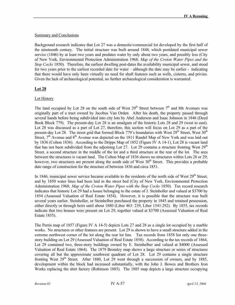
IV A Rezoning
Revision 02 IV A-57 April 13, 2004
Summary and Conclusions
Background research indicates that Lot 27 was a domestic/commercial lot developed by the first half of the nineteenth century. The initial structure was built around 1848, which postdated municipal sewer service (1846) by at least two years and predates water by only about two years, and possibly less (City of New York, Environmental Protection Administration 1968; Map of the Croton Water Pipes and the
Stop Cocks 1850). Therefore, the earliest dwelling post-dates the availability municipal sewer, and stood for two years prior to the earliest recorded date for water – although the date may be earlier - indicating that there would have only been virtually no need for shaft features such as wells, cisterns, and privies. Given the lack of archaeological potential, no further archaeological consideration is warranted.
Lot 28
Lot History
The land occupied by Lot 28 on the south side of West 29th Street between 7th and 8th Avenues was originally part of a tract owned by Jacobus Van Orden. After his death, the property passed through several hands before being subdivided into city lots by Abel Anderson and Isaac Johnson in 1846 (Deed Book Block 779). The present-day Lot 28 is an amalgam of the historic Lots 28 and 29 (west to east). Lot 28 was discussed as a part of Lot 27, therefore, this section will focus on Lot 29 as a part of the present-day Lot 28. The street grid that formed Block 779’s boundaries with West 29th Street, West 30th
Street, 7th Avenue and 8th Avenue was depicted on the 1811 Randel Map of New York and was laid out by 1836 (Colton 1836). According to the Dripps Map of 1852 (Figure IV A 14-1), Lot 28 is vacant land that has not been subdivided from the adjoining Lot 27. Lot 29 contains a structure fronting West 29th
Street, a second structure in the middle of the lot and a third structure at the rear of the lot. The area between the structures is vacant land. The Colton Map of 1836 shows no structures within Lots 28 or 29; however, two structures are present along the south side of West 30th Street. This provides a probable date range of construction for the structure of between 1836 and circa 1851.
In 1846, municipal sewer service became available to the residents of the north side of West 29th Street, and by 1850 water lines had been laid in the street bed (City of New York, Environmental Protection Administration 1968; Map of the Croton Water Pipes with the Stop Cocks 1850). Tax record research indicates that historic Lot 29 had a house belonging to the estate of J. Steinholler and valued at $3700 by 1854 (Assessed Valuation of Real Estate 1854). However, it is possible that the structure was built several years earlier. Steinholler, or Steinhelber purchased the property in 1845 and retained possession, either directly or through heirs until about 1880 (Liber 463: 239, Liber 1541:292). By 1855, tax records indicate that two houses were present on Lot 29, together valued at $3700 (Assessed Valuation of Real Estate 1855).
The Perris map of 1857 (Figure IV A 14-5) depicts Lots 27 and 28 as a single lot occupied by a marble works. No structures or other features are present. Lot 29 is shown to have a small structure added in the extreme northwest corner of the lot along the rear lot line. Tax records from 1858 list only one three-story building on Lot 29 (Assessed Valuation of Real Estate 1858). According to the tax records of 1864, Lot 29 contained two, three-story buildings owned by E. Steinhelber and valued at $4000 (Assessed Valuation of Real Estate 1864). The 1879 Bromley map shows a large structure or series of structures covering all but the approximate southwest quadrant of Lot 28. Lot 29 contains a single structure fronting West 29th Street. After 1880, Lot 29 went through a succession of owners, and by 1885, development within the block had increased substantially, with the John J. Bowes and Brothers Iron Works replacing the shirt factory (Robinson 1885). The 1885 map depicts a large structure occupying
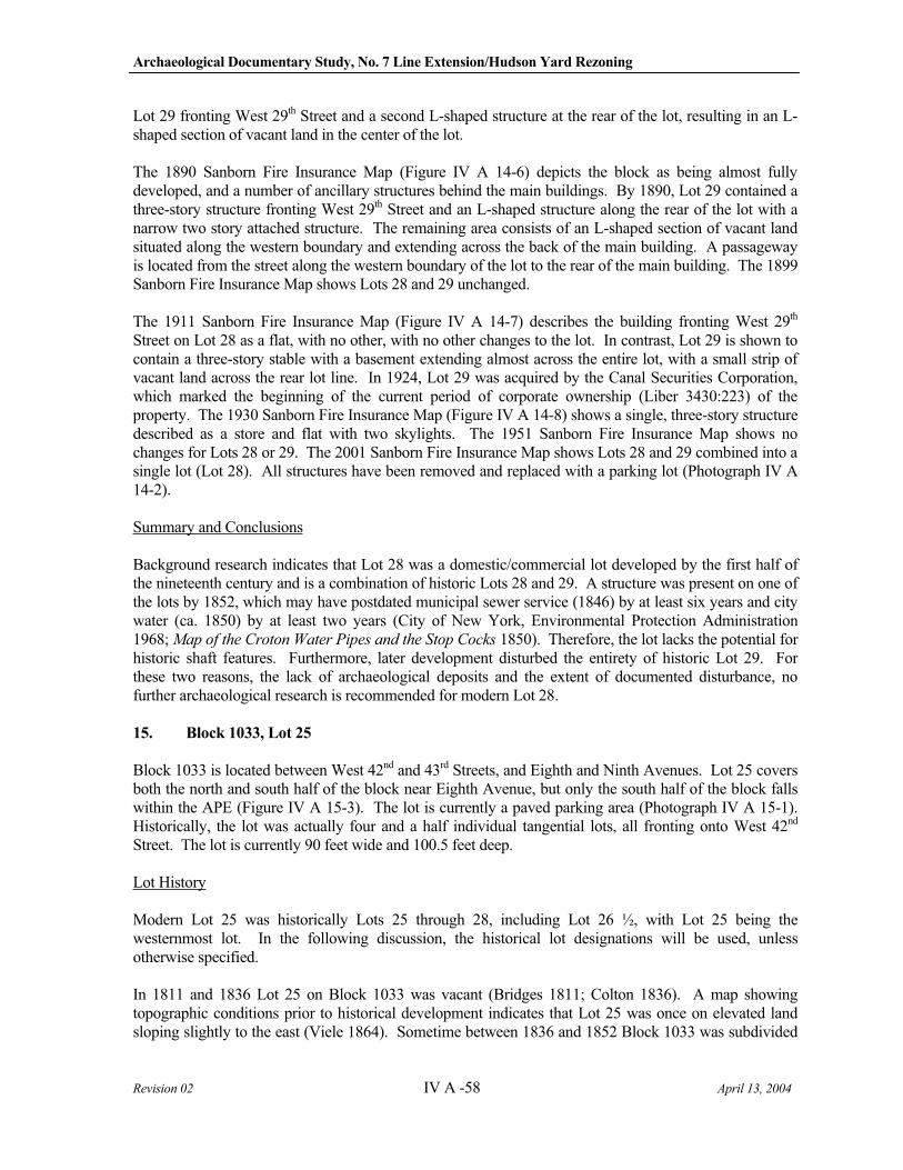
Archaeological Documentary Study, No. 7 Line Extension/Hudson Yard Rezoning
Revision 02 IV A -58 April 13, 2004
Lot 29 fronting West 29th Street and a second L-shaped structure at the rear of the lot, resulting in an L-shaped section of vacant land in the center of the lot.
The 1890 Sanborn Fire Insurance Map (Figure IV A 14-6) depicts the block as being almost fully developed, and a number of ancillary structures behind the main buildings. By 1890, Lot 29 contained a three-story structure fronting West 29th Street and an L-shaped structure along the rear of the lot with a narrow two story attached structure. The remaining area consists of an L-shaped section of vacant land situated along the western boundary and extending across the back of the main building. A passageway is located from the street along the western boundary of the lot to the rear of the main building. The 1899 Sanborn Fire Insurance Map shows Lots 28 and 29 unchanged.
The 1911 Sanborn Fire Insurance Map (Figure IV A 14-7) describes the building fronting West 29th
Street on Lot 28 as a flat, with no other, with no other changes to the lot. In contrast, Lot 29 is shown to contain a three-story stable with a basement extending almost across the entire lot, with a small strip of vacant land across the rear lot line. In 1924, Lot 29 was acquired by the Canal Securities Corporation, which marked the beginning of the current period of corporate ownership (Liber 3430:223) of the property. The 1930 Sanborn Fire Insurance Map (Figure IV A 14-8) shows a single, three-story structure described as a store and flat with two skylights. The 1951 Sanborn Fire Insurance Map shows no changes for Lots 28 or 29. The 2001 Sanborn Fire Insurance Map shows Lots 28 and 29 combined into a single lot (Lot 28). All structures have been removed and replaced with a parking lot (Photograph IV A 14-2).
Summary and Conclusions
Background research indicates that Lot 28 was a domestic/commercial lot developed by the first half of the nineteenth century and is a combination of historic Lots 28 and 29. A structure was present on one of the lots by 1852, which may have postdated municipal sewer service (1846) by at least six years and city water (ca. 1850) by at least two years (City of New York, Environmental Protection Administration 1968; Map of the Croton Water Pipes and the Stop Cocks 1850). Therefore, the lot lacks the potential for historic shaft features. Furthermore, later development disturbed the entirety of historic Lot 29. For these two reasons, the lack of archaeological deposits and the extent of documented disturbance, no further archaeological research is recommended for modern Lot 28.
15. Block 1033, Lot 25
Block 1033 is located between West 42nd and 43rd Streets, and Eighth and Ninth Avenues. Lot 25 covers both the north and south half of the block near Eighth Avenue, but only the south half of the block falls within the APE (Figure IV A 15-3). The lot is currently a paved parking area (Photograph IV A 15-1). Historically, the lot was actually four and a half individual tangential lots, all fronting onto West 42nd
Street. The lot is currently 90 feet wide and 100.5 feet deep.
Lot History
Modern Lot 25 was historically Lots 25 through 28, including Lot 26 ½, with Lot 25 being the westernmost lot. In the following discussion, the historical lot designations will be used, unless otherwise specified.
In 1811 and 1836 Lot 25 on Block 1033 was vacant (Bridges 1811; Colton 1836). A map showing topographic conditions prior to historical development indicates that Lot 25 was once on elevated land sloping slightly to the east (Viele 1864). Sometime between 1836 and 1852 Block 1033 was subdivided
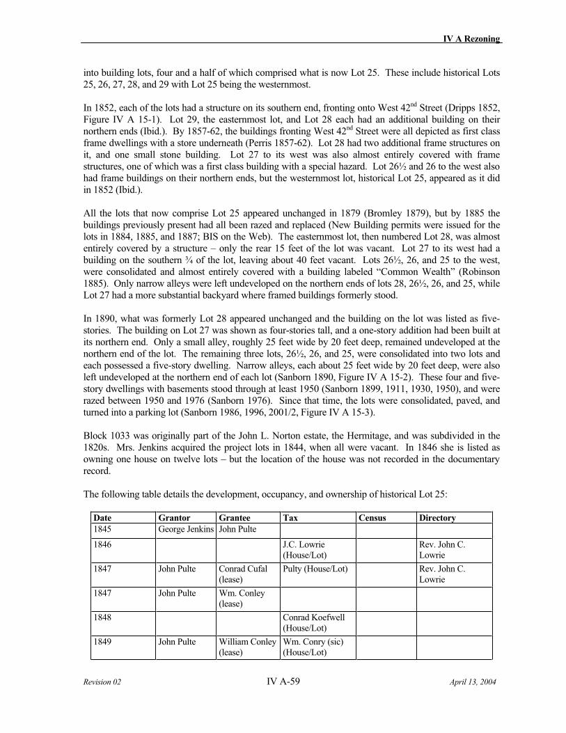
IV A Rezoning
Revision 02 IV A-59 April 13, 2004
into building lots, four and a half of which comprised what is now Lot 25. These include historical Lots 25, 26, 27, 28, and 29 with Lot 25 being the westernmost.
In 1852, each of the lots had a structure on its southern end, fronting onto West 42nd Street (Dripps 1852, Figure IV A 15-1). Lot 29, the easternmost lot, and Lot 28 each had an additional building on their northern ends (Ibid.). By 1857-62, the buildings fronting West 42nd Street were all depicted as first class frame dwellings with a store underneath (Perris 1857-62). Lot 28 had two additional frame structures on it, and one small stone building. Lot 27 to its west was also almost entirely covered with frame structures, one of which was a first class building with a special hazard. Lot 26½ and 26 to the west also had frame buildings on their northern ends, but the westernmost lot, historical Lot 25, appeared as it did in 1852 (Ibid.).
All the lots that now comprise Lot 25 appeared unchanged in 1879 (Bromley 1879), but by 1885 the buildings previously present had all been razed and replaced (New Building permits were issued for the lots in 1884, 1885, and 1887; BIS on the Web). The easternmost lot, then numbered Lot 28, was almost entirely covered by a structure – only the rear 15 feet of the lot was vacant. Lot 27 to its west had a building on the southern ¾ of the lot, leaving about 40 feet vacant. Lots 26½, 26, and 25 to the west, were consolidated and almost entirely covered with a building labeled “Common Wealth” (Robinson 1885). Only narrow alleys were left undeveloped on the northern ends of lots 28, 26½, 26, and 25, while Lot 27 had a more substantial backyard where framed buildings formerly stood.
In 1890, what was formerly Lot 28 appeared unchanged and the building on the lot was listed as five-stories. The building on Lot 27 was shown as four-stories tall, and a one-story addition had been built at its northern end. Only a small alley, roughly 25 feet wide by 20 feet deep, remained undeveloped at the northern end of the lot. The remaining three lots, 26½, 26, and 25, were consolidated into two lots and each possessed a five-story dwelling. Narrow alleys, each about 25 feet wide by 20 feet deep, were also left undeveloped at the northern end of each lot (Sanborn 1890, Figure IV A 15-2). These four and five-story dwellings with basements stood through at least 1950 (Sanborn 1899, 1911, 1930, 1950), and were razed between 1950 and 1976 (Sanborn 1976). Since that time, the lots were consolidated, paved, and turned into a parking lot (Sanborn 1986, 1996, 2001/2, Figure IV A 15-3).
Block 1033 was originally part of the John L. Norton estate, the Hermitage, and was subdivided in the 1820s. Mrs. Jenkins acquired the project lots in 1844, when all were vacant. In 1846 she is listed as owning one house on twelve lots – but the location of the house was not recorded in the documentary record.
The following table details the development, occupancy, and ownership of historical Lot 25:
Date Grantor Grantee Tax Census Directory
1845 George Jenkins John Pulte
1846 J.C. Lowrie (House/Lot)
Rev. John C. Lowrie
1847 John Pulte Conrad Cufal (lease)
Pulty (House/Lot) Rev. John C. Lowrie
1847 John Pulte Wm. Conley (lease)
1848 Conrad Koefwell (House/Lot)
1849 John Pulte William Conley (lease)
Wm. Conry (sic) (House/Lot)
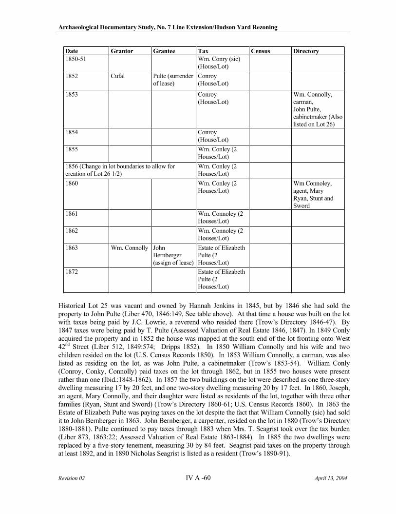
Archaeological Documentary Study, No. 7 Line Extension/Hudson Yard Rezoning
Revision 02 IV A -60 April 13, 2004
Date Grantor Grantee Tax Census Directory
1850-51 Wm. Conry (sic) (House/Lot)
1852 Cufal Pulte (surrender of lease)
Conroy (House/Lot)
1853 Conroy (House/Lot)
Wm. Connolly, carman, John Pulte, cabinetmaker (Also listed on Lot 26)
1854 Conroy (House/Lot)
1855 Wm. Conley (2 Houses/Lot)
1856 (Change in lot boundaries to allow for creation of Lot 26 1/2)
Wm. Conley (2 Houses/Lot)
1860 Wm. Conley (2 Houses/Lot)
Wm Connoley, agent, Mary Ryan, Stunt and Sword
1861 Wm. Connoley (2 Houses/Lot)
1862 Wm. Connoley (2 Houses/Lot)
1863 Wm. Connolly John Bernberger (assign of lease)
Estate of Elizabeth Pulte (2 Houses/Lot)
1872 Estate of Elizabeth Pulte (2 Houses/Lot)
Historical Lot 25 was vacant and owned by Hannah Jenkins in 1845, but by 1846 she had sold the property to John Pulte (Liber 470, 1846:149, See table above). At that time a house was built on the lot with taxes being paid by J.C. Lowrie, a reverend who resided there (Trow’s Directory 1846-47). By 1847 taxes were being paid by T. Pulte (Assessed Valuation of Real Estate 1846, 1847). In 1849 Conly acquired the property and in 1852 the house was mapped at the south end of the lot fronting onto West 42nd Street (Liber 512, 1849:574; Dripps 1852). In 1850 William Connolly and his wife and two children resided on the lot (U.S. Census Records 1850). In 1853 William Connolly, a carman, was also listed as residing on the lot, as was John Pulte, a cabinetmaker (Trow’s 1853-54). William Conly (Conroy, Conky, Connolly) paid taxes on the lot through 1862, but in 1855 two houses were present rather than one (Ibid.:1848-1862). In 1857 the two buildings on the lot were described as one three-story dwelling measuring 17 by 20 feet, and one two-story dwelling measuring 20 by 17 feet. In 1860, Joseph, an agent, Mary Connolly, and their daughter were listed as residents of the lot, together with three other families (Ryan, Stunt and Sword) (Trow’s Directory 1860-61; U.S. Census Records 1860). In 1863 the Estate of Elizabeth Pulte was paying taxes on the lot despite the fact that William Connolly (sic) had sold it to John Bernberger in 1863. John Bernberger, a carpenter, resided on the lot in 1880 (Trow’s Directory 1880-1881). Pulte continued to pay taxes through 1883 when Mrs. T. Seagrist took over the tax burden (Liber 873, 1863:22; Assessed Valuation of Real Estate 1863-1884). In 1885 the two dwellings were replaced by a five-story tenement, measuring 30 by 84 feet. Seagrist paid taxes on the property through at least 1892, and in 1890 Nicholas Seagrist is listed as a resident (Trow’s 1890-91).
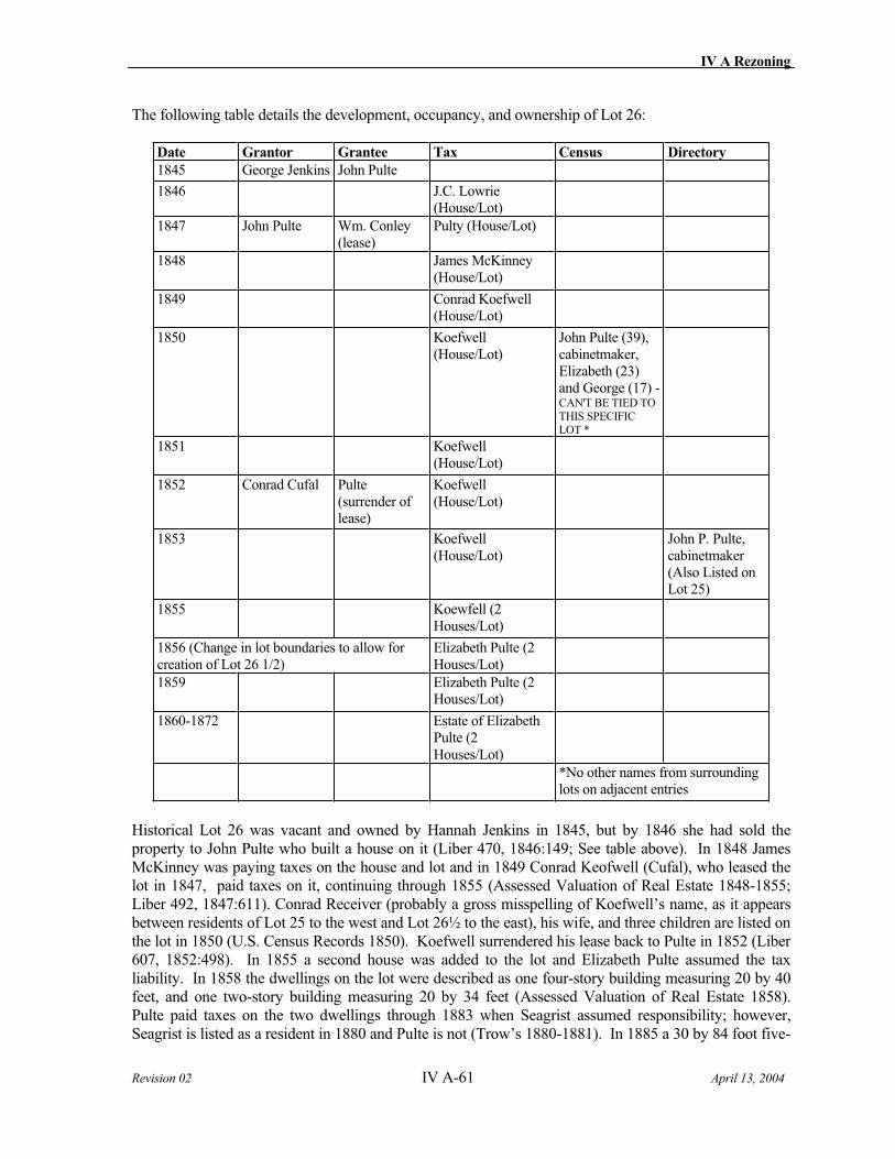
IV A Rezoning
Revision 02 IV A-61 April 13, 2004
The following table details the development, occupancy, and ownership of Lot 26:
Date Grantor Grantee Tax Census Directory
1845 George Jenkins John Pulte
1846 J.C. Lowrie (House/Lot)
1847 John Pulte Wm. Conley (lease)
Pulty (House/Lot)
1848 James McKinney (House/Lot)
1849 Conrad Koefwell (House/Lot)
1850 Koefwell (House/Lot)
John Pulte (39), cabinetmaker, Elizabeth (23) and George (17) - CAN'T BE TIED TO THIS SPECIFIC LOT *
1851 Koefwell (House/Lot)
1852 Conrad Cufal Pulte (surrender of lease)
Koefwell(House/Lot)
1853 Koefwell (House/Lot)
John P. Pulte, cabinetmaker (Also Listed on Lot 25)
1855 Koewfell (2 Houses/Lot)
1856 (Change in lot boundaries to allow for creation of Lot 26 1/2)
Elizabeth Pulte (2 Houses/Lot)
1859 Elizabeth Pulte (2 Houses/Lot)
1860-1872 Estate of Elizabeth Pulte (2 Houses/Lot)
*No other names from surrounding lots on adjacent entries
Historical Lot 26 was vacant and owned by Hannah Jenkins in 1845, but by 1846 she had sold the property to John Pulte who built a house on it (Liber 470, 1846:149; See table above). In 1848 James McKinney was paying taxes on the house and lot and in 1849 Conrad Keofwell (Cufal), who leased the lot in 1847, paid taxes on it, continuing through 1855 (Assessed Valuation of Real Estate 1848-1855; Liber 492, 1847:611). Conrad Receiver (probably a gross misspelling of Koefwell’s name, as it appears between residents of Lot 25 to the west and Lot 26½ to the east), his wife, and three children are listed on the lot in 1850 (U.S. Census Records 1850). Koefwell surrendered his lease back to Pulte in 1852 (Liber 607, 1852:498). In 1855 a second house was added to the lot and Elizabeth Pulte assumed the tax liability. In 1858 the dwellings on the lot were described as one four-story building measuring 20 by 40 feet, and one two-story building measuring 20 by 34 feet (Assessed Valuation of Real Estate 1858). Pulte paid taxes on the two dwellings through 1883 when Seagrist assumed responsibility; however, Seagrist is listed as a resident in 1880 and Pulte is not (Trow’s 1880-1881). In 1885 a 30 by 84 foot five-
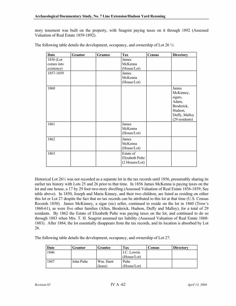
Archaeological Documentary Study, No. 7 Line Extension/Hudson Yard Rezoning
Revision 02 IV A -62 April 13, 2004
story tenement was built on the property, with Seagrist paying taxes on it through 1892 (Assessed Valuation of Real Estate 1859-1892).
The following table details the development, occupancy, and ownership of Lot 26 ½:
Date Grantor Grantee Tax Census Directory
1856 (Lot comes into existence)
James McKenna (House/Lot)
1857-1859 James McKenna (House/Lot)
1860 James McKinney, sigars, Adam, Broderick, Hudson,Duffy, Malloy (29 residents)
1861 James McKenna (House/Lot)
1862 James McKenna (House/Lot)
1863 Estate of Elizabeth Pulte (2 Houses/Lot)
Historical Lot 26½ was not recorded as a separate lot in the tax records until 1856, presumably sharing its earlier tax history with Lots 25 and 26 prior to that time. In 1856 James McKenna is paying taxes on the lot and one house, a 17 by 29 foot two-story dwelling (Assessed Valuation of Real Estate 1856-1859; See table above). In 1850, Joseph and Maria Kinney, and their two children, are listed as residing on either this lot or Lot 27 despite the fact that no tax records can be attributed to this lot at that time (U.S. Census Records 1850). James McKinney, a sigar (sic) seller, continued to reside on the lot in 1860 (Trow’s 1860-61), as were five other families (Allen, Broderick, Hudson, Duffy and Malloy), for a total of 29 residents. By 1862 the Estate of Elizabeth Pulte was paying taxes on the lot, and continued to do so through 1883 when Mrs. T. H. Seagrist assumed tax liability (Assessed Valuation of Real Estate 1860-1883). After 1884, the lot essentially disappears from the tax records, and its location is absorbed by Lot 26.
The following table details the development, occupancy, and ownership of Lot 27:
Date Grantor Grantee Tax Census Directory
1846 J.C. Lowrie (House/Lot)
1847 John Pulte Wm. Hartt (lease)
Pulte(House/Lot)
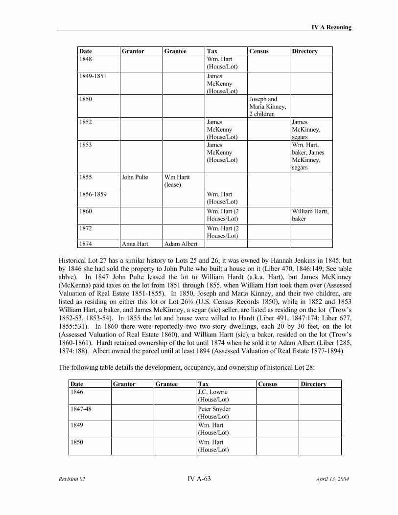
IV A Rezoning
Revision 02 IV A-63 April 13, 2004
Date Grantor Grantee Tax Census Directory
1848 Wm. Hart (House/Lot)
1849-1851 James McKenny (House/Lot)
1850 Joseph and Maria Kinney, 2 children
1852 James McKenny (House/Lot)
James McKinney, segars
1853 James McKenny (House/Lot)
Wm. Hart, baker, James McKinney, segars
1855 John Pulte Wm Hartt (lease)
1856-1859 Wm. Hart (House/Lot)
1860 Wm. Hart (2 Houses/Lot)
William Hartt, baker
1872 Wm. Hart (2 Houses/Lot)
1874 Anna Hart Adam Albert
Historical Lot 27 has a similar history to Lots 25 and 26; it was owned by Hannah Jenkins in 1845, but by 1846 she had sold the property to John Pulte who built a house on it (Liber 470, 1846:149; See table ablve). In 1847 John Pulte leased the lot to William Hardt (a.k.a. Hart), but James McKinney (McKenna) paid taxes on the lot from 1851 through 1855, when William Hart took them over (Assessed Valuation of Real Estate 1851-1855). In 1850, Joseph and Maria Kinney, and their two children, are listed as residing on either this lot or Lot 26½ (U.S. Census Records 1850), while in 1852 and 1853 William Hart, a baker, and James McKinney, a segar (sic) seller, are listed as residing on the lot (Trow’s 1852-53, 1853-54). In 1855 the lot and house were willed to Hardt (Liber 491, 1847:174; Liber 677, 1855:531). In 1860 there were reportedly two two-story dwellings, each 20 by 30 feet, on the lot (Assessed Valuation of Real Estate 1860), and William Hartt (sic), a baker, resided on the lot (Trow’s 1860-1861). Hardt retained ownership of the lot until 1874 when he sold it to Adam Albert (Liber 1285, 1874:188). Albert owned the parcel until at least 1894 (Assessed Valuation of Real Estate 1877-1894).
The following table details the development, occupancy, and ownership of historical Lot 28:
Date Grantor Grantee Tax Census Directory
1846 J.C. Lowrie (House/Lot)
1847-48 Peter Snyder (House/Lot)
1849 Wm. Hart (House/Lot)
1850 Wm. Hart (House/Lot)
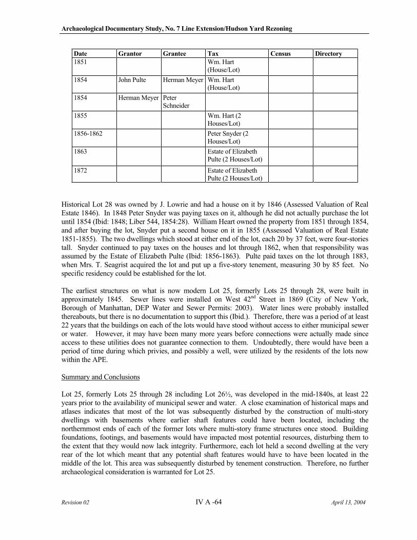
Archaeological Documentary Study, No. 7 Line Extension/Hudson Yard Rezoning
Revision 02 IV A -64 April 13, 2004
Date Grantor Grantee Tax Census Directory
1851 Wm. Hart (House/Lot)
1854 John Pulte Herman Meyer Wm. Hart (House/Lot)
1854 Herman Meyer Peter Schneider
1855 Wm. Hart (2 Houses/Lot)
1856-1862 Peter Snyder (2 Houses/Lot)
1863 Estate of Elizabeth Pulte (2 Houses/Lot)
1872 Estate of Elizabeth Pulte (2 Houses/Lot)
Historical Lot 28 was owned by J. Lowrie and had a house on it by 1846 (Assessed Valuation of Real Estate 1846). In 1848 Peter Snyder was paying taxes on it, although he did not actually purchase the lot until 1854 (Ibid: 1848; Liber 544, 1854:28). William Heart owned the property from 1851 through 1854, and after buying the lot, Snyder put a second house on it in 1855 (Assessed Valuation of Real Estate 1851-1855). The two dwellings which stood at either end of the lot, each 20 by 37 feet, were four-stories tall. Snyder continued to pay taxes on the houses and lot through 1862, when that responsibility was assumed by the Estate of Elizabeth Pulte (Ibid: 1856-1863). Pulte paid taxes on the lot through 1883, when Mrs. T. Seagrist acquired the lot and put up a five-story tenement, measuring 30 by 85 feet. No specific residency could be established for the lot.
The earliest structures on what is now modern Lot 25, formerly Lots 25 through 28, were built in approximately 1845. Sewer lines were installed on West 42nd Street in 1869 (City of New York, Borough of Manhattan, DEP Water and Sewer Permits: 2003). Water lines were probably installed thereabouts, but there is no documentation to support this (Ibid.). Therefore, there was a period of at least 22 years that the buildings on each of the lots would have stood without access to either municipal sewer or water. However, it may have been many more years before connections were actually made since access to these utilities does not guarantee connection to them. Undoubtedly, there would have been a period of time during which privies, and possibly a well, were utilized by the residents of the lots now within the APE.
Summary and Conclusions
Lot 25, formerly Lots 25 through 28 including Lot 26½, was developed in the mid-1840s, at least 22 years prior to the availability of municipal sewer and water. A close examination of historical maps and atlases indicates that most of the lot was subsequently disturbed by the construction of multi-story dwellings with basements where earlier shaft features could have been located, including the northernmost ends of each of the former lots where multi-story frame structures once stood. Building foundations, footings, and basements would have impacted most potential resources, disturbing them to the extent that they would now lack integrity. Furthermore, each lot held a second dwelling at the very rear of the lot which meant that any potential shaft features would have to have been located in the middle of the lot. This area was subsequently disturbed by tenement construction. Therefore, no further archaeological consideration is warranted for Lot 25.
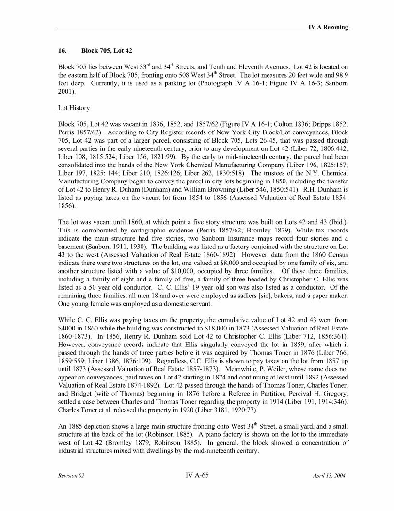
IV A Rezoning
Revision 02 IV A-65 April 13, 2004
16. Block 705, Lot 42
Block 705 lies between West 33rd and 34th Streets, and Tenth and Eleventh Avenues. Lot 42 is located on the eastern half of Block 705, fronting onto 508 West 34th Street. The lot measures 20 feet wide and 98.9 feet deep. Currently, it is used as a parking lot (Photograph IV A 16-1; Figure IV A 16-3; Sanborn 2001).
Lot History
Block 705, Lot 42 was vacant in 1836, 1852, and 1857/62 (Figure IV A 16-1; Colton 1836; Dripps 1852; Perris 1857/62). According to City Register records of New York City Block/Lot conveyances, Block 705, Lot 42 was part of a larger parcel, consisting of Block 705, Lots 26-45, that was passed through several parties in the early nineteenth century, prior to any development on Lot 42 (Liber 72, 1806:442; Liber 108, 1815:524; Liber 156, 1821:99). By the early to mid-nineteenth century, the parcel had been consolidated into the hands of the New York Chemical Manufacturing Company (Liber 196, 1825:157; Liber 197, 1825: 144; Liber 210, 1826:126; Liber 262, 1830:518). The trustees of the N.Y. Chemical Manufacturing Company began to convey the parcel in city lots beginning in 1850, including the transfer of Lot 42 to Henry R. Duham (Dunham) and William Browning (Liber 546, 1850:541). R.H. Dunham is listed as paying taxes on the vacant lot from 1854 to 1856 (Assessed Valuation of Real Estate 1854-1856).
The lot was vacant until 1860, at which point a five story structure was built on Lots 42 and 43 (Ibid.). This is corroborated by cartographic evidence (Perris 1857/62; Bromley 1879). While tax records indicate the main structure had five stories, two Sanborn Insurance maps record four stories and a basement (Sanborn 1911, 1930). The building was listed as a factory conjoined with the structure on Lot 43 to the west (Assessed Valuation of Real Estate 1860-1892). However, data from the 1860 Census indicate there were two structures on the lot, one valued at $8,000 and occupied by one family of six, and another structure listed with a value of $10,000, occupied by three families. Of these three families, including a family of eight and a family of five, a family of three headed by Christopher C. Ellis was listed as a 50 year old conductor. C. C. Ellis’ 19 year old son was also listed as a conductor. Of the remaining three families, all men 18 and over were employed as sadlers [sic], bakers, and a paper maker. One young female was employed as a domestic servant.
While C. C. Ellis was paying taxes on the property, the cumulative value of Lot 42 and 43 went from $4000 in 1860 while the building was constructed to $18,000 in 1873 (Assessed Valuation of Real Estate 1860-1873). In 1856, Henry R. Dunham sold Lot 42 to Christopher C. Ellis (Liber 712, 1856:361). However, conveyance records indicate that Ellis singularly conveyed the lot in 1859, after which it passed through the hands of three parties before it was acquired by Thomas Toner in 1876 (Liber 766, 1859:559; Liber 1386, 1876:109). Regardless, C.C. Ellis is shown to pay taxes on the lot from 1857 up until 1873 (Assessed Valuation of Real Estate 1857-1873). Meanwhile, P. Weiler, whose name does not appear on conveyances, paid taxes on Lot 42 starting in 1874 and continuing at least until 1892 (Assessed Valuation of Real Estate 1874-1892). Lot 42 passed through the hands of Thomas Toner, Charles Toner, and Bridget (wife of Thomas) beginning in 1876 before a Referee in Partition, Percival H. Gregory, settled a case between Charles and Thomas Toner regarding the property in 1914 (Liber 191, 1914:346). Charles Toner et al. released the property in 1920 (Liber 3181, 1920:77).
An 1885 depiction shows a large main structure fronting onto West 34th Street, a small yard, and a small structure at the back of the lot (Robinson 1885). A piano factory is shown on the lot to the immediate west of Lot 42 (Bromley 1879; Robinson 1885). In general, the block showed a concentration of industrial structures mixed with dwellings by the mid-nineteenth century.
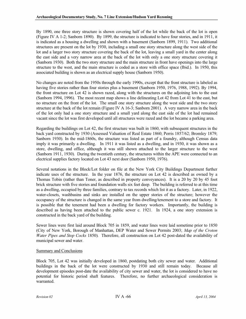
Archaeological Documentary Study, No. 7 Line Extension/Hudson Yard Rezoning
Revision 02 IV A -66 April 13, 2004
By 1890, one three story structure is shown covering half of the lot while the back of the lot is open (Figure IV A 1-2; Sanborn 1890). By 1899, the structure is indicated to have four stories, and in 1911, it is indicated as a housing a dwelling and shown with a basement (Sanborn 1899, 1911). Two additional structures are present on the lot by 1930, including a small one story structure along the west side of the lot and a larger two story structure covering the back of the lot, leaving a small yard in the center along the east side and a very narrow area at the back of the lot with only a one story structure covering it (Sanborn 1930). Both the two story structure and the main structure in front have openings into the large structure to the west, and the main structure is coded as a store with office space (Ibid.). In 1950, this associated building is shown as an electrical supply house (Sanborn 1950).
No changes are noted from the 1950s through the early 1990s, except that the front structure is labeled as having five stories rather than four stories plus a basement (Sanborn 1950, 1976, 1988, 1992). By 1994, the front structure on Lot 42 is shown razed, along with the structures on the adjoining lots to the east (Sanborn 1994, 1996). The most recent map shows a line delineating Lot 42 from Lot 41 to the east, but no structure on the front of the lot. The small one story structure along the west side and the two story structure at the back of the lot remain (Figure IV A 16-3; Sanborn 2001). A very narrow area in the back of the lot only had a one story structure and a small yard along the east side of the lot had remained vacant since the lot was first developed until all structures were razed and the lot became a parking area.
Regarding the buildings on Lot 42, the first structure was built in 1860, with subsequent structures in the back yard constructed by 1930 (Assessed Valuation of Real Estate 1860; Perris 1857/62; Bromley 1879; Sanborn 1930). In the mid-1860s, the structure was listed as part of a foundry, although Census data imply it was primarily a dwelling. In 1911 it was listed as a dwelling, and in 1930, it was shown as a store, dwelling, and office, although it was still shown attached to the larger structure to the west (Sanborn 1911, 1930). During the twentieth century, the structures within the APE were connected to an electrical supplies factory located on Lot 43 next door (Sanborn 1950, 1976).
Several notations in the Block/Lot folder on file at the New York City Buildings Department further indicate uses of the structure. In the year 1876, the structure on Lot 42 is described as owned by a Thomas Tobin (rather than Toner, as described in property conveyances). It is a 20 by 20 by 45 foot brick structure with five stories and foundation walls six feet deep. The building is referred to at this time as a dwelling, occupied by three families, contrary to tax records which list it as a factory. Later, in 1922, water-closets, washbasins and sinks are installed on the upper stories of the structure; however the occupancy of the structure is changed in the same year from dwelling/tenement to a store and factory. It is possible that the tenement had been a dwelling for factory workers. Importantly, the building is described as having been attached to the public sewer c. 1921. In 1924, a one story extension is constructed in the back yard of the building.
Sewer lines were first laid around Block 705 in 1859, and water lines were laid sometime prior to 1850 (City of New York, Borough of Manhattan, DEP Water and Sewer Permits 2003; Map of the Croton
Water Pipes and Stop Cocks 1850). Therefore, all construction on Lot 42 post-dated the availability of municipal sewer and water.
Summary and Conclusions
Block 705, Lot 42 was initially developed in 1860, postdating both city sewer and water. Additional buildings in the back of the lot were constructed by 1930 and still remain today. Because all development episodes post-date the availability of city sewer and water, the lot is considered to have no potential for historic period shaft features. Therefore, no further archaeological consideration is warranted.
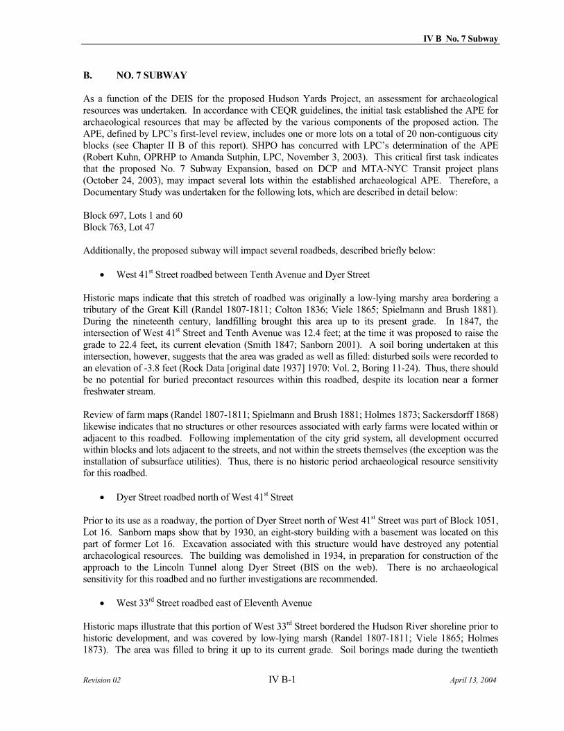
IV B No. 7 Subway
Revision 02 IV B-1 April 13, 2004
B. NO. 7 SUBWAY
As a function of the DEIS for the proposed Hudson Yards Project, an assessment for archaeological resources was undertaken. In accordance with CEQR guidelines, the initial task established the APE for archaeological resources that may be affected by the various components of the proposed action. The APE, defined by LPC’s first-level review, includes one or more lots on a total of 20 non-contiguous city blocks (see Chapter II B of this report). SHPO has concurred with LPC’s determination of the APE (Robert Kuhn, OPRHP to Amanda Sutphin, LPC, November 3, 2003). This critical first task indicates that the proposed No. 7 Subway Expansion, based on DCP and MTA-NYC Transit project plans (October 24, 2003), may impact several lots within the established archaeological APE. Therefore, a Documentary Study was undertaken for the following lots, which are described in detail below:
Block 697, Lots 1 and 60 Block 763, Lot 47
Additionally, the proposed subway will impact several roadbeds, described briefly below:
West 41st Street roadbed between Tenth Avenue and Dyer Street
Historic maps indicate that this stretch of roadbed was originally a low-lying marshy area bordering a tributary of the Great Kill (Randel 1807-1811; Colton 1836; Viele 1865; Spielmann and Brush 1881). During the nineteenth century, landfilling brought this area up to its present grade. In 1847, the intersection of West 41st Street and Tenth Avenue was 12.4 feet; at the time it was proposed to raise the grade to 22.4 feet, its current elevation (Smith 1847; Sanborn 2001). A soil boring undertaken at this intersection, however, suggests that the area was graded as well as filled: disturbed soils were recorded to an elevation of -3.8 feet (Rock Data [original date 1937] 1970: Vol. 2, Boring 11-24). Thus, there should be no potential for buried precontact resources within this roadbed, despite its location near a former freshwater stream.
Review of farm maps (Randel 1807-1811; Spielmann and Brush 1881; Holmes 1873; Sackersdorff 1868) likewise indicates that no structures or other resources associated with early farms were located within or adjacent to this roadbed. Following implementation of the city grid system, all development occurred within blocks and lots adjacent to the streets, and not within the streets themselves (the exception was the installation of subsurface utilities). Thus, there is no historic period archaeological resource sensitivity for this roadbed.
Dyer Street roadbed north of West 41st Street
Prior to its use as a roadway, the portion of Dyer Street north of West 41st Street was part of Block 1051, Lot 16. Sanborn maps show that by 1930, an eight-story building with a basement was located on this part of former Lot 16. Excavation associated with this structure would have destroyed any potential archaeological resources. The building was demolished in 1934, in preparation for construction of the approach to the Lincoln Tunnel along Dyer Street (BIS on the web). There is no archaeological sensitivity for this roadbed and no further investigations are recommended.
West 33rd Street roadbed east of Eleventh Avenue
Historic maps illustrate that this portion of West 33rd Street bordered the Hudson River shoreline prior to historic development, and was covered by low-lying marsh (Randel 1807-1811; Viele 1865; Holmes 1873). The area was filled to bring it up to its current grade. Soil borings made during the twentieth
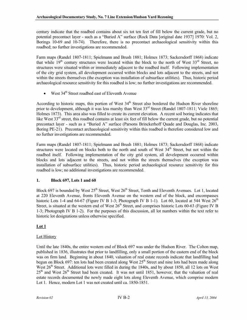
Archaeological Documentary Study, No. 7 Line Extension/Hudson Yard Rezoning
Revision 02 IV B-2 April 13, 2004
century indicate that the roadbed contains about six tot ten feet of fill below the current grade, but no potential precontact layer - such as a “Buried A” surface (Rock Data [original date 1937] 1970: Vol. 2, Borings 10-69 and 10-74). Therefore, there is no precontact archaeological sensitivity within this roadbed; no further investigations are recommended.
Farm maps (Randel 1807-1811; Spielmann and Brush 1881; Holmes 1873; Sackersdorff 1868) indicate that while 19th century structures were located within the block to the north of West 33rd Street, no structures were situated within or immediately adjacent to the roadbed itself. Following implementation of the city grid system, all development occurred within blocks and lots adjacent to the streets, and not within the streets themselves (the exception was installation of subsurface utilities). Thus, historic period archaeological resource sensitivity for this roadbed is low; no further investigations are recommended.
West 34th Street roadbed east of Eleventh Avenue
According to historic maps, this portion of West 34th Street also bordered the Hudson River shoreline prior to development, although it was less marshy than West 33rd Street (Randel 1807-1811; Viele 1865; Holmes 1873). This area also was filled to create its current elevation. A recent soil boring indicates that like West 33rd street, this roadbed contains at least six feet of fill below the current grade, but no potential precontact layer - such as a “Buried A” surface (Parsons Brinckerhoff Quade and Douglas, Inc. 2003, Boring PE-21). Precontact archaeological sensitivity within this roadbed is therefore considered low and no further investigations are recommended.
Farm maps (Randel 1807-1811; Spielmann and Brush 1881; Holmes 1873; Sackersdorff 1868) indicate structures were located on blocks both to the north and south of West 34th Street, but not within the roadbed itself. Following implementation of the city grid system, all development occurred within blocks and lots adjacent to the streets, and not within the streets themselves (the exception was installation of subsurface utilities). Thus, historic period archaeological resource sensitivity for this roadbed is low; no additional investigations are recommended.
1. Block 697, Lots 1 and 60
Block 697 is bounded by West 25th Street, West 26th Street, Tenth and Eleventh Avenues. Lot 1, located at 220 Eleventh Avenue, fronts Eleventh Avenue on the western end of the block, and encompasses historic Lots 1-4 and 64-67 (Figure IV B 1-3; Photograph IV B 1-1). Lot 60, located at 544 West 26th
Street, is situated at the western end of West 26th Street, and comprises historic Lots 60-63 (Figure IV B 1-3; Photograph IV B 1-2). For the purposes of this discussion, all lot numbers within the text refer to historic lot designations unless otherwise specified.
Lot 1
Lot History
Until the late 1840s, the entire western end of Block 697 was under the Hudson River. The Colton map, published in 1836, illustrates that prior to landfilling, only a small portion of the eastern end of the block was on firm land. Beginning in about 1840, valuation of real estate records indicate that landfilling had begun on Block 697: ten lots had been created along West 25th Street and nine lots had been made along West 26th Street. Additional lots were filled in during the 1840s, and by about 1850, all 12 lots on West 25th and West 26th Street had been created. It was not until 1851, however, that the valuation of real estate records documented the newly made eight lots along Eleventh Avenue, which comprise modern Lot 1. Hence, modern Lot 1 was not created until ca. 1850-1851.
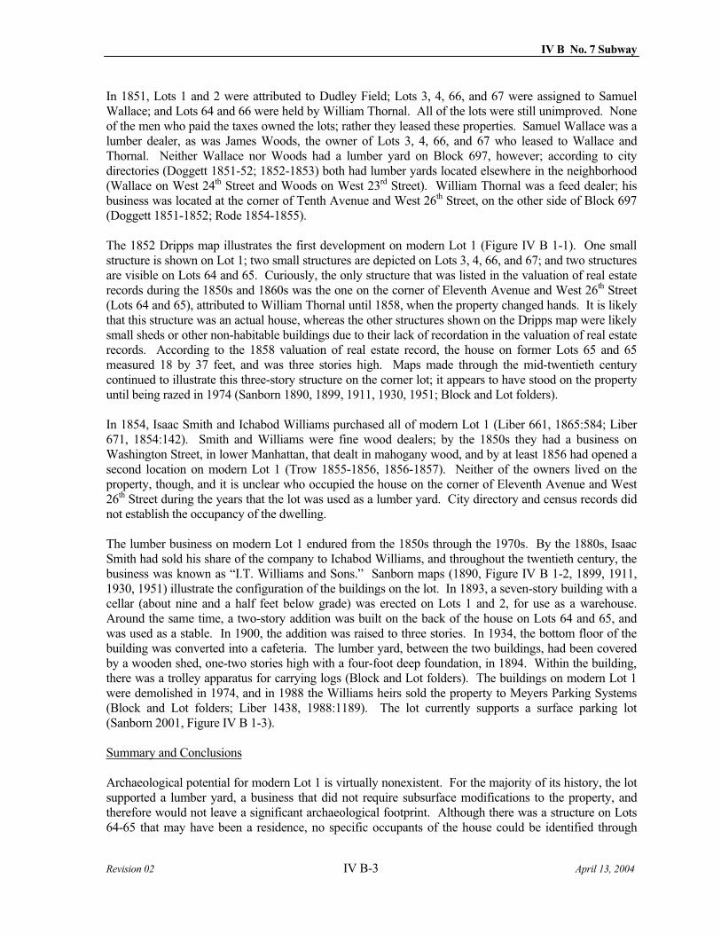
IV B No. 7 Subway
Revision 02 IV B-3 April 13, 2004
In 1851, Lots 1 and 2 were attributed to Dudley Field; Lots 3, 4, 66, and 67 were assigned to Samuel Wallace; and Lots 64 and 66 were held by William Thornal. All of the lots were still unimproved. None of the men who paid the taxes owned the lots; rather they leased these properties. Samuel Wallace was a lumber dealer, as was James Woods, the owner of Lots 3, 4, 66, and 67 who leased to Wallace and Thornal. Neither Wallace nor Woods had a lumber yard on Block 697, however; according to city directories (Doggett 1851-52; 1852-1853) both had lumber yards located elsewhere in the neighborhood (Wallace on West 24th Street and Woods on West 23rd Street). William Thornal was a feed dealer; his business was located at the corner of Tenth Avenue and West 26th Street, on the other side of Block 697 (Doggett 1851-1852; Rode 1854-1855).
The 1852 Dripps map illustrates the first development on modern Lot 1 (Figure IV B 1-1). One small structure is shown on Lot 1; two small structures are depicted on Lots 3, 4, 66, and 67; and two structures are visible on Lots 64 and 65. Curiously, the only structure that was listed in the valuation of real estate records during the 1850s and 1860s was the one on the corner of Eleventh Avenue and West 26th Street (Lots 64 and 65), attributed to William Thornal until 1858, when the property changed hands. It is likely that this structure was an actual house, whereas the other structures shown on the Dripps map were likely small sheds or other non-habitable buildings due to their lack of recordation in the valuation of real estate records. According to the 1858 valuation of real estate record, the house on former Lots 65 and 65 measured 18 by 37 feet, and was three stories high. Maps made through the mid-twentieth century continued to illustrate this three-story structure on the corner lot; it appears to have stood on the property until being razed in 1974 (Sanborn 1890, 1899, 1911, 1930, 1951; Block and Lot folders).
In 1854, Isaac Smith and Ichabod Williams purchased all of modern Lot 1 (Liber 661, 1865:584; Liber 671, 1854:142). Smith and Williams were fine wood dealers; by the 1850s they had a business on Washington Street, in lower Manhattan, that dealt in mahogany wood, and by at least 1856 had opened a second location on modern Lot 1 (Trow 1855-1856, 1856-1857). Neither of the owners lived on the property, though, and it is unclear who occupied the house on the corner of Eleventh Avenue and West 26th Street during the years that the lot was used as a lumber yard. City directory and census records did not establish the occupancy of the dwelling.
The lumber business on modern Lot 1 endured from the 1850s through the 1970s. By the 1880s, Isaac Smith had sold his share of the company to Ichabod Williams, and throughout the twentieth century, the business was known as “I.T. Williams and Sons.” Sanborn maps (1890, Figure IV B 1-2, 1899, 1911, 1930, 1951) illustrate the configuration of the buildings on the lot. In 1893, a seven-story building with a cellar (about nine and a half feet below grade) was erected on Lots 1 and 2, for use as a warehouse. Around the same time, a two-story addition was built on the back of the house on Lots 64 and 65, and was used as a stable. In 1900, the addition was raised to three stories. In 1934, the bottom floor of the building was converted into a cafeteria. The lumber yard, between the two buildings, had been covered by a wooden shed, one-two stories high with a four-foot deep foundation, in 1894. Within the building, there was a trolley apparatus for carrying logs (Block and Lot folders). The buildings on modern Lot 1 were demolished in 1974, and in 1988 the Williams heirs sold the property to Meyers Parking Systems (Block and Lot folders; Liber 1438, 1988:1189). The lot currently supports a surface parking lot (Sanborn 2001, Figure IV B 1-3).
Summary and Conclusions
Archaeological potential for modern Lot 1 is virtually nonexistent. For the majority of its history, the lot supported a lumber yard, a business that did not require subsurface modifications to the property, and therefore would not leave a significant archaeological footprint. Although there was a structure on Lots 64-65 that may have been a residence, no specific occupants of the house could be identified through
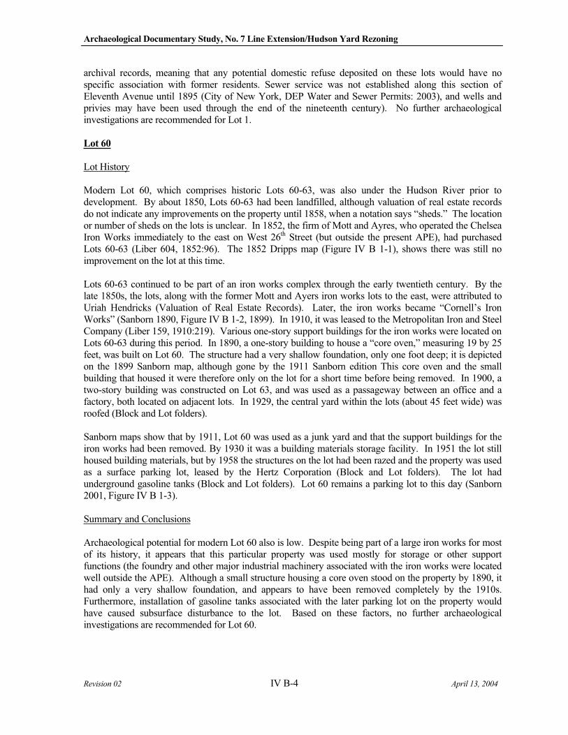
Archaeological Documentary Study, No. 7 Line Extension/Hudson Yard Rezoning
Revision 02 IV B-4 April 13, 2004
archival records, meaning that any potential domestic refuse deposited on these lots would have no specific association with former residents. Sewer service was not established along this section of Eleventh Avenue until 1895 (City of New York, DEP Water and Sewer Permits: 2003), and wells and privies may have been used through the end of the nineteenth century). No further archaeological investigations are recommended for Lot 1.
Lot 60
Lot History
Modern Lot 60, which comprises historic Lots 60-63, was also under the Hudson River prior to development. By about 1850, Lots 60-63 had been landfilled, although valuation of real estate records do not indicate any improvements on the property until 1858, when a notation says “sheds.” The location or number of sheds on the lots is unclear. In 1852, the firm of Mott and Ayres, who operated the Chelsea Iron Works immediately to the east on West 26th Street (but outside the present APE), had purchased Lots 60-63 (Liber 604, 1852:96). The 1852 Dripps map (Figure IV B 1-1), shows there was still no improvement on the lot at this time.
Lots 60-63 continued to be part of an iron works complex through the early twentieth century. By the late 1850s, the lots, along with the former Mott and Ayers iron works lots to the east, were attributed to Uriah Hendricks (Valuation of Real Estate Records). Later, the iron works became “Cornell’s Iron Works” (Sanborn 1890, Figure IV B 1-2, 1899). In 1910, it was leased to the Metropolitan Iron and Steel Company (Liber 159, 1910:219). Various one-story support buildings for the iron works were located on Lots 60-63 during this period. In 1890, a one-story building to house a “core oven,” measuring 19 by 25 feet, was built on Lot 60. The structure had a very shallow foundation, only one foot deep; it is depicted on the 1899 Sanborn map, although gone by the 1911 Sanborn edition This core oven and the small building that housed it were therefore only on the lot for a short time before being removed. In 1900, a two-story building was constructed on Lot 63, and was used as a passageway between an office and a factory, both located on adjacent lots. In 1929, the central yard within the lots (about 45 feet wide) was roofed (Block and Lot folders).
Sanborn maps show that by 1911, Lot 60 was used as a junk yard and that the support buildings for the iron works had been removed. By 1930 it was a building materials storage facility. In 1951 the lot still housed building materials, but by 1958 the structures on the lot had been razed and the property was used as a surface parking lot, leased by the Hertz Corporation (Block and Lot folders). The lot had underground gasoline tanks (Block and Lot folders). Lot 60 remains a parking lot to this day (Sanborn 2001, Figure IV B 1-3).
Summary and Conclusions
Archaeological potential for modern Lot 60 also is low. Despite being part of a large iron works for most of its history, it appears that this particular property was used mostly for storage or other support functions (the foundry and other major industrial machinery associated with the iron works were located well outside the APE). Although a small structure housing a core oven stood on the property by 1890, it had only a very shallow foundation, and appears to have been removed completely by the 1910s. Furthermore, installation of gasoline tanks associated with the later parking lot on the property would have caused subsurface disturbance to the lot. Based on these factors, no further archaeological investigations are recommended for Lot 60.
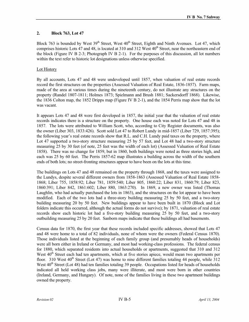
IV B No. 7 Subway
Revision 02 IV B-5 April 13, 2004
2. Block 763, Lot 47
Block 763 is bounded by West 39th Street, West 40th Street, Eighth and Ninth Avenues. Lot 47, which comprises historic Lots 47 and 48, is located at 310 and 312 West 40th Street, near the northeastern end of the block (Figure IV B 2-3; Photograph IV B 2-1). For the purposes of this discussion, all lot numbers within the text refer to historic lot designations unless otherwise specified.
Lot History
By all accounts, Lots 47 and 48 were undeveloped until 1857, when valuation of real estate records record the first structures on the properties (Assessed Valuation of Real Estate, 1836-1857). Farm maps, made of the area at various times during the nineteenth century, do not illustrate any structures on the property (Randel 1807-1811; Holmes 1873; Spielmann and Brush 1881; Sackersdorff 1868). Likewise, the 1836 Colton map, the 1852 Dripps map (Figure IV B 2-1), and the 1854 Perris map show that the lot was vacant.
It appears Lots 47 and 48 were first developed in 1857, the initial year that the valuation of real estate records indicates there is a structure on the property. One house each was noted for Lots 47 and 48 in 1857. The lots were attributed to William Scott, who, according to City Register documents, was also the owner (Liber 303, 1833:426). Scott sold Lot 47 to Robert Lundy in mid-1857 (Liber 729, 1857:395); the following year’s real estate records show that R.L. and C.H. Lundy paid taxes on the property, where Lot 47 supported a two-story structure measuring 25 by 57 feet, and Lot 48 had a two-story structure measuring 25 by 30 feet (of note, 25 feet was the width of each lot) (Assessed Valuation of Real Estate 1858). There was no change for 1859, but in 1860, both buildings were noted as three stories high, and each was 25 by 60 feet. The Perris 1857-62 map illustrates a building across the width of the southern ends of both lots; no street-fronting structures appear to have been on the lots at this time.
The buildings on Lots 47 and 48 remained on the property through 1868, and the taxes were assigned to the Lundys, despite several different owners from 1858-1863 (Assessed Valuation of Real Estate 1858-1868; Liber 755, 1858:92; Liber 781, 1859:540; Liber 805, 1860:22; Liber 831, 1860:79; Liber 823, 1860:391; Liber 842, 1861:602; Liber 880, 1863:270). In 1869, a new owner was listed (Thomas Laughlin, who had actually purchased the lots in 1863), and the structures on the lot appear to have been modified. Each of the two lots had a three-story building measuring 25 by 50 feet, and a two-story building measuring 20 by 50 feet. New buildings appear to have been built in 1870 (Block and Lot folders indicate this occurred, although the actual forms do not survive); by 1871, valuation of real estate records show each historic lot had a five-story building measuring 25 by 50 feet, and a two-story outbuilding measuring 25 by 20 feet. Sanborn maps indicate that these buildings all had basements.
Census data for 1870, the first year that these records included specific addresses, showed that Lots 47 and 48 were home to a total of 82 individuals, none of whom were the owners (Federal Census 1870). Those individuals listed at the beginning of each family group (and presumably heads of households) were all born either in Ireland or Germany, and most had working-class professions. The federal census for 1880, which separated residents into actual households or apartments, suggested that 310 and 312 West 40th Street each had ten apartments, which at five stories apiece, would mean two apartments per floor. 310 West 40th Street (Lot 47) was home to nine different families totaling 44 people, while 312 West 40th Street (Lot 48) had ten families totaling 39 people. Occupations listed for heads of households indicated all held working class jobs, many were illiterate, and most were born in other countries (Ireland, Germany, and Hungary). Of note, none of the families living in these two apartment buildings owned the property.
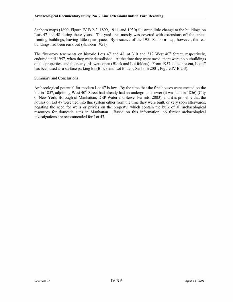
Archaeological Documentary Study, No. 7 Line Extension/Hudson Yard Rezoning
Revision 02 IV B-6 April 13, 2004
Sanborn maps (1890, Figure IV B 2-2, 1899, 1911, and 1930) illustrate little change to the buildings on Lots 47 and 48 during these years. The yard area mostly was covered with extensions off the street-fronting buildings, leaving little open space. By issuance of the 1951 Sanborn map, however, the rear buildings had been removed (Sanborn 1951).
The five-story tenements on historic Lots 47 and 48, at 310 and 312 West 40th Street, respectively, endured until 1957, when they were demolished. At the time they were razed, there were no outbuildings on the properties, and the rear yards were open (Block and Lot folders). From 1957 to the present, Lot 47 has been used as a surface parking lot (Block and Lot folders, Sanborn 2001, Figure IV B 2-3).
Summary and Conclusions
Archaeological potential for modern Lot 47 is low. By the time that the first houses were erected on the lot, in 1857, adjoining West 40th Street had already had an underground sewer (it was laid in 1856) (City of New York, Borough of Manhattan, DEP Water and Sewer Permits: 2003), and it is probable that the houses on Lot 47 were tied into this system either from the time they were built, or very soon afterwards, negating the need for wells or privies on the property, which contain the bulk of all archaeological resources for domestic sites in Manhattan. Based on this information, no further archaeological investigations are recommended for Lot 47.
IV C-F
Revision 02 IV C 1-1 April 13, 2004
C. CONVENTION CENTER EXPANSION
The proposed Jacob Javits Convention Center Expansion has no identified archaeological APE. Therefore, no impacts to potential archaeological resources by this action are anticipated.
D. MULTI-USE FACILITY
The proposed construction of the Multi-Use Facility has no identified archaeological APE. Therefore, no impacts to potential archaeological resources by this action are anticipated.
E. OTHER FACILITES
The Proposed Action may also make accommodations for facilities operated by New York City Transit, the Port Authority of New York and New Jersey (PANYNJ), the New York City Department of Sanitation (DSNY), and New York City Police Department (NYPD). The project may accommodate the relocation and consolidation of specific public facilities within the Hudson Yards, including the motor vehicle Tow Pound operated by the New York City Police Department on Pier 76 to Block 675, and a NYCDOS facility and parking area located on the Gansevoort peninsula, between Gansevoort and Little West 12th Street.
No significant adverse impacts to identified archaeological resources are anticipated as a result of the construction of the proposed Tow Pound-DSNY facility on Block 675.
The relocation of the Quill Bus Depot would affect the eastern portion of the Caemmerer Rail Yards,
Block 702, Lot 1, and the western portion of the Caemmerer Rail Yards, Block 676, Lot 3. The proposed relocation of the Quill Bus Depot has no identified archaeological APE. Therefore, no impacts to potential archaeological resources by this action are anticipated.
F. MIDBLOCK PARK AND BOULEVARD SYSTEM
Only one lot within the Midblock Park and Boulevard System action was established as part of the archaeological APE, Block 709, Lot 25. However, this lot was also identified as an APE for the Rezoning Action (see section IV A-3). Research has concluded that the lot is considered potentially sensitive for a mid-19th century school yard, outside of the footprint of the ca. 1853 school building and its additions where basements would have impacted any buried resources. The earliest school yard area was located immediately adjacent to the former school building, so this area would potentially yield the earliest school-related deposits (Figure IV A 3-4). However, the portion of the lot designated as potentially sensitive is outside the area of proposed impact area for the Midblock Park and Boulevard System action. Therefore, this action will not impact any areas designated as potentially archaeologically sensitive.

V Conclusions and Recommendations
Revision 02 V -1 April 13, 2004
V. CONCLUSIONS AND RECOMMENDATIONS
A. REZONING
As a function of the DEIS for the proposed Hudson Yards Project, an assessment for archaeological resources was undertaken. In accordance with CEQR guidelines, the initial task established the APE for archaeological resources that may be affected by the various components of the proposed action. The APE, defined by LPC’s first-level review, includes one or more lots on a total of 20 non-contiguous city blocks (see Chapter II B of this report). SHPO has concurred with LPC’s determination of the APE (Robert Kuhn, OPRHP to Amanda Sutphin, LPC, November 3, 2003). This critical first task indicated that the proposed rezoning, based on DCP and MTA-NYC Transit project plans (October 24, 2003), may impact certain lots within the established archaeological APE. Therefore, a Documentary Study was undertaken on the following 36 lots identified as potentially being affected by the rezoning action:
BLOCK 706, LOT 29 BLOCK 707, LOT 31 BLOCK 709, LOT 68 BLOCK 710, LOT 1 BLOCK 728, LOT 34 BLOCK 731, LOT 22 BLOCK 732, LOTS 50, 70 BLOCK 733, LOTS 8, 9, 23-25, 28, 30, 31, 47, 58 BLOCK 735, LOTS 59, 60 BLOCK 736, LOTS 34-37 BLOCK 737 LOT 30 BLOCK 758, LOT 7 BLOCK 760, LOTS 51, 58, 59, 60 BLOCK 761, LOTS 5, 13 BLOCK 779, LOTS 8, 27, 28 BLOCK 778, LOTS 16, 29, 30, 31 BLOCK 1033, LOT 25 BLOCK 705 LOT 42
The documentary study concluded that 34 of the 36 lots are either too disturbed or lack the potential for initial deposits of archaeological resources and, therefore, are not sensitive for historical or precontact archaeological resources. The comprehensive support for these conclusions is included in the above report. However, two lots were found to possess potential sensitivity for historical period resources:
Block 709, Lot 25 – Projected Development Site 11 Block 761, Lot 13 – Projected Development Site 41
Block 709, Lot 25 was determined to be potentially sensitive for a mid-19th century school yard, outside of the footprint of the ca. 1853 school building and its additions where basements would have impacted any buried resources. The earliest school yard area was located immediately adjacent to the former school building, so this area would potentially yield the earliest school-related deposits. Block 761, Lot 13 may contain deposits and/or features associated with the earliest occupation, particularly the period before dwellings on the lot were connected to municipal utilities. The full discussion of archaeological potential is detailed in Chapter IV. Each of these lots was determined to have the potential to contain archaeological resources which may contribute to the knowledge of mid-19th century lifeways for
Archaeological Documentary Study, No. 7 Line Extension/Hudson Yard Rezoning
Revision 02 V -2 April 13, 2004
residents in this marginalized neighborhood of Manhattan. Together, the two lots could provide information regarding the lower-middle class experience through an examination of artifactual deposits from both a private and institutional setting.
Although development of the projected development sites could result in adverse physical impacts to potential archaeological resources through construction, these potential impacts would not be mitigable adverse impacts. If potential archaeological resources exist on Projected Development Sites 11 and 41, they would not be excavated as the result of private development, which would not require further discretionary approvals. Consequently, there are no means available in connection with the proposed rezoning to require that subsequent development undertake mitigation. Therefore, private development would result in an unmitigated impact.
B. NO. 7 SUBWAY
Only three lots on two blocks and two roadbeds define the archaeological APE for the No. 7 Subway. These are Block 697, Lots 1 and 60, and Block 763, Lot 47.
The Documentary Study concluded that none of the roadbeds within the No. 7 Subway impact area have the potential to contain archaeological resources. Further, this study concluded that Block 697, Lot 60 has been too disturbed by 20th century construction and subsurface tank installation to yield any potential archaeological deposits. While there may be the potential for subsurface features on Lot 1, documentary research failed to identify any occupational episodes. The potential artifactual deposits on this lot could not be associated with any specific occupants or ethic groups, so their research potential is minimal. Therefore, no further archaeological investigations are recommended for either lot.
Occupational episodes on Block 763, Lot 47 post-date the availability of sewer and water. The earliest construction on the lot was probably concurrently hooked into these public utilities. Therefore, there is no potential archaeological sensitivity for Lot 47, and no further investigations are recommended.
In conclusion, the construction of the No. 7 Subway Extension would not result in significant adverse impacts to identified archaeological resources.
C. CONVENTION CENTER EXPANSION
The Jacob Javits Convention Center is currently located between West 34th and West 39th Streets. The
Convention Center expansion would be conservatively assumed to extend northward to West 41st Street. The impact area would include:
Block 679, between 33rd and 34th Streets and west of Eleventh Avenue;
Block 707, between 35th and 36th Streets and east of Eleventh Avenue (the lots on western 1/3 of block);
Block 685, between 39th and 40th Streets and west of Eleventh;
Block 1088, between 40th and 41st Streets and west of Eleventh Avenue;
Block 1089, between 41st and 42nd Streets and west of Eleventh Avenue (lots on eastern 1/3 of block); and
40th Street roadbed, west of Eleventh Avenue.
V Conclusions and Recommendations
Revision 02 V -3 April 13, 2004
No significant adverse impacts to identified archaeological resources are anticipated, as no archaeological APEs were identified for this portion of the Project Area.
D. MULTI-USE FACILITY
The Multi-Use Facility would be built on caissons/piles above the western portion of the Caemmerer Rail Yard, Block 676, Lot 3, and a portion of Block 679, Lot 1. No significant adverse impacts to identified archaeological resources from the Proposed Action are anticipated, as no archaeological APEs were identified for the Project Area.
E. OTHER FACILITIES
No significant adverse impacts to identified archaeological resources are anticipated as a result of the construction of the proposed Tow Pound-DSNY facility on Block 675.
The relocation of the Quill Bus Depot would affect the eastern portion of the Caemmerer Rail Yards, Block 702, Lot 1, and the western portion of the Caemmerer Rail Yards, Block 676, Lot 3. No significant adverse impacts to identified archaeological resources from the Proposed Action are anticipated, as no archaeological APEs were identified for either of these blocks.
F. MIDBLOCK PARK AND BOULEVARD SYSTEM
The creation of a Midblock Park and Boulevard System would entail the acquisition – through either negotiation or condemnation – of an extremely small portion of Block 709, Lot 25, which also lies within a portion of Projected Development Site 11 (north side of West 37th Street between Tenth and Eleventh Avenues). The lot is considered to be potentially sensitive for a mid-19th century school yard, outside of the footprint of the ca. 1853 school building and its additions where basements would have impacted any buried resources. The earliest school yard area was located immediately adjacent to the former school building, so this area would potentially yield the earliest school-related deposits (Figure IV A 3-4). However, the narrow portion of the lot that would be acquired by the City for the Midblock Park and Boulevard System was determined not to possess the potential for archaeological resources; therefore, no impacts to identified archaeological resources are anticipated for this action.

References
Revision 02 VI -1 April 13, 2004
REFERENCES
Alexander, Samuel Davies The Presbytery of New York, 1738 to 1888 (New York: A.D.F. Randolph and Co., 1887).
Assessed Valuation of Real Estate On microfilm at the City of New York Municipal Archives, 1817-1890.
Bankoff, H. Arthur and Frederick A. Winter Erasmus Hall High School: Report of the Trial Excavations Conducted by the Brooklyn College
Summer Archaeological Field School. (Brooklyn, New York: Brooklyn College, 1987).
Barret, Richard Carter Blown and Pressed American Glass (Bennington, VT: The Bennington Museum, 1966).
Barrie, Trinder The Making of the Industrial Landscape (London: Dent, 1982).
Baugher, S. "Visible Charity: The Archaeology, Material Culture, and Landscape Design of New York City's Municipal Almshouse Complex, 1736–1797," International Journal of Historical Archaeology, 5(2) (2001):175-202.
Baugher, S. and E. J. Lenik "Anatomy of an Almshouse Complex," Northeast Historical Archaeology, 26 (1997):1-22.
Bayley, The Reverend J.R. A Brief Sketch of the History of the Catholic Church on the Island of New-York (New York: Edward Dunigan and Brother, 1853).
Bellantoni, Nicholas, Robert Gradie, and David Poirier “Zooarchaeological and Social History of the Butler-McCook Homestead, Hartford, Connecticut,” Northeast Historical Archaeology, 11(1982): 1-8.
Berghoffen, C. Phase IA Archaeological Assessment Report, Triborough Bridge and Tunnel Authority, Triborough
Bridge Rehabilitation Project, Randall’s and Ward’s Islands, Manhattan, prepared for Philip Habib & Associates, on file with the New York City Landmarks Preservation Commission (LPC) (New York: LPC, 2001).
BIS on the web See City of New York, Borough of Manhattan, Building Department.
Bolton, Reginald Pelham “Indian Paths in the Great Metropolis,” in Indian Notes and Monographs, Misc. series #23 (New
York: Museum of the American Indian Heye Foundation, 1922).
Early History and Indian Remains on the Throg's Neck, Borough of the Bronx, City of New York (The Bronx: Bronx Society of Arts and Sciences, 1934).
Archaeological Documentary Study, No. 7 Line Extension/Hudson Yard Rezoning
Revision 02 VI -2 April 13, 2004
Bolton, Reginald Pelham (continued) Indian Life of Long Ago in the City of New York, enlarged ed. (New York: Harmony Books, 1972).
New York City in Indian Possession (New York: Museum of the American Indian Heye Foundation, 1975).
Breed, William C. Digest of State Food Laws (New York: National Wholesale Grocers' Association of the United States,
1907).
Bridges, William “Plan of the City of New-York, with the Recent and Intended Improvements” (New York: William
Bridges, 1803-07).
“Map of the City of New York and Island of Manhattan as Laid Out by the Commissioners, April 3, 1807,” known as the Commissioners’ Plan (New York: William Bridges, 1811).
Bromley, George W. and Walter S. Atlas of the Entire City of New York: Complete in One Volume; from Actual Surveys and Official Records (New York: G. W. Bromley & E. Robinson, 1879).
Atlas of the City of New York, vol.2 (Philadelphia: G.W. Bromley and Co., 1920, update of 1906).
Land Book of the Borough of Manhattan, City of New York (New York: G.W. Bromley, 1925).
Manhattan Land Book of the City of New York (New York: G. W. Bromley, 1955).
Atlas of the City of New York, Borough of Manhattan, from Actual Surveys and Official Plans (Philadelphia: G. W. Bromley, 1974).
Brouwer, Norman
“The Ship in Our Cellar,” Seaport, 14(3) (1980): 20-3.
Brown, Joshua and David Ment Factories, Foundries, and Refineries: A History of Five Brooklyn Industries (Brooklyn: Brooklyn Rediscovery, Brooklyn Educational and Cultural Alliance, 1980).
Burrows, E. G. and M. Wallace Gotham: A History of New York City to 1898 (New York and Oxford: Oxford University Press, 1999).
Buttenwieser, Ann L. Manhattan Water Bound (New York: New York University Press, 1987).
Cantwell, Anne-Marie and Diana diZerega Wall
Unearthing Gotham: The Archaeology of New York City (New Haven: Yale University Press, 2001).
References
Revision 02 VI -3 April 13, 2004
Cheek, Charles and Amy Friedlander “Pottery and Pig's Feet: Space, Ethnicity, and Neighborhood in Washington, D.C., 1880-1940,” Historical Archaeology, 24(1) (1990): 34-55.
Citizens’ Association of New YorkReport of the Council of Hygiene and Public Health of the Citizens’ Association of New York Upon
the Sanitary Condition of the City. (New York: D. Appleton and Company, 1866).
City of New York, Board of Estimate and Apportionment Report by the Bureau of Franchises upon the Application of the Manhattan Refrigerating Company
(City of New York: Board of Estimate and Apportionment, 1916).
City of New York, Borough of Manhattan, Building Department Block and Lot Folders, on file with the City of New York Municipal Archives, n.d.
BIS on the Web. http://www.nyc.gov/html/dob/html/bis.html, n.d.
Blocks and Lots Folders, on file with the Buildings Department, 1976-present.
City of New York, Borough of Manhattan, DEP Water and Sewer Permits “Constructed Sewerage Systems of the City of New York, Borough of Manhattan,” map on file with the DEP Water and Sewer Control Room (New York: 2003).
City of New York, Borough of Manhattan, Department of Finance, City Register (City Register) Block Indices of Reindexed Conveyances, pre 1917 (New York: n.d.).
City of New York, Borough of Manhattan, Office of the President, Bureau of Engineering Contract for Viaduct Construction: Proposal for Bids and Agreement, 2 vols. (City of New York: Borough of Manhattan, Office of the President, Bureau of Engineering, 1926).
City of New York, Borough of Manhattan, Office of the President, Topographic Bureau “Rock Data Map---Borough of Manhattan,” on file with the City of New York, Borough of Manhattan, Office of the President, Topographic Bureau (New York: original date 1937; updated to1970).
“Rock Data Map showing Original Shore-Line, Ponds, Marshes, and Waterways, Together with Rock Floor of Manhattan Island as Determined by Core Borings and Excavation,” on file with the City of New York, Borough of Manhattan, Office of the President, Topographic Bureau (New York: base map 1944; revised 1969, 1973).
City of New York, Department of Docks (Docks) The Pennsylvania Railroad Cattle Pass under 12th Ave. and Marginal Way at 38th Street, New York City, permit file # MAN.673-a, 21 (New York: Docks, March 1932).
City of New York, Environmental Protection Administration “P.W.-164 North River Water Pollution Control Project, South Branch Intercepting Sewer Record
Drawings” (City of New York: Department of Water Resources, 1968).
City of New York, Municipal Archives Photographs of Standing Structures, 1940.
Archaeological Documentary Study, No. 7 Line Extension/Hudson Yard Rezoning
Revision 02 VI -4 April 13, 2004
City of New York, New York City Planning Commission Plan for New York City: A Proposal (City of New York: Department of City Planning, 1969).
Coffey, Brain F. “Fertilizers to the Front: HAER and U.S. Nitrate Plant No. 2,” The Journal of the Society for
Industrial Archeology, 23(1) (1997): 25-42.
Cohn, B. Colonialism and Its Forms of Knowledge: The British in India (Princeton: Princeton University
Press, 1996), introduction, 3-15.
Colton, Joseph H. Topographical Map of the City and County of New York and the Adjacent Country (New York: J.H.
Colton & Co., 1836).
Comaroff, J. and J. L. Comaroff “The Colonization of Consciousness in South Africa,” Economy and Society, 18 (1989): 267-296.
Commissioners’ Plan See Bridges, William and Randel, John, Jr.
Cudahy, Brian J. Under the Sidewalks of New York, rev. ed. (New York: Pelham Books, 1988).
Daniel, Dorothy Cut and Engraved Glass 1771-1905: The Collectors' Guide to American Wares (New York: William Morrow & Company, Inc., 1981).
Davis, Pearce The Development of the American Glass Industry (Cambridge: Harvard University Press, 1949).
DeCarlo, Valerie Interim Report: Archaeological Survey of Riverdale Park Conducted by Wave Hill, 1985 to 1989
(The Bronx: Wave Hill, 1990).
DeVoe, Thomas F. The Market Book (New York: Hall, Clayton and Medole, 1862).
Abattoirs: A Paper Read before the Polytechnic Branch of the American Institute, June 8, 1865
(Albany: Van Benthuyeen and Sons' Steam Printing House, 1866).
The Market Assistant (New York: Hurd and Houghton, 1867).
Report upon the Present Condition of the Public Markets (New York: Evening Post Steam Presses, 1873).
Doggett, John, Jr. The New York City Directory for 1848 and 1849 (New York: John Doggett, Jr., 1849).
The New York City Directory for 1849 and 1850 (New York: John Doggett, Jr., 1850).
References
Revision 02 VI -5 April 13, 2004
Doggett, John, Jr. (continued) The New York City Directory for 1850 and 1851 (New York: John Doggett, Jr., 1851).
Doggett’s New York City Street Directory for 1851 (New York: John Doggett, Jr., 1851a).
New York City Directory for 1851 and 1852 (New York: John Doggett, Jr., 1852).
New York City Directory for 1852 and 1853 (New York: John Doggett, Jr., 1853).
Douglas, R.W. and S. Frank A History of Glassmaking (Oxfordshire, England: G.T. Foulis and Co., Ltd., 1972).
Dripps, Matthew Map of the City of New York Extending Northward to 50th Street (New York: M. Dripps, 1852).
Duffy, John A History of Public Health in New York City, 2 vols. (New York: Russell Sage Foundation, 1968).
Dumont, Elizabeth and Lewis, and Carolyn A. Schrier An Archaeological Survey and Cultural Resource Assessment of Portions of the Proposed
Relocation of Route 209, prepared for Byrd, Tallamy, MacDonald and Lewis (Falls Church, VA: 1980a).
An Intensive Survey of The Crystal Glass Sand Manufacturing Co. Site (Kass Sand Lot) and The
Ellenville Glassworks Site, Sectors 2 and 3 Route 209, Ellenville Bypass, Ulster County, New York,prepared for Byrd, Tallamy, MacDonald and Lewis (Falls Church, VA: 1980b).
Eaton, Harriet Phillips Jersey City and Its Historic Sites (Jersey City: Woman's Club of Jersey City, 1899).
Engelbrecht, William E. and Carl K. Seyfert “PaleoIndian Watercraft: Evidence and Implications,” North American Archaeologist, 15(3) (1994): 221-234.
Ewen, Daniel Map of a Tract of Land Commonly Called the Hermitage Situated in the 9th Ward of the City of New York, on file with the City of New York, Borough of Manhattan, City Register’s Office (New York: Daniel Ewen, Surveyor, 1825).
Fagan, Brian “The First Americans,” in American Archaeology, 5(3) (2001): 29-32.
Fitts, R. and R. Yamin The Archeology of Domesticity in Victorian Brooklyn: Exploratory Testing and Data Recovery at
Block 2006 of the Atlantic Terminal Urban Renewal Area, Brooklyn, New York, on file with the New York City Landmarks Preservation Commission (LPC) (New York: LPC, 1996).
Funk, Robert “Recent contributions to Hudson Valley Prehistory,” in New York State Museum Memoir 22 (Albany: New York State Museum, 1976).
Archaeological Documentary Study, No. 7 Line Extension/Hudson Yard Rezoning
Revision 02 VI -6 April 13, 2004
Galusha, Diane Liquid Assets: A History of New York City’s Water System (Fleischmanns, New York: Purple
Mountain Press, 1999).
Geismar, Joan
The Archaeological Investigation of the 175 Water Street Block, New York City, prepared by Soil Systems Division of Professional Services Industries, Inc., on file with the New York City Landmarks Preservation Commission (LPC) (New York: LPC, 1983).
“Landfill and Health, a Municipal Concern or, Telling It Like It Was,” Northeast Historical
Archaeology, 16 (1987a): 49-57.
“Digging into a Seaport's Past,” Archaeology, 40(1) (1987b): 30-5.
Archaeological Investigation of Site 1 of the Washington Street Urban Renewal Area, New York
City, prepared by Louis Berger and Associates for Shearson Lehman/American Express through the New York City Public Development Corporation, New York, on file with the New York City Landmarks Preservation Commission (LPC) (East Orange, NJ: Louis Berger and Associates, 1987c).
Stage 1A Archaeological Evaluation of the Exchange Project Site, 10 Battery Place, New York
City, prepared for EEA, Inc., New York (Garden City, LI, NY: EEA, Inc., 1987d).
Teacups and Opium: The Bishop Mugavero Geriatric Center Archaeological Field Report, Block
189, Brooklyn, on file with the New York City Landmarks Preservation Commission (LPC) (New York: LPC, 1992).
"Where is Night Soil? Thoughts on an Urban Privy," Historical Archaeology, 27(2) (1993): 57-70.
Gibb, James G. and April M. Beisaw “Investigations of Schoolhouses in the Northeastern United States.” In Northeast Historical
Archaeology Vol. 29:2000.
Goldman, Joanne Mara The Development of a Sewer System in New York City, 1800-1866: Evolution of a Technological and Managerial Infrastructure (Stony Brook, NY: State University of New York at Stony Brook
unpublished Ph.D. dissertation, 1988).
Gordon, R. American Iron, 1607-1900 (Baltimore: Johns Hopkins University Press, 1996).
Gordon, R., and P. Malone The Texture of Industry: An Archaeological View of the Industrialization of North America (New York: Oxford University Press, 1994).
Gorman, Frederick J. E. “Archaeological Implications of a Manufacturing Industry in Eighteenth-Century American Cities,” in Archaeology of Urban America: The Search for Pattern and Process, ed. Roy S. Dickens, Jr. (New York: Academic Press, 1982).
References
Revision 02 VI -7 April 13, 2004
Grafton, John New York in the Nineteenth Century, 2nd ed. (New York: Dover Publications Inc., 1980).
Greenleaf, Jonathan A History of the Churches of All Denominations in the City of New York, from the First Settlement to
the Year 1850 (New York: E. French, 1850).
Greenwald, Frank “The Cemeteries of New York City before 1830,” in the Manuscript Collection of the New-York Historical Society, 1933.
Grossman, Joel The Excavation of Augustine Heerman’s Warehouse and Associated 17th Century Dutch West India
Company Deposits: The Broad Financial Center Mitigation Final Report, on file with the New York City Landmarks Preservation Commission (LPC) (New York: LPC, 1985).
The Archaeology of Civil War Era Water Control Systems on the Lower East Side of Manhattan, New
York. Data Recovery and Mitigation of the mid 19th Century Cistern Complex and Associated
Features within Lots 58 and 59, Block 378, PSA 4 Project, New York, New York, prepared for the New York City Housing Authority (HA) (New York: HA, 1995).
Grossman, J. W. The Buried History of City Hall Park: The Initial Archaeological Identification, Definition and
Documentation of Well-Preserved 18th Century Deposits and the Possible Structural Remains of
N.Y.C.'s First Almshouse, on file with the New York City Landmarks Preservation Commission (LPC) (New York: LPC, 1991).
Grumet, Robert StevenNative American Place Names in New York City (New York: Museum of the City of New York, 1981).
Historic Contact: Indians and Colonists in Northeastern North America, 1497-1783 (United States Department of the Interior: National Park Service National Historic Landmark Theme Study, 1990).
Gust, Sherri M. “Problems and Prospects in Nineteenth Century California Zooarchaeology,” in Forgotten Places and
Things, Archaeological Perspectives on American History, ed. Albert E. Ward (Albuquerque, NM: Center for Anthropological Studies, 1983).
Haberstroh, Richard The German Churches of Metropolitan New York: A Research Guide (New York: New York Genealogical & Biographical Society, 2000).
Harrington, J.C. Glassmaking at Jamestown: America's First Industry (Richmond, VA: Dietz Press, Inc., 1952).
Hartgen Archaeological Associates and Historical Perspectives, Inc.
Contextual Study: Sunken Ships and Landfill Retaining Devices, Route 9A Reconstruction Project,prepared for New York State Department of Transportation, Federal Highway Administration and the City of New York (Albany and Westport, CT: Hartgen Archaeological Associates and Historical Perspectives, Inc., 1992).
Archaeological Documentary Study, No. 7 Line Extension/Hudson Yard Rezoning
Revision 02 VI -8 April 13, 2004
Hartgen Archaeological Associates and Historical Perspectives, Inc. (continued)
Contextual Study: Wharves and Piers, Route 9A Reconstruction Project, prepared for New York State Department of Transportation, Federal Highway Administration and the City of New York (Albany and Westport, CT: Hartgen Archaeological Associates and Historical Perspectives, Inc., 1992a).
Heintzelman, Andrea J. “Colonial Wharf Construction: Uncovering the Untold Past," The Log of Mystic Seaport, (Winter
1986): 124-35.
Henn, Roselle E. “Reconstructing the Urban Foodchain: Advances and Problems in Interpreting Faunal Remains Recovered from Household Deposits,” American Archeology, 5(3) (1985): 202-208.
Henn, Roselle, Diana Wall, Laurie Boros, Valerie DeCarlo, and Jed Levin
“Preindustrial Waterfront Technology in Lower Manhattan,” 1985 Society for Industrial Archeology Annual Meeting, Newark, DE (1985).
Henschien, H. Peter Packing House and Cold Storage Construction (Chicago: Nickerson and Collins, Co., 1915).
Historical Perspectives, Inc. Stage 1B Field Investigation, Blocks 70, 171, and 176, Hoyt-Schermerhorn, Brooklyn, New York. NYSOPRHP# 01PR2180. Historical Perspectives, Inc. (Connecticut: 2002).
Second Avenue Subway - Phase IA Archaeological Assessment, prepared for New York City Transit (NYCT) (New York: NYCT, 2002a).
Stage 1B Archaeological Investigation, P.S. 325-K, Church and Bedford Avenues, Brooklyn, New
York, prepared for Allee King Rosen and Fleming, Inc., and the New York City School Construction Authority (NYCSCA) (New York: NYCSCA, 2002b).
Results of Phase 1B Fieldwork, Ericsson Place, Manhattan. Historical Perspectives, Inc. (Connecticut: 1997).
Hobbes, Clara M. “New York Produced Cut Glass,” New York Sun, 1 April 1933.
Holmes, John B. Map of Part of the Stuyvesant Property, Together with the Other Properties Adjoining, Accurately Made from Old Deeds, Maps & Other Reliable Sources, 2nd ed., available at both the Map Division, New York Public Library and the City of New York Municipal Archives (New York: J.B. Holmes, July, 1868).
Map of Glass House Farm and Schuoepple, Ray and other Estates. Eighth Avenue to the Hudson
River, 27th Street to 41st Street, available at the City of New York Municipal Archives (New York: Compiled by John B. Holmes, CE and Surveyor, City of New York, 1873).
Hooper, The Reverend Bryan Personal communication, 9 October 2003.
References
Revision 02 VI -9 April 13, 2004
Hudson, Kenneth World Industrial Archaeology (Cambridge: Cambridge University Press, 1979).
Huey, Paul R. “The Albany Glassworks From 1790 to 1800: A Study of American Industry during the Federal Period,” Journal of Glass Studies, 22 (1980): 36-52.
“Old Slip and Cruger's Wharf at New York: An Archaeological Perspective of the Colonial American Waterfront,” Historical Archaeology, 18(1) (1984): 15-37.
Inskeep, Carolee The Graveyard Shift: A Family Historian’s Guide to New York City Cemeteries (Orem, Utah: Ancestry Publishing, 2000).
Jackson, Kenneth T. , ed. The Encyclopedia of New York City (New Haven: Yale University Press, 1995).
“From Rail to Ruin,” op-ed contributor, The New York Times, 2 Nov. 2003, sec. 4, p.11.
Jacoby, R. "Our Cross to Bear: The Intersection of Law, Tradition, and Archaeology at a Potters Field," 70th Annual Meeting of the Eastern States Archaeological Federation, Mount Laurel, NJ (2003).
Johnson, Virgil S. Millville Glass: The Early Days (Millville, NJ: Delaware Bay Trading, Co., Inc., 1971).
Jones, Pamela Under the City Streets (New York: Holt, Rinehart and Winston, 1978).
Keller, Charles M., and Janet Dixon Keller. Cognition and Tool Use: The blacksmith at Work (Cambridge: Cambridge University Press, 1996).
Kirkorian, Cece and Evelyn Tidlow
Phase One Archaeological Impact Report for Sites 1A, 1B, 5B and 5C, Washington Street Urban
Renewal Area, New York City, New York, prepared for Allee King Rosen and Fleming, Inc., New York (Westport, CT: Historical Perspectives, Inc., 1984).
Krim, Arthur J. Northwest Cambridge: Survey of Architectural History in Cambridge, Report 5 (Cambridge, MA: Cambridge Historical Commission, 1977).
Ladies' Health Protective Association Slaughterhouses in the City of New York (New York: Ladies' Health Protective Association, 1885).
Landers, John Twelve New York City Street and Transit Maps From 1860 to 1967 (New York: H & M Productions II Inc., 1997).
Archaeological Documentary Study, No. 7 Line Extension/Hudson Yard Rezoning
Revision 02 VI -10 April 13, 2004
Landon, David B. “Foodways in the Lowell Boardinghouses: The Historical and Zooarcheological Evidence,” in Lowell
National Historical Park Survey Project, Interdisciplinary Investigations of the Boott Mills, Lowell, Massachusetts, eds. Mary C. Beaudry and Stephen A. Mrozowski, vol. 1, prepared for National Park Service (NPS), Boston, MA (Boston: NPS, 1987a).
“Zooarcheological Analysis,” in Lowell National Historical Park Survey Project, Interdisciplinary
Investigations of the Boott Mills, Lowell, Massachusetts, eds. Mary C. Beaudry and Stephen A. Mrozowski, vol. 2, prepared for National Park Service (NPS), Boston, MA (Boston: NPS, 1987b).
“Faunal Remains from the Boott Mills Boardinghouses,” in Lowell National Historical Park Survey
Project, Interdisciplinary Investigations of the Boott Mills, Lowell, Massachusetts, eds. Mary C. Beaudry and Stephen A. Mrozowski, vol. 3, prepared for National Park Service (NPS), Boston, MA (Boston: NPS, 1987c).
Lee, Ruth Webb Sandwich Glass: The History of the Boston and Sandwich Glass Company (Northborough, MA: 1947).
Leffingwell, Albert American Meat: It’s Method of Production and Influence on Public Health (New York: Theodore E. Shulte, 1910).
Lenik, Edward "Native American Archaeological Resources in Urban America: A View From New York," The
Bulletin Journal of the New York State Archaeological Association, 103 (1992): 20-30.
Little, Elizabeth A. "Prevailing Winds and Site Aspects: Testable Hypothesis About the Seasonality of Prehistoric Shell Middens at Nantucket, Massachusetts," Man in the Northeast, 29 (1985): 15-27.
Longworth, Thomas Longworth’s Directory, City Register and Almanac, 1833-1834 (New York: Thomas Longworth, 1834).
Longworth’s Directory, City Register and Almanac, 1836-1837 (New York: Thomas Longworth, 1837), reels 9, 10, 11, on file at the New York Public Library.
Louis Berger and Associates Barclays Bank Site, 100 Water Street, New York, New York (East Orange, NJ: The Cultural Resource Group of Louis Berger, Inc., 1983).
Archaeological Investigation of Site 1 of the Washington Street Urban Renewal Area, New York City,prepared for Shearson Lehman/American Express through the New York City Public Development Corporation, New York (East Orange, NJ: Louis Berger and Associates, 1987a).
Druggists, Craftsmen, and Merchants of Pearl and Water Streets, New York: The Barclays Bank Site,on file with the New York City Landmarks Preservation Commission (LPC) (New York: LPC, 1987b).
References
Revision 02 VI -11 April 13, 2004
Louis Berger and Associates (continued) Archaeological and Historical Investigations at the Assay Site, Block 35, New York, New York, on file with the New York City Landmarks Preservation Commission (LPC) (New York: LPC, 1991).
Phase I Archaeological Study: Lower Eastside Service Center, 630 East 6th Street, New York, New
York, prepared for the Lower Eastside Service Center, Inc., HUD Project Number NY36B95-0102 (New York: 1998).
Macy, Harry, Jr. “Methodist Records of New York City in the NYG&BS Library,” The NYG&BS Newsletter, 4 (4) (Winter 1993): 27-9.
Maddex, Lee R., et al. Great Kanawha Valley Chemical Heritage Symposium Proceedings (Morgantown, W VA: Institute for the History of Technology and Industrial Archaeology, 2003).
Matsumura, Takao The Labour Aristocracy Revisited: The Victorian Flint Glass Makers 1850-1880 (Manchester, England: Manchester University Press, 1983).
McKearin, George S. and Helen American Glass (New York: Crown Publishers, Inc., 1941).
Two Hundred Years of American Blown Glass (New York: Crown Publishers, Inc., 1949).
Methodist Historical Society in the City of New York Catalogue, Methodist Episcopal Church (Principally New York and Vicinity) and Official Manuscript
Records Placed on Indefinite Deposit in the New York Public Library by the Methodist Historical
Society and Methodist Book Concern, typescript catalogue in both the Local History and Manuscript Departments at the New York Public Library, 1931.
Manuscript Records on Microfilm, in the Manuscript Department at the New York Public Library.
Minutes of the Common Council of the City of New York (MCC) Minutes of the Common Council of the City of New York, 1784-1831 (New York: City of New York,
1930).
Mounier, R. Alan An Archaeological Survey of Millville Waterfront Park, Block 410, Lot 1, Millville, Cumberland
County, NJ, prepared for City of Millville, NJ (Millville, NJ: 1990).
Municipal Archives (see also City of New York, Municipal Archives) Farm Histories on Microfilm, table of contents and microfilm available at the City of New York Municipal Archives, 1917.
New York City Farm Maps, finding aid and photocopies of the maps available at the City of New York Municipal Archives, 1864-1887.
National Food and Drug Laws and Regulation (NFDLR) National Food and Drug Laws and Regulations (Washington, DC: NFDLR, 1907-9).
Archaeological Documentary Study, No. 7 Line Extension/Hudson Yard Rezoning
Revision 02 VI -12 April 13, 2004
Neil, Cossons, ed. Perspectives on Industrial Archaeology (London: Science Museum, 2000).
New York City Landmarks Preservation Commission (LPC) Towards an Archaeological Predictive Model for Manhattan: A Pilot Study (New York: LPC, 1983).
New York Public Library http://www.panynj.gov/tbt/pabframe.HTM; (New York Public Library Local History Room: Historic Photograph Files, n.d.).
New York Times Both backfile index online and in black-volume hard copy, 1859-present.
“The Real Estate Field,” 9 July 1913, p. 14.
Newman, Harold An Illustrated Dictionary of Glass (London: Thames and Hudson, 1977).
Noel Hume, Ivor “The Search for New Bremen and the Glass of John Frederick Amelung,” Antiques (New York: Straight Enterprises), 85(3) (1964): 310-313.
Norman, J. Gary
Eighteenth Century Wharf Construction in Baltimore (Williamsburg, VA: The College of William and Mary MA thesis, 1986).
Park, Philip R. Livestock in the East (Buffalo, NY: The Park and Pollard Co., Inc., 1924).
Parsons Brinckerhoff Quade and Douglas, Inc. (PBQD) No. 7 Subway Line Extension Draft Boring Logs (New York: PBQD, 2003).
Perris, William Maps of the City of New-York , vol. 4 (New York: William Perris, 1854).
Maps of the City of New-York, 3rd ed. (New York: William Perris, 1857-62).
Pollard, Gordon “Experimentation in 19th Century Bloomery Iron Production: Evidence from the Adirondacks of New York,” The Journal of the Historical Metallurgy Society, 28(1) (1998): 33-40.
Poole, Claire “Challenging the Clovis Paradigm,” America Archaeology, 5(3) (2001): 22-7.
Que 25 November 1950.
References
Revision 02 VI -13 April 13, 2004
Randel, John, Jr. "A Map of the City of New York by the Commissioners Appointed by an Act of the Legislature Passed April 3rd 1807,"known as the Commissioners’ Plan (New York: John Randel, Jr., 1811). See also Bridges, William.
The City of New York As Laid Out by the Commissioners, with the Surrounding Country (New York:John Randel, Jr., 1814).
Farm Maps of the City of New York, 4 vols. of manuscript maps in the City of New York, Borough of Manhattan, Office of the President, Topographic Bureau (New York: John Randel, Jr., 1820).
Riess, Warren and Shelia O. Smith
“The Ronson Ship Finds a Good Home,” Sea History, 37 (1985).
Ritchie, William A. The Archaeology of New York State, rev. ed. (Harrison, NY: Harbor Hill Books, 1965).
The Archaeology of New York State, rev. ed. (Harrison, NY: Harbor Hill Books, 1980).
Ritchie, William A., and Robert E. Funk “Aboriginal Settlement Patterns in the Northeast,” in New York State Museum Memoir, 20 (Albany: The State Education Department, 1973).
Robinson, Edward Atlas of the City of New York (New York: E. Robinson, 1885).
Robinson, Edward and R. H. Pidgeon Atlas of the City of New York, vol. 1 (New York: E Robinson, 1883).
Rock Data See City of New York, Borough of Manhattan, Office of the President, Topographic Bureau.
Rockman, Diana, Wendy Harris, and Jed Levin
The Archaeological Investigation of the Telco Block, South Street Seaport Historic District, New
York, New York, on file with the New York City Landmarks Preservation Commission (LPC) and the National Register of Historic Places (NRHP) (New York: LPC and Washington DC: NRHP, 1985).
Rockman, Diana, and Nan Rothschild “City Tavern, Country Tavern: An Analysis of Four Colonial Taverns,” Historical Archaeology,
18(2) (1984): 112-21.
Rode, Charles R. Rode’s New York City Directory for 1852-1853 (New York: Rode and Dogget, 1852).
Rode’s New York City Directory for 1853-1854 (New York: Rode and Dogget, 1853).
Rode’s New York City Directory for 1854 and 1855 (New York: Charles R. Rode, 1855).
Archaeological Documentary Study, No. 7 Line Extension/Hudson Yard Rezoning
Revision 02 VI -14 April 13, 2004
Rogers, Millard F. “The New England Glass Company,” Antiques (New York: Straight Enterprises), 86(1) (1964): 77-81.
Rothschild, Nan and Arnold Pickman
The Archaeological Excavations on the Seven Hanover Square Block, on file with the New York City Landmarks Preservation Commission (LPC) (New York: LPC, 1990).
Rothschild, Nan, Diana Wall, and Eugene Boesch The Archaeological Investigation of the Stadt Huys Block: A Final Report, on file with the New York City Landmarks Preservation Commission (LPC) (New York: LPC, 1987).
Rotman, Deborah L.A Rural Schoolhouse in Jessamine County: Searching for the Materiality of Education in Central
Kentucky. Script/paper prepared for the Fourth Annual South Central Historical Archaeological Conference, Historic Arkansas Museum. (Little Rock, Arkansas, 19-21 October 2001).
Russell, Daniel and Thomas Amorosi “Faunal Analysis,” in Archaeological Investigations of Site 1 of the Washington Street Urban
Renewal Area, New York City, principal investigator, Joan Geismar, Appendix E, E1-E23, on file with New York City Landmarks Preservation Commission (LPC) (New York: LPC, 1986).
Rutsch, Edward, Nan Rothschild, et al. Westside Highway Cultural Resource Survey, Archaeological Work Program: Cultural Resources
Research, prepared for New York State Department of Transportation (Newton, NJ: Historic Conservation and Interpretation, 1982).
Sackersdorff, Otto Maps of Farms Commonly Called the Blue Book, 1815 : Drawn from the Original on File in the
Street Commissioner's Office in the City of New York, together with Lines of Streets and Avenues, Laid out by John Randel, Jr. City Surveyor, New York, sheets 5 and 8, in the Map Division of the New York Public Library (New York: Otto Sackersdorff, 1868).
Salwen, B. and R. Yamin The Archaeology and History of Six Lots: Sullivan Street, Greenwich Village, New York City, on file with the New York City Landmarks Preservation Commission (LPC) (New York: LPC, 1990).
Sanborn Map Company Insurance Maps of the City of New York: Borough of Manhattan (New York: Sanborn Map Co., 1899).
Insurance Maps of the City of New York: Borough of Manhattan (New York: Sanborn Map Co., 1905).
Insurance Maps of the City of New York: Borough of Manhattan (New York: Sanborn Map Co., 1911).
Insurance Maps of the City of New York: Borough of Manhattan (New York: Sanborn Map Co., 1920).
References
Revision 02 VI -15 April 13, 2004
Sanborn Map Company (continued) Insurance Maps of the City of New York: Borough of Manhattan (New York: Sanborn Map Co., 1923).
Insurance Maps of the City of New York: Borough of Manhattan (New York: Sanborn Map Co., 1925).
Insurance Maps of the City of New York: Borough of Manhattan (New York: Sanborn Map Co., 1930).
Insurance Maps of the City of New York: Borough of Manhattan (New York: Sanborn Map Co., 1939).
Insurance Maps of the City of New York: Borough of Manhattan (New York: Sanborn Map Co., 1951).
Insurance Maps of the City of New York: Borough of Manhattan (New York: Sanborn Map Co., 1976).
Insurance Maps of the City of New York: Borough of Manhattan (New York: Sanborn Map Co., 1980). Insurance Maps of the City of New York: Borough of Manhattan (New York: Sanborn Map Co., 1984).
Insurance Maps of the City of New York: Borough of Manhattan (New York: Sanborn Map Co., 1985).
Insurance Maps of the City of New York: Borough of Manhattan (New York: Sanborn Map Co., 1988).
Insurance Maps of the City of New York: Borough of Manhattan (New York: Sanborn Map Co., 1990).
Insurance Maps of the City of New York: Borough of Manhattan (New York: Sanborn Map Co., 1992).
Insurance Maps of the City of New York: Borough of Manhattan (New York: Sanborn Map Co., 1996).
Insurance Maps of the City of New York: Borough of Manhattan (New York: Sanborn Map Co., 1997).
Insurance Maps of the City of New York: Borough of Manhattan (New York: Sanborn Map Co., 1999).
Insurance Maps of the City of New York: Borough of Manhattan (New York: Sanborn Map Co., 2001).
Sanborn-Perris Insurance Maps of the City of New York (New York: Sanborn-Perris Map Company, 1890).
Archaeological Documentary Study, No. 7 Line Extension/Hudson Yard Rezoning
Revision 02 VI -16 April 13, 2004
Sapin, Wendy Harris
"Landfilling at the Telco Block," American Archeology, 5(3) (1985):170-4.
Savage, George Glass and Glassware (Hong Kong: Hennerwood Publications, 1973).
Seaman, Samuel A. Annals on New York Methodism, 1766-1890 (New York: Hunt and Eaton, 1892).
Scientific American “The Progress of Elevated Railway,” XLI (17) (25 October 1879).
Shea, John Gilmary, ed. The Catholic Churches of New York City, with Sketches of Their History and Lives of the Present
Pastors: with an Introduction on the Early History of Catholicity on the Island, and Lives of the Most
Reverend Archbishops and Bishops (New York: L.G. Goulding, 1875).
Skinner, Alanson “Exploration of Aboriginal Sites at Throg's Neck and Clason's Point, New York City,” in Contributions from the Museum of Natural History, 43(2) (New York: American Museum of Natural History, 1919).
Sloane, James R. W. Life and Work of J.R.W. Sloane, D.D.: Professor of Theology in the Reformed Presbyterian Seminary
at Allegheny City, Penn., 1868-1886 and Pastor of the Third Reformed Presbyterian Church, New
York, 1856-1868 (New York: A.C. Armstrong, 1888).
Smith, Carlyle Shreeve “The Archaeology of Coastal New York,” in Anthropological Papers of the American Museum of
Natural History, 43(2) (New York: American Museum of Natural History, 1950).
Smith, David C. and Anne E. Bridges “The Brighton Market: Feeding Nineteenth-Century Boston,” Agricultural History (Davis, CA: Agricultural History Center, University of California, Davis), 56(1) (1982): 3-21.
Smith, Edwin Plan of the Proposed Alterations in the Grades of 9th, 10th, and 11th Avenues between 37th and 43rd
Streets and the Necessary Alterations of the Intersecting Streets (New York: Edwin Smith, City Surveyor, 1847).
Snow, Dean The Archaeology of New England (New York: Academic Press, 1980).
Snyder, William L. Laws of the State of New York Relating to Religious Corporations; Together with Statutes Relating to Burial Grounds and Cemeteries (New York: Baker, Voorhis & Co., 1881).
Sohm, Bette Personal communication, 8 October 2003.
References
Revision 02 VI -17 April 13, 2004
Solecki, Ralph S. Stage I Archaeological Survey, Red Hook Water Pollution Control Project, Brooklyn, New York,prepared for Mason and Hanger-Silas Mason Co., New York (New York: 1977).
Spann, E. K. The New Metropolis: New York City 1840-1857 (New York: Columbia University Press, 1981).
Spencer-Wood, S. M. "Introduction and Historical Context to the Archaeology of Seventeenth and Eighteenth Century Almshouses," International Journal of Historical Archaeology, 5(2) (2001): 115-122.
Spielmann & Brush Certified Copies of Original Maps of Property in New York City Filed in the Register’s Office and
Elsewhere, together with the Register’s Index to Maps and Important Notes Regarding the Same (Hoboken: Spielmann & Brush, 1881).
Starbuck, David R. “The Excavation of the New England Glassworks in Temple, New Hampshire,” in New England
Historical Archeology (Boston: Boston University, Dublin Seminar for New England Folklife, 1977), 75-85.
“The New England Glassworks: New Hampshire's Boldest Experiment in Glassmaking,” The New
Hampshire Archeologist, 27(1) (1986).
State of New Jersey, Board of Health Law, Rules and Regulations Governing Cold Storage and Refrigerating Warehouses and Places,
Circular 124 (State of New Jersey: Board of Health, Division of Food and Drugs, 1911).
State of New York “An Act in Relation to Health and Decency in Public Schools,” Laws of 1887, Chapter 558 Albany: 1887).
State of New York Assembly Amendment to Section 129: An Act to Consolidate into One Act Laws Affecting Public Interests in the
City of New York, Legislative Reference Bureau No. 512 (Albany: State of New York Assembly, 1882).
State of New York, State Board of Health Report of the Sanitary Committee of the Board of Health on the Concentration and Regulation of the
Business of Slaughtering Animals in the City of New York (NY: State Board of Health, 1874).
Stelter, Lawrence By the El: Third Avenue and its El at Mid-Century (New York: H&M Productions, 1995).
St. Luke’s Lutheran Church St. Luke’s Lutheran Church in the City of New York, 1850-1940 (New York: St. Luke’s Lutheran Church, 1940).
Stohlman, Martin and Elizabeth “Amelung Glass-works,” The Antiques Journal (Uniontown, PA: Antiques Journal, Inc.), 19(1) (1964): 8-17.
Archaeological Documentary Study, No. 7 Line Extension/Hudson Yard Rezoning
Revision 02 VI -18 April 13, 2004
Stokes, I. N. Phelps The Iconography of Manhattan Island, vol. III (New York: Robert Dodd, 1918).
The Iconography of Manhattan Island, vol. V (New York: Robert Dodd, 1926).
The Iconography of Manhattan Island, vol. VI (New York: Robert Dodd, 1928).
Taylor, W. I. The City of New York (New York: Galt and Hoy, 1879).
Thevenot, Roger A History of Refrigeration throughout the World, transl. J.C. Fidler (Paris, France: International
Institute of Refrigeration, 1979).
Thieme, Donald M. “Paleoenvironmental and Archaeological Contexts in the New York and New Jersey Harbor Region,” 2000 Society for American Archaeology Annual Meeting, Philadelphia (2000a).
“Archaeological Site Formation in Glaciated Settings, New Jersey and Southern New York,” in Current Topics in Northeast Geoarchaeology: Glaciated Landscapes, Bulletin 497, eds J. Hart and D. Cremeens (Albany: New York State Museum, 2000b).
Trow, J.F. Trow’s New York City Directory for 1850 and 1851 (New York. J.F. Trow, 1850).
Trow’s New York City Directory for 1855 and 1856 (New York: J.F. Trow, 1856).
Trow’s New York City Directory for 1856 and 1857 (New York: J.F. Trow, 1857).
Trow’s New York City Directory for 1860 and 1861 (New York: J.F. Trow, 1861).
United States Department of Agriculture, Bureau of Animal Industry The Sanitary Construction and Equipment of Abattoirs and Packing Houses, circular 173 (Washington, DC: G. H. Parks, 1911).
Van Zandt, Roland Chronicles of the Hudson: Three Centuries of Traveler's Accounts (New Brunswick, NJ: Rutgers University Press, 1981).
Viele, Egbert Ludovicus Map of the City of New York from the Battery to 80th Street Showing the Original Topography of
Manhattan Island (New York: Egbert L. Viele, 1859).
Sanitary and Topographical Map of the City and Island of New York (New York: Egbert L. Viele, 1865).
Topographical Atlas of the City of New York, Including the Annexed Territory (New York: Egbert L.Viele, 1874).
References
Revision 02 VI -19 April 13, 2004
Wait, W. B. A Manhattan Landmark, the New York Institution for the Blind at 34th Street and Ninth Avenue, on file at the New York Public Library Annex (New York: n.d.).
Weber, Carmen A.
"Interim Report: An Exploration of Philadelphia's Early Waterfront through the Hertz Lot Excavation," manuscript on file with the Philadelphia Historical Commission, Philadelphia (1988).
White, Norval and Elliot Willensky AIA Guide to New York City, 2nd ed. (New York: Crown Publishers, 2002).
Willensky, Elliot and Norval White (editors) AIA Guide to New York City. 3rd ed. (San Diego: Harcourt Brace Jovanovich, 1988).
Wilson, Kenneth “The Glastonbury Glass Factory Company,” Journal of Glass Studies, 5 (1963): 116-132.
Glass in New England (Meriden, CT: Meriden Gravure Co., 1969).
Woolrich, W.R. The Men Who Created Cold: A History of Refrigeration (New York: Exposition Press, 1967).
Works Progress Administration The Historical Records Survey: Inventory of the Church Archives in New York City – The
Reformed Church (New York: Works Progress Administration, 1939).
The Historical Records Survey: Inventory of the Church Archives in New York City – The Methodist
Church (New York: Works Progress Administration, 1940a).
The Historical Records Survey: Inventory of the Church Archives in New York City – The Protestant
Episcopal Church (New York: Works Progress Administration, 1940b).
The Historical Records Survey: Inventory of the Church Archives in New York City – The
Presbyterian Church (New York: Works Progress Administration, 1940c).
The Historical Records Survey: Inventory of the Church Archives in New York City – The Lutheran
Church (New York: Works Progress Administration, 1940d).
The Historical Records Survey: Inventory of the Church Archives in New York City – The Roman Catholic Church (New York: Works Progress Administration, 1941).
The Federal Writer's Project Guide to 1930s New York, introduction by William H. Whyte (New York: Pantheon, 1982).
Yamin, Rebecca “Becoming New York: The Five Points Neighborhood.” In Historical Archaeology Volume 35, No. 3. Rebecca Yamin, ed. 2001: 1-5.
“From Tanning to Tea: The Evolution of a Neighborhood.” In Historical Archaeology Volume 35, No. 3. Rebecca Yamin, ed. 2001:6-15.