discussion paper #1 – literature review and gap analysisimap.vic.gov.au/uploads/meeting...
TRANSCRIPT

Discussion Paper #1 – Literature review and gap analysis
INNER MELBOURNE ACTION PLAN
24 April 2014
Discussion Paper #1 – Literature review and gap analysis
www.globalskm.com PAGE i
IMAP Reduced Through Traffic Study
Document title: Discussion Paper #1 – Literature review and gap analysis
Version: 2
Date: 24 April 2014
Prepared by: Katie Mitchell
Approved by: Craig McPherson
File name:
Sinclair Knight Merz ABN 37 001 024 095 Level 11, 452 Flinders Street Melbourne VIC 3000 Australia PO Box 312 Flinders Lane Melbourne VIC 8009 Australia
Tel: Fax: Web:
+61 (0)3 8668 3100 +61 (0)3 8668 3001 www.globalskm.com
COPYRIGHT: The concepts and information contained in this document are the property of Sinclair Knight Merz Pty Ltd (SKM). Use or copying of this document in whole or in part without the written permission of SKM constitutes an infringement of copyright.
LIMITATION: This report has been prepared on behalf of and for the exclusive use of SKM’s client, and is subject to and issued in connection with the provisions of the agreement between SKM and its client. SKM accepts no liability or responsibility whatsoever for or in respect of any use of or reliance upon this report by any third party.

Discussion Paper #1 – Literature review and gap analysis
www.globalskm.com PAGE ii
Contents
1. Introduction .......................................................................................................................................................................... 12. Policy Context ...................................................................................................................................................................... 22.1 Scope .................................................................................................................................................................................... 22.2 SmartRoads ........................................................................................................................................................................... 42.3 Other studies and strategies .................................................................................................................................................. 52.4 State Government studies and strategies ............................................................................................................................... 63. Stakeholder Workshop – What is Through Traffic? .......................................................................................................... 103.1 What is our current understanding of through traffic? ............................................................................................................. 104. Establish the Objectives of an Action Plan........................................................................................................................ 154.1 Identifying objectives of a through traffic action plan .............................................................................................................. 155. Prioritised list of data needed for study ............................................................................................................................ 175.1 Determine Data Requirements .............................................................................................................................................. 176. Next Steps .......................................................................................................................................................................... 19

Discussion Paper #1 – Literature review and gap analysis
1
1. Introduction The Inner Melbourne Action Plan (IMAP), adopted in December 2005, is a collaborative project between the Cities of Melbourne, Port Phillip, Yarra and Stonnington (west of Kooyong Road). Recently, the City of Maribyrnong has also joined IMAP as an Associate member. The group has worked together on what needs to be done to strengthen the liveability, attractiveness and prosperity of the Region. The 2010-11 Inner Melbourne Action Plan contains 11 regional strategies and identifies 57 actions for implementation across the inner Melbourne region many of which are underway.
Making the Inner Melbourne Region more liveable is the simple objective of IMAP, the Inner Melbourne Action Plan. Based on current trends, over the next 30-40 years the population of Melbourne is currently projected to grow from four million to six million people. An extra two million people in Melbourne will have an impact on resources, the environment and on the way land is used. Planning for the future will need to take into account the scale and location of growth and the associated changes in road and public transport travel.
The purpose of this Reduced Through Traffic Study is to undertake research and investigate the impact of through traffic in inner suburban Melbourne in collaboration with State and local government. The analysis will identify existing areas of concern, assess the opportunities and constraints of the local transport network and recommend practical future actions for the IMAP councils to consider.
This discussion paper outlines:
What information is currently available for the study through existing sources;
A high level review of relevant local and strategies government strategies and reports; and
The suggested next steps for the study and identification of further information required for the study.

Discussion Paper #1 – Literature review and gap analysis
2
2. Policy Context 2.1 Scope
There is already a considerable body of knowledge about traffic congestion in inner Melbourne. Local governments, VicRoads and the Department of Transport (DOT) have commissioned various strategic studies in recent years that have provided direction on transport and land use development in inner Melbourne.
Figure 1 provides a summary of the strategic plans we have sourced from Council websites or been provided with that are relevant the IMAP region.
Figure 1: Summary of IMAP strategic plans
2.1.1 Municipal Strategic Statement (MSS)
The Planning Scheme sets out policies and requirements for the use, development and protection of land. The scheme incorporates the Victoria Planning Provisions, which ensures consistent provisions for planning matters are maintained across Victoria. The Planning Scheme applies to all land in the municipality and includes a Municipal Strategic Statement (MSS) which sets out the vision, objectives and strategies for managing land use
IMAP
IMAP Action Plan
IMAP Strategy 2 - Effectively link transport routes so that the Inner Melbourne Region is accessible throughout by walking, cycling and public transport
IMAP Strategy 3 - Minimise the growing impact of traffic congestion
IMAP Strategy 4 - Increase public transport use
Maribyrnong Municipal Strategic
Statement
Council Plan
LocalPlanning
MelbourneMunicipal Strategic
Statement
Council Plan
Integrated Transport Strategy
Safe Travel Plan
Walking Strategy
Strategic Bicycle Study
Local Area Traffic Management Plans
Road Management Plan
Transport strategies
Port PhillipMunicipal Strategic
Statement
Council Plan
StonningtonMunicipal Strategic
Statement
Council Plan
YarraMunicipal Strategic
Statement
Council Plan
Transport Strategy
Bicycle Plan
Area Traffic Study
Pedestrian Plan (tunder preparation)
Road Safety Plan (under preparation)
Local Area Traffic Management Plans
Sustainable Transport Strategy
Bike Plan
Walk Plan
Road User Safety Strategy
Public Transport Advocacy Statement
Local Area Traffic Management Plans
Road Management Plan
Sustainable Transport Policy
Walking Policy
Integrated Transport Plan (to be prepared)
Local Area Traffic Management Plans
Road Management Plan
Strategic Transport Statement
Bicycle Strategy
Encouraging and Increasing Walking Strategy
Local Area Traffic Management Plans
Road Management Plan

Discussion Paper #1 – Literature review and gap analysis
3
change and development. It provides the basis for the application of the local policies, zones and overlays and other provisions in the relevant local Planning Scheme.
Three of the five IMAP Council MSSs have broad objectives for reducing traffic impacts although none identifies specific actions for reducing through traffic:
Melbourne – “To reduce the negative economic, social and environmental impacts of traffic and parking, particularly on residential areas and parklands.”
Port Phillip – “To reduce the impact of vehicles on local areas and to minimise the impact of heavy freight vehicles on the local road network.”
Yarra – “To reduce the impact of traffic.”
All the IMAP councils have broader strategic objectives which play a role in reducing the impact of traffic and could reduce through traffic, for example;
Stonnington - To integrate land use planning and development with the transport network
Yarra - To provide safe and convenient pedestrian and bicycle environments.
Melbourne – Enhance public transport networks serving the city
Maribyrnong - To develop a safe, efficient and accessible transport network.
Port Phillip – To facilitate the use of sustainable transport modes in preference to private vehicle use
2.1.2 Council Plan
Council Plans are key corporate documents that articulate each council’s vision and the key priorities, objectives and strategies to manage and deliver services and facilities for the community. Council Plans are generally updated every five years.
All the IMAP councils have broad strategic objectives which aim to reduce the impact of traffic but none has an objective that specifically outlines the need to reduce through traffic. Examples of strategic objectives include:
Melbourne – Movement of people and goods within the municipality is efficient, integrated and safe with more people choosing sustainable forms of transport
Yarra - Advocate for public transport improvements
Port Phillip – Promote transport modes that minimise energy use
Maribyrnong - Ensure the City’s traffic management system can move people, goods and services safely, efficiently and conveniently.
Stonnington – Encourage the community to use sustainable transport options.
2.1.3 Transport strategies
Each of the IMAP councils has developed (or is currently preparing) a number of transport strategy documents (refer to Figure 1) including integrated transport plans, road safety plans, walking strategies and bicycle strategies.

Discussion Paper #1 – Literature review and gap analysis
4
Many of these strategies discuss concerns about the impact of through traffic on local communities and identify a range of policies and actions aimed at tackling the issue. It was noted that although councils highlight the need to liaise with state government, not all IMAP councils have specific policies related to IMAP within their strategic plans or discuss the need to work collaboratively with neighbouring councils on key transport corridors.
All the IMAP councils have broad strategic policies which play a role in reducing the impact of traffic and reducing through traffic. Examples of relevant policies include;
Maribyrnong
Council will work with VicRoads to prepare and deliver Network Operating Plans across the municipality in support of the SmartRoads program
Council will support the Local Area Traffic Management program to protect local areas from through traffic and ensure the highest possible levels
Melbourne Melbourne will embrace a culture of smart city driving. This will improve traffic flow; safety and road use
efficiency and mitigate the degrading effects of traffic on urban liveability, safety and productivity.
Melbourne will work with the Department of Transport and Department of Planning and Community Development to develop a network operating plan to reduce the intrusion of through traffic.
Melbourne will work with the Department of Transport and Department of Planning and Community Development to ensure infrastructure to support east-west travel considers all transport modes and is well integrated with the city’s land use development strategy.
Work with the Department of Transport and VicRoads to ensure that the municipality’s Road Network Operating Plan provides for driving balanced with the priority for trams, buses, walking and cycling.
Port Phillip
Employ local area traffic management measures that reflect the road user hierarchy, influence driver behaviour and reduce the convenience of car use to provide safer streets for everyone.
Stonnington
Council will strive to reduce car dependence and to minimise associated impacts by working towards having more people in the municipality choose to walk, cycle and use public transport more often and drive cars less, particularly for short and local trips, through increasing local shopping, employment, education, recreation and other travel destinations accessed daily by people of all abilities and economic means.
Yarra
Advocate for increased performance of public transport across Melbourne and thereby reduce the number of car trips and through traffic by both Yarra and non-Yarra residents
Council will advocate for an enhancement of bus, train and tram services across the municipality.
2.2 SmartRoads
Developed by VicRoads over the last few years, SmartRoads is an approach that manages competing interests for limited road space by giving priority use of the road to different transport modes at particular times of the
Discussion Paper #1 – Literature review and gap analysis
5
day. All road users will continue to have access to all roads. However, certain routes will be managed to work better for cars while others will be managed for public transport, cyclists and pedestrians. Decisions about the operation of the road network aim to support land use and transport planning and better consider the effects on the surrounding community, Victoria’s key activity centres and the environment. SmartRoads uses a set of guiding principles to establish the priority use of roads by transport mode, time, and place of activity. These priority movements are then assigned to arterial roads across the network forming a SmartRoads Network Operating Plan. Maps showing the priority modes on each road have been developed for each council area.
Under SmartRoads:
Pedestrians will be encouraged by facilitating good pedestrian access into and within activity centres in periods of high demand.
Trams and buses are given priority on key public transport routes that link activity centres during morning and afternoon peak periods.
Cars will be encouraged to use alternative routes around activity centres to reduce the level of ‘through’ traffic.
Bicycles will be encouraged by further developing the bicycle network.
While trucks will have full access to the arterial road network, they will be given priority on principal transport routes that link freight hubs at times that reduce conflict with other transport modes.
The Network Operating Plans for each council will need to be reviewed as the IMAP study progresses to confirm whether suitable priorities been applied to routes that identify themselves as through traffic routes.
2.3 Other studies and strategies
2.3.1 Inner Melbourne Action Plan
The 2010-11 Inner Melbourne Action Plan contains 11 regional strategies and identifies 57 actions for implementation across the inner Melbourne region, many of which are underway. Several strategies that have been identified relevant to the IMAP Reduced Through Traffic Study:
IMAP Strategy 2 - Effectively link transport routes so that the Inner Melbourne Region is accessible throughout by walking, cycling and public transport
IMAP Strategy 3 - Minimise the growing impact of traffic congestion
IMAP Strategy 4 - Increase public transport use
IMAP Strategy 6 - Support the distinct and diverse character of Activity Centres

Discussion Paper #1 – Literature review and gap analysis
6
2.4 State Government studies and strategies
2.4.1 Metropolitan Planning Authority
The new Metropolitan Planning Authority (MPA) has been formed from the recently expanded legislative basis of the Growth Areas Authority (GAA). The MPA has been created to implement the initiatives and vision set out in the Victorian Government’s metropolitan planning strategy, Plan Melbourne. In the short term, the MPA will focus on:
Preparation of a “Rapid Planning Assessment Report” which will provide a preliminary assessment of development readiness and inform priority setting for all state significant sites as well as advice to the Minister on new streamlined approvals processes in these locations;
Commence detailed structure planning, infrastructure coordination and facilitation for priority state significant sites and precincts, including infrastructure priority assessments;
Create a renewed focus on leading edge urban renewal whilst protecting Melbourne’s neighbourhoods;
Consult with local government on processes for effective engagement in the delivery of the metropolitan planning strategy;
Prepare advice on investment required to deliver on the Government’s vision for Plan Melbourne including national employment clusters, urban renewal precincts, subregional council groups, and the metropolitan open space strategy.
2.4.2 Plan Melbourne and State Budget 2014
The Victorian Government has prepared a new metropolitan planning strategy - Plan Melbourne - to manage Melbourne’s growth and change. The strategy will contribute to the overall vision for the State.
The strategy will help guide Melbourne’s growth and change to 2050 and will provide a comprehensive statement of urban planning directions for Melbourne. Plan Melbourne will be delivered through collaboration between state and local governments, the private sector, and the community.
Key transport and land use proposals included within the plan and recent State Budget announcements relevant to Inner Melbourne include;
Potential Urban Renewal Opportunities/Investigation Area - Urban renewal projects have the potential to create greater value from strategically important sites by unlocking under-utilised central city and inner suburban land for jobs, investment, and housing;
o Fishermen’s Bend Precinct
o Forrest Hill Precinct, South Yarra
o Footscray Precinct
o North Richmond to Victoria Park Station Corridor
o East Richmond Station-Cremorne Precinct
o E-Gate Precinct
o City North Precinct
East West Link - the East West Link is an 18 kilometre road connection between the Eastern Freeway and Western Ring Road. It includes the following sections:

Discussion Paper #1 – Literature review and gap analysis
7
o Eastern - Eastern Freeway to Tullamarine Freeway, and then to the Port of Melbourne
o Western (WestLink) - Port - of Melbourne to West Footscray and West Footscray to Western Ring Road.
Melbourne Rail Link - The Melbourne Rail Link will transform Melbourne's rail network to increase capacity by 30 per cent.
The Cranbourne-Pakenham Rail Corridor project, removing four level crossings and boosting capacity by 30 per cent.
The MPA will work in partnership with local government and other delivery partners. Importantly, Plan Melbourne establishes a number of new sub-regional areas that will form the basis of integrated infrastructure planning to deliver the strategy. Six teams have been established to focus on and deliver Plan Melbourne, this includes; Inner City, South and East, North and West, Economic Planning and Development, Technical Services and Intergovernmental Coordination.
2.4.3 Cycling into the Future 2013-23
The Victorian Government is committed to supporting and encouraging cycling; recognising the important part cycling can play in responding to a range of challenges facing Victoria. Cycling into the Future 2013–23 will support the Government’s Metropolitan Planning Strategy and Regional Growth Plans in addressing these challenges.
Cycling into the Future 2013–23 takes a holistic, co-ordinated and strategic approach to cycling by considering the needs of all bike riders and developing policies, programs and actions to address these needs. The strategy recommends the gathering of more comprehensive information on the characteristics of current and potential cycling and the preferences of bike riders, and developing a clearer understanding of how to overcome the barriers to cycling.
A series of action plans will set out priority actions for the short-term to deliver the strategy’s objectives. The first Action Plan will be for two years.
2.4.4 DOT Plan, 2011
The Department of Transport’s DOT Plan 2011 sets the priorities for the transport portfolio for the next three years. The DOT Plan 2011 informs the development of transport agencies’ corporate plans to ensure that all of Victoria’s transport agencies are working together to achieve an integrated and sustainable transport system that contributes to an inclusive, prosperous and environmentally responsible State. There are five priorities which have a range of related activities identified although few have a direct impact on reducing through traffic on the IMAP region:
Priority 1 - Improving transport services
Priority 2 - Increasing safety on the transport system
Priority 3 - Increasing transport system capacity, efficiency and resilience
Priority 4 - Improving corporate governance and capability to better deliver transport outcomes
Priority 5 - Undertaking planning to address current transport deficiencies and provide for future transport demand

Discussion Paper #1 – Literature review and gap analysis
8
2.4.5 Legislation – Transport Integration Act.
The Transport Integration Act 2010 came into effect on 1 July 2010 and is Victoria's principal transport statute. The Act requires that all decisions affecting the transport system be made within the same integrated decision-making framework and support the same objectives. The Transport Integration Act sets out a vision, objectives and decision-making principles for Victoria's transport system. This policy framework is applied to all transport and land use agencies.
The Act specifies six overarching transport system objectives to govern decision-making:
Social and economic inclusion
Economic prosperity
Environmental sustainability
Integration of transport and land use
Efficiency, coordination and reliability
Safety, health and wellbeing.
The Act requires all Victorian transport agencies to work together towards the common goal of an integrated and sustainable transport system. It provides a framework with the six transport system objectives (aim) and eight decision-making principles (deliver this aim). Decision makers must have regard to all these objectives and principles.
2.4.6 Major projects
There are a number of feasibility studies underway by the Victorian State Government which would have a significant impact on through traffic levels in the IMAP region. No decision has been made formally in relation to delivery of these projects at this time;
East West Link The East West Link is an 18 kilometre road connection between the Eastern Freeway and Western Ring Road. It includes the following sections:
Eastern - Eastern Freeway to Tullamarine Freeway, and then to the Port of Melbourne
Western (WestLink) - Port of Melbourne to West Footscray and West Footscray to Western Ring Road.
The Victorian Government has committed to building the first stage of the East West Link between the Eastern Freeway and CityLink, with planning underway in 2013.
The formal planning study is also considering a connection from CityLink to the Port of Melbourne area. A proposed route connecting the Port area to the Western Ring Road has been developed.
Melbourne Rail Link The Melbourne Rail Link will transform Melbourne's rail network to increase capacity by 30 per cent. The
project will also deliver a rail link to Melbourne Airport. The project will deliver:
o twin tunnels from Southern Cross to South Yarra as part of a new Frankston to Lilydale/Belgrave line
o new underground stations at Fishermans Bend (Montague) and Domain

Discussion Paper #1 – Literature review and gap analysis
9
o new underground platforms at Southern Cross and South Yarra stations
o the Melbourne Airport Rail Link, connecting Melbourne Airport to Southern Cross Station and the Cranbourne-Pakenham corridor
o train-tram interchanges at the new underground stations
o supporting works across the rail network to improve train reliability and passenger interchange facilities
o a package of tram and bus improvements to the Parkville precinct.
Along with additional rail works and operational changes to the existing network, Melbourne Rail Link will enable the creation of four independent rail lines which will greatly improve train punctuality and deliver increased passenger capacity across the network. Importantly, Melbourne Metro will provide extra trains to Melbourne's key growth corridors in Wyndham, Hume, Sunbury, Casey and Cardinia which currently have limited access to public transport.
Doncaster Rail Study The aim of the Doncaster Rail Study is to provide an independent assessment of the requirements of constructing a heavy rail line to Doncaster. The Victorian Government has provided $6.5 million to examine a number of options for providing a high-quality heavy rail link to Doncaster.
Doncaster is one of the most important commercial and civic centres within the City of Manningham. Although there has been significant growth in patronage of recently upgraded bus services from Doncaster to the CBD, the City of Manningham remains the only metropolitan Melbourne municipality without train or tram services.
Detailed investigations are being undertaken to enable the Government to better understand the requirements of a high quality heavy rail link for communities within the Manningham, Boroondara, Yarra, Whitehorse, Maroondah and Banyule municipalities.

Discussion Paper #1 – Literature review and gap analysis
10
3. Stakeholder Workshop – What is Through Traffic? A stakeholder workshop was held on 17 January 2013 with representatives from local and state government present (refer to Appendix A) including:
Stonnington City Council
Port Phillip City Council
Melbourne City Council
Yarra City Council
Maribyrnong Council
Public Transport Victoria
VicRoads
Yarra Trams
The aims of the workshop were to:
Reach a common understanding of through traffic and determine some of the contributing factors
Identify gaps in current knowledge and data
Obtain anecdotal evidence of traffic issues
Start determining the objectives of a through-traffic action plan.
3.1 What is our current understanding of through traffic?
Definition in relation to IMAP
Required origin and destination
How do we define the end of trip?
There are potentially several different ways to define through traffic in relation to IMAP: 1. Traffic that starts and ends outside the IMAP area 2. Traffic that starts and ends outside each of the individual municipalities within
IMAP 3. Traffic that makes a continuous journey through the IMAP area, but may
involve short stops within the area for secondary purposes (e.g. at local shops, petrol, etc., possibly with an upper-limiting time threshold). It would be difficult to ascertain whether the trip was part of the planned journey.
All traffic that has impact?
When considering through traffic, is there a need to consider all traffic or just the traffic that has an impact on the local road network? Some through traffic is considered to be legitimate (i.e. traffic on the arterial network, public transport and cyclists). Through traffic on local roads is considered to be unacceptable by local communities. Is all traffic unacceptable though? Does this depend on the mode or the volume of traffic movement?

Discussion Paper #1 – Literature review and gap analysis
11
What are the Causes of Through Traffic?
Land use and transport planning
Through traffic can be caused by a number of different factors; As the costs of living in the inner city suburbs increases, people are moving
further out, particularly to growth areas which have fewer travel alternatives to the private car. In addition people choose to move to these outlying suburbs for larger residences, more space and greater access to rural spaces. People’s employment location does not always change when they relocate so they are required to travel further, often with fewer transport options available to them.
Based on current trends, over the next 30-40 years the population of Melbourne is currently projected to grow from four million to six million people. An extra two million people in Melbourne will have an impact on resources, the environment and on the way land is used. Planning will be needed for these matters as well as the numbers and types of jobs, houses, schools, transport and community services needed in the future.
There is a need to link strategic plans across municipalities. Councils often have different agendas for growth and access within their boundaries but few strategic plans consider key corridors or destinations beyond their boundary.
Demand / supply There are a number of fundamental drivers of transport demand and supply. Population and health – The distribution and demographics of population drive
both the need for passenger transport and freight demand for inbound consumer goods.
Environmental issues – Changes resulting from fuel prices, social trends and governmental intervention to climate change and other environmental concerns affect the affordability and choice of travel modes.
Service industries and employment – The distribution of service industries (e.g. retail, health care, social services, education, entertainment) and employment relative to residential population drives a need for passenger transport.
Visitation – Tourism and events drive a need for passenger movement. Public transport – Since 2005 there has been a significant increase in public
transport use. In Melbourne, train patronage has increased by 44%, tram
What classes of traffic can IMAP councils influence?
Councils within the IMAP area are not able to directly influence particular modes of transport (i.e. freeways, rail corridors) as these are controlled by the State Government. Councils are able to advocate for changes and improvements on these networks. Councils are able to directly influence traffic movement on local roads provide and promote sustainable travel options (i.e. cycling and waking) as well as influence the local communities through travel behaviour programs.
Public transport and cyclists – how do they contribute to through traffic?
All modes of transport including private vehicles, freight, public transport and cyclists can contribute to through traffic. Cyclists may not always be popular with local residents but cycling is promoted by councils and not seen as through traffic issue. Public transport carries large volumes of people via heavy rail, light rail and bus and is vital to Melbourne being an accessible and connected city. This travel may also be considered through traffic, but has less impact per traveller on the surrounding network. Road space allocation (i.e. dedicated lanes and shared corridors) can cause conflict, as can rail level crossings.

Discussion Paper #1 – Literature review and gap analysis
12
patronage by 22% and bus patronage by 34%. A lack of public transport in growth areas and increasingly congested existing networks can result in people driving as their main form of transport adding to through traffic movements.
Parking availability - The availability of parking, in particular early bird parking within the CBD, can encourage some people to drive for their daily commute. Although this would not account as through traffic in relation to IMAP as a whole, it could be considered through traffic for several individual councils within the study area.
Arterials congested
There was a view amongst stakeholders that one of the causes of through traffic was congested arterial networks which forces drivers to ‘rat run’ through local streets. Understanding the patterns of network congestion and capacity will be an important consideration in identifying alternative through traffic routes. Freight operating all day can add to congestion at peak times. Freight transport is demand driven and as consumer demands increase, so does the need to supply goods in a number of different ways including population growth, centralising operations and changes in the average delivery size.
Time of day and destinations
The volume of through traffic can vary during the day but also over the year. Typically commuting and school trips contribute to the weekday morning and evening peaks. At the weekend, traffic volumes can cause significant peak demands on the network, due to shopping and other weekend activities. Occasional spikes in through traffic movements can also occur when major events are scheduled.
Other Issues Road pricing, such as tolls, can result in displacement of through traffic to local areas. Tolling of individual roads segments tends to “distort” traffic demand on parallel routes. More broad-based road pricing structures may help to limit the impact of these local distortions. Since the late 1990’s, and especially since 2003, petrol prices have grown more rapidly than the CPI. The capacity of households to purchase petrol has been supported by wages growth. Until recently, wages have risen faster than petrol prices and allowed Australian consumers to maintain their purchasing power with respect to petrol. Although heavy rail routes carry a large volume of people the high number of at grade rail crossings in Melbourne can result in delays for cars and freight on the road network.
What are the impacts of through traffic?
Positive Impact Through traffic as trips that include short secondary stops at local facilities (i.e. shopping strip, petrol) are seen as a benefit by local traders who rely on passing trade which in turn supports the local economy. The stakeholder workshop raised the question of whether this travel should be considered an undesirable through trip. Local residents have different levels of acceptance about the impact of through traffic. Views may depend on socio-economic status (e.g. age) and duration of residence within the community.
Little Impact Some through traffic is considered to have little impact on local communities, for example traffic on high-capacity routes (e.g. freeways) and cyclists. Public transport can have some impact. Although heavy rail routes carry a large volume

Discussion Paper #1 – Literature review and gap analysis
13
of people, the relatively large number of at grade rail crossings in Melbourne can result in delays for cars and freight on the road network. Segregated light rail and bus corridors have little impact on through traffic and can provide more person-capacity than equivalent traffic lanes (although this is not always recognised). Public transport routes that share the road with traffic can result in congestion for both modes.
Negative Impact The impacts of high traffic levels are significant. As well as pollution and noise, high traffic levels have significant social impacts. Through traffic can generate congestion, community separation, degrade urban amenity and impede public transport, walking and cycling, without contributing directly to the productive activity within the area. Traffic congestion can lead to filtering through residential areas as drivers attempt to bypass peak-period traffic queues, causing annoyance to residents and degrading local amenity. Strategies such as Local Area Traffic Management (LATM) schemes help to discourage ‘rat-running’ and confine through traffic to a more limited set of routes. Some municipalities see no benefit from through traffic. Local municipalities will need to consider the local impact versus the wider benefits for IMAP and Melbourne as a whole.
Examples of through traffic routes
How the road network is being used
There is a need to define the function of key roads within the IMAP areas. SmartRoads is a tool to support this.
What are the key through routes?
The Reduced Through Traffic Study will need to identify key through traffic routes in local areas. Some initial routes highlighted during the workshop include; Wurundjeri Way - Spencer Street Swanston Street - King Street / Kingsway Beaconsfield Parade Bridge Road/Swan Street
To assist the study, the IMAP councils should identify roads they consider are being used as key through routes. The identification of these routes should include coverage of the following aspects:
1. Which arterial roads are considered through routes and are these appropriate?
2. What is the capacity of roads to carry different types of traffic? How many people are being moved and should priority be changed to promote one mode?
3. What are the traffic volumes on these roads? 4. Where does the local community have concerns about through traffic
movement? Do these locations correspond with actual through movements? Have land uses changed over time which has resulted in increased conflict?

Discussion Paper #1 – Literature review and gap analysis
14
Where do these routes clash with local activities / other modes?
When investigating through traffic routes it will be important to consider where there are conflicting needs for through movements and access to local destinations. The investigation will also need to consider different modes along the same route and which has priority. There is a need for an agreed movement network to support the Victorian economy and local activities. The IMAP councils need to agree a hierarchy for the network which benefits not only their own municipality but also the wider region. The questions that will inform this include; What are the ‘Link’ (movement) and ‘Place’ (local access) functions for roads? Should the prioritisation of modes depend on the scale of destination? Can a ‘place’ with a high value also have a transport function? Through traffic symptom of needs – look beyond the IMAP region What is the priority, IMAP or local areas? Hierarchy – what is more important? What is the capacity of public transport – is there scope for improved service
frequency or new services?

Discussion Paper #1 – Literature review and gap analysis
15
4. Establish the Objectives of an Action Plan 4.1 Identifying objectives of a through traffic action plan
At the workshop stakeholders were asked to consider objectives that will provide the framework for the action plan. The aim at this time is to inform the direction of the study and formulate a set of initial objectives for the action plan which will be refined as the study proceeds.
Further analysis and investigations are needed to produce an action plan but key questions for the IMAP councils to consider are;
What would be an ideal outcome for IMAP?
If an ideal outcome is not achievable, what would need to change in order to produce an acceptable outcome?
Considering physical, financial and funding constraints, what would be a realistic outcome?
Objectives of action plan
What actions can be taken at this level?
The IMAP councils are looking for a practical and realistic action plan with a one- to five-year timeframe. There will need to be an evidence base to facilitate discussions and decisions on the following issues: What levels of service would be acceptable? How can the IMAP councils reach consensus? Is there a solution or does there have to be more acceptance of through
traffic as a by-product of a growing city? How should messages be conveyed to the community and councillors? What components do IMAP want to target? Can capacity be freed up, reallocated or mode priorities be changed?
Define hierarchy of network
There is a need to better define the hierarchy of the network within the IMAP area. SmartRoads Network Operating Plans will be used as the starting point to support this. Consideration will be given to: Role of route Capacity Route preferences Efficiency / flexibility Traffic congestion and accessibility Trip attractors – need for access to places / destinations
List the hotspots
The IMAP councils agreed that it is critical to identify the key through routes. In order to inform this study will undertake a number of stages: Initial VISTA analysis (presented at workshop) Councils to identify which routes they consider to be through routes Confirm what data is available for these routes (especially if local roads) Data gathering – where there are gaps in the available data Extent of volume / movement etc. Detailed VISTA analysis / VITM
Discussion Paper #1 – Literature review and gap analysis
16
Vision for IMAP - desired outcomes
What is considered acceptable and unacceptable in relation to through traffic is fundamental to the study. There is a need to identify what transport network the IMAP councils want both now and in the future that considers traffic, public transport, cycling and pedestrians. Space efficiency, place and streetscapes will need to be part of the vision.

Discussion Paper #1 – Literature review and gap analysis
17
5. Prioritised list of data needed for study 5.1 Determine Data Requirements
There will be four main data requirements for the IMAP Reduced Through Traffic Study:
Information on trip characteristics – origins and destinations (for distinguishing between through traffic and local traffic), car occupancy, trip purposes, distances and departure times (i.e. who, why, where and when).
Historical traffic counts – to confirm the magnitude of current traffic volumes and the locations where most growth (or reduction) has occurred.
Information on travel by non-car modes – to determine present mode shares and the capacity for additional take-up of public transport, cycling and walking.
Network information – including information for computing road capacities, public transport provision and bicycle and walking facilities.
Through traffic routes – information about local routes used by through traffic that are of particular council and community concern.
Table 1 provides a summary of the data obtained to date and data still required from Councils.

Discussion Paper #1 – Literature review and gap analysis
18
Table 1: Summary of data
Data Organisation Comments Data obtained VISTA / VITM data Department of Transport SKM has basic data set
AADT traffic volumes from around Victoria for 2008-2011 and 2001
VicRoads SKM has data
Council Traffic data (2009 – 2012) IMAP Councils Initial data has been provided for key locations by; Yarra City Council Melbourne City Council Port Phillip City Council
Travel Time data for variety of routes VicRoads Discussion required with VicRoads Super Tuesday bicycle data IMAP Councils SKM has been provided with data Estimated station entries at metropolitan stations
PTV SKM has data
Census 2011 (i.e. Journey to Work) ABS New data is being released at regular intervals Data required Through traffic routes IMAP councils Councils to confirm routes they consider to be
significant through traffic routes, particularly through local areas
Council Traffic data (2009 – 2012) IMAP councils Where available councils to provide supporting data for these routes
Further data gathering / counts to be undertaken as required
VISTA Department of Transport PTV / DOT has offered to provide information on destination analysis
Request to be made for detailed VISTA data which includes full route selection.
Discussion Paper #1 – Literature review and gap analysis
19
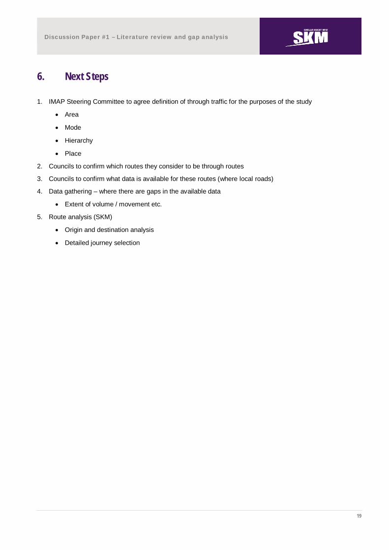
6. Next Steps
1. IMAP Steering Committee to agree definition of through traffic for the purposes of the study
Area
Mode
Hierarchy
Place
2. Councils to confirm which routes they consider to be through routes
3. Councils to confirm what data is available for these routes (where local roads)
4. Data gathering – where there are gaps in the available data
Extent of volume / movement etc.
5. Route analysis (SKM)
Origin and destination analysis
Detailed journey selection