didcot further expansion - south oxfordshire of sodc’s decision to locate future expansion at...
TRANSCRIPT

Didcot Further Expansion
Landscape and Visual Resources
Appendix 2 to the RPS Examination Statement
Prepared by:
October 2011 RPS Mallams Court 18 Milton Park Abingdon Oxon OX14 4RP Tel 01235 838 200 Fax 01235 838 225 Email [email protected]
RPS Didcot Further Expansion JNP2016 October 2011
i
Contents Page No 1 Introduction 1
General
Methodology
2 Landscape Evidence Base 3
General
Option E (Area 4)
Option A (Area 7)
3 SODC LDF Evidence Base 7
Didcot Background Study 2006
South Oxfordshire Submission Core Strategy Didcot Background Paper
March 2011
4 Analysis of Options 9
SODC Master Plan for Option A
RPS Master Plan for Option E
5 Conclusions 11
Figures
Figure 1: Landscape Constraints and Proposals: Option E (Search Area 4)
Figure 2: Landscape Constraints and Proposals: Option A (Search Area 7)

RPS 1 Didcot Further Expansion JNP2016 October 2011
1 Introduction
General
1.1 This report contains an analysis of landscape and visual issues associated with South
Oxfordshire District Council (SODC) proposals for the future expansion of Didcot. The report
provides a technical background to the Hearing Statement and has been prepared on behalf
of Taylor Wimpey Developments.
1.2 The report will demonstrate that SODC’s preferred option to expand Didcot to the north east
as opposed to the south west, contiguous with the Great Western Park expansion, is not
justified by the evidence base of landscape assessment work previously undertaken for
SODC.
1.3 Chapter 1 provides a reference to the SODC Landscape Character Assessment and
definitions of terminology subsequently used within SODC documents and this study.
1.4 Chapter 2 provides a description of landscape and visual resources at Option areas A and E
and recommendations from the Machin Bate Associates report.
1.5 Chapter 3 reviews other documents within the SODC evidence base.
1.6 Chapter 4 provides an analysis of SODC’s choice of preferred future expansion option.
Methodology
Landscape Character Assessment
1.7 The current landscape character assessment for the South Oxfordshire District is the ‘South
Oxfordshire Landscape Assessment’ (SOLA) report prepared by Atlantic Consultants in 1998
and adopted as SPG in July 2003. This document provides the basis for the definition of
landscape character areas and types which coincide with the search areas. The assessment
also identifies the quality and condition of the landscape features and elements of landscape
types and how this relates to future enhancement strategies for the District. A definition of the
strategies is as follows;
• Conserve - this strategy applies where the landscape is of particularly high scenic
quality, is unspoilt, retains a strong, intact landscape structure and sense of place,
and often contains areas or features of ecological or cultural heritage significance. In
these landscapes, conservation is an overwhelming priority in order to maintain
landscape character and quality.

RPS 2 Didcot Further Expansion JNP2016 October 2011
• Repair - this strategy applies to those landscapes which have a positive rural
character, attractive qualities and where character, landscape structure and sense of
place are still comparatively strong but which are not ‘special’ or distinctive to quite
the same degree as those in the above category. These landscapes are also
important to conserve but would benefit from some enhancement, in order to repair
slightly weakened landscape structure and quality, and to reinforce and strengthen
local distinctiveness.
• Restore - this strategy applies to those landscapes which retain a rural and
essentially attractive character but where landscape elements and structure are in
decline, largely through intensive farming practices. Field enlargement, removal or
deterioration of boundary walls and hedges and the loss of trees, woodlands and
other vegetation have substantially weakened landscape structure and sense of
place. The priority in these landscapes is to restore landscape structure and diversity
and to strengthen local distinctiveness.
• Reconstruct - this strategy applies in those areas where the character and quality of
the landscape has been substantially modified by poor land management, non-
agricultural land uses, or intrusive features, e.g. airfields, built development, mineral
extraction, roads, power lines etc. They require more significant intervention to
mitigate the influence of detracting land uses or features, to raise landscape quality
and to reconstruct landscape character and identity.
1.8 The enhancement strategies described above have been adopted within the ‘Didcot Area
Housing Study - Landscape Considerations’ Machin Bate Associates report. Machin Bate
Associates are a firm of Landscape Architect’s who were commissioned by SODC in 2006 to
undertake an assessment of the 9 potential search areas for future expansion at Didcot. The
report provides an important aspect of the landscape and visual element of SODC’s evidence
base. The landscape strategies described above provide the basis for a key decision making
tool to identify the landscapes where development would be most appropriate.
RPS 3 Didcot Further Expansion JNP2016 October 2011
2 Landscape Evidence Base
General
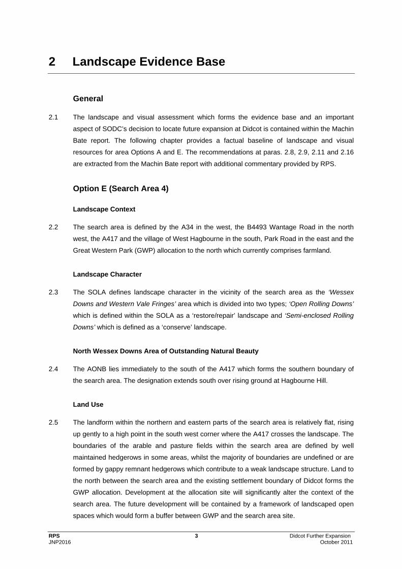
2.1 The landscape and visual assessment which forms the evidence base and an important
aspect of SODC’s decision to locate future expansion at Didcot is contained within the Machin
Bate report. The following chapter provides a factual baseline of landscape and visual
resources for area Options A and E. The recommendations at paras. 2.8, 2.9, 2.11 and 2.16
are extracted from the Machin Bate report with additional commentary provided by RPS.
Option E (Search Area 4)
Landscape Context
2.2 The search area is defined by the A34 in the west, the B4493 Wantage Road in the north
west, the A417 and the village of West Hagbourne in the south, Park Road in the east and the
Great Western Park (GWP) allocation to the north which currently comprises farmland.
Landscape Character
2.3 The SOLA defines landscape character in the vicinity of the search area as the ‘Wessex
Downs and Western Vale Fringes’ area which is divided into two types; ‘Open Rolling Downs’
which is defined within the SOLA as a ‘restore/repair’ landscape and ‘Semi-enclosed Rolling
Downs’ which is defined as a ‘conserve’ landscape.
North Wessex Downs Area of Outstanding Natural Beauty
2.4 The AONB lies immediately to the south of the A417 which forms the southern boundary of
the search area. The designation extends south over rising ground at Hagbourne Hill.
Land Use
2.5 The landform within the northern and eastern parts of the search area is relatively flat, rising
up gently to a high point in the south west corner where the A417 crosses the landscape. The
boundaries of the arable and pasture fields within the search area are defined by well
maintained hedgerows in some areas, whilst the majority of boundaries are undefined or are
formed by gappy remnant hedgerows which contribute to a weak landscape structure. Land to
the north between the search area and the existing settlement boundary of Didcot forms the
GWP allocation. Development at the allocation site will significantly alter the context of the
search area. The future development will be contained by a framework of landscaped open
spaces which would form a buffer between GWP and the search area site.

RPS 4 Didcot Further Expansion JNP2016 October 2011
Visual Resources
2.6 Views into the search area are concentrated at the edges of West Hagbourne and the A417.
Occupiers of residential properties within the village gain relatively open views into the search
area and people travelling on the A417, where roadside vegetation is limited, gain views
across the landscape from rising ground. The GWP development would extend the settlement
of Didcot south west towards these receptors, significantly altering the view. Most views
towards the search area by people travelling on the A34 and B4493 Wantage Road are
obscured by vegetation.
Constraints
2.7 The south western corner of the search area site, which extends over rising topography
adjoining the A417, is the most visually exposed due to a lack of significant hedgerows and
vegetation boundaries. A countryside gap between the settlements of Didcot and West
Hagbourne would need to be maintained.
Recommendations in the Didcot Area Housing Study Landscape Considerations Report
2.8 The recommendations within the Machin Bate report include ‘No development of the SOLA
designated conserve landscape’ which coincides with the small fields with intact hedgerows
which form a strong landscape structure on the northern edge of West Hagbourne. The
Machin Bate report also acknowledged ‘the need for a gap between Didcot and West
Hagbourne’ which would occupy this land and a belt to the west of Park Road which could be
maintained as a green corridor to improve the ‘landscape gateway and improved sense of
arrival’ at Didcot for people approaching on this route. The Machin Bate report recommends
‘No development of the most visually sensitive parts of the area, particularly in the south west
towards the A417’ where the search area adjoins the AONB.
2.9 The Machin Bate report ultimately states that ‘there is scope for LIMITED DEVELOPMENT
contiguous with the GWP allocated site’ and that ‘an additional modicum of development is
unlikely to affect detrimentally the view that already includes perspectives in which there are
layers of development’.
Option A (Search Area 7)
Landscape Context
2.10 The search area is defined by the Didcot to Oxford railway line to the west, the A4130
Northern Perimeter Road to the south, the Appleford to Long Wittenham Road to the north
and several field boundaries at the base of Down Hill to the east.

RPS 5 Didcot Further Expansion JNP2016 October 2011
Landscape Character
2.11 The SOLA defines landscape character in the vicinity of the search area as the ‘River Thames
Corridor’ and the ‘Wessex Downs and Western Vale Fringes’ areas. These two character
areas are sub-divided into types as follows; the ‘River Thames Corridor’ comprises the ‘Flat
Open Farmland’ type which is defined within the SOLA as a ‘restore’ landscape, the ‘Flat
Semi-enclosed Farmland’ type defined as a ‘repair‘ landscape and the ‘Parkland and Estate
Farmland’ type which is defined as a ‘conserve’ landscape. The ‘Wessex Downs and Western
Vale Fringes’ area comprises the ‘Open Rolling Downs’ type which is defined as a ‘restore’
landscape and ‘Semi-enclosed Rolling Downs’ which is defined within the SOLA as a
‘conserve’ landscape.
North Wessex Downs Area of Outstanding Natural Beauty
2.12 Although the search area lies outside of the designation, the AONB adjoins part of the eastern
boundary of the area and extends east over rising land at Down Hill.
Land Use
2.13 The majority of the search area, west of Abingdon Road, is relatively flat comprising medium
sized arable and pasture fields enclosed by a range of low maintained, overgrown and gappy
remnant hedgerows. A small copse lies in the centre of this area. Isolated mature trees form
landscape remnants of previous hedgerows, creating an impression of a ‘parkland’ character
adjoining the A4130 west of Abingdon Road. East of Abingdon Road the landform rises up at
the base of Down Hill. In the south eastern corner of the search area the fields are much
smaller and hedgerow boundaries are well defined with more numerous trees, creating a
more intimate scale of landscape. The extensive residential development of the Ladygrove
estate south of the A4130 forms a strong urban edge and distinctive change in character from
the rural landscape of the search area to the north.
Visual Resources
2.14 Views into the search area are predominantly gained by people travelling along the A4130
where intermittent roadside vegetation alternately obscures and frames views. Elevated
vantage points at Down Hill also allow receptors to gain open views over much of the search
area and surrounding rural/urban context. Views from the Abingdon Road are contained by
vegetation for much of its length, retaining a rural character for this gateway approach to
Didcot.

RPS 6 Didcot Further Expansion JNP2016 October 2011
Constraints
2.15 Much of the land in the south east corner, either side of Abingdon Road, is defined as a
‘conserve’ landscape and should be retained. Rising land on the eastern side of the site at
Down Hill is the most visually exposed within the search area and also provides locations for
views back over the landscape from the edge of the AONB. The A4130 provides an existing
well defined edge to development at Didcot. The approach to Didcot on the Abingdon Road
provides a rural gateway to the town.
Recommendations in the Didcot Area Housing Study Landscape Considerations Report
2.16 Due to the constraints referred to the Machin Bate report recommends ‘NO DEVELOPMENT
proposed. However in the event that some development is necessary some
EXCEPTIONALLY LIMITED POTENTIAL DEVELOPMENT is identified in the south western,
central part of the site’. Encroachment of development east towards the Abingdon Road
should be avoided to protect the rural landscape defined as ‘conserve’ within the SOLA and
maintain the rural corridor either side of the Abingdon Road. It is also recommended that
development adjoining the A4130 should be avoided ‘in order to maintain what is an important
buffer’. Development north of the copse should be avoided as this would create an
unbalanced edge to Didcot and the Machin Bate report considers that it ‘would represent an
apparent uncontrolled vestigial extension, even more unrelated to development in the locality’.

RPS 7 Didcot Further Expansion JNP2016 October 2011
3 SODC LDF Evidence Base
Didcot Background Study 2006
3.1 The purpose of this study is to provide background information to enable SODC, VWHDC and
Oxfordshire County Council to advise on the division of future housing development at Didcot
between the two districts. The study looks at possible development areas within and adjacent
to the built up area including land adjoining the proposed GWP.
3.2 The report provides a brief summary of the attributes and issues associated with each of the 9
option areas, including reference to the Machin Bate landscape assessment report. Protection
of the countryside gap between Didcot and West Hagbourne is referred to as a key issue at
Area 4 (Option E). The summary of Area 7 (Option A) states at para. 5.17 that ‘development
of this area would be highly visible from the rising ground to the north east near Wittenham
Clumps and therefore potentially the most intrusive of the nine potential development areas in
the landscape’. The Strategic Flood Risk Assessment (SFRA) for Didcot is also referred to
and recommends that ‘built development should be restricted to the eastern half of the area’
as the western part of the area is liable to flood.
3.3 Within the overall assessment section the report goes on to state at para. 5.33 for Area 7 ‘The
high visibility of development in this area within the wider landscape, together with the fact
that only the eastern half of the area would be suitable for built development suggests that
any extension northwards should be limited’. This statement uses the recommendation within
the SFRA to locate development in a specific part of the area, however it ignores similar
recommendations in the Machin Bate report which states that the eastern half of the area
should not be developed as it is highly visible in the landscape, coincides with the ‘conserve’
landscape of the SOLA and forms part of the rural approach to Didcot on the Abingdon Road.
South Oxfordshire Submission Core Strategy Didcot Background Paper March 2011
3.4 The report summarises the disadvantages, in landscape terms, of the future growth housing
Options. At Option E the south east part of the area is recognised as a ‘conserve’ landscape
by the SOLA and that the important gap between Didcot and West Hagbourne would be
physically reduced in size following development.
3.5 The presence of a ‘conserve’ landscape in the south east corner is also recognised for Option
A. The Abingdon Road corridor provides an important rural approach to Didcot which may be
diminished following development. The report also refers to the western half of the areas
liability to flood however, at para. 64 it states that ‘this land is not required to accommodate

RPS 8 Didcot Further Expansion JNP2016 October 2011
housing’ implying that the eastern part of the area would accommodate housing. No mention
is made of the eastern areas unsuitability for development due to the rising nature of the
landform and its visual sensitivity in the landscape due to near open views from Down Hill
immediately to the east within the AONB and Wittenham Clumps further to the north east.
3.6 Within the final strategy section of the report at para. 81 the reduction in the gap between
Didcot and West Hagbourne appears to be the most significant landscape issue in
determining SODC’s decision not to develop Option E. The report states that ‘The Didcot
Landscape Assessment prepared by Machin Bates indicates that the presence of a gap could
be maintained through the development of Option E. However the gap would be physically
reduced in size. Locating all of the housing provision north of Didcot at Option A and A+
would avoid having to reduce the size of this gap’.

RPS 9 Didcot Further Expansion JNP2016 October 2011
4 Analysis of Options
4.1 The ‘Didcot Area Housing Study - Landscape Considerations’ report prepared by Machin Bate
Associates provides a comprehensive assessment of the relative merits of the 9 search Areas
for future development at Didcot. At paragraph 5.0.7 of the Summary and Conclusions section
of the study it states that ‘The overriding conclusion is that there is no one Search Area that is
an ideal candidate for development. Each has disadvantages in landscape and visual terms.
Regardless of how development is laid out on the ‘preferred sites’ some landscape and visual
harm is inevitable’.
4.2 The recommendations within the Machin Bate report have not been consistently adopted
within SODC’s decision making process. Area 7 (Option A) was not recommended for
development, or if essential ‘EXCEPTIONALLY LIMITED POTENTIAL DEVELOPMENT is
identified in the south western, central part of the site’. A clear steer regarding the limited
location of development was provided, notwithstanding the areas conflict with the zone liable
to flood. In order for SODC to deliver the full housing allocation within Option 7 it cannot avoid
encroaching onto land that its own study, prepared by Machin Bate Associates, clearly
recommended that it should not.
4.3 Area 4 (Option E) was recommended for ‘LIMITED DEVELOPMENT’. Careful siting of
development and the incorporation of extensive landscape proposals would be sufficient to
reduce effects on the landscape character and views to an acceptable level.
Comparison of Master Plan Proposals
SODC Master Plan for Option A
4.4 The SODC master plan proposes housing on the central section of the option area west of
Abingdon Road (see Figure 2). The majority of this area is defined in the Machin Bate report
as ‘NO DEVELOPMENT PROPOSED’. No development is proposed east of the Abingdon
Road. No development is proposed in the south west corner of the option area which is
recommended for development in the Machin Bate report. This areas liability to flood has
formed a key determining factor in SODC’s decision to exclude it from the area of built
development, proposing playing fields instead.
4.5 By placing development as shown in the SODC master plan the proposal would be;
• Visually prominent in views gained by sensitive receptors on rising ground within the
AONB at Down Hill,
• Compromise the setting of the rural approach on Abingdon Road and the sense of
arrival at Didcot,

RPS 10 Didcot Further Expansion JNP2016 October 2011
• Conflict with most of the ‘conserve’ landscape west of Abingdon Road,
• Extend north into the landscape creating an unbalanced form to the settlement, and
• Jump the defensible edge currently provided by the A4130.
4.6 The location of development conflicts with the Machin Bate report recommendations in terms
of all of the previously defined constraints and therefore would be ‘potentially the most
intrusive of the nine potential development areas in the landscape’. Development of this
search area as shown in the master plan is not justified by the evidence base.
RPS Master Plan for Option E
4.7 By contrast the master plan for option E locates development almost entirely on land which
the Machin Bate report defined as a ‘Potential housing site’ (see Figure 1). Development in
this location would;
• Preserve enough of the countryside gap between Didcot and West Hagbourne to
retain the integrity of this policy,
• Avoid all of the ‘conserve’ landscape at West Hagbourne,
• Protect the rural approach to Didcot on Park Road, and
• Avoid developing the most visually sensitive rising land adjoining the AONB to the
south of the option land.
4.8 The small area of development in the north east corner of the search area, outside of the area
recommended in the Machin Bate report, would replace the landscape buffer included on the
edge of the GWP proposal. This planting would not be required if development is extended to
the south and a new landscape buffer incorporated into the future extension master plan.

RPS 11 Didcot Further Expansion JNP2016 October 2011
5 Conclusions
5.1 The analysis of landscape and visual issues within this report, associated with SODC’s
proposals for the future expansion of Didcot, demonstrates that SODC’s preferred option to
expand the town to the north east as opposed to the south west is not justified by the
evidence base of assessment work undertaken for SODC.
5.2 Recommendations within the SODC commissioned Machin Bate Report regarding the most
appropriate locations for built development within Option Areas have been largely disregarded
by SODC, resulting in a master plan proposal for their preferred Area 7 (Option A) which
would be significantly more detrimental to landscape and visual receptors than proposed
development at Area 4 (Option E).

RPS Didcot Further Expansion JNP2016 October 2011
Figures

RPS Didcot Further Expansion JNP2016 October 2011
Figure 1
Landscape Constraints and Proposals: Option E (Search Area 4)

Park Road
Coscote
West Hagbourne
A417
Harwell
A34
B4493 Wantage Road
Great WesternPark
Didcot
120m
110m
100m 90m
80m
130m
120m
60m
70m
60m
70m
80m
Figure No: Revision:
Date:Drawn:
Datum:Checked:
Projection:Job Ref:MP PE OXF2016
OSGB36 BNG
1:10,000Scale: A3 @0 250125 m
Title: Landscape Constraints & ProposalsOption E (Search Area 4)
Client: Taylor WimpeyProject: Didcot Further Expansion
Mallams Court 18 Milton Park Abingdon Oxon Ox14 4RPT 01235 821888 F 01235 820351 E [email protected] W www.rpsroup.com
Status: DRAFTData Source: RPS 2011
Rev: Date: Amendment: Name: Checked:
Legend
±
© Crown copyright, All rights reserved. 2011 License number 0100031673
-L01
Sept 2011
Search Area 4Potential Housing Site (Machin Bate Report)Proposed Built Develpment
National TrailBridlewayFootpathOtherSouth Oxfordshire Landscape Assessment 'Conserve' LandscapeAONB
Path:
O:\2
016B
Didc
ot Ex
pans
ion\Te
ch\G
IS\20
16D_
1108
30MP
_Lan
dsca
pe_C
onstr
aints_
Optio
n_E_
RevA
.mxd

RPS Didcot Further Expansion JNP2016 October 2011
Figure 2
Landscape Constraints and Proposals: Option A (Search Area 7)

Golf Course
B4016 Abingdon RoadA4130 Northern Perimeter Road
Moor D
itch
Railw
ay Li
ne
Ladygrove
SouthmeadIndustrial Estate
70m
60m
70m 60
m
80m
50m
Figure No: Revision:
Date:Drawn:
Datum:Checked:
Projection:Job Ref:MP PE OXF2016
OSGB36 BNG
1:10,000Scale: A3 @0 250125 m
Title: Landscape Constraints & ProposalsOption A (Search Area 7)
Client: Taylor WimpeyProject: Didcot Further Expansion
Mallams Court 18 Milton Park Abingdon Oxon Ox14 4RPT 01235 821888 F 01235 820351 E [email protected] W www.rpsroup.com
Status: DRAFTData Source: RPS 2011
Rev: Date: Amendment: Name: Checked:
Legend
±
© Crown copyright, All rights reserved. 2011 License number 0100031673
-L02
Sept 2011
Search Area 7Potential Housing Site (Machin Bate Report)Proposed Built Development (Land at North East Didcot, Development Framework Document, March 2011)
National TrailBridlewayFootpathOtherSouth Oxfordshire Landscape Assessment 'Conserve' LandscapeAONBFlood Zone 1Flood Zone 2Views from Public Rights of Way on Elevated Land
Path:
O:\2
016B
Didc
ot Ex
pans
ion\Te
ch\G
IS\20
16D_
1108
30MP
_Lan
dsca
pe_C
onstr
aints_
Optio
n_A_
RevA
.mxd