development of a fast and cost effective geospatial ... · reef island, (d) the pearl-qatar and (e)...
TRANSCRIPT

Development of a Fast and Cost Effective Geospatial Techniques to
Monitor Real Estate Potential of Residential Manmade Islands in the
Countries of the Gulf Cooperation Council
TS081: GIS AND ITS EVOLVING ROLL IN VALUATION AND STANDARDS PAPER ID 9025_1st June 2017 (16h00-
16h00-17h30
By Ali El Battay, Abderrazak Bannari and Nadir A.Hameed
Presented at th
e FIG W
orking Week 2017,
May 29 - June 2, 2
017 in Helsinki, F
inland
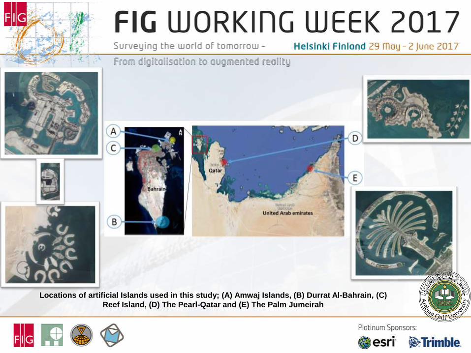
Locations of artificial Islands used in this study; (A) Amwaj Islands, (B) Durrat Al-Bahrain, (C)
Reef Island, (D) The Pearl-Qatar and (E) The Palm Jumeirah


Rational of the study:
Investors, home-buyers or potential tennats have very crucial questions to help them
decide :
1. What is the overall status of developement of the island(s)?
2. How fast (or slow) the construction/developement of the island has gone so far?
3. How it compares to competitors of similar projects?
The probleme is that it is extremely difficult to get accurate, timely and objective
answers to these (legitimate) questions!!! Most realtors or even project developers
and contractors can not give a holestic and/or neutral answers!!

Where?
When?

Percentage of development of all five study sites as per April
2014 using Landsat 8 OLI Images*
* Data valid for purpose of research only and no liability for its accuracy or implications is accepted by researchers involved in this study

Percentage of undevelopment* of study site in Durrat Al-Bahrain and its
sub-islands from OLI images in 2014,2015 and 2016 * Data valid for purpose of research only and no liability for its accuracy or implications is accepted by researchers involved in this study
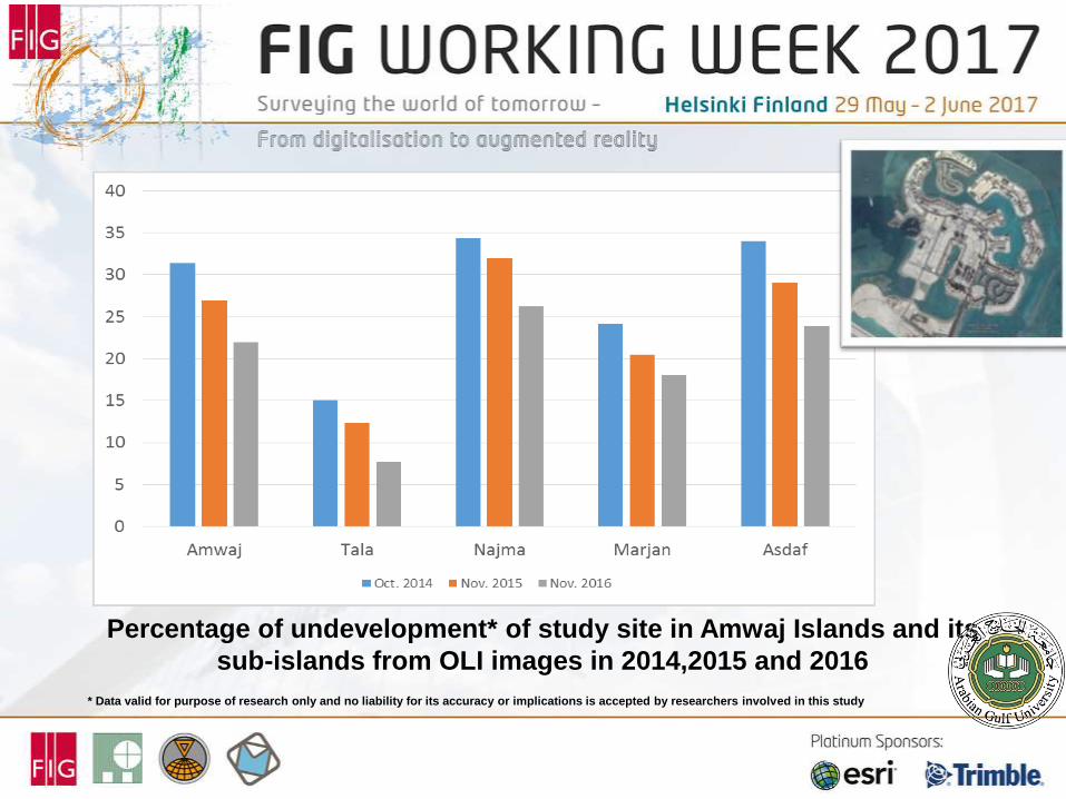
Percentage of undevelopment* of study site in Amwaj Islands and its
sub-islands from OLI images in 2014,2015 and 2016 * Data valid for purpose of research only and no liability for its accuracy or implications is accepted by researchers involved in this study

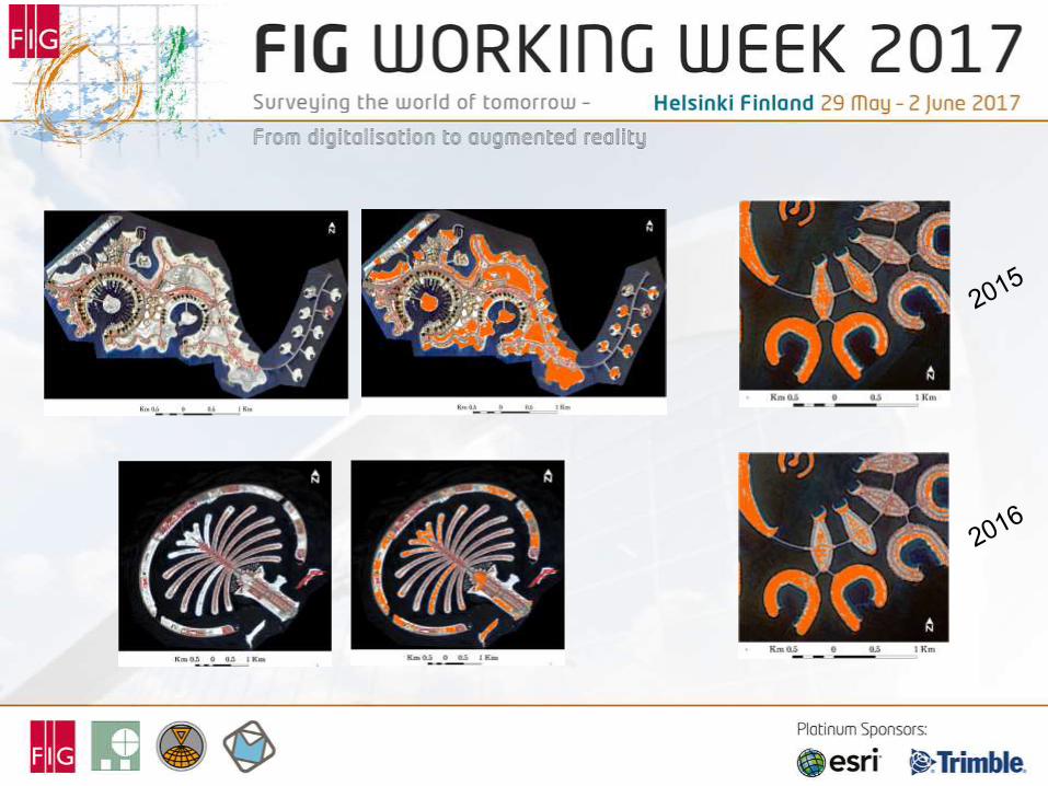
Pseudo colors representation of OLI SWIR1 on 14 Oct. 2014 aside of
its DN histogram.

Isolation of land
areas (SWIR) Isolation of various
sub-islands
Applying the threshold
technique OLI Validation WorldView-3

Comparison of percentage of development in Amwaj and Durrat Al-Bahrain
and sub-islands using OLI versus WV3 images in mid-October 2014*
* Data valid for purpose of research only and no liability for its accuracy or implications is accepted by researchers involved in this study
Pearson product momentcorrelation
coefficient r=0.96

Conclusions:
Manmade islands have a very distinctive and coherent spectral signature making even
the simplest remote sensing technique (in this case one band thresholding) very
effective to determine the percentage of development.
OLI Low spatial resolution allowed to avoid confusion between open areas and buildings
rooftops due to mixture of the last one with surrounding pixels (shadow, roads,
vegetation).
Some fundamental and crucial Real Estate ($1M dollars questions) issues can be
answered in a fast, simple, reliable, accurate and timely manner (less than 24 hours
processing) using basic geoinformatics techniques.
If this is the input of simple digitalization so what would happen when moving to
augmented reality where investors/buyers/tenants can immerse fully in nD outdoor and
indoors illustrations of their future acquisition…

Thank you
For more details: paper ID 9025
Ali El Battay
Arabian Gulf University
KIGNDOM OF BAHRAIN
Tel. +973 17 239 684
Fax + 973 239 552
Email: [email protected]