development of a detailed basemap and model surface … sediment remediation of esquimalt harbour...
TRANSCRIPT

Development of a Detailed Basemap and Model Surface to Support Sediment Remediation of Esquimalt Harbour Challenges of Reconciling Datasets with Multiple Users

Presentation Outline 1. Project Background
• EHRP Project Team • Project Setting • Project Sites • Mapping Resources
2. Basemap Definition 3. Basemap Objectives 4. Data Management 5. Elevation Model

PROJECT BACKGROUND • Part of the Esquimalt Harbour Remediation Project (EHRP) • Complex multi-year project to address sediment contamination
within one of Canada’s oldest Naval ports. • Current in Options Analysis phase, base map required to
generate cost estimates. • SNC-Lavalin tasked to provide and maintain project basemap
layers

EHRP Project Team • EHRP client team:
• Department of National Defence (DND);
• Defence Construction Canada (DCC);
• Public Works and Government Services Canada (PWGSC);
• EHRP consultant groups and engineers:
• SNC-Lavalin Inc., E&W
• SLR Consulting Canada Ltd.
• Golder Associates Ltd.
• Anchor QEA, LLC.
• Klohn Crippen Berger Ltd.
• F&M Management Ltd.

Project Setting
• Esquimalt Harbour is home to the Canadian Forces Pacific Naval Fleet and has been used as a Navy facility since 1855.
• CFB Esquimalt has 5 properties bordering Esquimalt Harbour (Dockyard, Signal Hill, Yarrows, Naden, Colwood).
• Also bordering the harbour are first nations reserves, residential, commercial, and parkland properties.

Project Setting (Cont’d) • The harbour is a naturally sheltered body of water
covering 354 hectares.
• The harbour ranges in depth up to 16 m and the shoreline generally consists of a rocky shoreline.
• The harbour is home to many marine species of flora and fuana and is a busy port with vessel traffic
• Numerous jetties, wharves, and docks are present
• Ship maintenance has been conducted at the dry docks and shipyards for since before 1893.

Project Sites
D Jetty
F/G Jetty
A/B Jetty
C Jetty / ML Floats
Y Jetty
Lang Cove

Mapping Resources • Mapping data and resources for Esquimalt Harbour:
• DND Geomatics Department and Base Engineering
• Previous projects and reports (provided by DND)
• Canadian Hydrographic Service – Bathymetry and Nautical Charts
• Capital Regional District – Regional Community Atlas
• Aerial Photographs
• NRC National Topographic System for upland areas
• Esquimalt Harbour Sediment Quality Database
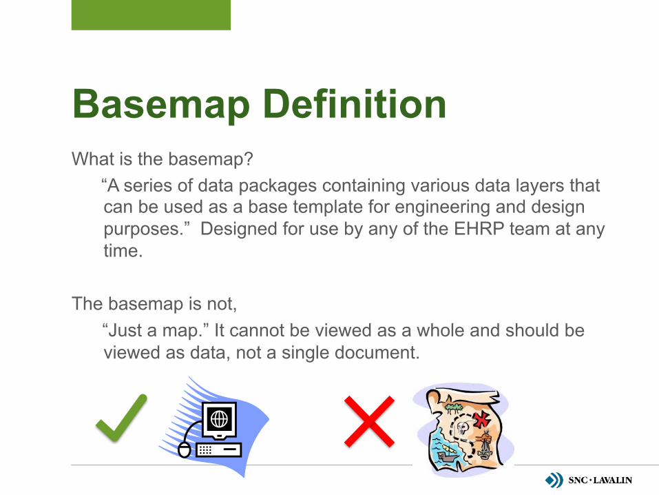
Basemap Definition What is the basemap?
“A series of data packages containing various data layers that can be used as a base template for engineering and design purposes.” Designed for use by any of the EHRP team at any time.
The basemap is not,
“Just a map.” It cannot be viewed as a whole and should be viewed as data, not a single document.

Basemap Objectives • To present the most accurate graphical data, as possible,
according to project objectives
• Basemap data designed to allow users to confidently use graphical data for the planning, design, and engineering of sediment remediation.
• The basemap must be kept up-to-date and available to all users at a central location.
• Basemap data designed for all EHRP user groups including federal government clients, consultants, and engineers.
• Basemap must be compatible for other DND departments, for other future DND projects, and to other consultants or engineers.

DATA MANAGEMENT
Whenever multiple parties are working on a project, there arise issues of version control, accuracy, reliability and management of documents and data between the parties.

Basemap Challenges • To start, a number of files were collected,
which included a number of different layers. Some of the layers were obviously different, whereas some were only subtly different (slightly different versions)
• There are a variety of approaches to managing different data-sets between multiple parties. Some larger systems are based on complex database interactions.

Documents Vs. Data Document
Standalone presenta1on
Final Version
Easily edited
Document
Can be mul1ple “correct” versions
O=en includes data
representa1on
Data
Not intended for
presenta1on
No “final” version
Only one “correct” version
Data
Not typically “styled” for presenta1on
Doesn’t need to look good
Building the Basemap • The common platform required by the team was AutoCAD Map/
Civil3D 2012, which use the AutoCAD 2010 *.dwg format.
• The Basemap layers are intended for use in each of the team members respective figures, rather than as a stand alone figure. In this respect, they are treated more like data than documents.
• To keep the file sizes to reasonable levels, and make it easier to find/work with, the requisite data, the layers were split into different packages.
• DND CAD/BIM Standards (CETO C-98-002-CAD) compliant layer names, line types etc. should make it relatively seamless to insert these data packages into existing figures and documents.
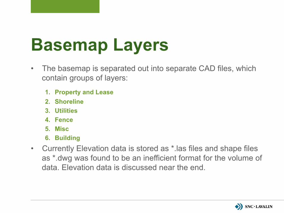
Basemap Layers • The basemap is separated out into separate CAD files, which
contain groups of layers:
1. Property and Lease 2. Shoreline 3. Utilities 4. Fence 5. Misc 6. Building
• Currently Elevation data is stored as *.las files and shape files as *.dwg was found to be an inefficient format for the volume of data. Elevation data is discussed near the end.

Maintaining the Basemap Error
Discovered
New Data Received
Other Reason to Update Base?
Files Uploaded as Needed
Layer Note Updated AND/OR Document Note
Modified
Change Made and Note and Document Updated
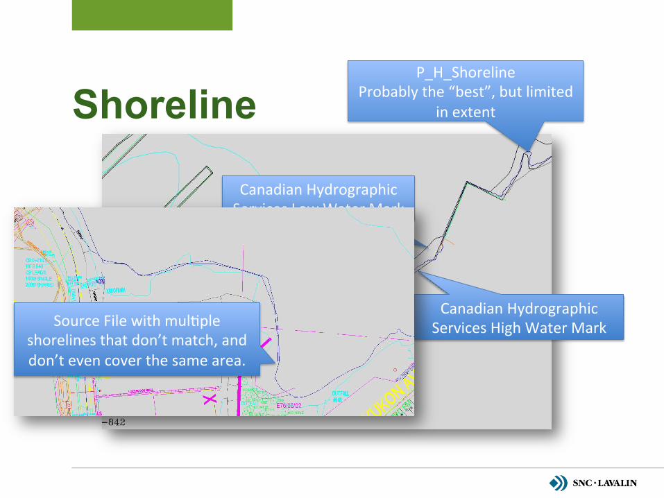
Shoreline P_H_Shoreline
Probably the “best”, but limited in extent
Canadian Hydrographic Services Low Water Mark
Canadian Hydrographic Services High Water Mark Source File with mul1ple
shorelines that don’t match, and don’t even cover the same area.

ELEVATION MODEL
One of the risks identified to project planning is related to the accuracy and quality of surfaces used to estimate volumes of material needing to be managed. With modern side-scan sonar, and LiDAR technologies, this risk could be mitigated with an increase in data quality.

A Question of Datum • The vertical datum used on the project was decided to be “Chart Datum”. Which
represents the approximate average low tide level. Typical geodetic elevation represents approximate mean sea level. The agreed upon Chart Datum 0 elevation for the project is equivalent to -1.89m for the project area.
CVD28 (Geode1c) Eleva1on 0m
CVD28 (Geode1c) Eleva1on -‐1.89m
Chart Datum Eleva1on 1.89m
Chart Datum Eleva1on 0m

New Data Collection • New bathymetry and elevation data was collected by two
methods:
• Multibeam side scan sonar – by PWGSC
• Aerial LiDAR survey at low tide – by Terra Remote Sensing
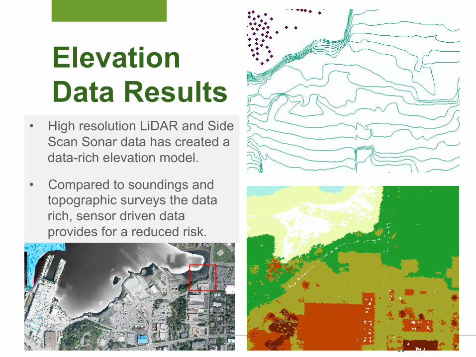
Elevation Data Results
• High resolution LiDAR and Side Scan Sonar data has created a data-rich elevation model.
• Compared to soundings and topographic surveys the data rich, sensor driven data provides for a reduced risk.
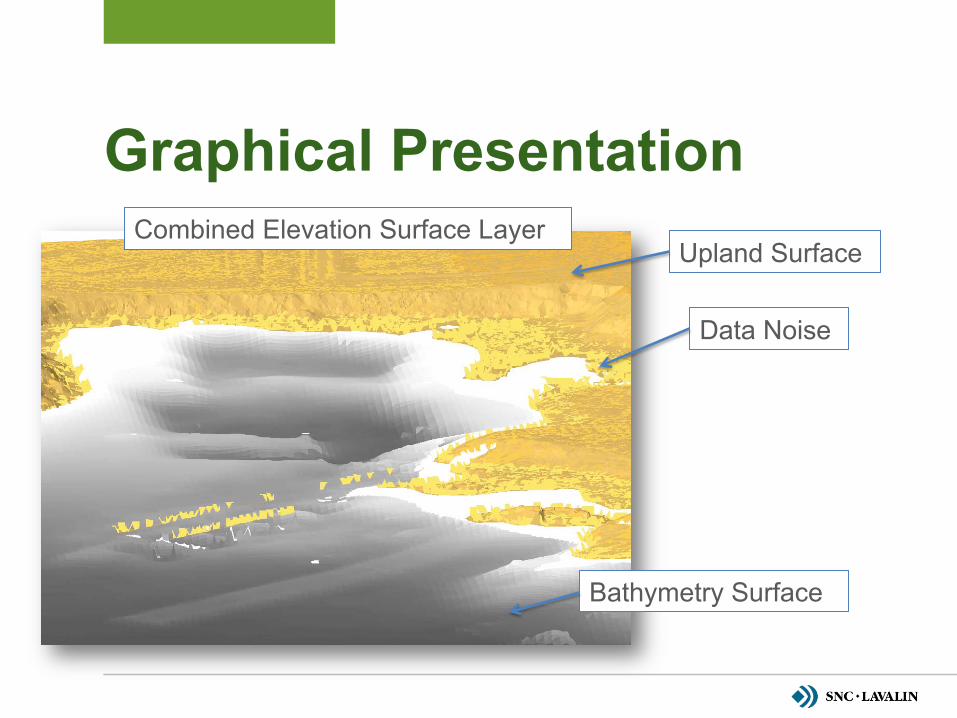
Graphical Presentation Combined Elevation Surface Layer
Upland Surface
Bathymetry Surface
Data Noise

Graphical Presentation Combined Elevation Surface Layer
Non-Ground Class
Ground Class Data
Water Class Data

Data Comparison • There is a fairly dramatic difference in the resolution of historical
sounding data, and the side-scan sonar data.
• The diffence in resolution can cause substantial under/over estimations of volume, as what appears to be a subtly rise or dip between data points may be a substantial volume.

Elevation Data Points
NonGround Points over Ground Surface Airphoto Draped over Ground Elevations
Data Gaps Surface Elevation Data Gaps:
• A small data gap remains in the surface elevation layer between the bathymetry and the upland surface in the intertidal zone
• The results indicate that the slope between the available data points is negligable
• No new data collection is recommended and future data collection would mostly be required to monitor changes due to season and erosion/deposition, or to confirm remediation extents.

What’s Next • Describe what the next steps would be for the basemap
• Continue to update layers with as data becomes available
• Add elevation data into feature layers (to create a better 3D model of structures)
• Help consultant teams use basemap to develop remediation design
• Evaluate CVD2013 datum and it’s comparison to the agreed upon Chart Datum
• Consider using data to support management approaches (i.e. leave it and monitor the sediment elevations to ensure that there is a net accumulation to limit bio-availability)

Questions?

WE CARE embodies SNC-Lavalin’s key corporate values and beliefs. It is the cornerstone of everything we do as a company. Health and safety, employees, the environment, communities and quality: these values all influence the decisions we make every day. And importantly, they guide us in how we serve our clients and therefore affect how we are perceived by our external partners. WE CARE is integral to the way we perform on a daily basis. It is both a responsibility and a source of satisfaction and pride by providing such important standards to all we do.
WE CARE about the health and safety of our employees, of those who work under our care, and of the people our projects serve.
WE CARE about our employees, their personal growth, career development and general well-being.
WE CARE about the communities where we live and work and their sustainable development, and we commit to fulfilling our responsibilities as a global citizen.
WE CARE about the environment and about conducting our business in an environmentally responsible manner.
WE CARE about the quality of our work.