design of forebay and micropool for highway stormwater
TRANSCRIPT

Applied Research and Innovation Branch
Design of Forebay and Micropool for Highway Stormwater Detention Basins
Prepared
by
James C.Y. Guo, PhD, P.E., Professor and Director
Hydrology and Hydraulics Program, U of Colorado Denver
Ken MacKenzie, Master Planning Program Manager,
Urban Drainage and Flood Control District, Denver, Colorado
Report No. CDOT-2016-05 Dec 2016

The contents of this report reflect the views of the
author(s), who is(are) responsible for the facts and
accuracy of the data presented herein. The contents
do not necessarily reflect the official views of the
Colorado Department of Transportation or the Federal
Highway Administration. This report does not
constitute a standard, specification, or regulation.

2
1. Report No.
CDOT-2016-05
2. Government Accession No.
3. Recipient's Catalog No.
4. Title and Subtitle Design of Forebay and Micropool for Highway Stormwater Detention Basins
5. Report Date
Dec 2016
6. Performing Organization Code
114.02
7. Author(s) James C.Y. Guo, Professor, U of Colorado Denver and
Ken MacKenzie, Manager, Urban Drainage and Flood Control District
8. Performing Organization Report No.
CDOT-2016-05
9. Performing Organization Name and Address
Urban Drainage and Flood Control District, Denver, CO in cooperation with the
University of Colorado Denver
10. Work Unit No. (TRAIS)
11. Contract or Grant No.
12. Sponsoring Agency Name and Address
Colorado Department of Transportation - Research
4201 E. Arkansas Ave., Denver, CO 80222
13. Type of Report and Period Covered
14. Sponsoring Agency Code
15. Supplementary Notes
Prepared in cooperation with the US Department of Transportation, Federal Highway Administration
16. Abstract A new procedure was developed to design a sediment forebay at the entrance of a stormwater detention basin. It was found that the
geometry of the forebay depends on the size of the target particle for settlement in the forebay. The fall velocity of the target
particle and the horizontal inflow velocity provide the basis to size the length and depth of the forebay pool. From the gradation
curve derived from the soil laboratory, the target particle is recommended to have a diameter of 0.1 to 0.2 mm. It is expected that a
forebay will intercept 60 to 70% of sediment load in stormwater. A micropool is designed to provide a continuous suction flow to
drain the remaining water in the detention basin after the outlet screen become clogged. In this study, dry samples of float deposits
were collected from the screens in detention basins, and they were analyzed in the soil laboratory to construct the gradation curves.
It was found that D90=0.3 mm and the saturated specific gravity is 0.8 to 0.9. The new concept of float velocity was derived in this
study. Using the float velocity as the basis, the micropool surface area and flow depth can be determined. As recommended in this
study, the flow depth in micropool shall include evaporation loss through the period of inter event time, dead storage for solids,
and suction head to sustain the flow. The screens covering WQCV outlet plates have long been a maintenance issues due to
clogging and UDFCD now recommends only three or four orifices to maximize the orifice size and minimize clogging of the
orifice plate.
Implementation 1. New design procedures for forebay sizing and micropool design will be incorporated into CDOT‘s Hydraulic Design
Manual. Technical papers will be prepared to translate the findings into engineering design charts. A condensed version
of this report will be presented in conferences. 2. Sediment gradation samples collected at locations upstream and downstream of the EDB 502L will be submitted to the
CDOT’s maintenance. EDB 502L is conservatively built and does satisfy the design criteria for both water quality and
flood mitigation purposes.
17. Keywords
Forebay, Micropool, Highway Detention, Siphon Flow, Urban
Trash, WQCV.
18. Distribution Statement
No restrictions. This document is available to the public
through the National Technical Information Service
www.ntis.gov or CDOT’s Research Report website
http://www.coloradodot.info/programs/research/pdfs
19. Security Classif. (of this report)
Unclassified
20. Security Classif. (of this page)
Unclassified
21. No. of Pages
22. Price
Form DOT F 1700.7 (8-72) Reproduction of completed page authorized

3
ACKNOWLEDGEMENTS
The authors gratefully acknowledge the Colorado Department of Transportation’s financial
support during the course of this study. The authors would also like to extend their deep
appreciation to the members of the Colorado Department of Transportation Research Study
Panel including Amanullah Mommandi (Project Development Branch), Mr. Alfred Gross (R-1
Hydraulics), and Aziz Khan (Applied Research and Innovative Branch) for their technical
assistance, guidance, and review of this document.

4
Design of Forebay and Micropool for Highway Stormwater Detention Basins
CONTENTS
RESEARCH STATEMENT
1. INTRODUCTION
1.1 Basic Concept of Watershed Depression Storage
2. WATER QUALITY CAPATURE VOLUME
2.1 Rainfall and Runoff Distributions
2.2. Regression Model for WQCV
2.3. Exponential Distribution for WQCV
2.4 Field Investigation
3. EXCESS URBAN RUNOFF VOLUME (EURV)
4. DESIGN OF FOREBAY FOR SEDIMENT SETTLEMENT
4.1 Fall Velocity for Solid Particle in Forebay
4.2 Field Investigation
5. MICROPOOL FOR SIPHON FLOW
5.1 Size Gradation Curve for Float Debris
5.2 Float Velocity for Debris Particle
5.3 Design of Micropool
5.4 Field Investigation
6. UNCERTAINTY OF RESIDUAL WATER DEPTH
6.1 Numerical Algorithm For Residual Water Depth
6.2 CASE STUDIES
6.3 FIELD INVESTIGATION
7. CONCLUSION
8. REFERENCES

5
LIST OF FIGURES
Figure 1.1 Comparison between Natural and Street Drainage Networks
Figure 1.2 Conveyance and Storage Low-Impact Designs
Figure 2.1 Event Separation by Inter-event Time.
Figure 2.2 Rainfall Depth Distribution at Denver, Colorado
Figure 2.3 Rainfall Depth Distribution at San Diego, California
Figure 2.4 Rainfall Event Depth in Inches for the Continent of the US
Figure 2.5 Normalized Runoff Capture Curves
Figure 2.6 Site Location for Sample Extended Detention Basin (EDB 520L)
Figure 2.7 Tributary Sub-catchments to WQB in EDB 502L
Figure 2.8 Off-site Sub-catchments Tributary into EDB 502L
Figure 2.9 As Built EDB 502L Located at S Knox Court and SH 285.
Figure 3.1 Vertical Profile for Outlet Structure in EDB 502L.
Figure 4.1 Forebay in Stormwater Basin
Figure 4.2 Low Flow Outlet and Trapped Sediment in Forebay
Figure 4.3 Illustration of Forebay Layout
Figure 4.4 Fall Velocity
Figure 4.5 Particle Settlement in Forebay
Figure 4.6 As-built Forebay at EDB 502L
Figure 4.7 Locations of Sediment Samples at EDB 502L
Figure 4.8 Gradation Curves for Sediment Samples at EDB 502L Site
Figure 5.1 Micropool in As built EDB 502L
Figure 5.2 Clear and Clogging Drainage Conditions
Figure 5.3 Sediment Removal at Forebay and Micropool
Figure 5.4 Distribution of Particle Size for Float Debris
Figure 5.5 Flow Field around Floating Particle in Water
Figure 5.6 Types of Siphon Pipes to Lift Water Flow
Figure 6.1 Normalized Residual Water Depths for WQCV with Imp=75% Drain Time=40 hr
Figure 6.2 Normalized Residual Water Depths for EURV with Imp=75% Drain Time=72 hr
Figure 6.3 Link-Node Model for EDB 502L Test Site.
Figure 6.4 As-built Perforated Plate at EDB 502L.
Figure 6.5 Stage-Outflow Curve Developed for EDB502L
Figure 6.6 Continuous Rainfall-Runoff Simulations at EDB 502L Test Site.
Figure 6.7 Normalized Residual Water Depths for EURV at EDB 502L

6
LIST OF TABLES
Table 2.1 Rainfall Statistics Using 6-, 12-, and 24-hr Event Separation Times
Table 2.2 Coefficients for Determining Empirical WQCV
Table 2-3 Water Quality Capture Volume for EDB 502L
Table 2.4 Hydrologic Parameters for Off-site Catchments
Table 3.1 EURV Determined for EDB 502L Site
Table 3.2 As-built Stage-Cross Sectional Area-Storage Volume for EDB 502L
Table 4.1 Analysis of Sediment Trap Efficiency at Forebay EDB 502L
Table 6.1 Input Parameters for Analyses of Residual Water Depth
Table 5.1 Design of Micropool for EDB 502 L
Table 7.1 Exceeding Probability of Residual Water Conditions in Metro Denver Area

7
Design of Forebay and Micropool for Highway Stormwater Detention Basins
RESEARCH STATEMENT
A storage facility is portrayed by its stage-storage-outflow curve. Design of a detention
basin involves a volume-based approach to construct the stage-storage curve, and another
flow-based approach to define the stage-outflow curve. The former requires the information
of basin geometry, while the latter involves the details of forebay, micropool, and outlet
structure. There are two popular volume-based methods recommended to quantify the
required detention volume, including the water quality capture volume (WQCV) approach to
intercept frequent runoff events, and excess urban runoff volume (EURV) method to reduce
post-development peak flows. Both empirical formulas for WQCV and EURV were derived
from the assumption that the basin is completely empty before receiving the next event. In
fact, the operation of a basin is always dependent on the remaining water depth from the
previous event. During a rainy season, the accumulation of continuous rain-runoff volumes
into the basin can lead to a false alarm of extreme event. Secondly, designs of forebay and
micropool should be related to the gradation distribution of solid particles in stormwater.
Empirical recommendations may lead to oversized micropool and undersized forebay or vice
versa. Therefore, in this study, it is proposed to investigate: (1) how to design forebay and
micropool based on the on-site sediment characteristics, and (2) how to add a freeboard to a
basin according to the risk of residual water depth. For this project, the Urban Drainage and
Flood Control District is responsible to monitor the extended detention basin located at S
Knox Court and State Highway 285. The collected data are used to verify the new methods
developed in this study. Findings from this study provide significant improvements to
current design methods.
Key Words: Water Quality Capture Volume, Excess Urban Runoff Volume, Micropool, Forebay,
Drain Time, Detention, Residual Water Depth.

8
1. INTRODUCTION
Due to the Clean Water Act, local governments in the US require urban stormwater runoff to be
treated in order to improve water quality in the downstream receiving water bodies. In
conjunction with water quality treatment, current design criteria also require the attenuation of
peak flows under the post-development condition. As more areas are urbanized, pollutant loads
in stormwater are increased. Without mitigation, these pollutants would negatively impact
waterway ecology and wildlife habitat when travelling downstream into the receiving waters.
The concept of Stormwater Quality Capture Volume (WQCV) was developed to define the
required stormwater volume to be treated for reducing total suspended solids (TSS) and metal
pollutants prior to being released downstream (Urbonas et al. in 1989, Guo and Urbonas 1996).
Based on field observations performed in the EPA Reports in 1983 and 1986, an average
extended detention time of 12 hours provides a removal rate of 80-90% to reduce the annual TSS
load generated from the tributary watershed (Driscoll et al. 1989).
In the last decade, the concept of Excess Urban Runoff Volume (EURV) expressed in
inch/catchment was also developed and recommended as a new design standard intended to
replace the extended detention basin (EDB) standard in the metro Denver area (UDFCD 2011).
A EURV represents the on-site increased runoff volume directly due to the increase of
impervious surface area within the tributary catchment. A full spectrum detention basin (FSDB)
is constructed with its WQCV as the bottom layer for water quality enhancement up to the 6-
month event, and EURV as the upper layer for peak flow reduction up to the 10-yr event.
Detention basins are often equipped with a forebay to trap particles ≥1 to 2 mm in diameter, and
a micropool to sustain continuous flow released by inverted Siphon effects in case of outlet
clogging. In current practice, both EDBs and FSDBs are designed under the assumption that all
runoff events coming into the basin are independent of previous storm events. In fact, the
operation of a basin is certainly dependent on the residual water depth from the previous storm
events. During a rainy season, the accumulation of runoff volumes from a series of storm events
may fill up the basin as if the major storm occurred. According to the drainage manual (UDFCD
2011), a drain time of 40 hours is recommended for WQCV, and less than 72 hours for EURV
(per Colorado Revised Statute 37-92-602(8), 97% of the 5-year storm must drain in 72 hours or
less). In practice, the longer the drain time is, the higher the overflow risk is. Therefore, it is a

9
challenge as to how to reduce the risk of residual water depth by selecting a proper freeboard for
a basin.
The goals of this report are twofold: (1) to develop consistent procedures to size forebay and
micropool, and (2) to develop a risk-based guidance to evaluate the residual water depth in a
basin.
1.1 Basic Concept of Watershed Depression Storage
A rural watershed is characterized with its hydrologic losses including interception, infiltration
and depression losses. In comparison, interception losses due to bushes and trees are negligible in
an urban area. Depression loss depends on the storage volume associated with the depressed area.
Infiltration loss depends on the type of soils; and it occurs to the overland flows as soon as the
rainfall excess exceeds the depression losses. Developments of an urban area result in more
pavements, impervious surfaces, and fills of depressed areas. As illustrated in Figure 1.1, an urban
drainage system often includes the underground storm sewers sized to carry the minor event, and
the street gutter designed to deliver the major event. Such a double-decker flow system is to mimic
the natural waterway that consists of a low-flow main channel and overbank floodplains.
Figure 1.1 Comparison between Natural and Street Drainage Networks

10
In an urban catchment, the source of storm runoff is the impervious areas. Before the overland
flows become concentrated, the increased runoff volume per unit area (V-problem) is the cause of
water quality problems. After the overland flows are collected into street gutters, sewers, and
channels, the increased runoff flow (Q-problem) is the cause of flooding problems.
Conventional stormwater management has focused on how to reduce peak flows using stormwater
detention, while the latest development is to integrate the low-impact designs into the stormwater
management to enhance both stormwater quality and quantity controls. A low-impact design is to
apply a filtering process to better stormwater quality and an infiltration process to reduce
stormwater volume. Since the low-impact designs are aimed at the runoff source control, therefore
they are only applicable to a small tributary area. The latest developments on low-impact designs
include infiltration beds, rain gardens, bio-swales, and porous pavements. As shown in Figure 1.2,
stormwater low-impact designs are classified into: (1) conveyance type such as porous pavements
using infiltration bed, and (2) storage type such as rain garden using an infiltration basin.
Obviously, the effectiveness of a low-impact design depends on how to intercept the surface runoff
volume. To differentiate from the stormwater detention storage volume (WDSV) for extreme
events, the intercepted stormwater volume for low-impact designs is termed water quality capture
volume (WQCV). A WQCV shall be in the same magnitude (i.e., 0.5 to 3 times) the natural
depression volume that was obliterated during the urbanization process.
Conveyance Type -- Porous Pavement Storage Type – Rain Garden
Figure 1.2 Conveyance and Storage Low-Impact Designs

11
Over 30 years of learning, in the year 2010, the effort of stormwater Best Management Practices
(BMP) has concluded that the low-impact-development (LID) concept is the best approach to
integrate both flood mitigation and water quality enhancement together.
2. WATER QUALITY CAPATURE VOLUME
2.1 Rainfall and Runoff Distributions
The conventional criteria developed for the purpose of flood mitigation are not suitable for sizing
stormwater quality basins. It is because the goal of stormwater quality basin (WQB) is to capture
frequent runoff events, not the extreme. Frequent rainfall events have to be delimited from a
continuous record by a user-defined minimum inter-event time (Guo and Urbonas 1996). Such a
minimum inter-event time of no rain is termed event separation time. As illustrated in Figure 2.1,
the continuous record is divided into 3 events using an event separation time of six hours. After
individual events are identified, the event rainfall depth and duration can be further calculated
for statistical analyses.
Figure 2.1 Event Separation by Inter-event Time.
In practice, the event separation time should be selected based on the watershed characteristics
such as sediment resident time or basin’s drain time. The 1986 EPA study reported that about 80
to 90 percent solids were removed if a 12-hour drain time is applied to a wet pond or a 24-hour
drain time is applied to a dry pond. Therefore, it is recommended that the event separation time be
the drain time of a basin. After a continuous rainfall record is divided into individual events, Figure
2.2 is the distribution of rainfall depths observed at the City of Denver, Colorado. Although a two-
year storm event is often considered a small event for flood control projects, a 2-yr event, in fact,
4-hr 6-hr 9-hr 2-hr
Interevent time 6-hr
Event 1 Event 2 Event 3
Time in hr

12
has a rainfall depth greater than 95 percent of the rainfall population. Figure 2.3 shows the
distribution of rainfall depth by storm numbers observed over a period of 30 years in the City of
San Diego, California. It shows that 97 percent of the events having a depth less than the local
two-year rainfall depth. Although the skewness of event-rainfall depth distribution varies with
meteorological region, it is generally true that the number of smaller rainfall events dominate the
rainfall population.
Figure 2.2 Rainfall Depth Distribution at Denver, Colorado
Figure 2.3 Rainfall Depth Distribution at San Diego, California

13
Not every raindrop can join surface runoff unless the event rainfall depth is greater than the
interception loss. The runoff-producing rainfall depth is the difference between the recorded
rainfall depth and the interception loss as:
sii IDd in which di = runoff-producing rainfall depth in [L] for the i-th event, Di = recorded
rainfall depth in [L] at rain gage, and Is = interception loss in [L] such as 0.05 to 0.1 inch, depending
on ground slope and impervious cover. Having the continuous rainfall record divided into
individual storms, the statistics for event-depth, duration, and inter-event time can further be
calculated as:
Ni
i
im dN
D1
1 (2.2)
2
1
1
2)()1(
1
Ni
i
miD DdN
S (2.3)
Ni
i
mi
D
s DdNNNS
C1
3
3)(
)2)(1(
1 (2.4)
Ni
iiImI T
NT
1
1
(2.5)
in which Dm = average event rainfall depth, N = total number of events in the record, SD = standard
deviation, Cs = skewness coefficient, TIi = time interval to the next event, and TI m = average inter-
event time. The above approach was employed to analyze the continuous rainfall records observed
in eight metropolitan areas (Guo and Urbonas in 1996). Approximately 1,000 to 1,500 individual
events were identified from each continuous rainfall record using an inter-event separation time of
6, 12, or 24 hours. The rainfall statistics in inches and average inter-event time in hours are
summarized in Table 2.1. As indicated in Table 2.1, the average inter-event time is 9 to 57 times
the event separation time. The distributions of rainfall depth are skewed in all cities used in Table

14
2.1. Figure 2.4 presents the rainfall event depth for the continent of the US derived from the study
using a 6-hour event separation time and 0.1 inch as the interception loss (Driscoll et al in 1989).
Table 2.1 Rainfall Statistics Using 6-, 12-, and 24-hr Event Separation Times
City 6-hr 12-
hr
24-
hr
Dm S.D. Cs TI m Dm S.D. Cs TI m Dm S.D. Cs TI m
Inch inch Hour Inch inch hour inch inch Hour
Seattle, WA 0.48 0.49 2.75 53.5 0.60 0.64 2.67 72.7 0.78 0.90 3.06 98.1
Sacramento,
CA
0.61 0.62 2.96 166.7 0.72 0.76 3.50 208.8 0.82 0.92 3.44 251.6
Phoenix, AZ 0.42 0.36 2.59 261.3 0.45 0.40 2.41 300.1 0.48 0.44 2.57 341.8
Denver, CO 0.44 0.48 3.59 106.4 0.46 0.51 3.47 121.4 0.51 0.56 3.30 144.2
Cincinnati,
OH
0.58 0.55 3.03 65.2 0.66 0.64 2.76 81.1 0.73 0.71 2.51 97.8
Tampa,
Florida
0.66 0.78 4.40 71.4 0.71 0.83 4.46 79.6 1.01 1.10 2.89 114.7
Boston, Ma 0.70 0.79 4.98 70.7 0.73 0.81 4.60 82.1 0.78 0.84 4.28 94.8
Figure 2.4 Average Rainfall Event Depth in Inches for the Continent of the US

15
2.2. Regression Model for WQCV
Based on the long-term data bases collected at Seattle WA, Sacramento CA, Cincinnati OH, Boston
MA, Phoenix AZ, Denver CO, and Tampa FL, the regression formula was derived using the best
fitted approach as (Guo and Urbonas 1996):
baCD
D
m
o
(2.6)
04.0774.0780.0858.023
aaa IIIC
(2.7)
in which Do= WQCV in inch per watershed area, Dm = average rainfall event depth in inches, C=
runoff coefficient, Ia = watershed impervious ratio, and a and b = coefficients derived from
regression analysis and listed in Table 2.2. The values for variable, b, are numerically negligible
for practice or b=0 is acceptable. For the seven metropolitan cities, the regression equations show
excellent correlation coefficients, r2, ranging from 0.80 to 0.97, depending on drain time.
Table 2.2 Coefficients for Determining Empirical WQCV
Drain Time Volume Ratio
A b r-square
12-hr 1.36 -0.034 0.80
24-hr 1.62 -0.027 0.93
48-hr 1.98 -0.021 0.84
The WQCV defined by Eq 2.6 would provide a runoff capture volume capture rate between 78.0
and 85.0 percent (UDFCD 2011).
2.3. Exponential Distribution for WQCV
As aforementioned, the WQCV is in the same magnitude as the natural depression loss. With the
average rainfall event depth in Figure 2.4, the probabilistic density function (PDF) for the rainfall
depth distribution is described as (Guo and Urbonas 2002):

16
mD
d
m
eD
df
1
)( (2.8)
in which d = a random rainfall depth in inch or mm , and Dm = average rainfall event depth in inch
or mm in Figure 2.4. Considering hydrologic losses and incipient depth, the storage volume of
WQB is treated as a runoff depth per watershed as:
WQCVDo (2.9)
sIDd 0 (2.10)
in which Do = WQCV as runoff depth in mm or inch per watershed, C = runoff coefficient, and Is
= incipient runoff depth such as 0.1 inch. Substituting Eq’s 2.8 and 2.9 into Eq 2.8, the runoff
capture percentage is integrated as:
mCD
D
ov keDdPC
0
1)0(
(2.11)
m
s
D
I
ek
(2.12)
in which Cv = runoff capture percentage and P(0≤d≤Do)=probability function. Any event that
produces a runoff volume more than Do will overload the basin. Therefore, the overflow risk is
calculated as:
m
o
CD
D
vv keCR
1
(2.13)
The plot of Cv versus Do using Eq 2.13 is termed Runoff Capture Curve. Figure 2.5 presents a set

17
of generalized runoff capture curves produced using Eq 2.13 for runoff coefficients of 0.2, 0.4,
0.6, 0.8 and 1.0. It is noticed that the curvature of runoff capture curve increases when the runoff
coefficient decreases. The runoff capture curve becomes almost a linear response between rainfall
and runoff amount when C = 1.0. This tendency reflects the fact that the higher the imperviousness
in a catchment, the less the surface detention. As a result, the response of a highly urbanized
catchment to rainfall is quick and direct.
Figure 2.5 Normalized Runoff Capture Curves
Both Eq’s 2.6 and 2.13 are derived based on the assumption that the basin is always emptied out
before the next event. In case that the basin is operated through a rainy season, frequent small
events will continually fill up the basin. As a result, the residual water depth from the previous
event is a serious concern in the operation of a detention basin. When the basin is overtopped with
a series of small events, a false alarm of the extreme event is triggered and the sediment removal
function is impaired. In this study, an investigation of residual water depth is further conducted at
the selected site for stormwater detention operations.
2.4 Field Investigation

18
The extended detention basin located at the intersection of South Knox Court and US Highway
285, designated as EDB502L, was designed and constructed in the year of 2011 as part of the
US285 Reconstruction Project performed by the Colorado Department of Transportation (CDOT)
(Harris, Kocher & Smith, 2011). This was a multi-phase project involving major improvements to
US Highway 285 from Federal Boulevard to Kipling Street. The portion of the project which
includes the EDB502L is designated as Area 4/Maintenance Yard Outfall and is located in portions
of Sections 31 and 32, T. 4 S., R. 68 W. and Section 5, T. 5 S., R. 68 W., in Arapahoe County. The
site location is shown in Figures 2.6 and 2.7.
Figure 2.6 Site Location for Sample Extended Detention Basin (EDB 520L)

19
Figure 2.7 Tributary Sub-catchments to WQB in EDB 502L
EDB 502L was designed to comply with the water quality requirements of CDOTs Municipal
Separate Storm Sewer Systems (MS4) permit, which mandates a permanent BMP treatment of
runoff from all new and disturbed pavement. Because the US Highway 285 Reconstruction Project
involved disturbing and laying miles of new pavement this extended detention basin and several
others similar in nature were designed to catch and treat runoff from these areas for water quality
storms. As summarized in Table 2.2, the tributary area during a water quality storm event to EDB
502L is limited to OS-401, WQ-404, and WQ-407 or a total of 4.90 acres since the smaller storms
are carried offsite in the storm drain system. The off-site tributary area upstream of EDB 502L
includes sub-catchments, OS-1, OS-2, and OS-6 as shown in Figure 2.8.

20
Figure 2.8 Off-site Sub-catchments Tributary into EDB 502L

21
Layout of Basin System Micropool and Perforated Plate
Jet flows through the Perforated Plate 10-ft by 7-ft Outfall Culvert to Bear Creek
Figure 2.9 As Built EDB 502L Located at S Knox Court and SH 285.
Table 2-3 Water Quality Capture Volume For EDB 502L
WQCV Calculations Drain
time=
40 hr Sub-
catchment
Area Imperviousness WQCV WQCV ID acres % Inch acre-ft
WQ-404 0.36 100.00 0.500 0.042 WQ-407 3.54 59.00 0.233 0.069 OS-401 1.00 100.00 0.500 0.042
Sum 4.90 1.2330 0.1530

22
Table 2.4 Hydrologic Parameters for Off-site Catchments
Off-site catchment Area Impiousness ID Ac %
OS-1 176 52 OS-2 69.6 76 OS-6 6.1 75
These off-site areas are fully developed neighborhoods equipped with curb-gutters and storm
sewers to drain the minor events up to the 2 to 5-yr storm into the dedicated four outfall systems
along Bear Creek. Excess stormwater from major events will overflow into EDB 502L from the
off-site areas. As shown in Figure 2.9, EDB 502L is composed of a forebay for sediment
settlement, a trickle channel system for low flows, a WQ basin with three layers, including
micropool, WQCV, and an additional storage volume above the overtopping crest. As summarized
in Table 2.3, the WQCV of 0.15 acre-ft is determined based on the site imperviousness and drain
time of 40 hours. In practice, we shall add 20% the site WQCV as the dead storage volume for
potential sediment deposit.
3. EXCESS URBAN RUNOFF VOLUME (EURV)
Both WQCV and EURV are derived based on the runoff volume in [L3] per unit area in [L2] or
expressed as runoff depth in [L] per catchment. As the catchment is developed, its runoff volume
is increased as:
)( oaTr CCPEURV (3.1)
Where PTr= design rainfall depth in inches for the selected return period of Tr in years, Ca = post-
development runoff coefficient as a function of catchment’s post-development imperviousness
ratio of Ia, and Co= pre-development runoff coefficient corresponding to catchment’s pre-
development imperviousness ratio of Io. As indicated in Eq 3.1, a EURV is determined with the
design event and catchment’s imperviousness. Relatively, EURV is much more sensitive to
catchment’s imperviousness than rainfall’s frequency. Several empirical equations were derived
to determine the EURV as (MacKenzie 2015):

23
28.168.1 aA IEURV for hydrologic Type A soils (3.2)
08.136.1 aB IEURV for hydrologic Type B soils (3.3)
08.1
/ 06.1 aDC IEURV for hydrologic Type C/D soils (3.4)
The EURV for a given site is greater than the WQCV and close to the 10-yr detention volume. To
design an extending detention basin, the bottom volume is reserved for WQCV that is to be drained
over 40 hours, while the upper volume is to accommodate the EURV minus the WQCV that is to
be drained over 12 to 32 hours so that the WQCV and the EURV together are drained in 52 to 72
hours (UDFCD 2016). It is important to note that Colorado law requires 97% of the 5-year event
to drain within 72 hours. Using Eq 3.3, the EURV at the EDB 502 L site is determined in Table
3.1 as:
Table 3.1 EURV Determined for EDB 502L Site
EURV Calculations Drain time
TTimtime=
< 72 hr
Sub-catchment Area Imperviousness EURV EURV
ID acres % Inch acre-ft
WQ-404 0.36 100.00 1.20 0.36
WQ-407 3.54 59.00 0.68 0.20
OS-401 1.00 100.00 1.20 0.10
Sum 4.90 3.08 0.66
During an extreme event, the minor system through the off-site areas will be overwhelmed, and
the excess stormwater overflows into EDB502L. As illustrated in Figure 3.1, the outlet of
EDB502L is equipped with a perforated plate to drain the WQCV over 40 hours and the EURV
over 72 hours. Extreme events would flow over the overtopping weir that drains into a 10-ft by 7-
ft culvert.

24
Figure 3.1 Vertical Profile for Outlet Structure in EDB 502L.
Table 3.2 As-built Stage-Area-Storage Curve for EDB 502L
Relative Depth Area Total Total Facilities Remarks Elevation Volume Volume
Ft Ft ft2 ac-ft ft3
5295.03 0 Bottom of Micropool
5297.53 0 295 0 0 Bottom of Plate
5298 0.3 330 0 93.62
5299 1.3 1712 0.02 1024.65
5300 2.3 4506 0.09 4023.26
5301 3.3 8955 0.24 10627.88 Top of Plate 5300.7 ft WQCV
5302 4.3 12160 0.49 21144.87 Overtopping Crest at 5301 ft EURV
5303 5.3 15964 0.81 35163.98 5304 6.3 22678 1.25 54386.85 5305 7.3 31471 1.87 81341.55 5306 8.3 37392 2.66 115730.52 Brim Full Elevation
5306.2 8.5 38415 2.83 123310.99 Street Crown Elevation
According to the Final Drainage Report on ‘US Highway 285 Reconstruction CDOT Project No.
BR 2854-113 Area 4 – Maintenance Yard Outfall”, the cross sectional areas for as-built EDB 502L
are summarized in Table 3.2. Obviously, EDB 502L was conservatively constructed with an ample

25
brim-full storage volume of 2.83 acre-ft which is much more than the required WQCV and EURV
(Harris Kocher Smith, 2011).
4. DESIGN OF FOREBAY FOR SEDIMENT SETTLEMENT
A sediment forebay in Figure 4.1 is a small hardened basin located at the entrance of a detention
basin. A forebay is designed to diffuse the inflow into a shallow, wide bay area which is usually
rimmed with a riprap or/and concrete berm. A forebay acts as a pre-treatment structure shaped to
settle down heavy or/and coarse particles in stormwater. A forebay can significantly reduce the
regular maintenance work in the micropool. A forebay needs seasonal clean-up work to remove
the sediment deposit. After a severe event, it is necessary to have field inspections and timely
repairs. Therefore, on top of hydraulic efficiency, the design of forebay has to emphasize on local
maintenance access and trash removal.
Forebay Pool Forebay with Energy Dissipater
Figure 4.1 Forebay in Stormwater Basin
As shown in Figure 4.1, a forebay consists of a shallow bay area to settle solids, an overtopping
wall to pass high flows, and a small floor pipe to release low flows. During an event, as soon as
the bay area is filled up, excess water overtops the wall. The low flow outlet can be constructed
using a floor pipe or a vertical slot on the wall. During the period of recession, the water depth in
the bay area acts as the headwater to drain the stored water through the floor pipe or slot. The
low flow outlet should be sized to release 1 to 2% of the 100-year peak discharge. The
overtopping wall is built as a riprap/concrete berm. As expected, a forebay will be overtopped

26
frequently. As a result, it is necessary to protect the downstream side of the berm with riprap
blankets. It is preferable to have a concrete floor to cover the bay area because of frequent
sediment removals. A riprap bay area in Figure 4.2 may be covered and seeded with soils.
Reinforcement of fabric protection should be placed at high speed flow areas.
Vertical slot for low flow outlet Floor pipe for low flow outlet
Figure 4.2 Low Flow Outlet and Trapped Sediment in Forebay
To improve the sediment trap efficiency, a forebay should be designed to maximize the flow
length through the bay area, and minimize the floor slope to encourage particle’s settlement. As
illustrated in Figure 4.3, the bay area is confined with an overtopping weir that has a width, Ws,
and height of Hs. For a given design flow, the overtopping weir produces a headwater depth, Hw,
on top of the weir crest. As the incoming flow is diffused into the bay area, particles in
stormwater begin to settle along the flow length, Ls. In general, the larger the particle is, the
earlier the settlement will occur. During the resident time, if the particle can flow through the
forebay before it is settled on the floor, it is a case of wash; otherwise it is a case of trap.

27
Figure 4.3 Illustration of Forebay Layout
As illustrated in Figure 4.3, particle’s fall velocity is an important factor that determines the
chance for the particle to be trapped or washed during the resident time.
4.1 Fall Velocity for Solid Particle in Forebay
As shown in Figure 4.4, the vertical movement of a particle in water column is dominated by the
balance of the buoyance force due to the displacement of water volume, the weight due to the
gravity, and the drag force due to particle’s movement (Pemberton and Lara in 1971). Assuming
that the particle is in spherical shape, the body weight is defined as:
𝐹𝑔 = 𝜌𝑠𝑔 𝜋𝐷𝑠
3
6
(4.1)
Where 𝐹𝑔= body weight in [pounds or newton], ρs= density of particle in [M/L3], 𝑔 =
gravitational acceleration in [L/T2], and Ds= target diameter of particle in [L] such as 1 mm. The
density of soils ranges from 2.4 to 2.8 (g/cm3). Buoyance force is equal to the weight of water
volume displaced with the particle, and it can be calculated as:

28
𝐹𝑏 = 𝜌𝑤𝑔 𝜋𝐷𝑠
3
6
(4.2)
Where Fb=buoyancy force in [pounds or newtons], ρw=density of water
in [M/L3]. The drag force acts in the opposite direction of the particle’s
movement. When the particle is settling, its drag force acts in
opposition to the gravitational force, but in concurrence to the
buoyancy force. The drag force is computed as:
𝐹𝑑 = 𝐶𝑑 𝜋𝐷𝑠
2
4
𝑉2𝜌𝑤
2 (4.3)
Where Fd= drag force, Cd= drag coefficient, and Vs=solid particle’s fall velocity. Referring to
Figure 4.4, the above forces shall be balanced as:
𝐹𝑔 = 𝐹𝑏 + 𝐹𝑑 (4.4)
Aided by Eq.’s 4.1 through 4.4, the fall velocity is solved as:
𝑉𝑠 = √4𝑔𝐷
3𝐶𝑑(𝑆𝑔 − 1) in m/sec. (for metric units) (4.5)
Where Sg= specific gravity of solid particle such as 2.4 to 2.8. The drag coefficient depends on
particle’s flow Reynolds number. For a spherical particle, the empirical formula for Cd is:
𝐶𝑑 =24
𝑅𝑒+
3
√𝑅𝑒+ 0.34 ≈ 0.4 𝑤ℎ𝑒𝑛 𝑅𝑒 > 10,000 (4.6)
𝑅𝑒 =𝑉𝑠𝐷𝑠
𝑣 (4.7)
Where Re =Reynolds number as the ratio of particle’s momentum force to viscous force of water,
and 𝑣= kinematic viscosity of water such as 1.2 x 10⁻⁵ ft2/sec. Using an iterative process, one can

29
start with an estimate value, such as Re=5,000, to calculate Cd in Eq 4.6, Vs in Eq 4.5, and then
Re in Eq. 4.7. Repeat this process until the estimated Reynolds number closely agrees with the
computed. As illustrated in Figure 4.5, a particle would be captured in the forebay if the
following condition is satisfied:
s
sV
HT (4.8)
sss TUL (4.9)
Where H= water depth in forebay in [L], Ts= travel time or residence time in [T], Ls= flow length
through forebay in [L], and Us= horizontal flow velocity in [L/T]. Eq. 4.9 implies that particle’s
horizontal travel distance is shorter than the basin length, Ls, before the particle has landed on the
floor (Simon and Senturk in 1990).
Figure 4.5 Particle Settlement in Forebay
The flow horizontal velocity, Us, is the cross sectional average velocity calculated as:
HW
QU s (4.10)
5.12
3
2wo hWgCQ (4.11)

30
sw hhH (4.12)
Where Q= design discharge in [L3/T], W= width of berm in [L], hw= headwater depth in [L] for
weir flow on top of berm, and hs= height of berm in [L]. In practice, the sediment load is
depicted with a gradation curve. Therefore, we have to apply Eq.’s 4.1 through 4.12 to a selected
particle size, Ds, to determine if any particles ≤Ds would be settled in the basin.
4.2 Field Investigation
The existing EDB 502L built at S Knox Court and HW 285 is selected to investigate the
aforementioned new procedure developed for the design of forebay. As shown in Figure 4.6, the
as-built forebay is located at the west entrance into EDB 502L. The incoming circular pipe is a
circular 18-inch concrete pipe. The concrete forebay is approximately 15-ft long, 18-ft wide, and
12-inch deep. A vertical cut through the overtopping wall serves as the low flow pass. The
overtopping apron is protected with grouted riprap.
Inflow Pipe to Forebay at West Entrance Outflow from Forebay to Micropool
Figure 4.6 As-built Forebay at EDB 502L
As illustrated in Figure 4.7, two (2) sets of sediment samples were collected downstream of the
forebay, and another three (3) sets of sediment samples were collected upstream of the forebay.
To produce particle gradation curves from the samples, standard sieve analyses were conducted
in the Soil Engineering Laboratory University of Colorado Denver using eight different sieve

31
sizes, including #4 (4.75mm), #10 (2.0 mm), #16 (1.18 mm), #30 (0.6 mm), #40 (0.425 mm),
#50 (0.3mm), #100 (0.15mm), #200 (0.075mm), and the sieve pan. Each empty sieve was first
weighed and recorded prior to the test. All chunks and clots within the sample were ground into
individual constituent parts. The entire sample was poured into the top sieve, and the sieve stack
was continually shaken for 15 minutes. Each sieve was then weighed and recorded to measure
the weight of the retained sediment sample. Figure 4.8 presents gradation curves derived from
the above procedure. The average was then taken to produce the representative upstream and
downstream sediment particle graduation curves.
The incoming pipe to the forebay is an 18-inch circular concrete pipe laid on a slope of 1%. The
flow full capacity through this 18-inch circular pipe is determined to be 9.1 cubic ft per second
(cfs). This design flow will overtop the downstream weir. The horizontal length, Ls, in the
forebay is 15 feet. The overtopping weir has a width, Ws, of 20 feet and height, Hs, of 12 inches.
With these as-built parameters, the sediment load collected upstream of the entrance was
processed through the forebay. As shown in Table 4.1, the sediment trap efficiency is determined
to be 90% or any particles≥0.2mm will be settled in the forebay pool.
Figure 4.7 Locations of Sediment Samples at EDB 502L

32
Figure 4.8 Gradation Curves for Sediment Samples at EDB 502L Site
Table 4.1 Analysis of Sediment Trap Efficiency at Forebay EDB 502L
Incmoing Flow through Incoming Pipe Q = 9.11 cfs
Discharge Coefficient for Overtopping Weir Cw = 0.65
Width of Overtopping Weir Ws= 20.00 ft
Height of Overtopping Weir Hs = 12.00 inch
Headwater Depth on Top of Weir Crest Hw= 3.09 inch
Water Depth in Forebay H= 15.09 inch
Average Specific Gravity of Sediment Particles Sg = 2.56
Width of Forebay W = 18.00 ft
Cross Sectional Flow Area in Forebay A = 16.98 ft^2
Design Peak Flow Through Forebay Q = 9.11 ft^3/s
Water Flow Velocity Through Forebay U = 0.54 ft/s
Horizontal Length of Forebay Ls = 15.00 ft
Particle SizePercent
Finer %
Reynolds
No.Drag Coeff
Fall
Velocity
VFall
Settlement
Analysis
% of
Particles
Trapped in
Forebay
Diff in Re
mm % m/s % Check10.000 100.00% 6084.169 0.382 0.730 settled 0.0% 0.000
5.000 85.00% 2057.966 0.418 0.494 settled 15.0% 0.000
2.000 65.00% 461.527 0.532 0.277 settled 35.0% 0.001
1.000 50.00% 135.080 0.776 0.162 settled 50.0% 0.000
0.500 35.00% 33.530 1.574 0.080 settled 65.0% 0.000
0.300 25.00% 10.295 3.606 0.041 settled 75.0% 0.000
0.200 18.00% 3.657 8.472 0.022 settled 82.0% -0.001
0.100 10.00% 0.537 49.129 0.006 settled 90.0% 0.000
0.080 9.00% 0.249 96.399 0.004 washed 90.0% 0.025
0.030 5.00% 0.017 1417.100 0.001 washed 90.0% -0.001

33
5. MICROPOOL FOR INVERTED SIPHON FLOW
Between two adjacent storm events, the basin remains dry. Urban debris and dry leaves are built
up in the basin. As soon as flood water enters the basin, light debris float up with the rising
water. As shown in Figure 5.1, floating debris tends to flow around the outlet structure. As soon
as the outflow devices become clogged, standing water will be built up in the basin. Often a
screen or a trash rack is installed in front of the perforated plate to reduce the clogging potential,
and the micropool acts as an inverted Siphon to provide a suction flow in case of clogging.
Micropool in front of Outflow Structure Micropool and Siphon Flow
Figure 5.1 Micropool in As built EDB 502L.
As shown in Figure 5.2, a micropool is a sunken wet pool that is built in front of the outflow
structure that can act as a submerged inverted siphon device. The submerged perforated plate
may act as an inverted Siphon that will continually drain water as soon as the hydraulic head is
developed due to clogging around the outlet structure. The standing water in the basin produces a
sufficient headwater depth to lift water through the gap between the screen and the plate. Such
Siphon flow continues until the basin is emptied out (Guo, Shih and MacKenzie 2012).

34
Clear Screen Clogged Screen
Figure 5.2 Clear and Clogging Drainage Conditions
5.1 Size Gradation Curve for Float Debris
Figure 5.3 shows the evidence of clogging on the screen in a micropool. Algae may grow in the
micropool. In this study, the distribution of particle sizes in float debris was analyzed based on
the dried cakes scraped from the screens in front of the perforated plates in several urban
detention basins near the site of EDB 502L (Mendi 2012).
Debris Cake Intercepted by Screen Sediment Captured in Forebay
Figure 5.3 Sediment Removal at Forebay and Micropool

35
Figure 5.4 Distribution of Particle Size for Float Debris
Several sets of samples were analyzed and plotted in Figure 5.4. Particles in the samples are
ranged from 0.01 to 5 mm. Considering that the screen shall intercept 90% of floating particles,
the threshold particle size is determined to be Db =0.3mm based on Figure 5.4. Any particles ≥Db
would be intercepted by the screen in front of the perforated plate. The field sample was also
investigated in the laboratory for determining its specific gravity. It was found that the specific
gravity of float debris collected in detention basins highly depends on its moisture content. For
saturated float debris, the specific density ranges 0.8 to 0.9.
5.2 Float Velocity for Debris Particle
The forces acting on a floating particle as illustrated in Figure 5.5 include the downward body
weight and drag forces that are balanced with the upward buoyance lift. The water flow around
a floating particle moving upward at a velocity, Vb, is unsteady. To convert such an unsteady
flow into a steady flow, we need to “freeze” the moving particle. Adding a downward velocity,
Vb, to the entire flow field as illustrated in Figure 5.5, the steady flow pattern is a downward
water flow around the stagnant particle. This downward velocity is equivalent to the siphon
flow that goes through the micropool surface.

36
Figure 5.5 Flow Field around Floating Particle in Water
Aided with Eq.’s 4.1, 4.2, 4.3, the upward floating velocity for debris particle is derived as:
𝐹𝑏 = 𝐹𝑔 + 𝐹𝑑 (5.1)
𝑉𝑏 = √4𝑔𝐷𝑏
3𝐶𝑑(1 − 𝑆𝑏) (5.2)
Where Vb = float velocity in [L/T], Db= minimum particle size in [L] that is allowable to flow
through the perforated plate, such as 1.0 mm, and Sb= specific gravity in [L/L] of saturated
debris float such as 0.8 to 0.9.
5.3 Design of Micropool
A micropool is a back-up system in case of clogging around the outflow structure. The main
purpose of a micropool is to warrant the drain time and flow release rate under the design
condition. Usually, a detention basin is not clogged during an extreme event because of its huge
flow volume with diffused debris loads. An outflow structure is, in fact, more vulnerable to
debris clogging during a series of small events in the magnitude of 3 to 6-month events. The
trickle flow continually carries debris and trash into a basin. As soon as the outlet plate is getting
clogged, the basin will accumulate standing water that tends to become a mosquito bed. A
micropool is designed to provide a suction head to produce a continuous siphon flow to drain the

37
accumulated runoff volume. Consider the WQCV as the target volume for micropool design.
Usually the drain time for WQCV is 40 hours. Therefore, the average release rate is defined as:
T
WQCVq (5.3)
In which q= average release in [L3/T], WQCV=water quality capture volume in [L3], and
T=drain time in [T].
Up-sloped Siphon Pipe Reversed Siphon Pipe
Figure 5.6 Types of Siphon Pipes to Lift Water Flow
The flow release, q, has to go through the surface area of the micropool. Thus, the surface area,
Am in [L2], of the micropool is determined as:
log)1( CV
qA
b
M
(5.4)
(5.4)
Where AM= micropool surface area in [L2], Clog= area clogging ratio due to algae in micropool
such as 0.5. As soon as it rains, the micropool is the first low spot to be filled up and the siphon
device in Figure 5.6 is submerged and primed with its surcharge depth, Hb. As the water surface

38
rises in the detention basin, floating debris will be built up on the screen in front of the perforated
plate. After the screen becomes plugged, a standing water depth, Y in [L], is developed in the
basin. The suction flow is calculated as:
)(2log)1( YHgACCq bSoS (5.5)
Where qS= suction flow in [L3/T] equal to the flow release rate, q in Eq 5.3, Co= discharge
coefficient, AS= opening area of siphon flow in [L2], g=gravitational acceleration in [L/T2] such
as 32.2 ft/sec2 or 9.81 m/sec2, Y= standing water depth in [L], and Hb= specified surcharge depth
in [L]. To be conservative, the cross sectional area, AS, of the siphon device is determined with
Y≈ 0 as:
bo
SgHCC
qA
2log)1( (5.6)
Considering the dead storage for settled solids, and evaporation loss, the depth of the micropool
shall be not less than:
VSbM YYHH (5.7)
Where HM= depth of micropool in [L], YS= dead storage depth in [L] for sediment deposit in [L],
YV=evaporation depth in [L]. Evaporation rate, EV in [L/T], is local and seasonal. The proper
evaporation depth shall be estimated for the wet months in a year. From the local hydrology, the
average inter-event time, TI , in Table 2.1, provides a basis to estimate the required evaporation
depth as:
IVV TEY (5.8)
Evaporation rates can be found in http://www.wrcc.dri.edu/htmlfiles/westevap.final.html
for states in the US.

39
5.4 Field Investigation
EDB 502L in Figure 2.9 provides the required WQCV for 3 sub-catchments, including WQ404,
WQ 407, and OS401. In fact, and Sub-catchment, OS6, also directly flows into EDB 502L.
Therefore, a total of 11 acres with the weighted imperviousness percentage of 75% is taken into
consideration for the design of micropool. The WQCV is determined to be 0.27 inch. Adding
20% of sediment deposit volume, the WQB shall have a storage volume of 0.33 acre-ft. Set the
drain time to be 40 hours. The average release discharge is 0.1 cfs. The screen of the perforated
plate is designed to intercept up to 90% of floating particles or only float particles<0.3 mm may
pass through the screen. According to Figure 5.4, D90=0.3 mm. Consider other design
information, including Co=0.6, Clog=0.5, Sb=0.83, TI=7 days, EV=0.35 inch/day, and Hb=1.0
foot. The design of micropool is summarized in Table 5.1.
Table 5.1 Design of Micropool for EDB 502 L
WATERSHED INFORMATION
Catchment Tributary Area A= 11.00 acre
Catchment Imperviousness % Ia= 75.00
Drain Time Td= 40.00 hr
WQCV from the WQCV Calculator 1.2*WQCV= 0.33 ac-ft
Average Design Flow Rate Qo=WQCV/Td 0.100 cfs
FLOAT VELOCITY
Float Specific Gravity Sb= 0.83
Size of Float Particle D90= 0.30 mm
Water Viscosity Ѵ= 0.0000012 m2/s
Analysis of Float Velocity
Float Size Reynolds No. Drag Coeff Float Velocity Diff in Re
mm Guess m/s Check
0.300 1.481 19.013 0.006 0.00
Float Velocity for particle Vb= 0.019 ft/sec
SYPHON CAPCITY
Orifice Coefficient Applied to Screen holes Co= 0.60
Clogging factor due to Algae Clog= 0.50
Surcharge depth Hb= 1.00 foot
Suction Flow Velocity Vs= 8.02 fps
Flow Area for Syphon Flow As= 0.041 sq ft
GEOMETRY OF MICRO POOL
Evaporation Rate E= 0.35 in/day
Interevent Time Inter Time= 7.00 days
Sediment Dead Storage Dsedi= 1.00 ft
Surface Area Am= 10.26 sq ft
Depth for Micro Pool Ym= 2.20 ft

40
For this case, the micropool should have a surface area of 10.26 sq feet, and a depth of 2.20 feet.
The flow movement driven by the inverted Siphon effect is as slow as 0.019 ft/second through
the micropool surface area. The Siphon opening area should be 0.041 sq feet (2 sq inches). The
as-built micropool has a surface area of 6 by 12 sq feet and a depth of 2.5 feet. In fact, 15% of
the as-built micropool is sufficient for this case.
6. UNCERTAINTY OF RESIDUAL WATER DEPTH
The effectiveness of trapping solid settlement in a WQB depends on the resident time or the
drain time of the basin. In general, the longer the resident time is, the higher the particle trap
ratio will be. On the other hand, a longer drain time imposes a higher risk of overtopping the
basin due to subsequent storm events. Many local governments in the Denver Metro area have
adopted freeboard guidelines to add more storage volume to accommodate the potential residual
water depth. Currently, freeboard guidelines vary greatly due to the uncertainty to quantify the
residual water depth, including, but not limited to, the following:
City and County of Denver
“For sites greater than or equal to 5 acres, the elevation of the top of the
embankment shall be a minimum of 1 foot above the water surface elevation
when the emergency spillway is conveying the maximum design or emergency
flow. For sites less than 5 acres, the minimum required freeboard is 1.0 foot above
the computed 100-year water surface elevation in the detention facility.” (City and
County of Denver, 2006)
Adams County
“Adams County also requires that 50% of the WQCV be added to the calculated
100-year Volume. An additional one-foot of depth must be added to the overall
volume to accommodate for freeboard. Administrative relief for exemptions or
reductions in freeboard requirements may be granted by the Director of Public
Works.” (Adams County, 2011)
City of Aurora
“All detention facilities for new developments or redevelopments that disturb
greater than or equal to five acres shall be designed to include the UDFCD’s Full
Spectrum Detention volume and the 100-year detention volumes in the following
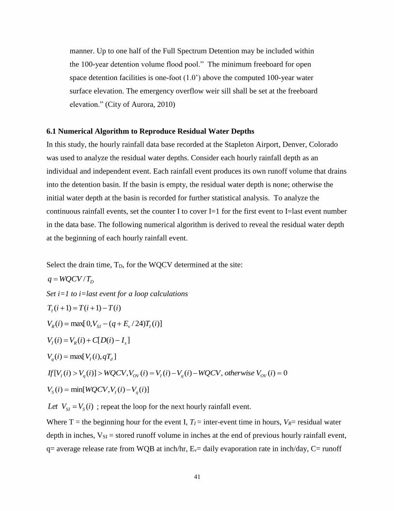
41
manner. Up to one half of the Full Spectrum Detention may be included within
the 100-year detention volume flood pool.” The minimum freeboard for open
space detention facilities is one-foot (1.0’) above the computed 100-year water
surface elevation. The emergency overflow weir sill shall be set at the freeboard
elevation.” (City of Aurora, 2010)
6.1 Numerical Algorithm to Reproduce Residual Water Depths
In this study, the hourly rainfall data base recorded at the Stapleton Airport, Denver, Colorado
was used to analyze the residual water depths. Consider each hourly rainfall depth as an
individual and independent event. Each rainfall event produces its own runoff volume that drains
into the detention basin. If the basin is empty, the residual water depth is none; otherwise the
initial water depth at the basin is recorded for further statistical analysis. To analyze the
continuous rainfall events, set the counter I to cover I=1 for the first event to I=last event number
in the data base. The following numerical algorithm is derived to reveal the residual water depth
at the beginning of each hourly rainfall event.
Select the drain time, TD, for the WQCV determined at the site:
DTWQCVq /
Set i=1 to i=last event for a loop calculations
)()1()1( iTiTiTI
)]()24/(,0max[)( iTEqViV IvSIR
])([)()( sRI IiDCiViV
]),(max[)( dIq qTiViV
0)(,)()()(,)]()([ iVotherwiseWQCViViViVWQCViViVIf OVqIOVqI
)]()(,min[)( iViVWQCViV qIS
)(iVVLet SSI ; repeat the loop for the next hourly rainfall event.
Where T = the beginning hour for the event I, TI = inter-event time in hours, VR= residual water
depth in inches, VSI = stored runoff volume in inches at the end of previous hourly rainfall event,
q= average release rate from WQB at inch/hr, Ev= daily evaporation rate in inch/day, C= runoff

42
coefficient for the tributary catchment, D= hourly rainfall depth in inches, Is = initial loss for
each hourly event ranging from 0.05 to 0.1 inch, Td= duration for each event or one hour in this
study, Vq= volume in inches flowing through the basin during the hourly event, VOV=
overtopping volume in inches, and VS= stored runoff volume in inch at the end of hourly rainfall
event. As soon as it rained, the initial water depth is recorded as the residual water depth
associated with the rainfall event. The total incoming loading to the basin is the rain-runoff
volume from the current event plus the residual volume from the previous event. The total runoff
volume is then released at the average rate, q, for one hour. The remaining volume in the basin is
continuously accumulated to the next hourly rainfall-runoff depth. During the inter-event time,
the last hourly rainfall-runoff volume in the basin is continuously released to become empty or
mixed with the incoming rainfall event if the inter-event time is too short. This algorithm is
repeated through a long-term hourly rainfall record to construct the population of residual water
depth at a given basin site.
6.2 CASE STUDIES
From August 1949 through December 1979, the hourly rainfall depths were recorded at the
Stapleton Airport, Denver, Colorado. This continuous rainfall record of 30 years long was
employed to reproduce the distribution of residual water depths at a WQB with a drain time of
40 hours and an imperviousness of 75% in the tributary area. Table 6.1 is the summary of the
input parameters for this case study. The data base covers a total of 258,888 hours in which there
were 10,835 rainy hours. Set I= 1 to I=10,835 or a total of 10,835 independent hourly events
were analyzed. From 1948 through 1978, the inter-event time varied from 1 to 1179 hours with
an average of 23 hours. The longest continuous rainy period lasted 66 hours in the year of 1965.
Table 6.1 Input Parameters for Analyses of Residual Water Depth
Watershed imperviousness 75.00 % Total hours in Data Base 258888 hours
Runoff Coefficient 0.54 Total rainy hours 10835 hours
Initial loss 0.00 inch Average Release Rate 0.007 inch/hr
Watershed WQCV 0.289 inches Average Interevent 23 hours
Event Separation Time 6.00 hours Average Residual Vol 0.052 inch
Pond Drain Time 40.00 hours Max Residual Vol 0.282 inch

43
Figure 6.1 presents the distribution of residual water depths normalized by the basin depth. For
the case with imperviousness of 75% and drain time of 40 hours, the WQB in Denver would
have a 5% chance of being full when needed for the next storm due to continuous accumulation
of rainfall-runoff volumes into the basin. Similarly, there is a 15% chance of a WQB being half
full for the next hourly rainfall event.
Figure 6.1 Normalized Residual Water Depth for WQCV with Imp=75% Drain Time=40 hr
Figure 6.2 presents the study on the distribution of normalized residual water depths for EURV
basins. For the case with imperviousness of 75% and drain time of 72 hours, a EURV basin in
Denver would have a chance of 0.1% to become 90% full due to continuous accumulation of
rainfall-runoff volumes in the basin. Similarly, a chance of 1% is expected to have a EURV basin
being half full before the next hourly rainfall event.

44
Figure 6.2 Normalized Residual Water Depths for EURV with Imp=75% Drain Time=72 hr
6.3 FIELD INVESTIGATION
The Urban Drainage and Flood Control District (UDFCD) installed pressure gages at EDB 502L
to record the water depths during the summer in 2015. From the UDFCD’s ALERT system, the
rainfall record was retrieved from the Westwood Rain Gage Station to match with the runoff
depths recorded at the site. The observed rainfall distribution was coded into EPASWMM to
produce corresponding runoff hydrographs from all sub-catchments. The link-node system
developed for the entire watershed as a tributary area to EDB 502L is illustrated in Figure 6.3.
There are 4 outfall pipes from the site to Bear Creek. Each outfall pipe is analyzed with culvert
hydraulics to establish the stage-outflow curve. EDB 502L is equipped with a perforated plate as
shown in Figure 6.4. The stage-outflow curve derived for EDB 502L is plotted in Figure 6.5.
This curve consists of three (3) segments, including no flow release from the micropool, orifice
flow from the as-built perforated plate, and weir flow overtopping the wall into the 10-ft by 7-ft
culvert.

45
Figure 6.3 Link-Node Model for EDB 502L Test Site.
Figure 6.4 As built Perforated Plate at EDB 502L.

46
Figure 6.5 Stage-Outflow Curve Developed for EDB 502L
Figure 6.6 presents the predicted water depths at EDB502L during the continuous storm events
from 7/6/2015 8:00 to 7/9/2015 20:00 using EPA SWMM5. In general, predicted water depths in
the basin follow the same pattern as the observed rainfall distribution. However, between events,
the numerical predictions tend to give higher residual water depths. This fact may be due to
inadequate representations of field evaporation rates which should vary with respect to daily
temperature, namely higher rates during the day time and lower rates during the night time. A
single daily evaporation rate in EPA SWMM5 is insufficient to represent the field evaporation
loss.

47
Figure 6.6 Continuous Rainfall-Runoff Simulations at EDB 502L Test Site.
Next, a long-term continuous simulation is conducted to reproduce the residual water depths at
EDB 502L from 1948 through 1978. A daily evaporation rate of 0.25 inch/day was applied to the
water surface at EDB 502L. The operation of the detention basin in the model is prescribed by
the user-defined storage-outflow curve. Again, on an hourly basis, the array of continuous hourly
runoff depths was produced from EPASWMM5 and plotted in Figure 6.7. From 1948 to 1978,
the chance for EDB 502L to become 90% full is approximately 3% while the chance for being
half full is 20%.
0.0
0.5
1.0
1.5
2.0
2.5
3.0
0 1,000 2,000 3,000 4,000 5,000
Res
idu
al W
ater
Dep
th in
fee
t
Elapsed Hours
EDB 502L at S Knox and SH 285 -- 7/6 8:00 to 7/9 20:00 2015
Observed Computed

48
Figure 6.7 Normalized Residual Water Depths for EURV at EDB 502L
Both Figures 6.6 and 6.7 define the exceeding probability for various magnitudes of residual
water depths. They offer a risk-based approach to define the required freeboard.
7. CONCLUSION
1. A new procedure was developed to design a sediment forebay at the entrance of a
stormwater detention basin. It was found that the geometry of the forebay depends on the
size of the target particle for settlement in the forebay. The fall velocity of the target
particle and the horizontal inflow velocity provide the basis to size the length and depth
of the forebay pool. The required pre-knowledge is the on-site sediment gradation curve.
In this study, samples were collected at locations upstream and downstream of the
forebay in EDB 502L. From the gradation curve derived from the soil laboratory, the
target particle is recommended to have a diameter of 0.1 to 0.2 mm. It is expected that a
forebay will intercept 60 to 70% of sediment load in stormwater.
2. A micropool is designed to provide a continuous suction flow to drain the remaining
water in the detention basin after the outlet screen become clogged. In this study, dry
samples of float deposits were collected from the screens in detention basins, and they
were analyzed in the soil laboratory to construct the gradation curves. It was found that

49
D90=0.3 mm and the saturated specific gravity is 0.8 to 0.9. The new concept of float
velocity was derived in this study. Using the float velocity as the basis, the micropool
surface area and flow depth can be determined. As recommended in this study, the flow
depth in micropool shall include evaporation loss through the period of inter event time,
dead storage for solids, and suction head to sustain the flow. The screens covering
WQCV outlet plates have long been a maintenance issues due to clogging and UDFCD
now recommends only three or four orifices to maximize the orifice size and minimize
clogging of the orifice plate.
3. In this study, a residual water depth in a detention basin is defined as the remaining water
depth from the previous hourly event. The fluctuation of residual water depths depends
on the storage volume, WQCV or EURV, and their drain times. In this study, a total of
10835 hourly rain events were identified from a total of 258,888 hours from 1949
through 1979. Considering that we had 10835 independent rainfall events over 30 years,
the average chance of having a rainfall event per day is 4% in the Metro Denver area.
From 1948 through 1978, the inter-event time varied from 1 to 1179 hours with an
average of 23 hours. The longest continuous rainy period lasted 66 hours in the year of
1965.
Sample tests on residual water depth were conducted for WQCV with a 40-hr drain time
and EURV with a 72-hr drain time for a watershed with imperviousness of 75%. The
chances for various residual water conditions is summarized in Table 7.1
Table 7.1 Exceeding Probability of Residual Water Conditions in Metro Denver Area
Residual Water in Basin
WQCV Basin EURV Basin
100% full 5% 0.01%
75% full 10% 0.2%
50% full 15% 1%
25% full 20% 2%
Obviously, in operation, a EURV basin has much less risk to become full than a WQCV
basin because EURV >WQCV at any site. Table 7.1 was produced by the continuous
rainfall-runoff flows through a basin for a period of 30 years. A WQB is expected to have

50
a chance of 5% to become full when needed for the next storm in a year or once every 20
years. Table 7.1 provides a risk-based approach to design the freeboard for a basin.
References
Adams County. (2011). "Chapter 9 - Storm Drainage Design and Stormwater Quality Regulations". Adams County,
Colorado
ASCE Manual of Practice No. 87 and WEF Manual of Practice No. 23, (1998). “Urban Runoff Quality
Management”, American Society of Civil Engineers, New York.
City and County of Denver. (2006). "City and Count of Denver Storm Drainage Design & Technical Criteria".
Denver, Colorado.
City of Aurora. (2010). "City of Aurora Storm Drainage Design and Technical Criteria". Aurora, Colorado.
CWA (1977). Clean Water Act, http://www.epa.gov/owow_keep/NPS/cwact.html
Driscoll, E.D., Palhegyi, G.E., Strecker, E.W. and Shelley, P.E. (1989). Analysis of Storm Events Characteristics
for Selected Rainfall Gauges Throughout the United States. U.S. Environmental Protection Agency, Washington,
D.C.
EPA Report (1983). Results of the Nationwide Urban Runoff Program, Final Report, U.S. Environmental Protection
Agency, NTIS No. PB84-185545, Washington, DC, 1983.
EPA Report (1986). Methodology for Analysis of Detention Basins for Control of Urban Runoff Quality, U.S
Environmental Protection Agency, EPA440/5-87-001, September.
EPA SWMM (2011), Stormwater Management Model supported by EPA. http://www.epa.gov/nrmrl/wswrd/wq/models/swmm/
Guo, James C.Y. and Mackenzie, K (2014). “Modeling Consistency for small to large watershed studies”, ASCE J.
of Hydrologic Engineering, V 19, N8, Aug , 04014009-1 to -7.
Guo, James C. Y. Urbonas, B. and MacKenzie K. (2014) “Water Quality Capture Volume for LID and BMP
Designs”, ASCE J of Hydrologic Engineering, Vol 19, No 4, April, 682-686
Guo, James C.Y. and Urbonas B. (2014) “ Volume-based Runoff Coefficient”, ASCE Journal of Irrigation and
Drainage Engineering, V 140, N 2, Feb, 04013013-1 to -5.
Guo, James C.Y. (2013). “Green Concept in Stormwater Management”, Journal of Irrigation and Drainage Systems
Engineering, Vol 2, Issue 3, ISBM 2168-9768.
Guo, James C.Y. (2012). “Off-stream Detention Design for Stormwater Management”, ASCE Journal of Irrigation
and Drainage Engineering, Vol. 138, No. 4, April 1.
Guo, James C. Y. Shih, H. M. and MacKenzie K. (2012) “Stormwater Quality Control LID Basin with Micropool”,
ASCE Journal of Irrigation and Drainage Engineering, Vol. 138, No. 5, May 1.
Guo, James, C.Y., Urbonas, B., and K. MacKenzie (2011). “The Case for a Water Quality Capture Volume for
Stormwater BMP”, J. of Stormwater, Oct.

51
Guo, James C.Y. (2010)“Preservation of Watershed Regime for Low Impact Development using (LID) Detention”,
ASCE J. of Engineering Hydrology, Vol 15, No 1., January.
Guo, James C.Y.(2009) “Retrofitting Detention Basin for LID Design with a Water Quality Control Pool”, ASCE J.
of Irrigation and Drainage Engineering, Vol 135, No 6, October.
Guo, James C.Y. and Urbonas, B. (2009) “Conversion of Natural Watershed to Kinematic Wave Cascading Plane”,
ASCE J. of Hydrologic Engineering, Vol 14, No. 8, August.
Guo, James C.Y. and Cheng, J. Y.C.(2008) “Retrofit Stormwater Retention Volume for Low Impact Development
(LID)”, ASCE J. of Irrigation and Drainage Engineering, Vol 134, No 6, December.
Guo, James C.Y. (2004). “Hydrology-Based Approach to Storm Water Detention Design Using New Routing
Schemes,” ASCE J. of Hydrologic Engineering, Vol 9, No. 4, July/August
Guo, James C.Y. (2002). “Overflow Risk of Storm Water BMP Basin Design,” ASCE J. of Hydrologic Engineering,
Vol 7, No. 6, Nov.
Guo, James C.Y. and Urbonas, Ben. (2002). “Runoff Capture and Delivery Curves for Storm Water Quality Control
Designs,” ASCE J. of Water Resources Planning and Management, Vol 128, Vo. 3, May/June.
Guo, James C.Y. (1999). "Detention Basin Sizing for Small Urban Catchments," ASCE J. of Water Resources
Planning and Management, Vol 125, No.6, Nov.
Guo, James C.Y. and Urbonas, Ben (1996). "Maximized Detention Volume Determined by Runoff Capture Rate,”
ASCE J. of Water Resources Planning and Management, Vol 122, No 1, Jan.
Harris Kocher Smith (2011). “Final Drainage Report US Highway 285 Reconstruction CDOT Project No. BR 2854-
113 Area 4 – Knox/Lowell Intersection”, published by Urban Drainage and Flood Control District, Denver,
Colorado. http://www.udfcd.org
MacKenzie, K. A. (2010). “Full-Spectrum Detention for Stormwater Quality Improvement and Mitigation of the
Hydrologic Impact of Development: A Regionally Calibrated Empirical Design Approach”, Master Degree Study
Report, Civil Engineering, U of Colorado Denver, Colorado
MacKenzie, K.A. (2015), “Revision on UDFCD EURV Determination Memorandum”, http://udfcd.org/wp-
content/uploads/uploads/resources/technical%20memos/UDFCD_EURV_Determination_Memorandum.pdf
Medi, Saman (2012). “Design Verification of Micropool at EDB502L”, Master-Degree Study, Civil Engineering, U
of Colorado Denver, Colorado.
Simon, D. and Senturk, F. (1990). “Sediment Transport Technology”, Water Resources Publication,
WWW.Amazon.Com.
UDFCD (1995). ”Improvements to Knox Court and Irving Outfall”, As-Built, published by Urban Drainage and
Flood Control District, Denver, Colorado. http://www.udfcd.org
UDFCD (1996). ”Floyd Ave and Knox Court Storm Sewer”, As-Built, published by Urban Drainage and Flood
Control District, Denver, Colorado. http://www.udfcd.org
UDFCD (2001). ”Urban Stormwater Design Drainage Manuals”, Vol 1 and 2, published by Urban Drainage and
Flood Control District, Denver, Colorado. http://www.udfcd.org
UDFCD (2011). ”Urban Stormwater Design Drainage Manuals”, Vol 3, published by Urban Drainage and Flood
Control District, Denver, Colorado. http://www.udfcd.org

52
Urbonas, B., Guo, J. C., & MacKenzie, K. (2001). "Description of the WQ-COSM Computer Model to Generate a
Water Quality Capture Volume for Stormwater BMPs". Denver.