den of pitfodels, north garthdee farm, garthdee road
TRANSCRIPT

Den of Pitfodels, North Garthdee Farm, Garthdee Road, Aberdeen AB10 7EN
Report on an archaeological evaluation and standing building survey
Cameron Archaeology 18 January 2013
Den of Pitfodels, North Garthdee Farm, Garthdee Road, Aberdeen AB10 7EN (CA117-2012) 2 Cameron Archaeology Ltd
CONTENTS
1 INTRODUCTION ........................................................................................................ 3
2 ARCHAEOLOGICAL BACKGROUND ........................................................................ 4
3 STANDING BUILDING SURVEY................................................................................ 5
Building 1 ................................................................................................................... 5
Building 2 ................................................................................................................... 5
Building 3 ................................................................................................................... 6
Building 4 ................................................................................................................... 7
Building 5 ................................................................................................................... 8
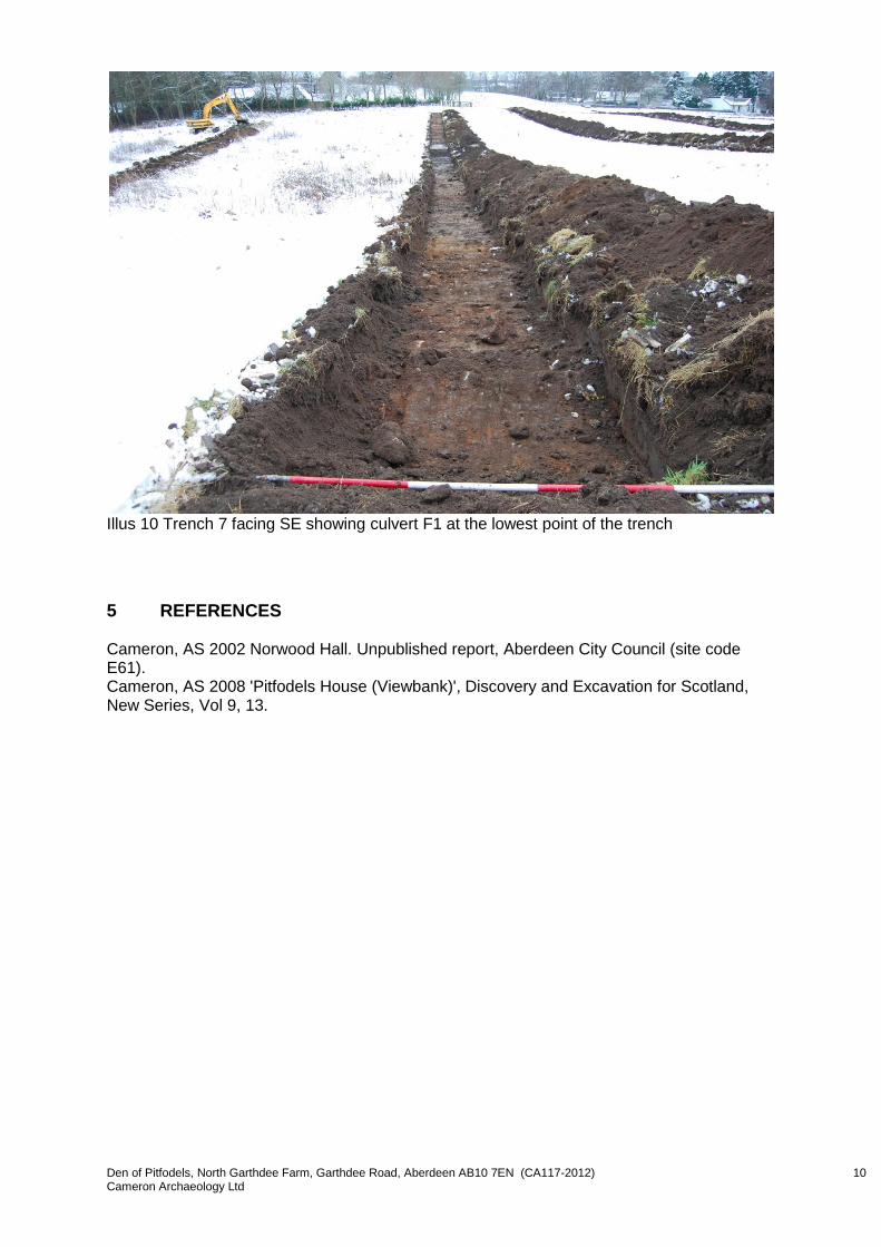
4 FIELD EVALUATION .................................................................................................. 9
5 REFERENCES ......................................................................................................... 10
APPENDIX 1 PHOTOGRAPHS .......................................................................................... 11
Standing Building Survey ......................................................................................... 11
Field Evaluation ....................................................................................................... 15
APPENDIX 2 MAPS ............................................................................................................ 17
ILLUSTRATIONS Cover Top Trenches 1 (left) to 5 (right); Bottom Building 4 (left) and Building 2 (centre) with cobbled courtyard (foreground) Illus 1 Location plan of site ................................................................................................ 3 Illus 2 Aerial photograph with the current site outlined in red ............................................. 4 Illus 3 Plan of standing buildings ........................................................................................ 5 Illus 4 Building 1 the farmhouse; facing NE ........................................................................ 6 Illus 5 Building 2; facing SW .............................................................................................. 6 Illus 6 Building 4; facing NNE............................................................................................. 7 Illus 7 Building 4 facing NE showing original chimney breast and fireplace (centre) ........... 8 Illus 8 Building 5 NE wall remains; interior face of wall; facing NW .................................... 8 Illus 9 Plan showing evaluation trenches ........................................................................... 9 Illus 10 Trench 7 facing SE showing culvert F1 at the lowest point of the trench ............... 10 Illus 11 Plan showing camera points used in the standing building survey ......................... 14 Illus 12 First Edition Ordnance Survey extract with site in red ............................................ 17 Illus 13 Second Edition Ordnance Survey extract with site in red ....................................... 17 Illus 14 Third Edition Ordnance Survey extract with site in red........................................... 18 Summary A 7% archaeological evaluation and a Level 2 Standing Building Survey were carried out at the former North Garthdee Farm. No significant archaeological remains were uncovered during the evaluation and it is recommended that no further archaeological work is required during this current development.

Den of Pitfodels, North Garthdee Farm, Garthdee Road, Aberdeen AB10 7EN (CA117-2012) 3 Cameron Archaeology Ltd
1 INTRODUCTION The site is located on the north side of Garthdee Road Aberdeen and includes Garthdee Farm and the lands to the west of the farm and east of the adjacent allotments; the former Deeside Railway line runs along the north edge of this site. The site is at AB10 7EN, NJ 91051 03344, at 30-36m OD and in the parish of Aberdeen (Illus 1). BDW East Scotland Ltd has current planning applications P120390 for the proposed demolition of existing buildings and P120394 for demolition of existing buildings and erection of 60 dwellings (Illus 2) and both are both pending with Aberdeen City Council. There is a requirement for a Level 2 standing building survey and a 7-10% archaeological evaluation prior to construction; the standing building survey took place on 7-17th January and the evaluation on 16-17th January 2013.
Illus 1 Location plan of site (Contains Ordnance Survey data © Crown copyright and database right 2012)
Den of Pitfodels, North Garthdee Farm, Garthdee Road, Aberdeen AB10 7EN (CA117-2012) 4 Cameron Archaeology Ltd
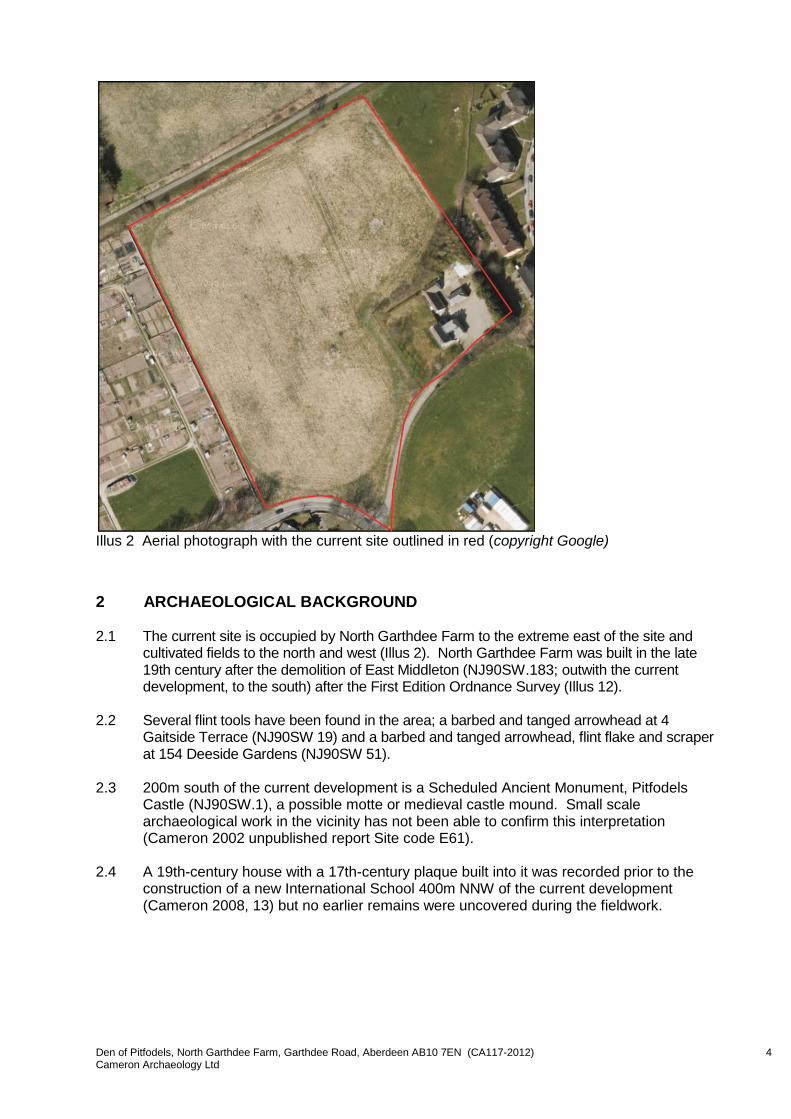
Illus 2 Aerial photograph with the current site outlined in red (copyright Google)
2 ARCHAEOLOGICAL BACKGROUND 2.1 The current site is occupied by North Garthdee Farm to the extreme east of the site and
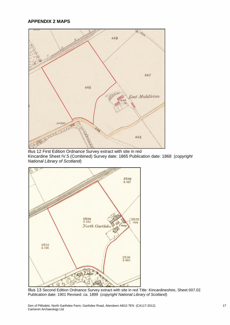
cultivated fields to the north and west (Illus 2). North Garthdee Farm was built in the late 19th century after the demolition of East Middleton (NJ90SW.183; outwith the current development, to the south) after the First Edition Ordnance Survey (Illus 12).
2.2 Several flint tools have been found in the area; a barbed and tanged arrowhead at 4
Gaitside Terrace (NJ90SW 19) and a barbed and tanged arrowhead, flint flake and scraper at 154 Deeside Gardens (NJ90SW 51).
2.3 200m south of the current development is a Scheduled Ancient Monument, Pitfodels
Castle (NJ90SW.1), a possible motte or medieval castle mound. Small scale archaeological work in the vicinity has not been able to confirm this interpretation (Cameron 2002 unpublished report Site code E61).
2.4 A 19th-century house with a 17th-century plaque built into it was recorded prior to the
construction of a new International School 400m NNW of the current development (Cameron 2008, 13) but no earlier remains were uncovered during the fieldwork.

Den of Pitfodels, North Garthdee Farm, Garthdee Road, Aberdeen AB10 7EN (CA117-2012) 5 Cameron Archaeology Ltd
3 STANDING BUILDING SURVEY A standing building survey was carried out on 7-17 January 2013. There are the remains of five buildings which were constructed between the 1865 (First Edition OS; Illus 12) and 1901 (Second Edition OS; Illus 13). The current owner, Mr Gordon McWilliam, dates the construction to the 1860s and has title deeds indicating that this was Plot 3 sold by Banchory Devenick Estate in 1863; these documents were not available for viewing at the time of this work. Mr McWilliam knows of a fire which extensively damaged the property, particularly Building 5, in the 1960s after which much was rebuilt, Buildings 2 and 3 separated by a courtyard and concrete floors laid throughout. The cassies were laid west of Building 4 at that time. The land itself has not been worked since the 1980s (G McWilliam pers com).
Illus 3 Plan of standing buildings
Building 1
Building 1 is the farmhouse (Illus 3, 4). It is double fronted and two and a half storeys and fronts on to the SW facing Garthdee Road and Inchgarth. It is constructed of large, mostly grey, granite blocks and is 11.90m long and 5.80m wide. It has a modern extension on the NE side but this appears to have replaced an older extension which can be seen on the OS maps.
Building 2
Building 2 is an L-shaped building at the west side of the farm courtyard. It is 5.6m wide and 14.9m long along the longest axis. It originally linked to Building 3 with the remains of Building 5. It is constructed of pink and grey granite blocks with heavily pointed cherry
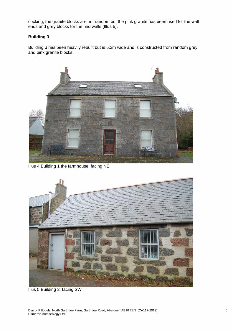
Den of Pitfodels, North Garthdee Farm, Garthdee Road, Aberdeen AB10 7EN (CA117-2012) 6 Cameron Archaeology Ltd
cocking; the granite blocks are not random but the pink granite has been used for the wall ends and grey blocks for the mid walls (Illus 5).
Building 3
Building 3 has been heavily rebuilt but is 5.3m wide and is constructed from random grey and pink granite blocks.
Illus 4 Building 1 the farmhouse; facing NE
Illus 5 Building 2; facing SW
Den of Pitfodels, North Garthdee Farm, Garthdee Road, Aberdeen AB10 7EN (CA117-2012) 7 Cameron Archaeology Ltd
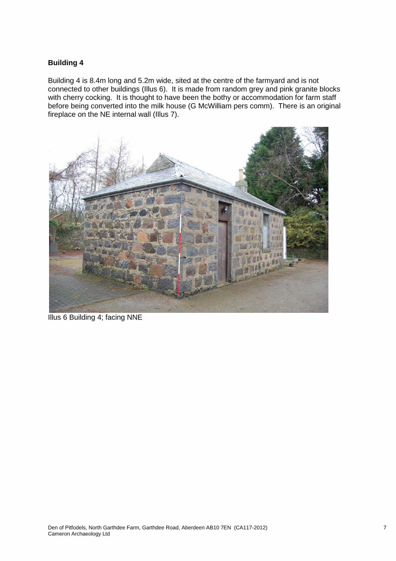
Building 4
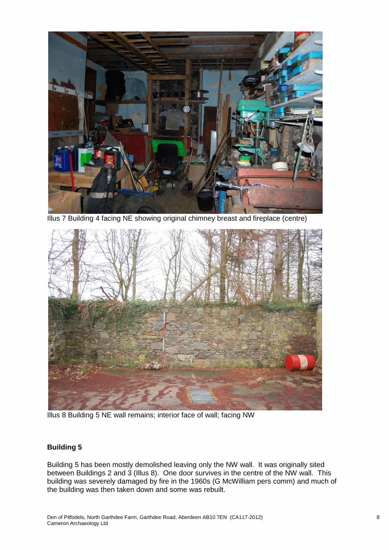
Building 4 is 8.4m long and 5.2m wide, sited at the centre of the farmyard and is not connected to other buildings (Illus 6). It is made from random grey and pink granite blocks with cherry cocking. It is thought to have been the bothy or accommodation for farm staff before being converted into the milk house (G McWilliam pers comm). There is an original fireplace on the NE internal wall (Illus 7).
Illus 6 Building 4; facing NNE
Den of Pitfodels, North Garthdee Farm, Garthdee Road, Aberdeen AB10 7EN (CA117-2012) 8 Cameron Archaeology Ltd
Illus 7 Building 4 facing NE showing original chimney breast and fireplace (centre)
Illus 8 Building 5 NE wall remains; interior face of wall; facing NW
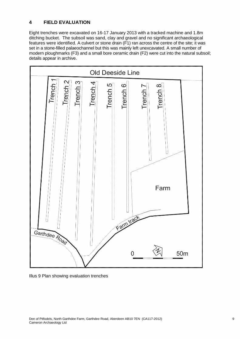
Building 5
Building 5 has been mostly demolished leaving only the NW wall. It was originally sited between Buildings 2 and 3 (Illus 8). One door survives in the centre of the NW wall. This building was severely damaged by fire in the 1960s (G McWilliam pers comm) and much of the building was then taken down and some was rebuilt.
Den of Pitfodels, North Garthdee Farm, Garthdee Road, Aberdeen AB10 7EN (CA117-2012) 9 Cameron Archaeology Ltd
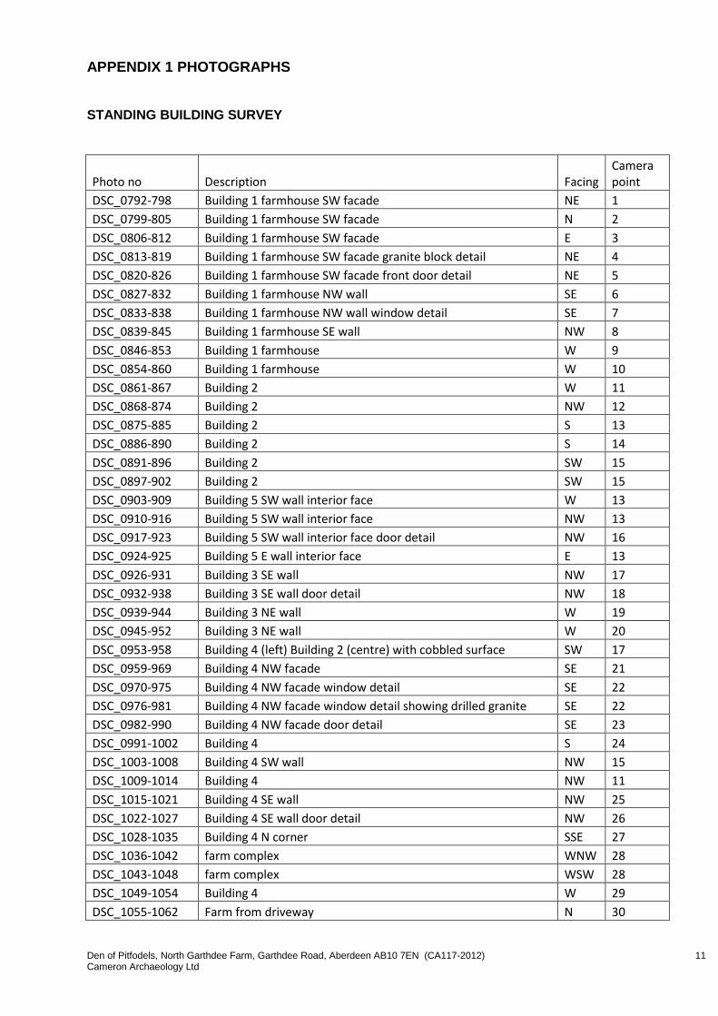
4 FIELD EVALUATION Eight trenches were excavated on 16-17 January 2013 with a tracked machine and 1.8m ditching bucket. The subsoil was sand, clay and gravel and no significant archaeological features were identified. A culvert or stone drain (F1) ran across the centre of the site; it was set in a stone-filled palaeochannel but this was mainly left unexcavated. A small number of modern ploughmarks (F3) and a small bore ceramic drain (F2) were cut into the natural subsoil; details appear in archive.
Illus 9 Plan showing evaluation trenches
Den of Pitfodels, North Garthdee Farm, Garthdee Road, Aberdeen AB10 7EN (CA117-2012) 10 Cameron Archaeology Ltd
Illus 10 Trench 7 facing SE showing culvert F1 at the lowest point of the trench
5 REFERENCES Cameron, AS 2002 Norwood Hall. Unpublished report, Aberdeen City Council (site code E61). Cameron, AS 2008 'Pitfodels House (Viewbank)', Discovery and Excavation for Scotland, New Series, Vol 9, 13.
Den of Pitfodels, North Garthdee Farm, Garthdee Road, Aberdeen AB10 7EN (CA117-2012) 11 Cameron Archaeology Ltd
APPENDIX 1 PHOTOGRAPHS
STANDING BUILDING SURVEY
Photo no Description Facing Camera point
DSC_0792-798 Building 1 farmhouse SW facade NE 1
DSC_0799-805 Building 1 farmhouse SW facade N 2
DSC_0806-812 Building 1 farmhouse SW facade E 3
DSC_0813-819 Building 1 farmhouse SW facade granite block detail NE 4
DSC_0820-826 Building 1 farmhouse SW facade front door detail NE 5
DSC_0827-832 Building 1 farmhouse NW wall SE 6
DSC_0833-838 Building 1 farmhouse NW wall window detail SE 7
DSC_0839-845 Building 1 farmhouse SE wall NW 8
DSC_0846-853 Building 1 farmhouse W 9
DSC_0854-860 Building 1 farmhouse W 10
DSC_0861-867 Building 2 W 11
DSC_0868-874 Building 2 NW 12
DSC_0875-885 Building 2 S 13
DSC_0886-890 Building 2 S 14
DSC_0891-896 Building 2 SW 15
DSC_0897-902 Building 2 SW 15
DSC_0903-909 Building 5 SW wall interior face W 13
DSC_0910-916 Building 5 SW wall interior face NW 13
DSC_0917-923 Building 5 SW wall interior face door detail NW 16
DSC_0924-925 Building 5 E wall interior face E 13
DSC_0926-931 Building 3 SE wall NW 17
DSC_0932-938 Building 3 SE wall door detail NW 18
DSC_0939-944 Building 3 NE wall W 19
DSC_0945-952 Building 3 NE wall W 20
DSC_0953-958 Building 4 (left) Building 2 (centre) with cobbled surface SW 17
DSC_0959-969 Building 4 NW facade SE 21
DSC_0970-975 Building 4 NW facade window detail SE 22
DSC_0976-981 Building 4 NW facade window detail showing drilled granite SE 22
DSC_0982-990 Building 4 NW facade door detail SE 23
DSC_0991-1002 Building 4 S 24
DSC_1003-1008 Building 4 SW wall NW 15
DSC_1009-1014 Building 4 NW 11
DSC_1015-1021 Building 4 SE wall NW 25
DSC_1022-1027 Building 4 SE wall door detail NW 26
DSC_1028-1035 Building 4 N corner SSE 27
DSC_1036-1042 farm complex WNW 28
DSC_1043-1048 farm complex WSW 28
DSC_1049-1054 Building 4 W 29
DSC_1055-1062 Farm from driveway N 30

Den of Pitfodels, North Garthdee Farm, Garthdee Road, Aberdeen AB10 7EN (CA117-2012) 12 Cameron Archaeology Ltd
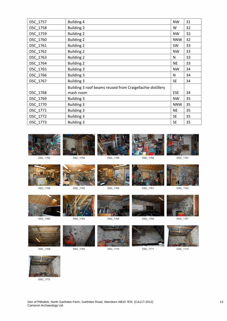
DSC_1753 Building 4 NE 31
DSC_1754 Building 4 NNE 31
DSC_1755 Building 4 W 31
DSC_1756 Building 4 NW 31
Den of Pitfodels, North Garthdee Farm, Garthdee Road, Aberdeen AB10 7EN (CA117-2012) 13 Cameron Archaeology Ltd
DSC_1757 Building 4 NW 31
DSC_1758 Building 2 W 32
DSC_1759 Building 2 NW 32
DSC_1760 Building 2 NNW 32
DSC_1761 Building 2 SW 33
DSC_1762 Building 2 NW 33
DSC_1763 Building 2 N 33
DSC_1764 Building 2 NE 33
DSC_1765 Building 3 NW 34
DSC_1766 Building 3 N 34
DSC_1767 Building 3 SE 34
DSC_1768 Building 3 roof beams reused from Craigellachie distillery mash room ESE 34
DSC_1769 Building 3 NW 35
DSC_1770 Building 3 NNW 35
DSC_1771 Building 3 NE 35
DSC_1772 Building 3 SE 35
DSC_1773 Building 3 SE 35

Den of Pitfodels, North Garthdee Farm, Garthdee Road, Aberdeen AB10 7EN (CA117-2012) 14 Cameron Archaeology Ltd
Illus 11 Plan showing camera points used in the standing building survey

Den of Pitfodels, North Garthdee Farm, Garthdee Road, Aberdeen AB10 7EN (CA117-2012) 15 Cameron Archaeology Ltd
FIELD EVALUATION
Den of Pitfodels, North Garthdee Farm, Garthdee Road, Aberdeen AB10 7EN (CA117-2012) 16 Cameron Archaeology Ltd
Evaluation
DSC_1478-1487 Tr 1-3 NW
DSC_1488-1501 Tr 4 NW
DSC_1502-1513 Tr 3 NW
DSC_1514-1525 Tr 2 NW
DSC_1526-1532 Tr 1 NW
DSC_1533-1538 Tr 1 ceramic pipe F2 SW
DSC_1539-1544 Tr 1 NW half NW
DSC_1545-1550 Tr 1 NW half NW
DSC_1551-1556 Tr 1 SE
DSC_1557-1562 Tr 1 SE
DSC_1563-1568 Tr 2, 3, 4 from NW end Tr 1 E
DSC_1569-1582 Tr 2 SE
DSC_1583-1590 Tr 3 SE
DSC_1591-1597 Tr 4 SE
DSC_1598-1611 Tr 4, 3, 2, 1 SW, SSW
DSC_1619-1624 Tr 5 NW
DSC_1625-1630 Tr 6 NW
DSC_1631-1637 Tr 7 NW
DSC_1638-1649 Tr 8 NW
DSC_1650-1662 TR 8 F1 NW
DSC_1663-1668 Tr 8 SE
DSC_1669-1674 Tr 8, 7, 6, 5 S
DSC_1675-1688 Tr 7 SE
DSC_1689-1699 Tr 6 SE
DSC_1700-1710 Tr 5 SE
DSC_1711-1716 Tr 5, 6, 7, 8 E
DSC_1717-1722 Tr 5, 6, 7, 8 NE
DSC_1723-1730 Tr 5 F1 SE
DSC_1731-1735 Tr 5 centre from mound east of site NW
DSC_1736-1740 Tr 1 (left), 2, 3, 4 from mound east of site WSW
DSC_1741-1746 Tr 6 (centre), 5, 4 (to left) from mound east of site NW
DSC_1747-1752 Tr 5, 6, and farmhouse from mound east of site NNW
Den of Pitfodels, North Garthdee Farm, Garthdee Road, Aberdeen AB10 7EN (CA117-2012) 17 Cameron Archaeology Ltd
APPENDIX 2 MAPS
Illus 12 First Edition Ordnance Survey extract with site in red Kincardine Sheet IV.5 (Combined) Survey date: 1865 Publication date: 1868 (copyright National Library of Scotland)
Illus 13 Second Edition Ordnance Survey extract with site in red Title: Kincardineshire, Sheet 007.02 Publication date: 1901 Revised: ca. 1899 (copyright National Library of Scotland)

Den of Pitfodels, North Garthdee Farm, Garthdee Road, Aberdeen AB10 7EN (CA117-2012) 18 Cameron Archaeology Ltd
Illus 14 Third Edition Ordnance Survey extract with site in red Aberdeenshire, Sheet 086.02 Publication date: 1925 Revised: ca. 1923 Levelled: 1899 (copyright
National Library of Scotland)