coordination of geographic information and related spatial data
TRANSCRIPT
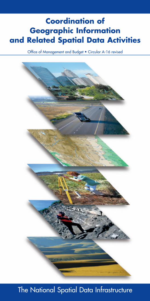
Coordination of Geographic Information
and Related Spatial Data Activities Office of Management and Budget • Circular A-16 revised
The National Spatial Data Infrastructure

This printing of OMB Circular A-16, revised August 19, 2002, was produced by the Federal Geographic Data Committee and is not an official copy of OMB Circular A-16. For an official copy, please go to the Office of Management and Budget website at:
http://www.whitehouse.gov/omb/circulars/a016/a016_rev.html

SUBJECT: Coordination of Geographic Informationand Related Spatial Data Activities
This Circular provides direction for federal agencies that produce, main-tain or use spatial data either directly or indirectly in the fulfillment oftheir mission. This Circular establishes a coordinated approach to electron-ically develop the National Spatial Data Infrastructure and establishes theFederal Geographic Data Committee (FGDC).
The Circular has been revised from the 1990 version to reflect changes in technology, further describe the components of the National SpatialData Infrastructure (NSDI), and assign agency roles and responsibilitiesfor development of the NSDI. The revised Circular names the DeputyDirector for Management of OMB as Vice-Chair of the FederalGeographic Data Committee.

TABLE OF CONTENTS
BACKGROUND 1. What is the purpose of this Circular? .................................................. 1
2. What is the National Spatial Data Infrastructure (NSDI)? .............. 1
a. What is the vision of the NSDI? .................................................... 1
b. What are the components of the NSDI? ........................................ 2
(1) What is a data theme?................................................................ 2
(2) What are metadata? .................................................................. 2
(3) What is the National Spatial Data Clearinghouse? ...................... 2
(4) What is a standard?.................................................................... 3
(5) How are NSDI standards developed? ...................................... 3
(6) What is the importance of collaborative partnerships? .............. 3
(7) What are the federal activities and technologies that support the NSDI? ............................................................ 3
3. What are the benefits of the NSDI? .................................................... 4
4. What is the Federal Geographic Data Committee (FGDC)?.............. 4
a. What is the FGDC structure and membership? ............................ 4
b. What are the FGDC procedures? .................................................... 5
POLICY 5. Does this Circular apply to my agency? .............................................. 5
6. What types of activities does this Circular apply to? .......................... 5
7. What types of activities are exempt from this Circular? .................... 6
AGENCY RESPONSIBILITIES AND REPORTING REQUIREMENTS 8. What are the federal responsibilities? .................................................. 6
a. What are the responsibilities and reporting requirements for federal agencies? .................................................. 6
b. How does my agency report on spatial data assets within the budget and performance review process? .................... 7
c. Who are the lead federal agencies for the NSDI data themes?...................................................................................... 8
d. What are the responsibilities of lead federal agencies for the NSDI data themes? ................................................ 8
e. What are the FGDC responsibilities? .............................................. 9
9. How are differences among agencies settled? .................................... 10
10. How can I check that my agency is compliant with the latest NSDI requirements and standards? .................................. 10
Appendix A. Authorities ............................................................................ 11
Appendix B Federal Geographic Data Committee (FGDC) Members ................................................................ 12
Appendix C. History and Background of Circular A-16 ........................ 12
Appendix D. Informative Definitions ...................................................... 13
Appendix E. National Spatial Data Infrastructure (NSDI) Data Themes, Definitions, and Lead Agencies .................. 15

BACKGROUND
1.What is the purpose of this Circular? This revised Circular provides for improvements in coordination and use of spatial data. Spatial data refers to information about places orgeography, and has traditionally been shown on maps. This Circulardescribes the effective and economical use and management of spatialdata assets in the digital environment for the benefit of the governmentand the nation. The Circular affirms and describes the National SpatialData Infrastructure (NSDI) as the technology, policies, standards, humanresources, and related activities necessary to acquire, process, distribute,use, maintain, and preserve spatial data. The Circular describes the man-agement and reporting requirements of Federal agencies in the acquisi-tion, maintenance, distribution, use, and preservation of spatial data by the Federal Government. The Circular establishes the FGDC as theinteragency coordinating body for NSDI-related activities, chaired by the Secretary of the Interior with the Deputy Director for Management,Office of Management and Budget (OMB) as Vice-Chair.
This revised Circular supersedes Circular No. A-l6 dated October 19,1990, and incorporates Executive Order 12906. It will remain in effectuntil replaced pursuant to section 8.e.(j) of this Circular. A basic list ofauthorities is included in Appendix A.
2.What is the National Spatial Data Infrastructure (NSDI)?
a. What is the vision for the NSDI?
The NSDI assures that spatial data from multiple sources (federal,state, local, and tribal governments, academia, and the private sector)are available and easily integrated to enhance the understanding ofour physical and cultural world. The NSDI honors several key public values:
• Privacy and security of citizens’ personal data and accuracy ofstatistical information on people, both in raw form and in derivedinformation products.
• Access for all citizens to spatial data, information, and interpretiveproducts, in accordance with OMB Circular A-130.
• Protection of proprietary interests related to licensed informationand data.
• Interoperability of federal information systems to enable the draw-ing of resources from multiple federal agencies and their partners.
The NSDI supports and advances the building of a Global SpatialData Infrastructure, consistent with national security, nationaldefense, national intelligence, and international trade requirements.International compatibility is an important aspect of the NSDI.Federal agencies will develop their international spatial data in
1
compliance with international voluntary consensus standards, as defined by Circular A-119.
b. What are the components of the NSDI?
The components of the NSDI are data themes, metadata, the NationalSpatial Data Clearinghouse, standards, and partnerships.
(1) What are data themes?
Data themes are electronic records and coordinates for a topic orsubject, such as elevation or vegetation. This Circular requires thedevelopment, maintenance, and dissemination of a standard coreset of digital spatial information for the Nation that will serve as a foundation for users of geographic information. This set ofdata consists of themes of national significance (see Appendix E).Themes providing the core, most commonly used set of base data are known as framework data, specifically geodetic control,orthoimagery, elevation and bathymetry, transportation, hydrog-raphy, cadastral, and governmental units. Other themes of nation-al significance are also an important part of the NSDI, and mustbe available to share with others. Additional data themes may beadded with the approval of the FGDC.
NSDI data themes developed with appropriate metadata,using FGDC standards and served through the Clearinghouse,facilitate interoperability and information exchange across administrative boundaries.
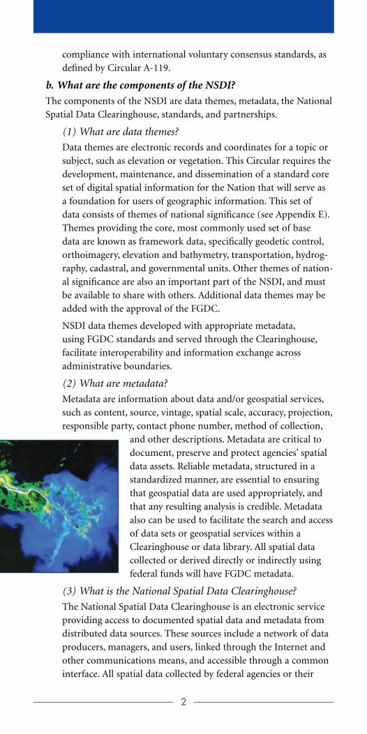
(2) What are metadata?
Metadata are information about data and/or geospatial services,such as content, source, vintage, spatial scale, accuracy, projection,responsible party, contact phone number, method of collection,
and other descriptions. Metadata are critical todocument, preserve and protect agencies’ spatialdata assets. Reliable metadata, structured in astandardized manner, are essential to ensuringthat geospatial data are used appropriately, andthat any resulting analysis is credible. Metadataalso can be used to facilitate the search and accessof data sets or geospatial services within aClearinghouse or data library. All spatial data collected or derived directly or indirectly usingfederal funds will have FGDC metadata.
(3) What is the National Spatial Data Clearinghouse?
The National Spatial Data Clearinghouse is an electronic serviceproviding access to documented spatial data and metadata fromdistributed data sources. These sources include a network of dataproducers, managers, and users, linked through the Internet andother communications means, and accessible through a commoninterface. All spatial data collected by federal agencies or their
2
agents, as described in section 5, will be made available throughthe Clearinghouse. Spatial data users will have access to the NSDIthrough the National Spatial Data Clearinghouse.
(4) What are standards?
Standards are common and repeated rules, conditions, guidelines orcharacteristics for data, and related processes, technology and orga-nization. To broaden the global use of federal data and services,international standards and protocols must be used. NSDI is madepossible by the universal use of standards and protocols for datadevelopment, documentation, exchange, and geospatial services.
(5) How are NSDI standards developed?
NSDI standards are developed and promulgated by the FGDC inaccordance with OMB Circular A-119 using an established processdetermined by the FGDC with input from a broad range of datausers and providers. Specifically, the FGDC adopts national andinternational standards in lieu of federal standards whenever pos-sible and will restrict its standards development activities to areasof spatial data standardization not covered by other voluntarystandards consensus bodies, as defined by OMB Circular A-119.Through active participation in voluntary consensus standardsbodies, the FGDC works to link its standardization activities tothe work of those standards bodies and thereby create an integrat-ed suite of standards for the NSDI. No federal funds will be useddirectly or indirectly for the development of spatial data not complying with NSDI standards, as specified by FGDC.
(6) What is the importance of collaborative partnerships?
Building an effective NSDI will require a well-coordinated effortamong federal, tribal, state, local government, and academic institutions, as well as a broad array of private sector geographic,statistical, demographic, and other business information providersand users. Involving these stakeholders in the development of theNSDI will aid in meeting the needs of end-users.
Federal agencies will promote and fully utilize partnerships thatpromote cost-effective data collection, documentation, mainte-nance, distribution, and preservation strategies, and that leveragefederal and other resources. New collaborative efforts and partnerships are encouraged.
(7) What are the federal activities and technology that supportthe NSDI?
Federal agencies and the FGDC carry out the activities required to implement their responsibilities as described in section 8 of thisCircular. Agencies will provide or develop the required technologyand services required to enable and provide access to NSDI dataand information. The OMB will work with affected budget officesto provide appropriate resources in support of these activities.
3

3.What are the benefits of the NSDI? Spatial data is a national capital asset. The NSDI facilitates efficient collection, sharing, and dissemination of spatial data among all levels of government institutions, as well as the public and private sectors, toaddress issues affecting the Nation’s physical, economic, and social well-being. A coordinated approach for developing spatial data standards thatapply to collecting, maintaining, distributing, using, and preservation ofdata will improve the quality of federal spatial data and reduce the cost ofderivative products created by federal and non-federal users. Applicationsusing spatial data that adhere to FGDC standards enable cost effective public and private policy development, management, and operations.
Implementation of this Circular is essential to help federal agencies eliminate duplication, avoid redundant expenditures, reduce resourcesspent on unfunded mandates, accelerate the development of electronicgovernment to meet the needs and expectations of citizens and agencyprogrammatic mandates, and improve the efficiency and effectiveness of public management.
Many applications are dependent upon accurate spatial data. The benefits of the NSDI for these applications include creating a moresecure Nation. Some examples include the analysis and management ofutility infrastructures, transportation, energy, emergency managementand response, natural resource management, weather and climate analysis, disaster recovery, homeland defense, law enforcement, protec-tion planning, public health and other civilian or military strategicissues. The seamless spatial information needed for these applicationscan range from highly detailed local data, such as the nature of specifichazardous material stored in a particular room of a single building, tothe various data needed for real-time projection of the probable effects of natural disasters.
4.What is the Federal Geographic Data Committee (FGDC)? The FGDC is an interagency committee responsible for facilitatingCircular A-l6 related activities and implementation of the NSDI.
a. What is the FGDC structure and membership?
The FGDC is chaired by the Secretary of the Department of theInterior, with the Deputy Director for Management, OMB, serving asVice-Chair. Chair and Vice-Chair may designate an individual to act in their stead. All agencies responsible for spatial data themes arerequired to be members of the FGDC. Departments or agencies thatare members of the FGDC as of the date of this revision will continueas members and are listed in Appendix B. Departments or agencies thatare not members of the FGDC and that have activities in geographicinformation or spatial data collection or use will become members byrequesting membership in writing to the Chair of the FGDC.
4
b. What are the FGDC procedures?
The FGDC will establish procedures and committee structures as arenecessary and sufficient to carry out interagency coordination and theimplementation of the NSDI, in accordance with existing law, statute,and policy. Departments may elect or be assigned the lead responsibil-ity for certain subcommittees, working groups or other committees,consistent with each Department’s or agency’s existing authority asdescribed in its mission (e.g., statutory authority or Public Law), orimplied as part of its program responsibilities. The current FGDCgoverning structure and bylaws are carried forward and remain inforce under this Circular, and may be modified according to existingprocedures. The Department of the Interior will provide administra-tive support to the FGDC.
POLICY
5.Does this Circular apply to my agency? This Circular applies to your agency if it collects, produces, acquires,maintains, distributes, uses, or preserves analog (e.g., paper maps) ordigital spatial data to fulfill your mission, either directly or through arelationship with other organizations. Such organizations include, butare not limited to, State and local governments, tribes, academia, federalgovernment business partners and contractors, and citizens.
6.What types of data activities does the Circular apply to? a. All spatial data and geographic information
systems activities — financed directly or indirectly,in whole or in part, by federal funds.
b. As examples, this Circular applies to, but is notlimited to: The National Mapping Program, theNational Spatial Reference System, the NationalGeologic Mapping Program, the National Wetlands Inventory,the National Cooperative Soil Survey Program, the National Public Land Survey System, Geographic Coordinate Database,the National Oceanic and Atmospheric Administration (NOAA)nautical charting and nautical data collection and information programs, the U.S. Army Corps of Engineers (USACE) inlandwaterway charting program, the Offshore Minerals Program, theNASA’s Earth Science Enterprise, FEMA’s Flood Plain Mapping program and other federal activities that involve national survey-ing, mapping, remote sensing, spatially referenced statistical data,and Global Positioning System (GPS). Additional spatial data programs may be added to this list at any time.
c. Any activities that result in the geospatial representation ofinternational boundaries other than those of the United States
5

with Canada or Mexico, which are governed by internationalboundary commissions.
d. Any future federal spatial data programs or activities that may beestablished, except as noted in section 7 below.
7.What types of data activities are exempt from this Circular?
The following spatial data activities may be exempt from provisions withinthis Circular, as determined by the appropriate official(s) noted below:
(1) Spatial data activities of tribal governments not paid for by federalfunds, as specifically determined by the tribal governments.
(2) Classified national security-related spatial data activities of theDepartment of Defense, unless declassified by Executive Order12951, as specifically determined by the Secretary of Defense; alsothose activities of the Department of Energy, as specifically deter-mined by the Secretary of Energy.
(3) Intelligence spatial data activities, as specifically determined by theDirector of the Central Intelligence Agency.
AGENCY RESPONSIBILITIES AND REPORTING REQUIREMENTS
8.What are the federal responsibilities?
a. What are the general federal agency responsibilities?
In order to use federal resources wisely, and to build the NSDI, allagencies that collect, use, or disseminate geographic informationand/or carry out related spatial data activities will, both internally and through their activities involving partners, grants, and contracts:
(1) Prepare, maintain, publish, and implement a strategy for ad-vancing geographic information and related spatial data activitiesappropriate to their mission, in support of the NSDI Strategy.Annually report to OMB on your achievements relative to yourstrategies, and include spatial data assets within Exhibit 300 submissions (see OMB Circular A-11, sec. 300).
(2) Collect, maintain, disseminate, and preserve spatial informationsuch that the resulting data, information, or products can be readilyshared with other federal agencies and non-federal users, and promotedata integration between all sources. Ensure that data informationproducts and other records created in spatial data activities are includ-ed on agency record schedules that have been approved by theNational Archives and Records Administration. These activities willadhere to appropriate standards and be conducted in accordance with existing regulations.
6
(3) Allocate agency resources to fulfill the responsibilities of effectivespatial data collection, production, and stewardship.
(4) Use FGDC data standards, FGDC Content Standards for DigitalGeospatial Metadata, and other appropriate standards, documentingspatial data with the relevant metadata, and making metadata availableonline through a registered NSDI-compatible Clearinghouse node.
(5) Coordinate and work in partnership with federal, state, tribal and local government agencies, academia and the private sector to efficiently and cost-effectively collect, integrate, maintain,disseminate, and preserve spatial data, building upon local datawherever possible.
(6) Use spatial information to enhance electronic government initia-tives, to make federal spatial information and services more useful tocitizens, to enhance operations, to support decisionmaking, and toenhance reporting to the public and to the Congress.
(7) Protect personal privacy and maintain confidentiality fully consistent with federal policy and law.
(8) Support emergency response activities requiring spatial data inaccordance with provisions of the Stafford Act and other governinglegislation.
(9) Participate in determining, when applicable, whether data declassified pursuant to Executive Order 12951 can contribute to and become a part of the NSDI.
(10) Search all sources, including the National Spatial DataClearinghouse, to determine if existing federal, state, local or private data meets agency needs before expending funds for data collection.
(11) Appoint a contact to coordinate with lead agencies for collec-tion, acquisition, maintenance, or dissemination of the spatial datathemes used by their organization.
b. How does my agency report spatialdata assets within the budget and performance review process?
Before the obligation of funds, ensure that allexpenditures for spatial data and related sys-tems activities financed directly or indirectly,in whole or in part, by federal funds are compliant with the standards and provisionsof the FGDC. All Information Technology systems which process spatial data shouldidentify planned investments for spatial dataand compliance with FGDC standards within the Exhibit 300 capitalasset and business plan submission (see OMB Circular A-11, sec. 300).
7

c. What are the lead federal agencies for the NSDI data themes?
Certain federal agencies have lead responsibilities for coordinating thenational coverage and stewardship of specific spatial data themes. Thedata themes in the NSDI, their description, and the responsible leadfor each theme are listed in Appendix E. Lead agency responsibilitiesand new data themes may be added or altered by recommendation ofthe FGDC and concurrence by the OMB.
d. What are the responsibilities of lead federal agencies for theNSDI data themes?
(1) Provide leadership and facilitate the development and implemen-tation of needed FGDC standards, especially a data content standardfor each data theme. Agencies will assess existing standards, identifyanticipated or needed data standards, and develop a plan to originateand implement needed standards with relevant community andinternational practices in accordance with OMB Circular A-119,consistent with or included in the plan described in section 8.d.(2) below.
(2) Provide leadership and facilitate the development and implemen-tation of a plan for nationwide population of each data theme. Planswill include the development of partnership programs with States,Tribes, academia, the private sector, other federal agencies, and locali-ties that meet the needs of users, address human and financial resourceneeds, identify needs for standards, metadata, and the Clearinghouse,and advance a timetable for the development of NSDI data themes.
(3) Under section 8.a of this Circular, will prepare goals that supportthe NSDI strategy and, as needed, collect and analyze informationfrom users about their needs for spatial data, including these instrategies related to their theme responsibilities.
(4) Administratively:
(a) Designate a point of contact within the lead agency who willbe responsible for development, maintenance, coordination,and dissemination of data using the National Spatial DataClearinghouse;
(b) Provide a performance report, at least annually, that docu-ments data theme activities and implementation status,including progress toward goals identified in 8.d.(1), 8.d.(2)and 8.d.(3) above.
(c) Publish maps or comparable graphics online showing thecurrent extent and status of the spatial data themes forwhich they have the lead, and encourage all other sources ofdata for those same themes to provide access to their datathrough the Clearinghouse. Leads will coordinate with thosein charge of the Clearinghouse and always use FGDC speci-fied Web mapping conventions; and
8

(d) Identify and publish proven practices for the use and application of agency data sets.
e. What are the FGDC responsibilities and reporting requirements?
The FGDC leads and supports the NSDI strategy, spatial data policydevelopment, management, and operational decision making. TheFGDC also aids geographic information system use, directs and facili-tates national implementation of the system of Framework Data andother themes in the NSDI, implements the NSDI Clearinghouse, andadvises federal and other spatial data users on their NSDI implemen-tation responsibilities.
The FGDC will:
(a) Prepare and maintain a strategic plan for the developmentand implementation of the NSDI.
(b) Serve as the lead federal executive body charged with the lead-ership, development, implementation, and review of spatialdata standards, the NSDI Clearinghouse network, and a planfor federal agencies responsible for the NSDI Framework andother data themes to collect and provide broad access to spatial data assets.
(c) Communicate with and foster com-munication among federal agenciesand others concerning spatial datatechnology development, transfer,and exchange.
(d) Promote and guide cooperation andcoordination among federal, state,tribal and local government agencies,academia and the private sector in thecollection, production, sharing anduse of spatial information, the implementation of the NSDI,and the identification of proven practices.
(e) Coordinate with international organizations having an inter-est in the National or Global Spatial Data Infrastructures.
(f) Provide and update at least annually:
(i) An online status summary for each data theme authoredby the lead agencies, the FGDC, or other subcommittees,working groups, and advisory committees.
(ii) An online collection of periodic technical publications,management articles and reports related to the NSDI.
(iii) An online FGDC membership directory, including cur-rent subcommittee and working group memberships.
9

(g) Ensure consistency of the NSDI with national security,national defense, and emergency preparedness program policies regarding data accessibility.
(h) Support the development of electronic government with spatial data.
(i)Support and promote the infrastructure of networks, systems,services, and standards that provide a digital representation ofthe Earth to users for many applications.
(j)Through the Chair and Vice Chair, take actions where required to recommend appropriate additions, revisions, or deletions tothis Circular.
9.How are differences settled among agencies? Any major differences among agencies with respect to coordination orconduct of activities covered by this Circular that cannot be resolved by the FGDC leadership will be referred in writing by the head of anyagency concerned to the Director of the OMB. Copies of such referralswill be provided to the Chair and Vice Chair of the FGDC and to theheads of those agencies directly involved or affected by the outcome ofthe decision.
10.How can I check that my agency is compliant with the latestNSDI requirements and standards?
The FGDC website (www.fgdc.gov) will serve as an up-to-date resourcefor reviewing the latest data standards, the source for spatial data that isalready collected, boilerplate procurement language, laws and regulationsregarding spatial data and information on the latest geospatial technologies.
Mitchell E. Daniels, Jr.Director
10
Appendix A: Authorities This Circular provides requirements and guidance for the managementof data and federal information assets that relate to geographic locations.The revised OMB Circular A-16 incorporates Executive Order 12906.A basic list of authorities is listed below:
The Paperwork Reduction Act
The Government Paperwork Elimination Act of 1999
The Government Performance and Results Act of 1993
The Federal Records Act
OMB Circular A-130 (on Management of Federal Information Resources)
OMB Circular A-119 (Federal Participation in the Development and Use of Voluntary Consensus Standards and In ConformityAssessment Activities)
The Freedom of Information Act and the Electronic Freedom ofInformation Act Amendments of 1996
The Privacy Act
The Clinger-Cohen Act of 1996
The Stafford Act
Federal Acquisition Regulations
The National Technology Transfer and Advancement Act of 1995
Executive Order 12906 (Coordinating Geographic Data Acquisition and Access: The National Spatial Data Infrastructure)
Executive Order 12951 (Release of Imagery Acquired by Space-BasedNational Intelligence Reconnaissance Systems)
Rehabilitation Act, Sec. 508, Electronic and Information Technology,and other relevant statutes
The OMB may amend this list as new authorities are approved.
11
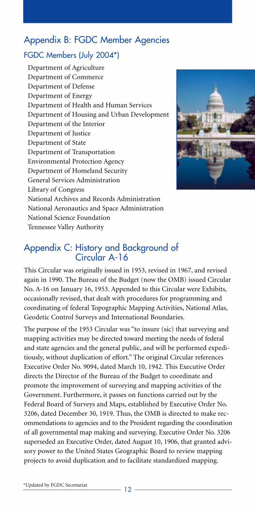
Appendix B: FGDC Member Agencies
FGDC Members (July 2004*) Department of Agriculture Department of Commerce Department of Defense Department of Energy Department of Health and Human Services Department of Housing and Urban Development Department of the Interior Department of Justice Department of State Department of Transportation Environmental Protection Agency Department of Homeland SecurityGeneral Services Administration Library of Congress National Archives and Records Administration National Aeronautics and Space Administration National Science Foundation Tennessee Valley Authority
Appendix C: History and Background of Circular A-16
This Circular was originally issued in 1953, revised in 1967, and revisedagain in 1990. The Bureau of the Budget (now the OMB) issued CircularNo. A-16 on January 16, 1953. Appended to this Circular were Exhibits,occasionally revised, that dealt with procedures for programming andcoordinating of federal Topographic Mapping Activities, National Atlas,Geodetic Control Surveys and International Boundaries.
The purpose of the 1953 Circular was “to insure (sic) that surveying andmapping activities may be directed toward meeting the needs of federaland state agencies and the general public, and will be performed expedi-tiously, without duplication of effort.” The original Circular referencesExecutive Order No. 9094, dated March 10, 1942. This Executive Orderdirects the Director of the Bureau of the Budget to coordinate and promote the improvement of surveying and mapping activities of theGovernment. Furthermore, it passes on functions carried out by theFederal Board of Surveys and Maps, established by Executive Order No.3206, dated December 30, 1919. Thus, the OMB is directed to make rec-ommendations to agencies and to the President regarding the coordinationof all governmental map making and surveying. Executive Order No. 3206superseded an Executive Order, dated August 10, 1906, that granted advi-sory power to the United States Geographic Board to review mappingprojects to avoid duplication and to facilitate standardized mapping.
12*Updated by FGDC Secretariat
A revised Circular A-16 was issued on May 6, 1967. The most significantchange in this revision is the addition of a new section on Responsibilityfor Coordination. This section outlines the responsibilities of three federal departments (Department of the Interior (DOI), Department ofCommerce (DOC) and Department of State (DOS)). Both the originaland the 1967 revision of the Circular focus on providing a guide for thedevelopment of annual programs of the individual agencies and, throughthe Exhibits, established extensive reporting requirements.
A second revised Circular A-16 was issued on October 19, 1990. Thisrevision expanded the Circular to include not only surveying and map-ping, but also the related spatial data activities. Specifically, it includedgeographically referenced computer-readable (digital) data. In addition,the Exhibits are no longer referenced and a short reporting requirementssection is added.
The 2002 updated Circular calls for continued improvements in spatialdata coordination and the use of geographical data. Objectives for thisrevision are to reflect the changes that have taken place in geographicinformation management and technology, and to clearly define agencyand FGDC responsibilities. The proposed revision displays an integratedinfrastructure system approach to support multiple government servicesand electronic government.
Appendix D: Informative Definitions Analog: Of, relating to, or being a device in which data are representedby variable measurable physical quantities. In this Circular, refers to“paper” maps.
Preserve: The process of saving and storing data or records. May alsorefer to the place where data or information is kept.
Clearinghouse: A distributed network of data producers, managers,and users linked electronically, such as over the Internet. Through theClearinghouse, users can use a single interface to search and access meta-data and/or data for the themes they seek. The Clearinghouse includesthe sites across the country where the metadata and data are stored,usually at the site of the producer or intermediary.
Data: Factual information, especially information organized for analysis or used to reason or make decisions. In Computer Science,numerical or other information represented in a form suitable for processing by computer.
Data Theme: Electronic records and coordinates for a topic or subject,such as elevation, vegetation, or hydrography. In this Circular, data themerefers to a Geographic Information System (GIS), or location-based data theme.
Framework Data: Seven themes of geospatial data that are used by mostGIS applications (geodetic control, orthoimagery, elevation and bathym-etry, transportation, hydrography, cadastral and governmental units).
13
These data include an encoding of the geographic extent of the featuresand a minimal number of attributes needed to identify and describe the features.
Framework: The NSDI framework is an initiative to develop a readilyavailable set of basic geographic data. It includes the information, opera-tional environment, and technology to provide access to these data, andthe institutional setting to sustain its development.
Geographic Information: Coordinate and attribute data for location-based features, usually in the categories of point (e.g., a well), line (e.g.,a road), polygon (e.g., a forest), cell (e.g., a raster-based “rectangle”), orcoordinates (e.g., the latitude-longitude of a point on the ground).
Geographic Information System: A computer system for the input, editing, storage, retrieval, analysis, synthesis, and output oflocation-based information. GIS may refer to hardware and software,or include data.
Georeference: A set of datums by which the location of each point canbe uniquely identified.
Geospatial Data: Information that identifies the geographic location andcharacteristics of natural or constructed features and boundaries on theEarth. This information may be derived from, among other things, remotesensing, mapping, and surveying technologies. Statistical data may beincluded in this definition at the discretion of the collecting agency.
Geospatial Services: A collection of operations, accessible through aninterface that allows a user to evoke a behavior of value to the user.
Global Positioning System: A satellite-based system deployed to deter-mine locations on the Earth’s surface. It is commonly used for surveying,mapping, and navigation on land and water.
Metadata: Information about data, such as content, source, vintage,accuracy, condition, projection, responsible party, contact phone num-ber, method of collection, and other characteristics or descriptions.
National Spatial Data Infrastructure: The technology, policies,standards, human resources, and related activities necessary to acquire,process, distribute, use, maintain, and preserve spatial data (e.g., infor-mation and process discovery, publishing data, publishing symbol
libraries, query filtering, data fusing, Earth imaging, photogrammetry, location processing,and spatial analysis).
Proven Practices: Methods and activities thatare “tried and true” including, but not limited to “best practice.”
Spatial Data: Information that identifies thegeographic location and characteristics of nat-ural or constructed features and boundaries on the Earth. This information may be derived
14
from remote sensing, mapping, charting, surveying technologies, GPS,or statistical data, among other sources.
Spatial Data Standards: Descriptions of objects, features, or other geo-graphically located items that are collected, automated, or affected byactivities or functions of agencies, and may be structured in a model.
Standards: Documented agreements containing technical specificationsor other precise criteria to be used consistently as rules, guidelines, ordefinitions of characteristics to ensure that materials, products, processes,or services are fit for their purposes.
Technology: The scientific method and material used to achieve a commercial or industrial objective. Jargon for “software,” “hardware,”“protocol,” or something technical in nature.
Appendix E: NSDI Data Themes, Definitions, and Lead Agencies
The lead federal agencies with responsibilities for NSDI spatial datathemes are as follows:
Baseline (Maritime): Co-leaders: DOC, NOAA and DOI,Minerals Management Service (MMS)
Baseline represents the line from which maritime zones and limits aremeasured. Examples of these limits include the territorial sea, contiguouszone, and exclusive economic zone. The spatial extent of the baseline isdefined as “ordinary low water,” interpreted as mean lower low water, asdepicted on National Ocean Service nautical charts and/or appropriatesupplemental information.
Biological Resources: DOI, U.S. Geological Survey (USGS)
This dataset includes data pertaining to or descriptive of (nonhuman)biological resources and their distributions and habitats, including dataat the suborganismal (genetics, physiology, anatomy, etc.), organismal(subspecies, species, systematics), and ecological (populations, communi-ties, ecosystems, biomes, etc.) levels.
*Cadastral: DOI, Bureau of Land Management (BLM)
Cadastral data describe the geographic extent of past, current, and futureright, title, and interest in real property, and the framework to support the description of that geographic extent. The geographic extent includessurvey and description frameworks such as the Public Land SurveySystem, as well as parcel-by-parcel surveys and descriptions.
*Cadastral (Offshore): DOI, MMS
Offshore Cadastre is the land management system used on the OuterContinental Shelf. It extends from the baseline to the extent of UnitedStates jurisdiction. Existing coverage is currently limited to the contermi-
15*Indicates framework theme
nous United States and portions of Alaska. Maximum extent of UnitedStates jurisdiction is not yet mathematically calculated.
Climate: Co-leaders, Department of Agriculture (USDA), NaturalResources Conservation Service (NRCS) and DOC, NOAA
Climate data describe the spatial and temporal characteristics of theEarth’s atmosphere/hydrosphere/land surface system. These data repre-sent both model-generated and observed (either in situ or remotelysensed) environmental information, which can be summarized todescribe surface, near surface and atmospheric conditions over a range of scales.
Cultural and Demographic Statistics: DOC, U.S. Census Bureau (USCB)
These geospatially referenced data describe the characteristics of people,the nature of the structures in which they live and work, the economicand other activities they pursue, the facilities they use to support theirhealth, recreational and other needs, the environmental consequences of their presence, and the boundaries, names and numeric codes ofgeographic entities used to report the information collected.
Cultural Resources: DOI, National Park Service
The cultural resources theme includes historic places such as districts,sites, buildings, and structures of significance in history, architecture,engineering, or culture. Cultural resources also encompass prehistoricfeatures as well as historic landscapes.
*Digital Ortho Imagery: DOI, USGS
This dataset contains georeferenced images of the Earth’s surface, collectedby a sensor in which image object displacement has been removed for sen-sor distortions and orientation, and terrain relief. For very large surfaceareas, an Earth curvature correction may be applied. Digital orthoimagesencode the optical electromagnetic spectrum as discrete values modeled inan array of georeferenced pixels. Digital orthoimages have the geometriccharacteristics of a map, and image qualities of a photograph.
Earth Cover: DOI, USGS
The Earth Cover theme uses a hierarchical classification system based onobservable form and structure, as opposed to function or use. This systemtransitions from generalized to more specific and detailed class divisions,and provides a framework within which multiple land cover and land use classification systems can be cross-referenced. This system is applica-ble everywhere on the surface of the Earth. This theme differs from theVegetation and Wetlands themes, which provide additional detail.
16*Indicates framework theme
*Elevation Bathymetric: Co-leaders: DOC, NOAA (U.S. watersoutside channels) and US Army Corps of Engineers (USACE)(inland waterways)
The bathymetric data for Inland and Intercoastal waterways is highlyaccurate bathymetric sounding information collected to ensure that federal navigation channels are maintained to their authorized depths.Bathymetric survey activities support the Nation’s critical nautical charting program. This data is also used to create Electronic NavigationalCharts. The bathymetric sounding data supports the elevation layer ofthe geospatial data framework.
*Elevation Terrestrial: DOI, USGS
This data contains georeferenced digital representations of terrestrial surfaces, natural or manmade, which describe vertical position above orbelow a datum surface. Data may be encapsulated in an evenly spacedgrid (raster form) or randomly spaced (triangular irregular network,hypsography, single points). The elevation points can have varying hori-zontal and vertical resolution and accuracy.
Buildings and Facilities: General Services Administration
The facility theme includes federal sites or entities with a geospatial locationdeliberately established for designated activities; a facility database mightdescribe a factory, military base, college, hospital, power plant, fishery,national park, office building, space command center, or prison. Facilitydata is submitted from several agencies, since there is no one party respon-sible for all the facilities in the Nation, and facilities encompass a broadspectrum of activities. The FGDC promotes standardizing on databasestructures and schemas to the extent practical.
Federal Land Ownership Status: DOI, BLM
Federal land ownership status includes the establishment and mainte-nance of a system for the storage and dissemination of informationdescribing all title, estate or interest of the federal government in a parcelof real and mineral property. The ownership status system is the portrayalof title for all such federal estates or interests in land.
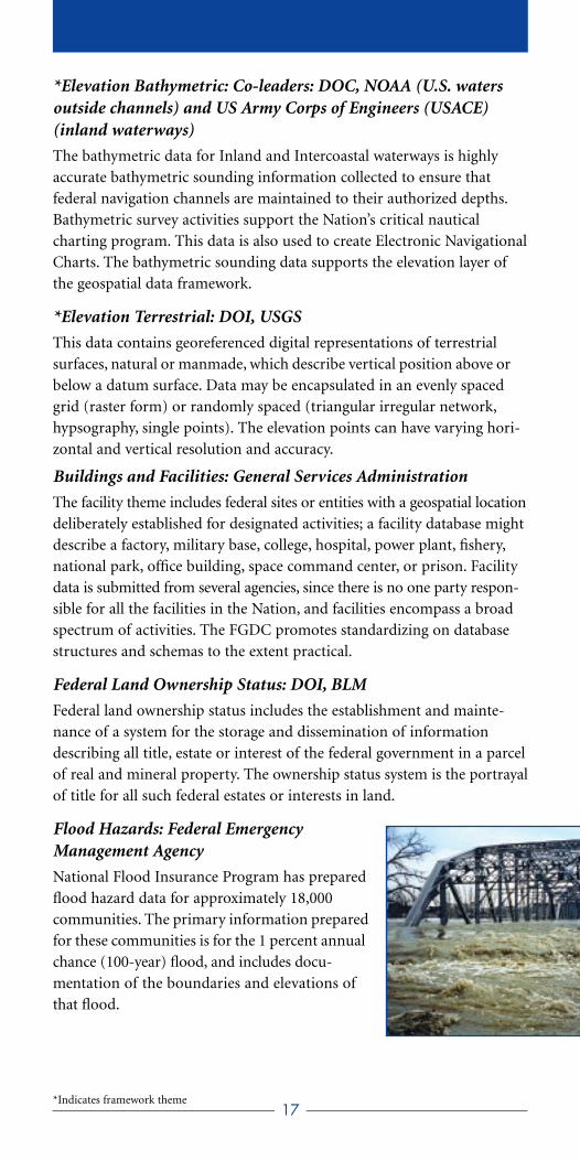
Flood Hazards: Federal EmergencyManagement Agency
National Flood Insurance Program has preparedflood hazard data for approximately 18,000 communities. The primary information preparedfor these communities is for the 1 percent annualchance (100-year) flood, and includes docu-mentation of the boundaries and elevations ofthat flood.
17*Indicates framework theme

*Geodetic Control: DOC, NOAA
Geodetic control provides a common reference system for establishingcoordinates for all geographic data. All NSDI framework data and users’applications data require geodetic control to accurately register spatialdata. The National Spatial Reference System is the fundamental geodetic control for the United States.
Geographic Names: DOI, USGS
This dataset contains data or information on geographic place namesdeemed official for federal use by the U.S. Board on Geographic Namesas pursuant to Public Law 80-242. Geographic Names informationincludes both the official place name (current, historical, and aliases) andlocative direct (i.e., geographic coordinates) and indirect (i.e., State andCounty where place is located) geospatial identifiers and categorized aspopulated places, schools, reservoirs, parks, streams, valleys, and ridges.
Geologic: DOI, USGS
The geologic spatial data theme includes all geologic mapping informationand related geoscience spatial data (including associated geophysical, geo-chemical, geochronologic, and paleontologic data) that can contribute tothe National Geologic Map Database as pursuant to Public Law 106-148.
*Governmental Units: DOC, USCB
These data describe, by a consistent set of rules and semantic definitions,the official boundary of federal, state, local, and tribal governments asreported/certified to the U.S. Census Bureau by responsible officials ofeach government for purposes of reporting the Nation’s official statistics.
Housing: Department of Housing and Urban Development (HUD)
HUD’s database maintains geographic data on homeownership rates,including many attributes such as HUD revitalization zones, location ofvarious forms of housing assistance, first-time homebuyers, underservedareas, and race. Data standards have not yet been formalized.
*Hydrography: DOI, USGS
This data theme includes surface water featuressuch as lakes, ponds, streams and rivers, canals,oceans, and coastlines. Each hydrography featureis assigned a permanent feature identificationcode (Environmental Protection Agency ReachCode) and may also be identified by a featurename. Spatial positions of features are encodedas centerlines and polygons. Also encoded is net-work connectivity and direction of flow.
18*Indicates framework theme
International Boundaries: Department of State
International boundary data include both textual information todescribe, and GIS digital cartographic data to depict, both land and mar-itime international boundaries, other lines of separation, limits, zones,enclaves/exclaves and special areas between States and dependencies.
Law Enforcement Statistics: Department of Justice
Law enforcement statistics describe the occurrence of events (includingincidences, offenses and arrests) geospatially located, related to ordinanceand statutory violations and the individuals involved in those occur-rences. Also included are data related to deployment of law enforcementresources and performance measures.
Marine Boundaries: Co-leaders: DOC, NOAA and DOI, MMS
Marine boundaries depict offshore waters and seabeds over which theUnited States has sovereignty and jurisdiction.
Offshore Minerals: DOI, MMS
Offshore minerals include minerals occurring in submerged lands.Examples of marine minerals include oil, gas, sulfur, gold, sand and gravel, and manganese.
Outer Continental Shelf Submerged Lands: DOI, MMS
This data includes lands covered by water at any stage of the tide, as distinguished from tidelands, which are attached to the mainland or anisland and cover and uncover with the tide. Tidelands presuppose a high-water line as the upper boundary; whereas submerged lands do not.
Public Health: Department of Health and Human Services
Public health themes relate to the protection, improvement and promo-tion of the health and safety of all people. For example, public healthdatabases include spatial data on mortality and natality events, infectiousand notifiable diseases, incident cancer cases, behavioral risk factor andtuberculosis surveillance, hazardous substance releases and health effects,hospital statistics and other similar data.
Public Land Conveyance (patent) Records: DOI, BLM
Public land conveyance data are the records that describe all past, current,and future, right, title, and interest in real property. This is a system ofstorage, retrieval and dissemination of documents describing the right,title, and interest of a parcel.
Shoreline: DOC, NOAA
Shorelines represent the intersection of the land with the water surface.The shoreline shown on NOAA Charts represents the line of contactbetween the land and a selected water elevation. In areas affected by tidalfluctuations, this line of contact is the mean high water line.
19
Soils: USDA, NRCS
Soil data consist of georeferenced digital map data and associated tabularattribute data. The map data describe the spatial distribution of the various soils that cover the Earth’s surface. The attribute data describe theproportionate extent of the various soils as well as the physical and chem-ical characteristics of those soils. The physical and chemical properties arebased on observed and measured values, as well as model-generated values. Also included are model-generated assessments of the suitabilityor limitations of the soils to various land uses.
*Transportation: Department of Transportation, Bureau ofTransportation Statistics
Transportation data are used to model the geographic locations, inter-connectedness, and characteristics of the transportation system withinthe United States. The transportation system includes both physical andnon-physical components representing all modes of travel that allow themovement of goods and people between locations.
Transportation (Marine): USACE
The Navigation Channel Framework consists of highly accurate dimen-sions (geographic coordinates for channel sides, centerlines, wideners,turning basins, and River Mile Markers) for every federal navigationchannel maintained by USACE. The Navigation Framework will provide the basis for the marine transportation theme of the geospatialdata framework.
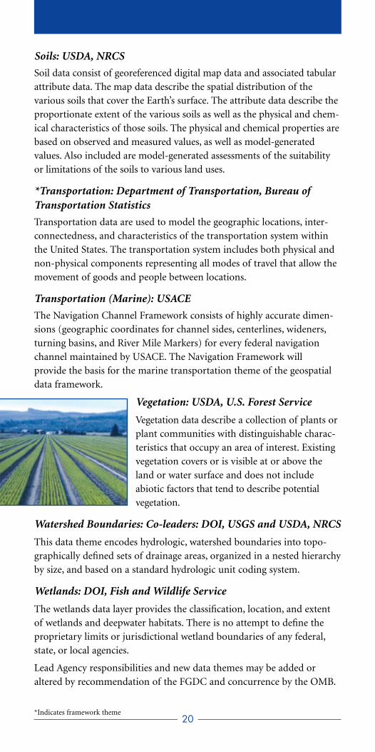
Vegetation: USDA, U.S. Forest Service
Vegetation data describe a collection of plants orplant communities with distinguishable charac-teristics that occupy an area of interest. Existingvegetation covers or is visible at or above theland or water surface and does not include abiotic factors that tend to describe potential vegetation.
Watershed Boundaries: Co-leaders: DOI, USGS and USDA, NRCS
This data theme encodes hydrologic, watershed boundaries into topo-graphically defined sets of drainage areas, organized in a nested hierarchyby size, and based on a standard hydrologic unit coding system.
Wetlands: DOI, Fish and Wildlife Service
The wetlands data layer provides the classification, location, and extentof wetlands and deepwater habitats. There is no attempt to define theproprietary limits or jurisdictional wetland boundaries of any federal,state, or local agencies.
Lead Agency responsibilities and new data themes may be added oraltered by recommendation of the FGDC and concurrence by the OMB.
20*Indicates framework theme

For more information on the National Spatial Data Infrastructure andthe work of the Federal Geographic Data Committee, visit the FGDCWeb site at www.fgdc.gov .