construction stormwater pollution prevention plan (swppp)
TRANSCRIPT

Construction Stormwater Pollution Prevention Plan (SWPPP)
PREPARED FOR:
Big Stone South to Ellendale 345 kV Transmission Line Project
Otter Tail Power Company and Montana-Dakota Utilities Co.
PREPARED BY:
701 Xenia Avenue South, Suite 600 Minneapolis, Minnesota 55416
763-591-5400www.hdrinc.com
May 2018 REVISION 03
SWPPP MUST BE KEPT ON
SITE
EXHIBIT 1

Page i Construction Stormwater Pollution Prevention Plan May 2018
Table of Contents SWPPP REVISIONS ................................................................................................................................................ IV
FOREWORD ........................................................................................................................................................... 1
REGULATORY REQUIREMENTS ............................................................................................................................... 1
PART I – GENERAL SWPPP ...................................................................................................................................... 3
1.1 PROJECT CONTACT INFORMATION ........................................................................................................................... 4 1.2 INTRODUCTION .................................................................................................................................................... 5 1.3 NARRATIVE ......................................................................................................................................................... 6 1.4 OPERATIONAL CONTROLS ...................................................................................................................................... 7
1.4.1 Chain of Responsibility ........................................................................................................................... 7 1.4.2 Employee Training ................................................................................................................................. 7 1.4.3 Good Housekeeping/Pollution Prevention Measures ............................................................................ 8 1.4.4 Preventative Maintenance ..................................................................................................................... 9 1.4.5 Spill Prevention and Response ............................................................................................................... 9 1.4.6 Concrete Wash Water, Grindings, and Slurry ...................................................................................... 11 1.4.7 Truck and Equipment Washing ............................................................................................................ 11 1.4.8 Dewatering .......................................................................................................................................... 11 1.4.9 Chemical Treatment ............................................................................................................................. 12 1.4.10 Posted Notice of Permit Coverage .................................................................................................. 13
1.5 EROSION AND SEDIMENT CONTROLS ...................................................................................................................... 14 1.5.1 Preconstruction .................................................................................................................................... 14 1.5.2 Sediment Basins ................................................................................................................................... 14 1.5.3 Temporary Erosion Protection ............................................................................................................. 15 1.5.4 Steep Slopes ......................................................................................................................................... 15 1.5.5 Sediment Control BMPs ....................................................................................................................... 15 1.5.6 Erosion Control BMPs ........................................................................................................................... 19 1.5.7 BMPs for Work in Sensitive Areas ........................................................................................................ 22 1.5.8 Off-Site Sediment Accumulations......................................................................................................... 23 1.5.9 Stormwater Run-on .............................................................................................................................. 24 1.5.10 Design of Stormwater Controls ....................................................................................................... 24 1.5.11 Waters with TMDL Allocations ........................................................................................................ 24 1.5.12 Support Activities (Batch Plant, Disposal, and Borrow Areas) ........................................................ 24
1.6 PERMANENT STORMWATER MANAGEMENT ............................................................................................................ 26 1.7 MAINTENANCE AND INSPECTION ........................................................................................................................... 27
1.7.1 Maintenance ........................................................................................................................................ 27 1.7.2 Inspection ............................................................................................................................................. 28
1.8 CORRECTIVE ACTION (FORMER BOUNDARY OF LAKE TRAVERSE RESERVATION REQUIREMENT) .......................................... 31 1.8.1 Corrective Action Reports .................................................................................................................... 32
1.9 PLAN REVIEW AND REVISION ................................................................................................................................ 33 1.9.1 Review and Signatory Requirements ................................................................................................... 33 1.9.2 Plan Availability ................................................................................................................................... 33 1.9.3 Plan Revisions ...................................................................................................................................... 33
1.10 LOCAL REQUIREMENTS ........................................................................................................................................ 35 1.11 FINAL STABILIZATION .......................................................................................................................................... 36

Page ii Construction Stormwater Pollution Prevention Plan May 2018
1.12 RECORDS LOCATION AND RETENTION ..................................................................................................................... 37 1.13 NOTICE OF TERMINATION .................................................................................................................................... 38 1.14 GENERAL CONSTRUCTION PERMITS – NDR10-0000, SDR100000, AND CGP ............................................................. 39
PART II – SITE-SPECIFIC INFORMATION ................................................................................................................ 40
2.1 GENERAL PROJECT OVERVIEW .............................................................................................................................. 41 2.2 PROJECT DESCRIPTION ........................................................................................................................................ 45
2.2.1 Nature of the Construction Activities ................................................................................................... 46 2.2.2 Sequence and Estimated Dates of Construction Activities ................................................................... 49
2.3 LOCATION MAP ................................................................................................................................................. 50 2.4 EXISTING TOPOGRAPHY ....................................................................................................................................... 51 2.5 SOIL INFORMATION............................................................................................................................................. 52 2.6 ENDANGERED SPECIES PROTECTION ....................................................................................................................... 57 2.7 HISTORIC PRESERVATION ..................................................................................................................................... 61 2.8 EROSION CONTROL PLAN ..................................................................................................................................... 62 2.9 BMP DETAILS ................................................................................................................................................... 63 2.10 PERMANENT STORMWATER MANAGEMENT AND DRAINAGE CALCULATIONS .................................................................. 64 2.11 STORMWATER POLLUTION PREVENTION TRAINING LOG ............................................................................................. 65 2.12 INSPECTION FORMS ............................................................................................................................................ 66 2.13 OPERATORS/STORMWATER TEAMS ....................................................................................................................... 67
2.13.1 Operator 1: Skyview ........................................................................................................................ 67 2.13.2 Operator 2: Webster Scale .............................................................................................................. 67 2.13.3 Operator 2: Dahn ............................................................................................................................ 69
2.14 CERTIFICATION ................................................................................................................................................... 70 2.14.1 North Dakota SWPPP Certification ................................................................................................. 70 2.14.2 South Dakota SWPPP Certification .................................................................................................. 71 2.14.3 USEPA (Former Boundary of Lake Traverse Reservation) SWPPP Certification .............................. 72
2.15 SOUTH DAKOTA CONTRACTOR AUTHORIZATION FORM .............................................................................................. 75 2.16 NOTICE OF INTENT - NDR10-0000 NOTICE OF INTENT, SDR100000 NOTICE OF INTENT, AND CGP NOTICE OF INTENT ...... 76 2.17 NOTICE OF TERMINATION .................................................................................................................................... 77
APPENDICES......................................................................................................................................................... 78
LIST OF APPENDICES
APPENDIX A CORRECTIVE ACTION FORM (FOR FOPRMER BOUNDARY OF LAKE TRAVERSE RESERVATION)
APPENDIX B NOTICE OF INTENT
APPENDIX C NOTICE OF TERMINATION
APPENDIX D GENERAL CONSTRUCTION PERMITS
APPENDIX E ENDANGERED SPECIES DOCUMENTATION
APPENDIX F HISTORIC PRESERVATION DOCUMENTATION
APPENDIX G EROSION CONTROL PLAN MAPS

Page iii Construction Stormwater Pollution Prevention Plan May 2018
APPENDIX H BMP DETAILS
APPENDIX I INSPECTION FORM TEMPLATE
APPENDIX J SOUTH DAKOTA CONTRACTOR AUTHORIZATION FORM
APPENDIX K BROWN COUNTY LAYDOWN YARD

Page iv Construction Stormwater Pollution Prevention Plan May 2018
SWPPP REVISIONS Table 1: Revision Documentation
Revision Date Comments Initials
00 September 2015 Draft SWPPP MWR
01 October 2015 Clarified “Former Boundary of Lake Traverse Reservation.” Explicitly called out which BMPs are anticipated for VTCs and work in or near wetlands.
MWR
02 June 2016 Updated impact calculations and added assumptions in section 2.1. Updated erosion control plan with new
structure numbers, access roads, and laydown yards. Updated operator contacts.
MP
03 May 2018 Updated to reflect April 1, 2018 South Dakota General Permit regulations. Added Appendix K for Brown
County Laydown Yard.
MP
04
05
06
07
08
09

Page 1 Construction Stormwater Pollution Prevention Plan May 2018
FOREWORD
All construction projects covered by the North Dakota Pollutant Discharge Elimination System General Permit (NDR10-0000), the South Dakota General Permit for Storm Water Discharges Associated with Construction Activities (SDR100000), and the U.S. Environmental Protection Agency National Pollutant Discharge Elimination System (NPDES) General Permit for Discharges from Construction Activities (CGP), shall prepare and implement a stormwater pollution prevention plan (SWPPP) as part of the permit requirements.
Under the provisions of the general permits, the SWPPP and revisions may be subject to review by the North Dakota Department of Health (NDDH), the South Dakota Department of Environment and Natural Resources (SD DENR), and the U.S. Environmental Protection Agency (USEPA). The objectives of the plan are to identify potential sources of stormwater pollution from construction activity and to ensure practices are implemented to minimize the contribution of pollutants to stormwater runoff. Stormwater management measures developed under other regulatory programs (e.g., Spill Prevention, Control and Countermeasure requirements) can be included in the SWPPP or incorporated by reference.
REGULATORY REQUIREMENTS
Construction activities resulting in disturbance of 1 acre or more of land must comply with the provisions on the Clean Water Act (CWA), Section 402. Section 402 established the NPDES permit program under the USEPA to regulate point and non-point source discharges into waters of the United States. In North Dakota, the NPDES permit authorizing stormwater discharge associated with construction activities is administered by the NDDH for all land, except for Native American land (referred to in the NPDES permit as Indian Lands, defined in 40 CFR §122.2) . In South Dakota, such discharge is authorized by the SD DENR, and within Native American land, it is authorized by the USEPA Region 8. As a requirement of the NPDES permit, a SWPPP must be crafted to meet the site-specific requirements of each project, to outline procedures to minimize erosion and to mitigate sediment transport during and after construction activities. The USEPA is the permitting authority for lands within the former boundary of the Lake Traverse Reservation.
After a SWPPP is developed, a Notice of Intent (NOI) application must be submitted to the NDDH, SD DENR, and USEPA (included in Appendix B of this document) as part of authorization for land-disturbing activities. Region-specific permitting details are provided below.
• North Dakota: NDDH permit coverage becomes effective seven (7) calendar days after the NOI is received by the department, unless otherwise notified by the agencies.
• South Dakota: A NOI must be submitted to the SD DENR at least 15 days prior to the start of construction, and the DENR will then grant coverage, deny coverage, or request more information. If granted, a letter of authorization will be provided to the permittee.

Page 2 Construction Stormwater Pollution Prevention Plan May 2018
South Dakota also requires submission of a Contractor Authorization Form for each person who has day-to-day responsibility for erosion and sediment control measures.
• Lands within the former boundary of Lake Traverse Reservation: A NOI must also be electronically filed to the USEPA at least 14 days prior to the start of construction. USEPA permit coverage is authorized 14 days after submission of the NOI unless the USEPA provides notification that the authorization is delayed or denied.
In addition to federal and state regulations, all stormwater discharges associated with construction activity must comply with the requirements, policies, and/or guidelines of local agencies as appropriate to each construction site. The NOI and other applicable Project-specific permit coverage documentation will be maintained in Part II of this SWPPP.

Page 3 Construction Stormwater Pollution Prevention Plan May 2018
PART I – GENERAL SWPPP

Page 4 Construction Stormwater Pollution Prevention Plan May 2018
1.1 Project Contact Information
Otter Tail Power PM / Representative
Name Myron Rader
Firm Otter Tail Power Company
Address 215 S. Cascade Street Fergus Falls, MN, 56537
Phone 218-739-8683
E-mail [email protected]
SWPPP Contact / Stormwater Team Lead
Name Brian Beste
Firm Otter Tail Power Company
Address 215 S. Cascade Street Fergus Falls, MN, 56537
Phone 612-363-8680
E-mail [email protected]
Emergency Contact
Name Brian Beste
Firm Otter Tail Power Company
Address 215 S. Cascade Street Fergus Falls, MN, 56537
Phone 612-363-8680
E-mail [email protected]

Page 5 Construction Stormwater Pollution Prevention Plan May 2018
1.2 Introduction
Otter Tail Power Company (Otter Tail Power) (Otter Tail Power on behalf of itself and as an agent for Montana-Dakota Utilities Co. (Montana-Dakota), a Division of MDU Resources Group), has developed this SWPPP to be a comprehensive document containing information relating to stormwater runoff from construction activities for the Big Stone South to Ellendale 345 kV Transmission Line Project in North Dakota and South Dakota. Part I contains general SWPPP information and practices that should be incorporated as applicable. Part II of this SWPPP contains site-specific plans and information. Operators are responsible for understanding and implementing the information contained in Parts I and II of this SWPPP, the NDDH General Construction Permit NDR10-0000, the SD DENR General Permit for Storm Water Discharges Associated with Construction Activities (SDR100000), and the USEPA NPDES General Permit for Discharges from Construction Activities (CGP). Copies of the general permits are included in Section 1.14.

Page 6 Construction Stormwater Pollution Prevention Plan May 2018
1.3 Narrative
(NDR10-0000, §II.C.2), (SDR100000, §5.3)
A narrative of operational controls and stormwater BMPs is included throughout Part I of this SWPPP. Site-specific BMPs may be selected based on variable site conditions. Each BMP will be selected and incorporated based on the premises described in the narrative. Alternative options to specific BMPs listed in Part I may be selected based on field conditions. Site-specific structural BMPs are shown on the Erosion Control Plan maps in Part II. BMP details are also included in Appendix H.
This narrative includes operational controls (Section 1.4), erosion and sediment controls (Section 1.5), and permanent stormwater management BMPs (Section 1.6). Where appropriate, the narrative includes the construction phase for each BMP, the installation, removal, and maintenance requirements, and the rationale for selection.
Page 7 Construction Stormwater Pollution Prevention Plan May 2018
1.4 Operational Controls
(NDR10-0000, §II.C.3), (SDR100000, §5.3.1), (CGP §7.2.1)
1.4.1 Chain of Responsibility
(NDR10-0000, § II.C.3.a)
The stormwater team (identified in Section 2.13), consisting of the Operator, SWPPP Administrator, and Emergency 24-hr Contact, will have primary responsibility and significant authority for SWPPP implementation including installation, inspection, and maintenance of erosion and sediment control Best Management Practices (BMPs) before, during, and after construction. Duties of the stormwater team include but are not limited to:
• Ensuring full compliance with the SWPPP and the general permit; • Implementing prompt and effective erosion and sediment control measures; • Discussing and modifying erosion and sediment control measures as necessary to
achieve the goals of the SWPPP based on site-specific conditions; • Implementing all non-stormwater management, and materials and waste management
activities such as: monitoring discharges; general site clean-up; vehicle and equipment cleaning, fueling and maintenance; spill control; ensuring that no materials are discharged in quantities which will have an adverse effect on receiving waters or storm drain systems; etc;
• Implementing all other applicable elements of the SWPPP; • Conducting routine and storm event inspections as specified in the SWPPP; • Ensuring elimination of all unauthorized discharges; • Mobilizing crews in order to make immediate repairs to the control measures and
documenting the work; • Documenting construction progress; and • Coordinating with the Project Engineer to assure all of the necessary corrections/repairs
are made immediately, and that the project complies with the SWPPP, the general permit, and approved plans at all times.
Otter Tail Power will be responsible for SWPPP coordination and permit compliance through field/project audits and communication with the stormwater team. Copies of the general permits are provided in Section 1.14.
1.4.2 Employee Training
(NDR10-0000, §II.C.3.e), (SDR100000, §5.3.2), (CGP, §6)
The Operator is responsible for providing trained erosion control personnel for overseeing the implementation of the SWPPP. Training must be provided at least annually, as new employees are hired, or as necessary to ensure compliance with the SWPPP and general permit. A training

Page 8 Construction Stormwater Pollution Prevention Plan May 2018
log is provided in Section 2.11.
Onsite personnel must understand the requirements of the general permit as it pertains to their role in implementing the SWPPP. Onsite personnel must know:
• The purpose, requirements, and proper implementation of the SWPPP; • The location of all BMPs identified in Part I and Part II of this SWPPP; • Correct installation, function, maintenance, and removal of the project BMPs; and • When and how to conduct inspections, record applicable findings, and take corrective
actions.
Maintenance personnel must understand when BMP maintenance must be performed to maintain properly functioning controls, and what needs to be recorded for corrective actions and maintenance records.
1.4.3 Good Housekeeping/Pollution Prevention Measures
(NDR10-0000, §II.C.3.b), (SDR100000, §3.8, §3.20.4), (CGP, §2.3.3.3)
BMPs described in this section will be installed, implemented, and maintained during construction to minimize pollutants in stormwater discharges as necessary to meet applicable water quality standards.
Litter, Trash, and Debris
Construction debris and waste materials must be properly handled. Appropriate containers of sufficient size and number must be provided on site for storing debris and other wastes until disposal. Litter and debris must be picked up regularly to reduce the chance for materials to be carried off the site. Collected material must be taken to an appropriate facility for disposal or recycling.
Chemicals and Hazardous Materials
Liquid or soluble materials including oil, fuel, paint, and any other hazardous substances must be properly stored to prevent spills, leaks, or other discharges. Restricted access to storage areas must be provided to prevent vandalism. Storage and disposal of hazardous waste must comply with NDDH, SD DENR, USEPA, and other federal, state, and local regulations.
Dust Control
Measures must be taken to prevent fugitive dust during construction activities. Dust control measures depend on the site’s topography and land cover, soil characteristics, and expected precipitation. Construction sequencing and disturbing only small areas at a time can greatly reduce the amount of fugitive dust. The following are some of the control measures that can be used as appropriate:
Page 9 Construction Stormwater Pollution Prevention Plan May 2018
• Sprinkling/Irrigation: Wetting exposed soils is an effective dust control method, especially for unpaved access roads. Sprinkling will be done carefully to avoid excess runoff from the site and to prevent vehicles tracking mud onto public paved roads.
• Vegetative Cover: Where possible, vegetative stabilization will be used for disturbed soil.
• Rolled-on or Hydro Mulch: This is a quick and effective dust control measure for a recently disturbed area.
• Wind Breaks: Trees and shrubs left in place during site clearing work well to reduce wind velocity through a site. Constructed wind breaks include snow fencing, tarp curtains, hay bales, and sediment walls.
• Gravel: This is an effective means of dust control for construction entrances and access roads.
• Spray-on chemical soil treatments (palliatives): These can be used only on mineral soils. Palliatives include anionic asphalt emulsion, latex emulsion, resin-water emulsions, and calcium chloride. The potential effects of a palliative treatment’s chemical biodegradability and water-solubility on the surrounding environment will be determined before its use.
Sanitary/Septic Waste Management
Sanitary/septic waste handling will adhere to applicable local, state, and federal regulations. Sanitary facilities will be located for convenient access and away from drainage inlets and water resources. Untreated raw waste will not be discharge to land, into drainage inlets, or to water resources. Portable toilets must be positioned so that they are secure and will not be tipped or knocked over.
1.4.4 Preventative Maintenance
(NDR10-0000, §II.C.3.c), (SDR100000, §3.1), (CGP, §2.3.2)
Preventative inspections with thorough maintenance practices must be followed through to ensure proper operation, inspection, and maintenance of stormwater control devices (e.g., oil-water separators, catch basins, and silt fences) and equipment used or stored on site. Detailed requirements for inspection and maintenance are included in Section 1.7.
1.4.5 Spill Prevention and Response
(NDR10-0000, §II.C.3.d), (SDR100000, §3.20, §7.1), (CGP, §2.3.3.1, §2.3.4)
Control measures must be employed to prevent any spills and leaks during construction. Construction equipment shall be inspected daily to ensure that hydraulic systems and oil pans are in good condition and free of significant leaks. Preventative maintenance must be provided as necessary to ensure effective operating condition. A person must be present at the nozzle at

Page 10 Construction Stormwater Pollution Prevention Plan May 2018
all times when refueling is in progress. Refueling of equipment and oil transfer are not permitted within 100 feet of sensitive resources, such as rivers and wetlands. Drip pans and absorbents should be used under or around leaky vehicles.
A portable spill containment kit is required for each project site that features construction equipment or other equipment with the potential to discharge a significant amount of oil to the environment. Additional absorbent pads and brooms should be kept in the onsite offices.
If a spill of petroleum or other liquid chemical occurs, the individual discovering the spill shall notify the Operator, who will determine reporting requirements and proper handling, storage, and disposal requirements. In general, the procedures below will be followed:
• Once a spill has been identified, the source of the spill will be immediately identified andcontained.
• Absorbent materials will be used to contain and/or isolate spilled material. An effort willbe made to stop the spilled material from reaching any body of water or storm drain.
• The spill and contaminated soils will be collected, treated, and disposed of inaccordance with all applicable federal, state, and local requirements.
• All spills and corrective actions will be recorded as required.
Report any spill that may seriously endanger health or the environment as soon as possible, but no later than 24 hours from discovery. The report must be made to EPA-Region 8, Emergency Response Branch, at 800.424.8802, and either the state of North Dakota, Division of Homeland Security, at 800.472.2121 if the spill occurs in North Dakota, or the SD DENR at 605.773.3296 during regular office hours (8 a.m. to 5 p.m. CST) or call the State Radio Communications at 605.773.3231 after hours, on weekends, or holidays if the spill occurs in South Dakota.
Some releases may require immediate response by trained emergency personnel. This may be coordinated through the NDDH, Department of Emergency Services, for spills in North Dakota, or SD DENR for spills in South Dakota, and any other state or local emergency response agencies that may be needed. If there is any question as to the proper response for a spill in North Dakota, call the NDDH at 701.328.5210 or the North Dakota hazardous materials emergency assistance and spill reporting number 800.472.2121 and provide all relevant information about the incident. If there is any question as to the proper response for a spill in South Dakota, call the SD DENR at 605.773.3296.
Non-emergency releases in North Dakota may be reported by filling out the Environmental Incident Report Form on the NDDH website.1 Spill incident follow-up report forms for spills in South Dakota are found on the SD DENR website.2
1 ND Environmental Incident Report Form is available at: http://www.ndhealth.gov/ehs/eir/NonOilfield/ 2 SD Incident Follow-up Report Form is available at: https://www.state.sd.us/eforms/secure/eforms/E0486V4-SpillsFollowUpReport.pdf.

Page 11 Construction Stormwater Pollution Prevention Plan May 2018
1.4.6 Concrete Wash Water, Grindings, and Slurry
(NDR10-0000, §II.C.3.f), (SDR100000, §3.20), (CGP, §2.3.3.4)
Concrete wash water may not be discharged to any water of the state, any storm sewer system, or allowed to drain onto adjacent properties. Wash water disposal must be limited to a defined area or an area designated for concrete washout. The area(s) must be sufficient to contain the wash water and residual cement. All liquid and solid wastes generated by concrete washout operations must be contained in a leak-proof containment facility or impermeable liner. The leak-proof container or leak-proof pit must be designed and maintained so that overflows cannot occur due to inadequate sizing, precipitation events, or snowmelt.
Do not dump liquid wastes into storm sewers. Liquid and solid waste must be disposed of properly and in compliance with local, state and federal regulations.
1.4.7 Truck and Equipment Washing
(CGP, §2.3.3.2) (SDR100000, §3.20.3)
External washing of trucks and other construction vehicles must be limited to a defined area on the site. Runoff must be contained and waste properly disposed of. No engine degreasing is allowed on site. Discharge of wash waters containing soaps, solvents, or detergents is prohibited and must be contained.
1.4.8 Dewatering
(NDR10-0000, §II.C.3.g), (SDR100000 §3.21) (CGP, §2.1.3.4)
During excavation and other construction activities, dewatering may be required in areas with surface water or a high water table to facilitate construction, to prevent erosion and sediment transport, and/or to prevent pollution of groundwater. Sediment-laden water cannot be discharged directly into a surface water or into a drainage pipe, inlet, or ditch.
Dewatering is limited to uncontaminated stormwater, surface water, and groundwater that may collect on site, if they are not a significant source of pollution. A separate permit must be obtained to discharge water from other sources.
The following requirements must be met for dewatering activities:
• Do not discharge visible floating solids or foam; • Use of an oil-water separator or suitable filtration device (such as cartridge filter) that is
designed to remove oil, grease, or other products if water from dewatering is found to contain these materials;
• To the extent feasible, unless vegetated, upland areas of the site to infiltrate dewatering water before discharge. In no case will surface waters be considered part of the treatment area;

Page 12 Construction Stormwater Pollution Prevention Plan May 2018
• At all points where dewatering is discharged, comply with velocity dissipation devices; • With backwash water, either haul it away for disposal or return it to the beginning of
the treatment process; and • Replace and clean the filter media used in dewatering devices when the pressure
differential equals or exceeds the manufacturer’s specifications.
When dewatering, structures or BMPs must be incorporated to allow for drawdown to occur from the surface of the water, unless infeasible. In addition to typical inspection requirements, dewatering activities must be inspected daily. Inspections must include the dewatering site, areas where BMPs are implemented, and the discharge location. Records must contain:
• Date and time of the inspection; • Inspector’s name; • Approximate volume of water discharged; • Inspection findings, including recommendations and schedule for corrective actions; • Corrective actions taken, including dates, times, and party completing maintenance; and • Documentation that the SWPPP has been amended when changes are made to the
dewatering activity in response to inspections.
1.4.9 Chemical Treatment
(CGP, §2.1.3.3), (SDR100000 §3.20.4)
If polymers, flocculants, or other treatment chemicals are used to treat dewatering water or discharge from a sedimentation basin or conveyance channel, the following requirements must be met and the SWPPP updated to document compliance with Section 2.1.3.3 of the CGP:
• List all the soil types (including soil types expected to be found in fill material) that are expected to be exposed during construction and that will be discharged to locations where chemicals will be applied;
• Describe the dosage of all treatment chemicals you will use at the site or the methodology you will use to determine dosage;
• Provide information from any applicable Material Safety Data Sheets (MSDS); • Describe how each of the chemicals will be stored; • Include references to applicable state or local requirements affecting the use of
treatment chemicals, and copies of applicable manufacturer’s specifications regarding the use of your specific treatment chemicals and/or chemical treatment systems;
• If you have been authorized by your applicable USEPA Regional Office to use cationic treatment chemicals, include the official USEPA authorization letter or other communication, and identify the specific controls and implementation procedures you are required to implement to ensure that your use of cationic treatment chemicals will not lead to a violation of water quality standards;

Page 13 Construction Stormwater Pollution Prevention Plan May 2018
• Provide schematic drawings of any chemically-enhanced stormwater controls or chemical treatment systems to be used for application of treatment chemicals;
• Describe the training that personnel who handle and apply chemicals have received prior to permit coverage, or will receive prior to the use of treatment chemicals.
1.4.10 Posted Notice of Permit Coverage
(SDR100000, §2.10)
A notice (sign or equivalent) must be posted at a safe, publically accessible location near the project site. The notice must include the general permit tracking number, and a contact name and phone number for obtaining additional project information. The notice must be located so that it is visible from the public road that is nearest to the active part of the construction site and readily viewed from a public ROW. A notice must be posted at all construction laydown yards.

Page 14 Construction Stormwater Pollution Prevention Plan May 2018
1.5 Erosion and Sediment Controls
(NDR10-0000, §II.C.4), (SDR100000, §3.2), (CGP §2.1.1.3)
The SWPPP provides structural and non-structural, activity-specific sediment and erosion control BMPs. The BMPs selected for each activity are based upon expected construction conditions and methods. The BMPs may need to be modified in accordance with actual conditions encountered in the field to ensure that controls are effective, as determined by the Operator. Modifications must be documented with the SWPPP.
1.5.1 Preconstruction
Before land disturbing activities occur, there are several principles that can be followed to help control erosion and sediment. They include:
• Install upslope perimeter or access controls (e.g., construction fence or construction markers), as needed.
• Install downslope and sideslope perimeter controls (e.g., silt fence, straw wattles). These should not be removed until all upstream disturbed areas reach final stabilization.
• Do not disturb an area until it is necessary for construction to proceed. • Schedule construction activities to limit impact from seasonal climate changes or
weather events. • Plan to cover or stabilize disturbed areas as soon as possible.
1.5.2 Sediment Basins
(NDR10-0000, §II.C.4.b), (SDR100000, §3.5), (CGP, §2.1.3)
Sediment basins are not anticipated for the Project. Sediment basins are often suitable for large areas of disturbance that drain to a common location prior to entering surface waters. In South Dakota, if there are any continuous disturbed areas of 10 or more acres, a temporary or permanent sediment basin is required. If used, sediment basins must meet the following design criteria:
• Basins must be designed for a calculated volume of runoff from a 2-year (approximately a 2-inch rainfall), 24-hour storm event per acre drained to the basin, and not provide less than 1,800 cubic feet of sediment storage below the invert of the outlet pipe from each acre drained to the basin; or
• Basins must be sized to provide 3,600 cubic feet of storage below the invert of the outlet pipe per acre drained to the basin if calculations are not performed.
• Basins must be designed using stabilization controls (e.g., erosion control blankets) to prevent erosion of the basin.

Page 15 Construction Stormwater Pollution Prevention Plan May 2018
• Basin outlets must be designed to avoid short-circuiting and the discharge of floating debris. The basin must be designed with the ability to allow complete basin drawdown (e.g., perforated riser pipe wrapped with filter fabric and covered with crushed gravel, pumps or other means) for maintenance activities. Basins must release the storage volume in at least 24 hours. Outlet structures must be designed to withdraw water from the surface, unless infeasible. The basin must have a stabilized emergency overflow to prevent failure of pond integrity. Energy dissipation must be provided for the basin outlet.
1.5.3 Temporary Erosion Protection
(NDR10-0000, §II.C.4.c), (SDR100000, §3.17, §3.18), (CGP, §2.2.1)
Temporary erosion protection (such as cover crop planting or mulching) or permanent cover must be provided for exposed soil areas where activities have been completed or temporarily ceased. Stabilization of exposed areas must be initiated immediately where activities have been permanently or temporarily ceased on any portion of the site and will not resume for a period of 14 calendar days. This includes implementing winter stabilization. If work occurs during frozen ground conditions, the site must be temporarily stabilized if that work will not resume for 14 calendar days or more. Stabilization must be completed as soon as practicable, but no later than 14 days after the initiation of soil stabilization, including for soil stockpiles.
1.5.4 Steep Slopes
(NDR10-0000, §II.C.4.c), (SDR100000, §3.12)
In North Dakota, for slopes with a grade of 3:1 (H:V) or steeper, stabilization must be initiated immediately once activities have been completed or temporarily ceased. Stabilization must be completed as soon as practicable, but no later than seven (7) calendar days after the initiation of soil stabilization.
In South Dakota, disturbance of slopes with a grade of 3:1 (H:V) or steeper must be minimized. Where access roads cross steep slopes, soil disturbance must be minimized and vehicles must stay within designated routes.
1.5.5 Sediment Control BMPs
(NDR10-0000, §II.C.4.d), (SDR100000, §3), (CGP, §2.1)
Timing the installation of sediment control practices may be adjusted to accommodate short-term activities such as clearing or grubbing, or passage of vehicles. Any short-term activity must be completed as quickly as possible and the sediment control practices must be installed immediately after the activity is completed. However, sediment control practices must be installed prior to the next precipitation event even if the short-term activity is not complete.
Page 16 Construction Stormwater Pollution Prevention Plan May 2018
Culvert Inlet Protection
Inlet protection is a temporary BMP that should be installed on the upstream end of a culvert to prevent sediment from traveling through the system. This typically consists of traditional perimeter control devices such as a sediment control log. Culvert protection BMPs should surround the culvert entrance completely. Culvert inlet protection BMPs must remain in place until upslope areas have reached final stabilization.
Ditch Checks
Ditch checks can be either temporary or permanent BMPs that are used to trap sediment and/or reduce runoff velocities in ditches and drainageways. Ditch checks are commonly composed of straw wattles, biorolls, or riprap. If permanent rock ditch checks are used, an erosion control blanket should be inserted underneath the ditch check to prevent erosion of the ditch bottom when installing the structure. Spacing of ditch checks shall be determined based on North Dakota DOT (NDDOT) or South Dakota DOT (SDDOT) guidance. Temporary ditch checks that are not designed to biodegrade on site must remain in place until upslope drainage areas and the drainageway have reached final stabilization.
Storm Drain Inlet Protection
All storm drain inlets in the immediate vicinity of the construction site must be protected by the appropriate BMPs during construction until all sources with the potential for discharging to the inlet have been stabilized. This includes storm drain inlets which may be affected by sediment tracked onto paved surfaces by vehicles or equipment.
Inlet protection devices are a last line of control – sediment and erosion control practices must be used on site. Inlet protection devices must conform to local ordinances or regulations. In general, inlet protection devices need to provide for drainage adequate to prevent excessive roadway flooding. Inlet protection may be removed for a particular inlet if a specific concern (i.e., street flooding/freezing, snow removal) has been identified and documented in the SWPPP. In this situation, additional erosion and sediment control practices must be used to account for the loss of the inlet protection device to prevent sediment from entering a storm sewer system. Culvert inlet protection BMPs must remain in place until upslope areas have reached final stabilization.
Perimeter Control
Perimeter control measures should be installed prior to the start of construction occurring in the area that the BMP serves. This includes upslope access control and locations downslope from staging areas, stockpiles, disturbed areas, roadside ditches, and near trees to protect them from damage. Common forms of perimeter control include: construction fence, vegetation & topography, silt fence, sediment control logs (e.g., straw wattles, mulch logs,

Page 17 Construction Stormwater Pollution Prevention Plan May 2018
compost logs, biorolls), and silt curtains. Perimeter control is a temporary BMP during construction that must remain in place until upslope areas have reached final stabilization.
Rock Log
Rock logs are wire or geotextile tubes filled with rock or gravel material. Rock logs may be used as inlet protection, outlet protection, swale protection or in any area where concentrated flows need to be spread out and velocity reduced to prevent erosion. Rock logs serve to reduce water velocity and allow time for sediment to settle, thus decreasing erosion potential and sediment transport. When used for swale protection, rock logs should extend the entire width of the expected flow path with the center lower than the sides. Rock logs are temporary BMPs that must remain in place until upslope areas have reached final stabilization.
Silt Fence
Silt fence consists of geotextile fabric installed with at least six inches of the fabric trenched into the soil; wooden stakes are attached on the down-gradient side. Wire-backed fence may be used. Additional stakes or lathe may be added on the up-gradient side for strengthening the fence around corners or in high wind conditions. Silt fence provides sediment control by reducing water velocity and ponding water to facilitate the deposition of sediment on the up-gradient side of the fence. Because silt fence has potential to dam water, it should not be used in channels or as culvert inlet or outlet protection. Silt fence is a temporary BMP that must remain in place until upslope areas have reached final stabilization.
Sediment Control Log (SCL)
A sediment control log (e.g., straw wattles, mulch logs, compost logs, biorolls, etc.) consists of a net or geotextile fabric filled with straw, excelsior, wood mulch, compost, or other fillers. Sediment control log applications include but are not limited to, slope stabilization, perimeter control, check dams in swales, back of curb protection and temporary secondary containment for stockpiles, materials storage, or masonry. Sediment control logs reduce water velocity allowing sediment to accumulate on the up-gradient side of the log. The basic installation for a net wrapped sediment control log is to prepare a shallow trench, and secure the log in the trench using stakes or landscape pins. Alternatively, the sediment control log can be installed on soil surfaces and keyed in with two (2) inches of soil placed on the upstream side to provide an adequate seal. Sediment control logs should be installed based on manufacturer’s directions and/or approved details. Sediment control logs are temporary BMPs that must remain in place until upslope areas have reached final stabilization.
Protecting Soil Stockpiles
Some excavated materials may be suitable for backfill and site restoration. Topsoil and organic soils stripped prior to excavation will be stockpiled separately from materials suitable for backfill. Topsoil must be preserved unless infeasible, and documentation of infeasibility must be

Page 18 Construction Stormwater Pollution Prevention Plan May 2018
provided when applicable. Unsuitable material shall be promptly removed from the site or stockpiled until removal is possible. Temporary soil stockpiles must have effective sediment controls and cannot be placed in surface waters or other stormwater conveyances.
Sediment Removal
When conditions allow, exposed sediment may be collected and removed from construction areas in agricultural fields for re-use or off-site disposal. This reduces the ground disturbance associated with BMP installation and removal, and eliminates potential for sediment runoff. To employ sediment removal as a sole sediment control BMP, all of the following conditions must be met:
• The work area must be in an agricultural field, specifically in locations where removal of the sediment immediately results in achieving final stabilization criteria, i.e., the land has been returned to pre-construction conditions.
• Sediment removal must occur within 48 hours of initially exposing sediment in that area. • The slope toward a surface water must be flat, i.e., less than one (1) percent. • The surface water must be located more than 25 feet from construction activities. • The downslope surface water must be a non-jurisdictional wetland. • There must be a 0% chance of rain as forecasted by the National Weather Service for
the 48 hour duration. If the forecast changes, structural perimeter controls must be provided immediately.
Vehicle Tracking Control (VTC)
Vehicle tracking controls may consist of one or several BMPs, including equipment cleaning and street sweeping, rock pads, mud mats, rumble strips, composite mats, or equivalent to prevent sediment from being tracked onto paved roads. Tracking control is designed to cause soil to dislodge off equipment and vehicles as they transition from disturbed soils to paved areas. The vehicle tracking control must remain in place until accesses to the areas are or no longer needed. Designated points of ingress and egress, where traffic transitions from a paved road surface to disturbed soil, are likely to need vehicle tracking control. Tracking controls may be moved or eliminated as on-site conditions and activities change.
BMPs (e.g., street sweeping) will be used at locations where disturbances are adjacent to paved public roads. Additional BMPs may be installed if deemed necessary as site conditions or the construction approach merits (e.g., composite mats). These locations must be marked on the appropriate Project plan sheets when added.
It is anticipated that equipment cleaning and street sweeping will be the primary VTC.

Page 19 Construction Stormwater Pollution Prevention Plan May 2018
1.5.6 Erosion Control BMPs
(NDR10-0000, §II.C.4.d), (SDR100000, §3), (CGP, §2.3.5)
Erosion control measures must be provided and maintained in a timely manner. Preventing erosion from occurring by maintaining vegetated areas and stabilizing disturbed areas is typically the most effective method to mitigate sediment runoff.
Preservation of Existing Vegetation
Preserving vegetation provides buffer zones and stabilizes the area, which helps control erosion, protect water quality, and reduce the amount of exposed soil susceptible to runoff.
Vegetated Buffers
A 50-foot vegetated buffer, or equivalent erosion and sediment controls, must be provided when disturbing soil within 50 feet of a surface water that receives runoff from construction activities. In North Dakota, vegetated buffers must have a minimum width of one (1) foot for every five (5) feet of disturbed area that drains to the buffer. The width of the buffer must have a slope of five (5) percent or less and the area draining to the buffer shall have a slope of six (6) percent or less. Concentrated flows should be minimized throughout the buffer. In South Dakota, the 50-foot buffer requirement applies specifically to the water bodies listed in Section 2.1. If construction activities encroach on a required buffer, the reason for the encroachment and the supplemental erosion and sediment control BMPs employed must be documented in this SWPPP.
Buffers shall consist of dense grassy vegetation, 3 to 12 inches tall with uniform coverage over 90 percent of the buffer. Woody vegetation shall not be counted for the 90 percent coverage. No more than ten (10) percent of the overall buffer may be comprised of woody vegetation.
Energy Dissipation
Energy dissipation devices are structural BMPs employed at discharge locations including pipe outlets, channel and ditch outfalls, and pond outfalls. The devices are used to slow the velocity of channelized runoff and prevent erosion and scour. Examples of energy dissipation devices include, but are not limited to, concrete aprons, riprap, splash pads, and rock gabions. Pipe outlets must be provided with energy dissipation within 24 hours of connection to a surface water.
Ditch checks such as sediment control logs provide effective means of dissipating energy in drainageways and should be placed in regular intervals, noted in Section 1.5.5 above. Permanent structural energy dissipation should be provided for each channelized discharge location as specified by the design engineer.

Page 20 Construction Stormwater Pollution Prevention Plan May 2018
Energy dissipation can be a temporary or permanent BMP depending on the context. Riprap at outlets is typically a permanent BMP to dissipate energy, while biodegradable sediment control logs are temporary BMPs intended to be temporary degrade on site.
Surface Roughening
Surface roughening consists of grooves or tracks installed in the soil surface, parallel to the contours. This technique works well in areas that will remain inactive for a short time. Surface roughening works by reducing water velocity and promoting infiltration, thus decreasing the potential for erosion to occur. Surface roughening may be applied by creating a furrow parallel to the contours. This can be done with the teeth on a loader bucket, ripping, disking or plowing equipment. Surface roughening can also be created by running tracked equipment up and down the slope.
Erosion Control Blanket (ECB) and Turf Reinforcement Mat (TRM)
ECBs and TRMs are sheets of straw, excelsior, coconut, manmade fiber, or combination there of, usually contained between layers of netting to provide structural integrity. ECBs/TRMs function by providing ground cover that reduces erosive action. TRMs are able to handle higher levels of concentrated flows and are used mainly in channel applications. ECBs and TRMs may be used in conjunction with other velocity reducing BMPs. ECB/TRM applications include, but are not limited to, slope and swale protection. ECBs and TRMs are typically permanent BMPs that must be installed according with the timing discussed in Section 1.5.3.
Hydromulch
Mulch is a straw, hay, shredded wood, rock bark, or compost material that provides ground cover to a disturbed soil. Hydromulch refers to the hydraulic application of mulch in a water slurry in conjunction with a tacking or binding agent. Hydromulch absorbs the impact of raindrops, minimizing erosion, while increasing infiltration. It is most appropriate for application on relatively flat areas with less than a 3:1 (H:V) slope. Hydromulch may be used for temporary stabilization of a disturbed soil, or in conjunction with temporary or permanent seeding and fertilizer. It may be particularly helpful in areas where seeding establishment is difficult in dry conditions. Hydromulch application should be avoided in and adjacent to waterways due to potential effects on aquatic species. Mulch can be a temporary BMP when used in accordance with the timing discussed in Section 1.5.3, or a permanent BMP when construction has permanently ceased and the area has been seeded.
Page 21 Construction Stormwater Pollution Prevention Plan May 2018
Ditch Stabilization
The normal wetted perimeter of any temporary or permanent drainage ditch that drains water from a construction site, or diverts water around a site, must be stabilized at least 200 linear feet from the property edge, or from the point of discharge to any surface water. Stabilization of the last 200 feet must be completed prior to connection with a surface water. Any remaining portion of the temporary or permanent drainage ditch must be stabilized in accordance with the timing discussed in Section 1.5.3.
Seeding
Seeding involves the mechanical or hand application of specific seed mixes appropriate for the site location and soil type. Seeding provides plant growth to stabilize the soil reducing the likelihood of erosion or sediment transport.
The choice of seed mix will dictate application rates and methods. In areas where construction activities will be absent for more than 14 days, temporary seeding should be applied to provide temporary stabilization. Seeding should always be accompanied by an additional BMP, such as mulching or tackifying, to protect the seed and soil from erosion during the germination and growth process. If seeding cannot be accomplished due to seasonal or other constraints, temporary stabilization such as mulch or mulch tackifier must be used and maintained until the accompanying seed is established.
Seedbed preparation and the application of seed, mulch, fertilizers, and other stabilization support materials must comply with any federal, state, and local regulations.
Seed mixes must be selected to restore native, perennial vegetation over disturbed areas. Areas that are predominantly covered with non-native vegetation or weeds are not considered finally stabilized for permit closure.
Pipe Outlet Protection
The downstream end of the culvert must have energy dissipation to eliminate the potential for scour and erosion when water exits the structure. Outlet protection typically consists of permanent riprap placement surrounding the structure outlet. Pipe outlets must be provided with temporary or permanent energy dissipation within 24 hours of connecting to a surface water. Culvert protection BMPs should surround the culvert entrance/exit completely. Alternatives to riprap may be used if specified or authorized by the design engineer.
Page 22 Construction Stormwater Pollution Prevention Plan May 2018
1.5.7 BMPs for Work in Sensitive Areas
(NDR10-0000, §II.C.4.d), (CGP, §2.1.2)
It is expected that the Project may encounter areas that require special considerations, such as residential, roadside, or surface water environments. Guidance for those areas is provided below and is reflected in the site-specific plans in Part II.
Work in Residential Areas and Farmsteads
Construction near residential and farmsteads areas requires special precautions to minimize disturbance to residences and maximize safety. Impacts to residences near construction must be minimized by implementing the following mitigation measures, as appropriate:
• Strip and store excavated topsoil after construction. All native topsoil must be preserved unless infeasible. Imported topsoil may be used if necessary.
• Install orange safety fence between the construction area and residences. • Avoid removal of trees and landscape whenever possible or as specified in an
agreement with the landowner. • Maintain access to residences at all times during construction. • Initiate restoration of residential areas within 24 hours of construction completion.
All disturbed areas must be graded to preconstruction contours. Topsoil (either segregated and replaced, or imported) must be placed and graded evenly. Disturbed areas shall be reseeded, resodded, or returned to agricultural use according to landowner requests. All ornamental shrubs and other landscaping must be restored or replaced in accordance with the landowner’s request, or the landowner will be compensated at an agreed upon amount. Restoration work should be performed by a contractor or subcontractor who is familiar with local horticultural and turf establishment practices.
Work near Waters and Streams
Construction crews must exercise caution when equipment is within 50 feet of waterways and shall not drive equipment through rivers or streams. If necessary, these areas are to be selectively cleared by hand. Any buffer zones of preserved vegetation should be delineated by orange safety fence or silt fence. Additional perimeter control devices must be used for added protection as necessary to ensure an equivalent reduction of sediment load that is equal to what is achieved by a 50-foot natural vegetative buffer. If this is infeasible due to access restrictions, it must be documented in the inspection report. Buffer zones must be measured from the top of stream bank.
Work in or near a Wetland
When wetlands are present in a project area or encountered between work sites, appropriate measures should be taken to maintain the hydraulic and hydrologic features of the wetlands.

Page 23 Construction Stormwater Pollution Prevention Plan May 2018
Construction impacts will be minimized to preserve wetland characteristics to the maximum extent practical. Soil stockpiles must not be placed in existing wetlands. To preserve wetland hydrology, construction activities will be minimized in wetlands, or low ground-pressure equipment will be used to reduce soil compaction. In the case of open water wetlands, floating silt curtains/barriers will be incorporated.
When practical, work within wetlands will be scheduled and conducted when frozen conditions are present. Construction equipment will use only temporary wetland crossings to access the construction site, and will be removed from the wetland area when not in use. Temporary wetland crossing options include ice roads during frozen ground conditions, composite mats, wood mats, and the use of other approved low ground-pressure equipment. Temporary wetland crossings will be removed from wetlands when they are no longer in use.
Ice roads and work during frozen ground conditions are the primary BMP when construction is performed in wetland environments.
Composite Mats
Composite mats are made of high density polyethylene (HDPE) that can be used year-round during all weather conditions. They are usually 8 by 14 feet, designed with an overlapping lip, and are secured with a drop-in locking pin feature. The mat acts as one continuous part in the field and reduces equipment slippage or movement. The mat thread pattern improves traction for load-bearing vehicles and heavy equipment.
Wood Mats
Wood mats are individual cants (logs with one squared side), sawn dense hardwood (oak), or round logs cabled together to make a single-layer crossing. Wood mats provide a surface that protects wetlands during hauling or equipment-moving operations. A 3-m (10-foot) long, 10- by 10-cm (4- by 4-inch) center log is the recommended minimum size. If the surface of the crossing becomes slippery, expanded metal grating can be added to provide traction.
1.5.8 Off-Site Sediment Accumulations
(NDR10-0000, §II.C.4.e), (SDR100000, §3.7), (CGP, §2.1.2.3)
If sediment escapes from the site, off-site accumulations of sediment must be removed in a manner and at a frequency sufficient to minimize off-site impacts. Sediment must not be hosed off or swept into any stormwater conveyance, storm drain inlet, or surface water. The SWPPP and site BMPs must be modified to prevent further sediment deposition off-site. Accumulations of tracked and deposited sediment must be removed from all off-site paved surfaces within the same work day or end of the next work day if it occurs on a non-work day.

Page 24 Construction Stormwater Pollution Prevention Plan May 2018
1.5.9 Minimize Stormwater Run-on
(SDR100000, §3.9)
Stormwater run-on to disturbed portions of the site must be minimized. However, due to the linear nature of the project, it is impractical and economically infeasible to minimize all run-on over the 162-mile transmission corridor. Construction of diversion practices would result in a significant amount of exposed sediment and channelized flow that was not previously present, increasing the potential for erosion.
To comply with this requirement where feasible, areas of concentrated flow will be interrupted by BMPs such as sediment control logs, or diverted around the disturbed portions of the site. Because the project is generally located along relatively flat topography, preservation of vegetated buffers around the construction site will be the primary method to minimize the erosive potential of stormwater run-on.
1.5.10 Design of Stormwater Controls
(NDR10-0000, §II.C.4.f), (SDR100000, §3.2.1)
The stormwater controls are expected to withstand and function properly during precipitation events of up to the 2-year (approximately a 2- to 2.4-inch rainfall), 24-hour storm event. Visible erosion and off-site sediment deposition from such storm events should be minimal.
1.5.11 Waters with TMDL Allocations
(NDR10-0000, §II.C.4.g), (SDR100000, §5.2), (CGP, §3.2)
The Project does not cross any waters with known TMDL allocations. For projects that discharge to waters with a TMDL allocation for sediment, suspended solids, or turbidity, the site plan and controls must be consistent with the assumptions, allocations, and requirements of the approved TMDL. The project crosses two waters identified as impaired (see Section 2.1 for the list of water bodies including impaired waters). For waters that are identified as special or impaired for sediment, suspended solids, or turbidity, a buffer zone of at least 100 feet must be maintained at all times unless a water crossing is necessary or limited water access is allowed. Buffer zones will be measured from the top of the stream bank. In those cases, additional BMPs will be employed to mitigate any water quality or scenic impacts. If stream crossing or in-stream work is deemed necessary, it will be avoided during fish spawning seasons or as directed by U.S. Fish and Wildlife Services. All exposed soils that are within 1 mile of and drain to special or impaired waters must be stabilized as soon as possible but no later than seven (7) days after construction has temporarily or permanently ceased.
1.5.12 Support Activities (Batch Plant, Disposal, and Borrow Areas)
(NDR10-0000, §II.C.4 - generally), (SDR100000, §4.4)

Page 25 Construction Stormwater Pollution Prevention Plan May 2018
The Operator is responsible for establishing and maintaining adequate stormwater BMPs, including sediment and erosion control BMPs and site restoration, at locations of support activities related to the project. Support activity areas include but are not limited to batch plant areas, excavated material disposal areas, and borrow areas. Such areas are considered part of the project, even if they are located away from the construction site, and must adhere to the provisions of the general permit and this SWPPP. The locations of support activities must be marked on construction drawings by the Operator. Where the location is outside of the scale of construction drawings, a general note may be added showing the direction, distance, and description of where the support activity is located.

Page 26 Construction Stormwater Pollution Prevention Plan May 2018
1.6 Permanent Stormwater Management
(NDR10-0000, §II.C.5), (SDR100000, §5.3.7)
Permanent stormwater management practices will be used to control pollutants in stormwater discharges once construction is complete. This refers to post-construction controls such as permanent infiltration devices, ditches, or low-impact development practices. Maintenance of onsite stormwater management features is the Operator’s responsibility until a notice of termination has been submitted or the feature is accepted by the party responsible for long-term maintenance (e.g., a utility accepts a stormwater pond built during the project). Maintenance includes removing all deltas and sediment deposited, and re-stabilization where sediment removal results in exposed soil. The removal and re-stabilization must take place as soon as practicable, but no more than seven (7) days after the discovery unless precluded by legal, regulatory, or physical access constraints.
Part II of this document includes the site-specific plan for permanent stormwater management features, and the associated drainage calculations (as necessary) to demonstrate that the permanent stormwater management BMPs are adequate for their respective site design.

Page 27 Construction Stormwater Pollution Prevention Plan May 2018
1.7 Maintenance and Inspection
(NDR10-0000, §II.C.6, §II.C.7, §III.A), (SDR100000, §3.1, §3.19, §4), (CGP, §2.1.1.4, §2.1.2.2, §2.3.2, §4)
1.7.1 Maintenance
(NDR10-0000, §II.C.6, §III.A), (SDR100000, §3.19), (CGP, §2.1.1.4, §2.1.2.2, §2.3.2)
All erosion and sediment control measures and other protective measures identified in the SWPPP must be maintained in effective operating condition. All nonfunctional BMPs must be repaired, replaced or supplemented with functional practices.
1. At a minimum, the Operator must comply with the following maintenance requirements:
• All control devices that function similarly to silt fence or fiber rolls must be repaired, replaced or supplemented with effective controls when they become nonfunctional, flattened, or the sediment reaches half (0.5) the height of the device. These repairs must be made within 24 hours of discovery or as soon as field conditions allow access.
• Sediment that has collected within temporary or permanent sedimentation basins must be removed when half (0.5) of the sediment storage volume has been reached. Drainage and removal must be completed within 72 hours of discovery or as soon as field conditions allow access.
2. All sediment deltas and deposits must be removed from surface waters, drainage ways, catch basins and other drainage systems. All areas where sediment removal resulted in exposed soil must be re-stabilized. The removal and stabilization must take place immediately, but no more than seven (7) days after the discovery unless precluded by legal, regulatory or physical access constraints. All reasonable efforts must be used to obtain access. Once access is obtained, removal and stabilization must take place immediately, but no more than seven (7) days later. The Operator is responsible for contacting all of the appropriate authorities and receiving the applicable permits prior to conducting any work. Before contacting authorities, the Operator will notify Otter Tail Power.
3. Accumulations of tracked and deposited sediment must be removed from off-site paved surfaces by the end of each work day or shift, or if applicable, within a shorter time specified by NDDH, SD DENR, USEPA, or local authorities. Sediment tracking must be minimized by the appropriate management practice, such as a dedicated site exit with an aggregate surface or designated off-site parking area. The Operator is responsible for street sweeping and/or scraping if practices are not adequate to prevent sediment from being tracked from the site.
4. Off-site accumulations of sediment must be removed in the manner and frequency sufficient to minimize off-site impacts; for example, fugitive sediment in the street could be

Page 28 Construction Stormwater Pollution Prevention Plan May 2018
washed into the storm sewer by the next rain event and/or pose a safety hazard to users of public streets.
5. If a vegetative buffer is silt covered, contains rills, or is otherwise rendered ineffective, other control measures must be implemented. Eroded areas must be repaired and stabilized within 24 hours of discovery, or as soon as conditions allow access. Documentation must be provided if field conditions do not allow access along with a plan of action for performing maintenance activities.
The maintenance of temporary erosion and sediment controls and implementation of additional controls will be performed as soon as possible, and before the next storm event whenever practicable.
All remaining temporary erosion and sediment controls and accumulated sediments from perimeter control BMPs shall be removed as part of final site stabilization.
1.7.2 Inspection
(NDR10-0000, §II.C.7, §III.A), (SDR100000, §4), (CGP, §4)
Site inspections must be conducted to monitor the condition of stormwater discharge outlets and the effectiveness of erosion and sediment controls and other best management practices. Personnel conducting inspections must be familiar with the permit conditions and the proper installation and operation of erosion and sediment control measures. At a minimum, inspections must be performed and recorded as follows:
North Dakota: Once every 14 calendar days and within 24 hours of the occurrence of a storm event of 0.25 inches of rain or greater. If there is a storm event that continues for multiple days, and each day of the storm produces 0.25 inches of rain or greater, then inspections are required within 24 hours of the first day of the storm and within 24 hours after the end of the storms. Inspections may be suspended where earthwork has been suspended due to frozen conditions, and must resume when runoff occurs or the ground begins to thaw.
South Dakota: Once every 7 calendar days, or once every 14 calendar days and within 24 hours of precipitation that exceeds 0.25 inches or a snowmelt that generates runoff. Once the site has been temporarily stabilized and construction has ceased for the winter, inspections shall be conducted at least once per month.
Former Boundary of the Lake Traverse Reservation: Once every 14 calendar days and within 24 hours of the occurrence of a storm event of 0.25 inches of rain or greater. If there is a storm event that continues for multiple days, and each day of the storm produces 0.25 inches of rain or greater, then inspections are required within 24 hours of the first day of the storm and within 24 hours after the end of the storms. Inspections may be suspended if

Page 29 Construction Stormwater Pollution Prevention Plan May 2018
land disturbances have been suspended due to frozen conditions and disturbed areas have been stabilized.
A rain gauge on site or the nearest National Weather Service precipitation gauge station may be used.
Areas where construction is complete and that have been stabilized but do not meet the 70 percent (%) perennial vegetative cover criteria for final stabilization may be inspected once per month. Inspections may be suspended for parts of the construction site that meet final stabilization, and the SWPPP must be updated to identify areas that meet this condition. Freeze/thaw and runoff dates must be documented with the inspection records.
Routine inspections must include:
• All areas disturbed by construction activity, as well as material, waste, borrow, or equipment storage and maintenance areas covered by the permits;
• Discharge locations, and where those are inaccessible, nearby downstream locations to the extent that such inspections are practicable;
• Surface waters, drainage ditches, conveyance systems, and permanent stormwater control measures must be inspected for sediment deposits;
• Locations where vehicles enter or exit the site for evidence of off-site sediment tracking; • Vegetative buffers must be inspected for the proper distribution of flows, sediment
accumulation and signs of rill formation; • Erosion and sediment control BMPs found in need of maintenance between inspections
need to be repaired or supplemented with appropriate measures as soon as possible; and
• Discharge outlets from material storage areas, vehicle maintenance areas and permanent stormwater control measures must be inspected. Look for evidence of, or the potential for, pollutants entering a drainage system.
Records will be kept for each inspection and maintenance activity and will contain the following information:
• Type of inspection (i.e., routine, rainfall event, or monthly routine); • Date and time of inspection; • Name, title, and qualifications of person(s) conducting inspection; • Date, duration, and amount of all rainfall events that produce more than 0.25 inches of
rain in ND or the former boundary of Lake Traverse Reservation, and 0.5 inches in South Dakota in a 24-hour period and whether any discharges occurred;
• Findings of the inspections, including recommendations and schedule for corrective actions;
• Locations of the following: o Discharges of sediment or other pollutant from the site.
Page 30 Construction Stormwater Pollution Prevention Plan May 2018
o BMPs that need to be maintained. o BMPs that have failed to operate as designed or proved inadequate for a
particular location. o BMPs that are needed and did not exist at the time of inspection.
• Document changes to the SWPPP; and o Inspector’s signature.
Maintenance and corrective actions performed during construction must be recorded with the inspection records. Maintenance records must include:
• The BMP corrected with the date and time of corrective action; • Name of party completing the corrective action; • Signature verifying that corrective action has been taken.
An inspection form is provided for the project in Part II. Otter Tail Power must keep the SWPPP and all inspection reports for 3 years after Notice of Termination (NOT) is submitted.

Page 31 Construction Stormwater Pollution Prevention Plan May 2018
1.8 Corrective Action (Former Boundary of Lake Traverse Reservation Requirement)
(CGP, §5)
Note: This section applies to the portion of the Project within the former boundary of the Lake Traverse Reservation.
Corrective actions are actions the Operator takes to:
• Repair, modify, or replace any stormwater control used at the site; • Clean up and properly dispose of spills, releases, or other deposits; or • Remedy a permit violation.
In all circumstances, the Operator must immediately take all reasonable steps to minimize or prevent the discharge of pollutants until a permanent solution is installed and made operational, including cleaning up any contaminated surfaces so that the material will not discharge in subsequent storm events.
New or modified controls must be installed within seven (7) days after discovering any of the following conditions on the site (Note: if it is infeasible to complete the installation or repair within 7 calendar days, document why it is infeasible to complete the installation or repair within the 7 calendar day timeframe and document the schedule for installing the stormwater control(s) and making it operational as soon as practicable after the 7-day timeframe):
• A required stormwater control was never installed, was installed incorrectly, or not in accordance with the requirements of the SWPPP; or
• Stormwater controls that have been installed and maintained are not effective enough for the discharge to meet applicable water quality standards. In this case, the Operator must notify the USEPA Regional Office by the end of the next work day and submit notification through USEPA’s electronic NOI system, or “eNOI”, at www.epa.gov/npdes/cgpenoi; or
• Discharge of one of the following is occurring or has occurred: - Wastewater from washout of concrete, unless managed by an appropriate control; - Wastewater from washout and cleanout of stucco, paint, form release oils, curing
compounds and other construction materials, unless managed by an appropriate control;
- Fuels, oils, or other pollutants used in vehicle and equipment operation and maintenance;
- Soaps, solvents, or detergents used in vehicle and equipment washing; or - Toxic or hazardous substances from a spill or other release.

Page 32 Construction Stormwater Pollution Prevention Plan May 2018
The SWPPP must be modified accordingly within 7 days of completing corrective action work that results in a change to stormwater controls or procedures documented in the SWPPP.
1.8.1 Corrective Action Reports
(CGP, §5.4)
A corrective action report must be completed for each corrective action taken on lands within the former boundary of Lake Traverse Reservation. See Appendix A for corrective action forms. The reports must be maintained with the SWPPP and be provided to USEPA upon request. Corrective action reports must be signed in accordance with Section 2.14 of this SWPPP.

Page 33 Construction Stormwater Pollution Prevention Plan May 2018
1.9 Plan Review and Revision
(NDR10-0000, §II.C.8), (SDR100000, §7)
1.9.1 Review and Signatory Requirements
(NDR10-0000, §II.C.8.a, §IV.A.6), (SDR100000, §7.4)
The plan shall be signed in accordance with the signatory requirements of each permit, and retained on site for the duration of the project. All reports required by each permit shall also be signed by a person with appropriate responsibilities as outlined by the signatory requirements of each permit.
1.9.2 Plan Availability
(NDR10-0000, §II.C.8.b), (SDR100000, §7.6), (CGP, §4.2)
Otter Tail Power shall make plans available upon request to the NDDH, the SD DENR, the USEPA, or in the case of discharges to a municipal storm sewer system, to the operator of that municipal system.
1.9.3 Plan Revisions
(NDR10-0000, §II.C.8.c), (SDR100000, §7.2), (CGP, §7.4)
The SWPPP must be amended whenever there is a change in design, construction, operation, or maintenance of BMPs. The SWPPP must be amended if the plan is found to be ineffective in controlling pollutants discharged to stormwater. In some cases, amendments can be accomplished by marking construction drawings with notes where BMPs are added or modified, and through collaboration with the design engineer and SWPPP contact.
Special activities and areas that are located at the Operator’s discretion include but are not limited to locations of borrow pits, stockpiles, concrete washout, and sanitary facilities. The Operator is responsible for marking the construction drawings to show such locations and the corresponding BMPs to mitigate pollutant and sediment runoff.
Construction drawings are not considered final until the Operator has updated the original sheets and provided the markups to the design engineer.
The SWPPP will also be updated to include contractors and subcontractors identified after the submittal of the Notice of Intent (NOI). A copy of the NOI for the project is included with site-specific details in Part II.
In addition, the SWPPP must be updated if local, state, federal, or tribal officials determine that the existing stormwater controls are ineffective in eliminating or minimizing pollutants in stormwater discharges from the construction sites.

Page 34 Construction Stormwater Pollution Prevention Plan May 2018
Revisions to the SWPPP will be completed as soon as practicable and no later than seven (7) calendar days following discovery of a need for SWPPP amendment. Revision documentation provided in Table 1 at the beginning of this document. SWPPP revisions must be authorized in accordance with Section 2.14 of this SWPPP.

Page 35 Construction Stormwater Pollution Prevention Plan May 2018
1.10 Local Requirements
(NDR10-0000, §II.D), (SDR100000, §6.1)
In addition to federal and state regulations, all stormwater discharges associated with construction activity must comply with the requirements, policies, and/or guidelines of municipalities and other local agencies as applicable to the construction site. Any discharges to a storm sewer, ditch, or other water course under the jurisdiction of a local entity must comply with any specific conditions required by that authority.

Page 36 Construction Stormwater Pollution Prevention Plan May 2018
1.11 Final Stabilization
(NDR10-0000, §II.E), (SDR100000, §3.18.3), (CGP, §2.2.2)
Turf areas must be maintained until the site has undergone final stabilization, which may include watering, reseeding, and re-applying stabilization measures, as needed. Final stabilization means that:
a. All soil-disturbing activities at the site have been completed and a uniform perennial vegetative cover with a density of 70 percent of the native cover for unpaved areas and areas not covered by permanent structures, or equivalent permanent stabilization measures (such as the use of riprap, gabions or geotextiles) has been achieved. In South Dakota, invasive species must be removed as part of vegetative stabilization, which includes seeding and planting.
b. For areas with an average annual rainfall of less than 20 inches, all soil-disturbing activities at the site have been completed and temporary erosion control measures (e.g., degradable rolled erosion control product) are selected, designed and installed, along with an appropriate seed base to provide erosion control for at least three years and achieve 70 percent vegetative coverage within three years without active maintenance.
c. For soil-disturbing activities on land used for agricultural purposes (e.g., crop or range land), final stabilization may be accomplished by returning the disturbed land to its pre-disturbance agricultural use. Areas disturbed that were not previously used for agricultural activities, such as buffer strips immediately adjacent to waters of the state, and areas that are not being returned to their pre-disturbance agricultural use must meet the final stabilization criteria in (a) or (b) above.
Final stabilization has been achieved when one of the criteria above has been met and:
• All drainage ditches constructed to drain water from the site following construction have been stabilized to preclude erosion.
• All temporary, synthetic and structural erosion and sediment controls, such as silt fence, have been removed.
• Sediment has been removed from all stormwater conveyances and basins used for permanent water quality management. Removed sediment must be stabilized to prevent subsequent erosion in the future.
Seed mixes must be selected to restore native, perennial vegetation over disturbed areas. Areas that are predominantly covered with non-native vegetation, invasive species, or weeds are not considered finally stabilized for permit closure. In areas where final stabilization will occur, soil compaction must be restricted to designated paths. Decompaction and other conditioning must be employed in areas of compacted soil prior to seeding or planting.

Page 37 Construction Stormwater Pollution Prevention Plan May 2018
1.12 Records Location and Retention
(NDR10-0000, §III.B, §IV.A.5), (SDR100000, §7.3), (CGP, §4.1.7.3), (CGP, §5.4.4)
A copy of the completed and signed Notice of Intent; coverage letter from the NDDH, the SD DENR, and the USEPA; SWPPP, site inspection records, and the general permits shall be kept at the site of the construction activity in a field office, trailer, or shed, or in a vehicle that is on-site during normal working hours. If the site does not have a reasonable on-site location, then the documents must be retained at a readily available alternative location; preferable with the individual responsible for overseeing the implementation of the SWPPP. If the site is inactive, then the documents may be stored at a local office.
All reports submitted to obtain permit coverage must be maintained as part of the SWPPP for at least three (3) years from the date on which the permit coverage is terminated or expires. These reports include:
• Copy of SWPPP and any changes; • Notice of Intent (NOI); • Permit coverage letter from NDDH, SD DENR and USEPA; • Notice of Termination (NOT); • Training documentation; • Inspection and maintenance records; • Corrective action reports; • Permanent operation and maintenance agreements; • Calculations for the design of temporary and permanent stormwater management
systems; and • Any other reports submitted to obtain permit coverage.

Page 38 Construction Stormwater Pollution Prevention Plan May 2018
1.13 Notice of Termination
(NDR10-0000, §I.E), (SDR100000, §2.6), (CGP, §8)
Otter Tail Power and the Operator are required to submit a Notice of Termination (NOT) to the NDDH, SD DENR, and USEPA within 30 days after one or more of the following conditions have been met:
• Final stabilization has been achieved on all portions of the site for which Otter Tail Power and the Operator are responsible and all construction activity is completed; or
• Another owner or operator has assumed control over all areas of the site that have not been finally stabilized.
A blank copy of the NDDH, SD DENR, and USEPA NOT can be found in Appendix C of this SWPPP.

Page 39 Construction Stormwater Pollution Prevention Plan May 2018
1.14 General Construction Permits – NDR10-0000, SDR100000, and CGP
A copy of the NDDH General Construction Permit, SD DENR General Construction Permit, and USEPA NPDES General Construction Permit are attached in Appendix D.

Page 40 Construction Stormwater Pollution Prevention Plan May 2018
PART II – SITE-SPECIFIC INFORMATION

Page 41 Construction Stormwater Pollution Prevention Plan May 2018
2.1 General Project Overview

Page 42 Construction Stormwater Pollution Prevention Plan May 2018
Owner: Otter Tail Power Company and Montana-Dakota Utilities Co. Description Big Stone South to Ellendale 345kV transmission line Construction Location Start point: Ellendale Substation near Ellendale, ND (-98.56988
degrees longitude, 46.00856 degrees latitude) End point: Big Stone South Substation near Big Stone City, South Dakota (-96.50691 degrees longitude, 45.28154 degrees latitude)
City or Township Project does not span any municipal city limits Project passes within 2.0 miles of: Ellendale, North Dakota, and the following cities in South Dakota: Frederick, Westport, Columbia, Groton, Andover, Butler, Webster, Twin Brooks, and Big Stone City
State, Zip Code Zip codes for the cities listed above, respectively: 58436, 57441, 57481, 57433, 57445, 57422, 57219, 57269, and 57216
Latitude and longitude of appx. centroid of Project
-97.868222, 45.305082 at approximately 80.87 miles of the project centerline
Method of collection of latitude/longitude: ESRI ArcGIS All cities where construction will occur Project does not span any municipal city limits All counties where construction will occur Dickey County, North Dakota
Brown County, South Dakota Day County, South Dakota Grant County, South Dakota
All townships where construction will occur Dickey County, ND Ellendale Township Van Meter Township
Brown County, SD Cambria Township East Hanson Township Richland Township Henry Township Groton Township Osceola Township Savo Township Frederick Township Garland Township Oneota Township Ordway Township Westport Township

Page 43 Construction Stormwater Pollution Prevention Plan May 2018
Day County, SD York Township Andover Township Egeland Township Wheatland Township Troy Township Highland Township Oak Gulch Township Valley Township Butler Township Scotland Township Webster Township
Grant County, SD Big Stone Township Grant Center Township Kilborn Township Lura Township Mazeppa Township Melrose Township Osceola Township Twin Brooks Township Farmington Township
Project Size Disturbed area: 1,475.9 acres2 New impervious area: 1.36 acres
Project Type Residential Commercial/Industrial Road Construction Residential and Road Construction Other (describe): Utility
Receiving Waters Name Type
(ditch, pond, wetland, lake, stream, river)
Special or Impaired Water?
Sewer River River (branch) Yes No Dry Branch River (branch) Yes No Maple River River Yes No Elm River River Yes No James River River Yes No see description below Mud Creek Creek Yes No Big Sioux River River Yes No see description below Indian River River Yes No South Fork Whetstone River River Yes No Whetstone River River Yes No
498 Unnamed Wetlands Wetlands Yes No 47 Other Water, Unnamed Other Water Yes No

Page 44 Construction Stormwater Pollution Prevention Plan May 2018
76 Other Water (flowline), Unnamed
Other Water (flowline) Yes No
Construction Schedule Construction Start Date Fall 2015 Estimated Completion Date Spring 2019
There are two bodies of water the Project will cross that are impaired:
• James River: The segment of the James River that the project will cross (SD-JA-R-JAMES-04, Columbia Road Reservoir to near US HWY 12) is impaired for dissolved oxygen for the designated use of warmwater semipermanent fish life propagation waters. Cause of impairment is listed as organic enrichment/oxygen depletion. No TMDL has been done for this segment of the James River.
• Big Sioux River: The Big Sioux River is impaired for (1) dissolved oxygen, and (2) Escherichia coli (E. coli) for the designated use of (1) warmwater semipermanent fish life propagation waters and (2) limited contact recreation waters. Cause of impairment is listed as organic enrichment/oxygen depletion and pathogens. No TMDL has been done for the Big Sioux River.
None of the water bodies that the Project will cross are designated as a Tier 2, Tier 2.5, or Tier 3 water by a state or tribe.
The following rivers have been classified by the State of South Dakota as having a beneficial use to the State (SDR100000, §3.10) and must comply with the 50-foot vegetative buffer described in Section 1.5.5:
• Whetstone River; • South Fork of the Whetstone River; • James River; • Big Sioux River; and • Elm River.
2 Temporary impact calculations were done with the following assumptions: each pole is 1 acre, laydown yards are in area acreage, access roads are 30 feet wide

Page 45 Construction Stormwater Pollution Prevention Plan May 2018
2.2 Project Description
(NDR10-0000, §II.C.1), (SDR100000, §5.3.3)
The Owners propose to construct a 345-kilovolt (kV) transmission line and associated facilities called the Big Stone South to Ellendale Project (Project). The Project consists of a 345-kV transmission line approximately 162 miles long traversing through North Dakota and South Dakota including the former boundary of Lake Traverse Reservation. The Project crosses Dickey County in North Dakota, and Brown, Day, and Grant Counties, in South Dakota. The Project also

Page 46 Construction Stormwater Pollution Prevention Plan May 2018
includes temporary laydown yards and wire stringing areas, temporary access roads, and two fiber optic regeneration stations.
The Project crosses the following sections:
State County Township / Range Sections North Dakota Dickey 129N, 62W 19, 20, 29, 32
South Dakota
Brown
129N, 63W 9, 10, 15, 22, 23, 24 122N, 60W 1, 12 123N, 60W 7-13, 24, 25, 36 123N, 61W 7-12 123N, 62W 1, 12 124N, 62W 4-6, 9, 16, 21, 28, 33-36 124N, 63W 1-3 125N, 63W 7, 15-18, 22, 27, 34 125N, 64W 1, 12 126N, 64W 1, 12, 13, 24, 25, 36 127N, 63W 6, 7
Day
127N, 64W 12, 13, 24, 25, 36 128N, 63W 6, 7 18, 19, 31 128N, 64W 24, 25, 36 120N, 53W 11*, 12* 120N, 54W 19-24 120N, 55W 14-18, 23, 24 120N, 56W 5, 6, ,8, 13-17, 24 120N, 57W 1 120N, 58W 3-6 120N, 59W 1 121N, 57W 31-35 121N, 58W 33-36
Grant
121N, 59W 1, 12, 13, 24, 25, 36 122N, 56W 26 122N, 59W 7-11, 14, 23, 25, 26, 36 120N, 49W 4-6 120N, 50W 1, 2, 6, 7 120N, 51W 4-6*, 10-12, 15-18 120N, 52W 1*, 2*, 7- 11*, 13-15 121N, 47W 21-24, 28-30
* - Asterisk and bold text denotes those sections located in the former boundaries of the Lake Traverse Reservation, and which the permitting authority is USEPA.
2.2.1 Nature of the Construction Activities

Page 47 Construction Stormwater Pollution Prevention Plan May 2018
(CGP §7.2.2)
Construction activities slated for this project involve activities that will expose soil to erosion. The following table lists activities covered in this SWPPP for the BSSE project.
Task Timeframe Where task will occur
Access type and equipment
Visits to location
Stake for final structures and right-of-way Survey crews stake the final structures, edge of right-of-way, clearing and access locations, and wetlands or other environmentally sensitive areas.
Fall 2015 through 2019
Entire right-of-way
Foot and vehicle • Pickups • ATVs
Visits to location: 1 to 3 Visit duration: 1 to 3 days per visit
Build access points and laydown yards Crews build access points and laydown yards for construction. This may include installing road approaches, improving existing roads, clearing trees, blading rough terrain, laying wood timber matting in wet areas, and installing gates.
Fall 2015 through 2019
Right-of-way and non-right-of-way access may be required.
Heavy equipment • Pickups • ATVs • Skid steers • Backhoes • Bulldozers • Dump trucks • Tractors and
trailers • Matting • Straight trucks
(2.5 Ton Flat Bed)
• Wheel loaders
Visits to location: Multiple as Required Visit duration: 1 to 5 days per visit depending on property
Install foundations Crews drill holes for the foundation, set steel cages, pour and cure concrete, and remove forms.
2016 through 2019
Foundation work will occur at the structure locations. Right-of-way and non-right-of-way access may be required.
Heavy equipment • Pickups • Drill rigs • Straight trucks
(2.5 Ton Flat Bed)
• Skid steers • Dump trucks • Tractors and
trailers • Wheel loaders • Small cranes • Concrete trucks
Visits to location: 2 to 5 Visit duration: 3 to 15 days per visit

Page 48 Construction Stormwater Pollution Prevention Plan May 2018
Task Timeframe Where task will occur
Access type and equipment
Visits to location
Haul structures Crews haul structure sections (pole shaft sections, davit arms, insulators, etc.) to the structure location.
2016 through 2019
Right-of-way and non-right-of-way access may be required.
Heavy equipment • Pickups • Tractors and
Trailers • Wheel loaders
Visits to location: 1 to 3 Visit duration: 1 day per visit
Frame structures Crews assemble the structure by bolting the pole shaft sections together, attaching the davit arms, and installing parts of the insulator assemblies.
2016 through 2019
Framing work will occur at the structure locations. Right-of-way and non-right-of-way access may be required.
Heavy equipment • Pickups • Cranes • Air
compressors
Visits to location: 1 Visit duration: 1 day per visit
Set structures Crews pick up, set, and bolt the assembled structure to the foundation.
2016 through 2019
Structure work will occur at the structure locations. Right-of-way and non-right-of-way access may be required.
Heavy equipment • Pickups • Cranes
Visits to location: 1 Visit duration: 1 day per visit
String wire Crews install wire by pulling it along the right-of-way and lifting it into place, sometimes by helicopter. Wire setup locations will be at every dead-end structure and approximately every 2 to 4 miles along the right-of-way. Once the wire is installed, it will be sagged and brought up to tension. Crews will place guard structures at road and distribution line crossings during this time.
2016 through 2019
Right-of-way and non-right-of-way access may be required.
Heavy equipment • Pickups • ATVs • Dozers • Stringing
equipment • Tractor trailers • Wheel loaders • Helicopters
Visits to location: 1 Visit duration: 5 to 20 days per visit

Page 49 Construction Stormwater Pollution Prevention Plan May 2018
Task Timeframe Where task will occur
Access type and equipment
Visits to location
Clip wire Crews will use bucket trucks to attach the wire to the structure.
2016 through 2019
Wire work will occur at the structure locations. Right-of-way and non-right-of-way access may be required.
Heavy equipment • Pickups • Bucket trucks
Visits to location: 1 Visit duration: 1 day per visit
Clean up and restoration Depending on the right-of-way condition, crews may decompact the ground, reseed pasture, grade roads, remove road approaches and debris, and restore laydown yards by grading and removing all material and debris. Crews will restore roads per county road-use agreements.
2016 through 2019
Right-of-way and non-right-of-way access may be required.
Heavy equipment • Pickups • ATVs • Tractors with
blade/ripper • Skid steers • Dozers • Seeding
equipment
Visits to location: Multiple as required Visit duration: 1 to 5 days per visit depending on property
Inspection Inspectors will monitor the right-of-way and construction throughout the project.
2016 through 2019
Right-of-way and non-right-of-way access may be required.
Foot and vehicle • Pickups • ATVs
Visits to location: Multiple as required Visit duration: As required
2.2.2 Sequence and Estimated Dates of Construction Activities
(CGP §7.2.5)
See table in Section 2.2.1 for construction activities and information on their schedule and duration by activity.

Page 50 Construction Stormwater Pollution Prevention Plan May 2018
2.3 Location Map

Page 51 Construction Stormwater Pollution Prevention Plan May 2018
2.4 Existing Topography
The landscape of the Project area is part of the Northern Glaciated Plains Ecoregion, which occupies the transitional zone between tall grass and short grass prairies. Although historically dominated by grasslands, much of the landscape is now row crops or other forms of agricultural production.
Glaciation by the Des Moines Lobe during the most recent Ice Age is the primary geologic force, which influenced the diverse landforms of the area. Notably, the Prairie Coteau is a prominent feature in Clark, Codington, Day and Grant Counties, and rises approximately 300 feet to 600 feet above the surrounding landscape. Its fringe is marked by steep slopes, especially along the eastern edge where difficult terrain has prevented large tracts of grasslands from being tilled/converted to agricultural production. The interior of the Prairie Coteau is characterized by undulating terrain, which has no discernable drainage pattern from the ground. This has led to the formation of abundant semi-permanent and seasonal wetlands across the landscape along with a large chain of lakes. This hydrology and higher annual precipitation has allowed bur oak (Quercus macrocarpa), green ash (Fraxinus pennsylvanica), and eastern cottonwoods (Populus deltoides) to establish along the shorelines of these features.
To the west of the Prairie Coteau, near Brown County, South Dakota, the landscape descends to Drift Plains and the Glacial Lake Dakota Basin, where the topography is gently undulating to flat. Temporary and seasonal wetlands are common in these landscapes. The James River is the most notable hydrologic feature in this area, which meanders through a broad floodplain in the Glacial Lake Dakota Basin. The Maple River and Elm River are also prominent drainage features in the area. Green ash and eastern cottonwoods are common along these rivers.
In all areas, farmsteads and rural residential development are widely dispersed; common crops include corn, soybean, flax, winter wheat, barley, and canola. Most roads within in the survey area are secondary highways, rural gravel roads, or section roads.

Page 52 Construction Stormwater Pollution Prevention Plan May 2018
2.5 Soil Information
A summary of the soil types that will be encountered during the project is included in the following table and shown on the maps attached below. Soil types are grouped by soil association, which is made up of adjacent soils series that occur in the same area. Soil series that are grouped in an association have a considerable degree of uniformity in pattern and relative extent of the dominant soils. Soil associations were used because of the large extent of the project boundaries. A description of each soil series follows the table below.
Soil Type Area in Acres Percentage of Acres within the County
Dickey County Svea-Barnes (s4758) 119.66 73.14% Tiffany-Swenoda-Barnes (s4730) 43.95 26.86% TOTAL 163.61 100% Brown County Harmony-Beotia-Aberdeen (s6902) 94.79 8.64% Ludden-Lamoure-LaDelle (s6897) 55.19 5.03% Overly-Great Bend-Beotia-Bearden (s6901) 297.46 27.13% Ryan-Ludden-LaDelle-Fordville-Dovray variant-Aberdeen (s6906) 86.59 7.90% Svea-Barnes (s4758) 466.68 42.56% Vienna-Kranzburg-Brookings-Barnes (s6887) 95.90 8.75% TOTAL 1096.62 100% Day County Forman-Buse-Aastad (s6894) 112.22 12.10% Renshaw-Fordville (s6889) 85.94 9.27% Southam-Forman-Buse-Barnes-Aastad (s6893) 443.69 47.86% Vienna-Kranzburg-Brookings-Barnes (s6887) 96.68 10.43% Waubay-Poinsett (s6890) 114.88 12.40% Worthing-Viborg-Huntimer-Egan (s6880) 73.67 7.95% TOTAL 927.08 100% Grant County Forman-Aastad (s6896) 54.07 7.17% Forman-Buse-Aastad (s6894) 74.58 9.90% Ludden-Lamoure-LaDelle (s6897) 14.49 1.92% Peever-Forman (s6895) 237.57 31.52% Renshaw-Fordville (s6889) 187.2 24.84% Sisseton-Heimdal (s3442) 32.55 4.32% Vienna-Lismore (s6874) 145.08 19.25% TOTAL 753.62 100%
TOTAL AREA FOR ALL COUNTIES 2940.25 100%
• SVEA: The Svea series consists of very deep, well or moderately well drained soils that formed in calcareous till and local alluvium from the till. Permeability is moderate in the

Page 53 Construction Stormwater Pollution Prevention Plan May 2018
solum and moderate or moderately slow in the C horizon. These soils are on concave positions on till plains and have slopes ranging from 0 to 25 percent.
• BARNES: The Barnes series consists of very deep, well drained soils that formed in loamy till. These soils are on till plains and moraines and have slopes ranging from 0 to 25 percent.
• TIFFANY: The Tiffany series consists of very deep, poorly drained soils that formed in glacial outwash. These soils have moderately high or high saturated hydraulic conductivity. These soils are in depressions and on glaciolacustrine deltas and outwash plains. Slope ranges from 0 to 1 percent.
• SWENODA: The Swenoda series consists of very deep, well drained and moderately well drained soils formed in loamy sediments underlain by silty and loamy sediments on uplands. Permeability is moderately rapid in the upper part and moderate or moderately slow in the underlying material. Slopes range from 0 to 9 percent.
• HARMONY: The Harmony series consists of very deep, moderately well drained soils formed in lacustrine sediments on lake plains. Permeability is moderately slow in the solum and slow to moderate in the underlying material. Slopes range from 0 to 2 percent.
• BEOTIA: The Beotia series consists of very deep, well drained or moderately well drained soils formed in silty glaciolacustrine deposits on lake plains. Saturated hydraulic

Page 54 Construction Stormwater Pollution Prevention Plan May 2018
conductivity is moderately high in the solum and moderately high to moderately low in the underlying material. Slopes range from 0 to 6 percent.
• ABERDEEN: The Aberdeen series consists of very deep, moderately well drained soils formed in glacial lacustrine sediments on lake plains. Permeability is slow in the solum and moderate to slow in the underlying material. Slopes range from 0 to 2 percent.
• LUDDEN: The Ludden series consists of very deep, poorly or very poorly drained, slowly permeable soils that formed in clayey alluvium. These soils are on floodplains of streams and have slopes of 0 to 1 percent.
• LAMOURE: The Lamoure series consists of very deep, somewhat poorly drained or poorly drained soils formed in silty alluvium on flood plains. Permeability is moderate or moderately slow. Slopes are less than 2 percent.
• LADELLE: The LaDelle series consists of very deep, moderately well drained soils formed in alluvium on terraces and flood plains. Permeability is moderately slow or moderate. Slopes range from 0 to 9 percent.
• OVERLY: The Overly series consists of very deep, well drained or moderately well drained soils that formed in calcareous sediments. Saturated hydraulic conductivity is moderately high in the upper part and moderately high or moderately low in the substratum. These soils are on glacial lake plains and terraces on valley side slopes. Slope ranges from 0 to 15 percent.
• GREAT BEND: The Great Bend series consists of very deep, well drained soils formed in glaciolacustrine sediments on lake plains. Permeability is moderate in the solum and moderate to slow in the underlying material. Slopes range from 0 to 15 percent.
• BEARDEN: The Bearden series consists of very deep, somewhat poorly drained, moderately to slowly permeable soils that formed in calcareous silt loam and silty clay loam lacustrine sediments. These soils are on glacial lake plains and have slopes of 0 to 3 percent.
• RYAN: The Ryan series consists of very deep, poorly drained, very slowly permeable soils that formed in alkaline clayey sediments. These soils are on stream terraces and glacial lake plains and have slopes of 0 to 1 percent.
• FORDVILLE: The Fordville series consists of very deep, well drained soils formed in loamy sediments that are moderately deep over sand and gravel on outwash plains and
Page 55 Construction Stormwater Pollution Prevention Plan May 2018
terraces. Permeability is moderate in the upper mantle and very rapid in the underlying sand and gravel. Slopes range from 0 to 9 percent.
• DOVRAY: The Dovray series consists of deep poorly and very poorly drained soils that formed in clayey glacial lacustrine sediments or till on glacial lake plains and moraines. These soils have slow and very slow permeability. They have slopes of 0 to 2 percent.
• SOUTHAM: The Southam series consists of very deep, very poorly drained, slowly permeable soils that formed in local alluvium from glacial drift. These soils are in basins and depressions on till plains, moraines and lake plains. Slope is 0 to 1 percent.
• FORMAN: The Forman series consists of very deep, well drained, moderately slowly permeable soils formed in calcareous till. These soils are on till plains and moraines and have slopes ranging from 0 to 30 percent.
• BUSE: The Buse series consists of very deep, well drained soils that formed in loamy glacial till on moraines. They have slopes of 3 to 60 percent.
• AASTAD: The Aastad series consists of very deep, moderately well drained soils that formed in calcareous till on moraines and till plains. Slopes range from 0 to 6 percent.
• VIENNA: The Vienna series consists of very deep, well drained soils formed in silty and loamy loess over loamy glacial till on uplands. These soils have moderately slow permeability. Slopes range from 0 to 15 percent.
• KRANZBURG: The Kranzburg series consists of very deep, well drained soils formed in loess overlying glacial till on uplands. Slopes range from 0 to 9 percent.
• BROOKINGS: The Brookings series consists of very deep, moderately well drained soils formed in loess overlying glacial till on footslopes and in swales. Slopes range from 0 to 6 percent.
• RENSHAW: The Renshaw series consists of very deep, somewhat excessively drained soils formed in loamy sediments and the underlying sand and gravel on outwash plains

Page 56 Construction Stormwater Pollution Prevention Plan May 2018
and terraces. Permeability is moderate in the upper part and very rapid in the underlying material. Slopes range from 0 to 25 percent.
• WAUBAY: The Waubay series consists of very deep, moderately well drained soils formed in silty glacial drift. They are on footslopes and in swales. Slopes range from 0 to 6 percent.
• POINSETT: The Poinsett series consists of very deep, well drained soils formed in silty glacial drift on uplands. Slopes range from 0 to 15 percent.
• WORTHING: The Worthing series consists of very deep, poorly and very poorly drained soils formed in clayey alluvial sediments in upland depressions on till plains. Permeability is slow. Slopes are less than l percent.
• VIBORG: The Viborg series consists of very deep, moderately well drained soils formed in silty material over glacial till or glacial drift. Permeability is moderate in the solum and moderately slow in the underlying material. Slopes range from 0 to 6 percent.
• HUNTIMER: The Huntimer series consists of very deep, well drained soils formed in clayey glaciolacustrine sediments on uplands. Permeability is moderately slow or slow. Slopes range from 0 to 6 percent.
• EGAN: The Egan series consists of very deep, well drained soils formed in silty sediments overlying glacial till on uplands. Permeability is moderate in the silty solum and moderately slow or slow in the underlying glacial till. Slopes range from 0 to 15 percent.
• PEEVER: The Peever series consists of very deep, well drained soils on uplands. Permeability is slow. These soils form in fine textured glacial till. Slopes range from 0 to 9 percent.
• SISSETON: The Sisseton series consists of very deep, well drained soils formed in calcareous, stratified, loamy and silty glacial drift on uplands. These soils have moderate permeability. Slope range from 2 to 40 percent.
• HEIMDAL: The Heimdal series consists of very deep, well drained, moderately permeable soils that formed in calcareous glacial till. These soils are on glacial till plains and moraines. Slope ranges from 0 to 40 percent.
• LISMORE: The Lismore series consists of very deep, moderately well drained soils formed in silty sediments over glacial till on uplands. Permeability is moderate in the upper part and moderately slow in the glacial till. Slope ranges from 0 to 6 percent.

Page 57 Construction Stormwater Pollution Prevention Plan May 2018
2.6 Endangered Species Protection
(CGP §7.2.14.1)
The Project, under the eligibility criterion listed in Appendix D of the USEPA CGP (CGP is available in Appendix D of this document), is eligible for coverage under Criterion D. For reference purposes, the eligibility criteria listed in USEPA CGP Appendix D are defined below.
Criterion A. No federally-listed threatened or endangered species or their designated critical habitat(s) are likely to occur in your site’s “action area” as defined in Appendix A of the CGP.
Criterion B. The construction site’s discharges and discharge-related activities were already addressed in another operator’s valid certification of eligibility for your action area under eligibility Criterion A, C, D, E, or F and there is no reason to believe that federally-listed species or federally-designated critical habitat not considered in the prior certification may be present or located in the “action area”. To certify your eligibility under this Criterion, there must be no lapse of NPDES permit coverage in the other operator’s certification. By certifying eligibility under this Criterion, you agree to comply with any effluent limitations or conditions upon which the other operator's certification was based. You must include in your NOI the tracking number from the other operator’s notification of authorization under this permit. If your certification is based on another operator’s certification under Criterion C, you must provide EPA with the relevant supporting information required of existing dischargers in Criterion C in your NOI form.
Criterion C. Federally-listed threatened or endangered species or their designated critical habitat(s) are likely to occur in or near your site’s “action area,” and your site’s discharges and discharge-related activities are not likely to adversely affect listed threatened or endangered species or critical habitat. This determination may include consideration of any stormwater controls and/or management practices you will adopt to ensure that your discharges and discharge-related activities are not likely to adversely affect listed species and critical habitat. To make this certification, you must include the following in your NOI: 1) any federally listed species and/or designated habitat located in your “action area”; and 2) the distance between your site and the listed species or designated critical habitat (in miles). You must also include a copy of your site map with your NOI.
Criterion D. Coordination between you and the Services has been concluded. The coordination must have addressed the effects of your site’s discharges and discharge-related activities on federally-listed threatened or endangered species and federally-designated critical habitat, and must have resulted in a written concurrence from the relevant Service(s) that your site’s discharges and discharge-related activities are not likely to adversely affect listed species or critical habitat. You must include copies of the correspondence between yourself and the Services in your SWPPP and your NOI.
Criterion E. Consultation between a Federal Agency and the U.S. Fish and Wildlife Service and/or the National Marine Fisheries Service under section 7 of the ESA has been concluded. The consultation must have addressed the effects of the construction site’s discharges and discharge-related activities on federally-listed threatened or endangered species and federally-

Page 58 Construction Stormwater Pollution Prevention Plan May 2018
designated critical habitat. The result of this consultation must be either:
i. a biological opinion that concludes that the action in question (taking into account the effects of your site’s discharges and discharge-related activities) is not likely to jeopardize the continued existence of listed species, nor the destruction or adverse modification of critical habitat; or
ii. written concurrence from the applicable Service(s) with a finding that the site’s discharges and discharge-related activities are not likely to adversely affect federally-listed species or federally-designated habitat.
You must include copies of the correspondence between yourself and the Services in your SWPPP and your NOI.
Criterion F. Your construction activities are authorized through the issuance of a permit under section 10 of the ESA, and this authorization addresses the effects of the site’s discharges and discharge-related activities on federally-listed species and federally-designated critical habitat. You must include copies of the correspondence between yourself and the Services in your SWPPP and your NOI.
In consultation with USFWS the threatened and endangered species in the project area are listed below. Determinations are based on surveys and ongoing coordination with USFWS but are pending confirmation from USFWS. Determinations, once received, will be filed in Appendix E of this document.
Species Type County Occurrences
Preferred Habitat Habitat Present in Project Area
Impact Determination (Pending approval from USFWS)
Endangered Whooping crane
(Grus americana)
Bird Brown
Day
Migrates through North Dakota during spring and fall. Prefers to roost in wetlands and stock dams with good visibility (i.e., no or minimal woody debris within wetland or on wetland fringe).
Yes, Whooping Crane habitat occurs at multiple locations within the Project area
Line marking plans have been developed; Will not adversely impact

Page 59 Construction Stormwater Pollution Prevention Plan May 2018
Species Type County Occurrences
Preferred Habitat Habitat Present in Project Area
Impact Determination (Pending approval from USFWS)
Topeka Shiner
(Notropis topeka)
Fish Brown
Grant
Occurs in small perennial prairie streams in pools containing clean clear water. It is primarily restricted to a few scattered tributaries to the Missouri and Mississippi rivers.
No, No designated Topeka Shiner streams are crossed by the proposed Project.
Will not adversely impact
Poweshiek skipperling
(Oarisma poweshiek)
Insect Day
Grant
Poweshiek skipperlings live in high quality tallgrass prairie in both upland, dry areas as well as low, moist areas.
No, suitable habitat is not located within the Project Area.
Will not adversely impact
Threatened Northern long-eared bat
(Myotis septentrionalis)
Mammal Brown
Day
Grant
Northern long-eared bats spend winter hibernating in caves and mines During the summer, northern long-eared bats roost singly or in colonies underneath bark, in cavities or in crevices of both live trees and snags (dead trees).
The Project is not located near hibernacula, known maternity roosts or designated critical habitat.
Will not adversely impact
Red Knot
(Calidris canutus rufa)
Bird Brown
Day
Grant
Possibly migrates through North Dakota during spring and fall. Roosts on intertidal areas on costal waterways.
No, suitable habitat is not located within the Project Area.
Will not adversely impact

Page 60 Construction Stormwater Pollution Prevention Plan May 2018
Species Type County Occurrences
Preferred Habitat Habitat Present in Project Area
Impact Determination (Pending approval from USFWS)
Piping plover
(Charadrius melodus)
Bird Day Piping plovers use wide, flat, open, sandy beaches with very little grass or other vegetation. Mostly associated with alkaline wetlands. Nesting territories often include small creeks or wetlands.
No, suitable habitat is not located within the Project Area.
Will not adversely impact
Dakota Skipper
(Hesperia dacotae)
Insect Brown
Day
Grant
Exclusively associated with high quality moist bluestem or upland prairie habitats.
No, suitable habitat is not located within the Project Area.
Will not adversely impact

Page 61 Construction Stormwater Pollution Prevention Plan May 2018
2.7 Historic Preservation
(CGP §7.2.14.2)
Ground-disturbing stormwater controls such as conveyance channels and culverts are not anticipated to be installed in the Project, but installation of the following BMPs may generate minor ground disturbance: wetland matting, water crossings, and perimeter controls.
Historic preservation surveys and evaluations have been conducted for the Project including Architectural History and Archaeological Reports for the North Dakota portion and South Dakota portion of the Project. Survey methodologies and discovery plans were submitted and approved by the North Dakota State Historic Preservation Office (SHPO) and South Dakota SHPO. North Dakota SHPO concurrence for the Architectural History and Archaeological Reports is filed in Appendix F. South Dakota SHPO concurrence for the Architectural History report is additionally filed in Appendix F. South Dakota SHPO concurrence on the Archaeological Report is still pending. Erosion controls have been developed in consultation and coordination with the Tribal Historic Preservation Office (THPO) to avoid impacts to culturally sensitive areas. Further determined erosion controls will be developed as necessary.

Page 62 Construction Stormwater Pollution Prevention Plan May 2018
2.8 Erosion Control Plan
The Erosion Control Plan maps for the Project are included in Appendix G. The SWPPP, including the Erosion Control Plan maps, must accurately reflect site features and operations. If it is observed that BMPs are not effective in minimizing pollutant discharge, or BMPs are missing at locations necessary to achieve compliance with the general permit, then the SWPPP must be updated or changed to correct the situation. This can be achieved by marking the Erosion Control Plan maps with notes where BMPs are added or modified, and through collaboration with the design engineer and SWPPP contact.
Special activities and areas that are located at the Operator’s discretion include but are not limited to locations of batch plant areas, excavated material disposal areas, borrow areas, concrete washout areas, and sanitary facilities. The Operator is responsible for marking the construction drawings to show such locations and the corresponding BMPs to mitigate pollutant and sediment runoff. Where the location is outside of the scale of construction drawings, a general note may be added showing the direction, distance, and description of where the support activity is located.
Construction drawings are not considered final until the Operator has updated the original sheets and provided the markups to the design engineer.

Page 63 Construction Stormwater Pollution Prevention Plan May 2018
2.9 BMP Details
Details for BMPs are included in Appendix H of this document.

Page 64 Construction Stormwater Pollution Prevention Plan May 2018
2.10 Permanent Stormwater Management and Drainage Calculations Permanent stormwater management systems will not be necessary for the Project; the total impervious area created by the transmission line portion of the project is estimated to be only 1.36 acres that are discontinuous in nature.

Page 65 Construction Stormwater Pollution Prevention Plan May 2018
2.11 Stormwater Pollution Prevention Training Log
Specific Training Objective:
Attendee Roster: (attach additional pages as necessary)
Project Name:
Project Location:
Instructor’s Name(s):
Instructor’s Title(s):
Course Location: Date:
Course Length (hours):
Stormwater Training Topic: (check as appropriate)
Sediment and Erosion Controls
Emergency Procedures
Stabilization Controls Inspections/Corrective Actions
Pollution Prevention Measures
No. Name of Attendee Company
1
2
3
4
5
6

Page 66 Construction Stormwater Pollution Prevention Plan May 2018
2.12 Inspection Forms A blank copy of the stormwater inspection form is included in Appendix I. If an alternate form is used, it will include the information in the appended form at the minimum.

Page 67 Construction Stormwater Pollution Prevention Plan May 2018
2.13 Operators/Stormwater Teams
(CGP §7.2.1)
2.13.1 Operator 1: Skyview
Lead Contact
Name Gerry Adolph
Firm Skyview Construction Co LLC
Address 15052 455th Ave, Summit, SD 57266
Phone (605) 620-0555
Responsibility Skyview and Webster Scale are responsible for work around structures on the ROW
SWPPP Administrator
Name n/a – Skyview is contracted through Webster Scale, see Webster Scale’s administrator contact
Firm
Address
Phone
2.13.2 Operator 2: Webster Scale
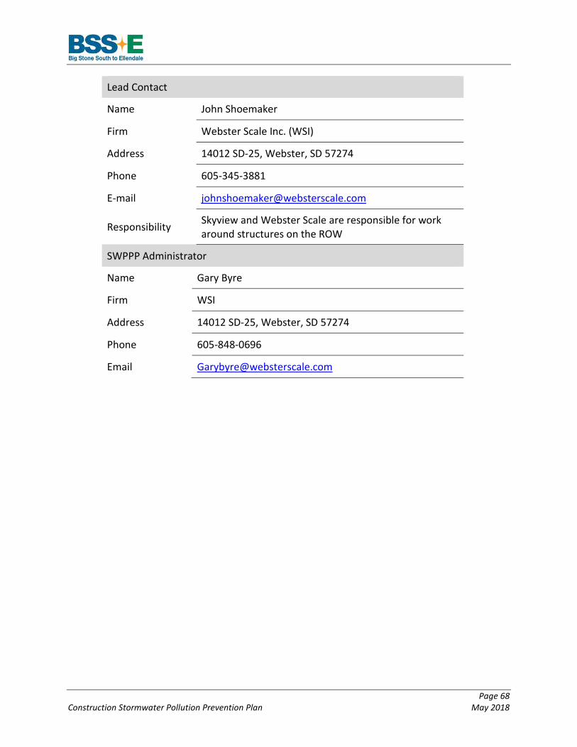
Page 68 Construction Stormwater Pollution Prevention Plan May 2018
Lead Contact
Name John Shoemaker
Firm Webster Scale Inc. (WSI)
Address 14012 SD-25, Webster, SD 57274
Phone 605-345-3881
E-mail [email protected]
Responsibility Skyview and Webster Scale are responsible for work around structures on the ROW
SWPPP Administrator
Name Gary Byre
Firm WSI
Address 14012 SD-25, Webster, SD 57274
Phone 605-848-0696
Email [email protected]

Page 69 Construction Stormwater Pollution Prevention Plan May 2018
2.13.3 Operator 2: Dahn
Lead Contact
Name Keith Dahn
Firm Dahn
Address 13135 Doyle Path East, Rosemount, MN 55068
Phone (651) 480-1911
E-mail [email protected]
Responsibility Dahn is responsible for off-roadway ROW access work
SWPPP Administrator
Name Jim Macoskey
Firm Dahn
Address 13135 Doyle Path East, Rosemount, MN 55068
Phone (651) 480-1911
Email [email protected]

Page 70 Construction Stormwater Pollution Prevention Plan May 2018
2.14 Certification
2.14.1 North Dakota SWPPP Certification
The SWPPP must be certified as follows prior to implementing the SWPPP in North Dakota.
Operator 1: Skyview/Webster “I certify under penalty of law that this document and all attachments were prepared under my direction or supervision in accordance with a system designed to assure that qualified personnel properly gather and evaluate the information submitted. Based on my inquiry of the person or persons who manage the system, or those persons directly responsible for gathering the information, the information submitted is, to the best of my knowledge and belief, true, accurate, and complete. I am aware that there are significant penalties for submitting false information, including the possibility of fine and imprisonment for knowing violations.”
Name: Title:
Signature: Date:
Operator 2: Dahn “I certify under penalty of law that this document and all attachments were prepared under my direction or supervision in accordance with a system designed to assure that qualified personnel properly gather and evaluate the information submitted. Based on my inquiry of the person or persons who manage the system, or those persons directly responsible for gathering the information, the information submitted is, to the best of my knowledge and belief, true, accurate, and complete. I am aware that there are significant penalties for submitting false information, including the possibility of fine and imprisonment for knowing violations.”
Name: Title:
Signature: Date:
Certification Instructions:
Each primary operator with day-to-day responsibilities must sign the certification and keep the page in this section with the SWPPP. The certification statement must be signed by a responsible corporate officer, a general partner, or a principal executive officer or ranking elected official. The SWPPP may be signed by a duly authorized representative of the individual described above if:
• The authorization is made in writing by the person described above and submitted to the NDDH; and

Page 71 Construction Stormwater Pollution Prevention Plan May 2018
• The authorization specifies either an individual or a position having responsibility for the overall operation of the regulated facility, such as the plant manager, the superintendent, a position of equivalent responsibility, or an individual or position having overall responsibility for environmental matters.
If the authorization is no longer accurate for any reason, a new authorization satisfying the above requirements must be submitted to the NDDH prior to or together with any reports, information or applications signed by the authorized representative.
2.14.2 South Dakota SWPPP Certification
The SWPPP must be certified as follows prior to implementing the SWPPP in South Dakota.
Operator 1: Skyview and Webster “I certify under penalty of law that this document and all attachments were prepared under my direction or supervision in accordance with a system designed to assure that qualified personnel properly gather and evaluate the information submitted. Based on my inquiry of the person or persons who manage the system, or those persons directly responsible for gathering the information, the information submitted is, to the best of my knowledge and belief, true, accurate, and complete. I am aware that there are significant penalties for submitting false information, including the possibility of fine and imprisonment for knowing violations.”
Name: Title:
Signature: Date:
Operator 2: Webster Scale “I certify under penalty of law that this document and all attachments were prepared under my direction or supervision in accordance with a system designed to assure that qualified personnel properly gather and evaluate the information submitted. Based on my inquiry of the person or persons who manage the system, or those persons directly responsible for gathering the information, the information submitted is, to the best of my knowledge and belief, true, accurate, and complete. I am aware that there are significant penalties for submitting false information, including the possibility of fine and imprisonment for knowing violations.”
Name: Title:
Signature: Date:
Operator 3: Dahn “I certify under penalty of law that this document and all attachments were prepared under my direction or supervision in accordance with a system designed to assure that qualified personnel
Page 72 Construction Stormwater Pollution Prevention Plan May 2018
properly gather and evaluate the information submitted. Based on my inquiry of the person or persons who manage the system, or those persons directly responsible for gathering the information, the information submitted is, to the best of my knowledge and belief, true, accurate, and complete. I am aware that there are significant penalties for submitting false information, including the possibility of fine and imprisonment for knowing violations.”
Name: Title:
Signature: Date:
Certification Instructions:
Each primary operator with day-to-day responsibilities must sign the certification and keep the page in this section with the SWPPP. The certification statement must be signed by a responsible corporate officer, a general partner, or a principal executive officer or ranking elected official. The SWPPP may be signed by a duly authorized representative of the individual described above if:
• The authorization is made in writing by the person described above and submitted to the SD DENR; and
• The authorization specifies either an individual or a position having responsibility for the overall operation of the regulated facility, such as the plant manager, the superintendent, a position of equivalent responsibility, or an individual or position having overall responsibility for environmental matters.
If the authorization is no longer accurate for any reason, a new Contractor Authorization Form (included in Section 2.13) satisfying the above requirements must be submitted to the SD DENR prior to or together with any reports, information or applications signed by the authorized representative.
2.14.3 USEPA (Former Boundary of Lake Traverse Reservation) SWPPP Certification
The SWPPP must be certified as follows prior to implementing the SWPPP in the former boundary of Lake Traverse Reservation.
Operator 1: Skyview “I certify under penalty of law that this document and all attachments were prepared under my direction or supervision in accordance with a system designed to assure that qualified personnel properly gather and evaluate the information submitted. Based on my inquiry of the person or persons who manage the system, or those persons directly responsible for gathering the information, the information submitted is, to the best of my knowledge and belief, true, accurate, and complete. I am aware that there are significant penalties for submitting false information, including the possibility of fine and imprisonment for knowing violations.”

Page 73 Construction Stormwater Pollution Prevention Plan May 2018
Name: Title:
Signature: Date:
Operator 2: Webster Scale “I certify under penalty of law that this document and all attachments were prepared under my direction or supervision in accordance with a system designed to assure that qualified personnel properly gather and evaluate the information submitted. Based on my inquiry of the person or persons who manage the system, or those persons directly responsible for gathering the information, the information submitted is, to the best of my knowledge and belief, true, accurate, and complete. I am aware that there are significant penalties for submitting false information, including the possibility of fine and imprisonment for knowing violations.”
Name: Title:
Signature: Date:
Operator 3: Dahn “I certify under penalty of law that this document and all attachments were prepared under my direction or supervision in accordance with a system designed to assure that qualified personnel properly gather and evaluate the information submitted. Based on my inquiry of the person or persons who manage the system, or those persons directly responsible for gathering the information, the information submitted is, to the best of my knowledge and belief, true, accurate, and complete. I am aware that there are significant penalties for submitting false information, including the possibility of fine and imprisonment for knowing violations.”
Name: Title:
Signature: Date: Certification Instructions:
Each operator with day-to-day responsibilities must sign the certification and keep the page in this section with the SWPPP. The SWPPP certification statement, SWPPP modifications, inspection reports, and corrective action reports must be signed by a responsible corporate officer. The aforementioned documents may be signed by a duly authorized representative of the individual described above if:
1. The authorization is made in writing by the person described above; 2. The signed and dated written authorization is included in the SWPPP, and submitted to
USEPA if requested; and 3. The authorization specifies either an individual or a position having responsibility for the
overall operation of the regulated facility or activity such as the plant manager, the
Page 74 Construction Stormwater Pollution Prevention Plan May 2018
superintendent, a position of equivalent responsibility, or an individual or position having overall responsibility for environmental matters.
If the authorization is no longer accurate because a different operator has responsibility for the overall operation of the construction site, a new NOI satisfying the requirements of CGP §1.4 must be submitted to USEPA.

Page 75 Construction Stormwater Pollution Prevention Plan May 2018
2.15 South Dakota Contractor Authorization Form
A blank version of the South Dakota contractor authorization form is available in Appendix J of this document.

Page 76 Construction Stormwater Pollution Prevention Plan May 2018
2.16 Notice of Intent - NDR10-0000 Notice of Intent, SDR100000 Notice of Intent, and CGP Notice of Intent
Copies of the NDDH General Construction Permit Notice of Intent (NOI), SD DENR General Construction Permit NOI, and USEPA NPDES General Construction Permit NOI will be provided in Appendix B once permit coverage is authorized. Coverage documentation will also be included with Appendix B.

Page 77 Construction Stormwater Pollution Prevention Plan May 2018
2.17 Notice of Termination Otter Tail Power and the Operator are required to submit a Notice of Termination (NOT) to the NDDH, SD DENR, and USEPA within 30 days after one or more of the following conditions have been met:
• Final stabilization has been achieved on all portions of the site for which Otter Tail Power and the Operator are responsible and all construction activity is completed; or
• Another owner or operator has assumed control over all areas of the site that have not been finally stabilized.
A blank copy of the NDDH, SD DENR, and USEPA NOT can be found in Appendix C of this SWPPP