consolidation of ku-ring-gai local environmental …
TRANSCRIPT

Ordinary Meeting of Council - 11 September 2018 GB4 39 Item GB4 S11688 1 August 2018
20180911-OMC-Crs-201826369139
CONSOLIDATION OF KU-RING-GAI LOCAL ENVIRONMENTAL PLAN 2015 AND KU-RING-GAI
LOCAL ENVIRONMENTAL PLAN (LOCAL CENTRES) 2012
EXECUTIVE SUMMARY
PURPOSE OF REPORT For Council to consider the preparation of a Planning Proposal for the consolidation of the Ku-ring-gai Local Environmental Plan 2015 and of the Ku-ring-gai Local Environmental Plan (Local Centres) 2012
BACKGROUND Ku-ring-gai currently has three (3) environmental Planning instruments in force being the Ku-ring-gai Planning Scheme Ordinance (KPSO) Ku-ring-gai Local Environmental Plan (Local Centres) 2012 (KLEPLC) and the Ku-ring-gai Local Environmental Plan 2015 (KLEP) The consolidation of these into a single LEP will provide a platform for upcoming LEP update to implement North District Plan
COMMENTS While the consolidation of the LEPs will largely be an administrative process there have been a number of mapping errors and minor planning anomalies that are proposed to be resolved as part of the process It is also intended to finalise the remaining area deferred from the KLEP 2015
RECOMMENDATION That a Planning Proposal for the consolidation of the KLEP 2015 KLEP LC 2012 and the KPSO be prepared and submitted for a Gateway Determination
Ordinary Meeting of Council - 11 September 2018 GB4 40 Item GB4 S11688 1 August 2018
20180911-OMC-Crs-201826369140
PURPOSE OF REPORT
For Council to consider the preparation of a Planning Proposal for the consolidation of the Ku-ring-gai Local Environmental Plan 2015 and of the Ku-ring-gai Local Environmental Plan (Local Centres) 2012 BACKGROUND
Ku-ring-gai currently has three (3) environmental planning instruments in force being the Ku-ring-gai Planning Scheme Ordinance 1971 (KPSO) Ku-ring-gai Local Environmental Plan (Local Centres) 2012 (KLEP LC) and the Ku-ring-gai Local Environmental Plan 2015 (KLEP) Ku-ring-gai Local Environmental Plan (Local Centres) 2012
The Ku-ring-gai Local Environmental Plan (Local Centres) 2012 (KLEP LC 2012) applies to the 6 local centres within the local government area which comprises the land surrounding Turramurra Pymble Gordon Lindfield Roseville railways stations and St Ives The LEP was prepared in accordance with the NSW Governmentrsquos Standard Instrument LEP The plan was made on 25 January 2013 and came into effect on 8 February 2013
Figure 1- Land covered by KLEP LC 2012 Figure 2 ndash Land covered by KLEP 2015
Ku-ring-gai Local Environmental Plan 2015
KLEP 2015 applies to the majority of land within Ku-ring-gai The KLEP 2015 was largely a translation of the Ku-ring-gai Planning Scheme Ordinance into the standard instrument format The LEP was made on 5 March 2015 came into effect on 2 April 2015
Ordinary Meeting of Council - 11 September 2018 GB4 41 Item GB4 S11688 1 August 2018
20180911-OMC-Crs-201826369141
In adopting the KLEP 2015 Council deferred 13 areas from the LEP for further review 13 of these areas were identified as high bushfire evacuation risk areas which were deferred to allow reassessment of evacuation risk and proposed zoning changes Council prepared a Planning Proposal to include these 13 areas into the KLEP 2015 The Planning Proposal was exhibited from 17 November 2016 ndash 16 December 2016 At the Council meeting of 2 May 2017 Council resolved to adopt the Planning Proposal The LEP amendment to bring the13 areas into the KLEP2015 was made on 19 January 2018 and came into effect on 2 February 2018 The Ku-ring-gai Planning Scheme Ordinance (KPSO)
The KPSO is a non-standard environmental planning instrument that has been in force since 1971 It now only applies to the remaining 2 areas deferred from KLEP 2015 These are
Area 14 - Land in the vicinity of lsquoThe Briarsrsquo 14 Woonona Avenue Wahroonga This area involves land in the vicinity of lsquoThe Briarsrsquo a State listed heritage item at 14 Woonona Avenue Wahroonga This land includes 16 amp 18 Woonona Avenue (also known as 2-14 Everett Way) and 3-13 15 17 19 Bundarra Avenue South Wahroonga The area was deferred to allow reassessment of the R4 High Density Zone and development standards in this location The reassessment of deferred area 14 has been undertaken as part of the preparation of this report This assessment is documented below and includes recommendations for the future zoning and development standards to apply to the site under KLEP 2015
Area 15 - Killara Golf Club An area of land at Killara Golf Club The land comprises Lot 2 DP535219 and is located at the eastern portion of the Golf Club The area was deferred to allow reassessment of the RE2 Private Recreation zoning on this parcel of land which was previously zoned part Residential 2(b) under the Ku-ring-gai Planning Scheme Ordinance A private Planning Proposal has been lodged by the Killara Golf Club which seeks to rezone the north-east portion of the Killara Golf Course land from the existing Low Density Residential 2(b) zoning under the KPSO to part High Density Residential R4 and part Low Density Residential R2 under the KLEP 2015 with associated height and FSR standards The Planning Proposal also seeks to increase the extent of the existing Heritage Item Clubhouse under the KLEP 2015 to include a new curtilage The Planning Proposal was placed on public exhibition from 3 May to 31 May 2018 and is due to be reported back to Council in coming weeks Implementation of the North District Plan
The NSW Government released lsquoThe Greater Sydney Region Plan - A Metropolis of Three Citiesrsquo and associated North District Plan in March 2018 Section 38(3) of the EPampA Act requires each Council as soon as practicable after a district strategic plan is made to ldquogive effect tordquo (deliver) the objectives and priorities of the District Plan through its local environmental plan (LEP) In order to do this there is a considerable amount of work Council must do over the next 18 months to 2 years This involves a number of tasks including
Ordinary Meeting of Council - 11 September 2018 GB4 42 Item GB4 S11688 1 August 2018
20180911-OMC-Crs-201826369142
reviewing Councils existing strategic planning framework including a review of the existing Ku-ring-gai local environmental plans against the North District Plan
preparing a local strategic planning statement (LSPS) which will guide the update of local environmental plans The role of the local strategic planning statement is to provide an alignment between regional and district plans and local strategic planning and delivery
undertaking necessary supporting studies and strategies such as o the preparation of local character statements
o the preparation of local housing strategies including identification of housing targets (6-10 years) and 20-year capacity
o studies on other strategic issues such as open space and recreation accessibility environment employment and social infrastructure and
o identifying infrastructure funding opportunities including updating of Councils existing contributions plans
Given the significance of the upcoming strategic planning work to be undertaken by Council it is considered important that a platform of a single LEP applying to the whole local government area be in place beforehand This will help avoid complications and facilitate a more efficient administration of amendments to Ku-ring-gairsquos LEP to implement Councilrsquos future strategic planning decisions around the North District Plan delivery
COMMENTS
It is intended that the process for consolidating the LEPs will be achieved through the KLEP LC 2012 into the KLEP 2015 to form a single LEP applying to the whole of the local government area Merging the two LEPs into one planning instrument will remove any inconsistencies between the two plans and assist in reducing the complexity of the local planning system While the consolidation of the LEPs will largely be an administrative process there have been a number of minor planning anomalies that are proposed to be addressed through the process The objectives of the process include resolving the planning for the remaining area deferred from the KLEP 2015 - land in the vicinity
of lsquoThe Briarsrsquo 14 Woonona Avenue Wahroonga This would then allow for the repeal of the Ku-ring-gai Planning Scheme Ordinance
resolving mapping errors - the mapping errors occurred in the course of preparing the KLEP (Local Centres) 2012 and KLEP 2015 The mapping errors are minor in nature and are generally in the form of incorrect zoning or development standards applying to sites which occurred during the translation over from the KPSO
resolving a number of outstanding heritage matters including
o new heritage listings for Lindfield Pymble Roseville and Turramurra railway stations as local heritage items under Schedule 5 and on the heritage map
o the adjustment of heritage listing in cases where subdivisions of existing heritage items have been approved and new dwellings have been constructed on the new lots
o a review of the heritage listing of 663 Pacific Highway Killara (also known as 2B Bruce Avenue Killara)
o minor miscellaneous corrections to Schedule 5
Ordinary Meeting of Council - 11 September 2018 GB4 43 Item GB4 S11688 1 August 2018
20180911-OMC-Crs-201826369143
removing two existing land reservations from KLEP 2015 These include a local road
reservation in Holford Crescent in Gordon and a local open space reservation in Glen Road Roseville In both cases the acquisition commitment represents an unfunded liability to Council and
merging the two written instruments and resolve inconsistencies between the instruments Each of these matters are discussed in further detailed below Mapping Corrections
Through the operation of the KLEP LC 2012 and KLEP 2015 over the last 3 to 6 years a number of minor mapping errors or anomalies have come to light They are generally minor in nature and occurred in the course of preparing the KLEP LC 2012 and KLEP 2015 There are in order of 100 sites that have been identified which contain such errors or anomalies They typically fall into the following categories
residential zoned land with missing or incorrect development standards development standards on land in a zone that would not normally contain development
standards eg Council bushland zoned E2 Environmental conservation and incorrect zoning being applied to land in the process of translating from the KPSO eg
Council bushland or open space picking up the adjoining R2 Residential zone In one case a small lot adjoining the rail corridor has been zoned SP2 Infrastructure instead of R4 High Density Residential
All identified proposed mapping changes are included at Attachment A1 to this report For each
site there are maps which identify the current and proposed amendments
Note Attachment A1 also includes the recommended mapping changes in the following sections of
this report
Deferred Area 14 ndash The Briars
Background
At Councilrsquos meeting of 26 November 2013 Council resolved to defer land adjacent to Heritage Item The Briars to allow further investigation into the implications of the proposed R4 (High Density Residential) zoning on the Heritage Item The deferred land is known as Deferred Area 14 under the Ku-ring-gai LEP 2015 (KLEP 2015) Councilrsquos relevant resolution was as follows
N That Council request the Minister to defer from the draft KLEP the land in the vicinity of the Briars 14 Woonona Ave Wahroonga This land includes 16 amp 18 Woonona Ave (also known as 2- 14 Everett Way) and 3-13 15 17 19 Bundarra Avenue South Wahroonga Upon deferral of the land a further report be brought back to Council containing an assessment of the application of the R4 Zone and relevant development standards in this location
Ordinary Meeting of Council - 11 September 2018 GB4 44 Item GB4 S11688 1 August 2018
20180911-OMC-Crs-201826369144
Deferred Area 14 as illustrated below is located in Wahroonga close to the Pacific Highway and the M1 Motorway The site is bound by Everett Way to the north Woonona Ave to the east and Bundarra Ave South to the west It sits adjacent to and in the vicinity of the Heritage Item at 14 Woonona Ave Wahroonga known as The Briars
The properties within the deferred area have continued to operate under the Ku-ring-gai Planning Scheme Ordinance (KPSO) and the applicable standards under that instrument since 2004 On 26 November 2013 Council considered a report recommending the translation of the KPSO into the draft KLEP 2013 to align with the Department of Planningrsquos Standard Instrument Template The translation saw the conversion of land zoned Residential 2(d3) under the KPSO to R4 (High Density Residential) under the KLEP maintaining the same development standards on the land This translation was applied to all land within the Deferred Area 14 zoned Residential 2(d3) In addition the same zoning was applied to the access handle to 3-13 Bundarra Ave South zoned Residential 2(c) under the KPSO The following table lists the individual affected lots and their zoning under the KPSO and the zoning that was proposed in the draft KLEP 2013 at 26 November 2013 Deferred Area 14 ndash Affected Lots Address (Wahroonga) KPSO ndash current effective Draft KLEP 2013 ndash proposed 2013 15 Bundarra Ave South Lot 105185 DP 1210393
Residential 2(d3) R4 (High density Residential)
17 Bundarra Ave South Lot 105186 DP 1210393
Residential 2(d3) R4 (High density Residential)
19 Bundarra Ave South Lot 105187 DP 1210393
Residential 2(d3) R4 (High density Residential)
3-13 Bundarra Ave South Lot 143460 DP 1118152
Residential 2(d3) R4 (High density Residential) Residential 2(c) ndash driveway only
Ordinary Meeting of Council - 11 September 2018 GB4 45 Item GB4 S11688 1 August 2018
20180911-OMC-Crs-201826369145
Deferred Area 14 ndash Affected Lots Address (Wahroonga) KPSO ndash current effective Draft KLEP 2013 ndash proposed 2013 16 Woonona Ave Lot 139356 DP 1027365
Residential 2(d3) R4 (High density Residential)
18 Woonona Ave Lot 134569 DP 1033850
Residential 2(d3) R4 (High density Residential)
At Councilrsquos 26 November 2013 meeting concern was raised about the impact of the proposed R4 zoning on The Briars heritage item As a result Council resolved that further investigation be conducted to ensure due consideration of the implications of the proposed zoning to the Item As illustrated in the table above the majority of the land surrounding The Briars is currently zoned under the KPSO as high density Residential 2(d3) with the exception of a battle-axe handle directly south of The Briars zoned low density Residential 2(c) and a park on the eastern side which is zoned RE1 Public Recreation ldquoThe Briarsrdquo
The Briars located at 14 Woonona Ave Wahroonga is a State Significant Heritage Item listed on the NSW State Heritage Register Built in 1895 The Briars is a transitional Victorian ItalianateFederation single storey brick house The Briars has state heritage significance for its historic cultural archaeological and aesthetic values
Ordinary Meeting of Council - 11 September 2018 GB4 46 Item GB4 S11688 1 August 2018
20180911-OMC-Crs-201826369146
The deferral from KLEP 2015 of the land surrounding The Briars provided an opportunity to further investigate zoning and by association potential future development of the adjoining sites to achieve outcomes more compatible with the heritage significance of the property Assessment
In conjunction with background research two site visits by Council officers were conducted during September 2017 and February 2018 The following observations were made regarding the status of the deferred sites and their current and potential future impact on the Heritage Item 15 17 19 Bundarra Ave South
15 17 and 19 Bundarra Avenue South have not been redeveloped to the high density Residential 2(d3) potential currently available under the KPSO They remain as single storey bungalows The sites are owned by Abbotsleigh Girls School which has its junior school located directly opposite on Everett Way with main frontage to Woonona Ave It is likely that the site will be redeveloped for school purposes in the medium to long term The site is not directly adjacent to The Briars site with 16 Woonona Ave separating the two The existing one and two storey town house development at 16 Woonona Ave and the trees on The Briars site provide a suitable separation
and visual buffer between The Briars and any future high density development at 15 17 and 19 Bundarra Avenue South In addition the fall of the land from The Briars downslope to Bundarra Avenue South will further diminish the bulk and scale of any future development on the site Given the fall in the land the separation distance and the substantial vegetative buffer it is proposed that 15 17 and 19 Bundarra Avenue South be zoned R4 (High Density Residential) with the same standards as the neighbouring 3-13 Bundarra Avenue South
Ordinary Meeting of Council - 11 September 2018 GB4 47 Item GB4 S11688 1 August 2018
20180911-OMC-Crs-201826369147
3-13 Bundarra Ave South
3-13 Bundarra Avenue South is strata subdivided with two 5 storey residential flat buildings (facing Bundarra Avenue South) and one 3 storey residential flat building (at the rear of the site on the east boundary closest to the Heritage Item) The development has addressed its locational proximity to the Heritage Item through a reduction in building height from 5 to 3 storeys at the rear of the property The impact on the Heritage Item was assessed as part of the DA approval which found this built form response appropriate
Ordinary Meeting of Council - 11 September 2018 GB4 48 Item GB4 S11688 1 August 2018
20180911-OMC-Crs-201826369148
The Heritage Item at 8 Woonona Avenue located south of The Briars and comparable to the height and scale of The Briars is owned by the Department of Health This site is heavily planted with large mature trees providing a significant tree buffer and vegetative screen between The Briars and the apartments at 3-13 Bundarra Avenue South In addition the land drops substantially (approximately 3m) to the west downslope from The Briars This fall reduces the bulk and scale of the apartments and diminishes the visual impact of the high density apartments on the single storey Heritage Item With the apartments appearing to be of two storey height and the view to the apartments broken up and screened by the trees the impact on the Heritage Item is considered minimal Whilst the site fronts Bundarra Avenue South it has an access handle connection to Woonona Ave utilised as a pedestrian link to the development This access handle is directly adjacent to The Briars with the potential for greatest impact on the Heritage Item however the KPSO low density Residential (2c) zoning has ensured a limited impact on the Item The figures in the Table below illustrate that the existing apartment development under the approved DA is consistent with an R4 zoning with a reduced height building to the rear giving regard to the Heritage Item Existing Building Approved DA under KPSO
FSR Height 3-13 Bundarra Ave South 111 5 storey 178m 3 storey 106m Existing Planning Standards ndash KPSO FSR Ceiling Height Residential 2(d3) high density 0851 (KPSO pg132) 134 (KPSO pg61) Planning Standards ndash KLEP 2015
FSR Height R4 (High Density Residential) 131 175
It is highly unlikely that this site will be redeveloped It is therefore proposed that 3-13 Bundarra Avenue South be zoned R4 (High Density Residential) except for the battle-axe handle which is proposed to be zoned R2 (Low Density Residential) 16 and 18 Woonona Ave
16 and 18 Woonona Avenue comprise strata subdivided dwellings constructed The buildings are in good order with multiple owners and as such their redevelopment is highly unlikely in the absence of significant development uplift Both properties have minimal impact on the Heritage Item as they are one to two storey developments 16 Woonona Ave is located downslope from the Item and 18 Woonona Ave is separated from the Item by the driveway of 16 Woonona Ave
Ordinary Meeting of Council - 11 September 2018 GB4 49 Item GB4 S11688 1 August 2018
20180911-OMC-Crs-201826369149
Whilst the existing dwellings are of a town-house type typically associated with the Ku-ring-gai LEPrsquos R3 (Medium Density Residential) zoning their site coverage is at approximately 48-50 which exceeds the maximum 40 permitted under the Ku-ring-gai DCP with minimal provision of deep soil and landscaped areas as illustrated in the above diagrams In addition the existing buildings have not developed to the full potential of the site under the current KPSO zoning Existing Building Approved DA under KPSO FSR Height 16 Woonona Ave 041 617m 18 Woonona Ave 051 685m Existing Planning Standards ndash KPSO FSR Ceiling Height Residential 2(d3) high density 0851 (KPSO pg132) 134 (KPSO pg61) Planning Standards ndash KLEP 2015 FSR Height R3(Medium Density Residential) 081 115 R4(High Density Residential) 131 175
The KPSO stipulates a height limit of 134m In the exhibited draft KLEP 2013 the height limit was proposed as 175m It is proposed to apply an R4 (High Density Residential) zoning with a reduced maximum height of 115m (3 storey) and FSR of 081 This will ensure that should the site be redeveloped in the very long term the outcome will remain compatible with the Heritage Item in a similar manner to that achieved on 3-13 Bundarra Ave South (with its 3-storey building at the rear accommodating its proximity to the Item) In addition the R4 zoning and built form generated will provide the opportunity to increase deep soil and associated landscaping provision through a reduced footprint and site coverage This will enable the provision of large screening trees and vegetation within setbacks to The Briars
Ordinary Meeting of Council - 11 September 2018 GB4 50 Item GB4 S11688 1 August 2018
20180911-OMC-Crs-201826369150
In addition this proposal will enable the sites to continue to provide a suitable interface between the Heritage Item and the potential future development of 5 17 and 19 Bundarra Avenue South with its proposed high density zoning to a maximum of 5 storeys This approach is consistent with the KLEP 2015 where interface areas have sometimes been applied between high and low density sites Other Considerations
Under the draft KLEP 2013 all aspects of Deferred Area 14 were investigated It was found that there were no heritage riparian key sites land applications or land reservation acquisitions associated with any of the sites therefore no amendments to the KLEP 2015 are required in these categories The only two aspects where amendments were proposed under the draft KLEP 2013 were the biodiversity mapping and the acid soil mapping These were extended as illustrated in the diagrams below
The status of the biodiversity mapping and the acid soil mapping has not altered since the exhibition of the draft KLEP 2013 therefore it is proposed that the same mapping be replicated in this proposed amendment to KLEP 2015 Recommendation
It is recommended that amendment be made to the KLEP 2015 to apply zoning and associated standards to the sites within Deferred Area 14 as per the table and maps below and amendments be made to the Biodiversity and Acid Soils Mapping to reflect the current status of the land as per the maps above
Deferred Area 14 ndash Proposed amendments to KLEP 2015 Address Zoning Maximum Height Maximum FSR Minimum Lot Size 18 Woonona Ave R4 L - 115m 081 1200sqm
16 Woonona Ave R4 L - 115m 081 1200sqm
3-13 Bundarra Ave South
R4 P ndash 175m 131 1200sqm R2 (driveway) J2 ndash 95m 031 1200sqm
Ordinary Meeting of Council - 11 September 2018 GB4 51 Item GB4 S11688 1 August 2018
20180911-OMC-Crs-201826369151
Deferred Area 14 ndash Proposed amendments to KLEP 2015 15 Bundarra Ave South R4 P ndash 175m 131 1200sqm 17 Bundarra Ave South R4 P ndash 175m 131 1200sqm 19 Bundarra Ave South R4 P ndash 175m 131 1200sqm Amendments to Heritage listings
Roseville Lindfield Pymble and Turramurra Railway Stations
Discussion
All NSW State Government instrumentalities organisations and agencies are required to prepare heritage and conservation registers in accordance with Section 170 of the NSW Heritage Act 1977 Section 170 requires agencies to identify conserve and manage heritage assets owned occupied or managed by that agency The register identifies buildings but may also include natural moveable archaeological landscapes and Aboriginal heritage The progress of agencies in preparing registers and managing their heritage assets is monitored by the Heritage Council and Section 170 Registers are submitted to the Heritage Council of NSW for endorsement The Section 170 Register maintained by RailCorp includes all eight railway stations located within the Ku-ring-gai local government area Currently the KLEP 2015 and KLEP LC 2012 only include four of these railway stations as heritage items within Schedule 5 (Environmental Heritage) being Killara Gordon Warrawee and Wahroonga A heritage listing exists for the Rohini House Gates which are located at the northern end of the railway carpark at Turramurra Station As a consequence the Turramurra Railway Station is also mapped as a heritage item within the KLEP LC 2012 however the item name does not reference the railway station Therefore for the purposes of this report Turramurra is included as a railway station not currently heritage listed As properties and assets included on Section 170 registers have already been assessed for their heritage significance it is recommended that Council resolve to include the remainder of the railway stations within Schedule 5 of the consolidated LEP being Roseville Railway Station Lindfield Railway Station Pymble Railway Station and Turramurra Railway Station (including reference to Rohini House Gates) Heritage Inventory Sheets for these proposed new heritage items have been compiled from information contained within the existing Section 170 Register for Roseville Lindfield Pymble and Turramurra railway stations These will form part of the publicly exhibited documents as part of the exhibition of the consolidated LEP Additionally several of the already listed railway stations do not have existing Inventory Sheets available to the public (Killara Warrawee and Wahroonga) These have also been prepared and will be included in the exhibition material Recommendation
It is recommended that Council resolve to heritage list Roseville Lindfield Pymble and Turramurra railway stations within the consolidated LEP and include associated heritage inventory sheet as part of any public exhibition process It is further recommended that Council resolve to exhibit either new or amended heritage inventory sheets for Killara Warrawee and Wahroonga railway stations
Ordinary Meeting of Council - 11 September 2018 GB4 52 Item GB4 S11688 1 August 2018
20180911-OMC-Crs-201826369152
663 Pacific Highway Killara (also known as 2B Bruce Avenue Killara)
Discussion
This property is a listed local heritage item within KLEP LC 2012 (I31) The site was initially identified in the lsquoMunicipality of Ku-ring-gai Heritage Studyrsquo prepared by Robert Moore Penelope Pike Helen Proudfoot and Lester Tropman amp Associates in 1987 The statement of significance for the site claims
lsquoThe property at 663 Pacific Highway Killara is of local heritage significance for its historic values historical associations and aesthetic values The site provides evidence of the pattern of development in Killara in the early 20th century being a substantial architect designed house in an established garden settingrsquo
The State Heritage Inventory form for the property contains limited information due to age of the original study Accordingly an updated form has been prepared and is included to this report at Attachment A3 The property is located on the boundary of the KLEP 2015 and KLEP LC 2012 but is contained within the KLEP LC 2012 area In July 2012 Council considered a report following the public exhibition of the KLEP LC 2012 which included a response to a submission made in relation to the inclusion of 2B Bruce Avenue Killara as a local heritage item The report incorrectly identified the site as being outside of the boundaries of the KLCLEP and recommended this matter be considered as part of the principal LEP Following its consideration of the report Council resolved inter alia to lsquoreview the heritage listing of 663 Pacific Highway Gordonrsquo This resolution remains valid and is being actioned as part of this report At Councilrsquos request additional information was submitted by the property owner in early 2017 requesting that Council action the resolution and review the heritage listing of the site The information provided by the owners did not include a professional heritage assessment of the property but contests the heritage listing on the following grounds
the site is no longer of landmark significance and because of works over the last 40 years no longer has historical or architectural significance
the name of the original architect has not been located and therefore claims of architectural significance are largely void
the building is not a unique example of architecture from this era for example 49 and 51 Werona Avenue Gordon are better examples of the architectural and municipal significance of the federation era
the aesthetic contribution of the property has been directly impacted by surrounding developments on all adjoining sides impacting any landmark value previously associated with the property
there are not known special associations with any community or cultural group and the identified land owner has little or no heritage significance as numerous other sites owned by the same owner have been subdivided and redeveloped
the site cannot be considered rare and the site is representative of dwellings of the late 20th century middle class typologies in an
area which has many other examples of this age of building
Ordinary Meeting of Council - 11 September 2018 GB4 53 Item GB4 S11688 1 August 2018
20180911-OMC-Crs-201826369153
The subject site contains a substantial two storey Federation era Arts and Craft style dwelling house The site is approximately 1300 square metres in size and is located on a prominent corner and is highly visible from both the Pacific Highway and Bruce Avenue The site also contains significant tree screening particularly to its northern boundary with 667 Pacific Highway
663 Pacific Highway Killara front building elevation and facade
663 Pacific Highway Killara side elevation as seen from Bruce Street
This matter was considered by the Heritage Reference Committee on 28 June 2017 who concluded that lsquothe committee does not support the delisting and believe the substantive reasons for the listing remainrsquo
The site is listed as a local heritage item and it is considered to have historic historical association aesthetic rarity and representative values
The building has historic significance as it provides distinctive evidence of the pattern of development in Ku-ring-gai in the early 20th Century through the subdivision of larger estates and ongoing development of the land
Council staff have been able to confirm using primary historical evidence that the architect for the building was Charles Assinder Harding Harding is considered to be a well-known building surveyor and architect who worked in both a public and private capacity His involvement with designing three lighthouses within New South Wales gained him a reputation as the first and only specialist lighthouse architect in NSW Additionally the site has historical association value via its
Ordinary Meeting of Council - 11 September 2018 GB4 54 Item GB4 S11688 1 August 2018
20180911-OMC-Crs-201826369154
relationship to the subdivision of Fosterrsquos Grant and Brownrsquos Estate The house was commissioned by Brownrsquos daughter Sophia Laing (nee Brown) following her fatherrsquos death in 1884 The property meets the threshold for aesthetic significance as a substantial Arts and Crafts style Federation era dwelling house retaining much of its original form and material such as projecting front bay with deep verandah prominent eaves with exposed rafters recessed entrance way with shingled porch oriel and leadlight windows restrained timber detailing rough cast upper second storey exterior finish and two tapered rough cast chimneys with terracotta chimney pots It is noted that the site has undergone modifications and a reduction in curtilage over time However these modifications have not undermined the assessed values of the property so as to warrant removal of the heritage listing Despite modifications the property still exhibit many of the characteristics and features of building of this style and is clearly discernible as an Arts and Craft Federation dwelling house The building is considered to be a rare surviving example of Hardingrsquos private work following his cessation of his government employment The other properties known to have been designed by Harding being No 657 Pacific Highway (Tredegar) and Nos 1 3 amp 5 Bruce Avenue Killara have been demolished The property is also identified as a fine representative example of a substantial architect designed dwelling house from the Federation Era in a Arts and Craft style Heritage was considered as part of the assessment of redevelopment of the adjoining land at 667 Pacific Highway and 2A Bruce Avenue for two residential flat buildings The new structures on these sites have been set back approximately 12 metres from the heritage itemrsquos northern elevation and 18 metres from the rear of the building Further the facades of both new structures have been setback from their main street elevations which ensures the heritage building at 663 Pacific Highway is not visually dominated by the new structures The corner lot location of the subject site results in the heritage item being visually prominent to both the Pacific Highway and Bruce Avenue which has not be compromised by the new developments It is not agreed that the site at 663 Pacific Highway is no longer of landmark significance due to the recent development The site remains visually prominent within the streetscape of the both Pacific Highway and Bruce Avenue The setbacks provided to the new structures ensure that a reasonable curtilage has been maintained for the site It is considered that 663 Pacific Highway Killara meets five of the thresholds for heritage listing under the NSW Heritage Councilrsquos Standard Heritage Assessment Criteria being historic significance historical association aesthetic significance rarity and representativeness Only one criterion needs to be satisfied to justify a heritage listing Recommendation
It is recommended that Council resolved to retain 663 Pacific Highway Killara as a local heritage item within the consolidated LEP
Ordinary Meeting of Council - 11 September 2018 GB4 55 Item GB4 S11688 1 August 2018
20180911-OMC-Crs-201826369155
7A Fairway Avenue Pymble
Discussion
In 2011 development consent was granted for alterations and additions to existing dwelling and construction of a new dwelling as a detached dual occupancy at 7 Fairway Avenue Pymble A further development application was lodged in 2011 for the Torrens Title subdivision of the dual occupancy which led to the creation of 7A Fairway Avenue Pymble
Current KLEP 2015 heritage affectation for 7 and 7A Fairway Avenue Pymble as shown shaded in blue outline showing both sites as heritage items
7 Fairway Avenue is a listed heritage item within the KLEP 2015 The application to subdivide the land into two separate lots did not also seek to remove the heritage listing from the newly created lot Therefore 7A Fairway Avenue has retained the heritage listing applied to the original lot 7A Fairway Avenue contains a newly constructed dwelling house and should not be heritage listed Recommendation
It is recommended Council resolves to remove the heritage listing for 7A Fairway Avenue Pymble (being Lot 1 in DP 1175928) from the consolidated LEP as a consequence of it being a newly created lot containing a new dwelling house The heritage listing for 7 Fairway Avenue is to be retained The Broadway Wahroonga
Discussion
The Broadway is a locally listed heritage item consisting of remnant paving and original alignment relating to a proposed thoroughfare built by Ku-ring-gai Shire Council in 1927 to provide a western arterial route to the Harbour Bridge It also related to remains of an access route to a proposed residential subdivision off the proposed new route Despite neither project ever being completed the site remains of historical value and is therefore listed as a heritage item within the KLEP 2015 The site has technical significance as the technology used in the construction of the roadway is representative of the labour intensive (possibly hand packed) sandstone base course Telford type
The heritage item (I1101) is mapped on the associated KLEP 2015 Heritage Map as being located at 32 The Broadway Wahroonga However the location of item as shown on this map is incorrect The remnant materials are located along the eastern edge of The Broadway and continue around to Muttama Street
Ordinary Meeting of Council - 11 September 2018 GB4 56 Item GB4 S11688 1 August 2018
20180911-OMC-Crs-201826369156
Recommendation
It is recommended that Council resolved to amend the Heritage Map for Item No 1101 from the current mapping to the proposed new mapping (as shown at within the consolidated LEP This change will ensure that the heritage item is correctly identified to ensure its ongoing protection 55 Hastings Road Warrawee
Discussion
55 Hastings Road Warrawee is a local heritage item known as lsquoKooyongrsquo listed in the KLEP 2015 In 2003 the NSW Land and Environment Court approved the subdivision of the land to create three lots being 2A and 2B Pibrac Avenue Warrawee A new dwelling house has been erected on each lot
Current KLEP 2015 heritage affectation for 55 Hastings Road 2A and 2B Pibrac Avenue Warrawee as shown shaded in blue outline showing both sites as heritage items
At the time of subdivision the heritage affectation was not removed from the land as part of this process Consequently 2A and 2B Pibrac Avenue are listed as heritage items despite comprising new dwelling houses As this land has been subdivided from its original lot and now contain new dwelling houses it is appropriate that the heritage listing be removed from these sites Recommendation
It is recommended that Council resolves to remove the heritage listing of 2A and 2B Pibrac Avenue Warrawee as heritage items from the consolidated LEP
Ordinary Meeting of Council - 11 September 2018 GB4 57 Item GB4 S11688 1 August 2018
20180911-OMC-Crs-201826369157
62 Livingstone Avenue Pymble
Discussion
62 Livingstone Avenue Pymble is listed as a local heritage item within the KLEP 2015 (Item No I560) The property is also located within the draft West Pymble Heritage Conservation Area The current property owner recently made contact with Council to query the heritage listing of his property
62 Livingstone Avenue (I560) and 66 Livingstone Avenue (I561) as shown in KLEP 2015 Heritage Map
Investigations indicate that the building on the site was constructed in 2000 following the lotrsquos subdivision from the adjoining lot at 66 Livingstone Avenue At the same time nos 8 10 and 12 Penrhyn Avenue Pymble were also created as lots within DP 1009908 66 Livingstone Avenue is a listed heritage item within the KLEP 2015 (Item No 561) It appears that the heritage listing has inadvertently been applied to the lot at 62 Livingstone Avenue Pymble
Image of 62 Livingstone Avenue Pymble
Ordinary Meeting of Council - 11 September 2018 GB4 58 Item GB4 S11688 1 August 2018
20180911-OMC-Crs-201826369158
Recommendation
It is recommended that Council resolves to remove the heritage listing of 62 Livingstone Avenue Pymble as a heritage item from the consolidated LEP 1 Vista Street Pymble
1 Vista Street Pymble is listed as a local heritage items known as ldquoRobyn Hillrdquo in the KLEP 2015 (Item No I656) Council has received advice that the propertyrsquos name is incorrect and should be referred to as ldquoTarquiniardquo Recommendation
It is recommended that Council resolves to amend the item name for 1 Vista Street Pymble to ldquoTarquiniardquo in the consolidated LEP 5 Womerah Street Turramurra
5 Womerah Street Turramurra is listed as I815 in schedule 5 with the property description Lot 3 DP 31561 In 2017 the owners amended the address to create 5 Womerah Street (Lot 4 DP 31561) and 7 Womerah Street (Lot 3 DP 31561) Subsequently development approval was given for a new dwelling to be constructed on 7 Womerah Street Recommendation
It is recommended that Council resolves to amend Schedule 5 to reflect the new house numbering and the correct property description with the heritage item being at 5 Womerah Street (Lot 4 DP 31561) Additional matters
Schedule 5 Part 1 (Heritage Items) and Part 2 (Heritage Conservation Areas)
Discussion
There are currently two Schedule 5 environmental heritage lists which apply to the Ku-ring-gai local government area contained within the KLEP 2015 and KLCLEP 2012 The process of preparing a consolidated LEP means these two lists will need to be merged into a single schedule and a new heritage map prepared The new Schedule 5 will be developed in alphabetical order by suburb and will be included as part of the exhibition material for the consolidated LEP Recommendation
It is recommended that Council resolved to prepare a new consolidated Schedule 5 Environmental Heritage Part 1 and Part 2 for inclusion within the consolidated LEP incorporating the amendments recommended in this report
Ordinary Meeting of Council - 11 September 2018 GB4 59 Item GB4 S11688 1 August 2018
20180911-OMC-Crs-201826369159
Removal of Existing Reservations for local infrastructure
The KLEP 2015 includes two (2) reservations for which Council is the relevant acquisition authority under cl51(2) LEP These include a ldquolocal roadrdquo reservation in Holford Crescent Gordon and a ldquolocal open spacerdquo reservation in Glen Road Roseville If the landholders of these parcels of land can demonstrate that they will suffer hardship if there is a delay in the land being acquired by Council section 23 of the Land Acquisition (Just Terms Compensation) Act 1991 requires Council to acquire the land In both cases the acquisition commitment represents an unfunded liability to Council Holford Crescent Gordon- Local Road Reservation
The road reservation in Holford Crescent Gordon was previously included in the KPSO and was carried over to the KLEP 2015 in the translation process Under the KPSO the land has been zoned SP2 Infrastructure ndash Local Road The land has also been identified on the Land Reservation Acquisition Map Refer to map below The KPSO also included a clause (cl59) that would require a landholder to construct the identified road as part of any future subdivision of that land However an equivalent clause has not been included in the KLEP 2015 This is because under the EPampA Act the only way Council can now seek a contribution to the provision of infrastructure is via section 94 (unless the landowner is willing to voluntarily dedicate the land to Council ndash that would require a VPA) Clause 59 of the KPSO predates the EPampA Act The acquisition of the land and the construction of the road are not works identified in the current s94 plan Therefore the future acquisition of the land for the road represents an unfunded liability for Council from a contributions viewpoint nor is there capacity to provide an offset or reduction in s94 contributions against any VPA or works in kind for the provision of the road should the land holder wish to do so It would be difficult to justify the inclusion of the cost of acquisition in a future contributions plan due to the small number of landholders that would benefit from this infrastructure Consequently it is proposed to remove the reservation from the KLEP 2015 as identified in the maps below
Ordinary Meeting of Council - 11 September 2018 GB4 60 Item GB4 S11688 1 August 2018
20180911-OMC-Crs-201826369160
Part of 11 23 amp 25 Glen Road Roseville ndash Local Open Space Reservation
Parts of the lots at 11 23 amp 25 Glen Road Roseville have been reserved for lsquolocal open spacersquo This reservation was also carried over from KPSO The areas subject to the reservations are zoned E2 Environmental Conservation while the balance of the lots not subject to the reservations are zoned E4 Environmental Living The area subject to the reservation is bushland consisting of Sydney Sandstone Gully Forest and is identified as Core biodiversity land on Councilrsquos greenweb map The adjoining bushland is owned by Council and forms part of the Blue Gum Creek Reserve While the Ku-ring-gai Contributions Plan 2010 collects contributions towards the acquisition of open space these funds can only be used to acquire land for local parks The funds cannot be used for the acquisition of bushland Therefore the potential future acquisition of the land represents an unfunded liability for Council from a contributions viewpoint
Ordinary Meeting of Council - 11 September 2018 GB4 61 Item GB4 S11688 1 August 2018
20180911-OMC-Crs-201826369161
11 23 amp 25 Glen Road Roseville ndash Location KLEP 2015 Biodiversity Map Extract
It is proposed that the existing reservation applying to the lots be removed It is also proposed that those portions of the of lots currently zone E2 Environmental Conservation be rezones E4 Environmental Living as shown in the maps below
The Department of Planning and Environmentrsquos LEP practice note PN 09-002 outlines that when applying the E2 zone
ldquoCouncilrsquos should be aware that uses should not be drawn too restrictively as they may depending on circumstances invoke the Land Acquisition (Just Terms Compensation) Act 1991 and the need for the Minister to designate a relevant acquiring authorityrdquo
Ordinary Meeting of Council - 11 September 2018 GB4 62 Item GB4 S11688 1 August 2018
20180911-OMC-Crs-201826369162
Given the restrictive nature of Ku-ring-gairsquos E2 zone it is not considered appropriate to continue to apply it to these sites To do so would not provide Council with relief from the unfunded liability from the potential future acquisition of the land under the Land Acquisition (Just Terms Compensation) Act 1991 To prevent future fragmentation of the bushland on these site from potential future subdivision it is proposed to increase the minimum lot size for these site from the standard 1500sqm for E4 Lands to a minimum of 10 000sqm It should also be noted that any future development of these sites will be subject to the protections of the existing biodiversity and riparian land provisions of the KLEP 2015 Merging of Planning Instruments
Both the KLEP 2015 and KLEP LC 2012 were prepared in accordance with the Standard Instrument (Local Environmental Plan) Order 2006 The Standard Instrument LEP mandated a common format and content for LEPs across NSW while allowing Councils to also include additional local provisions Accordingly the two LEPs are similar however there are some differences to the wording content and application of some clauses As part of the intended consolidation of the two planning instruments an analysis of the provisions of both instruments has been undertaken As the consolidation of the KLEP 2015 and KLEP Local Centres 2012 will be achieved via an amendment to the KLEP 2015 in the majority of instances the existing clauses contained within the KLEP 2015 will apply Amendments are only being made where specific provisions or clauses relating to the local centres need to be included to ensure appropriate development controls will continue to apply for development in the local centres once these areas are incorporated into the KLEP 2015 Attachment A2 contains a detailed comparison table of the clauses within the KLEP LC 2012 and the equivalent clause within the KLEP 2015 The table details how any differences in the provisions and clauses within the two LEPs will be resolved Some of the key amendments to the KLEP 2015 written instrument as described in Attachment A2 are summarised below
Aims of Plan ndash It is proposed to amend the Clause 12 of the KLEP 2015 by transferring the specific aims from the KLEP LC 2012 relating to development in the local centres and to commercial and retail developments as follows
o to establish a hierarchy of centres for Ku-ring-gai o to facilitate development of the centres to enhance Ku-ring-gairsquos economic role and
cater to the retail and commercial needs of the local community and o to protect the character of low density residential areas and the special aesthetic
values of land in the Ku-ring-gai area
B4 Mixed Use Zone ndash The KLEP 2015 and KLEP LC 2012 contain different objectives and prohibitedpermissible land uses in the B4 zone Under the KLEP 2015 the only land zoned B4 is the former UTS building in Lindfield on which a State Significant Development application is underway for the Lindfield Learning Village to use the former building as a school However under the KLEP LC 2012 there are a number of properties zoned B4 at the northern edge of the Gordon local centre Therefore it is proposed to amend the KLEP 2015 B4 Mixed use zone by replacing it with the B4 Mixed Use zone (including objectives
Ordinary Meeting of Council - 11 September 2018 GB4 63 Item GB4 S11688 1 August 2018
20180911-OMC-Crs-201826369163
permitted and prohibited land uses) from the KLEP LC 2012 ensuring the objectives and land uses will continue to apply to the B4 land in Gordon once this area is incorporated into the KLEP 2015
B5 Business Development Zone ndash The KLEP 2015 does not currently have any land zoned B5 It is proposed to transfer the B5 zone (including zone objectives and permitted and prohibited land uses) from the KLEP LC 2012 Land Use Table
Height of Buildings ndash It is proposed to amend the KLEP 2015 Clause 43 by transferring Clause 43(2B) from the KLEP LC Centres 2012 to ensure the maximum height of buildings will continue to apply to certain sites in Merriwa Fitzsimmons and Ridge Streets Gordon once these areas are transferring into the KLEP 2015
Floor Space Ratio ndash It is proposed to amend the KLEP 2015 Clause 44 by transferring the objectives from the KLEP LC 2012 Clause 44 relating to scale and density of development in centres and business zones It is also proposed to transfer Clause 44(2D) from the KLEP LC 2012 relating to maximum floor space ratio for retail and commercial premises in certain areas within the local centres Transferring these clauses will ensure that these objectives and development controls will continue to apply to sites within the local centres once these areas are incorporated into the KLEP 2015
Development near zone boundaries ndash Both the KLEP 2015 and KLEP LC 2012 contain this clause It is proposed to amend Clause 53 in the KLEP 2015 to include the B5 Business Development zone as per the equivalent clause currently within the KLEP LC 2012
Site requirements for multi dwelling housing and residential flat buildings ndash Both the KLEP 2015 and KLEP LC 2012 contain nearly identical clauses outlining requirements for the development of multi dwelling houses and residential flat buildings such as minimum lot size It is proposed to amend Clause 66 of the KLEP 2015 by transferring Clause 65(3) from the KLEP LC 2012 relating to minimum lot area of 5000sqm for development of multi dwelling housing or residential flat buildings on the Pacific Highway Turramurra between Lamond Drive and Finlay Road
It is also proposed to amend Clause 66 of the KLEP 2015 by transferring Clause 65(4) from the KLEP LC 2012 which outlines for the purpose of calculating lot size for this clause the battle-axe handle is not included This is consistent with the calculation of lot size for subdivision under Clause 41 of both the KLEP 2015 and KLEP LC 2012
Active Street Frontages ndash Both the KLEP 2015 and KLEP LC 2012 contain nearly identical clauses requiring the ground floor in buildings in business zones to not be used for carparking or residential uses It is proposed to amend the Claus 67 of the KLEP 2015 to include the B4 and B5 zones as per the equivalent clause currently within the KLEP LC 2012 ensuring that the requirement for active street frontages will continue to apply in all business zones once incorporated into the KLEP 2015
Additional Permitted Uses ndash Both the KLEP 2015 and KLEP LC 2012 contain a list of properties (Schedule 1) which have been identified with additional uses permitted with consent that would not normally be permitted under the zoning It is proposed to amend the KLEP 2015 by adding the properties currently listed in Schedule 1 of the KLEP LC 2012 to ensure that the additional permitted uses will continue to apply once these sites are incorporated into the KLEP 2015
Ordinary Meeting of Council - 11 September 2018 GB4 64 Item GB4 S11688 1 August 2018
20180911-OMC-Crs-201826369164
INTEGRATED PLANNING AND REPORTING
Theme 3 - Places Spaces and Infrastructure
Community Strategic Plan Long Term Objective
Delivery Program Term Achievement
Operational Plan Task
P11 Ku-ring-gairsquos unique visual character and identity is maintained
Strategies plans and processes are in place to protect and enhance Ku-ring-gais unique visual and landscape character
Continue to review the effectiveness of existing strategies plans and processes across all programs
P21 A robust planning framework is in place to deliver quality design outcomes and maintain the identity and character of Ku-ring-gai
P211 Land use strategies plans and processes are in place to effectively manage the impact of new development
Implement and monitor the Local Environmental Plans and supporting Development Control Plans
P51 Ku-ring-gairsquos heritage is protected promoted and responsibly managed
P511 Strategies plans and processes are in place to effectively protect and preserve Ku-ring-gairsquos heritage assets Councillor Legacy 10
Implement monitor and review Ku-ring-gais heritage planning controls
GOVERNANCE MATTERS
The process for preparation and implementation of Planning Proposal is governed by the provisions contained within the Environmental Planning and Assessment Act 1979 and the Environmental Planning and Assessment Regulation 2000 Council should seek the plan-making delegation under Section 24 of the EPampA Act to finalise the Planning Proposal This involves Council taking on the Director Generalrsquos function under s336(1) of the Act in liaising with the Parliamentary Counselrsquos Office (PCO) to draft the required local environmental plan to give effect to the Planning Proposal as well the Ministerrsquos function under s336(2) of the Act in making the Plan RISK MANAGEMENT
Having a single consolidated and up to date Local Environmental Plan in place will help avoid complications and help Council to more efficiently implement future strategic planning decisions around the North District Plan delivery FINANCIAL CONSIDERATIONS
The cost of preparing the Planning Proposal for the consolidating LEP is covered by the Strategy and Environment operational budget SOCIAL CONSIDERATIONS
Social issues cover all aspects of human life including how we live our culture our community health wellbeing and aspirations
It is not expected that the consolidation of the KLEP 2015 and KLEP LC 2102 will result in any adverse social impacts
Ordinary Meeting of Council - 11 September 2018 GB4 65 Item GB4 S11688 1 August 2018
20180911-OMC-Crs-201826369165
ENVIRONMENTAL CONSIDERATIONS
The consolidation of the KLEP 2015 and KLEOP LC 2102 will not result in any adverse environmental impacts as all existing environmental provisions within the LEPs will be retained COMMUNITY CONSULTATION
Should the Planning Proposal be granted a Gateway Determination by the Department of Planning and Environment the Planning Proposal will be placed on statutory public exhibition in accordance with the requirements of the Gateway Determination and the Departments publication A Guide to Preparing Planning Proposals During the statutory public exhibition the community will be invited to make submissions on the proposal INTERNAL CONSULTATION
Council officers from Development and Regulation and Strategy and Environment have been consulted with during the preparation of the Planning Proposal and this report SUMMARY
Ku-ring-gai currently has three (3) environmental planning instruments in force being the Ku-ring-gai Planning Scheme Ordinance 1971 (KPSO) Ku-ring-gai Local Environmental Plan (Local Centres) 2012 (KLEPLC) and the Ku-ring-gai Local Environmental Plan 2015 (KLEP) The consolidation of these into a single LEP will provide a platform for upcoming LEP update to implement North District Plan While the consolidation of the LEPs will largely be an administrative process there have been a number of planning anomalies that are proposed to be addressed through the process These include
resolving the planning for the remaining area deferred from the KLEP 2015 - Land in the vicinity of lsquoThe Briarsrsquo 14 Woonona Avenue Wahroonga This would then allow for the repeal of the Ku-ring-gai Planning Scheme Ordinance
correcting mapping errors and anomalies The mapping errors occurred in the course of
preparing the KLEP (Local Centres) 2012 and KLEP 2015 The mapping errors are minor in nature and are generally in the form of incorrect zoning or development standards applying to sites which occurred during the translation over from the KPSO
resolving a number of outstanding heritage matters including
o new heritage listing for Lindfield Pymble Roseville and Turramurra railway stations as
local heritage items under Schedule 5 and on the heritage map o the adjustment of heritage listing in cases where subdivisions of existing heritage items
have been approved and new dwellings have been constructed on the new lots o a review of the heritage listing of 663 Pacific Highway Killara (also known as 2B Bruce
Avenue Killara) o minor miscellaneous corrections to Schedule 5
Ordinary Meeting of Council - 11 September 2018 GB4 66 Item GB4 S11688 1 August 2018
20180911-OMC-Crs-201826369166
removing two existing land reservations from KLEP 2015 These include a local road reservation in Holford Crescent in Gordon and a local open space reservation in Glen Road Roseville In both cases the acquisition commitment represents an unfunded liability to Council and
merging the two written instruments and resolve inconsistencies between the instruments
RECOMMENDATION A That a Planning Proposal be prepared for the consolidation of Ku-ring-gai Local Environmental
Plan 2015 and of Ku-ring-gai Local Environmental Plan (Local Centres) 2012 The Planning Proposal is to include the mapping changes identified in Attachment A1 and the amendments to the Written Instrument identified in Attachment A2
B That the Planning Proposal be forwarded to the Department of Planning and Environment for a Gateway Determination in accordance with the provisions of the EPampA Act and Regulations
C That Council requests the plan making delegation under Section 24 of the EPampA Act for this Planning Proposal
D That upon receipt of a Gateway Determination the exhibition and consultation process is
carried out in accordance with the requirements of the EPampA Act and with the Gateway Determination requirements
E That a report be brought back to Council at the conclusion of the exhibition period
Alexandra Plumb Urban Planner
Craige Wyse Team Leader Urban Planning
Antony Fabbro Manager Urban amp Heritage Planning
Andrew Watson Director Strategy amp Environment
Attachments A1
Proposed Mapping Amendments for LEP Consolidation 2018242810
A2
Written Instrument Comparison Table - KLEP 2015 and KLEP Local Centres 2012
2018037745
A3
State Heritage Inventory (SHI) - 663 Pacific Highway Gordon 2018242831
Ku-ring-gai Council Page 1
ORDINARY MEETING OF COUNCIL ndash 11092018
Subject OMC287 - Consolidation of Ku-ring-gai Local Environmental Plan 2015 and
Ku-ring-gai Local Environmental Plan (Local Centres) 2012 Minute Number 287 Notes File Reference S11688 2018034473
Resolved (Moved Councillors ClarkeSpencer) A That a Planning Proposal be prepared for the consolidation of Ku-ring-gai Local Environmental
Plan 2015 and of Ku-ring-gai Local Environmental Plan (Local Centres) 2012 The Planning Proposal is to include the mapping changes identified in Attachment A1 and the amendments to the Written Instrument identified in Attachment A2
B That the Planning Proposal be forwarded to the Department of Planning and Environment for a Gateway Determination in accordance with the provisions of the EPampA Act and Regulations
C That Council requests the plan making delegation under Section 24 of the EPampA Act for this Planning Proposal
D That upon receipt of a Gateway Determination the exhibition and consultation process is carried out in accordance with the requirements of the EPampA Act and with the Gateway Determination requirements
E That a report be brought back to Council at the conclusion of the exhibition period
F That the Killara Golf Club Planning Proposal not be part of the consolidation until such time as Councillors can review it
CARRIED UNANIMOUSLY
Open Item in Minutes
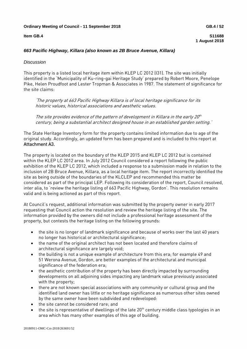
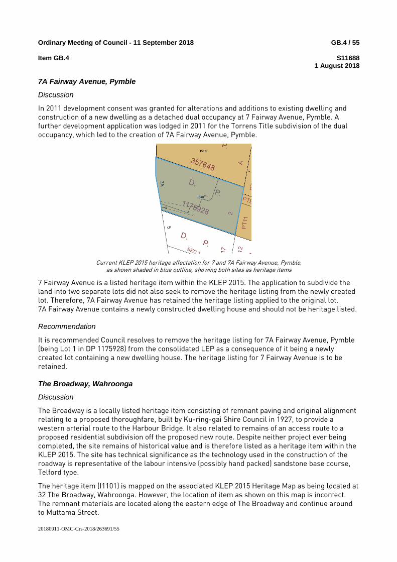