conservation management institute scott klopfer and ken convery
Post on 20-Dec-2015
221 views
TRANSCRIPT
Conservation Management Conservation Management InstituteInstitute
Scott Klopfer and Ken Scott Klopfer and Ken ConveryConvery
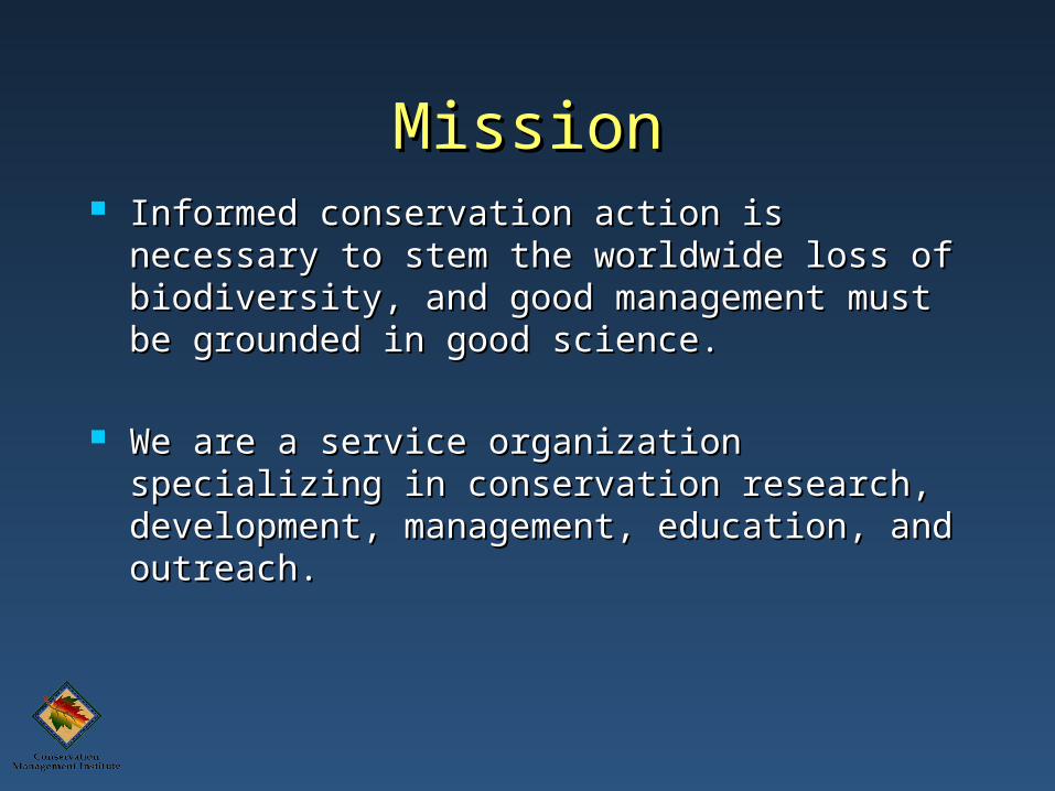
MissionMission Informed conservation action is necessary to Informed conservation action is necessary to
stem the worldwide loss of biodiversity, and stem the worldwide loss of biodiversity, and good management must be grounded in good good management must be grounded in good science.science.
We are a service organization specializing in We are a service organization specializing in conservation research, development, conservation research, development, management, education, and outreach.management, education, and outreach.
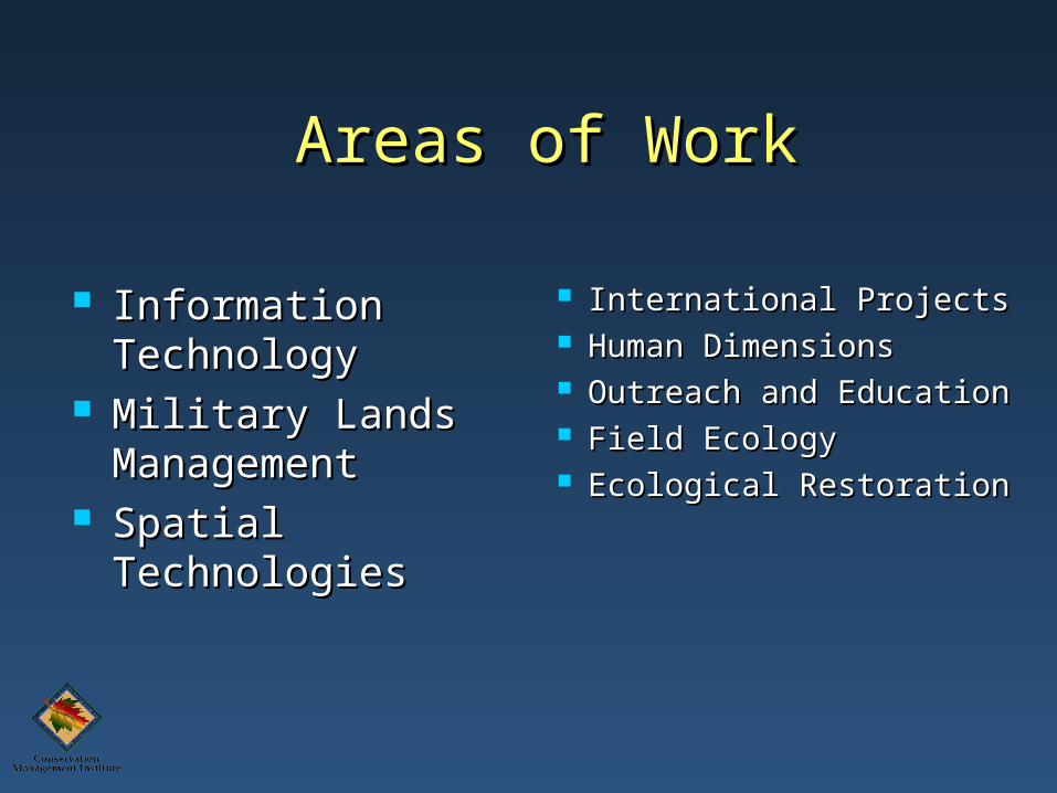
Areas of WorkAreas of Work
Information Information TechnologyTechnology
Military Lands Military Lands ManagementManagement
Spatial Spatial TechnologiesTechnologies
International ProjectsInternational Projects Human Dimensions Human Dimensions Outreach and Outreach and
EducationEducation Field EcologyField Ecology Ecological Ecological
RestorationRestoration
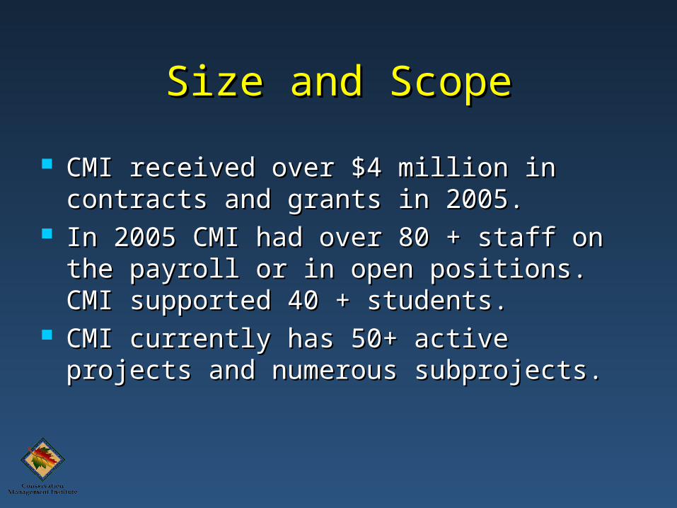
Size and ScopeSize and Scope
CMI received over $4 million in contracts CMI received over $4 million in contracts and grants in 2005.and grants in 2005.
In 2005 CMI had over 80 + staff on the In 2005 CMI had over 80 + staff on the payroll or in open positions. CMI payroll or in open positions. CMI supported 40 + students.supported 40 + students.
CMI currently has 50+ active projects CMI currently has 50+ active projects and numerous subprojects.and numerous subprojects.
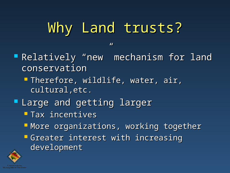
Why Land trusts?Why Land trusts?
Relatively “new” mechanism for land Relatively “new” mechanism for land conservationconservation Therefore, wildlife, water, air, cultural,etc.Therefore, wildlife, water, air, cultural,etc.
Large and getting largerLarge and getting larger Tax incentivesTax incentives More organizations, working togetherMore organizations, working together Greater interest with increasing Greater interest with increasing
developmentdevelopment
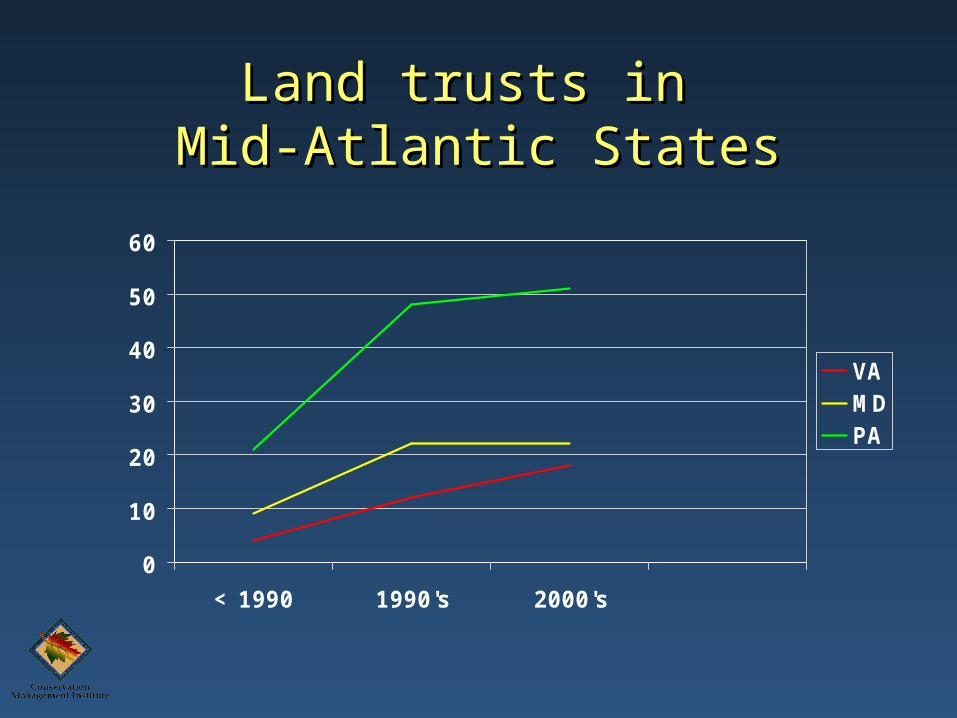
Land trusts in Land trusts in Mid-Atlantic StatesMid-Atlantic States
0
10
20
30
40
50
60
< 1990 1990's 2000's
VAMDPA

““Who” are Land Trusts?Who” are Land Trusts?
Membership organizationsMembership organizations Commonly not “natural resource Commonly not “natural resource
professionals”professionals” Very intelligentVery intelligent Understand their objectivesUnderstand their objectives
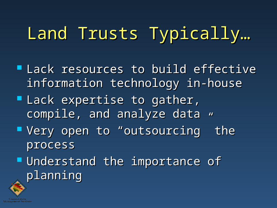
Land Trusts Typically…Land Trusts Typically…
Lack resources to build effective Lack resources to build effective information technology in-houseinformation technology in-house
Lack expertise to gather, compile, and Lack expertise to gather, compile, and analyze dataanalyze data
Very open to “outsourcing” the Very open to “outsourcing” the processprocess
Understand the importance of Understand the importance of planningplanning
Need Need
Huge Geographic Area - 8 Counties in Huge Geographic Area - 8 Counties in SW VASW VA
Small Staff OverworkedSmall Staff Overworked Town Hall Meetings IneffectiveTown Hall Meetings Ineffective
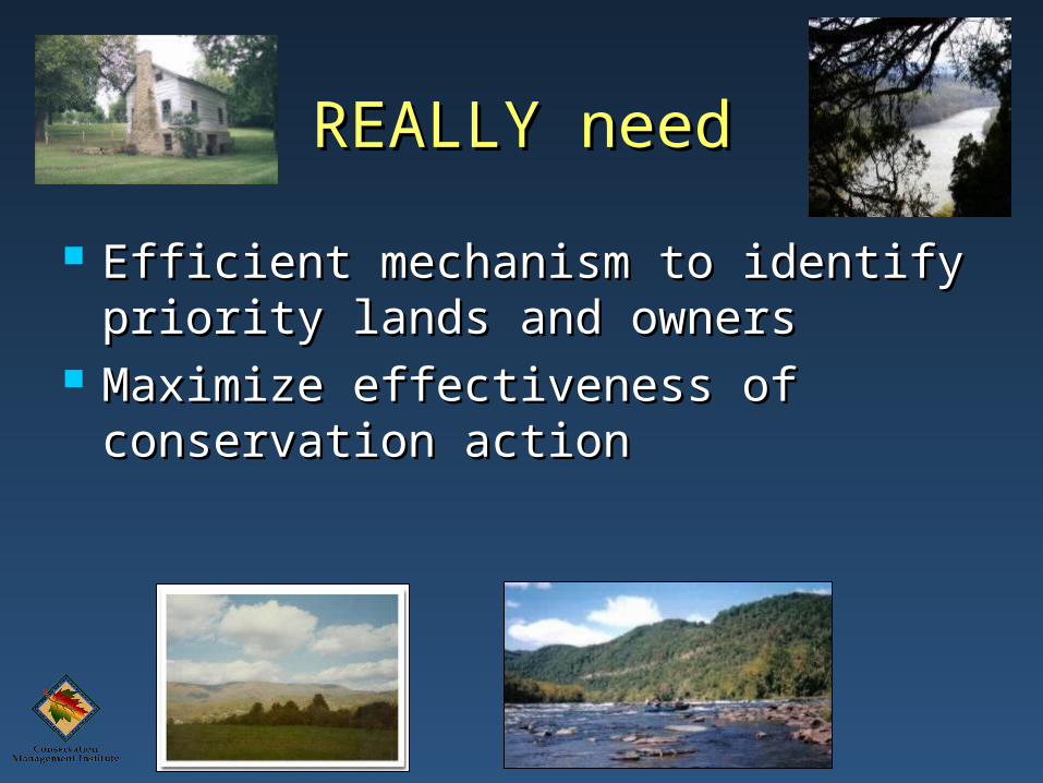
REALLY needREALLY need
Efficient mechanism to identify Efficient mechanism to identify priority lands and ownerspriority lands and owners
Maximize effectiveness of Maximize effectiveness of conservation actionconservation action
New River Land TrustNew River Land Trust
Land Prioritization Land Prioritization Using a Using a
Decision Support Decision Support SystemSystem
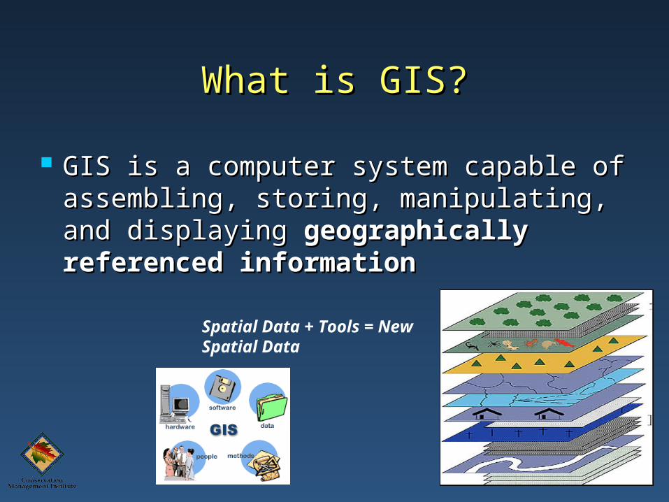
What is GIS?What is GIS?
GIS is a computer system capable of GIS is a computer system capable of assembling, storing, manipulating, assembling, storing, manipulating, and displaying and displaying geographically geographically referenced informationreferenced information
Spatial Data + Tools = New Spatial Data
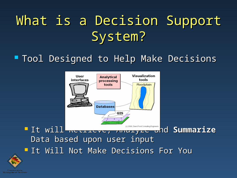
What is a Decision Support What is a Decision Support System?System?
Tool Designed to Help Make DecisionsTool Designed to Help Make Decisions
It will Retrieve, Analyze and It will Retrieve, Analyze and SummarizeSummarize Data Data based upon user inputbased upon user input
It Will Not Make Decisions For YouIt Will Not Make Decisions For You
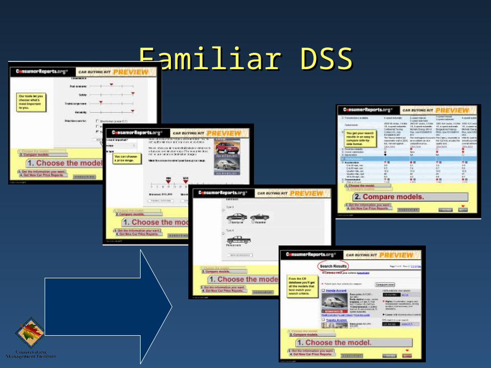
Familiar DSSFamiliar DSS
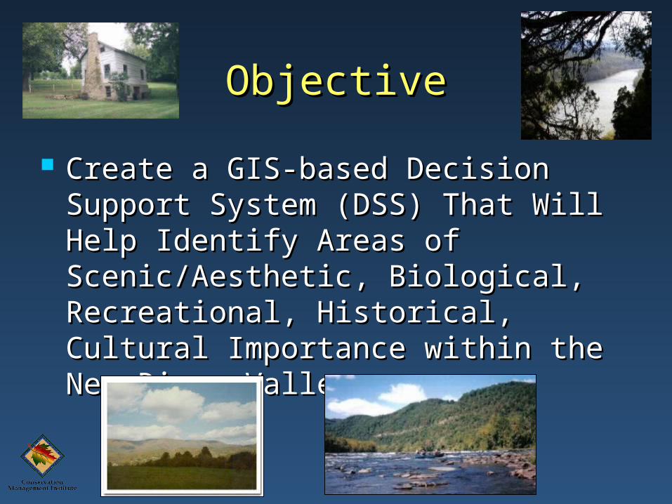
ObjectiveObjective
Create a GIS-based Decision Support Create a GIS-based Decision Support System (DSS) That Will Help Identify System (DSS) That Will Help Identify Areas of Scenic/Aesthetic, Biological, Areas of Scenic/Aesthetic, Biological, Recreational, Historical, Cultural Recreational, Historical, Cultural Importance within the New River Importance within the New River ValleyValley
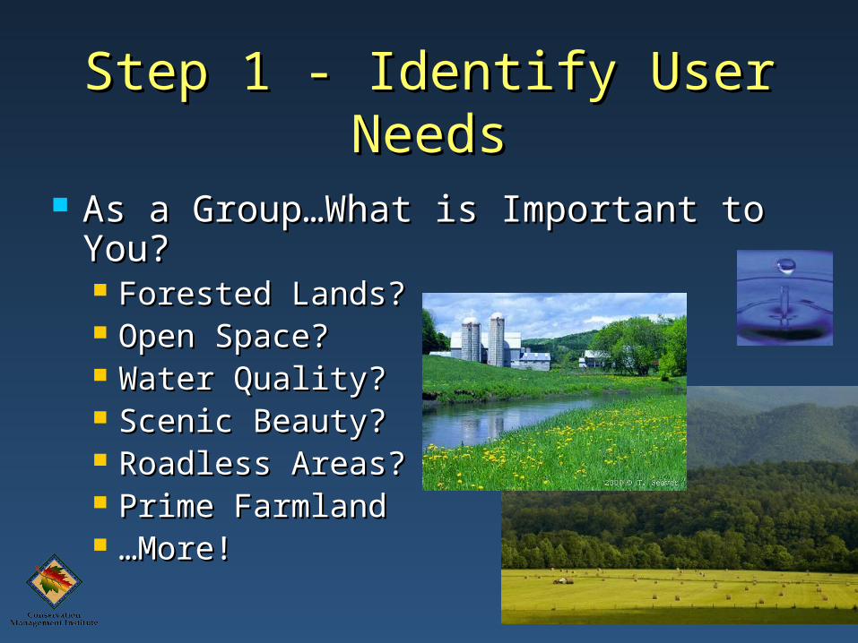
Step 1 - Identify User NeedsStep 1 - Identify User Needs
As a Group…What is Important to As a Group…What is Important to You?You? Forested Lands? Forested Lands? Open Space? Open Space? Water Quality? Water Quality? Scenic Beauty? Scenic Beauty? Roadless Areas?Roadless Areas? Prime FarmlandPrime Farmland ……More!More!
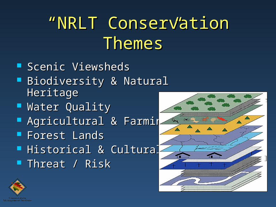
““NRLT Conservation NRLT Conservation Themes”Themes”
Scenic ViewshedsScenic Viewsheds Biodiversity & Natural Biodiversity & Natural
HeritageHeritage Water QualityWater Quality Agricultural & FarmingAgricultural & Farming Forest LandsForest Lands Historical & CulturalHistorical & Cultural Threat / RiskThreat / Risk
Step 2 - Develop or Acquire Step 2 - Develop or Acquire Relevant Spatial Data for Relevant Spatial Data for
Each ThemeEach Theme
Theme >= 1 data layerTheme >= 1 data layer
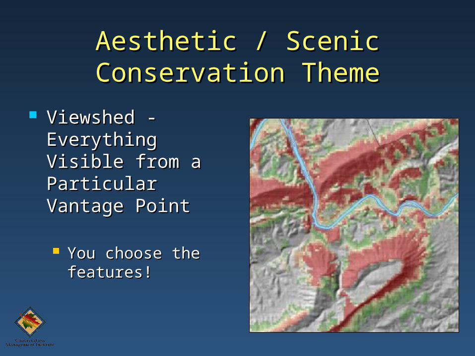
Aesthetic / Scenic Conservation Aesthetic / Scenic Conservation ThemeTheme
Viewshed - Viewshed - Everything Visible Everything Visible from a Particular from a Particular Vantage PointVantage Point
You choose the You choose the features!features!
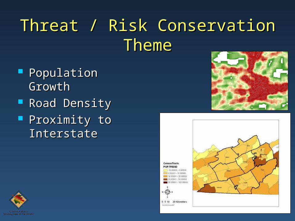
Threat / Risk Conservation Threat / Risk Conservation ThemeTheme
Population GrowthPopulation Growth Road DensityRoad Density Proximity to Proximity to
InterstateInterstate
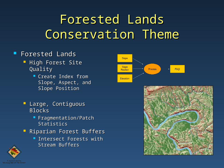
Forested Lands Conservation Forested Lands Conservation ThemeTheme
Forested LandsForested Lands High Forest Site QualityHigh Forest Site Quality
Create Index from Create Index from Slope, Aspect, and Slope, Aspect, and Slope PositionSlope Position
Large, Contiguous Large, Contiguous BlocksBlocks
Fragmentation/Patch Fragmentation/Patch StatisticsStatistics
Riparian Forest BuffersRiparian Forest Buffers Intersect Forests with Intersect Forests with
Stream BuffersStream Buffers
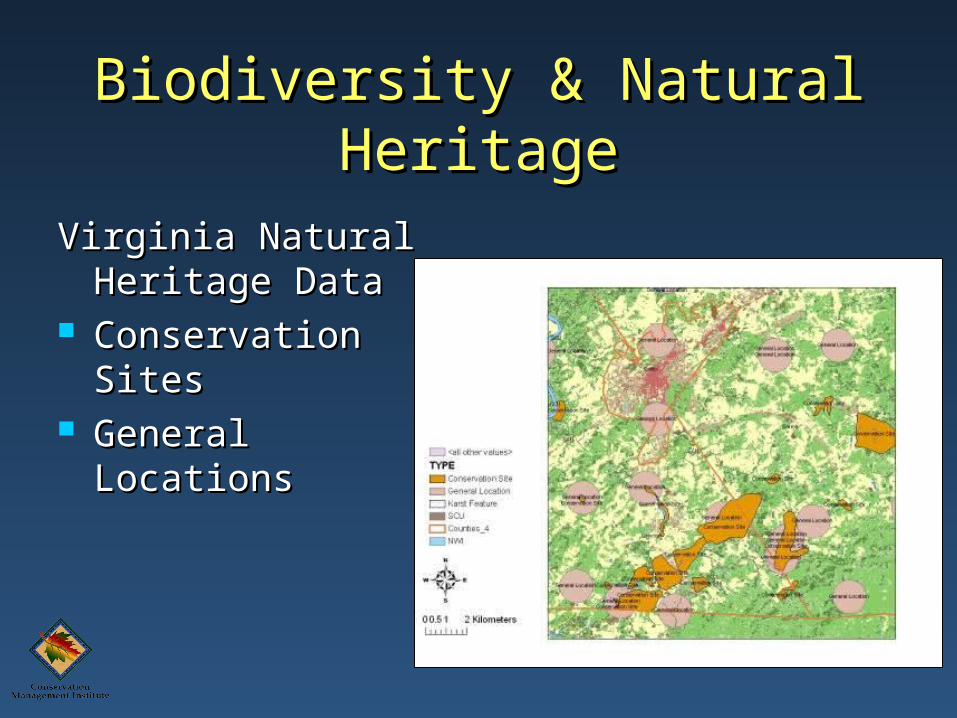
Biodiversity & Natural Biodiversity & Natural HeritageHeritage
Virginia Natural Virginia Natural Heritage DataHeritage Data
Conservation SitesConservation Sites General LocationsGeneral Locations
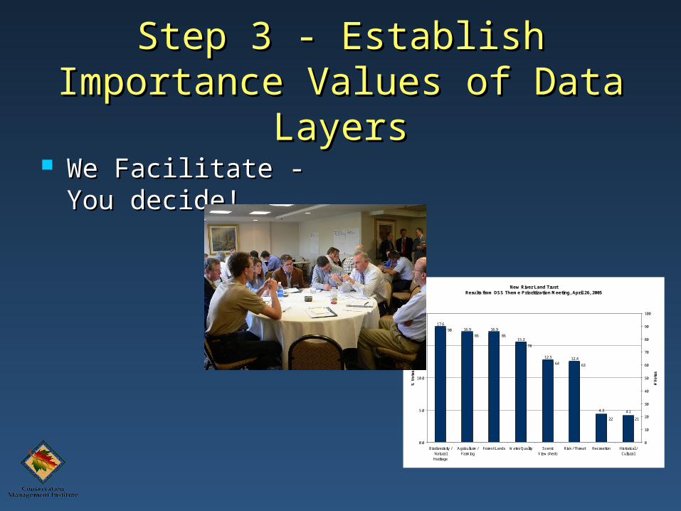
New River Land Trust Results from DSS Theme Prioritization Meeting, April 26, 2005
17.616.9 16.9
15.3
12.5 12.4
4.3 4.1
2122
64
78
8686
90
63
0.0
5.0
10.0
15.0
20.0
Biodiverisity /NaturalHeritage
Agriculture /Farming
Forest Lands Water Quality ScenicView sheds
Risk / Threat Recreation Historical /Cultural
% V
ote
s
0
10
20
30
40
50
60
70
80
90
100
# V
ote
s
Step 3 - Establish Importance Step 3 - Establish Importance Values of Data LayersValues of Data Layers
We Facilitate - You We Facilitate - You decide!decide!
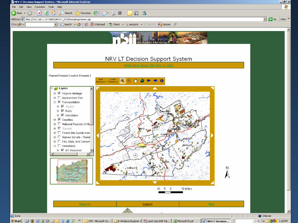
Online DSS Version 1.1Online DSS Version 1.1
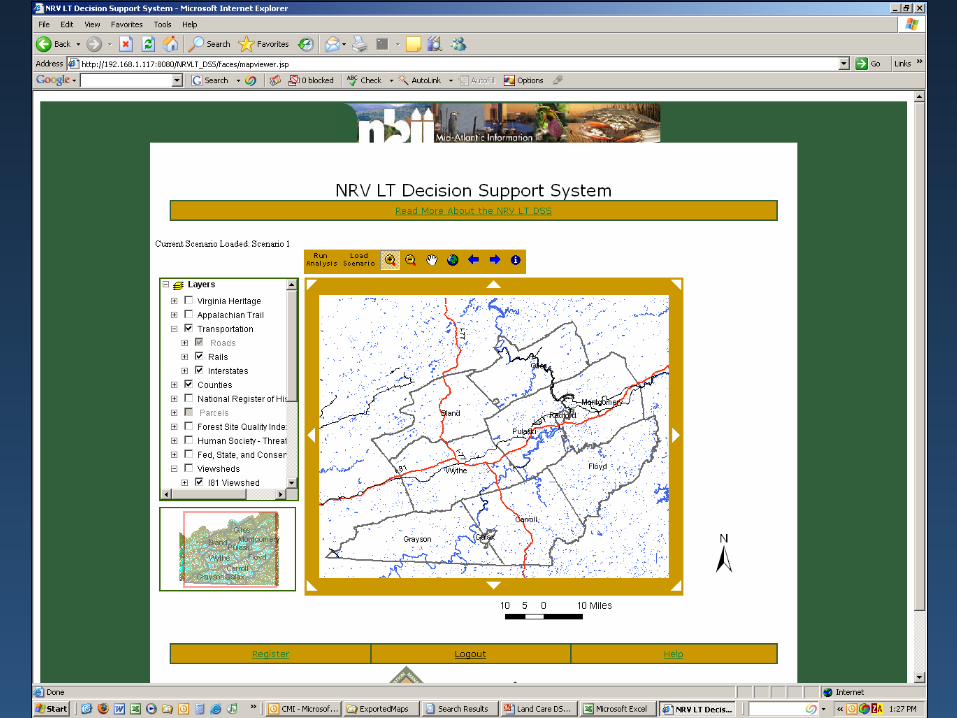


OutputOutput
Areas of High Conservation Areas of High Conservation ValueValue
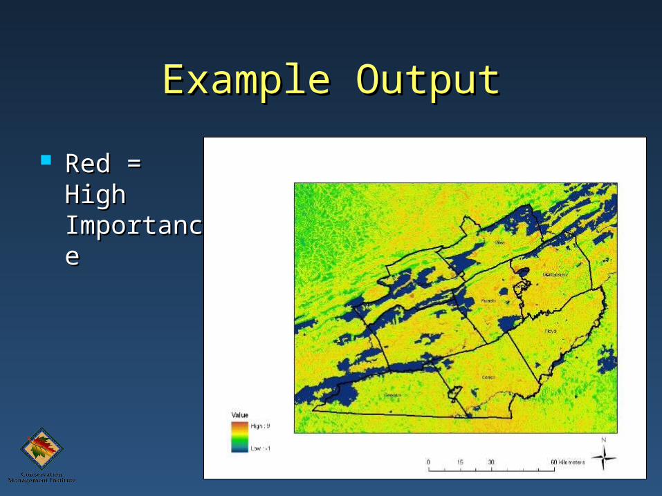
Example OutputExample Output
Red = High Red = High ImportanceImportance
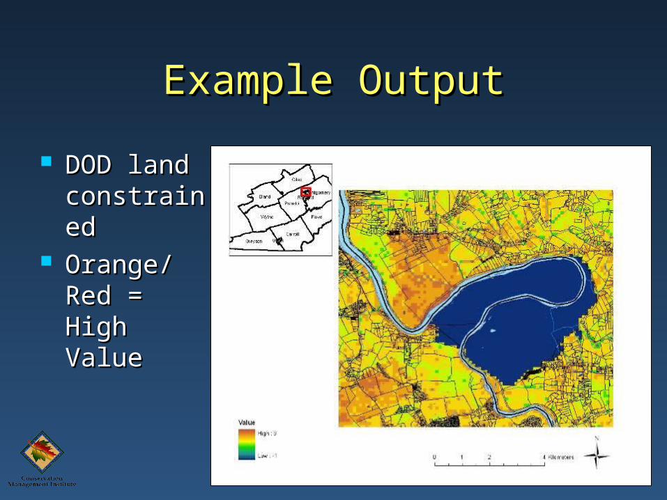
Example OutputExample Output
DOD land DOD land constraineconstrainedd
Orange/Orange/Red = Red = High ValueHigh Value
Benefits of ApproachBenefits of Approach
Process is Transparent and RepeatableProcess is Transparent and Repeatable You Choose What’s Important!You Choose What’s Important! You Create the Model - Rank Individual You Create the Model - Rank Individual
Data LayersData Layers Flexibility!Flexibility!
As the Landscape Changes so does OutputAs the Landscape Changes so does Output As Priorities Change so does OutputAs Priorities Change so does Output
Questions?Questions?
http://128.173.240.47:8081/NBII_DSS/index.jsp