commission 4 – positioning and applications · rfid, zigbee, bluetooth, ... sensor-based...
TRANSCRIPT
IAG Commissions: Commission 4 – Positioning and Applications 1
Commission 4 – Positioning and Applications
http://www2.ceegs.ohio-state.edu/IAG-Comm4
President: Dorota Grejner-Brzezinska (USA) Vice President: Allison Kealy (Australia)
Structure Sub-Commission 4.1: Alternatives and backups to GNSS Sub-Commission 4.2: Geodesy in geospatial mapping and engineering Sub-Commission 4.3: Remote sensing and modelling of the atmosphere Sub-Commission 4.4: Applications of satellite and airborne imaging systems Sub-Commission 4.5: High-precision GNSS algorithms and applications Sub-Commission 4.6: GNSS-reflectometry and applications Overview
The primary mission objective of Commission 4 is to promote research that leverages current and emerging positioning techniques and technologies to deliver practical and theoretical solutions for engineering, scientific and mapping applications. Commission 4 carries out its work in close cooperation with the IAG Services and other IAG entities, as well as via linkages with relevant entities within scientific and professional sister organizations. In fact, Commission 4 has the representatives of the International Federation of Surveyors (FIG), International Society for Photogrammetry and Remote Sensing (ISPRS) and the Institute of Navigation (ION) on its Steering Committee.
Recognizing the central role of GNSS in providing high accuracy positioning information today and into the future, Commission 4 maintains a focus on developing tools that enhance and assure the positioning performance of GNSS-based positioning solutions for a range of geodetic and other scientific and engineering applications. A significant part of Commission 4 activities is oriented towards the development of theory, strategies and tools for modeling and/or mitigating the effects of interference, signal loss and atmospheric effects, as they apply to precise GNSS positioning technology. In addition, technical and institutional issues necessary for developing backups to GNSS, integrated positioning solutions, automated processing capabilities and quality control measures, are also being addressed. Commission 4 also deals with geodetic remote sensing, using Synthetic Aperture Radar (SAR), Light Detection And Ranging (LiDAR) and Satellite Altimetry (SA) systems for geodetic applications.
A major goal of Commission 4 over the 2011-2015 period was to promote research collaborations across various science and engineering disciplines, and to organize joint professional workshops and seminars. Examples of successful initiatives included (full listings of activities and publications can be found in the following sections):
FIG/IAG WG 4.1.1/ISPRS, undertook a significant joint field campaign and follow-up data processing and analysis in the area of collaborative navigation, University of Nottingham,
IAG Commissions: Commission 4 – Positioning and Applications 2
UK, May 14-18, 2012. This was a follow up of previous field campaigns held at The Ohio State University, USA and the University of New South Wales, Australia in 2011.
IAG SC 4.2 and WG 4.2.1 actively participated in the organization of the International Symposium on Unmanned Airborne Vehicles for Geomatics, UAV-g 2011 held in Zurich, September 14-16 2011. The success of this event was repeated with active participation again at UAV-g 2013 held in Rostock, Germany, September 4-6.
IAG Commission 4 and WG 4.2.1 sponsored and actively participated in “The 1st and 2nd International Summer School on Mobile Mapping Technology in 2012 and 2013, 11-15 June 2012 and 29-30 April, 2013 respectively at National Cheng Kung University (NCKU), Tainan, Taiwan.
IAG Commission 4 sponsored and actively participated in “The 3rd International Summer School on Mobile Mapping Technology, Xiamen, China, April 27-29, 2015.
IAG SC 4.2 and WG 4.2.1 sponsored and actively participated in the 8th International Symposium on Mobile Mapping Technology – MMT2013, 1–2 May, Tainan, 2013. President of IAG Commission 4. IAG SC 4.2 and WG 4.2.1 are currently organising the 9th International Symposium on Mobile Mapping Technology, MMT2015, to be held in Sydney, Australia, 9-11 December 2015, Website: www.mmt2015.org. A/Prof Jinling Wang, Chair of the IAG SC 4.2, is the Convenor/General Chair for the MMT2015.
IAG WG 4.2.5 organised the Workshop on “Applications of Artificial Intelligence in Engineering Geodesy”, 10-12 September 2012, Technical University of Munich, Munich, Germany.
The Joint International Symposium on Deformation Monitoring, Hong Kong, China, 2-4 November 2011 was organised by IAG SC4.4 and FIG.
The Global Navigation Satellite System (GNSS) School on “New GNSS Algorithms and Techniques for Earth Observations 2012 (nGATEo 2012)” was successfully held, 14-15 May 2012, Polytechnic University (PolyU), Hong Kong. Sponsored by IAG and organized by Dr. George Liu, Secretary of SC4.5.
WG4.5.2 contributed to Inside GNSS Webinar on Precise Positioning Techniques. Commission 4 had a significant presence with roles such as program chair, track chair and
session chairs, at the ION GNSS 2011, 2012, 2013 and 2014 conferences. SC4.5 organized the Croucher Summer Course on “New GNSS Algorithms and
Techniques for Earth Observations”, 26-31 May 2014, Hong Kong Polytechnic University, Hong Kong.
Significant Publications
A special issue entitled ‘Indoor Navigation and Tracking’ Journal of Physical Communications (Vol. 13, Part A; http://www.sciencedirect.com/ science/journal/18744907/13/part/PA) edited by Yu K., I. Oppermann, E. Dutkiewicz, I. Sharp and G. Retscher was published in 2014.
A special issue entitled ‘Ubiquitous Positioning and Navigation Systems’ of the Journal of Applied Geodesy (Vol. 7, No. 4; http://www.degruyter.com/view/j/jag) edited by A. Kealy, G. Retscher and V. Schwieger was published in 2013.
A special issue on the Second Joint International Symposium on Deformation Monitoring (JISDM), University of Nottingham edited by Xiaolin Meng, Yang Gao and Wujiao Dai Survey Review (Volume 46, Issue 339, November 2014).
A special issue entitled ‘Engineering Geodesy’ of the Journal of Applied Geodesy (Vol. 8, No. 4; http://www.degruyter.com/view/j/jag) edited by G. Retscher was published in 2014.
IAG Commissions: Commission 4 – Positioning and Applications 3
Sub-Commission 4.1: Alternatives and Backups to GNSS Chair: Günther Retscher (Austria) Co-chair: Vassilis Gikas (Greece) As most mobile positioning applications rely heavily on GNSS nowadays alternative approaches for location determination of users in GNSS denied environments, i.e., the so-called GNSS gap (e.g. in urban canyons or indoors), are needed. These alternatives and backups are the main focus of the Sub-Commission. The Working Groups of the Sub-Commission thereby focus on the use of multi-sensor systems and their integration. For ubiquitous positioning several technologies are researched and further developed. In this context Working Group 4.1.1 not only researches in the development of new ubiquitous positioning techniques but also lays its emphasis on collaborative positioning (or also referred to as cooperative positioning) CP and navigation using a variety of sensors on different platforms. These platforms include mobile vehicles, robots as well as pedestrians and most recently Unmanned Aerial Vehicles (UAV’s). New emerging technologies, such as Wi-Fi, RFID, ZigBee, Bluetooth, cellular networks, UWB, Infrared, Ultrasonic, camera-based positioning, inertial sensors (accelerometers and magnetometer), as alternative to GNSS positioning are investigated by WG 4.1.3. In addition, the investigation of location technologies for smartphone positioning plays an important role in the interdisciplinary research conducted under the umbrella of Sub-Commission 4.1. Major research fields of the SC included the development and enhancement of indoor positioning technologies. A special issue under the title ‘Indoor Navigation and Tracking’ of the Journal of Physical Communications (Vol. 13, Part A; http://www.sciencedirect.com/ science/journal/18744907/13/part/PA) edited by Yu K., I. Oppermann, E. Dutkiewicz, I. Sharp and G. Retscher was published in 2014 containing the following papers: Sharp I., K. Yu, Sensor-based Dead-reckoning for Indoor Positioning, pp. 4-16. Moghtadaiee V., A. G. Dempster, Design Protocol and Performance Analysis of Indoor
Fingerprinting Positioning Systems, pp. 17-30. Cheng J., L. Yang, Y. Li, W. Zhang, Seamless Outdoor/Indoor Navigation with WIFI/GPS
Aided Low Cost Inertial Navigation System, pp. 31-43. Li Y., Optimal Multisensor Integrated Navigation Through Information Space- approach, pp.
44-53. Yan J., K. Yu, L. Wu, Single Frequency Network based Mobile Tracking in NLOS
Environments, pp. 54-67. The SC started also for the first time cooperation with social scientists. Major addressed topics are ethical and political responsibilities of localization technologies for LBS and their impact on users of such services. User acceptance and usability including understandability, learnability and operability are a major focus in the investigations. The cooperation led to the preparation of a research proposal, which will be submitted in a second call under the title ‘Mobility of the Future’ advertised by the Austrian FFG (Österreichische Forschungsförderungsgesellschaft). A kick-off presentation of the cooperation at the LBS 2014 conference in Vienna, Austria, led to the following publication: Obex F., G. Retscher (2014): Ethical and Political Responsibility in Location Based Services -
The Need of Implementing Ethical Thinking in Our Research Field. in: Papers presented at the 11th International Symposium on Location-Based Services LBS 2014, November 26-28, 2014, Vienna, Austria, pp. 315-328.
IAG Commissions: Commission 4 – Positioning and Applications 4
Key projects undertaken by members of the SC include the following research fields.
FIG/IAG/ISPRS Collaborative WG 4.1.1, Ubiquitous Positioning Field campaign and follow-up processing and analysis on Collaborative Navigation, University of Nottingham, UK, May 14-18, 2012
EMPARCO (Efficient Management of PArking under Constraints) https://emparco.wordpress.com/ Aims to develop solutions for the management of large-scale parking facilities and depots (for either passenger vehicles or commercial fleets) under constraints including near-capacity demand, temporally concentrated arrivals/departures, need for emergency evacuation. Project of the Laboratory of Geodesy, National Technical University of Athens (NTUA) under the lead of V. Gikas. D. Grejner-Brzezinska, OSU and G. Retscher act on the international advisory committee. Sponsor: ARISTEIA-II (Action’s Beneficiary: General Secretariat for Research and Technology, GR), co-financed by the European Union (European Social Fund–ESF).
SaPPART (Satellite Positioning Performance Assessment for Road Transport) http://www.sappart.net/ Aims to develop a framework for the definition of service levels for GNSS and GNSS-augmented positioning terminals used in Intelligent Transportation Systems (ITS) and personal mobility applications, and the associated examination framework for certification purposes. Major involvement of the Laboratory of Geodesy, NTUA under the lead of V. Gikas. Sponsor: COST Action TU1302, EU RTD Framework Programme.
Rowing Performance Assessment System Aims to develop an integrated data acquisition system (including GNSS, MEMS IMU, pressure cells, goniometers, biomechanical sensors, etc.) and advanced mathematical models for the analysis of movements of the rowing system for performance assessment and improvement of training. Project of the Laboratory of Geodesy, NTUA under the lead of V. Gikas. Sponsor: Greek Minister of Sports, Int. Rowing Federation.
InKoPoMoVer (Intelligent Cooperative Positioning at Multimodal Public Transit Junctions) Aims at a better understanding of passenger movement at multimodal transit situations for providing improved passenger guidance. By combining Differential WLAN and RFID through Cooperative Positioning CP, algorithms can be generated, which considerably increase the accuracy of person tracking, allowing for the derivation of movement patterns. Addressing ethical and usability aspects will ensure user-friendly results. Project proposal of the Vienna University of Technology, Department of Geodesy and Geoinformation under the lead of G. Retscher.
In addition to previous projects, during the activity period, the Laboratory of Geodesy, NTUA has developed scientific software for: (a) vehicle trajectory extraction and comparisons, (b) sea trials analysis according to IMO guidelines based on GNSS and IMU. Also a back-pack personal navigator was built for pedestrian navigation use. Regarding future plans, the group aims at research in the hybrid/indoors environment for vehicles and pedestrians. The focus will be towards positioning and navigation using UWB and RFIDs – based on research funds, in the next months the Laboratory it shall equipped with such sensors. The Sub-Commission 4.1 maintained a strong and active presence at the following international events through participation in coordinating workshops, scientific and
IAG Commissions: Commission 4 – Positioning and Applications 5
organizing committees, delivering short courses and tutorial, publishing papers and presentations, session chairing, etc.
LBS 2011, Vienna, Austria, Nov. 21-23, 2011 PLANS 2012, Myrtle Beach, South Carolina, USA, Apr. 24-26, 2012 FIG Working Week: May 6-10, 2012 in Rome, Italy ION GNSS, Nashville, Tennessee, USA, Sep. 17-21, 2012 UPINLBS 2012, Helsinki, Finland, Oct. 3-4, 2012 LBS 2012, Munich, Germany, Oct. 16-18, 2012 IPIN 2012, Sydney, Australia, Nov. 13-15, 2012 ION Pacific PNT 2013, Honolulu, Hawaii, USA, Apr. 22-25, 2013 European Navigation Conference 2013, Vienna, Austria, Apr. 23-25, 2013 8th International Symposium on Mobile Mapping Technologies MMT 2013, Tainan,
Taiwan, May 1-3, 2013 IAG Scientific Assembly, Potsdam, Germany, Sep.2-6, 2013 ION GNSS, Nashville, Tennessee, USA, Sep. 16-20, 2013 IPIN 2013, Montbeliard-Belfort, France, Oct. 28-31, 2013 LBS 2013, Shanghai, China, Nov. 21-22, 2013 FIG General Assembly, Kuala Lumpur, Malaysia, June 16-21, 2014 ION GNSS, Tampa, Florida, USA, Sep. 8-12, 2014 RFID Conference, Tampere; Finland, Sep. 10-12, 2014 IPIN 2014, Busan, Korea, Oct. 27-30, 2013 UPINLBS 2014, Corpus Christi, Texas, USA, Oct. 20-21, 2014 LBS 2014, Vienna, Austria, Nov. 26-28, 2014
Recent publications dealing with smartphone positioning: Retscher G., E. Mok, T. Hecht (2013): Smartphone Altitude Determination Using Embedded
Barometric Pressure Sensors. in: Papers presented at the 10th International Symposium on Location-Based Services LBS 2013, November 21-22, 2013, Shanghai, China, 3 pgs.
Retscher G., T. Hecht, E. Mok (2013): Location Capabilities and Performance of Smartphones for LBS Navigation Applications. in: Papers presented at the 8th International Symposium on Mobile Mapping Technology, May 1-3, 2013, Tainan, Taiwan.
Retscher G., T. Hecht (2012): Investigation of Location Capabilities of four Different Smartphones for LBS Navigation Applications. IEEE Xplore, 2012 International Conference on Indoor Positioning and Indoor Navigation (IPIN), ISBN: 978-1-4673-1954-6, 6 pgs.
Retscher G. (2012): Wi-Fi Positioning with Smartphones. in: Papers presented at the 9th International Symposium on Location-Based Services LBS 2012, October 16-18, 2012, Munich, Germany, 9 pgs.
Mok E., G. Retscher, C. Wen (2012): Initial Test on the Use of GPS and Sensor Data of Modern Smartphones for Vehicle Tracking in Dense High Rise Environments. IEEE Xplore, 2012 Ubiquitous Positioning Indoor Navigation and Location Based Service (UPINLBS), ISBN: 978-1-4673-1909-6, 7 pgs.
Mok E., G. Retscher, D. Wang, L. Xia (2011): Use of Smartphones for Tracking and Trip Recording. in: Papers presented at the 8th International Symposium on Location-Based Services LBS 2011, November 21-23, 2011, Vienna, Austria, pp. 137-152.
IAG Commissions: Commission 4 – Positioning and Applications 6
Papers based on EMPARCO project: Antoniou C., Gikas V., Papathanasopoulou V., Danezis C., Panagopoulos A., Markou I.,
Efthymiou D., Yannis G., Perakis H. (2015) “Localization and Driving Behavior Classification Using Smartphone Sensors in the Direct Absence of GNSS”, Transportation Research Record, (accepted)
Gikas V., Antoniou C., Danezis C., Mpimis T., Perakis H., Papathanasopoulou V., Markou I. (2015) “Evaluating Smartphone Performance for Driving Event and Maneuver Reconstruction”, 26th IUGG General Assembly, Prague, Jun. 22–Jul. 2
Antoniou C., Gikas V., Papathanasopoulou V., Danezis C., Panagopoulos A., Markou I., Efthymiou D., Yannis G., Perakis H. (2015) “Localization and Driving Behavior Classification Using Smartphone Sensors in the Direct Absence of GNSS”, 94th TRB Annual Meeting Washington DC, USA, Jan. 11–15
Antoniou C., Papathanasopoulou V., Gikas V., Mpimis A., Markou I., Perakis H. (2014) “Monitoring Indoor Driver Behaviour Using Opportunistic Smartphone Sensor Data”, ITS and Smart Cities 2014, Patra, Greece, Nov. 19–22
Antoniou, C., Gikas V., Papathanasopoulou V., Mpimis T., Markou I., Perakis H. (2014) “Towards Distribution-Based Calibration for Traffic Simulation”, The IEEE Conf. on Intelligent Transportation Systems, Qingdao, China, Oct. 8–11
Antoniou, C., Papathanasopoulou V., Gikas V., Danezis C., Perakis H. (2014) “Classification of Driving Characteristics Using Smartphone Sensor Data”, 3rd Symp. of the European Association for Research in Transportation, Leeds, UK, Sept. 10–12
Papers based on SaPPART project: Gikas V., Gilliéron P-Y, Peyret F. (2015) “GNSS Accuracy and Integrity Issues in Transport
and Mobility”, 26th IUGG General Assembly, Prague, Jun. 22–Jul. 2 Clausen P., Skaloud J., Gilliéron P-Y, Perakis H., Gikas V., Spyroupoulou I. (2015) “Position
Accuracy with Redundant MEMS IMU for Road Applications”, European Navigation Conference, Bordeaux, France, Apr. 7–10
Peyret F. Gilliéron P-Y, Gikas V., et al. (2015) “Better use of Global Satellite Systems for Safer and Greener Transport” White Paper, COST Action: TU1302
Papers based on independent research: Yigit C. O., Gikas V., Alcay S., Ceylan A. (2014) “Performance Evaluation of Short to Long
Term GPS, GLONASS and GPS/GLONASS Post-Processed PPP”, Survey Review, Vol. 46(336), pp 155–166
Danezis C., Gikas V. (2013) “An Iterative LiDAR DEM-Aided Algorithm for GNSS Positioning in Obstructed / Rapidly Undulating Environments”, Advances in Space Research, Vol. 52(5), pp 865 – 878
Paradissis D., Gikas V. (2013) “GNSS for Sea Trials: Measuring Ship Controllability”, GIM International, Vol. 37(2), pp 31–35
Gikas V., Mpimis A., Androulaki A. (2013) “Proposal for Geoid Model Evaluation from GNSS/INS-Leveling Data: Case Study along a Railway Line in Greece”, Journal of Surveying Engineering, Vol. 139(2), pp 95–104
Gikas V., Stratakos J. (2012) “A Novel Geodetic Engineering Method for the Extraction of Road/Railway Alignments Based on the Bearing Diagram and Fractal Behavior”, Transactions of Intelligent Transportation Systems, IEEE, Vol. 13(1), pp 115–126
IAG Commissions: Commission 4 – Positioning and Applications 7
Danezis C., Gikas V. (2012) “Performance Evaluation of A Novel Terrain-Aiding Algorithm for GNSS Navigation in Forested Environments”, ION/GNSS, Nashville, Tennessee, USA, Sept. 17–21
Other Publications: Gikas V., Karydakis P., Mpimis A., Piniotis G., H. Perakis (2015) “Structural Integrity
Verification of a Cable-stayed Footbridge Based on FEM Analyses and Geodetic Surveying Techniques”, Survey Review, http://dx.doi.org/10.1179/1752270614Y.0000000146
Gikas V. (2012) “3D Terrestrial Laser Scanning for Geometry Documentation and Construction Management of Highway Tunnels during Excavation”, SENSORS, Vol. 12, pp 11249–11270
Gikas V. (2012) “Ambient Vibration Monitoring of Slender Structures by Microwave Interferometer Remote Sensing”, Journal of Applied Geodesy, Vol. 6(3-4), pp 167–176
Gikas V., Karydakis P., Piniotis G, Mpimis T., Papadimitriou F, Panagakis A. (2014) “Design and Implementation of a Multi-Sensor Monitoring System for Structural Integrity Assessment: The Case of Attiki Odos, Pallini Cable-Stayed Bridge”, IBSBI, Athens, Oct. 16–18
Gikas V., Karydakis P., Mpimis T., Piniotis G., Perakis H. (2014) “Nodestructive Load Testing of a Single-Span, Cable-Stayed Bridge: Testing, Instrumentation and Preliminary Results”, FIG Congress, Kuala Lampur, Malaysia, June 16–21
Perakis H., Piniotis G, Mpimis A., Gikas V. (2014) “Experimental Investigation of GNSS, GBMI, DIC for Dynamic Structural Monitoring”, 5th Nat. Metrology Conf., Athens, May 9–10
Gikas V., Karydakis P., Mpimis A., Piniotis G., Rodopoulos J. (2013) “Structural Integrity Verification of a Cable-stayed Footbridge Based on Conventional and Non-Conventional Geodetic Data”, 2nd Joint Int. Symposium on Deformation Measurements, Nottingham, UK, Sept. 9–10
Piniotis G., Mpimis A., Gikas V. (2013) “Dynamic Testing and Output-Only Modal Analysis of a Bypass-Stack During Extreme Operating Conditions”, 2nd Joint Int. Symposium on Deformation Measurements, Nottingham, UK, Sept. 9–10
Gikas V., Daskalakis S., Mpimis A. (2011) “Bridge-Vehicle Interaction Analysis Based on Microwave Radar Interferrometry: An Experimental Investigation of Evripos Cable-Stayed Bridge”, Int. Conf. Innovations on Bridges and Soil-Bridge Interaction, Athens, Oct. 13-15
Gikas V., Daskalakis S. (2011) “Radar-based Measurements of the Oscillation Parameters of Large Civil Engineering Structures”, 14th FIG Symp. on Deformation Monitoring and Analysis & 5th IAG Symp. on Geodesy for Geotechnical and Structural Engineering, Hong Kong, China, Nov. 2–4, 2011
Note: Further publications can be found under the respective Working Group. Website of the Sub-Commission 4.1: http://info.tuwien.ac.at/ingeo/sc4/iag_sc41.htm
IAG Commissions: Commission 4 – Positioning and Applications 8
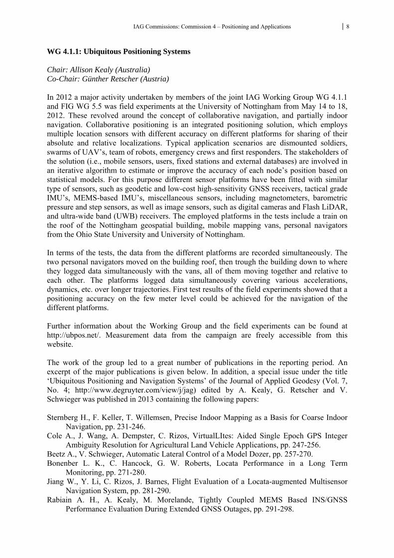
WG 4.1.1: Ubiquitous Positioning Systems Chair: Allison Kealy (Australia) Co-Chair: Günther Retscher (Austria) In 2012 a major activity undertaken by members of the joint IAG Working Group WG 4.1.1 and FIG WG 5.5 was field experiments at the University of Nottingham from May 14 to 18, 2012. These revolved around the concept of collaborative navigation, and partially indoor navigation. Collaborative positioning is an integrated positioning solution, which employs multiple location sensors with different accuracy on different platforms for sharing of their absolute and relative localizations. Typical application scenarios are dismounted soldiers, swarms of UAV’s, team of robots, emergency crews and first responders. The stakeholders of the solution (i.e., mobile sensors, users, fixed stations and external databases) are involved in an iterative algorithm to estimate or improve the accuracy of each node’s position based on statistical models. For this purpose different sensor platforms have been fitted with similar type of sensors, such as geodetic and low-cost high-sensitivity GNSS receivers, tactical grade IMU’s, MEMS-based IMU’s, miscellaneous sensors, including magnetometers, barometric pressure and step sensors, as well as image sensors, such as digital cameras and Flash LiDAR, and ultra-wide band (UWB) receivers. The employed platforms in the tests include a train on the roof of the Nottingham geospatial building, mobile mapping vans, personal navigators from the Ohio State University and University of Nottingham. In terms of the tests, the data from the different platforms are recorded simultaneously. The two personal navigators moved on the building roof, then trough the building down to where they logged data simultaneously with the vans, all of them moving together and relative to each other. The platforms logged data simultaneously covering various accelerations, dynamics, etc. over longer trajectories. First test results of the field experiments showed that a positioning accuracy on the few meter level could be achieved for the navigation of the different platforms. Further information about the Working Group and the field experiments can be found at http://ubpos.net/. Measurement data from the campaign are freely accessible from this website. The work of the group led to a great number of publications in the reporting period. An excerpt of the major publications is given below. In addition, a special issue under the title ‘Ubiquitous Positioning and Navigation Systems’ of the Journal of Applied Geodesy (Vol. 7, No. 4; http://www.degruyter.com/view/j/jag) edited by A. Kealy, G. Retscher and V. Schwieger was published in 2013 containing the following papers: Sternberg H., F. Keller, T. Willemsen, Precise Indoor Mapping as a Basis for Coarse Indoor
Navigation, pp. 231-246. Cole A., J. Wang, A. Dempster, C. Rizos, VirtualLItes: Aided Single Epoch GPS Integer
Ambiguity Resolution for Agricultural Land Vehicle Applications, pp. 247-256. Beetz A., V. Schwieger, Automatic Lateral Control of a Model Dozer, pp. 257-270. Bonenber L. K., C. Hancock, G. W. Roberts, Locata Performance in a Long Term
Monitoring, pp. 271-280. Jiang W., Y. Li, C. Rizos, J. Barnes, Flight Evaluation of a Locata-augmented Multisensor
Navigation System, pp. 281-290. Rabiain A. H., A. Kealy, M. Morelande, Tightly Coupled MEMS Based INS/GNSS
Performance Evaluation During Extended GNSS Outages, pp. 291-298.
IAG Commissions: Commission 4 – Positioning and Applications 9
Li B., T. Gallagher, C. Rizos, A. Dempster, Using Geomagnetic Field for Indoor Positioning, pp. 299-308.
Major Publications: Kealy A., G. Retscher, C. Toth, D. A. Grejner-Brzezinska (2014): Collaborative Positioning –
Concepts and Approaches for More Robust Positioning. in: Papers presented at the XXV International FIG Congress, June 16-21, 2014, Kuala Lumpur, Malaysia, 15 pgs.
Retscher G. (2014): The Fourth Layer in Collaborative Navigation – Going Underground. in: Papers presented at the XXV International FIG Congress, June 16-21, 2014, Kuala Lumpur, Malaysia, 15 pgs.
Toth C., D. A. Grejner-Brzezinska, A. Kealy, G. Retscher (2014): Personal Navigation and Indoor Mapping: Performance Characterization of Kinect Sensor-based Trajectory Recovery. in: Papers presented at the XXV International FIG Congress, June 16-21, 2014, Kuala Lumpur, Malaysia, 12 pgs.
Kealy A., A. Hasnur-Rabiain, N. Alam, C. Toth, D. A. Grejner-Brzezinska, V. Gikas, G. Retscher (2013): Cooperative Positioning Algorithms and Techniques for Land Mobile Applications. in: Papers presented at the 8th International Symposium on Mobile Mapping Technology, May 1-3, 2013, Tainan, Taiwan, 6 pgs.
Kealy A., A. Hasnur-Rabiain, N. Alam, C. Toth, D. A. Grejner-Brzezinska, V. Gikas, C. Danezis, G. Retscher (2013): Cooperative Positioning using GPS, Low-cost INS and Dedicated Short Range Communications. in: Papers presented at ION Pacific PNT 2013, April 22-25, 2013, Honolulu, Hawaii, USA.
Kealy A., G. Retscher, A. Hasnur-Rabiain, N. Alam, C. Toth, D. A. Grejner-Brzezinska, T. Moore, C. Hill, V. Gikas, C. Hide, C. Danezis, L. Bonenberg, G. W. Roberts (2013): Collaborative Navigation Field Trials with Different Sensor Platforms. in: Papers presented at the 10th Workshop on Positioning, Navigation and Communication WPNC 2013, March 20-21, 2013, University of Applied Sciences Dresden, Germany, 6 pgs.
Kealy A., G. Retscher, N. Alam, A. Hasnur-Rabiain, C. Toth, D. A. Grejner-Brzezinska, T. Moore, C. Hill, V. Gikas, C. Hide, C. Danezis, L. Bonenberg, G. W. Roberts (2012): Collaborative Navigation with Ground Vehicles and Personal Navigators. IEEE Xplore, 2012 International Conference on Indoor Positioning and Indoor Navigation (IPIN), ISBN: 978-1-4673-1954-6, 8 pgs.
Kealy A., G. Retscher, D. Grejner-Brzezinska, V. Gikas, G. Roberts (2011): Evaluating the Performance of MEMS based Inertial Navigation Sensors for Land Mobile Applications. Archives of Photogrammetry, Cartography and Remote Sensing, Vol. 22, ISSN 2083-2214, pp. 237-248.
WG 4.1.3: Emerging Technologies Chair: Kefei Zhang (Australia) Co-Chair: Lukasz Bonenberg (UK) Working Group 4.1.3 and its associated key players from Australia and Europe have been active in the past 4 years in investigating emerging technologies for innovative positioning and tracking, theoretical frame, field evaluations and practical industrial applications. Nowadays numerous technologies such as Wi-Fi, RFID, ZigBee, Bluetooth, cellular networks, UWB, Infrared, Ultrasonic, camera-based positioning accelerometers and magnetometer positioning are employed for positioning and tracking. Each of these techniques has advantages and drawbacks. For example, Wi-Fi localization has relatively
IAG Commissions: Commission 4 – Positioning and Applications 10
good accuracy but cannot be used in case of power outage or in the areas with poor Wi-Fi coverage. Magnetometer positioning or cellular network does not have such problems but they are not as accurate as localization with Wi-Fi. On the other hand, indoor tracking and positioning technologies have been one of the hot topics in the world and its rapid development has been predominantly driven by the huge potential commercial applications, especially Wi-Fi and smartphones based technologies. Wi-Fi and smartphones are getting more and more popular for tracking and positioning along with the fast growth of the Internet users and rapid development of e-commerce. Both industrial companies and government organizations have paid more and more attention to Wi-Fi’s applications. Many industrial fields (e.g., retail industry, large shopping malls, airport operators, museums, university campus) have started to use Wi-Fi and smartphone as popular value-added tracking and positioning techniques to transform their business style and improve their customer services. One of the emerging indoor positioning technologies is light-based positioning, in particular LED-based positioning technology. This presents a new trend of tracking and positioning. ByteLight announced that they had developed a GPS-like indoor positioning system that uses LED lighting to transmit location data to smartphones. ByteLight’s positioning system works by controlling the pulses of LEDs so they work in a certain pattern. This pattern is not detectable to the human eye but can be picked up by the camera in a smartphone or tablet. Using the data gleaned from the LED modulation, the device works with Apps and performs client-side calculations to figure out where it is within the structure. Light-based positioning systems make it easy for shoppers to navigate retail stores and find products, managers and optimizes enterprise employee operations, turns mobile devices into tour guides within a museum or public building, and helps people find colleagues and booths while attending trade shows or other events – the applications for this technology are truly endless, said ByteLight CEO and cofounder Aaron Ganick. Along with the development of the technologies, quite a few innovative algorithms have been proposed for the enhancement of the positioning solutions. This includes, for example, the crowdsourcing Radio Map method, dynamic fingerprinting method, cooperative localization technique, regular Infrastructure Topology proposed and the use of Signals of Opportunity etc. The current trend in this research arena is towards smart solutions pertaining to designated applications under specific environments. Major Activities: Participation in the initial working group proposing OFFCOM into ECC Report 128 Compatibility Studies Between Pseudolites And Services In The Frequency Bands 1164-1215, 1215-1300 And 1559-1610 MHz, September 2012 May 2012 Collaborative Navigation with Ground Vehicles and Personal Navigators, experiment in Nottingham, UK. A series of UWB trials were conducted in the University of Nottingham in Dec. 2012 and RMIT University in April 2013 and July 2014. Three major Australian universities (RMIT, University of Melbourne and UNSW) have worked together and established a dedicated Australian indoor positioning laboratory through major funding attracted from Australian Research Council and capital budget from both RMIT and University of Melbourne. The key researchers involved include K. Zhang (RMIT University), A. Kealy (University of Melbourne) and T. Gallagher and B. Li (UNSW). This
IAG Commissions: Commission 4 – Positioning and Applications 11
laboratory is hosted in RMIT Design Hub Building in Melbourne and a large number of sensors systems have been procured. Several initial tests that involve smartphones and laptops as a mobile platform and UWB, USRP, RFID, Wi-Fi, magnetometers and INS as sensors were carried out. An Australian Research Council project entitled with "TRIIBE - TRacking Indoor Information BEhaviour" was awarded to a team in RMIT University that involves researchers from geospatial, computer science and communication backgrounds. This project will research the passive tracking of user's mobile devices in indoor spaces correlating their spatial behaviour with their information needs to deliver personalised information. The project aims to create a system that enables owners of large buildings (for example, shopping malls, airports, universities) to better manage their spaces and services and provide value-added information to their customers. The University of Nottingham team is working on the indoor positioning project using UWB, with external partner, which have feed into JISDM conference in Nottingham. If this initial study is successful I expect to establish a larger collaboration. Nottingham Geospatial Institute has a successful indoor positioning group and RMIT hosted Australian laboratory hopes to get further involved with them as well. Trials were conducted at the laboratory in July 2013 and 2014 with participation of G. Retscher. Publications: Chew P. (2015): Indoor positioning solutions guide, Building Management, Melbourne,
Australia, Niche Media Pty Ltd. April-May 2015 edition, online published. Rensheng, H. (2015): Trends of Science and Technology: Seven Popular Indoor Positioning
Technologies. Retrieved 01 February, 2015, from http://www.wtoutiao.com/a/ 1498456.html.
Bai Y. B., S. Wu, G. Retscher, A. Kealy, L. Holden, M. Tomko, A. Borriak, B. Hu, H. R. Wu, K. Zhang (2014): A New Method for Improving Wi-Fi Based Indoor Positioning Accuracy. Journal of Location-Based Services LBS, Vol. 8, No. 3, November 2014, pp. 135-147, ISSN 1748-9725, DOI: 10.1080/17489725.2014.977362.
Bai Y. B., S. Wu, Y. Ren, K. Ong, G. Retscher, A. Kealy, M. Tomko, M. Sanderson, H. Wu, K. Zhang (2014): A New Approach for Indoor Customer Tracking Based on a Single Wi-Fi Connection. International Conference on Indoor Positioning and Indoor Navigation IPIN, October 27-30, 2014, Busan, South Korea, 7 pgs.
Bai Y. B., M. Williams, A. Borriak, A. Kealy, K. Zhang (2014): An Accuracy Enhancement Algorithm for Fingerprinting Method. Proceedings of the 2014 International Conference on Data Science and Advanced Analytics (DSAA 2014), November, 2014, Shanghai, China, http://ieeexplore.ieee.org/xpl/mostRecentIssue.jsp?punumber=7050498, DOI 10.1109/DSAA.2014.7058060, pp110-114
Bartié M. A. (2014): Path Loss in free space. QSL.net. Retrieved 9 May, 2014, from http://www.qsl.net/pa2ohh/jsffield.htm.
CNNIC, C. I. N. I. C. (2014): CNNIC Released the 33rd Statistical Report on Internet Development in China. 33rd Statistical Report on Internet Development in China. Retrieved 3 February, 2014, from http://www1.cnnic.cn/AU/MediaC/rdxw/hotnews/ 201401/t20140117_43849.htm.
Costilla-Reyes O., K. Namuduri (2014): Dynamic Wi-Fi Fingerprinting Indoor Positioning System, Proceedings of the International Conference on Indoor Positioning and Indoor Navigation (IPIN), 27th-30th October 2014, Busan, Korea.

IAG Commissions: Commission 4 – Positioning and Applications 12
Cullen G., et al. (2014): CAPTURE - Cooperatively Applied Positioning Techniques Utilizing Range Extensions, Proceedings of the International Conference on Indoor Positioning and Indoor Navigation (IPIN), 27th-30th October 2014, Busan, Korea.
Fink A., H. Beikirch (2014): Refinement of Weighted Centroid Localization Using a Regular Infrastructure Topology, Proceedings of the International Conference on Indoor Positioning and Indoor Navigation (IPIN), 27th-30th October 2014, Busan, Korea.
Han D., et al. (2014): Address-Based Crowdsourcing Radio Map Construction for Wi-Fi Positioning Systems, Proceedings of the International Conference on Indoor Positioning and Indoor Navigation (IPIN), 27th-30th October 2014, Busan, Korea.
Jaswante S. A., M. M. Bartere (2014): Wi-Fi MIMO Emerging trend in Wireless Technology. International Journal of Computer Science and Mobile Computing 3(3): 557-561.
Nanmaran K., B. Amutha (2014): Situation Assisted Indoor Localization Using Signals of Opportunity, Proceedings of the International Conference on Indoor Positioning and Indoor Navigation (IPIN), 27th-30th October 2014, Busan, Korea.
Ren Y., M. Tomko, K. Ong, Y. B. Bai, M. Sanderson (2014): The Influence of Indoor Spatial Context on User Information Behaviours, Proceedings of the ECIR’14 Information Access in Smart Cities Workshop (i-ASC 2014), 13 April, 2014, Amsterdam, Netherlands.
Cangeloso, S. (2013). ByteLight uses LEDs for indoor positioning. Retrieved 08 April, 2015, from http://www.extremetech.com/extreme/151068-forget-wifislam-bytelight-uses-leds-for-indoor-positioning.
Parramatta-City-Council (2013): Major Developments - Westfield Tower, Retrieved 6 June, 2014, from http://www.parracity.nsw.gov.au/work/economic_development/major_ developments.
Bonenberg L. K., G. W. Roberts, C. M. Hancock (2012): Using Locata To Augment GNSS In A Kinematic Urban Environment, Archives of Photogrammetry, Cartography and Remote Sensing, Vol. 22, ISSN 2083-2214, pp. 63-74.
Gunawan M, B. Li, T. Gallagher, A. G. Dempster, G. Retscher (2012): A New Method to Generate and Maintain a WiFi Fingerprinting Database Automatically by Using RFID. IEEE Xplore, 2012 International Conference on Indoor Positioning and Indoor Navigation (IPIN), ISBN: 978-1-4673-1954-6, 6 pgs.
Mok E., F. Lau, L. Xia, G. Retscher, H. Tian (2012): Influential Factors for Decimetre Level Positioning Using Ultra Wide Band Technology. Survey Review, Vol. 44, No. 324, January 2012, pp. 37-44.
Retscher G., M. Zhu, K. Zhang (2012): RFID Positioning. Chapter 4 in: Chen R. (Ed.): Ubiquitous Positioning and Mobile Location-Based Services in Smart Phones. IGI Global, Hershey PA, USA, ISBN: 978-1-4666-1827-5, DOI: 10.4018/978-1-4666-1827-5.ch004, pp. 69-95.
Bonenberg L. K., G. W. Roberts, C. M. Hancock (2011): Using Locata to Augment GNSS, Civil Engineering Surveyor, GIS-GPS supplement, pp. 19-23.
Xia L., D. Wu, E. Mok, G. Retscher (2011): Adaptive Indoor Hybrid Positioning for LBS. in: Papers presented at the 8th International Symposium on Location-Based Services LBS 2011, November 21-23, 2011, Vienna, Austria, pp. 61-75.
Zhu M., G. Retscher, K. Zhang (2011): Integrated Algorithms for RFID-based Multi-sensor Indoor/Outdoor Positioning Solutions. Archives of Photogrammetry, Cartography and Remote Sensing, Vol. 22, ISSN 2083-2214, pp. 451-465.
IAG Commissions: Commission 4 – Positioning and Applications 13
WG 4.1.4: Imaging Techniques Chair: Mohamed Elhabiby (Egypt and Canada) Co-Chair: Jens-André Paffenholz (Germany) Purpose The major research aim is to fulfill the need for developing imaging techniques for different navigation problems. Vision Based Navigation (VBN) systems research work will cover two different research streams: the non-inertial vision navigation and the inertial-aided vision navigation approaches. Real time efficient implementation with fast computations extended the working group research activities to geo-computations, digital signal processing, non-linear optimization and image matching. The working group research work was connected to the navigation and geo-computational industry in general and UAV industry in specific. Objectives and actions of the Working Group
Integration between inertial systems and imaging technique using advanced search algorithms was investigated.
Evaluation of estimating aircraft position and velocity from sequential aerial images. Real-time implementation of a vision based navigation algorithm which comprises
both accuracy and effectiveness (meaning the cheapness of the sensors used, computational load and complexity).T
Assessment on the relative position estimation based on stereo modeling of two sequential images.
Evaluation of the absolute position estimation techniques through matching schemes using reference images
Implementation of non-linear estimation for solving Collinearity equation for UAV Visual Based Navigation systems
Implementation of the advanced imaging filtering techniques for edge detection and feature extraction
Development of INS navigation system with map aiding for land based navigation Development of low cost INS system for helping with automatic LIDAR registration Development an indoor mapping system using integrated INS and 2D range finder for
navigation and RGB-D for mapping Building an effective academic and industrial network worldwide that can help and
promote the research activities of the working group. Publications: Attia M., Moussa A. and El-Sheimy N. (2013): Map Aided Pedestrian Dead Reckoning Using
Buildings for Indoor Navigation Applications, Scientific Research Publishing, Vol.4, No.3 POS.
Attia M., A. Moussa and N. El-Sheimy (2012): Map Aided Pedestrian Dead Reckoning Using Buildings Information for Indoor Navigation Applications. Positioning 07/2013; 4(2):227-239. DOI: 10.4236/pos.2013.43023
Badawy, H., Alsubaie N., Elhabiby M. and El-Sheimy N. (2014): Registration of Time of Flight Terrestrial Laser Scanner Data for Stop-and-Go Mode, Conference: ISPRS Technical Commission I Symposium, At Denver, Colorado, USA, Volume: Volume XL-1.
Chiang Kai-Wei, Tsai M., El-Sheimy N., Habib A., Chu C. (2015): New Calibration Method Using Low Cost MEM IMUs to Verify the Performance of UAV-Borne MMS
IAG Commissions: Commission 4 – Positioning and Applications 14
Payloads, Sensors 01/2015; 15(3):6560-85. DOI: 10.3390/s150306560, Source: PubMed.
Mostofi N., Elhabiby M. and El-Sheimy N. (2014): Indoor Localization and Mapping Using Camera and Inertial Measurement Unit (IMU). DOI: 10.1109/PLANS.2014.6851507 Conference: IEEE/ION PLANS 2014, At Monterey, CA
Mostofi N., Moussa A., Elhabiby M. and El-Sheimy N. (2014): RGB-D Indoor Plane-based 3D-Modeling using Autonomous Robot. DOI: 10.5194/isprsarchives-XL-1-301-2014 Conference: ISPRS Technical Commission I Symposium, At Denver, Colorado, USA, Volume: XL-1. DOI: 10.1109/PLANS.2014.6851507 Conference: IEEE/ION PLANS 2014, At Monterey, CA
Shawky Elsharkawy A., M. Elhabiby, and N. El-Sheimy (2012): Curvelet Transform for Water Bodies Extraction from High Resolution Satellite Images. 8th international conference on electrical engineering, ICEENG-8, Cairo 29th -31st May 2012.
Shawky Elsharkawy A., M. Elhabiby, and N. El-Sheimy (2012): A New Integrated Pixel- and Object Based Techniques for Efficient Urban Classification using WorldView-2 Data. ISPRS congress, August 25th – September 1st ,2012, Melbourne, Australia.
Sheta B., Elhabiby M. M., and El-Sheimy N. (2012): Assessments of Different Speeded Up Robust Features (SURF) algorithm resolution for pose estimation of UAV. International Journal of Computer science and Engineering Survey., Vol.3, No.5, 27, 2012.
Sheta B., Elhabiby M. M., and El-Sheimy N., (2012): Assessment of Nonlinear Optimization and Speeded Up Robust Features (SURF) Algorithm for Estimating Object Space Transformation Parameters for Pose Estimation. GEOMATICA, 2012, Vol.66, No.4, p: 307-321
Sheta B., Elhabiby M. M., and El-Sheimy N., (2012): Low Cost Vision Based Navigation (VBN) System for UAV Navigation in GPS-denied Environments. International Journal of Computer science and Engineering Survey.
Sheta B., Elhabiby M. M., and El-Sheimy N., (2012): Assessments of Nonlinear Least Squares Methods for UAV Vision Based Navigation (VBN). ASPRS Annual Meeting 2012, Sacramento, California, USA, March 19-23, 2012.
Sheta B., Elhabiby M. M., and El-Sheimy N., (2012): Comparison and Analysis of Nonlinear Least Squares Methods for Vision Based Navigation (VBN) algorithms. ISPRS Congress 2012, Melbourne, Australia, August 25-September 1, 2012.
Concluding Remarks The three Working Groups of SC 4.1 were very active in the last period as can be seen from the reports. Therefore we would like to continue our successful work in the next period.
IAG Commissions: Commission 4 – Positioning and Applications 15
Sub-Commission 4.2: Geodesy in Geospatial Mapping and Engineering Chair: Jinling Wang (Univ. of New South Wales, Australia) Co-Chair: Gethin Roberts (Univ. of Nottingham, UK) Geodesy provides foundations for geospatial mapping and engineering. Modern geospatial mapping as a massive point positioning process has been evolving towards automatic operations, and at the same time, various engineering areas are increasingly relying on highly developed geospatial technologies to deliver improved productivities and safety with minimised negative environment impact. The Sub-Commission (SC) 4.2 have therefore coordinated research and other activities that address the broad areas of the theory and applications of geodesy tools in geospatial mapping and engineering, ranging from construction work, geotechnical and structural monitoring, precision farming, mining, to natural phenomena such as landslides and ground subsidence. Over the past four years, the SC4.2 has carried out its work in close cooperation with other IAG Entities, as well as via linkages with relevant scientific and professional organizations such as ISPRS, FIG, IEEE, ION, ISM. The objectives of this Sub Commission are:
• To develop and promote the use of new geospatial mobile mapping technologies for various applications.
• To develop and report the modelling and quality control framework for geo-referencing procedures
• To monitor research and development into new technologies that are applicable to the general field of engineering geodesy, including hardware, software and analysis techniques.
• To study advances in geodetic methods for precision farming, mining operations, and large construction sites.
• To study advances in monitoring and alert systems for local geodynamic processes, such as landslides, ground subsidence, etc.
• To study advances in the application of artificial intelligence techniques in engineering geodesy.
• To document the body of knowledge in the field of geospatial mapping and engineering geodesy, and to present such knowledge in a consistent frame work at symposia and workshops.
These objectives have been largely achieved and the website for the sub-commission was set up and maintained at http://www.sage.unsw.edu.au/iag-sc4.2. Over the past four years, the working groups have developed memberships as well as coordinated and participated in the professional activities towards the objectives of the sub-commission. This final report presents these activities. WG 4.2.1 Mobile Mapping Technologies and Applications Chair: J. Skaloud (Switzerland) Co-Chair: K.-W. Chiang (Taiwan) Mobile mapping technologies have been widely used to collect geospatial data for a variety of applications, for example, navigation and online geospatial information services. As mobile mapping sensors are becoming cheaper and easier to access, modeling and quality control procedures for major steps of mobile mapping should be further developed to ensure the reliability of geospatial data from mobile mapping systems. This working group conducted its
IAG Commissions: Commission 4 – Positioning and Applications 16
work through coordinated activities among the members of the group as well as in collaborations with other professional organizations, such as ISPRS/FIG. The IAG Sub Commission 4.2 and Working Group 4.2.1 actively participated in organization of the International Symposium on Unmanned Airborne Vehicles for Geomatics, UAV-g 2011 held in Zurich, September 14-16 2011. IAG Commission 4 and Working Group 4.2.1 sponsored and actively participated “The International Summer School on Mobile Mapping Technology in 2012 and 2013, 11-15 June 2012; 29-30 April, 2013, National Cheng Kung University (NCKU), Tainan, Taiwan. Program Details: http://conf.ncku.edu.tw/mmt2013/course01.htm
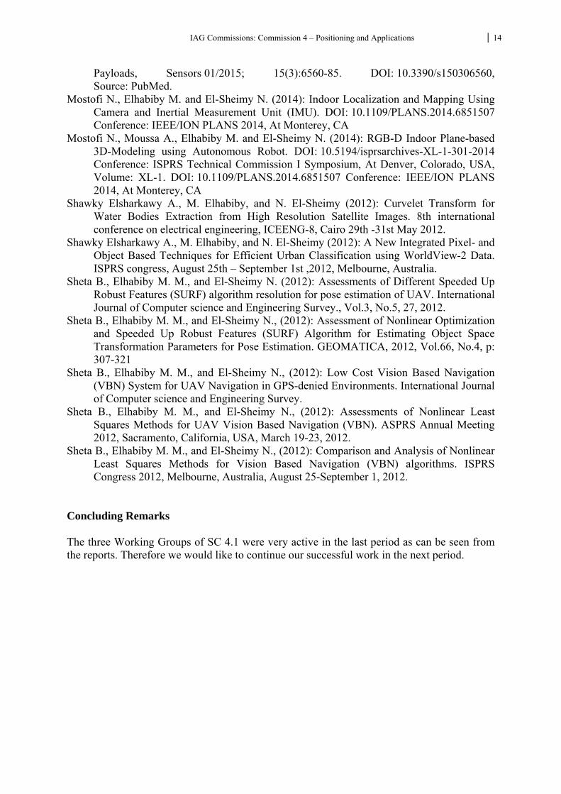
The 2013 Summer School on Mobile Mapping Technology (MMT 2013) was held just before the MMT symposium. The courses of this summer school were focused on the themes of inertial navigation and multi sensor integration, mobile mapping systems, photogrammetric and LiDAR Technologies, and various applications. President of IAG Commission 4, Prof. Dorota A. Grejner-Brzezinska, and Co-Chair of IAG Working Group 4.2.1, Associate Professor Kai-Wei Chiang, were among the invited lecturers for the Summer School on MMT in Tainan, 2012/2013. The IAG Sub Commission 4.2 and Working Group 4.2.1 have sponsored and actively participated The 8th International Symposium on Mobile Mapping Technology – MMT2013, 1 – 2 May, Tainan, 2013 (see the photo below).
IAG Commissions: Commission 4 – Positioning and Applications 17
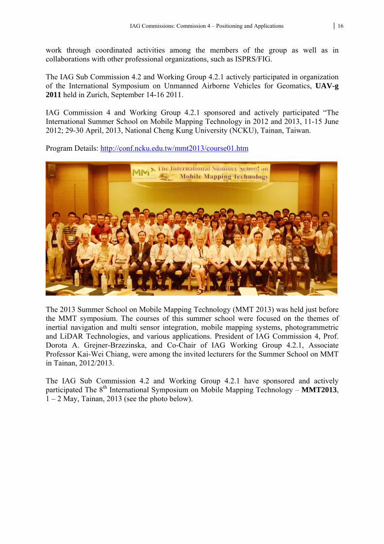
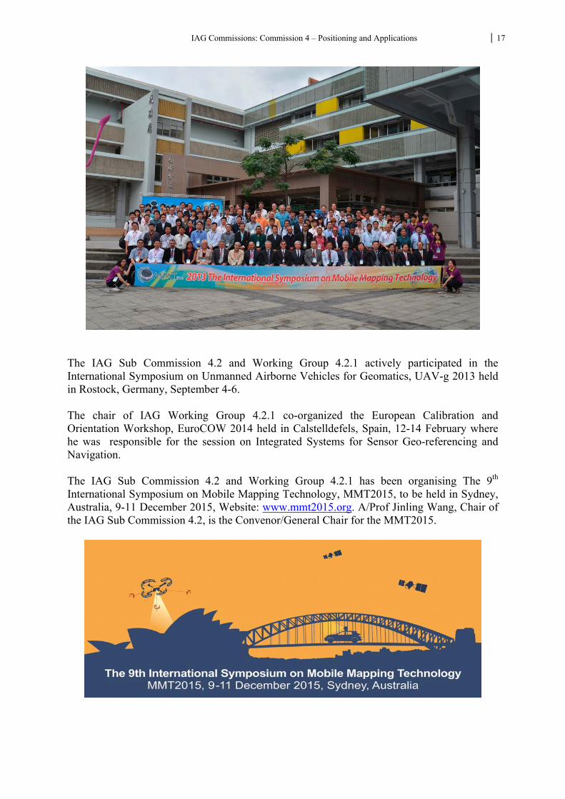
The IAG Sub Commission 4.2 and Working Group 4.2.1 actively participated in the International Symposium on Unmanned Airborne Vehicles for Geomatics, UAV-g 2013 held in Rostock, Germany, September 4-6. The chair of IAG Working Group 4.2.1 co-organized the European Calibration and Orientation Workshop, EuroCOW 2014 held in Calstelldefels, Spain, 12-14 February where he was responsible for the session on Integrated Systems for Sensor Geo-referencing and Navigation. The IAG Sub Commission 4.2 and Working Group 4.2.1 has been organising The 9th International Symposium on Mobile Mapping Technology, MMT2015, to be held in Sydney, Australia, 9-11 December 2015, Website: www.mmt2015.org. A/Prof Jinling Wang, Chair of the IAG Sub Commission 4.2, is the Convenor/General Chair for the MMT2015.
IAG Commissions: Commission 4 – Positioning and Applications 18
Selected Publications: Chiang, K.-W.; Duong, T.T.; Liao, J.-K.; Lai, Y.-C.; Chang, C.-C.; Cai, J.-M.; Huang, S.-C.
(2012) On-Line Smoothing for an Integrated Navigation System with Low-Cost MEMS Inertial Sensors. Sensors, 12(12), 17372-17389.
Chiang K-W, Tsai M-L, Chu C-H. (2012) The Development of an UAV Borne Direct Georeferenced Photogrammetric Platform for Ground Control Point Free Applications. Sensors,12(7):9161-9180.
Chiang K-W, Duong TT, Liao J-K. (2013) The Performance Analysis of a Real-Time Integrated INS/GPS Vehicle Navigation System with Abnormal GPS Measurement Elimination. Sensors, 13(8):10599-10622.
Chiang ,K.W., Duong ,T.T.,* Liao J.k.,(2013), Performance of Real-Time Land-Based GPS-Aided MEMS Inertial Navigator with Interference from Reflected GPS Signals, Sensors 2013, 13(8), 10599-10622
Chu, H.J*.,Tsai, G.J., Chiang ,K.W., Duong ,T.T.,(2013), GPS/ MEMS INS data fusion and map matching in urban areas, Sensors 2013, 13(9), 11280-11288;
Lin C-A., Chiang,K-W. Chu,C-H. (2013), The Performance Evaluation of Pure Inertial Navigation System Aiding from DTM for Land Vehicular Applications: ION GNSS 2013 Meeting, Nashville, Tennessee, USA
Chu,C-H, Chiang,K-W., Lin C-A. (2013), The Performance Analysis of a Portable Mobile Mapping System with Different GNSS Processing Strategies: ION GNSS 2013 Meeting, Nashville, Tennessee, USA
Chu, C.H., and Chiang, K.W, (2013),The Performance Analysis of a Portable Mobile Mapping System, 2013 International Symposium on Mobile Mapping Technologies, Tainan, Taiwan
Guerrier, S., Waegli, A., Skaloud J., and Victoria-Feser M.-P. (2012) Fault Detection and Isolation in Multiple MEMS-IMUs Configurations, in IEEE Transactions On Aerospace And Electronic Systems, vol. 48, p. 2015-2031, 2012.
Kersting, A. P., Ayman, . F. H , Ki-In B. and Skaloud J (2012). Automated approach for rigorous light detection and ranging system calibration without preprocessing and strict terrain coverage requirements, in Optical Engineering -Bellingham- International Society for Optical Engineering-, vol. 51, num. 7, p. 076201-1 – 19
Li, X., Wang J., Liu, W., & Li, R. (2013) Geo-referenced 3D map: Concept & experiments. 8th Int. Symp. on Mobile Mapping Technology, Tainan, Taiwan, 1-3 May. Paper 102
Skaloud J. and Schär P. (2012) Automated Assessment of Digital Terrain Models Derived From Airborne Laser Scanning, in PFG, vol. 2, p.0105-0114.
Wu, Y., & Wang J. (2013) Stochastic modeling of inertial errors for mobile mapping applications. 8th Int. Symp. on Mobile Mapping Technology, Tainan, Taiwan, 1-3 May. Paper 48
P. Molina, I. Colomina, T. Victoria, J. Skaloud, W. Kornus, R. Prades and C. Aguilera Searching lost people with UAVS: The system and results of the CLOSE-SEARCH project.
XXII Congress of the International Society for Photogrammetry and Remote Sensing, Melbourne, Australia, August 25 - September 1, 2012.
Y. Stebler, S. Guerrier, J. Skaloud and M.-P. Victoria-Feser. A Framework for Inertial Sensor Calibration Using Complex Stochastic Error Models. ION/IEEE PLANS, Session A5, Myrtle Beach, SC, USA, April 2012.IEEE-ION Position Location and Navigation Symposium.
P. Molina, I. Colomina, P. Victoria, J. Skaloud, W. Kornus, R. Prades and C. Aguilera. Drones to the Rescue! Inside GNSS, vol. July/August, 2012.
IAG Commissions: Commission 4 – Positioning and Applications 19
R. Filliger, Y. Stebler, J. Skaloud and K. Hug. Autarktic and Inertial Measurement based Low-cost Reconstruction of Motorcycle forward Speed. Proceedings of the ENC GNSS 2013, Vienna, Austria, 2013.
M. Rehak, J. Skaloud, R. Mabillard, A Micro-UAV with the Capability of Direct. Georeferencing. UAV-g 2013, Rostock, Sep. 4-6.
S. Guerrier, R. Molinari, J. Skaloud and M.-P. Victoria-Feser. An algorithm for automatic inertial sensor calibration. ION GNSS+, Nashville, Tennessee, USA, September 16-20, 2013.
WG 4.2.2: Applications of Geodesy in Mining Engineering Chair: A. Jarosz (Australia) Co-Chair: J. Gao (China) Geodesy has been playing an important role in mining operations from geospatial mapping, modern navigation and guidance technologies used in automation at various mine sites to special orientation and location procedures used in underground operations. This working group conducted its activities in close collaborations with other relevant international professional organizations, such as the International Society of Mining Surveying (ISM) and FIG. Chair of IAG Working Group 4.2.2, Dr. Andrew Jarosz organised “2012 International Symposium on Mine Surveying and Mapping for Sustainable Mining”, 9 August 2012, The Sebel Cairns, Queensland, Australia. Program details can be found at: http://www.ism.rwth-aachen.de/images/upload/CommissionMeetings/Commission6/2012Commission6Announcement-Australia.pdf Dr. A. Jarosz was the Chairman of the Scientific Committee, and Associate Professor Jinling Wang, Chair of IAG Sub‐Commission 4.2 was a member of the Scientific Committee for the Symposium. The IAG Sub Commission 4.2 and Working Group 4.2.2 actively participated in the work conference “Joint workshop on ubiquitous positioning and future development” of Sino-British Joint Research Centre of Spatial Information, held in Nottingham, British, 2013, September 12-15. The conference was dedicated in the concept of ubiquitous, the collection and management of data, the system integration and the marketization, and the committee talked about the planning of the future work. At the end of the meeting, the participants visited the pseudo-satellite positioning experimental platform of Nottingham University.
IAG Commissions: Commission 4 – Positioning and Applications 20
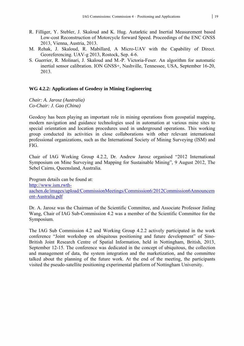
The seminar combining sensors of environment and disaster of the mining area was held at China University of Mining and Technology, 7, September, 2013. Beside the China University of Mining and Technology, Northeast University, Xian University of Science and Technology and Jiangxi University of Science and Technology participated this seminar. The seminar was dedicated to the affection of environment and human health because of the production of coal and electricity. The participants discussed technical issues related to monitoring of the environment and disasters, and visited the mining experiment area, mining area I, mining area II.
Selected Publications: Li Zengke; Gao Jingxiang; Wang Jian; and Zhou Feng. Application of Geostatistics Model in
Analysis of GPS Deformation Sequence. Geostatistics. 2012, Vol. 32, Issue (4): 99-10 WANG Bin; GAO Jing-xiang; HU Hong; ZHOU Feng.Quality Control Method of High-
precision GPS Mesh Adjustment for Mine Area. 2012, 2012(03) 21-24.
IAG Commissions: Commission 4 – Positioning and Applications 21
ZHANG An-bing; GAO Jing-xiang; ZHANG Zhao-jiang. Deformation analysis and prediction of building above old mine goaf based on multiscale method. Rock and Soil Mechanics, 2012, 2012(03) 21-24.
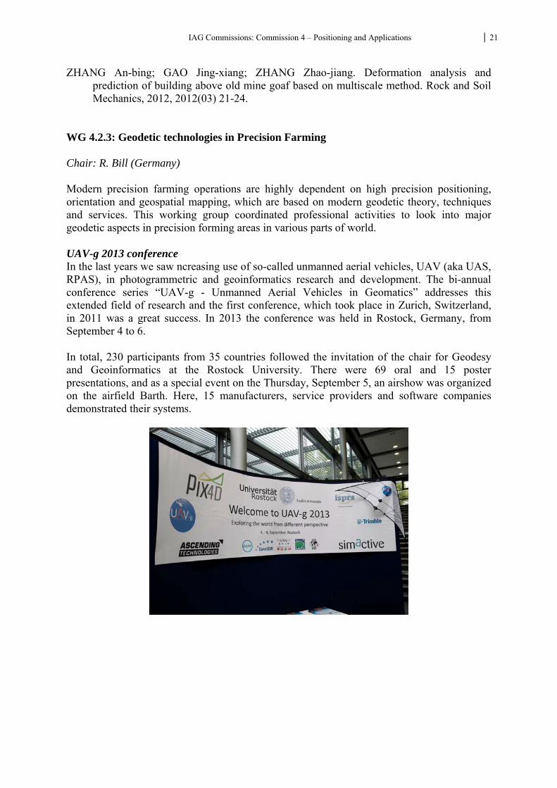
WG 4.2.3: Geodetic technologies in Precision Farming Chair: R. Bill (Germany) Modern precision farming operations are highly dependent on high precision positioning, orientation and geospatial mapping, which are based on modern geodetic theory, techniques and services. This working group coordinated professional activities to look into major geodetic aspects in precision forming areas in various parts of world. UAV-g 2013 conference In the last years we saw ncreasing use of so-called unmanned aerial vehicles, UAV (aka UAS, RPAS), in photogrammetric and geoinformatics research and development. The bi-annual conference series “UAV-g - Unmanned Aerial Vehicles in Geomatics” addresses this extended field of research and the first conference, which took place in Zurich, Switzerland, in 2011 was a great success. In 2013 the conference was held in Rostock, Germany, from September 4 to 6. In total, 230 participants from 35 countries followed the invitation of the chair for Geodesy and Geoinformatics at the Rostock University. There were 69 oral and 15 poster presentations, and as a special event on the Thursday, September 5, an airshow was organized on the airfield Barth. Here, 15 manufacturers, service providers and software companies demonstrated their systems.
IAG Commissions: Commission 4 – Positioning and Applications 22
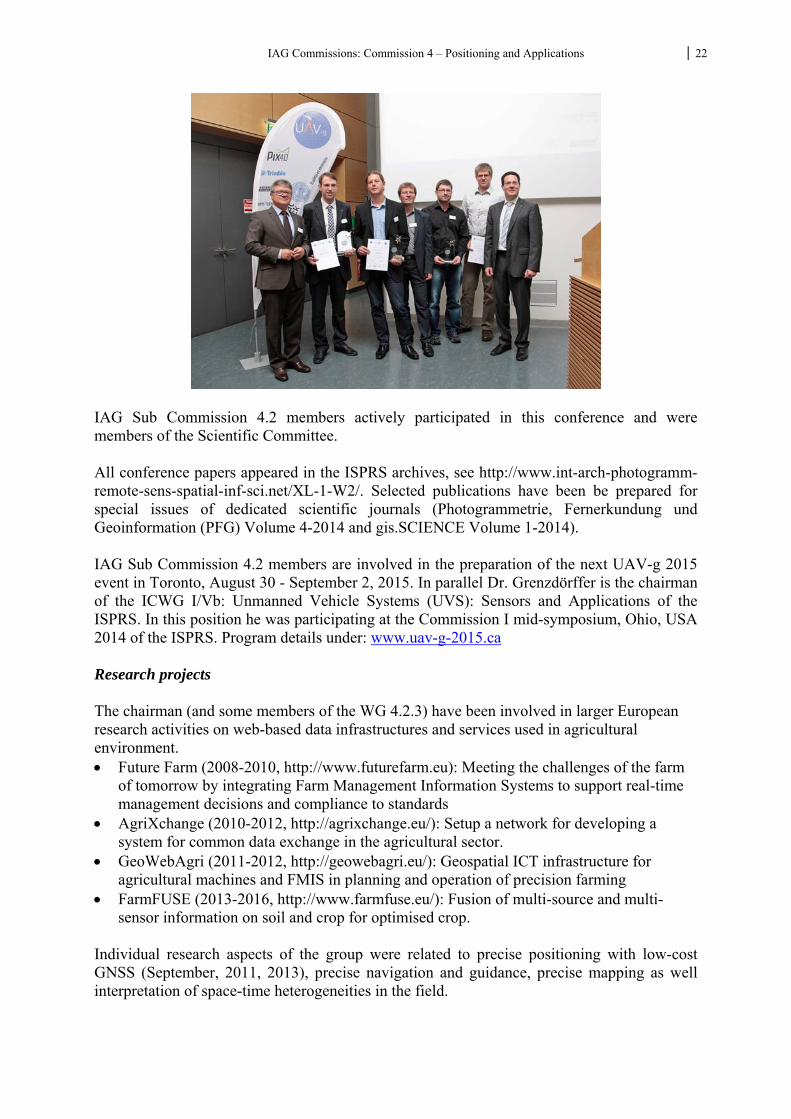
IAG Sub Commission 4.2 members actively participated in this conference and were members of the Scientific Committee. All conference papers appeared in the ISPRS archives, see http://www.int-arch-photogramm-remote-sens-spatial-inf-sci.net/XL-1-W2/. Selected publications have been be prepared for special issues of dedicated scientific journals (Photogrammetrie, Fernerkundung und Geoinformation (PFG) Volume 4-2014 and gis.SCIENCE Volume 1-2014). IAG Sub Commission 4.2 members are involved in the preparation of the next UAV-g 2015 event in Toronto, August 30 - September 2, 2015. In parallel Dr. Grenzdörffer is the chairman of the ICWG I/Vb: Unmanned Vehicle Systems (UVS): Sensors and Applications of the ISPRS. In this position he was participating at the Commission I mid-symposium, Ohio, USA 2014 of the ISPRS. Program details under: www.uav-g-2015.ca Research projects The chairman (and some members of the WG 4.2.3) have been involved in larger European research activities on web-based data infrastructures and services used in agricultural environment. Future Farm (2008-2010, http://www.futurefarm.eu): Meeting the challenges of the farm
of tomorrow by integrating Farm Management Information Systems to support real-time management decisions and compliance to standards
AgriXchange (2010-2012, http://agrixchange.eu/): Setup a network for developing a system for common data exchange in the agricultural sector.
GeoWebAgri (2011-2012, http://geowebagri.eu/): Geospatial ICT infrastructure for agricultural machines and FMIS in planning and operation of precision farming
FarmFUSE (2013-2016, http://www.farmfuse.eu/): Fusion of multi-source and multi-sensor information on soil and crop for optimised crop.
Individual research aspects of the group were related to precise positioning with low-cost GNSS (September, 2011, 2013), precise navigation and guidance, precise mapping as well interpretation of space-time heterogeneities in the field.
IAG Commissions: Commission 4 – Positioning and Applications 23
Prof. Bill and members of his team have been invited to write the chapter on “GIS in Agriculture” for the Springer Handbook of Geographic Information. Selected publications: Bill, R., Nash, E., Grenzdörffer, G. (2012): GIS in Agriculture. In: Kresse, W., Danko, D.M.:
Handbook of Geographic Information. Springer. Page 795 - 819. Behnke, R., Born, A., Salzmann, J., Timmermann, D., Bill, R. (2011): Combining Scalability
and Resource Awareness in Wireless Sensor Network Localization. In: IEEE Conference on Computer Communications Workshops: IEEE INFOCOM 2011. Proceedings of the Third International Workshop on Wireless Sensor, Actuator and Robot Networks (WiSARN 2011). Page 531 - 536.
gis.Science (2014): Special Issue UAS.Volume 1. Grenzdörffer, G., Niemeyer, F., (2011) UAV Based BRDF Measurements of Agricultural
Surfaces with PFIFFIKUS. In: Eisenbeiss, H. et al. [eds], Int. Arch. Photogrammetry Remote Sens. Spatial Inf. Sci. Proceedings of the International Conference on Unmanned Aerial Vehicle in Geomatics (UAVg), Zürich.
Grenzdörffer, G., Niemeyer, F., Schmidt, F. (2012): Development of Four Vision Camera
System for a Micro-UAV. In: Shortis, M., El-Sheimy, N. (Ed.): International Archives of the Photogrammetry, Remote Sensing and Spatial Information Sciences : XXII ISPRS Congress Melbourne. Volume XXXIX-B1. : Copernicus Publications, Page 369 - 374. ISPRS archives, see http://www.int-arch-photogramm-remote-sens-spatial-inf-sci.net/XL-1-W2/.
Nash, E., Nikkilä, R., Wiebensohn, J., Walter, K., Bill, R. (2011): Interchange of Geospatial
Rules - Towards Georules Interchange Format (GeoRIF)?. In: gis.Science. 24. Jahrgang, Nr. 3, S. 82 - 94.
Nash, E., Wiebensohn, J., Nikkilä, R., Vatsanidou, A., Fountas, S., Bill, R. (2011): Towards
automated compliance checking based on a formal representation of agricultural production standards. In: Computers and Electronics in Agriculture. 78 Nr. 1, S. 28 - 37.
Nikkilä, R., Wiebensohn, J. Nash, E., Seilonen, I., Koskinen, K. (2012): A service
infrastructure for the representation, discovery, distribution and evaluation of agricultural production standards for automated compliance control. In: Computer and Electronics in Agriculture. 80, Nr. 0, S. 80 - 88.
Peets, S., Mouazen, A., Blackburn, K., Kuang, B., Wiebensohn, J. (2012): Methods and
procedures for automatic collection and management of data acquired from on-the-go sensors with application to on-the-go soil sensors. In: Computer and Electronics in Agriculture. 81, Nr. 0, S. 104 - 112.
PFG (2014): Special issue on UAS. Volume 4.
IAG Commissions: Commission 4 – Positioning and Applications 24
Stempfhuber, W., Buchholz, M. (2011): High-End and Low-Cost RTK GNSS in Machine Control and Precision Farming Applications, FIG Working Week 2011 Bridging the Gap between Cultures, Marrakech, Morocco, 18-22 May 2011.
Stempfhuber, W. (2013): Geodätische Monitoringsysteme mit RTK Low-Cost-GNSS, tech 13
- Trends im Vermessungswesen: Aktuelle Trends und Herausforderungen in der Ingenieurgeodäsie
Wiebensohn, J., Sørensen, C.A.G. (2011): Aspects of the Farm Management Information
System related to standards and regulations. In: Nordic Association of Agricultural Scientists (Hrsg.): Automation and System Technology in Plant Production: NJF Report. 7, 5. Herning, Denmark.
More details about this working group can be found at: http://www.iag-wg423-pf.auf.uni-rostock.de/ WG 4.2.4: Monitoring of Landslides & System Analysis Chair: G. Mentes (Hungary) Co-Chair: J. Guo (China) Surface mass movements can cause a lot of damages. Forecasting landslides is of crucial importance due to the potentially serious consequences to the society. It is a difficult and complex task which needs understanding of the relationships between landslide generating processes (geological, geophysical, hydrological, meteorological, etc.) and movements of the sliding block and its surroundings. In addition to the continuous recording geophysical, hydrological, meteorological, etc. parameters, there is an urgent need for continuous 3D geodetic measurements to determine the complex movements of the landslide prone area to understand the kinematic and dynamic behaviour of landslides. There is only a chance to develop an early warning system in exact knowledge of the moving process of the landslide area and all of other physical parameters. According to these requirements the working group laid a special emphasis on the following research areas:
detection of potential landslides on large scale an efficient and continuous observation of critical areas a knowledge-based derivation of real time information about actual risks in order to
support an alert system According to the research aims the group worked intensively on the next research areas: 1. Different terrestrial and space measurement techniques were combined for continuous
observation of surface movements. As terrestrial geodetic measurement techniques new instruments and methods were developed and tested. Instead of geodetic measurements carried out in periodical campaigns a great stress was laid on the continuous geodetic measurements techniques to get data series directly comparable with continuously collected hydrological (water table, stream stage, pore pressure, etc.), meteorological (e.g. precipitation, temperature), etc. data series for the study of dynamic processes of landslides and to get more reliable and comprehensive information for development of early warning systems.
2. Use of terrestrial radar systems for slope monitoring, meanwhile we have an IBIS-L system.
IAG Commissions: Commission 4 – Positioning and Applications 25
3. Investigation on different satellite radar bands for the estimation of the "normal behaviour" of the region of interest.
4. A special stress was laid on the combination of monitoring data with a numerical model which represents the structure and the kinematic and dynamic behaviour of the slope. Landslide modelling with support vector machines
5. The effect of the vegetation on the slope stability was also intensively investigated. 6. Application combined PinSAR and GNSS technology for monitoring Landslide
movements Organization of workshops and conferences: Organization of the section "Monitoring of Landslides & System Analysis” on "The World Multidisciplinary Earth Sciences Symposium– MESS 2015” in Prague (Czech Republic) during 7-11 September 2015. IAG Sub Commission 4.2 and Working Group 4.2.4 actively participated in “The Second Joint International Symposium on Deformation Monitoring” (JISDM), 9-11 September 2013, University of Nottingham, Nottinham, UK. IAG Sub Commission 4.2 and Working Group 4.2.4 will actively participate in the organization of the 3rd Joint International Symposium on Deformation Monitoring, March 30 to April 1, 2016, Vienna, Austria. Some of the research projects which were /are carried out: P20137 KASIP - Knowledge-Based Alarm System with Identified Deformation Predictor
Research project alpEWAS (Sudelfeld, Bayern): combined sensor network on landslide Anggenalm/Sulderfeld. Observation by PS Radarinterferometrie by DLR and Infoterra (EADS Astrium), GNSS+TPS.
Landslide Hornbergle (Reutte Tirol): test measurements by gbSAR, combined campaign measurements by GNSS+TPS.
EU FP7 Forschungsprojekt De-Montes (Deformation Monitoring by High Resolution Terrestrial Long Range Sensing) for further research of adoption of IATS and a combined photogrammetric/tahymetric/TLS measurement conception.
OTKA K78332 Kinematic and dynamic models of landslides by means of geodetic observations along the high bank of the Danube at Dunaszekcső, Hungary
OTKA K 81295 Development of measuring methods for detection of very small surface mass movements
Some selected references which represent the activity and the main research topics of the working group: Bányai, L., Mentes, Gy., Újvári. G., Kovács, M., Czap, Z., Gribovszki, K., Papp, G., 2014:
Recurrent landsliding of a high bank at Dunaszekcső, Hungary: Geodetic deformation monitoring and finite element modelling. GEOMORPHOLOGY 210: pp. 1-13.
Mentes, Gy., Bányai L., 2014. Observation of Landslide Movements by Geodetic and Borehole Tilt Measurements. In: Kopáčik, A., Kyrinovič, P., Štroner , M. (Eds). Proceedings of the 6th International Conference on Engineering Surveying INGEO 2014, Czech Technical University Prague, Faculty of Civil Engineering, 2014. Czech Republic, ISBN 978-80-01-05469-7. Prague, Czech Republic, April 3-4, 2014. TS2-4 Networks and GNSS application. pp. 53-58.
IAG Commissions: Commission 4 – Positioning and Applications 26
Mentes, Gy., Bódis, VB., Vig, P., 2014. Small slope tilts caused by meteorological effects and vital processes of trees on a wooded slope in Hidegvíz Valley, Hungary. Geomorphology 206 (2014) 239–249.
Holst, C., Artz, A., Kuhlmann, H. 2014: Biased and Unbiased Estimates Based on Laser Scans of Surfaces with Unknown Deformations. Journal of Applied Geodesy. Volume 8, Issue 3, Pages 169–184.
Dupuis, J., Kuhlmann, H. 2014: High-Precision Surface Inspection: Uncertainty Evaluation within an Accuracy Range of 15μm with Triangulation-based Laser Line Scanners. Journal of Applied Geodesy. Volume 8, Issue 2, Pages 109–118.
Retscher, G., Mentes, G., Reiterer, A. 2014: Advances of Engineering Geodesy and Artificial Intelligence in Monitoring of Movements and Deformations of Natural and Man-Made Structures. In: Chris, R., Pascal, W. (Eds.): Earth on the Edge: Science for a Sustainable Planet, Proceedings of the IAG General Assembly, Melbourne, Australia, June 28 - July 2, 2011, Series: International Association of Geodesy Symposia, 2014, XIII, Vol. 139, 481-486. ISBN 978-3-642-37221-6, Springer Heidelberg New York Dordrecht London, pp. 617.
Holst, C., Eling, C., Kuhlmann, H. 2013: Automatic optimization of height network configurations for detection of surface deformations. Journal of Applied Geodesy. Volume 7, Issue 2, Pages 103–113.
Guo, J., Zhou, M., Wang, C., Mei. L. 2012: The application of the model of coordinate S-transformation for stability analysis of datum points in high-precision GPS deformation monitoring networks. Journal of Applied Geodesy. Volume 6, Issue 3-4, Pages 143–148.
Bányai, L., Újvári, G., Mentes, Gy. 2012: Kinematics and dynamics of a river bank failure determined by integrated geodetic observations. Case study of Dunaszekcső landslide, Hungary. In: Dr. M S Pandian (szerk.): Proceedings of the Annual International Conference on Geological & Earth Sciences (GEOS 2012), Singapore. 3-4 December, 2012. Organized and Published by Global Science and Technology Forum (GSTF).
Mentes, Gy., 2012. A new borehole wire extensometer with high accuracy and stability for observation of local geodynamic processes. Citation: Rev. Sci. Instrum. 83, 015109 (2012); doi: 10.1063/1.3676652.
Mentes, Gy., / Bódis, V.B. 2012: Relationships between short periodic slope tilt variations and vital processes of the vegetation. Journal of Applied Geodesy, 6 (2), 83–88, DOI: 10.1515/jag-2012-0009.
Theilen-Willige B., Papadopoulou I.D., Savvaidis P., and Tziavos I.N. 2011: Use of Remote Sensing and GIS methods for mitigating the impact of earthquakes in cities, Proc. Inter. Congress “Natural Cataclysms and Global Problems of the Modern Civilization –GeoCataclysm 2011, Istanbul, Turkey.
Stergioudis A., Savvaidis P. and Lakakis K. 2011: Performance estimation of pixel-based classification algorithms in mixed environment areas, in Proc. “Modern technologies, education and professional practice in geodesy and related fields”, 19th International Symposium, 03 - 04 November, Sofia.
Eichhorn, A.: Monitoring of a Mass Movement Performed by the Ground-Based Radar System IBIS-L. Oral presentation: Joint International Symposium on Deformation Monitoring, Hong Kong, China, 02.11.2011 - 04.11.2011
Mair am Tinkhof, K., Preh, A., Tentschert, E.-H., Eichhorn, A., Buhl, V., T. Schmalz, T., Rödelsperger, S., Zangerl, C. 2011: KASIP - Numerical Investigation of landslides amd combination with monitoring data Poster: 60. Geomechanik Kolloquium/Franz Pacher Kolloquium, Salzburg, Austria, 13.10.2011 - 14.10.2011
IAG Commissions: Commission 4 – Positioning and Applications 27
Rödelsperger, S., Läufer, G., Eichhorn, A., Gerstenecker, C. 2011: Near real-time monitoring concept of mass movements with ground based SAR Oral presentation: IUGG General Assembly, Melbourne, Australia, 28.06.2011 - 07.07.2011
Rödelsperger, S., Läufer, G., Eichhorn, A., Gerstenecker, C. 2011: Continuous monitoring of landslides with ground based SAR: A case study at Steinlehnen Oral presentation: EGU General Assembly, Vienna, Austria, 03.04.2011 - 08.04.2011
Mertl, S., Rödelsperger, S., Weginger, S. 2011: Seismic- and GBSAR monitoring of a rockslide. Poster: EGU General Assembly, Vienna, Austria, 03.04.2011 - 08.04.2011
Mentes, Gy., Bányai, L., Újvári, G., Papp, G., Gribovszki, K and Bódis, V.B. 2011: Recurring Mass Movements On The Danube’s Bank at Dunaszekcső (Hungary) Observed by Geodetic Methods. Proceedings of the Joint International Symposium on Deformation Monitoring. Hong Kong, China, 2-4 November 2011. Session 3E: Applications in Geosciences on Local and Regional Scale II. 3E-04. 159.pdf
Mentes, Gy., and Bódis, V.B: 2011: Relationships Between Short Periodic Slope Tilt Variations and Vital Processes of the Vegetation. Proceedings on the Joint International Symposium on Deformation Monitoring. Hong Kong, China, 2-4 November 2011. Session 3I: Natural Effects (Groundwater, Erosion, etc). 3I-02. 158.pdf.
WG 4.2.5: Applications of Artificial Intelligence in Geospatial Mapping and Engineering Geodesy Chair: H. Neuner (Austria) Co-Chairs: A. Reiterer (Germany) and U. Egly (Austria) Artificial Intelligence (AI) has become an essential technique for solving complex problems in many applications. In the areas of geospatial mapping and engineering geodesy, knowledge-based systems are emerging. To develop reliable intelligent systems, this working group has focused on some critical issues ranging from the understanding of the nature of intelligence to the understanding of knowledge representation and deduction processes, eventually resulting in the construction of computer programs, which act intelligently. IAG Working Group 4.2.5 organised the Workshop on “Applications of Artificial Intelligence in Engineering Geodesy”, 10-12 September 2012, Technical University of Munich, Munich, Germany. Program details can be found at: http://www.geo.bv.tum.de/images/stories/AI_IATS_Flyer.pdf
IAG Commissions: Commission 4 – Positioning and Applications 28
Sub-Commission 4.3: Remote Sensing and Modelling of the Atmosphere Chair: Marcelo Santos (Canada) Vice-Chair: Jens Wickert (Germany) SC 4.3 is composed of one Study Group and three Working Groups. Besides, Several of SC 4.3 members participate in the COST Action 1206 “Advanced Global Navigation Satellite Systems tropospheric products for monitoring severe weather events and climate (GNSS4SWEC)”, which will be referred to below. SG 4.3.1 Ionosphere Modelling and Analysis Chair: Michael Schmidt (Germany), Co-Chair: Mahmut O. Karslioglu (Turkey),
Members:
Lung-Chih Tsai (Taiwan), Dieter Bilitza (USA), Denise Dettmering (Germany), Mahdi Alizadeh (Germany), C.K. Shum (USA), Kuo-Hsin Tseng (Taiwan), Norbert Jakowski (Germany), Robert Heinkelmann (Germany), Andrzej Krankowski (Poland), Pawel Wielgosz (Poland), Lee-Anne McKinnell (South Africa), Marco Limberger (Germany), Wenjing Liang (Germany), Shin-Chan Han (USA), Manuel Hernandez-Pajares (Spain), Claudio Brunini (Argentina), Benedikt Soja (Germany), Tatjana Gerzen (Germany), David Minkwitz (Germany), Eren Erdogan (Germany) The general objective of this study group is the development of ionosphere models based on physics, mathematics and statistics. Within the next four years we will (1) focus on the development of appropriate parameter estimation and assimilation techniques based on the combination of different observation techniques. With respect to physical modeling we (2) will perform first steps by introducing physics-motivated functions such as the Chapman function into the parameter estimation process. Furthermore, we (3) will establish ionosphere models including near real-time applications by introducing Kalman filtering procedures. Other topics (4) are the development of densification strategies of global models using regional approaches as well as applications, e.g. the study of the L3 GNSS frequency
Research Activities related to topic (1):
The main activity at GESA (LaPlata, Argentina) is focused on developing a suitable model and a numerical strategy for combining ionospheric information derived from different beacon satellites measurements to generate a global representation of the electron density. Ground-based GNSS measurements, VTEC estimations derived from satellite altimetry missions and electron density estimations derived from space-based GPS receivers, are consistently combined on the observation level to determine the parameters of the empirical functions that describe the 4-D (latitude, longitude, height and time) electron density distribution of the different ionospheric layers. Several years were analysed in order to assess the performance of the combination technique under low solar activity conditions.
The focus of a study at DGFI-TUM (Deutsches Geodätisches Forschungsinstitut der Technischen Universität München, Germany) is the evaluation of DORIS data for ionosphere modeling. Recently launched satellite missions such as JASON-2, Cryosat, HY-2A and Saral have DGXX instruments on board which allow for tracking continuous
IAG Commissions: Commission 4 – Positioning and Applications 29
dual-frequency phase observations and, hence, the extraction of STEC. A single layer model approach has been used to derive VTEC where the spatio-temporal TEC distribution is described by mathematical B-spline functions. The validation of the derived VTEC was carried out by comparisons with other models, for instance, the IGS GIMs and dual-frequency altimeter measurements from Jason-2 where significant improvements due to the combination of GPS and DORIS can be observed. At Wuhan University, with collaborations from OSU (Ohio State University) and DGFI-TUM, a new method for retrieval of the absolute VTEC is proposed to combine the GPS GIM and DORIS tracking data. Two steps are used. The first step is the parameters pre-estimation using the GIM data, followed by the parameter-update with the DORIS tracking data. In this study, the altimeter data from HY2A was used to validate the effectiveness of DORIS-GIM ionosphere model for nadir ionosphere corrections.
The Satellite Geodesy Group at the Department of Geodesy and Geoinformation Science of TUB (Technische Universität Berlin) is effectively contributing to the aims IAG Study Group 4.3.1 in a variety of fields. In the field of combination, TUB is developing combined global maps of VTEC using various space geodetic techniques, e.g. GNSS, satellite altimetry, Formosat-3/Cosmic, etc.
Research Activities related to topic (2):
At TUM, DGFI-TUM and DLR (German Aerospace Center) the electron density distribution within the ionosphere is described vertically by an adapted Chapman function which consists of an F2 Chapman profile and a plasmasphere layer. To account for the horizontal and the temporal behavior, the fundamental key parameters of this physics-motivated approach, such as the maximum electron density NmF2, the corresponding height hmF2 and the F2 scale height HF2, are each modeled by series expansions in terms of tensor products of localizing B-spline functions depending on longitude, latitude and time. For testing the procedure the model is applied to an appropriate region in South America, which covers relevant ionospheric processes and phenomena such as the Equatorial Anomaly. Due to their individual sensitivities with respect to the key parameters, different observation techniques are used and combined. Relevant validations have been carried out for STEC data from ground-based GPS and electron density profiles derived from GPS radio occultation on COSMIC, GRACE and CHAMP. Using the developed techniques ionospheric scenarios for a quiet and a perturbed ionospheric conditions were generated. The scenarios have been validated using independent space-based and ground-based measurements as well as independent ionosphere models in terms of TEC and electron density profiles. On the one hand, the reconstructed TEC are validated using independent TEC measurements from Topex/Poseidon mission. On the other hand, the electron density including the peak parameters NmF2 and hmF2 are validated by independent ionosonde observations and CHAMP reconstruction. In addition, global empirical TEC models such as NeQuick, NTCM and electron density parameter models NPDM and NPHM are used for comparisons.
In the field of physics-motivated modeling of the ionospheric parameters, TUB has achieved global modeling of F2-peak electron density (NmF2) and F2-peak height (hmF2) by applying a combined electron density representation to the GNSS ionospheric observables. The electron density representation at TUB is comprised from combination of multi-layer Chapman function for the bottom-side and topside ionosphere, and Topside Ionosphere/Plasmasphere (TIP) model for the plasmaspheric contribution.
IAG Commissions: Commission 4 – Positioning and Applications 30
Several aspects of ionospheric modelling have been refined and exploited during the period 2011-2015 from the UPC-IonSAT research group (see the corresponding papers at reference list mentioned below): (1) Electron density retrieval from GPS radio occultation measurements (Aragon-Angel et al. 2011), (2) Improvement of precise GNSS positioning by means of real-time ionospheric models (Juan et al. 2012), (3) Prediction of Global Ionospheric Maps (García-Rigo et al. 2012), (4) GNSS modelling of Medium Scale Travelling Disturbances, MSTIDs (Hernandez-Pajares et al. 2012a), (5) Indirect measurement of solar EUV flux rate by means of RT global GNSS data (Hernandez-Pajares et al. 2012b) and (6) Higher order ionospheric modelling (Hernandez-Pajares et al. 2014). Moreover the production of real-time GIMs in the context of the RT-IGS project (Caissy et al. 2012) is also taking part of the efforts of UPC-IonSAT members. In this regard we can advance a significant improvement in our tomographic-kriging strategy, based on a Kalman filter implementation, thanks to the availability of +150 RT GNSS receivers worldwide distributed. In this context we are attaining global RT accuracies (when compared with independent JASON2 data for instance) similar to the precision of rapid GIMs (24 hours of latency) of most of the contributing ionospheric analysis centers to IGS.
At Wuhan University, the 4D ionosphere tomography model is developed based on a pixel model. Firstly we impose a priori IRI model based on constraints by increasing the virtual observations between two pixel grids. Then, we establish a more robust connection between the grids using “loose” constraints, which improve the rank of inversion of the normal equation. The resulting 4D ionosphere model is shown to have more solution stability and more accurate estimated ionosphere parameters. The above 4D ionosphere modeling allows one to simultaneously retrieve gridded near-real time velocities of the ionosphere electron density, and the electronic density parameters.
The International Reference Ionosphere (IRI) describes the monthly average behavior of the Earth’s ionosphere based on most of the accessible and reliable ground- and space-based observations of ionospheric parameters. With the ever-increasing dependence on space technology the IRI development is going beyond the monthly averages in order to provide a quantitative description of ionospheric day-to-day variability depending on altitude, time of day, time of year, latitude as well as solar and magnetic activity. The IRI team is also pursuing the development of the IRI Real-Time (IRI-RT) that uses assimilative algorithms or updating procedures to combine IRI with real-time data for a more accurate picture of current ionospheric conditions.
Research Activities related to topic (3):
At METU (Middle East Technical University) studies have been performed on the non-parametric forward-backward stagewise algorithms MARS and BMARS for VTEC estimation; related results are published. Currently, iterative algorithms for tomographic reconstruction of the ionosphere using heterogenous data collected from ground and satellite based observations are investigated. The main purpose of the current research is to find flexible, efficient, accurate and stable reconstruction of the spatio-temporal ionospheric electron density in 4 dimensions based on multivariate adaptive regression B-Splines. Moreover, estimation of the instrumental biases of the satellites and receivers inside the algorithm or by a combination of parametric and non-parametric approaches will be investigated. Additionally, we are working on station based modeling of the ionospheric VTEC estimation using particle filters for near real time applications particularly during geomagnetic storms, since particle filters are effective algorithms for the estimation of nonlinear and non-Gaussian high dynamic systems. In parallel to the studies above, there is an ongoing research activity which consists of accurate and precise
IAG Commissions: Commission 4 – Positioning and Applications 31
calibration of ionospheric delay measurements derived from GPS and GLONASS using different local ionosphere models for estimating Ground Based Augmentation System (GBAS) threat model parameters. In order to asses real-time integrity algorithms for CAT III GBAS precision landing, a software tool is being developed for simulating the multi-GNSS code and phase measurements inside the receivers of virtual ground stations and aircrafts within different GBAS architectures and atmospheric conditions. The software and simulated scenarios will not only be used to research and develop architectures and real-time integrity monitoring algorithms for GBAS but also be used to develop and asses the measurement pre-processing algorithms in addition to local, regional and global ionosphere modeling algorithms.The International Reference Ionosphere (IRI) describes the monthly average behavior of the Earth’s ionosphere based on most of the accessible and reliable ground- and space-based observations of ionospheric parameters. With the ever-increasing dependence on space technology the IRI development is going beyond the monthly averages in order to provide a quantitative description of ionospheric day-to-day variability depending on altitude, time of day, time of year, latitude as well as solar and magnetic activity. The IRI team is also pursuing the development of the IRI Real-Time (IRI-RT) that uses assimilative algorithms or updating procedures to combine IRI with real-time data for a more accurate picture of current ionospheric conditions.
The International GNSS Service (IGS) provides a variety of data products such as GNSS observations and satellite orbits with different latencies. These products can, for instance, be exploited for the production of high quality, near-real time ionosphere maps as needed in the scientific, educational and commercial sector. In addition to GPS and GLONASS data which can be accessed through the IGS, complementary techniques such as radar altimetry, DORIS or radio occultations can be included to improve the data coverage. Therefore, sequential methods for data pre-processing and filtering (e.g. Kalman filter) that are capable of running in near-real time may be applied to assimilate this data under consideration of the different characteristics concerning data precision, number and type. At DGFI-TUM, effort has been maintained to generate VTEC products with low latency through a continuously operating processing framework.
Research Activities related to topic (4):
For investigations about the solar corona’s electron density using VLBI data (Soja et al., 2014a), the effect of the ionosphere needs to be corrected. Two approaches were followed, on the one hand estimating the ionospheric vertical electron content from VLBI data and on the other hand interpolating it from IGS global ionospheric models. The resulting electron density models of the solar corona from both approaches agreed well within their formal errors and also when compared to previous models derived from spacecraft tracking. Regional variations in the electron density and coronal mass ejections visible in coronagraph data could be linked to the VLBI data as well (Soja et al., 2014c).
Development of the local ionosphere model over Central Europe based exclusively on precise carrier phase observations and its validation in precise positioning (Krypiak-Gregorczyk et al, 2013, 2014).
Quality analysis of VRS (Virtual reference station) ionospheric corrections provided by the Polish part of the EUPOS (European Positioning System) (Krukowska et al. 2014). The ionospheric part of the VRS corrections was compared to the actual ionospheric delays derived from processing real GNSS observations at the test stations. Degradation of the corrections during ionospheric disturbances was demonstrated.
IAG Commissions: Commission 4 – Positioning and Applications 32
For the exchange of the scientific outcome within the Study Group we organized splinter meetings at the EGU General Assemblies in the years 2012 and 2015 in Vienna. As a further outcome Lung-Chi Tsai (NCU) organized in the framework of the IAG SG 4.3.1 the Session GFH-2 entitled as “Developments and/or applications of a multi-dimensional ionospheric electron density model” at the Asia-Pacific Radio Science Conference AP-RASC'13, September 3-7, 2013 in Taipei, Taiwan. Furthermore, in each of the last years an ionosphere session was placed in the Geodesy programme of the EGU, related to the ToR of the IAG SG 4.3.1. The sessions have been arranged and chaired by members of the SG. In the beginning of July 2015 the SGI Workshop will take place at the Technische Universität Berlin. This workshop will also be supported by members of the SG. In addition, many other conferences, symposia and workshops have been attended by members of the IAG SG 4.3.1 within the last four years.
References
Alizadeh M.M., Schuh H., Schmidt M. “Ray-tracing technique for global 3D modeling of ionospheric electron density using GNSS”, Radio Science, in press, 2015.
Alizadeh, M.M., Schuh, H., Wickert, J., Arras C., Space geodetic techniques for remote sensing the ionosphere. Proceedings of the 14th International Ionospheric Effects Symposium (IES 2015), Alexandria, VA, USA, 2015.
Alizadeh M.M., Wijaya D., Hobiger T., Weber R., Schuh H.: “Ionospheric effects on microwave signals”, In: Böhm J., Schuh H. (eds): Atmospheric Effects in Space Geodesy. Springer Verlag, ISBN: 978-3-642-36931-5, 2013.
Alizadeh M.M., “Multi-dimensional modeling of the ionospheric parameters using space geodetic techniques”, PhD Thesis, Vienna University of Technology, Vienna, Austria, Heft Nr. 93-2013, ISSN 1811-8380, 2013.
Alizadeh, M.M., Schuh, H., Todorova, S., Schmidt, M. Gobal ionosphere maps of VTEC from GNSS, satellite altimetry, and Formosat-3/COSMIC data. J Geod 85(12): 975-987, doi: 10.1007/s00190-011-0449-z, 2011.
Aragon, A.; Liou, Y.; Lee, C.; Reinisch, B.; Hernandez, M.; Juan, J.; Sanz, J. Improvement of retrieved FORMOSAT-3/COSMIC electron densities validated by ionospheric sounder measurements at Jicamarca. Radio Science.46, RS5001, 1-12, 2011
Azpilicueta, F., Brunini, C., Camilion, E. The geomagnetic semiannual anomaly on the four Dst-fundamental observatories - Dependences with Sun-Earth physical parameters, Journal of Geophysical Research, Vol. 117, A07204, doi: 10.1029/2012JA017730, 2012.
Azpilicueta, F., Brunini, C. A different interpretation of the annual and semiannual anomalies on the magnetic activity over the Earth, Journal of Geophysical Research, 116, A01307, doi: 10.1029/2010JA015977, 2012.
Azpilicueta, F., Brunini, C. A new concept on the geomagnetic semi-annual anomaly, Journal of Geophysical Research, 116, A01307, doi: 10.1029/2010JA015977, 2011.
Azpilicueta, F., Brunini, C., Radicella, S. M. Semi-annual anomaly and annual asymmetry on TOPEX TEC during a full solar cycle. In: Kenyon, S. et al. (eds.), Geodesy for Planet Earth, International Association of Geodesy Symposia 136, doi 10.1007/978-3-642-20338-1_94, 769-774, 2011.
Boehm, J., Salstein, D., Wijaya, D. and Alizadeh, M.M., “Geodetic and atmospheric background”, In J. Boehm and H. Schuh, (eds.): Atmospheric Effects in Space Geodesy, Springer Verlag, ISBN: 978-3-642-36931-5, 2013.
IAG Commissions: Commission 4 – Positioning and Applications 33
Brunini, C., Azpilicueta, F., Gende, M., Camilion, E., Gularte, E. Improving SIRGAS ionospheric model, International Association of Geodesy Symposia, 138, 245-250, in press.
Brunini, C., Azpilicueta, F., Nava, B. A technique for routinely updating the ITU-R database using radio occultation electron density profiles, J Geod, 87, 9, 813-823, doi: 10.1007/s00190-013-0648-x, 2013.
Brunini, C., Conte, J.F., Azpilicueta, F., Bilitza, D. A different method to update monthy median hmF2 values, Advances in Space Research, http://dx.doi.org/10.1016/j.asr.2013.01.0272013, 2013.
Brunini, C., Camilion, E., Azpilicueta, F. Simulation study of the influence of the ionospheric layer height in the thin layer ionospheric model, J Geod, doi 10.1007/s00190-011-0470-2, 2011.
Brunini, C., Azpilicueta, F., Gende, M., Camilion, E., Aragón Ángel, A., Hernandez-Pajares, M., Juan, M., Sanz, J., Salazar, D. Ground- and space-based GPS data ingestion into the NeQuick model, J Geod, doi: 10.1007/s00190-011-0452-4, 2011.
Brunini, C., Azpilicueta, F., Gende, M., Aragón-Ángel, A., Hernández-Pajares, M, Juan, M., Sanz, J. Towards a SIRGAS service for mapping the ionosphere’s electron density distribution. In: Kenyon, S. et al. (eds.), Geodesy for Planet Earth, International Association of Geodesy Symposia, 136, doi 10.1007/978-3-642-20338-1_94, 753-760, 2011.
Caissy M., Agrotis, L., Weber, G., Hernandez-Pajares, M., Hugentobler, U. The International GNSS Real-Time Service, GPS World, 2012.
Codrescu, M. V., Negrea, C., Fedrizzi, M., Fuller-Rowell, T.J., Dobin, A., Jakowski, N., Khalsa, H., Matsuo, T., Maruyama, N. A real-time run of the Coupled Thermosphere Ionosphere Plasmasphere Electrodynamics (CTIPe) model, Space Weather, 10, S02001, doi: 10.1029/ 2011SW000736, 2012.
Conte, J. F., Azpilicueta, F., Brunini, C. Accuracy assessment of the GPS-TEC calibration constants by means of a simulation technique, J Geod, doi 10.1007/s00190-011-0477-8, 2011.
Crespi, M., Mazzoni, A., Brunini, C. Assited code point positioning at sub-meter accuracy level with ionospheric corrections estimated in a local GNSS permanent network. En: S. Kenyon et al. (eds.), Geodesy for Planet Earth, International Association of Geodesy Symposia 136, doi 10.1007/978-3-642-20338-1_94, 761-768, 2011.
Cueto, M., Sardon, E., Cezon A., Azpilicueta, F., Brunini, C. Ionospheric delay forecast using GNSS data, Proceedings of the 24th International Technical Meeting of The Satellite Division of the Institute of Navigation (ION GNSS 2011), Portland, OR, 634-642, 2011.
Dettmering D., Limberger M., Schmidt M. Using DORIS measurements for modeling the vertical total electron content of the Earth's ionosphere. Journal of Geodesy 88(12): 1131-1143, 10.1007/s00190-014-0748-2, 2014.
Dettmering D., Schmidt M., Limberger M. Contributions of DORIS to ionosphere modeling. In: Ouwehand L. (Ed.) Proceedings of "20 Years of Progress in Radar Altimetry", IDS Workshop, Sept. 2012, Venice, Italy, ESA SP-710 (CD-ROM), ISBN 978-92-9221-274-2, ESA/ESTEC, 2013
Dettmering, D., Heinkelmann, R., Schmidt, M. Systematic differences between VTEC obtained by different space-geodetic techniques during CONT08. J Geod 85(7), 443-451, doi :10.1007/ s00190-011-0473-z, 2011.
Dettmering, D., Schmidt, M., Heinkelmann, R., Seitz, M. Combination of different space-geodetic observations for regional ionosphere modeling. J Geod 85(12): 989-998, doi: 10.1007/s00190-010-0423-1, 2011.
Durmaz M., Karslioglu, M.O., Regional Vertical Total Electron Content (VTEC) modeling to-gether with satellite and receiver Differential Code Biases (DCBs) using Semi-
IAG Commissions: Commission 4 – Positioning and Applications 34
Parametric Multi-variate Adaptive Regression B-splines, (SP-BMARS), J Geod, doi : 10.1007/s00190-014-0779-8, 2014.
Durmaz M., Karslioglu, M.O., Non-Parametric Regional VTEC Modeling with Multivariate Adaptive Regression B-Splines, Advances in Space Research, 48, 1523-1530, 2011.
Feltens, J., Angling, M., Jackson-Booth, N., Jakowski, N., Hoque, M.M., Hernández-Pajares, M. Aragón-Àngel, A., Orús, R., Zandbergen, R. Comparative testing of four ionospheric models driven with GPS measurements, Radio Sci., 46, RS0D12, doi: 10.1029/2010RS004584, http://www.agu.org/pubs/crossref/2011/2010RS004620.shtml, 2011.
Garcia-Rigo, A.; Monte, E.; Hernandez, M.; Juan, J.; Sanz, J.; Aragon, A.; Salazar, D.J. Global prediction of the vertical total electron content of the ionosphere based on GPS data, Radio science.46, RS0D25, 1-13, 2011.
Gerzen, T., Feltens J., Jakowski, N., Galkin I., Denton R., Reinisch, B.W., Zandbergen, R., Validation of plasmasphere electron density reconstructions derived from data on board CHAMP by IMAGE/RPI data, Advances in Space Research, 2014.
Gerzen, T., Jakowski, N., Wilken, V., and Hoque, M. M.: Reconstruction of F2 layer peak electron density based on operational vertical total electron content maps, Ann. Geophys., 31, 1241-1249, doi:10.5194/angeo-31-1241-2013, 2013.
Gulyaeva, T.L., Arikan, F., Hernandez-Pajares, M., Stanislawska, I. GIM-TEC adaptive ionospheric weather assessment and forecast system, 102, 329-340, 2013.
Hernández-Pajares, M., Aragón-Ángel, A., Defraigne, P., Bergeot, N., ́Prieto-Cerdeira, R., Garc ea-Rigo, A. Distribution and mitigation of higher-order ionospheric effects on precise GNSS processing, J. Geophys. Res. Solid Earth, 119, doi:10.1002/2013JB010568, 2014.
Hernandez, M., Garcia-Rigo, A., Juan, J., Sanz, J., Monte, E., Aragon, A. GNSS measurement of EUV photons flux rate during strong and mid solar flares.Space weather, The international journal of research and applications, 10 - 12, 2012.
Hernandez, M., Juan, J., Sanz, J., Aragon, A. Propagation of medium scale traveling ionospheric disturbances at different latitudes and solar cycle conditions. Radio Sci., 47, 2012.
Hernandez, M., Juan, J., Sanz, J., Aragon, A., Salazar, D.J., Escudero, M. The ionosphere: effects, GPS modeling and the benefits for space geodetic techniques. J Geod (85) 12, 887 -907, ISSN 0949-7714, 2011.
Hoffmann, P., Jacobi, C., Borries, C., Possible planetary wave coupling between the stratosphere and ionosphere by gravity wave modulation, Journal of Atmospheric and Solar-Terrestrial Physics, 75–76, 71 – 80, doi: 10.1016/j.jastp.2011.07.008, 2012.
Hoque, M.M., Jakowski, N., An alternative ionospheric correction model for global navigation satellite systems, Journal of Geodesy, doi:10.1007/s00190-014-0783-z, 2014.
Hoque, M.M., Jakowski, N., Berdermann J., A new approach for mitigating ionospheric mapping function errors, proceedings ION GNSS, September 8 - 12, Tampa, USA, 2014.
Hoque, M.M., Jakowski, N., Mitigation of Ionospheric Mapping Function Error, proceedings ION GNSS, September 16 - 20, Nashville Convention Center, Nashville, Tennessee, USA, 2013.
Hoque, M.M., Jakowski, N., New correction approaches for mitigating ionospheric higher order effects in GNSS applications, proceedings ION GNSS, September 17-21, Nashville Convention Center, Nashville, Tennessee, 2012.
Hoque, M.M., Jakowski, N., A new global model for the ionospheric F2 peak height for radio wave propagation, Ann. Geophys., 30, 797-809, doi:10.5194/angeo-30-797-2012, 2012.
IAG Commissions: Commission 4 – Positioning and Applications 35
Hoque, M.M., Jakowski, N., Ionospheric Propagation Effects on GNSS Signals and New Correction Approaches, DOI: 10.5772/30090, Global Navigation Satellite Systems: Signal, Theory and Applications, ISBN: 978-953-307-843-4, 2012.
Hoque, M.M., Jakowski, N. Ionospheric bending correction for GNSS radio occultation signals, Radio Sci., 46, RS0D06, doi: 10.1029/2010RS004583, 2011.
Hoque, M.M., Jakowski, N. A new global empirical NmF2 model for operational use in radio systems, Radio Sci., 46, RS6015, doi:10.1029/2011RS004807, 2011.
Hoque M.M., Jakowski, N. A new global model for the ionospheric F2 peak height for radio wave propagation, Annales Geophysicae 30, 787-809, 2012, doi:10.5194/angeo-30-797-2012, 2011.
Jakowski, Norbert, Yannick Béniguel, Giorgiana De Franceschi, Manuel Hernandez Pajares, Knut Stanley Jacobsen, Iwona Stanislawska, Lukasz Tomasik, René Warnant, and Gilles Wautelet, Monitoring, tracking and forecasting ionospheric perturbations using GNSS techniques, J. Space Weather Space Clim. 2 (2012) A22, DOI:10.1051/swsc/2012022.
Jakowski, N., Hoque, M.M., Ionospheric Range Error Correction Models, Localization and GNSS (ICL-GNSS), International Conference on, Starnberg, Germany, 25 -27 June, 2012, IEEE Xplore 10.1109/ICL-GNSS.2012.6253110, 2012.
Jakowski, N., Hoque, M.M., A global ionospheric range error correction model for single frequency GNSS users, proceedings AGU Chapman Conference 'Longitude and Hemispheric Dependence of Space Weather', 2012.
Jakowski, N., Borries, C., Wilken, V. Introducing a Disturbance Ionosphere Index (DIX), Radio Sci., 47, doi:10.1029/2011RS004939, 2012.
Jakowski, N., Béniguel, Y., De Franceschi, G., Hernandez Pajares, M., Jacobsen, K.S., Stanislawska, I., Tomasik, L., Warnant, R., Wautelet, G., Monitoring, tracking and forecasting ionospheric perturbations using GNSS techniques, J. Space Weather Space Clim. 2, A22, doi: 10.1051/swsc/2012022, 2012
Jakowski, N., Hoque, M.M., Mayer, C. A new global TEC model for estimating transionospheric radio wave propagation errors, Journal of Geodesy, doi: 10.1007/s00190-011-0455-1, 2011
Jakowski, N., Mayer, C.,. Hoque, M. M, Wilken, V. TEC Models And Their Use In Ionosphere Monitoring, Radio Sci., 46, RS0D18, doi: 10.1029/2010RS004620, 2011.
Janches, D., Hormaechea, J. L., Brunini, C., Hocking, W., Fritts, D. An initial meteoroid stream survey in the southern hemisphere using the Southern Argentina Agile Meteor Radar (SAAMER), Icarus, 223, 677-683, http://dx.doi.org/10.1016/j.icarus.2012.12.018, 2013.
de Jesus, R., Sahai, Y., Fagundes, P. R., de Abreu, A. J., Brunini, C., Gende, M., Bittencourt; J.A., Abalde; J. R., Pillat, V. G. Response of equatorial, low- and mid- latitude F-region in the American sector during the intensegeomagnetic storm on 24 - 25 October 2011, Advances in Space Research, 52, 147 – 157, http://dx.doi.org/10.1016/j.asr.2013.03.017, 2013.
Juan, J., Sanz, J., Hernandez, M., Samson, J., Tossaint, M., Aragon, A., Salazar, D.J. Wide Area RTK: a satellite navigation system based on precise real-time ionospheric modelling. Radio Sci., 47, 1 – 14, 2012.
Koch, K.R., Schmidt, M. N-dimensional B-spline surface estimated by lofting for locally improving IRI. Journal of Geodetic Science, 1(1), 41-51, DOI:10.2478/v10156-010-0006-3, 2011.
Krankowski, A., Zakharenkova, I., Krypiak-Gregorczyk, A., Shagimuratov, I.I., Wielgosz, P. Ionospheric Electron Density Observed by FORMOSAT-3/COSMIC over the European Region and Validated by Ionosonde Data, J Geod, 85/12, 949-964, doi:10.1007/s00190-011-0481-z, 2011.
IAG Commissions: Commission 4 – Positioning and Applications 36
Krukowska M., Wielgosz P., Krypiak-Gregorczyk A.. Accuracy of VRS ionospheric corrections during ionospheric disturbances, In Proc.: International Conference on Environmental Engineering (ICEE) Selected papers, The 9th International Conference “Environmental Engineering”, Vilnius, Lithuania, 22–23, 2014.
Krypiak-Gregorczyk A., Wielgosz P., Krukowska M.. A New Ionosphere Monitoring Service over the ASG-EUPOS Network Stations, In Proc.: International Conference on Environmental Engineering (ICEE) Selected papers, The 9th International Conference “Environmental Engineering”, Vilnius, Lithuania, 22–23, 2014
Krypiak-Gregorczyk, A., Wielgosz, P., Gosciewski, D., Paziewski, J. Validation of ApproximationTechniques for Local Total Electron Content Mapping. Acta Geodynamica et Geomaterialiai, 10/3 (171), 2013
Kutiev, I., Tsagouri, I., Perrone, L., Pancheva, D., Mukhtarov, P., Mikhailov, A., Lastovicka, J., Jakowski, N., Buresova, D., Blanch, E., Andonov, B., Altadill, D., Magdaleno, S., Parisi, M., Miquel Torta, J. Solar activity impact on the Earth’s upper atmosphere, J. Space Weather Space Clim. Volume 3, A06, http://dx.doi.org/10.1051/swsc/2013028, 2012
Lee, C.-K., Han, S.-C., Bilitza, D., Seo, K.-W. Global characteristics of the correlation and time lag between solar and ionospheric parameters in the 27-day period. Journal of Atmospheric and Solar-Terrestrial Physics, 77, 219-224, doi:10.1016/j.jastp.2012.01.010, 2012.
Lee, C.-K., Han, S.-C, Bilitza, D., Chung, J. Validation of International Reference Ionosphere models using in situ measurements from GRACE K-Band ranging system and CHAMP planar Langmuir probe, Journal of Geodesy, 85, 921-929, doi:10.1007/s00190-011-0442-6, 2011.
Liang W., Limberger M., Schmidt M., Dettmering D., Hugentobler U., Bilitza D., Jakowski N., Hoque M., Wilken V., Gerzen T.: Regional modeling of ionospheric peak parameters using GNSS data - an update for IRI. Advances in Space Research 55(8):1981-1993, 10.1016/j.asr.2014.12.006, 2015.
Liang W., Limberger M., Schmidt M., Dettmering D., Hugentobler U.: Combination of ground- and space-based GPS data for the determination of a multi-scale regional 4-D ionosphere model. IAG Symposia (in press), 2015.
Limberger M., Liang W., Schmidt M., Dettmering D., Hernández-Pajares M., Hugentobler U.: Correlation studies for B-spline modeled F2 Chapman parameters obtained from FORMOSAT-3/COSMIC data. Annales Geophysicae 32(12): 1533-1545, European Geosciences Union, 10.5194/angeo-32-1533-2014, 2014.
Limberger M., Liang W., Schmidt M., Dettmering D., Hugentobler U.: Regional representation of F2 Chapman parameters based on electron density profiles. Annales Geophysicae 31(12): 2215-2227, European Geosciences Union, 10.5194/angeo-31-2215-2013, 2013
Macalalad, E.P., Tsai, L.-C., Wu, J. Performance evaluation of different ionospheric models in single-frequency code-based differential GPS positioning GPS Solution, doi:10.1007/s10291-014-0422-4, 2014.
Macalalad, E.P., Tsai, L.-C., Wu, J., Liu, C.H. Application of the TaiWan Ionosphere Model to Single-Frequency Ionospheric Delay Corrections for GPS Positioning, GPS Solution, doi: 10.1007/s10291-012-0282-8, 2012.
Mosert, M., McKinnell, L. A., Gende, M., Brunini, C., Araujo, J., Ezquer, R. G., Cabrera, M. Variations of foF2 and GPS total electron content over the Antarctic sector, Earth Planets Space, doi: 10.5047/eps.2011.01.006, 63, 327–333, 2011.
Park, J., Lühr, H., Jakowski, N., Gerzen, T., Hyosub, K., Geonhwa, J., Chao, X., Kyoung W. M,Noja, M. A long-lived band of plasma density enhancement at mid-latitudes during
IAG Commissions: Commission 4 – Positioning and Applications 37
the 2003 Halloween magnetic storm. Journal of Atmospheric and Solar-Terrestrial Physics, 2012
Sahai, Y., De Abreu, A. J., Fagundes, P. R., De Jesus, R., Crowley, G., Klimenko, M. V., Klimenko, V. V., Brunini, C., Gende, M., Pillat, V. G., Abalde, J. R., Bittencourt, J. A. Effects of geomagnetic super storms on the ionospheric F-1 region in the South American sector using GPS technique: a review, Asian Journal of Physics, 20, 4, 299-319, 2011.
Schmidt M., Dettmering D., Seitz F. Using B-spline expansions for ionosphere modeling. In: Freeden W., Nashed M.Z., Sonar T. (Eds.) Handbook of Geomathematics (Second Edition), Springer, in press, 2015.
Schmidt M., Göttl F., Heinkelmann R. Towards the combination of data sets from various observation techniques. In: Kutterer H., Seitz F., Alkhatib H., Schmidt M. (Eds.) The 1st International Workshop on the Quality of Geodetic Observation and Monitoring Systems (QuGOMS'11), IAG Symposia 140: 35-43, Springer, 10.1007/978-3-319-10828-5_6, 2015.
Schmidt, M. Towards a multi-scale representation of multi-dimensional signals. Sneeuw N. et al (Eds.), "VII Hotine-Marussi Symposium on Mathematical Geodesy", IAG Symposia, 137: 119-127, doi: 10.1007/978-3-642-22078-4_18, 2012.
Schmidt, M., Dettmering, D., Mößmer, M., Wang, Y., Zhang, J. Comparison of spherical harmonic and B spline models for the vertical total electron content. Radio Science, 46, RS0D11, doi: 10.1029/2010RS004609, 2011.
Scidá, L., Ezquer, R., Cabrera, M., Mosert, M., Brunini, C., Buresova, D. On the IRI 2007 performance as a TEC predictor for the South American sector, Journal of Atmospheric and Solar-Terrestrial Physics, 81-82, 50-58, http://dx.doi.org/10.1016/j.jastp.2012.04.001, 2012.
Shagimuratov, I.I., Krankowski, A., Ephishov, I., Cherniak, Y., Wielgosz, P., Zakharenkova, I. (2012) High latitude TEC fluctuations and irregularity oval during geomagnetic storms, Earth, Planets and Space, 64/6, 521-529, 2012.
Soja, B., Heinkelmann, R., Schuh, H. Probing the solar corona with very long baseline interferometry. Nature Communications 5:4166, doi: 10.1038/ncomms5166, 2014.
Soja, B., Heinkelmann, R., Schuh, H. Solar corona electron densities from VLBI and GIM data. In: International Association of Geodesy Symposia 143: Proceedings of the IAG Scientific Assembly, P. Willis (ed.), September 1-6, 2013, Potsdam, Germany (accepted), 2014.
Soja, B., Heinkelmann, R., Schuh, H. Investigations of the solar corona by VLBI. In: Proceedings of the Eighth IVS General Meeting, D. Behrend, K.D. Baver, and K. Armstrong (eds.); March 2-7, 2014, Shanghai, China, ISBN: 978-7-03-042974-2, 368-372, 2014.
Soja, B. Untersuchung der Sonnenkorona mit VLBI; Master thesis, Vienna University of Technology, Austria; Supervisors: J. Böhm, J. Sun; Master program: "Geodesy and Geophysics", 2013.
Soja, B., Sun, J., Heinkelmann, R., Schuh, H., Böhm, J. Sun Corona Electron Densities Derived from VLBI Sessions in 2011/2012; In: "Proceedings of the 21st Meeting of the European VLBI Group for Geodesy and Astrometry", March 5-8, 2013, Espoo, Finland, ISBN: 978-951-711-296-3, 159-163, 2013.
Tsagouri, I., Belehaki, A., Bergeot, N., Cid, C., Delouille, V., Egorova, T., Jakowski, N., Kutiev, I., Mikhailov, A., Núñez, M., Pietrella, M., Potapov, A., Qahwaji, R., Tulunay Y., Velinov, P., Viljanen, A. Progress in space weather modeling in an operational environment, J. Space Weather Space Clim. 3, A17, http://dx.doi.org/10.1051/swsc/2013037, 2013
IAG Commissions: Commission 4 – Positioning and Applications 38
Tsai, L.-C., Tien M.H., Chen G.H., Zhang Y. HF radio angle-of-arrival measurements and ionosonde positioning, Terr. Atmos. Ocean. Sci., 25, 401-413, doi: 10.3319/TAO.2013.12.19.01, 2014.
Tsai, L.-C., Macalalad E.P., Liu C.H. TaiWan Ionospheric Model (TWIM) prediction based on time series autoregressive analysis, Radio Sci., 49, doi:10.1002/2014RS005448, 2014.Tsai, L.-C., Kevin Chang K., Liu C.H. GPS radio occultation measurements on ionospheric electron density from low Earth orbit, Journal of Geodesy (SCI Journal), doi:10.1007/s0019001104769, 2011.
Yao Y. B., Kong J., Tang J. A new Ionosphere tomography algorithm with two-grids virtual observations constraints and 3D velocity profile, IEEE Transactions on Geoscience and Remote Sensing, 53 (5), 2373-2383, doi:10.1109/TGRS.2014.2359762, 2015.
Yao Y. B., Tang J., Chen P., Zhang S., Chen J. J. An improved iterative algorithm for three-dimensional ionospheric tomography reconstruction, IEEE Transactions on Geoscience and Remote Sensing, 52 (8), 4696-4706, doi:10.1109/TGRS.2013.2283736, 2014.
Yao Y. B., Tang J., Kong J., Zhang L., Zhang S. Application of hybrid regularization method for tomographic reconstruction of midlatitude ionospheric electron density, Advances in Space Research, 52, 2215-2225, doi:10.1016/j.asr.2013.09.030, 2013.
Yao Y. B.,Chen P.,Zhang S., Chen J. J. A new ionospheric tomography model combining pixel-based and function-based models, Advances in Space Research, 52, 614–621, doi: 10.1016/j.asr.2013.05.003, 2013.
Yao Y. B., Zhang R., Song W. W., Shi C., and Lou Y. D., An improved approach to model regional ionosphere and accelerate convergence for precise point positioning, Advances in Space Research, 52, 1406–1415, doi:10.1016/j.asr.2013.07.020, 2013.
Yao Y. B.,Chen P.,Zhang S., and Chen J. J., A new ionospheric tomography model combining pixel-based and function-based models, Advances in Space Research, 52, 614–621, doi: 10.1016/j.asr.2013.05.003, 2013.
Zakharenkova, I.E., Krankowski, A., Shagimuratov, I.I., Cherniak, Yu.V., Krypiak-Gregorczyk, A., Wielgosz, P., Lagovsky, A.F. Observation of the ionospheric storm of October 11, 2008 using FORMOSAT-3/COSMIC data. Earth, Planets and Space, 64/6, 505-512, 2012.
Zhang, J., Schmidt, M., Dettmering, D., Meng, L., Zhu, Y., Wang, Y. Enhanced TEC Maps Based on Different Space-Geodetic Observations. In: J.M. Krisp et al., Earth Observation of Global Changes (EOGC), Lecture Notes in Geoinformation and Cartography, Springer, Berlin Heidelberg, doi: 10.1007/978-3-642-32714-8_2, 2013.
WG4.3.1 Standards for space weather products for geodetic and ionospheric studies Chair: Andrzej Krankowski (Poland) Members: Dieter Bilitza (USA), Manuel Hernandez-Pajares (Spain), Atilla Komjathy (USA), Michael Schmidt (Germany), Hanna Rothkaehl (Poland), Iurii Cherniak (Russia), Irina Zakharenkova (Russia) Activities primarily associated with the IGS IONO WG. Starting a new official/operational product – TEC fluctuation changes over North Pole to study the dynamics of oval irregularities (carried out by UWM to be started as official/routine product after performance evaluation period).
IAG Commissions: Commission 4 – Positioning and Applications 39
Reports on activities The objective of this WG is to suggest common international standards for the dissemination of space weather products used in geodesy and ionospheric studies. This WG works in close scientific collaboration with IGS, URSI and COSPAR IRI group. Special session G5.5 and G5.1 “Monitoring and modelling of the ionosphere from space-geodetic techniques” was organized during General Assembly EGU 2012 and EGU 2013, respectively. During the last IGS Workshop 2012 held at the University of Warmia and Mazury in Olsztyn, Poland from 23 – 27 July 2012 was also organized by members the special session “Atmospheric Delay Modeling and Applications” and the Ionosphere Working Group Splinter Session. After this IGS Workshop the following recommendations from IGS WG were prepared:
a) starting a new official/operational product – TEC fluctuation changes over North Pole to study the dynamic of oval irregularities (carried out by UWM to be started as official/routine product after performance evaluation period,
b) higher temporal and spatial resolution of IGS combined GIMs - the IAACs (UPC and JPL) agreed on providing their maps in IONEX format, with a resolution of 15 min, 1 degrees and 1 degrees in time, longitude and latitude respectively,
c) the new the IAAC from GNSS Research Center (GRC), Wuhan University, China d) very close cooperation with IRI COSPAR group.
Recently the International Standardization Organization, ISO, recommends the International Reference Ionosphere (IRI) for the specification of ionosphere plasma densities and temperatures and indicates necessity for extending IRI to the plasmasphere’s altitudes. At the IRI Workshop 2013 “IRI and GNSS”, organized in Olsztyn, Poland, the IRI Working Group recommends to adjust IRI-Plas model to IRI 2012 version and adjust GPS TEC into IRI Real Time (IRTAM). WG4.3.2 Inter-comparison and cross-validation of tomography models Chair: Alain Geiger (Switzerland) Co-Chair: Witold Rohm (Australia) Members George Liu(China), Michael Bender (Germany), Hugues Brenot (Belgium), Michal Kačmařík (Czech Rep.), Toby Manning (Australia) Reports on activities The IAG working group was established in spring 2012 and its aim is to address main deficiencies in the tomography model construction. In order to successfully achieve this objective, the members decided to split up the work into several logical steps, outlined below. Firstly identification of critical steps in GNSS tomography processing the discussion held mainly by e-mail resulted in following list (not exclusive): slant delay calculation based on DD or PPP solution, the model structure definition (voxel model, node model, outer model, nested models), inversion technique and linked with this topic constraints
IAG Commissions: Commission 4 – Positioning and Applications 40
applications and finally the benefits and flaws of Least Squares approach or Kalman Filter approach. Therefore in multi-model solution these points will be reviewed carefully. Members decided that tomography solution should cover wet refractivity and integrated water vapour content; therefore both Slant Wet Delay (SWD) as well as Slant Integrated Water Vapour (SIWV) are to be utilised. This decision generated fair amount of coding works since not all models have the dual capability. The observations conversion (ZTD to SWD/SIWV) between models varies significantly and testing revealed bugs in some model codes. Secondly, the reference database covering meteorological parameters as well as ground based observations was established. It has been decided to use Numerical Weather Prediction data for state of Victoria in Australia and GNSS observations from the state’s CORS network over a period of Mesoscale Convection System occurrence. Common Slant Delay data source have been established covering two types of data simulated (based on NWP data) and real world (based on ZTD estimation). Thirdly, common model setup (size, number and domain of the model) has been chosen as a proper way to establish reference for inter-comparison studies. Again, this decision involved large amount of work, not all models have the same flexibility in setting up the model structure, and some new functionalities had to be introduced. In meanwhile new members joined the group adding new interesting 2D tomography capability to the inter-comparison studies. Currently, all modifications to the model codes are finished and the WG is in the process of running simulations observations with different strategies, it will be followed by real a world experiment. The WG submitted an abstract of a paper based on the outcomes of this inter comparison study at the IAG General Assembly in Potsdam 2013 and will be published as a Journal Paper soon. Results of inter-comparison campaign Since 2013 the members of WG4.3.3 from have joined research group within the framework of COST Action ES1206 “Advanced Global Navigation Satellite Systems tropospheric products for monitoring severe weather events and climate” (GNSS4SWEC: http://gnss4swec.knmi.nl/). The group activities overlap with the tasks performed of working group WG2 “GNSS for Severe Weather Monitoring” of this project. WG4.3.2 has recently had a workshop on the use of tomography in severe weather. A comparison campaign was set up and is underway. Severe weather case studies identification in 2014 in collaboration with meteorologists from University of Wroclaw, Workshop on application of GNSS tomography in severe weather studies (20 participants from 6 Universities), website: http://www.igig.up.wroc.pl/tomolab/. WG4.3.3 Integration of GNSS atmosphere models with NWP models Chair: Jaroslaw Bosy (Poland) Co-Chair: Henrik Vedel (Denmark) Members: Jonathan Jones (UK), Jan Dousa (Czech Republic), Rosa Pacione (Italy), Guergana Guerova (Bulgaria), Norman Teferle (Luxembourg), Shuli Song (China), Szabolcs Rozsa (Hungary), Yuei-An Liou (Taiwan), Ryuichi Ichikawa (Japan), Joseph Awange (Australia), Jean-Pierre Barriot (French Polynesia), Shuanggen Jin (China), Ambrus Kenyeres (Hungary), Ahmed Furqan (Luxembourg), Jan Kaplon (Poland), Gemma Bennitt (UK) Report on activities
IAG Commissions: Commission 4 – Positioning and Applications 41
Activities through 2011 and 2012 involved in the problems: a) assimilation of GNSS data processing products in NWP models and validation and comparison of different of GNSS atmosphere models using NWP outputs. Determine the nature and extent meteorological data, that could be used by GNSS community to improve the atmosphere used in GNSS data processing in postprocessing and real time mode, b) use of GNSS atmosphere and NWP models in real-time positioning methods: RTK and PPP, and comparison of GNSS and meteorological and MWP products, c) development of GNSS data processing strategies for new tropospheric products to move for Near Real Time to Real Time availability. Since 2012, started collaboration with members of E-GVAP The EUMETNET EIG GNSS water vapour programme (http://egvap.dmi.dk/ (represented by Henrik Vedel) in area of GNSS models assimilation in NWP models. Since 2013 the most of members of WG4.3.3 have joined research group within the framework of COST Action ES1206 “Advanced Global Navigation Satellite Systems tropospheric products for monitoring severe weather events and climate” (GNSS4SWEC: http://gnss4swec.knmi.nl/). The group activities overlap with the tasks performed of working group WG1 “Advanced GNSS data processing techniques” and WG2 “GNSS for Severe Weather Monitoring” of this project. In 2014 Jaroslaw Bosy (Chair of WG 4.3.3), Witold Rohm (Co-Chair of WG 4.3.2) and Pawel Wielgosz (Commission 4 Steering Committee member) initiated a project of European Joint Doctorate (EJD) programme an submitted on the January 2015 the proposal titled Multi-GNSS applications for Earth System monitoring (mGNSS-4ES) in the frame of Horizon 2020, call: MSCA-ITN-2015-ETN: Marie Skłodowska-Curie Innovative Training Networks (ITN-ETN). This activity has been supported by prof. Dorota D. Grejner-Brzezinska, President of IAG Commission 4 “Positioning and Applications” and Marcelo Santos and Jens Wickert, Chairs of Sub-Commission 4.3 “Remote Sensing and Modelling of the Atmosphere”. Implementation of this project will allow in the future continuing research in the field of GNSS remote sensing of atmosphere (ionosphere, troposphere), geodesy and geodynamics (Muli-GNSS), ocean studies (GNSS RO and GNSS-R) and other activity areas of IAG Commission 4 with in connection with the activities carried out under GGOS. References for both 4.3.2 and 4.3.3 Ahmed F, Vaclavovic P, Teferle FN, Dousa J, Bingley R, Laurichesse D. (2015) Comparative
analysis of real-time precise point poisitioning zenith total delay estimates, GPS solut, First Online doi:10.1007/s10291-014-0427-z.
Ahmed, F., Teferle, F.N., Bingley, R.M., Laurichesse, D. (2014) The Status of GNSS Data Processing Systems to Estimate Integrated Water Vapour for Use in Numerical Weather Prediction Models. International Association of Geodesy Symposia Series, Vol 143.
Bennitt, GV., A. Jupp, 2012: Operational Assimilation of GPS Zenith Total Delay Observations into the Met Office Numerical Weather Prediction Models. Mon. Wea. Rev., 140, 2706–2719. doi: http://dx.doi.org/10.1175/MWR-D-11-00156.1.
Bosy J., Kapłon J., Rohm W., Sierny J., Hadaś T.: Near real-time estimation of water vapour in the troposphere using ground GNSS and the meteorological data. Annales Geophysicae, Vol. 30 No. , Göttingen, Germany 2012, pp. 1379-1391, DOI: 10.5194/angeo-30-1379-2012.
IAG Commissions: Commission 4 – Positioning and Applications 42
Chen Q., Song S., Heise S., Liou Y.A., Wenyao Zhu W. and Zhao J.: Assessment of ZTD derived from ECMWF/NCEP data with GPS ZTD over China. GPS Solutions, October 2011, Volume 15, Issue 4, pp 415-425, DOI 10.1007/s10291-010-0200-x.
Dousa J.: Development of the GLONASS Ultra-Rapid Orbit Determination at Geodetic Observatory Pecny, [in] S. Kenyon et al. (eds.), Geodesy for Planet Earth, International Association of Geodesy Symposia 136, DOI 10.1007/978-3-642-20338-1_129, # Springer-Verlag Berlin Heidelberg 2012.
Dousa J, Bennitt GV (2013), Estimation and evaluation of hourly updated global GPS Zenith Total Delays over ten months, GPS Solut, Springer, 17:453–464, doi:10.1007/s10291-012-0291-7, (ISSN online:1521-1886 printed: 1080-5370).
Dousa J, Elias M (2014) An improved model for calculating tropospheric wet delay, Geoph. Res. Lett. 41,doi:10.1002/2014GL060271.
Dousa J, Vaclavovic P (2014) Real-time zenith tropospheric delays in support of numerical weather prediction applications. Advances in Space Research (2014), Vol 53, No 9, pp 1347-1358, doi:10.1016/j.asr.2014.02.021.
Guerova, G., Simeonov, T., and Yordanova, N.: The Sofia University Atmospheric Data Archive (SUADA), Atmos. Meas. Tech., 7, 2683-2694, doi:10.5194/amt-7-2683-2014, 2014.
Hadas T., Kaplon J., Bosy J., Sierny J., K Wilgan.(2013) Near-real-time regional troposphere models for the GNSS precise point positioning technique. Measurement Science and Technology, Vol. 24 No. 5, 2013, DOI: 10.1088/0957-0233/24/5/055003.
Hadaś T., Bosy J. (2015) IGS RTS precise orbits and clocks verification and quality degradation over time. GPS Solutions, Vol. 19 No. 1, Berlin Heidelberg 2015, pp. 93-105. DOI: 10.1007/s10291-014-0369-5.
Hordyniec P., Bosy J., Rohm W. (2015) Assessment of errors in precipitable water data derived from global navigation satellite system observations, Journal of Atmospheric and Solar-Terrestrial Physics, on-line Amsterdam, the Netherlands 2015, pp. 1-39, DOI: 10.1016/j.jastp.2015.04.012.
Jin, S.G., G.P. Feng, and S. Gleason (2011), Remote sensing using GNSS signals: current status and future directions, Adv. Space Res., 47(10), 1645-1653, doi: 10.1016/j.asr.2011.01.036.
Khandu, J., J. Awange, J. Wickert, T. Schmidt, M. A. Sharifi, B. Heck, and K. Fleming. 2011. “GNSS remote sensing of the Australian tropopause.” Climatic Change 105 (3-4): 597-618.
Li, W., Y.-B. Yuan, J.-K. Ou, Y.-J. Chai, Z.-S. Li, Y.-A. Liou, and N.-B. Wang, 2015: New versions of the BDS/GNSS zenith tropospheric delay model IGGtrop, Journal of Geodesy, 89, 73–80, 2015, doi: 10.1007/s00190-014-0761-5.
Mahfouf, JF., Ahmed F., Moll, P. (2015) Assimilation of zenith total delays in the AROME France convective scale model: a recent assessment, Tellus A 2015, 67, 26106, http://dx.doi.org/10.3402/tellusa.v67.26106.
Manning T., Rohm W., Zhang K., Hurter F., Wang C. Determining the 4D Dynamics of Wet Refractivity Using GPS Tomography in the Australian Region [in:] Earth on the Edge: Science for a Sustainable Planet, Springer Verlag, Berlin - Heidelberg 2014, pp. 41-49 DOI: 10.1007/978-3-642-37222-3_6
Norman R. J., Le Marshall J., Rohm W., Carter B. A., Kirchengast G., Alexander S., Liu C., Zhang K. Simulating the Impact of Refractive Transverse Gradients Resulting From a Severe Troposphere Weather Event on GPS Signal Propagation IEEE Journal of Selected Topics in Applied Earth Observations and Remote Sensing (J-STARS), Vol. 8 No. 1, 2015, pp. 418-424 DOI: 10.1109/JSTARS.2014.2344091
IAG Commissions: Commission 4 – Positioning and Applications 43
Pacione R., Pace B., de Haan S.; Vedel H. and Vespe F.: Combination Methods of Tropospheric Time Series, Adv. Space Res., 47(2), 323-335, 2011, Doi: 10.1016/j.asr.2010.07.021.
Rohm W. (2013) The ground GNSS tomography - unconstrained approach. Advances in Space Research, Vol. 51 No. 3, 2013, pp. 501-513, DOI: 10.1016/j.asr.2012.09.021.
Rohm W. (2012) The precision of humidity in GNSS tomography. Atmospheric Research, Vol. 107, 2012, pp. 69-75, DOI: 10.1016/j.atmosres.2011.12.008.
Rohm W., Bosy J. (2011) The verification of GNSS tropospheric tomography model in a mountainous area. Advances in Space Research, Vol. 47 No. 10, 2011, pp. 1721-1730, DOI: 10.1016/j.asr.2010.04.017.
Rohm W., Zhang K., Bosy J. (2014) Limited constraint, robust Kalman filtering for GNSS troposphere tomography. Atmospheric Measurement Techniques, Vol. 7 No. 5, 2014, pp. 1475-1486, DOI: 10.5194/amt-7-1475-2014.
Rohm W., Yang Y., Biadeglgne B., Zhang K., Le Marshall J. (2014) Ground-based GNSS ZTD/IWV estimation system for numerical weather prediction in challenging weather conditions. Atmospheric Research, Vol. 138, 2014, pp. 414-426, DOI: 10.1016/j.atmosres.2013.11.026.
Song S., Zhu W., Chen Q. and Liou Y.A.: Establishment of a new tropospheric delay correction model over China area. Science China Physics, Mechanics and Astronomy, December 2011, Volume 54, Issue 12, pp 2271-2283, doi: 10.1007/s11433-011-4530-7.
Yuan Y., Zhang K., Rohm W., Choy S., Norman R., Wang C.-S. (2014) Real-time retrieval of precipitable water vapor from GPS precise point positioning. Journal of Geophysical Research: Atmospheres, Vol. 119 No. 16, Wiley 2014, pp. 10044-10057, DOI: 10.1002/2014JD021486.
Wielgosz P., Krukowska M., Paziewski J., Krypiak-Gregorczyk A., Stępniak K., Kapłon J., Sierny J., Hadaś T., Bosy J. (2013) Performance of ZTD models derived in near real-time from GBAS and meteorological data in GPS fast-static positioning. Measurement Science and Technology, Vol. 24 No. 12, 2013, pp. 125802 (8 pp.), DOI: 10.1088/0957-0233/24/12/125802.
Wei, H., S.G. Jin, and X. He (2012), Effects and disturbances on GPS-derived zenith tropospheric delay during the CONT08 campaign, Adv. Space Res., 50(5), 632-641, doi: 10.1016/j.asr.2012.05.017.
Wilgan K., Rohm W., Bosy J. (2015) Multi-observation meteorological and GNSS data comparison with Numerical Weather Prediction model. Atmospheric Research, Vol. 156 No. , Amsterdam, the Netherlands 2015, pp. 29-42, DOI: 10.1016/j.atmosres.2014.12.011.
Korsholm, U.S., Petersen, C., Sass, B.H., Nielsen, N.W., Jensen, D.G., Olsen, B.T., Gill, R., Vedel, H. (2015) A new approach for assimilation of 2D radar precipitation in a high-resolution NWP model. Meteorological Applications, 22 (1), pp. 48-59. Cited 1 time. DOI: 10.1002/met.1466.
Zus F, Dick G, Heise S, Dousa J, Wickert J (2014), The rapid and precise computation of GPS slant total delays and mapping factors utilizing a numerical weather model, Radio Science, 49(3): 207-216, doi:10.1002/2013RS005280.
Zus F, Dick G, Heise S, Dousa J, Wickert J (2014), The rapid and precise computation of GPS slant total delays and mapping factors utilizing a numerical weather model, Radio Science, 49(3): 207-216, doi:10.1002/2013RS005280.
Selected conference presentations: Ahmed F., Teferle F.N. and Bingley R.M.: First Zenith Total Delay and Integrated Water
Vapour Estimates from the Near Real-Time GNSS Data Processing Systems at the University of Luxembourg. European Geosciences Union General Assembly 2012, Vienna, Austria, 22-27 April 2012;
IAG Commissions: Commission 4 – Positioning and Applications 44
Ahmed F., Teferle N., Bingley R. and Laurichesse D.: An Evaluation of the Accuracy of Real-Time Zenith Total Delay Estimates. European Geosciences Union General Assembly 2013, Vienna, Austria, 07-12 April 2013;
Bennitt G.V. and Schueler T.: An assessment of zenith total delay corrections from numerical weather prediction models. European Geosciences Union General Assembly 2012, Vienna, Austria, 22-27 April 2012;
Bosy J., Kapłon J., Sierny J., Rohm W., Ryczywolski M., Hadaś T., Oruba A., Wilgan K.: The high resolution Water Vapour model on the area of Poland. European Geosciences Union General Assembly 2012, Vienna, Austria, 22-27 April 2012;
Bosy J., Kapłon J., Rohm W., Hadaś T., Sierny J., Wilgan K., Hordyniec P. (2014) Real-time GNSS and meteorological activities at Wroclaw University of Environmental and Life Sciences. IGS Workshop 2014, 23-27 May 2014, Pasadena, California, USA.
Bosy J., Vedel H., Jones J., Dousa J., Pacione R., Guerova G., Teferle N., Song S., Furqan A., Kapłon J. (2013) IAG 4.3.3 working group - Integration of GNSS atmospheric models with NWP models. IAG Scientific Assembly 2013, Potsdam, Germany, 1-6.09.2013, pp. 461, URL: http://www.iag2013.org/IAG_2013/Program_files/abstracts_iag_2013_2808.pdf.
Dousa J., Vaclavovic P., Gyori G. and Kostelecky J.: Development of real-time GNSS ZTD products. European Geosciences Union General Assembly 2013, Vienna, Austria, 07-12 April 2013;
Guerova G. Jones J. , Dousa J. , Dick G. , de Haan S. Pottiaux E., Bock O., Pacione R., Elgered G., Vedel H. (2014) Advanced Global Navigation Satellite Systems tropospheric products for monitoring severe weather events and climate (GNSS4SWEC). IGS Workshop 2014, 23-27/06/2014 Pasadena, CA, USA.
Jones J., et al., 2013: COST ES1206: Advanced GNSS Tropospheric Products for Monitoring Extreme Weather Events and Climate (GNSS4SWEC) (Invited), Proceedings from the American Geophysical Union Fall Meeting, San Francisco.
Kapłon J., Bosy J., Sierny J., Hadaś T., Rohm W., Wilgan K., Ryczywolski M., Oruba A., Kroszczyński K.: NRT Atmospheric Water Vapour Retrieval on the Area of Poland at IGG WUELS AC. European Geosciences Union General Assembly 2013, Vienna, Austria, 07-12 April 2013;
Pace B., Pacione R. and Sciarretta C.: On the computation of Zenith Total Delay Residual Fields by using Ground-Based GNSS estimates, European Geosciences Union General Assembly 2012, Vienna, Austria, 22-27 April 2012;
Pacione R., Pace B. and Bianco G.:ASI/CGS products and services in support of GNSS-meteorology. European Geosciences Union General Assembly 2013, Vienna, Austria, 07-12 April 2013;
Pacione R. and Dousa J.: GNSS analysis for weather applications based on IGS products IGS, invited talk at 2012 Workshop 23.27 July 2012 Poland;
Rohm W., Geiger A., Bender M., Shangguan M., Brenot H., Manning T. IAG WG4.3.2 Inter-comparison and cross-validation of tomography models - aims, scope and methods 2012 International GNSS Workshop, UWM, Olsztyn, Poland, 23-27 July 2012 URL: http://www.igs.org/assets/pdf/Poland%202012%20-%20P06%20Rohm%20PO64.pdf
Rohm W., Geiger A., Bender M., Shangguan M., Brento H., Manning T., Bosy J., GNSS tomography, assembled multi model solution, initial results from first experiment of IAG GNSS tomography working group AGU Fall Meeting, December 3-7, 2012, San Francisco, CA, USA URL: http://fallmeeting.agu.org/2012/files/2012/12/GGOS-PL.jpg
Vedel H. and Amstrup B.: Impact of gb GNSS data in NWP, as case study. European Geosciences Union General Assembly 2012, Vienna, Austria, 22-27 April 2012;
COST Action 1206
IAG Commissions: Commission 4 – Positioning and Applications 45
As mentioned before, several SC4.3 members take part of the COST Action 1206 “Advanced Global Navigation Satellite Systems tropospheric products for monitoring severe weather events and climate (GNSS4SWEC)” (managed by Jonathan Jones, from UK Met). The WG structure of the COST Action is: WG 1 Advanced GNSS data processing techniques WG 2 GNSS for Severe Weather Monitoring WG 3 GNSS for Climate Monitoring Several meetings took place and there was also the 1st Summer school, September 9-13, in Golden Sands Ressort, Varna, Bulgaria. Other Activities Participation also in another initiative GRUAN GCOS (Global Climate Observing System) Reference Upper Air Network. There is a GNSS component for atmosphere sounding as key component. Several CS4.3 members (Gunnar Elgered, Galina Dick, Jens Wickert) in the expert team GRUAN GNSS Precipitable Water Task Team. In the phase of installing data analysis center including data flows, etc. The GRUAN GNSS precipitable water (GNSS-PW) Task Team (TT) was established in summer 2010 as one of six GRUAN TTs. TTs are charged with addressing critical GRUAN requirements. Ground-based GNSS PW was identified as a Priority 1 measurement for GRUAN, and the GNSS-PW TT’s goal is to develop explicit guidance on hardware, software and data management practices to obtain GNSS PW measurements of consistent quality at all GRUAN sites.
IAG Commissions: Commission 4 – Positioning and Applications 46
Sub-Commission 4.4: Applications of Satellite and Airborne Imaging Systems Chair: Zhenhong Li (UK) In the past decades, satellite and airborne imaging systems, e.g. Synthetic Aperture Radar (SAR), Light Detection And Ranging (LiDAR) and Satellite Altimetry (SA), have been increasingly employed to gain insights into geophysical and engineering processes such as earthquakes, landslides, volcanoes, and structural deformation of infrastructure. The main objectives of this SC are to promote collaborative research in the development of imaging systems for geodetic applications, and to facilitate communications and exchange of data, information and research results through coordinated efforts. There are five working groups in SC4.4. Since their establishments in 2011, all the working groups have been actively recruiting new members and coordinating/participating in research and professional activities. This report attempts to summarize the major activities conducted during the period from July 2011 to May 2015. WG 4.4.1: Quality Control Framework for InSAR Measurements. Chair: Z. Li (UK) Co-Chair: S. Samsonov (Canada) Main Research Activities: A variety of advanced InSAR techniques have been developed to separate deformation signals from error sources such as atmospheric effects, orbital ramps and DEM errors: (1) MERIS atmospheric correction model for reducing tropospheric water vapour effects on Wide Swath InSAR measurements (Li et al., 2012); (2) Multidimensional Small BAseline Subset (MSBAS) InSAR for estimating 2D or 3D time-series of deformation (Samsonov and d’Oreye, 2012); (3) π-RATE (Poly-Interferogram Rate And Time-series Estimator) for estimating displacement rate, time series and their associated uncertainties (Wang et al., 2012); (4) PyAPS (Python-based Atmospheric Phase Screen) allows one to automatically download atmospheric reanalysis products (ECMWF’s ERA-Interim, NCEP’s NARR, and NASA’s MERRA) and to produce maps of stratified tropospheric delays for InSAR correction (Jolivet et al., 2014; Lin et al., 2015); (5) TRAIN (Toolbox for Reducing Atmospheric InSAR Noise) allows using various independent datasets, e.g. spaceborne spectrometer data (MERIS and MODIS) and weather models (ECMWF ERA-I and WRF) to reduce atmospheric effects on InSAR measurements (Bekaert et al., 2015a); (6) An extended network orbit correction model utilises the fact that the error signals behave as a linear combination of the individual components of each of the two acquisitions that form one interferogram, and incorporates phase loops of interferogram triplets (Feng, 2014; Stockamp et al., 2015). WG 4.4.2: InSAR Observation and Modelling of Earthquakes, Volcanoes and Tectonics Chair: T. Wright (UK) Co-Chair: A. Hooper (UK)
IAG Commissions: Commission 4 – Positioning and Applications 47
Main Research Activities: This WG has successfully responded to several recent earthquakes and volcanoes, e.g. the 2008 Wenchuan earthquake (Fielding et al., 2013), the 2010 Yushu earthquake (Li et al., 2011), the 2010 Sierra El Mayor (Mexico) earthquake (Barlow et al., 2015), the 2010-2011 Canterbury Earthquakes (Elliott et al., 2012), the 2011 Tohoku-Oki (Japan) earthquake (Wright et al., 2012), the 2011 Burma earthquake (Feng et al., 2013), the 2011 Van (Turkey) earthquake (Feng et al., 2014), the 2014 Napa (California) earthquake (Elliott et al., 2015), the Tungurahua volcano (Ecuador) (Champenois et al., 2014), the Santorini volcano (Greece) (Parks et al., 2015), and the Bárðarbunga volcano (Iceland) (Sigmundsson et al., 2015). A new algorithm has been developed to combine geodetic data with satellite gravity measurements to model the source parameters of the 2011 Tohoku-Oki (Japan) earthquake (Feng et al., 2014). The postseismic motion following the large Kokoxili event has been mapped using InSAR (Wen et al., 2012). Strain accumulation on a series of active faults has been investigated, including the Ashkabad fault (Walters et al., 2013), the central Tibetan Plateau (Garthwaite et al., 2013), the North Anatolian Fault Zone (Turkey) (Yamasaki et al., 2014), the North and East Anatolian Faults (Eastern Turkey) (Walters et al., 2014), the Dabbahu segment of the Nubia-Arabia Plate boundary (Afar, Ethiopia) (Hamling et al., 2014), and the Afar rift of Ethiopia (Pagli et al., 2014; Hammond et al., 2014). WG 4.4.3: Landslide Monitoring and Modelling with InSAR observations Chair: R. Tomás-Jover (Spain) Co-Chair: R. Furuta (Japan) Main Research Activities: The WG organized a monographic session focused on Natural Hazards in the International Workshop in Environmental Security, Geological Hazards and Management held in Tenerife, Canary Islands, Spain on 10-12 April 2013, and co-organised a session in the Wegener 2014: Measuring and Modelling our Dynamic Planet, 17th General Assembly of WEGENER on earth deformation and the study of earthquakes using geodesy and geodynamics, celebrated in Leeds, UK, on 1-4 September 2014. Members of the WG have participated as speakers and/or reviewers in a series of conferences: (i) the International Association of Geodesy Scientific Assembly 2013 held in Potsdam, Germany, 01 to 06 September 2013; (ii) the ISRM European Rock Mechanics Symposium (EUROCK 2014). Vigo, Spain, 27-29th May 2014; (iii) XII congress of the International Association for Engineering Geology and the Environment (IAEG2014). Torino, Italy, September, 15-19 2014; (iv) 15th Annual Conference of the International Association for Mathematical Geosciences (IAMG): Frontiers of Mathematical Geosciences: new approaches to understand the natural world, 2-6 September 2013, Madrid, Spain; (v) the International Symposium & 9th Asian Regional Conference of International Association of Engineering Geology (AREG2013), Beijing, China on 24th - 25th September, 2013. The chair of the WG has become an editorial member of the journal “Landslides” published by Springer. This WG have published more than twenty papers on SCI indexed journals, most of which focus on the application of DInSAR for landslide monitoring and modelling. Here is the incomplete list of landslides that have been investigated in the past four years: (i) landslides in the Betic Cordillera (S Spain) (Delgado et al., 2011), (ii) Slopes in Alicante (SE Spain) (Cano and Tomás, 2012, 2013, 2014); (iii) the Huangtupo landslide in the Three Gorges region (China) (Tomás et al., 2014); and (iv) the Shuping landslide in the Three Gorges region (China) (Singleton et al., 2014).
IAG Commissions: Commission 4 – Positioning and Applications 48
WG 4.4.4: Vertical crustal motion from Satellite Altimetry Chair: H. Lee (USA) Co-Chair: H. Wang (China) Main Research Activities: This WG has focused on improving retracking and surface gradient correction algorithms for satellite radar altimeter measurements over non-ocean surfaces towards estimating: (1) Topographic vertical motion over the Qinghai-Tibetan Plateau; (2) Ice mass balance over West Antarctica; (3) Glacier elevation changes over Bering Glacier, Alaska; (4) Coastal sea surface heights; (5) Water elevation changes over inland water bodies (river, lake, and wetlands) under different climate regimes (Congo, Ganges-Brahmaputra-Meghna basins, and Qinghai-Tibetan Plateau). This WG has also worked on these various types of topographic surfaces, and tested the new Ka-band measurements from recently launched SARAL/AltiKa satellite radar altimeter. WG 4.4.5: LiDAR, Laser Scanning and Surface Generation Chair: B. Yang (China) Co-Chair: N. Tate (UK) Main Research Activities: The main research activities of this WG include: (1) Integration of Laser Scanning Point Clouds and panoramic imagery for 3D reconstruction, texture mapping and classification; (2) UAV Mapping for Transportation, LBS, and GIS applications; A spatial pattern based method has been developed to match and fuse imagery, point clouds, and GIS database for 3D mapping and database updating. Conferences:
1. Joint International Symposium on Deformation Monitoring, Hong Kong, China, 2-4 November 2011 (Jointly organised by IAG SC4.4 and FIG: http://dma.lsgi.polyu.edu.hk)
2. The International Earth Science Colloquium on the Aegean Region, Dokuz Eylül University, Izmir, Turkey, 1-5 October 2012 (one InSAR special session organised by IAG WG 4.4.1: http://web.deu.edu.tr/iesca/ocs/index.php/iesca/2012)
3. The 3rd International Workshop on Gravity, GPS and Satellite Altimetry Observations of Tibet, Xinjiang and Siberia (TibXS), Chengdu, Sichuan, China, 26-30 August 2012 (Co-organized by: IAG WG 4.4.4: http://www.sgg.whu.edu.cn/tibxs/tibxs2012/pdf/Proceedings_of_the_3rd_TibXS_workshop.pdf)
4. International Workshop in Environmental Security, Geological Hazards and Management, Tenerife, Canary Islands, Spain, 10-12 April 2013 (one landslide special session organized by IAG WG 4.4.3: http://eventos.ull.es/enviromentalsecurity2013/)
5. The EGU General Assembly 2014, Vienna, Austria, 27 Apr – 2 May 2014 (GM1.8: Land-Level Lowering of Flat Areas: Monitoring and Modelling of Natural and Human-Induced Processes and Assessment of their Impact)
6. ROYAL ASTRONOMICAL SOCIETY SPECIALIST DISCUSSION MEETING: Seismology from Space: Geodetic observations and early warning of earthquakes, Royal Astronomical Society Lecture Theatre Burlington House, Piccadilly, 9 May 2014.
IAG Commissions: Commission 4 – Positioning and Applications 49
7. The 17th General Assembly of WEGENER on earth deformation and the study of earthquakes using geodesy and geodynamics, Leeds, UK, 1-4 Sep 2014 (http://see.leeds.ac.uk/wegener/)
Publications: Aobpaet A; Cuenca MC; Hooper A; Trisirisatayawong I (2013) InSAR time-series analysis of
land subsidence in Bangkok, Thailand, International Journal of Remote Sensing, 34, pp.2969-2982. doi: 10.1080/01431161.2012.756596
Auriac A; Sigmundsson F; Hooper A; Spaans KH; Björnsson H; Pálsson F; Pinel V; Feigl KL (2014) InSAR observations and models of crustal deformation due to a glacial surge in Iceland, Geophysical Journal International, 198, pp.1329-1341. doi: 10.1093/gji/ggu205
Bao, F., Ni, S., Xie, J., Zeng, X., Li, Z., & Li, Z. (2014). Validating Accuracy of Rayleigh-Wave Dispersion Extracted from Ambient Seismic Noise Via Comparison with Data from a Ground-Truth Earthquake. Bulletin of the Seismological Society of America. doi: 10.1785/0120130279.
Barlow J; Barisin I; Rosser N; Petley D; Densmore A; Wright T (2015) Seismically-induced mass movements and volumetric fluxes resulting from the 2010 M-w=7.2 earthquake in the Sierra Cucapah, Mexico, GEOMORPHOLOGY, 230, pp.138-145. doi: 10.1016/j.geomorph.2014.11.012
Beighley, R.E., K. Eggert, C.J. Wilson, J.C. Rowland, H. Lee, A hydrologic routing model suitable for climate scale simulations of arctic rivers: application to the Mackenzie River Basin, Hydrological Processes, doi:10.1002/hyp.10398, 2014.
Bekaert, D.P.S., Hooper, A.J., and Wright, T.J. (2015a), A spatially-variable power-law tropospheric correction technique for InSAR data, JGR, 120, 2, 1345, doi:10.1029/2014JB011558.
Bekaert, D.P.S., Hooper, A.J., and Wright, T.J. (2015b), Reassesing the 2006 Guerrero slow slip event, Mexico: implications for large earthquakes in the Guerrero Gap, JGR, doi:10.1029/2014JB011557.
Brotons, V., Tomás, R., Ivorra, S., Grediaga, A. (2014). Relationship between static and dynamic elastic modulus of a calcarenite heated at different temperatures: the San Julián's stone. Bulletin of Engineering Geology and the Environment 73, 791-799.
Bru, G., Herrera, G., Tomás, R., Duro, J., De la Vega, R., Mulas, J. (2013) Control of deformation of buildings affected by subsidence using persistent scatterer interferometry. Structure and infrastructure engineering 9, 188 - 200.
Cano, M., Tomás, R. (2013). Characterization of the instability mechanisms affecting slopes on carbonatic Flysch: Alicante (SE Spain), case study. Engineering Geology, 156, 68-91.
Cano, M., Tomás, R. (2014). An approach for characterizing the weathering behaviour of Flysch slopes applied to the carbonatic Flysch of Alicante (Spain). Bulletin of Engineering Geology and the Environment.
Caro Cuenca, M., A.J. Hooper, R.F. Hanssen (2012), Surface deformation induced by water influx in the abandoned coal mines in Limburg, the Netherlands observed by satellite radar interferometry, J. Applied Geophys., 88, 1-11, doi:10.1016/j.jappgeo.2012.10.003.
Champenois J; Pinel V; Baize S; Audin L; Jomard H; Hooper A; Alvarado A; Yepes H (2014) Large-scale inflation of Tungurahua volcano (Ecuador) revealed by Persistent Scatterers SAR interferometry, Geophysical Research Letters, 41, . doi: 10.1002/2014GL060956
de Zeeuw-van Dalfsen, E., R. Pedersen, A. Hooper and F. Sigmundsson (2012), Subsidence of Askja caldera 2000-2009: modelling of deformation processes at an extensional plate boundary, constrained by time series InSAR analysis, J. Volc. Geotherm. Res., 213-214,
IAG Commissions: Commission 4 – Positioning and Applications 50
72-82. Dehghani M; Valadan Zoej MJ; Hooper A; Hanssen RF; Entezam I; Saatchi S (2013) Hybrid
conventional and Persistent Scatterer SAR interferometry for land subsidence monitoring in the Tehran Basin, Iran, ISPRS Journal of Photogrammetry and Remote Sensing, 79, pp.157-170. doi: 10.1016/j.isprsjprs.2013.02.012
Delgado, J., Peláez, J.A., Tomás, R., García-Tortosa, F.J., Alfaro, P., López-Casado, C., Seismically-induced landslides in the Betic Cordillera (S Spain). Soils Dynamics and Earthquake Engineering. 31, 1203-1211, 2011.
Delgado, J., Vicente, F., García-Tortosa, F., Alfaro, P., Estévez, A., Lopez-Sanchez, J.M., Tomás, R., Mallorquí, J.J.. A deep seated compound rotational rock slide – rock spread in SE Spain: structural control and D-InSAR monitoring. Geomorphology, 129, 252-262. 2011.
Díaz, E., Tomas, R. (2015). A simple method to predict elastic settlements in foundations resting on two soils of differing deformability. European Journal of Environmental and Civil Engineering. In press.
Díaz, E., Tomás, R. (2014). Revisiting the effect of foundation embedment on elastic settlement: a new approach. Computers and Geotechnics 62, 283-292.
Du, P., Samat, A., Waske, B., Liu, S., & Li, Z. (2015). Random Forest and Rotation Forest for fully polarized SAR image classification using polarimetric and spatial features. ISPRS Journal of Photogrammetry and Remote Sensing, 105(0), 38-53. doi: http://dx.doi.org/10.1016/j.isprsjprs.2015.03.002
Elliott, J. R., E. Nissen, P. England, J. Jackson, S. Lamb, Z. Li, M. Oehlers, and B. E. Parsons (2012), Slip in the 2010-2011 Canterbury Earthquakes, New Zealand, Journal of Geophysical Research - Solid Earth, 117, B03401.
Elliott, J. R., A. Elliott , A. Hooper , Y. Larsen , P. Marinkovic , T. J. Wright (2015). Earthquake Monitoring Gets Boost from a New Satellite, EOS 96, doi:10.1029/2015EO023967.
ERKAN, K., C. SHUM, H. LEE, C. JEKELI, W.R. PANERO, L. WANG, H. WANG, Possible constraints on the vertical processes interior of the Qinghai-Tibetan Plateau and their effects on satellite geodetic signals, Terrestrial Atmospheric and Oceanic Sciences, 22, 241-253, 2011.
Ezquerro, P., Herrera, G., Marchamalo, M., Tomas, R., Bejar, M., Martínez, R. (2014). A quasi-elastic aquifer deformational behavior: Madrid aquifer case study. Journal of Hydrology 519, 1192–1204.
Feng, W. (2014). Modelling co- and postseismic displacements revealed by InSAR and their implications for fault behaviour. PhD Thesis, School of Geographical and Earth Sciences, University of Glasgow.
Feng, W., Z. Li, J. R. Elliott, Y. Fukushima, T. Hoey, A. Singleton, R. Cook, and Z. Xu (2013), The 2011 Mw 6.8 Burma earthquake: Fault constraints provided by multiple SAR techniques. Geophysical Journal International, 195 (1): 650-660. doi: 10.1093/gji/ggt254.
Feng, W., Li, Z., Hoey, T., Zhang, Y., Wang, R., Samsonov, S., Li, Y., Xu, Z. (2014). Patterns and mechanisms of coseismic and postseismic slips of the 2011 MW 7.1 Van (Turkey) earthquake revealed by multi-platform synthetic aperture radar interferometry. Tectonophysics, 632(0), 188-198. doi:10.1016/j.tecto.2014.06.011.
Ferguson DJ; Calvert AT; Pyle DM; Blundy JD; Yirgu G; Wright TJ (2013) Constraining timescales of focused magmatic accretion and extension in the Afar crust using lava geochronology., Nat Commun, 4, pp.1416.
Field L; Blundy J; Brooker RA; Wright T; Yirgu G (2012) Magma storage conditions beneath Dabbahu Volcano (Ethiopia) constrained by petrology, seismicity and satellite geodesy, Bulletin of Volcanology, 74, pp.981-1004.
IAG Commissions: Commission 4 – Positioning and Applications 51
Fielding, E. J., A. Sladen, Z. Li, J.-P. Avouac, R. Bürgmann, and I. Ryder (2013), Kinematic Fault Slip Evolution Model, Source Model of the 2008 M7.9 Wenchuan-Beichuan Earthquake in China from SAR Interferometry, GPS and Teleseismic Analysis and Implications for Longmen Shan Tectonics, Geophysical Journal International, in press.
Hamling IJ; Wright TJ; Calais E; Lewi E; Fukahata Y (2014) InSAR observations of post-rifting deformation around the Dabbahu rift segment, Afar, Ethiopia, Geophysical Journal International, 197, pp.33-49. doi: 10.1093/gji/ggu003
Hamlyn JE; Keir D; Wright TJ; Neuberg JW; Goitom B; Hammond JOS; Pagli C; Oppenheimer C; Kendall J-M; Grandin R (2014) Seismicity and subsidence following the 2011 Nabro eruption, Eritrea: Insights into the plumbing system of an off-rift volcano, Journal of Geophysical Research B: Solid Earth, 119, pp.8267-8282. doi: 10.1002/2014JB011395
Hammond, W. C., G. Blewitt, Z. Li, H.-P. Plag, and C. W. Kreemer (2012), Contemporary uplift of the Sierra Nevada, western United States from GPS and InSAR measurements, Geology, 40, 667-670.
Herrera, G., M.I. Álvarez Fernández, R. Tomás, C. González-Nicieza, J. M. Lopez-Sanchez, A.E. Álvarez Vigil. Forensic analysis of buildings affected by mining subsidence based on Differential Interferometry (Part III). Engineering Failure Analysis 24, 67-76, 2012.
Hjartardóttir ÁR; Einarsson P; Bramham E; Wright TJ (2012) The Krafla fissure swarm, Iceland, and its formation by rifting events, Bulletin of Volcanology, 74, pp.2139-2153. doi: 10.1007/s00445-012-0659-0
Hooper, A. (2012), A volcano's sharp intake of breath, Nature Geocsi., 5, 686-687. Hooper, A., D. Bekaert, K. Spaans and M. Arıkan (2012), Recent advances in SAR
interferometry time series analysis for measuring crustal deformation, Tectonophysics, 514-517, 1-13, doi:10.1016/j.tecto.2011.10.013.
Hooper A; Riva R; Pietrzak J; Cui H; Stelling G; Simons W; Naeije M; Schrama E; Terwisscha van Scheltinga A; Socquet A (2013) Importance of horizontal seafloor motion on tsunami height for the 2011 M=9.0 Tohoku-Oki earthquake, Earth and Planetary Science Letters, 361, pp.469-479. doi: 10.1016/j.epsl.2012.11.013
Hooper, A., B. Ófeigsson, F. Sigmundsson, B. Lund, H. Geirsson, P. Einarsson and E. Sturkell (2011), Increased capture of magma in the crust promoted by ice-cap retreat in Iceland, Nature Geosci, 4, 783-786.
Hossain, F., C. Shum, A. Limaye, S. Biancamaria, H. Lee, S. Akbor, W. Yigzaw, A guide for crossing the Valley of Death: Lessons learned from making a satellite based flood forecasting system operational and independently owned by a stakeholder agency, Bulletin of the American Meteorological Society, 95, 1201-1207, 2014.
Jolivet, R., Agram, P. S., Lin, N. Y., Simons, M., Doin, M.-P., Peltzer, G., & Li, Z. (2014). Improving InSAR geodesy using Global Atmospheric Models. Journal of Geophysical Research: Solid Earth, 119(3), 2324-2341. doi: 10.1002/2013JB010588
KIM, J.-W., Z. LU, J.W. JONES, C. SHUM, H. LEE, Y. JIA, Monitoring Everglades freshwater marsh water level using L-band synthetic aperture radar backscatter, Remote Sensing of Environment, 150, 66-81, 2014.
KUO, C.-Y., H.-C. KAO, H. LEE, K.-C. CHENG, L.-C. LIN, Assessment of radar waveform retracked Jason-2 altimetry sea surface heights near Taiwan coastal ocean, Marine Geodesy, 35, 188-197, 2012.
LEE, H., R.E. BEIGHLEY, D. ALSDORF, H.C. JUNG, C. SHUM, J. DUAN, J. GUO, D. YAMAZAKI, K. ANDREADIS, Characterization of terrestrial water dynamics in the Congo Basin using GRACE and satellite radar altimetry, Remote Sensing of Environment, 115, 3530-3538, 2011.
LEE, H., C. SHUM, I. HOWAT, A. MONAGHAN, Y. AHN, J. DUAN, J. GUO, C.Y. KUO, L. WANG, Continuously accelerating ice loss over Amundsen Sea catchment, West
IAG Commissions: Commission 4 – Positioning and Applications 52
Antarctica, revealed by integrating altimetry and GRACE data, Earth and Planetary Science Letters, 321-322, 74-80, 2012.
LEE, H., C. SHUM, K.-H. TSENG, J.-Y. GUO, C.-Y. KUO, Present-day lake level variation from Envisat altimetry over the northeastern Qinghai-Tibetan Plateau: links with precipitation and temperature, Terrestrial Atmospheric and Oceanic Sciences, 22, 169-175, 2011.
LEE, H., C. SHUM, K.-H. TSENG, Z. HUANG, H.-G. SOHN, Elevation changes of Bering Glacier System, Alaska, from 1992-2010, observed by satellite radar altimetry, Remote Sensing of Environment, 132, 40-48, 2013.
Lee, H., T. Yuan, H.C. Jung, E. Beighley, Mapping wetland water depths over the central Congo Basin using PALSAR ScanSAR, Envisat altimetry, and MODIS VCF data, Remote Sensing of Environment, 159, 70-79, 2015.
Li, Z., J. R. Elliott, W. Feng, J. A. Jackson, B. E. Parsons, and R. J. Walters (2011), The 2010 Mw 6.8 Yushu (Qinghai, China) earthquake: Constraints provided by InSAR and body wave seismology, Journal of Geophysical Research - Solid Earth, 116(B10), B10302.
Li, P., Z. Li, C. Shi, W. Feng, C. Liang, T. Li, Q. Zeng, and J. Liu (2013), Impacts of Geoid Height on Large-scale Crustal Deformation Mapping with InSAR observations, Chinese Journal of Geophysics - Chinese Edition, 56(6), 1857-1867.
Li, Z., P. Pasquali, A. Cantone, A. Singleton, G. Funning, and D. Forrest (2012), MERIS atmospheric water vapor correction model for Wide Swath Interferometric Synthetic Aperture Radar, IEEE Geoscience and Remote Sensing Letters, 9(2), 257-261.
Li, Z., W. Qu, K. Young, and Q. Zhang (2011), Earthquake source parameters of the 2009 Mw 7.8 Fiordland (New Zealand) earthquake from L-band InSAR observations Earthquake Science, 24(2), 199-206.
Li, P., C. Shi, Z. Li, J.-P. Muller, J. Drummond, X. Li, T. Li, Y. Li, and J. Liu (2013), Evaluation of ASTER GDEM Using GPS Benchmarks and SRTM in China, International Journal of Remote Sensing, 34(5), 1744–1771.
Lin, Y. N., Jolivet, R., Simons, M., Agram, P. S., Martens, H. R., Li, Z., & Lodi, S. H. (2015). High interseismic coupling in the Eastern Makran (Pakistan) subduction zone. Earth and Planetary Science Letters, 420(0), 116-126. doi: http://dx.doi.org/10.1016/j.epsl.2015.03.037
Liu, P., Z. Li, T. Hoey, C. Kincal, J. Zhang, Q. Zeng, and J.-P. Muller (2013), Using advanced InSAR time series techniques to monitor landslide movements in Badong of the Three Gorges region, China, International Journal of Applied Earth Observation and Geoinformation, 21, 253-264.
Liu, Y., C. Xu, Z. Li, Y. Wen, and D. Forrest (2011), Interseismic slip rate of the Garze-Yushu fault belt in the Tibetan Plateau from C-band InSAR observations between 2003 and 2010, Advances in Space Research, 48(12), 2005-2015.
Nissen, E. K., T. Maruyama, J. R. Arrowsmith, J. R. Elliott, A. Krishnan, M. Oskin & S. Saripalli (2014). Coseismic fault zone deformation revealed with differential LiDAR: Examples from Japanese Mw 7 intraplate earthquakes, Earth & Planetary Science Letters, doi:10.1016/j.epsl.2014.08.031.
Nobile A; Ruch J; Acocella V; Pagli C; Wright TJ; Keir D; Ayele A (2012) Dike-fault interaction during the 2004 Dallol intrusion at the northern edge of the Erta Ale Ridge (Afar, Ethiopia), Geophy. Research Letters, 39.
Pagli C; Wang H; Wright TJ; Calais E; Lewi E (2014) Current plate boundary deformation of the Afar rift from a 3-D velocity field inversion of InSAR and GPS, JOURNAL OF GEOPHYSICAL RESEARCH-SOLID EARTH, 119, pp.8562-8575. doi: 10.1002/2014JB011391
Pagli C; Wright TJ; Cann JR; Ebinger CJ; Yun S-H; Barnie T; Ayele A (2012) Shallow axial magma chamber at the slow-spreading Erta Ale Ridge, Nature Geoscience, 5, pp.284-
IAG Commissions: Commission 4 – Positioning and Applications 53
288. doi: 10.1038/ngeo1414 Pandey, P. Tate, N.J., and Balzter, H. (2014) Mapping tree species in coastal Portugal using
statistically segmented principal component analysis and other methods. IEEE Sensors Journal. 10.1109/JSEN.2014.2335612.
Parks MM; Moore JDP; Papanikolaou X; Biggs J; Mather TA; Pyle DM; Raptakis C; Paradissis D; Hooper A; Parsons B; Nomikou P (2015) From quiescence to unrest: 20 years of satellite geodetic measurements at Santorini volcano, Greece, Journal of Geophysical Research B: Solid Earth, 120, pp.1309-1328. doi: 10.1002/2014JB011540
Pi, X., A. Freeman, B. Chapman, P. Rosen, and Z. Li (2011), Imaging Ionospheric Inhomogeneities Using Spaceborne Synthetic Aperture Radar, Journal of Geophysical Research - Space Physics, 116, A04303.
Pinel V; Poland MP; Hooper A (2014) Volcanology: Lessons learned from Synthetic Aperture Radar imagery, Journal of Volcanology and Geothermal Research, 289, pp.81-113. doi: 10.1016/j.jvolgeores.2014.10.010
Qu, W., Lu, Z., Zhang, Q., Li, Z., Peng, J., Wang, Q., . . . Zhang, M. (2014). Kinematic model of crustal deformation of Fenwei basin, China based on GPS observations. Journal of Geodynamics, 75(0), 1-8. doi: http://dx.doi.org/10.1016/j.jog.2014.01.001
Riquelme, A., Abellán, A., Tomás, R. , Jaboyedoff, M. (2014). A new approach for semi-automatic rock mass joints recognition from 3D point clouds. Computers & Geosciences 68, 38-52.
Samsonov, S., and N. d’Oreye (2012), Multidimensional time-series analysis of ground deformation from multiple InSAR data sets applied to Virunga Volcanic Province, Geophysical Journal International, 191(3), 1095–1108.
Samsonov, S.V., Trishchenko, A.P., Tiampo, K., González, P.J., Zhang, Y., Fernández, J., 2014, Removal of systematic seasonal atmospheric signal from interferometric synthetic aperture radar ground deformation time series, Geophysical Research Letters, 41 (17), 6123-6130.
Samsonov, S.V. , Tiampo, K.F., Camacho, A.G., Fernández, J., González, P.J., 2014, Spatiotemporal analysis and interpretation of 1993-2013 ground deformation at Campi Flegrei, Italy, observed by advanced DInSAR, Geophysical Research Letters, 41 (17) 6101–6108.
Samsonov S. Ground deformation observed near Cold Lake, Alberta, by RADARSAT-2 DInSAR during 2008-2013, Geological Survey of Canada Open File 7527, 78p.
Samsonov S., González P., Tiampo K., d’Oreye N., 2014, Modeling of fast ground subsidence observed in southern Saskatchewan (Canada) during 2008–2011, Natural Hazards and Earth System Sciences, 14, p1–11, DOI: 10.5194/nhess-14-1-2014.
Samsonov S., d’Oreye N., Gonzalez P., Tiampo K., Ertolahti L., and Clague J., 2014, Rapidly accelerating subsidence in the Greater Vancouver region from two decades of ERS-ENVISAT-RADARSAT-2 DInSAR measurements, Remote Sensing of Environment, 143, p180-191, DOI: 10.1016/j.rse.2013.12.017.
Samsonov S., Gonzalez P., Tiampo K., and d'Oreye N., 2013. Spatio-temporal analysis of ground deformation occurring near Rice Lake, Saskatchewan, and observed by Radarsat-2 DInSAR during 2008-2011, Canadian Journal of Remote Sensing, 39 (1), 27-33.
Samsonov S., d'Oreye N., and Smets B., 2013. Ground deformation associated with post-mining activity at the French-German border revealed by novel InSAR time series method, International Journal of Applied Earth Observation and Geoinformation, 23, 142-154.
Samsonov S. and d’Oreye N., 2012. Multidimensional time series analysis of ground deformation from multiple InSAR data sets applied to Virunga Volcanic Province, Geophysical Journal International, 191 (3), 1095-1108, DOI: 10.1111/j.1365-
IAG Commissions: Commission 4 – Positioning and Applications 54
246X.2012.05669.x. Sanabria, M.P.,Guardiola-Albert, C. Tomás, R., Herrera, G., Prieto, A., Sánchez, H.,
Tessitore, S. (2014). Subsidence activity maps derived from DInSAR data: Orihuela case study. Natural Hazards and Earth Science Systems, 14, 1341-1360.
Schepanski K; Wright TJ; Knippertz P (2012) Evidence for flash floods over deserts from loss of coherence in InSAR imagery, Journal of Geophysical Research D: Atmospheres, 117. doi: 10.1029/2012JD017580.
SHUM, C., H. LEE, P.A.M. ABUSALI, A. BRAUN, G. DE CARUFEL, G. FOTOPOULOS, A. KOMJATHY, C.-Y. KUO, Prospects of Global Navigation Satellite System (GNSS) reflectometry for geodynamics studies, Advances in Space Research, 47, 1814-1822, 2011.
Shimozono T; Cui H; Pietrzak JD; Fritz HM; Okayasu A; Hooper AJ (2014) Short Wave Amplification and Extreme Runup by the 2011 Tohoku Tsunami, Pure and Applied Geophysics, 171, pp.3217-3228. doi: 10.1007/s00024-014-0803-1
SIDDIQUE-E-AKBOR, A.H., F. HOSSAIN, H. LEE, C. SHUM, Accuracy of satellite altimetry for river level detection in complex deltaic environments using a hydrologic-hydraulic modeling approach, Remote Sensing of Environment, 115, 1522-1531, 2011.
Sigmundsson F; Hooper A; Hreinsdóttir S; Vogfjörd KS; Ófeigsson BG; Heimisson ER; Dumont S; Parks M; Spaans K; Gudmundsson GB; Drouin V; Árnadóttir T; Jónsdóttir K; Gudmundsson MT; Högnadóttir T; Fridriksdóttir HM; Hensch M; Einarsson P; Magnússon E; Samsonov S; Brandsdóttir B; White RS; Ágústsdóttir T; Greenfield T; Green RG; Hjartardóttir ÁR; Pedersen R; Bennett RA; Geirsson H; la Femina PC; Björnsson H; Pálsson F; Sturkell E; Bean CJ; Möllhoff M; Braiden AK; Eibl EPS (2014) Segmented lateral dyke growth in a rifting event at Bárðarbunga volcanic system, Iceland, Nature, . doi: 10.1038/nature14111
Singleton, A., Li, Z., Hoey, T., & Muller, J. P. (2014). Evaluating sub-pixel offset techniques as an alternative to D-InSAR for monitoring episodic landslide movements in vegetated terrain. Remote Sensing of Environment, 147(0), 133-144. doi: http://dx.doi.org/10.1016/j.rse.2014.03.003
Stockamp, J., Li, Z., Bishop, P., Hansom, J., Rennie, A., Petrie, E., Tanaka, A., Bingley, R., Hansen, D. (2015). Investigating Glacial Isostatic Adjustment in Scotland with InSAR and GPS Observations. Paper presented at the FRINGE Workshop, Frascati, Italy, 23-27 March 2015.
Tewkesbury, A., Comber, A.J., Tate, N.J., Lamb, A., and Fisher, P.F. (2015) A critical synthesis of remotely sensed optical image change detection techniques. Remote Sensing of Environment. 10.1016/j.rse.2015.01.006
Tomás R, Romero R, Mulas J, Marturià JJ, Mallorquí JJ, Lopez-Sanchez JM, Herrera G, Gutiérrez F, González PJ, Fernández J, Duque S, Concha-Dimas A, Cocksley G, Castañeda C, Carrasco D and Blanco P (2014) Radar interferometry techniques for the study of ground subsidence phenomena: A review of practical issues through cases in spain. Environmental Earth Sciences 71: 163-181.
Tomás, R., Cano, M., García-Barba, J., Vicente, F., Herrera, G., Lopez-Sanchez, J.M., Mallorquí, J.J. (2013). Monitoring an earthfill dam using Differential SAR Interferometry: La Pedrera dam, Alicante, Spain. Engineering Geology, 157, 21-32.
Tomás, R., Cano, M., García-Barba, J., Vicente, F., Herrera, G., Lopez-Sanchez, J.M., Mallorquí, J.J. (2013). Monitoring an earthfill dam using Differential SAR Interferometry: La Pedrera dam, Alicante, Spain. Engineering Geology. 157, 21-32.
Tomás, R., Cuenca, A., Cano, M., García-Barba, J., A graphical approach for Slope Mass Rating (SMR). Engineering Geology, 124, 67-76, 2012.
Tomás, R., García-Barba, J., Cano, M., Sanabria, M.P., Ivorra, S., Duro, J., Herrera, G. (2012). Subsidence damage assessment of a gothic church using Differential
IAG Commissions: Commission 4 – Positioning and Applications 55
Interferometry and field data. Structural Health Monitoring 11, 751-762. Tomás, R., Herrera, G., Mulas, J., Cooksley, G. Persistent Scatterer Interferometry subsidence
data exploitation using spatial tools: the Vega Media of the Segura River Basin case study. Journal of Hydrology, 400, 411-428. 2011.
Tomás, R., Li, Z., Liu, P., Singleton, A., Hoey, T., Cheng, X. (2014). Spatiotemporal characteristics of the Huangtupo landslide in the Three Gorges region (China) constrained by Radar Interferometry. Geophysical Journal International 197, 213-232.
Tomás, R., Romero, R., Mulas, J., Marturià, J.J., Mallorquí, J.J., Lopez-Sanchez, J.M., Herrera, G., Gutiérrez, F., González, P.J., Fernández, J., Duque S., Concha-Dimas, A., Cocksley, G., Castañeda, C., Carrasco, D., Blanco, P. (2014). Radar interferometry techniques for the study of ground subsidence phenomena: a review of practical issues through cases in Spain. Environmental Earth Sciences 71 163-181.
Tomás, R., Valdés-Abellán, J., Tenza-Abril, A., Cano, M. New insight into the Slope Mass Rating geomechanical classification through four-dimensional visualization. International Journal of rock Mechanics and Mining Sciences 53, 64-69, 2012.
TSENG, K.-H., S. LIANG, M. IBARAKI, H. LEE, C. SHUM, Study of the variation of schistosomiasis risk in Lake Poyang in the People's Republic of China using multiple space-borne sensors for the monitoring and modelling, Geospatial Health, 8, 353-364, 2014.
TSENG, K.-H., C. SHUM, Y. YI, C.-Y. KUO, H. LEE, H. WANG, Improved retrieval of coastal sea surface height by retracking modified radar altimetry waveforms, IEEE Transactions on Geoscience and Remote Sensing, 52, 991-1001, 2014.
TSENG, K.-H., C. SHUM, Y. YI, H. LEE, X. CHENG, X. WANG, Envisat altimetry radar waveform retracking of quasi-specular echoes over ice-covered Qinghai Lake, Terrestrial, Atmospheric and Oceanic Sciences, 24, 615-627, 2013.
Walters, R. J., Elliott, J. R., Li, Z., & Parsons, B. (2013). Rapid strain accumulation on the Ashkabad fault (Turkmenistan) from atmosphere-corrected InSAR. Journal of Geophysical Research, 118, 1-17. doi: 10.1002/jgrb.50236.
Walters RJ; Holley RJ; Parsons B; Wright TJ (2011) Interseismic strain accumulation across the North Anatolian Fault from Envisat InSAR measurements, GEOPHYS RES LETT, 38, . doi:10.1029/2010GL046443
Walters RJ; Parsons B; Wright TJ (2014) Constraining crustal velocity fields with InSAR for Eastern Turkey: Limits to the block-like behavior of Eastern Anatolia, Journal of Geophysical Research: Solid Earth, 119, pp.5215-5234. doi: 10.1002/2013JB010909
Wang H; Elliott JR; Craig TJ; Wright TJ; Liu-Zeng J; Hooper A (2014) Normal faulting sequence in the Pumqu-Xainza Rift constrained by InSAR and teleseismic body-wave seismology, Geochemistry, Geophysics, Geosystems, 15, pp.2947-2963. doi: 10.1002/2014GC005369
Wang H; Jiang L; Wright TJ; Yu Y; Lin H; Li C; Qiu G (2012) InSAR reveals coastal subsidence in the Pearl River Delta, China, Geophysical Journal International, 191, pp.1119-1128.
Wang H; Wright TJ (2012) Satellite geodetic imaging reveals internal deformation of western Tibet, Geophysical Research Letters, 39, . doi: 10.1029/2012GL051222
Wauthier C; Cayol V; Poland M; Kervyn F; D'Oreye N; Hooper A; Samsonov S; Tiampo K; Smets B (2013) Nyamulagira's magma plumbing system inferred from 15 years of InSAR, Geological Society Special Publication, 380, pp.39-65. doi: 10.1144/SP380.9
Wright, T. J. J. R. Elliott, H. Wang & I. Ryder (2013). Earthquake cycle deformation and the Moho: Implications for the rheology of continental lithosphere, Tectonophysics, doi:10.1016/j.tecto.2013.07.029, 20 pgs.
Wright, T; Houlie N; Hildyard, M; Iwabuchi T (2012) Real-time, reliable magnitudes for
IAG Commissions: Commission 4 – Positioning and Applications 56
large earthquakes from 1 Hz GPS Precise Point Positioning: the 2011 Tohoku-Oki (Japan) earthquake, Geophysical Research Letters.
Wright TJ; Pagli C; Sigmundsson F; Brandsdóttir B; Pedersen R; Einarsson P; Belachew M; Ebinger C; Hamling IJ; Keir D; Ayele A; Lewi E; Calais E (2012) Geophysical constraints on the dynamics of spreading centres from rifting episodes on land, Nature Geoscience, 5, pp.242-250. doi: 10.1038/ngeo1428
Wen, Y., Z. Li, C. Xu, I. Ryder, and R. Bürgmann (2012), Postseismic motion after the 2001 Mw 7.8 Kokoxili earthquake in Tibet observed by InSAR time series, Journal of Geophysical Research, 117, B08405.
Yamasaki T; Wright TJ; Houseman GA (2014) Weak ductile shear zone beneath a major strike-slip fault: inferences from earthquake cycle model constrained by geodetic observations of the western North Anatolian Fault Zone, Journal of Geophysical Research: Solid Earth, 119, pp.3678-3699. doi: 10.1002/2013JB010347
Yang, B., & Chen, C. (2015). Automatic registration of UAV-borne sequent images and LiDAR data. Isprs Journal of Photogrammetry and Remote Sensing, 101(0), 262-274. doi: http://dx.doi.org/10.1016/j.isprsjprs.2014.12.025
Yang, B., Dong, Z., Zhao, G., & Dai, W. (2015). Hierarchical extraction of urban objects from mobile laser scanning data. Isprs Journal of Photogrammetry and Remote Sensing, 99(0), 45-57. doi: http://dx.doi.org/10.1016/j.isprsjprs.2014.10.005
Yang, B., Zhen Dong, 2013. A shape-based segmentation method for mobile laser scanning point clouds, ISPRS Journal of Photogrammetry and Remote Sensing, 81:19-30.
Bisheng, Y., & Lina, F. (2014). Automated Extraction of 3-D Railway Tracks from Mobile Laser Scanning Point Clouds. Selected Topics in Applied Earth Observations and Remote Sensing, IEEE Journal of, 7(12), 4750-4761. doi: 10.1109/JSTARS.2014.2312378
Yang, B., L. Fang, J. Li, 2013. Semi-automated Extraction and Delineation of 3D Roads of Street Scene from Mobile Laser Scanning Point Clouds, ISPRS Journal of Photogrammetry and Remote Sensing,79:80-93.
Yang, B., & Zang, Y. (2014). Automated registration of dense terrestrial laser-scanning point clouds using curves. Isprs Journal of Photogrammetry and Remote Sensing, 95(0), 109-121. doi: http://dx.doi.org/10.1016/j.isprsjprs.2014.05.012
Yang, B., Zhen Wei, 2013. Semi-automated Building Facade Footprint Extraction from Mobile Lidar Point Clouds, IEEE Geoscience and Remote Sensing Letters,10(4):766-770.
Yang, B., Zhen Wei, Qingquan Li, Jonathan Li, 2012, Automated Extraction of Street-scene Objects from Mobile Lidar Point Clouds. International Journal of Remote Sensing, 33(18):5839-5861.
Yang, B., Lina Fang, Qingquan Li, Jonathan Li, 2012, Automated Extraction of Road Markings from Mobile Lidar Point Clouds. Photogrammetric Engineering & Remote Sensing, 78(4):331-338.
Yuan, T., H. Lee, H.C. Jung, Toward estimating wetland water level changes based on hydrological sensitivity analysis of PALSAR backscattering coefficients over different vegetation fields, Remote Sensing, 7, 3153-3183, 2015.
Zha, X., Z. Dai, L. Ge, K. Zhang, X. Li, X. Chen, Z. Li, and R. Fu (2011), Fault Geometry and Slip Distribution of the 2010 Yushu Earthquakes Inferred from InSAR Measurement, Bulletin of the Seismological Society of America, 101(4), 1951-1958.
Zhang, Y., W. Feng, Y. Chen, L. Xu, Z. Li, and D. Forrest (2012), The 2009 Mw 6.3 L'Aquila earthquake: A new technique to locate the rupture initiation point (hypocenter) in the joint inversion of the earthquake rupture process, Geophysical Journal International, 191(3), 1417-1426.
ZHANG, G., C. QU, X.-J. SHAN, G. ZHANG, X. SONG, R. WANG, Z. LI, and J. HU
IAG Commissions: Commission 4 – Positioning and Applications 57
(2011), The coseismic InSAR measurements of 2008 Yutian earthquake and its inversion for source parameters, Chinese Journal of Geophysics - Chinese Edition, 54(11), 2753-2760.
Zhang, Q., W. Qu, J. Peng, Q. Wang, and Z. Li (2012), Research on tectonic causes of numerous ground fissures development mechanism and its unbalance distribution between eastern and western of Weihe basin, Chinese Journal of Geophysics - Chinese Edition, 55(8), 2589-2597.
Zhang, Q., W. Qu, Q. Wang, J. Peng, J. Drummond, Z. Li, and Q. Lin (2011), Analysis of present tectonic stress and regional ground fissure formation mechanism of the Weihe Basin, Survey Review, 43(322), 382-389.
Zhang, G., X. Shan, B. Delouis, C. Qu, J. Balestra, Z. Li, Y. Liu, and G. Zhang (2013), Rupture history of the 2010 Ms 7.1 Yushu earthquake by joint inversion of teleseismic data and InSAR measurements, Tectonophysics, 584, 129-137.
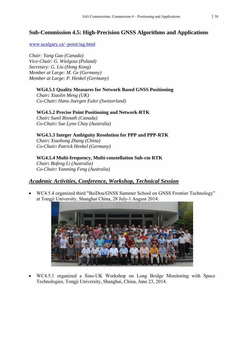
IAG Commissions: Commission 4 – Positioning and Applications 58
Sub-Commission 4.5: High-Precision GNSS Algorithms and Applications www.ucalgary.ca/~point/iag.html Chair: Yang Gao (Canada) Vice-Chair: G. Wielgosz (Poland) Secretary: G. Liu (Hong Kong) Member at Large: M. Ge (Germany) Member at Large: P. Henkel (Germany)
WG4.5.1 Quality Measures for Network Based GNSS Positioning Chair: Xiaolin Meng (UK) Co-Chair: Hans-Juergen Euler (Switzerland) WG4.5.2 Precise Point Positioning and Network-RTK Chair: Sunil Bisnath (Canada) Co-Chair: Sue Lynn Choy (Australia)
WG4.5.3 Integer Ambiguity Resolution for PPP and PPP-RTK Chair: Xiaohong Zhang (China) Co-Chair: Patrick Henkel (Germany)
WG4.5.4 Multi-frequency, Multi-constellation Sub-cm RTK Chair: Bofeng Li (Australia) Co-Chair: Yanming Feng (Australia)
Academic Activities, Conference, Workshop, Technical Session WC4.5.4 organized third "BeiDou/GNSS Summer School on GNSS Frontier Technology”
at Tongji University, Shanghai China, 28 July-1 August 2014.
WC4.5.1 organized a Sino-UK Workshop on Long Bridge Monitoring with Space Technologies, Tongji University, Shanghai, China, June 23, 2014.
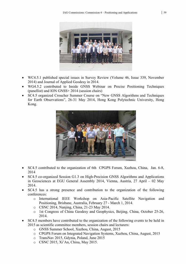
IAG Commissions: Commission 4 – Positioning and Applications 59
WC4.5.1 published special issues in Survey Review (Volume 46, Issue 339, November 2014) and Journal of Applied Geodesy in 2014.
WG4.5.2 contributed to Inside GNSS Webinar on Precise Positioning Techniques (panellist) and ION GNSS+ 2014 (session chairs)
SC4.5 organized Croucher Summer Course on “New GNSS Algorithms and Techniques for Earth Observations”, 26-31 May 2014, Hong Kong Polytechnic University, Hong Kong.
SC4.5 contributed to the organization of 6th CPGPS Forum, Xuzhou, China, Jan. 6-8, 2014
SC4.5 co-organized Session G1.3 on High-Precision GNSS Algorithms and Applications in Geosciences at EGU General Assembly 2014, Vienna, Austria, 27 April – 02 May 2014.
SC4.5 has a strong presence and contribution to the organization of the following conferences:
o International IEEE Workshop on Asia-Pacific Satellite Navigation and Positioning, Brisbane, Australia, February 27 - March 1, 2014.
o CSNC 2014, Nanjing, China, 21-23 May 2014. o 1st Congress of China Geodesy and Geophysics, Beijing, China, October 25-26,
2014. SC4.5 members have contributed to the organization of the following events to be held in
2015 as scientific committee members, session chairs and lecturers: o GNSS Summer School, Xuzhou, China, August, 2015 o CPGPS Forum on Integrated Navigation Systems, Xuzhou, China, August, 2015 o TransNav 2015, Gdynia, Poland, June 2015 o CSNC 2015, Xi’An, China, May 2015.
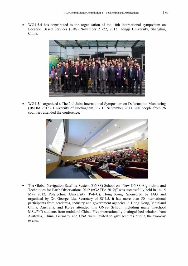
IAG Commissions: Commission 4 – Positioning and Applications 60
WG4.5.4 has contributed to the organization of the 10th international symposium on Location Based Services (LBS) November 21-22, 2013, Tongji University, Shanghai, China.
WG4.5.1 organized a The 2nd Joint International Symposium on Deformation Monitoring (JISDM 2013), University of Nottingham, 9 - 10 September 2013. 200 people from 26 countries attended the conference.
The Global Navigation Satellite System (GNSS) School on “New GNSS Algorithms and Techniques for Earth Observations 2012 (nGATEo 2012)” was successfully held in 14-15 May 2012, Polytechnic University (PolyU), Hong Kong. Sponsored by IAG and organized by Dr. George Liu, Secretary of SC4.5, it has more than 50 international participants from academia, industry and government agencies in Hong Kong, Mainland China, Australia, and Korea attended this GNSS School, including many in-school MSc/PhD students from mainland China. Five internationally distinguished scholars from Australia, China, Germany and USA were invited to give lectures during the two-day events.
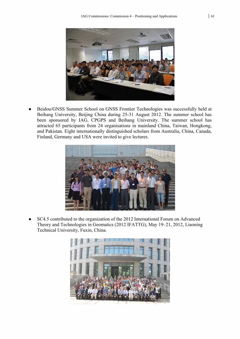
IAG Commissions: Commission 4 – Positioning and Applications 61
Beidou/GNSS Summer School on GNSS Frontier Technologies was successfully held at
Beihang University, Beijing China during 25-31 August 2012. The summer school has been sponsored by IAG, CPGPS and Beihang University. The summer school has attracted 65 participants from 24 organisations in mainland China, Taiwan, Hongkong, and Pakistan. Eight internationally distinguished scholars from Australia, China, Canada, Finland, Germany and USA were invited to give lectures.
SC4.5 contributed to the organization of the 2012 International Forum on Advanced Theory and Technologies in Geomatics (2012 IFATTG), May 19–21, 2012, Liaoning Technical University, Fuxin, China.
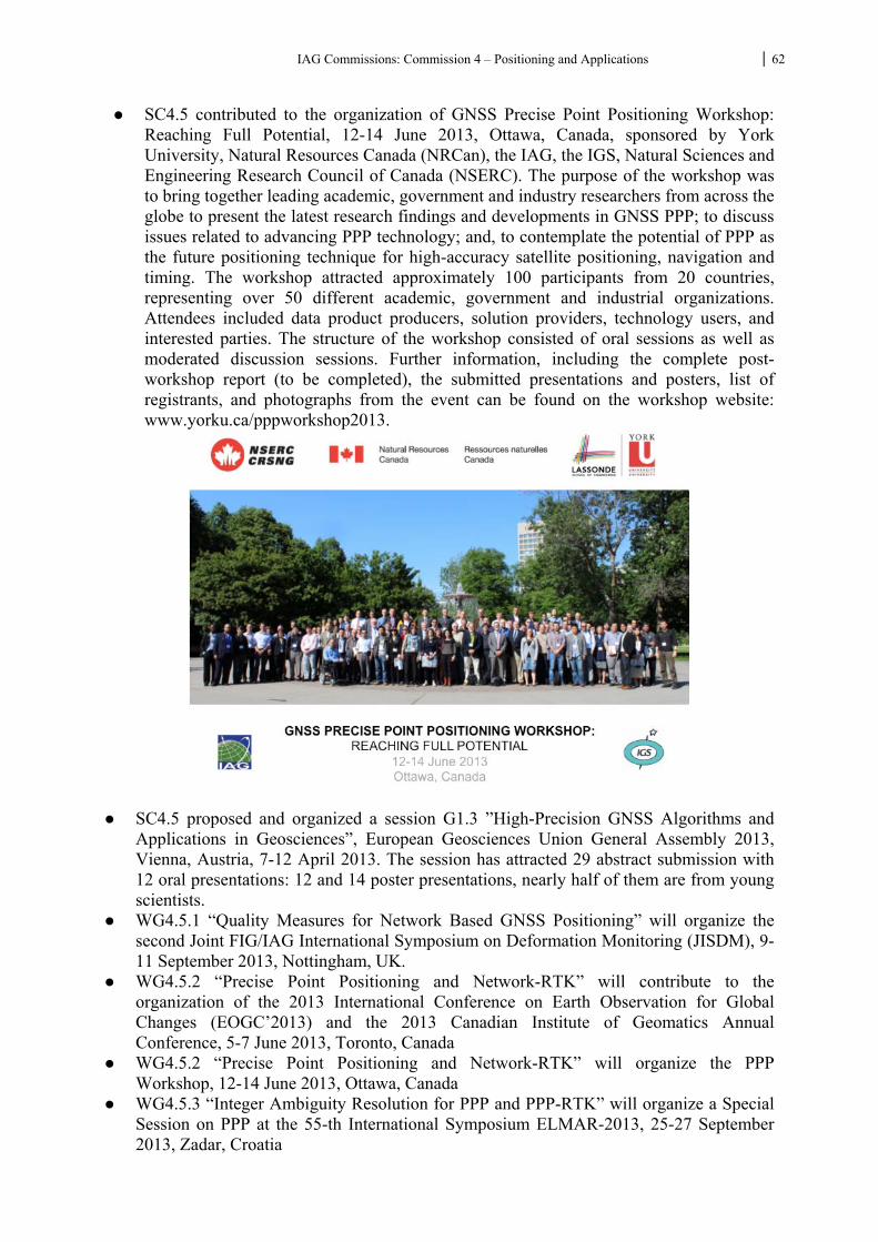
IAG Commissions: Commission 4 – Positioning and Applications 62
SC4.5 contributed to the organization of GNSS Precise Point Positioning Workshop: Reaching Full Potential, 12-14 June 2013, Ottawa, Canada, sponsored by York University, Natural Resources Canada (NRCan), the IAG, the IGS, Natural Sciences and Engineering Research Council of Canada (NSERC). The purpose of the workshop was to bring together leading academic, government and industry researchers from across the globe to present the latest research findings and developments in GNSS PPP; to discuss issues related to advancing PPP technology; and, to contemplate the potential of PPP as the future positioning technique for high-accuracy satellite positioning, navigation and timing. The workshop attracted approximately 100 participants from 20 countries, representing over 50 different academic, government and industrial organizations. Attendees included data product producers, solution providers, technology users, and interested parties. The structure of the workshop consisted of oral sessions as well as moderated discussion sessions. Further information, including the complete post-workshop report (to be completed), the submitted presentations and posters, list of registrants, and photographs from the event can be found on the workshop website: www.yorku.ca/pppworkshop2013.
SC4.5 proposed and organized a session G1.3 ”High-Precision GNSS Algorithms and
Applications in Geosciences”, European Geosciences Union General Assembly 2013, Vienna, Austria, 7-12 April 2013. The session has attracted 29 abstract submission with 12 oral presentations: 12 and 14 poster presentations, nearly half of them are from young scientists.
WG4.5.1 “Quality Measures for Network Based GNSS Positioning” will organize the second Joint FIG/IAG International Symposium on Deformation Monitoring (JISDM), 9-11 September 2013, Nottingham, UK.
WG4.5.2 “Precise Point Positioning and Network-RTK” will contribute to the organization of the 2013 International Conference on Earth Observation for Global Changes (EOGC’2013) and the 2013 Canadian Institute of Geomatics Annual Conference, 5-7 June 2013, Toronto, Canada
WG4.5.2 “Precise Point Positioning and Network-RTK” will organize the PPP Workshop, 12-14 June 2013, Ottawa, Canada
WG4.5.3 “Integer Ambiguity Resolution for PPP and PPP-RTK” will organize a Special Session on PPP at the 55-th International Symposium ELMAR-2013, 25-27 September 2013, Zadar, Croatia
IAG Commissions: Commission 4 – Positioning and Applications 63
WG4.5.4 “Multi-frequency, Multi-constellation Sub-cm RTK” will contribute to the organization of the second GNSS Summer School, August, 2013, Beijing, China .
Publications Journal papers Bisnath, S. and Collins, P. (2012). “Recent developments in Precise Point Positioning.”
Geomatica, 66(2): 375-385. Bisnath, S., A. Saeidi, J.-G. Wang and G. Seepersad (2013). “Evaluation of network RTK
performance and elements of certification – a southern Ontario case study.” Geomatica, 67(4): 243-251.
Brack, A, Patrick Henkel and Christoph Günther, Sequential Best Integer-Equivariant Estimation for GNSS, Navigation, Vol. 61, Iss. 2, pp. 149-158, Summer 2014
Cai, C., and Gao, Y. (2013). GLONASS-based precise point positioning and performance analysis. Advances in Space Research, 51(3), 514-524.
Cai, C., and Gao, Y. (2013). Modeling and assessment of combined GPS/GLONASS precise point positioning. GPS solutions, 17(2), 223-236.
Cai, Changsheng, Zhizhao Liu, and Xiaomin Luo. 2013. “Single-Frequency Ionosphere-Free Precise Point Positioning Using Combined GPS and GLONASS Observations.” Journal of Navigation 66 (03): 417–34. doi:10.1017/S0373463313000039.
Cai, Changsheng, Zhizhao Liu, Pengfei Xia, and Wujiao Dai. 2012. “Cycle Slip Detection and Repair for Undifferenced GPS Observations under High Ionospheric Activity.” GPS Solutions, July. doi:10.1007/s10291-012-0275-7.
Cai, Changsheng, Xiaomin Luo, Zhizhao Liu, and Qinqin Xiao. 2014. “Galileo Signal and Positioning Performance Analysis Based on Four IOV Satellites.” The Journal of Navigation 67 (05): 810–24. doi:10.1017/S037346331400023X.
Cai, C and Gao, Y (2014). “A Precise Weighting Approach with Application to Combined L1/B1 GPS/BeiDou Positioning”, Journal of Navigation, doi:10.1017/S0373463314000320.
Cai, C and Gao, Y (2013). “An analysis on combined GPS/COMPASS data quality and its effect on single point positioning accuracy under different observing conditions”, Advances in Space Research, DOI:10.1016/j.asr.2013.02.019.
Cai, C and Gao, Y (2012). “GLONASS-based Precise Point Positioning and Performance Analysis”, Advances in Space Research, http://dx.doi.org/10.1016/j.asr.2012.08.004
Cai, C and Gao, Y (2012). “Modeling and assessment of combined GPS/GLONASS precise point positioning”, GPS Solutions, Vol. 16, No. 2, 2012.
Chen, Biyan, and Zhizhao Liu. 2014. “Voxel-Optimized Regional Water Vapor Tomography and Comparison with Radiosonde and Numerical Weather Model.” Journal of Geodesy 88 (7): 691–703. doi:10.1007/s00190-014-0715-y.
Cellmer S., Paziewski J., Wielgosz P., (2013), Fast and precise positioning using MAFA method and new GPS and Galileo signals, Acta Geodynamica et Geomaterialia, v. 10, No. 4(172), pp. 393-400
Dai, W, B Liu, X Meng and D Huang (2015). Spatio-temporal Modelling of Dam Deformation Using Independent Component Analysis, Survey Review, 46 (339): 437-443.
Du, S., and Gao, Y. (2012). Inertial aided cycle slip detection and identification for integrated PPP GPS and INS. Sensors, 12(11), 14344-14362.
IAG Commissions: Commission 4 – Positioning and Applications 64
Du, S and Gao, Y (2013). “Error Analysis and Characterization of New MEMS IMU Sensors and Integration with PPP”, Journal of Liaoning Technical University (Natural Science Edition), No. 4, April 2013.
Figurski M., Bogusz J., Bosy J., Kontny B., Krankowski A., Wielgosz P., (2011), „ASG+”: project for improving polish multifunctional precise satellite positioning system, Reports on Geodesy, No 2 (91), pp. 51-58
Günther, C, and Patrick Henkel. Integer Ambiguity Resolution for Satellite Navigation, IEEE Transactions on Signal Processing, 60(7):3387–3393, 2012.
Guo, F, Xiaohong Zhang, Real-time Clock Jump Compensation for Precise Point Positioning, GPS Solutions (online), DOI: 10.1007/s10291-012-0307-3
Han, H, J Wang and X Meng (2015). Reconstruction of Bridge Dynamics Using Integrated GPS and Accelerometer, Journal of CUMT (online).
Han, Joonghee, Zhizhao Liu, and Jay Hyoun Kwon. 2014. “Investigating the Impact of Random and Systematic Errors on GPS Precise Point Positioning Ambiguity Resolution.” Journal of the Korean Society of Surveying, Geodesy, Photogrammetry and Cartography 32 (3): 233–44.
He H, Li J, Yang Y, Xu J, Guo H. Performance assessment of single- and dual-frequency BeiDou/GPS single-epoch kinematic positioning, GPS Solutions, 2014, 18(3):393-403
Henkel, P, Tightly coupled Precise Point Positioning and Attitude Determination, IEEE Transactions on Aerospace and Electronic Systems, Apr. 2015.
Henkel, P and Patryk Jurkowski, Reliable Integer Ambiguity Resolution: Soft constraints on Baseline Length and Direction and New Multi-Frequency Code Carrier Linear Combinations, IAG Symposia 139, pp. 591 -597, 2014.
Henkel, P and Christoph Günther. Reliable Integer Ambiguity Resolution: Multi-Frequency Code Carrier Linear Combinations and Statistical Attitude A Priori Knowledge, Navigation (invited paper), 59(1):61–75, 2012.
Huang, B and Gao, Y (2013). “Ubiquitous indoor vision navigation using a smart device”, Journal of Geo-spatial Information Science, August 2013.
Li, X., Dick, G., Ge, M., Heise, S., Wickert, J., and Bender, M. (2014). Real�time GPS sensing of atmospheric water vapor: Precise point positioning with orbit, clock, and phase delay corrections. Geophysical Research Letters, 41(10), 3615-3621.
Li, X., Ge, M., Dai, X., Ren, X., Fritsche, M., Wickert, J., and Schuh, H. (2015). Accuracy and reliability of multi-GNSS real-time precise positioning: GPS, GLONASS, BeiDou, and Galileo. Journal of Geodesy, 1-29.
Li, X., Ge, M., Douša, J., and Wickert, J. (2014). Real-time precise point positioning regional augmentation for large GPS reference networks. GPS solutions, 18(1), 61-71.
Li, X., Ge, M., Guo, B., Wickert, J., and Schuh, H. (2013). Temporal point positioning approach for real�time GNSS seismology using a single receiver. Geophysical Research Letters, 40(21), 5677-5682.
Li, X., Ge, M., Zhang, H., Nischan, T., and Wickert, J. (2013). The GFZ real-time GNSS precise positioning service system and its adaption for COMPASS. Advances in Space Research, 51(6), 1008-1018.
Li, X., Ge, M., Zhang, Y., Wang, R., Guo, B., Klotz, J., and Schuh, H. (2013). High-rate coseismic displacements from tightly integrated processing of raw GPS and accelerometer data. Geophysical Journal International, 195(1), 612-624.
Li, X., Ge, M., Zhang, X., Zhang, Y., Guo, B., Wang, R., and Wickert, J. (2013). Real�time high�rate co�seismic displacement from ambiguity�fixed precise point positioning: Application to earthquake early warning. Geophysical Research Letters, 40(2), 295-300.
Li, X., Ge, M., Zhang, H., and Wickert, J. (2013). A method for improving uncalibrated phase delay estimation and ambiguity-fixing in real-time precise point positioning. Journal of Geodesy, 87(5), 405-416.
IAG Commissions: Commission 4 – Positioning and Applications 65
Li, X., Guo, B., Lu, C., Ge, M., Wickert, J., and Schuh, H. (2014). Real-time GNSS seismology using a single receiver. Geophysical Journal International, 113.
Li, X., and Zhang, X. (2012). Improving the estimation of uncalibrated fractional phase offsets for PPP ambiguity resolution. Journal of Navigation, 65(03), 513-529.
Li, X., Zhang, X., and Ge, M. (2011). Regional reference network augmented precise point positioning for instantaneous ambiguity resolution. Journal of Geodesy, 85(3), 151-158.
Li, X., Zhang, X., & Guo, F. (2014). Predicting atmospheric delays for rapid ambiguity resolution in precise point positioning. Advances in Space Research, 54(5), 840-850.
Li H, Xu T, Li B*, Huang S, Wang J. Effect of differential code bias (C1−P1) on precise point positioning. GPS Solutions, 2015, DOI: 10.1007/s10291-015-0438-4
Li B, Verhagen S, Teunissen PJG. Robustness of GNSS integer ambiguity resolution in the presence of atmospheric biases, GPS Solutions, 2014, 18: 283-296
Li B, Teunissen PJG. GNSS antenna-array aided CORS ambiguity resolution, Journal of Geodesy, 2014, 88(4):363-376
Li B, Shen Y, Feng Y, Gao W, Yang L. GNSS ambiguity resolution with controllable failure rate for long baseline network RTK, Journal of Geodesy, 2014, 88(2):99-112
Li B, Shen Y, Zhang X. Three frequency GNSS navigation prospects demonstrated with semi-simulated data, Advances in Space Research, 2013, 51:1175-1185
Li J, Yang Y, Xu J, He H, Guo H. GNSS multi-carrier fast partial ambiguity resolution strategy tested with real BDS/GPS dual- and triple-frequency observations, GPS Solutions, 2015, 19:5-13
Li B, Teunissen PJG. Real-time Kinematic positioning using fused data from multiple GNSS antennas, IEEE Proceeding of Fusion Conference, 2012, 933-937
Li, X, Xiaohong Zhang, Maorong Ge. Regional Reference Network Augmented Precise Point Positioning For Instantaneous Ambiguity Resolution. Journal of Geodesy (2011), Volume 85, Number 3:151–158, DOI 10.1007/s00190-010-0424-0
Li, Y, Gao, Y and Li, B (2014). “An Impact Analysis of Arc Length on Orbit Prediction and Clock Estimation for PPP Ambiguity Resolution”, GPS Solutions, DOI10.1007/s10291-014-0380-x.
Liu, Z, Chen, B, Chan, S, Cao, Y, Gao, Y, Zhang, K and Nichol, J (2014). “Analysis and Modeling of Water Vapor and Temperature Changes in Hong Kong Using 40-year Radiosonde Data: 1973-2012”, International Journal of Climatology, March 6 2014. DOI: 10.1002/joc.4001.
Liu, C N Li, H Wu and X Meng (2014). Detection of High-Speed Railway Subsidence and Geometry Irregularity Using Terrestrial Laser Scanning, Journal of Surveying Engineering, DOI: 10.1061/(ASCE)SU.1943-5428.0000131.
Li, Min, Wenwen Li, Chuang Shi, Qile Zhao, Xing Su, Lizhong Qu, and Zhizhao Liu. 2015. “Assessment of Precipitable Water Vapor Derived from Ground-Based BeiDou Observations with Precise Point Positioning Approach.” Advances in Space Research 55 (1): 150–62. doi:10.1016/j.asr.2014.10.010.
Li, X., Maorong Ge, Xiaohong Zhang, Yong Zhang, Bofeng Guo, Rongjiang Wang, Jürgen Klotz, Jens Wickert, Real-time high-rate coseismic displacement from ambiguity-fixed PPP: Application to earthquake early warning, Geophysical Research Letter (2013)
Li, X, Xiaohong Zhang, Improving the Estimation of Uncalibrated Fractional Phase Offsets for PPP Ambiguity Resolution, Journal of Navigation (2012), 65, 513–529,doi:10.1017/S0373463312000112
Liu, Zhizhao. 2011. “A New Automated Cycle Slip Detection and Repair Method for a Single Dual-Frequency GPS Receiver.” Journal of Geodesy 85 (3): 171–83. doi:10.1007/s00190-010-0426-y.
Liu, Zhizhao, Biyan Chen, Sai T. Chan, Yunchang Cao, Yang Gao, Kefei Zhang, and Janet Nichol. 2015. “Analysis and Modelling of Water Vapour and Temperature Changes in
IAG Commissions: Commission 4 – Positioning and Applications 66
Hong Kong Using a 40-Year Radiosonde Record: 1973–2012.” International Journal of Climatology 35 (3): 462–74. doi:10.1002/joc.4001.
Liu, Zhizhao, Min Li, Weikun Zhong, and Man Sing Wong. 2013. “An Approach to Evaluate the Absolute Accuracy of WVR Water Vapor Measurements Inferred from Multiple Water Vapor Techniques.” Journal of Geodynamics 72 (December): 86–94. doi:10.1016/j.jog.2013.09.002.
Liu, Zhizhao, Man Sing Wong, Janet Nichol, and P. W. Chan. 2013. “A Multi-Sensor Study of Water Vapour from Radiosonde, MODIS and AERONET: A Case Study of Hong Kong.” International Journal of Climatology 33 (1): 109–20. doi:10.1002/joc.3412.
Liu, Zhizhao, and Zhe Yang. 2015. “Anomalies in Broadcast Ionospheric Coefficients Recorded by GPS Receivers over the Past Two Solar Cycles (1992–2013).” GPS Solutions, March. doi:10.1007/s10291-015-0448-2.
Liu, Z., S. Ji, W. Chen, and X. Ding. 2013. “New Fast Precise Kinematic Surveying Method Using a Single Dual-Frequency GPS Receiver.” Journal of Surveying Engineering 139 (1): 19–33. doi:10.1061/(ASCE)SU.1943-5428.0000092.
Luo, Weihua, Zhizhao Liu, and Min Li. 2014. “A Preliminary Evaluation of the Performance of Multiple Ionospheric Models in Low- and Mid-Latitude Regions of China in 2010–2011.” GPS Solutions 18 (2): 297–308. doi:10.1007/s10291-013-0330-z.
Mander, A. and S. Bisnath, S. (2013). “GPS-based precise orbit determination of low Earth orbiters with limited resources.” GPS Solutions, 17(4): 587-594.
Meng, X, J Wang and H Han (2014). Optimal GPS/accelerometer Integration Algorithm for Monitoring the Vertical Structural Dynamics, Journal of Applied Geodesy, 8(4), 265–272.
Meng, X C Liu, N Li and J Ryding (2014). Precise Determination of Mini Railway Track with Ground Based Laser Scanning, Survey Review, 46(336): 213-218. DOI: http://dx.doi.org/10.1179/1752270613Y.0000000072.
Miller, C, O’Keefe, K and Gao, Y (2012). “Time Correlation in GNSS Positioning over Short Baselines”, Journal of Surveying Engineering, Volume 138, Issue 1, pp.17-24.
Li B, Shen Y, Zhang X. Triple frequency GNSS navigation potentials demonstrated with semi-simulated data, Advances in Space Research, 2013, 51:1175-1185
Nadarajah N, Teunissen PJG, Sleewaegen JM, Montenbruck O, The mixed-receiver BeiDou inter-satellite-type bias and its impact on RTK positioning, GPS Solutions, 2014, 10.1007/s10291-014-0392-6
Pan, S, W Gao, S Wang, X Meng and Q Wang (2014). Analysis of Ill Posedness in Double Differential Ambiguity Resolution of BDS, Survey Review, 46(339): 411-416.
Pan, S, X Meng, W Gao, S Wang, A H Dodson (2014). A New Approach for Optimizing GNSS Positioning Performance in the Harsh Observation Environments, Journal of Navigation, 67(06): 1029 - 1048.
Pan, S., X Meng, S Wang, W Nie and W Chen (2015). Ambiguity Resolution with Double Troposphere Parameter Restriction for Long Range Reference Stations in NRTK System, Survey Review (online).
Paziewski J, 2015, Precise GNSS single epoch positioning with multiple receiver configuration for medium-length baselines: methodology and performance analysis, Measurement Science and Technology, Vol. 26(3) 035002. DOI:10.1088/0957-0233/26/3/035002
Paziewski J, Wielgosz P, 2015, Accounting for Galileo-GPS inter-system biases in precise satellite positioning, Journal of Geodesy, Vol. 89(1), pp 81-93, DOI 10.1007/s00190-014-0763-3
Stępniak K., Wielgosz P., Baryła R., 2015, Field Tests of L1 Phase Centre Variation Models of Surveying-Grade GPS Antennas, Studia Geophysica et Geodaetica, DOI: 10.1007/s11200-014-0250-6
IAG Commissions: Commission 4 – Positioning and Applications 67
Paziewski J, Wielgosz P, 2014, Assessment of GPS + Galileo and multi-frequency Galileo single-epoch precise positioning with network corrections, GPS Solutions, Vol. 18(4), pp 571-579, DOI 10.1007/s10291-013-0355-3
Paziewski J, Krukowska M, Wielgosz P, 2014, Preliminary results on performance of new ultra-fast static positioning module – POZGEO-2 in areas outside the ASG-EUPOS network, Geodesy and Cartography, Vol. 63, No 1, 2014, pp. 101-109, DOI: 10.2478/geocart-2014-0008
Paziewski J., Wielgosz P., Krukowska M., (2013), Application of SBAS pseudorange and carrie phase signals to precise instantaneous single-frequency positioning, Acta Geodynamica et Geomaterialia, v. 10, No. 4(172), 2013, pp. 421-430
Seepersad, G. and S. Bisnath, S. (2014). “Reduction of precise point positioning initial convergence period.” GPS Solutions, 10.1007/s10291-014-0395-3.
Seepersad, G. and S. Bisnath, S. (2014). “Assessing the accuracy of Precise Point Positioning.” Journal of Applied Geodesy, 8(3): 205-222.
Shi, J and Gao, Y (2013). “A Troposphere Constraint Method To Improve PPP Ambiguity-Resolved Height Solution”, The Journal of Navigation, 67, 249–262. pp. 249-262.
Shi, J., and Gao, Y. (2014). A comparison of three PPP integer ambiguity resolution methods. GPS Solutions, 18(4), 519-528.
Shi, J, Xu, C, Guo, J and Gao, Y (2014). “Real-Time GPS PPP Based Precipitable Water Vapor Estimation for Rainfall Monitoring and Forecasting”, Transactions on Geoscience and Remote Sensing, DOI:10.1109/TGRS.2014.2377041.
Shi, J, Xu, C, Guo, J and Gao, Y (2014). “Local troposphere augmentation for real-time precise point positioning”, Earth, Planets and Space, 66:30.
Shi, J and Gao, Y (2012). “Improvement of PPP-inferred Tropospheric Estimates by Integer Ambiguity Resolution”, Advance in Space Research, Volume 50, Issue 10.
Stephenson, S, X Meng, T Moore, A Baxendale and T Edwards (2014). Not just a Fairy Tale: A Hansel and Gretel Approach to Cooperative Vehicle Positioning, GPS World, 25(7): 44-50.
Wang, J., H Han, X Meng, L Yao and Z Li (2015). Robust Wavelet Based Inertial Sensor Error Mitigation for Tightly-coupled GPS/BDS/INS Integration During Signal Outrages, Survey Review (online)
Weng, Duojie, Shengyue Ji, Wu Chen, and Zhizhao Liu. 2014. “Assessment and Mitigation of Ionospheric Disturbance Effects on GPS Accuracy and Integrity.” The Journal of Navigation 67 (03): 371–84. doi:10.1017/S0373463314000046.
Wielgosz P., Paziewski J., Krankowski A., Kroszczyński K., Figurski M. (2012), Results of the Application of Tropospheric Corrections from Different Troposphere Models for Precise GPS Rapid Static Positioning, Acta Geophysica, vol. 60, no. 4, pp. 1236-1257
Wielgosz, P., Cellmer, S., Rzepecka, Z. Paziewski J. and Grejner-Brzezinska D.A., (2011), Troposphere modeling for precise GPS rapid static positioning in mountainous areas, Measurement Science and Technology, Vol. 22, No. 4, pp. 89-99 [PDF]
Wielgosz P., Krukowska M., Paziewski J., Krypiak-Gregorczyk A., Stępniak K., Kapłon J.,Sierny J., Hadaś T., Bosy J., 2013, Performance of ZTD models derived in near real-time from GBAS and meteorological data in GPS fast-static positioning, Measurement Science and Technology 24, DOI:10.1088/0957-0233/24/12/125802
Wielgosz P. Quality assessment of GPS rapid static positioning with weighted ionospheric parameters in generalized least squares, GPS Solutions, 2011, 15:89-99.
Wong, Man Sing, Xiaomeng Jin, Zhizhao Liu, Janet Nichol, and P. W. Chan. 2014. “Multi-Sensors Study of Precipitable Water Vapour over Mainland China.” International Journal of Climatology, November, n/a – n/a. doi:10.1002/joc.4199.
IAG Commissions: Commission 4 – Positioning and Applications 68
Wu Z, Bian S, Ji B, Xiang C, Jiang D. Short baseline GPS multi-frequency single-epoch precise positioning: utilizing a new carrier phase combination method, GPS Solutions, 2015, 10.1007/s10291-015-0447-3
Verhagen S, Li B, Teunissen PJG. Ps-LAMBDA: ambiguity success rate evaluation software for interferometric applications, Computers & Geosciences, 2013, 54:361-376
Xia, P., C. Cai, and Z. Liu. 2013. “GNSS Troposphere Tomography Based on Two-Step Reconstructions Using GPS Observations and COSMIC Profiles.” Annales Geophysicae 31 (10): 1805–15. doi:10.5194/angeo-31-1805-2013.
Xu, Rui, Zhizhao Liu, and Wu Chen. 2015. “Improved FLL-Assisted PLL with in-Phase Pre-Filtering to Mitigate Amplitude Scintillation Effects.” GPS Solutions 19 (2): 263–76. doi:10.1007/s10291-014-0385-5.
Xu, Rui, Zhizhao Liu, Min Li, Yu Morton, and Wu Chen. 2012. “An Analysis of Low-Latitude Ionospheric Scintillation and Its Effects on Precise Point Positioning” 11 (1): 22–32. doi:DOI: 10.5081/jgps.11.1.22.
Ye S, Liu Y, Song W et al. GNSS multi-carrier fast partial ambiguity resolution strategy tested with real BDS/GPS dual- and triple-frequency observations, GPS Solution, 2015, DOI 10.1007/s10291-015-0439-3
Yu, J X Shao and X Meng (2014). Experimental Study on Bridge Structural Dynamic Monitoring Using GNSS and Accelerometer. China Journal of Highway and Transport, 27(2): 62-69.
Yu, J X Meng, X Shao, B Yan and L Yang (2014). Identification of Dynamic Displacements and Modal Frequencies of a Medium-span Suspension Bridge Using Multimode GNSS Processing, Engineering Structures. 81, 432–443.
Zhang L, Lv H, Wang D, Hou Y, Wu J, Asynchronous RTK precise DGNSS positioning method for deriving a low-latency high-rate output, Journal of Geodesy, 2015, 10.1007/s00190-015-0803-7
Zhang, Q, S Stephenson, X Meng, S Zhang and Y Wang (2015). A New Robust Filtering for a GPS/SINS Loosely Coupled Integration System, Survey Review (online).
Zhang, Q, X Meng, S Zhang and Y Wang (2015). Singular Value Decomposition-based Robust Cubature Kalman Filtering for an Integrated GPS/SINS Navigation System, Journal of Navigation, DOI: 0.1017/S0373463314000812 (online).
Zhang Xiaohong, Guo Bofeng, Guo Fei, Du Conghui, Influence of clock jump on the velocity and acceleration estimation with a single GPS receiver, GPS Solutions (online)
Zhang,X, Pan Li. Ambiguity Resolution in Precise Point Positioning with Hourly Data for Global Single Receiver, Advances in Space Research (2012),DOI: 10.1016/j.asr.2012.08.008,Volume 51, Issue 1:153–161
Zhang, X, Fei Guo, Xingxing Li. A novel Stop&Go GPS precise point positioning (PPP) method and its application in geophysical exploration and prospecting, Survey Review (2012),44(327):251-255,DOI 10.1179/1752270611Y.0000000016
Zhang, X, Xingxing Li. Instantaneous re-initialization in real-time kinematic PPP with cycle slip fixing, GPS Solutions (2012) 16:315–327
Zhang, X, Xingxing Li, Fei Guo. Satellite Clock Estimation at 1 Hz for Realtime Kinematic PPP applications, GPS Solutions (2011),Volume 15, Issue 4, Page 315-324
Zhang, X, Pan Li, Assessment of Correct Fixing Rate for Precise Point Positioning Ambiguity Resolution on Global Scale, Journal of Geodesy (onlin)
Zhang, X., Fei Guo, An Approach to Improve Precise Point Positioning Performance under the Presence of Ionospheric Scintillation,GPS Solutions (online)
Zhibo Wen, Patrick Henkel, and Christoph Günther. Multi-Stage Satellite Phase and Code Bias Estimation, Automatika, accepted, 2012.
IAG Commissions: Commission 4 – Positioning and Applications 69
Zhou Z, Li B, Shen Y. A window-recursive approach for GNSS kinematic navigation using pseudorange and Doppler measurements, The Journal of Navigation, 2013, 66:295-313
Zhou Z, Li B. GNSS windowing navigation with adaptively constructed dynamic model, GPS Solutions, 2015, 19:37-48
Zhou Z, Li B, Shen Y. A window-recursive approach for GNSS kinematic navigation using pseudorange and Doppler measurements, The Journal of Navigation, 2013, 66:295-313
Zhu, F., Wu, Y., Zhou, Y and Gao, Y. (2013). “Temporal and spatial distribution of GPS-TEC anomalies prior to the strong earthquakes”, Astrophys Space Sci, 345:239–246, DOI 10.1007/s10509-013-1411-8.
Conference Papers
Brack, P. Henkel and C. Günther, Sequential Best Integer-Equivariant Estimation for
Geodetic Network Solutions, Proc. of ION ITM, San Diego, Jan. 2013 Aggrey, J. and Bisnath, S. (2014). "Analysis and modelling of pseudorange and carrier-
phase biases in GNSS Precise Point Positioning," Proceedings of the Institute of Navigation International Technical Meeting ION GNSS 2014, Tampa, FL, September 2014, in press.
Chen, X., Landau, H., Zhang, F., Nitschke, M., Glocker, M., Kipka, A., ... & Salazar, D. (2013, January). Towards a Precise Multi-GNSS Positioning System Enhanced for the Asia–Pacific Region. In China Satellite Navigation Conference (CSNC) 2013 Proceedings (pp. 277-290). Springer Berlin Heidelberg.
Chen X, T Allison, W Cao, K Ferguson, S Grunig, V Gomez, A Kipka, J Kohler, H Landau, R Leandro, G Lu, R Stolz, N Talbot (2011) "Trimble RTX, an Innovative New Approach for Network RTK," Proceedings of ION GNSS 2011, Portland, OR, Sept 2011.
Choy, S. Harima, K. Li, Y. Choudhury, M. Rizos, C. Wakabayashi, Y. and Kogure, S. 2015, 'GPS Precise Point Positioning with the Japanese Quasi-Zenith Satellite System LEX Augmentation Corrections', in Journal of Navigation, Cambridge University Press, United Kingdom, pp. 1-15 ISSN: 0373-4633
Choy, S. Harima, K. Li, Y. Choudhury, M. Rizos, C. Wakabayashi, Y. and Kogure, S. 2014, 'High accuracy real-time precise point positioning using the Japanese quasi-zenith satellite system LEX signal', in Proceedings of the 2014 Geospatial Science Research 3 Symposium (GSR 3), Colin Arrowsmith, Chris Bellman, William Cartwright, Mark Shortis (ed.), Rheinisch-Westfaelische Technische Hochschule Aachen * Lehrstuhl Informatik V, Germany, pp. 1-8 (Vol-1307: Geospatial Science Research 3 Symposium (GSR 3))
Choy, S. Harima, K. Li, Y. Wakabayashi, Y. Tateshita, H. Kogure, S. and Rizos, C. 2013, 'Real-time precise point positioning utilising the Japanese quasi-zenith satellite system (QZSS) LEX corrections', in Proceedings of the International Global Navigation Satellite Systems Society IGNSS Symposium 2013, Allison Kealy (ed.), International Global Navigation Satellite Systems Society (Menay Pty Ltd), Tweed Heads, Australia, pp. 1-15 (IGNSS Symposium 2013)
Choy, S. Zhang, S. Lahaye, F. and Heroux, P. 2013, 'A comparison between GPS-only and combined GPS+ GLONASS precise point positioning', in Journal of Spatial Science, Taylor and Francis Asia Pacific, Singapore, vol. 58, no. 2, pp. 169-190 ISSN: 1449-8596
IAG Commissions: Commission 4 – Positioning and Applications 70
Collins P, F Lahaye, S Bisnath (2012). External ionospheric constraints for improved PPP-AR initialisation and a generalised local augmentation concept. Proceedings of ION GNSS 2012, 17-21 September, Nashville, Tennessee, pp. 3055-3065.
Collins, P., and S. Bisnath (2011). “Issues in ambiguity resolution for Precise Point Positioning.” Proceedings of The Institute of Navigation International Technical Meeting ION GNSS 2011, 20-23 September, Portland, Oregon, The Institute of Navigation, pp. 679 - 687.
Collins, P., F. Lahaye, and S. Bisnath (2012). “External ionospheric constraints for improved PPP-AR initialisation and a generalised local augmentation concept.” Proceedings of The Institute of Navigation International Technical Meeting ION GNSS 2012, 17-21 September, Nashville, Tennessee, The Institute of Navigation, pp. 3055-3065.
Dai L, R Hatch (2011) "Integrated StarFire GPS with GLONASS for Real-Time Precise Navigation and Positioning," Proceedings of ION GNSS 2011, Portland, OR, Sept 2011.
Doucet K et al. (2012) "Introducing Ambiguity Resolution in Web-hosted Global Multi-GNSS Precise Point Positioning with Trimble RTX-PP," Proceedings of ION GNSS 2012, Nashville, TN, September 2012, pp. 1115-1125.
Du, S., Gao, Y. and Sun, W. (2014). “An Investigation to MEMS IMU Error Mitigation Using Rotation Modulation Technique”, Proceedings of ION GNSS+ 2014, Tampa, Florida, USA, September 19 – 22, 2014.
Du, S., B. Huang, Y. Gao (2013). “Integration of Floor Plan, Vision and Inertial Sensors for Pedestrian Navigation in Indoor Environments”, Proceedings of ION Pacific PNT, Institute of Navigation, Honolulu, Oahu, Hawaii, USA, April 22-25, 2013.
Du, S. and Gao, Y. (2012). “Integration of Precise Point Positioning and the Latest MEMS IMU for Precise Applications”, Proceedings of IONS GNSS 2012, Nashville, Tennessee, USA, September 18 – 21, 2012.
Du, S., B. Huang and Y. Gao (2012). ”An Integrated MEMS IMU/Camera System for Pedestrian Indoor Navigation Using Smartphones”, Proceedings of CSNC 2012, Guangzhou, China, May 15-19, 2012.
Harima, K. Choy, S. Li, Y. Grinter, T. Choudhurym, M. Rizos, C. Wakabayashi, Y. and Kogure, S. 2014, 'Performance of real-time precise point positioning using MADOCA-LEX augmentation messages', in FIG Congress 2014: 'Engaging the Challenges, Enhancing the Relevance', M. A. M. Zin (ed.), International Federation of Surveyors, FIG, Denmark, pp. 1-18 (FIG Congress 2014)
Henkel, P and Michele Iafrancesco, Tightly coupled Position and Attitude Determination with two low-cost GNSS receivers, Proc. of 11-th Intern. IEEE Symp. on Wireless Communication Systems (ISWCS), Barcelona, Spain, pp. 895-900, Aug. 2014.
Henkel, P, Philipp Berthold and Christoph Günther, Tightly coupled Position and Attitude Determination with two low-cost GNSS receivers, a gyroscope, and an accelerometer, Proc. of Intern. Symp. on Certification of GNSS Systems and Services (CERGAL), Dresden, Germany, Jul. 2014.
Henkel, P, Philipp Berthold and Jane Jean Kiam, Calibration of Magnetic Field Sensors with two mass-market GNSS receivers, Proc. of 12-th IEEE Workshop on Positioning, Navigation and Communication (WPNC), pp. 1-5, Mar. 2014.
Huang, B. and Gao, Y. (2014). “Integrated Indoor Positioning with Mobile Devices for Location-based Service Applications”, Proceedings of the 19th International Conference on Database Systems for Advanced Applications, 21-24 April 2014, Bali, Indonesia.
Huang, B. and Gao, Y. (2012). “Indoor Navigation with iPhone/iPad: Floor Plan-Based Monocular Vision Navigation”, Proceedings of IONS GNSS 2012, Nashville, Tennessee, USA, September 18 – 21, 2012. Best paper presentation award.
IAG Commissions: Commission 4 – Positioning and Applications 71
Jane Jean Kiam, Juan Manuel Cárdenas and Patrick Henkel, Cooperative RTK positioning for rowing boats with Low-cost GPS receivers, Proc. of ION ITM, San Diego, USA, Jan. 2014.
Jurkowski, P, Patrick Henkel, Grace Gao, and Christoph Günther. Integer Ambiguity Resolution with Tight and Soft Baseline Constraints for Freight Stabilization at Helicopters and Cranes. In Proc. of ION Int. Techn. Meeting, San Diego, USA, 2011.
Krypiak-Gregorczyk A., Wielgosz P., Krukowska M.,>A New Ionosphere Monitoring Service over the ASG-EUPOS Network Stations, In: International Conference on Environmental Engineering (ICEE) Selected papers, The 9th International Conference “Environmental Engineering” 22–23 May 2014, Vilnius, Lithuania
Landau H, M Glocker, A Kipla, R Leandro, M Nitschke, R Stolz, F Zhang (2012) "Aspects of Using the QZSS Satellite in the Trimble CenterPointTM RTXTM Service: QZSS Orbit and Clock Accuracy, RTX Positioning Performance Improvements," Proceedings of ION GNSS 2012, Nashville, TN, September 2012, pp. 3038-3045.
Leandro R, V Gomez, R Stolz, H Landau, M Glocker, R Drescher, X Chen (2012) "Developments on Global Centimeter-level GNSS Positioning with Trimble CenterPoint RTXTM," Proceedings of ION GNSS 2012, Nashville, TN, September 2012.
Leandro et al. (2011) "RTX Positioning: The Next Generation of cm-accurate Real-time GNSS Positioning," Proceedings of ION GNSS 2011, Portland, OR, September 2011.
Leandro, R., Landau, H., Nitschke, M., Glocker, M., Seeger, S., Chen, X., & Kipka, A. (2011). RTX positioning: the next generation of cm-accurate real-time GNSS positioning. In ION GNSS (pp. 1460-1475).
Li, Y., and Gao, Y. (2014, January). Fast PPP Ambiguity Resolution Using a Sparse Regional Reference Network. In China Satellite Navigation Conference (CSNC) 2014 Proceedings: Volume III (pp. 327-343). Springer Berlin Heidelberg.
Li, Y. and Gao, Y (2013). “An Impact Analysis of Orbit arc Lengths on Real-time Orbit Prediction and Clock Correction Estimation for PPP Applications”, Proceedings of ION GNSS+ 2013, Nashville, Tennessee, USA, September 16 – 20, 2013.
Li, Y. and Gao, Y (2013). “Navigation Performance Using Long-Term Extended Ephemeris for Mobile Device”, Proceedings of ION GNSS+ 2013, Nashville, Tennessee, USA, September 16 – 20, 2013.
Li, Y., Shi, J. and Gao, Y. (2014). “Real-time PPP Ambiguity Resolution with Satellite FCBs Estimated Considering Obit Errors”, Proceedings of ION GNSS+ 2014, Tampa, Florida, USA, September 19 – 22, 2014.
Li, Y. and Gao, Y. (2014). “Fast PPP Ambiguity Resolution Using a Sparse Regional Reference Network”, Proceedings of CSNC 2014, Nanjing, China, May 20-23, 2014.
Li, X (2012) "Improving Real-time PPP Ambiguity Resolution with Ionospheric Characteristic Consideration," Proceedings of ION GNSS 2012, Nashville, TN, September 2012.
Melgard T, K de Jong, G Lachapelle, D Lapucha (2011) "Interchangeable Integration of GPS and GLONASS by Using a Common System Clock in PPP," Proceedings of ION GNSS 2011, Portland, OR, September 2011, pp. 2179-2184.
Mervart L, G Weber (2011) "Real-time Combination of GNSS Orbit and Clock Correction Streams Using a Kalman Filter Approach," Proceedings of ION GNSS 2011, Portland, OR, September 2011, pp. 707-711.
Paziewski J., Stępniak K., 2014, New On-line System for Automatic Postprocessing of Fast-static and Kinematic GNSS Data, In: International Conference on Environmental Engineering (ICEE) Selected papers, The 9th International Conference “Environmental Engineering” 22–23 May 2014, Vilnius, Lithuania, http://dx.doi.org/10.3846/enviro.2014.235
IAG Commissions: Commission 4 – Positioning and Applications 72
Rocken C, L Mervart, J Johnson, Z Lukes, T Springer, T Iwabuchi, S Cummins (2011) "A New Real-Time Global GPS and GLONASS Precise Positioning Correction Service: Apex," Proceedings of ION GNSS 2011, Portland, OR, September 2011, pp. 1825-1838.
Sarvrood, Y. and Gao, Y. (2014). “Analysis and Reduction of Stereo Vision Alignment and Velocity Errors for Vision Navigation”, Proceedings of ION GNSS+ 2014, Tampa, Florida, USA, September 19 – 22, 2014.
Saeidi A, S Bisnath, J-G Wang, G Seepersad (2011). On the use of network RTK to replace static relative positioning for geodetic GPS surveys. Proceedings of ION GNSS 2010, 20-23 September, Portland, Oregon, pp. 2310-2320.
Seepersad, G. and S. Bisnath (2012). “Reduction of Precise Point Positioning convergence period.” Proceedings of The Institute of Navigation International Technical Meeting ION GNSS 2012, 17-21 September, Nashville, Tennessee, The Institute of Navigation, pp. 3742-3752.
Seepersad, G. and Bisnath, S. (2013). "Integrity Monitoring in Precise Point Positioning," Proceedings of the Institute of Navigation International Technical Meeting ION GNSS 2013, Nashville, TN, September 2013, pp. 1164-1175.
Shi, J, Xu, C, Guo, J and Gao, Y (2013). “Performance Analysis of Precise Point Positioning Using IGS Real-Time Service”, Proceedings of the Second Joint International Symposium on Deformation Monitoring 2013 (JISDM2013), 9th to 11th September 2013, Nottingham, UK.
Shi, J. and Y. Gao (2012). ”Ambiguity validation in decoupled clock model based PPP”, Proceedings of CWRA-CGU National Conference, Banff, Alberta, Canada, June 5-8, 2012.
Shi, J. and Gao, Y. (2012). “Why Insignificant Improvement on the Height Component by PPP Ambiguity Resolution?”, Proceedings of IONS GNSS 2012, Nashville, Teneeesee, USA, September 18 – 21, 2012.
Shi, J. and Gao, Y. (2012). “A fast integer ambiguity resolution method for PPP”, Proceedings of IONS GNSS 2012, Nashville, Tennessee, USA, September 18 – 21, 2012.
Urquhart L, Y Zhang, S Lee, J Chan (2012) "Nexteq's Integer Ambiguity-Resolved Precise Point Positioning System," Proceedings of ION GNSS 2012, Nashville, TN, September 2012, pp. 3046-3054.
Xu, F., Gao, Y. (2012). “A high sensitivity VDFLL utilizing precise satellite orbit/clock and ionospheric products”, Proceedings of IEEE/ION PLANS 2012, Myrtle Beach, South Carolina, USA, April 24-26, 2012.
Zhang Y, S Lee (2011) "Nexteq i-PPP: A Low-cost world-wide Precise Point Positioning System and Service," Proceedings of ION GNSS 2011, Portland, OR, September 2011.
Zhibo Wen, Patrick Henkel, Andreas Brack, and Christoph Günther. Best Integer Equivariant Estimator for Precise Point Positioning. In Proc. of 54th Intern. IEEE Symposium ELMAR, Zadar, Croatia, 2012.
Zhibo Wen, Patrick Henkel, Mathieu Davaine, and Christoph Günther. Satellite Phase and Code Bias Estimation with Cascaded Kalman Filter. In Proc. of Europe. Nav. Conf., London, UK, 2011.
Zhibo Wen, Patrick Henkel, and Christoph Günther. Reliable Estimation of Phase Biases of GPS Satellites with a Local Reference Network. In Proc. of 53rd Int. Intern. IEEE Symposium ELMAR, pages 321–324, Zadar, Croatia, 2011.
IAG Commissions: Commission 4 – Positioning and Applications 73
Sub-Commission 4.6: GNSS-Reflectometry and Applications Chair: Shuanggen Jin (China) Terms of Reference:
The Global Navigation Satellite System (GNSS) is a highly precise, continuous, all-weather and near-real-time microwave (L-band) technique, which implies more and wider applications and potentials. Recently, the versatile reflected and scattered signals of GNSS have been successfully demonstrated to sound the land surfaces (including soil moisture), ocean, and the cryosphere as a new remote sensing tool. The GNSS reflected signals from the ocean and land surface could determine the ocean height, wind speed and wind direction of ocean surface, soil moisture, ice and snow thickness, which could supplement the traditional remote sensing techniques, e.g., radar altimetry. The focus of this Sub-Commission (SC4.6) is to facilitate collaboration and communication, and to support joint researches with promising GNSS-Reflectometry (GNSS-R) technique. Specific objectives will be achieved through closely collaborating with working groups and other IAG Commissions/Sub-Commissions. Meanwhile, close collaboration with the International GNSS Service (IGS), Institute of Navigation (ION) and IEEE Geoscience and Remote Sensing Society (IGRASS) will be promoted, such as joint sponsorship of international professional workshops and conferences.
Objectives: To promote and extend GNSS Reflectometry/Scatterometry developments and tests as
well as environment remote sensing applications; To improve the existing estimation algorithms, inversion theory and temporal-spatial
resolution in GNSS reflectometry from the ocean and land surface and supplement the traditional remote sensors, e.g., Satellite Altimetry;
To coordinate data from GNSS-R campaign experiments and provide environment remote sensing products through fusing with other terrestrial and satellite observations;
To address coastal ocean topography, ocean surface roughness characteristics (wind speed/direction and wave height), ice motion, wetland monitoring and surface soil moisture and snow/ice thickness as well as the condition of sea ice, glacial melting and the freezing/thaw state of frozen ground;
To facilitate collaboration and communication with mutual Remote Sensing related communities (Oceanography, Hydrology, Cryosphere, Geodesy...)
Program of Activities: The Sub-commission will establish Work Groups (WGs) on relevant topics, and promote GNSS Reflectometry/Scatterometry developments and remote sensing applications. Chair/Co-Chair will work closely with members and other IAG Commissions/Sub-Commissions to obtain mutual goals. Also we will organize international workshops and symposiums to provide a platform for GNSS-R communication and collaboration and jointly sponsor special sessions at IAG Symposia and other workshop/conferences with IGARSS and ION. Website: http://202.127.29.4/geodesy/IAG_SC4.6/
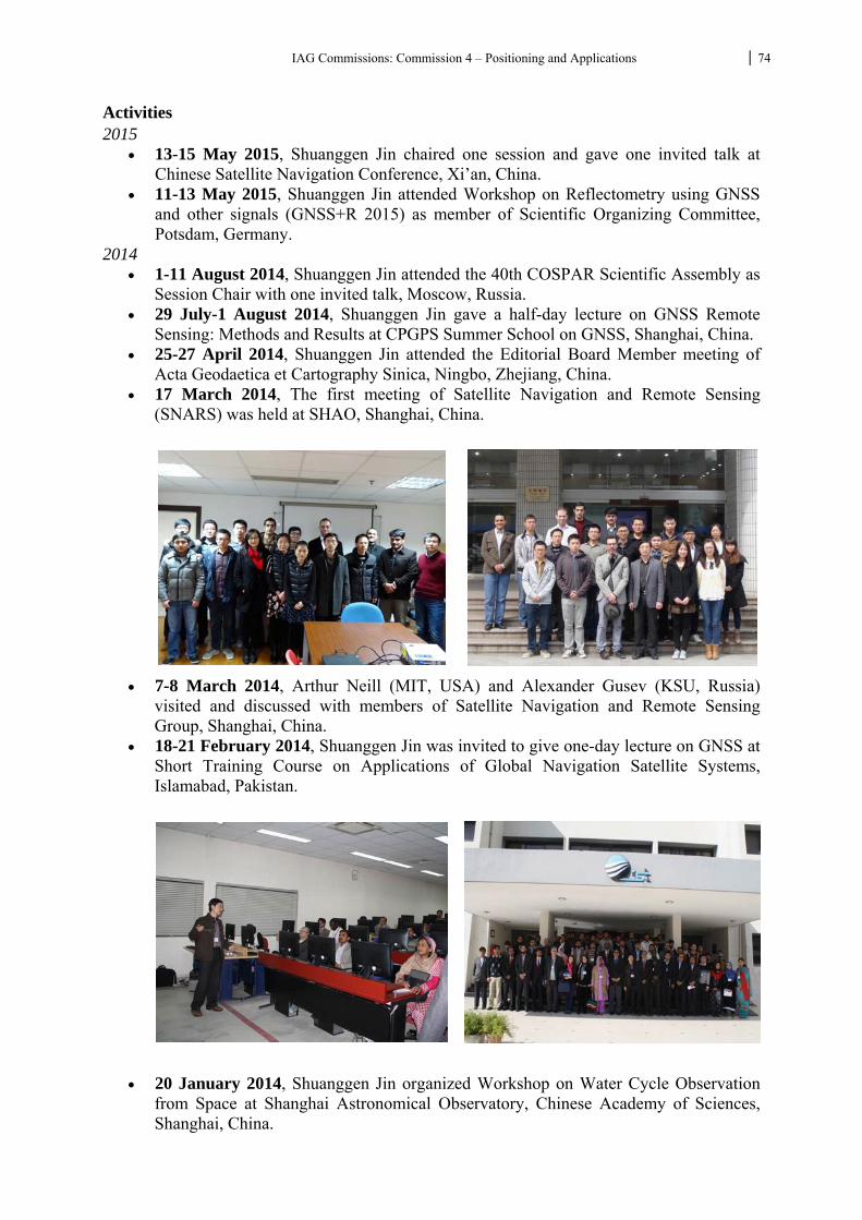
IAG Commissions: Commission 4 – Positioning and Applications 74
Activities 2015
13-15 May 2015, Shuanggen Jin chaired one session and gave one invited talk at Chinese Satellite Navigation Conference, Xi’an, China.
11-13 May 2015, Shuanggen Jin attended Workshop on Reflectometry using GNSS and other signals (GNSS+R 2015) as member of Scientific Organizing Committee, Potsdam, Germany.
2014 1-11 August 2014, Shuanggen Jin attended the 40th COSPAR Scientific Assembly as
Session Chair with one invited talk, Moscow, Russia. 29 July-1 August 2014, Shuanggen Jin gave a half-day lecture on GNSS Remote
Sensing: Methods and Results at CPGPS Summer School on GNSS, Shanghai, China. 25-27 April 2014, Shuanggen Jin attended the Editorial Board Member meeting of
Acta Geodaetica et Cartography Sinica, Ningbo, Zhejiang, China. 17 March 2014, The first meeting of Satellite Navigation and Remote Sensing
(SNARS) was held at SHAO, Shanghai, China.
7-8 March 2014, Arthur Neill (MIT, USA) and Alexander Gusev (KSU, Russia) visited and discussed with members of Satellite Navigation and Remote Sensing Group, Shanghai, China.
18-21 February 2014, Shuanggen Jin was invited to give one-day lecture on GNSS at Short Training Course on Applications of Global Navigation Satellite Systems, Islamabad, Pakistan.
20 January 2014, Shuanggen Jin organized Workshop on Water Cycle Observation
from Space at Shanghai Astronomical Observatory, Chinese Academy of Sciences, Shanghai, China.
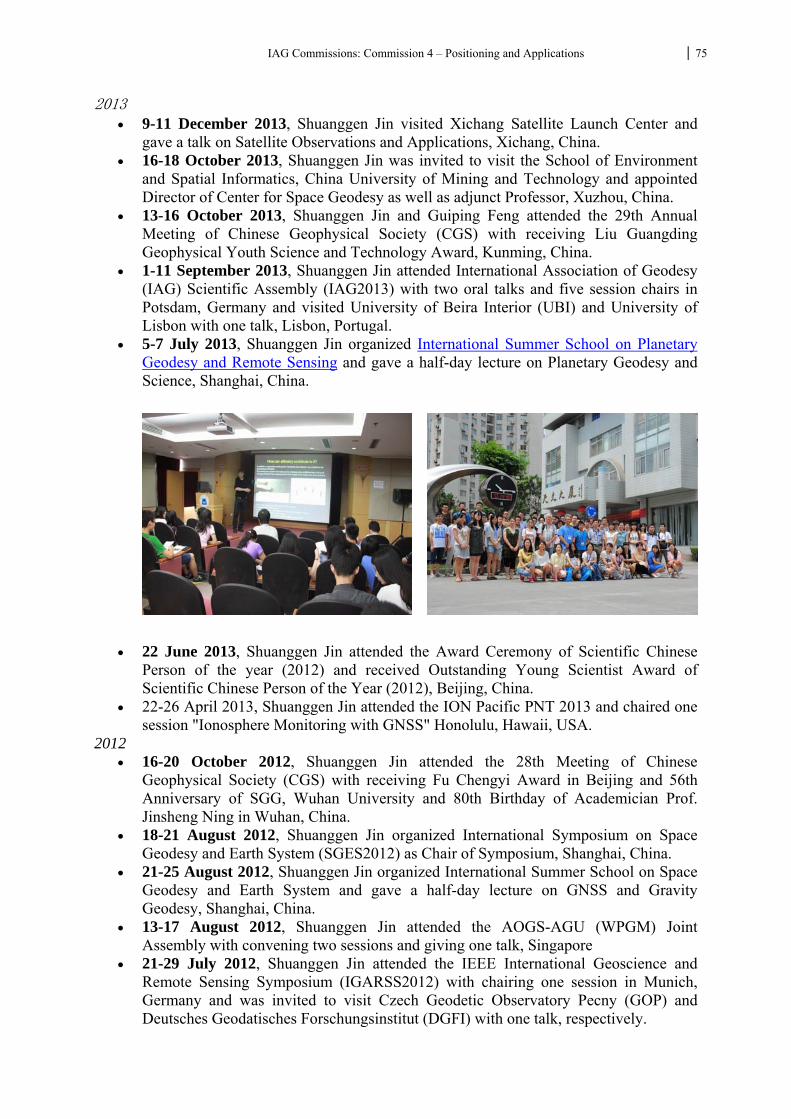
IAG Commissions: Commission 4 – Positioning and Applications 75
2013 9-11 December 2013, Shuanggen Jin visited Xichang Satellite Launch Center and
gave a talk on Satellite Observations and Applications, Xichang, China. 16-18 October 2013, Shuanggen Jin was invited to visit the School of Environment
and Spatial Informatics, China University of Mining and Technology and appointed Director of Center for Space Geodesy as well as adjunct Professor, Xuzhou, China.
13-16 October 2013, Shuanggen Jin and Guiping Feng attended the 29th Annual Meeting of Chinese Geophysical Society (CGS) with receiving Liu Guangding Geophysical Youth Science and Technology Award, Kunming, China.
1-11 September 2013, Shuanggen Jin attended International Association of Geodesy (IAG) Scientific Assembly (IAG2013) with two oral talks and five session chairs in Potsdam, Germany and visited University of Beira Interior (UBI) and University of Lisbon with one talk, Lisbon, Portugal.
5-7 July 2013, Shuanggen Jin organized International Summer School on Planetary Geodesy and Remote Sensing and gave a half-day lecture on Planetary Geodesy and Science, Shanghai, China.
22 June 2013, Shuanggen Jin attended the Award Ceremony of Scientific Chinese
Person of the year (2012) and received Outstanding Young Scientist Award of Scientific Chinese Person of the Year (2012), Beijing, China.
22-26 April 2013, Shuanggen Jin attended the ION Pacific PNT 2013 and chaired one session "Ionosphere Monitoring with GNSS" Honolulu, Hawaii, USA.
2012 16-20 October 2012, Shuanggen Jin attended the 28th Meeting of Chinese
Geophysical Society (CGS) with receiving Fu Chengyi Award in Beijing and 56th Anniversary of SGG, Wuhan University and 80th Birthday of Academician Prof. Jinsheng Ning in Wuhan, China.
18-21 August 2012, Shuanggen Jin organized International Symposium on Space Geodesy and Earth System (SGES2012) as Chair of Symposium, Shanghai, China.
21-25 August 2012, Shuanggen Jin organized International Summer School on Space Geodesy and Earth System and gave a half-day lecture on GNSS and Gravity Geodesy, Shanghai, China.
13-17 August 2012, Shuanggen Jin attended the AOGS-AGU (WPGM) Joint Assembly with convening two sessions and giving one talk, Singapore
21-29 July 2012, Shuanggen Jin attended the IEEE International Geoscience and Remote Sensing Symposium (IGARSS2012) with chairing one session in Munich, Germany and was invited to visit Czech Geodetic Observatory Pecny (GOP) and Deutsches Geodatisches Forschungsinstitut (DGFI) with one talk, respectively.
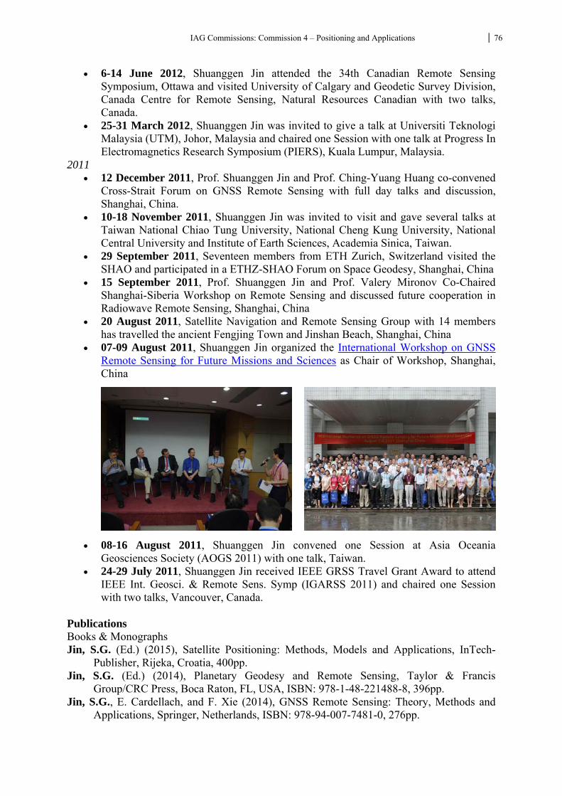
IAG Commissions: Commission 4 – Positioning and Applications 76
6-14 June 2012, Shuanggen Jin attended the 34th Canadian Remote Sensing Symposium, Ottawa and visited University of Calgary and Geodetic Survey Division, Canada Centre for Remote Sensing, Natural Resources Canadian with two talks, Canada.
25-31 March 2012, Shuanggen Jin was invited to give a talk at Universiti Teknologi Malaysia (UTM), Johor, Malaysia and chaired one Session with one talk at Progress In Electromagnetics Research Symposium (PIERS), Kuala Lumpur, Malaysia.
2011 12 December 2011, Prof. Shuanggen Jin and Prof. Ching-Yuang Huang co-convened
Cross-Strait Forum on GNSS Remote Sensing with full day talks and discussion, Shanghai, China.
10-18 November 2011, Shuanggen Jin was invited to visit and gave several talks at Taiwan National Chiao Tung University, National Cheng Kung University, National Central University and Institute of Earth Sciences, Academia Sinica, Taiwan.
29 September 2011, Seventeen members from ETH Zurich, Switzerland visited the SHAO and participated in a ETHZ-SHAO Forum on Space Geodesy, Shanghai, China
15 September 2011, Prof. Shuanggen Jin and Prof. Valery Mironov Co-Chaired Shanghai-Siberia Workshop on Remote Sensing and discussed future cooperation in Radiowave Remote Sensing, Shanghai, China
20 August 2011, Satellite Navigation and Remote Sensing Group with 14 members has travelled the ancient Fengjing Town and Jinshan Beach, Shanghai, China
07-09 August 2011, Shuanggen Jin organized the International Workshop on GNSS Remote Sensing for Future Missions and Sciences as Chair of Workshop, Shanghai, China
08-16 August 2011, Shuanggen Jin convened one Session at Asia Oceania Geosciences Society (AOGS 2011) with one talk, Taiwan.
24-29 July 2011, Shuanggen Jin received IEEE GRSS Travel Grant Award to attend IEEE Int. Geosci. & Remote Sens. Symp (IGARSS 2011) and chaired one Session with two talks, Vancouver, Canada.
Publications Books & Monographs Jin, S.G. (Ed.) (2015), Satellite Positioning: Methods, Models and Applications, InTech-
Publisher, Rijeka, Croatia, 400pp. Jin, S.G. (Ed.) (2014), Planetary Geodesy and Remote Sensing, Taylor & Francis
Group/CRC Press, Boca Raton, FL, USA, ISBN: 978-1-48-221488-8, 396pp. Jin, S.G., E. Cardellach, and F. Xie (2014), GNSS Remote Sensing: Theory, Methods and
Applications, Springer, Netherlands, ISBN: 978-94-007-7481-0, 276pp.
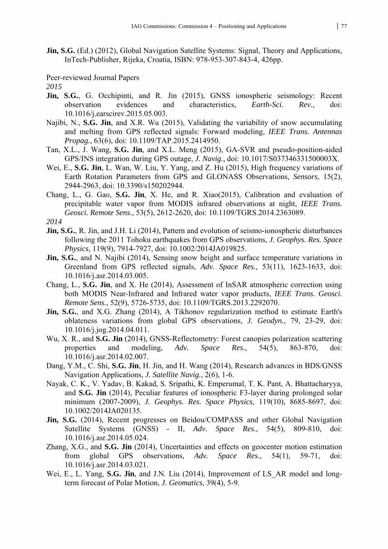
IAG Commissions: Commission 4 – Positioning and Applications 77
Jin, S.G. (Ed.) (2012), Global Navigation Satellite Systems: Signal, Theory and Applications, InTech-Publisher, Rijeka, Croatia, ISBN: 978-953-307-843-4, 426pp.
Peer-reviewed Journal Papers 2015 Jin, S.G., G. Occhipinti, and R. Jin (2015), GNSS ionospheric seismology: Recent
observation evidences and characteristics, Earth-Sci. Rev., doi: 10.1016/j.earscirev.2015.05.003.
Najibi, N., S.G. Jin, and X.R. Wu (2015), Validating the variability of snow accumulating and melting from GPS reflected signals: Forward modeling, IEEE Trans. Antennas Propag., 63(6), doi: 10.1109/TAP.2015.2414950.
Tan, X.L., J. Wang, S.G. Jin, and X.L. Meng (2015), GA-SVR and pseudo-position-aided GPS/INS integration during GPS outage, J. Navig., doi: 10.1017/S037346331500003X.
Wei, E., S.G. Jin, L. Wan, W. Liu, Y. Yang, and Z. Hu (2015), High frequency variations of Earth Rotation Parameters from GPS and GLONASS Observations, Sensors, 15(2), 2944-2963, doi: 10.3390/s150202944.
Chang, L., G. Gao, S.G. Jin, X. He, and R. Xiao(2015), Calibration and evaluation of precipitable water vapor from MODIS infrared observations at night, IEEE Trans. Geosci. Remote Sens., 53(5), 2612-2620, doi: 10.1109/TGRS.2014.2363089.
2014 Jin, S.G., R. Jin, and J.H. Li (2014), Pattern and evolution of seismo-ionospheric disturbances
following the 2011 Tohoku earthquakes from GPS observations, J. Geophys. Res. Space Physics, 119(9), 7914-7927, doi: 10.1002/2014JA019825.
Jin, S.G., and N. Najibi (2014), Sensing snow height and surface temperature variations in Greenland from GPS reflected signals, Adv. Space Res., 53(11), 1623-1633, doi: 10.1016/j.asr.2014.03.005.
Chang, L., S.G. Jin, and X. He (2014), Assessment of InSAR atmospheric correction using both MODIS Near-Infrared and Infrared water vapor products, IEEE Trans. Geosci. Remote Sens., 52(9), 5726-5735, doi: 10.1109/TGRS.2013.2292070.
Jin, S.G., and X.G. Zhang (2014), A Tikhonov regularization method to estimate Earth's oblateness variations from global GPS observations, J. Geodyn., 79, 23-29, doi: 10.1016/j.jog.2014.04.011.
Wu, X. R., and S.G. Jin (2014), GNSS-Reflectometry: Forest canopies polarization scattering properties and modeling, Adv. Space Res., 54(5), 863-870, doi: 10.1016/j.asr.2014.02.007.
Dang, Y.M., C. Shi, S.G. Jin, H. Jin, and H. Wang (2014), Research advances in BDS/GNSS Navigation Applications, J. Satellite Navig., 2(6), 1-6.
Nayak, C. K., V. Yadav, B. Kakad, S. Sripathi, K. Emperumal, T. K. Pant, A. Bhattacharyya, and S.G. Jin (2014), Peculiar features of ionospheric F3-layer during prolonged solar minimum (2007-2009), J. Geophys. Res. Space Physics, 119(10), 8685-8697, doi: 10.1002/2014JA020135.
Jin, S.G. (2014), Recent progresses on Beidou/COMPASS and other Global Navigation Satellite Systems (GNSS) - II, Adv. Space Res., 54(5), 809-810, doi: 10.1016/j.asr.2014.05.024.
Zhang, X.G., and S.G. Jin (2014), Uncertainties and effects on geocenter motion estimation from global GPS observations, Adv. Space Res., 54(1), 59-71, doi: 10.1016/j.asr.2014.03.021.
Wei, E., L. Yang, S.G. Jin, and J.N. Liu (2014), Improvement of LS_AR model and long-term forecast of Polar Motion, J. Geomatics, 39(4), 5-9.
IAG Commissions: Commission 4 – Positioning and Applications 78
Wei, E., L.H. Wan, S.G. Jin, and J.N. Liu (2014), ERPs estimation with the combined observations of GNSS and SLR, Geomatic & Info. Sci. Wuhan Uni., 39(5), 581-585, doi: 10.13203/j.whugis20120213.
2013 Shi, C., S.G. Jin, Y.M. Dang, Y.M. Feng, H. Jin, and Q.X. Wang (2013), Research advances
in BDS/GNSS Navigation Applications, J. Satellite Navig., 1(3), 1-6. Jin, S.G., T. van Dam, and S. Wdowinski (2013), Observing and understanding the Earth
system variations from space geodesy, J. Geodyn., 72, 1-10, doi: 10.1016/j.jog.2013.08.001.
Najibi, N., and S.G. Jin (2013), Physical reflectivity and polarization characteristics for snow and ice-covered surfaces interacting with GPS signals, Remote Sens., 5(8), 4006-4030, doi:10.3390/rs5084006.
Demyanov, V., Y. Yasyukevich, and S.G. Jin (2013), Controlling current conditions of navigation satellites' signal propagation, Russian J. Sol.-Terr. Phys., 22, 35-40.
2012 Demyanov, V., E. Afraimovich, and S.G. Jin (2012), An evaluation of potential solar radio
emission power threat on GPS and GLONASS performance, GPS Solut., 16(4), 411-424, doi: 10.1007/s10291-011-0241-9.
Jin, S.G. (2012), Preface: Recent results on lunar exploration and science, Adv. Space Res., 50(12), 1581-1582, doi: 10.1016/j.asr.2012.09.010..
Zhang, L., S.G. Jin, and T. Zhang (2012), Seasonal variations of Earth's surface loading deformation estimated from GPS and satellite gravimetry, J. Geod. Geodyn., 32(2), 32-38.
Wei, H., S.G. Jin, and X. He (2012), Effects and disturbances on GPS-derived zenith tropospheric delay during the CONT08 campaign, Adv. Space Res., 50(5), 632-641, doi: 10.1016/j.asr.2012.05.017.
Jin, S.G. (2012), GNSS remote sensing in the atmosphere, oceans, land and hydrology, Proc. IAG Symp., 136, 825-832, doi: 10.1007/978-3-642-20338-1_104.
Jin, R., S.G. Jin, and G. Feng (2012), M_DCB: Matlab code for estimating GNSS satellite and receiver differential code biases, GPS Solut., 16(4), 541-548, doi: 10.1007/s10291-012-0279-3.
2011 Chen, G., S. Qian, and S. Gleason (2011), Denoising of Hyperspectral Imagery by Combining
PCA with Block-Matching 3D Filtering, Canadian J. Remote Sens., 37(6), 590-595. Jin, S.G., G. Feng, and S. Gleason (2011), Remote sensing using GNSS signals: current status
and future directions, Adv. Space Res., 47(10), 1645-1653, doi: 10.1016/j.asr.2011.01.036.
Afraimovich, E., A. Ishina, M. Tinin, Y. Yasyukevich, and S.G. Jin (2011), First evidence of anisotropy of GPS phase slips caused by the mid-latitude field-aligned ionospheric irregularities, Adv. Space Res., 47(10), 1674-1680, doi: 10.1016/j.asr.2011.01.015.
Jin, S.G., C. Rizos, and A. Rius (2011), Sensing the Earth using global navigation satellite system signals, Eos Trans. AGU, 92(48), 444, doi:10.1029/2011EO480006.
Jin, S.G., L. Han, and J. Cho (2011), Lower atmospheric anomalies following the 2008 Wenchuan Earthquake observed by GPS measurements, J. Atmos. Sol.-Terr. Phys., 73(7-8), 810-814, doi: 10.1016/j.jastp.2011.01.023.
IAG Commissions: Commission 4 – Positioning and Applications 79
WG 4.6.1 GNSS-R System and Development Chair: Manuel Martin-Neira (ESA/ESTEC, The Netherlands) Co-Chair: Fran Fabra (Institut de Ciències de l'Espai, Spain) Within these 3 years (2011-2013) the interferometric technique of the Passive Reflectometry and Interferometry concept (PARIS), under study within the European Space Agency, has been well consolidated. This technique consists of the straight correlation between direct and reflected signals, without the use of any clean code replica on-board. Satellite discrimination is performed through the antenna beam, delay and Doppler diversity, particular to each satellite of each GNSS constellation. Spatial selectivity is achieved through the use of parallel high gain antenna beams, i.e. beamforming antennas in both, up- and down-looking receiving antennas. Because of the use of the maximum bandwidth of the GNSS signals, this technique is thought to provide the best altimetric performance for GNSS reflectometry. Following a successful bridge experiment 7-8 July 2010, in 11 November 2011 the first airborne experiment of the PARIS interferometric technique was carried out. The data were processed by IEEC and the 2 cm/km slope of the geoid in the Baltic Sea area of the experiment was clearly measured, with a standard deviation of about 13 cm after 20 s. The waveforms retrieved matched well the expected ones for low wind speed, in line with the actual weather conditions during the test. The test set-up had to be restricted to one single high gain antenna beam looking up, and the same looking down. Therefore, this airborne experiment could show precise altimetry only within 15 degrees away from the aircraft track. A future experiment is being planned that will demonstrate altimetry over a wider swath of up to 35 degrees. The way this will be achieved is through making the beamformer on ground in postprocessing (on-board raw data are simply grabbed and recorded for later post-processing). The 11 November 2011 experiment is thought to be the most accurate altimetry test carried out so far in GNSS reflectometry by the European Space Agency. Within the reporting period, ESA carried out two Phase A studies of a PARIS In-orbit Demonstration mission which showed the feasibility of a small demonstration mission dedicated to mesoscale ocean altimetry. Two additional Phase A studies will be started later in 2013 to consider a GNSS reflectometry experiment aboard the International Space Station (the GEROS experiment). The GEROS experiment is an opportunity to test the GNSS-R technology developed for the PARIS-IoD mission. Also within 2011-2015 ESA has performed also other various studies on different applications of GNSS-R such as biomass, snow sounding, sea ice thickness and soil moisture with promising results all of them. WG 4.6.3 GNSS Ocean Altimetry Chair: Salvatore D'Addio (ESA/ESTEC, The Netherlands) Co-Chair: Estel Cardellach (Institut de Ciències de l'Espai, Spain) Activities
On one hand, the interferometric technique of the Passive Reflectometry and Interferometry concept (PARIS), under study within the European Space Agency, explained in Report Subcommission WG 4.6.1, was tested for the first time under dynamic conditions. A dedicated GNSS-R interferometric receiver was developed and installed in the Finnish Skyvan aircraft, to perform, in 11 November 2011, the first airborne experiment of the PARIS interferometric technique. The data were processed
IAG Commissions: Commission 4 – Positioning and Applications 80
by IEEC and the 2 cm/km slope of the geoid in the Baltic Sea area of the experiment was clearly measured, with a standard deviation of about 13 cm after 20 s. The waveforms retrieved matched well the expected ones for low wind speed, in line with the actual weather conditions during the test. The test set-up had to be restricted to one single high gain antenna beam looking up, and the same looking down. Therefore, this airborne experiment could show precise altimetry only within 15 degrees away from the aircraft track. A future experiment is being planned that will demonstrate altimetry over a wider swath of up to 35 degrees. The 11 November 2011 experiment is thought to be the most accurate altimetry test carried out so far in GNSS reflectometry by the European Space Agency. See references [2, 3, 8]. Conventional processing of GPS CA code signals was also carried out in the same experiment, showing an altimetry performance degradation of about a factor 2, mainly due to the reduced bandwidth of the open access CA code signal. However, the observed waveform matched very well the models also in this case.
In 2012, two Phase A studies have been conducted by ESA, about the feasibility of a PARIS interferometric small mission for Ocean altimetric applications. See mission overview at [1].
The proposal “GNSS REflectometry, Radio Occultation and Scatterometry onboard ISS” (GEROS-ISS), submitted to the 2011 European Space Agency Research Announcement for ISS Experiments relevant to study of Global Climate Change, was selected in September 2012, among more than 20 competing proposals. The Scientific Advisory Group is being formed (Spring 2013), to contribute defining the terms and requirements of two Phase A (feasibility) studies for such experiment.
During 2013, a collaboration between the National Remote Sensing Center of China (NRSCC); Chinese Universities; IEEC/ICE-CSIC (Spain); and ESA has been established to conduct an experiment in the Chinese coast during the Typhoon season (July-September 2013), with the goal of capturing both scatterometric and altimetries features of the Typhoon in GNSS-R data. See [10].
During this period, new processing techniques for Ocean altimetry have also been envisaged: in references [4, 6, 7] Ocean tide signatures were captured from 700 meter cliff using carrier-phase delays at low elevation angles of observation, with a few cm precision (data available at [5]); [9] tested a carrier-Doppler approach for altimetric applications that might work over rougher waters (less restrictive than phase-delay observations).
The GNSS+R 2012 workshop was conducted at Purdue University (West Lafayette, IN, USA), in October 2012. Eight papers were presented related to Ocean altimetry: Yu et al.; Larson; Rius et al.; Beckheinrich et al.; Carreno-Luengo et al.; D'Addio et al.; Stienne et al.; and Semmling, Beyerle and Wickert (not listed below, please visit http://www.gnssr2012.org)
Publications Manuel Martín-Neira, Salvatore D'Addio, Christopher Buck, Nicolas Floury, Roberto Prieto-
Cerdeira: The PARIS Ocean Altimeter In-Orbit Demonstrator. IEEE T. Geoscience and Remote Sensing 49(6-2): 2209-2237 (2011)
Rius, A., Cardellach, E., Oliveras, S., Valencia, E., Park, H., Camps, A., van der Marel, H., van Bree, R., Altena, B., Nogués-Correig, O., Ribó, S., Tarongí, J., Martín-Neira, M., Altimetry with GNSS-R interferometry: first proof of concept experiment, GPS Solutions, pp. 1-11, 2011, jun, 10.1007/s10291-011-0225-9
IAG Commissions: Commission 4 – Positioning and Applications 81
Rius, A., Fabra, F., Ribó, S., Oliveras, S., Arco Fernandez, J. C., Cardellach, E., Camps, A., Nogués-Correig, O., Kainulainen, J., Mancel, C., Martín-Neira, M., PARIS Interferometric Technique: First Aircraft Experiment, Proceedings of the third Workshop on Advanced RF Sensors and Remote Sensing Instruments, 2011, sep, European Space Agency
Fabra, F., Cardellach, E., Rius, A., Ribó, S., Oliveras, S., Nogués-Correig, O., Semmling, M., Macelloni, G., Pettinato, S., Belmonte-Rivas, M., D Addio, S., GNSS Reflectometry for the remote sensing of sea ice and dry snow, Proceedings of the third Workshop on Advanced RF Sensors and Remote Sensing Instruments, 2011, sep, European Space Agency
Cardellach, E., Fabra, F., Nogués-Correig, O., Oliveras, S., Ribó, S., Rius, A., GNSS-R ground-based and airborne campaigns for Ocean, Land, Ice and Snow techniques: application to the GOLD-RTR datasets, Radio Science, 46, RS0C04, 2011, oct, doi:10.1029/2011RS004683
Semmling, M., Beyerle, G., Stosius, R., Dick, G., Wickert, J., Fabra, F., Cardellach, E., Ribó, S., Rius, A., Helm, A., Yudanov, S., D Addio, S., Detection of Arctic Ocean Tides using Interferometric GNSS-R Signals, Geophysical Research Letters, 2011, doi:10.1029/2010GL046005
Fabra, F., Cardellach, E., Rius, A., Ribó, S., Oliveras, S., Nogués-Correig, O., Belmonte Rivas, M., Semmling, M., D Addio, S., Phase Altimetry with Dual Polarization GNSS-R over Sea Ice , IEEE Transactions on Geoscience and Remote Sensing, 50, 6, pp. 10, 2011, nov, doi:10.1109/TGRS.2011.2172797
Rius, A., Fabra, F., Ribó, S., Arco Fernandez, J. C., Oliveras, S., Cardellach, E., Camps, A., Nogués-Correig, O., Kainulainen, J., Rohue, E., Martín-Neira, M., PARIS Interferometric Technique Proof Of Concept: Sea surface altimetry measurements, Proceedings of IEEE International Geoscience and Remote Sensing Symposium (IEEE-IGARSS), 2012, IEEE Geoscience and Remote Sensing Society
Semmling, M., T. Schmidt, J. Wickert, S. Schön, Fabra, F., Cardellach, E., Rius, A., On the Retrieval of the Specular Reflection in GNSS Carrier Observations for Ocean Altimetry, Radio Science, 47, RS6007, 2012, dec, 10.1029/2012RS005007
Weiqiang Li, Manuel Martin-Neira, Salvatore D’Addio, Typhoon Observations with the PARIS In-Orbit Demonstration Mission, EGU General Assembly April 2013