coast guard, dhs §165.t09–0073 · pdf filefunction of a bridge or lock within the...
TRANSCRIPT

735
Coast Guard, DHS § 165.T09–0073
(i) Predicted winds of 74 miles per hour (mph) or more or a predicted storm surge of 8 feet or more for the Inner Harbor Navigation Canal;
(ii) Predicted winds of 111 mph or more and/or a predicted storm surge of 10.5 feet or more for the Harvey or Al-giers Canals through post storm land-fall, or other hurricane or tropical storm conditions as determined by the COTP; or
(iii) Other hurricane or tropical storm conditions expected to inflict significant damage to low lying and vulnerable shoreline areas, as deter-mined by the COTP through National Weather Service/Hurricane Center weather predictions.
(2) In the event that a particularly dangerous storm is predicted to have winds or storm surge significantly ex-ceeding the conditions specified in paragraphs (c)(1)(i) through (c)(1)(iii) of this section, the COTP may begin en-forcement 72 hours in advance of the predicted conditions.
(3) During enforcement: (i) All floating vessels are prohibited
from entering or remaining in the RNA except pending approval of a waiver re-quest made in accordance with para-graph (d) of this section or as author-ized by a waiver approved by the COTP in accordance with paragraph (d);
(ii) Transient vessels will not be per-mitted to seek safe haven in the RNA except in accordance with a pre-arranged agreement between the vessel and a facility within the RNA, or as authorized by a waiver approved by the COTP in accordance with paragraph (d) of this section.
(4) The COTP will announce enforce-ment periods through Marine Safety Information Bulletins and Safety Broadcast Notices to Mariners.
(d) Waivers. (1) Upon request of the vessel owner or operator, the COTP may waive any provision of paragraph (c) of this section, if the COTP finds that the vessel’s proposed operation can be conducted safely under the terms of that waiver.
(2) A request for waiver must be in writing, except as provided by para-graph (d)(3) of this section, and must describe or provide:
(i) The reason for requesting the waiver;
(ii) The vessel’s current operations; (iii) The name of any intended moor-
ing facility, the specific mooring loca-tion within that facility, and a list of vessels routinely engaged in business at that facility;
(iv) The vessel’s proposed operation during the RNA enforcement period, including intended mooring arrange-ments that comply with 33 CFR 165.803 and the mooring facility’s equipment for supporting those arrangements; and
(v) Contact information for the vessel owner or operator during the RNA en-forcement period.
(3) Under unusual circumstances due to time constraints, such as the mal-function of a bridge or lock within the RNA, the person in charge of a vessel may orally request an immediate waiv-er from the COTP, but the vessel owner or operator must send written con-firmation of the request, containing the information required by paragraph (d)(2) of this section, to the COTP with-in five days of the oral request.
(4) The COTP may condition approval of a waiver request on the vessel own-er’s or operator’s taking measures ad-ditional to those proposed in the waiv-er request, and may terminate a waiver at any time, if the COTP deems it nec-essary to provide safety.
(e) Penalties. Failure to comply with this section may result in civil or criminal penalties pursuant to the Ports and Waterways Safety Act, 33 U.S.C. 1221 et seq.
(f) Notice of enforcement. The COTP will notify the maritime community of periods during which this regulated navigation area will be enforced by providing advance notice through a Marine Safety Information Bulletin and Safety Broadcast Notice to Mari-ners.
[USCG–2009–0139, 75 FR 32279, June 8, 2010]
NINTH COAST GUARD DISTRICT
§ 165.T09–0073 Safety and Security Zones; Tall Ships Challenge 2010; Great Lakes; Cleveland, OH; Bay City, MI; Duluth, MN; Green Bay, WI; Sturgeon Bay, WI; Chicago, IL; Erie, PA.
(a) Definitions. The following defini-tions apply to this section: Navigation Rules means the Navigation Rules,
VerDate Mar<15>2010 07:59 Sep 03, 2010 Jkt 220131 PO 00000 Frm 00745 Fmt 8010 Sfmt 8010 Y:\SGML\220131.XXX 220131erow
e on
DS
K5C
LS3C
1PR
OD
with
CF
R

736
33 CFR Ch. I (7–1–10 Edition) § 165.T09–0124
International and Inland (See, 1972 COLREGS and 33 U.S.C. 2001 et seq.).
Official Patrol means those persons designated by Captain of the Port Buf-falo, Detroit, Sault Ste. Marie, Duluth and Lake Michigan to monitor a Tall Ship safety and security zone, permit entry into the zone, give legally en-forceable orders to persons or vessels within the zone, and take other actions authorized by the cognizant Captain of the Port.
Public Vessel means vessels owned, chartered, or operated by the United States or by a State or political sub-division thereof.
Tall Ship means any sailing vessel participating in the Tall Ships Chal-lenge 2010 in the Great Lakes. This in-cludes, but is not limited to, the fol-lowing: Sailing Vessel (S/V) AMISTAD, S/V APPLEDORE IV, S/V APPLEDORE V, HMS BOUNTY, S/V DENIS SUL-LIVAN, S/V EUROPA, S/V FAZISI, S/V FRIENDS OF GOOD WILL, S/V IN-LAND SEAS, S/V LAREVENANTE, S/V LYNX, S/V MADELINE, S/V FLAG-SHIP NIAGARA, S/V PATHFINDER, S/ V PLAYFAIR, S/V PRIDE OF BALTI-MORE II, S/V ROALD AMUNDSEN, S/ V RED WITCH, S/V ROTALISTE, S/V ROSEWAY, S/V UNICORN, S/V WEL-COME, and S/V WINDY.
(b) Location. The following area is a safety and security zone: all navigable waters of the United States located in the Ninth Coast Guard District within a 100 yard radius of any Tall Ship.
(c) Regulations. (1) Entry into a safety and security zone described in para-graph (b) of this section is prohibited unless authorized by the cognizant Coast Guard Captain of the Port or the Official Patrol.
(2) Vessels may request permission to enter into a safety and security zone described in paragraph (b) of this sec-tion by contacting the Official Patrol on VHF channel 16.
(3) Any vessel operating within a safety and security zone established by this section must operate at the min-imum speed necessary to maintain a safe course and must proceed as di-rected by the Captain of the Port or the on-scene Official Patrol. Any vessel or person allowed to enter a safety and security zone established by this sec-tion must still remain at least 25 yards
from any Tall Ship, unless authorized to come within such a distance pursu-ant to paragraph (c)(4) of this section or permitted to come within such a dis-tance by the cognizant Captain of the Port, his or her designated representa-tive, or the on-scene Official Patrol.
(4) Vessels are permitted to transit through the safety and security zone in waterways that do not provide ade-quate navigable waters greater than 100 yards from the Tall Ships. Vessels transiting such areas must operate at the minimum speed necessary to main-tain a safe course while also maintain-ing the greatest possible distance away from the Tall Ships.
(d) Effective period. This rule is effec-tive from 12:01 a.m. on Wednesday, June 23, 2010 through 12:01 a.m. on Monday September 13, 2010.
(e) Navigation Rules. The Navigation Rules must apply at all times within a Tall Ships safety and security zone.
(f) When a Tall Ship approaches with-in 25 yards of any vessel that is moored or anchored, the stationary vessel must stay moored or anchored while it remains within the tall ship’s safety and security zone unless ordered by or given permission from the cognizant Captain of the Port, his or her des-ignated representative, or the on-scene official patrol to do otherwise.
EFFECTIVE DATE NOTE: By USCG–2010–0073, 75 FR 33508, June 14, 2010, temporary § 165.T09–0073 was added, effective from 12:01 a.m. on June 23, 2010 until 12:01 a.m. on Sept. 13, 2010.
§ 165.T09–0124 Safety Zone; St. Louis River, Tallas Island, Duluth, MN.
(a) Location. The following area is a temporary safety zone: near Tallas Is-land on the St. Louis River to include all waters contained within the zone located at 46°42.30 N 092°11.56 W and then run northeast to position; 46°42.53 N 092°11.30 W and then run northwest to position; 46°43.5 N 092°11.41 W and then run southwest to position; 46°42.37 N 092°12.11 W and then running southeast back to the starting point (NAD 83). The safety zone’s boundary is approxi-mately 3500 ft. by 1500 ft. on the long end, extending behind Tallas Island, and 3000 ft by 1500 ft on the short end, extending into open waters.
VerDate Mar<15>2010 07:59 Sep 03, 2010 Jkt 220131 PO 00000 Frm 00746 Fmt 8010 Sfmt 8010 Y:\SGML\220131.XXX 220131erow
e on
DS
K5C
LS3C
1PR
OD
with
CF
R

737
Coast Guard, DHS § 165.T09–0166
(b) Effective dates. This rule is effec-tive from 12:01 a.m. May 1, 2010 until 11:59 p.m. November 30, 2010.
(c) Regulations. (1) In accordance with the general regulations in section 165.23 of this part, entry into this zone is prohibited unless authorized by the Coast Guard Captain of the Port Du-luth, or his designated on-scene rep-resentative.
(2) This safety zone is closed to all vessel traffic, except as may be per-mitted by the Captain of the Port Du-luth or his designated on-scene rep-resentative.
(3) The ‘‘on-scene representative’’ of the Captain of the Port is any Coast Guard commissioned, warrant, or petty officer who has been designated by the Captain of the Port to act on his be-half. The on-scene representative of the Captain of the Port will be aboard ei-ther a Coast Guard or Coast Guard Auxiliary vessel. The Captain of the Port or his designated on-scene rep-resentative may be contacted via VHF Channel 16.
(4) Vessel operators desiring to enter or operate within the safety zone shall contact the Captain of the Port Duluth or his on-scene representative to ob-tain permission to do so. Vessel opera-tors permitted to enter or operate in the safety zone must comply with the instructions given to them by the Cap-tain of the Port Duluth or his on-scene representative.
EFFECTIVE DATE NOTE: By USCG–2010–0124, 75 FR 24404, May 5, 2010, temporary § 165.T09– 0124 was added, effective from May 5, 2010 through 11:59 p.m. Nov. 30, 2010.
§ 165.T09–0166 Safety Zone, Brandon Road Lock and Dam to Lake Michi-gan including Des Plaines River, Chicago Sanitary and Ship Canal, Chicago River, and Calumet- Saganashkee Channel, Chicago, IL.
(a) Location. The following areas are a temporary safety zone:
(1) Des Plaines River. All U.S. waters of the Des Plaines River located be-tween mile marker 286.0 (Brandon Road Lock and Dam) and mile marker 290.0 (point at which the Des Plaines River connects with the Chicago Sanitary and Ship Canal).
(2) Chicago Sanitary and Ship Canal. All U.S. waters of the Chicago Sanitary and Ship Canal between mile marker
290.0 (point at which the Chicago Sani-tary and Ship Canal connects to the Des Plaines River) and mile marker 321.8 (point at which the Chicago Sani-tary and Ship Canal Connects to the South Branch Chicago River).
(3) South Branch Chicago River. All U.S. waters of the South Branch Chi-cago River between mile marker 321.8 (point at which the South Branch Chi-cago River connects to the Chicago Sanitary and Ship Canal) and mile marker 325.6 (point at which the South Branch Chicago River connects to the Chicago River (Main Branch) and North Branch Chicago River).
(4) Chicago River (Main Branch). All U.S. waters of the Chicago River (Main Branch) between mile marker 325.6 (point at which the Chicago River con-nects to the South Branch Chicago River) and 100 yards extending past the end of the Chicago River covering the area of the Federal channel within Chi-cago Harbor.
(5) North Branch Chicago River. All U.S. waters of the North Branch Chi-cago River between mile marker 325.6 (point at which the North Branch Chi-cago River connects to the Chicago River (Main Branch) and the South Branch Chicago River) and mile mark-er 331.4 (end of navigation channel).
(6) Calumet-Saganashkee Channel. All U.S. waters of the Calumet- Saganashkee Channel between mile marker 303.5 (point at which the Cal-umet-Saganashkee Channel connects to the Chicago Sanitary and Ship Canal) and mile marker 333.0; all U.S. waters of the Calumet-Saganashkee Channel between mile marker 333.0 and Lake Michigan (Calumet Harbor).
(b) Effective period. This rule is effec-tive in the CFR on May 11, 2010 This rule is effective with actual notice for purposes of enforcement on April 28, 2010. This rule will remain in effect until March 1, 2011.
(c) Enforcement. (1) The Captain of the Port, Sector Lake Michigan, may enforce this safety zone in whole, in segments, or by any combination of segments. The Captain of the Port, Sector Lake Michigan, may suspend the enforcement of any segment of this safety zone for which notice of enforce-ment had been given.
VerDate Mar<15>2010 07:59 Sep 03, 2010 Jkt 220131 PO 00000 Frm 00747 Fmt 8010 Sfmt 8010 Y:\SGML\220131.XXX 220131erow
e on
DS
K5C
LS3C
1PR
OD
with
CF
R

738
33 CFR Ch. I (7–1–10 Edition) § 165.T09–0290
(2) The safety zone established by this section will be enforced, pursuant to paragraph (c)(1) of this section, only upon notice by the Captain of the Port, Sector Lake Michigan. Suspension of any previously announced period of en-forcement will also be provided by the Captain of the Port, Sector Lake Michigan. All notices of enforcement and notices of suspension of enforce-ment will clearly describe any seg-ments of the safety zone affected by the notice. At a minimum, notices of enforcement and notices of suspension of enforcement will identify any af-fected segments by reference to mile markers. When possible, the Captain of the Port, Sector Lake Michigan, will also identify enforced segments of this safety zone by referencing readily iden-tifiable geographical points. In addi-tion to providing the geographical bounds of any enforced segment of this safety zone, notices of enforcement and notices of suspension of enforcement will also provide the date(s) and time(s) at which enforcement will com-mence or suspend.
(3) The Captain of the Port, Sector Lake Michigan, will publish notices of enforcement and notices of suspension of enforcement in accordance with 33 CFR 165.7(a) and in a manner to pro-vide as much notice to the public as possible. The primary method of notifi-cation will be through publication in the FEDERAL REGISTER. The Captain of the Port, Sector Lake Michigan, will also provide notice through other means, such as Broadcast Notice to Mariners, local Notice to Mariners, local news media, distribution in leaf-let form, and on-scene oral notice. Ad-ditionally, the Captain of the Port, Sector Lake Michigan, may notify rep-resentatives from the maritime indus-try through telephonic and email noti-fications.
(d) Regulations. (1) In accordance with the general regulations in § 165.23 of this part, entry into, transiting, moor-ing, laying up, or anchoring within any enforced segment of the safety zone is prohibited unless authorized by the Captain of the Port, Sector Lake Michigan, or his or her designated rep-resentative.
(2) The ‘‘designated representative’’ of the Captain of the Port, Sector Lake
Michigan, is any Coast Guard commis-sioned, warrant or petty officer who has been designated by the Captain of the Port, Sector Lake Michigan, to act on his or her behalf. The designated representative of the Captain of the Port, Sector Lake Michigan, will be aboard a Coast Guard, Coast Guard Auxiliary, or other designated vessel or will be on shore and will communicate with vessels via VHF radio, loudhailer, or by phone. The Captain of the Port, Sector Lake Michigan, or his or her designated representative may be con-tacted via VHF radio Channel 16 or the Coast Guard Sector Lake Michigan Command Center at 414–747–7182.
(3) To obtain permission to enter or operate within an enforced segment of the safety zone established by this sec-tion, Vessel operators must contact the Captain of the Port, Sector Lake Michigan, or his or her designated rep-resentative. Vessel operators given per-mission to operate in an enforced seg-ment of the safety zone must comply with all directions given to them by the Captain of the Port, Sector Lake Michigan, or his or her designated rep-resentative.
(4) When a segment of the safety zone is being enforced, it will be closed to all vessel traffic, except as may be per-mitted by the Captain of the Port, Sec-tor Lake Michigan, or his or her des-ignated representative. As soon as op-erations permit, the Captain of the Port, Sector Lake Michigan, will issue a notice of suspension of enforcement as specified in paragraph (c) of this sec-tion.
(5) All persons entering any enforced segment of the safety zone established in this section are advised that they do so at their own risk.
EFFECTIVE DATE NOTE: By USCG–2010–0166, 75 FR 26097, May 11, 2010, temporary § 165.T09–0166 was added, effective May 11, 2010 through Mar. 1, 2011.
§ 165.T09–0290 Safety Zones; Blasting Operations and Movement of Explo-sives, St. Marys River, Sault Sainte Marie, MI.
(a) Location. The following areas are safety zones:
(1) All U.S. navigable waters down-stream of the Sabin and Davis Locks, Sault Sainte Marie, Michigan, with
VerDate Mar<15>2010 07:59 Sep 03, 2010 Jkt 220131 PO 00000 Frm 00748 Fmt 8010 Sfmt 8010 Y:\SGML\220131.XXX 220131erow
e on
DS
K5C
LS3C
1PR
OD
with
CF
R
739
Coast Guard, DHS § 165.T09–0290
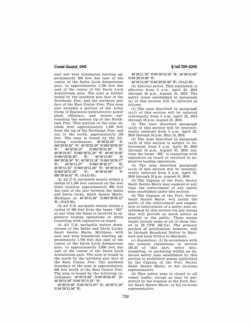
east and west boundaries starting ap-proximately 250 feet due east of the center of the Sabin Lock downstream gate, to approximately 1,750 feet due east of the center of the Davis Lock downstream gate. The zone is further bound by the southern pier face of the Northeast Pier, and the northern pier face of the East Center Pier. This zone also includes a portion of the Army Corps of Engineers hydroelectric power plant effluence, and waters sur-rounding the eastern tip of the North-east Pier. This portion of the zone ex-tends west approximately 1,100 feet from the tip of the Northeast Pier, and out to the north, approximately 150 feet. The zone is bound by the fol-lowing coordinates: 46°30′22.50″ N/ 084°20′40.81″ W; 46°30′22.50″ N/084°20′29.35″ W; 46°30′20.16″ N/084°20′25.29″ W; 46°30′18.81″ N/084°20′25.29″ W; 46°30″18.66″ N/084°20′28.36″ W; 46°30′12.90″ N/ 084°20′28.36″ W; 46°30′13.18″ N/084°20′39.17″ W; 46°30′15.27″ N/084°20′48.17″ W; 46°30′15.45″ N/084°20′51.00″ W; 46°30′16.41″ N/084°20′51.00″ W; 46°30′16.98″ N/ 084°20′40.81″ W; (NAD 83).
(2) All U.S. navigable waters within a radius of 1,100 feet centered on the test blast location approximately 600 feet due east of the pier between the Sabin and Davis locks, Sault Sainte Marie, Michigan at 46°30′15.46″ N/084°20′39.12″ W; (NAD 83).
(3) All U.S. navigable waters within a radius of 500 feet from the barge ‘‘M2’’ at any time the barge is involved in ex-plosives loading operations or while transiting with explosives on board.
(4) All U.S. navigable waters down-stream of the Sabin and Davis Locks, Sault Sainte Marie, Michigan, with east and west boundaries starting ap-proximately 1,750 feet due east of the center of the Davis Lock downstream gate, to approximately 2,850 feet due east of the center of the Davis Lock downstream gate. The zone is bound to the south by the northern pier face of the East Center Pier. The northern boundary of the zone is approximately 600 feet north of the East Center Pier. The area is bound by the following co-ordinates: 46°30′18.66″ N/84°20′28.36″ W; 46°30′19.36″ N/84°20′14.23’’ W;
46°30′19.20″ N/84°20′13.87″ W; 46°30′11.59″ N/84°20′12.96″ W;
46°30′11.78″ N/84°20′19.53″ W; 46°30′12.69″ N/84°20′19.68″ W;
46°30′12.90″ N/84°20′28.36″ W; (NAD 83). (b) Effective period. This regulation is
effective from 5 a.m. April 23, 2010 through 10 p.m. August 31, 2010. The safety zones established in paragraph (a) of this section will be enforced as follows:
(1) The zone described in paragraph (a)(1) of this section will be enforced continually from 5 a.m. April 23, 2010 through 10 p.m. August 31, 2010.
(2) The zone described paragraph (a)(2) of this section will be intermit-tently enforced from 5 a.m. April 23, 2010 through 10 p.m. May 14, 2010.
(3) The zone described in paragraph (a)(3) of this section is subject to en-forcement from 5 a.m. April 23, 2010 through 10 p.m. August 31, 2010, any time the barge ‘‘M2’’ is transiting with explosives on board or involved in ex-plosives loading operations.
(4) The zone described paragraph (a)(4) of this section will be intermit-tently enforced from 5 a.m. April 23, 2010 through 10 p.m. August 31, 2010.
(5) The Captain of the Port, Sector Sault Sainte Marie may suspend at any time the enforcement of any safety zone established under this section.
(6) The Captain of the Port, Sector Sault Sainte Marie, will notify the public of the enforcement and suspen-sion of enforcement of a safety zone es-tablished by this section via any means that will provide as much notice as possible to the public. These means might include some or all of those list-ed in 33 CFR 165.7(a). The primary method of notification, however, will be through Broadcast Notice to Mari-ners and local Notice to Mariners.
(c) Regulations. (1) In accordance with the general regulations in section 165.23 of this part, entry into, transiting, or anchoring within an en-forced safety zone established by this section is prohibited unless authorized by the Captain of the Port, Sector Sault Sainte Marie, or his on-scene representative.
(2) This safety zone is closed to all vessel traffic, except as may be per-mitted by the Captain of the Port, Sec-tor Sault Sainte Marie, or his on-scene representative.
VerDate Mar<15>2010 07:59 Sep 03, 2010 Jkt 220131 PO 00000 Frm 00749 Fmt 8010 Sfmt 8010 Y:\SGML\220131.XXX 220131erow
e on
DS
K5C
LS3C
1PR
OD
with
CF
R

740
33 CFR Ch. I (7–1–10 Edition) § 165.T09–0333
(3) The ‘‘on-scene representative’’ of the Captain of the Port, Sector Sault Sainte Marie, is any Coast Guard com-missioned, warrant or petty officer who has been designated by the Captain of the Port, Sector Sault Sainte Marie, to act on his behalf. The on-scene rep-resentative of the Captain of the Port, Sector Sault Sainte Marie, will be aboard either a Coast Guard or Coast Guard Auxiliary vessel.
(4) Vessel operators desiring to enter or operate within an enforced safety zone shall contact the Captain of the Port, Sector Sault Sainte Marie, or his on-scene representative to obtain per-mission to do so. The Captain of the Port, Sector Sault Sainte Marie, or his on-scene representative may be con-tacted via VHF Channel 16. Vessel op-erators given permission to enter or operate in the safety zone must comply with all directions given to them by the Captain of the Port, Sector Sault Sainte Marie, or his on-scene rep-resentative.
EFFECTIVE DATE NOTE: By USCG–2010–0290, 75 FR 23592, May 4, 2010, temporary § 165.T09– 0290 was added, effective May 4, 2010 through 10 p.m. Aug. 31, 2010.
§ 165.T09–0333 Safety zone; Marathon Oil Refinery construction, Rouge River, Detroit, MI.
(a) Location. The following area is a temporary safety zone: all U.S. waters of the Rouge River, Detroit, MI, bound by a line starting from a point on land on the south shore of the Rouge River at position 42°17.8′ N; 083° 9.1′ W, con-tinuing southeast to a point on land at position 42°17.7′ N; 083° 9.0′ W, across to the north side of the river to a point on land at position 42°17.8′ N; 083°8.9′ W, along the shore northwest to a point on land at position 42°17.8′ N; 083°9.0′ W, continuing back southwest to the point of origin. All geographic coordinates are North American Datum of 1983 (NAD 83). This safety zone effectively covers all of the Rouge River from the Dix Ave. bridge to the north end of Fordson Island.
(b) Effective period. This regulation is effective from 7 a.m. on May 1, 2010 to 7 p.m. on November 30, 2010. This rule will be enforced from 7 a.m. to 7 p.m. daily, on multiple dates to be deter-mined during the effective period. The
public will be notified of the specific enforcement dates as soon as prac-ticable through the publication of a Notice of Enforcement and by Broad-cast Notice to Mariners.
(c) Regulations. (1) In accordance with the general regulations in § 165.23 of this part, entry into, transiting, or an-choring within this safety zone is pro-hibited unless authorized by the Cap-tain of the Port Detroit, or his des-ignated on-scene representative.
(2) This safety zone is closed to all vessel traffic, except as may be per-mitted by the Captain of the Port De-troit or his designated on-scene rep-resentative.
(3) The ‘‘on-scene representative’’ of the Captain of the Port is any Coast Guard commissioned, warrant, or petty officer who has been designated by the Captain of the Port to act on his be-half. The on-scene representative of the Captain of the Port will be aboard ei-ther a Coast Guard or Coast Guard Auxiliary vessel. The Captain of the Port or his designated on scene rep-resentative may be contacted via VHF Channel 16.
(4) Vessel operators desiring to enter or operate within the safety zone shall contact the Captain of the Port Detroit or his on-scene representative to ob-tain permission to do so.
(5) Vessel operators given permission to enter or operate in the safety zone must comply with all directions given to them by the Captain of the Port or his on-scene representative.
EFFECTIVE DATE NOTE: By USCG–2010–0333, 75 FR 27643, May 18, 2010, temporary § 165.T09–0333 was added, effective May 18, 2010 until 7 p.m. on Nov. 30, 2010.
§ 165.T09–0452 Safety Zone; Festivals & Fireworks Celebration, East Moran Bay, Lake Huron, St. Ignace, MI.
(a) Location. The following area is a temporary safety zone: All waters of Lake Huron within a 600-foot radius from the fireworks launch site in East Moran Bay, with its center in position: 45°52′16.92″ N., 084°43′18.48″ W.: [DATUM: NAD 83].
(b) Effective period. This regulation is effective from 9 p.m. on June 26, 2010 until 11 p.m. on September 5, 2010.
(1) This rule will be enforced on the following date and times:
VerDate Mar<15>2010 07:59 Sep 03, 2010 Jkt 220131 PO 00000 Frm 00750 Fmt 8010 Sfmt 8010 Y:\SGML\220131.XXX 220131erow
e on
DS
K5C
LS3C
1PR
OD
with
CF
R

741
Coast Guard, DHS § 165.T09–1080
(i) June 26, 2010 from 9 p.m. through 11 p.m., with an alternate date & time for inclement weather of June 27, 2010 from 9 p.m. through 11 p.m.
(ii) July 10, 2010 from 9 p.m. through 11 p.m. with an alternate date & time for inclement weather of July 11, 2010 from 9 p.m. through 11 p.m.
(iii) July 17, 2010 from 9 p.m. through 11 p.m. with an alternate date & time for inclement weather of July 18, 2010 from 9 p.m. through 11 p.m.
(iv) July 24, 2010 from 9 p.m. through 11 p.m. with an alternate date & time for inclement weather of July 25, 2010 from 9 p.m. through 11 p.m.
(v) July 31, 2010 from 9 p.m. through 11 p.m. with an alternate date & time for inclement weather of August 1, 2010 from 9 p.m. through 11 p.m.
(vi) August 7, 2010 from 9 p.m. through 11 p.m. with an alternate date & time for inclement weather of Au-gust 8, 2010 from 9 p.m. through 11 p.m.
(vii) August 14, 2010 from 9 p.m. through 11 p.m. with an alternate date & time for inclement weather of Au-gust 15, 2010 from 9 p.m. through 11 p.m.
(viii) August 21, 2010 from 9 p.m. through 11 p.m. with an alternate date & time for inclement weather of Au-gust 22, 2010 from 9 p.m. through 11 p.m.
(ix) August 28, 2010 from 9 p.m. through 11 p.m. with an alternate date & time for inclement weather of Au-gust 29, 2010 from 9 p.m. through 11 p.m.
(x) September 4, 2010 from 9 p.m. through 11 p.m. with an alternate date & time for inclement weather of Sep-tember 5, 2010 from 9 p.m. through 11 p.m.
(2) The Captain of the Port, Sector Sault Sainte Marie may suspend at any time the enforcement of any safety zone established under this section.
(3) The Captain of the Port, Sector Sault Sainte Marie, will notify the public of the enforcement and suspen-sion of enforcement of a safety zone es-tablished by this section via any means that will provide as much notice as possible to the public. These means might include some or all of those list-ed in 33 CFR 165.7(a). The primary method of notification, however, will
be through Broadcast Notice to Mari-ners and local Notice to Mariners.
(c) Regulations. (1) In accordance with the general regulations in § 165.23 of this part, entry into, transiting, or an-choring within an enforced safety zone established by this section is prohib-ited unless authorized by the Captain of the Port, Sector Sault Sainte Marie, or his on-scene representative.
(2) This safety zone is closed to all vessel traffic, except as may be per-mitted by the Captain of the Port, Sec-tor Sault Sainte Marie, or his on-scene representative.
(3) The ‘‘on-scene representative’’ of the Captain of the Port, Sector Sault Sainte Marie, is any Coast Guard com-missioned, warrant or petty officer who has been designated by the Captain of the Port, Sector Sault Sainte Marie, to act on his behalf. The on-scene rep-resentative of the Captain of the Port, Sector Sault Sainte Marie, will be aboard either a Coast Guard or Coast Guard Auxiliary vessel.
(4) Vessel operators desiring to enter or operate within an enforced safety zone shall contact the Captain of the Port, Sector Sault Sainte Marie, or his on-scene representative to obtain per-mission to do so. The Captain of the Port, Sector Sault Sainte Marie, or his on-scene representative may be con-tacted via VHF Channel 16.
EFFECTIVE DATE NOTE: By USCG–2010–0452, 75 FR 34364, June 17, 2010, temporary § 165.T09–0452 was added, effective from 9 p.m. on June 26, 2010 until 11 p.m. on Sept. 5, 2010.
§ 165.T09–1080 Safety Zone and Regu-lated Navigation Area, Chicago San-itary and Ship Canal, Romeoville, IL.
(a) Safety Zone. (1) The following area is a temporary safety zone: All waters of the Chicago Sanitary and Ship Canal, Romeoville, IL located between mile marker 296.1 (approximately 450 feet south of the Romeo Road Bridge and mile marker 296.7 (aerial pipeline located approximately 0.51 miles north east of Romeo Road Bridge).
(2) Regulations. (i) All vessels are pro-hibited from transiting the safety zone with any non-potable water on board if they intend to release that water in any form within, or on the other side of
VerDate Mar<15>2010 07:59 Sep 03, 2010 Jkt 220131 PO 00000 Frm 00751 Fmt 8010 Sfmt 8010 Y:\SGML\220131.XXX 220131erow
e on
DS
K5C
LS3C
1PR
OD
with
CF
R

742
33 CFR Ch. I (7–1–10 Edition) § 165.T09–1080
the safety zone. Non-potable water in-cludes but is not limited to any water taken on board to control or maintain trim, draft, stability or stresses of the vessel, or taken on board due to free communication between the hull of the vessel and exterior water. Potable water is water treated and stored aboard the vessel that is suitable for human consumption.
(ii) Vessels with non-potable water onboard are permitted to transit the safety zone if they have taken steps to prevent the release of that water in any form, in or on the other side of, the safety zone, or alternatively if they have plans to dispose of the water in a biologically sound manner.
(iii) Vessels with non-potable water aboard that intend to discharge on the other side of the zone must contact the COTP, her designated representative or her on-scene representative and obtain permission to transit and discharge prior to transit. Examples of dis-charges that may be approved by the COTP include plans to dispose of the water in a biologically sound manner or demonstrate through testing that the non-potable water does not contain potential live Silver or Asian carp, or viable eggs or, gametes from these carp.
(iv) In accordance with the general regulations in § 165.23 of this part, entry into, transiting, or anchoring within this safety zone by vessels with non-potable water on board is prohib-ited unless authorized by the Captain of the Port Lake Michigan, her des-ignated representative, or her on-scene representative.
(v) The ‘‘on-scene representative’’ of the Captain of the Port is any Coast Guard commissioned, warrant or petty officer who has been designated by the Captain of the Port Lake Michigan to act on her behalf. The on-scene rep-resentative of the Captain of the Port Lake Michigan will be aboard a Coast Guard, Coast Guard Auxiliary, or other designated vessel or will be on shore and will communicate with vessels via VHF–FM radio or loudhailer. The Cap-tain of the Port Lake Michigan or her on-scene representative may also be contacted via VHF–FM radio Channel 16 or through the Coast Guard Sector
Lake Michigan Command Center at 414–747–7182.
(b) Regulated Navigation Area. (1) The following is a regulated navigation area (RNA): All waters of the Chicago Sanitary and Ship Canal, Romeoville, IL located between mile marker 295.5 (approximately 3600 feet south of the Romeo Road Bridge) and mile marker 297.2 (approximately 0.5 miles north of the pipeline arch).
(2) Regulations. (i) The general regu-lations contained in 33 CFR 165.13 apply.
(ii) Vessels that comply with the fol-lowing restrictions are permitted to transit the RNA:
(A) All up-bound and down-bound barge tows that consist of barges car-rying flammable liquid cargos (Grade A through C, flashpoint below 140 degrees Fahrenheit, or heated to within 15 de-grees Fahrenheit of flash point) must engage the services of a bow boat at all times until the entire tow is clear of the RNA.
(B) Vessels engaged in commercial service, as defined in 46 U.S.C. 2101(5), may not pass (meet or overtake) in the RNA and must make a SECURITE call when approaching the RNA to an-nounce intentions and work out pass-ing arrangements.
(C) Commercial tows transiting the RNA must be made up with only wire rope to ensure electrical connectivity between all segments of the tow.
(D) All vessels are prohibited from loitering in the RNA.
(E) Vessels may enter the RNA for the sole purpose of transiting to the other side and must maintain headway throughout the transit. All vessels and persons are prohibited from dredging, laying cable, dragging, fishing, con-ducting salvage operations, or any other activity, which could disturb the bottom of the RNA.
(F) Except for law enforcement and emergency response personnel, all per-sonnel on vessels transiting the RNA should remain inside the cabin, or as inboard as practicable. If personnel must be on open decks, they must wear a Coast Guard approved personal flota-tion device.
(G) Vessels may not moor or lay up on the right or left descending banks of the RNA.
VerDate Mar<15>2010 07:59 Sep 03, 2010 Jkt 220131 PO 00000 Frm 00752 Fmt 8010 Sfmt 8010 Y:\SGML\220131.XXX 220131erow
e on
DS
K5C
LS3C
1PR
OD
with
CF
R

743
Coast Guard, DHS § 165.901
(H) Towboats may not make or break tows if any portion of the towboat or tow is located in the RNA.
(I) Persons on board any vessel transiting this RNA in accordance with this rule or otherwise are advised they do so at their own risk.
(J) Vessels must be greater than twenty feet in length.
(K) Vessels must not be a personal watercraft of any kind (e.g. jet skis, wave runners, kayaks, etc.).
(c) Definitions. The following defini-tions apply to this section:
Bow boat means a towing vessel capa-ble of providing positive control of the bow of a tow containing one or more barges, while transiting the RNA. The bow boat must be capable of preventing a tow containing one or more barges from coming into contact with the shore and other moored vessels.
Designated representative means the Captain of the Port Lake Michigan and Commanding Officer, Marine Safety Unit Chicago.
Vessel means every description of watercraft or other artificial contriv-ance used, or capable or being used, as a means of transportation on water. This definition includes, but is not lim-ited to, barges.
(d) Enforcement period. The regulated navigation area and safety zone will be enforced from 5 p.m. on December 18, 2009, until 5 p.m. on December 1, 2010. This regulated navigation area and safety zone are enforceable with actual notice by Coast Guard personnel begin-ning December 18, 2009, until January 6, 2010.
(e) Compliance. All persons and ves-sels must comply with this section and any additional instructions or orders of the Ninth Coast Guard District Com-mander, or his designated representa-tives. Any person on board any vessel transiting this RNA in accordance with this rule or otherwise does so at their own risk.
(f) Waiver. For any vessel, the Ninth Coast Guard District Commander, or his designated representatives, may waive any of the requirements of this section, upon finding that operational conditions or other circumstances are such that application of this section is unnecessary or impractical for the pur-poses of vessel and mariner safety.
EFFECTIVE DATE NOTE: By USCG–2009–1080, 75 FR 759, Jan. 6, 2010, temporary § 165.T09– 1080 was added, effective Jan. 6, 2010 until 5 p.m. on Dec. 1, 2010. At 75 FR 36291, June 25, 2010, paragraphs (a)(1) and (b)(1) were revised and paragraphs (b)(2)(ii)(J) and (b)(2)(ii)(K) were added, effective June 25, 2010 until 5 p.m. on Dec. 1, 2010.
§ 165.901 Great Lakes—regulated navi-gation areas.
(a) Lake Huron. The following are regulated navigation areas:
(1) The waters of Lake Huron known as South Channel between Bois Blanc Island and Cheboygan, Michigan; bounded by a line north from Cheyboygan Crib Light (LL–1340) at 45°39′48″ N, 84°27′36″ W; to Bois Blanc Is-land at 45°43′42″ N, 84°27′36″ W; and a line north from the mainland at 45°43′00″ N, 84°35′30″ W; to the western tangent of Bois Blanc Island at 45°48′42″ N, 84°35′30″ W.
(2) The waters of Lake Huron be-tween Mackinac Island and St. Ignace, Michigan, bounded by a line east from position 45°52′12″ N, 84°43′00″ W; to Mackinac Island at 45°52′12″ N, 84°39′00″ W; and a line east from the mainland at 45°53′12″ N, 84°43′30″ W; to the north-ern tangent of Mackinac Island at 45°53′12″ N, 84°38′48″ W.
(b) Lake Michigan. The following is a regulated navigation area—The waters of Lake Michigan known as Gray’s Reef Passage bounded by a line from Gray’s Reef Light (LL–2006) at 45°46′00″ N, 85°09′12″ W; to White Shoals Light (LL–2003) at 45°50′30″ N, 85°08′06″ W; to a point at 45°49′12″ N, 85°04′48″ W; then to a point at 45°45′42″ N, 85°08′42″ W; then to the point of beginning.
(c) Regulations. The COTP, Sault Ste. Marie, will close and open these regu-lated navigation areas as ice conditions dictate. Under normal seasonal condi-tions, only one closing each winter and one opening each spring are antici-pated. Prior to the closing or opening of the regulated navigation areas, the COTP will give interested parties, in-cluding both shipping interests and is-land residents, not less than 72 hours notice of the action. No vessel may navigate in a regulated navigation area which has been closed by the COTP. Under emergency conditions, the COTP
VerDate Mar<15>2010 07:59 Sep 03, 2010 Jkt 220131 PO 00000 Frm 00753 Fmt 8010 Sfmt 8010 Y:\SGML\220131.XXX 220131erow
e on
DS
K5C
LS3C
1PR
OD
with
CF
R
744
33 CFR Ch. I (7–1–10 Edition) § 165.902
may authorize specific vessels to navi-gate in a closed regulated navigation area.
[CGD 79–034, 47 FR 29660, July 8, 1982, as amended by CGD 79–026, 48 FR 35408, Aug. 4, 1983]
§ 165.902 Niagara River at Niagara Falls, New York—safety zone.
(a) The following is a safety zone— The United States waters of the Niag-ara River from the crest of the Amer-ican and Horseshoe Falls, Niagara Falls, New York to a line drawn across the Niagara River from the down-stream side of the mouth of Gill Creek to the upstream end of the breakwater at the mouth of the Welland River.
§ 165.903 Safety Zones: Cuyahoga River and Old River, Cleveland, OH.
(a) Location. The waters of the Cuya-hoga River and the Old River extending ten feet into the river at the following eleven locations, including the adja-cent shorelines, are safety zones, co-ordinates for which are based on NAD 83.
(1) From the point where the shore-line intersects longitude 81°42′24.5″ W, which is the southern side of the Nor-folk and Southern No. 1 railroad bridge, southeasterly along the shore for six hundred (600) feet to the point where the shoreline intersects lon-gitude 81°42′24.5″ W, which is the Holy Moses Water Taxi Landing at Fado’s Restaurant.
(2) One hundred (100) feet downriver to one hundred (100) feet upriver from 41 degrees 29′53.5″ N, 81 degrees 42′33.5″ W, which is the knuckle on the north side of the Old River entrance at On-tario Stone.
(3) Fifty (50) feet downriver to fifty (50) feet upriver from 41 degrees 29′48.4″ N, 81 degrees 42′44″ W, which is the knuckle adjacent to the Ontario Stone warehouse on the south side of the Old River.
(4) From 41 degrees 29′51.1″ N, 81 de-grees 42′32.0″ W, which is the corner of Christie’s Cabaret pier at Sycamore Slip on the Old River, to fifty (50) feet east of 41 degrees 29′55.1″ N, 81 degrees 42′27.6″ W, which is the north point of the pier at Shooter’s Restaurant on the Cuyahoga River.
(5) Twenty-five (25) feet downriver to twenty-five (25) feet upriver of 41 de-grees 29′48.9″ N, 81 degrees 42′10.7″ W, which is the knuckle toward the downriver corner of the Nautica Stage.
(6) Ten (10) feet downriver to ten (10) feet upriver of 41 degrees 29′45.5″ N, 81 degrees 42′9.7″ W, which is the knuckle toward the upriver corner of the Nautica Stage.
(7) The fender on the west bank of the river at 41 degrees 29′45.2″ N, 81 de-grees 42.10″ W, which is the knuckle at Bascule Bridge (railroad).
(8) The two hundred seventy (270) foot section on the east bank of the river between the Columbus Road bridge (41 degrees 29′18.8″ N, 81 degrees 42′02.3W) downriver to the chain link fence at the upriver end of the Com-modores Club Marina.
(9) Fifty (50) feet downriver of twen-ty-five (25) feet upriver from 41 degrees 29′24.5″ N, 81 degrees 41′57.2″ W, which is the knuckle at the Upriver Marine fuel pump.
(10) Seventy-five (75) feet downriver to seventy-five (75) feet upriver from 41 degrees 29′33.7″ N, 81 degrees 41′57.5″ W. which is the knuckle adjacent to the warehouse at Alpha Precast Products (United Ready Mix).
(11) Fifteen (15) feet downriver to fif-teen (15) feet upriver from 41 degrees 29′41″ N, 81 degrees 41′38.6″ W, which is the end of the chain link fence between The Club Mega and Shippers C & D.
(b) Regulations—(1) General Rule. Ex-cept as provided below, entry of any kind or for any purpose into the fore-going zones is strictly prohibited in ac-cordance with the general regulations in § 165.23 of this part.
(2) Exceptions. Any vessel may tran-sit, but not moor, stand or anchor in, the foregoing zones as necessary to comply with the Inland Navigation Rules or to otherwise facilitate safe navigation. Cargo vessels of 1600 gross tons (GT) or greater may moor in these zones when conducting cargo transfer operations.
(3) Waivers. Owners or operators of docks wishing a partial waiver of these regulations may apply to the Captain of the Port, Cleveland, Ohio. Partial waivers will only be considered to allow for the mooring of vessels in a safety zone when vessels of 1600 GT on
VerDate Mar<15>2010 07:59 Sep 03, 2010 Jkt 220131 PO 00000 Frm 00754 Fmt 8010 Sfmt 8010 Y:\SGML\220131.XXX 220131erow
e on
DS
K5C
LS3C
1PR
OD
with
CF
R

745
Coast Guard, DHS § 165.906
greater are not navigating in the proxi-mate area. Any requests for a waiver must include a plan to ensure imme-diate removal of any vessels moored in a safety zone upon the approach of a vessel(s) 1600 GTs or greater.
[COTP Cleveland REG 89–01, 54 FR 9778, Mar. 8, 1989, as amended by CGD 09–95–018, 61 FR 37685, July 19, 1996; USCG–2000–7223, 65 FR 40059, June 29, 2000; USCG–2001–9286, 66 FR 33642, June 25, 2001]
§ 165.904 Lake Michigan at Chicago Harbor & Burnham Park Harbor— Safety and Security Zone.
(a) Location. All waters, waterfront facilities, and shoreline areas within 1000 yards of the shoreline surrounding Merrill C. Meigs Airfield constitute a safety and security zone. This includes all waters including Burnham Park Harbor and the southern part of Chi-cago Harbor, Lake Michigan, bounded by the following coordinates:
(1) Northwest point: 41°52′33″ N, 87°36′58″ W
(2) Northeast point: 41°52′33″ N, 87°35′41″ W
(3) Southeast point: 41°50′42″ N, 87°35′41″ W
(4) Southwest point: 41°50′42″ N, 87°36′33″ W
(5) From the southwest point, north along the Lake Michigan shoreline, in-cluding Burnham Park Harbor, to the northwest point.
(b) Effective times and dates. This safe-ty and security zone will be in effect at various times to be published in the Coast Guard Local Notice to Mariners or broadcasted via Marine Radio VHF- FM Channels 16 & 22. These times will include the actual effective time and date and the termination time and date.
(c) Restrictions. (1) In accordance with the general regulations in section 165.23 and 165.33 of this part, entry into this zone is prohibited, unless author-ized by the U.S. Coast Guard Captain of the Port Lake Michigan, or the U.S. Secret Service. Other general require-ments in §§ 165.23 and 165.33 also apply. Further, no person may enter or re-main in the shoreline areas of the es-tablished safety and security zone, un-less cleared by a Coast Guard or U.S. Secret Service official.
(2) Vessels in Burnham Park Harbor at the commencement of the safety and security zone must be moored and re-main moored while the safety and secu-rity zone is established, unless author-ized to get underway by a Coast Guard or U.S. Secret Service official.
(3) No person may engage in swim-ming, snorkeling, or diving within the established safety and security zone, except with the permission of the Cap-tain of the Port or U.S. Secret Service.
[CGD09–94–005, 59 FR 45227, Sept. 1, 1994]
§ 165.905 USX Superfund Site Safety Zones: St. Louis River.
(a) The following areas of the St. Louis River, within the designated boxes of latitude and longitude, are safety zones:
(1) Safety Zone #1 (North Spirit Lake):
North Boundary: 46°41′33″ W South Boundary: 46°41′18″ W East Boundary: 92°11′53″ W West Boundary: 92°12′11″ W
(2) Safety Zone #2 (South Spirit Lake):
North Boundary: 46°40′45″ N South Boundary: 46°40′33″ N East Boundary: 92°11′40″ W West Boundary: 92°12′05″ W
(b) Transit of vessels through the wa-ters covered by these zones is prohib-ited. Swimming (including water ski-ing or other recreational use of the water which involves a substantial risk of immersion in the water) or taking of fish (including all forms of aquatic ani-mals) from the waters covered by these safety zones is prohibited at all times.
[CGD09–95–026, 60 FR 52862, Oct. 11, 1995]
§ 165.906 Lakeside Yacht Club in Cleveland Harbor, Cleveland, OH— regulated navigation areas.
(a) Restricted Areas. The following are areas inside Cleveland Harbor which are subject to navigational restrictions based on the height of vessel masts as specified in paragraph (b) of this sec-tion. For the purpose of this section, the term ‘‘mast’’ will be used to in-clude masts, antennae or any other portion of the vessel extending above the waterline. All of these areas are in-side the ‘‘Lakeside Yacht Club en-trance channel,’’ defined as the water area between the Lakeside Yacht Club
VerDate Mar<15>2010 07:59 Sep 03, 2010 Jkt 220131 PO 00000 Frm 00755 Fmt 8010 Sfmt 8010 Y:\SGML\220131.XXX 220131erow
e on
DS
K5C
LS3C
1PR
OD
with
CF
R

746
33 CFR Ch. I (7–1–10 Edition) § 165.906
jetties and the Burke Lakefront Air-port landfill, or inside the ‘‘Lakeside Yacht Club docks,’’ defined as the docking area inside the Lakeside Yacht Club jetties and immediately adjacent to Lakeside Yacht Club.
(1) Restricted area no. 1. Restricted area no. 1 is the water area on the southwest end of the Lakeside Yacht Club entrance channel which is south-west of a line running 328° T and north-west of a line running 232° T from a point at 41°31′28.00″ N, 81°40′02.60″ W, which point is marked by a fixed flash-ing yellow light.
(2) Restricted area no. 2. Restricted area no. 2 is the water area of the Lakeside Yacht Club entrance channel which is outside restricted area no. 1 and the entrance to the Yacht Club docking area, and southwest of a line running 328° T from the intersection of 81°39′58.47″ W and reference line run-ning between point A at 41°31′33.45″ N, 81°39′47.45″ W and point B at 41°31′19.67″ N, 81°40′19.17″ W.
(3) Restricted area no. 3. Restricted area no. 3 is the water area of the Lakeside Yacht Club entrance channel which is outside restricted area no. 1, and southwest of a line running 328° T from point A at 41°31′33.45″ N., 81°39′47.45″ W.
(4) Restricted area no. 4. Restricted area no. 4 is the area inside the Lake-side Yacht Club docks which is south-west of a line running 328° T from the intersection of 81°39′58.47″ W and a ref-erence line running between point A at 41°31′33.45″ N, 81°39′47.45″ W and point B at 41°31′19.67″ N, 81°40′19.17″ W, and northwest of the same reference line.
(5) Restricted area no. 5. Restricted area no. 5 is the area inside the Lake-side Yacht Club docks which is outside restricted area 4 and northwest of a line 183 feet southeast and parallel to a reference line running between point A at 41°31′33.45″ N, 81°39′47.45″ W and point B at 41°31′19.67″ N, 81°40′19.17″ W.
(6) Restricted area no. 6. Restricted area no. 6 is the area inside the Lake-side Yacht Club docks which is outside restricted areas 4 and 5.
(b) Restrictions applicable to vessels of certain heights. Vessels with masts of certain heights are subject to the fol-lowing restrictions with reference to the restricted areas detailed in para-
graph (a) of this section. The height of a vessel is the height above the water line of masts, antennas, navigational equipment, or any other structure.
(1) Less than 41 feet. Vessels less than 41 feet in height are not subject to any restrictions under this section.
(2) 41 to 45 feet. Vessels at least 41 feet in height yet less than 45 feet in height may not enter restricted area 1.
(3) 45 to 53 feet. Vessels at least 45 feet in height yet less than 53 feet in height may not enter restricted area 1 and must comply with the clearance proce-dures prescribed in paragraph (c) when navigating through restricted area 2.
(4) 53 to 63 feet. Vessels at least 53 feet in height yet less than 63 feet in height may not enter restricted area 1, must comply with the clearance procedures prescribed in paragraph (c) of this sec-tion when navigating through re-stricted area 2, and may not dock in or enter restricted area 4 at any time.
(5) 63 to 95 feet. Vessels at least 63 feet in height yet less than 95 feet in height may not enter restricted area 1, must comply with the clearance procedures prescribed in paragraph (c) of this sec-tion when navigating through re-stricted areas 2 or 3, and may not dock in or enter restricted areas 4 or 5 at any time.
(6) 95 feet or more. Vessel 95 feet or more in height may not enter any re-stricted area, 1 through 6, at any time.
(c) Clearance procedures. Except dur-ing the times specified in paragraph (d), operators of vessels subject to these procedures must do the fol-lowing:
(1) Obtain clearance from the Burke Lakefront Air Traffic Control Tower before navigating through the re-stricted area(s);
(2) Navigate promptly through the area(s) at a safe and practical speed. Navigation at a safe and practical speed includes brief stops at the fueling dock inside restricted area 3 by vessels with masts between 63 and 95 feet in height; and
(3) Promptly inform the Burke Lake-front Air Traffic Control Tower after clearing the restricted area(s), or of any difficulty preventing prompt clear-ance. The Burke Lakefront Air Traffic Control Tower may be contacted on
VerDate Mar<15>2010 07:59 Sep 03, 2010 Jkt 220131 PO 00000 Frm 00756 Fmt 8010 Sfmt 8010 Y:\SGML\220131.XXX 220131erow
e on
DS
K5C
LS3C
1PR
OD
with
CF
R
747
Coast Guard, DHS § 165.910
marine radio channel 14, or by tele-phone at (216) 781–6411 except as noted during the suspended hours listed in paragraph (d) of this section. The radio and telephone will be manned when the instrument guided approach system is being utilized.
(4) Clearance may also be obtained for longer periods or for groups of ves-sels when arranged in advance with Burke Lakefront Airport by any appro-priate means of communication, in-cluding a prior written agreement.
(d) Enforcement of clearance require-ments. The clearance procedures speci-fied in paragraph (c) of this section will not be enforced during the following times:
(1) 11:00 p.m. n Fridays to 7:00 a.m. on Saturdays.
(2) 11:00 p.m. on Saturdays to 8:00 a.m. on Sundays.
(3) 12:00 midnight Sunday nights to 7:00 a.m. on Mondays.
(e) Enforcement. This section will not be enforced during any period in which the Federal Aviation Administration withdraws approval for operation of an instrument-only approach to runway 24 on the northeast end of Burke Lake-front Airport.
[CGD09–97–002, 64 FR 8006, Feb. 18, 1999]
§ 165.907 [Reserved]
§ 165.909 [Reserved]
§ 165.910 Security Zones; Captain of the Port Lake Michigan.
(a) Security zones. The following areas, defined by coordinates based upon North American Datum 1983, are security zones:
(1) Navy Pier Northside. (i) Location. All waters between the Navy Pier and the Jardine Water Filtration Plant shoreward of a line drawn from the southeast corner of the Jardine Water Filtration Plant at 41°53′36″ N, 87°36′10″ W, to the northeast corner of the Navy Pier at 41°53′32″ N, 87°35′55″ W; then fol-lowing the Navy Pier, seawall, and Jardine Water Filtration Plant back to the beginning.
(ii) Regulations. The Captain of the Port Lake Michigan will normally per-mit those U.S. Coast Guard certificated passenger vessels that normally load and unload passengers at Navy Pier to
operate in the zone. However, should the Captain of the Port Lake Michigan determine it is appropriate, he will re-quire even those U.S. Coast Guard cer-tificated passenger vessels which nor-mally load and unload passengers at Navy Pier to request permission before leaving or entering the security zones. The Captain of the Port Lake Michigan will notify these vessels via Broadcast Notice to Mariners if they must notify the Coast Guard before entering or transiting the security zone. As such, vessels that regularly operate within this zone are responsible for moni-toring Broadcasts Notice to Mariners for the Chicago area. These broadcasts will be made by U.S. Coast Guard Sec-tor Lake Michigan.
(2) Dresden Nuclear Power Plant. All waters of the Illinois River in the vi-cinity of Dresden Nuclear Power Plant encompassed by a line starting on the shoreline at 41°23′45″ N, 88°16′18″ W; then east to the shoreline at 41°23′39″ N, 88°16′09″ W; then following along the shoreline back to the beginning.
(3) Donald C. Cook Nuclear Power Plant. All waters of Lake Michigan around the Donald C. Cook Nuclear Power Plant encompassed by a line starting on the shoreline at 41°58.656′ N, 86°33.972′ W; then northwest to 41°58.769′ N, 86°34.525′ W; then southwest to 41°58.589′ N, 86°34.591′ W; then southeast to the shoreline at 41°58.476′ N, 86°34.038′ W; and following along the shoreline back to the beginning.
(4) Palisades Nuclear Power Plant. All waters of Lake Michigan around the Palisades Nuclear Power Plant within a line starting on the shoreline at 42°19′07″ N, 86°19′05″ W; then northwest to 42°19′22″ N, 86°19′54″ W; then north to 42°19′44″ N, 86°19′43″ W; then southeast back to the shoreline at 42°19′31″ N, 86°18′50″ W; then following along the shoreline back to the beginning.
(5) Hammond Intake Crib. All navi-gable waters bounded by the arc of a circle with a 100-yard radius with its center in approximate position 41°42′15″ N, 087°29′49″ W (NAD 83).
(6) Zion Nuclear Power Plant. All wa-ters of Lake Michigan encompassed by a line starting on the shoreline at 42°26′36″ N, 87°48′03″ W; then southeast to 42°26′20″ N, 87°47′35″ W; then north-east to 42°26′53″ N, 87°47′22″ W; then
VerDate Mar<15>2010 07:59 Sep 03, 2010 Jkt 220131 PO 00000 Frm 00757 Fmt 8010 Sfmt 8010 Y:\SGML\220131.XXX 220131erow
e on
DS
K5C
LS3C
1PR
OD
with
CF
R

748
33 CFR Ch. I (7–1–10 Edition) § 165.911
northwest to the shoreline at 42°27′06″ N, 87°48′00″ W; then following along the shoreline back to the beginning.
(7) 68th Street Water Intake Crib. All waters of Lake Michigan within the arc of a circle with a 100-yard radius of the 68th Street Crib with its center in ap-proximate position 41°47′10″ N, 87°31′51″ W.
(8) Dever Water Intake Crib. All waters of Lake Michigan within the arc of a circle with a 100-yard radius of the Dever Crib with its center in approxi-mate position 41°54′55″ N, 87°33′20″ W.
(9) 79th Street Water Intake Crib. All waters of Lake Michigan within the arc of a circle with a 100-yard radius of the 79th Street Water Filtration Plant with its center in the approximate po-sition 41°45′30″ N, 87°32′32″ W.
(b) Regulations. (1) Under § 165.33, entry into these zones is prohibited un-less authorized by the Coast Guard Captain of the Port Lake Michigan. Section 165.33 also contains other gen-eral requirements.
(2) All persons and vessels shall com-ply with the instruction of the Captain of the Port Lake Michigan or the des-ignated on-scene U.S. Coast Guard pa-trol personnel. On-scene patrol per-sonnel include commissioned, warrant, and petty officers of the U.S. Coast Guard on board Coast Guard, Coast Guard Auxiliary, local, state, and fed-eral law enforcement vessels. Emer-gency response vessels are authorized to move within the zone but must abide by the restrictions imposed by the Captain of the Port.
(3) Persons who would like to transit through a security zone in this section must contact the Captain of the Port at telephone number (630) 986–2175 or on VHF channel 16 (121.5 MHz) to seek per-mission to transit the area. If permis-sion is granted, all persons and vessels shall comply with the instructions of the Captain of the Port or his or her designated representative.
(c) Authority. In addition to 33 U.S.C. 1231 and 50 U.S.C. 191, the authority for this section includes 33 U.S.C. 1226.
[CGD09–02–001, 67 FR 53502, Aug. 16, 2002; 67 FR 65041, Oct. 23, 2002, as amended by CGD09– 04–020, 69 FR 71709, Dec. 10, 2004]
§ 165.911 Security Zones; Captain of the Port Buffalo Zone.
(a) Location. The following are secu-rity zones:
(1) Nine Mile Point and Fitzpatrick Nu-clear Power Plants. The navigable wa-ters of Lake Ontario bounded by the following coordinates: commencing at 43°30.8′ N, 076°25.7′ W; then north to 43°31.2′ N, 076°25.7′ W; then east-north-east to 43°31.6′ N, 076°24.9′ W; then east to 43°31.8′ N, 076°23.2′ W; then south to 43°31.5′ N, 076°23.2′ W; and then fol-lowing the shoreline back to the point of origin (NAD 83).
(2) Ginna Nuclear Power Plant. The waters of Lake Ontario bounded by the following area, starting at 43°16.9′ N, 077°18.9′ W; then north to 43°17.3′ N, 077°18.9′ W; then east to 43°17.3′ N, 077°18.3′ W; then south to 43°16.7′ N, 077°18.3′ W; then following the shoreline back to starting point (NAD 83).
(3) Moses-Saunders Power Dam. The waters of the St. Lawrence River bounded by the following area, starting at 45°00.73′ N, 074°47.85′ W; southeast fol-lowing the international border to 45°00.25′ N, 074°47.56′ W; then southwest to 45°00.16′ N, 074°47.76′ W; then east to the shoreline at 45°00.16′ N, 074°47.93′ W; then northwest to 45°00.36′ N, 074°48.16′ W; then northeast back to the starting point (NAD 83).
(4) Long Sault Spillway Dam. The wa-ters of the St. Lawrence River bounded by the following area, starting at 44°59.5′ N, 074°52.0′ W; north to 45°00.0′ N, 074°52.0′ W; east to 45°00.0′ N, 074°51.6′ W, then south to 44°59.5′ N, 074°51.6′ W; then west back to the starting point (NAD 83).
(b) Regulations. (1) In accordance with § 165.33, entry into this zone is prohib-ited unless authorized by the Coast Guard Captain of the Port Buffalo.
(2) Persons or vessels desiring to transit the area of the Nine Mile Point and Fitzpatrick Nuclear Power Plants or Ginna Nuclear Power Plant security zones must contact the Captain of the Port Buffalo at telephone number (716) 843–9570, or on VHF/FM channel 16 to seek permission to transit the area. Persons desiring to transit the area of Moses-Saunders Power Dam or Long Sault Spillway Dam security zones must contact the Supervisor, Marine
VerDate Mar<15>2010 07:59 Sep 03, 2010 Jkt 220131 PO 00000 Frm 00758 Fmt 8010 Sfmt 8010 Y:\SGML\220131.XXX 220131erow
e on
DS
K5C
LS3C
1PR
OD
with
CF
R

749
Coast Guard, DHS § 165.916
Safety Detachment Massena at tele-phone number (315) 764–3284, or on VHF/ FM channel 16 to seek permission to transit the area. If permission is grant-ed, all persons and vessels shall comply with the instructions of the Captain of the Port or his or her designated rep-resentative.
(c) Authority. In addition to 33 U.S.C. 1231 and 50 U.S.C. 191, the authority for this section includes 33 U.S.C. 1226.
[CGD09–02–005, 67 FR 53500, Aug. 16, 2002]
§ 165.912 Security Zone; Lake Erie, Perry, OH.
(a) Location: The following area is a security zone: all navigable waters of Lake Erie bounded by a line drawn be-tween the following coordinates begin-ning at 41° 48.187′ N, 081° 08.818′ W; then due north to 41° 48.7′ N, 081° 08.818′ W; then due east to 41° 48.7′ N, 081° 08.455′ W; then due south to the south shore of Lake Erie at 41° 48.231′ N, 081° 08.455′ W; thence westerly following the shoreline back to the beginning (NAD 83).
(b) Regulations. In accordance with the general regulations in § 165.33 of this part, entry into this zone is pro-hibited unless authorized by the Coast Guard Captain of the Port Cleveland, or the designated on-scene representa-tive.
(c) Authority. In addition to 33 U.S.C. 1231 and 50 U.S.C. 191, the authority for this section includes 33 U.S.C. 1226.
[CGD09–02–006, 67 FR 52611, Aug. 13, 2002]
§ 165.914 [Reserved]
§ 165.915 Security zones; Captain of the Port Detroit.
(a) Security zones. The following areas are security zones:
(1) Enrico Fermi 2 Nuclear Power Sta-tion. All waters and adjacent shoreline encompassed by a line commencing at 41°58.4′ N, 083°15.4′ W; then northeast to 41°58.5′ N, 083°15.0′ W; then southeast to 41°58.2′ N, 083°13.7′ W; then south to 41°56.9′ N, 083°13.8′ W; then west to 41°56.9′ N, 083°15.2′ W; then back to the starting point at 41°58.4′ N, 083°15.4′ W (NAD 83).
(2) Davis Besse Nuclear Power Station. All waters and adjacent shoreline en-compassed by a line commencing at 41°36.1′ N, 083°04.7′ W; north to 41°37.0′ N, 083°03.9′ W; east to 41°35.9′ N, 083°02.5′ W;
southwest to 41°35.4′ N, 083°03.7′ W; then back to the starting point 41°36.1′ N, 083°04.7′ W (NAD 83).
(b) Regulations. (1) In accordance with § 165.33, entry into this zone is prohib-ited unless authorized by the Coast Guard Captain of the Port Detroit. Sec-tion 165.33 also contains other general requirements.
(2) Persons desiring to transit through either of these security zones, prior to transiting, must contact the Captain of the Port Detroit at tele-phone number (419) 418–6050, or on VHF/ FM channel 16 and request permission. If permission is granted, all persons and vessels shall comply with the in-structions of the Captain of the Port or his or her designated representative.
(c) Authority. In addition to 33 U.S.C. 1231 and 50 U.S.C. 191, the authority for this section includes 33 U.S.C. 1226.
[CGD09–02–011, 67 FR 46386, July 15, 2002]
§ 165.916 Security Zones; Captain of the Port Milwaukee Zone, Lake Michigan.
(a) Location. The following are secu-rity zones:
(1) Kewaunee Nuclear Power Plant. All navigable waters of Western Lake Michigan encompassed by a line com-mencing from a point on the shoreline at 44°20.715′ N, 087°32.080′ W; then eas-terly to 44°20.720′ N, 087°31.630′ W; then southerly to 44°20.480′ N, 087°31.630′ W; then westerly to 44°20.480′ N, 087°31.970′ W, then northerly following the shore-line back to the point of origin (NAD 83).
(2) Point Beach. All navigable waters of Western Lake Michigan encom-passed by a line commencing from a point on the shoreline at 44° 17.06 N, 087° 32.15 W, then northeasterly to 44° 17.12 N, 087° 31.59 W, then southeasterly to 44° 16.48 N, 087° 31.42 W, then south-westerly to 44° 16.42 N, 087° 32.02 W, then northwesterly along the shoreline back to the point of origin. All coordi-nates are based upon North American Datum 1983.
(b) Regulations. (1) In accordance with § 165.33, entry into this zone is prohib-ited unless authorized by the Coast Guard Captain of the Port Milwaukee. Section 165.33 also contains other gen-eral requirements.
VerDate Mar<15>2010 07:59 Sep 03, 2010 Jkt 220131 PO 00000 Frm 00759 Fmt 8010 Sfmt 8010 Y:\SGML\220131.XXX 220131erow
e on
DS
K5C
LS3C
1PR
OD
with
CF
R

750
33 CFR Ch. I (7–1–10 Edition) § 165.918
(2) Persons desiring to transit the area of the security zone may contact the Captain of the Port at telephone number (414) 747–7155 or on VHF-FM Channel 16 to seek permission to tran-sit the area. If permission is granted, all persons and vessels shall comply with the instructions of the Captain of the Port or his or her designated rep-resentative.
(c) Authority. In addition to 33 U.S.C. 1231 and 50 U.S.C. 191, the authority for this section includes 33 U.S.C. 1226.
[CGD09–02–007, 67 FR 49578, July 31, 2002, as amended by CGD09–03–277, 69 FR 4242, Jan. 29, 2004]
§ 165.918 [Reserved]
§ 165.920 Regulated Navigation Area: USCG Station Port Huron, Port Huron, MI, Lake Huron.
(a) Location. All waters of Lake Huron encompassed by the following: starting at the northwest corner at 43°00.4′ N, 082°25.327′ W; then east to 43°00.4′ N, 082°25.23.8′ W; then south to 43°00.3′ N, 082°25.238′ W; then west to 43°00.3′ N, 082°25.327′ W; then following the shoreline north back to the point of origin (NAD 83).
(b) Special regulations. No vessel may fish, anchor, or moor within the RNA without obtaining the approval of the Captain of the Port (COTP) Detroit. Vessels need not request permission from COTP Detroit if only transiting through the RNA. COTP Detroit can be reached by telephone at (313) 568–9580, or by writing to: MSO Detroit, 110 Mt. Elliot Ave., Detroit MI 48207–4380.
[CDG09–03–287, 69 FR 23103, Apr. 28, 2004]
§ 165.921 Regulated Navigation Area; Reporting Requirements for Barges Loaded with Certain Dangerous Cargoes, Illinois Waterway System located within the Ninth Coast Guard District.
(a) Regulated Navigation Area. The fol-lowing waters are a regulated naviga-tion area (RNA): the Illinois Waterway System above mile 187.2 to the Chicago Lock on the Chicago River at mile 326.7 and to the confluence of the Calumet River and Lake Michigan at mile 333.5 of the Calumet River.
(b) Applicability. This section applies to towing vessel operators and fleeting
area managers responsible for CDC barges in the RNA. This section does not apply to towing vessel operators responsible for barges not carrying CDC barges, or fleet tow boats moving one or more CDC barges within a fleet-ing area.
(c) Definitions. As used in this sec-tion—
Barge means a non-self propelled ves-sel engaged in commerce, as set out in 33 CFR 160.204.
Certain Dangerous Cargo or (CDC) in-cludes any of the following:
(1) Division 1.1 or 1.2 explosives as de-fined in 49 CFR 173.50.
(2) Division 1.5D blasting agents for which a permit is required under 49 CFR 176.415 or, for which a permit is re-quired as a condition of a Research and Special Programs Administration ex-emption.
(3) Division 2.3 ‘‘poisonous gas’’, as listed in 49 CFR 172.101 that is also a ‘‘material poisonous by inhalation’’ as defined in 49 CFR 171.8, and that is in a quantity in excess of 1 metric ton per barge.
(4) Division 5.1 oxidizing materials for which a permit is required under 49 CFR 176.415 or, for which a permit is re-quired as a condition of a Research and Special Programs Administration ex-emption.
(5) A liquid material that has a pri-mary or subsidiary classification of Di-vision 6.1 ‘‘poisonous material’’ as list-ed in 49 CFR 172.101 that is also a ‘‘ma-terial poisonous by inhalation’’, as de-fined in 49 CFR 171.8 and that is in a bulk packaging, or that is in a quan-tity in excess of 20 metric tons per barge when not in a bulk packaging.
(6) Class 7, ‘‘highway route controlled quantity’’ radioactive material or ‘‘fissile material, controlled ship-ment’’, as defined in 49 CFR 173.403.
(7) Bulk liquefied chlorine gas and bulk liquefied gas cargo that is flam-mable and/or toxic and carried under 46 CFR 154.7.
(8) The following bulk liquids— (i) Acetone cyanohydrin, (ii) Allyl alcohol, (iii) Chlorosulfonic acid, (iv) Crotonaldehyde, (v) Ethylene chlorohydrin, (vi) Ethylene dibromide, (vii) Methacrylonitrile,
VerDate Mar<15>2010 07:59 Sep 03, 2010 Jkt 220131 PO 00000 Frm 00760 Fmt 8010 Sfmt 8010 Y:\SGML\220131.XXX 220131erow
e on
DS
K5C
LS3C
1PR
OD
with
CF
R

751
Coast Guard, DHS § 165.921
(viii) Oleum (fuming sulfuric acid), and
(ix) Propylene Oxide. CDC barge means a barge containing
CDCs or CDC residue. Downbound means the tow is trav-
eling with the current. Fleet tow boat means any size vessel
that is used to move, transport, or de-liver a CDC barge within a fleeting area.
Fleeting area means any fleet, includ-ing any facility, located within the area covered by one single port.
Inland River Vessel Movement Center or (IRVMC) means the Coast Guard of-fice that is responsible for collecting the information required by this sec-tion.
Ninth Coast Guard District means the Coast Guard District as set out in 33 CFR 3.45–1.
Towing vessel means any size vessel that is used to move, transport, or de-liver a CDC barge to a fleet or facility that is located in a different port than where the voyage originated.
Towing vessel operator means the Cap-tain or pilot who is on watch on board a towing vessel.
Upbound means the tow is traveling against the current.
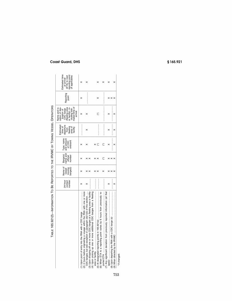
(d) Regulations. The following must report to the Inland River Vessel Move-ment Center (IRVMC):
(1) The towing vessel operator re-sponsible for one or more CDC barges in the RNA must report all the infor-mation items specified in table 165.921(f), in paragraph (f) of this sec-tion, to the IRVMC:
(i) Upon point of entry into the RNA with one or more CDC barges;
(ii) Four hours before originating a voyage within the RNA with one or more CDC barges, except if the evo-lution of making up a tow with a CDC barge will take less than 4 hours before originating a voyage, and the towing vessel operator did not receive the order to make up a tow with a CDC barge in advance of 4 hours before orig-inating the voyage with one or more CDC barges, in which case the towing vessel operator shall submit the re-quired report to the IRVMC as soon as possible after receiving orders to make up a tow with one or more CDC barges;
(iii) Upon dropping off one or more CDC barges at a fleeting area or facil-ity;
(iv) Upon picking up one or more ad-ditional CDC barges from a fleeting area or facility;
(v) At designated reporting points, set forth in paragraph of this section;
(vi) When the estimated time of ar-rival (ETA) to a reporting point varies by 6 hours from the previously reported ETA;
(vii) Any significant deviation from previously reported information;
(viii) Upon departing the RNA with one or more CDC barges; and
(ix) When directed by the IRVMC. (2) The fleeting area manager respon-
sible for one or more CDC barges in the RNA must report all the information items specified in table 165.921(g), in paragraph (g) of this section, to the IRVMC:
(i) Once daily, report all CDC barges within the fleeting area;
(ii) Upon moving one or more CDC barges within a fleeting area by a fleet tow boat;
(iii) Any significant deviation from previously reported information; and
(iv) When directed by the IRVMC. (3) Reports required by this section
may be made by a company representa-tive or dispatcher on behalf of the fleeting area manager.
(4) Reports required by this section must be made to the IRVMC either by telephone to (866) 442–6089, by fax to (866) 442–6107, or by e-mail to [email protected]. A reporting form and e-mail link are available at http:// www.uscg.mil/d8/Divs/M/IRVMC.htm.
(5) The general regulations contained in 33 CFR 165.13 apply to this section.
(e) Ninth Coast Guard District Illinois Waterway System RNA Reporting points. Towing vessel operators responsible for one or more CDC barges in the RNA must make reports to the Inland River Vessel Movement Center at each point listed in this paragraph (e).
(1) Illinois River (ILR) Upbound, at Mile Markers (M) and when Departing Lock & Dam (L&D)—
(i) M 187.2 (Southern Boundary MSU Chicago AOR),
(ii) M 303.5 Junction of Chicago Sani-tary Ship Canal and Calumet-Sag Channel,
VerDate Mar<15>2010 07:59 Sep 03, 2010 Jkt 220131 PO 00000 Frm 00761 Fmt 8010 Sfmt 8010 Y:\SGML\220131.XXX 220131erow
e on
DS
K5C
LS3C
1PR
OD
with
CF
R

752
33 CFR Ch. I (7–1–10 Edition) § 165.921
(iii) M 326.4 Thomas S. O’Brien L&D, Calumet River,
(iv) M 333.5 Confluence of Calumet River and Lake Michigan, and
(v) M 326.7 Chicago L&D, Chicago River.
(2) Illinois River (ILR) Downbound Reporting Points, at Mile Markers (M) and when Departing Lock & Dam (L&D)—
(i) M 326.7 Chicago L&D, Chicago River,
(ii) M 333.5 Confluence of Calumet River and Lake Michigan,
(iii) M 326.4 Thomas S. O’Brien L&D, Calumet River,
(iv) M 303.5 Junction of Chicago Sani-tary Ship Canal and Calumet-Sag Channel, and
(v) M 187.2 (Southern Boundary MSU Chicago AOR).
(f) Information to be reported to the IRVMC by towing vessel operators. With the exception noted in paragraph (d)(1)(ii) of this section, towing vessel operators responsible for one or more CDC barges in the RNA must report all the information required by this sec-tion as set out in table 165.921(f) of this paragraph.
VerDate Mar<15>2010 07:59 Sep 03, 2010 Jkt 220131 PO 00000 Frm 00762 Fmt 8010 Sfmt 8010 Y:\SGML\220131.XXX 220131erow
e on
DS
K5C
LS3C
1PR
OD
with
CF
R
753
Coast Guard, DHS § 165.921
TA
BLE
165.
921(
f)—
INF
OR
MA
TIO
NT
OB
ER
EP
OR
TE
DT
OT
HE
IRV
MC
BY
TO
WIN
GV
ES
SE
LO
PE
RA
TO
RS
24-h
our
cont
act
num
ber
Nam
e of
ve
ssel
m
ovin
g ba
rge(
s)
Bar
ge(s
) na
me
and
offic
ial
num
ber
Typ
e, n
ame
and
amou
nt
of C
DC
on
boar
d
Est
imat
ed
time
of
depa
rtur
e fr
om
fleet
ing
area
or
faci
lity
Nam
e an
d lo
-ca
tion
of d
es-
tinat
ion
of
CD
C b
arge
(f
leet
ing
area
or
fac
ility
), in
-cl
udin
g es
ti-m
ated
tim
e of
ar
rival
Rep
ortin
g po
int
Est
imat
ed t
ime
of a
rriv
al
(ET
A)
to n
ext
repo
rtin
g po
int
(If
appl
icab
le)
(1)
Upo
n po
int
of e
ntry
into
the
RN
A w
ith a
CD
C b
arge
......
......
......
......
......
X
X
X
X
......
......
......
X
X
X
(2)
4 ho
urs
befo
re o
rigin
atin
g a
voya
ge w
ithin
the
RN
A w
ith o
ne o
r m
ore
CD
C b
arge
s; b
ut s
ee e
xcep
tion
in p
arag
raph
(d)
(1)(
ii) o
f th
is s
ectio
n....
..X
X
X
X
X
X
...
......
......
...X
(3
) U
pon
drop
ping
off
one
or m
ore
CD
C b
arge
s at
a f
leet
ing
area
or
faci
lity
......
......
....
X
X
(4)
Upo
n pi
ckin
g up
one
or
mor
e ad
ditio
nal
CD
C b
arge
s fr
om a
fle
etin
g ar
ea o
r fa
cilit
y....
......
......
......
......
......
......
......
......
......
......
......
......
......
......
.....
......
......
....
X
X
X
(5)
At
desi
gnat
ed r
epor
ting
poin
ts in
165
.921
(e)
......
......
......
......
......
......
......
....
......
......
.X
X
(1
) ...
......
......
...(1
) X
X
(6
) W
hen
ET
A t
o a
repo
rtin
g po
int
varie
s by
6 h
ours
fro
m p
revi
ousl
y re
-po
rted
ET
A...
......
......
......
......
......
......
......
......
......
......
......
......
......
......
......
....
......
......
....
X
(1)
(1)
......
......
......
......
......
......
......
......
......
......
X
(7)
Any
sig
nific
ant
devi
atio
n fr
om p
revi
ousl
y re
port
ed i
nfor
mat
ion
(all
that
ap
ply)
......
......
......
......
......
......
......
......
......
......
......
......
......
......
......
......
......
....
X
X
X
X
X
X
X
X
(8)
Upo
n de
part
ing
the
RN
A w
ith a
CD
C b
arge
(s)
......
......
......
......
......
......
.....
......
......
.X
X
...
......
......
.....
......
......
......
......
......
......
......
X
(9)
Whe
n di
rect
ed b
y th
e IR
VM
C...
......
......
......
......
......
......
......
......
......
......
...X
X
X
X
X
X
X
X
1If
chan
ged.
VerDate Mar<15>2010 07:59 Sep 03, 2010 Jkt 220131 PO 00000 Frm 00763 Fmt 8010 Sfmt 8010 Y:\SGML\220131.XXX 220131erow
e on
DS
K5C
LS3C
1PR
OD
with
CF
R

754
33 CFR Ch. I (7–1–10 Edition) § 165.923
(g) Information to be reported to the IRVMC by fleeting area managers. Fleet-ing area managers responsible for one or more CDC barges in the RNA must
report the information required by this section as set out in table 165.921(g) to this paragraph.
TABLE 165.921(g)—INFORMATION TO BE REPORTED TO THE IRVMC BY FLEETING AREA MANAGERS
24-hour con-tact number
Barge(s) name and official
number
Type, name and amount of CDC onboard
Location of CDC barge
(fleeting area or facility)
(1) Once daily, all CDC barges in a fleeting area ................ X X X X (2) Upon moving one or more CDC barges within a fleeting
area by a fleet tow boat .................................................... ........................ X X X (3) Any significant deviation from previously reported infor-
mation (all that apply) ........................................................ X X X X (4) When directed by the IRVMC ......................................... X X X X
(h) Alternative reporting. The Ninth Coast Guard District Commander may consider and approve alternative meth-ods to be used by a reporting party to meet any reporting requirements if—
(1) The request is submitted in writ-ing to Commander, Ninth Coast Guard District (m), 1240 E. Ninth Street, Cleveland, Ohio, 44199–2060; and
(2) The alternative provides an equiv-alent level of the reporting that which would be achieved by the Coast Guard with the required check-in points.
(i) Deviation from this section is pro-hibited unless specifically authorized by the Commander, Ninth Coast Guard District or the IRVMC.
(Approved by the Office of Management and Budget under OMB control number 1625–1505)
[CDG09–03–241, 68 FR 57622, Oct. 6, 2003]
§ 165.923 Regulated Navigation Area between mile markers 296.1 and 296.7 of the Chicago Sanitary and Ship Canal located near Romeoville, IL.
(a) Location. The following is a Regu-lated Navigation Area: All waters of the Chicago Sanitary and Ship Canal, Romeoville, IL between the north side of Romeo Road Bridge Mile Marker 296.1, and the south side of the Aerial Pipeline Mile Marker 296.7.
(b) Regulations. (1) The general regu-lations contained in 33 CFR 165.13 apply.
(2) All vessels are prohibited from loitering in the regulated navigation area.
(3) Vessels may enter the regulated navigation area for the sole purpose of transiting to the other side, and must
maintain headway throughout the transit.
(4) All personnel on open decks must wear a Coast Guard approved Type I personal flotation device while in the regulated navigation area.
(5) Vessels may not moor or lay up on the right or left descending banks of the regulated navigation area.
(6) Towboats may not make or break tows in the regulated navigation area.
(7) Vessels may not pass (meet or overtake) in the regulated navigation area and must make a SECURITE call when approaching the barrier to an-nounce intentions and work out pass-ing arrangements on either side.
(8) Commercial tows transiting the regulated navigation area must be made up with wire rope to ensure elec-trical connectivity between all seg-ments of the tow.
(c) Compliance. All persons and ves-sels shall comply with this rule and any additional instructions of the Ninth Coast Guard District Com-mander, or his designated representa-tive. The Captain of the Port, Lake Michigan is a designated representa-tive of the District Commander for the purposes of this rule.
[CGD09–05–131, 70 FR 76694, Dec. 28, 2005]
EFFECTIVE DATE NOTE: By USCG–2009–1080, 75 FR 759, Jan. 6, 2010, § 165.923 was suspended from Jan. 6, 2010 until 5 p.m. on Dec. 1, 2010.
§ 165.927 Safety Zone; St. Louis River, Duluth/Interlake Tar Remediation Site, Duluth, MN.
(a) Location: The following area is a safety zone: All waters of Stryker Bay
VerDate Mar<15>2010 07:59 Sep 03, 2010 Jkt 220131 PO 00000 Frm 00764 Fmt 8010 Sfmt 8010 Y:\SGML\220131.XXX 220131erow
e on
DS
K5C
LS3C
1PR
OD
with
CF
R

755
Coast Guard, DHS § 165.928
and Hallett Slips 6 & 7 which are lo-cated north of a boundary line delin-eated by the following points: From the shoreline at 46°43′10.00″ N, 092°10′31.66″ W, then south to 46°43′06.24″ N, 092°10′31.66″ W, then east to 46°43′06.24″ N, 092°09′41.76″ W, then north to the shoreline at 46°43′10.04″ N, 092°09′41.76″ W. [Datum NAD 83].
(b) Regulations. (1) In accordance with the general regulations in § 165.23 of this part, entry into, transiting, or an-choring within this safety zone is pro-hibited unless authorized by the Cap-tain of the Port Duluth, or his des-ignated on-scene representative.
(2) This safety zone is closed to all vessel traffic, except as may be per-mitted by the Captain of the Port Du-luth or his designated on-scene rep-resentative.
(3) The ‘‘designated on-scene rep-resentative’’ of the Captain of the Port is any Coast Guard commissioned, war-rant or petty officer who has been des-ignated by the Captain of the Port to act on his behalf. The on-scene rep-resentative of the Captain of the Port will be aboard either a Coast Guard or Coast Guard Auxiliary vessel. The Cap-tain of the Port or his designated on- scene representative may be contacted by calling Coast Guard Marine Safety Unit Duluth at (218) 720–5286.
(4) Vessel operators desiring to enter or operate within the safety zone shall contact the Captain of the Port Duluth to obtain permission to do so. Vessel operators given permission to enter or operate in the safety zone shall comply with all directions given to them by the Captain of the Port Duluth or his on-scene representative.
[CGD09–06–122, 71 FR 66112, Nov. 13, 2006]
§ 165.928 Security Zone; Mackinac Bridge, Straits of Mackinac, Michi-gan.
(a) Definitions. The following defini-tions apply to this section:
(1) Designated Representative means those persons designated by the Cap-tain of the Port to monitor these secu-rity zones, permit entry into these zones, give legally enforceable orders to persons or vessels within these zones and take other actions authorized by the Captain of the Port. Persons au-thorized in paragraph (e) to enforce
this section and Vessel Traffic Service St. Marys River (VTS) are Designated Representatives.
(2) Federal Law Enforcement Officer means any employee or agent of the United States government who has the authority to carry firearms and make warrantless arrests and whose duties involve the enforcement of criminal laws of the United States.
(3) Navigable waters of the United States means those waters defined as such in 33 CFR part 2.
(4) Public vessel means vessels owned, chartered, or operated by the United States, or by a State or political sub-division thereof.
(5) Michigan Law Enforcement Officer means any regularly employed member of a Michigan police force responsible for the prevention and detection of crime and the enforcement of the gen-eral criminal laws of Michigan as de-fined in Michigan Compiled Laws sec-tion 28.602(l)(i).
(b) Security zone. The following area is a security zone: All waters enclosed by a line connecting the following points: 45°50.763 N: 084°43.731 W, which is the northwest corner; thence east to 45°50.705 N: 084°43.04 W, which is the northeast corner; thence south to 45°47.242 N: 084°43.634 W, which is the southeast corner; thence west to 45°47.30 N: 084°44.320 W, which is the southwest corner; then north to the point of origin. The zone described above includes all waters on either side of the Mackinac Bridge within one- quarter mile of the bridge. [Datum: NAD 1983].
(c) Obtaining permission to enter or move within, the security zone: All ves-sels must obtain permission from the COTP or a Designated Representative to enter or move within, the security zone established in this section. Ves-sels with an operable Automatic Iden-tification System (AIS) unit should seek permission from the COTP or a Designated Representative at least 1 hour in advance. Vessels with an oper-able AIS unit may contact VTS St. Marys River (Soo Traffic) on VHF channel 12. Vessels without an operable AIS unit should seek permission at least 30 minutes in advance. Vessels
VerDate Mar<15>2010 07:59 Sep 03, 2010 Jkt 220131 PO 00000 Frm 00765 Fmt 8010 Sfmt 8010 Y:\SGML\220131.XXX 220131erow
e on
DS
K5C
LS3C
1PR
OD
with
CF
R

756
33 CFR Ch. I (7–1–10 Edition) § 165.929
without an operable AIS unit may con-tact Coast Guard Station St. Ignace on VHF channel 16.
(d) Regulations. The general regula-tions in 33 CFR part 165 subpart D, apply to any vessel or person in the navigable waters of the United States to which this section applies. No per-son or vessel may enter the security zone established in this section unless authorized by the Captain of the Port or his designated representatives. Ves-sels and persons granted permission to enter the security zone shall obey all lawful orders or directions of the Cap-tain of the Port or his designated rep-resentatives. All vessels entering or moving within the security zone must operate at speeds which are necessary to maintain a safe course and which will not exceed 12 knots.
(e) Enforcement. Any Coast Guard commissioned, warrant or petty officer may enforce the rules in this section. In the navigable waters of the United States to which this section applies, when immediate action is required and representatives of the Coast Guard are not present or not present in sufficient force to provide effective enforcement of this section, any Federal Law En-forcement Officer or Michigan Law En-forcement Officer may enforce the rules contained in this section pursu-ant to 33 CFR 6.04–11. In addition, the Captain of the Port may be assisted by other Federal, state or local agencies in enforcing this section pursuant to 33 CFR 6.04–11.
(f) Exemption. Public vessels as de-fined in paragraph (a) of this section are exempt from the requirements in this section.
(g) Waiver. For any vessel, the Cap-tain of the Port Sault Ste. Marie may waive any of the requirements of this section, upon finding that operational conditions or other circumstances are such that application of this section is unnecessary or impractical for the pur-pose of port security, safety or environ-mental safety.
(h) Enforcement period. This rule will be enforced Labor Day of each year; 6 a.m. (local) to 11:59 p.m. (midnight) (local).
[CGD09–06–019, 71 FR 45389, Aug. 9, 2006]
§ 165.929 Safety Zones; Annual events requiring safety zones in the Cap-tain of the Port Lake Michigan zone.
(a) Safety Zones. The following areas are designated safety zones:
(1) St. Patrick’s Day Fireworks; Manitowoc, WI—(i) Location. All waters of the Manitowoc River and Manitowoc Harbor, near the mouth of the Manitowoc River on the south shore, within the arc of a circle with a 100- foot radius from the fireworks launch site located in position 44°05′30″ N, 087°39′12″ W (NAD 83).
(ii) Enforcement date and time. The third Saturday of March; 5:30 p.m. to 7 p.m.
(2) Michigan Aerospace Challenge Sport Rocket Launch; Muskegon, MI—(i) Loca-tion. All waters of Muskegon Lake, near the West Michigan Dock and Mar-ket Corp facility, within the arc of a circle with a 1500-yard radius from the rocket launch site located in position 43°14′21″ N, 086°15′35″ W (NAD 83).
(ii) Enforcement date and time. The last Saturday of April; 8 a.m. to 4 p.m.
(3) Tulip Time Festival Fireworks; Hol-land, MI—(i) Location. All waters of Lake Macatawa, near Kollen Park, within the arc of a circle with a 1000- foot radius from the fireworks launch site in position 42°47′23″ N, 086°07′22″ W (NAD 83).
(ii) Enforcement date and time. The first Friday of May; 7 p.m. to 11 p.m. If the Friday fireworks are cancelled due to inclement weather, then this section will be enforced on the first Saturday of May; 7 p.m. to 11 p.m.
(4) Rockets for Schools Rocket Launch; Sheboygan, WI—(i) Location. All waters of Lake Michigan and Sheboygan Har-bor, near the Sheboygan South Pier, within the arc of a circle with a 1500- yard radius from the rocket launch site located with its center in position 43°44′55″ N, 087°41′52″ W (NAD 83).
(ii) Enforcement date and time. The first Saturday of May; 8 a.m. to 5 p.m.
(5) Celebrate De Pere; De Pere, WI—(i) Location. All waters of the Fox River, near Voyageur Park, within the arc of a circle with a 500-foot radius from the fireworks launch site located in posi-tion 44°27′10″ N, 088°03′50″ W (NAD 83).
VerDate Mar<15>2010 07:59 Sep 03, 2010 Jkt 220131 PO 00000 Frm 00766 Fmt 8010 Sfmt 8010 Y:\SGML\220131.XXX 220131erow
e on
DS
K5C
LS3C
1PR
OD
with
CF
R

757
Coast Guard, DHS § 165.929
(ii) Enforcement date and time. The Sunday before Memorial Day; 8:30 p.m. to 10 p.m.
(6) [Reserved] (7) River Splash; Milwaukee, WI—(i)
Location. All waters of the Milwaukee River, near Pere Marquette Park, with-in the arc of a circle with a 300-foot ra-dius from the fireworks launch site lo-cated on a barge in position 43°02′32″ N, 087°54′45″ W (NAD 83).
(ii) Enforcement date and time. The first Friday and Saturday of June; 9 p.m. to 11 p.m. each day.
(8) International Bayfest; Green Bay, WI—(i) Location. All waters of the Fox River, near the Western Lime Company 1.13 miles above the head of the Fox River, within the arc of a circle with a 1000-foot radius from the fireworks launch site located in position 44°31′24″ N, 088°00′42″ W (NAD 83).
(ii) Enforcement date and time. The second Friday of June; 9 p.m. to 11 p.m.
(9) Harborfest Music and Family Fes-tival; Racine, WI—(i) Location. All wa-ters of Lake Michigan and Racine Har-bor, near the Racine Launch Basin En-trance Light, within the arc of a circle with a 200-foot radius from the fire-works launch site located in position 42°43′43″ N, 087°46′40″ W (NAD 83).
(ii) Enforcement date and time. Friday and Saturday of the third complete weekend of June; 9 p.m. to 11 p.m. each day.
(10) Jordan Valley Freedom Festival Fireworks; East Jordan, MI—(i) Location. All waters of Lake Charlevoix, near the City of East Jordan, within the arc of a circle with a 1000-foot radius from the fireworks launch site in position 45°09′18″ N, 085°07′48″ W (NAD 83).
(ii) Enforcement date and time. Satur-day of the third weekend of June; 9 p.m. to 11 p.m.
(11) Spring Lake Heritage Festival Fire-works; Spring Lake, MI—(i) Location. All waters of the Grand River, near buoy 14A, within the arc of a circle with a 500-foot radius from the fireworks launch site located on a barge in posi-tion 43°04′24″ N, 086°12′42″ W (NAD 83).
(ii) Enforcement date and time. The third Saturday of June; 9 p.m. to 11 p.m.
(12) Elberta Solstice Festival Fireworks; Elberta, MI—(i) Location. All waters of Betsie Bay, near Waterfront Park,
within the arc of a circle with a 500- foot radius from the fireworks launch site located in position 44°37′43″ N, 086°14′27″ W (NAD 83).
(ii) Enforcement date and time. The last Saturday of June; 9 p.m. to 11 p.m.
(13) [Reserved] (14) Pentwater July Third Fireworks;
Pentwater, MI—(i) Location. All waters of Lake Michigan and the Pentwater Channel within the arc of a circle with a 1000-foot radius from the fireworks launch site located in position 43°46′57″ N, 086°26′38″ W (NAD 83).
(ii) Enforcement date and time. July 3; 9 p.m. to 11 p.m. If the July 3 fireworks are cancelled due to inclement weath-er, then this section will be enforced July 4; 9 p.m. to 11 p.m.
(15) Taste of Chicago Fireworks; Chi-cago IL—(i) Location. All waters of Monroe Harbor and all waters of Lake Michigan bounded by a line drawn from 41°53′24″ N, 087°35′59″ W; then east to 41°53′15″ N, 087°35′26″ W; then south to 41°52′49″ N, 087°35′26″ W; then southwest to 41°52′27″ N, 087°36′37″ W; then north to 41°53′15″ N, 087°36′33″ W; then east re-turning to the point of origin. (NAD 83)
(ii) Enforcement date and time. July 3; 9 p.m. to 11 p.m. If the July 3 fireworks are cancelled due to inclement weath-er, then this section will be enforced July 4; 9 p.m. to 11 p.m.
(16) U.S. Bank Fireworks; Milwaukee, WI—(i) Location. All waters of Mil-waukee Harbor, in the vicinity of Vet-erans Park, within the arc of a circle with a 1000-foot radius from the fire-works launch site located on a barge in position 43°02′27″ N, 087°53′45″ W (NAD 83).
(ii) Enforcement date and time. July 3; 9 p.m. to 11 p.m. If the July 3 fireworks are cancelled due to inclement weath-er, then this section will be enforced July 4; 9 p.m. to 11 p.m.
(17) National Cherry Festival Fourth of July Celebration Fireworks; Traverse City, MI—(i) Location. All waters of the West Arm of Grand Traverse Bay within the arc of a circle with a 1000-foot radius from the fireworks launch site located on a barge in position 44°46′12″ N, 085°37′06″ W (NAD 83).
(ii) Enforcement date and time. July 4; 9 p.m. to 11 p.m. If the July 4 fireworks
VerDate Mar<15>2010 07:59 Sep 03, 2010 Jkt 220131 PO 00000 Frm 00767 Fmt 8010 Sfmt 8010 Y:\SGML\220131.XXX 220131erow
e on
DS
K5C
LS3C
1PR
OD
with
CF
R

758
33 CFR Ch. I (7–1–10 Edition) § 165.929
are cancelled due to inclement weath-er, then this section will be enforced July 5; 9 p.m. to 11 p.m.
(18) Harbor Springs Fourth of July Cele-bration Fireworks; Harbor Springs, MI— (i) Location. All waters of Lake Michi-gan and Harbor Springs Harbor within the arc of a circle with a 1000-foot ra-dius from the fireworks launch site lo-cated on a barge in position 45°25′30″ N, 084°59′06″ W (NAD 83).
(ii) Enforcement date and time. July 4; 9 p.m. to 11 p.m. If the July 4 fireworks are cancelled due to inclement weath-er, then this section will be enforced July 5; 9 p.m. to 11 p.m.
(19) Bay Harbor Yacht Club Fourth of July Celebration Fireworks; Petoskey, MI—(i) Location. All waters of Lake Michigan and Bay Harbor Lake within the arc of a circle with a 500-foot radius from the fireworks launch site located on a barge in position 45°21′50″ N, 085°01′37″ W (NAD 83).
(ii) Enforcement date and time. July 3; 9 p.m. to 11 p.m. If the July 3 fireworks are cancelled due to inclement weath-er, then this section will be enforced July 4; 9 p.m. to 11 p.m.
(20) Petoskey Fourth of July Celebration Fireworks; Petoskey, MI—(i) Location. All waters of Lake Michigan and Petoskey Harbor, in the vicinity of Bay Front Park, within the arc of a circle with a 1000-foot radius from the fire-works launch site located in position 45°22′40″ N, 084°57′30″ W (NAD 83).
(ii) Enforcement date and time. July 4; 9 p.m. to 11 p.m. If the July 4 fire works are cancelled due to inclement weath-er, then this section will be enforced July 5; 9 p.m. to 11 p.m.
(21) Boyne City Fourth of July Celebra-tion Fireworks; Boyne City, MI—(i) Loca-tion. All waters of Lake Charlevoix, in the vicinity of Veterans Park, within the arc of a circle with a 1400-foot ra-dius from the fireworks launch site lo-cated in position 45°13′30″ N, 085°01′40″ W (NAD 83).
(ii) Enforcement date and time. July 4; 9 p.m. to 11 p.m. If the July 4 fireworks are cancelled due to inclement weath-er, then this section will be enforced July 5; 9 p.m. to 11 p.m.
(22) Independence Day Fireworks; Manistee, MI—(i) Location. All waters of Lake Michigan, in the vicinity of the First Street Beach, within the arc of a
circle with a 1000-foot radius from the fireworks launch site located in posi-tion 44°14′51″ N, 086°20′46″ W (NAD 83)
(ii) Enforcement date and time. July 3; 9 p.m. to 11 p.m. If the July 3 fireworks are cancelled due to inclement weath-er, then this section will be enforced July 4; 9 p.m. to 11 p.m.
(23) Frankfort Independence Day Fire-works; Frankfort, MI—(i) Location. All waters of Lake Michigan and Frankfort Harbor, in the vicinity of the north breakwater, within the arc of a circle with a 1000-foot radius from the fire-works launch site located in position 44°38′00″ N, 086°14′50″ W (NAD 83).
(ii) Enforcement date and time. July 4; 9 p.m. to 11 p.m. If the July 4 fireworks are cancelled due to inclement weath-er, then this section will be enforced July 5; 9 p.m. to 11 p.m.
(24) Freedom Festival Fireworks; Ludington, MI—(i) Location. All waters of Lake Michigan and Ludington Har-bor, in the vicinity of the Loomis Street Boat Ramp, within the arc of a circle with a 1000-foot radius from the fireworks launch site located in posi-tion 43°57′16″ N, 086°27′42″ W (NAD 83).
(ii) Enforcement date and time. July 4; 9 p.m. to 11 p.m. If the July 4 fireworks are cancelled due to inclement weath-er, then this section will be enforced July 5; 9 p.m. to 11 p.m.
(25) White Lake Independence Day Fireworks; Montague, MI—(i) Location. All waters of White Lake, in the vicin-ity of the Montague boat launch, with-in the arc of a circle with a 1000-foot radius from the fireworks launch site located in position 43°24′33″ N, 086°21′28″ W (NAD 83).
(ii) Enforcement date and time. July 4; 9 p.m. to 11 p.m. If the July 4 fireworks are cancelled due to inclement weath-er, then this section will be enforced July 5; 9 p.m. to 11 p.m.
(26) Muskegon Summer Celebration July Fourth Fireworks; Muskegon, MI—(i) Lo-cation. All waters of Muskegon Lake, in the vicinity of Heritage Landing, with-in the arc of a circle with a 1000-foot radius from a fireworks launch site lo-cated on a barge in position 43°14′00″ N, 086°15′50″ W (NAD 83).
(ii) Enforcement date and time. July 4; 9 p.m. to 11 p.m. If the July 4 fireworks
VerDate Mar<15>2010 07:59 Sep 03, 2010 Jkt 220131 PO 00000 Frm 00768 Fmt 8010 Sfmt 8010 Y:\SGML\220131.XXX 220131erow
e on
DS
K5C
LS3C
1PR
OD
with
CF
R

759
Coast Guard, DHS § 165.929
are cancelled due to inclement weath-er, then this section will be enforced July 5; 9 p.m. to 11 p.m.
(iii) Impact on Special Anchorage Area regulations: Regulations for that por-tion of the Muskegon Lake East Spe-cial Anchorage Area, as described in 33 CFR 110.81(b), which are overlapped by this regulation, are suspended during this event. The remaining area of the Muskegon Lake East Special Anchor-age Area not impacted by this regula-tion remains available for anchoring during this event.
(27) Grand Haven Jaycees Annual Fourth of July Fireworks; Grand Haven, MI. (i) Location. All waters of The Grand River between longitude 087°14′00″ W, near The Sag, then west to longitude 087°15′00″ W, near the west end of the south pier (NAD 83).
(ii) Enforcement date and time. July 4; 9 p.m. to 11 p.m. If the July 4 fireworks are cancelled due to inclement weath-er, then this section will be enforced July 5; 9 p.m. to 11 p.m.
(28) Celebration Freedom Fireworks; Holland, MI. (i) Location. All waters of Lake Macatawa, in the vicinity of Kollen Park, within the arc of a circle with a 1000-foot radius from the fire-works launch site located in position 42°47′23″ N, 086°07′22″ W (NAD 83).
(ii) Enforcement date and time. July 4, 2007; 9 p.m. to 11 p.m. Thereafter this section will be enforced the Saturday prior to July 4; 9 p.m. to 11 p.m. If the fireworks are cancelled due to inclem-ent weather, then this section will be enforced the Sunday prior to July 4; 9 p.m. to 11 p.m.
(29) Van Andel Fireworks Show, Hol-land, MI. (i) Location. All waters of Lake Michigan and the Holland Chan-nel within the arc of a circle with a 1000-foot radius from the fireworks launch site located in position 42°46′21″ N, 086°12′48″ W (NAD 83).
(ii) Enforcement date and time. July 3; 9 p.m. to 11 p.m. If the July 3 fireworks are cancelled due to inclement weath-er, then this section will be enforced July 4; 9 p.m. to 11 p.m.
(30) Independence Day Fireworks; Saugatuck, MI. (i) Location. All waters of Kalamazoo Lake within the arc of a circle with a 1000-foot radius from the fireworks launch site in position 42°38′52″ N, 086°12′18″ W (NAD 83).
(ii) Enforcement date and time. July 4; 9 p.m. to 11 p.m. If the July 4 fireworks are cancelled due to inclement weath-er, then this section will be enforced July 5; 9 p.m. to 11 p.m.
(31) South Haven Fourth of July Fire-works; South Haven, MI. (i) Location. All waters of Lake Michigan and the Black River within the arc of a circle with a 1000-foot radius from the fireworks launch site located in position 42°24′08″ N, 086°17′03″ W (NAD 83).
(ii) Enforcement date and time. July 4; 9 p.m. to 11 p.m. If the July 4 fireworks are cancelled due to inclement weath-er, then this section will be enforced July 5; 9 p.m. to 11 p.m.
(32) St. Joseph Fourth of July Fire-works; St. Joseph, MI. (i) Location. All waters of Lake Michigan and the St. Joseph River within the arc of a circle with a 1000-foot radius from the fire-works launch site located in position 42°06′48″ N, 086°29′5″ W (NAD 83).
(ii) Enforcement date and time. July 4; 9 p.m. to 11 p.m. If the July 4 fireworks are cancelled due to inclement weath-er, then this section will be enforced July 5; 9 p.m. to 11 p.m.
(33) Town of Dune Acres Independence Day Fireworks; Dune Acres, IN. (i) Loca-tion. All waters of Lake Michigan with-in the arc of a circle with a 1000-foot radius from the fireworks launch site located in position 41°39′23″ N, 087°04′59″ W (NAD 83).
(ii) Enforcement date and time. July 4; 9 p.m. to 11 p.m. If the July 4 fireworks are cancelled due to inclement weath-er, then this section will be enforced July 5; 9 p.m. to 11 p.m.
(34) Gary Fourth of July Fireworks; Gary, IN. (i) Location. All waters of Lake Michigan, approximately 2.5 miles east of Gary Harbor, within the arc of a circle with a 500-foot radius from the fireworks launch site located in position 41°37′19″ N, 087°14′31″ W (NAD 83).
(ii) Enforcement date and time. July 4; 9 p.m. to 11 p.m. If the July 4 fireworks are cancelled due to inclement weath-er, then this section will be enforced July 5; 9 p.m. to 11 p.m.
(35) Joliet Independence Day Celebra-tion Fireworks; Joliet, IL. (i) Location. All waters of the Des Plains River, at mile 288, within the arc of a circle with a 500-foot radius from the fireworks
VerDate Mar<15>2010 07:59 Sep 03, 2010 Jkt 220131 PO 00000 Frm 00769 Fmt 8010 Sfmt 8010 Y:\SGML\220131.XXX 220131erow
e on
DS
K5C
LS3C
1PR
OD
with
CF
R

760
33 CFR Ch. I (7–1–10 Edition) § 165.929
launch site located in position 41°31′31″ N, 088°05′15″ W (NAD 83).
(ii) Enforcement date and time. July 3; 9 p.m. to 11 p.m. If the July 3 fireworks are cancelled due to inclement weath-er, then this section will be enforced July 4; 9 p.m. to 11 p.m.
(36) Glencoe Fourth of July Celebration Fireworks; Glencoe, IL. (i) Location. All waters of Lake Michigan, in the vicin-ity of Lake Front Park, within the arc of a circle with a 500-foot radius from the fireworks launch site located in po-sition 42°08′17″ N, 087°44′55″ W (NAD 83).
(ii) Enforcement date and time. July 4; 9 p.m. to 11 p.m. If the July 4 fireworks are cancelled due to inclement weath-er, then this section will be enforced July 5; 9 p.m. to 11 p.m.
(37) Lakeshore Country Club Independ-ence Day Fireworks; Glencoe, IL. (i) Lo-cation. All waters of Lake Michigan within the arc of a circle with a 1000- foot radius from the fireworks launch site located in position 42°08′27″ N, 087°44′57″ W (NAD 83).
(ii) Enforcement date and time. July 4; 9 p.m. to 11 p.m. If the July 4 fireworks are cancelled due to inclement weath-er, then this section will be enforced July 5; 9 p.m. to 11 p.m.
(38) Shore Acres Country Club Inde-pendence Day Fireworks; Lake Bluff, IL. (i) Location. All waters of Lake Michi-gan, approximately one mile north of Lake Bluff, IL, within the arc of a cir-cle with a 1000-foot radius from the fireworks launch site located in posi-tion 42°17′59″ N, 087°50′03″ W (NAD 83).
(ii) Enforcement date and time. July 4; 9 p.m. to 11 p.m. If the July 4 fireworks are cancelled due to inclement weath-er, then this section will be enforced July 5; 9 p.m. to 11 p.m.
(39) Kenosha Independence Day Fire-works; Kenosha, WI. (i) Location. All wa-ters of Lake Michigan and Kenosha Harbor within the arc of a circle with a 1000-foot radius from the fireworks launch site located in position 42°35′17″ N, 087°48′27″ W (NAD 83).
(ii) Enforcement date and time. July 4; 9 p.m. to 11 p.m. If the July 4 fireworks are cancelled due to inclement weath-er, then this section will be enforced July 5; 9 p.m. to 11 p.m.
(40) Fourthfest of Greater Racine Fire-works; Racine, WI. (i) Location. All wa-ters of Lake Michigan and Racine Har-
bor, in the vicinity of North Beach, within the arc of a circle with a 1000- foot radius from the fireworks launch site located in position 42°44′17″ N, 087°46′42″ W (NAD 83).
(ii) Enforcement date and time. July 4; 9 p.m. to 11 p.m. If the July 4 fireworks are cancelled due to inclement weath-er, then this section will be enforced July 5; 9 p.m. to 11 p.m.
(41) Sheboygan Fourth of July Celebra-tion Fireworks; Sheboygan, WI. (i) Loca-tion. All waters of Lake Michigan and Sheboygan Harbor, in the vicinity of the south pier, within the arc of a cir-cle with a 1000-foot radius from the fireworks launch site located in posi-tion 43°44′55″ N, 087°41′51″ W (NAD 83).
(ii) Enforcement date and time. July 4; 9 p.m. to 11 p.m. If the July 4 fireworks are cancelled due to inclement weath-er, then this section will be enforced July 5; 9 p.m. to 11 p.m.
(42) Manitowoc Independence Day Fire-works; Manitowoc, WI. (i) Location. All waters of Lake Michigan and Manitowoc Harbor, in the vicinity of south breakwater, within the arc of a circle with a 1000-foot radius from the fireworks launch site located in posi-tion 44°05′24″ N, 087°38′45″ W (NAD 83).
(ii) Enforcement date and time. July 4; 9 p.m. to 11 p.m. If the July 4 fireworks are cancelled due to inclement weath-er, then this section will be enforced July 5; 9 p.m. to 11 p.m.
(43) Sturgeon Bay Independence Day Fireworks; Sturgeon Bay, WI. (i) Loca-tion. All waters of Sturgeon Bay, in the vicinity of Sunset Park, within the arc of a circle with a 1000-foot radius from the fireworks launch site located on a barge in position 44°50′37″ N, 087°23′18″ W (NAD 83).
(ii) Enforcement date and time. July 4; 9 p.m. to 11 p.m. If the July 4 fireworks are cancelled due to inclement weath-er, then this section will be enforced July 5; 9 p.m. to 11 p.m.
(44) Fish Creek Independence Day Fire-works; Fish Creek, WI. (i) Location. All waters of Green Bay, in the vicinity of Fish Creek Harbor, within the arc of a circle with a 1000-foot radius from the fireworks launch site located on a barge in position 45°07′52″ N, 087°14′37″ W (NAD 83).
VerDate Mar<15>2010 07:59 Sep 03, 2010 Jkt 220131 PO 00000 Frm 00770 Fmt 8010 Sfmt 8010 Y:\SGML\220131.XXX 220131erow
e on
DS
K5C
LS3C
1PR
OD
with
CF
R
761
Coast Guard, DHS § 165.929
(ii) Enforcement date and time. The first Saturday after July 4; 9 p.m. to 11 p.m.
(45) Celebrate Americafest Fireworks; Green Bay, WI. (i) Location. All waters of the Fox River between the railroad bridge located 1.03 miles above the mouth of the Fox River and the Main Street Bridge located 1.58 miles above the mouth of the Fox River, including all waters of the turning basin east to the mouth of the East River.
(ii) Enforcement date and time. July 4; 9 p.m. to 11 p.m. If the July 4 fireworks are cancelled due to inclement weath-er, then this section will be enforced July 5; 9 p.m. to 11 p.m.
(46) Marinette Fourth of July Celebra-tion Fireworks; Marinette, WI. (i) Loca-tion. All waters of the Menominee River, in the vicinity of Stephenson Is-land, within the arc of a circle with a 1000-foot radius from the fireworks launch site located in position 45°06′09″ N, 087°37′39″ W and all waters located between the Highway U.S. 41 bridge and the Hattie Street Dam (NAD 83).
(ii) Enforcement date and time. July 4; 9 p.m. to 11 p.m. If the July 4 fireworks are cancelled due to inclement weath-er, then this section will be enforced July 5; 9 p.m. to 11 p.m.
(47) Evanston Fourth of July Fireworks; Evanston, IL. (i) Location. All waters of Lake Michigan, in the vicinity of Cen-tennial Park Beach, within the arc of a circle with a 500-foot radius from the fireworks launch site located in posi-tion 42°02′56″ N, 087°40′21″ W (NAD 83).
(ii) Enforcement date and time. July 4; 9 p.m. to 11 p.m. If the July 4 fireworks are cancelled due to inclement weath-er, then this section will be enforced July 5; 9 p.m. to 11 p.m.
(48) [Reserved] (49) Muskegon Summer Celebration
Fireworks; Muskegon, MI. (i) Location. All waters of Muskegon Lake, in the vicinity of Heritage Landing, within the arc of a circle with a 1000-foot ra-dius from a fireworks barge located in position 43°14′00″ N, 086°15′50″ W (NAD 83).
(ii) Enforcement date and time. The Sunday following July 4; 9 p.m. to 11 p.m.
(iii) Impact on Special Anchorage Area regulations: Regulations for that por-tion of the Muskegon Lake East Spe-
cial Anchorage Area, as described in 33 CFR 110.81(b), which are overlapped by this regulation, are suspended during this event. The remaining area of the Muskegon Lake East Special Anchor-age Area is not impacted by this regu-lation and remains available for an-choring during this event.
(50) National Cherry Festival Air Show; Traverse City, MI. (i) Location. All wa-ters of the West Arm of Grand Traverse Bay bounded by a line drawn from 44°46′48″ N, 085°38′18″ W, then southeast to 44°46′30″ N, 085°35′30″ W, then south-west to 44°46′00″ N, 085°35′48″ W, then northwest to 44°46′30″ N, 085°38′30″ W, then back to the point of origin (NAD 83).
(ii) Enforcement date and time. Friday, Saturday, and Sunday of the first com-plete weekend of July; 12 noon to 4 p.m. each day.
(51) National Cherry Festival Finale Fireworks; Traverse City, MI. (i) Loca-tion. All waters and adjacent shoreline of the West Arm of Grand Traverse Bay within the arc of a circle with a 1000- foot radius from the fireworks launch site located on a barge in position 44°46′12″ N, 085°37′06″ W (NAD 83).
(ii) Enforcement date and time. The second Saturday of July; 9 p.m. to 11 p.m.
(52) Gary Air and Water Show; Gary, IN—(i) Location. All waters of Lake Michigan bounded by a line drawn from 41°37′42″ N, 087°16′38″ W; then east to 41°37′54″ N, 087°14′00″ W; then south to 41°37′30″ N, 087°13′56″ W; then west to 41°37′17″ N, 087°16′36″ W; then north re-turning to the point of origin. (NAD 83)
(ii) Enforcement date and time. Friday, Saturday, and Sunday of the second weekend of July; from 8 a.m. to 6 p.m. each day.
(53) Milwaukee Air Expo, Milwaukee, WI. (i) Location. All waters Lake Michi-gan and Milwaukee Harbor located within a 4000-yard by 1000-yard rec-tangle with its major axis bearing ap-proximately 030°T located in the north-ern half of Milwaukee Harbor and along the north shore of Milwaukee bounded by the points beginning at 43°01′36″ N, 087°53′02″ W; then northeast to 43°03′20″ N, 087°51′40″ W; then north-west to 43°03′35″ N, 087°52′16″ W; then southwest to 43°01′51″ N, 087°53′38″ W;
VerDate Mar<15>2010 07:59 Sep 03, 2010 Jkt 220131 PO 00000 Frm 00771 Fmt 8010 Sfmt 8010 Y:\SGML\220131.XXX 220131erow
e on
DS
K5C
LS3C
1PR
OD
with
CF
R

762
33 CFR Ch. I (7–1–10 Edition) § 165.929
the back to the point of origin (NAD 83).
(ii) Enforcement date and time. Friday, Saturday, and Sunday of the second weekend of July; from 1 p.m. to 5 p.m. each day.
(54) Annual Trout Festival Fireworks; Kewaunee, WI. (i) Location. All waters of Kewaunee Harbor and Lake Michi-gan within the arc of a circle with a 1000-foot radius from the fireworks launch site located in position 44°27′29″ N, 087°29′45″ W (NAD 83).
(ii) Enforcement date and time. Friday of the second complete weekend of July; 9 p.m. to 11 p.m.
(55) Michigan City Summerfest Fire-works; Michigan City, IN. (i) Location. All waters of Michigan City Harbor and Lake Michigan within the arc of a cir-cle with a 1000-foot radius from the fireworks launch site located in posi-tion 41°43′42″ N, 086°54′37″ W (NAD 83).
(ii) Enforcement date and time. July 15, 2007, and thereafter the Sunday of the first complete weekend of July; 9 p.m. to 11 p.m.
(56) Port Washington Fish Day Fire-works; Port Washington, WI. (i) Location. All waters of Port Washington Harbor and Lake Michigan, in the vicinity of the WE Energies coal dock, within the arc of a circle with a 1000-foot radius from the fireworks launch site located in position 43°23′07″ N, 087°51′54″ W (NAD 83).
(ii) Enforcement date and time. The third Saturday of July; 9 p.m. to 11 p.m.
(57) Bay View Lions Club South Shore Frolics Fireworks; Milwaukee, WI. (i) Lo-cation. All waters of Milwaukee Harbor and Lake Michigan, in the vicinity of South Shore Park, within the arc of a circle with a 500-foot radius from the fireworks launch site in position 42°59′42″ N, 087°52′52″ W (NAD 83).
(ii) Enforcement date and time. Friday, Saturday, and Sunday of the second or third weekend of July; 9 p.m. to 11 p.m. each day.
(58) Venetian Festival Fireworks; St. Jo-seph, MI. (i) Location. All waters of Lake Michigan and the St. Joseph River, near the east end of the south pier, within the arc of a circle with a 1000-foot radius from the fireworks launch site located in position 42°06′48″ N, 086°29′15″ W (NAD 83).
(ii) Enforcement date and time. Satur-day of the third complete weekend of July; 9 p.m. to 11 p.m.
(59) Joliet Waterway Daze Fireworks; Joliet, IL. (i) Location. All waters of the Des Plaines River, at mile 287.5, within the arc of a circle with a 300-foot radius from the fireworks launch site located in position 41°31′15″ N, 088°05′17″ W (NAD 83).
(ii) Enforcement date and time. Friday and Saturday of the third complete weekend of July; 9 p.m. to 11 p.m. each day.
(60) Charlevoix Venetian Festival Fri-day Night Fireworks; Charlevoix, MI. (i) Location. All waters of Lake Charlevoix, in the vicinity of Depot Beach, within the arc of a circle with a 1000-foot radius from the fireworks launch site located on a barge in posi-tion 45°19′08″ N, 085°14′18″ W (NAD 83).
(ii) Enforcement date and time. Friday of the fourth weekend of July; 9 p.m. to 11 p.m.
(61) EAA Airventure; Oshkosh, WI. (i) Location. All waters of Lake Winnebago bounded by a line drawn from 43°57′30″ N, 088°30′00″ W; then south to 43°56′56″ N, 088°29′53″ W, then east to 43°56′40″ N, 088°28′40″ W; then north to 43°57′30″ N, 088°28′40″ W; then west returning to the point of origin (NAD 83).
(ii) Enforcement date and time. The last complete week of July, beginning Monday and ending Sunday; from 8 a.m. to 8 p.m. each day.
(62) Charlevoix Venetian Festival Satur-day Night Fireworks; Charlevoix, MI. (i) Location. All waters of Round Lake within the arc of a circle with a 300- foot radius from the fireworks launch site located on a barge in position 45°19′03″ N, 085°15′18″ W (NAD 83).
(ii) Enforcement date and time. Satur-day of the fourth weekend of July; 9 p.m. to 11 p.m.
(63) Venetian Night Fireworks; Saugatuck, MI. (i) Location. All waters of Kalamazoo Lake within the arc of a circle with a 500-foot radius from the fireworks launch site located on a barge in position 42°38′52″ N, 086°12′18″ W (NAD 83)
(ii) Enforcement date and time. The last Saturday of July; 9 p.m. to 11 p.m.
VerDate Mar<15>2010 07:59 Sep 03, 2010 Jkt 220131 PO 00000 Frm 00772 Fmt 8010 Sfmt 8010 Y:\SGML\220131.XXX 220131erow
e on
DS
K5C
LS3C
1PR
OD
with
CF
R

763
Coast Guard, DHS § 165.929
(64) Roma Lodge Italian Festival Fire-works; Racine, WI. (i) Location. All wa-ters of Lake Michigan and Racine Har-bor within the arc of a circle with a 1000-foot radius from the fireworks launch site located in position 42°44′04″ N, 087°46′20″ W (NAD 83).
(ii) Enforcement date and time. Friday and Saturday of the last complete weekend of July; 9 p.m. to 11 p.m.
(65) Venetian Night Fireworks; Chicago, IL—(i) Location. All waters of Monroe Harbor and all waters of Lake Michi-gan bounded by a line drawn from 41°53′03″ N, 087°36′36″ W; then east to 41°53′03″ N, 087°36′21″ W; then south to 41°52′27″ N, 087°36′21″ W; then west to 41°52′27″ N, 087°36′37″ W; then north re-turning to the point of origin (NAD 83).
(ii) Enforcement date and time. Satur-day of the last weekend of July; 9 p.m. to 11 p.m.
(66) Port Washington Maritime Heritage Festival Fireworks; Port Washington, WI. (i) Location. All waters of Port Wash-ington Harbor and Lake Michigan, in the vicinity of the WE Energies coal dock, within the arc of a circle with a 1000-foot radius from the fireworks launch site located in position 43°23′07″ N, 087°51′54″ W (NAD 83).
(ii) Enforcement date and time. Satur-day of the last complete weekend of July or the second weekend of August; 9 p.m. to 11 p.m.
(67) [Reserved] (68) Grand Haven Coast Guard Festival
Fireworks; Grand Haven, MI. (i) Loca-tion. All waters of the Grand River be-tween longitude 087°14′00″ W, near The Sag, then west to longitude 087°15′00″ W, near the west end of the south pier (NAD 83).
(ii) Enforcement date and time. First weekend of August; 9 p.m. to 11 p.m.
(69) Sturgeon Bay Yacht Club Evening on the Bay Fireworks; Sturgeon Bay, WI. (i) Location. All waters of Sturgeon Bay, in the vicinity of the Sturgeon Bay Yacht Club, within the arc of a cir-cle with a 500-foot radius from the fire-works launch site located on a barge in position 44°49′33″ N, 087°22′26″ W (NAD 83).
(ii) Enforcement date and time. The first Saturday of August; 9 p.m. to 11 p.m.
(70) Elk Rapids Harbor Days Fireworks; Elk Rapids, MI. (i) Location. All waters
of Grand Traverse Bay, in the vicinity of Edward G. Grace Memorial Park, within the arc of a circle with a 1000- foot radius from the fireworks launch site located in position 44°53′58″ N, 085°25′04″ W (NAD 83).
(ii) Enforcement date and time. The first Saturday of August; 9 p.m. to 11 p.m.
(71) Hammond Marina Venetian Night Fireworks; Hammond, IN. (i) Location. All waters of Hammond Marina and Lake Michigan within the arc of a cir-cle with a 1000-foot radius from the fireworks launch site located in posi-tion 41°41′53″ N, 087°30′43″ W (NAD 83).
(ii) Enforcement date and time. The first Saturday of August; 9 p.m. to 11 p.m.
(72) North Point Marina Venetian Fes-tival Fireworks; Winthrop Harbor, IL. (i) Location. All waters of Lake Michigan within the arc of a circle with a 1000- foot radius from the fireworks launch site located in position 42°28′55″ N, 087°47′56″ W (NAD 83).
(ii) Enforcement date and time. The second Saturday of August; 9 p.m. to 11 p.m.
(73) Waterfront Festival Fireworks; Me-nominee MI. (i) Location. All waters of Green Bay, in the vicinity of Menom-inee Marina, within the arc of a circle with a 1000-foot radius from a fireworks barge in position 45°06′17″ N, 087°35′48″ W (NAD 83).
(ii) Enforcement date and time. Satur-day following first Thursday in August; 9 p.m. to 11 p.m.
(74) Ottawa Riverfest Fireworks; Ot-tawa, IL. (i) Location. All waters of the Illinois River, at mile 239.7, within the arc of a circle with a 300-foot radius from the fireworks launch site located in position 41°20′29″ N, 088°51′20″ W (NAD 83).
(ii) Enforcement date and time. The first Sunday of August; 9 p.m. to 11 p.m.
(75) Algoma Shanty Days Fireworks; Algoma WI. (i) Location. All waters of Lake Michigan and Algoma Harbor within the arc of a circle with a 1000- foot radius from the fireworks launch site located in position 44°36′24″ N, 087°25′54″ W (NAD 83).
(ii) Enforcement date and time. Sunday of the second complete weekend of Au-gust; 9 p.m. to 11 p.m.
VerDate Mar<15>2010 07:59 Sep 03, 2010 Jkt 220131 PO 00000 Frm 00773 Fmt 8010 Sfmt 8010 Y:\SGML\220131.XXX 220131erow
e on
DS
K5C
LS3C
1PR
OD
with
CF
R

764
33 CFR Ch. I (7–1–10 Edition) § 165.929
(76) New Buffalo Ship and Shore Fes-tival Fireworks; New Buffalo, MI. (i) Lo-cation. All waters of Lake Michigan and New Buffalo Harbor within the arc of a circle with a 1000-foot radius from the fireworks launch site located in po-sition 41°48′09″ N, 086°44′49″ W (NAD 83).
(ii) Enforcement date and time. The second Sunday of August; 9 p.m. to 11 p.m.
(77) Pentwater Homecoming Fireworks; Pentwater, MI. (i) Location. All waters of Lake Michigan and the Pentwater Channel within the arc of a circle with a 1000-foot radius from the fireworks launch site located in position 43°46′56.5″ N, 086°26′38″ W (NAD 83).
(ii) Enforcement date and time. Satur-day following the second Thursday of August; 9 p.m. to 11 p.m.
(78) Chicago Air and Water Show; Chi-cago, IL. (i) Location. All waters and ad-jacent shoreline of Lake Michigan and Chicago Harbor bounded by a line drawn from 41°55′54″ N at the shoreline, then east to 41°55′54″ N, 087°37′12″ W, then southeast to 41°54′00″ N, 087°36′00″ W (NAD 83), then southwestward to the northeast corner of the Jardine Water Filtration Plant, then due west to the shore.
(ii) Enforcement date and time. The third Thursday, Friday, Saturday, and Sunday of August; from 9 a.m. to 6 p.m. each day.
(79) [Reserved] (80) Downtown Milwaukee BID 21 Fire-
works; Milwaukee, WI. (i) Location. All waters of the Milwaukee River between the Kilbourn Avenue Bridge at 1.7 miles above the Milwaukee Pierhead Light to the State Street Bridge at 1.79 miles above the Milwaukee Pierhead Light.
(ii) Enforcement date and time. The third Thursday of November; 6 p.m. to 8 p.m.
(81) New Years Eve Fireworks; Chicago, IL. (i) Location. All waters of Monroe Harbor and Lake Michigan within the arc of a circle with a 1000-foot radius from the fireworks launch site located on a barge in position 41°52′41″ N, 087°36′37″ W (NAD 83).
(ii) Enforcement date and time. Decem-ber 31; 11 p.m. to January 1; 1 a.m.
(82) Cochrane Cup; Blue Island, IL—(i) Location. All waters of the Calumet Sag Channel from the South Halstead
Street Bridge at 41°39′27″ N, 087°38′29″ W; to the Crawford Avenue Bridge at 41°39′05″ N, 087°43′08″ W; and the Little Calumet River from the Ashland Ave-nue Bridge at 41°39′7″ N, 087°39′38″ W; to the junction of the Calumet Sag Chan-nel at 41°39′23″ N, 087°39′ W (NAD 83).
(ii) Enforcement date and time. The first Saturday of May; 6:30 a.m. to 5 p.m.
(83) World War II Beach Invasion Re- enactment; St. Joseph, MI—(i) Location. All waters of Lake Michigan in the vi-cinity of Tiscornia Park in St. Joseph, MI beginning at 42°06.55 N, 086°29.23 W; then west/northwest along the north breakwater to 42°06.59 N, 086°29.41 W; the northwest 100 yards to 42°07.01 N, 086°29.44 W; then northeast 2,243 yards to 42°07.50 N, 086°28.43 W; the southeast to the shoreline at 42°07.39 N, 086°28.27 W; then southwest along the shoreline to the point of origin (NAD 83).
(ii) Enforcement date and time. The third Saturday of June; 8 a.m. to 2 p.m.
(b) Definitions. The following defini-tions apply to this section:
(1) Designated representative means any Coast Guard commissioned, war-rant, or petty officer designated by the Captain of the Port Lake Michigan to monitor this safety zone, permit entry into this zone, give legally enforceable orders to persons or vessels within this zones and take other actions author-ized by the Captain of the Port.
(2) Public vessel means vessels owned, chartered, or operated by the United States, or by a State or polit-ical subdivision thereof.
(c) Regulations. (1) The general regu-lations in 33 CFR 165.23 apply.
(2) All persons and vessels must com-ply with the instructions of the Coast Guard Captain of the Port or a des-ignated representative. Upon being hailed by the U.S. Coast Guard by siren, radio, flashing light or other means, the operator of a vessel shall proceed as directed.
(3) All vessels must obtain permis-sion from the Captain of the Port or a designated representative to enter, move within or exit the safety zone es-tablished in this section when this safety zone is enforced. Vessels and persons granted permission to enter the safety zone shall obey all lawful or-ders or directions of the Captain of the
VerDate Mar<15>2010 07:59 Sep 03, 2010 Jkt 220131 PO 00000 Frm 00774 Fmt 8010 Sfmt 8010 Y:\SGML\220131.XXX 220131erow
e on
DS
K5C
LS3C
1PR
OD
with
CF
R

765
Coast Guard, DHS § 165.931
Port or a designated representative. While within a safety zone, all vessels shall operate at the minimum speed necessary to maintain a safe course.
(d) Suspension of Enforcement. If the event concludes earlier than scheduled, the Captain of the Port or a designated representative will issue a Broadcast Notice to Mariners notifying the public when enforcement of the safety zone established by this section is sus-pended.
(e) Exemption. Public vessels as de-fined in paragraph (b) of this section are exempt from the requirements in this section.
(f) Wavier. For any vessel, the Cap-tain of the Port Lake Michigan or a designated representative may waive any of the requirements of this section, upon finding that operational condi-tions or other circumstances are such that application of this section is un-necessary or impractical for the pur-poses of safety or environmental safe-ty.
[CGD09–07–005, 72 FR 32183, June 12, 2007, as amended by USCG–2010–0129, 75 FR 26652, May 12, 2010]
§ 165.931 Safety Zone, Chicago Harbor, Navy Pier Southeast, Chicago, IL.
(a) Location. The following area is a safety zone: The waters of Lake Michi-gan within Chicago Harbor between the east end of the Chicago Lock guide wall and the Chicago Harbor break-water beginning at 41°53′24″ N, 087°35′26″ W; then south to 41°53′09″ N, 087°35′26″ W; then east to 41°53′09″ N, 087°36′09″ W; then north to 41°53′24″ N, 087°36′09″ W; then back to the point of origin.
(b) Definitions. The following defini-tions apply to this section:
(1) Designated representative means any Coast Guard commissioned, war-rant, or petty officer designated by the Captain of the Port Lake Michigan to monitor this safety zone, permit entry into this zone, give legally enforceable orders to persons or vessels within this zone and take other actions authorized by the Captain of the Port.
(2) Public vessel means vessels owned, chartered, or operated by the United States, or by a State or political sub-division thereof.
(c) Regulations. (1) The general regu-lations in 33 CFR 165.23 apply.
(2) All persons and vessels must com-ply with the instructions of the Coast Guard Captain of the Port or a des-ignated representative. Upon being hailed by the U.S. Coast Guard by siren, radio, flashing light or other means, the operator of a vessel shall proceed as directed.
(3) All vessels must obtain permis-sion from the Captain of the Port or a designated representative to enter, move within or exit the safety zone es-tablished in this section when this safety zone is enforced. Vessels and persons granted permission to enter the safety zone shall obey all lawful or-ders or directions of the Captain of the Port or a designated representative. While within a safety zone, all vessels shall operate at the minimum speed necessary to maintain a safe course.
(d) Notice of Enforcement or Suspension of Enforcement. The safety zone estab-lished by this section will be enforced only upon notice of the Captain of the Port. The Captain of the Port will cause notice of enforcement of the safety zone established by this section to be made by all appropriate means to the affected segments of the public in-cluding publication in the FEDERAL REGISTER as practicable, in accordance with 33 CFR 165.7(a). Such means of no-tification may also include, but are not limited to Broadcast Notice to Mari-ners or Local Notice to Mariners. The Captain of the Port will issue a Broad-cast Notice to Mariners notifying the public when enforcement of the safety zone established by this section is sus-pended.
(e) Exemption. Public vessels as de-fined in paragraph (b) of this section are exempt from the requirements in this section.
(f) Waiver. For any vessel, the Cap-tain of the Port Lake Michigan or a designated representative may waive any of the requirements of this section, upon finding that operational condi-tions or other circumstances are such that application of this section is un-necessary or impractical for the pur-poses of safety or environmental safe-ty.
[CGD09–07–006, 72 FR 32521, June 13, 2007]
VerDate Mar<15>2010 07:59 Sep 03, 2010 Jkt 220131 PO 00000 Frm 00775 Fmt 8010 Sfmt 8010 Y:\SGML\220131.XXX 220131erow
e on
DS
K5C
LS3C
1PR
OD
with
CF
R

766
33 CFR Ch. I (7–1–10 Edition) § 165.933
§ 165.933 Safety Zone, Chicago Harbor, Navy Pier East, Chicago, IL.
(a) Location. The following area is a safety zone: The waters of Lake Michi-gan within Chicago Harbor between the east end of Navy Pier and the Chicago Harbor breakwater beginning at 41°53′37″ N, 087°35′26″ W; then south to 41°53′24″ N, 087°35′26″ W; then east to 41°53′24″ N, 087°35′55″ W; then north to 41°53′37″ N, 087°35′55″ W; then back to the point of origin.
(b) Definitions. The following defini-tions apply to this section:
(1) Designated representative means any Coast Guard commissioned, war-rant, or petty officer designated by the Captain of the Port Lake Michigan to monitor this safety zone, permit entry into this zone, give legally enforceable orders to persons or vessels within this zones and take other actions author-ized by the Captain of the Port.
(2) Public vessel means vessels owned, chartered, or operated by the United States, or by a State or political sub-division thereof.
(c) Regulations. (1) The general regu-lations in 33 CFR 165.23 apply.
(2) All persons and vessels must com-ply with the instructions of the Coast Guard Captain of the Port Lake Michi-gan or a designated representative. Upon being hailed by the U.S. Coast Guard by siren, radio, flashing light or other means, the operator of a vessel shall proceed as directed.
(3) All vessels must obtain permis-sion from the Captain of the Port Lake Michigan or a designated representa-tive to enter, move within or exit the safety zone established in this section when this safety zone is enforced. Ves-sels and persons granted permission to enter the safety zone shall obey all lawful orders or directions of the Cap-tain of the Port Lake Michigan or a designated representative. While with-in a safety zone, all vessels shall oper-ate at the minimum speed necessary to maintain a safe course.
(d) Notice of Enforcement or Suspension of Enforcement. The safety zone estab-lished by this section will be enforced only upon notice of the Captain of the Port. The Captain of the Port Lake Michigan will cause notice of enforce-ment of the safety zone established by this section to be made by all appro-
priate means to the affected segments of the public including publication in the FEDERAL REGISTER as practicable, in accordance with 33 CFR 165.7(a). Such means of notification may also include, but are not limited to Broad-cast Notice to Mariners or Local No-tice to Mariners. The Captain of the Port Lake Michigan will issue a Broad-cast Notice to Mariners notifying the public when enforcement of the safety zone established by this section is sus-pended.
(e) Exemption. Public vessels as de-fined in paragraph (b) of this section are exempt from the requirements in this section.
(f) Wavier. For any vessel, the Cap-tain of the Port Lake Michigan or a designated representative may waive any of the requirements of this section, upon finding that operational condi-tions or other circumstances are such that application of this section is un-necessary or impractical for the pur-poses of safety or environmental safe-ty.
[CGD09–07–007, 72 FR 32525, June 13, 2007]
§ 165.935 Safety Zone, Milwaukee Har-bor, Milwaukee, WI.
(a) Location. The following area is a safety zone: the waters of Lake Michi-gan within Milwaukee Harbor includ-ing the Harbor Island Lagoon enclosed by a line connecting the following points: beginning at 43°02′00″ N, 087°53′53″ W; then south to 43°01′44″ N, 087°53′53″ W; then east to 43°01′44″ N, 087°53′25″ W; then north to 43°02′00″ N, 087°53′25″ W; then west to the point of origin.
(b) Definitions. The following defini-tions apply to this section:
(1) Designated representative means any Coast Guard commissioned, war-rant, or petty officer designated by the Captain of the Port Lake Michigan to monitor this safety zone, permit entry into this zone, give legally enforceable orders to persons or vessels within this zone and take other actions authorized by the Captain of the Port.
(2) Public vessel means vessels owned, chartered, or operated by the United States, or by a State or political sub-division thereof.
(c) Regulations. (1) The general regu-lations in 33 CFR 165.23 apply.
VerDate Mar<15>2010 07:59 Sep 03, 2010 Jkt 220131 PO 00000 Frm 00776 Fmt 8010 Sfmt 8010 Y:\SGML\220131.XXX 220131erow
e on
DS
K5C
LS3C
1PR
OD
with
CF
R
767
Coast Guard, DHS § 165.939
(2) All persons and vessels must com-ply with the instructions of the Coast Guard Captain of the Port or a des-ignated representative. Upon being hailed by the U.S. Coast Guard by siren, radio, flashing light or other means, the operator of a vessel shall proceed as directed.
(3) All vessels must obtain permis-sion from the Captain of the Port or a designated representative to enter, move within or exit the safety zone es-tablished in this section when this safety zone is enforced. Vessels and persons granted permission to enter the safety zone shall obey all lawful or-ders or directions of the Captain of the Port or a designated representative. While within a safety zone, all vessels shall operate at the minimum speed necessary to maintain a safe course.
(d) Notice of Enforcement or Suspension of Enforcement. The safety zone estab-lished by this section will be enforced only upon notice of the Captain of the Port. The Captain of the Port will cause notice of enforcement of the safety zone established by this section to be made by all appropriate means to the affected segments of the public in-cluding publication in the FEDERAL REGISTER as practicable, in accordance with 33 CFR 165.7(a). Such means of no-tification may also include, but are not limited to Broadcast Notice to Mari-ners or Local Notice to Mariners. The Captain of the Port will issue a Broad-cast Notice to Mariners notifying the public when enforcement of the safety zone established by this section is sus-pended.
(e) Exemption. Public vessels as de-fined in paragraph (b) of this section are exempt from the requirements in this section.
(f) Waiver. For any vessel, the Cap-tain of the Port Lake Michigan or a designated representative may waive any of the requirements of this section, upon finding that operational condi-tions or other circumstances are such that application of this section is un-necessary or impractical for the pur-poses of safety or environmental safe-ty.
[CGD09–07–008, 72 FR 32523, June 13, 2007]
§ 165.939 Safety Zones; Annual Fire-works Events in the Captain of the Port Buffalo Zone.
(a) Safety zones. The following areas are designated Safety zones and are listed geographically from New York to Ohio.
(1) Boldt Castle 4th of July Fireworks, Heart Island, NY—(i) Location. All wa-ters of the St. Lawrence River within a 500-foot radius of the land position: 44°20′39″ N, 075°55′16″ W; at Heart Island, NY. (DATUM: NAD 83).
(ii) Enforcement date. This section is effective from 9 p.m. to 10 p.m. on July 4 of each year.
(2) Clayton Chamber of Commerce Fire-works, Calumet Island, NY—(i) Location. All waters of the St. Lawrence River within a 500-foot radius of land posi-tion: 44°15′05″ N, 076°05′35″ W; in Cal-umet Island Harbor, NY. (DATUM: NAD 83).
(ii) Enforcement date. This section is effective from 9 p.m. to 10 p.m. on July 1 of each year.
(3) French Festival Fireworks, Cape Vincent, NY—(i) Location. All waters of the St. Lawrence River within a 500- foot radius of land position: 44°07′53″ N, 076°20′02″ W. (DATUM: NAD 83).
(ii) Enforcement date. This section is effective from 9:30 p.m. to 10:30 p.m. on the first or second weekend of July each year.
(4) Brewerton Fireworks, Brewerton, NY—(i) Location. All waters of Lake Oneida within a 500-foot radius of barge position: 43°14′15″ N, 076°08′03″ W; in Brewerton, NY. (DATUM: NAD 83).
(ii) Enforcement date. This section is effective from 9:30 p.m. to 10:30 p.m. on the first weekend of July each year.
(5) Celebrate Baldwinsville Fireworks, Baldwinsville, NY—(i) Location. All wa-ters of the Seneca River within a 500- foot radius of land position: 43°09′21″ N, 076°20′01″ W. (DATUM: NAD 83).
(ii) Enforcement date. This section is effective from 9:30 p.m. to 10 p.m. on the third weekend of September each year.
(6) Island Festival Fireworks Display, Baldwinsville, NY—(i) Location. All wa-ters of the Seneca River within a 500- foot radius of land position: 43°09′25″ N, 076°20′21″ W; in Baldwinsville, NY. (DATUM: NAD 83).
VerDate Mar<15>2010 07:59 Sep 03, 2010 Jkt 220131 PO 00000 Frm 00777 Fmt 8010 Sfmt 8010 Y:\SGML\220131.XXX 220131erow
e on
DS
K5C
LS3C
1PR
OD
with
CF
R

768
33 CFR Ch. I (7–1–10 Edition) § 165.939
(ii) Enforcement date. This section is effective from 10 p.m. to 10:30 p.m. on the first weekend of July each year.
(7) Seneca River Days, Baldwinsville, NY—(i) Location. All waters of the Sen-eca River within a 500-foot radius of land position: 43°09′25″ N, 076°20′21″ W; in Baldwinsville, NY. (DATUM: NAD 83).
(ii) Enforcement date. This section is effective from 9:30 p.m. to 10:30 p.m. on the first weekend of July each year.
(8) Oswego Harborfest, Oswego, NY—(i) Location. All waters of Lake Ontario within a 1,000-foot radius of barge posi-tion 43°28′10″ N, 076°31′04″ W; in Oswego, NY. (DATUM: NAD 83).
(ii) Enforcement date. This section is effective from 9 p.m.to 10 p.m. on the last Saturday in July each year.
(9) Village Fireworks, Sodus Point, NY—(i) Location. All waters of Sodus Bay within a 500-foot radius of land po-sition: 43°16′27″ N, 076°58′27″ W; in Sodus Point, NY. (DATUM: NAD 83).
(ii) Enforcement date. This section is effective from 10 p.m. to 10:30 p.m. on the first Saturday in July each year.
(10) City of Syracuse Fireworks Celebra-tion, Syracuse, NY—(i) Location. All wa-ters of Onondaga Lake within a 350- foot radius of land position 43°03′37″ N, 076°09′59″ W; in Syracuse, NY. (DATUM: NAD 83).
(ii) Enforcement date. This section is effective from 9:30 p.m. to 10:30 p.m. on the last weekend in June each year.
(11) Tom Graves Memorial Fireworks, Port Bay, NY—(i) Location. All waters of Port Bay within a 500-foot radius of barge position: 43°17′46″ N, 076°50′02″ W; in Port Bay, NY. (DATUM: NAD 83).
(ii) Enforcement date. This section is effective from 10 p.m. to 10:30 p.m. on the first weekend in July each year.
(12) Rochester Harbor and Carousel Fes-tival, Rochester, NY—(i) Location. All waters of Lake Ontario within a 500- foot radius of land position: 43°15′21″ N, 077°36′19″ W in Rochester, NY. (DATUM: NAD 83).
(ii) Enforcement date. This section is effective from 8 p.m. to 10 p.m. on June 24th of each year.
(13) North Tonawanda Fireworks Dis-play, Tonawanda, NY—(i) Location. All waters of the East Niagara River with-in a 500-foot radius of a barge located at position: 43°01′12″ N, 078°53′36″ W; in
North Tonawanda, NY. (DATUM: NAD 83).
(ii) Enforcement date. This section is effective from 9:45 p.m. to 10:15 p.m. on July 4th of each year.
(14) Tonawanda’s Canal Fest Fire-works, Tonawanda, NY—(i) Location. All waters of the East Niagara River with-in a 500-foot radius of barge position: 43°01′12″ N, 078°53′36″ W; in Tonawanda, NY. (DATUM: NAD 83).
(ii) Enforcement date. This section is effective from 9:30 p.m. to 10:30 p.m. on the fourth Sunday in July each year.
(15) Celebrate Erie Fireworks, Erie, PA—(i) Location. All waters of Presque Isle Bay within an 800-foot radius of land position: 42°08′19″ N, 080°05′29″ W; at the end of Dobbins Landing Pier, Erie, PA. (DATUM: NAD 83).
(ii) Enforcement date. This section is effective from 9:45 p.m. to 10:30 p.m. on the third weekend in August each year.
(16) Ashtabula Area Fireworks, Walnut Beach, Ashtabula, OH—(i) Location. All waters of Lake Erie and Ashtabula Harbor within a 300-yard radius of land position: 41°54.167′ N, 080°48.416′ W; in Ashtabula, OH. (DATUM: NAD 83).
(ii) Enforcement date. This section is effective from 9:45 p.m. to 11 p.m. on the second weekend in July each year.
(17) Fairport Harbor Mardi Gras, Fairport Harbor, OH—(i) Location. All waters of Fairport Harbor and Lake Erie within a 300-yard radius of land position: 41°45.500′ N, 081°16.300′ W; east of the harbor entrance at Fairport Har-bor Beach, OH. (DATUM: NAD 83).
(ii) Enforcement date. This section is effective from 9:45 p.m. to 11 p.m. on the first Saturday of July each year.
(18) Lake County Perchfest Fireworks, Fairport, OH—(i) Location. All waters of Fairport Harbor and Lake Erie within a 300-yard radius of land position: 41°45.500′ N, 081°16.300′ W; in Fairport, OH. (DATUM: NAD 83).
(ii) Enforcement date. This section is effective from 9:45 p.m. to 11 p.m. on the second weekend in September each year.
(19) Mentor Harbor Yacht Club Fire-works, Mentor Harbor, OH—(i) Location. All waters of Lake Erie and Mentor Harbor within a 200-yard radius of 41°43.200′ N, 081°21.400′ W (west of the harbor entrance); in Mentor Harbor, OH. (DATUM: NAD 83).
VerDate Mar<15>2010 07:59 Sep 03, 2010 Jkt 220131 PO 00000 Frm 00778 Fmt 8010 Sfmt 8010 Y:\SGML\220131.XXX 220131erow
e on
DS
K5C
LS3C
1PR
OD
with
CF
R

769
Coast Guard, DHS § 165.939
(ii) Enforcement date. This section is effective from 9:45 p.m. to 11 p.m. on the first weekend in July each year.
(20) Browns Football Halftime Fire-works, Cleveland, OH—(i) Location. All navigable waters of Cleveland Harbor and Lake Erie beginning in approxi-mate land position: 41°30.823′ N, 081°41.620′ W (the northwest corner of Burke Lakefront Airport); continuing northwest to 41°31.176′ N, 081°41.884′ W; then southwest to 41°30.810′ N, 081°42.515′ W; then southeast to 41°30.450′ N, 081°42.222′ W (the northwest corner of dock 28 at the Cleveland Port Authority) then northeast back to the starting point at 41°30.823′ N, 081°41.620′ W. (DATUM: NAD 83).
(ii) Enforcement date. This section is effective on a Sunday during the sec-ond or third Cleveland Brown’s home game each year.
(21) City of Cleveland 4th of July Fire-works, Cleveland, OH—(i) Location. All navigable waters of Cleveland Harbor and Lake Erie within a 400-yard radius of Main Entrance Light 5 (LLNR 4180) at position: 41°30.23′ N, 081°42.7′ W; in Cleveland, OH (DATUM: NAD 83).
(ii) Enforcement date. This section is effective from 9:45 p.m. to 11 p.m. on the first weekend in July each year.
(22) Dollar Bank Jamboree Fireworks Display, Cleveland, OH—(i) Location. All navigable waters of Cleveland Harbor and Lake Erie beginning at land posi-tion: 41°30.823′ N, 081°41.620′ W (the northwest corner of Burke Lakefront Airport); continuing northwest to 41°31.176′ N, 081°41.884′ W; then south-west to 41°30.810′ N, 081°42.515′ W; then southeast to 41°30.450′ N, 081°42.222′ W (the northwest corner of dock 28 at the Cleveland Port Authority) then north-east back to the starting point at 41°30.823′ N, 081°41.620′ W. (DATUM: NAD 83).
(ii) Enforcement date. This section is effective from 9:45 p.m. to 11 p.m. on the first weekend in July each year.
(23) Lakewood City Fireworks Display, Lakewood, OH—(i) Location. All waters of Lake Erie within a 200-yard radius of land position: 41°29.755′ N, 081°47.780′ W (off of Lakewood Park); in Lakewood, OH. (DATUM: NAD 83).
(ii) Enforcement date. This section is effective from 9:45 p.m. to 11 p.m. on the first weekend in July each year.
(24) Cleveland Yachting Club Fireworks Display, Rocky River, OH—(i) Location. All waters of the Rocky River and Lake Erie within a 200-yard radius of land position 41°29.428′ N, 081°50.309′ W (DATUM: NAD 83) at Sunset Point on the western side of the mouth of the Rocky River in Cleveland, OH.
(ii) Enforcement date. This section is effective from 9:45 p.m. to 11 p.m. on the third weekend in July each year.
(25) Lorain 4th of July Celebration Fire-works Display, Lorain, OH—(i) Location. All waters of Lorain Harbor within a 300-yard radius of land position 41°28.591′ N, 082°10.855′ W (DATUM: NAD 83), east of the harbor entrance on the end of the break wall near Spitzer’s Marina.
(ii) Enforcement date. This section is effective from 9:45 p.m. to 11 p.m. on the first weekend in July each year.
(26) Lorain Port Fest Fireworks Dis-play, Lorain, OH—(i) Location. All wa-ters of Lorain Harbor within a 250-yard radius of land position: 41°28.040′ N, 082°10.365′ W; in Lorain, OH (DATUM: NAD 83).
(ii) Enforcement date. This section is effective from 9:45 p.m. to 11 p.m. on the third weekend in July each year.
(b) Definitions. The following defini-tions apply to this section:
(1) Designated Representative means any Coast Guard commissioned, war-rant, or petty officer designated by the Captain of the Port Buffalo to monitor a safety zone, permit entry into the zone, give legally enforceable orders to persons or vessels within the zones, and take other actions authorized by the Captain of the Port.
(2) Public vessel means vessels owned, chartered, or operated by the United States, or by a State or political sub-division thereof.
(c) Regulations. (1) In accordance with the general regulations in section 165.23 of this part, entry into, transiting, or anchoring within this safety zone is prohibited unless author-ized by the Captain of the Port Buffalo, or his designated representative.
(2)(i) These safety zones are closed to all vessel traffic, except as may be per-mitted by the Captain of the Port Buf-falo or his designated representative.
(ii) All persons and vessels must com-ply with the instructions of the Coast
VerDate Mar<15>2010 07:59 Sep 03, 2010 Jkt 220131 PO 00000 Frm 00779 Fmt 8010 Sfmt 8010 Y:\SGML\220131.XXX 220131erow
e on
DS
K5C
LS3C
1PR
OD
with
CF
R

770
33 CFR Ch. I (7–1–10 Edition) § 165.941
Guard Captain of the Port or his des-ignated representative.
(iii) Upon being hailed by the U.S. Coast Guard by siren, radio, flashing light or other means, the operator of a vessel shall proceed as directed.
(3)(i)All vessels must obtain permis-sion from the Captain of the Port or his designated representative to enter, move within, or exit the safety zone es-tablished in this section when this safety zone is enforced.
(ii) Vessels and persons granted per-mission to enter the safety zone must obey all lawful orders or directions of the Captain of the Port or a designated representative.
(iii) While within a safety zone, all vessels must operate at the minimum speed necessary to maintain a safe course.
(d) Exemption. Public vessels, as de-fined in paragraph (b) of this section, are exempt from the requirements in this section.
(e) Waiver. For any vessel, the Cap-tain of the Port Buffalo or his des-ignated representative may waive any of the requirements of this section, upon finding that operational condi-tions or other circumstances are such that application of this section is un-necessary or impractical for the pur-poses of public or environmental safe-ty.
(f) Notification. The Captain of the Port Buffalo will notify the public that that the zones in this proposal are or will be enforced by all appropriate means to the affected segments of the public including publication in the FEDERAL REGISTER as practicable, in accordance with 33 CFR 165.7(a). Such means of notification may also include, but are not limited to Broadcast Notice to Mariners or Local Notice to Mari-ners. The Captain of the Port will issue a Broadcast Notice to Mariners noti-fying the public when enforcement of the safety zone established by this sec-tion is cancelled.
[USCG–2008–0219, 73 FR 28705, May 19, 2008]
§ 165.941 Safety Zones; Annual Fire-works Events in the Captain of the Port Detroit Zone.
(a) Safety Zones. The following areas are designated Safety zones: (1)
Roostertail Fireworks (barge), Detroit, MI:
(i) Location: All waters of the Detroit River within a 300-foot radius of the fireworks launch site located at posi-tion 42°21′16.67″ N, 082°58′20.41″ W. (NAD 83). This area is located between De-troit and Belle Isle near the Roostertail restaurant.
(ii) Expected date: One evening during the third week in July. The exact dates and times for this event will be deter-mined annually.
(2) Washington Township Summerfest Fireworks, Toledo, OH:
(i) Location: All waters of the Ottawa River within a 600-foot radius of the fireworks launch site located at posi-tion 41°43′29″ N, 083°28′47″ W (NAD 83). This area is located at the Fred C. Young Bridge, Toledo, OH.
(ii) Expected date: One evening during the last week in June or the first week in July. The exact dates and times for this event will be determined annually.
(3) Au Gres City Fireworks, Au Gres, MI:
(i) Location: All waters of Saginaw Bay within a 700-foot radius of the fire-works launch site located at position 44°1.4′ N, 083°40.4′ W (NAD 83). This area is located at the end of the pier near the end of Riverside Drive in Au Gres, MI.
(ii) Expected date: One evening during the last week in June or the first week in July. The exact dates and times for this event will be determined annually.
(4) The Old Club Fireworks, Harsens Island, MI:
(i) Location: All waters of Lake St. Clair within an 850-foot radius of the fireworks launch site located at posi-tion 42°32.4′ N, 082°40.1′ W (NAD 83). This area is located near the southern end of Harsen’s Island, MI.
(ii) Expected date: One evening during the last week of June or the first week of July. The exact dates and times for this event will be determined annually.
(5) Alpena Fireworks, Alpena, MI: (i) Location: All waters of Lake Huron
within an 800-foot radius of the fire-works launch site located at position 45°2.7′ N, 083°26.8′ W (NAD 83). This area is located near the end of Mason Street, South of State Avenue, in Alpena, MI.
VerDate Mar<15>2010 07:59 Sep 03, 2010 Jkt 220131 PO 00000 Frm 00780 Fmt 8010 Sfmt 8010 Y:\SGML\220131.XXX 220131erow
e on
DS
K5C
LS3C
1PR
OD
with
CF
R

771
Coast Guard, DHS § 165.941
(ii) Expected date: One evening during the last week in of June or the first week of July. The exact dates and times for this event will be determined annually.
(6) Put-In-Bay Fourth of July Fire-works, Put-In-Bay, OH:
(i) Location: All waters of Lake Erie within a 1000-foot radius of the fire-works launch site located at position 41°39.7′ N, 082°48.0′ W (NAD 83). This area is located in Put-In-Bay Harbor.
(ii) Expected date: One evening during the first week of July. The exact dates and times for this event will be deter-mined annually.
(7) Gatzeros Fireworks, Grosse Point Park, MI:
(i) Location: All waters of Lake St. Clair within a 300-foot radius of the fireworks launch site located at posi-tion 42° 22.6′ N, 082°54.8′ W (NAD 83). This area is located near Grosse Point Park, MI.
(ii) Expected date: One evening during the first week in July. The exact dates and times for this event will be deter-mined annually.
(8) Harrisville Fireworks, Harrisville, MI:
(i) Location: All waters of Lake Huron within a 450-foot radius of the fire-works launch site located at position 44°39.7′ N, 083°17.0′ W (NAD 83). This area is located at the end of the break wall at the Harrisville harbor in Har-risville, MI.
(ii) Expected date: One evening during the first week in July. The exact dates and times for this event will be deter-mined annually.
(9) Harbor Beach Fireworks, Harbor Beach, MI:
(i) Location: All waters of Lake Huron within a 700-foot radius of the fire-works launch site located at position 43°50.8′ N, 082° 38.6′ W (NAD 83). This area is located at the end of the rail-road pier east of the end of State Street in Harbor Beach, MI.
(ii) Expected date: One evening during the second week in July. The exact dates and times for this event will be determined annually.
(10) Trenton Rotary Roar on the River Fireworks, Trenton, MI:
(i) Location: All waters of the Detroit River within a 420-foot radius of the fireworks launch site located at posi-
tion 42°7.8′ N, 083°10.4 ′ W (NAD 83). This area is located between Grosse Ile and Elizabeth Park in Trenton, MI.
(ii) Expected date: One evening during the third week in July. The exact dates and times for this event will be deter-mined annually.
(11) Nautical Mile Venetian Festival Fireworks, St. Clair Shores, MI:
(i) Location: All waters of Lake St. Clair within a 210-foot radius of the fireworks launch site located at posi-tion 42°28.2′ N, 082°52.5′ W (NAD 83). This area is located near Jefferson Beach Marina in St. Clair Shores, MI.
(ii) Expected date: One evening during the second week in August. The exact dates and times for this event will be determined annually.
(12) Cheeseburger Festival Fireworks, Caseville, MI:
(i) Location: All waters of Lake Huron within a 300-foot radius of the fire-works launch site located at position 43°56.9′ N, 083°17.2′ W (NAD 83). This area is located near the break wall lo-cated at Caseville County Park, Caseville, MI.
(ii) Expected date: One evening during the second week in August. The exact dates and times for this event will be determined annually.
(13) Detroit International Jazz Fes-tival Fireworks, Detroit, MI:
(i) Location: All waters of the Detroit River within a 560-foot radius of the fireworks launch site located at posi-tion 42°19.6′ N, 83°2.6′ W (NAD 83). This area is located in the Detroit River be-tween Cobo Hall and the GM Head-quarters in Detroit, MI.
(ii) Expected date: One evening during the last week in August or the first week in September. The exact dates and times for this event will be deter-mined annually.
(14) Marine City Maritime Festival Fireworks, Marine City, MI:
(i) Location: All waters of the St. Clair River within an 840-foot radius of the fireworks launch site located at po-sition 42°42.9′ N, 082°29.1′ W (NAD 83). This area is located east of Marine City.
(ii) Expected date: One evening during the third week in September. The exact dates and times for this event will be determined annually.
VerDate Mar<15>2010 07:59 Sep 03, 2010 Jkt 220131 PO 00000 Frm 00781 Fmt 8010 Sfmt 8010 Y:\SGML\220131.XXX 220131erow
e on
DS
K5C
LS3C
1PR
OD
with
CF
R

772
33 CFR Ch. I (7–1–10 Edition) § 165.941
(15) Schoenith Family Foundation Fireworks, Detroit, MI:
(i) Location: All waters of the Detroit River, within a 210-foot radius of the fireworks launch site located at posi-tion 42°21.2′ N, 82°58.4′ W. (NAD 83). This area is located between Detroit and Belle Isle.
(ii) Expected date: One evening during the third week in September. The exact dates and times for this event will be determined annually.
(16) Toledo Country Club Memorial Celebration and Fireworks, Toledo, OH:
(i) Location: All waters of the Maumee River, within a 250-yard radius of the fireworks launch site located on shore at position 41°35′12.58″ N, 83°36′16.58″ W. (NAD 83). This area is lo-cated at the Toledo Country Club’s 18th Green and encompasses the fire-works launch site.
(ii) Expected date: One evening during the last week in May. The exact dates and times for this event will be deter-mined annually.
(17) Luna Pier Fireworks Show, Luna Pier, MI:
(i) Location: All waters of Lake Erie, within a 300-yard radius of the fire-works launch site located at position 41°48′32″ N, 83°26′23″ W. (NAD 83). This area is located at the Clyde E. Evens Municipal Pier.
(ii) Expected date: One evening during the first week in July. The exact dates and times for this event will be deter-mined annually.
(18) Toledo Country Club 4th of July Fireworks, Toledo, OH:
(i) Location: All waters of the Maumee River, within a 250-yard radius of the fireworks launch site located on shore at position 41°35′12.58″ N, 83°36′16.58″ W. (NAD 83). This area is lo-cated at the Toledo Country Club’s 18th Green and encompasses the fire-works launch site.
(ii) Expected date: One evening during the first week in July. The exact dates and times for this event will be deter-mined annually.
(19) Pharm Lights Up The Night Fire-works, Toledo, OH:
(i) Location: All waters of the Maumee River, within a 300-yard radius of the fireworks launch site located at position 41°38′35″ N, 83°31′54″ W. (NAD 83). This position is located at the bow
of the museum ship SS WILLIS B. BOYER.
(ii) Expected date: One day evening during the first or second weeks in July. The exact dates and times for this event will be determined annually.
(20) Perrysburg/Maumee 4th of July Fireworks, Perrysburg, OH:
(i) Location: All waters of the Maumee River, within an 850-foot ra-dius of the fireworks launch site lo-cated at position 41°33′27″ N, 83°38′59″ W. (NAD 83). This position is located at the Perrysburg/Maumee Hwy 20 Bridge.
(ii) Expected date: One evening during the first week in July. The exact dates and times for this event will be deter-mined annually.
(21) Lakeside July 4th Fireworks, Lakeside, OH:
(i) Location: All waters of Lake Erie, within a 560-foot radius of the fire-works launch site located at position 41°32′52″ N, 82°45′03″ W. (NAD 83). This position is located at the Lakeside As-sociation Dock.
(ii) Expected date: One evening during the first week in July. The exact dates and times for this event will be deter-mined annually.
(22) Catawba Island Club Fireworks, Catawba Island, OH:
(i) Location: All waters of Lake Erie, within a 300-yard radius of the fire-works launch site located at position 41°34′20″ N, 82°51′18″ W. (NAD 83). This position is located at the northwest end of the Catawba Cliffs Harbor Light Pier.
(ii) Expected date: One evening during the first week in July. The exact dates and times for this event will be deter-mined annually.
(23) Red, White and Blues Bang Fire-works, Huron, OH:
(i) Location: All waters of the Huron River, within a 300-yard radius of the fireworks launch site located at posi-tion 41°23′29″ N, 82°32′55″ W. (NAD 83). This position is located at the Huron Ore Docks in Huron, OH.
(ii) Expected date: One evening during the first week in July. The exact dates and times for this event will be deter-mined annually.
(24) Huron Riverfest Fireworks, Huron, OH:
VerDate Mar<15>2010 07:59 Sep 03, 2010 Jkt 220131 PO 00000 Frm 00782 Fmt 8010 Sfmt 8010 Y:\SGML\220131.XXX 220131erow
e on
DS
K5C
LS3C
1PR
OD
with
CF
R
773
Coast Guard, DHS § 165.941
(i) Location: All waters of Huron Har-bor, within a 350-foot radius of the fire-works launch site located at the Huron Ore Docks at position 41°23′38″ N, 82°32′59″ W. (NAD 83).
(ii) Expected date: One evening during the second week in July. The exact dates and times for this event will be determined annually.
(25) Kellys Island, Island Fest Fire-works, Kellys Island, OH:
(i) Location: All waters of Lake Erie, within a 300-yard radius of the fire-works launch site located at position 41°35′43″ N, 82°43′30″ W. (NAD 83). This position is located at the old Neuman Boat Line Dock.
(ii) Expected date: One evening during the third or fourth weeks in July. The exact dates and times for this event will be determined annually.
(26) Riverfest at the International Docks, Toledo, OH:
(i) Location: All waters of the Maumee River, extending from the bow of the museum ship SS WILLIS B. BOYER (41°38′35″ N, 83°31′54″ W), then north/north-east to the south end of the City of Toledo Street (41°38′51″ N, 83°31′50″ W), then south-west to the red nun buoy #64 (41°38′48″ N, 83°31′58″), then south/south-east back to the point of origin at the bow of the museum ship SS WILLIS B. BOYER. (NAD 83).
(ii) Expected date: One evening during the first week in September. The exact dates and times for this event will be determined annually.
(27) Rossford Labor Day Fireworks, Rossford, OH:
(i) Location: All waters of the Maumee River, within a 350-yard radius of the fireworks launch site located at position 41°36′58″ N, 83°33′56″ W. (NAD 83). This position is located at Veterans Memorial Park.
(ii) Expected date: One evening during the first week in September. The exact dates and times for this event will be determined annually.
(28) Lakeside Labor Day Fireworks, Lakeside, OH:
(i) Location: All waters of Lake Erie, within a 560-foot radius of the fire-works launch site located at position 41°32′52″ N, 82°45′03″ W. (NAD 83). This position is located at the Lakeside As-sociation Dock.
(ii) Expected date: One evening during the first week in September. The exact dates and times for this event will be determined annually.
(29) Catawba Island Club Fireworks, Catawba Island, OH:
(i) Location: All waters of Lake Erie, within a 300-yard radius of the fire-works launch site located at position 41°34′20″ N, 82°51′18″ W. (NAD 83). This position is located at the northwest end of the Catawba Cliffs Harbor Light Pier.
(ii) Expected date: One evening during the first week in September. The exact dates and times for this event will be determined annually.
(30) Bay-Rama Fishfly Festival Fire-works, New Baltimore, MI:
(i) Location: All waters of Lake St. Clair-Anchor Bay, off New Baltimore City Park, within a 300-yard radius of the fireworks launch site located at po-sition 42°41′ N, 082°44′ W (NAD 83).
(ii) Expected date: One evening during the first week in June. The exact dates and times for this event will be deter-mined annually.
(31) Lake Erie Metropark Fireworks, Gibraltar, MI:
(i) Location: All waters of Lake Erie, off Lake Erie Metro Park, within a 300- yard radius of the fireworks launch site located at position 42°03′N, 083°11′W (NAD 83). This position is located off the Brownstown Wave pool area.
(ii) Expected date: One evening during the first week in July. The exact dates and times for this event will be deter-mined annually.
(32) City of St. Clair Fireworks, St. Clair, MI:
(i) Location: All waters off the St. Clair River near St. Clair City Park, within a 300-yard radius of the fire-works launch site located at position 42°49′ N, 082°29′ W (NAD 83).
(ii) Expected date: One evening during the first week in July. The exact dates and times for this event will be deter-mined annually.
(33) Oscoda Township Fireworks, Oscoda, MI:
(i) Location: All waters of Lake Huron, off the DNR Boat Launch near the mouth of the Au Sable River with-in a 300-yard radius of the fireworks launch site located at position 44°19′ N, 083°25′ W (NAD 83).
VerDate Mar<15>2010 07:59 Sep 03, 2010 Jkt 220131 PO 00000 Frm 00783 Fmt 8010 Sfmt 8010 Y:\SGML\220131.XXX 220131erow
e on
DS
K5C
LS3C
1PR
OD
with
CF
R

774
33 CFR Ch. I (7–1–10 Edition) § 165.941
(ii) Expected date: One evening during the first week in July. The exact dates and times for this event will be deter-mined annually.
(34) Port Austin Fireworks, Port Aus-tin, MI:
(i) Location: All waters of Lake Huron, off the Port Austin break wall within a 300-yard radius of the fire-works launch site located at position 42°03′ N, 082°40′ W. (NAD 83).
(ii) Expected date: One evening during the first week in July. The exact dates and times for this event will be deter-mined annually.
(35) City of Wyandotte Fireworks, Wyandotte, MI:
(i) Location: All waters of the Detroit River, off the break wall between Oak and Van Alstyne St., within a 300-yard radius of the fireworks launch site lo-cated at position 42°12′ N, 083°09′ W. (NAD 83).
(ii) Expected date: One evening during the first week in July. The exact dates and times for this event will be deter-mined annually.
(36) Grosse Pointe Farms Fireworks, Grosse Point Farms, MI:
(i) Location: All waters of Lake St. Clair, within a 300-yard radius of the fireworks barge located at position 42°23′ N, 082°52′ W. (NAD 83). This posi-tion is located 300 yards east of Grosse Pointe Farms, MI.
(ii) Expected date: One evening during the first week in July. The exact dates and times for this event will be deter-mined annually.
(37) Caseville Fireworks, Caseville, MI:
(i) Location: All waters of Saginaw Bay, within a 300-yard radius of the fireworks launch site located at posi-tion 43°56.9′ N, 083°17.2′ W. (NAD 83). This position is located off the Caseville break wall.
(ii) Expected date: One evening during the first week in July. The exact dates and times for this event will be deter-mined annually.
(38) Algonac Pickerel Tournament Fireworks, Algonac, MI:
(i) Location: All waters of the St. Clair River, within a 300-yard radius of the fireworks barge located at position 41°37′ N, 082°32′ W. (NAD 83). This posi-tion is located between Algonac and
Russel Island, St. Clair River-North Channel.
(ii) Expected date: One evening during the first week in July. The exact dates and times for this event will be deter-mined annually.
(39) Port Sanilac Fireworks, Port Sanilac, MI:
(i) Location: All waters of Lake Huron within a 300-yard radius of the fire-works launch site located at position 43°25′ N, 082°31′ W. (NAD 83). This posi-tion is located at the South Harbor Break wall in Port Sanilac.
(ii) Expected date: One evening during the first week in July. The exact dates and times for this event will be deter-mined annually.
(40) St. Clair Shores Fireworks, St. Clair Shores, MI:
(i) Location: All waters of Lake St. Clair within a 300-yard radius of the fireworks barge located at position 42°32′ N, 082°51′ W. (NAD 83). This posi-tion is located 1000 yards east of Vet-eran’s Memorial Park, St. Clair Shores.
(ii) Expected date: One evening during the first week in July. The exact dates and times for this event will be deter-mined annually.
(41) Port Huron 4th of July Fire-works, Port Huron, MI:
(i) Location: All waters of the Black River within a 300-yard radius of the fireworks barge located at position 42°58′ N, 082°25′ W. (NAD 83). This posi-tion is located 300 yards east of 223 Huron Ave., Black River.
(ii) Expected date: One evening during the first week in July. The exact dates and times for this event will be deter-mined annually.
(42) Grosse Point Yacht Club 4th of July Fireworks, Grosse Point Shores, MI:
(i) Location: All waters of Lake St. Clair within a 300-yard radius of the fireworks barge located at position 42°25′ N, 082°52′ W. (NAD 83). This posi-tion is located 400 yards east of the Grosse Point Yacht Club seawall, Lake St. Clair.
(ii) Expected date: One evening during the first week in July. The exact dates and times for this event will be deter-mined annually.
(43) Lexington Independence Festival Fireworks, Lexington, MI:
VerDate Mar<15>2010 07:59 Sep 03, 2010 Jkt 220131 PO 00000 Frm 00784 Fmt 8010 Sfmt 8010 Y:\SGML\220131.XXX 220131erow
e on
DS
K5C
LS3C
1PR
OD
with
CF
R

775
Coast Guard, DHS § 165.941
(i) Location: All waters of Lake Huron within a 300-yard radius of the fire-works barge located at position 43°13′ N, 082°30′ W. (NAD 83). This position is located 300 yards east of the Lexington break wall, Lake Huron.
(ii) Expected date: One evening during the first week in July. The exact dates and times for this event will be deter-mined annually.
(44) City of Ecorse Water Festival Fireworks, Ecorse, MI:
(i) Location: All waters of the Detroit River within a 300-yard radius of the fireworks barge located at position 41°14′ N, 083°09′ W. (NAD 83). This posi-tion is located in the Ecorse Channel at the northern end of Mud Island.
(ii) Expected date: One evening during the first week in July. The exact dates and times for this event will be deter-mined annually.
(45) Grosse Isle Yacht Club Fire-works, Grosse Isle, MI:
(i) Location: All waters of the Detroit River within a 300-yard radius of the fireworks launch site located at posi-tion 42°05′ N, 083°09′ W. (NAD 83). This position is located in front of the Grosse Isle Yacht Club.
(ii) Expected date: One evening during the first week in July. The exact dates and times for this event will be deter-mined annually.
(46) Trenton Fireworks, Trenton, MI: (i) Location: All waters of the Detroit
River within a 300-yard radius of the fireworks barge located at position 42°09′ N, 083°10′ W. (NAD 83). This posi-tion is located 200 yards east of Tren-ton in the Trenton Channel near Tren-ton, MI.
(ii) Expected date: One evening during the first week in July. The exact dates and times for this event will be deter-mined annually.
(47) Belle Maer Harbor 4th of July Fireworks, Harrison Township, MI:
(i) Location: All waters of Lake St. Clair within a 300-yard radius of the fireworks barge located at position 42°36′ N, 082°47′ W. (NAD 83). This posi-tion is located 400 yards east of Belle Maer Harbor, Lake St. Clair.
(ii) Expected date: One evening during the first week in July. The exact dates and times for this event will be deter-mined annually.
(48) Tawas City 4th of July Fire-works, Tawas, MI:
(i) Location: All waters of Lake Huron within a 300-yard radius of the fire-works launch site located at position 44°13′ N, 083°30′ W. (NAD 83). This posi-tion is located off the Tawas City Pier.
(ii) Expected date: One evening during the first week in July. The exact dates and times for this event will be deter-mined annually.
(49) Venetian Festival Boat Parade and Fireworks, St. Clair Shores, MI:
(i) Location: All waters of Lake St. Clair within a 300-yard radius of the fireworks barge located at position 42°28′ N, 082°52′ W. (NAD 83). This posi-tion is located 600 yards off Jefferson Beach Marina, Lake St, Clair.
(ii) Expected date: One evening during the second week in August. The exact dates and times for this event will be determined annually.
(50) Celebrate America Fireworks, Grosse Pointe Farms, MI:
(i) Location: All waters of Lake St. Clair within a 500-foot radius of the fireworks launch site located at posi-tion 42°22′58″ N, 082°53′46″ W. (NAD 83). This area is located southeast of the Grosse Point Yacht Club.
(ii) Expected date: One evening during the third week in June. The exact dates and times for this event will be determined annually.
(51) Target Fireworks, Detroit, MI: (i) Location: The following three
areas are safety zones: (A) The first safety zone area will en-
compass all waters of the Detroit River bounded by the arc of a circle with a 900-foot radius with its center in posi-tion 42°19′23″ N, 083°04′34″ W.
(B) The second safety zone area will encompass a portion of the Detroit River bounded on the South by the International Boundary line, on the West by 083°03′30″ W, on the North by the City of Detroit shoreline and on the East by 083°01′15″ W.
(C) The third safety zone will encom-pass a portion of the Detroit River bounded on the South by the Inter-national Boundary line, on the West by the Ambassador Bridge, on the North by the City of Detroit shoreline, and on the East by the downstream end of
VerDate Mar<15>2010 07:59 Sep 03, 2010 Jkt 220131 PO 00000 Frm 00785 Fmt 8010 Sfmt 8010 Y:\SGML\220131.XXX 220131erow
e on
DS
K5C
LS3C
1PR
OD
with
CF
R

776
33 CFR Ch. I (7–1–10 Edition) § 165.941
Belle Isle. The Captain of the Port De-troit has determined that vessels below 65 feet in length may enter this zone.
(ii) Expected date: One evening during the last week in June. The exact dates and times for this event will be deter-mined annually.
(52) Sigma Gamma Association Fire-works, Grosse Pointe Farms, MI:
(i) Location: All waters of Lake St. Clair, within a 300-yard radius of the fireworks launch site located at posi-tion 42°27′ N, 082°52′ W (NAD 83) This position is located in the vicinity of Ford’s Cove.
(ii) Expected date: One evening during the last week in June. The exact dates and times for this event will be deter-mined annually.
(53) Southside Summer Fireworks, Port Huron, MI:
(i) Location: All waters of St. Clair River within a 300 yard radius of posi-tion 42°57′55″ N, 082°25′20″ W. This posi-tion is located on the shore of the St. Clair River in the vicinity of Oak and 3rd Street, Port Huron, MI. All geo-graphic coordinates are North Amer-ican Datum of 1983 (NAD 83).
(ii) Expected date: One evening during the last week in June. The exact dates and times for this event will be deter-mined annually.
(54) Bay City Fireworks Festival, Bay City, MI:
(i) Location: All waters of the Sagi-naw River near Bay City, MI, from the Veteran’s Memorial Bridge, located at position 43°35.8′ N; 083°53.6′ W, south ap-proximately 1000 yards to the River Walk Pier, located at position 43°35.3′ N; 083°53.8′ W. All geographic coordi-nates are North American Datum of 1983 (NAD 83).
(ii) Expected date: Three evenings dur-ing the first week in July. The exact dates and times for this event will be determined annually.
(55) Toledo 4th of July Fireworks, To-ledo, OH:
(i) Location: All waters of the Maumee River within a 300-yard radius of the fireworks launch site located at position 41°38′35″ N, 083°31′54″ W. All ge-ographic coordinates are North Amer-ican Datum of 1983 (NAD 83).
(ii) Expected date: One evening during the first week in July. The exact dates
and times for this event will be deter-mined annually.
(56) Toledo Labor Day Fireworks, To-ledo, OH:
(i) Location: All waters of the Maumee River within a 300-yard radius of the fireworks launch site located at position 41°38′35″ N, 083°31′54″ W. All ge-ographic coordinates are North Amer-ican Datum of 1983 (NAD 83).
(ii) Expected date: One evening during the first week in September. The exact dates and times for this event will be determined annually.
(b) Definitions. The following defini-tions apply to this section:
(1) Designated Representative means any Coast Guard commissioned, war-rant, or petty officer designated by the Captain of the Port Detroit to monitor a safety zone, permit entry into the zone, give legally enforceable orders to persons or vessels within the zones, and take other actions authorized by the Captain of the Port.
(2) Public vessel means vessels owned, chartered, or operated by the United States, or by a State or polit-ical subdivision thereof.
(c) Regulations. (1) In accordance with the general regulations in § 165.23 of this part, entry into, transiting, or an-choring within this safety zone is pro-hibited unless authorized by the Cap-tain of the Port Detroit, or his des-ignated representative.
(2)(i) These safety zones are closed to all vessel traffic, except as may be per-mitted by the Captain of the Port De-troit or his designated representative.
(ii) All persons and vessels must com-ply with the instructions of the Coast Guard Captain of the Port or his des-ignated representative.
(iii) Upon being hailed by the U.S. Coast Guard by siren, radio, flashing light or other means, the operator of a vessel shall proceed as directed.
(3)(i) All vessels must obtain permis-sion from the Captain of the Port or his designated representative to enter, move within, or exit the safety zone es-tablished in this section when this safety zone is enforced.
(ii) Vessels and persons granted per-mission to enter the safety zone must obey all lawful orders or directions of the Captain of the Port or a designated representative.
VerDate Mar<15>2010 07:59 Sep 03, 2010 Jkt 220131 PO 00000 Frm 00786 Fmt 8010 Sfmt 8010 Y:\SGML\220131.XXX 220131erow
e on
DS
K5C
LS3C
1PR
OD
with
CF
R

777
Coast Guard, DHS § 165.T11–304
(iii) While within a safety zone, all vessels must operate at the minimum speed necessary to maintain a safe course.
(d) Exemption. Public vessels, as de-fined in paragraph (b) of this section, are exempt from the requirements in this section.
(e) Waiver. For any vessel, the Cap-tain of the Port Detroit or his des-ignated representative may waive any of the requirements of this section, upon finding that operational condi-tions or other circumstances are such that application of this section is un-necessary or impractical for the pur-poses of public or environmental safe-ty.
(f) Notification. The Captain of the Port Detroit will notify the public that the safety zones in this section are or will be enforced by all appropriate means to the affected segments of the public including publication in the FEDERAL REGISTER as practicable, in accordance with 33 CFR 165.7(a). Such means of notification may also include, but are not limited to Broadcast Notice to Mariners or Local Notice to Mari-ners. The Captain of the Port will issue a Broadcast Notice to Mariners noti-fying the public when enforcement of the safety zone established by this sec-tion is cancelled.
[USCG–2008–0218, 73 FR 46197, Aug. 8, 2008, as amended by USCG–2010–0126, 75 FR 32668, June 9, 2010]
ELEVENTH COAST GUARD DISTRICT
§ 165.T11–281 Safety Zone; Lake Mead Intake Construction; Lake Mead, Boulder City, NV.
(a) Location. The limits of the safety zone will include the navigable waters of Lake Mead within a 1300 foot radius around the construction vessels located at approximately 36°05′24″ N, 114°45′60″ W.
(b) Enforcement period. This section will be enforced from March 15, 2010 through December 31, 2010 during con-struction operations. The safety zone will only be enforced during blasting, excavation, and other general con-struction operations. General public boating will be notified prior to com-mencement of construction operations by construction crew via Broadcast No-
tice to Mariners. If the construction concludes prior to the scheduled termi-nation time, the COTP will cease en-forcement of this safety zone.
(c) Definitions. The following defini-tions apply to this section:
(1) Designated representative means any Commissioned, Warrant, or Petty Officers of the Coast Guard, Coast Guard Auxiliary, or local, state, and federal law enforcement vessels who have been authorized to act on the be-half of the COTP.
(2) Non-authorized personnel and ves-sels, means any civilian boats, fisher-men, divers, and swimmers.
(d) Regulations. (1) Entry into, transit through or anchoring within this safe-ty zone is prohibited unless authorized by the COTP San Diego or his des-ignated representative.
(2) Non-authorized personnel and ves-sels requesting permission to transit through the safety zone may request authorization to do so from the COTP San Diego or his designated representa-tive. They may be contacted on VHF– FM Channel 16, or at telephone number (619) 278–7033.
(3) Vessels involved in the construc-tion operations are allowed in the con-fines of the established safety zone.
(4) All persons and vessels must com-ply with the instructions of the Coast Guard COTP or his designated rep-resentative.
(5) Upon being hailed by U.S. Coast Guard or other official personnel by siren, radio, flashing light, or other means, the operator of a vessel must proceed as directed.
(6) The Coast Guard may be assisted by other federal, state, or local agen-cies.
EFFECTIVE DATE NOTE: By USCG–2009–1031, 75 FR 13234, Mar. 19, 2010, temporary § 165.T11–281 was added, effective Mar. 19, 2010 through Dec. 31, 2010.
§ 165.T11–304 Safety zone; Sea World Summer Nights Fireworks; Mission Bay, San Diego, California.
(a) Location. The limits of the safety zone will include a 600 foot radius around the barge in approximate posi-tion 32°46′03″ N, 117°13′11″ W.
(b) Enforcement period. This section will be enforced from 8:50 p.m. to 10
VerDate Mar<15>2010 07:59 Sep 03, 2010 Jkt 220131 PO 00000 Frm 00787 Fmt 8010 Sfmt 8010 Y:\SGML\220131.XXX 220131erow
e on
DS
K5C
LS3C
1PR
OD
with
CF
R