coalition for safety sooner - transportation.org letter.pdf · letter strongly support the...
TRANSCRIPT
COALITION FOR SAFETY SOONER
January 23, 2018
The Honorable Elaine L. Chao The Honorable Mick Mulvaney
Secretary Director
United States Department of Transportation Office of Management and Budget
1200 New Jersey Avenue, S.E. 725 17th Street, N.W.
Washington, D.C. 20590 Washington, D.C. 20503
The Honorable Ajit Pai
Chairman
Federal Communications Commission
445 12th Street, S.W.
Washington, D.C. 20554
Dear Secretary Chao, Director Mulvaney, and Chairman Pai:
The Transportation Infrastructure Owner and/or Operator (IOO) signatories of this
letter strongly support the protection, and accelerated utilization of the 5.9 Gigahertz
(GHz) Dedicated Short Range Communications (DSRC) Spectrum for safety critical,
life-saving transportation applications. DSRC is uniquely configured to enable
continuous, low latency, and secure data exchanges between vehicles and the roadway
infrastructure to support safety-critical applications. Connected Vehicle technologies
based on DSRC have the potential to provide benefits, including increasing mobility,
reducing crashes, and most importantly saving lives. DSRC communications
technology is ready to deploy now.
IOOs throughout the country are actively deploying infrastructure, and developing
Vehicle-to-Infrastructure (V2I) applications that are designed to utilize DSRC
infrastructure to enhance road safety, reducing crashes and fatalities. These
deployments include the implementation of a number of safety critical applications,
including Red Light Violation Warnings, Reduced Speed Zone Warnings, Curve
Speed Warnings, and Spot Weather Impact Warnings. These deployments include
expansions of the Safety Pilot Model Deployment in Ann Arbor, large Pilot
Deployments in New York City, Tampa, and Wyoming, the Smart City Challenge in
Columbus, and smaller, but significant efforts in 26 states and cities in response to the
American Association of State Highway Transportation Officials “SPaT Deployment
Challenge.” Enclosed are detailed descriptions of IOO deployed DSRC infrastructure
and applications.
The active deployment and investment in DSRC infrastructure by IOOs has created a
diverse industry that has responded aggressively in support of these technologies.
Examples include: the inclusion of DSRC technology in traffic signal controller
hardware, standardized DSRC Roadside Units, aftermarket DSRC On-board Units and
a wide range of Connected Vehicle service providers supporting infrastructure
deployment, application development, and integration services.

The Honorable Elaine L. Chao
The Honorable Mick Mulvaney
The Honorable Ajit Pai
Page 2
January 23, 2018
IOOs have the ultimate goal of driving traffic fatalities to zero and DSRC is the right technology
to invest in to save lives today. Waiting for the next technology solution to be developed, tested
and proven misses a huge opportunity to potentially save tens of thousands of lives throughout the
United States each year. IOOs are actively deploying DSRC infrastructure and applications, and
below is a description of factors:
DSRC is a proven technology, with connected infrastructure and V2I safety applications
being deployed throughout the United States. The United States Department of Transportation
(USDOT), in collaboration with IOOs and the auto industry, has successfully completed
numerous DSRC technology deployments that have not only proven the technology’s
functionality, but also the public’s support. In a report to Congress, the USDOT states that,
“DSRC has proven the ability to provide all of the critical attributes needed to support Connected
Vehicle safety applications, which no other wireless technology has at this time.”
DSRC is the only currently available technology proven for supporting the low latency
communications requirements of V2X safety applications. Today’s LTE wireless
communications cannot adequately support communications for crash-imminent vehicle safety
applications. Today’s LTE network has been designed for an entirely different purpose,
broadband wireless access, which has very different technical requirements than crash imminent
safety communications. Latency, interference and coverage are examples of the technical
challenges LTE-supported V2X would face. Any claims regarding future 5G capabilities are
premature, since the underlying standards are still under development, and not yet completed.
DSRC technologies have been specified, designed, thoroughly tested and proven, and are ready to
deploy today. If 5G is ultimately demonstrated to have adequate capabilities, it is essential that it
meet all of the communication standards established today for V2X, so that 5G systems are
backwards compatible and complimentary to DSRC. In the interest of public safety, it will also
be necessary for 5G to be made available on all vehicles, without subscription fees, as DSRC will
be.
DSRC-enabled vehicles and infrastructure will produce benefits, even with limited
penetration. V2V and V2I crash-imminent safety applications do not require ubiquitous fleet
penetration to provide benefits. It has been estimated that a number of V2V applications can
achieve safety benefits at lower fleet penetration rates. Also, aftermarket devices will enable
vehicles already on the road to be updated with DSRC technology, providing higher penetration
rates more rapidly. Roadway operators deploying DSRC infrastructure and applications can show
benefit to DSRC enabled vehicles immediately when the technology is operational. V2I safety
applications being deployed by IOOs provide benefit to all DSRC enabled vehicles, including
increased safety at signalized intersections, reduced speed zones, and during inclement weather
scenarios.
The Honorable Elaine L. Chao
The Honorable Mick Mulvaney
The Honorable Ajit Pai
Page 3
January 23, 2018
USDOT’s National Highway Traffic Safety Administration (NHTSA) states that DSRC
technology has the potential to address nearly “80 percent of the crash scenarios involving non-
impaired drivers.” We believe DSRC is the only proven communications technology available
today to begin reducing the 30,000 - 40,000 traffic fatalities on average in the United States every
year. The longer the Administration remains indecisive about DSRC, the more lives will be lost
due to this inaction. IOOs are actively deploying DSRC today, and are working closely with the
automakers on these deployments, as we must use the latest technologies available to improve the
safety of the motoring public.
Thank you for the opportunity to voice our support of this lifesaving technology. We were very
concerned when reports surfaced recently that the Administration was backing off from this
proposed safety mandate. We were excited to see the USDOT response that the proposed rule
was still under consideration. Such action would signal an interest in saving lives today.
Sincerely,
Kirk T. Steudle, Director
Michigan DOT
Malcolm Dougherty, Director
Caltrans
William Panos, Director
Wyoming DOT
Charles Zelle, Director
Minnesota DOT
Dennis G. Kolar, Managing Director
Road Commission for Oakland County
Michigan
Carlos Braceras, Director
Utah DOT
Jerry Wray, Director
Ohio DOT
Randy Cole, Executive Director
Ohio Turnpike Authority
John Halikowski, Director
Arizona DOT
Jennifer Toth, Director
Maricopa County DOT, AZ

The Honorable Elaine L. Chao
The Honorable Mick Mulvaney
The Honorable Ajit Pai
Page 4
January 23, 2018
Roger Millar, Secretary
Washington DOT
Michael Lewis, Director
Colorado DOT
Bryan Santo, Director
Macomb County
Michigan Department of Roads
James Trogdon, Director
North Carolina DOT
John Schroer, Commissioner
Tennessee DOT
Bob Taylor, Chief Technology Officer
Pennsylvania Turnpike Commission
Steve Heminger, Executive Director
Bay Area California Metropolitan
Transportation Commission
Leslie Richards, Director
Pennsylvania DOT
Dave Ross, Secretary
Wisconsin DOT
Joseph Waggoner, Executive Director
Tampa-Hillsborough County Expressway
Authority, Florida
Dr. Shawn Wilson, Secretary
Louisiana DOTD
Edwin Sniffen, Highways Divison Deputy
Director
Hawaii DOT
Enclosure
cc: Mignon Clyburn, FCC bcc: P. Browne
Michael O’Rielly, FCC M. Van Port Fleet
Brendan Carr, FCC K. Avery
Jessica Rosenworcel, FCC M. Geib
C. Castle
M. Mueller
Executive File

Arizona Department of Transportation
DSRC Deployment Activities
Deployment Location
The Arizona Connected Vehicle Test Bed is located in Anthem, AZ, which is a master planned
community located north of Phoenix, AZ, along Interstate 17 (1-17). The test bed has been
developed in partnership between the Arizona Department of Transportation (ADOT), Maricopa
Department of Transportation (MCDOT), and the University of Arizona Transportation Research
Institute. As of 2017, the test bed consists of 11 signalized intersections and one diamond
interchange (1-17 and Daisy Mountain) that are equipped with 5.9 GHz DSRC roadside units
(RSU). In addition, two MCDOT REACT (Regional Emergency Action Coordination Team)
vehicles are equipped with on board units (OBU), and other vehicles can be equipped with OBUs
for testing and demonstration purposes. Anthem is a developed community that includes
approximately 10,000 registered vehicles. All vehicles must travel through the test bed signal
locations, which creates an ideal opportunity and great "laboratory" for testing connected vehicle
applications under different market penetration conditions- when the fleet of vehicles can be
equipped (pending funding opportunity).
Deployment Description
The roadside units (RSUs) in the test bed run the Multi-Modal Intelligent Traffic Signal System
(MMITSS) that provides intelligent signal control (1 -SIG), priority for emergency, transit, and
freight vehicles (EVP, TSP, and FSP) and a pedestrian smartphone application (PED-SIG) that
improves access to pedestrians, especially disadvantaged (blind) pedestrians. Each traffic signal
broadcasts MAP and SPaT (signal phase and timing) messages and can provide priority for
properly equipped vehicles. MMITSS has been developed and tested as part of the Connected
Vehicle Pooled Fund study by a team lead by the University of Arizona. In addition, other vehicle-
to-infrastructure (V21) applications have been developed and tested including vehicle-to-vehicle
(V2V) emergency vehicle alert and roadside alerts- including work zone, incident and school zone
alerts. The test bed has been used to provide over 20 demonstrations since the April 26, 2012 grand
opening. It is regularly used to support research and development activities.
Deployment Timeline
The test bed was originally implemented in 2011, with a grand opening in 2012 and consisted of
six {6) intersections equipped with the MMITSS applications. In 2014, ADOT extended the test
bed to include one diamond interchange {1 -17 and Daisy Mountain). In 2016, five {5) additional
intersections were added to the test bed so that all 11 signals are included in the connected vehicle
system and currently are operational.

ADOT is planning (2017-2019) an expansion to include six {6) additional freeway interchanges
and 10 locations along the 1-17 freeway, adjacent to the signalized intersections. This expansion
will support research and development of applications for multi-modal freeway and intelligent
corridor control applications, as well as supporting other V2V and V21 application testing and
development. The test bed serves as a deployment where ADOT and MCDOT can jointly gain
knowledge and experience with connected vehicle technologies and applications.
In 2017, ADOT, MCDOT and the University of Arizona began work on a connected vehicle work
zone project for the Federal Motor Carrier Safety Administration where they are leveraging their
knowledge and experience with connected vehicle technologies and application development to
enhance safety and mobility in work zones on both highways and signalized streets. The work
zone project, incorporating DSRC, is slated for field testing and demonstrations in 2018, using the
Anthem test bed and active construction projects in Maricopa County.
Connected vehicle systems are also being programmed into other projects including the recently
awarded FHWA ATCMTD grant for the Loop 1011ntegrated Smart Corridor project and the
freight signal priority system on Maricopa County 85 Road {MC 85) that consists of nineteen {19)
signalized intersections.
Furthermore, ADOT is planning to deploy DSRC at 13 intersections on US 60 and two
intersections on Loop 101 to connect with Maricopa County's Bell Road adaptive signal system.
The Bell Road-US 60-Loop 101 network will enhance operational efficiency and safety in this
region when implemented.

California Department of Transportation
DSRC Deployment Activities
Deployment Location
Palo Alto, California; on State Route 82, also known as El Camino Real, which is a high-volume
arterial route that carries about 50,000 vehicles per day. Starting from north to south, the
Connected Vehicle Test Bed consists of 11 consecutive equipped intersections at the following
cross streets: Stanford, Cambridge, California, Page Mill, Hansen/Portage, Matadero, Curtner,
Ventura, Los Robles, Maybell, and Charleston. The test bed is 2.1 miles long, and in early 2018,
six new intersections will be added to expand it to about three miles, and 17 intersections.
Deployment Description
The test-bed consists of the following hardware and software:
Savari/Lear DSRC Radios (compliant with version 3.0 of the Roadside Unit [RSU] specification),
Roadside Processors (Linux-based industrial PC’s), Ethernet Switches, Power over Ethernet
equipment, 4G/LTE Backhaul Modems, and GPS receivers. The Roadside Processor performs the
connected vehicle safety and mobility applications, and uses a serial port connection to obtain the
Signal Phase and Timing (SPaT) information from the existing model 2070E traffic signal
controller. The RSU’s are mounted on the signal mast, and the DSRC antennas are mounted over
the travel lanes on the signal mast arm, which gives them better line-of-sight visibility to
approaching vehicles. The test bed intersections are currently broadcasting SAE J2735-2016
compliant SPaT and MAP messages. They also support Transit Signal Priority applications,
broadcasting Signal Status Messages and receiving and processing Signal Request Messages.
Development is underway to prepare and broadcast GPS-corrections using the Radio Technical
Commission for Maritime Services standard adopted by the auto industry, which enables vehicles
to obtain the lane-level positioning accuracy necessary for safety applications.
Deployment Timeline
The test bed is currently active, and its real-time status can be checked using this web link:
http://caconnectedvehicletestbed.org/index.php/status_list.php
In addition to the test bed expansion mentioned above, the existing RSU’s will be replaced in early
2018 with ones that comply with version 4.1 of the RSU specification. The new RSU’s will
support the Security Credential Management System (SCMS), which ensures the security of
messages broadcast via DSRC. At that point, this location will be an initial deployment, not just
a test bed.

Colorado Department of Transportation
DSRC Deployment Activities
Deployment Location
Colorado is in the planning stages of deploying Connected Vehicle technologies, be it DSRC or
others using the 5.9 GHz bandwidth, on all mayor highways within Colorado. Our first effort will
be along the 90-mile I-70 Mountain Corridor from Denver to Vail. This section of I-70 sees about
40,000 ADT on a typical ski or summer weekend day. Interstate 70 (I-70) is very important to the
National Highway System (NHS) as it is the only east to west contiguous interstate in Colorado,
with few alternates routes. This portion of I-70 will be the proving grounds for Connected Vehicles
in Colorado so that all the other major highways within Colorado can be brought online after we
verify the use cases and function of the Connected Vehicle Technologies and Ecosystem.
The Connected Vehicle Ecosystem that CDOT is building with Panasonic, via a P3, is as valuable
if not more so then the Roadside Units (RSUs) we’ll be installing. This back-end allows CDOT
and any other group that wants to buy a license from Panasonic to fairly simply add RSUs to a
network and expand their Connected Vehicle Operational Design Domain (ODD).
Moreover, CDOT had written into Major Projects the specification that requires the needed
infrastructure to support a Connected Vehicle be installed as part of every project.
Deployment Description
The deployment description is too lengthily to outline line in this letter and we look forward to
demonstrating the uses cases to the FCC, FHWA, NHTSA and others in the upcoming months.
CDOT has been and remains is close coordination with the FHWA’s ITS JPO so our efforts align
with the FHWA pilots.
As outlined above, equally important to the deployment of RSUs and OBUs (onboard units) is the
Connected Vehicle Ecosystem CDOT is building with Panasonic. A Connected Vehicle
Ecosystem that can be procured from a vender like Panasonic provides instant interoperability.
States or organization that are interested in saving lives and improving the operations of their
systems will soon be about to buy a software platform from a vendor, integrate into their existing
systems and very quickly start to see the benefits of Connected Vehicle. Because this system will
be the same between states and groups the vehicles traveling between locations will see
uninterrupted support as they make their trips.
Deployment Timeline
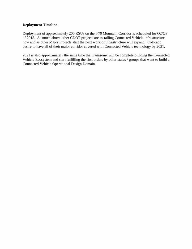
Deployment of approximately 200 RSUs on the I-70 Mountain Corridor is scheduled for Q2/Q3
of 2018. As noted above other CDOT projects are installing Connected Vehicle infrastructure
now and as other Major Projects start the next work of infrastructure will expand. Colorado
desire to have all of their major corridor covered with Connected Vehicle technology by 2021.
2021 is also approximately the same time that Panasonic will be complete building the Connected
Vehicle Ecosystem and start fulfilling the first orders by other states / groups that want to build a
Connected Vehicle Operational Design Domain.

Hawaii Department of Transportation
DSRC Deployment Activities
Deployment Location
The Nimitz and Ala Moana Corridor connect the Honolulu Airport to the main hotel areas in
Waikiki. The route also connects Honolulu Harbor, where 90% of Hawaii’s goods and services
are shipped, and downtown Honolulu, where 70% of the jobs are located. As such, the route is a
heavily used commuter, freight, and transit route that supports about 70,000 vehicles per day.
Deployment Description
Our deployment aims to install between 40-50 DSRC roadside radios, and 40-50 DSRC on-board
radios in the Honolulu area along the Nimitz and Ala Moana Corridor. The focus of the system
initially is signal priority for buses, which we'd be working with the City & County to accomplish,
to demonstrate the technology. We then expand V2I capabilities.
In order to built a complete system the items, above, would be coupled with the security, device
management, and analytics layers necessary to develop a fully functional system. Our vision would
be to bring the Univ. of Hawaii into the fold as a principal investigation for HDOT to review the
system and perform an analysis of the end result as well as couple that with resources from our
project team including WSP and TomTom who will assist the University and provide services for
their own analysis and/or data to assist the rest of the team.
Deployment Timeline
Estimated completion of July 2018.
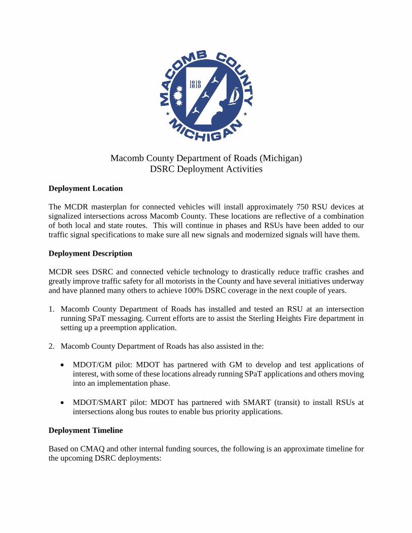
Macomb County Department of Roads (Michigan)
DSRC Deployment Activities
Deployment Location
The MCDR masterplan for connected vehicles will install approximately 750 RSU devices at
signalized intersections across Macomb County. These locations are reflective of a combination
of both local and state routes. This will continue in phases and RSUs have been added to our
traffic signal specifications to make sure all new signals and modernized signals will have them.
Deployment Description
MCDR sees DSRC and connected vehicle technology to drastically reduce traffic crashes and
greatly improve traffic safety for all motorists in the County and have several initiatives underway
and have planned many others to achieve 100% DSRC coverage in the next couple of years.
1. Macomb County Department of Roads has installed and tested an RSU at an intersection
running SPaT messaging. Current efforts are to assist the Sterling Heights Fire department in
setting up a preemption application.
2. Macomb County Department of Roads has also assisted in the:
MDOT/GM pilot: MDOT has partnered with GM to develop and test applications of
interest, with some of these locations already running SPaT applications and others moving
into an implementation phase.
MDOT/SMART pilot: MDOT has partnered with SMART (transit) to install RSUs at
intersections along bus routes to enable bus priority applications.
Deployment Timeline
Based on CMAQ and other internal funding sources, the following is an approximate timeline for
the upcoming DSRC deployments:

1. 2018 Deployment: This deployment year is aimed at outfitting the southwestern part of
the county, with some of the primary routes addressed being:
Mound Rd
Schoenherr Rd
I-696 service drive
Ryan Rd
2. 2019 Deployment: This deployment year emphasizes outfitting the following routes:
Gratiot Ave
Groesbeck Hwy
I-94 Ramps
Harper Ave
3. 2020 Deployment: This deployment year aims at outfitting the northernmost region of
the county, and is primarily comprised of the following routes:
21 Mile Rd
23 Mile Rd
26 Mile Rd
29 Mile Rd
32 Mile R
Macomb County Department of Roads is striving towards a full county deployment.

\
Maricopa County Department of Transportation (Arizona)
DSRC Deployment Activities
Deployment Location
Through the MCDOT SMARTDrive ProgramSM, the Maricopa County Department of
Transportation (MCDOT) in partnership with the Arizona Department of Transportation (ADOT)
and the University of Arizona has invested in planning, designing, implementing, deploying and
testing the Arizona Connected Vehicle (AZ CV) Test Bed in Anthem, AZ, which is a community
of about 25,000 residents north of Phoenix.
MCDOT and ADOT in collaboration with the University of Arizona are developing work zone
connected vehicle applications for the Commercial Vehicles Information Systems and Network
(CVISN) project. The applications will be deployed with the MC85 Road construction project
planned for construction in May 2018.
Design for connected vehicle enabled transit and emergency vehicle priority along the Loop 101
Corridor in Maricopa County will initiate in 2018. The project will be implemented in 2019.
Deployment Description
The AZ CV Test Bed in Anthem is operational and includes 5.5 miles of roadway and 11 signalized
intersections equipped with roadside units (RSUs) utilizing DSRC technology. MCDOT has also
equipped several of its incident response vehicles with the on-board units (OBUs) to participate
in, demonstrate, and test USDOT V2I applications. The AZ CV Test Bed has served as the
development and test site of the USDOT Multimodal Intelligent Traffic Signal System (MMITSS)
suite of applications that improves safety for incident responders and pedestrians; enhances
mobility for transit; and reduces delays for freight. These applications have been successfully
tested and demonstrated at the AZ CV Test Bed to various state, national and international
stakeholders on numerous occasions. ADOT plans to deploy additional DSRC radios along the
freeway section of the test bed.
The CVISN project will deploy a minimum of five DSRC RSUs and will equip several freight
vehicles with DSRC OBUs. The project will be operational in 2018. The L101 corridor will be
equipped with 50 DSRC RSUs and several emergency and transit vehicles will be equipped with
DSRC OBUs.
Deployment Timeline
Please see above.

Michigan Department of Transportation
DSRC Deployment Activities
Deployment Location
Michigan Department of Transportation (MDOT) has deployed and/or plans to deploy 400
Dedicated Short-Range Communication (DSRC) Road Side Units (RSUs) prior to the end of 2019
throughout Michigan. The majority of these deployments have been focused in Southeast
Michigan, including Detroit and surroundings areas, for example: road weather on I-94, curve
speed warning on I-275, Signal Phase and Timing (SPaT) on M-53. Oakland County is also home
to the USDOT Southeast Michigan Connected Vehicle Test Bed.
DSRC technology is also being added at every signal location statewide as it is being modernized
as a policy, including the Lansing area test bed along M-43. DSRC technologies is also being
deployed on select MDOT fleet vehicles.
The City of Ann Arbor is home to the Ann Arbor Connected Vehicle Test Environment
(AACVTE). Due to the success of the Safety Pilot Model Deployment in Northeast Ann Arbor
the project has been expanded to cover the entire 27 sq. miles of the city. Upon its completion this
will be an expanded real world deployment of DRSC enabled vehicles and infrastructure with 45
additional intersections and 12 freeway sites. It is anticipated that there will be 1,500 volunteer
vehicles added each year.
Through the numerous partnerships cultivated through Michigan’s PlanetM initiatives there are
additional deployments focusing on the facilitation of device testing and application development.
Deployment Description
Application and corresponding deployments areas have been selected based upon specific
safety/mobility application needs as identified by MDOT and its partners, in correspondence with
the MDOT Connected Vehicle (CV) Strategic Plan. An assortment of individual deployment
parameters are described below:
Deployment along I-94 through a significant portion of Southeast Michigan to support
weather-related Vehicle to Infrastructure (V2I) applications. This section of freeway
exhibits a high volume of weather related incidents due to unique terrain and surroundings.
This deployment will provide an opportunity to integrate CV and weather-related systems
to test applications which could warn motorists of micro-level weather conditions.

In partnership with the Suburban Mobility Authority for Regional Transportation
(SMART), the suburban transit system for the Detroit region, and Macomb County, transit
signal priory will be provided using CV-technologies to SMART buses along key routes
within the county, including M-53. The deployment will leverage DSRC RSUs and OBUs
as a mechanism to communicate priority calls to the signal controller to provide improved
travel time reliability and reduce travel delays.
MDOT is collaborating with multiple industry partners on supporting testing of curve
speed warning V2I applications. A deployment of DSRC RSUs is under design along the
I-275 corridor at key mainline and ramp curve locations, which will enable broadcast of
curve geometric and advisory speed data to support in-vehicle warning applications.
The M-43 corridor has nine signalized intersections with controllers fully capable of
transmitting the SPaT plans at 0.1 second intervals in National Transportation
Communications for ITS Protocol (NTCIP) in order to test SPaT-based safety and mobility
applications.
In support of testing activities near the General Motors Technical Center in suburban
Detroit, MDOT, in partnership with the Macomb County Department of Roads (MCDR),
deployed CV infrastructure at two intersections along the Mound Road corridor. As well
as a portable unit inside the Tech Center campus. This will enable the broadcast of SPaT
data to CVs in the area in order to test SPaT-based safety and mobility applications.
In partnership with the Road Commission for Oakland County (RCOC), MDOT is working
with Tier 1 automotive suppliers on deploying RSUs at several intersections in Auburn
Hills to support their testing needs. The three initial RSUs (with ten additional planned for
a future deployment phase) will support SPaT broadcast, and data capture for testing and
analytics.
The USDOT, through early research programs such as the Proof of Concept testing
conducted in the late 2000’s, developed a test bed infrastructure, including both roadside
infrastructure and back-end systems and tool kits, in Oakland County, Michigan. MDOT
is in discussions with USDOT, along with RCOC, to transition the test bed assets to MDOT
for long-term operation and further development. This includes nearly 50 RSUs deployed
at intersections throughout the suburban communities of Novi and Farmington Hills.
Deployment Timeline
Momentum from the deployments initially beginning with the USDOT Southeast Michigan
Connected Vehicle Test Bed has allowed a continued interest in the expansion of DSRC
technology within Michigan. A number of large scale deployments (I-94, M-53, I-275) have
completed their designs and have construction planned for 2018.
Through the standard policy of deployment at signal modernization locations, further growth is
expected throughout the state on an annual basis.

Minnesota Department of Transportation
DSRC Deployment Activities
Deployment Location
Mobile Road Weather from Snow Plows. We have DSRC roadside units operating at 6 freeway
locations along I35W southwest of Minneapolis.
University of Minnesota Eco-Driving Research. We have 1 DSRC roadside unit operating at a
traffic signal location on State Highway 55 at Winnetka Ave N in Golden Valley, MN, west of
Minneapolis.
Connected Corridor. We are currently doing system engineering for DSRC units at 23 traffic
signal locations on State Highway 55 west of Minneapolis, plus 2 isolated prototype signal
locations.
Deployment Description
Mobile Road Weather from Snow Plows. Snow plows collect road weather information and
transmit it to a server via DSRC as part of the Integrating Mobile Observations Phase 3 federally
funded project.
University of Minnesota Eco-Driving Research. Uses a real drive train in a lab tied to a real vehicle
in the field to measure benefits of connected vehicle eco-driving.
Connected Corridor. Will broadcast Signal Phase and Timing and receive Basic Safety Messages.
Will provide Eco-driving, snow plow signal priority, pedestrian in crosswalk warning and
maintenance activity ahead warning applications.
Deployment Timeline
Mobile Road Weather from Snow Plows. Test is complete.
University of Minnesota Eco-Driving Research. 2nd phase of project is in progress.
Connected Corridor. Expected to be operational by 2019.

North Carolina Department of Transportation
DSRC Deployment Activities
Deployment Location
The DSRC deployment is planned on NC 55 and High House Road in Town of Cary in Wake
County, NC. There are sixteen (16) intersections on NC 55 corridor and four (4) intersections on
Hight House Road east of NC 55 on High House Road.
Deployment Description
This deployment demonstrates the Department’s commitment to building CAV infrastructure by
participating and meeting AASHTO’s SPaT Challenge. The system will broadcast SPaT messages
initially with potential deployment of MMITSS applications to provide TSP, FSP, PREEMPT, and
PED-SIG. The system resides on an active Ethernet optical network managed through an ATMS
software.
Deployment Timeline
The project was initiated on July of 2017 and is scheduled for early spring of 2018 completion.

Road Commission for Oakland County (Michigan)
DSRC Deployment Activities
Deployment Location
City of Farmington Hills and Novi - 45 locations (DSRC 3.0) (2007 FHWA Project)
City of Southfield – 22 locations along Telegraph Road (DSRC 4.0/4.1) (2010 RCOC/MDOT)
Multiple locations (Auburn Hills, Southfield, Milford) - 16 locations (DSRC 4.0/4.1) (2005 to
current RCOC/MDOT)
Deployment Description
Mostly OEM testing.
Data is being sent back to MDOT DUAP.
Deployment Timeline

Ohio Department of Transportation
DSRC Deployment Activities
Deployment Location
Currently in Ohio there is only one DSRC road side unit deployed. It resides at the intersection of
5th Street and Main Street within the City of Marysville.
Deployment Description
The intersection at 5th Street and Main Street is currently broadcasting Signal Phase and Timing
(SPaT) data along with basic safety messages.
Deployment Timeline
With support from the Ohio DOT, the City of Marysville was awarded an ATCMTD grant from
USDOT to deploy DSRC technology and applications along the US33 corridor between East
Liberty, OH and Dublin, OH. Along US-33, approximately 62 DSRC radios will be installed along
the 35 mile long corridor utilizing a redundant fiber optic system. These radios will be used
primarily to broadcast queue and curve warnings, as well as the basic safety message (BSM). The
US33 Smart Mobility Corridor will also demonstrate a unique partnership with the Transportation
Research Center (TRC) in East Liberty, OH to conduct open road testing of CAVs on US33 and
within the cities of Marysville and Dublin, OH. The corridor plans to implement the largest
concentration of connected vehicles to date through partnerships and an ODOT research project.
The US33 project will also serve as the genesis for Ohio's statewide system engineering for CAV
applications. This includes the development of data standards to be utilized statewide.
In conjunction with the US 33 Smart Mobility Corridor project, ODOT, Honda and the City of
Marysville are partnering to upgrade all twenty-seven (27) traffic signals in the City of Marysville
and 5 signalized intersections within Dublin. These intersections will be equipped with Dedicated
Short Range Communication (DSRC) radios to be used as Road Side Units (RSUs) aimed at
delivering Signal Phase and Timing (SPaT) data, pedestrian warnings and other safety messages
to vehicles that have been outfitted with On Board Units (OBUs). In addition to the installation at
the signals, various project partners have committed to equipping approximately twelve hundred
(1,200) vehicles that regularly drive streets in the City with OBUs. The goal will be to create an
environment where companies can develop and test Vehicle to Vehicle (V-V) and Vehicle to

Infrastructure (V-I) technology throughout the entire City in a small town environment making
Marysville the first completely connected rural city.
Estimated timeline to implement and have the DSRC units operational on the US-33 Smart
Corridor and the signalized intersections in the Cities of Marysville and Dublin is late 2018 or
early 2019.

Ohio Turnpike and Infrastructure Commission
DSRC Deployment Activities
Deployment Location
The Ohio Turnpike and Infrastructure Commission is focusing on improving safety and mobility
by creating new ways to communicate road and travel information along the Turnpike. The proof-
of-concept (POC) project includes the following implementation elements:
Fifteen (15) digital short-range communications (DSRC) roadside units (RSU) will be installed
over a 50-mile section of the Ohio Turnpike starting at Toll Plaza 135 (920 Baumhart Rd; Amherst,
OH 44001) and ending at Toll Plaza 187 (9830 SR 14; Streetsboro, OH 44241). DSRC on-board
equipment (OBE) will be installed in thirty-eight (38) Commission vehicles. Of the 38 vehicles, at
least 18 will be heavy trucks. All vehicles are expected to be regular users of the Turnpike.
Deployment Description
Enable overall improvements in the Commission’s traffic management and traveler information
practices by using data collected from connected vehicles. Proposed applications include
dissemination of incident location, road conditions, and weather-related issues.
Deployment Timeline
The Commission will work in a planning phase through December 2017. The deployment process
will happen in the second phase (beginning in January 2018) followed by a two-year demonstration
period in the third phase (starting in February 15, 2018).

Pennsylvania Department of Transportation
DSRC Deployment Activities
Deployment Location
PennDOT has collaborated with local municipalities, planning partners, and academia to deploy
46 Dedicated Short-Range Communications (DSRC) radios in the Pittsburgh region. Eleven
intersections in Cranberry Township, eleven intersections in Ross Township, and twenty-four
intersections in the City of Pittsburgh have been equipped with roadside units. Additionally, eight
signalized intersections around the state capitol in Harrisburg have been equipped with DSRC.
Deployment Description
Currently, all the equipped signalized intersections are broadcasting Signal Phase and Timing
(SPaT) messages. The SPaT message is being ingested by automated vehicle testers,
predominately Carnegie Mellon University, to supplement sensors on the vehicle. In the near
future, PennDOT plans to run additional applications including transit prioritization, emergency
vehicle preemption, the V2I Hub, and the Multi-Modal Traffic Signal System (MMITSS).
Deployment Timeline
By 2020, PennDOT plans to equip an additional 45 signals in Pittsburgh as part of the Pittsburgh
Advanced Transportation and Congestion Management Technologies Deployment (ATCMTD)
grant. All the new and existing equipped signals will allow for transit prioritization. The Port
Authority of Allegheny County, which serves as the premier public transport provider in
Pittsburgh, will be equipping all 726 of their buses with on-board units (OBUs) to interact with
the signals.
PennDOT will be replacing over 160 traffic controllers along the I-76 arterial. Upon upgrade, the
traffic controllers will be equipped with DRSC and will broadcast SPaT and potentially other
connected vehicle messages including snow plow prioritization. This work is expected to be
completed by 2021.

Pennsylvania Turnpike Commission
DSRC Deployment Activities
Deployment Location
The Pennsylvania Turnpike Commission (PTC) has actively been planning for Connected and
Automated Vehicle Technologies. We have worked with PennDOT and Smart Belt Coalition
partners in Ohio and Michigan to define priority focus areas. Recently, we have developed our
CAV Roadmap that defines our phase 1 and phase 2 deployment locations focused on traffic
incident management, work zone, safety and weather applications.
We have obtained FCC DSRC geographical license for all of Pennsylvania, are updating our
DSRC specifications and are modifying our ITS and Communications Operations and
Maintenance contract to allow for future deployments as well as O&M.
As part of Phase 1, PTC has programs in place to deploy DSRC Roadside Infrastructure at the
following locations:
• Mainline Milemarker 10, New Castle Interchange
• Mainline Milemarker 13, Beaver Valley Interchange
• Mainline Milemarker 28, Cranberry Interchange
• Mainline Milemarker 358, Delaware Valley Interchange
Additionally, PTC also a project in place to pilot a Connected Work Zone application.
This is highlight of our deployment plans. The CAV Roadmap defines future locations and we
have begun to dedicate Capital Plan funding for future needs.
Deployment Description
The DSRC deployments at New Castle, Beaver Valley, Cranberry and Delaware Valley
Interchanges will be the initial DSRC deployments in the PTC system and will provide TIM
messages.

The Connected Work Zone application will deploy a DSRC station on a roadway maintenance
vehicle to support short-duration and mobile work zones. This system will allow the PTC to
provide work zone location information to the public via Waze.
Deployment Timeline
The DSRC deployments described above are both scheduled for implementation in 2018.

Tampa Hillsborough Expressway Authority (Florida)
DSRC Deployment Activities
Deployment Location
Consists of RSU installations at 41 intersections in downtown business district of Tampa, FL for
V2I and I2X applications. Also an additional 5 RSU installations are in place on the Lee Roy
Selmon Expressway, Reversible Express Lanes portion and designated for over the air (OTA)
firmware or application updates. 1600 privately owned vehicles are being equipped with OBUs
via professional retrofit. This USDOT sponsored Pilot Deployment also equips 10 buses and 9
streetcars with OBUs and 500+ smart phone application users for pedestrian safety.
Deployment Description
The following comprise the CV applications being deployed by THEA in downtown Tampa. These
are selected and implemented based on real world safety/mobility issues gleaned from safety audits
and traffic studies over the last several years.
Emergency Electronic Brake Light Warning – Alerts the driver to hard braking ahead.
End of Ramp Deceleration Warning – Warns the driver to slow down to a recommended
speed as the vehicle approaches the end of a queue.
Forward Collision Warning – Warns the driver when a forward collision is imminent.
Intelligent Signal System – Optimizes traffic signal timing based on connected vehicle
data.
Intersection Movement Assist – Warns the driver when it is not safe to enter an intersection.
Deployment Timeline
Sept 2015 – Sept 2016: Phase 1, Concept Development.
Sept 2016 – Apr 2018: Phase 2, final design, deploy and test.
May 2018 – Nov 2019: Phase 3, Operations and maintenance, includes data analysis, and
performance measurement. Results published/shared via the USDOT RDE available to
public/private researchers willing to sign use policy.

Tennessee Department of Transportation
DSRC Deployment Activities
Deployment Location
In Tennessee, DSRC has been deployed in the City of Knoxville. This active deployment is on
Cumberland Avenue on the campus of the University of Tennessee. This Knoxville deployment is
currently planned for expansion to 17 intersections.
In addition to the Knoxville deployment, TDOT is currently planning a large scale DSRC
deployment on the I-24 Corridor between Nashville and Murfreesboro. This deployment will
include the installation of DSRC roadside equipment along the interstate, the adjacent arterial
(SR1) and connector routes (80 total centerline miles).
Deployment Description
The deployment in the City of Knoxville is focused primarily on the dissemination of the signal
phasing and timing (SPaT) message to equipped vehicles. In addition to SPaT, data collection from
vehicles will be enabled to support the development of future live traffic signal performance
measures.
TDOT’s I-24 Corridor DSRC deployment will be utilized to pilot and support a multitude of safety
and active traffic management strategies. The specific applications to be targeted for deployment
on the freeway includes queue warning (Q-warn), incident scene work zone alerts for drivers and
workers, advanced traveler information systems, dynamic speed harmonization, and probe-
enabled traffic monitoring. Connected vehicle applications on the arterial and connector routes to
be targeted include the signal phasing and timing (SPaT) message, traffic signal priority for transit
and emergency vehicles, and advanced traveler information.
Deployment Timeline
The expansion of the current DSRC deployment in Knoxville is currently estimated for completion
in the fall of 2018. This will be an expansion to 17 additional intersections. TDOT’s I-24 Corridor
deployment is broken down into two stages. The first stage will include DSRC deployment on the
interstate and is currently scheduled to start during the summer of 2018, with an early 2019
completion.
Utah Department of Transportation
DSRC Deployment Activities
Deployment Location
Redwood Road, a north-south arterial corridor in the Salt Lake City area.
Deployment Description
Deployment of DSRC on 30 intersections (11 miles) with a version of MMITSS (Multi-Modal
Intelligent Traffic Signal Systems) software, a V2I application built to manage traffic signal
priorities. Transit buses that are behind schedule are given consideration for signal priority to help
them get back on their published schedule. Each intersection broadcasts SPaT and MAP data, and
buses broadcast BSM and SRM messages. In order to test hardware interoperability, DSRC
equipment from three vendors is installed along the corridor. User interfaces have been developed
to allow monitoring of the bus locations and signal request status from the central office.
Deployment Timeline
DSRC equipment has been installed at all 30 intersections and on four buses. Half of the corridor
is operational, being used in real time by the transit fleet. Software and firmware upgrades are
underway on equipment along the remainder of the intersections, to be complete by the end of
2017. An additional corridor, consisting of 45 intersections, is planned for deployment by summer
2018.

Washington Department of Transportation
DSRC Deployment Activities
Deployment Location
In coordination with the AASHTO SPaT (Signal Phase and Timing) Deployement Challenge,
WSDOT is currently planning the installation of DSRC and/or other related connected vehicle
equipment at 24 traffic signals locations along the following corridors:
2 Locations along US 2 North of the City of Spokane
2 Locations along US 2 West of the City of Spokane
10 Locations along SR 522 North of Lake Washington through the Cities of Lake Forest Park and
Kenmore
6 Locations along SR 305 from the Bainbridge Island Ferry Terminal to the City of Poulsbo
4 Locations along SR 500, between I-5 and I-205, through the City of Vancouver
Deployment Description
WSDOT has not deployed any permanent DSRC installations. Vehicle-to-Infrastructure (V2I)
applications that are designed to utilize DSRC traffic signal infrastructure will be evaluated and
incorporated into these deployments to the extent possible.
Deployment Timeline
WSDOT currently plans to complete the installation of the 24 locations defined above by June of
2019.

Wyoming Department of Transportation
DSRC Deployment Activities
Deployment Location
WYDOT is actively deploying 75 roadside DSRC units and 400 on-board units along I-80 in
southern Wyoming as part of an important safety project sponsored by the USDOT to pilot the use
of connected vehicle technology. Selected by the USDOT from a competitive proposal process
(along with New York City and the Tampa Hillsborough Expressway Authority), WYDOT will
focus on the rural use of DSRC. I-80 in southern Wyoming experiences some of the most severe
weather conditions in the country. The route serves as a major corridor for the movement of goods
across the country. Additional DSRC units are planned as part of a future project that will result
in over 90% coverage of the I-80 corridor. Additional information can be found at:
https://wydotcvp.wyoroad.info/
In the spring of 2018, WYDOT plans to deploy additional roadside DSRC units at traffic signal
locations in cities along the I-80 corridor to demonstrate MAP and SPaT.
Deployment Description
Roadside DSRC units are actively being deployed each week in southern Wyoming as part of a
safety project along the I-80 corridor. WYDOT will use DSRC communication to demonstrate two
vehicle-to-vehicle (V2V) applications and three vehicle-to-infrastructure (V2I) applications. The
V2V applications include: Forward Collision Warning and Distress Notification. The V2I
applications include: Work Zone Warning, I2V Situational Awareness and Spot Weather Warning.
WYDOT is pioneering the development of the Distress Notification. This application can be
triggered by a driver who presses an “SOS” button in their vehicle or by vehicle sensors that are
triggered by things such as an air bag deployment. The distressed vehicle broadcasts a signal that
can be received by approaching vehicles in both directions of travel. These vehicles can then
rebroadcast and propagate the distress notification to vehicles approaching the distressed vehicle,
thereby making everyone safer. The rebroadcasting vehicles can also deliver the location of the
distressed vehicle to roadside units which will relay the information to emergency responders.
Deployment Timeline
Roadside DSRC deployments began in the fall of 2017 and will continue until all 75 roadside units
along the I-80 corridor are operational. We expect this to be complete by January of 2018.
Ultimately, 90% of the I-80 corridor will have DSRC coverage. Additional roadside units will be
deployed in the spring of 2018 at signalized intersections. We have started to deploy on-board
units and will continue installing the units until at least 400 have been deployed (fall of 2018).
The vehicle deployments will be in 66 department snow plows, 34 patrol vehicle and 300
commercial trucks.