coal seam gas waste management plan - santos - home seam gas waste management plan – project stage...
TRANSCRIPT

This document contains confidential information and is not to be disclosed to any third parties without prior written permission from the CEO GLNG Operations Pty Ltd.
UNCONTROLLED IF PRINTED
Coal Seam Gas Waste Management Plan
Project Stage 1
EPBC (2012/6615)
Document Number: 0007-650-EMP-0005
Date Rev Reason For Issue Author Checked Approved
19-6-17 0 Submission to DoEE DG PW NF
13-9-17 A 2nd submission to DoEE DG PW NF

Coal Seam Gas Waste Management Plan – Project Stage 1 (EPBC 2012/6615)
Table of Contents
1. Background .................................................................................................................... 2
1.1. Introduction .......................................................................................................... 2
1.2. Purpose and scope .............................................................................................. 2
2. Regulatory Context ......................................................................................................... 5
2.1. Water Management ............................................................................................. 5
2.2. Waste Management ............................................................................................. 5
3. CSG Water Management Activities ................................................................................. 7
3.1. Water Management – Scotia PL176..................................................................... 7
4. MNES Exposure / Pathway Assessment ....................................................................... 13
4.1. Produced Water / Waste Sources ...................................................................... 13
4.2. MNES Receptors ............................................................................................... 13
4.3. Potential Complete Exposure Pathways ............................................................ 14
5. Measures to avoid, mitigate and manage adverse impact ............................................. 16
5.1. Constraints to development ............................................................................... 16
5.2. Determination of measures ................................................................................ 17
6. Early warning indicators, trigger thresholds and limits for detecting impact ................... 20
6.1. Detection of groundwater in irrigation groundwater monitoring bores ................. 23
7. Exceedance response and reporting ............................................................................. 25
7.1. Risk based exceedance responses for Scotia PL176 ......................................... 25
7.2. Timeframes for management action and reporting ............................................. 27
8. Coal seam water production ......................................................................................... 28
9. Annual report ................................................................................................................ 29
10. Plan amendment ........................................................................................................... 30
10.1. Additional activity ............................................................................................... 30
10.2. New information ................................................................................................. 30
11. Supporting documentation ............................................................................................ 31
Appendix A - Constraints to development .............................................................................. 32
Appendix B1 – Coal seam water quality ................................................................................. 34
Appendix B2 – Calculated irrigation water quality................................................................... 38

Coal Seam Gas Waste Management Plan – Project Stage 1 (EPBC 2012/6615)
UNCONTROLLED IF PRINTED
Page 2 of 40
Document Number: 0007-650-PLA-0009
1. Background
1.1. Introduction The Santos Gas Field Development (GFD) Project extends the Santos GLNG development area from 6,887 km2 to 10,676 km2 and will see the development of up to 6,100 additional production wells beyond the Santos GLNG Projects’ authorised 2,650 production wells. The GFD Project will progressively develop wells and associated supporting infrastructure across 35 petroleum tenures, which includes the current existing project area and surrounding tenures located in the Arcadia, Fairview, Roma and Scotia gas fields. These areas combined are referred to as the Santos GLNG Upstream Project Area, shown in Figure 1.
1.2. Purpose and scope The Coal Seam Gas Waste Management Plan (the Plan) has been prepared to satisfy the conditions of approval 2012/6615 issued under the Environment Protection and Biodiversity Conservation Act 1999 (EPBC Act). The scope of this plan is specifically addresses the requirements of Condition 27A which relate to the potential risk of adverse impact of coal seam gas waste water management, comprising the re-use and disposal of CSG water and its derivatives as a result of gas production, on Matters of National Environmental Significance (MNES) from Project Stage 1.
Other activities of the GFD Project that may pose a potential risk of significant adverse impact to groundwater resources are addressed by Groundwater Monitoring and Management - which addresses the potential effects of coal seam depressurisation – and Water Quality Monitoring and Management - which addresses the lifecycle management of anthropogenic chemicals used for CSG well construction, well stimulation activities and in the treatment of CSG water as well as geogenic constituents (total effluent toxicity). The monitoring and management for these other activities is addressed in the following plans which have been prepared to satisfy conditions of the EPBC (2012/6615) approval:
• Groundwater Monitoring and Management Plan (Condition 22A)
• Water Quality Management Plan (Condition 29) Furthermore, the planning of CSG development activity locations, and the types of actions permitted at any location is bound to the Environmental Protocol for Constraints Planning and Field Development – GFD (Santos, 2016) (the Constraints Protocol). The Constraints Protocol was prepared to satisfy Condition 7 of the EPBC (2012/6615) approval. This overlaps considerably with the requirements of this Project Stage 1 CSG Waste Management because by carefully selecting the location of project activities, risks to MNES are avoided and risks minimized. This is discussed further within this Plan.
1.2.1. Project areas This plan assesses coal seam waste water management activities relating to Project Stage 1 –Scotia (PL176). This plan may be updated over the life of Project Stage 1. The process for updating this plan is outlined in Section 10 and aligns to the requirement of Condition 36 of EPBC Approval 2012/6615. Santos GLNG will not commence extraction of water or coal seam gas from wells other than the 110 comprising Project Stage 1 until a revised version of this Plan, either specific to the next planned element of Project Stage 1 is approved in writing by the Minister. The revised Plan will

Coal Seam Gas Waste Management Plan – Project Stage 1 (EPBC 2012/6615)
UNCONTROLLED IF PRINTED
Page 3 of 40
Document Number: 0007-650-PLA-0009
contain detailed information regarding how waste will be monitored and managed, addressing the advice provided by the Department. Figure 1 shows the GFD Project tenures including the location of Scotia PL176.

Coal Seam Gas Waste Management Plan – Project Stage 1 (EPBC 2012/6615)
UNCONTROLLED IF PRINTED
Page 4 of 40
Document Number: 0007-650-PLA-0009
Figure 1 Santos GLNG Upstream Project area comprising the GFD Project – including PL176
Scotia PL176

Coal Seam Gas Waste Management Plan – Project Stage 1 (EPBC 2012/6615)
UNCONTROLLED IF PRINTED
Page 5 of 40
Document Number: 0007-650-PLA-0009
2. Regulatory Context Several Acts and Regulations govern the management of coal seam gas water (and its derivatives) by the petroleum and gas industry in Queensland. This includes:
• Water management - existing conditions for water management granted in Environmental Authorities issued by the Queensland Department of Environment and Heritage Protection under the Environment Protection Act 1994, and
• Waste management - Beneficial Use Approval (BUA) conditions issued under the Waste Reduction and Recycling Act 2011 (WRR Act). Further details are provided in the sections below.
2.1. Water Management Santos GLNG manages produced water in accordance with relevant regulatory frameworks and policy. The management strategy adopted is sufficiently flexible to accommodate changes in technology, energy sources and climatic conditions. The strategy is based on a rigorous evaluation and decision-making framework which aims to avoid, minimise and mitigate the risk of adverse impacts to environmental receptors. The Petroleum Act 1923 and Petroleum & Gas Act 2004 provide that a petroleum tenure cannot be granted unless an environmental authority (EA) has been issued under the Queensland Environmental Protection Act 1994 (EP Act). An EA can apply to multiple petroleum tenures. In relation to water, the EA primarily deals with the management of water, the storage of chemicals and waste and their potential for impact to the land and surface and groundwater quality. EA conditions specify the way in which particular water management activities can only be undertaken or specify the environmental outcomes that must be achieved. For example, EAs may limit the size, location and type of water management activity, as well as stipulating minimum operational requirements, monitoring requirements or reporting and notification requirements. EA conditions for water management activities can only be granted once a proponent has presented information that describes the proposed activity, an environmental risk assessment and a resulting management and monitoring plan commensurate to the risk identified. Most notably, the Environmental Authority granted for the Scotia development prohibits impacts to water resources and MNES associated with produced water and waste management and disposal activities through specific imposed conditions.
2.2. Waste Management The Department of Environment and Heritage Protection (DEHP) regulates the management and disposal of wastes in Queensland under the provisions of the EP Act, the Waste Reduction and Recycling Act 2011 (WRR Act), the Environmental Protection Regulation (2008) and the Waste Reduction and Recycling Regulation 2011 (WRR Regulation). Both Acts and Regulations contain provisions for the assessment, classification and management of waste, including storage, transport, processing, recovery and disposal of waste. The Santos GLNG waste management hierarchy has been developed in accordance with the management approaches detailed within the policy.

Coal Seam Gas Waste Management Plan – Project Stage 1 (EPBC 2012/6615)
UNCONTROLLED IF PRINTED
Page 6 of 40
Document Number: 0007-650-PLA-0009
To ensure the appropriate management and disposal of waste products, Santos GLNG has adopted a sustainable approach to waste management. This approach revolves around a hierarchy, which provides a guideline to target waste production and disposal. The successful implementation of the waste hierarchy principles assist Santos GLNG to:
• Minimise waste volumes and the risk of adverse impact to the environment (including MNES); and
• Improve operational efficiency and environmental performance. The waste management hierarchy, from most preferable to least preferable, is illustrated in Figure 2.
Figure 2. Waste Management Hierarchy

Coal Seam Gas Waste Management Plan – Project Stage 1 (EPBC 2012/6615)
UNCONTROLLED IF PRINTED
Page 7 of 40
Document Number: 0007-650-PLA-0009
3. CSG Water Management Activities This section meets the Condition 27A of EPBC Approval 2012/6615, which requires that this plan must: Detail the storage, management and disposal of CSG produced water and waste products, The following sections describe how coal seam gas water is managed. A description of the proposed storage, treatment, end use and disposal of coal seam water is provided. The descriptions here are a precursor to descriptions of the specific locations and attributes of those activities that could pose a potential risk of adverse impact to MNES, presented in Section 4.
3.1. Water Management – Scotia PL176 On Scotia PL176, Santos GLNG aims to maximise fit-for-purpose beneficial re-use of produced water where feasible whilst avoiding the unnecessary generation of other waste (such as brine) and minimising the potential risk of adverse impacts to the environment.
3.1.1. Water gathering Water gathering lines are typically constructed from high-density polyethylene (HDPE) pipe of between 100 millimetres (mm) and 1,000 mm in diameter. HDPE is used to limit the potential for line failure due to corrosion. Gathering line right-of-ways are routinely inspected, and may be periodically tested, particularly prior to commissioning.
3.1.2. Water management and treatment facilities There are no CSG water desalination facilities proposed. Produced water will be blended with an existing irrigation water supply to achieve the required regulatory irrigation water quality (ANZECC, 2000) and increase the volume of water available to irrigation. Based on the outcomes of the assessments conducted and management actions identified within the Water Quality Management Plan, irrigation buffer storage tanks will be utilised to increase water residence time (the time prior to irrigation) to manage risks of potential residual biocide that may be present (from well drilling and / or completions).
3.1.3. Storage ponds There are no proposed storage ponds proposed to manage CSG water produced on Scotia PL176.
3.1.4. Storage tanks Coal seam water gathered from Scotia PL176 will be stored using above-ground storage tanks. All water storage tanks used to manage coal seam water on Scotia PL176 are installed at the Scotia Compression Facility. There are four existing precast, concrete panel above-ground storage tanks. They are used as to store coal seam gas water. All tanks were installed in 2010 with an intended design life of 20 years. All tanks have HPDE double liners and leak detection systems. They are designed and constructed to Australian standards for strength and structural integrity. Key properties for each of the tanks are summarised in Table 1.

Coal Seam Gas Waste Management Plan – Project Stage 1 (EPBC 2012/6615)
UNCONTROLLED IF PRINTED
Page 8 of 40
Document Number: 0007-650-PLA-0009
Table 1 Storage Tank Data
Qty Service Equipment Tag
Atm/ Pressure Vessel
Single/ Double Walled
Bund/Self Contained
Above/ Below Ground
Total Volume
(ML)
Working Volume (ML)
Diameter (m)
Height (mm)
1 Produced water storage
1480-TK-0018
Atm Double Self Contained
Above 15.5 10.56 119 1400
1 Produced water storage
1480-TK-0017
Atm Double Self Contained
Above 3.6 2.89 42.37 2500
1 Produced water storage
1480-TK-0016
Atm Double Self Contained
Above 2.1 1.41 42.47 1450
1 Produced water storage
1480-TK-0015
Atm Double Self Contained
Above 2.1 1.41 42.47 1450
1 Produced Water storage
1480-TK-0019
Atm Double Self Contained
Above 7.3 5.91 61 2500
3.1.5. Beneficial Re-use - Operational Purposes Operational re-use of produced reduces the need to source water from elsewhere. It occurs on disturbed areas and / or engineered surfaces or activities. Uses may include use in construction, ground compaction, drilling and completions, or dust suppression.
3.1.6. Beneficial Re-use - Land Amendment Irrigation Santos GLNG will operate one irrigation project comprising three centre pivots within Scotia PL176. The total combined irrigation area is approximately 55 hectares. Land amendment irrigation (LAI) describes the application of stoichiometric amounts of agricultural amendments (sulphur and gypsum) to treat the soil prior to the application of irrigation water. This is undertaken to manage risks to soil structure and crop health due to the quality of the irrigation water. Fertilised Rhodes grass will be irrigated with irrigation management activities maintaining soil salinity (ECse) within the tolerances stated within the ANZECC 2000 guidelines (<10.1 dS/m). The Water Quality Management Plan and the Variation Report for the Scotia Irrigation Project (see Section 11) demonstrate how irrigated soils can be treated with agricultural amendments to manage the potential risks to soil structure and plant health. The irrigated Rhodes grass will be grazed in situ by landholder cattle. Irrigation application rates (and, conversely, the required area of irrigation required) were determined using key soil parameters (e.g. initial soil salinity, soil depth, soil water holding capacity and hydraulic conductivity), climatic conditions and crop demand. Irrigation forms the largest volumetric means of CSG water re-use by Santos GLNG on Scotia PL176. Irrigation has been selected by Santos GLNG as it aligns with Queensland water management policy, complies with regulatory approval conditions and provides an economic benefit through grazing, the main land use on Scotia PL176.

Figure 3

Figure 4

Coal Seam Gas Waste Management Plan – Project Stage 1 (EPBC 2012/6615)
UNCONTROLLED IF PRINTED
Page 11 of 40
Document Number: 0007-650-PLA-0009
Beneficial re-use via land amendment irrigation avoids the generation of additional waste and consumption of energy that would otherwise be required for alternate re-use options which can be both energy intensive and generate waste that must be managed. A map showing the location of the irrigation area and the location of potential MNES receptors is provided in Figure 3 and Figure 4. The design coal seam water production rates estimates are provided in Figure 4. The design irrigation water salinity is provided in Figure 5. Appendix B1 and Appendix B2 provides a summary of coal seam water quality results from existing CSG wells on Scotia PL176 and the calculated irrigation water quality, respectively. As a contingency for variation in forecast water production, additional suitable pivot irrigation locations have been identified and designed and can be rapidly installed should they be required (circa 2-3 months). The operation of these additional irrigation pivots however, may require this plan to be updated (see Section 10).
Figure 5 - Scotia PL176 coal seam water production rates (P50) over time

Coal Seam Gas Waste Management Plan – Project Stage 1 (EPBC 2012/6615)
UNCONTROLLED IF PRINTED
Page 12 of 40
Document Number: 0007-650-PLA-0009
Figure 6 – Expected Scotia irrigation water salinity over time
3.1.7. Aquifer reinjection There will be no reinjection of CSG water within Scotia PL176.
3.1.8. Brine storages There is no requirement to store brine within Scotia PL176. No brine waste will be produced.
3.1.9. Brine and salt disposal There is no requirement to dispose of brine or solid salt within PL176. No brine waste will be produced.
3.1.10. Beneficial re-use of residual drilling materials
The beneficial re-use of residual drilling materials and the potential risk of adverse impact to MNES is quantitatively assess for PL176 in the Water Quality Management Plan (see Section 11). Through the implementation of the Constraints Planning Protocol (i.e. activity location selection) and based on the outputs of assessment conducted within the Water Quality Management Plan inclusive of the associated management controls, no significant risk of adverse impact to MNES was identified.

Coal Seam Gas Waste Management Plan – Project Stage 1 (EPBC 2012/6615)
UNCONTROLLED IF PRINTED
Page 13 of 40
Document Number: 0007-650-PLA-0009
4. MNES Exposure / Pathway Assessment
For there to be a risk of adverse impact to MNES there needs to be:
• A source of produced water / waste
• An MNES receptor(s)
• A valid pathway – for the source water to reach the MNES receptor(s) If any one of the above is missing, then there is no risk to MNES. For example if there is either no source, no MNES present or no pathway present, then there can be no risk of adverse impact to MNES. Potential sources, MNES receptors and pathways are described in the sections below.
4.1. Produced Water / Waste Sources Based on the activities described in Section 3, the following sources have been identified:
• The water stored in the storage tanks at the Compression Facility
• The water applied within the Scotia irrigation area, adjacent to the compression facility
• The water applied to engineered surfaces during construction and dust suppression within PL 176.
NOTE: The risk of significant adverse impacts to MNES associated with drilling and completion activities (including hydraulic fracturing) are addressed in the Water Quality Management Plan (see Section 11).
4.2. MNES Receptors Description of potential MNES receptors within PL 176 and adjacent to the irrigation area are provided below with locations provided in Figure 3 and Figure 4 respectively.
4.2.1. Habitat for a MNES listed species
The only threatened flora species with potential to occur within PL 176 is Homopholis belsonii. However, extensive field surveys within PL176 have failed to identify this species including surveys of the irrigation and adjacent areas. There will therefore be no impact to Homopholis belsonii as a result of irrigation activities as the receptor is not present. Eight threatened fauna species are predicted or known to be present within the PL 176. A patch of vegetation mapped as Regional Ecosystem 11.3.2: Poplar box woodlands on alluvial plains is located 800m to the north-west of the irrigation area. This vegetation community provides habitat values for the following EPBC Act listed threatened fauna species:
• Dunmall's Snake Habitat
• South-Eastern Long-eared Bat
• Yakka Skink
• Collared Delma
• Koala
4.2.2. Threatened Ecological Communities Within PL 176, three REs mapped align with the Brigalow (Acacia harpophylla dominant and codominant) EPBC Act TEC, RE 11.3.1, 11.9.1 and 11.9.5. A known to be present Brigalow TEC is located approximately 650m to the east of the Scotia irrigation area.

Coal Seam Gas Waste Management Plan – Project Stage 1 (EPBC 2012/6615)
UNCONTROLLED IF PRINTED
Page 14 of 40
Document Number: 0007-650-PLA-0009
4.2.3. MNES Water Resources. Figure 4 shows the locations of known or potentially present MNES water resources and associated receptors. These resources and their proximity to the proposed irrigation area is detailed below:
• A series of referrable wetlands are associated with Bungaban Creek, located approximately 10km to the north of the irrigation area
• Approximately 800m to the north-west of the irrigation are is the closest patch of riparian vegetation, mapped as Regional Ecosystem 11.3.2: Poplar box woodlands on alluvial plains.
• The closest watercourse to the irrigation area is Bungaban Creek located 10km.
• Two farm dams are located within drainage contours approximately 580m west of the irrigation area.
• There are several groundwater bores registered with the State of Queensland.
The Hutton Sandstone is a major regionally extensive aquifer in the Surat Basin, with bore yields in the range of 0-12 L/s and water quality that is generally fresh to brackish (Golder, 2011). In the broader region, groundwater from this aquifer is used for town water supply, stock watering and domestic use. The groundwater level in the Hutton Sandstone aquifer at the proposed Scotia irrigation site is approximately RL 250 m AHD. Depth to the Hutton Sandstone aquifer is approximately 60-70m below ground level in proximity to the irrigation area. Groundwater flow direction at the Scotia irrigation area is towards the northwest (i.e. towards the Dawson River). Groundwater levels across a broader area were considered in Golder 2011, which indicated groundwater flow towards the north towards the Dawson River in the Hutton Sandstone across the Scotia Field. At a larger scale flow in the Hutton Sandstone will be generally towards the southwest (i.e. down dip, and towards the areas of lower elevation within the Surat Basin). Tthe nearest bore constructed in the Hutton Sandstone is RN38337 is located about 800m north-west of Pivot 6. A complex of discharge springs is located to the northeast of PL 176 near Cockatoo Creek (Golder, 2011), at a distance of approximately 35 km from the irrigation area. The spring source aquifer for Cockatoo Creek is understood to be the Precipice Sandstone (OGIA 2016). Watercourse springs were noted along Bungaban Creek in Golder (2011), at a distance of approximately 10 km from the irrigation area. The spring source aquifer for Bungaban Creek is understood to be the Hutton Sandstone or the Injune Creek Group depending on where it intersects the geology.
4.3. Potential Complete Exposure Pathways Based on the outcomes of the Source and Receptor assessment, the following pathways have been assessed:
4.3.1. Irrigation Activities:
• Brigalow TEC - No areas of Brigalow TEC occur within PL176 that are down topographic gradient of the irrigation area. There will be no impact to any patch of TEC as a result of the proposed irrigation project as there no complete pathways for exposure.
• Bungaban Creek and associated wetlands, located approximately 10km to the north of the irrigation area. Given the presence of drainage features in proximity to the irrigation area, this pathway is considered as potentially complete.
• Riparian vegetation, mapped as Regional Ecosystem 11.3.2: Poplar box woodlands on alluvial plains, located approximately 800m to the north-west of the irrigation area. Given the presence of drainage features in proximity to the irrigation area, this pathway is considered as potentially complete.

Coal Seam Gas Waste Management Plan – Project Stage 1 (EPBC 2012/6615)
UNCONTROLLED IF PRINTED
Page 15 of 40
Document Number: 0007-650-PLA-0009
• Two farm dams located within drainage contours approximately 580m to the west of the irrigation area. Given the presence of drainage features in proximity to the irrigation area, this pathway is considered as potentially complete.
• The Hutton Sandstone aquifer, located approximately 60-70m below the irrigation area and its associated registered groundwater bore RN38337. Given the duration of irrigation activities, regardless of the considerable depth to groundwater, this pathway is considered as potentially complete.
4.3.2. Dust suppression and Construction Activities:
• Brigalow TEC – A potentially complete exposure pathway may exist should engineered surfaces, construction or dust suppression activities occur within or in proximity to a TEC. Location selection would be in accordance with the Constraints Planning Protocol.
• Bungaban Creek and associated wetlands - Given the presence of drainage features within PL 176, this pathway is considered as potentially complete.
• Riparian vegetation, mapped as Regional Ecosystem 11.3.2: Poplar box woodlands on alluvial plains. Given the presence of drainage features this pathway is considered as potentially complete.
• Farm dams located within drainage contours - Given the presence of drainage features, this pathway is considered as potentially complete.
• The Hutton Sandstone aquifer – given significant depth to groundwater limited duration and volume of application, this pathway is not considered complete.
Where a source, receptor and a potentially complete or complete exposure pathway is identified, then further assessment is undertaken to determine whether there is a risk of significant adverse impact to a MNES receptor. Mitigation measures are then identified to manage such risk. Monitoring actions are then assigned to assess the effectiveness of mitigation controls and assign triggers for further actions as required. Both monitoring and management actions are described in the following sections.

Coal Seam Gas Waste Management Plan – Project Stage 1 (EPBC 2012/6615)
UNCONTROLLED IF PRINTED
Page 16 of 40
Document Number: 0007-650-PLA-0009
5. Measures to avoid, mitigate and manage adverse impact This section meets Condition 27A of EPBC Approval 2012/6615, which requires that this plan must: Detail measures that will be implemented to avoid, mitigate and manage impacts to surface and groundwater resources, EPBC threatened species, EPBC migratory species and EPBC communities as a result of the production, storage and disposal of CSG produced water and waste products during Project Stage 1. Section 5.1 outlines Santos GLNG’s constraints planning process. This describes how the planning process which locates project activities, including those related to the production, storage and disposal of CSG produced water and waste products during the life of the project, avoids adverse impact to ecologically sensitive areas. Ecologically sensitive areas include habitats that may support EPBC threatened species, EPBC migratory species and EPBC communities. Section 5.2 provides information specific to the production, storage and disposal of CSG produced water and waste products during the life of the project on Scotia PL176. In summary, that section:
- describes the various mechanisms and processes by which an adverse impacts to a water resource may occur as a result of various actions
- references the existing documentation that provides further information on: o how the risk of adverse impact has been assessed o provides a justification for the measures that will be implemented to avoid, mitigate
and manage impacts to surface and groundwater resources
5.1. Constraints to development All project activities listed in Section 3 have the potential to impact surface and groundwater resources, EPBC threatened species, EPBC migratory species and EPBC communities. However adverse impacts to EPBC threatened species, communities and migratory species can be avoided or minimised by ensuring that construction, operation and decommissioning activities do not occur on or near to ecologically sensitive areas. The Santos GLNG constraints planning process plays a vital role in the avoidance of potential impacts to surface water environmental values, without the need for further mitigation or management. Appendix A provides an outline of the level of constraint associated with particular activities that will be applied to protect surface water environmental values. The need for additional mitigation and management of activities in the following section is determined after the application of the avoidance measure of first avoiding undertaking any action in an environmentally sensitive area, as set out in Appendix A.

Coal Seam Gas Waste Management Plan – Project Stage 1 (EPBC 2012/6615)
UNCONTROLLED IF PRINTED
Page 17 of 40
Document Number: 0007-650-PLA-0009
5.2. Determination of measures This following sections provides information specific to the storage and disposal of CSG produced water and waste products during the life of the project on Scotia PL176. These focus on avoiding uncontrolled releases of water. Based on the outcomes of the exposure / pathway assessment, Table 3 presents a summary of the potential CSG waste management actions which without management controls in place, may pose a significant risk of adverse impact to MNES including water resources. It describes the various mechanisms and processes by which water or waste may be released. Table 3 then references supporting documentation that can provide further information on how the risk of significant adverse impact has been assessed. The supporting documents justify the proposed measures that will be implemented to avoid, mitigate and manage impacts to surface and groundwater resources and associated receptors.
5.2.1. Water storage tanks The Scotia storage tanks include leak detection and recovery systems to prevent against seepage to both groundwater and the surface environment. Early warning, trigger thresholds and limits for detecting impact on surface water and groundwater resources due to the operation of coal seam water storage tanks are provided in Section 5. A risk based exceedance response plan is presented in Section 6.
5.2.2. Land amendment irrigation
In Queensland, criteria for irrigation water quality are defined in General Beneficial Use Approval – Irrigation of Associated Water (including coal seam gas water) (EHP, 2014). This provides general approval conditions for producers and users issued in accordance with the Queensland Waste Reduction and Recycling Act (2011) (WRR Act). These criteria determine minimum standards that must be achieved by water management activities to avoid environmental impact and reflect the same standards that are applied to primary industries that may use any groundwater (i.e. from water bearing strata, including coal seams) for the same purpose. These criteria are adopted or derived in accordance with ANZECC (2000). Where a generic standard for a particular water quality parameter cannot be met, a Variation Report is required. A Variation Report:
- is provided to the administering authority and must be certified by an independent and suitably qualified person
- states the extent to which the water quality does not meet the generic required standard - states the varied water quality parameters (for the parameters that do not meet the required
standards) that ensures: o soil structure, stability and productive capacity can be maintained or improved; o toxic effects to crops do not result; and o yields and produce quality are maintained or improved o No adverse environmental impact outside of the irrigation area
- includes a water monitoring plan that ensures these outcomes are achieved over the life of the project.
A Variation Report has been produced for the Land Amendment Irrigation that is proposed on Scotia PL176, as described in Section 3.1.6. Monitoring of irrigation water quality, soil structure and chemistry, crop health and soil infiltration rates is specified in that Variation Report.

Coal Seam Gas Waste Management Plan – Project Stage 1 (EPBC 2012/6615)
UNCONTROLLED IF PRINTED
Page 18 of 40
Document Number: 0007-650-PLA-0009
Deep drainage refers to the infiltration of irrigation water beneath the shallow soil layer effectively utilised by the irrigated crop. A hydrogeological risk assessment has been prepared (Golder, 2017). This assesses the risk of subsurface migration of irrigation water where deep drainage occurs. It assesses that subsurface migration pathways to water resource receptors may be present. It assesses the risk to land uses, GDEs, aquifers, registered groundwater bores, springs and terrestrial receptors. The report concludes that the risk of vertical and horizontal migration is very low and can be managed through irrigation design and monitoring. Under a conservative modelled irrigation scenario, irrigation water is predicted to migrate laterally less than 200 m from the pivot areas over a period of greater than 30 years and can be readily demonstrated through monitoring. Irrigation water is expected to remain within the vadose zone and can be readily demonstrated through monitoring. Although no environmental receptors are predicted to be or at risk of being impacted, monitoring is proposed to verify the report findings, demonstrate environmental outcomes and to inform adaptive management, if required. Groundwater piezometers will be installed and sampling undertaken to detect if horizontal or vertical migration is occurring within the subsurface. Early warning, trigger thresholds and limits for managing the risk of adverse impact to surface water and groundwater resources due to the operation irrigation activities on Scotia PL176 are provided in Section 5. A risk based exceedance response plan is presented in Section 6.
5.2.3. Operational re-use of coal seam water Without adequate management controls in place the beneficial re-use of produced water for operational re-use, particularly dust suppression of roads, has the potential to cause localised impact to surface water receptors (and shallow groundwater at these locations). This is because dust suppression could take place within or adjacent to the surface water receptor, where project activities (roads, construction activities) intersect. To manage this risk, Santos GLNG will not undertake dust suppression activities within or adjacent to watercourses. Further, the Constrains Protocol avoids project activities, including dust suppression within or adjacent to areas of wetlands and springs. Early warning, trigger thresholds and limits for detecting impact on surface water (and shallow groundwater at these locations) due to the suppression of dust on roads within Scotia PL176 are provided in Section 5. A risk based exceedance response plan is presented in Section 6.

Coal Seam Gas Waste Management Plan – Project Stage 1 (EPBC 2012/6615)
UNCONTROLLED IF PRINTED
Page 19 of 40
Document Number: 0007-650-PLA-0009
Proposed Action Locations Unwanted event / causal factor
Complete or potentially complete pathway to MNES receptor
Potential adverse impact
Assessment methodology Supporting documentation Management controls
Storage of produced water in tanks
Four produced water storage tanks Tanks located at the Scotia Compression Facility, adjacent to irrigation areas (~0.5km away).
Water over-tops or leaks from tank
Overland flow to surface water resource
Change in surface water resource quality
Constraints planning protocol
- Tank location selection - Tank designed in accordance with Australian Standards and Environmental Authority conditions - Tank fitted with water level sensor - Tank fitted with leakage detection
Subsurface migration to groundwater resource
Change in ground water resource quality
Overland flow to flora or fauna habitat
Impact to health of flora or fauna
Irrigation of produced water
55 hectares of irrigation over three pivot areas
Irrigation water migrates to surface water
Overland flow of irrigation water to surface water resource
Change in surface water quality
- Water balance modelling to quantify irrigation size and inform design to manage risk of run-off
Constraints planning protocol General Beneficial Use Approval: Variation Report. Avalon Irrigation Project: Scotia Project Area
- Irrigation location selection to ensure potential run-off is buffered by adjacent dryland cropping area - Design and control of irrigation area size and application rates to avoid run-off - Monitoring, observation and adaptive management of irrigation application rates to avoid run-off (see Irrigation Environmental Monitoring Plan1)
Irrigation water migrates to a sensitive habitat
Overland flow of irrigation water to flora and / or fauna habitat
Impact to health of flora or fauna
Irrigation water migrates to a groundwater resource
Subsurface migration of irrigation water to groundwater resource
Change in ground water quality - Water balance modelling and
quantify size and inform design to quantify deep drainage rates - Hydrogeological risk assessment
General Beneficial Use Approval: Variation Report. Avalon Irrigation Project: Scotia Project Area (Santos, 2017) Scotia Irrigation Hydrogeological and Risk Assessment (Golder, 2017)
- Irrigation location selection - Design and control of irrigation area size and application rates to manage deep drainage rates - Monitoring of sub-surface migration pathways (specified in Section 6).
Irrigation water migrates to surface water
Subsurface migration of irrigation water to surface water resource
Change in surface water quality
Irrigation water disperses the soil
Direct application Impact to soil structure - Threshold electrolyte concentration (TEC) calculation - Soil chemistry modelling - Calculation of stoichiometric quantities of amendment chemicals
General Beneficial Use Approval: Variation Report. Avalon Irrigation Project: Scotia Project Area (Santos, 2017)
- Irrigation location selection (soil type) - Monitoring, observation and adaptive management of irrigation application rates to avoid run-off (see Irrigation Environmental Monitoring Plan1)
Irrigation water disperses the soil, rainfall runoff erodes and transports sediment to a water resource
Overland flow of sediment to surface water resource
Change in surface water quality
Irrigation water affects crop, e.g. foliar damage, osomotic effects or toxicity to plant health
Direct application of irrigation water
Impact to crop health - change in productivity
- Irrigation foliar studies - Soil chemistry modelling (pH, University of Queensland)
General Beneficial Use Approval: Variation Report. Avalon Irrigation Project: Scotia Project Area (Santos, 2017)
- Crop selection - Monitoring, observation and adaptive management of irrigation application rates to avoid run-off (see Irrigation Environmental Monitoring Plan1)
Dust Suppression Within all development and operational areas on PL176
Dust suppression water migrates to a watercourse
Direct application Run-off to adjacent area
Change in surface water quality
- Identify water resource and ecological receptors - Constraints planning protocol and location selection
Santos GLNG Upstream: Using Coal Seam Water and Liquids Management Specification
- Location selection - no direct application plus within 50m buffer of a watercourse - visual observations - no pooling of run-off
Dust suppression water migrates to a sensitive habitat
Direct application Run-off to adjacent area
Impact to health of flora or fauna
Table 2. Assessment methodologies and management controls of potential impacts to MNES due to the proposed CSG waste management action on Scotia PL176
1 Irrigation Environmental Monitoring Plan is an appendix to the General Beneficial Use Approval: Variation Report. Scotia Irrigation Project: Scotia Project Area (Santos, 2017).

Coal Seam Gas Waste Management Plan – Project Stage 1 (EPBC 2012/6615)
UNCONTROLLED IF PRINTED
Page 20 of 40
Document Number: 0007-650-PLA-0009
6. Early warning indicators, trigger thresholds and limits for detecting impact
Table 4 describes the early warning indicators, triggers thresholds and limits for detecting impacts
on surface and groundwater quality.
These monitoring values have been derived conservatively. For example, an exceedance of a
‘limit for detecting impact’ would not necessarily confer that an impact to surface water or
groundwater quality has occurred, or is likely to occur in the future. The early warning indicators,
trigger thresholds and limits for detecting impact have been derived to demonstrate that the
pathways to adverse impact remain only partially or entirely incomplete.
Management responses to exceedances of trigger thresholds, as presented in Section 7, will
require investigation of the potential adverse impact, relative completion of the impact pathway,
and the need for possible impact mitigation or site remediation.
The risk based exceedance responses which are described in Section 6 include the ability to
review and revise the derivation of early warnings, trigger thresholds and limits for detecting
impacts on surface and groundwater quality. This plan would be revised in accordance with
Section 10 if a revision of the values are required.

Coal Seam Gas Waste Management Plan – Project Stage 1 (EPBC 2012/6615)
UNCONTROLLED IF PRINTED
Page 21 of 40
Document Number: 0007-650-PLA-0009
Proposed action Unwanted event / causal factor
Complete or potentially complete pathway
Potential adverse impact
Attribute to monitor
Method Early Warning Indicator (EW) monitoring result
EW management response Trigger Threshold (TT) monitoring result
TT management response Limit for detecting impact
Storage of produced water in tanks
CSG water over-tops or leaks from tank
Overland flow to surface water resource
Change in surface water resource quality
- Tank integrity - Tank level
- Telemetered tank water level readings (daily) - Inspection of leak detection system (bi-annual) - Engineering inspection of tank condition and integrity (annual)
- Water level reaches maximum operating level (MOL) - Fluid detected in leak detection system
- Reduce volume of water stored in tank - Fluid in leak detection system is sampled and analysed in the lab.
- Water level reaches mandatory reporting level (MRL) - Fluid analysed from leak detection system is confirmed to be produced water
- Reduce volume of water stored in tank to safe levels - Tank liner repair / remedial engineering actions to reinstate integrity of liner
Water level reaches design storage limit (DSA)
Subsurface migration to groundwater resource
Change in ground water resource quality
Overland flow to flora or fauna habitat
Impact to health of flora or fauna
Land amendment irrigation of coal seam water
Irrigation water migrates to surface water
Overland flow of irrigation water to surface water resource
Change in surface water quality - Applied irrigation
volume - Land run-off
- Visual inspection of soil within the pivot, and land surface immediately adjacent to pivots (Weekly) - Measure of irrigation application volume (daily) - Refer to EMP1
- Visual inspection identifies irrigation water run-off to adjacent targeted (buffer) dryland grazing areas
- Implement adaptive management (e.g. adapt irrigation volume, duration, frequency, time of day) - Continue visual monitoring to evaluate effectiveness
Visual inspection identifies: - irrigation water run-off in area outside the adjacent targeted (buffer) dryland grazing areas - changes in grazing vegetation type i.e. species adapted to wetter conditions in adjacent target (buffer) dryland areas
- Implement adaptive management (e.g. adapt irrigation volume, duration, frequency, time of day) - Increased frequency of visual monitoring to evaluate effectiveness of management - Increase extent of monitoring to include down-gradient drainage feature
Visual inspection identify irrigation water run-off within drainage feature Irrigation water migrates to
a sensitive habitat
Overland flow of irrigation water to flora and / or fauna habitat
Impact to health of flora or fauna
Irrigation water migrates to a groundwater resource
Subsurface migration of irrigation water to groundwater resource
Change in ground water quality
Groundwater along vertical migration pathway
Seepage detection (vertical migration pathways) via a monitoring bore located in a zone of lower permeability (>10m deep, <10m from irrigation area) (bi-annual)
Indicative location shown on Figure 7.
Groundwater detected in the piezometer (baseline piezometer readings are expected to be dry, with no groundwater present)
- Continue to monitor groundwater pressure - Sample groundwater and analyse for contaminants (see Table 5) - Review and revise hydrogeological impact assessment, if required
Water quality analysis of seepage water verifies presence of irrigation water along pathway (see Section 6.1)
- Re-sample to confirm the result after 3 months - Report the confirmed results to DoEE (within 30 days) - Review and revise hydrogeological impact assessment, if required - Assess need to implement contingency irrigation areas to reduce irrigation volumes at that location - Install receptor monitoring bore(s)
Detection of irrigation water at receptor (receptor monitoring only installed once trigger exceeded)
Irrigation water migrates to surface water
Subsurface migration of irrigation water to surface water resource
Change in surface water quality
Groundwater along horizontal migration pathway
Seepage detection along horizontal migration pathways via multiple shallow monitoring bores (<10m deep, <250m from irrigation area) (bi-annual). Indicative location shown on Figure 7.
Irrigation water disperses the soil
Direct application Impact to soil structure
- Applied irrigation volume and water quality - Soil condition and chemistry in irrigation area
- Soil coring / sampling, laboratory analysis (bi-annual). - Indicative location shown on Figure 7. - Visual inspection of soil in irrigation areas (weekly) - Refer to EMP1
Visual inspection identifies soil dispersion within irrigation area
- Implement adaptive management and remedial actions (e.g. application of additional land amendment, mechanical tilling of the soil surface) - Continue visual monitoring to evaluate effectiveness
Soil coring and laboratory results identify average SAR within the irrigation area >30 and / or pH >8
- Implement adaptive management and remediation (e.g. application of additional amendments, and mechanical tilling of the soil surface) - Continue visual monitoring to evaluate effectiveness - Assess need to implement contingency irrigation areas to reduce irrigation volumes at that location
- Visual monitoring or soil core analysis indicate significant dispersion across the irrigation area (>25% of locations)
Irrigation water disperses the soil, rainfall runoff erodes and transports sediment to a water resource
Overland flow of sediment to surface water resource
Change in surface water quality
Irrigation water affects crop, e.g. foliar damage, osomotic effects or toxicity to plant health
Direct application of irrigation water
Impact to crop health
- Crop health and plant tissue condition - Soil chemistry in irrigation area
- Visual inspection of crop health (weekly) - Plant tissue sampling and laboratory analysis (annual) - Soil coring, sampling and laboratory analysis (bi-annual) - Indicative location shown on Figure 7. - Refer to EMP1
Visual inspection identify localised indicators of plant stress
- Implement adaptive management and remedial actions (e.g. application of additional amendments, induce additional deep drainage and or alter duration, frequency or time of irrigation)
Visual inspection identify significant indicators of plant stress (>25%)
- Investigate and identify most likely causal factor (e.g. using plant tissue results and soil sampling results) - Implement adaptive management and remediation (e.g. application of additional amendments, induce additional deep drainage and or alter duration, frequency or time of irrigation) - Assess need to implement contingency irrigation areas to reduce irrigation volumes at that location
- Visual inspection identify significant indicators of plant stress (>50%)
Dust suppression of coal seam
water
Dust suppression water migrates to a watercourse
Direct application Run-off to adjacent area
Change in surface water quality Applied surface
Visual inspection of application areas if undertaken within 200m of a watercourse
Visual inspection - pooling or run-off
Cease application or continue application at a reduced rate.
Visual inspection – soil dispersion adjacent to roads
Assess need for and execute remediation, if required
Application of irrigation water outside of approved areas
Dust suppression water migrates to a sensitive habitat
Direct application Run-off to adjacent area
Impact to health of flora or fauna
Table 3. Proposed Early Warning, Threshold Triggers and Limits for detecting risk of impact related to management of CSG waste water on Scotia PL176
1 EMP refers to the Environmental Monitoring Plan, an appendix to the General Beneficial Use Approval: Variation Report. Scotia Irrigation Project: Scotia Project Area (Santos, 2017).

Coal Seam Gas Waste Management Plan – Project Stage 1 (EPBC 2012/6615)
UNCONTROLLED IF PRINTED
Page 22 of 40
Document Number: 0007-650-PLA-0009
Table 4. Analytes for groundwater samples collected from the proposed early warning piezometers.
Analyte Units Level of detection Trigger
threshold value
Source of trigger value
Electrical
conductivity
µS/cm 1 920 Conversion from ANZECC (high
reliability trigger values for
freshwater, Table 3.4.1)
Major anions mg/L 1 Presence of
irrigation water
Geochemical Evaluation
Major
Cations
mg/L 1 Presence of
irrigation water
Geochemical Evaluation
Aluminium* mg/L 0.01 0.027 ANZECC (high reliability trigger
values for freshwater, Table 3.4.1)
Boron* mg/L 0.001 0.09 ANZECC (high reliability trigger
values for freshwater, Table 3.4.1)
Cadmium* mg/L 0.0001 0.06 ANZECC (high reliability trigger
values for freshwater, Table 3.4.1)
Chromium
(total)*
mg/L 0.001 0.001 (0.00001) ANZECC (high reliability trigger
values for freshwater, Table 3.4.1)
Copper* mg/L 0.001 0.001 ANZECC (high reliability trigger
values for freshwater, Table 3.4.1)
Lead* mg/L 0.001 0.001 ANZECC (high reliability trigger
values for freshwater, Table 3.4.1)
Manganese* mg/L 0.001 1.2 ANZECC (high reliability trigger
values for freshwater, Table 3.4.1)
Mercury* mg/L 0.0001 0.0001
(0.00006)
ANZECC (high reliability trigger
values for freshwater, Table 3.4.1)
Nickel* mg/L 0.001 0.008 ANZECC (high reliability trigger
values for freshwater, Table 3.4.1)
Selenium* mg/L 0.001 0.005 ANZECC (high reliability trigger
values for freshwater, Table 3.4.1)
BTEX µg/L 2 200 ANZECC (high reliability trigger
values for freshwater, Table 3.4.1)
Poly-
aromatic
hydrocarbons
µg/L 1 2 ANZECC (high reliability trigger
values for freshwater, Table 3.4.1)
* Dissolved
Coal Seam Gas Waste Management Plan – Project Stage 1 (EPBC 2012/6615)
UNCONTROLLED IF PRINTED
Page 23 of 40
Document Number: 0007-650-PLA-0009
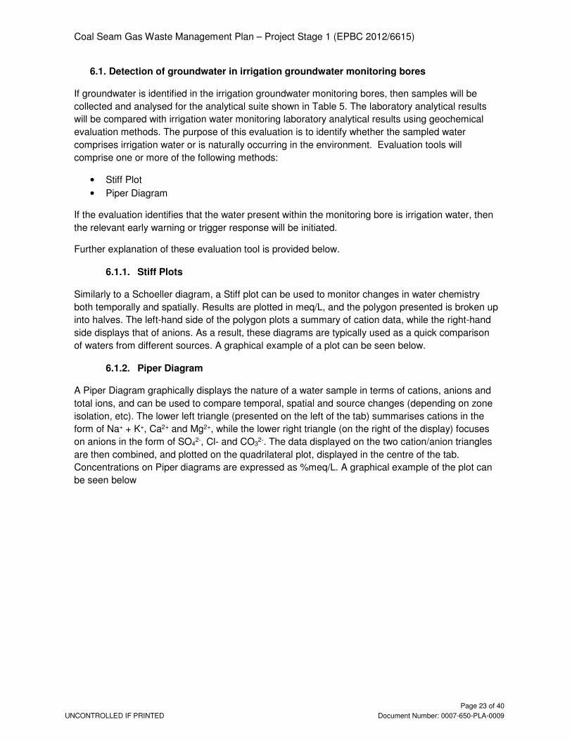
6.1. Detection of groundwater in irrigation groundwater monitoring bores If groundwater is identified in the irrigation groundwater monitoring bores, then samples will be
collected and analysed for the analytical suite shown in Table 5. The laboratory analytical results
will be compared with irrigation water monitoring laboratory analytical results using geochemical
evaluation methods. The purpose of this evaluation is to identify whether the sampled water
comprises irrigation water or is naturally occurring in the environment. Evaluation tools will
comprise one or more of the following methods:
• Stiff Plot
• Piper Diagram
If the evaluation identifies that the water present within the monitoring bore is irrigation water, then
the relevant early warning or trigger response will be initiated.
Further explanation of these evaluation tool is provided below.
6.1.1. Stiff Plots
Similarly to a Schoeller diagram, a Stiff plot can be used to monitor changes in water chemistry
both temporally and spatially. Results are plotted in meq/L, and the polygon presented is broken up
into halves. The left-hand side of the polygon plots a summary of cation data, while the right-hand
side displays that of anions. As a result, these diagrams are typically used as a quick comparison
of waters from different sources. A graphical example of a plot can be seen below.
6.1.2. Piper Diagram
A Piper Diagram graphically displays the nature of a water sample in terms of cations, anions and
total ions, and can be used to compare temporal, spatial and source changes (depending on zone
isolation, etc). The lower left triangle (presented on the left of the tab) summarises cations in the
form of Na+ + K+, Ca2+ and Mg2+, while the lower right triangle (on the right of the display) focuses
on anions in the form of SO42-, Cl- and CO3
2-. The data displayed on the two cation/anion triangles
are then combined, and plotted on the quadrilateral plot, displayed in the centre of the tab.
Concentrations on Piper diagrams are expressed as %meq/L. A graphical example of the plot can
be seen below

Coal Seam Gas Waste Management Plan – Project Stage 1 (EPBC 2012/6615)
UNCONTROLLED IF PRINTED
Page 24 of 40
Document Number: 0007-650-PLA-0009
Figure 7 - Irrigation monitoring locations within the Scotia Irrigation Area

Coal Seam Gas Waste Management Plan – Project Stage 1 (EPBC 2012/6615)
UNCONTROLLED IF PRINTED
Page 25 of 40
Document Number: 0007-650-PLA-0009
7. Exceedance response and reporting
7.1. Risk based exceedance responses for Scotia PL176 Monitoring and management controls will be implemented by Santos GLNG to manage and mitigate against the risks presented in Table 4 and Table 5. The monitoring and response approach outlined in Table 4 and Table 5, and justified below, is conservative in respect of detecting a change in the potential for impact far in advance of any impact actually occurring. No impacts to water resources are expected. The proposed management responses are adaptive. If justified, re-assessment and revision of this monitoring and management plan may be justified if new information becomes available that justifies a less conservative approach (see Section 10). Table 5 presents the Early Warning and Trigger Threshold values and proposed management responses that comprise risk based exceedance responses for the assessed project activities. The following sections justify the risk based approach to the monitoring and management.
7.1.1. Storage of produced water in tanks The risk based exceedance response plan for the storage of coal seam water in water tanks relies on tank water level monitoring and the monitoring of leak detection systems. This design and operation of these tanks adheres to relevant Australian standards. The monitoring approach outlined ensures that tank leakage and overtopping is adequately managed. Furthermore, the location of these storage tanks, being sited far away from potential water resources, means the risk to water resources due to a loss of containment is extremely low.
7.1.2. Land amendment irrigation The risk based exceedance response plan for LAI of coal seam water is complex. The various approaches that are shown in Table 5 are unique to the causal factor, migration pathway and potential adverse impact. The approaches are summarised and justified under the following headings:
- Adverse impacts due to over land migration - Adverse impacts due to subsurface migration - Adverse soil dispersion impacts - Adverse impacts to crop health and yield
7.1.2.1. Adverse impacts due to over-land migration The risk based exceedance response plan for the LAI of coal seam water, in respect of the risk of coal seam water migration to water resources via overland flow, relies on monitoring of application rates and visual inspection of the pivot areas and its surrounds. An observational approach to the management of irrigation water at, or immediately adjacent to the irrigation areas, will directly prevent the loss of irrigation water and risk of migration to receptors via surface run-off. This approach recognises that many factors combine to affect soil infiltration rates, for example antecedent rainfall, crop condition, temperature and humidity, and so an adaptive and observational approach to application rates is both practical and reliable.

Coal Seam Gas Waste Management Plan – Project Stage 1 (EPBC 2012/6615)
UNCONTROLLED IF PRINTED
Page 26 of 40
Document Number: 0007-650-PLA-0009
7.1.2.2. Adverse impacts due to subsurface migration The risk based exceedance response plan in respect of subsurface migration of irrigation to both groundwater and surface water resources, depends on groundwater monitoring. This approach is justified by the findings of the hydrogeological risk assessment (Scotia Irrigation Hydrogeological and Risk Assessment (Golder, 2017)). That report shows that the risk to water resources due to subsurface migration of irrigation water is low because:
- the horizontal migration pathway to surface water resources is incomplete (i.e. the rate and duration of application is not sufficient enough to allow irrigation water to migrate more than around ~200m from the irrigation areas over 30 years).
- the rate of vertical migration will be so slow that the potential impact to groundwater resource quality is mitigated by the exceedingly slow rate of release of irrigation water towards groundwater.
Groundwater monitoring will be located close to the irrigation areas relative to the location of the potential water resource receptors:
- The vertical monitoring points will be installed adjacent to the pivots, more than around 10m deep in the first zone of lower permeability. The top of the first groundwater resource (the Hutton Sandstone) is encountered at depth greater than 60 metres.
- The horizontal monitoring points will be installed <250m horizontally from the pivots above the first low permeability layer, where the nearest surface water resource is located more than 600m away from the pivots (i.e. landholder dams).
This approach is conservative in respect of managing potential impacts to water resources because:
- The detection of irrigation water along either the vertical or horizontal pathways is not expected throughout the life of the project due to irrigation design and irrigation management.
- Early detection of irrigation water in these groundwater piezometers can derive and inform adaptive management response that may result in more information becoming available that may justify an amendment to this plan (see Section 10). New information that may justify an amendment of this plan might include:
o a review of the hydrogeological risk assessment (e.g. validation of the modelled condition using the observed condition) and, if necessary, a revision of the risk assessment and this plan (in accordance with commitments in Section 10).
o the installation of monitoring locations further afield, i.e. to confirm the extent that irrigation has migrated vertically or horizontally, or
o an alteration of irrigation practices the effect of which may continue to be monitored in the currently proposed monitoring locations.
7.1.2.3. Adverse soil dispersion impacts The risk based exceedance response plan for irrigation in respect of adverse impacts due to soil dispersion, depends on the visual inspection and a periodic laboratory testing of the soil chemistry. This approach is justified by the Variation Report (General Beneficial Use Approval: Variation Report. Scotia Irrigation Project: Scotia Project Area). This report describes the expected attributes of both the irrigation water and the soil. It derives a methodology for ensuring the stability of the soil is maintained throughout the life of the project. The approach requires the application of established agricultural principles and practices.
7.1.2.4. Adverse impacts to crop health and yield

Coal Seam Gas Waste Management Plan – Project Stage 1 (EPBC 2012/6615)
UNCONTROLLED IF PRINTED
Page 27 of 40
Document Number: 0007-650-PLA-0009
The risk based exceedance response plan for irrigation in respect of adverse impacts crop health and yield, depends on the visual inspection of the crop condition and periodic laboratory testing of plant tissue and soil chemistry. This approach is justified by the Variation Report (General Beneficial Use Approval: Variation Report. Avalon Irrigation Project: Scotia Project Area). This report describes the expected attributes of both the irrigation water and the soil. It derives a methodology for ensuring the stability of the soil is maintained throughout the life of the project. The approach requires the application of established agricultural principles and practices.
7.1.3. Dust suppression of coal seam water The risk based exceedance response plan for the re-use of coal seam water for dust-suppression activities relies on observation of the application areas by the operator, and the avoidance of application in defined areas. This includes avoiding dust suppression within or adjacent to watercourses or other MNES values. This approach is supported by the Constrains Planning Protocol.
7.2. Timeframes for management action and reporting The timeframe to implement the management responses to exceedances of the early warning indicators and trigger thresholds outlined in Table 4 is provided in Table 5. Table 5 Timeframes for management action and reporting
Monitoring result Timeframe to management response
Reporting monitoring exceedances to minister
Early warning indicator exceeded
Within 30 business days Annual report
Trigger threshold exceeded
Within 10 business days Within 30 business days of monitoring event

Coal Seam Gas Waste Management Plan – Project Stage 1 (EPBC 2012/6615)
UNCONTROLLED IF PRINTED
Page 28 of 40
Document Number: 0007-650-PLA-0009
8. Coal seam water production This section meets the following Condition 27A EPBC Approval 2012/6615, which requires that this plan must: Detail monitoring to measure the amount of CSG water and waste products produced Santos GLNG uses flowmeters to measure produced water rates from CSG wells on Scotia PL176. Produced water volumes are reported to the Queensland Department Energy and Mines (QDME) biannually in accordance with the Petroleum and Gas (Production and Safety) Act 2004 and the Petroleum Act 1923, as well as to the Office of Groundwater Impact Assessment in accordance the Water Act 2000. This data will be replicated and submitted annually to the DoEE for all the CSG wells on Scotia PL176 (see Section 9).

Coal Seam Gas Waste Management Plan – Project Stage 1 (EPBC 2012/6615)
UNCONTROLLED IF PRINTED
Page 29 of 40
Document Number: 0007-650-PLA-0009
9. Annual report
Santos GLNG will provide an annual report on the anniversary date that this report is approved by DoEE. This annual report will provide information and data relating to:
• Coal seam water production volumes (see Section 7)
• Record of any data that demonstrates that any Early Warning Indicators, Trigger Thresholds or Limits have been exceeded, as defined in Table 3 (see section 5)
• Descriptions and any available evidence of the nature and extent of risk based exceedance responses taken (see Section 6)

Coal Seam Gas Waste Management Plan – Project Stage 1 (EPBC 2012/6615)
UNCONTROLLED IF PRINTED
Page 30 of 40
Document Number: 0007-650-PLA-0009
10. Plan amendment In accordance with Condition 36 of approval 2012/6615 issued under the Environment Protection and Biodiversity Conservation Act 1999 (EPBC Act), Santos GLNG may choose to revise this management plan. This is may occur when:
- Additional activity (or action) is proposed relating to the management of CSG water that is not already described or referred to in this plan.
- New information is available that justifies amendment of the plan.
10.1. Additional activity If the proposed additional action is likely to have a new or increased impact, Santos GLNG will submit a revised plan to the regulating authority, in accordance with the conditions of approval 2012/6615 issued under the EPBC Act. If the proposed action in accordance with the revised plan would not be likely to have a new or increased impact, Santos GLNG would be required to, in accordance with Condition 36 of approval 2012/6615:
- Notify the regulating authority in writing that the plan has been revised, and provide a copy of the revised plan to the regulating authority
- Implement the revised plan from the date that the plan is submitted to the regulating authority
- For the life of approval 2012/6615, maintain a record of the reasons that Santos GLNG considers that taking the action in accordance with the revised plan would not be likely to have a new or increased impact.
10.2. New information Santos GLNG may revise this plan if new information is made available that justifies amendment to the plan. In this situation, Santos GLNG will submit a revised plan to the regulating authority, in accordance with the conditions of approval 2012/6615 issued under the EPBC Act.

Coal Seam Gas Waste Management Plan – Project Stage 1 (EPBC 2012/6615)
UNCONTROLLED IF PRINTED
Page 31 of 40
Document Number: 0007-650-PLA-0009
11. Supporting documentation Water Quality Management Plan (EHS Support, 2017). Environmental Protocol for Constraints Planning and Field Development – GFD (Doc no. 0007-650-PLA-0007) (Santos, 2016) General Beneficial Use Approval – Associated Water (including coal seam gas water) (Queensland Department of Environment and Heritage Protection (DEHP), 2014) General Beneficial Use Approval – Irrigation of Associated Water (including coal seam gas water) (Queensland Department of Environment and Heritage Protection (DEHP), 2014) General Beneficial Use Approval: Variation Report. Scotia Irrigation Project: Scotia Project Area (Santos, 2017) Scotia Area Hydrogeological Conceptual Model (Golder, 2011) Scotia Irrigation Hydrogeological and Risk Assessment (Golder, 2017) Surat Underground Water Impact Report (UWIR) for the Surat Cumulative Management Area (Queensland Office of Groundwater Impact Assessment (OGIA), 2016)

Coal Seam Gas Waste Management Plan – Project Stage 1 (EPBC 2012/6615)
UNCONTROLLED IF PRINTED
Page 32 of 40
Document Number: 0007-650-PLA-0009
APPENDIX A - CONSTRAINTS TO DEVELOPMENT An overarching development protocol is employed. This avoids the risk of impact to particularly sensitive environmental receptors and MNES by ensuring higher impact activities are restricted to areas of a lower environmental sensitivity, and vice versa. This process is described in detail in Section 5 of the Significant Species Management Plan – GFD Project (Santos GLNG, 2016) and describes the process for planning and siting project activities. This process plays a pivotal role in the general avoidance of potential risk of adverse impact to environmental values by GFD Project activities. Table A1 below provides an outline of the planning constraints which are applied to various types of mapped environmental values. For example, the construction and operation of water management facilities would generally only be developed in areas “low constraint areas” i.e. where MNES are not present and thereby avoiding risk to MNES

Coal Seam Gas Waste Management Plan – Project Stage 1 (EPBC 2012/6615)
UNCONTROLLED IF PRINTED
Page 33 of 40
Document Number: 0007-650-PLA-0009
Table A1 CSG water management activities undertaken as part of the Santos GFD Project
Level of constraint
Constraint mapping layer Permitted activities
No-go area Category A environmentally sensitive areas including national parks1, conservation parks, and forest reserves (NC Act).
No petroleum activities are permitted
EPBC Act-listed spring vents and complexes including primary 200 m buffer.
Wetlands of national importance including 200 m buffer.
Wetlands of high ecological significance or high conservation value
(Map of Referrable Wetlands).
Surface development exclusion area
Primary 200 m buffer for Category A environmentally sensitive areas.
Only low impact petroleum activities2 are permitted
The following Category C environmentally sensitive areas3:
• Declared catchment areas (Water Act 2000 (Qld)).
The following Category B environmentally sensitive areas:
• Ramsar sites listed as wetlands of international importance.
High constraint area
Watercourses (stream orders) including 100 m buffer. Low impact petroleum activities and linear infrastructure3 are
permitted
Wetland defined as ‘general ecologically significant wetland’ or
‘wetland of other environmental value’ (Map of Referrable
Wetlands).
Spring vents and complexes (not protected under the EPBC Act) including primary 200 m buffer.
Moderate constraint
area
Secondary 100 m buffer for Category A environmentally sensitive areas.
Low impact petroleum
activities, linear infrastructure and limited petroleum activities4 are permitted.
Secondary 100 m buffer for spring vents and complexes (EPBC Act).
Matters of national environmental significance including habitats (threatened species habitat and migratory species habitat), threatened ecological communities (derived from state regional ecosystem mapping or verified from field surveys), and flora species.
Endangered regional ecosystems including primary 200 m buffer.
Low constraint
areas
High value regrowth (endangered and of concern regional ecosystems)
All petroleum activities5 are permitted
No concern at present regional ecosystems
Type A species (NC Act)
Existing Santos GLNG infrastructure
Existing road, rail, pipeline and other infrastructure.
Remaining areas once other constraints have been applied. 1 Specific and mutually beneficial activities in a (limited depth) national park may be allowed with express written permission from Department of National Parks, Recreation, Sport and Racing. Santos GLNG will only seek permission to enter a national park on limited occasions where no other feasible option exists.
2 Low impact petroleum activities are limited to exploration, survey or monitoring activities that do not require clearing of native vegetation, earthworks or excavation activity that will cause significant disruption to the soil profile or permanent damage to vegetation that cannot be easily rehabilitated.
3 Linear infrastructure includes (but is not limited to) gas and water gathering lines, low and high pressure gas and water transmission pipelines, power lines, communication, roads and access tracks.
4 Limited petroleum activities include single-well and multiple-well leases and associated infrastructure located in the leases and camps within well leases that may involve sewage treatment works that are a no-release works.
5 Petroleum activities include low impact petroleum activities, linear infrastructure, limited petroleum activities, and all other GFD Project activities including major facilities such as permanent accommodation camps, gas treatment facilities, air strips, gas compression facilities, and water management facilities such as water storage and water treatment facilities.

Coal Seam Gas Waste Management Plan – Project Stage 1 (EPBC 2012/6615)
UNCONTROLLED IF PRINTED
Page 34 of 40
Document Number: 0007-650-PLA-0009
APPENDIX B1 – COAL SEAM WATER QUALITY
The table below presents the Upper Baralaba Water Composition Data

Coal Seam Gas Waste Management Plan – Project Stage 1 (EPBC 2012/6615)
UNCONTROLLED IF PRINTED
Page 35 of 40
Document Number: 0007-650-PLA-0009
ANALYTE NAME DISSOLVED OR TOTAL
LIMIT OF DETECTION
UNIT Recorded Water Quality (well data)
P10 P50 P90
Electrical Conductivity @ 25°C N/A 1 µS/cm 4210 6440 8790
Total Dissolved Solids @180°C T 10 mg/L 1644.8 3810 3930
Electrical Conductivity - Field N/A 1 µS/cm 5272.6 5700 6092.4
Dissolved Oxygen - Field N/A 0.001 mg/L 1.226 2.51 3.364
Mercury D 0.0001 mg/L <0.0001 <0.0001 <0.0001
Mercury T 0.0001 mg/L <0.0001 <0.0001 <0.0001
Calcium D 1 mg/L 7 11 19.8
Magnesium D 1 mg/L 4 6.5 10
Potassium D 1 mg/L 14.2 40 172.2
Sodium D 1 mg/L 841.3 1405 1914
Silica SiO2 D 1 mg/L 31.7 31.7*
Sulfate as SO4 2- D 1 mg/L <1 4 33.5
Sodium Adsorption Ratio N/A 0.01 - 66.06 86.4 105
Chloride N/A 1 mg/L 855 1340 2420
Fluoride N/A 0.1 mg/L 0.2 0.4 0.7
pH - Lab N/A 0.01 pH Unit 8 8.41 8.63
Nitrite as N N/A 0.01 mg/L <0.01 <0.01 <0.01
Nitrate as N N/A 0.01 mg/L <0.01 0.02 0.066
Total Kjeldahl Nitrogen as N N/A 0.1 mg/L 2.32 3.75 7.3
Total Nitrogen as N N/A 0.1 mg/L 2.32 3.75 7.39
Nitrite + Nitrate as N N/A 0.01 mg/L 0.018 0.04 0.174
Reactive Phosphorus as P N/A 0.01 mg/L <0.01 0.02 0.12
Aluminium D 0.01 mg/L <0.01 <0.01 0.019
Aluminium T 0.01 mg/L <0.01 0.015 2.395
Arsenic T 0.001 mg/L <0.001 <0.001 0.01
Barium T 0.001 mg/L 0.885 3.145 4.9
Beryllium T 0.001 mg/L <0.001 <0.001 <0.001
Boron T 0.05 mg/L 1.91 2.71 4.38
Cadmium T 0.0001 mg/L <0.0001 <0.0001 <0.0001
Chromium T 0.001 mg/L -<0.001 -<0.001 0.055
Cobalt T 0.001 mg/L <0.001 <0.001 <0.001
Copper T 0.001 mg/L <0.001 <0.001 0.04
Iron T 0.05 mg/L 0.325 4.685 18.6
Lead T 0.001 mg/L <0.001 <0.001 0.01

Coal Seam Gas Waste Management Plan – Project Stage 1 (EPBC 2012/6615)
UNCONTROLLED IF PRINTED
Page 36 of 40
Document Number: 0007-650-PLA-0009
ANALYTE NAME DISSOLVED OR TOTAL
LIMIT OF DETECTION
UNIT Recorded Water Quality (well data)
P10 P50 P90
Lithium T 0.001 mg/L 0.03 0.04 0.067
Manganese T 0.001 mg/L 0.01 0.065 0.31
Molybdenum T 0.001 mg/L <0.001 <0.001 0.011
Nickel T 0.001 mg/L <0.001 <0.001 0.04
Selenium T 0.01 mg/L <0.01 <0.01 <0.01
Strontium T 0.001 mg/L 0.74 1.875 2.82
Uranium T 0.001 mg/L <0.001 <0.001 <0.001
Vanadium T 0.01 mg/L <0.01 <0.01 <0.01
Zinc T 0.005 mg/L 0.01 0.01 0.11
>C10 - C16 Fraction N/A 100 µg/L <100 <100 314
>C10 - C16 Fraction minus Naphthalene (F2) N/A 100 µg/L <100 <100 <100
>C10 - C40 Fraction (sum) N/A 100 µg/L <100 110 2494
>C16 - C34 Fraction N/A 100 µg/L <100 110 1708
>C34 - C40 Fraction N/A 100 µg/L <100 <100 582
C10 - C14 Fraction N/A 50 µg/L <50 <50 2810
C10 - C36 Fraction (sum) N/A 50 µg/L <50 100 14800
C15 - C28 Fraction N/A 100 µg/L <100 <100 7370
C29 - C36 Fraction N/A 50 µg/L <50 <50 4330
Benzene N/A 1 µg/L <1 <1 2
C6 - C10 Fraction N/A 20 µg/L <20 <20 26
C6 - C10 Fraction minus BTEX (F1) N/A 20 µg/L <20 <20 <20
C6 - C9 Fraction N/A 20 µg/L <20 <20 <20
Ethylbenzene N/A 2 µg/L <2 <2 <2
meta- & para-Xylene N/A 2 µg/L <2 <2 <2
Naphthalene N/A 5 µg/L <5 <5 <5
ortho-Xylene N/A 2 µg/L <2 <2 <2
Toluene N/A 2 µg/L <2 <2 <2
Total Xylenes N/A 2 µg/L <2 <2 <2
Acenaphthene N/A 1 µg/L <1 <1 <1
Acenaphthylene N/A 1 µg/L <1 <1 <1
Anthracene N/A 1 µg/L <1 <1 <1
Benz(a)anthracene N/A 1 µg/L <1 <1 <1
Benzo(a)pyrene N/A 0.5 µg/L <0.5 <0.5 <0.5
Benzo(a)pyrene TEQ (WHO) N/A 0.5 µg/L <0.5 <0.5 <0.5

Coal Seam Gas Waste Management Plan – Project Stage 1 (EPBC 2012/6615)
UNCONTROLLED IF PRINTED
Page 37 of 40
Document Number: 0007-650-PLA-0009
ANALYTE NAME DISSOLVED OR TOTAL
LIMIT OF DETECTION
UNIT Recorded Water Quality (well data)
P10 P50 P90
Benzo(a)pyrene TEQ (zero) N/A 0.5 µg/L <0.5 <0.5 <0.5
Benzo(b)fluoranthene N/A 1 µg/L <1 <1 <1
Benzo(g.h.i)perylene N/A 1 µg/L <1 <1 <1
Benzo(k)fluoranthene N/A 1 µg/L <1 <1 <1
Chrysene N/A 1 µg/L <1 <1 <1
Dibenz(a.h)anthracene N/A 1 µg/L <1 <1 <1
Fluoranthene N/A 1 µg/L <1 <1 <1
Fluorene N/A 1 µg/L <1 <1 <1
Indeno(1.2.3.cd)pyrene N/A 1 µg/L <1 <1 <1
Naphthalene N/A 1 µg/L <1 <1 <1
Phenanthrene N/A 1 µg/L <1 <1 <1
Pyrene N/A 1 µg/L <1 <1 <1
Sum of polycyclic aromatic hydrocarbons (PAHs)
N/A 0.5 µg/L <0.5 <0.5 0.5

Coal Seam Gas Waste Management Plan – Project Stage 1 (EPBC 2012/6615)
UNCONTROLLED IF PRINTED
Page 38 of 40
Document Number: 0007-650-PLA-0009
APPENDIX B2 – CALCULATED IRRIGATION WATER QUALITY
The table below presents the calculated irrigation water quality for the Scotia Irrigation Area

Coal Seam Gas Waste Management Plan – Project Stage 1 (EPBC 2012/6615)
UNCONTROLLED IF PRINTED
Page 39 of 40
Document Number: 0007-650-PLA-0009
ANALYTE NAME DISSOLVED - TOTAL
LIMIT OF DETECTION
UNIT Indicative Irrigation
Water Quality
Electrical Conductivity @ 25°C N/A 1 µS/cm 3200
Total Dissolved Solids @180°C T 10 mg/L 1893
Electrical Conductivity - Field N/A 1 µS/cm 2832
Dissolved Oxygen - Field N/A 0.01 mg/L 1.24
Mercury D 0.0001 mg/L <0.0001
Mercury T 0.0001 mg/L <0.0001
Calcium D 1 mg/L 5.46
Magnesium D 1 mg/L 3.22
Potassium D 1 mg/L 19.87
Sodium D 1 mg/L 698
Silica SiO2 D 1 mg/L 15.40
Sulfate as SO4 2- D 1 mg/L 1.98
Sodium Adsorption Ratio N/A 0.01 - NA
Chloride N/A 1 mg/L 665
Fluoride N/A 0.1 mg/L 0.19
pH - Lab N/A 0.01 pH Unit NA
Nitrite as N N/A 0.01 mg/L <0.01
Nitrate as N N/A 0.01 mg/L <0.01
Total Kjeldahl Nitrogen as N N/A 0.1 mg/L 1.86
Total Nitrogen as N N/A 0.1 mg/L 1.86
Nitrite + Nitrate as N N/A 0.01 mg/L 0.01
Reactive Phosphorus as P N/A 0.01 mg/L <0.01
Aluminium D 0.01 mg/L <0.01
Aluminium T 0.01 mg/L <0.01
Arsenic T 0.001 mg/L <0.001
Barium T 0.001 mg/L 1.56
Beryllium T 0.001 mg/L <0.001
Boron T 0.05 mg/L 1.34
Cadmium T 0.0001 mg/L <0.001
Chromium T 0.001 mg/L <0.001
Cobalt T 0.001 mg/L <0.001
Copper T 0.001 mg/L <0.001
Iron T 0.05 mg/L 2.32
Lead T 0.001 mg/L <0.001

Coal Seam Gas Waste Management Plan – Project Stage 1 (EPBC 2012/6615)
UNCONTROLLED IF PRINTED
Page 40 of 40
Document Number: 0007-650-PLA-0009
ANALYTE NAME DISSOLVED - TOTAL
LIMIT OF DETECTION
UNIT Indicative Irrigation
Water Quality
Lithium T 0.001 mg/L 0.01
Manganese T 0.001 mg/L 0.03
Molybdenum T 0.001 mg/L <0.001
Nickel T 0.001 mg/L <0.001
Selenium T 0.01 mg/L <0.01
Strontium T 0.001 mg/L 0.93
Uranium T 0.001 mg/L <0.001
Vanadium T 0.01 mg/L <0.01
Zinc T 0.005 mg/L 0.004
>C10 - C16 Fraction N/A 100 µg/L <100
>C10 - C16 Fraction minus Naphthalene (F2)
N/A 100 µg/L <100
>C10 - C40 Fraction (sum) N/A 100 µg/L 54
>C16 - C34 Fraction N/A 100 µg/L 54
>C34 - C40 Fraction N/A 100 µg/L <100
C10 - C14 Fraction N/A 50 µg/L <50
C10 - C36 Fraction (sum) N/A 50 µg/L 49
C15 - C28 Fraction N/A 100 µg/L <100
C29 - C36 Fraction N/A 50 µg/L <100
Benzene N/A 1 µg/L <1
C6 - C10 Fraction N/A 20 µg/L <20
C6 - C10 Fraction minus BTEX (F1) N/A 20 µg/L <20
C6 - C9 Fraction N/A 20 µg/L <20
Ethylbenzene N/A 2 µg/L <2
meta- & para-Xylene N/A 2 µg/L <2
Naphthalene N/A 5 µg/L <5
ortho-Xylene N/A 2 µg/L <2
Toluene N/A 2 µg/L <2
Total Xylenes N/A 2 µg/L <2
Acenaphthene N/A 1 µg/L <1
Acenaphthylene N/A 1 µg/L <1
Anthracene N/A 1 µg/L <1
Benz(a)anthracene N/A 1 µg/L <1
Benzo(a)pyrene N/A 0.5 µg/L <0.5
Benzo(a)pyrene TEQ (WHO) N/A 0.5 µg/L <0.5

Coal Seam Gas Waste Management Plan – Project Stage 1 (EPBC 2012/6615)
UNCONTROLLED IF PRINTED
Page 41 of 40
Document Number: 0007-650-PLA-0009
ANALYTE NAME DISSOLVED - TOTAL
LIMIT OF DETECTION
UNIT Indicative Irrigation
Water Quality
Benzo(a)pyrene TEQ (zero) N/A 0.5 µg/L <0.5
Benzo(b)fluoranthene N/A 1 µg/L <1
Benzo(g.h.i)perylene N/A 1 µg/L <1
Benzo(k)fluoranthene N/A 1 µg/L <1
Chrysene N/A 1 µg/L <1
Dibenz(a.h)anthracene N/A 1 µg/L <1
Fluoranthene N/A 1 µg/L <1
Fluorene N/A 1 µg/L <1
Indeno(1.2.3.cd)pyrene N/A 1 µg/L <1
Naphthalene N/A 1 µg/L <1
Phenanthrene N/A 1 µg/L <1
Pyrene N/A 1 µg/L <1
Sum of polycyclic aromatic hydrocarbons (PAHs)
N/A 0.5 µg/L <0.5