climatology and reanalysis: a case study to …...climatology and reanalysis: a case study to...
TRANSCRIPT

Climatology and Reanalysis: A Case Study to Demonstrate Important Tools in the Forecast Process
Corey A. Bogel
NOAA’s National Weather Service Glasgow, Montana
Introduction On 17 September 2006, an upper low produced up to 3 inches of snowfall across a portion of the Glasgow, Montana County Warning Area (CWA), which is advisory criteria snowfall. The National Weather Service (NWS) office in Glasgow issues advisories when 2 to 5 inches of snowfall are expected during a 12 hour period. Warnings are issued for 6 inches or more of snowfall during a 12 hour period, or 8 inches in 24 hours. However, during the September 2006 event guidance indicated that as much as 6 inches of snow was possible. Is there any information a forecaster can use to help in the forecast decision making process for early season events? Forecasters can use climatology and analogs to help in the decision making process. This paper hopes to serve as a guide to forecasters that it is extremely important to know the climatology of their forecast area of responsibility, and to compare rare events to prior rare events. For example, if an early or late season winter storm is possible, it is hoped that the forecaster will use XmClimate (Dierking 2005) or another climatology database, for example, XmACIS (2006) to assess the expected frequency of such an event. The National Oceanic and Atmospheric Administration’s (NOAA’s) Earth System Research Laboratory (ESRL 2006) has a very powerful reanalysis tool that the forecaster can use to easily examine synoptic patterns of prior events. This paper describes the climatology of early season snowfall in northeast Montana and examines the differences in the synoptic patterns that led to the event on 17 September 2006, and a rare event that occurred on 24 September 1984. The event of 17 September 2006 produced the first accumulating snowfall of the season across a portion of the CWA, with the greatest amounts observed across the Opheim Plateau (Fig. 1) in Northern Valley County (elevation 3200 feet ASL). Another event from 24 September 1984 produced warning criteria snowfall in spots across the eastern portion of the CWA. For the 1984 event, 9 inches of snow was observed at Sidney, in Richland County, which was the biggest snowfall during the month of September in the Glasgow CWA since a storm in 1908 produced similar accumulations in Jordan (Garfield County). A review of model and other guidance data for the 17 September 2006 snow event and a comparison with the 24 September 1984 event provided a strong case for not issuing a winter storm watch across any portion of the Glasgow, Montana CWA. This was despite the fact that some of the model guidance indicated that warning criteria snowfall was
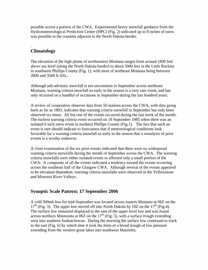
possible across a portion of the CWA. Experimental heavy snowfall guidance from the Hydrometeorological Prediction Center (HPC) (Fig. 2) indicated up to 8 inches of snow was possible in the counties adjacent to the North Dakota border. . Climatology The elevation of the high plains of northeastern Montana ranges from around 1800 feet above sea level (along the North Dakota border) to about 5000 feet in the Little Rockies in southwest Phillips County (Fig. 1), with most of northeast Montana being between 2000 and 3500 ft ASL. Although sub-advisory snowfall is not uncommon in September across northeast Montana, warning criteria snowfall so early in the season is a very rare event, and has only occurred on a handful of occasions in September during the last hundred years. A review of cooperative observer data from 50 stations across the CWA, with data going back as far as 1893, indicates that warning criteria snowfall in September has only been observed six times. All but one of the events occurred during the last week of the month. The earliest warning criteria event occurred on 18 September 1985 when there was an isolated 6 inch snow event in northern Phillips County (Fig.1). The fact that such an event is rare should indicate to forecasters that if meteorological conditions look favorable for a warning criteria snowfall so early in the season that a reanalysis of prior events is a worthy endeavor. A close examination of the six prior events indicated that there were no widespread warning criteria snowfalls during the month of September across the CWA. The warning criteria snowfalls were either isolated events or affected only a small portion of the CWA. A composite of all the events indicated a tendency toward the events occurring across the southeast half of the Glasgow CWA. Although several of the events appeared to be elevation dependent, warning criteria snowfalls were observed in the Yellowstone and Missouri River Valleys. Synoptic Scale Pattern: 17 September 2006 A cold 500mb low for mid-September was located across eastern Montana at 06Z on the 17th (Fig. 3). The upper low moved off into North Dakota by 18Z on the 17th (Fig.4). The surface low remained displaced to the east of the upper level low and was found across northern Minnesota at 06Z on the 17th (Fig. 5), with a surface trough extending west into southern Saskatchewan. During the morning the surface low continued to track to the east (Fig. 6) by which time it took the form of a broad trough of low pressure extending from the western great lakes into southwest Manitoba.

This was a cold system for this early in the season, but there was just enough warm air aloft to keep the majority of the precipitation in the form of rain. The 17 September 12Z sounding from Glasgow (Fig. 7) shows that the atmosphere was nearly saturated up to 650mb, with just a small layer near the surface that was above freezing. The saturated layer did not extend up into the favorable snow growth region between -10 and -20C. Across the Opheim Plateau in northern Valley County (approximately 50 miles to the north of where the sounding was taken in Fig. 7), the rain changed to sleet around midnight, and to all snow during the pre-dawn hours. The snow accumulated up to 3 inches across the plateau. Several cooperative observers from northern Phillips County east to Sheridan County along and near the Canadian border observed 1 to 2 inches of snowfall. Further to the south, in the Milk and Missouri River Valleys (an area more representative of the sounding environment in Fig. 7), accumulations ranged from a trace on the valley floor (elevation 1800-2200 ft ASL) to an inch in the surrounding higher terrain (elevations above 2700 ft ASL). Record cold high temperatures were observed on the 17th, with many areas not getting out of the 30s. Glasgow observed a record low maximum of only 39 degrees, which was the second coldest high temperature ever recorded so early in the season. Synoptic Scale Pattern: 23-24 September 1984 At 00Z 24 September 1984 a positively tilted upper trough extended from southern Alberta southwest into the Northern Rockies (Fig. 8). The upper trough progressed east during the next 24 hours (Fig. 9), with 500mb heights as low as 548 dam across northeast Montana by 00Z on the 25th. A cold pool of air aloft was observed over Saskatchewan and Alberta south into Montana. At the surface, an arctic high built south out of Canada as an area of low pressure organized across the southern Rockies (Figs. 10 & 11). This brought a period of overrunning snowfall to northeast Montana, with warning criteria snowfall observed in Prairie, McCone, and Richland Counties where snowfall reports ranged from 6 to 9 inches. The 00Z 24 September 1984 Glasgow, MT sounding (Fig. 12) shows that the sounding was saturated below 550mb, with the entire sounding below freezing. The saturated layer extended to approximately -20c, which is well into the favorable snow growth region. Comparison The synoptic patterns observed during the events of 17 September 2006 and 24 September 1984 were quite different. The 17 September 2006 event featured a closed 500mb low which tracked across the CWA. The 24 September 1984 event had an open wave at 500mb which crossed the area. Significant differences were also noted with the surface features. The 2006 event had a surface low that was displaced well to the east of the CWA. The 1984 event had a surface low well to the south of the forecast area with an arctic high to the north. The sounding in the 2006 event was clearly not saturated into

the favorable snow growth region. In contrast, in the 1984 event the sounding was saturated through the favorable snow growth region. Conclusion This paper showed that warning criteria snowfall occurred only 6 times during the month of September in the last one hundred years, and all of the warning criteria snow events occurred during the second half of the month. A brief reanalysis of the last warning criteria snowfall in September (24 September 1984 event) indicated that the meteorological set up which led to the conditions were completely different than expected with the 17 September 2006 event. The combination of the warning criteria event being rare and the meteorological set up looking completely different from the reanalysis proved to be excellent reasons for differing from both model (up to six inches of snow possible) and HPC precipitation guidance (up to 8 inches of snow possible). Forecasters should know the climatology of their forecast area of responsibility. During an early or late season snow event, it is highly recommended to see the frequency and occurrence of similar events across the area. Knowing whether an event occurs on average of once a year or once in 50 or 100 years can aid the forecaster in the forecast process. Performing a brief reanalysis of a prior event that produced similar conditions to those forecasted is always a good starting point. Of course, time constraints may limit an intensive analysis of prior events, but a brief look at the synoptic pattern will likely give some important clues. The Earth System Research Laboratory’s reanalysis tool can give the forecaster a quick snapshot of the synoptic patterns associated with a prior event. If the event has only happened on a handful of occasions, and the synoptic pattern differs significantly it may give the forecaster a heads up that the event is even more unlikely to occur. If the reanalysis indicates that conditions look quite similar, it is another forecasting tool that can add confidence to the forecast. Acknowledgments The author would like to thank Thomas Salem, the Science and Operations officer of the NWS forecast office in Glasgow, MT for his reviews and suggestions related to this publication.

References Dierking, C., 2005: Xmclimate Version 1.5. ACIS, cited 2006: Applied Climate Information System. [Available online at http://xmacis.nrcc.cornell.edu/] University of Wyoming Department of Atmospheric Science, cited 2006. [Available online at http://weather.uwyo.edu/upperair/sounding.html] Earth System Research Laboratory, cited 2006. [Available online at http://www.cdc.noaa.gov/]

Opheim Plateau
Glasgow
Missouri RiverValley County
Garfield County
McCone County
Prairie County
Richland CountyLittle
Rockies
Phillips County
Jordan
Sidney
Saskatchewan
North
Dakota
DanielsCounty
SheridanCounty
Fig. 1. Map of the Glasgow, MT CWA, in northeast Montana. Labels include location of areas including the Little Rockies, the Opheim Plateau and the towns of Glasgow, Jordan, and Sidney.

Fig. 2. HPC snowfall from 12Z 16 Sept. through 12Z Sept. 18. Shading provides amount of snowfall expected with 8 inches or less in different shades of green.

Fig. 3. 500mb heights at 06Z on 17 September 2006 from the NCEP/NCAR reanalysis. Shading is height contours in 25 decameters.

Fig. 4. Same as Fig. 3 except for 18Z on 17 September 2006.

Fig. 5. Sea level pressure (mb) at 06Z 17 September 2006 from the NCEP/NCAR reanalysis. Shading is pressure contours in 1.5 millibar increments.

Fig. 6. Same as Fig. 5 except for 18Z 17 September 2006.

Fig. 7. Glasgow, MT sounding at 12Z 17 September 2006 on a Skew-T Log-P diagram.
With pressure in the vertical in the middle of the image. Winds aloft plotted on the right.

Fig. 8. Same as Fig. 3 except for 00Z 24 September (with a slightly different color table).

Fig. 9. Same as Fig. 3 except 00Z 25 September 1984 (with a slightly different color table).

Fig. 10. Same as Fig. 5 at 00Z 24 September 1984 (with a slightly different color table).

Fig. 11. Same as Fig. 5 except at 00Z 25 September 1984 (with a slightly different color table).

Fig. 12. Glasgow, MT sounding at 00z 24 September 1984 on a Skew-T Log-P diagram. With pressure in the vertical on the left of the image. Winds aloft plotted to the right of
Skew-T (Univ. Wyo 2006).