climate change vulnerability assessment · jason kesling; environmental program director. upper...
TRANSCRIPT

Climate Change Vulnerability Assessment
EPA Region 9 Conference October 31, 2017

Upper Snake River Tribes (USRT) Foundation
• Burns Paiute Tribe (R10)• Fort McDermitt Paiute-Shoshone Tribe (R9)• Shoshone-Bannock Tribes of the Fort Hall Reservation (R10)• Shoshone-Paiute Tribes of the Duck Valley Reservation (R9)
USRT staff are guided by the USRT Charter (1. Fish and Wildlife, 2. Land, Water, and Air, 3. Cultural Resources, and 4. Federal Trust Responsibility) and Commission, composed of two elected officials from each of USRT’s four member tribes

• Bureau of Indian Affairso David Redhorse – Northwest Region
• Environmental Protection Agencyo Gilbert Pasqua – Region 9o Jim Zokan – Region 10
Acknowledgements

USRT Climate Change Vulnerability Assessment
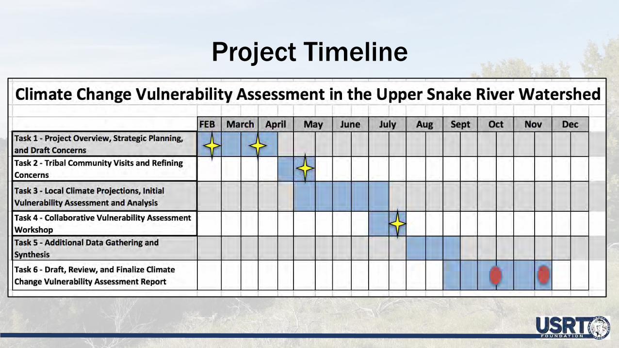
Project Timeline

Project Team
• Adaptation International (Project Coordination, Facilitation, and Implementation)
• Oregon Climate Change Research Institute (Climate Modeling and Projections)
• Climate Impacts Group (Species/Habitats Climate Change Vulnerability Index)
• USRT Staff (Project Coordination, Facilitation, and Implementation)• 2-3 Staff Members from USRT’s Four Member Tribes (Provide
Project Direction, Determine End Products, Document Review)

Project Objectives• Engage tribal leadership, staff, and membership during development of
a climate change vulnerability assessment• Identify species, habitats, and waterbodies most susceptible to climate
change• Integrate TEK into climate change planning• Increase ability to achieve future conservation and subsistence goals
and objectives in the face of added impacts and complexities of climate change, along with other stressors
• Provide invaluable climate change adaptive management planning into all four tribe’s current fish and wildlife and resource management plans, as these plans are periodically updated to better reflect future changing conditions and resource requirements
• Increase opportunities for USRT and its four member tribes for future climate-related funding
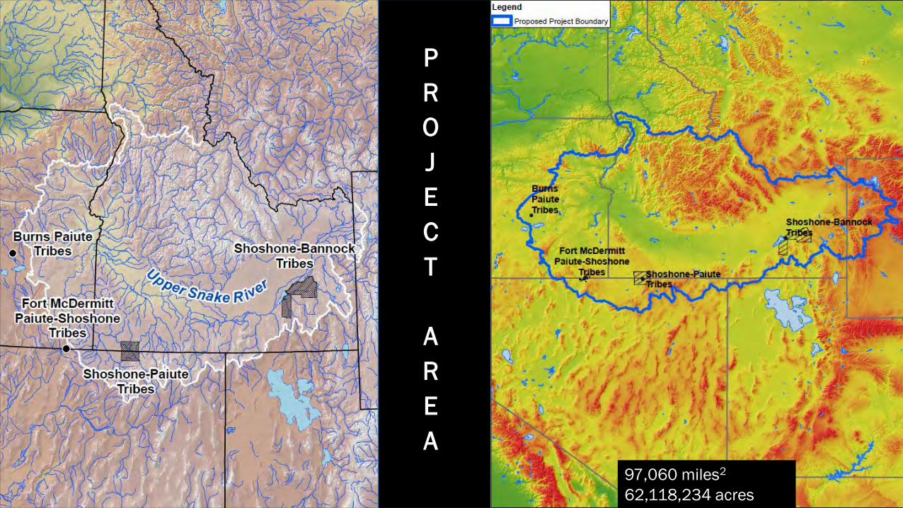
PROJECT
AREA
97,060 miles2
62,118,234 acres

Project Area with Precipitation and Temperature Domains (East, North, & South)
Climate Change Projections for the Upper Snake River Watershed

TemperatureProjections Using Two RepresentativeConcentrationPathways

TemperatureProjections
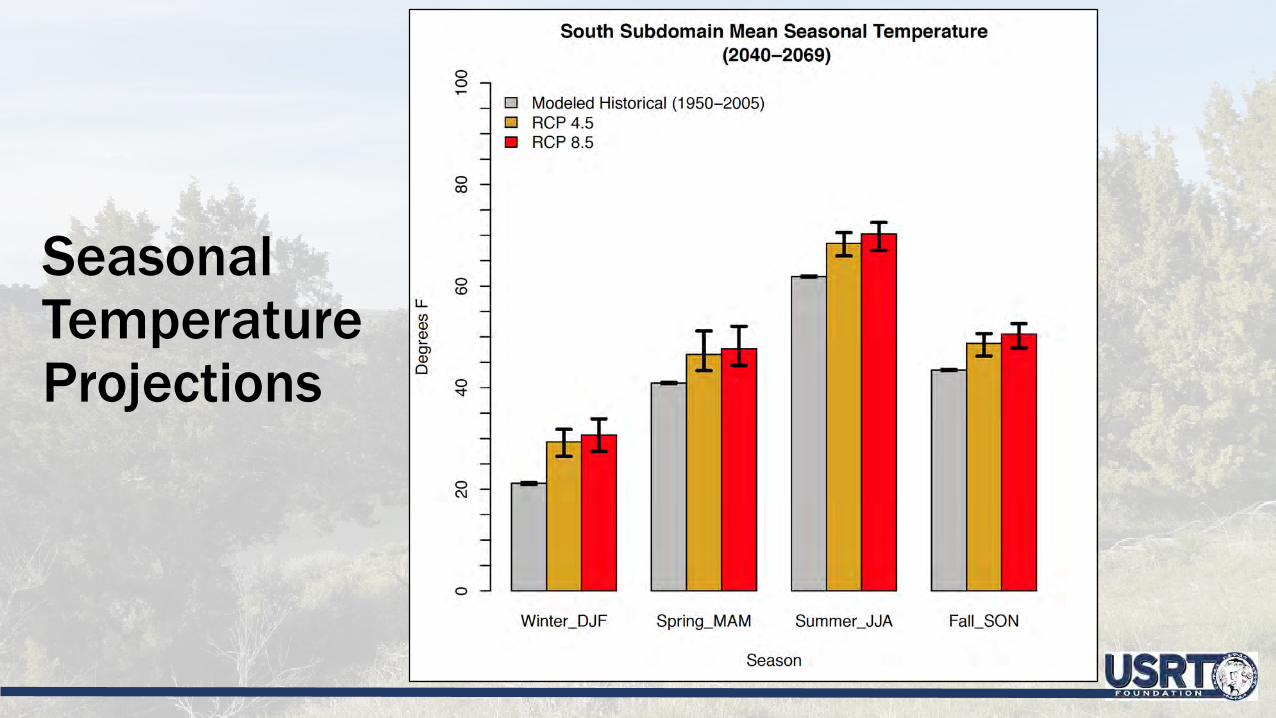
Seasonal Temperature Projections

PrecipitationProjections
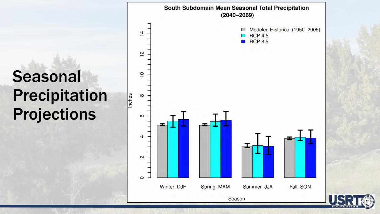
SeasonalPrecipitationProjections

Changes in Moisture
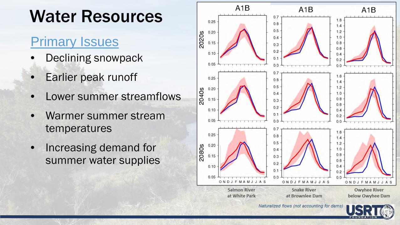
Water ResourcesPrimary Issues• Declining snowpack
• Earlier peak runoff
• Lower summer streamflows
• Warmer summer stream temperatures
• Increasing demand for summer water supplies

Reduced Summer Streamflows at Most Locations
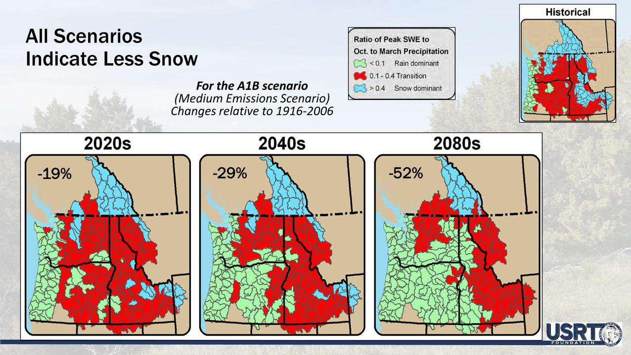
All Scenarios Indicate Less Snow
For the A1B scenario(Medium Emissions Scenario)
Changes relative to 1916-2006
-19% -29% -52%

WildfirePrimary Issues• Projected increase in the frequency
and severity of wildfires in forested areas, grasslands
• Changes in the frequency and location of insect and disease outbreaks will affect fire risk
• Spread of invasive species such as cheat grass increase fire risk in grasslands
• Changes in wildfires, insect infestations, and diseases are expected to have a greater impact on forests than changes in productivity, species distribution

USRT Shared Concerns & Assessing Vulnerability
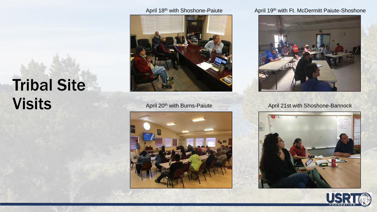
Tribal SiteVisits
April 18th with Shoshone-Paiute April 19th with Ft. McDermitt Paiute-Shoshone
April 20th with Burns-Paiute April 21st with Shoshone-Bannock

Tribal Site Visit Agenda

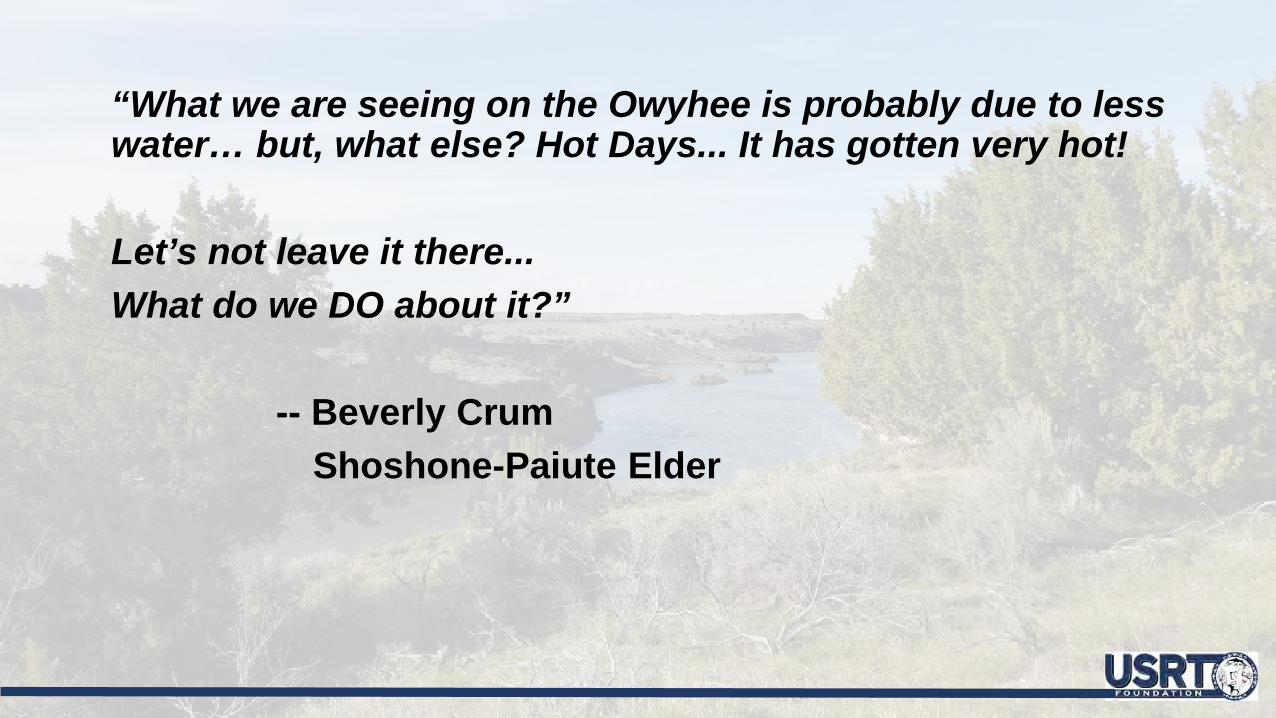
“What we are seeing on the Owyhee is probably due to less water… but, what else? Hot Days... It has gotten very hot!
Let’s not leave it there... What do we DO about it?”
-- Beverly CrumShoshone-Paiute Elder

Draft “Shared Concerns” Identified by Project Team

Final List of Shared Concerns

Two Approaches: Quantitative and Qualitative

Collaborative Vulnerability Assessment
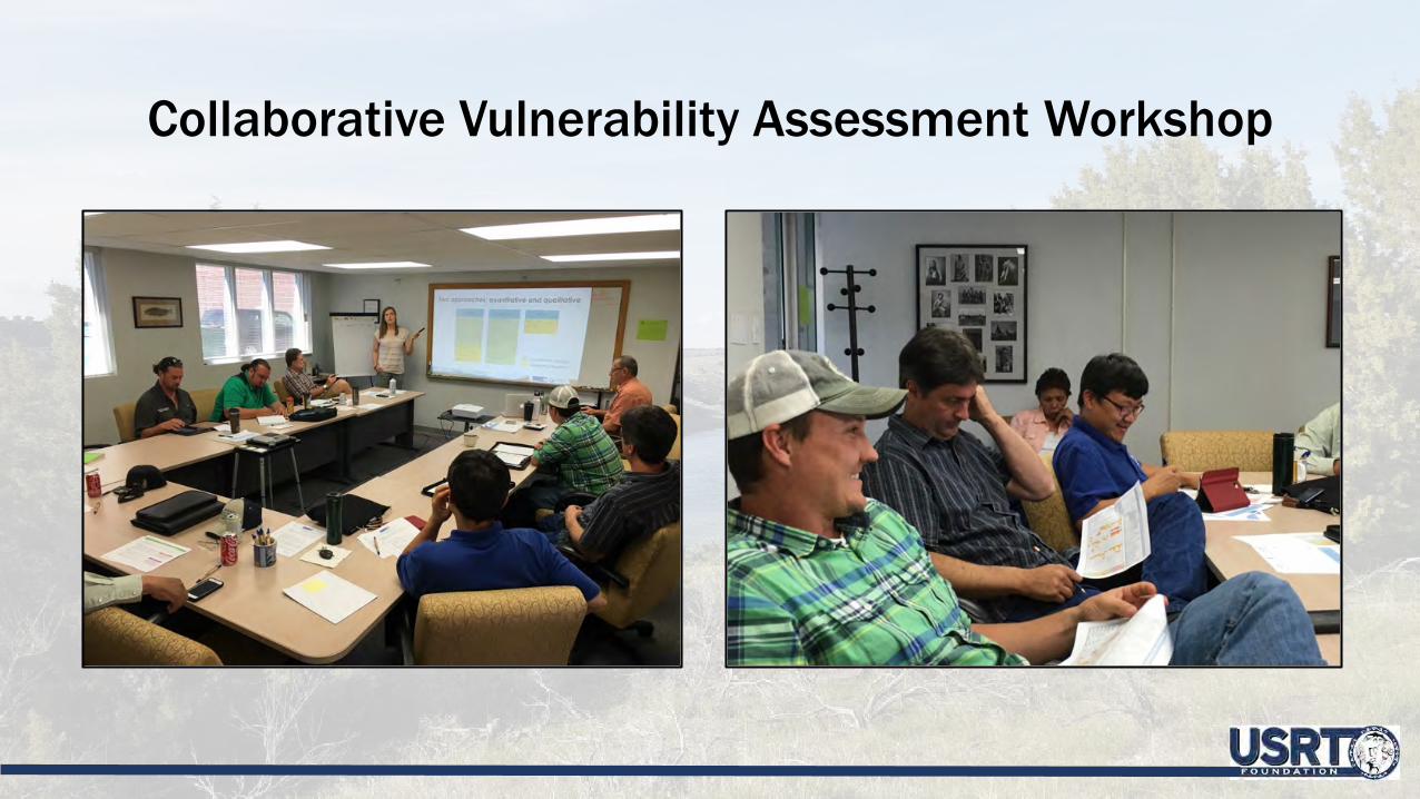
Collaborative Vulnerability Assessment Workshop

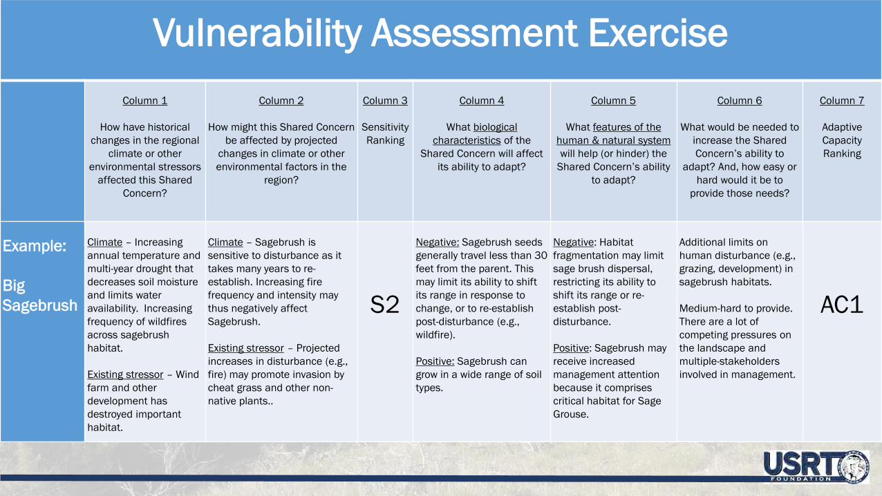
Vulnerability Assessment ExerciseColumn 1
How have historical changes in the regional
climate or other environmental stressors
affected this Shared Concern?
Column 2
How might this Shared Concern be affected by projected
changes in climate or other environmental factors in the
region?
Column 3
Sensitivity Ranking
Column 4
What biological characteristics of the
Shared Concern will affect its ability to adapt?
Column 5
What features of the human & natural systemwill help (or hinder) the
Shared Concern’s ability to adapt?
Column 6
What would be needed to increase the Shared Concern’s ability to
adapt? And, how easy or hard would it be to
provide those needs?
Column 7
Adaptive Capacity Ranking
Example:
Big Sagebrush
Climate – Increasing annual temperature and multi-year drought that decreases soil moisture and limits water availability. Increasing frequency of wildfires across sagebrush habitat.
Existing stressor – Wind farm and other development has destroyed important habitat.
Climate – Sagebrush is sensitive to disturbance as it takes many years to re-establish. Increasing fire frequency and intensity may thus negatively affect Sagebrush.
Existing stressor – Projected increases in disturbance (e.g., fire) may promote invasion by cheat grass and other non-native plants..
S2
Negative: Sagebrush seeds generally travel less than 30 feet from the parent. This may limit its ability to shift its range in response to change, or to re-establish post-disturbance (e.g., wildfire).
Positive: Sagebrush can grow in a wide range of soil types.
Negative: Habitat fragmentation may limit sage brush dispersal, restricting its ability to shift its range or re-establish post-disturbance.
Positive: Sagebrush may receive increased management attention because it comprises critical habitat for Sage Grouse.
Additional limits on human disturbance (e.g., grazing, development) in sagebrush habitats.
Medium-hard to provide. There are a lot of competing pressures on the landscape and multiple-stakeholders involved in management.
AC1

Results for Quantitatively (CCVI) Assessed Species

Results for Qualitatively Assessed Species

Results for Qualitatively Assessed Habitats

Focal Species Vulnerability Under Two Climate Scenarios

Products of the CCVA Project

Technical
Report

Technical
Fact
Sheets
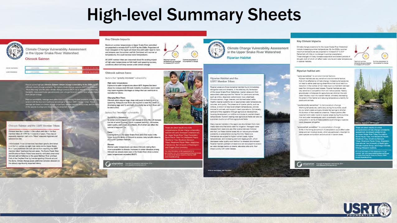
High-level Summary Sheets
Challenges
• Coordination and communication amongst four tribes• Refining the Shared Concerns List• Small budget to conduct a vulnerability assessment for a
large geographic area• Review process
Fiscal Year 2017–2018Phase II: A collaborative adaptation planning process, conducted through: the prioritization of the complete list of vulnerabilities identified in Phase I; a review of best practice adaptation efforts from national sources; selection, development, and tailoring of those actions to the USRT experience; and prioritization of adaptation strategies through the use of specific evaluation criteria.
Phase III: A collaborative adaptation implementation and monitoring plan, conducted through: direct and broad stakeholder engagement with the capacity to implement adaptation strategies; creation of a preferred implementation timeline; and structuring of an ongoing monitoring effort to track climate change impacts as they occur, adjust adaptation strategies, and track success of adaptation efforts.
Future Funding Years
Questions or Comments?
Jason KeslingEnvironmental Program DirectorUpper Snake River Tribes [email protected]/climate