cliff dwellings of the southwest - photograph america · cliff dwellings of the southwest spruce...
TRANSCRIPT
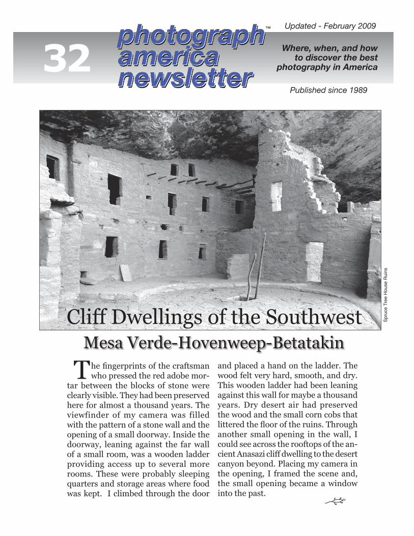
and placed a hand on the ladder. The wood felt very hard, smooth, and dry. This wooden ladder had been leaning against this wall for maybe a thousand years. Dry desert air had preserved the wood and the small corn cobs that littered the floor of the ruins. Through another small opening in the wall, I could see across the rooftops of the an-cient Anasazi cliff dwelling to the desert canyon beyond. Placing my camera in the opening, I framed the scene and, the small opening became a window into the past.
he fingerprints of the craftsman who pressed the red adobe mor-
tar between the blocks of stone were clearly visible. They had been preserved here for almost a thousand years. The viewfinder of my camera was filled with the pattern of a stone wall and the opening of a small doorway. Inside the doorway, leaning against the far wall of a small room, was a wooden ladder providing access up to several more rooms. These were probably sleeping quarters and storage areas where food was kept. I climbed through the door
T
Updated - February 2009
Spru
ce T
ree
Hou
se R
uins
Cliff Dwellings of the SouthwestMesa Verde-Hovenweep-Betatakin
™
32 Where, when, and howto discover the best
photography in America
Published since 1989

e call the people who lived here and built these cities of
stone the “Anasazi,” a Navajo word meaning “ancient ones” or “ancient enemies.” Archaeologists believe that these people originally came from Asia by crossing the Bering Strait 11,000 years ago. These nomads were hunters who supplemented their diet with the fruits, seeds, and berries they gathered. By 4,000 B.C., after the ice age, these tribes spread across North America. Some followed game eastward and others stayed on the Colorado Plateau. Two thousand years ago, trading with southern tribes from Central America introduced corn and squash. Farming began to supplement their hunting and gathering of food. About A.D. 600, farming, instead of gathering and hunting, became the primary source of food. The Anasazi cultivated corn, squash, and beans. Turkeys and dogs were domesticated. This culture began to flourish a thou-sand years ago across the Colorado Plateau when below-ground pit dwell-ings and brush-covered caves were replaced with walled villages built in the weatherproof and secure alcoves of steep canyon walls.A massive construction project, start-ing about A.D. 1200, produced the cliff dwellings at Mesa Verde and thousands of others scattered across the Colorado Plateau. The Anasazi had probably in-habited the Southwest for thousands of years, but lived in their cliff dwellings for less than one hundred years. By A.D. 1300, they had abandoned these sites and vanished. No one knows why. This culture had no writ-ten language. It is believed that a long drought, lasting from A.D. 1276 through 1299, caused the Anasazi to leave the area. Most archaeolo-gists agree that they moved south and eastward toward the Rio Grande River and disappeared or were absorbed by the cultures of southern pueblo Indian tribes. The Anasazi were gone hun-dreds of years before the Navajo tribes
arrived from the north. Navajos are not descendants of the Anasazi. Two cowboys, Richard Wetherill and Charlie Mason, were looking for stray cattle when they first discovered the Cliff Palace ruins on a snowy day in December of 1888. The dwellings had been abandoned for over five hundred years. Superstitions had kept other Native American tribes from inhabit-ing the sites. For the next twenty years, exploring parties and visiting groups made expeditions into these ruins. They camped in the ruins, burned wooden poles found in the sites, and took artifacts they found lying about. Visitors dug into the ruins looking for pottery, which could be sold to collec-tors. To preserve the extensive archeo-logical sites in the area, Mesa Verde National Park was established in 1906. The first serious archeologists from the Smithsonian Institution began excavat-ing and stabilizing the Cliff Palace in 1909.There are six hundred cliff dwellings located within the boundaries of Mesa Verde. Most of them contain only a few rooms. The very large site, called the Cliff Palace, was called a “magnificent city” by the cowboys who first saw it through blowing snow.There are thousands of Anasazi ru-ins scattered across the deserts of the Southwest. A few of the largest have been excavated, stabilized, restored, studied, and preserved for future generations to visit and study. Many were plundered and destroyed before the National Park Service was able to protect them. Now many of the more fragile Anasazi sites are closed to the public so that they can be carefully studied before they are picked over by vandals or trampled beneath the feet of curious visitors. The remains of the arts and crafts of the Anasazi, their ag-riculture, and especially their architec-ture may someday reveal the secrets of their civilization and maybe the secrets of their demise.
The red sandstone mesas covering the Colorado Plateau are very porous. They were deposited on the bed of an ancient sea during the Cretaceous Period some 78 mil-lion years ago. Rain and melting snow seeps down through the porous sandstone until it reaches a layer of shale. Water cannot penetrate the shale, so it flows horizontally between the layers until it emerges in the form of a spring or seep on the side of a canyon. Winter freezes these springs and the layers expand, loosening the sandstone and causing pieces to fall away. This slow pro-cess of cracking and collapse has formed the deep alcoves on the cliffs at Mesa Verde and in many other similar locations in the Southwest.
Wissue 32 - page 2
I enjoy photographing Indian ruins because of the way they fit into the desert environment. The red sandstone dwellings seem to grow right out of the steep cliffs. The mystery surrounding the lives of their creators is a fascinat-ing lure that brings me back to the Southwest. There are thousands of cliff dwellings across the Colorado Plateau. I recommend that you include Mesa Verde, Hovenweep, and Betatakin on your itinerary when you plan your next photo exploration of the Southwest.
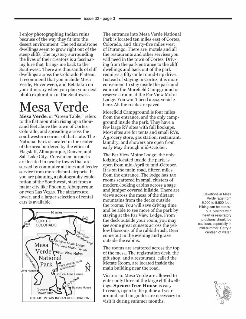
Mesa VerdeMesa Verde, or “Green Table,” refers to the flat mountain rising up a thou-sand feet above the town of Cortez, Colorado, and spreading across the southwestern corner of that state. The National Park is located in the center of the area bordered by the cities of Flagstaff, Albuquerque, Denver, and Salt Lake City. Convenient airports are located in nearby towns that are served by commuter airlines and feeder service from more distant airports. If you are planning a photography explo-ration of the Southwest, start from a major city like Phoenix, Albuquerque or even Las Vegas. The airfares are lower, and a larger selection of rental cars is available.
The entrance into Mesa Verde National Park is located ten miles east of Cortez, Colorado, and thirty-five miles west of Durango. There are motels and all the restaurants and other services you will need in the town of Cortez. Driv-ing from the park entrance to the cliff dwellings and back out of the park requires a fifty-mile round-trip drive. Instead of staying in Cortez, it is more convenient to stay inside the park and camp at the Morefield Campground or reserve a room at the Far View Motor Lodge. You won’t need a 4x4 vehicle here. All the roads are paved. Morefield Campground is four miles from the entrance, and the only camp-ground inside the park. They have a few large RV sites with full hookups. Most sites are for tents and small RVs. A grocery store, gas station, restaurant, laundry, and showers are open from early May through mid-October.The Far View Motor Lodge, the only lodging located inside the park, is open from mid-April to mid-October. It is on the main road, fifteen miles from the entrance. The lodge has 150 rooms scattered in small clusters of modern-looking cabins across a sage and juniper covered hillside. There are views across the mesa of the distant mountains from the decks outside the rooms. You will save driving time and be able to see more of the park by staying at the Far View Lodge. From the deck outside your room, you may see some great sunsets across the yel-low blossoms of the rabbitbrush. Deer come out in the evening and graze outside the cabins.The rooms are scattered across the top of the mesa. The registration desk, the gift shop, and a restaurant, called the Metate Room, are located inside the main building near the road. Visitors to Mesa Verde are allowed to enter only three of the large cliff dwell-ings. Spruce Tree House is easy to reach, open to the public all year around, and no guides are necessary to visit it during summer months.
Elevations in Mesa Verde rage from
6,000 to 8,500 feet. Hiking can be strenu-
ous. Visitors with heart or respiratory
problems should be cautious, especially in mid-summer. Carry a
canteen of water.
●
●
●
●●
Far View Visitor CenterFar View Ruins
160
666
10 miles
CORTEZCOLORADO
Morefield Campground
Far View Motor Lodge
Park Headquarters
and Museum
Spruce Tree House
Cliff Palace
Balcony HouseSquareTower Ruin
UTE MOUNTAIN INDIAN RESERVATION
Long House
Wetherill Mesa
Mesa Verde National Park
N̂
issue 32 - page 3
Three ranger-led tours per day are offered to Spruce Tree House during winter months, weather and trail conditions permitting. A winter visit can produce images that may be more dramatic than sunny-weather photo-graphs. A dusting of snow across the ruins can add an unusual element to a traditional southwest image.Balcony House is difficult to reach and can only be visited as part of a guided group. This ruin is tucked un-der a sandstone overhang, six hundred feet above the floor of Soda Canyon. You must be able to walk down 130 stairs, climb a thirty-two-foot ladder, squeeze through a narrow twelve-foot passageway, climb two more ladders
and carefully climb steps carved in the face of the cliff. You must have both hands free to climb the ladders and be able to squeeze through a passageway about eighteen inches wide, on your hands and knees–with your camera gear. This ruin is closed during winter months. Tickets are required and are available on a first-come basis at the Far View Visitor Center.
I use and recommend Stabilicers. These anti-skid, detachable Vibram rubber soles are lined with replace-able steel studs that prevent slipping on icy trails. They are easy to attach to the bottoms of your boots with VELCRO straps.
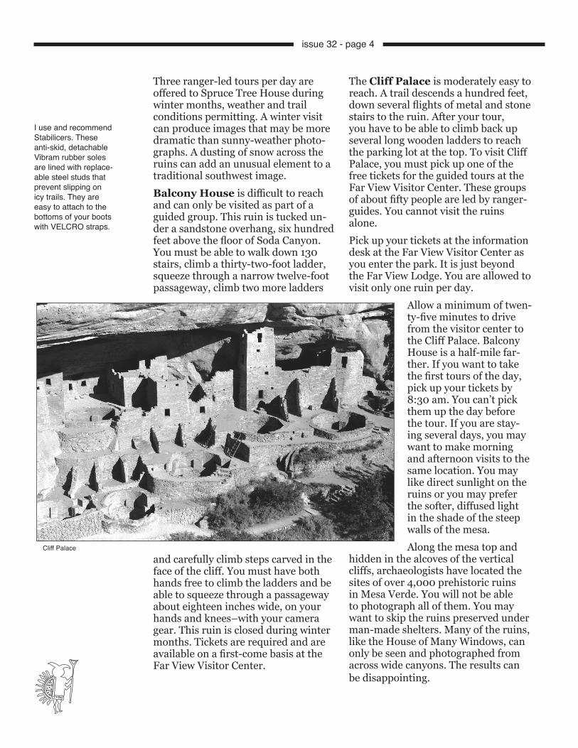
The Cliff Palace is moderately easy to reach. A trail descends a hundred feet, down several flights of metal and stone stairs to the ruin. After your tour, you have to be able to climb back up several long wooden ladders to reach the parking lot at the top. To visit Cliff Palace, you must pick up one of the free tickets for the guided tours at the Far View Visitor Center. These groups of about fifty people are led by ranger-guides. You cannot visit the ruins alone. Pick up your tickets at the information desk at the Far View Visitor Center as you enter the park. It is just beyond the Far View Lodge. You are allowed to visit only one ruin per day.
Allow a minimum of twen-ty-five minutes to drive from the visitor center to the Cliff Palace. Balcony House is a half-mile far-ther. If you want to take the first tours of the day, pick up your tickets by 8:30 am. You can’t pick them up the day before the tour. If you are stay-ing several days, you may want to make morning and afternoon visits to the same location. You may like direct sunlight on the ruins or you may prefer the softer, diffused light in the shade of the steep walls of the mesa. Along the mesa top and
hidden in the alcoves of the vertical cliffs, archaeologists have located the sites of over 4,000 prehistoric ruins in Mesa Verde. You will not be able to photograph all of them. You may want to skip the ruins preserved under man-made shelters. Many of the ruins, like the House of Many Windows, can only be seen and photographed from across wide canyons. The results can be disappointing.
Cliff Palace
issue 32 - page 4

sun had set. The horizon is all pink, and any clouds in the sky are still glow-ing. If you have to include the sky in your photographs, make it an interest-ing sky.Any wall you will see in the ruins that looks plastered and smooth is probably original, because the park service does not replaster after stabilization work is done. Small white plugs in the wooden timbers visible throughout the struc-ture indicate that these are original and not new timbers. These timbers were drilled and sampled for tree rings to date the structures. Because of the dry southwest climate, wooden timbers survive many centu-ries of natural weathering intact. In the museum above Spruce Tree House, clothing, food, and baskets found in the ruins are more than seven hun-dred years old.
The small white corks you will see in the
wooden poles used in the construction of the cliff dwellings and
mesa top pueblos cover holes bored to
remove tree-ring sam-ples. The science of
dendrochronology can accurately determine
the age of the tree, when it was cut. By
observing the width of the rings, weather and
precipitation patterns can be established. The patterns of tree
rings have accurately dated the construction
of the dwellings and are helping to solve the mysteries of the
Anasazi.
One of the first sites you come to en-tering the park is the Far View Ruins. Look through the two door openings facing south. There are more open-ings to inner rooms that can be lined up to recede into the distance. Move in close with a 20mm lens and the rooms appear much larger. Back off with a 200mm and line up the open-ings to make an interesting pattern. In mid-morning and in the middle of the afternoon, diagonal shadows are cast across the openings. This ruin is exposed to the open sky and it doesn’t make much difference what time of day you arrive. Climb the short ladder to the top of the wall. Move to either side of the ladder and include it in a wide-angle composition of the large kiva just beyond. A 17mm lens will in-clude both the ladder and the kiva.A hundred feet south of the Far View House is the Pipe Shrine House with twenty rooms and one large kiva. An interesting petroglyph pattern is on one of the stones along the south side of this ruin.My best color images of these mesa-top ruins were made in the warm light of evening about twenty minutes after the
Far View Ruins
Square Tower Ruin
issue 32 - page 5

A large pottery jar filled with corn was found here in 1955. The corn still looks edible. After viewing the many displays of the artifacts left by the Anasazi, stay and watch the slide show.The soft, diffused light of an overcast day reveals details deep in the alcoves–details that are hidden in the black shadows cast by direct sunlight. Some images are improved by strong textures and sharp shadows. Others need the even illumination of an overcast sky. Photographing ruins beneath a blue sky in the shadow of the mountain usually requires a warming filter. A “sky light” filter is usually not strong enough. I prefer an 81A filter to eliminate the excessive blue light.Late afternoon light will cast strong shadows across the ruins of the Square Tower House. There is no access into this dwelling. The viewpoint from the overlook above offers a good vantage point for a vertical photograph of the tower or a horizontal composition framing the whole eighty-room com-plex. Two of the seven kivas in Square Tower have portions of their original wooden roofs still intact after many centuries. Since visitors are not allowed into this ruin, there will be no one in your photograph. The space available at the overlook is limited. You may have to wait for the best tripod spot at the far end of the guard rail.Cliff Palace is the largest cliff dwelling in North America. There are larger cliff dwellings in Turkey that are still inhab-ited. Cliff Palace has 23 kivas and 217 rooms. The trail down to Cliff Palace is easy to negotiate. Climbing up and out of the ruins requires climbing three steep ladders and many steps carved in the stone cliffs. It is not a difficult climb. Many people take the ranger-guided tours each day. The narrow stairwell can be difficult to climb with a large camera bag. You’ll need both hands for
the ladders. A shoulder strap on your tripod makes the climb much easier. When you see the small hand-holds and steps used by the ancients that were cut into these vertical canyon walls, you will wonder how they ever reached these dwellings.Sign up for the last tour of the day through the Cliff Palace if you want di-rect light on the dwellings. Cliff Palace faces west. To shoot it in the softer light of morning shadows, take one of the morning tours. The ranger will meet the group at the top of the cliff and lead you down a series of metal and stone stairs. The group stops halfway down to wait for the preceding group to leave the ruin. “T”-shaped doorways are seen in many of the cliff dwellings here and in other sites. They are usually seen in walls that border courtyards. No one really knows why they are shaped that way. There are tiny windows that were prob-ably made for ventilation and larger openings that probably let smoke escape from small rooms. During winter months, deep snows covered this mesa, and the Anasazi probably survived around the fires built in the deep kivas. They ate the food they had stored in the granaries and small storage rooms built in the upper levels of the cliff dwellings. The people were not especially small, but the rooms were small and their door and window openings were small to conserve heat. Overnight temperatures can drop to well below freezing up here above 7000 feet. There are several fas-cinating abstract patterns painted on the walls of Cliff Palace. The Balcony House Ruin faces the east and receives direct sunlight in the morning. To photograph the more dra-matic textures, highlights, and shadows of direct sunlight across the ruin, arrive for the first tour. During any tour tak-en in the afternoon, the Balcony House will be all in shadows.
issue 32 - page 6

A camera hanging from a neck strap is going to hit the ladder rungs as you climb into and out of the ruins. There are several very narrow passageways that visitors must negotiate along the Balcony House tour. A large camera bag plus a tripod will be difficult to maneuver through the openings. My Lowepro Off Road fanny pack was per-fect for the exploration. I wore it in the back while climbing the ladders and moved it around in front of me when I crawled through the low openings of the long tunnels.
Arrive early and be one of the first in your group when you start down the stairs into Balcony House. After climb-ing up the ladders, squeezing through the narrow passageway, and entering the ruin, you will have time for sev-eral photographs before the rest of the group arrives. Look at the far wall di-viding the dwellings into two separate units. On the left side of the wall, next to the balcony, is a small window at eye level. As you enter the ruin, move to that far wall and set up your camera through that opening for a view of the rest of Balcony House.
The Soda Canyon Trail to the view point across the canyon from Balcony House is 3/4 miles. There is a good view of Balcony House from the edge of the cliff at the end of the trail. Use a 300mm lens to fill your frame with the Balcony House from that distance.Spruce Tree House, the third-largest cliff dwelling in the park, contains 114 rooms and 8 kivas. It was constructed between A.D. 1200 and A.D. 1276 and was home to about a hundred people. A large Douglas fir was growing in the ruin at one time. It was mistakenly called a “Douglas spruce” and that gave the ruin its name. This structure is the only dwelling open all-year-round to the public. You can enter this ruin without a guide. Spruce House was well protected from the elements by the large overhang-ing cliff above. Only about 5% of the structures have been rebuilt. Most of this ruin has only been stabilized and reinforced. The trail starts behind the Museum and is fairly steep but paved. There are no ladders to climb. Be care-ful of the poison ivy along the trail. It will take you about ten minutes to reach the ruin. Because the ruins are so deeply recessed into the alcoves in the canyon walls, snow does not reach the structures. The trail, however, can be very slippery in the winter.Late afternoon light is spotty because of the Douglas firs in the canyon in front of Spruce Tree House. Photo-graphing the Spruce Tree House ruins is easier than in past years when visi-tors were allowed to wander through the ruin. Now there is a rope across the lower edge of the structure which marks the boundary. There are excel-lent tripod locations all along the rope.
The ladders into Balcony House
issue 32 - page 7

A large flat courtyard is on the left side of the Spruce Tree House. This is the covered top of two kivas. Many of the wooden poles covering the kivas in these ruins have disintegrated and fallen into the pits. You may enter one of the reconstructed kivas in the Spruce Tree Ruin. My results with a 17mm lens and fill flash inside the kiva were acceptable. Try bouncing the flash off the back wall instead of using direct flash. Shadows cast by a ladder can be a problem.A relatively flat, three-mile trail splits off the Spruce Tree House Trail and leads to the largest panel of petroglyphs in this park. The trail follows the rim of Spruce and Navajo Canyons. The petro-glyphs face west and are in the sunlight in the afternoon.
There is an excellent museum next to the park headquarters near the Spruce Tree House ruin at the far end of the park. Allow at least an hour to tour the museum and watch the slide show. The small book store in the museum has a good selection of guide books, maps, tapes, and books on the ancient Anasazi. There are displays of some amazing pottery and clothing made by the Anasazi that looks almost new, and certainly not a thousand years old.Wetherill Mesa extends along the west-ern boundary of Mesa Verde National Park. It contains the second largest concentration of prehistoric sites on the mesa. It is twelve miles from the Far View Visitor Center. The road is open only during the summer season.
A tilt and shift, PC, or architectural lens on your 35mm or medium format camera will pre-vent the converging of parallel vertical lines. A 24mm PC lens would be an ideal choice for this trip. The same adjust-ments can be made with a view camera, but few photographers will want to haul a large-for-mat outfit into Balcony House. Instead of tilting my wide-angle lens upward to include the tops of towers, I position my camera in vertical format without tilting upward, and just include more of the foreground in my compositions. Including the circular rim of a kiva can fill a foreground and create a greater feeling of depth in a composition.
The Ruins Road Drive is open to the public from 8 am to sunset. There are many mesa-top dwellings that are open to the public but are not very photoge-nic. There are numerous view points of distant cliff dwellings that will be too far away and too small to photograph well. Concentrate on the three cliff dwellings that can be entered by the public, plus the Square Tower House and the Far View dwellings.Northeast of Mesa Verde are the San Juan Mountains of Colorado. The wild-flowers will draw you into this area in late July. The autumn color reaches its peak in late September. To photograph more Anasazi ruins, check your map for the most direct route to the Chaco Culture National Historic Park, a hun-dred miles southeast of Mesa Verde. Much closer are the Anasazi ruins of Hovenweep.
HovenweepSeven hundred fifty years ago thriving farming communities were located on an isolated, sage-covered mesa twenty five miles north of the Four Corners where the state boundaries of Utah, Colorado, New Mexico, and Arizona meet. Tall stone towers and extensive pueblos covered the rims of the can-yons on Cajon Mesa by the thirteenth century. Across the mesa, hundreds of acres around scattered communities were planted in corn, beans, squash, and cotton. Although it looks like a dry and barren wasteland now, there was sufficient water available on the mesa for an agricultural society to thrive a thousand years ago. Archaeologists theorize that these people moved south when drought conditions became too severe for them to survive. It is thought that a lessening of rainfall over a twenty-year period starting in A.D. 1276 made farming impossible.
Anasazi black-on-white pottery
issue 32 - page 8
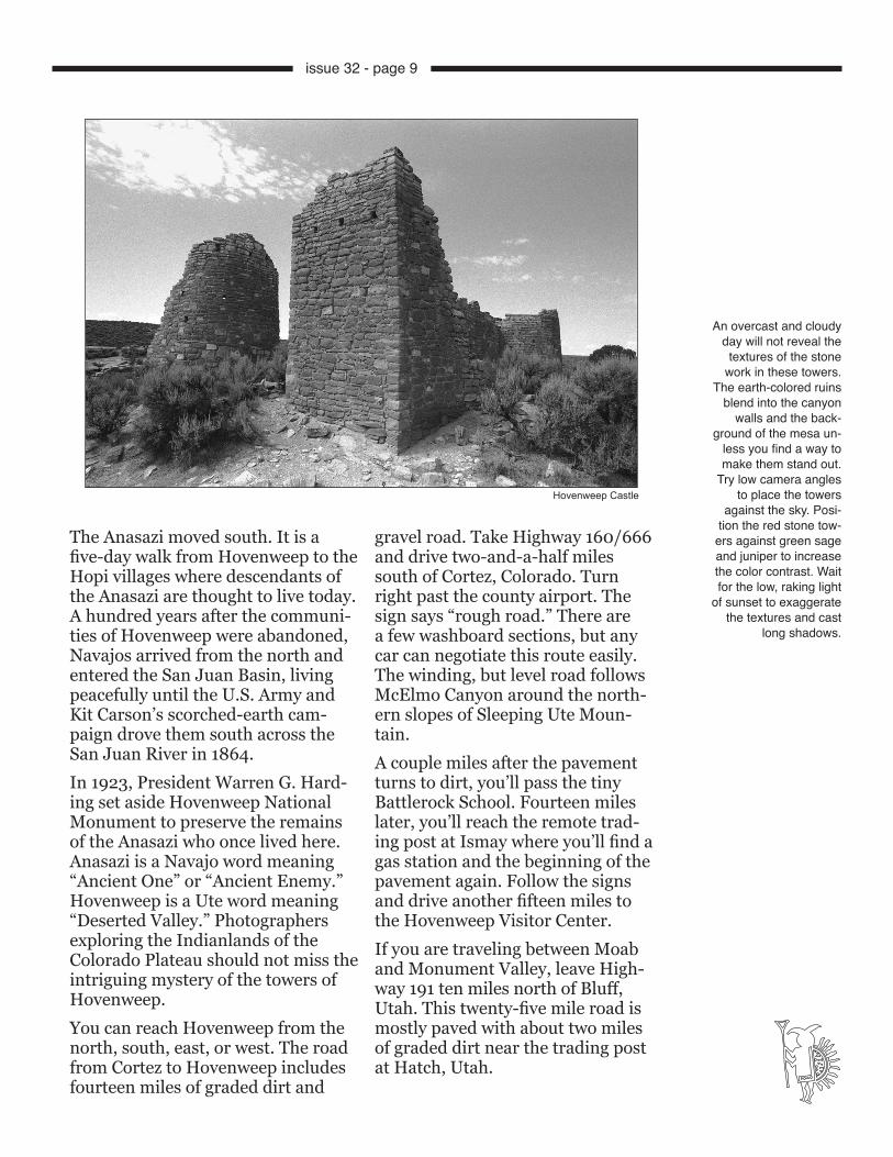
The Anasazi moved south. It is a five-day walk from Hovenweep to the Hopi villages where descendants of the Anasazi are thought to live today. A hundred years after the communi-ties of Hovenweep were abandoned, Navajos arrived from the north and entered the San Juan Basin, living peacefully until the U.S. Army and Kit Carson’s scorched-earth cam-paign drove them south across the San Juan River in 1864. In 1923, President Warren G. Hard-ing set aside Hovenweep National Monument to preserve the remains of the Anasazi who once lived here. Anasazi is a Navajo word meaning “Ancient One” or “Ancient Enemy.” Hovenweep is a Ute word meaning “Deserted Valley.” Photographers exploring the Indianlands of the Colorado Plateau should not miss the intriguing mystery of the towers of Hovenweep. You can reach Hovenweep from the north, south, east, or west. The road from Cortez to Hovenweep includes fourteen miles of graded dirt and
gravel road. Take Highway 160/666 and drive two-and-a-half miles south of Cortez, Colorado. Turn right past the county airport. The sign says “rough road.” There are a few washboard sections, but any car can negotiate this route easily. The winding, but level road follows McElmo Canyon around the north-ern slopes of Sleeping Ute Moun-tain. A couple miles after the pavement turns to dirt, you’ll pass the tiny Battlerock School. Fourteen miles later, you’ll reach the remote trad-ing post at Ismay where you’ll find a gas station and the beginning of the pavement again. Follow the signs and drive another fifteen miles to the Hovenweep Visitor Center.If you are traveling between Moab and Monument Valley, leave High-way 191 ten miles north of Bluff, Utah. This twenty-five mile road is mostly paved with about two miles of graded dirt near the trading post at Hatch, Utah.
Hovenweep Castle
An overcast and cloudy day will not reveal the textures of the stone
work in these towers. The earth-colored ruins
blend into the canyon walls and the back-
ground of the mesa un-less you find a way to make them stand out.
Try low camera angles to place the towers
against the sky. Posi-tion the red stone tow-
ers against green sage and juniper to increase the color contrast. Wait for the low, raking light
of sunset to exaggerate the textures and cast
long shadows.
issue 32 - page 9

Early morning and late afternoon light helps, too. Photograph these ruins from ground level, and you may not be able to remove the cluttered background from your compositions.The first ruin you will reach, a few hun-dred feet down the trail, is Hovenweep Castle, built about A.D. 1200. This was probably the home of several farming families. It stands on the rim of a shal-low canyon. There are two D-shaped towers remaining. When you move in close enough to avoid including the barrier ropes in your photograph, you’ll find that you will need a 20mm lens to frame both structures. You can shoot from either end, depending on the light. On the bottom of the canyon below the Castle stands a tall square tower, giving this area its name. Just across the nar-row canyon stands Hovenweep House. The tall circular structure is only a small remaining section of one of the largest pueblos in this group. This remaining section was built on solid rock. The rest of the pueblo was built on a talus slope. The ruins can be seen as a pile of stones down in the canyon. You can move in close, leaning over the rope with a wide-angle lens, or you can move back with a telephoto lens and include both the House and the Castle in one com-position. Continuing around the rim trail, you pass the twin towers of an ancient apartment house containing sixteen rooms. There are several more towers and parts of towers as well as the remains of a rectangular building along this trail. Below each ruin, are the remains of much larger structures. Along the trail where it crosses the bot-tom of the canyon, you will see a good angle for a photograph of the Round Tower on the rim of the canyon at Tow-er Point. You’ll need a 200-300mm lens for this shot. The lighting is best in the morning from this angle.The Square Tower Ruins can be ex-plored and photographed in a few hours from the well-marked trails. The dozen ruins along the Square Tower Trail are roped off. None of the sites have been
The Visitor Center at the Square Tower Ruins is open daily. Behind the center is a small picnic area and nearby is a campground. From the visitor center, looking south, you can see several of the stone towers unique to Hovenweep. Explore and photograph all of the dozen or so ruins in this group. Pick up a copy of the trail guide to the towers. The best ruins are found along a two-mile, two-hour loop trail that follows the canyon rims. There is a shorter one-mile, one-hour trail to Tower Point. Some steep and rocky sections are at the far end of the longer trail where it drops into the canyon, crosses the bottom, and climbs the other side. The rest of the trail is fairly level and easy to follow.The dwellings at Hovenweep were not built in alcoves on the sides of deep canyons. Unlike the canyons of Mesa Verde, the shallow arroyos across the mesa at Hovenweep are little more than depressions across the land. There are some low places in these arroyos where photographers can find low angles to shoot up at the towers and other structures, placing them against the sky. A cloud-filled sky is a big help when shooting Hovenweep.
The word Betatakin, with the accent on the first “ta,” means “ledge house” in Navajo. Keet Seel means “broken pottery” in the Navajo language.
UTAHARIZONA
CORTEZ
BLANDING●
●
●
● MONTICELLO
●PLEASANT VIEW
● SHIPROCK
San Juan River
●
666191
160
●
McElmo Road●Ismay
Trading Post
Hatch Trading Post
MesaVerde
262
N̂
COLORADONEW MEXICO
HovenweepBLUFF
issue 32 - page 10
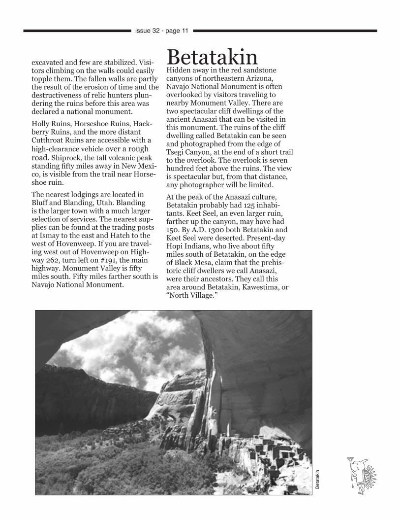
BetatakinHidden away in the red sandstone canyons of northeastern Arizona, Navajo National Monument is often overlooked by visitors traveling to nearby Monument Valley. There are two spectacular cliff dwellings of the ancient Anasazi that can be visited in this monument. The ruins of the cliff dwelling called Betatakin can be seen and photographed from the edge of Tsegi Canyon, at the end of a short trail to the overlook. The overlook is seven hundred feet above the ruins. The view is spectacular but, from that distance, any photographer will be limited.At the peak of the Anasazi culture, Betatakin probably had 125 inhabi-tants. Keet Seel, an even larger ruin, farther up the canyon, may have had 150. By A.D. 1300 both Betatakin and Keet Seel were deserted. Present-day Hopi Indians, who live about fifty miles south of Betatakin, on the edge of Black Mesa, claim that the prehis-toric cliff dwellers we call Anasazi, were their ancestors. They call this area around Betatakin, Kawestima, or “North Village.”
excavated and few are stabilized. Visi-tors climbing on the walls could easily topple them. The fallen walls are partly the result of the erosion of time and the destructiveness of relic hunters plun-dering the ruins before this area was declared a national monument.Holly Ruins, Horseshoe Ruins, Hack-berry Ruins, and the more distant Cutthroat Ruins are accessible with a high-clearance vehicle over a rough road. Shiprock, the tall volcanic peak standing fifty miles away in New Mexi-co, is visible from the trail near Horse-shoe ruin.The nearest lodgings are located in Bluff and Blanding, Utah. Blanding is the larger town with a much larger selection of services. The nearest sup-plies can be found at the trading posts at Ismay to the east and Hatch to the west of Hovenweep. If you are travel-ing west out of Hovenweep on High-way 262, turn left on #191, the main highway. Monument Valley is fifty miles south. Fifty miles farther south is Navajo National Monument.
Beta
taki
n
issue 32 - page 11
Richard and Al Wetherill discovered the ruins called Keet Seel in 1895. Navajo National Monument was es-tablished by President Taft to protect the ruins of Keet Seel in March, 1909. The boundaries were much larger at that time and included all of what is now Monument Valley Tribal Park. The ruins of Betatakin were not discovered until August of 1909 by a group out-fitted by John Wetherill. This was five months after this area was designated as a national monument.
In 1912, a revised plan reduced the to-tal area of this monument to only 360 acres. These lands surround the ruins of Betatakin, Keet Seel, and Inscrip-tion House, which is now closed to the public because of its fragile condition and lack of access through surrounding Navajo tribal lands.Navajo National Monument is nine miles off Highway 160. The monument is easily reached by visitors traveling between Page, Arizona, and Monument Valley. Turn north on Highway 564 at Black Mesa, twenty miles west of Kay-enta, Arizona.
There was no paved road into the monument be-fore 1965. The monument receives over a hundred thousand visitors each year. To protect the ruins from overuse and vandal-ism, the Park Service has instituted guided tours into the ruins and has closed off the most fragile cliff dwell-ings to the public.The trail out to the over-look above Betatakin starts
just outside the visitor center at the end of the road. It is a one-mile round trip. The trail is not an easy walk. Take your tripod and at least a 200-300 mm lens. Anything shorter will not adequately frame enough of the ruin. The Keet Seel ruin is well hidden from your view at the visitor overlook. It is six miles northeast of the visitor center in the
wall of a deep canyon. Keet Seel is the largest Anasazi ruin in Arizona and is probably the best preserved ruin in the country.The best way to photograph Betatakin is by taking a guided group tour led by a park ranger. The groups hike down into the canyon and enter the ruins. The tours take five hours and each group remains in the ruins for one hour. During the busy months of sum-mer, more than one tour is scheduled each day. Take the cooler morning tour when the best light reaches the ruins. Betatakin is in afternoon shadows dur-ing the summer. Carry at least one liter of water and a snack lunch. The elevation here is 7286 feet. Don’t attempt the hike if you have any problems with your health–espe-cially heart or respiratory problems. The last few hundred feet back up the trail are the most difficult. Railroad ties have been anchored to the rock to create steps in places. The steps are big ones. Hiking boots and good socks are necessary. Do not try this hike in tennis or running shoes. Wear a hat and plenty of sunscreen. Watch out for the poison ivy and the biting red ants.The trail descends from the far side of the canyon, to the east of the ruin. There are some very large clusters of claret cup cactus several hundred feet beyond the parking area, at the start of the trail down to Betatakin. You prob-ably won’t be given time to photograph them on the way down. When you return to the top, you will have plenty of time to shoot them. Watch for the claret cup cactus on the way down, at the first right turn in the trail, on the canyon side of the trail, on the slopes of some cross-bedded petrified sand dunes.There are some great views of Tsegi Canyon from the edge of the trail. You will not have time to do much shooting on the way down. Wait until you return up the trail. The light near the top will probably be better, later in the day.
Sign up for the last guided tour of the season if you want to photograph both the ruins of Betatakin and the forest of aspen painted in autumn’s yellows. The other great displays of aspen in the Southwest are found north of Zion, along Highway 14 through Cedar Breaks National Monument and west of Capitol Reef, along Highway 12, between Boulder and Torrey, Utah. The last two weeks of Sep-tember see the peak of aspen color across the higher elevations of the Southwest. The peak of autumn color starts a month later in Can-yon de Chelly when the cottonwood trees along Chinle Wash turn yellow about the last week of October.
Monument
Valley
Kayenta
UTAH ARIZONA
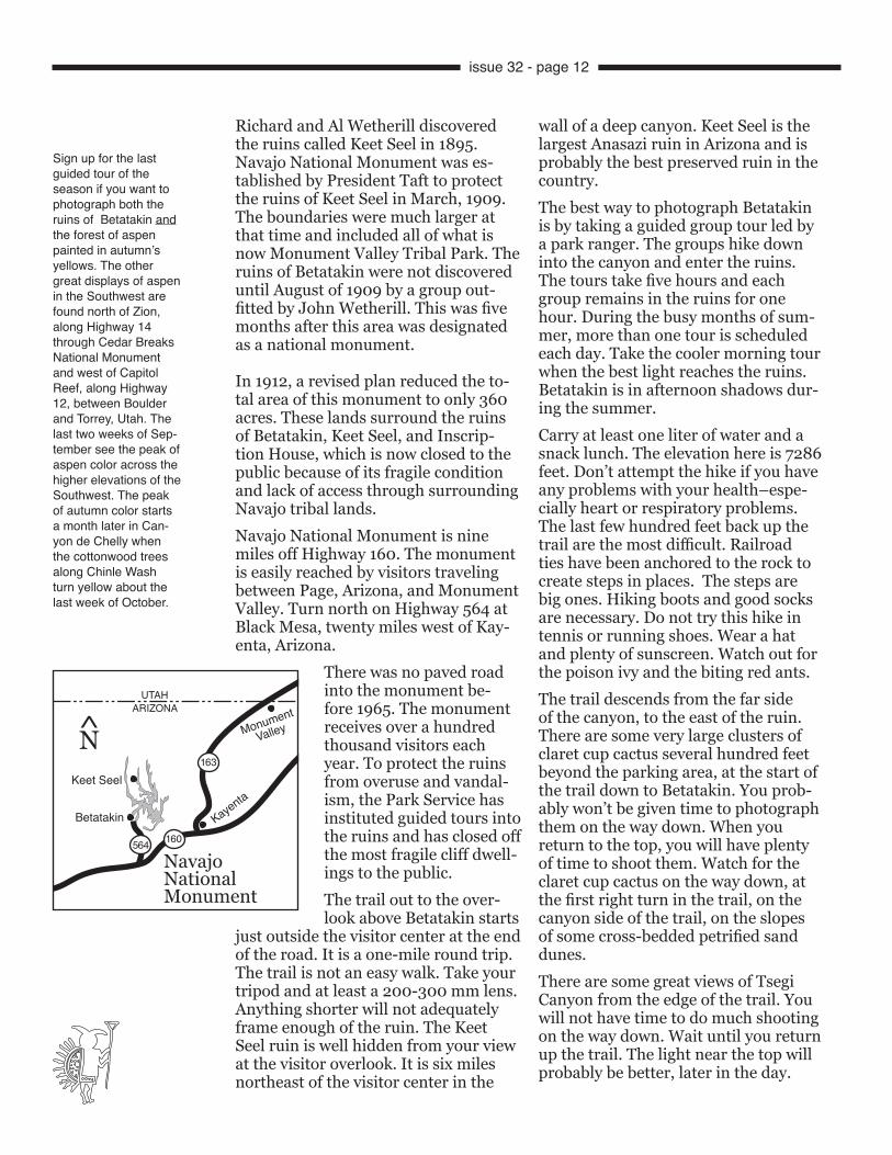
NavajoNationalMonument
163
160564
Betatakin
Keet Seel
N̂
issue 32 - page 12
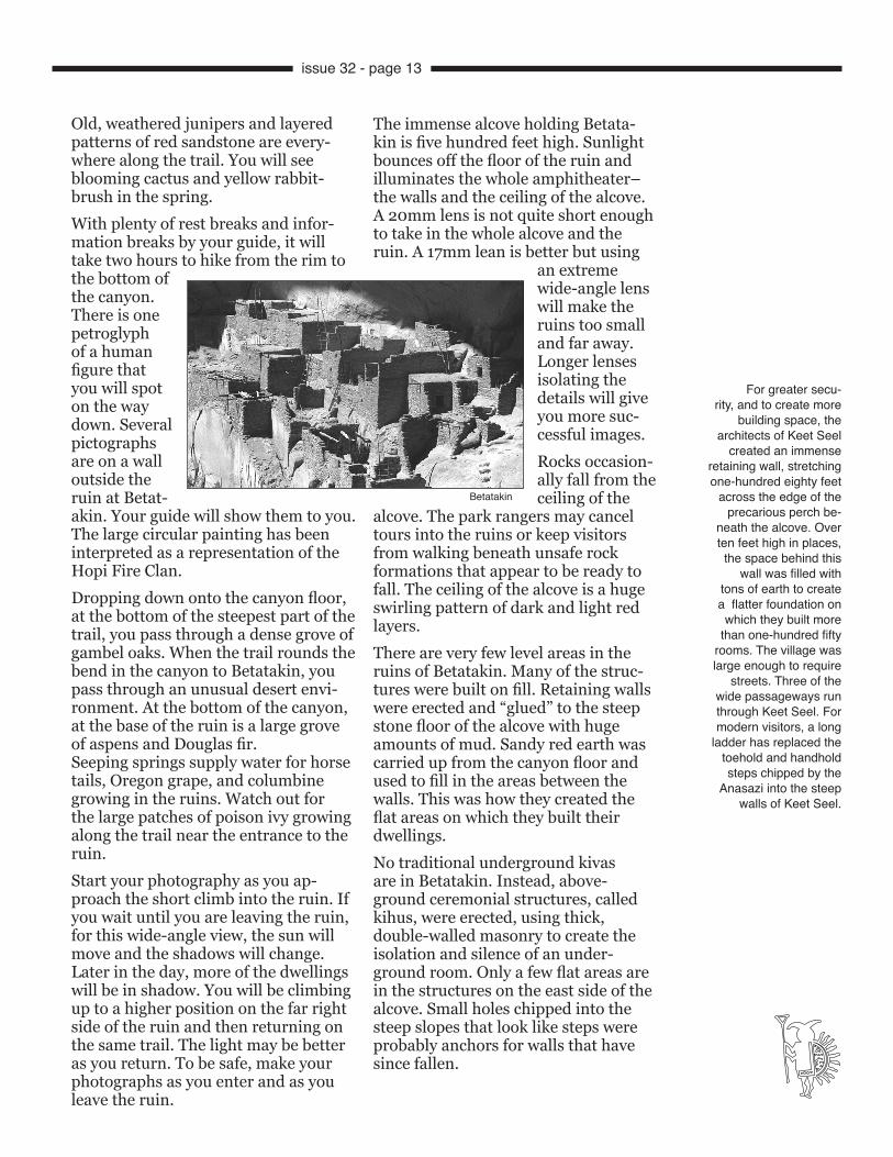
The immense alcove holding Betata-kin is five hundred feet high. Sunlight bounces off the floor of the ruin and illuminates the whole amphitheater–the walls and the ceiling of the alcove. A 20mm lens is not quite short enough to take in the whole alcove and the ruin. A 17mm lean is better but using
an extreme wide-angle lens will make the ruins too small and far away. Longer lenses isolating the details will give you more suc-cessful images. Rocks occasion-ally fall from the ceiling of the
alcove. The park rangers may cancel tours into the ruins or keep visitors from walking beneath unsafe rock formations that appear to be ready to fall. The ceiling of the alcove is a huge swirling pattern of dark and light red layers.There are very few level areas in the ruins of Betatakin. Many of the struc-tures were built on fill. Retaining walls were erected and “glued” to the steep stone floor of the alcove with huge amounts of mud. Sandy red earth was carried up from the canyon floor and used to fill in the areas between the walls. This was how they created the flat areas on which they built their dwellings. No traditional underground kivas are in Betatakin. Instead, above-ground ceremonial structures, called kihus, were erected, using thick, double-walled masonry to create the isolation and silence of an under-ground room. Only a few flat areas are in the structures on the east side of the alcove. Small holes chipped into the steep slopes that look like steps were probably anchors for walls that have since fallen.
Old, weathered junipers and layered patterns of red sandstone are every-where along the trail. You will see blooming cactus and yellow rabbit-brush in the spring.With plenty of rest breaks and infor-mation breaks by your guide, it will take two hours to hike from the rim to the bottom of the canyon. There is one petroglyph of a human figure that you will spot on the way down. Several pictographs are on a wall outside the ruin at Betat-akin. Your guide will show them to you. The large circular painting has been interpreted as a representation of the Hopi Fire Clan. Dropping down onto the canyon floor, at the bottom of the steepest part of the trail, you pass through a dense grove of gambel oaks. When the trail rounds the bend in the canyon to Betatakin, you pass through an unusual desert envi-ronment. At the bottom of the canyon, at the base of the ruin is a large grove of aspens and Douglas fir.Seeping springs supply water for horse tails, Oregon grape, and columbine growing in the ruins. Watch out for the large patches of poison ivy growing along the trail near the entrance to the ruin. Start your photography as you ap-proach the short climb into the ruin. If you wait until you are leaving the ruin, for this wide-angle view, the sun will move and the shadows will change. Later in the day, more of the dwellings will be in shadow. You will be climbing up to a higher position on the far right side of the ruin and then returning on the same trail. The light may be better as you return. To be safe, make your photographs as you enter and as you leave the ruin.
For greater secu-rity, and to create more
building space, the architects of Keet Seel
created an immense retaining wall, stretching one-hundred eighty feet
across the edge of the precarious perch be-
neath the alcove. Over ten feet high in places,
the space behind this wall was filled with
tons of earth to create a flatter foundation on
which they built more than one-hundred fifty
rooms. The village was large enough to require
streets. Three of the wide passageways run through Keet Seel. For modern visitors, a long
ladder has replaced the toehold and handhold steps chipped by the
Anasazi into the steep walls of Keet Seel.
Betatakin
issue 32 - page 13

Unlike the ruins at Mesa Verde, there are no visible metal reinforcing bars holding up the walls of the ruins at Betatakin. Guided groups visiting the ruin are allowed to climb up into the ruins, but only on the right side, the eastern half of the ruins. Visitors are not allowed inside the ruins in the western half of the dwellings. You may walk right up to the edge of those ruins and photograph through the windows, but you may not climb on the walls or enter those rooms.
Visitors are lead up the steps carved into the slopes and loop up and away from the off-limits section and into the several few remaining rooms of the eastern side of Betatakin. The trail ends high on the eastern edge of the alcove on a wide, flat ledge where you can set up your tripod and use every lens you brought to shoot the fantastic sight. The huge alcove dwarfs the ruin below you. A 17mm wide-angle lens will take in the whole alcove. The ruin will be hardly visible in your viewfind-er. A 28mm will give some of the feel-ing of the immense size of the alcove and still show much of the ruin.
A short telephoto lens in the 70-85mm range will frame the ruin. From that same location, a 300mm telephoto will tightly frame the four small structures, separated from the main dwellings, that appear to be an organic part of the distant buttresses supporting the opening of the alcove.Only an occasional winter snow blows far enough into the alcove to reach the outer walls of the structures. The overhanging alcove is so deep that rain does not fall on Betatakin. As you
climb through the ruins, you will see the steady flow of several seeping springs that provided water for the Anasazi community.Keet Seel, the largest cliff dwelling in Arizona, is in a remarkable state of pres-ervation. Most photogra-phers prefer to visit this area during the spring or later in the autumn, when the weather is cooler and the crowds of summer have left. If you want to join the guided tours and visit the ruins, plan to arrive be-tween the end of May and the first of September. The
sixteen-mile round trip hike to Keet Seel can be done in one long and tiring day. You will probably want to make it a two day backpack trip with one over-night stop. There is no drinking water available along the route.
Betatakin Ruins
Have a great trip and send me a postcard!
issue 32 - page 14
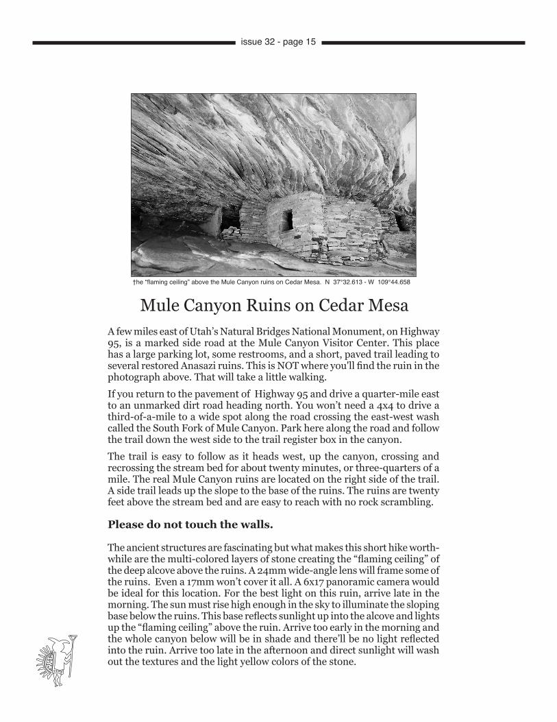
A few miles east of Utah’s Natural Bridges National Monument, on Highway 95, is a marked side road at the Mule Canyon Visitor Center. This place has a large parking lot, some restrooms, and a short, paved trail leading to several restored Anasazi ruins. This is NOT where you'll find the ruin in the photograph above. That will take a little walking. If you return to the pavement of Highway 95 and drive a quarter-mile east to an unmarked dirt road heading north. You won’t need a 4x4 to drive a third-of-a-mile to a wide spot along the road crossing the east-west wash called the South Fork of Mule Canyon. Park here along the road and follow the trail down the west side to the trail register box in the canyon. The trail is easy to follow as it heads west, up the canyon, crossing and recrossing the stream bed for about twenty minutes, or three-quarters of a mile. The real Mule Canyon ruins are located on the right side of the trail. A side trail leads up the slope to the base of the ruins. The ruins are twenty feet above the stream bed and are easy to reach with no rock scrambling.
Please do not touch the walls.
The ancient structures are fascinating but what makes this short hike worth-while are the multi-colored layers of stone creating the “flaming ceiling” of the deep alcove above the ruins. A 24mm wide-angle lens will frame some of the ruins. Even a 17mm won’t cover it all. A 6x17 panoramic camera would be ideal for this location. For the best light on this ruin, arrive late in the morning. The sun must rise high enough in the sky to illuminate the sloping base below the ruins. This base reflects sunlight up into the alcove and lights up the “flaming ceiling” above the ruin. Arrive too early in the morning and the whole canyon below will be in shade and there’ll be no light reflected into the ruin. Arrive too late in the afternoon and direct sunlight will wash out the textures and the light yellow colors of the stone.
†he “flaming ceiling” above the Mule Canyon ruins on Cedar Mesa. N 37°32.613 - W 109°44.658
Mule Canyon Ruins on Cedar Mesa
issue 32 - page 15
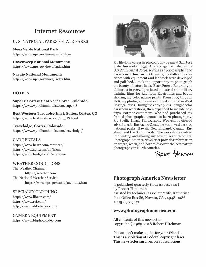
My life-long career in photography began at San Jose State University in 1957. After college, I enlisted in the U.S. Army Signal Corps, serving as a photographer and darkroom technician. In Germany, my skills and expe-rience with equipment and lab work were developed and polished. I took the opportunity to photograph the beauty of nature in the Black Forest. Returning to California in 1965, I produced industrial and military training films for Raytheon Electronics and began showing my color nature prints. From 1969 through 1981, my photography was exhibited and sold in West Coast galleries. During the early 1980’s, I taught color darkroom workshops, then expanded to include field trips. Former customers, who had purchased my framed photographs, wanted to learn photography. My Pacific Image Photography Workshops offered adventures to the Pacific Coast, the Southwest deserts, national parks, Hawaii, New England, Canada, En-gland, and the South Pacific. The workshops evolved into writing and sharing my adventures with others. Photograph America Newsletter provides information on where, when, and how to discover the best nature photography in North America.
Photograph America Newsletteris published quarterly (four issues/year)by Robert Hitchmanassisted by technical associate/wife, KatherinePost Office Box 86, Novato, CA 94948-00861-415-898-9677
www.photographamerica.com
All contents of this newslettercopyright © 1989-2018 Robert Hitchman
Please don’t make copies for your friends.This is a violation of Federal copyright laws.This newsletter survives on subscriptions.
Internet ResourcesU. S. NATIONAL PARKS / STATE PARKS
Mesa Verde National Park:https://www.nps.gov/meve/index.htm
Hovenweep National Monument:https://www.nps.gov/hove/index.htm
Navajo National Monument:https://www.nps.gov/nava/index.htm
HOTELS
Super 8 Cortez/Mesa Verde Area, Coloradohttps://www.wyndhamhotels.com/super-8
Best Western Turquoise Inn & Suites, Cortez, COhttps://www.bestwestern.com/en_US.html
Travelodge, Cortez, Coloradohttps://www.wyndhamhotels.com/travelodge/
CAR RENTALShttps://www.hertz.com/rentacar/https://www.avis.com/en/homehttps://www.budget.com/en/home
WEATHER CONDITIONSThe Weather Channel: https://weather.comThe National Weather Service: https://www.nps.gov/state/ut/index.htm
SPECIALTY CLOTHINGhttps://www.llbean.com/https://www.rei.com/http://www.eddiebauer.com/
CAMERA EQUIPMENThttps://www.bhphotovideo.com