city of takoma park watershed...
TRANSCRIPT

1
CITY OF TAKOMA PARK
WATERSHED IMPLEMENTATION PLAN
NARRATIVE REPORT SUBMITTAL
November 18, 2011

2
Takoma Park WIP Strategy Description
The City of Takoma Park occupies 1280 acres of land located in the southeastern corner of
Montgomery County, Maryland. All of this land is defined as Urban Land, and only the Urban
Land Use sector is planned for within the WIP submittal. Takoma Park borders Prince George’s
County to the east, and Washington D.C. to the South. Takoma Park lies within the Sligo Creek
Sub watershed to the Anacostia River. The Sligo Creek sub watershed is one of the oldest
developed areas of the Anacostia watershed, having been largely developed during the 1930’s -
50’s; well before the advent of modern stormwater management controls. Although there have
been many various restoration projects and numerous stormwater BMPs (Best Management
Practices) constructed in the Sligo Creek subwatershed, water quality and aquatic habitat and
terrestrial habitat remains degraded. Sligo Creek exhibits moderate to high TSS, nutrient and
bacteria loadings, and one of the worst trash problems in the Anacostia watershed.
The City of Takoma Park aims to achieve the goal to meet the Chesapeake Bay Total Maximum
Daily Load (TMDL) through fulfilling the requirements of our current National Pollutant
Discharge Elimination System (NPDES) Municipal Separate Storm Sewer System (MS4) –
Phase II Permit. We are expecting future permits to call for a 20% retrofit of impervious area for
which runoff is not currently managed to the maximum extent practicable (MEP). Our plan is to
achieve this goal mainly by employing Environmental Site Design (ESD) techniques in future
Capital Improvement Projects (CIP) and Stormwater Management (SWM) projects. Also we
plan to promote other structural and nonstructural BMPs for retrofit projects. Additionally other
programmatic means to achieve pollution reduction such as public education and outreach
campaigns will be intensified in the coming years.
The City’s MS4 Phase II Permit requirements include participation in watershed restoration in
coordination with Montgomery County’s Countywide Coordinated Implementation Strategy.
The City of Takoma Park’s Watershed Implementation Plan is adapted from this previously
coordinated effort of the County, in particular with objectives geared toward Sligo Creek and the
Anacostia Watershed.
The Countywide Coordinated Implementation Strategy presents the restoration strategies that are
needed to meet the watershed-specific restoration goals and water quality standards as specified
in the current County MS4 permit. Specifically, the Strategy will provide the planning basis for
the County to:
1. Meet TMDL Wasteload Allocations (WLAs) approved by EPA.
2. Provide additional stormwater runoff management on impervious acres equal to 20%
of the impervious area for which runoff is not currently managed to the maximum extent
practicable (MEP).
3. Meet commitments in the Trash Free Potomac Watershed Initiative 2006 Action
Agreement that include support for regional strategies and collaborations aimed at
reducing trash, increasing recycling, and increasing education and awareness of trash
issues throughout the Potomac Watershed.

3
4. Educate and involve residents, businesses, and stakeholder groups in achieving
measurable water quality improvements.
5. Establish a reporting framework that will be used for annual reporting as required in
the County’s NPDES MS4 Permit.
6. Identify necessary organizational infrastructure changes needed to implement the
Strategy.

4
Figure 1: Takoma Park and Sligo Creek Impervious Features, Sligo Creek Sub-Watershed

5
Current Capacity Analysis for Takoma Park
The following Response Table (Table 1) supports the development of Maryland’s Phase II WIP.
Specifically, it supports an assessment of Takoma Park’s current capacity to conduct
implementation actions to help achieve nutrient and sediment reductions.
Takoma Park, as a Phase II municipality will respond to the questions that directly relate to our
jurisdiction. In some cases, the County will address the larger issues. We also understand that
for some small municipalities such as Takoma Park there might be no information response
necessary. In that case, we would like to state that we have reviewed the worksheets (found in
MDE WIP Deliverable Guidance, 10-1-11) and have concluded that no responses are necessary.

6
Table 1. Responses to Current Capacity Analysis Questions
Program Program Organization and Description Budget Staffing Estimated Pace
of
Implementation
Options for
Building Capacity
Other
Stormwater Restoration Programs The City Engineer, Arborist, and Public Works Director
identify developed areas that do not have stormwater
management or that have inadequate stormwater management
controls and prioritize those areas for restoration. When older
inadequate stormwater management facilities are present,
these facilities are retrofitted. In areas without stormwater
management, ESD/LID practices are installed to the
Maximum Extent Practicable. A Stormwater Fee in Takoma
Park is used to support the Stormwater Program, which
includes CIP Project Funding, maintenance of the drainage
infrastructure; protecting properties from flooding; protecting
our streams and wetlands from erosion and pollution; and
complying with state and federal regulatory mandates.
FY 2012 Stormwater Utility
Budget: $454,500 (based on
SWM Fee of $48/ERU)
SWM components for other
Capital Projects (traffic
calming, sidewalks) also
funded through separate
Budget
Describe Expenditures:
Personnel $80,500;
Maintenance and repair
$207,000; Capital Projects
$167,000
Expenditure projections for
2013: $450,000 - $500,000
Number of Full
Time
Employees: .75
Contractors
supplement
staffing:
$80,000 -
$100,000
average
Other: Some
maintenance
activities
funded through
General Fund
Provide an
estimation of the
average annual
pace of
stormwater
retrofit
implementation
(ESD):
Approximately 3
impervious
acres/year
Intentions for
stormwater fee
system to be
reconsidered and
possibly raised.
Currently the Fee is
based on FY2007
needs.
Grant options are
evaluated as they
become available.
Collaboration
with SHA,
MGC, and
Chesapeake
Bay Trust for
Flower Ave.
Green Streets
Project with a
budget of
$916,000 total.
Urban Nutrient Management Program
Programs that account for local educational and outreach
programs to promote fertilizer management. In addition to
this, the Maryland Department of Agriculture regulation of
lawn care companies and the State’s new Fertilizer Use Act of
2011 will be coming into effect.
*The State plan will address the later two forms of urban
nutrient management in the WIP on behalf of local teams.
N/A, State’s new Fertilizer Use
Act of 2011 is expected to
greatly reduce fertilizer use and
promote proper application
timing.
Watershed Management Planning
Takoma Park has adopted the County’s Plan for the Anacostia
(and Sligo Creek Subwatershed). Additionally, watershed
management and land use programs are described in City of
Takoma Park Master Plan.
Land Use Planning
The City Housing and Community Development office
actively participates with land use planning coordinated by
MNCPPC.
Land Conservation City has purchased designated areas for Open Space
Preservation and retains a list of potential sites for future
procurement. The City of Takoma Park Open Space Plan was
adopted in December 12, 1994 and is the primary document
providing policies and guidelines for planning vacant land.
Forest Conservation Programs The City has an Urban Forest Office that oversees the public
tree canopy and implements the tree removal permit process,
requiring replanting for any live tree removal. In addition the
City funds new tree planting (100-120 trees per year) to
increase canopy in the right of way. The City also administers
a program for residents to purchase reduced cost trees for
private property planting (50-100 trees per year).
FY2012 budget of 250,000
Describe Expenditures:
$22,000 tree planting
$20,000 public rebate program
$91,000 personnel/training
$115,500 subcontractor costs
$1,500 postage
1 FTE 100-120 trees
per year on
public space
50-100 trees per
year private
property
Capacity has been
increased in FY2012,
with $20,000 being
added to the budget
for private tree
planting within the
Urban Forest Office.

7
Current Status of Retrofitting Effort (BMPs installed since 2006)
As stated previously in our WIP Strategy Description, the City of Takoma Park aims to achieve
the goal to meet the Chesapeake Bay Total Maximum Daily Load (TMDL) through fulfilling the
requirements in the current National Pollutant Discharge Elimination System (NPDES)
Municipal Separate Storm Sewer System (MS4) – Phase II Permit.
Responding to our current NPDES MS4 Phase II Permit, while striving toward the 20% retrofit
goal for impervious surfaces, the City has used Geographic Information System (GIS) tools to
better understand our overall impervious surface quantities, and the implications of a possible
20% retrofit, which are approximated as follows:
Total City Area: 1280 Acres
Total Area Impervious: 397 Acres
Roads: 138 Acres
Buildings: 158 Acres
Parking Lots: 85 Acres
Sidewalks: 16 Acres
Total retrofit effort to meet possible 20% goal: 79 Acres
Since 2006 Takoma Park has planned, designed, and installed several ESD Stormwater Best
Management Practices (BMPs), mainly as Capital Improvement Projects funded through the
SWM Fund. Our current ESD BMP retrofitting effort for impervious surfaces, through
Permitted BMPs and City BMPs is 14 Acres (detailed in Table 2).
Additionally, Takoma Park has been working toward the TMDL goals through Alternative
Restoration Credits. These credits are given for alternative BMPs that give jurisdictions greater
flexibility toward meeting stormwater permit requirements. The BMPs that Takoma Park
employs in this category include street sweeping, stream restoration, and tree planting. Totals
for these categories are listed below (calculations for Equivalent Impervious Acres Treated from
MDE’s Accounting For Stormwater Wasteload Allocations and Impervious Acres Treated,
Guidance for NPDES Stormwater Permits June (Draft) 2011), page 12, 22, and 26).
Total Regenerative Street Sweeping: 40 Acres per Year at 0.13 Impervious Acres Equivalent
yields 5 Acres.
Total Stream Restoration/Stabilization: 550 Linear Feet (LF) at 0.01 Impervious Acres
Equivalent yields 6 Acres.
Total Tree Planting: 5 Acres on Pervious Urban (500 trees, assuming tree planting typically
occurs piecemeal across the urban landscape and that 100 trees per acre or greater is necessary
with at least 50% of the trees being 2 inches or greater in diameter at 4 ½ feet above ground
level.) at 0.38 Impervious Acres Equivalent yields 2 Acres.
8
The sum of Impervious Acres Treated via ESD BMPs (14 Acres) and Alternative Restoration
Credit (13 Acres) is 27 Acres Treated of 79 total Impervious Acres, yielding at this point 52
Impervious Acres that currently has no stormwater treatment.
A comprehensive list and description of currently installed City Stormwater BMPs is described
in Appendix A.
2013 Milestones and Strategy to achieve the Final Target Loads (2020) and Interim Target
Loads (70% of Final Load by 2017)
An outline of The City of Takoma Park’s 2013 Milestones are presented in this section, followed
by a detailed Strategy to achieve the Final Target Loads (2020) as well as Interim Target Loads
(70% of Final Load by 2017). Both Milestones and Strategies will address two categories of
action: Implementation Actions and Program Development Actions.
Implementation Actions are designed and installed structural actions (i.e. restoration activities or
ESD/LID SWM Projects) resulting in direct pollution load reductions. The quantities can be
expressed in various units, such as “acres implemented,” and converted to an associated nutrient
and sediment load reduction in pounds.
The Program Development category is defined as measures that will increase our capacity and
thereby accelerating implementation actions in the medium-term future. Such program
enhancement milestones will, in most cases, coincide with scheduled strategy implementation
steps to be described in the Phase II WIP to address funding needs, the need for additional legal
authority, enhancing existing programs, and designing and establishing new programs.
2013 Milestones
Fiscal Year 2012 and FY2013 will bring about several Implementation Actions for stormwater
projects. It is notable that two of these projects will be funded from other sources, in addition to
projects already scheduled within the Stormwater Restoration Program. Both the Wildwood
Ave. and Flower Ave. Projects are expected to add several Impervious Acres Treated to our
current capacity.
In FY2012, Programmatic Actions include continuing to refine our strategy for achieving TMDL
goals, refining our cost estimates, and beginning to evaluate whether our stormwater fee system
rates are adequate. In 2013, we will complete the refinement of our strategy, implement change
to the fee rate if needed and look into other potential funding options for stormwater retrofits in
the form of grants.
A descriptive list of 2013 Milestone Implementation Actions follows:
Prince George’s Ave. and Circle Ave. Bioretention Project –
Strategy: A Green Infrastructural Retrofit to capture runoff from a residential neighborhood. The
project will add a bioretention BMP to catch Water Quality Volume, and include a recharge zone
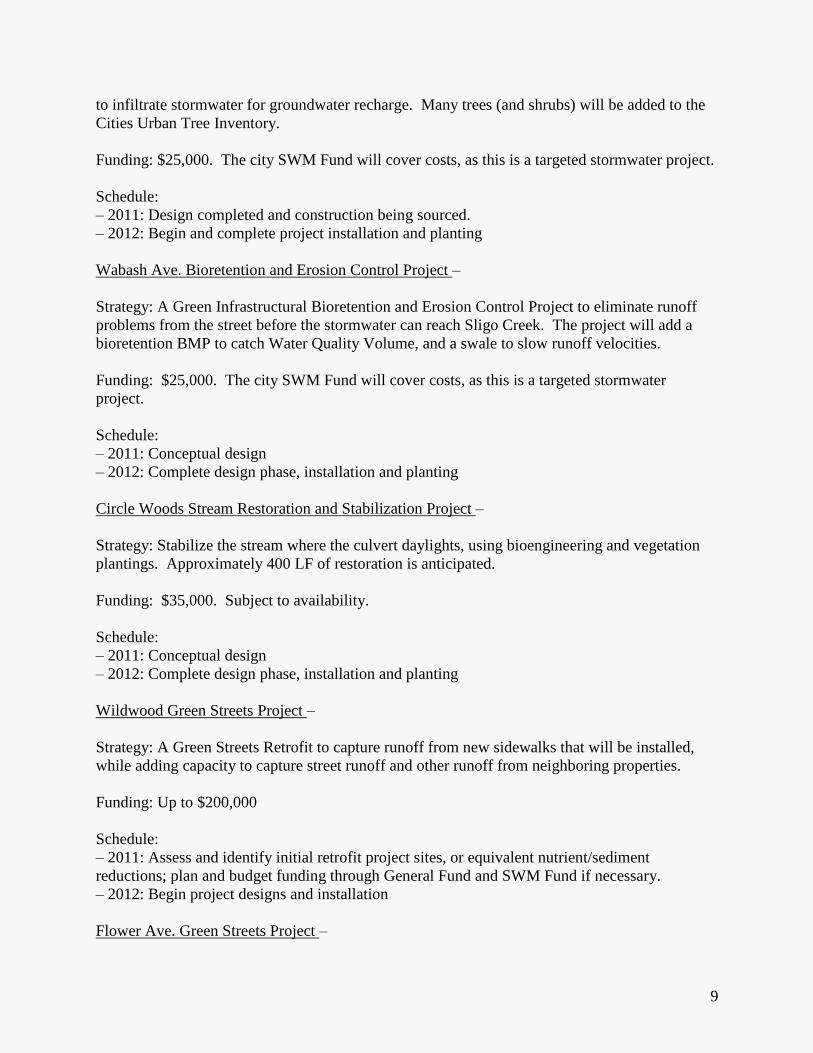
9
to infiltrate stormwater for groundwater recharge. Many trees (and shrubs) will be added to the
Cities Urban Tree Inventory.
Funding: $25,000. The city SWM Fund will cover costs, as this is a targeted stormwater project.
Schedule:
– 2011: Design completed and construction being sourced.
– 2012: Begin and complete project installation and planting
Wabash Ave. Bioretention and Erosion Control Project –
Strategy: A Green Infrastructural Bioretention and Erosion Control Project to eliminate runoff
problems from the street before the stormwater can reach Sligo Creek. The project will add a
bioretention BMP to catch Water Quality Volume, and a swale to slow runoff velocities.
Funding: $25,000. The city SWM Fund will cover costs, as this is a targeted stormwater
project.
Schedule:
– 2011: Conceptual design
– 2012: Complete design phase, installation and planting
Circle Woods Stream Restoration and Stabilization Project –
Strategy: Stabilize the stream where the culvert daylights, using bioengineering and vegetation
plantings. Approximately 400 LF of restoration is anticipated.
Funding: $35,000. Subject to availability.
Schedule:
– 2011: Conceptual design
– 2012: Complete design phase, installation and planting
Wildwood Green Streets Project –
Strategy: A Green Streets Retrofit to capture runoff from new sidewalks that will be installed,
while adding capacity to capture street runoff and other runoff from neighboring properties.
Funding: Up to $200,000
Schedule:
– 2011: Assess and identify initial retrofit project sites, or equivalent nutrient/sediment
reductions; plan and budget funding through General Fund and SWM Fund if necessary.
– 2012: Begin project designs and installation
Flower Ave. Green Streets Project –

10
Strategy: Flower Avenue, between Carroll Avenue and Piney Branch Road, is Maryland State
Highway 787, and runs north-south along the City of Takoma Park border with unincorporated
Silver Spring. The road does not function as a State Highway and Maryland would like to
remove it from their State Highway inventory. The Maryland State Highway Administration
(SHA) will pay the City $696,000 if the City makes street and sidewalk improvements as a
“green street.” These funds would have otherwise been spent by SHA on the scheduled repaving
of Flower Avenue. Once the project is complete, Flower Avenue will no longer be a State
Highway.
Montgomery County is also contributing funds to the project – $200,000. Montgomery County
had wanted to undertake a study to see if a sidewalk could be installed on the east side of Flower
Avenue and had expected to allocate money in a future year for this study. Funds it would have
spent on the study have been allocated towards this project.
The Chesapeake Bay Trust has granted the City of Takoma Park $20,000 towards this project as
it will help address stormwater runoff into Sligo Creek and Long Branch creek that ends up in
the Chesapeake Bay, along with the contaminants the stormwater picks up along the way.
Together, these funds will pay for a community planning process, engineering design work,
construction of a sidewalk on the east side of the roadway, installation of rain gardens and
vegetated swales (to slow and filter stormwater), new crosswalks, and repaving of Flower
Avenue. If funds are available after these improvements are made, additional improvements to
bus stops, street lighting and stormwater facilities will be made.
Funding: see above
Schedule:
– 2011: Community Meetings, Survey
– 2012: Bid Project Design, award design contract, schedule community input sessions to review
design.
– 2013: Begin construction
Urban Tree Planting Projects –
Strategy: Over 500 public space trees have been planted in the past 5 years, and Takoma Park’s
Urban Forest Office is planning to continue expanding the urban forest at 120+ public trees per
year. Additionally, Takoma Park citizens have averaged planting 50-100 “bulk buy” trees per
year on private property.
Funding: The Urban Forest Office has an annual budget of $250,000 that is used to cover all
costs.
Strategy to achieve the Final Target Loads (2020) and Interim Target Loads (70% of Final
Load by 2017), Implementation Actions

11
Although it has not been formally communicated to the City of Takoma Park, it is possible that
our future NPDES MS4 Phase II Permit renewal conditions may include a stipulation to retrofit
20% of impervious urban area that currently has no stormwater treatment. With this in mind, we
forecast that we may be required to retrofit 52 Impervious Acres that currently has no
stormwater treatment, as defined in the Current Status of Retrofitting Effort above.
At our current capacity we will treat 3 Impervious Acres through ESD BMPs, 1 Impervious Acre
through Stream Restoration, and 1 Impervious Acre through our Urban Forest plantings each
year. This 5 Impervious Acres Treated each year, over the course of 9 years until 2020, is
estimated to yield a total of 45 Impervious Acres Treated. This estimate is only 7 Acres short of
our goal. With a potential SWM Fee hike, funded Green Streets Projects, and other Stormwater
retrofit projects that are funded from our General Fund or other sources, we feel confident that
we have the potential to reach the TMDL goals.
The focus of our future retrofitting effort will be on ESD stormwater BMPs (constructed
wetlands, filtering practices, infiltration practices, etc.). Where erosion is a problem, and when
site problems justify effort, we will be constructing stream restoration projects, much of which
will be installed downstream of ESD BMP projects to reduce the hydrologic energy to the
streams. The remainder of projects will be a combination of street sweeping, micro-projects on
City and residential properties (down-spout disconnects, rain barrels, rain gardens, etc.), removal
of impervious cover, urban nutrient management, and urban tree plantings on residential and
public property.
An outline of Capital Improvement Projects scheduled through FY2017 is presented below in
Table 3.
Strategy to achieve the Final Target Loads (2020) and Interim Target Loads (70% of Final
Load by 2017), Program Development Actions
The following Programmatic Actions will be taken by the City of Takoma Park to increase our
capacity and thereby eventually accelerate implementation in the medium-term future. These
program enhancement milestones will, in most cases, coincide with scheduled strategy
implementation steps described in the section above, Implementation Actions, and in more detail
in the previous section, 2-Year Milestones.
In FY2012, we will continue to refine our strategy for achieving TMDL goals, refine our cost
estimates, and begin to evaluate whether our stormwater fee system rates are adequate. In
FY2013, we will complete the refinement our strategy, implement change to the fee rate if
needed and look into other potential funding options for stormwater retrofits in the form of
grants. From FY2013-FY2015, we will maintain the current pace of retrofits, which is about 3
acres treated per year. We hope to accelerate project identification and project design and
permitting in the period of FY2015 – FY2017 as new resources become available. Between
FY2018 and FY2020 we will retrofit as needed to achieve our 2020 TMDL allocations.
Additionally, Takoma Park is committed to pursuing revenue sources in coordination with the
State. Given the anticipated costs, we expect that a combination of federal, State and local

12
revenue sources will likely be needed. We will work with the State in 2012 and coming years, as
needed, to refine cost estimates and identify funding options including the possible crafting of
State legislation. If State and federal funding is insufficient, we will conduct contingency
planning beginning in 2013 for potential adoption of revenue sources as we deem necessary to
meet our current and future anticipated permit obligations.
13
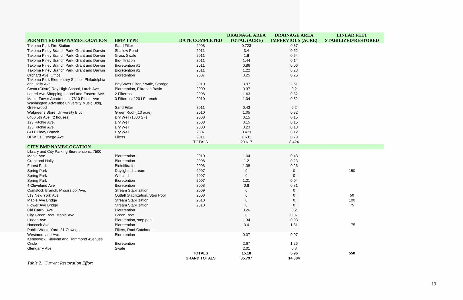
PERMITTED BMP NAME/LOCATION BMP TYPE DATE COMPLETED DRAINAGE AREA
TOTAL (ACRE) DRAINAGE AREA
IMPERVIOUS (ACRE) LINEAR FEET
STABILIZED/RESTORED Takoma Park Fire Station Sand Filter 2008 0.723 0.67
Takoma Piney Branch Park, Grant and Darwin Shallow Pond 2011 3.4 0.52
Takoma Piney Branch Park, Grant and Darwin Grass Swale 2011 1.6 0.54
Takoma Piney Branch Park, Grant and Darwin Bio-filtration 2011 1.44 0.14
Takoma Piney Branch Park, Grant and Darwin Bioretention #1 2011 0.86 0.06
Takoma Piney Branch Park, Grant and Darwin Bioretention #2 2011 1.22 0.23
Orchard Ave. Office Bioretention 2007 0.25 0.25 Takoma Park Elementary School, Philadelphia and Holly Ave. BaySaver Filter, Swale, Storage 2010 3.97 2.61
Costa (Cristo) Ray High School, Larch Ave. Bioretention, Filtration Basin 2009 0.37 0.2
Laurel Ave Shopping, Laurel and Eastern Ave. 2 Filterras 2008 1.63 0.32
Maple Tower Apartments, 7610 Richie Ave 3 Filterras, 120 LF trench 2010 1.04 0.52 Washington Adventist University Music Bldg, Greenwood Sand Filter 2011 0.43 0.2
Walgreens Store, University Blvd. Green Roof (.13 acre) 2010 1.05 0.82
6400 5th Ave. (2 houses) Dry Well (1600 SF) 2008 0.15 0.15
123 Ritchie Ave. Dry Well 2008 0.15 0.15
125 Ritchie Ave. Dry Well 2008 0.23 0.13
8411 Piney Branch Dry Well 2007 0.473 0.12
DPW 31 Oswego Ave Filters 2011 1.631 0.79
TOTALS 20.617 8.424
CITY BMP NAME/LOCATION Library and City Parking Bioretentions, 7500 Maple Ave Bioretention 2010 1.04 0.43
Grant and Holly Bioretention 2008 1.2 0.23
Forest Park Bioinfiltration 2006 1.38 0.26
Spring Park Daylighted stream 2007 0 0 150
Spring Park Wetland 2007 0 0
Spring Park Bioretention 2007 1.21 0.04
4 Cleveland Ave Bioretention 2008 0.6 0.31
Comstock Branch, Mississippi Ave. Stream Stabilization 2009 0 0
519 New York Ave Outfall Stabilization, Step Pool 2008 0 0 50
Maple Ave Bridge Stream Stabilization 2010 0 0 100
Flower Ave Bridge Stream Stabilization 2010 0 0 75
Old Carroll Ave Bioretention 0.26 0.2
City Green Roof, Maple Ave. Green Roof 0 0.07
Linden Ave Bioretention, step pool 1.34 0.98
Hancock Ave Bioretention 3.4 1.31 175
Public Works Yard, 31 Oswego Filters, Roof Catchment
Westmoreland Ave. Bioretention 0.07 0.07 Kennewick, Kirklynn and Hammond Avenues Circle Bioretention 2.67 1.26
Glengarry Ave. Swale 2.01 0.8
TOTALS 15.18 5.96 550
GRAND TOTALS 35.797 14.384
Table 2. Current Restoration Effort

14
No. FY 2012 Project List CIP Summary Description Preliminary Cost Estimate Status
1 Prince Georges' And Circle Bio Retention Pond Bioretention within parcel NE of Intersection $25,000.00 Concept Developed/ Build Ready
2 Wabash Filtration Erosion Control. Above Sligo Creek inlet infiltration or bioretention $25,000.00 Initial Concept
3 Wildwood Ave. Bioretention/Streetscape $200,000.00 Initial Concept
4 Circle wood Outfall Stabilization 400 LF $35,000.00 Initial Concept
No. FY 2013 Project List CIP Summary Description Preliminary Cost Estimate Status
5 Flower Ave. Green Streets Project Bioretention/Streetscape $200,000.00
6 End Of Grant Ave. Bioretention Intersection within Green $ 15,000.00 Concept
7 Flower near Cherry Ave to Sligo Creek Erosion Control rip rap $ 20,000.00
8 Outfall at Sligo Poplar Mill Trash collection Filter $ 20,000.00
9 Flower near Cherry Ave to Sligo Creek Above Sligo Creek In let infiltration Or Bio $ 20,000.00
No. FY 2014 Project List CIP Summary Description Preliminary Cost Estimate Status
10 Sligo Mill Stream Restoration Remove debris in Installment $ 50,000.00
11 Maplewood & Maple Ave Large run off from apartment buildings retention. $ 15,000.00
12 7436 Baltimore Culvert Plugging Over Lot Flood Settling Basin at Culvert Intake $ 30,000.00
13 Columbia and Carroll Coop Parking Bioretention at Sycamore Coop Parking $ 30,000.00
14 6504 Fourth Ave frequent flooding (100-year) Inlet Improvements/Bio retention $ 30,000.00
15 Behind 6719 Convey /Circle Erosion $ 30,000.00
16 Jackson & Long Branch Erosion Control $ 20,000.00
No. FY 2015 Project List CIP Summary Description Preliminary Cost Estimate Status
17 Davenshire and Glizwood Bio retention $ 25,000.00
18 John Andrews/ Spring Park Slopes Erosion Erosion Control $ 30,000.00
No. FY 2016 Project List CIP Summary Description Preliminary Cost Estimate Status
19 Eastern-Tulip-Barclay Realignment/Bio retention $ 50,000.00
20 Hayward and Larch to Sligo Creek Parkway Bioretention - Erosion Control $ 50,000.00
21 Larch and Glizwood Bioretention/Streetscape $ 50,000.00
No. FY 2017 Project List Repair Summary Description Preliminary Cost Estimate Status
22 Richie and Oswego Curb extension Bioretention $111,000 Plans ready to go
23 Elm Forest Park and Wood land Stream Bank Stabilization 400 LF $ 35,000.00
Total Cost thru 2017: $1,081,000.00
Table 3. FY 2012 – FY 2017 Planned BMP Project List
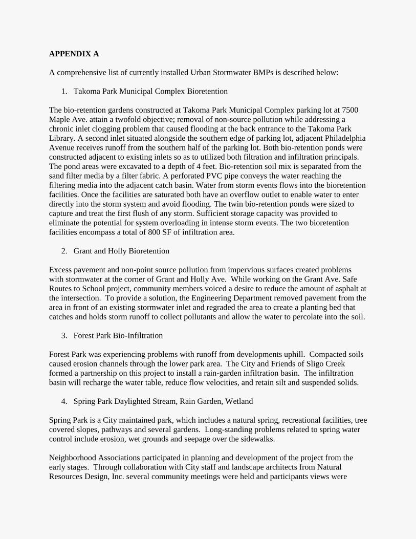
APPENDIX A
A comprehensive list of currently installed Urban Stormwater BMPs is described below:
1. Takoma Park Municipal Complex Bioretention
The bio-retention gardens constructed at Takoma Park Municipal Complex parking lot at 7500
Maple Ave. attain a twofold objective; removal of non-source pollution while addressing a
chronic inlet clogging problem that caused flooding at the back entrance to the Takoma Park
Library. A second inlet situated alongside the southern edge of parking lot, adjacent Philadelphia
Avenue receives runoff from the southern half of the parking lot. Both bio-retention ponds were
constructed adjacent to existing inlets so as to utilized both filtration and infiltration principals.
The pond areas were excavated to a depth of 4 feet. Bio-retention soil mix is separated from the
sand filter media by a filter fabric. A perforated PVC pipe conveys the water reaching the
filtering media into the adjacent catch basin. Water from storm events flows into the bioretention
facilities. Once the facilities are saturated both have an overflow outlet to enable water to enter
directly into the storm system and avoid flooding. The twin bio-retention ponds were sized to
capture and treat the first flush of any storm. Sufficient storage capacity was provided to
eliminate the potential for system overloading in intense storm events. The two bioretention
facilities encompass a total of 800 SF of infiltration area.
2. Grant and Holly Bioretention
Excess pavement and non-point source pollution from impervious surfaces created problems
with stormwater at the corner of Grant and Holly Ave. While working on the Grant Ave. Safe
Routes to School project, community members voiced a desire to reduce the amount of asphalt at
the intersection. To provide a solution, the Engineering Department removed pavement from the
area in front of an existing stormwater inlet and regraded the area to create a planting bed that
catches and holds storm runoff to collect pollutants and allow the water to percolate into the soil.
3. Forest Park Bio-Infiltration
Forest Park was experiencing problems with runoff from developments uphill. Compacted soils
caused erosion channels through the lower park area. The City and Friends of Sligo Creek
formed a partnership on this project to install a rain-garden infiltration basin. The infiltration
basin will recharge the water table, reduce flow velocities, and retain silt and suspended solids.
4. Spring Park Daylighted Stream, Rain Garden, Wetland
Spring Park is a City maintained park, which includes a natural spring, recreational facilities, tree
covered slopes, pathways and several gardens. Long-standing problems related to spring water
control include erosion, wet grounds and seepage over the sidewalks.
Neighborhood Associations participated in planning and development of the project from the
early stages. Through collaboration with City staff and landscape architects from Natural
Resources Design, Inc. several community meetings were held and participants views were
incorporated in to the design scheme. Once the plans were prepared, City staff undertook the
execution of the project directly. Then design was informed by the Spring Park patrons’ input
this addressed the priority issues so identified. Two bogs were created to simulate a wetland
eco-system. Then the spring was day-lighted into a streambed lined with natural river wash
gravel and cobbles. The stream crosses the park grounds with trees, a footbridge and natural
rock placed over the banks. A rain garden was created at the end where stream infiltrates and
enters into a curbside inlet. This project was completed in the spring of 2007.
5. Cleveland Ave. Bioretention (900sf) and Cleveland Ave Bio-Infiltration
The City successfully installed a sustainable stormwater management alternative to standard
storm drainpipes within a neighborhood with no stormwater management. The properties
located at the end of Cleveland Ave. were recipients of runoff, sediment and to some extent
water intrusion into basements.
Conventional stormwater conduction would have required installation of 1,000 LF of pipe
through difficult and heavily forested terrain, private property and along a State Highway right-
of-way. The City held several public outreach meetings where environmentally sensitive
solutions versus conventional pipe placement were discussed.
A landscaping architectural firm Natural Resources Design, Inc. in conjunction with the City
Engineer developed the concept of a low impact stormwater management system for the
neighborhood (Phase I).
The residents participated in partnership with the City to construct an approximately 1,300 SF
bioretention (rain garden) within one of the end properties. The facility will be maintained
cooperatively. The rain garden is designed with a capacity sufficient for retention of a 25-yr
storm event. This phase was completed in July 2007.
Phase II of the Cleveland Ave. Stormwater Management Project consisted of constructing an
infiltration basin to capture, detain, and filter runoff from the pavement and sidewalks. The
basin is installed beneath the pavement at the down gradient end of the street. The existing
asphalt and concrete base street pavement structure was removed and replaced with permeable
pavers to allow the run-off to enter the underlying infiltration basin. The sidewalk adjacent to
the basin was reconstructed using porous concrete.
The infiltration basin includes 36 Rainstore3 Units embedded in gravel underlain by a layer of
geo-grid to reinforce granular sub-base material and provide a pavement structure capable of
withstanding H-20 (heavy trucks) vehicular loading. If the storm event generates runoff
sufficient to fill the infiltration basin’s reservoir, the overflow is discharged through a series of
pipes into an abutting collection trench, which in turn discharges into a 1,300 SF rain garden
(Phase I).
The infiltration basin is capable of retaining runoff generated from a 2-year storm event (3.2”).
The Phase II project was designed and overseen by ATR Associates, Inc.
In combination, the Phase I and II Stormwater Management System at Cleveland Ave. is
designed to store runoff generated by a 100-year storm event.
6. Comstock Branch Restoration and Streambed Stabilization
Erosion of the stream bank caused the edge of the road to fail along Mississippi Ave. Erosion
caused increased sediment transport into Sligo Creek. The solution to the problem was for
stabilization of the roadside streambank with imbricated rip-rap for road support and
bioengineering and installation of crossvane structures to prevent further erosion and down-
cutting of the stream bed.
7. 519 New York Ave. Outfall Stabilization and Step-pool
At the storm drain outfall at 519 New York Avenue, the storm drain pipe daylighted into a large
undermined broken concrete structure flowing over an eroded streambed. The intermittent stream
flows over a steeply sloping streambed located in the backyard of residential lots and ends in a
culvert near Baltimore Avenue, where it joins the storm drain system. As a result of erosion, the
storm drain channel that leads into the stream channel was badly deteriorated. The City
developed a plan to construct an environmentally sensitive structure to dissipate the energy of the
water entering the stream channel, thereby eliminating the erosion problem and stabilizing the
outfall area. The plan consist of creating a series of short, step pools at the end of the stormwater
channel to receive the stormwater and provide an energy dissipating transition zone for the water
as it enters the stream channel. The remnants of the concrete structure and large imbricated rock
and class II ripraps were used to stabilize the outfall area and create the step pools.
The project aimed to improve the water quality and address the erosion problems associated with
the stream channel. The project plans were developed so as to minimize impact on mature trees
in the area. The work area is located in the back yards of properties that front on Baltimore
Avenue, Takoma Avenue and Philadelphia Avenues.
8. Maple Ave. Bridge and Flower Ave. Bridge Stream Stabilizations
Two bridges, crossing Sligo Creek, were built in the 1930’s and were undergoing structural
decay along with streambed scouring, erosion and foundation undermining. A rehabilitation
program was developed by the City Engineer with technical help from Montgomery County
Engineers. The repairs were carried out through a jointly funded program between the City and
Montgomery County. Issues of concern noted for the Maple Avenue bridge included spall,
exposed corroded reinforcement in concrete beams, abutment and deck elements, as well as
progressive undermining of the central pier. The major structural concerns at the Flower Avenue
Bridge included scouring and severe deterioration of concrete encased steel beams, the abutment
and the deck.
9. Old Carroll Bioretention
The purpose of the project was to create a vegetated area that can absorb water run-off from the
street and filter out the sediment and pollution before the water enters Sligo Creek. This bio-

retention area is about 35 feet long and 5 feet deep, placed inside the curb. The curb was
removed in several areas to enable water from the street to enter into the bio-retention area.
10. Municipal Green Roof
The green roof project was completed in several phases. The deck itself was constructed as part
of a renovation to the City’s community center. The deck was then covered with a waterproof
membrane in preparation for the green roof. The City received a grant through the Maryland
Department of the Environment for the installation of the green roof. The green roof includes a
lightweight system with 4 -inch thick media layer. This limits plants to low-growing, hardy
herbaceous varieties. The roof has an assortment of 8 different types of sedum currently thriving
there.
Stormwater management benefits of the green roof include pollution removal as well as storage
of rainwater as it enters the system. This green roof, with its 4-inch deep blanket of sedum plants
covering approximately 2,800 square feet of the 4,000 square foot area, will reduce up to 50
percent of runoff compared to impervious roof texture of gravel over waterproofed concrete.
The plants in a green roof filter pollutants from rainwater, like phosphorus and nitrogen. The
plants remove particles from the air, like metals, and CO2. In addition, plants absorb water that
would otherwise go directly into a storm drain system. On average a green roof could retain
about 70% of the rain that falls on the roof. Stormwater quality improvements by installation of
green roof has been researched and documented by EPA “Green roofs for Stormwater run off
Control” publication EPA/600/R09/026.
11. Linden Ave Modular Wetland and Step Pools
Stormwater inlets and discharge pipes at the end of Linden Avenue had collapsed due to severe
erosion. Linden Avenue dead-ends above the banks of a meandering segment of Sligo Creek.
The turnabout and parking area included a failed storm inlet structure supported by an "L"
shaped retaining wall of about 150 feet in length and 15 feet in height. This brick façade concrete
retaining wall was severely distressed and the riprap apron at the outfall was covered with debris.
The area houses a large garden style multi-family apartment complex with 96 units (115EDU).
The project consisted of reconstruction of the retaining wall, stormwater inlet and pipe work and
the addition of a treatment structure known as “Modular™ Wetland System”.
This “Modular Wetland System™” (MWS) treats the first flush of runoff by removing debris,
sediment and hydrocarbon pollution. The inlet is equipped with sediment collection baskets,
which require periodic inspection and cleaning. The Modular Wetland System contains granular
shale chips that serve as a filtering media intended for pollution removal. According to the
manufacturer, the MWS utilizes both physical and biological mechanisms to capture and filter oil
and grease. The primary filtration media, Bio Media Green, utilized in the perimeter and drain
filters, has excellent hydrocarbon removal abilities. Within the wetland filter biological processes
break down oil and grease. Much of the breakdown and transformation of oil and grease is
performed by naturally occurring bacteria.

Water quality testing of the discharge is planned to evaluate the efficiency of this pollution
treatment system at Linden Avenue. This project was funded by an ARRA grant in 2009
provided through the Maryland Department of the Environment. The project design and
construction management was funded through the City’s Stormwater Management Fund.
12. Hancock Bioretention and Outfall Step Pool (Opal Daniel Park), online MS4, catches all
Sheridan and Hancock
The site is located at the intersection of Hancock Avenue and Sheridan Avenue, adjacent to the
main entrance to Opal Daniels Park. An 18-inch concrete storm line discharged stormwater from
the surrounding neighborhood on to the top of the steep slopes. Hancock Avenue project was
launched to address the erosion problem as well as provide treatment of the street run-off. The
project created a series of step pools to dissipated run-off energy and to eliminate erosion while
allowing stormwater to infiltrate the sand layers below the step pools and recharge the ground
water. Additionally, a stormwater bio-retention garden was constructed directly adjacent to the
top of the slope to capture and treat the first 1-inch of run-off. Due to presence of fill, a slope
stability evaluation of the area was undertaken prior to commencing the project. A weir structure
was constructed at the concrete swale, directing street run off through the curb to deflect the first
flush (1inch) of run-off into the 1,000 square foot bio-retention area. The storm-drain pipe
outfall, bio-retention spillway and excess street runoff are directed into the step pools serving as
infiltration and recharge basins.
The neighborhood has been an integral partner in the development of this project. The residents
participated in planting many of the native plants for the bio-retention garden and cared for them
during the summer drought. The combined effect of the bio-retention pond and step pool
conveyance will provide enormous water quality improvements.
13. Public Works Yard, Hydrocarbon Filters and Rooftop Catchment
The original Public Works Facility was constructed in 1959 and included three buildings—an
Administration office; a three-bay garage; locker room, equipment storage and staff office
building; and a small storage building. In the mid 1960s, two additional storage bays were added,
one for sanitation vehicles and repair parts storage and another for street maintenance equipment
storage. Minimal improvements had been made to the Public Works Facility over the years and
this area is considered a pollutant hotspot due to the high traffic, high impact activity. In Fiscal
Year 2009, the City Council agreed to proceed with a renovation of the Public Works Facility
and retained Bignell Watkins Hasser Architects as the project architect in the spring of 2009.
The project design included a rainwater recycling system, where a rooftop catchment is used for
irrigation and other non-potable water uses. Also, stormwater filters on site to filter
hydrocarbons using a proprietary filter media called Smart Sponge. The filter also removes other
pollutants such as sediment, debris, and trash before discharge flows enter Sligo Creek.
14. Westmoreland Ave Bioretention

This project was a collaboration between the local commercial business association (Old Takoma
Business Association, an art group (Art for the People) and the City. The City provided the site
preparation for the rain garden by removing a section of concrete sidewalk and installing an
underdrain approximately 50 feet long to serve as the connection to a nearby storm inlet. A 2-
foot wide rain garden was placed directly adjacent to a retaining wall along a sloping wide
sidewalk. The rain garden was sited to receive runoff from the steep sidewalk as well as an
adjacent parking area above. The trench was excavated to a depth of 2 to 3 feet. The underdrain
system consisted of a 6 inch perforated PVC pipe wrapped in free draining gravel covered in
filter fabric. The underdrain was covered by a minimum of 12 inches of a bio-retention soil mix.
The soil was topped with a 4 to 6 inch layer of leaf mulch. The plant selection and planting was
done by the association and art group. The maintenance of the garden is also to be undertaken by
the same.
15. Traffic Circle Bioretention at Kennewick, Kirklynn and Hammond Avenues
A traffic calming measure was developed to address speeding traffic near a commercial zone in
proximity to New Hampshire Avenue and University Boulevard. The 36-foot diameter
roundabout is situated at the intersection of Kennewick, Kirklynn and Hammond Avenues. The
center of the circle was designed to act as a bio-retention garden for receiving sheet flow from
the street. The 800 SF bio-retention garden at center of the roundabout coupled with the addition
of several hundred feet of added green space along the right of way resulted in a substantial
amount of impervious surface reduction through removal of the existing asphalt.
16. Glengarry Ave. Swale and Erosion Control
Glengarry Avenue is a paved alley off Sligo Creek Parkway providing access to residences on
Sligo Creek parkway and Heather Avenue. The street has a westward slope of 8 percent and an
intermittent drainage swale that runs the length which channels run-off from Heather Avenue, a
dead-end street. Several attempts to partially stabilizing the eroded water pathway have been
made. Reoccurrence of high velocity flow had partially undermining the pavement on Glengarry
Avenue while continually transporting sediment into the creek. Re-grading, re-alignment and
riprap lining of the swale was done to dissipate run-off energy to eliminate erosion and reduce
sediment transport into the stream.