chapter coastal protection works and related …
TRANSCRIPT
CHAPTER 53
COASTAL PROTECTION WORKS AND RELATED PROBLEMS IN JAPAN
Masashi Bom-ma and Kiyoshi Horikawa
Department of Civil Engineering, University of Tokyo
Tokyo, Japan
IHTBODUCTION
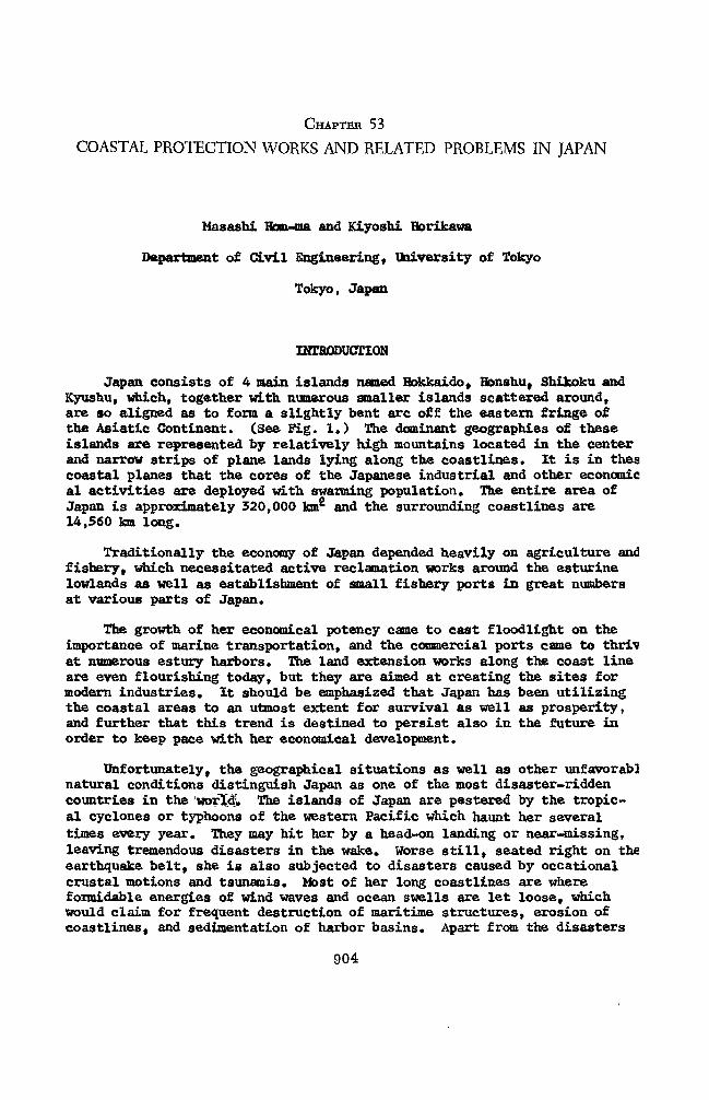
Japan consists of 4 main islands named Hokkaido, Honshu, Shikoku and Kyushu, which, together with numerous smaller islands scattered around, are so aligned as to form a slightly bent arc off the eastern fringe of the Asiatic Continent. (See Fig. 1.) The dominant geographies of these islands are represented by relatively high mountains located in the center and narrow strips of plane lands lying along the coastlines. It is in thes coastal planes that the cores of the Japanese industrial and other economic al activities are deployed with swarming population. The entire area of Japan is approximately 320,000 km2 and the surrounding coastlines are 14,560 km long.
Traditionally the economy of Japan depended heavily on agriculture and fishery, which necessitated active reclamation works around the esturine lowlands as well as establishment of small fishery ports in great numbers at various parts of Japan.
The growth of her economical potency came to cast floodlight on the importance of marine transportation, and the commercial ports came to thriv at numerous estury harbors. The land extension works along the coast line are even flourishing today, but they are aimed at creating the sites for modern industries. It should be emphasized that Japan has been utilizing the coastal areas to an utmost extent for survival as well as prosperity, and further that this trend is destined to persist also in the future in order to keep pace with her economical development.
Unfortunately, the geographical situations as well as other unfavorabl natural conditions distinguish Japan as one of the most disaster-ridden countries in the world. The islands of Japan are pestered by the tropic- al cyclones or typhoons of the western Pacific which haunt her several times every year. They may hit her by a head-on landing or near-missing, leaving tremendous disasters in the wake. Worse still, seated right on the earthquake belt, she is also subjected to disasters caused by occational crustal motions and tsunamis. Most of her long coastlines are where formidable energies of wind waves and ocean swells are let loose, which would claim for frequent destruction of maritime structures, erosion of coastlines, and sedimentation of harbor basins. Apart from the disasters
904
COASTAL PROTECTION WORKS AND RELATED PROBLEMS IN JAPAN
M 2 i3 4 5 6 7 8 • • • • • ••
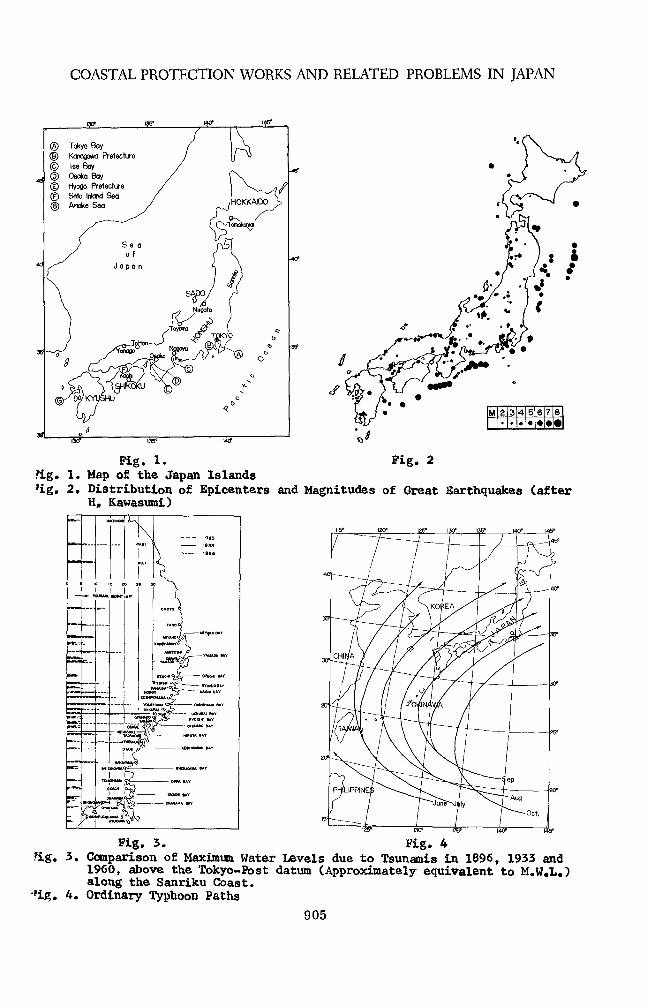
Fig. 1. Fig. 2 ?ig. 1. Map of the Japan Islands 'ig. 2. Distribution of Epicenters and Magnitudes of Great Earthquakes (after
H, Kawasumi)
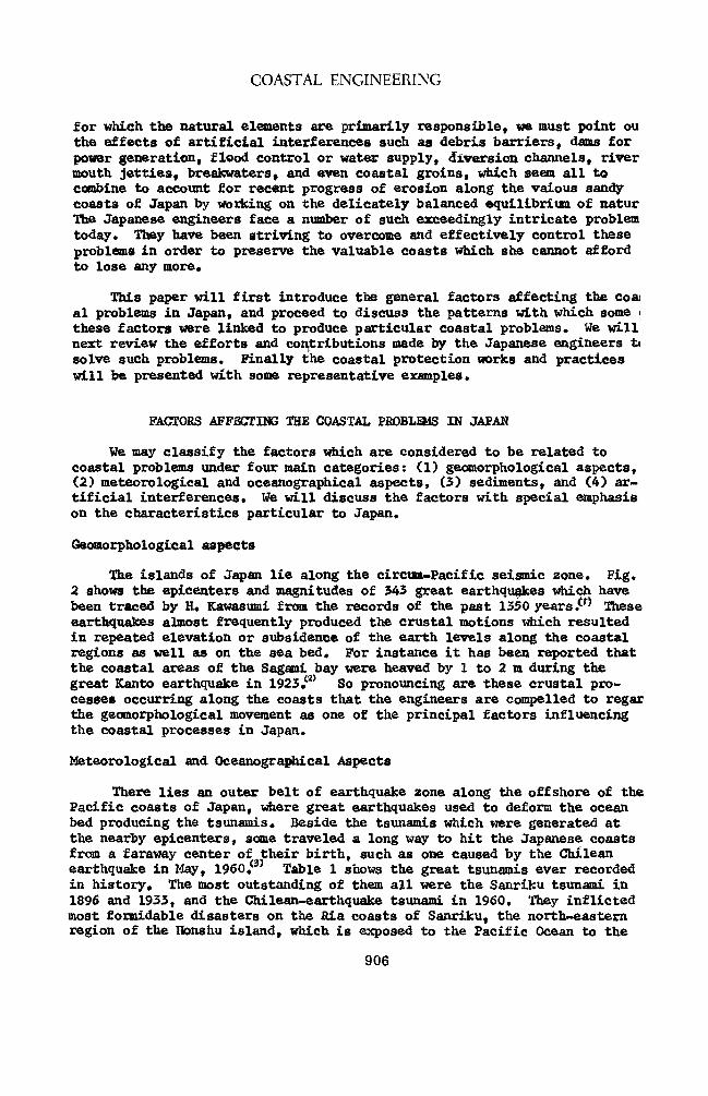
Fig. 3. Fig. 4 ?ig. 3. Comparison of Maximum Water Levels due to Tsunamis in 1096, 1933 and
1960, above the Tokyo-Post datum (Approximately equivalent to M.W.L.) along the Sanriku Coast,
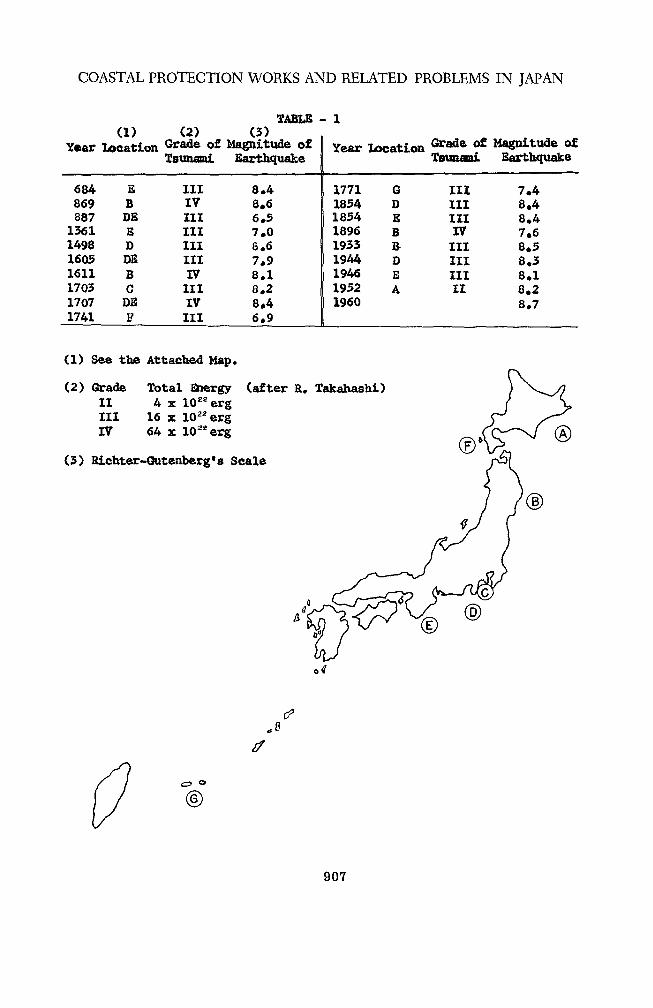
•'ig. 4. Ordinary Typhoon Paths
905
COASTAL ENGINEERING
for which the natural elements are primarily responsible, we must point ou the effects of artificial interferences such as debris barriers, dams for power generation, flood control or water supply, diversion channels, river mouth jetties, breakwaters, and even coastal groins, which seem all to combine to account for recent progress of erosion along the vaious sandy coasts of Japan by working on the delicately balanced equilibrium of natur lite Japanese engineers face a number of such exceedingly intricate problem today. They have been striving to overcome and effectively control these problems in order to preserve the valuable coasts which she cannot afford to lose any more.
This paper will first introduce the general factors affecting the coa al problems in Japan, and proceed to discuss the patterns with which some < these factors were linked to produce particular coastal problems. We will next review the efforts and contributions made by the Japanese engineers t< solve such problems. Finally the coastal protection works and practices will be presented with some representative examples.
FACTORS AFFSCTING THE COASTAL PROBU&IS IN JAPAN
We may classify the factors which are considered to be related to coastal problems under four main categories: (1) geomorphological aspects, (2) meteorological and oceanographical aspects, (3) sediments, and (4) ar- tificial interferences. We will discuss the factors with special emphasis on the characteristics particular to Japan.
Geomorphological aspects
The islands of Japan lie along the circum-Pacific seismic zone. Fig. 2 shows the epicenters and magnitudes of 343 great earthquakes which have been traced by H. Kawasumi from the records of the past 1350 years $•** These earthquakes almost frequently produced the crustal motions which resulted in repeated elevation or subsidence of the earth levels along the coastal regions as well as on the sea bed. For instance it has been reported that the coastal areas of the Sagami bay were heaved by 1 to 2 m during the great Kanto earthquake in 1923 •<a) So pronouncing are these crustal pro- cesses occurring along the coasts that the engineers are compelled to regar the geomorphological movement as one of the principal factors influencing the coastal processes in Japan.
Meteorological and Oceanographical Aspects
There lies an outer belt of earthquake zone along the offshore of the Pacific coasts of Japan, where great earthquakes used to deform the ocean bed producing the tsunamis. Beside the tsunamis which were generated at the nearby epicenters, some traveled a long way to hit the Japanese coasts from a faraway center of their birth, such as one caused by the Chilean earthquake in May, I960.*3' Table 1 shows the great tsunamis ever recorded in history. The most outstanding of them all were the Sanriku tsunami in 1896 and 1933, and the Chilean-earthquake tsunami in 1960. They inflicted most formidable disasters on the Ria coasts of Sanriku, the north-eastern region of the Honshu island, which is exposed to the Pacific Ocean to the
906
COASTAL PROTECTION WORKS AND RELATED PROBLEMS IN JAPAN
TABLE - 1 (1) (2) (3)
Year Location Grade of Magnitude of Year Location Grade of Magnitude of Tsunami Earthquake Tsunami Earthquake
684 E III 8*4 1771 6 III 7.4 869 B IV 8.6 1854 D III 8.4 887 DK III 6.5 1854 E III 8.4 1361 E III 7.0 1896 B nr 7.6 1498 D III 8.6 1933 B in 8.5 1605 DE III 7.9 1944 D HI 8.3 1611 B 17 8.1 1946 E in 8.1 1703 C III 8.2 1952 A II 8.2 1707 DS IV 8.4 1960 8.7 1741 F III 6.9
(1) See the Attached Map,
(2) Grade II III IV
Total Energy (after R. Takahashi) 4 x I0zaerg 16 x 1022erg 64 x 10 ** erg
(3) Eichter~Gutenberg*s Scale
w <D
d>
if
©
907
COASTAL ENGINEERING
east. Fig* 3 compares the maximum run-up reached by these tsunamis at various localities. It must be noted that the patterns of the rising watei inside the bay areas were different between the Sanriku-earthquake tsunami in 1933 (of the period of approximately 12 min.) and the Chilean-earthquaki tsunami in 1960 (of the period of approximately 60 min.). Such difference is supposed to result from the relationship between the normal vibrational periods of the bays and those of the tsunamis invading them.
The natural forces acting upon the coasts are represented by the me- teorological factors such as the violent winds generated by typhoons or migratory cyclones, and by the oceanographical factors such as waves and currents. Efforts have been made at various coastal areas of Japan to forecast the waves from meteorological data. On the other hand, mainly spurred by the recent development of harbor projects or purely for the purposes of coastal engineering studies, the actual measurement of wave has recently been accelerated shedding light to a great extent on the char- acteristics of the meteorological and oceanographical factors prevailing in the water around Japan.
The seas around Japan must be dealt with separately for the factors peculiar to each of the three sectors: (1) the Pacific Ocean coasts, (2) the Japan Sea coasts, and (3) the sheltered bays.
The Pacific Ocean coasts- Kxposed to the great open sea of the Pacific Ocean1, this sector is subjected to the influence of a typhoon during sum- mer to fall. The ordinary path of a typhoon varies for each month. (See Fig. 4.) Table 2 shows the average number of typhoons generated in the southwestern sea of the Pacific Ocean and the number which landed on Japan, per annum. It is understood from the table that Japan is attacked at least by 2 or 3 typhoons annually which command an appreciable domain of influenc with a formidable charge of destructive energy. One that carried the great est energy was the Muroto typhoon which caused a great storm surge in the Osaka bay on September 18, 1934. The typhoon No. 15 of 1959, usually calle the Xse-bay typhoon, is only next to the Muroto typhoon as far as the significance of the disasters due to a storm surge is concerned. (See Fig. 5.)
The most dominant waves occuring along the Pacific coasts of Japan are generated by the typhoons, which emanate forerunning swells for days well before its farthest perimeter comes to feel the coastlines* According to the studies made by T. Ijima, the periods of the typhoon swell recorded at the Japanese coasts range approximately from 12 to 14 seconds, and the significant wave heights from 1 to 2 m, rarely attaining 3 to 4 m. As the typhoon approaches the coastlines, i.e., as the decay distance is shortened the wave period tends to drop slightly, but only to increase sharply soon as the wave heights gain in magnitude.^ S. Nagai estimates the maximum height of the wave inside the typhoon No* 15, 1959, as 3.5 to 5,5 ra, based on the sliding pattern of the breakwaters in the Wakayama prefecture.^) S. Unoki has presented the classified diagrams showing the distribution of wave heights and periods occurring in the deep water inside a typhoon from the records of the seafaring vessels and weather ships .<6)
The influence of a typhoon varies according to the path and the
908
COASTAL PROTECTION WORKS AND RELATED PROBLEMS IN JAPAN
TABLE. - 2
Statistics of Typhoon
Jan Feb Mar Apr May Jun Jul Aug Sep Oct Nov Dec Total
No. of Typhoon Generated
0.2 0.2 0.2 0.4 0.9 1.4 4.1 5.7 4.8 3.1 1.5 1.1 23.5
g|
o q
if
Mean - - - - 0.02 0.11 0.31 0.76 0.82 0.33 0.03 - 2.47
Max ----1124421- 7
TABLE - 3
Kecent Record of Great Storm Surges (1900 - 1959)
Date Location Height in m
Aug. 25, 1914
Oct. 1, 1917
Sep. 13, 1927
Sep. 21, 1934
Sep. 17, 1945
Sep. 3, 1950
Sep. 26, 1959
Ariake Sea 2.0 - 2.5
Tokyo Bay 2.3
Ariake Sea about 3.0
Osaka Bay 3.1
Kagoshima, Bay 2.0
Osaka Bay 2.4
Ise Bay 3.5
909
COASTAL ENGINEERING
B0» 135" |4Q» l45» |BQB
Pig. 5 (a) Fig. 5 (b) Fig. 5(a). Path, of Muroto Typhoon (Sept. of 1934) Fig. 5(b). Path of Ise-bay Typhoon (Sept. of 1959)
20
/ ' >-
/S / 3 12 f \ i "
r^ oy 1
\ WIND DIRECTION /
0 —\N /•• •+•** ^ W* .\\ 1
E A
1 vT *-. r r \ V
UJ V \
1 M
§ r /s /N \ e|2
s y V r^ ^/ S/ X j \ 7 \
12 18 i 6 12 18 < > 6 12
28 29 30
2 3 4 5 10 sec
WAVE HEIGHT in ir
o TOKAtMURA
• TOMAWOMAI
A NIIGATA < :•'
•
9
A 9 !
.•!
OS 0
0
1
•.0J i 9 '
* 0 •
*• !
(U
i^ d »
60 ^8 <f
C • 9 A ^ >
20
10
6
• <? c ) d t
( ( »
( a
01 (
9
< PERIOD in sec
1 TOMAKOMAI FETOH oe
< » TOMAI
1 NII6A1
COM/
A
M HN HE
1 2 4
Fig. 6 Fig. 7 Fig. 6. Record of Waves due to Typhoon No. 22, Sept. 1955, Recorded Outside
the Kochi Port (after T. Ijima) Fig. 7. Comulative Probability Distributions of Wave Height and Period along
both the Pacific Ocean Coast and the Japan Sea Coast
910
COASTAL PROTECTION WORKS AND RELATED PROBLEMS IN JAPAN
direction of the coastline exposure. The coasts west of the Tokyo area are thus subjected to greater influences of a typhoon than the coasts north- east.
Fig. 6 shows the waves due to the typhoon No. 22, September 1955, re- corded outside the Kochi port by using a pressure-type wave recorder. This record shows the maximum wave of 6,5 m in height and 13.8 sec in period.
During winter and spring a family of lows migrate eastward from the Asiatic Continent across the islands of Japan. However, since the Pacific coasts are located at the lee, the waves due to the migratory lows seldom exceed 3 to 4 m in height and 10 to 11 sec in period.
Throughout a year, several isolated fetches occur simultaneously over the northwestern Pacific. The waves generated in them have a long distance of decay to cover before reaching our coasts. The Pacific coasts of Japan are constantly subjected to these long-range swells which, even in the most tranquil weather, attain the significant heights of approximately 0,5 m and periods of 9 seconds. Fig. 7 shows the cumulative probability distribution of the heights and periods of shallow water waves based on the visual obser- vations made at Tokaimura and Tomakomai along the Pacific coasts, and at Niigata and Kaike along the Japan Sea coasts.
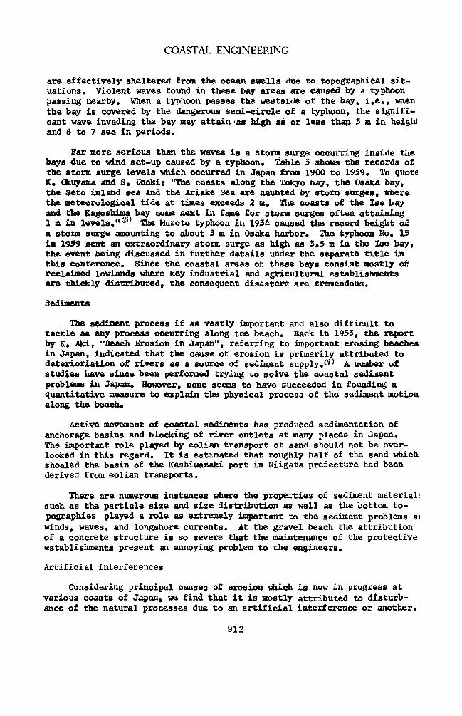
The Japan Sea coasts - The coasts facing the Japan sea are exposed"- to the confined fetches not exceeding 800 km in any direction. There is little in- fluence of a typhoon here. The feature characterizing the Japan Sea coasts is a long spell of violent wind waves occurring during winter due to the migratory lows. Only swells of relatively short periods may occur here due to limitation in fetches. The pronouncing pattern which distinguishes the Japan Sea coasts from the Pacific coasts is that a complete calm dominates the Japan sea coasts occationally due to absence of a fetch during June to August. On the other hand, during winter the sea is continually covered by a violent fetch after another which takes place in the wake of incessant passage of lows. Fig. 8 shows the probable occurrence of strong winds for each month in the vicinity of Niigata; Figs. 9 (a) and (b) show the proba- ble occurrence of waves for each month respectively at Niigata and at Tokai- mura (Pacific coast).
The results of field observation show that the significant waves oc- curring along the Japan .Sea coasts seldom exceed 12 to 13 sec in period and 7 m in height .c4)&(7) Based- on the maximum duration for each magnitude of win< velocities derived from the records at Niigata in 1957 and 1958 and after some assumptions for simplicity, we evaluated the greatest possible waves corresponding to the maximum fetch length of 800 km by utilizing the gener- alized forecast diagram by Sverdrup, Munk and Bretschneider. The results are shown in Fig. 10, which give 5 to 8 m and 11 to 13 sec for heights and periods of the greatest possible significant waves expected at the Niigata coast. We are planning to test the adequacy of this treatment by actually measuring the waves at the Sado Island which is located 35 km offshore of Niigata.
The Sheltered bays *• This category includes the bay area such as the Tokyo 1 the Ise bay, the Osaka bay, the Seto inland sea, and the Ariake Sea, that
911
COASTAL ENGINEERING
are effectively sheltered from the ocean swells due to topographical sit- uations. Violent waves found in these bay areas are caused by a typhoon passing nearby. When a typhoon passes the westside of the bay, i.e., when the bay is covered by the dangerous semi-circle of a typhoon, the signifi- cant wave invading the bay may attain as high as or less than 3 m in heighl and 6 to 7 sec in periods.
Far more serious than the waves is a storm surge occurring inside the bays due to wind set-up caused by a typhoon. Table 3 shows the records of the storm surge levels which occurred in Japan from 1900 to 1939* To quote K. Okuyama and S. Unoki; "The coasts along the Tokyo bay, the Osaka bay, the Seto inland sea and the Ariake Sea are haunted by storm surges* where the meteorological tide at times exceeds 2 m. The coasts of the Ise bay and the Kagoshima bay come next in fame for storm surges often attaining 1 m in levels."^ The Muroto typhoon in 1934 caused the record height of a storm surge amounting to about 3 m in Osaka harbor* The typhoon No. 15 in 1959 sent an extraordinary storm surge as high as 3.5 m in the Ise bay, the event being discussed in further details under the separate title in this conference. Since the coastal areas of these bays consist mostly of reclaimed lowlands where key industrial and agricultural establishments are thickly distributed, the consequent disasters are tremendous.
Sediments
The sediment process if as vastly important and also difficult to tackle as any process occurring along the beach. Back in 1953, the report by K. Aki, "Beach Erosion in Japan", referring to important erosing beaches in Japan, indicated that the cause of erosion is primarily attributed to deterioriation of rivers as a source of sediment supply.^ A number of studies have since been performed trying to solve the coastal sediment problems in Japan. However, none seems to have succeeded in founding a quantitative measure to explain the physical process of the sediment motion along the beach.
Active movement of coastal sediments has produced sedimentation of anchorage basins and blocking of river outlets at many places in Japan* The important role played by eolian transport of sand should not be over- looked in this regard. It is estimated that roughly half of the sand which shoaled the basin of the Kashiwazaki port in Niigata prefecture had been derived from eolian transports.
There are numerous instances where the properties of sediment material) such as the particle size and size distribution as well as the bottom to- pographies played a role as extremely important to the sediment problems as winds, waves, and longshore currents. At the gravel beach the attribution of a concrete structure is so severe that the maintenance of the protective establishments present an annoying problem to the engineers*
Artificial interferences
Considering principal causes of erosion which is now in progress at various coasts of Japan, we find that it is mostly attributed to disturb- ance of the natural processes due to an artificial interference or another.
912
COASTAL PROTECTION WORKS AND RELATED PROBLEMS IN JAPAN
a WIND VELOCITY ABCVE 80'Veec
— Hekura Is
Nngata West Coast
Aikawo
Hajikizoki
^- l^zj
% 40
API- JUN AU6 OCT DEC FEB APL
b WIND VELOCITY ABOVE !39mK
u\ i\ ><
i V
s~, /^ 7/
APL. JUN AUG OCT DEC FEB API
(d) NIIGATA (JAN 1959 TO DEC 1959) 1 '
VJAVE HEBHT in m °— lO^lE
>— 20^29
•— >30
i ft 1 \\
\- •
1/ ^\
APL JUN AUG OCT DEC FEB APL
(b) TOKAMURA (SEP 1957 TO AUG 1958)
WAVE HEIGHT in m
% 1 10—19
>— >20 A i
0 A \ 1 r K /
\
\f M • APL JUN AUG OCT DES FEB APL
Fig. 8. Fig. 9 Fig. 8. Probable Occurrences of Strong Winds in the Vicinity of Niigata Fig. 9. Probable Occurrences of Wave Heights at Niigata (a) and Tokaimura (b)
20 30 40 60 80 100 150 200 300 400 500 Km
Fig. 10. Greatest Possible Significant Waves at Niigata Coast
913
COASTAL ENGINEERING
The most prominent Instance is found in Niigata along the Japan Sea coasts. Since ancient years the Niigata city developed as an esturine port at the mouth of the Shinano river and is today one of the most im- portant ports along the Japan Sea coast. (See Fig. 11.) Formerly a tre- mendous amount of sediment was emptied from the mouth of the Shinano river which was then put in active movement along shore due to violent wind waves predominant during winter. As a result the river mouth was easily shifting its position, seriously hampering navigation through it. In order to main- tain the navigation channel through the river mouth a project was initiate* in 1896 to set up the training jetties and was completed in 1924 after re- peated improvements. At the same time another project was started in 1909 to cut a flood way at a point approximately 58 km upstream of the river in order to free the Echigo plane from frequent flood disasters. Since the project was completed in 1922, the design flood discharge of 5,570 m3/sec was mostly diverted into the flood channel and the discharge through the original channel was kept below 270 mVsec approximately. These grand projects helped to rid the Eehigo plane of a flood disaster for ever, but at the same time they drastically cut the supply of sediment to the beaches adjoining the river mouth.
As these projects proceeded, a beach segment approximately 6 km long to the west of the river mouth began to retreat and the erosion has been so severe that today two rows of the coastal dunes have been completely washed away leaving only the half of the third dune. (See Fig. 12.J The beach to the east of the river mouth had been progressing at the rate of 30 nr-per year until the jetties were installed at the river mouth. As the Jetties were being constructed, the rate of shoreline progression was reduced and later, with completion of the flood channel upstream, an appreciable retro- gression started over a stretch of 2 km. On the other hand, along the beach of Teradomari where the new flood channel empties a vast quantity of sediment into the sea (See Fig. 13.), the shoreline advanced remarkably.
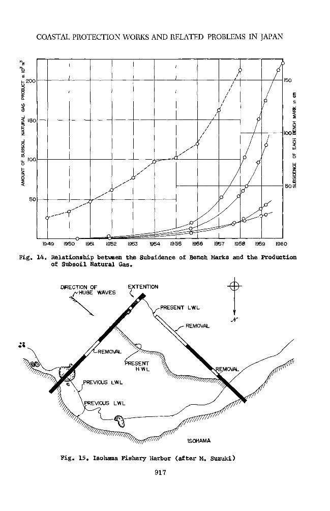
The Niigata area is beset by an even more delicate problem which has arisen from another case of artificial interference. As the production of subsoil natural (soluble) gas was accelerated since 1949, the earth level has started to give way at an increasing rate. (See Fig. 14.) Today the subsidence has progressed to such an extent as to paralyze the port facili- ties as well as intensifying the beach erosion.
The decrease of sediment supply from the river ways also result from construction of dams for power generation, water supply or flood control or of debris barriers. Such examples are found at the Kaike coast, the Toyama coast (exposed to the Japan Sea), and the Toban coast (located in the Seto inland sea). There are coasts where the beach was eroded due to jetties or other shoreline barriers which acted to intercept the path of sediment from the source of supply. Such example is found at the Tanezaki coast (in Shikoku), and the East Katase coast (in Sagami bay).
Japan is abundant in problems of harbor sedimentation which have long been harassing the harbor engineers. There is the well-cited example of Isohama (along the Pacific Ocean coasts) which was completely disabled due to severe sedimentation. (See fig. 15.) A similar example is found in Zwafune which is located approximately 45 km north of Niigata and approxi- mately 5 km south of the Miomote river. We should say that this fishery
914

COASTAL PROTECTION WORKS AND RELATED PROBLEMS IN JAPAN
206"
, 1
Distance 0 660m
0 °0° a> 1130
a> .2120
e . 2540 f°
oo1 O 2890 0 "
8 3660 r 0 00 > 0
V %B ®e®«
0 tD..®© 1 © ®e
m
<i> © (i f 9
e e
0>
® ftVfeke «<= e 9 *». »
« 9 e
96 «ee 9 8 8
ea ft© 7 ®
* 8 O « •
* a e 8
• 9 > • • • 9 1 •»
•
Fig. 11 Fig. 12 •Fig. 11. location Map of Niigata Fig. 12. Retrogradation of Shore Line at Niigata West Coast in Comparison witt
that in 1889, Distance being measured from the Shoreward End of West Jetty at the Shinano River Outlet
.Fig, 13. Accretion of Sandy Beach at Teradomari
915
COASTAL ENGINEERING
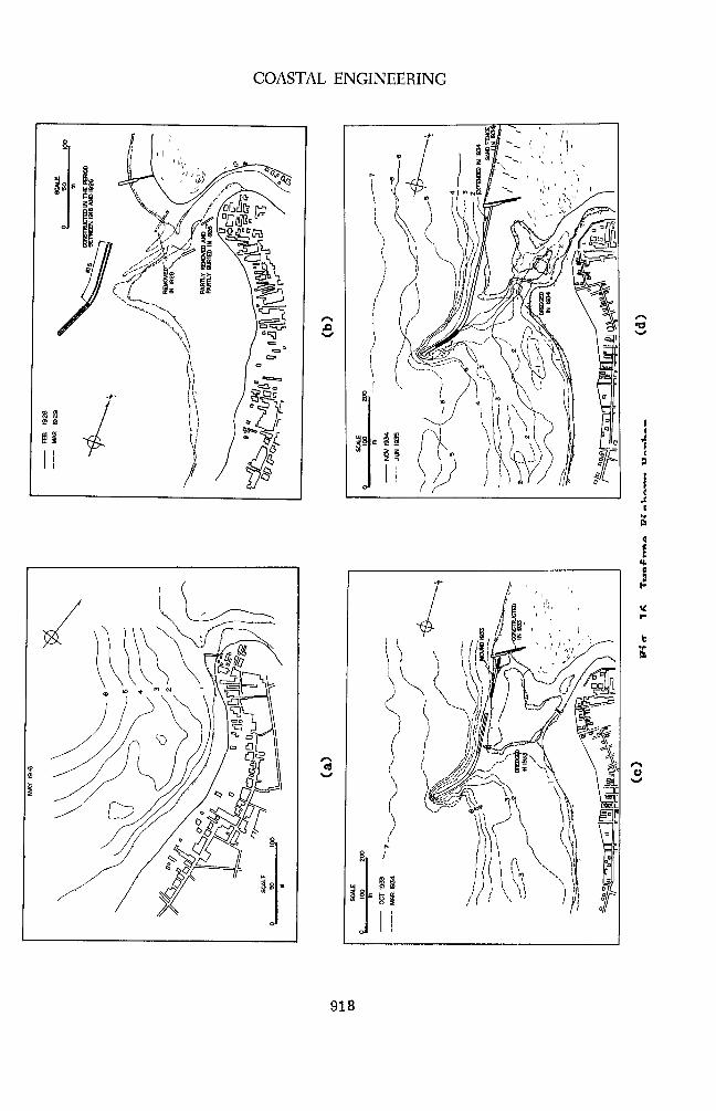
harbor embodies the history of the Japanese engineers who fought coastal sediments with unswerving perseverance. Fig. 16 will aid to understand the background of this harbor where the design and alignment of the jet- ties have been repeatedly modified under the pressure of invading sedi- ment.
APPROACHES TO COASTAL PROCESSES
The factors discussed in the preceding chapter combine in nature to present various patterns of coastal problem. The problems are so intri- cately constituted that it has only been these 15 years that a field in- vestigation based on the scientific procedure and a laboratory experiment based on the results of such investigation came to prevail. We had to depend largely on the experiences of some limited number of engineers until the scientific approaches were introducedS10^
The meteorologists and oceanographers have long been turning out an immense quantity of data on waves, but they mostly counted on visual ob- servations until various types of instruments became available about 10 years ago. Today, a number of wave recorders, both step-resistance and pressure types, have been installed in Japan. The shore-based stereo- photography is also used in studying the shoaling waves.
The longshore currents are often measured by using floats or self- contained recorders. Fluorescent dye markers are also used both in and out of the surf zone.
Though supremely important, the measurement of the longshore sedi- ment movement still lacks in adequate instruments. A box trap or a tube (or bamboo) trap is currently used in Japan, but the data which they pro- vide fail to give the definite basis for a quantitative treatment. In order to verify the sand-arresting organism of a trap, the authors carried out a series of instant and cumulative sampling of suspended sediment in the field in parallel to a laboratory model test in a two-dimensional flume. Though the project is still in progress, we have succeeded in es- tablishing a relationship between the concentration of suspended sediment and the efficiency of a tube trap/")
At the present state the hydrographic sounding by lead or echo is a most effective and most widely used method for estimating the movement of sediment as well as changes in bottom topographies. The problem with the hydrographic survey today is to shorten the operation period, yet not to impair the accuracy of sounding data so that the wave conditions may not change during the operation.
The uncertainty in the scale effect seriously reduces the value of laboratory experiment, particularly one utilizing a movable bed. The method used by the Japanese engineers to overcome this difficulty is to follow a close reference between the model and the prototype by trial-and- error repetition.
A most pronouncing example of the overall coastal study in Japan is
916
COASTAL PROTECTION WORKS AND RELATED PROBLEMS IN JAPAN
1949 1950 1951 1952 1953 1954 1955 1956 1957 1958 1959 I960
Fig. 14. Relationship between the Subsidence of Bench Marks and the Production of Subsoil Natural Gas.
DIRECTION OF 'HUGE WAVES
ISOHAMA
Fig. 15. Isohama Fishery Harbor (after M. Suzuki)
917
COASTAL ENGINEERING
&
O
918
COASTAL PROTECTION WORKS AND RELATED PROBLEMS IN JAPAN
a)
919
COASTAL ENGINEERING
found in the coast of Niigata. In order to deal with the problem of ero- sion, a committee was created in 1946 and after 5 years of strenous field investigation and laboratory model experiments the results were published in an extensive report in 1951, In 1953, the prefectural office of Niigat* set out on a long-range project of investigation with by far the compre- hensive scope* Numerous revisions were made on the methods and instruments of investigation until of tolerably satisfactory arrangement was completed in 1957.
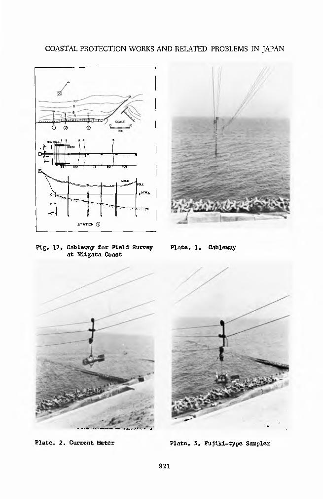
The purposes of investigation at Niigata consisted in (1) exploring the rate and physical processes of erosion, and (2) obtaining data to be used as the basis for planning protection works and their modifications. Since the coasts facing the Japan Sea are almost completely devoid of a lull during winter due to violent wind waves, an investigation by a boat is impossible. A cableway consisting of masts and track cables was set up in the perpendicular direction against the shoreline which is operated at the station located on top of the beach dune. The cableway could carry the recording or sampling instruments to any shallow water position regard- less of the weather and sea conditions. (See fig. 17 and Plate 1.)
The overall project of investigation is outlined below.
A. General investigation on shallow water areas
1. Hydrographic sounding - Once or twice per year, as far as the depth of 20 m and along the stretch of 20 km, by echo- sounding from a boat*
2. Sampling of bottom materials - Conducted simultaneously with the sounding operations.
B. Investigation of coastal establishment
1. Investigation on deformation of a submerged breakwater due to wave action.
2, Investigation on subsidence of a submerged breakwater due to wave action.
C. Investigation on natural forces
1* Direction and velocity of winds - Records from several stations scattered in the vicinity were collected to compare variability in direction and intensity of winds found inside a fetch of an appreciable width.
2. Observation of shallow water waves - The directions, heights and periods of shallow water waves in the depth of approximate- ly 5 m and less ware observed to determine the deformation of wave characteristics due to bottom topographies and the damp- ing effects of a submerged breakwater. In order to determine the sheltering effect of the Sado Island two units of shore- based pressure recorders are being installed at Sado and Niigata in the depth of approximately 10 m.
920
COASTAL PROTECTION WORKS AND RELATED PROBLEMS IN JAPAN
® ® CD
12 3 4
O 0 \ O
"TOO" ^?5 60 ' ~* ras-
C^^ POLE
. -M.WI.L
-5 -
^ 40»- }.....
STATION ©
Fig. 17. Cableway for Field Survey Plate. 1. Cableway at Niigata Coast
Plate. 2. Current Meter Plate. 3. Fujiki-type Sampler
921

COASTAL ENGINEERING
•a I P to a
a o r-l
p CO CO
O M
cj a) O 10
•^ H P o a) <D ^ 0} p
a bO n c P ° O 01
M ••-I En
s a) H
P 4
<0
id a) 03
<H o e o P
3 xn a ca o
o
bO
fa
•8
o •rl U P O
H
P I
•rl
•rl fa
0) P td f-l
3 09 ctf
14
CO
<H O
e o •rl P u 0 CO
B a
ox
bO •rl fa
922

COASTAL PROTECTION WORKS AND RELATED PROBLEMS IN JAPAN.
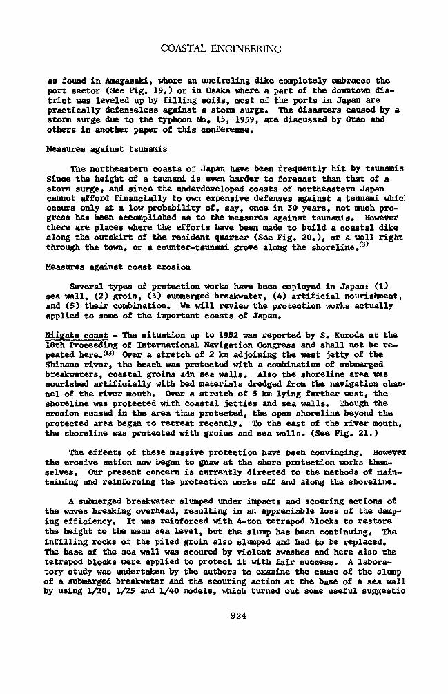
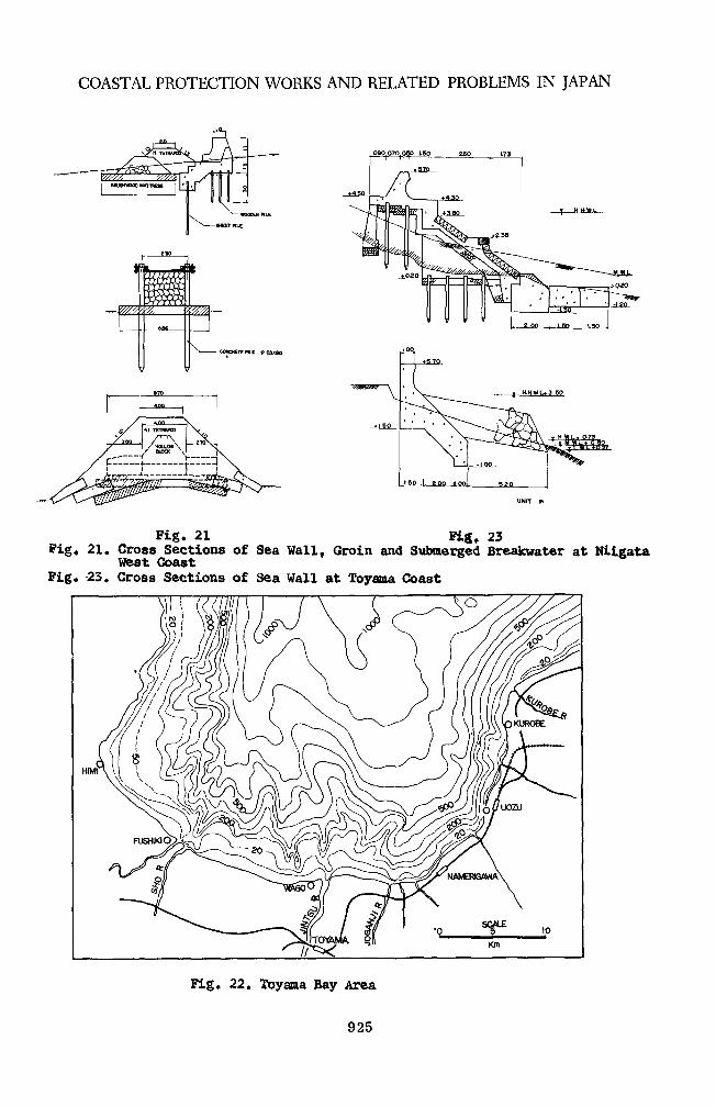
D, Special installations to investigate surf-zone characteristics - A cableway system which, was developed to make the investigation activities during winter storms possible, was designed to carry the following units to the zones in and out of the breaking point.
1. A self-contained current meter and a cross-blade float to measure current velocities and directions at an arbitrary level above the bottom. (See Plate 2.)
2. Fujiki-type sampler for measuring instant concentration of suspended materials (See Plate 3.) and a tube trap for cumu- lative arresting of suspended sediment.
3. Fujiki-type electric lead for sounding of the bottom topogra- phies near the surf-zone. (See Plate 4.)
A recent technique of radioisotope was applied to the Niigata coasts in 1958 in order to trace the movement of bed materials.
This arrangement of various items of investigation has succeeded in supplying a great deal of information on the physical processes occurring at the beach under erosion, as was partly discussed in the preceding chapter,(IZ) Our experience in Niigata has convinced us that a well-arranged project with refined instrumentation does really pay.
COASTAL PROTECTION WORKS AND PRACTICES
The design and construction of coastal protection works may vary ac- cording to the purposes as follows:
1. Defense against a storm surge:
2. Defense against a tsunami:
3. Prevention of beach erosion: and
4* Measures against sedimentation of a harbor basin or blocking of a river mouth.
Defense against storm surges
The bays and inlets west of the Tokyo area are dangerously exposed to the hazards o£ a storm surge* The key industrial centers such as Tokyo. Nagoya and Osaka are located in this region. Once a storm surge should occur at one of these area the resulting disasters would be tremendous due to valuable establishments and swarming population crowding the lowland. The serious subsidence caused by excessive exploitation of the ground water has reduced these industrial areas even more vulnerable to a storm surge.
One of the most popular measures to defend a storm surge is to besiege a lowland with coastal dikes or sea walls. (See Fig. 18.) However, such procedure may not be extended to the port areas, since it may interfere with the function of the port facilities. With some few exceptions such
923
COASTAL ENGINEERING
as found in Araagasaki, where an encircling dike completely embraces the port sector (See Fig. 19*) or in Osaka where a part of the downtown dis- trict was leveled up by filling soils, most of the ports in Japan are practically defenseless against a storm surge* The disasters caused by a storm surge due to the typhoon No, 15, 1959, are discussed by Otao and others in another paper of this conference.
Measures against tsunamis
The northeastern coasts of Japan have been frequently hit by tsunamis Since the height of a tsunami is even harder to forecast than that of a storm surge, and since the underdeveloped coasts of northeastern Japan cannot afford financially to own expensive defenses against a tsunami whicl occurs only at a low probability of, say, once in 30 years, not much pro- gress has been accomplished as to the measures against tsunamis. However there are places where the efforts have been made to build a coastal dike along the outskirt of the resident quarter (See Fig. 20.), or a wall right through the town, or a counter-tsunami grove along the shoreline/3)
Measures against coast erosion
Several types of protection works have been employed in Japan: (1) sea wall, (2) groin, (3) submerged breakwater, (4) artificial nourishment, and (5) their combination. We will review the protection works actually applied to some of the important coasts of Japan.
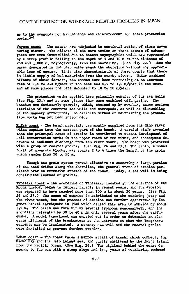
Hiigata coast - The situation up to 1952 was reported by S. Kuroda at the 18th Proceeding of International Navigation Congress and shall not be re- peated here.(|3> Over a stretch of 2 km adjoining the west jetty of the Shinano river, the beach was protected with a combination of submerged breakwaters, coastal groins adn sea walls. Also the shoreline area was nourished artificially with bed materials dredged from the navigation chan- nel of the river mouth. Over a stretch of 5 km lying farther west, the shoreline was protected with coastal jetties and sea walls* Though the erosion ceased in the area thus protected, the open shoreline beyond the protected area began to retreat recently. To the east of the river mouth, the shoreline was protected with groins and sea walls. (See Fig. 21.)
The effects of these massive protection have been convincing. However the erosive action now began to gnaw at the shore protection works them- selves. Our present concern is currently directed to the methods of main- taining and reinforcing the protection works off and along the shoreline.
A submerged breakwater slumped under impacts and scouring actions of the waves breaking overhead, resulting in an appreciable loss of the damp- ing efficiency. It was reinforced with 4-ton tetrapod blocks to restore the height to the mean sea level, but the slump has been continuing. The infilling rocks of the piled groin also slumped and had to be replaced. The base of the sea wall was scoured by violent swashes and here also the tetrapod blocks were applied to protect it with fair success. A labora- tory study was undertaken by the authors to examine the cause of the slump of a submerged breakwater and the scouring action at the base of a sea wall by using 1/20, 1/25 and 1/40 models, which turned out some useful suggestio
924
COASTAL PROTECTION WORKS AND RELATED PROBLEMS IN JAPAN
Q60O7O0.BO 160 250 , 173
CONCRETE PILE * 03X8O
' 1 4t TETWX
/ ttOLLOwX / BUSOC \
r
L. --L - 1 __^
Fig. 21 Pig, 23 Pig. 21. Cross Sections of Sea Wall, Groin and Submerged Breakwater at Niigata
West Coast Pig. 23. Cross Sections of Sea Wall at Toyama Coast
HIMI
Fig. 22. Toyama Bay Area
925

COASTAL ENGINEERING
+> n at
8
a)
u
a o •r4 •P a 0 4J o u p4
bO >rl to
to
926
COASTAL PROTECTION WORKS AND RELATED PROBLEMS IN JAPAN.
as to the measures for maintenance and reinforcement for these protection works .(l4^
Toyama coast - The coasts are subjected to continual action of storm waves during winter. The effects of the wave action on these coasts of submer- gence are even intensified due to bottom topographies which are represented by a steep profile falling to the depth of 5 and 10 m at the distance of 250 and 1,000 m, respectively, from the shoreline. (See Fig. 22.) Thus the waves generated in the deep water reach the shoreline without any appreci- able loss of energy. It is also characteristic of these coasts that there is little supply of bed materials from the nearby rivers. Under combined effects of these factors, the coasts have been retreating at an enormous rate of 1.5 to 2.5 m/year in the east and 0.5 to 1.0 m/year in the west, and at some places the rate amounted to 10 to 20 m/year.
The protection works applied here primarily consist of the sea walls (See Fig. 23.) and at some places they were combined with groins. The beaches are dominantly gravels, which, churned up by swashes, cause serious attrition of the concrete sea walls and tetrapods, as well as dissembling of the masonry structures. No definite method of maintaining the protec- tion works has yet been introduced.
Kaike coast - The beach materials are mostly supplied from the Hino river which empties into the eastern part of the beach. A careful study revealed that the principal cause of erosion is attributed to recent development of soil conservation works in the upper reach of the river, and consequent de- crease of sediment discharge from the river mouth. The beach was protected with a group of coastal groins. (See Fig. 24 and 25.) The groin, a mound built of concrete blocks, was spaces 2 to 4 times the length of the groin which ranges from 20 to 50 m.
Though the groin system proved effective in arresting a large portion of the sand drifts along the shoreline, the general trend of erosion per- sisted over an extensive stretch of the coast. Today, a sea wall is being constructed instead of groins.
Tanezaki coast - The shoreline of Tanezaki, located at the entrance of the Kochi harbor, began to retreat rapidly in recent years, and the erosion was reported to have reached more than 100 m in about 30 years. (See Fig. 26 and 27.) The cause of erosion is attributed to the training jetty and the river mouth, but the process of erosion was further aggravated by the great Nankai earthquake in 1946 which caused this area to subside by about 1.2 m. The beach was then hit by several typhoons successively, and the shoreline retreated by 30 to 40 m in only several years after the earth- quake. A model experiment was carried out in order to determine an ade- quate alignment of the breakwaters at the entrance so that the longshore currents may be decelerated. A masonry sea wall and the coastal groins were installed to prevent further erosion.
Toban coast - The coast faces a narrow strait of Akashi which connects the Osaka bay and the Seto inland sea, and partly sheltered by the Awaji Island from the Pacific Ocean. (See Fig. 28.) The highland behind the coast de- scends to the sea with a steep slope and long years of weathering reduced
927
COASTAL ENGINEERING
0 SCALE 5
AKASHI KoBE OSAKA
go iQ AWAJI \jy »o
Fig. 28. Location Map of Toban Coast
Fig. 29. Proposed Plan of Tomakomai Harbor
oil
COASTAL PROTECTION WORKS AND RELATED PROBLEMS IN JAPAN.
it apt to collapse. The soil conservation works started early in the high- land, and today the debris barriers built along the Kako river alone number more than 40. The result was the rapid decrease in supply of materials to the beach. The erosion is partly attributed to the violent tidal current through the Akashi strait which attains as high as 4.5 knots at spring tides.
The protection works provided here consist of a sea wall to which a group of relatively short groins are attached in order to damp destructive effects of swashes and thus prevent scouring action at the foot of the sea wall and offshore breakwaters (rock or block mound) was also applied to some places of the coast.
Measures against sedimentation in harbors and blocking of a river mouth
The most salient example of sedimentation is found in the Iwafune port which has had to undergo repeated modification of the jetties in order to ward of endless invasion of coastal sediments (See Fig. 16.) We abound in costly lessons as to the danger of sedimentation which must be expected of a shoreline harbor built along a sandy coast. Recently the Japanese engi*. n neers have ventured on a project of building a harbor basin inside the shore- line of the Tomakomai coast, where construction is proceeded in parallel to meticulous investigation* (See Fig. 29.)
The training of a river mouth is a problem which has been annoying the engineers everywhere in Japan. No definite measure has yet been established and the training work is carried on usually by trial-and-error prcedures. In some of the particular cases, the laboratory study proved very useful, but much remain to be enlightened in the future.
ACKNOWLEDGEMENTS
The authors have made extensive reference to a number of works accom- plished by the field and laboratory engineers in Japan. We should like to express our sincere gratitude and respect to those who have displayed such endurance in the toils of field investigation.
Our profound appreciation is due to Mr. Choule Sonu, M. S., Graduate student at the university of Tokyo, who collaborated in preparation of this report, and to the personnel of the Coastal Engineering Laboratory of the University of Tokyo who assisted in preparing the figures and type- writing the manuscript.
REFERENCES
(1) Takahashi, R., Earthquakes, Symposium on Disasters and Prevention Measures, J.S.C.E., 1956. (In Japanese)
(2) Hom-ma, M., R. Horikawa, and C. Sonu, A study on Beach Erosion at the Sheltered Beaches of Ratase and Ramakura, Coastal Engineering in Japan, Vol. 3. (In print).
929
COASTAL ENGINEERING
(3) Iwasaki, T., and K. Horikawa, Tsunami caused by Chile Earthquake in Hay, 1960 and Outline of Disasters in Northeastern Coasts of Japan, Journ. of J.S.C.E., Vol. 45, No, 8, I960. (In Japanese, but a trans- lation into English is available.)
(4) Ijima, T., the Properties of Ocean Waves on the Pacific Coast and the Japan Sea coast of Japan, Kept. Xransp, Tech. Res. Inst., No* 25, June 1957.
(5) Nagai, S. and Y. Aridome, Hindeast of Maximum Waves Generated by Ise-Wan Typhoon at Harbors in Wakayama Prefecture, Journ. of J.S. C.E., Vol. 45, No. 6, I960. (In Japanese)
(6) Uhoki, S., On the Ocean Waves due to Tropical Cyclones, Coastal Engineering in Japan, Vol. 2, 1959.
(7) Date, T., Visual Observations of Wind Waves and Swells Accompanied with Monsoon on the Japan Sea, Memoirs c£ Monsoon in Winter on San-in District, Maisuru Marine Observatory, April 1959. (In Japa- nese)
(8) Okuyama, K. and S. Unoki, General Description of Storm Tides on the Coasts of Japan, Journ. of Meteorological Research, Vol. 11, No* 6, 1959. (In Japanese)
(9) Aki, K«, Beach Erosion in Japan, Proc. of Minn. Int. Hyd. Convention, 1953.
(10) Horikawa, K,, Present States of Coastal Engineering in Japan, Journ. of Waterways and Harbors Division, Proc. A.S.C.E., Vol. 85, No. WW3, 1959.
(11) Horikawa, K., and C. Sonu, Vertical Distribution of Suspended Sedi- ment by Wave Action, J.S.C.E., 15th Annual Convention, 1960. (In Japanese)
(12) Niigata Prefecture, On the Beach Erosion at Niigata Coast, 1960.
(13) Kuroda, S., Coastal Protection Works at Niigata Harbor, Proc. 18th International Navigation Congress, Rome, 1953.
(14) Hom-ma, M. and K. Horikawa, An Experimental Study of Submerged Break- waters - Mechanism of Slump and Reinforcement of Structures - Proc* of 6th Conference on Coastal Engineering in Japan, 1959. (In Japanese
930