chapter 5 - public access, open space, and recreation
TRANSCRIPT

Volume 1 – Draft Jamaica Bay Watershed Protection Plan
March 1, 2007
93
Chapter 5 - Public Access, Open Space, and Recreation
he development of areas along the shoreline makes it difficult to access large areas of the
Bay. Highways encircle the Bay. JFK Airport consumes a large area of the waterfront. Landfills, which also restrict access to the shoreline, are being restored and will provide passive open space in the years to come. However, there are many areas where the beauty and natural features of the Bay can be experienced. Access and recreational opportunities are afforded at the GNRA, the largest and most unique open space area in the Jamaica Bay watershed. The Jamaica Bay Unit, which includes a portion of the GNRA, is over 12,000 acres in area and offers recreational opportunities that include golfing, swimming, horseback riding, boating, hiking, self-led and ranger-led tours, picnicking, archery, model airplane flying, and wind surfing. The Jamaica Bay Unit includes the following facilities:
• Jamaica Bay Wildlife Refuge – Approximately 9,100 acres of salt marshes, fresh and brackish ponds, upland fields and woods, and the open water area and islands of the Bay.
• North Shore District – Approximately 2,000 acres of open space and the facilities of Floyd Bennett Field, Canarsie Pier, Dead Horse Bay, Plumb Beach, and Bergen Beach.
• Breezy Point District – Approximately 1,000 acres of both open space and developed recreational facilities on the Rockaway Peninsula including Jacob Riis
Park, Fort Tilden, West Beach, and the Breezy Point Tip. It also includes Frank Charles Park and Hamilton Beach in the Howard Beach area on the north side of Jamaica Bay.
The recreational opportunities along the shoreline and on Jamaica Bay are typified by such activities as bird watching, hiking, picnicking, and sightseeing. Fishing is also a popular activity on
the Bay and is available from the shoreline at many locations. Fishing from boats is popular but opportunities to launch boats by the general public are limited. There are over 50 private marinas located around the Bay providing boat slips and launch ramps. While these provide access to the Bay for boating activities, public access for launching boats from these facilities is limited by membership fees or launch fees charged for their use. There are only a few free, public access locations - Beach Channel, NYCDPR’s Paerdegat Basin Park, and GNRA’s Floyd Bennett Field - to launch non-motorized boats directly in the Bay. There is a NYCDPR
facility at Sheepshead Bay allow the launching of non-motorized car top boats (e.g., small rowboats, kayaks, and canoes). Landfills that were located in areas adjacent to the Bay have been closed and have been or are in the process of being converted to open space available for passive recreational purposes. Former landfill areas include lands near Spring Creek and Hendrix Canal along the northern shoreline of the Bay, and in the Edgemere and Sommerville areas of the Rockaway peninsula on the southern shoreline of the Bay.
T
Photograph by Don Riepe, Jamaica Bay Wildlife Refuge

Volume 1 – Draft Jamaica Bay Watershed Protection Plan
March 1, 2007
94
Recreational resources in the watershed also include City and state parks. Table 5.1.1 lists some of the city parks in the watershed lands surrounding the Bay. There are also several additional playgrounds and ballfields in the immediate area of Jamaica Bay. Southeastern Queens, in particular, has been identified as an area with limited public access. There is one New York State Park, Bayswater Point, which is located on a peninsula extending out into Mott Basin in the East Rockaway area. Bayswater Point State Park is 12 acres in size with terrain varying from beachfront to wetlands to woodlands. The variation in terrain provides habitat for migrating and nesting birds. This 12-acre park is a remnant of the estate of banker Louis A. Heinsheimer. The 175-foot-wide mansion on the site, “Breezy Point,” was
demolished in 1987, although a conservatory that was attached the house remains. The state hopes to preserve and improve the existing natural systems at this location and, if practicable, restore lost habitat areas. Passive recreation, such as hiking and nature study, are available at Bayswater Point. The access provided by the Cityk, state and federal sites described above is primarily reachable by residents in the western and southern neighborhoods of the watershed such as Mill Basin, Mill Island, Marine Park, Bergen Beach, Canarsie, Sheepshead Bay, Neponsit, Belle Harbor, Seaside, Breezy Point, and the Rockaways. There are other areas along the shoreline, comprising approximately half of the Bay, where public access is restricted due to property ownership, the presence of hazards, and lack of amenities including parking and trails.
NAME LOCATION SIZE
(acres) FACILITIES
Bergen Beach Park Brooklyn, Ave. T & E. 71st St 1 Playfields Breukelen Park Brooklyn, Louisiana & Flatlands Avenue 16 Playfields Four Sparrows Marsh Brooklyn, Mill Basin 68 Wildlife refuge Marine Park Brooklyn, Flatlands & Gerritsen Avenue 798 Playfields and natural areas Paerdegat Basin Park Brooklyn, Bergen Avenue & E. 76th Street 161 Wildlife refuge Brant Point Wildlife Refuge
Queens, Bayfield & Decosta Avenues 24 Wildlife refuge
Broad Channel Park Queens, Bayfield & Decosta Avenues 17 Playfields, library Dubos Point Wildlife Refuge
Queens, Decosta Avenue & E. 63rd Street 45 Wildlife refuge
Idlewild Park Queens, Rockaway Boulevard & 149th Street 159 Wildlife refuge Jamaica Bay Park Queens, Mott Basin 148 Wildlife refuge Rockaway Community Queens, Conch, and Sommerville, Basins 254 Playfields and natural areas Terrapeninsula Queens, between Vernam & Barbadoes Basins 20 Wildlife refuge
Bayswater Point State Park; Source: NYSDEC

Volume 1 – Draft Jamaica Bay Watershed Protection Plan
March 1, 2007
95
Chapter 6 - Land Use and Development
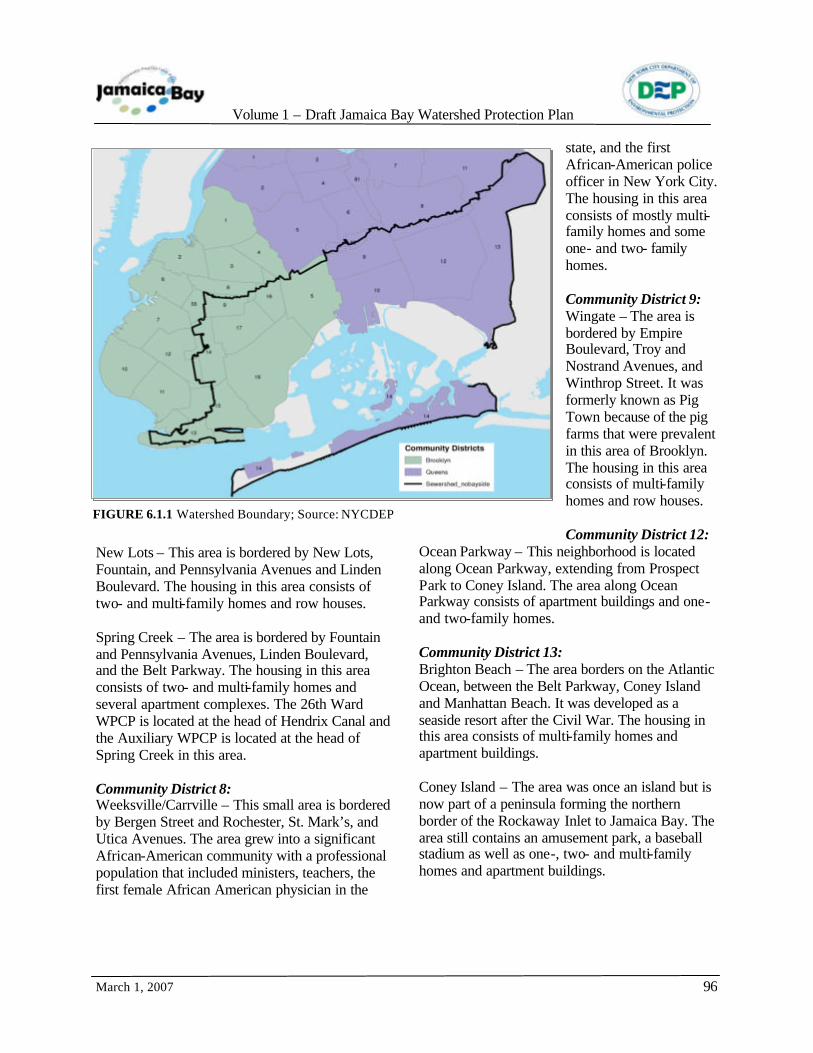
6.1 WATERSHED NEIGHBORHOODS
he Jamaica Bay watershed includes the sewershed area primarily located in New
York City as well as a portion of the southwest corner of Nassau County, as described in Chapter 2. The watershed encompasses a rich composite of communities and neighborhoods, representing an amalgam of cultures. The City’s watershed neighborhoods, listed by community board are presented in Table 6.1.1 and described below. Figure 6.1.1 shows the watershed boundary as defined for this report and the locations of the Community Districts in the watershed. Brooklyn
Community District 5: City Line – This neighborhood is bordered by Atlantic Avenue and North Conduit Boulevard. The area was named when Brooklyn was still a
separate city, before 1898. Housing consists of one- and two-family homes, small apartment buildings, and row houses. Cypress Hill – The area is bordered by Atlantic and Pennsylvania Avenues and Eldert Lane. It was formerly known as Union Place. Much of the housing in this area consists of one-, two-, and multi-family homes. East New York – This area is bordered by Jamaica Avenue, Eldert Lane, the Belt Parkway, and Junus Street. It was formerly known as Ostwout. Growth of this working class neighborhood was spurred by the construction of the Williamsburg Bridge and the IRT subway. The housing in this area consists of multi-family homes and row houses. Highland Park – This area is bordered by Pennsylvania, Liberty, and Force Tube Avenues. Housing consists of a mixture of one-family homes and row houses.
T
COMMUNITY DISTRICTS NEIGHBORHOODS INCLUDED IN THE WATERSHED
Brooklyn 5 City Line, Cypress Hill, East New York, Highland Park, New Lots, Spring Creek 8 Weeksville/Carrville 9 Wingate 12 Ocean Parkway 13 Brighton Beach, Coney Island, 14 Flatbush 15 Gerritsen Beach, Manhattan Beach, Sheepshead Bay 16 Brownsville, Ocean Hill 17 East Flatbush 18 Bergen Beach, Canarsie, Flatlands, Marine Park, Mill Basin/Mill Island
Queens 8 Briarwood, Holliswood, Jamaica Estates, Jamaica Hills 9 Kew Gardens, Richmond Hills, Woodhaven 10 Howard Beach, Lindenwood, Ozone Park/South Ozone Park 12 Hollis, South Jamaica, Springfield Gardens, St. Albans
13 Bellerose, Cambria Heights, Floral Park, Glen Oaks, Laurelton, Queens Village, Rosedale/Brookville
14 Arverne, Belle Harbor, Breezy Point, Broad Channel, Edgemere, Far Rockaway, Neponsit, Rockaway Park, Seaside, Sommerville
Volume 1 – Draft Jamaica Bay Watershed Protection Plan
March 1, 2007
96
FIGURE 6.1.1 Watershed Boundary; Source: NYCDEP
New Lots – This area is bordered by New Lots, Fountain, and Pennsylvania Avenues and Linden Boulevard. The housing in this area consists of two- and multi-family homes and row houses. Spring Creek – The area is bordered by Fountain and Pennsylvania Avenues, Linden Boulevard, and the Belt Parkway. The housing in this area consists of two- and multi-family homes and several apartment complexes. The 26th Ward WPCP is located at the head of Hendrix Canal and the Auxiliary WPCP is located at the head of Spring Creek in this area. Community District 8: Weeksville/Carrville – This small area is bordered by Bergen Street and Rochester, St. Mark’s, and Utica Avenues. The area grew into a significant African-American community with a professional population that included ministers, teachers, the first female African American physician in the
state, and the first African-American police officer in New York City. The housing in this area consists of mostly multi-family homes and some one- and two- family homes. Community District 9: Wingate – The area is bordered by Empire Boulevard, Troy and Nostrand Avenues, and Winthrop Street. It was formerly known as Pig Town because of the pig farms that were prevalent in this area of Brooklyn. The housing in this area consists of multi-family homes and row houses. Community District 12:
Ocean Parkway – This neighborhood is located along Ocean Parkway, extending from Prospect Park to Coney Island. The area along Ocean Parkway consists of apartment buildings and one- and two-family homes. Community District 13: Brighton Beach – The area borders on the Atlantic Ocean, between the Belt Parkway, Coney Island and Manhattan Beach. It was developed as a seaside resort after the Civil War. The housing in this area consists of multi-family homes and apartment buildings. Coney Island – The area was once an island but is now part of a peninsula forming the northern border of the Rockaway Inlet to Jamaica Bay. The area still contains an amusement park, a baseball stadium as well as one-, two- and multi-family homes and apartment buildings.
Volume 1 – Draft Jamaica Bay Watershed Protection Plan
March 1, 2007
97
Community District 14: Flatbush – This neighborhood is bordered by Parkside, Coney Island, Rogers, and Flatbush Avenues, and Avenue H, The area’s name derives from the Dutch for “level forest.” It includes the areas of Ditmas Park, Ditmas Park West, Midwood, Prospect Park South, Caton Park, and Albemarle -Kenmore Terraces. Housing in this neighborhood ranges from historic one-family homes to multi-story apartment buildings. Community District 15: Gerritsen Beach – The area is bordered by Avenue U, Gerritsen Avenue, Plum Beach, and Knapp Street. The housing in this neighborhood consists of one-family homes. Manhattan Beach – This neighborhood is bordered by Shore Boulevard (Sheepshead Bay), Esplanade (Atlantic Ocean), and Corbin and Seawall Avenues. Kingsborough Community College is located at the eastern end of this area. The housing in this neighborhood consists of one-family homes. Sheepshead Bay – The area is bordered by Ocean Parkway, Gerritsen Avenue, Knapp Street, and the Belt Parkway. It also includes the areas of Homecrest and Madison. The housing in this neighborhood ranges from one- and two-family homes to multi-story apartment buildings. Community District 16: Brownsville – The area is bordered by Van Sinderen and East New York Avenues, Rockaway Parkway, and Avenue D. Housing in this area consists of multi-family row houses and multi-story apartment buildings.
Ocean Hill – The area is bordered by Ralph Avenue, Fulton Street, and Eastern Parkway Extension. Housing in this area is typified by two- to four-family homes. Community District 17: East Flatbush – This area is bordered by Bedford, East New York, Flatbush, and Foster Avenues, Empire Boulevard, and Avenue H. Included within East Flatbush are the neighborhoods of Erasmus, Farragut, Remsen Village, Rugby, and Wingate (Community District 9). Housing in this neighborhood ranges from one- and two-family homes to row houses to multi-story apartment buildings.
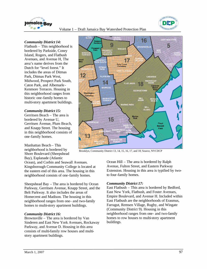
Brooklyn, Community District 13, 14, 15, 16, 17, and 18; Source, NYCDCP

Volume 1 – Draft Jamaica Bay Watershed Protection Plan
March 1, 2007
98
Community District 18: Bergen Beach – This neighborhood, a former island, is bordered by Bergen, Ralph and Veterans Avenues and Avenue Y. This neighborhood, which includes the Georgetown area, became a popular residential area in the 1980s. Housing consists mainly of one- and two-family homes. Canarsie – The area is bordered by Foster, Ralph and Paerdegat Avenues, the Shore Parkway, and East 108th Street. It includes the Paerdegat Basin area as well as Canarsie Pier, a part of the GNRA. Housing consists of multi-family homes and apartment buildings. Flatlands – The area is bordered by Nostrand, Ralph, and Flatbush Avenues, and Avenues H and T. The housing in this area consists of two- and multi-family homes and row houses. Marine Park – This area is bordered by Nostrand,
Gerritsen, and Flatbush Avenues and Avenues U and V. The housing in this neighborhood consists of one-family homes. Mill Basin/Mill Island – This neighborhood is bordered by Flatbush and Veterans Avenues, East 68th Street, Avenue T, and Mill Basin. Residential development began in the late 1940s. The area known as Mill Island is a part of this neighborhood. Housing consists mainly of one- and two-family homes. Queens
Community District 8: Briarwood – The area is bordered by Hillside Avenue, the Grand Central Parkway, 164th Street, Queens Boulevard and the Van Wyck Expressway. This residential area features one and two-family homes, with apartment buildings.
Holliswood – This area is bordered by Hillside and McLaughlin Avenues, 188th Street, and Francis Lewis Boulevard. It is an area of one-family homes on winding streets; apartment buildings are found along the periphery of this development. The area is characterized by the hilly terrain that runs roughly east/west through this part of Queens. Jamaica Estates – The area, west of Holliswood, is bordered by Hillside Avenue, 188th Street, and Union Turnpike. It is a residential neighborhood with Tudor, colonial, and ranch homes. There are also multi-story apartment buildings in the area. Jamaica Hills – This area, west of Jamaica Estates, is bordered by Union Turnpike and Hillside Avenue. The area is mainly
Queens, Community District 14; Source, NYCDCP

Volume 1 – Draft Jamaica Bay Watershed Protection Plan
March 1, 2007
99
residential with one-, two- and three-family homes. Community District 9: Kew Gardens – This area is bordered by Queens Boulevard, Lefferts Boulevard, Metropolitan Avenue and Union Turnpike. This neighborhood consists of large homes on winding streets, with pre-war apartment buildings near the major shopping thoroughfares. Richmond Hills – This area is bordered roughly by Hillside, Jamaica, and Myrtle Avenues, and Lefferts Boulevard. It is located at the western end of the string of hills that run east/west through this part of Queens. The housing in this area consists primarily of one and two-family homes. Woodhaven – The area is bordered by a public park, Forest Park, Park Lane South, and Atlantic Avenue. Housing consists of attached and semi-attached colonial homes, with some fully detached Victorian style homes. Cooperative apartments are located along Woodhaven Boulevard and Park Lane South. Woodhaven Boulevard and Jamaica and Atlantic Avenues are the major commercial streets. Community District 10: Howard Beach – This neighborhood is bordered by the Belt Parkway, Jamaica Bay, JFK Airport, and Brooklyn. The coastal areas, with some homes built on pilings, have a nautical character; inland there are apartment complexes but one and two-family homes dominate. Cross Bay Boulevard is the major commercial street. Lindenwood – This area is bordered by the Belt Parkway, Conduit Avenue and the Brooklyn-Queens border. It is characterized by a large housing complex built in the 1950s in northern
Howard Beach. Six- story and garden apartment buildings predominate. Ozone Park/South Ozone Park – This area is bordered by Atlantic Avenue, Drew Street, the South Conduit, and 108th street. This area is characterized by single family homes. Community District 12: Hollis – This area is bordered by the Rockaway branch of the Long Island Railroad, Jamaica and Murdock Avenues, and Francis Lewis Boulevard. It is culturally diverse with Victorian-style and row houses. South Jamaica – This area is bordered by the Long Island Railroad, Liberty Avenue, the Van Wyck Expressway, and Merrick Boulevard. Housing
consist of one and two-family homes and a number of smaller apartment buildings, along with Rochdale Village, a public housing project located on the site of the former Jamaica Race Course. Springfield Gardens – The area is bordered by the neighborhoods of St. Albans and Laurelton, JFK Airport, and Farmers Boulevard. The area consists primarily of one- and two-family homes. St. Albans – This neighborhood is located southeast of the Jamaica neighborhood and northeast of the neighborhoods of Springfield Gardens and Laurelton. Housing
consists mainly of one- and two-family homes. The St. Albans Veterans Administration Extended Care Center, formerly a naval hospital, is located on the site of a former golf course. Community District 13: Bellerose – This neighborhood is located on the eastern edge of Queens along the border with Nassau County and centered on Hillside Avenue.
JKF International Airport; Photograph by Don Riepe, Jamaica Bay Wildlife Refuge

Volume 1 – Draft Jamaica Bay Watershed Protection Plan
March 1, 2007
100
It is primarily a residential area of one- and two-family homes. Cambria Heights – This area is located along the Belt Parkway, which separates it from Nassau County. Linden Boulevard is the main shopping street of this middle-class community of one- and two-family homes.
Floral Park – This neighborhood is located at the eastern edge of Queens and is adjacent to the Village of Floral Park in Nassau County. The main thoroughfare is Tulip Avenue. It is a community of one- and two-family homes. Glen Oaks – This area is bordered generally by Union Turnpike, 76th Avenue, Commonwealth Boulevard, and 263rd Street. Glen Oaks Village is a self-managed cooperative residential housing development located in northeastern Queens. It consists of nearly 3,000 garden style apartments. Laurelton – This neighborhood, east of JFK Airport, is bordered generally by the Belt Parkway and Springfield and Merrick Boulevards. The area is filled with one- and two-family homes in Spanish and English Tudor styles. Queens Village – This area is roughly bordered by Jamaica, Hillside, and Braddock Avenues and Springfield Boulevard. The area consists primarily of one- and two-family homes. Rosedale/Brookville – These areas are bordered by Springfield Gardens, Valley Stream (in Nassau
County), Laurelton, and JFK Airport. They are at the eastern edge of New York City with the border between Queens and Nassau County. Community District 14: Arverne – This area is bordered roughly by Beach 54th and 90th Streets, Rockaway Boulevard, and the Atlantic Ocean. Much of the land is vacant, with urban renewal plans underway. Belle Harbor – This neighborhood is bordered by Jamaica Bay, Beach 130th and 141st Streets, and the Atlantic Ocean. Housing consists primarily of one- and two-family homes. Breezy Point – This area is bordered by 201st and 222nd Streets, Jamaica Bay, and the Atlantic Ocean. This neighborhood is a gated, cooperative community at the western end of the Rockaway peninsula. Broad Channel – This neighborhood occupies the southern portion of Broad Channel Island, the only inhabited island in Jamaica Bay. Except for a commercial section of Cross Bay Boulevard, the area is residential. The northern section of the island is part of GNRA and is managed by the NPS.
Edgemere – This area is bordered roughly by Beach 32nd and 54th Streets, Jamaica Bay, and the Atlantic Ocean. There are number of one- and two-family homes, but much of the land is vacant, with urban renewal plans underway.
Broad Channel; Source: http://www.forgotten-ny.com
Edgemere; Source: http://www.forgotten-ny.com
Volume 1 – Draft Jamaica Bay Watershed Protection Plan
March 1, 2007
101
Far Rockaway – Far Rockaway is located at the eastern end of the Rockaway Peninsula, and bordered by Nassau County, Beach 32nd Street, and the Atlantic Ocean. Housing in this area is a mixture of one- and two-family homes, apartment buildings with new beach homes, and waterfront development. Neponsit – This area is bordered by Jacob Riis Park (Beach 149th Street), Beach 141st Street, Jamaica Bay, and the Atlantic Ocean. The housing in this area is primarily one- and two-family homes. Rockaway Park – This area is bordered by Beach 118th and 130st Streets, Jamaica Bay, and the Atlantic Ocean. The housing in this area is primarily one- and two-family homes. Seaside – This area is bordered by Beach 90th and 118th Streets, Jamaica Bay, and the Atlantic Ocean. The housing in this area is primarily apartment buildings and year-round private homes.
Sommerville – This area is bordered roughly by Beach 54th and 72nd Streets, Rockaway Boulevard, and Jamaica Bay. The housing in this area is primarily one- and two-family homes. Nassau County
In Nassau County only a portion of the watershed based on topography actually drains to Jamaica Bay. All or portions of the following areas of Nassau County are assumed to drain to Jamaica Bay: Incorporated areas: Village of Cedarhurst. Unincorporated Areas: Inwood, South Valley Stream, Valley Stream, and Woodmere. Based on a review of aerial photographs and topographic mapping of the area, approximately 9,100 acres in Nassau County are tributary to the Bay.
6.2 LAND USE PLANNING AND ZONING
6.2.1 Land Use
he City portion of the watershed’s land area is approximately 46,000 acres. Land use in the
Jamaica Bay watershed is predominantly residential with much of the residential units consisting of one- and two- family homes (37%) .
Despite this predominance of low density residential development, the Jamaica Bay watershed overall is an extensively developed geographic area with impervious coverage approaching approximately 65%. Two high-density areas are also located within the watershed that represent a mixture of residential, commercial and industrial land use districts: Downtown Jamaica in Queens located at the northeastern part of the watershed and Broadway Junction-East New York which straddles the Brooklyn-Queens border in the northern reach of the watershed.
T

Volume 1 – Draft Jamaica Bay Watershed Protection Plan
March 1, 2007
102
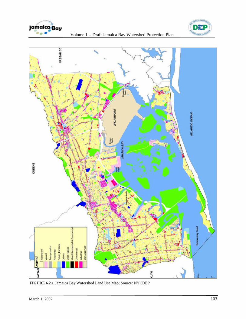
Table 6.2.1 presents the land use of the Brooklyn and Queens portion of the Jamaica Bay watershed or drainage area. Approximately 47% of the land use in the Queens and Brooklyn portions of the Jamaica Bay watershed is residential (1 and 2-Family or Multi-Family). Figure 6.2.1 maps the different land use types within the watershed. Land uses within the Nassau County portions of the watershed were estimated based on aerial photography. The results of this analysis are provided below in Table 6.2.2.
Residential Land Use
Residential properties, the predominant land use in the watershed, range from one-family homes to row houses to high rise apartment buildings. Based on the land use data obtained from New York City Department of City Planning (NYCDCP), approximately 47% of the land area has been developed for residential use in addition to a small percentage of mixed use (residential/commercial). Commercial Land Use Commercial properties in the watershed area of the Bay include the wide variety of uses
TYPE DRAINAGE AREA
1-2 Family Residential 37.1%
Multi-Family Residential 9.9%
Mixed Res./Commercial 1.7%
Commercial/Office 2.7%
Industrial 1.9%
Transportation/Utility 13.3%
Institutions 5.4%
Open Space/Recreation 22.1%
Parking Facilities 1.4%
Vacant Land 3.8%
Miscellaneous 0.7%
LAND USE NASSAU COUNTY
1-2 Family Residential 40.0%
Multi-Family Residential 14.0%
Mixed Res./Commercial 3.0%
Commercial/Office 3.7%
Industrial/Manufacturing 4.0%
Transportation/Utility 3.0%
Public Facilities/Institutions 7.5%
Open Space/Recreation 16.5%
Parking Facilities 2.4%
Vacant Land 5.0%
Miscellaneous 0.9%
Source: New York City Department of City Planning, RPAD, 2006
TABLE 6.2.1 Land Use 2005, of the Jamaica Bay Drainage Area in Brooklyn and Queens.
TABLE 6.2.2 Land Use, Assumed in Percent within Nassau County Watershed
Volume 1 – Draft Jamaica Bay Watershed Protection Plan
March 1, 2007
103
FIGURE 6.2.1 Jamaica Bay Watershed Land Use Map; Source: NYCDEP

Volume 1 – Draft Jamaica Bay Watershed Protection Plan
March 1, 2007
104
representative of any metropolitan area. Based on land use data obtained from NYCDCP, approximately, 2.7% of the land area of the watershed has been developed for commercial use in addition to a small percentage of mixed use (residential/commercial). Industrial Land Use
Industrial use properties are also present in the areas surrounding the Bay and represent approximately 1.9% of watershed land within NYC, a relatively small portion of the watershed area. Among the industries located in the Jamaica Bay watershed are the following:
• automotive parts • plastics packaging • architectural building products • metal parts fabrication • fuel storage facilities • printing/newspaper publication.
Open Space
A significant percentage of the watershed, 22.1%, is classified as open space due to the presence of NPS properties and facilities. The Jamaica Bay Unit of the GNRA consists of approximately 12,000 acres including the waters surrounding the Jamaica Bay Wildlife Refuge but also significant land areas that surround the Bay including Floyd Bennett Field, Canarsie Pier, Dead Horse Bay, Plumb Beach, Bergen Beach and portions of the Rockaway Peninsula. GNRA property within the watershed is characterized as open space on the land use map (see Figure 6.2.1). The watershed contains numerous city parks and one state park. See Chapter 5 for additional information on open space resources in the watershed. Transportation/Utility
Transportation/utility comprises approximately 13.3% of the watershed area; however, this percentage is primarily due to a single property. JFK Airport, a significant land use within the watershed, is classified as a transportation/utility in Table 6.2.1 above and coded as an airport in the land use map (see Figure 6.2.1). JFK Airport is
approximately 4,930 acres in size and is located in the southeastern Queens portion of the waterfront on property owned by the New York New Jersey Port Authority. Vacant
Based on 2005 land use data, vacant land comprises approximately 3.8% of the watershed. However, it is critical to ground verify these data in particular and it cannot be assumed that these properties remain undeveloped. Rather, these parcels may be in different stages of development or associated with another land use type.
Residential Use; Photograph by Ralph McClurg, O’Brien & Gere
Golf Course on Head of Bay; Photograph by Ralph McClurg, O’Brien & Gere
Cement Plant East of Jamaica Bay; Photograph by Ralph McClurg, O’Brien & Gere

Volume 1 – Draft Jamaica Bay Watershed Protection Plan
March 1, 2007
105
Other
Other land uses in the watershed area of the Bay include institutions, parking facilities, and miscellaneous uses that do not fall into discrete or defined categories.
6.2.2 Zoning
The watershed is primarily comprised of residential zoning districts at approximately 64%. As mentioned above, the residential areas of the watershed are characterized primarily by low density housing; approximately 41% percent of the watershed consists of R1, R2, R3, and R4 districts. In contrast, 22% of the watershed consists of medium density residential zoning districts including R5, R6 and R7 districts and 1% of the watershed is zoned as R8 or other high density residential zoning districts. Commercial zones are a small percentage of the overall watershed at approximately 3% and manufacturing zones are larger at 15%. The large percentage of “Other” in the table below mostly accounts for the federally-designated NPS property of the GNRA Jamaica Bay Unit.
NYC Zoning Resolution
It was the intention from its initial passage in 1916 that the City’s Zoning Resolution would be a living document, evolving as the need arose due to changes in technology, as well as variations in community growth patterns that were not and could not be foreseen in 1916. Although the Zoning Resolution was frequently amended to meet new and changing conditions, its basic form and content remained relatively static until 1961. Over that period, New York City, as well as the rest of the world, saw remarkable transformations in every segment of the community and how it went about the everyday business of life. The City’s population had grown from approximately 5,000,000 in 1916 to nearly 8,000,000 in 1960; major airports, multi-lane expressways, and radio and television towers had become a part of the community’s landscape. It was time to undertake a major overhaul of the Zoning Resolution and bring it into alignment with the current times. Among the concepts that were included in the updating of the Zoning Resolution were the following: • In order to accommodate different types of
land uses within the three main categories of residential, commercial, and industrial or manufacturing, a greater level of specific land use districts and definitions of acceptable uses were established.
• Maps were incorporated as part of the Zoning Resolution to indicate the location and boundaries of districts established by the Resolution.
• The maximum size, or bulk, of a building was set by establishing a floor area ratio (FAR) as part of each zoning district.
• An open space ratio (OSR), lot coverage limitations, and density restrictions were established to control the concentration of development and to allow for the orderly planning of new schools, utilities, and transportation routes.
• Contextual zoning was recognized as a means to regulate new buildings in a manner that would maintain the character of an existing neighborhood as it evolved over the years.
TYPE DRAINAGE AREA
Low Density Residential (R1-2, R2, R2A, R2X, R3-1, R3-2 R3A, R3X, R4, R4-1, R4A, R4B)
40.7%
Medium Density Residential (R5, R5B, R6, R6A, R6B, R7-1, R7A, R7B)
22.2%
High Density Residential (R8A, R8B, R8X)
1.2%
Commercial (C3, C4-1, C4-2, C4-3, C4-3A, C4-4, C4-5X, C4-6, C6-1, C6-1A, C7, C8-1, C8-2, C8-4)
2.9%
Manufacturing (M1-1, M1-2, M1-3, M1-4, M1-5, M2-1, M3-1, M3-2)
14.7%
Other (non-city designated parks, unclassified, etc.)
19.5%
TABLE 6.2.3 NYC Zoning of the Jamaica Bay Drainage Area, 2005

Volume 1 – Draft Jamaica Bay Watershed Protection Plan
March 1, 2007
106
• Although skyscrapers were beginning to be constructed by 1916, the degree of impacts to the residents or occupants of a neighboring property on their ability to have access to the sky itself was not imagined. The 1961 version of the Zoning Resolution incorporated requirements to provide light and air at street level of certain residential districts.
Special Districts
Another innovation of the 1960 Zoning Resolution was the provision for “special use districts.” Special use districts have been utilized “...to achieve the specific planning and urban design objectives in defined areas with unique characteristics” (NYCDCP, 2006). Special use district provisions specify various requirements or building incentives that are tailored to preserve or promote distinctive qualities of an area that may not be easily accommodated within the general language of the zoning resolution.
Within the Jamaica Bay watershed is the Sheepshead Bay special district and the Ocean Parkway special district. The Sheepshead Bay district was identified to protect and strengthen that neighborhood’s waterfront recreation and commercial character.
“The dotted bands along each side of the Shore Parkway and Southern Parkway have been determined as a residential district in order to protect these parkways and to promote a desirable residential development next to them. The two solid black areas indicate proposed industrial centers; one situated at Mill Basin and the other at the head of the Bay near the Nassau County Line. Both of these are logical industrial sites and are adequate in size to provide for industrial expansion for a great many years to come. In addition there are existing business districts along the Rockaway peninsula shown in black cross-hatching on the map. The remainder of the region bounded on the north by the Shore and Southern Parkways, on the south by Jamaica Bay, on the east by Rockaway Boulevard, and on the west by Flatbush Avenue and Marine Park, should be zoned predominantly for residential purposes, exclusive of the waterfront and bay which should be devoted to recreation.” (NYC Department of Parks, 1938).
ZZZooonnniiinnnggg
Volume 1 – Draft Jamaica Bay Watershed Protection Plan
March 1, 2007
107
New commercial projects and residential development must meet conditions that will support the tourist-related activities along the waterfront. Provision for widened sidewalks, landscaping, useable open space, height limitations, and additional parking areas have been established. The Ocean Parkway special district encompasses a band of streets east and west of the parkway extending from Prospect Park in the north to Brighton Beach on the south. The purpose of the special district is to enhance the character and quality of this broad landscaped parkway, a designated scenic landmark. In 1993 special zoning regulations relative to development of waterfront areas were adopted. Waterfront zoning regulations control uses of piers, platforms, and floating structures and, for many new developments along waterfront areas, it applies special bulk regulations and mandates provision for public access to the waterfront. It
also allows for the development of Waterfront Access Plans (WAPs) for stretches of shoreline with unique conditions and opportunities and to provide for visual corridors with unobstructed views and public open space with new residential and commercial developments. Jamaica Bay is designated as a Special Natural Waterfront Area (SNWA) in NYCDCP’s New Waterfront Revitalization Program (WRP). The program, originally adopted in 1984, is the City’s principal coastal zone management tool. The program was revised in 2002 and, as a result, established ten policies designed to maximize the benefits derived from economic development, environmental preservation, and public use of the waterfront, while minimizing conflicts among these objectives. As a SNWA, proposed projects along Jamaica Bay’s edge are reviewed to ensure consistency with the WRP policy specific to protecting and restoring the quality and function of ecological systems within its coastal area.
6.3 REFERENCES
New York City Department of City Planning (NYCDCP). 2006. Zoning Resolution of the City of New York, 12/15/61, as amended (as of 7 April 2006). New York, NY. http://www.nyc.gov/html/dcp/html/zone/zonetext.shtml.
Photograph by Don Riepe, Jamaica Bay Wildlife Refuge

Volume 1 – Draft Jamaica Bay Watershed Protection Plan
March 1, 2007
108
Chapter 7 - Watershed Stakeholders and Public Outreach Efforts
7.1 GOVERNMENTAL AND REGULATORY AGENCIES
he governmental management of Jamaica Bay and its watershed is a complex of jurisdictions
at multiple governmental levels. These jurisdictions may have related goals, but often approach them from different perspectives or mandates. Multiple agencies conduct activities within or in relation to the Bay and its watershed which have an impact on its protection and sustainability. The following lists some of the government agencies and the general types of jurisdiction or interest of these agencies regarding Jamaica Bay. Federal Agencies
Army Corps of Engineers (USACE) USACE is responsible for investigating, developing and maintaining the nation’s water and
related environmental resources. As such, USACE is involved, either as the agency having primary responsibility for managing investigation projects or as an interested agency providing input to other
agencies, on projects regarding the Bay’s natural environment. USACE, in cooperation with the NYSDEC, regulates the protection of freshwater wetland areas. The USACE regulates the placement of dredged or fill material or structures over or within waters of the US, including tidal wetlands, under Section 404 of the Clean Water Act and Section 10 of the Rivers and Harbors Act. Activities that are proposed in tidal wetlands require authorization under the USACE Nationwide Permit program. Tidal wetlands are not mapped by USACE. USACE will determine the jurisdictional boundaries of tidal wetlands following their
review and verification of a tidal wetland delineation. USACE will issue a document entitled a Jurisdictional Determination approving the wetland limits for a five year period. In order for a USACE Section 404 nationwide permit to be valid, a Water Quality Certification from NYSDEC (under Section 401 of the Clean Water Act) and a Coastal Zone Consistency Management Determination from the New York State Department of State (NYSDOS) (under Section 307 of the Coastal Zone Management Act) must be received. These two approvals are required before an USACE permit approval can be granted. The USACE regulates the discharge of dredged or fill material into all freshwater wetlands and has jurisdiction over all wetland areas, regardless of size, within the Jamaica Bay Watershed. USACE does not regulate an adjacent area (wetland buffer). Since USACE does not rely on wetland maps, it will determine the jurisdictional boundaries of freshwater wetlands following its review and verification of a freshwater wetland delineation. USACE will issue a document entitled
T
To stand at the edge of sea, to sense the ebb and flow of the tides, to feel the breath of a mist moving over a great salt marsh, to watch the flight of shore birds that have swept up and down the surf lines of the continents for untold thousands of year; to see the running of the old eels and the young shad to the sea, is to have knowledge of things that are as nearly eternal as any earthly life can be.
- Rachel Carson
“
”

Volume 1 – Draft Jamaica Bay Watershed Protection Plan
March 1, 2007
109
a Jurisdictional Determination approving the wetland limits for a five year period. In order for a USACE Section 404 nationwide permit to be valid, a Water Quality Certification from NYSDEC (under Section 401 of the Clean Water Act) and a Coastal Zone Management (CZM) Determination from the NYSDOS (as previously described) must be received. These two approvals are required before USACE permit approval can be granted. The January 9, 2001 “SWANCC decision” (Solid Waste Agency of Northern Cook County vs. USACE) regarding the scope of regulatory jurisdiction under the Clean Water Act found that “non-navigable, isolated and intrastate” waters were no longer regulated under the statutory authority of the CWA. The redefinition of the term “waters of the United States” as promulgated under this ruling effectively eliminated for the time being USACE’s jurisdiction over isolated wetlands. Other cases working their way through the courts may continue to redefine this issue. Environmental Protection Agency (USEPA) USEPA is responsible for, among other obligations, the development and implementation of regulatory programs to protect the environment. Air emissions, water and wastewater treatment, and water quality programs affecting Jamaica Bay are ultimately under the jurisdiction of the USEPA. Included in the USEPA’s efforts are the New York-New Jersey HEP and the development of the Comprehensive Conservation and Management Plan (CCMP) for the NY-NJ harbor area, including Jamaica Bay. The USEPA has a mandate to improve, and jurisdiction over, water quality under the Clean Water Act. The agency works with state, local and tribal authorities to carry out nationwide water monitoring projects, and has been a participant in water quality studies of Jamaica Bay
Federal Aviation Administration (FAA) FAA is primarily responsible for the advancement, safety and regulation of civil aviation, as well as overseeing the development and maintenance of airport facilities. With the
presence of JFK Airport on the eastern shoreline of Jamaica Bay, the FAA is directly involved in activities affecting the management of the airport and its impacts on the Bay. Among the many issues of concern to airport operations, FAA provides guidance on certain land uses that have the potential to attract hazardous wildlife on or near public use airports. Land use practices that attract or sustain hazardous wildlife populations on or near airports can significantly increase the potential for wildlife strikes. FAA recommends that the guidance provided apply to all land use planners, and developers of projects, facilities, and activities on or near airports. Fish & Wildlife Service (USFWS)
USFWS works to conserve, protect and enhance fish, wildlife, and plants and their habitats. Several investigations have been conducted by USFWS to identify aquatic species of Jamaica Bay and the New York bight. The NPS has supported research into marsh
loss and other ecological issues relating to Jamaica Bay through the Blue Ribbon Panel, JABERRT and other programs. It has performed restoration activities, and conducts panel discussions and educational programs about the Bay and its ecosystems. National Park Service (NPS) NPS operates and manages the GNRA including parts of Sandy Hook in New Jersey, and Staten Island and Jamaica Bay in New York. The Jamaica Bay unit includes over 12,000 acres and offers diverse

Volume 1 – Draft Jamaica Bay Watershed Protection Plan
March 1, 2007
110
recreational, cultural and educational opportunities as described previously. Natural Resource Conservation Service (NRCS) NRCS provides leadership in the conservation, maintenance, and improvement of the nation’s natural resources and environment. One of the most visible efforts of NRCS has been, in cooperation with the New York City Soil and Water Conservation District and Cornell University, the preparation of soil survey reports for New York City, Gateway National Recreation Area, and Nassau County. These reports are often used in evaluating soil properties and their suitability for proposed development projects. National Oceanic and Atmospheric Administration (NOAA) NOAA, a part of the U.S. Department of Commerce, is responsible, at the federal level, for CZM which has as its objective the comprehensive management of the nation’s coastal resources, ensuring their protection for the future, giving consideration to competing economic, cultural, and environmental interests. NOAA is also responsible at the federal level for the Coastal and Estuarine Land Conservation Plan (CELCP) which was established to protect coastal and estuarine lands considered important for their ecological, conservation, recreational, historical or aesthetic value.
Coast Guard (USCG) The mission of USCG includes providing security patrols for the nation’s coastal waterways including New York Harbor and Jamaica Bay as well as safety, rescue, and
environmental emergency response teams.
New York State Agencies
Department of Environmental Conservation (NYSDEC) NYSDEC is the primary state agency that is responsible for the protection of the state’s natural resources and environment. Regulatory programs administered by NYSDEC control water, land and air pollution in order to enhance the health, safety and welfare of the people of the state and their overall economic and social well being. For Jamaica Bay this means that the NYSDEC is involved with, among other initiatives directly related to Jamaica Bay, the permitting and monitoring of the WPCPs that discharge to the Bay, and the regulation of tidal and freshwater wetlands. NYSDEC regulates activities in mapped tidal wetlands under Article 25, the Environmental Conservation Law (the specific implementing regulations are in 6 NYCRR Part 661). In general, the regulated tidal wetlands consist of all tidal waters of the state and all associated tidal marshes, mudflats and shorelines. In addition to mapped tidal wetlands, the State also regulates all activities that will occur within an “adjacent area.” In New York State the “adjacent area” extends up to 300 feet from the mapped tidal wetland; however, in New York City, because of existing development, the “adjacent area” has been reduced to a maximum of 150 feet beyond the mapped tidal wetland limits. The width of the “adjacent area” can be modified (reduced) where there are existing man-made structures such as buildings, roads, railroads, bulkheads, or seawalls. In addition, the “adjacent area” will also not extend beyond a point above 10 feet above mean sea level. NYSDEC tidal wetlands maps include several ecological zones: coastal fresh marsh; intertidal marsh; coastal shoals; bars and flats; littoral zone; high marsh or salt meadow; and formerly connected tidal wetlands. Intertidal marsh and coastal fresh marsh are offered the greatest

Volume 1 – Draft Jamaica Bay Watershed Protection Plan
March 1, 2007
111
regulatory protections due to their high ecological and flood protection values. NYSDEC requires Tidal Wetland permits for activities that will alter wetlands or wetland adjacent areas. A range of potential activities have been identified by NYSDEC. These potential activities are categorized as Generally Compatible Uses, Presumptively Incompatible Uses or Incompatible Uses. The regulations also provide development restrictions for specific uses, such as minimum building setbacks (75 feet in New York State and 30 feet in New York City); on site sewage disposal minimum setback; percentage of adjacent area that may be covered by impervious surface; minimum lot size; roadway setbacks (75 feet in New York State and 30 feet in New York City); and stormwater management facilities. Generally Compatible Uses will require submission of a Minor Permit application whereas Presumptively Incompatible or Incompatible Uses require a Major Permit application. In New York City, activities in freshwater wetlands are regulated by the NYSDEC under Article 24 of the Environmental Conservation Law (and its implementing regulations in 6 NYCRR Parts 662, 663, 664 and 665). The NYSDEC regulates wetlands that are greater than 12.4 acres and/or wetlands that are smaller that possess unique and unusual characteristics. In addition, the state-designated wetlands include a 100-foot width adjacent area or wetland buffer, which also is regulated by the NYSDEC. The NYSDEC has prepared maps depicting the locations of all protected wetlands in the state. Wetlands are classified Class I – IV, with Class I wetlands being the most valuable. As with the tidal wetlands program, the freshwater wetlands regulations assign different levels of compatibility for certain projects depending on the intended use, proximity to the wetlands, and the class of wetland affected. Permit applications are reviewed for environmental impact, economic and social need and feasibility of alternatives that
would have less wetlands impacts. Mitigation, the construction of new wetlands at a minimum of a 2:1 average ratio, may be required as a condition of wetlands permits. Department of State (NYSDOS) Through NYSDOS’s Division of Coastal Resources a variety of programs and initiatives that help to revitalize, promote and protect the State’s waterfront resources. In cooperation with the NOAA, NYSDOS’s responsibilities include the implementation, at the state level, of the CZM program and the CELCP.
Office of Parks, Recreation & Historic Preservation (OPRHP) OPRHP works to provide interpretative and educational opportunities of natural, historic, and cultural resources. NY/NJ Port Authority
NY/NJ Port Authority manages and maintains the airports, bridges, tunnels, bus terminals, PATH and seaport that are critical to the region’s trade and transportation capabilities. Interstate Environment Commission IEC is a joint agency of the States of New York, New Jersey, and Connecticut. Its programs include
activities in air pollution, toxics, and resource recovery facilities; however, the main focus of IEC is water quality. It has taken an active role in enforcement actions and legal suits aimed at obtaining
compliance with existing regulatory programs and permit conditions. The Port Authority is responsible for JFK Airport, one of largest single land uses in the Jamaica Bay watershed. The Port
Volume 1 – Draft Jamaica Bay Watershed Protection Plan
March 1, 2007
112
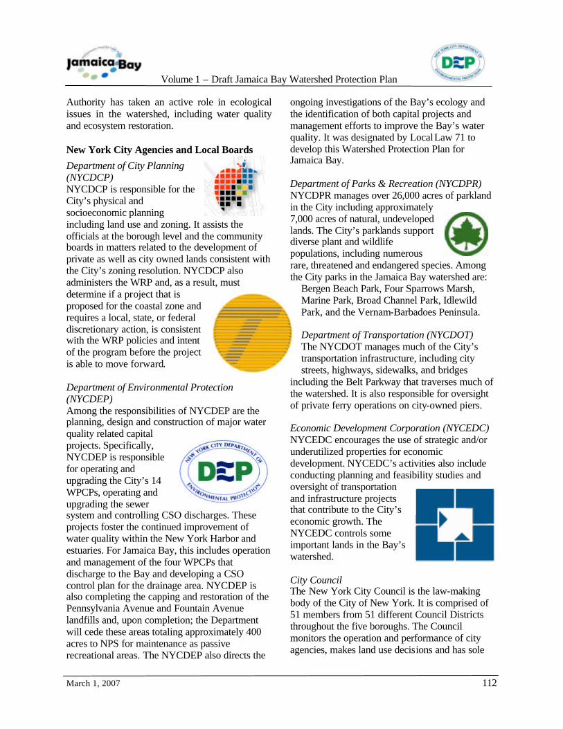
Authority has taken an active role in ecological issues in the watershed, including water quality and ecosystem restoration. New York City Agencies and Local Boards
Department of City Planning (NYCDCP) NYCDCP is responsible for the City’s physical and socioeconomic planning including land use and zoning. It assists the officials at the borough level and the community boards in matters related to the development of private as well as city owned lands consistent with the City’s zoning resolution. NYCDCP also administers the WRP and, as a result, must determine if a project that is proposed for the coastal zone and requires a local, state, or federal discretionary action, is consistent with the WRP policies and intent of the program before the project is able to move forward. Department of Environmental Protection (NYCDEP) Among the responsibilities of NYCDEP are the planning, design and construction of major water quality related capital projects. Specifically, NYCDEP is responsible for operating and upgrading the City’s 14 WPCPs, operating and upgrading the sewer system and controlling CSO discharges. These projects foster the continued improvement of water quality within the New York Harbor and estuaries. For Jamaica Bay, this includes operation and management of the four WPCPs that discharge to the Bay and developing a CSO control plan for the drainage area. NYCDEP is also completing the capping and restoration of the Pennsylvania Avenue and Fountain Avenue landfills and, upon completion; the Department will cede these areas totaling approximately 400 acres to NPS for maintenance as passive recreational areas. The NYCDEP also directs the
ongoing investigations of the Bay’s ecology and the identification of both capital projects and management efforts to improve the Bay’s water quality. It was designated by Local Law 71 to develop this Watershed Protection Plan for Jamaica Bay. Department of Parks & Recreation (NYCDPR) NYCDPR manages over 26,000 acres of parkland in the City including approximately 7,000 acres of natural, undeveloped lands. The City’s parklands support diverse plant and wildlife populations, including numerous rare, threatened and endangered species. Among the City parks in the Jamaica Bay watershed are:
Bergen Beach Park, Four Sparrows Marsh, Marine Park, Broad Channel Park, Idlewild Park, and the Vernam-Barbadoes Peninsula. Department of Transportation (NYCDOT) The NYCDOT manages much of the City’s transportation infrastructure, including city streets, highways, sidewalks, and bridges
including the Belt Parkway that traverses much of the watershed. It is also responsible for oversight of private ferry operations on city-owned piers. Economic Development Corporation (NYCEDC) NYCEDC encourages the use of strategic and/or underutilized properties for economic development. NYCEDC’s activities also include conducting planning and feasibility studies and oversight of transportation and infrastructure projects that contribute to the City’s economic growth. The NYCEDC controls some important lands in the Bay’s watershed. City Council The New York City Council is the law-making body of the City of New York. It is comprised of 51 members from 51 different Council Districts throughout the five boroughs. The Council monitors the operation and performance of city agencies, makes land use decisions and has sole

Volume 1 – Draft Jamaica Bay Watershed Protection Plan
March 1, 2007
113
responsibility for approving the city's budget. It also legislates on a wide range of other subjects. (http://www.nyccouncil.info/tools/about_council.cfm) The City Council passed Local Law 71 which required the preparation of this Jamaica Bay Watershed Protection Plan, and has had an active role in passing legislation to improve the sustainability of the City, the health of its residents, and for the protection of the environment. Borough Offices of Brooklyn; Borough Offices of Queens The two boroughs bordering Jamaica Bay are each involved in the day-to-day management of the many aspects of community life. Among the various matters that the boroughs are responsible for on the local level are economic development, land use planning and zoning, parklands, transportation, and housing. The boroughs interact with
regulatory agencies, departments, commissions, and boards at the city, state, and federal levels. Community Boards As described previously in Chapter 6 there are numerous Community Districts that comprise the Jamaica Bay watershed; specifically, Community Districts 5, 8, 9, 12, 13, 14, 15, 16, 17 and 18 in Queens and 8, 9, 10, 11, 12, 13, and 14 in Brooklyn. Community Districts were created throughout the City to serve as an organizational mechanism for the diverse neighborhoods, uses and population that make up the City. Each district includes a Community Board which has important advisory roles in dealing with land use and zoning matters, the City budget, municipal service delivery and many other matters relating to their communities' welfare.
7.2 NON-GOVERNMENTAL AND COMMUNITY ORGANIZATIONS
s one of the most ecologically diverse
and scenic areas in the New York Metropolitan region, Jamaica Bay has many supporters. From Marine Park to Broad Channel, Paerdegat Basin to Far Rockaway, citizens, environmentalists, elected officials, and agency staff have demonstrated extraordinary commitment to protecting the Bay. Though united in the common goal of conservation, these groups and individuals have focused on a range of objectives, including preserving habitat; enhancing quality of life in
communities surrounding the Bay and raising awareness about local ecology and critical issues facing the Bay. To accomplish these objectives, neighborhood-
based and regional environmental organizations have initiated activities as diverse as beach clean-ups, testimony at public hearings, marsh restoration, environmental education and grassroots advocacy. In addition, there are many local groups that promote conservation through enjoyment of the Bay and
its shoreline, as well as national organizations that have initiated projects to study and protect the Bay. These include, but are not limited to, the
A
Photograph by Don Riepe, Jamaica Bay Wildlife Refuge
Volume 1 – Draft Jamaica Bay Watershed Protection Plan
March 1, 2007
114
American Littoral Society, Baykeeper, Jamaica Bay Ecowatchers, the Eastern Queens Alliance, Natural Resources Protective Association, Jamaica Bay Task Force, Friends of Gateway, NYC Audubon Society, Natural Resources Defense Council, and the Jamaica Bay Guardian.
Lastly, colleges and universities have fostered a greater understanding of Jamaica Bay’s ecology through in-depth research focused on a range of subjects.
7.3 PUBLIC OUTREACH PROGRAM TO SUPPORT THIS PLAN
n July 20, 2005, LL71, to develop a Watershed Protection Plan for Jamaica Bay,
was signed by Mayor Michael Bloomberg. The law also stipulates a framework for public participation activities. The core of the public involvement program is its Advisory Committee, which served as the central mechanism for reaching out to the public and obtaining input essential to developing a comprehensive and implementable plan. LL71 established two primary means of involving members of the public in the development of recommendations for protecting Jamaica Bay and implementing related public education components. Section 2.h.1 of the law created an advisory committee to “provide advice to the [NYCDEP] Commissioner for the duration of its term and provide final recommendations to the commissioner and the speaker of the council on the watershed protection plan.” Section 2.b.6 addressed development of a public education program “for schools, developers, commercial facilities, civic groups and other local organizations and entities to increase awareness about the ecological significance and degradation of Jamaica bay” and activities being undertaken by NYCDEP and others on its behalf. Jamaica Bay Watershed Protection Plan Advisory Committee.
As detailed in LL71, Section 2.h. (2), the Jamaica Bay Watershed Protection Plan Advisory Committee was composed of seven members: four selected by the Mayor and three selected by the Speaker of the Council. While each member
was selected based on his affiliation with a specific organization, the group was also responsible, in part, for representing the broader public interest in the process. The members of the Advisory Committee are listed below:
• Doug Adamo, National Park Service1 • Manuel Caughman, resident, community
and environmental activist • Len Houston, U.S. Army Corps of
Engineers • Dan Mundy, resident, Jamaica Bay
EcoWatchers • Brad Sewell, Natural Resources Defense
Council1 • Larry Swanson, Marine Sciences Research
Center – State University of New York at Stony Brook
• Christopher Zeppie, Port Authority of New York & New Jersey.
Throughout its term, the Advisory Committee has held regular working sessions and panel discussions/workshops with outside experts to discuss specific topics critical to developing its recommendations. The Advisory Committee also has held monthly meetings with NYCDEP to review data and other relevant information. In addition, at the start of its term, the Advisory Committee participated in a boat tour of Jamaica Bay with NYCDEP Commissioner Emily Lloyd and members of the project team. During its term of service, the Advisory Committee focused on numerous topics related to water quality, ecological integrity of Jamaica Bay, zoning and land use, interagency coordination, public outreach and education, and funding. Initial activities included development of draft goals 1 Elected co-chair at November 29, 2005 Advisory Committee meeting.
O
Volume 1 – Draft Jamaica Bay Watershed Protection Plan
March 1, 2007
115
related to restoration and maintenance of Jamaica Bay’s water quality and ecological integrity; definition of the geographic boundaries of the Jamaica Bay watershed and sewershed for use in development of recommendations; and development of measures to assess the actions to be included in the Jamaica Bay Watershed Protection Plan. Specific topics addressed by NYCDEP and the Advisory Committee at meetings, working sessions, and technical presentations by outside experts included the following:
• computer modeling of stormwater impacts on water quality that would benefit the Advisory Committee in preparing it recommendations - approach, framework, number and types of runs to be performed, outputs, and other considerations
• existing and projected water quality in Jamaica Bay - dissolved oxygen levels, nutrients, sulfides, flushing rates, nitrogen loading, recontouring of the Bay, water quality standards (current and proposed)
• green infrastructure, including potential for providing incentives and removing barriers to use of green technologies
• zoning and land use opportunities - acquisition of public and/or private parcels abutting wetlands, increase in size of wetlands buffer zone, zoning changes, and other land use policy options
• sea level rise/surface elevation and its potential impact on marshland loss
• Best Management Practices (BMPs) for the control of stormwater
• JFK Airport and impact on Jamaica Bay - deicing techniques/procedures, stormwater management, and other operational practices
• interagency coordination for the efficient implementation of Jamaica Bay protection measures
• coordination of existing and future research efforts
• public education and outreach - need for expanded opportunities, coordination of educational and outreach programs, targeted Jamaica Bay school curricula, etc.
• adaptive management • restoration of marshlands/wetlands loss • borrow pit restoration • management of the aesthetic landscape of
Jamaica Bay, including removal of floatables
• need for safe, public access to Jamaica Bay, particularly in southeastern Queens.
Public Forums
In order to gather public input for consideration in developing its recommendations, the NYCDEP and Advisory Committee conducted two sets of public meetings: introductory public meetings and public meetings to present recommendations.
Introductory Public Meetings These sessions were scheduled to review LL71, introduce members of the Advisory Committee to the public and discuss goals of the Jamaica Bay Watershed Protection Plan and associated activities and schedules. The first meeting, held in conjunction with the Jamaica Bay Task Force (JBTF), a key stakeholders group, took place on Wednesday, January 11, 2006 at 6:30 p.m. at the Ryan Visitors Center at Floyd Bennett Field, Brooklyn. The second meeting was held on Thursday, February 9, 2006 at 6:30 p.m. at the Performing Arts Center at York College in Jamaica, Queens. Each meeting included an open house that provided visual displays detailing project information. NYCDEP representatives and members of the Advisory Committee were
Photograph by Don Riepe, Jamaica Bay Wildlife Refuge

Volume 1 – Draft Jamaica Bay Watershed Protection Plan
March 1, 2007
116
available to informally discuss the project and answer questions both before and after the presentation. Handouts included copies of LL71, comment sheets, and information on accessing related web sites. Other available materials included NYCDEP brochures and informational materials addressing general water quality and watershed/sewershed issues, as well as promotional materials provided by stakeholder groups and local constituencies.
A brief presentation, given by NYCDEP and members of the Advisory Committee, provided an overview of LL71; a summary of problems facing Jamaica Bay, along with potential solutions; and a description of current protection efforts being conducted by NYCDEP and other agencies and organizations. A list of the many regulatory authorities with jurisdiction over Jamaica Bay was also reviewed. Brad Sewell, Advisory Committee Co-Chair, elaborated on the Advisory Committee’s role in the process, emphasizing that the group would retain an independent voice, while working in cooperation with NYCDEP. Mr. Sewell indicated that the main function of the Advisory Committee would be to suggest new approaches to protecting the watershed, while representing the varied views of the many involved stakeholders. A public comment period followed the presentations. Each meeting was recorded by a stenographer. Meeting attendees included residents, business and property owners, agency representatives, elected officials, and community organizations. Over 100 people attended the Brooklyn meeting and more than 60 people attended the meeting in Queens. To publicize the meetings, display ads were placed in local newspapers; press releases and community calendar announcements were sent to community newspapers and local cable television stations; and meeting notices were placed on the web sites of NYCDEP and the Jamaica Bay Research and Management Information Network (JBRMIN). The JBTF also distributed Save-the-Date notices for each session to members of its listserve. Similar announcements were sent to the National Park Service’s Jamaica Bay Institute listserve.
Summary of Comments
Over 25 persons presented testimony or submitted written comments at the two initial public meetings. Major issues are summarized below: Brooklyn
• Suggestion to acquire property (public or private) in the vicinity of Jamaica Bay in order to enhance public access to the Bay.
• Need for additional information in order to better understand the ecology of the Bay (flushing rate, loss of sedimentation, salt marsh loss and restoration, sea level rise, etc.).
• Opposition to filling of borrow pits, particularly with dredged material.
• Concern about overall water quality, including impact of nitrogen loading from local water pollution control plants, floatables, stormwater discharges, etc.
• Comments about composition of the Jamaica Bay Watershed Protection Plan Advisory Committee, selection process for appointing members and the Committee’s length of service.
• Concern about increased presence of Asian Shore crabs in Jamaica Bay.
• Need to establish educational programs. • Support for reducing impervious surfaces. • Need for interagency coordination.
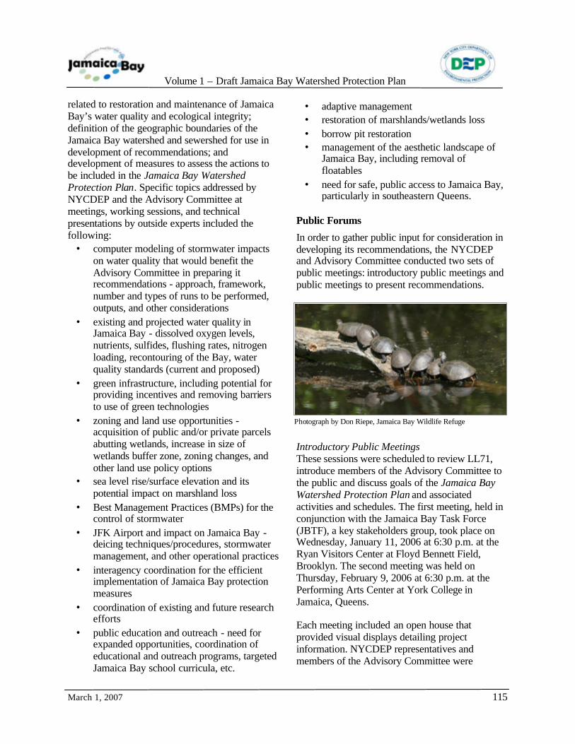
Snow Geese; Photograph by Don Riepe, Jamaica Bay Wildlife Refuge

Volume 1 – Draft Jamaica Bay Watershed Protection Plan
March 1, 2007
117
• Comments related to overall schedule of project and need to identify funding sources.
Queens
• Suggestions to use green building techniques in new construction to minimize impervious surfaces adjacent to the Bay/Support for use of green streets and landscaping.
• Need for protection and preservation of Idlewild Park.
• Need for increased public access to the Bay, especially in eastern Queens.
• Support for limits on development in areas bordering the Bay/Need for new and/or enhanced regulations to encourage the creation of open spaces as part of any new industrial development/Need to build sustainable communities.
• Importance of enforcing wetland regulations.
• Need to control development through regulatory and economic incentives.
• Support for acquisition of vacant (public and private) parcels for parkland.
• Opposition to plans to redirect Brookville Boulevard.
• Request for demapping of Nassau Expressway.
Four Sparrow Marsh; Photograph by Don Riepe, Jamaica Bay Wildlife Refuge
• Concern about impact of JFK Airport on Jamaica Bay (stormwater runoff, deicing, fuel farm, other operational issues).
• Support for use of natural systems (salt marsh, oyster colonies, etc.) for filtering and removal of nitrates.
• Need for broad public outreach and increased public education in order to increase awareness of the Bay’s history, ecological significance, and precarious condition as a resource requiring protection.
• Need to reduce stormwater runoff to sewer system/Support for channeling flow to the Bay.
• Suggestion to create an interagency task force to maintain ongoing communication and foster coordination across jurisdictional boundaries.
• Concern about rising ground water table/Suggestion to identify possible uses (potable/non-potable) for ground water supply.
• Concern about increased presence of Asian Shore crabs in Jamaica Bay and impact on salt marshes/Need to assess population and impact on marshlands.
• Need to identify funding sources to implement elements of the Jamaica Bay Watershed Protection Plan.
Public Meetings to Present Recommendations A second series of public meetings was held to discuss NYCDEP’s project status and the Advisory Committee’s draft recommendations. These meetings were scheduled to provide opportunities to receive public comments for the continued development of the Jamaica Bay Watershed Protection Plan and before submission of the Advisory Committee’s final recommendations to the NYCDEP Commissioner and Speaker of the Council. Advisory Committee Recommendations LL71, which required the preparation of the Jamaica Bay Watershed Protection Plan and established the Advisory Committee, also required that the Advisory Committee present its recommendations for the Jamaica Bay Watershed Protection Plan to the City Council by July 1, 2006. On June 29, 2006, the Advisory Committee published and submitted the document titled

Volume 1 – Draft Jamaica Bay Watershed Protection Plan
March 1, 2007
118
Photograph by Don Riepe, Jamaica Bay Wildlife Refuge
“Planning for Jamaica Bay’s Future: Preliminary Recommendations on the Jamaica Bay Watershed Protection Plan.” This document included 61 recommendations in three primary groupings: degraded water quality, compromised ecology, and inadequate planning and outreach. Also as required by Local Law 71, On September 1, 2006, the NYCDEP submitted to the City Council the agency’s initial responses to the preliminary recommendations of the Advisory Committee in the document titled “Interim Report, September 1, 2006.” Detailed discussions relating to the Advisory Committee’s recommendations continued with the NYCDEP throughout the remainder of 2006.
Public Workshop On December 7, 2006, a public workshop was held at Kingsborough Community College in the Jamaica Bay watershed. The objective of the workshop was to present to the public the potential management strategies presently under consideration, and to solicit additional potential strategies from the public. Attendance was approximately 100 people. NYCDEP contacted a number of individuals from public and private organizations active in the
protection of Jamaica Bay, and from academic institutions who are and have performed research on and are knowledgeable about the Bay, and specifically invited these individuals to attend and participate in the workshop. Commissioner Lloyd of NYCDEP opened the workshop with a keynote presentation. The input from the workshop to the plan was significant – in particular, comments received at the workshop caused this Jamaica Bay Watershed Protection Plan to be reorganized and the number of categories focused from six to five through the combination of two related topics. Web sites An additional means of providing public access to project information was offered via NYCDEP’s project web site (http://www.nyc.gov/html/NYCDEP/html/news/cac-jb.html). The site, which is updated as information became available, includes LL71, a list of Advisory Committee members and their affiliations, public meeting materials (presentations, transcripts, public notices, and press releases), an information request form, contact information, and links to other informational materials. Jamaica Bay materials can also be found on the JBRMIN web site maintained by the Center for International Earth Science Information Network at Columbia University (http://nbii-nin.ciesin.columbia.edu/ jamaicabay/jbwppac/advisorycommittee.html).
Public Workshop; Source: NYCDEP
Volume 1 – Draft Jamaica Bay Watershed Protection Plan
March 1, 2007
119
Chapter 8 - Previous and Current Planning Efforts
8.1 THE PAST
ver the years there have been many plans proposed for Jamaica Bay and the
surrounding area. Chapter 2 describes some of the proposals of years past. These plans have not always considered the natural environment of the Bay and its watershed. Among the projects was a proposal to “...reclaim what is practically waste land and water...” (Grout, 1905) into a major port for commerce. The dredging of a number of areas of the Bay to provide the needed depth of water for shipping channels, the reclamation of salt marshes, the filling in of other shallow areas and hummocks, the construction of piers, and the bulkheading of the Bay’s islands and shores throughout the entire extent of the Bay were to be included in the project. Needless to say, the objective of turning the Bay into a major port was not realized. However, various aspects of the proposal were carried out including:
• dredging of the Bay for the purpose of maintaining navigation, not for ocean going merchant ships but primarily for the benefit of recreational boaters;
• the construction of many miles of bulkheads to stabilize shorelines; and
• the construction of countless piers and docks to accommodate private recreation boats ranging from small run-abouts to luxury yachts, ferries, and sightseeing boats.
In contrast, over the past 20 to 25 years there have been numerous planning efforts to focus efforts on restoring the Bay. These plans included a myriad of technical site investigations, sampling and analysis programs, or other studies undertaken by various government agencies with regard to Jamaica Bay. It may literally be impossible to identify every investigation, study, or evaluation program that has been conducted.
Recognizing that the passage of LL 71 was preceded by a long history of activism and public education, the NYCDEP and the JBWPPAC attempted to learn as much as possible about previous and ongoing projects and programs. This understanding of other efforts has avoided “re-inventing the wheel” and has set the stage for greater coordination among all concerned stakeholders. A few of the more significant planning reports are summarized in the sections below.
8.2 RESTORATION/CONSERVATION PLANS
large number of projects for improving or protecting the water quality and wildlife
habitat of Jamaica Bay have been proposed over
the past 20+ years. The primary contributing agencies have been the USACE, NYSDEC, NYCDEP, NPS, USFWS, New York/New Jersey HEP, as well as a number of non-governmental organizations. A number of significant studies have been performed and reports have been
O
A
Nature will bear the closest inspection. She invites us to lay our eye level with her smallest leaf, and take an insect view of its palm.
– Henry David Thoreau
“ ”

Volume 1 – Draft Jamaica Bay Watershed Protection Plan
March 1, 2007
120
prepared for either the larger NY/NJ Harbor Estuary region or more specifically, for Jamaica Bay. Table 8.2.1, following, presents a summary of several key initiatives taken in the last 15 years. Of the programs summarized in Table 8.2.1, many had well-considered planning phases. Studies continued to confirm and build upon the foundations and findings in previous reports. However, until very recently, the record of the implementation of recommendations for restoration projects has been spotty. The LL 71 that established the process leading to the preparation of this Jamaica Bay Watershed Protection Plan, and the Plan itself, recognize the importance of implementation strategies. This will be a major focus of the Final Plan to be issued in October 2007 and beyond with future plan updates. Additionally, there have been several other plans of note:
• The “Buffer the Bay” report was jointly prepared by the TPL and the New York City Audubon Society (NYCAS) in 1987. In 1992, the “Buffer the Bay Revisited” plan was prepared to expand on the previous
report. The focus of these reports was to identify undeveloped lands adjacent to Jamaica Bay and to characterize their ownership status. The 1987 report identified a total of 11 sites. The 1992 report found that four of the recommended sites, or 154 acres had been protected. This report also added three additional sites worthy of protection.
• The 1994 Jamaica Bay Comprehensive Management Plan found that 18 sites identified in the “Buffer the Bay Revisited plan” and the “New York State Open Space Plan” had been acquired for preservation.
• The Draft 2005 “New York State Open Space Conservation Plan” identifies four important remaining sites suitable for acquisition. The four sites are Hook Creek, LILCO Property at Beach 116th Street, Sea Girt Avenue Wetlands, and Spring Creek/Fresh Creek. Significant NYCDEP parklands identified as both Spring Creek (approximately 92 acres) and Fresh Creek (approximately 38 acres) have already been acquired.
TABLE 8.2.1 Key Planning Initiatives PROGRAM DESCRIPTION DETAILS
Restoration of Natural Resources Through the Jamaica Bay Damages Account: Reconnaissance Report (NYSDEC, 1993)
Presented a range of restoration projects developed by city, state and federal agencies (NYSDEC, NYCDPR, NPS, Trust for Public Lands).
Included 55 projects in Bay; updated in 1997 with 25 additional sites. To be funded by NYSDEC’s Jamaica Bay Damages Account (JBDA). Several notable projects implemented.
Jamaica Bay Comprehensive Management Plan (NYCDEP, 1994)
Qualitatively screened a wide range of ideas (“alternatives to abatement alternatives”) in three major categories: Engineering, Issues, Ecosystem Restoration.
Ecosystem Restoration strategies: • Cleanup of selected areas within the Bay
(10 upland and shoreline sites) • Sediment studies • Sediment removal and remediation • Landfill remediation • Habitat restoration (11 intertidal and
high marsh sites) • Manmade systems (wetland and
freshwater pond construction) • Aquatic toxicity • Continuous water quality monitoring • Grass land habitat
Volume 1 – Draft Jamaica Bay Watershed Protection Plan
March 1, 2007
121
PROGRAM DESCRIPTION DETAILS • Nutrient import export and flux
Jamaica Bay: Navigational Channels and Shoreline Environmental Surveys, Final Report (USACE, 1997)
Identified habitat restoration sites
Evaluated 42 restoration sites, several with more than one restoration option. Provided site location maps, description of existing conditions, general restoration recommendations, and potential construction complaints.
Significant Habitats and Habitat Complexes of the New York Bight Watershed (USFWS, 1997)
Jamaica Bay and Breezy Point identified as Complex #16
Breezy Point, Floyd Bennett Field and the Jamaica Bay Islands identified as “focal areas” with high ecological function and value. Report serves as foundation for a number of restoration projects, including Marsh Island Restoration Plan for 90 acres of intertidal marsh within Elders point Marsh and Yellow Bar Hassock.
Comprehensive Conservation and Management Plan (NY/NJ Harbor Estuary Program [HEP], 1997)
Section 320 of the Clean Water Act
NY/NJ Harbor Estuary designated an “Estuary of National Significance” (1988). CCMP provides long-term strategies and intermediate actions to protect, restore and enhance habitat. Recommends 24 restoration sites and 2 acquisition sites in Jamaica Bay ecosystem, with 11 restoration sites designated “Highest Priority Sites.”
Jamaica Bay Ecosystem Research and Restoration Team, Final Report, March 2002, Volumes I, II, and III.
Jamaica Bay Ecosystem Research and Restoration Team established (2000) to perform a detailed study of 12 sites in Jamaica Bay.
Coordinated by NPS and Aquatic Research and Environmental Assessment Center (Brooklyn College); funded by USACE, NYSDEC, NYCDEP. Detailed inventory (physical, geophysical, vegetation, water quality, soils, sediment, wildlife). Sites reduced to 8 for conceptual design: Dead Horse Bay, Paerdegat Basin, Fresh Creek, Spring Creek South, Hawtree Point, Bayswater State Park, Dubos Point, Brant Point. NYSDEC committed to using $2.5 million of JBDA funding for one or more sites.
Blue Ribbon Panel (convened by NPS, 2001)
To address issue of marsh loss and sea level rise in Jamaica Bay
Recommended “pilot projects to build back recently submerged marshes and to reduce erosion of existing marshes.” Big Egg Marsh project constructed by NPS in 2003. USACE environmental assessment (2005) identifies restoration of 90 acres of salt marsh within Elder’s Point Marsh (60 acres, presently under way) and Yellow Bar Hassock.
Hudson-Raritan Estuary (HRE) Environmental Restoration Feasibility Study – Jamaica Bay Study Area Report (SAR)(USACE, 2004)
Prepares list of potential restoration sites
List of 48 sites (including 23 of HEP’s 24 sites). Only very general recommendations for restoration opportunities provided. Currently, plans and specifications for restoration of Gerritsen Creek area of Marine Park completed and awaiting federal funding.

Volume 1 – Draft Jamaica Bay Watershed Protection Plan
March 1, 2007
122
PROGRAM DESCRIPTION DETAILS Needs and Opportunities for Environmental Restoration in the Hudson-Raritan Estuary – A Report Prepared for the USACE – Based on Recommendations of the Harbor Estuary Progra m Habitat Working group and Estuary Stakeholders (Regional Planning Association [RPA], 2003)
To provide guidance to USACE in its HRE efforts
Based on input from 79 organizations and 170 individuals. Recommended:
• the restoration of 45 sites within the Jamaica Bay estuary
• the scope of restoration in the HRE should be significantly expanded
• the pace of restoration in the HRE should be significantly accelerated.
8.3 OTHER NEW YORK CITY PLANS RELEVANT TO JAMAICA BAY
New York City Comprehensive Waterfront Plan. NYCDCP, 1992.
he Comprehensive Waterfront Plan documented the realization that New York
City’s waterfront was a valuable resource but that decades of inattention and misuse had left much of the City’s waterfront in poor condition. The Comprehensive Waterfront Plan set in motion a program to identify specific measures to restore this resource to productive use and for the increased enjoyment of the general public. The Comprehensive Waterfront Plan acknowledged the experience gained from prior planning efforts while addressing the existing conditions and the legal and regulatory requirements affecting the use and development of the City’s waterfront. The plan identified four principal functions of the City’s waterfront:
• The Natural Waterfront: beaches, wetlands, wildlife habitats, sensitive ecosystems and the water itself comprised the “natural” waterfront
• The Public Waterfront: parks, public walkways and commercial areas, piers, street ends, vistas and waterways that offer public open spaces and waterfront views comprised the “public” waterfront
• The Working Waterfront: water dependent, maritime and industrial use and various transportation and municipal facilities comprised the “working” waterfront
• The Redeveloping Waterfront: land uses that had changed from previous uses or where vacant and underutilized properties provided the potential for beneficial change comprised the “redeveloping” waterfront.
To balance these competing interests on a more local basis, separate waterfront plans for each borough of the City were then prepared. These individual waterfront plans gave consideration to the goals, resources and major issues, and the short- and long-term approaches, for the respective boroughs in guiding land use change, planning and
T
Jamaica Bay Refuge Trail; Photograph by Don Riepe, Jamaica Bay Wildlife Refuge

Volume 1 – Draft Jamaica Bay Watershed Protection Plan
March 1, 2007
123
coordination, and public involvement. Each plan, though prepared as a separate document, was linked to the others so that a comprehensive strategy for the entire New York City waterfront would be identified. The waterfront plans for Brooklyn and Queens, the two boroughs that surround Jamaica Bay, with the exception of the relatively small portion of the Bay that borders on Nassau County, addressed similar issues. The portions of the respective waterfront plans that addressed the Jamaica Bay/Rockaway area were identical in both plans since there was little, if any, to differentiate the goals and objectives for the waterfront areas between the two boroughs. The two plan documents are summarized below. Plan for the Queens Waterfront – New York City Comprehensive Waterfront Plan, NYCDCP, 1993; and Plan for the Brooklyn Waterfront – New York City Comprehensive Waterfront Plan, NYCDCP, 1994. While these plans were prepared in the early 1990s, the setting descriptions of the Bay’s setting and that of the surrounding area are still appropriate in 2006. It was stated in the Brooklyn and Queens waterfront plans that: “The central planning issue for Reach 17 (Jamaica Bay/Rockaway) is the need to balance its differing functions – as a superb natural resource, as a setting for public recreation, as a working waterfront of inestimable importance to the region, and as a redevelopment opportunity for providing homes and jobs for New Yorkers.” Issues and recommendations were identified for each of the four functions:
The Natural Waterfront
Designate Jamaica Bay a Special Natural Waterfront Area It was recommended in the plan documents that the Bay should be designated by the City as a
Special Natural Waterfront Area. The NYCDCP has established a Special Natural Area District within the City’s zoning resolution. Under the regulations of the special district, the NYCDCP must certify that all new development in mapped natural area districts meets applicable preservation standards.
Limit dredging to maintenance of established navigation channels The recommendations included the minimization of dredging to allow the Bay to naturally reestablish shallow depths with the thought that this would improve water quality and habitat values with the increase the rate of water circulation and the flow through of the Bay. There was also a proposal of the NYCDEP to fill Grassy Bay back to its original shallow depth. Examine options for reducing shoreline erosion and habitat disturbance caused by boating activity It was recommended that speed limits be established for designated areas, that “no wake” areas be established within 200 feet of all marinas, and that water skiing be limited to the Grassy Bay area. Speed limits have been established along shorelines and in marinas. Enforcement is always a challenge but, in general, the boating public does proceed slowly in such areas. Clean, fence or install bollards around wetland areas that are subject to illegal dumping and increase enforcement of bans on illegal dumping Illegally dumped wastes were recognized as a source of floatable debris, pollutants, and oil from abandoned cars at the edges of the Bay. The resultant conditions decrease habitat values and
Breezy Point; Photograph by Don Riepe, Jamaica Bay Wildlife Refuge

Volume 1 – Draft Jamaica Bay Watershed Protection Plan
March 1, 2007
124
the presence of such wastes discourages or prevents public access and aesthetic enjoyment of waterfront. Existing laws prohibit illegal dumping. Enforcement of these laws remains a significant challenge and illegal dumping is common in many areas. Develop and implement containment plans for closed landfills Since these plans were developed, the landfills have been closed, capped and are routinely monitored. They are considered targets for re-establishing grassland habitat and passive recreation in the watershed. Establish an interagency task force (NYCDCP, NYCDEP, NYCEDC, NPS, NYSDEC) to work with the Port Authority to minimize adverse water quality impacts of JFK operations The recommendation of the plans was that a task force be formed including various governmental agencies to address water quality impacts due to operations at JFK Airport. The JBTF is an open public forum that includes attendance at meetings of staff from such local, state, and federal agencies as regular attendees. Agencies often represented are NYCDEP, NYCDCP, NYCDPR, NYSDEC, NYSDOS, USEPA, USACE, and NPS. Also included on the JBTF are private citizens, scientists, representatives of community groups, and NGOs. The Task Force has been meeting for more than 20 years in an attempt to understand the problems of the Bay, not just those associated with the operation of JFK Airport. The JBTF has identified and proposed solutions to address various environmental issues facing the Bay and contributed to the passing of legislation to improve the physical condition of the Bay. Map the 65 acres of Four Sparrow Marsh as a natural area park It was recommended that the Four Sparrow Marsh be transferred to the NYCDPR and mapped as a park with public access, development of a trail system, and construction of an elevated boardwalk. This site was transferred to the NYCDPR in March 3, 1994 and has been designated as a forever wild area to protect and
preserve the most ecologically valuable lands in the City. Create a Paerdegat Basin Natural Area Preserve to protect and enhance emerging habitats and to provide continuous public access around the basin It was recommended that the city-owned vacant land surrounding much of Paerdegat Basin be identified as a natural area to provide a buffer area for significant fish and wildlife habitats of the Bay. The area was acquired by the NYCDPR in 1998 and is now known as Paerdegat Park. It serves as home to many species of flora and fauna.
Map as parkland the area of Spring Creek containing Old Mill Creek and associated tidal wetlands, including isolated privately owned parcels; demap unbuilt streets within the proposed park It was recommended that the city-owned vacant land surrounding much of Spring Creek area be identified as a natural area to ensure its protection. In 1992, the additional lands were transferred to the NYCDPR. Almost entirely marshland, the largely undeveloped park serves as habitat for various species of birds and animals. On Sommerville Basin, consolidate city-owned lots and a privately-owned parcel containing wetland under NYCDPR control It was recommended that city-owned lots on the eastern edge of the basin and that a privately owned parcel be acquired and be transferred to the NYCDPR and mapped as parkland.
Vernam/Barbadoes Peninsula; Photograph by Don Riepe, Jamaica Bay Wildlife Refuge
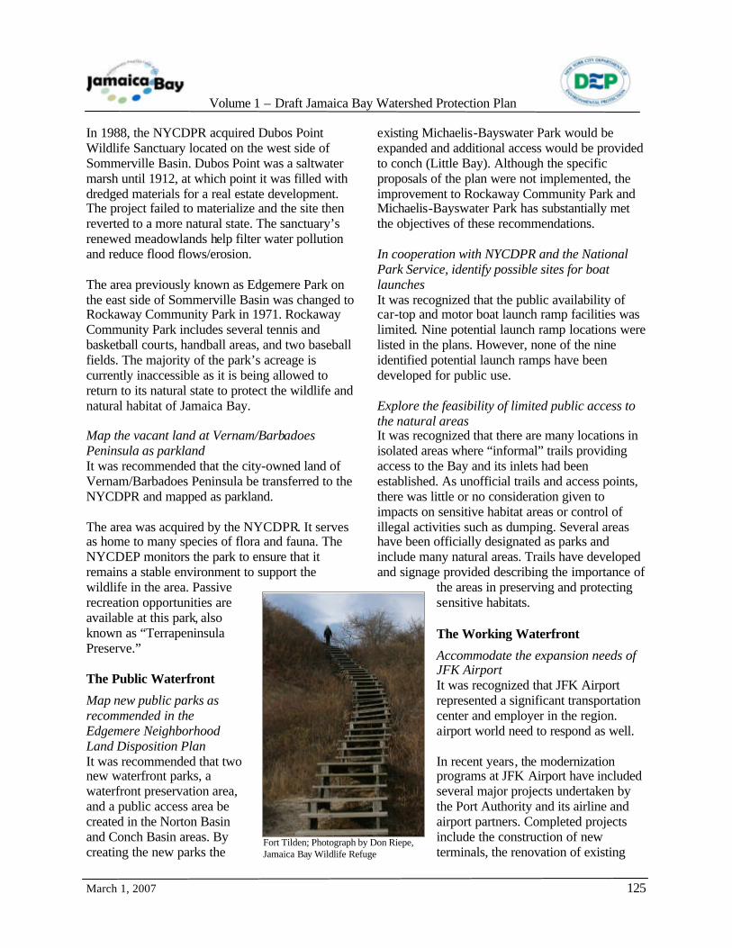
Volume 1 – Draft Jamaica Bay Watershed Protection Plan
March 1, 2007
125
In 1988, the NYCDPR acquired Dubos Point Wildlife Sanctuary located on the west side of Sommerville Basin. Dubos Point was a saltwater marsh until 1912, at which point it was filled with dredged materials for a real estate development. The project failed to materialize and the site then reverted to a more natural state. The sanctuary’s renewed meadowlands help filter water pollution and reduce flood flows/erosion. The area previously known as Edgemere Park on the east side of Sommerville Basin was changed to Rockaway Community Park in 1971. Rockaway Community Park includes several tennis and basketball courts, handball areas, and two baseball fields. The majority of the park’s acreage is currently inaccessible as it is being allowed to return to its natural state to protect the wildlife and natural habitat of Jamaica Bay. Map the vacant land at Vernam/Barbadoes Peninsula as parkland It was recommended that the city-owned land of Vernam/Barbadoes Peninsula be transferred to the NYCDPR and mapped as parkland. The area was acquired by the NYCDPR. It serves as home to many species of flora and fauna. The NYCDEP monitors the park to ensure that it remains a stable environment to support the wildlife in the area. Passive recreation opportunities are available at this park, also known as “Terrapeninsula Preserve.” The Public Waterfront
Map new public parks as recommended in the Edgemere Neighborhood Land Disposition Plan It was recommended that two new waterfront parks, a waterfront preservation area, and a public access area be created in the Norton Basin and Conch Basin areas. By creating the new parks the
existing Michaelis-Bayswater Park would be expanded and additional access would be provided to conch (Little Bay). Although the specific proposals of the plan were not implemented, the improvement to Rockaway Community Park and Michaelis-Bayswater Park has substantially met the objectives of these recommendations. In cooperation with NYCDPR and the National Park Service, identify possible sites for boat launches It was recognized that the public availability of car-top and motor boat launch ramp facilities was limited. Nine potential launch ramp locations were listed in the plans. However, none of the nine identified potential launch ramps have been developed for public use. Explore the feasibility of limited public access to the natural areas It was recognized that there are many locations in isolated areas where “informal” trails providing access to the Bay and its inlets had been established. As unofficial trails and access points, there was little or no consideration given to impacts on sensitive habitat areas or control of illegal activities such as dumping. Several areas have been officially designated as parks and include many natural areas. Trails have developed and signage provided describing the importance of
the areas in preserving and protecting sensitive habitats. The Working Waterfront
Accommodate the expansion needs of JFK Airport It was recognized that JFK Airport represented a significant transportation center and employer in the region. airport world need to respond as well. In recent years, the modernization programs at JFK Airport have included several major projects undertaken by the Port Authority and its airline and airport partners. Completed projects include the construction of new terminals, the renovation of existing
Fort Tilden; Photograph by Don Riepe, Jamaica Bay Wildlife Refuge

Volume 1 – Draft Jamaica Bay Watershed Protection Plan
March 1, 2007
126
terminals, and construction of two new cargo buildings, a maintenance hangar, and new warehouse and office spaces. AirTrain JFK, a light rail transit system that connects airport passengers to New York City subways and buses and the Long Island Rail Road (LIRR) has also been completed. The Redeveloping Waterfront
There were six specific recommendations to rezone particular parcels or areas in the vicinity of the Bay to accommodate new housing development as opposed to commercial or manufacturing operations. In conjunction with the recommended rezoning, consideration for the incorporation of buffer zones open space requirements, or other environmental protection measures was noted. Lands identified for consideration of rezoning included areas adjacent to Four Sparrow Marsh, Spring Creek, Mill Basin, Edgemere, Arverne Avenue, and Broad Channel. The recommendations included in the plans have largely been implemented and the zoning maps have been modified to reflect these changes. Some of these projects have been locally controversial for their impact on the waterfront. The New Waterfront Revitalization Program. NYCDCP, 2002
The New WRP is the city’s principal coastal zone management tool. The WRP was originally adopted in 1982 and was revised in 2002. It establishes the New York City’s policies for the development and use of the waterfront areas and provides the framework for evaluating proposed projects for consistency with the discretionary actions allowable within the identified coastal zone areas with those policies. The intent of the WRP is to provide the guidelines to maximize the benefits from economic development, environmental protection, and public use of the
waterfront while minimizing the adverse impacts and conflicts among those objectives. All discretionary land use actions and projects involving use of state or federal lands within the mapped coastal zone boundary must be found consistent with the policies of the WRP. For consistency with the WRP, an action or project that is found to be consistent with the WRP will not substantially hinder the achievement of any of the policies and will advance the attainment of one or more of the policies.
The original WRP identified 56 policies. In the 2002 revision, these policies, many of which were vague or redundant, were consolidated to 10 policies. However, each of the 10 policies has two or more detailed components that provide a greater level of specificity. The 10 principal policies are:
• Support and facilitate commercial and residential redevelopment in areas well-suited to such development.
• Support water-dependent and industrial uses in New York City coastal areas that are well-suited to their continued operations.
• Promote use of New York City’s waterways for commercial and recreational boating and water dependent transportation centers.
• Protect and restore the quality and function of ecological systems within the New York City coastal area.
• Protect and improve water quality in the New York City coastal area.
• Minimize loss of life, structures and natural resources caused by flooding and erosion.
• Minimize environmental degradation from solid waste and hazardous substances.
• Provide public access to and along New York City’s coastal waters.
• Protect scenic resources that contribute to the visual quality of the New York City coastal area.
Photograph by Don Riepe, Jamaica Bay Wildlife Refuge
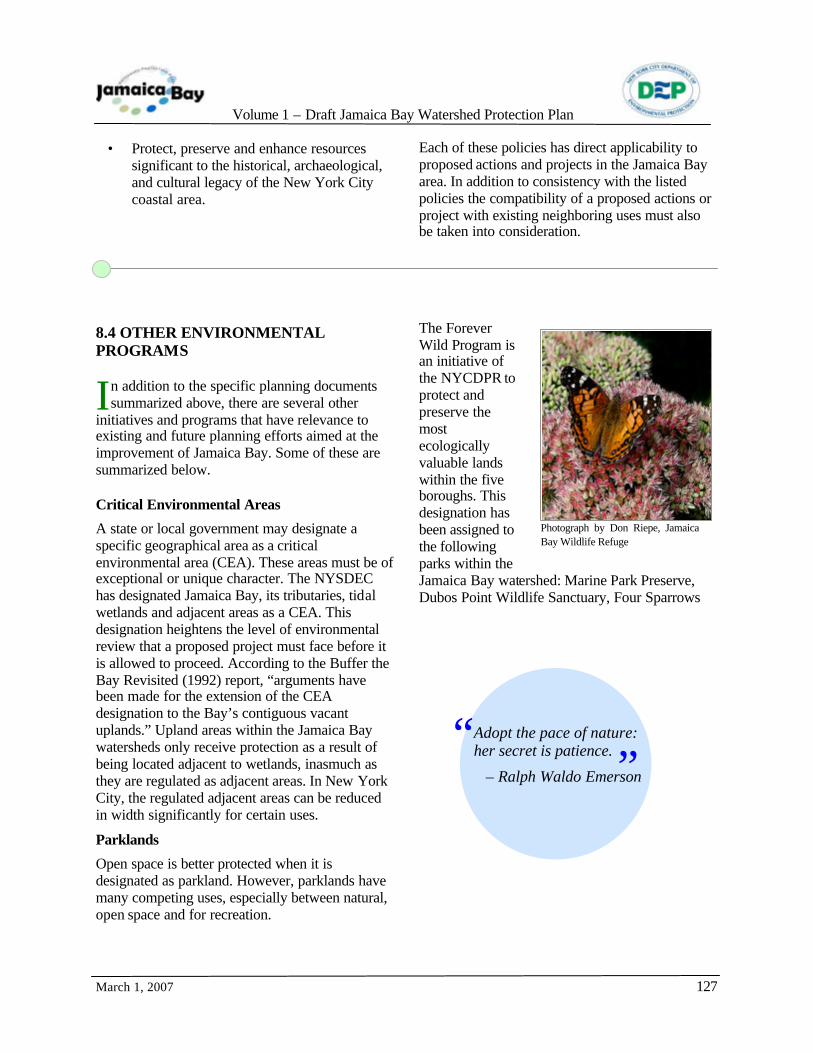
Volume 1 – Draft Jamaica Bay Watershed Protection Plan
March 1, 2007
127
• Protect, preserve and enhance resources significant to the historical, archaeological, and cultural legacy of the New York City coastal area.
Each of these policies has direct applicability to proposed actions and projects in the Jamaica Bay area. In addition to consistency with the listed policies the compatibility of a proposed actions or project with existing neighboring uses must also be taken into consideration.
8.4 OTHER ENVIRONMENTAL PROGRAMS
n addition to the specific planning documents summarized above, there are several other
initiatives and programs that have relevance to existing and future planning efforts aimed at the improvement of Jamaica Bay. Some of these are summarized below. Critical Environmental Areas
A state or local government may designate a specific geographical area as a critical environmental area (CEA). These areas must be of exceptional or unique character. The NYSDEC has designated Jamaica Bay, its tributaries, tidal wetlands and adjacent areas as a CEA. This designation heightens the level of environmental review that a proposed project must face before it is allowed to proceed. According to the Buffer the Bay Revisited (1992) report, “arguments have been made for the extension of the CEA designation to the Bay’s contiguous vacant uplands.” Upland areas within the Jamaica Bay watersheds only receive protection as a result of being located adjacent to wetlands, inasmuch as they are regulated as adjacent areas. In New York City, the regulated adjacent areas can be reduced in width significantly for certain uses.
Parklands
Open space is better protected when it is designated as parkland. However, parklands have many competing uses, especially between natural, open space and for recreation.
The Forever Wild Program is an initiative of the NYCDPR to protect and preserve the most ecologically valuable lands within the five boroughs. This designation has been assigned to the following parks within the Jamaica Bay watershed: Marine Park Preserve, Dubos Point Wildlife Sanctuary, Four Sparrows
I
Adopt the pace of nature: her secret is patience.
– Ralph Waldo Emerson
“ ”
Photograph by Don Riepe, Jamaica Bay Wildlife Refuge

Volume 1 – Draft Jamaica Bay Watershed Protection Plan
March 1, 2007
128
Marsh, Forest Park, Rockaway Beach/Arverne Shorebird Preserve, Fresh Creek Park Preserve, Spring Creek Park Preserve, Idlewild Park, and Paerdegat Basin Park Preserve. In August 2005, the New York City Council passed Local Law 83 of 2005 (Int. 566-A), which established a task force to determine the feasibility of transferring City-owned wetlands to the NYCDPR. Where possible, transferring such wetlands will ensure they are effectively managed and protected. Wetlands are among the most productive ecosystems in the world and provide unique benefits, including water quality improvement, flood protection, shoreline erosion control and opportunities for recreation and aesthetic appreciation. In New York City, there are now only approximately fourteen square miles of wetlands, where one hundred square miles once existed. Tree Removal and Planting
Trees located along street boundaries and trees located within New York City parks are regulated
by the NYCDPR. Regulated activities include, but are not limited to, pruning, fertilizing, spraying for the control of insects and disease, planting, installing decorative lights, tree grates and/or tree guards, and removing or relocating an
existing tree. The replacement trees may be transplanted on site, at a park near the site, or monies may be provided to the NYCDPR’s tree nursery to purchase trees for planting throughout the city. Projects that may affect existing trees in the Jamaica Bay watershed would be subject to the requirements of this program. Significant Coastal Fish and Wildlife Habitat Program
This program, under the NYSDOS, rates habitats using a quantitative system to identify the degree to which a habitat is essential to the survival of a large portion of a particular species; supports species which are threatened or endangered; supports populations that have significant commercial, recreational, or educational value; or exemplifies a habitat type that is not commonly found in the state or coastal region. Jamaica Bay in Brooklyn and Queens has been designated and mapped by the NYSDOS as a Significant Coastal Fish and Wildlife Habitat. Proposed developments are reviewed on a case-by-case basis with respect to the critical parameters identified by the habitat designation. The NYSDOS will recommend measures to mitigate potential impacts and may not approve projects that propose unavoidable adverse habitat impacts. City Environmental Quality Review
The City Environmental Quality Review (CEQR), Executive Order No. 91, as amended, requires environmental analysis for decisions on physical activities, such as construction projects, that chance the use or appearance of any natural resource or structure. The goal of CEQR is analogous to the state’s version, which became effective at about the same time. State Environmental Quality Review The New York State Environmental Quality Review Act (SEQRA), Environmental Conservation Law Article 8, established a process that requires consideration of environmental factors early in the planning process of many types of projects. SEQRA first became effective on September 1, 1976. It established a systematic
Photograph by Don Riepe, Jamaica Bay Wildlife Refuge
Photograph by Don Riepe, Jamaica Bay Wildlife Refuge

Volume 1 – Draft Jamaica Bay Watershed Protection Plan
March 1, 2007
129
process for environmental review, and incorporated provisions for public review and comment. The goal of SEQRA was to ensure that impacts to the environment were given consideration, and also to provide the methods for a transparent public process. Uniform Land Use Review Procedure
On June 1, 1976, the City Planning Commission (CPC) adopted the Uniform Land Use Review Procedure (ULURP) which became applicable starting on July 1, 1976. The intent in requiring ULURP was to establish a standardized procedure whereby applications affecting the land use of the city would be publicly reviewed. Key participants in the ULURP process are the NYCDCP and the CPC, Community Boards, the Borough Presidents, the Borough Boards, the City Council and the Mayor.
The types of actions that require review include:
• changes to the City’s Zoning Map; • mapping of subdiv isions or platting of land
into streets, avenues or Public Places; • designation or change of zoning districts • special Permits within the Zoning;
Resolution requiring approval of the CPC; • site selection for capital projects; • revocable consents, requests for proposals
and other solicitations or franchises, and major concessions;
• improvements in real property the costs of which are payable other than by the City;
• housing and urban renewal plans and project pursuant to city, state and federal laws;
• sanitary or waterfront landfills; • disposition of city owned property; and • acquisition of real property by the city.
8.5 REFERENCES
Grout E.M., Department of Finance. 1905. Improvement and Development of Jamaica Bay and the Water Front of the City of New York other than that of Manhattan Island. New York City Office of the Comptroller (November 17, 1905). New York, New York. New York City Department of City Planning (NYCDCP). 1994. New York City Comprehensive Waterfront Plan. Plan for the Brooklyn Waterfront. New York, New York.
New York State Department of Environmental Conservation (NYSDEC). 1993. Restoration of Natural Resources through the Jamaica Bay Damages Account: Reconnaissance Phase Report. Albany, NY. Regional Planning Association (RPA). 2003. Needs and Opportunities for Environmental Restoration in the Hudson-Raritan Estuary – A Report Prepared for the US Army Corps of Engineers – Based on Recommendations of the Harbor Estuary Program Habitat Working Group and Estuary Stakeholders. USACE, New York, NY.
Sea Star; Photograph by Don Riepe, Jamaica Bay Wildlife Refuge