case study: christchurch bay an extended stretch of coast
TRANSCRIPT
Case Study: Christchurch Bay
An extended stretch of coast.
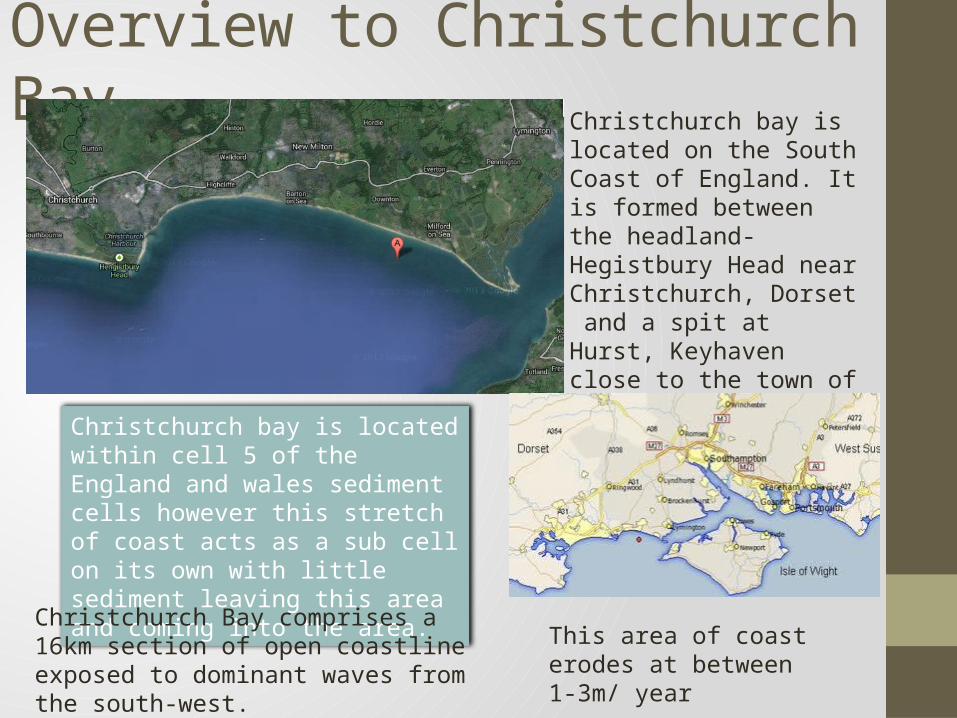
Overview to Christchurch Bay Christchurch bay is located on the South Coast of England. It is formed between the headland- Hegistbury Head near Christchurch, Dorset and a spit at Hurst, Keyhaven close to the town of Lymington in Hampshire.
Christchurch bay is located within cell 5 of the England and wales sediment cells however this stretch of coast acts as a sub cell on its own with little sediment leaving this area and coming into the area.
Christchurch Bay comprises a 16km section of open coastline exposed to dominant waves from the south-west.
This area of coast erodes at between 1-3m/ year
Geology • The rocks and clays forming the Christchurch Bay and Solent coasts include• materials laid down when the Solent was an estuarine river that drained the• Hampshire Basin. These were never subjected to the great pressures that formed• the harder rocks to the west. With rising sea levels after the last Ice Age, the• chalk ridge that formerly linked the Purbecks with the Isle of Wight was• breached, and the former river valley became the new coast, and started to• erode. This led to the formation of Poole Bay. The land to the east was protected• initially by the ironstone outcrop at Hengistbury Head, but in due course this too• eroded and, as sea levels continued to rise, Christchurch Bay began to develop.• The dominant south-westerly wind and waves created a littoral drift of shingle• and sand along the coast in an easterly direction, initially forming the Shingles• Bank which lies between the mainland and the Isle of Wight, and subsequently• forming Hurst Spit.
Fetch• Wind action generates waves that impinge on the shore from
various directions.• The longer its ‘fetch’ (the distance the wind travels without
interruption), • The more powerful are the waves that it generates. Around
the District’s coast, winds are strongest in Christchurch Bay, where the fetch varies from 10 km for winds from the north to many thousands of kilometres for those from the south-west, extending across the Atlantic Ocean to the coast of South America.
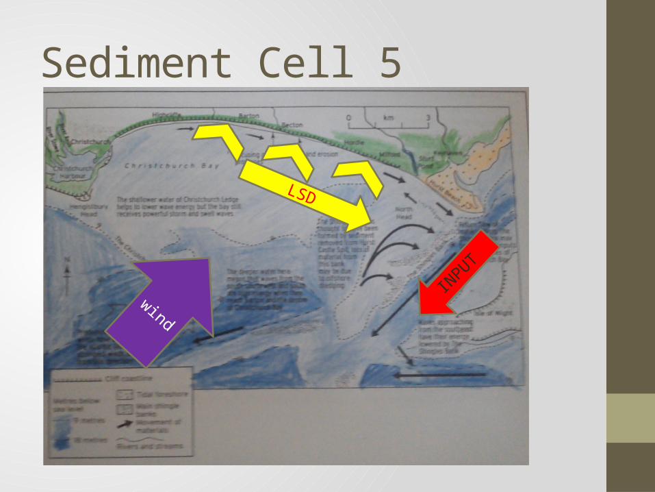
Sediment Cell 5
LSD
wind
INPUT
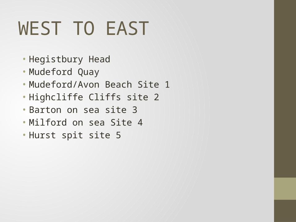
WEST TO EAST • Hegistbury Head• Mudeford Quay• Mudeford/Avon Beach Site 1 • Highcliffe Cliffs site 2 • Barton on sea site 3 • Milford on sea Site 4• Hurst spit site 5

Hegistbury Head• Hegistbury Head is a sandstone headland located in Dorset on
the south coast close to Christchurch between Southampton and Bournemouth.
• HH is a SSSI The headland on the west side of the bay. The groyne that sticks out into the sea makes sure that sediment from Bournemouth bay doesn’t spread into that of Christchurch bay.
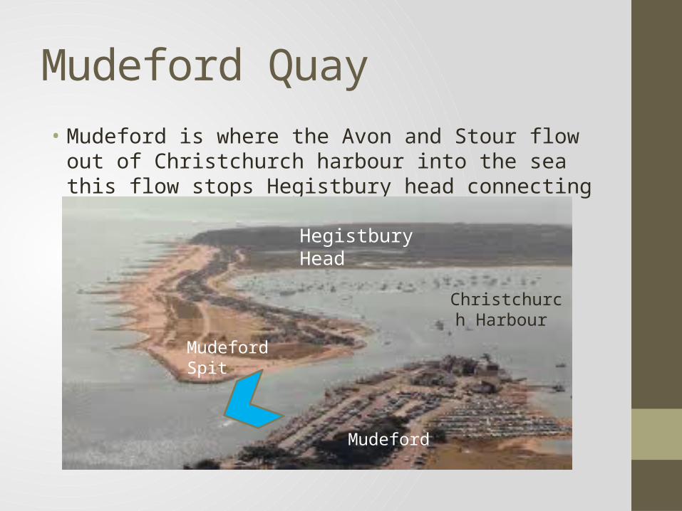
Mudeford Quay• Mudeford is where the Avon and Stour flow out of
Christchurch harbour into the sea this flow stops Hegistbury head connecting with Mudeford spit.
Hegistbury Head
Mudeford Spit
Mudeford
Christchurch Harbour

Mudeford/ Avon Beach Site 1
Avon beach is located to the east of the quay. This is one of the sandiest beaches in the bay . This is due to the coastal defences in the area but also due to artificial dredging.
Sea wall
embankment
groyne
Mudeford quay
Mudeford spit
Avon beach
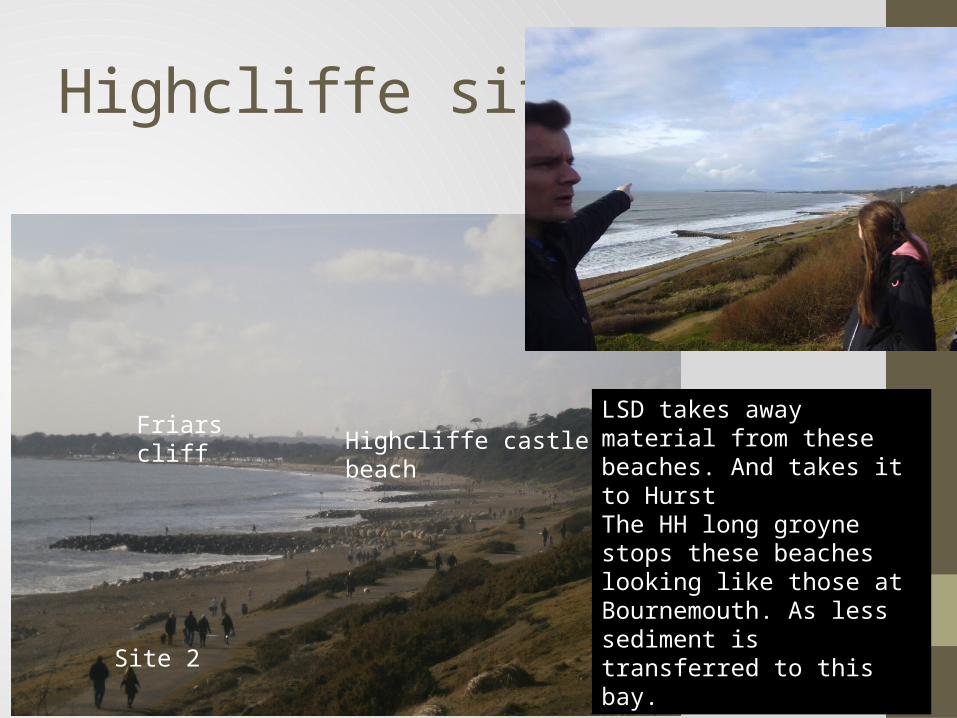
Highcliffe site 2
Highcliffe castle beach Friars cliff
Site 2
LSD takes away material from these beaches. And takes it to Hurst The HH long groyne stops these beaches looking like those at Bournemouth. As less sediment is transferred to this bay.
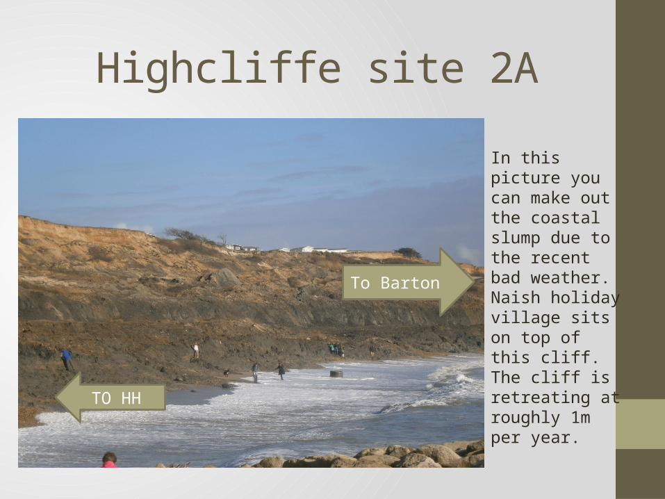
Highcliffe site 2A
In this picture you can make out the coastal slump due to the recent bad weather. Naish holiday village sits on top of this cliff. The cliff is retreating at roughly 1m per year.
To Barton
TO HH
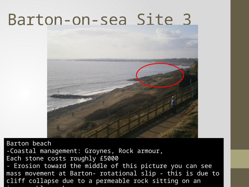
Barton-on-sea Site 3
Barton beach -Coastal management: Groynes, Rock armour, Each stone costs roughly £5000- Erosion toward the middle of this picture you can see mass movement at Barton- rotational slip - this is due to cliff collapse due to a permeable rock sitting on an impermeable rock
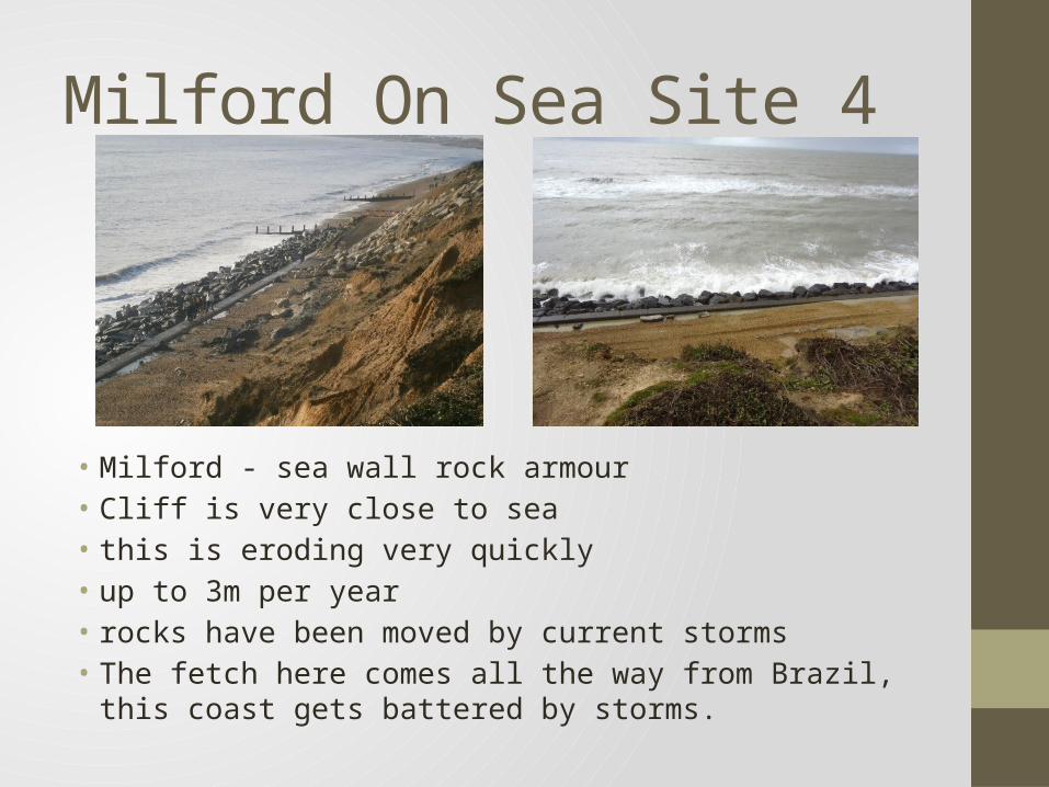
Milford On Sea Site 4
• Milford - sea wall rock armour • Cliff is very close to sea • this is eroding very quickly • up to 3m per year• rocks have been moved by current storms• The fetch here comes all the way from Brazil, this coast gets
battered by storms.
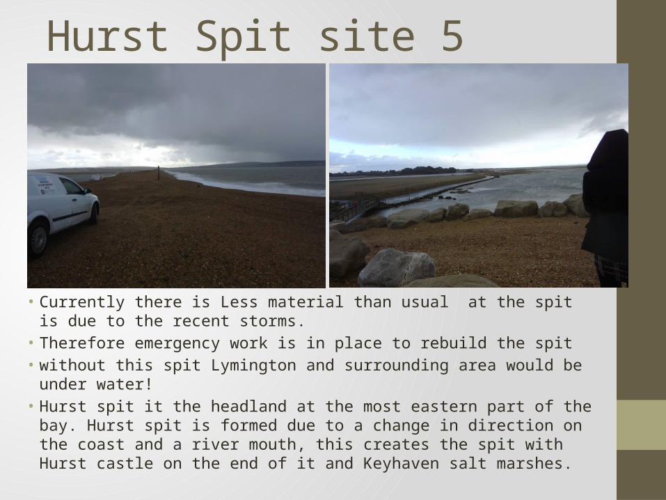
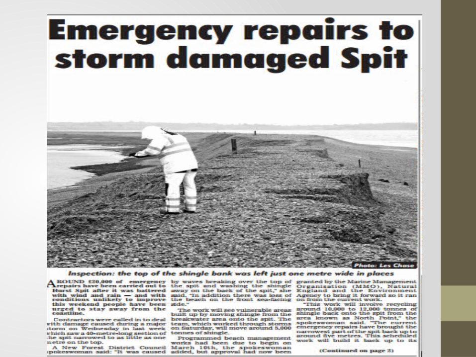
Hurst Spit site 5
• Currently there is Less material than usual at the spit is due to the recent storms.
• Therefore emergency work is in place to rebuild the spit• without this spit Lymington and surrounding area would be under water!• Hurst spit it the headland at the most eastern part of the bay. Hurst spit
is formed due to a change in direction on the coast and a river mouth, this creates the spit with Hurst castle on the end of it and Keyhaven salt marshes.
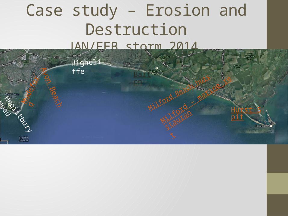
Case study – Erosion and DestructionJAN/FEB storm 2014
HighcliffeAvon Beach Hegistbury Head
Mud
efor
d
Barton
Milford – marine resta
urant
Hurst SpitMilford Beach huts

Sources• Ian West - Southampton University • New Milton Advertiser• Google Maps