case studies - awsassets.panda.orgawsassets.panda.org/downloads/disappearingpart2.pdf · part of...
TRANSCRIPT

Case Studies
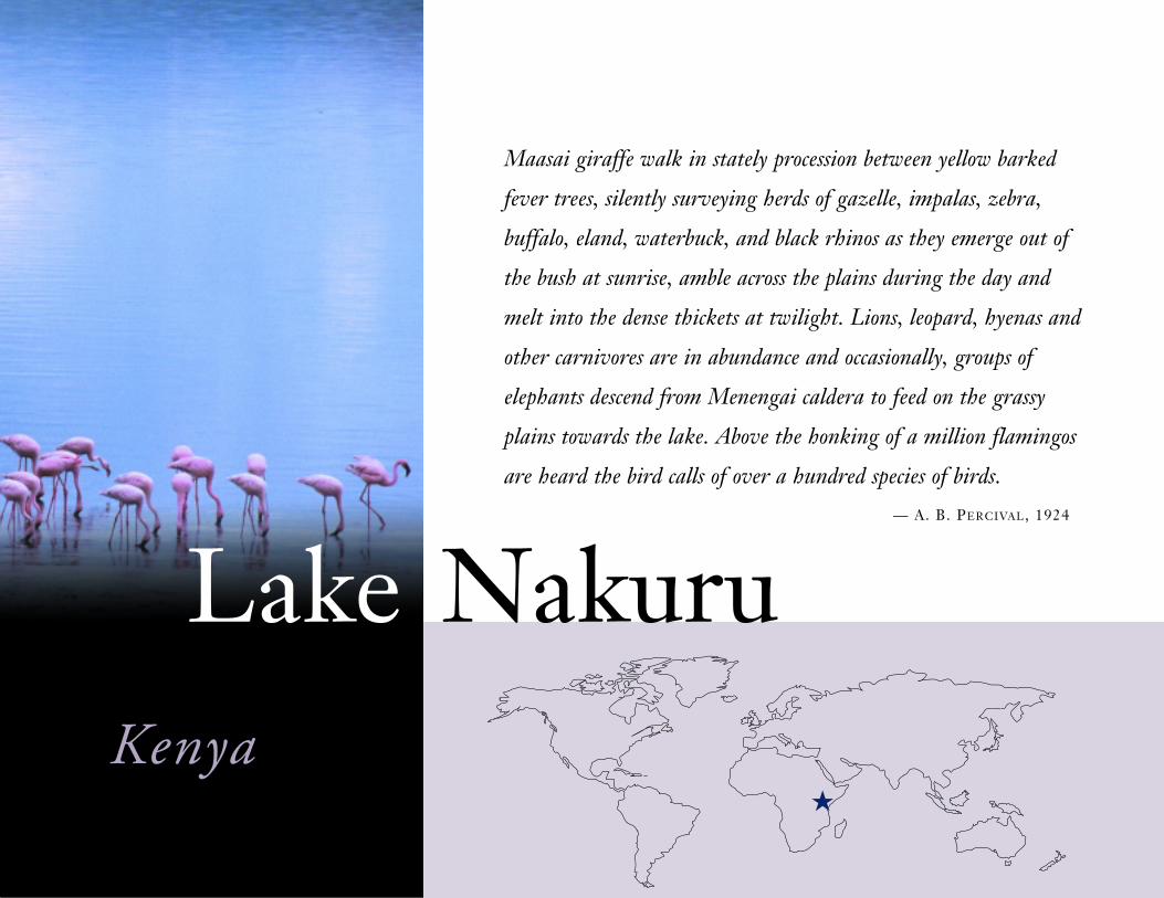
Maasai giraffe walk in stately procession between yellow barked
fever trees, silently surveying herds of gazelle, impalas, zebra,
buffalo, eland, waterbuck, and black rhinos as they emerge out of
the bush at sunrise, amble across the plains during the day and
melt into the dense thickets at twilight. Lions, leopard, hyenas and
other carnivores are in abundance and occasionally, groups of
elephants descend from Menengai caldera to feed on the grassy
plains towards the lake. Above the honking of a million flamingos
are heard the bird calls of over a hundred species of birds.
— A. B. PERCIVAL, 1924
★
Kenya
Lake Nakuru
Overview
Ahundred miles northwest of Nairobi (160 kilometers), in the eastern arm of the
Great Rift Valley, lies Lake Nakuru. The lake is salt water and shallow and small
compared to other Kenyan Rift Valley lakes. It fluctuates in size, depending on
the season, between about 2 square miles (5 square kilometers) and more than 15 square
miles (40 square kilometers), but Lake Nakuru’s catchment basin is considerable, spanning
nearly 700 square miles (1,800 square kilometers). This basin includes forests that form
part of Kenya’s national watershed; large farms that are among the most productive in
Nakuru District; and Lake Nakuru National Park, home to a variety and abundance of
wildlife. The park has 50 mammal species, over 400 bird species (among them perhaps a
million flamingos, the park’s best-known inhabitants), and 300 plant species. The park is an
important source of revenue for the Kenyan government and local communities. In 2000
it generated nearly US$4.5 million in entrance fees alone, with additional monies flowing
to the farming and commercial sectors of Nakuru Municipality that supply hotels, food,
various visitor services (e.g., guides or drivers), and handicrafts to tourists.
During the last 30 years, the Lake Nakuru basin has been transformed from a sparsely
populated and densely forested expanse into a region that is heavily settled,
extensively cultivated, and rapidly urbanizing. A key driver has been the sub-
stantial increase in the human population, resulting from both past and contin-
uing high fertility and extensive in-migration. In 1975, each woman in Kenya
gave birth to on average 8.1 children; today, the level is much lower, about
4.5 children for every woman, but still well above the global average of 2.8.
About a million people currently live in the Lake Nakuru basin, with more than
a third, about 350,000, in fast expanding Nakuru Municipality. Located about
six-tenths of a mile (1 kilometer) from Lake’s Nakuru’s northern shore, the town’s
population has been growing by about 10 percent every year for the past three decades.
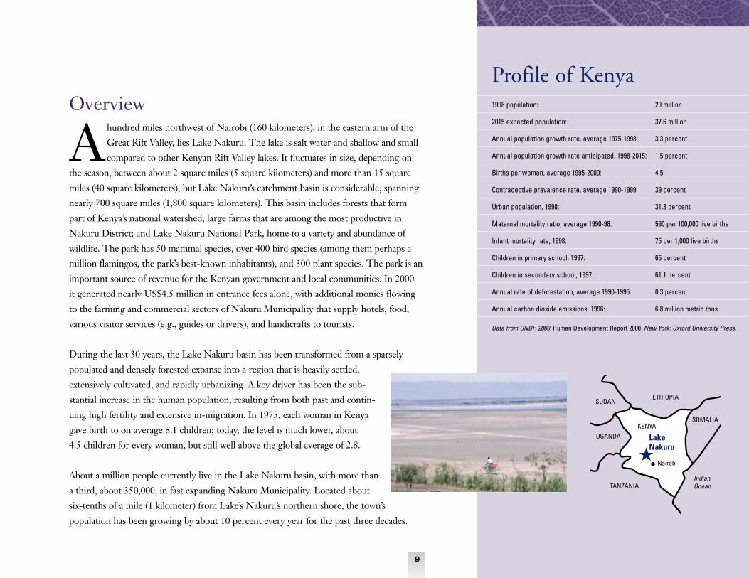
1998 population: 29 million
2015 expected population: 37.6 million
Annual population growth rate, average 1975-1998: 3.3 percent
Annual population growth rate anticipated, 1998-2015: 1.5 percent
Births per woman, average 1995-2000: 4.5
Contraceptive prevalence rate, average 1990-1999: 39 percent
Urban population, 1998: 31.3 percent
Maternal mortality ratio, average 1990-98: 590 per 100,000 live births
Infant mortality rate, 1998: 75 per 1,000 live births
Children in primary school, 1997: 65 percent
Children in secondary school, 1997: 61.1 percent
Annual rate of deforestation, average 1990-1995: 0.3 percent
Annual carbon dioxide emissions, 1996: 6.8 million metric tons
Data from UNDP. 2000. Human Development Report 2000. New York: Oxford University Press.
LakeNakuru
Profile of Kenya
UGANDA
Nairobi
9
★
TANZANIA
SUDANETHIOPIA
SOMALIA
IndianOcean
KENYA
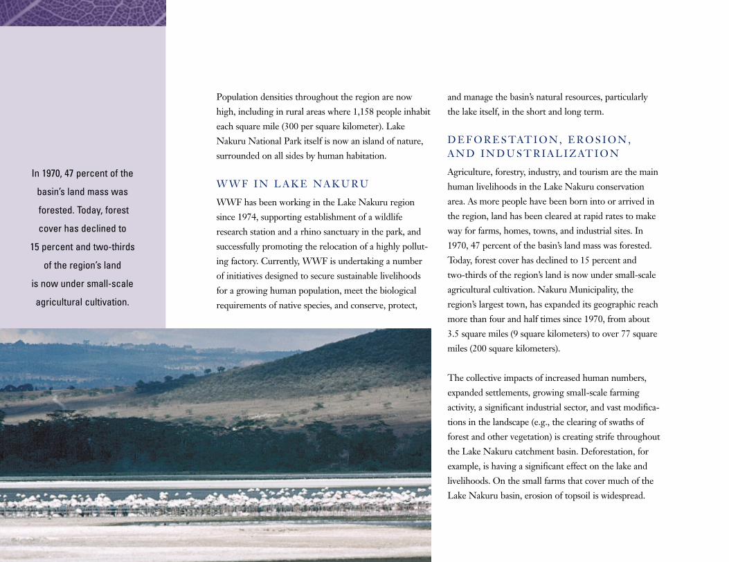
Population densities throughout the region are now
high, including in rural areas where 1,158 people inhabit
each square mile (300 per square kilometer). Lake
Nakuru National Park itself is now an island of nature,
surrounded on all sides by human habitation.
W W F I N L A K E N A K U R U
WWF has been working in the Lake Nakuru region
since 1974, supporting establishment of a wildlife
research station and a rhino sanctuary in the park, and
successfully promoting the relocation of a highly pollut-
ing factory. Currently, WWF is undertaking a number
of initiatives designed to secure sustainable livelihoods
for a growing human population, meet the biological
requirements of native species, and conserve, protect,
and manage the basin’s natural resources, particularly
the lake itself, in the short and long term.
D E F O R E S TAT I O N , E R O S I O N ,A N D I N D U S T R I A L I Z AT I O N
Agriculture, forestry, industry, and tourism are the main
human livelihoods in the Lake Nakuru conservation
area. As more people have been born into or arrived in
the region, land has been cleared at rapid rates to make
way for farms, homes, towns, and industrial sites. In
1970, 47 percent of the basin’s land mass was forested.
Today, forest cover has declined to 15 percent and
two-thirds of the region’s land is now under small-scale
agricultural cultivation. Nakuru Municipality, the
region’s largest town, has expanded its geographic reach
more than four and half times since 1970, from about
3.5 square miles (9 square kilometers) to over 77 square
miles (200 square kilometers).
The collective impacts of increased human numbers,
expanded settlements, growing small-scale farming
activity, a significant industrial sector, and vast modifica-
tions in the landscape (e.g., the clearing of swaths of
forest and other vegetation) is creating strife throughout
the Lake Nakuru catchment basin. Deforestation, for
example, is having a significant effect on the lake and
livelihoods. On the small farms that cover much of the
Lake Nakuru basin, erosion of topsoil is widespread.
In 1970, 47 percent of the
basin’s land mass was
forested. Today, forest
cover has declined to
15 percent and two-thirds
of the region’s land
is now under small-scale
agricultural cultivation.

Up to 120 tons of soil are lost annually from each acre
cultivated (45 metric tons from every hectare)—five
times what the erosion rate would be if forest cover had
not been removed. This loss of topsoil is leading to
considerable decreases in farm productivity, and as a
result in household economic security. Water quality in
the streams that people rely on for household use is
also declining as soil runoff and the dumping of wastes
(human and industrial) take their toll.
The lake itself, the region’s anchor for both humans and
other species, is under pressure from soil runoff, dis-
charge of urban wastes and pollutants, and increasing
demand for water from households, farmers, and
industry. Since the lake is alkaline (salty), its water is
unsuitable for irrigation or for human or domestic
animal consumption. But water for such uses is taken
from tributaries and streams that flow into the lake and
the catchment basin’s aquifers. Without regulation, this
threatens both stream flow and the water balance of the
lake. Indeed, excessive runoff results in dilution effects
and fluctuations in nutrient levels, both of which affect
production of algae in the lake.
In recent years, the lake has shown uncharacteristic
signs of change—drying out each year between 1993
and 1997; growing vast blooms of toxic algae; and expe-
riencing die-offs of large numbers of fish, waterfowl,
waterbucks, frogs, and the park’s famous
flamingos, all likely victims of toxins in lake
water. Additional risks to human inhabitants
and their domestic animals in the Nakuru
area come from pesticide residues and other
chemicals that collect in the lake and stream
waters. Malathion and lead were found in
the tissue of fish that died in large numbers
in Lake Nakuru National Park in 1991.
Natural geography plays a part in multiply-
ing the impacts of pollution, wastes, and
runoff: the lake is the lowest point of the
catchment basin and so becomes the final repository
for sediment, pesticide residues, and nutrient loads
from the rivers that feed it.
Responding to theChallenge
Is Lake Nakuru, as a former staff member of the
WWF Eastern Africa Regional Program Office
suggested, the “canary in the cage,” a forecast for
the future ecological vitality of the entire region? In
response to the challenges facing the Lake Nakuru
region, the WWF Eastern Africa Regional Program
Office is working with a number of stakeholders to
reduce the driving forces that threaten human
livelihoods and health, the viability of other species,
The lake itself,
the region’s anchor for
both humans and
other species, is under
pressure from soil runoff,
discharge of urban wastes
and pollutants, and
increasing demand
for water from households,
farmers, and industry.
11

and the well being of the ecosystem as a whole. WWF’s
engagement has increased and diversified since its
first involvement in the area in 1974, when it raised
US$500,000 to purchase a critical buffer zone of 50,000
acres (20,000 hectares) around Lake Nakuru National
Park, which was then turned over to the government for
gazetting. Some of the WWF initiatives that address
growing population pressures throughout the Lake
Nakuru basin conservation area follow.
Expanding Opportunities and Skills Since 1993, WWF’s Lake Nakuru Conservation and
Development Project has supported two initiatives
designed to improve the ecological health of the
lake’s catchment area and reduce the intense pressures
on surrounding land. WWF provides financial and
technical support to
communities and local
institutions to implement
conservation programs.
The first initiative is an
environmental education
program for local com-
munities that emphasizes
sustainable natural
resource management—
including sustainable
agriculture, water and
energy conservation, and reforestation—and pest
management techniques. The second, an environmental
conservation program, builds on the first and trains local
farmers, both men and women, in skills for sustainable
farming and land use. These skills include soil and water
conservation, organic farming, agroforestry, and energy
conservation. To date these techniques have been
adopted in more than 100 villages in the Lake Nakuru
catchment basin and over 10,000 farmers have been
trained. In addition, Village Environmental Committees
(where women are well-represented) have been
established in over 80 villages, and 40 have developed
consensus-based natural resource management plans
(Local Environmental Action Plans). Implementation
of the plans is under way.
Increasing Stakeholder Participation WWF monitors environmental conditions in Lake
Nakuru, in the rivers that feed it, and in the liquid
sewage produced by Nakuru Municipality. It then
disseminates its findings widely—to collaborators in
government agencies charged with environmental
management at national and local levels (e.g., the Kenya
Wildlife Service, the Department of Occupational
Health and Safety Services, and the Nakuru Municipal
Council); to area industries; and to local farmers.
WWF also organizes stakeholder workshops, at which
updates on the lake’s ecological health and the impact
The lake has been showing
uncharacteristic signs
of change—drying out
each year between 1993
and 1997; growing vast
blooms of toxic algae;
and experiencing
die-offs of large numbers
of fish, waterfowl,
waterbucks, frogs, and
the park’s famous flamingos,
all likely victims of toxins
in lake water.

of population pressures on its state of health are further
disseminated and discussed, and future actions deter-
mined through participatory decision making and
collaboration. Among the stakeholders participating are
farmers, urbanites, industrialists, members of women’s
groups, school children, scientists, government
extension workers, and public administrators.
Improving GovernanceA WWF planning initiative gathers information on all
pollutants released from industrial facilities in the area.
This Pollutant Release and Transfer Register (PRTR)
enables the tracking of major pollutants, helps set targets
to reduce their release, and identifies priority sites for
action to mitigate pollutants’ impact and reduce the
quantities discharged. On this project, WWF collabo-
rates with Kenya’s Egerton University and the United
States’ University of Illinois. The PRTR strategy has so
far been accepted by 21 industries in the Lake Nakuru
region, which estimate the amount of waste they
generate annually, establish benchmarks, and then seek
to reduce waste levels in subsequent years. Each year,
levels of waste production are reappraised. With the
Environmental Management and Coordination Act
of 1999, the Kenyan government has made it mandatory
for all industries to quantify their emissions of pollutants
and put in place waste reduction strategies. Information
collected by the PRTR is also being used to develop
a national wetlands policy for Kenya and to inform
regional planning by the Intergovernmental Agency
on Development in Eastern Africa, among other
institutions.
WWF has also facilitated integration of environmental
considerations into the 15-year development plan for
Nakuru Municipality, which has been endorsed by both
the Municipal Council and the central government
and is currently being implemented. And in Nakuru
town, urban residents have developed and put in place
strategies for managing the waste they produce.
Also under way is a long-term study of Lake Nakuru’s
flamingos and the key environmental variables that
affect the aquatic ecosystem. Today local communities,
industries, and other stakeholders are working together,
with WWF input, to develop an integrated ecosystem
management plan for the Lake Nakuru region.
The goal is to ensure the long-term health of all
communities—human and wildlife—that depend on
the lake basin for their livelihoods and the stuff of
life itself. ■
13
Population densities
throughout the region
are now high, including in
rural areas where
1,158 people inhabit each
square mile (300 per
square kilometer).
Lake Nakuru National Park
itself is now an island
of nature, surrounded
on all sides by human
habitation.
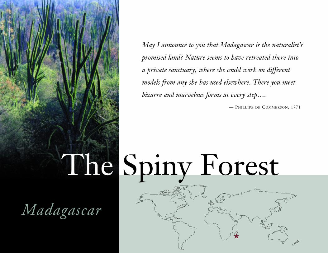
May I announce to you that Madagascar is the naturalist’s
promised land? Nature seems to have retreated there into
a private sanctuary, where she could work on different
models from any she has used elsewhere. There you meet
bizarre and marvelous forms at every step….
— PHILLIPE DE COMMERSON, 1771
★
Madagascar
The Spiny Forest
Overview
Across southern and southwestern Madagascar stretch large swaths of spiny forest
along with riparian and gallery forests, freshwater ecosystems, and stands of
coastal mangroves. The region includes the Andohahela National Park, recently
honored as the “world’s best ecotourism destination,” the Tsimanampetsotsa Reserve, the
Cap Ste. Marie Reserve, the cities of Toliara and Taolanaro, and emerging urban centers
like Ampanihy, Betioky, and Tsihombe. Although semi-desert conditions predominate
(low rainfall, poor soil, and periodic droughts), the region has spectacular communities of
plants and significant wildlife, including the ring-tailed lemur, two species of land-based
tortoises, and a variety of birds, reptiles, and amphibians.
Since 1976, WWF has been engaged in conservation work in the Spiny Forest Ecoregion,
named for its dominant ecosystem. Covering an area of 16.3 million acres (6.6 million
hectares), it is one of five distinct ecoregions identified by WWF in Madagascar. The
Spiny Forest Ecoregion is included in WWF’s “Global 200,” the land and water environ-
ments that are among the ecologically richest, rarest, and most endangered on the planet.
Madagascar and the Indian Ocean Islands together are also one of 25 global “hotspots,”
defined as such due to the intense biodiversity they contain and the myriad threats
they face. Hotspots cover less than 2 percent of the Earth’s land area, but contain
nearly half of all known plant species and more than a third of vertebrate animals.
Pressures on natural resources within the Spiny Forest Ecoregion are intense and
growing, but less than 3 percent of spiny forests have legal protection and land
tenure systems are insecure. Most land, including forests, belongs to the govern-
ment, but when a parcel of land has been used for more than 10 years, it can be and
often is, transferred to the person or institution using it. The government accepts
any use of forest lands, even burning for agriculture. Moreover, reforestation is difficult
due to the ecoregion’s arid conditions. Three significant, structural causes of these
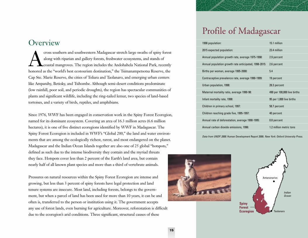
1998 population: 15.1 million
2015 expected population: 23.4 million
Annual population growth rate, average 1975-1998: 2.9 percent
Annual population growth rate anticipated, 1998-2015: 2.6 percent
Births per woman, average 1995-2000: 5.4
Contraceptive prevalence rate, average 1990-1999: 19 percent
Urban population, 1998: 28.3 percent
Maternal mortality ratio, average 1990-98: 490 per 100,000 live births
Infant mortality rate, 1998: 95 per 1,000 live births
Children in primary school, 1997: 58.7 percent
Children reaching grade five, 1995-1997: 40 percent
Annual rate of deforestation, average 1990-1995: 0.8 percent
Annual carbon dioxide emissions, 1996: 1.2 million metric tons
Data from UNDP. 2000. Human Development Report 2000. New York: Oxford University Press.
Spiny ForestEcoregion
Profile of Madagascar
IndianOcean
Taolanaro
Antananarivo
15

pressures are a fast-increasing population, rapid growth
of urban centers, and high levels of migration into and
through the ecoregion. These, in turn, stem from a
range of socioeconomic realities including endemic
poverty; persistent gender inequalities; limited access to
reproductive health care or information; significant rates
of infant and child mortality coupled with high social
valuation of children; low school attendance;
and inheritance patterns that fuel migration
by providing land only to eldest boys.
Population growth in Madagascar as a whole
is high: about 2.6 percent a year on average,
well above the current global annual average
of 1.3 percent. Growth rates in Toliara
Province, which spans the entire Spiny
Forest Ecoregion, are even higher. The
province-wide increase in 1999, combining
fertility (average number of births per
woman) and migration was 3.62 percent.
Growth rates in some parts of the province
are at 5 percent or above, including an
anomalous 9.8 percent annual increase in the
town of Belon’I Tsiribihina. In 1999, the
total population of Toliara Province was 2.1
million, nearly 400,000 higher than in 1993.
This represents a 22 percent increase in the
human population in the ecoregion over just
six years, driven largely, but not solely, by high in-
migration. Toliara’s population is just over 7 percent
of Madagascar’s total estimated 1998 population of
15.1 million.
The rapid growth of human population in the
ecoregion, and its impacts on conservation of natural
resources, also become clear in data on rising population
densities. In 1968, for example, only five fivondronanana
(the equivalent of a county) in Toliara Province had
more than 38 people per square mile (10 people
per square kilometer); in 1985, seven fivondronanana
had a similar density of human habitation, with the
number rising to 10 fivondronanana with such a
density in 1993; the number of fivondronananas in
the Spiny Forest Ecoregion today with similar or higher
population densities, although not measured, would
likely be even higher.
Four major ethnic groups live within the Spiny Forest
Ecoregion: the Vezo, traditional fishers living along the
west coast; the Mahafaly, subsistence farmers who
depend on the spiny forests; the Bara, traditional pas-
toralists; and the Tandroy, seasonal migrant farmers and
cattle owners. All four peoples’ traditions include deep
respect for the natural environment on which their
livelihoods depend. Hunting taboos, forests deemed
sacred, and social norms all have supported sustainable
use of resources. But, a general rural crisis in the
ecoregion and throughout the country has led to
increasingly unsustainable practices—among them
expanded slash and burn agriculture; extensive cattle
husbandry, along with fires to expand pasture for
grazing; and clearing of forested areas to meet rising
urban demands for fuelwood and to expand commercial
cultivation of maize, cotton, and sisal.
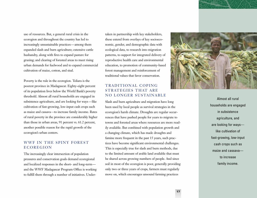
Poverty is the rule in the ecoregion. Toliara is the
poorest province in Madagascar. Eighty-eight percent
of its population lives below the World Bank’s poverty
threshold. Almost all rural households are engaged in
subsistence agriculture, and are looking for ways —like
cultivation of fast-growing, low-input cash crops such
as maize and cassava—to increase family income. Rates
of rural poverty in the province are considerably higher
than those in urban areas, 91 percent vs. 61.2 percent,
another possible reason for the rapid growth of the
ecoregion’s urban centers.
W W F I N T H E S P I N Y F O R E S TE C O R E G I O N
The increasingly clear intersection of population
pressures and conservation goals demand ecoregional
and localized responses in the short- and long-term—
and the WWF Madagascar Program Office is working
to fulfill them through a number of initiatives. Under-
taken in partnership with key stakeholders,
these extend from overlays of key socioeco-
nomic, gender, and demographic data with
ecological data, to research into migration
patterns, to support for integrated delivery of
reproductive health care and environmental
education, to promotion of community-based
forest management and reinforcement of
traditional values that favor conservation.
T R A D I T I O N A L C O P I N G S T R AT E G I E S T H AT A R E N O L O N G E R S U S TA I N A B L E
Slash and burn agriculture and migration have long
been used by local people as survival strategies in the
ecoregion’s harsh climate. Droughts are regular occur-
rences that have pushed people for years to migrate to
towns and forested areas where resources are more read-
ily available. But combined with population growth and
a changing climate, which has made droughts and
famine more frequent in the past 15 years, such prac-
tices have become significant environmental challenges.
This is especially true for slash and burn methods, due
to the limited amount of arable land available that must
be shared across growing numbers of people. And since
soil in most of the ecoregion is poor, generally providing
only two or three years of crops, farmers must regularly
move on, which encourages unsound farming practices
Almost all rural
households are engaged
in subsistence
agriculture, and
are looking for ways—
like cultivation of
fast-growing, low-input
cash crops such as
maize and cassava—
to increase
family income.
17

If current urban population
growth rates of
5 percent to 6 percent
a year continue,
approximately 105,000
acres (42,500 hectares) of
forest will be felled by 2010
to meet city dwellers’
fuelwood and charcoal
demands.
on lands under cultivation. In addition, existing tenure
systems do not provide enough land for all people, and
government policies do not regulate access to forests,
resulting in the poor management of resources.
Since the Malagasy government liberalized the agricul-
ture sector in the 1990s, crops are now grown both for
in-country consumption and export. Creation of internal
and external markets has encouraged more slashing and
burning by farmers in the Spiny Forest Ecoregion as
they attempt to increase crop production and earn their
way out of the poverty most live in. Maize is exported to
neighboring La Reunion and Mauritius for animal feed
and is consumed locally during droughts. And in a
strange “green” twist, sisal plantations are expanding
into forested areas due to demand from European
countries for biodegradable, “eco-friendly” packaging.
Most migration in Madagascar as a whole is to urban
centers, and nearly 30 percent of the country’s popula-
tion is urban. Major population centers in the Spiny
Forest Ecoregion are Tulear, Betioky, Ampanihy,
Ambovombe, and Taolanaro. The rest of the ecoregion
has lower, but still significant population densities, about
62 people per square mile (16 people per square kilome-
ter). But urban migration leads directly and indirectly to
increased levels of deforestation as a result of consump-
tion patterns for forest resources. For example, migrants
tend to burn land where they stop, either temporarily
en route to a town, or if they settle permanently in a
rural area encountered on their journey. Such burning is
traditionally a way of claiming land rights. An additional
pressure on remaining forests: urban dwellers demand
vast quantities of wood or charcoal for fuel. Over 90
percent of Madagascar’s urban population use charcoal
or fuelwood for energy in their homes—translating into
a loss of over 24,700 acres (10,000 hectares) of forest in
the ecoregion a year. As migration to urban areas
increases, demands on forests increase accordingly.
Indeed, if current urban population growth rates of 5
percent to 6 percent a year continue, approximately
105,000 acres (42,500 hectares) of forest will be felled
by 2010 to meet city dwellers’ fuelwood and charcoal
demands. This figure does not include industrial uses
of wood and charcoal (for bricks or cooking fuel in
restaurants) or additional quantities of forest wood used
for urban home construction.
Traditional mores also fuel migration: younger children
do not inherit land, so most leave their home villages,
often in search of money to acquire cattle and pasture
on which to graze them. Cattle are both an important
symbol in cultures throughout the ecoregion and a
prime means of gaining wealth and social prestige; as a
result cattle breeding is extensive. Indeed, much of the
money farmers earn from increased agricultural produc-
tion, especially cash crops like maize, is often used to
buy more cattle. A recent study has found that, increas-
18
ingly, such income is also used to purchase more labor.
This extra person-power is then used to slash and burn
additional land for maize cultivation to respond to grow-
ing demand from regional and international markets.
G E N D E R R E A L I T I E S A N DR E S O U R C E S
Unequal relations between women and men, women’s
low levels of financial and social independence, and
limited access to family planning and formal schooling
all provide the basis for continuing high fertility in
the Spiny Forest Ecoregion. On average, women in
Madagascar give birth to 5.4 children during their
reproductive lives. Contraceptive prevalence is only
about 19 percent—with much of this confined to urban
areas. Reproductive health information and services are
not widely available. Since villages are spread through-
out the ecoregion, health centers are often inaccessible
to women and generally under-resourced. Even the
existing limited public health services in rural areas may
be shrinking as the government undertakes structural
adjustment reforms, including privatization of services;
not everyone can afford the fees imposed for care.
Infant and child mortality rates in Madagascar are
relatively high—nearly one in 10 infants die during their
first year of life and almost one in six die before the age
of five—and, along with cattle and land, children are
accorded high social value. These realities contribute to
keeping fertility high, as families seek to ensure that
several children at a minimum survive to adulthood.
Another key driver of high fertility is early marriage.
Girls in the ecoregion generally marry at 14 or 15 and
begin childbearing soon after.
Although Madagascar has a national education system
that offers universal free schooling, the system in the
southwest of the country is quite poor. Primary schools
often lack teachers and materials and are too far from
villages for children to attend regularly. In addition, the
costs of education are also out of reach of many families;
although public schools are free, parents must pay for
notebooks, pens, and other materials. School attendance
for both boys and girls in Madagascar is low—only 40
percent reach the fifth grade—and education is not
highly valued among people in the ecoregion. No firm
data exist on gender disparities in schooling for the
Spiny Forest Ecoregion; however, due to early
marriage and the opportunity costs of education (time
away from domestic chores and farming), it can be
inferred that in general fewer girls than boys attend
school and that girls stop their schooling sooner
(although this varies between regions and ethnic
groups). One impact of this can be seen in national
literacy rates, with men’s at 72.2 percent significantly
higher than women’s at 57.8 percent. Throughout the
world, girls’ lack of schooling correlates strongly with
higher fertility.
19

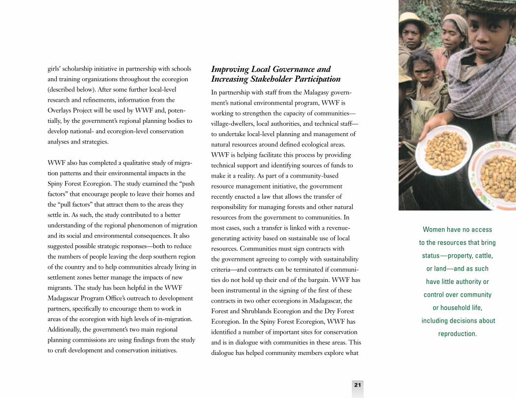
Moreover, the ethnic groups inhabiting southwest
Madagascar, particularly the Bara, Mahafaly, and
Tandroy, have strong patriarchal structures. Women
have no access to the resources that bring status—
property, cattle, or land—and as such have little
authority or control over community or household life,
including decisions about reproduction. One indicator
of women’s lack of equality can be seen in the per capita
annual incomes of Malagasy men and women: men earn
US$953; women earn US$562. One area where women
are key decision makers is in the realm of household
resource use, where women decide on whether fuelwood
is used for cooking or when medicinal plants are con-
sumed to treat illnesses. This gendered role, of course,
puts women in close touch with forest resources and
as such makes them key stakeholders and important
partners in ecoregional conservation efforts.
Responding to theChallenge
The WWF Madagascar Program Office is
responding in a variety of ways to the
population/environmental linkages in
the Spiny Forest Ecoregion. It is seeking to address
the ecological challenges posed by growing human
numbers through meeting clear needs for land-use
planning, improving land tenure and management,
increasing understanding of the impacts of socioeco-
nomic and gender realities on fertility and migration,
and improving women’s reproductive health and literacy
in priority conservation areas. In this work, WWF is
partnering with a broad variety of stakeholders,
including local communities, Malagasy NGOs, regional
government agencies, and other international develop-
ment and conservation organizations. Some of the
population/conservation initiatives the WWF
Madagascar Program Office has launched follow.
Undertaking Socioeconomic Assessments WWF’s Population/Environment Overlays Project
produced a set of maps that “overlay” population data
and ecological data. The goal was to determine linkages
and impacts among, for example, population growth,
density and distribution (rural and urban), and key
socioeconomic and environmental variables. Overlays
confirmed a relationship between low rates of female
literacy and high population growth, and between high
cattle densities and high losses of soil fertility. They also
helped identify areas likely to experience high rates of
deforestation, given the migration and urban population
growth trends and the geographical scope of maize
production in the Spiny Forest Ecoregion. The overlays
also helped WWF identify priority conservation zones
and actions for the ecoregion, and guided the office’s
collaborative efforts, which included the launch of a
20
Creation of internal and
external markets has
encouraged more slashing
and burning by farmers
in the Spiny Forest
Ecoregion as they attempt
to increase crop
production and earn their
way out of the poverty
most live in.
girls’ scholarship initiative in partnership with schools
and training organizations throughout the ecoregion
(described below). After some further local-level
research and refinements, information from the
Overlays Project will be used by WWF and, poten-
tially, by the government’s regional planning bodies to
develop national- and ecoregion-level conservation
analyses and strategies.
WWF also has completed a qualitative study of migra-
tion patterns and their environmental impacts in the
Spiny Forest Ecoregion. The study examined the “push
factors” that encourage people to leave their homes and
the “pull factors” that attract them to the areas they
settle in. As such, the study contributed to a better
understanding of the regional phenomenon of migration
and its social and environmental consequences. It also
suggested possible strategic responses—both to reduce
the numbers of people leaving the deep southern region
of the country and to help communities already living in
settlement zones better manage the impacts of new
migrants. The study has been helpful in the WWF
Madagascar Program Office’s outreach to development
partners, specifically to encourage them to work in
areas of the ecoregion with high levels of in-migration.
Additionally, the government’s two main regional
planning commissions are using findings from the study
to craft development and conservation initiatives.
Improving Local Governance andIncreasing Stakeholder Participation In partnership with staff from the Malagasy govern-
ment’s national environmental program, WWF is
working to strengthen the capacity of communities—
village-dwellers, local authorities, and technical staff—
to undertake local-level planning and management of
natural resources around defined ecological areas.
WWF is helping facilitate this process by providing
technical support and identifying sources of funds to
make it a reality. As part of a community-based
resource management initiative, the government
recently enacted a law that allows the transfer of
responsibility for managing forests and other natural
resources from the government to communities. In
most cases, such a transfer is linked with a revenue-
generating activity based on sustainable use of local
resources. Communities must sign contracts with
the government agreeing to comply with sustainability
criteria—and contracts can be terminated if communi-
ties do not hold up their end of the bargain. WWF has
been instrumental in the signing of the first of these
contracts in two other ecoregions in Madagascar, the
Forest and Shrublands Ecoregion and the Dry Forest
Ecoregion. In the Spiny Forest Ecoregion, WWF has
identified a number of important sites for conservation
and is in dialogue with communities in these areas. This
dialogue has helped community members explore what
21
Women have no access
to the resources that bring
status—property, cattle,
or land—and as such
have little authority or
control over community
or household life,
including decisions about
reproduction.

type of contract or form of community-based/voluntary
forest management system they want. Once they
have decided, WWF will help them negotiate legal
arrangements with the Malagasy government for local
management of the forests.
WWF also orients rural development partners to key
conservation areas—around priority conserva-
tion zones, in migrant settlement zones, near
urban centers, and in areas from which many
migrants depart—to share information and
technologies that improve natural resource
management as well as reduce migration.
Activities include provision of technical sup-
port to improve current cattle management
practices and reduce rates of forest burning;
promotion of reforestation and effective
community-based management of forests;
facilitation of access to rural credit; and
advice on development of ecotourism.
Expanding Opportunities and Access In 2000, WWF launched a joint initiative with
ASOS (Action Santé Organisation Secours),
a regional health NGO, to deliver primary
health care and family planning services and
environmental messages in target conservation
areas of the ecoregion where population
pressures are significant. ASOS has two doctors and 12
public health agents who collaborate with other public
health workers and organizations on the program, which
is currently under way in Mikea, Cap Ste. Marie, and
Taolanaro. ASOS is also providing the means and moti-
vation for government health workers to improve health
care access and quality. In the past, demand for ASOS’s
provision of family planning information, counseling,
and services has surpassed supply, suggesting that family
planning and reproductive health programs could con-
tribute over the long term to reduced human pressures
on the Spiny Forest Ecoregion’s natural resources.
From 1991 to 1995 WWF, again in partnership with
ASOS, implemented an ICDP (integrated conservation
and development project) around Andohahela National
Park. The Malagasy government and the U.S. Agency
for International Development supported this work,
which included providing family planning education
and services; equipping community-based health clinics;
supporting mobile health service units; and offering
training and technical assistance for a range of
sustainable development activities (forest and water
management, ecotourism, beekeeping, improved rice
production methods, and environmental education).
WWF Madagascar staff found this ICDP experience
very helpful to developing partnerships, undertaking
ecoregion-level planning, and scaling up the localized
initiatives of partners (like this one) to the regional

level (like the broader initiative currently under way
with ASOS), as well as to identifying new partners.
F U T U R E P O P U L AT I O N /E N V I R O N M E N T W O R K
The WWF Madagascar Program Office plans to remain
highly active in the population/environment nexus as it
plays out in the Spiny Forest Ecoregion, and to respond
as the intensity and complexity of the interactions
demand. The office has plans to undertake long-term
monitoring of population/environment dynamics in the
ecoregion to better understand the interactions between
population realities and conservation at local, regional,
national, and international levels. The goal is to facilitate
current and future understanding of their dynamic and
critical relationship to WWF’s conservation mandate
and goals in the Spiny Forest Ecoregion, as well as in
priority conservation areas throughout the world.
At local and regional levels, WWF will continue to
work with partners to promote education, health, and
income-generating activities that are compatible with
biodiversity conservation. One future initiative for
which planning has begun will address the relationship
between gender and literacy, which is critical both to
women’s status and choices about fertility. And WWF
has recently launched the Madagascar Spiny Forest
Scholarship Program. The program will provide schol-
arships to girls in the ecoregion to attend primary and
secondary school; support introduction and integration
of environmental education in the ecoregion’s primary
schools; and support education of out-of-school girls as
well as adult women through a literacy program. The
literacy initiative, which draws on the WWF/ASOS
partnership model, will support a local NGO with
expertise in literacy training to deliver literacy education
along with environmental messages to girls and women
in target conservation areas in the ecoregion.
At the national and international levels, WWF will
continue to address the broader policy- and market-
related causes of biodiversity loss in Madagascar. Such
efforts will require training of and support to local,
regional, and national partners to develop their capacity
to undertake conservation and development programs.
WWF is currently working with several local and
regional NGOs and the University of Tulear to build
the capacity of Malagasy men and women in biodiversity
conservation, environmental education, community
outreach, and monitoring and evaluation of program
and policy initiatives. ■
In 2000, WWF launched a
joint initiative with ASOS
(Action Santé Organisation
Secours), a regional health
NGO, to deliver primary
health care and
family planning services
and environmental
messages in target
conservation areas of the
ecoregion where
population pressures
are significant.
23