camp winnebago - patriots' path council west trail.pdf · the adventure begins in camp, ......
TRANSCRIPT
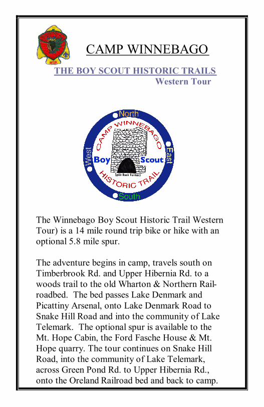
THE BOY SCOUT HISTORIC TRAILS
Western Tour
The Winnebago Boy Scout Historic Trail Western
Tour) is a 14 mile round trip bike or hike with an
optional 5.8 mile spur.
The adventure begins in camp, travels south on
Timberbrook Rd. and Upper Hibernia Rd. to a
woods trail to the old Wharton & Northern Rail-
roadbed. The bed passes Lake Denmark and
Picattiny Arsenal, onto Lake Denmark Road to
Snake Hill Road and into the community of Lake
Telemark. The optional spur is available to the
Mt. Hope Cabin, the Ford Fasche House & Mt.
Hope quarry. The tour continues on Snake Hill
Road, into the community of Lake Telemark,
across Green Pond Rd. to Upper Hibernia Rd.,
onto the Oreland Railroad bed and back to camp.
CAMP WINNEBAGO
All units taking these hikes are required to check in with
the Campmaster or Ranger for instructions before starting
on the trail. Guidebook and map are to be used by the
hike leader but scouts may record their own answers.
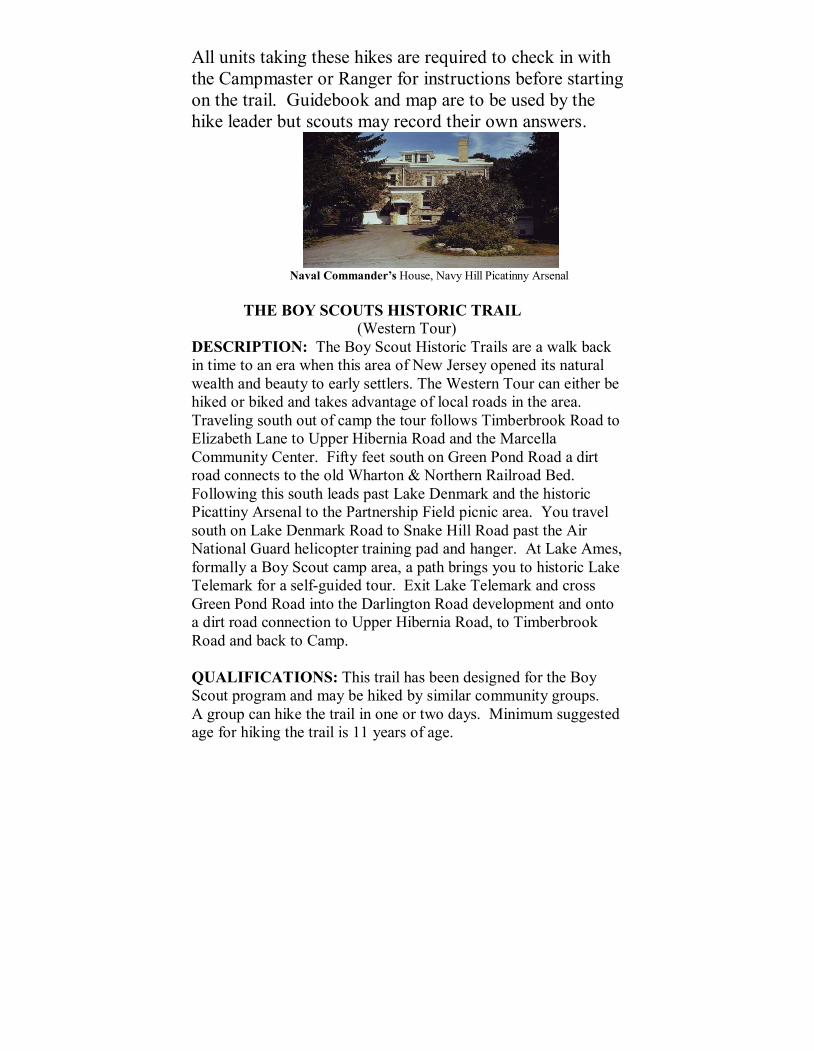
Naval Commander’s House, Navy Hill Picatinny Arsenal
THE BOY SCOUTS HISTORIC TRAIL
(Western Tour)
DESCRIPTION: The Boy Scout Historic Trails are a walk back
in time to an era when this area of New Jersey opened its natural
wealth and beauty to early settlers. The Western Tour can either be
hiked or biked and takes advantage of local roads in the area.
Traveling south out of camp the tour follows Timberbrook Road to
Elizabeth Lane to Upper Hibernia Road and the Marcella
Community Center. Fifty feet south on Green Pond Road a dirt
road connects to the old Wharton & Northern Railroad Bed.
Following this south leads past Lake Denmark and the historic
Picattiny Arsenal to the Partnership Field picnic area. You travel
south on Lake Denmark Road to Snake Hill Road past the Air
National Guard helicopter training pad and hanger. At Lake Ames,
formally a Boy Scout camp area, a path brings you to historic Lake
Telemark for a self-guided tour. Exit Lake Telemark and cross
Green Pond Road into the Darlington Road development and onto
a dirt road connection to Upper Hibernia Road, to Timberbrook
Road and back to Camp.
QUALIFICATIONS: This trail has been designed for the Boy
Scout program and may be hiked by similar community groups.
A group can hike the trail in one or two days. Minimum suggested
age for hiking the trail is 11 years of age.
SCOUT REQUIREMENTS: All Boy Scouts MUST conform to
all normal requirements set by the Boy Scouts of America
governing hiking activities. Wearing a uniform is not required.
Pencils and a compass are needed to fill out the questionnaire. A
bag lunch, water canteens and waterproof boots are recommended.
TRAIL REQUIREMENTS: A donation of $2.00 per booklet is
suggested at the start of the hike to cover the cost of the trail
package. For the Trail Award, there is a questionnaire with 24
informative fill-in questions. These are to be turned in to the group
leader at the end of the Trail in order to receive the award. Starting
time is between 8:00 AM and 11:00 AM. Units can select their
own starting time, but must report to the Campmaster 30 minutes
prior to this time. Scouts outside of Patriots’ Path Council are
required to have a valid tour permit. Hikers should wear shoes and
clothing appropriate to a backwoods trail running through the
Farny Highlands Trail Network. A marshy trail and several
streams must be crossed. “Be Prepared”, waterproof boots or
plastic bags to cover footwear is encouraged.
TIME REQUIREMENTS: The trail can be hiked year round
depending on weather and trail conditions. Depending on skill
level, the hike is 5-8 hours and the bike from 3-4 hours.
TRAIL AWARDS: The Camp Winnebago, Boy Scout Historic
Trail award patch can be purchased at the Camp Winnebago
Trading Post at the end of the hike.
REGISTRATION: Prior to hiking, biking, or camping, a day or
weekend reservation for Camp Winnebago must be made with the
Patriots’ Path Council Service Center.
OVERNIGHT CAMPING: Tent sites, lean-tos and cabins
are available for overnight camping at Camp Winnebago.
Information regarding fees and reservations may be obtained
from the Patriots’ Path Council Service Center.

TRAIL GUIDE: HISTORIC TRAIL
The Camp Winnebago Boy Scout Historic begins
at the parade field opposite the “A” (Administration) building.
Hike out the north entrance and on to Timberbrook Road. It is 7/10
mile to Durham Road and one mile to a church.
QUESTION 1. WHAT IS THE NAME OF THE CHURCH AND
IN WHAT YEAR WAS IT BUILT?
QUESTION 2. WHAT IS THE NAME OF THE CEMETARY?
Turn east on Elizabeth Lane and continue to Upper Hibernia Road.
Walk west to Green Pond Road. Note the white house on the corner to
the north. Cross Green Pond Road to the Marcella Community
Center.
QUESTION 3. HOW MANY CHILDREN WERE BORN IN
THIS HOUSE TO THE JOHN & ELIZABETH?
QUESTION 4. THIS AREA IS CALLED MARCELLA
SECTION; WHAT WAS THE ORIGINAL NAME?
QUESTION 5. WHAT WAS THE MARCELLA COMMUNITY
ORIGINALLY?
Walk south on Green Pond Road, approximately 350 ft., to the
telephone pole marked RT-217 and turn west onto the dirt road.

QUESTION 6. A 1/4 MI. DOWN THE ROAD IS A GOLF
COURSE, HOW MANY HOLES DOES IT HAVE?
Travel west to a small pond and field in front of an abandoned house.
Follow the road in front of the house and continue west.
Remain on the main road and avoid any tempting cutoffs. Enjoy the
hillside filled with Mountain Laurel. A rock wall, bearing north,
begins at a fork. Hike to the north side keeping the wall to the south.
The trail meets a NE/SW trail at a “T”. Hike to the southwest. The
trail meets a second NE/SW trail behind a house. Continue southwest
to the paved road.
Hike on the road approximately 630 ft. to trees marked with numerous
ORANGE blazes. Turn northwest into the woods to the railroad bed
of the old Wharton & Northern railroad and hike west. If the bed is
flooded continue on the paved road approximately 540 ft. and look for
an entrance into the woods opposite “Southard Salvage.”
Hike southwest and keep your eyes open for relics like railroad tie
plates or spikes.
QUESTION 7. HOW WOULD GREENPONDERS KNOW
WHEN THEY HAD REACHED THEIR R.R. STOP?
QUESTION 8. WHAT WAS SIGNIFICANT ABOUT THE
TRAIN WRECK ON THE HIBERNIA BRANCH?
QUESTION 9. WHAT WAS THE ORIGINAL GIVEN TO THE
TOWN OF WHARTON?

Note the power lines which stretch east/west. These are the same
power lines encountered on the Boy Scout Hike Western Tour at Split
Rock Reservoir.
At a fork hike to the east up a subtle rise, the railroad bed continues
straight but is frequently flooded. The railroad bed “T’s” and the
eastern spur continues to Upper Hibernia (Oreland). Hike west past
the junction of the main line you were just on.
Throughout the Rockaway countryside are test wells to check water
table levels and purity. Look for two along the bed.
QUESTION 10. COPY THE NUMBER OF THE FIRST TEST
WELL.
Past the first well is a cutoff to the northwest. This affords a great
view of the lake.
QUESTION 11. WHAT IS THE NAME OF THIS LAKE?
QUESTION 12. COPY THE NUMBER OF THE SECOND TEST
WELL.
QUESTION 13. IN THE MIDDLE OF THE BED IS A WATER
METER. DRAW A PICTURE OF IT.

QUESTION 14. WHAT UNIQUE FEATURE ALLOWED THE
TRAINS TO NOT USE ENGINES?
QUESTION 15. LIST THE THREE OLD RAILROAD STOPS
YOU WILL BE PASSING ON YOUR HIKE.
The gate marks the entrance to Picatinny Arsenal. Because of the
September 11 disaster the Picatinny bed is off limits. Hike back about
400ft. to a trail to the east, which will take you to Lake Denmark Rd.
at a telephone pole marked NJ 1711RT.
Walk southwest for 1 mile on Lake Denmark Road to the baseball
field. For emergency only there is Porta John, potable water, in
season, and an emergency Arsenal security telephone.
QUESTION 16. WHAT IS THE NAME OF THE FIELD?
QUESTION 17. AN IRON MINE WAS LOCATED NEARBY,
WHAT WAS IT CALLED?
Hike west on Lake Denmark Road. BE CAREFUL, this is an
ACTIVE ROAD. The first road to the south is Snake Hill Road.
QUESTION 18. WHAT WAS THE ORIGINAL NAME GIVEN
TO PICITANNY ARSENAL?
QUESTION 19. NAME THE ARSENAL CHEMIST WHO
DISCOVERED THE EXPLOSIVE HALEITE.
QUESTION 20. WHAT WAS ONE OF THE ARSENAL’S
WWII RESEARCH TRIUMPHS?

QUESTION 21. WHAT KOREA ERA ARMAMENT
IMPROVEMENTS IS CREDITED TO THE ARSENAL?
QUESTION 22. IN 1986 THE ARSENAL’S NAME WAS
CHANGED TO WHAT?
You may continue your hike on Lake Denmark Road traveling the
5.8-mile round trip spur to the historic Ford Fischer house and the Mt.
Hope Mine. If you choose not to take the spur, you may answer the
questions related to the historic sites from the back of this guide.
QUESTION 23. WHAT CAUSED THE ARSENAL TO BLOW
UP IN 1926?
QUESTION 24. IN 1948 THE ARSENAL BEGAN TESTS ON
WHAT TWO ROCKET ENGINES?
A security gate into the arsenal and the Pica tinny Water Park will be
to the northwest and beyond is the historic Naval Commander’s
House.
QUESTION 25. WHAT IS THIS GENERAL AREA OF THE
ARSENAL KNOWN AS?
Lake Denmark road intersects with Mt. Hope Road and the Mt. Hope
Rd. arsenal gate. Travel east on Mt. Hope Road. Look for a gated
road to the west before you come to Mt. Hope Pond.
Hike this road to the Mt. Hope Cabin.
QUESTION 26. NAME THE BOY SCOUT TROOP
RESPONSIBLE FOR BUILDING THE CABIN.
Continue on Mt. Hope Road to the Mt. Hope Methodist Church.

QUESTION 27. HOW WAS THE CHURCH USED DURING
EPEDEMICS?
Across the road is the Forded Faesch House.
QUESTION 28. WHAT WAS FAESCH’S NICKNAME?
QUESTION 29. WHAT DID GENERAL WASHINGTON GIVE
TO JOHN JACOB FAESCH?
QUESTION 30. WHO PATRONIZED THE TAVERN THAT
WAS PART OF THE MT. HOPE STORE?
QUESTION 3I. TILCON IS ONE OF THE UNITED STATES
LARGEST PRODUCERS OF WHAT?
QUESTION 32. NAME THE MAIN OPERATION SHAFT OF
THE MT. HOPE MINE COMPLEX.
Return on Mt. Hope Road the way you came to the intersection with
Snake Hill Road. Travel south on Snake Hill Road.
QUESTION 33. WHAT IS THE FULL NAME OF THE
HELICOPTER BASE?
Hike 1 1/2 miles on Snake Hill Road to a path to the north marked
with red blazes at a berm and gate posts. A stream and bridge are
further along the road as is the Lake Ames Pavilion. The
BATHROOMS are open in season.
Hike the red blazed trail along the western shore of Lake Ames. Look
for the remains of an old log cabin.

QUESTION 34. NAME THE GROUP WHO CAMPED AT A
CABIN AT LAKE AMES.
Follow the red trail along the stream hiking north up and over the hill
to the crest and then turn east where the trail empties onto Winding
Brook Way, in Lake Telemark. At the lake, turn east on Lake
Telemark Road. The Lake Telemark Country Club is on the lakeshore.
QUESTION 37. LAKE TELEMARK IS NAMED AFTER A
SMALL VILLAGE IN WHAT COUNTRY?
QUESTION 36. WHAT TYPE OF DISPLAY IS LAKE
TELEMARK NOTED FOR ON THE 4
TH
OF JULY?
Turn left on Oslo Drive and continue around the lake. If you were to
continue on Telemark Road to Green Pond Road the Telemark store,
now Telemark Pizza is a good refueling point.
QUESTION 37. WHAT IS THE NAME OF THE LOG CABIN
ON THE EAST SHORE OF THE LAKE?
Hike onto Brookside Road and do not continue around the lake.
At the “T” turn north, against one-way traffic, onto Colonial Road and
out to Green Pond Road. Cross the road and hike north passing a
grammar school.
QUESTION 38. WHAT IS THE NAME OF THIS GRAMMER
SCHOOL?
QUESTION 39. NAME THE CAMP THAT WAS ACROSS THE
ROAD.
QUESTION 40. WHO WAS THE FOUNDER OF GIRL
SCOUTS AND IN WHAT YEAR DID SHE DO IT?

Continue north on Green Pond Road and enter the Darlington Drive
development. Pass Chandler Terrace to a yellow road gate at a dirt
road. Hike the road following the power lines, pass another yellow
road gate and out to Upper Hibernia Road at the junction of Brunache
Road. Here is a parking lot and down the dirt road to the north is the
Wildcat Ridge Wildlife Management Area Interpretive Center. You
may have visited here on the Boy Scout Historic Southern Tour.
Please sign the guest book.
Return to Upper Hibernia road and hike north past the landscaper’s
private home and look for the telephone pole marked NJ 1153RT.
Hike into the woods to the northeast past dirt piles and onto the
railroad bed of the old Wharton & Northern Railroad, Oreland
Branch. The bed will bring you out to Upper Hibernia Road near the
power lines. Walk Upper Hibernia Road 1.6 miles to Elizabeth Lane
to Timberbrook Road and back into Camp Winnebago.
BONUS QUESTION. WHAT IS THE NAME FOR A PERSON
WHO MAKES AND STUDIES MAPS?
The landscape near
the explosion was
leveled as seen in
this photo.

Panoramic view of Navy
Hill with fires still
burning. Lake Picatinny
in foreground along with
the Powerhouse
The Powerhouse.
It was later
rebuild.
Crater made by explosion of
Building #8 – estimated in
this building: 670,000 lbs.
of TNT

TRAIL GUIDE HISTORIC INFORMATION
CHRISTIAN FELLOWSHIP CHURCH AND MARCELLA UNION CEMETARY
– The land was given to the church by John and Elizabeth Alison (her maiden name)
Egbert. The Church was completed in 1903 and burials began the same year. The
cemetery contains disinterred settlers from the Zeek, winter, and Green Lake Cemetery.
(Green Lake Cemetery was on Jacobs Rd. near the present day town dump). Jacobs Road
was named for the Reverend Jacob Bostedo, a settler form the early 1800’s, also buried in
The Marcella Union Cemetery.
JOHN EGBERT HOMESTEAD – This large white house is located at the corner of
Green Pond Road and Upper Hibernia Road. It was erected by Andrew B. Cobb for John
and Elizabeth (Allison) Egbert in exchange for their property in Green Pond. John and
Elizabeth’s last 11 children were born in this house. Andrew Cobb was an iron ore
industrialist and owner of large tracts of land in the area including the Cobb furnace
(Split Rock furnace) and the Cobb iron mine, west of Split Rock Reservoir.
EGBERT HOMESTEAD – This log cabin near Green Pond was built in 1862 by John
and Elizabeth (Allison) Egbert. They lived here until 1866 when Andrew Cobb bought
Egbert’s Corner and it became Cobb’s Corner. The structure was used as the Green Pond
Rental Office for many years. In 1962 it became the Green Pond Corporation Office, and
it has served in that capacity ever since.
MARCELLA – The Marcella section of the township was once called Greensville.
The mail service became very poor due to the fact that there was another Greensville in
the state. Mr. Marshall, who operated a store and post office, thought it best to change
the name of the community so that the mail service would improve. Marshallsville was
proposed but was declined in favor of the name Marcella, his wife’s name.
The Marcella Community Club, was originally the Marcella School, which was
erected here in 1915. The property was given by John & Elizabeth Egbert. The building
contained two rooms with a seating capacity of 40 pupils in each room. During World
War II, this building was used as Catholic Church. In 1953, the Marcella Fire Company
built an addition to house their fire apparatus. From 1954 to 1966 a small cloakroom
serves as a public library. Today it serves as a meeting place for the members of the
Marcella Community and Boy Scout Troop 165 calls it home.
EGBERT’S LAKE – A mile north on Green Pond Road this pond is situated west of the
road and adjacent to the old Wharton and Northern railroad bed. This was a man-made
lake created by the children and grandchildren of John and Elizabeth Egbert in 1928-
1930. later a number of bungalows were available for summer rentals and hiking,
swimming, boating, and fishing were featured activities. The bungalows have fell into
disrepair and were vandalized; the township has taken ownership and a park is planned.
GREEN POND GOLF CLUB – Originally know as the Peter D. Henderson first
homestead. The golf course was started prior to 1929 by a group of men from Green
Pond. Mr. & Mrs. Enholm, Sr., who purchased the property in 1939 and expanded the
golf course and renovated the home. Today it is a 9-hole public course weaving
horizontally down the hillside.
WALK TO GREEN POND - (from Lake End, Green Pond) - travelers to the Lake End
section of Green Pond would exit the Wharton & Northern train. Upon verbal notice to
the conductor, the train would stop at “The Trail”. From that point it was only a mile or
so hike over the Copperas Mountain and down to the Lake End Road. Carrying baggage
and paraphernalia over the hill taxed wind and limbs. For the eastbound trip to the
railroad, most campers would climb uphill over one of the several homemade paths to the
“Trail” and follow this to its normal peak. At that point there was also a junction summit
trail that ran southwesterly along the crest of Copperas Mountain to a collection of
boulders, which was surmounted by the famous “Lookout Rock”. By sliding due east
downhill, the campers reached the rails and with a vigorous hand wave, stopped the train.
Some business men commuted to New York, creating
a day that lasted at least 13 hours.
THE GREAT TRAIN WRECK – (from Lake End, Green Pond, New Jersey. Its History
and It’s People). One of the big events of the time
was a part of a movie thriller. The Wharton Film Company, producers
of the Pearl White series, and other episodes, needed a train wreck. Arrangements were
made to have some bad men move the track of the Hibernia Branch of the Wharton &
Northern so that a locomotive would fall over an embankment, as part of a movie episode
of that era. Advance notice indicated zero hour for 10 am, 30 – 40 people from Green
Pond, with lunches packed set off only to find out sunlight would be best in 3 or 4 hours.
In due time, sunlight was appropriate and cameras started rolling. The train was seen
coming around the bend with a dummy leaning out of the locomotive cab and waving an
arm. The wreck was a success. Most of the movie cameras were in a good position but
one was almost hit by the engine when its trajectory over the embankment exceeded
calculations. An unexpected bonus was the pleasure of meeting the movie personnel, and
particularly Creighton Hale, who played the hero.

PORT ORAM – (from Railroads of New Jersey) Port Oram, now Wharton, was less than
two decades old when the railroad reached it and probable still had the rough, unfinished
appearance and raw vitality of a frontier town. It was named for Robert Oram, who
owned most of the land and businesses in the town. After Joseph Wharton took over the
furnace and became the towns dominate figure, its name was officially changed in 1902.
East of Port Oram, the CNJ (Central Railroad of NJ), now running on the tracks of the
Dover & Rockaway, crosses the Rockaway River on a three-span bridge. On May 8,
1900, a heavy engine struck a switch frog. Three hundred feet of track were torn up. The
track was blocked until the following morning, and passengers had to be moved from
trains on both sides of the gap.
WHARTON & NORTHERN PASSENGER SERVICE – (from Railroads of NJ) The W
& N R.R. was originally constructed to haul iron ore but with the growth of the area, and
summer vacationers in particular, the need for expanded service was evident. Not all
trains on the main line ran over the relatively barren section to Charlotteburg Junction;
some terminated at Green Pond or Lake Denmark. The southern terminus was at Morris
County Junction with the CNJ, located almost in the shadow of present Rt. I-80 near
where it crosses Berkshire Valley Road. These passenger runs generated a bit of
excitement. A feature article in the Newark Sunday Call in June 1895 described how the
MC RR (Morris County R.R.) often operated by gravity, that is with the engine running
ahead to move other cars out of the way while the ore cars and coach coasted down the
grade. Normally the gravity runs began at the Naval Powder depot at the upper end of
the Picatinny reservation and ceased near Spicertown, “but if the track is clear and good
headway gained the train can run a slight rise to the stopping place at Morris County
Junction.”
WHARTON & NORTHERN STATIONS - On June 10, 1905 Joseph Wharton
combined the almost 21 miles of the Morris County R.R., the Port Oram R.R., the
Hibernia Branch R.R., and Morris County Connecting R.R. to form the Wharton &
Northern R.R. Wharton named the settlement at his mines at Upper Hibernia “Oreland”
and the Hibernia Branch became known as the Oreland Branch. Between Oreland and
the main line, there was a passenger train stop at a place called Post Town, near Green
Pond Road. On the main line, there were stops, from north to south, at Green Pond
Junction, Green Lake (Green Pond), Oreland Junction, Lake Denmark, Navy Depot,
Factory, Picatinny Arsenal,
Mt. Pleasant, Wharton Junction, and Wharton.
PARTNERSHIP FIELD – This field was a joint venture of Picattiny Arsenal and the
township of Rockaway. On or near this site the Lake Denmark hotel stood for many
years offering comfort and hospitality to summer visitors. A picture exists, however,
little more; a fire destroyed it.
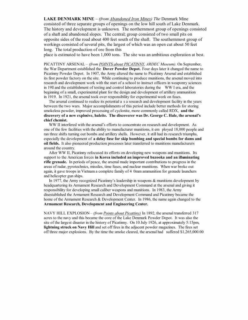
LAKE DENMARK MINE – (from Abandoned Iron Mines) The Denmark Mine
consisted of three separate groups of openings on the low hill south of Lake Denmark.
The history and development is unknown. The northernmost group of openings consisted
of a shaft and abandoned slopes. The central; group consisted of two small pits on
opposite sides of the road about 400 feet south of the shaft. The southernmost group of
workings consisted of several pits, the largest of which was an open cut about 50 feet
long. The total production of ore from this
place is estimated to have been 1,000 tons. The site was an ambitious exploration at best.
PICATTINY ARSENAL – (from POINTS about PICATINNY, ARDEC Museum). On September,
the War Department established the Dover Powder Depot. Four days later it changed the name to
Picatinny Powder Depot. In 1907, the Army altered the name to Picatinny Arsenal and established
its first powder factory on the site. While continuing to produce munitions, the arsenal moved into
research and development work with the start of a school to instruct officers in weaponry sciences
in 19ll and the establishment of testing and control laboratories during the WW I era, and the
beginning of a small, experimental plant for the design and development of artillery ammunition
in 1919. In 1921, the arsenal took over responsibility for experimental work on fuses.
The arsenal continued to realize its potential a s a research and development facility in the years
between the two wars. Major accomplishments of this period include better methods for storing
smokeless powder, improved processing of cyclonite, more commonly called RDX, and the
discovery of a new explosive, haleite. The discoverer was Dr. George C. Hale, the arsenal’s
chief chemist.
WW II interfered with the arsenal’s efforts to concentrate on research and development. As
one of the few facilities with the ability to manufacturer munitions, it em ployed 18,000 people and
ran three shifts turning out bombs and artillery shells. However, it still had its research triumphs,
especially the development of a delay fuse for skip bombing and special bombs for dams and
oil fields. It also pioneered production processes later transferred to munitions manufacturers
around the country.
After WW II, Picatinny refocused its efforts on developing new weapons and munitions. Its
support to the American forces in Korea included an improved bazooka and an illuminating
rifle grenade. In periods of peace, the arsenal made important contributions to progress in the
areas of radar, pyrotechnics, missiles, time fuses, and nuclear munitions. When war broke out
again, it gave troops in Vietnam a complete family of 4 0mm ammunition for grenade launchers
and helicopter gun ships.
In 1977, the Army recognized Picatinny’s leadership in weapons & munitions development by
headquartering its Armament Research and Development Command at the arsenal and giving it
responsibility for developing small caliber weapons and munitions. In 1983, the Army
disestablished the Armament Research and Development Command and Picatinny became the
home of the Armament Research & Development Center. In 1986, the name again changed to the
Armament Research, Development and Engineering Center.
NAVY HILL EXPLOSION – (from Points about Picattiny) In 1892, the arsenal transferred 317
acres to the navy and this became the core of the Lake Denmark Powder Depot. It was also the
site of the largest disaster in the history of Picatinny. On 10 July 1926, at approximately 5:15pm,
lightning struck on Navy Hill and set off fires in the adjacent powder magazines. The fires set
off three major explosions. By the time the smoke cleared, the arsenal had suffered $1,265,000.00

worth of damage (in 1930) money) and 19 people were dead. The dead included one army officer
three navy officers, one marine corps officer, one navy enlisted man, eleven marine corps enlisted
men, and two civilian women. One of th e women was the wife of the depot’s chief civilian clerk
and a resident of the arsenal. The other was a visiting friend on the depot.
Shells tossed by the explosion, which the fire set off, landed as much as a mile away. People in
Hibernia suffered i njuries from flying glass and plaster damage. Some houses even lost their
doors. The force of the blast caused similar glass and plasters damage in Mount Hope and blew
out all the plate glass in the Rockaway business district. Two million, three hundred thousand
pounds (2,350,000) of explosives were destroyed.
Modern Picatinny dates from the rebuilding done after this blast. Picattiny rebuilt shortly after
the disaster and increased and improved its facilities when Works Progress Administration fund s
and personnel became available in the mid -1930s. However, the Navy depot never fully recovered
from the explosion and its activity during WW II was on a very limited scale. The Navy had
tentative plans to use it as a camp for Italian prisoners of war, but the Italian switch to the allies in
1943 made this unnecessary.
In 1948, the Navy Air Rocket Test Station took up residence on the Hill, but only until 1960.
The, the land went back to the army. Work at the test site included development of engines for
the X-1 and X-15 rocket planes.
NAVAL COMMANDER’S HOUSE - (from dedication plaque, Naval Commander’s House,
Picatinny Arsenal) Built in 1890 for the Commanding Officer of the Naval detachment situated
here beginning in 1891 from land ceded by t he Chief of ordnance, US Army. This general area
became known as “Navy Hill” and was a magazine and storage station. The navy closed this area
and it became part of Picatinny Arsenal again in September 1960.
This building housed the commander of the Lake Denmark Powder Depot until 1948 and the
commander of the Naval Air Rocket Test Station from 1948 to 1960. It is a very fine example of
1890’s puddingstone construction. (Puddingstone, geologically classified, as Green Pond
Conglomerate is generally dull-red sandstone with pebbles of white quartz intermixed and
particular only to the Green Pond geographical area).
MT. HOPE CABIN – (from Rockaway Record, June 3, 1937) “Mt. Hope Scout Troop to Dedicate
New Cabin, June 12. Camp Fire Saturday Night , to Which All are Invited to Attend” Boy Scout
Troop 12, with the help to the Troop Committee, Mothers Auxiliary
had their dream fulfilled with the erection of a chestnut log cabin at the north end of Mt. Hope
Pond. The Warren Foundry & Pipe Corp. Mine s, at Mt. Hope, donated the land. logs were found
on the property of Mr. Jeremy Brady of Woodport and he donated the logs. The floor is concrete
with a bed of stone and cinders beneath. There is a twelve -foot porch on the front and one end of
the cabin. The doors are made of half logs, and there is one door on each of the three sides. The
lumber and other materials were supplied by JH Nickson Lumber Co. of Rockaway and NJ Bell
donated poles and electric line. Local craftsmen donated time and other mat erials to complete the
work. Today the cabin is home to the Rockaway Sportsmen’s Club and open to troops from
around the area for year round camping.
MT. HOPE METHODIST CHURCH – Across the road for the Faesch House stands the Mt. Hope
Methodist Church, which was built in 1868 by the mining company for their employees and their
families. It has also been called the Miner’s Church. During epidemics it has served as a
hospital and when needed - a schoolhouse. The well-to-do parishioners used pews in this church,
while the balcony was thought to be sufficient for the miners and their families. The congregation

dwindled and eventually the church was closed down. Vandals have been responsible for a great
deal of damage to the church.
FORD FAESCH HOUSE – (from the Historical Society of the Rockaway’s) John Jacob Faesch
“the smart little Dutchman” was one of the most noted iron-masters of Morris County. Born is
Switzerland in 1729, he came to America in 1765 under an agreement made with Francis
Hasenclever, on behalf of his brother, Peter, the general manager and superintendent of the
British -owned London Company, to manage their iron works. He took up the managerial position
at Ringwood, where he resided. In 1768 the works at Charlotteburg were placed in his charge and
later the works at Long Pond. Trouble arose between Hasenclever and the other company
members and Robert Erskine was appointed to succeed Hasenclever. Mr. Faesch resented the
treatment of his friend Hasenclever, and left the service of the company in June 1772. He had
already made arrangements to take the Mount Hope property, and took long lease of the lands
owned by Jacob Ford Jr. In addition Faesch purchased for the proprietors the great Mount Hope
tract surrounding them, and began buil ding of the furnace, he afterward purchased the Middle
forge and Rockaway forge, leased Mount Pleasant forge and the Boonton mills, and carried on the
iron business on an extensive scale.
Faesch became a naturalized American citizen through special act of the legislation in 1776. At
the outbreak of the American Revolutionary War, Faesch was an ardent Whig. He took an active
part in politics. The Tories made many attempts to rob the house of Faesch, at Mt. Hope, and to
destroy his property. After the battle of Trenton, Washington visited Faesch at Mt. Hope and
presented him with Hessian prisoners who kept guard at the old homestead, and who were put
to work at the mines and forges making supplies for the Continental Army. The prisoners also
built liv ing quarters in the rear of the stone mansion and performed other chores, such as carpentry
work and chopping wood. At the close of the war, the British had a certain number of days to
gather up the Hessian soldiers, as they were required to pay for every one they did not return to the
old country. However, by that time, the prisoners had fallen in live with America and refused to
leave. The descendants of the Hessians settled here and established homes.
MT. HOPE STORE – This is the place where the miners would purchase everything that
they needed. The mining company owned the store and would make deductions from the
miners’ salaries for their purchases, and by the end of the month, the miner owed his
entire salary to the general store. This store has been renovated over the years.
Originally, the store’s appearance was similar
to the Hibernia General Store with a butcher shop on the left side and groceries and other
merchandise in the main section. At one time a tavern was located in the rear and a lower
level. Many baseball players and their fans patronized
it when ball games were played on a field located behind the store. The
store along with the abandoned iron miner’s church were owned by Mount
Hope Rock Products.
TILCON – (from Tilcon Public Relations) Tilcon New York, Inc. purchased the Mt.
Hope Quarry and Asphalt facility in April 2001. Formerly known as Mt. Hope Rock
Products, the site is located on 560 acres surrounding a historic iron ore mine. The
company has applied innovative operational techniques to become one of the largest
producers of granite and bituminous concrete in the United States. The facility is

considered one of the elite hard rock quarries in the United States. Mt. Hope has a
crushing plant, three on-site asphalt plants and a soil remediation plant. The old Mt.
Hope Store is used as plant offices.
MT. HOPE MINE – (from Abandoned Iron Mines of Jefferson and Rockaway) The mine
included the workings on nine ore bodies of which four were on Mt. Hope Hill, three on
Hickory Hill, and two on Mt. Teabo Hill. The principal shafts included the Spencer,
Fowler, Brown, Elizabeth, Carlton, Leonard, and New Leonard. The New Leonard
shaft was the main operating shaft from 1944 until the Mt. Hope operations was
permanently closed. The New Leonard was a three-compartment shaft 2,694 feet deep
that connected with the 1,000, 1,700, 2,100, 2,300, and 2,500 levels. The Mt. Hope Mine
ranks as the largest producer of iron ore in New Jersey, yielding close to 6,000,000 tons
since its beginning.
HELICOPTER BASE – (from Picatinny Heliport Ready to Fly, Daily Record June 4,
1978) Constructed for $2 million the NJ National Guard heliport can house 31 aircraft. It
will be used for weekend drills by Troop D of the 117
th
Calvary, Westfield, and
Headquarters 1
st
Brigade of the 50
th
Armored Division. A hanger, control tower and
maintenance facility have been erected on the site near Lake Denmark, on 56 acres of the
military installation known as Navy Hill. Two types of aircraft will be in res idence – the
OH6A (Loach), an observation helicopter, and the UH1 Utility Helicopter (Huey). All
maintenance work will be done in the hangers and there are 21 tie-down areas and a main
helipad for lift-offs. Frequently visited by elementary school class trips a visitor might
view practice take-offs and landings on a weekend. The official designation is NJ Army
National Guard Aviation Support Facility #2.
LAKE AMES –from The Daily Advance, Jan. 17, 1979) Purchased by the township of
Rockaway for nearly $1 million, in 1979, the 285-acre Lake Ames Park is the largest
municipally –owned park in the county. Original plans called for a multipurpose field,
swimming, boating, ice-skating and hiking facilities plus “Passive” activities for senior
citizens such as pavilions and bench-lined walkways. Today the Rockaway Township
Castle Playground is on the site.
Lakes Ames was formed by a Canadian Glacier and the first dam at Big Pond (Lake
Ames) was erected during the Revolutionary War. The dam broke loose and washed
away. About 1905 the mining company, owned by Joseph Wharton at the time, had the
dam repaired. Joseph Jackson was the contractor. The concrete capping over the rebuilt
dam crumbled and was rebuilt around 1915. Camp Ames was a Boy Scout Camp and
early history has a troop from Montclair camping here in 1916 after a mix-up with
arrangements to use the property at Camp Winnebago. A fireplace and chimney remain
from what locals remember as the small cabin and a triple seat latrine foundation can be
found in the woods. The history in the Rockaway library dates the camp to 1942/43. The
Denville Herald, October 11, 1945, announced a Tri-Town Girl Scout leader training at
Camp Mogisca, formerly Camp Ames, in Hibernia.
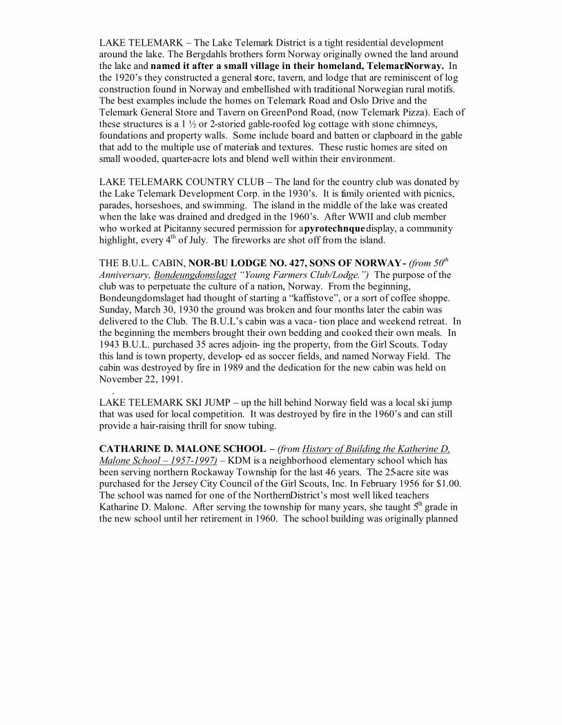
LAKE TELEMARK – The Lake Telemark District is a tight residential development
around the lake. The Bergdahls brothers form Norway originally owned the land around
the lake and named it after a small village in their homeland, Telemark, Norway. In
the 1920’s they constructed a general store, tavern, and lodge that are reminiscent of log
construction found in Norway and embellished with traditional Norwegian rural motifs.
The best examples include the homes on Telemark Road and Oslo Drive and the
Telemark General Store and Tavern on Green Pond Road, (now Telemark Pizza). Each of
these structures is a 1 ½ or 2-storied gable-roofed log cottage with stone chimneys,
foundations and property walls. Some include board and batten or clapboard in the gable
that add to the multiple use of materials and textures. These rustic homes are sited on
small wooded, quarter-acre lots and blend well within their environment.
LAKE TELEMARK COUNTRY CLUB – The land for the country club was donated by
the Lake Telemark Development Corp. in the 1930’s. It is family oriented with picnics,
parades, horseshoes, and swimming. The island in the middle of the lake was created
when the lake was drained and dredged in the 1960’s. After WWII and club member
who worked at Picitanny secured permission for a pyrotechnque display, a community
highlight, every 4
th
of July. The fireworks are shot off from the island.
THE B.U.L. CABIN, NOR-BU LODGE NO. 427, SONS OF NORWAY- (from 50
th
Anniversary, Bondeungdomslaget “Young Farmers Club/Lodge.”) The purpose of the
club was to perpetuate the culture of a nation, Norway. From the beginning,
Bondeungdomslaget had thought of starting a “kaffistove”, or a sort of coffee shoppe.
Sunday, March 30, 1930 the ground was broken and four months later the cabin was
delivered to the Club. The B.U.L’s cabin was a vaca- tion place and weekend retreat. In
the beginning the members brought their own bedding and cooked their own meals. In
1943 B.U.L. purchased 35 acres adjoin- ing the property, from the Girl Scouts. Today
this land is town property, develop- ed as soccer fields, and named Norway Field. The
cabin was destroyed by fire in 1989 and the dedication for the new cabin was held on
November 22, 1991.
.
LAKE TELEMARK SKI JUMP – up the hill behind Norway field was a local ski jump
that was used for local competition. It was destroyed by fire in the 1960’s and can still
provide a hair-raising thrill for snow tubing.
CATHARINE D. MALONE SCHOOL – (from History of Building the Katherine D,
Malone School – 1957-1997) – KDM is a neighborhood elementary school which has
been serving northern Rockaway Township for the last 46 years. The 25-acre site was
purchased for the Jersey City Council of the Girl Scouts, Inc. In February 1956 for $1.00.
The school was named for one of the Northern District’s most well liked teachers
Katharine D. Malone. After serving the township for many years, she taught 5
th
grade in
the new school until her retirement in 1960. The school building was originally planned

to be situated further south on the property, on more level ground nearer to the present
ball field location. However, more clearance was need between the school and camp
caretakers house so the school was moved further north on the site. Several years later
the camp caretaker, Mr. Royal, moved out of his house and the fire department used the
house for a drill by burning it to the ground.
GIRL SCOUTS – (from The Guide for Brownie Girl Scout Leaders)
Girl Scouts of the United States of America is part of the international educa- tional
association for girls, the World Association of Girl Guides and Girl Scouts. All national
organizations that are members of WAGGGS share a common history. Robert Baden-
Powell, First Baron Baden-Powell of Gilwell, England, founded the Scouting movement
in 1908. In 1909, a Boy Scout rally was held in London. A number of girls turned up
proclaiming they to be “Girl” Scouts! A separate movement, the Girl Guides
Association, was formed in 1910. A Friend of the Baden-Powells, Juliette Gordon
Low, was so enthusiastic about the idea of a youth organization for girls, that she
founded Girl Scouting in the United States in 1912. From these beginnings WAGGGS
has grown to 118 national Girl Guide/Girl Scout organizations with a membership close
to eight million.
HUDSONIA GIRL SCOUT CAMP – across from Catherine D, Malone school and
owned by the Jersey City Water Department. It has a small lake and numerous cabins.
The camp buildings fell into disrepair after the Girls Scouts moved out and were
eventually leveled by the township, which now has control over the property. Ball fields
have been built and now in use.
Author’s thank you’s: This project was a five month labor of love involving researching, hiking and
writing the Cub Scout Historic Hike and then the Boys S cout Hikes: Southern, Easterm, Northern and finally
the Western Historic Hike. These are some of the of the many individuals, and their roles, who assisted me
in this project. ARDEC Historical Office & Museum, Mr. Pat Owens (research); Dover Historical So ciety,
Mrs. Betty Inglis and Stan Schoonmaker (research); Matt Hendrickson, BSA Troop 5, (scanning pics); Coco
Jaremcak, (my constant companion);
Pat Jaremcak, (hiking); Matt Jaremcak, BSA TROOP 165, (hiking, in all kinds weather);
Teddy Moritz (proofreading) Carl Moritz (planting the seed); New Jersey Department of Labor, Div. of
Public Safety & Occupational Safety & Health: MINE SAFETY; Jean Nielsen, (proofreading); Rockaway
Historical Society, Ms. Ellie Mason, and John Dunado (research); George DeFlora , Ridgewood High School
Senior for making tjis into a electronic document;
and many other individuals who supplied information from spontanious interviews .
Camp Winnebago The Boy Scout Historic Trail (Western Tour)
Written by: Ron Jaremcak, April 2003 Revised June 2006
Patroits’ Path Council, BSA
222 Columbia Turnpike, Florham Park, NJ 07832
www.ppbsa.org

CAMP WINNEBAGO
BOY SCOUT HISTORIC TRAIL ANSWER SHEET
The trail questions can be found in the trail guide. The trail guide must be
followed closely, both to show you the trail and where to find the answers to the
questions. YOU WILL NEED A COMPASS AND PENCIL. Fill in your
answers in the following blank lines.
1___________________________________________________
2___________________________________________________
3___________________________________________________
4___________________________________________________
5___________________________________________________
6___________________________________________________
7___________________________________________________
8___________________________________________________
9___________________________________________________
10__________________________________________________
11__________________________________________________
12__________________________________________________
14__________________________________________________
15__________________________________________________
16__________________________________________________
17__________________________________________________
18__________________________________________________
19__________________________________________________
20__________________________________________________
21__________________________________________________
22__________________________________________________

23__________________________________________________
24__________________________________________________
25__________________________________________________
26_________________________________________________
27_________________________________________________
28_________________________________________________
29_________________________________________________
30_________________________________________________
31_________________________________________________
32_________________________________________________
33_________________________________________________
34_________________________________________________
35_________________________________________________
36_________________________________________________
37_________________________________________________
38_________________________________________________
39_________________________________________________
40_________________________________________________

Christian Fellowship
Church, Timberbrook
Road, Rockaway.
Mt. Hope
Methodist
Church,
Mt. Hope Rd
Ford Fasch House,
Mt. Hope Road
Picattiny Arsenal disaster photos courtesy of Dover Historical Society


