cameron parish - lacoast.gov1.pdf · feasibility study cameron parish prepared for coastal...
TRANSCRIPT

FEASIBILITY STUDY
CAMERON PARISH
prepared for
COASTAL RESTORATION DIVISION
prepared by
BROWN & ROOT, INC.
ENGINEERS AND CONSULTANTS
BELLE CHASSE, LOUISIANA
OCTOBER 1992
~~~~I~~~~

TABLE OF CONTENTS
2age
iiLIST OF FIGURES
1EXECUTIVE SUMMARY
3INTRODUCTION. ...
EXISTING CONDITIONS 5
CAMERON-CREOLE WATERSHED MANAGEMENT AREA 9
BLIND LAKE PROJECT 11
12FIELD INVESTIGATION
FISH AND WILDLIFE . 17
ALTERNATIVE SOLUTIONS
19
SWEET LAKE / GIWW BANK RESTORATION
19
RIP RAP BREAKWATER DREDGE MATERIAL STABILIZATIqN OF NORTHERN SWEET LAKE SHORELINE 2022
25
WIRE MESH FENCING BRUSH FENCING 2526
CONCLUSIONS AND RECOMMENDATION 30
REFERENCES.
31
32
APPENDIX.
i

LIST OF FIGURES
gage
Vicinity Map: Sweet Lake/GIWW Bank RestorationFigure 1. 4
Figure 2. October 1978 Infrared aerial photography ofS~eet Lake/GIWW Bank Restoration Project Areascale 1: 24, 000 6
Figure 3. December 1990 Infrared aerial photography ofSweet Lake/GIWW Bank Restoration Project Areascale 1: 24,000 7
Figure 4. Shoreline History Map ~ ... 8
Figure 5. Wetl and Types
10
Figure 6. Looking north, this photograph shows Blind Lakebreakwater project, GIWW, former GIWW / SweetLake bankline, and Sweet Lake. 13
Figure 7. Remnant islands of Sweet Lake/GIWW Bankline ... 13
Figure 8. Vegetation Entrapment Fence, North Sweet LakeShoreline. 16
Figure 9. Vegetation Entrapment Fence, North Sweet LakeShoreline. 16
21Figure 10. Alternative Project Areas
24Figure 11. Earthen Terrace
Figure 12. Brush Fence 28
ii

EXECUTIVE SUMMARY
Sweet Lake is located in Cameron Parish, Louisiana, approximately
.It is bounded by3.5 miles west of the Gibbstown Bridge (LA 27
the Gulf Intracoastal Waterway (GIWW) to the south and west and by
Due primarily to heavy boat trafficmarsh to the north and east.
and strong northerly winds during the winter, approximately one
mile of the narrow barrier between the GIWW and Sweet Lake has
eroded.
Restoration of this bankline, as proposed in the 1991
isCoastal
Wetlands Conservation and Restoration Plan (CWCRP) ,
intended to reduce turbidity and wave action produced by the
In theGIWW and promote aquatic plant growth in Sweet Lake.
course of this study however, it became evident to us that this
may not have been the original motive for the project.
Conversations with Soil Conservation service and Amoco
corporation personnel, local sponsors of the project, indicate
the original motive for the Sweet Lake project may have been to
protect the barrier between the GIWW and Blind Lake, directly
across from Sweet Lake. As the 1989 Blind Lake breakwater
project has remedied that problem, restoration of the bankline
between Sweet Lake and the GIWW may be a redundant operation.
The alternative recommended in this study is a more direct
stabilization method involving construction of brush fencing
along 11,000 linear feet of north and northwest Sweet Lake
shoreline.
Implementation of this alternative will allow much
1

of the unstable, deteriorating marsh to stabilize by
dissipating wave energy and promoting sediment deposition. At
an estimated initial cost of $165,000, the brush fencing method
offers an economical means of year-long shoreline protection.
2
INTRODUCTION
Louisiana Department of Natural Resources (DNR) tasked Brown &
to conduct a
Inc.,
under DNR contract number 25030-91-36,
Root,
feasibility study of a bank restoration project along the south
shore of sw~et Lake. Identified as project C/S-11 in the 1991-92
the
Coastal
Wetlands Conservation and Restoration Plan (CWCRP) ,
project is located at the boundary between the Gulf Intracoastal
Waterway (GIWW) and Sweet Lake in Cameron Parish (Figure 1)
primarily to heavy boating traffic, approximately 1 mile of
shoreline along the north GIWW bank has eroded, leaving Sweet lake
vulnerable to increases in turbidity and wave action produced in
the GIWW. Reestablishment of a hydrologic barrier between Sweet
is intended to reduc3Lake and the GIWw, as suggested in the CWCkP,
turbidity and promote aquatic plant growth in Sweet Lake.
Submergent vegetation would dissipate wave energy and reduce
shoreline erosion along the Sweet Lake shoreline.
and gas exploration and production, as well as managed for
waterfowl,
furbearers, hunting, and fishing. To protect the eroding
shoreline of Sweet Lake, a number of alternatives were evaluated
with consideration to the needs of wetland restoration and
wildlife and fisheries resources, and privately held
conservation,
lands that may be affected by the project
~

LA MSTX
N
SCALE OF MILES
0
GULF OF MEXICO~o ~~I-.ABI'M-.T ~ KAnjMI. ~--~
-IW~
VICINITY MAPSWEET LAKE /GIWW BANK RFBl'ORATION
FIGURE
4

EXISTING CONDITIONS
Sweet Lake is located in the Calcasieu/Sabine hydrologic basin
inapproximately 3.5 miles west of the Gibbstown Bridge (LA 27)
Cameron Par~sh,
Louisiana.
This freshwater lake is approximately
in area and is bounded by the Gulf3.6 square miles (2300 acres)
Intracoastal Waterway (GIWW) to the south and west and by marsh to
the north and east. Construction of the GIWW occurred in
1920's.
Due to heavy boat traffic and strong northerly winds during
the narrow barrier between the GIWW and Sweet Lakethe winter,
eroded,
and in the 1960's was breached. Since then, approximately
one mile of north shoreline of the GIWW has eroded, creating direct
water exchange into Sweet Lake
A comparison of 1978 infrared aerial photography (National High
Altitude Photography Program) (Figure 2) to 1990 infrared aerial
photography (National Aerial Photography Program) (Figure 3)
reveals
the barrier between Sweet Lake and the GIWW, as well as
the shoreline around Sweet Lake, have eroded quite
considerably.
A historical shoreline comparison has been
prepared for the project area by superimposing digitized images
of the 1978 and 1990 infrared photographs using Intergraph
(Figure 4). As indicated by this studyMicrostation 32
north shoreline of Sweet Lake has been severely eroded. In some
locations,
the shoreline has retreated as much as 265 feet over
5


study period of twelve years, an average rate of 22 feet
year.
Land 1055 rates for the project area are equally as
alarming.
A survey conducted by the U.S. Army Corps of
Engineers,
New Orleans District revealed that between 1955 and
the average land loss rate in the Sweet Lake quadrangle
1990,(Dunbar
eta 40,000 ac!e area, was over 700 acres per year.
al.,1992)
.
Louisiana Department of Wildlife and Fisheries classified
area surrounding Sweet Lake as fresh marsh in 1988 (Figure
The 63,000 acre marsh south of the project area, below the
GIWW,
is known as the Cameron-Creole Watershed Management Area
As
a direct result of the Cameron-Creole Watershed Management
Project (CCWP) ,
this
historically intermediate marsh has in
recent years become more fresh.
CAMERON-CREOLE WATERSHED MANAGEMENT PROJECT
Completed in 1989, the CCWP is a multi-million dollar marsh
management project developed to control saltwater intrusion and
stabilize marsh soils in the Cameron-Creole Watershed
Management Area. Management objectives of this project include
soil stabilization,
floodwater
abatement, ecosystem diversity
and socio-economic development. Water levels and salinities are
maintained at levels mandated by the CCWP management plan
Control structures are manipulated to achieve optimal water
9


levels,
salinities, estuarine organism movement, and
introduction of freshwater and sediments. Ecosystem response to
the CCWP management plan has been positive. In general,
marsh has experienced decreased water salinities, increased
plant diversity and community biomass, shoreline stabilization,
perennial p~ant expansion, and increased wildlife and fisheries
diversity (DeLany et al., 1991) .
BLIND LAKE PROJECT
Shortly after completion of the CCWP, the northern hydrologic
boundary of the project area was threatened with the
possibility of a breach between the GIWW and Blind Lake.
Located directly across from the Sweet Lake bank restoration
project site, the barrier between the GIWW and Blind Lake had
eroded to a critically narrow configuration. To prevent
breaching, a 2339 foot limestone breakwater, placed 70
from the south bank of the GIWW at Blind Lake, was constructed
(See Figure 4). This emergency operation was performed by the
Louisiana Department of Natural Resources (DNR) in September
1989,
at a cost of $173,433.00. The project design consisted
of placing limestone rip rap (LA DOTD specifications on "Heavy
# 711.02 [c) upon a six-inch bedding layerDeposited" rip rap,
of shell and geofabric. The breakwater crest width and height
were 1 foot and +2 feet MSL , respectively, with 1 vertical on
2 horizontal side slopes. A second phase of the project
11

involved the transplanting of 400 giant cutgrass (Zizanio2sis
rniliaceae)
plants along 2,000 feet of bank on the leeward side
of the breakwater. As of March 1992, survey data revealed that
behind the breakwater, an average increase in elevation of .41
inches had occurred due to deposition of suspended sediments
and increased organic matter from decaying vegetation. The
cutgrass plantings have been successful and should eventually
colonize the entire area behind the breakwater. The breakwater
itself had settled no more than 1 foot. Overall, the project
has been successful in maintaining the hydrology of the
Cameron-Creole Watershed area and protecting the GIWW shoreline
at Blind Lake (Louisiana Department of Natural Resources,
1992)
.
FIELD INVESTIGATION
1992,
Brown & Root personnel conducted an aerialOn March 31,
survey of the Sweet Lake/GIWW bank restoration project area by
a Cessna 185 amphibian seaplane. viewed from an altitude of
the 1 mile plus breach between theapproximately 1500 feet,
south shore of Sweet lake and the GIWW was easily identified
(Figure 6). Due to heavy boat traffic and strong winds, a
landing in the project area was not attempted.
On June 24, 1992, Brown & Root personnel consisting of an
engineer and a biologist visited the project area by boat. We
12

~
Figure 6. Looking north, this photograph shows Blind Lakebreakwater project, GIWW, former GIWW / Sweet Lake bankline, andSweet Lake.
Figure 7. Remnant islands of Sweet Lake / GIWW bankline
13
were accompanied by personnel from the Cameron District of the
u.s.
Soil Conservation service (SCS) and Amoco Corporation who
submitted the original recommendation for the Sweet Lake bank
restoration project. The main purposes of this trip were to
occur,
make,observations regarding the overall quality of the
interior marsh and habitat composition, and assess the effects
of
boat traffic on Sweet Lake and its shorelines
Water
depths taken at a numbe+ of locations ranged from 0.5 to
Bottom soil conditions,3 feet, averaging around 2 feet.
were foundsampled at several locations along the project area,
to be comprised of very soft, uncompacted organic material,
less than one foot thick, overlaying a grey clay layer.
the AllemandsAccording to the u.s. soil Conservation Service,
low bearing strength (U.S. Soil Conservation Service,
1989).
A
few small remnant islands remain along the former bankline
Plant species observed on these islands(Figures 6 & 7).include giant cutgrass (Zizaniopsis miliacea), elephant ear
Chinese tallow (Sapium sebiferum), and(colocasia antiauorum),
Roseau cane (Phraarnitesblack willows (~alix pigra).
also occur in these areas(Eichhornia crassipes)
14

The wakes created by the largerGIWW in the project area.
ranged from 1 to 3 feet high. These wakes were not
vessels,
observed to propagate into Sweet Lake however, as they were
Apparently boating traffictripped by the shallow GIWW bank.
has no effect on the Sweet Lake northern shoreline.
The Blind Lake project, across the GIWW from the project area"'
was also examined. Thealong the south bank of the GIWW,
limestone breakwater appeared to be wearing well, and showed
indications of sediment deposition and vegetative expansion in
its
lee
In Sweet Lake itself, depths ranged from 2 to 5 feet, being
The northern shoreline ofdeepest in the middle of the lake.
which has experienced the most severe erosion inSweet Lake,
the project area in recent years, was sever~ly scarred in many
areas.
The dominant plant species observed here included giant
cutgrass
(Zizaniopsis miliacea), elephant ear (Colocasia
antiauorum), roseau cane (Phragmites communis), bulltongue
(sagittaria lancifola), morning glory (I2omoea sagittaria),
and water hyacinth (Eichhornia crassipes).
To promote vegetative expansion and protect a portion of the
northern Sweet Lake shoreline, a fence has been installed along
approximately 2000 feet of the shoreline, 20 to 50 feet from
The steel wire fence installed in theshore (Figures 8 & 9).
summer
of 1991 by SCS and Amoco Corporation personnel, was
15

c
0
Figure 8.Shoreline
Vegetation Entrapment Fence, North Sweet Lake
Figure 9. Vegetation Entrapment Fence, North Sweet LakeShoreline
16
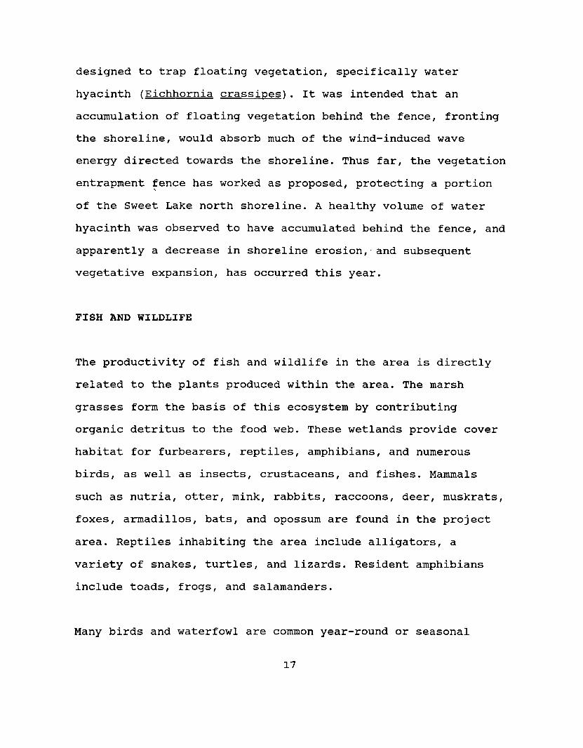
designed to trap floating vegetation, specifically water
hyacinth (Eichhornia crassi2es). It was intended that an
frontingaccumulation of floating vegetation behind the fence,
the shoreline, would absorb much of the wind-induced wave
energy directed towards the shoreline. Thus far, the vegetation
entrapment fence has worked as proposed, protecting a portion,
of the Sweet Lake north shoreline. A healthy volume of water
hyacinth was observed to have accumulated behind the fence, and
apparently a decrease in shoreline erosion,' and subsequent
vegetative expansion, has occurred this year.
FISH AND WILDLIFE
The productivity of fish and wildlife in the area is directly
related to the plants produced within the area. The marsh
grasses form the basis of this ecosystem by contributing
organic detritus to the food web. These wetlands provide cover
habitat for furbearers, reptiles, amphibians, and numerous
birds, as well as insects, crustaceans, and fishes. Mammals
such as nutria, otter, mink,
rabbits,raccoons,
deer, muskrats,
foxes,
armadillos, bats, and opossum are found in the project
area.
Reptiles inhabiting the area include alligators, a
variety of snakes,
turtles,
and lizards. Resident amphibians
include toads,
frogs,
and salamanders.
Many birds and waterfowl are common year-round or seasonal
17

residents.
Among the birds commonly seen in the area are
cormorants,
herons,
terns,
gulls, pelicans,
swallows,wrens,
Mottled
vultures,
and hawks.
egrets,
white ibis, snow geese,
ducks,
teal, pintail, American wigeon, mallards, and gadwall
represent the waterfowl that congregate in the marshes during
the winter.
Although
there are no known endangered species that inhabit
marshes surrounding Sweet Lake, a few species migrate through
These include the peregrine falconthe area periodically.
(Falco I2ereQrinus), bald eagle (Haliaeetus leucocephalus),
(u.s.
Fish and wildlife Service, 1992) .red wolf (Canis rufus)
Many finfish and shellfish are permanent or transient
inhabitants
of these marshes. Many species utilize these
feeding onhabitats for nursery areas and spawning grounds,
abundant food sources, and then move to the more saline waters
of the Gulf of Mexico for maturation and mating. Finfish found
catfish,tarpon,
eels, carp,in these areas include bass, gars,
Crabs,
shrimp,
perch,
and mullet.
clams,
and oysters comprise
the economically important shellfish which spend all or parts
of
their lives in the Sweet Lake marshes.
18

ALTERNATIVE SOLUTIONS
A number of coastal erosion control alternatives have been
considered that would protect and enhance the wetlands
bordering Sweet Lake. Restoration of the bankline between Sweet
Lake and the GIWW, as proposed in the CWCRP, was the primary
alternative for consideration. In the course of the field
it became evident to us that the intentinvestigation however,
of the Sweet Lake Bank Restoration project, as described in the
CWCRP, may not have been the original motive for the project.
Conversations with SCS and Amoco Corporation personnel indicate
the original motive for the Sweet Lake project may have been to
protect the barrier between the GIWW and Blind Lake from wave
energy induced by northerly winds. As the Blind Lake breakwater
restoration of the banklineproject has remedied that problem,
between Sweet Lake and the GIWW may be a redundant operation.
Nevertheless, this operation as well as other, more direct
methods of shoreline stabilization were examined as
alternatives to protecting the north Sweet Lake shoreline from
continued erosion
SWEET LAKE / GIWW BANK RESTORATION
Although
reconstruction of the bank at the south shore of Sweet
Lake would do little to protect the eroding north shore of
it would reduce theSweet Lake from wind-induced wave energy,
19

inflow of more turbid water from the GIWW into the lake. A
reduction in turbidity would create conditions more favorable
to aquatic plant growth. Submergent vegetation would dissipate
wave energy and reduce shoreline erosion along the Sweet Lake
shoreline.
RIP RAP BREAKWATER
Because of the success of the Blind Lake project,
similar
construction of a rip rap breakwater structure was considered
as an alternative method of reconstructing the bank between
Sweet Lake and the GIWW. The project site generally has the
same soil characteristics and water depths as did the Blind
Lake project site. The project design consisted of placing
limestone rip rap (LA DOTD specifications or:. "Heavy Deposited"
rip rap, # 711.02 [c] upon a six-inch bedding layer of shell
over
filter cloth. The breakwater crest width and height are 1
foot and +2 feet MSL, respectively, with 1 vertical on 2
horizontal side slopes. The design cross section is assumed to
be the same for restoration of the Sweet Lake/GIWW bankline
The project length may vary. Figure 10 shows three former
banklines within the project site boundary that may be
restored.
site A, the largest breach,
is
approximately 4600
feet long with two small remnant islands remaining along it
Costs of restoring this site with a limestone breakwater like
that of the Blind Lake project are estimated at $450,000. site
20
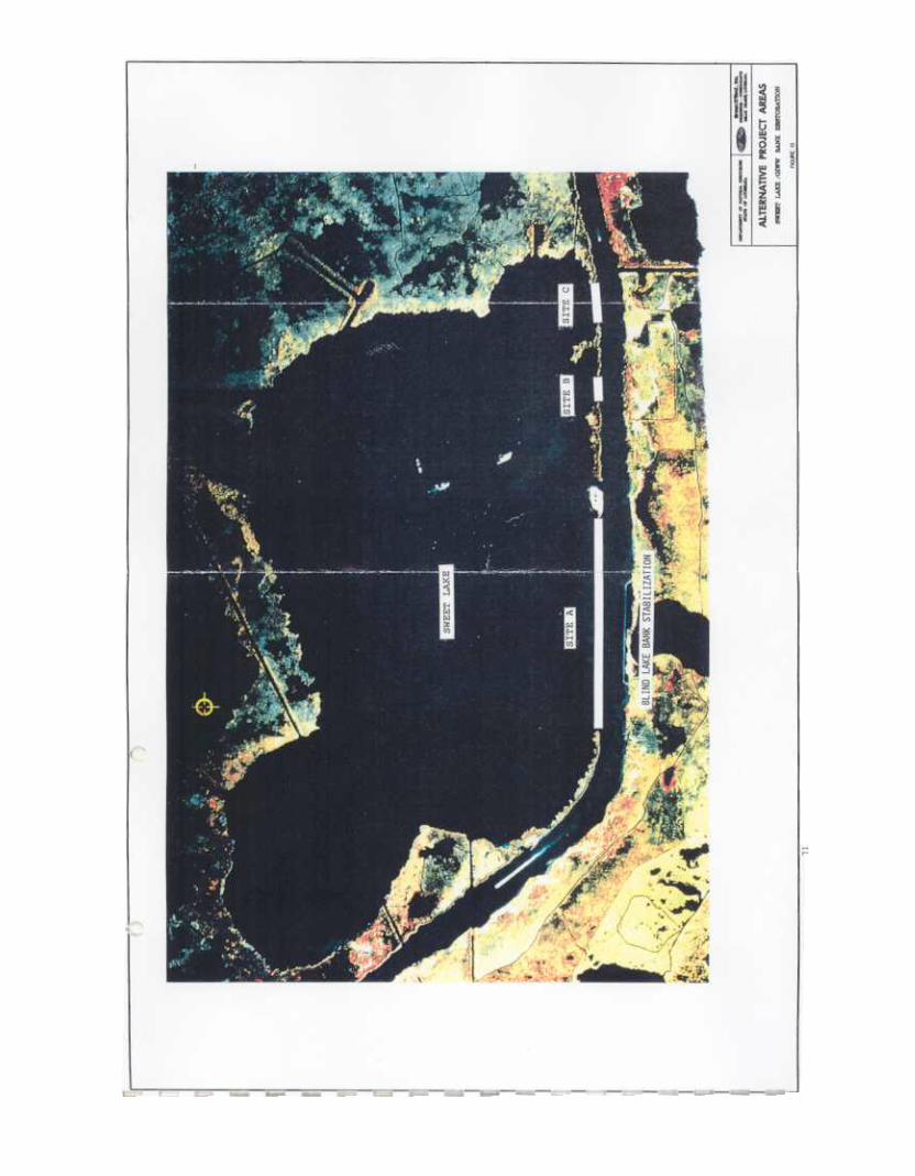

B, a 400 foot breach, could be restored for approximately
the easternmost breach along the south Sweet
$30,000.
site C,
is approximately 600 feet wide and can beLake shoreline,
restored for an estimated $45,000. Implementation of this
alternative would require that detailed geotechnical and
hydrographic
survey data be acquired. To restore the entire"
Sweet Lake/GIWW bank with the same type of breakwater system as
the cost would approximately be $525,000.used at Blind lake,
DREDGE MATERIAL
The GIWW is a unique waterway in that it is a self- maintaining
channel.
Minimal dredging is required to maintain its 12 foot
deep by 125 foot wide minimum dimensions. The Sweet Lake
located'between mile 202 and 205, lies within the
project,
Mermentau River -Calcasieu River section of the GIWW. This
section was last dredged between September 1982 and January
1983,
when 3,200,000 cubic yards of material were removed and
placed in unconfined disposal areas (U.S. Army Corps of
Engineers,
(Appendix A). In an effort to ensure adequate1992)
disposal areas for dredge material removed during routine
maintenance of the GIWW for the next twenty years, the New
Orleans District of the COE has evaluated the existing disposal
plan and possible alternatives. The caE realizes there are many
like Sweet Lake, that areareas throughout the GIWW,
experiencing substantial erosion. Yet, the channel adjacent to
22

these areas does not require maintenance. The caE is not
authorized to use project funds to repair these areas; thus
other means will be needed to make such repairs provided the
local sponsor is unable to do so
Although the CaE currently has no plans to dredge the GIWW in
it may be possible to dredgethe vicinity of Sweet Lake,
material from the waterway or lakeside of the former bankline
using a private cutterhead dredge. Earthen terracing could be
constructed along the Sweet L~ke south shoreline in much the
same manner as would the rip rap breakwater mentioned above
suitable dimensions of the terrace would be a crest elevation
of +3 feet MSL, crest width of 5 feet, and 1 vertical on 4
horizontal side slopes. Assuming 50 percent settlement,
approximately 7 cubic yards of material would be required for
each linear foot of terrace (Figure 11). Costs of constructing
sites A, B, and C are estimated at $79,000, $ 7,000, and
$11,000,
respectively. Restoration of the entire Sweet Lake
To stabilizesouth bankline would cost an estimated $97,000.
the terracing, vegetative planting of giant cutgrass
Transplanting this(Zizanio2sis miliaceae) should be done.
species within the project area is estimated to cost $1.00 per
iflinear
foot of plantings. As with the rip rap breakwater,
this
plan was implemented, detailed soils information along
with hydrographic survey information would be required before
final cross section and quantities could be developed
involving placement of additionalMaintenance of the terraces,
23

I. '..~.~.~'"II. II. II. II. 'I. '.
.~.~.~.~.~.11.11.11.11.11~+i~.~.~+~.~.+ II. II. 11 + II. II.~+~+~.~.
.II. II + II. II+~+~+~+.
.II + II. II.~.~+I, + II. II"' .+
~11 ~ I.I.
~IIIIIIII~
~~ ~-J ~I- r ~~ (C}-I I ~ (.:I
VI T II T
II"
IIIIIIIIIII'J
"1 ~.I~ 1.+
II. II. 11.~.~+
+ II. II. 11+~+~.~+'
.II + II. II. ,I.~.~+~.~+
.II. II + II. II. II~.~.~+~.~.I' + II. II + II + II. ..
.~+~+~.~.~.#'I .II + I' + ,I. II + o'.~.~+~':"
" .'
.
.
.
-24
I-ZW~W-Il-I-WVI
Wa:0LLWID
WU~ .a: ~a: .w ~I- -=
d
I-ZW~W..Jl-I-WV1
a:Wl-LL.oct
WUocta:a:w
I-
w~oCt..J
I-WW~VI
I
I"---f;,I\-
'JV\\I
t;..1
.J..:2
~
\,1
I
!!:!
j,)
!!:!
!!:!
(:)N
1
z0~U1&1cn
~I-
Z
~Ii1'1IIi,IilIs~~
;1~
z~ 0u ~
= §~ ~
~ ~X "-
~ ~~ I
-~.iLl

dredge material, would be required approximately every five to
ten years, depending upon subsidence, including settlement due
to placement on terrace material, and erosion rates
STABILIZATION OF NORTHERN SWEET LAKE SHORELINE
To address the severe erosion problem along the north shoreline
of
Sweet Lake, a number of other shoreline protection
alternatives
should be considered.
WIRE MESH FENCING
To promote vegetative expansion and protect a portion of the
northern Sweet Lake shoreline, a fence has been installed along
approximately 2000 feet of the shoreline, ranging 20 to 50 feet
The steel wire fence installed in the summer of 1991
offshore.
by SCS and Amoco corporation personnel was designed to
floating vegetation, specifically water hyacinth (Eichhornia
crassiQes) . It was intended that an accumulation of floating
fronting the shoreline, wouldvegetation behind the fence,
absorb much of the wind-induced wave energy directed towards
the fence, although already beginningthe shoreline.
Thus
far,
to rust, has worked well, protecting approximately 2000 feet of
Sweet Lake north shoreline. At approximately $5.00 per linear
foot installed, the vegetation entrapment fence offers an
economical solution to shoreline protection. To install a fence
25

along approximately 11,000 feet of severely eroding north
northwest Sweet Lake shoreline, would cost approximately
$55,000.
Judging from the rapid rate of corrosion incurred by
the fence installed in 1991, the estimated life span of such a
project is five years. Galvanized fencing could possibly
increase the useful life of the project, at about twice the
cost of the standard steel fencing. Because the fencing itself
is not a wave absorbing mechanism, it requires that floating
vegetation be accumulated in its lee. Becaus.e water hyacinth,
the target species, is prevalent only during the summer months,
the protection afforded by the vegetative entrapment fence
during other parts of the year would be minimal. However, over
time deposition of sediment in suspension and detritus from the
trapped floating plants will accumulate and offer some
fortification against wave energy. However, consideration
should be given to the affect a deteriorating wire mesh fence
would have on wildlife and water quality
BRUSH FENCING
Brush fencing has been used for many wetland conservation
projects
within the Louisiana coastal zone. Its primary
applications
have been in shallow, low energy nearshore
environments;
however, it has been installed in some medium to
high energy environments. At Fontainebleau state Park, on
north shore of Lake Ponchartrain, an investigation was
26

conducted by the u.s. Army Corps of Engineers under the
Shoreline Erosion Control Demonstration Program (Section 54)
Results indicated brush fencing mechanisms to be only a
moderately to poorly effective shoreline protection method for
moderate to high energy shorelines. However, in areas with
lower wave energies such as marsh ponds, and small lakes, brush,
fencing has been successfully used. One form of brush fencing,
Christmas tree fencing, has been constructed recently in many
coastal parishes, and have shown good results. Brush fencing,
constructed along the northern shoreline of Sweet Lake, a
to moderate wave energy shoreline, would dissipate wave energy
and promote sediment deposition. To withstand the two to three
foot waves occasionally experienced here, the fencing would be
constructed using three rows of 4-inch diameter fence posts
(Figure 12). The' three rows would be spaced three feet apart
and the longitudinal spacing would be four feet. The area
between the fence post would be filled with 2-inch to 6-inch
diameter brush cut in lengths no shorter than eight feet
brush would be placed in-line with the fence. The fence post
would be connected together using timber stringers.
A disadvantage often associated with brush fencing projects has
been the lack of a readily available source of brush. Recent
conversations with Lake Charles Public Works personnel indicate
smaller
trees are harvested annually by landowners, especially
in Cameron and neighboring parishes.
Yearly,
thein spring,
27

.~
z~~~A.
Gz0..J
gI/)l-I/)0Q.
&
t
28
'"
(V)Q:UJ<.:>z~l-V)
V><
N
"""
:I:: V)
00::)It:
amI- ., oc(NO
~
v
.
~.
-,T
~
a:
~ ~v III
>v)...~Zz0~II.
1: : --Z I-- ~ 0 .-
~ tj.-1&1
::::j.., cn
~~::i
~p1'1II~
I,
I~I!
~
~~
~ i~ ~
~ i~ "-= ~
I
~LIJ~~2...
"""'.."" ~.,I 4 ,'. I' 4 II. II 4 II. ,I 4 ,'. I' 4 II. I' 4 II. ,I 4 II. I'
I...~ ..1.. ,I.. .~4 .1.. .,; ".. .'.4 .1.. .~4 ,I.. .,.4'".. ,~4 .1.. .1;
'. .,I 4 II. I' 4 ,I. ,I 4 ,I. I' 4 I'. I' 4 ,I. II 4 II. ,'4 "
' '
t .1; .1.. ".. ,I.. .1; .I~. ".. .1... .1.4 ,I.. .1.. .'.. ."" .1".".".".'.I' 4 I'. ,'4 I'. II 4 II. ,I 4 ,'. I' 4 ,I. II 4 II. II 4 I!I
~ t .1.4 ,I.. .~4 .1.. .'.4 ".. ,I; .1... .1.4 .1... .1.4 .'..' ,~4 ,I
...4 .II 4 11. I' 4 II. I' 4 ,I. ,I 4 I'. 11 4 II. I' 4 ,I + II 4 i
4 ,
..1.4 ".. .~4 ,I.. .1.4 ".. .1.4 .'..' .'.4 ,I.. ,1.4 .~+ .'.4.,'. .+ +... .'.,I 4 II. ,'4 II. ,I 4 I'. I' 4 II. I' 4 ,I. ,I 4 II. ,I 4 ,"
4+ , ,
.14 I .,. , .I. , .,. I .14 I. 1 4 ,. ,. I~ ...~ 'I. ' ..
.,I 4 ,'. ,'4 I'. I' 4 II + ,I 4 I'. I' 4 II. II 4 I'. I' 4 r II .
4 . ~ ...'.4 4 .
4 .~ ,I.. .~ .1.. .1.4 .,~+ .1; .1.. .1.4 .~. .1.4 ,~. .~. .1.. ".. :.,I 4 II. I' 4 ,I. ,I 4 ,I. I' 4 I'. II 4 ,I. I' 4 ,I. ,I 4 ,'. ,I 4
4 4 ~ ~.tJ~.~..;
..1; .~. ".. .1.. .1.4 ".. .,; .1... .1~4 .1... ,1..4 .1~1.4 .14 .!JI4. I~ t..\.,'41'.,'4 II. 114 ,1+,14 II. 1'41'. 114 ,1~'4 1'41141
4.~.~. ~.~ .~...~.~. ~.~. ~.'~..~. ~I
: .I~. ".. .1.4 ,I~. .I~. .,~. .I~. .I~. .'.4 .1... .,~. ., V)'~4 " 4 4 ,I;!I~ ., I
.114 II. 1'4 ,I. ,14 ,I. 114 II. 1'4 ,I. ,14 11..-'4 1".,4.4. ~... ..~ .~. ~ .~..~ ..~.',
: ,1.4 .~. .'.4 .1... .1... .1... .'.. .1.. .1.4 .1... ,1~4 .1 z ,.4 .'j II.
IL&J"." Ii
.,141'.1,41'.114,1+,14".,,411.1141,=,4'.+1'~ ~ ~.'-J.~...,
..,..4 ,I.. .~4 ,I... ,Ij .1... .1..4 ,I.. .1.4 .'.. .,.4 ,"'-1..4 .'..' JI4 ,I4.".".".".".".".".".".".1~ '.,14,'.,'4,1.,14,1.1'41'.114,1.,'4,1.14,'.".,1'...4~ ~.~...~.~.~.~.\~~.~...'
.14 I. ,4 I. 14 I .,4 I .14 I. 1 4 I. 1 4 I. 1 4 I.4 .~ ~ ...~ .~ '. .~ '.. .II 4 I' + I' 4 I'. II 4 I'. ,I 4 I'. I' 4 I'. II 4 ,'. ,I 4 I'. I' 4 I'.
~ 4.+ ~. .~4 ,I.. .~4 .,~. .1.4 ".+ ,I; .1.. ,1.4.1... ,'.4 .'..' "..4 .'.. .,.4 .1...
.II 4 I'. I' 4 II. I'. ,I. ,I 4 ,'. II 4 II. ,'4 II. ,I 4 II. II 4 ,I.
~ ~
...'~4 .1.. .~4 ,~. .1; ".. .1; .1.. .1.4 ,1..+ .1~4 ,1... .1~4 .1... ,I... ,I..."4"."
.I' 4 II. I' 4 II. ,I 4 ,I. I' 4 II. II 4 ,I. II 4 II. 11 4 ,'. ,'4 ,I.
~...~.~ ~...~.~ ~.~.~
...1.4 .1.. .'.4 .1.. .1~4 .,~. .,~. .1.. .1.4 .'.. .1.4 .'..' .,..4 .1... .,..4 .1...4 .,I 4 I'. ,'4 I'. II 4 ,I + ,I 4 I'. I' 4 I'. I' 4 ,I. ,I 4 I'. II 4 ,I.
~ ~.~..M.
.'~4 ,I.. .~. .I~. .'J .,~+ .1.4 .1.. .'.4 ,I~. .I~. .1... ,1.4 .1... .1.4 .1.
.,4 ,4.A .~.I ,".1
\l~

Public Works Department collects and incinerates up to 160,000
cubic yards of wood combustible products, much of which is in
the form of smaller cut trees. Because the Public Works
Department only collects up to 4 inch- diameter by 4 foot-long
brush,thicker,
and longer brush could be available for
collection from landowners.,
It is estimated that 11,000 linear feet of brush fencing could
adequately protect the marsh within the proj.ect area.
Transportation of brush would be necessary from the Department
of Public Works incinerator in Lake Charles approximately 40
miles to the project area. Shallow draft skiffs could be used
to ferry the brush to the actual project site within the marsh.
it is
transportation,
and labor considered,with materials,
estimated that brush fencing for this project would cost $15.00
per linear foot installed. The total estimated cost of 11,000
feet of brush fencing installed along the project shoreline is
The useful life span of such a fencing system is
$165,000.
dependant upon a number of factors. Soil conditions, size and
quality of construction, and storm activitytype of brush used,
will all influence the brush fences capacity to withstand and
dissipate wave forces. Project maintenance would be required
approximately everyone to five years, and include replacement
of
deteriorated brush as well as reinforcement or replacement
of
any framework. In five years, approximate costs of
maintenance would be $15.00 per linear foot of brush fence.
29
CONCLUSION AND RECOMMENDATIONS
stabilization of the barrier bankline between the GIWW and
Blind Lake, which reportedly was the original intention of the
Sweet Lake/GIWW bank restoration, was accomplished by the Blind
Lake project in 1989."'
The results of this feasibility study
indicate the suggested Sweet Lake/GIWW bank restoration
alternative does not completely address the more severe problem
of shoreline erosion along the northern Sweet Lake shoreline.
The recommended alternative is a more direct stabilization
method involving construction of brush fencing along 11,000
linear feet of north and northwest Sweet Lake shoreline.
Implementation of this alternative will allow much of the
unstable,
deteriorating marsh to stabilize LY dissipating wave
energy and promoting sediment deposition. The estimated first
cost for this project is $165,000. Maintenance will be required
approximately everyone to five years, and include replacement
of deteriorating brush as well as reinforcement of any timber
framework.
In five years maintenance costs should be
approximately $15.00 per linear foot of b~ush fence.
30
REFERENCES
DeLany (1988) Cameron-Creole Watershed Manaaement PreliminaryReport, Sabine National wildlife Refuge
DeLany,
Klett, Young, Callahan, Marcon (1991:Watershed Manaqement 1988 Throuqh 1990
Cameron-Creole
DeLany,
(1992) Freshwater Introduction and Welfare Bridqe WaterControl structures Report for 1991. Miami Corporation
u.s. Fish and wildlife Serv~ce.National wildlife Refuge
(1991
wildl.ife of the Sabine
Penland S., Ramsey K., (1990) Relative Sea-Level Rise inLouisiana and the Gulf of Mexico: 1908-1988
Dunbar J.B., Britsch L.D., Kemp III E.B. (1992) Land LossRates. Report 3. Louisiana Coastal Plain. Department of theArmy,
Waterways Experiment Station, Corps of EngineersVicksburg, Mississippi
LA Department of Natural Resources (1992) Intracoastal WaterwayBank Stabilization and Cutcrrass Plantincr proiect at Blind Lake.Office of Coastal Restoration and Management, CoastalRestoration Division, Biological Analysis section.
u.s.
Army Corps of Engineers (1992), The Gulf IntracoastalWaterway Proposed Lonq Term Disposal Plan
31

APPENDIX
32
U.S ARMY CORPS OF ENGINEERS
NEW ORLEANS DISTRICT
THE GULF INTRACOASTAL WATERWAY
PROPOSED LONG TERM DISPOSAL PLAN

THE GULF INTRACOASTAL WATERWAY
PROPOSED LONG TERM DISPOSAL PLAN
I. fgEfQ~g~ In an effort to ensure adequate disposalareas for dredged material removed during routine maintenanceof the Gulf Intracoastal Waterway (GIWW) for the next twentyyears, the New Orleans District evaluated the existingdisposal plan and possible alternatives.
II. Qg~gQ!lyg~ To develop a more environmentallyacceptable plan at a reduced, comparable, or justifiablyincreased cost. The goal is a long term disposal planincorporating beneficial use of the dredged material to themaximum extent practicable.
III. ~Qg~-QgQg~_M;M§gg§~ A work group was formed ofDistrict personnel familiar with past and present dredgingrequirements and environmental effects of dredging the GIWW.Members of the group include:
Mr.
John Flanagan, Project Manager, 0 & R DivisionDr. Linda Glenboski, Environmental Resource
Specialist, 0 & R DivisionMr. Rick Broussard, Supvr. Civil Engr., Engr. DivisionMr. Larry Hartzog, Fisheries Biologist, PlanningDivision. '
IV. ~BQ~gQT_~gTBQBl~~TlQN~ River and Harbor Act of 24 July1945, Senate Document 242, 79th Congress, 2nd Session, andprior R & H Acts, provide for a waterway 384.1 miles long, 12feet deep and 125 feet wide at mean low gulf from Lake BorgneLight No. 29 (formerly No. 41), near the mouth of the Rigoletsto the Sabine River, Louisiana and Texas, except in thesection between Lake Borgne Light No. 29 and New Orleans (33.1miles long via land cut through the marsh and the IndustrialCanal), where a width of 150 feet is provided. An alternateroute 40.5 miles long, 9 feet deep by 100 feet wide betweenLake Borgne Light No. 29 and New Orleans via Rigolets, LakePontchartrain, and Industrial Canal, an alternate connectionwith the Mississippi River below Algiers approximately 9 mileslong, 12 feet deep and 125 feet wide with a lock (AlgiersLock) at the river end; an alter,nate route 12 feet deep and125 feet wide from Morgan City, 'Louisiana to Port Allen,Louisiana via the East Atchafalaya Basin Protection LeveeBorrow Pit, Bayou Sorrel Lock, Lower Grand River and BayouPlaquemine to Indian Village thence via Bayou Grosse Tete andnew land cut to the Mississippi River passing through aterminal lock in levee at Port Allen opposite Baton Rouge; a

channel 9 feet deep and 100 feet wide from Indian Village viaBayou Plaquemine to Plaquemine, Louisiana, improvement ofFranklin Canal as a connecting channel from GIWW (mile 121) toFranklin, Louisiana, 8 feet deep by 60 feet wide, with itsupper 300 feet IJ.aving a width of 100 feet. The constructionof a lock at Harvey, Louisiana (Harvey Lock), a saltwaterguard lock (Leland Bowman Lock) in the waterway at mile 182.8west of Harvey Lock, a saltwater guard lock (Calcasieu Lock)in the waterway at mile 238.5 west of Harvey Lock, and a lockat mile 93.5' (Bayou Boeuf Lock) west of Harvey Lock,constructed under the existing project "Flood Control,Mississippi River and Tributaries". The project also providesfor the following: widening of bends, passing places, mooringbasins, such as railroad and highway bridges over artificialcuts as are necessary; purchase of pipeline dredge;construction and operation of new drainage canals and pumpingfacilities to restore parish drainage systems whereintercepted; construction of a double leaf bascule four-lanehighway bridge with approaches at Louisiana State Highway No.47; construction of movable bridges at M.P.R.R. and LouisianaState Highway Nos. 23 and 406; fixed trestle bridges forcrossing of proposed landside drainage canals, lift bridges atLouisiana State Highway No.1 at Port Allen, Louisiana, T&PR.R. at Port Allen, Louisiana, T&P R.R. at Morley, Louisiana;construction of bulkheads and jetties at Lake Borgne and ChefMenteur, Louisiana, if found necessary, and for annualpayments to the Board of Commissioners of the Port of NewOrleans for use of a portion of the Inner Harbor NavigationCanal and Lock. The length of waterway within the U.S. ArmyEngineer District, New Orleans, is 384.1 miles via thenorthernly or Port Allen route and 299.4 miles via thesouthernly or Harvey Canal route.
v. EI§!QgX~ The GIWW is a unique waterway in that it is aself-maintaining channel. The historical data is very limiteddue to its self-maintaining characteristic. Enclosure 1 showsthe Dist~ict's bound~ies ~elative to the GIWW. The GIWW isdivided into seven ~eaches and a~e as follows:
DISTANCE36.4 Miles95.5 Miles63.6 Miles42.7 Miles37.1 Miles27.1 Miles64.1 Miles
REACHA. New Orleans-RigoletsB. Miss. River-Atch. RiverC.
Atch. River-Vermilion River'D. Vermilion River-Mermentau River
E. Mermentau River-Calcasieu RiverF. Calcasieu River-Sabine RiverG.
Port Allen-Morgan City (Alternate Route

VI.
DREDGING HISTORY. (last 20 years)REACH DISPOSAL-- QUANTITY COMMENCED COMPLETEDGIWW 11.3 Confined 1,360,000 "Jun 72 Nov 72to 235.2(NC)Atch-Verm Confined 1,800,000 Oct 74 -
145.9-174.9(NC)Miss-Atch Confined 3,500,000 Jul78 '-19 .3 -57 (NC)
Verm-Merm ,Unconfined 3,800,000 Oct 81 '-164.9-201.6(NC)Merm-Calc Unconfined 3,200,000 Sep 82202.6-237.-.9 (NC)
Atch-Verm Unconfined 3,200,000 Mar 85 J100-158(NC)Atch-Verm Unconfined sta to sta Feb 87r08.9-160.3(NC)* This contract was terminated for convenience of theGovernment.
The work was complete via the FY 87 contract
Jan
75
Apr 79
Apr
82
Jan
83
N'ov 85*
Jun
87
VII.
CURRENT DISPOSAL PLAN. Prior to 1987, all dredgedmaterial-;~s-pl~~;d-i~-~~~fi~ed disposal areas. In 1987 webegan to create and nourish marsh by disposing in unconfinedareas.
VIII.
bQ~Q_TgEM_Ql§~Q§~b_~b~~_lbTQ~l~ The Soils ConservationService (SCS) participated in a study to determine areasthroughout the entire GIWW that require attention, i.e. bankstabilization, wetland creation, and marsh nourishment.
If there is a need to dredge in any particular reach we feelthat enough areas exist to utilize the dredged materialbeneficially. Bank stabilization could be performed withoutthe use of rip-rap in given areas with the use of bucketdredges.
Creation and nourishment of wetlands can beperformed with hydraulic cutterhead dredges. There are areasthroughout the GIWW that are experiencing substantial erosion,consequently, freshwater marsh is lost, yet the channeladjacent to these areas does not require maintenance. TheCorps of Engineers is not authorized to use project funds torepair these areas. Therefore, for example, if an erodedbankline does not fall in the general area of dredging,another means of authority will be needed to make such repairsprovided the local sponsor is unable to do so. These areasmay qualify for assistance under other programs such as theCoastal Wetlands Planning and Restoration Act or Section 1135.
IX.
CONCLUSION. Theoretically, this is a 20 year disposalplan, h~~;~;;~-th~t doesn't mean that this entire waterwaywill be dredged during that 20 year period.

We believe that this proposal which plans to fill old pipelinecanals, restore eroded banklines, create wetlands, and nourishmarsh is the most economical plan that meets the federalstandard. Tne reason for this is due to SCS's .hot spots.which are located within our disposal areas, subsequently,there will be no need to procure additional rights-of-way.
NOTE:
Aerials of the project will be presented at the meetingindicating the Corps disposal areas.