cambodian source model - un escap · a rainfall-runoff model converts rainfall into surface runoff...
TRANSCRIPT

Speaker: David Hehir
Cambodian Source Model
• What is Source + demo
• Source + geographic data + demo
• Cambodian Source model + demo
• Source + Datacube
Overview

eWater SolutionsNot for profit, Australian Government owned organisation

eWater Solutions• Primary role to support the implementation and use of
eWater Source
• Tools, technical support, capacity building
• ~30 staff – engineers, scientists, software developers, admin

eWater Source provides decision-support for water system planning and operations
A ‘catchment to estuary’ modelling capability:
Allows implementation of complex policy & operational rules within the hydrological models
What is Source?
• water quantity and quality
• ecosystem health
• Reservoirs and water use
• urban and rural catchments.

To encourage consistency in application – community of practice
Transparent - documentation of algorithm and methods
Defensible - best practice modelling approaches
Robust - rigorous software development and testing process
Flexible - customisable for specific water management situations
Source Goals

Catchment Processes (Geographic Scenarios only)
• Rainfall-runoff models
• Constituent generation and filtering
Source Capabilities
River or stream processes
• Routing – how water moves through a river
• Nodes for physical & management processes
• Constituent movement – lumped or marker

Source Capabilities – cont.River regulation
• Reservoirs and storages
• Hydropower generation
• Operation to target levels
Water use and demand
• General purpose demand
o E.g. Time series
• Tailored demand models for:
o Environmental requirements
o Crop requirements
o Urban demand models

Source Conceptual Framework
• Links – model the transport water/constituents through the system
• Nodes - represent points where hydrologic processes occur and management rules are applied

Creating Source ModelsTwo methods of creating Source models:
1. Creating catchments from spatial data
• Used for rainfall-runoff modelling
• Can add other network elements

Creating Source Models - Continued2. Draw the network manually
• Catchments are not created, so method cannot be used for rainfall-runoff modelling
• Typically used in regulated and urban systems

Creating Source Models - Continued3. Scenarios can be linked
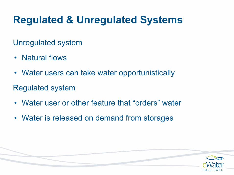
Regulated & Unregulated Systems
Unregulated system
• Natural flows
• Water users can take water opportunistically
Regulated system
• Water user or other feature that “orders” water
• Water is released on demand from storages
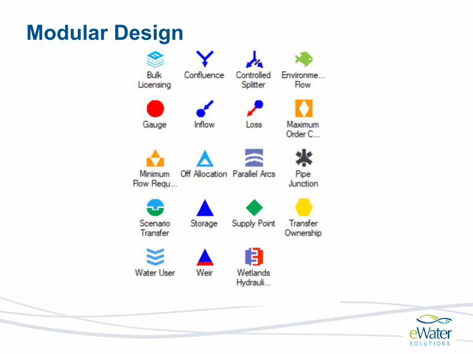
Modular Design

Modular Design

Most elements offer a range of alternative models at varying levels of complexity
Modular Design
• Water User Node – implements 5 different water user types
• 7 different rainfall runoff models

Water Access RulesOption 1 Simple Rules: Use expression editor and the minimum flow requirement functionality to reflect flow, supply or storage priorities
Option 2 Share based on broad allocation of resources: Use the ‘resource assessment’ functionality to allocate available resources to different users e.g. on a seasonal basis
Option 3 Ownership: Track water ownership and assign owner priorities

Tools for Customising Source
Functions – user-defined logic
• Define equations, operational rules, results analysis
300*sin((($now.dayofyear)/366*pi()))+50
Plugins – extensions to the Source framework, e.g.:
• Custom rainfall-runoff models
• HEC-RAS

Tools for Optimisation and AnalysisTime series graphing and analysis via the Results Manager
Exeedance
Difference
Scatter
Histogram

Tools for Optimisation & Analysis – cont.Catchment calibration tool
Multi-objective optimisation (Insight) – evaluates trade-offs between competing objectives
Pareto Optimal Front

Tools for Automation, Integration & PerformanceCommand line interface
• Run and edit Source models via the command line
• Batch processing
• Allows integration with other systems
Tools for managing & editing large models
• Bulk configuration of model elements (Feature Editor), import & export settings
Performance
• Parallelisation, Source on the cloud

Source Applications
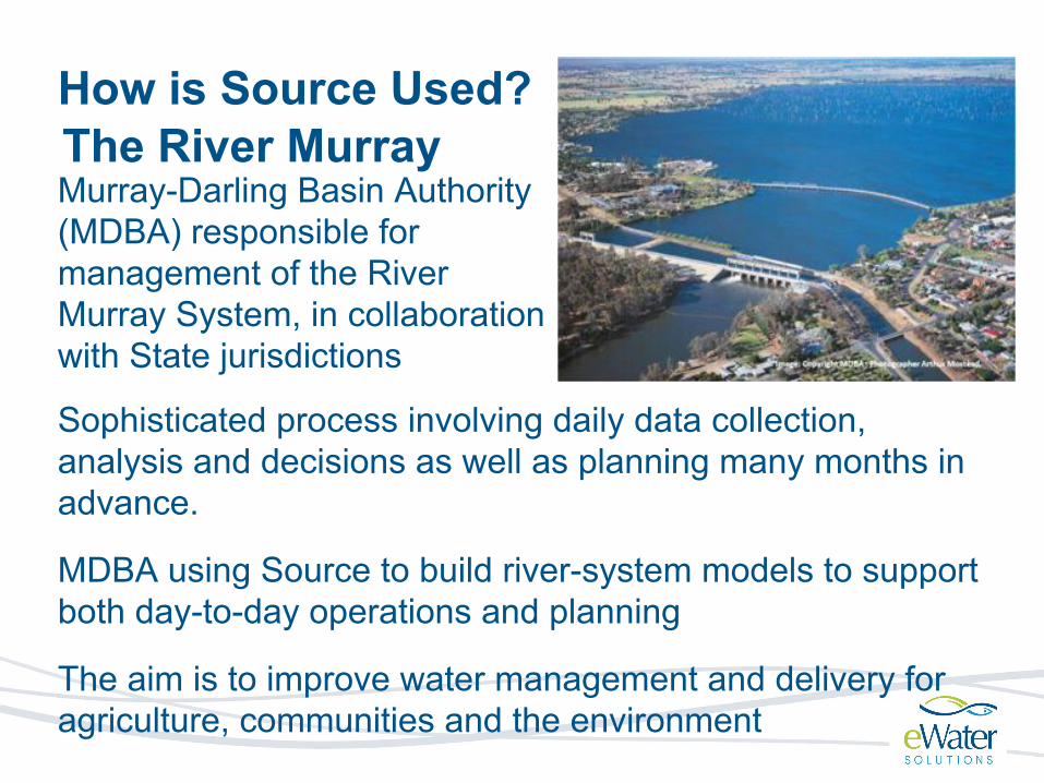
How is Source Used?The River Murray Murray-Darling Basin Authority (MDBA) responsible for management of the River Murray System, in collaboration with State jurisdictions
Sophisticated process involving daily data collection, analysis and decisions as well as planning many months in advance.
MDBA using Source to build river-system models to support both day-to-day operations and planning
The aim is to improve water management and delivery for agriculture, communities and the environment

Great Barrier Reef (GBR)Partners: QLD Gov, CSIRO, GBR Marine Park Authority
Declining water quality in the catchments near the GBR has been identified as a national priority and threat to the reef
Source catchment and water quality models used to:
• Identify pollutant sources
• Evaluate progress
Significant plugin development – Dynamic SedNet framework

The Mekong is a trans-boundary river in Southeast Asia
Rapidly growing economies and populations
Two Source projects:
• Procedures for Water Use Monitoring (PWUM)
• MRC Council Study
Mekong River Basin
China
Myanmar
Thailand
Laos
CambodiaVietNam
Mekong
Basin area795,000 km2

Source integrates:
Aim: ensure that the use of the water resource is reasonable and equitable across the Member Countries of the Mekong River Basin
Modelling to understand water availability and use
Procedures for Water Use Monitoring (PWUM)
Storages & flow regulation
Water Users and demands• Hydropower, • Agricultural/ Urban, • Environmental
Rainfall-runoff modelling
Xedon Pilot Project (Laos)

Demo

Catchment models:
• Catchment boundaries
• Links between catchments
• Node types
• Functional units
• Climate data
Source + Geographic Data: Rainfall runoff

• Generation via DEM:
• Source calculates catchment boundaries and links automatically
• some minor configuration allowed
• Generation via shapefiles:
• need to provide your own:
• catchment boundaries and links via shape files
Model Creation using Geographic data

• Generation via DEM:
• Source calculates catchment boundaries and links automatically
• some minor configuration allowed
• Generation via shapefiles:
• need to provide your own:
• catchment boundaries and links via shape files
Model Creation using Geographic data

Data preprocessing
Stitch Tiles Clip to Catchment Project
Fill pitsIdentify key locations
Both methods still require significant preprocessing

Functional Units
Model
Catchment
Functional Unit

Functional units based on:
● Land use - forested, non-forested, snow● Soil type - pervious, impervious● Slope● Climate
Functional Units (FU)

● Allows each catchment to have a different runoff response for each FU
● Each catchment has every functional unit and a configurable area
● Catchment functional unit areas can be defined using rasters
Functional Units (FU)

A rainfall-runoff model converts rainfall into surface runoff (streamflow)
Parameters are variables describing catchment characteristics
• e.g. hill slope, soil water capacity, temperature coefficients(May be statistical or have physical significance)
Rainfall-runoff Models
Model Equations
Time series inputs
e.g. rainfall, temperature/ET
Time series outputs
e.g. streamflow
Parameters

Built-in models are metric/conceptual, spatially lumped, deterministic:
1. GR4J 2. Sacramento3. IHACRES-CMD4. SYMHYD5. SMARG6. Australian Water Balance Model (AWBM)7. Simple Urban Runoff Model (SURM) – used for
functional units with large cities or townsRelatively easy to include custom rainfall-runoff models using plugins.
Rainfall-runoff Models in Source

Metric/empirical model, spatially lumped
2 soil moisture stores
4 parameters
(2 optional parameters for baseflow separation)
GR4J

Conceptual, spatially lumped
5 soil moisture stores
22 parameters total:
• 17 water balance parameters
• 5 unit hydrograph (routing) parameters
Sacramento

● Create model using DEM● Create model using shapefiles● assigning function units● configuring rainfall runoff models
Demo

Cambodian Source Models
Model 1 2 3
Catchments 271 271 31
Function Units 7 1 1
Rainfall Runoff Model
GR4J GR4J GR4J/Sacramento
Possible Use cases
calibration and water balance analysis
model calibration and historical water balance analysis
future water balance forecast
Complexity high medium low

Demo

Cambodian Source Models: RainfallTwo data sources
• Observed Data from Mekong River Commission (MRC), Mekong River Modelling(MRM) and World Meteorological Organization (WMO)
• CHIRPS satellite data

Observed rainfall data
• 61 stations
• 40 with data
• different periods
•

Cambodian Source Models: Rainfall
Bias corrected rainfall data

Integration areas:
● Catchment generation● Climate data
○ historic data○ forecast data
●
Source + Datacube

Accessing SourceSource Public
• Free, publicly available release
• Limited to models with 20 nodes
Source Full
• Restricted access
• Full functionality, including advanced features not available in Source Public