calgary–chestermere interface
TRANSCRIPT

In Partnership with:
CALGARY–CHESTERMERE INTERFACEINTERMUNICIPAL DEVELOPMENT PLAN
ii Calgary–Chestermere Interface Intermunicipal Development Plan
Publishing Information
Title: Calgary – Chestermere Interface Intermunicipal Development Plan
Authors: The City of Calgary and The City of Chestermere
Contact: 311
ISC: Protected
SR: 19-0000307
© The City of Calgary, © The City of Chestermere

Calgary–Chestermere Interface Intermunicipal Development Plan iii
Table of ContentsExecutive Summary . . . . . . . . . . . . . . . . . . . . . . . . . . . . . 1
1 . Introduction . . . . . . . . . . . . . . . . . . . . . . . . . . . . . . . . . . 31.1 Plan Area and Attributes . . . . . . . . . . . . . . . . . . . . . . . . . . . . . 4
1.2 Legislative and Policy Framework. . . . . . . . . . . . . . . . . . . . . . 9
1.3 Vision . . . . . . . . . . . . . . . . . . . . . . . . . . . . . . . . . . . . . . . . . . . . 10
1.4 Values and Core Ideas . . . . . . . . . . . . . . . . . . . . . . . . . . . . . . 12
2 . Land Use Concept . . . . . . . . . . . . . . . . . . . . . . . . . . . . 152.1 General Policies . . . . . . . . . . . . . . . . . . . . . . . . . . . . . . . . . . . 17
2.2 Character Area 1: The Nodes . . . . . . . . . . . . . . . . . . . . . . . . 20
2.3 Character Area 2: The Residential Corridors . . . . . . . . . . . 23
2.4 Character Area 3: The Transition . . . . . . . . . . . . . . . . . . . . . 24
3 . Open Space Network . . . . . . . . . . . . . . . . . . . . . . . . . 273.1 Open Space . . . . . . . . . . . . . . . . . . . . . . . . . . . . . . . . . . . . . . . 28
3.2 Natural Features. . . . . . . . . . . . . . . . . . . . . . . . . . . . . . . . . . . 28
3.3 Pathways . . . . . . . . . . . . . . . . . . . . . . . . . . . . . . . . . . . . . . . . . 29
4 . Mobility . . . . . . . . . . . . . . . . . . . . . . . . . . . . . . . . . . . . . 314.1 Interface Street Classification and Character. . . . . . . . . . . 32
4.2 Interface Street Layout . . . . . . . . . . . . . . . . . . . . . . . . . . . . . 32
5 . Streetscape Elements . . . . . . . . . . . . . . . . . . . . . . . . . 35
6 . Intermunicipal Collaboration . . . . . . . . . . . . . . . . . . 396.1 Planning Referral Agreement . . . . . . . . . . . . . . . . . . . . . . . . 40
6.2 Intermunicipal Circulation and Referral Processes . . . . . . 41
6.3 Intermunicipal Conflict Resolution Process . . . . . . . . . . . . 42
6.4 Strategic Intermunicipal Coordination . . . . . . . . . . . . . . . . 43
6.5 Monitoring, Amendments and Repeal of The Plan . . . . . . 45
7 . Interpretation . . . . . . . . . . . . . . . . . . . . . . . . . . . . . . . 477.1 Map Interpretation. . . . . . . . . . . . . . . . . . . . . . . . . . . . . . . . . 48
7.2 Policy Interpretation . . . . . . . . . . . . . . . . . . . . . . . . . . . . . . . 48
7.3 Illustrations and Photo Interpretation . . . . . . . . . . . . . . . . 49
7.4 Appendix Interpretation . . . . . . . . . . . . . . . . . . . . . . . . . . . . 49
7.5 Plan Limitations . . . . . . . . . . . . . . . . . . . . . . . . . . . . . . . . . . . 49
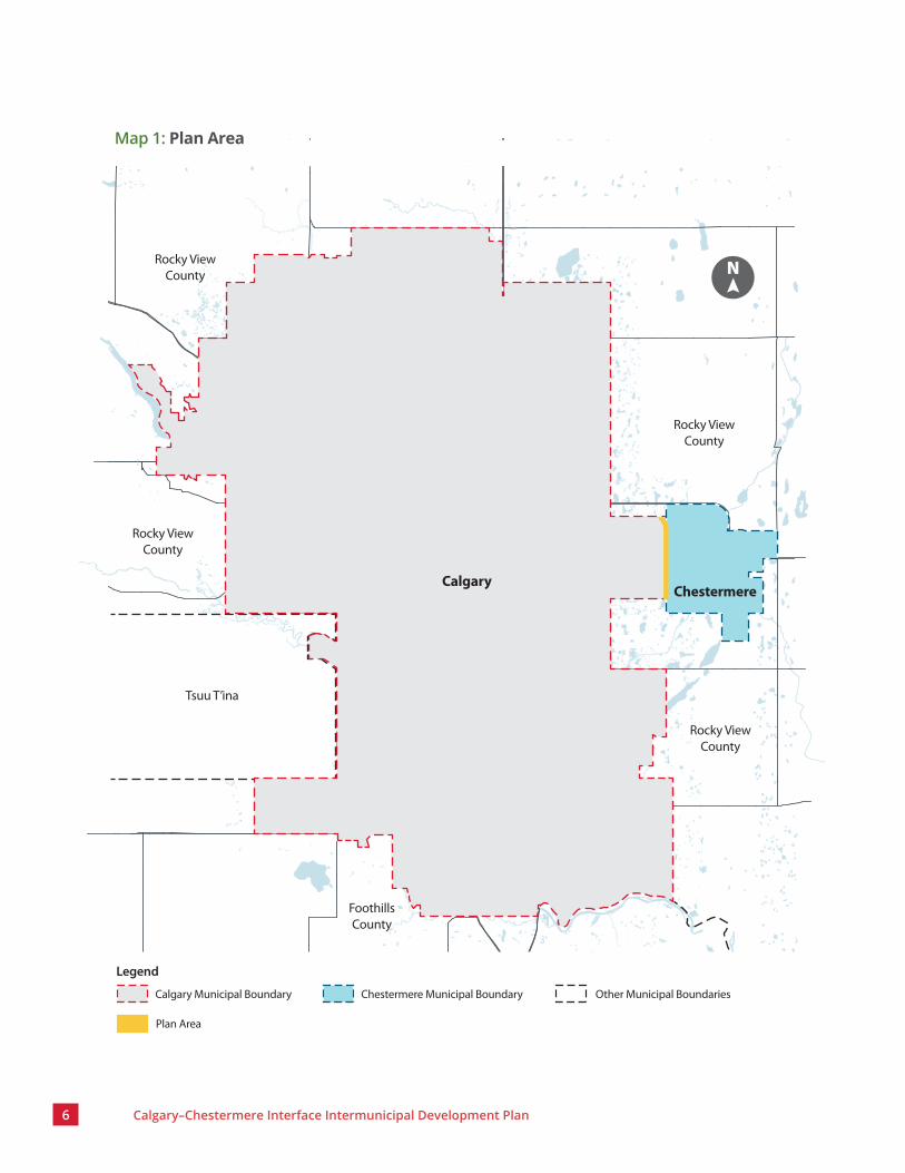
MapsMap 1: Plan Area . . . . . . . . . . . . . . . . . . . . . . . . . . . . . . . . . . . . . . . 6
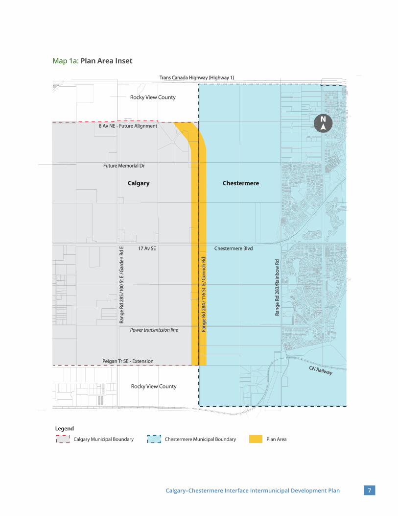
Map 1a: Plan Area Inset . . . . . . . . . . . . . . . . . . . . . . . . . . . . . . . . . 7
Map 2: Land Use Concept . . . . . . . . . . . . . . . . . . . . . . . . . . . . . . 16
Map 3: Character Area 1: The Nodes . . . . . . . . . . . . . . . . . . . . . 20
Map 4: Character Area 2: The Residential Corridor . . . . . . . . . 23
Map 5: Character Area 3: The Transition . . . . . . . . . . . . . . . . . . 24
Map A1: Mobility Corridors – Transit and Active Transportation . . . . . . . . . . . . . . . . . . . . . . . . . . . . . . . . 56
Map A2: Mobility Corridors – Transportation and Trade . . . . 57
Map A3: Transmission Corridors – Energy . . . . . . . . . . . . . . . . 58
Map A4: Transmission Corridors – Water . . . . . . . . . . . . . . . . . 59
Map B1: Location of Major Natural Features . . . . . . . . . . . . . . 61
8 . Definitions . . . . . . . . . . . . . . . . . . . . . . . . . . . . . . . . . . 51
9 . Appendices . . . . . . . . . . . . . . . . . . . . . . . . . . . . . . . . . . 559.1 Appendix A: Regional Corridors . . . . . . . . . . . . . . . . . . . . . . 55
9.2 Appendix B: Location of Major Natural Features . . . . . . . 60
9.3 Appendix C: Interface Street Conceptual Cross Section. . 62
GraphicsGraphic 1: Hierarchy of Legislation, Plans and Policies. . . . . . . 9
Graphic 2: Interface Street Conceptual Cross Section (36m. right-of-way) . . . . . . . . . . . . . . . . . . . . . . . . . . 62

Executive SummaryThe Calgary–Chestermere Interface Intermunicipal Development Plan (The Plan) was developed jointly by The City of Calgary (Calgary) and The City of Chestermere (Chestermere) as a common vision and framework for development along the common boundary, Range Road 284/116 Street E (Interface Street). The Plan, which was developed in consultation with various internal and external stakeholders, applies to all lands adjacent to the Interface Street.
The Plan focuses on the long-term development potential and Natural Features of the Plan Area while recognizing the mutual endeavours and the unique identities of both municipalities. The vision for The Plan emphasizes the pedestrian experience by supporting high-quality residential areas, vibrant mixed-use Nodes, gathering areas near Natural Features and all modes of travel. The Plan emphasizes key east–west connections and recognizes future transportation and transit opportunities.
The Plan is consistent with higher-level legislation and plans. It sits higher than any municipal policies and plans in Calgary and Chestermere, and it provides overarching policy for Planning Applications in the Plan Area. Through high-level policies, The Plan provides a framework for intermunicipal coordination and collaboration and recognizes future studies that are required to support the vision for the Plan Area. Detailed policies in The Plan allow for consistency along the Plan Area and address the differences in processes and plans between the two municipalities.

Introduction

4 Calgary–Chestermere Interface Intermunicipal Development Plan
1.1 Plan Area and Attributes
Following annexations of lands from Rocky View County to The City of Calgary (Calgary)1 in 2007 and the City of Chestermere (Chestermere) in 2009, Range Road 284/116 Street E. (Interface Street) became the common boundary between the two municipalities. Calgary and Chestermere have jointly developed the Calgary–Chestermere Interface Intermunicipal Development Plan (The Plan) as a shared vision and framework for development along the Interface Street.
The Plan Area is approximately 102 hectares (252 acres) and generally includes vacant-agricultural lands. The Plan Area comprises lands that extend 150 metres east and west of the Interface Street, measuring approximately 4.85 kilometres (3.0 miles) between future alignments of 8 Avenue N.E. and Peigan Trail S.E. extension (see Map 1: Plan Area).
The Plan Area is on the traditional territories of the Blackfoot Confederacy (comprising the Siksika, Piikani, and Kainai First Nations), the Tsuut’ina First Nation and the Stoney Nakoda peoples (comprising the Chiniki, Bearspaw and Wesley First Nations). The Calgary and Chestermere area is also home to the Métis Nation of Alberta, Region 3.
1 Terms that are capitalized are defined terms, as provided in Section 8: Definitions.

Calgary–Chestermere Interface Intermunicipal Development Plan 5
6 Calgary–Chestermere Interface Intermunicipal Development Plan
Rocky View County
Rocky View County
Rocky View County
Tsuu T’ina
Rocky View County
FoothillsCounty
ChestermereCalgary
N
Legend
Calgary Municipal Boundary Chestermere Municipal Boundary
Plan Area
Other Municipal Boundaries
Map 1: Plan Area
Calgary–Chestermere Interface Intermunicipal Development Plan 7
Rocky View County
Rocky View County
ChestermereCalgary
Ran
ge R
d 28
5/10
0 St
E/G
arde
n Rd
E R
ange
Rd
285/
100
St E
/Gar
den
Rd E
Ran
ge R
d 28
4/1
16 S
t E
/Con
rich
Rd R
ange
Rd
284
/116
St
E/C
onric
h Rd
Ran
ge R
d 28
3/Ra
inbo
w R
d R
ange
Rd
283/
Rain
bow
Rd
Chestermere BlvdChestermere Blvd
Peigan Tr SE - ExtensionPeigan Tr SE - Extension
8 Av NE - Future Alignment8 Av NE - Future Alignment
17 Av SE17 Av SE
Trans Canada Highway (Highway 1)Trans Canada Highway (Highway 1)
Future Memorial DrFuture Memorial Dr
Power transmission linePower transmission line
CN RailwayCN Railway
N
Legend
Calgary Municipal Boundary Chestermere Municipal Boundary Plan Area
Map 1a: Plan Area Inset

8 Calgary–Chestermere Interface Intermunicipal Development Plan
Most parcels along the Interface Street are privately owned. An abandoned sour gas pipeline exists south of 17 Avenue S.E/Chestermere Boulevard. A power transmission line and its right-of-way runs east-west north of the Peigan Trail S.E. alignment (see Appendix A: Regional Corridors).
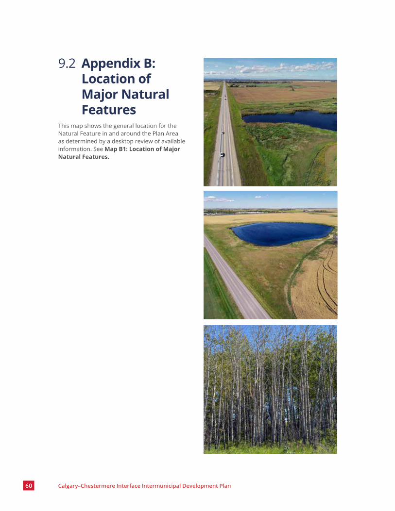
The Plan Area has a rolling, hilly landscape that includes wetlands, natural drainage corridors and a tree stand (see Appendix B: Location of Major Natural Features). The Plan Area is within the Foothills Fescue Natural Subregion, a subregion in the Alberta Grassland Natural Region. The area was used as a livestock wintering grazing place and is currently used for agricultural and country residential purposes.

Calgary–Chestermere Interface Intermunicipal Development Plan 9
MunicipalGovernment Act
Calgary Municipal
Development Plan
Calgary area structure plans, other statutory plans and land
use bylaw
Calgary policies
Chestermere Municipal
Development Plan
Chestermere area structure plans
and land use bylaw
Chestermere policies
South Saskatchewan Regional Plan
Calgary Metropolitan Region Growth Plan
Regional Evaluation Framework
Calgary–Chestermere Interface Intermunicipal Development Plan
Other Intermunicipal Development Plans (Rocky View/Calgary Intermunicipal
Development Plan)
1.2 Legislative and Policy FrameworkThe Plan provides high-level policy, coordination and consultation direction for Planning Applications in the Plan Area. The Plan shall be read and applied in conjunction with the provincial and regional documents listed below, as well as applicable municipal bylaws, policies, plans and guidelines.
Municipal Government Act:Provides the governance model for how municipalities operate, plan and develop new and existing communities.
South Saskatchewan Regional Plan:Establishes a long-term vision for the region using a cumulative effects management approach to guide local decision-makers in land use management to achieve Alberta’s economic, environmental and social goals.
Calgary Metropolitan Region Growth Plan:Provides guidance on land use, population and employment growth, and infrastructure planning related to matters of regional significance.
Calgary–Chestermere Interface Intermunicipal Development Plan: Provides statutory policy for the Plan Area located along the intermunicipal interface between Calgary and Chestermere.
Rocky View/Calgary Intermunicipal Development Plan:Contains objectives and policies directing the coordination of planning between Calgary and Rocky View County. Portions of the Plan Area are part of this Intermunicipal Development Plan.
Other city-wide and local plans and policies in Calgary and Chestermere:Provide policy direction for specific typologies and areas within each municipality.
Graphic 1: Hierarchy of Legislation, Plans and Policies

10 Calgary–Chestermere Interface Intermunicipal Development Plan
1.3 VisionThe Plan Area will become an attractive, unique, high-quality and vibrant residential corridor with mixed-use Nodes and gathering areas near Natural Features. The Plan Area will offer a pleasant pedestrian experience and will be well connected to local and regional transportation by various travel modes.

Calgary–Chestermere Interface Intermunicipal Development Plan 11

12 Calgary–Chestermere Interface Intermunicipal Development Plan
Working togetherCalgary and Chestermere will continue collaborating and coordinating to ensure the successful implementation of The Plan.
Acknowledging uniquenessThe Plan will acknowledge the unique identities of Calgary and Chestermere through a collaborative planning process.
Creating an attractive and active pedestrian experienceThe Plan Area will have buildings and landscaping, street-oriented uses and a unique palette of Streetscape Elements that support a vibrant pedestrian realm, enhance the pedestrian experience and unify the Plan Area visually.
Creating a well-connected streetThe Interface Street is part of a regional network that will allow for safe and reliable north–south and east–west connections and will accommodate various travel options.
Creating vibrant mixed-use nodesThe Nodes will have higher intensities than their surroundings, an enhanced Public Realm, a variety of Active Uses fronting onto the Interface Street and public gathering spaces for residents and visitors.
Protecting and integrating natureNatural Features will be protected and become destinations, where appropriate. Development in the Plan Area will be environmentally conscious.
1.4 Values and Core IdeasThe following values and core ideas will support achieving the vision for The Plan.

Calgary–Chestermere Interface Intermunicipal Development Plan 13


Land Use Concept
This section provides direction for development along the Interface Street. Map 2: Land Use Concept shows the general locations for three Character Areas, pathway connectivity and the transportation network in the Plan Area.
Refinements to the exact extent of elements in the map may be made without an amendment to The Plan during the review of Planning Applications provided that the result is consistent with the vision, values and core ideas.

16 Calgary–Chestermere Interface Intermunicipal Development Plan
Rocky View County
Rocky View County
ChestermereCalgary
Rang
e Rd
285
/Gar
den
Rd E
/100
St
E Ra
nge
Rd 2
85/G
arde
n Rd
E/1
00 S
t E
Rang
e Rd
284
/11
6 St
E/
Conr
ich
Rd
Rang
e Rd
284
/11
6 St
E/
Conr
ich
Rd
Rang
e Rd
283
/Rai
nbow
Rd
Rang
e Rd
283
/Rai
nbow
Rd
Chestermere BlvdChestermere Blvd17 Av SE17 Av SE
Future Memorial DrFuture Memorial Dr
Power transmission linePower transmission line
Trans Canada Highway (Highway 1)Trans Canada Highway (Highway 1)
CN RailwayCN Railway
Peigan Tr SE - ExtensionPeigan Tr SE - Extension
8 Av NE - Future Alignment8 Av NE - Future AlignmentN
Legend
Calgary Municipal Boundary
Chestermere Municipal Boundary
Interface Street
Primary Crossroad
Character Area 1: The Nodes
Character Area 2: The Residential Corridor
Character Area 3: The Transition
Potential Transit Connection
Pathway
Secondary Crossroad
The Gateway
The Heart
The Greenway
Map 2: Land Use Concept
Calgary–Chestermere Interface Intermunicipal Development Plan 17
2.1 General PoliciesThe general policies are intended to apply to the entire Plan Area to enable successful pedestrian-oriented development and allow for consistency along the Interface Street. These policies shall be read in conjunction with the policies for each Character Area.
Land Use and development1. Land use designations and developments
should be consistent with the policies related to the relevant Character Area on Map 2: Land Use Concept .
2. Developments should be compatible, especially those located across the street from each other.
3. Low-rise residential, Multi-residential Development, live–work, institutional and park uses may be located in the Plan Area.
4. Uses that include extensive outdoor storage areas shall not be approved along the Interface Street. These uses include vehicle storage, recycling operations and industrial and commercial uses that require intensive outdoor activities and storage areas.
5. Parcel depths extending from the property line at the Interface Street should be 40 m or greater to allow for future redevelopment.
6. Private residential backyards shall not be located along the Interface Street to avoid the need for sound attenuation walls.
Universal accessibility7. The Interface Street and its public Open
Space should be designed to be universally accessible and support the enjoyment and participation of everyone.
8. The Streetscape Elements should be designed, placed and oriented in a way that does not hinder universal accessibility and mobility.
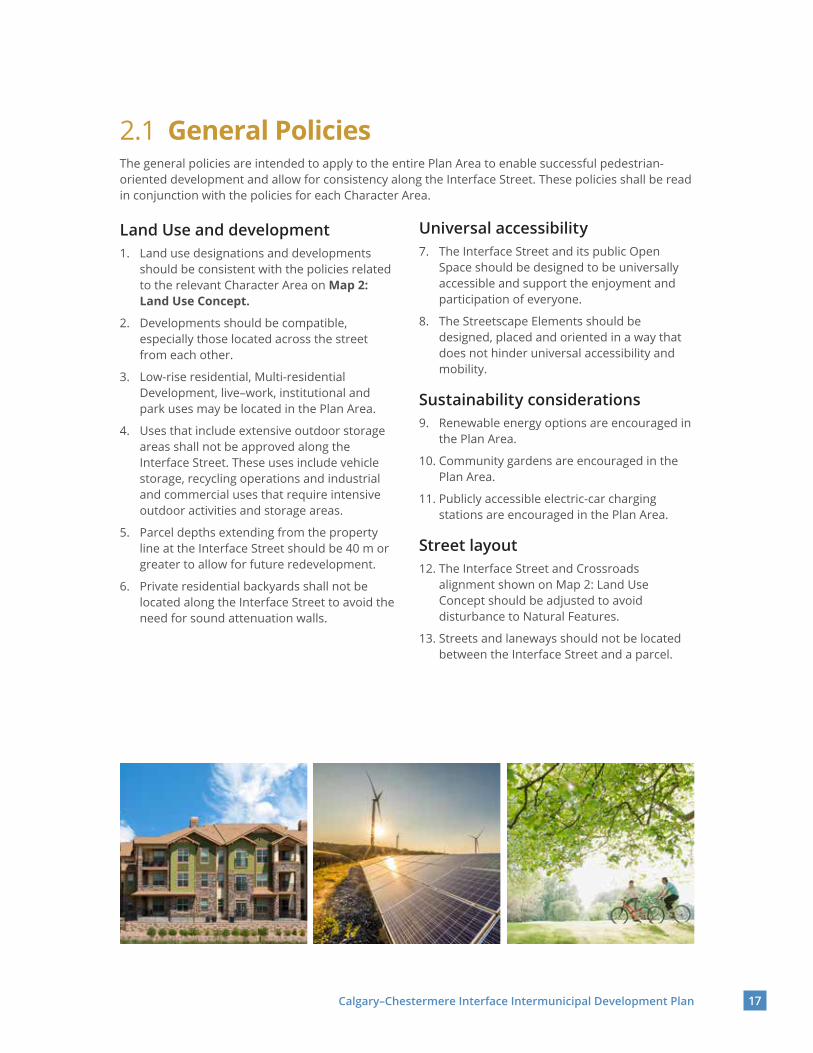
Sustainability considerations9. Renewable energy options are encouraged in
the Plan Area.
10. Community gardens are encouraged in the Plan Area.
11. Publicly accessible electric-car charging stations are encouraged in the Plan Area.
Street layout12. The Interface Street and Crossroads
alignment shown on Map 2: Land Use Concept should be adjusted to avoid disturbance to Natural Features.
13. Streets and laneways should not be located between the Interface Street and a parcel.

18 Calgary–Chestermere Interface Intermunicipal Development Plan
Building design14. Buildings should be designed to have the
primary entrances facing the Interface Street. The same applies for at-grade unit entrances.
15. Primary entrances in buildings should be connected to the public sidewalk by a sidewalk or similar element. Sidewalks to buildings other than low-rise residential buildings should not have any grades greater than five per cent to ensure universal accessibility.
Landscaping16. Native vegetation and plantings should be
used to reduce long-term maintenance needs.
17. Drought-tolerant landscaping and innovative stormwater management design are encouraged to reduce stormwater runoff and provide outdoor amenity areas.
18. Landscaping areas should be designed so that planting does not interfere with sightlines at intersections.
19. High-quality landscaping materials should be used in the median and boulevards.
20. Trees should be included in the landscaped areas along the Interface Street.

Calgary–Chestermere Interface Intermunicipal Development Plan 19
Vehicular access and parking areas21. Vehicular access to a parcel shall not be
granted from the Interface Street unless for emergency response vehicles and where access cannot be granted from a lane or Local Street Network due to Natural Features.
22. Parking lots, loading areas, gas bars and drive-thru queues shall not be located between the Interface Street and a building.
Fences23. Fences along the Interface Street, should
be of high-quality materials, allow for visual permeability, include planting and should not be taller than 1.2 m.
24. Chain link fences should be avoided along the Interface Street and near intersections.
25. Barbed wire on fences and sound attenuation walls are prohibited in the Plan Area.
26. Landscaping areas and planting are encouraged as an alternative to fences.
Signage27. Signage along the Interface Street should be
consistent, be of appropriate height, size, location, orientation, illumination and scale for legibility by pedestrians on sidewalks.
28. Privately owned third-party stand-alone advertising signage or billboards shall not be placed along the Interface Street.

20 Calgary–Chestermere Interface Intermunicipal Development Plan
2.2 Character Area 1: The NodesThe Nodes are located where the Interface Street intersects with Primary Crossroads and with the power transmission line as shown in Map 3: Character Area 1: The Nodes. These areas are intended to concentrate relatively higher intensities than their surroundings, a variety of Active Uses fronting onto the Interface Street and public gathering spaces for residents and visitors. These policies shall be read in conjunction with the policies in sub-section 2 .1 General Policies.
The following policies apply to all Nodes within the Policy Area.
1. The Nodes may consist of horizontal or vertical Mixed-use Development.
2. Institutional, civic, recreational facilities, local Low-impact Industrial, small low-impact commercial and retail and consumer services uses, may be located in all Nodes.
3. The ground floor of any development that faces the Interface Street should contain Active Uses that encourage higher levels of pedestrian activity.
4. Iconic, low-maintenance and renewable-energy-powered art pieces, as well as entrances, gateways and wayfinding signage, should be strategically placed in the Public Realm.
5. Areas between the Interface Street and buildings should be publicly accessible private space such as patios, seating areas or other spaces that use hard-surfacing. Alternatively, the area between the Interface Street and buildings may be soft-surfaced landscaping.
6. Publicly accessible amenity space adjacent to the sidewalk within private lands is encouraged.
7. Blank walls (greater than 15 m long) without windows or architectural features should be avoided. If required for security reasons, the blank walls should be decorated with interesting architectural features or murals.
8. Public seating should be considered between the Interface Street and a building and integrated into the building design for mixed-use, multifamily and non-residential developments.
9. Building façades greater than 30 m long should suggest a pattern of narrow storefronts or units.
Map 3: Character Area 1: The Nodes
Rocky View County
ChestermereCalgary
Rang
e Rd 2
85/G
arden
Rd E
/100
St E
Rang
e Rd 2
85/G
arden
Rd E
/100
St E
Rang
e Rd
284
/11
6 St
E/
Conr
ich
Rd
Rang
e Rd
284
/11
6 St
E/
Conr
ich
Rd
Rang
e Rd 2
83/R
ainbo
w Rd
Rang
e Rd 2
83/R
ainbo
w Rd
Chestermere BlvdChestermere Blvd17 Av SE17 Av SE
Future Memorial DrFuture Memorial Dr
Power transmission linePower transmission line
CN RailwayCN Railway
Rang
e Rd 2
84/
116 S
t E/C
onric
h Rd
Rang
e Rd 2
84/
116 S
t E/C
onric
h Rd
N
The Gateway
The Heart
The Greenway
Character Area 1: The Nodes
10. Increased attention should be given to architectural materials and features on the façades of buildings that face the Interface Street and Crossroads.
11. Weather-protective elements for publicly-accessible spaces on private lands should be included in the overall building design, especially for those buildings that are next to a transit stop.

Calgary–Chestermere Interface Intermunicipal Development Plan 21
The Gateway NodeThe Gateway Node, located at the intersection of the Interface Street and the future Memorial Drive S.E. alignment, is intended to welcome people to the Plan Area and to have higher levels of pedestrian activity, higher-intensity development and Mixed-use Development.
12. The maximum building height is six storeys.
13. Landmark architectural design is encouraged for corner buildings.
14. Welcome signage should be located at the intersection.
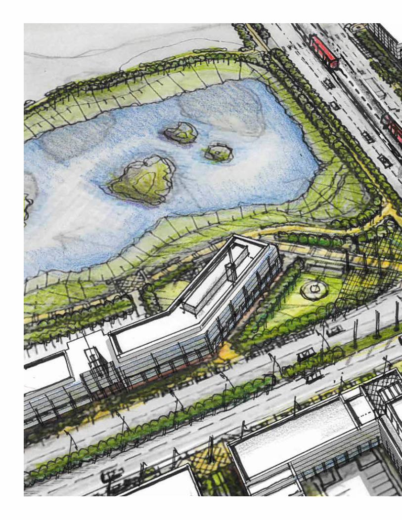
The Heart NodeThe Heart Node, located at the intersection of the Interface Street and 17 Avenue SE /Chestermere Boulevard, is the focal point of the Plan Area and is intended to have higher intensity transit-oriented Mixed-use Development, to integrate Natural Features and to accentuate the importance of the intersection as a regional connector point.
15. The maximum building height is 10 storeys.
16. Feature Developments and landmark elements should be placed near the intersection.
17. The wetland should be visible from the intersection.
18. The wetland, its associated setback and the drainage course should be integrated as a publicly accessible Open Space that includes seating areas and passive recreation elements.
19. Convenient, safe and accessible pedestrian connections should be provided from public sidewalks along the Interface Street and 17 Avenue S.E. to the wetland and drainage course.

22 Calgary–Chestermere Interface Intermunicipal Development Plan
The Greenway NodeThe Greenway Node, located at the intersection of the Interface Street and the power transmission line and its utility right-of-way, is intended to support east–west pedestrian and cyclist connectivity and to have modest intensity developments.
20. The maximum building height is four storeys.
21. The existing tree stand should connect to the Interface Street via a convenient and accessible pedestrian link.
22. Stakeholders should consult with the power transmission line utility provider for any development proposed adjacent to the utility right-of-way.
Pow
er Tr
ansm
issio
n Lin
e UR
W

Calgary–Chestermere Interface Intermunicipal Development Plan 23
ChestermereCalgary
Rang
e Rd 2
85/G
arden
Rd E
/100
St E
Rang
e Rd 2
85/G
arden
Rd E
/100
St E
Rang
e Rd
284
/11
6 St
E/
Conr
ich
Rd
Rang
e Rd
284
/11
6 St
E/
Conr
ich
Rd
Rang
e Rd 2
83/R
ainbo
w Rd
Rang
e Rd 2
83/R
ainbo
w Rd
Chestermere BlvdChestermere Blvd17 Av SE17 Av SE
Future Memorial DrFuture Memorial Dr
Power transmission linePower transmission line
Rang
e Rd 2
84/
116 S
t E/C
onric
h Rd
Rang
e Rd 2
84/
116 S
t E/C
onric
h Rd
N
Character Area 2: The Residential Corridor
Map 4: Character Area 2: The Residential Corridor
2.3 Character Area 2: The Residential Corridors
The Residential Corridors are located between the Nodes as shown in Map 4: Character Area 2: The Residential Corridors. These areas are intended to be primarily residential, with pockets of Open Space and a comfortable Public Realm. These policies shall be read in conjunction with the policies in sub-section 2 .1 General Policies.
1. The maximum building height is three storeys.
2. Development should consist of a mix of low-rise residential development.
3. Live–work units are encouraged.
24 Calgary–Chestermere Interface Intermunicipal Development Plan
ChestermereCalgary
Rang
e Rd 2
85/G
arden
Rd E
/100
St E
Rang
e Rd 2
85/G
arden
Rd E
/100
St E
Rang
e Rd
284
/11
6 St
E/
Conr
ich
Rd
Rang
e Rd
284
/11
6 St
E/
Conr
ich
Rd
Rang
e Rd 2
83/R
ainbo
w Rd
Rang
e Rd 2
83/R
ainbo
w Rd
Chestermere BlvdChestermere Blvd17 Av SE17 Av SE
Future Memorial DrFuture Memorial Dr
Power transmission linePower transmission line
Rang
e Rd 2
84/
116 S
t E/C
onric
h Rd
Rang
e Rd 2
84/
116 S
t E/C
onric
h Rd
N
Character Area 3: The Transition
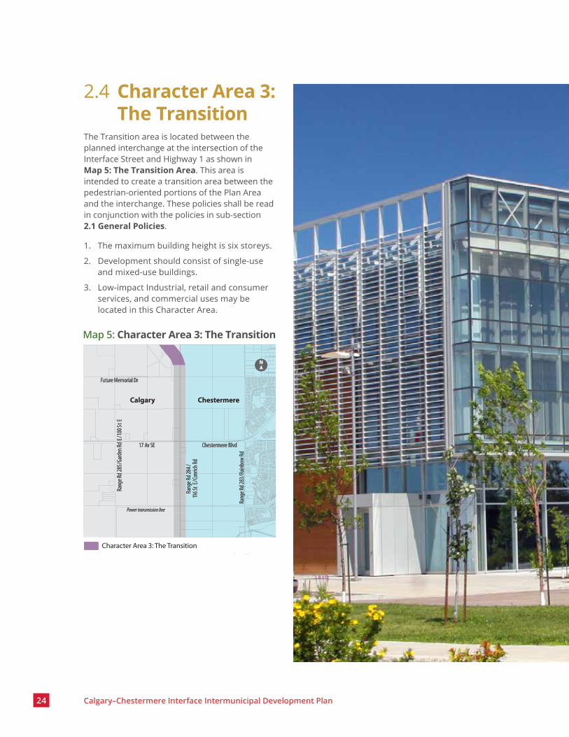
2.4 Character Area 3: The Transition
The Transition area is located between the planned interchange at the intersection of the Interface Street and Highway 1 as shown in Map 5: The Transition Area. This area is intended to create a transition area between the pedestrian-oriented portions of the Plan Area and the interchange. These policies shall be read in conjunction with the policies in sub-section 2 .1 General Policies.
1. The maximum building height is six storeys.
2. Development should consist of single-use and mixed-use buildings.
3. Low-impact Industrial, retail and consumer services, and commercial uses may be located in this Character Area.
Map 5: Character Area 3: The Transition

Calgary–Chestermere Interface Intermunicipal Development Plan 25
Open Space Network

28 Calgary–Chestermere Interface Intermunicipal Development Plan
3.1 Open SpaceOpen Space is intended to provide recreational and gathering opportunities for residents and visitors.
1. Open Space should be integrated with Natural Features.
2. Open Space should be designed to be comfortable and universally accessible and should include seating and shaded areas.
3. Open Space design should include passive recreation activities and be flexible to allow for seasonal events and markets.
4. The Open Space network shall be interconnected by safe, convenient and accessible pedestrian and cycling infrastructure.
3.2 Natural FeaturesNatural Features are intended to be preserved, enhanced and incorporated into the overall Plan Area.
1. Natural Features that span municipal boundaries should have their hydrological, ecological and pedestrian pathway connectivity maintained and/or established.
2. Infrastructure, including roads and utilities, should be designed to support connectivity and minimize impacts to Natural Features.
3. Development near Natural Features should have minimal impact on these features.

Calgary–Chestermere Interface Intermunicipal Development Plan 29
3.3 PathwaysPathways are intended to provide varied, safe and reliable active travel modes within the Plan Area and connect to the broader Regional Pathway system.
1. Pathways in the Plan Area shall connect to the broader Regional Pathway network in Calgary, Chestermere and Rocky View County.
2. Pathways in the Plan Area should be integrated with the Open Space network and Natural Features.
3. Pathways in the Plan Area located at intersections should be constructed on the north sides of the road right-of-way to minimize shadowing and ice accumulation in winter.
4. Pathways in the Plan Area that intersect with the Interface Street should align and coincide with those on the opposite side of the street.
5. Pathway crossings along the Interface Street shall be marked and safe.
6. Pathways in the Plan Area should be separated from lanes intended for motor vehicle traffic and parking by a physical protection measure.
7. Pathways in the Plan Area should be designed to allow for all ages and abilities.
8. Pathways in the Plan Area should be 3.0 m or greater and be consistent with the Regional Pathway width and design.

MobilityThe mobility network in the Plan Area is intended to link to the local and regional network; allow for varied, safe and reliable transportation options; and support development through on-street parking.
The Interface Street is currently classified as a regional connector in Chestermere and an arterial street in Calgary. In order to achieve the vision of The Plan, a modified street classification will be created to reflect the Interface Street’s unique function.
This section shall be read in conjunction with transportation policies in sub-section 6 .4 Strategic Intermunicipal Collaboration .
32 Calgary–Chestermere Interface Intermunicipal Development Plan
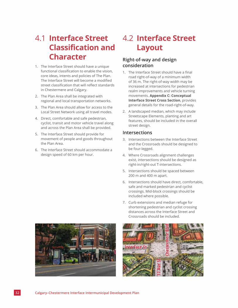
4.1 Interface Street Classification and Character
1. The Interface Street should have a unique functional classification to enable the vision, core ideas, intents and policies of The Plan. The Interface Street will become a modified street classification that will reflect standards in Chestermere and Calgary.
2. The Plan Area shall be integrated with regional and local transportation networks.
3. The Plan Area should allow for access to the Local Street Network using all travel modes.
4. Direct, comfortable and safe pedestrian, cyclist, transit and motor vehicle travel along and across the Plan Area shall be provided.
5. The Interface Street should provide for movement of people and goods throughout the Plan Area.
6. The Interface Street should accommodate a design speed of 60 km per hour.
4.2 Interface Street Layout
Right-of-way and design consideration1. The Interface Street should have a final
road right-of-way of a minimum width of 36 m. The right-of-way width may be increased at intersections for pedestrian realm improvements and vehicle turning movements. Appendix C: Conceptual Interface Street Cross Section, provides general details for the road-right-of-way.
2. A landscaped median, which may include Streetscape Elements, planting and art features, should be included in the overall street design.
Intersections3. Intersections between the Interface Street
and the Crossroads should be designed to be four-legged.
4. Where Crossroads alignment challenges exist, intersections should be designed as right-in/right-out T-intersections.
5. Intersections should be spaced between 200 m and 400 m apart.
6. Intersections should have direct, comfortable, safe and marked pedestrian and cyclist crossings. Mid-block crossings should be included where possible.
7. Curb extensions and median refuge for shortening pedestrian and cyclist crossing distances across the Interface Street and Crossroads should be included.
Ches
term
ere
Blvd
17 A
ve SE
Interface St

Calgary–Chestermere Interface Intermunicipal Development Plan 33
Sidewalks8. Sidewalks should be separated from the
roadway by a landscaped boulevard or physical protection measures.
9. Sidewalks should be continuous and not have significant grade changes.
10. Sidewalks should be 2.0 m wide unless located within the Nodes, in which case the width should be 2.0 m or greater.
11. Sidewalks should provide for transit stop amenities.
Transit Stops12. Future transit stops located along the
Interface Street and Crossroads should be planned to support intermunicipal and regional transit services.
13. Calgary and Chestermere should coordinate the location of future transit stops along the Interface Street, especially in or near the Nodes and Open Spaces.
14. Transit stops should be designed to include amenities such as signs, shelters and seating areas, and should have direct, comfortable and safe pedestrian access from sidewalks.
15. Transit stops should be incorporated into the adjacent building design, where possible.
16. The bus rapid transit stops along 17 Avenue S.E/Chestermere Boulevard should be as close to the Interface Street as possible. Amenities such as shelters, seating, heating and real-time information signage should be located at these stops.
On-street Parking17. On-street parking should be considered and
located within a dedicated parking lane in the road right-of-way on the Interface Street and Crossroads.
18. On-street parking shall not be provided on the side of the Interface Street where a road or lane is located between the Interface Street and a parcel, or where parcels back onto the Interface Street.
19. On-street parking should be set back from intersections of the Interface Street and Crossroads where it would be unsafe or would hinder motor vehicle turning movement.
20. Where on-street parking is not provided, the boulevard should be designed to include additional plantings and/or seating areas.
21. On-street parking may be used to support a parking relaxation using the number of motor vehicle parking stalls adjacent to the site.

Streetscape Elements
The Streetscape Elements are intended to enhance the pedestrian experience, celebrate the history and character of the area, reflect the identity of each municipality, and be the unifying elements across the Interface Area.
This section shall be read in conjunction with policies in sub-section 6 .4 Strategic Intermunicipal Collaboration.

36 Calgary–Chestermere Interface Intermunicipal Development Plan
1. The Streetscape Elements design should be coordinated by Calgary and Chestermere to allow for consistency on both sides of the Interface Street.
2. Interpretation of the area’s history and archeology should be incorporated into the overall streetscape elements design to build public awareness and appreciation.
3. The Streetscape Elements should be made of high-quality, durable, low-maintenance and sustainably sourced materials.
4. The Streetscape Elements should be located along the Interface Street, especially in the Nodes and Open Spaces.
5. Streetlight fixtures should be of a pedestrian scale and not project light upwards.
6. Banners should be placed on streetlight stands and/or poles along the median and/or landscaped boulevard.
7. Planters should be designed to include seating and create spaces where people can gather.

Calgary–Chestermere Interface Intermunicipal Development Plan 37

Intermunicipal Collaboration

40 Calgary–Chestermere Interface Intermunicipal Development Plan
6.1 Planning Referral Agreement
Calgary and Chestermere share an existing Council-approved agreement regarding development to assist with communicating, collaborating and maintaining a positive working relationship. The Planning Referral and Dispute Resolution Agreement Between Calgary and Chestermere (2014) provides guidance on the mutual referral of Planning Applications, policy plans and studies. It includes a protocol for dispute resolution for a broader circulation area.
Calgary–Chestermere Interface Intermunicipal Development Plan 41
1. Unless otherwise agreed to by the administrations of both municipalities, the intermunicipal circulation period is thirty (30) days from the date of receipt for any application partially or wholly within the Plan Area. Circulation should happen as close to the submission of a complete application as possible. Calgary and Chestermere commit to ongoing consultation where amendments have been made to the application after the original intermunicipal circulation. In the event that the responding municipality does not reply within the designated response period or request an extension to the maximum response period of 30 days, it may be assumed that the responding municipality has no comment or objection to the proposal.
The following types of proposals shall be circulated from Calgary to Chestermere or vice versa:
a. Statutory and non-statutory plans and proposed amendments to such plans.
b. Applications for land use redesignation and subdivision.
c. Disposition of environmental, municipal and/or school reserves; environmental easements; public utility lots and/or road allowances.
d. All applications for development permits, including renewals for the following:
i. intensive agricultural operations
ii. natural resource extraction
iii. landfills
iv. discretionary uses along intermunicipal entranceways
v. commercial, industrial or business development
vi. institutional development
vii. residential development
6.2 Intermunicipal Circulation and Referral Processes
Subject to written agreement between both municipalities, items may be added to or deleted from the preceding circulation list without the need for an amendment to The Plan.
Calgary and Chestermere administrations shall decide which department(s) is/are responsible for responding to intermunicipal planning referrals. Calgary and Chestermere administrations shall refer any available information with respect to lands within the Plan Area that might be requested by the other municipality.

42 Calgary–Chestermere Interface Intermunicipal Development Plan
1. Calgary and Chestermere administrations should arrange to maximize opportunities for discussion to resolve matters of concern early to minimize the need for formal mediation. Review by the Calgary–Chestermere Intermunicipal Committee should occur prior to the matter proceeding to councils or other committees.
The matter may be resolved at the Calgary–Chestermere Intermunicipal Committee in the following manner:
a. In advance of the committee meeting, the host municipality will ensure that information on the issue is made available to Calgary and Chestermere. The host municipality will clarify any questions or comments that were raised by the responding municipality.
b. During the meeting, the Calgary–Chestermere Intermunicipal Committee will hear the perspectives of Calgary and Chestermere administrations, including, but not limited to, presentations from Calgary and Chestermere administrations and subject matter experts, if required.
c. If the matter cannot be resolved at the meeting, then the Calgary–Chestermere Intermunicipal Committee may conclude that no agreement could be reached and direct the matter to Calgary and Chestermere councils.
d. If Calgary and Chestermere councils cannot reach an agreement on the matter, then the matter should be referred to a mediation process.
Intermunicipal Mediation2. The mediation process shall be initiated by
Calgary and Chestermere councils only in the following circumstances:
a. An equal number of representatives from Calgary and Chestermere have been appointed to participate.
b. An impartial mediator has been agreed to by Calgary and Chestermere at equal cost to both municipalities.
c. An approved schedule, which includes the times and locations of meetings, and a deadline by which the mediation process is to be completed, has been agreed to by Calgary and Chestermere.
The initiating municipality should not decide on the proposal until mediation has concluded. If no mediated agreement can be reached or if a mediated agreement is not approved by both Calgary and Chestermere councils, then the appeal process may be initiated.
Intermunicipal Appeal3. If the initiating municipality approves a
proposal that includes a matter of concern, then the responding municipality may appeal that action to the Municipal Government Board in accordance with the provisions outlined in the Municipal Government Act. The responding municipality shall file a notice of appeal with the Municipal Government Board and provide a copy of the appeal notice to the initiating municipality within 30 days of the approval of the proposal.
The Calgary Metropolitan Region Board4. Calgary and Chestermere are members of the
Calgary Metropolitan Region Board, and as such, The Plan shall conform to the Calgary Metropolitan Region Growth Plan.
5. Amendments to The Plan, statutory plans and statutory plan amendments within the Plan Area will be subject to the process set out in the Regional Evaluation Framework.
6.3 Intermunicipal Conflict Resolution Process

Calgary–Chestermere Interface Intermunicipal Development Plan 43
NamingThe names for the Interface Street and Open Spaces are intended to support the uniqueness of the Plan Area.
1. Calgary and Chestermere shall jointly identify the name for the Interface Street. The naming process shall be initiated shortly after The Plan becomes a statutory document in both municipalities. Rocky View County and other stakeholders may be part of the naming process.
2. The Interface Street name should be inspired by the history of the area and/or the character of the Interface Street. It could also celebrate the relationship between the municipalities.
3. The names for all Open Spaces and pathway networks along the Interface Street should be consistent with the Interface Street name.
Heritage resourcesThe Plan Area may contain Heritage Resources which possess cultural and scientific significance. Conserving these resources could help the public understand, value and care for the historic environment of an Area.
5. Calgary and Chestermere, in coordination with other stakeholders, may undertake a historic overview study to better understand the history and potential of the Plan Area.
6. Historical Resource Impact Assessments should be submitted at Planning Application stages for the Plan Area, if required by the relevant authority.
Housing7. Calgary and Chestermere should explore
opportunities for affordable housing developments along the Interface Street.
8. A mix of housing types along the Interface Street is encouraged.
Technical studies and projectsStudies and/or projects may be required for development of the Plan Area and/or the broader region.
9. Prior to the commencement of a study and/or project, Calgary and Chestermere shall have agreements that include details such as cost, scope and data sharing, and that outline the vision and the outcome.
10. Studies and/or projects should:
a. Be undertaken as joint efforts between Calgary and Chestermere, in consultation with Rocky View County and the Province of Alberta, as required.
b. Have the cost, responsibilities and results shared by both municipalities.
c. Include details such as implementation strategies, roles and responsibilities, construction details and maintenance protocol.
d. Have stakeholders consulted jointly.
11. Calgary and Chestermere shall consult with Rocky View County as appropriate on technical studies and projects.
6.4 Strategic Intermunicipal Coordination
Indigenous EngagementThe Plan Area could contain areas of indigenous cultural significance. Studies and a coordinated intermunicipal engagement process may take place to honour and properly access Indigenous oral traditions and knowledge to relate the history of the area.4. Engagement may be jointly undertaken
by Calgary, Chestermere, and other stakeholders with inclusive representation from the Blackfoot Confederacy (comprising the Siksika, Piikani and Kainai First Nations), the Tsuut’ina First Nation, the Stoney Nakoda peoples (comprising the Chiniki, Bearspaw and Wesley First Nations) and the Métis Nation of Alberta, Region 3. The engagement could happen during any future Planning Application in the Plan Area.

44 Calgary–Chestermere Interface Intermunicipal Development Plan
Transportation12. Calgary and Chestermere shall coordinate
with Rocky View County and the Province of Alberta to determine:
a. The design, location and construction time frame for the interchange at Highway 1 and the Interface Street.
b. The alignment and road right-of-way of the Interface Street between Highway 1 and Memorial Drive S.E.
13. Calgary, Chestermere, Rocky View County and the Province of Alberta should discuss opportunities for a Regional Pathway network.
14. Calgary and Chestermere shall cooperate on the following points:
a. Coordinate the staging and construction of the Interface Street during Planning Application review. Road construction and staging should minimize impacts on local and regional transportation networks.
b. Jointly conduct a functional study for the Interface Street to identify its modified functional classification and to determine detailed cross-sections, alignments (vertical and horizontal), construction costs, constructability and all intersection designs prior to construction of any section of the Interface Street. Landowners and/or developers may contribute to or participate in the functional study on an as-needed basis.
c. Coordinate consistent construction standards, materials and Public Realm finishes for the Interface Street.
d. Discuss and execute construction and maintenance agreements to minimize maintenance and operational costs for both municipalities as the Interface Street is constructed.
15. Local developers shall be required to pay for or construct the sections of the street they are required to under the Municipal Government Act, at the discretion of the relevant approving authority. The full width of the street should be constructed, where possible. Any other construction costs should be shared between Calgary and Chestermere.
Servicing 16. Calgary and Chestermere should collaborate
when identifying easements and rights-of-way to allow for intermunicipal wastewater, water and stormwater infrastructure servicing across municipalities (refer to Appendix A: Regional Corridors).
17. Calgary and Chestermere should collaborate on stormwater management planning for the Plan Area and the broader region, as required. Other stakeholders may be involved in stormwater management planning, as required.
18. Development within the Plan Area should incorporate best management practices to mitigate adverse impacts on Natural Features and water bodies, including impacts on water quality, natural hydrology, riparian areas and habitats.
Functionally Isolated Areas19. Calgary and Chestermere should identify
functionally isolated areas that may result from the future road network alignment and spacing requirements as candidate lands for potential annexations.
20. Amendments to the extent of the Plan Area and elements of Map 2: Land Use Concept should be considered following any potential annexations.
Calgary–Chestermere Interface Intermunicipal Development Plan 45
6.5 Monitoring, Amendments and Repeal of The Plan
Monitoring of The Plan1. The Plan provides direction for the
development of the Plan Area over an extended time through a series of public and private sector initiatives. The time frame of The Plan will be determined by the criteria for prioritization and sequencing of growth areas determined as part of Calgary and Chestermere’s municipal development plans and the policies within the Plan Area.
2. The policies within the Plan Area will be monitored over time in relation to development and higher-level municipal policies. Where determined necessary, The Plan may be updated through The Plan’s amendment process either generally or in response to a specific issue.
Amendments to The Plan 3. The Plan maps and text may be amended
subject to the agreement between Calgary and Chestermere councils and requirements of the Municipal Government Act.
4. Calgary and Chestermere administrations should:
a. Consider reviewing The Plan from time to time.
b. Review the Planning Referral and Dispute Resolution Agreement Between Calgary and Chestermere during review of proposed amendments to The Plan to ensure consistency and to avoid conflicting directions.
Repeal of The Plan5. Either Calgary or Chestermere may serve
written notice of termination of The Plan. One year after service of the notice of termination, Calgary and Chestermere councils may repeal their bylaw adopting The Plan.
6. Prior to serving notice of termination, mediation is encouraged to resolve matters of concern.


InterpretationThis interpretation section is to ensure the intent and policies of The Plan are understood and achieved.

48 Calgary–Chestermere Interface Intermunicipal Development Plan
7.1 Map Interpretation1. Unless otherwise specified, the boundaries
or locations of any symbols or areas depicted on maps are approximate, not absolute, and shall be interpreted as such. The locations of symbols are not intended to define exact locations, except where they coincide with clearly recognizable physical features or fixed boundaries, such as property lines or road or utility rights-of-way. Refinements to the exact location of each Character Area may be made without an amendment to The Plan, and the precise location of these boundaries, for evaluating development proposals, will be determined by the approving authority at the time of application.
2. Measurements of distances or areas shall not be taken from the maps in The Plan or its appendix.
3. Mapped elements of The Plan may be subject to further study and may be further delineated during the review of a Planning Application, in alignment with applicable policies. Any changes to the maps may require an amendment to The Plan.
4. Any changes to the text or maps in The Plan may require an amendment, in accordance with the Municipal Government Act. Where an amendment to The Plan is requested, an applicant shall submit the supporting information necessary to evaluate and justify the potential amendment and ensure its consistency with both municipal development plans and other relevant policy documents.
7.2 Policy Interpretation1. Terms that are capitalized are defined terms,
which are included in Section 8: Definitions.
2. Where an intent statement accompanies a policy, it is provided as information only, and to illustrate the intent and enhance the understanding of subsequent policies. If an inconsistency arises between the intent statement and a policy, the policy takes precedence.
3. The word “should” is explicitly used to further clarify the directional nature of the statement. Policies that use active tense or “should” are to be applied in all situations, unless it can be clearly demonstrated that the policy is not practical or feasible in a given situation. Proposed alternatives will comply with the applicable policies and guidelines to the satisfaction of both municipalities regarding design and performance standards.
4. Policies that use the words “shall,” “will,” “must” or “require” apply to all situations, without exception, usually in relation to a statement of action, legislative direction or situations where a desired result is required.
Calgary–Chestermere Interface Intermunicipal Development Plan 49
7.3 Illustrations and Photo Interpretation
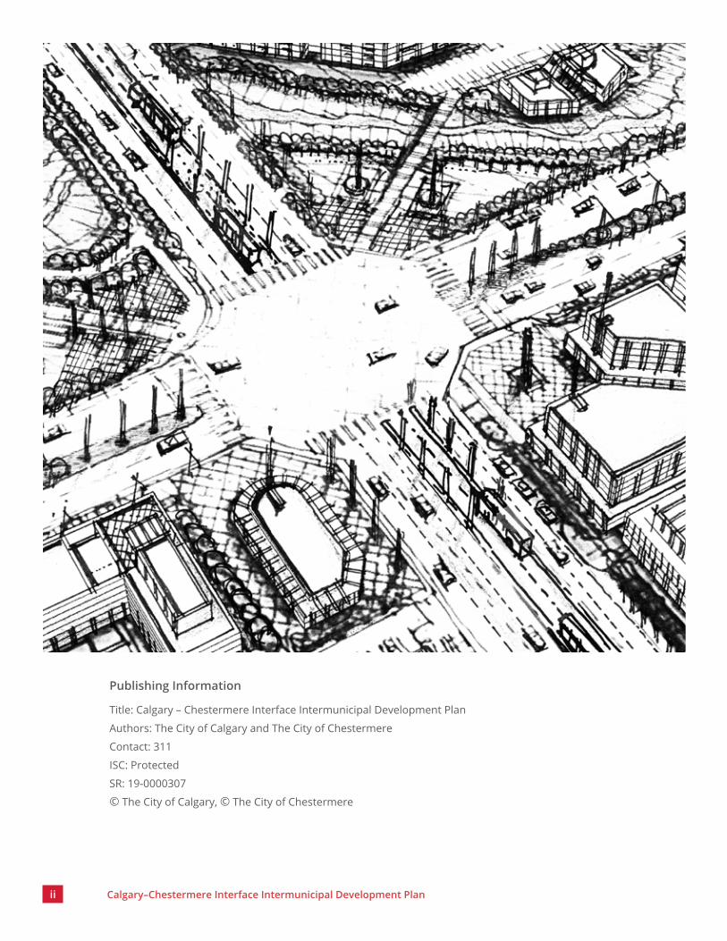
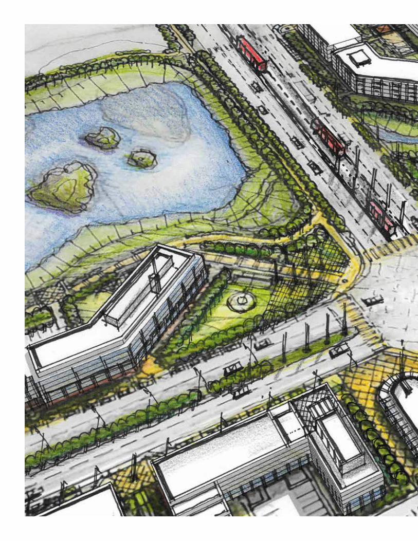
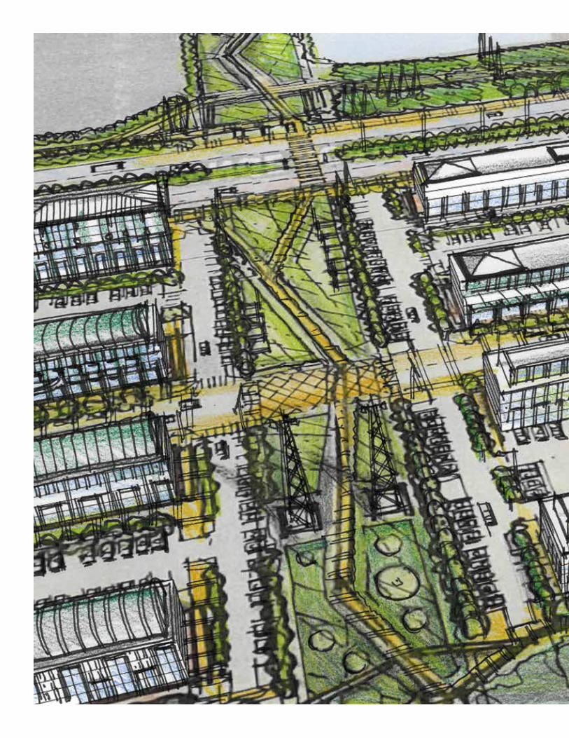
1. All illustrations and photos are intended to illustrate concepts included in The Plan and are not an exact representation of an intended development. They are included solely as examples of what might occur after implementation of the policies in The Plan.
7.4 Appendix Interpretation
1. The appendix does not form part of the statutory portion of The Plan. The intent of the appendix is to provide information for The Plan.
7.5 Plan Limitations1. The Plan is a long-term planning document.
As such, it promotes a vision for the Plan Area and includes policies and guidelines that work towards achieving that vision over time.
2. Policies and guidelines in The Plan shall not be interpreted as approvals for specific uses on specific sites. No representation is made herein that any site is suitable for a particular purpose. Site conditions or constraints, including environmental constraints, shall be assessed on a case-by-case basis during the review of Planning Applications.


Definitions

52 Calgary–Chestermere Interface Intermunicipal Development Plan
Active UsesUses that support pedestrian activity and encourage human interaction between a building and the street.
CalgaryThe City of Calgary.
Character AreasAreas that have special characteristics and land uses.
ChestermereThe City of Chestermere.
CrossroadsStreets that intersect with the Interface Street.
Heritage ResourcesFeatures including cultural landscapes such as historic parks, gardens or streetscapes, culturally significant areas, indigenous traditional use areas and sites with archeological or palaeological resources. They also include historic buildings, bridges, engineering works and other structures. These can be managed by municipal, provincial or federal authorities.
Interface StreetThe street whose route is generally consistent with the border between Calgary and Chestermere (Range Road 284/116 Street E).
Local Street NetworkA road that is not the Interface Street, a Crossroad or a lane.
Low-impact IndustrialA use that supports the vision for the area and has a pedestrian-oriented component. It includes manufacturing, fabricating, processing, assembling or disassembling of materials; semi-finished goods, finished foods, products or equipment; activities that are fully contained in a building; and uses that do not include live animals in any aspect of the operation. Products may be offered for sale on the premises.
Mixed-use DevelopmentA development of a parcel that includes two or more types of uses.
Multi-residential DevelopmentA residential development of one or more buildings, each containing a minimum of three units in total.
Calgary–Chestermere Interface Intermunicipal Development Plan 53
Natural FeaturesFeatures such as wetlands, drainage courses, tree stands, grasslands and coulees.
NodesA location for higher density/intensity Mixed-use Development.
Open SpacePublicly accessible space that supports passive recreation activities and has seating areas.
The PlanThe Calgary–Chestermere Interface Intermunicipal Development Plan.
Plan AreaThe land that is the subject of The Plan.
Planning ApplicationsApplications for outline plans, subdivisions (including condominiums), land use redesignations and/or development permits submitted to either Calgary or Chestermere.
Public RealmThe spaces around, between and within buildings that are publicly accessible and support public life and social interaction. Public realm includes streets, open spaces, pathways, parks and squares.
Regional PathwayA region-wide linear network that facilitates non-motorized movement for recreation and transportation purposes. It connects communities by linking parks, recreation facilities and Natural Features. The Regional Pathway system may also link other primary community facilities such as schools, community centres and commercial areas.
Streetscape ElementsAmenities installed within a road right-of-way, such as banners; posts; benches; bus shelters; planters; street lighting; waste, recycling and compost disposal containers; bike racks; scooter racks; street-name signage; wayfinding signs; and general signage.


Appendices9.1 Appendix A:
Regional CorridorsThis appendix contains maps to support The Plan in terms of mobility corridors.

56 Calgary–Chestermere Interface Intermunicipal Development Plan
Rocky View County
Rocky View County
ChestermereCalgary
84 S
t SE
84 S
t SE
Ston
ey T
r SE
Ston
ey T
r SE
Ston
ey T
r SE
Ston
ey T
r SE
Highway 560Highway 560
8 AV NE8 AV NE
Trans Canada Highway (Highway 1)Trans Canada Highway (Highway 1)
Rang
e Rd
283
/Ra
inbo
w R
dRa
nge
Rd 2
83/
Rain
bow
Rd
Chesterm
ere Blvd
Chesterm
ere Blvd
17 Av SE17 Av SE
Peigan Tr SEPeigan Tr SE CN Railway
CN Railway
Rang
e Rd
285
/Gar
den
Rd E
/100
St
E Ra
nge
Rd 2
85/G
arde
n Rd
E/1
00 S
t E
Rang
e Rd
284
/116
St E
/Co
nric
h Rd
Rang
e Rd
284
/116
St E
/Co
nric
h Rd
N
Legend
Calgary Municipal Boundary
Chestermere Municipal Boundary
Plan Area
Existing Higher Order Transit Corridor
Private Intermunicipal Transit
Future Intermunicipal Transit
Regional Pathway
Transportation/Utility Corridor
Rail
Map A1: Mobility Corridors – Transit and Active Transportation

Calgary–Chestermere Interface Intermunicipal Development Plan 57
Rocky View County
Rocky View County
ChestermereCalgary
84 S
t SE
84 S
t SE
Ston
ey T
r SE
Ston
ey T
r SE
Ston
ey T
r SE
Ston
ey T
r SE
Highway 560Highway 560
8 Av NE8 Av NE
Trans Canada Highway (Highway 1)Trans Canada Highway (Highway 1)
Rang
e Rd
283
/Ra
inbo
w R
dRa
nge
Rd 2
83/
Rain
bow
Rd
Chesterm
ere Blvd
Chesterm
ere Blvd
17 Av SE17 Av SE
Peigan Tr SEPeigan Tr SE CN Railway
CN Railway
Rang
e Rd
285
/Gar
den
Rd E
/100
St E
Ra
nge
Rd 2
85/G
arde
n Rd
E/1
00 S
t E
Rang
e Rd
284
/116
St E
/Co
nric
h Rd
Rang
e Rd
284
/116
St E
/Co
nric
h Rd
N
Legend
Calgary Municipal Boundary
Chestermere Municipal Boundary
Plan Area
Level 1 Highway
Level 2 Highway
Level 3 Highway
CANAMEXTransportation/Utility Corridor
Goods Movement
Existing High Load
Airport Vicinity Protection Area
Rail
Map A2: Mobility Corridors – Transportation and Trade

58 Calgary–Chestermere Interface Intermunicipal Development Plan
Rocky View County
Rocky View County
ChestermereCalgary
84 S
t SE
84 S
t SE
84 S
t SE
84 S
t SE
Ston
ey T
r SE
Ston
ey T
r SE
Ston
ey T
r SE
Ston
ey T
r SE
Highway 560Highway 560
8 Av NE8 Av NE
Trans Canada Highway (Highway 1)Trans Canada Highway (Highway 1)Ra
nge
Rd 2
84/1
16 S
t E/
Conr
ich
RdRa
nge
Rd 2
84/1
16 S
t E/
Conr
ich
Rd
Rang
e Rd
283
/Ra
inbo
w R
dRa
nge
Rd 2
83/
Rain
bow
Rd
Chesterm
ere Blvd
Chesterm
ere Blvd
17 Av SE17 Av SE
Peigan Tr SEPeigan Tr SE CN Railway
CN Railway
Rang
e Rd
285
/Gar
den
Rd E
/100
St E
Ra
nge
Rd 2
85/G
arde
n Rd
E/1
00 S
t E
N
Legend
Calgary Municipal Boundary
Chestermere Municipal Boundary
Plan Area
Power Transmission Line Transportation/Utility Corridor
Pipeline
Map A3: Transmission Corridors – Energy

Calgary–Chestermere Interface Intermunicipal Development Plan 59
Rocky View County
Rocky View County
ChestermereCalgary
Ston
ey T
r SE
Ston
ey T
r SE
Ston
ey T
r SE
Ston
ey T
r SE
Highway 560Highway 560
8 Av NE8 Av NE
Trans Canada Highway (Highway 1)Trans Canada Highway (Highway 1)
Rang
e Rd
283
/Ra
inbo
w R
dRa
nge
Rd 2
83/
Rain
bow
Rd
Chesterm
ere Blvd
Chesterm
ere Blvd
17 Av SE17 Av SE
Peigan Tr SEPeigan Tr SE CN Railway
CN Railway
Rang
e Rd
285
/G
arde
n Rd
E/1
00 S
t E
Rang
e Rd
285
/G
arde
n Rd
E/1
00 S
t E
Rang
e Rd
284
/116
St E
/Co
nric
h Rd
Rang
e Rd
284
/116
St E
/Co
nric
h Rd
84 S
t SE
84 S
t SE
N
Legend
Intermunicipal Water
Potential Intermunicipal Water
Point of Delivery
Intermunicipal Wastewater
Western Irrigation District System
Potential Intermunicipal Wastewater
Point of Discharge
Calgary Municipal Boundary
Chestermere Municipal Boundary
Plan Area
Transportation/Utility Corridor Rail
Map A4: Transmission Corridors – Water
60 Calgary–Chestermere Interface Intermunicipal Development Plan
9.2 Appendix B: Location of Major Natural Features
This map shows the general location for the Natural Feature in and around the Plan Area as determined by a desktop review of available information. See Map B1: Location of Major Natural Features .

Calgary–Chestermere Interface Intermunicipal Development Plan 61
Rocky View County
Rocky View County
ChestermereCalgary
Rang
e Rd
285
/Gar
den
Rd E
/100
St
E Ra
nge
Rd 2
85/G
arde
n Rd
E/1
00 S
t E
Rang
e Rd
284
/116
St E
/Con
rich
RdRa
nge
Rd 2
84/1
16 S
t E/C
onric
h Rd
Rang
e Rd
283
/Rai
nbow
Rd
Rang
e Rd
283
/Rai
nbow
Rd
Chestermere BlvdChestermere Blvd17 Av SE17 Av SE
Future Memorial DrFuture Memorial Dr
Trans Canada Highway (Highway 1)Trans Canada Highway (Highway 1)
CN RailwayCN Railway
Peigan Tr SE - ExtensionPeigan Tr SE - Extension
8 Av NE - Future Alignment8 Av NE - Future AlignmentN
Legend
Calgary Municipal Boundary
Chestermere Municipal Boundary
Wetland (within the plan area)
Plan Area
Tree Stand
Drainage (within the plan area)
Map B1: Location of Major Natural Features

62 Calgary–Chestermere Interface Intermunicipal Development Plan
9.3 Appendix C: Interface Street Conceptual Cross Section
This conceptual sketch shows the elements to be included in the Interface Street Cross Section. Final details and cross section will be determined when the transportation functional study is completed.
Graphic 2: Interface Street Conceptual Cross Section (36m . right-of-way)

