by anthony gilbert reza ghany charlie pearcy. contents introduction dam construction geology of the...
TRANSCRIPT

byAnthony GilbertReza GhanyCharlie Pearcy
Contents• Introduction• Dam construction• Geology of the site• Failure of the dam• Aftermath of the failure• Geology behind the failure• Engineering factors behind the failure• The future of the Teton Dam site• Conclusion

Introduction• Earth dam located between Fremont and
Madison Counties on the Teton River, Idaho, USA
• Dam dimensions – 940m long 93m high and 540m wide at the base
• Construction began in June 1972 and was completed in November 1975
• Construction cost $49,000,000• Intended to create the Teton reservoir
with a capacity of 228,954,000m3

Zone 1- Impervious centre core with clayey silts of aeolin origin Zone 2- higher compaction, filter layer that controls seepage
through core and rock foundation. Zone 3- structural stability Zone 4- Random cofferdam fills (allowing construction of dam in
dry) Zone 5- Rock-fill to protect outer embankment slopes Note: Only one grout curtain installed, higher than anticipated grout take (due to poor rock condition)
Dam Construction
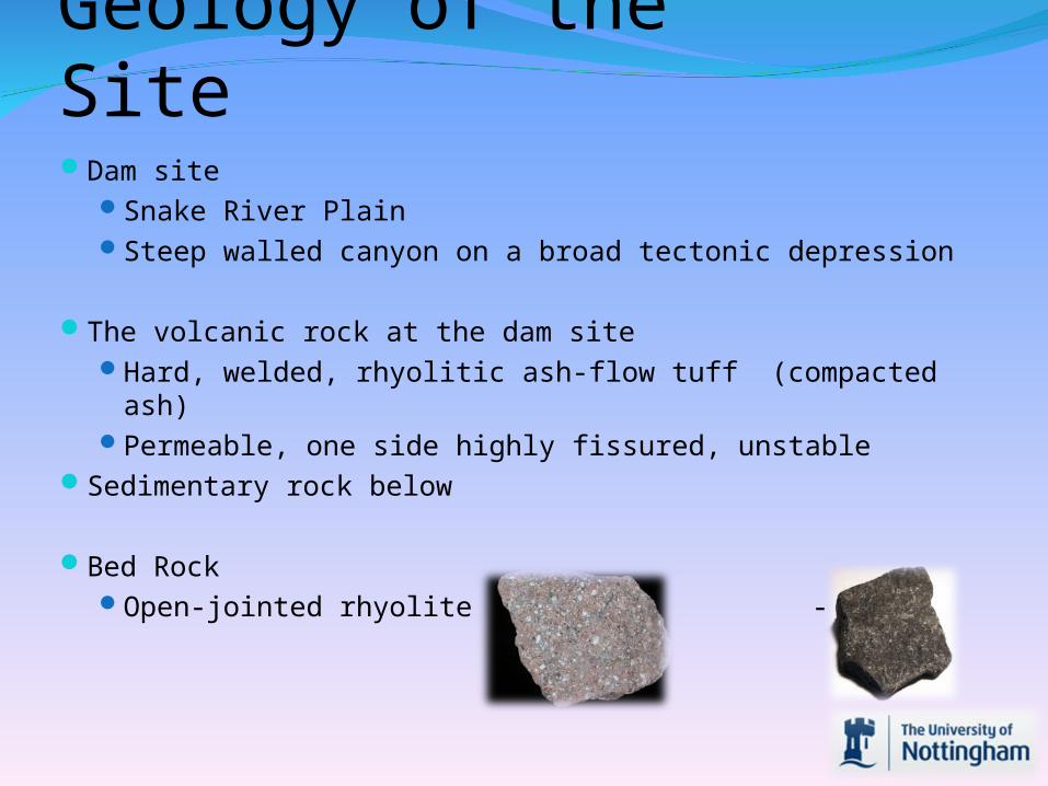
Dam site Snake River PlainSteep walled canyon on a broad tectonic depression
The volcanic rock at the dam site Hard, welded, rhyolitic ash-flow tuff (compacted ash)Permeable, one side highly fissured, unstable
Sedimentary rock below
Bed RockOpen-jointed rhyolite - Basalt
Geology of the Site

FailureOn Thursday 3rd June 1976 water was observed seeping through
the dam, it was inspected by engineers who dismissed that there was a problem.
At 7.30am on Saturday 5th June 1976 a muddy leak appeared suggesting sediment was in the water seeping through the dam. Again, engineers dismissed suggestions of a problem
Teams of workmen using mechanical equipment attempted to stem the flow through the dam ultimately unsuccessfully with 2 workmen having to be rescued when their bulldozers were swallowed up by the collapsing dam
At 11.15am an order to evacuate downstream was givenThe dam was completely breached at 11.55am releasing
57000m3/s of waterBy 8pm the dam was empty
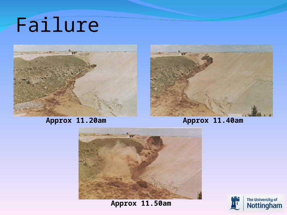
Failure
Approx 11.20am Approx 11.40am
Approx 11.50am

Failure
Approx 12pm After 12pm
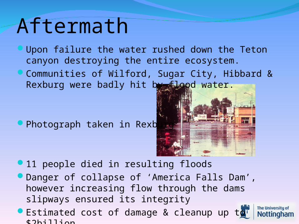
AftermathUpon failure the water rushed down the Teton canyon
destroying the entire ecosystem.Communities of Wilford, Sugar City, Hibbard &
Rexburg were badly hit by flood water.
Photograph taken in Rexburg
11 people died in resulting floodsDanger of collapse of ‘America Falls Dam’, however
increasing flow through the dams slipways ensured its integrity
Estimated cost of damage & cleanup up to $2billion

Volcanic fumaroleslarge voidsFavored development of cracks
Fill material – rhyolite, basaltNot suitable for foundations
Permeable, one side highly fissured, unstable trenching abutment rock providing large core-
rock contact and long flow path (for low seepage gradient)
Arching (increase in stress in some areas and a reduction in others)
Geology Behind the Failure

Following the failure, an investigative panel was selected to
review the cause. The panel issued its report in December 1976.
The report concluded that the main contributing factors to the dam failure were:
Erosion/PipingThe geology of the siteThe design of the damThe lack of instrumentation to warn of changing
conditions
Engineering Factors Behind Failure
In July 2009, there was new speculation about rebuilding in order to provide water for irrigation.
The Bureau of Reclamation has reportedly set aside $400,000 of the $800,000 needed to study the feasibility of rebuilding.
The Future of The Teton Site
“As every dam engineer knows, water also has one job, and that is to get past anything in its way!!”
Conclusion
Collapse caused by a combination of bad engineering decisions related to the geology of the site.
Warning signs ignored early on the day of collapse. Evacuation order could have come sooner perhaps saving more lives