building a collaborative process for address point data for … · 2017. 8. 2. · building a...
TRANSCRIPT

Building a Collaborative Process for Address Point Data for Minnesota
Dan Ross | Chief Geospatial Officer
1/26/2017
Information Technology for Minnesota Government | mn.gov/mnit

Build an Understanding …
• Define the stakeholders
• Who are the authoritative sources
• Counties, cities, vendors
• What state is the data in?
• Who are the users?
• Are there standards that already exist and are being used?
• How can we share?
• What data activity is already occurring?
• Multiple efforts going on
5/22/2017 Information Technology for Minnesota Government | mn.gov/mnit 2

Stakeholders
Multiple
• State Agencies• Counties• Cities• Private companies
Multiple needs to cover• Come together to create once and use many times• Build a common standard for the data – meets the needs of multiple agencies• Roles and responsibilities
Use Authoritative data source wherever possible• Initial data• Data cleanup• Data maintenance
5/22/2017 3

Combining multiple efforts ….
• MnDOT – Roads and Highways Deployment
• Desire to collect directly from authoritative sources
• Metropolitan Council
• Regional effort - many data sets (parcels, address points, centerlines)
• NG9-1-1
• Statewide effort – 104 PSAP
• Moving faster than DOT so became the driver for the local data collect
• Statewide standards
5/22/2017 4

Create a plan…
NG9-1-1 Project
• Create a plan for:• Data intake, development, validation, normalization, aggregation,
sharing, maintenance
• Short and long term
• Consider:• Roles and responsibility for each stage of the process
• Technology
• Architecture is important
• Make sure to align the technology with what you need to support (e.g. applications, versus web services versus cached basemaps)
• Don’t forget security
• Resources to build/support
• Budget, human resources, in-house, vendor supported
• Don’t forget the tails
• Cost Recovery?
5/22/2017 5
Building the process
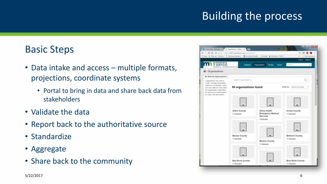
Basic Steps
• Data intake and access – multiple formats, projections, coordinate systems
• Portal to bring in data and share back data from stakeholders
• Validate the data
• Report back to the authoritative source
• Standardize
• Aggregate
• Share back to the community
5/22/2017 6

Recognizing the Needs of Stakeholders
• Multiple ways to provide data
• Validated, standardized and aggregated in a single place
• Error an potential issues reports back to the authoritative source
• Shared back to stakeholders and other users in multiple formats to meet a variety of needs
• Vision is that some form of the data is open to all users
FAIL
GIS
MSA
G
NextGen 9-1-1Database
(Production Ready)
ALI/MSAGDatabase Vendors
MN Geospatial Commons
Level 2 QA/QCTo accommodate different systems
Level 1 QA/QCAggregator
Address or street data and other statewide administrative Layers
Aggregator bringsstatewide information
together
Pass
Address or Street data
Address or Street data
Add
ress
or S
tree
t dat
a
Authoritative or LocalData Source
Method 3
FAIL
Errors
Web EditorHosted System
Authoritative or LocalData Source
Method 2
Authoritative or LocalData Source
Method 1
Local GIS
ETL
Change Request
Change RequestSystem
MnGeo or other State Agencies
and makeschanges or creates
data as needed
MN Geospatial Commons
Possible Data Flow for Obtaining Addresses Points and Street Centerline Information
Method 1 – Requires regular extracts from authoritative data sources and incorporation of extract, transform and load processes (ETL). This will require a GIS resource or an automated process to mosaic local data together into a stands based data form
Method 2 – Authoritative data sources would be provided a web editing platform that would allow editing of data in a hosted system with a standards based data model. Editing could occur either via a sketchup/redline layer or direct editing of the database with a standards based data model
Method 3 – A process where the authoritative source submits change request to a change management system. This could be through a web based system and could use a sketch up/redline type of system The aggregator or some other GIS resource would be required to make the change to the GIS data
Pass
ETL
Extract
Extracts back to local systems or beyond
Extract
Geospatial Data Layers
MnDOT LRS

More Detailed Process
5/22/2017 Optional Tagline Goes Here | mn.gov/websiteurl 8

Data intake
5/22/2017 9
Secure Portal
• Each organization has a provided a single IP for access
• Multiple secure logins per organization
• Each has their own organization
• Incoming and outgoing
• All geospatial data, validation reports, scripts, standards, user guides
• Open Source

Authoritative Data and Challenges
5/22/2017 10
Standards
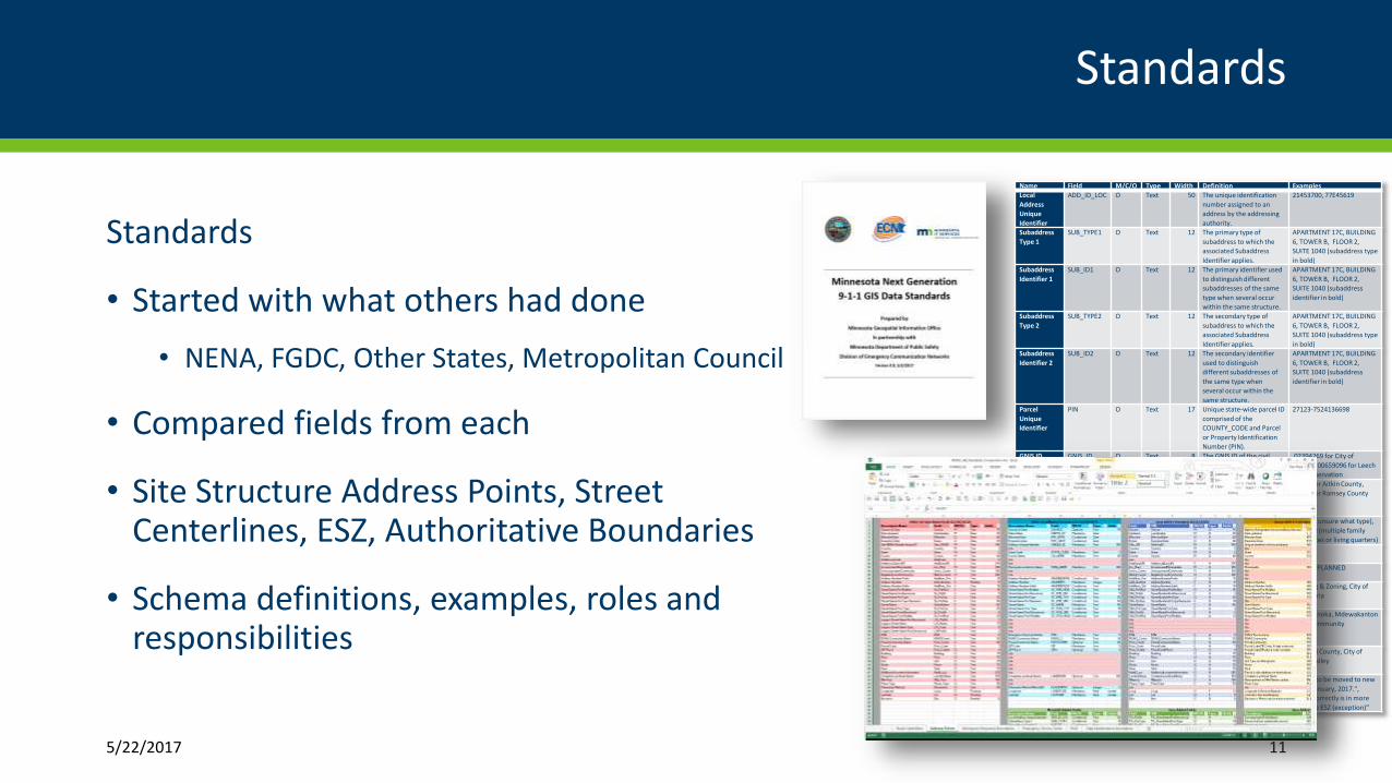
Standards
• Started with what others had done
• NENA, FGDC, Other States, Metropolitan Council
• Compared fields from each
• Site Structure Address Points, Street Centerlines, ESZ, Authoritative Boundaries
• Schema definitions, examples, roles and responsibilities
5/22/2017 11
Name Field M/C/O Type Width Definition Examples
Local
Address
Unique
Identifier
ADD_ID_LOC O Text 50 The unique identification
number assigned to an
address by the addressing
authority.
21453700, 77E45619
Subaddress
Type 1
SUB_TYPE1 O Text 12 The primary type of
subaddress to which the
associated Subaddress
Identifier applies.
APARTMENT 17C, BUILDING
6, TOWER B, FLOOR 2,
SUITE 1040 (subaddress type
in bold)
Subaddress
Identifier 1
SUB_ID1 O Text 12 The primary identifier used
to distinguish different
subaddresses of the same
type when several occur
within the same structure.
APARTMENT 17C, BUILDING
6, TOWER B, FLOOR 2,
SUITE 1040 (subaddress
identifier in bold)
Subaddress
Type 2
SUB_TYPE2 O Text 12 The secondary type of
subaddress to which the
associated Subaddress
Identifier applies.
APARTMENT 17C, BUILDING
6, TOWER B, FLOOR 2,
SUITE 1040 (subaddress type
in bold)
Subaddress
Identifier 2
SUB_ID2 O Text 12 The secondary identifier
used to distinguish
different subaddresses of
the same type when
several occur within the
same structure.
APARTMENT 17C, BUILDING
6, TOWER B, FLOOR 2,
SUITE 1040 (subaddress
identifier in bold)
Parcel
Unique
Identifier
PIN O Text 17 Unique state-wide parcel ID
comprised of the
COUNTY_CODE and Parcel
or Property Identification
Number (PIN).
27123-7524136698
GNIS ID GNIS_ID O Text 8 The GNIS ID of the civil
feature in which the
address point is located.
02394269 for City of
Hallock, 00659096 for Leech
Lake Reservation
County Code CO_CODE O Text 5 The state and county FIPS
codes for the county in
which the address point
feature resides.
27001 for Aitkin County,
27123 for Ramsey County
Residence RESIDENCE O Text 8 Address point feature has a
residence or living quarters.
Yes (but unsure what type),
Multiple (multiple family
residences or living quarters)
Mailable
Address
MAILABLE O Text 10 Address point feature
receives USPS mail delivery.
Y, N, U
Status STATUS O Text 10 The current operational
condition of the feature.
ACTIVE, PLANNED
Source of
Data
SOURCE O Text 75 Source from whom the
data provider obtained the
address.
Planning & Zoning, City of
Alexandria
Address
Authority
AAUTHORITY O Text 40 The name of the authority
that has jurisdiction over
the address of the address
point feature.
City of Anoka, Mdewakanton
Sioux Community
Editing
Organization
EDIT_ORG O Text 40 The organization that made
the last change to the data
record.
Beltrami County, City of
Apple Valley
Comments COMMENTS C Text 254 Miscellaneous information
about the feature.
"House to be moved to new
site in January, 2017.",
"Point correctly is in more
than one ESZ (exception)"
Data Validation
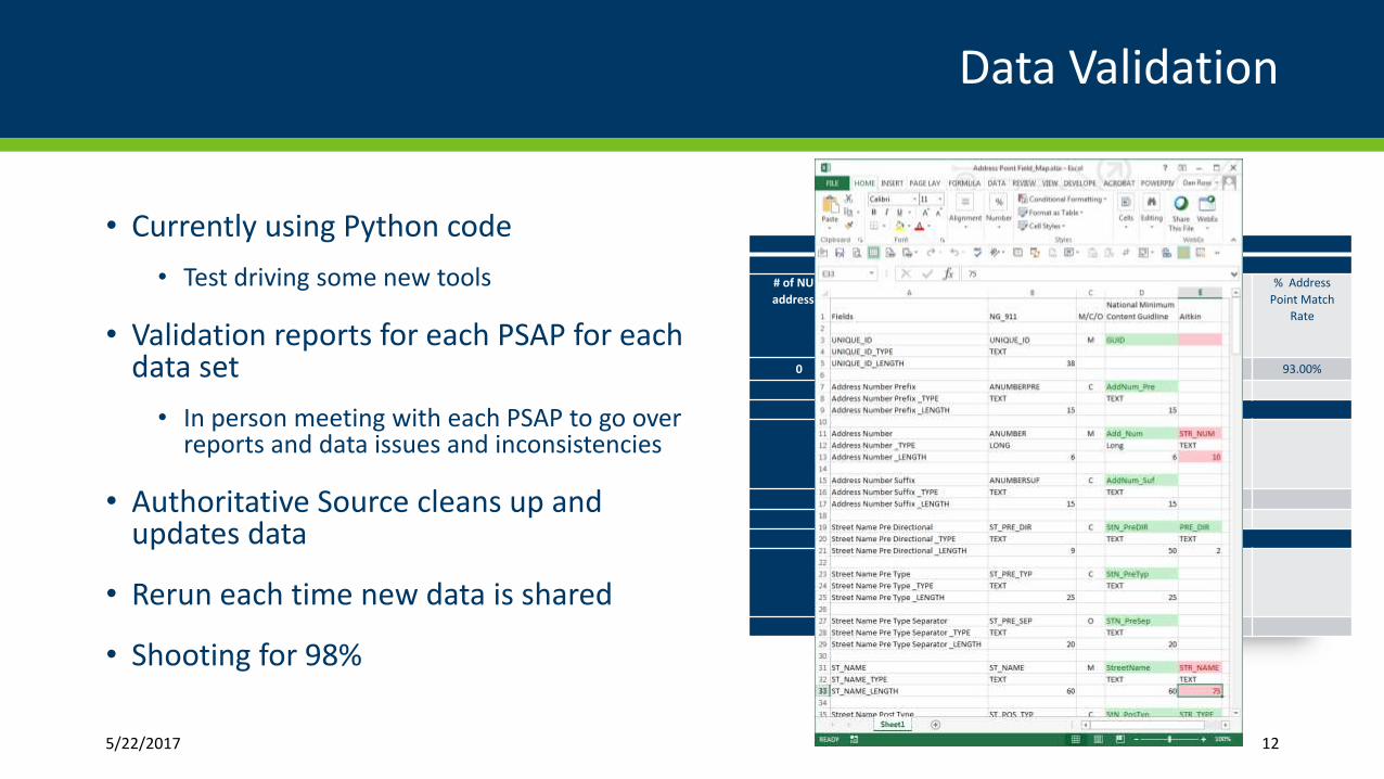
• Currently using Python code
• Test driving some new tools
• Validation reports for each PSAP for each data set
• In person meeting with each PSAP to go over reports and data issues and inconsistencies
• Authoritative Source cleans up and updates data
• Rerun each time new data is shared
• Shooting for 98%
5/22/2017 12
Olmsted County - Address Validation
Geocoding Results derived from Address Point data vs Centerline data
# of NULL
addresses
# Unique
Address Pt
Geocoding
Errors
(unmatched)
% Address Pt
Geocoding
Errors
(unmatched)
# Address Pt
Geocoding Ties
(Tied)
% Address Pt
Geocoding Ties
(Tied)
% Address
Point Match
Rate
0 3673 6.00% 780 1.00% 93.00%
Geocoding Results derived from ALI data vs Address Point data
# ALI Address
Geocoding
Errors (Tied)
# ALI Address
Geocoding
Errors
(Unmatched)
% ALI Address
Geocoding
Errors
% Address
Point Match
Rate
364 1919 7.00% 91.00%
Geocoding Results derived from ALI data vs Centerline data
# ALI Address
Geocoding
Errors (Tied)
# ALI Address
Geocoding
Errors
(Unmatched)
% ALI Address
Geocoding
Errors
% Centerline
Match Rate
391 2285 10.00% 90.00%

Data normalization and Aggregation
• Individual data sets schema mapped to standard
• Data transformed into the standard
• Use of domains for common elements (e.g. City Name, Street name, prefix, etc.)
• Standardized data is aggregated (just starting this process now)
• Shared back to authoritative source and others who need it
• Data by region, web services, data download for individual county
• New tools being rolled out for online editing (started with ESZ, address point next)
5/22/2017 13
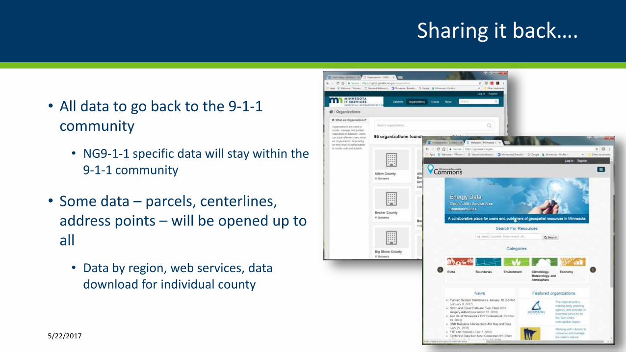
Sharing it back….
• All data to go back to the 9-1-1 community
• NG9-1-1 specific data will stay within the 9-1-1 community
• Some data – parcels, centerlines, address points – will be opened up to all
• Data by region, web services, data download for individual county
5/22/2017 14
