brookwood manor compressed - core.ac.uk · its function was to clear the vlei that was immediately...
TRANSCRIPT
1
Architectural Impact Assessment for the remnant excavations and structures on Erf 29 of 3 of Leeuwbosch 1275,
Brookwood Manor Farm, Fort Nottingham
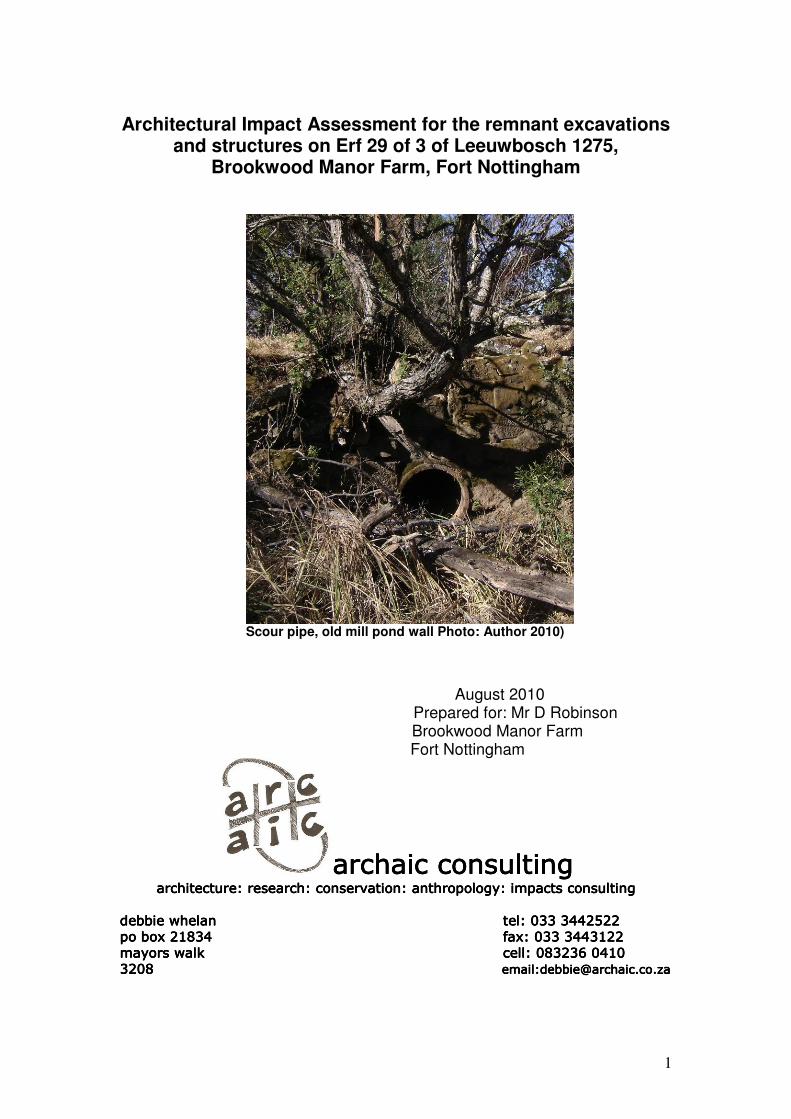
Scour pipe, old mill pond wall Photo: Author 2010)
August 2010 Prepared for: Mr D Robinson
Brookwood Manor Farm Fort Nottingham
archaic consultingarchaic consultingarchaic consultingarchaic consulting architecture: research: conservation: anthropology: impacts consultingarchitecture: research: conservation: anthropology: impacts consultingarchitecture: research: conservation: anthropology: impacts consultingarchitecture: research: conservation: anthropology: impacts consulting
debbie whelan debbie whelan debbie whelan debbie whelan tel: 033 3442522tel: 033 3442522tel: 033 3442522tel: 033 3442522
po box 21834 po box 21834 po box 21834 po box 21834 fax: 033 3443122fax: 033 3443122fax: 033 3443122fax: 033 3443122
mayors walk mayors walk mayors walk mayors walk cell:cell:cell:cell: 083236 0410 083236 0410 083236 0410 083236 0410
3208 3208 3208 3208 email:[email protected]:[email protected]:[email protected]:[email protected]
2
Architectural Impact Assessment for the remnant excavations and structures on erf 29 of 3 of Leeuwbosch 1275,
Brookwood Manor Farm, Fort Nottingham
Contents: 1. Introduction 2. Methodology 3. History of site 4. Description of heritage resources
4.1 The Drainage Furrow 4.2 The Mill pond 4.3 The Mill Stream 4.4 The Mill Race 4.5 The Kintail Mill
5. Recommendations 6. References
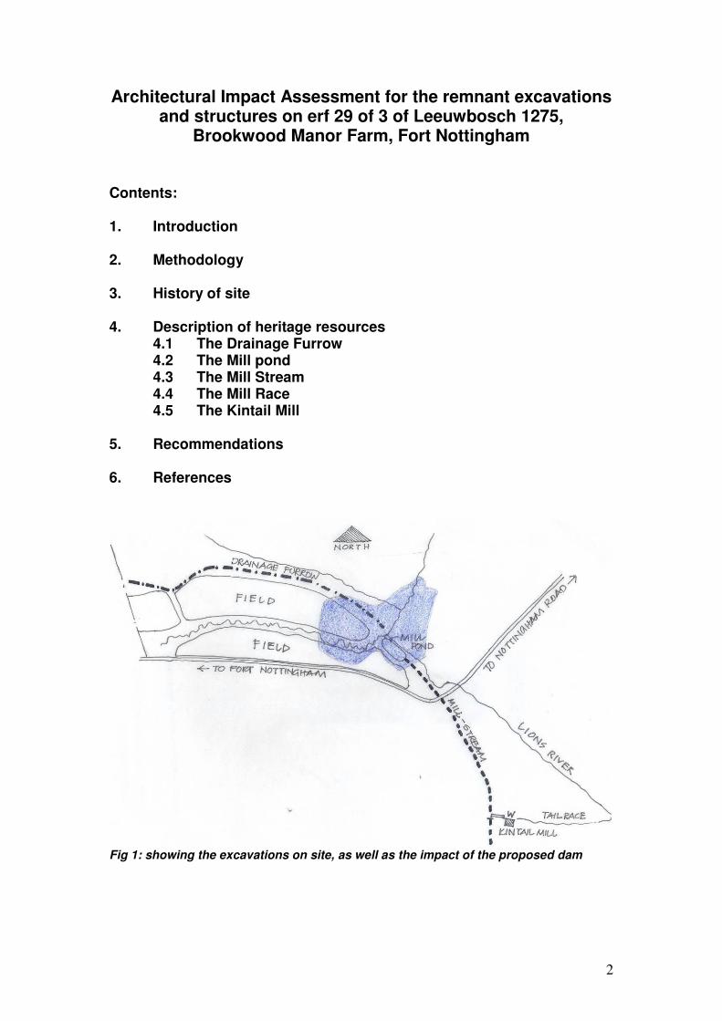
Fig 1: showing the excavations on site, as well as the impact of the proposed dam
3
1. Introduction Debbie Whelan of Archaic Consulting was requested by Elize Bekker of Knight Piesold to conduct an Heritage Impact Assessment with regard to the excavations and structures which are found on the southerly portion of Lot 29 of 1275, Fort Nottingham, known as Brookwood Manor Farm. This report will present the result of the findings of this investigation, in order to recommend mitigatory approaches in terms of the KwaZulu-Natal Provincial Heritage Act no 4 of 2008. The site is the farm Brookwood Manor, situated on Lot 29 of Leeuwbosch 1275. Lot 29 was originally part of Lot 3, alienated from the parent farm in 1943, thus any investigation is with regard to Lot 3. To the west lies the old ‘Nottingham Bush’ now administered by Ezemvelo, and to the south lies the farm Kintail, alienated as part of Lot 3 in 1943, but subsequently split along the road. The structures discussed in this report straddle both properties, but only the drainage furrow, the remains of the mill- pond, and the very upper reaches at the sluice end of the dam wall will be inundated. The intention of the owner of the property, Mr D Robinson, is to flood the lower parts of the property in order to create a dam. In this process, a previous dam that was on the site, now known to be a breached mill- pond, will be covered by water, in addition to irrigation furrows that were once dug to drain a wetland which drained into the Lions River. See figure 1 above.
2. Methodology The author carried out a site inspection with Dr. JE Granger on 16 July 2010. The salient features of the affected elements as well as the extent of the dam, was pointed out. The drainage furrow was followed to its head on the boundary with the Ezemvelo property to the west, where it petered out. The site now known to be the mill- pond was inspected, and the original point of entry for the water from the river located. The mill- stream was followed, until it crossed the Fort- Nottingham road onto Kintail, and its progress towards the mill- race at the Kintail Mill identified. The Land Registers at the Provincial Deeds office were consulted, as well as maps and survey diagrams, in order to track the fragmentation of the parent farm. Archival sources were consulted, and little found dealing with the Kintail Mill, or mills in the area apart from the sawmill in the Dargle. Oral information pointed at the mill being a sawmill, but its scale seemed a little small for cutting logs.
Recourse was then made to published sources at the University of KwaZulu-Natal Library, the Provincial Archives Repository, the Killie Campbell, Collection, and the Bessie Head Legal Deposit Library. The Reference section at the end of this report will offer more information.
4
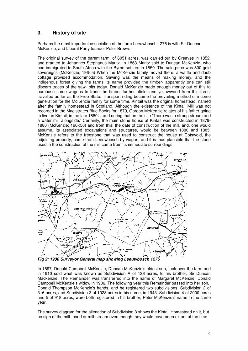
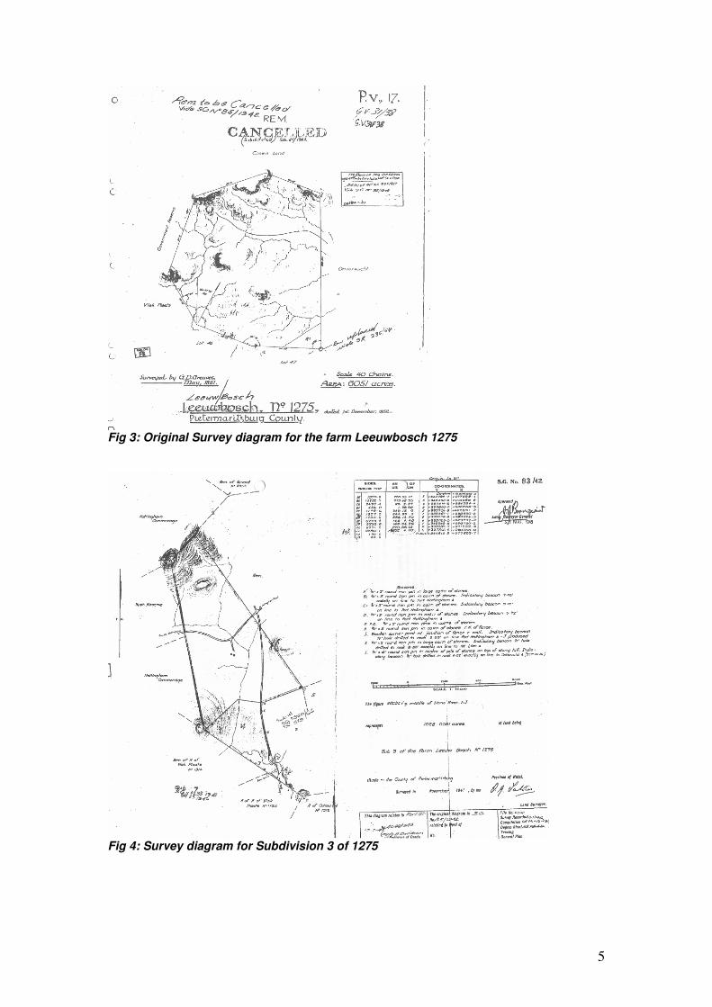
3. History of site Perhaps the most important association of the farm Leeuwbosch 1275 is with Sir Duncan McKenzie, and Liberal Party founder Peter Brown. The original survey of the parent farm, of 6051 acres, was carried out by Greaves in 1852, and granted to Johannes Stephanus Maritz. In 1863 Maritz sold to Duncan McKenzie, who had immigrated to South Africa with the Byrne settlers in 1850. The sale price was 300 gold sovereigns (McKenzie; 196-:5) When the McKenzie family moved there, a wattle and daub cottage provided accommodation. Sawing was the means of making money, and the indigenous forest giving the farms its name provided the timber- apparently one can still discern traces of the saw- pits today. Donald McKenzie made enough money out of this to purchase some wagons to trade the timber further afield, and yellowwood from this forest travelled as far as the Free State. Transport riding became the prevailing method of income generation for the McKenzie family for some time. Kintail was the original homestead, named after the family homestead in Scotland. Although the existence of the Kintail Mill was not recorded in the Magistrates Blue Books for 1879, Gordon McKenzie relates of his father going to live on Kintail, in the late 1880’s, and noting that on the site ‘There was a strong stream and a water mill alongside.’ Certainly, the main stone house at Kintail was constructed in 1879- 1880 (McKenzie; 196-:56) and from this, the date of construction of the mill, and, one would assume, its associated excavations and structures, would be between 1880 and 1885. McKenzie refers to the freestone that was used to construct the house at Cotswold, the adjoining property, came from Leeuwbosch by wagon, and it is thus plausible that the stone used in the construction of the mill came from its immediate surroundings.
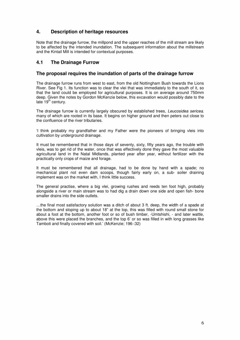
Fig 2: 1930 Surveyor General map showing Leeuwbosch 1275 In 1897, Donald Campbell McKenzie, Duncan McKenzie’s eldest son, took over the farm and in 1910 sold what was known as Subdivision A of 136 acres, to his brother, Sir Duncan Mackenzie. The Remainder was transferred into the name of Margaret McKenzie, Donald Campbell McKenzie’s widow in 1936. The following year this Remainder passed into her son, Donald Thompson McKenzie’s hands, and he registered two subdivisions, Subdivision 2 of 316 acres, and Subdivision 3 of 1028 acres in his name, in 1943. Subdivision 4 of 2000 acres and 5 of 918 acres, were both registered in his brother, Peter McKenzie’s name in the same year. The survey diagram for the alienation of Subdivision 3 shows the Kintail Homestead on it, but no sign of the mill- pond or mill-stream even though they would have been extant at the time.
5
Fig 3: Original Survey diagram for the farm Leeuwbosch 1275
Fig 4: Survey diagram for Subdivision 3 of 1275
6
4. Description of heritage resources Note that the drainage furrow, the millpond and the upper reaches of the mill stream are likely to be affected by the intended inundation. The subsequent information about the millstream and the Kintail Mill is intended for contextual purposes.
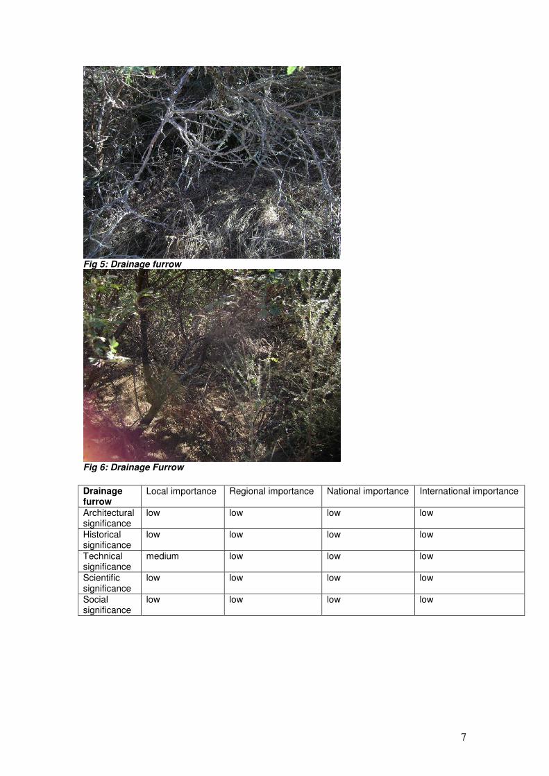
4.1 The Drainage Furrow The proposal requires the inundation of parts of the drainage furrow The drainage furrow runs from west to east, from the old Nottingham Bush towards the Lions River. See Fig 1. Its function was to clear the vlei that was immediately to the south of it, so that the land could be employed for agricultural purposes. It is on average around 750mm deep. Given the notes by Gordon McKenzie below, this excavation would possibly date to the late 19
th century.
The drainage furrow is currently largely obscured by established trees, Leucosidea sericea,
many of which are rooted in its base. It begins on higher ground and then peters out close to the confluence of the river tributaries.
‘I think probably my grandfather and my Father were the pioneers of bringing vleis into cultivation by underground drainage. It must be remembered that in those days of seventy, sixty, fifty years ago, the trouble with vleis, was to get rid of the water, once that was effectively done they gave the most valuable agricultural land in the Natal Midlands, planted year after year, without fertilizer with the practically only crops of maize and forage. It must be remembered that all drainage, had to be done by hand with a spade; no mechanical plant not even dam scoops, though fairly early on, a sub- soiler draining implement was on the market with, I think little success. The general practise, where a big vlei, growing rushes and reeds ten foot high, probably alongside a river or main stream was to had dig a drain down one side and open fish- bone smaller drains into the side outlets. …the final most satisfactory solution was a ditch of about 3 ft. deep, the width of a spade at the bottom and sloping up to about 18” at the top, this was filled with round small stone for about a foot at the bottom, another foot or so of bush timber, -Umtshishi, - and later wattle, above this were placed the branches, and the top 6’ or so was filled in with long grasses like Tamboti and finally covered with soil.’ (McKenzie; 196-:32)
7
Fig 5: Drainage furrow
Fig 6: Drainage Furrow
Drainage furrow
Local importance Regional importance National importance International importance
Architectural significance
low low low low
Historical significance
low low low low
Technical significance
medium low low low
Scientific significance
low low low low
Social significance
low low low low
8
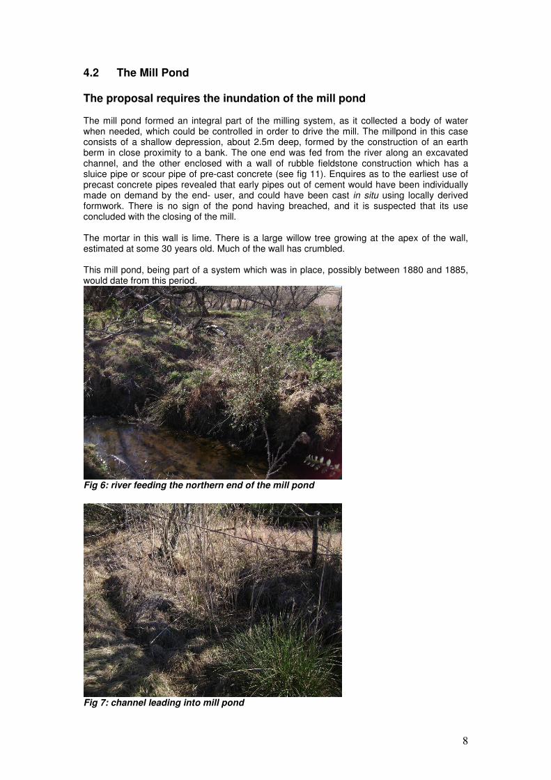
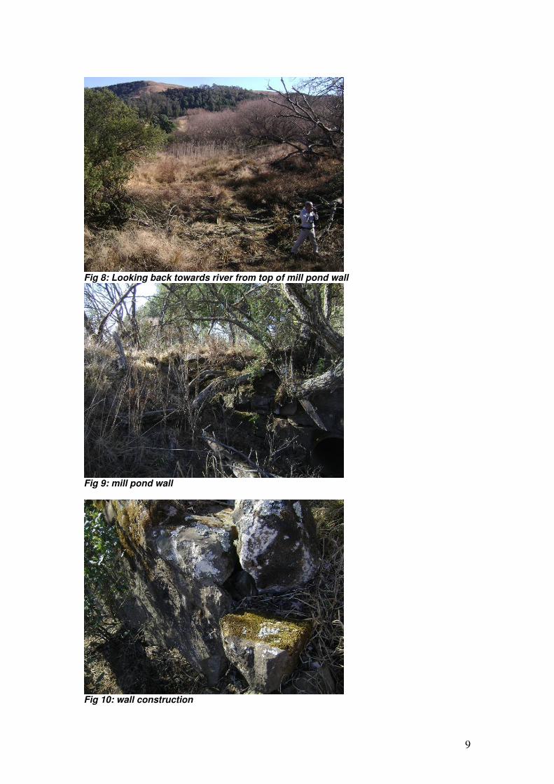
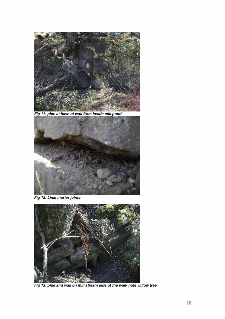
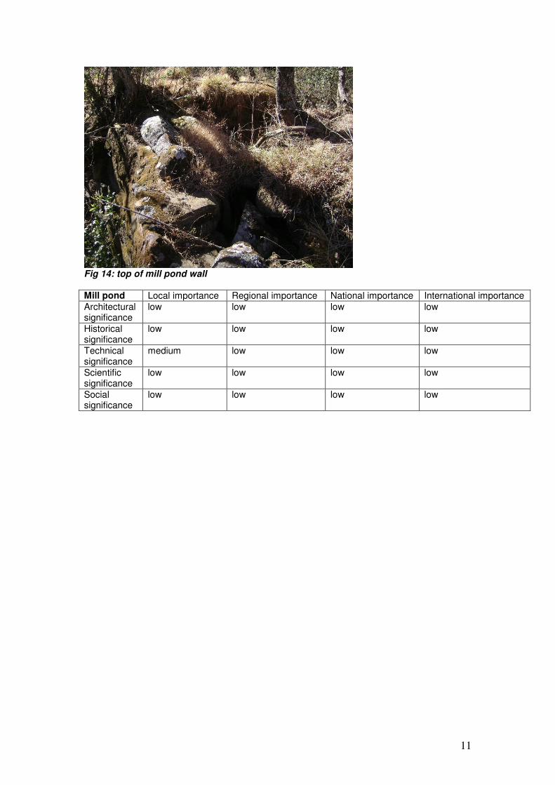
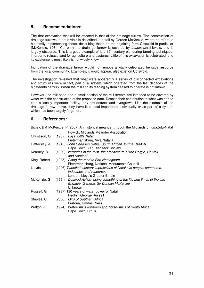
4.2 The Mill Pond The proposal requires the inundation of the mill pond The mill pond formed an integral part of the milling system, as it collected a body of water when needed, which could be controlled in order to drive the mill. The millpond in this case consists of a shallow depression, about 2.5m deep, formed by the construction of an earth berm in close proximity to a bank. The one end was fed from the river along an excavated channel, and the other enclosed with a wall of rubble fieldstone construction which has a sluice pipe or scour pipe of pre-cast concrete (see fig 11). Enquires as to the earliest use of precast concrete pipes revealed that early pipes out of cement would have been individually made on demand by the end- user, and could have been cast in situ using locally derived formwork. There is no sign of the pond having breached, and it is suspected that its use concluded with the closing of the mill. The mortar in this wall is lime. There is a large willow tree growing at the apex of the wall, estimated at some 30 years old. Much of the wall has crumbled. This mill pond, being part of a system which was in place, possibly between 1880 and 1885, would date from this period.
Fig 6: river feeding the northern end of the mill pond
Fig 7: channel leading into mill pond
9
Fig 8: Looking back towards river from top of mill pond wall
Fig 9: mill pond wall
Fig 10: wall construction
10
Fig 11: pipe at base of wall from inside mill pond
Fig 12: Lime mortar joints
Fig 13: pipe and wall on mill stream side of the wall- note willow tree
11
Fig 14: top of mill pond wall Mill pond Local importance Regional importance National importance International importance
Architectural significance
low low low low
Historical significance
low low low low
Technical significance
medium low low low
Scientific significance
low low low low
Social significance
low low low low
12
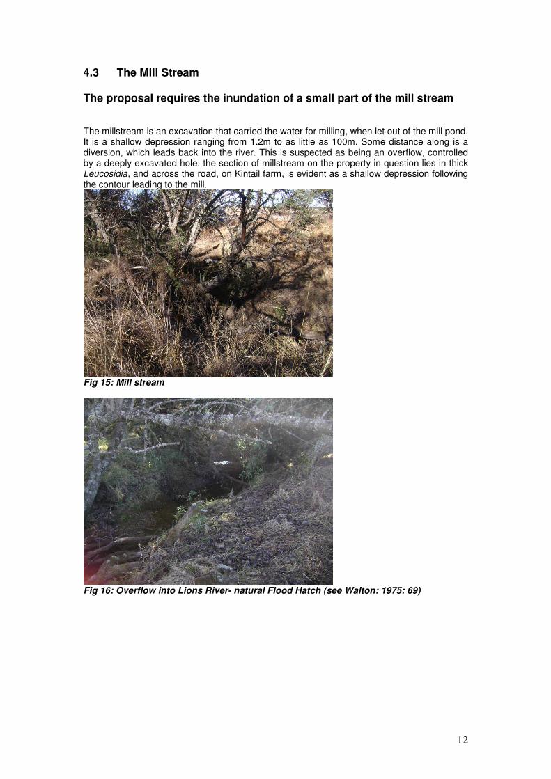
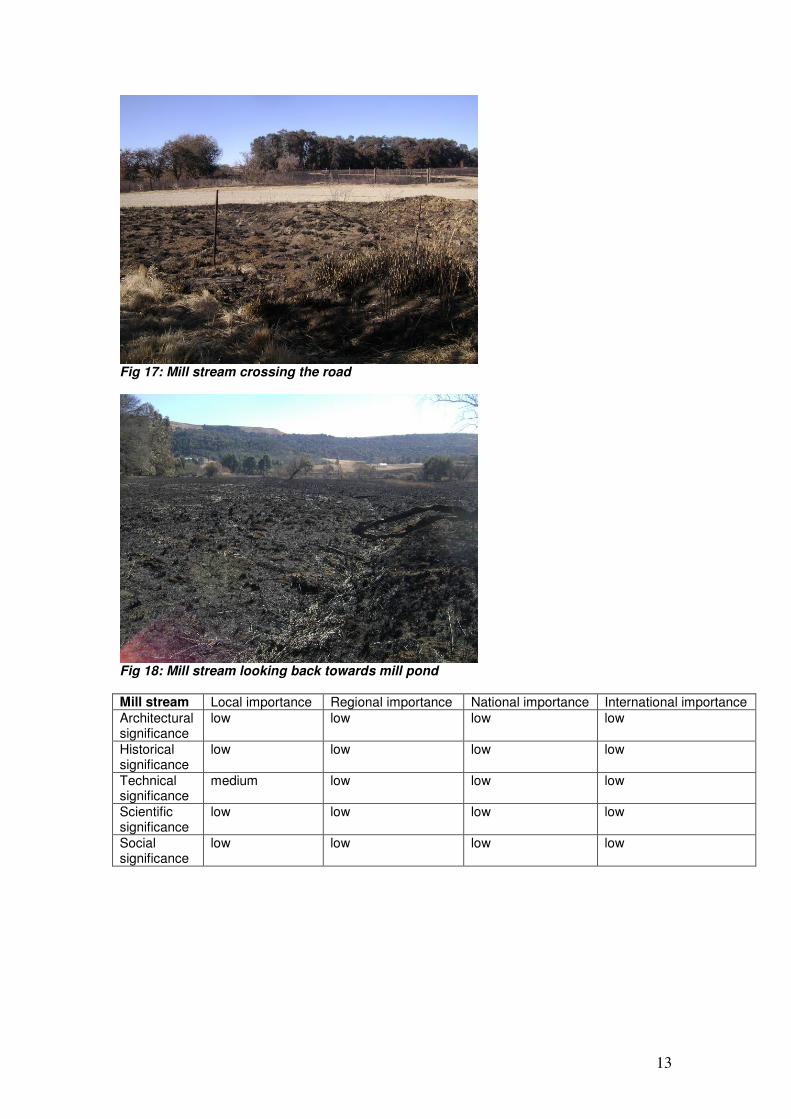
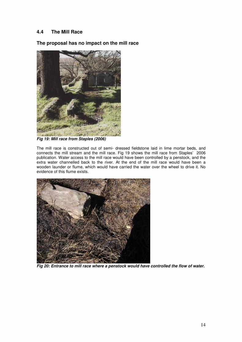
4.3 The Mill Stream The proposal requires the inundation of a small part of the mill stream The millstream is an excavation that carried the water for milling, when let out of the mill pond. It is a shallow depression ranging from 1.2m to as little as 100m. Some distance along is a diversion, which leads back into the river. This is suspected as being an overflow, controlled by a deeply excavated hole. the section of millstream on the property in question lies in thick Leucosidia, and across the road, on Kintail farm, is evident as a shallow depression following the contour leading to the mill.
Fig 15: Mill stream
Fig 16: Overflow into Lions River- natural Flood Hatch (see Walton: 1975: 69)
13
Fig 17: Mill stream crossing the road
Fig 18: Mill stream looking back towards mill pond Mill stream Local importance Regional importance National importance International importance
Architectural significance
low low low low
Historical significance
low low low low
Technical significance
medium low low low
Scientific significance
low low low low
Social significance
low low low low
14
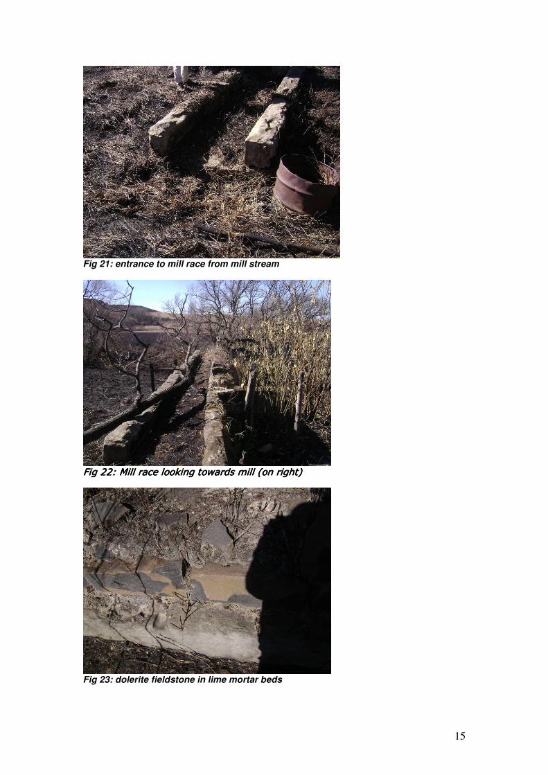
4.4 The Mill Race The proposal has no impact on the mill race
Fig 19: Mill race from Staples (2006) The mill race is constructed out of semi- dressed fieldstone laid in lime mortar beds, and connects the mill stream and the mill race. Fig 19 shows the mill race from Staples’ 2006 publication. Water access to the mill race would have been controlled by a penstock, and the extra water channelled back to the river. At the end of the mill race would have been a wooden launder or flume, which would have carried the water over the wheel to drive it. No evidence of this flume exists.
Fig 20: Entrance to mill race where a penstock would have controlled the flow of water.
15
Fig 21: entrance to mill race from mill stream
Fig 22: Mill race lookFig 22: Mill race lookFig 22: Mill race lookFig 22: Mill race looking towards mill (on right)ing towards mill (on right)ing towards mill (on right)ing towards mill (on right)
Fig 23: dolerite fieldstone in lime mortar beds
16
Fig 24: Mill race showing elevation to reach mill
Mill race Local importance Regional importance National importance International importance
Architectural significance
low low low low
Historical significance
medium low low low
Technical significance
high low low low
Scientific significance
low low low low
Social significance
low low low low
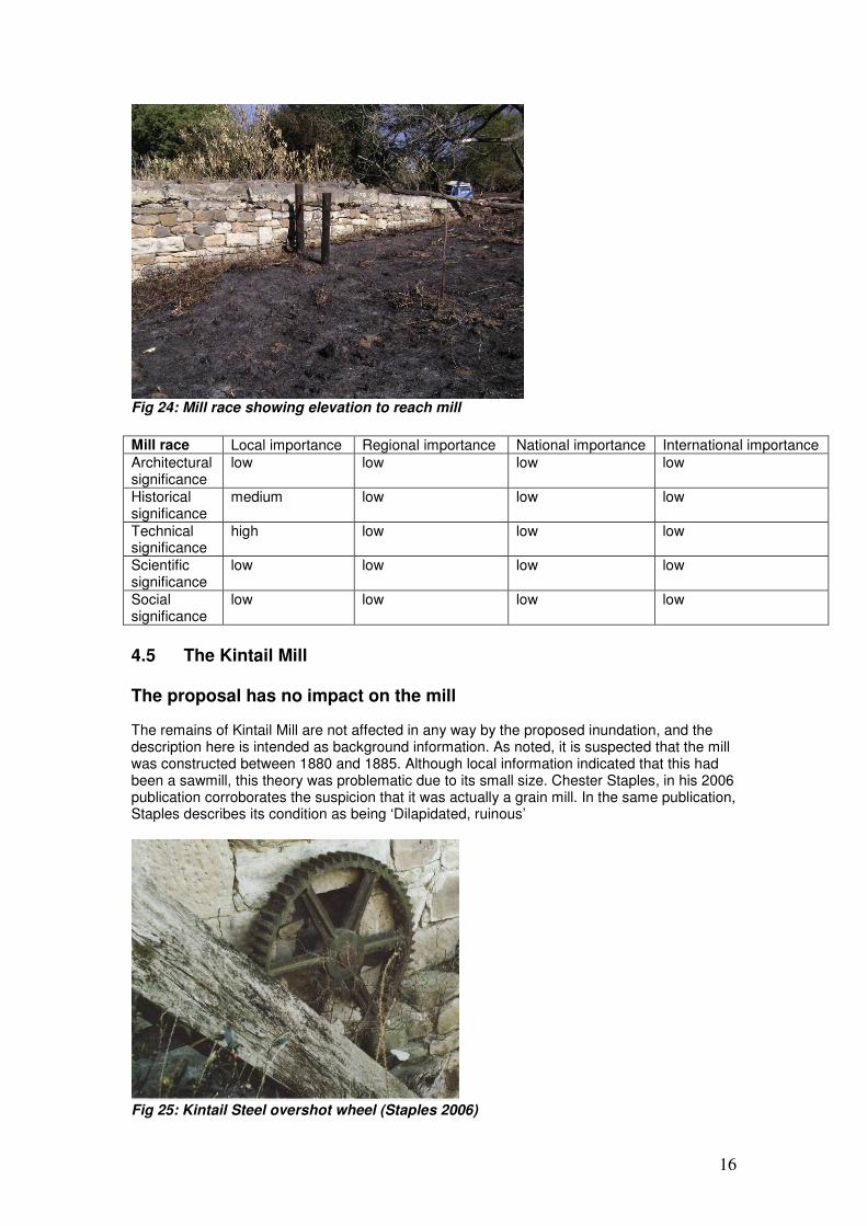
4.5 The Kintail Mill The proposal has no impact on the mill
The remains of Kintail Mill are not affected in any way by the proposed inundation, and the description here is intended as background information. As noted, it is suspected that the mill was constructed between 1880 and 1885. Although local information indicated that this had been a sawmill, this theory was problematic due to its small size. Chester Staples, in his 2006 publication corroborates the suspicion that it was actually a grain mill. In the same publication, Staples describes its condition as being ‘Dilapidated, ruinous’
Fig 25: Kintail Steel overshot wheel (Staples 2006)
17
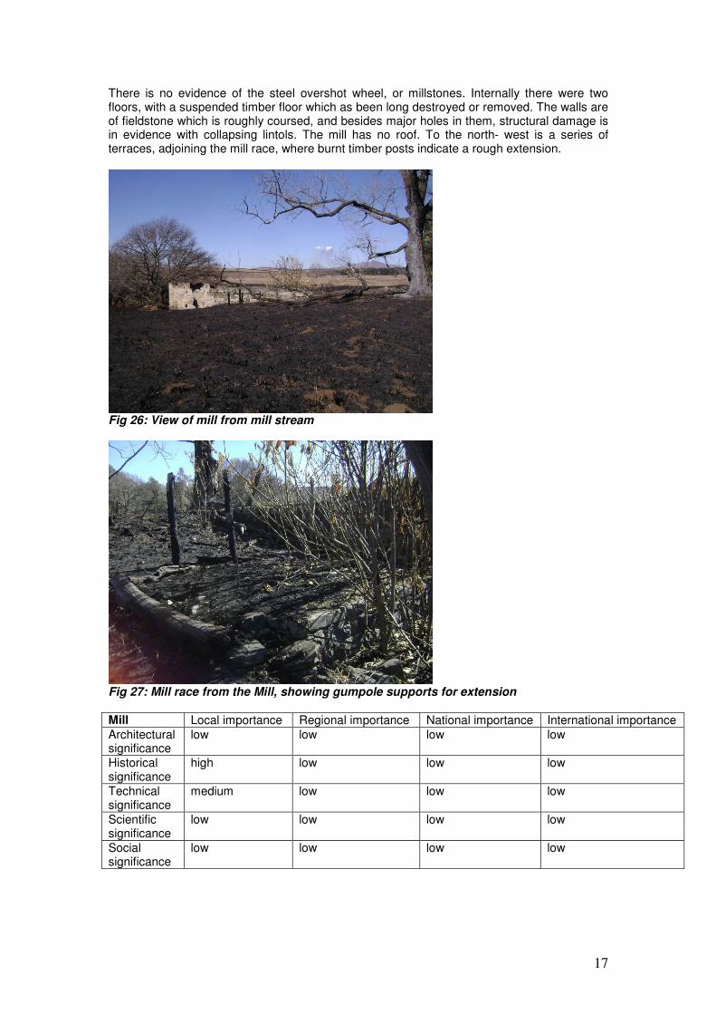
There is no evidence of the steel overshot wheel, or millstones. Internally there were two floors, with a suspended timber floor which as been long destroyed or removed. The walls are of fieldstone which is roughly coursed, and besides major holes in them, structural damage is in evidence with collapsing lintols. The mill has no roof. To the north- west is a series of terraces, adjoining the mill race, where burnt timber posts indicate a rough extension.
Fig 26: View of mill from mill stream
Fig 27: Mill race from the Mill, showing gumpole supports for extension Mill Local importance Regional importance National importance International importance
Architectural significance
low low low low
Historical significance
high low low low
Technical significance
medium low low low
Scientific significance
low low low low
Social significance
low low low low
18
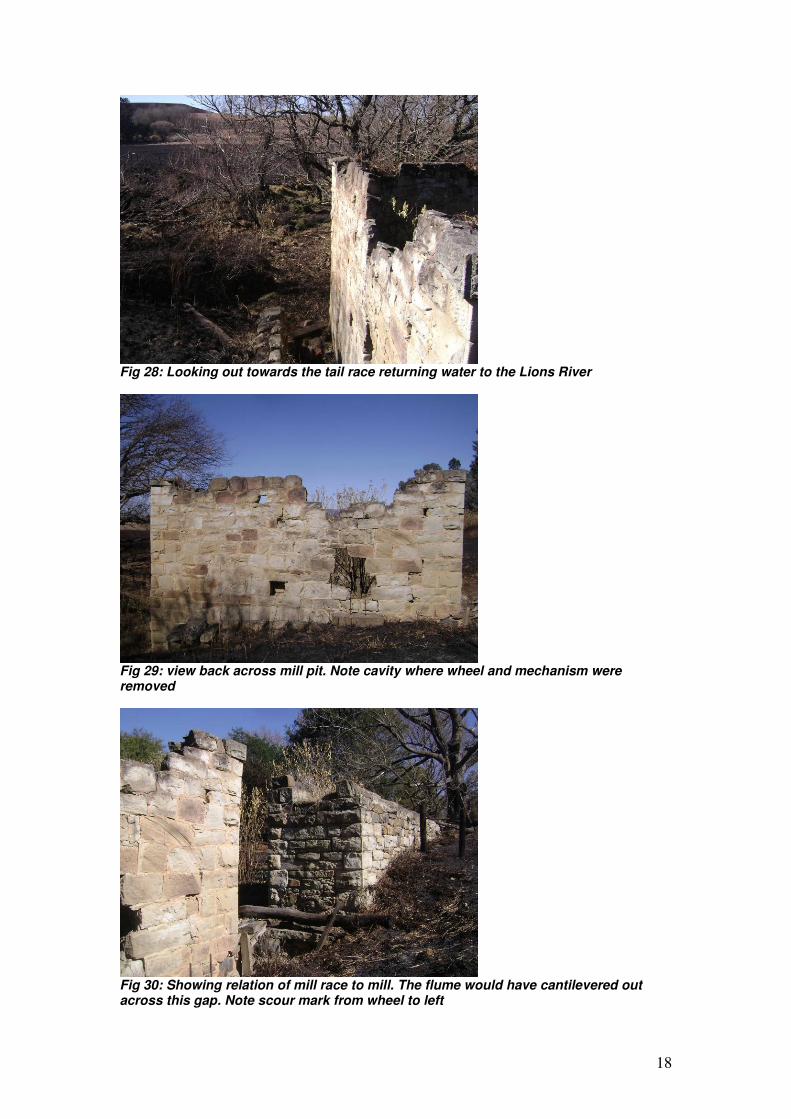
Fig 28: Looking out towards the tail race returning water to the Lions River
Fig 29: view back across mill pit. Note cavity where wheel and mechanism were removed
Fig 30: Showing relation of mill race to mill. The flume would have cantilevered out across this gap. Note scour mark from wheel to left
19
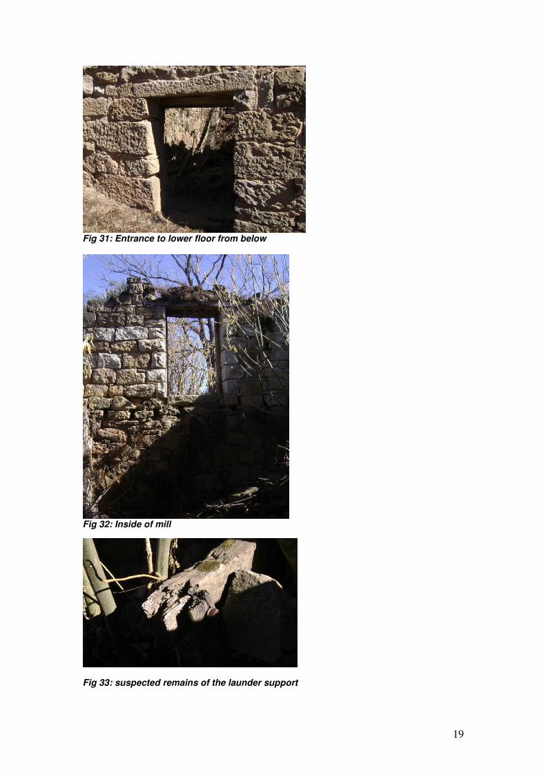
Fig 31: Entrance to lower floor from below
Fig 32: Inside of mill
Fig 33: suspected remains of the launder support
20
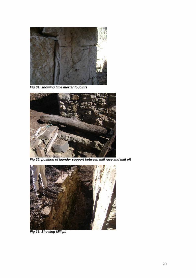
Fig 34: showing lime mortar to joints
Fig 35: position of launder support between mill race and mill pit
Fig 36: Showing Mill pit
21
5. Recommendations: The first excavation that will be affected is that of the drainage furrow. The construction of drainage furrows to drain vleis is described in detail by Gordon McKenzie, where he refers to his family implementing these, describing those on the adjoining farm Cotswold in particular (McKenzie; 196-). Currently the drainage furrow is covered by Leucosidia thickets, and is largely obscured. This is a good example of late 19
th century pioneering farming techniques,
in order to release land for agriculture and pastures. Little of this excavation is celebrated, and its existence is most likely is not widely known. Inundation of the drainage furrow would not remove a vitally celebrated heritage resource from the local community. Examples, it would appear, also exist on Cotswold. The investigation revealed that what were apparently a series of disconnected excavations and structures were in fact, part of a system, which operated from the last decades of the nineteenth century. When the mill and its feeding system ceased to operate is not known. However, the mill pond and a small section of the mill stream are intended to be covered by water with the construction of the proposed dam. Despite their contribution to what was at one time a locally important facility, they are defunct and overgrown. Like the example of the drainage furrow above, they have little local importance individually or as part of a system which has been largely forgotten.
6. References:
Bizley, B & McKenzie. P (2007) An historical meander through the Midlands of KwaZulu-Natal
Howick, Midlands Meander Association Christison, G (1987) Loyal Little Natal Pietermaritzburg, Viva Natalia Hattersley, A (1945) John Shedden Dobie, South African Journal 1862-6 Cape Town, Van Riebeeck Society Kearney, B (1989) Verandas in the mist- the architecture of the Dargle, Howick and Karkloof King, Robert (1985) Along the road to Fort Nottingham Pietermaritzburg, National Monuments Council Lloyds (1906) Twentieth century impressions of Natal : its people, commerce, industries, and resources
London, Lloyd's Greater Britain McKenzie, G (196-) Delayed Action- being something of the life and times of the late Brigadier General, Sir Duncan McKenzie Unknown Russell, G (1987) 130 years of water power of Natal Redhill, George Russell Staples, C (2006) Mills of Southern Africa Pretoria, Umdas Press Walton, J (1974) Water- mills windmills and horse- mills of South Africa Cape Town, Struik