blue mountain/birch cove - nova scotia · blue mountain/birch cove assessment study final report...
TRANSCRIPT
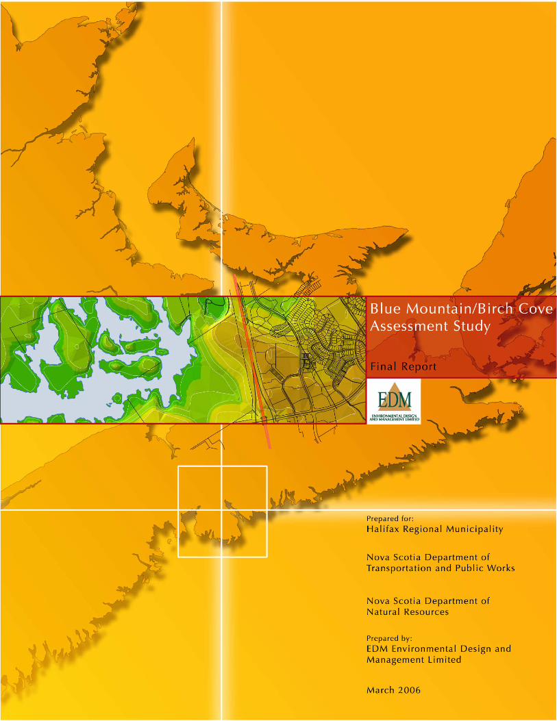

BLUE MOUNTAIN/BIRCH COVE ASSESSMENT STUDY Final Report
March 2006 Prepared for: Halifax Regional Municipality Nova Scotia Department of Transportation and Public Works Nova Scotia Department of Department of Natural Resources Prepared by: EDM Environmental Design and Management Ltd.
BLUE MOUNTAIN/BIRCH COVE ASSESSMENT STUDY MARCH 2006 Final Report
EDM • ENVIRONMENTAL DESIGN AND MANAGEMENT LIMITED TABLE OF CONTENTS PAGE i
EXECUTIVE SUMMARY • The Blue Mountain/Birch Cove Lake Study Area is located on the western edge
of the Halifax urban core. Highways 102, 103, 3, Hammonds Plains Road, and Kearney Lake Road roughly bound the area. It covers 4,313 ha (10,657 acres) including waterbodies.
• The major private landowners within the Study Area are as follows:
• Annapolis Group • Barrett Lumber Company • Gateway Materials Limited • Kimberly-Lloyd Developments/Armco Communities • Nova Scotia Power Incorporated • Parkdale Developments Limited • Piercey Investors Limited • Sisters of Charity
Active use is the exception rather than the rule within the Study Area. Gateway Quarry is an ongoing aggregate extraction operation located in the northeast corner of the Study Area near Kearney Lake. Barrett Lumber Company has a forestry operation near Blue Mountain. Nova Scotia Power has a substantial right of way associated with a major transmission line that cuts through the Study Area to the south and west of the Birch Cove Lakes.
• Provincial Crown land covers the western and central portions of the Study
Area. The entire Crown holding is under the administration and control of the Nova Scotia Department of Natural Resources (DNR). Its management is primarily governed by the Crown Lands Act but is also guided by the Forests Act and Wildlife Act. DNR’s management strategy calls for multiple use integrated resource management for the benefit of many varied stakeholders and interests. This includes such activities and features as outdoor recreation, aesthetic scenery, geology and minerals, wildlife species and habitat, and forests and forestry.
The Crown land within the Study Area is an “area of interest” to the Department’s park and recreation program. Further study should be undertaken in the future to define outdoor recreation opportunities. Consistent with the mandate of DNR, its land use plans are for natural resource opportunities.
• This Assessment Study has evaluated the valued features of the Blue Mountain/ Birch Cove Lakes area. Through this assessment, EDM, in consultation with client representatives, has sought to identify an ideal Regional Park

BLUE MOUNTAIN/BIRCH COVE ASSESSMENT STUDY MARCH 2006 Final Report
EDM • ENVIRONMENTAL DESIGN AND MANAGEMENT LIMITED TABLE OF CONTENTS PAGE ii
configuration to preserve the identified values. The study must also, as clearly stated in the TOR, address the core objective of the Focus Report requirement: “to assess the co-existence of the proposed Highway 113 with the proposed Regional Park objectives.”
• EDM assembled an extensive GIS dataset containing the necessary components for assessment of the Blue Mountain/Birch Cove Lakes Study Area. Data was largely collected and input to GIS during Phase 1 of the project. Assessment was conducted in Phase 2 during which EDM, in consultation with client representatives, assessed site values in relation to defining the proposed Regional Park and necessary measures to ensure compatibility between the eventual park and proposed Highway 113.
• Notwithstanding encircling urbanization, the Study Area remains in a largely
natural state. Some trails, logging roads, the Nova Scotia Power right-of-way, and dams built by the Annapolis Group to control the height of water in the Birch Cove Lakes system (i.e., Susies Lake, Quarry Lake, Fox Lake, Washmill Lake, and Charlies Lake) are the primary evidence of human impact. Environmental values in the area were evaluated in terms of valued features identified by local public interest groups, geology and topography, watercourses, vegetation, wildlife, the role of the area as a wilderness corridor providing connection for wildlife traveling north from the Chebucto Peninsula.
• The Study Area is regularly used for recreation with well established, if
unofficial, walking, hiking, and mountain biking trails. With the exception of the BLT Trail, a Rails to Trails project undertaken by the Beechville/Lakeside/ Timberlea community with assistance from HRM and the Province, no trail has a Letter of Authority from NSDNR recognizing the right-of-way for trails purposes. To the best of our knowledge, none of the trails on private lands within the Study Area is endorsed by any owner.
• Proposed Highway 113 can be viewed as both a potential threat to natural values
in the area and an effective barrier to future encroachment by development. Highway construction is not imminent. Its need is based on analysis by the Department of Transportation and Public Works anticipating increasing traffic levels on Highways 103 and 102. It will connect the two highways bypassing the most heavily used sections of the two roads within the Halifax urban core as well as the Hammonds Plains Road. By drawing users from more heavily used roads, it will also improve level of service (i.e., speed and safety) on those roads. Highway 113 was registered by TPW in April 2000 as a Class I undertaking, as required by the Environmental Assessment Regulations under the Environment Act. The registration included an environmental impact assessment, which was

BLUE MOUNTAIN/BIRCH COVE ASSESSMENT STUDY MARCH 2006 Final Report
EDM • ENVIRONMENTAL DESIGN AND MANAGEMENT LIMITED TABLE OF CONTENTS PAGE iii
intended to address all assessment requirements. Based on public and regulatory comments on the registration document, TPW issued two addenda to clarify the original document and address comments. The project was briefly withdrawn and resubmitted in October 2004, in order to redefine the scope of the undertaking. In November 2004, the Minister issued a decision, based on possible adverse or significant environmental effects, that a Focus Report was required. This Assessment Study is intended, in part, to address the requirements of the Focus Report.
• The core of the assessment for this assignment was a GIS-based suitability
analysis. Suitability analysis determines the fitness of land for supporting a specific land use. It is an interactive GIS modeling process that allows analysts to explore options, protection criteria, and community and financial issues before any change in land use takes place.
• The suitability attributes to be included in the modeling were determined
through the collaborative efforts of HRM, TPW, DNR and EDM, and finalized during a charette held at the Halifax offices of TPW on January 13, 2006. While participants considered many characteristics, the final, agreed on list included the following:
• Cultural considerations
i. Pre-contact archaeological potential ii. Geological resources
iii. Other identified attributes (community stakeholders) • Watercourse protection • Residential suitability • Species richness • Views from core lakes • Active recreation suitability
• The various landscape features described in the suitability models of the Blue
Mountain/Birch Cove Lakes landscape, while special to many visitors, do not rank as outstanding at a regional or provincial level of assessment.
• Known significant, unique, or rare individual landscape elements within the
Study Area suggest the property should receive greater attention. No individual element identified would greatly diminish the value of the park if it were not included. This suggests that the ideal configuration for the Park is somewhat flexible and can respond to site and community issues as the Park is delineated over time.

BLUE MOUNTAIN/BIRCH COVE ASSESSMENT STUDY MARCH 2006 Final Report
EDM • ENVIRONMENTAL DESIGN AND MANAGEMENT LIMITED TABLE OF CONTENTS PAGE iv
• The most “unique” value of this particular landscape is its location. It is a large wilderness patch immediately adjacent to metro. As such, it provides many large patch features including quietness, aesthetic beauty, species diversity and richness, as well as interesting features and forest stands in an urban context. This wilderness patch in close proximity to the urban core provides a rare experience. With this consideration at the forefront, the role of the proposed park for human use within an overall municipal parkland strategy must also be taken into account, as well as the role of the proposed park within an overall strategy for landscape connectivity.
• The proposed Blue Mountain/Birch Cove Lakes Regional Park is not intended as
an ecological reserve. Its recommended role is primarily as a human-use park in which the “natural environment” is preserved for human use. Landscape conservation will be undertaken in conjunction with trails and areas for swimming, skating, canoeing and other recreational activities. Nonetheless, the park will have an important environmental role. In addition to maintaining the existing environment, which is regularly impacted by human use, the western portions of the park will facilitate the passage of wildlife.
• The generalized park area encompasses key lands within a proposed access
route. Proposed Highway 113 and existing roadways reinforce the area. The bulk of the land within the proposed park area is Provincial Crown holding. A portion of municipal property (PID 40701955) will be required for the park access just south of Susies Lake. The balance of the required lands is private holdings including:
Lands around Susies and Quarry Lakes currently owned by the
Annapolis Group Inc. Lands encircling Fox Lake owned by Kimberley-Lloyd Developments
Ltd. Lands bordering the southwest shore of Susies Lake as well as the
southern shores of Big Cranberry Lake and Little Cranberry Lake owned by Parkdale Developments Ltd.
Lands to the south of Susies Lake owned by the Sisters of Charity.
• The proposed park area should contain two categories of landscape: “Core” and “Edge” areas. The Core is recommended in the Fox and Ash Lake areas. These lakes are favoured canoe/kayak routes. The park configuration suggests that they, and the landscape around them, will continue to convey a “wilderness experience.” Users should not be able to see developed areas and should be buffered from traffic and other noises related to urban activity. Views into the Core are provided from Susies Lake, the main water body actively used by

BLUE MOUNTAIN/BIRCH COVE ASSESSMENT STUDY MARCH 2006 Final Report
EDM • ENVIRONMENTAL DESIGN AND MANAGEMENT LIMITED TABLE OF CONTENTS PAGE v
residents and visitors, and from Blue Mountain.
The Edge portion of the parkland should encompass a significant natural area with a more extensive human use component. From within the Edge portion of the park, users will sometimes be able to see some developed lands. Key edge experiences include Blue Mountain lookout, and the south, east, and northern shores of Susies Lake which are recommended for more extensive trail and water-based recreation opportunities. The edge portion of the Park at key park access locations, also offers some opportunity for local communities to tailor the specific recreation program to fulfill some of their identified recreational needs. Appropriate residential and commercial land uses immediately adjacent to, and somewhat interspersed with the park landscape by virtue of a curvilinear boundary shape, will provide park users for the park, as well as the opportunity for some supporting commercial services for those users. It will also help ensure that the access points benefit from informal surveillance and trails in the edge portion of the park can be developed following CPTED principles. Large adjacent Crown resource lands managed by DNR under the Category 2 “Multiple and Adaptive Resource Use” provide a significant wilderness corridor connecting the defined park area to broader Crown and resource land areas. This management regime can ensure species movement and long term landscape linkages to lands well beyond the study area. DNR Staff state that DNR intends to maintain the Crown land in the area and manage it as IRM C2 for outdoor recreation and other multiple uses.
• The park is generally defined by a proposed circulation route around the park. Consequently, no existing road will impact the park. Only a small portion of the park boundary touches the Highway 113 corridor, just north of Blue Mountain Hill. The section is approximately 1,400 metres long and constitutes only approximately 7.4 per cent of the total perimeter of the park. The Highway 113 alignment, as proposed, is immediately adjacent to residential development in the Kingswood area that has experienced rapid expansion. The location of the alignment abutting this development will serve to curtail further expansion and aid in protecting the lands considered most appropriate for the park.
One of the primary benefits of the Highway is that it has the potential to provide a regional access location to the park. An entrance to the park at Blue Mountain could provide access to a feature that is as notable in the landscape as Mont Royal in Montreal, Quebec and Cadillac Mountain in Bar Harbour, Maine. In the future, detailed design of the Highway should consider the proposed park landscape and should include aesthetic criteria such as the creation of a

BLUE MOUNTAIN/BIRCH COVE ASSESSMENT STUDY MARCH 2006 Final Report
EDM • ENVIRONMENTAL DESIGN AND MANAGEMENT LIMITED TABLE OF CONTENTS PAGE vi
“parkway-like” experience for the motorist. The greatest concern of the proposed Highway 113 adjacency relative to the park is the interruption of access for people, whether in vehicles, on foot or bicycle, or portaging a canoe on the waterways. A critical component of future highway design must me direct and safe access from each of the neighbourhoods on the other side of the proposed Highway, including: Kingswood, Bedford West, and Tantallon, as well as recognition and access for existing trails and portage routes, following appropriate CPTED principles. In addition, the highway has the potential to interrupt the regular flow of species that is necessary to repopulate a heavily used natural parkland. Highway design that facilitates the movement of a wide variety of plant and animal species should be considered.
For the balance of the park perimeter, separation of the park boundary from major roadways not only reduces exposure to noise and highway pollution within the park, but it also allows the park to be ringed by compatible land uses.
• The Draft HRM Regional Plan proposes a regional park be established in the
Blue Mountain/Birch Cove Lakes area. HRM and DNR have not entered discussions on the inclusion of the Crown land block at Blue Mountain in the Regional Park. It is recommended that HRM and DNR work together to develop a detailed strategy to implement the proposed regional park. There are a variety of mechanisms for HRM to work with DNR including HRM’s input to Crown land management through DNR’s IRM process for Crown lands, which includes the upcoming development of the IRM Long Range Management Framework for the area. In addition, HRM might consider a specific Project Proposal to DNR that would request the development of a joint implementation plan, including a management agreement for the Crown lands such as the current arrangement between HRM and DNR at Hemlock Ravine. HRM also has a variety of options available to obtain additional private lands, including land acquisition, masterplans, development control, public/private partnerships, and wilderness easements.
• The unique partnership of TPW, DNR and HRM that led to the creation of this
study is a fine example of inter-governmental cooperation. The Steering Committee acknowledges the Report as an initial stage in what will likely be a long-term relationship to ensure an integrated approach to future highway development, natural resource management and park planning and development. Further discussions will be necessary to define the mechanisms and working agreements that will meet the needs of all three agencies.

BLUE MOUNTAIN/BIRCH COVE ASSESSMENT STUDY MARCH 2006 Final Report
EDM • ENVIRONMENTAL DESIGN AND MANAGEMENT LIMITED TABLE OF CONTENTS PAGE vii
TABLE OF CONTENTS
EXECUTIVE SUMMARY
1.0 INTRODUCTION............................................................ 1 1.1 PROJECT BACKGROUND............................................................................. 1 1.2 PROJECT PROCESS........................................................................................ 5 1.3 REPORT ORGANIZATION............................................................................ 6
2.0 GIS DATABASE DEVELOPMENT..................................... 7 2.1 PHASE 1 MAPPING ....................................................................................... 8 2.2 PHASE 2 MAPPING ....................................................................................... 9
3.0 OVERVIEW.................................................................... 11 3.1 STUDY AREA DESCRIPTION ...................................................................... 11 3.2 MUNICIPAL PLAN POLICY AND ZONING............................................... 12 3.3 LAND OWNERSHIP .................................................................................... 16
3.3.1 Private Lands ..................................................................................... 16 3.3.2 Crown Lands...................................................................................... 18
3.4 ENVIRONMENTAL VALUES ....................................................................... 19 3.4.1 Public Interest Group Values ............................................................ 19 3.4.2 Geology and Topography ................................................................. 21 3.4.3 Watercourses ..................................................................................... 22 3.4.4 Vegetation.......................................................................................... 23 3.4.5 Wildlife .............................................................................................. 23 3.4.6 Wilderness Corridor .......................................................................... 24
3.5 RECREATION USE ....................................................................................... 25 3.5.1 Hiking/Walking ................................................................................. 26 3.5.2 Cross-country Skiing.......................................................................... 27 3.5.3 Canoeing/Kayaking ........................................................................... 27 3.5.4 Mountain Biking................................................................................ 28 3.5.5 Off-Highway Vehicles....................................................................... 28
3.6 PROPOSED TRANSPORTATION IMPROVEMENTS .................................. 29 3.6.1 Highway 113 Project Description .................................................... 29 3.6.2 Environmental Assessment................................................................ 31 3.6.3 Focus Report...................................................................................... 35
4.0 LAND USE SUITABILITY............................................... 37 4.1 SUITABILITY ANALYSIS .............................................................................. 37 4.2 ATTRIBUTES FOR CONSIDERATION ........................................................ 37
4.2.1 Cultural Considerations..................................................................... 38 4.2.2 Watercourse Protection..................................................................... 39 4.2.3 Residential Suitability ........................................................................ 39

BLUE MOUNTAIN/BIRCH COVE ASSESSMENT STUDY MARCH 2006 Final Report
EDM • ENVIRONMENTAL DESIGN AND MANAGEMENT LIMITEDTABLE OF CONTENTS PAGE viii
4.2.4 Species Richness ............................................................................... 40 4.2.5 Views from Lakes .............................................................................. 40 4.2.6 Active Recreation Suitability ............................................................. 41
4.3 USING THE MAPS AND MODELS ............................................................. 41 4.3.1 Accuracy of the Maps ....................................................................... 41 4.3.2 The “Model Composite” ................................................................... 42 4.3.3 Using the Maps and Models to Define Parkland Area ..................... 42
5.0 PARK CONFIGURATION.............................................. 43 5.1 PARKLAND VALUES ................................................................................... 43 5.2 ROLE OF THE PARK .................................................................................... 44 5.3 LANDSCAPE CONNECTIVITY .................................................................... 45 5.4 PROPOSED PARK AREA.............................................................................. 46
5.4.1 Core Wilderness Area ....................................................................... 47 5.4.2 Edge Wilderness Landscape.............................................................. 48 5.4.3 Natural Corridor ................................................................................ 50 5.4.4 Adjacent Community Development and CPTED ............................. 50 5.4.5 Regional Entrances and Park Roadways ........................................... 51 5.4.6 Park / Community Access ................................................................. 52 5.4.7 Active Transportation ........................................................................ 54
5.5 CONCLUSIONS:.......................................................................................... 54 5.5.1 Principles for Demarcating the Park Boundary ................................ 54 5.5.2 The Implications of Highway 113 .................................................... 57 5.5.3 Next Steps: a Strategy for Moving Forward ...................................... 58
Tables and Figures
Figure 1.1: Blue Mountain/Birch Cove Lakes Study Area Location .................................. 3 Figure 1.2: Proposed Highway 113 Corridor .................................................................... 4 Table 2.1: Data and Data Sources, Blue Mountain/Birch Cove Study Area..................... 7 Figure 3.1: Blue Mountain/Birch Cove Lakes Study Area Boundary .............................. 11 Figure 3.2: Atlantic Interior Theme Region within HRM ................................................ 21 Table 3.2: Waterbodies, Blue Mountain/Birch Cove Study Area ................................... 23 Figure 3.3: Wildlife Connectivity, Blue Mountain/Birch Cove Relative to Chebucto
Peninsula .................................................................................................................. 25 Figure 5.1: Proposed Blue Mountain/Birch Cove Lakes Park ......................................... 47
APPENDIX A: STUDY AREA MAPPING Figure 1A: Property Ownership

BLUE MOUNTAIN/BIRCH COVE ASSESSMENT STUDY MARCH 2006 Final Report
EDM • ENVIRONMENTAL DESIGN AND MANAGEMENT LIMITED TABLE OF CONTENTS PAGE ix
Figure 1B: Crown and Government Owned Land Figure 2: Land Use Zoning Figure 3: Provincial Holdings/Integrated Resource Management Figure 4: Interesting Area Attributes Figure 5A: Forest Inventory Figure 5B: Natural Disturbance Figure 5C: DNR Ecosections Figure 6: Landscape Features Figure 7: Watersheds Figures 8A: Blue Mountain Viewshed Figure 8B: Quarry Lake Hill Viewshed Figure 8C: Birch Cove Lakes Viewshed Figure 9: Identified Trails and Waterways Figure 10: Archaeological Resources. Figure 11: Water Protection Figure 12: Unserviced Residential Suitability Figure 13: Potential Mammal Habitat Figure 14: Potential Bird Habitat Figure 15: Potential Reptile/Amphibian Habitat Figure 16: Species Richness Figure 17: View From 'Core' Lakes Figure 18: Active Recreation Suitability Figure 19: Model Composite Figure 20: Landscape Connectivity - Western HRM Figure 21: Generalized Concept Plan
APPENDIX B: PROPERTY OWNERSHIP
APPENDIX C: INTERVIEW CONTACTS

BLUE MOUNTAIN/BIRCH COVE ASSESSMENT STUDY MARCH 2006 Final Report
EDM • ENVIRONMENTAL DESIGN AND MANAGEMENT LIMITED PAGE 1
1.0 INTRODUCTION
1.1 PROJECT BACKGROUND
The current parks and recreation system in HRM stands as testimony to the strategic conservation of valued lands. The lands of Point Pleasant Park, the Halifax Common, and the Dartmouth Common were set aside for varied purposes but have come to serve the recreational needs of subsequent generations. In following years municipal, provincial, and federal governments have reserved many areas for heritage, recreation, and natural resource uses. Key lands include the Public Gardens, Fleming Park, Seaview Park, Hemlock Ravine, Long Lake Provincial Park, MacNab’s Island Provincial Park, the Citadel, York Redoubt, and strategic waterfront lands around the harbour. The tradition has also guided the development of new areas with the commitment of extensive active recreation areas in the Western Common and in communities such as Sackville and Cole Harbour. In many cases, areas dedicated for public use have included high value lands on the waterfront or offering views on the water. In the long run, several of the areas noted have been encompassed by development. Notwithstanding, the potential of these properties in other more “directly productive” uses, their reservation has had real economic benefits to the community in many ways, including the following: • Creation of unique active and passive recreation opportunities in accessible
locations • Preservation of heritage and reinforcement of identity • Attraction to tourists • Augmented value of other land uses benefiting from the aesthetic and amenity
value of reserved land. This tradition is being carried forward in the Parks Canada’s planning for the Halifax Defense Complex Management Plan,1 the Province’s Integrated Resource Management (IRM) Strategy,2 and the proposed HRM Regional Plan.3 The proposed Regional Plan affirms regional park commitments made by the 1975 Regional Parks Plan and identifies six new regional parks, including Blue Mountain/Birch Cove Lakes. The plan also recognizes the importance of inter-governmental cooperation:
1 Parks Canada, Halifax Defence Complex Management Plan, 2 Nova Scotia Department of Natural Resources, “Integrated Resource
Management,” www.gov.ns.ca/natr/irm/introduction.html#planning 3 Halifax Regional Municipality, HRM Regional MPS – DRAFT 2, November
30, 2005, p. 30.

BLUE MOUNTAIN/BIRCH COVE ASSESSMENT STUDY MARCH 2006 Final Report
EDM • ENVIRONMENTAL DESIGN AND MANAGEMENT LIMITED PAGE 2
Many of the lands within the natural network are under federal or provincial jurisdiction. Private landowners and non-governmental organizations also have an important stewardship role in protecting the natural network. This Plan promotes the cooperation of other government agencies, private landowners, and non-government organizations to achieve good environmental management and planning that supports a more environmentally sustainable form of development in HRM.4
The Blue Mountain/Birch Cove Lakes area offers a striking opportunity to continue the practice of reserving natural areas of the region. The lands, as noted in the Terms of Reference (TOR) for this assignment, combine significant natural values with accessibility and well-established traditions of public recreational use. The Nova Scotia Public Lands Coalition characterizes the area as follows.
Blue Mountain-Birch Cove Lakes boasts a striking and rugged terrain with a large system of undeveloped lakes. Many visitors note a remarkable similarity to the wilderness of the Canadian Shield in northern Ontario and Quebec. White granite bedrock has been extensively carved by glaciers and in some places cracked to form deep fissures. There are many wetlands and some old forest sites.5
Approximately half of the Study Area (Figure 1.1), furthermore, is in public hands. The largest single landowner is the Province of Nova Scotia, which owns 46.6 per cent of the territory within the Study Area designated for this assignment. This land is managed by the Department of Natural Resources under its Integrated Resource Management or IRM process. The Department defines IRM as follows:
Integrated resource management (IRM) is a planning and decision making process that coordinates resource use so that the long term sustainable benefits are optimized and conflicts among users are minimized. IRM brings together all resource groups rather than each working in isolation to balance the economic, environmental, and social requirements of society. IRM includes planning for minerals, forests, recreation, wilderness, energy, wildlife, and parks.6
4 HRM, HRM Regional MPS – DRAFT 2, p.26. 5 Nova Scotia Public Lands Coalition, “Proposed Blue Mountain - Birch Cove
Lakes Wilderness Area,” http://www.publicland.ca/bluemountainbirch covelakes.html.
6 See: NSDNR, “Integrated Resource Management.” www.gov.ns.ca/natr/
irm/introduction.html#planning

BLUE MOUNTAIN/BIRCH COVE ASSESSMENT STUDY MARCH 2006 Final Report
EDM • ENVIRONMENTAL DESIGN AND MANAGEMENT LIMITED PAGE 3
Figure 1.1: Blue Mountain/Birch Cove Lakes Study Area Location IRM was introduced by the Department of Natural Resources to support the Department's decisions on the management and use of Crown land. IRM is intended to ensure that the Department's decisions reflect consideration of the different resources and special values linked to Crown land. Crown Lands within the Study Area are all classified as Category 2 “Multiple and Adaptive Resource Use” under the IRM classification system for Crown land used by DNR (see Appendix A, Figure 3). Generally speaking, lands within the C2 category have special values or uses including significant wetlands, domestic water supply areas, beaches, land leases, park reserves, recreation trail development, and outstanding scenery/viewscapes. The purpose of this category is to ensure that all values are taken into account in the planning process in areas where land use conflicts have been identified. Balancing the interests of all resource sectors may require that management practices for one resource use be modified to enhance compatibility with others. In some instances, critical values may be identified for overriding consideration in establishing management practices. In the Study Area, Crown lands have been identified as C2 for values of outstanding scenery/

BLUE MOUNTAIN/BIRCH COVE ASSESSMENT STUDY MARCH 2006 Final Report
EDM • ENVIRONMENTAL DESIGN AND MANAGEMENT LIMITED PAGE 4
viewscapes; significant wetlands; recreation/trail development; and lake/shoreline access. Any use of land must respect the identified values in the classification. A recent study by DNR has identified the Study Area as an area of interest for park and recreation potential. The Department will conduct further study to define this potential. The Study Area is adjacent to well-developed areas of Beechville/Lakeside/ Timberlea, Halifax Mainland North, and Bedford, some portions of which are in the process of being built out. Development companies active in these areas own several large vacant holdings within the Study Area. These development interests have exhibited varying degrees of interest in proceeding with commercial and/or residential projects on their properties. In addition, the Province through the Department of Transportation and Public Works (NSTPW) wishes to preserve land for a new highway link to be designated Highway 113 through the area to connect Highway 102 to Highway 103 (Figure 1.2). While the connection will be useful to relieve traffic on portions of both highways, the proposed roadway has raised the concern of advocates for the regional park.
Source: NSTPW, July 2004
Figure 1.2: Proposed Highway 113 Corridor
BLUE MOUNTAIN/BIRCH COVE ASSESSMENT STUDY MARCH 2006 Final Report
EDM • ENVIRONMENTAL DESIGN AND MANAGEMENT LIMITED PAGE 5
On May 25, 2001, NSTPW submitted an Environmental Assessment Report as part of its corridor preservation process. A decision rendered by the Minister of Environment and Labour has since determined that TPW must prepare a Focus Report to “examine how the proposed Highway 113 fits within the context of the current Halifax Regional Municipality’s regional planning efforts, including but not limited to, consideration of parks and natural areas, recreational land-use, transportation corridors and private development.”7 This Assessment Study has evaluated the valued features of the Blue Mountain/ Birch Cove Lakes area. Through this assessment EDM, in consultation with client representatives, has sought to identify an ideal Regional Park configuration to preserve these identified values. The study must also, as clearly stated in the TOR, address the core objective of the Focus Report requirement: “to assess the co-existence of the proposed Highway 113 with the proposed Regional Park objectives.”
1.2 PROJECT PROCESS
The EDM proposal dated September 2005 presented a two-phase plan to address requirements specified in the TOR: • PHASE 1 – Develop GIS Database • PHASE 2 – Develop Management Strategy During Phase 1 EDM researched the issues to be addressed by the study, developed base mapping of the Study Area and vicinity, and determined, in consultation with the Steering Committee, the values to be assessed. This work, completed in December 2005, addressed issues identified from interviewing as well as GIS development. It also described the procedures applied, the data assembled, and the challenges related to interpreting that data. Chapters 2 and 3 of this Report describe the Phase 1 work. Data assembled for Phase 1 is portrayed on Figures 1 through 9 in Appendix A to this Report. During Phase 2, EDM refined the appropriate park attributes for the GIS modeling used to assess the Blue Mountain/Birch Cove Lakes Study Area through a charette session with Steering Committee members and invited guests, which took place in January. The individual GIS model results are reflected in Figures 10 through 21 of Appendix A to this report. The maps portray the distribution of site values within
7 Memo from Kerry Moreash, Minister of Environment and Labour to Brian
Stonehouse, Deputy Minister, NS Dept. of Transportation and Public Works, Re: Environmental Assessment - Highway 113, November 12, 2004.

BLUE MOUNTAIN/BIRCH COVE ASSESSMENT STUDY MARCH 2006 Final Report
EDM • ENVIRONMENTAL DESIGN AND MANAGEMENT LIMITED PAGE 6
the Study Area; the relative quality of Study Area assets in terms of their suitability for recreation use; and the results of impact analysis showing the effect of specified uses on the capability for competing uses (i.e., which uses can co-exist and which diminish or exclude other uses). Analysis of the maps in Appendix A considered the proposed Highway 113 corridor in conjunction with environmental and recreational values identified through GIS. This analysis supported the development of recommendations regarding the configuration of the proposed Regional Park and approaches to its management.
1.3 REPORT ORGANIZATION
The balance of this report is divided into four chapters. Chapter 2, immediately following, summarizes data collected and the modest challenges that have been addressed to assemble the GIS database for this assignment. Chapter 3 describes the Study Area and related issues based on extensive interviewing and review of GIS data. Chapter 4 describes our analysis of this data and Chapter 5 defines an approach to park development following from this analysis. Appendix A contains maps prepared for the assignment. Appendix B contains a list of properties within the study area. Appendix C provides a list of individuals interviewed for the study.

BLUE MOUNTAIN/BIRCH COVE ASSESSMENT STUDY MARCH 2006 Final Report
EDM • ENVIRONMENTAL DESIGN AND MANAGEMENT LIMITED PAGE 7
2.0 GIS DATABASE DEVELOPMENT
EDM has completed an extensive data collection exercise for this project. Most data was assembled from municipal and provincial sources. Private individuals and not for profit organizations also provided data as noted in Table 2.1.
Data Topic Source Base Data HRM Property HRM Zoning HRM Contours HRM Watersheds HRM Proposed Highway 113 Alignment NSTPW Forest Inventory NSDNR IRM Data NSDNR Wetlands NSDNR, Atlantic Canada
Conservation Data Centre Significant Habitat NSDNR Restricted and Limited Use NSDNR Digital Orthophotography NSDNR Crown Lands NSDNR Areas of Significant Natural Value (including) • Significant Old and Unique Forests GIS • Significant Ecosites GIS • Highly Scenic Natural Areas GIS • Significant Lake & Coast Frontages GIS • Sites of Ecological Significance GIS
Dept. of Environment and Labour (NSDEL) NSDNR (Old and Unique Forests)
Candidate Sites of Ecological Significance GIS NSDEL Potentially Significant Natural Areas GIS NSDEL Natural Landscapes of Nova Scotia GIS NSDEL Additional Old Growth Forest Ecology Action Centre/Chris
Miller Sites Of Ecological Significance Ecology Action Centre/Chris
Miller/NSDNR Trails HRM, Chebucto Trails
Association, East Coast Mountain Bike Association, EDM
Rare Flora and Fauna Atlantic Canada Conservation Data Centre
Special Areas Atlantic Canada Conservation Data Centre
Table 2.1: Data and Data Sources, Blue Mountain/Birch Cove Study Area Various projections and data formats were encountered and dealt with using EDM’s suite of GIS tools. ArcGIS is the standard platform for HRM and the Nova Scotia Government. As such, ArcGIS was used as the point of assembly for al l data used in this project.

BLUE MOUNTAIN/BIRCH COVE ASSESSMENT STUDY MARCH 2006 Final Report
EDM • ENVIRONMENTAL DESIGN AND MANAGEMENT LIMITED PAGE 8
The result is an ArcGIS 9 dataset containing the necessary components for GIS assessment of the Blue Mountain/Birch Cove Lakes Study Area. Data was largely collected and input to GIS during Phase 1 of the project. Assessment was conducted in Phase 2 during which EDM, in consultation with cl ient representatives, assessed site values in relation to bounding and defining the Regional Park and necessary measures to ensure compatibil i ty between the eventual park and proposed Highway 113.
2.1 PHASE 1 MAPPING
Table 2.1 summarizes data collected in Phase 1 and sources. Using the data outl ined in Table 2.1, EDM constructed maps relating to the following themes: • Property Ownership (Appendix A, Figure 1A) – Seven major landowners and their
holdings within the Study Area are identified on this map. • Crown and Government Owned Land (Appendix A, Figure 1B) – Government land is
identified and broken down by the three levels of government.
• Land Use Zoning (Appendix A, Figure 2) – Current zoning of lands within the Study Area under bylaws applicable to the Halifax Mainland Area, Beechville/Lakeside/Timberlea, and Hammonds Plains, Upper Sackville, and Beaverbank (Districts 15, 18, and 19).
• Provincial Holdings/Integrated Resource Management (Appendix A, Figure 3) – IRM
data obtained from NSDNR. The data is presented thematically by “C” or Category value. Crown parcels within the study area generally fall into the C2 category.
• Interesting Area Attributes (Appendix A, Figure 4) – Old growth forest and items
identified by Chris Miller and other sources are displayed on this map. • Forest Inventory (Appendix A, Figure 5A) – Identified by NSDNR. This dataset is
primarily a forest management database, but is also frequently used for habitat identification.
• Natural Disturbance (Appendix A, Figure 5B) – Identified by NSDNR. • DNR Ecosections (Appendix A, Figure 5C) – Identified by NSDNR. • Landscape Features (Appendix A, Figure 6) – This map contains four potential
model ingredients. The first is areas of steep slopes, which can pose an

BLUE MOUNTAIN/BIRCH COVE ASSESSMENT STUDY MARCH 2006 Final Report
EDM • ENVIRONMENTAL DESIGN AND MANAGEMENT LIMITED PAGE 9
impediment to movement. The second are wetlands. The third is comprised of landform information. Lastly, animal collisions were approximately located based on data provided by NSTPW.
• Watersheds (Appendix A, Figure 7) – Major watersheds and associated lakes from
HRM. • Viewsheds (Appendix A, Figures 8A, 8B, and 8C) – Views from Blue Mountain,
Quarry Lake Hill, and the Waterways (i.e., Birch Cove Lakes) throughout the Study Area. These maps identify viewsheds as calculated by 3D Analyst in ArcGIS.
• Identified Trails and Waterways (Appendix A, Figure 9) – This map illustrates the
variety and distribution of the trail and waterway experiences to be had in the Study Area largely through informal trails defined by user groups consulted for this assignment.
The variety of data sources posed typical issues with regards to assembling the data into a single, well-organized dataset. The range of materia l a lso meant a large volume of data to be acquired and assembled. Some of the data collected from private and/or non-profit entities is available for use in the project and the resulting model, but EDM is not currently authorized to distribute it to any other bodies including our clients for this assignment at the close of the project.
2.2 PHASE 2 MAPPING
The balance of maps in Appendix A reflect the results of GIS modeling undertaken in Phase 2 of the project. • Archaeological resources (Appendix A, Figure 10) -- Provincial model from Nova
Scotia Tourism, Culture and Heritage Special Places Program identifying potential sites for Pre-European Contact resources. Known archaeological sites have not been displayed on this map as their locations are protected by the Special Places Protection Act.
• Water Protection (Appendix A, Figure 11) – Model of the ability for sediment to
enter watercourses based on the Universal Soil Loss Equation. • Unserviced Residential Suitability (Appendix A, Figure 12) – Potential model for
identifying the best areas for unserviced residential development. Largely based on soil type and depth. Slopes also play a role.
BLUE MOUNTAIN/BIRCH COVE ASSESSMENT STUDY MARCH 2006 Final Report
EDM • ENVIRONMENTAL DESIGN AND MANAGEMENT LIMITED PAGE 10
• Potential Mammal Habitat (Appendix A, Figure 13) – Species Richness model for Mammals. Identifies likely habitat for native mammal species.
• Potential Bird Habitat (Appendix A, Figure 14) – Species Richness model for Birds.
Identifies likely habitat for native bird species. • Potential Reptile/Amphibian Habitat (Appendix A, Figure 15) – Species Richness
model for Reptiles and Amphibians. Identifies likely habitat for Reptile/ Amphibian species.
• Species Richness (Appendix A, Figure 16) – Composite of Figures 13, 14, and 15.
Each of the three inputs is given equal weight. • View From 'Core' Lakes (Appendix A, Figure 17) – Viewshed from the identified
core lakes taking vegetation into account calculated in MFWorks. • Active Recreation Suitability (Appendix A, Figure 18) – Based on the NSTCH
model, this map uses land cover, slopes, and other criteria to identify the raw potential for active recreation. This model does not take into account existing recreation infrastructure.
• Model Composite (Appendix A, Figure 19) – Composite averaged map of the
models. All of the models were combined to produce this 'roll-up". Provides a view of areas of common high value.
• Landscape Connectivity - Western HRM (Appendix A, Figure 20) – Generalized map
of forested areas and essential corridors for wildlife movement. Key road crossings are identified based on the configuration of forest patches. Provides a 'big picture' for the Blue Mountain/Birch Cove Lakes Regional Park.
• Land Acquisition (Appendix A, Figure 21) – Proposed Park Boundary with key
parcels identified.

BLUE MOUNTAIN/BIRCH COVE ASSESSMENT STUDY MARCH 2006 Final Report
EDM • ENVIRONMENTAL DESIGN AND MANAGEMENT LIMITED PAGE 11
3.0 OVERVIEW
3.1 STUDY AREA DESCRIPTION
The Blue Mountain/Birch Cove Lake Study Area is located on the western edge of the Halifax urban core. It covers 4,313 ha (10,657 acres) including waterbodies. Highways 102, 103, Trunk 3, Hammonds Plains Road, and Kearney Lake Road roughly bound the area (Figure 3.1). Highway 102 (the Bicentennial Highway) separates the eastern portion of the Study Area from an extensive strip of medium to high-rise apartment structures extending from Clayton Park West to Kearney Lake Road. Elsewhere, urban development has moved across the highway. Particularly notable is the rapidly expanding Bayers Lake Business Park. Some other developed lands have been included within the Study Area. These include a residential strip fronting on Trunk 3 in Timberlea, portions of Lakeside Industrial Park, and residential communities on Kearney Lake.
Figure 3.1: Blue Mountain/Birch Cove Lakes Study Area Boundary

BLUE MOUNTAIN/BIRCH COVE ASSESSMENT STUDY MARCH 2006 Final Report
EDM • ENVIRONMENTAL DESIGN AND MANAGEMENT LIMITED PAGE 12
Additional urban development borders the Study Area on the north, south, and west. To the south is the long established community of Beechville/Lakeside/Timberlea, which now offers a diversity of mature and new residential neighbourhoods with supporting commercial uses. On the north is Kingswood Subdivision, which began to develop as a low density, single-family community off the Hammonds Plains Road in the early 1990s. Blue Mountain Estates was developed off Kearney Lake Road next to Kingswood and Kingswood itself expanded considerably to the south and west through several successive phases. A variety of other subdivisions are located off Hammonds Plains Road to the north and west, although fairly substantial undeveloped lands separate these properties from the Study Area boundary.
3.2 MUNICIPAL PLAN POLICY AND ZONING
The eastern portion of the Study Area extending to the Nova Scotia Power right of way, which is clearly visible on aerial photographs of the Study Area, was within the City of Halifax prior to amalgamation. This particular portion of the City was annexed from the County of Halifax in 1981. The City annexed the land to gain more direct control over lands owned by its water utility, the former Public Service Commission, to ensure a buffer between it and potential development in the County of Halifax and to obtain land for industrial development. Development on these lands has since been regulated under the Halifax Municipal Planning Strategy (MPS). The development of “industrial” uses in Bayers Lake Business Park, which is only partially within the Study Area, is directly addressed by Policy 4.3.1 of the MPS: 4.3.1 A mixture of commercial industrial and related enterprises shall be
encouraged in the Bayers Lake and Ragged Lake areas. The development standards identified in Policy 4.4 shall ensure appropriate economic development of the lands, accommodating a broad range of industrial, commercial and related uses, and complementing the physical and environmental characteristics of the land.
Policy 4.4 states: 4.4 Further to Policy 4.3.1, the Land Use Bylaw shall require that:
(a) sufficient and properly surfaced parking for employees and customers is provided.
(b) all open space areas including yards and setbacks are landscaped;
(c) loading and unloading areas are controlled in terms of location and
screening in respect to their adjacency to collector roadways;
(d) the number and size of large signs advertising the business on the lot as well as signage for individual businesses are limited;

BLUE MOUNTAIN/BIRCH COVE ASSESSMENT STUDY MARCH 2006 Final Report
EDM • ENVIRONMENTAL DESIGN AND MANAGEMENT LIMITED PAGE 13
(e) billboards are prohibited; and
(f) lakes, streams, and other waterbodies are protected by requiring a minimum
setback of any development. Pursuant to these policies the business park is zoned I-3 (General Industrial), which permits “any industrial/commercial enterprise, except when the operation of same would cause a nuisance or hazard to the public …” with a few specific exceptions. Development of the park, especially over the past decade, has tended to emphasize retail uses much more than industrial operations. The park is now the primary home of “Big Box” retailers in the region (For illustration of this and other zoned areas discussed following see Appendix A, Figure 2). The balance of the former City of Halifax area is zoned H (Holding). The Holding Zone allows for very limited uses including parks or playgrounds and recreational centres where such can be connected to “existing city services.” It also permits “a detached one-family dwelling” with on-site water and sewer services. Other lands in the Study Area are subject to two plans put in place prior to amalgamation by the County of Halifax. Lands to the north are within the Hammonds Plains/Upper Sackville/Beaverbank planning area, while southern lands are covered by the Beechville/Lakeside/Timberlea planning strategy and land use bylaw. The bulk of land in both cases is zoned MR-1 (Mixed Resource). The MR-1 Zone permits agriculture and forestry uses, light industry, transmission towers, and single and two-unit dwellings, as well as mobile homes. In the south, the Study Area also takes in the northern end of Lakeside Business Park, which is zoned I-1 (Light Industry). I-1 uses cover a wide range of commercial and industrial operations. The zone is similar to the I-3 Zone covering Bayers Lake Business Park and I-1 uses are permitted in the MR-1 Zone. Additional lands along Highway 3 are generally zoned R-1 (Single Unit Dwelling) or R-1A (Auxiliary Dwelling Unit) to accommodate the prevalent strip residential development found there. Zoning in the Study Area, therefore, permits a considerable variety of land uses from single-family homes to substantial industrial uses. The 1993 study of Birch Cove Lakes by Dillon Consulting Limited also noted that while those lands would be challenging to develop because of the rugged terrain and general lack of ground cover, the extensive waterfrontage and location relatively close to amenities could support premium prices.8
8 Porter Dillon Limited, Birch Cove Lakes Area Environmental Study, June 1996,

BLUE MOUNTAIN/BIRCH COVE ASSESSMENT STUDY MARCH 2006 Final Report
EDM • ENVIRONMENTAL DESIGN AND MANAGEMENT LIMITED PAGE 14
HRM Development Department staff contacted in relation to this assignment indicated that there have been few development initiatives in the area to date. Some inquiries have been made concerning commercial/industrial expansion on lands abutting Bayers Lake Park and efforts have also been made to pursue residential development around Governors Lake (see Section 3.3 following). The primary issues, apparently, are the difficult terrain, the challenges to building road access, the absence of water and sewer services, and the availability of more readily developable land inside Highway 102 and on the other edges of the Study Area (i.e., Timberlea, Hammonds Plains, and Bedford). Under the second draft Regional Plan, which has been released to the public coincident with the preparation of this document, the Study Area is in the same general area identified as a future Regional Park. The Regional Park System as described in the draft Plan is to consist of Regional Parks, Provincial Parks, and Federal Parks. The draft summarizes the purpose of establishing the system as follows:
The primary objective of a Regional Park will be to preserve and protect significant natural or cultural resources. The essential feature of a Regional Park may include, but not be limited to, open space, wilderness, scenic beauty, flora, fauna, recreational, archeological, historic or geological resources. A Regional Park will have sufficient land area to support outdoor recreational opportunities for the enjoyment and education of the public. The size of a Regional Park must be sufficient to ensure that its significant resources can be managed so as to be protected and enjoyed. Regional Parks may be federal, provincial or municipal properties and are intended to serve the educational, cultural and recreation needs of the population of the entire region as well as for visitors to HRM. 9
The Regional Plan directly addresses the importance of intergovernmental cooperation in the management of these parklands:
Many of the lands within the natural network are under federal or provincial jurisdiction. Private landowners and non-governmental organizations also have an important stewardship role in protecting the natural network. This Plan promotes the cooperation of other government agencies, private landowners, and non-government organizations to achieve good environmental management and planning that supports a more environmentally sustainable form of development in HRM.10
9 HRM, HRM Regional MPS – DRAFT 2, p. 30.
10 HRM, HRM Regional MPS – DRAFT 2, p. 26.

BLUE MOUNTAIN/BIRCH COVE ASSESSMENT STUDY MARCH 2006 Final Report
EDM • ENVIRONMENTAL DESIGN AND MANAGEMENT LIMITED PAGE 15
Under the mandate of this study, additional areas may be considered for incorporation in the proposed Blue Mountain/Birch Cove Lakes Park depending on their natural qualities and established patterns of use. It is also important to note that the Crown-held portion of the Study Area, which is by far the largest single holding, is not necessarily impacted by municipal policy and zoning. Although the Province is not legally bound by municipal bylaws, Provincial departments normally consider municipal planning documents before carrying out or authorizing any development in a municipal unit. DNR has applied the Department’s own integrated Resource management planning process to the area. The IRM process identified land features, land uses, and resource values that have been incorporated into the Department’s planning and decision-making process for Crown land management. In addition to the inventory of land features, land uses, and resource values, this phase of the process also included analysis of existing and potential resource uses; as well as consultation with the public, stakeholders, and other Provincial departments and agencies. This information was used by teams of DNR biologists, foresters, geologists, ecologists, and parks planners to classify Crown land into one of three categories: • Category 1 – “General Resource Use” – Crown lands assigned to this category will
be available for the full range of resource uses and include lands for which a low level of conflict among competing uses is anticipated.
• Category 2 – “Multiple and Adaptive Resource Use” – Lands with conflicting values for land and resource use would normally be assigned to Category 2 areas. The purpose of this category is to ensure that all values are taken into account in the planning process in areas where land use conflicts have been identified. Balancing the interests of all resource sectors may require that management practices for one resource use be modified in order to enhance compatibility with others. In some instances, critical values may be identified for overriding consideration in establishing management practices, whereas compromise may be the most appropriate approach in others.
• Category 3 – “Protected and Limited Use” – This category includes lands that are
specifically allocated to special uses and where other resource activities may be very limited, modified, or denied. In most cases these lands are designated under legislation or are planned for designation.

BLUE MOUNTAIN/BIRCH COVE ASSESSMENT STUDY MARCH 2006 Final Report
EDM • ENVIRONMENTAL DESIGN AND MANAGEMENT LIMITED PAGE 16
Through the Department’s management of Crown lands using IRM, resource management can proceed in Category 1 areas within the context of existing Provincial legislation and accepted best practices, whereas the Category 2 classification recognizes that special attention may be needed to reconcile conflicting resource uses. Phase 1 of the IRM process completed in 2001, as well as subsequent work by DNR, has flagged Crown lands in the Study Area as having special values for scenery/viewscapes, significant wetlands, recreation/trail development, and lake/shoreline access.
3.3 LAND OWNERSHIP
The Study Area comprises 136 land parcels averaging 64 acres each, excluding properties in previously noted areas of urban development on its edges. Just under half of this land is in public ownership (47.8 per cent). The bulk of this is a 4,067-acre (1,650 ha) swath of Crown land (See: Appendix A, Figures 1A and 1B). There are also substantial private holdings, the majority of which are held by land development companies. The largest of these is 1,415 acres (575 ha) in the ownership of Annapolis Group that includes most of the Birch Cove Lakes waterfrontage. The second largest private holding is Parkhill Developments, which owns lands around Governors Lake. Other known development interests are noted in Figure 1A of Appendix A. Together, these owners hold 3,492 acres (1,415 ha) within the Study Area or 77 per cent of the privately held, undeveloped lands. Furthermore, Gateway Materials, which operates the Gateway Quarry on 225 acres (90 ha) near Kearney Lake, will undoubtedly seek to have their land developed when the quarry is decommissioned. Indeed, most of the landowners in the area can be assumed to be interested in long-term development potential as few properties are used for commercial purposes, and we are aware of no seasonal dwellings or private recreational developments in the area.
3.3.1 Private Lands The major private landowners within the Study Area are as follows: • Annapolis Group • Barrett Lumber Company • Gateway Materials Limited • Kimberly-Lloyd Developments/Armco Communities • Nova Scotia Power Incorporated • Parkdale Developments Limited

BLUE MOUNTAIN/BIRCH COVE ASSESSMENT STUDY MARCH 2006 Final Report
EDM • ENVIRONMENTAL DESIGN AND MANAGEMENT LIMITED PAGE 17
• Piercey Investors Limited • Sisters of Charity
Active use is the exception rather than the rule within the Study Area. Gateway Quarry is an ongoing aggregate extraction operation located in the northeast corner of the Study Area near Kearney Lake. Barrett Lumber Company has a forestry operation near Blue Mountain. Nova Scotia Power has a substantial right of way associated with a major transmission line that cuts through the Study Area to the south and west of the Birch Cove Lakes, as previously noted. The remaining landowners, as stated above, appear to be holding their property for its long-term development potential. Annapolis Group, Armco and Kimberly-Lloyd, Parkdale Developments, and Piercey Investors are all well-established land development interests that are active adjacent to the Study Area and seeking to pursue opportunities within the boundary shown on Figure 3.1, above. The Sisters of Charity, although not a development company themselves, have well-positioned holdings within the area and are likewise pursuing development possibilities, likely in partnership with an established developer. In the past, the order, for example, sold land to Clayton Developments on which Clayton Park and Clayton Park West were built. Private holdings predominate in the eastern portions of the Study Area, particularly around Susies and Quarry Lakes. The primary landowner in this area is Annapolis Group, which developed Glenbourne Estates/Langbrae Gardens to the east of Bicentennial Highway. Their holdings within the Study Area are long-standing. The company logged the land for many years, although they no longer take wood from the lands. As part of their past forestry operation they constructed several dams that regulate the water level in the lake system. The company has assessed the potential for development in the area including consideration of a roadway connection to Glenbourne Estates under Highway 102. Annapolis Group is currently focused on planning the Bedford West area, which will flank the proposed Highway 113 corridor to the north of the Study Area. Company contacts interviewed for this assignment indicated that they would turn their attention to Birch Cove Lakes afterward. They expect development of the area to be predominantly residential with a local commercial component. Density and form will likely carry on the pattern established in Glenbourne. The Sisters of Charity own lands farther to the south that abut Bayers Lake Business Park and extend to the southern shore of Susies Lake. EDM prepared a concept plan for commercial development of the Sisters of Charity land that was presented to HRM within the past year. The plan requires development of a connection to Chain

BLUE MOUNTAIN/BIRCH COVE ASSESSMENT STUDY MARCH 2006 Final Report
EDM • ENVIRONMENTAL DESIGN AND MANAGEMENT LIMITED PAGE 18
Lake Drive, the primary collector road in the Bayers Lake Park, and provides for improvements to the northwest off ramp at Exit 2A from Highway 102. It would also provide for a natural buffer of undeveloped land between proposed commercial component of the property and Susies Lake. Parkdale Developments owns lands farther to the south around Governors Lake. Their lands are accessed from Trunk 3 within Timberlea. The lands were considered as an area for Master Plan development along with three other prospective areas for development in the HRM Staff Report of October 19, 2004. The report, however, stated that while the site “has good proximity to a regional employment centre at Bayers Lake, there are significant sanitary sewage and transportation issues associated with [its] development.”11 The associated Piercey Investors, on the other hand, owns lands farther north and west, portions of which abut Maple and Frasers Lakes. The Highway 113 corridor also crosses Piercey lands at the point where it meets Highway 103. Pierceys has recently commenced an as-of-right residential development project on their lands. The project involves large lot single-family housing with on-site water and sewer services. The Armco/Kimberly-Lloyd development at Kingswood has been one of the most successful in HRM in recent memory. The estate lot subdivision has marched steadily south and west from Hammonds Plains Road for nearly 15 years. It is now close to Blue Mountain. Their primary holding within the Study Area, however, is not contiguous with Kingswood. It consists of two substantial blocks amounting to roughly 300 acres extending west and south from the back property lines of existing homes on Kearney Lake across Charlies Lake and Fox Lake. Contacts with Armco indicated that they are interested in developing the lands in the near future in the context of the Bedford West Master Plan. No formal plans have yet been prepared by the company.
3.3.2 Crown Lands Provincial Crown land covers the western and central portions of the Study Area. The entire Crown holding is under the administration and control of Nova Scotia Department of Natural Resources (DNR). Its management is primarily governed by the Crown Lands Act but is also guided by the Forests Act and Wildlife Act. DNR’s management strategy calls for multiple use integrated resource management for the benefit of many varied stakeholders and interests. This includes such activities and features as outdoor recreation, aesthetic scenery, geology and minerals, wildlife species and habitat, and forests and forestry.
11 HRM Staff Report, “Master Plans and Greenfield Studies,” October 4, 2004, p. 8.

BLUE MOUNTAIN/BIRCH COVE ASSESSMENT STUDY MARCH 2006 Final Report
EDM • ENVIRONMENTAL DESIGN AND MANAGEMENT LIMITED PAGE 19
The Crown land within the Study Area, as noted above, is an “area of interest” to the Department’s park and recreation program. Further study will be undertaken in the future to define outdoor recreation opportunities. Consistent with the mandate of DNR these land use plans will be for natural resource opportunities. The lands have been identified for regional park designation under the proposed HRM Regional Plan. The Nova Scotia Department of Environment and Labour (NSEL) Protected Areas Division has also flagged the area for its exceptional wilderness features in a near-urban setting. DNR staff state that DNR recognizes the IRM values of these lands, and does not sell or trade Crown land for commercial or residential development; however, some Crown lands will be required for the Highway 113 corridor. This will involve the transfer of administration and control of these Crown Lands from DNR to TPW. TPW will also have to acquire the private lands through which the corridor passes either through purchase/expropriation or land exchange.12
3.4 ENVIRONMENTAL VALUES
Notwithstanding encircling urbanization, the Study Area remains in a largely natural state. Some trails, logging roads, the Nova Scotia Power right of way, and dams built by the Annapolis Group to control the height of water in the Birch Cove Lakes system (i.e., Susies Lake, Quarry Lake, Fox Lake, Washmill Lake, and Charlies Lake) are the primary evidence of human impact.
3.4.1 Public Interest Group Values Representatives of the Birch Cove Lakes Wilderness Society (BCLWS) escorted EDM team members through the area in early November 2005. According to a presentation by the President of the Society before the Bedford Watershed Advisory Board in early 2005, the group works toward retaining a natural area near the communities of Mainland North in Halifax so that residents can enjoy the outdoors, undertake recreational pursuits, and learn about nature and the environment. The Society wants Crown-owned lands in the Blue Mountain/Birch Cove Lake Area designated as protected under the Provincial Wilderness Areas Protection Act.13 They provided the following list of environmental features that the group values and they believe to be in the area:
12 Sale and/or exchange of lands between Provincial departments and between
the Province and individuals or corporations is governed by the Surplus Crown Property Disposal Act, RSNS 1989, c. 452, and accompanying regulations.
13 Bedford Watershed Advisory Board, Minutes, January 12, 2006, pp. 5-6, http://www.halifax.ca/boardscom/bwac/documents/050112.pdf.

BLUE MOUNTAIN/BIRCH COVE ASSESSMENT STUDY MARCH 2006 Final Report
EDM • ENVIRONMENTAL DESIGN AND MANAGEMENT LIMITED PAGE 20
• Last piece of publicly owned wilderness in this part of HRM • Largest area without roads near the Halifax urban concentration • Known populations of endangered mainland moose (Chebucto population) • Contains 22 lakes and ponds many of which are entirely surrounded by public
land • Contains headwaters of the Kearney Lake, Papermill Lake, and Nine Mile River
watersheds • Diverse mosaic of ecosystem types, including numerous forest types (e.g., white
pine, red spruce, red oak, yellow birch, white birch, poplar, red maple, black spruce, mountain ash), wetlands, barrens, aquatic areas, rivers, rapids, cliffs
• Presence of southern coastal plain flora species adjacent to sub-arctic alpine plants.
• Several stands of old-growth Acadian forests, including exceptional stands of old red oak, old red spruce, and old white pine (with understories of similar species compositions).
• Presence of a naturally rare stand of jack pine (fire dependent ecosystem) • Presence of at least two rare granite barren ecosystems dominated by tolerant red
oak species (red oaks usually occur in relatively nutrient rich areas) • Numerous granite barren ecosystems, and associated rare arctic-alpine plants
(e.g., Greenland sandwort (Arenaria groenlandica)) • Numerous wetlands with examples of bogs, fens, swamps, and shallow water
areas • Significant wetlands, including the “promised lands,” Stillwater Run, and the
lakeshore fens of the Birch Cove Lakes canoe loop • Highest point of land in Metro Halifax (“Blue Mountain Hill”)14 with associated
windblown treeless area and sub-arctic alpine plants • Abundance of bird species, with 146 different species recorded by the Nova
Scotia Bird Society (e.g., osprey, loon, bald eagle, blue heron, mourning dove, American kestrel, Swainson’s thrush, pileated woodpecker, great-horned owl, cedar waxwing, etc.) owing to geographic location and habitat diversity. Many of these are breeders. Some are recognized as rare species.
Some of the stakeholders interviewed for this study to date have referred to the Study Area as Halifax’s “Keji,” in reference to Kejimkujik National Park in Southwestern Nova Scotia. Although the Blue Mountain/Birch Cove lands lack the drumlin terrain of “Keji,” the comparison is not completely without merit. The Study Area and Keji both belong to the Atlantic Interior Theme Region as described in the Natural History of Nova Scotia. The Atlantic Interior Theme Region, however, characterizes most of the inland area of HRM (Figure 3.2).
14 Blue Mountain Hill is actually only the highest point on the Chebucto Peninsula. It is, nevertheless, a valued viewing point within the Study Area.