berryfield development brief finished march 2004 · 1.0 introduction introduction 1.1 this...
TRANSCRIPT

DEVELOPMENT BRIEF
B E R R Y F I E L D S M D A D E V E L O P M E N T B R I E F M A R C H 2 0 0 4
19
20
23
DEVELOPMENT BRIEF
CONTENTS PAGE
10 INTRODUCTION 40 B URBAN DESIGN FRAMEWORK 411 to 1 Introduction 3 1475 to 48 Introduction
51 The Development Brief Density Built Elements
6482 to 48 4487 to 49 2495 to 413 Character Areas20 BACKGROUND
12 Introduction 4 yMaterials Strateg 44133 to 413 322 to 2 The Consortium 4135 to 4139 Accommodating the Car
24 to 27 Site Location nInfrastructure and Desig 54140 to 414 28 to 212 Site Description 6414 Contemporary Design
321 Planning Context Buckinghamshire Structure Plan 5
aSustainability - Design Agend 94147 to 414 6214 to 21 4217 to 22 8225 to 22
Aylesbury Vale District Local Plan 40 C DESIGN CONTEXT Conclusion 7 4150 to 4151 Introduction
tHistoric Developmen 64152 to 415 sBuilding Material 14157 to 416
gSettlement Layout Groupin 44162 to 416 30 SITE ANALYSIS CONSTRAINTS AND
OPPORTUNITIES 331 to 3 Introduction 8 mBuilding Shape and For 74165 to 416 734 to 31 9318 to 32
Transportation and Movement Ecology 9 50 CONCLUSION
1330 to 34 Archaeolog 251 to 5 The Local Plan 6342 to 35 Landscape and Visual Analysis 10 553 to 5 Planning Process 9357 to 36 Surface Water Drainage amp Flood 11
Alleviation APPENDIX 1 AYLESBURY VALE DISTRICT LOCAL PLAN
40 DEVELOPMENT OF THE SITE GENERAL POLICIES AYLESBURY POLICIES 28741 to 4 Vision 12 448 to 41 Structuring Elements 12 APPENDIX 2
LOCAL DESIGN REFERENCES FOR THE 40 A THE MASTER PLAN BERRYFIELDS MDA 29
8415 to 41 Introduction 14 5419 to 42 Housing 15 APPENDIX 3 4426 to 45 Transport and Movement BIBLIOGRAPHY 30 8455 to 45 Employment 17
459 to 463 District Centre and Secondary Places 8464 to 46 4469 to 47
Education Facilities Playing Fields and Open Spaces 18
SECTION 1 - CONTENTS p2
24
25
26
27
10 INTRODUCTION
Introduction
11 This Development Brief has been prepared by Aylesbury Vale District Council in partnership with the Berryfields Consortium for the proposed Berryfields Major Development Area (MDA) A draft Brief was issued for a six-week period of public consultation in JuneJuly 2002 The responses received during the public consultation period have been taken into account in the preparation of this document The Development Brief has been adopted by the District Council as Supplementary Planning Guidance (SPG)
12 The Brief
bull provides a detailed analysis of the site and its context including a summary of the planning policy position and analysis of the known constraints amp opportunities which make the site well suited to development
bull examines the local and wider effects of the development including those arising from the integration of the development with Aylesbury town and
bull describes the main elements of the proposals and indicates in the form of a master plan and written description the way in which the development is to be achieved
13 The objective of the Development Brief is to provide further guidance than is contained in the Aylesbury Vale District Local Plan (AVDLP) on the way in which the MDA is to be implemented The form of development proposed accords with the concept of a sustainable urban extension as defined in Planning Policy Guidance note (PPG) 3 Housing (March 2000) In accordance with this concept the proposals are for a mixed-use community that provides jobs and services close to where people live and thereby reduces the need to travel To facilitate movement where travel is necessary a range of public transport improvements is proposed as well as enhancement of cycling and pedestrian links
14 The proposals will be the subject of an Environmental Impact Assessment (EIA) to identify the significant effects of the development on the environment The EIA process ensures that the proposals are formulated in response to a detailed understanding of relevant technical and environmental constraints and opportunities An Environmental Statement (ES) setting out the findings of the EIA process will be submitted to the District Council in support of the outline planning application for the MDA
The Development Brief
15 The format of the Development Brief is as follows
Chapter 2 provides an introduction to the project including reference to the site and its context and includes a summary of relevant planning policy
Chapter 3 summarises the environmental and technical appraisals that have been undertaken as part of a long running assessment of the site including
bull movement transportation bull landscape bull ecology bull archaeology and bull surface water and drainage
The key constraints and opportunities for development and the main implications that arise from this analysis are also identified
Chapter 4 describes the form and main elements of the proposal to create a sustainable urban extension to the town of Aylesbury The master plan illustrates the most up-to-date design approach for the development of the site The location scale and (where appropriate) design approach for each of the key land uses are described in the Brief The Brief also outlines a preliminary programme for phasing a description of the measures proposed to accommodate movement to and from Berryfields as well as circulation within it are also set out
The final chapter of the Brief sets out the procedure by which the development proposals at Berryfields are to be progressed This includes reference to the timetable for adopting the AVDLP continued liaison with the developers and discussions with the County Council and other statutory and non-statutory organisations
DEVELOPMENT BRIEF
SECTION 1 - INTRODUCTION p3
20 BACKGROUND
Introduction
21 The Berryfields MDA covers some 195 ha straddling the A41 on the north-west edge of Aylesbury The delivery of comprehensive development at Berryfields is an important part of the Councilrsquos strategy to meet the development needs of the District including land for housing employment and other uses A Consortium has been formed to progress proposals for the site and to manage the implementation of the project to ensure these needs are met
The Consortium
22 The Berryfields Consortium is a body established to represent both the owners and developers of land allocated for development at Berryfields The Consortium comprises bull George Wimpey UK Limited bull Martin Grant Homes Limited bull Kier Land Limited and bull Banner Homes Limited
23 The Consortium has commissioned a consultancy team to assist in the formulation of the proposals and to prepare a strategy for its successful completion The Consortium is committed to delivering the development in a comprehensive and timely manner
Site Location
24 Aylesbury is the county town of Buckinghamshire and is located to the north of the Chiltern Hills The name Berryfield is given to an area of land located on the north-west edge of Aylesbury between Fleet Marston in the west and a tributary of the River Thame to the east It is within this area that the Berryfields MDA is located within 25 km of Aylesbury town centre (Refer to Figure 1)
25 The site benefits from a strong connection with the northern part of Aylesbury most notably via the A41 (Bicester Road) that extends from the town centre north to Berryfields and then on to Bicester and the M40 motorway The A41 therefore provides a link to the northern part of Aylesbury Within the northern part of the town there is a range of local services community facilities and job opportunities The potential for the new MDA to integrate with these land uses will be an important aspect of the proposals in addition to the creation of a new community
26 The extent of the MDA is contained by established physical boundaries The western boundary is marked by the railway line that extends north of Aylesbury The southern and eastern boundaries are formed by the flood plain of the River
DEVELOPMENT BRIEF
Thame and its tributaries To the south-east is the protected site of a Scheduled Ancient Monument (SAM) which marks
Planning Context enhanced public transport system and improved cycling and walking facilities Proposals for the Berryfields MDA will be
the location of a former Mediaeval Village at Quarrendon 213 The development plan for Berryfields comprises the designed taking into account ALUTS and its objectives (the Quarrendon Scheduled Village) The northern Buckinghamshire County Structure Plan adopted in July boundary of the MDA is marked by a ridge of higher ground 1995 and the Aylesbury Vale District Local Plan (AVDLP) 219 A key feature of ALUTS is the concentration of development
adopted in January 2004 Both plans have the same end within Aylesbury and at specific Major Development Areas 27 The transportation improvements required in association date of 2011 Taken together these two documents provide (MDAs) (Refer to Figure 2) In addition radial routes
with proposals for Berryfields are to include the an up-to-date planning policy context for the period up to between the town centre and the MDAs are to be the subject enhancement of public transport provision and cycling and 2011 It is the policies in these development plan of measures to enhance public transport and walking routes particularly connecting to Aylesbury and the documents that provide the basis for the assessment of cyclewayfootpath links to achieve integration with the wider SUSTRANS network (a new national cycle network) planning application proposals existing urban area Also proposed is a section of new road - the Western Link Road (WLR) ndash which extends eastwards from the A41 through the site and the proposed Weedon Hill MDA to
Buckinghamshire Structure Plan 220 The AVDLP maintains the principle of MDAs as a key element of the development strategy Three MDAs are
connect with the A413 (Buckingham Road) 214 The adopted Structure Plan contains the strategic policies identified in the AVDLP at Berryfields Weedon Hill and Aston governing development in the County to 2011 The Structure Clinton Road The Berryfields and Weedon Hill MDAs are to
Site Description Plan identifies that for the period 2001-2011 the number of additional homes to be built in the county is some 17000
be connected by a WLR connecting the A41 and the A413 to the north of the town
28 The history of land use on the site is predominantly one of The urban centres identified to receive the majority of new farming dating back at least to the Roman period This land development both housing and employment are Milton 221 The composition of the three MDAs varies to reflect local use has had a significant effect on the character of the site Keynes Aylesbury and High Wycombe circumstances and their role in the development strategy In general terms it is a gently undulating landscape of The Berryfields and Weedon Hill MDAs comprise low-lying fields The site contains few hedgerows or trees 215 In the same period the level of new housing for Aylesbury predominantly residential development although with the and is generally of limited value for wildlife Vale District is identified as some 8600 dwellings addition of other uses to establish mixed-use communities
Specifically in relation to Aylesbury the Structure Plan states The Berryfields MDA incorporates a higher level of services 29 The site includes a number of dispersed farmhouses and including a secondaryextended school and employment
other agricultural buildings including Berryfields Farm and ldquoA minimum of 3000 new homes will be provided within areas The third MDA on Aston Clinton Road is an Quarrendon House Farm The site has a long history of andor adjoining the built-up limits of the settlement employment allocation only farming and is predominantly of moderate agricultural including parts of neighbouring parishes contiguous with that quality (Agricultural Land Classification grade 3b) areardquo 222 Each of the MDAs adjoins the existing built edge of
Aylesbury so as to provide the opportunity for integration 210 A network of watercourses divides the local landscape The 216 It is these land requirements that are to be met in the AVDLP with the rest of the town Although integrated with the town
principal watercourse is the River Thame that flows from and to which Berryfields MDA substantially contributes it is envisaged that each MDA will be designed to have its east to west along the southern edge of the Berryfields MDA own distinctive character One of the functions of this Brief site Two tributaries of the Thame flow from north to south across the site
Aylesbury Vale District Local Plan is to begin to define the lsquodistinctive characterrsquo of the Berryfields MDA and this will be further refined in
217 The AVDLP has evolved through a number of stages of subsequent more detailed Framework Plans 211 The main road across the site is the A41 which runs public consultation and examination with the Deposit Draft
north-west from Aylesbury towards Bicester Berryfields Local Plan being issued in October 1998 and an Inquiry 223 Berryfields is the largest of the MDAs in the AVDLP Lane extends north across the MDA from a junction with the taking place between January 2000 and June 2001 The Development of the site is specifically governed by Policy A41 near Quarrendon House Farm Three footpaths cross culmination of this process is the adopted Local Plan The AY13 which proposes that development of the site shall the site east of Berryfields Lane and run north toward development strategy in the AVDLP concentrates the include Hardwick and east toward Weedon Hill majority of development in the urban area of Aylesbury and
less in the rural areas with the split between urban and rural A) provision of a single carriageway distributor road (the 212 A slight ridge exists toward the northern end of the site The being at the ratio of 6535 respectively Western Link Road) from a junction on the A41 Bicester
ridge runs along an east-west axis The start of the rise in Road near the Berryfields junction (that also provides ground levels commences roughly in a line between 218 A key input to the AVDLP development strategy has been the access to land on the southern side of the A41) to the Berryfields Farm and Berryfields House (75m contour) and Aylesbury Land Use and Transportation Strategy (ALUTS) eastern edge of the development site and with further increases to the north to a high point at 84m AOD as shown prepared jointly by the County and District Councils junctions on the distributor road providing access into the on an Ordnance Survey plan Beyond the ridge the ground Preparation of ALUTS has taken into account normal development area north of Bicester Road drops away to the line of a further tributary of the River planning considerations such as landscape quality Thame agricultural land quality avoiding settlement coalescence B) provision of an additional junction onto the A41 Bicester
and site-specific constraints In addition the strategy aims Road near the existing Berryfields farm access serving land to ensure that new development can be served by an on both sides of the A41
SECTION 2 - BACKGROUND p5
C) a 100 contribution to the A41 Bicester road primary public transport corridor and a proportional contribution to PPTC linkages around the town centre (as described in paragraphs 513-517 522-523 and proposal AY3) and the revenue costs during the first three years after occupation of the first dwelling of public transport bus improvements along that corridor and a proportional contribution towards the provision of the category 1 funded sections of the Western Link Road distributor roads between the Berryfields and Weedon Hill MDA boundaries
D) the establishment and safeguarding of a suitable network of segregated cycleways footpaths and bridleways within the site and alongside the River Thame with crossing(s) of the river the Western Link Road and A41 and with connections to the existing network and town centre
E) provision of land (not more than 85ha) for 3000 new houses of which not more than 1850 houses shall be built in the period to 2011
F) provision of land (approx 10ha) for employment purposes
G) provision of land buildings and car parking sufficient for two separate combined schools (with associated playing field) the size to be determined by generated pupil product
H) provision of land for a new 1500 place secondary school inclusive of associated playing field and a proportional contribution based on generated pupil product for the buildings and ancillary facilities
I) provision of land buildings and car parking sufficient for a neighbourhood centre including community hall indoor sports facilities local shops including 1400m2 net food retail floorspace and other community facilities
J) provision of land (17ha) for a park-and-ride facility adjacent to the railway line and the A41 Bicester Road (land is additionally reserved for a rail halt - see AY18)
K) provision of land in accordance with NPFA standards for the laying out of and the maintenance of sports pitches and associated changing rooms
L) provision of land in accordance with NPFA standards for childrenrsquos play areas and the provision of equipment including their maintenance
M) the provision and safeguarding of land within and around the periphery of the developed area of the site (all within the extent of the MDA boundary) for open amenity land
N) the safeguarding as far as possible of important naturalfeatures such as trees hedges and streams particularly those that could form the basis of strong axis links through the site
O) the provision of all necessary supporting infrastructure any surface water balancing shall be fully integrated into the landscaping scheme and
P) providing for a mix of housing types and sizes including in particular at least 10 as low cost market housing and providing for a minimum of 20 and up to 30 as affordable housing The council will assess the circumstances of the site and of the particular proposed development taking into account the considerations set out in Policy GP2 above and also the local need for low cost housing The council will also wish to ensure that the affordable dwellings are occupied initially by ldquoqualifying personsrdquo and are retained for successive ldquoqualifying personsrdquo
Q) an appropriate archaeological evaluation shall be made of the site as part of the preparation of the planning brief in order to assess potential archaeological importance or features The development shall take account of this evaluation and
R) the development shall take account of the importance of the Scheduled Ancient Monument at Quarrendon and the protection of its setting
224 Other policies with particular relevance to the site are included in Appendix 1 The Proposals outlined in the Development Brief fully accord with the development plan policies as summarised in this chapter The remaining chapters of the document describe in more detail the key characteristics of the site and the design response that has been prepared for the development
Conclusion
225 Achieving a more sustainable pattern of development is a key objective of the planning process The pattern of development that is best able to meet this objective is one that concentrates new development at the larger urban areas It is within these larger urban areas that jobs and facilities are concentrated a greater range of transport options exist and the potential to improve public transport is at its greatest The strategy of concentrating development in three MDAs adjoining Aylesbury conforms with this approach
226 To overcome the capacity constraint of the existing transport infrastructure in the town the Aylesbury Land Use Transport Strategy has been developed ALUTS is based on a network of principal public transport corridors (PPTCs) connecting the MDAs with the town centre along the key radial routes The PPTC for Berryfields is focussed along the A41
227 The objective of sustainable development is also carried forward into the design of the MDA The scheme comprises mixed-use development locating jobs homes and facilitiesservices in proximity to each other to reduce the need for travel The objective of sustainable development will be reinforced in subsequent more detailed briefs for the site to establish specific guidelines and standards These details will be developed at each subsequent stage in the process from the master plan through to implementation and management of the completed development
228 The AVDLP envisages the creation of a new community at Berryfields The provision of local facilities and services on the site will assist in this objective The Brief and masterplan demonstrate how these facilities will be located to improve access Proposals for the site will also be required to achieve integration with existing communities including footpath and cycleway links
DEVELOPMENT BRIEF
SECTION 2 - BACKGROUND p7
DEVELOPMENT BRIEF
30 SITE ANALYSIS CONSTRAINTS AND OPPORTUNITIES
Introduction
31 A thorough understanding of the site is vital to inform the design of the development and disposition of proposed land uses A series of environmental studies and technical appraisals of the Berryfields site have therefore been undertaken in advance of formulating the development response This chapter describes the range of the studies and key findings Also included in this section is a summary of the measures that are required to address the potentially significant adverse effects of the development identified from the site analysis (Figures 3 amp 4)
32 The key issues addressed in the studies are
bull transportation and movement bull ecology bull archaeology bull landscape and visual analysis and bull surface water drainage and flood alleviation
33 These studies have been undertaken as part of the EIA process Further more detailed analysis of the effects of development on the site and its surroundings will be contained in an Environmental Statement (ES) The ES will be submitted to the District Council as part of the supporting information with the outline planning application
Transportation and Movement
34 The A41 (Bicester Road) is the main east-west transport corridor serving Aylesbury(Refer to Figure 3) The route is subject to congestion at peak periods being one of the main routes to the town centre Berryfields Lane is the other road crossing the site and provides access to a number of remote farm units to the north with the villages of Quainton Pitchcott and Oving beyond These roads and the Aylesbury network as a whole have been the subject of detailed transport modelling The modelling has assessed the impact of Berryfields MDA and other allocated developments on the existing highway network
Site Analysis Constraints
35 The A41 generally has more capacity than other routes into Aylesbury There is therefore an opportunity to put in place a strategy that can encourage a modal shift to public transport A range of measures will be implemented as part of the development to encourage the use of more sustainable forms of transport within the A41 corridor
36 The A41 has the potential to serve as an important public transport corridor connecting Berryfields with the town centre and also out to the rural areas of the District
37 Although the existing rail line is not currently used for passenger services its proximity to the western edge of the site may in the long term present the opportunity to establish further public transport passenger services
38 Cyclepaths and pedestrian routes between Berryfields and Aylesbury will be provided to facilitate the short journey between these two areas and provide access to local services
Site Analysis Opportunities
39 South east of the site the A41 currently experiences congestion at peak times indicating that there is only limited road capacity to accommodate additional traffic
310 Public transport capacity along the A41 corridor is currently inadequate to accommodate the increased number of movements that are anticipated to arise from the development of the MDA and enhance modal shift A high-pressure gas main pipeline traverses the southern part of the site in an alignment in the vicinity of the proposed Western Link Road (WLR) This will have implications for the detailed alignment of the WLR and adjacent land-uses
311 Few pedestrian or cycle links currently exist between Aylesbury and the land to the north
Development Requirements
312 Policies in the AVDLP require a range of measures both enhanced public transport provision and additional road capacity to ensure that the transportation effects of development are adequately addressed One of the key elements of public transport strategy will be the creation of a Park and Ride facility south of the A41 on the western flank of the site The location of the Park and Ride alongside the railway will facilitate the possible use in the long term of the railway line for passenger services to the town centre
313 PPG13 also states that Park and Ride sites should be complemented by measures on bus priority and car use in urban centres A frequent and regular bus service should be provided between the Park and Ride site and the town centre as part of the transportation strategy for Berryfields New bus priority measures along the A41 to achieve a high quality service between the MDA and the town centre will also be provided
314 In addition to Park and Ride services the transportation
strategy for Berryfields will include new local bus services within the site Efficient circulation of buses will be facilitated by a road network comprising two loops one to provide circulation north of the A41 and one to the south Bus services will also connect to the wider public transport network for the town via the Aylesbury Primary Public Transport Corridor This will be combined with enhanced bus stop facilities along the A41
315 The provision of the Western Link Road connecting the A41 (Bicester Road) and the A413 (Buckingham Road) is an essential component of the AVDLP proposals This will facilitate more efficient public transport services linking Berryfields MDA and Weedon Hill MDA It will also facilitate traffic movements around Aylesbury and thereby assist in reducing traffic congestion in the town centre and on the main radial routes The alignment of the WLR and its corridor will broadly follow the gas pipeline reservation thus ensuring efficient use of the site and access to the pipeline is maintained in the longer term
316 Additional pedestrian and cycle routes will also be provided to integrate the MDA with the town and the Weedon Hill MDA including the strategic cycleway as part of the National Cycle Network making use of Berryfields Lane (National Cycle Network (Route 50)) To achieve permeability for pedestrians and cyclists across the development and to adjoining areas crossing points will be provided to the A41 WLR and the River Thame It is intended that crossing points will include both at grade crossings of the A41 and a footbridge over the River Thame A cycleway will be provided alongside the A41 linking the site to the town and will be in place prior to residents occupying the development A footpathcycleway will also be constructed alongside the WLR The Council also wishes to see the implementation of a footpath and cycleway between the Berryfields and Weedon Hill MDAs aligned to the north of the River Thame The line and design of links should respect the SAM and its setting In addition bridleways will be incorporated within the development where appropriate for example within the parkland areas
Conclusion
317 An increase in traffic levels on the A41 is forecast even without development at Berryfields The MDA proposals provide the opportunity to establish a comprehensive set of measures to address the issue of congestion on this important radial route into Aylesbury The proposals for Berryfields will therefore include a package of public transport improvements and enhanced transport infrastructure The measures summarised above would mitigate the effects of traffic generated from new development at Berryfields as well as forming part of the
SECTION 2 - BACKGROUND p8
DEVELOPMENT BRIEF
comprehensive strategy for the expansion of the town and be a major benefit to existing residents
Ecology
318 The wildlife of the site and the surrounding land is a result of the long history of intensive agriculture in the area (refer to Figure 4) In order to understand the ecology there have been extensive consultations with local experts and habitat and species surveys have been undertaken over a period of six years The key conclusions are set out below
Site Analysis Constraints
319 The site is not affected by any statutory nature conservation designation nor is any adjoining land There is an opportunity to enhance the nature conservation value of the site through the implementation of the proposals particularly in those areas that are to be retained free of built development
Site Analysis Opportunities
320 An area within the eastern part of the site and land to the north of the site is designated as a Biological Notification Site (BNS) This is a non-statutory designation identifying the area as important to certain species of over wintering birds (refer to Figure 4)
321 Barn owls which are protected under Schedule 1 of the Wildlife and Countryside Act 1981 have been recorded as breeding on the site
322 Badger setts and activity has been identified on the site Badgers are a protected species under the terms of the Protection of Badgers Act 1992
323 There is the potential for bat roosts to exist on site particularly within farmhouses and other farm buildings Bats are protected under both UK and European legislation
324 The watercourses associated with the site are of nature conservation value and require sensitive treatment within any proposal Rare native Black Poplars occur along watercourses on this site and throughout Aylesbury Vale
Development Requirements
325 Whilst recent surveys show that the BNS has declined in its value for wintering birds the site and the surrounding area is recognised as having some value for farmland species including birds A requirement of the grant of planning permission will be a financial contribution to increase the capacity of surrounding farmland for the species which will
326
be displaced by this development This approach has been accepted by the Local Plan Inspector
In addition to the off-site provision proposals should include measures to enhance the habitat value of the site This should include the creation and management of surface water balancing ponds for the benefit of wildlife and buffer zones around semi-natural habitats such as hedgerows and watercourses Detailed strategies will be prepared for the protected species such as badgers bats and barn owls
In the north of the allocated site a Ridgeline Park with scattered tree and shrub planting will form part of the proposals The park will provide new habitat for wildlife and will connect to the linear parks along floodplains to the east and west
331
332
the development area Comprehensive field evaluation work has been undertaken to determine the extent and importance of these features The findings of this analysis formed the basis of discussions with Buckinghamshire County Councilrsquos senior archaeologist (the County Archaeologist) and English Heritage
Site Analysis Constraints
The development site does not contain any nationally designated archaeological sites
The development of the site provides the opportunity to investigate and analyse previously unknown archaeology within the MDA boundary
Site Analysis Opportunities
328 A tree survey to the current British Standard (BS5837) will be submitted with the outline planning application as required The survey collates information relating to the species size age and health of the trees present on the site and assigns Quality Standard to each tree or group of trees based on the treersquos overall arboricultural and amenity value in relation to the development All trees to be retained within the development will be identified All native Black Poplars will be retained where possible and new trees will be planted and maintained into the future
333
334
Quarrendon Scheduled Site to the south-east outside the MDA is a Scheduled Ancient Monument and is subject to protection along with its setting
Field evaluation involving geophysical survey field walking and trial trenching has revealed key areas of previously unknown archaeology in three parts of the site which are likely to require preservation in-situ either in part or in whole This includes sub-surface evidence of settlement extending to the west of the current scheduled area Roman and earlier
329
Conclusion
For a site of the scale of the Berryfields MDA the effects of development are of a comparatively minor nature and do not represent a significant constraint on development The principal effect of the development will be the loss of habitat for over-wintering birds which will be compensated for by a financial contribution to the management of farmland off-site for the benefit of birds A range of measures will be incorporated into the proposals for the site to safeguard and enhance the habitat value of the location This will include a landscape buffer enclosing the development the creation and management of new habitats and a financial contribution to off-site measures Such measures will be used to mitigate and compensate for the effects of the development such as through the provision of substantial replacement habitat that will be subject to ongoing nature conservation management
Archaeology
335
336
337
remains to the immediate east of the railway in the southwest of the MDA and remains of a separate settlement on the extreme northern periphery of the MDA
Berryfields Farm house is a Grade ll listed building and is located within the site close to the northern boundary of the MDA
Areas where archaeology remains are to be retained in-situ will present a constraint to new planting
Development Requirements
To safeguard the setting of the Quarrendon Scheduled Site a buffer to the new development is required Following discussions with English Heritage and the County Archaeologist a buffer zone no less than 100m from the boundary of Quarrendon Scheduled Site has been designated from which built development is excluded The alignment of the WLR respects the extent of the buffer zone in accordance with the requirements of English Heritage
330 The site lies in a potentially sensitive location in terms of known archaeology with Quarrendon Scheduled Site a Scheduled Ancient Monument (SAM) to the immediate south-east and Roman and other remains identified within
338 Government guidelines contained in PPG 16 Archaeology and Planning specify that where nationally important remains are identified whether scheduled or not there should be a presumption in favour of in-situ preservation To
SECTION 3 - SITE ANALYSIS CONSTRAINTS amp OPPORTUNITIES p9
DEVELOPMENT BRIEF
ensure adequate protection of the three key areas of archaeological finds the master plan has been designed such that built development does not impinge into the areas of interest These areas will accommodate open space uses only for the benefit of the MDA residents and other local inhabitants
Pitchcott Oving and Whitchurch (rising to187m AOD) and to the south and west by a series of local ridgelines between Stone and Waddesdon (rising to 147m AOD) Analysis of views from these local vantage points forms an important part of the site appraisal
constraint on the form of development through their presence at ground level Development below and near the power lines will be designed in accordance with the current guidelines
Development Requirements
339
340
341
The development of the site is likely to increase the intensity of use of footpaths through and adjoining Quarrendon Scheduled Site The mitigation strategy for the proposals will therefore include the part funding of a suitable management strategy for Quarrendon Scheduled Site Other areas of archaeology which are of local to county importance will be fully excavated and recorded prior to development in order to preserve by record the information their deposits contain This is in keeping with PPG16 Archaeology and Planning and structure and local plan policies
Both the County Archaeologist and English Heritage have confirmed that they are content in principle with the proposed mitigation strategy and have confirmed that it will adequately protect archaeological deposits within the site and the setting of the SAM
Conclusion
Quarrendon Scheduled Site lies beyond the development boundary of the MDA and will not therefore be directly affected by development A buffer will be retained free of development to protect the setting of Quarrendon Scheduled Site Evaluation has confirmed the presence of further archaeology within the boundary of the MDA In some instances these remains can be preserved by lsquorecordrsquo through archaeological excavation and recording prior to development in accordance with a specification agreed with the County Archaeologist Finds of national importance however will require preservation in situ Where evaluation has confirmed the presence of such important finds in situ preservation is facilitated in the design of the master plan
Landscape and Visual Analysis
344
345
346
347
348
349
Site Analysis Constraints
There are no designations of either national or local importance within the MDA site The gently undulating landscape ensures that existing hedgerows largely prevent long distance views to the site from within the lowland Vale area Studies from a series of public viewpoints up to 5 to 10 kilometres away have established that the site is not widely visible
From the north the majority of the site is located behind the local ridge north of Berryfields Farm
From the east views are protected by a ridge of higher land between Weedon and the site although close range views of the site do exist from footpaths between Berryfields and Weedon
From the south views are from within existing urban development
The character of the local landscape is disturbed by the A41 the railway line and overhead power lines
Site Analysis Opportunities
The Brill-Winchendon Hills Area of Attractive Landscape (AAL) is located approximately 1 kilometre to the west of the MDA site and The Quainton-Wing Hills AAL is located approximately 3 kilometres to the north The AAL designations in this region predominantly cover the elevated landscapes that overlook the Aylesbury Vale Both have county-level protection status The presence of the two AALs although in visual range of the MDA is not considered to be of significance due to the distance from the MDA area
352
353
354
355
The site contains mature hedgerows and trees that wherever possible will be retained and integrated into the master plan as the basis of the landscape infrastructure of the new development A tree survey to the current British Standards will be submitted with the outline planning application and the hedgerows will be surveyed to identify whether they qualify for protection under the Hedgerow Regulations Retained hedgerows will wherever practical form part of the open space system and be accessible for maintenance purposes rather than being incorporated as garden boundaries
Development of the site will take place over a period of several years providing the opportunity to establish framework planting in advance of development Advance planting within and on the periphery of the MDA should create effective filtering of views to the development
An uncommon native tree - Black Poplar - has been recorded in site surveys These trees are to be retained and additional planting undertaken to substantially increase the presence of this rare species
With development of the scale proposed it is not possible nor is it appropriate to screen all views of the site The design of the development will therefore be an important factor in determining the effect of the proposals on the character of the landscape The development should be designed to complement existing local settlements in terms of layout built form detailing and design It should also create a distinctive sense of place including landmark buildings Other design ideas that create a high quality environment and appropriate sense of place will also be encouraged
342
343
The development site and surrounding area has been subject to analysis to determine the existing character of the area and its capacity to accommodate development (refer to Figures 3 amp 4) This analysis has been undertaken through a combination of desktop and field appraisals (both in summer and winter months) paying particular attention to views of the site from surrounding high ground
The analysis has determined that the site lies within an area of gently undulating farmland at an altitude between 70 and 85m AOD Local skylines are defined by gentle ridgelines located approximately 4km to the north at Quainton
350
351
A limited number of elevated locations exist from which development at Berryfields will be visible Specifically views are available from sections of the Midshirersquos Way near Waddesdon over 2 km to the west of the site and from short sections of public roads and footpaths at Pitchcott and Whitchurch From these points the Berryfields proposals will largely be seen as an extension of the built area of Aylesbury
The presence of overhead power lines which run broadly on a north-south alignment through the site diminish the rural quality of the landscape In addition the power lines place a
356
Conclusion
The development proposals are of significant scale occupying some 195 ha in total (albeit that considerable areas are to remain open) Development on this scale will create a substantial addition to the built area of Aylesbury Landscape studies indicate however that the site is not widely visible particularly from lowland areas of Aylesbury Vale The character of the landscape is such that framework planting within and on the periphery of the development will substantially assist to integrate the development within the landscape
SECTION 3 - SITE ANALYSIS CONSTRAINTS amp OPPORTUNITIES p10
DEVELOPMENT BRIEF
Surface Water Drainage and Flood Alleviation
357 Vital to the formulation of a strategy for surface water drainage for the development is a full understanding of catchment patterns and the extent of the flood plain The 1-in-100 year flood plain for the River Thame has been predicted by the use of a hydraulic model and flows established by the Environment Agency (refer to Figure 4) The flood plain for the two tributaries adjoining the site has been defined based on recorded data of past flooding On the basis of this information and analysis of existing watercourses on the site a strategy for surface water drainage has been determined Predictions of future flood levels take into account global warming (in accordance with PPG25 Development and Flood Risk (DETR 2000))
Site Analysis Constraints
358 The greater part of the site lies outside of the flood plain of the River Thame and its tributaries and is therefore available for development
359 The extent of land under the Consortiumrsquos control provides the opportunity to provide compensatory flood provision where this is required as well as necessary surface water balancing facilities
360 The watercourses flanking the MDA (Marston Brook Hardwick Brook and the River Thame) are all main rivers as defined by the Environment Agency These together with the existing watercourses within the MDA can be re-profiled locally to cater for low flow situations in an improved manner Access beside these watercourses will be retained as required by the relevant standards of the Environment Agency
361 The surface water drainage strategy also provides the opportunity to integrate environmental enhancement measures in accordance with Sustainable Urban Drainage Systems (SUDS) The specific requirements will be incorporated into the landscape open space strategy and in the layout and design of individual areas
Site Analysis Opportunities
362 The defined 1-in-100 years flood plain limits the extent of built development at the southern eastern and northwestern periphery of the site (refer to Figure 4)
363 The areas of archaeological interest cannot have trenches excavated through them that may damage artefacts
The infilling of existing ditches is to be avoided where possible
Development Requirements Conclusion
364
365
The extent of flood plain defined by the Environment Agency for the 1-in-100 year event will be retained free of built development as stated in PPG 25 under the sequential approach to development The existing discharge from the site has been calculated using methodology agreed with the Environment Agency Based on this analysis a strategy for mitigating the effects of surface water run-off will be prepared and attenuation measures implemented in phase with development
Source control measures will be used to control run-off from
367 The flood plain will be kept free from built development in line with Environment Agency guidelines Adequate balancing facilities and the use where appropriate of SUDS implemented in phase with development will further ensure that natural run-off levels to local watercourses are not exceeded The safeguarded flood plain forms a natural buffer zone between built development and the wider landscape The flood plain therefore provides a zone of integration between the area of built development and the surrounding countryside
the hard surfaced areas of the site These measures might include shallow swales and storage areas both wet and dry The flow of water from the site should be attenuated by such measures to protect local watercourses from peak flows of water during severe rainfall events Earthworks will be undertaken in various areas of the site to ensure adequate falls are available to shed rainfall to the watercourses Porous surfacing and other methods of source control will be investigated and used where permeable ground conditions are found
366 Pollution protection measures should also be employed in the drainage system for the site to give further protection to local streams This includes the use of oil traps and reed bed systems to filter water drained from the site Balancing ponds and associated features are generally located in landscaped areas and public open space
SECTION 3 - SITE ANALYSIS CONSTRAINTS amp OPPORTUNITIES p11
40 DEVELOPMENT OF THE SITE
Vision
41 The objective of this Development Brief is to establish a set of guidelines that will ultimately deliver an MDA that combines the most up-to-date principles of urban design whilst reflecting lsquolocal istinctivenessrsquo represented by the best characteristics and features of settlements and buildings in the area Having formulated this development brief a more detailed definition of the urban design approach to the site will be set out in subsequent framework plans
42 National planning guidance has increasingly recognised the importance of urban design in new development proposals The increased importance of design is reflected in a number of publications recently issued on behalf of the Government (Refer to Figure 5) including lsquoSustainable Urban Extensions Planned through Designrsquo (Princersquos Foundation English Partnerships DETR AND CPRE 2000) lsquoBy Design Urban Design in the Planning Systemrsquo (DETR CABE 2000) and lsquoPlaces Streets and Movement DB32 Companion Guidersquo (DETR 2000) It is the intention of the Development Brief to incorporate the principles set out in these documents and to interpret the relevant guidelines they contain in the form of the master plan and layout of development on the site
43 At the local level the development of the site should accord with the AVDLP In terms of the design approach to be taken to the development of the MDA the VDLP states at paragraphs 556-557 that lsquoA primary objective will be to create new vibrant communities (what are commonly known as lsquourban villagesrsquo) on the edge of but with strong links to the existing built-up area of Aylesbury Each community should clearly be a different place with its own identity The MDAs should create a human scale
environment with a rich and varying townscape complemented by a sensitive imaginative relationship with the surrounding countryside and a design that incorporates elements of the countryside and historic landscape within and through each development area Within each MDA there should be a strong sense of differing but related neighbourhoods that offer security and close and easy access on foot to shops schools jobs open spaces and leisure facilitiesrsquo
44 These have been the guiding principles in the preparation of the master plan The master plan is based on an integrated series of varying character areas which are akin to the lsquorelated neighbourhoodrsquos referred to in the AVDLP It is intended that each of the character areas will be distinctive approach is intended to achieve a diversity of layout and urban forms that reflects the range of lsquolocal distinctivenessrsquo within Aylesbury Vale from long established settlement centres for example Buckingham and Winslow to settlements of more rural character for example Whitchurch and Padbury
45 As referred to above framework plans will be prepared to provide a more detailed description of the urban design approach for the character areas It is proposed that each framework plan will address between 2-4 character areas to provide a co-ordinated vision for these areas
46 The character areas would be unified by an over-arching approach to movement and a cohesive landscape and open space framework The purpose of the movement strategy is to create a closely integrated network comprising cycleways footpaths and roads whilst the open space network will add to the permeability of the site A highly permeable development will therefore be created that facilitates movement between the character areas and connectivity with the
District Centre and other key destinations within the development including the employment areas Park and Ride and playing fields 47 In terms of local distinctiveness it is relevant to consider how Berryfields MDA compares in scale to existing settlements within Aylesbury Vale for example Buckingham (4500 dwellings) Wendover (3000 dwellings) Haddenham (2000 dwellings) and Winslow (1800 dwellings) The character and variety within these settlements provide a reference point for local distinctiveness on a scale that is comparable to the Berryfields MDA (3000 dwellings) These settlements as well as other smaller settlements within Aylesbury Vale have been visited and assessed to discern features that are identifiably reflective of local character Some of these reference points are illustrated in Appendix 2 and where these elements have been the inspiration to forms within the master plan these are referred to in the text
Structuring Elements
48 The Berryfields MDA has been subject to detailed analysis and evaluation to provide a comprehensive understanding of the site and the constraints that it imposes on the form of development (refer to Figure 4) In general the site is unconstrained being largely flat and with no significant areas that are important as wildlife habitat However the process of analysis has identified a number of features both within the site and surrounding it that have an impact on the way in which the master plan has been formulated
49 Key amongst these structuring elements are the following
bull the setting of Quarrendon Scheduled Village which intrudes into the MDA in the south east corner
bull areas of known archaeology flood plain along the southern and eastern edges of the site and to the north west
the north while planting within lsquoGreen Lanesrsquo which connect the District Centre to the northern perimeter of the development will filter views from the west In general the edges of the development have been designed to integrate the MDA into the surrounding countryside with open space and planting located along all four boundaries
bull the alignment of key infrastructure including the A41 and the Western Link Road connection to the A413
bull the location of the Park and Ride adjoining the rail line at the northern part of the site
bull the alignment of the overhead powerlines through the site
414 The form of the development response is set out below in three stages
bull master plan (Section 40 A) bull urban framework (Section 40 B ) bull design context (Section 40 C amp Appendix 2)
bull the need to incorporate existing buildings trees hedgerows and watercourses
bull the need to establish a sensitive edge to the development area to create an appropriate interface with the surrounding countryside particularly along the raised northern edge of the site
410 There is an extensive requirement for open space within the land use schedule of the MDA including formal (about 10ha) and informal (about 70ha) areas of recreation To achieve the most efficient use of land within the designated area of the MDA therefore the constrained land has where appropriate been allocated in the master plan to contribute to the open space requirements of the development
411 The area of public sports pitches identified in the master plan on the western edge of the development near the railway and between the WLR and the Quarrendon Scheduled Village are areas of known archaeology The sport pitches for the secondary school are also areas of known archaeology and therefore determine the location of this important community facility
412 Guidance contained in PPG25 specifies that areas with high risk of flooding (annual probability greater than 10 for rivers) which are currently undeveloped are generally not suitable for residential commercial and industrial uses In accordance with this guidance the relevant areas adjoining watercourses within and on the edge of the site are safeguarded from development within the master plan for the MDA
413 Although the site is generally flat it rises towards its northern edge There are views across the site from the west particularly from the Midshirersquos Way footpath and from sections of road and footpath near Pitchcott Oving and Whitchurch to the north A landscape strategy has been incorporated into the master plan that responds to the characteristics of the local landscape Scattered tree and shrub planting within the proposed Ridgeline Park along the northern boundary of the site will serve to filter views from
DEVELOPMENT BRIEF
SECTION 4 - DEVELOPMENT OF THE SITE p13
40 A THE MASTER PLAN
Introduction
415 An illustrative master plan has been prepared in order to demonstrate one way in which the land use requirements can be achieved on the site whilst having regard for the identified development constraints and opportunities (Refer to Figure 6A) This master plan has been reviewed and updated since consultation first took place on the draft Development Brief in JuneJuly 2002 The most recent version of the master plan is included in this document at figure 6B
416 The objective of the master plan is to create an efficient attractive and sustainable environment in which to live work and play Acknowledging the size of the Berryfields MDA in relation to other settlements within the district the master plan proposes a form of development comprising distinctive linked coalesced lsquourban villagesrsquo reflecting local distinctiveness (with regards to pattern and form of development and building form and materials) set within a unifying planning and design framework The lsquourban villagesrsquo will vary in size from around 150 to 600 dwellings and will reflect a predominant character as defined in the character areas This approach is intended to achieve a diversity of layout and design which reflects the range of lsquolocal distinctivenessrsquo both within the established urban centres (eg Buckingham and Winslow) and in the rural settlements (eg Whitchurch and Padbury)
417 The indicative land use budget which has been relied upon in the preparation of the master plan shown in figure 6B is set out in the following table
Land Use Approximate Area (ha) Housing 820 Open Space 70 Employment 90 Combined School 184 Community School 119 District Centre 26 Park and Ride 17 Roads and Infrastructure 16 Total Approx 195ha
418 The figures may be revised as a result of the ongoing process of refining the proposals and confirming land use requirements including through the preparation of Framework Plans
DEVELOPMENT BRIEF
Housing
419 3000 homes are to be built at Berryfields comprising a mix of housing types and tenure The density of the development will vary although an overall density in excess of 35 dwellings per hectare will be achieved This level of density accords with advice in PPG3 paragraph 58 which advises that development should occur at densities between 30-50 dwellings per hectare
420 The master plan aims to create a sustainable new community that is formed by a series of interconnected esidential neighbourhoods with individual character identity and sense of place Further detailed analysis of housing design and form is set out in the Design Context section of this chapter It is a requirement of policy AY13 of the AVDLP that provision is made for affordable housing at a minimum of 20 and a maximum of 30 plus 10 low cost market dwellings within the overall development of 3000 homes These broad standards have been supported by the Local Plan Inspector The provision of lsquoLifetimersquo homes is also encouraged
421 With both affordable dwellings and low cost units the level of provision to be made at the MDA is to be determined in negotiations between the Consortium and the District Council having regard to evidence including the Councilrsquos Housing Needs Survey
422 The provision of affordablelow cost housing will be phased as the development progresses The relevant units will therefore be distributed across the development most likely in small groups (up to 15 dwellings) dispersed within the development
423 The development of the MDA is likely to take place over a 10 year period with an anticipated start in 2005 No more than 1850 dwellings will be required at Berryfields to meet the Districtrsquos housing requirements to 2011
424 An indicative phasing programme has been defined by the Local Plan Inspector up to 2011 In fact there will be some variability between the Inspectorrsquos programme and the actual pace of development within the 10-year construction period This might arise for example as a result of market conditions or the specifics of the build programme once all factors are known In order to simplify the likely phasing of the development therefore a three-phase programme has been prepared as set out below (see figure 7)
425 Employment land retail provision open space and other key services and community facilities will be phased alongside the expanding new resident population occupying the new homes This will ensure that the requirements of the new
Berryfields population will be met at locally available facilities
Transport and Movement
426 New transport infrastructure is fundamental to the development proposals and the successful integration of Berryfields into the wider context of Aylesbury In general the objectives of the proposals are to provide safe attractive and convenient transport options encourage local journeys by foot and bicycle provide access to public transport the wider footpath cycleway (SUSTRANS) and leisure network and accommodate car and service vehicle movements The AVDLP establishes particular requirements for the Berryfields MDA in terms of transport services and infrastructure including bull the Western Link Road connecting the A41 to the
A413 bull a Park and Ride site bull footpath and cycle links to the town centre and to
Weedon bull Hill MDA bull and bus subsidy
427 The manner in which these elements can be included within the proposed master plan to produce an efficient strategy for transportation and movement is set out below with reference to the timing and phasing of implementation
A) Access and Internal Circulation
428 The road hierarchy and layout (refer to Figure 8) has been developed in conjunction with the land use proposals and constraints within and surrounding the site A buffer zone surrounds the Quarrendon Scheduled Village and the alignment of the WLR has been selected to respect this zone
429 The phasing of the Western Link Road is governed by Policy AY5 of the AVDLP (Pre-Inquiry Changes) which states
lsquoBefore development of the Berryfields and Weedon Hill MDAs exceeds either jointly or individually 33 of their cumulative proposed size the Western Link Road must be constructed and open to trafficrsquo
430 The total number of units prescribed by the AVDLP for the two MDAs is 3850 A third of the development therefore equates to 1283 units whereupon the road should be completed The policy does however also allow for a limited departure from the 33 principal where this is justified by exceptional circumstances The 33 threshold is being reviewed in light of the changes in the AVDLP development strategy
431 Two new junctions are shown on the A41 to provide access to the development The western junction nearest to the railway bridge will be in the form of a roundabout and will have the effect of slowing traffic in the approach to the development also forming a new lsquoGatewayrsquo to Aylesbury The new junction closest to Aylesbury will be controlled by traffic signals to provide a means of managing traffic flows The traffic light intervals will favour the movement of public transport services as a means of encouraging a modal shift towards local journeys and use of the Park and Ride
432 The Western Link Road will be developed as a single carriageway with a 50kph (30mph) speed limit within the built-up area of the MDA A footpath and cycleway will be provided alongside The alignment of the WLR and its corridor will broadly follow the high pressure gas main reservation within the MDA boundary thus ensuring continued access to the pipeline and minimising its effect on the development
433 Consultations with the local highway authority (the County Council) are proceeding with the objective of agreeing a satisfactory and sympathetic approach to highway design standards Within the illustrative master plan and Development Brief a basic hierarchy is indicated which will be elaborated and refined as part of the subsequent preparation of framework plans for the character areas Within the character areas this hierarchy comprises
The Loop Road
434 This is a local multi-purpose road that gives access to residential and employment areas and accommodates bus routes The design speed is 50 kph (30 mph) with a carriageway width of 675m with bus lay-bys and footways provided to each side of the carriageway separated from it
SECTION 4A - THE MASTER PLAN p15
by a landscaped verge with tree planting
435 Built frontage is required to these roads (ie houses should face the road rather than turn their backs to it) Access to frontage dwellings could be by parallel access roads or shared drives
Primary Access Roads
436 These include roads which link neighbourhoods and feeder roads serving a maximum of 700 dwellings and accommodate bus routes The design speed is 50 kph (30 mph) with a carriageway width of 55m to 675m with footways each side Built frontage to these roads is required with direct access allowed (subject to detailed standards)
Secondary Access Roads
437 These include minor access roads and minor access ways with a design speed of 30 kph (20 mph) A carriageway width of 48m may include shared footway for roads serving a limited number of dwellings
438 Generally built frontage is required with direct access to dwellings Special surfaces to encourage slow speeds will be required
Tertiary Access Roads
439 These include minor roads mews and courts serving limited numbers of dwellings with a design speed of 30 kph (20 mph) Carriageway width may vary and include footways as a shared surface These may be considered for lsquoHome Zonersquo classification
440 Generally built frontage is required where buildings may have a close relationship to and influence the geometry of carriageways Special surfaces to encourage slow speeds will be required (eg tar spray and shingle dressing block brick paviors granite or artificial setts) Where buildings abut the back of the footway street lighting should be fixed to the building instead of on columns
441 Within the character areas and on the defined main routes the urban design strategy requires frontage development to help define spaces The layout and geometry of the road carriageway will be determined as part of the detailed planning of each area of the plan Framework plans will be prepared which will seek to reconcile the vehicle access requirements (including public transport bus routes) within an overtly urban designed approach This will require an innovative and sympathetic approach
442 Implicit in this approach is the objective of reducing the impact of the road system on the character of the area through which it passes In order to create a local road system that naturally reduces traffic speeds a series of measures will be incorporated into the design including varied road standards and geometry limited forward visibility and changes in surface finishes
443 The alignment and geometry of the local roads will vary within each area passing through lsquopublicrsquo spaces such as squares courts and high streets and forming vistas focussing on buildings or landscape features along its route
Park and Ride
444 A Park and Ride facility accommodating about 600 vehicles and designed to Secured Car Park Standards will be provided adjacent to the A41 at the western edge of the MDA (refer to Figure 8) This location allows easy access and signing for vehicles on the A41 that might include information on bus departure times In the longer term the location of the Park and Ride facilitates access to rail services in the event that the adjoining rail line is opened to passenger trains
445 It is also important to ensure direct safe and convenient pedestrian and cycle access from the development to and within the Park and Ride site and to the possible railway station The detailed layout and design should aim to achieve surveillance of pedestrian and cycle routes from adjacent buildings and main roads
446 Bus service routes to the Park and Ride site within the development are via the road loop to the south of the A41 This arrangement avoids the need for separate turning facilities within the Park and Ride site Access immediately to and from the A41 is achievable via the two new junctions with traffic signal controls providing priority for buses at the southern junction
Local Bus Services
447 Bus services will be available from occupation of the first dwelling or employment unit and subsidised for 3 years The buses will run to an agreed schedule and along routes that are easily accessible to maximise the opportunity for bus patronage (refer to Figures 8 amp 9) It is assumed that maximum walking distance to access bus services are in the region of 400 metres The routing of buses through the development and the position of bus stops will therefore be arranged so houses are where practicable within 400 metres of a bus stop
448 Bus travel times into Aylesbury town centre will be optimised by the introduction of an eastbound bus lane and additional bus priority measures junctions on the A41
DEVELOPMENT BRIEF
Aylesbury The route crosses over the River Thame together with the secondary school and a combined school alongside the A41 to the south of Quarrendon House Farm A principal element of the District Centre will be a retail food
store of some 1400 sqm floor space serving the Berryfields 449 The implementation of this comprehensive package of bus 454 Berryfields Lane will be reconfigured such that in some MDA residents
priority measures would facilitate a reliable and frequent lengths it is a dedicated footpathcycleway This will form the service achieving high levels of access to the retail and principal pedestrian and cycle route through the 460 In the master plan the food store is located near to the employment areas in the A41 corridor development from north to south The three schools within junction of the Western Link Road and the main road loop
the MDA should be located close to this route as shown in within the northern sector of the development In this Pedestrian and Cycle Routes the master plan in accordance with the strategy of ldquoSafe location the store is easily accessible to local residents and
Routes to Schoolrdquo Whilst the nature of Berryfields Lane as other potential customers by bus foot and cycle Car 450 Thresholds for walking and cycling distances are a key a transport link will be greatly changed an indirect vehicle parking would be located discretely to the rear of the main
consideration in determining a sustainable location for the route will be retained between the A41 and Berryfields Lane shopping frontage whilst maintaining convenient access to core facilities within the development including the District to the north of the MDA the WLR Centre and schools The master plan is designed assuming walking distances of some 4-500 metres To further support more sustainable forms of travel the master plan also
Employment 461 The District Centre should accommodate other commercial uses and facilities to serve the local population which may
incorporates a footpath and cycleway network (refer to 455 The extent of employment development at Berryfields is include a primary health care facility with dentist and GP Figure 9) The network would connect with existing roads some 10 ha primarily B1 development The employment surgery The concentration of these uses in one area is and footpaths within the northern part of Aylesbury and east areas will cater for a range of employment uses and space designed to encourage multi-purpose journeys for example along the Western Link Road and also along the valley of the requirements including requirements for business start-up shopping and a trip to the sports centre River Thame to Weedon Hill MDA to integrate the areas of units in modern high quality buildings The proposed development and maximise accessibility to facilities Some development will add variety to the portfolio of employment 462 These uses could be arranged in the form of a traditional of these routes cross the river flood plain and will therefore sites in Aylesbury where there is currently an emphasis High Street This arrangement would require design be subject to seasonal flooding Alternative footpath and towards industrial estate type development The 10 ha is features to slow traffic and facilitate safe pedestrian cycle routes through the development and alongside the A41 forecast to generate some 1100-1200 jobs (assuming 1 job movement across the street will be available to link to the existing town 30 sq m as specified in SERPLAN Densities Survey 1997)
463 Secondary ldquoplacesrdquo will be created which together with key 451 Generally within housing areas the pedestriancycle 456 The employment land is shown in two principal locations buildings will punctuate the wider development and add
network will follow the local road system The pedestrian identified primarily because of their accessibility (refer to interest and vitality Such secondary places may be network focuses on the District Centre and other key local Figure 8) The greater part of the allocation is located focussed at the combined schools with the inclusion of local facilities including local transport services Continuity of the immediately to the south of the A41 at the western edge of play areas and potentially some commercialcommunity use system is achieved by a series of circuits providing a choice the MDA This location will benefit from two access points of alternative routes Supervision and overlooking of the from the A41 and also from good public transport services Education Facilities footpath network from roads and frontage development is a due to the adjoining Park and Ride key requirement in the perceived and actual safety of the 464 In accordance with a County Council review of the education system 457 The second employment site is near to the junction of the provision for Aylesbury the AVDLP has incorporated within
Western Link Road and the northern loop road at the the Berryfields allocation the requirement for two combined 452 A system of leisure routes is also contained in the master eastern edge of the MDA This is also a highly accessible schools and a secondary school The secondary school
plan (refer to Figure 9) Generally these infiltrate the Valley location due to proximity to the WLR and bus services to the which is to serve some 1500 pupils has a wider catchment and Ridgeline Linear Parks with connections to the main District Centre than the Berryfields MDA The school has therefore been pedestrian network This arrangement would facilitate located such that it will be accessible from neighbouring circular walks of varying lengths that can be easily 458 Additional opportunities exist to accommodate communities particularly the Weedon Hill MDA to the east undertaken from residential areas Footpaths within the employment-generating uses by the conversion of farm parkland areas will be provided at grade and may therefore buildings within the site High quality conversions of these 465 There are two options for the provision of the secondary be liable to seasonal flooding Areas of interest such as buildings could provide offices andor workshops for school Original proposals envisaged a stand-alone school seating and picnic spots will be provided within a generally small-scale commercial activities An element of facility on a site of some 98 ha There is however an option rural parkland setting employment activity may also be generated within the for a more integrated approach to the provision of the school
District Centre in the form of a single school for an extended age group 453 Also incorporated within the transportation network is a including both primary and secondary school children that
strategic cycleway that accords with the Sustrans promoted National Cycle Network (Route 50) being incorporated along
District Centre and Secondary Places would also incorporate community facilities This extended community school might incorporate a cluster of shared
Berryfields Lane (refer to Figure 9) The cycleway route is 459 The main focal point of the development will be the District facilities and functions including possibly meeting rooms aligned along Berryfields Lane to Quarrendon House Farm Centre containing a range of commercial community and lifelong learning library and indoor sports Arrangement for and then runs immediately to the north of the A41 into social facilities such as a community centre and library community access would also facilitate more intensive use of
SECTION 4A - THE MASTER PLAN p17
outdoor sports areas with the provision of an all-weather sports pitch The form of the extended community school has yet to be determined but is likely to require a site of some 119 ha
466 The choice of option for secondary school provision will have implications for the MDA illustrative master plan For example if the extended school option is selected then there will not be a requirement for separate provision of a second combined school (see below) The master plan in figure 6A allows for provision of the conventional format secondary school with a site of some 98ha The master plan in figure 6B shows a site for the extended community school to demonstrate how this form of provision might be facilitated within the MDA
467 In the event that secondary school provision is made on the basis of a standard school and not the extended school then there is a requirement for two combined schools within the MDA In contrast to the secondary school the combined schools serve a local catchment The schools are therefore located within the master plan to maximise accessibility from residential areas of the development located within walking distance of the majority of the residential areas (refer to Figure 9)
468 The selected locations for the schools facilitate access via footpaths and cycleways in accordance with the strategy of ldquoSafe Routes to Schoolrdquo This arrangement aims to encourage walking and cycling to school and minimise the traffic effects of the ldquoschool runrdquo The line of Berryfields Lane connects all the school sites The existing road will be reconfigured to serve as a safe route accommodating cyclists and pedestrians As with the provision of affordable housing key community facilities including schools will be provided with the general phasing of the development The phasing program will aim to provide residents with an appropriate level of local facilities as the development takes place Phasing will also have to consider the commercial requirements of some of the District Centre operations ensuring that there is sufficient population within the catchment to sustain facilities
Playing Fields and Open Space
469 The Berryfields development therefore provides the opportunity to create a rich variety of linked spaces of
varying scale and character The master plan indicates the major open space components of the plan including the Valley and Ridgeline Linear Parks district and school playing fields and open space corridors In addition the proposed form of development will define a variety of smaller scale open spaces within each residential neighbourhood
470 The landscape framework and public open space for the MDA is substantially made up of five different elements Each plays a different role in delivering the overall landscape infrastructure of the site The elements are as follows 1 The lsquoValley Parkrsquo which lies within the floodplain of the River Thame and its tributaries along the eastern boundary of the MDA This low-lying area of peripheral public open space will be enhanced to diversify the existing grassland meadow and the river itself Informal paths picnic areas and seating will be provided Planting will be designed in accordance with the Environmental Agency 2 The elevated land along the northwest boundary the lsquoRidgeline Parkrsquo serves two important functions First the scattered tree and shrub planting will filter views of the MDA from the elevated areas north of the Aylesbury Vale Second the associated public open space will act as a buffer between the more developed areas of the MDA and the open countryside beyond The north-west boundary lsquoPublic Open Spacersquo will vary in width from 40m to 170m in response to the changing form of the higher ground at this point Detailed proposals will be formulated in subsequent stages of the design process 3 lsquoGreen Lanesrsquo have been incorporated as attractive cycleway pedestrian links between the central parts of the MDA and the northwest boundary Their northwest - southeast orientation will also serve to break down the perceived scale of the development when viewed from Midshirersquos Way 4 Sports Pitches will be provided in accordance with the latest guidance from the National Playing Fieldrsquos Association The form of this provision will be influenced by the decision on the secondary school options In the current master plan shown in figure 6A two locations for District Playing Fields are identified south of the A41 and on land between the WLR and the SAM These locations have good access from the main road system and public transport routes and adjoining residential areas The alternative arrangement shown in figure 6B is for more intensive use of outdoor sports facilities at a community secondary school In this option the land shown as District Playing Fields in figure 6A would be
retained for informal leisure rather than as formal sports pitches 5 The design of the A41 road corridor will also be considered very carefully bearing in mind the need to create an appropriately landscaped frontage to the main road and emphasise the point of arrival at western Aylesbury
471 The extensive green areas and open spaces achieve five main objectives bull providing a buffer with the adjacent open countryside especially to the north of the site bull filtering views from the surrounding high ground to mitigate any significant landscape and visual impact bull providing form and context to the built development through the inclusion of a variety of open space treatments bull retaining green corridors to provide attractive routes for the movement of people and bull providing potential wildlife habitat
472 The relationship of built and open areas could be used to create small and sheltered spaces These will have a major influence on the perceived density of development and on the achievement of a diverse townscape form Where buildings enclose areas of open space compatible materials and details should be selected to provide texture and visual interest to the area 473 Provision will be made for childrenrsquos play in accordance with National Playing Field Association (NPFA) Standards Childrenrsquos play facilities will be located within walking distance of surrounding residential areas via safe footpath links and in accordance with PPG 17 (to seek to ensure that open spaces and recreational areas are located designed and maintained to minimise the risk of crime and vandalism)
474 Play areas for younger children will be overlooked by adjacent dwellings and areas for older children located to provide adequate surveillance fro their safe use and discourage vandalism (refer to Figure 10)
40 B URBAN DESIGN FRAMEWORK
Introduction
475 lsquoGood urban design is essential if we are to produce attractive high-quality sustainable places in which people want to live work and relaxrsquo
(Foreword to BY DESIGN by Nick Raynsford MP Minister for Housing and Planning and Stuart Lipton Chairman for Architecture and the Built Environment)
476 The objectives of Urban Design are summarised as
CHARACTER - to promote character in townscape and landscape by responding to and reinforcing locally distinctive patterns of development landscape and culture
CONTINUITY AND ENCLOSURE - to promote the continuity of street frontages and the enclosure of space by development which clearly defines private and public areas
QUALITY OF THE PUBLIC REALM - to promote public spaces and routes that are attractive safe uncluttered and work effectively for all in society including disabled and elderly people
EASE OF MOVEMENT - to promote accessibility and local permeability by making places that connect with each other and are easy to move through putting people before traffic and integrating land uses and transport
LEGIBILITY - to promote legibility through development that provides recognisable routes intersections and landmarks to help people find their way around
ADAPTABILITY - to promote adaptability through development that can respond to changing social technological and economic conditions DIVERSITY - to promote diversity and choice through a mix of compatible developments and
uses that work together to create viable places that respond to local needs
(OBJECTIVES OF URBAN DESIGN extract from BY DESIGN by DETR and CABE)
477 The development brief and subsequent area specific framework plans and design briefs will reflect these objectives and current guidelines and good practice applied to the local context
478 The general character of development at Berryfields will be defined with reference to the character of existing development locally The objective is to create an overall cohesive environment based on this common local distinctive heritage (Refer to Appendix 2) allied to a consistent open space landscape and movement framework
479 Although the overall development will have a unifying theme it is proposed that the areas within the development will be created to form differing but related neighbourhoods The diversity to create noticeably different neighbourhoods can be achieved with reference to bull density of development bull built elements including places key frontages bull landmark buildings and architectural character and bull palette of materials
480 These are overlaid on the established land use pattern primary infrastructure network and strategy for landscape and open space These elements along with consideration of the site specific constraints and opportunities provide the basis for the planning and design response that aims to create an interesting and diverse development but one that has an identifiable overall character
481 These principles will be applied in the formulation of the area specific framework plans that will be prepared as the next more detailed stage of defining the form and character of the development
Density
482 Across the development a density in excess of 35 dwellings per ha (143 dwacre) will be sought for the MDA in accordance with guidance in PPG3
483 Within the overall average residential development density variations in density will occur determined by consideration of the existing features access to facilities and the principles of the urban design strategy The range will reflect the local distinctive character of settlements in Aylesbury Vale District where the form of development ranges from strong urban forms and higher densities of the core areas of market towns (Winslow and Buckingham) to the rural character and lower densities of the village settlements The intention is to espouse the best qualities of the local settlement context (both urban and rural) and eschew the banalities of suburban form and character
484 Whilst the perception of density is influenced by the quality of layout and design and therefore adherence to absolute density standards can be misleading the illustrative master plan anticipates densities ranging from a high of circa 50 dwha within and adjacent to the district centre and lsquovillage high streetsrsquo to a low of up to 35 dwha on the prominent high ground towards the ridge line and at sensitive areas within the river valley The subsequent area-specific detailed framework plans will define density ranges related to the established urban design principles and objectives and to the opportunities arising from each site
485 Examples of the range of types of layout which may be anticipated together with an indication of density are illustrated (refer to Figure 11)
486 Generally the means of achieving the higher densities compatible with the urban design objectives needs to be through the adoption of terraced street scenes and clusters of dwellings rather than by scaling down detached plot layouts
Built Elements
487 Within the land use and infrastructure framework of the master plan it is proposed to define a series of important built elements to highlight the character of particular areas (refer to Figure 12) The three built elements that are of principal importance in this process are
a places b key frontages and c Landmark buildings
a) Places
488 lsquoPlacesrsquo are points of emphasis within the development matrix These could be formed for example by a concentration of development carefully arranged to create a strong sense of identity or the lsquoplacersquo could be an open space
489 Places will range in scale and character from the District Centre High Street with a strong urban character to smaller scale more intimate spaces associated with for example the Combined Schools and lsquovillage streetsrsquo 490 Places will be typified by a strong and cohesive design approach careful arrangement of buildings and the design of hard and soft landscape to achieve a high quality environment
b) Key Frontages
491 Key frontages are created where development fronts onto important public routes and open spaces At these locations a particular design approach would be adopted in the layout and design of development to achieve a unified appearance Area specific development briefs will define the requirements for key frontages
that will relate to the character of the zone in which it is located
492 The design of the key frontages will vary according to specific requirements It will include for example lower density and predominantly lsquoopenrsquo edges to the linear park frontages and higher density more continuous urban frontage to the defined main local routes within housing areas Within this approach points of emphasis could be created by variations in scale design andor density reflecting the traditional context
c) Landmark Buildings
493 The master plan identifies opportunities for the introduction of lsquolandmarkrsquo buildings or other structures and landscape features which in the quality of their design and setting will act as focal points These may be in a vernacular or contemporary style provided that they are sympathetic to their surroundings
494 To illustrate this approach character areas are indicated based on the illustrative master plan Generally these are lsquocentredrsquo on defined core areas (lsquovillagersquo centre or development node) with careful consideration of this peripheral area to achieve a satisfactory transition from one area to another
Character Areas
495 Within the overall development twelve character areas are shown where a detailed urban design strategy would create local distinctiveness The strategy for character areas is superimposed on the density zoning plan and the locations for places key frontages and landmarks This approach or similar would achieve the objective of creating linked but distinctive clusters of development giving identity and variety to the appearance and scale of development
496 The detailed urban design strategy for each character area should be further defined and developed at a subsequent stage in the planning process through the preparation of framework plans incorporating more detailed information In general terms the characteristics of the areas presently defined in the master plan are as follows-
District Centre (Area 1)
497 The District Centre includes the secondary school combined school recreational facilities shopping key services and community facilities some limited employment opportunities and residential development It will be the focus of the MDA as well as serving as an important location for local communities beyond the MDA The importance of the District Centre would be reflected in the scale density and quality of the area 4 97 The District Centre is located at the intersection of the principal road pedestrian and cycle networks It is proposed that the development frontage to these routes is predominantly urban in character including buildings of 2-4 storeys in height (Refer to Winslow Market Square Figure 13 ) Variety of building form and height will create a visually diverse High Street character on the main road through the centre incorporating a central square
498 The layout and form of the High Street together with the careful design and detailing of roads and hard and soft landscape will create a sense of place that will assist in moderating and controlling the speed and volume of through traffic This will enable pedestrians and cyclists to easily cross to either side of the road and create a pedestrian oriented place Incorporated within the District Centre will be a series of related open spaces of varying scale and character These spaces will contribute to the sense of place and quality of the centre (refer to Fig 14)
499 The District Centre has good footpath and cycleway connections to the rest of the development and beyond to both Weedon Hill MDA and existing residential areas in north Aylesbury The Centre will also be served by public transport services that similarly will provide local links and connections to wider areas (Refer to Figures 8 amp 9)
4100 Some journeys to the District Centre will be made by private car and it will therefore be necessary to incorporate areas of car parking Adequate parking will be provided by a combination of frontage car parking within landscape lsquosquaresrsquo and parking in screened courtyards between andor to the rear of the development frontage The parking provision will also be located close to the WLR to avoid the need for traffic to pass through the development area
4101 Given the importance of the District Centre its location provides the opportunity for key buildingselements to be designed as lsquolandmarksrsquo to signal its presence within the wider area
Formal Area (Area 2)
4102 The lsquoformal arearsquo is located within the area defined by the main local road the open space corridor associated with the overhead power lines and immediately adjacent to the District Centre The site is generally flat and without natural features
4103 Acknowledging the importance of the location abutting the District Centre it is envisaged that this will be developed to a medium high density and comprise a formal layout of crescents avenues and mews enclosing a local park The residential development is envisaged to reflect the regularity and formality of the layout and includes 3 (and possibly 4) storey elements on the key frontages (refer to Figure 15)
4104 The regularity of the roofscape and consistent use of facing and paving materials and landscape will be important contributions to the character of the development
Berryfields Lane (Areas 3 amp 8)
4105 These areas lie to the north of the District Centre and are bisected by Berryfields Lane It is proposed to remodel the Lane to provide the main north-to-south footpathcycleway route through the site As part of this proposal Berryfields Lane will be closed as a direct through route to vehicular traffic In some sections the Lane will remain open to vehicles as part of the local road pattern
4106 With these areas it is proposed to establish higher density cores These will have a strong built form to create the character of a traditional village high street It is envisaged that the built frontage to the high street will be predominantly diverse and informal reflecting the variety of similar village streets in the local area in Haddenham for example
4107 Within the southern area the Lane will also accommodate the convergence of other footpath routes through the development A small local park is proposed to mark this convergence and provide the focus of the area (refer to Figure 16)
4108 The northern area will incorporate a combined school as its focus The bus route also runs along the high street The combined school provides the opportunity to design a landmark building to give particular identity to this area
4109 Careful design of the road will be required to ensure that various access requirements are achieved in a safe and effective manner whilst maintaining a suitable scale and character of development
Quarrendon Farm (Area 4)
4110 This area is located alongside the Valley Park and is bisected by one of the main footpath links between the development area and Aylesbury It also incorporates the existing cluster of farm buildings associated with Quarrendon Farm
4112 The character of the area will reflect its relationship with the Valley Park having a lower density at the fringe of the area The density of development will increase toward the core of the area At the centre of the area it is proposed to establish a high street of similar character to that found in local villages
4113 Diversity will be achieved in the character of the high street by the incorporation of short terraces of housing with grassed verges and small greens achieved by setting back built frontage from the street edge Car parking will generally be accommodated away from the high street frontage within courtyards or screened behind walls or fenceshedges (refer to Figure 17)
4114 The Quarrendon Farm buildings could be remodelled to accommodate local employment (B1) which would add to the diversity and vitality of the area or to provide community services for example doctorsrsquo or dentistsrsquo practices
Valley Park Zones (Areas 5 amp 10)
4115 These areas have extensive frontage to the Valley Park areas the landscape structure of which is to be enhanced to create a high quality visual environment and recreational area
4116 The southern area comprises three linked parcels of residential development with recreational open space to the north and the valley park to the south It is envisaged that development will be generally lower to medium density and comprise clusters of houses around small informal courtyards with a strong landscape setting
4117 The northern area is larger extending along the river valley to the east of the development area Generally the approach to development will be similar to that proposed for the southern areas with frontage development to the access roads and lanes leading to clusters of development within a strong landscaped framework The lower southern end of the area is bisected by lanes to existing dwellings farms and by footpaths The form and character of development will retain these links in order to reflect and complement the existing character
4118 A landscape frontage to the valley park will be created with areas of frontage development to provide surveillance (refer to Figure 18) The landscape character will extend from the valley park and will assist in screening and limiting views of the development Open sections of housing frontage will be maintained to provide some supervision of adjoining sections of parkland and footpaths and at other key locations to achieve security in these areas This approach reflects the traditional relationship and views of established rural settlements within the Vale
Monument (Area 6)
4119 This area occupies the slightly elevated and gently sloping land in the north-east area of the MDA It is bounded to the north by the Ridgeline Park which will form a strong planted backdrop to development The area includes a significant area of open space which is to be retained to safeguard sub-surface archaeology This provides the context for development that may include some larger landmark buildings to overlook the area of retained open space
4120 Given the elevated nature of this location it is proposed that development density would generally be medium to low with buildings contained by a strong landscape setting Development within the area will generally be linear in pattern reflecting the landform The main landscape elements will also follow this
pattern together with a generally consistent approach to roof form and materials to assist in limiting any impact of housing in views from the south-east
The Avenue (Area 7)
4121 The master plan incorporates a formal planted Avenue (refer to Figure 19) extending from the complex of buildings at Berryfields Farm in a southerly direction It is envisaged that residential development will be set back from the Avenue Lower density 1 and 2 storey courtyard developments are proposed toward the park frontage on the south-west side of the Avenue On the north-eastern side of the Avenue medium density generally two-storey frontage and courtyard housing is proposed (refer to figure 25) This will provide surveillance to the adjacent footpaths cycleway
4122 It is envisaged that the development adjoining the Avenue will reflect the formality established by the line of trees extending from Berryfields Farm
4123 The Farm complex provides the opportunity to re-use the existing buildings to establish a commercial leisure use to serve the Berryfields area This is an optional element to be addressed having regard to the listed status of the farmhouse and its current position beyond the MDA boundary
Green Lanes (Area 9)
4124 This area comprises a substantial area of rising ground to the north of the internal loop road It is crossed by hedgerows containing mature trees aligned both eastwest and northsouth defining the existing field boundary matrix
4125 It is proposed to retain and enhance this matrix by introducing further tree planting new hedgerows and landforms These features will help to define areas of development and
ameliorate views of housing from key areas outside of the site The objective is to create a network of green lanes lined by tree planting that contain both local roads and footpaths The form and character of the lanes will reflect a traditional rural character with limited forward visibility to control vehicle speeds and housing generally contained and screened behind hedgerows
4126 In key areas the lanes will be widened to create a village green with higher density frontage housing to form a focal point and centre to each area (refer to Figure 20)
Parkland (Area 11)
4127 This area occupies land at the northern edge of the MDA The far northern edge of the MDA is formed by the Ridgeline Park which will include scattered tree and shrub planting to create an open parkland character It is proposed to extend the planting framework into the development area to the south to define housing areas The master plan indicates that the housing in the northern part of the development will be generally low density
4128 The indicated pattern of development comprises a series of informal drives extending northwards from the connecting local road Gate features to indicate a semi-private domain with larger single and two-storey dwellings may identify the entrance to these drives
4129 The layered effect of the tree planting together with careful consideration of the location and form of development will provide an overall impression of low-density development within a strong landscape setting Planting of trees at an early stage of the development will allow this setting to mature before development takes place in this area
Employment Sites (Areas 12a 12b)
4130 The main employment areas are located adjacent to and to the south of the A41 and alongside the District Centre near the Western Link Road The character of employment currently proposed for both areas is predominantly a B1 campus-style development comprising generally 2 3 and occasionally 4 storey development with car parking contained within a well defined landscape setting (refer to Figure 21)
4131 The employment areas adjacent to the A41 provide the opportunity for landmark buildings fronting the main road intersections and forming a gateway feature to the MDA Allied to this is the opportunity for a more formal landscape with specimen tree planting and water features
4132 It is envisaged that the employment area near to the District Centre provides a suitable location for a substantial corporate headquarters building set within parkland possibly including a lake where the site adjoins the flood plain Such a building would form an impressive setting at the eastern entrance to the MDA The location would also facilitate the extension of the District Centre character to possibly include smaller studioworkshop research and development units
Materials Strategy 4133 Drawing on the findings of the study of local building types and materials within the framework plan a Materials Strategy will be prepared for each character zone including guidance on form and detail The objectives of the Materials Strategy are to
a) enhance the distinctive character of each of the defined character areas b) assist in highlighting significant lsquoplacesrsquo or lsquolandmark buildingsrsquo c) reflect local traditional character materials and detail such as tile and slate roofs and brick timber tile witchert and stone walling
d) create a quality built environment which is durable and sustainable
4134 The Materials Strategy will also define and provide guidance on appropriate materials and details for external areas hard landscape enclosing elements (walls fences etc) and street furniture (eg street lighting signs seating bicycle parking) to assist in achieving a cohesive and co-ordinated outcome Within this framework contemporary forms and materials will be encouraged where these are compatible and in sympathy with the local vernacular and will add to the diversity and quality of the townscape
Accommodating the Car
4135 Traditional streetscapes have tended to develop without the need to accommodate the motorcar at least not in the numbers required by modern development This is an issue that in the context of current urban design objectives has little historical precedent but will be an important consideration in the design of all land use areas within Berryfields
4136 The principal objective of the design will be to avoid the car dominating the public frontages to development To this end car parking garages should be located off the main frontages particularly those comprising places or key frontages This can be achieved through building forms such as courtyards or mews with car parking in small groups located conveniently near the dwellings served (refer to Figure 22) This form of development does have parallels with local traditional forms
4137 In other locations care should be taken in the layout and design to provide garages car parking which is safe and convenient to use In these areas the design should ensure that the car parking areas do not dominate views of buildings This can be achieved through the layout of development or by selective screening including walls fencing and hedges Consistent
within this approach is the requirement to provide adequate car parking which is safe and convenient to use with surveillance to give a sense of security and deter vandalism in accordance with the guidance given in AVDC lsquoSafety Through Designrsquo (SPG3)
4138 Where car parking and vehicle set-down areas are required these should be considered within the context of the design strategy for the particular zone Within the employment areas car parking and service vehicle parking shall be contained within the landscape setting or screened by buildings and permanent enclosures
4139 Car parking provision should be in line with local standards and conditions and PPG3 guidance and also take account of the advice in AVDC SPG3 lsquoSafety Through Designrsquo
Infrastructure and Design
4140 The layout and design of roads and footways within the development areas is an important component in defining the pattern of use and character of each area The objective is to evolve a design strategy and standards that embrace the Urban Design objectives and are perceived as an integral part of the design of each area
4141 The relationship between building frontage and road alignment can be a positive factor in moderating the behaviour of traffic in reducing vehicle speeds without over-reliance on overtly engineered devices such as sleeping policemen and chicanes
4142 The definition of the road hierarchy and the design of main routes within the development areas will be evolved in collaboration with AVDC and the Highway Authority to reflect these objectives
4143 The design speed and capacity of each category will vary to reflect the overall movement hierarchy and character of each area
DEVELOPMENT BRIEF
Street Lighting
4144 Street lighting is a further area of the design for the site for which there is little historical precedent up to relatively modern periods In general terms lighting is required for safety and security However lighting columns can be perceived as intrusive particularly high mast lighting It is therefore proposed that high mast lighting should be avoided where possible Where it is appropriate light sources should be supported from buildings Light should be carefully controlled so as only to illuminate necessary areas and levels of light pollution therefore minimised Low-level bollard lighting and feature lighting may be incorporated to highlight landscape and landmark structures
Street Furniture
4145 A compendium of street furniture will be assembled for use in public areas These will be selected designed in collaboration with the local authorities to reflect appropriate standards and good design including guidance by the Centre for Accessible Environments The range of design should include items appropriate to an urban context and more rural context to reflect the character of the various areas within the plan
Contemporary Design
4146 The local context provides important reference points which will be relevant to the preparation of more detailed development of the design strategy for the site However Berryfields is a modern development and this should be recognised in the buildings and structures It is therefore proposed that the design strategy should include elements of contemporary design (refer to Figure 23) Whilst identifiably modern these contemporary features should respect and complement the traditional qualities and character of the area
Sustainability - Design Agenda
4147 The objective of creating an environmentally sustainable development applies to all aspects of the proposal from the transport strategy land use and layout to the design implementation and management of individual parcels of development
4148 Details of the sustainable environmental agenda will be developed as an integrated part of the subsequent more detailed planning process and will reflect the then current policies and established lsquogood practicersquo A separate document will be submitted with the outline planning application which addresses issues of sustainability
4149 At this stage it is it is envisaged that the agenda would apply to the site layout infrastructure and building design construction and management of buildings and open space and for example could include the following
Site Layout bull mix of uses and good access to facilities and public
transport bull access to alternative modes of transport bull solar access (passive and active) bull shelter (to buildings and public spaces) bull attractive and healthy environment bull a safe and secure environment (Secured by Design) bull minimise impact on natural systems and habitats bull respect for flood characteristics and provision of
flood mitigation
Infrastructure (including Landscape) bull SUDS (sustainable urban drainage systems
Refer to Figure 24) bull porous surface materials bull alternative energy sources (eg biomass heat
pumps other renewal sources) bull low energy and locally sourced materials bull indigenous species local provenance bull recycled materials and techniques bull locally sourced water supply bull recycled water systems rain water harvesting bull energy efficient directional external lighting bull creation of balanced natural habitats
Buildings Design bull application of BREEAM standards (higher insulation
standards low energy materials efficient controls locally sourced or recycled materials etc)
bull achievement of safe secure and accessible buildings and surroundings The Council is keen to encourage the provision of lifetime homes although it is not a specific requirement of this Brief
Construction bull balance top soil sub soils excavations and manage
handling bull pre-plan activities to avoid double handling
minimisetemporary works
bull co-ordinate phasing to achieve continuity of key activities
bull consider off site fabrication where practical
Management bull open space (valley park ridge line park
incidental open space etc) bull landscape bull wild life habitats bull infrastructure bull buildings bull waste disposal bull local facilities
SECTION 4B - URBAN DESIGN FRAMEWORK p24
40 C DESIGN CONTEXT
Introduction
4150 The quality of design is identified in the AVDLP as a key element in achieving a successful development at Berryfields The broad strategy for the layout and design of the MDA is set out in the sections above At the detailed level the design will achieve local distinctiveness as required by the AVDLP
4151 To ensure that this is achieved a study has been undertaken of surrounding settlements their layout form building materials and design characteristics (refer to Figure 25 amp Appendix 2) It is not the intention merely to copy these forms but to learn from the local context and where appropriate apply the guiding principles which are outlined below in a design which also meets contemporary requirements
Historic Development
4152 The form of local towns and villages has matured over centuries to be in harmony with its surroundings and with a pattern of open space permeating throughout This together with the influence of local materials and skills has given rise to a variety of vernacular styles from different periods to create a generally diverse and visually rich character
4153 In general traditional local housing has a distinctly rural character which is identifiable by its steeply pitched roofs and narrow spans This rural character of housing is often interspersed with examples of eighteenth century town or manor houses These eighteenth century buildings tend to contain elaborate patterned brickwork including diaper patterning segmental arches over doors and windows and quoins in contrasting coloured bricks
4154 During the nineteenth century extensive development took place in Buckinghamshire associated with the arrival of railways and some
heavy industry Housing of this period is typified by pattern-book terraces of red brick with lower pitched slate roofs The houses are generally arranged with their eaves parallel to the street without subsidiary gables Although it is difficult to generalise typical features of this housing include
bull windows and door-frames are painted white or green bull doorways with small porches in wood or metal trellis and bull small carefully proportioned pitched roof dormers
4155 The accent is generally on simpledomesticity small scaled and of good quality
4156 In contrast to the simple terrace house some settlements also contain significantlsquolandmarkrsquo buildings and structures including local churches pubs civic buildings manor houses and Georgian town houses These features act as focal points within the town or village fabric
Building Materials
4157 The traditional character of Aylesbury and the immediately surrounding settlements is strongly influenced by locally available materials In this context it is relevant that Aylesbury is located in an area underlain by Oxford and Corallian clays and Greensand To the north and south respectively are areas of Oolite and Chalk Also around Aylesbury is found a chalk and clay mixture suitable for making cob which is locally called lsquowitchertrsquo
4158 As a result of this varied geology a range of local building materials were developed and gave rise to a locally skilled workforce for their manufacture The predominant local building material however is red orange brick Houses constructed in this brick were often characterised by steep plain tiled or occasionally thatched roofs
4159 Other locally represented forms of house construction include timber framed and rendered building plastered and colour washed witchert both ashlar and rubble limestone faced buildings and occasional flint-clad buildings In rural areas tarred elm-clad buildings are also evident
4160 In relation to roof materials plain clay tiles and slate predominate In some areas profiled tiles are in evidence and some thatched properties exist
4161 Red orange brickwork with natural lime mortar is the dominant local walling material Other forms of walling locally include painted render witchert rubble stonework and darkly stained horizontal timber boarding In rural areas hedges that often contain elm and beach trees may define property boundaries These varied forms of defining property boundaries reinforce the diverse local character of development
Settlement Layout Grouping
4162 The layout and grouping of development is typically informal with building landscape elements enclosing and defining spaces Buildings are often formed in closely gathered clusters in a stepped andor staggered terrace More spacious arrangements are also evident with buildings interspersed with open spaces and landscape elements
DEVELOPMENT BRIEF
4163 In urban areas buildings generally have a close relationship to the street However a zone of lsquodefensible spacersquo is generally be provided on the frontage particularly related to entrances and window openings
4164 Traditional buildings are often orientated to provide shelter and achieve maximum benefit from the warming effects of the sun
Building Shape and Form
4165 Buildings locally often comprise simple related shapes assembled to create a cohesive overall form The basic building form can be accentuated by incorporating features such as bay windows gables and hipped roofs
4166 This is often the case in particularly visible locations in the townscape such as street corners junctions and other focal points
4167 Building footprints are generally configured to provide a wide frontage and narrow depth Roofs tend to be pitched and have a low eaves line The pitch of the roof is often steep typically 40-50 degrees and occasionally the roof will include small-scale pitched roof dormers
SECTION 4C - DESIGN CONTEXT p26
50 CONCLUSION
The Local Plan
51 The Berryfields MDA is a key allocation in the Aylesbury Vale District Local Plan that substantially contributes to the land use requirements of the District up to 2011 and beyond and forms a vital element of the development strategy for Aylesbury The MDA site has been subject to a range of environmental and technical studies that demonstrate its suitability for development on the scale allocated in the AVDLP
52 In the light of these facts the Development Brief illustrates how the MDA is likely to be implemented The form of development is one which is sustainable meets the requirements of the AVDLP safeguards areas of identified importance and is deliverable
53 The following information will be required to secure outline planning permission Master Plan at a scale of 12500 including bull landuse boundaries and land budget bull A41 Western Link Road the loop road and secondary road network principal footpath cycleway and bridleway routes and links to the existing local network bull strategic landscape and open space bull existing trees and vegetation to be retained bull bus routes bull net density for each residential area bull building heights strategy bull flood mitigation and balancing ponds
Phasing Plan
Character areas and relationship to Framework Plans
Means of access to existing highway WLR inside the MDA the loop roads and Berryfields Lane
Planning Supporting Statement
Design Statement
First Framework Plan and associated Design Code
Planning Progress
54 The Development Brief is only an initial stage of defining a design strategy for the Berryfields MDA (Refer to Fig26) Further stages of refinement will be undertaken as more detailed planning proposals are formulated and submitted to the Council for approval These stages will involve consultation with the local planning authority other relevant authorities and agencies and the existing and emerging local communities
55 The further stages of refining and finalising the design approach for the Berryfields MDA are set out below bull Framework plan - each of the character areas identified in the Development Brief will be the subject of more detailed planning and design guidelines Framework Plans will set-down the more detailed physical planning framework based on the Development Brief principles and define the Design Code for each character area The Framework Plans will be prepared at a suitable scale (12500 minimum) and will include the definitive layout of land uses primary secondary and tertiary infrastructure primary landscape and open space definition of character areas key frontages spaces and landmark buildings development densities and building massing heights They will also incorporate the implications of the sustainable strategy and ecological constraints
bull service route requirements and give more detail on phasing These will be supplemented by Design Codes for each character area defining built form and landscape characteristics palette of materials and details street and highway design car parking standards and preferred arrangements and approach to construction sustainability These more detailed documents will be developed with the local authority and other agencies The first Framework Plan covering the initial development areas will be submitted to the local
authority within the period for the resolution of the outline planning application This may comprise a single document relating to groups of 2 to 4 character areas These more detailed documents will be developed with the local authority and other agencies
bull Planning Applications ndash the final refinement of the design will be when detailed planning permission (or reserved matters approval) is sought for the layout and design of each element of the development By this stage the design and development framework will be firmly established and agreed with the relevant authorities
1998
DEVELOPMENT BRIEF
APPENDIX 1
AYLESBURY VALE DISTRICT LOCAL PLAN (DRAFT DESPOSIT)
GENERAL POLICIES
GP1 A Choice of Dwelling Types GP2 Affordable Housing GP3 Low Cost Market Housing GP20 Transport Implications of Development GP21 22 Transport Considerations for New Development GP23 Communal Parking GP24 Parking Guidelines GP2526 Safeguarding Rail Proposals GP27 Protecting Securing Cycle Routes GP28 Protecting Securing Pedestrian Routes GP29 Design of New Roads GP3132 Shopping GP33 Disability Access GP34 Design Principles for New Development GP35 Materials and Design Details GP3637 Development Density GP38-40 Landscape Design GP41 Lighting GP45 Crime Prevention GP46 Supplementary Planning Guidance GP47 List Buildings and Other Structures GP5152 Setting and Long Distance Views GP5859 Ancient Monuments and Archaeology GP6162 Sites of Nature Conservation Importance GP6566 Protection of Rivers and Surface Water GP67 Flooding and Surface Water Management GP68 Supply and Quality of Groundwater GP74 Recreation amp Leisure GP84 Footpaths GP85 Public and Private Open Space GP86-91 Outdoor Play Space Leisure Provision GP9394 Community Facilities and Services GP99 Development in Proximity to Existing Overhead
Lines Aylesbury
AY1 Aylesbury Land Use Transportation Strategy AY3 Phasing (Transport) AY12 Planning Briefs for MDArsquos AY13 Berryfields AY17 Transport Integration AY18 Rail Station Stops AY19 Re-Opening of Rail Lines AY20 Cycle Network AY22 Western Link Road
APPENDIX 1 - POLICY DOCUMENT REFERENCES p28
APPENDIX 2
LOCAL DESIGN REFERENCES FOR THE BERRYFIELDS M D A
Introduction
Selected examples of the local distinctive character of the built environment are illustrated (Refer to Figures 27 to 30) as reference points to guide and inform the layout and design of the various character areas which together comprise the Berryfields M D A Acknowledging the scale of the Berryfields project it is intended that the development will reflect the diversity of the local area both within the established towns and rural villages and generally interpret this in a contemporary built form Local areas of particular interest include the areas to the north and west of Berryfields defined by QuaintonWing HillsOving and BrillWinchendon Hills
The relevant local building traditions evident in the above examples are described in AVDC Design Guides 3 4 5 and 6 and are summarised as follows
Form
The predominant building form is characterised by simplicity of design linear plan form with limited span depth steep roof pitches and articulation often involving repetition of similar shapes at varying scale and in different configurations (Refer to AVDC Design Guides 4 amp 6) Typically roofs have full gables or hips
Wall areas dominate openings which are generally located away from building corners Generally roofs are uninterrupted however where openings occur they are set low in roof slopes and appear as subordinate features Chimneys visually punctuate skylines
Style
Openings are important because they invite the eye Generally window openings have an arched head deep cill and a balanced appearance (Refer to AVDC Design Guide 5) The use of oriel and bay windows is also a local feature
Roof dormers are generally of vertical proportions and of a relatively small size related to the roof itself (refer to Design Guides 3 amp 6) Roof lights are rarely found in older buildings
Materials are predominantly local orange brick limestone and plain tile with generally simple detailing Typically eaves have plain verges and exposed rafter feet Other features include patterned brickwork traditional porches and both rural and market town characteristics (Refer to AVDC Design Guides 3 amp 6)
Curtilage
Curtilage enclosure and defined boundaries are a feature found within the local area (Refer to AVDC Design Guide 4)
The examples illustrated are not exhaustive but are intended to indicate the general approach to defining valid reference points for each character area as part of the subsequent preparation of framework plans
DEVELOPMENT BRIEF
APPENDIX 3
BIBLIOGRAPHY
SELECTED SOURCE GUIDANCE
DETR (1997) Planning Policy Guidance Note 1 General Policies and Principles DETR (2000) Planning Policy Guidance Note 3 Housing DETR (1994) Planning Policy Guidance Note 9 Nature Conservation DETR (2001) Planning Policy Guidance Note 13 Transport DETR (2001) Planning Policy Guidance Note 15 Development amp Flood risk DETR (1990) Planning Policy Guidance Note 16 Archaeology amp Planning DETR (2000) Planning Policy Guidance Note 17 (Revised draft) Sport amp Recreation
DETR (1992) Residential Roads and Footpaths Design Bulletin 32 DETR (1998) Housing Layouts ndashLifting the Quality DETR (1998) Places Streets amp Movement DETR (2000) Sustainable Urban Extensions Planned Through Design DETR (2000) Our Towns amp Cities The Future the Urban White Paper DETR (2000) By Design Urban Design in the Planning System DTLRHC (2001) Working Together Guide for Planners and House Builders DTLRCABE (2001) By Design Better Places to Live
BCC (1997) Highway Trees Policy
BCC (2000) Buckinghamshire-Milton Keynes Biodiversity Action Plan (2000-2010) BCC (2000) Roads for Adoption in Buckinghamshire (Specification amp Standard details) BCC (2001) The Landscape Plan for Buckinghamshire Part 1 BCC (2001) Encouraging Cycling in Buckinghamshire BCC (2001) Encouraging Walking in Buckinghamshire
AVDC (1988) Design Guide 1 Housing Layout AVDC (1992) Design Guide 4 New Houses in Towns and Villages AVDC (1995) Design Guide 5 Building Materials AVDC (1998) Aylesbury Vale Deposit Draft Local Plan AVDC (1998) Design Guide 6 New Buildings In the Countryside AVDC (2000) Supplementary Planning Guidance on A Strategy for MDA Related
Greenspaces
AVDC (2001) Supplementary Planning Guidance 3 Safety Through Design AVDC (2001) Aylesbury Vale Deposit Draft Local Plan Inquiry Document ID4
(A periodically updated document to include schedule of all changes to be suggested to the Public Local Inquiry Inspector)
AVDC (TBC) (Emerging) Adoption Standards for Public Open Space
English PartnershipsUrban Villages Forum (1998) Making Places English PartnershipsThe Housing Corporation (2000) Urban Design Compendium
Urban Villages Forum (1997) Urban Villages Urban Villages Forum (2000) Planning By Design
BSI BS 5837 (1997) Trees in Relation to Construction BSI BS 1176-1 (1998) Playground Equipment amp Safety
Bentley et al (1985) Responsive Environments The Police Initiative (1989) Secured by Design National Childrens Play amp Recreation Unit (1992) Play Ground Safety Guidelines Katz P (1994) The New Urbanism Towards Architecture
of Community
Moughtin C (1996) Urban Design Street and Square Joseph Rowntree Foundation (1997) Designing Lifetime Homes Essex County Council (1997) The Essex Design Guide for
Residential and Mixed Use Areas
Urban Task Force (1999) Towards An Urban Renaissance
CABE Commission for Architecture and the Built Environment wwwcabeorguk Civic Trust wwwcivictrustorguk DTLR Department of Transport Local government and the Regions (formerly DETR) wwwdtlrgovuk Housing Corporation wwwhousingcorpgovuk Royal Town Planning Institute wwwrtpiorguk Urban Design Alliance wwwudalorguk Urban Design Group wwwudgorguk
APPENDIX 3 - BIBLIOGRAPHY p30

DEVELOPMENT BRIEF
Thame and its tributaries To the south-east is the protected site of a Scheduled Ancient Monument (SAM) which marks
Planning Context enhanced public transport system and improved cycling and walking facilities Proposals for the Berryfields MDA will be
the location of a former Mediaeval Village at Quarrendon 213 The development plan for Berryfields comprises the designed taking into account ALUTS and its objectives (the Quarrendon Scheduled Village) The northern Buckinghamshire County Structure Plan adopted in July boundary of the MDA is marked by a ridge of higher ground 1995 and the Aylesbury Vale District Local Plan (AVDLP) 219 A key feature of ALUTS is the concentration of development
adopted in January 2004 Both plans have the same end within Aylesbury and at specific Major Development Areas 27 The transportation improvements required in association date of 2011 Taken together these two documents provide (MDAs) (Refer to Figure 2) In addition radial routes
with proposals for Berryfields are to include the an up-to-date planning policy context for the period up to between the town centre and the MDAs are to be the subject enhancement of public transport provision and cycling and 2011 It is the policies in these development plan of measures to enhance public transport and walking routes particularly connecting to Aylesbury and the documents that provide the basis for the assessment of cyclewayfootpath links to achieve integration with the wider SUSTRANS network (a new national cycle network) planning application proposals existing urban area Also proposed is a section of new road - the Western Link Road (WLR) ndash which extends eastwards from the A41 through the site and the proposed Weedon Hill MDA to
Buckinghamshire Structure Plan 220 The AVDLP maintains the principle of MDAs as a key element of the development strategy Three MDAs are
connect with the A413 (Buckingham Road) 214 The adopted Structure Plan contains the strategic policies identified in the AVDLP at Berryfields Weedon Hill and Aston governing development in the County to 2011 The Structure Clinton Road The Berryfields and Weedon Hill MDAs are to
Site Description Plan identifies that for the period 2001-2011 the number of additional homes to be built in the county is some 17000
be connected by a WLR connecting the A41 and the A413 to the north of the town
28 The history of land use on the site is predominantly one of The urban centres identified to receive the majority of new farming dating back at least to the Roman period This land development both housing and employment are Milton 221 The composition of the three MDAs varies to reflect local use has had a significant effect on the character of the site Keynes Aylesbury and High Wycombe circumstances and their role in the development strategy In general terms it is a gently undulating landscape of The Berryfields and Weedon Hill MDAs comprise low-lying fields The site contains few hedgerows or trees 215 In the same period the level of new housing for Aylesbury predominantly residential development although with the and is generally of limited value for wildlife Vale District is identified as some 8600 dwellings addition of other uses to establish mixed-use communities
Specifically in relation to Aylesbury the Structure Plan states The Berryfields MDA incorporates a higher level of services 29 The site includes a number of dispersed farmhouses and including a secondaryextended school and employment
other agricultural buildings including Berryfields Farm and ldquoA minimum of 3000 new homes will be provided within areas The third MDA on Aston Clinton Road is an Quarrendon House Farm The site has a long history of andor adjoining the built-up limits of the settlement employment allocation only farming and is predominantly of moderate agricultural including parts of neighbouring parishes contiguous with that quality (Agricultural Land Classification grade 3b) areardquo 222 Each of the MDAs adjoins the existing built edge of
Aylesbury so as to provide the opportunity for integration 210 A network of watercourses divides the local landscape The 216 It is these land requirements that are to be met in the AVDLP with the rest of the town Although integrated with the town
principal watercourse is the River Thame that flows from and to which Berryfields MDA substantially contributes it is envisaged that each MDA will be designed to have its east to west along the southern edge of the Berryfields MDA own distinctive character One of the functions of this Brief site Two tributaries of the Thame flow from north to south across the site
Aylesbury Vale District Local Plan is to begin to define the lsquodistinctive characterrsquo of the Berryfields MDA and this will be further refined in
217 The AVDLP has evolved through a number of stages of subsequent more detailed Framework Plans 211 The main road across the site is the A41 which runs public consultation and examination with the Deposit Draft
north-west from Aylesbury towards Bicester Berryfields Local Plan being issued in October 1998 and an Inquiry 223 Berryfields is the largest of the MDAs in the AVDLP Lane extends north across the MDA from a junction with the taking place between January 2000 and June 2001 The Development of the site is specifically governed by Policy A41 near Quarrendon House Farm Three footpaths cross culmination of this process is the adopted Local Plan The AY13 which proposes that development of the site shall the site east of Berryfields Lane and run north toward development strategy in the AVDLP concentrates the include Hardwick and east toward Weedon Hill majority of development in the urban area of Aylesbury and
less in the rural areas with the split between urban and rural A) provision of a single carriageway distributor road (the 212 A slight ridge exists toward the northern end of the site The being at the ratio of 6535 respectively Western Link Road) from a junction on the A41 Bicester
ridge runs along an east-west axis The start of the rise in Road near the Berryfields junction (that also provides ground levels commences roughly in a line between 218 A key input to the AVDLP development strategy has been the access to land on the southern side of the A41) to the Berryfields Farm and Berryfields House (75m contour) and Aylesbury Land Use and Transportation Strategy (ALUTS) eastern edge of the development site and with further increases to the north to a high point at 84m AOD as shown prepared jointly by the County and District Councils junctions on the distributor road providing access into the on an Ordnance Survey plan Beyond the ridge the ground Preparation of ALUTS has taken into account normal development area north of Bicester Road drops away to the line of a further tributary of the River planning considerations such as landscape quality Thame agricultural land quality avoiding settlement coalescence B) provision of an additional junction onto the A41 Bicester
and site-specific constraints In addition the strategy aims Road near the existing Berryfields farm access serving land to ensure that new development can be served by an on both sides of the A41
SECTION 2 - BACKGROUND p5
C) a 100 contribution to the A41 Bicester road primary public transport corridor and a proportional contribution to PPTC linkages around the town centre (as described in paragraphs 513-517 522-523 and proposal AY3) and the revenue costs during the first three years after occupation of the first dwelling of public transport bus improvements along that corridor and a proportional contribution towards the provision of the category 1 funded sections of the Western Link Road distributor roads between the Berryfields and Weedon Hill MDA boundaries
D) the establishment and safeguarding of a suitable network of segregated cycleways footpaths and bridleways within the site and alongside the River Thame with crossing(s) of the river the Western Link Road and A41 and with connections to the existing network and town centre
E) provision of land (not more than 85ha) for 3000 new houses of which not more than 1850 houses shall be built in the period to 2011
F) provision of land (approx 10ha) for employment purposes
G) provision of land buildings and car parking sufficient for two separate combined schools (with associated playing field) the size to be determined by generated pupil product
H) provision of land for a new 1500 place secondary school inclusive of associated playing field and a proportional contribution based on generated pupil product for the buildings and ancillary facilities
I) provision of land buildings and car parking sufficient for a neighbourhood centre including community hall indoor sports facilities local shops including 1400m2 net food retail floorspace and other community facilities
J) provision of land (17ha) for a park-and-ride facility adjacent to the railway line and the A41 Bicester Road (land is additionally reserved for a rail halt - see AY18)
K) provision of land in accordance with NPFA standards for the laying out of and the maintenance of sports pitches and associated changing rooms
L) provision of land in accordance with NPFA standards for childrenrsquos play areas and the provision of equipment including their maintenance
M) the provision and safeguarding of land within and around the periphery of the developed area of the site (all within the extent of the MDA boundary) for open amenity land
N) the safeguarding as far as possible of important naturalfeatures such as trees hedges and streams particularly those that could form the basis of strong axis links through the site
O) the provision of all necessary supporting infrastructure any surface water balancing shall be fully integrated into the landscaping scheme and
P) providing for a mix of housing types and sizes including in particular at least 10 as low cost market housing and providing for a minimum of 20 and up to 30 as affordable housing The council will assess the circumstances of the site and of the particular proposed development taking into account the considerations set out in Policy GP2 above and also the local need for low cost housing The council will also wish to ensure that the affordable dwellings are occupied initially by ldquoqualifying personsrdquo and are retained for successive ldquoqualifying personsrdquo
Q) an appropriate archaeological evaluation shall be made of the site as part of the preparation of the planning brief in order to assess potential archaeological importance or features The development shall take account of this evaluation and
R) the development shall take account of the importance of the Scheduled Ancient Monument at Quarrendon and the protection of its setting
224 Other policies with particular relevance to the site are included in Appendix 1 The Proposals outlined in the Development Brief fully accord with the development plan policies as summarised in this chapter The remaining chapters of the document describe in more detail the key characteristics of the site and the design response that has been prepared for the development
Conclusion
225 Achieving a more sustainable pattern of development is a key objective of the planning process The pattern of development that is best able to meet this objective is one that concentrates new development at the larger urban areas It is within these larger urban areas that jobs and facilities are concentrated a greater range of transport options exist and the potential to improve public transport is at its greatest The strategy of concentrating development in three MDAs adjoining Aylesbury conforms with this approach
226 To overcome the capacity constraint of the existing transport infrastructure in the town the Aylesbury Land Use Transport Strategy has been developed ALUTS is based on a network of principal public transport corridors (PPTCs) connecting the MDAs with the town centre along the key radial routes The PPTC for Berryfields is focussed along the A41
227 The objective of sustainable development is also carried forward into the design of the MDA The scheme comprises mixed-use development locating jobs homes and facilitiesservices in proximity to each other to reduce the need for travel The objective of sustainable development will be reinforced in subsequent more detailed briefs for the site to establish specific guidelines and standards These details will be developed at each subsequent stage in the process from the master plan through to implementation and management of the completed development
228 The AVDLP envisages the creation of a new community at Berryfields The provision of local facilities and services on the site will assist in this objective The Brief and masterplan demonstrate how these facilities will be located to improve access Proposals for the site will also be required to achieve integration with existing communities including footpath and cycleway links
DEVELOPMENT BRIEF
SECTION 2 - BACKGROUND p7
DEVELOPMENT BRIEF
30 SITE ANALYSIS CONSTRAINTS AND OPPORTUNITIES
Introduction
31 A thorough understanding of the site is vital to inform the design of the development and disposition of proposed land uses A series of environmental studies and technical appraisals of the Berryfields site have therefore been undertaken in advance of formulating the development response This chapter describes the range of the studies and key findings Also included in this section is a summary of the measures that are required to address the potentially significant adverse effects of the development identified from the site analysis (Figures 3 amp 4)
32 The key issues addressed in the studies are
bull transportation and movement bull ecology bull archaeology bull landscape and visual analysis and bull surface water drainage and flood alleviation
33 These studies have been undertaken as part of the EIA process Further more detailed analysis of the effects of development on the site and its surroundings will be contained in an Environmental Statement (ES) The ES will be submitted to the District Council as part of the supporting information with the outline planning application
Transportation and Movement
34 The A41 (Bicester Road) is the main east-west transport corridor serving Aylesbury(Refer to Figure 3) The route is subject to congestion at peak periods being one of the main routes to the town centre Berryfields Lane is the other road crossing the site and provides access to a number of remote farm units to the north with the villages of Quainton Pitchcott and Oving beyond These roads and the Aylesbury network as a whole have been the subject of detailed transport modelling The modelling has assessed the impact of Berryfields MDA and other allocated developments on the existing highway network
Site Analysis Constraints
35 The A41 generally has more capacity than other routes into Aylesbury There is therefore an opportunity to put in place a strategy that can encourage a modal shift to public transport A range of measures will be implemented as part of the development to encourage the use of more sustainable forms of transport within the A41 corridor
36 The A41 has the potential to serve as an important public transport corridor connecting Berryfields with the town centre and also out to the rural areas of the District
37 Although the existing rail line is not currently used for passenger services its proximity to the western edge of the site may in the long term present the opportunity to establish further public transport passenger services
38 Cyclepaths and pedestrian routes between Berryfields and Aylesbury will be provided to facilitate the short journey between these two areas and provide access to local services
Site Analysis Opportunities
39 South east of the site the A41 currently experiences congestion at peak times indicating that there is only limited road capacity to accommodate additional traffic
310 Public transport capacity along the A41 corridor is currently inadequate to accommodate the increased number of movements that are anticipated to arise from the development of the MDA and enhance modal shift A high-pressure gas main pipeline traverses the southern part of the site in an alignment in the vicinity of the proposed Western Link Road (WLR) This will have implications for the detailed alignment of the WLR and adjacent land-uses
311 Few pedestrian or cycle links currently exist between Aylesbury and the land to the north
Development Requirements
312 Policies in the AVDLP require a range of measures both enhanced public transport provision and additional road capacity to ensure that the transportation effects of development are adequately addressed One of the key elements of public transport strategy will be the creation of a Park and Ride facility south of the A41 on the western flank of the site The location of the Park and Ride alongside the railway will facilitate the possible use in the long term of the railway line for passenger services to the town centre
313 PPG13 also states that Park and Ride sites should be complemented by measures on bus priority and car use in urban centres A frequent and regular bus service should be provided between the Park and Ride site and the town centre as part of the transportation strategy for Berryfields New bus priority measures along the A41 to achieve a high quality service between the MDA and the town centre will also be provided
314 In addition to Park and Ride services the transportation
strategy for Berryfields will include new local bus services within the site Efficient circulation of buses will be facilitated by a road network comprising two loops one to provide circulation north of the A41 and one to the south Bus services will also connect to the wider public transport network for the town via the Aylesbury Primary Public Transport Corridor This will be combined with enhanced bus stop facilities along the A41
315 The provision of the Western Link Road connecting the A41 (Bicester Road) and the A413 (Buckingham Road) is an essential component of the AVDLP proposals This will facilitate more efficient public transport services linking Berryfields MDA and Weedon Hill MDA It will also facilitate traffic movements around Aylesbury and thereby assist in reducing traffic congestion in the town centre and on the main radial routes The alignment of the WLR and its corridor will broadly follow the gas pipeline reservation thus ensuring efficient use of the site and access to the pipeline is maintained in the longer term
316 Additional pedestrian and cycle routes will also be provided to integrate the MDA with the town and the Weedon Hill MDA including the strategic cycleway as part of the National Cycle Network making use of Berryfields Lane (National Cycle Network (Route 50)) To achieve permeability for pedestrians and cyclists across the development and to adjoining areas crossing points will be provided to the A41 WLR and the River Thame It is intended that crossing points will include both at grade crossings of the A41 and a footbridge over the River Thame A cycleway will be provided alongside the A41 linking the site to the town and will be in place prior to residents occupying the development A footpathcycleway will also be constructed alongside the WLR The Council also wishes to see the implementation of a footpath and cycleway between the Berryfields and Weedon Hill MDAs aligned to the north of the River Thame The line and design of links should respect the SAM and its setting In addition bridleways will be incorporated within the development where appropriate for example within the parkland areas
Conclusion
317 An increase in traffic levels on the A41 is forecast even without development at Berryfields The MDA proposals provide the opportunity to establish a comprehensive set of measures to address the issue of congestion on this important radial route into Aylesbury The proposals for Berryfields will therefore include a package of public transport improvements and enhanced transport infrastructure The measures summarised above would mitigate the effects of traffic generated from new development at Berryfields as well as forming part of the
SECTION 2 - BACKGROUND p8
DEVELOPMENT BRIEF
comprehensive strategy for the expansion of the town and be a major benefit to existing residents
Ecology
318 The wildlife of the site and the surrounding land is a result of the long history of intensive agriculture in the area (refer to Figure 4) In order to understand the ecology there have been extensive consultations with local experts and habitat and species surveys have been undertaken over a period of six years The key conclusions are set out below
Site Analysis Constraints
319 The site is not affected by any statutory nature conservation designation nor is any adjoining land There is an opportunity to enhance the nature conservation value of the site through the implementation of the proposals particularly in those areas that are to be retained free of built development
Site Analysis Opportunities
320 An area within the eastern part of the site and land to the north of the site is designated as a Biological Notification Site (BNS) This is a non-statutory designation identifying the area as important to certain species of over wintering birds (refer to Figure 4)
321 Barn owls which are protected under Schedule 1 of the Wildlife and Countryside Act 1981 have been recorded as breeding on the site
322 Badger setts and activity has been identified on the site Badgers are a protected species under the terms of the Protection of Badgers Act 1992
323 There is the potential for bat roosts to exist on site particularly within farmhouses and other farm buildings Bats are protected under both UK and European legislation
324 The watercourses associated with the site are of nature conservation value and require sensitive treatment within any proposal Rare native Black Poplars occur along watercourses on this site and throughout Aylesbury Vale
Development Requirements
325 Whilst recent surveys show that the BNS has declined in its value for wintering birds the site and the surrounding area is recognised as having some value for farmland species including birds A requirement of the grant of planning permission will be a financial contribution to increase the capacity of surrounding farmland for the species which will
326
be displaced by this development This approach has been accepted by the Local Plan Inspector
In addition to the off-site provision proposals should include measures to enhance the habitat value of the site This should include the creation and management of surface water balancing ponds for the benefit of wildlife and buffer zones around semi-natural habitats such as hedgerows and watercourses Detailed strategies will be prepared for the protected species such as badgers bats and barn owls
In the north of the allocated site a Ridgeline Park with scattered tree and shrub planting will form part of the proposals The park will provide new habitat for wildlife and will connect to the linear parks along floodplains to the east and west
331
332
the development area Comprehensive field evaluation work has been undertaken to determine the extent and importance of these features The findings of this analysis formed the basis of discussions with Buckinghamshire County Councilrsquos senior archaeologist (the County Archaeologist) and English Heritage
Site Analysis Constraints
The development site does not contain any nationally designated archaeological sites
The development of the site provides the opportunity to investigate and analyse previously unknown archaeology within the MDA boundary
Site Analysis Opportunities
328 A tree survey to the current British Standard (BS5837) will be submitted with the outline planning application as required The survey collates information relating to the species size age and health of the trees present on the site and assigns Quality Standard to each tree or group of trees based on the treersquos overall arboricultural and amenity value in relation to the development All trees to be retained within the development will be identified All native Black Poplars will be retained where possible and new trees will be planted and maintained into the future
333
334
Quarrendon Scheduled Site to the south-east outside the MDA is a Scheduled Ancient Monument and is subject to protection along with its setting
Field evaluation involving geophysical survey field walking and trial trenching has revealed key areas of previously unknown archaeology in three parts of the site which are likely to require preservation in-situ either in part or in whole This includes sub-surface evidence of settlement extending to the west of the current scheduled area Roman and earlier
329
Conclusion
For a site of the scale of the Berryfields MDA the effects of development are of a comparatively minor nature and do not represent a significant constraint on development The principal effect of the development will be the loss of habitat for over-wintering birds which will be compensated for by a financial contribution to the management of farmland off-site for the benefit of birds A range of measures will be incorporated into the proposals for the site to safeguard and enhance the habitat value of the location This will include a landscape buffer enclosing the development the creation and management of new habitats and a financial contribution to off-site measures Such measures will be used to mitigate and compensate for the effects of the development such as through the provision of substantial replacement habitat that will be subject to ongoing nature conservation management
Archaeology
335
336
337
remains to the immediate east of the railway in the southwest of the MDA and remains of a separate settlement on the extreme northern periphery of the MDA
Berryfields Farm house is a Grade ll listed building and is located within the site close to the northern boundary of the MDA
Areas where archaeology remains are to be retained in-situ will present a constraint to new planting
Development Requirements
To safeguard the setting of the Quarrendon Scheduled Site a buffer to the new development is required Following discussions with English Heritage and the County Archaeologist a buffer zone no less than 100m from the boundary of Quarrendon Scheduled Site has been designated from which built development is excluded The alignment of the WLR respects the extent of the buffer zone in accordance with the requirements of English Heritage
330 The site lies in a potentially sensitive location in terms of known archaeology with Quarrendon Scheduled Site a Scheduled Ancient Monument (SAM) to the immediate south-east and Roman and other remains identified within
338 Government guidelines contained in PPG 16 Archaeology and Planning specify that where nationally important remains are identified whether scheduled or not there should be a presumption in favour of in-situ preservation To
SECTION 3 - SITE ANALYSIS CONSTRAINTS amp OPPORTUNITIES p9
DEVELOPMENT BRIEF
ensure adequate protection of the three key areas of archaeological finds the master plan has been designed such that built development does not impinge into the areas of interest These areas will accommodate open space uses only for the benefit of the MDA residents and other local inhabitants
Pitchcott Oving and Whitchurch (rising to187m AOD) and to the south and west by a series of local ridgelines between Stone and Waddesdon (rising to 147m AOD) Analysis of views from these local vantage points forms an important part of the site appraisal
constraint on the form of development through their presence at ground level Development below and near the power lines will be designed in accordance with the current guidelines
Development Requirements
339
340
341
The development of the site is likely to increase the intensity of use of footpaths through and adjoining Quarrendon Scheduled Site The mitigation strategy for the proposals will therefore include the part funding of a suitable management strategy for Quarrendon Scheduled Site Other areas of archaeology which are of local to county importance will be fully excavated and recorded prior to development in order to preserve by record the information their deposits contain This is in keeping with PPG16 Archaeology and Planning and structure and local plan policies
Both the County Archaeologist and English Heritage have confirmed that they are content in principle with the proposed mitigation strategy and have confirmed that it will adequately protect archaeological deposits within the site and the setting of the SAM
Conclusion
Quarrendon Scheduled Site lies beyond the development boundary of the MDA and will not therefore be directly affected by development A buffer will be retained free of development to protect the setting of Quarrendon Scheduled Site Evaluation has confirmed the presence of further archaeology within the boundary of the MDA In some instances these remains can be preserved by lsquorecordrsquo through archaeological excavation and recording prior to development in accordance with a specification agreed with the County Archaeologist Finds of national importance however will require preservation in situ Where evaluation has confirmed the presence of such important finds in situ preservation is facilitated in the design of the master plan
Landscape and Visual Analysis
344
345
346
347
348
349
Site Analysis Constraints
There are no designations of either national or local importance within the MDA site The gently undulating landscape ensures that existing hedgerows largely prevent long distance views to the site from within the lowland Vale area Studies from a series of public viewpoints up to 5 to 10 kilometres away have established that the site is not widely visible
From the north the majority of the site is located behind the local ridge north of Berryfields Farm
From the east views are protected by a ridge of higher land between Weedon and the site although close range views of the site do exist from footpaths between Berryfields and Weedon
From the south views are from within existing urban development
The character of the local landscape is disturbed by the A41 the railway line and overhead power lines
Site Analysis Opportunities
The Brill-Winchendon Hills Area of Attractive Landscape (AAL) is located approximately 1 kilometre to the west of the MDA site and The Quainton-Wing Hills AAL is located approximately 3 kilometres to the north The AAL designations in this region predominantly cover the elevated landscapes that overlook the Aylesbury Vale Both have county-level protection status The presence of the two AALs although in visual range of the MDA is not considered to be of significance due to the distance from the MDA area
352
353
354
355
The site contains mature hedgerows and trees that wherever possible will be retained and integrated into the master plan as the basis of the landscape infrastructure of the new development A tree survey to the current British Standards will be submitted with the outline planning application and the hedgerows will be surveyed to identify whether they qualify for protection under the Hedgerow Regulations Retained hedgerows will wherever practical form part of the open space system and be accessible for maintenance purposes rather than being incorporated as garden boundaries
Development of the site will take place over a period of several years providing the opportunity to establish framework planting in advance of development Advance planting within and on the periphery of the MDA should create effective filtering of views to the development
An uncommon native tree - Black Poplar - has been recorded in site surveys These trees are to be retained and additional planting undertaken to substantially increase the presence of this rare species
With development of the scale proposed it is not possible nor is it appropriate to screen all views of the site The design of the development will therefore be an important factor in determining the effect of the proposals on the character of the landscape The development should be designed to complement existing local settlements in terms of layout built form detailing and design It should also create a distinctive sense of place including landmark buildings Other design ideas that create a high quality environment and appropriate sense of place will also be encouraged
342
343
The development site and surrounding area has been subject to analysis to determine the existing character of the area and its capacity to accommodate development (refer to Figures 3 amp 4) This analysis has been undertaken through a combination of desktop and field appraisals (both in summer and winter months) paying particular attention to views of the site from surrounding high ground
The analysis has determined that the site lies within an area of gently undulating farmland at an altitude between 70 and 85m AOD Local skylines are defined by gentle ridgelines located approximately 4km to the north at Quainton
350
351
A limited number of elevated locations exist from which development at Berryfields will be visible Specifically views are available from sections of the Midshirersquos Way near Waddesdon over 2 km to the west of the site and from short sections of public roads and footpaths at Pitchcott and Whitchurch From these points the Berryfields proposals will largely be seen as an extension of the built area of Aylesbury
The presence of overhead power lines which run broadly on a north-south alignment through the site diminish the rural quality of the landscape In addition the power lines place a
356
Conclusion
The development proposals are of significant scale occupying some 195 ha in total (albeit that considerable areas are to remain open) Development on this scale will create a substantial addition to the built area of Aylesbury Landscape studies indicate however that the site is not widely visible particularly from lowland areas of Aylesbury Vale The character of the landscape is such that framework planting within and on the periphery of the development will substantially assist to integrate the development within the landscape
SECTION 3 - SITE ANALYSIS CONSTRAINTS amp OPPORTUNITIES p10
DEVELOPMENT BRIEF
Surface Water Drainage and Flood Alleviation
357 Vital to the formulation of a strategy for surface water drainage for the development is a full understanding of catchment patterns and the extent of the flood plain The 1-in-100 year flood plain for the River Thame has been predicted by the use of a hydraulic model and flows established by the Environment Agency (refer to Figure 4) The flood plain for the two tributaries adjoining the site has been defined based on recorded data of past flooding On the basis of this information and analysis of existing watercourses on the site a strategy for surface water drainage has been determined Predictions of future flood levels take into account global warming (in accordance with PPG25 Development and Flood Risk (DETR 2000))
Site Analysis Constraints
358 The greater part of the site lies outside of the flood plain of the River Thame and its tributaries and is therefore available for development
359 The extent of land under the Consortiumrsquos control provides the opportunity to provide compensatory flood provision where this is required as well as necessary surface water balancing facilities
360 The watercourses flanking the MDA (Marston Brook Hardwick Brook and the River Thame) are all main rivers as defined by the Environment Agency These together with the existing watercourses within the MDA can be re-profiled locally to cater for low flow situations in an improved manner Access beside these watercourses will be retained as required by the relevant standards of the Environment Agency
361 The surface water drainage strategy also provides the opportunity to integrate environmental enhancement measures in accordance with Sustainable Urban Drainage Systems (SUDS) The specific requirements will be incorporated into the landscape open space strategy and in the layout and design of individual areas
Site Analysis Opportunities
362 The defined 1-in-100 years flood plain limits the extent of built development at the southern eastern and northwestern periphery of the site (refer to Figure 4)
363 The areas of archaeological interest cannot have trenches excavated through them that may damage artefacts
The infilling of existing ditches is to be avoided where possible
Development Requirements Conclusion
364
365
The extent of flood plain defined by the Environment Agency for the 1-in-100 year event will be retained free of built development as stated in PPG 25 under the sequential approach to development The existing discharge from the site has been calculated using methodology agreed with the Environment Agency Based on this analysis a strategy for mitigating the effects of surface water run-off will be prepared and attenuation measures implemented in phase with development
Source control measures will be used to control run-off from
367 The flood plain will be kept free from built development in line with Environment Agency guidelines Adequate balancing facilities and the use where appropriate of SUDS implemented in phase with development will further ensure that natural run-off levels to local watercourses are not exceeded The safeguarded flood plain forms a natural buffer zone between built development and the wider landscape The flood plain therefore provides a zone of integration between the area of built development and the surrounding countryside
the hard surfaced areas of the site These measures might include shallow swales and storage areas both wet and dry The flow of water from the site should be attenuated by such measures to protect local watercourses from peak flows of water during severe rainfall events Earthworks will be undertaken in various areas of the site to ensure adequate falls are available to shed rainfall to the watercourses Porous surfacing and other methods of source control will be investigated and used where permeable ground conditions are found
366 Pollution protection measures should also be employed in the drainage system for the site to give further protection to local streams This includes the use of oil traps and reed bed systems to filter water drained from the site Balancing ponds and associated features are generally located in landscaped areas and public open space
SECTION 3 - SITE ANALYSIS CONSTRAINTS amp OPPORTUNITIES p11
40 DEVELOPMENT OF THE SITE
Vision
41 The objective of this Development Brief is to establish a set of guidelines that will ultimately deliver an MDA that combines the most up-to-date principles of urban design whilst reflecting lsquolocal istinctivenessrsquo represented by the best characteristics and features of settlements and buildings in the area Having formulated this development brief a more detailed definition of the urban design approach to the site will be set out in subsequent framework plans
42 National planning guidance has increasingly recognised the importance of urban design in new development proposals The increased importance of design is reflected in a number of publications recently issued on behalf of the Government (Refer to Figure 5) including lsquoSustainable Urban Extensions Planned through Designrsquo (Princersquos Foundation English Partnerships DETR AND CPRE 2000) lsquoBy Design Urban Design in the Planning Systemrsquo (DETR CABE 2000) and lsquoPlaces Streets and Movement DB32 Companion Guidersquo (DETR 2000) It is the intention of the Development Brief to incorporate the principles set out in these documents and to interpret the relevant guidelines they contain in the form of the master plan and layout of development on the site
43 At the local level the development of the site should accord with the AVDLP In terms of the design approach to be taken to the development of the MDA the VDLP states at paragraphs 556-557 that lsquoA primary objective will be to create new vibrant communities (what are commonly known as lsquourban villagesrsquo) on the edge of but with strong links to the existing built-up area of Aylesbury Each community should clearly be a different place with its own identity The MDAs should create a human scale
environment with a rich and varying townscape complemented by a sensitive imaginative relationship with the surrounding countryside and a design that incorporates elements of the countryside and historic landscape within and through each development area Within each MDA there should be a strong sense of differing but related neighbourhoods that offer security and close and easy access on foot to shops schools jobs open spaces and leisure facilitiesrsquo
44 These have been the guiding principles in the preparation of the master plan The master plan is based on an integrated series of varying character areas which are akin to the lsquorelated neighbourhoodrsquos referred to in the AVDLP It is intended that each of the character areas will be distinctive approach is intended to achieve a diversity of layout and urban forms that reflects the range of lsquolocal distinctivenessrsquo within Aylesbury Vale from long established settlement centres for example Buckingham and Winslow to settlements of more rural character for example Whitchurch and Padbury
45 As referred to above framework plans will be prepared to provide a more detailed description of the urban design approach for the character areas It is proposed that each framework plan will address between 2-4 character areas to provide a co-ordinated vision for these areas
46 The character areas would be unified by an over-arching approach to movement and a cohesive landscape and open space framework The purpose of the movement strategy is to create a closely integrated network comprising cycleways footpaths and roads whilst the open space network will add to the permeability of the site A highly permeable development will therefore be created that facilitates movement between the character areas and connectivity with the
District Centre and other key destinations within the development including the employment areas Park and Ride and playing fields 47 In terms of local distinctiveness it is relevant to consider how Berryfields MDA compares in scale to existing settlements within Aylesbury Vale for example Buckingham (4500 dwellings) Wendover (3000 dwellings) Haddenham (2000 dwellings) and Winslow (1800 dwellings) The character and variety within these settlements provide a reference point for local distinctiveness on a scale that is comparable to the Berryfields MDA (3000 dwellings) These settlements as well as other smaller settlements within Aylesbury Vale have been visited and assessed to discern features that are identifiably reflective of local character Some of these reference points are illustrated in Appendix 2 and where these elements have been the inspiration to forms within the master plan these are referred to in the text
Structuring Elements
48 The Berryfields MDA has been subject to detailed analysis and evaluation to provide a comprehensive understanding of the site and the constraints that it imposes on the form of development (refer to Figure 4) In general the site is unconstrained being largely flat and with no significant areas that are important as wildlife habitat However the process of analysis has identified a number of features both within the site and surrounding it that have an impact on the way in which the master plan has been formulated
49 Key amongst these structuring elements are the following
bull the setting of Quarrendon Scheduled Village which intrudes into the MDA in the south east corner
bull areas of known archaeology flood plain along the southern and eastern edges of the site and to the north west
the north while planting within lsquoGreen Lanesrsquo which connect the District Centre to the northern perimeter of the development will filter views from the west In general the edges of the development have been designed to integrate the MDA into the surrounding countryside with open space and planting located along all four boundaries
bull the alignment of key infrastructure including the A41 and the Western Link Road connection to the A413
bull the location of the Park and Ride adjoining the rail line at the northern part of the site
bull the alignment of the overhead powerlines through the site
414 The form of the development response is set out below in three stages
bull master plan (Section 40 A) bull urban framework (Section 40 B ) bull design context (Section 40 C amp Appendix 2)
bull the need to incorporate existing buildings trees hedgerows and watercourses
bull the need to establish a sensitive edge to the development area to create an appropriate interface with the surrounding countryside particularly along the raised northern edge of the site
410 There is an extensive requirement for open space within the land use schedule of the MDA including formal (about 10ha) and informal (about 70ha) areas of recreation To achieve the most efficient use of land within the designated area of the MDA therefore the constrained land has where appropriate been allocated in the master plan to contribute to the open space requirements of the development
411 The area of public sports pitches identified in the master plan on the western edge of the development near the railway and between the WLR and the Quarrendon Scheduled Village are areas of known archaeology The sport pitches for the secondary school are also areas of known archaeology and therefore determine the location of this important community facility
412 Guidance contained in PPG25 specifies that areas with high risk of flooding (annual probability greater than 10 for rivers) which are currently undeveloped are generally not suitable for residential commercial and industrial uses In accordance with this guidance the relevant areas adjoining watercourses within and on the edge of the site are safeguarded from development within the master plan for the MDA
413 Although the site is generally flat it rises towards its northern edge There are views across the site from the west particularly from the Midshirersquos Way footpath and from sections of road and footpath near Pitchcott Oving and Whitchurch to the north A landscape strategy has been incorporated into the master plan that responds to the characteristics of the local landscape Scattered tree and shrub planting within the proposed Ridgeline Park along the northern boundary of the site will serve to filter views from
DEVELOPMENT BRIEF
SECTION 4 - DEVELOPMENT OF THE SITE p13
40 A THE MASTER PLAN
Introduction
415 An illustrative master plan has been prepared in order to demonstrate one way in which the land use requirements can be achieved on the site whilst having regard for the identified development constraints and opportunities (Refer to Figure 6A) This master plan has been reviewed and updated since consultation first took place on the draft Development Brief in JuneJuly 2002 The most recent version of the master plan is included in this document at figure 6B
416 The objective of the master plan is to create an efficient attractive and sustainable environment in which to live work and play Acknowledging the size of the Berryfields MDA in relation to other settlements within the district the master plan proposes a form of development comprising distinctive linked coalesced lsquourban villagesrsquo reflecting local distinctiveness (with regards to pattern and form of development and building form and materials) set within a unifying planning and design framework The lsquourban villagesrsquo will vary in size from around 150 to 600 dwellings and will reflect a predominant character as defined in the character areas This approach is intended to achieve a diversity of layout and design which reflects the range of lsquolocal distinctivenessrsquo both within the established urban centres (eg Buckingham and Winslow) and in the rural settlements (eg Whitchurch and Padbury)
417 The indicative land use budget which has been relied upon in the preparation of the master plan shown in figure 6B is set out in the following table
Land Use Approximate Area (ha) Housing 820 Open Space 70 Employment 90 Combined School 184 Community School 119 District Centre 26 Park and Ride 17 Roads and Infrastructure 16 Total Approx 195ha
418 The figures may be revised as a result of the ongoing process of refining the proposals and confirming land use requirements including through the preparation of Framework Plans
DEVELOPMENT BRIEF
Housing
419 3000 homes are to be built at Berryfields comprising a mix of housing types and tenure The density of the development will vary although an overall density in excess of 35 dwellings per hectare will be achieved This level of density accords with advice in PPG3 paragraph 58 which advises that development should occur at densities between 30-50 dwellings per hectare
420 The master plan aims to create a sustainable new community that is formed by a series of interconnected esidential neighbourhoods with individual character identity and sense of place Further detailed analysis of housing design and form is set out in the Design Context section of this chapter It is a requirement of policy AY13 of the AVDLP that provision is made for affordable housing at a minimum of 20 and a maximum of 30 plus 10 low cost market dwellings within the overall development of 3000 homes These broad standards have been supported by the Local Plan Inspector The provision of lsquoLifetimersquo homes is also encouraged
421 With both affordable dwellings and low cost units the level of provision to be made at the MDA is to be determined in negotiations between the Consortium and the District Council having regard to evidence including the Councilrsquos Housing Needs Survey
422 The provision of affordablelow cost housing will be phased as the development progresses The relevant units will therefore be distributed across the development most likely in small groups (up to 15 dwellings) dispersed within the development
423 The development of the MDA is likely to take place over a 10 year period with an anticipated start in 2005 No more than 1850 dwellings will be required at Berryfields to meet the Districtrsquos housing requirements to 2011
424 An indicative phasing programme has been defined by the Local Plan Inspector up to 2011 In fact there will be some variability between the Inspectorrsquos programme and the actual pace of development within the 10-year construction period This might arise for example as a result of market conditions or the specifics of the build programme once all factors are known In order to simplify the likely phasing of the development therefore a three-phase programme has been prepared as set out below (see figure 7)
425 Employment land retail provision open space and other key services and community facilities will be phased alongside the expanding new resident population occupying the new homes This will ensure that the requirements of the new
Berryfields population will be met at locally available facilities
Transport and Movement
426 New transport infrastructure is fundamental to the development proposals and the successful integration of Berryfields into the wider context of Aylesbury In general the objectives of the proposals are to provide safe attractive and convenient transport options encourage local journeys by foot and bicycle provide access to public transport the wider footpath cycleway (SUSTRANS) and leisure network and accommodate car and service vehicle movements The AVDLP establishes particular requirements for the Berryfields MDA in terms of transport services and infrastructure including bull the Western Link Road connecting the A41 to the
A413 bull a Park and Ride site bull footpath and cycle links to the town centre and to
Weedon bull Hill MDA bull and bus subsidy
427 The manner in which these elements can be included within the proposed master plan to produce an efficient strategy for transportation and movement is set out below with reference to the timing and phasing of implementation
A) Access and Internal Circulation
428 The road hierarchy and layout (refer to Figure 8) has been developed in conjunction with the land use proposals and constraints within and surrounding the site A buffer zone surrounds the Quarrendon Scheduled Village and the alignment of the WLR has been selected to respect this zone
429 The phasing of the Western Link Road is governed by Policy AY5 of the AVDLP (Pre-Inquiry Changes) which states
lsquoBefore development of the Berryfields and Weedon Hill MDAs exceeds either jointly or individually 33 of their cumulative proposed size the Western Link Road must be constructed and open to trafficrsquo
430 The total number of units prescribed by the AVDLP for the two MDAs is 3850 A third of the development therefore equates to 1283 units whereupon the road should be completed The policy does however also allow for a limited departure from the 33 principal where this is justified by exceptional circumstances The 33 threshold is being reviewed in light of the changes in the AVDLP development strategy
431 Two new junctions are shown on the A41 to provide access to the development The western junction nearest to the railway bridge will be in the form of a roundabout and will have the effect of slowing traffic in the approach to the development also forming a new lsquoGatewayrsquo to Aylesbury The new junction closest to Aylesbury will be controlled by traffic signals to provide a means of managing traffic flows The traffic light intervals will favour the movement of public transport services as a means of encouraging a modal shift towards local journeys and use of the Park and Ride
432 The Western Link Road will be developed as a single carriageway with a 50kph (30mph) speed limit within the built-up area of the MDA A footpath and cycleway will be provided alongside The alignment of the WLR and its corridor will broadly follow the high pressure gas main reservation within the MDA boundary thus ensuring continued access to the pipeline and minimising its effect on the development
433 Consultations with the local highway authority (the County Council) are proceeding with the objective of agreeing a satisfactory and sympathetic approach to highway design standards Within the illustrative master plan and Development Brief a basic hierarchy is indicated which will be elaborated and refined as part of the subsequent preparation of framework plans for the character areas Within the character areas this hierarchy comprises
The Loop Road
434 This is a local multi-purpose road that gives access to residential and employment areas and accommodates bus routes The design speed is 50 kph (30 mph) with a carriageway width of 675m with bus lay-bys and footways provided to each side of the carriageway separated from it
SECTION 4A - THE MASTER PLAN p15
by a landscaped verge with tree planting
435 Built frontage is required to these roads (ie houses should face the road rather than turn their backs to it) Access to frontage dwellings could be by parallel access roads or shared drives
Primary Access Roads
436 These include roads which link neighbourhoods and feeder roads serving a maximum of 700 dwellings and accommodate bus routes The design speed is 50 kph (30 mph) with a carriageway width of 55m to 675m with footways each side Built frontage to these roads is required with direct access allowed (subject to detailed standards)
Secondary Access Roads
437 These include minor access roads and minor access ways with a design speed of 30 kph (20 mph) A carriageway width of 48m may include shared footway for roads serving a limited number of dwellings
438 Generally built frontage is required with direct access to dwellings Special surfaces to encourage slow speeds will be required
Tertiary Access Roads
439 These include minor roads mews and courts serving limited numbers of dwellings with a design speed of 30 kph (20 mph) Carriageway width may vary and include footways as a shared surface These may be considered for lsquoHome Zonersquo classification
440 Generally built frontage is required where buildings may have a close relationship to and influence the geometry of carriageways Special surfaces to encourage slow speeds will be required (eg tar spray and shingle dressing block brick paviors granite or artificial setts) Where buildings abut the back of the footway street lighting should be fixed to the building instead of on columns
441 Within the character areas and on the defined main routes the urban design strategy requires frontage development to help define spaces The layout and geometry of the road carriageway will be determined as part of the detailed planning of each area of the plan Framework plans will be prepared which will seek to reconcile the vehicle access requirements (including public transport bus routes) within an overtly urban designed approach This will require an innovative and sympathetic approach
442 Implicit in this approach is the objective of reducing the impact of the road system on the character of the area through which it passes In order to create a local road system that naturally reduces traffic speeds a series of measures will be incorporated into the design including varied road standards and geometry limited forward visibility and changes in surface finishes
443 The alignment and geometry of the local roads will vary within each area passing through lsquopublicrsquo spaces such as squares courts and high streets and forming vistas focussing on buildings or landscape features along its route
Park and Ride
444 A Park and Ride facility accommodating about 600 vehicles and designed to Secured Car Park Standards will be provided adjacent to the A41 at the western edge of the MDA (refer to Figure 8) This location allows easy access and signing for vehicles on the A41 that might include information on bus departure times In the longer term the location of the Park and Ride facilitates access to rail services in the event that the adjoining rail line is opened to passenger trains
445 It is also important to ensure direct safe and convenient pedestrian and cycle access from the development to and within the Park and Ride site and to the possible railway station The detailed layout and design should aim to achieve surveillance of pedestrian and cycle routes from adjacent buildings and main roads
446 Bus service routes to the Park and Ride site within the development are via the road loop to the south of the A41 This arrangement avoids the need for separate turning facilities within the Park and Ride site Access immediately to and from the A41 is achievable via the two new junctions with traffic signal controls providing priority for buses at the southern junction
Local Bus Services
447 Bus services will be available from occupation of the first dwelling or employment unit and subsidised for 3 years The buses will run to an agreed schedule and along routes that are easily accessible to maximise the opportunity for bus patronage (refer to Figures 8 amp 9) It is assumed that maximum walking distance to access bus services are in the region of 400 metres The routing of buses through the development and the position of bus stops will therefore be arranged so houses are where practicable within 400 metres of a bus stop
448 Bus travel times into Aylesbury town centre will be optimised by the introduction of an eastbound bus lane and additional bus priority measures junctions on the A41
DEVELOPMENT BRIEF
Aylesbury The route crosses over the River Thame together with the secondary school and a combined school alongside the A41 to the south of Quarrendon House Farm A principal element of the District Centre will be a retail food
store of some 1400 sqm floor space serving the Berryfields 449 The implementation of this comprehensive package of bus 454 Berryfields Lane will be reconfigured such that in some MDA residents
priority measures would facilitate a reliable and frequent lengths it is a dedicated footpathcycleway This will form the service achieving high levels of access to the retail and principal pedestrian and cycle route through the 460 In the master plan the food store is located near to the employment areas in the A41 corridor development from north to south The three schools within junction of the Western Link Road and the main road loop
the MDA should be located close to this route as shown in within the northern sector of the development In this Pedestrian and Cycle Routes the master plan in accordance with the strategy of ldquoSafe location the store is easily accessible to local residents and
Routes to Schoolrdquo Whilst the nature of Berryfields Lane as other potential customers by bus foot and cycle Car 450 Thresholds for walking and cycling distances are a key a transport link will be greatly changed an indirect vehicle parking would be located discretely to the rear of the main
consideration in determining a sustainable location for the route will be retained between the A41 and Berryfields Lane shopping frontage whilst maintaining convenient access to core facilities within the development including the District to the north of the MDA the WLR Centre and schools The master plan is designed assuming walking distances of some 4-500 metres To further support more sustainable forms of travel the master plan also
Employment 461 The District Centre should accommodate other commercial uses and facilities to serve the local population which may
incorporates a footpath and cycleway network (refer to 455 The extent of employment development at Berryfields is include a primary health care facility with dentist and GP Figure 9) The network would connect with existing roads some 10 ha primarily B1 development The employment surgery The concentration of these uses in one area is and footpaths within the northern part of Aylesbury and east areas will cater for a range of employment uses and space designed to encourage multi-purpose journeys for example along the Western Link Road and also along the valley of the requirements including requirements for business start-up shopping and a trip to the sports centre River Thame to Weedon Hill MDA to integrate the areas of units in modern high quality buildings The proposed development and maximise accessibility to facilities Some development will add variety to the portfolio of employment 462 These uses could be arranged in the form of a traditional of these routes cross the river flood plain and will therefore sites in Aylesbury where there is currently an emphasis High Street This arrangement would require design be subject to seasonal flooding Alternative footpath and towards industrial estate type development The 10 ha is features to slow traffic and facilitate safe pedestrian cycle routes through the development and alongside the A41 forecast to generate some 1100-1200 jobs (assuming 1 job movement across the street will be available to link to the existing town 30 sq m as specified in SERPLAN Densities Survey 1997)
463 Secondary ldquoplacesrdquo will be created which together with key 451 Generally within housing areas the pedestriancycle 456 The employment land is shown in two principal locations buildings will punctuate the wider development and add
network will follow the local road system The pedestrian identified primarily because of their accessibility (refer to interest and vitality Such secondary places may be network focuses on the District Centre and other key local Figure 8) The greater part of the allocation is located focussed at the combined schools with the inclusion of local facilities including local transport services Continuity of the immediately to the south of the A41 at the western edge of play areas and potentially some commercialcommunity use system is achieved by a series of circuits providing a choice the MDA This location will benefit from two access points of alternative routes Supervision and overlooking of the from the A41 and also from good public transport services Education Facilities footpath network from roads and frontage development is a due to the adjoining Park and Ride key requirement in the perceived and actual safety of the 464 In accordance with a County Council review of the education system 457 The second employment site is near to the junction of the provision for Aylesbury the AVDLP has incorporated within
Western Link Road and the northern loop road at the the Berryfields allocation the requirement for two combined 452 A system of leisure routes is also contained in the master eastern edge of the MDA This is also a highly accessible schools and a secondary school The secondary school
plan (refer to Figure 9) Generally these infiltrate the Valley location due to proximity to the WLR and bus services to the which is to serve some 1500 pupils has a wider catchment and Ridgeline Linear Parks with connections to the main District Centre than the Berryfields MDA The school has therefore been pedestrian network This arrangement would facilitate located such that it will be accessible from neighbouring circular walks of varying lengths that can be easily 458 Additional opportunities exist to accommodate communities particularly the Weedon Hill MDA to the east undertaken from residential areas Footpaths within the employment-generating uses by the conversion of farm parkland areas will be provided at grade and may therefore buildings within the site High quality conversions of these 465 There are two options for the provision of the secondary be liable to seasonal flooding Areas of interest such as buildings could provide offices andor workshops for school Original proposals envisaged a stand-alone school seating and picnic spots will be provided within a generally small-scale commercial activities An element of facility on a site of some 98 ha There is however an option rural parkland setting employment activity may also be generated within the for a more integrated approach to the provision of the school
District Centre in the form of a single school for an extended age group 453 Also incorporated within the transportation network is a including both primary and secondary school children that
strategic cycleway that accords with the Sustrans promoted National Cycle Network (Route 50) being incorporated along
District Centre and Secondary Places would also incorporate community facilities This extended community school might incorporate a cluster of shared
Berryfields Lane (refer to Figure 9) The cycleway route is 459 The main focal point of the development will be the District facilities and functions including possibly meeting rooms aligned along Berryfields Lane to Quarrendon House Farm Centre containing a range of commercial community and lifelong learning library and indoor sports Arrangement for and then runs immediately to the north of the A41 into social facilities such as a community centre and library community access would also facilitate more intensive use of
SECTION 4A - THE MASTER PLAN p17
outdoor sports areas with the provision of an all-weather sports pitch The form of the extended community school has yet to be determined but is likely to require a site of some 119 ha
466 The choice of option for secondary school provision will have implications for the MDA illustrative master plan For example if the extended school option is selected then there will not be a requirement for separate provision of a second combined school (see below) The master plan in figure 6A allows for provision of the conventional format secondary school with a site of some 98ha The master plan in figure 6B shows a site for the extended community school to demonstrate how this form of provision might be facilitated within the MDA
467 In the event that secondary school provision is made on the basis of a standard school and not the extended school then there is a requirement for two combined schools within the MDA In contrast to the secondary school the combined schools serve a local catchment The schools are therefore located within the master plan to maximise accessibility from residential areas of the development located within walking distance of the majority of the residential areas (refer to Figure 9)
468 The selected locations for the schools facilitate access via footpaths and cycleways in accordance with the strategy of ldquoSafe Routes to Schoolrdquo This arrangement aims to encourage walking and cycling to school and minimise the traffic effects of the ldquoschool runrdquo The line of Berryfields Lane connects all the school sites The existing road will be reconfigured to serve as a safe route accommodating cyclists and pedestrians As with the provision of affordable housing key community facilities including schools will be provided with the general phasing of the development The phasing program will aim to provide residents with an appropriate level of local facilities as the development takes place Phasing will also have to consider the commercial requirements of some of the District Centre operations ensuring that there is sufficient population within the catchment to sustain facilities
Playing Fields and Open Space
469 The Berryfields development therefore provides the opportunity to create a rich variety of linked spaces of
varying scale and character The master plan indicates the major open space components of the plan including the Valley and Ridgeline Linear Parks district and school playing fields and open space corridors In addition the proposed form of development will define a variety of smaller scale open spaces within each residential neighbourhood
470 The landscape framework and public open space for the MDA is substantially made up of five different elements Each plays a different role in delivering the overall landscape infrastructure of the site The elements are as follows 1 The lsquoValley Parkrsquo which lies within the floodplain of the River Thame and its tributaries along the eastern boundary of the MDA This low-lying area of peripheral public open space will be enhanced to diversify the existing grassland meadow and the river itself Informal paths picnic areas and seating will be provided Planting will be designed in accordance with the Environmental Agency 2 The elevated land along the northwest boundary the lsquoRidgeline Parkrsquo serves two important functions First the scattered tree and shrub planting will filter views of the MDA from the elevated areas north of the Aylesbury Vale Second the associated public open space will act as a buffer between the more developed areas of the MDA and the open countryside beyond The north-west boundary lsquoPublic Open Spacersquo will vary in width from 40m to 170m in response to the changing form of the higher ground at this point Detailed proposals will be formulated in subsequent stages of the design process 3 lsquoGreen Lanesrsquo have been incorporated as attractive cycleway pedestrian links between the central parts of the MDA and the northwest boundary Their northwest - southeast orientation will also serve to break down the perceived scale of the development when viewed from Midshirersquos Way 4 Sports Pitches will be provided in accordance with the latest guidance from the National Playing Fieldrsquos Association The form of this provision will be influenced by the decision on the secondary school options In the current master plan shown in figure 6A two locations for District Playing Fields are identified south of the A41 and on land between the WLR and the SAM These locations have good access from the main road system and public transport routes and adjoining residential areas The alternative arrangement shown in figure 6B is for more intensive use of outdoor sports facilities at a community secondary school In this option the land shown as District Playing Fields in figure 6A would be
retained for informal leisure rather than as formal sports pitches 5 The design of the A41 road corridor will also be considered very carefully bearing in mind the need to create an appropriately landscaped frontage to the main road and emphasise the point of arrival at western Aylesbury
471 The extensive green areas and open spaces achieve five main objectives bull providing a buffer with the adjacent open countryside especially to the north of the site bull filtering views from the surrounding high ground to mitigate any significant landscape and visual impact bull providing form and context to the built development through the inclusion of a variety of open space treatments bull retaining green corridors to provide attractive routes for the movement of people and bull providing potential wildlife habitat
472 The relationship of built and open areas could be used to create small and sheltered spaces These will have a major influence on the perceived density of development and on the achievement of a diverse townscape form Where buildings enclose areas of open space compatible materials and details should be selected to provide texture and visual interest to the area 473 Provision will be made for childrenrsquos play in accordance with National Playing Field Association (NPFA) Standards Childrenrsquos play facilities will be located within walking distance of surrounding residential areas via safe footpath links and in accordance with PPG 17 (to seek to ensure that open spaces and recreational areas are located designed and maintained to minimise the risk of crime and vandalism)
474 Play areas for younger children will be overlooked by adjacent dwellings and areas for older children located to provide adequate surveillance fro their safe use and discourage vandalism (refer to Figure 10)
40 B URBAN DESIGN FRAMEWORK
Introduction
475 lsquoGood urban design is essential if we are to produce attractive high-quality sustainable places in which people want to live work and relaxrsquo
(Foreword to BY DESIGN by Nick Raynsford MP Minister for Housing and Planning and Stuart Lipton Chairman for Architecture and the Built Environment)
476 The objectives of Urban Design are summarised as
CHARACTER - to promote character in townscape and landscape by responding to and reinforcing locally distinctive patterns of development landscape and culture
CONTINUITY AND ENCLOSURE - to promote the continuity of street frontages and the enclosure of space by development which clearly defines private and public areas
QUALITY OF THE PUBLIC REALM - to promote public spaces and routes that are attractive safe uncluttered and work effectively for all in society including disabled and elderly people
EASE OF MOVEMENT - to promote accessibility and local permeability by making places that connect with each other and are easy to move through putting people before traffic and integrating land uses and transport
LEGIBILITY - to promote legibility through development that provides recognisable routes intersections and landmarks to help people find their way around
ADAPTABILITY - to promote adaptability through development that can respond to changing social technological and economic conditions DIVERSITY - to promote diversity and choice through a mix of compatible developments and
uses that work together to create viable places that respond to local needs
(OBJECTIVES OF URBAN DESIGN extract from BY DESIGN by DETR and CABE)
477 The development brief and subsequent area specific framework plans and design briefs will reflect these objectives and current guidelines and good practice applied to the local context
478 The general character of development at Berryfields will be defined with reference to the character of existing development locally The objective is to create an overall cohesive environment based on this common local distinctive heritage (Refer to Appendix 2) allied to a consistent open space landscape and movement framework
479 Although the overall development will have a unifying theme it is proposed that the areas within the development will be created to form differing but related neighbourhoods The diversity to create noticeably different neighbourhoods can be achieved with reference to bull density of development bull built elements including places key frontages bull landmark buildings and architectural character and bull palette of materials
480 These are overlaid on the established land use pattern primary infrastructure network and strategy for landscape and open space These elements along with consideration of the site specific constraints and opportunities provide the basis for the planning and design response that aims to create an interesting and diverse development but one that has an identifiable overall character
481 These principles will be applied in the formulation of the area specific framework plans that will be prepared as the next more detailed stage of defining the form and character of the development
Density
482 Across the development a density in excess of 35 dwellings per ha (143 dwacre) will be sought for the MDA in accordance with guidance in PPG3
483 Within the overall average residential development density variations in density will occur determined by consideration of the existing features access to facilities and the principles of the urban design strategy The range will reflect the local distinctive character of settlements in Aylesbury Vale District where the form of development ranges from strong urban forms and higher densities of the core areas of market towns (Winslow and Buckingham) to the rural character and lower densities of the village settlements The intention is to espouse the best qualities of the local settlement context (both urban and rural) and eschew the banalities of suburban form and character
484 Whilst the perception of density is influenced by the quality of layout and design and therefore adherence to absolute density standards can be misleading the illustrative master plan anticipates densities ranging from a high of circa 50 dwha within and adjacent to the district centre and lsquovillage high streetsrsquo to a low of up to 35 dwha on the prominent high ground towards the ridge line and at sensitive areas within the river valley The subsequent area-specific detailed framework plans will define density ranges related to the established urban design principles and objectives and to the opportunities arising from each site
485 Examples of the range of types of layout which may be anticipated together with an indication of density are illustrated (refer to Figure 11)
486 Generally the means of achieving the higher densities compatible with the urban design objectives needs to be through the adoption of terraced street scenes and clusters of dwellings rather than by scaling down detached plot layouts
Built Elements
487 Within the land use and infrastructure framework of the master plan it is proposed to define a series of important built elements to highlight the character of particular areas (refer to Figure 12) The three built elements that are of principal importance in this process are
a places b key frontages and c Landmark buildings
a) Places
488 lsquoPlacesrsquo are points of emphasis within the development matrix These could be formed for example by a concentration of development carefully arranged to create a strong sense of identity or the lsquoplacersquo could be an open space
489 Places will range in scale and character from the District Centre High Street with a strong urban character to smaller scale more intimate spaces associated with for example the Combined Schools and lsquovillage streetsrsquo 490 Places will be typified by a strong and cohesive design approach careful arrangement of buildings and the design of hard and soft landscape to achieve a high quality environment
b) Key Frontages
491 Key frontages are created where development fronts onto important public routes and open spaces At these locations a particular design approach would be adopted in the layout and design of development to achieve a unified appearance Area specific development briefs will define the requirements for key frontages
that will relate to the character of the zone in which it is located
492 The design of the key frontages will vary according to specific requirements It will include for example lower density and predominantly lsquoopenrsquo edges to the linear park frontages and higher density more continuous urban frontage to the defined main local routes within housing areas Within this approach points of emphasis could be created by variations in scale design andor density reflecting the traditional context
c) Landmark Buildings
493 The master plan identifies opportunities for the introduction of lsquolandmarkrsquo buildings or other structures and landscape features which in the quality of their design and setting will act as focal points These may be in a vernacular or contemporary style provided that they are sympathetic to their surroundings
494 To illustrate this approach character areas are indicated based on the illustrative master plan Generally these are lsquocentredrsquo on defined core areas (lsquovillagersquo centre or development node) with careful consideration of this peripheral area to achieve a satisfactory transition from one area to another
Character Areas
495 Within the overall development twelve character areas are shown where a detailed urban design strategy would create local distinctiveness The strategy for character areas is superimposed on the density zoning plan and the locations for places key frontages and landmarks This approach or similar would achieve the objective of creating linked but distinctive clusters of development giving identity and variety to the appearance and scale of development
496 The detailed urban design strategy for each character area should be further defined and developed at a subsequent stage in the planning process through the preparation of framework plans incorporating more detailed information In general terms the characteristics of the areas presently defined in the master plan are as follows-
District Centre (Area 1)
497 The District Centre includes the secondary school combined school recreational facilities shopping key services and community facilities some limited employment opportunities and residential development It will be the focus of the MDA as well as serving as an important location for local communities beyond the MDA The importance of the District Centre would be reflected in the scale density and quality of the area 4 97 The District Centre is located at the intersection of the principal road pedestrian and cycle networks It is proposed that the development frontage to these routes is predominantly urban in character including buildings of 2-4 storeys in height (Refer to Winslow Market Square Figure 13 ) Variety of building form and height will create a visually diverse High Street character on the main road through the centre incorporating a central square
498 The layout and form of the High Street together with the careful design and detailing of roads and hard and soft landscape will create a sense of place that will assist in moderating and controlling the speed and volume of through traffic This will enable pedestrians and cyclists to easily cross to either side of the road and create a pedestrian oriented place Incorporated within the District Centre will be a series of related open spaces of varying scale and character These spaces will contribute to the sense of place and quality of the centre (refer to Fig 14)
499 The District Centre has good footpath and cycleway connections to the rest of the development and beyond to both Weedon Hill MDA and existing residential areas in north Aylesbury The Centre will also be served by public transport services that similarly will provide local links and connections to wider areas (Refer to Figures 8 amp 9)
4100 Some journeys to the District Centre will be made by private car and it will therefore be necessary to incorporate areas of car parking Adequate parking will be provided by a combination of frontage car parking within landscape lsquosquaresrsquo and parking in screened courtyards between andor to the rear of the development frontage The parking provision will also be located close to the WLR to avoid the need for traffic to pass through the development area
4101 Given the importance of the District Centre its location provides the opportunity for key buildingselements to be designed as lsquolandmarksrsquo to signal its presence within the wider area
Formal Area (Area 2)
4102 The lsquoformal arearsquo is located within the area defined by the main local road the open space corridor associated with the overhead power lines and immediately adjacent to the District Centre The site is generally flat and without natural features
4103 Acknowledging the importance of the location abutting the District Centre it is envisaged that this will be developed to a medium high density and comprise a formal layout of crescents avenues and mews enclosing a local park The residential development is envisaged to reflect the regularity and formality of the layout and includes 3 (and possibly 4) storey elements on the key frontages (refer to Figure 15)
4104 The regularity of the roofscape and consistent use of facing and paving materials and landscape will be important contributions to the character of the development
Berryfields Lane (Areas 3 amp 8)
4105 These areas lie to the north of the District Centre and are bisected by Berryfields Lane It is proposed to remodel the Lane to provide the main north-to-south footpathcycleway route through the site As part of this proposal Berryfields Lane will be closed as a direct through route to vehicular traffic In some sections the Lane will remain open to vehicles as part of the local road pattern
4106 With these areas it is proposed to establish higher density cores These will have a strong built form to create the character of a traditional village high street It is envisaged that the built frontage to the high street will be predominantly diverse and informal reflecting the variety of similar village streets in the local area in Haddenham for example
4107 Within the southern area the Lane will also accommodate the convergence of other footpath routes through the development A small local park is proposed to mark this convergence and provide the focus of the area (refer to Figure 16)
4108 The northern area will incorporate a combined school as its focus The bus route also runs along the high street The combined school provides the opportunity to design a landmark building to give particular identity to this area
4109 Careful design of the road will be required to ensure that various access requirements are achieved in a safe and effective manner whilst maintaining a suitable scale and character of development
Quarrendon Farm (Area 4)
4110 This area is located alongside the Valley Park and is bisected by one of the main footpath links between the development area and Aylesbury It also incorporates the existing cluster of farm buildings associated with Quarrendon Farm
4112 The character of the area will reflect its relationship with the Valley Park having a lower density at the fringe of the area The density of development will increase toward the core of the area At the centre of the area it is proposed to establish a high street of similar character to that found in local villages
4113 Diversity will be achieved in the character of the high street by the incorporation of short terraces of housing with grassed verges and small greens achieved by setting back built frontage from the street edge Car parking will generally be accommodated away from the high street frontage within courtyards or screened behind walls or fenceshedges (refer to Figure 17)
4114 The Quarrendon Farm buildings could be remodelled to accommodate local employment (B1) which would add to the diversity and vitality of the area or to provide community services for example doctorsrsquo or dentistsrsquo practices
Valley Park Zones (Areas 5 amp 10)
4115 These areas have extensive frontage to the Valley Park areas the landscape structure of which is to be enhanced to create a high quality visual environment and recreational area
4116 The southern area comprises three linked parcels of residential development with recreational open space to the north and the valley park to the south It is envisaged that development will be generally lower to medium density and comprise clusters of houses around small informal courtyards with a strong landscape setting
4117 The northern area is larger extending along the river valley to the east of the development area Generally the approach to development will be similar to that proposed for the southern areas with frontage development to the access roads and lanes leading to clusters of development within a strong landscaped framework The lower southern end of the area is bisected by lanes to existing dwellings farms and by footpaths The form and character of development will retain these links in order to reflect and complement the existing character
4118 A landscape frontage to the valley park will be created with areas of frontage development to provide surveillance (refer to Figure 18) The landscape character will extend from the valley park and will assist in screening and limiting views of the development Open sections of housing frontage will be maintained to provide some supervision of adjoining sections of parkland and footpaths and at other key locations to achieve security in these areas This approach reflects the traditional relationship and views of established rural settlements within the Vale
Monument (Area 6)
4119 This area occupies the slightly elevated and gently sloping land in the north-east area of the MDA It is bounded to the north by the Ridgeline Park which will form a strong planted backdrop to development The area includes a significant area of open space which is to be retained to safeguard sub-surface archaeology This provides the context for development that may include some larger landmark buildings to overlook the area of retained open space
4120 Given the elevated nature of this location it is proposed that development density would generally be medium to low with buildings contained by a strong landscape setting Development within the area will generally be linear in pattern reflecting the landform The main landscape elements will also follow this
pattern together with a generally consistent approach to roof form and materials to assist in limiting any impact of housing in views from the south-east
The Avenue (Area 7)
4121 The master plan incorporates a formal planted Avenue (refer to Figure 19) extending from the complex of buildings at Berryfields Farm in a southerly direction It is envisaged that residential development will be set back from the Avenue Lower density 1 and 2 storey courtyard developments are proposed toward the park frontage on the south-west side of the Avenue On the north-eastern side of the Avenue medium density generally two-storey frontage and courtyard housing is proposed (refer to figure 25) This will provide surveillance to the adjacent footpaths cycleway
4122 It is envisaged that the development adjoining the Avenue will reflect the formality established by the line of trees extending from Berryfields Farm
4123 The Farm complex provides the opportunity to re-use the existing buildings to establish a commercial leisure use to serve the Berryfields area This is an optional element to be addressed having regard to the listed status of the farmhouse and its current position beyond the MDA boundary
Green Lanes (Area 9)
4124 This area comprises a substantial area of rising ground to the north of the internal loop road It is crossed by hedgerows containing mature trees aligned both eastwest and northsouth defining the existing field boundary matrix
4125 It is proposed to retain and enhance this matrix by introducing further tree planting new hedgerows and landforms These features will help to define areas of development and
ameliorate views of housing from key areas outside of the site The objective is to create a network of green lanes lined by tree planting that contain both local roads and footpaths The form and character of the lanes will reflect a traditional rural character with limited forward visibility to control vehicle speeds and housing generally contained and screened behind hedgerows
4126 In key areas the lanes will be widened to create a village green with higher density frontage housing to form a focal point and centre to each area (refer to Figure 20)
Parkland (Area 11)
4127 This area occupies land at the northern edge of the MDA The far northern edge of the MDA is formed by the Ridgeline Park which will include scattered tree and shrub planting to create an open parkland character It is proposed to extend the planting framework into the development area to the south to define housing areas The master plan indicates that the housing in the northern part of the development will be generally low density
4128 The indicated pattern of development comprises a series of informal drives extending northwards from the connecting local road Gate features to indicate a semi-private domain with larger single and two-storey dwellings may identify the entrance to these drives
4129 The layered effect of the tree planting together with careful consideration of the location and form of development will provide an overall impression of low-density development within a strong landscape setting Planting of trees at an early stage of the development will allow this setting to mature before development takes place in this area
Employment Sites (Areas 12a 12b)
4130 The main employment areas are located adjacent to and to the south of the A41 and alongside the District Centre near the Western Link Road The character of employment currently proposed for both areas is predominantly a B1 campus-style development comprising generally 2 3 and occasionally 4 storey development with car parking contained within a well defined landscape setting (refer to Figure 21)
4131 The employment areas adjacent to the A41 provide the opportunity for landmark buildings fronting the main road intersections and forming a gateway feature to the MDA Allied to this is the opportunity for a more formal landscape with specimen tree planting and water features
4132 It is envisaged that the employment area near to the District Centre provides a suitable location for a substantial corporate headquarters building set within parkland possibly including a lake where the site adjoins the flood plain Such a building would form an impressive setting at the eastern entrance to the MDA The location would also facilitate the extension of the District Centre character to possibly include smaller studioworkshop research and development units
Materials Strategy 4133 Drawing on the findings of the study of local building types and materials within the framework plan a Materials Strategy will be prepared for each character zone including guidance on form and detail The objectives of the Materials Strategy are to
a) enhance the distinctive character of each of the defined character areas b) assist in highlighting significant lsquoplacesrsquo or lsquolandmark buildingsrsquo c) reflect local traditional character materials and detail such as tile and slate roofs and brick timber tile witchert and stone walling
d) create a quality built environment which is durable and sustainable
4134 The Materials Strategy will also define and provide guidance on appropriate materials and details for external areas hard landscape enclosing elements (walls fences etc) and street furniture (eg street lighting signs seating bicycle parking) to assist in achieving a cohesive and co-ordinated outcome Within this framework contemporary forms and materials will be encouraged where these are compatible and in sympathy with the local vernacular and will add to the diversity and quality of the townscape
Accommodating the Car
4135 Traditional streetscapes have tended to develop without the need to accommodate the motorcar at least not in the numbers required by modern development This is an issue that in the context of current urban design objectives has little historical precedent but will be an important consideration in the design of all land use areas within Berryfields
4136 The principal objective of the design will be to avoid the car dominating the public frontages to development To this end car parking garages should be located off the main frontages particularly those comprising places or key frontages This can be achieved through building forms such as courtyards or mews with car parking in small groups located conveniently near the dwellings served (refer to Figure 22) This form of development does have parallels with local traditional forms
4137 In other locations care should be taken in the layout and design to provide garages car parking which is safe and convenient to use In these areas the design should ensure that the car parking areas do not dominate views of buildings This can be achieved through the layout of development or by selective screening including walls fencing and hedges Consistent
within this approach is the requirement to provide adequate car parking which is safe and convenient to use with surveillance to give a sense of security and deter vandalism in accordance with the guidance given in AVDC lsquoSafety Through Designrsquo (SPG3)
4138 Where car parking and vehicle set-down areas are required these should be considered within the context of the design strategy for the particular zone Within the employment areas car parking and service vehicle parking shall be contained within the landscape setting or screened by buildings and permanent enclosures
4139 Car parking provision should be in line with local standards and conditions and PPG3 guidance and also take account of the advice in AVDC SPG3 lsquoSafety Through Designrsquo
Infrastructure and Design
4140 The layout and design of roads and footways within the development areas is an important component in defining the pattern of use and character of each area The objective is to evolve a design strategy and standards that embrace the Urban Design objectives and are perceived as an integral part of the design of each area
4141 The relationship between building frontage and road alignment can be a positive factor in moderating the behaviour of traffic in reducing vehicle speeds without over-reliance on overtly engineered devices such as sleeping policemen and chicanes
4142 The definition of the road hierarchy and the design of main routes within the development areas will be evolved in collaboration with AVDC and the Highway Authority to reflect these objectives
4143 The design speed and capacity of each category will vary to reflect the overall movement hierarchy and character of each area
DEVELOPMENT BRIEF
Street Lighting
4144 Street lighting is a further area of the design for the site for which there is little historical precedent up to relatively modern periods In general terms lighting is required for safety and security However lighting columns can be perceived as intrusive particularly high mast lighting It is therefore proposed that high mast lighting should be avoided where possible Where it is appropriate light sources should be supported from buildings Light should be carefully controlled so as only to illuminate necessary areas and levels of light pollution therefore minimised Low-level bollard lighting and feature lighting may be incorporated to highlight landscape and landmark structures
Street Furniture
4145 A compendium of street furniture will be assembled for use in public areas These will be selected designed in collaboration with the local authorities to reflect appropriate standards and good design including guidance by the Centre for Accessible Environments The range of design should include items appropriate to an urban context and more rural context to reflect the character of the various areas within the plan
Contemporary Design
4146 The local context provides important reference points which will be relevant to the preparation of more detailed development of the design strategy for the site However Berryfields is a modern development and this should be recognised in the buildings and structures It is therefore proposed that the design strategy should include elements of contemporary design (refer to Figure 23) Whilst identifiably modern these contemporary features should respect and complement the traditional qualities and character of the area
Sustainability - Design Agenda
4147 The objective of creating an environmentally sustainable development applies to all aspects of the proposal from the transport strategy land use and layout to the design implementation and management of individual parcels of development
4148 Details of the sustainable environmental agenda will be developed as an integrated part of the subsequent more detailed planning process and will reflect the then current policies and established lsquogood practicersquo A separate document will be submitted with the outline planning application which addresses issues of sustainability
4149 At this stage it is it is envisaged that the agenda would apply to the site layout infrastructure and building design construction and management of buildings and open space and for example could include the following
Site Layout bull mix of uses and good access to facilities and public
transport bull access to alternative modes of transport bull solar access (passive and active) bull shelter (to buildings and public spaces) bull attractive and healthy environment bull a safe and secure environment (Secured by Design) bull minimise impact on natural systems and habitats bull respect for flood characteristics and provision of
flood mitigation
Infrastructure (including Landscape) bull SUDS (sustainable urban drainage systems
Refer to Figure 24) bull porous surface materials bull alternative energy sources (eg biomass heat
pumps other renewal sources) bull low energy and locally sourced materials bull indigenous species local provenance bull recycled materials and techniques bull locally sourced water supply bull recycled water systems rain water harvesting bull energy efficient directional external lighting bull creation of balanced natural habitats
Buildings Design bull application of BREEAM standards (higher insulation
standards low energy materials efficient controls locally sourced or recycled materials etc)
bull achievement of safe secure and accessible buildings and surroundings The Council is keen to encourage the provision of lifetime homes although it is not a specific requirement of this Brief
Construction bull balance top soil sub soils excavations and manage
handling bull pre-plan activities to avoid double handling
minimisetemporary works
bull co-ordinate phasing to achieve continuity of key activities
bull consider off site fabrication where practical
Management bull open space (valley park ridge line park
incidental open space etc) bull landscape bull wild life habitats bull infrastructure bull buildings bull waste disposal bull local facilities
SECTION 4B - URBAN DESIGN FRAMEWORK p24
40 C DESIGN CONTEXT
Introduction
4150 The quality of design is identified in the AVDLP as a key element in achieving a successful development at Berryfields The broad strategy for the layout and design of the MDA is set out in the sections above At the detailed level the design will achieve local distinctiveness as required by the AVDLP
4151 To ensure that this is achieved a study has been undertaken of surrounding settlements their layout form building materials and design characteristics (refer to Figure 25 amp Appendix 2) It is not the intention merely to copy these forms but to learn from the local context and where appropriate apply the guiding principles which are outlined below in a design which also meets contemporary requirements
Historic Development
4152 The form of local towns and villages has matured over centuries to be in harmony with its surroundings and with a pattern of open space permeating throughout This together with the influence of local materials and skills has given rise to a variety of vernacular styles from different periods to create a generally diverse and visually rich character
4153 In general traditional local housing has a distinctly rural character which is identifiable by its steeply pitched roofs and narrow spans This rural character of housing is often interspersed with examples of eighteenth century town or manor houses These eighteenth century buildings tend to contain elaborate patterned brickwork including diaper patterning segmental arches over doors and windows and quoins in contrasting coloured bricks
4154 During the nineteenth century extensive development took place in Buckinghamshire associated with the arrival of railways and some
heavy industry Housing of this period is typified by pattern-book terraces of red brick with lower pitched slate roofs The houses are generally arranged with their eaves parallel to the street without subsidiary gables Although it is difficult to generalise typical features of this housing include
bull windows and door-frames are painted white or green bull doorways with small porches in wood or metal trellis and bull small carefully proportioned pitched roof dormers
4155 The accent is generally on simpledomesticity small scaled and of good quality
4156 In contrast to the simple terrace house some settlements also contain significantlsquolandmarkrsquo buildings and structures including local churches pubs civic buildings manor houses and Georgian town houses These features act as focal points within the town or village fabric
Building Materials
4157 The traditional character of Aylesbury and the immediately surrounding settlements is strongly influenced by locally available materials In this context it is relevant that Aylesbury is located in an area underlain by Oxford and Corallian clays and Greensand To the north and south respectively are areas of Oolite and Chalk Also around Aylesbury is found a chalk and clay mixture suitable for making cob which is locally called lsquowitchertrsquo
4158 As a result of this varied geology a range of local building materials were developed and gave rise to a locally skilled workforce for their manufacture The predominant local building material however is red orange brick Houses constructed in this brick were often characterised by steep plain tiled or occasionally thatched roofs
4159 Other locally represented forms of house construction include timber framed and rendered building plastered and colour washed witchert both ashlar and rubble limestone faced buildings and occasional flint-clad buildings In rural areas tarred elm-clad buildings are also evident
4160 In relation to roof materials plain clay tiles and slate predominate In some areas profiled tiles are in evidence and some thatched properties exist
4161 Red orange brickwork with natural lime mortar is the dominant local walling material Other forms of walling locally include painted render witchert rubble stonework and darkly stained horizontal timber boarding In rural areas hedges that often contain elm and beach trees may define property boundaries These varied forms of defining property boundaries reinforce the diverse local character of development
Settlement Layout Grouping
4162 The layout and grouping of development is typically informal with building landscape elements enclosing and defining spaces Buildings are often formed in closely gathered clusters in a stepped andor staggered terrace More spacious arrangements are also evident with buildings interspersed with open spaces and landscape elements
DEVELOPMENT BRIEF
4163 In urban areas buildings generally have a close relationship to the street However a zone of lsquodefensible spacersquo is generally be provided on the frontage particularly related to entrances and window openings
4164 Traditional buildings are often orientated to provide shelter and achieve maximum benefit from the warming effects of the sun
Building Shape and Form
4165 Buildings locally often comprise simple related shapes assembled to create a cohesive overall form The basic building form can be accentuated by incorporating features such as bay windows gables and hipped roofs
4166 This is often the case in particularly visible locations in the townscape such as street corners junctions and other focal points
4167 Building footprints are generally configured to provide a wide frontage and narrow depth Roofs tend to be pitched and have a low eaves line The pitch of the roof is often steep typically 40-50 degrees and occasionally the roof will include small-scale pitched roof dormers
SECTION 4C - DESIGN CONTEXT p26
50 CONCLUSION
The Local Plan
51 The Berryfields MDA is a key allocation in the Aylesbury Vale District Local Plan that substantially contributes to the land use requirements of the District up to 2011 and beyond and forms a vital element of the development strategy for Aylesbury The MDA site has been subject to a range of environmental and technical studies that demonstrate its suitability for development on the scale allocated in the AVDLP
52 In the light of these facts the Development Brief illustrates how the MDA is likely to be implemented The form of development is one which is sustainable meets the requirements of the AVDLP safeguards areas of identified importance and is deliverable
53 The following information will be required to secure outline planning permission Master Plan at a scale of 12500 including bull landuse boundaries and land budget bull A41 Western Link Road the loop road and secondary road network principal footpath cycleway and bridleway routes and links to the existing local network bull strategic landscape and open space bull existing trees and vegetation to be retained bull bus routes bull net density for each residential area bull building heights strategy bull flood mitigation and balancing ponds
Phasing Plan
Character areas and relationship to Framework Plans
Means of access to existing highway WLR inside the MDA the loop roads and Berryfields Lane
Planning Supporting Statement
Design Statement
First Framework Plan and associated Design Code
Planning Progress
54 The Development Brief is only an initial stage of defining a design strategy for the Berryfields MDA (Refer to Fig26) Further stages of refinement will be undertaken as more detailed planning proposals are formulated and submitted to the Council for approval These stages will involve consultation with the local planning authority other relevant authorities and agencies and the existing and emerging local communities
55 The further stages of refining and finalising the design approach for the Berryfields MDA are set out below bull Framework plan - each of the character areas identified in the Development Brief will be the subject of more detailed planning and design guidelines Framework Plans will set-down the more detailed physical planning framework based on the Development Brief principles and define the Design Code for each character area The Framework Plans will be prepared at a suitable scale (12500 minimum) and will include the definitive layout of land uses primary secondary and tertiary infrastructure primary landscape and open space definition of character areas key frontages spaces and landmark buildings development densities and building massing heights They will also incorporate the implications of the sustainable strategy and ecological constraints
bull service route requirements and give more detail on phasing These will be supplemented by Design Codes for each character area defining built form and landscape characteristics palette of materials and details street and highway design car parking standards and preferred arrangements and approach to construction sustainability These more detailed documents will be developed with the local authority and other agencies The first Framework Plan covering the initial development areas will be submitted to the local
authority within the period for the resolution of the outline planning application This may comprise a single document relating to groups of 2 to 4 character areas These more detailed documents will be developed with the local authority and other agencies
bull Planning Applications ndash the final refinement of the design will be when detailed planning permission (or reserved matters approval) is sought for the layout and design of each element of the development By this stage the design and development framework will be firmly established and agreed with the relevant authorities
1998
DEVELOPMENT BRIEF
APPENDIX 1
AYLESBURY VALE DISTRICT LOCAL PLAN (DRAFT DESPOSIT)
GENERAL POLICIES
GP1 A Choice of Dwelling Types GP2 Affordable Housing GP3 Low Cost Market Housing GP20 Transport Implications of Development GP21 22 Transport Considerations for New Development GP23 Communal Parking GP24 Parking Guidelines GP2526 Safeguarding Rail Proposals GP27 Protecting Securing Cycle Routes GP28 Protecting Securing Pedestrian Routes GP29 Design of New Roads GP3132 Shopping GP33 Disability Access GP34 Design Principles for New Development GP35 Materials and Design Details GP3637 Development Density GP38-40 Landscape Design GP41 Lighting GP45 Crime Prevention GP46 Supplementary Planning Guidance GP47 List Buildings and Other Structures GP5152 Setting and Long Distance Views GP5859 Ancient Monuments and Archaeology GP6162 Sites of Nature Conservation Importance GP6566 Protection of Rivers and Surface Water GP67 Flooding and Surface Water Management GP68 Supply and Quality of Groundwater GP74 Recreation amp Leisure GP84 Footpaths GP85 Public and Private Open Space GP86-91 Outdoor Play Space Leisure Provision GP9394 Community Facilities and Services GP99 Development in Proximity to Existing Overhead
Lines Aylesbury
AY1 Aylesbury Land Use Transportation Strategy AY3 Phasing (Transport) AY12 Planning Briefs for MDArsquos AY13 Berryfields AY17 Transport Integration AY18 Rail Station Stops AY19 Re-Opening of Rail Lines AY20 Cycle Network AY22 Western Link Road
APPENDIX 1 - POLICY DOCUMENT REFERENCES p28
APPENDIX 2
LOCAL DESIGN REFERENCES FOR THE BERRYFIELDS M D A
Introduction
Selected examples of the local distinctive character of the built environment are illustrated (Refer to Figures 27 to 30) as reference points to guide and inform the layout and design of the various character areas which together comprise the Berryfields M D A Acknowledging the scale of the Berryfields project it is intended that the development will reflect the diversity of the local area both within the established towns and rural villages and generally interpret this in a contemporary built form Local areas of particular interest include the areas to the north and west of Berryfields defined by QuaintonWing HillsOving and BrillWinchendon Hills
The relevant local building traditions evident in the above examples are described in AVDC Design Guides 3 4 5 and 6 and are summarised as follows
Form
The predominant building form is characterised by simplicity of design linear plan form with limited span depth steep roof pitches and articulation often involving repetition of similar shapes at varying scale and in different configurations (Refer to AVDC Design Guides 4 amp 6) Typically roofs have full gables or hips
Wall areas dominate openings which are generally located away from building corners Generally roofs are uninterrupted however where openings occur they are set low in roof slopes and appear as subordinate features Chimneys visually punctuate skylines
Style
Openings are important because they invite the eye Generally window openings have an arched head deep cill and a balanced appearance (Refer to AVDC Design Guide 5) The use of oriel and bay windows is also a local feature
Roof dormers are generally of vertical proportions and of a relatively small size related to the roof itself (refer to Design Guides 3 amp 6) Roof lights are rarely found in older buildings
Materials are predominantly local orange brick limestone and plain tile with generally simple detailing Typically eaves have plain verges and exposed rafter feet Other features include patterned brickwork traditional porches and both rural and market town characteristics (Refer to AVDC Design Guides 3 amp 6)
Curtilage
Curtilage enclosure and defined boundaries are a feature found within the local area (Refer to AVDC Design Guide 4)
The examples illustrated are not exhaustive but are intended to indicate the general approach to defining valid reference points for each character area as part of the subsequent preparation of framework plans
DEVELOPMENT BRIEF
APPENDIX 3
BIBLIOGRAPHY
SELECTED SOURCE GUIDANCE
DETR (1997) Planning Policy Guidance Note 1 General Policies and Principles DETR (2000) Planning Policy Guidance Note 3 Housing DETR (1994) Planning Policy Guidance Note 9 Nature Conservation DETR (2001) Planning Policy Guidance Note 13 Transport DETR (2001) Planning Policy Guidance Note 15 Development amp Flood risk DETR (1990) Planning Policy Guidance Note 16 Archaeology amp Planning DETR (2000) Planning Policy Guidance Note 17 (Revised draft) Sport amp Recreation
DETR (1992) Residential Roads and Footpaths Design Bulletin 32 DETR (1998) Housing Layouts ndashLifting the Quality DETR (1998) Places Streets amp Movement DETR (2000) Sustainable Urban Extensions Planned Through Design DETR (2000) Our Towns amp Cities The Future the Urban White Paper DETR (2000) By Design Urban Design in the Planning System DTLRHC (2001) Working Together Guide for Planners and House Builders DTLRCABE (2001) By Design Better Places to Live
BCC (1997) Highway Trees Policy
BCC (2000) Buckinghamshire-Milton Keynes Biodiversity Action Plan (2000-2010) BCC (2000) Roads for Adoption in Buckinghamshire (Specification amp Standard details) BCC (2001) The Landscape Plan for Buckinghamshire Part 1 BCC (2001) Encouraging Cycling in Buckinghamshire BCC (2001) Encouraging Walking in Buckinghamshire
AVDC (1988) Design Guide 1 Housing Layout AVDC (1992) Design Guide 4 New Houses in Towns and Villages AVDC (1995) Design Guide 5 Building Materials AVDC (1998) Aylesbury Vale Deposit Draft Local Plan AVDC (1998) Design Guide 6 New Buildings In the Countryside AVDC (2000) Supplementary Planning Guidance on A Strategy for MDA Related
Greenspaces
AVDC (2001) Supplementary Planning Guidance 3 Safety Through Design AVDC (2001) Aylesbury Vale Deposit Draft Local Plan Inquiry Document ID4
(A periodically updated document to include schedule of all changes to be suggested to the Public Local Inquiry Inspector)
AVDC (TBC) (Emerging) Adoption Standards for Public Open Space
English PartnershipsUrban Villages Forum (1998) Making Places English PartnershipsThe Housing Corporation (2000) Urban Design Compendium
Urban Villages Forum (1997) Urban Villages Urban Villages Forum (2000) Planning By Design
BSI BS 5837 (1997) Trees in Relation to Construction BSI BS 1176-1 (1998) Playground Equipment amp Safety
Bentley et al (1985) Responsive Environments The Police Initiative (1989) Secured by Design National Childrens Play amp Recreation Unit (1992) Play Ground Safety Guidelines Katz P (1994) The New Urbanism Towards Architecture
of Community
Moughtin C (1996) Urban Design Street and Square Joseph Rowntree Foundation (1997) Designing Lifetime Homes Essex County Council (1997) The Essex Design Guide for
Residential and Mixed Use Areas
Urban Task Force (1999) Towards An Urban Renaissance
CABE Commission for Architecture and the Built Environment wwwcabeorguk Civic Trust wwwcivictrustorguk DTLR Department of Transport Local government and the Regions (formerly DETR) wwwdtlrgovuk Housing Corporation wwwhousingcorpgovuk Royal Town Planning Institute wwwrtpiorguk Urban Design Alliance wwwudalorguk Urban Design Group wwwudgorguk
APPENDIX 3 - BIBLIOGRAPHY p30

DEVELOPMENT BRIEF
Surface Water Drainage and Flood Alleviation
357 Vital to the formulation of a strategy for surface water drainage for the development is a full understanding of catchment patterns and the extent of the flood plain The 1-in-100 year flood plain for the River Thame has been predicted by the use of a hydraulic model and flows established by the Environment Agency (refer to Figure 4) The flood plain for the two tributaries adjoining the site has been defined based on recorded data of past flooding On the basis of this information and analysis of existing watercourses on the site a strategy for surface water drainage has been determined Predictions of future flood levels take into account global warming (in accordance with PPG25 Development and Flood Risk (DETR 2000))
Site Analysis Constraints
358 The greater part of the site lies outside of the flood plain of the River Thame and its tributaries and is therefore available for development
359 The extent of land under the Consortiumrsquos control provides the opportunity to provide compensatory flood provision where this is required as well as necessary surface water balancing facilities
360 The watercourses flanking the MDA (Marston Brook Hardwick Brook and the River Thame) are all main rivers as defined by the Environment Agency These together with the existing watercourses within the MDA can be re-profiled locally to cater for low flow situations in an improved manner Access beside these watercourses will be retained as required by the relevant standards of the Environment Agency
361 The surface water drainage strategy also provides the opportunity to integrate environmental enhancement measures in accordance with Sustainable Urban Drainage Systems (SUDS) The specific requirements will be incorporated into the landscape open space strategy and in the layout and design of individual areas
Site Analysis Opportunities
362 The defined 1-in-100 years flood plain limits the extent of built development at the southern eastern and northwestern periphery of the site (refer to Figure 4)
363 The areas of archaeological interest cannot have trenches excavated through them that may damage artefacts
The infilling of existing ditches is to be avoided where possible
Development Requirements Conclusion
364
365
The extent of flood plain defined by the Environment Agency for the 1-in-100 year event will be retained free of built development as stated in PPG 25 under the sequential approach to development The existing discharge from the site has been calculated using methodology agreed with the Environment Agency Based on this analysis a strategy for mitigating the effects of surface water run-off will be prepared and attenuation measures implemented in phase with development
Source control measures will be used to control run-off from
367 The flood plain will be kept free from built development in line with Environment Agency guidelines Adequate balancing facilities and the use where appropriate of SUDS implemented in phase with development will further ensure that natural run-off levels to local watercourses are not exceeded The safeguarded flood plain forms a natural buffer zone between built development and the wider landscape The flood plain therefore provides a zone of integration between the area of built development and the surrounding countryside
the hard surfaced areas of the site These measures might include shallow swales and storage areas both wet and dry The flow of water from the site should be attenuated by such measures to protect local watercourses from peak flows of water during severe rainfall events Earthworks will be undertaken in various areas of the site to ensure adequate falls are available to shed rainfall to the watercourses Porous surfacing and other methods of source control will be investigated and used where permeable ground conditions are found
366 Pollution protection measures should also be employed in the drainage system for the site to give further protection to local streams This includes the use of oil traps and reed bed systems to filter water drained from the site Balancing ponds and associated features are generally located in landscaped areas and public open space
SECTION 3 - SITE ANALYSIS CONSTRAINTS amp OPPORTUNITIES p11
40 DEVELOPMENT OF THE SITE
Vision
41 The objective of this Development Brief is to establish a set of guidelines that will ultimately deliver an MDA that combines the most up-to-date principles of urban design whilst reflecting lsquolocal istinctivenessrsquo represented by the best characteristics and features of settlements and buildings in the area Having formulated this development brief a more detailed definition of the urban design approach to the site will be set out in subsequent framework plans
42 National planning guidance has increasingly recognised the importance of urban design in new development proposals The increased importance of design is reflected in a number of publications recently issued on behalf of the Government (Refer to Figure 5) including lsquoSustainable Urban Extensions Planned through Designrsquo (Princersquos Foundation English Partnerships DETR AND CPRE 2000) lsquoBy Design Urban Design in the Planning Systemrsquo (DETR CABE 2000) and lsquoPlaces Streets and Movement DB32 Companion Guidersquo (DETR 2000) It is the intention of the Development Brief to incorporate the principles set out in these documents and to interpret the relevant guidelines they contain in the form of the master plan and layout of development on the site
43 At the local level the development of the site should accord with the AVDLP In terms of the design approach to be taken to the development of the MDA the VDLP states at paragraphs 556-557 that lsquoA primary objective will be to create new vibrant communities (what are commonly known as lsquourban villagesrsquo) on the edge of but with strong links to the existing built-up area of Aylesbury Each community should clearly be a different place with its own identity The MDAs should create a human scale
environment with a rich and varying townscape complemented by a sensitive imaginative relationship with the surrounding countryside and a design that incorporates elements of the countryside and historic landscape within and through each development area Within each MDA there should be a strong sense of differing but related neighbourhoods that offer security and close and easy access on foot to shops schools jobs open spaces and leisure facilitiesrsquo
44 These have been the guiding principles in the preparation of the master plan The master plan is based on an integrated series of varying character areas which are akin to the lsquorelated neighbourhoodrsquos referred to in the AVDLP It is intended that each of the character areas will be distinctive approach is intended to achieve a diversity of layout and urban forms that reflects the range of lsquolocal distinctivenessrsquo within Aylesbury Vale from long established settlement centres for example Buckingham and Winslow to settlements of more rural character for example Whitchurch and Padbury
45 As referred to above framework plans will be prepared to provide a more detailed description of the urban design approach for the character areas It is proposed that each framework plan will address between 2-4 character areas to provide a co-ordinated vision for these areas
46 The character areas would be unified by an over-arching approach to movement and a cohesive landscape and open space framework The purpose of the movement strategy is to create a closely integrated network comprising cycleways footpaths and roads whilst the open space network will add to the permeability of the site A highly permeable development will therefore be created that facilitates movement between the character areas and connectivity with the
District Centre and other key destinations within the development including the employment areas Park and Ride and playing fields 47 In terms of local distinctiveness it is relevant to consider how Berryfields MDA compares in scale to existing settlements within Aylesbury Vale for example Buckingham (4500 dwellings) Wendover (3000 dwellings) Haddenham (2000 dwellings) and Winslow (1800 dwellings) The character and variety within these settlements provide a reference point for local distinctiveness on a scale that is comparable to the Berryfields MDA (3000 dwellings) These settlements as well as other smaller settlements within Aylesbury Vale have been visited and assessed to discern features that are identifiably reflective of local character Some of these reference points are illustrated in Appendix 2 and where these elements have been the inspiration to forms within the master plan these are referred to in the text
Structuring Elements
48 The Berryfields MDA has been subject to detailed analysis and evaluation to provide a comprehensive understanding of the site and the constraints that it imposes on the form of development (refer to Figure 4) In general the site is unconstrained being largely flat and with no significant areas that are important as wildlife habitat However the process of analysis has identified a number of features both within the site and surrounding it that have an impact on the way in which the master plan has been formulated
49 Key amongst these structuring elements are the following
bull the setting of Quarrendon Scheduled Village which intrudes into the MDA in the south east corner
bull areas of known archaeology flood plain along the southern and eastern edges of the site and to the north west
the north while planting within lsquoGreen Lanesrsquo which connect the District Centre to the northern perimeter of the development will filter views from the west In general the edges of the development have been designed to integrate the MDA into the surrounding countryside with open space and planting located along all four boundaries
bull the alignment of key infrastructure including the A41 and the Western Link Road connection to the A413
bull the location of the Park and Ride adjoining the rail line at the northern part of the site
bull the alignment of the overhead powerlines through the site
414 The form of the development response is set out below in three stages
bull master plan (Section 40 A) bull urban framework (Section 40 B ) bull design context (Section 40 C amp Appendix 2)
bull the need to incorporate existing buildings trees hedgerows and watercourses
bull the need to establish a sensitive edge to the development area to create an appropriate interface with the surrounding countryside particularly along the raised northern edge of the site
410 There is an extensive requirement for open space within the land use schedule of the MDA including formal (about 10ha) and informal (about 70ha) areas of recreation To achieve the most efficient use of land within the designated area of the MDA therefore the constrained land has where appropriate been allocated in the master plan to contribute to the open space requirements of the development
411 The area of public sports pitches identified in the master plan on the western edge of the development near the railway and between the WLR and the Quarrendon Scheduled Village are areas of known archaeology The sport pitches for the secondary school are also areas of known archaeology and therefore determine the location of this important community facility
412 Guidance contained in PPG25 specifies that areas with high risk of flooding (annual probability greater than 10 for rivers) which are currently undeveloped are generally not suitable for residential commercial and industrial uses In accordance with this guidance the relevant areas adjoining watercourses within and on the edge of the site are safeguarded from development within the master plan for the MDA
413 Although the site is generally flat it rises towards its northern edge There are views across the site from the west particularly from the Midshirersquos Way footpath and from sections of road and footpath near Pitchcott Oving and Whitchurch to the north A landscape strategy has been incorporated into the master plan that responds to the characteristics of the local landscape Scattered tree and shrub planting within the proposed Ridgeline Park along the northern boundary of the site will serve to filter views from
DEVELOPMENT BRIEF
SECTION 4 - DEVELOPMENT OF THE SITE p13
40 A THE MASTER PLAN
Introduction
415 An illustrative master plan has been prepared in order to demonstrate one way in which the land use requirements can be achieved on the site whilst having regard for the identified development constraints and opportunities (Refer to Figure 6A) This master plan has been reviewed and updated since consultation first took place on the draft Development Brief in JuneJuly 2002 The most recent version of the master plan is included in this document at figure 6B
416 The objective of the master plan is to create an efficient attractive and sustainable environment in which to live work and play Acknowledging the size of the Berryfields MDA in relation to other settlements within the district the master plan proposes a form of development comprising distinctive linked coalesced lsquourban villagesrsquo reflecting local distinctiveness (with regards to pattern and form of development and building form and materials) set within a unifying planning and design framework The lsquourban villagesrsquo will vary in size from around 150 to 600 dwellings and will reflect a predominant character as defined in the character areas This approach is intended to achieve a diversity of layout and design which reflects the range of lsquolocal distinctivenessrsquo both within the established urban centres (eg Buckingham and Winslow) and in the rural settlements (eg Whitchurch and Padbury)
417 The indicative land use budget which has been relied upon in the preparation of the master plan shown in figure 6B is set out in the following table
Land Use Approximate Area (ha) Housing 820 Open Space 70 Employment 90 Combined School 184 Community School 119 District Centre 26 Park and Ride 17 Roads and Infrastructure 16 Total Approx 195ha
418 The figures may be revised as a result of the ongoing process of refining the proposals and confirming land use requirements including through the preparation of Framework Plans
DEVELOPMENT BRIEF
Housing
419 3000 homes are to be built at Berryfields comprising a mix of housing types and tenure The density of the development will vary although an overall density in excess of 35 dwellings per hectare will be achieved This level of density accords with advice in PPG3 paragraph 58 which advises that development should occur at densities between 30-50 dwellings per hectare
420 The master plan aims to create a sustainable new community that is formed by a series of interconnected esidential neighbourhoods with individual character identity and sense of place Further detailed analysis of housing design and form is set out in the Design Context section of this chapter It is a requirement of policy AY13 of the AVDLP that provision is made for affordable housing at a minimum of 20 and a maximum of 30 plus 10 low cost market dwellings within the overall development of 3000 homes These broad standards have been supported by the Local Plan Inspector The provision of lsquoLifetimersquo homes is also encouraged
421 With both affordable dwellings and low cost units the level of provision to be made at the MDA is to be determined in negotiations between the Consortium and the District Council having regard to evidence including the Councilrsquos Housing Needs Survey
422 The provision of affordablelow cost housing will be phased as the development progresses The relevant units will therefore be distributed across the development most likely in small groups (up to 15 dwellings) dispersed within the development
423 The development of the MDA is likely to take place over a 10 year period with an anticipated start in 2005 No more than 1850 dwellings will be required at Berryfields to meet the Districtrsquos housing requirements to 2011
424 An indicative phasing programme has been defined by the Local Plan Inspector up to 2011 In fact there will be some variability between the Inspectorrsquos programme and the actual pace of development within the 10-year construction period This might arise for example as a result of market conditions or the specifics of the build programme once all factors are known In order to simplify the likely phasing of the development therefore a three-phase programme has been prepared as set out below (see figure 7)
425 Employment land retail provision open space and other key services and community facilities will be phased alongside the expanding new resident population occupying the new homes This will ensure that the requirements of the new
Berryfields population will be met at locally available facilities
Transport and Movement
426 New transport infrastructure is fundamental to the development proposals and the successful integration of Berryfields into the wider context of Aylesbury In general the objectives of the proposals are to provide safe attractive and convenient transport options encourage local journeys by foot and bicycle provide access to public transport the wider footpath cycleway (SUSTRANS) and leisure network and accommodate car and service vehicle movements The AVDLP establishes particular requirements for the Berryfields MDA in terms of transport services and infrastructure including bull the Western Link Road connecting the A41 to the
A413 bull a Park and Ride site bull footpath and cycle links to the town centre and to
Weedon bull Hill MDA bull and bus subsidy
427 The manner in which these elements can be included within the proposed master plan to produce an efficient strategy for transportation and movement is set out below with reference to the timing and phasing of implementation
A) Access and Internal Circulation
428 The road hierarchy and layout (refer to Figure 8) has been developed in conjunction with the land use proposals and constraints within and surrounding the site A buffer zone surrounds the Quarrendon Scheduled Village and the alignment of the WLR has been selected to respect this zone
429 The phasing of the Western Link Road is governed by Policy AY5 of the AVDLP (Pre-Inquiry Changes) which states
lsquoBefore development of the Berryfields and Weedon Hill MDAs exceeds either jointly or individually 33 of their cumulative proposed size the Western Link Road must be constructed and open to trafficrsquo
430 The total number of units prescribed by the AVDLP for the two MDAs is 3850 A third of the development therefore equates to 1283 units whereupon the road should be completed The policy does however also allow for a limited departure from the 33 principal where this is justified by exceptional circumstances The 33 threshold is being reviewed in light of the changes in the AVDLP development strategy
431 Two new junctions are shown on the A41 to provide access to the development The western junction nearest to the railway bridge will be in the form of a roundabout and will have the effect of slowing traffic in the approach to the development also forming a new lsquoGatewayrsquo to Aylesbury The new junction closest to Aylesbury will be controlled by traffic signals to provide a means of managing traffic flows The traffic light intervals will favour the movement of public transport services as a means of encouraging a modal shift towards local journeys and use of the Park and Ride
432 The Western Link Road will be developed as a single carriageway with a 50kph (30mph) speed limit within the built-up area of the MDA A footpath and cycleway will be provided alongside The alignment of the WLR and its corridor will broadly follow the high pressure gas main reservation within the MDA boundary thus ensuring continued access to the pipeline and minimising its effect on the development
433 Consultations with the local highway authority (the County Council) are proceeding with the objective of agreeing a satisfactory and sympathetic approach to highway design standards Within the illustrative master plan and Development Brief a basic hierarchy is indicated which will be elaborated and refined as part of the subsequent preparation of framework plans for the character areas Within the character areas this hierarchy comprises
The Loop Road
434 This is a local multi-purpose road that gives access to residential and employment areas and accommodates bus routes The design speed is 50 kph (30 mph) with a carriageway width of 675m with bus lay-bys and footways provided to each side of the carriageway separated from it
SECTION 4A - THE MASTER PLAN p15
by a landscaped verge with tree planting
435 Built frontage is required to these roads (ie houses should face the road rather than turn their backs to it) Access to frontage dwellings could be by parallel access roads or shared drives
Primary Access Roads
436 These include roads which link neighbourhoods and feeder roads serving a maximum of 700 dwellings and accommodate bus routes The design speed is 50 kph (30 mph) with a carriageway width of 55m to 675m with footways each side Built frontage to these roads is required with direct access allowed (subject to detailed standards)
Secondary Access Roads
437 These include minor access roads and minor access ways with a design speed of 30 kph (20 mph) A carriageway width of 48m may include shared footway for roads serving a limited number of dwellings
438 Generally built frontage is required with direct access to dwellings Special surfaces to encourage slow speeds will be required
Tertiary Access Roads
439 These include minor roads mews and courts serving limited numbers of dwellings with a design speed of 30 kph (20 mph) Carriageway width may vary and include footways as a shared surface These may be considered for lsquoHome Zonersquo classification
440 Generally built frontage is required where buildings may have a close relationship to and influence the geometry of carriageways Special surfaces to encourage slow speeds will be required (eg tar spray and shingle dressing block brick paviors granite or artificial setts) Where buildings abut the back of the footway street lighting should be fixed to the building instead of on columns
441 Within the character areas and on the defined main routes the urban design strategy requires frontage development to help define spaces The layout and geometry of the road carriageway will be determined as part of the detailed planning of each area of the plan Framework plans will be prepared which will seek to reconcile the vehicle access requirements (including public transport bus routes) within an overtly urban designed approach This will require an innovative and sympathetic approach
442 Implicit in this approach is the objective of reducing the impact of the road system on the character of the area through which it passes In order to create a local road system that naturally reduces traffic speeds a series of measures will be incorporated into the design including varied road standards and geometry limited forward visibility and changes in surface finishes
443 The alignment and geometry of the local roads will vary within each area passing through lsquopublicrsquo spaces such as squares courts and high streets and forming vistas focussing on buildings or landscape features along its route
Park and Ride
444 A Park and Ride facility accommodating about 600 vehicles and designed to Secured Car Park Standards will be provided adjacent to the A41 at the western edge of the MDA (refer to Figure 8) This location allows easy access and signing for vehicles on the A41 that might include information on bus departure times In the longer term the location of the Park and Ride facilitates access to rail services in the event that the adjoining rail line is opened to passenger trains
445 It is also important to ensure direct safe and convenient pedestrian and cycle access from the development to and within the Park and Ride site and to the possible railway station The detailed layout and design should aim to achieve surveillance of pedestrian and cycle routes from adjacent buildings and main roads
446 Bus service routes to the Park and Ride site within the development are via the road loop to the south of the A41 This arrangement avoids the need for separate turning facilities within the Park and Ride site Access immediately to and from the A41 is achievable via the two new junctions with traffic signal controls providing priority for buses at the southern junction
Local Bus Services
447 Bus services will be available from occupation of the first dwelling or employment unit and subsidised for 3 years The buses will run to an agreed schedule and along routes that are easily accessible to maximise the opportunity for bus patronage (refer to Figures 8 amp 9) It is assumed that maximum walking distance to access bus services are in the region of 400 metres The routing of buses through the development and the position of bus stops will therefore be arranged so houses are where practicable within 400 metres of a bus stop
448 Bus travel times into Aylesbury town centre will be optimised by the introduction of an eastbound bus lane and additional bus priority measures junctions on the A41
DEVELOPMENT BRIEF
Aylesbury The route crosses over the River Thame together with the secondary school and a combined school alongside the A41 to the south of Quarrendon House Farm A principal element of the District Centre will be a retail food
store of some 1400 sqm floor space serving the Berryfields 449 The implementation of this comprehensive package of bus 454 Berryfields Lane will be reconfigured such that in some MDA residents
priority measures would facilitate a reliable and frequent lengths it is a dedicated footpathcycleway This will form the service achieving high levels of access to the retail and principal pedestrian and cycle route through the 460 In the master plan the food store is located near to the employment areas in the A41 corridor development from north to south The three schools within junction of the Western Link Road and the main road loop
the MDA should be located close to this route as shown in within the northern sector of the development In this Pedestrian and Cycle Routes the master plan in accordance with the strategy of ldquoSafe location the store is easily accessible to local residents and
Routes to Schoolrdquo Whilst the nature of Berryfields Lane as other potential customers by bus foot and cycle Car 450 Thresholds for walking and cycling distances are a key a transport link will be greatly changed an indirect vehicle parking would be located discretely to the rear of the main
consideration in determining a sustainable location for the route will be retained between the A41 and Berryfields Lane shopping frontage whilst maintaining convenient access to core facilities within the development including the District to the north of the MDA the WLR Centre and schools The master plan is designed assuming walking distances of some 4-500 metres To further support more sustainable forms of travel the master plan also
Employment 461 The District Centre should accommodate other commercial uses and facilities to serve the local population which may
incorporates a footpath and cycleway network (refer to 455 The extent of employment development at Berryfields is include a primary health care facility with dentist and GP Figure 9) The network would connect with existing roads some 10 ha primarily B1 development The employment surgery The concentration of these uses in one area is and footpaths within the northern part of Aylesbury and east areas will cater for a range of employment uses and space designed to encourage multi-purpose journeys for example along the Western Link Road and also along the valley of the requirements including requirements for business start-up shopping and a trip to the sports centre River Thame to Weedon Hill MDA to integrate the areas of units in modern high quality buildings The proposed development and maximise accessibility to facilities Some development will add variety to the portfolio of employment 462 These uses could be arranged in the form of a traditional of these routes cross the river flood plain and will therefore sites in Aylesbury where there is currently an emphasis High Street This arrangement would require design be subject to seasonal flooding Alternative footpath and towards industrial estate type development The 10 ha is features to slow traffic and facilitate safe pedestrian cycle routes through the development and alongside the A41 forecast to generate some 1100-1200 jobs (assuming 1 job movement across the street will be available to link to the existing town 30 sq m as specified in SERPLAN Densities Survey 1997)
463 Secondary ldquoplacesrdquo will be created which together with key 451 Generally within housing areas the pedestriancycle 456 The employment land is shown in two principal locations buildings will punctuate the wider development and add
network will follow the local road system The pedestrian identified primarily because of their accessibility (refer to interest and vitality Such secondary places may be network focuses on the District Centre and other key local Figure 8) The greater part of the allocation is located focussed at the combined schools with the inclusion of local facilities including local transport services Continuity of the immediately to the south of the A41 at the western edge of play areas and potentially some commercialcommunity use system is achieved by a series of circuits providing a choice the MDA This location will benefit from two access points of alternative routes Supervision and overlooking of the from the A41 and also from good public transport services Education Facilities footpath network from roads and frontage development is a due to the adjoining Park and Ride key requirement in the perceived and actual safety of the 464 In accordance with a County Council review of the education system 457 The second employment site is near to the junction of the provision for Aylesbury the AVDLP has incorporated within
Western Link Road and the northern loop road at the the Berryfields allocation the requirement for two combined 452 A system of leisure routes is also contained in the master eastern edge of the MDA This is also a highly accessible schools and a secondary school The secondary school
plan (refer to Figure 9) Generally these infiltrate the Valley location due to proximity to the WLR and bus services to the which is to serve some 1500 pupils has a wider catchment and Ridgeline Linear Parks with connections to the main District Centre than the Berryfields MDA The school has therefore been pedestrian network This arrangement would facilitate located such that it will be accessible from neighbouring circular walks of varying lengths that can be easily 458 Additional opportunities exist to accommodate communities particularly the Weedon Hill MDA to the east undertaken from residential areas Footpaths within the employment-generating uses by the conversion of farm parkland areas will be provided at grade and may therefore buildings within the site High quality conversions of these 465 There are two options for the provision of the secondary be liable to seasonal flooding Areas of interest such as buildings could provide offices andor workshops for school Original proposals envisaged a stand-alone school seating and picnic spots will be provided within a generally small-scale commercial activities An element of facility on a site of some 98 ha There is however an option rural parkland setting employment activity may also be generated within the for a more integrated approach to the provision of the school
District Centre in the form of a single school for an extended age group 453 Also incorporated within the transportation network is a including both primary and secondary school children that
strategic cycleway that accords with the Sustrans promoted National Cycle Network (Route 50) being incorporated along
District Centre and Secondary Places would also incorporate community facilities This extended community school might incorporate a cluster of shared
Berryfields Lane (refer to Figure 9) The cycleway route is 459 The main focal point of the development will be the District facilities and functions including possibly meeting rooms aligned along Berryfields Lane to Quarrendon House Farm Centre containing a range of commercial community and lifelong learning library and indoor sports Arrangement for and then runs immediately to the north of the A41 into social facilities such as a community centre and library community access would also facilitate more intensive use of
SECTION 4A - THE MASTER PLAN p17
outdoor sports areas with the provision of an all-weather sports pitch The form of the extended community school has yet to be determined but is likely to require a site of some 119 ha
466 The choice of option for secondary school provision will have implications for the MDA illustrative master plan For example if the extended school option is selected then there will not be a requirement for separate provision of a second combined school (see below) The master plan in figure 6A allows for provision of the conventional format secondary school with a site of some 98ha The master plan in figure 6B shows a site for the extended community school to demonstrate how this form of provision might be facilitated within the MDA
467 In the event that secondary school provision is made on the basis of a standard school and not the extended school then there is a requirement for two combined schools within the MDA In contrast to the secondary school the combined schools serve a local catchment The schools are therefore located within the master plan to maximise accessibility from residential areas of the development located within walking distance of the majority of the residential areas (refer to Figure 9)
468 The selected locations for the schools facilitate access via footpaths and cycleways in accordance with the strategy of ldquoSafe Routes to Schoolrdquo This arrangement aims to encourage walking and cycling to school and minimise the traffic effects of the ldquoschool runrdquo The line of Berryfields Lane connects all the school sites The existing road will be reconfigured to serve as a safe route accommodating cyclists and pedestrians As with the provision of affordable housing key community facilities including schools will be provided with the general phasing of the development The phasing program will aim to provide residents with an appropriate level of local facilities as the development takes place Phasing will also have to consider the commercial requirements of some of the District Centre operations ensuring that there is sufficient population within the catchment to sustain facilities
Playing Fields and Open Space
469 The Berryfields development therefore provides the opportunity to create a rich variety of linked spaces of
varying scale and character The master plan indicates the major open space components of the plan including the Valley and Ridgeline Linear Parks district and school playing fields and open space corridors In addition the proposed form of development will define a variety of smaller scale open spaces within each residential neighbourhood
470 The landscape framework and public open space for the MDA is substantially made up of five different elements Each plays a different role in delivering the overall landscape infrastructure of the site The elements are as follows 1 The lsquoValley Parkrsquo which lies within the floodplain of the River Thame and its tributaries along the eastern boundary of the MDA This low-lying area of peripheral public open space will be enhanced to diversify the existing grassland meadow and the river itself Informal paths picnic areas and seating will be provided Planting will be designed in accordance with the Environmental Agency 2 The elevated land along the northwest boundary the lsquoRidgeline Parkrsquo serves two important functions First the scattered tree and shrub planting will filter views of the MDA from the elevated areas north of the Aylesbury Vale Second the associated public open space will act as a buffer between the more developed areas of the MDA and the open countryside beyond The north-west boundary lsquoPublic Open Spacersquo will vary in width from 40m to 170m in response to the changing form of the higher ground at this point Detailed proposals will be formulated in subsequent stages of the design process 3 lsquoGreen Lanesrsquo have been incorporated as attractive cycleway pedestrian links between the central parts of the MDA and the northwest boundary Their northwest - southeast orientation will also serve to break down the perceived scale of the development when viewed from Midshirersquos Way 4 Sports Pitches will be provided in accordance with the latest guidance from the National Playing Fieldrsquos Association The form of this provision will be influenced by the decision on the secondary school options In the current master plan shown in figure 6A two locations for District Playing Fields are identified south of the A41 and on land between the WLR and the SAM These locations have good access from the main road system and public transport routes and adjoining residential areas The alternative arrangement shown in figure 6B is for more intensive use of outdoor sports facilities at a community secondary school In this option the land shown as District Playing Fields in figure 6A would be
retained for informal leisure rather than as formal sports pitches 5 The design of the A41 road corridor will also be considered very carefully bearing in mind the need to create an appropriately landscaped frontage to the main road and emphasise the point of arrival at western Aylesbury
471 The extensive green areas and open spaces achieve five main objectives bull providing a buffer with the adjacent open countryside especially to the north of the site bull filtering views from the surrounding high ground to mitigate any significant landscape and visual impact bull providing form and context to the built development through the inclusion of a variety of open space treatments bull retaining green corridors to provide attractive routes for the movement of people and bull providing potential wildlife habitat
472 The relationship of built and open areas could be used to create small and sheltered spaces These will have a major influence on the perceived density of development and on the achievement of a diverse townscape form Where buildings enclose areas of open space compatible materials and details should be selected to provide texture and visual interest to the area 473 Provision will be made for childrenrsquos play in accordance with National Playing Field Association (NPFA) Standards Childrenrsquos play facilities will be located within walking distance of surrounding residential areas via safe footpath links and in accordance with PPG 17 (to seek to ensure that open spaces and recreational areas are located designed and maintained to minimise the risk of crime and vandalism)
474 Play areas for younger children will be overlooked by adjacent dwellings and areas for older children located to provide adequate surveillance fro their safe use and discourage vandalism (refer to Figure 10)
40 B URBAN DESIGN FRAMEWORK
Introduction
475 lsquoGood urban design is essential if we are to produce attractive high-quality sustainable places in which people want to live work and relaxrsquo
(Foreword to BY DESIGN by Nick Raynsford MP Minister for Housing and Planning and Stuart Lipton Chairman for Architecture and the Built Environment)
476 The objectives of Urban Design are summarised as
CHARACTER - to promote character in townscape and landscape by responding to and reinforcing locally distinctive patterns of development landscape and culture
CONTINUITY AND ENCLOSURE - to promote the continuity of street frontages and the enclosure of space by development which clearly defines private and public areas
QUALITY OF THE PUBLIC REALM - to promote public spaces and routes that are attractive safe uncluttered and work effectively for all in society including disabled and elderly people
EASE OF MOVEMENT - to promote accessibility and local permeability by making places that connect with each other and are easy to move through putting people before traffic and integrating land uses and transport
LEGIBILITY - to promote legibility through development that provides recognisable routes intersections and landmarks to help people find their way around
ADAPTABILITY - to promote adaptability through development that can respond to changing social technological and economic conditions DIVERSITY - to promote diversity and choice through a mix of compatible developments and
uses that work together to create viable places that respond to local needs
(OBJECTIVES OF URBAN DESIGN extract from BY DESIGN by DETR and CABE)
477 The development brief and subsequent area specific framework plans and design briefs will reflect these objectives and current guidelines and good practice applied to the local context
478 The general character of development at Berryfields will be defined with reference to the character of existing development locally The objective is to create an overall cohesive environment based on this common local distinctive heritage (Refer to Appendix 2) allied to a consistent open space landscape and movement framework
479 Although the overall development will have a unifying theme it is proposed that the areas within the development will be created to form differing but related neighbourhoods The diversity to create noticeably different neighbourhoods can be achieved with reference to bull density of development bull built elements including places key frontages bull landmark buildings and architectural character and bull palette of materials
480 These are overlaid on the established land use pattern primary infrastructure network and strategy for landscape and open space These elements along with consideration of the site specific constraints and opportunities provide the basis for the planning and design response that aims to create an interesting and diverse development but one that has an identifiable overall character
481 These principles will be applied in the formulation of the area specific framework plans that will be prepared as the next more detailed stage of defining the form and character of the development
Density
482 Across the development a density in excess of 35 dwellings per ha (143 dwacre) will be sought for the MDA in accordance with guidance in PPG3
483 Within the overall average residential development density variations in density will occur determined by consideration of the existing features access to facilities and the principles of the urban design strategy The range will reflect the local distinctive character of settlements in Aylesbury Vale District where the form of development ranges from strong urban forms and higher densities of the core areas of market towns (Winslow and Buckingham) to the rural character and lower densities of the village settlements The intention is to espouse the best qualities of the local settlement context (both urban and rural) and eschew the banalities of suburban form and character
484 Whilst the perception of density is influenced by the quality of layout and design and therefore adherence to absolute density standards can be misleading the illustrative master plan anticipates densities ranging from a high of circa 50 dwha within and adjacent to the district centre and lsquovillage high streetsrsquo to a low of up to 35 dwha on the prominent high ground towards the ridge line and at sensitive areas within the river valley The subsequent area-specific detailed framework plans will define density ranges related to the established urban design principles and objectives and to the opportunities arising from each site
485 Examples of the range of types of layout which may be anticipated together with an indication of density are illustrated (refer to Figure 11)
486 Generally the means of achieving the higher densities compatible with the urban design objectives needs to be through the adoption of terraced street scenes and clusters of dwellings rather than by scaling down detached plot layouts
Built Elements
487 Within the land use and infrastructure framework of the master plan it is proposed to define a series of important built elements to highlight the character of particular areas (refer to Figure 12) The three built elements that are of principal importance in this process are
a places b key frontages and c Landmark buildings
a) Places
488 lsquoPlacesrsquo are points of emphasis within the development matrix These could be formed for example by a concentration of development carefully arranged to create a strong sense of identity or the lsquoplacersquo could be an open space
489 Places will range in scale and character from the District Centre High Street with a strong urban character to smaller scale more intimate spaces associated with for example the Combined Schools and lsquovillage streetsrsquo 490 Places will be typified by a strong and cohesive design approach careful arrangement of buildings and the design of hard and soft landscape to achieve a high quality environment
b) Key Frontages
491 Key frontages are created where development fronts onto important public routes and open spaces At these locations a particular design approach would be adopted in the layout and design of development to achieve a unified appearance Area specific development briefs will define the requirements for key frontages
that will relate to the character of the zone in which it is located
492 The design of the key frontages will vary according to specific requirements It will include for example lower density and predominantly lsquoopenrsquo edges to the linear park frontages and higher density more continuous urban frontage to the defined main local routes within housing areas Within this approach points of emphasis could be created by variations in scale design andor density reflecting the traditional context
c) Landmark Buildings
493 The master plan identifies opportunities for the introduction of lsquolandmarkrsquo buildings or other structures and landscape features which in the quality of their design and setting will act as focal points These may be in a vernacular or contemporary style provided that they are sympathetic to their surroundings
494 To illustrate this approach character areas are indicated based on the illustrative master plan Generally these are lsquocentredrsquo on defined core areas (lsquovillagersquo centre or development node) with careful consideration of this peripheral area to achieve a satisfactory transition from one area to another
Character Areas
495 Within the overall development twelve character areas are shown where a detailed urban design strategy would create local distinctiveness The strategy for character areas is superimposed on the density zoning plan and the locations for places key frontages and landmarks This approach or similar would achieve the objective of creating linked but distinctive clusters of development giving identity and variety to the appearance and scale of development
496 The detailed urban design strategy for each character area should be further defined and developed at a subsequent stage in the planning process through the preparation of framework plans incorporating more detailed information In general terms the characteristics of the areas presently defined in the master plan are as follows-
District Centre (Area 1)
497 The District Centre includes the secondary school combined school recreational facilities shopping key services and community facilities some limited employment opportunities and residential development It will be the focus of the MDA as well as serving as an important location for local communities beyond the MDA The importance of the District Centre would be reflected in the scale density and quality of the area 4 97 The District Centre is located at the intersection of the principal road pedestrian and cycle networks It is proposed that the development frontage to these routes is predominantly urban in character including buildings of 2-4 storeys in height (Refer to Winslow Market Square Figure 13 ) Variety of building form and height will create a visually diverse High Street character on the main road through the centre incorporating a central square
498 The layout and form of the High Street together with the careful design and detailing of roads and hard and soft landscape will create a sense of place that will assist in moderating and controlling the speed and volume of through traffic This will enable pedestrians and cyclists to easily cross to either side of the road and create a pedestrian oriented place Incorporated within the District Centre will be a series of related open spaces of varying scale and character These spaces will contribute to the sense of place and quality of the centre (refer to Fig 14)
499 The District Centre has good footpath and cycleway connections to the rest of the development and beyond to both Weedon Hill MDA and existing residential areas in north Aylesbury The Centre will also be served by public transport services that similarly will provide local links and connections to wider areas (Refer to Figures 8 amp 9)
4100 Some journeys to the District Centre will be made by private car and it will therefore be necessary to incorporate areas of car parking Adequate parking will be provided by a combination of frontage car parking within landscape lsquosquaresrsquo and parking in screened courtyards between andor to the rear of the development frontage The parking provision will also be located close to the WLR to avoid the need for traffic to pass through the development area
4101 Given the importance of the District Centre its location provides the opportunity for key buildingselements to be designed as lsquolandmarksrsquo to signal its presence within the wider area
Formal Area (Area 2)
4102 The lsquoformal arearsquo is located within the area defined by the main local road the open space corridor associated with the overhead power lines and immediately adjacent to the District Centre The site is generally flat and without natural features
4103 Acknowledging the importance of the location abutting the District Centre it is envisaged that this will be developed to a medium high density and comprise a formal layout of crescents avenues and mews enclosing a local park The residential development is envisaged to reflect the regularity and formality of the layout and includes 3 (and possibly 4) storey elements on the key frontages (refer to Figure 15)
4104 The regularity of the roofscape and consistent use of facing and paving materials and landscape will be important contributions to the character of the development
Berryfields Lane (Areas 3 amp 8)
4105 These areas lie to the north of the District Centre and are bisected by Berryfields Lane It is proposed to remodel the Lane to provide the main north-to-south footpathcycleway route through the site As part of this proposal Berryfields Lane will be closed as a direct through route to vehicular traffic In some sections the Lane will remain open to vehicles as part of the local road pattern
4106 With these areas it is proposed to establish higher density cores These will have a strong built form to create the character of a traditional village high street It is envisaged that the built frontage to the high street will be predominantly diverse and informal reflecting the variety of similar village streets in the local area in Haddenham for example
4107 Within the southern area the Lane will also accommodate the convergence of other footpath routes through the development A small local park is proposed to mark this convergence and provide the focus of the area (refer to Figure 16)
4108 The northern area will incorporate a combined school as its focus The bus route also runs along the high street The combined school provides the opportunity to design a landmark building to give particular identity to this area
4109 Careful design of the road will be required to ensure that various access requirements are achieved in a safe and effective manner whilst maintaining a suitable scale and character of development
Quarrendon Farm (Area 4)
4110 This area is located alongside the Valley Park and is bisected by one of the main footpath links between the development area and Aylesbury It also incorporates the existing cluster of farm buildings associated with Quarrendon Farm
4112 The character of the area will reflect its relationship with the Valley Park having a lower density at the fringe of the area The density of development will increase toward the core of the area At the centre of the area it is proposed to establish a high street of similar character to that found in local villages
4113 Diversity will be achieved in the character of the high street by the incorporation of short terraces of housing with grassed verges and small greens achieved by setting back built frontage from the street edge Car parking will generally be accommodated away from the high street frontage within courtyards or screened behind walls or fenceshedges (refer to Figure 17)
4114 The Quarrendon Farm buildings could be remodelled to accommodate local employment (B1) which would add to the diversity and vitality of the area or to provide community services for example doctorsrsquo or dentistsrsquo practices
Valley Park Zones (Areas 5 amp 10)
4115 These areas have extensive frontage to the Valley Park areas the landscape structure of which is to be enhanced to create a high quality visual environment and recreational area
4116 The southern area comprises three linked parcels of residential development with recreational open space to the north and the valley park to the south It is envisaged that development will be generally lower to medium density and comprise clusters of houses around small informal courtyards with a strong landscape setting
4117 The northern area is larger extending along the river valley to the east of the development area Generally the approach to development will be similar to that proposed for the southern areas with frontage development to the access roads and lanes leading to clusters of development within a strong landscaped framework The lower southern end of the area is bisected by lanes to existing dwellings farms and by footpaths The form and character of development will retain these links in order to reflect and complement the existing character
4118 A landscape frontage to the valley park will be created with areas of frontage development to provide surveillance (refer to Figure 18) The landscape character will extend from the valley park and will assist in screening and limiting views of the development Open sections of housing frontage will be maintained to provide some supervision of adjoining sections of parkland and footpaths and at other key locations to achieve security in these areas This approach reflects the traditional relationship and views of established rural settlements within the Vale
Monument (Area 6)
4119 This area occupies the slightly elevated and gently sloping land in the north-east area of the MDA It is bounded to the north by the Ridgeline Park which will form a strong planted backdrop to development The area includes a significant area of open space which is to be retained to safeguard sub-surface archaeology This provides the context for development that may include some larger landmark buildings to overlook the area of retained open space
4120 Given the elevated nature of this location it is proposed that development density would generally be medium to low with buildings contained by a strong landscape setting Development within the area will generally be linear in pattern reflecting the landform The main landscape elements will also follow this
pattern together with a generally consistent approach to roof form and materials to assist in limiting any impact of housing in views from the south-east
The Avenue (Area 7)
4121 The master plan incorporates a formal planted Avenue (refer to Figure 19) extending from the complex of buildings at Berryfields Farm in a southerly direction It is envisaged that residential development will be set back from the Avenue Lower density 1 and 2 storey courtyard developments are proposed toward the park frontage on the south-west side of the Avenue On the north-eastern side of the Avenue medium density generally two-storey frontage and courtyard housing is proposed (refer to figure 25) This will provide surveillance to the adjacent footpaths cycleway
4122 It is envisaged that the development adjoining the Avenue will reflect the formality established by the line of trees extending from Berryfields Farm
4123 The Farm complex provides the opportunity to re-use the existing buildings to establish a commercial leisure use to serve the Berryfields area This is an optional element to be addressed having regard to the listed status of the farmhouse and its current position beyond the MDA boundary
Green Lanes (Area 9)
4124 This area comprises a substantial area of rising ground to the north of the internal loop road It is crossed by hedgerows containing mature trees aligned both eastwest and northsouth defining the existing field boundary matrix
4125 It is proposed to retain and enhance this matrix by introducing further tree planting new hedgerows and landforms These features will help to define areas of development and
ameliorate views of housing from key areas outside of the site The objective is to create a network of green lanes lined by tree planting that contain both local roads and footpaths The form and character of the lanes will reflect a traditional rural character with limited forward visibility to control vehicle speeds and housing generally contained and screened behind hedgerows
4126 In key areas the lanes will be widened to create a village green with higher density frontage housing to form a focal point and centre to each area (refer to Figure 20)
Parkland (Area 11)
4127 This area occupies land at the northern edge of the MDA The far northern edge of the MDA is formed by the Ridgeline Park which will include scattered tree and shrub planting to create an open parkland character It is proposed to extend the planting framework into the development area to the south to define housing areas The master plan indicates that the housing in the northern part of the development will be generally low density
4128 The indicated pattern of development comprises a series of informal drives extending northwards from the connecting local road Gate features to indicate a semi-private domain with larger single and two-storey dwellings may identify the entrance to these drives
4129 The layered effect of the tree planting together with careful consideration of the location and form of development will provide an overall impression of low-density development within a strong landscape setting Planting of trees at an early stage of the development will allow this setting to mature before development takes place in this area
Employment Sites (Areas 12a 12b)
4130 The main employment areas are located adjacent to and to the south of the A41 and alongside the District Centre near the Western Link Road The character of employment currently proposed for both areas is predominantly a B1 campus-style development comprising generally 2 3 and occasionally 4 storey development with car parking contained within a well defined landscape setting (refer to Figure 21)
4131 The employment areas adjacent to the A41 provide the opportunity for landmark buildings fronting the main road intersections and forming a gateway feature to the MDA Allied to this is the opportunity for a more formal landscape with specimen tree planting and water features
4132 It is envisaged that the employment area near to the District Centre provides a suitable location for a substantial corporate headquarters building set within parkland possibly including a lake where the site adjoins the flood plain Such a building would form an impressive setting at the eastern entrance to the MDA The location would also facilitate the extension of the District Centre character to possibly include smaller studioworkshop research and development units
Materials Strategy 4133 Drawing on the findings of the study of local building types and materials within the framework plan a Materials Strategy will be prepared for each character zone including guidance on form and detail The objectives of the Materials Strategy are to
a) enhance the distinctive character of each of the defined character areas b) assist in highlighting significant lsquoplacesrsquo or lsquolandmark buildingsrsquo c) reflect local traditional character materials and detail such as tile and slate roofs and brick timber tile witchert and stone walling
d) create a quality built environment which is durable and sustainable
4134 The Materials Strategy will also define and provide guidance on appropriate materials and details for external areas hard landscape enclosing elements (walls fences etc) and street furniture (eg street lighting signs seating bicycle parking) to assist in achieving a cohesive and co-ordinated outcome Within this framework contemporary forms and materials will be encouraged where these are compatible and in sympathy with the local vernacular and will add to the diversity and quality of the townscape
Accommodating the Car
4135 Traditional streetscapes have tended to develop without the need to accommodate the motorcar at least not in the numbers required by modern development This is an issue that in the context of current urban design objectives has little historical precedent but will be an important consideration in the design of all land use areas within Berryfields
4136 The principal objective of the design will be to avoid the car dominating the public frontages to development To this end car parking garages should be located off the main frontages particularly those comprising places or key frontages This can be achieved through building forms such as courtyards or mews with car parking in small groups located conveniently near the dwellings served (refer to Figure 22) This form of development does have parallels with local traditional forms
4137 In other locations care should be taken in the layout and design to provide garages car parking which is safe and convenient to use In these areas the design should ensure that the car parking areas do not dominate views of buildings This can be achieved through the layout of development or by selective screening including walls fencing and hedges Consistent
within this approach is the requirement to provide adequate car parking which is safe and convenient to use with surveillance to give a sense of security and deter vandalism in accordance with the guidance given in AVDC lsquoSafety Through Designrsquo (SPG3)
4138 Where car parking and vehicle set-down areas are required these should be considered within the context of the design strategy for the particular zone Within the employment areas car parking and service vehicle parking shall be contained within the landscape setting or screened by buildings and permanent enclosures
4139 Car parking provision should be in line with local standards and conditions and PPG3 guidance and also take account of the advice in AVDC SPG3 lsquoSafety Through Designrsquo
Infrastructure and Design
4140 The layout and design of roads and footways within the development areas is an important component in defining the pattern of use and character of each area The objective is to evolve a design strategy and standards that embrace the Urban Design objectives and are perceived as an integral part of the design of each area
4141 The relationship between building frontage and road alignment can be a positive factor in moderating the behaviour of traffic in reducing vehicle speeds without over-reliance on overtly engineered devices such as sleeping policemen and chicanes
4142 The definition of the road hierarchy and the design of main routes within the development areas will be evolved in collaboration with AVDC and the Highway Authority to reflect these objectives
4143 The design speed and capacity of each category will vary to reflect the overall movement hierarchy and character of each area
DEVELOPMENT BRIEF
Street Lighting
4144 Street lighting is a further area of the design for the site for which there is little historical precedent up to relatively modern periods In general terms lighting is required for safety and security However lighting columns can be perceived as intrusive particularly high mast lighting It is therefore proposed that high mast lighting should be avoided where possible Where it is appropriate light sources should be supported from buildings Light should be carefully controlled so as only to illuminate necessary areas and levels of light pollution therefore minimised Low-level bollard lighting and feature lighting may be incorporated to highlight landscape and landmark structures
Street Furniture
4145 A compendium of street furniture will be assembled for use in public areas These will be selected designed in collaboration with the local authorities to reflect appropriate standards and good design including guidance by the Centre for Accessible Environments The range of design should include items appropriate to an urban context and more rural context to reflect the character of the various areas within the plan
Contemporary Design
4146 The local context provides important reference points which will be relevant to the preparation of more detailed development of the design strategy for the site However Berryfields is a modern development and this should be recognised in the buildings and structures It is therefore proposed that the design strategy should include elements of contemporary design (refer to Figure 23) Whilst identifiably modern these contemporary features should respect and complement the traditional qualities and character of the area
Sustainability - Design Agenda
4147 The objective of creating an environmentally sustainable development applies to all aspects of the proposal from the transport strategy land use and layout to the design implementation and management of individual parcels of development
4148 Details of the sustainable environmental agenda will be developed as an integrated part of the subsequent more detailed planning process and will reflect the then current policies and established lsquogood practicersquo A separate document will be submitted with the outline planning application which addresses issues of sustainability
4149 At this stage it is it is envisaged that the agenda would apply to the site layout infrastructure and building design construction and management of buildings and open space and for example could include the following
Site Layout bull mix of uses and good access to facilities and public
transport bull access to alternative modes of transport bull solar access (passive and active) bull shelter (to buildings and public spaces) bull attractive and healthy environment bull a safe and secure environment (Secured by Design) bull minimise impact on natural systems and habitats bull respect for flood characteristics and provision of
flood mitigation
Infrastructure (including Landscape) bull SUDS (sustainable urban drainage systems
Refer to Figure 24) bull porous surface materials bull alternative energy sources (eg biomass heat
pumps other renewal sources) bull low energy and locally sourced materials bull indigenous species local provenance bull recycled materials and techniques bull locally sourced water supply bull recycled water systems rain water harvesting bull energy efficient directional external lighting bull creation of balanced natural habitats
Buildings Design bull application of BREEAM standards (higher insulation
standards low energy materials efficient controls locally sourced or recycled materials etc)
bull achievement of safe secure and accessible buildings and surroundings The Council is keen to encourage the provision of lifetime homes although it is not a specific requirement of this Brief
Construction bull balance top soil sub soils excavations and manage
handling bull pre-plan activities to avoid double handling
minimisetemporary works
bull co-ordinate phasing to achieve continuity of key activities
bull consider off site fabrication where practical
Management bull open space (valley park ridge line park
incidental open space etc) bull landscape bull wild life habitats bull infrastructure bull buildings bull waste disposal bull local facilities
SECTION 4B - URBAN DESIGN FRAMEWORK p24
40 C DESIGN CONTEXT
Introduction
4150 The quality of design is identified in the AVDLP as a key element in achieving a successful development at Berryfields The broad strategy for the layout and design of the MDA is set out in the sections above At the detailed level the design will achieve local distinctiveness as required by the AVDLP
4151 To ensure that this is achieved a study has been undertaken of surrounding settlements their layout form building materials and design characteristics (refer to Figure 25 amp Appendix 2) It is not the intention merely to copy these forms but to learn from the local context and where appropriate apply the guiding principles which are outlined below in a design which also meets contemporary requirements
Historic Development
4152 The form of local towns and villages has matured over centuries to be in harmony with its surroundings and with a pattern of open space permeating throughout This together with the influence of local materials and skills has given rise to a variety of vernacular styles from different periods to create a generally diverse and visually rich character
4153 In general traditional local housing has a distinctly rural character which is identifiable by its steeply pitched roofs and narrow spans This rural character of housing is often interspersed with examples of eighteenth century town or manor houses These eighteenth century buildings tend to contain elaborate patterned brickwork including diaper patterning segmental arches over doors and windows and quoins in contrasting coloured bricks
4154 During the nineteenth century extensive development took place in Buckinghamshire associated with the arrival of railways and some
heavy industry Housing of this period is typified by pattern-book terraces of red brick with lower pitched slate roofs The houses are generally arranged with their eaves parallel to the street without subsidiary gables Although it is difficult to generalise typical features of this housing include
bull windows and door-frames are painted white or green bull doorways with small porches in wood or metal trellis and bull small carefully proportioned pitched roof dormers
4155 The accent is generally on simpledomesticity small scaled and of good quality
4156 In contrast to the simple terrace house some settlements also contain significantlsquolandmarkrsquo buildings and structures including local churches pubs civic buildings manor houses and Georgian town houses These features act as focal points within the town or village fabric
Building Materials
4157 The traditional character of Aylesbury and the immediately surrounding settlements is strongly influenced by locally available materials In this context it is relevant that Aylesbury is located in an area underlain by Oxford and Corallian clays and Greensand To the north and south respectively are areas of Oolite and Chalk Also around Aylesbury is found a chalk and clay mixture suitable for making cob which is locally called lsquowitchertrsquo
4158 As a result of this varied geology a range of local building materials were developed and gave rise to a locally skilled workforce for their manufacture The predominant local building material however is red orange brick Houses constructed in this brick were often characterised by steep plain tiled or occasionally thatched roofs
4159 Other locally represented forms of house construction include timber framed and rendered building plastered and colour washed witchert both ashlar and rubble limestone faced buildings and occasional flint-clad buildings In rural areas tarred elm-clad buildings are also evident
4160 In relation to roof materials plain clay tiles and slate predominate In some areas profiled tiles are in evidence and some thatched properties exist
4161 Red orange brickwork with natural lime mortar is the dominant local walling material Other forms of walling locally include painted render witchert rubble stonework and darkly stained horizontal timber boarding In rural areas hedges that often contain elm and beach trees may define property boundaries These varied forms of defining property boundaries reinforce the diverse local character of development
Settlement Layout Grouping
4162 The layout and grouping of development is typically informal with building landscape elements enclosing and defining spaces Buildings are often formed in closely gathered clusters in a stepped andor staggered terrace More spacious arrangements are also evident with buildings interspersed with open spaces and landscape elements
DEVELOPMENT BRIEF
4163 In urban areas buildings generally have a close relationship to the street However a zone of lsquodefensible spacersquo is generally be provided on the frontage particularly related to entrances and window openings
4164 Traditional buildings are often orientated to provide shelter and achieve maximum benefit from the warming effects of the sun
Building Shape and Form
4165 Buildings locally often comprise simple related shapes assembled to create a cohesive overall form The basic building form can be accentuated by incorporating features such as bay windows gables and hipped roofs
4166 This is often the case in particularly visible locations in the townscape such as street corners junctions and other focal points
4167 Building footprints are generally configured to provide a wide frontage and narrow depth Roofs tend to be pitched and have a low eaves line The pitch of the roof is often steep typically 40-50 degrees and occasionally the roof will include small-scale pitched roof dormers
SECTION 4C - DESIGN CONTEXT p26
50 CONCLUSION
The Local Plan
51 The Berryfields MDA is a key allocation in the Aylesbury Vale District Local Plan that substantially contributes to the land use requirements of the District up to 2011 and beyond and forms a vital element of the development strategy for Aylesbury The MDA site has been subject to a range of environmental and technical studies that demonstrate its suitability for development on the scale allocated in the AVDLP
52 In the light of these facts the Development Brief illustrates how the MDA is likely to be implemented The form of development is one which is sustainable meets the requirements of the AVDLP safeguards areas of identified importance and is deliverable
53 The following information will be required to secure outline planning permission Master Plan at a scale of 12500 including bull landuse boundaries and land budget bull A41 Western Link Road the loop road and secondary road network principal footpath cycleway and bridleway routes and links to the existing local network bull strategic landscape and open space bull existing trees and vegetation to be retained bull bus routes bull net density for each residential area bull building heights strategy bull flood mitigation and balancing ponds
Phasing Plan
Character areas and relationship to Framework Plans
Means of access to existing highway WLR inside the MDA the loop roads and Berryfields Lane
Planning Supporting Statement
Design Statement
First Framework Plan and associated Design Code
Planning Progress
54 The Development Brief is only an initial stage of defining a design strategy for the Berryfields MDA (Refer to Fig26) Further stages of refinement will be undertaken as more detailed planning proposals are formulated and submitted to the Council for approval These stages will involve consultation with the local planning authority other relevant authorities and agencies and the existing and emerging local communities
55 The further stages of refining and finalising the design approach for the Berryfields MDA are set out below bull Framework plan - each of the character areas identified in the Development Brief will be the subject of more detailed planning and design guidelines Framework Plans will set-down the more detailed physical planning framework based on the Development Brief principles and define the Design Code for each character area The Framework Plans will be prepared at a suitable scale (12500 minimum) and will include the definitive layout of land uses primary secondary and tertiary infrastructure primary landscape and open space definition of character areas key frontages spaces and landmark buildings development densities and building massing heights They will also incorporate the implications of the sustainable strategy and ecological constraints
bull service route requirements and give more detail on phasing These will be supplemented by Design Codes for each character area defining built form and landscape characteristics palette of materials and details street and highway design car parking standards and preferred arrangements and approach to construction sustainability These more detailed documents will be developed with the local authority and other agencies The first Framework Plan covering the initial development areas will be submitted to the local
authority within the period for the resolution of the outline planning application This may comprise a single document relating to groups of 2 to 4 character areas These more detailed documents will be developed with the local authority and other agencies
bull Planning Applications ndash the final refinement of the design will be when detailed planning permission (or reserved matters approval) is sought for the layout and design of each element of the development By this stage the design and development framework will be firmly established and agreed with the relevant authorities
1998
DEVELOPMENT BRIEF
APPENDIX 1
AYLESBURY VALE DISTRICT LOCAL PLAN (DRAFT DESPOSIT)
GENERAL POLICIES
GP1 A Choice of Dwelling Types GP2 Affordable Housing GP3 Low Cost Market Housing GP20 Transport Implications of Development GP21 22 Transport Considerations for New Development GP23 Communal Parking GP24 Parking Guidelines GP2526 Safeguarding Rail Proposals GP27 Protecting Securing Cycle Routes GP28 Protecting Securing Pedestrian Routes GP29 Design of New Roads GP3132 Shopping GP33 Disability Access GP34 Design Principles for New Development GP35 Materials and Design Details GP3637 Development Density GP38-40 Landscape Design GP41 Lighting GP45 Crime Prevention GP46 Supplementary Planning Guidance GP47 List Buildings and Other Structures GP5152 Setting and Long Distance Views GP5859 Ancient Monuments and Archaeology GP6162 Sites of Nature Conservation Importance GP6566 Protection of Rivers and Surface Water GP67 Flooding and Surface Water Management GP68 Supply and Quality of Groundwater GP74 Recreation amp Leisure GP84 Footpaths GP85 Public and Private Open Space GP86-91 Outdoor Play Space Leisure Provision GP9394 Community Facilities and Services GP99 Development in Proximity to Existing Overhead
Lines Aylesbury
AY1 Aylesbury Land Use Transportation Strategy AY3 Phasing (Transport) AY12 Planning Briefs for MDArsquos AY13 Berryfields AY17 Transport Integration AY18 Rail Station Stops AY19 Re-Opening of Rail Lines AY20 Cycle Network AY22 Western Link Road
APPENDIX 1 - POLICY DOCUMENT REFERENCES p28
APPENDIX 2
LOCAL DESIGN REFERENCES FOR THE BERRYFIELDS M D A
Introduction
Selected examples of the local distinctive character of the built environment are illustrated (Refer to Figures 27 to 30) as reference points to guide and inform the layout and design of the various character areas which together comprise the Berryfields M D A Acknowledging the scale of the Berryfields project it is intended that the development will reflect the diversity of the local area both within the established towns and rural villages and generally interpret this in a contemporary built form Local areas of particular interest include the areas to the north and west of Berryfields defined by QuaintonWing HillsOving and BrillWinchendon Hills
The relevant local building traditions evident in the above examples are described in AVDC Design Guides 3 4 5 and 6 and are summarised as follows
Form
The predominant building form is characterised by simplicity of design linear plan form with limited span depth steep roof pitches and articulation often involving repetition of similar shapes at varying scale and in different configurations (Refer to AVDC Design Guides 4 amp 6) Typically roofs have full gables or hips
Wall areas dominate openings which are generally located away from building corners Generally roofs are uninterrupted however where openings occur they are set low in roof slopes and appear as subordinate features Chimneys visually punctuate skylines
Style
Openings are important because they invite the eye Generally window openings have an arched head deep cill and a balanced appearance (Refer to AVDC Design Guide 5) The use of oriel and bay windows is also a local feature
Roof dormers are generally of vertical proportions and of a relatively small size related to the roof itself (refer to Design Guides 3 amp 6) Roof lights are rarely found in older buildings
Materials are predominantly local orange brick limestone and plain tile with generally simple detailing Typically eaves have plain verges and exposed rafter feet Other features include patterned brickwork traditional porches and both rural and market town characteristics (Refer to AVDC Design Guides 3 amp 6)
Curtilage
Curtilage enclosure and defined boundaries are a feature found within the local area (Refer to AVDC Design Guide 4)
The examples illustrated are not exhaustive but are intended to indicate the general approach to defining valid reference points for each character area as part of the subsequent preparation of framework plans
DEVELOPMENT BRIEF
APPENDIX 3
BIBLIOGRAPHY
SELECTED SOURCE GUIDANCE
DETR (1997) Planning Policy Guidance Note 1 General Policies and Principles DETR (2000) Planning Policy Guidance Note 3 Housing DETR (1994) Planning Policy Guidance Note 9 Nature Conservation DETR (2001) Planning Policy Guidance Note 13 Transport DETR (2001) Planning Policy Guidance Note 15 Development amp Flood risk DETR (1990) Planning Policy Guidance Note 16 Archaeology amp Planning DETR (2000) Planning Policy Guidance Note 17 (Revised draft) Sport amp Recreation
DETR (1992) Residential Roads and Footpaths Design Bulletin 32 DETR (1998) Housing Layouts ndashLifting the Quality DETR (1998) Places Streets amp Movement DETR (2000) Sustainable Urban Extensions Planned Through Design DETR (2000) Our Towns amp Cities The Future the Urban White Paper DETR (2000) By Design Urban Design in the Planning System DTLRHC (2001) Working Together Guide for Planners and House Builders DTLRCABE (2001) By Design Better Places to Live
BCC (1997) Highway Trees Policy
BCC (2000) Buckinghamshire-Milton Keynes Biodiversity Action Plan (2000-2010) BCC (2000) Roads for Adoption in Buckinghamshire (Specification amp Standard details) BCC (2001) The Landscape Plan for Buckinghamshire Part 1 BCC (2001) Encouraging Cycling in Buckinghamshire BCC (2001) Encouraging Walking in Buckinghamshire
AVDC (1988) Design Guide 1 Housing Layout AVDC (1992) Design Guide 4 New Houses in Towns and Villages AVDC (1995) Design Guide 5 Building Materials AVDC (1998) Aylesbury Vale Deposit Draft Local Plan AVDC (1998) Design Guide 6 New Buildings In the Countryside AVDC (2000) Supplementary Planning Guidance on A Strategy for MDA Related
Greenspaces
AVDC (2001) Supplementary Planning Guidance 3 Safety Through Design AVDC (2001) Aylesbury Vale Deposit Draft Local Plan Inquiry Document ID4
(A periodically updated document to include schedule of all changes to be suggested to the Public Local Inquiry Inspector)
AVDC (TBC) (Emerging) Adoption Standards for Public Open Space
English PartnershipsUrban Villages Forum (1998) Making Places English PartnershipsThe Housing Corporation (2000) Urban Design Compendium
Urban Villages Forum (1997) Urban Villages Urban Villages Forum (2000) Planning By Design
BSI BS 5837 (1997) Trees in Relation to Construction BSI BS 1176-1 (1998) Playground Equipment amp Safety
Bentley et al (1985) Responsive Environments The Police Initiative (1989) Secured by Design National Childrens Play amp Recreation Unit (1992) Play Ground Safety Guidelines Katz P (1994) The New Urbanism Towards Architecture
of Community
Moughtin C (1996) Urban Design Street and Square Joseph Rowntree Foundation (1997) Designing Lifetime Homes Essex County Council (1997) The Essex Design Guide for
Residential and Mixed Use Areas
Urban Task Force (1999) Towards An Urban Renaissance
CABE Commission for Architecture and the Built Environment wwwcabeorguk Civic Trust wwwcivictrustorguk DTLR Department of Transport Local government and the Regions (formerly DETR) wwwdtlrgovuk Housing Corporation wwwhousingcorpgovuk Royal Town Planning Institute wwwrtpiorguk Urban Design Alliance wwwudalorguk Urban Design Group wwwudgorguk
APPENDIX 3 - BIBLIOGRAPHY p30

DEVELOPMENT BRIEF
Housing
419 3000 homes are to be built at Berryfields comprising a mix of housing types and tenure The density of the development will vary although an overall density in excess of 35 dwellings per hectare will be achieved This level of density accords with advice in PPG3 paragraph 58 which advises that development should occur at densities between 30-50 dwellings per hectare
420 The master plan aims to create a sustainable new community that is formed by a series of interconnected esidential neighbourhoods with individual character identity and sense of place Further detailed analysis of housing design and form is set out in the Design Context section of this chapter It is a requirement of policy AY13 of the AVDLP that provision is made for affordable housing at a minimum of 20 and a maximum of 30 plus 10 low cost market dwellings within the overall development of 3000 homes These broad standards have been supported by the Local Plan Inspector The provision of lsquoLifetimersquo homes is also encouraged
421 With both affordable dwellings and low cost units the level of provision to be made at the MDA is to be determined in negotiations between the Consortium and the District Council having regard to evidence including the Councilrsquos Housing Needs Survey
422 The provision of affordablelow cost housing will be phased as the development progresses The relevant units will therefore be distributed across the development most likely in small groups (up to 15 dwellings) dispersed within the development
423 The development of the MDA is likely to take place over a 10 year period with an anticipated start in 2005 No more than 1850 dwellings will be required at Berryfields to meet the Districtrsquos housing requirements to 2011
424 An indicative phasing programme has been defined by the Local Plan Inspector up to 2011 In fact there will be some variability between the Inspectorrsquos programme and the actual pace of development within the 10-year construction period This might arise for example as a result of market conditions or the specifics of the build programme once all factors are known In order to simplify the likely phasing of the development therefore a three-phase programme has been prepared as set out below (see figure 7)
425 Employment land retail provision open space and other key services and community facilities will be phased alongside the expanding new resident population occupying the new homes This will ensure that the requirements of the new
Berryfields population will be met at locally available facilities
Transport and Movement
426 New transport infrastructure is fundamental to the development proposals and the successful integration of Berryfields into the wider context of Aylesbury In general the objectives of the proposals are to provide safe attractive and convenient transport options encourage local journeys by foot and bicycle provide access to public transport the wider footpath cycleway (SUSTRANS) and leisure network and accommodate car and service vehicle movements The AVDLP establishes particular requirements for the Berryfields MDA in terms of transport services and infrastructure including bull the Western Link Road connecting the A41 to the
A413 bull a Park and Ride site bull footpath and cycle links to the town centre and to
Weedon bull Hill MDA bull and bus subsidy
427 The manner in which these elements can be included within the proposed master plan to produce an efficient strategy for transportation and movement is set out below with reference to the timing and phasing of implementation
A) Access and Internal Circulation
428 The road hierarchy and layout (refer to Figure 8) has been developed in conjunction with the land use proposals and constraints within and surrounding the site A buffer zone surrounds the Quarrendon Scheduled Village and the alignment of the WLR has been selected to respect this zone
429 The phasing of the Western Link Road is governed by Policy AY5 of the AVDLP (Pre-Inquiry Changes) which states
lsquoBefore development of the Berryfields and Weedon Hill MDAs exceeds either jointly or individually 33 of their cumulative proposed size the Western Link Road must be constructed and open to trafficrsquo
430 The total number of units prescribed by the AVDLP for the two MDAs is 3850 A third of the development therefore equates to 1283 units whereupon the road should be completed The policy does however also allow for a limited departure from the 33 principal where this is justified by exceptional circumstances The 33 threshold is being reviewed in light of the changes in the AVDLP development strategy
431 Two new junctions are shown on the A41 to provide access to the development The western junction nearest to the railway bridge will be in the form of a roundabout and will have the effect of slowing traffic in the approach to the development also forming a new lsquoGatewayrsquo to Aylesbury The new junction closest to Aylesbury will be controlled by traffic signals to provide a means of managing traffic flows The traffic light intervals will favour the movement of public transport services as a means of encouraging a modal shift towards local journeys and use of the Park and Ride
432 The Western Link Road will be developed as a single carriageway with a 50kph (30mph) speed limit within the built-up area of the MDA A footpath and cycleway will be provided alongside The alignment of the WLR and its corridor will broadly follow the high pressure gas main reservation within the MDA boundary thus ensuring continued access to the pipeline and minimising its effect on the development
433 Consultations with the local highway authority (the County Council) are proceeding with the objective of agreeing a satisfactory and sympathetic approach to highway design standards Within the illustrative master plan and Development Brief a basic hierarchy is indicated which will be elaborated and refined as part of the subsequent preparation of framework plans for the character areas Within the character areas this hierarchy comprises
The Loop Road
434 This is a local multi-purpose road that gives access to residential and employment areas and accommodates bus routes The design speed is 50 kph (30 mph) with a carriageway width of 675m with bus lay-bys and footways provided to each side of the carriageway separated from it
SECTION 4A - THE MASTER PLAN p15
by a landscaped verge with tree planting
435 Built frontage is required to these roads (ie houses should face the road rather than turn their backs to it) Access to frontage dwellings could be by parallel access roads or shared drives
Primary Access Roads
436 These include roads which link neighbourhoods and feeder roads serving a maximum of 700 dwellings and accommodate bus routes The design speed is 50 kph (30 mph) with a carriageway width of 55m to 675m with footways each side Built frontage to these roads is required with direct access allowed (subject to detailed standards)
Secondary Access Roads
437 These include minor access roads and minor access ways with a design speed of 30 kph (20 mph) A carriageway width of 48m may include shared footway for roads serving a limited number of dwellings
438 Generally built frontage is required with direct access to dwellings Special surfaces to encourage slow speeds will be required
Tertiary Access Roads
439 These include minor roads mews and courts serving limited numbers of dwellings with a design speed of 30 kph (20 mph) Carriageway width may vary and include footways as a shared surface These may be considered for lsquoHome Zonersquo classification
440 Generally built frontage is required where buildings may have a close relationship to and influence the geometry of carriageways Special surfaces to encourage slow speeds will be required (eg tar spray and shingle dressing block brick paviors granite or artificial setts) Where buildings abut the back of the footway street lighting should be fixed to the building instead of on columns
441 Within the character areas and on the defined main routes the urban design strategy requires frontage development to help define spaces The layout and geometry of the road carriageway will be determined as part of the detailed planning of each area of the plan Framework plans will be prepared which will seek to reconcile the vehicle access requirements (including public transport bus routes) within an overtly urban designed approach This will require an innovative and sympathetic approach
442 Implicit in this approach is the objective of reducing the impact of the road system on the character of the area through which it passes In order to create a local road system that naturally reduces traffic speeds a series of measures will be incorporated into the design including varied road standards and geometry limited forward visibility and changes in surface finishes
443 The alignment and geometry of the local roads will vary within each area passing through lsquopublicrsquo spaces such as squares courts and high streets and forming vistas focussing on buildings or landscape features along its route
Park and Ride
444 A Park and Ride facility accommodating about 600 vehicles and designed to Secured Car Park Standards will be provided adjacent to the A41 at the western edge of the MDA (refer to Figure 8) This location allows easy access and signing for vehicles on the A41 that might include information on bus departure times In the longer term the location of the Park and Ride facilitates access to rail services in the event that the adjoining rail line is opened to passenger trains
445 It is also important to ensure direct safe and convenient pedestrian and cycle access from the development to and within the Park and Ride site and to the possible railway station The detailed layout and design should aim to achieve surveillance of pedestrian and cycle routes from adjacent buildings and main roads
446 Bus service routes to the Park and Ride site within the development are via the road loop to the south of the A41 This arrangement avoids the need for separate turning facilities within the Park and Ride site Access immediately to and from the A41 is achievable via the two new junctions with traffic signal controls providing priority for buses at the southern junction
Local Bus Services
447 Bus services will be available from occupation of the first dwelling or employment unit and subsidised for 3 years The buses will run to an agreed schedule and along routes that are easily accessible to maximise the opportunity for bus patronage (refer to Figures 8 amp 9) It is assumed that maximum walking distance to access bus services are in the region of 400 metres The routing of buses through the development and the position of bus stops will therefore be arranged so houses are where practicable within 400 metres of a bus stop
448 Bus travel times into Aylesbury town centre will be optimised by the introduction of an eastbound bus lane and additional bus priority measures junctions on the A41
DEVELOPMENT BRIEF
Aylesbury The route crosses over the River Thame together with the secondary school and a combined school alongside the A41 to the south of Quarrendon House Farm A principal element of the District Centre will be a retail food
store of some 1400 sqm floor space serving the Berryfields 449 The implementation of this comprehensive package of bus 454 Berryfields Lane will be reconfigured such that in some MDA residents
priority measures would facilitate a reliable and frequent lengths it is a dedicated footpathcycleway This will form the service achieving high levels of access to the retail and principal pedestrian and cycle route through the 460 In the master plan the food store is located near to the employment areas in the A41 corridor development from north to south The three schools within junction of the Western Link Road and the main road loop
the MDA should be located close to this route as shown in within the northern sector of the development In this Pedestrian and Cycle Routes the master plan in accordance with the strategy of ldquoSafe location the store is easily accessible to local residents and
Routes to Schoolrdquo Whilst the nature of Berryfields Lane as other potential customers by bus foot and cycle Car 450 Thresholds for walking and cycling distances are a key a transport link will be greatly changed an indirect vehicle parking would be located discretely to the rear of the main
consideration in determining a sustainable location for the route will be retained between the A41 and Berryfields Lane shopping frontage whilst maintaining convenient access to core facilities within the development including the District to the north of the MDA the WLR Centre and schools The master plan is designed assuming walking distances of some 4-500 metres To further support more sustainable forms of travel the master plan also
Employment 461 The District Centre should accommodate other commercial uses and facilities to serve the local population which may
incorporates a footpath and cycleway network (refer to 455 The extent of employment development at Berryfields is include a primary health care facility with dentist and GP Figure 9) The network would connect with existing roads some 10 ha primarily B1 development The employment surgery The concentration of these uses in one area is and footpaths within the northern part of Aylesbury and east areas will cater for a range of employment uses and space designed to encourage multi-purpose journeys for example along the Western Link Road and also along the valley of the requirements including requirements for business start-up shopping and a trip to the sports centre River Thame to Weedon Hill MDA to integrate the areas of units in modern high quality buildings The proposed development and maximise accessibility to facilities Some development will add variety to the portfolio of employment 462 These uses could be arranged in the form of a traditional of these routes cross the river flood plain and will therefore sites in Aylesbury where there is currently an emphasis High Street This arrangement would require design be subject to seasonal flooding Alternative footpath and towards industrial estate type development The 10 ha is features to slow traffic and facilitate safe pedestrian cycle routes through the development and alongside the A41 forecast to generate some 1100-1200 jobs (assuming 1 job movement across the street will be available to link to the existing town 30 sq m as specified in SERPLAN Densities Survey 1997)
463 Secondary ldquoplacesrdquo will be created which together with key 451 Generally within housing areas the pedestriancycle 456 The employment land is shown in two principal locations buildings will punctuate the wider development and add
network will follow the local road system The pedestrian identified primarily because of their accessibility (refer to interest and vitality Such secondary places may be network focuses on the District Centre and other key local Figure 8) The greater part of the allocation is located focussed at the combined schools with the inclusion of local facilities including local transport services Continuity of the immediately to the south of the A41 at the western edge of play areas and potentially some commercialcommunity use system is achieved by a series of circuits providing a choice the MDA This location will benefit from two access points of alternative routes Supervision and overlooking of the from the A41 and also from good public transport services Education Facilities footpath network from roads and frontage development is a due to the adjoining Park and Ride key requirement in the perceived and actual safety of the 464 In accordance with a County Council review of the education system 457 The second employment site is near to the junction of the provision for Aylesbury the AVDLP has incorporated within
Western Link Road and the northern loop road at the the Berryfields allocation the requirement for two combined 452 A system of leisure routes is also contained in the master eastern edge of the MDA This is also a highly accessible schools and a secondary school The secondary school
plan (refer to Figure 9) Generally these infiltrate the Valley location due to proximity to the WLR and bus services to the which is to serve some 1500 pupils has a wider catchment and Ridgeline Linear Parks with connections to the main District Centre than the Berryfields MDA The school has therefore been pedestrian network This arrangement would facilitate located such that it will be accessible from neighbouring circular walks of varying lengths that can be easily 458 Additional opportunities exist to accommodate communities particularly the Weedon Hill MDA to the east undertaken from residential areas Footpaths within the employment-generating uses by the conversion of farm parkland areas will be provided at grade and may therefore buildings within the site High quality conversions of these 465 There are two options for the provision of the secondary be liable to seasonal flooding Areas of interest such as buildings could provide offices andor workshops for school Original proposals envisaged a stand-alone school seating and picnic spots will be provided within a generally small-scale commercial activities An element of facility on a site of some 98 ha There is however an option rural parkland setting employment activity may also be generated within the for a more integrated approach to the provision of the school
District Centre in the form of a single school for an extended age group 453 Also incorporated within the transportation network is a including both primary and secondary school children that
strategic cycleway that accords with the Sustrans promoted National Cycle Network (Route 50) being incorporated along
District Centre and Secondary Places would also incorporate community facilities This extended community school might incorporate a cluster of shared
Berryfields Lane (refer to Figure 9) The cycleway route is 459 The main focal point of the development will be the District facilities and functions including possibly meeting rooms aligned along Berryfields Lane to Quarrendon House Farm Centre containing a range of commercial community and lifelong learning library and indoor sports Arrangement for and then runs immediately to the north of the A41 into social facilities such as a community centre and library community access would also facilitate more intensive use of
SECTION 4A - THE MASTER PLAN p17
outdoor sports areas with the provision of an all-weather sports pitch The form of the extended community school has yet to be determined but is likely to require a site of some 119 ha
466 The choice of option for secondary school provision will have implications for the MDA illustrative master plan For example if the extended school option is selected then there will not be a requirement for separate provision of a second combined school (see below) The master plan in figure 6A allows for provision of the conventional format secondary school with a site of some 98ha The master plan in figure 6B shows a site for the extended community school to demonstrate how this form of provision might be facilitated within the MDA
467 In the event that secondary school provision is made on the basis of a standard school and not the extended school then there is a requirement for two combined schools within the MDA In contrast to the secondary school the combined schools serve a local catchment The schools are therefore located within the master plan to maximise accessibility from residential areas of the development located within walking distance of the majority of the residential areas (refer to Figure 9)
468 The selected locations for the schools facilitate access via footpaths and cycleways in accordance with the strategy of ldquoSafe Routes to Schoolrdquo This arrangement aims to encourage walking and cycling to school and minimise the traffic effects of the ldquoschool runrdquo The line of Berryfields Lane connects all the school sites The existing road will be reconfigured to serve as a safe route accommodating cyclists and pedestrians As with the provision of affordable housing key community facilities including schools will be provided with the general phasing of the development The phasing program will aim to provide residents with an appropriate level of local facilities as the development takes place Phasing will also have to consider the commercial requirements of some of the District Centre operations ensuring that there is sufficient population within the catchment to sustain facilities
Playing Fields and Open Space
469 The Berryfields development therefore provides the opportunity to create a rich variety of linked spaces of
varying scale and character The master plan indicates the major open space components of the plan including the Valley and Ridgeline Linear Parks district and school playing fields and open space corridors In addition the proposed form of development will define a variety of smaller scale open spaces within each residential neighbourhood
470 The landscape framework and public open space for the MDA is substantially made up of five different elements Each plays a different role in delivering the overall landscape infrastructure of the site The elements are as follows 1 The lsquoValley Parkrsquo which lies within the floodplain of the River Thame and its tributaries along the eastern boundary of the MDA This low-lying area of peripheral public open space will be enhanced to diversify the existing grassland meadow and the river itself Informal paths picnic areas and seating will be provided Planting will be designed in accordance with the Environmental Agency 2 The elevated land along the northwest boundary the lsquoRidgeline Parkrsquo serves two important functions First the scattered tree and shrub planting will filter views of the MDA from the elevated areas north of the Aylesbury Vale Second the associated public open space will act as a buffer between the more developed areas of the MDA and the open countryside beyond The north-west boundary lsquoPublic Open Spacersquo will vary in width from 40m to 170m in response to the changing form of the higher ground at this point Detailed proposals will be formulated in subsequent stages of the design process 3 lsquoGreen Lanesrsquo have been incorporated as attractive cycleway pedestrian links between the central parts of the MDA and the northwest boundary Their northwest - southeast orientation will also serve to break down the perceived scale of the development when viewed from Midshirersquos Way 4 Sports Pitches will be provided in accordance with the latest guidance from the National Playing Fieldrsquos Association The form of this provision will be influenced by the decision on the secondary school options In the current master plan shown in figure 6A two locations for District Playing Fields are identified south of the A41 and on land between the WLR and the SAM These locations have good access from the main road system and public transport routes and adjoining residential areas The alternative arrangement shown in figure 6B is for more intensive use of outdoor sports facilities at a community secondary school In this option the land shown as District Playing Fields in figure 6A would be
retained for informal leisure rather than as formal sports pitches 5 The design of the A41 road corridor will also be considered very carefully bearing in mind the need to create an appropriately landscaped frontage to the main road and emphasise the point of arrival at western Aylesbury
471 The extensive green areas and open spaces achieve five main objectives bull providing a buffer with the adjacent open countryside especially to the north of the site bull filtering views from the surrounding high ground to mitigate any significant landscape and visual impact bull providing form and context to the built development through the inclusion of a variety of open space treatments bull retaining green corridors to provide attractive routes for the movement of people and bull providing potential wildlife habitat
472 The relationship of built and open areas could be used to create small and sheltered spaces These will have a major influence on the perceived density of development and on the achievement of a diverse townscape form Where buildings enclose areas of open space compatible materials and details should be selected to provide texture and visual interest to the area 473 Provision will be made for childrenrsquos play in accordance with National Playing Field Association (NPFA) Standards Childrenrsquos play facilities will be located within walking distance of surrounding residential areas via safe footpath links and in accordance with PPG 17 (to seek to ensure that open spaces and recreational areas are located designed and maintained to minimise the risk of crime and vandalism)
474 Play areas for younger children will be overlooked by adjacent dwellings and areas for older children located to provide adequate surveillance fro their safe use and discourage vandalism (refer to Figure 10)
40 B URBAN DESIGN FRAMEWORK
Introduction
475 lsquoGood urban design is essential if we are to produce attractive high-quality sustainable places in which people want to live work and relaxrsquo
(Foreword to BY DESIGN by Nick Raynsford MP Minister for Housing and Planning and Stuart Lipton Chairman for Architecture and the Built Environment)
476 The objectives of Urban Design are summarised as
CHARACTER - to promote character in townscape and landscape by responding to and reinforcing locally distinctive patterns of development landscape and culture
CONTINUITY AND ENCLOSURE - to promote the continuity of street frontages and the enclosure of space by development which clearly defines private and public areas
QUALITY OF THE PUBLIC REALM - to promote public spaces and routes that are attractive safe uncluttered and work effectively for all in society including disabled and elderly people
EASE OF MOVEMENT - to promote accessibility and local permeability by making places that connect with each other and are easy to move through putting people before traffic and integrating land uses and transport
LEGIBILITY - to promote legibility through development that provides recognisable routes intersections and landmarks to help people find their way around
ADAPTABILITY - to promote adaptability through development that can respond to changing social technological and economic conditions DIVERSITY - to promote diversity and choice through a mix of compatible developments and
uses that work together to create viable places that respond to local needs
(OBJECTIVES OF URBAN DESIGN extract from BY DESIGN by DETR and CABE)
477 The development brief and subsequent area specific framework plans and design briefs will reflect these objectives and current guidelines and good practice applied to the local context
478 The general character of development at Berryfields will be defined with reference to the character of existing development locally The objective is to create an overall cohesive environment based on this common local distinctive heritage (Refer to Appendix 2) allied to a consistent open space landscape and movement framework
479 Although the overall development will have a unifying theme it is proposed that the areas within the development will be created to form differing but related neighbourhoods The diversity to create noticeably different neighbourhoods can be achieved with reference to bull density of development bull built elements including places key frontages bull landmark buildings and architectural character and bull palette of materials
480 These are overlaid on the established land use pattern primary infrastructure network and strategy for landscape and open space These elements along with consideration of the site specific constraints and opportunities provide the basis for the planning and design response that aims to create an interesting and diverse development but one that has an identifiable overall character
481 These principles will be applied in the formulation of the area specific framework plans that will be prepared as the next more detailed stage of defining the form and character of the development
Density
482 Across the development a density in excess of 35 dwellings per ha (143 dwacre) will be sought for the MDA in accordance with guidance in PPG3
483 Within the overall average residential development density variations in density will occur determined by consideration of the existing features access to facilities and the principles of the urban design strategy The range will reflect the local distinctive character of settlements in Aylesbury Vale District where the form of development ranges from strong urban forms and higher densities of the core areas of market towns (Winslow and Buckingham) to the rural character and lower densities of the village settlements The intention is to espouse the best qualities of the local settlement context (both urban and rural) and eschew the banalities of suburban form and character
484 Whilst the perception of density is influenced by the quality of layout and design and therefore adherence to absolute density standards can be misleading the illustrative master plan anticipates densities ranging from a high of circa 50 dwha within and adjacent to the district centre and lsquovillage high streetsrsquo to a low of up to 35 dwha on the prominent high ground towards the ridge line and at sensitive areas within the river valley The subsequent area-specific detailed framework plans will define density ranges related to the established urban design principles and objectives and to the opportunities arising from each site
485 Examples of the range of types of layout which may be anticipated together with an indication of density are illustrated (refer to Figure 11)
486 Generally the means of achieving the higher densities compatible with the urban design objectives needs to be through the adoption of terraced street scenes and clusters of dwellings rather than by scaling down detached plot layouts
Built Elements
487 Within the land use and infrastructure framework of the master plan it is proposed to define a series of important built elements to highlight the character of particular areas (refer to Figure 12) The three built elements that are of principal importance in this process are
a places b key frontages and c Landmark buildings
a) Places
488 lsquoPlacesrsquo are points of emphasis within the development matrix These could be formed for example by a concentration of development carefully arranged to create a strong sense of identity or the lsquoplacersquo could be an open space
489 Places will range in scale and character from the District Centre High Street with a strong urban character to smaller scale more intimate spaces associated with for example the Combined Schools and lsquovillage streetsrsquo 490 Places will be typified by a strong and cohesive design approach careful arrangement of buildings and the design of hard and soft landscape to achieve a high quality environment
b) Key Frontages
491 Key frontages are created where development fronts onto important public routes and open spaces At these locations a particular design approach would be adopted in the layout and design of development to achieve a unified appearance Area specific development briefs will define the requirements for key frontages
that will relate to the character of the zone in which it is located
492 The design of the key frontages will vary according to specific requirements It will include for example lower density and predominantly lsquoopenrsquo edges to the linear park frontages and higher density more continuous urban frontage to the defined main local routes within housing areas Within this approach points of emphasis could be created by variations in scale design andor density reflecting the traditional context
c) Landmark Buildings
493 The master plan identifies opportunities for the introduction of lsquolandmarkrsquo buildings or other structures and landscape features which in the quality of their design and setting will act as focal points These may be in a vernacular or contemporary style provided that they are sympathetic to their surroundings
494 To illustrate this approach character areas are indicated based on the illustrative master plan Generally these are lsquocentredrsquo on defined core areas (lsquovillagersquo centre or development node) with careful consideration of this peripheral area to achieve a satisfactory transition from one area to another
Character Areas
495 Within the overall development twelve character areas are shown where a detailed urban design strategy would create local distinctiveness The strategy for character areas is superimposed on the density zoning plan and the locations for places key frontages and landmarks This approach or similar would achieve the objective of creating linked but distinctive clusters of development giving identity and variety to the appearance and scale of development
496 The detailed urban design strategy for each character area should be further defined and developed at a subsequent stage in the planning process through the preparation of framework plans incorporating more detailed information In general terms the characteristics of the areas presently defined in the master plan are as follows-
District Centre (Area 1)
497 The District Centre includes the secondary school combined school recreational facilities shopping key services and community facilities some limited employment opportunities and residential development It will be the focus of the MDA as well as serving as an important location for local communities beyond the MDA The importance of the District Centre would be reflected in the scale density and quality of the area 4 97 The District Centre is located at the intersection of the principal road pedestrian and cycle networks It is proposed that the development frontage to these routes is predominantly urban in character including buildings of 2-4 storeys in height (Refer to Winslow Market Square Figure 13 ) Variety of building form and height will create a visually diverse High Street character on the main road through the centre incorporating a central square
498 The layout and form of the High Street together with the careful design and detailing of roads and hard and soft landscape will create a sense of place that will assist in moderating and controlling the speed and volume of through traffic This will enable pedestrians and cyclists to easily cross to either side of the road and create a pedestrian oriented place Incorporated within the District Centre will be a series of related open spaces of varying scale and character These spaces will contribute to the sense of place and quality of the centre (refer to Fig 14)
499 The District Centre has good footpath and cycleway connections to the rest of the development and beyond to both Weedon Hill MDA and existing residential areas in north Aylesbury The Centre will also be served by public transport services that similarly will provide local links and connections to wider areas (Refer to Figures 8 amp 9)
4100 Some journeys to the District Centre will be made by private car and it will therefore be necessary to incorporate areas of car parking Adequate parking will be provided by a combination of frontage car parking within landscape lsquosquaresrsquo and parking in screened courtyards between andor to the rear of the development frontage The parking provision will also be located close to the WLR to avoid the need for traffic to pass through the development area
4101 Given the importance of the District Centre its location provides the opportunity for key buildingselements to be designed as lsquolandmarksrsquo to signal its presence within the wider area
Formal Area (Area 2)
4102 The lsquoformal arearsquo is located within the area defined by the main local road the open space corridor associated with the overhead power lines and immediately adjacent to the District Centre The site is generally flat and without natural features
4103 Acknowledging the importance of the location abutting the District Centre it is envisaged that this will be developed to a medium high density and comprise a formal layout of crescents avenues and mews enclosing a local park The residential development is envisaged to reflect the regularity and formality of the layout and includes 3 (and possibly 4) storey elements on the key frontages (refer to Figure 15)
4104 The regularity of the roofscape and consistent use of facing and paving materials and landscape will be important contributions to the character of the development
Berryfields Lane (Areas 3 amp 8)
4105 These areas lie to the north of the District Centre and are bisected by Berryfields Lane It is proposed to remodel the Lane to provide the main north-to-south footpathcycleway route through the site As part of this proposal Berryfields Lane will be closed as a direct through route to vehicular traffic In some sections the Lane will remain open to vehicles as part of the local road pattern
4106 With these areas it is proposed to establish higher density cores These will have a strong built form to create the character of a traditional village high street It is envisaged that the built frontage to the high street will be predominantly diverse and informal reflecting the variety of similar village streets in the local area in Haddenham for example
4107 Within the southern area the Lane will also accommodate the convergence of other footpath routes through the development A small local park is proposed to mark this convergence and provide the focus of the area (refer to Figure 16)
4108 The northern area will incorporate a combined school as its focus The bus route also runs along the high street The combined school provides the opportunity to design a landmark building to give particular identity to this area
4109 Careful design of the road will be required to ensure that various access requirements are achieved in a safe and effective manner whilst maintaining a suitable scale and character of development
Quarrendon Farm (Area 4)
4110 This area is located alongside the Valley Park and is bisected by one of the main footpath links between the development area and Aylesbury It also incorporates the existing cluster of farm buildings associated with Quarrendon Farm
4112 The character of the area will reflect its relationship with the Valley Park having a lower density at the fringe of the area The density of development will increase toward the core of the area At the centre of the area it is proposed to establish a high street of similar character to that found in local villages
4113 Diversity will be achieved in the character of the high street by the incorporation of short terraces of housing with grassed verges and small greens achieved by setting back built frontage from the street edge Car parking will generally be accommodated away from the high street frontage within courtyards or screened behind walls or fenceshedges (refer to Figure 17)
4114 The Quarrendon Farm buildings could be remodelled to accommodate local employment (B1) which would add to the diversity and vitality of the area or to provide community services for example doctorsrsquo or dentistsrsquo practices
Valley Park Zones (Areas 5 amp 10)
4115 These areas have extensive frontage to the Valley Park areas the landscape structure of which is to be enhanced to create a high quality visual environment and recreational area
4116 The southern area comprises three linked parcels of residential development with recreational open space to the north and the valley park to the south It is envisaged that development will be generally lower to medium density and comprise clusters of houses around small informal courtyards with a strong landscape setting
4117 The northern area is larger extending along the river valley to the east of the development area Generally the approach to development will be similar to that proposed for the southern areas with frontage development to the access roads and lanes leading to clusters of development within a strong landscaped framework The lower southern end of the area is bisected by lanes to existing dwellings farms and by footpaths The form and character of development will retain these links in order to reflect and complement the existing character
4118 A landscape frontage to the valley park will be created with areas of frontage development to provide surveillance (refer to Figure 18) The landscape character will extend from the valley park and will assist in screening and limiting views of the development Open sections of housing frontage will be maintained to provide some supervision of adjoining sections of parkland and footpaths and at other key locations to achieve security in these areas This approach reflects the traditional relationship and views of established rural settlements within the Vale
Monument (Area 6)
4119 This area occupies the slightly elevated and gently sloping land in the north-east area of the MDA It is bounded to the north by the Ridgeline Park which will form a strong planted backdrop to development The area includes a significant area of open space which is to be retained to safeguard sub-surface archaeology This provides the context for development that may include some larger landmark buildings to overlook the area of retained open space
4120 Given the elevated nature of this location it is proposed that development density would generally be medium to low with buildings contained by a strong landscape setting Development within the area will generally be linear in pattern reflecting the landform The main landscape elements will also follow this
pattern together with a generally consistent approach to roof form and materials to assist in limiting any impact of housing in views from the south-east
The Avenue (Area 7)
4121 The master plan incorporates a formal planted Avenue (refer to Figure 19) extending from the complex of buildings at Berryfields Farm in a southerly direction It is envisaged that residential development will be set back from the Avenue Lower density 1 and 2 storey courtyard developments are proposed toward the park frontage on the south-west side of the Avenue On the north-eastern side of the Avenue medium density generally two-storey frontage and courtyard housing is proposed (refer to figure 25) This will provide surveillance to the adjacent footpaths cycleway
4122 It is envisaged that the development adjoining the Avenue will reflect the formality established by the line of trees extending from Berryfields Farm
4123 The Farm complex provides the opportunity to re-use the existing buildings to establish a commercial leisure use to serve the Berryfields area This is an optional element to be addressed having regard to the listed status of the farmhouse and its current position beyond the MDA boundary
Green Lanes (Area 9)
4124 This area comprises a substantial area of rising ground to the north of the internal loop road It is crossed by hedgerows containing mature trees aligned both eastwest and northsouth defining the existing field boundary matrix
4125 It is proposed to retain and enhance this matrix by introducing further tree planting new hedgerows and landforms These features will help to define areas of development and
ameliorate views of housing from key areas outside of the site The objective is to create a network of green lanes lined by tree planting that contain both local roads and footpaths The form and character of the lanes will reflect a traditional rural character with limited forward visibility to control vehicle speeds and housing generally contained and screened behind hedgerows
4126 In key areas the lanes will be widened to create a village green with higher density frontage housing to form a focal point and centre to each area (refer to Figure 20)
Parkland (Area 11)
4127 This area occupies land at the northern edge of the MDA The far northern edge of the MDA is formed by the Ridgeline Park which will include scattered tree and shrub planting to create an open parkland character It is proposed to extend the planting framework into the development area to the south to define housing areas The master plan indicates that the housing in the northern part of the development will be generally low density
4128 The indicated pattern of development comprises a series of informal drives extending northwards from the connecting local road Gate features to indicate a semi-private domain with larger single and two-storey dwellings may identify the entrance to these drives
4129 The layered effect of the tree planting together with careful consideration of the location and form of development will provide an overall impression of low-density development within a strong landscape setting Planting of trees at an early stage of the development will allow this setting to mature before development takes place in this area
Employment Sites (Areas 12a 12b)
4130 The main employment areas are located adjacent to and to the south of the A41 and alongside the District Centre near the Western Link Road The character of employment currently proposed for both areas is predominantly a B1 campus-style development comprising generally 2 3 and occasionally 4 storey development with car parking contained within a well defined landscape setting (refer to Figure 21)
4131 The employment areas adjacent to the A41 provide the opportunity for landmark buildings fronting the main road intersections and forming a gateway feature to the MDA Allied to this is the opportunity for a more formal landscape with specimen tree planting and water features
4132 It is envisaged that the employment area near to the District Centre provides a suitable location for a substantial corporate headquarters building set within parkland possibly including a lake where the site adjoins the flood plain Such a building would form an impressive setting at the eastern entrance to the MDA The location would also facilitate the extension of the District Centre character to possibly include smaller studioworkshop research and development units
Materials Strategy 4133 Drawing on the findings of the study of local building types and materials within the framework plan a Materials Strategy will be prepared for each character zone including guidance on form and detail The objectives of the Materials Strategy are to
a) enhance the distinctive character of each of the defined character areas b) assist in highlighting significant lsquoplacesrsquo or lsquolandmark buildingsrsquo c) reflect local traditional character materials and detail such as tile and slate roofs and brick timber tile witchert and stone walling
d) create a quality built environment which is durable and sustainable
4134 The Materials Strategy will also define and provide guidance on appropriate materials and details for external areas hard landscape enclosing elements (walls fences etc) and street furniture (eg street lighting signs seating bicycle parking) to assist in achieving a cohesive and co-ordinated outcome Within this framework contemporary forms and materials will be encouraged where these are compatible and in sympathy with the local vernacular and will add to the diversity and quality of the townscape
Accommodating the Car
4135 Traditional streetscapes have tended to develop without the need to accommodate the motorcar at least not in the numbers required by modern development This is an issue that in the context of current urban design objectives has little historical precedent but will be an important consideration in the design of all land use areas within Berryfields
4136 The principal objective of the design will be to avoid the car dominating the public frontages to development To this end car parking garages should be located off the main frontages particularly those comprising places or key frontages This can be achieved through building forms such as courtyards or mews with car parking in small groups located conveniently near the dwellings served (refer to Figure 22) This form of development does have parallels with local traditional forms
4137 In other locations care should be taken in the layout and design to provide garages car parking which is safe and convenient to use In these areas the design should ensure that the car parking areas do not dominate views of buildings This can be achieved through the layout of development or by selective screening including walls fencing and hedges Consistent
within this approach is the requirement to provide adequate car parking which is safe and convenient to use with surveillance to give a sense of security and deter vandalism in accordance with the guidance given in AVDC lsquoSafety Through Designrsquo (SPG3)
4138 Where car parking and vehicle set-down areas are required these should be considered within the context of the design strategy for the particular zone Within the employment areas car parking and service vehicle parking shall be contained within the landscape setting or screened by buildings and permanent enclosures
4139 Car parking provision should be in line with local standards and conditions and PPG3 guidance and also take account of the advice in AVDC SPG3 lsquoSafety Through Designrsquo
Infrastructure and Design
4140 The layout and design of roads and footways within the development areas is an important component in defining the pattern of use and character of each area The objective is to evolve a design strategy and standards that embrace the Urban Design objectives and are perceived as an integral part of the design of each area
4141 The relationship between building frontage and road alignment can be a positive factor in moderating the behaviour of traffic in reducing vehicle speeds without over-reliance on overtly engineered devices such as sleeping policemen and chicanes
4142 The definition of the road hierarchy and the design of main routes within the development areas will be evolved in collaboration with AVDC and the Highway Authority to reflect these objectives
4143 The design speed and capacity of each category will vary to reflect the overall movement hierarchy and character of each area
DEVELOPMENT BRIEF
Street Lighting
4144 Street lighting is a further area of the design for the site for which there is little historical precedent up to relatively modern periods In general terms lighting is required for safety and security However lighting columns can be perceived as intrusive particularly high mast lighting It is therefore proposed that high mast lighting should be avoided where possible Where it is appropriate light sources should be supported from buildings Light should be carefully controlled so as only to illuminate necessary areas and levels of light pollution therefore minimised Low-level bollard lighting and feature lighting may be incorporated to highlight landscape and landmark structures
Street Furniture
4145 A compendium of street furniture will be assembled for use in public areas These will be selected designed in collaboration with the local authorities to reflect appropriate standards and good design including guidance by the Centre for Accessible Environments The range of design should include items appropriate to an urban context and more rural context to reflect the character of the various areas within the plan
Contemporary Design
4146 The local context provides important reference points which will be relevant to the preparation of more detailed development of the design strategy for the site However Berryfields is a modern development and this should be recognised in the buildings and structures It is therefore proposed that the design strategy should include elements of contemporary design (refer to Figure 23) Whilst identifiably modern these contemporary features should respect and complement the traditional qualities and character of the area
Sustainability - Design Agenda
4147 The objective of creating an environmentally sustainable development applies to all aspects of the proposal from the transport strategy land use and layout to the design implementation and management of individual parcels of development
4148 Details of the sustainable environmental agenda will be developed as an integrated part of the subsequent more detailed planning process and will reflect the then current policies and established lsquogood practicersquo A separate document will be submitted with the outline planning application which addresses issues of sustainability
4149 At this stage it is it is envisaged that the agenda would apply to the site layout infrastructure and building design construction and management of buildings and open space and for example could include the following
Site Layout bull mix of uses and good access to facilities and public
transport bull access to alternative modes of transport bull solar access (passive and active) bull shelter (to buildings and public spaces) bull attractive and healthy environment bull a safe and secure environment (Secured by Design) bull minimise impact on natural systems and habitats bull respect for flood characteristics and provision of
flood mitigation
Infrastructure (including Landscape) bull SUDS (sustainable urban drainage systems
Refer to Figure 24) bull porous surface materials bull alternative energy sources (eg biomass heat
pumps other renewal sources) bull low energy and locally sourced materials bull indigenous species local provenance bull recycled materials and techniques bull locally sourced water supply bull recycled water systems rain water harvesting bull energy efficient directional external lighting bull creation of balanced natural habitats
Buildings Design bull application of BREEAM standards (higher insulation
standards low energy materials efficient controls locally sourced or recycled materials etc)
bull achievement of safe secure and accessible buildings and surroundings The Council is keen to encourage the provision of lifetime homes although it is not a specific requirement of this Brief
Construction bull balance top soil sub soils excavations and manage
handling bull pre-plan activities to avoid double handling
minimisetemporary works
bull co-ordinate phasing to achieve continuity of key activities
bull consider off site fabrication where practical
Management bull open space (valley park ridge line park
incidental open space etc) bull landscape bull wild life habitats bull infrastructure bull buildings bull waste disposal bull local facilities
SECTION 4B - URBAN DESIGN FRAMEWORK p24
40 C DESIGN CONTEXT
Introduction
4150 The quality of design is identified in the AVDLP as a key element in achieving a successful development at Berryfields The broad strategy for the layout and design of the MDA is set out in the sections above At the detailed level the design will achieve local distinctiveness as required by the AVDLP
4151 To ensure that this is achieved a study has been undertaken of surrounding settlements their layout form building materials and design characteristics (refer to Figure 25 amp Appendix 2) It is not the intention merely to copy these forms but to learn from the local context and where appropriate apply the guiding principles which are outlined below in a design which also meets contemporary requirements
Historic Development
4152 The form of local towns and villages has matured over centuries to be in harmony with its surroundings and with a pattern of open space permeating throughout This together with the influence of local materials and skills has given rise to a variety of vernacular styles from different periods to create a generally diverse and visually rich character
4153 In general traditional local housing has a distinctly rural character which is identifiable by its steeply pitched roofs and narrow spans This rural character of housing is often interspersed with examples of eighteenth century town or manor houses These eighteenth century buildings tend to contain elaborate patterned brickwork including diaper patterning segmental arches over doors and windows and quoins in contrasting coloured bricks
4154 During the nineteenth century extensive development took place in Buckinghamshire associated with the arrival of railways and some
heavy industry Housing of this period is typified by pattern-book terraces of red brick with lower pitched slate roofs The houses are generally arranged with their eaves parallel to the street without subsidiary gables Although it is difficult to generalise typical features of this housing include
bull windows and door-frames are painted white or green bull doorways with small porches in wood or metal trellis and bull small carefully proportioned pitched roof dormers
4155 The accent is generally on simpledomesticity small scaled and of good quality
4156 In contrast to the simple terrace house some settlements also contain significantlsquolandmarkrsquo buildings and structures including local churches pubs civic buildings manor houses and Georgian town houses These features act as focal points within the town or village fabric
Building Materials
4157 The traditional character of Aylesbury and the immediately surrounding settlements is strongly influenced by locally available materials In this context it is relevant that Aylesbury is located in an area underlain by Oxford and Corallian clays and Greensand To the north and south respectively are areas of Oolite and Chalk Also around Aylesbury is found a chalk and clay mixture suitable for making cob which is locally called lsquowitchertrsquo
4158 As a result of this varied geology a range of local building materials were developed and gave rise to a locally skilled workforce for their manufacture The predominant local building material however is red orange brick Houses constructed in this brick were often characterised by steep plain tiled or occasionally thatched roofs
4159 Other locally represented forms of house construction include timber framed and rendered building plastered and colour washed witchert both ashlar and rubble limestone faced buildings and occasional flint-clad buildings In rural areas tarred elm-clad buildings are also evident
4160 In relation to roof materials plain clay tiles and slate predominate In some areas profiled tiles are in evidence and some thatched properties exist
4161 Red orange brickwork with natural lime mortar is the dominant local walling material Other forms of walling locally include painted render witchert rubble stonework and darkly stained horizontal timber boarding In rural areas hedges that often contain elm and beach trees may define property boundaries These varied forms of defining property boundaries reinforce the diverse local character of development
Settlement Layout Grouping
4162 The layout and grouping of development is typically informal with building landscape elements enclosing and defining spaces Buildings are often formed in closely gathered clusters in a stepped andor staggered terrace More spacious arrangements are also evident with buildings interspersed with open spaces and landscape elements
DEVELOPMENT BRIEF
4163 In urban areas buildings generally have a close relationship to the street However a zone of lsquodefensible spacersquo is generally be provided on the frontage particularly related to entrances and window openings
4164 Traditional buildings are often orientated to provide shelter and achieve maximum benefit from the warming effects of the sun
Building Shape and Form
4165 Buildings locally often comprise simple related shapes assembled to create a cohesive overall form The basic building form can be accentuated by incorporating features such as bay windows gables and hipped roofs
4166 This is often the case in particularly visible locations in the townscape such as street corners junctions and other focal points
4167 Building footprints are generally configured to provide a wide frontage and narrow depth Roofs tend to be pitched and have a low eaves line The pitch of the roof is often steep typically 40-50 degrees and occasionally the roof will include small-scale pitched roof dormers
SECTION 4C - DESIGN CONTEXT p26
50 CONCLUSION
The Local Plan
51 The Berryfields MDA is a key allocation in the Aylesbury Vale District Local Plan that substantially contributes to the land use requirements of the District up to 2011 and beyond and forms a vital element of the development strategy for Aylesbury The MDA site has been subject to a range of environmental and technical studies that demonstrate its suitability for development on the scale allocated in the AVDLP
52 In the light of these facts the Development Brief illustrates how the MDA is likely to be implemented The form of development is one which is sustainable meets the requirements of the AVDLP safeguards areas of identified importance and is deliverable
53 The following information will be required to secure outline planning permission Master Plan at a scale of 12500 including bull landuse boundaries and land budget bull A41 Western Link Road the loop road and secondary road network principal footpath cycleway and bridleway routes and links to the existing local network bull strategic landscape and open space bull existing trees and vegetation to be retained bull bus routes bull net density for each residential area bull building heights strategy bull flood mitigation and balancing ponds
Phasing Plan
Character areas and relationship to Framework Plans
Means of access to existing highway WLR inside the MDA the loop roads and Berryfields Lane
Planning Supporting Statement
Design Statement
First Framework Plan and associated Design Code
Planning Progress
54 The Development Brief is only an initial stage of defining a design strategy for the Berryfields MDA (Refer to Fig26) Further stages of refinement will be undertaken as more detailed planning proposals are formulated and submitted to the Council for approval These stages will involve consultation with the local planning authority other relevant authorities and agencies and the existing and emerging local communities
55 The further stages of refining and finalising the design approach for the Berryfields MDA are set out below bull Framework plan - each of the character areas identified in the Development Brief will be the subject of more detailed planning and design guidelines Framework Plans will set-down the more detailed physical planning framework based on the Development Brief principles and define the Design Code for each character area The Framework Plans will be prepared at a suitable scale (12500 minimum) and will include the definitive layout of land uses primary secondary and tertiary infrastructure primary landscape and open space definition of character areas key frontages spaces and landmark buildings development densities and building massing heights They will also incorporate the implications of the sustainable strategy and ecological constraints
bull service route requirements and give more detail on phasing These will be supplemented by Design Codes for each character area defining built form and landscape characteristics palette of materials and details street and highway design car parking standards and preferred arrangements and approach to construction sustainability These more detailed documents will be developed with the local authority and other agencies The first Framework Plan covering the initial development areas will be submitted to the local
authority within the period for the resolution of the outline planning application This may comprise a single document relating to groups of 2 to 4 character areas These more detailed documents will be developed with the local authority and other agencies
bull Planning Applications ndash the final refinement of the design will be when detailed planning permission (or reserved matters approval) is sought for the layout and design of each element of the development By this stage the design and development framework will be firmly established and agreed with the relevant authorities
1998
DEVELOPMENT BRIEF
APPENDIX 1
AYLESBURY VALE DISTRICT LOCAL PLAN (DRAFT DESPOSIT)
GENERAL POLICIES
GP1 A Choice of Dwelling Types GP2 Affordable Housing GP3 Low Cost Market Housing GP20 Transport Implications of Development GP21 22 Transport Considerations for New Development GP23 Communal Parking GP24 Parking Guidelines GP2526 Safeguarding Rail Proposals GP27 Protecting Securing Cycle Routes GP28 Protecting Securing Pedestrian Routes GP29 Design of New Roads GP3132 Shopping GP33 Disability Access GP34 Design Principles for New Development GP35 Materials and Design Details GP3637 Development Density GP38-40 Landscape Design GP41 Lighting GP45 Crime Prevention GP46 Supplementary Planning Guidance GP47 List Buildings and Other Structures GP5152 Setting and Long Distance Views GP5859 Ancient Monuments and Archaeology GP6162 Sites of Nature Conservation Importance GP6566 Protection of Rivers and Surface Water GP67 Flooding and Surface Water Management GP68 Supply and Quality of Groundwater GP74 Recreation amp Leisure GP84 Footpaths GP85 Public and Private Open Space GP86-91 Outdoor Play Space Leisure Provision GP9394 Community Facilities and Services GP99 Development in Proximity to Existing Overhead
Lines Aylesbury
AY1 Aylesbury Land Use Transportation Strategy AY3 Phasing (Transport) AY12 Planning Briefs for MDArsquos AY13 Berryfields AY17 Transport Integration AY18 Rail Station Stops AY19 Re-Opening of Rail Lines AY20 Cycle Network AY22 Western Link Road
APPENDIX 1 - POLICY DOCUMENT REFERENCES p28
APPENDIX 2
LOCAL DESIGN REFERENCES FOR THE BERRYFIELDS M D A
Introduction
Selected examples of the local distinctive character of the built environment are illustrated (Refer to Figures 27 to 30) as reference points to guide and inform the layout and design of the various character areas which together comprise the Berryfields M D A Acknowledging the scale of the Berryfields project it is intended that the development will reflect the diversity of the local area both within the established towns and rural villages and generally interpret this in a contemporary built form Local areas of particular interest include the areas to the north and west of Berryfields defined by QuaintonWing HillsOving and BrillWinchendon Hills
The relevant local building traditions evident in the above examples are described in AVDC Design Guides 3 4 5 and 6 and are summarised as follows
Form
The predominant building form is characterised by simplicity of design linear plan form with limited span depth steep roof pitches and articulation often involving repetition of similar shapes at varying scale and in different configurations (Refer to AVDC Design Guides 4 amp 6) Typically roofs have full gables or hips
Wall areas dominate openings which are generally located away from building corners Generally roofs are uninterrupted however where openings occur they are set low in roof slopes and appear as subordinate features Chimneys visually punctuate skylines
Style
Openings are important because they invite the eye Generally window openings have an arched head deep cill and a balanced appearance (Refer to AVDC Design Guide 5) The use of oriel and bay windows is also a local feature
Roof dormers are generally of vertical proportions and of a relatively small size related to the roof itself (refer to Design Guides 3 amp 6) Roof lights are rarely found in older buildings
Materials are predominantly local orange brick limestone and plain tile with generally simple detailing Typically eaves have plain verges and exposed rafter feet Other features include patterned brickwork traditional porches and both rural and market town characteristics (Refer to AVDC Design Guides 3 amp 6)
Curtilage
Curtilage enclosure and defined boundaries are a feature found within the local area (Refer to AVDC Design Guide 4)
The examples illustrated are not exhaustive but are intended to indicate the general approach to defining valid reference points for each character area as part of the subsequent preparation of framework plans
DEVELOPMENT BRIEF
APPENDIX 3
BIBLIOGRAPHY
SELECTED SOURCE GUIDANCE
DETR (1997) Planning Policy Guidance Note 1 General Policies and Principles DETR (2000) Planning Policy Guidance Note 3 Housing DETR (1994) Planning Policy Guidance Note 9 Nature Conservation DETR (2001) Planning Policy Guidance Note 13 Transport DETR (2001) Planning Policy Guidance Note 15 Development amp Flood risk DETR (1990) Planning Policy Guidance Note 16 Archaeology amp Planning DETR (2000) Planning Policy Guidance Note 17 (Revised draft) Sport amp Recreation
DETR (1992) Residential Roads and Footpaths Design Bulletin 32 DETR (1998) Housing Layouts ndashLifting the Quality DETR (1998) Places Streets amp Movement DETR (2000) Sustainable Urban Extensions Planned Through Design DETR (2000) Our Towns amp Cities The Future the Urban White Paper DETR (2000) By Design Urban Design in the Planning System DTLRHC (2001) Working Together Guide for Planners and House Builders DTLRCABE (2001) By Design Better Places to Live
BCC (1997) Highway Trees Policy
BCC (2000) Buckinghamshire-Milton Keynes Biodiversity Action Plan (2000-2010) BCC (2000) Roads for Adoption in Buckinghamshire (Specification amp Standard details) BCC (2001) The Landscape Plan for Buckinghamshire Part 1 BCC (2001) Encouraging Cycling in Buckinghamshire BCC (2001) Encouraging Walking in Buckinghamshire
AVDC (1988) Design Guide 1 Housing Layout AVDC (1992) Design Guide 4 New Houses in Towns and Villages AVDC (1995) Design Guide 5 Building Materials AVDC (1998) Aylesbury Vale Deposit Draft Local Plan AVDC (1998) Design Guide 6 New Buildings In the Countryside AVDC (2000) Supplementary Planning Guidance on A Strategy for MDA Related
Greenspaces
AVDC (2001) Supplementary Planning Guidance 3 Safety Through Design AVDC (2001) Aylesbury Vale Deposit Draft Local Plan Inquiry Document ID4
(A periodically updated document to include schedule of all changes to be suggested to the Public Local Inquiry Inspector)
AVDC (TBC) (Emerging) Adoption Standards for Public Open Space
English PartnershipsUrban Villages Forum (1998) Making Places English PartnershipsThe Housing Corporation (2000) Urban Design Compendium
Urban Villages Forum (1997) Urban Villages Urban Villages Forum (2000) Planning By Design
BSI BS 5837 (1997) Trees in Relation to Construction BSI BS 1176-1 (1998) Playground Equipment amp Safety
Bentley et al (1985) Responsive Environments The Police Initiative (1989) Secured by Design National Childrens Play amp Recreation Unit (1992) Play Ground Safety Guidelines Katz P (1994) The New Urbanism Towards Architecture
of Community
Moughtin C (1996) Urban Design Street and Square Joseph Rowntree Foundation (1997) Designing Lifetime Homes Essex County Council (1997) The Essex Design Guide for
Residential and Mixed Use Areas
Urban Task Force (1999) Towards An Urban Renaissance
CABE Commission for Architecture and the Built Environment wwwcabeorguk Civic Trust wwwcivictrustorguk DTLR Department of Transport Local government and the Regions (formerly DETR) wwwdtlrgovuk Housing Corporation wwwhousingcorpgovuk Royal Town Planning Institute wwwrtpiorguk Urban Design Alliance wwwudalorguk Urban Design Group wwwudgorguk
APPENDIX 3 - BIBLIOGRAPHY p30

DEVELOPMENT BRIEF
Aylesbury The route crosses over the River Thame together with the secondary school and a combined school alongside the A41 to the south of Quarrendon House Farm A principal element of the District Centre will be a retail food
store of some 1400 sqm floor space serving the Berryfields 449 The implementation of this comprehensive package of bus 454 Berryfields Lane will be reconfigured such that in some MDA residents
priority measures would facilitate a reliable and frequent lengths it is a dedicated footpathcycleway This will form the service achieving high levels of access to the retail and principal pedestrian and cycle route through the 460 In the master plan the food store is located near to the employment areas in the A41 corridor development from north to south The three schools within junction of the Western Link Road and the main road loop
the MDA should be located close to this route as shown in within the northern sector of the development In this Pedestrian and Cycle Routes the master plan in accordance with the strategy of ldquoSafe location the store is easily accessible to local residents and
Routes to Schoolrdquo Whilst the nature of Berryfields Lane as other potential customers by bus foot and cycle Car 450 Thresholds for walking and cycling distances are a key a transport link will be greatly changed an indirect vehicle parking would be located discretely to the rear of the main
consideration in determining a sustainable location for the route will be retained between the A41 and Berryfields Lane shopping frontage whilst maintaining convenient access to core facilities within the development including the District to the north of the MDA the WLR Centre and schools The master plan is designed assuming walking distances of some 4-500 metres To further support more sustainable forms of travel the master plan also
Employment 461 The District Centre should accommodate other commercial uses and facilities to serve the local population which may
incorporates a footpath and cycleway network (refer to 455 The extent of employment development at Berryfields is include a primary health care facility with dentist and GP Figure 9) The network would connect with existing roads some 10 ha primarily B1 development The employment surgery The concentration of these uses in one area is and footpaths within the northern part of Aylesbury and east areas will cater for a range of employment uses and space designed to encourage multi-purpose journeys for example along the Western Link Road and also along the valley of the requirements including requirements for business start-up shopping and a trip to the sports centre River Thame to Weedon Hill MDA to integrate the areas of units in modern high quality buildings The proposed development and maximise accessibility to facilities Some development will add variety to the portfolio of employment 462 These uses could be arranged in the form of a traditional of these routes cross the river flood plain and will therefore sites in Aylesbury where there is currently an emphasis High Street This arrangement would require design be subject to seasonal flooding Alternative footpath and towards industrial estate type development The 10 ha is features to slow traffic and facilitate safe pedestrian cycle routes through the development and alongside the A41 forecast to generate some 1100-1200 jobs (assuming 1 job movement across the street will be available to link to the existing town 30 sq m as specified in SERPLAN Densities Survey 1997)
463 Secondary ldquoplacesrdquo will be created which together with key 451 Generally within housing areas the pedestriancycle 456 The employment land is shown in two principal locations buildings will punctuate the wider development and add
network will follow the local road system The pedestrian identified primarily because of their accessibility (refer to interest and vitality Such secondary places may be network focuses on the District Centre and other key local Figure 8) The greater part of the allocation is located focussed at the combined schools with the inclusion of local facilities including local transport services Continuity of the immediately to the south of the A41 at the western edge of play areas and potentially some commercialcommunity use system is achieved by a series of circuits providing a choice the MDA This location will benefit from two access points of alternative routes Supervision and overlooking of the from the A41 and also from good public transport services Education Facilities footpath network from roads and frontage development is a due to the adjoining Park and Ride key requirement in the perceived and actual safety of the 464 In accordance with a County Council review of the education system 457 The second employment site is near to the junction of the provision for Aylesbury the AVDLP has incorporated within
Western Link Road and the northern loop road at the the Berryfields allocation the requirement for two combined 452 A system of leisure routes is also contained in the master eastern edge of the MDA This is also a highly accessible schools and a secondary school The secondary school
plan (refer to Figure 9) Generally these infiltrate the Valley location due to proximity to the WLR and bus services to the which is to serve some 1500 pupils has a wider catchment and Ridgeline Linear Parks with connections to the main District Centre than the Berryfields MDA The school has therefore been pedestrian network This arrangement would facilitate located such that it will be accessible from neighbouring circular walks of varying lengths that can be easily 458 Additional opportunities exist to accommodate communities particularly the Weedon Hill MDA to the east undertaken from residential areas Footpaths within the employment-generating uses by the conversion of farm parkland areas will be provided at grade and may therefore buildings within the site High quality conversions of these 465 There are two options for the provision of the secondary be liable to seasonal flooding Areas of interest such as buildings could provide offices andor workshops for school Original proposals envisaged a stand-alone school seating and picnic spots will be provided within a generally small-scale commercial activities An element of facility on a site of some 98 ha There is however an option rural parkland setting employment activity may also be generated within the for a more integrated approach to the provision of the school
District Centre in the form of a single school for an extended age group 453 Also incorporated within the transportation network is a including both primary and secondary school children that
strategic cycleway that accords with the Sustrans promoted National Cycle Network (Route 50) being incorporated along
District Centre and Secondary Places would also incorporate community facilities This extended community school might incorporate a cluster of shared
Berryfields Lane (refer to Figure 9) The cycleway route is 459 The main focal point of the development will be the District facilities and functions including possibly meeting rooms aligned along Berryfields Lane to Quarrendon House Farm Centre containing a range of commercial community and lifelong learning library and indoor sports Arrangement for and then runs immediately to the north of the A41 into social facilities such as a community centre and library community access would also facilitate more intensive use of
SECTION 4A - THE MASTER PLAN p17
outdoor sports areas with the provision of an all-weather sports pitch The form of the extended community school has yet to be determined but is likely to require a site of some 119 ha
466 The choice of option for secondary school provision will have implications for the MDA illustrative master plan For example if the extended school option is selected then there will not be a requirement for separate provision of a second combined school (see below) The master plan in figure 6A allows for provision of the conventional format secondary school with a site of some 98ha The master plan in figure 6B shows a site for the extended community school to demonstrate how this form of provision might be facilitated within the MDA
467 In the event that secondary school provision is made on the basis of a standard school and not the extended school then there is a requirement for two combined schools within the MDA In contrast to the secondary school the combined schools serve a local catchment The schools are therefore located within the master plan to maximise accessibility from residential areas of the development located within walking distance of the majority of the residential areas (refer to Figure 9)
468 The selected locations for the schools facilitate access via footpaths and cycleways in accordance with the strategy of ldquoSafe Routes to Schoolrdquo This arrangement aims to encourage walking and cycling to school and minimise the traffic effects of the ldquoschool runrdquo The line of Berryfields Lane connects all the school sites The existing road will be reconfigured to serve as a safe route accommodating cyclists and pedestrians As with the provision of affordable housing key community facilities including schools will be provided with the general phasing of the development The phasing program will aim to provide residents with an appropriate level of local facilities as the development takes place Phasing will also have to consider the commercial requirements of some of the District Centre operations ensuring that there is sufficient population within the catchment to sustain facilities
Playing Fields and Open Space
469 The Berryfields development therefore provides the opportunity to create a rich variety of linked spaces of
varying scale and character The master plan indicates the major open space components of the plan including the Valley and Ridgeline Linear Parks district and school playing fields and open space corridors In addition the proposed form of development will define a variety of smaller scale open spaces within each residential neighbourhood
470 The landscape framework and public open space for the MDA is substantially made up of five different elements Each plays a different role in delivering the overall landscape infrastructure of the site The elements are as follows 1 The lsquoValley Parkrsquo which lies within the floodplain of the River Thame and its tributaries along the eastern boundary of the MDA This low-lying area of peripheral public open space will be enhanced to diversify the existing grassland meadow and the river itself Informal paths picnic areas and seating will be provided Planting will be designed in accordance with the Environmental Agency 2 The elevated land along the northwest boundary the lsquoRidgeline Parkrsquo serves two important functions First the scattered tree and shrub planting will filter views of the MDA from the elevated areas north of the Aylesbury Vale Second the associated public open space will act as a buffer between the more developed areas of the MDA and the open countryside beyond The north-west boundary lsquoPublic Open Spacersquo will vary in width from 40m to 170m in response to the changing form of the higher ground at this point Detailed proposals will be formulated in subsequent stages of the design process 3 lsquoGreen Lanesrsquo have been incorporated as attractive cycleway pedestrian links between the central parts of the MDA and the northwest boundary Their northwest - southeast orientation will also serve to break down the perceived scale of the development when viewed from Midshirersquos Way 4 Sports Pitches will be provided in accordance with the latest guidance from the National Playing Fieldrsquos Association The form of this provision will be influenced by the decision on the secondary school options In the current master plan shown in figure 6A two locations for District Playing Fields are identified south of the A41 and on land between the WLR and the SAM These locations have good access from the main road system and public transport routes and adjoining residential areas The alternative arrangement shown in figure 6B is for more intensive use of outdoor sports facilities at a community secondary school In this option the land shown as District Playing Fields in figure 6A would be
retained for informal leisure rather than as formal sports pitches 5 The design of the A41 road corridor will also be considered very carefully bearing in mind the need to create an appropriately landscaped frontage to the main road and emphasise the point of arrival at western Aylesbury
471 The extensive green areas and open spaces achieve five main objectives bull providing a buffer with the adjacent open countryside especially to the north of the site bull filtering views from the surrounding high ground to mitigate any significant landscape and visual impact bull providing form and context to the built development through the inclusion of a variety of open space treatments bull retaining green corridors to provide attractive routes for the movement of people and bull providing potential wildlife habitat
472 The relationship of built and open areas could be used to create small and sheltered spaces These will have a major influence on the perceived density of development and on the achievement of a diverse townscape form Where buildings enclose areas of open space compatible materials and details should be selected to provide texture and visual interest to the area 473 Provision will be made for childrenrsquos play in accordance with National Playing Field Association (NPFA) Standards Childrenrsquos play facilities will be located within walking distance of surrounding residential areas via safe footpath links and in accordance with PPG 17 (to seek to ensure that open spaces and recreational areas are located designed and maintained to minimise the risk of crime and vandalism)
474 Play areas for younger children will be overlooked by adjacent dwellings and areas for older children located to provide adequate surveillance fro their safe use and discourage vandalism (refer to Figure 10)
40 B URBAN DESIGN FRAMEWORK
Introduction
475 lsquoGood urban design is essential if we are to produce attractive high-quality sustainable places in which people want to live work and relaxrsquo
(Foreword to BY DESIGN by Nick Raynsford MP Minister for Housing and Planning and Stuart Lipton Chairman for Architecture and the Built Environment)
476 The objectives of Urban Design are summarised as
CHARACTER - to promote character in townscape and landscape by responding to and reinforcing locally distinctive patterns of development landscape and culture
CONTINUITY AND ENCLOSURE - to promote the continuity of street frontages and the enclosure of space by development which clearly defines private and public areas
QUALITY OF THE PUBLIC REALM - to promote public spaces and routes that are attractive safe uncluttered and work effectively for all in society including disabled and elderly people
EASE OF MOVEMENT - to promote accessibility and local permeability by making places that connect with each other and are easy to move through putting people before traffic and integrating land uses and transport
LEGIBILITY - to promote legibility through development that provides recognisable routes intersections and landmarks to help people find their way around
ADAPTABILITY - to promote adaptability through development that can respond to changing social technological and economic conditions DIVERSITY - to promote diversity and choice through a mix of compatible developments and
uses that work together to create viable places that respond to local needs
(OBJECTIVES OF URBAN DESIGN extract from BY DESIGN by DETR and CABE)
477 The development brief and subsequent area specific framework plans and design briefs will reflect these objectives and current guidelines and good practice applied to the local context
478 The general character of development at Berryfields will be defined with reference to the character of existing development locally The objective is to create an overall cohesive environment based on this common local distinctive heritage (Refer to Appendix 2) allied to a consistent open space landscape and movement framework
479 Although the overall development will have a unifying theme it is proposed that the areas within the development will be created to form differing but related neighbourhoods The diversity to create noticeably different neighbourhoods can be achieved with reference to bull density of development bull built elements including places key frontages bull landmark buildings and architectural character and bull palette of materials
480 These are overlaid on the established land use pattern primary infrastructure network and strategy for landscape and open space These elements along with consideration of the site specific constraints and opportunities provide the basis for the planning and design response that aims to create an interesting and diverse development but one that has an identifiable overall character
481 These principles will be applied in the formulation of the area specific framework plans that will be prepared as the next more detailed stage of defining the form and character of the development
Density
482 Across the development a density in excess of 35 dwellings per ha (143 dwacre) will be sought for the MDA in accordance with guidance in PPG3
483 Within the overall average residential development density variations in density will occur determined by consideration of the existing features access to facilities and the principles of the urban design strategy The range will reflect the local distinctive character of settlements in Aylesbury Vale District where the form of development ranges from strong urban forms and higher densities of the core areas of market towns (Winslow and Buckingham) to the rural character and lower densities of the village settlements The intention is to espouse the best qualities of the local settlement context (both urban and rural) and eschew the banalities of suburban form and character
484 Whilst the perception of density is influenced by the quality of layout and design and therefore adherence to absolute density standards can be misleading the illustrative master plan anticipates densities ranging from a high of circa 50 dwha within and adjacent to the district centre and lsquovillage high streetsrsquo to a low of up to 35 dwha on the prominent high ground towards the ridge line and at sensitive areas within the river valley The subsequent area-specific detailed framework plans will define density ranges related to the established urban design principles and objectives and to the opportunities arising from each site
485 Examples of the range of types of layout which may be anticipated together with an indication of density are illustrated (refer to Figure 11)
486 Generally the means of achieving the higher densities compatible with the urban design objectives needs to be through the adoption of terraced street scenes and clusters of dwellings rather than by scaling down detached plot layouts
Built Elements
487 Within the land use and infrastructure framework of the master plan it is proposed to define a series of important built elements to highlight the character of particular areas (refer to Figure 12) The three built elements that are of principal importance in this process are
a places b key frontages and c Landmark buildings
a) Places
488 lsquoPlacesrsquo are points of emphasis within the development matrix These could be formed for example by a concentration of development carefully arranged to create a strong sense of identity or the lsquoplacersquo could be an open space
489 Places will range in scale and character from the District Centre High Street with a strong urban character to smaller scale more intimate spaces associated with for example the Combined Schools and lsquovillage streetsrsquo 490 Places will be typified by a strong and cohesive design approach careful arrangement of buildings and the design of hard and soft landscape to achieve a high quality environment
b) Key Frontages
491 Key frontages are created where development fronts onto important public routes and open spaces At these locations a particular design approach would be adopted in the layout and design of development to achieve a unified appearance Area specific development briefs will define the requirements for key frontages
that will relate to the character of the zone in which it is located
492 The design of the key frontages will vary according to specific requirements It will include for example lower density and predominantly lsquoopenrsquo edges to the linear park frontages and higher density more continuous urban frontage to the defined main local routes within housing areas Within this approach points of emphasis could be created by variations in scale design andor density reflecting the traditional context
c) Landmark Buildings
493 The master plan identifies opportunities for the introduction of lsquolandmarkrsquo buildings or other structures and landscape features which in the quality of their design and setting will act as focal points These may be in a vernacular or contemporary style provided that they are sympathetic to their surroundings
494 To illustrate this approach character areas are indicated based on the illustrative master plan Generally these are lsquocentredrsquo on defined core areas (lsquovillagersquo centre or development node) with careful consideration of this peripheral area to achieve a satisfactory transition from one area to another
Character Areas
495 Within the overall development twelve character areas are shown where a detailed urban design strategy would create local distinctiveness The strategy for character areas is superimposed on the density zoning plan and the locations for places key frontages and landmarks This approach or similar would achieve the objective of creating linked but distinctive clusters of development giving identity and variety to the appearance and scale of development
496 The detailed urban design strategy for each character area should be further defined and developed at a subsequent stage in the planning process through the preparation of framework plans incorporating more detailed information In general terms the characteristics of the areas presently defined in the master plan are as follows-
District Centre (Area 1)
497 The District Centre includes the secondary school combined school recreational facilities shopping key services and community facilities some limited employment opportunities and residential development It will be the focus of the MDA as well as serving as an important location for local communities beyond the MDA The importance of the District Centre would be reflected in the scale density and quality of the area 4 97 The District Centre is located at the intersection of the principal road pedestrian and cycle networks It is proposed that the development frontage to these routes is predominantly urban in character including buildings of 2-4 storeys in height (Refer to Winslow Market Square Figure 13 ) Variety of building form and height will create a visually diverse High Street character on the main road through the centre incorporating a central square
498 The layout and form of the High Street together with the careful design and detailing of roads and hard and soft landscape will create a sense of place that will assist in moderating and controlling the speed and volume of through traffic This will enable pedestrians and cyclists to easily cross to either side of the road and create a pedestrian oriented place Incorporated within the District Centre will be a series of related open spaces of varying scale and character These spaces will contribute to the sense of place and quality of the centre (refer to Fig 14)
499 The District Centre has good footpath and cycleway connections to the rest of the development and beyond to both Weedon Hill MDA and existing residential areas in north Aylesbury The Centre will also be served by public transport services that similarly will provide local links and connections to wider areas (Refer to Figures 8 amp 9)
4100 Some journeys to the District Centre will be made by private car and it will therefore be necessary to incorporate areas of car parking Adequate parking will be provided by a combination of frontage car parking within landscape lsquosquaresrsquo and parking in screened courtyards between andor to the rear of the development frontage The parking provision will also be located close to the WLR to avoid the need for traffic to pass through the development area
4101 Given the importance of the District Centre its location provides the opportunity for key buildingselements to be designed as lsquolandmarksrsquo to signal its presence within the wider area
Formal Area (Area 2)
4102 The lsquoformal arearsquo is located within the area defined by the main local road the open space corridor associated with the overhead power lines and immediately adjacent to the District Centre The site is generally flat and without natural features
4103 Acknowledging the importance of the location abutting the District Centre it is envisaged that this will be developed to a medium high density and comprise a formal layout of crescents avenues and mews enclosing a local park The residential development is envisaged to reflect the regularity and formality of the layout and includes 3 (and possibly 4) storey elements on the key frontages (refer to Figure 15)
4104 The regularity of the roofscape and consistent use of facing and paving materials and landscape will be important contributions to the character of the development
Berryfields Lane (Areas 3 amp 8)
4105 These areas lie to the north of the District Centre and are bisected by Berryfields Lane It is proposed to remodel the Lane to provide the main north-to-south footpathcycleway route through the site As part of this proposal Berryfields Lane will be closed as a direct through route to vehicular traffic In some sections the Lane will remain open to vehicles as part of the local road pattern
4106 With these areas it is proposed to establish higher density cores These will have a strong built form to create the character of a traditional village high street It is envisaged that the built frontage to the high street will be predominantly diverse and informal reflecting the variety of similar village streets in the local area in Haddenham for example
4107 Within the southern area the Lane will also accommodate the convergence of other footpath routes through the development A small local park is proposed to mark this convergence and provide the focus of the area (refer to Figure 16)
4108 The northern area will incorporate a combined school as its focus The bus route also runs along the high street The combined school provides the opportunity to design a landmark building to give particular identity to this area
4109 Careful design of the road will be required to ensure that various access requirements are achieved in a safe and effective manner whilst maintaining a suitable scale and character of development
Quarrendon Farm (Area 4)
4110 This area is located alongside the Valley Park and is bisected by one of the main footpath links between the development area and Aylesbury It also incorporates the existing cluster of farm buildings associated with Quarrendon Farm
4112 The character of the area will reflect its relationship with the Valley Park having a lower density at the fringe of the area The density of development will increase toward the core of the area At the centre of the area it is proposed to establish a high street of similar character to that found in local villages
4113 Diversity will be achieved in the character of the high street by the incorporation of short terraces of housing with grassed verges and small greens achieved by setting back built frontage from the street edge Car parking will generally be accommodated away from the high street frontage within courtyards or screened behind walls or fenceshedges (refer to Figure 17)
4114 The Quarrendon Farm buildings could be remodelled to accommodate local employment (B1) which would add to the diversity and vitality of the area or to provide community services for example doctorsrsquo or dentistsrsquo practices
Valley Park Zones (Areas 5 amp 10)
4115 These areas have extensive frontage to the Valley Park areas the landscape structure of which is to be enhanced to create a high quality visual environment and recreational area
4116 The southern area comprises three linked parcels of residential development with recreational open space to the north and the valley park to the south It is envisaged that development will be generally lower to medium density and comprise clusters of houses around small informal courtyards with a strong landscape setting
4117 The northern area is larger extending along the river valley to the east of the development area Generally the approach to development will be similar to that proposed for the southern areas with frontage development to the access roads and lanes leading to clusters of development within a strong landscaped framework The lower southern end of the area is bisected by lanes to existing dwellings farms and by footpaths The form and character of development will retain these links in order to reflect and complement the existing character
4118 A landscape frontage to the valley park will be created with areas of frontage development to provide surveillance (refer to Figure 18) The landscape character will extend from the valley park and will assist in screening and limiting views of the development Open sections of housing frontage will be maintained to provide some supervision of adjoining sections of parkland and footpaths and at other key locations to achieve security in these areas This approach reflects the traditional relationship and views of established rural settlements within the Vale
Monument (Area 6)
4119 This area occupies the slightly elevated and gently sloping land in the north-east area of the MDA It is bounded to the north by the Ridgeline Park which will form a strong planted backdrop to development The area includes a significant area of open space which is to be retained to safeguard sub-surface archaeology This provides the context for development that may include some larger landmark buildings to overlook the area of retained open space
4120 Given the elevated nature of this location it is proposed that development density would generally be medium to low with buildings contained by a strong landscape setting Development within the area will generally be linear in pattern reflecting the landform The main landscape elements will also follow this
pattern together with a generally consistent approach to roof form and materials to assist in limiting any impact of housing in views from the south-east
The Avenue (Area 7)
4121 The master plan incorporates a formal planted Avenue (refer to Figure 19) extending from the complex of buildings at Berryfields Farm in a southerly direction It is envisaged that residential development will be set back from the Avenue Lower density 1 and 2 storey courtyard developments are proposed toward the park frontage on the south-west side of the Avenue On the north-eastern side of the Avenue medium density generally two-storey frontage and courtyard housing is proposed (refer to figure 25) This will provide surveillance to the adjacent footpaths cycleway
4122 It is envisaged that the development adjoining the Avenue will reflect the formality established by the line of trees extending from Berryfields Farm
4123 The Farm complex provides the opportunity to re-use the existing buildings to establish a commercial leisure use to serve the Berryfields area This is an optional element to be addressed having regard to the listed status of the farmhouse and its current position beyond the MDA boundary
Green Lanes (Area 9)
4124 This area comprises a substantial area of rising ground to the north of the internal loop road It is crossed by hedgerows containing mature trees aligned both eastwest and northsouth defining the existing field boundary matrix
4125 It is proposed to retain and enhance this matrix by introducing further tree planting new hedgerows and landforms These features will help to define areas of development and
ameliorate views of housing from key areas outside of the site The objective is to create a network of green lanes lined by tree planting that contain both local roads and footpaths The form and character of the lanes will reflect a traditional rural character with limited forward visibility to control vehicle speeds and housing generally contained and screened behind hedgerows
4126 In key areas the lanes will be widened to create a village green with higher density frontage housing to form a focal point and centre to each area (refer to Figure 20)
Parkland (Area 11)
4127 This area occupies land at the northern edge of the MDA The far northern edge of the MDA is formed by the Ridgeline Park which will include scattered tree and shrub planting to create an open parkland character It is proposed to extend the planting framework into the development area to the south to define housing areas The master plan indicates that the housing in the northern part of the development will be generally low density
4128 The indicated pattern of development comprises a series of informal drives extending northwards from the connecting local road Gate features to indicate a semi-private domain with larger single and two-storey dwellings may identify the entrance to these drives
4129 The layered effect of the tree planting together with careful consideration of the location and form of development will provide an overall impression of low-density development within a strong landscape setting Planting of trees at an early stage of the development will allow this setting to mature before development takes place in this area
Employment Sites (Areas 12a 12b)
4130 The main employment areas are located adjacent to and to the south of the A41 and alongside the District Centre near the Western Link Road The character of employment currently proposed for both areas is predominantly a B1 campus-style development comprising generally 2 3 and occasionally 4 storey development with car parking contained within a well defined landscape setting (refer to Figure 21)
4131 The employment areas adjacent to the A41 provide the opportunity for landmark buildings fronting the main road intersections and forming a gateway feature to the MDA Allied to this is the opportunity for a more formal landscape with specimen tree planting and water features
4132 It is envisaged that the employment area near to the District Centre provides a suitable location for a substantial corporate headquarters building set within parkland possibly including a lake where the site adjoins the flood plain Such a building would form an impressive setting at the eastern entrance to the MDA The location would also facilitate the extension of the District Centre character to possibly include smaller studioworkshop research and development units
Materials Strategy 4133 Drawing on the findings of the study of local building types and materials within the framework plan a Materials Strategy will be prepared for each character zone including guidance on form and detail The objectives of the Materials Strategy are to
a) enhance the distinctive character of each of the defined character areas b) assist in highlighting significant lsquoplacesrsquo or lsquolandmark buildingsrsquo c) reflect local traditional character materials and detail such as tile and slate roofs and brick timber tile witchert and stone walling
d) create a quality built environment which is durable and sustainable
4134 The Materials Strategy will also define and provide guidance on appropriate materials and details for external areas hard landscape enclosing elements (walls fences etc) and street furniture (eg street lighting signs seating bicycle parking) to assist in achieving a cohesive and co-ordinated outcome Within this framework contemporary forms and materials will be encouraged where these are compatible and in sympathy with the local vernacular and will add to the diversity and quality of the townscape
Accommodating the Car
4135 Traditional streetscapes have tended to develop without the need to accommodate the motorcar at least not in the numbers required by modern development This is an issue that in the context of current urban design objectives has little historical precedent but will be an important consideration in the design of all land use areas within Berryfields
4136 The principal objective of the design will be to avoid the car dominating the public frontages to development To this end car parking garages should be located off the main frontages particularly those comprising places or key frontages This can be achieved through building forms such as courtyards or mews with car parking in small groups located conveniently near the dwellings served (refer to Figure 22) This form of development does have parallels with local traditional forms
4137 In other locations care should be taken in the layout and design to provide garages car parking which is safe and convenient to use In these areas the design should ensure that the car parking areas do not dominate views of buildings This can be achieved through the layout of development or by selective screening including walls fencing and hedges Consistent
within this approach is the requirement to provide adequate car parking which is safe and convenient to use with surveillance to give a sense of security and deter vandalism in accordance with the guidance given in AVDC lsquoSafety Through Designrsquo (SPG3)
4138 Where car parking and vehicle set-down areas are required these should be considered within the context of the design strategy for the particular zone Within the employment areas car parking and service vehicle parking shall be contained within the landscape setting or screened by buildings and permanent enclosures
4139 Car parking provision should be in line with local standards and conditions and PPG3 guidance and also take account of the advice in AVDC SPG3 lsquoSafety Through Designrsquo
Infrastructure and Design
4140 The layout and design of roads and footways within the development areas is an important component in defining the pattern of use and character of each area The objective is to evolve a design strategy and standards that embrace the Urban Design objectives and are perceived as an integral part of the design of each area
4141 The relationship between building frontage and road alignment can be a positive factor in moderating the behaviour of traffic in reducing vehicle speeds without over-reliance on overtly engineered devices such as sleeping policemen and chicanes
4142 The definition of the road hierarchy and the design of main routes within the development areas will be evolved in collaboration with AVDC and the Highway Authority to reflect these objectives
4143 The design speed and capacity of each category will vary to reflect the overall movement hierarchy and character of each area
DEVELOPMENT BRIEF
Street Lighting
4144 Street lighting is a further area of the design for the site for which there is little historical precedent up to relatively modern periods In general terms lighting is required for safety and security However lighting columns can be perceived as intrusive particularly high mast lighting It is therefore proposed that high mast lighting should be avoided where possible Where it is appropriate light sources should be supported from buildings Light should be carefully controlled so as only to illuminate necessary areas and levels of light pollution therefore minimised Low-level bollard lighting and feature lighting may be incorporated to highlight landscape and landmark structures
Street Furniture
4145 A compendium of street furniture will be assembled for use in public areas These will be selected designed in collaboration with the local authorities to reflect appropriate standards and good design including guidance by the Centre for Accessible Environments The range of design should include items appropriate to an urban context and more rural context to reflect the character of the various areas within the plan
Contemporary Design
4146 The local context provides important reference points which will be relevant to the preparation of more detailed development of the design strategy for the site However Berryfields is a modern development and this should be recognised in the buildings and structures It is therefore proposed that the design strategy should include elements of contemporary design (refer to Figure 23) Whilst identifiably modern these contemporary features should respect and complement the traditional qualities and character of the area
Sustainability - Design Agenda
4147 The objective of creating an environmentally sustainable development applies to all aspects of the proposal from the transport strategy land use and layout to the design implementation and management of individual parcels of development
4148 Details of the sustainable environmental agenda will be developed as an integrated part of the subsequent more detailed planning process and will reflect the then current policies and established lsquogood practicersquo A separate document will be submitted with the outline planning application which addresses issues of sustainability
4149 At this stage it is it is envisaged that the agenda would apply to the site layout infrastructure and building design construction and management of buildings and open space and for example could include the following
Site Layout bull mix of uses and good access to facilities and public
transport bull access to alternative modes of transport bull solar access (passive and active) bull shelter (to buildings and public spaces) bull attractive and healthy environment bull a safe and secure environment (Secured by Design) bull minimise impact on natural systems and habitats bull respect for flood characteristics and provision of
flood mitigation
Infrastructure (including Landscape) bull SUDS (sustainable urban drainage systems
Refer to Figure 24) bull porous surface materials bull alternative energy sources (eg biomass heat
pumps other renewal sources) bull low energy and locally sourced materials bull indigenous species local provenance bull recycled materials and techniques bull locally sourced water supply bull recycled water systems rain water harvesting bull energy efficient directional external lighting bull creation of balanced natural habitats
Buildings Design bull application of BREEAM standards (higher insulation
standards low energy materials efficient controls locally sourced or recycled materials etc)
bull achievement of safe secure and accessible buildings and surroundings The Council is keen to encourage the provision of lifetime homes although it is not a specific requirement of this Brief
Construction bull balance top soil sub soils excavations and manage
handling bull pre-plan activities to avoid double handling
minimisetemporary works
bull co-ordinate phasing to achieve continuity of key activities
bull consider off site fabrication where practical
Management bull open space (valley park ridge line park
incidental open space etc) bull landscape bull wild life habitats bull infrastructure bull buildings bull waste disposal bull local facilities
SECTION 4B - URBAN DESIGN FRAMEWORK p24
40 C DESIGN CONTEXT
Introduction
4150 The quality of design is identified in the AVDLP as a key element in achieving a successful development at Berryfields The broad strategy for the layout and design of the MDA is set out in the sections above At the detailed level the design will achieve local distinctiveness as required by the AVDLP
4151 To ensure that this is achieved a study has been undertaken of surrounding settlements their layout form building materials and design characteristics (refer to Figure 25 amp Appendix 2) It is not the intention merely to copy these forms but to learn from the local context and where appropriate apply the guiding principles which are outlined below in a design which also meets contemporary requirements
Historic Development
4152 The form of local towns and villages has matured over centuries to be in harmony with its surroundings and with a pattern of open space permeating throughout This together with the influence of local materials and skills has given rise to a variety of vernacular styles from different periods to create a generally diverse and visually rich character
4153 In general traditional local housing has a distinctly rural character which is identifiable by its steeply pitched roofs and narrow spans This rural character of housing is often interspersed with examples of eighteenth century town or manor houses These eighteenth century buildings tend to contain elaborate patterned brickwork including diaper patterning segmental arches over doors and windows and quoins in contrasting coloured bricks
4154 During the nineteenth century extensive development took place in Buckinghamshire associated with the arrival of railways and some
heavy industry Housing of this period is typified by pattern-book terraces of red brick with lower pitched slate roofs The houses are generally arranged with their eaves parallel to the street without subsidiary gables Although it is difficult to generalise typical features of this housing include
bull windows and door-frames are painted white or green bull doorways with small porches in wood or metal trellis and bull small carefully proportioned pitched roof dormers
4155 The accent is generally on simpledomesticity small scaled and of good quality
4156 In contrast to the simple terrace house some settlements also contain significantlsquolandmarkrsquo buildings and structures including local churches pubs civic buildings manor houses and Georgian town houses These features act as focal points within the town or village fabric
Building Materials
4157 The traditional character of Aylesbury and the immediately surrounding settlements is strongly influenced by locally available materials In this context it is relevant that Aylesbury is located in an area underlain by Oxford and Corallian clays and Greensand To the north and south respectively are areas of Oolite and Chalk Also around Aylesbury is found a chalk and clay mixture suitable for making cob which is locally called lsquowitchertrsquo
4158 As a result of this varied geology a range of local building materials were developed and gave rise to a locally skilled workforce for their manufacture The predominant local building material however is red orange brick Houses constructed in this brick were often characterised by steep plain tiled or occasionally thatched roofs
4159 Other locally represented forms of house construction include timber framed and rendered building plastered and colour washed witchert both ashlar and rubble limestone faced buildings and occasional flint-clad buildings In rural areas tarred elm-clad buildings are also evident
4160 In relation to roof materials plain clay tiles and slate predominate In some areas profiled tiles are in evidence and some thatched properties exist
4161 Red orange brickwork with natural lime mortar is the dominant local walling material Other forms of walling locally include painted render witchert rubble stonework and darkly stained horizontal timber boarding In rural areas hedges that often contain elm and beach trees may define property boundaries These varied forms of defining property boundaries reinforce the diverse local character of development
Settlement Layout Grouping
4162 The layout and grouping of development is typically informal with building landscape elements enclosing and defining spaces Buildings are often formed in closely gathered clusters in a stepped andor staggered terrace More spacious arrangements are also evident with buildings interspersed with open spaces and landscape elements
DEVELOPMENT BRIEF
4163 In urban areas buildings generally have a close relationship to the street However a zone of lsquodefensible spacersquo is generally be provided on the frontage particularly related to entrances and window openings
4164 Traditional buildings are often orientated to provide shelter and achieve maximum benefit from the warming effects of the sun
Building Shape and Form
4165 Buildings locally often comprise simple related shapes assembled to create a cohesive overall form The basic building form can be accentuated by incorporating features such as bay windows gables and hipped roofs
4166 This is often the case in particularly visible locations in the townscape such as street corners junctions and other focal points
4167 Building footprints are generally configured to provide a wide frontage and narrow depth Roofs tend to be pitched and have a low eaves line The pitch of the roof is often steep typically 40-50 degrees and occasionally the roof will include small-scale pitched roof dormers
SECTION 4C - DESIGN CONTEXT p26
50 CONCLUSION
The Local Plan
51 The Berryfields MDA is a key allocation in the Aylesbury Vale District Local Plan that substantially contributes to the land use requirements of the District up to 2011 and beyond and forms a vital element of the development strategy for Aylesbury The MDA site has been subject to a range of environmental and technical studies that demonstrate its suitability for development on the scale allocated in the AVDLP
52 In the light of these facts the Development Brief illustrates how the MDA is likely to be implemented The form of development is one which is sustainable meets the requirements of the AVDLP safeguards areas of identified importance and is deliverable
53 The following information will be required to secure outline planning permission Master Plan at a scale of 12500 including bull landuse boundaries and land budget bull A41 Western Link Road the loop road and secondary road network principal footpath cycleway and bridleway routes and links to the existing local network bull strategic landscape and open space bull existing trees and vegetation to be retained bull bus routes bull net density for each residential area bull building heights strategy bull flood mitigation and balancing ponds
Phasing Plan
Character areas and relationship to Framework Plans
Means of access to existing highway WLR inside the MDA the loop roads and Berryfields Lane
Planning Supporting Statement
Design Statement
First Framework Plan and associated Design Code
Planning Progress
54 The Development Brief is only an initial stage of defining a design strategy for the Berryfields MDA (Refer to Fig26) Further stages of refinement will be undertaken as more detailed planning proposals are formulated and submitted to the Council for approval These stages will involve consultation with the local planning authority other relevant authorities and agencies and the existing and emerging local communities
55 The further stages of refining and finalising the design approach for the Berryfields MDA are set out below bull Framework plan - each of the character areas identified in the Development Brief will be the subject of more detailed planning and design guidelines Framework Plans will set-down the more detailed physical planning framework based on the Development Brief principles and define the Design Code for each character area The Framework Plans will be prepared at a suitable scale (12500 minimum) and will include the definitive layout of land uses primary secondary and tertiary infrastructure primary landscape and open space definition of character areas key frontages spaces and landmark buildings development densities and building massing heights They will also incorporate the implications of the sustainable strategy and ecological constraints
bull service route requirements and give more detail on phasing These will be supplemented by Design Codes for each character area defining built form and landscape characteristics palette of materials and details street and highway design car parking standards and preferred arrangements and approach to construction sustainability These more detailed documents will be developed with the local authority and other agencies The first Framework Plan covering the initial development areas will be submitted to the local
authority within the period for the resolution of the outline planning application This may comprise a single document relating to groups of 2 to 4 character areas These more detailed documents will be developed with the local authority and other agencies
bull Planning Applications ndash the final refinement of the design will be when detailed planning permission (or reserved matters approval) is sought for the layout and design of each element of the development By this stage the design and development framework will be firmly established and agreed with the relevant authorities
1998
DEVELOPMENT BRIEF
APPENDIX 1
AYLESBURY VALE DISTRICT LOCAL PLAN (DRAFT DESPOSIT)
GENERAL POLICIES
GP1 A Choice of Dwelling Types GP2 Affordable Housing GP3 Low Cost Market Housing GP20 Transport Implications of Development GP21 22 Transport Considerations for New Development GP23 Communal Parking GP24 Parking Guidelines GP2526 Safeguarding Rail Proposals GP27 Protecting Securing Cycle Routes GP28 Protecting Securing Pedestrian Routes GP29 Design of New Roads GP3132 Shopping GP33 Disability Access GP34 Design Principles for New Development GP35 Materials and Design Details GP3637 Development Density GP38-40 Landscape Design GP41 Lighting GP45 Crime Prevention GP46 Supplementary Planning Guidance GP47 List Buildings and Other Structures GP5152 Setting and Long Distance Views GP5859 Ancient Monuments and Archaeology GP6162 Sites of Nature Conservation Importance GP6566 Protection of Rivers and Surface Water GP67 Flooding and Surface Water Management GP68 Supply and Quality of Groundwater GP74 Recreation amp Leisure GP84 Footpaths GP85 Public and Private Open Space GP86-91 Outdoor Play Space Leisure Provision GP9394 Community Facilities and Services GP99 Development in Proximity to Existing Overhead
Lines Aylesbury
AY1 Aylesbury Land Use Transportation Strategy AY3 Phasing (Transport) AY12 Planning Briefs for MDArsquos AY13 Berryfields AY17 Transport Integration AY18 Rail Station Stops AY19 Re-Opening of Rail Lines AY20 Cycle Network AY22 Western Link Road
APPENDIX 1 - POLICY DOCUMENT REFERENCES p28
APPENDIX 2
LOCAL DESIGN REFERENCES FOR THE BERRYFIELDS M D A
Introduction
Selected examples of the local distinctive character of the built environment are illustrated (Refer to Figures 27 to 30) as reference points to guide and inform the layout and design of the various character areas which together comprise the Berryfields M D A Acknowledging the scale of the Berryfields project it is intended that the development will reflect the diversity of the local area both within the established towns and rural villages and generally interpret this in a contemporary built form Local areas of particular interest include the areas to the north and west of Berryfields defined by QuaintonWing HillsOving and BrillWinchendon Hills
The relevant local building traditions evident in the above examples are described in AVDC Design Guides 3 4 5 and 6 and are summarised as follows
Form
The predominant building form is characterised by simplicity of design linear plan form with limited span depth steep roof pitches and articulation often involving repetition of similar shapes at varying scale and in different configurations (Refer to AVDC Design Guides 4 amp 6) Typically roofs have full gables or hips
Wall areas dominate openings which are generally located away from building corners Generally roofs are uninterrupted however where openings occur they are set low in roof slopes and appear as subordinate features Chimneys visually punctuate skylines
Style
Openings are important because they invite the eye Generally window openings have an arched head deep cill and a balanced appearance (Refer to AVDC Design Guide 5) The use of oriel and bay windows is also a local feature
Roof dormers are generally of vertical proportions and of a relatively small size related to the roof itself (refer to Design Guides 3 amp 6) Roof lights are rarely found in older buildings
Materials are predominantly local orange brick limestone and plain tile with generally simple detailing Typically eaves have plain verges and exposed rafter feet Other features include patterned brickwork traditional porches and both rural and market town characteristics (Refer to AVDC Design Guides 3 amp 6)
Curtilage
Curtilage enclosure and defined boundaries are a feature found within the local area (Refer to AVDC Design Guide 4)
The examples illustrated are not exhaustive but are intended to indicate the general approach to defining valid reference points for each character area as part of the subsequent preparation of framework plans
DEVELOPMENT BRIEF
APPENDIX 3
BIBLIOGRAPHY
SELECTED SOURCE GUIDANCE
DETR (1997) Planning Policy Guidance Note 1 General Policies and Principles DETR (2000) Planning Policy Guidance Note 3 Housing DETR (1994) Planning Policy Guidance Note 9 Nature Conservation DETR (2001) Planning Policy Guidance Note 13 Transport DETR (2001) Planning Policy Guidance Note 15 Development amp Flood risk DETR (1990) Planning Policy Guidance Note 16 Archaeology amp Planning DETR (2000) Planning Policy Guidance Note 17 (Revised draft) Sport amp Recreation
DETR (1992) Residential Roads and Footpaths Design Bulletin 32 DETR (1998) Housing Layouts ndashLifting the Quality DETR (1998) Places Streets amp Movement DETR (2000) Sustainable Urban Extensions Planned Through Design DETR (2000) Our Towns amp Cities The Future the Urban White Paper DETR (2000) By Design Urban Design in the Planning System DTLRHC (2001) Working Together Guide for Planners and House Builders DTLRCABE (2001) By Design Better Places to Live
BCC (1997) Highway Trees Policy
BCC (2000) Buckinghamshire-Milton Keynes Biodiversity Action Plan (2000-2010) BCC (2000) Roads for Adoption in Buckinghamshire (Specification amp Standard details) BCC (2001) The Landscape Plan for Buckinghamshire Part 1 BCC (2001) Encouraging Cycling in Buckinghamshire BCC (2001) Encouraging Walking in Buckinghamshire
AVDC (1988) Design Guide 1 Housing Layout AVDC (1992) Design Guide 4 New Houses in Towns and Villages AVDC (1995) Design Guide 5 Building Materials AVDC (1998) Aylesbury Vale Deposit Draft Local Plan AVDC (1998) Design Guide 6 New Buildings In the Countryside AVDC (2000) Supplementary Planning Guidance on A Strategy for MDA Related
Greenspaces
AVDC (2001) Supplementary Planning Guidance 3 Safety Through Design AVDC (2001) Aylesbury Vale Deposit Draft Local Plan Inquiry Document ID4
(A periodically updated document to include schedule of all changes to be suggested to the Public Local Inquiry Inspector)
AVDC (TBC) (Emerging) Adoption Standards for Public Open Space
English PartnershipsUrban Villages Forum (1998) Making Places English PartnershipsThe Housing Corporation (2000) Urban Design Compendium
Urban Villages Forum (1997) Urban Villages Urban Villages Forum (2000) Planning By Design
BSI BS 5837 (1997) Trees in Relation to Construction BSI BS 1176-1 (1998) Playground Equipment amp Safety
Bentley et al (1985) Responsive Environments The Police Initiative (1989) Secured by Design National Childrens Play amp Recreation Unit (1992) Play Ground Safety Guidelines Katz P (1994) The New Urbanism Towards Architecture
of Community
Moughtin C (1996) Urban Design Street and Square Joseph Rowntree Foundation (1997) Designing Lifetime Homes Essex County Council (1997) The Essex Design Guide for
Residential and Mixed Use Areas
Urban Task Force (1999) Towards An Urban Renaissance
CABE Commission for Architecture and the Built Environment wwwcabeorguk Civic Trust wwwcivictrustorguk DTLR Department of Transport Local government and the Regions (formerly DETR) wwwdtlrgovuk Housing Corporation wwwhousingcorpgovuk Royal Town Planning Institute wwwrtpiorguk Urban Design Alliance wwwudalorguk Urban Design Group wwwudgorguk
APPENDIX 3 - BIBLIOGRAPHY p30
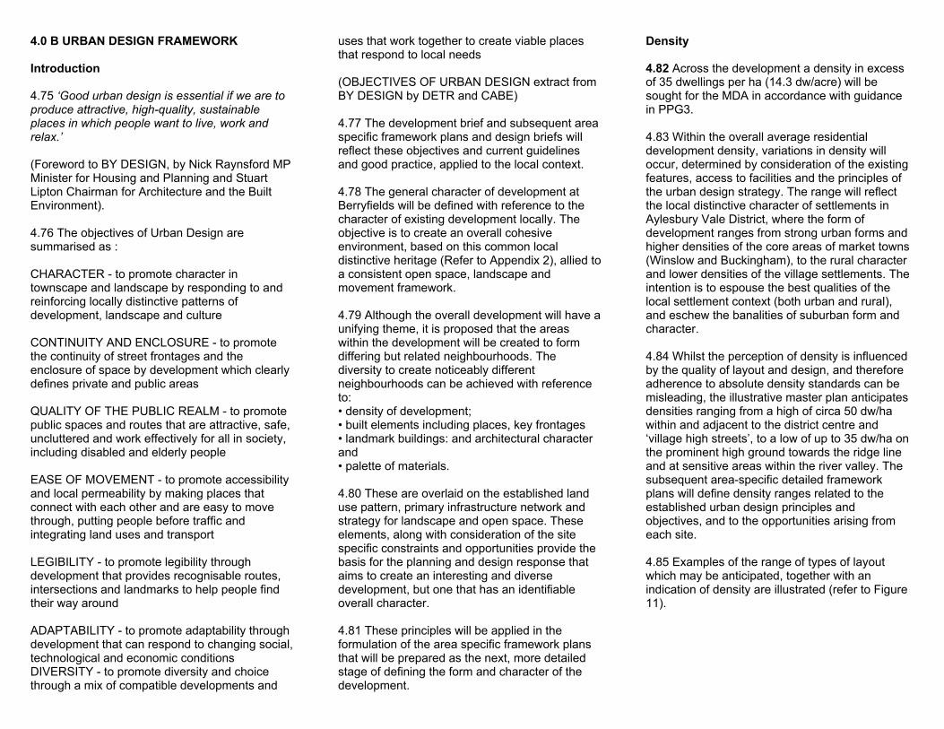

DEVELOPMENT BRIEF
Street Lighting
4144 Street lighting is a further area of the design for the site for which there is little historical precedent up to relatively modern periods In general terms lighting is required for safety and security However lighting columns can be perceived as intrusive particularly high mast lighting It is therefore proposed that high mast lighting should be avoided where possible Where it is appropriate light sources should be supported from buildings Light should be carefully controlled so as only to illuminate necessary areas and levels of light pollution therefore minimised Low-level bollard lighting and feature lighting may be incorporated to highlight landscape and landmark structures
Street Furniture
4145 A compendium of street furniture will be assembled for use in public areas These will be selected designed in collaboration with the local authorities to reflect appropriate standards and good design including guidance by the Centre for Accessible Environments The range of design should include items appropriate to an urban context and more rural context to reflect the character of the various areas within the plan
Contemporary Design
4146 The local context provides important reference points which will be relevant to the preparation of more detailed development of the design strategy for the site However Berryfields is a modern development and this should be recognised in the buildings and structures It is therefore proposed that the design strategy should include elements of contemporary design (refer to Figure 23) Whilst identifiably modern these contemporary features should respect and complement the traditional qualities and character of the area
Sustainability - Design Agenda
4147 The objective of creating an environmentally sustainable development applies to all aspects of the proposal from the transport strategy land use and layout to the design implementation and management of individual parcels of development
4148 Details of the sustainable environmental agenda will be developed as an integrated part of the subsequent more detailed planning process and will reflect the then current policies and established lsquogood practicersquo A separate document will be submitted with the outline planning application which addresses issues of sustainability
4149 At this stage it is it is envisaged that the agenda would apply to the site layout infrastructure and building design construction and management of buildings and open space and for example could include the following
Site Layout bull mix of uses and good access to facilities and public
transport bull access to alternative modes of transport bull solar access (passive and active) bull shelter (to buildings and public spaces) bull attractive and healthy environment bull a safe and secure environment (Secured by Design) bull minimise impact on natural systems and habitats bull respect for flood characteristics and provision of
flood mitigation
Infrastructure (including Landscape) bull SUDS (sustainable urban drainage systems
Refer to Figure 24) bull porous surface materials bull alternative energy sources (eg biomass heat
pumps other renewal sources) bull low energy and locally sourced materials bull indigenous species local provenance bull recycled materials and techniques bull locally sourced water supply bull recycled water systems rain water harvesting bull energy efficient directional external lighting bull creation of balanced natural habitats
Buildings Design bull application of BREEAM standards (higher insulation
standards low energy materials efficient controls locally sourced or recycled materials etc)
bull achievement of safe secure and accessible buildings and surroundings The Council is keen to encourage the provision of lifetime homes although it is not a specific requirement of this Brief
Construction bull balance top soil sub soils excavations and manage
handling bull pre-plan activities to avoid double handling
minimisetemporary works
bull co-ordinate phasing to achieve continuity of key activities
bull consider off site fabrication where practical
Management bull open space (valley park ridge line park
incidental open space etc) bull landscape bull wild life habitats bull infrastructure bull buildings bull waste disposal bull local facilities
SECTION 4B - URBAN DESIGN FRAMEWORK p24
40 C DESIGN CONTEXT
Introduction
4150 The quality of design is identified in the AVDLP as a key element in achieving a successful development at Berryfields The broad strategy for the layout and design of the MDA is set out in the sections above At the detailed level the design will achieve local distinctiveness as required by the AVDLP
4151 To ensure that this is achieved a study has been undertaken of surrounding settlements their layout form building materials and design characteristics (refer to Figure 25 amp Appendix 2) It is not the intention merely to copy these forms but to learn from the local context and where appropriate apply the guiding principles which are outlined below in a design which also meets contemporary requirements
Historic Development
4152 The form of local towns and villages has matured over centuries to be in harmony with its surroundings and with a pattern of open space permeating throughout This together with the influence of local materials and skills has given rise to a variety of vernacular styles from different periods to create a generally diverse and visually rich character
4153 In general traditional local housing has a distinctly rural character which is identifiable by its steeply pitched roofs and narrow spans This rural character of housing is often interspersed with examples of eighteenth century town or manor houses These eighteenth century buildings tend to contain elaborate patterned brickwork including diaper patterning segmental arches over doors and windows and quoins in contrasting coloured bricks
4154 During the nineteenth century extensive development took place in Buckinghamshire associated with the arrival of railways and some
heavy industry Housing of this period is typified by pattern-book terraces of red brick with lower pitched slate roofs The houses are generally arranged with their eaves parallel to the street without subsidiary gables Although it is difficult to generalise typical features of this housing include
bull windows and door-frames are painted white or green bull doorways with small porches in wood or metal trellis and bull small carefully proportioned pitched roof dormers
4155 The accent is generally on simpledomesticity small scaled and of good quality
4156 In contrast to the simple terrace house some settlements also contain significantlsquolandmarkrsquo buildings and structures including local churches pubs civic buildings manor houses and Georgian town houses These features act as focal points within the town or village fabric
Building Materials
4157 The traditional character of Aylesbury and the immediately surrounding settlements is strongly influenced by locally available materials In this context it is relevant that Aylesbury is located in an area underlain by Oxford and Corallian clays and Greensand To the north and south respectively are areas of Oolite and Chalk Also around Aylesbury is found a chalk and clay mixture suitable for making cob which is locally called lsquowitchertrsquo
4158 As a result of this varied geology a range of local building materials were developed and gave rise to a locally skilled workforce for their manufacture The predominant local building material however is red orange brick Houses constructed in this brick were often characterised by steep plain tiled or occasionally thatched roofs
4159 Other locally represented forms of house construction include timber framed and rendered building plastered and colour washed witchert both ashlar and rubble limestone faced buildings and occasional flint-clad buildings In rural areas tarred elm-clad buildings are also evident
4160 In relation to roof materials plain clay tiles and slate predominate In some areas profiled tiles are in evidence and some thatched properties exist
4161 Red orange brickwork with natural lime mortar is the dominant local walling material Other forms of walling locally include painted render witchert rubble stonework and darkly stained horizontal timber boarding In rural areas hedges that often contain elm and beach trees may define property boundaries These varied forms of defining property boundaries reinforce the diverse local character of development
Settlement Layout Grouping
4162 The layout and grouping of development is typically informal with building landscape elements enclosing and defining spaces Buildings are often formed in closely gathered clusters in a stepped andor staggered terrace More spacious arrangements are also evident with buildings interspersed with open spaces and landscape elements
DEVELOPMENT BRIEF
4163 In urban areas buildings generally have a close relationship to the street However a zone of lsquodefensible spacersquo is generally be provided on the frontage particularly related to entrances and window openings
4164 Traditional buildings are often orientated to provide shelter and achieve maximum benefit from the warming effects of the sun
Building Shape and Form
4165 Buildings locally often comprise simple related shapes assembled to create a cohesive overall form The basic building form can be accentuated by incorporating features such as bay windows gables and hipped roofs
4166 This is often the case in particularly visible locations in the townscape such as street corners junctions and other focal points
4167 Building footprints are generally configured to provide a wide frontage and narrow depth Roofs tend to be pitched and have a low eaves line The pitch of the roof is often steep typically 40-50 degrees and occasionally the roof will include small-scale pitched roof dormers
SECTION 4C - DESIGN CONTEXT p26
50 CONCLUSION
The Local Plan
51 The Berryfields MDA is a key allocation in the Aylesbury Vale District Local Plan that substantially contributes to the land use requirements of the District up to 2011 and beyond and forms a vital element of the development strategy for Aylesbury The MDA site has been subject to a range of environmental and technical studies that demonstrate its suitability for development on the scale allocated in the AVDLP
52 In the light of these facts the Development Brief illustrates how the MDA is likely to be implemented The form of development is one which is sustainable meets the requirements of the AVDLP safeguards areas of identified importance and is deliverable
53 The following information will be required to secure outline planning permission Master Plan at a scale of 12500 including bull landuse boundaries and land budget bull A41 Western Link Road the loop road and secondary road network principal footpath cycleway and bridleway routes and links to the existing local network bull strategic landscape and open space bull existing trees and vegetation to be retained bull bus routes bull net density for each residential area bull building heights strategy bull flood mitigation and balancing ponds
Phasing Plan
Character areas and relationship to Framework Plans
Means of access to existing highway WLR inside the MDA the loop roads and Berryfields Lane
Planning Supporting Statement
Design Statement
First Framework Plan and associated Design Code
Planning Progress
54 The Development Brief is only an initial stage of defining a design strategy for the Berryfields MDA (Refer to Fig26) Further stages of refinement will be undertaken as more detailed planning proposals are formulated and submitted to the Council for approval These stages will involve consultation with the local planning authority other relevant authorities and agencies and the existing and emerging local communities
55 The further stages of refining and finalising the design approach for the Berryfields MDA are set out below bull Framework plan - each of the character areas identified in the Development Brief will be the subject of more detailed planning and design guidelines Framework Plans will set-down the more detailed physical planning framework based on the Development Brief principles and define the Design Code for each character area The Framework Plans will be prepared at a suitable scale (12500 minimum) and will include the definitive layout of land uses primary secondary and tertiary infrastructure primary landscape and open space definition of character areas key frontages spaces and landmark buildings development densities and building massing heights They will also incorporate the implications of the sustainable strategy and ecological constraints
bull service route requirements and give more detail on phasing These will be supplemented by Design Codes for each character area defining built form and landscape characteristics palette of materials and details street and highway design car parking standards and preferred arrangements and approach to construction sustainability These more detailed documents will be developed with the local authority and other agencies The first Framework Plan covering the initial development areas will be submitted to the local
authority within the period for the resolution of the outline planning application This may comprise a single document relating to groups of 2 to 4 character areas These more detailed documents will be developed with the local authority and other agencies
bull Planning Applications ndash the final refinement of the design will be when detailed planning permission (or reserved matters approval) is sought for the layout and design of each element of the development By this stage the design and development framework will be firmly established and agreed with the relevant authorities
1998
DEVELOPMENT BRIEF
APPENDIX 1
AYLESBURY VALE DISTRICT LOCAL PLAN (DRAFT DESPOSIT)
GENERAL POLICIES
GP1 A Choice of Dwelling Types GP2 Affordable Housing GP3 Low Cost Market Housing GP20 Transport Implications of Development GP21 22 Transport Considerations for New Development GP23 Communal Parking GP24 Parking Guidelines GP2526 Safeguarding Rail Proposals GP27 Protecting Securing Cycle Routes GP28 Protecting Securing Pedestrian Routes GP29 Design of New Roads GP3132 Shopping GP33 Disability Access GP34 Design Principles for New Development GP35 Materials and Design Details GP3637 Development Density GP38-40 Landscape Design GP41 Lighting GP45 Crime Prevention GP46 Supplementary Planning Guidance GP47 List Buildings and Other Structures GP5152 Setting and Long Distance Views GP5859 Ancient Monuments and Archaeology GP6162 Sites of Nature Conservation Importance GP6566 Protection of Rivers and Surface Water GP67 Flooding and Surface Water Management GP68 Supply and Quality of Groundwater GP74 Recreation amp Leisure GP84 Footpaths GP85 Public and Private Open Space GP86-91 Outdoor Play Space Leisure Provision GP9394 Community Facilities and Services GP99 Development in Proximity to Existing Overhead
Lines Aylesbury
AY1 Aylesbury Land Use Transportation Strategy AY3 Phasing (Transport) AY12 Planning Briefs for MDArsquos AY13 Berryfields AY17 Transport Integration AY18 Rail Station Stops AY19 Re-Opening of Rail Lines AY20 Cycle Network AY22 Western Link Road
APPENDIX 1 - POLICY DOCUMENT REFERENCES p28
APPENDIX 2
LOCAL DESIGN REFERENCES FOR THE BERRYFIELDS M D A
Introduction
Selected examples of the local distinctive character of the built environment are illustrated (Refer to Figures 27 to 30) as reference points to guide and inform the layout and design of the various character areas which together comprise the Berryfields M D A Acknowledging the scale of the Berryfields project it is intended that the development will reflect the diversity of the local area both within the established towns and rural villages and generally interpret this in a contemporary built form Local areas of particular interest include the areas to the north and west of Berryfields defined by QuaintonWing HillsOving and BrillWinchendon Hills
The relevant local building traditions evident in the above examples are described in AVDC Design Guides 3 4 5 and 6 and are summarised as follows
Form
The predominant building form is characterised by simplicity of design linear plan form with limited span depth steep roof pitches and articulation often involving repetition of similar shapes at varying scale and in different configurations (Refer to AVDC Design Guides 4 amp 6) Typically roofs have full gables or hips
Wall areas dominate openings which are generally located away from building corners Generally roofs are uninterrupted however where openings occur they are set low in roof slopes and appear as subordinate features Chimneys visually punctuate skylines
Style
Openings are important because they invite the eye Generally window openings have an arched head deep cill and a balanced appearance (Refer to AVDC Design Guide 5) The use of oriel and bay windows is also a local feature
Roof dormers are generally of vertical proportions and of a relatively small size related to the roof itself (refer to Design Guides 3 amp 6) Roof lights are rarely found in older buildings
Materials are predominantly local orange brick limestone and plain tile with generally simple detailing Typically eaves have plain verges and exposed rafter feet Other features include patterned brickwork traditional porches and both rural and market town characteristics (Refer to AVDC Design Guides 3 amp 6)
Curtilage
Curtilage enclosure and defined boundaries are a feature found within the local area (Refer to AVDC Design Guide 4)
The examples illustrated are not exhaustive but are intended to indicate the general approach to defining valid reference points for each character area as part of the subsequent preparation of framework plans
DEVELOPMENT BRIEF
APPENDIX 3
BIBLIOGRAPHY
SELECTED SOURCE GUIDANCE
DETR (1997) Planning Policy Guidance Note 1 General Policies and Principles DETR (2000) Planning Policy Guidance Note 3 Housing DETR (1994) Planning Policy Guidance Note 9 Nature Conservation DETR (2001) Planning Policy Guidance Note 13 Transport DETR (2001) Planning Policy Guidance Note 15 Development amp Flood risk DETR (1990) Planning Policy Guidance Note 16 Archaeology amp Planning DETR (2000) Planning Policy Guidance Note 17 (Revised draft) Sport amp Recreation
DETR (1992) Residential Roads and Footpaths Design Bulletin 32 DETR (1998) Housing Layouts ndashLifting the Quality DETR (1998) Places Streets amp Movement DETR (2000) Sustainable Urban Extensions Planned Through Design DETR (2000) Our Towns amp Cities The Future the Urban White Paper DETR (2000) By Design Urban Design in the Planning System DTLRHC (2001) Working Together Guide for Planners and House Builders DTLRCABE (2001) By Design Better Places to Live
BCC (1997) Highway Trees Policy
BCC (2000) Buckinghamshire-Milton Keynes Biodiversity Action Plan (2000-2010) BCC (2000) Roads for Adoption in Buckinghamshire (Specification amp Standard details) BCC (2001) The Landscape Plan for Buckinghamshire Part 1 BCC (2001) Encouraging Cycling in Buckinghamshire BCC (2001) Encouraging Walking in Buckinghamshire
AVDC (1988) Design Guide 1 Housing Layout AVDC (1992) Design Guide 4 New Houses in Towns and Villages AVDC (1995) Design Guide 5 Building Materials AVDC (1998) Aylesbury Vale Deposit Draft Local Plan AVDC (1998) Design Guide 6 New Buildings In the Countryside AVDC (2000) Supplementary Planning Guidance on A Strategy for MDA Related
Greenspaces
AVDC (2001) Supplementary Planning Guidance 3 Safety Through Design AVDC (2001) Aylesbury Vale Deposit Draft Local Plan Inquiry Document ID4
(A periodically updated document to include schedule of all changes to be suggested to the Public Local Inquiry Inspector)
AVDC (TBC) (Emerging) Adoption Standards for Public Open Space
English PartnershipsUrban Villages Forum (1998) Making Places English PartnershipsThe Housing Corporation (2000) Urban Design Compendium
Urban Villages Forum (1997) Urban Villages Urban Villages Forum (2000) Planning By Design
BSI BS 5837 (1997) Trees in Relation to Construction BSI BS 1176-1 (1998) Playground Equipment amp Safety
Bentley et al (1985) Responsive Environments The Police Initiative (1989) Secured by Design National Childrens Play amp Recreation Unit (1992) Play Ground Safety Guidelines Katz P (1994) The New Urbanism Towards Architecture
of Community
Moughtin C (1996) Urban Design Street and Square Joseph Rowntree Foundation (1997) Designing Lifetime Homes Essex County Council (1997) The Essex Design Guide for
Residential and Mixed Use Areas
Urban Task Force (1999) Towards An Urban Renaissance
CABE Commission for Architecture and the Built Environment wwwcabeorguk Civic Trust wwwcivictrustorguk DTLR Department of Transport Local government and the Regions (formerly DETR) wwwdtlrgovuk Housing Corporation wwwhousingcorpgovuk Royal Town Planning Institute wwwrtpiorguk Urban Design Alliance wwwudalorguk Urban Design Group wwwudgorguk
APPENDIX 3 - BIBLIOGRAPHY p30

DEVELOPMENT BRIEF
4163 In urban areas buildings generally have a close relationship to the street However a zone of lsquodefensible spacersquo is generally be provided on the frontage particularly related to entrances and window openings
4164 Traditional buildings are often orientated to provide shelter and achieve maximum benefit from the warming effects of the sun
Building Shape and Form
4165 Buildings locally often comprise simple related shapes assembled to create a cohesive overall form The basic building form can be accentuated by incorporating features such as bay windows gables and hipped roofs
4166 This is often the case in particularly visible locations in the townscape such as street corners junctions and other focal points
4167 Building footprints are generally configured to provide a wide frontage and narrow depth Roofs tend to be pitched and have a low eaves line The pitch of the roof is often steep typically 40-50 degrees and occasionally the roof will include small-scale pitched roof dormers
SECTION 4C - DESIGN CONTEXT p26
50 CONCLUSION
The Local Plan
51 The Berryfields MDA is a key allocation in the Aylesbury Vale District Local Plan that substantially contributes to the land use requirements of the District up to 2011 and beyond and forms a vital element of the development strategy for Aylesbury The MDA site has been subject to a range of environmental and technical studies that demonstrate its suitability for development on the scale allocated in the AVDLP
52 In the light of these facts the Development Brief illustrates how the MDA is likely to be implemented The form of development is one which is sustainable meets the requirements of the AVDLP safeguards areas of identified importance and is deliverable
53 The following information will be required to secure outline planning permission Master Plan at a scale of 12500 including bull landuse boundaries and land budget bull A41 Western Link Road the loop road and secondary road network principal footpath cycleway and bridleway routes and links to the existing local network bull strategic landscape and open space bull existing trees and vegetation to be retained bull bus routes bull net density for each residential area bull building heights strategy bull flood mitigation and balancing ponds
Phasing Plan
Character areas and relationship to Framework Plans
Means of access to existing highway WLR inside the MDA the loop roads and Berryfields Lane
Planning Supporting Statement
Design Statement
First Framework Plan and associated Design Code
Planning Progress
54 The Development Brief is only an initial stage of defining a design strategy for the Berryfields MDA (Refer to Fig26) Further stages of refinement will be undertaken as more detailed planning proposals are formulated and submitted to the Council for approval These stages will involve consultation with the local planning authority other relevant authorities and agencies and the existing and emerging local communities
55 The further stages of refining and finalising the design approach for the Berryfields MDA are set out below bull Framework plan - each of the character areas identified in the Development Brief will be the subject of more detailed planning and design guidelines Framework Plans will set-down the more detailed physical planning framework based on the Development Brief principles and define the Design Code for each character area The Framework Plans will be prepared at a suitable scale (12500 minimum) and will include the definitive layout of land uses primary secondary and tertiary infrastructure primary landscape and open space definition of character areas key frontages spaces and landmark buildings development densities and building massing heights They will also incorporate the implications of the sustainable strategy and ecological constraints
bull service route requirements and give more detail on phasing These will be supplemented by Design Codes for each character area defining built form and landscape characteristics palette of materials and details street and highway design car parking standards and preferred arrangements and approach to construction sustainability These more detailed documents will be developed with the local authority and other agencies The first Framework Plan covering the initial development areas will be submitted to the local
authority within the period for the resolution of the outline planning application This may comprise a single document relating to groups of 2 to 4 character areas These more detailed documents will be developed with the local authority and other agencies
bull Planning Applications ndash the final refinement of the design will be when detailed planning permission (or reserved matters approval) is sought for the layout and design of each element of the development By this stage the design and development framework will be firmly established and agreed with the relevant authorities
1998
DEVELOPMENT BRIEF
APPENDIX 1
AYLESBURY VALE DISTRICT LOCAL PLAN (DRAFT DESPOSIT)
GENERAL POLICIES
GP1 A Choice of Dwelling Types GP2 Affordable Housing GP3 Low Cost Market Housing GP20 Transport Implications of Development GP21 22 Transport Considerations for New Development GP23 Communal Parking GP24 Parking Guidelines GP2526 Safeguarding Rail Proposals GP27 Protecting Securing Cycle Routes GP28 Protecting Securing Pedestrian Routes GP29 Design of New Roads GP3132 Shopping GP33 Disability Access GP34 Design Principles for New Development GP35 Materials and Design Details GP3637 Development Density GP38-40 Landscape Design GP41 Lighting GP45 Crime Prevention GP46 Supplementary Planning Guidance GP47 List Buildings and Other Structures GP5152 Setting and Long Distance Views GP5859 Ancient Monuments and Archaeology GP6162 Sites of Nature Conservation Importance GP6566 Protection of Rivers and Surface Water GP67 Flooding and Surface Water Management GP68 Supply and Quality of Groundwater GP74 Recreation amp Leisure GP84 Footpaths GP85 Public and Private Open Space GP86-91 Outdoor Play Space Leisure Provision GP9394 Community Facilities and Services GP99 Development in Proximity to Existing Overhead
Lines Aylesbury
AY1 Aylesbury Land Use Transportation Strategy AY3 Phasing (Transport) AY12 Planning Briefs for MDArsquos AY13 Berryfields AY17 Transport Integration AY18 Rail Station Stops AY19 Re-Opening of Rail Lines AY20 Cycle Network AY22 Western Link Road
APPENDIX 1 - POLICY DOCUMENT REFERENCES p28
APPENDIX 2
LOCAL DESIGN REFERENCES FOR THE BERRYFIELDS M D A
Introduction
Selected examples of the local distinctive character of the built environment are illustrated (Refer to Figures 27 to 30) as reference points to guide and inform the layout and design of the various character areas which together comprise the Berryfields M D A Acknowledging the scale of the Berryfields project it is intended that the development will reflect the diversity of the local area both within the established towns and rural villages and generally interpret this in a contemporary built form Local areas of particular interest include the areas to the north and west of Berryfields defined by QuaintonWing HillsOving and BrillWinchendon Hills
The relevant local building traditions evident in the above examples are described in AVDC Design Guides 3 4 5 and 6 and are summarised as follows
Form
The predominant building form is characterised by simplicity of design linear plan form with limited span depth steep roof pitches and articulation often involving repetition of similar shapes at varying scale and in different configurations (Refer to AVDC Design Guides 4 amp 6) Typically roofs have full gables or hips
Wall areas dominate openings which are generally located away from building corners Generally roofs are uninterrupted however where openings occur they are set low in roof slopes and appear as subordinate features Chimneys visually punctuate skylines
Style
Openings are important because they invite the eye Generally window openings have an arched head deep cill and a balanced appearance (Refer to AVDC Design Guide 5) The use of oriel and bay windows is also a local feature
Roof dormers are generally of vertical proportions and of a relatively small size related to the roof itself (refer to Design Guides 3 amp 6) Roof lights are rarely found in older buildings
Materials are predominantly local orange brick limestone and plain tile with generally simple detailing Typically eaves have plain verges and exposed rafter feet Other features include patterned brickwork traditional porches and both rural and market town characteristics (Refer to AVDC Design Guides 3 amp 6)
Curtilage
Curtilage enclosure and defined boundaries are a feature found within the local area (Refer to AVDC Design Guide 4)
The examples illustrated are not exhaustive but are intended to indicate the general approach to defining valid reference points for each character area as part of the subsequent preparation of framework plans
DEVELOPMENT BRIEF
APPENDIX 3
BIBLIOGRAPHY
SELECTED SOURCE GUIDANCE
DETR (1997) Planning Policy Guidance Note 1 General Policies and Principles DETR (2000) Planning Policy Guidance Note 3 Housing DETR (1994) Planning Policy Guidance Note 9 Nature Conservation DETR (2001) Planning Policy Guidance Note 13 Transport DETR (2001) Planning Policy Guidance Note 15 Development amp Flood risk DETR (1990) Planning Policy Guidance Note 16 Archaeology amp Planning DETR (2000) Planning Policy Guidance Note 17 (Revised draft) Sport amp Recreation
DETR (1992) Residential Roads and Footpaths Design Bulletin 32 DETR (1998) Housing Layouts ndashLifting the Quality DETR (1998) Places Streets amp Movement DETR (2000) Sustainable Urban Extensions Planned Through Design DETR (2000) Our Towns amp Cities The Future the Urban White Paper DETR (2000) By Design Urban Design in the Planning System DTLRHC (2001) Working Together Guide for Planners and House Builders DTLRCABE (2001) By Design Better Places to Live
BCC (1997) Highway Trees Policy
BCC (2000) Buckinghamshire-Milton Keynes Biodiversity Action Plan (2000-2010) BCC (2000) Roads for Adoption in Buckinghamshire (Specification amp Standard details) BCC (2001) The Landscape Plan for Buckinghamshire Part 1 BCC (2001) Encouraging Cycling in Buckinghamshire BCC (2001) Encouraging Walking in Buckinghamshire
AVDC (1988) Design Guide 1 Housing Layout AVDC (1992) Design Guide 4 New Houses in Towns and Villages AVDC (1995) Design Guide 5 Building Materials AVDC (1998) Aylesbury Vale Deposit Draft Local Plan AVDC (1998) Design Guide 6 New Buildings In the Countryside AVDC (2000) Supplementary Planning Guidance on A Strategy for MDA Related
Greenspaces
AVDC (2001) Supplementary Planning Guidance 3 Safety Through Design AVDC (2001) Aylesbury Vale Deposit Draft Local Plan Inquiry Document ID4
(A periodically updated document to include schedule of all changes to be suggested to the Public Local Inquiry Inspector)
AVDC (TBC) (Emerging) Adoption Standards for Public Open Space
English PartnershipsUrban Villages Forum (1998) Making Places English PartnershipsThe Housing Corporation (2000) Urban Design Compendium
Urban Villages Forum (1997) Urban Villages Urban Villages Forum (2000) Planning By Design
BSI BS 5837 (1997) Trees in Relation to Construction BSI BS 1176-1 (1998) Playground Equipment amp Safety
Bentley et al (1985) Responsive Environments The Police Initiative (1989) Secured by Design National Childrens Play amp Recreation Unit (1992) Play Ground Safety Guidelines Katz P (1994) The New Urbanism Towards Architecture
of Community
Moughtin C (1996) Urban Design Street and Square Joseph Rowntree Foundation (1997) Designing Lifetime Homes Essex County Council (1997) The Essex Design Guide for
Residential and Mixed Use Areas
Urban Task Force (1999) Towards An Urban Renaissance
CABE Commission for Architecture and the Built Environment wwwcabeorguk Civic Trust wwwcivictrustorguk DTLR Department of Transport Local government and the Regions (formerly DETR) wwwdtlrgovuk Housing Corporation wwwhousingcorpgovuk Royal Town Planning Institute wwwrtpiorguk Urban Design Alliance wwwudalorguk Urban Design Group wwwudgorguk
APPENDIX 3 - BIBLIOGRAPHY p30