basic geography raül carratalà oriol subirats josep maria barbera pau bel younesse hamza
TRANSCRIPT

Basic geography
Raül CarratalàOriol Subirats
Josep Maria Barbera Pau Bel
Younesse Hamza

Geographic situation
• We are situated in south western of Europe. Tortosa is in Catalonia, in the north-east of Spain.
• We are approximately in the cross.
Autonomous communities
• The autonomous communities are regions of Spain. These regional governments are responsible for the administration of schools, universities, health, social services, culture, urban and rural development.

Autonomous communities
• There are seventeen autonomous communities:Catalonia, Valencia, Murcia, Andalusia, Castile-La Mancha, Extremadura Madrid,Castile and Leon,Aragon,La Rioja,Navarre,Basque Country, Cantabria, Asturias, Galicia, Balearic Islands and Canary Islands;and two autonomous cities:Ceuta and Melilla.

A map of Spain
• This is a map of Spain divided in autonomous communities.

Spanish principal geographics points
• These are the principal ranges, rivers and climates.

Spanish principals ranges and mountains
• The principals ranges and mountains of Spain are the “Meseta Central”(Inner Plateau), the “Sistema Central”, the “Montes de Toledo”, the “Sierra de Guadalupe” “Sierra Morena”, the “Cordillera Cantàbrica”, the “Sistema Ibérico”, the Basque Mountains, “Sierra Nevada” and the Pyrenees

“Meseta Central”(Inner Plateau)
• The Meseta Central ("Inner Plateau") is a vast plateau in the heart of peninsular Spain, has elevations that range from 610 to 760 m.
• The Sistema Central, described as the "dorsal spine" of the Meseta Central, divides the Meseta into northern and southern subregions.
The meseta central is in the circle.

“Sistema Central”
• The Sistema Central is a primary feature of the Meseta Central, the inner Iberian plateau, splitting the meseta into two parts. The Sistema Central runs in a ENE - WSW direction roughly along the southern border of the Spanish autonomous community of Castile and León and Extremadura continuing into the Guarda and Castelo Branco districts in Portugal.

“Montes de Toledo”
• They are located in the central regions of the Iberian Peninsula, cutting transversally from east to west across the lower portion of the Meseta Central. They also form one of the natural limits of the historical La Mancha region in Castile-La Mancha.

“Sierra de Guadalupe”
• Sierra de Villuercas, also known as Sierra de Guadalupe after nearby Guadalupe town, is a mountain range in the Montes de Toledo.

Sierra Morena• The Sierra Morena is one of the main systems
of mountain ranges in Spain. It stretches for 400 kilometres East-West across southern Spain, forming the southern border of the Meseta Central plateau of the Iberian Peninsula, and providing the watershed between the valleys of the Guadiana to the north and the Guadalquivir to the south.
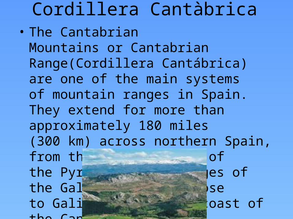
Cordillera Cantàbrica• The Cantabrian Mountains or Cantabrian
Range(Cordillera Cantábrica) are one of the main systems of mountain ranges in Spain. They extend for more than approximately 180 miles (300 km) across northern Spain, from the western limit of the Pyrenees to the edges of the Galician Massif close to Galicia, along the coast of the Cantabrian Sea

Sistema Iberico• The Sistema Ibérico or Iberian System is one of
the main systems of mountain ranges in Spain. It is a vast and complex system of mountain chains and massifs located in the central regions of the Iberian Peninsula, but reaching almost the Mediterranean coast in the Land of Valencia in the east.

Basque Mountains• The Basque Mountains(Montes Bascos) are
a mountain range situated in the northern Iberian Peninsula. Geographically it is considered as the eastern section of the larger Cantabrian Range. The range runs through the Basque Autonomous Community and western Navarre.
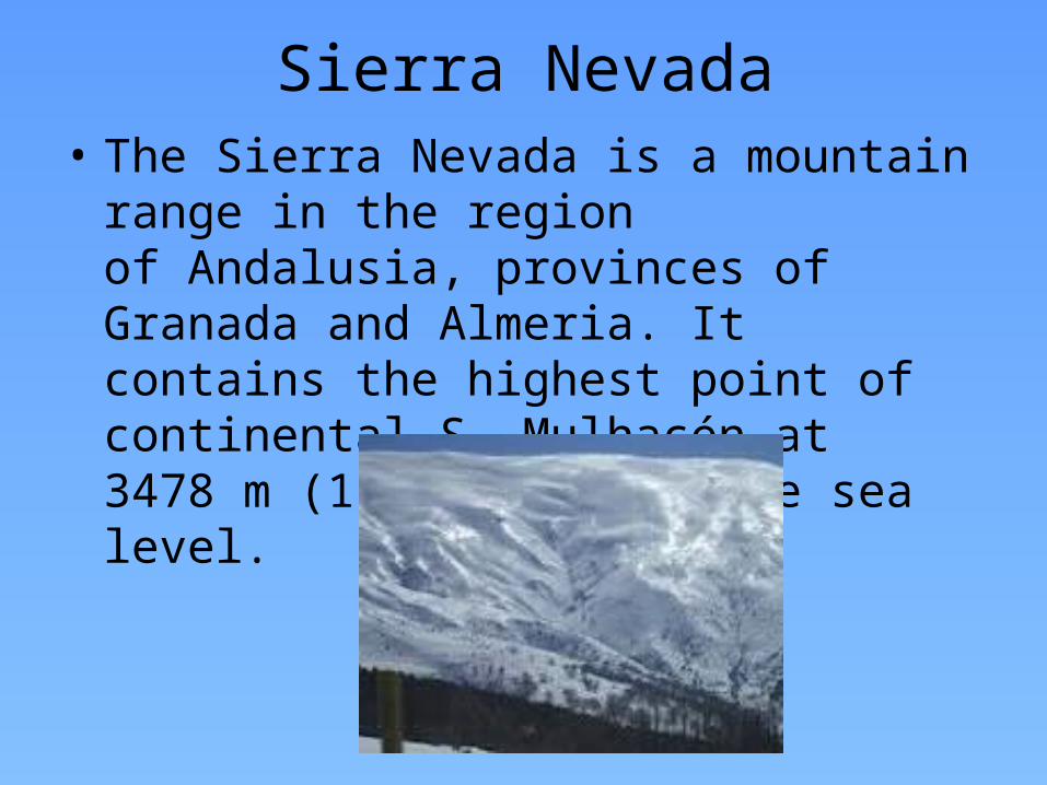
Sierra Nevada• The Sierra Nevada is a mountain range in the
region of Andalusia, provinces of Granada and Almeria. It contains the highest point of continental S, Mulhacén at 3478 m (11,411 ft.) above sea level.

Pyrenees• The Pyrenees is a range of mountains in
southwest Europe that forms a natural border between France and Spain. It separates the Iberian Peninsula from the rest of continental Europe, and extends for about 491 km from the Bay of Biscay (Cap Higuer) to the Mediterranean (Cap de Creus)

The principals Spanish rivers
• The principals rivers in Spain are the Ebre river, a river than pass throught Tortosa, the Duero river and the Tajo river
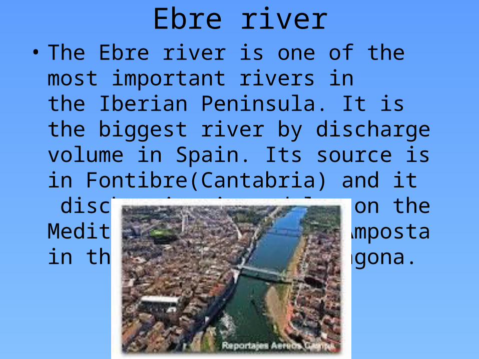
Ebre river• The Ebre river is one of the most important
rivers in the Iberian Peninsula. It is the biggest river by discharge volume in Spain. Its source is in Fontibre(Cantabria) and it discharging in a delta on the Mediterranean close to Amposta in the province of Tarragona.

Duero river• The Duero river is one of the major rivers of
the Iberian Peninsula, flowing from its source near Duruelo de la Sierra in Soria Province across northern-central Spain and Portugal to its outlet at Porto.

The Tajo river• The Tajo river is the longest river in the Iberian
Peninsula. It is 1,038 km long, 716 km in Spain, 47 km along the border between Portugal and Spain and 275 km in Portugal, where it empties into the Atlantic Ocean near Lisbon.

Climate
• In Spain there are three climates and two sub-types:

Mediterranean climate
• The Mediterranean climate, characterized by dry and warm summers. It is dominant in the peninsula

Semiarid climate
• Its located in the southeastern quarter of the country, especially in the region of Murcia and in the Ebro valley. In contrast with the Mediterranean climate, the dry season extends beyond the summer.
Oceanic climate
• It’s located in north quarter of the country, especially in the region of Basque Country, Asturias, Cantabria and partly Galicia. In contrary to the Mediterranean climate, winter and summer temperatures are influenced by the ocean

Other climates
• Apart from these main types, other sub-types can be found, like the alpine climate in the Pyrenees and Sierra Nevada, and a typical subtropical climate in the Canary Islands.